
Create successful ePaper yourself
Turn your PDF publications into a flip-book with our unique Google optimized e-Paper software.
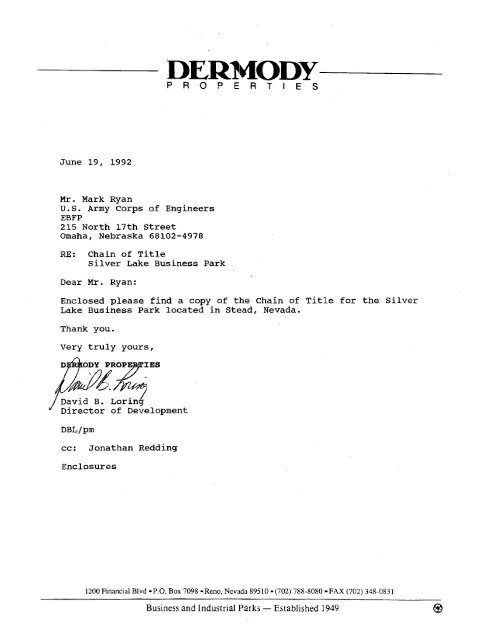
June 19, 1992<br />
Mr. Mark Ryan<br />
U.S. Army Corps of Engineers<br />
EBFP<br />
215 North 17th Street<br />
Omaha, Nebraska 68102-4978<br />
RE: Chain of Title<br />
Silver Lake Business Park<br />
Dear Mr. Ryan:<br />
P R O P E R T I E S<br />
Enclosed please find a copy of the Chain of Title for the Silver<br />
Lake Business Park located in Stead, Nevada.<br />
Thank you.<br />
Very truly yours,<br />
J David B. ~orin6<br />
Director of Development<br />
cc: Jonathan Redding<br />
Enclosures<br />
1200 Financial Blvd aP.0. Box 7098 -Reno, Nevada 89510 -(702) 788-8080 -FAX (702) 348-0831<br />
Business and Industrial Parks - Established 1949 @
-<br />
SILVER LAKE BUSINESS CENTER - PHASE I<br />
Ascrassor's Map Counly ot Washoe. Nevada ,<br />
90 - /4<br />
NOTE - ASSESSOR'S BLOCK NUMBERS SHOLvNlK ELLIPSES I, Dtrrn 0% 0,s. BIB?<br />
ASSESSORSPAdCEL NUMBERS SHOLVN lh. CIRCLES 1 ACkoWD) 6;8U T'M 3 % --<br />
t<br />
-<br />
,
BOOK 86<br />
I eC 98-05<br />
~~~~<br />
I<br />
PORTION OF SECTIONS<br />
29,3OS3l,AND 32 T21 NaRI9 E
;'ITS Xl4T!l~::'~l~l!l~, ~mdc- the i~!i (lay (11 rk!,r~~ttr: : . bc:bt~.:.<br />
the I:?,1'X1) STATES Ul: AEll:RIcA, actillg hy and LI::.wzl~ : ivr: I.!,. i1.1:: 1.--<br />
Ls,r 81: (:erlr.ral Servtccri, 11ntLcr and pursrlanL 1.8 :he ;>!.\(-I- a ,j<br />
:..lchnrity conlainrd in Llle prawisicn-ts vf Llle lederr1 ;'r,-?a.r: v ~ I H !<br />
Aclninis~ral tvc Services Act ol' 19i9 (63 Sta~. :::), .a,- n::~v:c~', a I<br />
rrgulaLi~r~~a and orders pr,mulpatcd :lie~i.uncler, r.;:l:;l~:l., c,-1.1 :]:I :; 7<br />
nF RE'Xl. a n~rinicipal cf~rpot'aLit?n or~anized rrnrl trx!b:.ini; :~v,lf.r :!v.<br />
lax-IS g a t :Ilr !icatc Plcvada. f.M?il'EC,<br />
...<br />
!., 1 ".l:'C" '. ..-.-.. ~ li: Illat rhe said ilUA:i'nll?! it; c. I.:. i,:c.rir? .C)II<br />
< f the 597 .:f l!Id:: tGLL?:O~I, l'lL!U:E HLMREIJ FIl.iY TiiOl.'TrA~!lJ ;)Ol.t\RS<br />
(S1,350,000.00) Ln laullul money oC thc United Sts~r': cf Anier!ca, 1 ,,<br />
be paid by CI'dXnC c.) !;!LZ!IFR, reccipt .Z which !s !irrrbv nck.n~wledge.1,<br />
Itas rcnised, rc!lraued and furevcr quitclai~.lcd, and hy rl~esc.<br />
presents dues remise, irelease and foreve- qr1i:c:ain. :.nt. tI:e >aid<br />
GRAKlTE, and tl, its surces.s.>rs 02d assiglls, char cercain rrnl prg%per~y<br />
situatc, lyin)5 and being Fn thc County Uasl~~-, . Scare ->f :!c*:ada.<br />
tlescribed as Tslllir'-.s:<br />
ilegin at the so~ltln quar!.er c:?rner uf Sectitm 2;. :!(I ':.<br />
7. 13 E.. Pi. D. 1%. & :l., Wasline County, k~.ada. ~ n d pr:.ceed<br />
S. 89" 4lr' 35" E. a distance OL 265b. 71 irer r1t.n~<br />
the south line of the Zoucheas~ quarter t.f said Sc-cci41r<br />
tu the Southeast :c>rner thereof; thence '4. H9' O;." 05"<br />
C. a dister~ce 01 132.35 Feet a1or.g tllr qrwcl, linv ..i '1.r:<br />
Soutl~vest clrlarter of Sectitv 5 sai.! :~wnsl!in hi1~1 !h: :.I..<br />
'I?:c.n ;i?-ocee~l ::. lo U4' 11" I:. H36'2.10 leer t ~ 11 . !....in: 50.i?~<br />
Feet wasl:crly frun the ce!l?-erline 1.f 5i TI 11<br />
!:iuthc:rly. 'TI~I;~ prcjccci .:I; 2 liz? ?a:alicl<br />
Srrce: -YT,.. .ect>,i<br />
: .. 2111; ~.-.l!i'<br />
Eeet wcstrrly frt:m said centcrlinr I 11r (01 !r.ul~~): I vt L-. 1:r: I.<br />
;~rltl dist.anccs. pi. 5* Lh' 32" i:. f!.j.?.?? Irec; slc.~c~e '.<br />
1'' ?5' &3" , laiO-i9 :c.~I. t .: 1 #,(! S.:I:I l,~..~.:,! cz -.;I ,-<br />
che intcrsectlon t~f Sixth Scree: and Eirn:tl ...rrec-I !..!.,:.I-<br />
sinn. 'I'llcn pri~c,ced ult,n,: rllc vesterl;. Il-~r. D ' I..!IL'.<br />
:itreer Excension t>n a line 50.00 Fee: w-src?::: r.<br />
and psral!el rul said :er.tzrline N. 3h1' 43' 57.. ...<br />
957.63 feel cct the S.~urhv~st ctrrnrr 8.L :I:r . r.:. :-<br />
~rcrlon ~ I F Seventh SLreet and l:lyl:~ F:ree: i'x~rr.lc:!.<br />
prt.~cecd N. 5" LY1 5Q" E. alk3n,. a line 3C1.00 fee. vr. .L<br />
i., t :,<br />
. 4<br />
and pnrallcl tat thc cen~crlim :.I' 5cvcr1tl: S: rra: i.7 nL.i<<br />
feet LLI VO~LI~IWCG~ ccnrner L,!' r!:e il:trrsc.:i. :. :<br />
;,Lrer.t and "C" rlvtn~lr. Then prr*ctcar! S. t.1- !'I' -.." i.<br />
,Il.-"e .' ! .;. 'U!.I'I" : ~ q!..al'l* ~ ; ..: n-' 7n-..*1;;; .., . . -<br />
line .lf "L:" Avrnu~r n dlste:.~.: . 1 1?3?.'1:. ievl. .- t'. ';. r' -<br />
wei.1 cs.rllrr ..i ;he Lntcr:;ecLi-lr? . :' riltll ;'rtr: A:,: .'D ''<br />
Awnuc. Illen pr.~cced N. 5" 50' 35" E. al\vl& a Line JI;.!l1<br />
feet wesL of and parallel to the centrrlin nf Fiftl: :irrrrt<br />
a distance of 76Cl.02 feet to the Soutl,vr-st ctsrner i C t t ~<br />
intersection of Fifth Street and "A" Avenuc. en pr.crc,.!<br />
::. 84' 07' 36" a'. along a liiie 30.09 fer~ >cu~h %%f su,d<br />
parallel to the centerline nf "A" Avenue a dUatance .,I<br />
2170.47 feet to [:he Southvest corner tlf :;i111l1 Strecr ;na<br />
"A" Avenue. T~CII pr.*ceed 6. 5" 52' 30" E. al,,~.: a 1i;x<br />
.)O.OO feet vest of and ratallel tcl the ccntrr1it.c : '.i.,:<br />
-.
Stead ALr Force Ba3e<br />
Washoe County, Reno, Nevada<br />
D-Nev-4024<br />
(City nf Renn)<br />
StreeL Extended a distance of 506.92 feet. Then proceed<br />
N. 84@ 03' 25" U. 460.06 feet; thence S. 3O 26' 16" W.<br />
787.16 lee;; thence IN. 87" 41' 09" W. 4556.07 feet to a<br />
point on the vest line of Section 30, T. 21 N. R. 19 E.<br />
M.D.R. & M. Then proceed al.ang the vest llnes of Sectlons<br />
30 and 21 of said tarnship and range. S. 0@ 03' 00" E.<br />
8587.43 feet to the Southweat corner of Section 31. Then<br />
proceed N. 89' 48' 014" E. 1026.30 fect to the Nurthwest<br />
cornzr ilf Section 6, T. 20 N. R. 19 E. M. D. B. Pl M. Then<br />
~roceed S. O0 53' 36" E. 2710.09 feet to the vest quarter<br />
corner of said Section 6. Then proceed S. oo 31' 33" w.<br />
alrn:, the west line of the Southwest quarter of Section 6<br />
a distance of 2063.70 feet to n point on the north line<br />
of ti. S. Highway Nc. 395. Then proceed along said line<br />
S. 75" 55' 02" E. 359.18 feet; thence S. 75O 47' 34" E.<br />
1701.46 feet tc a point on the south line of the Southwest<br />
quarter of Section 6. Then proceed along said line N.<br />
87O 33' 56" E. 126.61 feet to the point of beginning.<br />
Said parcel contains an area of 1767.85 acres more or less.<br />
Together with the following described parcels belng 200.00<br />
feet in width and 10~0.00 Fee: each side of the following<br />
deacriaed centerline. Said parcels being the right cf way<br />
for a railr6ad spur from the Peatern Pacific Rai?road tracks<br />
to the south line of former Stead Air Force Rase. Sold<br />
centerline being more particularly described .as PnlPws:<br />
Parcel 31<br />
Begin at the Northwest corner of Section 8, T. 20 N. R. 19<br />
E. ti. D. B. & H., Washoe Cr.,nty, Nevada, and ~roceed S.<br />
lo 03' 42" W. 19!9.51 feet alcng said centerline to a point<br />
vn the northerly llne of Nevada State Higf~ay Nc.. 9 (100.00<br />
feet wide).<br />
Parcel ''2<br />
Comnence at the Northwest corner of said Sect~on 6. end artceed<br />
S. 1" 03' 42" 'a. along the centerline of said railruad<br />
spur a distance of 2031.68 fert ro a poiqt on rhc southerly<br />
line of the herein mentioned Nevada State Highway So. 9,<br />
said point being the point of beginning. Then continue S.<br />
lo 03' 42" W. r distance of 526.88 feet to the beginning of<br />
a 1909.85 Coot radius curve to the left. lhen proceed along<br />
said curve through a central angle of 48' 36' OD" and an<br />
arc length of 1619.99 fect. Then prcceed S. 47" 32' 17" E.<br />
a distance of 18;b.OD feet to a poLnt on the sa~th line cl<br />
the Sotithwest quarter uf sald Section 6. Said parr !s 1<br />
2 c.,:~Lai;! a:' arcc :: 27.35 ccrc:: ?,.re ..I iw.-.<br />
Reserving the folla'ving described ?arcel a.9 a perpetual<br />
errsemcnt for hlghur.y purposes. c-ncc at the above mn-<br />
yfoned Northvest corer of Secclon 8, and procrzd 5. lc 03'<br />
42" W. 362.03 feet to the point of beginning. Thence N.<br />
agC 20' 30" W. 1C0.00 Eeet: thence S. lo 03' 42" 'r'. 829.42<br />
feet. Thence S. 41' 49' 49" E. 165.00 fect; thence 5. 76"<br />
/
Stead Air Force Rase<br />
Washoe Cuunry , Reno, ,tkvada<br />
D-Nev-LOZ-ll<br />
(City of Rcno)<br />
04' 46" E. 89.92 feet; thence N. l0 03' 42" E. 1063.26 feet;<br />
thence S. 40" 29' 04" W. 119.17 feet; thence X. 20'<br />
34" V. 24.29 feet tu the point of beginniq. Said parcel<br />
contains an area of 4.31 acres more or less.<br />
T\~gether with a rlght of way of varying width lyln~ and<br />
belng in the NEt of the NV): and NUk of the NEk of Section<br />
17, T~kmship 20 North, Range 19 East, M. D. 0. 6 M., and<br />
more particularly described by metes and bounds as<br />
folluws, to-wit:<br />
Beginning 8.t R point of intcreection of the centerline<br />
of the Reno Air Base Spur Railroad at Engineer'n Station<br />
?13+52.83 EI.0.T. with the north boundary of said Section<br />
17, pr0pert.y line betveen Salvador Urrutla and James C.<br />
Nelson, said point of beginning being further described<br />
as bearing north 89' 07' east a distance of 1990.26 feet<br />
from the northwest corner of said Sectton 17; thence nurth<br />
89' 07' east along said north boundary between Salvador<br />
Urrutia andl James D. Nelson, a distance of 165.71 feet to<br />
a point on the proposed easterly 100 foot railroad right<br />
of way line!; thence south 47O 32' 20" east through the<br />
lands of Salvador Urrutia along said right of way line a<br />
distence of 1462.39 feat to a point thence from a tangent<br />
whose bearf-ng is the last described course curvtng to the<br />
left along said right of vay line with a radius of 1E10.08<br />
feet through an angle oi 3O 30' a distance of 110.57 feet<br />
to a point; thence south 51° 02' 20" east aloi~g said right<br />
of way line a distoxe ot 1112.73 fret to the intersection<br />
of said right r;f way lin~ with the northerly 100 foot right<br />
of way line of the mair. line of the Reno Branch of the<br />
Western Pacific Railroad; thence north 56" 45' 20" U.<br />
alo~ig said northerly right of way line the property line<br />
between Salvador Urrutia and Western Pacific Railroad, a<br />
distance OF 819.08 feet to a poinc; thence nor:h 58' 27'<br />
10" W. a chord length of 162.10 feet; thence from a tangent<br />
wliich bears north 61' 25' 20" W. curving t:' Clie left<br />
-<br />
along said right of way line with a radius of 1055.37 feet<br />
through an angle of 7O 25' a distance of 156.61 feet to a<br />
point thence north ?lo 48' 20" W. a chord length :~f 27.76<br />
feet to the intersection of said northerly right of way line<br />
with the vosterly 190 foot right of way line nf the Reno Air<br />
Easc Spur Raikosd thence rrcrth 47O 32' 20" V. alone said<br />
vesterly right of way.line through the lands cf Salvador<br />
Urrutia, a distance of 844.15 feet to a point on the aforesaid<br />
north boundary of said Section 17, property line<br />
Letveen Salvador Urrutim and James D. Nclaon; thence north<br />
99' 07' L .!?ng -sf!! 3~7th bc-n&r; a dfsfancr cf !65.?!<br />
feet LO the point of hcgtnnlng.<br />
Said right of way for railroad purposes contalns S.Ir304<br />
acres of land, more or less.<br />
Together with a railway crossing permit mer tkvada Statp<br />
Highway No. 9, hping more prticularly deacrlbe-' as :::ll.n.s:
Stead Air Force nasc<br />
Uashoe County, Renc?, ;;v.trdn<br />
D-Ncv-402-H<br />
(City of Reno)<br />
(;omencr at :he ni~rt!ivest corner of Secti,\n 8, T. 29 N. R.<br />
19 E. X. I). I!. b M., Wash- County, Nevada, and prc,cead<br />
S. 1" 03' 42" k'. alunq the centerlLne of a 200.00 foot<br />
vlde railroad spur right of way a dis:ancc of 1919.51 feet<br />
to a polnt nn the north line of said Highway KO. 9. Then<br />
proceed along said 1.ine N. 52' 00' 00" W. 112.17 feet;<br />
thence S. 1" 03' 02'' k'. 112.17 feet to a point on the south<br />
line af said highway; thence S. 6ZL' 00' 00" E. along aald<br />
llne 224.34 Eeet. Thence N. 1" 03' 42" E. 112.17 feet.<br />
Thcncc S. 62O 90' 00" W. 112.17 feet tn the poict of<br />
!leginning. Said parcel contains an area o l i 0.515 acres<br />
Tore .-r less.<br />
EXCEPT1.W AND RESERIXNC to the ilnited Staces, its successors<br />
and assigns, nll existing ~tilities in their present<br />
locattons located on, under, or above the lands described<br />
above including pmrcr, water, and telephone distribution<br />
facllitics, togechelc with easements 5 feet in wtCth on<br />
elther side of the center line of said distribution<br />
facilltiev for the :servicing, repair, replacement, and protection<br />
of said facllities.<br />
ALSO EXCEPTING therefrom the fcllrming described six parcels:<br />
Begin at the Southwest corner -f Section 31 T. 21 N. R. 19<br />
E. A. D. B. 6 M. Washoe County, Nevada, and prnceed along<br />
the souch line chereof N. 8g0 48' OG" E. 200.00 feet.<br />
Thence X. O0 03' 00" W. 2u0.00 fent; thence S. 89O b8' Oh"<br />
IJ. 200.00 feet to a paint on the west line of said Section<br />
31; thence 5. 0O 03' 00" E. along said line 200.00 feec to<br />
the point of beginning. Said parcel contains an arca of<br />
0.918 scres acre or less.<br />
Parcel d2 - Golf Cuurse<br />
Comnence at thr Southeast corner of Section 6. T. 20 S. R.<br />
19 E. X. D. B. h M., !?ashoe County, Nevada. and proceed :;.<br />
1" 03' 47" E. altmg the cenrerline of Western Pacific Rd1-<br />
road spur track 3169.23 Eeet. Thence N. 88O 56' 13" U. a<br />
distance 01 111U.00 feet tc Ll~r pc:nt cf beginning. nwn<br />
proceed S. 1' 03' 47" W. 2028.14 feet along the westerly<br />
line of sa8d railroad spur. Thence 8. 85O 42' 29" C..<br />
439.95 feet to the beginning of a 2000.00 fort radius<br />
curve to the ri;hc. Then proceed along said curve thrcugh<br />
s crnrra: angle 5" 30' 18" and an arc length (1E 192.15<br />
feet. lhen proceed L. 80" 12' 11" W. 2528.b6 feet. Thence<br />
5. 39' 47' 09" h. ~(r0.00 reec. Iheocr- :i. 3C l:' ii" ..<br />
EL0.00 Lcet. Thence N. 10' 23' 57" E. 992.31 feet. Thence<br />
h'. 4' 35' 05" W. 597.04 feet. Thencr: N. 25" 48' 26" U.<br />
1227.81r feet. Thence N. 64O 11' 04'' E. 93a.6) teet. Thence<br />
S. 8S0 49' 21" E. 1.165.05 feet. Thence X. 10" 55' 17" E.<br />
864.54 feec to a point on the north line of said Sectlcmn 6.<br />
Then proceed along said line h'. 89* 48' 00" E. 319.09 feet.<br />
.hence S. ISu 04' 42'' E. 890.53 feet. llence S. 4L" 06'<br />
47" E. 1747.26 Feet. Thence S. 88" 56' 13" E. 567.94 feet<br />
to the polnt of beginning. Said parcel crmtalns 6-1 area<br />
of 265.00 acre5 more or lees.
Stcad Air 7, rc:c. :,a,,[.<br />
uaehcle (:tl~;nt y , ?rn., , \:I ..J,IP.<br />
9-Nev-LO2-fl<br />
(CLty a:[ i.cn.,.]<br />
::.*mr,ce at ~hc 'J. c*.rnt!r i?f Sectl~-ll 31, T. 21 it. 9. lj<br />
1.. ?!. !I. ?. .', '.:. , Uasl~ue CDII'IC:. . iicvada. an4 :~rrtlx<br />
08' 14' 01" East 975.52 feet: thence Sou:I> 50' 54' 13"<br />
st 120G.35 fect; thence South 39L' 00' 41' Sest hi15.45<br />
feet, mcre ur Ics?, L*. the trx DL-int 111 I~tgii-nlns.<br />
::~.n-aini n~ 15.693 ncrcBs, :ncurc c'r les:;.<br />
~r~(;E';'lli:R ultl~ a n.111-e?cclurlve ~-esc;ncnt frsr u rt.odvay<br />
necessary for ingress Lo and egress from r11c atl,,ve<br />
described parcel *of land wl~h tile riqhc to cqvnsr rt:cr.<br />
maintain and apera!c ~:!?rrecrn undergrrunc! waccr pipe llrw;<br />
wit11 necessary ccnvt..nient appurtenances ci'nnected tlrercvith;<br />
and (:rant:r tesarl-in:: cnro tl:ensclves, rhvir agents<br />
and successors L!le rilqht to use said easemn: fs)r a11 laKiul<br />
purposes wl~ich dk? n,lt unreasnnably Lnterfere Gi~h use<br />
afitresaid by Grantee; said ea;r:r;.ent shall 5c a=: .ss, .~r.cr<br />
and upen the Cttllnving descrlhrd lands and prerises,<br />
situate in tllc So~~t!ie,ast one-quarter dr the SPII:!~LY~: dnrr~uarcer<br />
i'SU:: Sk".) ar~d rl~e :;blrc!~easr une-~uarrer .i :be<br />
~.,u~h,.'~st one-quarxr (:it! Siii) of 5ectit,n -, ?:.I:* kl At<br />
:I. LI. C. :. :I., more p~firtirularly descri5cc! 2.. !..!t.-.,s:<br />
;. right .vf way 30.0 f~eet in vidth and bring li.O Fecr r7n<br />
each slde of the C.>linving dtscrlbed center line:<br />
~~eginning<br />
at a pb>Lnt or1 the nt,rtheascerly ILw . b f rhe<br />
parcel of 1on.i first rl~scrtbed herelnabcve. fro- ul~ich
lt~i:~; Ihc :;,.r:l; LC., .. -. -:cr .'!' :;bid pnrc~l ~1- Ia~lll hears rrt,rr!~<br />
;(I" :,
Stead Air I' .-..:.. '.a:.e<br />
Washo 1". ~f the ajcve-<br />
. .<br />
.?::::-.. :.-: t- II-IP~?~~ YI:~ ra:ixc .j. i)"' (13' ,)3.' :. a :!iz'_arrcc<br />
, : . I . :!:I :; P~OCICL.! ':. c.71'' '-1' 3noP E. e .!is-<br />
. ,. 2a-.jbq.Y- .vet. lT,eil py&)ccrt! ':. 19'. &*' 57'' C.<br />
' ! ' . -!?en ~T'c!.c.! ';, 1:' :? 02" k'. L716.15 'err-<br />
: s\ : ?,I. i? .! .I: . ! !.e: i 2.1ni >:!. ,.:ai.:: parce 1 c,a:n:ai~l:; ax area<br />
I , .--. : 1 ,.1!1uj fib-?,::.. rcyp !.r lr::~.<br />
':;,rther vi:!i a r:t
STATE OF CALIFORNIA 1<br />
( ss:<br />
City and County of San Francisco )<br />
County of San Francisco, State of ~alifornLH, personally appeared<br />
rRED H. JOHN5TON, knovn to me to be the Chief, Real Property Division,<br />
Property Hanagement and Disposal Service, General Servicls<br />
-t.i Administration, Region 9, San Francisco, California, and acknowledged<br />
n that he executed the wihh~in instrument on behalf of the United Stacea<br />
32<br />
of Amerlca, acting by and through the Administrztor of General Ser-<br />
I < .. I<br />
k 2 vices.<br />
22 UZRYESS my hancl and official seal.<br />
in and for the city and CounLy of<br />
San Francisco, State of California<br />
My Commisslsn Expires: March 4, 1969
of Mt. Anrdermon street with tha<br />
westerly Right-of-way line of Mt.<br />
Biomsrck Stre&# theaca along raid<br />
wmterly Right-of-way line t~f Mt .<br />
Bismarck Btreet in 8 LIJ 6*42*53' B<br />
directiomr a diatance of 2654.2 feet<br />
to the northerly Right-of-Way 1 Bne of<br />
Cocoa Avemue: thence along maid line<br />
in a S 83b12'01" lS direction 8 &istance<br />
of 1314.48 Zestf thence around<br />
a curve to the left having a radius<br />
of 25.0 feet through a central angle<br />
of 90e06'50* an arc distance of 39.3<br />
feet to rr point in the we8terly Rightof-Way<br />
line of Mt. Lola Street# them<br />
along said line in a U 6*41'09' E dirmc-.<br />
tion a dbtance of 710.0 fret; thoncm<br />
around a curve to the left having a<br />
radius oE 25.0 feet throrrgh a cmmttal<br />
angle of 89°58'159 an arc distance of<br />
39.26 feet to a point in the 8outhuly "<br />
Right-of -Way line of Al@a Avsnuar t?rare<br />
along 8aid line in a B 83*17*06' 1 dimtion<br />
a distance of 2145.48 foetr thara<br />
H 6°43103w 8, 606.92 foett th-a n 83.<br />
12'52" W, 469.06 feet; th.nc& S Uel6'49'<br />
W, 787.16 fee3 thmcm 1 86*50136' 1,<br />
4556.22 feet ko to point in the olmt.tly<br />
boundary line of Smction 30 in "rorrrihip<br />
21 Sotth, m e 19 East. 1.D.B. rrsd I.1<br />
th-s alohg said line in a S Oe49'09' W<br />
direction r distance of 666.2 feat to the<br />
wert,Qurr+er Corner of said Secticm 30;<br />
thence dotitinning along tho vrclterly<br />
bounda~ Ifne,.of said Section 30 La a<br />
S Oe4? [117- W direction a distancr of<br />
2639.14 f* t6 the SOPW-~ CO-r of<br />
maid 8s;c:tian -30 aich point is a160 the<br />
Horthwant eorner of Section 31; tb.nce<br />
alag tEi8,#8tarly boundary line or maid<br />
Section 31"in a 8 0*4814Sm 1 dirmction<br />
a dirtarrci' of -6W.O feetr thenem d.p.rt<br />
ing oaicl SectlOn line in aa PIST diretion<br />
a dirtanca. of 3q.0 f ..t t thema In 8<br />
ScWrfl &iroc&im i dirtlbce 02 800.11 fmetr<br />
tbarce fin 8 8, 3SeS11 B direction r dbtaoce<br />
oi 1765.28 f.+r thrrm WST, U31.11<br />
feet; tharscm 8 le08'30' )i, 2000.0 fmr<br />
th.113a I-. 4256.34 fomtt tbare 8 1*0B9<br />
30m W, 4OCO f- to tbr S e t h COco~aon<br />
cto,Sactimm 1 .a4 6 on tha Toumhip<br />
Ifam cam to Tomahip 20 rad 21 lo*<br />
andth.RLMJ.lfruccmonto~1ead<br />
19 a~tt Y,E.D. lpd 1.1 tbrrm rlaq tbo<br />
line cam to said Soctiq8 1 .ad 6 in<br />
8 8 Oe07@1W' S dhectioa r d i m of<br />
2710.1 fnt to th. polrttu Cornto<br />
raid B.ctiam 1 .ad 6t cantiauiq<br />
almg #aid Soctiaa line in a 8 1°22'16' W
direction a distance of 2063.9 feat;<br />
tkance dlparting maid Saction line<br />
in a S 7!5'03'33m E diretion a dim-<br />
tnnce of 359.18 fmtr thence S 7+*5Q'<br />
46" E, 928.9 feett thence H 9*05'32' E,<br />
975.62 fret; thence S 73*14*17* E,<br />
3587.5 feet tn the corner common to<br />
Sectionm 5, 61, 7 and 8 in Township 20<br />
North, Range 19 East, M.D.B. and U.,<br />
the TRUE POISIT GF BEGXlll%ING an area<br />
containing 12 98.610 acres, more or<br />
less.... .<br />
EXCEmING TBE!REFRCbl the following<br />
described parcels.. . TO WIT<br />
PARCEL #1 -
S 1°08a31" W, 1020 teett thence S<br />
80.51'29' S. 910.0 feet; thence S 1.<br />
09'31" W, 400.0 teett them8 S 8a051'<br />
29" E, 300.0 feet; thence 1P 1'08'31" E,<br />
800.0 feet; thence N 28a51'29' w,<br />
715.92 feet: thence N 88e51m29" W,<br />
402.04 feet to the TRUE POINT OF BEGIS<br />
NIWG.......A parcel containing 28.541<br />
acres. more or lees.......<br />
PARCEL #3 - WELL SITE #1<br />
A PORTION of the S'E-1/4 of SF-114 of<br />
Section 30, Township 21 North. Range<br />
19 East, M.D.B. an.d H.<br />
COMMENCING at a surveyorsa brass disk<br />
demoting the iatersection of the Centerlines<br />
of Mt. Anderson and Mt. HcClellan<br />
Streets as now exists of what was formerly<br />
known as Stead Air Force Base, and thence<br />
proceeding in a El 9'41'21" E direction a<br />
distance of 34e.26 feet to the TRUE POINT<br />
OF BEGINNMC wfiich is also on the back of<br />
the eauterly curb of Mt. McClellan Street:<br />
thence along said back of curb in 8 I<br />
6*49'21n E direction a distance of 249.12<br />
f set; thence depa~rting such curb line in<br />
a S 83°1C'39n E dlrmction a distance of<br />
120.0 feet: thence 8 6.49'21. W, 249.12<br />
feet! thence bl 83°10'39* it, 120.0 feet to<br />
the TRUE POINT OF BEOIBIJIHCI.. .... An area<br />
containing 0.686 acres. more or loss.....<br />
PAEEL #4 - SUBSTAT1 abl. SITE dl<br />
A PO~I~B of the :stl/4 of the se-l/4<br />
of Section 30, Town8hip 21 Horth, RMge<br />
19 East, M.D.B. and M.<br />
CWMENCIUG at a suivbyors' bras. disk at<br />
the intersection of the centerlinas of Mt.<br />
Anderson and Mt. HcCl8llnn. Street8 am now<br />
exists of *at =s formerly known am Stead<br />
Air Force Bame, and thence procbd~ng in<br />
a N 8'51'21" E direction, a dintmce of<br />
348.26 feet to a pint on the back rid.<br />
of the eaaterl; curb of Mt. lkC1mllian<br />
Stzeetr thence crossit4 said Mt. IlcClollaa<br />
Street in a ~~97m11m W dir+ctioa,a dimtace<br />
of 31.37 fnet to a point on thm bwk<br />
midm of the mmtctrly curb of said at.<br />
ncciollul stramt a d the TRUE mm a<br />
BEOWIlR)1 thmco along the bmck midm of<br />
maid wlraterly cox* in 8 8 6*49*2lW 1<br />
diretion, diat;.acr of 35.0 feet: #arc.<br />
d.p.rr3 mat4 CCUB ib~ in 8 a W L O * ~<br />
W dirwt on, Udimt8nca of 97.27 feet?<br />
th-e 1 6.49'21" 1, 35.0 f-I
together u rith the appurtsncmcea, unto said Grantee, and to his<br />
heirs and<br />
hand this<br />
ATTEST r<br />
t<br />
97.27 fret to the<br />
TRUE POINT OF BEGIlQJIRG,. . .An area<br />
containing 0.078 acrrs, more or lemo...<br />
PARCEL #5 - lDeLTA - ECHO - BISMREK PRRXL<br />
COMMEEEICNG at tha intars=tion of the<br />
westerly Rig'ht-of-way line of Wt. Bimarck<br />
Street with the centarline of Delta Avenue<br />
in what was formerly Stead Air Force Basm<br />
the TRUE FOIm CIP BEGIMNINGr thence prcccred-<br />
ing along said westerly Right-of-way fine<br />
of Mt. Bismarck Street in a S 6.42'53' W<br />
direction a dietance of 410 Feet, amre or<br />
leas, to the intersection of eaid wmsterly<br />
Right-of-way line of nt. Bismarck Street<br />
with the centerline of Echo Avenue; thance<br />
along said centerline in a 1 83*17'07'<br />
direction a diatance of 480 feet, more or<br />
less, to the intersection of rai6 csntarlina<br />
of Echo Avciue wAth the centerline of Nt.<br />
McClellan Street ; thence proceeding along<br />
eaid centerline of Mt. UcClellan Street in<br />
a tJ 6'42'53" E direction a distance of 410<br />
feet, more or leas, tO the intersection of<br />
Mt. HcClellam Street with the canterline of<br />
Delta Avenuo; thence proceeding &long saL6<br />
centerline of Delta Avenue in a 8 03.11'07'<br />
E direction a diatance of 480 feet, aom or<br />
less, to tho interrsction of said cartarline<br />
of Delta Avcinue with the Westerly Right-of-<br />
Way line of Mt. Bielnarcic Stteat; TRUE<br />
WINT OF BWIIHL9IBG.. . . .An area containing<br />
4.518 acras,, more or lass.<br />
TO mVE UYD TO HOLD, all and singular the said prarisra<br />
assigns forever.<br />
IN WITNESS WEfElWDP, the Grantar ha8 hrrauato met hi.<br />
25th day of t?ovambar, 1968.<br />
CITY OF WO, Grantor<br />
BY:
. C<br />
, "<br />
JTATE OF IOEVADA )<br />
1 ssa<br />
? O m OF WASHOE )<br />
(n this 25*day of 19611, prsonalty<br />
appeared before me, a Notaqr Putlic in and for .aid County of<br />
Washoe, ROY G. BANKOFIER, kriown to me to be the flayor of ths<br />
City of Reno, Nevada, the municipal corporation that sxecatod<br />
the foregoing Quitclaim Deeti, and upon oath, did dt~poao that ha<br />
is the officer of said corporation as ahve designated1 Chat hm<br />
is acquainted with the seal of said corporation and tkxt the seal<br />
affixed to said instrument :is the corporate seal of sau corpora-:<br />
tion: that the signature to said instrumen+ was made by w offf-<br />
cer of said corporation as indicated after said mignature; and<br />
that the said corporation e~ecuted the said instrument freely<br />
and voluntarily and for the uses and purposes therein mentioned.<br />
IN WITNESS WHEREOF, I have hereunto set my hand slld<br />
affixtd my official seal, the day and year in this certificate<br />
first above written.
'II'<br />
A h<br />
(<br />
THIS INDENTURE:, made this 2hd& of<br />
1969, between WILLIAM: P<br />
County of Washoe, State of Nevada, party of the first part, and<br />
LAND DEVELOPERS, INC., e Nevada corporation, party of the second<br />
Part .<br />
- w&xEggggxE!<br />
That the said party of the first part, in consideration<br />
of the sum of TEN DOLLARS ($10.00) , lawful money of the United<br />
States of America, to him in hand paid by the maid party of the<br />
second part, the receipt whereof is hereby acknowledged, doaa<br />
these preoents grant, b<br />
second part, and to its successors and assigns, all that csrtain<br />
real property situate,<br />
State of Nevada, more particularly described am follws:<br />
All that certain piece or parcel of land<br />
situate in the City of Reno, County of<br />
Waehoe, State of Nevada, being all tnat<br />
portion of the Southweet quarter of Section<br />
29. Section 30. Section 31, the mat balf<br />
of Section 32, Township 21 North, Range 19<br />
East, M.D.B.&II. and that portion of tha<br />
Northeast qua,rter of Section 6 and tho<br />
Northwest quarter of Section 5, Tomship<br />
20 North, Range 19, East, M.D.B. UI., &-<br />
scribed aa follaws:<br />
commencing at the corner cumon to Sectlona<br />
5, 6, 7 and 81 in ~avnahip 20 North, Range<br />
19 Eart, M.D.B.U., W u b # County, Ue~rd.8<br />
monmntad by' a 841 iron pig. #rr the<br />
canter, he ol! an exiating railroad8 thrna<br />
~orth 89e51@1,8m 8ast 132.35 feet to an iron<br />
pin d.rrotfng the WemtorPy right-of-way of +<br />
S a d $oule~~~td b What f0mrfy~<br />
a8 St+ Air ?or- Baser thenor, clang .aid<br />
right-of-way line North 1e55'52m Iut<br />
3,170.41) fed: to the t~u point of besinnlngt<br />
thrna f tar add trum piat Of beginning,<br />
North l~V04'18. W88t 714.82 fmtr<br />
then- North 2128.8 f ~ t thnce r Uorth<br />
le08'30* But 3963.25 fntr then- lllorth<br />
3Se51' Wort 1B66.2 f-tr tbo .a mat 4,750.0<br />
feet to 8 point in tha W.rbrly boundary<br />
line of 8.ct:Lon 31, Tmahip 11 W e , ltrrnge<br />
19 Butr N.D.B.&H.l tk.n~. 81-Q add UOUD~~W<br />
line Horth O''48'4Sg But 660.0 feet to tho<br />
Northmat corner of ,aid Section 31 which
is also the Southwest corner of Section 301<br />
thence along the Westerly boundary line of<br />
said Section 30 North Oe49'07" East 2639.14<br />
feet to the West quarter corner of said<br />
Section 30r thence continuing along maid<br />
Westerly bolundary North 0°49'09' East 666.2<br />
feet; thencc~ departing said boundary line<br />
South 86'50'36' East 4435.16 feet; thence<br />
South 1466.73 feett thence East 398.53 feet<br />
to a point in the centerline of Mt. Andereon<br />
Avenue; thence along said centerline South<br />
6@46'09" Weist 877.04 feet: thence South<br />
35e50'58* East 1214.25 feet to a point in<br />
the Westerly right-of-way line, of Mt, Bismark<br />
Street: thence South 6O42'53" West 44.35 feet1<br />
thence South 35'50'58' East 957.63 feet;<br />
thence South 2°18'50n Weet 359.38 feet#<br />
thence South 4°56'14" East 852.22 feet to a<br />
survey monument in the Westerly right-of-way<br />
line of Stead boulevard^ thence along said<br />
westerly right-of-way line in a- South 1.55' 52"<br />
West direction, a dietance of 5191.61 feet to<br />
the true point of beginning.<br />
EXCEPTINt: THEREFROM that portion of: said land<br />
lying within 'Parcel 12 - Imhoff Sewer Plaiitg<br />
as the same in described in deed ,recorded<br />
December 5, 1968 in Book 359, Official Records,<br />
page 60, Walshoe Couaty , Nevada.<br />
TOGETHER with the tenements, hereditaments and appur<br />
tenances thereunto belonging or appertaining, and the reversion<br />
and reversions, remabder and remainders, rents, issuer and<br />
profite thereof.<br />
TO HAVE AND TO HOLD the said premises, together with<br />
the appurtenances, unto the said party of the eecond part, and ta<br />
it6 successors and a~snigns, forever.<br />
IN WITNESS WUEftEOP, the party of the first part ham axa<br />
cuted this conveyance the day and y<br />
ove w r l t t ~ .
STATE OF NEVADA 1<br />
r SS.<br />
:OUNTY OF WASHOE )<br />
On this at, day of , 1969, before me,<br />
the undersigned, a Notary Pub or said County and State<br />
personally appeared WILLIAM P. LEAR, a mcrried man, known to me<br />
to be the person described in and who executed the foregoing<br />
instrument; who acknowlledged to me that he executed the same<br />
freely and voluntarily and for the uses and purposes therein<br />
mentioned.<br />
IN WITNESS kMEREOF, I have hereunto eet.my hand and<br />
affixed my official seal at my office the day and year first<br />
above written.<br />
. -<br />
w.q:HCT COUNW<br />
&' Cynm - J; ...; ..- ,q,rtl 22, 1771 .<br />
-.-. -..
-<br />
THlS XilDENI'UKL;, made this 26th day of 0cto.ber , 1970,<br />
by and between LAND PEVCLOPERS,~. , a corporation. aartv of t!le<br />
Eirst part, and WILLIAM P. LLAR, a marr~ed man, party of the second<br />
part, -irO.o/&i.~ I~COO, @-, rob-,= .<br />
That the said party of the first part, in consideration of<br />
the sm of TEN DOLLARS ($10.00) lawful money of the UnFtcJ Statcs<br />
of Rrrerica, to him in hand paid by the said party of the second<br />
part, the receip c whereoi is hereby ack~~owledged , does by chese<br />
presents, grant, bargain and sell unto the said party of the<br />
second part, and to his heirs and assiql~s forever, all that certain<br />
real property located in the City of Reno, County of Vast.ae.<br />
State ?f Nevada that is describlea in Exhibit "b" attached hereto<br />
and by this reference made a pa,rt hereof, together with all<br />
irriprovenents installed thereon Ly parties of the, Eirst part.<br />
TOGETHER with the tenements, hereditaments' and appurtenances<br />
thereunto belonging or appertaining, and the reversion and rever-<br />
sions, remainder and remainders,, rents, issues and profits therco:.<br />
TO iiAVE AND TO HOLD the said premises, together with the appur-<br />
tenances, unto the said party of the second part, and to his heirs<br />
and assigns forever.<br />
This -Deed is an absolute conveyance, party of the first part<br />
having sold the reai property above described to party of the second<br />
Dart. far a fair end adequate cvnsid~ratrinn, such ccnsideraticr., ir?<br />
addition to that above recited,, being full satisfaction of all obli-<br />
gations secured by Deed of Trust executed by LASD DEWLOPEL
. . .<br />
--<br />
.. I. :,.;. . 3:<br />
;,;:.;c;..<br />
:-:.i).2.5U'.:. , c;cccrlbed as follo~~:<br />
C;i~.!!:;.;cl~" ;. t ti:c tor-ncr co:i.no:l :.o Sections 5, 6, 7 and 6<br />
iii '~T,::IS::~~> 20 Xortk, 2.::~;:: 19 !C.:s:, X.D.B.&t. , \-!ZS!IOC<br />
:ilc \;LLza;.iy il.;?,:l;-Of-~a~ llnj 6,' S:e;.2 ;~;;ic\:.rd: thcncc ;-0.72<br />
szic: :;;::; :i::--.r ~ i ~ , i ~ - lkxi. ~ ~ - sC!::;l ~ : ~ ie5I.' y Zi.'. ..
(1<br />
k ?, Itct'W~htr nrwrn<br />
Cb.b hl... I,..'.? )I. w<br />
8 li THIS INDENI'URE, made thie 22nd day o<br />
II<br />
4 by and between the CITY OIF RENO, NEVAW, a municipal corporation.<br />
hereinafter called the Grantor, and WILLIAH P. m R , County of<br />
6 1 Washoe, State of Nevada, hereinafter called the wantme, and<br />
I<br />
WHEREAS, the Grantor entered into a Leare Agrtmment<br />
li<br />
dated the 27th day of February, 1968 with the Grantw which<br />
9 i' permitted the Grantee an option to purchase the property m.t<br />
ii<br />
10 I' forth in the November 15, 1967 Agreepant between the prtlem, 8LL<br />
1<br />
am are fully aet fo+h in the Mmoraa<br />
11 p I<br />
6th day of Wrch, 1968 between the C m OF IUWO. ulcipl<br />
corporation, and WILLIAM P. LMR, an indivldualr mad<br />
ir'IiiiiiGkS, Lha<br />
1<br />
16 (l said option to purchana the remaining properties mubject to tb.<br />
I<br />
16 1 conditlonn of the aforemiid Leas. and all na<br />
17 11 been met and fulfilled,<br />
ll<br />
18 - W~ggggg~~ga<br />
19 I! mt the -antor, for coauidontlon Ln haad pid tb. ; 9:<br />
ii<br />
20 ii Grantee, doen hereby relame, ramhe 8Dd q~ltchh 6- tb.<br />
ji<br />
/ Grantee, his heir. and a8siqm torn-r, 811 tb.t -1<br />
i<br />
22 I property 8ituated in the cuunty of ~ . m h o a . state of ma.<br />
I boun&d and demc=lb.d am follwm. M l C m<br />
I<br />
a 11 PARCSL hs -<br />
6.<br />
28<br />
Ut I<br />
~--m ,a<br />
my.<br />
r r O m.m.<br />
, , .:t f 913<br />
; ::4:3<br />
-<br />
6C-J I1Wf8TmAb Mmh<br />
-<br />
Bcgb at tha S o d qxwrkr oorau of<br />
-hip 20 bra. Range 19 mt. N.D.D.m.<br />
"""""I: mAa, .od procwd jar- 89-44.<br />
35- mat 8 a t- of 26~8.71 feet 8- lrrw<br />
soath Llrw of t k 8omtbm8t q m u t u d o8Ld<br />
sect- to t& toetbut corart trmreob<br />
th.r salthl li# of tb. mtlwmmt ws-rtu ot<br />
5 of u.Lb +ovluhip ma4 m48. ibrr<br />
pmod Mom 1..01'2l' Lut bX2.W bet to 8<br />
poiat 50.06 fnrt mtrtrly Era tbo ec:aW of<br />
m142
Sixth Street projected Southerly. Then procaed<br />
on a llne parallrtl to and 50.00 feet Westerly<br />
from maid centerlino the following two couzses<br />
and dlatancsar North 5a40132'8 Heat 852.22 featr<br />
thence North la25'43" East 359.59 feet to the<br />
Southweat corner of the inter~ection of Sixth<br />
Street and Elghth Street Extension. Then<br />
proceed along the Westerly line of Eighth Btrset<br />
&tansion on a line 50.00 feet Westerly from and<br />
parallel to eaid centerline North 36.43 rn 47" West<br />
957.63 feet to the Southwee+ cornar of the intersection<br />
or' Seventh Street and Eighth. Street<br />
Extended. Then proceed North 5°49'59m Bamt<br />
alonq a line 30.00 feet West of and ~ rallal to<br />
the centerline of Seventh Street 2654.56 fest to<br />
the Worthweat corner of the intersection of<br />
Seventh Street and "C" Avenue. Then proceed<br />
South 84°03'42" East along a line 30.00 feet<br />
North of and parallel to khe centarline of "C9<br />
Avenue a disthnce of 1339.64 feet to &he thrth-<br />
*-est corner of the intermection of Fifth Strest<br />
and "Cn Avenue. Then proceed mrth 5a50"35m<br />
East along a line 30.00 feet West of and parallel<br />
to the ceatorline of Fifth Street a dimta~ce of<br />
760.02 feet to the Sout!west corner of the intersection<br />
of Fifth Street and -Am Ave~~e. Tbn<br />
proceed North 84-07'36- Wwt along a line 30.00<br />
feet South of and pmrallel to the canterlb of<br />
*Am Avenue a distance of 2170.47 feet to the<br />
Southwest corner of einth Street and -A' Awewr.<br />
Than proceed North S*S2830' B m t along a 11-<br />
30.00 feet Yeat of and parallel to tho cenQerlFna<br />
of Ninth Street extended a distmn- of 606.92<br />
feet. Then proceed lrorth 81*03'25- ue8t 469.06<br />
feet; thence South 3'26'16- Uest 787.16 feet; them Hcrt!: 97*6?'09m West (5S.37 fat ta a @at an<br />
the West llne of Wetion 30. Towmhfp 11 brtb.<br />
Range 19 B m t . H.D.B.L)(. ibra pr- rlorq Ur<br />
Weat lines of Sectlaam 30 and 31 of said w h i p<br />
and range. South O"03'00'<br />
-<br />
East 8587.43 f11O ts th.<br />
SoutImsmt cornu oil -tba 31. Tbaa prcend lbrth<br />
89m48a049 mot l026.30 fest to the krtmt -r<br />
of Section 6, Zarrulhip 20 Ibrtb. Rasp0 19 -st.<br />
W. D. 8.m. men p r t d Ilooth OmWa 36- Brt 2710.09<br />
feet to tha mat quarter OL ~l.d 4.<br />
Than procerd Saath 0.31'33' Swt 8 tb V.l.t<br />
1 1 0r ~ tb. sm'-mt qm.rt.. d % 6 .<br />
dlmtancr of 2063.711 fIII to r piat oa tba ILrrth<br />
line of U.S. EUgbrtry b. 393. ml-9<br />
maid llne Sooth 7~"55'02' W 359.16 W t tlwocr<br />
sa~th 75*47834' PID~ 1701.46 fat to a pL.t ea<br />
thm Sooth 1- of (tb -t e r r of frtb<br />
6. Than pro- along maid lis, brtJI 87-3B'W'<br />
eat 126.61 f- to tbm t of h9ldq.<br />
mtbr with t h Itollat P ag d.ucrlb.d -la b4<br />
m.CO faat & uid(b a9d m.00 rut owb rL4. ol<br />
tb. fallovbq d.rrrrlbd &rrllw. Bald p.-h<br />
being tba rl#t of r rrikad m p u t.Pr<br />
t b matarn hclfb: U a i M<br />
tzub to rb Satb
I<br />
I 1 line of former Stead Alr Force &me. Said centmr-<br />
line bedng more par=icularly demclikd am f~llon~<br />
a 1:<br />
8 /j<br />
11<br />
Y- 1<br />
Begin at the Uorthwept corner of Section 8, m-<br />
ship 20 North, Range 19 Bamt, M.D.B.bdl., W . m h<br />
caunty, Nevada, and proceed South 1-03°42- skmt<br />
1919.51 feet along said centerline to a point on<br />
.the Northerly line of Mevada State BLg-y m. 9<br />
(100.00 feet wiC!*).<br />
I Commence at the blorthvest corner of maid SIcthn<br />
8, and proceed South lm03'42" Wemt along th.<br />
centerline of said railroad 8pr a dbtancr of<br />
10 i'<br />
2031.68 feet to a point on the hutberly lirw of<br />
,I the herein mentFoned Wevada State Highmy m. 9.<br />
11 'i said point being the pfnt of brginnlng. Then<br />
I! contfrme smth 1L'03842' mat a dimt.bcm of 526.88<br />
12 " feet to the hghnning of a 1909.85 foot rodins<br />
i curve t o the left. Then proceed along oafd axxwa<br />
13 ! through a central angle of 48-36'30' and an arc<br />
@ length of 1619.519 feet. men procoed Saoth 47.<br />
14 ' 33'17- East r dietance OE 1876.00 feet to a pornt<br />
on the South line of the Southwest qoartsr of maid<br />
16 ir Sectfon 8.<br />
I1<br />
lG Rerrerving the follouing damerihed prcel as a<br />
perpetual eamcrnnt for highway prrpomem. -acr<br />
17 ' at the above mentioned Ilorthvsmt corner of Section<br />
i 8, and proceed !South 1'03'42' Wmt 362.03 fe<br />
18 1 to thn point of beginning. Therrce mxth W'TC'<br />
I' 34- Wert 100.00 feet1 tbance SOU- L003'42' YIIt<br />
19 ; 829.42 feet; thence Smtb 41'49'49' B m t 165.00<br />
I feet1 thence Sonth 76*04'46' Bart 89.93 fmetr<br />
20 " thence North 1m(33u42' -8t 1063.26 feet8 theaca<br />
il south 40°29104' womt 119.17 fwtt thence li~~tb<br />
21 ' 89*20134' neat 24.29 feet to point of hqlnniag.<br />
22 Together wlth a rLpht of vay of vary- uk&tb lyand<br />
being in tho Mrtheast qurrtu of tb Mhrrrt<br />
quarter and the mrtbue8t martmr of tho m m t<br />
quarter of Section 17, -hip 20 -, hago 19<br />
% i ~ m t n. , D.B.W., and more puticplarly &ocrlbod aa<br />
I' fol Lou8 l<br />
25<br />
B.giMing at a poLnt of la-Hcttoo of tb. --<br />
a lfnr of the -no ~fr mu sp~t &aiZrm~d at -LrwrraO<br />
St8tlon 113+52.83 P.0.T. wtth tb. lor+b boobd.~ of<br />
n 'I maid seetion 17. ~eprrty 1- b.trma 8a1-h<br />
'4 U~rr~ti. .dl am- D. ILL-. mS8 p~iot of )r(yLaslsp<br />
blng furtbu d-ikd u lbrth 89-7. mmk<br />
-<br />
a dl.- of 1990.26 f-ot f- tbr -r<br />
b i of wid Soctl#l 17~ mrth 09.07~ 8-<br />
11 rald lbrtb borm*ry brb..lo -1- IIRcrrth ud<br />
180 :. D. ELSOU. I, dlrt.aa of US.71 1- ts r<br />
il<br />
::<br />
-3-
point on thr propomed 5mtmrly 100 foot rmllr-d<br />
right of my linsr theme Bwth 47*3ta2a- mmt<br />
through the landm of Salvador urmtia aloq uld<br />
right of way lim a dlmtance ot 1462.39 fwt to<br />
a point1 t.L,cr,-a trom a La?rgent *re ksrlrq Ir<br />
the lart de8crlbad carram crtrrlng to,tbe loft<br />
along maid right of way line wlth R radium of<br />
1810.08 feet through an angle of 3'30' a di.taewe<br />
of 110.57 feet to1 a point, thence South 5L*JZn20-<br />
Bat along maid tight of way line a dL8t.m of<br />
182.73 feet to th~e intumection of maid rL*t of<br />
way line with the laorthorly 100 foot right of u8y<br />
line of tire main lim of the RIM 8ra1w:Zs of tlY<br />
western Pacific Railroad; thence Ibrth %6*4S'ma<br />
west along oald blbrthmrl rlght of my LLrw +b.<br />
property line betumen Salvador Vrrutla am9 I*.t.rm<br />
Eacific Rallroad, a distance of 819.08 f& to 8<br />
paint; thence Iro.rLn 53*27*1O0 West a chord Ienqth<br />
of 162.10 feet; thence from a t.ng8nt alch bur8<br />
North 61°25'208 Wlemt carving ta the left aloag<br />
said right of way line with 8 ndlum of L635.37<br />
fcet through an angle of 7-15' a dlmUao of 136.61<br />
feet to a po1r.t: thence North 71*48'20' West 8 chord<br />
length of 27.76 feet t o the interclrctlon of s8lb<br />
Northerly right of way line vlth the Y.6terly 100<br />
foot rLght of way' liar of the Ram ALr BImr Bprrr<br />
Railroad: thence North 47.32'20- Whet alonq maLd<br />
Westerly right of way llne tbrarqh tha laads of<br />
Salvador Urrutia. a distance of 844.15 fed to<br />
a point on the aforesaid mrth bowndary of maid<br />
Section 17. propalrty line ktwon J.lv8Sor Urmtla<br />
and Jaws D. Relaon, thence brth 89*01* B m t<br />
along maid mrth boundary 8 dimtance of 145.71<br />
feet t~ the pint. of beginn!%.<br />
Together with a railway cromsinq pcrrLt war llrrrb<br />
State Hlghvsy m.. 9, belng nore pnrtLcrrlarly<br />
deecribed ae folll~r<br />
Coraence at the Ilorthuemt corner ot SutLon 0.<br />
Townahlp 20 Ikrth, Jboge 19 met. I. D.B. OL.<br />
Hamhoe County, nkrvrda, and proceed boath 1.93.42'<br />
Uemt along t).e centerline of a 290.00 foot u h<br />
railrord mplr right of umy l dlmtance of L919.51<br />
feet to a p int on tha Wrth line of s8ld Hi@m8y<br />
aro. 9. Then ptocemd along *.Ld llne krth 62*0Om<br />
00' Weet 112.17 %wt, then- Wth 1v03042' YI.L<br />
112.17 feet .to 8 point on tho mth Line of .rLd<br />
highuryt thence South 62w00000' h st aloy maid<br />
llne 224.34 feat,. fienee brth 1903'41" Bet<br />
112.17 feet. Thence lbrth 62*00*00' uemP 112.17<br />
feet to tho aint of bqlunlbg.
the centerline oa --'4 'dlmtrlhrtloa trcllitlrcr<br />
for the salrvlchj, r --.. r, replacement, mnd<br />
protection^ of .aid r : ll A~JRO.<br />
irU3 EXCSI'TI~U therefrom tha follwlnq k.crlhd<br />
mix parcel.sr<br />
Parcel #l - Well Site #2<br />
Begin at the Southweat corner of 8rctAan 31,<br />
Township :!I North, Range 19 B m t , ICD.8.LW..<br />
Waahoe County, Hevada, and proceed along Ow<br />
South llno thereof Liorth 99*48'04m Bo% IOo,m<br />
feet. Thance mrth 0903'00m -st 200.00 foot1<br />
thence South 89m48*04m West 200.00 f-t to a<br />
point on the West llna of mald Soetion 311 tbace<br />
South OeO:l'OO" Bat along maid 15- 200.00 feet<br />
to the pollnt of beginning.<br />
Parcel #2 - Golf Courae<br />
Comaence irt the Southeast corner of m i o n 6,<br />
Townmhl~ :ZO North, Range 19 Eamt, KD.B.m..<br />
Washoe County, Nevada, and proceed Worth 1*03a<br />
47. mat along the centerllm of Wemtun mclflc<br />
Railroad mplr track 3169.23 fwt, Thence brth<br />
88°56'13" west a distance of 100.00 feet to tha<br />
polnt of lwaglnninq. Than proceed South :*OSm41-<br />
Went 2028.14 feet along the Wrsterly Line of uld<br />
railroad spur. Thence mrth 85*42ar3' mat<br />
439.95 feet to the bqinnfng of a 2000.00 foot<br />
radium cume ta the rlght. Then procad aicq<br />
add curve through a central angle of S*3081B0<br />
and an arc lenyth of 192.16 Leot. 'Ihra proctrd<br />
North 80*12'Llm West 2529.68 fsrl. lhoncr Smth<br />
39*47*49- west 50I)L.O? Leet. ??XZ;E fCOCth 8=-1;'<br />
11' West 1600.00 f-t. Thence mrth LOe2).57*<br />
mmt 992.31 feat. Thmcr Warth 4'3S'OS' Wet<br />
697.04 foot. Thence Rorth 2S'U3a24w Umt 1217.84<br />
feet. Thence mrtv S4.Ll804' But 9M.63 feet.<br />
Thence South 8Se49'21' hot 116S.05 feet. lbrarr<br />
North 10e55917m East M4.54 feet to a point cm<br />
the mcth line of uld Section 6. TIwa pr&W<br />
along maid line loorth 89'48'00- bat 389.09<br />
feet. Thence Sauth 15*04*4t' Bast 890.51 f-t.<br />
Thence South 4bmOl8~7' hat 1747.26 IU. thera<br />
South 88.56'13- hat 547.94 feet to t& poaac of<br />
beginning.
Parcel #4 - Reservoir and Tank Blto<br />
A portion of the Southmart one-quartor of the<br />
Southwest on.-quartrr (BE V4 8W U4) and th.<br />
Southwart one-quarter of the Smthsrst ow-<br />
quarter (SW 114 SE V41 of Sectinn 6, %.hip<br />
20 North, Range 15 East W.D.B.UI., 1RmhO. mnty,<br />
Nevada.<br />
Commencing at the South one-quartmr mectlon corner<br />
of sald Section 6. a0 mmrted by a bra88 a 8.t In<br />
1911 by the United States General Und Ofltcer<br />
thence North1 81e16'49. West 124.67 foot to tho<br />
true point olf beginnlngt thence South 39900041-<br />
Weat 27.51 feet, more or less, to a point on tho<br />
Northerly rlght of way lrt- of U. 8. Blghvrry 395~<br />
thence North 75.47'34- West 772.91 feet .low the<br />
mid Northerly right of wa lLna to a polat1 thence<br />
leaving maid, Northarb rigKt of my iinm h r ~ OB. h<br />
14'01" East 975.62 feet1 thence South 50959819*<br />
East 1200.851 feet) thencesouth 39%3'4L0 W u t<br />
4es.45 feet, more or loan, to the true point of<br />
beginninq<br />
TOGETHER with a non-exclusive earnemant for a<br />
roadway necetseary for 1ngre.s to and egrrao frol<br />
the above de!mcrlbed parcel of land with the right<br />
to construct., maintain and opmratr tbr-n under-<br />
ground water pipe Linem with necernmary or conwttisqt<br />
appurterancc!~ rorrnectad thersvlthr and Grantor<br />
rescrrvlng unto tlmwielvss, their agento and su-rrmcora<br />
the rlght to uae said easemant for all lavlirl prptc+<br />
which do not unreasonably Interfere with use .%re-<br />
raid by Grantee: said easement shall be acrosm.<br />
over and upon the follwing drrcribtl Imncu a&<br />
predses, 8iLtuato in the Southurn* one-rt+r of<br />
the Southwetlt one-quarter (SK 1/1 SW 1/41 &ad thr<br />
Northerst one-quarter of tha Sinthua6t on=-qurrtrr<br />
(NE 1/4 SW 'L/4) of Section 6, twnmhlp M Morth.<br />
Range 19 hnt, H.D.B.&M.. rore p.-tlcularly<br />
deecrLbed as follws:<br />
A right d uay 30.0 feat in rldth and,brlng 15.0<br />
feet on eaclh olde of the folloulnq daurlkd<br />
centerline:<br />
Beginning at a polnt on the Ibrthumtrrly llna of<br />
the parcel (DL land flrat doacrLkd horrl~bow.<br />
from which polnt the Sorth corner of uid ~nrcol<br />
of land boar8 lkrth M*S9819m Wmmt 179.- fwtr<br />
thence North 13e36'219 Bat -7.81 futr Ulrfrom<br />
a tangont which bum hrtb i3.%'219 0.t<br />
curving to the right 4th l sadlor ot 100.0 feet<br />
through an anplr of 08*3b84Q' an arc dlatrm of<br />
15.09 frrtr thmce lbrth 22w15'01' -8t S1.45<br />
feet, =re or loam, to tk cratmrll~ of 4r<br />
exiatlng cabmy oorronlf known ma --lC mu<br />
Road'.
mrcel #5i - Well Site #1<br />
A portlon of the Saatheaat on*-qu8rt.c of tlm<br />
Southeast one-quarter (81 1/4 81 1/41 of Section<br />
30, ~owntlhip 12 North, Range 19 hat. M.D.W.,<br />
Wanhoe ccmnty , Nevada.<br />
Conmencirrg a t tho intersection of 9th .ad 8tb<br />
Streeta 81s now exiats of what ums fo-ly knam<br />
am Stead Air Force Bame and which L. need by a<br />
braaa dft~kr thence North 07.59'50' Olst 346.26f-t<br />
to the true point of beginningt maid point of<br />
beginning also belng the back of th. &aterly curb<br />
of said Qth Streett thence along meld hck of curb<br />
North 05?i7'50n &at 249.12 feat to Lnt; thenc*<br />
leaving maid back of curb South 114*018&m DsL<br />
120.0 feet, thence Swth 05*579500 West 249.12<br />
feet; thonce North 84.02'10' West 120.0 feet to<br />
the true point of baglnning.<br />
Parcel #6 - Submtatioa Slte<br />
A portion of the Southeast one-quarter of the<br />
Southeast one-quarter (SE l/4 SE V4)of Section<br />
3C. Townrshlp 21 North. Range 19 mat, M.D.B.~. .<br />
Washoe County. Nevada.<br />
Comencing at the intersection of 9th mnd Brh<br />
Streete, as they now cxiat of w?mt wmm Porrsrly<br />
knwn as Stead Air Force Bame, and which Lm<br />
marked by a brass discr thence LOorth 07*59'50'<br />
-st 348.26 feet to r point belnf the back of the<br />
Eaaterly curb of maid 8th Street: tb~ence croem??rg<br />
said 8th Street, South 58*05'40° West 31.57 feet<br />
to the true point of beginning, arld point of<br />
beginning also being the back of the Westerly<br />
cub of maid 8th Street: thence along s m ld b c k<br />
of curb, South 05a57950' West 35.0 feet to rn<br />
point: tlhence leaving said bck of curb. &cth<br />
84*02'10m Weot 97.27 feet7 thence ?Qrth S5*5T15'-<br />
Qat 35.10 feet; thence South 84'G2'10' mrnt 97.;:<br />
feet to the true pint of brginlnq.<br />
And also excepting and rmservtng to the Grantor<br />
non-exclusive eassmnts for iagrsms and aqresm<br />
over roadn, mtreets and avemra rrcw rrirt lnq o..<br />
lands conveyed herd-n for acccsm ro tin SIX<br />
excepted parcels of land above ckrmrlbmd.
2696.76 fee~t. Than proceed North 19*44*57- b m t<br />
4910.13 feet. Then proceed North 17 95t'01- mat<br />
4776.15 feet to ths polnt of beginning.<br />
Together w:.th a non-exclu=ive raaemunt for ingress<br />
and e reme ovvr r6?13a, street-s zz3 avem.6 ;lur<br />
exiat?ng on land., formerly klan a. .U.d Llr<br />
Force Base, between a11 portion8 of hadm m a t 4<br />
herein and between maid land. and U. 8. Uqbmy<br />
395.<br />
Excepting therefroor that portion demignrited am<br />
"0.918 acrur Water l?ellD laeated Ln the muat<br />
Southweste~:ly corner of Lbrcel 2.<br />
Alao excepting therefrom home portioru c o w<br />
to wllllam P. Lear by Deed recorded -I 5,<br />
1968 in Book 359. Page 60, Ixxuunt lb. 131735,<br />
official Records, washoe County, bsds, htxrlke!<br />
as follows:<br />
All that certain real property situated 11 the<br />
County of washoe. State of Uevada, d@ecrlbhd JD<br />
followa:<br />
Commencing a+ the corner cuimon to butloas 5, 6,<br />
7 and 8 in Townshlp 20 tbrth. IWbpl 19 A m t ,<br />
M. D. Bhn., the TRUE POIPIT OF BBGLSNIKh thenso =rth<br />
89*51918" lhst 132.35 feet to a polnt in the<br />
Westerly RLght-of-Uayr line of Stead Boolrrrrd;<br />
thence alarg aald Rlght-of-my lime in 8 llDrtb<br />
1°55'52' East direction a dimtancm of 8362.1<br />
feet 7 thence along the Westerly Right-of -#y<br />
lina of M. Anderson Street In a Horth 4m56914'<br />
West direction a diatance of 852.22 fuc; the-<br />
North 2*10*5Q9 Eaat 359.38 feet; the- mrth<br />
35*50a58' 'Heat 957.63 feet to tho Laterretion<br />
of said Westerly Ught-oL-my of )(t. Adecwon<br />
Street with the Westerly Right-of-Way 11- of<br />
nt. Bitmark Straet; thence along wid Wntrrly<br />
Right-of-way lina of ttt. elommk Street 1s 8<br />
North 6*42'53' East direction 8 Uhtrm of<br />
2654.2 feat t o the Northerly Rlght-of- liw<br />
rf Cocoa Avenue: thence along maid lina la r<br />
South 83-12'QL' mmt dirsction 8 dhtabcr of<br />
1314.48 feet; thence around a cum* to t b left<br />
having a radlum of 25.0 feet thrargib a crntrrl<br />
angle of 90°06'50' an or= dlmtracr of 39.5 feet<br />
to a point in tha Wutuly Right-of-my 11- ad<br />
nt. Lola Sitroet: thence aloq 88ld Ilm la r<br />
North 6*41*09- East dl-action 8 dlntr- of 71Q.r<br />
feet; theare around a cprrrr to the left brlq r<br />
radius of 25.0 fe -qb ceakral 8-1. of<br />
89°58'15' an arc dimCam of 39.26 f-t to<br />
point in the !3cmthatly righ),-ot-uoy lLrw of A l e<br />
Avenue; thence am maid lin- a t3*llm<br />
06. West Illraetioa of 2145.- I-:<br />
thsnce lDorth 6*43'03' brt 606.92 f ~ ea;ee h<br />
mtb 83*1~2'5Z' WU.~ 469.06 i-1 Uvncr m*h
cnr rrmrrr'e<br />
Q.K.<br />
4e16043a West 787.16 feet1 thence North 86-50~36-<br />
Wemt 4556.22 feet to a point in the west9rly<br />
boundary line of Sectlon 30 in -.%hip 21 IOTth,<br />
Range 19 East, H.D.B&H.t thencn alonq mald 1im<br />
in a South 0.49'09' Wemt direction a dimtanc?. or<br />
666.2 feet to the West Quarter Corner of maid<br />
Section 30: thence continuing along tho woatul<br />
Boundary line of aaid Section 30 in a South O04ta<br />
07" West direction a distance of 2639.14 feet to<br />
the Southwest corner of said Section 30 whlch<br />
point is also the Nort5west Corner of Saction 31f<br />
thence along the Weatcrly boundary line of uid<br />
Section 31 in a South 0.48'45' West dlrcctlon n<br />
distance of 660.C feet: thence departing uid Section line in a EAST direction a distance of<br />
3000.0 feett thence in a SOUTH direction a<br />
dietance of 800.0 feet; thence Ls a South 35.51'<br />
East direction a dimtance of 1765.28 feat; thtace<br />
EA", 1231.11 feet1 thence South 1*08e30' W.8t<br />
2000.0 Feet; thence WBST, 4256.34 feet8<br />
South la0d13OW west 400.0 feet to tb Section<br />
mrner comnoln to Sections 1 and 6 on the w h i p<br />
line common to ~ownahip 20 aqd 21 North and the<br />
Range line comaon to Rangem 18 and 19 &at#<br />
M. D. B. &H. ; thence along the llne c m n<br />
to said<br />
Section 1 anrd 6 in a Fonth Oe07*16" East directLon<br />
z distance of 2710.1 feet to the Quarter Corn-<br />
common to sadd Sectionm 1 and 61 thencs contlnulng<br />
along said Skction llne in a South lm2Ze16' West<br />
direction a dimtance of 2063.9 feett thence<br />
departm.g said Section line in a South 75*03'13'<br />
East direction a distance of 359.18 feet; thence<br />
smth 74e56146' -st 920.9 feet; thence mrth 9-<br />
OSe 32" East 975.62 feet: thance South 70e14* 17'<br />
Eaat 3587.5 feet t o the corner c m n tm Sep-hft*<br />
5, 6, 7 and 8 in ~ownahip 20 North, mngr !9 h m t .<br />
U. D. B. hn., the TRUE POIRF OF BISIMIXW.<br />
EXCEPTING TElEREFRW the follwlng deacrilnd parcsle r<br />
PARCRL #l - GoLP C(31JRSE<br />
Co~lmencing art the Corner coaDn to Secthnm 5. 6.<br />
7 an3 8 in Township 40 North, Range 19 ttrmt,<br />
M.D.B.W., trnd proctcd{?q North l.SSs18* Bat<br />
along the centerlinr of Wemtern Rclflc IbLLrord<br />
spur track 3169.23 f m t r thence Horth 88-06 18'<br />
nest, 100.0 feet to the TRUE POX= M 8!DGIESIlt;,<br />
thence SouUh le5SB18' West 2028.11 fwt aioag<br />
the Westerly Uqht-of-#y lfrn of m a l l rrtlrord<br />
8prt thsnc~c Sorth 84a50a58' West 439.95 foetx<br />
thence arcu~nd a m e<br />
to thr rlpht baring a.rdiu8<br />
of 2000 feet through a central anplr of Sa30'18'<br />
an arc leng'kh of 192.16 f-tt thrm Sbrth 79*M'<br />
40' West 2528.68 feet2 th- Sooth 40*39e)0' Wt<br />
5[33.3 feet; thance rParth :g923'eC- wwt dSf -2 firti<br />
thence IsorCh 11*1S828' brt 192.3 fmr tkacr<br />
mrth 3*4:034- ueat b97.04 feet: *Jbaoo )crrtb 24'<br />
56e53m W.8t 1227.84 fmr theace lbrtb 65'OLmJ5'
East 934.63 feett thence South 84*57a50" mat<br />
1165.05 feett thence brth lL*l6' UIm *st M4.54<br />
feet to a pint on thu mrth line of stutlon 6,<br />
thence along raid North line in a south 89*tOat0-<br />
Eamt direction a distance of 319.09 feet,<br />
departing aafd acetLon line in a -3xt.b lI*Ubl?m<br />
Eamt direction a distance of 890.53 foatr them<br />
South 43*13@l6" Baat 1747.26 feat; thoncm 8caUI<br />
88.04'48' Bat 547.94 feet to the TRWS mm Q<br />
BEGINNING.<br />
PARCEL #2 - IPMOPP SEXKR PWUT<br />
Commencing at the blortheast Corn- of tmctiozl 31,<br />
Township 21 North, Range 19 mat, n. 9.B.m. .ad<br />
thence proceed1 South 1*08@31' Ws8t 1100.0 fcnt to<br />
the TIPIE POINT QP BBCINXWct tlrencm Bortb m*51m<br />
29" neat 450.0 feet? thance South l*Oam 31- wmmt<br />
1020 feett thence South 08*5L829' Bat 910.0 f e z<br />
thence South l.e00a31' wemt 400.0 frrt; thrnce South<br />
88*Slm 29' mat. 300.0 feet thence Mortb 1%8m31m<br />
East 800.0 feet; thence mrth 28D51mZ9m Vut<br />
715.92 feet: thence North 88*5Lm29' Wut 102.01<br />
feet to the TRUE POINT O? B B 3 m .<br />
PARCEL #3 - W E U SITE #1<br />
A PORTION of t.he Sautheaat quarter of tbm Smthumt<br />
quarter of Sc~:tion 30, 'Povruhlp 21 Isotth, It.nqo 19<br />
Eaat, M. D. B.&M.<br />
CO~CIIPG at a mlrV~~at8' braam dm denotLag<br />
the intersection of the Centerlibem of Ht. Aadrr.oo<br />
and Ht. kC1e:Llan Street8 am aou rxbt. of ubt<br />
was formarly lcrrovp u Staad A k m'tm me, .ad<br />
thence procsstllng in 8 Bortb 9*4Lm21" m t<br />
dlxutloa<br />
a dimtance of 348.26 faot to the TRCE )OXST W<br />
m=mm which 18 8180 09 tb bCk of tb wrtuly<br />
curb of a. H=Clellan Strout; tho- 81- nfd<br />
back of curb Ln a aorth 6*49'21m -st -larr<br />
a distance of 249.12 feat# them 6.- .ocb<br />
curb 1Fne In s South 83*1G839' Bst dlrrctlon<br />
distance of 120.0 feett thence Soath 6°49m21m yl.tt<br />
249.12 feet: thence North 83*10a39' Weat 120.0<br />
feet to the TRUB m1m (rr BEPGIllstlW).<br />
mRcEt I# - SUBS~A~ICH s1.Z 01<br />
A PORTION of the So~thwmt rparter of S a t h u m t<br />
quarter of Section 30, -up 21 lorth. ma0, 19<br />
East, n. D. B. 6U.<br />
commw21IIG at a mayorsm h r u m dhk at tk<br />
iatermection of tln -talimu of m. wduum<br />
and RU. ltUe~llrn<br />
Str-ta 88 Wr exist. of uhL<br />
rma fmmerly knrm 49 at-@ Atr Rrw mw. mad<br />
them pmcwdhq i~ a lbfth 8*SL*2km Plt<br />
dhtubce of! 348.26 feat to poht tb. b=h<br />
sl& of tho Ihmtuly of m. )tC1elhn Strwr<br />
-10-
thsncc crossing gald Mt. kclellan. Street in a<br />
South 58*57'11n Weat direction a distance of<br />
31.37 feet to a p int on tho back mide of the<br />
Werterly curb of gald nt. Bkclellan Street and<br />
the TRUE WXm OP BEGI~INCIr thence along tho<br />
back side of raid Weaterly curb in a South 6.<br />
49'21' west direct-ion, a distance of 35.0 feet,<br />
thence departing raid curb line in a 'Mort): 83.<br />
10' 39" West dlrection, a dimtance of 97.27 fmt;<br />
chence North 6O49' 21' East 35.0 feet; thence<br />
South 03.10'39" East 97.27 feet to the TRUE<br />
POINT OF BEGINNING:.<br />
COMKENCING at the intesection of the Westerly<br />
Right-of-way line of m. Bismarck Straet vith<br />
the centerline of Cclta Avenue in what vas<br />
formerly Stead Air- Force Base the TRUE POI%<br />
OF BEGINNING; *hence proceeding along mald<br />
Westerly Right-of-way line of M. Bimrarek<br />
Street In a South 6O42'53" wemt dlrectioh a<br />
diatance of 410 feet. pore or leao, to thu<br />
intersection of said Westerly Right-of-iny<br />
line of Ht. Bisma1:ck Street with tho centerline<br />
of Echo Avenue; thence along aaLd centulbe kr<br />
a North 83°17*07' dlrection a dimtance of 480<br />
feet, more or 1ea:l. to the intersection of .aid<br />
centerline of Bcho Avenue vith the centerline of<br />
Mt . NcClellan Street; thence proceeding a long<br />
maid centerline WE Ht. kclollan Street In a<br />
North 6.42'53" East direction a distance of 410<br />
feet. mare or les:~, to the interaection of M.<br />
WClellan Street vith the canterline of Delta<br />
Avenue: thence prwceeding along maid cantaritrw<br />
of Delta Avenue iin a South 83a17'07' lBrt<br />
dizection a dimta.nce of 480 feet, nore or less,<br />
to the interaecti~on of said eenterliue of Delta<br />
Avenue with tho westerly Mght-of-vay line of<br />
Mt. Bimmarck Street1 the TRUE POIm OP EBZIXKXllC.<br />
ALSO EXCII~Sffi TEERiWRQ( thome portiom conveyed<br />
to William P. Lear by Dced recorded mne 4, 1911<br />
in Book 548, page 445. Document Uo. MBi77.<br />
Of ficial Records, Washoe County. Hwadr . demcrlbed<br />
as follows:<br />
RARCEL 1 - DELTA - EM0 - BISMARCK PARCEL<br />
CO~~ICING at the intermrctlon of the wemtorly<br />
Right-of-Way llne of Mt. Birarck Street wlth<br />
thc centerline of Delta Aveme in ubat v l m<br />
fomrly Stead Air Fcxca Bama tho PO= Q .<br />
BE(ZItlNIffi; thanes1 proceedlw along maid -tor ly<br />
Right-of-Way 11~1 of Ut. BLLvroL S m in a<br />
Sooth 6*4Zm!i3' Watst direction r di.t.mca ot 4iG<br />
feet, more or le118. to thm Lntermrctbn of wid<br />
westerly SdLLgfrt-of-my 1h of Ht. hilpctk Street<br />
with the centerline of Bcbo Awmre~ t h m m rlory
maid centerl.ine in a Brth 83.17@07' Wemt<br />
direction a dimtmca of 400 feet, =re or<br />
les~, to the intersection of said centmrlina<br />
of Echo Avenue with the centarline of M.<br />
YcClcZiaa Street; thence prrrceeding a1o.v<br />
aaLd centeul.lne of Ht. WCleLlan 8tre ia<br />
a North 6°4i!'53rn East direction a dimtance of<br />
410 feet, more or lems, to the intermoction of<br />
Mt. McClellam Street with tho centerlh of<br />
Delta hveriue!; thence proceeding along .aid<br />
centerline crf Delta Avenue in a South 83.17@<br />
07" East direction a distance of 480 fwt,<br />
more or lean, to the intereection of mald<br />
centerline of Delta Avenue with the Westuly<br />
Right-of-way line of m. Bimmrck Street; the<br />
TRUE POINT OF BEGINNING.<br />
PARCEL 2<br />
COMMENCING at the Section Corner c m a to<br />
Sectione 1 ilnd 6 on the 'Pownmhip 1- m n<br />
to township:^ 20 and 21 North and the Range<br />
line colmton to Rangen 18 and 19 mat, IGD.B.UL 8<br />
thence Nortlh 1°08'30 ' East 400.0 feet: thrDcr<br />
EAST 3463.33 feet to the TRUE POIMT OC BSQIlglIMr<br />
thence from maid TRUE WIm OI BEGIIIIIIIO in a<br />
North 1°08'30rn East direction a dfmtrnee of<br />
2000.0 feet: thence FAST 793.01 feet; thance South<br />
lo08'3Orn Went 2000.0 feet, thence 793.01<br />
feet to the TRUE POIWT
..,<br />
a*, - :<br />
. -<br />
1P ;; STATE OF NEVAW )<br />
I 5s.<br />
11 *, COUNTY OF WASYOE )<br />
1<br />
. - *<br />
On this a day of 44~;..~4-Ich/c 1971. permonally<br />
13 ,: appeared before me, a Notary Public in and for uid County of<br />
14 1. Washoe. JOHN EDIARD CH1:Stl. known to me t~ be the myor of the<br />
V,<br />
3<br />
t) -<br />
15 city of Reno, Nevada. the mniciral corporatmn Out executed<br />
16 :[ the foregcing Quitclaim Deed. and upon oath, did depome tht be<br />
17 is the officer of said corporation as above dadgnatedr Out b.<br />
18 .' Is acquainted with the seal of said corporation and that tbs seal<br />
19 , affixed to said i~trunaent is the corpaata seal of nLd corprprr-<br />
20 : tion; that the aignatu~:e to said inmtruprnt vaa r& en<br />
21 ' officer of naia corpon~tlon am indicated after uid 8Lgaatrrrr<br />
22 , and that the same corpxatlon e k e d the said h-t ftmit<br />
23 : and voluntarily and for the omt8 and prrpomem thuein ratimad.<br />
I
1 THIS DEEP OF CORRECTION made thin 20th day of October, 1971,<br />
2 by and between tho CITI! OF RENO, NEVAM, a 'mnicip.l corporation,<br />
8 herelnafter called Grantor, and WILLIAM P. LEAR, County of washoe,<br />
V<br />
4 State of Nevada, hereinafter caLled Grantee, corrcrctn and nu*=- 5<br />
c'<br />
*#<br />
6 cedes the Qultchlm Deed recorded September 27, 1971, Book 578 of<br />
0 .official Rocordr, Page 580, Document No. 22014:~ and j<br />
9.<br />
7 WHEREAS, the Grantor entared into a Leane Agreement dated tho<br />
u'<br />
8 27th day of February 1968 with the Grantee whlch permitted the 13<br />
9 orantee an option to plrchaae the property det forth in the Novern-<br />
10 'her 15, 1967 Agreement between the'partlen, all an more fully net : . 3.<br />
! 3'<br />
11 forth in the Memorandum of Agreement dated the 6th day of Uarch, b<br />
12 1968, between the CITY OF RENO, a municipal corporation, and L:<br />
18 WILLIAM P. LEAR, an ln~dividualr and<br />
14 WHEREAS, the Grantee ham declared it8 demlre to exercise maid ;<br />
r<br />
16 option to purchase the remaining propertiem muhject to the condi-<br />
0<br />
16 tions of the aforesaid Leame and all named conditions havlng bean 3<br />
17 met and fulfllledl 3<br />
18 WATN~SSETHI h<br />
19 That tho Grantor, for consideration in hand paid by the *$<br />
7<br />
20 Grantee, does hereby r'~leIIse, ram ,Ira and quitclaim unto the Grants. *<br />
21 hie heirn and annignr forever, a1 1 that ccrtaln real p~-oprty<br />
sltuatad in the County of Washoe,<br />
28 deecribed an follows, to-wit:<br />
24 NORTH INDUSTRIAL ARE%<br />
State of Novada, bounded and<br />
26 ~egln at the northwest corner of Section 18,<br />
28<br />
8<br />
Townahip 21 North, Range 19 bat, H.D.B.bH.,<br />
wanhoe County, Nevada, and procead S 87.13' 28"<br />
E 2,900.0C !feet to the north quarter corner of<br />
sa4.d Section 16) thence S ZD04'26" W 9.169.16<br />
28<br />
2!)<br />
feet1 thenccr N 88*29'39u W 2,696.76 feat to a<br />
point on '.ha wart line of Section 19 of raid<br />
~ownmhip and Ranger thence N 0.48' 16- R 1,319.34<br />
feet to the west quarter corner of said Section<br />
30<br />
19; thence IN 0*48'27n 8 2,638.48 feet to the<br />
northwemt corner of maid Sectlon 19 and the<br />
mouthwemt corner of Section 16 of said Township<br />
and Ranges ithence N OD49'13* B 2,638.47 feet<br />
.,<br />
*
DRY LAKE A m<br />
PARCEL NO. 3<br />
to the wemt quarter corner of meld Sectlon 181<br />
thenca N Oo4B'SB" E 2,637.33 feet to thm north-<br />
went coraj; of auld Section 18, the point of<br />
beginning. 3aild pcrcel containm an area of<br />
591.002 acre., more or lama.<br />
Commaace at the northwert cornar of Beltion 31,<br />
Township 21 North, Itrrngcr 19 Eamt, H.D.B.6 H.,<br />
Wamhoe County, Nevada1 thenca 9 0.48'45' W<br />
660.00 faet along the wemt lina of Saction 31<br />
to the point of baginningt thence hat 3,000.00<br />
feetr thence South 800.00 faatr thance a 35.<br />
5L'0Ow E 1,765.28 feetr thence Cast 438.10 faetr<br />
thence S 1°08'30" W 2,000.00 faatr thance Wort<br />
3,463.33 feet! thence 9 1.08'30" W 400.90 feet;<br />
thence N 89°19'36n W 826.70 feet, thonca N 0.<br />
49'10" E 200.00 faetr thenca N 89*19'36* W<br />
200.00 feet to a point on the wamt line of said<br />
Section 311 thence N 0*49'1Ow E 2,438.97 feat<br />
to the weat quarter corner of Saction 31r theme<br />
N 0°48'45" E 1,979.81 feet to the point of<br />
beginning. Said prcel contalnm an area of<br />
386.29 acres, more or lemr.<br />
Begin at the mouthammt corner of Sectlon 6,<br />
Townmhip 20 North, Range 19 &at, n.D.B.LM.,<br />
Warnhoe County, Navadar thence N 8O952'15' W<br />
2,657.95 feet to the south quarter corner of<br />
said Section 61 thsncm S 88.25' 18" W 126.61<br />
feet along tha mouth line of Sectlon 6 to the<br />
routhramt corner of a parcel of land daocrikd<br />
in a ~uitclelm Deed from the Unlted Stator of<br />
America to thn City of Ram, Document blo. 110126<br />
filed in the Warhoe County, Nevada Recordor'r<br />
Office in Nook 308, Rge 247, Offlclal Recordsr<br />
thenca along the aemterly and northerly linaa<br />
of maid parcel N 39°52'12n C 513.80 fast (Dwd<br />
N 39°00a41" E) 1 thenca N 5Om07'48" w 1200.77<br />
foot (Deed N 50559'191B W 120u.BS feet) 8 thonce<br />
S 50°14~L7~ E 3,587.50 feat to the polnt of<br />
beginning. Said parcel contmlnm an mraa of<br />
29.603 acrem, mrr or Ie88.<br />
PARCEtS A THROUGH E<br />
Together with the following demcrlbed hrcelm A<br />
through IS being 200.00 feet In width and 100.00<br />
feet each ~ ide of the following demcrlbad centerline.<br />
Said Parcelm belng the rlght of way for a<br />
railroad spur from the Wartern mclflc Railroad<br />
track. to %he mouth lina of formt Stead Air<br />
Force Base. Said ceaterline balnq aore particularly<br />
dereribed am follwm:
PARCEL A<br />
PARCEL B<br />
PARCEL C<br />
PARCEL D<br />
Fegin at the Northwert corner of Section 0,<br />
?'. 20 N, R. 1.9 E. M.D.D.&M., Wamh~d County,<br />
Nevada and pvoceed .S 1°03'42" h. 1919.51<br />
feet alcng raid ccanterline to a polnt on<br />
the northerly linca of Nevada State Highway<br />
No. 9 (100.00 feet wide). Said Parcel A<br />
contains an area of 8.82 acres, more or lase<br />
Commence at the Northwert corner of maid<br />
Sectioi~ 8, and pr~ocoed S 1°03'42" W. along<br />
the centerline of raid railroad spur a<br />
distance of 2031.168 feet to a point being<br />
the point of beginning. Than continue S 1.<br />
03'42" W. a dirtance of 526.88 feet to the<br />
beginning of a 1909.85 foot radius curve to<br />
the left. Then proceed along aaid curve<br />
through s central angle of 4B036*0OW and an<br />
arc length of 1619.99 feet. Then proceed<br />
S. 47°32'17" C. a dlrtanca of 1876.00 feet<br />
to a point on the mouth line af the Southwart<br />
quarter of said Section 8. Said parcel B<br />
contain8 an area of 19.04 acres, more or less.<br />
Reserving the following dercribed Parcel C<br />
an a perpetual eaaement for highway purpose.<br />
(U. 3. 395), commence at the above mentioned<br />
Northwest corner of Section 8, and proceed<br />
S. 1°03'42" W. 3612.03 feet to the point of<br />
beginning. Thence N 89°20834" W. 100.08 feet,<br />
thence 3. 41°49'419H E. 165.00 fsetr thence<br />
S. 76°04846" E. €19.92 feet; thence N. le03'<br />
42" E. 1063.26 feet; thence S. 40~29'04~ W.<br />
119.17 feetr thence N. 89e20'34n W. 24.29<br />
feet to the point; of beginning. Smid Furcel<br />
C contains an area of 4.31 acrar, more or 10s..<br />
Together with Parcel D, belng a right of way<br />
of varying width lying and being in the NE 1/4<br />
of Section 17, Townrhip 20 North, Range 19 bat.<br />
M. D. B. &H., and mare prtlcularly dascrlbad by<br />
meter and bounds an follows, to-wlt:<br />
Beginning at a point of lntermectlon of the<br />
centerline of th'e Reno Air Barn6 Jprr RaJ lrtnd<br />
at I$ngineor1 m Stistion 113+52.83 P.O. T. vlth<br />
the north bounda:ry of raid polnt of beglnnlng<br />
being further dalmcribsd as bearing north 09.<br />
0;' eamt a dirta:nce of 1990.26 feet from th,<br />
northwert ?ornor of raid Section 171 thence<br />
ncrth 89.07' ea8t along ma id north boundary<br />
between Salvador Urrutia and Jaw. 3. Nelson,
a dlatance of 145.71 feet to a point on the<br />
eamterly 100 foot railroad right,of way liner<br />
thence aouth 47°32'20" eaat through the landa<br />
of Salvador Urrutia along aald right of way<br />
lina a dirtanca of 1462.39 feet to a point<br />
thence from a tangent whom haring i m the<br />
lart demcribed courae curving to the left<br />
along said right of way line with a radium of<br />
1810.08 feet through an angle 'of 3O30' a<br />
distance of 110.57 feet to a point1 thence<br />
south 5le02'20" eaat along said right of way<br />
line a dirtan,ce of 102.73 feet to the intersection<br />
of raid rlght of way line with the<br />
northerly 100 foot right of way line of tha<br />
main line of the Reno Branch of the Wemtern<br />
mcif ic Railroad; thence north ~6~45' 20" w.<br />
along said na~rtherly right of way line, the<br />
property line! between Sa lvador Urrutia and<br />
Wertern Pacific Railroad, a diatance of B19.OB<br />
feet to a point! thence north 5B027'10" W. a<br />
chord length of 162.10 feetr thence from a<br />
tangent which bears north 6l025'2OW W. curving<br />
to the left nlong #aid right of way lina with<br />
a radium of 1,055.37 feet through an anglm of<br />
7O25' a distance of 136.61 feet to a point<br />
thence north 71°48'20" W. a chord length of<br />
27.76 feet to tho intereection of aaid northarly<br />
right of way line with the werterly 100 foot<br />
right of way line of the Reno Air Base Spur<br />
Rallroad thence north 47032'20N W. along aaid<br />
westerly right of way line through the Iandm<br />
of Salvador Vrrutle, a distance of 944.15 feet<br />
to a point on the aforesaid north boundary of<br />
said Section 17, proparty line between Salvador<br />
Urrutia nnd Jamam D. Nelaonl thence north 89.<br />
07' E. along said north boundary a diatance of<br />
145.71 feet to the point of beginning. Said<br />
Parcel D right of way for railroad prpomem<br />
contains 5.4104 acrem of land, more or f m m .<br />
Together with Parcel E, baina a rri lrmd croasin~<br />
permit over INevada State Highway No. 9, baing<br />
more particularly described am followm :<br />
Commence at' the northwemt corner of Section 8,<br />
T. 20 N., R. 19 E., H. D. B.&M., Wamhoe County,<br />
Nevada, and proceed S 1°03'42" W. along the<br />
centerline of a 200.01, foot wide railroad mpr<br />
rlght of way a distance of 1919.51 feet to a<br />
point on the north lin9 of maid Highway No. 9,tho TPD:<br />
Then proceed along aald line N. 62m00'00" W.<br />
112.17 feet1 thence 9. le03'42" W. 112.11 feet<br />
to a point on the routh line of rald highway,<br />
thence 5. 62°00'00w E. along meld lino 224.34<br />
fern+.. Thence N, 1*03'42w E 112.17 feet. Thence<br />
N. 6P00'008' W. 112.17 feet to .the point of<br />
beginning. Saicl Parcel E contalns an area of
1 0.515 acres, more or lean.<br />
PARCEL 4<br />
EXCEPTING AND RESERVING to the United Staten.<br />
ita aucceeaors and amrigne, all existing<br />
utilities in thair present locationo locat*d<br />
on, under, or above the lande deacribad above<br />
including wwer,, water, and telephone dlmtrlbu-<br />
tion facf litiee,, together with eaaementa 5 feet<br />
in width on either aide of the canterline of<br />
aaid distribution facilities for tha rervicing,<br />
repair, roplacemant, and protection of [ said<br />
facllitles.<br />
A l l that certain real property mltuatn, lying and<br />
being in tho County of washoe, State of Nevada,<br />
described as followsl<br />
Commencing at the aecticn corner common to<br />
Sections 31, 30, 29, and 321 thence along<br />
the Section line common to Sectiona 31 and<br />
32, on a bearing of S. Oa17I W., a dimtanco<br />
11-00.0 font to the point of beginningr thance<br />
N. 89°4J1W., 450.0 feet, thence S. Oal7' W.,<br />
1020.0 Eeetr thence S. 8g043' d., 910.0 feetr<br />
thence S. 0°17' W., 400.0 feet1 thence S. 69"<br />
43' E., 300.0 feet; thence N. Oel7' E., 800.0<br />
feet; thence N. 29.43' W., 715.92 feet: thence<br />
N. 8g043' W., 402.04 feet, to the point of<br />
beginning. Con,taining 28.54 acren, more or lesa.<br />
17 TOGETHER WITH the ~mhof f tank and other improvemanta<br />
locatod In or on the above-dercribsd land.<br />
18<br />
SUBJECT TO rights of way, restrictions, resorva-<br />
19 tlona and esmementn now existing or of record.<br />
TWETHER WITH ah11 and eingular the tenements,<br />
hersditamentm and appdrtenancom thereunto<br />
belonging, or JLn anywiso appertaining, and<br />
the reversion and roveraion*, remainder and<br />
remainders, rentm, ismuea and proflta thereof,<br />
and also all the aatate, right, title, interemt,<br />
property pomse~smbn, claim and demand whatsoever,<br />
Ln law as well as In equity, of the mald GRANTOR,<br />
of, in or to the foregoing deecribod pramlaes,<br />
and every part and parcal thereof, wlth the<br />
applrtenances.<br />
26 TO H&VE AND TO HOLD, all and singular the maid premises<br />
27 eogothar with the apprtanances, uneo eald Grantee, and to his<br />
W hoir~ and asaigns forever.<br />
2) IN WITNESS WHEREOF, the Grantor has herounto set hln
orrlcl<br />
..*I. I.".".<br />
ATTEST I<br />
&-c<br />
CITY CLER<br />
STATE OF' NEVADA )<br />
1 as.<br />
COUNTY OF WASLIOE )<br />
.." .<br />
BY'<br />
CITY OF RENO, Orsntor<br />
: L;Lnm<br />
MAYOR<br />
On this 20th day of October, 1971, permonally appeared<br />
before me, a Notary Public in and for naid County of Wanhoe,<br />
.JOIIN EDWARD CHISM, known to me to be the Mayor of the City of<br />
Reno, Ncvada, the municipal corporation that executed the fore-<br />
going quitclaim Deed, and upon oath, did depose that he in the<br />
off iccr of aaid corporation ae above-designated: that he ie<br />
acquainted with the seal of said corporation and that the seal<br />
cfffxod to said inetrums~nt la the corporato seal of said corpora-<br />
tion, that tha mignature to raid instrument wa5 made by an of ficet<br />
of said corporation aa indlcatod aftor nald signature: and that<br />
the same corporation executed the said instrument freoly and<br />
voluntarily and for the user and plrpomen therein ment loned.<br />
IN WITNESS WIII:REOF, I have horounto act my hand and<br />
affixed my official sea%, the day and year In thls certlflcate<br />
first above written.<br />
rmr; 1:-<br />
county of ~habds, State of Ncvada.
Order No.<br />
kar Wotorr Corporation<br />
5810 Alpha Avonu.<br />
Mno, Nevada 89506<br />
R.P.T.T. None Space above thin line for recorder'8 we<br />
QUITCLAIM DEED<br />
W R A VALUABLE CONSIDERATION, receipt of which is acknowledged,<br />
HOXA OLSEN LEAR, a 'married woman,<br />
do (ee) hereby RELEASE AND FOREVER QllITCLAIM to WILLIAM P. .LgAR, her<br />
h\i.band,<br />
all the right, title, and interest bf the undersigned in and to the real<br />
property situate in the County of Washoe , State of Nevada,<br />
described in Exhibit .A" attached hereto and by thim<br />
reference made a part hereof.<br />
STATE OF NEVADA 1<br />
I as.<br />
county of 1
YIlilL ~~rf.ai11 ]~:I~:cP]. 0f ].;111(1 ;I, l:lic? la ~,~
Y.<br />
'2.<br />
GRANT, RARCAl N AN11 SA1.E l>F31.:1'<br />
. -. . - - . . - -. - - . . .<br />
TIITS T?!DR!~lTlrRE, mailr~ I hi 5 ' , I , I I' 1<br />
I!<br />
1476, hrtwrrr. I,EAr? YOTORS COIIPORATTnN, ;1 Ib.l.~\i.l~ 0 . *.*-I 1 . ~ ~ I' 1 .<br />
qua1 ificc! tc do I~tisinc~ss in 1.h~. St ,,t-c. of Nt-\,.l,l.i, ("(:I -i',lf-' " r<br />
anC Iii I.i.IAu P. l.EAl:. ;! rnarric.d main, ("Ci-,inl
ared before me, a Notary<br />
acknowledged that<br />
he executed the above instrument.
EXHIBIT "A"<br />
PARCEL I<br />
11 that ccrtain real property in thc County of Waahoc, State<br />
f Nrvada, described as follows:<br />
COMMENCING at a US GLO Survey Monument denoting the<br />
Wcst Quarter Corner of Section 30 in Township 21<br />
North, Range 19 East, M.D.B.hM., Washoe County, Nevada]<br />
thence alonq the we~~tcrly boundary line of eaid Section<br />
30 in a North 0'49'019" East direction a distance of<br />
666.19 feet: thence departing said Section line in a<br />
South 86a50'36" East. direction along d line common to<br />
City of Reno-owned ].and on the North and privatelyowned<br />
land on the South, a distance of 21513.12 feet<br />
to the TRUE POINT OF' BEGINNING: thence from *aid TRUE<br />
POINT OF BEGINNING and continuing along the aforesaid<br />
common ownership line in a South 86°50'36" East direction<br />
a distance of 2285.80 feet; thence departing eaid line<br />
in a SOUTH direction a distance of 146.73 feet; thence<br />
EAST, 486.74 feet; thence South 6D43'09m West, 1456.00<br />
feet; thence WEST, 2597.91 feet; thence NORTH, 1718.56<br />
feet to the TRUE POINT OF BEGINNING.<br />
PARCEL 2<br />
:hat certain parcel of land in the East half of the East half<br />
bf Section 30, Township 21 North, Range 19 East, H.D.B.&H.,<br />
Sashoe County, Nevada, described as follovs:<br />
COMMENCING at a Surveyor's Brass Cap Monument marked<br />
"City of Renon and denoting the point of intersection<br />
of the westerly right-of-way line of Ht. Biamark Street<br />
and the northerly right-of-way line of Cocoa Avenue;<br />
thence along said westerly right-of-way of Mt. Bismark<br />
Street in a South 6°43'16" Weat direction a distance of<br />
30.0 feet to the ceinterline of Cocoa Avenue; thence alonq<br />
said centerline in s North 83°12g03a West direction a<br />
distance of 479.77 Eeet to a Surveyor's Railroad Spike<br />
driven in pavement and denoting the intersection of the<br />
centerlines of Cocoa Avenue and Ht. McClellan Streets thence<br />
continuing along the centerline of Cocoa Avenue in a North<br />
83°12'09" West direction a distance of 337.83 feet to a<br />
Surveyor's Railroad Spike driven in pavement denoting the<br />
fntaraection of the centerlines of Cocoa Avenue and Wt.<br />
Anderston Street; thence along said centerline of Nt. Anderu<br />
Street in a North 6°46'09n East direcrion a distance of<br />
518.90 feet to a Surveyor's Brass Cap C(on.ment in the afore-<br />
said centerline of Ht. Anderson Street, the TRUE POINT OF<br />
BEGINNIHG; thence from said TRUE POINT OP BKGINNING and<br />
continuing along said centerline of Ut. Anderson Street<br />
in a North 6@43'09" East direction a distance of 267.95<br />
feet to the intersection of said centerline with the<br />
southerly right-of-way line of Alpha Avenue; thence<br />
along said right-of-way line in a South 83°17'06L East<br />
direction a distance of 340.49 feet to the intersection<br />
of eaid right-of-way line with the centerline of Ut.<br />
McClellan Street; t.hence along aaid centerline in a<br />
South 6.47'58' West. direction a diatance of 268.09 feet<br />
to a Surveyor's Brass Cap Monument in said centerline;<br />
thence departing said centerline in a Mrth 83.15'42'<br />
West direction a distance of 340.11 feet to the TRUE<br />
POINT OF BEGINNING.
THIS INDENTURE, made this 30th day of May, 1980,<br />
by and between MO:'A OLSEN LEAR, as her separate property, of<br />
thz County of Washoe, State of Nevada, party of the fiyst<br />
part. and MOYA CORP., a Ilcvada corporation, party of the<br />
second part,<br />
WITKESSETJ:<br />
WHEREAS, record title to the real property herein<br />
described is i n the name of WILLIAM B. LEAR, deceased, and<br />
WHEREAS. record title to sald real property was<br />
held by WILLIAM P. LEAR, deceased. f:,r the benefit of hizself<br />
and his turviving wife, MOYA OLSEN Lf:AR, as community property<br />
in accordance with the laws of the State of Nevada, and<br />
WHEREAS, upon the death of WILLIAM P. LEAR, the<br />
community property interest of MOYA 3LS2N LE\R became vpstec?<br />
in her without aj~inistration by opeuation >E law by virtue<br />
of the provisions of N.R.S. 123.252. c ~d<br />
WHEREAS, the interest of WILLIAM P. LEAk is s:.?rct<br />
to administration by the Seco~d Judrccial District Court ~f<br />
the State of Nevada, in and for the County of Washoe, in<br />
Case No. 79-2803 entitled "In the Hatter of the Estate of<br />
WILLIAM POWEL:. LeAil, also known as WILLIAM P. LEAR, W. P.<br />
LEAR, and BILL LEAR, Deceased-, and<br />
WHEREASs as a part of, or at t9e conclusion of,<br />
the aforesaid estate proceedings, rscord title to the real<br />
praperty described herein will be in the name of .WYA OLSEN<br />
LEAR, party of the first part,<br />
NOW, THEREFORE, the party of the first part for<br />
good and adequate consideration the receipt whereof is
hcrcby acknowlcdqed, does by these presents<br />
and forever quitclaim and convey ucto the sa id party of the<br />
second part. its successors and assigns, all<br />
rcmise, relcasc<br />
the right.,<br />
title, estate, interest, clair and aemand, both at law and<br />
in equity, as well as in possession as in expectancy of the<br />
said party of the first part, an undivided twenty-five<br />
percent (25%) of the interert of the party of the First part<br />
in and to all of that certain reai property situate in the<br />
City of Reno, County of Washoe, State of Nevada, and more<br />
particularly described in Exhibit "A", attached hereto and<br />
incorporated herein by reference thereto, party of the firc t<br />
part's interest being an und~vided one-half (1. 2 ) interest<br />
in said real property, to the end that upon t h i ~ conveyance,<br />
party oE the second pert shall be vested with an undivided<br />
twenty-five percent (25%) interest in said real property,<br />
and the party of the first part, shall be vested 41th the<br />
remaining undivided twenty-five percent (25%) interest in<br />
said real property.<br />
TOGETHER with all and si .~gular the ten merits,<br />
hereditaments and appurtenances .i.:reunto belonging or in<br />
anywise appertaining, and the reversion and reversions,<br />
remainder and remainders, re..tr;, issues and profits thereof.<br />
TO HAVE AND TO HOLD, all and Singular the raid<br />
prcmi~er, together with the appurtenances, unto the raid<br />
///<br />
///<br />
///<br />
///<br />
'<br />
2.
party of the second part, its successors and aasigns, forever.<br />
IN WITNESS WHEREOF, the &aid party of the first<br />
part has hereunto set her hand the day and year first above<br />
written.<br />
STATE OF NEVADA 1<br />
1 sa.<br />
COUNTY OF WASHOE 1<br />
!<br />
I %a<br />
MOYA OLSEN EAR<br />
On this 30th day of May, 138C, personally appeared<br />
before me, a Notary Public, MOYA OLSEN LFAR who acknowledged<br />
to me that she executed the<br />
>
A l l that ccrtain real property situate in the Cit8. of Reno, County<br />
of Washoe, State of Ccvada, lying within Section One (1). Township 'hienty<br />
t20) North, Range Eighteen (18) East: Section Five and Six (6),<br />
Township Twenty (20) North, Ranqc Nineteen (191 East; Sectian Thirty-Six<br />
(36). Township Twenty-one (21) North, Range Eighteen (18) Famt and Sectlons<br />
Twonty-Nine (291, Thirty (30). Thirty-one (31) and Thirty-hro (321,<br />
township Twenty-one (21) Hurth, .Range Nineteen (19) East, M.D.B. bM.,<br />
being a po.rtion of those lands shown on that Record of Survey for Wm. P.<br />
Lear recorded Fcbrbary 15, 1973, Plle No. 514533, Washoe County Records,<br />
described as follows:<br />
- .--<br />
PARCfL "A*<br />
BfGIt:r11KG at the Corner Cornno:~ to Sections 25 and 36 in Pange 18 East<br />
and Sr ctions 30 and 31 in Rarqe 19 East, all in Township 21 North: thence<br />
from said POINT OF BEGINNING along the line comon to Sections 25 and<br />
30 North 0'49'10" East 2633.20 feet to the Qlarter Corner common to said<br />
Sections 25 and 30: thence continuing along said common Section line<br />
North 0'49'10" East 666.15 feet to the Northwest corner of the herein<br />
described pareelr thence depurtlng eaid Section line South 86*50936*<br />
Esst 5005.53 feet to & point in Mt. Anderson Street: thencc along the<br />
approximate centerline of existing Mt. Anderson Street South 6*46*0gn<br />
%! West 147.05 feet, thence departing said centerline South 83 wl~a 42"<br />
5 Last 30.00 feet to the Northwvst Corner of t h land ~ commonly known<br />
aa the Titanium West Incorpcr=ated Parcel) being Parcel *Cn as shown<br />
on that certain Parcel Map Fa. 262, filed in the office of the County<br />
3 Recorder of Washoe County. State of Nevada. on May 11. 1976 under File<br />
4 No. 407815t thence proceeding alonq the Westerly Bcnrrdary of said Parcel<br />
*Cn being the Easterly Right-of-way of Mt. Anderson Street, South<br />
6946'09* West 2144.44 feet to rn anglle point in the Right-of-way line<br />
of said Mt. Anderson Street; thence along the Northeast Right-of -Way<br />
line of said Mt. Andi.rsan Street South 35"50'5SW East 1169.62 feet to<br />
the westerly Right-of-way line of Mt.. Biernark Street; thence alonq the<br />
Southerly prolongation of eaid Wcste!rl y Right-of -Way of Ht. Bismark S tree!:<br />
South 6'42'53" Wart 108.89 feet t.o a Brama Cap Survey Monument bearing<br />
the inrcription *~i ty of. Reno - ingdneering Department" and denoting the<br />
point of intersection of the afrredtrscribed Weaterly Right-of -kt: y line<br />
of Mt. Bismark Street with the Southwesterly Right-of-way line c~f Mt.<br />
Anderson Street1 thence proceeding nlong said Southwesterly ' : +-of -Way<br />
line of Mt. Anderson Street South 35*50'5Em East 957.60 feet -. ' Braes<br />
Cap Survey Monu.nent bearing the insc:rLption "City of Reno - : I 2Lneering<br />
~epartment* and denoting the point of intersection of said Southwesterly<br />
Right-of-way of Ht. Anderron Street and the Westerly Right-of-way line<br />
of Ht. Babcock Street! thence along maid Weatarly Right-of-way of Mt.<br />
Babcock Straat South 2*18@5OW West 659.65 feet1 thence South 4*56'18*<br />
EaJt, 852.67 feat to the point of intermection of raid Westerly Rightsf-Way<br />
of Mt. Babcock Street with tlw Westerly Right-of-way of Stead<br />
Boulevard1 thence along raid Werter.ly Right-of-way of Stead Boulevard<br />
south 1B55*52n Wo8t 80;. rl f oetr thence deprrting said Right-of-way<br />
a1ot.q the arc of a cur#. to ".a Weat, the forward tangent of which bear8<br />
Nortl. lB55*52* East, havinq radiur of 20.00 feat. through a central<br />
angle of 90. a distance ol 3'. ,12 f eist to a point in the Southerly<br />
Right-of-way of Lear Bou1e.r. ; thernc~ along raid Southerly Right-ofvay<br />
of Lear Boulevard North 8l *Dl 'OiBn Weat 2024.77 feetr theqcr departi.lg<br />
mid Right-of-way South 16.13'P" Wmrt 1118.86 fact; thence along the
arc of a tangent curve to the left having a radius oT 1010.37 feet t5rough<br />
a central anslc of 16.13'38" a dtstance of 286.16 feet: thence SOUTE,<br />
293.05 feet: thence NEST, 200.0 feet; thence SOUTH, 250.0 fe%t: thence<br />
EAST, :!00.0 feet: thence SOUTH 420.2 feet to a point on the t:or:hernmost<br />
boundary line of washoe County - Stead Golf Course: thew2 along<br />
safe boundary line North 89*21'4OW West 269.15 feet; thence Sgu-h<br />
11°47' Nest, 374.47 feet: thence d~partinlg said boundary lint North<br />
65. West 1252.05 feet; thence alonq the arc of a tangent cur~r tl =3e<br />
leEt having a radius of 1080 feet through a central arqle of 30. a distance<br />
of 565.49 feet: thence South GSO West, 637.70 feet to a point in<br />
the line common to Sectic? 1, in Range 18 East, and Section 6, in Range<br />
19 East, all in Townsh-p 20 North, M.D.B.L!+l.: thence z Long said Section<br />
and Faqe line South 0.07'16" East 2057.21 feet to the )uarter Corner<br />
common to the aforedescribed Section 1 and 6t thence.continuing along said<br />
common Section line South 1°25'35" Wert 700.0 feet: thcnc? departing said<br />
Section line EAST 757.08 feet to a point in the Wester 1s lwundary line -<br />
of Washoe County - Stead Golf Course; thence proceedi.4 along said Golf<br />
Course boundary line South 11a16'10" West 549.97 feet; +.t,2nce South<br />
79.20' East 600.62 feet) thence departing said bccndary : ine South<br />
55.06' East 140.55 feet to the Northwest Corner of the landa of Sierra<br />
Pacific Power Company, being Parcel 2 in Deed recorded February 26,<br />
1969, in Book 373, Page 391, as Document No. 137403, Official Records,<br />
thence along the Westerly boundary line of said lands South 9.29'20"<br />
West 842.9 feet to a point in the Northerly Right-of-way line of U.S.<br />
395 Freeway, being the Nor theas t corner of that Paice1 U-39 5-HA-<br />
035.695 described in that Deed to the State of Nevada recorded in<br />
Book 517, Page 529, Washoe County Recordal thence aloqg the Northerly<br />
line of said Parcel, being said Northerly Right-of-way of U.S. 395,<br />
North 72.54' West 109.61 feet (deed North 73.02'14" West 117.47 feet),<br />
thence North 52a17'40m West 148.66 feet (deed North 52*2StS4' West 142.08<br />
feet) ; thence continuing along said Northerly line of raid Parcel and<br />
the Northerly line of Farce1 U-395-WA-0301.619, North 73'07'46' W e s t<br />
4884.26 feet (deeds North 73.02'14" west 4811.80 feet)r thence North<br />
67.49'54' Wert 388.30 feet (deed North 69.38'31" West 458.67 feet)<br />
to a point 03 tho Easterly Right-of -Way c~f Red Rock aord am Red Rack<br />
Road exiatcd at the kimo a. id Deed to the1 State of Nevada recorded,<br />
baing tho Northwrrt oornor of mid PatceL U-395-WA-036.6191 thence<br />
along raid EaaLnrly Right-of-way line of Rad Rock Road North 22.05'<br />
Wemt 2572.56 f uetr thence departing maid Right-cf -Way line North 0.19 '56'<br />
E4st 8 13.17 cut^ thence South 99m09'ZO"E:ast 4001.74 feet: thence<br />
North 4*42'5dn Eamt 100.22 feet to a point in the line common to Section<br />
1 in Township 20 North, Range 18 East and Section 31 in ~cwnrhip 21<br />
North, Range 19 East, M.D. 0. W. 1 thence r~long said Section and Township<br />
lina South 89°19'30* Eaat 177.49 foetr thence departing said Section and<br />
mwnrhip line North 0'49'10m East 200.0 1:eet) thence North 89*19'30"<br />
W-at, 200.0 feut to a point in tho section line corm~on to Section 36,<br />
in Rango 19 Eart and Saction 31 in Ranpe 19 Eaat, all in Township 21<br />
North, M.D.B.LH.1 thence proceeding alonq said Suction and Range line<br />
~otth Oe49'10' Eamt 1119.2 feat; lhencu departing arid Section end<br />
Range line llorth 89*01t10" Want 1320.75 feet to the Southeast Center<br />
1/16th Corner of said Ssctiun 36: thence horth Oa49'40" East, 1321.9<br />
feat togthe East-Center 1/16th Corner ~f Section 36; thanbe along the<br />
to Weat Centerline of said Section 36 North 80*54' Wart 3966.15<br />
feet to the Quarter Corner Common to Section# 35 and 36 in Tawnmhip 21<br />
(Continued)
corti nued<br />
'Yurth, Range 18 East, M.O.B. LM. : thence alon3 sa;3 section iirlc Yorth<br />
Oa57'3O" E ~ s t 2660.0 feet to the Corner Common to Se~tions 25, 26.<br />
35 and 36 in said Township and Range: thence along the line coxion to<br />
said Sections 25 and 36 South 8Sa41' East 5280.3 fect to thr POINT OF<br />
BEGINNTNG.<br />
EXCEPTING THEREFROM all that portion of said land conveyed by the<br />
following instruments:<br />
Recorded May 30, 1974, in Bock 817, Page 536, as Document No. 327507.<br />
Recorded May 20, 1974, in Book 817, Page 541, as Document No. 327509.<br />
Recorded January 15, 1976, in Book 944, Page 695, as Document No. 392713.<br />
Recorded March 10, 1978, in Book 12C7, Page 540, as Document No. 518614.<br />
Recorded July 17, 1979, in Book 1409, -Page 473, as bcument No. 617888.<br />
FURTHER EXCEPTING THE~EFROM any portion of said land lying within Ht.<br />
Kmark Stree't and Mt. HcClennan Str'eet.<br />
PARCEL "B* :<br />
BEGINNING at the Corner Comon to Seotions 5, . 6. . 7. and 8. Townshic<br />
~<br />
-20 North, Range 19 East; thence alonlg the line common to said sections<br />
6 and 7 North 8Ee51'15" West 100.01 feet: thence departing said Section<br />
a line North lm56* East 1142.16 feet t'o the Southeast Corner of Washoe<br />
LIS<br />
SCounty Golf Courser thence alona the Easterly line of said Washoe<br />
~ -<br />
' county Golf Course Nortii le55' East 227.78 f k t to a point in the Southerly<br />
mFtight-of-way line of Silver Jake Roaldr thence along said Right-of-way<br />
salonq the arc of a curve to the Northeast, the forward tangent of which<br />
dbearr Picrth 64.40'16. East, having a radius of 460 feet through a<br />
central angle of 79.55'21" a dirtance of 240.23 feet to the point of<br />
hteraection of said Southerly Right-of-Way of Silver Lake Road wi.h<br />
the Westerly Right-of-way of Stead Boulevard; thence prcceedicg along<br />
said Westerly Right-of-way of Stead Boulevard South l0S5'52' West<br />
1413.69 fect to s point in the line between said Sections 5 and 8;<br />
thence alcrip said Section line South 89*51a18" West 1?2.35 feet to<br />
tha POINT OF BEGINNING.<br />
PARCEL "Car<br />
MMENCING at tr. ,int of intersection of the Northerly ~ight-of-way<br />
;?no of Silver Laki Boulevara and the Westerly Right-of-Way line 0:'<br />
Stead Boulevard Irm which the Corner Common to Sectrons 5, 6, 7 anc: 8<br />
of Toun~hip 20 North, Range 19 Eant, H.n.B.LM., bears South LmS8'30'<br />
West, a eistancr of 1504.4 feet: thcnce proceeding along raid Horther ly<br />
Right-af -Way liae of Silver Lake Boulevard in a Westerly direc!Lun along<br />
the arc of curve, the long chord of -dhich bears South 85*5d'0Sn West,<br />
having5 a radiun of 540 feet throrlgh a central angle of 16a52'42' a<br />
dlotance of 159.07 feet to the POINT Or aEGINXJNGf thence from .aid<br />
POINT OF DLCINNINC continuing along r~id Northerly Right-of-way line<br />
of Silver Lake Boulevard along the arc of a curve, the long chord of<br />
which boars South 73m16'58m Weat, havinq a radium of 510 feat througk<br />
cantral angle of 8.21'33' a distan~ce of 78.78 feet to a point OR<br />
the urtarly boundary line of Washoa~ County - Stead Golf Course; thance<br />
depattitq said Right-of -Way line and, procsediny along raid EarterSy<br />
boundary line of Washoe County - Stelad Golf Courme North 1.56@Eaat<br />
1717.19 feet to tha Hartheart Corner of maid Golf Cowme Land? thenca<br />
departing #aid Golf Course boundary South 88*07'4Sm &a#: 232.14 feet to<br />
point in the Wertcrly Riqht-of-Way line of Stead Boulevard; thence m:lalng
. said,:~ight-o<br />
f -\$a y line<br />
departing sa id Rig ht-0<br />
thence South 1.56' we s<br />
iou th 1.55' 52"<br />
Way 1 ine Nort<br />
288. 62 feet<br />
-0oo-<br />
St<br />
8.0<br />
the<br />
64 feet: thance<br />
West 157.61 feet;<br />
IT OF BEGIXNING.
:in. 79-2800<br />
DEPT. NO. 2<br />
IN THE MATTER OF THE ESTATE<br />
WILLIAM POWELL LEAR, also<br />
kncwn as WILLIAM P. LEAR,<br />
W. P. LEAR, and BILL LEAR,<br />
IN AND FOR TBE COUNTY OF WASIIOE.<br />
Deceased.<br />
- /<br />
ORDER SET='LIEIG SECOND<br />
ACCOUNT AND REPORT OF<br />
EXECUTOR AND DECREE OF<br />
PRELIMINARY DISTRIDUTION<br />
AND ORDER INSTRUCTING<br />
EXECUTOR AND TRUSTEES.<br />
The Petition entitled "Second Account and Report of<br />
Executor, Petition for Settlement Thereof, Petition for<br />
Preliminary Distribution to t.te Lear Family Trust, and Petition<br />
for Instructions" of Maya Olsen Lear, Executor of the<br />
above-entitled Estate, havim 3 been filed herein, and the<br />
Executor having filed he- "Petition to Cc~~romise and Settle<br />
.Contested Administrative Nat:tcrsn , -nd. said Petitions. h -6inq<br />
come on for bearing this 23:cd day c ~ f August, 1983, and proof<br />
having been made to the satisfaction of this Court, the Court<br />
now makes the following<br />
-<br />
FINDI!JGS OF PACT<br />
1. That on or sbou",unc '16, 1978, Letter:<br />
Tcstmantary xtre issued to Petitioner as Executor of ':he<br />
above-entitlcd Cntatc: t!mt Petitioner now is, and ever si..cc<br />
said date has teen, thc duly appointxl, qualified and actlz:~<br />
Executor @C said Estate.<br />
accounting of tho adninistration of :hc Estat 7 , together vith
i:,?r :,-:i.tl~l:~ 7-r!*:irn.n.lrs: [lintri!.~!:tinn in:! !:vr ?::-:.i,r:: : c ~ t<br />
3. Pctltir~rrr fllacl her Pirrt :r.-caur.t nncl ?cport on<br />
3zc~m5cr :Q, 1979, fot :tie period from the commencement of<br />
x~lnlnixtrntion on thy 14, 1373, throuan klin Cstato's fiscal<br />
-;eir ~ncling Aprll 30, 1779.<br />
5. Attached to said Petition as Cxhibit "A" and<br />
mado s part of said Petltion is ii full, truc and rorrcct<br />
account of nll sums recciv~cl and cxpandcd by Pctitianer on<br />
behalt of the Catate, and the Dstntc anset8 hold by Petitioner<br />
far the psri~d from 1,lay 1, 1973 throuqh April 30, 1980.<br />
5. Attached to yaid Pctition JS Exhibit "8" 2nd<br />
nndo I ol:': o! rrnid P-tition i3 a full, true and correct<br />
account ol .ILL 3unq rcceimrccl ant1 cxpendnd by Petitioner 9n<br />
be:<br />
c<br />
. C.?P ?:i+.;:t7, acd th~? Cstat3 (IYSB~R held by PctftLon7r<br />
for the perto;! frcrn :la.; I, L9HO throuffh April 10, 1981. '<br />
P. Attach4 to :mid Petition .ID Exhibit 'C'" .-, n d<br />
lnada r k.rt ~f .laid Potition la a full, true and corra!.:t<br />
bohnlf nf *%* L3tlr.5, .,nd the Cstatt, asactn hold my Pntitl-nc!:<br />
.3. T!I~*- ~h.! :'or.wolaq icr~untlnsrr ara full1 ' :'.I#!<br />
-ind :.)rane-. :n 1 ? : !zc_r.? ~ rl, .I 1 low,*rl and apprn'~p-: . r
:lains' ~geinst the Cstatc remainin? unpaic2;<br />
i2. The lebts and obPiqations of the Estate consist<br />
of the Estate tax Liability nnd'ths expenscs of administration,<br />
50th .~c..=ucd and accruing, thc obligation evidenced by a loan<br />
i? Zlvor of Security Bank of !.levada and thr construction<br />
obligation to !!elms Construc:tion Cornpan:/ for construction of<br />
certain iaprovenents tc the real property.<br />
13. Under tke terms of decedent's Last Nib1 all<br />
assets in the fstate ?our over to the intcr v i m 5 trust lLear<br />
Famil:/ Trust) =:cared by written instr'Xmn: r!~tcd :larch 3,<br />
1978. :Jpo:: crcii:.:i:ary distributizn the ti.mr; snd conditions<br />
for adninistr:tion and dist::rbution of thc d-xebent's estat?<br />
will LC 1: ?tr-nrAmcc :ri:h riaid Trust ir.c,rruzent, as modified<br />
by stliuul~~-i~r.~ T;~?c~s. of t!lc CJUT~ I;: cmnection with<br />
settlencnt oi !ha :.!ill contest a d 5s the 3rder granting tke<br />
instant Petitix.<br />
14. ;'t Fetitim for Pevocation nf Frobate was fik4<br />
by one of the inkcrestad partics to the Zstate ~Zministratron;<br />
bv written aarcolcnt dated .;une 3% :1.?32, a compr0al;e<br />
agreement was rearhcd ig ?ctitioncr, the nancd Trustees of :??<br />
ear m i<br />
I . : L : J : , etition y-yr<br />
Revocation ., t ? ?cbar.z : -32 !:~tt L.:p~nt .Iqrr?c?nant was subnit:_..:;<br />
to the nhovn-antitiad :ourt :Q: ,-~pro..~iaL: 11:- Order OE t!::.:<br />
Court zntzretl Auaust ! 3, 1 GIRZ, :he comprnnion arrreenent vas<br />
confirmed and the Pctitlcr. :c;z Eevocation :!as wi thdravn.
[j. : 1 ?.CFU!!: 0f C!?.? 'C~req~inq compromise<br />
aqrcerent, ".he :.;xr ?.?mi ly T~1:st rv3s !-,~fa:-c~tcd iz to ?!go parts,<br />
ko be .-%siqnlt,?~! 76 T.'ra~st 3. 3rd Trust !?. The or.iy assets<br />
rem.in!za !n :'-:!st A far purnoscs ~f adsinlstritLm arc thc<br />
shares cf Lcar .Xvra Corgoratfon.<br />
:6. 1 othcr qssets 2 'hz =st>te subjact to<br />
proba t.r? in :hi:: zdninisc,zat.ion. md :
,.: L. ? ! !.~tif!?~: !),IS f il:?dninistratidn of this %fate vhich rcnain ::nrco?Lvcd.<br />
:lowever, since the f ili;?a 91 said Pltitian, thz. Exc~:uL.cr :?as<br />
antcred intc 3 conprclaisrl orrd $c!rr?I~~c?n= of 3 tort-on af said<br />
3dninistrative matters, and has hc.rctoEorc filed her i'n:itioc<br />
:o C C F ~ ~ O ~ 3r.d ~ ~ SSettlc C Ccntcstcci Adrn:ni3tr.?iive Aattcr:~. :ts<br />
.r consequc5ce nL tho unraso!a:ccl nat..?rs, the Estate i;.not L?.<br />
.:cnd~tlsn to be zlosed. Consequcltiv, ?etitlr.ner is v?a:Ji-. t.2<br />
rccdcr a final acc3unti.Tq I%-! renl~est iir7~1 distributio?.<br />
-,. . :I.<br />
. . r\.,nr prc3,irirr I::? .I:r;r.zibutfon. the ;'.??.:.r::?n?r<br />
?.:as ran!lcstot.i t.!n; tr:.: ~d~i?.l:;::.l tip~n r,C the Cst~te rer;.~:.~ ;=ec<br />
:inctl thn E3ilcvinq :.l?,rtzr,: 2ra :!i;?aaed of:<br />
!if ':.-:s~:~::..:: . j 15.2 ;-.;:? tax >.iak>iLi?..;:<br />
, ? ! , I : .<br />
tha sub-get 7ate3r 5: phis n!~n fcr prcLi3insr:. ~listribatign 25<br />
the Jeccdcnc' 3 one-ha1 r 1 i,'?) Lntcres: in t!!r real pccnzrty.<br />
5 . Silver Lake Eater 3f.striSution Cnrrparl-!, .I .:lot-s5a<br />
rorporatron, *.fa3 owned by dcrcdcnt 1s conmunit-: prc-zrt:!, and<br />
:he t!eccdcnt's interest ic ths coc~orltisn is 11s~ =he g~biect<br />
rl: this ?.stition i3r ."r~i.i.'~linazy ~istr!buclon. Prelininary<br />
?lstr~hutiofl is npprocriazc :sr thr znaron that the ccrporatio?<br />
zcntrol; all tha vater :f.Ji~ts cn5 !i3=riburicn r'acilitics of<br />
water to 111 the zeal pto-ert.? vnfch ic ffectsd by the<br />
?atitica for Prslininarj- :iistrib!ltiar., .?nd :or that' reason<br />
managanent of the c::o~caei~on arc? 7f t5e ran? prooerty should<br />
59 tagsther.<br />
27. Durinq .~dni<br />
inrc ti.? m-jor transactlonu affecti~a the real proccrty. These<br />
kz-.rn3nctians a-e sa ~oll~wer~<br />
1 9r .:-pjrt: ?rd.?r cntcroci April 1 , 1960, thn<br />
Estacu a7teroJ :.:c 3 ii'a5nt:c arr~nqcment :lit5 h n r Fan Coru.<br />
(Ij.8. ) . .:.:.: Ji.sca i:lcLudn?3 =h" ":~ar.ozr :?uil.ti .?on 2nd :2e!2er<br />
;r.prcvecl ::ui:.;liil?~ rrnict ;tr.? ie?.oeci :I:/ t:?c 3:itaE2 :: -23 Lea:<br />
Far. Cor7ol-s r;i,-:? . -.' r: :-:.-: .-:!.*:;ri :r, !.h= Zrrt2- 1-1 IEFL.~~::~~L~P!:J<br />
512,500 ??r ..c~::-.<br />
: ; : J<br />
t :<br />
I ::?r=:.: 30, 1 :;le<br />
. .<br />
Eg:j:c .trr.lfic;?.~ , I 3.:;~ .:~~~.szr-.::-.f ;I .-::d a nf<br />
LLl?ra*/an?~=:: := lp?ry::atui'! ; Srl --::c.r ,r? i?.du3tZi>I ~raberc;.'.<br />
rinancinq :.ti :::-;:;1a:d L..~c~.:,?:I .:? :.:rF-:: 3.13;: of ::*:?3d3 1:;i :.7n<br />
-rutjt~nc:i :c I 1 :<br />
.. l<br />
.:~r<br />
f2,109,SS5. .l-rv? I= :r.::: . it:< ?av.i!>l.? :? :.a:.-3<br />
;.azsr -:lc-.::,*? : 7!?7J2.,.-. --:-.-.- .. .-- . . . - * .<br />
.lClr, ,+,IC !.. .:".' ""' . ,.,* .:, ;* , .<br />
. -. .. . , , .:.: . ,-;-.2 .! 3 ;.lvlTm ,.!::n :<br />
'<br />
...-.. r,..-.(,.C. .,-., - - - r. - . ..- r.....-.r. . . . . . . . . , . . . , . .-"!:'.- ?!I -.:. :-- :: : .... :..<br />
:<br />
.<br />
3 &.I<br />
.<br />
1 2 L'1::'I': -I -: f'7t ' . .<br />
'I : L ' .i J-?-:C ' : . a: .,l,Oqtq.
anu 311 parson3 interested thcroin that ovc!r t5a!lui\ the Estatc I -<br />
is not in rr cmdition to bo cloacti. *.!:err! zag ;I@ distributed at I<br />
thin tlnd to the Truatoes of Trust B ~f 'ha i.sar P~mily Trust,<br />
uithout lost to crcditora Ir int?rr:. to ?!:P ;::tlto, or In?<br />
lil :nLl tho real ucl.~nging to the<br />
Estate, beina an undlvidcd o3c-ha1L ti:') :?.tares': in all the<br />
real property aituatc ir. the Countmy of :Inshoe, Stntr? of Xevada,<br />
and !narc particularl~ 2cscribmd i:r. Exhibit "5" i:-txhed hereto<br />
and 1ncorpora:ed !lera i? hr r= Eercr!ze there to : .?r.d<br />
(ii) 311 the shares of Silver Lake Yatar I<br />
Distribution Company, a Nevada corporation, Solonqinq to the<br />
Estate, baing an undisidrd ona-hi.11f (1/2) lntcrast in all the<br />
outstanding shares of Silver Lakc later Distributicn Company.<br />
29. Upon preliminary distribution to the Trustees of<br />
Trust 9 at t.L~e Loar Pscily Trug:, :he r~?al procsrk:, shail be I<br />
transiorrod subject to I<br />
la) 3 Lien In favor oZ :be :nr.-.rnai 3evenue ServFco I<br />
fur unymenr: of fstazo :sans, I<br />
(b) ,I Gecd 9-C Tru!lr. ..r!ii:h ?nsxrr.bert ~pproximatsly I<br />
150 acres 0'. tndumtricrl property ?;.I Camlor ..:f Security Dank of<br />
Navada, and tho rights of !lolna C.on3:zz.:tion 3rnp.sr.y to be ?aid<br />
from land rolss proceeds of :3i< !?" 'crl indus;:aaL property,<br />
a d<br />
9 the ;r?asn :siti? :~a: 7;- Cnrr.. '''.S.).<br />
10. addat the e .if the :.aar 1 Trust<br />
lflstremant ,tatdl '!.rr~i~ :I, '.'-.:,, 1 : - ,<br />
Pindinas :I-!? i !<br />
-':* I :<br />
a . - ..-. 1 -<br />
. ' ;f.<br />
, Znrrn ii.l=ribut.~r?n,<br />
requests Ity h2r FULL:^^,:, t3.1r. :!I? .:a*~zz .:;>t!Cr:~:l:lv instruct<br />
the Iruatcas nf r 3 '9 =r) mannar cf !i~L;iicq,
1d3i-:iatcrina lnr? drst:lbu+.i~c Trusc 3 .rs ? .:ofiscqilecrc cf ::I?<br />
a:cli.r.i.-,;rry g?istril:u::on :'?q+~.?scrr( in ~7i.r:. ?"titi-3.<br />
?I. I;:~c?er the :c:ras oi Astirlc Tiit!: -f -.he tsar<br />
77qii~ Trun: instrunent da:zd :!arch 3. 14':4, ~ n d 1.3 carticular<br />
~chp3re.qtauhs In) (fi l . I l l 17) , ~nd !n) (3' . the ?rurtces are<br />
lizcctcd t: ";'.!vitl?" :=!!c ';rczt cststc i: 't;1:2c! ;.3crccnL_aaes and<br />
ri?c3 -tu=h i :ha: ?crt:~r.= ~f h e '-.-- .. J>- shall be<br />
*dl?tr!.bu:ad outriqht" :s -,xed nn,--fici~rtc$.<br />
.. . Ths Court ~hould instrcc:? 55s Trustees that<br />
trtl.:li! ??!th La Int?r-rzr.cd cg 3rovi.j~ that 3?on prclininarp<br />
!L3trlhutiorr, %ha Trust ?stat? shaL? .13t :2e di-ridsd into the<br />
vnri ou3 ~eparate Trusts, 2nd 3-2 outricrht iistrihution made, 1<br />
-1ntfl :tlch :inn n3 the €stat2 taxes and c3sts of administration I<br />
sro paid a3 narc fully dlnrussd halow, or until such tine as I<br />
21s 'rustees tn their d?aerotian Jetarri2c that qdequats<br />
prq.rfr.i?n :'or payaent has !>@en ,:a& :rc:\ saurces other than ths<br />
"rust ?zc?t?.
;5. Article Fourth (£1 9.: :.he :,car Fansl',' Trust<br />
provides as followor<br />
If) ?he Tcttsteoa shatl pay 33). 3+at!1 taxes, costs<br />
sad clains as detorrnincd to ba applicable to the deceased<br />
a, lnter8a 3harc of tho Trust 'statc, 7nd IEW! dcatb :axes,<br />
?oats ~nc! clains ns detcrnirlod to bc .~pnlicablc through<br />
any other portion of the qran:or's cst~tc, 5owcvcr held in<br />
passing, unlc?s other adequate provisions shall have been<br />
- .- .<br />
nada there.for.. .<br />
26. The Court should further instruct the Trustees<br />
that uoon ?relininar*, distribution that the Truatcee are<br />
authorized u~dar tho provisions of Article ~ourth (f) to pay<br />
from the Cruet astate the kst,ate taxea arising from tha<br />
dscedcntl s actate, including intc?rt.st and penalties, if Rny,<br />
and to pay other costs incurred in administering the decedent's<br />
ptobate cacato, cr to determlne in their Jiscrctian that<br />
adequate provi3ion hss been nadc 'or payment ot Eststc' taxes<br />
and cants ot acirninistration ?ran soar,-as other than the Trust:<br />
estate.<br />
3-r P;urt ghould Surthcr instruct. ?i:c<br />
Petiticnar, 13 K:
;-r. 1-c clcsatl I :>rcS.'idt*r!, I~srwc~.rcl.r, that unon sii:>t.~! 5::: ion to the<br />
TrUfItuaF ~f IZIruAt 3 of :!I? .I.J:IC'~J WII~C!I ~ r c ~iin -ubjccc of<br />
F-tc,itioacr'n Petit i ~ n fnr Prollainary : L<br />
~dainlstt~tion of said Tr?3t :ssor:s ~hau!:l Ire! i:: .~:cardoncc<br />
wfeh t torn2 znd pt?vir;iona of thr! 7:: .IC 71zr!y '?rl~st<br />
:,nserllnont dated !l~r::~ ?. : a-?, ,r:i,l kko 71,11>:ccs .!i :rus: 3<br />
qhou1.I .?xer?isn xi1 mwdr ~?lrl :~u:hcb:ity r.onf?~-rod 1:'; ?ai:! L2.r<br />
?anLLy ?runt. instrument ?*.lt.'rout furtbcr ?rcbat- ,:ou:t<br />
aopror.-tlz!.<br />
tho<br />
39. ?roll.ninary :!~:ribution will ailow t!iv? Tr335259<br />
to ranaqs t3a teal proporcp uificiontly nnd .?::~.~ditl?nsly<br />
vithout tnpoainq tho oddltlonal co~t of probato proceedinq~.<br />
50. The atotutas 9J ths Stoto of Nevadn at tI.X.5.<br />
131.020, ?t ncq,, provide thlf u?nn prullminary 4;atriLution<br />
the distributeen port a bond! thti cnly bond that shouill !a9<br />
r9quitad cf %ha Tr?latocs !>a La 3 1:orrn of a 21,ncl af<br />
biatribut~+c 9n PraLilrcar" zist:ibu:?on in a "yrnle<br />
nubatnati3;Lv ~tr.~L?lr L.3 -53: .~ktr\~il,x! to :he Fetlticn 15<br />
favor 2:' :!?a iztqrnni Rcvcnc.3 :I'.,ss.rca >z .:~dcurity for .tX;.?ur::<br />
~f rgC:zai Z~errtc 7a::es uill io1lo.r tba rsnl property, ~ n d .;-z<br />
that rea-on ;.So ZJtstr ia Sut lltc.1~ 15rlobtsd and the pronascfl<br />
r'.fot:L>g'.;>:: 51 32:113 .I= kh!:~ cine ::iC-h,~ut loss to -::?<br />
crc~(it3r3 .:r ii::r!:'l* r.3 :he or In-: ?ergon fnterc:;r-:.;<br />
ehor~ln.<br />
. T!?? ."r*~.lt~r?e 7: :':ust I! ::a*.-? joined in :?<br />
: ~ : Jpr ~ .: -. :.q :: ~ :: ,?.I>?--I~ ~ -;, ,-..lc! ~ z(>r:: ~ ,> ::.:flyv!:~ted ~ Xltg.-.- * :<br />
5 >t 1.4 .'.-.-->- :, -.: '--,-; - . :'I.? :~;r~::p#:~lar~:; :zr pUrpOUn?%<br />
-.c'
ORDER IWD DECREE OF I?RELI:IIt!AP.Y D?SC'TiJ!EIOtl<br />
r\!liJ ItlSTRUCTlONS TO EXECVTOR AYD 'iRU!YtES<br />
:ION, TIIEREFORC, the! Court havin? :-.d*2 it; -Porec;oinq<br />
Firdings at Fact, md qr?od cause appearin?,<br />
IT ZS HERESY ORlrZRED, ADXDGCD .I:% OEC?.EZD tkat the<br />
Cxacutcar 'c ?atit ion t.o Cocprornam 2 Hetc,L~ C.;nt~st=d<br />
Adminietrstiw !tatters sh~l! be, and hereby is, ac%tled,<br />
allowed and auproved, .~nl :he ExccxEcr Cs au'horl :ed and<br />
diractad to execute any and all dccuaents required to carry out<br />
tho terms and conditionn of said con?romise anC settlcnent.<br />
IT IS EJRTHER ORDERED, ADJUDGED A!ID DECRCED th~t the<br />
Second Accorr:.t and Report of the Executor ls eettlad, allowed<br />
nnd appro'ed as rundered and presanted for settlement; each and<br />
ever*.', all anC sinqular, tlvr acts and procoedings set forth and<br />
tnkan by tho 2:cecntor durincr the periods covered therebv, arc<br />
confirned and approved except for '!.sse matters which remain<br />
cho subject o: tststc adminiatratiw! its dcscri5od in rla8isu<br />
24, which ;r.ar=ots :ha Zxecut!:r :;hall cccarately accounr far 3nd<br />
. -.. -" . . ; fL'ZT!IF-?, dRIDE?CD, 1D;VOGED AND DECREED :hat,<br />
report to the Csurt.<br />
theta is hcrc*! distributed to the Trssteer of Trust !3 cf rha<br />
Lear Family Trust, to bs l-.cl.d, adminiatered and distributed in<br />
accordance :rlttr t5e terns of the ieat Family Trust instrl;a?nr<br />
datod Lfarch ?, r973 x-.1 In xrordzncd wi:h thil COUctlS (3:C~r<br />
of August 12, :?S2, q11 I:!x riqht, title and interosz 12:<br />
decnclont, b31:a 39 mdioirfed ofis-half 11/21 interest, in k a e<br />
certain r3.L ?rmsrzy .*ttuatc in t!w County of Washoo, Sbtn ,r:<br />
:Ievjaa nor3 .33r?.i:??.i:i.. .'..!ssr:'J'?ri in E:{hibit 'ftn :ttl~+..:d<br />
t0rat.o and L::??rv1rs9?4 ' 2ri:in b:, :r)ter~nc~ thoreto, n333Crt :-<br />
far paynant :>C 'ndarnl !::~c,crtq ':axas ,IUI? ds tho rcault .>f<br />
docodsnt's death^
(ii) -1 Deed of Trust which cncur.bern approximately<br />
150 acrcs of the real property d~scribcd in Exhibit *A9, whxh<br />
Dced of Trust is in favor of Securlt,? Rank of ?:evaria, and the<br />
rights of Helm Construction Company to be paid from land sales<br />
proceeds of said 150 acre parcel of real property, and<br />
{iff) The Lease with Laar Fan Corp. (U.S.).<br />
IT IS FURTHER ORDERED, ADJUDGED AND DECREED that<br />
there is hereby distributed to the Trusteos of Trust B of the<br />
Lear Family Trust to be held, adrnin!lstered hnd distributed in<br />
accordance with the terms of the Lear Famiiy Trust instrument<br />
dated March 9, 1978, and in accordance with the Court's Order<br />
of August 13, 1982, all of the right, title and interest of<br />
dacedent, being an undivided one-half (1 /2) interest, in the<br />
ahares of the common stock of Silvirr Lake Hater Distribution<br />
Company, a Nevada corporation.<br />
IT 19 FURTHER ORDERED, ADJUDGED AND DECREED that the<br />
Trustees of Trtant U of the Lear Farni:Ly Trust are instructed and<br />
directed that undmr the provisions of Articla Fifth,<br />
rubparagraphs (a) (61, (a) (7). and (A\ ll;) of ths Lear Ianily<br />
Trust instrusent datsd ;larch gr 197Cr that thc Truataas shall,<br />
not he required ta dlvfde the trust estate into stacsS<br />
percentages for the Scneficiariae thereirr .?amad, and not to<br />
make distributions In accordance with the terns of the trust<br />
instrument, until such tiw aa the Estnta taxes ar.d the costs<br />
of administratien have hen ?aid, ,,Jr until !:!lch time as the<br />
Tm~tees in their dfscrcticn 3ctorxLne %ha= adequate provision<br />
for payment of Estate t8XbS lnd cents of administration ha8<br />
been nado 1r3n SQU~C~R r~t!l?r :!:.I: C!:? :rust: ?state.<br />
:T IS VJ!?TK1=7 li?.D!:aEJ, ;JJL'?CED .',:JD DECREED and the<br />
TruHtcerr ot Crol.lt 3 ef t:?~ L~.;I.' I'xilly l'runt are instrucfod and<br />
direstad that. :mdar he ;Irovisions of ,\rticlo Fifth,<br />
rubparaqr=!~bs (1) (7) of tho Loirr Fanil.! True: instrument dated<br />
neaw#m MU@. W b W o( +:!fInc. lvviY<br />
r WiW LWMTHPACTORY In ~u locumul<br />
12.
Flarch 9, 1979, that the +rust cstrrtc for the bancfit nf JOY<br />
Pendergraft is seven percent (75) of the tru3t estate, tc 5s<br />
5cld, administered and distributed In lccordance with the t=ms<br />
of the Lear Family Trust instrusmt and thfs 9rder and Decree.<br />
PT IS FURTWZR ORDERED, ADJUDCZD ARD DEC3EElY and the<br />
Trustees of Trust R of the Lear Farniiy Trust are instructed and<br />
directed that under the provisions of Article Fourth,<br />
subparagraph (f) of the Lear Family Trust instrument dated<br />
March 9, 1978, that thsy ares authorized and directed to pay<br />
from the trust estate the Catate taxes arising from the<br />
decedent's estate, including interest and nenalties, if any,<br />
and to pay other costs incurred in administering the decedent's<br />
probate estate, or to deternlne in their discretion that<br />
adequate provision has been made for payment of Estate taxes<br />
and costs of administration fram sources other than the trust<br />
estate.<br />
17 i 9 FURTHER ORDZREP, ADJCDGZD AKD DZCREED and the<br />
Trustees of Trust D of the Lear rarnily Trust are instructed and<br />
directed that ths administration of Trust B shall be subject to<br />
the Collouinq soecial defini-ions:<br />
ia) Aa used herein ";kcrued Costs of Rdminfstrationm<br />
means those costs and expenses lncurred in the administration<br />
of the Estate and the Trust which have accrued aa of the date<br />
of this Order, and all professional fces :or services rendered<br />
to the Estate md to the Trust which shall have accrued as of<br />
the date of this Order, lreqairdlcss of whcthcr professional<br />
faen have been the subject of 'I netition f3r Xllwanc~ and<br />
Approval) . Ib) As ~tned h.?r?in "'?~:ncs Avnrlablcw for pa::ner.t 2:<br />
professional fees and .;crru.-d Colts ?f I'rdninistrnti.;n raan the<br />
proaa Ccceipts of tho Trust Lcft after th2 Trustees have paid<br />
or mada provision for aayrnent of,
11:) liens .lcG or.::.~?brnnc:?; .tqain:t L.39 assets<br />
6 I of the Sstate ar rtcsc:<br />
I<br />
7!<br />
i<br />
:iiL1 Security 7ank 9 ::cvada and Hslns<br />
i 9<br />
1<br />
1, Constructio.? Con~any, which obliqatrons arc secured by a lien<br />
10 rgairst the rr.1 .rc?erty which is the rubject .~f this Order of<br />
11 \ ?reliminar!* Diotrlhurion:<br />
(ivb icasonable and ncccsF?ry costs for the<br />
~alo ant. Ifquidation of ~sscts in 'chr? sstato ar Trust:<br />
14 {v) reasonable c~pitzl or other expenditures<br />
15 that may be aecessary or ineldent :o nczonpllsh sa1.s and<br />
I6 1 tiq~ia.ti.n at asset. in the Estate or Trust;<br />
t i rcal jropcst'? :axes znd asaeirs~r.ents.<br />
I : i j :hi=? r.lrzy crciiitar: -.il~ich nay have 3<br />
19 1 priorit;. lo a matter of law or :,:7ich may require ?aymcnt in<br />
20 1 order ?.3 ?r=:wrvz rsncrn 1: :he :~COCE cr TzUst.<br />
21 9 :': ?S FUMtlER OPDEREC, .'\DZ!:r;ED At40 CECREED and the<br />
y : Executor: and tha Tr-~stces jf ;rust 3 of tho :sar Family Trust<br />
3<br />
23 !! ere in.~tru~:~d .tnd ciirzctad th.~t :he ;::@cutor .~nd the Trustees<br />
24a .hall rcraaia j9ir.t:~ snr! reveral:,;~ r?s?or.sibLr? :or payment of<br />
II<br />
2 scer=rec: ?ad acctulnq a::?enrea- cI adnfn~stration, Costs of<br />
rl<br />
26 ldc:niztr:ti=:! as
in either the Trust sr the Estate, in thr?. manner and in the<br />
priority more fully set forth below.<br />
IT IS FV,?T!!ER ORDERED. ADJUDGE9 AXD DECXED and. the<br />
Trustees of TNZ~ R of the Lear Family Trust arc instructed and<br />
directed that they shall allocrire the -Funds Available f OF<br />
pa:mcnt of costs of administration into tiro (2) funds:<br />
(a) One-third (1/3) of such funds shall be allocated<br />
for papent, on a pro rata basis !except itcms under S1,000),<br />
of the following accrued coats of Administration incurred by<br />
the Trustees of Ttust .2r<br />
(1) The Trustees' fe-51 due the Trustees of<br />
Trust A in the amount of $96,000 awarded pursuant to<br />
petitioner's Petition to Compcomise and Settle Contested<br />
Administrative Mattcrs.<br />
(2) The lees due Vargas 6 Bartlett as the<br />
attorneys for the Trustees of Trust A.<br />
(5: ?lie fees, if any, awarded to Shook, Hardy 6<br />
3acon pursuant ts curthsr proceedings before the above-cntitled<br />
court.<br />
;.I1 C:! sting cr~ditors, if an;., of Trust A.<br />
(b) Fuo-thircis (2/31 of such funds shall 50<br />
allocated for oaynent of the following costs of administratlnn<br />
in the following order of priority:<br />
I Esisting ercditors of the Estate 7?d of<br />
Company, ixluding cmplaycns ' :alarie!s, of fics expenses, .and<br />
other such expensea which t5.z ?txustc~.:; of Trust B detcrni-:- In
their dlscrction to 5c grdlnary, eccessary 31-16 r-asonable costs<br />
of doing business.<br />
(51 Accrued fees and -osts clue f ~ arofessFona1<br />
r<br />
services rsndcred to the &state arrd .c tho Trust, r? be paid.as<br />
the Trustees of Trust E, in their discretion, datemizc to be<br />
fair and eguitallet<br />
(i) Trustees' €e!es E3r the Trustees nf Trust 8.<br />
LeoaS services rmdcred for and xi 5ehalf<br />
ni the Tt:ustecs of Trust B.<br />
Attorneys's fees doe Iiill Cassas .I+<br />
Lipkau and Erwin, attorneys for tho<br />
Estate.<br />
Attorneys1 fees due McDo!ddp Carano.<br />
rrilaon, 'uerqin, Frrnkovich & Hicks,<br />
epecial counsel to the Eetate.<br />
Attorneys' fcas Jua Drcen, Young.<br />
cthit~head h llardesty, attorneys for<br />
Valcntina jacksog.<br />
Attnrncy's i~es dul Charles E. Springor,<br />
Zriq., ,Csmerlg the attorney for absegt<br />
and sinor koira.<br />
Attornsy's fccs due Ronald J. Bath, Zsq.,<br />
ns t5c attorntp : : ths sbaent and nin3r<br />
kslrs f :os the dxta of his appointment<br />
followi~nq the risignation of Charles Z.<br />
Spring, Cnq.
:C IS FURTIlZR ORDFREC), .9DJU3SZC AND 5ECREEE .?nd the<br />
Trustees of Trust B of the tear Pmily Tisst .?ro instructed and<br />
directed that notwithstanding :my of the farcqgirq ?revisions<br />
for payment or' pral'essional fceo, such :"ec ::hall not bo paid<br />
until such tine 3s the saro have ?]em subnittc:! fc the Probate<br />
Court for approval.<br />
1': TS XXHSR ORDERE3, :JJ!Z?G=!I S?iO 3SCRECD 3rd the<br />
Trustees of rust 3 ot'.t!\c. te~r 7nnily Trust arc authoriz"d cnd<br />
directed that upon paynent of -.he accrued Costs of<br />
Adninistration af Trust x as tkfizcd hcr~in, tne Trustees shall<br />
no longer be required :c .:lloc;lt= fmds gf the Trust in the<br />
manner set forth above arid 111 zcpenses incurred in the<br />
administratfon of the Estnt5 ar.5 L-he Trust, including the<br />
expenses of both Trusc 1 c Trust B. including all<br />
prolesrional tees to tho Trusccss and ~tbzr such professional<br />
fees, shall be paid from the Trust Assets as the Trustees of<br />
Trust B detemine, in :!-XI,:. c!ixc~cicn, to be fair and<br />
equitablo . iT IS FURTIIS3 SXDE?X3. .-,3.7:.'3GEO AND DECREED and the
(iil the trustccs sha1,l ~tlvisc ?he Cwrt and all<br />
pnrtins in intzr'cst of any litiqation or<br />
thrsntencd litiqntion vhich aay have 3<br />
siyni:icant impilc!t upon thc Trxt Zstate.<br />
IT IS FURTliER ORDERCD, \DJL!DGLD AND DCCREED that upon<br />
diatributlon ta tlre Trustees of Trust. 2 of t5= Issets which are<br />
khe subject 4' Petitioner's Peticim 'or Prclininary<br />
3istribution, t5e adainistratirm af said trust assets shall be<br />
accordance uith 3.R.S. Chapter 163 anti the terns and<br />
provisims of tho tear Family Trust instrunant dated March 9,<br />
1978, and the Truntcns of Trust 3 shall exercise all power and<br />
authority ccnforrcd by aaid Lear Family Trust without the<br />
necessity for prioz ?robate Court ~oprovalu, provided, however,<br />
la1 tha Probate Court shall remain the proper forum<br />
to rssofve anv dispute arisina from the nubjact matter of this<br />
admlnfstration or ?rom the Eear Fonily Trust adminiatration, or<br />
@e resol-re L)183'~ce.1 between the parties In intorsst to the<br />
Estate and ':rust -~\izrniscrnc?onl and tho Probate Court ::hall<br />
retain jurisdtcti~n 'r: T!-cnd :hi3 Crder 3r 3nv wart c!lsr~?or.<br />
3 ?!I$ .7rc.?=ccs of Trust X and of Trust 9 r;l~alL I;d<br />
raquired to 9ubni'. lnnual ~:3ur.tirrq;s to the Probate Court f~r<br />
approval la .r.lacorCcnca vith the ?r:~visions of :I. R.S. !65.fl3O<br />
through 165.120~ ~ n d<br />
( 1 =he ",-c.aat~ Ccurf shall npprsve all Trultau I.?.?<br />
tsqucmts in ~ccorca~z-. .::r.:? tho ?ro*risio.is nore full;? let i:rl-.:~<br />
above.<br />
Z7 IS Flj3?!!27 3?3'3ER=D, :,!)XDQZD .WD DECREED kh3: : ::<br />
Truj:.?as 0: Trent 'i -.? ':I.? -.+:.: F*aBl)r ':ru:;t. Shall ::.:.~-lt? ...I<br />
3aLi.~cc '3 '!I* !?:
IT IS FURTHER ORDERED, ADJUDGED AND DSCREED that the<br />
Trustees of Trust B are not formal parties to the instant<br />
proceedings but the Court acknowletlges and rclics open the fact<br />
that said Trustees have joined in the Executor's Petition to<br />
Conproniee and Settle Contested Adlsinistratlve Matters for tho<br />
purpose of acknowledging that thc~y have no objection to the<br />
entry of the foregoing Orders.<br />
DONE IS OPEN COURT :his 23rd day of August, L983.<br />
John W. Dam=<br />
- DISTRICT JUDGE
. ..<br />
--<br />
DESCRIPTION<br />
A11 that certain real property situatc! in the City of Reno, County of Wrshoe,<br />
State of Ntvrdr, lying wlthfn Section One 1[1), Tounshlp Twenty (20) North. Range<br />
Section Flve (5) and Sllx (61, Tomshlp Tmnty (20) Norrh. Range<br />
Section thlrty-SIX (36). Townshtp Twanty-One (21) North. RIngr<br />
and Sections Twenty-lilnta (29). Thirty (30), Thirty-One (31) and<br />
tanship Twenty-One (21) North. Range Nlnoteen (19) East. W.D.B.R..<br />
of those lands sttoun on that Racord of Suney for h. P. Lerr record-<br />
ed February 18, 1978, File No. 514533, Uaslnoe County Records, described as follows:<br />
--<br />
Parcel 1<br />
COmENCING at the Comer C w n to Sections 25 md 36 In Rnge 18 East<br />
and Sections 30 and 31 In Range 19 East, all In Tormship 21 North;<br />
tWMCt along the line c-n to Sectlons 25 and 30. North Oe49'l(r East.<br />
2639.20 fnt to the Punrte~ comer cmm to sald SacO4ons 25 and<br />
30s Whlch 1s The WlNl OF BEGIllNIN6.<br />
THENCE contlnulng along srld coAmn Section line North 0.49'10m B~tr<br />
666.15 twt;<br />
THENCE departing said Section Ilne Scluth 86'50'36" East, 4993.20 feet.<br />
THENCE Worth 6*43'0fm East, 151.86 ftnt to r polnt in the Wcstcrly curb<br />
Ilne of Mt. Anderson Stmt domttng th. Southerly Rlght-of-Yly<br />
tlna of Alpha Avmue;<br />
THENCE procedln rlong sdd Southerlly Rlght-of-hy line of Alpha Avenue<br />
South Wh106' East. 861.91 ht;<br />
THENCE South 6'47'05m Hest, 361.43 fmt;<br />
'TIIEI(CE South 6*41809m kt, 355.80 fat;<br />
THENCE along the arc of a nrne to tlhe rtght, hrvlng r rrdtur of 25 feet.<br />
through 8 central anglo of 90D06'50', 39.32 feet to r p6lnt In the<br />
Northrrly Rlght-of-Uay Itne of Cocoa Avenue:<br />
THEKE contlnulng along srld Right-of-Way 1 lne North 83*12*01" West.<br />
1314.62 feet to r polnt In the Westerly Right-of-My lfne Of<br />
nt. eisaurk Street:<br />
THENCE proceedlnq rlong sald Rlght-of-Way llne North F43'16. Ds~,<br />
346.55 feat;<br />
THEHCE North 83.22*2Sa &st, 509.21 feet;<br />
TWICE Rofth 6*47'58* East. 114.15 teat;<br />
EXHIWfT "A"<br />
,
. . . *<br />
THEHCE North 83@1St42' Uest, 280.11 feet;<br />
THENCE South 6.46'09' West, 458.90 feet;<br />
THENCE South 83'12'06' East, 789.60 feet to a Brass Cap Survey HonMlant<br />
denotf ng the potnt of Intersection of the Northerly Right-of -May<br />
llne of Cocoa Avenue with Westerly Rlght-of-by lfne of Ilt. Blsnurk<br />
THENCE South 06'42'53' Uest a dlstance of 6132.90 feet.<br />
THENCE North 83*17'07" Wcst a distance of 4'50.00 feet.<br />
NNCE South 06'42'53' Yast a distance of 350.00 feet.<br />
THENCE South 83'17'07' fast a dlstrncr of 450.00 fmt.<br />
THENCE South 06°412'53' West a dlstance of 1701.30 feet to a<br />
Brrss Capped suw!y mnumnr stamped "City of Reno<br />
Engineering Dept. md located on the South rlght of<br />
way of Mt. Anderson St.<br />
TIRmE Procwdtng rlong s8ld Right-of-Way line of Ht. Ander-<br />
son Street South 35'50'58" East 957.60 feet to r Brass<br />
Cap Survey Monument baarlng the lmcrtption "City of<br />
Reno - Engineering Departamnt" and denoting the polnt<br />
of lntenrctlon of said Right-of-My of Mt. Anderson<br />
Stnrt md the Westerly Rlght-of-Way line of Ht. Lbcock<br />
THENCE Along said Ylsterly Right-of-My of Ht. Babcock Street<br />
South 2'10'50" West 359.65 feet;<br />
THENCE South 4'56'18" Elst, 052.67 feet to the point of Inter-<br />
section of said Uestrrl y Rlght-of-Way of Ht. lkbcock<br />
Stmt with the Yssterly Rlght-of-Wry of Stead Boul-<br />
TEXE Along said Wastrrly Right-of-Wry of Stead Boulevard<br />
South 1*55' 52' WIst 801.42 feat;<br />
THENCE Departlngi sdd Rfght-of-Uay along the arc of a curve to<br />
the Wlst, thn forward tangent of kirlch bears North le55'52"<br />
East. harinp a radius of 20.00 feet, through a central<br />
angle of % r dlstance of 31.42 feet to a Feint In the<br />
Suuthmrly Rfght-of-Way of Lcw Boulrvsrd;<br />
THEllCE Along said Southerly Rlqht-of-Way of Lerr Boulevard North<br />
1.04'08" Must ZOZ4,77 fist;<br />
?HEHE Departing said Rtght-of-Uay South 16'13'38" Wast 1118.86<br />
TWlCE Alon the rK of r tangent curve to the left hrvlng 4 radtus<br />
of 1h0.37 feat through I cmtnl angle of 16*13'38" r dls-<br />
kncr of 286.16 feet;
THENCE SOUTH, 293.05 feet;<br />
THENCE WEST, 200.0 feet;<br />
'THENCE SOUTH, 250.0 feet;<br />
THENCE EAST, 200.0 fret;<br />
THENCE SOUTH 420.2 fett to a pofnt on the northernmost bounddry line of<br />
kshoe County- Stead Go1 f Course ;<br />
THENCE Along said boundary line North 89.21 '40* West 269.15 feet;<br />
WCE South 11°47' West, 374.47 teat;<br />
M C E Deprtlng sald boundary line Harth 85' Uest 1252.05 feet;<br />
THENCE Along the arc of a tangent cum to the left having a radius<br />
of 1080 fect through d central angle of 30' a distance of<br />
565.49 feet;<br />
MMeE South 65. Wart, 637.70 feet to r polnt In the line ammn ta<br />
kction 1, In Range 18 Last, rncl Section 6, In Range 19 East,<br />
811 In Tomshlp 20 North, t4,D.B.W.;<br />
THENCE Along said Section and Range line South 0'07'16R East 2057.21<br />
feet to the Quarter Corner comaon to the aforedrscrlbed Sr~tlon<br />
MUKE Continuing along said comnon Section llne buth 1. 25'35' Uest<br />
700.0 feet;<br />
THENCE Departing saId Section line EllST 757.08 feet to a polnt in the<br />
Ycskrly boundary llne of Wash~oe County -Stead Golf COUH~;<br />
THENCE Proceeding along said Golf Corlrse boundary line South 11*16'10a<br />
Wart 549.92 feet;<br />
THENCE South 7g020' East 600.62 feet;<br />
THENCE Deprrtfng srld boundary llne South 5S006' East 143.55 teat to<br />
the Northwest Corner of the llnds of Slerra Paclflc POWr Conk<br />
pany, belng Parcml 2 In Deed recorded February 26,1969, In Book<br />
373, Page 391, as Document NO. 197403, Offlcfal Records,<br />
THENCE Along the Wcsterly boundary line of said lands hrth 9.29'20'<br />
West 842.9 fect to a polnt in1 the Northerly Rlght-of-by Ilne of<br />
U.S. 395 Freeway, beinq the Nlorthaast comer of that Parcel U-<br />
395-UA-035.695 described In that Deed to the State of Nevada<br />
morded in Oook 517, Page 529, Hashoe Cwnty Records;<br />
TNNCE Along the Northerly llne of satd Pi~rcel, king sald Norther1 y<br />
Right-of-Uay of U.S. 395, North 7Z054' liest 109.61 feet (detd<br />
Worth 73'02'14" West 117.47 feet),
fact);<br />
THENCE Contlnulng along sald llorthcrly<br />
. . line of Parcel U-395-W036.619,<br />
1iw of sald Parcel and the Northerly<br />
North 73°07'46w Wart 4884.26 frat<br />
'(deeds llorth 73'02'14" West 4811 .80 feet)<br />
THENCE North 67*49'54" West 388.30 feet (deed North 69*38'31m M o t 458.67<br />
feet) to a point on the Ea~~terly Rlght-of-Way of Red Rock Road as<br />
Red Rock Road exlsted at that tlme sald Deed to the State of Nevada<br />
recorded. belng thr Northesit corner of srld Parcel U-395-UA-036.619;<br />
?HfNCE Along stid Easterly Rlght-of-Way line of Red Rock Road North 22'05'<br />
Wcst 2572.56 feet;<br />
THENCE Orparting said Right-ofday 1 ine Horth 0*19'56" East 873.17 feet;<br />
THENCE South 89*09'20m East 4001.74 feet;<br />
THENCE North 4*42'5OW East 100.22 feet to a point In the llne commm to<br />
Section 1 In Township 20 Lvth, Range 18 East and Sectlon 31 In<br />
Townshlp 21 North, knge 19 East. H.D.B.W.;<br />
THENCE Along srld Section md Town!rhlp lfne South 89*19'30n East 177.49<br />
feat;<br />
THENCE Departing sdd S~tlon and 'romrshlp llne florth 0'49'10" East 200.0<br />
fnt;<br />
THENCE North 89*19'30m. West, 200.0 feet to r polnt In the section llne<br />
c#mron to Section 36, in Range 18 East and Section 31 in Range<br />
19 East, all in Towshlp 21 North, M.D.B.IW.;<br />
THENCE Proceedlng rlong sald Suti'on and Range llne llorth 0'49'10" East<br />
1119.2 feet;<br />
TlEXE IHprrting sald Stctlon md Range llna North 89*01'10m Utst 1320.75<br />
feat to the Southeast Center 1/16th Carner of srld Sectlon 36;<br />
THENCE North 0*49'40m tst, 1321.91 feet to the East-Center 1/16th Comer<br />
of Sutlon 36;<br />
THENCE Along the East to nest canre~iyn~ of srld Sectlon 36 North 88.54<br />
West 3966.15 feet to the Qularter Corner Conrnan to 58ctlon~ 35 rnd<br />
16' In Township 21 North, hinge 98 East, H.D.B.W.;<br />
tMHeE Along safd Section line North 0'57'30' tst 2660.0 feet to the<br />
Comer Camnan to SectJonr 25, 26, 35 and 36 in srld Tmshfp and<br />
Range;<br />
THENCl: Along rhe 1lm corrmDn to said Sections 25 and 36 South 88'41'<br />
Pst 5280.3 feat;
P<br />
(a) As conveyed to Washoe County (for F(trrth frontage mad 'Sllver Laka<br />
Roadu) ruordad May 20, 1974 as bocumtnt No. 327507.<br />
(b) AS conveyed to tha Clty of Reno (for North frontage Rord 'Sflver<br />
Lake Roadn) recordad May 20, 1974, rs Document No, 327509.<br />
($1 As convoyed to tho City of Reno. recordrd July 17, 1979. as<br />
Bocunnt No. 617888. (Park Site)<br />
(a) As conveyed to Sllv,r Lake Water Distrlbutton Company, (I4011 Slte<br />
No. 4 and other pmp8rty) rocorded March 14, 1980* as Documt No.<br />
If) That portlon canvryed to tho Clty of Reno (for Bagpipe Ctrchl<br />
mordad August 22, 1979, 8s Documnt NO. 62510.<br />
(g) that wrtlon thoreof as rhm on Parcel Map 1474 (Document 148736)<br />
as Parcel 'B' only.<br />
(h) That pattion thmof as shorn! on Palreal Hap #I184 (Document 1709642)<br />
drrlpnrted as prrcals 1 tnd 2.<br />
{I) That portion thrraof as shown on Pnrcrl Map 11205 (Docummt 1717769)<br />
drslgnatrd as Parcat 1.<br />
(4) That portlon thorn:' as shown on Pcrcrl Map #I270 (Document 1748962)<br />
desl9nated as Panel 2.<br />
(k) As convayad to Slrrra Pacific Powrr Company Oocumnt 1 382435 Assessors<br />
Prrcol a-r 86-145-14.<br />
(1) As conveyed to Slam Paclf tc Ptwar Company Document 1 382436 A~sessorr<br />
P~wrl Wunbrr 86-145-18.<br />
(m) Thosr pmtions thereof as shown on Parcel Haps I270 [Documt 1748962)<br />
and 1340 (Docwnt $80270) as drdlcrtnd to The Clty of R8no for Law<br />
~lrvrrd.<br />
(n) That portion thereof as shm on Parcel Map A340 (Document ,802701)<br />
as belnp dedlcrted to Tha Clty of Reno for Hoya Baulrvrru.
- Parcel 2<br />
Parcel 'A' of Parcel Map b688 Document it563348 rs recorded on October 10. 1978.<br />
Parcel 'B' of Parcrl k p 262 k w n t #07815 rs ncarded on Hay 11, 1976.<br />
- Parcel 4<br />
A11 *at certrln real property sjturte 'In The CIty of Reno. County of Ulshoe,<br />
Sktr of Nrvadr lying wlthin Sections 18 and '19, Township 21, North, Unge 19 East ,<br />
M.0.B.a M. drrcrlbrd as follom:<br />
Commcln at a Brass Cap Monument dmo'ting the corners coamon to Sections 7<br />
and 18. Lngr 18 bst. Township 2l North. and Iect4ons 12 and 13 in lung. 18. East.<br />
Towmhlp 21 Worth, srld point bring the tajoint of beqinnlnv<br />
THENCE South 87*13'28' Lst a distance (of 29OU.04 feat.<br />
MIKE 911th 102~04'26" Mast r distance of 9169.16 feet.<br />
THENCE North 88*29'39m West r dlsunce of 2696.76 feet.<br />
THENCE north 00m48'16m East r distance of 1319.34 feet to the Uest 114 comer<br />
of Section 19. Rangr 19, East, Township 21, :lorrh.<br />
THENCE North 00.48'27' East r dlstance of 2638.48 feet to the North WIst corner<br />
of said sectlon 19.<br />
MME North 00*49'13m East r distance of 5275.80 feet to the Trua point of<br />
beginning.<br />
Lxceptlng the following Parcrl :
-.. t:.~KCUTOR'S ORRD<br />
THAT WIIEREAS, the Second Judicial District Court sf<br />
the State of Nevada, in and for the County of Washoe, did, on<br />
August 23, 1983, in the action entitled 'In the Matter of the<br />
Estate of WILLIAM POWELL LEAR, also known as HILLIAIl P. LEAR,<br />
W. P. LEAR, and BILL LEAR, Dcccared*, being Case ?lo. 78-2800,<br />
enter an Order authorizing the Executor to convey to the<br />
Trustees of Trust B of the Lear Family Trust, party of the<br />
second part herein, all of that certain real property located<br />
in the County of Washoe, State of Nevada described in Exhibit<br />
-Arn, attached hereto and incorporated herein by reference<br />
thereto.<br />
NOW, THEREFORE, MOYA OLSEN LEAR, Executor of the<br />
Estate of WILLIAY POWELL LEAR, also known as WILLIAM P. LEAR,<br />
W. P. LEAR, and BILL LEAR, Deceased, the party of the first<br />
part, pursuant to the Order aforesaid of the Second Judicial<br />
Dimtrict Court of the State of Nevada, in and for the County of<br />
Washoe, for and in consideration of the sum of TEN DOLLARS<br />
($10.00), lawful money of the United States of America, to her<br />
in hand paid by the said party of the second part, the receipt<br />
whereof is lhereby acknowledged, ha8 granted, bargained, sold<br />
and conveyed, and by these present 3 does grant, bargain, sell<br />
and Convey unto HAROLD P. DAYTON, RICHARD B. RWLEY and JAMES<br />
L. MURPHY, the TRUSTEES OF TRUST B OF THE LEAR FAMILY TRUST,<br />
the said parties of the second part, and to their euccessors<br />
and assigns, to be held, admirlietered and distributed In<br />
accardance with the terns of the Lear Family Trust instrument<br />
dated Harch 9, 1978 and in accordance wit3he Order entered by<br />
the Second Judicial District Court of the State of Nevada, in<br />
and far the County of Washoe, em August 23, 1983, all the<br />
righta t itlea and interest of thr said decedent at the time of<br />
his death, bcing an undivided ono-half (1/2) interest, and also
all the right, title and interest that the said Estate, by<br />
operaticn of law or atherwise, may have acquired, other than or<br />
in addition to that of said decedent at the tine of his death,<br />
in and to all those certain lots, pieces or parcels of land<br />
more particularly described in Exhibit 'An, attached lwretd:<br />
subject to<br />
(1) a lien in favor of the Internal Revenue Service for<br />
payment cf Federal Es'tatc Taxes due as the result of decedent's<br />
death;<br />
(ii) a Deed of Trust which encumbers approximately 150<br />
acres of the real prc~perty described in Exhibit "A*, which Deed<br />
of Trust is in favor of Security Bank of Nevada, and the rights<br />
of Helms Constructiim Company to be paid from land sales<br />
proceeds of said 150 acre parcel of real property, and<br />
1980.<br />
(fif) rr Lease with Lear Fan Corp. (1r.S.) dated March 31,<br />
TOGETHER WITH all and singular the tenements,<br />
hereditaments and appurtenances thereunto belonging or in<br />
anywise appertaining and the reversion and reversions,<br />
remainder and remainders, rents, issues and profits thereof;<br />
TO HAVE AND M BOLD, all and singular the above<br />
mentioned premiaes, 'together with the appurtenances, unto the<br />
said party of' the aecond part, and to their successors and<br />
asaignn, forever.<br />
IN WITNESS WHEREOF, the said party of the first part<br />
7 Ir!<br />
has executed this inatrurnent this 30 day of August, 1983.<br />
/-<br />
Entate 'of WILLIAM POWELL LEAR,<br />
also known as WILLIAM P. UAR,<br />
W. P, LEAR, and BILL LEAR,<br />
deceased.
STATE OF NEVADA 1<br />
: SS.<br />
COUNTY OF WASHOE 1<br />
On this?? day of August, 1983, personally<br />
appeared before me, a Notary Public, MOYA OLSEN LEAR, Executor<br />
of the WILLIAM POWELL LEAR, also known as WILLIAM P. LEAR, W.<br />
P. LEAR, and BILL LEAR, decee~sed,~-wfio7acknowledged that she<br />
executed the foregoing instrument. .
.. ,. . *<br />
An undivided ona-half (1/2) interest: in and to the following real property:<br />
OESCRI PTION<br />
--.<br />
-- Parcel 1<br />
CWEHCING at the Comer Comnon to Sactlons 25 and 36 in Range 18 East<br />
and Sections 30 and 31 ln Rango 19 Eazt. all In Tawnshlp 21 North;<br />
i)lE?tCE along the llna c m n to Sactlons 25 and 30, North 0*49'10m East,<br />
2639.20 feet to tha Quarter corner c m n to sald Sectlon5 25 and<br />
30; Mhlch Is Tha POINT OF BEGIfllrlNG.<br />
THENCE continuing along raid conmon Soctlon 1 lnr North 0.49'10' East,<br />
666.15 fret;<br />
THENCE departing sald Section llne South 86.50'36" East, 4993.20 feet.<br />
THUiCE Nort: ba43'03' East, 151.86 feet to 8 point In the Vcsterly curb<br />
llna of Mt. Anderson Street darotlnq the Soother1 y Rfght-of-Way<br />
the of Alpha Avenue;<br />
THENCE procredlng along sald Southerly Rlght-of-Way 1 ine of Alpha Avenw<br />
South 83.17'06' East, 861.92 fWt;<br />
THENCE South 6a47*05m Wart, 31.43 feoti<br />
THENCE Sout' '13.22'40' East, 1309.30 feet to a polnt in the Westerly<br />
Rlgh,-of-Hay llne of !It. Lola !Street;<br />
THENCE South 6.41'09' West, 355.80 feet:<br />
THENCE along tha arc of r curve to thta rlght, hablng r radlus of 25 feat,<br />
through a central angle of 9O01I6'5Om, 39.32 feet to a point in the<br />
Northerly Rlght-of-Way 1 lne of Cocoa Avenue:<br />
THENCE contllnuing along said R!ght-of4ay 1 lne North 83*12'01m Wst,<br />
1314,62 feet to s polnt In the Westerly Right-of-Wy llne of<br />
Mt. lrlsmrk Street;<br />
THENCE procuadlnq along srld Right-of-Way llna North 6.43'16' East,<br />
346.55 feeti<br />
THENCE North 83.22'28" West, 509.21 fleet;<br />
TIlEUE North 6.47'58' East, 1V.15 feat;
THENCE Contlnulng along sald Hortherly ldne of sald Parcel and the Northerly<br />
. line of Parcel U-395-WA-036.619, North 73'07'46" Uest 4884.26 feet<br />
(deeds lllorth 73a02'14" West 4811 .UO feet)<br />
THENCE North 67'49'54" West 388.30 feet ([deed North 69'39'31" West 458.67<br />
feet) to a polnt on the Easterly Rlght-of-Way of Red Rock Road as<br />
Red Rock Road exlsted at the time said Deed to the State of Nevada<br />
recorded, bdng the Iforthest corner of said Parcel U-395-HA-036.619:<br />
THENCE Along sald Easterly Right-of-Way Ilne of Red Rock Road North 22e05'<br />
West 2572.56 feet;<br />
THENCE Deprrting safd Right-of-Uay line lrorth 0'19'56" East 873.17 feat;<br />
THENCE South a9'09'20n East 4001 -74 feet;<br />
THENCE North 4'42'50" East 100.22 feet to a polnt In the llne conmon to<br />
kctfon 1 in Tomship 24 lorth, Range 18 East and Section 31 In<br />
Township 21 North, Range 19 East, M.D.B.&14.;<br />
THMCE north 89'19'30". West, 200.0 feet to a polnt In the sectlon line<br />
coanran to Section 36, In Range 18 East and Section 31 In Range<br />
19 EAsIL* all In Tmshlp 21 North, XD.B.6M.;<br />
THMCE Proceeding along said Sectlon and Range llne lkrth 0'49'10" Erst<br />
1119.2 feet;<br />
THMCE WpattSng srld Sutlon and Range llne North 89e01'10" Mest 1320.75<br />
fat to tho Southeast Center l/llith Corner of srld Section 36;<br />
THENCE North 0'49'40" East, 1321.9 feet to the East-Canter 1116th Comr<br />
of ketlon 36:<br />
THWE Along the East to Uest Centrrllnm of said Sectlon 36 North 88'54 '<br />
Uest 3966.15 feet to the quarter Cornrr Comnon to S~tl0nS 35 md<br />
36 in Tomship 21 North, Range 113 East, H.D.E.W.;<br />
THENCE Along the llne conmn to sald Sections 25 and 36 South 88'41'<br />
art 5280.3 feet;<br />
TWEKE Along the llne comon to Sections 25 and 30, North 0'49'10. East.<br />
2639.20 feet to the Quarter comer comnon to said Sutlons 25 and<br />
70: To The POINT OF BEG1NNING.
--. -. .<br />
Excepttmg therefrcm the fo'l'lowlng lpropertles descrlbcd in the following<br />
(a) As conveyed to Washoe County (for North frontage mad "Silver Lake<br />
Road") recorded May 209 1974, as Document No. 327507.<br />
(b) As Conveyed to the City of Reino (for North frontage Road "Silver<br />
Lake Roadu) recorded May 20, 1974, as Docummt No. 327509.<br />
(c) As conveyed to the Western Paclflc Railroad Company, recorded<br />
January 15, 1976, as Documcnt No. 392713. (Assessors Parcel Number<br />
90-050- 2)<br />
(d) As conveyed to the City of Reno, recorded July 17, 1979, as<br />
Docuwnt No. 617888. (Park Site)<br />
(9) As conveyed to Silver Lake Wa'ter Distribution Ccmpany, (Well Site<br />
No. 4 and other property) recorded March 14* 1980, as Document No.<br />
(f) That portion conveyed to the City of Reno (for 0agpipr Clrcle)<br />
morded August 22, 1979, as lkcumenf No. 62510.<br />
(g) That ~ortlon thereof as shown on Parcel ;4ap 1474 (Oacumnt 148736)<br />
as Parcel '8' only.<br />
(h) That portion thereof as shown on Parcel Hap 11184 (Dacummt 1709642)<br />
designated as parcels 1 and 2.<br />
(1) That portton thereof as shown on Parcel Map 11205 (IkCu~nt 17177691<br />
designated as Parcel 1.<br />
(j) That portion thereof as shown on Parcel Map dl270 (Documnt 1748962)<br />
designated as Parcel 2,<br />
(k) As conveyed to Sierra Paclflc Power bvany Document 1 382435 Assassors<br />
PIKI~ Numbcr 86-145-14,<br />
(1) As conveyed to Sierra Paclflc Pomr Company Document 1 382436 Assessors<br />
Pa~crl Nuder 86-1 45-1 8.<br />
(I) Those prottons thereof as skwn on Parcel Maps 1270 (Oacumnt 1748962)<br />
andl 1340 (Document b80270) as dedicated to The CI ty of Reno for Lear<br />
Borolevsrd.<br />
(n) that portion thereof as shwn on Parcel Map t1340 (Oacument 8802701)<br />
as being dedicated to ;he City of Reno for Hoya &uievard.
P~KI~ 2<br />
--. -. .<br />
Parcel 'A' of' Parcel Map t688 Document i1563348 as recorded on Octobcr 10, 1978.<br />
Parcel '8' of Parcel Map 262 Document J407815 as recorded on Hay 11, 1976.<br />
Parcel 4<br />
All that certain real property situate {In The CIty of Reno, County of Washoe.<br />
State of Nevada lylng wlthln Sectlons 18 and 119, Tounshlp 21, North, Range 19 East,<br />
H.D.8.1 M. described as follows:<br />
W E<br />
South 87.13'28" East a distance of 2900.04 feet.<br />
THENCE South 02.04'26" West a dlstance trf 9169.16 feet.<br />
THENCE North 88'29'39" West a dlstance of F96.76 feet.<br />
THENCE North 00'48'16" East a dlttance of 1319.34 feet to the West 1/4 corner<br />
of Sectlon 19. Rdngr 19. East. Township 21, North.<br />
THENCE ltorth 00.48'27" East a distance trf 2638.48 feet to the North Wart corner<br />
of sald Sactlon 19.<br />
THEM North a0.49'13' Ease a dlstance of 5275.80 feet to the True point of<br />
bcglnfl~lng.<br />
Exceptins thm fa1 Towf ng Parcel :<br />
That portion of Sectlon 199 Range 19, Eil~t, Townshlp 21. North descrlbtd on<br />
Docuawt 1662212 (site for Lerr Mall *I) Assr~ssors Parcel Number 86-240-07.
-cluwa.--<br />
GRANT, BARGAIN AND SALE DEED<br />
THIS INDENTURE, made this IIA day of September,<br />
ROWLEY and HAROLD P. DAYTON, as Co-'Trustees of Trust 'B' oE<br />
the LEAR FM1I.Y TRUST, Parties of t:he First Part, and UPLAND<br />
INDUSTRIES COEPORATION, a Nebraska fcorporation, Party of<br />
the Second Part,<br />
WITNESSETHL<br />
That the Parties of the First Part for valuable<br />
consideration to them in hand paid !by the Party of the<br />
Second Part, the receipt whereof is hereby acknowledged. do<br />
by these presents grant, bargain, sccll and convey unto the<br />
Party of the Second Part, its successors and assigns forever,<br />
all that certain lot, piece or parcel of land situate in the<br />
City of Reno, County of Washoe, Sta,te of Nevada, as follows:<br />
All that certain real proparty situate in the City of Reno,<br />
County of Washoe, State of Nevada, Ibeing a portion of Sections<br />
30 and 31 in Township 21 North, Range 19 East, U.D.B. b H.,<br />
baing more particularly described ars follows:<br />
BEGINNING at n point on the souther:ly line of Lear Boulevard<br />
as shown upon Parcel Map No. 1;270, filed for record<br />
July 17, 1981. File No. 748962, Washoe County Records.<br />
said point being the tasterly terminus of that line<br />
shown as North 88*04'u8' West, 2,024.77 feet and<br />
further being the Northwesterly corner of the lands of<br />
J.C. Penney Company as ahown upon Record of Survey<br />
)882, File No. 351224, Washoe County Records)<br />
mma leaving said southerly line of Lear Boulevard and<br />
along the weaterly line of the forementioned J.C.<br />
Penney Company property being irlso along the general<br />
Eastmrly property lina of the 1810.755 acre parcel as<br />
ahown upan that Record of Survt~y No. 1152, File Ho.<br />
514533, South 16.13'38- Weat, 1,118.86 feetr<br />
-.m<br />
LirrOZm AT U W<br />
-- a,.-. *-I-. -*--
THENCE continuing along said general easterly line along the<br />
arc of a tanqent curve to the left, having a radius of<br />
1,010.37 feet, througk a central angle of 16913'38', a<br />
distance of 186.16 fee i<br />
THENCE South 00'00'00" West, 293.05 feet.:<br />
THENCE North 90'00'00" West, 200.00 feet.;<br />
THENCE South 0OeOC)'0OW West, 250.00 feet.8<br />
THENCE North 90°0C)'00. East, 200.00 feet.;<br />
THENCE South 00°00' 00" West, 420.20 feet,;<br />
THENCE North 89°21.'409 West, 269.15 feet.;<br />
THENCE leaving sai6 general Easterly )he4 North 52805'S5m<br />
Wert, 1,982.1.6 feet to the Easterly line of Moya Boulevard<br />
as offered for dedication and shown upon Parcel Map<br />
11508, File No. 870173, Washoe County Recordsr<br />
THENCE North 89m10'50" West 100.00 feet to the Kesterly line<br />
of said Moya Boulevardr<br />
THENCE along said Westerly line of Uoya Boulevard, North<br />
00'49'10" EaHt, 1274.45 feet:<br />
THENCE leaving safid Easterly line of Moya Boulevard, North<br />
88*02'13' West, 400.02 feet;<br />
THENCE North 0l81Y8 01" East, 4887.78 feet;<br />
THENCE South 86850'36m East, 3395.67 feet to the Weaterly<br />
line of Ht. Anderson Street (801wIcLe), as shorn on the<br />
map of dedication, Dedication Tract Map No. 1965, Pile<br />
No. 717776, Washoe County Records,<br />
THENCE along raid Werterly line of Mt. Anderson Street, as<br />
shown upon maid Dedication Tract Mzrp and upon Parcel<br />
Map No. 1184" File No. 709642, Wa~troe County Records,<br />
South 06m46'38" Weat4 896.97 feet;<br />
THENCE: leaving maid Westerly line of Mt., Anderson Street,<br />
North 03817'07" West* 337.50 feet to the point on the<br />
Northerly prolongation of the East line of Parcel 'A',<br />
,a shown on the Second Parcel Hap I!or William P. Laar,<br />
Parcel Map No. 222, Pile No. 3924Oir, Washoe County<br />
Records r<br />
THENCE along said Northerly prolongation South 01°55'52"<br />
West, 549.45 feet to the Northeast corner thereof;<br />
MENCE along the North line of said Parcel "Am, North 80'04'08"<br />
West, 300.00 feet to the Northwest corner thereoft<br />
nlENCE along tha \Wefit line of raid Pared 'A"" South 01'55'52m<br />
West# 2150.00 feat to the Northearl: corner of Parcel 2,<br />
as shown on the Ninth Parcel nap for the Estate of<br />
william P. tsar, Parcel Hap No. 12Y0, File NO. 748962r<br />
Wa~hoe County Recordsr<br />
McbPcunr..1HWhron-<br />
-8-<br />
rr.. AT U W<br />
-2-
THENCE along the North line of said Parcel 2, North<br />
88°04'Q18' West, 350.00 feet to the Northwest corner<br />
thereof:<br />
THENCE along the West line of said Parcel 2, South<br />
01°55'52" West, 950.00 feet to the North line of Lear<br />
Boulevard, as shown upon last said Parcel .?lap No, 1270;<br />
THENCE along the North line of said Lear Boulevard, as shown<br />
on said Parcel Map No. 1270, North 8B004'08" West,<br />
400.00 feet to the Northwest corner of Lear Boulevard<br />
as shown thereon:<br />
THENCE along the West line of said Lear Boulevard, South<br />
01.55'52'' West, 100.00 feet to the Southeast corner<br />
thereof I<br />
THENCE along the South line of saild Lear Boulevard, South,<br />
88°04'08" East, 795.00 feet to the Point of Beginning.<br />
Containing a gross area of 393.11 acres, more or less.<br />
TOGETHER WITH the following described Easement for<br />
ingress and legreas to the above de:scribed property:<br />
All that certain property situate i n the City of Reno,<br />
County of Washoe, State of Nevada, being a portion of<br />
Section One (I), Township Wenty (,20) North, Range Eighteen<br />
(18) East, Section Six (6), Township Twenty (20) North,<br />
Range Nineteen (19) East and Section Thirty-One 1311,<br />
Township Twenty-One (21) North. Range Nineteen (19) East,<br />
n.0.B c M, descrikd as follows:<br />
That portion of Moya Boulevard (100' wide) as shown on<br />
Parcel Map No. 1506 (File No. 870171), Parcel Map No.<br />
1507 (Pile No, 87Ol72), and Parcel Plap No. 1727 (File<br />
No. 948105), lying southerly irnd southwesterly of a<br />
line perpendicular to the east right-of-way Line of<br />
Moya Boulevard at the southwent cormr.of Parcel 1<br />
(81.059- Acres) as shown on sirid Parcel Map No. 1727;<br />
raid routhuest corner being at the routh terminus of<br />
that courw 6hom on raid Parcel Map No. 1727 as North<br />
0949'10* East, 1141.90 feet.<br />
The legal description of the real property herein-<br />
above described fa kn16ed upon recorded documents and<br />
not upon a field survey of the dercsibed premises.<br />
TOGETHER WIW, all and ringultrr. the tenements, the<br />
hareditammntr and appurtenance8 thereunto belonging or in<br />
anywime appertaining, and the reversion and reversions,<br />
rclmainder and remainders, rents, innuea and profits thereof.<br />
\
TO HAVE AND TO HOLD, all and singular, the said premises<br />
together with the appurtenances, unto the Party of the<br />
Second Part, its successors and as:signs forever.<br />
IN WITNESS WHEREOF, the Parties of the First Part have<br />
hereunto set their hands the day and year first above vritten.<br />
MOYA EN LSAR, In ividua ly<br />
HOYA CORP., a Nevada<br />
Corwratfon<br />
Trust<br />
BY&h\srY hon<br />
Its: President of Trust "Bm of the Lear<br />
Family Trust<br />
of ~tust<br />
.Bw ofJthe Lear<br />
Family Rust
&en recorded mail to:<br />
. '. '&a-*,ees<br />
One Kaiser Plaza 1901<br />
Oakland, CA 9h512<br />
Attn: Allan I. Aasmaa<br />
0<br />
w<br />
NO. 8-8057-3<br />
Page 1<br />
THIS INDENTURE, lade t .is z? day of 3ec=ber #<br />
1981, by and betwen XOYA OISEN LEAR, individually, HOYA<br />
COW. ,. a Nevada carporation, - JA1IES- L.. PRIRPHY, RIQIARD B.<br />
RO#LCI and IUROLD P. MYTON, as Co-Trua~tees of 'Prrut "8" of<br />
the UWC ?MIL% TRUST (nGrantomn) and UPUND INDUSTRIU<br />
ml?ME%T COMPANY, a Nebraska corponrtion (mGranteom),<br />
Grantor*, for valuable consiclrration to tho^ in hand<br />
paid by the Grantee, the mipt whereof i m Bormby<br />
8c)mowldgd, do by thew presents grant, baxgain, me11 and<br />
convey unto #a Grantee, it. mucce#non~ and anmigns former,<br />
a11 that wrtain lot, pima or parcel of land situate in the<br />
City of Reno, County of Wamhoe, State of Nevada, d u a M in<br />
Exhibit A attachad heroto and bray rnde a part hereof.<br />
a0 TOGE~ZR WIT#, all and sfngullar, the tenements, the<br />
3 hereditawnt. and a~murtenancam thorewrto kfonping or in<br />
anywime mpprtaini~ and the rrver8ion and ~rmionm,<br />
r8maind.r and raainders, rent., imnuen and profit. thereof.<br />
eo .. IU HAVE AND TO ROID, all and singular, the raid<br />
pruium tagether via the a~nanctrs, &to tho Grantom,<br />
its succasscrm 8nd assigns f0r.v.r.<br />
IN WIT!iZSS WEREO?, the Grantors have hemunto net<br />
thdr hands tho day and year firat vritten above.<br />
UOYA CORP., a Nmada<br />
cormration<br />
Co-'Trustme of Trumt "8" of '<br />
tho bar Family Trust<br />
co-'mst.. of !rx0st "B" of<br />
the Uar Family Trumt
NO. 8-8057-3<br />
Bag* 2 '
STATE Of KEVADA )<br />
) am.<br />
cov#m or msiOE )<br />
NO. 8-8057-3<br />
Page 4<br />
On thfm 30th day of Dece-ber 1987, before<br />
80, tho undormignod, a Notary Public in and for said Stab,<br />
parsonally appoared JAWPIS L. MURPHY, Trustee of nilliar P.<br />
Uar Family TNat "Bn, mignar ,ef tha above inatruasnt, vho<br />
~omidinq at -o. NV .<br />
My corrimmion u p i n m A w s t 25, 1989<br />
. .
STATE Of m** )<br />
) as.<br />
CWNTY Of UASHOE )<br />
NO. 8-8057-3<br />
Page s<br />
On this 33th day of 2e!ce=ber 1987, biota<br />
or. the undusimed. a Hotam Public in and for said Stak.<br />
~ r m- ~ of ~ Yi~liar , b.<br />
ol! the abovm instruwnt, rho<br />
duly ackmwlmdpod to w &t b8 u+utea3 the MM.<br />
In UITmzSs WHmteO?, r<br />
affix4 w official -1 tbm (<br />
I;"
No. 8-8057-3<br />
Page 6
EXRIBIT A<br />
NO. 8-8057-3<br />
Page 1 of 1<br />
~ll that certain real ~rowrtv situat. in the ~ itv I!<br />
BEGINNING at the point of intersection of tho north<br />
llnm of +brat 1810.755 acre parcc~l 0hm on Record of Survey<br />
)lo. 1965, File no. 717776; Warhtm County Records;<br />
th. ~9.t iina or m. ~na- street<br />
en (80' wide), Foutb 06 46#3Sm Wedt, 8157.97 feat;<br />
co TtlMQ North 01°17~01n Eamt, 1151.24 feat to 8aidl<br />
north liwr af said 1810.755 atma pa=-rlt<br />
CD<br />
N<br />
m<br />
TWPrCE along maid north Pine, South ~6~50'36~ -'st,<br />
3506.10 fmrt to the mINT O? B&GINttING.<br />
XXCE~~MG THEREFXOI TXAT 1.0 * act. parcel collpayrd<br />
to Silver Laka Water Dimtribution by D-d datd 15.-<br />
11, 1980, File no. 662212, washor county Records.<br />
County, Nmmvada, on Septmdmr 7, 1984, rile No. 948404. 1
ORIGINAL.<br />
RZORDING REQUZSTZD BY AND<br />
WHlM RLCORDtlD WXURH Tot<br />
UPLWD INCIVS'mIAL DEVELOPHZNT COnPlW<br />
C/O Union Paccitic Realty Company<br />
a010 Main rt:reet, suit. lolo<br />
Imlnn, California 927%4<br />
Attnr Law Dept. (JUI)<br />
UPRC h w D.p.rtrent (space above line for<br />
~ocurrant NO. 8-7665-33-2 Recorder *s use only. )<br />
?OR VALIJABLt COHSIDfRATION, raceipt of which is hereby<br />
aoRnowladged, UPLhND INDUSTRIES CORPOIUTXOA, 8 Nobraslu<br />
corporation (aUI~a), and UNION PACIIIC IAN0 RfSOURCfS<br />
CORPORATION, a Nobradm corporation (mUPtRCa), thmir<br />
successors and ammigna, do hereby =St, RELEASE AH0<br />
QUITCIAIH to1 UPWD XNWSTRIAL DEWIDWENT COMPANY,<br />
Nebraska corporation (WIDC*), its successors and amsiqns, ,<br />
forever. any and all rioht. title and interest in and to the<br />
ninetala an2 mineral rights, togethar with all watar rights,<br />
right). -4 va,y, easanents, tanemants, hereditaments and<br />
appur~tancr8 thereunto belonging, located in and under the<br />
real ~ r o ~ located r t ~ in the City of Reno, County of Washae,<br />
~tatiof-~e&da, morm particulariy described in h i t Ir<br />
attached hmreto (the nProp.rtyn). Said mineral and mineral<br />
rights, tagather with all water rights, are more particularly<br />
described i n that certain mineral reservation and water<br />
reservation resewed in the quitclaim deed executed by UIC in<br />
favor of UIelc, which deed was recorded on June 5, 1987, aa<br />
Document No. 1168387, fn Book 2562, at Page 496, of Via<br />
official Raaords of Washoe County, Nevadar and in the mineral<br />
dmed executtd by UIC in favor of UPLRC, which deed war<br />
recorded on June 5, 1987, a. Document No. 11683a8, in aook<br />
2S62, at Pap 500, of the Official Records of Waahoo county,<br />
Nrvada .
I<br />
Pago 2<br />
In WITNESS WHtREo?, this instrument ha* been oxocuted by<br />
and on bohrllt of UIC and UPldC as of tho 31st day ol Ju'y,<br />
1990<br />
UIC: UPLAND ZNDUSTRIE S CORPORATION,<br />
A Nobraska corporation<br />
hnier Vicr President 1<br />
UNIOIH PACIFIC LANO<br />
IILSOjURCtS CORPORATI ON,<br />
a No'braska corporation<br />
\ ~)sistant Secretary I
STATE O? CALTfORNIA 1<br />
) s.<br />
COCROn OF ORANGE 1<br />
8-7665-33-2<br />
Page 3<br />
On July 31,, 1990, kfon no, l Rotary Public in .nd<br />
for maid Btate, pen~onally appard L. t, OISON, prsonally<br />
knovn to u or pravtd to no on tha basin of satisfactory<br />
evidanco to be the parson who oxecutod -ID vithir. inntruwnt<br />
a8 the smlor Vice IPnsidant, and JANET Lo MacUQILAH,<br />
pormonally knom to ma or prw8d to me on tho basis of<br />
satisfactory widonc:~ to k tho parson vho ox.cutod tho<br />
vithin inmtkmt am the Asmimtant Surmt.rry of UPlAnD<br />
XWDUSTRIZS CORPORAT:[OU. tha corrroration t:hrt executod tho<br />
within inmtrum8nt 8vld 8cknovlod~ul to ro that nuch<br />
corporation ax.eutul tho within instrument pursuant to its<br />
by-law or 8 ramolultion of its board of diroetors.<br />
-*<br />
WInnsB .y hand end official 80.1.<br />
Notary
On July 31, 1990, brfora ma, a Notary Public in and<br />
for said stat., p~arsonally appaarod L. E. OLSON, parsonally<br />
knovn to a0 or prwad to ma on tha baais oft utisfactory<br />
ovidance to be thm por8on vho axactatad tha vithin instrunnt<br />
a8 tho aanior Via. Prmaidont, and JWET L. XacUcnWI,<br />
parsonally known to ma or prwmd to ma on tha baais of<br />
mtimfactory widloncs to bm tha parron vho axacutad tho<br />
vithin inmtrumont, rr the Aasirtrnt Sacratany of UNION PACXTIC<br />
WD IUSOURC~~ CQIROORATION, tha corpor@.tion that axmcutad the<br />
vithin instrumant and acknovladgad to ha that ruch<br />
corporation axacukod tha within inatn;nant purruant to it8<br />
by-laus or a rasa~lution of its board of dltactors.<br />
WXTNWS my hand and official 11a.l.
DESCRIPTION O? PROPiZRTX<br />
All UmL raal prrporty rllul~h In urn ci~y oC I-, Cmty oL UuJ#, Sbto of<br />
darribod 80 g0110W:<br />
hrwl 3 oL Dl& 1 NT~ 811 oc n l d 2 oc I ~ I \ IUD I UX;LHCS cnrm - UI~T 1,<br />
Kw a an SJW\ LAnG IlEUU.S+l Q.lflllc. ItWE Ulk, scmnllrq tm Uw mp<br />
Padm A, c std T, or h ~ m kp l 110. 2404, 2rrl h-1 hp Cor UPZNR,<br />
OWELCII.IE~~P Q;IWNIY, aacxlrdhq to urn mp U-t, fild in th.<br />
orrim OL tba sty flooonlcr of wloo czurty, suta oc tkvsda, on mwnbr 16,<br />
DU9, M pfio I&. UGIM1.<br />
- m m at ~ th. poht 0; Inta~~~,-k~on of urn .brtl~ 1Ln of tJmt 1810.7W<br />
-1 a~ RLootd or -Way Hap lb. 1152, Tilu Ib. 514533, arrd thr Wast line<br />
or M. hrdrrrrar strcol: (00, w ~ o ) am UI ~odlt~tian ~ract kp I&. ~OGS, PI^.<br />
tb. 717776, Ha&ca Qmky Iloconh: Uwrro ala-q Uwb West l h or Ht. Anhm<br />
Strat (00' wib), S~IUI OG'4G430* Wut, LU2.92 Cmtr thaop, loavjfq mid<br />
w-1~ llno at t4t. &mkrrrr Otrcat, tbrth UGgU)~36* &st, 3395.67 let; Vlenoa<br />
)br(;h Of' U'OL* Wt, 1151.24 Icnt tu Uw, sald Jkrtl~ llm of said 1810.755 scre<br />
paralt thc~- alq wid lbrU~ 111~. ~ U 0G'40'J61 I mst, 3506.10 fwt to ths<br />
mint of lx!glm~.<br />
-C It-4 Umt 1.0, imm or I-, acra pu-1 mmqd tO Silver Leka<br />
Mbr ~htrbti0n -1%~ Ly DroJ.&W M-1 14, 1980, Pila tb. 662212, IJJehoo<br />
Qnty -.<br />
Soid lad is oleo d m a1 L-FCC~ 2 OC heccl Mp 1726, Cilcd In tho otrie or<br />
Uxr Cbmty nacen&onlcr of KJrlm cuuty, fwd, cn Scgtenhr 7, 1904, Fllo tro.<br />
940494.
RECORDING REQmBTZD BY AND<br />
WHEN RECORDED lUfL TO AND<br />
W L TAX STATmzllm TO:<br />
D-DY OROPLR1PIZS<br />
1200 Pinancia1 boulevard<br />
P. 0. BOX 7098<br />
Reno, Nmda 89510<br />
RPTT-$9,061.25<br />
UPRC uw bpanwnt (!Epdco above line for<br />
Docunont No. 8-7665-33-3 for Recorder's u u only)<br />
TAX ASSMSOR'S PmnL mf~~:<br />
90-141-6, 90-142-4, 90-050-21<br />
90-050-35, 90-050-37, 90-050-38<br />
90-050-39<br />
OWCP, -<br />
am lllitl D..0<br />
?OR VAUJA8SZ CO~SIDtRATION, ruoipt of which is<br />
haraby acknovlc~dgod, UPULHD ZNWSTRLU COHPAm, a<br />
K8br;rsk. corpa,ration, whoa8 poatal a~ddreas ir 3030 W<br />
?ra~~ay, TriWemt Plaza, Suit@ 1500, ID.1Pa8r Irxas 75234<br />
(nGr8ntorn), bmm hereby GRANT, BARGhIU AND SEU to DERmDY<br />
PROPERTIES, a corporation of tho state of Nmvada, vhoae pas-1<br />
addraam ia 1200 Financial Boulward, P. 0. Box 7998, Rano,<br />
Nlvada 89510 (%rantaam), a11 that cmrkin nal ptomrty<br />
situatad in the City of Rano, Wash- County, stat0 of Nevada,<br />
more particularly deacrib.6 in -it a attachad hototo and<br />
boraby mads 8 part haroof (the "Ropmrtyn).<br />
EXCEPTING from this comrayanca and RESLEMNG unto<br />
Grantor, its successors and aasiqna, foraver, all minerals and<br />
all minoral right8 of every kind and charactar nw hovn to<br />
exist or haroafter dimcworod, including, without limiting the<br />
generality of the foregoing, oil and gas rights theroto,<br />
together with the sola, exclusive and perpatual right to<br />
mxplora for, r'omwa and dispoar of said minerals by any means<br />
or methods suitable to Grantor, its succassorr and asafpn, but<br />
vithout entaring upon or using UIa aurfaco of tha Property,<br />
and in such manner as not to damage M8 murface of tho<br />
Property or to intarfmra with the usa thereof by Grantee. its<br />
auccmmsors or assigns. Tha ramarvation of minoral rights by<br />
Grantor heroinr mhall not includa any geothermal resources (as<br />
that term is dlefinad in Chapter $341 of tha Nevada Roviaod<br />
statutmm), if any, and any such geothemdal tasourcos existing
in or beneath the Property ahall bo conveyed by Grantor to<br />
Grantme heroby.<br />
This doad is made SUWECT TO tho rollouing:<br />
(a) A lien to securr payment of real property<br />
gmnoral and ~qmcial tax08 and arsenrments, levied<br />
upon or ams~u8.d against the Property which brcame<br />
or may hcoacb due and payable in the ymar 1990<br />
shall ba prorated as of the date of! racordation of<br />
this Grant, mtgain and 8.1. Deed ('the "D.edn)r<br />
and Grantoa nsrumas and agrees to pay, or to<br />
rmiaburso Grantor for, it paid hy if, a11 much<br />
Caxm and rsno~mments and Instal lmtrnts of<br />
amsomsmants crpplicable to tho gmricd muba~quent to<br />
tho recordation of thin Deed and ar~sumes a11 tax08<br />
and all asae~mmaentm and all insulliments 00<br />
assormmants vhich may becoma JUO 8114 payoblr aftor<br />
maid yart.<br />
(b) Any and a11 applicable ordwrm and<br />
roqulationa imposmd by publlc auth~rity, vhother<br />
fodrral, stat. or local, and any aind all<br />
easements, restrictions, and outst~bndbnq riqhts ol<br />
rmcosd and oxcoptiona, roservation~ and conditions<br />
contained in prior instruments of record,<br />
including, but not limited to, the IoPlwinq:<br />
(1) Dued of Trust and Security Agromment<br />
With Assignment ol kaaes and Rents, dated<br />
Auguat 7, 1990, by and among Crantm as Taster,<br />
Wartern Title Company, Inc. as Trust-, and<br />
Grantor a. Benoficiaiy, and roc3rd.d<br />
substantitrlly concurrently herawitha<br />
(2) Doclaration ol Covenants, Conditions and<br />
Restricticms rocordad July 6, 1989, as Document<br />
No. 1335367, Official Records of Waa.cloe County,<br />
Nevada, am amondod and supplemrntd by that<br />
certain mkclaration of Annexation recorded on<br />
July 6, 1989 as Document No. 1335368, Official<br />
Rocords oi Uashoe County, Nevada, and any<br />
amendment. thoreto vhich may hereinafter be<br />
proarlgattd, all of vhich arm incorporatad by<br />
-is refaroncmr<br />
(3) watrr Sa~ice<br />
Contract betveen upland<br />
Industrien Corporation and Silver teke Water
Dimtribution Company dated June 25, 1984, and<br />
.recot8.8 Octmbar 1, 1984 in the official Records<br />
of Wamhor County, Nevada, in Book 3074 at Paqe<br />
365, Inatnurent No. 953668)<br />
(4) Tho8c~ certain maaeuenta, dedicationm,<br />
rertrictionm and condition. am prowldad for or<br />
delinaatad urn Parcel Rap No. 1318, rilad in the<br />
Offioo of t h County ~ ~ Recorder of u'rmhoo County,<br />
Wevadr, on J:me 19, 1989, a. Nlin~q no. 1331096)<br />
(I) Thoam certain earement8, dedicrtionm,<br />
tratriction8 and condltiona ra pm~vidod !or<br />
lllvrr trkr IBuslnerr Canter - Pham8e I, fomorly<br />
known aa North Reno Buminm88 Centr~r - Unit 1 or<br />
a8 ahown on 'the amended plat for aubdivialon<br />
Tract Hap No. 2526, filed in the Qiffice oi tho<br />
County Racor~dmr of Wash- County, Nevada, on<br />
August 9 1988, am tilinq No. ll6b4541 rnb<br />
(6) Any oattars afiecting the condition of<br />
title ctrate~d or permitted to be created by<br />
Orantee or vith the conmant of armtee.
STATE OF CALIFORNIA )<br />
) ss.<br />
COUNTY OF ORANGE )<br />
On July 31, 1990, before me, the undarsignad, a Notary<br />
Public in and for said County,and State, personally appeared<br />
L. E. OLSON and JANET L. KacLAQtLAN, parsonally known to me<br />
(or prwad to r on the basis of sat:isfactory evidence) to b.<br />
the Senior Vice President and the Msistant Secretary,<br />
respectively, of the corporation that executed the vithin<br />
instrument, and known to me to be the persons who executed the<br />
vithin instnreent on Behalf of the carporation therein named,<br />
and acknovledged to me that much corporation executed the<br />
within insttummnt pursuant to its W-Lawm or a Rasolution of<br />
its aoard of Directors.<br />
WITNESS my hanld and of fici a1 seal.<br />
h<br />
Notary Seal
:. .a<br />
: 2<br />
DESCRIPTION OF PROPERTY<br />
EXHIBIT 1 M<br />
8-7665-33-3<br />
Page 1 of 1 Page<br />
All fht raPl ptq~tty slkwta~ in tlm City ot I-, Oxurt:y 06' kkhe, State oC<br />
Nav&, dwxLbRl as 1011ca.s:<br />
= 1:<br />
mtzmP 3 of Mack 1 and all of n l d 2 or 1m11 IEID D U S : U ~ arm ~ ~ - U~XT 1,<br />
taw kllFH) as BfUtal LM. UJSULSPIII.S QYtIWt, IIWE ax. am~rdlrq b th. lop<br />
thrwf, Eild in ttm oPlio2 oC tlm Cwlty IIcoorJcr of Wrdsllda Bsmty, Stab at<br />
N d , m hqust 3, 1807, TnKf &ip k. 2442, as araerrlad by Tract Udp IJo. 2526,<br />
fild in tho offica 01 Urn Wasllw Oarr~ky llcu~rjcr on August 9, 1988, M Fllc lb.<br />
-C nm4 Umt prtlcn or raid nid 2, that: portion a~mreycd to<br />
aLff0d C. m, at UX, b)' U d r ~ ~ LX2CUbX d d G, 19189, t\ b k JM3,<br />
945, as kamumt I&. 13G7117, OCCicii11<br />
-. .<br />
P- 2:<br />
Patcalr A, C srd D of fZlrarl UJ~ Ik. 2104, hrwrkd 7 4 Para1 Wp for UPIhlm<br />
UULFlXU tE%EULI.IE1JP UXWhllY, acPorJLq to Ulo mp U-w-C, f ihd fn t!=<br />
oeLico of tho c&nty m~dcr oC w&loe cwlty, Stab ol: Nm&, on kaznbec 16.<br />
1903, ns rila tk. UG701l.<br />
w<br />
C)<br />
QD P-3:<br />
0 mLq' s prtion of =tlon 30 i n ltwidlip 21 llorth, Ir;~rrge 19 Dst, H.D.B.&H.,<br />
bkq lron particularly dacrital as tollcra:<br />
DD;~O~G st poht o~ ink-tial of Uio 1brV1 1.L1r OC thrrt 1010*755<br />
0 p~-1 d*rm aI Wnl ot 8umq Nap )b. 1152, Flle Ib,. 514533, an3 tM West line<br />
-1 Str=t (00' wldc) ao dmr on DAieotlw, Tract Wp Ik. 1365, File<br />
BtQoot (00' wlh), atUl OG'4G'30°' Wat, 1152.92 tmt; Clwrao, Jeavhq mill<br />
(Wcstarly lim of IC. krlcr%al Street, Ibrth OG*50r3Gn Wmt, 3395.67 fcot:<br />
01'17'0t'@ Faat, 2151.24 Cmt tu Urn mid IbtUt 1,lm or mid 1010.755 acm<br />
p e t Umxr nlar; aid IlurU, llr~, SmUi OG*50*3Gw mst, 3506.10 rmt to Um<br />
pht 0s lxghhq.<br />
KczzmG nLtxcFm4 Unt 1.0, nm*! or la, a~ro parat1 aDnvycd to Silver Lake<br />
Water ~istrUlrtlm Caqn~y ~y Rd.&iux! bbtd~ 14, 19t10, ~ilo 110. 66zzlz, wra<br />
OrPlty w.<br />
Sdel lrurJ 18 nlm dunr ur I:iml 2 of hrcol Mp Clld In ths orria oL<br />
tfm m t y hCO&r of %dm C#nlty, Ilc;;~La, em Scyrtt.nimr 7, 1904, Pila la.<br />
940404.