Jenner Bombing Target Archive Search Report Findings
Jenner Bombing Target Archive Search Report Findings
Jenner Bombing Target Archive Search Report Findings

You also want an ePaper? Increase the reach of your titles
YUMPU automatically turns print PDFs into web optimized ePapers that Google loves.
Defense Environmental Restoration Program<br />
For<br />
Formerly Used Defense Sites<br />
Ordnance and Explosives<br />
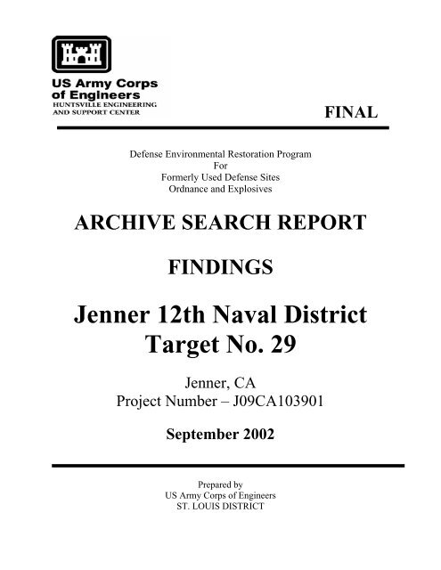
FINAL<br />
ARCHIVE SEARCH REPORT<br />
FINDINGS<br />
<strong>Jenner</strong> 12th Naval District<br />
<strong>Target</strong> No. 29<br />
<strong>Jenner</strong>, CA<br />
Project Number – J09CA103901<br />
September 2002<br />
Prepared by<br />
US Army Corps of Engineers<br />
ST. LOUIS DISTRICT
ARCHIVE SEARCH REPORT<br />
TABLE OF CONTENTS<br />
Table of Contents<br />
i<br />
ARCHIVES SEARCH REPORT – FINDINGS<br />
<strong>Jenner</strong> 12th Naval District <strong>Target</strong> No. 29<br />
<strong>Jenner</strong>, CA<br />
1 INTRODUCTION .....................................................................................................1<br />
1.1 AUTHORITY......................................................................................................1<br />
1.2 SUBJECT ............................................................................................................1<br />
1.3 PURPOSE............................................................................................................1<br />
1.4 SCOPE.................................................................................................................2<br />
2 PREVIOUS SITE INVESTIGATIONS ..................................................................3<br />
2.1 CORPS OF ENGINEERS DOCUMENTS..........................................................3<br />
2.2 OTHER REPORTS .............................................................................................3<br />
3 SITE DESCRIPTION ...............................................................................................4<br />
3.1 LAND USE..........................................................................................................4<br />
3.1.1 Location...........................................................................................................4<br />
3.1.2 Prior Site Use ..................................................................................................4<br />
3.1.3 Present Site Use...............................................................................................4<br />
3.2 CLIMATIC DATA..............................................................................................4<br />
3.3 GEOLOGY AND SOILS ....................................................................................6<br />
3.3.1 Geology and Physiology..................................................................................6<br />
3.3.2 Soil...................................................................................................................7<br />
3.4 HYDROLOGY....................................................................................................7<br />
3.4.1 Surface Water ..................................................................................................7<br />
3.4.2 Ground Water..................................................................................................8<br />
3.5 ECOLOGY ..........................................................................................................8<br />
3.6 DEMOGRAPHICS............................................................................................12<br />
3.6.1 Centers of Activity .........................................................................................12<br />
3.6.2 Business and Industry Profile........................................................................12<br />
3.6.3 Population density .........................................................................................12<br />
3.6.4 Types of Housing ...........................................................................................12<br />
3.6.5 New Development in the Area .......................................................................12<br />
3.6.6 Typical Cross Sections of the Population......................................................13<br />
4 SITE HISTORY.......................................................................................................14<br />
4.1 HISTORICAL SITE SUMMARY.....................................................................14<br />
4.1.1 General Site History ......................................................................................14<br />
4.1.2 Summary of Ordnance and Explosives Activities..........................................15<br />
4.1.3 Summary of Chemical Warfare Material Activities ......................................15<br />
4.1.4 Certificates of Clearance...............................................................................15<br />
4.2 REVIEW OF HISTORICAL RECORDS..........................................................16<br />
4.2.1 National <strong>Archive</strong>s at College Park, Textual Records....................................16<br />
4.2.2 National <strong>Archive</strong>s at College Park, Cartographic & Architectural Branch.21<br />
4.2.3 National <strong>Archive</strong>s at College Park, Still Pictures Branch ............................21
Table of Contents<br />
ii<br />
ARCHIVES SEARCH REPORT – FINDINGS<br />
<strong>Jenner</strong> 12th Naval District <strong>Target</strong> No. 29<br />
<strong>Jenner</strong>, CA<br />
4.2.4 National <strong>Archive</strong>s and Records Administration –Pacific Region San Bruno22<br />
4.2.5 Federal Records Center–Pacific Region San Bruno.....................................23<br />
4.2.6 Naval Aviation History Center ......................................................................23<br />
4.2.7 Naval History Center Library .......................................................................24<br />
4.2.8 Naval History Center Photographic <strong>Archive</strong> ................................................24<br />
4.2.9 Naval Construction Battalion Center History Office....................................24<br />
4.2.10 U.S. Air Force Historical Research Agency..............................................24<br />
4.2.11 U.S. Army Corps of Engineers - Sacramento District...............................25<br />
4.2.12 U.S. Army Corps of Engineers - Sacramento District...............................25<br />
4.2.13 U.S. Army Corps of Engineers - Sacramento District...............................25<br />
4.2.14 U.S. Army Corps of Engineers - Sacramento District...............................26<br />
4.2.15 U.S. Army Corps of Engineers - Sacramento District...............................26<br />
4.2.16 National <strong>Archive</strong>s at College Park, Cartographic & Architectural<br />
Branch .......................................................................................................27<br />
4.2.17 U.S. Department of Agriculture - Aerial Photography Field Office.........28<br />
4.2.18 U.S. Geological Survey - EROS Data Center ...........................................28<br />
4.3 SUMMARY OF INTERVIEWS .......................................................................29<br />
4.4 AIR PHOTO INTERPRETATION AND MAP ANALYSIS............................29<br />
4.4.1 Map Analysis .................................................................................................29<br />
4.4.2 Air Photo Interpretation................................................................................30<br />
5 REAL ESTATE .......................................................................................................33<br />
5.1 CONFIRMED DOD OWNERSHIP..................................................................33<br />
5.2 POTENTIAL DOD OWNERSHIP ...................................................................33<br />
5.3 SIGNIFICANT PAST OWNERSHIP OTHER THAN DOD............................33<br />
5.4 PRESENT OWNERSHIP..................................................................................33<br />
6 SITE INSPECTION ................................................................................................34<br />
6.1 GENERAL PROCEDURES AND SCOPE.......................................................34<br />
6.2 SITE INSPECTION SYNOPSIS.......................................................................34<br />
7 EVALUATION OF ORDNANCE POTENTIAL.................................................36<br />
7.1 CONVENTIONAL ORDNANCE CONTAMINATION..................................36<br />
7.2 CHEMICAL WARFARE MATERIAL CONTAMINATION .........................36<br />
8 TECHNICAL DATA OF ORDNANCE AND EXPLOSIVES............................37<br />
8.1 POTENTIAL OE AND CWM ITEMS..............................................................37<br />
8.2 DESCRIPTION OF CONVENTIONAL ORDNANCE....................................37<br />
8.3 DESCRIPTION OF CHEMICAL WARFARE MATERIALS .........................37<br />
9 EVALUATION OF OTHER SITE INFORMATION.........................................38
A REFERENCES<br />
APPENDICES<br />
B ABBREVIATIONS, ACRONYMS AND BREVITY CODES<br />
C TEXT / MANUALS<br />
D REPORTS / STUDIES<br />
E LETTERS / MEMORANDUMS / MISCELLANEOUS ITEMS<br />
Table of Contents<br />
iii<br />
ARCHIVES SEARCH REPORT – FINDINGS<br />
<strong>Jenner</strong> 12th Naval District <strong>Target</strong> No. 29<br />
<strong>Jenner</strong>, CA<br />
F REAL ESTATE DOCUMENTS.......................................................... NOT USED<br />
G NEWSPAPER / JOURNALS............................................................... NOT USED<br />
H INTERVIEWS / POINTS OF CONTACT (POC)<br />
I PRESENT SITE PHOTOGRAPHS<br />
J HISTORICAL PHOTOGRAPHS ........................................................ NOT USED<br />
K HISTORICAL MAPS / DRAWINGS<br />
L SITE SAFETY AND HEALTH PLAN / SITE INSPECTION REPORT<br />
M REPORT DISTRIBUTION LIST<br />
REPORT PLATES<br />
1 <strong>Jenner</strong> 12th Naval District <strong>Target</strong> No. 29 – 12 th Naval District <strong>Bombing</strong> and<br />
Gunnery Areas 1940’s to Early 1950’s<br />
2 <strong>Jenner</strong> 12th Naval District <strong>Target</strong> No. 29 - Vicinity Map<br />
3 <strong>Jenner</strong> 12th Naval District <strong>Target</strong> No. 29 – Aerial Photography 1945
1 INTRODUCTION<br />
1.1 AUTHORITY<br />
Section 1 - Introduction<br />
Page 1<br />
ARCHIVES SEARCH REPORT – FINDINGS<br />
<strong>Jenner</strong> 12th Naval District <strong>Target</strong> No. 29<br />
<strong>Jenner</strong>, CA<br />
In 1986, Congress established the Defense Environmental Restoration Program (DERP)<br />
at 10 United State Code (USC) 2701 et seq. This program directed the Secretary of<br />
Defense to “carry out a program of environmental restoration at facilities under the<br />
jurisdiction of the Secretary.”<br />
In March 1990, the Environmental Protection Agency (EPA) issued a revised National<br />
Contingency Plan (NCP). Under 40 Code of Federal Regulations (CFR) 300.120, EPA<br />
designated the Department of Defense (DoD) to be the removal response authority for<br />
incidents involving DoD military weapons and munitions under the jurisdiction, custody<br />
and control of DoD.<br />
Since the beginning of this program, the U.S. Army Corps of Engineers acts as the<br />
agency responsible for environmental restoration at Formerly Used Defense Sites<br />
(FUDS). Beginning in 1990, the U.S. Army Engineering and Support Center, Huntsville<br />
(USAESCH) serves as the Center of Expertise (CX) and Design Center for Ordnance and<br />
Explosives. In cooperation with the USAESCH, the U.S. Army Corps of Engineers, St.<br />
Louis District, prepares <strong>Archive</strong>s <strong>Search</strong> <strong>Report</strong>s (ASR) in support of environmental<br />
restoration at active DoD installations, Formerly Used Defense Sites (FUDS) and<br />
installation transitions under Base Realignment and Closure (BRAC) recommendations.<br />
1.2 SUBJECT<br />
<strong>Jenner</strong> 12th Naval District <strong>Target</strong> No. 29 consisted of 144 acres near <strong>Jenner</strong>, CA<br />
located in Sonoma County. The Navy built <strong>Jenner</strong> <strong>Bombing</strong> <strong>Target</strong> No. 29 as one of over<br />
thirty bombing and rocket targets within the 12th Naval District in California and Nevada<br />
during World War II. <strong>Target</strong> No. 29 was directly associated with Naval Auxiliary Air<br />
Station (NAAS) Santa Rosa, which was located about 20 miles to the east. Use of <strong>Target</strong><br />
No. 29 assumably began in December 1944. Ordnance and Explosives (OE) and<br />
Chemical Warfare Materials (CWM) related features of the former target included a<br />
single dive-bombing target. The types of OE included only practice bombs. Following<br />
the end of the war, the property was released back to the owners on 1 March 1946. Plate<br />
1 in the report plates section shows the general location of the 12 th Naval District Bomb<br />
<strong>Target</strong>s and Plate 2 shows the general location of the site.<br />
1.3 PURPOSE<br />
The ASR compiles information obtained through historical research at various archives<br />
and records holding facilities, interviews with persons associated with <strong>Jenner</strong> 12th Naval<br />
District <strong>Target</strong> No. 29 and an inspection of the site. The search directs efforts towards<br />
determining possible use or disposal of OE and CWM on the former military
Section 1 - Introduction<br />
Page 2<br />
ARCHIVES SEARCH REPORT – FINDINGS<br />
<strong>Jenner</strong> 12th Naval District <strong>Target</strong> No. 29<br />
<strong>Jenner</strong>, CA<br />
establishment. The research places particular emphasis on establishing the types,<br />
quantities and areas of use and disposal. This process obtains information for use in<br />
developing recommendations for further action at the former <strong>Jenner</strong> 12th Naval District<br />
<strong>Target</strong> No. 29.<br />
1.4 SCOPE<br />
This investigation focuses on potential OE and/or CWM contamination remaining on the<br />
former <strong>Jenner</strong> 12th Naval District <strong>Target</strong> No. 29. The DERP-FUDS project number is<br />
J09CA103901. This report presents the following:<br />
• A brief history of <strong>Jenner</strong> 12th Naval District <strong>Target</strong> No. 29<br />
• Description and characteristics of the immediate surrounding area<br />
• A review of related site investigations<br />
• An aerial photography and map analysis of the site<br />
• Real estate information, past and present<br />
• <strong>Findings</strong> of the site inspection<br />
• Description of the OE and/or CWM identified with the site<br />
These factors represent the basis for the evaluation of potential OE and CWM<br />
contamination and associated risks at <strong>Jenner</strong> 12th Naval District <strong>Target</strong> No. 29.
2 PREVIOUS SITE INVESTIGATIONS<br />
2.1 CORPS OF ENGINEERS DOCUMENTS<br />
Section 2 – Previous Site Investigations<br />
Page 3<br />
ARCHIVES SEARCH REPORT – FINDINGS<br />
<strong>Jenner</strong> 12th Naval District <strong>Target</strong> No. 29<br />
<strong>Jenner</strong>, CA<br />
The Sacramento District of the Corps of Engineers prepared the following investigations<br />
in support of the DERP for FUDS:<br />
Inventory Project <strong>Report</strong> <strong>Bombing</strong> <strong>Target</strong> <strong>Jenner</strong>, Sonoma County California,<br />
FUDS Site No. J09CA1039, July 1999. 1<br />
The Inventory Project <strong>Report</strong> (INPR) assigned a Risk Assessment Code (RAC) of 3 for<br />
the OE/CWM portion of this site. See Appendix D-1 for this report. The INPR identified<br />
only OE as a potential hazard at the former <strong>Jenner</strong> 12th Naval District <strong>Target</strong> No. 29.<br />
Just to the north of this site, is another FUDS, J09CA0910 <strong>Jenner</strong> Radar Site B-76. The<br />
U.S. Army acquired 249.88 acres of land between 1941 and 1942 for use as a radar site.<br />
An ASR on that site determined that a section Battery B of the 74 th Field Artillery was<br />
stationed at the <strong>Jenner</strong> radar site from approximately 19 April to 1 September 1943 for<br />
coastal defense. By 20 May 1947, the War Department had relinquished all the land<br />
acquired for that site. That ASR found no evidence that any of the weapons were ever<br />
fired on site and the site was considered uncontaminated. Neither the INPR, nor this<br />
ASR investigation found any direct linkages between the two FUDS. 2<br />
2.2 OTHER REPORTS<br />
The archive search did not locate any additional environmental investigations or reports<br />
concerning <strong>Jenner</strong> 12th Naval District <strong>Target</strong> No. 29.
3 SITE DESCRIPTION<br />
3.1 LAND USE<br />
3.1.1 Location<br />
Section 3 – Site Description<br />
Page 4<br />
ARCHIVES SEARCH REPORT – FINDINGS<br />
<strong>Jenner</strong> 12th Naval District <strong>Target</strong> No. 29<br />
<strong>Jenner</strong>, CA<br />
<strong>Jenner</strong> 12th Naval District <strong>Target</strong> No. 29 consisted of 144 acres in Sonoma County<br />
California (see Plate 2). This site lies approximately 1 ½ miles south of <strong>Jenner</strong> at the<br />
mouth of the Russian River along the Pacific Coast shoreline. Highway No. 1 borders<br />
the site on the east.<br />
3.1.2 Prior Site Use<br />
Prior to the Navy’s operation of <strong>Jenner</strong> 12th Naval District <strong>Target</strong> No. 29, the land was<br />
predominately used for agricultural purposes including livestock grazing and crop<br />
production.<br />
3.1.3 Present Site Use<br />
The land for the former <strong>Jenner</strong> 12th Naval District <strong>Target</strong> No. 29 is owned by the State of<br />
California and is part of the Sonoma Coast State Beaches, Russian River/Mendocino<br />
District. It remains undeveloped.<br />
3.2 CLIMATIC DATA<br />
The San Francisco Mission National Weather Service office, located approximately 60<br />
miles south-southeast of the site, provided the climatological data for this site, as data<br />
was not available for the site (TABLE 3.2).<br />
Month<br />
January<br />
February<br />
March<br />
April<br />
TABLE 3.2 - Climatological Data For San Francisco, CA<br />
Temperature<br />
Average<br />
Minimum<br />
( o F)<br />
46<br />
48<br />
49<br />
50<br />
Average<br />
Maximu<br />
m<br />
( o F)<br />
56<br />
60<br />
61<br />
63<br />
Precipitation<br />
Average<br />
(Inches)<br />
4.1<br />
3.5<br />
2.9<br />
1.5<br />
Average<br />
Speed<br />
(KTS)<br />
8<br />
11<br />
12<br />
13<br />
Wind<br />
Average<br />
Direction<br />
SE<br />
WNW<br />
WNW<br />
WNW
Month<br />
Section 3 – Site Description<br />
Page 5<br />
ARCHIVES SEARCH REPORT – FINDINGS<br />
<strong>Jenner</strong> 12th Naval District <strong>Target</strong> No. 29<br />
<strong>Jenner</strong>, CA<br />
TABLE 3.2 - Climatological Data For San Francisco, CA<br />
Temperature<br />
Average<br />
Minimum<br />
( o F)<br />
Average<br />
Maximu<br />
m<br />
( o F)<br />
Precipitation<br />
Average<br />
(Inches)<br />
Average<br />
Speed<br />
(KTS)<br />
Wind<br />
Average<br />
Direction<br />
May 51 64 0.5 14 WNW<br />
June<br />
July<br />
August<br />
September<br />
October<br />
November<br />
December<br />
Average<br />
53<br />
54<br />
54<br />
56<br />
55<br />
51<br />
47<br />
51<br />
66<br />
66<br />
66<br />
70<br />
69<br />
64<br />
57<br />
63<br />
0.2<br />
< 0.1<br />
< 0.1<br />
0.2<br />
1.1<br />
2.6<br />
3.9<br />
20.4<br />
14<br />
13<br />
12<br />
11<br />
11<br />
10<br />
9<br />
12<br />
WNW<br />
WNW<br />
WNW<br />
WNW<br />
WNW<br />
WNW<br />
WNW<br />
WNW<br />
The climate of San Francisco is known as the air-conditioned city, with cool pleasant<br />
summers and mild winters. In the summer, temperature minimums range from 50 to 55<br />
degrees Fahrenheit. The warmest time of the year is September and October, when the<br />
fog diminishes greatly and some of the warmth from the Central Valley flows westward.<br />
At this time of year, the average highs are in the mid 60’s near the ocean. The maximum<br />
temperature on record is 103 degrees Fahrenheit (July 1988). In the winter there is little<br />
temperature variation, with average maximums from 50 to 65 degrees Fahrenheit and<br />
average minimums in the mid to upper 40’s. The minimum temperature on record is 27<br />
degrees Fahrenheit (December 1932).<br />
Precipitation averages about 20 inches a year, with pronounced wet and dry seasons<br />
(characteristic of its marine-type climate). Little or no rain falls from June through<br />
September. About eighty percent of the annual total falls from November through<br />
March. Snow is extremely rare. Measurable amounts fall about once every 15 years.<br />
Freezing temperatures are also extremely rare. On average, thunderstorms occur on only<br />
two days each year. Maximum precipitation in a 24-hour period recorded is 3.2 inches<br />
(December 1956). The average annual wind speed is about 9 miles per hour (mph) with<br />
lighter winds (6 to 7 mph) occurring in the winter and stronger winds (10 to 11 mph)<br />
occurring in the summer. Maximum wind gusts have reached 82 mph (January 1982). 3
3.3 GEOLOGY AND SOILS<br />
3.3.1 Geology and Physiology<br />
Section 3 – Site Description<br />
Page 6<br />
ARCHIVES SEARCH REPORT – FINDINGS<br />
<strong>Jenner</strong> 12th Naval District <strong>Target</strong> No. 29<br />
<strong>Jenner</strong>, CA<br />
The <strong>Jenner</strong> target is situated on the Coast Range’s physiographic province of California,<br />
which is characterized by northwest-trending mountains and valleys. Geomorphic<br />
features of the local areas vary from beaches on the Pacific Ocean at the western edge of<br />
the site to more rugged terrain to the east of the site, where elevations reach over 500<br />
feet.<br />
The oldest rocks exposed in Sonoma County occur at Bodega Head, west of the San<br />
Andreas Fault. The granitic rocks found here represent the core of an ancient landmass<br />
that once stretched southward and included what is now the Point Reyes Peninsula, the<br />
Farallon Islands, and the granitic mountains of Santa Cruz and Monterey Counties.<br />
These intrusive rocks were formed at great depths when they crystallized during the early<br />
part of the Jurassic Period. Subsequent uplift brought them to the surface, and erosion<br />
has reduced them to the isolated remnants seen today.<br />
East of the San Andreas Fault are found somewhat contemporaneous marine sediments,<br />
which were formed as geosynclinal deposits in an oceanic environment during the<br />
Jurassic Period. These deposits, which together comprise the Franciscan Formation and<br />
the Great Valley Sequence, are formed of sediments derived from an area located west of<br />
the present shoreline. The area, which received these sediments was of broad extent and<br />
was slowly subsiding.<br />
During the 50 million years that the sediments were being deposited, they were intruded<br />
with basic and ultrabasic rocks in the form of dikes, sills, and pillow lava flows. Most of<br />
these subsequently have been completely serpentinized. During the Cretaceous Period,<br />
deposition was halted and was followed by a brief period of uplift. During this uplift,<br />
coarse conglomeritic detritus was deposited in certain areas, while in others, sand and<br />
clay continued to mantle the sea bottom. In a few areas, notably along what is now the<br />
present seacoast, basaltic flows poured out from localized volcanic centers.<br />
In the early part of the Tertiary Period, marine deposition again was the rule. Paleocene<br />
and Eocene sediments, ranging from sand to clay, were deposited in areas to the west and<br />
east of the San Andreas Fault. During Miocene time, the sea invaded the area, and shales<br />
and sands of the Neroly and related formations were deposited. Also in Miocene time,<br />
there were several periods of transgression and regression of the sea as the land surface<br />
oscillated above and below sea level. Toward the close of the Miocene Epoch, crustal<br />
compressional forces began forming the Coast Ranges.<br />
Beginning in the early part of the Pliocene Epoch, a volcanic sequence was deposited in<br />
the south-central part of the county. After a subsequent period of erosion, deposition<br />
began anew, forming the sediments, which now constitute the Petaluma Formation. The
Section 3 – Site Description<br />
Page 7<br />
ARCHIVES SEARCH REPORT – FINDINGS<br />
<strong>Jenner</strong> 12th Naval District <strong>Target</strong> No. 29<br />
<strong>Jenner</strong>, CA<br />
depositional environment of the Petaluma Formation consisted of shallow to brackish<br />
water embayments, which had been eroded into the landscape formed from the Jura-<br />
Cretaceous and later rocks. Following deposition of the Petaluma beds, a period of<br />
orogeny occurred, which tilted, folded, and uplifted these beds while still young. This<br />
caused a widespread period of vigorous erosion, during which much of the then-soft<br />
Petaluma sediments were stripped off. By that time, much of eastern Sonoma County<br />
was above sea level, and here and there were lakes filled with water, which supported<br />
large communities of diatoms. At about this same time, movement began along the<br />
Tolay Fault, which caused a displacement of several thousand feet of formerly adjacent<br />
sediments.<br />
During the latter part of the Pliocene Epoch, volcanic activity broke out ln the eastern<br />
part of the county. Vents spewed out vast amounts of tuff-breccia, lava, ash, and cinders,<br />
all of which now constitute the Sonoma Volcanics. Meanwhile, to the west, in a shallow<br />
marine environment, sands and clays were being deposited to form the Merced<br />
Formation. This latter formation was deposited in an embayment that covered the central<br />
part of the county as far north as Healdsburg. At the close of the Sonoma volcanic<br />
episode, reworked volcanic detritus began to be deposited under lagoonal and deltaic<br />
conditions; these sediments are now the Glen Ellen Formation. Sediments in the lower<br />
part of the Glen Ellen Formation were deposited contemporaneously with those of the<br />
Merced Formation as shown by the interfingering of these two formations. 4<br />
3.3.2 Soil<br />
The soils of the <strong>Jenner</strong> site consist of moderately well drained loams that have a subsoil<br />
of sandy clay. They formed in material weathered from soft sandstone. In a typical<br />
profile, the surface layer is dark grayish-brown, strongly acid, silty, sandy clay and<br />
medium acid, sandy, clayey silt about 16 inches thick. The underlying soil is more<br />
yellow in color and has a slightly higher silt content to a depth of 35 inches. The<br />
substratum below 35 inches is more yellow-brown soil and has a sandy clay composition<br />
to over 60 inches.<br />
The soil on the steeply sloping uplands in the eastern portion of the site has a different<br />
profile. The soil has a surface layer of reddish-brown with medium acid loam about 7<br />
inches thick. The subsoil is reddish-brown, slightly acid, light sandy, silty clay.<br />
Weathered greenstone is at a depth of about 20 inches. There is little or no potential for<br />
frost development in the soil of the <strong>Jenner</strong> site. 5<br />
3.4 HYDROLOGY<br />
3.4.1 Surface Water<br />
This site lies along the coast of the Pacific Ocean. The Russian River is located to the<br />
north of the site, but poses no threat of flooding to the area. No stream gage data exists
Section 3 – Site Description<br />
Page 8<br />
ARCHIVES SEARCH REPORT – FINDINGS<br />
<strong>Jenner</strong> 12th Naval District <strong>Target</strong> No. 29<br />
<strong>Jenner</strong>, CA<br />
near this location. All water run-off empties out to sea. Flooding could be caused from<br />
torrential rains generating flash flooding from the higher elevations, or by high tides. The<br />
site is elevated enough, however, where tidal flooding probably would not be of concern.<br />
The closest tidal gage for the site is located on a private pier in Point Reyes,<br />
approximately 30 miles to the south-southwest. Tidal datums at the gage have been<br />
recorded since 1975. Elevations of tidal datums refer to mean lower low water (MLLW),<br />
as shown in TABLE 3.4.<br />
TABLE 3.4 - TIDAL DATUMS, POINT REYES, CALIFORNIA<br />
Tide Elevations Datum<br />
Highest Observed Water Level (12/03/1983) 8.67 Feet<br />
Mean Higher High Water (Mhhw) 5.77 Feet<br />
Mean High Water (Mhw) 5.11 Feet<br />
Mean Tide Level (Mtl) 3.15 Feet<br />
Mean Low Water (Mlw) 1.18 Feet<br />
Mean Lower Low Water (Mllw) 0.00 Feet<br />
Lowest Observed Water Level (01/19/1988) -2.48 Feet 6<br />
3.4.2 Ground Water<br />
Nearly all of the geologic formations in Sonoma County would yield some quantity of<br />
water to wells. Well yields range from 1,000 gallons per minute (gpm) in wells<br />
completed in coarse-grained Holocene deposits, to less than 1 gpm in wells in the Jura-<br />
Cretaceous and Tertiary marine sediments. In general, the Jura-Cretaceous and Tertiary<br />
marine sediments, along with the granitic rocks and serpentine, yield less than 5 gpm.<br />
Mineral constituents, such as chloride, iron, manganese, and boron may be present in<br />
sufficient amounts to make ground water unusable.<br />
In contrast, the Pliocene to Holocene materials are the principal water producers in the<br />
county; the water derived from these materials usually is of good to excellent quality,<br />
although some water quality problems also may be present.<br />
Large quantities of ground water are withdrawn from the permeable strata of the<br />
Quaternary and Tertiary sediments. Although the Quaternary alluvium sand stringers<br />
yield large quantities of ground water in some wells the major sources of ground water in<br />
this area are from the sediments of the Laguna and Mehrten Formations. 7<br />
3.5 ECOLOGY<br />
The U.S. Fish and Wildlife Service (USFWS) have indicated that the following Federally<br />
listed threatened or endangered species, or those proposed to be listed as such may occur<br />
on or near <strong>Jenner</strong>:
Section 3 – Site Description<br />
Page 9<br />
ARCHIVES SEARCH REPORT – FINDINGS<br />
<strong>Jenner</strong> 12th Naval District <strong>Target</strong> No. 29<br />
<strong>Jenner</strong>, CA<br />
Guadalupe fur seal, Arctocephalus townsendi, threatened; Steller (northern) sea-lion,<br />
Eumetopiasjubatus, threatened; marbled murrelet, Brachyramphus marmoratus,<br />
threatened; marbled murrelet, Brachyramphus marmoratus, threatened; western snowy<br />
plover, Charadrius alexandrinus nivosus, threatened; bald eagle, Haliaeetus<br />
leucocephalus, threatened; northern spotted owl, Strix occidentalis caurina, threatened;<br />
loggerhead turtle, Caretta caretta, threatened; green turtle, Chelonia mydas (incl.<br />
agassizi), threatened; olive (Pacific) ridley sea turtle, Lepidochelys olivacea, threatened;<br />
California red-legged frog, Rana aurora draytonii, threatened; delta smelt, Hypomesus<br />
transpacificus, threatened; coho salmon - central CA coast, Oncorhynchus kisutch,<br />
threatened; Central California Coastal steelhead, Oncorhynchus mykiss, threatened;<br />
Northern California steelhead, Oncorhynchus mykiss, threatened; Central Valley springrun<br />
chinook salmon, Oncorhynchus tshawytscha, threatened; So. OR/CA coastal chinook<br />
salmon, Oncorhynchus tshawytscha, threatened; Sacramento splittail, Pogonichthys<br />
macrolepidotus, threatened; coho salmon - central CA coast, Oncorhynchus kisutch,<br />
threatened; Central Valley spring-run chinook, Oncorhynchus tshawytscha, threatened;<br />
sei whale, Balaenoptera borealis, endangered; blue whale, Balaenoptera musculus,<br />
endangered; finback (fin) whale, Balaenoptera physalus, endangered; right whale,<br />
Eubalaena glacialis, endangered; humpback whale, Megaptera novaeangliae,<br />
endangered; sperm whale, Physeter catodon (macrocephalus), endangered; salt marsh<br />
harvest mouse, Reithrodontomys raviventris, endangered; California brown pelican,<br />
Pelecanus occidentalis californicus, endangered; California clapper rail, Rallus<br />
longirostris obsoletus, endangered; leatherback turtle, Dermochelys coriacea,<br />
endangered; tidewater goby, Eucyclogobius newberryi, endangered; winter-run chinook<br />
salmon, Oncorhynchus tshawytscha, endangered; winter-run chinook salmon,<br />
Oncorhynchus tshawytscha, endangered; Behren's silverspot butterfly, Speyeria zerene<br />
behrensii, endangered; Myrtle's silverspot butterfly, Speyeria zerene myrtleae,<br />
endangered; California freshwater shrimp, Syncaris pacifica, endangered; Sonoma<br />
alopecurus, Alopecurus aequalis var. sonomensis, endangered; Clara Hunt's milk-vetch,<br />
Astragalus clarianus, endangered; Baker's stickyseed, Blennosperma baked, endangered;<br />
white sedge, Carex albida, endangered; Vine Hill clarkia, Clarkia imbricata, endangered;<br />
Pennell's bird's-beak, Cordylanthus tenuis ssp. capillaris, endangered; yellow larkspur,<br />
Delphinium luteum, endangered; Burke's goldfields, Lasthenia burkei, endangered; Pitkin<br />
Marsh lily, Lilium pardalinum ssp. pitkinense, endangered; Sebastopol meadowfoam,<br />
Limnanthes vinculans, endangered; clover lupine [Tidestrom's lupine], Lupinus<br />
tidestromii, endangered; many-flowered navarretia, Navarretia leucocephala ssp.<br />
plieantha, endangered; Kenwood Marsh checkermallow, Sidalcea oregana ssp. valida,<br />
endangered; showy Indian clover, Trifolium amoenum, endangered; Sonoma spineflower,<br />
Chorizanthe valida, endangered; soft bird's-beak, Cordylanthus mollis ssp. mollis,<br />
endangered; Baker's larkspur, Delphinium bakeri, endangered; Hickman's potentilla<br />
(cinquefoil), Potentilla hickmanii, endangered; short-tailed albatross, Diomedea albatrus,<br />
proposed endangered; white abalone, Haliotes sorenseni, proposed endangered.<br />
The USFWS indicated the following canditate species, species of concern, and critical<br />
habitats may also occur on or near <strong>Jenner</strong>:
Section 3 – Site Description<br />
Page 10<br />
ARCHIVES SEARCH REPORT – FINDINGS<br />
<strong>Jenner</strong> 12th Naval District <strong>Target</strong> No. 29<br />
<strong>Jenner</strong>, CA<br />
California tiger salamander, Ambystoma californiense, candidate; Central Valley fall/late<br />
fall-run chinook salmon, Oncorhynchus tshawytscha, candidate; black abalone, Haliotes<br />
cracherodii, candidate; California red tree vole, Arborimus pomo, species of concern;<br />
Pacific western big-eared bat, Corynorhinus (Plecotus) townsendii townsendii, species of<br />
concern; greater western mastiff-bat, Eumops perotis califomicus, species of concern;<br />
long-eared myotis bat, Myotis evotis, species of concern; fringed myotis bat, Myotis<br />
thysanodes, species of concern; long-legged myotis bat, Myotis volans, species of<br />
concern; Yuma myotis bat, Myotis yumanensis, species of concern; Suisun ornate shrew,<br />
Sorex omatus sinuosus, species of concern; grasshopper sparrow, Ammodramus<br />
savannarum, species of concern; Bell's sage sparrow, Amphispiza belli belli, species of<br />
concern; short-eared owl, Asio flammeus, species of concern; western burrowing owl,<br />
Athene cunicularia hypugea, species of concern; American bittern, Botaurus lentiginosus,<br />
species of concern; ferruginous hawk, Buteo regalis, species of concern; Vaux's swift,<br />
Chaetura vauxi, species of concern; lark sparrow, Chondestes grammacus, species of<br />
concern; olive-sided flycatcher, Contopus cooperi, species of concern; hermit warbler,<br />
Dendroica occidentalis, species of concern; white-tailed (black shouldered) kite, Elanus<br />
leucurus, species of concern; Pacific-slope flycatcher, Empidonax difficilis, species of<br />
concern; common loon, Gavia immer, species of concern; saltmarsh common<br />
yellowthroat, Geothlypis trichas sinuosa, species of concern; Harlequin duck,<br />
Histrionicus histrionicus, species of concern; loggerhead shrike, Lanius ludovicianus,<br />
species of concern; San Pablo song sparrow, Melospiza melodia samuelis, species of<br />
concern; long-billed curlew, Numenius americanus, species of concern; rufous<br />
hummingbird, Selasphorus rufus, species of concern; Allen's hummingbird, Selasphorus<br />
sasin, species of concern; red-breasted sapsucker, Sphyrapicus ruber, species of concern;<br />
Xantus' murrelet, Synthliboramphus hypoleucus, species of concern; Bewick's wren,<br />
Thryomanes bewickii, species of concern; California thrasher, Toxostoma redivivum,<br />
species of concern; northwestern pond turtle, Clemmys marmorata marmorata, species of<br />
concern; California horned lizard, Phrynosoma coronaturn frontale, species of concern;<br />
Northern red-legged frog, Rana aurora aurora, species of concern; foothill yellowlegged<br />
frog, Rana boylii, species of concern; western spadefoot toad, Scaphiopus<br />
hammondii, species of concern; green sturgeon, Acipenser medirostris, species of<br />
concern; Russian River tule perch, Hysterocarpus traski pomo, species of concern;<br />
Pacific lamprey, Lampetra tridentata, species of concern; Gualala roach, Lavinia<br />
symmetricus parvipinnis, species of concern; longfin smelt, Spirinchus thaleichthys,<br />
species of concern; Sonoma arctic skipper, Carterocephalus palaernon ssp, species of<br />
concern; sandy beach tiger beetle, Cicindela hirticollis gravida, species of concern;<br />
globose dune beetle, Coelus globosus, species of concern; brownish dubiraphian riffle<br />
beetle, Dubiraphia brunnescens, species of concern; Ricksecker's water scavenger beetle,<br />
Hydrochara rickseckeri, species of concern; Leech's skyline diving beetle, Hydroporus<br />
leechi, species of concern; bumblebee scarab beetle, Lichnanthe ursina, species of<br />
concern; northcoast sand-verbena, Abronia umbellata ssp. breviflora, species of concern;<br />
Blasdale's bentgrass, Agrostis blasdalei var. blasdalei, species of concern; Baker's<br />
manzanita, Arctostaphylos bakeri ssp. bakeri, species of concern; Vine Hill manzanita,
Section 3 – Site Description<br />
Page 11<br />
ARCHIVES SEARCH REPORT – FINDINGS<br />
<strong>Jenner</strong> 12th Naval District <strong>Target</strong> No. 29<br />
<strong>Jenner</strong>, CA<br />
Arctostaphylos densiflora, species of concern; reedgrass, Calamagrostis crassiglumis,<br />
species of concern; The Cedars globe-lily, Calochortus raichei, species of concern; Mt.<br />
Saint Helena morning-glory, Calystegia collina ssp. oxyphylia, species of concern;<br />
swamp harebell, Campanula califomica, species of concern; Rincon Ridge ceanothus,<br />
Ceanothus confusus, species of concern; Calistoga ceanothus, Ceanothus divergens,<br />
species of concern; Vine Hill ceanothus, Ceanothus foliosus var. vineatus, species of<br />
concern; Sonoma ceanothus, Ceanothus sonomensis, species of concern; San Francisco<br />
Bay spineflower, Chorizanthe cuspidata var cuspidata, species of concern; northcoast<br />
bird's-beak, Cordylanthus maritimus ssp. palustris, species of concern; Mendocino<br />
cypress, Cupressus goveniana ssp. pigmaea, species of concern; supple daisy, Efigeron<br />
supplex, species of concern; Snow Mountain buckwheat, Eriogonum nervulosum, species<br />
of concern; San Francisco wallflower, Erysimum franciscanum, species of concern;<br />
fragrant fritillary, Fritillaria filiacea, species of concern; seaside tarweed, Hemizonia<br />
multicaulis ssp. multicaulis, species of concern; Tiburon tarweed, Hemizonia multicaulis<br />
ssp. vemalis, species of concern; two-carpeled dwarf-flax, Hesperolinon bicarpellatum,<br />
species of concern; coast lily, Lilium maritimum, species of concern; Gairdner's yampah,<br />
Perideridia gairdneri ssp. gairdneri, species of concern; northcoast semaphore grass,<br />
Pleuropogon hooverianus, species of concern; Marin knotweed, Polygonum marinense,<br />
species of concern; California beaked-rush, Rhynchospora calffibmica, species of<br />
concern; Marin checkermallow, Sidalcea hickmanii ssp. viridis, species of concern;<br />
Contact (Socrates) Mine jewelflower, Streptanthus brachiatus ssp. brachiatus, species of<br />
concern; Freed's jewelflower, Streptanthus brachiatus ssp. hoffmanii, species of concern;<br />
secund jewelflower, Streptanthus glandulosus var. hoffmanii, species of concern; Three<br />
Peaks jewelflower, Streptanthus morrisonii ssp. elatus, species of concern; Dorr's Cabin<br />
jewelflower, Streptanthus morrisonii ssp. hirtiflorus, species of concern; Kruckeberg's<br />
jewelflower, Streptanthus morrisonii ssp. kruckebergii, species of concern; Morrison's<br />
jewelflower, Streptanthus morrisonii ssp. morrisonii, species of concern; alkali milkvetch,<br />
Astragalus tener var. tener, species of concern; legenere, Legenere limosa, species<br />
of concern; Petaluma popcornflower, Plagiobothrys mollis var. vestitus, species of<br />
concern; Crystal Springs lessingia, Lessingia arachnoidea, species of concern.<br />
The USFWS also mentioned the following State of California listed species may occur on<br />
or near <strong>Jenner</strong>:<br />
Little willow flycatcher, Empidonax traillii brewsteri, state listed; black rail,<br />
Laterallusjamaicensis cotumiculus, state listed. 8<br />
The State of California did not provide information for this site. If a project does occur at<br />
this site, the state should be consulted for the presence of any state listed species in the<br />
area.<br />
Federally endangered and threatened species are protected by Federal law and must be<br />
considered prior to project development. If the action agency determines that listed<br />
species or critical habitat may be adversely affected by a federally funded, permitted, or
Section 3 – Site Description<br />
Page 12<br />
ARCHIVES SEARCH REPORT – FINDINGS<br />
<strong>Jenner</strong> 12th Naval District <strong>Target</strong> No. 29<br />
<strong>Jenner</strong>, CA<br />
authorized activity, the action agency must request formal consultation with the USFWS.<br />
If the action agency determines that the planned action may jeopardize a proposed<br />
species or destroy or adversely modify proposed critical habitat, the action agency must<br />
enter into a section 7 conference with the USFWS. Candidate species are those for which<br />
there is sufficient information to support a proposal for listing. Although candidate<br />
species have no legal protection under the Act, the USFWS recommends that they be<br />
considered in the planning process in the event that they become listed or proposed for<br />
listing prior to project completion.<br />
No additional information on the occurrence of rare or endangered species or natural<br />
communities is known at this time. This does not mean that other State or Federally<br />
listed species may not be present within the areas of interest. An on site inspection by<br />
appropriate state and federal personnel may be necessary to verify the presence, absence<br />
or location of listed species, or natural communities if remedial action is recommended as<br />
part of the final ASR.<br />
3.6 DEMOGRAPHICS 9<br />
3.6.1 Centers of Activity<br />
The <strong>Jenner</strong> site is located near the city of Guerneville in Sonoma County, California.<br />
3.6.2 Business and Industry Profile<br />
The number of business establishments in Sonoma County, California can be broken<br />
down by type as follows: manufacturing 6.5%; trade 26.4%; services and financial<br />
46.8%; and other 19.1%. Of the people in the county employed by businesses,<br />
approximately 1.2% are unclassified. Foregoing percentages are at mid-March 1997.<br />
3.6.3 Population density<br />
City/County Area (Sq. Mi.) Population Population Density<br />
(Per Sq. Mi.)<br />
Guerneville 2.6 1,966 760.6<br />
Sonoma 1576.2 388,222 246.3<br />
3.6.4 Types of Housing<br />
Housing in Guerneville is composed of both single family and multi-family dwellings.<br />
The median value of 331 specified owner-occupied housing units is $145,700.<br />
3.6.5 New Development in the Area<br />
New development in the area is both commercial and residential.
3.6.6 Typical Cross Sections of the Population<br />
Section 3 – Site Description<br />
Page 13<br />
ARCHIVES SEARCH REPORT – FINDINGS<br />
<strong>Jenner</strong> 12th Naval District <strong>Target</strong> No. 29<br />
<strong>Jenner</strong>, CA<br />
Guerneville Percentages<br />
White 92.6<br />
Black 1.2<br />
American Indian, Eskimo or Aleut 1.2<br />
Asian or Pacific Islander 1.4<br />
Other 3.6<br />
Hispanic origin 13.3<br />
Population under the age of 18 12.0<br />
Population over the age of 65 13.0<br />
Median age is 36.9
4 SITE HISTORY<br />
4.1 HISTORICAL SITE SUMMARY<br />
4.1.1 General Site History<br />
Section 4 – History<br />
Page 14<br />
ARCHIVES SEARCH REPORT – FINDINGS<br />
<strong>Jenner</strong> 12th Naval District <strong>Target</strong> No. 29<br />
<strong>Jenner</strong>, CA<br />
The Navy built <strong>Jenner</strong> 12th Naval District <strong>Target</strong> No. 29 as one of over thirty bombing<br />
and rocket targets within the 12th Naval District in California and Nevada during World<br />
War II. <strong>Target</strong> No. 29 was directly associated with Naval Auxiliary Air Station (NAAS)<br />
Santa Rosa, which was approximately 20 miles to the east. NAAS Santa Rosa was one of<br />
a dozen subordinate NAAS and Naval Air Station (NAS) activities under the 12 th Naval<br />
District, Naval Air Bases at NAS Alameda. The 12 th Naval District officially established<br />
NAAS Santa Rosa on 29 June 1943, a year and a half prior to acquisition of <strong>Target</strong> No.<br />
29. NAAS Santa Rosa had a total of three subordinate range activities, including divebombing<br />
and rocket targets:<br />
Petaluma 12th Naval District <strong>Target</strong> No. 9 i<br />
<strong>Jenner</strong>12th Naval District <strong>Target</strong> No. 29<br />
Stewart’s Point 12th Naval District <strong>Target</strong> No. 30 10<br />
Before acquiring the property for the <strong>Jenner</strong> bomb target, the Navy received approval<br />
from the Interdepartmental Air Traffic Control Board (IATCB) for the target location at<br />
N38 o 26' 00", W123 o 07' 00” on 26 July 1944 (though given to the second, the<br />
coordinates are an approximation). Although the 1.5-mile radius Danger Area for this<br />
site was published on Aeronautical Charts as early as 7 December 1944, the Navy had not<br />
received real estate rights to the site. By the 14 th , the “targets for this site have been<br />
constructed and the area is now suitably improved for use” and condemnation<br />
proceedings were requested for the Navy to take immediate possession of the land. The<br />
Navy acquired leases for the two parcels of land on 29 December 1944. 11<br />
Although aligned with NAAS Santa Rosa, the bomb and rocket targets within the 12 th<br />
Naval District appear to have been available for use by the dozens of subordinate<br />
activities under the Naval District command along with the Army. 12<br />
The research found no documentation in regards to specifics of the layout for <strong>Target</strong> No.<br />
29, though a site map shows it to be a single circular target. Typical 12 th Naval District<br />
dive bombing targets on land were suppose to consist of a 250 foot cleared area, with an<br />
interior 50 foot radius, 4 foot wide, wooden plank circle. The target center was to be a<br />
12-foot square platform with a 3-foot diameter bull’s eye. A typical dive-bombing target<br />
might also have additional markings along the two axes in line with rake stations, though<br />
i The Saint Louis District is concurrently preparing ASRs on <strong>Target</strong>s No. 9 and No. 30, at Petaluma and<br />
Stewart’s Point. The project numbers are J09CA7298 and J09CA1032.
Section 4 – History<br />
Page 15<br />
ARCHIVES SEARCH REPORT – FINDINGS<br />
<strong>Jenner</strong> 12th Naval District <strong>Target</strong> No. 29<br />
<strong>Jenner</strong>, CA<br />
it appears that <strong>Target</strong> 29 did not have rake stations. The aerial photo analysis confirmed<br />
this general layout. 13<br />
Following the end of the war, NAAS Santa Rosa remained in service. As of 8 January<br />
1946, the Navy planned on temporarily retaining <strong>Target</strong> No. 29. It remained in use by<br />
units from NAS Alameda and NAAS Santa Rosa through February and had a tentative<br />
release date of 30 June. However, both leases for the property were terminated on 1<br />
March 1946, prior to the lease expiration. The entire site eventually became part of the<br />
Sonoma Coast State Beaches state park in the Russian River/Mendocino District. 14<br />
4.1.2 Summary of Ordnance and Explosives Activities<br />
Investigation of historical records did not specifically indicate the types and quantities of<br />
ordnance used on site by the 12 th Naval District. The INPR site inspection found debris<br />
from MK-23 bombs. The MK-23 was one of three types of typical Miniature Practice<br />
Bombs of the period made of iron, zinc or lead (i.e., AN-MK 5 MOD 1, AN-MK 23, AN-<br />
MK 43). The presence or use of other types of practice bombs made of sheet metal, such<br />
as the typical 100-pound practice bombs, MK VII or XV, was not confirmed. 15<br />
No direct evidence of the use of small arms strafing was found. The INPR located<br />
uncovered a hearsay account concerning tow targets being dropped in the area for “the<br />
Army to take back to Hamilton Field.” These tow targets were probably associated with<br />
the large Danger Area that extended about 85 miles into the Pacific Ocean at <strong>Jenner</strong> and<br />
not the smaller 1.5-mile radius Danger Areas for <strong>Target</strong> 29 on the edge of the coastline. 16<br />
The use of high explosive (HE) bombs or pyrotechnics on <strong>Target</strong> No. 29 was not<br />
supported by any uncovered evidence. The NAAS Santa Rosa however had magazines<br />
for HE, pyrotechnics, fuzes and detonators, and an inert storehouse. None of the<br />
reviewed historical documents indicate that rockets were used on this site. Supporting<br />
the assessment that rockets and HE bombs were not used at this location is the 1.5 mile<br />
radius Danger Area at <strong>Target</strong> No. 29, as opposed to 3 mile Danger Areas around the two<br />
other targets associated with NAAS Santa Rosa (i.e. Petaluma and Stewart’s Point). 17<br />
4.1.3 Summary of Chemical Warfare Material Activities<br />
The archive search uncovered no documentation relating to CWM at <strong>Jenner</strong> 12th Naval<br />
District <strong>Target</strong> No. 29. The archive search team found no indication that the Navy<br />
conducted CWM training, storage or disposal at this site.<br />
4.1.4 Certificates of Clearance<br />
The archive search did not reveal any certificates of ordnance clearance, decontamination<br />
or dedudding associated with <strong>Jenner</strong> 12th Naval District <strong>Target</strong> No. 29.
4.2 REVIEW OF HISTORICAL RECORDS<br />
Section 4 – History<br />
Page 16<br />
ARCHIVES SEARCH REPORT – FINDINGS<br />
<strong>Jenner</strong> 12th Naval District <strong>Target</strong> No. 29<br />
<strong>Jenner</strong>, CA<br />
Appendix A contains full references of all in text citations along with the location of the<br />
copied document. The research team searched at the following locations for records<br />
relating to OE and CWM activities at <strong>Jenner</strong> 12th Naval District <strong>Target</strong> No. 29. At these<br />
repositories the research team used finding aids and records managers to assist in locating<br />
documents relevant to the research topic. The ASR team also accumulated<br />
complementary documents reviewed on <strong>Jenner</strong> 12th Naval District <strong>Target</strong> No. 29 but not<br />
specifically used. These complementary documents are stored with the original ASR<br />
documents. Appendix H lists additional repositories and personnel contacted which<br />
reported no pertinent information.<br />
4.2.1 National <strong>Archive</strong>s at College Park, Textual Records<br />
8601 Adelphi Road<br />
College Park, MD 20740<br />
POC: Rich Boylan<br />
301-713-6800<br />
Record Group 18 (Records of the Army Air Forces)<br />
Entry 1A, Air Adjutant General Mail and Records Division Classified Records<br />
Confidential and Secret Decimal Correspondence File, 1945<br />
Box 558<br />
Entry 1C, Air Adjutant General Mail and Records Division Classified Records<br />
Bulky Confidential and Secret Decimal Correspondence File, 1945<br />
Boxes 673-674<br />
Entry 1D, Air Adjutant General Mail and Records Division Classified Records<br />
Decimal Confidential and Secret Decimal Correspondence File, 1946-1947<br />
Box 672<br />
Entry 1F, Air Adjutant General Mail and Records Division Classified Records<br />
Bulky Confidential and Secret Decimal Correspondence File, 1945-48<br />
Box 772<br />
Entry 1G, Air Adjutant General Mail and Records Division Classified Records<br />
Confidential and Secret Decimal Correspondence File, 1945-1948<br />
Boxes 839-840<br />
Entry 1I, Air Adjutant General Mail and Records Division Classified Records<br />
Bulky Confidential and Secret Decimal Correspondence File, 1945-1948<br />
Box 866
Section 4 – History<br />
Page 17<br />
ARCHIVES SEARCH REPORT – FINDINGS<br />
<strong>Jenner</strong> 12th Naval District <strong>Target</strong> No. 29<br />
<strong>Jenner</strong>, CA<br />
Entry 2A, Air Adjutant General Mail and Records Division Classified Records<br />
Decimal File Unclassified Correspondence, 1944-1946<br />
Boxes 2256-2257, 2275-2281 & 2308<br />
Entry 2C, Air Adjutant General Mail and Records Division Classified Records<br />
Decimal File Unclassified Correspondence, 1947<br />
Boxes 2797-2798<br />
Entry 2E, Air Adjutant General Mail and Records Division Classified Records<br />
Decimal File Unclassified Correspondence, 1948<br />
Boxes 3191-3192<br />
Entry 292A, Air Adjutant General Mail and Records Division Classified Records<br />
Central Decimal File Unclassified Correspondence, 1942-1944<br />
Boxes 1576 & 1641<br />
Entry 294B, Air Adjutant General Mail and Records Division Classified Records<br />
Bulky Central Decimal File Unclassified Correspondence, 1942-1944<br />
Box 1761<br />
Record Group 38 (Records of the Office of the Chief of Naval Operations)<br />
Entry Intelligence Records of Inactive Naval Stations, 1941-45 (former Acc. 38-<br />
93-001)<br />
Box 14<br />
Record Group 48 (Records of the Office of the Secretary of the Interior)<br />
Entry 749B, Central Classified Files 1937-52<br />
Boxes 3220-3221 (2-68)<br />
Record Group 71 (Records of the Bureau of Yards and Docks)<br />
Entry 18, Location of Naval Activities, October 1944 & June 1945<br />
Box 1<br />
Entry 24 (former Acc 3305) Unprocessed Naval Property Case Files, 1940s<br />
Boxes 16, 21, & 33-34<br />
Entry 74A, Misc. Records, Plans Charts of Harbors Naval Bases and Airfields,<br />
1938-54<br />
Boxes 1-6<br />
Entry 1001, Naval Property Case Files 1941-1958<br />
Boxes 29-44, 1513-1516 & 1521
Section 4 – History<br />
Page 18<br />
ARCHIVES SEARCH REPORT – FINDINGS<br />
<strong>Jenner</strong> 12th Naval District <strong>Target</strong> No. 29<br />
<strong>Jenner</strong>, CA<br />
Entry 1008, Correspondence Relating to Inter-Federal Agency Transfer of<br />
Facilities to and From Navy Department, 1944-46<br />
Box 1<br />
Entry 1016, Navy Land Acquisition <strong>Report</strong> of the Real Estate Division 1 July<br />
1940-31 Dec. 1943<br />
Boxes 1-4<br />
Entry 1017, Land Purchase Progress <strong>Report</strong>s 1942-45<br />
Box 1, Land Purchase Progress <strong>Report</strong>s 1942 - 1945<br />
Entry 1019, Misc. <strong>Report</strong>s and other Records Regarding Land Investigations<br />
Boxes 1-4<br />
Entry 1030, <strong>Report</strong> of Army Facilities Acquired in 1944<br />
Box 1<br />
Entry 1031 Correspondence with Naval Districts, 1947-48<br />
Boxes 1, 8-9 & 14<br />
Entry 1037, Lease Files, 1941-47<br />
Boxes 1, 4-5, 8, 10 & 12<br />
Record Group 72 (Records of the Bureau of Aeronautics)<br />
Entry 62B, General Correspondence, 1943-45<br />
Boxes 1-5, 91, 883-884, 2437, 2808-2814, 2817-2819, 2834-2836, 2858,<br />
2864-2865, 3065-3071, 3075, 3388-3389, 3414-3415 & 3461-3462<br />
Entry 67, Formerly Confidential Correspondence, 1922-44<br />
Boxes 8, 10, 37-50, 286, 291, 1004, 1077-1079, 1083-1086, 1161-1163 &<br />
1179<br />
Entry 67A Confidential General Correspondence, 1945<br />
Boxes 8, 282-286, 291, 304, 309 & 312<br />
Entry 75A, Formerly Secret Correspondence 1939-47<br />
Boxes 1, 55-57, 59 & 344-345<br />
Entry 171, Histories of BuAer, 1941-1947<br />
Boxes 1-6<br />
Entry 195, Division Histories World War II<br />
Boxes 1-22
Entry 253, Index to Central Correspondence 1946-52<br />
Boxes 1-8<br />
Entry 254, Index to Secret Correspondence 1942<br />
Boxes 1-2<br />
Entry 1025, Research and Development Master Plans 1946-48<br />
Box 28<br />
Section 4 – History<br />
Page 19<br />
ARCHIVES SEARCH REPORT – FINDINGS<br />
<strong>Jenner</strong> 12th Naval District <strong>Target</strong> No. 29<br />
<strong>Jenner</strong>, CA<br />
Record Group 77 (Records of the Office of the Chief of Engineers)<br />
Entry 434 Project and Geographic Files (Old Accession 77-52B-0259)<br />
(Boxes 57-105) to (Boxes 1-49)<br />
Box 87<br />
Entry 435, Geographic and Project Files (Former 77-53A-0325) Construction Files<br />
from 1949-50<br />
Box 63<br />
Entry 1011, Security Classified Subject Files 1941-45 (Geographic File)<br />
Boxes 41-45, 589-591 & 778-779<br />
Entry 1013, General Correspondence with Districts, 1941-45<br />
Box 307<br />
Entry 1014, General Correspondence with Division, 1941-45<br />
Box 85<br />
Entry 1021, Records Relating to Inactive Air Stations (Real Estate Files) 1943-<br />
1959<br />
Boxes 2-3<br />
Entry 1023, General Correspondence Relating to Airfields and Related Facilities,<br />
1940-45<br />
Boxes 16-58, Decimals 600 through 686<br />
Record Group 107 (Records of the Office of the Secretary of War)<br />
Entry 102, General Correspondence Files, Stimpson, Aviation Fields and <strong>Bombing</strong><br />
Ranges<br />
Boxes 126, 128, 131 & 132<br />
Entry 211, Establishment of Airfields and Air Bases, 1940-1945<br />
Boxes 203-204<br />
Record Group 127 (Records of the Marine Corps)
Section 4 – History<br />
Page 20<br />
ARCHIVES SEARCH REPORT – FINDINGS<br />
<strong>Jenner</strong> 12th Naval District <strong>Target</strong> No. 29<br />
<strong>Jenner</strong>, CA<br />
Entry 18A, Office of the Commandant, General Correspondence 1939 – 1950<br />
Boxes 210-211<br />
Entry 18B Office of the Commandant General Correspondence, 1939-1950<br />
Boxes 217 & 242<br />
Entry 1011, World War II Subject File<br />
Boxes 4, 30-31 & 42<br />
Record Group 159 (Records of the Office of the Inspector General)<br />
Entry 26D, General Correspondence, 1939-47<br />
Box 479<br />
Record Group 175 (Records of the Office of the Chemical Warfare Service)<br />
Entry 2, Index Briefs<br />
Boxes containing Santa Rosa<br />
Record Group 237 (Records of the Federal Aviation Administration)<br />
Entry 37, Minutes of the IATCB, 1941-46<br />
Boxes 1-4<br />
Record Group 269 (Records of the General Services Administration)<br />
Entry Real Property Case Files Transferred from Farm Credit Administration,<br />
1945-62<br />
Box 55 - Santa Rosa<br />
Record Group 341 (Records of Headquarters U.S. Air Force (Air Staff)<br />
Entry 494, Correspondence Relating to Real Estate Facilities, 1948-1955<br />
Box 17, 44, 71-72, 107, 140-141, 212-214, 305-306<br />
Record Group 407 (Records of the Adjutant General's Office 1917-)<br />
Entry 363A, Project Decimal File, 1940-45<br />
Box 4047<br />
Box 4353, Aberdeen Proving Ground 681 – Kanawa River 153<br />
Box 4369, Greenville A.P. 580.82 – Hensley Field 680.44<br />
Box 4376, McCook Field 000.76 – Marana Air Field 601.5<br />
Box 4381, Oakland Airport 210.482 – Pendleton Field 686<br />
Box 4383, Rapid City AAB 680.2 – Savannah Airport 333.9
Section 4 – History<br />
Page 21<br />
ARCHIVES SEARCH REPORT – FINDINGS<br />
<strong>Jenner</strong> 12th Naval District <strong>Target</strong> No. 29<br />
<strong>Jenner</strong>, CA<br />
4.2.2 National <strong>Archive</strong>s at College Park, Cartographic & Architectural Branch<br />
8601 Adelphi Road<br />
College Park, MD 20740<br />
POC: Henry Gwiazda, RG 71<br />
301-713-7040<br />
POC: Sam Welch<br />
The research team consulted Catalogue of Nautical Charts, July 1946 to locate the charts<br />
of interest to this investigation.<br />
Record Group 23 (Records of the U.S. Coast and Geodetic Survey); filed under Record<br />
Group 370 (Records of the National Oceanic and Atmospheric Administration<br />
Entry Nautical Charts<br />
Folder chart 5502 San Francisco to Point Arena<br />
Folder Chart 5702<br />
Record Group 23 (Records of the U.S. Coast and Geodetic Survey); filed under Record<br />
Group 370 (Records of the National Oceanic and Atmospheric Administration<br />
Entry Sectional Aeronautical Charts – Sacramento<br />
Folders 1 and 2<br />
The research team reviewed the Military Posts Finding Aids, identifying the following<br />
items:<br />
Record Group 71 (Records of the Bureau of Yards and Docks)<br />
Entry Index Cards Bureau of Yards and Docks Drawings<br />
Station 1210 Alameda Air Station<br />
Boxes 184 to 187<br />
Station 1298 Santa Rosa Auxiliary Air Station<br />
Box 220, 1293-41 to 1300-1<br />
Entry Naval Facilities included in Yards and Docks Drawings on Paper<br />
Folders 1210-2, 3, 32 & 44 Alameda Naval Air base<br />
Folders 1298- all Santa Rosa and Petaluma Auxiliary Air Station<br />
Entry Microfilm Reels Series #2<br />
Reels 802, 812, 1445 – NAS Alameda<br />
4.2.3 National <strong>Archive</strong>s at College Park, Still Pictures Branch<br />
8601 Adelphi Road<br />
College Park, MD 20740<br />
POC: Reference Desk<br />
301-713-6795
Section 4 – History<br />
Page 22<br />
ARCHIVES SEARCH REPORT – FINDINGS<br />
<strong>Jenner</strong> 12th Naval District <strong>Target</strong> No. 29<br />
<strong>Jenner</strong>, CA<br />
Record Group 80 (General Records of the Department of the Navy)<br />
File Card index with 4 categories:<br />
1941-1945<br />
Subjects: Alameda, Gualala, <strong>Jenner</strong>, Petaluma, Santa Rosa (lots of aerials<br />
selected mosaics) and Stewart’s Point<br />
The research team reviewed the following imagery:<br />
Photo Numbers Number Site Box<br />
79930 79,930 Santa Rosa 361<br />
401208-11 401,208 Petaluma 1584<br />
414900-3 414,900 Petaluma 1675<br />
4.2.4 National <strong>Archive</strong>s and Records Administration –Pacific Region San Bruno<br />
1000 Commodore Dr.<br />
San Bruno, CA 94066-2350<br />
POC: Kathy O'Connor<br />
650-876-9009<br />
The research team reviewed the finding aids for the following:<br />
Record Group 49 (Records of the Bureau of Land Management)<br />
Record Group 121 (Records of the Public Building Service)<br />
Record Group 181 (Records of the Naval Districts and Shore Establishments)<br />
Record Group 269 (General Records of the General Services Administration)<br />
Record Group 270 (Records of the War Assets Administration)<br />
Record Group 291 (Records of the Federal Property Resource Service)<br />
They reviewed the following entries:<br />
Record Group 121 (Records of the Public Building Service)<br />
Entry Real Property Disposal Project Files, 1950-1957<br />
Boxes 6, 11 & 13<br />
Record Group 181 (Records of the Naval Districts and Shore Establishments)<br />
Entry: 58-3201, General Correspondence, 1944<br />
Boxes S-380 to S-381<br />
Box S-389<br />
Entry 12 th Naval District Public Works Land Acquisition Records<br />
Box 37490
Section 4 – History<br />
Page 23<br />
ARCHIVES SEARCH REPORT – FINDINGS<br />
<strong>Jenner</strong> 12th Naval District <strong>Target</strong> No. 29<br />
<strong>Jenner</strong>, CA<br />
Entry 12 th Naval District - Public Works Office, Airbase Real Estate Acquisition<br />
Files, 1942-58 [Accession NN373-91 (181-61-0096)]<br />
Boxes 1-12<br />
Entry 12 th Naval District - Public Works Office, Real Property Records, 1952-60<br />
[Accession NN373-91 (181-61-0096)]<br />
Box 1-12<br />
Entry 12 th Naval District Commandant's Office, Command Histories 1903 to 1975<br />
[Accession 181-77-043]<br />
Box 1, 1939-45<br />
Box 1, Command Histories 1903 to 1960<br />
Entry 12 th Naval District [Command Histories] Establishment and<br />
Disestablishment Files<br />
Boxes 1 thru 5<br />
Entry 12 th Naval District - Public Works Office, Naval Air Bases [Accession 181-<br />
60-64]<br />
Rolls 1-7<br />
4.2.5 Federal Records Center–Pacific Region San Bruno<br />
1000 Commodore Dr.<br />
San Bruno, CA 94066-2350<br />
POC: Richard Boyden<br />
650-876-9084<br />
The research team reviewed the 01 listings for Record Group 77 (Records of the Chief of<br />
Engineers) but found no information for review.<br />
4.2.6 Naval Aviation History Center<br />
Building 157-1, Washington Navy Yard<br />
Washington, D.C. 20374-5059<br />
POC: Mark Evans<br />
202-433-4355<br />
Naval Aviation History Files, Aviation Command 1941 - 1952<br />
Box: Alameda – Allentown (Alameda NAS)
4.2.7 Naval History Center Library<br />
Building 44, Washington Navy Yard<br />
Washington, D.C. 20374-5059<br />
POC: Reference Librarian<br />
202-433-4132<br />
Section 4 – History<br />
Page 24<br />
ARCHIVES SEARCH REPORT – FINDINGS<br />
<strong>Jenner</strong> 12th Naval District <strong>Target</strong> No. 29<br />
<strong>Jenner</strong>, CA<br />
The research team reviewed: VG 93.A.35 1944, Summary <strong>Report</strong> on Facilities, Naval<br />
Shore Establishments, 1944.<br />
4.2.8 Naval History Center Photographic <strong>Archive</strong><br />
Building 44, Washington Navy Yard<br />
Washington, D.C. 20374-5059<br />
POC: Jack Green, Archivist<br />
202-433-2765<br />
The research team reviewed: Historical Photograph Files<br />
4.2.9 Naval Construction Battalion Center History Office<br />
1000 23rd Avenue<br />
Port Hueneme, CA 93043-4301<br />
POC: Carol Marsh<br />
805-983-5913<br />
The research team reviewed: Vertical Geographic Historical File Folders and Contract<br />
Construction Completion <strong>Report</strong>s for Alameda NAS.<br />
4.2.10 U.S. Air Force Historical Research Agency<br />
USAFHRA\HO<br />
600 Chennault Circle<br />
Maxwell AFB, AL 36112-6424<br />
POC: Archie Difante<br />
334-953-2447<br />
U.S. Army Air Corps Records<br />
Microfilm Roll B2512 - B2513, 288.44 Santa Rosa Army Airfield, CA<br />
U.S. Army Corps of Engineer Records<br />
Box 02043705 - 02043732 Santa Monica - Santa Rosa Army Airfield, CA<br />
Box 02043733 - 02043777 Santa Rosa AAF, CA - Sarasota, FL
4.2.11 U.S. Army Corps of Engineers - Sacramento District<br />
Real Estate Division<br />
1325 J St., 13 th Floor<br />
Sacramento, CA 95814-2922<br />
POC: Lucille (Lucy) Ono, Cadastral Section<br />
916-557-5312<br />
Section 4 – History<br />
Page 25<br />
ARCHIVES SEARCH REPORT – FINDINGS<br />
<strong>Jenner</strong> 12th Naval District <strong>Target</strong> No. 29<br />
<strong>Jenner</strong>, CA<br />
The research team reviewed the final audit files in Cadastral Section’s secure area and on<br />
microfiche for the subject sites, finding no relevant information on this site.<br />
4.2.12 U.S. Army Corps of Engineers - Sacramento District<br />
Information Management Division, Records Management<br />
1325 J St., 9 th Floor<br />
Sacramento, CA 95814-2922<br />
POC: Pam Ammo<br />
916-557-7079<br />
The research team reviewed the Record Locator SF 135s for the Sacramento District’s<br />
temporary Records Holding Area (currently Capital Records Management, formerly Bryte<br />
Yard Records Holding Area):<br />
Real Estate Division Management and Disposal Branch<br />
Real Estate Division Acquisition Branch<br />
Real Estate Division Planning and Control Branch<br />
Based on these lists no boxes were reviewed for this site.<br />
4.2.13 U.S. Army Corps of Engineers - Sacramento District<br />
Engineering Division, Geotechnical and Surveys Branch<br />
1325 J St., 11 th Floor<br />
Sacramento, CA 95814-2922<br />
POC: Julie Dickinson<br />
916-557-7151<br />
The research team reviewed the index cards for military survey books and aerial<br />
photographs in the Survey Section File Room (1101) but found no pertinent information<br />
relating to the subject sites.
4.2.14 U.S. Army Corps of Engineers - Sacramento District<br />
Engineering Division, DERP-FUDS<br />
1325 J St., 12 th Floor<br />
Sacramento, CA 95814-2922<br />
POC: Gerald Vincent, Program Manager<br />
916-557-7452<br />
POC: James P. McAlister<br />
916-557-7401<br />
Section 4 – History<br />
Page 26<br />
ARCHIVES SEARCH REPORT – FINDINGS<br />
<strong>Jenner</strong> 12th Naval District <strong>Target</strong> No. 29<br />
<strong>Jenner</strong>, CA<br />
The research team reviewed the INPRs for the following sites to see how they related to<br />
the subject sites:<br />
J09CA0910 Radar Site B-76<br />
J09CA1032 Stewart Point Bomb <strong>Target</strong><br />
J09CA1039 <strong>Bombing</strong> <strong>Target</strong> <strong>Jenner</strong><br />
J09CA1150 NAAS Santa Rosa<br />
J09CA7298 Petaluma <strong>Bombing</strong> <strong>Target</strong><br />
J09CA7479 <strong>Bombing</strong> <strong>Target</strong> (Stewart's Point)<br />
4.2.15 U.S. Army Corps of Engineers - Sacramento District<br />
Engineering Division, Military Design Branch<br />
Engineering, Technology and Specification Section<br />
CADD Management and <strong>Archive</strong>s Unit<br />
1325 J St., 10 th Floor<br />
Sacramento, CA 95814-2922<br />
POC: Raymond Dennis<br />
916-557-7244<br />
The research team visited the Engineering Division's Map Files room. Sacramento is the<br />
military Design District for California, Utah, Nevada and Arizona (LA District has<br />
retained the Construction mission since the late 1960's). In the past, Sacramento had the<br />
Design mission for Washington, Oregon, Idaho and Montana also, before it transferred to<br />
Seattle. Old LA District design files have been archived on 105mm film, while<br />
Sacramento District files are on 35mm film aperture cards. They reviewed notebooks on:<br />
Installation Names: Each installation has been given a unique three-digit number.<br />
Drawings are created in sequential order. They have a<br />
database of all the drawings they created. We received a print<br />
out.<br />
FRC (Military-DAs and Topos)<br />
Transfers (Sacramento to Various Military Agencies #1 and #2)<br />
Note: The following three repositories were consulted for aerial imagery of the site.<br />
Yellow shading indicates that historical imagery was actually acquired for use in aerial<br />
photography interpretation analysis.
Section 4 – History<br />
Page 27<br />
ARCHIVES SEARCH REPORT – FINDINGS<br />
<strong>Jenner</strong> 12th Naval District <strong>Target</strong> No. 29<br />
<strong>Jenner</strong>, CA<br />
4.2.16 National <strong>Archive</strong>s at College Park, Cartographic & Architectural Branch<br />
8601 Adelphi Road<br />
College Park, MD 20740<br />
POC: Henry Gwiazda, RG 71<br />
301-713-7040<br />
The research team also consulted Aerial Photographs in the National <strong>Archive</strong>s-Special<br />
List 25, dated 1990, for available imagery from:<br />
Record Group 57 (Records of the U.S. Geological Survey)<br />
Record Group 95 (Records of the U.S. Forest Service)<br />
Record Group 114 (Records of the Soil Conservation Service)<br />
Record Group 145 (Records of the Agriculture Stabilization and Conservation<br />
Service)<br />
Using the indexes, the following imagery was available for acquisition<br />
Date RG Scale Old New Can IM/NUS# Frames Frame<br />
Can<br />
Quantity<br />
6 Oct 47 95 1:20,000 3843 CDF2-9-39 to<br />
42<br />
4<br />
25 Jul 53 145 1:20,000 ON36633 10280751 CSH-9K-74 to<br />
76<br />
3<br />
The research team also consulted the aerial photo coverage overlays in Record Group 373<br />
(Records of the U.S. Defense Intelligence Agency) for imagery at 1:40,000 scale or better<br />
covering the area. They pulled the index sheets for N38 W123.<br />
Date RG<br />
12 Jan 42 373<br />
Box<br />
550<br />
23 Sep 45 373<br />
Box<br />
550<br />
23 Sep 45 373<br />
Box<br />
550<br />
Scale Old New Can IM/NUS# Frames Frame<br />
Can<br />
Quantity<br />
1:26,000 2A-55 ON008693 10185037 535 to 538 4<br />
1:11,200 A2095 ON000745 10214878 386 to398 13<br />
1:11,200 A2096 ON000746 10214877 338 to 344, 377<br />
to 380<br />
11
Section 4 – History<br />
Page 28<br />
ARCHIVES SEARCH REPORT – FINDINGS<br />
<strong>Jenner</strong> 12th Naval District <strong>Target</strong> No. 29<br />
<strong>Jenner</strong>, CA<br />
4.2.17 U.S. Department of Agriculture - Aerial Photography Field Office<br />
2222 W 2300 S<br />
Salt Lake City, Utah 84119-2020<br />
POC: Sharon McGiff<br />
801-975-3503<br />
CEMVS-ED-S tasked a Contractor to perform an initial search of available imagery for<br />
Sonoma County, CA. The imagery which covered the site include<br />
Year Program Scale Film<br />
Type<br />
Frames Frame<br />
Quantit<br />
y<br />
10 June 1961 NRCS 1:20,000 B/W CSH-6BB-103 & 104 2<br />
1987 NAPP1 1:40,000 CIR 520-56 & 57 2<br />
1993 NAPP2 1:40,000 B/W 6362-236 & 237 2<br />
11 Sept 1998 NAPP3 1:40,000 B/W 10534-13 & 14 2<br />
4.2.18 U.S. Geological Survey - EROS Data Center<br />
Sioux Falls, South Dakota 57198<br />
POC: Kimberly Kringen<br />
605-594-6151 ext. 2075<br />
CEMVS-ED-S tasked a Contractor to perform an initial search of available imagery for<br />
<strong>Jenner</strong> and located coverage during the following times:<br />
Year Scale Entity ID Film<br />
Type<br />
2/11/71 1:24,000 ARDC1VCUM0041080<br />
9<br />
B/W<br />
Frames Frame<br />
Quantity<br />
ACO Project Name Roll Frame # Flight Line Station Film Frame<br />
Date<br />
Type Quantity<br />
12/7/93 NAPPW 6362 163 1232E 463 B/W 1<br />
12/7/93 NAPPW 6362 164 1232E 464 B/W 1<br />
12/7/93 NAPPW 6362 237 1231W 463 B/W 1<br />
12/7/93 NAPPW 6362 238 1231W 464 B/W 1<br />
NAPP photography is acquired at a scale of 1:40,000.
4.3 SUMMARY OF INTERVIEWS<br />
Section 4 – History<br />
Page 29<br />
ARCHIVES SEARCH REPORT – FINDINGS<br />
<strong>Jenner</strong> 12th Naval District <strong>Target</strong> No. 29<br />
<strong>Jenner</strong>, CA<br />
The archive search team conducted telephone and personal interviews to assist in the<br />
collection of information for this report. Appendix H lists interviewees and copies of<br />
pertinent individual conversation records. Contact with local law enforcement hazardous<br />
device squads and military Explosive Ordnance Disposal (EOD) units resulted in<br />
negative incident reports of OE or CWM in this area. All interviewees recalled no past<br />
incidents involving OE or CWM.<br />
4.4 AIR PHOTO INTERPRETATION AND MAP ANALYSIS<br />
4.4.1 Map Analysis<br />
This archive search located several site plans and general maps for <strong>Jenner</strong> 12th Naval<br />
District <strong>Target</strong> No. 29. In summary, these maps located a single circular dive bombing<br />
target. The paragraphs below discuss the relevant information retrieved from the reviewed<br />
maps that are included in Appendix K. All historical maps and site plans contained in<br />
Appendix K are printed on 11" x 17" paper for reproduction. Full size copies remain in the<br />
ASR backup files. The maps are discussed in order of creation or final revision.<br />
Property Acquisition Map <strong>Jenner</strong>, Vicinity of NAAS Santa Rosa B.T. No. 29 (P.W. Dwg.<br />
1201,<br />
29 July 1944, revised 8 August 1944<br />
Appendix K-1 18<br />
This drawing from the Public Works Office of Naval Air Station Alameda shows the real<br />
estate boundaries of the <strong>Jenner</strong> bomb target, specifically noting the size and shape of two<br />
parcels of land. Parcel #1 consists of about 126 acres and the owner is listed as Girault S.<br />
Wright (Trustee). Parcel #2, an estimated 18 acres, is California State Park land along<br />
the Pacific Coast shoreline. The site is south of <strong>Jenner</strong> at the mouth of the Russian River<br />
immediately west of State Highway No. 1. An “ENG’R STA. 918+40” is also depicted<br />
to the southeast of the site. This may be related to the U.S. Army radar site to the north<br />
of <strong>Target</strong> 29 (not noted at all on this map) and covered under a separate FUDS,<br />
J09CA0910 <strong>Jenner</strong> Radar Site B-76, though it is not clear. The vicinity map shows the<br />
location of the proposed bomb target in regards to NAAS Santa Rosa. The map does not<br />
show any target information.<br />
Sectional Aeronautical Chart Sacramento (T-1), Ed. 12-1<br />
7 December 1944.<br />
Appendix K-2 19<br />
This chart is the first to show a Danger Area (DA) on land at <strong>Jenner</strong>, even though the<br />
Interdepartmental Air Traffic Control Board (IATCB) approved it a half a year earlier.<br />
The DA for <strong>Target</strong> 29 on the edge of the coastline is a relatively small 1.5-mile radius on
Section 4 – History<br />
Page 30<br />
ARCHIVES SEARCH REPORT – FINDINGS<br />
<strong>Jenner</strong> 12th Naval District <strong>Target</strong> No. 29<br />
<strong>Jenner</strong>, CA<br />
the edge of the coastline, as opposed to 3 mile ones around the two other targets<br />
associated with NAAS Santa Rosa (i.e. Petaluma and Stewart’s Point). Ostensibly, the<br />
size of the DA is a function of types of munitions used. The <strong>Jenner</strong> DA is on the edge of<br />
another DA that extends about 85 miles into the Pacific Ocean at <strong>Jenner</strong>.<br />
Typical <strong>Target</strong> Installations (P.W. Drawing 1219)<br />
22 August 1944, revised 16 March 1945<br />
Appendix K-3 20<br />
This Naval Air Station Alameda drawing lays out the typical designs for five types of<br />
targets: Land Dive <strong>Bombing</strong>, Rocket Firing Range, Water Borne Dive <strong>Bombing</strong>, Skip<br />
<strong>Bombing</strong> and Detached Cruiser. The Navy constructed only a dive bombing target at<br />
<strong>Jenner</strong>. The plan for the Land Dive <strong>Bombing</strong> <strong>Target</strong> called for a 250-foot clearing in all<br />
directions from the target with a 100-foot diameter, 4-foot wide ringed boardwalk<br />
circling a 12-foot square platform target center. Rake stations were to be placed in line<br />
and perpendicular to the line of attack, each a thousand feet from the target center.<br />
Dive <strong>Bombing</strong> <strong>Target</strong> Location <strong>Jenner</strong>, Vicinity of NAAS Santa Rosa B.T. No. 29<br />
(P.W. Dwg. 2464)<br />
15 May 1945, revised 27 February 1947<br />
Appendix K-4 21<br />
Although given a different Public Works Drawing number, this drawing is essentially the<br />
same as the 1944 one discussed above. The real estate information is removed and the<br />
location of the Dive <strong>Bombing</strong> <strong>Target</strong> added. Depicted is a single circular target with<br />
coordinates listed as N38 o 26', W123 o 07', which is accurate to the minute of the location.<br />
The target lies +660 feet south of the State Park Road #2681 near a rock outcropping. A<br />
second rock outcropping to the south is also denoted.<br />
Map of Auxiliary Air Station Santa Rosa Showing Conditions On June 30 1947<br />
30 June 1947<br />
Appendix K-5 22<br />
This map shows the layout of NAAS Santa Rosa. The magazine area includes: Inert<br />
Storehouse, Pyrotechnics Magazine, Small Arms Magazine, Fuze and Detonator<br />
Magazine and 3 High Explosive Magazines. The station also had a “Machine Gun<br />
Range”, which given its attachment to the runway, appears to be an airplane firing-in<br />
butt.<br />
4.4.2 Air Photo Interpretation<br />
Government and contractor personnel conducted an aerial photography database search,<br />
included in section 4.2). The aerial photography retrieved covered <strong>Jenner</strong> 12th Naval<br />
District <strong>Target</strong> No. 29 prior to, during and following military use. The imagery acquired
Section 4 – History<br />
Page 31<br />
ARCHIVES SEARCH REPORT – FINDINGS<br />
<strong>Jenner</strong> 12th Naval District <strong>Target</strong> No. 29<br />
<strong>Jenner</strong>, CA<br />
is in photographic print format. The analyst performed the interpretation using the<br />
following source materials:<br />
PHOTO DATE APPROX. SCALE<br />
12 January 1942 1:26,000<br />
23 September 1945 1:11,200<br />
6 October 1947 1:20,000<br />
10 June 1961 1:20,000<br />
11 September 1998 1:40,000<br />
The analyst delineated imagery containing important areas on hard copy plots and<br />
digitized it using Computer-Aided Drafting and Design (CADD) software. The digitized<br />
features overlay scanned aerial photography, resulting in the final plots (see Plate 3). The<br />
analysis involved using stereo viewing of photography, which allows more accurate<br />
identifications than monoscopic interpretations. The resolution and scale of the imagery<br />
limited the identification of features discussed in this study. The analyst used the word<br />
“probable” when discussing features for which identification is reasonably accurate. The<br />
analyst used the term “possible” when identification was not positive, but the object/area<br />
matched known features/locations on other sources. Analysis of the aerial photographs<br />
referenced the site maps discussed in sections 4.4.1 above. The boldfaced numbers in<br />
parentheses referenced in the sub-paragraphs below refer to the feature descriptions on<br />
the annotated aerial photography plates. The sub-paragraphs below describe the relevant<br />
features identified on the imagery:<br />
4.4.2.1 1942 Imagery<br />
The 1942 imagery shows the site south of the Russian River nearly three years prior to<br />
the Navy’s acquisition. A 10-acre plot of land is being cultivated on the site with farm<br />
buildings just to the south along Highway 1. Further to the south, additional plots are<br />
being cultivated.<br />
4.4.2.2 1945 Imagery (Plate 3)<br />
The 1945 imagery shows the condition of the site during Navy use and is at an excellent<br />
scale. The target is clearly visible as a 100 foot diameter white ring (A) about 750 feet<br />
east of the coastline and less than 200 feet southeast of a series of rock outcrops that are<br />
approximately 900 feet across (B). The target center is about 25 feet across. There are<br />
lots of single rock outcrops that rise above the surrounding field. There are no distinct<br />
rake stations present a thousand feet out as was the typical design. The target lies at the<br />
approximate center of three hills or rock outcrops between 800 and 1,250 feet away (C, D<br />
& E). This configuration closely matches the 1947 site plan. A trail leads to the target<br />
from “State Park Road 26181” (F). The 10 acre cultivated plot (G) remains clearly
Section 4 – History<br />
Page 32<br />
ARCHIVES SEARCH REPORT – FINDINGS<br />
<strong>Jenner</strong> 12th Naval District <strong>Target</strong> No. 29<br />
<strong>Jenner</strong>, CA<br />
discernable, as do the farm buildings and the other plots to the south, beyond the site<br />
boundary.<br />
4.4.2.3 1947 and later Imagery<br />
The target remains clearly visible in October 1947 and to a lessor extent in 1961. By<br />
1998, there is no distinct evidence of the target although the surrounding outcrops are still<br />
easily distinguishable.
5 REAL ESTATE<br />
5.1 CONFIRMED DOD OWNERSHIP<br />
Section 5 – Real Estate<br />
Page 33<br />
ARCHIVES SEARCH REPORT – FINDINGS<br />
<strong>Jenner</strong> 12th Naval District <strong>Target</strong> No. 29<br />
<strong>Jenner</strong>, CA<br />
The former <strong>Jenner</strong> 12th Naval District <strong>Target</strong> No. 29 consisted of a total of 144 acres of<br />
real estate in T7N, R11W Mount Diablo Meridian. It appears that the Navy originally<br />
filed a condemnation suit (i.e. U.S. vs 144 acres of land, more or less, in Sonoma County<br />
California; W.S. N. Wright Estate, et al., Civil No. 5081) to gain access to the property<br />
before acquiring the parcels by lease. The leases for the two parcels took effect on 29<br />
December 1944. Parcel #1 consisted of about 126 acres from the Girault S. Wright<br />
(Trustee) estate. Parcel #2, an estimated 18 acres, was California State Park land along<br />
the Pacific Coast shoreline. Following the end of the war, the 12 th Naval District planned<br />
on retaining <strong>Target</strong> No. 29 until the end of the leases on 30 June 1946. However, the<br />
Navy released both properties on 1 March 1946. This real estate figure concurs with the<br />
acreage number stated in the INPR (Appendix D-1). Based on a review of available real<br />
estate documents, the War Department released <strong>Jenner</strong> 12th Naval District <strong>Target</strong> No. 29<br />
with no restrictive covenants or land use restrictions. 23<br />
5.2 POTENTIAL DOD OWNERSHIP<br />
Based on available information (e.g. historical documents, aerial photos, interviews etc.),<br />
the archive search did not identify any additional areas of undocumented military<br />
ownership associated with <strong>Jenner</strong> 12th Naval District <strong>Target</strong> No. 29. However, when<br />
range safety fans or OE potential range cells are drawn for this site, they extend beyond<br />
the acquired FUDS boundaries and potentially represent land use by the DoD. The<br />
archive search did not find direct evidence of OE hazards on the real estate contained<br />
within these fans beyond the FUDS boundary. The DoD accepts responsibility for<br />
remediation of OE hazards resulting from their activities. If DoD OE hazards exist on<br />
real estate never acquired, they are generally eligible for cleanup under the Defense<br />
Environmental Restoration Program.<br />
5.3 SIGNIFICANT PAST OWNERSHIP OTHER THAN DOD<br />
This investigation did not reveal any significant past ownership of <strong>Jenner</strong> 12th Naval<br />
District <strong>Target</strong> No. 29 with relationship to OE or CWM.<br />
5.4 PRESENT OWNERSHIP<br />
The entire site is part of the State of California’s Sonoma Coast State Beaches park in the<br />
Russian River/Mendocino District.
6 SITE INSPECTION<br />
6.1 GENERAL PROCEDURES AND SCOPE<br />
Section 6 – Site Inspection<br />
Page 34<br />
ARCHIVES SEARCH REPORT – FINDINGS<br />
<strong>Jenner</strong> 12th Naval District <strong>Target</strong> No. 29<br />
<strong>Jenner</strong>, CA<br />
An ASR site inspection is limited in scope to a visual, non-intrusive inspection of the<br />
areas suspected of having an OE or CWM hazard potential. This potential is based on an<br />
analysis of the collected information. Prior to the inspection, the <strong>Archive</strong> <strong>Search</strong> team<br />
determines the areas of the site to investigate. The team follows a Site Safety and Health<br />
Plan (SSHP) prohibiting digging or handling of potential OE and CWM. The SSHP<br />
defines standard operating procedures to ensure safety and prevent accidents. Appendix<br />
L-1 contains a copy of the SSHP. The inspection team consisted of the following St.<br />
Louis District Corps of Engineers personnel: Alix Borrok, Randal Curtis and George<br />
Sloan. They performed the site survey on Tuesday, 28 August 2001 in the afternoon.<br />
Subsection 6.2 contains a synopsis of the site inspection and Appendix L-2 contains a<br />
detailed account. Appendix I includes current site photographs.<br />
6.2 SITE INSPECTION SYNOPSIS<br />
The team traveled to <strong>Jenner</strong>, California to begin an inspection of the site, which is part of<br />
the Sonoma Coast State Beaches, Russian River/Mendocino District and open to the<br />
public. The 1945 aerial imagery clearly showed the location of a 100-foot diameter<br />
boardwalk ring between Peaked Hill and several rock outcrops rising above the<br />
surrounding ground. The team began their traverse of the site from Goat Rock Road, just<br />
off California Highway 1, about a quarter of a mile from the target center. The ASR<br />
team used a GPS to help reach the site. ii The majority of the area consists of pasture<br />
grasses less than knee high. A smaller portion of the area gets more drainage and<br />
consists of much thicker and taller grasses and shrubs about waist high. The grasses<br />
partially obscured the ground. The team crisscrossed the target center and the<br />
surrounding area for a couple hundred feet, but did not find any evidence of the target<br />
such as weathered wood posts or OE debris of any kind. The team followed a slightly<br />
different path in departing the site.<br />
ii <strong>Target</strong> feature coordinates were determined using georeferenced historic aerial imagery. The resulting<br />
waypoints were uploaded into a Garmin Etrex Legend GPS (Global Positioning System) receiver using<br />
mapping datum WGS 1984
Section 6 – Site Inspection<br />
Page 35<br />
ARCHIVES SEARCH REPORT – FINDINGS<br />
<strong>Jenner</strong> 12th Naval District <strong>Target</strong> No. 29<br />
<strong>Jenner</strong>, CA<br />
Range Feature Locations based on Georeferenced Aerial Photography<br />
Latitude Longitude Easting Northing Feature<br />
N38 o 25’ 44” W123 o 06’ 49” 490065 4253232<strong>Jenner</strong> <strong>Target</strong>
7 EVALUATION OF ORDNANCE POTENTIAL<br />
7.1 CONVENTIONAL ORDNANCE CONTAMINATION<br />
Section 7 – Evaluation of Ordnance Potential<br />
Page 36<br />
ARCHIVES SEARCH REPORT – FINDINGS<br />
<strong>Jenner</strong> 12th Naval District <strong>Target</strong> No. 29<br />
<strong>Jenner</strong>, CA<br />
The archive search uncovered evidence that confirmed the Navy utilized conventional<br />
ordnance at <strong>Jenner</strong> 12th Naval District <strong>Target</strong> No. 29. The types of ordnance and<br />
explosives associated with the site included practice bombs. This information was<br />
gathered from documentation, maps, aerial photography results and interviews. None of<br />
the reviewed information indicated any other ordnance related operations at <strong>Jenner</strong> 12th<br />
Naval District <strong>Target</strong> No. 29.<br />
The ASR team did not find an overt indication of a current ordnance and explosive<br />
hazard at <strong>Jenner</strong> 12th Naval District <strong>Target</strong> No. 29. Research discovered no historical<br />
records indicating ordnance disposal on site. Interviews did not disclose any incidents of<br />
ordnance or explosive hazards found in the past. Aerial photography analysis did not<br />
locate any distinct signs of on-site burial. Additionally, the site inspection did not<br />
uncover evidence of ordnance or explosive hazards.<br />
7.2 CHEMICAL WARFARE MATERIAL CONTAMINATION<br />
The archive search uncovered no evidence of chemical warfare materials storage, usage<br />
or disposal at <strong>Jenner</strong> 12th Naval District <strong>Target</strong> No. 29. The mission of <strong>Jenner</strong> 12th<br />
Naval District <strong>Target</strong> No. 29 does not imply the presence of CWM. Research discovered<br />
no historical records associating CWM with the site. Interviews did not disclose any<br />
correlation of CWM with the site. Additionally, the site inspection did not uncover any<br />
evidence of CWM hazards.
8 TECHNICAL DATA OF ORDNANCE AND EXPLOSIVES<br />
8.1 POTENTIAL OE AND CWM ITEMS<br />
Section 8 – Technical Data of Ordnance and Explosives<br />
Page 37<br />
ARCHIVES SEARCH REPORT – FINDINGS<br />
<strong>Jenner</strong> 12th Naval District <strong>Target</strong> No. 29<br />
<strong>Jenner</strong>, CA<br />
The archive search identified the following ordnance items associated with <strong>Jenner</strong> 12th<br />
Naval District <strong>Target</strong> No. 29. The team compiled this list from maps, documentation, the<br />
site visit and EOD incident reports.<br />
Practice Bombs<br />
Miniature Practice Bombs<br />
100 lb Practice Bombs<br />
The archive search did not uncover evidence of the use of chemical warfare materials at<br />
<strong>Jenner</strong> 12th Naval District <strong>Target</strong> No. 29. The activities at this site did not include the<br />
storage, disposal or use of CWM in training.<br />
8.2 DESCRIPTION OF CONVENTIONAL ORDNANCE<br />
The following sections in Appendix C contain Ordnance Technical Data Sheets of typical<br />
examples iii of OE items identified with <strong>Jenner</strong> 12th Naval District <strong>Target</strong> No. 29:<br />
Page No. Ordnance Technical Data Sheets 24<br />
C-2 Miniature Practice Bombs AN-Mk 5 Mod 1, AN-Mk 23, AN-Mk 43,<br />
and Mk 19<br />
C-3 Bomb, Practice, 100-lbs, Mk 15 Mod 3<br />
C-4 Bomb, Practice, 100 pound, M38A2<br />
C-5 Spotting Charges, M1A1, M3, M5<br />
8.3 DESCRIPTION OF CHEMICAL WARFARE MATERIALS<br />
The archive search did not uncover evidence of any CWM ever being associated with the<br />
former <strong>Jenner</strong> 12th Naval District <strong>Target</strong> No. 29.<br />
iii These are general descriptions and may not include all the specific variations of a particular<br />
ammunition item. This list is compiled from documentation found on the site and may not be<br />
comprehensive.
9 EVALUATION OF OTHER SITE INFORMATION<br />
Section 9 – Evaluation of Other Site Information<br />
Page 38<br />
ARCHIVES SEARCH REPORT – FINDINGS<br />
<strong>Jenner</strong> 12th Naval District <strong>Target</strong> No. 29<br />
<strong>Jenner</strong>, CA<br />
The archive search did not reveal any additional areas of potential environmental concern<br />
associated with the military use of <strong>Jenner</strong> 12th Naval District <strong>Target</strong> No. 29.
APPENDIX A<br />
REFERENCES<br />
Appendix A References<br />
ARCHIVES SEARCH REPORT – FINDINGS<br />
<strong>Jenner</strong> 12th Naval District <strong>Target</strong> No. 29<br />
<strong>Jenner</strong>, CA
Appendix A References<br />
A-1<br />
ARCHIVES SEARCH REPORT – FINDINGS<br />
<strong>Jenner</strong> 12th Naval District <strong>Target</strong> No. 29<br />
<strong>Jenner</strong>, CA<br />
The following list of references only represents the items cited in preparation of<br />
this report, and does not illustrate all the documents reviewed or copied for the<br />
backup files (see Records Review section 4.2 for further details). Source listings<br />
for locating each underlined reference are noted and printed portions are<br />
included in this ASR. Furthermore, underlined references are hyperlinked to<br />
scanned images of the backup documents on the digital version of this report.<br />
References that are not underlined are generally available and not reproduced for<br />
this report.<br />
Section 2.0 PREVIOUS SITE INVESTIGATIONS<br />
1 Corps of Engineers – Sacramento<br />
1999 Inventory Project <strong>Report</strong> <strong>Bombing</strong> <strong>Target</strong> <strong>Jenner</strong>, Sonoma County<br />
California, FUDS Site No. J09CA1039, July 1999.<br />
Appendix D-1<br />
2 Corps of Engineers – Rock Island<br />
1996 <strong>Archive</strong>s <strong>Search</strong> <strong>Report</strong> <strong>Findings</strong> for the former <strong>Jenner</strong> Radar Site B-76,<br />
Sonoma County California, Project Number J09CA091002, September<br />
1996.<br />
3 Section 3.2 CLIMATIC DATA<br />
Federal Climate Complex Asheville, NC.<br />
1996 International Station Meteorological Climate Summary, Version 4.0 CD<br />
ROM, September 1996. Jointly produced by: Department of the Navy -<br />
Fleet Numerical Meteorology and Oceanography Detachment, National<br />
Oceanic and Atmospheric Administration- National Climate Center and the<br />
U.S. Air Force Environmental Technical Application Center (USAFETAC)<br />
OL-A.<br />
4 Sections 3.3.1 GEOLOGY<br />
California State Department of Water Resources<br />
1975 Evaluation of Ground Water Resources: Sonoma County. Bulletin 118-4,<br />
177 p. 2 maps.<br />
5 Sections 3.3.2 SOILS<br />
Miller, Vernon C.<br />
1972 Soil Survey of Sonoma County, California. US Department of Agriculture,<br />
Soil Conservation Service, in cooperation with the University of California<br />
Agricultural Experiment Station.
Appendix A References<br />
A-2<br />
ARCHIVES SEARCH REPORT – FINDINGS<br />
<strong>Jenner</strong> 12th Naval District <strong>Target</strong> No. 29<br />
<strong>Jenner</strong>, CA<br />
6 Section 3.4.1 SURFACE WATER HYDROLOGY<br />
National Oceanic and Atmospheric Administration National Ocean Service (NOS)<br />
2001 Center for Operational Oceanographic Products and Services (CO-OPS)<br />
website information downloaded http://www.co-ops.nos.noaa.gov/ June<br />
2001.<br />
U.S. Geological Survey<br />
1979 Duncans Mills Quadrangle, California, Sonoma Co., 7.5 Minute Series<br />
(topographic), dated 1979.<br />
7 Sections 3.4.2 GROUND WATER HYDROLOGY<br />
California State Department of Water Resources<br />
1975 Evaluation of Ground Water Resources: Sonoma County. Bulletin 118-4,<br />
177 p. 2 maps.<br />
8 Section 3.5 ECOLOGY<br />
U.S. Fish and Wildlife Service (USFWS) Sacramento, CA<br />
2001 Official correspondence, dated 17 April 2001 (Correspondence Reference #<br />
1-1-01-SP-1738)<br />
9 Section 3.6 DEMOGRAPHICS<br />
U.S. Department of Commerce - Bureau of the Census<br />
1990 Census of Population and Housing, Guerneville, California<br />
1990 Census of Population and Housing, Sonoma County, California<br />
1994 County and City Data Book, Land Area and Population, Sonoma County,<br />
California<br />
1994 County and City Data Book, Land Area and Population, Guerneville,<br />
California<br />
1997 County Business Patterns, Sonoma County, California<br />
10 Section 4.1 HISTORICAL SITE SUMMARY (cited references only)<br />
12 th Naval District, Public Works Office<br />
1945 Physical Properties and Facilities of the Principal Naval Activities and<br />
Offices Located in the 12 ND, Appendix I History of Public Works, October<br />
1945. RG 181, Entry 12 th Naval District Commandant's Office, Command<br />
Histories 1903 to 1975 [Accession 181-77-043] Box 1, Folder: Volume III,<br />
NARA-San Bruno, CA.<br />
Appendix E-3
Appendix A References<br />
A-3<br />
ARCHIVES SEARCH REPORT – FINDINGS<br />
<strong>Jenner</strong> 12th Naval District <strong>Target</strong> No. 29<br />
<strong>Jenner</strong>, CA<br />
Naval Air Bases, 12 th Naval District<br />
c.1945 Charts and Directory: Table of Content-Sheet 1 (P.W. Dwg. No. 645) and<br />
<strong>Bombing</strong> <strong>Target</strong>s Naval Air Bases, 12 th Naval District-Sheet 35 (P.W.<br />
Dwg. No. 646), undated, circa 1945. RG 181, Entry 12 th Naval District -<br />
Public Works Office, Naval Air Bases [Accession 181-60-64], Roll #2,<br />
NARA-San Bruno, CA.<br />
Appendix E-7<br />
11 Interdepartmental Air Traffic Control Board (IATCB)<br />
1944 IATCB Meeting No. 502, 26 July 1944. RG 237, Entry 37, Box 2, Folder:<br />
501-525, NARA-College Park, MD.<br />
Appendix E-6<br />
U.S. Coast and Geodetic Survey<br />
1944 Sectional Aeronautical Chart Sacramento (T-1), Ed. 12-1, 7 December<br />
1944. RG 370- Cartographic & Architectural Branch, Entry Sectional<br />
Aeronautical Charts – Sacramento, Folder 1, NARA-College Park, MD.<br />
Appendix K-2<br />
12 th Naval District, Planning Section<br />
1944 Memorandum: NAAS, Santa Rosa, California; acquisition of target area<br />
south of <strong>Jenner</strong>, California, 14 December 1944. RG 71, Entry 1037, Box<br />
4, Folder: L5-7-SR, NARA-College Park, MD.<br />
Appendix E-1<br />
12 th Naval District, Planning Section<br />
1944 Lease No. NOy(R)-37610 Between Sate of California Division of Beaches<br />
and Parks, Department of Natural Resources and The United States of<br />
America, 29 December 1944. RG 71, Entry 1037, Box 4, Folder: L5-7-SR,<br />
NARA-College Park, MD.<br />
Appendix E-2<br />
12 12 th Naval District, Public Works Office<br />
1945 Physical Properties and Facilities of the Principal Naval Activities and<br />
Offices Located in the 12 ND, Appendix I History of Public Works, October<br />
1945. RG 181, Entry 12 th Naval District Commandant's Office, Command<br />
Histories 1903 to 1975 [Accession 181-77-043] Box 1, Folder: Volume III,<br />
NARA-San Bruno, CA.<br />
Appendix E-3
Appendix A References<br />
A-4<br />
ARCHIVES SEARCH REPORT – FINDINGS<br />
<strong>Jenner</strong> 12th Naval District <strong>Target</strong> No. 29<br />
<strong>Jenner</strong>, CA<br />
13 Naval Air Bases, 12 th Naval District<br />
1947 Dive <strong>Bombing</strong> <strong>Target</strong> Location <strong>Jenner</strong>, Vicinity of NAAS Santa Rosa B.T.<br />
No. 29 (P.W. Dwg. 2464), 15 May 1945, revised 27 February 1947. RG<br />
181, Entry 12 th Naval District - Public Works Office, Naval Air Bases<br />
[Accession 181-60-64], Roll #6, NARA-San Bruno, CA.<br />
Appendix K-4<br />
Naval Air Station Alameda<br />
1945 Typical <strong>Target</strong> Installations (P.W. Drawing 1219), 22 August 1944, revised<br />
16 March 1945. Cartographic and Architectural Branch, RG 71, Entry<br />
Naval Facilities included in Yards and Docks Drawings on Paper, Folder<br />
1210-44 Alameda Naval Air Base, Sheet1210-44-29, NARA-College Park,<br />
MD.<br />
Appendix K-3<br />
Naval Air Bases, 12 th Naval District<br />
c.1945 Charts and Directory: Table of Content-Sheet 1 (P.W. Dwg. No. 645) and<br />
<strong>Bombing</strong> <strong>Target</strong>s Naval Air Bases, 12 th Naval District-Sheet 35 (P.W.<br />
Dwg. No. 646), undated, circa 1945. RG 181, Entry 12 th Naval District -<br />
Public Works Office, Naval Air Bases [Accession 181-60-64], Roll #2,<br />
NARA-San Bruno, CA.<br />
Appendix E-7<br />
14 Naval Air Station Alameda<br />
1946 Letter: <strong>Bombing</strong> <strong>Target</strong>s – dis-establishment of., 8 January 1946. RG 181,<br />
Entry 12 th Naval District - Public Works Office, Airbase Real Estate<br />
Acquisition Files, 1942-58 [Accession NN373-91 (181-61-0096)] Box 12,<br />
Folder: Misc. 1 of 2, NARA-San Bruno, CA.<br />
Appendix E-9<br />
Naval Air Bases, 12 th Naval District<br />
1946 Letter: NAB, 12ND, <strong>Jenner</strong> <strong>Bombing</strong> <strong>Target</strong>, U.S. vs 144 acres of land,<br />
more or less, in Sonoma County California; W.S. N. Wright Estate, et al.,<br />
Civil No. 5081., 2 February 1946. RG 181, Entry 12 th Naval District -<br />
Public Works Office, Airbase Real Estate Acquisition Files, 1942-58<br />
[Accession NN373-91 (181-61-0096)] Box 12, Folder: Misc. 1 of 2,<br />
NARA-San Bruno, CA.<br />
Appendix E-8<br />
12 th Naval District<br />
1946 Special Release Under Lease No. NOy(R)-37610, 16 March 1946. RG 71,<br />
Entry 1037, Box 4, Folder: L5-7-SR, NARA-College Park, MD.<br />
Appendix E-5
Appendix A References<br />
A-5<br />
ARCHIVES SEARCH REPORT – FINDINGS<br />
<strong>Jenner</strong> 12th Naval District <strong>Target</strong> No. 29<br />
<strong>Jenner</strong>, CA<br />
12 th Naval District<br />
1946 Lease No. NOy(R)-39640 with the Heirs of the Estate of W. S. N. Wright<br />
covering approximately 126 acres of land in Sonoma County, California<br />
for a Dive <strong>Bombing</strong> <strong>Target</strong>- Rental, $378,00 per annum, 16 March 1946.<br />
RG 71, Entry 1037, Box 4, Folder: L5-7-SR, NARA-College Park, MD.<br />
Appendix E-4<br />
15 Corps of Engineers – Sacramento<br />
1999 Inventory Project <strong>Report</strong> <strong>Bombing</strong> <strong>Target</strong> <strong>Jenner</strong>, Sonoma County<br />
California, FUDS Site No. J09CA1039, July 1999.<br />
Appendix D-1<br />
16 Corps of Engineers – Sacramento<br />
1999 Inventory Project <strong>Report</strong> <strong>Bombing</strong> <strong>Target</strong> <strong>Jenner</strong>, Sonoma County<br />
California, FUDS Site No. J09CA1039, July 1999.<br />
Appendix D-1<br />
U.S. Coast and Geodetic Survey<br />
1944 Sectional Aeronautical Chart Sacramento (T-1), Ed. 12-1, 7 December<br />
1944. RG 370- Cartographic & Architectural Branch, Entry Sectional<br />
Aeronautical Charts – Sacramento, Folder 1, NARA-College Park, MD.<br />
Appendix K-2<br />
17 12 th Naval District<br />
1947 Map of Auxiliary Air Station Santa Rosa Showing Conditions On June 30<br />
1947, 30 June 1947. Cartographic and Architectural Branch, RG 71, Entry<br />
Microfilm Reels Series #2, Sheet1210-3-113, NARA-College Park, MD.<br />
Appendix K-5<br />
U.S. Coast and Geodetic Survey<br />
1944 Sectional Aeronautical Chart Sacramento (T-1), Ed. 12-1, 7 December<br />
1944. RG 370- Cartographic & Architectural Branch, Entry Sectional<br />
Aeronautical Charts – Sacramento, Folder 1, NARA-College Park, MD.<br />
Appendix K-2<br />
18 Section 4.4 AIR PHOTO INTERPRETATION AND MAP ANALYSIS<br />
Naval Air Bases, 12 th Naval District<br />
1944 Property Acquisition Map <strong>Jenner</strong>, Vicinity of NAAS Santa Rosa B.T. No. 29<br />
(P.W. Dwg. 1201), 29 July 1944, revised 8 August 1944. RG 181, Entry<br />
12 th Naval District - Public Works Office, Naval Air Bases [Accession 181-<br />
60-64], Roll #4, NARA-San Bruno, CA.<br />
Appendix K-1
Appendix A References<br />
A-6<br />
ARCHIVES SEARCH REPORT – FINDINGS<br />
<strong>Jenner</strong> 12th Naval District <strong>Target</strong> No. 29<br />
<strong>Jenner</strong>, CA<br />
19 U.S. Coast and Geodetic Survey<br />
1944 Sectional Aeronautical Chart Sacramento (T-1), Ed. 12-1, 7 December<br />
1944. RG 370- Cartographic & Architectural Branch, Entry Sectional<br />
Aeronautical Charts – Sacramento, Folder 1, NARA-College Park, MD.<br />
Appendix K-2<br />
20 Naval Air Station Alameda<br />
1945 Typical <strong>Target</strong> Installations (P.W. Drawing 1219), 22 August 1944, revised<br />
16 March 1945. Cartographic and Architectural Branch, RG 71, Entry<br />
Naval Facilities included in Yards and Docks Drawings on Paper, Folder<br />
1210-44 Alameda Naval Air Base, Sheet1210-44-29, NARA-College Park,<br />
MD.<br />
Appendix K-3<br />
21 Naval Air Bases, 12 th Naval District<br />
1947 Dive <strong>Bombing</strong> <strong>Target</strong> Location <strong>Jenner</strong>, Vicinity of NAAS Santa Rosa B.T.<br />
No. 29 (P.W. Dwg. 2464), 15 May 1945, revised 27 February 1947. RG<br />
181, Entry 12 th Naval District - Public Works Office, Naval Air Bases<br />
[Accession 181-60-64], Roll #6, NARA-San Bruno, CA.<br />
Appendix K-4<br />
22 12 th Naval District<br />
1947 Map of Auxiliary Air Station Santa Rosa Showing Conditions On June 30<br />
1947, 30 June 1947. Cartographic and Architectural Branch, RG 71, Entry<br />
Microfilm Reels Series #2, Sheet1210-3-113, NARA-College Park, MD.<br />
Appendix K-5<br />
U.S. Geological Survey<br />
1979 Duncans Mills Quadrangle, California, Sonoma Co., 7.5 Minute Series<br />
(topographic), dated 1979.<br />
23 Section 5.0 REAL ESTATE<br />
12 th Naval District, Planning Section<br />
1944 Lease No. NOy(R)-37610 Between Sate of California Division of Beaches<br />
and Parks, Department of Natural Resources and The United States of<br />
America, 29 December 1944. RG 71, Entry 1037, Box 4, Folder: L5-7-SR,<br />
NARA-College Park, MD.<br />
Appendix E-2
Appendix A References<br />
A-7<br />
ARCHIVES SEARCH REPORT – FINDINGS<br />
<strong>Jenner</strong> 12th Naval District <strong>Target</strong> No. 29<br />
<strong>Jenner</strong>, CA<br />
Naval Air Bases, 12 th Naval District<br />
1944 Property Acquisition Map <strong>Jenner</strong>, Vicinity of NAAS Santa Rosa B.T. No. 29<br />
(P.W. Dwg. 1201), 29 July 1944, revised 8 August 1944. RG 181, Entry<br />
12 th Naval District - Public Works Office, Naval Air Bases [Accession 181-<br />
60-64], Roll #4, NARA-San Bruno, CA.<br />
Appendix K-1<br />
12 th Naval District<br />
1946 Special Release Under Lease No. NOy(R)-37610, 16 March 1946. RG 71,<br />
Entry 1037, Box 4, Folder: L5-7-SR, NARA-College Park, MD.<br />
Appendix E-5<br />
12 th Naval District<br />
1946 Lease No. NOy(R)-39640 with the Heirs of the Estate of W. S. N. Wright<br />
covering approximately 126 acres of land in Sonoma County, California<br />
for a Dive <strong>Bombing</strong> <strong>Target</strong>- Rental, $378,00 per annum, 16 March 1946.<br />
RG 71, Entry 1037, Box 4, Folder: L5-7-SR, NARA-College Park, MD.<br />
Appendix E-4<br />
24 Section 8.0 TECHNICAL DATA OF ORDNANCE AND EXPLOSIVES<br />
References for Individual Ordnance Data Sheets contained in Appendix C are noted at<br />
the bottom of each sheet.
APPENDIX B<br />
Appendix B – Abbreviations, Acronyms and Brevity Codes<br />
ARCHIVES SEARCH REPORT – FINDINGS<br />
<strong>Jenner</strong> 12th Naval District <strong>Target</strong> No. 29<br />
<strong>Jenner</strong>, CA<br />
ABBREVIATIONS, ACRONYMS,<br />
AND BREVITY CODES
Appendix B – Abbreviations, Acronyms and Brevity Codes<br />
Page B - 1<br />
ARCHIVES SEARCH REPORT – FINDINGS<br />
<strong>Jenner</strong> 12th Naval District <strong>Target</strong> No. 29<br />
<strong>Jenner</strong>, CA<br />
ABBREVIATIONS, ACRONYMS AND BREVITY CODES<br />
The following list contains abbreviations, acronyms and brevity codes within this ASR,<br />
as well as typical others.<br />
AAF* Army Air Field<br />
AA Anti-Aircraft<br />
ACGIH American Conference of Governmental Industrial Hygienist<br />
AEC Army Environmental Center<br />
AFB Air Force Base<br />
ACGIH American Conference of Governmental Industrial Hygienist<br />
ANSI American National Standards Institute<br />
AP Armor Piercing<br />
APDS Armor Piercing Discarding Sabot<br />
APERS Anti-Personnel<br />
AP-T Armor Piercing-Tracer<br />
ASR <strong>Archive</strong> <strong>Search</strong> <strong>Report</strong><br />
AT Anti-Tank<br />
BD Base Detonating<br />
BD/DR Building Demolition/Debris Removal<br />
BLM Bureau of Land Management<br />
BRAC Base Realignment and Closure<br />
CADD Computer-Aided Drafting and Design<br />
CAIS Chemical Agent Identification Set<br />
cal Caliber<br />
CBDCOM Chemical and Biological Defense Command<br />
CE Corps of Engineers<br />
CEHNC Corps of Engineers, Huntsville Engineering and Support Center<br />
CEMVS Corps of Engineers, Mississippi Valley-St. Louis District<br />
CEMVK Corps of Engineers, Mississippi Valley-Vicksburg District<br />
CEP Circular Error of Probability<br />
CERCLA Comprehensive Environmental Response, Compensation and Liability<br />
Act<br />
CFR Code of Federal Regulations<br />
COE Chief of Engineers<br />
ctg Cartridge<br />
CWM Chemical Warfare Materials<br />
CWS* Chemical Warfare Service<br />
CX Center of Expertise<br />
DA Danger Area<br />
DA Department of the Army<br />
DEET Diethyltoluamide<br />
DERP Defense Environmental Restoration Program<br />
DOD Department of Defense
Appendix B – Abbreviations, Acronyms and Brevity Codes<br />
Page B - 2<br />
ARCHIVES SEARCH REPORT – FINDINGS<br />
<strong>Jenner</strong> 12th Naval District <strong>Target</strong> No. 29<br />
<strong>Jenner</strong>, CA<br />
DOI Department of Interior<br />
EE/CA Engineering Evaluation/Cost Analysis<br />
EIS Environmental Impact Statement<br />
EM Engineer Manual<br />
EOD Explosive Ordnance Disposal<br />
EPA Environmental Protection Agency<br />
ETL Engineering Technical Letter<br />
FGDC Federal Geographic Data Committee<br />
FM Field Manual<br />
FS Feasibility Study<br />
FUDS Formerly Used Defense Sites<br />
GIS Geographic Information System<br />
GPM Gallons Per Minute<br />
GPS Global Positioning System<br />
GSA General Services Administration<br />
HAZWOPER Hazardous Waste Operations<br />
HBX high blast explosives; mixtures of RDX, TNT and aluminum<br />
HE High Explosive<br />
HEAT High Explosive Anti-Tank<br />
HEI High Explosive Incendiary<br />
HEP High Explosive Plastic<br />
HMX cyclotetramethylenetetranitramine (a type of high explosive)<br />
HTRW Hazardous Toxic and Radioactive Waste<br />
HTW Hazardous and Toxic Waste<br />
IAS Initial Assessment Study<br />
IATCB Interdepartmental Air Traffic Control Board<br />
INPR Inventory Project <strong>Report</strong><br />
IRP Installation Restoration Program<br />
LD Lyme Disease<br />
MCX Mandatory Center of Expertise<br />
MHHW Mean Higher High Water<br />
MHW Mean High Water<br />
MLLW Mean Lower Low Water<br />
MLW Mean Low Water<br />
MT Mechanical Time<br />
MTL Mean Tide Level<br />
MTSQ Mechanical Time Super Quick<br />
NAAS* Naval Auxiliary Air Station<br />
NARA National <strong>Archive</strong>s and Records Administration<br />
NAS* Naval Air Station<br />
NAAS* Naval Auxiliary Air Station<br />
NAVSEA Naval Sea Systems Command<br />
NCP National Contingency Plan<br />
n.d. No Date
Appendix B – Abbreviations, Acronyms and Brevity Codes<br />
Page B - 3<br />
ARCHIVES SEARCH REPORT – FINDINGS<br />
<strong>Jenner</strong> 12th Naval District <strong>Target</strong> No. 29<br />
<strong>Jenner</strong>, CA<br />
NEW Net Explosive Weight<br />
NGVD National Geographic Vertical Datum<br />
NIMA National Imagery and Mapping Agency<br />
NIOSH National Institute for Safety and Health<br />
NMAS National Map Accuracy Standards<br />
NPL National Priorities List<br />
NOAA National Oceanic and Atmospheric Administration<br />
NOFA No Further Action<br />
NPRC National Personnel Records Center<br />
NRC National Records Center<br />
NWS National Weather Service<br />
OCE Office Chief of Engineers<br />
OE Ordnance and Explosives<br />
OP Ordnance Pamphlet<br />
OSHA Occupational Safety and Health Administration<br />
PA Preliminary Assessment<br />
PD Point Detonating<br />
PE Professional Engineer<br />
PETN pentaerythritol tetranitrate (a type of high explosive)<br />
PIBD Point Initiating, Base Detonating<br />
PM Project Manager<br />
PPE Personal Protective Equipment<br />
QASAS Quality Assurance Specialist, Ammunition Surveillance<br />
RAC Risk Assessment Code<br />
RDX cyclotrimethylenetrinitramine; also known as cyclonite or hexogen (a<br />
type of high explosive)<br />
RG Record Group<br />
RI Remedial Investigation<br />
RI/FS Remedial Investigation/Feasibility Study<br />
SARA Superfund Amendments and Reauthorization Act<br />
SEP Spherical Error of Probability<br />
SOP Standing Operating Procedures<br />
SPB* Surplus Property Board<br />
SSHO Site Safety and Health Officer<br />
SSHP Site Safety and Health Plan<br />
TCRA Time Critical Removal Action<br />
TEU United States Army Technical Escort Unit<br />
TM Technical Manual<br />
TNT Trinitrotoluene<br />
TP <strong>Target</strong> Practice<br />
USACE U.S. Army Corps of Engineers<br />
USADACS U.S. Army Defense Ammunition Center and School<br />
USAFHRA U.S. Air Force Historical Research Agency<br />
USATCES U.S. Army Technical Center for Explosive Safety
USATHMA U.S. Army Toxic and Hazardous Materials Agency<br />
USC United States Code<br />
USCG Untied States Coast Guard<br />
USDA U.S. Department of Agriculture<br />
USFWS U.S. Fish and Wildlife Service<br />
USGS U.S. Geological Survey<br />
UXO Unexploded Ordnance<br />
WAA* War Assets Administration<br />
WAGE Wide Area GPS Enhancemen<br />
WGS World Geodetic System<br />
WNRC Washington National Records Center<br />
* designates an historic acronym<br />
Appendix B – Abbreviations, Acronyms and Brevity Codes<br />
Page B - 4<br />
ARCHIVES SEARCH REPORT – FINDINGS<br />
<strong>Jenner</strong> 12th Naval District <strong>Target</strong> No. 29<br />
<strong>Jenner</strong>, CA
APPENDIX C<br />
TEXT / MANUALS<br />
Appendix C – Text / Manuals<br />
ARCHIVES SEARCH REPORT – FINDINGS<br />
<strong>Jenner</strong> 12th Naval District <strong>Target</strong> No. 29<br />
<strong>Jenner</strong>, CA
TEXT / MANUALS<br />
Appendix C – Text / Manuals<br />
Page C - 1<br />
ARCHIVES SEARCH REPORT – FINDINGS<br />
<strong>Jenner</strong> 12th Naval District <strong>Target</strong> No. 29<br />
<strong>Jenner</strong>, CA<br />
All Ordnance Technical Data Sheets Prepared by U.S. Army Corps of Engineers<br />
St. Louis District, Ordnance and Technical Services Branch-Engineering Division<br />
Page No. Ordnance Technical Data Sheets<br />
C-2 Miniature Practice Bombs AN-Mk 5 Mod 1, AN-Mk 23, AN-Mk 43,<br />
and Mk 19<br />
C-3 Bomb, Practice, 100-lbs, Mk 15 Mod 3<br />
C-4 Bomb, Practice, 100 pound, M38A2<br />
C-5 Spotting Charges, M1A1, M3, M5
Appendix C – Text / Manuals<br />
Page C - 2<br />
ARCHIVES SEARCH REPORT – FINDINGS<br />
<strong>Jenner</strong> 12th Naval District <strong>Target</strong> No. 29<br />
<strong>Jenner</strong>, CA<br />
MINIATURE PRACTICE BOMBS<br />
AN-Mk 5 Mod 1, AN-Mk 23, AN-Mk 43, and Mk 19<br />
Description. These bombs are used for low-altitude horizontal, or dive-bombing practice. The four<br />
bombs are similar in physical appearance, but differ basically in the metal used to cast the body. Bombs<br />
are used with the AN-Mk 4 practice bomb signal that is a blank 10-gauge shotgun shell (extended length).<br />
Signals contain a black powder expelling charge and a red phosphorous pyrotechnic mixture. These<br />
bombs also are used with the MK5 signal that contains a fluorescein dye and is actuated by impact on<br />
water. When the Mk5 signal is installed, the firing pin assembly is not used.<br />
Mk 5 Mk 23 Mk 43 Mk 19<br />
Over-all length 8.25 inches 8.25 inches 8.25 inches 13.062 inches<br />
Body Diameter 2.18 inches 2.18 inches 2.18 inches 2.62 inches<br />
Fin Dimension 2.5 inches 2.5 inches 3.67 inches<br />
Weight 2 lb. 11 oz. + 1 oz 3 lb. + 2 oz 4 lb. 7 oz. + 2 oz. 13 lb + 3 oz<br />
Body Material Zinc Alloy Cast Iron Lead-antimony Lead antimony<br />
Signal AN-Mk 4, Black powder/pyrotechnic charge; Mk 5, Fluorescein dye<br />
Reference: OP 1280, Aircraft Bombs, February 1945; TM 9-1325-200, Bombs and Bomb<br />
Components, April 1966
BOMB, PRACTICE, 100-LBS, Mk 15 Mod 3<br />
Appendix C – Text / Manuals<br />
Page C - 3<br />
ARCHIVES SEARCH REPORT – FINDINGS<br />
<strong>Jenner</strong> 12th Naval District <strong>Target</strong> No. 29<br />
<strong>Jenner</strong>, CA<br />
Description. The Mk 15 Mod 3 Practice Bomb is a light-cased, cylindrical body with a threaded filling<br />
hole in its rounded nose. A box fin assembly consisting of four metal vanes attached to a cone is welded<br />
to the aft end of the body. The bomb has two metal suspension band assemblies (each consisting of a<br />
circular clamp, a suspension lug, and two cap screws) for tightening the band to the bomb. The bomb is<br />
used with the practice bomb signal, Mk7 Mod 0 and inert fuze Mk 247 Mod 0 both of which are secured<br />
to the aft of the bomb. Upon impact of the bomb with the target, the signal is detonated, producing a flash<br />
and a large puff of smoke. The bomb is filled with wet sand and when fully assembled weighs<br />
approximately 100 pounds<br />
Length of assembled bomb.......................................................................41.2 inches<br />
Diameter ....................................................................................................8.0 inches<br />
Fin Span .....................................................................................................11.24 inches<br />
Weight, assembled.....................................................................................100 pounds<br />
Filler ...........................................................................................................Sand, Wet sand, or water<br />
Signal..........................................................................................................Mk 7 Mod 0<br />
Color...........................................................................................................Black<br />
References: TM 9-1325-200, Bombs and Bomb Components, April 1966; NAVSEA OP 1664 Volume 2,<br />
U.S. Explosive Ordnance, February 1954
Appendix C – Text / Manuals<br />
Page C - 4<br />
ARCHIVES SEARCH REPORT – FINDINGS<br />
<strong>Jenner</strong> 12th Naval District <strong>Target</strong> No. 29<br />
<strong>Jenner</strong>, CA<br />
BOMB, PRACTICE, 100 POUND, M38A2<br />
with M5 spotting charge with M1A1 spotting charge<br />
Description. This bomb simulates a General Purpose bomb of the same size. It is constructed of light<br />
sheet metal, approximately 22-gage, formed by rolling a rectangular sheet of metal into the form of a<br />
cylinder approximately 8 inches in diameter, and spot-welding the seam. The rounded nose is pressed<br />
from the same metal, as is the tail, which is formed in the shape of a cone. The tail portion ends in box<br />
type fins, which is welded to the cone. Inside of the smaller end of the conical tail section is welded the<br />
spotting charge receiver. The spotting charge is assembled in a sleeve at the base of the bomb, within<br />
the fin box. Authorized spotting charges are the M1A1, M3, and M5. When using the M5 spotting<br />
charge a wooden support rod is installed in the bomb. Two suspension lugs are bolted to the bomb body<br />
during fabrication. The Suspension Band M1 is provided for single suspension. The band is a separate<br />
component. The over-all length of the bomb body is 472 inches. When empty, the bomb body weighs<br />
approximately 14 pounds. When completely loaded with sand and spotting charge, the weight of the<br />
bomb is approximately 100 pounds.<br />
Over-all length...........................................................................................47.5 inches<br />
Diameter ....................................................................................................8.13 inches<br />
Weight empty ............................................................................................15.7 pounds<br />
Weight sand loaded & spotting charge ...................................................100 pounds<br />
Reference: TM 9-1904, Ammunition Inspection Guide, March 1944; NAVSEA OP 1664 Volume 2,<br />
U.S. Explosive Ordnance, February 1954; Complete Round Chart #5981, October 1944
Appendix C – Text / Manuals<br />
Page C - 5<br />
ARCHIVES SEARCH REPORT – FINDINGS<br />
<strong>Jenner</strong> 12th Naval District <strong>Target</strong> No. 29<br />
<strong>Jenner</strong>, CA<br />
SPOTTING CHARGES, M1A1, M3, M5<br />
M1A1 M5 M3<br />
M1A1 Spotting Charge. This type of spotting charge fits in the after end of the 100-pound Practice Bomb<br />
M38A2. It produces a flash of flame and white smoke for observation of bombing accuracy. It is made<br />
from a large tin can, 11.18-inches long, 3.43-inches diameter, weighing 4.25-pounds. At the top of the<br />
can is a cover, which has a hole in it for the insertion of a 28-gage blank shotgun shell and firing<br />
mechanism. Upon impact, the inertia weight drives the firing pin into the shotgun-type primer, igniting<br />
the 3-pounds of black powder.<br />
M3 Spotting Charge. The spotting charge has a 2 1/3-pound dark smoke filling and a black-powder<br />
igniter. It is 5/8 of an inch longer than the Spotting Charge M1A1, but otherwise similar. The M3, with<br />
its dark smoke filler, is well adapted for bombing practice over snow-covered terrain. The black-powder<br />
igniter charge contains approximately 425 grains. It is used in the M38A2 Practice bomb.<br />
M5 Spotting Charge. The spotting charge consists of a glass bottle filled with FS smoke mixture. An<br />
ordinary bottle cap seals the mixture. The bottle is held to the Practice Bomb M38A2 by a wire twisted<br />
around the neck of the bottle and attached to the tail vanes. The charge assembly weighs 2.54 pounds.<br />
Reference: TM 9-1904, Ammunition Inspection Guide, March 1944; NAVSEA OP 1664 Volume 2, U.S.<br />
Explosive Ordnance, February 1954
APPENDIX D<br />
REPORTS / STUDIES<br />
Appendix D – <strong>Report</strong>s / Studies<br />
ARCHIVES SEARCH REPORT – FINDINGS<br />
<strong>Jenner</strong> 12th Naval District <strong>Target</strong> No. 29<br />
<strong>Jenner</strong>, CA
Section No. <strong>Report</strong> / Study<br />
Appendix D – <strong>Report</strong>s / Studies<br />
Page D - 1<br />
ARCHIVES SEARCH REPORT – FINDINGS<br />
<strong>Jenner</strong> 12th Naval District <strong>Target</strong> No. 29<br />
<strong>Jenner</strong>, CA<br />
D-1 Corps of Engineers – Sacramento<br />
1999 Inventory Project <strong>Report</strong> (INPR) for project no.J09CA1039, <strong>Jenner</strong><br />
12th Naval District <strong>Target</strong> No. 29, <strong>Jenner</strong>, California, dated July<br />
1999.
Appendix D – <strong>Report</strong>s / Studies<br />
Page D - 2<br />
ARCHIVES SEARCH REPORT – FINDINGS<br />
<strong>Jenner</strong> 12th Naval District <strong>Target</strong> No. 29<br />
<strong>Jenner</strong>, CA
Appendix D – <strong>Report</strong>s / Studies<br />
Page D - 3<br />
ARCHIVES SEARCH REPORT – FINDINGS<br />
<strong>Jenner</strong> 12th Naval District <strong>Target</strong> No. 29<br />
<strong>Jenner</strong>, CA
Appendix D – <strong>Report</strong>s / Studies<br />
Page D - 4<br />
ARCHIVES SEARCH REPORT – FINDINGS<br />
<strong>Jenner</strong> 12th Naval District <strong>Target</strong> No. 29<br />
<strong>Jenner</strong>, CA
Appendix D – <strong>Report</strong>s / Studies<br />
Page D - 5<br />
ARCHIVES SEARCH REPORT – FINDINGS<br />
<strong>Jenner</strong> 12th Naval District <strong>Target</strong> No. 29<br />
<strong>Jenner</strong>, CA
Appendix D – <strong>Report</strong>s / Studies<br />
Page D - 6<br />
ARCHIVES SEARCH REPORT – FINDINGS<br />
<strong>Jenner</strong> 12th Naval District <strong>Target</strong> No. 29<br />
<strong>Jenner</strong>, CA
Appendix D – <strong>Report</strong>s / Studies<br />
Page D - 7<br />
ARCHIVES SEARCH REPORT – FINDINGS<br />
<strong>Jenner</strong> 12th Naval District <strong>Target</strong> No. 29<br />
<strong>Jenner</strong>, CA
Appendix D – <strong>Report</strong>s / Studies<br />
Page D - 8<br />
ARCHIVES SEARCH REPORT – FINDINGS<br />
<strong>Jenner</strong> 12th Naval District <strong>Target</strong> No. 29<br />
<strong>Jenner</strong>, CA
Appendix D – <strong>Report</strong>s / Studies<br />
Page D - 9<br />
ARCHIVES SEARCH REPORT – FINDINGS<br />
<strong>Jenner</strong> 12th Naval District <strong>Target</strong> No. 29<br />
<strong>Jenner</strong>, CA
Appendix D – <strong>Report</strong>s / Studies<br />
Page D - 10<br />
ARCHIVES SEARCH REPORT – FINDINGS<br />
<strong>Jenner</strong> 12th Naval District <strong>Target</strong> No. 29<br />
<strong>Jenner</strong>, CA
Appendix D – <strong>Report</strong>s / Studies<br />
Page D - 11<br />
ARCHIVES SEARCH REPORT – FINDINGS<br />
<strong>Jenner</strong> 12th Naval District <strong>Target</strong> No. 29<br />
<strong>Jenner</strong>, CA
Appendix D – <strong>Report</strong>s / Studies<br />
Page D - 12<br />
ARCHIVES SEARCH REPORT – FINDINGS<br />
<strong>Jenner</strong> 12th Naval District <strong>Target</strong> No. 29<br />
<strong>Jenner</strong>, CA
Appendix D – <strong>Report</strong>s / Studies<br />
Page D - 13<br />
ARCHIVES SEARCH REPORT – FINDINGS<br />
<strong>Jenner</strong> 12th Naval District <strong>Target</strong> No. 29<br />
<strong>Jenner</strong>, CA
ARCHIVES SEARCH REPORT – FINDINGS<br />
<strong>Jenner</strong> 12th Naval District <strong>Target</strong> No. 29<br />
<strong>Jenner</strong>, CA<br />
Appendix D – <strong>Report</strong>s / Studies<br />
Page D - 14
ARCHIVES SEARCH REPORT – FINDINGS<br />
<strong>Jenner</strong> 12th Naval District <strong>Target</strong> No. 29<br />
<strong>Jenner</strong>, CA<br />
Appendix D – <strong>Report</strong>s / Studies<br />
Page D - 15
Appendix D – <strong>Report</strong>s / Studies<br />
Page D - 16<br />
ARCHIVES SEARCH REPORT – FINDINGS<br />
<strong>Jenner</strong> 12th Naval District <strong>Target</strong> No. 29<br />
<strong>Jenner</strong>, CA
Appendix D – <strong>Report</strong>s / Studies<br />
Page D - 17<br />
ARCHIVES SEARCH REPORT – FINDINGS<br />
<strong>Jenner</strong> 12th Naval District <strong>Target</strong> No. 29<br />
<strong>Jenner</strong>, CA
Appendix D – <strong>Report</strong>s / Studies<br />
Page D - 18<br />
ARCHIVES SEARCH REPORT – FINDINGS<br />
<strong>Jenner</strong> 12th Naval District <strong>Target</strong> No. 29<br />
<strong>Jenner</strong>, CA
Appendix D – <strong>Report</strong>s / Studies<br />
Page D - 19<br />
ARCHIVES SEARCH REPORT – FINDINGS<br />
<strong>Jenner</strong> 12th Naval District <strong>Target</strong> No. 29<br />
<strong>Jenner</strong>, CA
Appendix D – <strong>Report</strong>s / Studies<br />
Page D - 20<br />
ARCHIVES SEARCH REPORT – FINDINGS<br />
<strong>Jenner</strong> 12th Naval District <strong>Target</strong> No. 29<br />
<strong>Jenner</strong>, CA
Appendix D – <strong>Report</strong>s / Studies<br />
Page D - 21<br />
ARCHIVES SEARCH REPORT – FINDINGS<br />
<strong>Jenner</strong> 12th Naval District <strong>Target</strong> No. 29<br />
<strong>Jenner</strong>, CA
Appendix D – <strong>Report</strong>s / Studies<br />
Page D - 22<br />
ARCHIVES SEARCH REPORT – FINDINGS<br />
<strong>Jenner</strong> 12th Naval District <strong>Target</strong> No. 29<br />
<strong>Jenner</strong>, CA
Appendix D – <strong>Report</strong>s / Studies<br />
Page D - 23<br />
ARCHIVES SEARCH REPORT – FINDINGS<br />
<strong>Jenner</strong> 12th Naval District <strong>Target</strong> No. 29<br />
<strong>Jenner</strong>, CA
Appendix D – <strong>Report</strong>s / Studies<br />
Page D - 24<br />
ARCHIVES SEARCH REPORT – FINDINGS<br />
<strong>Jenner</strong> 12th Naval District <strong>Target</strong> No. 29<br />
<strong>Jenner</strong>, CA
Appendix D – <strong>Report</strong>s / Studies<br />
Page D - 25<br />
ARCHIVES SEARCH REPORT – FINDINGS<br />
<strong>Jenner</strong> 12th Naval District <strong>Target</strong> No. 29<br />
<strong>Jenner</strong>, CA
Appendix D – <strong>Report</strong>s / Studies<br />
Page D - 26<br />
ARCHIVES SEARCH REPORT – FINDINGS<br />
<strong>Jenner</strong> 12th Naval District <strong>Target</strong> No. 29<br />
<strong>Jenner</strong>, CA
Appendix D – <strong>Report</strong>s / Studies<br />
Page D - 27<br />
ARCHIVES SEARCH REPORT – FINDINGS<br />
<strong>Jenner</strong> 12th Naval District <strong>Target</strong> No. 29<br />
<strong>Jenner</strong>, CA
Appendix D – <strong>Report</strong>s / Studies<br />
Page D - 28<br />
ARCHIVES SEARCH REPORT – FINDINGS<br />
<strong>Jenner</strong> 12th Naval District <strong>Target</strong> No. 29<br />
<strong>Jenner</strong>, CA
Appendix D – <strong>Report</strong>s / Studies<br />
Page D - 29<br />
ARCHIVES SEARCH REPORT – FINDINGS<br />
<strong>Jenner</strong> 12th Naval District <strong>Target</strong> No. 29<br />
<strong>Jenner</strong>, CA
Appendix D – <strong>Report</strong>s / Studies<br />
Page D - 30<br />
ARCHIVES SEARCH REPORT – FINDINGS<br />
<strong>Jenner</strong> 12th Naval District <strong>Target</strong> No. 29<br />
<strong>Jenner</strong>, CA
APPENDIX E<br />
Appendix E – Letters / Memorandums / Miscellaneous Items<br />
ARCHIVES SEARCH REPORT – FINDINGS<br />
<strong>Jenner</strong> 12th Naval District <strong>Target</strong> No. 29<br />
<strong>Jenner</strong>, CA<br />
LETTERS / MEMORANDUMS/<br />
MISCELLANEOUS ITEMS
Section No. Letter / Memorandums / Miscellaneous Items<br />
Appendix E – Letters / Memorandums / Miscellaneous Items<br />
Page E-1<br />
ARCHIVES SEARCH REPORT – FINDINGS<br />
<strong>Jenner</strong> 12th Naval District <strong>Target</strong> No. 29<br />
<strong>Jenner</strong>, CA<br />
E-1 12 th Naval District, Planning Section<br />
1944 Memorandum: NAAS, Santa Rosa, California; acquisition of target area<br />
south of <strong>Jenner</strong>, California, 14 December 1944. RG 71, Entry 1037, Box<br />
4, Folder: L5-7-SR, NARA-College Park, MD.<br />
E-2 12 th Naval District, Planning Section<br />
1944 Lease No. NOy(R)-37610 Between Sate of California Division of Beaches<br />
and Parks, Department of Natural Resources and The United States of<br />
America, 29 December 1944. RG 71, Entry 1037, Box 4, Folder: L5-7-SR,<br />
NARA-College Park, MD.<br />
E-3 12 th Naval District, Public Works Office<br />
1945 Physical Properties and Facilities of the Principal Naval Activities and Offices<br />
Located in the 12 ND, Appendix I History of Public Works, October 1945. RG<br />
181, Entry 12 th Naval District Commandant's Office, Command Histories 1903 to<br />
1975 [Accession 181-77-043] Box 1, Folder: Volume III, NARA-San Bruno,<br />
CA.<br />
E-4 12 th Naval District<br />
1946 Lease No. NOy(R)-39640 with the Heirs of the Estate of W. S. N. Wright<br />
covering approximately 126 acres of land in Sonoma County, California<br />
for a Dive <strong>Bombing</strong> <strong>Target</strong>- Rental, $378,00 per annum, 16 March 1946.<br />
RG 71, Entry 1037, Box 4, Folder: L5-7-SR, NARA-College Park, MD.<br />
E-5 12 th Naval District<br />
1946 Special Release Under Lease No. NOy(R)-37610, 16 March 1946. RG 71,<br />
Entry 1037, Box 4, Folder: L5-7-SR, NARA-College Park, MD.<br />
E-6 Interdepartmental Air Traffic Control Board (IATCB)<br />
1944 IATCB Meeting No. 502, 26 July 1944. RG 237, Entry 37, Box 2, Folder:<br />
501-525, NARA-College Park, MD.<br />
E-7 Naval Air Bases, 12 th Naval District<br />
c.1945 Charts and Directory: Table of Content-Sheet 1 (P.W. Dwg. No. 645) and<br />
<strong>Bombing</strong> <strong>Target</strong>s Naval Air Bases, 12 th Naval District-Sheet 35 (P.W.<br />
Dwg. No. 646), undated, circa 1945. RG 181, Entry 12 th Naval District -<br />
Public Works Office, Naval Air Bases [Accession 181-60-64], Roll #2,<br />
NARA-San Bruno, CA.
Appendix E – Letters / Memorandums / Miscellaneous Items<br />
Page E-2<br />
ARCHIVES SEARCH REPORT – FINDINGS<br />
<strong>Jenner</strong> 12th Naval District <strong>Target</strong> No. 29<br />
<strong>Jenner</strong>, CA<br />
E-8 Naval Air Bases, 12 th Naval District<br />
1946 Letter: NAB, 12ND, <strong>Jenner</strong> <strong>Bombing</strong> <strong>Target</strong>, U.S. vs 144 acres of land,<br />
more or less, in Sonoma County California; W.S. N. Wright Estate, et al.,<br />
Civil No. 5081., 2 February 1946. RG 181, Entry 12 th Naval District -<br />
Public Works Office, Airbase Real Estate Acquisition Files, 1942-58<br />
[Accession NN373-91 (181-61-0096)] Box 12, Folder: Misc. 1 of 2,<br />
NARA-San Bruno, CA.<br />
E-9 Naval Air Station Alameda<br />
1946 Letter: <strong>Bombing</strong> <strong>Target</strong>s – dis-establishment of., 8 January 1946. RG 181,<br />
Entry 12 th Naval District - Public Works Office, Airbase Real Estate<br />
Acquisition Files, 1942-58 [Accession NN373-91 (181-61-0096)] Box 12,<br />
Folder: Misc. 1 of 2, NARA-San Bruno, CA.
APPENDIX E-1<br />
Appendix E – Letters / Memorandums / Miscellaneous Items<br />
Page E-3<br />
ARCHIVES SEARCH REPORT – FINDINGS<br />
<strong>Jenner</strong> 12th Naval District <strong>Target</strong> No. 29<br />
<strong>Jenner</strong>, CA<br />
12th Naval District, Planning Section, 1944<br />
Memorandum: NAAS, Santa Rosa, California;<br />
acquisition of target area south of <strong>Jenner</strong>,<br />
California, 14 December 1944
Appendix E – Letters / Memorandums / Miscellaneous Items<br />
Page E-4<br />
ARCHIVES SEARCH REPORT – FINDINGS<br />
<strong>Jenner</strong> 12th Naval District <strong>Target</strong> No. 29<br />
<strong>Jenner</strong>, CA
Appendix E – Letters / Memorandums / Miscellaneous Items<br />
Page E-5<br />
ARCHIVES SEARCH REPORT – FINDINGS<br />
<strong>Jenner</strong> 12th Naval District <strong>Target</strong> No. 29<br />
<strong>Jenner</strong>, CA
APPENDIX E-2<br />
Appendix E – Letters / Memorandums / Miscellaneous Items<br />
Page E-6<br />
ARCHIVES SEARCH REPORT – FINDINGS<br />
<strong>Jenner</strong> 12th Naval District <strong>Target</strong> No. 29<br />
<strong>Jenner</strong>, CA<br />
12 th Naval District, Planning Section, 1944<br />
Lease No. NOy(R)-37610 Between Sate of California<br />
Division of Beaches and Parks, Department<br />
of Natural Resources and The United States<br />
of America, 29 December 1944
Appendix E – Letters / Memorandums / Miscellaneous Items<br />
Page E-7<br />
ARCHIVES SEARCH REPORT – FINDINGS<br />
<strong>Jenner</strong> 12th Naval District <strong>Target</strong> No. 29<br />
<strong>Jenner</strong>, CA
Appendix E – Letters / Memorandums / Miscellaneous Items<br />
Page E-8<br />
ARCHIVES SEARCH REPORT – FINDINGS<br />
<strong>Jenner</strong> 12th Naval District <strong>Target</strong> No. 29<br />
<strong>Jenner</strong>, CA
Appendix E – Letters / Memorandums / Miscellaneous Items<br />
Page E-9<br />
ARCHIVES SEARCH REPORT – FINDINGS<br />
<strong>Jenner</strong> 12th Naval District <strong>Target</strong> No. 29<br />
<strong>Jenner</strong>, CA
Appendix E – Letters / Memorandums / Miscellaneous Items<br />
Page E-10<br />
ARCHIVES SEARCH REPORT – FINDINGS<br />
<strong>Jenner</strong> 12th Naval District <strong>Target</strong> No. 29<br />
<strong>Jenner</strong>, CA
APPENDIX E-3<br />
Appendix E – Letters / Memorandums / Miscellaneous Items<br />
Page E-11<br />
ARCHIVES SEARCH REPORT – FINDINGS<br />
<strong>Jenner</strong> 12th Naval District <strong>Target</strong> No. 29<br />
<strong>Jenner</strong>, CA<br />
12 th Naval District, Public Works Office, 1945<br />
Physical Properties and Facilities of the Principal<br />
Naval Activities and Offices Located in the<br />
12 ND, Appendix I History of Public Works,<br />
October 1945
Appendix E – Letters / Memorandums / Miscellaneous Items<br />
Page E-12<br />
ARCHIVES SEARCH REPORT – FINDINGS<br />
<strong>Jenner</strong> 12th Naval District <strong>Target</strong> No. 29<br />
<strong>Jenner</strong>, CA
Appendix E – Letters / Memorandums / Miscellaneous Items<br />
Page E-13<br />
ARCHIVES SEARCH REPORT – FINDINGS<br />
<strong>Jenner</strong> 12th Naval District <strong>Target</strong> No. 29<br />
<strong>Jenner</strong>, CA
Appendix E – Letters / Memorandums / Miscellaneous Items<br />
Page E-14<br />
ARCHIVES SEARCH REPORT – FINDINGS<br />
<strong>Jenner</strong> 12th Naval District <strong>Target</strong> No. 29<br />
<strong>Jenner</strong>, CA
Appendix E – Letters / Memorandums / Miscellaneous Items<br />
Page E-15<br />
ARCHIVES SEARCH REPORT – FINDINGS<br />
<strong>Jenner</strong> 12th Naval District <strong>Target</strong> No. 29<br />
<strong>Jenner</strong>, CA
Appendix E – Letters / Memorandums / Miscellaneous Items<br />
Page E-16<br />
ARCHIVES SEARCH REPORT – FINDINGS<br />
<strong>Jenner</strong> 12th Naval District <strong>Target</strong> No. 29<br />
<strong>Jenner</strong>, CA
APPENDIX E-4<br />
12 th Naval District, 1946<br />
Appendix E – Letters / Memorandums / Miscellaneous Items<br />
Page E-17<br />
ARCHIVES SEARCH REPORT – FINDINGS<br />
<strong>Jenner</strong> 12th Naval District <strong>Target</strong> No. 29<br />
<strong>Jenner</strong>, CA<br />
Lease No. NOy(R)-39640 with the Heirs of the Estate of<br />
W. S. N. Wright covering approximately 126 acres of land<br />
in Sonoma County, California for a Dive <strong>Bombing</strong><strong>Target</strong><br />
Rental, $378,00 per annum, 16 March 1946
Appendix E – Letters / Memorandums / Miscellaneous Items<br />
Page E-18<br />
ARCHIVES SEARCH REPORT – FINDINGS<br />
<strong>Jenner</strong> 12th Naval District <strong>Target</strong> No. 29<br />
<strong>Jenner</strong>, CA
APPENDIX E-5<br />
12 th Naval District, 1946<br />
Appendix E – Letters / Memorandums / Miscellaneous Items<br />
Page E-19<br />
ARCHIVES SEARCH REPORT – FINDINGS<br />
<strong>Jenner</strong> 12th Naval District <strong>Target</strong> No. 29<br />
<strong>Jenner</strong>, CA<br />
Special Release Under Lease No. NOy(R)-37610,<br />
16 March 1946
Appendix E – Letters / Memorandums / Miscellaneous Items<br />
Page E-20<br />
ARCHIVES SEARCH REPORT – FINDINGS<br />
<strong>Jenner</strong> 12th Naval District <strong>Target</strong> No. 29<br />
<strong>Jenner</strong>, CA
APPENDIX E-6<br />
Appendix E – Letters / Memorandums / Miscellaneous Items<br />
Page E-21<br />
ARCHIVES SEARCH REPORT – FINDINGS<br />
<strong>Jenner</strong> 12th Naval District <strong>Target</strong> No. 29<br />
<strong>Jenner</strong>, CA<br />
Interdepartmental Air Traffic Control Board<br />
(IATCB), 1944<br />
IATCB Meeting No. 502, 26 July 1944
Appendix E – Letters / Memorandums / Miscellaneous Items<br />
Page E-22<br />
ARCHIVES SEARCH REPORT – FINDINGS<br />
<strong>Jenner</strong> 12th Naval District <strong>Target</strong> No. 29<br />
<strong>Jenner</strong>, CA
Appendix E – Letters / Memorandums / Miscellaneous Items<br />
Page E-23<br />
ARCHIVES SEARCH REPORT – FINDINGS<br />
<strong>Jenner</strong> 12th Naval District <strong>Target</strong> No. 29<br />
<strong>Jenner</strong>, CA
Appendix E – Letters / Memorandums / Miscellaneous Items<br />
Page E-24<br />
ARCHIVES SEARCH REPORT – FINDINGS<br />
<strong>Jenner</strong> 12th Naval District <strong>Target</strong> No. 29<br />
<strong>Jenner</strong>, CA
Appendix E – Letters / Memorandums / Miscellaneous Items<br />
Page E-25<br />
ARCHIVES SEARCH REPORT – FINDINGS<br />
<strong>Jenner</strong> 12th Naval District <strong>Target</strong> No. 29<br />
<strong>Jenner</strong>, CA
APPENDIX E-7<br />
Appendix E – Letters / Memorandums / Miscellaneous Items<br />
Page E-26<br />
ARCHIVES SEARCH REPORT – FINDINGS<br />
<strong>Jenner</strong> 12th Naval District <strong>Target</strong> No. 29<br />
<strong>Jenner</strong>, CA<br />
Naval Air Bases, 12 th Naval District, c. 1945<br />
Charts and Directory: Table of Content-Sheet 1<br />
(P.W. Dwg. No. 645) and <strong>Bombing</strong> <strong>Target</strong>s Naval<br />
Air Bases, 12 th Naval District-Sheet 35 (P.W. Dwg.<br />
No. 646), undated, circa 1945
Appendix E – Letters / Memorandums / Miscellaneous Items<br />
Page E-27<br />
ARCHIVES SEARCH REPORT – FINDINGS<br />
<strong>Jenner</strong> 12th Naval District <strong>Target</strong> No. 29<br />
<strong>Jenner</strong>, CA
Appendix E – Letters / Memorandums / Miscellaneous Items<br />
Page E-28<br />
ARCHIVES SEARCH REPORT – FINDINGS<br />
<strong>Jenner</strong> 12th Naval District <strong>Target</strong> No. 29<br />
<strong>Jenner</strong>, CA
APPENDIX E-8<br />
Appendix E – Letters / Memorandums / Miscellaneous Items<br />
Page E-29<br />
ARCHIVES SEARCH REPORT – FINDINGS<br />
<strong>Jenner</strong> 12th Naval District <strong>Target</strong> No. 29<br />
<strong>Jenner</strong>, CA<br />
Naval Air Bases, 12 th Naval District, 1946<br />
Letter: NAB, 12ND, <strong>Jenner</strong> <strong>Bombing</strong> <strong>Target</strong>, U.S.<br />
vs 144 acres of land, more or less, in<br />
Sonoma County California; W.S. N. Wright<br />
Estate, et al., Civil No. 5081<br />
2 February 1946
Appendix E – Letters / Memorandums / Miscellaneous Items<br />
Page E-30<br />
ARCHIVES SEARCH REPORT – FINDINGS<br />
<strong>Jenner</strong> 12th Naval District <strong>Target</strong> No. 29<br />
<strong>Jenner</strong>, CA
APPENDIX E-9<br />
Appendix E – Letters / Memorandums / Miscellaneous Items<br />
Page E-31<br />
ARCHIVES SEARCH REPORT – FINDINGS<br />
<strong>Jenner</strong> 12th Naval District <strong>Target</strong> No. 29<br />
<strong>Jenner</strong>, CA<br />
Naval Air Station Alameda, 1946<br />
Letter: <strong>Bombing</strong> <strong>Target</strong>s – dis-establishment of.,<br />
8 January 1946
Appendix E – Letters / Memorandums / Miscellaneous Items<br />
Page E-32<br />
ARCHIVES SEARCH REPORT – FINDINGS<br />
<strong>Jenner</strong> 12th Naval District <strong>Target</strong> No. 29<br />
<strong>Jenner</strong>, CA
Appendix E – Letters / Memorandums / Miscellaneous Items<br />
Page E-33<br />
ARCHIVES SEARCH REPORT – FINDINGS<br />
<strong>Jenner</strong> 12th Naval District <strong>Target</strong> No. 29<br />
<strong>Jenner</strong>, CA
APPENDIX F<br />
Appendix F – Real Estate Documents<br />
ARCHIVES SEARCH REPORT – FINDINGS<br />
<strong>Jenner</strong> 12th Naval District <strong>Target</strong> No. 29<br />
<strong>Jenner</strong>, CA<br />
REAL ESTATE DOCUMENTS<br />
NOT USED<br />
(Citations included in Appendix E and K)
APPENDIX G<br />
Appendix G - Newspaper / Journals<br />
ARCHIVES SEARCH REPORT – FINDINGS<br />
<strong>Jenner</strong> 12th Naval District <strong>Target</strong> No. 29<br />
<strong>Jenner</strong>, CA<br />
NEWSPAPER / JOURNALS<br />
NOT USED
APPENDIX H<br />
Appendix H – Interviews/Points of Contacts<br />
ARCHIVES SEARCH REPORT – FINDINGS<br />
<strong>Jenner</strong> 12th Naval District <strong>Target</strong> No. 29<br />
<strong>Jenner</strong>, CA<br />
INTERVIEWS / POINTS OF CONTACT (POC)
Appendix H – Interviews/Points of Contacts<br />
Page H - 1<br />
ARCHIVES SEARCH REPORT – FINDINGS<br />
<strong>Jenner</strong> 12th Naval District <strong>Target</strong> No. 29<br />
<strong>Jenner</strong>, CA<br />
INTERVIEWS/ POINTS OF CONTACT (POC)<br />
The archive search team contacted the following individuals in preparation of this ASR.<br />
Conversation with these people yielded information of three general sorts:<br />
- background data contained in written documents<br />
- negative information (i.e. no pertinent knowledge of the site)<br />
- coordination of efforts for various interested parties<br />
While valuable, conversations with these individuals did not yield information cited in<br />
this report and hence Telephone Conversation Records have not been included. (See<br />
additional Points of Contact under section 4.2 Records Review):<br />
Individual Telephone Number Position<br />
Brit Horn 707-875-3627 Lifeguard, Sonoma Coast State Beach,<br />
Russian River/Mendocino District,<br />
California State Parks; assisted INPR<br />
team<br />
Rich Lawton 707-875-3907 Ranger Supervisor; Sonoma Coast State<br />
Beach, Russian River/Mendocino<br />
District, California State Parks<br />
Breck Parkman 707-938-9548, ext 19 Senior State Archeologist, Silverado<br />
District –Sonoma<br />
Susan Alverez 831-386-2520 Hunter-Liggett Base Archeologist<br />
U.S. ARMY CORPS OF ENGINEERS POINT OF CONTACTS (POC)<br />
The following individuals prepared the <strong>Archive</strong> <strong>Search</strong> <strong>Report</strong> or are involved in the<br />
process:<br />
U.S. Army Corps of Engineers<br />
St. Louis District<br />
Engineering Division - Ordnance and Technical Services Branch (CEMVS-ED-P)<br />
1222 Spruce Street<br />
St. Louis, MO 63103-2833<br />
Individual Telephone Number Position<br />
Alix Borrok 314-331-8043 ED-P, Historian<br />
Brian Colegate 314-331-8744 ED-S, CADD Specialist<br />
Randal Curtis 314-331-8786 ED-P, Civil Engineer/ASR Project<br />
Manager<br />
Michael Dace 314-331-8036 ED-P, Chief of Ordnance and Technical<br />
Service Branch
Appendix H – Interviews/Points of Contacts<br />
Page H - 2<br />
ARCHIVES SEARCH REPORT – FINDINGS<br />
<strong>Jenner</strong> 12th Naval District <strong>Target</strong> No. 29<br />
<strong>Jenner</strong>, CA<br />
Individual Telephone Number Position<br />
Ida Morris 314-331-8040 ED-P, Project Assistant<br />
George Sloan 314-331-8796 ED-P, Historian and Safety Specialist<br />
U.S. Army Engineering and Support Center Huntsville<br />
Center of Expertise and Design Center of Ordnance and Explosives<br />
CEHNC-ED-SY-O<br />
P. O. Box 1600<br />
Huntsville, AL 35807-4301<br />
Individual Telephone Number Position<br />
Danny Mardis 256-895-1797 ASR Project Manager<br />
U. S. Army Corps of Engineers<br />
Sacramento<br />
Program Management Branch<br />
CESPK-PM-H<br />
1325 J St., 12 th Floor<br />
Sacramento, CA 95814-2922<br />
Individual Telephone Number Position<br />
Gerald (Jerry) Vincent 916-557-7452 DERP FUDS Program Manager
APPENDIX I<br />
Appendix I – Present Site Photographs<br />
ARCHIVES SEARCH REPORT – FINDINGS<br />
<strong>Jenner</strong> 12th Naval District <strong>Target</strong> No. 29<br />
<strong>Jenner</strong>, CA<br />
PRESENT SITE PHOTOGRAPHS
TABLE OF CONTENTS<br />
Appendix I – Present Site Photographs<br />
Page I-1<br />
ARCHIVES SEARCH REPORT – FINDINGS<br />
<strong>Jenner</strong> 12th Naval District <strong>Target</strong> No. 29<br />
<strong>Jenner</strong>, CA<br />
Photo. Page<br />
No. Photograph Location No.<br />
1 <strong>Target</strong> Center – Looking W from approximate target I-2<br />
center (9 of 9 circular panorama of site).<br />
2 <strong>Target</strong> Center – Looking SW across target center from I-2<br />
rock outcroppings to the NW.<br />
3 <strong>Target</strong> Center - Looking from approximate target center I-3<br />
in a panoramic view from SW, S, SE, and E.<br />
4 <strong>Target</strong> Center - Looking from approximate target center I-3<br />
in a panoramic view from WNW, NNW, N and NE.
Appendix I – Present Site Photographs<br />
Page I-2<br />
ARCHIVES SEARCH REPORT – FINDINGS<br />
<strong>Jenner</strong> 12th Naval District <strong>Target</strong> No. 29<br />
<strong>Jenner</strong>, CA<br />
Photo #1 – <strong>Jenner</strong> 12th Naval District <strong>Target</strong> No. 29 – 28 August 2001<br />
<strong>Target</strong> Center – Looking W from approximate target center (9 of 9 circular panorama of<br />
site).<br />
Photo #2 - <strong>Jenner</strong> 12th Naval District <strong>Target</strong> No. 29 – 28 August 2001<br />
<strong>Target</strong> Center – Looking SW across target center from rock outcroppings to the NW.
Photo #3 <strong>Jenner</strong> 12th Naval District <strong>Target</strong> No. 29 – 28 August 2001<br />
<strong>Target</strong> Center - Looking from approximate target center in a panoramic view from SW, S, SE, and E.<br />
Photo #4 <strong>Jenner</strong> 12th Naval District <strong>Target</strong> No. 29 – 28 August 2001<br />
<strong>Target</strong> Center - Looking from approximate target center in a panoramic view from WNW, NNW, N and NE.<br />
Appendix I – Present Site Photographs<br />
Page I-3<br />
ARCHIVES SEARCH REPORT – FINDINGS<br />
<strong>Jenner</strong> 12th Naval District <strong>Target</strong> No. 29<br />
<strong>Jenner</strong>, CA
Appendix J – Historical Photographs<br />
ARCHIVES SEARCH REPORT – FINDINGS<br />
<strong>Jenner</strong> 12th Naval District <strong>Target</strong> No. 29<br />
<strong>Jenner</strong>, CA<br />
APPENDIX J<br />
HISTORICAL PHOTOGRAPHS<br />
NOT USED
APPENDIX K<br />
Appendix K– Historical Maps / Drawings<br />
ARCHIVES SEARCH REPORT – FINDINGS<br />
<strong>Jenner</strong> 12th Naval District <strong>Target</strong> No. 29<br />
<strong>Jenner</strong>, CA<br />
HISTORICAL MAPS / DRAWINGS
Map No. Historical Maps / Drawings<br />
Appendix K – Historical Maps / Drawings<br />
ARCHIVES SEARCH REPORT – FINDINGS<br />
<strong>Jenner</strong> 12th Naval District <strong>Target</strong> No. 29<br />
<strong>Jenner</strong>, CA<br />
K-1 Naval Air Bases, 12 th Naval District<br />
1944 Property Acquisition Map <strong>Jenner</strong>, Vicinity of NAAS Santa Rosa B.T. No. 29<br />
(P.W. Dwg. 1201), 29 July 1944, revised 8 August 1944. RG 181, Entry<br />
12 th Naval District - Public Works Office, Naval Air Bases [Accession 181-<br />
60-64], Roll #4, NARA-San Bruno, CA.<br />
K-2 U.S. Coast and Geodetic Survey<br />
1944 Sectional Aeronautical Chart Sacramento (T-1), Ed. 12-1, 7 December<br />
1944. RG 370- Cartographic & Architectural Branch, Entry Sectional<br />
Aeronautical Charts – Sacramento, Folder 1, NARA-College Park, MD.<br />
K-3 Naval Air Station Alameda<br />
1945 Typical <strong>Target</strong> Installations (P.W. Drawing 1219), 22 August 1944, revised<br />
16 March 1945. Cartographic and Architectural Branch, RG 71, Entry<br />
Naval Facilities included in Yards and Docks Drawings on Paper, Folder<br />
1210-44 Alameda Naval Air Base, Sheet1210-44-29, NARA-College Park,<br />
MD.<br />
K-4 Naval Air Bases, 12 th Naval District<br />
1947 Dive <strong>Bombing</strong> <strong>Target</strong> Location <strong>Jenner</strong>, Vicinity of NAAS Santa Rosa B.T.<br />
No. 29 (P.W. Dwg. 2464), 15 May 1945, revised 27 February 1947. RG<br />
181, Entry 12 th Naval District - Public Works Office, Naval Air Bases<br />
[Accession 181-60-64], Roll #6, NARA-San Bruno, CA.<br />
K-5 12 th Naval District<br />
1947 Map of Auxiliary Air Station Santa Rosa Showing Conditions On June 30<br />
1947, 30 June 1947. Cartographic and Architectural Branch, RG 71, Entry<br />
Microfilm Reels Series #2, Sheet1210-3-113, NARA-College Park, MD.
ARCHIVES SEARCH REPORT – FINDINGS<br />
<strong>Jenner</strong> 12th Naval District <strong>Target</strong> No. 29<br />
<strong>Jenner</strong>, CA<br />
Appendix K – Historical Maps / Drawings<br />
Map K-1
ARCHIVES SEARCH REPORT – FINDINGS<br />
<strong>Jenner</strong> 12th Naval District <strong>Target</strong> No. 29<br />
<strong>Jenner</strong>, CA<br />
Appendix K – Historical Maps / Drawings<br />
Map K-2
ARCHIVES SEARCH REPORT – FINDINGS<br />
<strong>Jenner</strong> 12th Naval District <strong>Target</strong> No. 29<br />
<strong>Jenner</strong>, CA<br />
Appendix K – Historical Maps / Drawings<br />
Map K-3
ARCHIVES SEARCH REPORT – FINDINGS<br />
<strong>Jenner</strong> 12th Naval District <strong>Target</strong> No. 29<br />
<strong>Jenner</strong>, CA<br />
Appendix K – Historical Maps / Drawings<br />
Map K-4
ARCHIVES SEARCH REPORT – FINDINGS<br />
<strong>Jenner</strong> 12th Naval District <strong>Target</strong> No. 29<br />
<strong>Jenner</strong>, CA<br />
Appendix K – Historical Maps / Drawings<br />
Map K-5
APPENDIX L<br />
ARCHIVES SEARCH REPORT – FINDINGS<br />
<strong>Jenner</strong> 12th Naval District <strong>Target</strong> No. 29<br />
<strong>Jenner</strong>, CA<br />
SITE SAFETY AND HEALTH PLAN / SITE<br />
INSPECTION REPORT<br />
Appendix L – Site Safety and Health Plan / Site Inspection <strong>Report</strong>
ARCHIVES SEARCH REPORT – FINDINGS<br />
<strong>Jenner</strong> 12th Naval District <strong>Target</strong> No. 29<br />
<strong>Jenner</strong>, CA<br />
SITE SAFETY AND HEALTH PLAN / SITE INSPECTION REPORT<br />
Section No. Plan / <strong>Report</strong><br />
L-1 Site Safety and Health Plan – <strong>Jenner</strong> 12th Naval District <strong>Target</strong> No. 29<br />
L-2 Site Inspection <strong>Report</strong> – <strong>Jenner</strong> 12th Naval District <strong>Target</strong> No. 29<br />
Appendix L – Site Safety and Health Plan / Site Inspection <strong>Report</strong><br />
Page L-1
APPENDIX L-1<br />
ARCHIVES SEARCH REPORT – FINDINGS<br />
<strong>Jenner</strong> 12th Naval District <strong>Target</strong> No. 29<br />
<strong>Jenner</strong>, CA<br />
Site Safety and Health Plan -<br />
<strong>Jenner</strong> 12th Naval District <strong>Bombing</strong> <strong>Target</strong><br />
No. 29<br />
Appendix L – Site Safety and Health Plan / Site Inspection <strong>Report</strong>
SITE SAFETY AND HEALTH PLAN (SSHP)<br />
<strong>Jenner</strong> 12th Naval District <strong>Target</strong> No. 29<br />
<strong>Jenner</strong>, CA<br />
SITE # 01<br />
ARCHIVES SEARCH REPORT – FINDINGS<br />
<strong>Jenner</strong> 12th Naval District <strong>Target</strong> No. 29<br />
<strong>Jenner</strong>, CA<br />
The purpose of this site visit is to reconnoiter, document, and photograph areas on <strong>Jenner</strong><br />
12th Naval District <strong>Target</strong> No. 29, <strong>Jenner</strong>, California suspected to be contaminated with<br />
unexploded ordnance and/or toxic chemical munitions.<br />
PREPARED BY: George Sloan<br />
OFFICE USACE, CEMVS-ED-P<br />
ADDRESS 1222 Spruce St. St. Louis, MO<br />
PHONE 314-331-8796<br />
DATE PREPARED 13 August 2001<br />
REVIEWED/APPROVED BY: _________________________<br />
SSHO<br />
NOTE: This SSHP is to be used only for non-intrusive site visits and must be approved<br />
by safety prior to the start of the field visit. All team members must read and comply<br />
with the SSHP, and attend the safety briefings. The Site Safety and Health Officer<br />
(SSHO) shall ensure that the Safety Briefing Checklist and the SSHP acceptance form<br />
(Appendix C) are filled out prior to the start of the site visit.<br />
Appendix L – Site Safety and Heath Plan / Site Safety Inspection <strong>Report</strong><br />
Page 1 - SSHP
ARCHIVES SEARCH REPORT – FINDINGS<br />
<strong>Jenner</strong> 12th Naval District <strong>Target</strong> No. 29<br />
<strong>Jenner</strong>, CA<br />
A. SITE DESCRIPTION AND PREVIOUS INVESTIGATIONS<br />
1. Site Description<br />
a. Size: 144 acres<br />
b. Present Usage (check all that apply)<br />
[ ] Military [X] Recreational [ ] Other (specify)<br />
[X] Residential [ ] Commercial<br />
[ ] Natural Area [ ] Industrial<br />
[ ] Agricultural [ ] Landfill<br />
[ ] Secured [ ] Active [ ] Unknown<br />
[X] Unsecured [ ] Inactive<br />
2. Past Uses: The Navy used the former <strong>Jenner</strong> 12th Naval District <strong>Target</strong> No.<br />
29 as a practice-bombing target from 1944-46.<br />
3. Surrounding Population (check all that apply)<br />
[X] Rural [X] Residential [ ] Other (specify)<br />
[X] Urban [ ] Industrial<br />
[ ] Commercial<br />
4. Ordnance/Explosives (OE) Potential: practice bombs.<br />
B. DESCRIPTION OF ON-SITE ACTIVITIES (check all that apply)<br />
[X] Walk-through [ ] Drive-through [ ] Other (specify)<br />
[ ] On-Path [X] On-road<br />
[ ] Off-Path [ ] Off-road<br />
C. SITE PERSONNEL AND RESPONSIBILITIES<br />
1. Responsibilities<br />
a. Project Manager: The Corps of Engineers Project Manager (PM) is<br />
overall responsible for the site visit. He will assign a Team Leader, (in most<br />
situations this will be the PM). The PM will ensure that the SSHP is<br />
completed along with coordinating and executing the site visit.<br />
b. Site Safety and Health Officer: The SSHO is designated to conduct<br />
safety, enforce the SSHP, conduct safety briefings and ensure that the team<br />
leader can safely fulfill his objectives. The SSHO will maintain the safety gear<br />
Appendix L – Site Safety and Heath Plan / Site Safety Inspection <strong>Report</strong><br />
Page 2 - SSHP
ARCHIVES SEARCH REPORT – FINDINGS<br />
<strong>Jenner</strong> 12th Naval District <strong>Target</strong> No. 29<br />
<strong>Jenner</strong>, CA<br />
and monitor on-site operations. The SSHO is responsible for identifying,<br />
marking and reporting any unexploded ordnance and explosives.<br />
2. Team Members<br />
Name Position Address Phone<br />
Randal Curtis PM CEMVS-ED-P 314-331-8786<br />
George Sloan SSHO CEMVS-ED-P 314-331-8796<br />
Alex Borrok Historian CEMVS-ED-P 314-331-8043<br />
D. OVERALL HAZARD EVALUATION (check one)<br />
[ ] High [ ] Moderate [X] Low [ ] Unknown<br />
This assessment was developed using the Site Investigation Hazard Analysis and Risk<br />
Assessment Code Matrix.<br />
E. GENERAL PRECAUTIONS: Prior to the on-site visit, all team members are<br />
required to read this SSHP and sign the form acknowledging that they have read and will<br />
comply with it. In addition, the SSHO shall hold a brief tailgate meeting in which site<br />
specific topics regarding the day’s activities will be discussed. If unanticipated<br />
hazardous conditions arise, team members are to stop work, leave the immediate area and<br />
notify the SSHO. The buddy system will be enforced at all times.<br />
F. STANDARD OPERATION SAFETY PROCEDURES, ENGINEERING<br />
CONTROLS AND WORK PRACTICES<br />
1. Site Rules/Prohibitions: At any sign of unanticipated hazardous conditions,<br />
stop tasks, leave the immediate area and notify the SSHO. Smoking, eating and<br />
drinking allowed in designated areas only.<br />
2. Material Handling Procedures: Do not handle.<br />
3. Drum Handling Procedures: Do not handle.<br />
4. Confined Space Entry: An area identified as a Permit Required Confined<br />
space will not be entered. All confined spaces shall be considered permit required<br />
confined spaces until the pre-entry procedures demonstrate otherwise. Confined<br />
spaces may be entered without a written permit or attendant provided the space is<br />
determined not to be a permit required confined space as specified in 29 CFR<br />
1910.146.<br />
5. Electrical Protection: Overhead power lines, downed electrical wires and<br />
buried cables pose a danger of shock and electrocution. In addition, buildings may<br />
Appendix L – Site Safety and Heath Plan / Site Safety Inspection <strong>Report</strong><br />
Page 3 - SSHP
ARCHIVES SEARCH REPORT – FINDINGS<br />
<strong>Jenner</strong> 12th Naval District <strong>Target</strong> No. 29<br />
<strong>Jenner</strong>, CA<br />
contain exposed wiring that may hold a potential load. Workers should avoid<br />
contact with any and all exposed wire and cables<br />
6. Spill Containment: N/A<br />
7. Excavation Safety: Do not enter trenches/excavations.<br />
8. Illumination: Site visits will be conducted during daylight hours only.<br />
9. Sanitation: Use existing sanitary facilities.<br />
10. Buddy System: Individuals will maintain constant contact with other<br />
personnel at all times. No one will work alone at any time during the site visit.<br />
11. Engineering Controls: N/A<br />
12. Insects: Wearing light colored clothing and tucking in the pant legs can<br />
reduce contact. In severely infested area it may be necessary to tape all openings.<br />
Apply repellents to both clothing and bare skin. Diethyltoluamide (DEET) is an<br />
active ingredient in many repellents, which are effective against ticks and other<br />
insects. Repellents containing DEET can be applied on exposed areas of skin and<br />
clothing. However, repellents containing permethrin should be used on only<br />
clothing. For more information on insect bites, refer to Appendix B.<br />
13. Poisonous Vegetation: Recognition and avoidance is the best protection.<br />
Cover all exposed skin. If it is known or suspected that an individual has been<br />
exposed, wash the effected area with soapy water.<br />
14. Inclement Weather: When there are warnings or indications of impending<br />
severe weather (heavy rains, strong winds, lightning, tornadoes, etc.), weather<br />
conditions shall be monitored and appropriate precautions taken to protect personnel<br />
and property from the effects of the severe weather.<br />
15. Hot Weather: In hot environments, cool drinking water shall be made<br />
available and workers shall be encouraged to frequently drink small amounts, e.g.,<br />
one cup every 15 - 20 minutes; the water shall be kept reasonably cool. In those<br />
situations where heat stress may impact worker safety and health, work regimens<br />
shall be established. Environmental monitoring of the Wet Bulb Globe Temperature<br />
Index shall be conducted and workloads and work regimens categorized as specified<br />
in the American Conference of Governmental Industrial Hygienist (ACGIH)<br />
publication "Threshold Limit Values and Biological Exposure Indices". For more<br />
information on Heat Stress refer to Appendix A of this SSHP.<br />
16. Cold Weather: Cold injury (frostbite and hypothermia) and impaired ability<br />
to work are dangers at low temperatures and when the wind-chill factor is low. To<br />
Appendix L – Site Safety and Heath Plan / Site Safety Inspection <strong>Report</strong><br />
Page 4 - SSHP
ARCHIVES SEARCH REPORT – FINDINGS<br />
<strong>Jenner</strong> 12th Naval District <strong>Target</strong> No. 29<br />
<strong>Jenner</strong>, CA<br />
guard against them; wear appropriate clothing; have warm shelter readily available;<br />
carefully schedule work and rest periods, and monitor workers' physical conditions.<br />
17. Off-Road Driving: Ensure all emergency equipment is available with the<br />
vehicle i.e. tire changing equipment. Drivers shall familiarize themselves with the<br />
procedures for engaging four-wheel drive systems before the need for added traction<br />
arises. Vehicles will not be driven into an environment that is unknown, such as<br />
deep water, or an unstable surface. Vehicles will not be driven into a suspected<br />
ordnance impact area.<br />
18. Ordnance<br />
a. General Information<br />
(1) The cardinal principle to be observed involving explosives,<br />
ammunition, severe fire hazards or toxic materials is to limit the<br />
exposure to a minimum number of personnel, for the minimum<br />
amount of time, to a minimum amount of hazardous material<br />
consistent with a safe and efficient operation.<br />
(2) The age or condition of an ordnance item does not decrease<br />
the effectiveness. Ordnance that has been exposed to the elements<br />
for extended periods of time may become more sensitive to shock,<br />
movement, and friction, because the stability agent in the<br />
explosives may be degraded.<br />
(3) When chemical agents may be present, further precautions are<br />
necessary. If the munition has green markings leave the area<br />
immediately, since it may contain a chemical filler.<br />
(4) Consider ordnance that has been exposed to fire as extremely<br />
hazardous. Chemical and physical changes may have occurred to<br />
the contents, which render it more sensitive than it was in its<br />
original state.<br />
b. On-Site Instructions<br />
(1) DO NOT TOUCH or MOVE any ordnance items regardless<br />
of the markings or apparent condition.<br />
(2) DO NOT conduct a site visit during an electrical storm or an<br />
approaching electrical storm. If a storm approaches during the site<br />
visit leave the site immediately and seek shelter.<br />
Appendix L – Site Safety and Heath Plan / Site Safety Inspection <strong>Report</strong><br />
Page 5 - SSHP
ARCHIVES SEARCH REPORT – FINDINGS<br />
<strong>Jenner</strong> 12th Naval District <strong>Target</strong> No. 29<br />
<strong>Jenner</strong>, CA<br />
(3) DO NOT use a radio or cellular phone in the vicinity of a<br />
suspect ordnance item.<br />
(4) DO NOT walk across an area where the ground cannot be<br />
seen.<br />
(5) DO NOT drive a vehicle into a suspected OE area; use clearly<br />
marked lanes.<br />
(6) DO NOT carry matches, cigarettes, lighters or other flame<br />
producing devices into an OE site.<br />
(7) DO NOT rely on color code for positive identification of<br />
ordnance items or their contents.<br />
(8) Approach ordnance items from the side; avoid approaching<br />
from the front or rear.<br />
(9) Always assume ordnance items contain a live charge until it<br />
can be determined otherwise.<br />
(10) Dead vegetation and animals may indicate potential chemical<br />
contamination. If a suspect area is encountered, personnel should<br />
leave the immediate area and evaluate the situation before<br />
continuing the site visit.<br />
c. Specific Action Upon Locating Ordnance<br />
(1) DO NOT touch, move or jar any ordnance item, regardless of<br />
its apparent condition.<br />
(2) DO NOT be misled by markings on the ordnance item stating<br />
"practice", "dummy" or "inert". Practice munitions may contain an<br />
explosive charge used for spotting the point of impact. The item<br />
may also be mislabeled.<br />
(3) DO NOT roll the item over or scrape the item to read the<br />
markings.<br />
(4) The location of any ordnance items found during site<br />
investigations should be clearly marked so it can be easily located<br />
and avoided.<br />
Appendix L – Site Safety and Heath Plan / Site Safety Inspection <strong>Report</strong><br />
Page 6 - SSHP
19. Other (specify)<br />
ARCHIVES SEARCH REPORT – FINDINGS<br />
<strong>Jenner</strong> 12th Naval District <strong>Target</strong> No. 29<br />
<strong>Jenner</strong>, CA<br />
(5) <strong>Report</strong>ing will be conducted in accordance with CELMS-PM-<br />
M, Standard Operating procedure for <strong>Report</strong>ing Ordnance and<br />
Unexploded Ordnance (UXO), dated 19 January 1995.<br />
G. SITE CONTROL AND COMMUNICATIONS<br />
1. Site Map: Any maps will be maintained by the PM or Safety Officer.<br />
2. Site Work Zones: N/A<br />
3. Buddy System: Individuals will maintain constant contact with other<br />
personnel at all times. No one will work alone at any time during the site visit.<br />
4. Communications<br />
a. On-Site: Verbal communications will be used among team members.<br />
b. Off-Site: Communications shall be established on every site.<br />
Communications may be established by using a cellular, public or private<br />
phone, which may be readily accessible. (specify below)<br />
[X] Cellular phone<br />
[X] Public/private phone<br />
[ ] Other<br />
c. Emergency Signals: In the case of small groups, a verbal signal for<br />
emergencies will suffice. An emergency signal for large groups (i.e. air horn,<br />
whistle) should be incorporated at the discretion of the SSHO. (specify below)<br />
[X] Verbal<br />
[X] Nonverbal - whistle<br />
H. EMERGENCY RESPONSE: Team members are to be alert to the dangers<br />
associated with the site at all times. If an unanticipated hazardous condition arises, stop<br />
work, evacuate the immediate area and notify the SSHO. A First Aid Kit and emergency<br />
eyewash (if applicable) will be located in the field vehicle. If qualified persons (i.e. fire<br />
department, medical facility or physician) are not accessible within five minutes of the<br />
site, at least two team members shall be qualified to administer first aid and CPR.<br />
1. Emergency/Important Telephone Numbers<br />
Appendix L – Site Safety and Heath Plan / Site Safety Inspection <strong>Report</strong><br />
Page 7 - SSHP
ARCHIVES SEARCH REPORT – FINDINGS<br />
<strong>Jenner</strong> 12th Naval District <strong>Target</strong> No. 29<br />
<strong>Jenner</strong>, CA<br />
Sonoma County Sheriff..................................707-869-2411<br />
3d Ordnance Bn (EOD) Ft. Lewis ................253-967-1972/3090<br />
787 th Ordnance Co (EOD) Moffitt Field........650 603 8301/8302<br />
Huntsville Safety Office ................................(205) 895-1598/1596<br />
Huntsville Safety (after hours).......................(205) 895-1180<br />
St Louis Corps of Engineers ..........................(314) 331-8036<br />
2. Hospital/Medical Facility Information<br />
Name: Santa Rosa Memorial Hospital<br />
Address: 1165 Montgomery Dr, Santa Rosa, CA<br />
Phone: 707-546-3210<br />
Distance to hospital: approximately 33 miles<br />
Route to Hospital: refer to the site map included with this SSHP.<br />
I. MONITORING EQUIPMENT AND PROCEDURES<br />
1. Exposure Monitoring: For non-intrusive on-site activities such as site visits,<br />
air monitoring is typically not required. However, if the site situation dictates the<br />
need for monitoring, complete the following information on a separate page and<br />
attach the page to the SSHP.<br />
a. Monitoring Equipment To Be Utilized: N/A<br />
b. Equipment Calibration Results: N/A<br />
c. Action Levels: N/A<br />
2. Heat/ Cold Stress Monitoring<br />
a. Heat Stress monitoring criteria published in Chapter 8 of the<br />
NIOSH/OSHA/USCG/EPA "Occupational Safety and Health Guidance<br />
Manual for Hazardous Waste Site Activities" shall be followed.<br />
b. Cold Stress monitoring shall be conducted in accordance with the most<br />
current published American Conference of Governmental Industrial Hygienists<br />
(ACGIH) cold stress standard.<br />
J. PERSONAL PROTECTIVE EQUIPMENT: Typically, for non-intrusive site<br />
visits, Level D is required. If a higher level of protection is to be used initially or as<br />
contingency, a brief discussion will be attached. At a minimum personnel shall wear<br />
clothing suitable for the weather and work condition. The minimum for fieldwork shall<br />
Appendix L – Site Safety and Heath Plan / Site Safety Inspection <strong>Report</strong><br />
Page 8 - SSHP
ARCHIVES SEARCH REPORT – FINDINGS<br />
<strong>Jenner</strong> 12th Naval District <strong>Target</strong> No. 29<br />
<strong>Jenner</strong>, CA<br />
be short sleeve shirt, long trousers, and leather or other protective work shoes or boots. If<br />
a higher level of protection is to be used initially or as contingency, a brief discussion<br />
will be attached.<br />
1. Footwear: Footwear providing protection against puncture shall meet the<br />
applicable requirements as stated in EM 385-1-1, paragraph 05.A.08. All activities<br />
which personnel are potentially exposed to foot hazards will be identified and<br />
documented in a hazard analysis. As an exception to wearing steel-toed boots,<br />
GSA-approved protective-soled boots are authorized.<br />
2. Hand Protection: Persons involved in activities, which subject the hands to<br />
injury (e.g., cuts, abrasions, punctures, burns, etc.), shall use leather gloves.<br />
3. Head Protection: Hardhats shall be worn when personnel are subject to<br />
potential head injury. The identification and analysis of head hazards will be<br />
documented in a hazard analysis.<br />
4. Eye Protection: Personnel will wear eye protection when activities present<br />
potential injuries to the eyes. All eye protection equipment shall meet the<br />
requirements as stated in EM 385-1-1, paragraph 05.B.<br />
K. DECONTAMINATION PROCEDURES: Decontamination procedures are not<br />
anticipated for this site investigation. Team members are cautioned not to walk, kneel or<br />
sit on any surface with potential leaks, spills or contamination.<br />
L. TRAINING: All site personnel shall have completed the training required by<br />
Engineer Manual (EM) 385-1-1 and Title 29, Code of Federal Regulations (29 CFR, Part<br />
1910.120 (e)). The U.S. Army Corps of Engineer (USACE) Project Manager shall<br />
ensure, and the SSHO shall verify, that all on-site personnel have completed appropriate<br />
training. Additionally, the SSHO shall inform personnel before entering of any potential<br />
site-specific hazards and procedures.<br />
M. MEDICAL SURVEILLANCE PROGRAM: The USACE Project Manager shall<br />
ensure, and the SSHO shall verify, that all on-site personnel meet the requirements of 29<br />
CFR 1910.120. This includes enrollment in a Medical Surveillance Program, and<br />
complying with the standards of ANSI Z-88.2, as appropriate, depending on the<br />
personnel protective equipment (PPE) and site-specific tasks.<br />
HAZWOPER MEDICAL<br />
NAME DATE PROVIDER DATE<br />
Randal Curtis 20 Nov. 00 Corps of Engineers 11 Aug 99<br />
George Sloan 10 Oct. 00 Corps of Engineers June 2001<br />
Alex Borrok 4 Jun 01 Corps of Engineers 14 Jun 01<br />
Appendix L – Site Safety and Heath Plan / Site Safety Inspection <strong>Report</strong><br />
Page 9 - SSHP
ARCHIVES SEARCH REPORT – FINDINGS<br />
<strong>Jenner</strong> 12th Naval District <strong>Target</strong> No. 29<br />
<strong>Jenner</strong>, CA<br />
N. LOGS, REPORTS AND RECORD KEEPING: Site logs are maintained by the<br />
Project Manager and SSHO. This is to include historical data, personnel authorized to<br />
visit the site, all records, standard operating procedures, air monitoring logs and the<br />
SSHP.<br />
O. GENERAL: The number of personnel visiting the site shall be a limited to a<br />
minimum of two, maximum of eight. The more personnel on-site, the greater potential<br />
there is for an accident. The SSHO may modify this SSHP if site conditions warrant it<br />
and without risking the safety and health of the team members. This modification will be<br />
coordinated with the team members. The SSHO shall notify Corps of Engineers Safety<br />
Office in Huntsville, AL. of the change as the situation allows.<br />
Appendix L – Site Safety and Heath Plan / Site Safety Inspection <strong>Report</strong><br />
Page 10 - SSHP
ARCHIVES SEARCH REPORT – FINDINGS<br />
<strong>Jenner</strong> 12th Naval District <strong>Target</strong> No. 29<br />
<strong>Jenner</strong>, CA<br />
Appendix L – Site Safety and Heath Plan / Site Safety Inspection <strong>Report</strong><br />
Page 11 - SSHP
APPENDIX A<br />
HEAT- RELATED INJURIES<br />
ARCHIVES SEARCH REPORT – FINDINGS<br />
<strong>Jenner</strong> 12th Naval District <strong>Target</strong> No. 29<br />
<strong>Jenner</strong>, CA<br />
Once the signals of a heat-related illness begin to appear, the victim's condition can<br />
quickly get worse. A heat related illness could result in death. If you see any of the<br />
signals of sudden illness, and the victim has been exposed to extremes of heat, suspect a<br />
heat-related illness.<br />
People at risk for heat-related illness include those who work or exercise outdoors,<br />
elderly people, young children, and people with health problems. Also at risk are those<br />
who have had a heat-related illness in the past, those with medical conditions that cause<br />
poor blood circulation, and those who take medications to get rid of water from the body<br />
(diuretics).<br />
People usually try to get out of extreme heat before they begin to feel ill. However, some<br />
people do not or can not. Those that work outdoors often keep working even after they<br />
begin to feel ill. Many times, they might not even recognize that they are in danger of<br />
becoming ill.<br />
Heat cramps, heat exhaustion, and heat stroke are conditions caused by overexposure to<br />
heat. You can help prevent heat-stress emergencies by recognizing and properly treating<br />
symptoms. Below is a quick reference guide to heat-related emergencies:<br />
HEAT CRAMPS Heat cramps are the least severe, and often are the first signals that<br />
the body is having trouble with the heat. Symptoms include: muscle twitching; painful<br />
spasms in the legs, arms or abdomen.<br />
WHAT TO DO:<br />
Have the individual rest in a cool place.<br />
Give cool water or a commercial sports drink.<br />
Lightly stretch the muscle and gently massage the area.<br />
HEAT EXHAUSTION Heat exhaustion is a more severe condition than heat cramps.<br />
Symptoms include: cool, moist, pale, or flushed skin, headache, nausea, dizziness,<br />
weakness, and exhaustion.<br />
HEAT STROKE Heat stroke is the least common but most severe heat emergency. It<br />
most often occurs when people ignore the signals of heat exhaustion. Heat stroke<br />
develops when the body systems are overwhelmed by heat and begin to stop functioning.<br />
Heat stroke is a serious medical emergency. Symptoms include: red, hot, dry skin;<br />
changes in consciousness; rapid, weak pulse; and rapid, shallow breathing.<br />
Appendix L – Site Safety and Heath Plan / Site Safety Inspection <strong>Report</strong><br />
Page 12 - SSHP
ARCHIVES SEARCH REPORT – FINDINGS<br />
<strong>Jenner</strong> 12th Naval District <strong>Target</strong> No. 29<br />
<strong>Jenner</strong>, CA<br />
WHAT TO DO: When you recognize a heat-related illness in its early stages, you can<br />
usually reverse it.<br />
Get the victim out of the heat.<br />
Loosen any tight clothing and apply cool, wet cloths, such as towels or sheets.<br />
If the victim is conscious, give cool water to drink. Do not let the conscious victim<br />
drink too quickly. Give about 1 glass (4 ounces) of water every 15 minutes.<br />
Let the victim rest in a comfortable position, and watch carefully for changes in his<br />
or her condition. The victim should not resume normal activities the same day.<br />
Refusing water, vomiting, and changes in consciousness mean that the victim's<br />
condition is getting worse. Call for an ambulance immediately if you have not<br />
already done so.<br />
If the victim vomits, stop giving fluids and position them on their side.<br />
Watch for signals of breathing problems.<br />
Keep the victim lying down and continue to cool the body any way you can. If you<br />
have ice packs or cold packs, place them on each of the victim's wrists and ankles,<br />
on the groin, in each armpit, and on the neck to cool the large blood vessels.<br />
Appendix L – Site Safety and Heath Plan / Site Safety Inspection <strong>Report</strong><br />
Page 13 - SSHP
Scorpions, Bees and Spiders<br />
APPENDIX B<br />
BITES AND STINGS<br />
ARCHIVES SEARCH REPORT – FINDINGS<br />
<strong>Jenner</strong> 12th Naval District <strong>Target</strong> No. 29<br />
<strong>Jenner</strong>, CA<br />
Bee stings are painful, but rarely fatal. Some people however, have a severe allergic<br />
reaction to an insect sting. This allergic reaction may result in a breathing emergency. If<br />
an insect stings someone, remove the stinger. Scrape it away with from the skin with<br />
your fingernail or plastic card, such as a credit card, or use tweezers. If you use the<br />
tweezers, grasp the stinger, not the venom sac. Wash the site with soap and water. Cover<br />
it to keep it clean. Apply a cold pack to the area to reduce the pain and swelling. Watch<br />
the victim for signals of an allergic reaction.<br />
Scorpions live in dry regions of the southwestern United States and Mexico. They live<br />
under rocks, logs, and the bark of certain trees and are most active at night. Only a few<br />
species of scorpions have a sting that can cause death.<br />
There are only two spiders in the United States whose bite can make you seriously sick or<br />
be fatal. These are the black widow spider and the brown recluse. The black widow is<br />
black with a reddish hourglass shape on the underside of its body. The brown recluse is<br />
light brown with a darker brown, violin-shaped marking on the top of its body. Both<br />
spiders prefer dark, out of the way places. Often, the victim will not know that he or she<br />
has been bitten until he or she starts to feel ill or notices a bite mark or swelling.<br />
Symptoms: include nausea and vomiting, difficulty breathing or swallowing,<br />
sweating and salivating much more than normal, severe pain in the sting or bite area, a<br />
mark indicating a possible bite or sting, and swelling of the area.<br />
First Aid: if someone has been stung by a scorpion or bitten by a spider he or she<br />
thinks is a black widow or brown recluse, wash the wound, apply a cold pack to the site,<br />
and get medical help immediately.<br />
Reptiles<br />
Venomous snakes exist in all parts of the continental United States. The pit viper<br />
family represents the greatest hazard in the field. This group includes the rattlesnakes and<br />
moccasins (copperhead and cottonmouth). Consider wearing snake chaps in areas of<br />
known infestation. Walking in grasses and shrubs that prevent seeing exactly where you<br />
are stepping, should be avoided. Extreme caution should be exercised in areas where<br />
alligators are present, particularly during the nesting season. Consulting a local resident<br />
or authority, such as a fish and wildlife or park ranger, is prudent before entering such<br />
areas.<br />
Appendix L – Site Safety and Heath Plan / Site Safety Inspection <strong>Report</strong><br />
Page 14 - SSHP
ARCHIVES SEARCH REPORT – FINDINGS<br />
<strong>Jenner</strong> 12th Naval District <strong>Target</strong> No. 29<br />
<strong>Jenner</strong>, CA<br />
First Aid: Often, a venomous snake will strike without injecting any venom into the<br />
wound. This is known as a dry bite. In any event, whenever bitten by a snake, especially<br />
if positive identification cannot be made, medical help should be sought immediately.<br />
Reassure and keep the victim calm. Keep limbs below the level of the heart. Clean the<br />
bite area, and get the person to a medical facility. Do not make incisions or suck the<br />
poison with the mouth. If medical help is many hours away, place a constricting band<br />
between the wound and the heart (it should be at least two inches wide and be able to slip<br />
a finger underneath).<br />
Ticks - Lyme Disease<br />
Transmission:<br />
Lyme Disease (LD) is most commonly transmitted by a tick bite (usually painless). The<br />
tick vectors include Ixodes scapularis (Deer Tick), Ixodes dammini (Deer tick),<br />
Amblyomme americanum (Lone Star Tick) and Ixodes pacificus. Ixodes dammini was<br />
thought to be the only species responsible for transmission until it was shown to be the<br />
same as Ixodes scapularis in 1993. The ticks prefer to live in wooded areas, low growing<br />
grassland, seashores and yards. Depending on the location, anywhere from less than 1%<br />
to more than 90% of the ticks are infected with spirochetes.<br />
The Deer tick has a 2-year life cycle and must feed 3 times. In the larvae stage, it is tan,<br />
the size of a pinhead and feeds on small animals like the mouse where it can pick up the<br />
spirochete. During the nymph stage the tick is the size of a poppy seed, beige or partially<br />
transparent and feeds on larger animals such as cats, dogs and humans. The adult ticks<br />
are black and/or reddish and feed on cattle, deer, dogs and humans. The Lone Star tick is<br />
gray with a white dot. April through October is considered the "tick season" even though<br />
Lyme disease is a year round problem. Ticks are very active in the spring and early<br />
summer.<br />
Location:<br />
Cases of Lyme disease have been reported in virtually every state, although the<br />
Northeastern, Great Lakes, and Pacific Northwest areas are particularly endemic.<br />
Symptoms:<br />
Lyme disease is called the "Great Imitator" because it can mimic many other diseases,<br />
which makes diagnosis difficult. A rash can appear several days after infection, or not at<br />
all. It can last a few hours or up to several weeks. The rash can be very small or very<br />
large (up to twelve inches across). A "bulls-eye" rash is the hallmark of LD. It is a round<br />
ring with central clearing. Unfortunately, this is not the only rash associated with Lyme.<br />
Various other rashes associated with LD have been reported. One bite can cause multiple<br />
rashes. The rash can mimic such skin problems as hives, eczema, sunburn, poison ivy,<br />
flea bites, etc. The rash can itch or feel hot or may not be felt at all. The rash can<br />
Appendix L – Site Safety and Heath Plan / Site Safety Inspection <strong>Report</strong><br />
Page 15 - SSHP
ARCHIVES SEARCH REPORT – FINDINGS<br />
<strong>Jenner</strong> 12th Naval District <strong>Target</strong> No. 29<br />
<strong>Jenner</strong>, CA<br />
disappear and return several weeks later. For those with dark skin the rash will look like<br />
a bruise. If you notice a rash, take a picture of it. Some physicians require evidence of a<br />
rash before prescribing treatment.<br />
Early Symptoms: Several days or weeks after a bite from an infected tick, a patient<br />
usually experiences "flu-like" symptoms such as aches and pains in their muscles and<br />
joints, low-grade fever, and/or fatigue.<br />
Other Possible Symptoms -- No organ is spared:<br />
- Jaw -- pain, difficulty chewing<br />
- Bladder -- frequent or painful urination, repeated "urinary tract infection"<br />
- Lung -- respiratory infection, cough, asthma, pneumonia<br />
- Ear -- pain, hearing loss, ringing, sensitivity to noise<br />
- Eyes -- pain due to inflammation, sensitivity to light, scleritis drooping of eyelid,<br />
conjunctivitis, blurring or double vision<br />
- Throat -- sore throat, swollen glands, cough, hoarseness, difficulty swallowing<br />
- Neurological -- headaches, facial paralysis, seizures, meningitis, stiff neck, burning,<br />
tingling, or prickling sensations, loss of reflexes, loss of coordination, MS like syndrome<br />
- Stomach --pain, diarrhea, nausea, vomiting, abdominal cramps, and anorexia<br />
- Heart -- weakness, dizziness, irregular heartbeat, myocarditis, pericarditis, palpitations,<br />
heart block, enlarged heart, fainting inflammation of muscle or membrane, shortness of<br />
breath, chest pain<br />
- Joint -- arthralgias or arthritis, muscle inflammation and pain<br />
- Other Organs -- liver infection, elevated liver enzymes, enlarged spleen, swollen<br />
testicles, irregular or ceased menses<br />
- Neuropsychiatric -- mood swings, irritability, poor concentration, cognitive loss,<br />
memory loss, loss of appetite, mental deterioration, depression, disorientation, sleep<br />
disturbance<br />
- Pregnancy -- miscarriage, premature birth, birth defects, stillbirth<br />
- Skin -- single or multiple rash, hives<br />
The above is a list of possible symptoms. They can occur in any combination. You may<br />
have one or several symptoms but not everyone will experience every symptom. Lyme<br />
affects each host in a different way. Having one or many of these symptoms does not<br />
indicate that you have Lyme disease. Diagnosis for Lyme is a clinical one and must be<br />
made by a physician experienced in recognizing LD. Serological testing is not reliable.<br />
Lyme Disease Prevention:<br />
- Dress properly, wear long-sleeved shirts that button at the wrist, long pants tucked into<br />
socks, and closed shoes. Choose light-colored fabric so you can spot and brush of ticks.<br />
- Apply approved tick repellant and use only as directed. Products that contain DEET are<br />
tick repellents. They do not kill the tick and are not 100% effective in discouraging a tick<br />
Appendix L – Site Safety and Heath Plan / Site Safety Inspection <strong>Report</strong><br />
Page 16 - SSHP
ARCHIVES SEARCH REPORT – FINDINGS<br />
<strong>Jenner</strong> 12th Naval District <strong>Target</strong> No. 29<br />
<strong>Jenner</strong>, CA<br />
from feeding on you. Products like Permanone contain premethrin and are known to kill<br />
ticks. However, they are not to be sprayed on the skin. Permanone can be sprayed on<br />
clothing. Once it is dry it is assumed to be safe. Ticks are anti-gravitational. They are<br />
generally seeking the highest point. If they get on your body below the clothes line, one<br />
hopes they will travel up and die once they come in contact with treated clothing.<br />
- Always do regular tick checks when outdoors.<br />
- Shower after all outdoor activities are over for the day. If the tick is still wandering it<br />
may wash off. Check all body parts that bend. Run fingers gently over skin. If there is a<br />
tick and it is attached, it will feel like the last piece of scab left before a cut completely<br />
heals. Remove ticks promptly and properly from yourself.<br />
Proper Tick Removal:<br />
Using fine-tipped tweezers, grasp tick close to the skin. Apply gentle, steady straight<br />
upward pressure to remove. Disinfect the bite site. Do not squeeze the body, apply<br />
Vaseline, use a burnt match, or clean with alcohol while the tick is attached. Any of<br />
these actions could cause transmission of the bacteria. Save the tick for testing. Put it in<br />
a vial or zip lock bag with a blade of grass. Contact your doctor for further instructions.<br />
The best defense against LD is education. Know your facts.<br />
Appendix L – Site Safety and Heath Plan / Site Safety Inspection <strong>Report</strong><br />
Page 17 - SSHP
APPENDIX C<br />
SSHP ACCEPTANCE FORM<br />
ARCHIVES SEARCH REPORT – FINDINGS<br />
<strong>Jenner</strong> 12th Naval District <strong>Target</strong> No. 29<br />
<strong>Jenner</strong>, CA<br />
ABBREVIATED SITE SAFETY AND HEALTH PLAN<br />
FOR<br />
<strong>Jenner</strong> 12th Naval District <strong>Target</strong> No. 29<br />
<strong>Jenner</strong>, California<br />
I have read and agree to abide by the contents of the Site Safety and Health Plan.<br />
NAME OFFICE SIGNATURE DATE<br />
Randal Curtis CEMVS-ED-P ______________________________________<br />
George Sloan CEMVS-ED-P ______________________________________<br />
Alex Borrok CEMVS-ED-P ______________________________________<br />
Appendix L – Site Safety and Heath Plan / Site Safety Inspection <strong>Report</strong><br />
Page 18 - SSHP
SITE SURVEY SAFETY BRIEFING<br />
(Check subjects discussed)<br />
GENERAL INFORMATION<br />
Purpose of Visit<br />
Identify Key Site Personnel<br />
SITE SPECIFIC INFORMATION<br />
Site Description/Past Use<br />
Results of Previous studies<br />
Potential Site Hazards<br />
OE Safety Procedures<br />
Site SOP<br />
Site Control and Communications<br />
Emergency Response<br />
( ) Location of First aid Kit<br />
( ) Emergency Phone Numbers<br />
( ) Map to Facility<br />
PPE<br />
Weather Precautions<br />
( ) Cold/Heat<br />
( ) Severe Weather<br />
ARCHIVES SEARCH REPORT – FINDINGS<br />
<strong>Jenner</strong> 12th Naval District <strong>Target</strong> No. 29<br />
<strong>Jenner</strong>, CA<br />
Date<br />
Safety Briefing Attendance<br />
All team members and any accompanying personnel will be briefed and sign this form.<br />
NAME (Print) ORGANIZATION SIGNATURE<br />
Randal S. Curtis USACE-CEMVS-ED-P _____________________<br />
George Sloan USACE-CEMVS-ED-P _____________________<br />
Alex Borrok USACE-CEMVS-ED-P _____________________<br />
Appendix L – Site Safety and Heath Plan / Site Safety Inspection <strong>Report</strong><br />
Page 19 - SSHP
APPENDIX L-2<br />
ARCHIVES SEARCH REPORT – FINDINGS<br />
<strong>Jenner</strong> 12th Naval District <strong>Target</strong> No. 29<br />
<strong>Jenner</strong>, CA<br />
Site Inspection <strong>Report</strong> –<br />
<strong>Jenner</strong> 12th Naval District <strong>Target</strong> No. 29<br />
Appendix L – Site Safety and Health Plan / Site Inspection <strong>Report</strong>
ARCHIVES SEARCH REPORT – FINDINGS<br />
<strong>Jenner</strong> 12th Naval District <strong>Target</strong> No. 29<br />
<strong>Jenner</strong>, CA<br />
CEMVS-ED-P 5 September 2001<br />
MEMORANDUM FOR RECORD<br />
SUBJECT: ASR Site Inspection: <strong>Jenner</strong> 12th Naval District <strong>Target</strong> No. 29 - California<br />
1. Personnel from the St. Louis District Corps of Engineers traveled to California to<br />
perform a site survey of the former <strong>Jenner</strong> 12th Naval District <strong>Target</strong> No. 29. The<br />
Ordnance and Explosive (OE) and Chemical Warfare Materials (CWM) <strong>Archive</strong> <strong>Search</strong><br />
<strong>Report</strong> (ASR) program requires a site inspection. The ASR program supports the<br />
Defense Environmental Restoration Program (DERP) at Formerly Used Defense Sites<br />
(FUDS).<br />
2. The ASR site inspection characterized OE and CWM potential based on a visual<br />
examination at the former <strong>Jenner</strong> 12th Naval District <strong>Target</strong> No. 29. Landowners granted<br />
verbal permission for right-of-entry prior to the site inspection. The site inspection<br />
included only visual and non-intrusive methods of inspection. The team followed a site<br />
safety and health plan (SSHP) prohibiting digging or handling of potential OE/CWM.<br />
The inspection team consisted of the following personnel: Alix Borrok, Randal Curtis<br />
and George Sloan.<br />
3. The team traveled to <strong>Jenner</strong>, California to begin an inspection of the site, which is part<br />
of the Sonoma Coast State Beaches, Russian River/Mendocino District and open to the<br />
public. The 1945 aerial imagery clearly showed the location of a 100-foot diameter<br />
boardwalk ring between Peaked Hill and several rock outcrops rising above the<br />
surrounding ground. The team began their traverse of the site from Goat Rock Road, just<br />
off California Highway 1, about a quarter of a mile from the target center. The ASR<br />
team used a GPS to help reach the site. 1 The majority of the area consists of pasture<br />
grasses less than knee high. A smaller portion of the area gets more drainage and<br />
consists of much thicker and taller grasses and shrubs about waist high. The grasses<br />
partially obscured the ground. The team crisscrossed the target center and the<br />
surrounding area for a couple hundred feet, but did not find any evidence of the target<br />
such as weathered wood posts or OE debris of any kind. The team followed a slightly<br />
different path in departing the site.<br />
1 <strong>Target</strong> feature coordinates were determined using georeferenced historic aerial imagery. The resulting waypoints<br />
were uploaded into a Garmin Etrex Legend GPS (Global Positioning System) receiver using mapping datum WGS<br />
1984<br />
Appendix L – Site Safety and Health Plan / Site Inspection <strong>Report</strong><br />
Page 1 - Site Safety Inspection <strong>Report</strong>
ARCHIVES SEARCH REPORT – FINDINGS<br />
<strong>Jenner</strong> 12th Naval District <strong>Target</strong> No. 29<br />
<strong>Jenner</strong>, CA<br />
Range Feature Locations based on Georeferenced Aerial Photography<br />
Latitude Longitude Easting Northing Feature<br />
N38 o 25’ 44” W123 o 06’ 49” 490065 4253232<strong>Jenner</strong> <strong>Target</strong><br />
RANDAL S. CURTIS, P.E.<br />
Project Manager/Civil Engineer<br />
GEORGE SLOAN<br />
Safety and Occupational Health<br />
Specialist<br />
ALIX BORROK<br />
Project Historian<br />
Appendix L – Site Safety and Health Plan / Site Inspection <strong>Report</strong><br />
Page 2 - Site Safety Inspection <strong>Report</strong>
APPENDIX M<br />
Appendix M – <strong>Report</strong> Distribution<br />
ARCHIVES SEARCH REPORT – FINDINGS<br />
<strong>Jenner</strong> 12th Naval District <strong>Target</strong> No. 29<br />
<strong>Jenner</strong>, CA<br />
REPORT DISTRIBUTION LIST
Appendix M – <strong>Report</strong> Distribution<br />
Page M-1<br />
ARCHIVES SEARCH REPORT – FINDINGS<br />
<strong>Jenner</strong> 12th Naval District <strong>Target</strong> No. 29<br />
<strong>Jenner</strong>, CA<br />
Addressee No. Copies<br />
Commander, U.S. Army Engineering and Support Center 2<br />
Huntsville, ATTN: CEHNC-ED-SY-O (D. MARDIS)<br />
P.O. Box 1600<br />
Huntsville, Alabama 35807-4301<br />
Commander, U.S. Army Engineer District, Sacramento 1<br />
ATTN: CESPK-PM-H, Gerald Vincent<br />
1325 J Street<br />
Sacramento, California 95814-2922<br />
Project Manager Chemical Demilitarization, Non-Stockpile 1<br />
ATTN: SFAE-CD-NM, Bldg E 4585<br />
Aberdeen Proving Ground, Maryland 21010-5401<br />
Commander, U.S. Army Chemical & Biological Defense Command 1<br />
ATTN: AMSSB-CIH, Bldg. E 5027<br />
Aberdeen Proving Ground, Maryland 21010-5424<br />
Defense Ammunition Center 1<br />
ATTN: SMAAC-ESM<br />
1C Tree Road, Bldg. 35<br />
McAlester, Oklahoma 74501-9053
PLATES<br />
Plates<br />
ARCHIVES SEARCH REPORT – FINDINGS<br />
<strong>Jenner</strong> 12th Naval District <strong>Target</strong> No. 29<br />
<strong>Jenner</strong>, CA
REPORT PLATES<br />
Plates<br />
Page 1 - Plates<br />
ARCHIVES SEARCH REPORT – FINDINGS<br />
<strong>Jenner</strong> 12th Naval District <strong>Target</strong> No. 29<br />
<strong>Jenner</strong>, CA<br />
1 <strong>Jenner</strong> 12th Naval District <strong>Target</strong> No. 29 – 12 th Naval District <strong>Bombing</strong> and Gunnery<br />
Areas 1940’s to Early 1950’s<br />
2 <strong>Jenner</strong> 12th Naval District <strong>Target</strong> No. 29 - Vicinity Map<br />
3 <strong>Jenner</strong> 12th Naval District <strong>Target</strong> No. 29 – Aerial Photography 1945<br />
Thematic Computer-Aided Design and Drafting (CADD) map files completed in<br />
association with this <strong>Archive</strong>s <strong>Search</strong> <strong>Report</strong> are based on historic cartographic, aerial<br />
and site visit data collected during this investigation. The thematic maps were created<br />
using Intergraph’s Microstation.<br />
The thematic maps were created by scanning and warping selected historic data to<br />
reference points collected from non-stable selected base maps such as U.S. Geological<br />
Survey (USGS) 7.5 minute, quadrangle sheets or National Imaging and Mapping Agency<br />
(NIMA) maps. The horizontal scale and horizontal datum of the base maps is generally<br />
known. In this case the datum used was 1927 North Atlantic Datum/World Geodetic<br />
System (WGS) 1984. Attempts have been made to rectify the data to the referenced base<br />
maps. However, distortions in scale and contortions of the features are present. These<br />
distortions are a result of inaccuracies in the source data, as well as the processes of<br />
scanning and rectifying the data. Much of the data on the maps lack sufficient<br />
information to support a determination of accuracy.<br />
Many of the historic maps used were hand-drawn or built on locations that were<br />
inaccurate by modern standards. In general, historic map inaccuracies are unknown and<br />
not quantifiable. The unknown inaccuracies may then be magnified by the<br />
georeferencing process. Therefore, thematic maps generated from historic maps and<br />
drawings will have accuracy no greater than the least accurate source.<br />
The historical aerial photography has been semi-rectified (georeferenced) to the base<br />
map; however, the photos have not been corrected for photogrammetric displacements<br />
such as those due to topography or the altitude of the aircraft at the time of imaging.<br />
They are not orthorectified images. Locations of features noted on aerial photography are<br />
not exact due to the rectifying of both the image and the base map.<br />
The horizontal and vertical locations of selected features noted in the ASR and located on<br />
the thematic maps have been established utilizing Global Positioning System (GPS)<br />
technology. These coordinates were acquired using the Federal Version PLGR96+ GPS<br />
receiver. Features located utilizing GPS techniques are so noted in the ASR. The<br />
PLGR+96 uses the Precise Positioning Service (16 m SEP) and Wide Area GPS<br />
Enhancement (WAGE) 4 m CEP.<br />
The lineage and source of the historic data used to generate the thematic maps is<br />
unknown. The majority of Federal Geographic Data Committee (FGDC) Metadata fields
Plates<br />
Page 2 - Plates<br />
ARCHIVES SEARCH REPORT – FINDINGS<br />
<strong>Jenner</strong> 12th Naval District <strong>Target</strong> No. 29<br />
<strong>Jenner</strong>, CA<br />
are therefore unknown. A metadata file that gives all available pertinent information has<br />
been provided with this product. The statements above are inclusive of all available<br />
information regarding the historic data sources and the thematic maps generated. The<br />
thematic maps are not original digital mapping data; are scanned and warped data with<br />
selected unique feature annotation. The intended purpose of the mapping data is for<br />
photo-interpretation and not design. The vector data and associated symbology is unique<br />
to the intended purpose. The majority of the digitized features are not part of the current<br />
Tri-Service CADD Standards list of features and associated line types and symbology (ie.<br />
range fans, pits, disturbed land). The mapping data produced does comply with<br />
applicable Tri-Service Standards.
NAYL AIR FIClLlTY<br />
rpWISWUSQF.*tO)<br />
WII W TblWST<br />
I Y -<br />
LPPI1OIIYATF CCLI F IN FFFT<br />
U.S. ARMY CORPS OF ENGINEERS<br />
ST. LOUIS DISTRICT<br />
JENNER 12TH NAVAL DISTRICT<br />
TARGET NO. 29<br />
SONOMA COUNTY<br />
12TH NAVAL DISTRICT BOMBING AND<br />
GUNNERY AREAS-1940's TO EARLY 1MtO'S<br />
DER-FUDP JOBCA103B01
pn Branch iusslan Gulch<br />
Crab<br />
- JENNER 12TH NAVAL DISTRICT BOWING TARGET NO. 29<br />
I I ST.<br />
I<br />
U.S. ARMY CORPS OF ENGINEERS<br />
LOUIS DISTRICT<br />
JENNER 12TH NAVAL DISTRICT<br />
TARGET NO. 2%<br />
SONOMA COUNTY, CALIFORNIA<br />
DERP-FUDS+ JOBCA103801<br />
VICINITY MAP
Imagery: 23 September 1948. frame 341VV. scale<br />
approxlmcltely 1:11.200 from RG 373. NARA-College Park. MD.<br />
A TARGET. 100 FOOT DIAMETER WHITE RING. CENTER ABOUT<br />
I 25 FEET<br />
B SERIES OF ROCK OUTCROPS ABOUT 900 FEET ACROSS<br />
: PEAKED HILL ABOUT 1250 AWAY<br />
1 UNNAMED HILL ABOUT 900 FEET AWAY<br />
ROCK OUTCROP/HILL ABOUT 800 FEET AWAY<br />
TRAIL TO STATE PARK ROAD 26181<br />
; 10 ACRE CULTIVATED PLOT<br />
LEGEND<br />
d SITE LOCATION<br />
1 FEATURE LOCATION<br />
t<br />
APPROXIMATE SCALE IN FEET<br />
U.S. ARMY CORPS OF ENGINEERS<br />
I ST. LOUIS DISTRICT<br />
JENNER 12TH NAVAL DISTRICT<br />
TARGET NO. 29<br />
SONOMA COUNTY, CALIFORNIA<br />
DERP-FUDS* JO9CA103901<br />
1945 AERIAL PHOTO