Jenner Bombing Target Archive Search Report Findings
Jenner Bombing Target Archive Search Report Findings
Jenner Bombing Target Archive Search Report Findings

You also want an ePaper? Increase the reach of your titles
YUMPU automatically turns print PDFs into web optimized ePapers that Google loves.
6 SITE INSPECTION<br />
6.1 GENERAL PROCEDURES AND SCOPE<br />
Section 6 – Site Inspection<br />
Page 34<br />
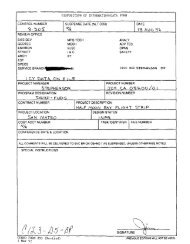
ARCHIVES SEARCH REPORT – FINDINGS<br />
<strong>Jenner</strong> 12th Naval District <strong>Target</strong> No. 29<br />
<strong>Jenner</strong>, CA<br />
An ASR site inspection is limited in scope to a visual, non-intrusive inspection of the<br />
areas suspected of having an OE or CWM hazard potential. This potential is based on an<br />
analysis of the collected information. Prior to the inspection, the <strong>Archive</strong> <strong>Search</strong> team<br />
determines the areas of the site to investigate. The team follows a Site Safety and Health<br />
Plan (SSHP) prohibiting digging or handling of potential OE and CWM. The SSHP<br />
defines standard operating procedures to ensure safety and prevent accidents. Appendix<br />
L-1 contains a copy of the SSHP. The inspection team consisted of the following St.<br />
Louis District Corps of Engineers personnel: Alix Borrok, Randal Curtis and George<br />
Sloan. They performed the site survey on Tuesday, 28 August 2001 in the afternoon.<br />
Subsection 6.2 contains a synopsis of the site inspection and Appendix L-2 contains a<br />
detailed account. Appendix I includes current site photographs.<br />
6.2 SITE INSPECTION SYNOPSIS<br />
The team traveled to <strong>Jenner</strong>, California to begin an inspection of the site, which is part of<br />
the Sonoma Coast State Beaches, Russian River/Mendocino District and open to the<br />
public. The 1945 aerial imagery clearly showed the location of a 100-foot diameter<br />
boardwalk ring between Peaked Hill and several rock outcrops rising above the<br />
surrounding ground. The team began their traverse of the site from Goat Rock Road, just<br />
off California Highway 1, about a quarter of a mile from the target center. The ASR<br />
team used a GPS to help reach the site. ii The majority of the area consists of pasture<br />
grasses less than knee high. A smaller portion of the area gets more drainage and<br />
consists of much thicker and taller grasses and shrubs about waist high. The grasses<br />
partially obscured the ground. The team crisscrossed the target center and the<br />
surrounding area for a couple hundred feet, but did not find any evidence of the target<br />
such as weathered wood posts or OE debris of any kind. The team followed a slightly<br />
different path in departing the site.<br />
ii <strong>Target</strong> feature coordinates were determined using georeferenced historic aerial imagery. The resulting<br />
waypoints were uploaded into a Garmin Etrex Legend GPS (Global Positioning System) receiver using<br />
mapping datum WGS 1984