Mission - AGI
Mission - AGI
Mission - AGI
You also want an ePaper? Increase the reach of your titles
YUMPU automatically turns print PDFs into web optimized ePapers that Google loves.
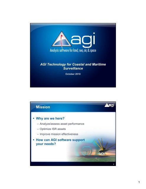
<strong>AGI</strong> Technology for Coastal and Maritime<br />
Surveillance<br />
<strong>Mission</strong><br />
Why are we here?<br />
October 2010<br />
– Analyze/assess asset performance<br />
– Optimize ISR assets<br />
– Improve mission effectiveness<br />
How can <strong>AGI</strong> software support<br />
your needs?<br />
2<br />
1
Historically a challenge<br />
Today’s challenges<br />
Terrorist attacks<br />
Illegal immigration<br />
Piracy<br />
Natural resource<br />
security<br />
Smuggling<br />
2
Platforms continue to evolve<br />
Need multiple systems for success<br />
System challenges<br />
Asset assessment<br />
Asset coordination<br />
and deployment<br />
<strong>Mission</strong> planning<br />
Analyzing “gaps”<br />
and mitigating issue<br />
Optimize ISR assets<br />
Dynamic replanning<br />
3
Benefits of <strong>AGI</strong> technology<br />
System of systems analysis<br />
Single asset analysis<br />
Interoperability<br />
– Data formats<br />
– New and existing systems<br />
Platform/payload agnostic<br />
Rapid prototyping<br />
Fosters collaboration<br />
C3ISR Systems using <strong>AGI</strong> technology<br />
Surveillance and Reconnaissance planning - (ISR)<br />
– US DoD Airborne MASINT <strong>Mission</strong> Planner (AMMP)<br />
– DB-110 Tactical Reconnaissance <strong>Mission</strong> Planning System<br />
– US Civil Air Patrol <strong>AGI</strong>-CAP Search Tool<br />
– Australian Border Protection Command <strong>Mission</strong> Planner<br />
– Wide Area Sensor Planning (WASP)<br />
– General Dynamics Canada <strong>Mission</strong> Planner<br />
– Joint Deployable Intelligence Support System<br />
– USMC MEB Planning Toolkit<br />
Communications planning & C2 - (C3)<br />
– RT Logic T400S Channel Simulator<br />
– L-3 Communications C4ISR Planning<br />
– US Navy Automated Digital Network System<br />
– Systematic Communications Planning<br />
– Coastguard Maritime C2<br />
– IHS AIS Viewer<br />
– GCCS Tactical 3D Common Operating Picture<br />
– C4VAS<br />
4
Key <strong>AGI</strong> Capabilities for<br />
Coastal and Maritime Surveillance<br />
<strong>AGI</strong> technology applied<br />
System-level analysis<br />
– Multi-asset Multi-platform analysis<br />
– Payload performance:<br />
EO, IR, RADAR, SAR<br />
– Communications performance<br />
– Aircraft and ship routes<br />
– Interoperability<br />
– 3D visualization<br />
Applications<br />
– Collaboration - trade studies concept<br />
design<br />
– Pre and post mission analysis<br />
– Real-time or simulated<br />
5
Multi-asset Multi-platform Performance<br />
Coverage Modeling<br />
– Analyze multi-asset performance and interactions<br />
– Model constraints<br />
– Assess task force performance using multiple criteria<br />
Sensor modeling<br />
– Model field of view or field of regard<br />
– Tracking and scanning rates<br />
– Placed on any point of asset<br />
Body masking<br />
Angle constraints<br />
Case Study: Search and Rescue<br />
Problem: Planning and tracking needed<br />
for recon, disaster relief and<br />
counter-narcotic operations<br />
Solution:<br />
Civil Air Patrol<br />
US Air Force Auxiliary<br />
<strong>AGI</strong>-CAP Search Tool:<br />
Streamlined workflow for<br />
operators<br />
Outcome: Quick, easy planning and<br />
search area coverage tool<br />
<strong>AGI</strong> software was operational solution for CAP: responsible<br />
for 85% of American inland search and rescue operations<br />
< ?<br />
6
Radar<br />
Radar systems modeling<br />
– Physical environment<br />
Terrain masking and reflection<br />
Atmospheric properties<br />
Weather and sun effects<br />
– Interference effects<br />
Friendly and enemy<br />
Calculate jamming<br />
capabilities<br />
– Generate reports and<br />
graphs<br />
Radar<br />
Radar systems modeling<br />
– Define asset<br />
– Search/track mode<br />
Fixed PRF and CW<br />
Doppler and pulse integration<br />
tools<br />
Freq/aspect-dependent RCS<br />
– Analysis functions<br />
Single/multi pulse SNR vs.<br />
time<br />
Ambiguous range/Doppler<br />
values<br />
Probability of detection<br />
7
Advanced route modeling<br />
Aircraft performance<br />
– Based on aircraft properties<br />
– Create aircraft flight plan<br />
Procedures<br />
– Waypoint to waypoint<br />
– Holding patterns<br />
– Takeoff/Landing<br />
– Terrain following<br />
Waypoints<br />
– Runways, navaid, other<br />
objects<br />
Ships and vessels<br />
C A S E S T U D Y<br />
Persistent ISR<br />
Problem:<br />
Solution:<br />
Comparison of space-based<br />
radar versus aircraft radar for<br />
surveillance of the coastal<br />
CONUS regions<br />
Automate a complex trade study<br />
by varying multiple parameters<br />
within STK scenarios<br />
Outcome:<br />
Reduced analysis time by months and<br />
increased larger-than-expected trade<br />
space<br />
Outcome:<br />
STK’s APIs accelerated comprehensive trade studies and analyses<br />
8
3D visualization and interoperability<br />
Enhance situational awareness<br />
– Integrate terrain, imagery and GIS data<br />
into 3D COP<br />
Define airspace/regions<br />
“Deconflict” assets<br />
– Model moving assets:<br />
Aircraft, sea vessels, threats<br />
– Integrate real time or simulated<br />
data from other systems<br />
GIS<br />
HLA and DIS<br />
C A S E S T U D Y – Operations<br />
US Tactical 3D COP<br />
Problem:<br />
The US Joint Global Command and Control<br />
System (GCCS-J) required a common 3D<br />
view of the battlefield including GIS,<br />
multiple real-time feeds, and views of<br />
current sensor FOV<br />
Solution: Northrop Grumman partnered with <strong>AGI</strong> to<br />
create T3DCOP, an STK Engine<br />
application that is now integrated into<br />
GCCS-J<br />
Outcome:<br />
Commanders at all levels now have<br />
synchronized 2D and 3D situational<br />
awareness with minimal training<br />
Essential 3D situational awareness seamlessly integrated<br />
into existing architecture<br />
9
Coastal and maritime surveillance<br />
scenario<br />
Coastal and maritime surveillance<br />
Situation: Deploy/Task ISR assets for<br />
improved surveillance better security<br />
Location: Australian coast<br />
ISR Assets: Coastal Radar and Aircraft/UAV<br />
<strong>AGI</strong> software deployed to:<br />
– Define area and merge GIS data, imagery and terrain<br />
– Model coastal radar and assess performance<br />
– Determine gaps and areas of interest<br />
– Model aircraft surveillance<br />
– Dynamically re-Plan aircraft<br />
10
Summary<br />
COTS software available today to<br />
support your efforts<br />
Supporting you with:<br />
– System of system analysis<br />
– Multi-sensor analysis<br />
– Comms performance<br />
– 3D visualization<br />
Foundation for success<br />
– Interoperability<br />
– Open architecture<br />
– World class support and training<br />
From concept to operations<br />
Next steps<br />
For additional information on <strong>AGI</strong> technology:<br />
– Contact your local resources<br />
– Request a meeting<br />
– Learn more at<br />
www.agi.com<br />
adn.agi.com<br />
To start using <strong>AGI</strong> technology<br />
– Global Tech Tour Promotion<br />
– Attend training<br />
– Request a demo<br />
Thank you for your attendance!<br />
11
C A S E S T U D Y<br />
Thank you<br />
US D.o.D – Radar Planning for UAVs<br />
Problem:<br />
Radar threat modeling required in<br />
existing planning system. When<br />
would aircraft be detected by enemy<br />
radar?<br />
Solution: STK Engine and DoD radar models<br />
use dynamic RCS to rapidly identify<br />
detections in a mission plan<br />
Outcome: Expanded analysis capability with<br />
COSTs software enabling predict<br />
and avoid solution<br />
Rapid delivery of a technically accurate solution for radar prediction<br />
performance in existing mission planning system<br />
23<br />
12
C A S E S T U D Y - Operations<br />
Automated Collection Planning Tool - ACPT<br />
Problem: US Air Force needed simple,<br />
accurate, and automated<br />
means of tasking satellites<br />
and aircraft<br />
Solution: RRI developed STK Engine<br />
interface to automate STK<br />
astrodynamic analysis and<br />
optimize collection strategies<br />
Outcome: Tasking is completed faster,<br />
redundancy is minimized, and<br />
satellite usage is maximized<br />
Satellites produce more images in less time<br />
using automated STK Engine ACPT<br />
Unique Strengths of <strong>AGI</strong><br />
Platform Independence<br />
– Land<br />
– Sea<br />
– Air<br />
– Space<br />
Advanced Physics<br />
– Vehicle motion<br />
– Sensors<br />
– RF<br />
13
Unique Strengths of <strong>AGI</strong><br />
Performance<br />
– 3D Rendering<br />
Fast and smooth rendering<br />
High detail<br />
Global scale<br />
– Real-time data management<br />
10,000’s of tracks<br />
Geometric analysis<br />
– Flexible development architecture<br />
C#, C++, .NET, Java, etc<br />
Scalability (SOA, web-services)<br />
14


