Subterranean ecosystems - Universidade de Évora
Subterranean ecosystems - Universidade de Évora
Subterranean ecosystems - Universidade de Évora

You also want an ePaper? Increase the reach of your titles
YUMPU automatically turns print PDFs into web optimized ePapers that Google loves.
Legal Notice<br />
Neither the Publisher nor any person acting on behalf of the Publisher is responsible for the use which may<br />
be ma<strong>de</strong> of the following information.<br />
Title<br />
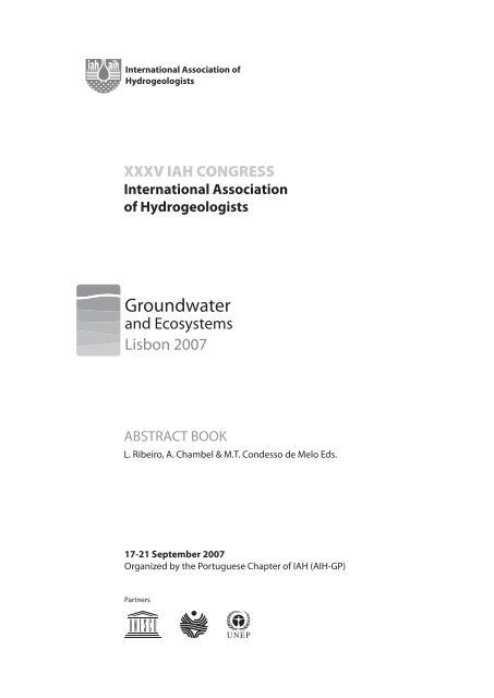
XXXV Congress of the International Association of Hydrogeologists, Groundwater and Ecosystems<br />
Abstract Book<br />
Editors<br />
L. Ribeiro, A. Chambel & M.T. Con<strong>de</strong>sso <strong>de</strong> Melo Eds.<br />
Design<br />
Dasein<br />
Proofrea<strong>de</strong>r and Editing<br />
DTP Solutions, Cape Town, South Africa<br />
Web<strong>de</strong>veploment<br />
Fisália - Design & Integração <strong>de</strong> Sistemas<br />
Printing<br />
Arlindo Silva Artes Gráficas Lda.<br />
1 ST Edition<br />
September 2007<br />
Legal Deposit<br />
263596 / 07<br />
ISBN<br />
978-989-95297-2-4
Abstracts of the XXXV IAH Congress on Groundwater and Ecossystems, held in Lisbon, Portugal, 17-21<br />
September 2007, organized by IAH Portuguese Chapter (IAH-GP).<br />
The Congress partner organizations are the United Nations Educational, Scientific and Cultural<br />
Organization, International Hydrological Programme (UNESCO-IHP) and United Nations Environment<br />
Programme (UNEP).
SCIENTIFIC COMMITTEE<br />
Luís Ribeiro (Presi<strong>de</strong>nt) Portugal<br />
Achour Bachir Algeria<br />
Albino Me<strong>de</strong>iros Portugal<br />
Alice Aurelli UNESCO<br />
António Chambel Portugal<br />
Bill Humphreys Australia<br />
Carlos Costa Almeida Portugal<br />
Christian Griebler Germany<br />
Christine Colvin South Africa<br />
Cliff Voss USA<br />
Dan Danielopol Austria<br />
Dave Le Maitre South Africa<br />
Derek Ford Canada<br />
Emilia Bocanegra Argentina<br />
Emilio Custodio Spain<br />
François Zwahlen Switzerland<br />
Ghislain <strong>de</strong> Marsily France<br />
Giovanni Barrocu Italy<br />
Guram Buachidze Georgia<br />
Han Zaisheng China<br />
Ian Acworth Australia<br />
Ian Simmers Netherlands<br />
Jack Sharp USA<br />
Janine Gibert France<br />
Jenny Reynolds Vargas Costa Rica<br />
Jiri Krásny Czech Republic<br />
João Lopo <strong>de</strong> Mendonça Portugal<br />
João Paulo Lobo-Ferreira Portugal<br />
Joel Carrillo-Rivera México<br />
John Moore USA<br />
Jorge Montaño Xavier ALHSUD<br />
José Manuel Marques Portugal<br />
José Paulo Monteiro Portugal<br />
Jozsef Tóth Canada<br />
Júlio Carneiro Portugal<br />
Ken Howard Canada<br />
Kenji Jinno Japan<br />
Leonard Konikow USA<br />
Lin Xueyu China<br />
Luís Nunes Portugal<br />
Maciek Lubczynsky Netherlands<br />
Manuel Men<strong>de</strong>s <strong>de</strong> Oliveira Portugal<br />
Manuel Oliveira da Silva Portugal<br />
Maria da Conceição Cunha Portugal<br />
Mike Edmunds UK<br />
M. Teresa Con<strong>de</strong>sso <strong>de</strong> Melo Portugal<br />
Nour-Eddine Laftouhi Morocco<br />
Okke Batelaan Belgium<br />
Philip E. LaMoreaux USA<br />
Philippe Negrel France<br />
Rachida Bouhlila Tunisia<br />
Ray Evans Australia<br />
Ricardo Hirata Brasil<br />
Richard Evans Australia<br />
Roy Brouwer Netherlands<br />
Segun A<strong>de</strong>lana South Africa<br />
Shamin<strong>de</strong>r Puri UK<br />
Shivendra Rai India<br />
Shrikant Limaye India<br />
Stefan Wohnlich Germany<br />
Stephen Foster IAH<br />
Tibor Stigter Portugal<br />
Willi Struckmeier Germany<br />
Wolfgang Kinzelbach Switzerland<br />
Yasuo Sakura Japan<br />
ORGANIZING COMMITTEE<br />
António Chambel (Chairman) <strong>Universida<strong>de</strong></strong> <strong>de</strong> <strong>Évora</strong><br />
Alberto Lima <strong>Universida<strong>de</strong></strong> do Minho<br />
Albino Me<strong>de</strong>iros <strong>Universida<strong>de</strong></strong> Nova <strong>de</strong> Lisboa<br />
Alice Aureli UNESCO-IHP<br />
André Matoso CCDR – Alentejo<br />
Augusto Marques da Costa Centro <strong>de</strong> Geologia/INETI<br />
Carlos Calado Direcção Geral <strong>de</strong> Geologia e Energia<br />
Carlos Costa Almeida Centro <strong>de</strong> Geologia/INETI<br />
Catarina Silva <strong>Universida<strong>de</strong></strong> <strong>de</strong> Lisboa<br />
Clara Sena <strong>Universida<strong>de</strong></strong> <strong>de</strong> Aveiro<br />
João Lopo <strong>de</strong> Mendonça <strong>Universida<strong>de</strong></strong> <strong>de</strong> Lisboa<br />
João Nascimento Instituto Superior Técnico<br />
Joaquim Braga dos Santos INAG<br />
Jorge Duque Instituto Politécnico <strong>de</strong> Beja<br />
José António Serrano CCDR – Centro<br />
Jose Luis Martin UNESCO<br />
José Manuel Azevedo <strong>Universida<strong>de</strong></strong> <strong>de</strong> Coimbra<br />
José Manuel Marques Instituto Superior Técnico<br />
José Martins Carvalho Instituto Superior <strong>de</strong><br />
Engenharia do Porto<br />
José Paulo Monteiro <strong>Universida<strong>de</strong></strong> do Algarve<br />
José Virgilio Cruz <strong>Universida<strong>de</strong></strong> dos Açores<br />
Judite Fernan<strong>de</strong>s INETI<br />
Júlio Carneiro <strong>Universida<strong>de</strong></strong> <strong>de</strong> <strong>Évora</strong><br />
Luís Ferreira Gomes <strong>Universida<strong>de</strong></strong> da Beira Interior<br />
Luís Ribeiro Instituto Superior Técnico<br />
Manuel Abrunhosa <strong>Universida<strong>de</strong></strong> do Porto<br />
Manuel Marques da Silva <strong>Universida<strong>de</strong></strong> <strong>de</strong> Aveiro<br />
Manuel Men<strong>de</strong>s <strong>de</strong> Oliveira LNEC<br />
Manuel Oliveira da Silva <strong>Universida<strong>de</strong></strong> <strong>de</strong> Lisboa<br />
Manuel Pacheco Figueiredo <strong>Universida<strong>de</strong></strong> do Porto<br />
Maria Rosário Carvalho <strong>Universida<strong>de</strong></strong> <strong>de</strong> Lisboa<br />
Maria do Rosário Pereira UTAD<br />
M. Teresa Con<strong>de</strong>sso <strong>de</strong> Melo <strong>Universida<strong>de</strong></strong> <strong>de</strong> Aveiro<br />
Paula Carreira ITN<br />
Paulo Balsa <strong>Universida<strong>de</strong></strong> <strong>de</strong> <strong>Évora</strong><br />
Rui Coutinho <strong>Universida<strong>de</strong></strong> dos Açores<br />
Susana Prada <strong>Universida<strong>de</strong></strong> da Ma<strong>de</strong>ira<br />
Tibor Stigter <strong>Universida<strong>de</strong></strong> do Algarve
PARTNERS<br />
United Nations Educational, Scientific and Cultural Organization UNESCO<br />
UNESCO International Hydrological Programme UNESCO-IHP<br />
United Nations Environment Programme UNEP<br />
INSTITUTIONAL SPONSORS<br />
Asociación Latinoamericana <strong>de</strong> Hidrología Subterránea para el Desarrollo ALHSUD<br />
Associação Brasileira <strong>de</strong> Águas Subterrâneas ABAS<br />
Associação Portuguesa <strong>de</strong> Geólogos APG<br />
Associação Portuguesa dos Recursos Hídricos APRH<br />
Câmara Municipal <strong>de</strong> Lisboa<br />
Comissão <strong>de</strong> Coor<strong>de</strong>nação e Desenvolvimento Regional do Alentejo CCDRA CCDRA<br />
Centro <strong>de</strong> Geofísica <strong>de</strong> <strong>Évora</strong> CGE<br />
Centro <strong>de</strong> Geologia CG<br />
Centro <strong>de</strong> Geosistemas CVRM<br />
Centre for Groundwater Studies Australia<br />
Empresa Portuguesa das Águas Livres, S. A. EPAL<br />
Faculda<strong>de</strong> <strong>de</strong> Ciências da <strong>Universida<strong>de</strong></strong> <strong>de</strong> Lisboa FCUL<br />
Fundação Nova Cultura da Água FNCA<br />
Instituto Nacional <strong>de</strong> Engenharia, Tecnologia e Inovação INETI<br />
Instituto <strong>de</strong> Conservação da Natureza ICN<br />
Instituto Superior Técnico IST<br />
International Association of Hydrological Sciences IAHS<br />
Fundação Luso-Americana para o Desenvolvimento FLAD<br />
Fundação Oriente<br />
Secretaria Regional do Ambiente e do Mar - Governo dos Açores<br />
<strong>Universida<strong>de</strong></strong> <strong>de</strong> Aveiro UA<br />
<strong>Universida<strong>de</strong></strong> <strong>de</strong> <strong>Évora</strong> UE<br />
<strong>Universida<strong>de</strong></strong> do Algarve UALG<br />
<strong>Universida<strong>de</strong></strong> Nova <strong>de</strong> Lisboa UNL<br />
COMMERCIAL SPONSORS<br />
Águas do Algarve, S.A. AdP<br />
Águas do Oeste, S.A. AdP<br />
Águas <strong>de</strong> Santo André, S.A. AdP<br />
Cooperativa Agrícola <strong>de</strong> Reguengos <strong>de</strong> Monsaraz CARMIM<br />
Centro Hospitalar Caldas da Rainha<br />
Compal<br />
Delta Cafés<br />
Empresa Beira Vicente (Fonte da Fraga)<br />
Gabinete <strong>de</strong> Planeamento e Gestão do Território, Lda GGT<br />
GRUNDFOS©<br />
Martins e Gonçalves, Contabilida<strong>de</strong> e Gestão, Lda MG<br />
Renato Lima Azenha<br />
Socieda<strong>de</strong> Central <strong>de</strong> Cervejas e Bebidas, S.A.<br />
Transtejo S.A.<br />
Vista Alegre Atlantis SGPS, S.A. VAA<br />
CONFERENCE SECRETARIAT<br />
AIH-GP<br />
Departamento <strong>de</strong> Geociências<br />
Campus Universitário <strong>de</strong> Santiago<br />
3810-193 Aveiro<br />
PORTUGAL<br />
Tel: +351 91 647 11 02<br />
Fax: +351 234 370 605<br />
E-mail: info@iah-2007.com
Preface<br />
Ecosystem services are <strong>de</strong>fined as the goods and benefits provi<strong>de</strong>d to people by <strong>ecosystems</strong>, including<br />
provision of food, fuel, wood and water; regulating services; supporting services such as soil formation and<br />
nutrient cycling and cultural services such as opportunities for recreation and spiritual experience.<br />
A recent study of the Millennium Ecosystem Assessment has conclu<strong>de</strong>d that many of the Earth’s ecosystem<br />
services are seriously affected by overuse and exploitation of resources. In fact, groundwater resources are<br />
facing increasing pressure from consumption in various socioeconomic activities, the most dramatic of which<br />
is the general rise in water <strong>de</strong>mand. On the other hand, climate changes have contributed to the <strong>de</strong>crease in<br />
groundwater availability, especially in some sensitive regions such as arid and semi-arid areas and coastal/<br />
estuarine zones. All these anthropogenic changes pose a significant threat to the health of the groundwater<br />
<strong>ecosystems</strong> and negative modifications on the services provi<strong>de</strong>d by them.<br />
During the last two <strong>de</strong>ca<strong>de</strong>s, groundwater ecology has very rapidly <strong>de</strong>veloped as a new research area, originating<br />
important concepts such as Groundwater Depen<strong>de</strong>nt Ecosystem (GDE). These <strong>ecosystems</strong> totally or partially rely<br />
on groundwater to maintain their species composition and natural ecological processes. Furthermore, their<br />
characterization is regulated by the level of <strong>de</strong>pen<strong>de</strong>ncy on groundwater.<br />
<strong>Subterranean</strong> <strong>ecosystems</strong> reveal specific fauna and show high biodiversity and habitat heterogeneity at spatial<br />
and temporal scales. Besi<strong>de</strong>s, the biological component of subterranean <strong>ecosystems</strong> provi<strong>de</strong>s an important<br />
ecosystem service of water purification through microbial <strong>de</strong>gradation of contaminant compounds.<br />
In conclusion, there is a growing need to <strong>de</strong>velop interdisciplinary methodologies in or<strong>de</strong>r to properly analyse<br />
and un<strong>de</strong>rstand the complex interrelationships in all these specific <strong>ecosystems</strong>; and geology, hydrogeology,<br />
geochemistry, biology, economy, geomathematics play an essential role in the process.<br />
Implementation of the European Water Framework Directive (WFD) and the complementary ‘Directive on the<br />
Protection of Groundwater against Pollution’ [European Union Groundwater Directive] <strong>de</strong>mands an initial<br />
characterization of all groundwater bodies.<br />
The initial main criterion for the Directives was the <strong>de</strong>finition of the groundwater status from the point of view of<br />
quantity and quality (chemical). However, due to its relevance, the ecological perspective was also introduced<br />
in the Groundwater Directive, recognizing the importance of the ecological functions of groundwater and<br />
their interactions with GDEs.<br />
The International Association of Hydrogeologists (IAH) has set up a Commission on Groundwater Depen<strong>de</strong>nt<br />
Ecosystems, acknowledging the important ecological role of groundwater in rivers, wetlands and other coastal<br />
and terrestrial environments. The main goals of this GDE Commission are:<br />
• To promote wi<strong>de</strong>r un<strong>de</strong>rstanding of the ecological role of aquifers and the impacts of groundwater<br />
abstraction to <strong>de</strong>cision makers.<br />
• To provi<strong>de</strong> a forum to promote, link and coordinate research in terrestrial, aquatic and marine Groundwater<br />
Depen<strong>de</strong>nt Ecosystems (GDEs) between IAH members.<br />
• To connect IAH with other organizations active in ecohydrology and related disciplines.<br />
• To potentially attract a new group of groundwater scientists to IAH.<br />
And, UNESCO has also inclu<strong>de</strong>d the concept of GDE in the Ecohydrology theme of the International<br />
Hydrological Programme.<br />
The objectives of this XXXV IAH Congress, the first one organized by IAH <strong>de</strong>dicated to Groundwater and<br />
Ecosystems, are:<br />
• To experience exchange of knowledge on integral groundwater management with <strong>de</strong>pen<strong>de</strong>nt<br />
<strong>ecosystems</strong>.<br />
• To propose methods of <strong>de</strong>fining, preventing, controlling and mitigating negative environmental impacts<br />
related with groundwater on the <strong>ecosystems</strong>.<br />
• To discuss specific issues such as climate changes, groundwater quantity and quality as well as threatening<br />
processes in <strong>de</strong>pen<strong>de</strong>nt <strong>ecosystems</strong>, biological aspects of groundwater <strong>de</strong>pen<strong>de</strong>nt <strong>ecosystems</strong> and
management and economic tools to protect groundwater, etc.<br />
• To communicate with the general public and with non-groundwater specialists.<br />
• To consi<strong>de</strong>r the importance of sustainable <strong>de</strong>velopment of groundwater, with social, ecological and<br />
economic implications.<br />
• To present recommendations to administrators and professionals of water resources management.<br />
The Editors<br />
Luís Ribeiro<br />
António Chambel<br />
M. Teresa Con<strong>de</strong>sso <strong>de</strong> Melo
Table of Contents<br />
Keynotes<br />
EXPANDING CONCEPTS WITHIN ECO-HYDROLOGY TO ACCOMMODATE THE HYDRODIVERSITY OF<br />
GROUNDWATER DEPENDENT ECOSYSTEMS (OR HOW DO AQUIFERS MAKE ECOSYSTEMS LAZY, INEFFICIENT<br />
AND VULNERABLE?)<br />
Christine COLVIN<br />
WATER MANAGEMENT AND ECOSYSTEMS – LIVING WITH CHANGE<br />
Malin FALKENMARK<br />
INTERACTIONS BETWEEN GROUND WATER AND SURFACE WATER AND THE HYDROECOLOGY OF STREAMS<br />
AND RIVERS<br />
Judson W. HARVEY<br />
LANDSCAPE MODELLING FOR THE ASSESSMENT OF A NUCLEAR WASTE REPOSITORY IN SWEDEN:<br />
INTEGRATION OF HYDROLOGICAL AND ECOLOGICAL MODELLING<br />
Ulrik KAUTSKY, Sten BERGLUND, Jan-Olof SELROOS, Tobias LINDBORG<br />
ESTIMATING GROUNDWATER DISCHARGE TO LAKE AND WETLAND ECOSYSTEMS USING ENVIRONMENTAL<br />
TRACERS<br />
Peter COOK, Cameron WOOD, Troy WHITE, Craig T SIMMONS<br />
MODELING OF GEOCHEMICAL TRANSPORT ALONG FRESH AND SALT WATER MIXING ZONE DEVELOPED IN A<br />
COASTAL AQUIFER<br />
Kenji JINNO, Keigo AKAGI, Yoshinari HIROSHIRO, Tosao HOSOKAWA, Jun YASUMOTO<br />
MICROBIAL ECOLOGY AND GEOCHEMISTRY OF BIODEGRADATION IN POROUS AQUIFERS – NEW CONCEPTS<br />
FOR LIMITATIONS AND STIMULATIONS<br />
Christian GRIEBLER, Robert BAUER, Bettina ANNESER, Christian WINDERL, Tillmann LUEDERS, Piotr<br />
MAOSZEWSKI, Florian EINSIEDL, Willibald STICHLER, Massimo ROLLE, Sebastian BAUER, Christina<br />
EBERHARDT, Peter GRATHWOHL, Lars RICHTERS, Rainer U. MECKENSTOCK<br />
ECOHYDROLOGY, PHREATOPHYTES AND GROUNDWATER DEPENDENT ECOSYSTEMS<br />
Okke BATELAAN, Flip WITTE<br />
SCIENCE-POLICY INTEGRATION LINKED TO THE IMPLEMENTATION OF THE EUROPEAN UNION WATER<br />
FRAMEWORK DIRECTIVE (WFD) AND ITS DAUGHTER DIRECTIVES<br />
Philippe QUEVAUVILLER<br />
PERCEPTIONS, ECONOMIC VALUES AND WATER POLICY<br />
Gregory L. POE<br />
THE ECONOMIC CHALLENGE TO INTEGRATED GROUNDWATER AND ECOSYSTEM PROTECTION<br />
Roy BROUWER<br />
ECOHYDROLOGY AND GROUNDWATER DEPENDENCY OF WATER LIMITED ECOSYSTEMS<br />
Maciek LUBCZYNSKI<br />
TOPIC 01<br />
Groundwater/surface-water water interactions and their<br />
importance for the sustainability of river and spring base flow,<br />
and associated wetlands<br />
3<br />
4<br />
6<br />
7<br />
8<br />
10<br />
11<br />
12<br />
13<br />
14<br />
15<br />
16
A CLASSIFICATION SCHEME FOR POLLUTANT ATTENUATION AT THE GROUNDWATER - SURFACE WATER<br />
INTERFACE<br />
Jonathan SMITH, Tracey GOODWIN, Julian C. ELLIS, David LERNER<br />
AN ASSESSMENT OF GROUNDWATER DEPENDENT ECOSYSTEMS IN THE BURNETT RIVER GROUNDWATER<br />
AREA, QUEENSLAND, AUSTRALIA.<br />
Richard EVANS, Steve PARSONS, Tony O´GRADY, Andrew J BOULTON<br />
AN INTEGRATIVE APPROACH TO SUSTAINABLE GROUNDWATER AND ASSOCIATED<br />
GROUNDWATER-DEPENDENT SYSTEM MANAGEMENT IN ARID KARST AQUIFERS: CUATROCIéNEGAS BASIN,<br />
MEXICO<br />
Brad WOLAVER, Jack SHARP, Juan Manuel RODRIGUEZ, Dean A HENDRICKSON<br />
ASSESSING THE NITROGEN ATTENUATION CAPACITY OF A HYPORHEIC ZONE IN A LOWLAND RIVER<br />
CATCHMENT<br />
Nicholas Paul RIESS, Wairimu MUIA, Jonathan SMITH, Mark OSBORN, Steven THORNTON<br />
CABO DA BOA ESPERANCA– CHANGING THE COURSE AND IMPACT OF FERTILIZER CONTAMINATED<br />
GROUNDWATER SEEPAGE ON AN URBAN STREAM AND WETLAND ECOSYSTEM<br />
Ritchie MORRIS, Martin BURR<br />
ENVIRONMENTAL EFFECTS OF GROUNDWATER LEVEL CHANGES IN HEADWATER BOREAL ECOSYSTEMS<br />
Bjorn KLOVE, Jens KVÆRNER, Seppo GEHöR, Hannu ANSALA<br />
GROUNDWATER ABSTRACTIONS AND AQUIFER-RIVER INTERACTION IN THE MANCHA ORIENTAL SYSTEM<br />
(JúCAR RIVER BASIN, SE SPAIN)<br />
David SANZ MARTINEZ, Juan José GóMEZ ALDAY, Santiago CASTAñO FERNáNDEZ<br />
GROUNDWATER AND STREAM WATER INTERACTIONS AND SALINITY IN THE UPPER HUNTER VALLEY,<br />
EASTERN AUSTRALIA<br />
Peter SOMERVILLE, Ian WHITE, Bennett MACDONALD, Sue WELCH, Sara BEAVIS, Richard BUSH<br />
GROUNDWATER DEPENDENT ECOSYSTEMS ASSOCIATED WITH BASALT AQUIFERS OF THE ALSTONVILLE<br />
PLATEAU, NEW SOUTH WALES, AUSTRALIA<br />
Richard T GREEN, Ross S BRODIE, R Michael WILLIAMS<br />
GROUNDWATER/SURFACE WATER EXCHANGE AND ITS INFLUENCE ON STABLE WATER ISOTOPIC<br />
SIGNATURES ALONG THE DARLING RIVER, NSW, AUSTRALIA.<br />
Karina MEREDITH, Suzanne HOLLINS, Cath HUGHES, Dioni I. CENDóN, David STONE<br />
HYDROCHEMICAL INVESTIGATIONS OF SURFACE WATER GROUNDWATER INTERACTIONS IN A<br />
SUB-CATCHMENT IN THE NAMOI VALLEY, NSW, AUSTRALIA<br />
Martin S ANDERSEN, Ian ACWORTH<br />
INTERACTIONS BETWEEN GROUNDWATER AND ARTIFICIAL PONDS IN THE NORTHERN BOTANY AQUIFER,<br />
SYDNEY, AUSTRALIA<br />
Wendy TIMMS, Ian ACWORTH, Ian TURNER<br />
MANAGEMENT OF STREAM COMPENSATION FOR A LARGE CONJUNCTIVE USE SCHEME, SHROPSHIRE,<br />
UNITED KINGDOM<br />
Martin SHEPLEY, Mike STREETLY, Kevin VOYCE, Fiona BAMFORD<br />
MAPPING GROUNDWATER-SURFACE WATER INTERACTIONS AND ASSOCIATED GEOLOGICAL FAULTS USING<br />
TEMPERATURE PROFILING<br />
Matthijs BONTE, Josie GERIS, Vincent POST, Victor BENSE, Harold VAN DIJK<br />
MODELLING STREAM-GROUNDWATER INTERACTIONS IN QUERENçA-SILVES AQUIFER SYSTEM<br />
José Paulo MONTEIRO, LuíS RIBEIRO, Edite REIS, JoãO MARTINS, José MATOS SILVA<br />
19<br />
21<br />
23<br />
25<br />
27<br />
28<br />
29<br />
30<br />
32<br />
34<br />
35<br />
37<br />
38<br />
39<br />
41
NEAR SURFACE HYDRAULIC AND GEOPHYSICAL DETECTION OF DEPTH-SOURCED SALINE WATER,<br />
DUNA-TISZA INTERFLUVE<br />
Szilvia SIMON<br />
QUANTIFYING GROUNDWATER DEPENDENCE OF WETLANDS IN A VOLCANIC PLAIN, SOUTH-EASTERN<br />
AUSTRALIA<br />
Annette BARTON, Jim COX, Peter DAHLHAUS, Andrew HERCZEG<br />
RESPONSE OF SURFACE ECO-SYSTEMS TO GROUNDWATER TABLE CHANGES IN THE LOWER REACHES OF<br />
TARIM RIVER, XINJIANG, CHINA<br />
Yaning CHEN, Zhonghe PANG, Yapeng CHEN, Weihong LI, Changchun XU<br />
SMALL-SCALE WATER- AND NUTRIENT-EXCHANGE BETWEEN LOWLAND RIVER SPREE (GERMANY) AND<br />
ADJACENT GROUNDWATER<br />
Joerg LEWANDOWSKI, Gunnar NüTZMANN<br />
SURFACE AND GROUND WATER INTERACTIONS: WATER QUALITY IMPLICATIONS<br />
Bennett MACDONALD, Ian WHITE, Peter SOMERVILLE<br />
SURFACE AND GROUNDWATER DYNAMIC INTERACTIONS IN THE UPPER GREAT CHAO PHRAYA PLAIN OF<br />
THAILAND: SEMI-COUPLING OF SWAT AND MODFLOW<br />
Werapol BEJRANONDA, Sucharit KOONTANAKULVONG, Aksara PUTTHIVIDHYA<br />
SURFACE WATER GROUNDWATER INTERACTIONS IN AN EPHEMERAL CREEK IN THE NAMOI VALLEY, NSW,<br />
AUSTRALIA – CONTROLS BY GEOLOGY AND GROUNDWATER ABSTRACTION.<br />
Martin S ANDERSEN, Ian ACWORTH<br />
SURFACE WATER SURPLUS STORAGE IN AQUIFERS AND RECOVERY: APPLICABILITY TO THE ALGARVE<br />
(PORTUGAL)<br />
Luis OLIVEIRA, JoãO Paulo CARCOMO LOBO FERREIRA<br />
SURFACE WATER, GROUNDWATER AND ECOLOGICAL INTERACTIONS ALONG THE RIVER MURRAY. A PILOT<br />
STUDY OF MANAGEMENT INITIATIVES AT THE BOOKPURNONG FLOODPLAIN, SOUTH AUSTRALIA.<br />
Volmer BERENS, Melissa G WHITE, Nicholas J SOUTER, Ian D JOLLY, Kate. L. HOLLAND, Kerryn L MCEWAN,<br />
Mike A HATCH, Andrew FITZPATRICK, Tim J MUNDAY<br />
SURFACE/GROUNDWATER INTERACTIONS: IDENTIFYING SPATIAL CONTROLS ON WATER QUALITY AND<br />
QUANTITY IN A LOWLAND UK CHALK CATCHMENT<br />
Nicholas HOWDEN, Howard WHEATER, Denis PEACH, Adrian BUTLER<br />
THE APPLICATION OF AIRBORNE GEOPHYSICS TO MAPPING RIVER AND GROUNDWATER INTERACTIONS<br />
Andrew FITZPATRICK, Tim J MUNDAY, Kevin CAHILL, Volmer BERENS, Mike A HATCH<br />
THE DUNA-TISZA INTERFLUVE HYDROGEOLOGICAL TYPE SECTION, HUNGARY<br />
Judit SZNYI-MÁDL, Jozsef TOTH<br />
THE ROLE OF GROUNDWATER IN CATCHMENT MANAGEMENT<br />
David LERNER, Bob HARRIS, Ben SURRIDGE<br />
TYPOLOGY OF GROUNDWATER-SURFACE WATER INTERACTION - GSI TYPOLOGY<br />
Mette DAHL, Bertel NILSSON, Jesper H. LANGHOFF, Jens Christian REFSGAARD<br />
UNDERSTANDING SURFACE AND GROUNDWATER INTERACTIONS AND THEIR RELATIONSHIP WITH SALINITY<br />
DYNAMICS IN THE WOLLOMBI BROOK, NSW, AUSTRALIA<br />
Gabrielle YATES, Bennett MACDONALD<br />
WATER BALANCE IN THE GUARANI AQUIFER OUTCROP ZONE BASED ON HYDROGEOLOGIC MONITORING<br />
Carlos BARRETO, Luis Henrique GOMES, Edson WENDLAND<br />
43<br />
45<br />
47<br />
49<br />
50<br />
51<br />
52<br />
54<br />
56<br />
57<br />
59<br />
60<br />
62<br />
63<br />
65<br />
66
WATER TABLE DYNAMICS OF A SEVERELY ERODED WETLAND SYSTEM, PRIOR TO REHABILITATION, SAND<br />
RIVER CATCHMENT, SOUTH AFRICA<br />
Edward RIDDELL, Simon LORENTZ, William ELLERY, Donovan KOTZE, Jacobus PRETORIUS, Silus NKETAR,<br />
Bertram KONING<br />
_____________________________________________<br />
AN ANALYSIS OF PAH TRANSPORT DYNAMICS IN A RURAL WATERSHED: PROCESSES ON THE SCALE OF A<br />
FLOOD EVENT<br />
Amer MOUHRI, Anne MOTELAY-MASSEI, Nicolas MASSEI, Benoit LAIGNEL<br />
APPLICATION OF HYDROLOGICAL INDICATORS FOR BIODIVERSITY MONITORING IN THE TORDERA RIVER (NE<br />
SPAIN)<br />
Josep MAS-PLA, Anna MENCIó<br />
APPLICATION OF TWO MODELS FOR CALCULATING PHREATIC WATER EVAPORATION IN THE LOWER<br />
REACHES OF TARIM RIVER, WESTERN CHINA<br />
Zhaoxia YE, Yaning CHEN, Weihong LI, Yan YAN<br />
ASSESSMENT OF THE HYDROGEOLOGICAL ENVIRONMENT AROUND ISMAILIA CANAL, EASTERN NILE DELTA,<br />
EGYPT, FOR THE APPLICABILITY OF BANK FILTRATION TECHNIQUE<br />
Kamal GHODEIF, Birgit FRITZ<br />
CHEMICAL TRANSFERS FROM ATMOSPHERIC WATERS TOWARDS GROUNDWATERS. APPLICATION TO<br />
VOLCANIC AQUIFERS (ARGNAT BASIN, FRANCE).<br />
Guillaume BERTRAND, Helene CELLE-JEANTON, Paolo LAJ, Gilles CHAZOT, CéLine FAJON, JéRôMe<br />
RANGOGNIO, Marius PARAZOLS, Sebastien LOOCK, Fre<strong>de</strong>ric HUNEAU<br />
CONTROL OF STORAGE CAPACITY DURING DROUGHT BY MULTI-PURPOSE DAMS IN THE TONE RIVER BASIN<br />
Miyo SHIMIZU, Mitsukuni TSUCHIYA<br />
EFFECTS OF SURFACE WATER-GROUNDWATER INTERACTION ON ECOTONES IN OGUN RIVER BASIN<br />
Gbolaga<strong>de</strong> BOLAJI<br />
ESTIMATION OF TOTAL RECHARGE OBTAINED FROM AUTOMATED WATER LEVEL MONITORING OF<br />
UNCONFINED RIO CLARO AQUIFER, BRAZIL<br />
Hung Kiang CHANG, Dagmar CARNIER NETO<br />
EVALUATING THE EFFECTS OF GROUNDWATER EXTRACTION ON A BROOK CHARR POPULATION IN<br />
SOUTHERN ONTARIO, CANADA<br />
Rick PALMER, Rob FRIZZELL, Robert LEECH<br />
GROUNDWATER AND SURFACE WATER INTERACTIONS AT CATCHMENT SCALE IN RADMILOVAC (SERBIA)<br />
Sava PETKOVIC, Enika GREGORIC, Vera RAICEVIC, Igor KLJUJEV, Steve QUARRIE<br />
GROUNDWATER RECHARGE SEQUENCE IN BADAIN JARAN DESERT AS RELATED TO OASIS ECOLOGY:<br />
REASSESSMENT OF ENVIRONMENTAL TRACERS<br />
Tianming HUANG, Zhonghe PANG, Jinzhu MA<br />
GROUNDWATER – SURFACE WATER INTERACTIONS NEAR A CHEMICAL COMPLEX (ESTARREJA, PORTUGAL) –<br />
IMPLICATIONS ON GROUNDWATER QUALITY<br />
Carlos Miraldo ORDENS, M. Teresa CONDESSO DE MELO, Carlos GRANGEIA, Manuel Augusto MARQUES DA<br />
SILVA<br />
GROUNDWATER-SURFACE WATER INTERACTIONS AND THEIR IMPORTANCE FOR ECOSYSTEM<br />
SUSTAINABILITY IN WETLANDS (ECOWET PROJECT)<br />
M. Teresa CONDESSO DE MELO, Clara SENA, Ana Maria CASTILHO, Tibor STIGTER, JoãO PRATAS, Pedro<br />
DINIS, Fernando FIGUEIREDO, LuíS CHÍCHARO, AméLia CARVALHO DILL, Jacob KEIZER<br />
67<br />
71<br />
72<br />
74<br />
75<br />
76<br />
78<br />
80<br />
81<br />
83<br />
84<br />
86<br />
87<br />
89
HYDRAULIC INTERACTIONS BETWEEN RIVER AND AQUIFER AT A MANGYEONG RIVER FLOODPLAIN, KOREA<br />
Kyoochul HA, Dong-Chan KOH<br />
HYDROGEOCHEMICAL CHARACTERISATION OF THE WETLANDS OF PUNTA ENTINAS AND SALINAS DE<br />
CERRILLOS AND IMPLEMENTATION OF THE WATER FRAMEWORK DIRECTIVE<br />
Francisco SáNCHEZ MARTOS, Luis MOLINA-SáNCHEZ, Juan GISBERT<br />
HYDROGRAPH SEPARATION USING MIXING MODEL DURING TWO CONSECUTIVE RAINFALL EVENTS<br />
Sung-Hyeon CHO, Moo Young SONG<br />
HYDROGRAPH SEPARATIONS BASED ON THE CATCHMENT AREAS.<br />
Sung-Hyeon CHO, Minjoe CHO, Moo Young SONG<br />
HYDROLOGICAL CHARACTERISTICS OF A SEMI-ARID PLAYA-LAKE COMPLEX AND RELATED DETRITIC<br />
AQUIFER<br />
Miguel RODRíGUEZ-RODRíGUEZ, Francisco MORAL, Jose BENAVENTE<br />
IMPACT OF GRAVEL EXTRACTION ACTIVITIES ON HYPORHEIC PROCESSES IN A PRE-ALPINE TURBULENT<br />
RIVER (W SLOVENIA)<br />
Natasa MORI, Anton BRANCELJ, Tatjana SIMCIC<br />
INFLUENCE OF LAND USE CHANGE AND REGIONAL HYDROGEOLOGY ON GROUNDWATER FLOWS IN<br />
INDOCHINA<br />
Edward WRONSKI<br />
INFLUENCE OF WATER RESIDENCE TIME ON ZOOPLANKTON DEPTH DISTRIBUTION IN A PSEUDOKARSTIC<br />
ALPINE LAKE<br />
Ulrike OBERTEGGER, Giovanna FLAIM, Andrea BORSATO<br />
INTERACTION BETWEEN GROUND AND SURFACE WATER WITH ROCK IN ARID ENVIRONMENTS, STUDY CASE<br />
CUATRO CIENEGAS VALLEY, COAHUILA, MéXICO<br />
Eloisa DOMINGUEZ-MARIANI, Oscar ESCOLERO-FUENTES, Pedro MORALES, Edith CIENFUEGOS, Pedro<br />
SANTILLÁN<br />
PILBARA IRON’S CATCHMENT APPROACH TO REGIONAL ENVIRONMENTAL MANAGEMENT<br />
Jed YOUNGS, Damien LYNES, Sally MADDEN, Doug BROWN, Peter LANDMAN<br />
PRELIMINARY INTERPRETATION OF GEOLOGICAL AND HYDROGEOLOGICAL DATA OBTAINED IN QUIAIOS<br />
LAGOONS<br />
Ana Maria CASTILHO, Manuel Augusto MARQUES DA SILVA, AntóNio FERREIRA SOARES, Fernando<br />
FIGUEIREDO, Manuel SENOS MATIAS, Pedro DINIS<br />
RELEVANCE OF HYDROGEOLOGICAL PROCESSES ON THE ECOLOGICAL STATUS EVALUATION IN A<br />
MEDITERRANEAN STREAM (ONYAR RIVER, NE SPAIN)<br />
Anna MENCIó, Josep MAS-PLA<br />
RISK ASSESSMENT FOR GROUNDWATER DEPENDENT TREE SYSTEMS AND RELATIONSHIPS WITH<br />
GROUNDWATER SURFACE WATER INTERACTION<br />
Rutger Willem VERVOORT<br />
SEASONAL VARIATIONS OF BIOGEOCHEMICAL CHARACTERISTICS IN PREDOMINANTLY ANAEROBIC<br />
GROUNDWATER FROM A RIVERINE ALLUVIAL AQUIFER<br />
Dong-Chan KOH, Hyeon-Joong KIM, Kyoochul HA, Kangjoo KIM, Beom-Kyu CHOI, Su-Hyun CHEON<br />
SOME ASPECTS OF GROUNDWATER BEHAVIOR UNDER TIDAL CONDITIONS IN ESTUARINE SYSTEMS:<br />
ITANHAéM RIVER ESTUARY, SOUTH COAST OF SAO PAULO STATE, BRAZIL.<br />
Job BATISTA FILHO, Sueli YOSHINAGA PEREIRA, Fresia RICARDI-BRANCO, Paulo PEREIRA, Fabio BRANCO<br />
90<br />
91<br />
93<br />
95<br />
97<br />
98<br />
100<br />
101<br />
103<br />
105<br />
106<br />
108<br />
110<br />
111<br />
113
SURFACE WATER INFLUENCING METHANE EMISSION FROM NAWAGAIKE WETLAND IN TOYAMA, JAPAN<br />
Yasuhiro KIYOSU, Ayumi MURAOKA<br />
SURFACE WATER-GROUNDWATER INTERACTION IN THE NATTAI RIVER CATCHMENT, NEW SOUTH WALES,<br />
AUSTRALIA<br />
Wendy MCLEAN, Katarina DAVID, Jerzy JANKOWSKI<br />
THE DEFINITION OF POTENTIAL AREAS OF INFILTRATION IN THE PARAíBA DO SUL RIVER BASIN – AN<br />
INTEGRATED APPROACH USING PHYSICAL AND LAND USE ELEMENTS<br />
Paulo SOARES, Sueli YOSHINAGA PEREIRA, Silvio SIMõES, George BERNARDES, Sergio BARBOSA<br />
THE TIRETAINE GROUNDWATER BASIN: VOLCANIC AND SUBSTRATUM REGOLITH INTERACTIONS (CHAîNE<br />
DES PUYS, FRANCE)<br />
Sebastien LOOCK, Helene CELLE-JEANTON, Guillaume BERTRAND, Benjamin VAN WYK DE VRIES<br />
TYPES AND HYDROGEOLOGIC FEATURES OF SURFACE AND GROUNDWATER INTERACTIONS IN UZBEKISTAN<br />
Jusipbek KAZBEKOV, Shavkat RAKHMATULLAEV, Fre<strong>de</strong>ric HUNEAU, Philippe LE COUSTUMER<br />
USE OF MULTI-DEPTH ELECTRICAL CONDUCTIVITY TIME-SERIES DATA FOR UNDERSTANDING THE<br />
INTERACTIONS BETWEEN GROUNDWATER AND SEAWATER IN COASTAL AQUIFERS<br />
Kue-Young KIM, Ki-Hwa PARK, Yoon-Suk PARK, Nam-Chil WOO<br />
TOPIC 02<br />
Groundwater quantity, baseline quality and main threatening<br />
processes in <strong>de</strong>pen<strong>de</strong>nt <strong>ecosystems</strong><br />
A CONCEPTUAL MODEL FOR FLORES ISLAND (AZORES) HYDROGEOLOGY<br />
Jose Manuel AZEVEDO<br />
A TOOLBOX FOR ASSESSING THE ENVIRONMENTAL WATER REQUIREMENTS OF GROUNDWATER<br />
DEPENDENT ECOSYSTEMS IN AUSTRALIA<br />
Richard EVANS, Peter COOK, Paul HOWE, Craig CLIFTON<br />
CHEMICAL STATUS, NATURAL BACKGROUND LEVELS AND THRESHOLD VALUES FOR GROUNDWATER<br />
BODIES IN THE UPPER RHINE VALLEY (FRANCE, SWITZLAND AND GERMANY)<br />
Ralf KUNKEL, Georg BERTHOLD, Ariane BLUM, Laurence GOURCY, J.-G. FRITSCHE, RüDiger WOLTER, Frank<br />
WENDLAND<br />
COASTAL GROUNDWATER DISCHARGE IN THE RIA FORMOSA IDENTIFIED AS A MAJOR SOURCE OF<br />
NITROGEN TO THE LAGOON’S INTERNAL NUTRIENT MASS BALANCE<br />
Catarina Maria FREIXO LEOTE, Juan Severino PINO IBÁNHEZ, Carlos ROCHA<br />
CONSERVATION OF TRIAL DEWATERING DISCHARGE THROUGH RE-INJECTION IN THE PILBARA REGION,<br />
WESTERN AUSTRALIA.<br />
Lee EVANS, Jed YOUNGS<br />
DERIVATION OF NATURAL BACKGROUND LEVELS AND GROUNDWATER THRESHOLD VALUES FOR N AND P<br />
IN THE ODENSE PILOT RIVER BASIN (OPRB).<br />
Klaus HINSBY, Mette DAHL, Lisbeth F. JØRGENSEN, P. RASMUSSEN<br />
DETERMINATION OF GROUNDWATER BACKGROUND VALUES IN THE PRIMS CATCHMENT (SAARLAND,<br />
GERMANY)<br />
Thomas WALTER<br />
115<br />
116<br />
118<br />
120<br />
122<br />
124<br />
127<br />
128<br />
129<br />
130<br />
132<br />
133<br />
134
ESTIMATING BACKGROUND VALUES IN SHALLOW AQUIFER OF POTIGUAR BASIN - RIO GRANDE DO NORTE<br />
STATE – BRAZIL<br />
Paula STEIN, José Braz DINIZ FILHO, E<strong>de</strong>wis Rodrigues DE CARVALHO JúNIOR, Germano MELO JúNIOR, Maria<br />
De FáTima BATISTA DE CARVALHO, FáTima FERREIRA DO ROSáRIO<br />
GEOCHEMICAL BEHAVIOR OF MAJOR ELEMENTS IN TRIASSIC AQUIFER (SOUTH EASTERN TUNISIA)<br />
Fadoua HAMZAOUI, Rachida BOUHLILA, Moncef GUEDDARI<br />
GEOCHEMICAL GROUNDWATER EVOLUTION IN CUATROCIENEGAS CLOSED SEMI-ARID BASIN: ORIGIN OF<br />
THE MISSING SALINE WATER<br />
Antonio CARDONA, Carlos GUTIÉRREZ-OJEDA, Manuel MARTÍNEZ-MORALES, Luis GONZÁLEZ-HITA, Ismael<br />
MATA ARELLANO, Arturo PÉREZ MORÁN, Alvaro A. ALDAMA, Javier APARICIO, Miguel A. MEJÍA GONZÁLEZ<br />
GROUNDWATER FAUNAL RESPONSES TO DESICCATION AND WATER TABLE CHANGE<br />
Moya TOMLINSON, Peter J HANCOCK, Andrew J BOULTON<br />
GROUNDWATER STATUS IN THE TWO NITRATE VULNERABLE ZONES OF THE ALGARVE – CONCERNS FOR THE<br />
ADJACENT WETLAND AND AGRO-ECOSYSTEMS<br />
Tibor STIGTER, AméLia CARVALHO DILL, LuíS RIBEIRO, Edite REIS<br />
IMPACT OF LONGWALL MINING ON SURFACE WATER-GROUND WATER INTERACTION AND CHANGES IN<br />
CHEMICAL COMPOSITION OF CREEK WATER<br />
Jerzy JANKOWSKI, Brian SPIES<br />
IMPACTS AND MAGNITUDE OF GROUND-WATER DEPLETION<br />
Leonard KONIKOW, Christopher NEUZIL<br />
INTERLINKAGE OF SOCIAL AND NATURAL VARIABLES TO GROUNDWATER POLLUTION MANAGEMENT IN<br />
PERIURBAN AREAS: NAPLES (ITALY) AND MAR DEL PLATA (ARGENTINA)<br />
Daniela DUCCI, HéCtor MASSONE, Emilia BOCANEGRA<br />
NITRATE POLLUTION IN DIFFERENT HYDROGEOLOGICAL ZONES OF THE GROUNDWATER FLOW SYSTEM IN<br />
THE VOLCANIC STRUCTURE OF MT. VULTURE (BASILICATA, SOUTHERN ITALY)<br />
Giuseppe SPILOTRO, Filomena CANORA, Francesco CAPORALE, Achille PALMA<br />
NITRATES IN GROUNDWATER FROM THE UPPER ZONE OF AN ALLUVIAL AQUIFER SYSTEM IN CENTRAL<br />
PORTUGAL<br />
Ana Isabel ALBUQUERQUE SOARES S. ANDRADE<br />
NON-POINT POLLUTION IN THE HYDROSPHERE DUE TO AGRICULTURAL PRACTICES AT SETE CIDADES<br />
(AZORES, PORTUGAL): I. THE UNSATURATED ZONE<br />
José VirgíLio CRUZ, Manuel OLIVEIRA E SILVA, JoãO LOPO MENDONçA, Isabel DIAS, Isabel PRUDêNCIO<br />
NON-POINT POLLUTION IN THE HYDROSPHERE DUE TO AGRICULTURAL PRACTICES AT SETE CIDADES<br />
(AZORES, PORTUGAL): II. THE SATURATED ZONE<br />
José VirgíLio CRUZ, Manuel OLIVEIRA E SILVA, JoãO LOPO MENDONçA, Isabel DIAS, Isabel PRUDêNCIO<br />
OVERCOMING DATA SHORTFALLS TO LOCATE GROUNDWATER-DEPENDENT ECOSYSTEMS AND ASSESS<br />
THREATS TO GROUNDWATER QUANTITY AND QUALITY<br />
Jenny BROWN, Leslie BACH, Allison ALDOUS, Abby WYERS<br />
REGIONAL SCALE ASSESSMENT OF GROUNDWATER RESOURCES QUANTITY WITH RESPECT TO WATER<br />
SUPPLY ISSUES AND THE ECOLOGICAL ROLE OF GROUNDWATER<br />
Roland BARTHEL, Aleksandar TRIFKOVIC<br />
RELATIONSHIPS BETWEEN WETLANDS HYDROLOGY AND THE DOñANA AQUIFER (SW SPAIN)<br />
Marisol MANZANO, Emilio CUSTODIO, Edurne LOZANO<br />
136<br />
137<br />
139<br />
141<br />
142<br />
144<br />
146<br />
147<br />
148<br />
149<br />
151<br />
153<br />
155<br />
157<br />
159
STREAMFLOW/BASEFLOW VARIABILITY IN CONTRASTED CLIMATIC REGIONS IN THE CONTEXT OF CLIMATE<br />
FLUCTUATIONS AND CHANGES<br />
Johanna MESQUITA, Nicolas MASSEI, Benoit LAIGNEL, Bernard DELCAILLAU<br />
TEMPORAL PATTERNS IN THE GROUNDWATER INVERTEBRATE COMMUNITIES IN TWO ALLUVIAL AQUIFERS<br />
IN NEW SOUTH WALES, AUSTRALIA<br />
Peter J HANCOCK, Moya TOMLINSON, Andrew J BOULTON<br />
THE APPLICATION OF EARLY WARNING INDICATORS TO ASSESS THE CONDITION OF GROUNDWATER<br />
RESOURCES.<br />
Jehangir F. PUNTHAKEY<br />
THE ROLE OF GEOPHYSICS IN ENHANCING OUR UNDERSTANDING OF SURFACE-WATER-GROUNDWATER<br />
INTERACTIONS ACROSS A SALINISING FLOODPLAIN IN THE LOWER MURRAY BASIN, SOUTH AUSTRALIA<br />
Kevin CAHILL, Andrew FITZPATRICK, Tim J MUNDAY<br />
THE ROLE OF LOW FLOW AND MINIMUM-PURGE SAMPLING METHODS USED FOR THE DEFINITION OF<br />
GROUNDWATER BACKGROUND VALUES IN POTIGUAR BASIN, RIO GRANDE DO NORTE, BRAZILIAN<br />
NORTHEAST REGION.<br />
José Braz DINIZ FILHO, Paula STEIN, E<strong>de</strong>wis Rodrigues DE CARVALHO JúNIOR, Germano MELO JúNIOR, Maria<br />
De FáTima BATISTA DE CARVALHO, FáTima FERREIRA DO ROSáRIO<br />
UNDERGROUND DRINKING WATER OF GEORGIA<br />
Guram BUACHIDZE, Paata GIORGADZE<br />
_____________________________________________<br />
A METHODOLOGY OF SANITARY RISK ASSESSMENT OF WELLS APPLIED TO A POOR COMMUNITY IN THE<br />
MUNICIPALITY OF SAO PAULO, BRAZIL<br />
Alexandra VIEIRA SUHOGUSOFF, Ricardo HIRATA, Luiz Carlos KAUFFMAN MARASCO FERRARI<br />
CHARACTERIZATION OF SUBSURFACE BRINES IN FUENTE DE PIEDRA LAKE HYDROGEOLOGICAL SYSTEM<br />
(MáLAGA, SPAIN) USING HYDROGEOCHEMICAL AND GEOPHYSICAL TECHNIQUES<br />
Jose Maria RUIZ HERNANDEZ, Javier HEREDIA DíAZ, Alfredo GARCÍA DE DOMINGO<br />
CHEMICAL CHANGES OF GROUNDWATER IN ALLUVIUM AQUIFERS ALONG SEASON PERIODICITY: THE<br />
DREAN-ANNABA AQUIFER CASE STUDY<br />
Larbi DJABRI, Azzedine HANI, R. LAOUAR, Jacques MUDRY, Antonio PULIDO BOSCH<br />
CONTRIBUTION TO THE STUDY OF THE WATER RESOURCES IN DRAA VALLEY (PROVINCE OF ZAGORA,<br />
MOROCCO): RISKS OF SALINIZATION OF GROUNDWATER AND SOIL IN THE OASIS OF MEZGUITA.<br />
Ouysse SAMIRA, Laftouhi NOUREDDINE<br />
GROUNDWATER BASELINE QUALITY AND MAIN THREATENING PROCESSES IN THE SEMI MOUNTAINOUS<br />
AREA OF THE FRENCH WESTERN PYRENEES<br />
Fre<strong>de</strong>ric HUNEAU, Fabrice REY, Joelle RISS, Fre<strong>de</strong>ric PRETOU, Helene CELLE-JEANTON<br />
GROUNDWATER BODIES AT RISK. FURTHER CHARACTERIZATION – CASE STUDY: VARAZDIN REGION,<br />
CROATIA<br />
Ozren LARVA, Tamara MARKOVI<br />
GROUNDWATER SALINIZATION IN THE UPANEMA-AFONSO BEZERRA SEMI-ARID REGION, RN, BRAZIL<br />
Jose DE MELO, Mickaelon VASCONCELOS, Jose MEDEIROS, Franklin MORAIS, Samara MORAIS<br />
HYDROGEOLOGIC STUDY AND EXPLOITATION ALTERNATIVES FOR POTABLE WATER PROVISION FOR THE<br />
VILLA DE MERLO, PROVINCE OF SAN LUIS, ARGENTINA<br />
Norberto BUCICH, Carlos Alberto J. TORRES, Patricia LUNA<br />
160<br />
161<br />
162<br />
163<br />
164<br />
165<br />
169<br />
171<br />
172<br />
173<br />
174<br />
175<br />
177<br />
179
HYDROGEOLOGICAL AND GEOELECTRICAL PROSPECTING FOR IDENTIFICATION OF FRACTURE SYSTEM<br />
CONDUITS IN ZLATIBOR ULTRAMAFITES, WESTERN SERBIA<br />
Zoran NIKIC, Milenko BURAZER<br />
HYDROLOGICAL STUDIES IN THE LIFE PROJECT “MIRES” SITES IN LATVIA<br />
Aigars INDRIKSONS, Mara PAKALNE, Liga BERNANE, Agris ABOLINS<br />
HYDROSTRATIGRAPHICAL SITUATION OF THE DEEP AQUIFERS IN THE VENETIAN INLAND (NE ITALY)<br />
Tullio CAMBRUZZI, Enrico CONCHETTO, Paolo FABBRI, Enrico MARCOLONGO, Alessia ROSIGNOLI, Pietro<br />
ZANGHERI<br />
IDENTIFICATION AND QUANTIFICATION OF SOURCES OF MAJOR SOLUTES IN A SANDY, PHREATIC AQUIFER<br />
IN CENTRAL BELGIUM THROUGH IONIC RATIOS AND GEOCHEMICAL MASS-BALANCE MODELING<br />
Luk PEETERS, Okke BATELAAN, Alain DASSARGUES<br />
NATURAL BACKGROUND HYDROGEOCHEMISTRY IN THE NATURE RESERVE OF ZOERSEL FOREST (FLANDERS,<br />
BELGIUM) - TESTING OF THE BRIDGE METHODOLOGY FOR DETERMINATION OF THRESHOLD VALUES<br />
Kristine WALRAEVENS, Marleen COETSIERS<br />
NATURAL BACKGROUND OF NITRATE IN THE PERCOLATED WATER<br />
Branka BRACIC ZELEZNIK, Marina PINTAR, Vesna ZUPANC<br />
OCCURRENCE OF ARSENIC IN GROUNDWATER OF KOREA<br />
Joo Sung AHN, Kyung-Seok KO, Ki-Hwa PARK<br />
RADIONUCLIDES IN GROUNDWATER OF THE SERRA DO BUÇACO REGION (CENTRAL PORTUGAL)<br />
Catia GONCALVES, Alci<strong>de</strong>s PEREIRA<br />
RADON IN GROUNDWATER FROM THE HESPERIAN MASSIF (CENTRAL PORTUGAL)<br />
Alci<strong>de</strong>s PEREIRA, Luis NEVES, Catia GONCALVES<br />
RESTORATION ORIGINAL MEANDERS AND GROUNDWATER DEPENDENT ECOSYSTEMS IN THE BROOK<br />
VALLEY OF THE KONINGSDIEP, THE NETHERLANDS<br />
Leo VAN WEE, Wibe ALTENBURG, Theunis OSINGA<br />
RISK MAP OF HIGH NATURAL BACKGROUND OF TRACE ELEMENTS ASSIGNED FOR WATER BODIES ON THE<br />
FRENCH TERRITORY<br />
Agnes BRENOT, Laurence GOURCY, Delphine ALLIER, CéDric MASCRÉ, AuréLien PONS, Laurence CHERY,<br />
Ariane BLUM<br />
TECTONICALLY CONTROLLED EVOLUTION OF WEATHERED, FRACTURED BEDROCK AND FLUVIAL AQUIFERS<br />
IN UGANDA<br />
Callist TINDIMUGAYA, Richard TAYLOR, Tim C ATKINSON, John BARKER<br />
THE OCCURRENCE OF SO4-RICH GROUNDWATER IN SEDIMENTARY TERRAIN, GUNWI AREA, KOREA:<br />
HYDROCHEMISTRY AND GENESIS<br />
So-Young HONG, Sang-Ho MOON, Seong-Taek YUN, Byoung-Young CHOI, Kyoung-Ho KIM, Jin-Yong LEE,<br />
Jong-Ho WON, Gyeong-Hwan AHN<br />
THERMAL WATERS OF THE USTI NAD LABEM AREA: OPTIMALIZATION OF THEIR USE ON THE BASIS OF NEW<br />
HYDROGEOLOGICAL AND WELL-LOGGING DATA, CZECH REPUBLIC<br />
Josef V. DATEL, Miroslav KOBR<br />
USE OF STATISTICAL ANALYSIS TO EVALUATE SPATIAL AND TEMPORAL VARIATIONS IN GABES-SOUTH<br />
GROUNDWATERS GEOCHEMISTRY (SOUTH-EASTERN TUNISIA).<br />
Mouna KETATA, Fadoua HAMZAOUI, Rachida BOUHLILA, Moncef GUEDDARI, LuíS RIBEIRO<br />
180<br />
181<br />
183<br />
184<br />
185<br />
186<br />
187<br />
189<br />
190<br />
191<br />
193<br />
195<br />
196<br />
198<br />
200
TOPIC 03<br />
Estimating and <strong>de</strong>termining the impact of groundwater<br />
natural/ artificial recharge processes on groundwater<br />
<strong>de</strong>pen<strong>de</strong>nt <strong>ecosystems</strong><br />
ARTIFICIAL AQUIFER RECHARGE EXPERIMENTS IN THE PORTUGUESE CAMPINA DE FARO CASE-STUDY AREA<br />
Catarina DIAMANTINO<br />
COMPLEX INTERACTION BETWEEN SHALLOW GROUNDWATER AND CHANGING WOODLAND, SURFACE<br />
WATER, GRAZING AND OTHER INFLUENCES IN PARTLY WOODED DUNELAND IN ANGLESEY, WALES<br />
Charlie STRATFORD, John RATCLIFFE, Andrew HUGHES, John ROBERTS, Nicholas ROBINS<br />
DEEP AQUIFER REGIMES IN THE VENETIAN PLAIN (NE ITALY)<br />
Paolo FABBRI, Enrico MARCOLONGO, Alessia ROSIGNOLI, Pietro ZANGHERI<br />
DISTRIBUTED AND SEMI-DISTRIBUTED HYDROLOGIC MODELS FOR GROUNDWATER RECHARGE<br />
EVALUATION: APPLICATION OF GIS-BALAN TO SEVERAL BASINS IN THE IBERIAN PENINSULA<br />
Javier SAMPER, Miguel Angel GARCIA-VERA, Bruno PISANI, Diego ALVARES, Jorge Manuel ESPINHA<br />
MARQUES, José Angel LOSADA<br />
ESTIMATING RECHARGE COEFFICIENTS FROM GROUNDWATER VULNERABILITY<br />
Bruce MISSTEAR, Les BROWN<br />
ESTIMATING THE MEAN RATE OF ANNUAL RECHARGE IN CARBONATE AQUIFER, ALTA CADENA, SOUTHERN<br />
SPAIN, BY APLIS METHOD<br />
Ana Isabel MARíN GUERRERO, J. M. VIAS, Bartolomé ANDREO, M. MUDARRA<br />
ESTIMATION OF GROUNDWATER RECHARGE IN THE METROPOLITAN REGION OF SãO PAULO, SP, BRASIL<br />
Juliana Baitz VIVIANI-LIMA, Ricardo HIRATA, Ramon ARAVENA, Veridiana T. S. MARTINS<br />
GROUNDWATER CHEMICAL EVOLUTION IN GRANITE SHALLOW AQUIFERS: A CASE STUDY IN VIEIRA DO<br />
MINHO – NW PORTUGAL<br />
LuíS MACEDO, Alberto LIMA<br />
GROUNDWATER RESOURCES IN GRANITIC TERRAINS: A QUANTITATIVE APPROACH TO VIEIRA DO MINHO<br />
REGION (NW PORTUGAL)<br />
LuíS MACEDO, Alberto LIMA<br />
INCORPORATING SNOWMELT IN THE SURFACE FLOW HYDROGRAPH SEPARATION METHOD TO ESTIMATE<br />
GROUNDWATER RECHARGE<br />
Matthew YARROW, Manuel Men<strong>de</strong>s OLIVEIRA<br />
QUANTIFYING IMPACTS OF A WELL FIELD ON AN SPA/RAMSAR WETLAND – HARDHAM BASIN, UK<br />
Don ROSS, Sal WATSON , James DUGGLEBY, David GASCA-TUCKER, Will MINCHIN, Rob SOLEY, Mike<br />
PACKMAN<br />
RECHARGE BY RAINFALL TO SPANISH AQUIFERS THROUGH CHLORIDE MASS BALANCE IN SOIL<br />
Francisco Javier ALCALA, Emilio CUSTODIO<br />
RECHARGE ESTIMATION AND GROUNDWATER RESOURCES ASSESSMENT IN GRANITIC TERRAINS OF<br />
GALICIA-COSTA HYDROGRAPHICAL DISTRICT (NW SPAIN).<br />
Jorge MOLINERO, Juan RAPOSO<br />
THE IMPORTANCE OF GROUNDWATER RECHARGE QUANTIFICATION FOR THE SUSTAINABILITY OF<br />
ECOSYSTEMS IN PLAINS OF ARGENTINA.<br />
Monica Patricia D'ELIA, Ofelia TUJCHNEIDER, Marta Del Carmen PARIS, Marcela Alejandra PEREZ<br />
203<br />
204<br />
205<br />
207<br />
208<br />
209<br />
210<br />
212<br />
214<br />
216<br />
218<br />
220<br />
221<br />
223
THE INFLUENCE OF GEOLOGIC STRUCTURE ON THE RECHARGING OF THE KARSTIC CHALK AQUIFER OF<br />
UPPER NORMANDY (FRANCE)<br />
Smail SLIMANI, Jean-Paul DUPONT, Nicolas MASSEI, DanièLe VALDéS, Benoit LAIGNEL<br />
THE ROLE OF GROUNDWATER RECHARGE IN REGIONAL SCALE INTEGRATED GROUNDWATER FLOW<br />
MODELLING<br />
Roland BARTHEL, Johanna JAGELKE, Jens WOLF, Vlad ROJANSCHI, Marco BORCHERS, Jens GöTZINGER,<br />
Andras BARDOSSY, Ralf LUDWIG, Wolfram MAUSER<br />
USING INVERSE MODELLING TO REDUCE UNCERTAINTY ON THE RECHARGE TO AQUIFERS. THE CASE OF<br />
PETRIGNANO D’ASSISI (ITALY)<br />
Emanuele ROMANO, Elisabetta PREZIOSI<br />
UTILISING SUSTAINABLE DRAINAGE SYSTEMS TO PROTECT A SENSITIVE GROUNDWATER DEPENDANT ECO<br />
SYSTEM: THE BALLYMAN GLEN<br />
Shane HERLIHY, Yvonne CANNON, Wolfram SCHLUTER<br />
_____________________________________________<br />
AN HYDROGEOLOGIC STUDY FOR OPTIMIZING THE EXPLOITATION OF GROUND WATER FOR IRRIGATION IN<br />
TWO AGRICULTURAL ENTERPRISES. CONLARA VALLEY, PROVINCE OF SAN LUIS, ARGENTINA.<br />
Carlos Alberto J. TORRES, Norberto BUCICH, Patricia LUNA<br />
APPLICATION OF THE WATER-BALANCE MODEL GROWA FOR SPECIFYING THE BOUNDARY CONDITION<br />
GROUNDWATER RECHARGE IN A SPACIOUS GROUNDWATER MODEL OF THE LOWER RHINE LIGNITE MINING<br />
REGION<br />
Frank HERRMANN, Christoph JAHNKE, Ralf KUNKEL, Hans-JüRgen VOIGT, Jens VOIGT, Frank WENDLAND<br />
CONTRIBUTION FOR THE ESTIMATION OF GROUNDWATER RECHARGE IN THE SERRA DA ESTRELA<br />
CRYSTALLINE-ROCK GROUNDWATER BODIES (PORTUGAL)<br />
Eric MENDES, Luis Manuel FERREIRA GOMES, M. Teresa CONDESSO DE MELO<br />
ECOLOGIC-HYDROGEOLOGICAL SYSTEMS IN ARID AREAS<br />
Vladimir OSTROVSKY<br />
EFFECT OF DISCHARGE AND RECHARGE EVENTS IN SOME WELLS IN THE PORT HARCOURT AREA OF NIGER<br />
DELTA<br />
Promise Abi-Bezam AMADI, Boniface C. E. EGBOKA<br />
EFFECTS OF LAND USE CHANGES ON THE GROUNDWATER RECHARGE AT TECOCOMULCO SUB BASIN,<br />
CENTRAL MEXICO.<br />
Rafael HUIZAR-ALVAREZ, Guillermo HERNANDEZ-GARCIA<br />
FLOW DYNAMICS, DRAWDOWN AND RENEWABLE GROUNDWATER RESERVES IN THE METROPOLITAN AREA<br />
OF FORTALEZA, CEARá STATE, BRAZIL<br />
Rinaldo AfrâNio FERNANDES, Celso O. LOUREIRO<br />
HYDROGEOLOGICAL SPECIFICITIES REGARDING SLOPE INSTABILITIES: A CASE STUDY IN RIO CALDO –<br />
TERRAS DE BOURO (NW PORTUGAL)<br />
LuíS FERREIRA, Alberto LIMA<br />
IDENTIFICATION RECHARGE AND DISCHARGE PROCESS BY TEMPERATURE GRADIENT PROFILE IN JAKARTA<br />
GROUNDWATER BASIN, INDONESIA<br />
Rachmat Fajar LUBIS, Yasuo SAKURA, Robert DELINOM<br />
QUANTIFYING GROUNDWATER RECHARGE BY USING THE SIMPLIFIED MONTHLY SEQUENCIAL WATER<br />
BALANCE<br />
Maria Do RosáRio JESUS<br />
224<br />
225<br />
227<br />
229<br />
233<br />
234<br />
235<br />
236<br />
237<br />
238<br />
239<br />
240<br />
242<br />
243
STUDIES ON SUBSURFACE THERMAL ENVIRONMENT AND GROUNDWATER FLOW AROUND TOKYO BAY<br />
Vuthy MONYRATH, Yasuo SAKURA, Akinobu MIYAKOSHI<br />
TEMPERATURE LOGS: AN AID IN GROUNDWATER STUDIES<br />
Elsa RAMALHO, AntóNio CORREIA<br />
THE EFFECT OF VEGETATION (PROSOPIS SP.) ON GROUNDWATER LEVELS IN RUGSEER RIVER, KENHARDT,<br />
SOUTH AFRICA<br />
Fanus FOURIE, Khumbalani MBATHA, Heyns VERSTER, Gawie VAN DYK<br />
THERMAL USE OF GROUNDWATER AND SOURCE WATER PROTECTION<br />
Grant FERGUSON, Allan WOODBURY<br />
TRANSBOUNDARY AQUIFERS IN ARGENTINA (SOUTH AMERICA), COOPERATION FOR PROTECTION AND<br />
GOVERNABILITY.<br />
Ofelia TUJCHNEIDER, Marta Del Carmen PARIS, Marcela Alejandra PEREZ, Monica Patricia D'ELIA<br />
TOPIC 04<br />
Impact of groundwater contamination on ecological systems<br />
and processes<br />
ARSENIC IN GROUNDWATER FROM W-SN ABANDONED MINE SITES IN NE PORTUGAL<br />
Maria RosáRio COSTA PEREIRA, Hugo NOVAIS, A<strong>de</strong>lai<strong>de</strong> FERREIRA, Paula AVILA<br />
DEVELOPMENT OF A MYXOBOLUS CEREBRALIS FREE GROUNDWATER SOURCE IN A HYDROGEOLOGICALLY<br />
COMPLEX ENVIRONMENT<br />
Alan MAYO, Stephen NELSON, Camille DURRANT, Dave TINGEY<br />
DISTRIBUTION AND SOURCE IDENTIFICATION OF HEAVY METALS IN SOILS AND GROUNDWATER IN THE<br />
LOURES REGION (N-LISBON, PORTUGAL)<br />
Catarina SILVA, Maria Do RosáRio CARVALHO<br />
ENVIRONMENTAL CHARACTERISATION OF A NUCLEAR SITE<br />
Massimo V. CIVITA, Marina DE MAIO, Adriano FIORUCCI<br />
GROUNDWATER-SURFACE WATER INTERACTIONS IN THE PATEIRA DE FERMENTELOS REGION (PORTUGAL) -<br />
IMPLICATIONS ON WATER QUALITY<br />
Clara SENA, M. Teresa CONDESSO DE MELO<br />
HYDRODYNAMIC CONDITIONS OF GROUND AND SURFACE WATER AS A PRINCIPAL PARAMETER TO THE<br />
SOLID WASTES DISPOSAL SITES SELECTION. THE CASE OF POLIDENTRI VILLAGE IN ATTICA, GREECE.<br />
Ioannis KOUMANTAKIS, Dimitris ROZOS, Kostas MARKANTONIS, Paraskevas TSAGARATOS, Eleni VASSILIOU,<br />
Eleni GRIGORAKOU<br />
INVESTIGATING THE FEASIBILITY OF IMPLEMENTING HEATING RODS IN FE0-PRBS TO ENHANCE THEIR<br />
PERFORMANCE: A MODELING APPROACH<br />
Farshid FATEMI, Omid KHAJEH-MAHABADI, Lei LIU<br />
NATURAL CONTAMINATION IN GROUNDWATER AND ITS IMPACT ON ENVIRONMENT: A CASE STUDY IN<br />
ESKISEHIR AND KUTAHYA REGIONS, TURKEY<br />
Galip YUCE, Mesut SAYIN, Di<strong>de</strong>m UGURLUOGLU, Mert DONMEZ, Turgay ESER, Alime T. DILAVER, Funda<br />
AYDIN, Sakir OZCELIK<br />
NITRATES AND PHOSPHATES MOBILITY IN DIFFERENT AGRICULTURAL SOILS AFTER SEWAGE SLUDGE<br />
APPLICATION<br />
Jose Martin SORIANO DISLA, Ignacio GÓMEZ, Cesar GUERRERO, Jorge MATAIX-BENEYTO, Manuel M.<br />
JORDAN, Jose NAVARRO-PEDREÑO, Ernesto GARCIA<br />
244<br />
245<br />
246<br />
247<br />
248<br />
251<br />
252<br />
254<br />
256<br />
257<br />
259<br />
260<br />
261<br />
262
NITROGEN CYCLE IN GRAVEL BED RIVERS: THE EFFECT OF THE HYPORHEIC ZONE<br />
Alessandra MARZADRI, Alberto BELLIN<br />
RADON MONITORING OF GROUNDWATER AND STREAMS IN THE URANIUM MINING AREA OF URGEIRIçA<br />
(CENTRAL PORTUGAL)<br />
Luis NEVES, Alci<strong>de</strong>s PEREIRA, Catia GONCALVES, Ana VICENTE<br />
RELATIONSHIP BETWEEN NATURAL AND DEGRADED BEACH ECOSYSTEMS AND E. COLI LEVELS IN<br />
GROUNDWATER BELOW BEACHES OF THE GREAT LAKES, CANADA.<br />
Allan CROWE, Jacqui MILNE, Tom EDGE<br />
SOME ECOLOGICAL PROBLEMS CONNECTED WITH BAKU-TBILISI-CEYHAN (BTC) PIPELINE (GEORGIAN<br />
SECTION)<br />
Ucha ZVIADADZE, Marina MARDASHOVA<br />
THE CHARACTERIZATION OF CONTAMINATION AND THE ROLE OF HYDROGEOLOGY IN THE RISK<br />
MANAGEMENT OF A MEGA BROWNFIELD SITE<br />
Jan BRONDERS, Ilse VAN KEER, Kaatje TOUCHANT, Johan PATYN, Jeroen PROVOOST<br />
_____________________________________________<br />
A SUSTAINABLE USE OF GROUNDWATER: VILLARRICA, PARAGUAY<br />
Ana Elizabeth GODOY ARANA, Jjoel CARRILLO-RIVERA<br />
ENVIRONMENTAL IMPACT OF SAWMILL BY-PRODUCTS DEGRADATION-GROUNDWATER QUALITY CASE<br />
STUDY, WESTERN SERBIA<br />
Dejan MILENIC, Petar PAPIC, Djuro MILANKOVIC<br />
ESTIMATION AND SPATIALIZATION OF LEACHATE INFILTRATION FROM MUNICIPAL SOLID WASTE<br />
LANDFILLS. APPROACH BY GEOPHYSICS AND WATER BALANCE ON THE ETUEFFONT EXPERIMENTAL AREA<br />
(FRANCE).<br />
Emilien BELLE, Elise GRISEY, Thomas LEBOURG, Jacques MUDRY, Lofti ALEYA<br />
HYDROCHEMISTRY EVOLUTION IN NEIGHBOURING AREAS OF LANDFILLS<br />
Vera PEREIRA, Alberto LIMA<br />
HYPORHEIC COMMUNITIES IN ALTERED SYSTEMS<br />
Annalissa RITCHIE, Anne WEEKES<br />
INFLUENCE OF PB2+ ON COMPETITIVE BINARY SORPTION OF ZN2+, NI2+, AND MN2+ ONTO LATERITE SOIL<br />
Aksara PUTTHIVIDHYA, Srilert CHOTPANTARAT<br />
INFLUENCE OF SOIL CHEMICAL PROPERTIES ON OXIDATIVE ACTIVITY OF SOILS IN KOREA<br />
Chul-Min CHON, Jae Gon KIM, Gyoo Ho LEE, Tack Hyun KIM<br />
ISCO DECONTAMINATION ON CHEMOPETROL LITVINOV SITE, CZECH REPUBLIC<br />
Karel WASKA, Petr KVAPIL, Pavel HRABAK, Josef V. DATEL<br />
KOPAONIK - FROM THE NATIONAL PARK TO THE URBAN AND ECOLOGICAL CHAOS<br />
Ivan DJOKIC, Vla<strong>de</strong> CANIC, Mirko CEKIC<br />
RELATIONSHIP BETWEEN HYDROCARBON MOVEMENT AND FRACTURE PATTERNS IN PETROLEUM STORAGE<br />
AREA, KOREA<br />
Se-Yeong HAMM, Sang-Hoon RYU, Seong JANG, Jae-Yeol CHEONG, Jeong-Hwan LEE, Moon SON<br />
THE SUSTAINABILITY OF WASTE DISPOSAL: POLLUTION OF GROUNDWATER BY LEACHATES FROM OLD<br />
BURDENS (DUMPSITE)<br />
Olusola SOKEFUN<br />
264<br />
265<br />
266<br />
268<br />
270<br />
275<br />
276<br />
278<br />
279<br />
280<br />
281<br />
282<br />
284<br />
286<br />
288<br />
289
TOPIC 05<br />
Biological assessment of groundwater <strong>ecosystems</strong><br />
ASSESSING SURFACE WATER IMPACT ON GROUNDWATER USING INVERTEBRATE FAUNA AND THE<br />
GW-FAUNA-INDEX AS INDICATORS<br />
Hans Juergen HAHN, Sven BERKHOFF, Joerg BORK<br />
DEVELOPMENT OF A FIRST CONCEPT FOR THE ECOLOGICAL ASSESSMENT OF GROUNDWATER ECOSYSTEMS<br />
Christian GRIEBLER, Christian STEUBE, Tillmann LUEDERS, Hei<strong>de</strong> STEIN, Andreas FUCHS, Hans Juergen<br />
HAHN, Simone RICHTER<br />
PATTERNS IN HYPORHEIC INVERTEBRATE FAUNA AND PHYSICOCHEMICAL VARIABLES ALONG THE<br />
STREAM-GROUNDWATER INTERFACE IN IRELAND<br />
Samuel KIBICHII, Jan-Robert BAARS, Mary KELLY-QUINN<br />
TOPIC 06<br />
<strong>Subterranean</strong> <strong>ecosystems</strong>: biodiversity and habitat<br />
heterogeneity at spatial and temporal scales<br />
ABUNDANCE AND DIVERSITY OF INVERTEBRATES IN HYPORHEIC AND PHREATIC ZONE FROM FOUR SMALL<br />
RIVERS IN CENTRAL SLOVENIA.<br />
Anton BRANCELJ, Natasa MORI<br />
DYNAMICS OF MICROBIAL COMMUNITIES IN KARST GROUNDWATER - A CASE STUDY FROM<br />
YVERDON-LES-BAINS, SWITZERLAND<br />
Michiel PRONK, Nico GOLDSCHEIDER, FrançOis ZWAHLEN, Jakob ZOPFI<br />
HETEROGENEOUS AQUIFERS AS HABITATS FOR MICROBIAL BIOCENOSES<br />
Nico GOLDSCHEIDER, Daniel HUNKELER, Michiel PRONK, Pierre ROSSI, Ronald KOZEL, Jakob ZOPFI<br />
TOPIC 07<br />
Bio<strong>de</strong>gradation processes in contaminated aquifers and role of<br />
subsurface organisms in purifying groundwater<br />
ASSESSMENT OF THE NATURAL TRANSFORMATION OF NITRO-AROMATIC COMPOUNDS IN GROUNDWATER:<br />
FIRST RESULTS OF A CASE STUDY- PORTUGAL<br />
Helena AMARAL, Judite FERNANDES, Michael BERG, Rolf KIPFER<br />
BIODEGRADATION POTENTIAL IN KARST SETTINGS INDICATED BY THE PYRANINE DYE TRACER<br />
Michael SINREICH<br />
BIOGEOCHEMICAL MEDIATION OF GROUNDWATER BORNE NITRATE SEEPAGE INTO THE RIA FORMOSA<br />
COASTAL LAGOON BY BEACH-FACE SANDY SEDIMENTS<br />
Juan Severino PINO IBÁNHEZ, Catarina Maria FREIXO LEOTE, Carlos ROCHA<br />
CHARACTERIZATION OF A BTEX CONTAMINATED AQUIFER BY USING COMPOUND-SPECIFIC STABLE<br />
CARBON AND HYDROGEN ISOTOPE ANALYSIS<br />
Jeroen VERHACK, Jan BRONDERS, Ilse VAN KEER, Rudy SWENNEN, Harry VELD, Jan SCHWARZBAUER<br />
SMALL SCALE DISTRIBUTION OF BIODEGRADATION PROCESSES IN A CONTAMINATED AQUIFER REVEALED<br />
BY HIGH-RESOLUTION SAMPLING OF SEDIMENTS AND GROUNDWATER<br />
Bettina ANNESER, Lars RICHTERS, Christian GRIEBLER<br />
293<br />
294<br />
295<br />
299<br />
300<br />
302<br />
307<br />
308<br />
310<br />
312<br />
314
SPATIAL DISTRIBUTION OF BENZENE AND MICROORGANISMS AFTER SIMULATED GASOLINE SPILL IN LOESS<br />
Melissa LENCZEWSKI, Rosa LEAL-BAUTISTA, Heidi KELLY, Lesley RIGG<br />
_____________________________________________<br />
ECOSYSTEM SERVICES IN BTEX DEGRADATION<br />
Susanne I SCHMIDT, Christian GRIEBLER, Piotr MAOSZEWSKI<br />
IMPACT OF CHELATE CONCENTRATION AND IRON CHARACTER ON HYDROGEN PEROXIDE DECOMPOSITION<br />
IN THE FENTON’S REACTION: IMPLICATIONS FOR GROUNDWATER REMEDIATION<br />
Andrew LYNCH, Dibakar BHATTACHARYYA<br />
POLLUTION BY TOXIC METALS OF UNDERGROUND WATERS OF MINING IN GEORGIA<br />
Guram BUACHIDZE, Lineta TSERTSVADZE, Shorena PETRIASHVILI<br />
POSSIBLE TECHNOLOGY OF REMEDIATION OF GROUND WATER AND SOIL IN TERRITORY OF OIL REFINERY<br />
Guram BUACHIDZE, Shorena PETRIASHVILI, Lineta TSERTSVADZE<br />
USE OF ACETATE AS AN ELECTRON DONOR FOR REDUCTIVE DECHLORINATION OF TRICHLOROETHENE TO<br />
ETHENE<br />
Anthony DANKO, Leo LEHMICKE, Audrey BONE, David FREEDMAN<br />
TOPIC 08<br />
Different approaches towards mapping groundwater<br />
vulnerability and <strong>de</strong>pen<strong>de</strong>nt <strong>ecosystems</strong><br />
INTERACTIONS OF KALAHARI SAVANNAH TREES WITH SOIL MOISTURE AND GROUNDWATER<br />
Maciek LUBCZYNSKI, Obolokile O. OBAKENG<br />
SPINY RUSH AS INDICATOR OF DEEP GROUNDWATER FLOWS IN HARD ROCKS OF SPANISH CENTRAL<br />
SYSTEM<br />
Miguel MARTíN-LOECHES, Javier G. YELAMOS<br />
_____________________________________________<br />
GROUNDWATER DEPENDENCE OF NATURAL HABITAT TYPES IN SOUTHERN KISKUNSáG (HUNGARY)<br />
Janos SZANYI, Katalin MARGóCZI, Eszter ARADI<br />
GROUNDWATER DEPENDENT ECOSYSTEMS IN AN AREA CHARACTERISED BY NA-CL MINERALISED WATERS,<br />
SOUTH ALENTEJO, PORTUGAL<br />
AntóNio CHAMBEL, Rodrigo PAIVA-FERREIRA, Carlos PINTO-GOMES<br />
GROUNDWATER DEPENDENT ECOSYSTEMS IN THE TABLE MOUNTAIN GROUP SANDSTONES AND THE<br />
POTENTIAL IMPACTS OF LARGE-SCALE GROUNDWATER ABSTRACTION<br />
David LE MAITRE, Christine COLVIN<br />
UNCERTAINTY PROPAGATION IN AQUIFER VULNERABILITY MODELS<br />
Pascal DUMONT, Michel J. ROBIN, Bahram DANESHFAR<br />
VEGETATION AND SOIL FEATURES MAPPING FOR HYDROGEOLOGICAL PURPOSES AT KELEMENSZéK,<br />
HUNGARY<br />
Brigitta CZAUNER, Judit SZNYI-MÁDL, Anita EROSS, Anna VOJNITS<br />
VULNERABILITY ANALYSIS OF THE HUNDIDO AQUIFER VALLEY IN THE COAHUILA STATE, MEXICO.<br />
Juan Manuel RODRIGUEZ, Javier Eugenio BERMUDEZ CERDA, Brad WOLAVER<br />
316<br />
321<br />
323<br />
324<br />
325<br />
326<br />
331<br />
332<br />
337<br />
339<br />
341<br />
342<br />
343<br />
345
VULNERABILITY ASSESSMENT AND GROUNDWATER MANAGEMENT IN A KARST AREA (BANAT MOUNTAINS,<br />
ROMANIA)<br />
Cristian-Mihai MUNTEANU, Marius VLAICU, Constantin MARIN, Alin TUDORACHE<br />
TOPIC 09<br />
Karstic <strong>ecosystems</strong>: biological, hydrological and landscape<br />
issues<br />
A POSSIBLE IMPORTANT CO2 SINK BY THE GLOBAL WATER CYCLE<br />
Zaihua LIU, Wolfgang DREYBRODT<br />
ARTIFICIAL MAINTENANCE OF GROUNDWATER LEVELS TO PROTECT CARBONATE CAVE FAUNA, YANCHEP,<br />
WESTERN AUSTRALIA<br />
Cahit YESERTENER<br />
BACTERIA TRANSFER FROM SOIL TO GROUNDWATER VIA PREFERENTIAL FLOW PATHS STUDIED BY MEANS<br />
OF RALSTONIA EUTROPHA H16<br />
Michael SINREICH, Raymond FLYNN, Jakob ZOPFI<br />
CHARACTERIZATION OF SEEPAGE WATERS IN A FILLED EPIKARST<br />
Benjamim LOPEZ, Roland LASTENNET, Phillipe MALAURENT, Alain DENIS<br />
HYDROGEOLOGICAL AND GEOPHYSICAL RESEARCH OF AN ISLAND'S KARST AQUIFER – THE ARSKO POLJE<br />
CASE STUDY<br />
Josip TERZI, Ante Pavicic ANTE PAVICIC, BožO PADOVAN<br />
HYDROLOGICAL AND HYDROCHEMICAL FUNCTIONING OF THE RANçON SPRINGS<br />
Ab<strong>de</strong>lkabir MAQSOUD<br />
IDENTIFICATION OF THE CHALK KARSTIFICATION FACTORS<br />
Ab<strong>de</strong>lkabir MAQSOUD<br />
INVESTIGATION OF BACTERIA-CONTAMINATED PARTICLES TRANSFER IN A KARST AQUIFER BY MEANS OF<br />
MULTIVARIATE ANALYSIS<br />
Matthieu FOURNIER, Nicolas MASSEI, Anne MOTELAY-MASSEI, Jean-Paul DUPONT<br />
KARST ECOHYDROLOGY<br />
Ognjen BONACCI<br />
KARSTIC HYDROLOGICAL ECOSYSTEM OF CEMERNICA MOUNTAIN, WESTERN SERBIA<br />
Dejan MILENIC, Ana VRANJES, Nevena SAVIC<br />
LONG-TERM RECHARGE, GROUNDWATER EXTRACTION, AND AQUIFER/SPRING INTERACTIONS IN A<br />
REGIONAL KARST AQUIFER<br />
Hugo Antonio LOAICIGA GUILLEN, James WOLF<br />
REGULATING VARIABLE KARSTIC SPRING FLOW WITH HIGH CAPACITY WELLS<br />
Andres SAHUQUILLO<br />
SPATIAL AND TEMPORAL ASSESSMENT OF GROUNDWATER QUALITY INDICATORS AND<br />
HYDROGEOLOGICAL CHARACTERIZATION OF A KARSTIC AQUIFER IN WESTERN TURKEY<br />
Alper ELCI, Orhan GUNDUZ, Celalettin SIMSEK<br />
SPATIAL AND TEMPORAL HETEROGENEITY IN THE FLUX OF ORGANIC CARBON IN CAVES<br />
Kevin SIMON, Tanja PIPAN, David C. CULVER<br />
346<br />
349<br />
350<br />
351<br />
353<br />
355<br />
357<br />
359<br />
360<br />
361<br />
362<br />
364<br />
365<br />
366<br />
367
SPECTRAL AND WAVELET ANALYSES OF HYDRODYNAMICS AND MASS TRANSPORT IN A KARST AQUIFER<br />
Nicolas MASSEI, Jean-Paul DUPONT, Barbara J MAHLER, Benoit LAIGNEL, Matthieu FOURNIER, DanièLe<br />
VALDÉS, Sylvie OGIER<br />
THE ESTIMATION OF GROUNDWATER RECHARGE FROM KARST SPRING HYDROGRAPH (BULAž, CROATIA)<br />
Jelena PARLOV, Kristijan POSAVEC, Andrea BACANI<br />
USING BOREHOLE DATA TO ASSESS THE DYNAMICS OF THE EPIKARST ZONE IN A MANTLED KARST AREA,<br />
LAGOA SANTA, BRAZIL<br />
Paulo Fernando PEREIRA PESSOA, Celso O. LOUREIRO, Augusto AULER<br />
WATER MANAGEMENT SCENARIOS OF A KARSTIC SYSTEM – THE CENT FONTS KARSTIC SYSTEM (HéRAULT,<br />
SOUTH FRANCE)<br />
Nathalie DORFLIGER, Bernard LADOUCHE, Patrick LACHASSAGNE<br />
_____________________________________________<br />
GOLIJA BIOSPHERE RESERVE (SERBIA) - MANAGEMENT AND NATURAL RESOURCES PROTECTION DURING<br />
THE INVESTIGATIONS OF KARSTIC GROUNDWATER IN THE OUTER PROTECTION ZONE<br />
Vla<strong>de</strong> CANIC, Sibela NUHOVIC, Ivan DJOKIC, Gordana LETIC, Mirko CEKIC<br />
GRAVIMETRIC AND ELETRICAL-IP METHODS APPLIED TO WATER RESOURCES AND RISK MANAGEMENT IN<br />
KARSTIC AREAS: A CASE STUDY IN PARANá STATE, BRAZIL<br />
Francisco FERREIRA, Jair SILVA JUNIOR<br />
HEAVY METALS IN THE LJUBLJANICA KARST RIVER BASIN (SLOVENIA)<br />
Branka TRCEK<br />
HYDROGEOLOGICAL STUDIES ON THE BUDA THERMAL KARST SYSTEM (BUDAPEST, HUNGARY)<br />
Anita EROSS, Judit SZNYI-MÁDL<br />
LANDFILLS ON KARST AND MONITORING OF THEIR IMPACT ON GROUNDWATER<br />
Metka PETRIC, Janja KOGOVšEK<br />
METHODOLOGY OF HYDROGEOLOGICAL RESEARCH FOR THE PURPOSE OF BOTTLING OF GROUNDWATER -<br />
AN EXAMPLE OF A GROUNDWATER SOURCE IN KARST<br />
Veselin DRAGISIC, Slavko SPADIJER, Vladimir ZIVANOVIC, Zoran STEVANOVIC<br />
MULTIPARAMETRIC AND TRACER TEST STUDY OF A WATER RESOURCE IN A CONTAMINATED KARST<br />
MOUNTAIN AREA<br />
Pauline AMEZ-DROZ, Pierre-Andre SCHNEGG<br />
MULTIPROXY APPROACH TO VULNERABILITY ASSESSMENT OF KARST ECOSYSTEMS FROM THE PONOARE<br />
TEST AREA (MEHEDINTI PLATEAU, ROMANIA)<br />
Marius VLAICU, Cristian-Mihai MUNTEANU, Cristian GORAN, Constantin MARIN, Andrei GIURGINCA, Rodica<br />
PLAIASU, Raluca-Ioana BANCILA, Alin TUDORACHE<br />
STALACTITE DRIP RATE VARIATIONS OF THE AGUA CAVE (GRANADA, SPAIN): AN EXAMPLE OF LOW<br />
DISCHARGE CONTROL INSIDE CAVES<br />
Francisco SáNCHEZ MARTOS, Angel FERNáNDEZ-CORTES, Jose MaríA CALAFORRA<br />
SURVEYING AND FLOW VELOCITY MEASUREMENTS IN A KARSTIC AND COASTAL AQUIFER (BARI, SOUTHERN<br />
ITALY)<br />
Maurizio POLEMIO, Pier Paolo LIMONI<br />
THE PROBLEMS OF WATER SUPPLY IN HOLOKARST TERRAINS - THE EXAMPLE OF KARST AREA OF THE TOWN<br />
OF BILECA, THE REPUBLIC OF SRPSKA<br />
Veselin DRAGISIC, Slavko SPADIJER, Vladimir ZIVANOVIC, Miroslav KRMPOTIC<br />
369<br />
370<br />
371<br />
372<br />
375<br />
377<br />
379<br />
381<br />
382<br />
384<br />
385<br />
386<br />
387<br />
389<br />
390
USE OF INTEGRATED METHODS TO INVESTIGATE INTERACTION OF TRIBUTARY CONDUITS AND KARSTIC<br />
SPRINGS THAT DISCHARGE IN LAKE SHKODRA, ALBANIA<br />
Nexhip MASKA<br />
TOPIC 10<br />
Groundwater impact on coastal, estuarine and near shore<br />
marine <strong>ecosystems</strong><br />
DEVELOPMENT OF GEOCHEMICAL SENSORS FOR REAL-TIME MANAGEMENT OF GROUNDWATER<br />
RESOURCES IN COASTAL REGIONS<br />
Paul THORN, John MORTENSEN, Niels SCHROEDER<br />
EVALUATION, MANAGEMENT AND PROTECTION OF GROUNDWATER RESOURCES IN SEMI-ARID ZONES:<br />
APPLICATION OF HYDROCHEMICAL METHODOLOGIES TO ESSAOUIRA SYNCLINAL BASIN (MOROCCO)<br />
Paula GALEGO FERNANDES, Paula M. CARREIRA, Mohammed BAHIR<br />
GEOENVIRONMENTAL APPROACH OF TINO'S WETLAND (AEGEAN SEA, HELLAS)<br />
Georgios STOURNARAS, Dimitra LEONIDOPOULOU, Gerasimos YOXAS<br />
NUTRIENT SOURCES FOR GREEN MACROALGAE IN THE RIA FORMOSA LAGOON – ASSESSING THE ROLE OF<br />
GROUNDWATER<br />
Tibor STIGTER, AméLia CARVALHO DILL, Erik-Jan MALTA, Rui SANTOS<br />
THE FATE OF GROUNDWATER NITRATE IN THE COASTAL ZONE<br />
Dieke POSTMA, Martin S ANDERSEN, Rasmus JAKOBSEN, Ludovic BARON<br />
USE OF THERMAL IMAGERY AND HYDROGRAPH SEPARATION TO IDENTIFY AND QUANTIFY GROUNDWATER<br />
DISCHARGE IN ESTUARIES<br />
Serban DANIELESCU, Kerry T.B. MACQUARRIE, Russell N. FAUX<br />
_____________________________________________<br />
A MULTIDISCIPLINARY APPROACH TO GROUNDWATER SYSTEMS CHARACTERISATION AT SANTIAGO ISLAND<br />
(CABO VERDE)<br />
Paula M. CARREIRA, Jose Manuel MARQUES, AntóNio PINA, AntóNio MOTA GOMES, Rui GONçALVES,<br />
EugéNio ALMEIDA, Dina NUNES, Fernando MONTEIRO SANTOS<br />
ACID SULPHATE SOILS AND WATER POLLUTION<br />
Bennett MACDONALD, Ian WHITE, Mats ASTROM, Annabelle F. KEENE, Mike D. MELVILLE, Jason K.<br />
REYNOLDS<br />
APPLICATION OF GEOPHYSICAL METHODS TO STUDY SEAWATER INTRUSION IN COASTAL AQUIFERS<br />
Lener SEQUEIRA, Sandra TORRES, Oscar ESCOLERO-FUENTES<br />
PREDICTION OF SALINIZATION EFFECTS IN A SHALLOW COASTAL AQUIFER DUE TO SANDS QUARRY<br />
EXCAVATION: MONITORING AND MODELLING VARIABLE DENSITY FLOW (FERRARA, ITALY)<br />
Leonardo PICCININI, Valentina VINCENZI, Alessandro GARGINI<br />
USING GIS AND MODELING TO ASSESS GROUNDWATER DISCHARGE TO SANTOS ESTUARY, BRAZIL<br />
Malva MANCUSO, JoãO Paulo CARCOMO LOBO FERREIRA, José Luiz ALBUQUERQUE FILHO<br />
USING SEABORNE TDEM MEASUREMENTS TO DETECT THE OFFSHORE EXTENSION OF FRESH<br />
GROUNDWATER SYSTEMS<br />
Vincent POST, Michel GROEN, Jacobus GROEN, Henk KOOI<br />
391<br />
395<br />
397<br />
399<br />
401<br />
403<br />
405<br />
409<br />
411<br />
412<br />
414<br />
416<br />
418
TOPIC 11<br />
Impact of climate and global changes on groundwater<br />
<strong>de</strong>pen<strong>de</strong>nt <strong>ecosystems</strong><br />
A SHIFT IN THE ECOHYDROLOGICAL STATE OF GROUNDWATER DEPENDENT VEGETATION DUE TO CLIMATE<br />
CHANGE AND GROUNDWATER DRAWDOWN ON THE SWAN COASTAL PLAIN OF WESTERN AUSTRALIA<br />
Ray FROEND, Muriel BERTUCH<br />
COASTAL SQUEEZE: A PILOT STUDY OF POTENTIAL CLIMATE CHANGE IMPACTS ON<br />
GROUNDWATER-DEPENDENT COASTAL ECOSYSTEMS IN SUFFOLK, UK.<br />
Neil HUMPHRIES, Nicholas HOWDEN, Charles HUMPHRIES, Roger MORRIS<br />
EFFECTS OF ELEVATED CO2 CONCENTRATION ON PHOTOSYNTHESIS OF POPULUS EUPHRATICA GROWN AT<br />
DIFFERENT GROUNDWATER DEPTH<br />
Yapeng CHEN, Yaning CHEN, Weihong LI, Changchun XU<br />
GROUNDWATER DISCHARGE FROM MEDITERRANEAN KARST COASTAL ZONES IN THE LIGHT OF THE<br />
GLOBAL CLIMATE CHANGE<br />
Boris MIJATOVIC<br />
KARSTIC AQUIFERS AND CLIMATIC CHANGES - MOURA-FICALHO CASE STUDY<br />
Augusto COSTA<br />
MANAGEMENT IMPLICATIONS OF WETLAND VEGETATION RESPONSE TO CLIMATIC CHANGE AND<br />
GROUNDWATER DRAWDOWN ON THE SWAN COASTAL PLAIN, WESTERN AUSTRALIA<br />
Robyn LOOMES, Ray FROEND<br />
PRESENT-DAY AND HOLOCENE GROUNDWATER FLUCTUATIONS IN BUS DE LA SPIA – ACQUASANTA KARST<br />
SYSTEM AND THEIR IMPACT ON THE FORMATION OF HYPOGEAN CALCAREOUS TUFA<br />
Andrea BORSATO, Silvia FRISIA, Klaas VAN DER BORG<br />
_____________________________________________<br />
EVALUATING THE IMPACT OF CLIMATIC CHANGE ON GROUNDWATER RESOURCES OF THE EBRE RIVER<br />
BASIN USING GIS AND HYDROLOGIC MODELS<br />
Javier SAMPER, Diego ALVARES, Bruno PISANI, Miguel Angel GARCIA VERA<br />
IMPACTS OF THE CLIMATIC CHANGES ON THE WATER RESOURCES IN THE PLAIN OF MEJJATE<br />
(TENSIFT-HAOUZ BASIN, MOROCCO)<br />
Karima ABDELOUARITH, Younes FAKIR<br />
MITIGATION OF IMPACTS ON GROUNDWATER DEPENDENT VEGETATION THROUGH ADAPTIVE<br />
ABSTRACTION REGIMES<br />
Muriel BERTUCH, Ray FROEND, William STOCK, Derek EAMUS, Keith SMETTEM, Michael MARTIN, Chengchao<br />
XU, Sandie MCHUGH, Caroline CANHAM<br />
PALAEOENVIRONMENTAL DEVELOPMENT OF THE QUIAIOS -TOCHA DUNES BASED ON GEOLOGICAL AND<br />
PALYNOLOGICAL INVESTIGATIONS<br />
Ana Maria CASTILHO, Randi DANIELSEN, Pedro DINIS<br />
POTENTIAL CLIMATE CHANGE IMPACTS ON THE GROUNDWATER RESOURCES IN THE UPPER DANUBE<br />
WATERSHED - A SCENARIO CASE STUDY USING THE DANUBIA DECISION SUPPORT SYSTEM<br />
Roland BARTHEL, Wolfram MAUSER, Ulrich STRASSER, Ralf LUDWIG, Winfried WILLEMS, Barbara FRüH<br />
423<br />
424<br />
426<br />
427<br />
428<br />
430<br />
431<br />
435<br />
437<br />
438<br />
439<br />
440
TOPIC 12<br />
EU Water Framework Directive and groundwater daughter<br />
directive ecological requirements: management and economic<br />
tools to protect groundwater<br />
A GEOHYDROLOGICAL BASIS FOR ASSESSING RISK, MONITORING REQUIREMENTS AND ECOLOGICAL<br />
SENSITIVITY FOR GROUNDWATER DEPENDENT WETLANDS FOR MANAGEMENT PURPOSES UNDER THE<br />
WATER FRAMEWORK DIRECTIVE<br />
Garrett KILROY, Catherine COXON, Paul JOHNSTON, Donal DALY, Matthew CRAIG, Jim RYAN, ÁIne<br />
O'CONNOR, Fiona DUNNE, Henning MOE<br />
CASE STUDIES SUPPORTING THE DERIVATION OF NATURAL BACKGROUND LEVELS AND THRESHOLD<br />
VALUES IN EUROPEAN GROUNDWATER<br />
Klaus HINSBY, M. Teresa CONDESSO DE MELO<br />
COMPARISON BETWEEN DIFFERENT IMPLEMENTATION WFD STRATEGIES AND THEIR IMPLICATIONS IN<br />
GROUNDWATER DAUGHTER DIRECTIVE<br />
Ester VILANOVA, Salvador JORDANA, Jordi GUIMERA, M. Teresa CONDESSO DE MELO<br />
DELINEATION OF PRIORITY AREAS FOR THE PLANNING AND IMPLEMENTATION OF NITROGEN REDUCTION<br />
MEASURES IN LOWER-SAXONY<br />
Frank WENDLAND, Micheal EISELE, Walter SCHäFER, Ralf KUNKEL<br />
ECO-HYDROLOGICAL REQUIREMENTS OF GROUNDWATER-DEPENDENT ECOSYSTEMS IN ENGLAND AND<br />
WALES<br />
Mark WHITEMAN, Bryan WHEELER, Sue SHAW, Tim LEWIS, Mark GROUT, Kathryn CHARLES<br />
GROUNDWATER THRESHOLD VALUES IN THE NETHERLANDS: CHOICES & CONSEQUENCES<br />
Hil<strong>de</strong> F. PASSIER, Peter SCHIPPER, Hans Peter BROERS, Jasper GRIFFIOEN<br />
IMPLEMENTING THE WATER FRAMEWORK DIRECTIVE TO A PILOT MEDITERRANEAN BASIN: DELINEATION OF<br />
BODIES OF GROUNDWATER<br />
Damian SANCHEZ GARCIA, Francisco CARRASCO, Bartolomé ANDREO<br />
INITIAL STUDIES OF NUTRIENT OCCURRENCE IN THE SATURATED AND UNSATURATED ZONES OF A SAND &<br />
GRAVEL AQUIFER UNDER TILLAGE FARMING IN THE BARROW CATCHMENT, SOUTH-EASTERN RIVER BASIN<br />
DISTRICT, IRELAND<br />
Alina PREMROV, Catherine COXON, Richard HACKETT, Karl RICHARDS<br />
MONITORING OF THE GROUNDWATER CHEMICAL STATUS IN THE AZORES ARCHIPELAGO (PORTUGAL) IN<br />
THE CONTEXT OF THE EU WATER FRAMEWORK DIRECTIVE<br />
José VirgíLio CRUZ, Dina PACHECO, Raquel CYMBRON, Sandra MENDES<br />
REGIONAL-SCALE ASSESSMENT OF FACTORS AFFECTING NON-POINT SOURCES POLLUTION: NITRATE IN<br />
GROUNDWATER<br />
Marco MASETTI, Simone POLI, Simone STERLACCHINI, Giovanni Pietro BERETTA, Mattia BRAMBILLA<br />
THE CHANGING ROLE OF SCIENCE IN GROUNDWATER AND RIVER BASIN MANAGEMENT<br />
Adriaan Fl SLOB, Mike DUIJN<br />
THE MACRO-ECOLOGICAL MODEL: MAKING SENSE OF THE CONFLICTS IN INTEGRATED CATCHMENT<br />
MANAGEMENT<br />
David LERNER, Ben SURRIDGE, Achim PAETZOLD<br />
_____________________________________________<br />
443<br />
445<br />
446<br />
448<br />
449<br />
450<br />
451<br />
452<br />
454<br />
456<br />
458<br />
460
AGUAS DO OESTE, S.A. GROUNDWATER SOURCES FOR DRINKING WATER: ESTABLISHING ITS WELLHEAD<br />
PROTECTION AREAS<br />
Sandra Maria DOS SANTOS CARVALHO, Catia Patricia SACRAMENTO MARQUES ALVES, José MARTINS<br />
CARVALHO<br />
GROUNDWATER UTILISATION AND PROTECTION: THE EXPERIENCE AND THE COMPARISON OF ARGENTINE<br />
AND ITALIAN REGULATIONS<br />
Maurizio POLEMIO, HéCtor MASSONE, Vittoria DRAGONE, Emilia BOCANEGRA<br />
USING SURFACE WATER MONITORING STATIONS TO ASSESS GROUNDWATER CHEMICAL STATUS IN THE<br />
SCOPE OF THE WATER FRAMEWORK DIRECTIVE SURVEILLANCE PROGRAMMES. APPLICATION TO<br />
CRYSTALLINE BASEMENT GWB<br />
Ariane BLUM, Bruno MOUGIN, David RATHEAU<br />
WATER MANAGEMENT IN AQUIFERS SUBJECT TO COMPLEX ANTHROPOGENIC PRESSURES: THE COLLI<br />
ALBANI VOLCANIC SYSTEM (CENTRAL ITALY).<br />
Alfredo DI DOMENICANTONIO, Manuela RUISI, Paolo TRAVERSA<br />
TOPIC 13<br />
Groundwater mo<strong>de</strong>lling: <strong>de</strong>terministic and stochastic<br />
approaches<br />
A MATHEMATICAL MODEL FOR PREDICTION OF WATER TABLE VARIATION INDUCED BY TIME VARYING<br />
RECHARGE AND/OR WITHDRAWAL<br />
Shivendra NATH RAI, A. MANGLIK<br />
CHARACTERIZATION OF GROUNDWATER LEVEL FLUCTUATION WITH RESPECT TO RIVERBANK FILTRATE<br />
PRODUCTION AND STREAM DISCHARGE<br />
Jae-Yeol CHEONG, Se-Yeong HAMM, Keon-Tae SOHN, Hyoung-Su KIM, Jeong-Hwan LEE, Hee-Jun SUCK<br />
CONCEPTUAL AND NUMERICAL MODEL OF GROUNDWATER FLOW FOR A COASTAL PLAIN (PIANI DI SIBARI,<br />
SOUTHERN ITALY)<br />
Maurizio POLEMIO, G. LUISE<br />
CONCEPTUAL MODELS AND STRUCTURE GENERATING ALGORITHMS FOR HETEROGENEOUS HYDRAULIC<br />
CONDUCTIVITY FIELDS: IMPACT ON SIMULATING GROUNDWATER SURFACE WATER INTERACTION IN A<br />
PALæOCHANNEL SYSTEM<br />
Rutger Willem VERVOORT, Chris VANAGS<br />
DENSITY DEPENDENT FLOW AND MULTI SPECIES REACTIVE TRANSPORT MODELING: APPLICATION TO<br />
CALCAREOUS COASTAL AQUIFERS<br />
Ezzeddine LAABIDI, Rachida BOUHLILA<br />
DETERMINISTIC AND STOCHASTIC MODELING OF GROUNDWATER FLOW AND SOLUTE TRANSPORT IN THE<br />
BANGKOK COASTAL AQUIFER, AND INVESTIGATION OF OPTIMAL MANAGEMENT STRATEGIES FOR POSSIBLE<br />
AQUIFER RESTORATION<br />
Manfred KOCH, Phatcharasak ARLAI<br />
DIFFERENTIATING BETWEEN LOCAL AND REGIONAL RECHARGE OF AN ALLUVIAL AQUIFER IN A SEMI ARID<br />
AREA USING MULTIDIMENSIONAL ANALYSIS AND GEOCHEMICAL MODELING<br />
Farid ACHOUR, José Paulo MONTEIRO, Mohamed ASSABA<br />
ESTIMATION OF ACTUAL EVAPOTRANSPIRATION BY NUMERICAL MODELLING OF WATER FLOW IN THE<br />
UNSATURATED ZONE<br />
Luis GUARRACINO, AndréS CESANELLI<br />
463<br />
464<br />
466<br />
468<br />
473<br />
474<br />
476<br />
477<br />
479<br />
481<br />
482<br />
483
HYDROGEOLOGY AND THERMAL MODELLING OF THE SITE FOR A BOREHOLE HEAT EXCHANGER SYSTEM<br />
Byoung Ohan SHIM, Yoonho SONG<br />
IMPACT OF BURIAL OF M30 HIGHWAY IN THE SUBSURFACE HYDROLOGY OF MADRID NEAR MANZANARES<br />
RIVER: 1. EVALUATION WITH 3D NUMERICAL MODELS<br />
Javier SAMPER, Pedro E MARTINEZ ALFARO, Jorge MOLINERO, Pedro MARTíNEZ, Liange ZHENG, Merce<strong>de</strong>s<br />
BONILLA, Changbing YANG, Manuel MELIS<br />
IMPACT OF BURIAL OF M30 HIGHWAY IN THE SUBSURFACE HYDROLOGY OF MADRID NEAR MANZANARES<br />
RIVER: 2. TRANSIENT HEAD DATA FROM MONITORING NETWORK AND MODEL TESTING<br />
Javier SAMPER, Merce<strong>de</strong>s BONILLA, José AntóNio DÍAZ-LÁZARO, José Luis BARROSO, Fernando<br />
LOPES-VERA, Liange ZHENG, Manuel MELIS, Pedro ROMO, Carmen GONZALEZ, Pilar JAEN, Changbing YANG<br />
IMPACT OF THE REPLACEMENT OF GROUNDWATER BY DAM WATERS IN THE ALBUFEIRA-RIBEIRA DE<br />
QUARTEIRA AND QUARTEIRA COASTAL AQUIFERS<br />
José Paulo MONTEIRO, Manuel Men<strong>de</strong>s OLIVEIRA, JoãO PINHEIRO COSTA<br />
KARST SPRINGS DISCHARGE MODELING BY USING THE COMPOSITE TRANSFER FUNCTIONS: EXAMPLE OF<br />
THE ŽRNOVNICA AND JADRO SPRINGS<br />
Vesna DENIC-JUKIC, Damir JUKIC, Goran VEGO<br />
MODELING THE DAILY DISCHARGES OF LARGE KARSTIC AQUIFERS USING ARTIFICIAL NEURAL NETWORKS<br />
(ANN) METHODOLOGY. ANALYSIS OF SINGLE-PARAMETER VS. MULTIPLE-PARAMETERS INPUTS ANN<br />
MODELS.<br />
Bedri KURTULUS, Moumtaz RAZACK<br />
MODELLING GROUNDWATER AND SOIL SALINISATION PROCESSES IN THE IRRIGATED COASTAL PLAIN OF<br />
KORBA, NORTH OF TUNISIA<br />
Fairouz SLAMA, Rachida BOUHLILA, Pierre PERROCHET, Philippe RENARD, Emna TRABELSI, Jamila<br />
TARHOUNI<br />
MODELLING THE IMPACTS OF HISTORICAL EXTRACTIONS IN THE JUMILLA-VILLENA AQUIFER (SE SPAIN)<br />
Eduardo RUIZ, Jordi GUIMERA, F. J, ELORZA, Javier LAMBAN, J. A. HERNáNDEZ<br />
NITRATE TRANSPORT MODELLING FOR GROUNDWATER SOURCE PROTECTION IN AN AGRICULTURAL AREA<br />
Alexandre BONTON, Alain ROULEAU, Christian BOUCHARD, Manuel RODRIGUEZ, René THERRIEN<br />
NUMERICAL HEAT TRANSPORT MODELING OF THE TEMPERATURE PROFILES OF THE DANUBE RIVER AT<br />
PAKS, HUNGARY<br />
Judit MURATI<br />
OPTIMAL MANAGEMENT OF GROUNDWATER WITHDRAWALS IN COASTAL AQUIFERS<br />
JúLio FERREIRA DA SILVA, Naim HAIE, Maria Da ConceiçãO CUNHA, LuíS RIBEIRO<br />
SEEPAGE OF POLLUTANTS THROUGH AQUITARD: A COMBINED USE OF 3D DETERMINISTIC MODELLING<br />
AND TRITIUM DATA<br />
Stanislaw WITCZAK, Kazimierz ROZANSKI, Janusz KNEZ<br />
TOWARDS A TECHNOLOGY-AIDED WATER CYCLE TO OVERCOME DROUGHT PERIODS IN STRESSED<br />
WATERSHEDS<br />
Sandra JENNI, Bob WILL, Michelle YEH, Jean-Pierre DELHOMME<br />
WATER AND HEAT FLOW THROUGH UPLIFTED METAMORPHIC HIGHS IN THE BASEMENT OF THE<br />
PANNONIAN BASIN<br />
Tivadar M. TÓTH, BaláZs KOVáCS, IstváN VASS, Janos SZANYI<br />
WHAT CAN TRANSPORT MODELLING PREDICT WITHOUT VALIDATION IN THE FIELD?<br />
Branka BRACIC ZELEZNIK, Brigita JAMNIK, Barbara CENCUR CURK<br />
484<br />
485<br />
487<br />
489<br />
491<br />
492<br />
493<br />
495<br />
496<br />
497<br />
499<br />
500<br />
502<br />
503<br />
505
_____________________________________________<br />
A SHORT TERM NUMERIC MODEL FOR THE AQUIFER RESPONSE UNDERSTANDING IN THE RIO GALERIA<br />
BASIN (ROME, ITALY)<br />
Matteo ROSSI, Giuseppe SAPPA<br />
APPLIANCE OF HYDRODYNAMICAL MODEL ON GROUNDWATER SOURCE “SAVA I” (SERBIA): POSSIBILITY OF<br />
GROUNDWATER SOURCE PROTECTION<br />
Dusan POLOMI, Veselin DRAGISIC, Miroslav KRMPOTIC<br />
ARTIFICIAL NEURAL NETWORKS FOR DEFINING THE WATER QUALITY DETERMINANTS OF GROUNDWATER<br />
ABSTRACTION IN COASTAL AQUIFER<br />
Azzedine HANI, Larbi DJABRI, B. AOUN-SEBAITI, Sami LALLAHEM, C. LAMOUROUX<br />
DETERMINISTIC MODEL OF THE FUNCTIONING OF BRACKISH COASTAL KARST SPRINGS<br />
Ivana GABRIC, Ognjen BONACCI<br />
EXPERIMENTAL STUDIES AND NUMERICAL MODELING OF SURFACE WATER-GROUNDWATER INTERACTION<br />
IN A SEMI-DISCONECTED SYSTEM<br />
Luca ALBERTI, Giorgio BROGIOLI, Giovanni FORMENTIN, Tomaso MARANGONI, Marco MASETTI<br />
GEOCHEMISTRY OF KAIROUAN PLAIN, TUNISIA<br />
Rim SAYADI, Rachida BOUHLILA, Mustapha BESBES<br />
GROUNDWATER ABSTRACTION AND SUBSIDENCE IN THE ZUMPANGO REGION,<br />
Guillermo HERNANDEZ-GARCIA, Rafael HUIZAR-ALVAREZ<br />
GROUNDWATER MODELLING RESULTS AS A TOOL TO SUSTAINABLE WATER USE.<br />
Stanislaw STASKO<br />
HOW TO MODEL GROUNDWATER FLOW ON THE REGIONAL SCALE IN HYDROGEOLOGICALLY COMPLEX<br />
REGIONS?<br />
Roland BARTHEL, Jens WOLF, Vlad ROJANSCHI, Johanna JAGELKE, Marco BORCHERS, Thomas GAISER,<br />
Wolfram MAUSER<br />
HYDROGEOCHEMICAL AND HYDRODYNAMIC PROCESSES IN POST-MINING LANDSCAPES OF THE POTASH<br />
MINING AREA NORDHARZ<br />
Antje BOHN, Frank HERRMANN, Christoph JAHNKE, Norbert WALTER, Hans-JüRgen VOIGT<br />
IMPLEMENTATION OF FAULT SYSTEMS INTO THE INTERPOLATION OF GROUNDWATER AQUICLUDE MAPS<br />
USING KRIGING. A CASE STUDY FOR THE MARCHFELD, AUSTRIA<br />
Andreas DARSOW, Maria-Theresia SCHAFMEISTER, Thilo HOFMANN<br />
INTEGRATING URBAN WATER MANAGEMENT WITH GROUNDWATER MANAGEMENT APPROACHES:<br />
TOWARDS WHERE WE MUST GO?<br />
Sandra MARTINEZ, Oscar ESCOLERO-FUENTES, Stefanie KRALISCH<br />
REFINEMENT OF RAINFALL-RUNOFF CHRACTERISTICS BY LINKING HYDROLOGIC AND GROUNDWATER<br />
FLOW MODELS<br />
Nada RAPANTOVA, Jan UNUCKA, David VOJTEK, Jiri HORAK, Dusan ZIDEK<br />
SOFTWARE SUPPORTED GRID-OPTIMIZATION FOR THE DETERMINATION OF GROUNDWATER<br />
CONTAMINATION USING ARTIFICIAL NEURAL NETWORKS<br />
Marc LUDEWIG, Heinz HOETZL<br />
STUDY ON FLOOD ANALYSIS IN IZUSHI RIVER AND INVESTIGATION OF RIVER IMPROVEMENT MEASURE<br />
Kuniko ISHIMORI, Mitsukuni TSUCHIYA<br />
509<br />
511<br />
513<br />
514<br />
516<br />
518<br />
520<br />
521<br />
522<br />
524<br />
525<br />
526<br />
528<br />
530<br />
531
STUDYING OF DYNAMIC OF GROUNDWATER INTRUDING AT WORKING OFF GAS DEPOSIT USING<br />
MATHEMATICAL MODELING (THE SOUTH PART OF “MEDVEZHIYA DEPOSIT).<br />
Irina POLSHKOVA<br />
TANK EXPERIMENTS, NUMERICAL INVESTIGATIONS AND STOCHASTIC APPROACHES OF<br />
DENSITY-DEPENDENT FLOW AND TRANSPORT IN HETEROGENEOUS MEDIA<br />
Manfred KOCH, Robert BRAATZ<br />
THREE-DIMENSIONAL FLOW SIMULATION IN A VOLCANIC-SEDIMENTARY AQUIFER: LA ALDEA AQUIFER<br />
(GRAN CANARIA, CANARY ISLANDS)<br />
Tatiana CRUZ FUENTES, Maria Del Carmen CABRERA SANTANA, Javier HEREDIA DíAZ<br />
TWO-DIMENSIONAL MODELING OF GROUNDWATER FLOW AND REACTIVE TRANSPORT OF SOLUTES IN THE<br />
SALAR DE ATACAMA<br />
Carlos VáSQUEZ, José MUñOZ<br />
USE OF GROUNDWATER MODELS TO EVALUATE THE EFFECTIVENESS OF PHYTOREMEDIATION SYSTEMS: AN<br />
EXAMPLE FROM SOUTHEASTERN BRAZIL<br />
Eduardo RECKZIEGEL DE SOUSA, Brent USHER, Cyro BERNARDES JR<br />
TOPIC 14<br />
Isotopic methods to assess groundwater <strong>de</strong>pen<strong>de</strong>nt<br />
<strong>ecosystems</strong><br />
A CONTRIBUTION TO THE CHARACTERIZATION OF A DEEPLY CONFINED CARBONATIC AQUIFER IN ÚBEDA<br />
(SOUTHERN SPAIN) FROM A REINTERPRETATION OF EXISTING GEOLOGICAL AND GEOPHYSICAL DATA AND<br />
NEW DATA ON ENVIRONMENT<br />
Javier RODRIGUEZ, Elena PéREZ, Javier HEREDIA DíAZ<br />
A MULTITECHNIQUE APPROACH TO TRACE THE IMPACT OF SNOWMELT AS A SOURCE OF GROUNDWATER<br />
RESOURCES AT SERRA DA ESTRELA HIGH MOUNTAIN AREA (CENTRAL PORTUGAL)<br />
Jorge Manuel ESPINHA MARQUES, Jose Manuel MARQUES, Paula M. CARREIRA, Hel<strong>de</strong>r CHAMINé, Paulo<br />
FONSECA, Fernando MONTEIRO SANTOS, EugéNio ALMEIDA, Rui GONçALVES, José MARTINS CARVALHO,<br />
Pedro G. ALMEIDA, José Augusto ALVES TEIXEIRA<br />
CHEMICAL AND ISOTOPIC COMPOSITION OF GROUNDWATERS IN FRACTURED AQUIFER IN TWO<br />
NEIGHBOURING CATCHMENTS<br />
Jerzy JANKOWSKI<br />
GENESIS OF CO2-RICH MINERAL WATERS (N-PORTUGAL) INFERRED BY GEOCHEMISTRY AND ISOTOPES<br />
RATIOS IN WATER AND GAS PHASES<br />
Paula M. CARREIRA, Jose Manuel MARQUES, Maria Do RosáRio CARVALHO, Giorgio CAPASSO, Fausto<br />
GRASSA, Manuel ANTUNES DA SILVA, Maria J. MATIAS<br />
GEOCHEMISTRY AND ISOTOPIC COMPOSITION (18O, 2H, 87SR/86SR, 143ND/144ND) IN THE<br />
GROUNDWATERS OF FRENCH GUIANA AS INDICATORS OF THEIR ORIGIN AND INTERRELATIONS<br />
Philippe NEGREL, Emmanuelle PETELET-GIRAUD<br />
GEOMORPHIC CONTROLS ON GROUNDWATER EVOLUTION IN THE ARID COOPER CREEK SYSTEM, SW<br />
QUEENSLAND, AUSTRALIA: INFERENCES FROM ELEMENT AND STABLE ISOTOPE HYDROGEOCHEMISTRY<br />
Dioni I. CENDóN, Josh LARSEN, Brian JONES, Daniel RICKLEMAN, Gerald NANSON<br />
HYDROGEOCHEMICAL AND OXYGEN ISOTOPE INVESTIGATIONS IN MULTILAYER AQUIFER OF THE FRIULI<br />
VENEZIA GIULIA PLAIN, NORTH-EASTERN ITALY<br />
Franco CUCCHI, Giuliana FRANCESCHINI, Francesco TREU, Luca ZINI<br />
533<br />
534<br />
535<br />
537<br />
539<br />
543<br />
545<br />
547<br />
549<br />
551<br />
553<br />
555
IS TRITIUM A USEFUL TOOL TO STUDY THE EVOLUTIONARY TREND OF GROUNDWATER QUALITY AFFECTED<br />
BY DIFFUSE POLLUTION?<br />
Nicole BARAN, Jean RICHERT, Murielle CHABART, Christophe MOUVET<br />
ISOTOPE BASED ASSESSMENT OF RECHARGE REGIMES AND GROUNDWATER MIXING IN THE SENEGAL RIVER<br />
DELTA SYSTEM<br />
Moctar DIAW, Serigne FAYE, SoulèYe WADE, Yves TRAVI, Abdoulaye FAYE, Cheikh B. GAYE<br />
ISOTOPE COMPONENT CHARACTERISTICS OF GROUNDWATER IN THE SOUTHERN PART OF JIANGSU<br />
PROVINCE, CHINA<br />
Jiang YUEHUA, Jia JUNYUAN, Xu NAIZHENG, Kang XIAOJUN<br />
MINERAL WATERS OF NORTHWESTERN OF THE IBERIAN PENINSULA: ESTIMATION OF THE MEAN ALTITUDE<br />
OF RECHARGE AREAS BASED ON ISOTOPIC DATA<br />
Ana Carla OLIVEIRA, Alberto LIMA<br />
SR ISOTOPIC TRACING OF GROUNDWATER INTERACTIONS BETWEEN DIFFERENT BODIES IN A SMALL<br />
CATCHMENT OF THE PARIS BASIN (BRéVILLES, FRANCE)<br />
Agnes BRENOT, Nicole BARAN, Emmanuelle PETELET-GIRAUD, Philippe NEGREL<br />
SULFUR AND STRONTIUM ISOTOPIC COMPOSITIONS OF GROUNDWATER IN THE ADOUR-GARONNE<br />
DISTRICT (SW FRANCE): CONSTRAINTS INTERCONNECTION AND HETEROGENEITIES OF WATER BODIES<br />
Emmanuelle PETELET-GIRAUD, Agnes BRENOT, Philippe NEGREL, Romain MILLOT, StéPhane ROY, Philippe<br />
DUTARTRE, Isabelle FOURNIER<br />
THE PARTITION OF C-O-H-S ISOTOPES IN THE HERMOSILLO COASTAL AQUIFER (SONORA, MEXICO) IN<br />
RELATION TO NATURAL PROCESSES, LAND CULTIVATION AND SALINE INTRUSION.<br />
Anna SZYNKIEWICZ, Miguel RANGEL MEDINA, Magdalena MODELSKA, Lisa M. PRATT, Rogelio MONREAL<br />
USE OF STABLE ISOTOPES AND CHEMICAL DATA TO EVALUATE THE FATE OF NITRATE ASSOCIATED TO AN<br />
INACTIVE CESSPIT IN THE UNSATURATED ZONE OF THE ADAMANTINA AQUIFER (URâNIA, BRAZIL)<br />
Claudia VARNIER, Ricardo HIRATA, Ramon ARAVENA<br />
_____________________________________________<br />
A STUDY OF THE HYDRAULIC CONEXION BETWEEN DIFFERENT AQUIFERS IN GRANADA (SOUTHERN SPAIN)<br />
COMBINING EXISTING GEOLOGICAL DATA WITH NEW INFORMATION ON HYDROGEOCHEMISTRY AND<br />
ENVIRONMENTAL ISOTOPES<br />
Elena PéREZ, Javier RODRIGUEZ, Francesca FERNANDÉZ<br />
DEEP GROUNDWATER EXPLORATION METHODS: AN EXAMPLE FROM THE EASTERN CAPE PROVINCE IN<br />
SOUTH AFRICA<br />
Olivia Lebogang NHLEKO<br />
ENVIRONMENTAL ISOTOPES (18O, 2H, AND 3H) AS A TOOL IN GROUNDWATER INVESTIGATION IN THE CHAD<br />
BASIN<br />
Benjamin NGOUNOU NGATCHA, Guillaume FAVREAU, Christian LEDUC, Jacques MUDRY, D. DJORET<br />
GROUNDWATER ABSTRACTION AND DEPENDENT ECOSYSTEMS IN LJUBLJANSKO BARJE, SLOVENIA<br />
Brigita JAMNIK, Janko URBANC, Jasmina Kosar LOGAR<br />
HYDROGEOLOGICAL AND ISOTOPICAL CONCEPTUAL MODEL OF THE LACUSTRINE AQUIFERS OF THE<br />
MEXICALY VALLEY, NORTHWEST MEXICO<br />
Enrique PORTUGAL MARIN, Julio ALVAREZ<br />
ISOTOPIC PROSPECTION IN HIGH VULNERABILITY AREA OF THE MILANO PROVINCE (NORTHERN AREA)<br />
Cristina ARDUINI, Andrea DADOMO, Giovanni MARTINELLI, Giovanni PORTO, Roberto SOGNI, Andrea<br />
ZELIOLI<br />
557<br />
559<br />
561<br />
562<br />
564<br />
566<br />
568<br />
569<br />
573<br />
575<br />
576<br />
577<br />
578<br />
579
RECHARGE SOURCES AND EVOLUTION OF GROUNDWATER IN TAIHANG MT. ALLUVIAL FAN, NORTH OF<br />
CHINA: BY ISOTOPIC AND HYDROCHEMICAL METHODS<br />
Fadong LI, Qiuying ZHANG, Changyuan TANG, Akihiko KONDOH, Yasuo SAKURA, Guoying PAN<br />
STUDY OF THE WATER RECHARGE PROBLEMATIC IN A SEMI-ARID ZONE (CLIMATIC AND ANTHROPIC<br />
IMPACTS): THE CASE OF THE ESSOUIRA AQUIFERS SYSTEM (MOGADOR, MOROCCO)<br />
Mohammed BAHIR , Paula M. CARREIRA, Manuel OLIVEIRA E SILVA, Paula GALEGO FERNANDES<br />
SULFATE CONTENT, 34S(SO42-) AND ARYLSUPHATASE ACTIVITY IN FRESH SOIL AND EXPERIMENTAL SOIL<br />
CORES - PRELIMINARY RESULTS<br />
Anna SZYNKIEWICZ, Magdalena MODELSKA, Adriana TROJANOWSKA<br />
TOPIC 15<br />
GIS and remote sensing analysis for groundwater regional<br />
management<br />
ASSESSING THE RISK OF SIGNIFICANT DAMAGE AT GROUNDWATER DEPENDENT TERRESTRIAL ECOSYSTEMS<br />
IN ENGLAND AND WALES<br />
Paul HULME, Felicity MILLER, Sarah EVERS, Natalie PHILLIPS, Andrew BROOKS, Mark WHITEMAN, Anna<br />
COHEN<br />
GIS-BASED GROUNDWATER MANAGEMENT: A CASE OF MARCHE-ABRUZZO REGIONS (ITALY)<br />
Gabriella RUGGIERI, Clemente Folchi Vici D'ARCEVIA, Torquato NANNI<br />
INVENTORY OF HYDROGEOLOGICAL MAPS AND MODELS AVAILABLE IN TWELVE EUROPEAN GEOLOGICAL<br />
SURVEYS. A CONTRIBUTION FROM PROJECT EWATER TO FACILITATE COOPERATION AND EXCHANGE OF<br />
HYDROGEOSCIENTIFIC DATA.<br />
Juana LóPEZ, Maragarita GÓMEZ, Amalia DE MERA, Fernando PÉREZ, RomáN HERNANDÉZ, Alfredo IGLESIAS,<br />
Javier RODRIGUEZ<br />
REASONING ABOUT GEODATABASE AND ADVANCED VISUALISATION KEY ROLE IN CALIBRATION OF<br />
COMPLEX 3D TRANSIENT NUMERICAL MODELS. A CASE STUDY AFTER ESRI GEODATABASE, TECPLOT AND<br />
FEFLOW 5.3<br />
Ezio CRESTAZ, Felice TATANGELO<br />
REMOTE SENSING UPSCALING OF SAP FLOW MEASUREMENTS FOR TRANSPIRATION MAPPING IN THE<br />
BOTSWANA KALAHARI<br />
Diana CHAVARRO, Jean ROY, Maciek LUBCZYNSKI<br />
SUBSIDENCE FAULTS AS INPUT OF GROUNDWATER CONTAMINANTS IN IRAPUATO MEXICO<br />
Ramiro RODRIGUEZ, Isaias RODRIGUEZ, Hector HERNANDEZ<br />
SURFACE PARAMETER MAPPING DERIVED FROM EARTH OBSERVATION SENSORS FOR THE STUDY OF<br />
GROUNDWATER RECHARGE<br />
Stephane CHALIFOUX, Richard FERNANDES, Francois CHARBONNEAU, Rasim LATIFOVIC, Eric GRUNSKY,<br />
Sylvain LEBLANC<br />
VULNERABILITY ASSESSMENT AND APPLICATION OF REMOTE SENSING -GROUNDWATER RESOURCE<br />
ANALYSIS OF NATIONAL PARK “TARA”<br />
Igor JEMCOV, Vladimir ZIVANOVIC, Sasa COLIC, Sasa MILANOVIC, Branislav TRIVIC<br />
_____________________________________________<br />
ASSESSMENT OF AQUIFER VULNERABILITY IN A VOLCANIC ENVIRONMENT. YURIRIA, MEXICO<br />
Raul MORALES, Ramiro RODRIGUEZ<br />
580<br />
581<br />
582<br />
585<br />
586<br />
588<br />
590<br />
591<br />
592<br />
593<br />
594<br />
597
ASSESSMENT OF GROUNDWATER CONTAMINATION SUSCEPTIBILITY AT PORTO URBAN AREA (NW<br />
PORTUGAL): A MULTIDISCIPLINARY APPROACH<br />
Maria Jose AFONSO, Hel<strong>de</strong>r CHAMINé, GuimarãEs LAURA, LúCia GUILHERMINO, Jose Manuel MARQUES,<br />
Paula M. CARREIRA, Paulo FONSECA, José MARTINS CARVALHO, Ana PIRES, Fernando ROCHA<br />
CHANGE OF TRANSMISSIVITY OF SHALLOW HARD-ROCK AQUIFERS INDUCED BY CLIMATE CHANGE – GIS<br />
APPROACH<br />
Z<strong>de</strong>nek VILHELM, Zbynek HRKAL, Emilie NEDVEDOVA<br />
CONNECTION AND COMPARTMENTING OF THE SERRA GERAL AND GUARANI AQUIFER SYSTEMS IN<br />
CENTRAL PARANá STATE (PARANá BASIN, BRAZIL)<br />
Francisco FERREIRA, Alessandra SILVA<br />
CONTRIBUTION OF GEOGRAPHICAL INFORMATION SYSTEM (GIS) TO CHARACTERISE THE HYDRODYNAMICS<br />
OF GROUNDWATER. CASE OF THE LIASSIC AQUIFER OF THE SAïS PLAIN (MOROCCO)<br />
Fouad AMRAOUI, Moumtaz RAZACK, L. BOUCHAOU, F. KAMEL, Samir RHAOUTI<br />
CONTRIBUTION OF REMOTE SENSING METHODS AND TECHNIQUES IN THE DETECTION OF COASTAL AND<br />
SUBMARINE SPRINGS IN KARST ENVIRONMENTS (KORINTHIA AREA, GREECE.)<br />
Evaggelos ROKOS, Kostas MARKANTONIS, Ioannis KOUMANTAKIS<br />
DEVELOPMENT OF A GIS-BASED SCREENING MODEL FOR REGIONAL GROUNDWATER MANAGEMENT<br />
Janmaizatulriah JANI, David LERNER, Steve WISE<br />
GIS AND REMOTE SENSING FOR IMPROVEMENT OF GROUNDWATER MANAGEMENT IN NORTHERN ALGERIA<br />
Vladimir BELICEVIC, Radmila PAVLOVIC, Branislav TRIVIC, Mileta BOJOVIC, Goran LJUMOVIC<br />
GIS UTILIZATION TO ESTIMATE THE QUANTITY AND DISTRIBUTION OF NITRATE AND CHLORIDE IN A<br />
POROUS AQUIFER<br />
Giuseppe SAPPA, Maria Teresa COVIELLO<br />
GLOBAL MONITORING OF GROUNDWATER RESOURCES<br />
Neno KUKURIC<br />
HOW CAN REMOTE SENSING DATA CONTRIBUTE TO GROUNDWATER VULNERABILITY AND RISK INTENSITY?<br />
- TWO CASE STUDIES –<br />
Heike WERZ, Heinz HOETZL<br />
HYDROGEOLOGICAL SUBSYSTEM (SUBSYSTEM HYD) GEOLOGICALLY DOCUMENTED OBJECTS DATABASE<br />
(GDO)<br />
Pavel TVRDY, Jan MAULE<br />
LAND USE AND GROUNDWATER MANAGEMENT CONFLICTS – IS A SDSS SUFFICIENT TOOL FOR DECISION<br />
MAKERS?<br />
Barbara CENCUR CURK, Barbara MAGAGNA, Stephan KOLLARITS<br />
NUMERICAL MODEL FOR RECHARGE EVALUATION AT THE OUTCROP ZONE OF THE GUARANI AQUIFER<br />
SYSTEM<br />
Edson WENDLAND, Jorge Luiz RABELO<br />
QUANTIFICATION OF GROUNDWATER RECHARGE USING PUBLICLY AVAILABLE GIS DATA<br />
Maria-Theresia SCHAFMEISTER, Andreas MUSOLFF, Tammo MEYER<br />
SUPPORT TO DECISION MAKING INTEGRATING GROUNDWATER MONITORING DATA INTO A NUMERICAL<br />
MODEL WITHIN A GIS. THE CASE OF TADLA PLAIN (MOROCCO)<br />
Elisabetta PREZIOSI, Emanuele ROMANO, Ali HAMMANI<br />
598<br />
600<br />
601<br />
603<br />
604<br />
605<br />
606<br />
607<br />
609<br />
610<br />
612<br />
613<br />
614<br />
615<br />
616
THE VULNERABILITY OF THE WARMWATERSBERG HOT SPRING IN THE KLEIN KAROO, SOUTH AFRICA: A<br />
GEOLOGICAL, GEOPHYSICAL, HYDROGEOCHEMICAL AND GIS AND REMOTE SENSING INVESTIGATION<br />
Ashton MAHERRY, Louise SOLTAU<br />
USE OF GIS TO PREVENT GROUNDWATER POLLUTION<br />
Benito AGUIRRE-SAENZ, Guadalupe ESTRADA, Leonel MELCHOR, Jose SANTOS, Lour<strong>de</strong>s VILLALBA, Lour<strong>de</strong>s<br />
BALLINAS<br />
TOPIC 16<br />
Valuing groundwater quality and its importance for the<br />
sustainable <strong>de</strong>velopment of <strong>de</strong>pendant <strong>ecosystems</strong> and<br />
populations - economic concepts and approaches<br />
A NEW STRATEGY FOR AGRI-ENVIRONMENTAL MEASURES TO REDUCE N-LOSSES MORE COST-EFFECTIVELY<br />
Thomas G SCHMIDT, Bernhard OSTERBURG, Tania RUNGE<br />
CHARACTERIZATION OF IBERO-AMERICAN COASTAL AQUIFERS: STATE OF KNOWLEDGE AND<br />
MANAGEMENT<br />
Emilia BOCANEGRA, Gerson CARDOSO DA SILVA JUNIOR, Emilio CUSTODIO, Marisol MANZANO, Suzana<br />
MONTENEGRO, Jenny REYNOLDS-VARGAS<br />
DROUGHT AND DISCARGE EFFECTS ON GROUNDWATER AVAILABILITY OF A WIDE SEMIARID REGION: THE<br />
CASE OF APULIAN REGION (SOUTHERN ITALY)<br />
Maurizio POLEMIO, Vittoria DRAGONE, Pier Paolo LIMONI<br />
_____________________________________________<br />
ECONOMIC ANALYSIS TO SUPPORT THE RIVER BASIN PLAN : AN EXAMPLE IN THE TEVERE RIVER BASIN<br />
(EASTERN MONTI CIMINI- CENTRAL ITALY)<br />
Antonio MASSARUTTO, Alfredo DI DOMENICANTONIO, Paolo TRAVERSA, Valeria VERGA<br />
THE IMPORTANCE OF GROUNDWATER FLOW SYSTEMS FUNCTIONING IN AN ENVIRONMENTAL<br />
HYDROLOGICAL SERVICES PAYMENT PROGRAMME IN MEXICO<br />
Liliana Andrea PENUELA AREVALO, Jjoel CARRILLO-RIVERA<br />
THE PROBLEMS AND FATHER OF GROUNDWATER OF COLLIERY IN EAST CHINA<br />
Li JUNHU, Dong YOHGGUAN, Qiu YONGQUAN<br />
TOPIC 17<br />
Other major groundwater issues<br />
A PROPOSAL TO PROTECT AQUIFER DEPENDENT ECOSYSTEMS IN SOUTH AFRICA: RECOMMENDATIONS FOR<br />
SUSTAINABLE GOVERNANCE OF A CRITICAL RESOURCE<br />
Christine COLVIN, Irene SAAYMAN<br />
DRAWDOWN HAZARD OF SPRINGS AND WELLS IN TUNNELING: PREDICTIVE MODEL AND VERIFICATION<br />
Riccardo TORRI, Antonio DEMATTEIS, Massimo SPANO, Luca DELLE PIANE, Benjamin SERRANO<br />
MANAGEMENT OF GROUNDWATER IN GAZA STRIP<br />
Magdy H MOWAFY, A. Moein SHAHWAN<br />
METHODOLOGICAL APPROACH FOR A QUANTITATIVE EVALUATION OF HYDROGEOLOGICAL IMPACT<br />
PRODUCED BY TUNNEL CONSTRUCTION IN FRACTURED ROCKS<br />
Juan RAPOSO, Jorge MOLINERO, Juan Manuel GALíNDEZ<br />
618<br />
619<br />
623<br />
624<br />
625<br />
629<br />
630<br />
632<br />
635<br />
636<br />
637<br />
638
MULTI-TRACER TESTS TO ASSESS THE IMPACT OF THE NEW RAILWAY TUNNELS IN NORTHERN TUSCANY,<br />
ITALY, ON GROUND AND SURFACE WATERS<br />
Valentina VINCENZI, Alessandro GARGINI, Nico GOLDSCHEIDER, Leonardo ERMINI<br />
SPATIAL DISTRIBUTION OF TUNNEL INFLOWS IN THE CENTRAL AAR AND GOTTHARD MASSIFS<br />
(SWITZERLAND)<br />
Olivier MASSET, Simon LOEW<br />
WATER RESOURCES MANAGEMENT IN TUNNELING: INSIGHTS IN THE DECISION-MAKING PROCESS TO<br />
IMPROVE TUNNELS ENVIRONMENTAL SUSTAINABILITY<br />
Antonio DEMATTEIS, Riccardo TORRI, Michel LOOSER<br />
_____________________________________________<br />
DISCOVERY OF NATURALLY HIGH SULPHATE CONCENTRATIONS IN SOILS AND GROUNDWATER DURING<br />
THE INVESTIGATION OF A SALT IMPACTED SITE IN SOUTHERN SASKATCHEWAN, CANADA.<br />
Eric FAUVEAU, Laurra OLMSTED, Darren STOKES<br />
ENVIRONMENTAL EFFECTS FROM EXTENSIVE GROUNDWATER EXTRACTION IN THE QUERETARO AQUIFER,<br />
MEXICO<br />
Carlos VARGAS-CABRERA, Jaime GARFIAS, Eloisa DOMINGUEZ-MARIANI, Oscar ESCOLERO-FUENTES<br />
EVALUATION OF THE EFFICIENCY OF MINIMIZATION MEASURES FOR THE PROTECTION OF GROUNDWATER<br />
FROM ROAD POLLUTION NEGATIVE IMPACTS<br />
Teresa E. LEITãO, Mihael BRENI, Manuel Men<strong>de</strong>s OLIVEIRA, Maria José HENRIQUES<br />
GROUNDWATER CHEMISTRY AND CONTAMINATION IN THE VOLTURNO RIVER PLAIN, (SOUTHERN ITALY)<br />
Alfonso CORNIELLO, Daniela DUCCI<br />
HYDROGEOCHEMISTRY AND STRUCTURAL CONTROL OF THE AREA AROUND THE ANCIENT CITY OF TROY,<br />
NORTHWESTERN ANATOLIA<br />
Alper BABA, DoAn PERINCEK, Deniz SANLIYÜKSEL, Han<strong>de</strong> KIZIL<br />
HYDROGEOLOGY IN URBAN AQUIFERS: A CHALLENGE IN THE SUSTAINABLE MANAGEMENT OF THE WATER<br />
IN THE CITIES. THE CASE OF BURGOS (SPAIN)<br />
Luis MARCOS, Silvino CASTAñO, Luis MORENO, MóNica VáZQUEZ<br />
LOW-FLOW/LOW-VOLUME PURGING AND SAMPLING OF GROUND-WATER MONITORING WELLS -<br />
PERFORMANCE AND APPLICATION CRITERIA<br />
David B. KAMINSKI, Paulo NEGRãO<br />
REVIEW ON CURRENT SITUATION OF THE RURAL WATER SUPPLY IN MOZAMBIQUE<br />
Humberto SAEZE, Messias HA MACIE<br />
SEASONAL HYDROCHEMICAL CHANGES OF WATER FROM ALLUVIUM AQUIFERS: DREAN-ANNABA AQUIFER<br />
CASE STUDY (NE ALGERIA)<br />
Larbi DJABRI, Jacques MUDRY, Antonio PULIDO BOSCH, Azzedine HANI<br />
SOURCES OF WATER SALINITIES IN THE MORSOTT-LAOUINET AQUIFER. NORTHERN AREA OF TBESSA.<br />
(NORTH EAST OF ALGERIA).<br />
Fehdi CHEMSEDDINE, Boudoukha ABDERRAHMANE, Salameh ELIAS<br />
THE CORGAS AQUIFER, SAZES DO LORVãO, CENTRAL PORTUGAL<br />
Jose Manuel AZEVEDO, Jorge SERAFINO, Ana Isabel ALBUQUERQUE SOARES S. ANDRADE, Francisco SILVA,<br />
Fernando FIGUEIREDO<br />
640<br />
642<br />
644<br />
647<br />
648<br />
650<br />
652<br />
653<br />
654<br />
655<br />
656<br />
658<br />
659<br />
660
Keynotes
IAH 2007 XXXV Congress - Groundwater and Ecosystems Lisbon, Portugal<br />
Expanding concepts within eco-hydrology to accommodate the<br />
hydrodiversity of groundwater <strong>de</strong>pen<strong>de</strong>nt <strong>ecosystems</strong><br />
(or how do aquifers make <strong>ecosystems</strong> lazy, inefficient and vulnerable?)<br />
ABSTRACT<br />
Christine COLVIN<br />
Natural Resources and the Environment, CSIR, Stellenbosch, South Africa.<br />
E-mail: ccolvin@csir.co.za<br />
Whilst hydrogeology studies the flow of water through the lithosphere, ecology studies the biologically mediated<br />
flow of energy through the biosphere. We currently lack a generic conceptual framework to examine the waterenergy<br />
interface of groundwater linked <strong>ecosystems</strong>. Eco-hydrology has emerged as a trans-disciplinary area of<br />
study over the last 2 <strong>de</strong>ca<strong>de</strong>s in an attempt to consi<strong>de</strong>r water links to <strong>ecosystems</strong> more holistically. However,<br />
currently two domains are evi<strong>de</strong>nt within this field: soil-moisture driven terrestrial systems and surface-water<br />
driven aquatic systems. Groundwater <strong>de</strong>pen<strong>de</strong>nt <strong>ecosystems</strong> (GDEs) exist in a diverse range of habitats,<br />
spanning both aquatic and terrestrial systems, and their study encourages thinking towards a more inclusive and<br />
holistic earth-system mo<strong>de</strong>l. Much of the previous (valuable) work on GDEs has consi<strong>de</strong>red individual case<br />
studies (eg Doñana wetlands) or types of habitats (in-aquifer systems), and studies have adopted a bi-disciplinary<br />
approach, linking hydrogeology to ecology, ecophysiology or hydrology. Predominantly bi-disciplinary studies<br />
have resulted in some confusing and conflicting applications of terminology.<br />
This paper proposes some clarifications for terminology, particularly groundwater <strong>de</strong>pen<strong>de</strong>nt<br />
<strong>ecosystems</strong> and aquifer <strong>de</strong>pen<strong>de</strong>nt <strong>ecosystems</strong>. It proposes that ecosystem water requirements should be<br />
consi<strong>de</strong>red in terms of hydrotopes at the landscape and ecosystem scale. Hydrotopes may be <strong>de</strong>lineated in<br />
specific habitats with characteristic spatial and temporal patterns of water provision from precipitation, soil<br />
moisture, surface water, groundwater, tidal and oceanic sources. The Trigger-Transfer-Reserve-Pulse (TTRP)<br />
mo<strong>de</strong>l of landscape ecology, is incorporated and expan<strong>de</strong>d to account for the variable storage-transfer functions<br />
of different hydrological pathways. The interplay of (typically) soil-moisture/ surface water/ groundwater<br />
transfers to an ecosystem <strong>de</strong>fine the hydrodiversity and hydroperiodicity of an ecosystem. Special attention is<br />
given to aquifer <strong>de</strong>pen<strong>de</strong>nt <strong>ecosystems</strong> (ADEs) in water controlled (semi-arid and arid) environments, with an<br />
illustration of hydrotope typesetting examples in Southern Africa. Semi-arid zone ADEs typically represent<br />
keystone <strong>ecosystems</strong> at ecotones with characteristic hydrotopes of biologically mediated aquifer discharge.<br />
Linear and discrete spatial discharge patterns of fractured and alluvial aquifer systems contribute to ecosystem<br />
heterogeneity and ‘patchiness’. The larger (volume) and more sustained hydrodiversity of aquifer fed<br />
hydrotopes sustain relatively high productivity during seasonal periods of relative dormancy in neighbouring<br />
soil-moisture <strong>de</strong>pen<strong>de</strong>nt hydrotopes. Both terrestrial and aquatic ADEs in these environments are believed to<br />
have greater hydrological resistance to disturbances in water inputs and contribute resilience to the surrounding<br />
ecosystem. However, ADEs have a relatively low resilience (ability to recover) following changes to the aquifer<br />
flow regime beyond natural minima and maxima, and are more vulnerable to irreversible alteration by disruption<br />
of aquifer flow. Typically ADEs subsidise neighbouring non-ADEs through trophic casca<strong>de</strong>s. Linked to their<br />
smoothed hydroperiodicity, it is expected that ADEs have a lower water efficiency in primary productivity<br />
(gC.H2Omm -1 ) may show net mean annual productivity equivalent to their more ‘flashy’ episodic neighbours,<br />
who have high productivity during the shorter periods of water availability.<br />
In a nutshell – ADEs in water controlled environments have a greater hydrodiversity and characteristic<br />
smoothed, longer hydroperiod due aquifer-fed baseflow, than neighbouring hydrotopes, reliant predominantly on<br />
surface water or soil-moisture. The additional water budget available to ADEs, slowly released from aquifer<br />
reserves, effectively lubricates slower and more prolonged productivity. Whilst ADEs are typically net exporters<br />
of ecological services to surrounding non-ADEs, they tend to be lazy, inefficient and vulnerable!<br />
Keywords: ecohydrology, groundwater <strong>de</strong>pen<strong>de</strong>nt <strong>ecosystems</strong>, hydrotopes, hydrodiversity.<br />
3
IAH 2007 XXXV Congress - Groundwater and Ecosystems Lisbon, Portugal<br />
ABSTRACT<br />
Water management and <strong>ecosystems</strong> – Living with change<br />
Malin FALKENMARK<br />
Stockholm International Water Institute, Drottninggatan 33, SE 11 51 Stockholm, Swe<strong>de</strong>n<br />
E-mail: malin.falkenmark@siwi.org<br />
Awareness of ongoing change<br />
In view of the ongoing Great Transition in the <strong>de</strong>veloping world, driven by population growth, economic<br />
<strong>de</strong>velopment and increasing expectations, proper awareness has to be paid to criteria for an environmentally<br />
sustainable <strong>de</strong>velopment. This should be interpreted as a <strong>de</strong>velopment that is not un<strong>de</strong>rmining the life support<br />
system, i.e. does not involve <strong>de</strong>gradation of <strong>ecosystems</strong> to such a <strong>de</strong>gree that they cease to contribute vital<br />
functions.<br />
Basically, <strong>ecosystems</strong> are mixes of organisms living in a certain physico-chemical environment. The<br />
organisms which belong to different main categories, having different functions (respectively producers,<br />
consumers and <strong>de</strong>composers) are interacting internally. In this way <strong>ecosystems</strong> contribute a lot of beneficial<br />
functions in the biosphere. Water’s role of bloodstream of the biosphere, makes it a key component of<br />
<strong>ecosystems</strong>. At the same time, water is on the one hand influenced by human activities, while it is on the other<br />
hand possible to manage.<br />
Terrestrial <strong>ecosystems</strong> are land-based: forests, grasslands and croplands are supported by soil<br />
moisture/green water (Fig. 1), whereas wetlands may be supported by many different forms of water:<br />
precipitation, inundating surface water, groundwater, or a mix. Aquatic <strong>ecosystems</strong> are water-based and may be<br />
fluvial or coastal. They dwell in water bodies with blue water forming their habitat.<br />
Fig. 1. There are two types of water resources: the blue liquid water in rivers and aquifers, and the naturally<br />
infiltrated precipitation or green water in the soil<br />
Protection of <strong>ecosystems</strong><br />
In recent years, the earlier focusing among environmentalists on environmental preservation has increasingly<br />
been replaced by focus on conservation of the <strong>ecosystems</strong>. Such protection raises three questions: why, what and<br />
4
IAH 2007 XXXV Congress - Groundwater and Ecosystems Lisbon, Portugal<br />
how. Why is the issue of un<strong>de</strong>rstanding and convincing of the beneficial functions and usefulness of <strong>ecosystems</strong>,<br />
often expressed in terms of “ecological services” in an effort to reach <strong>de</strong>cision makers and the general public.<br />
What to protect is a quite difficult question to answer. It tends to refer to either an appreciated landscape<br />
component such as an iconic site, a certain forest, a beautiful lake, a certain wetland, etc. that should be protected<br />
already for its social value. But it may also be interpreted as the catchment as a whole, referring to certain crucial<br />
functions, such as groundwater recharge, to be protected for their ecological value.<br />
Also, how to protect an ecosystem is a <strong>de</strong>manding question to answer. Water’s many parallel functions<br />
(Fig. 2), its integrating capacity and role in linking land and water, upstream and downstream, humans and<br />
<strong>ecosystems</strong>, invites the possibility to make use of this capacity within integrated water resources management<br />
(IWRM). This makes water an interesting entry point for ecosystem protection and IWRM an interesting tool.<br />
Fig. 2. Water’s many parallel functions.<br />
Focus on ecosystem water <strong>de</strong>terminants<br />
Attention has then to be directed to the water <strong>de</strong>terminants of the particular ecosystem in focus: what water<br />
supports the particular ecosystem, where it comes from, how it might be protected, and what response time one<br />
should expect. Terrestrial <strong>ecosystems</strong> are often linked to the rainwater partitioning process which directs focus to<br />
land use and its management. Other such systems may be groundwater-fed, directing focus to where that<br />
groundwater was recharged and how far and for how long time it has travelled. Aquatic <strong>ecosystems</strong> on the other<br />
hand dwell in a habitat formed by streamflow, representing a mix of water components with different history.<br />
Groundwater is generally a component of that mix and may have travelled short distance or long distance,<br />
quickly or slowly. Wetlands, finally, represent a highly diffuse type of ecosystem, which can be anything from a<br />
highland bog to a sea shore. Its water <strong>de</strong>terminants – what water keeps the wetland wet – can therefore have very<br />
different origin.<br />
As a consequence of water’s <strong>de</strong>ep-going involvement in ecosystem life, ecosystem management can, as<br />
already indicated, make use of water’s potential role as an entry point and be entered into an integrated water<br />
resources management (IWRM). For this purpose, however, IWRM would have to be <strong>de</strong>veloped into ILWRM<br />
where L stands for land use, and water incorporates both blue and green water.<br />
In or<strong>de</strong>r to proceed along this path it will be essential to <strong>de</strong>velop a joint un<strong>de</strong>rstanding between ecologists<br />
and hydrologists, both those with focus on water behaviour in a river basin and those with focus on groundwater<br />
transported in <strong>de</strong>ep aquifers. Core questions will inclu<strong>de</strong> issues such as where does the water come from and<br />
where does it go? How long has it been on route before arriving at the surroundings of the particular ecosystem.<br />
And what can be done in terms of management?<br />
It will be quite important to <strong>de</strong>velop a meta-language that can be used for all the discussions required to<br />
enter protection of vital <strong>ecosystems</strong> into integrated water resources management. Since the ILWRM process will<br />
involve a lot of tra<strong>de</strong> off striking in terms of balancing humans and nature in efforts to be moving towards<br />
sustainable ecosystem management, such meta-language will have to be un<strong>de</strong>rstandable also by all the<br />
stakehol<strong>de</strong>r groups involved in the tra<strong>de</strong> offs.<br />
5
IAH 2007 XXXV Congress - Groundwater and Ecosystems Lisbon, Portugal<br />
Interactions between Ground Water and Surface Water and the Hydroecology<br />
of Streams and Rivers<br />
Judson W. HARVEY<br />
U.S. Geological Survey, Sunrise Valley Drive, Reston, VA 20192, USA, E-mail: jwharvey@usgs.gov<br />
ABSTRACT<br />
Interactions between surface water and ground water influence the quality of water as well as the quantity and<br />
timing of water flow in streams and rivers. Although hydrogeologists have long <strong>de</strong>scribed interactions between<br />
surface water of river channels and ground water in surrounding alluvial aquifers, more recently it was ecologists<br />
that first <strong>de</strong>monstrated the importance of very shallow surface-subsurface water interactions that substantially<br />
influence water quality of streams and rivers. Flow of water and solutes back and forth between channel flow<br />
and the shallow subsurface beneath and to the si<strong>de</strong>s of streams is now commonly referred to as the hyporheic<br />
flow. The physics of hyporheic flow have proven difficult to study because many of the fundamental processes,<br />
such as the hydraulic forces that drive the flow, not only vary spatially at fine scales (centimeters to meters) but<br />
they also respond rapidly to changes in both surface and subsurface flow in ways that are hid<strong>de</strong>n from <strong>de</strong>tection<br />
with typical sampling protocols. Another key aspect of the study of hyporheic zones involves the chemical<br />
transformations that solutes un<strong>de</strong>rgo during transport across the streambed interface. The flow of surface water<br />
into the subsurface hyporheic zone replenishes oxygen, carbon, and nutrients that stimulate very high rates of<br />
microbial metabolism in hyporheic zones. Consequently, many biogeochemically reactive solutes un<strong>de</strong>rgo rapid<br />
transformation during transport through hyporheic flow paths. Hyporheic-zone reactions that transform or<br />
sequester contaminants inclu<strong>de</strong> 1) precipitation of iron and manganese oxi<strong>de</strong>s in the hyporheic zone that adsorb<br />
large quantities of more toxic trace metals such as cadmium, 2) removal of high-levels of in-stream nitrate by<br />
hyporheic-zone <strong>de</strong>nitrification, and bio<strong>de</strong>gradation of organic contaminants such as toluene and ethanol. Over<br />
the past two <strong>de</strong>ca<strong>de</strong>s the study of hyporheic flow has advanced substantially due to interdisciplinary efforts of<br />
hydrologists and ecologists working together to combine their measurements in ways that reveal both the<br />
fundamental processes and the cumulative effects of hyporheic flow on drainage-basin water quality.<br />
6
IAH 2007 XXXV Congress - Groundwater and Ecosystems Lisbon, Portugal<br />
Landscape mo<strong>de</strong>lling for the assessment of a nuclear waste repository in<br />
Swe<strong>de</strong>n: Integration of hydrological and ecological mo<strong>de</strong>lling<br />
Ulrik KAUTSKY, Sten BERGLUND, Jan-Olof SELROOS, Tobias LINDBORG<br />
Swedish Nuclear Fuel and Waste Management Co. (SKB), Box 5864, SE-102 40 Stockholm, Swe<strong>de</strong>n,<br />
E-mail: ulrik.kautsky@skb.se, sten.berglund@skb.se, jan-olof.selroos@skb.se, tobias.lindborg@skb.se<br />
ABSTRACT<br />
The Swedish Nuclear Fuel and Waste Management Co. (SKB) currently investigates two sites in Swe<strong>de</strong>n as<br />
potential locations for an un<strong>de</strong>rground disposal of spent nuclear fuel. The site investigations cover geological,<br />
chemical, hydrological and ecological factors. A strong emphasis has been put on the characterisation of<br />
properties and processes affecting the water-born transport and the retention of radionucli<strong>de</strong>s along flow paths<br />
from repository <strong>de</strong>pth (c. 500m below ground surface) to the surface, as well as the dispersal and accumulation<br />
in the surface system. In the mo<strong>de</strong>lling performed to support the site <strong>de</strong>scriptions and the safety assessments, a<br />
wi<strong>de</strong> range of hydrological tools have been utilised. These inclu<strong>de</strong> tools primarily <strong>de</strong>veloped for mo<strong>de</strong>lling<br />
groundwater flow in fractured rock, as well as hydrological mo<strong>de</strong>lling tools that handle surface and subsurface<br />
flows, water uptake in vegetation and the interactions with the atmosphere. The couplings between the<br />
hydrogeology, the near surface hydrology and the surface <strong>ecosystems</strong> have been especially important for this<br />
integrated mo<strong>de</strong>lling.<br />
We utilised a landscape approach where the different <strong>ecosystems</strong> were interconnected through<br />
the surface hydrology (i.e., the surface water and near-surface groundwater flows) and the landscape was<br />
subdivi<strong>de</strong>d by the catchments. Radionucli<strong>de</strong> transport was mo<strong>de</strong>lled in an evolving landscape starting from a<br />
marine ecosystem over a coastal to a terrestrial landscape over a period of 20,000 years. The mo<strong>de</strong>lled<br />
<strong>de</strong>velopment of the landscape was affected by land uplift after the latest glaciations, sea-level changes, infilling<br />
of lakes, and succession of vegetation. The terrestrial landscape inclu<strong>de</strong>s lakes and rivers that successively<br />
<strong>de</strong>velop to mires and potential agricultural land. The discharge of groundwater from repository <strong>de</strong>pth seems to<br />
affect low-lying parts of the landscape primarily, which usually contain wetland <strong>ecosystems</strong> that can be used as<br />
agricultural areas in the future.<br />
In this paper, we focus on the <strong>de</strong>scription of the interconnection of the hydrological and<br />
landscape mo<strong>de</strong>lling, and present results from characterisation and mo<strong>de</strong>lling performed to support the<br />
assessment of potential radionucli<strong>de</strong> discharge from the rock to the surface <strong>ecosystems</strong>. Specifically, relatively<br />
large-scale groundwater flow mo<strong>de</strong>ls extending well below repository <strong>de</strong>pth are used to i<strong>de</strong>ntify discharge areas,<br />
and hence the potentially affected objects at the surface, whereas hydrological mo<strong>de</strong>ls with a more <strong>de</strong>tailed<br />
representation of the surface and near-surface processes provi<strong>de</strong> direct inputs (e.g., resi<strong>de</strong>nce times and water<br />
balance components) to the mo<strong>de</strong>lling of transport in the surface system. At the surface the additional flows of<br />
organic carbon are inclu<strong>de</strong>d in the mo<strong>de</strong>lling of fluxes that gives exposure to humans and the environment.<br />
7
IAH 2007 XXXV Congress - Groundwater and Ecosystems Lisbon, Portugal<br />
Estimating groundwater discharge to lake and wetland <strong>ecosystems</strong> using<br />
environmental tracers<br />
[1] Peter G COOK, [2] Cameron WOOD, [2] Troy WHITE and [3] Craig T SIMMONS<br />
[1] CSIRO Land and Water, PMB 2 Glen Osmond SA 5064, Australia, peter.g.cook@csiro.au<br />
[2] Flin<strong>de</strong>rs University, GPO Box 2001 A<strong>de</strong>lai<strong>de</strong> SA 5001, Australia<br />
[3] Flin<strong>de</strong>rs University, GPO Box 2001 A<strong>de</strong>lai<strong>de</strong> SA 5001, Australia, craig.simmons@flin<strong>de</strong>rs.edu.au<br />
ABSTRACT<br />
Wetland hydrology is consi<strong>de</strong>red the most important influence on wetland ecology, <strong>de</strong>velopment and<br />
persistence, and plays a crucial part in un<strong>de</strong>rstanding and evaluating wetland functions and processes. Wetland<br />
hydrology however, is both poorly un<strong>de</strong>rstood and difficult to characterise. Amongst the hydrologic concerns<br />
related to wetlands, the direct interaction between surface water bodies and the groundwater system is one of the<br />
most difficult components to quantify. However the groundwater component, even if it is relatively small, can be<br />
of crucial importance in wetland processes.<br />
Environmental tracers are often preferred for quantifying groundwater – surface water interactions<br />
because their use requires little in the way of field instrumentation, and because of shortcomings of other<br />
methods. Wetland and lake <strong>ecosystems</strong> are often characterised by highly complex stratigraphy, making hydraulic<br />
approaches very difficult to apply (due to large uncertainties in hydraulic gradient and hydraulic conductivity<br />
values). Water balance methods for estimating groundwater inflow rely on accurate estimates of other water<br />
balance components, and are likely to be inaccurate when groundwater inflow is a small component of the water<br />
budget.<br />
An i<strong>de</strong>al environmental tracer is usually consi<strong>de</strong>red to be one which is easily-measured, is largely nonreactive<br />
and has low background concentrations. These conditions are best met for three tracers: the chlori<strong>de</strong> ion,<br />
the stable isotopes 2 H and 18 O, and radon ( 222 Rn). Of these, radon is least wi<strong>de</strong>ly used. It is a naturally occurring<br />
radioactive element with a half life of 3.82 days; it is a <strong>de</strong>cay product of radium-226, which is present in all<br />
rocks and soils in varying concentrations. After groundwater containing radon discharges to surface water<br />
bodies, radon activities begin to <strong>de</strong>crease due to radioactive <strong>de</strong>cay and exchange with the atmosphere (which is<br />
low in radon). If the rate of gas exchange can be consi<strong>de</strong>red constant, then changes in radon activity within the<br />
surface water over time can be used to infer changes in the groundwater inflow rate.<br />
The rate of change of the volume of water in a wetland may be <strong>de</strong>scribed by a simple water balance:<br />
∂V<br />
= PA + Is<br />
+ I g − Q − EA<br />
∂t<br />
where P is precipitation falling directly on the lake (m/day), Is is the surface water inflow (m 3 /day), Ig is the<br />
groundwater inflow (m 3 /day), Q is combined surface water and groundwater outflow (m 3 /day), E is evaporation<br />
(m/day) and A is the wetland surface area (m 2 ). The solute balance can be expressed:<br />
∂cV<br />
= PAc P + I sc<br />
∂t<br />
s<br />
+ I<br />
g<br />
c<br />
g<br />
+ FA − Qc − EAc<br />
E<br />
− kAc − λVc<br />
where cP, cs and cg are solute concentrations in precipitation, surface water and groundwater inflow; c is the<br />
mean concentration within the wetland, cE is the concentration lost in evaporation, k is the gas transfer velocity<br />
across the water surface (m/day), λ is the radioactive <strong>de</strong>cay constant (day -1 ) and V is the water volume (m 3 ), and<br />
F is any solute contribution via diffusion from un<strong>de</strong>rlying sediments. k and λ are zero for chlori<strong>de</strong>, 2 H and 18 O,<br />
while cE = 0 for chlori<strong>de</strong> and radon. cs and cP can also be assumed to be zero for radon.<br />
Assuming steady state conditions (ie. no change in volume over time), the above equations may be<br />
combined and rearranged to solve for Ig. Usually, this is done by eliminating Q in the substitution. Groundwater<br />
inflow can then be estimated if all other parameters are known. The accuracy of the estimate will <strong>de</strong>pend upon<br />
the accuracy of the estimates of the other parameters, and the accuracy of the steady state assumption.<br />
The rest of this paper <strong>de</strong>scribes the use of radon ( 222 Rn) to assess patterns and magnitu<strong>de</strong>s of surface water -<br />
groundwater interactions in a shallow wetland in southern Australia. Radon activities were been measured in the<br />
wetland, and in the surrounding groundwater between May and October 2006. Over this time, the mean water<br />
8
IAH 2007 XXXV Congress - Groundwater and Ecosystems Lisbon, Portugal<br />
<strong>de</strong>pth in the wetland fluctuated between approximately 0.15 and 0.25 m, and the surface area ranged between<br />
3500 and 5500 m 2 . No surface water inflows were observed over this period. Additionally, gas exchange rates<br />
between the wetland and the atmosphere were measured by <strong>de</strong>liberate injection of SF6, and radon production<br />
within the subsurface was measured on wetland sediment samples.<br />
Figure 1 shows radon activities measured in the wetland in late July 2006. Values range from 0.06 to<br />
1.05 Bq/L (mean 0.32 Bq/L) and appear generally high along the southern and eastern edges. Similar maps were<br />
ma<strong>de</strong> in May and October 2006, and showed the same pattern of higher radon activities along the eastern and<br />
southern boundaries. (Mean activities were 0.32 and 0.28 Bq/L in May and October, respectively.) The results<br />
suggest that discharge is occurring primarily along these edges of the wetland. The relative uniformity of radon<br />
activities over time, suggests that groundwater inflow is relatively constant.<br />
Results from gas injection experiments using SF6 gave a gas exchange rate of k = 0.15 ± 0.003 m/day,<br />
and the mean radon production rate within the un<strong>de</strong>rlying sediments was estimated to be 1.5 mBq/cm 3 /day.<br />
Based on the measured production rate and an assumed diffusion coefficient, the mean diffusive radon flux from<br />
the sediments was estimated to be F = 11 Bq/m 2 /day, and the radon activity within the wetland that would arise<br />
with no groundwater inflow was estimated to be approximately 0.09 Bq/L. Thus, while diffusion may account<br />
for some of the lower values observed in the western part of the wetland and in the reed bed, the higher values<br />
suggest an additional source of radon, most likely advective flux from groundwater inflow.<br />
Fig. 1. Radon activities (Bq/L) in surface water on 25 July 2006.<br />
Because of the short resi<strong>de</strong>nce time of radon, it is reasonable to use a steady state approach to estimate<br />
groundwater inflow from the measured radon activity. In the five days prior to 24 May, the mean precipitation<br />
rate was 0.6 mm/day and the mean evaporation rate was 1.0 mm/day. Based on a measured lake area of 3500 m 2 ,<br />
this gives precipitation inflow of 2.1 m 3 /day and evaporative outflow of 3.5 m 3 /day. Assuming cg = 15 Bq/L and<br />
V = 525 m 3 (mean <strong>de</strong>pth of 0.15 m), and that there is no surface inflow at this time, the measured radon activity<br />
of 0.32 Bq/L gives a groundwater inflow rate of 11 m 3 /day. Twenty percent uncertainties in P, E or F have<br />
negligible effect on the estimated groundwater inflow rate. Similar uncertainty in V causes only a 5% uncertainty<br />
in Ig, while a 20% uncertainty in A, k and cg also causes a 20% uncertainty in Ig. In late September – early<br />
October, the lake area was 5500 m 2 , and the measured mean radon activity was 0.28 Bq/L. In the five days<br />
preceding radon measurement, the mean precipitation rate was 0.26 mm/day and the mean evaporation rate was<br />
4.8 mm/day, giving a precipitation inflow of 1.4 m 3 /day and evaporative outflow of 26 m 3 /day. Assuming cg =<br />
15 Bq/L and V = 1160 m 3 (mean <strong>de</strong>pth = 0.21 m), gives Ig = 16 m 3 /day.<br />
Keywords: wetland, radon, isotopes, groundwater, water balance<br />
9
IAH 2007 XXXV Congress - Groundwater and Ecosystems Lisbon, Portugal<br />
Mo<strong>de</strong>ling of geochemical transport along fresh and salt water mixing zone<br />
<strong>de</strong>veloped in a coastal aquifer<br />
[1] Kenji JINNO, [2] Keigo AKAGI, [3] Yoshinari HIROSHIRO, [4] Tosao HOSOKAWA, [5] Jun YASUMOTO<br />
[1,2,3,5] Institute of Environmental Systems, Graduate School of Engineering, Faculty of Engineering, Kyushu<br />
University, 744 Motooka Nishi-ku Fukuoka, 819-0395 JAPAN, E-mail: jinno@civil.kyushu-u.ac.jp<br />
[4] Department of Civil and Urban Design Engineering, Faculty of Engineering, Kyushu Sangyo University, 3-1<br />
Matsukadai 2-chome, Higashi-ku, Fukuoka, 813-8503 Japan<br />
ABSTRACT<br />
Saltwater intrusion into coastal aquifers is one of the groundwater problems that occurs in many parts of the<br />
world. For many years much research has been done on this subject and it is therefore consi<strong>de</strong>red that not many<br />
new interesting aspects remain. However, geochemical properties and related species transportation, particularly<br />
along the fresh and salt water mixing zone, have not yet been studied sufficiently.<br />
In closed seawater areas such as bays and inlets where water exchange is limited, nutrients such as<br />
phosphates, nitrates and organic carbons are discharged along the fresh and salt water mixing zone of aquifers.<br />
This results in eutrophication inducing <strong>de</strong>terioration of the aquatic environment and the marine products industry.<br />
Recently, it has been reported that nutrients transported by groundwater flow play a significant role in the marine<br />
environment.<br />
The authors have been working on the oxidation and reduction geochemical processes coupled with<br />
mass transport mo<strong>de</strong>ling in coastal aquifers. When porous material is contaminated by organic carbons, oxidized<br />
manganese and iron, nitrate can be <strong>de</strong>nitrified and anaerobic groundwater will be discharged. On the other hand,<br />
reduced divalent iron will be oxidized while mixing with oxygen rich fresh or sea water. Accordingly, the<br />
groundwater quality and marine spring water quality may not be always similar. Such transformation through<br />
coastal aquifer has not been discussed sufficiently. The present paper discusses the geochemical and biochemical<br />
reaction processes along the mixing zone between fresh water saturated by oxygen and reduced saltwater in<br />
coastal aquifers. By comparing the numerical solution with the experimental observation for the iron<br />
precipitation along the mixing zone, the validity of the present mo<strong>de</strong>l was confirmed. The <strong>de</strong>veloped mo<strong>de</strong>l was<br />
also applied to the actual aquifer formed at the sand spit. The mo<strong>de</strong>l is verified by the comparison with observed<br />
data in which the salt water in the sand spit was highly reduced at this site.<br />
10
IAH 2007 XXXV Congress - Groundwater and Ecosystems Lisbon, Portugal<br />
Microbial ecology and geochemistry of bio<strong>de</strong>gradation in porous aquifers –<br />
new concepts for limitations and stimulations<br />
[1] Christian GRIEBLER, [1] Robert, BAUER, [1] Bettina ANNESER, [1] Christian WINDERL,<br />
[1] Tillmann LUEDERS, [1] Piotr MALOSZEWSKI, [1] Florian EINSIEDL, [1] Willibald STICHLER,<br />
[2] Massimo ROLLE, [2] Sebastian BAUER, [2] Christina EBERHARDT, [2] Peter GRATHWOHL,<br />
[3] Lars RICHTERS, [1] Rainer U. MECKENSTOCK<br />
[1] GSF – National Research Center for Environment and Health, Institute of Groundwater Ecology, Ingolstädter<br />
Landstrasse 1, 85764 Neuherberg, Germany, e-mail: christian.griebler@gsf.<strong>de</strong><br />
[2] ZAG – Center of Applied Geosciences, University of Tuebingen, Sigwartstrasse 10, 72076<br />
Tuebingen, Germany.<br />
[3] Stadtwerke Düsseldorf AG, Höherweg 200, 40233 Düsseldorf, Germany.<br />
ABSTRACT<br />
The bio<strong>de</strong>gradation of organic pollutants in groundwater systems may be limited by the <strong>de</strong>pletion of essential<br />
nutrients, the low number of <strong>de</strong>gra<strong>de</strong>rs and specific biokinetics. However, the main problem seems to be the<br />
insufficient mixing of e-donors and e-acceptors. Main <strong>de</strong>gradation activities in contaminant plumes should<br />
therefore be located at their fringes. We call this working hypothesis the ‘plume fringe concept’. In or<strong>de</strong>r to<br />
investigate if bio<strong>de</strong>gradation in porous media is mixing-controlled and to elucidate the ecological role of<br />
pollutant <strong>de</strong>grading microbes, lab and field investigations were performed. These comprised (1) experiments in<br />
2-D aquifer mo<strong>de</strong>l systems, (2) retrieving of intact sediment cores at a former gasworks site and (3) installation<br />
of a novel high-resolution multi-level well.<br />
1) To assess the importance of individual abiotic (e.g. mixing, toxicity, nutrients) and biotic (e.g. cell<br />
distribution and activity, redox tolerance) parameters for bio<strong>de</strong>gradation un<strong>de</strong>r well controlled lab<br />
conditions, contaminant plumes were generated in 2-D aquifer mo<strong>de</strong>l systems, and subsequently inoculated<br />
with aerobic and/or anaerobic bacterial strains to investigate bio<strong>de</strong>gradation at high spatial resolution. The<br />
collection of empirical data was accompanied by state of the art reactive transport mo<strong>de</strong>lling.<br />
2) For the linkage of processes involved in bio<strong>de</strong>gradation and the respective microorganisms, fresh sediment<br />
samples were collected repeatedly from a sandy tar oil-contaminated aquifer. The total microbial<br />
community structure as well as the distribution of functional marker genes were correlated to prevailing<br />
physical-chemical sediment characteristics.<br />
3) To elucidate the importance of scale in relation to bio<strong>de</strong>gradation activities in porous media, a highresolution<br />
multilevel well was installed. This well allows the simultaneous withdrawal of groundwater<br />
samples from the contaminated zone with a vertical spatial resolution of up to 3 centimetres.<br />
The 2-D microcosms and the investigated aquifer bio<strong>de</strong>gradation of contaminants was followed by vertically<br />
resolved concentration measurements, compound-specific stable isotope ( 13<br />
C/ 12<br />
C, 34<br />
S/ 32<br />
S and 18<br />
O/ 16<br />
O) analysis, the<br />
i<strong>de</strong>ntification of signature metabolites, the spatial distribution of microbial biomass, and specific <strong>de</strong>gra<strong>de</strong>rs via<br />
marker genes indicating potential <strong>de</strong>gradation activities.<br />
Major outcomes so far may be summarized as follows:<br />
▪ Dispersion in porous aquifers controls contaminant transformation to a high <strong>de</strong>gree, but in anoxic<br />
environments further processes (most probably coupled to biokinetics) limit anaerobic bio<strong>de</strong>gradation.<br />
▪ Sediment heterogeneity and transient hydraulic conditions exhibit a significant positive effect on the overall<br />
bio<strong>de</strong>gradation.<br />
▪ The fringes of contaminant plumes display small scale and steep physical-chemical gradients in the range of<br />
centimeters to <strong>de</strong>cimeters. These gradients are the hot spots of bio<strong>de</strong>gradation.<br />
▪ At these hot spots the relative abundance of specific <strong>de</strong>gra<strong>de</strong>rs was highest. Up to 50% of the cells present<br />
in sediment samples from the fringe zone could be shown to carry <strong>de</strong>gradation-specific functional genes.<br />
Keywords: bio<strong>de</strong>gradation ecology, plume fringe concept, small-scale gradients, high-resolution sampling,<br />
mixing-controlled bio<strong>de</strong>gradation, spatial and temporal dynamics<br />
11
IAH 2007 XXXV Congress - Groundwater and Ecosystems Lisbon, Portugal<br />
Ecohydrology, phreatophytes and groundwater <strong>de</strong>pen<strong>de</strong>nt <strong>ecosystems</strong><br />
[1] O. BATELAAN and [2] J.P.M. WITTE<br />
[1] Vrije Universiteit Brussel, Dept. Hydrology and Hydraulic Engineering, Belgium, e-mail: batelaan@vub.ac.be,<br />
also at: K.U.Leuven, Dept. Geography-Geology<br />
[2] Kiwa Water Research, PO Box 1072, 3430 BB Nieuwegein, The Netherlands, e-mail: Flip.Witte@kiwa.nl<br />
ABSTRACT<br />
Ecohydrology has been discovered, and embraced, as a new scientific discipline throughout the world. Several<br />
authors have stressed its importance to the progress of hydrology and ecology. However, there appears to be a<br />
wi<strong>de</strong> range of i<strong>de</strong>as on which topics ecohydrology should inclu<strong>de</strong>. We <strong>de</strong>scribe the history of ecohydrology and<br />
distinguish the different ecohydrologic schools. One of the roots of ecohydrology is based on the <strong>de</strong>pen<strong>de</strong>nce of<br />
certain plants on groundwater, as was already recognized by Henry Philibert Gaspard Darcy. Oscar Edward<br />
Meinzer introduced the term ‘phreatophyte’ (Meinzer, 1923). He <strong>de</strong>fined it as a plant that habitually obtains its<br />
water supply from the zone of saturation, either directly or through the capillary fringe. In the first half of the<br />
20th century plants hydrologists regularly used plants as indicators in groundwater investigations, especially in<br />
the semi-arid regions of the U.S.A. Here the relation between vegetation and groundwater availability is obvious.<br />
After the first half of the 20 th century hydrogeologists seemed to lose their interest in the use of phreatophytes in<br />
groundwater studies, but ecologists continued the study of their habitat requirements (Londo, 1988; Ellenberg,<br />
1991). In more recent times the general interest in phreatophytes has been revived, following the interest in<br />
groundwater <strong>de</strong>pen<strong>de</strong>nt <strong>ecosystems</strong>.<br />
In this paper, the ecohydrological schools are reviewed as well as the role of phreatophytes in<br />
ecohydrology and in assessment of groundwater <strong>de</strong>pen<strong>de</strong>nt <strong>ecosystems</strong>. Case studies are used to <strong>de</strong>monstrate the<br />
benefits, limitations and complications of using phreatophytes in hydrological studies. Groundwater and particle<br />
tracking mo<strong>de</strong>ls, hydrochemistry and remote sensing are used to un<strong>de</strong>rstand the distribution of plants and the<br />
composition of vegetation. These all contribute to un<strong>de</strong>rstanding biodiversity and the functioning of groundwater<br />
<strong>de</strong>pen<strong>de</strong>nt wetlands. In addition, phreatophytes may be helpful when <strong>de</strong>signing groundwater mo<strong>de</strong>ls. In stable<br />
conditions, they reflect average long term hydrologic conditions, which can be assessed quite easily. It is argued<br />
that the well balanced use of ‘soft’ phreatophytic information can be complementary to ‘hard’ groundwater data<br />
and analysis techniques. This will result in a better un<strong>de</strong>rstanding of groundwater <strong>de</strong>pen<strong>de</strong>nt <strong>ecosystems</strong>.<br />
Keywords: Ecohydrology, phreatophytes, groundwater <strong>de</strong>pen<strong>de</strong>nt <strong>ecosystems</strong><br />
12
IAH 2007 XXXV Congress - Groundwater and Ecosystems Lisbon, Portugal<br />
Science-policy integration linked to the implementation of the European<br />
Union Water Framework Directive (WFD) and its daughter directives<br />
ABSTRACT<br />
Philippe QUEVAUVILLER<br />
European Commission, Environment DG, Office: BU9 3/142, B - 1049 Brussels.<br />
E-mail: Philippe.Quevauviller@ec.europa.eu<br />
The need for a better science-policy integration linked to the implementation of the European Union Water<br />
Framework Directive (WFD) and its daughter directives, in particular the new Groundwater Directive<br />
2006/118/EC, is being discussed since 2004 in multi-stakehol<strong>de</strong>rs' forum. The sharing and exchanges of views<br />
between scientists, policy-makers and experts from NGOs and professional associations have highlighted that, at<br />
the present stage, knowledge generated by several research and <strong>de</strong>monstration projects is not reaching policymakers<br />
in an efficient way. On the other hand, the consi<strong>de</strong>ration of research results by the policy-making<br />
community is not straightforward, mainly for political reasons and difficulties to integrate the latest research<br />
<strong>de</strong>velopments in legislation. The difficulty is enhanced by the fact that the policy-making community is probably<br />
not <strong>de</strong>fining its role as “client” sufficiently well. In other words, the dialogue and communication are far from<br />
being what one would hope to ensure an efficient flow of information. It is now generally recognised that<br />
improvements could be achieved through the <strong>de</strong>velopment of a 'science-policy interface', ensuring a structured<br />
information exchange among different actors concerned. This would enable R&D results to be synthesised in a<br />
way that could efficiently feed the implementation and further reviews of the policies and ensure a timely<br />
i<strong>de</strong>ntification of short, medium and long term research needs.<br />
The 'Policy Session' of the IAH Groundwater & Ecosystems Conference is at the heart of these<br />
discussions, providing examples of research projects and case studies that are linking scientific progress to EU<br />
groundwater policy <strong>de</strong>velopments.<br />
13
IAH 2007 XXXV Congress - Groundwater and Ecosystems Lisbon, Portugal<br />
ABSTRACT<br />
Perceptions, Economic Values and Water Policy<br />
Gregory L. POE<br />
Department of Applied Economics and Management, Cornell University,<br />
Ithaca, New York 14853 USA. E-mail: glp2@cornell.edu<br />
As evi<strong>de</strong>nced by the <strong>de</strong>bate over Arsenic Drinking Water Rule in the United States, public policy with respect to<br />
water quality is based, to a large extent, on science, but is perhaps more greatly influenced by human perceptions<br />
and values. Notably, in the United States significant environmental rules promulgated by executive agencies<br />
such as the US Environmental Protection Agency require an evaluation of benefits and costs as part of the<br />
regulatory impact analysis. Quantification of the benefits associated with regulatory intervention are typically<br />
based on the economic concept of society’s “willingness to pay” for improvements in environmental quality.<br />
Often these values are measured using the contingent valuation method, a survey technique that elicits individual<br />
willingness to pay measures for environmental improvements.<br />
Drawing from a meta analysis of groundwater quality valuation studies and the individual studies<br />
contained in this data set, this presentation will i<strong>de</strong>ntify themes that have emerged from existing contingent<br />
valuation research in the United States. The role that contingent values from these studies played in the<br />
Concentrated Animal Feeding Operations (CAFO) Rulemaking will be highlighted: interestingly the original<br />
proposed CAFO rule had to be revised, in part because the estimated benefits of the original proposal did not<br />
exceed the costs.<br />
The aforementioned research and policy have been directed toward assessing the benefits of reduced<br />
exposure and health improvements for humans, which has been facilitated by the fact that the scientific<br />
community has been able to provi<strong>de</strong> meaningful endpoints or outcomes that can be used in economic analyses.<br />
Lessons learned from this research, as well as more recent results from behavioral economics, are exten<strong>de</strong>d to<br />
the challenges of valuing impacts on <strong>ecosystems</strong>.<br />
14
IAH 2007 XXXV Congress - Groundwater and Ecosystems Lisbon, Portugal<br />
The economic challenge to integrated groundwater and<br />
ecosystem protection<br />
Roy BROUWER<br />
Institute for Environmental Studies, Vrije Universiteit, De Boelelaan 1087, 1081 HV, Amsterdam, The<br />
Netherlands. E-mail: roy.brouwer@ivm.vu.nl.<br />
ABSTRACT<br />
The Water Framework Directive (WFD) is the first European Directive to explicitly recognize the importance of<br />
the inter<strong>de</strong>pen<strong>de</strong>ncy between aquatic <strong>ecosystems</strong> and their socio-economic values and provi<strong>de</strong>s a more<br />
integrated catchment approach to water policy. Investments and water resource allocations in river basin<br />
management plans have to be gui<strong>de</strong>d by cost recovery, cost-effectiveness criteria and the polluter pays principle.<br />
The plan formulation and assessment process must furthermore inclu<strong>de</strong> a meaningful consultative dialogue with<br />
relevant stakehol<strong>de</strong>rs. Such a dialogue will inevitably raise socio-political equity issues across the range of<br />
interest groups and therefore affect the management strategies.<br />
Although groundwater resources are an integral part of catchment wi<strong>de</strong> aquatic <strong>ecosystems</strong>, their<br />
position and role are not well <strong>de</strong>fined in the WFD. Hence in 2007 the adoption of specific measures to prevent<br />
and control groundwater pollution in the new European Groundwater Directive (GWD). The GWD complements<br />
the provisions already in place in the WFD and in the existing Groundwater Directive 80/68/EEC, which will be<br />
repealed in 2013 un<strong>de</strong>r the WFD. In or<strong>de</strong>r to support the process of <strong>de</strong>termining future groundwater quality<br />
threshold values for European groundwater bodies, the social and economic aspects and implications of specific<br />
threshold values, (e.g in relation to sensitive <strong>ecosystems</strong>), were consi<strong>de</strong>red as part of the EC Directorate-General<br />
Environment commissioned 2005-2006 project Background cRiteria for the IDentification of Groundwater<br />
thrEsholds (BRIDGE).<br />
The role of economics in establishing groundwater threshold values is comparable to the role of the<br />
economic analysis in the implementation of the WFD, where environmental objectives can be lowered or<br />
<strong>de</strong>layed in time if the costs of reaching the objectives are consi<strong>de</strong>red ‘disproportional’. In or<strong>de</strong>r to be able to<br />
evaluate and assess whether the economic costs of reaching environmental groundwater threshold values are<br />
disproportional, an important step is to evaluate and assess the cost and effectiveness of possible management<br />
measures to reach these threshold values. This inclu<strong>de</strong>s their distribution across various stakehol<strong>de</strong>rs, and then to<br />
compare these with the corresponding environmental, social and economic benefits. Researcher and policymaker<br />
confi<strong>de</strong>nce in the estimated costs and benefits associated with different groundwater threshold values is an<br />
important criterion in this <strong>de</strong>cision.<br />
Risk and uncertainty are key concepts in the environmental and economic assessment of different<br />
groundwater quality threshold values. The ecological and human risks of groundwater quality are surroun<strong>de</strong>d by<br />
uncertainty about the correct dose-pathway-effect relationships. The risk of not meeting a threshold value is<br />
highly <strong>de</strong>pen<strong>de</strong>nt on the limited available data and information and the confi<strong>de</strong>nce the analyst and policy-maker<br />
have in these data and information. In principle, economics also has a role to play here: in the <strong>de</strong>velopment and<br />
<strong>de</strong>sign of alternative groundwater quality monitoring systems to inform policy makers and groundwater<br />
managers about the appropriate course of action. In the case of setting up new monitoring systems or modifying<br />
existing monitoring networks, the economic value of additional information plays an important role. Here the<br />
economic costs of extra monitoring will be weighted against the additional benefits of more sustainable<br />
groundwater management, including their impact on <strong>de</strong>pen<strong>de</strong>nt aquatic and terrestrial <strong>ecosystems</strong>. In other<br />
words, economic criteria are expected to be an integral part of the actual adoption and implementation of any<br />
groundwater monitoring and management plan.<br />
In conclusion, economic criteria and consi<strong>de</strong>rations are expected to play an increasingly important role<br />
in the actual implementation of sustainable groundwater management based on threshold values now and in the<br />
future. So too, the <strong>de</strong>sign of groundwater quality monitoring systems, to inform policy makers and groundwater<br />
managers about the appropriate course of action to be taken.<br />
15
IAH 2007 XXXV Congress - Groundwater and Ecosystems Lisbon, Portugal<br />
ABSTRACT<br />
Ecohydrology and groundwater <strong>de</strong>pen<strong>de</strong>ncy of water<br />
limited <strong>ecosystems</strong><br />
Maciek W. LUBCZYNSKI<br />
ITC, P.O. Box 6, 7500 AA Ensche<strong>de</strong>, The Netherlands, e-mail: lubczynski@itc.nl<br />
With climate change, population growth and also increasing awareness of the inter<strong>de</strong>pen<strong>de</strong>ncies between plants<br />
and water, the role of ecohydrology, particularly related to ecosystem groundwater <strong>de</strong>pen<strong>de</strong>ncy, is rapidly<br />
increasing.<br />
In water limited environments, that cover a large part of the earth, plants are the main users of rain<br />
water. They are typically well adapted to large water stress conditions, being efficient not only in uptaking<br />
surface and unsaturated zone water but some tree species can also uptake groundwater from <strong>de</strong>pths exceeding<br />
even 70 m! In water limited environments, characterized by very low recharge, this can affect the groundwater<br />
balance significantly.<br />
Tree transpiration can be estimated based on sap flow measurements of individual trees. Spatial<br />
variability and patterns of tree transpiration can be <strong>de</strong>rived through upscaling of sap flow measurements, either<br />
by field surveys or by remote sensing. For spatio-temporal tree transpiration, additional long-term sap flow<br />
monitoring needs to be done on a number of different size trees for all species types present in the study area.<br />
Such spatio-temporal transpiration provi<strong>de</strong>s ecohydrological characteristic of an area investigated, but also an<br />
input for ecohydrological mo<strong>de</strong>ls.<br />
In or<strong>de</strong>r to map groundwater <strong>de</strong>pen<strong>de</strong>ncy of <strong>ecosystems</strong>, for example isotopic partitioning of tree<br />
transpiration for each species present in the study area can be applied. Once such partitioning is done, i.e. the<br />
proportion of the groundwater uptake versus total transpiration is known per species, the spatio-temporal<br />
mapping of groundwater uptake can be <strong>de</strong>fined, modifying total transpiration maps accordingly.<br />
The results obtained from the Kalahari research indicate, that plants uptake the majority of the rain<br />
water. Besi<strong>de</strong>s, some specific tree species for example Boscia albitrunca, uptake a large amount of groundwater<br />
from a great <strong>de</strong>pth. In water limited environments, such as Kalahari with low recharge
TOPIC 01<br />
Groundwater/surface-water water interactions and their<br />
importance for the sustainability of river and spring base flow,<br />
and associated wetlands
IAH 2007 XXXV Congress - Groundwater and Ecosystems Lisbon, Portugal<br />
A classification scheme for pollutant attenuation capacity of the<br />
groundwater-surface water interface<br />
[1] Jonathan WN SMITH, [2] Tracey GOODWIN, [3] Julian C ELLIS, [4] David N LERNER<br />
[1] Environment Agency, Olton Court, Solihull, UK, e-mail: jonathan.smith@environment-agency.gov.uk<br />
[2] CEH, Crowmarsh Gifford, Wallingford, Oxfordshire, UK, e-mail: tgo@ceh.ac.uk<br />
[3] WRc plc, Blagrove Road, Swindon, Wilts., UK, e-mail: julian.ellis@wrcplc.com<br />
[4] Catchment Science Centre, Sheffield University, Sheffield, UK, e-mail: d.n.lerner@sheffield.ac.uk<br />
ABSTRACT<br />
The groundwater – surface water interface is a critical transitional zone between terrestrial and aquatic<br />
environments. Chemical and temperature gradients are frequently present that have been shown to enhance the<br />
cycling of carbon, nutrients and energy, and to create a dynamic ecotone. These conditions can result in the<br />
attenuation of certain pollutants, including a number of priority pollutants un<strong>de</strong>r the EU Water Framework<br />
Directive (WFD). Assessment of the interactions between groundwater and surface waters is a requirement for<br />
assessment of groundwater chemical status, and for analysis of the impact of groundwater bodies on surfacewater<br />
body ecological status.<br />
A classification scheme has been <strong>de</strong>veloped that <strong>de</strong>scribes and categorises the potential for pollutant<br />
attenuation within sediments at the groundwater – surface water interface. It is constructed at WFD surface water<br />
body-scale, and inclu<strong>de</strong>s data <strong>de</strong>scribing:<br />
▪ Sediment supply and thickness;<br />
▪ Stream power;<br />
▪ Sediment permeability;<br />
▪ Sediment geochemistry<br />
Nationally available datasets have been used to <strong>de</strong>velop a regional-scale classification scheme that is<br />
implemented via a GIS. It is used to aid prioritisation and integrated catchment management where groundwater<br />
– surface water interactions are a significant component of the hydrological dynamics of a catchment. The<br />
classification scheme categorises around 6000 surface water bodies in England and Wales into one of nine<br />
attenuation classes (Fig. 1)<br />
Increasing<br />
attenuation<br />
capacity<br />
Fig. 1. Attenuation capacity of hyporheic sediments in surface water bodies in England and Wales.<br />
19
IAH 2007 XXXV Congress - Groundwater and Ecosystems Lisbon, Portugal<br />
The classification scheme has been tested using groundwater and surface water nitrate data, previously collected<br />
as part of the <strong>de</strong>signation process for Nitrate Vulnerable Zones in England and Wales. Using multiple regression<br />
analysis, the explanatory powers of the various pollutant attenuation criteria were tested for predicting the nitrate<br />
concentration in rivers. The explanatory powers of the classification axes were each found to be statistically<br />
significant (P>0.001) in predicting river nitrate concentrations, and improving the overall mo<strong>de</strong>l’s performance<br />
by about 7%, to R 2 ~ 0.6.<br />
The use of the attenuation classification scheme will be illustrated for <strong>de</strong>signing risk-based catchment<br />
management responses in nutrient enriched-catchments. It will be shown how the classification can help<br />
catchment managers <strong>de</strong>sign more technically- and cost-effective programmes of measures for nutrient pollutant<br />
groundwater-fed rivers.<br />
Keywords: GW-SW interactions, attenuation, classification, management<br />
20
IAH 2007 XXXV Congress - Groundwater and Ecosystems Lisbon, Portugal<br />
An Assessment of Groundwater Depen<strong>de</strong>nt Ecosystems in the Burnett<br />
River Groundwater area, Queensland, Australia.<br />
[1] Richard EVANS, [1] Steve PARSONS, [2] Tony O’GRADY, , [3] Andrew BOULTON<br />
[1] Sinclair Knight Merz, 590 Orrong Road, Armadale, VIC, 3143, Australia, revans@skm.com.au<br />
[1] Sinclair Knight Merz, 590 Orrong Road, Armadale, VIC, 3143, Australia, sparsons@skm.com.au<br />
[2] Research Fellow, School of Plant Science, University of Tasmania, Hobart, TAS, 7001, Australia,<br />
Tony.O’Grady@ffp.csiro.au<br />
[3] Professor, Ecosystem Management, University of New England, Armidale, NSW, 2351, Australia,<br />
aboulton@une.edu.au<br />
ABSTRACT<br />
The Burnett River Groundwater Area is located near the eastern coast of Australia in Central Queensland, near<br />
the city of Bundaberg. This is an area of significant groundwater use where about 70,000ML/yr is used,<br />
predominantly for irrigation of sugar cane. Groundwater <strong>de</strong>velopment in the Coastal Burnett Groundwater Area<br />
commenced in the early 1900s and grew slowly but steadily until around 1960. The 1960s sugar boom,<br />
combined with advances in drilling triggered rapid <strong>de</strong>velopment of groundwater resources in the area, and an<br />
estimated 900 irrigation bores were installed by 1968. This led to over extraction and saline intrusion along the<br />
coastal areas and a lowering or elimination of river baseflow in some areas. A groundwater management plan<br />
is being <strong>de</strong>veloped with the aim of controlling further expansion of groundwater use and also to stop sea water<br />
intrusion. As part of the <strong>de</strong>velopment of the plan, there is a legislative requirement to consi<strong>de</strong>r the impact of<br />
groundwater use on groundwater <strong>de</strong>pen<strong>de</strong>nt <strong>ecosystems</strong> (GDE) and hence minimise these impacts as part of the<br />
implementation of the plan. This paper <strong>de</strong>scribes the assessment un<strong>de</strong>rtaken to <strong>de</strong>termine the environmental<br />
water requirement of the following GDE types.<br />
1. Terrestrial and Riparian GDEs<br />
Groundwater <strong>de</strong>pen<strong>de</strong>nce was assessed by consi<strong>de</strong>ring ecosystem structure, climate, <strong>de</strong>pth to groundwater and<br />
soils. Eleven regional <strong>ecosystems</strong> were i<strong>de</strong>ntified as being potentially groundwater <strong>de</strong>pen<strong>de</strong>nt. Of these, eight<br />
are consi<strong>de</strong>red to be highly <strong>de</strong>pen<strong>de</strong>nt and the remain<strong>de</strong>r are consi<strong>de</strong>red to be proportionally or opportunistically<br />
<strong>de</strong>pen<strong>de</strong>nt. Rainfall and stored soil water probably meets the water use requirements for most regional<br />
<strong>ecosystems</strong> for most years where <strong>de</strong>pth to groundwater is greater than 3 m. However, the frequency of<br />
groundwater use increases in communities where groundwater is shallow (1-3 m). Environmental water<br />
requirements for highly, proportionally and opportunistically <strong>de</strong>pen<strong>de</strong>nt communities were <strong>de</strong>termined based on<br />
the frequency of groundwater use measured as the number of years over the period of rainfall record, where the<br />
soil water balance at the end of the dry season was zero.<br />
2. River Baseflow Systems<br />
The Elliott River is a highly <strong>de</strong>pen<strong>de</strong>nt GDE during the dry season based on the baseflow separation analysis.<br />
Baseflow analysis indicated that on average over the past 30 years groundwater contributed more than 50% of<br />
flow to the Elliott River for 5 months of the year (June to October), peaking in July when the contribution is<br />
70%.<br />
It is proposed that the average frequency of flows less than 2 ML/day be adopted as the environmental water<br />
provision for the Elliott River. Based on mo<strong>de</strong>lling of natural flows in the river it is estimated that on average 30<br />
days per year occur with flow less than 2 ML/day.<br />
3. Wetlands<br />
Potential wetland groundwater <strong>de</strong>pen<strong>de</strong>nce was assessed using <strong>de</strong>pth to watertable maps, nearby bores and<br />
associated water level and salinity data, soils maps, and hydrology and available ecological <strong>de</strong>scriptions.<br />
4. Aquifer Ecosystems<br />
A preliminary survey of stygofauna was conducted which formed the primary data source for this assessment.<br />
Based on the survey results, the key groundwater attributes that correlated with high stygofauna abundance were:<br />
21
IAH 2007 XXXV Congress - Groundwater and Ecosystems Lisbon, Portugal<br />
▪ <strong>de</strong>pth to watertable (less than 11 m below ground), and,<br />
▪ water quality: dissolved oxygen (between 0.5 - 5 mg/L, conductivity less than 200 μS/cm, and total organic<br />
carbon 0.25 - 3.2 mg/L).<br />
5. Submarine Groundwater Discharge (SGD) Systems<br />
Three ecosystem types can be consi<strong>de</strong>red as significant spatial entities including seagrass communities, open<br />
system communities, and estuarine systems. The estuaries can be expected to be highly <strong>de</strong>pen<strong>de</strong>nt on<br />
groundwater. Australian coastal waters are relatively <strong>de</strong>pauperate in nutrients, such as nitrogen and phosphorus,<br />
as a result of limited upwelling along the continental shelf margin and localised (in space and time) terrestrial<br />
discharge. The emergent paradigm is that SGD is usually enriched with nitrogen, phosphorus and often silica so<br />
that even if SGD flows are low, the relatively high nutrient concentrations combined with the longitudinal<br />
dimensions of aquifers ensure a disproportionately large significance for groundwater inputs to the coastal sea<br />
and its <strong>ecosystems</strong>. It is likely, therefore that both the seagrass communities and the <strong>de</strong>eper coastal open system<br />
communities adjacent to the shoreline boundary of the Burnett Basin groundwater region are proportionately or<br />
highly <strong>de</strong>pen<strong>de</strong>nt on related SGD. The shallow intertidal ribbon and <strong>de</strong>eper coastal open systems are probably<br />
best consi<strong>de</strong>red to be of opportunistic or proportional <strong>de</strong>pen<strong>de</strong>ncy on SGD.<br />
6. Fauna<br />
A major turtle rookery in the area supports the largest concentration of nesting marine turtles on the eastern<br />
Australian mainland and is the most significant loggerhead turtle nesting population in the South Pacific Ocean<br />
region. Available evi<strong>de</strong>nce suggests groundwater <strong>de</strong>pen<strong>de</strong>ncy is high and the key attributes to the saturated<br />
sands that comprise this GDE are groundwater level and possibly groundwater quality. While the necessity for<br />
saturated sediments for loggerhead viability is unquestioned, the exact association of this with groundwater<br />
dynamics and sources is less clear. Assuming that there is a high <strong>de</strong>pen<strong>de</strong>ncy between groundwater and<br />
egg/hatchling survival in the nesting chamber, the likely response function to groundwater level is a threshold<br />
response where the watertable sustains capillary sediment moisture but is not so saturated that free water enters<br />
the nesting chamber and drowns the eggs. The primary environmental water requirement is that groundwater<br />
levels beneath the dune during the nesting period (wet season) are sufficiently elevated so that the capillary zone<br />
is at least within 0.5 m below surface of the main hatching area.<br />
Keywords: Burnett River, Australia, groundwater <strong>de</strong>pen<strong>de</strong>nt <strong>ecosystems</strong><br />
22
IAH 2007 XXXV Congress - Groundwater and Ecosystems Lisbon, Portugal<br />
An integrative approach to sustainable groundwater and associated<br />
groundwater-<strong>de</strong>pen<strong>de</strong>nt system management in arid karst aquifers:<br />
Cuatrociénegas Basin, Mexico<br />
[1] Brad D WOLAVER, [2] John M SHARP, Jr., [3] Juan M RODRIGUEZ, [4] Dean A HENDRICKSON<br />
[1] Department of Geological Sciences, Jackson School of Geosciences, The University of Texas at Austin,<br />
Austin, TX 78712-0254, U.S.A., email: brad_wolaver@mail.utexas.edu<br />
[2] Department of Geological Sciences, Jackson School of Geosciences, The University of Texas at Austin,<br />
Austin, TX 78712-0254, U.S.A, email: jmsharp@mail.utexas.edu<br />
[3] Department of Geohydrology and Geophysics, Faculty of Civil Engineering, Universidad Autónoma <strong>de</strong> Nuevo<br />
León, San Nicolás <strong>de</strong> los Garza, Nuevo León, México, email: lampazos54e94@yahoo.com<br />
[4] Section of Integrative Biology, The University of Texas at Austin, School of Biological Sciences, 1 University<br />
Station R4000, Austin, Texas 78712, U.S.A, email: <strong>de</strong>anhend@mail.utexas.edu<br />
ABSTRACT<br />
The Cuatrociénegas Basin, Coahuila, Mexico, in the central Chihuahuan Desert, is a UNESCO Biosphere<br />
Reserve with a suite of approximately 500 springs and associated groundwater-<strong>de</strong>pen<strong>de</strong>nt <strong>ecosystems</strong>, called<br />
ciénegas, a Spanish term for wetlands. The reserve protects over 70 en<strong>de</strong>mic species of fish, turtles, mollusks,<br />
snails, and other endangered biodiversity, as well as a diversity of globally extremely rare, active freshwater<br />
stromatolites. Springs vary wi<strong>de</strong>ly in discharge rate and timing, temperature, and salinity. In the southwest U.S.<br />
and Mexico, many similar groundwater-<strong>de</strong>pen<strong>de</strong>nt wetlands have dried due to groundwater over<strong>de</strong>velopment,<br />
highlighting the need for conservation of existing ciénega <strong>ecosystems</strong>. Lines of springs occur in the<br />
Cuatrociénegas Basin on either si<strong>de</strong> of the Sierra San Marcos, a 2,600-m Cretaceous carbonate highland with<br />
extensive visible karst <strong>de</strong>velopment that divi<strong>de</strong>s the 1,200 km 2 valley into west and east sub-basins. The west<br />
sub-basin contains fracture-controlled springs with relatively high and constant discharge, elevated temperatures,<br />
and high total dissolved solids. The east sub-basin is comprised of dozens of stratigraphically-controlled small<br />
springs that occur at the fringes of alluvial fans. East sub-basin springs generally have lower temperatures and<br />
fresher waters than west sub-basin springs. Springs in the east sub-basin have relatively low discharges that<br />
fluctuate in response to precipitation. Hypothesized fault and fold control on these springs was discounted by<br />
gravity profiles. Aquatic species and a <strong>de</strong>ep basin outlet canyon at Puerto Salada suggest that the Cuatrociénegas<br />
Basin was part of a large regional surface water drainage. Elevated travertine <strong>de</strong>posits and remnant alluvial fan<br />
<strong>de</strong>ltas suggest a lake system filled the Cuatrociénegas Basin, or surface and groundwater discharge was much<br />
greater during past pluvial periods.<br />
Water <strong>de</strong>velopment in the Cuatrociéngas Basin region has substantially reduced groundwater-<strong>de</strong>pen<strong>de</strong>nt<br />
ecosystem size. The formerly closed basin inclu<strong>de</strong>d large playa lakes and extensive ciénega <strong>ecosystems</strong>.<br />
Natural discharge from the Cuatrociénegas Basin was evapotranspiration and possibly surface and groundwater<br />
outflows, but there is no historically documented interbasin surface or groundwater flow to the La Madrid valley<br />
to the east. Radiocarbon dating indicates groundwater-<strong>de</strong>pen<strong>de</strong>nt <strong>ecosystems</strong> in the Cuatrociénegas Basin have<br />
existed for at least 30,000 years. Archeological remains in caves show that humans fished valley wetlands since<br />
well before pre-Columbian times. Spaniards settled the Cuatrociénegas Basin in the 1760s, attracted by the<br />
riparian wetlands of the spring-fed Río Cañon, which they used to irrigate gar<strong>de</strong>ns, orchards, and vineyards.<br />
Now, canals convey spring discharge out of the formerly closed basin through the Puerto Salado gap to irrigate<br />
the La Madrid valley. French drains have lowered shallow groundwater for grazing and further reduced wetland<br />
size and the unique stromatolites associated with the former Río Garabatal. Groundwater level existed close to<br />
the ground surface (manifesting as seasonal phreatic playas in some locations) as late as the 1970’s in upgradient<br />
valleys to the north and south, prior to large-scale agricultural groundwater <strong>de</strong>velopment for alfalfa in the mid-<br />
1980s (exasperated by long-term regional climatic drying), that caused over 20 m drawdown in the Hundido<br />
Valley to the south and drying the Río Cañon to the north (in the 1960s spring discharge was approximately 0.25<br />
m 3 /sec, but the Río Cañon now rarely flows). In light of the adverse environmental effects of water <strong>de</strong>velopment<br />
projects, wetland restoration is occurring. Pronatura Noreste, a Mexican non-governmental conservation<br />
organization, has purchased water rights from farmers to restore wetlands – the first such purchase in Mexico.<br />
23
IAH 2007 XXXV Congress - Groundwater and Ecosystems Lisbon, Portugal<br />
Reserve managers are also exploring the possibility of diverting canal flow through the now dry Río Garabatal to<br />
restore wetlands.<br />
Continued groundwater overexploitation in upgradient basins to the north, west, and south basins<br />
endangers spring-fed wildlife habitat in the Cuatrociénegas Basin. This research project: 1) <strong>de</strong>lineates recharge<br />
areas to Cuatrociénegas Basin springs; 2) evaluates of the effects of regional groundwater management <strong>de</strong>cisions<br />
and climatic variation on Cuatrociénegas Basin spring discharge; and 3) communicates these results to Mexican<br />
water resource managers using a user-friendly groundwater simulation mo<strong>de</strong>l for rapid water-use analysis.<br />
Ultimately, the procedures <strong>de</strong>veloped by this research will present Mexican water resource managers information<br />
nee<strong>de</strong>d to <strong>de</strong>velop effective water management policies to protect Cuatrociénegas Basin groundwater-<strong>de</strong>pen<strong>de</strong>nt<br />
<strong>ecosystems</strong> from unsustainable <strong>de</strong>velopment. We test the hypothesis that a combined local and regional flow<br />
system provi<strong>de</strong>s water to Cuatrociénegas Basin springs and associated groundwater-<strong>de</strong>pen<strong>de</strong>nt <strong>ecosystems</strong> using<br />
an approach that integrates disparate data types (spring discharge, temperature, water quality, etc.). A<br />
hydrogeologic mo<strong>de</strong>l is <strong>de</strong>veloped that is the foundation of a numerical simulation mo<strong>de</strong>l used to predict the<br />
effects of various water management and climatic scenarios on spring flow.<br />
Spring discharge data (December 2002 to January 2007) indicate that Poza La Becerra, the largest<br />
spring in the west sub-basin, has a relatively constant discharge (720 to 840 L/s, Qaverage=580 L/sec), suggesting a<br />
strong regional flow component. The Santa Tecla Canal integrates dozens of springs in the east sub-basin and<br />
shows that discharge <strong>de</strong>creased from 320 to 250 L/s (Qaverage=190 L/sec) over the period of record, reflecting<br />
drying in a primarily local Sierra San Marcos recharge source. Anecdotal evi<strong>de</strong>nce suggests that east sub-basin<br />
terminal wetlands are the largest in 10 years, due to heavy late-2006 Cuatrociénegas Basin precipitation.<br />
However, west sub-basin spring outflow is unchanged, supporting regional recharge sources there. Spring<br />
temperature data were collected continuously in west and east sub-basin springs during a summer monsoon<br />
season from June to July 2006. Temperature data show that west sub-basin spring temperature is constant and<br />
elevated (33.90°C). East sub-basin spring temperature is lower (30.55°C) and <strong>de</strong>creased 3 to 7°C in response to<br />
two heavy precipitation events. Temperature data indicate a local recharge component and a shallower<br />
groundwater flow system in east sub-basin springs. West sub-basin springs reflect a significantly <strong>de</strong>eper,<br />
regional flow component. Spring water total dissolved solids data (as measured by electrical conductance, EC)<br />
were collected during 2004 and 2005 sampling events. EC ranges from 2,360 to 2,550 μS in the west sub-basin<br />
and is approximately 1,390 μS in east sub-basin springs. Higher EC values in west sub-basin springs suggest<br />
more highly evolved groundwater indicative of regional flow. Lower EC values in east sub-basin springs<br />
suggest a greater influence of less-evolved local flow <strong>de</strong>rived from Sierra San Marcos recharge.<br />
An integration of discharge, temperature, and water quality data <strong>de</strong>monstrate a hydrogeologic<br />
conceptual mo<strong>de</strong>l with springs of two distinct hydrogeologic character: locally- (east sub-basin) and<br />
regionally-<strong>de</strong>rived (west sub-basin) recharge. In or<strong>de</strong>r to un<strong>de</strong>rstand recharge sources, groundwater catchments<br />
are <strong>de</strong>lineated based on surface topography (700 to 3,025 m) using geographic information systems (GIS) for the<br />
Cuatrociénegas Basin and surrounding 18,300 km 2 region, including four major valleys upgradient to the<br />
Cuatrociénegas Basin. Chlori<strong>de</strong> mass balance recharge estimates show that groundwater flowing to springs is<br />
recharged in the mountains surrounding neighboring upgradient valleys. A relatively small catchment area in the<br />
mountains surrounding the largest spring in the basin also indicate a strong regional flow component. A<br />
groundwater simulation mo<strong>de</strong>l is constructed using the hydrogeologic mo<strong>de</strong>l and catchments <strong>de</strong>lineated in GIS.<br />
The mo<strong>de</strong>l is coarsely-<strong>de</strong>scritized (seven basins) to permit rapid run times for stakehol<strong>de</strong>r participation and is<br />
calibrated by varying permeability (based on analogous karst terranes), recharge (using precipitation extrapolated<br />
by elevation from valley floor gauges and mountain top vegetation), and basin hydrogeologic connectivity until<br />
mo<strong>de</strong>led spring discharge matches measured values and groundwater heads are correct (both measured and<br />
anecdotal evi<strong>de</strong>nce). Mo<strong>de</strong>l users can change pumping scenarios and climatic conditions using a simple<br />
graphical user interface (GUI) to un<strong>de</strong>rstand management effects on spring discharge.<br />
We have <strong>de</strong>veloped an integrative approach to characterize the regional arid karst aquifer system and<br />
groundwater-<strong>de</strong>pen<strong>de</strong>nt <strong>ecosystems</strong> of the Cuatrociénegas Basin, Coahuila, Mexico. Results of this research<br />
should permit water resource managers to <strong>de</strong>velop effective policies to protect, conserve, and restore<br />
groundwater-<strong>de</strong>pen<strong>de</strong>nt <strong>ecosystems</strong> in the Cuatrociénegas Basin. Similar procedures may be used to balance<br />
groundwater <strong>de</strong>velopment with wetland protection in similar arid karstic settings globally.<br />
Keywords: Arid regions, Groundwater recharge/water budget, Groundwater/surface-water relations, Karst,<br />
Water-resources conservation<br />
24
IAH 2007 XXXV Congress - Groundwater and Ecosystems Lisbon, Portugal<br />
Assessing the Nitrogen Attenuation Capacity of a Hyporheic Zone in a<br />
Lowland River Catchment<br />
[1] Nicholas P RIESS, [2,3] Wairimu A MUIA, [1,4] Jonathan WN SMITH,<br />
[3] A Mark OSBORN, [2] Steven F THORNTON<br />
[1] Catchment Science Centre, Kroto Research Institute, University of Sheffield, Broad Lane, Sheffield, S3 7HQ,<br />
UK<br />
[2] Groundwater Protection and Restoration Group, Kroto Research Institute, University of Sheffield, Broad Lane,<br />
Sheffield, S3 7HQ, UK<br />
[3] Animal and Plant Sciences, University of Sheffield, Western Bank, Sheffield, S10 2TN, UK<br />
[4] Environment Agency, Olton Court, 10 Warwick Road, Olton, Solihull, B92 7HX, UK,<br />
Un<strong>de</strong>r European Union legislation, (Water Framework Directive, Groundwater Directive) limits are being<br />
introduced for a range of chemical species, including nitrate (NO3 - , 50mg/L) in ground and surface water bodies.<br />
High nitrate levels in surface water are associated with eutrophication and a subsequent reduction in water<br />
quality and biodiversity. Other nitrogenous species can also cause environmental problems such as nitrogen<br />
oxi<strong>de</strong>s (NOx) which contribute to acid rain and nitrous oxi<strong>de</strong> (N2O) which is a potent greenhouse gas.<br />
Consequently, there is a need to improve un<strong>de</strong>rstanding of the different processes controlling the form and flux<br />
of nitrogen (N) species into and out of river channels. In particular, the controls on attenuation of NO3 - via<br />
<strong>de</strong>nitrification (reduction of NO3 - to gaseous dinitrogen, N2) need to be better un<strong>de</strong>rstood as this represents a<br />
permanent attenuation pathway, as opposed to the dissimilatory reduction of NO3 - to ammonium (NH4 + )<br />
(DNRA), whereby N is retained within the system.<br />
The hyporheic zone (HZ) is the water saturated sediment surrounding a surface water channel and<br />
provi<strong>de</strong>s a uniquely reactive environmental compartment distinct from the surface water above and the<br />
groundwater below. The redox gradients which exist across the HZ allow a range of reactions such as<br />
nitrification (conversion of NH4 + to NO3 - ) and <strong>de</strong>nitrification and DNRA to occur in localised areas. The<br />
influence that HZ geochemical and microbiological properties have on the formation and loading of N species to<br />
surface and ground waters needs to be un<strong>de</strong>rstood to improve future risk assessments and inform management<br />
<strong>de</strong>cisions concerning N pollutants in the environment.<br />
In this study, a total of 24 sediment cores were taken from two contrasting sites (sandy bed/ slow<br />
flowing vs. gravel bed/ fast flowing) along a short reach of the River Tern, Shropshire, UK. The Tern is a<br />
tributary of the River Severn in western England which flows through a rural setting and receives agricultural<br />
inputs of N from runoff and groundwater flow. Each of the cores were sectioned and porewater chemistry<br />
sampled by diffusion. Chemical analysis of the porewater revealed geochemical profiles which vary greatly both<br />
within single cores and between cores. These profiles show that levels of NO3 - are correlated with the lithology<br />
of the sediments, in particular the organic matter levels. The highly variable stratification within the cores results<br />
in levels of NO3 - which can fluctuate across distances of a few centimetres, and sometimes exceed the levels<br />
permissible un<strong>de</strong>r the new EU legislation. The 2D data from each individual core have been combined to<br />
generate 3D mo<strong>de</strong>ls of the geochemical conditions at both study sites to provi<strong>de</strong> spatial mo<strong>de</strong>ls for the<br />
geochemistry of the system and to i<strong>de</strong>ntify those parameters that have a direct relationship with NO3 - levels.<br />
These mo<strong>de</strong>ls are useful in providing a clear representation of how the properties of the system vary and have<br />
provi<strong>de</strong>d useful indicators as to how the system is behaving with respect to N transformation.<br />
To complement the geochemical profiles, subsamples of the core sections were taken for molecular<br />
microbiological analysis. DNA, representing the total microbial communities present, was extracted directly<br />
from the sediments and 16S rRNA genes were amplified. Terminal-Restriction Fragment Length Polymorphism<br />
(T-RFLP) analysis coupled to DNA sequencing has been used to investigate variability in the composition of the<br />
bacterial communities both within and between cores. In addition, a suite of polymerase chain reaction (PCR)<br />
primers have been used to target genes encoding nitrate and nitrite reductases to investigate the functional<br />
potential for nitrate reduction and nitrogen cycling within the Tern sediments. In combination with the<br />
geochemical data this enables a mo<strong>de</strong>l of the geochemical, hydrological and biological factors affecting nitrate<br />
attenuation to be constructed and provi<strong>de</strong> better un<strong>de</strong>rstanding of the key factors that will control NO3 - levels<br />
entering water bodies.<br />
Overall the data <strong>de</strong>monstrates the importance of the HZ for N attenuation and how this relates to the<br />
biological potential for <strong>de</strong>nitrification. It is anticipated that the ongoing analysis will highlight the importance of<br />
the HZ properties on the form and flux of N entering receiving water bodies. By comparing bacterial <strong>de</strong>nitrifier<br />
presence with geochemical conditions, in part by use of 3D geochemical mo<strong>de</strong>ls, the ability of the HZ to<br />
25
IAH 2007 XXXV Congress - Groundwater and Ecosystems Lisbon, Portugal<br />
attenuate N can be viewed in the context of the interacting hydrogeological, physicochemical and<br />
microbiological properties of the system. By investigating the different facets of the HZ a clearer picture of HZ<br />
functioning is emerging.<br />
Keywords: Hyporheic zone, nitrate, <strong>de</strong>nitrification, attenuation<br />
26
IAH 2007 XXXV Congress - Groundwater and Ecosystems Lisbon, Portugal<br />
‘Cabo da Boa Esperanca’ – changing the course and impact of fertilizer<br />
contaminated groundwater seepage on an urban stream and<br />
wetland ecosystem<br />
[1] Ritchie MORRIS and [1] Martin BURR<br />
[1] Morris Environmental & Groundwater Alliances, PO Box 26870, Hout Bay, 7872. Tel: 021-790-5793.<br />
Email: rd@megateam.co.za<br />
ABSTRACT<br />
[2] Heartland Leasing (Pty) Ltd, Pvt. Bag X101, Somerset West, 7129. Tel: 021-852-1154.<br />
Email: martinb@heartland.co.za<br />
Operation of any large industrial facility for an exten<strong>de</strong>d period will inevitably implant an ‘environmental<br />
footprint’, not only physically onto the actual site, but also socially and economically onto the surrounding<br />
community. Alteration of this footprint due to closure of the 40 year old operations requires attention to<br />
business, environmental, social and regulatory issues. This nee<strong>de</strong>d to be done in conjunction with the regulatory<br />
agencies who govern how the induced ‘footprint’ and related wastes from the <strong>de</strong>molition and rehabilitation<br />
exercise should be managed, given the inten<strong>de</strong>d future land use.<br />
Closure of the old Kynoch Fertilizer production facility in Milnerton, Cape Town (Fig. 1), required a<br />
multi-disciplinary project team of both in-house and external specialists, assisted in their <strong>de</strong>cision making by a<br />
number of local government authorities and public interest groups.<br />
N<br />
CALTEX<br />
REFINERY<br />
THE<br />
SITE<br />
Fig. 1. Locality map<br />
Industrial plant closure is a multi-faceted process requiring several years of preplanning followed by the<br />
actual physical <strong>de</strong>molition component and management of environmental impacts resulting from historical leaks,<br />
spillages, burial of wastes and ina<strong>de</strong>quate housekeeping. Managing the closure process itself required specific<br />
attention to <strong>de</strong>tail to avoid any further negative environmental impacts.<br />
Fertilizer by its very nature is water soluble and will easily impact groundwater where shallow primary<br />
aquifer conditions prevail. The seepage of this groundwater as bank recharge to an urban stream traversing the<br />
Milnerton site required both interim (emergency) and, later, final intervention actions with a long term solution<br />
in mind. Actions inclu<strong>de</strong>d in situ aquifer flushing, cut-off barriers supported by subsurface interception drains<br />
for groundwater capture, storage and safe disposal of the captured groundwater and re-routing a stream over a<br />
section of about 0.5 km. This paper will provi<strong>de</strong> guidance to operators of other large fertilizer manufacturing<br />
industrial sites on both ongoing operational and ultimate closure issues.<br />
Keywords: Industry, Fertilizer, Groundwater, Stream, Seepage<br />
27
IAH 2007 XXXV Congress - Groundwater and Ecosystems Lisbon, Portugal<br />
Environmental effects of groundwater level changes in<br />
headwater boreal <strong>ecosystems</strong><br />
[1] Bjørn KLØVE , [2] Jens KVÆRNER, [3] Seppo GEHÖR and [3] Hannu ANSALA<br />
[1] Water Resources and Environmental Engineering Laboratory, Department of Process and Environmental<br />
Engineering, 90014 University of Oulu, Oulu, Finland, email:bjorn.klove@oulu.fi<br />
[2] Bioforsk - Norwegian Institute for Agricultural and Environmental Research, Soil and Environment Division,<br />
Fre<strong>de</strong>rik A. Dahls vei 20, N-1432 Ås, Norway, e-mail: jens.kvarner@bioforsk.no<br />
[3] Department of Geosciences, 90014 University of Oulu, Oulu, Finland,<br />
email:seppo.gehor@oulu.fi; hannuans@mail.stu<strong>de</strong>nt.oulu.fi<br />
ABSTRACT<br />
In boreal catchments, potential hydrological changes to groundwater and surrounding <strong>ecosystems</strong> are often<br />
caused by intensive forestry, road construction, mining, groundwater use and climate change. In Norway and<br />
Finland environmental impacts of tunnel constructions and forestry drainage have recently received consi<strong>de</strong>rable<br />
attention after severe drawdown of groundwater and notable changes in surrounding <strong>ecosystems</strong>. Environmental<br />
effects noted inclu<strong>de</strong> changes in lake and wetland water levels. The changes are typically most severe in<br />
headwaters.<br />
Examples from case studies will be presented from Norway and Finland from different geological<br />
conditions. In Norway, road construction has had consequences on water levels in fractured rock. This has<br />
influenced lake and wetland water levels. For example in the Grua tunnel to Oslo airport a severe drawdown in<br />
groundwater was seen after construction (Kværner and Kløve 2003). Changes in wetland <strong>ecosystems</strong> have been<br />
noted after tunnel constructions and the changes are partly irreversible. Forest drainage has also influenced lakes<br />
and wetlands in boreal basins. An example from Finland show changes in water levels in an esker after drainage<br />
of surrounding peatlands and increased activity of construction. The drainage has caused changes in water levels<br />
in small lakes and affected the recreational value of these lakes.<br />
Hydrogeological studies coupled to mo<strong>de</strong>lling are a valuable tool for vulnerability assessment. New results<br />
from fingerprinting methods with isotopes and other geochemical methodology will be presented. Also<br />
measurements related to hydrology for <strong>de</strong>tecting changes in groundwater <strong>de</strong>pen<strong>de</strong>d <strong>ecosystems</strong> will be<br />
presented. The results from <strong>de</strong>tailed field investigations show that a key factor for un<strong>de</strong>rstanding the<br />
environmental consequences of drainage and road construction is the un<strong>de</strong>rstanding of hydrology of different<br />
landforms (Kværner and Kløve 2006). The factors that should be consi<strong>de</strong>red are:<br />
▪ sources of base flow to vulnerable sites (lakes and wetlands)<br />
▪ location and characteristics of major fracture zones in crystalline bedrock<br />
▪ groundwater recharge and discharge areas at local and regional scale<br />
▪ factors influencing increased discharge<br />
▪ effects of different drainage activities<br />
References<br />
Kværner, J. and Kløve. B. 2006. Tracing sources of summer streamflow in boreal headwaters using isotopic<br />
signatures and water geochemical components. Journal of Hydrology 331, 186-204.<br />
Kværner, J. og B. Kløve. 2003. Hydrological monitoring above the tunnel Grualia – Bruvoll in 2002.<br />
JORDFORSK-report 14/03. 18 pp. (in Norwegian).<br />
Keywords: Hydrogeology, wetlands, peatlands, low flows, drainage<br />
28
IAH 2007 XXXV Congress - Groundwater and Ecosystems Lisbon, Portugal<br />
Groundwater abstractions and aquifer-river interaction in the Mancha<br />
Oriental System (Júcar River Basin, SE Spain)<br />
[1] David SANZ-MARTÍNEZ; [1] Juan J. GÓMEZ-ALDAY; [1] Santiago CASTAÑO-FERNÁNDEZ<br />
[1] Remote Sensing & GIS Group. Institute for Regional Development (IDR). University of Castilla-La Mancha<br />
(UCLM). Campus Universitario, s/n. 02071- Albacete, Spain.<br />
e-mail: Santiago.Castano@uclm.es<br />
ABSTRACT<br />
The Mancha Oriental hydrogeological System (7,260 Km 2 ), is a multilayered carbonate aquifer that constitutes<br />
the unique groundwater source for the sustainability of 80,000 ha of irrigation crops and a total population of<br />
about 275,000 inhabitants.<br />
The system is placed in the western edge of the Mancha Plain and belongs to the Jucar River European<br />
Union Pilot Basin. During the last thirty years, the <strong>de</strong>velopment of extensive irrigation crops have resulted in a<br />
dramatic groundwater level lowering (c.a. 30 m). This affects not only the river-aquifer system but probably the<br />
evolution and the status of the river <strong>ecosystems</strong> as well.<br />
To evaluate the response of the groundwater flow and the recharge mechanisms to the groundwater<br />
abstraction, the spatial and temporal (1982-2002) distribution of the irrigated surface and the groundwater<br />
consumption through the use of satellite images was <strong>de</strong>termined. The piezometric surface changes show a<br />
<strong>de</strong>crease in the aquifer saturated thickness that is compensated by the river recharge. This fact is related to the<br />
modification in the gra<strong>de</strong> of river-aquifer interconnectivity along the fluvial course.<br />
Keywords: Groundwater, irrigation, recharge, aquifer saturated thickness, remote sensing<br />
29
IAH 2007 XXXV Congress - Groundwater and Ecosystems Lisbon, Portugal<br />
Groundwater and stream water interactions and salinity in the upper<br />
Hunter Valley, Eastern Australia<br />
[1] Peter SOMERVILLE, [1] Ian WHITE, [1] Ben MACDONALD, [2] Sue WELCH,<br />
[1] Sara BEAVIS, [3] Richard BUSH.<br />
[1] Centre for Resource and Environmental Studies, Building 43, Australian National University,<br />
Canberra ACT 0200, Australia.<br />
[2] Department of Earth and Marine Sciences, Australian National University, Canberra ACT 0200, Australia.<br />
[3] School of Environmental Science and Management, Southern Cross University, PO Box 157,<br />
Lismore NSW 2480, Australia.<br />
ABSTRACT<br />
Increasing stream salinity due to the altered hydrology of catchments resulting from changed landuses coupled to<br />
frequent ENSO-related droughts is a major threat to sustainable environmental management in Australia. The<br />
Hunter River catchment in eastern Australia is one of the region’s most productive catchments with extensive<br />
coal mining, high quality wine production, horticulture, and grazing. Recent studies have suggested that stream<br />
salinities in the Hunter catchment are increasing. Replacement of <strong>de</strong>ep rooted native trees with shallow rooted<br />
pasture and crops has been wi<strong>de</strong>ly assumed to be the cause of rises in saline groundwater piezometric surfaces<br />
with increased saline discharge into streams. The salinity in the groundwater is presumed to be of meteoric origin<br />
from atmospherically advected sea salt accumulated in recharge. Shallow, fresh alluvial groundwater water<br />
systems overlying saline groundwater are extracted for use in farming and mining, and this may exacerbate<br />
salinity problems. This study in Wid<strong>de</strong>n Brook in the upper Hunter Valley, New South Wales investigates<br />
groundwater-stream water interactions and salinity in this catchment. One hypothesis being tested is that a<br />
significant source of salinity is mineral weathering of un<strong>de</strong>rlying coal measures. This paper presents preliminary<br />
results of groundwater and stream chemistry and groundwater-stream water interactions in the catchment.<br />
Wid<strong>de</strong>n Brook flows from the Wollemi National Park in the upper Hunter and discharges into the<br />
Goulburn River, a right bank tributary of the Hunter River 40 km to the north. Lithology consists of Permian<br />
Wollombi and Wittingham Coal Measures, Triassic Narrabeen Sandstone and Tertiary basalt which outcrops in<br />
parts of the catchment. Shale <strong>de</strong>posits of the Denman Formation, which is a marine transgressive phase between<br />
the Wollombi and Wittingam coal <strong>de</strong>position episo<strong>de</strong>s, un<strong>de</strong>rlie Wid<strong>de</strong>n Brook at variable <strong>de</strong>pths between 6-8m.<br />
The two main tributaries are Blackwater Creek, which drains the Triassic sandstones from the south-east, and<br />
Emu Creek, which flows from the south-west only after substantial rainfall. Wid<strong>de</strong>n Brook incises sodic<br />
floodplain terraces which can rise to 3 m above the stream and the alluvial sediments. The principal landuses in<br />
the catchment are the protected native forests in the National Park and grazing in the lower catchment with<br />
significant shallow alluvial groundwater extraction for pasture irrigation in summer.<br />
Piezometers have been installed in sections of the catchment to complement existing groundwater bores<br />
and spear point wells. The groundwater network consists of five bore/piezometer transects in mid-catchment from<br />
which groundwater samples can be collected. Stream water samples were collected from twelve sites along the<br />
creek to reflect the input of groundwater from the Triassic sandstones and the floodplain terraces. All water<br />
samples were measured in the field for pH, electrical conductivity (EC), dissolved oxygen (DO), redox and<br />
alkalinity (HCO3 - ). Concentration of ferrous iron and sulfate of selected samples were measured in the field<br />
spectroscopically. All water samples were filtered in the field using 0.45µm membrane filter and analysed in the<br />
laboratory for major cations (ICP-AES), major anions (IC) and trace metals (ICP-MS). Selected groundwater<br />
water samples were also analysed for stable isotopes of oxygen (δ18O) and hydrogen (δ2H).and strontium, which<br />
can be a tracer for weathering and the origin of salts.<br />
Stream water salinity in Wid<strong>de</strong>n Brook is characterised by increasing concentration of sodium, chlorine<br />
and bicarbonate ions downstream (Figure 1). Drought conditions have prevailed in eastern Australia for the<br />
period 2005-2006. The results presented for November 2005 were for full flow in the Wid<strong>de</strong>n. Whilst the<br />
absolute concentrations vary, a similar and consistent trend was found for March and July 2006 when there was<br />
limited stream flow. Results indicate increasing EC (150-700 µS/cm) and alkalinity (50-150 mg/l) along Wid<strong>de</strong>n<br />
Brook. In the upper Wid<strong>de</strong>n Brook, EC is generally
IAH 2007 XXXV Congress - Groundwater and Ecosystems Lisbon, Portugal<br />
Fig. 1. Trend in salinity in Wid<strong>de</strong>n Brook.<br />
Groundwater chemistry results indicate a clear contrast in salinity between the floodplain terraces and<br />
alluvial floodplains. In the floodplain terraces, electrical conductivity (EC) is 1200-1500 μS/cm, sodium<br />
>120mg/l and chlorine >100mg/l. In the alluvial floodplains, EC is 300-700 µS/cm, sodium 35-60 mg/l and<br />
chlorine 38-52mg/l. Sulfate concentrations generally reflect differences in oxidation state between the alluvial<br />
floodplains and floodplain terraces. In the alluvial floodplains, low concentrations of sulfate (10mg/l).<br />
Spectroscopy analysis suggests low concentrations of ferrous iron (> 1 which is significantly higher than the seawater ratio. This value<br />
suggests that the input of ions from mineral weathering (as a result of water-sediment exchange reactions) rather<br />
than aeolian <strong>de</strong>position of salts is a major contributor of ions to groundwater and stream water. Concentrations of<br />
trace metals (Sr, Ba, Cr, Cu, Ni) in groundwater (~10-20 ppb) are an or<strong>de</strong>r of magnitu<strong>de</strong> higher than in<br />
streamwater, reflecting weathering reactions at variable <strong>de</strong>pths in the sub-surface sediments. Strontium isotope<br />
ratios 87 Sr/ 86 Sr of groundwater illustrate differences in the origin of salts in the floodplain terraces and alluvial<br />
floodplains. In the floodplain terraces, the 87 Sr/ 86 Sr ratio is in the range 0.7073-0.7078 reflecting a shale<br />
signature; in the alluvial floodplains the 87 Sr/ 86 Sr ratio is 0.7091-0.7099 reflecting either (1) marine input or (2)<br />
input from weathering of rubidium in the sands of the alluvial floodplain sediments.<br />
Results indicate that groundwater in the floodplain terraces is oxidised and brackish with high sulphate<br />
and generally low ferrous iron concentrations. In the alluvial floodplains, groundwater is reduced and less<br />
brackish with generally low sulphate and high ferrous iron concentrations. Strontium isotope data indicate<br />
different sources of salts. The results indicate that mineral weathering is a major contributor to salinity in the<br />
upper Hunter, in addition to the often invoked mo<strong>de</strong>ls of (1) rising groundwater tables as a result of tree clearance<br />
which mobilise salts in the soil zone, and (2) aeolian <strong>de</strong>position of salts. These alternative mo<strong>de</strong>ls pose a<br />
challenge for the management of salinity and productivity in catchments in south-east Australia. Proposals to<br />
increase agricultural productivity by constructing in-stream stuctures in Wid<strong>de</strong>n Brook in or<strong>de</strong>r to raise stream<br />
base level and to reinstate wetlands or ‘chain of pond’ systems may mobilise salts in the floodplain terraces and<br />
increase the concentration of salts in surface flows.<br />
Future research is being un<strong>de</strong>rtaken on 18 O and 2 H of groundwater and stream water samples, sulphur<br />
isotope analysis and using Fe 2+ -Fe 3+ cycling as a tracer for groundwater-stream connectivity, PHREEQC analysis<br />
of ion exchange reactions and mo<strong>de</strong>lling of groundwater-stream water interactions.<br />
31
IAH 2007 XXXV Congress - Groundwater and Ecosystems Lisbon, Portugal<br />
Groundwater Depen<strong>de</strong>nt Ecosystems associated with Basalt Aquifers of the<br />
Alstonville Plateau, New South Wales, Australia<br />
ABSTRACT<br />
[1] Richard T GREEN , [2] Ross S BRODIE & [3] R Michael WILLIAMS<br />
[1] NSW Department of Natural Resources, Grafton NSW, Australia, e-mail: greenra@mac.com<br />
[2] Bureau of Rural Sciences (BRS), Canberra ACT, Australia<br />
[3] NSW Department of Natural Resources, Sydney NSW, Australia<br />
Water reforms in Australia recognise the environment as a legitimate user of a groundwater resource. This<br />
presented a challenge for scientists to <strong>de</strong>termine the environmental <strong>de</strong>pen<strong>de</strong>ncy on groundwater from a Tertiary<br />
basalt aquifer in northern New South Wales (NSW) as part of an aquifer management plan. The Alstonville<br />
Plateau fractured rock basalt aquifer has a high <strong>de</strong>gree of surface water connectivity, so associated rivers springs<br />
and wetlands were classified as groundwater <strong>de</strong>pen<strong>de</strong>nt <strong>ecosystems</strong> (GDE’s).<br />
The greatest <strong>de</strong>mand for groundwater on the North Coast of NSW is in the area around Alstonville,<br />
immediately inland from Ballina and about 700 km north of Sydney. The Lismore Basalt is a complex fractured<br />
rock aquifer, forming a plateau rising some 200m above the coastal plain. The low salinity groundwater is<br />
generally used for horticulture, town water supply, domestic and stock. Yields generally range from 1 to 15 L/s,<br />
with maximum yields of 38 L/s. The plateau was originally covered by rainforest, most of which was cut for<br />
hardwoods, followed by clearing for dairying during the early 1900’s. From the 1970’s, horticulture intensified<br />
and more recently a rapidly growing regional population has increased water <strong>de</strong>mand and the need for more<br />
<strong>de</strong>tailed aquifer management.<br />
The Department of Natural Resources of NSW (DNR) administers the NSW Water Management Act<br />
(2000) which is the primary mechanism for managing groundwater on the Alstonville Plateau. The aquifer was<br />
classified as high risk in terms of overallocation and potential for contamination, so was selected as a priority<br />
region for a Water Sharing Plan. A collaborative project between the DNR and the Fe<strong>de</strong>ral Government agency<br />
of the Bureau of Rural Sciences (BRS) was instigated to research the aquifer characteristics to allow for<br />
sustainable groundwater management.<br />
The Lismore Basalt consists of a series of basalt flows which generally dip shallowly to the north-west,<br />
(Brodie and Green, 2002). Aquifers are comprised of medium to highly fractured or vesicular basalt, old soil<br />
profiles (paleosoil) or sediments <strong>de</strong>posited between flows. The Tertiary basalt sequence is capped by residual<br />
krasnozem soils which overlay weathered basalt to form a surficial aquifer. The krasnozems clays are poor<br />
sealing clays so readily allow rainfall infiltration. This is indicated by the rapid rise in bore hydrographs of the<br />
shallow watertable, immediately following rainfall events exceeding 100mm/week. The shallow aquifer<br />
discharges as hill-slope springs, valley seepages and baseflow to the plateau streams. The major streams are<br />
perennial and gaugings and hydrochemistry has shown them to be gaining systems reliant on groundwater.<br />
Isotope analysis of the groundwater indicate that the shallow groundwater is younger than the <strong>de</strong>eper<br />
groundwater (Williams 1998; Budd et al. 1999). The <strong>de</strong>eper confined aquifers within the vesicular or highly<br />
fractured components of basalt flows and interbed<strong>de</strong>d fluvial <strong>de</strong>posits are generally found at <strong>de</strong>pths exceeding<br />
50m. The <strong>de</strong>eper aquifers discharge at lower levels in the landscape, typically as springs along the plateau<br />
escarpment.<br />
The Alstonville Basalt groundwater source was found to contain three major categories of groundwater<br />
<strong>de</strong>pen<strong>de</strong>nt <strong>ecosystems</strong> in the form of:<br />
▪ Wetlands fringing vegetation and aquatic communities permanently or temporarily un<strong>de</strong>rwater or<br />
waterlogged by groundwater (Groundwater seepage zones eg springs);<br />
▪ River Base Flow Systems riparian and aquatic <strong>ecosystems</strong> (including the hyporheic zone) within<br />
adjacent to stream fed groundwater flow;<br />
▪ Terrestrial Vegetation communities that have seasonal groundwater <strong>de</strong>pen<strong>de</strong>ncy (eg Mapped<br />
rainforest remnants that access the shallow groundwater).<br />
Over 1500 springs and numerous seepage zones have been mapped from aerial photography (Brodie et<br />
al. 2002). These wetland seepages can be dominated by Melaleuca and used as an over-winter food source for<br />
migratory birds, or by sedges or bull rush that provi<strong>de</strong> important habitat. Groundwater discharge is also<br />
important in sustaining major plateau streams during exten<strong>de</strong>d dry times, which is critical for the aquatic<br />
32
IAH 2007 XXXV Congress - Groundwater and Ecosystems Lisbon, Portugal<br />
<strong>ecosystems</strong>. It is consi<strong>de</strong>red that the maintenance of baseflow and stream pools by groundwater discharge, is the<br />
main reason for a relatively high platypus population. There is also the potential for the shallow watertables to<br />
be accessed by native trees. Relative <strong>de</strong>ep rooted rainforest trees such as Black Bean (Castanospermum australe)<br />
can have a seasonal or opportunistic <strong>de</strong>pen<strong>de</strong>ncy on shallow groundwater. This is of particular concern as there<br />
is very little of the Alstonville Plateau “Big Scrub” subtropical rainforest left. Isolated remnants total 140<br />
hectares or about 0.4% of the management area. A map showing significant GDE’s has been <strong>de</strong>veloped by BRS,<br />
based on National Parks and DNR data. This mapping was used as the basis for <strong>de</strong>fining buffer zones around<br />
these <strong>ecosystems</strong> (Brodie et al. 2002).<br />
The Water Sharing Plan for this aquifer was implemented in 2004, with a significant proportion of the<br />
sustainable yield (average annual allocation) reserved for the GDE’s. As part of the increased management<br />
required un<strong>de</strong>r the Water Sharing Plan the DNR completed installation of additional monitoring bores in 2006.<br />
This was un<strong>de</strong>rtaken in or<strong>de</strong>r to enhance the groundwater network so that improved science would assist in the<br />
effective sustainable management of the aquifer.<br />
Keywords: Groundwater/surface-water interaction, <strong>ecosystems</strong> (GDE’s).<br />
33
IAH 2007 XXXV Congress - Groundwater and Ecosystems Lisbon, Portugal<br />
Groundwater/surface water exchange and its influence on stable water<br />
isotopic signatures along the Darling River, NSW, Australia.<br />
[1] Karina MEREDITH, [1] Suzanne HOLLINS, [1] Cath HUGHES, [1] Dioni CENDON, [1] DavidSTONE.<br />
[1] Australian Nuclear Science and Technology Organisation, Institute for Environmental Research, PMB 1,<br />
Menai NSW 2234, AUSTRALIA, e-mail: karina.meredith@ansto.gov.au<br />
ABSTRACT<br />
Stable water isotopes (SWIs) have been analysed in surface waters collected from the Darling River over the past<br />
five years (2002 to 2007). Run-of-River sampling results were compared with temporal SWI data from three<br />
gauging stations located along the river. Darling River surface water samples are generally enriched in heavy<br />
isotopes due to evaporation. Partitioning of distinctly labelled isotopic waters such as enriched surface waters<br />
and <strong>de</strong>pleted groundwaters allowed for the i<strong>de</strong>ntification of groundwater/surface water exchange. Preliminary<br />
results showed that large flood events recharge the shallow aquifer with fresh-enriched waters and during low<br />
flow conditions, saline-<strong>de</strong>pleted groundwaters rebound towards the river. Consequently, during drought periods<br />
saline groundwaters discharge into the river system. The flux of saline groundwaters into the surface water<br />
system was found to not only increase the salinity of scarce fresh water supplies but also create the <strong>de</strong>sired<br />
environmental conditions for cyanobacteria blooms in the Darling River.<br />
34
IAH 2007 XXXV Congress - Groundwater and Ecosystems Lisbon, Portugal<br />
Hydrochemical investigations of surface water groundwater interactions in<br />
a sub-catchment in the Namoi Valley, NSW, Australia<br />
ABSTRACT<br />
Martin S. ANDERSEN and Ian ACWORTH<br />
Water Research Laboratory, University of New South Wales, Australia<br />
Quantifying surface water and groundwater interactions over larger scales is often hampered by the lack of<br />
sufficiently <strong>de</strong>tailed hydrogeological and stratigraphical data. In general, observed head gradients may indicate<br />
the potential for water flow between water bodies. However, hydraulic connectivity cannot necessarily be<br />
inferred from such data within a heterogeneous geology. Important clues about subsurface water flow and thus<br />
interconnectivity may be gained from studying the distribution of tracers, injected or natural. Natural tracers<br />
have the advantage of being far simpler to use than tracer tests, which may be expensive, time consuming and<br />
often only applicable on a relatively small scale. However, the use of natural tracers requires that there are<br />
natural contrasts in water chemistry between the water bodies of interest. In addition, a prerequisite for using<br />
reactive chemical species is that chemical reactions affecting these species can be un<strong>de</strong>rstood and quantified. In<br />
or<strong>de</strong>r to test the use of hydrochemical tracers for studying connected surface water groundwater systems, an<br />
investigation was carried out in the Maules Creek catchment of the Namoi Valley, NSW, Australia. The flow in<br />
Maules Creek appears to be almost exclusively controlled by surface water groundwater interactions, which<br />
makes it a well suited field site.<br />
Groundwater samples from monitoring piezometers (10-100 m <strong>de</strong>ep) and surface water samples from<br />
Maules Creek and the Namoi River were collected in the beginning of August 2006. Redox-sensitive and volatile<br />
species (O2, Fe 2+ , H2S and alkalinity) as well as pH, electrical conductivity (EC) and temperature were measured<br />
in the field. In the laboratory Dissolved Organic Carbon (DOC), major ions (Ca 2+ , Mg 2+ , Na + , K + , Cl - , SO4 2- ,<br />
NO3 - , Si) and trace elements (Fe-tot, Mn 2+ , Sr 2+ , Ba 2+ , Li + ) were analyzed.<br />
Depth below surface, m<br />
280<br />
270<br />
260<br />
250<br />
240<br />
230<br />
220<br />
210<br />
200<br />
190<br />
180<br />
170<br />
160<br />
150<br />
140<br />
130<br />
824<br />
626<br />
South-west North-east<br />
Namoi<br />
River<br />
640<br />
735<br />
600<br />
2<br />
486<br />
406<br />
442<br />
1274<br />
1<br />
Maules<br />
Creek<br />
457<br />
General surface and<br />
groundwater flow direction<br />
808 1613<br />
120<br />
0 1000 2000 3000 4000 5000 6000<br />
Distance, m<br />
7000 8000 9000 10000 11000 12000<br />
908<br />
Maules<br />
Creek<br />
399<br />
720<br />
752<br />
497<br />
Sands and gravels<br />
Horsearm 290<br />
Maules Creek<br />
Creek<br />
295<br />
330<br />
542<br />
531<br />
Clays<br />
Bedrock: sandstones<br />
shales/coals<br />
Fig. 1. Geology and<br />
distribution of EC (μS/cm)<br />
in a <strong>de</strong>pth transect along<br />
Maules Creek. The Namoi<br />
paleo-channel is the large<br />
sand and gravel <strong>de</strong>posits<br />
found below the river<br />
Arrows infer possible flow<br />
paths. Symbols refer to<br />
Fig. 2.<br />
The electrical conductivity (EC) as a general measure for total dissolved solids was found to vary in a<br />
complex pattern in the catchment, both reflecting sources of water of varying quality as well as water rock<br />
interactions within the aquifer. Generally EC was found to increase down gradient in the aquifer, but in some<br />
instances the reverse was found, as <strong>de</strong>monstrated in Fig. 1. EC-values in Maules creek increased from 295 to 457<br />
μS/cm downstream indicating some interaction with groundwater of higher EC along its reach (see An<strong>de</strong>rsen and<br />
Acworth, this issue). In contrast the EC of the groundwater below the creek increases much more rapidly down<br />
gradient up to 1613 μS/cm. The reason for this high EC appears to be related to Permian volcanics and Triassic<br />
coal-measures which occur immediately to the south of the study site. Interestingly, the down gradient low EC<br />
zone has values comparable with surface water samples in the lower portion of Maules Creek situated just above.<br />
The groundwater <strong>de</strong>crease in EC could thus be explained by infiltration of relatively fresh low EC surface water<br />
into the subsurface (see flow path 1 in Fig. 1). Another plausible explanation could be infiltration of surface<br />
water from the Namoi River in the west (see flow path 2 in Fig. 1) at times with either high groundwater<br />
extraction from the Namoi Paleo-channel or high river flow. However, this appears to be less likely based upon<br />
our available data as the EC of the Namoi River water was higher (640 μS/cm) in our study. Nevertheless lower<br />
levels are possible during flood flows and additional data collection is required to resolve this. Plotting the major<br />
35
IAH 2007 XXXV Congress - Groundwater and Ecosystems Lisbon, Portugal<br />
ion composition of selected surface water and groundwater samples in a Piper diagram (Fig. 2) can give<br />
additional, although not conclusive, clues about the source of the low EC groundwater. In the Piper diagram the<br />
surface water samples from Maules Creek plot on a trajectory (circles in Fig. 2) largely indicating an increase in<br />
chlori<strong>de</strong> down along the reach. The surface water sample from the Namoi River is situated further along this<br />
trend. The three groundwater samples from the low EC zone (solid triangles in Fig. 1) plot almost on the line in<br />
between the compositions of the Maules Creek and the Namoi River (arrow in Fig. 2). In contrast, the two<br />
groundwater samples from the zone between the Namoi River and the zone of low groundwater EC (open<br />
triangles in Fig. 1) are located further a field in terms of chemical composition, (curiously - in opposite<br />
directions). It therefore does seem less likely that the Namoi River is the source of the low EC groundwater (via<br />
flow path 2 in Fig. 1).<br />
Fig. 2. Piper diagram showing<br />
the relative major ion<br />
composition of selected surface<br />
water and groundwater<br />
samples. The arrow indicates<br />
change in water composition<br />
down along Maules Creek and<br />
into the aquifer. For location of<br />
samples see symbols in Fig. 2.<br />
Hydrochemical data along the Namoi River indicate that there may also be interactions between the Namoi<br />
River and the aquifer in the proximity of the river. In August 2006, two surface water samples were taken along<br />
the Namoi River showing a downstream <strong>de</strong>crease in EC (from 640 to 542 μS/cm). Such a <strong>de</strong>crease only seems<br />
possible with an influx of lower EC water to dilute the surface water EC. A zone of low groundwater EC (~460<br />
μS/cm) was found near the Namoi River between the two sampling sites. It is quite possible that the flow<br />
direction reverses <strong>de</strong>pending on river stage, seasonal groundwater abstraction and variations in the regional rain<br />
fed recharge of the aquifer.<br />
Other hydrochemical data suggest that at times Namoi River water is in fact recharging the aquifer in some<br />
locations. Elevated levels of dissolved organic carbon (DOC) with an average of 1.4 mg C/L were measured in<br />
the groundwater in the vicinity of the river (~1-2 km) as compared to levels of 1.0 mg C/L in Maules Creek and<br />
0.9 mg C/L in the upstream portions of the aquifer. In contrast the levels of DOC in the Namoi River (4.9 mg<br />
C/L) were found to be about 5 times higher than in the aquifer in general, possibly reflecting a higher level of<br />
pollution with sewage effluent and nutrients in the Namoi. In the same region as the elevated groundwater DOC<br />
samples, samples <strong>de</strong>pleted in dissolved oxygen and nitrate and with increased levels of dissolved ferrous iron<br />
(Fe 2+ ) occurred. Infiltration of river water with high organic carbon content and subsequent oxidation in the river<br />
bed or in the aquifer could be a mechanism explaining such chemically reduced water quality. The organic<br />
carbon is firstly oxidized by electron acceptors dissolved in the water (O2 and NO3 - ) and subsequently by iron<br />
oxi<strong>de</strong>s (Fe(OH)3) present in the sediment. However, at this stage it cannot be ruled out that sedimentary organic<br />
matter <strong>de</strong>posited together with the sands and gravels could be causing the reducing conditions. More <strong>de</strong>tailed<br />
studies as well as age dating of the groundwater are necessary to provi<strong>de</strong> more <strong>de</strong>finite answers.<br />
In summary, this study shows how hydrochemical analysis of surface water and groundwater samples may<br />
provi<strong>de</strong> important evi<strong>de</strong>nce of surface water groundwater interactions by revealing connectivity and <strong>de</strong>lineating<br />
flow paths.<br />
Keywords: Surface water groundwater interactions, hydrochemistry, water quality.<br />
36<br />
μS/cm<br />
μS/cm
IAH 2007 XXXV Congress - Groundwater and Ecosystems Lisbon, Portugal<br />
Interactions between groundwater and artificial ponds in the northern<br />
Botany aquifer, Sydney, Australia<br />
.<br />
[1] Wendy TIMMS, [2] Ian ACWORTH, [3] Ian TURNER<br />
[1] Senior Engineer-Scientist, Water Research Laboratory, School of Civil and Environmental Engineering,<br />
University of New South Wales, King St, Manly Vale, 2093 AUSTRALIA<br />
email: w.timms@wrl.unsw.edu.au<br />
[2] Gary Johnston Professor of Water Management, School of Biological Earth and Environmental Sciences and<br />
School of Civil and Environmental Engineering, University of New South Wales, Kensington, NSW,<br />
AUSTRALIA email: i.acworth@unsw.edu.au<br />
[3] Deputy Director - Research, Water Research Laboratory, School of Civil and Environmental Engineering,<br />
University of New South Wales, King St, Manly Vale, 2093 AUSTRALIA<br />
email: ian.turner@unsw.edu.au<br />
ABSTRACT<br />
Quantifying groundwater/surface-water interaction is particularly important for effective management of<br />
irrigation and recreational water usage in city parklands. The Centennial Parklands in Sydney overlie a sandy<br />
aquifer up to 24 m <strong>de</strong>ep, with a series of ponds (26 hectares) that provi<strong>de</strong> irrigation supplies and recreational<br />
amenities. Detailed hydraulic testing was un<strong>de</strong>rtaken by <strong>de</strong>-watering a pond, and then aquifer pump testing of a<br />
new irrigation bore while monitoring surface and groundwater levels. Contrary to previous assumptions, it was<br />
found that leakage occurred out of the pond walls to the aquifer un<strong>de</strong>r typical conditions. Very low pond levels<br />
reversed horizontal, but not vertical hydraulic gradients, with about 80% of pond water from groundwater<br />
inflow. Hydraulic testing of a new irrigation bore confirmed close hydraulic interaction since drawdown was<br />
limited by a recharge boundary (ie. the pond). The evi<strong>de</strong>nce indicated that pond water and groundwater should<br />
be consi<strong>de</strong>red and managed as a connected resource.<br />
Keywords: Pump test, hydraulic gradient, permeability, unconfined aquifer.<br />
37
IAH 2007 XXXV Congress - Groundwater and Ecosystems Lisbon, Portugal<br />
Management of stream compensation for a large conjunctive use scheme,<br />
Shropshire, United Kingdom<br />
Martin G Shepley [1] , Mike Streetly [2] , Kevin Voyce [3] & Fiona Bamford [3]<br />
[1] Environment Agency, Midlands Region, Olton Court, 10 Warwick Road, Solihull, West Midlands, B92 7HX<br />
United Kingdom, e-mail: martin.shepley@environment-agency.gov.uk<br />
[2] ESI, New Zealand House, 160-162 Abbey Foregate, Shrewsbury, Shropshire, SY2 6FD, United Kingdom<br />
[3] Environment Agency, Midlands Region, Western Area, Hafren House, Oxen Business Park, Shrewsbury,<br />
Shropshire, SY3 8BB, United Kingdom<br />
ABSTRACT<br />
The Shropshire Groundwater Scheme (SGS) is the largest conjunctive use scheme in the United Kingdom. The<br />
SGS operates in drought periods, pumping water from the Permo-Triassic Sandstone aquifer in Shropshire,<br />
England to regulate flows in the River Severn, alongsi<strong>de</strong> releases from conventional surface water reservoirs.<br />
This regulation increases the security of supply of major public water supply abstractions downstream. When<br />
fully operational the eight phases of the SGS will increase the available water resources of the River Severn by<br />
up to 225,000 m 3 /d. The use of the SGS is controlled by storage levels in an upstream compensation reservoir<br />
(Llyn Clywedog, Wales) and the river flows measured at a downstream gauging station (Bewdley,<br />
Worcestershire). The SGS pumping is constrained by a ‘rolling’ licence with restrictions on quantities pumped<br />
in any one-year and five-year period.<br />
An important operational consi<strong>de</strong>ration is the impacts SGS groundwater abstraction has on small streams that<br />
rise on the Shropshire Permo-Triassic Sandstone. Compensation boreholes have been installed to maintain flows<br />
during and after the operation of the SGS. In or<strong>de</strong>r to manage the operation of the SGS carefully, it is important<br />
to <strong>de</strong>termine accurately the rate and duration of compensation pumping required because:<br />
1. Compensation pumping needs to be sufficient to prevent <strong>de</strong>terioration of the ecological status of the stream;<br />
2. The compensation pumping should not be too great as this will limit the amount of water that can be<br />
pumped into the River Severn un<strong>de</strong>r the five year rolling licence and that is available for water users further<br />
downstream in future droughts.<br />
This paper shows how a groundwater mo<strong>de</strong>l of the East Shropshire Permo-Triassic Sandstone has been used to<br />
estimate the required level of compensation flows for recent climatic conditions. This has involved using results<br />
of a large-scale surface water mo<strong>de</strong>l of the River Severn to <strong>de</strong>termine the periods when the conditions for<br />
operating the SGS are met at the upstream Llyn Clywedog reservoir and downstream Bewdley gauging station.<br />
The groundwater mo<strong>de</strong>l has been used to prediction the number of times compensation is required and at what<br />
rate to maintain flows above the Q95 for the streams most at risk from abstraction impacts of the SGS. This<br />
allows a better estimation of the water available from the SGS for water users of the River Severn, while<br />
ensuring better protection of the aquatic environment of the streams most sensitive to the operation of the SGS.<br />
Keywords: Conjunctive use, compensation pumping, predictive mo<strong>de</strong>lling<br />
38
IAH 2007 XXXV Congress - Groundwater and Ecosystems Lisbon, Portugal<br />
Mapping groundwater-surface water interactions and associated geological<br />
faults using temperature profiling<br />
[1] Matthijs BONTE, [2] Josie GERIS, [2] Vincent POST, [3] Victor BENSE, [4] Harold van DIJK<br />
[1] Witteveen+Bos. P.O. Box 10095, 1301 AB Almere, The Netherlands, e-mail: m.bonte@witteveenbos.nl<br />
[2] Vrije Universiteit, Faculty of Earth and Life Science, De Boelelaan 1085, 1081 HV Amsterdam, The<br />
Netherlands<br />
[3] University of East Anglia, School of Environmental Sciences, Norwich, NR4 7TJ, England<br />
[4] Waterboard Aa en Maas, Pettelaarpark 70, 5216 PP ‘s-Hertogenbosch, The Netherlands<br />
ABSTRACT<br />
In this study temperature profiling was used as a mapping tool to investigate surface water-groundwater<br />
interactions associated with low-permeability faults in the southeastern part of The Netherlands. The faults are<br />
associated with the tectonically active Roer Valley Rift system and have a low permeability due to clay smearing<br />
and iron precipitation. Their reduced permeability causes the faults to have a significant influence on<br />
groundwater flow: Horizontal flow paths are diverted vertically and, as a result, groundwater discharges in<br />
drainage channels and streams. Water logging occurs in areas where drainage is absent.<br />
The discharging groundwater is characterised by a distinct water quality: High Fe and low nutrient<br />
concentrations (N and P). The low nutrient concentration of discharging groundwater, sustains valuable aquatic<br />
and groundwater <strong>de</strong>pen<strong>de</strong>nt <strong>ecosystems</strong> in an area characterised by wi<strong>de</strong>spread eutrophication of surface water<br />
due to agricultural land uses. Typical <strong>ecosystems</strong> of the groundwater seepage zones comprise phreatic grassland<br />
and swamp vegetation (Calthion palustris, Filipendulion, Caricion elatae), and groundwater <strong>de</strong>pen<strong>de</strong>nt tree<br />
species (Alnion glutionosae).<br />
Another distinct aspect of the groundwater seepage zones is their visual appearance: where groundwater<br />
discharges, the dissolved iron reacts with oxygen and precipitates as iron oxi<strong>de</strong>s giving locally land and water a<br />
distinctive reddish colour. The localized precipitation of iron has resulted in the <strong>de</strong>velopment of iron concretions<br />
along the fault lines (ranging in size from several cm 3 to m 3 ). The distinct features of these seepage zones, makes<br />
them a scarce geological phenomenon in the Netherlands, locally known as wijst grounds. Figure 1 illustrates the<br />
appearance of a typical wijst ground.<br />
Fig. 1. Typical coloration of drainage channel (left photo) and close up (right photo)<br />
Because of the ecological and environmental value of these areas, the Waterboard Aa and Maas<br />
commissioned a regional mapping project of the wijst grounds. The project aimed primarily to accurately<br />
<strong>de</strong>lineate groundwater seepage zones and the corresponding faults and secondly to assess the opportunities to<br />
restore or increase the ecological health of the seepage areas. In the study area, 39 locations were selected on the<br />
basis of 1) a GIS analyses of groundwater level and seepage data, soil data and fault locations inferred from<br />
seismic and drilling data, and 2) local knowledge brought in by inhabitants of region. These 39 locations were<br />
visited in a field campaign between October and December 2006.<br />
39
IAH 2007 XXXV Congress - Groundwater and Ecosystems Lisbon, Portugal<br />
Earlier studies have shown that the governing principle behind the use of temperature to map groundwatersurface<br />
water interactions is that the groundwater temperature is more constant through a year than the air and<br />
surface water temperature. In winter, the temperature of groundwater un<strong>de</strong>r a drainage channel or stream<br />
receiving groundwater discharge is higher than the surface water temperature. In summer the situation is<br />
inversed. Due to the contrasting temperatures of the groundwater and the surface water, zones of focussed<br />
groundwater discharge show up as temperature anomalies in the soil below the streambed.<br />
This principle was applied in the field mapping of the groundwater seepage zone by measuring<br />
temperature profiling along a section perpendicular to faults. Measurements were taken at intervals varying<br />
between 5 to 25 meters, <strong>de</strong>pending on the observed spatial variability in temperature. The temperature profiling<br />
was un<strong>de</strong>rtaken using a rod with a thermistor probe at its tip. The rod is pushed manually into the bed of a<br />
drainage channel or stream to a <strong>de</strong>pth of 0.4 m below the bed. The temperature profiles showed very clear<br />
anomalies interpreted to be the result of groundwater discharge to the surface water. The method allowed for an<br />
accurate, fast and cost efficient, <strong>de</strong>lineation of groundwater seepage zones and also for i<strong>de</strong>ntifying areas where<br />
there was clearly no groundwater discharge. Figure 2 shows a typical example of a temperature anomaly<br />
observed at a groundwater seepage zone.<br />
Temperature (<strong>de</strong>grees Centigra<strong>de</strong>)<br />
14.0<br />
13.0<br />
12.0<br />
11.0<br />
10.0<br />
9.0<br />
8.0<br />
7.0<br />
West East<br />
T-Groundw ater<br />
T-Surface w ater<br />
Seepage zone<br />
flow direction of<br />
drain<br />
40<br />
35<br />
Fe<br />
6.0<br />
0<br />
0 50 100 150 200 250 300 350 400 450<br />
Distance (m)<br />
Fig. 2. Typical temperature profile along drainage channel<br />
The field program provi<strong>de</strong>d a<strong>de</strong>quate data to draw a regional map of the occurrence of the major<br />
groundwater seepage zones. The amplitu<strong>de</strong> of the anomalies was used to qualitatively assess the magnitu<strong>de</strong> of<br />
the groundwater seepage rates and to assess which areas are most suitable for ecological restoration. The fall of<br />
2006 was relatively mild, with temperatures on average only two to five <strong>de</strong>grees below the annual average. It is<br />
expected that the accuracy of the measurements will increase when the measurements are taken after prolonged<br />
cold or hot periods.<br />
Temperature profiling proved to be a very useful tool to investigate groundwater-surface water<br />
interactions and to map groundwater seepage zones during this project. The strength of using heat as a tracer is<br />
that it is very easily measured in the field using relatively low cost equipment. The use of heat as a tracer is<br />
therefore in our opinion an un<strong>de</strong>rvalued technique compared to for example hydrochemical of isotopic<br />
techniques.<br />
Keywords: Hydrogeology, groundwater-surface water interactions, heat, temperature<br />
40<br />
30<br />
25<br />
20<br />
15<br />
10<br />
5<br />
Fe (mg/L)
IAH 2007 XXXV Congress - Groundwater and Ecosystems Lisbon, Portugal<br />
Mo<strong>de</strong>lling Stream-Groundwater Interactions in Querença-Silves<br />
Aquifer System<br />
[1] José Paulo MONTEIRO, [2] Luís RIBEIRO, [3] Edite REIS, [1] João MARTINS, [4] José MATOS SILVA<br />
[1] Algarve Univ, CVRM, Campus <strong>de</strong> Gambelas, 8005-139 Faro, Portugal, e-mail: jpmontei@ualg.pt<br />
[2] Inst. Sup. Técnico, CVRM, Av. Rovisco Pais 1049-001 Lisboa, Portugal, e-mail: pcnlrib@mail.ist.utl.pt<br />
[3] CCDR Algarve, Rua José <strong>de</strong> Matos, 13, 8000-503 Faro, e-mail: ereis@ccdr-alg.pt<br />
[4] Inst. Sup. Técnico, CEHIDRO, Av. Rovisco Pais 1049-001 Lisboa, Portugal e-mail: jmsilva@civil.ist.utl.pt<br />
ABSTRACT<br />
The concentration time for rivers in Algarve (southern Portugal) is always less than 24 hours. This is because of<br />
the relatively short length of the watercourses between their headwaters, in the north, and their mouths, at the<br />
southern coast. All major watercourses are hydraulically connected with the aquifers of the region and, therefore,<br />
these rivers are active during periods spanning from a few months until more than one drought year, in some<br />
reaches, as shown in the period 2004-2005.<br />
Those headwaters constitute the upland reach of Algarve streams, where the drainage <strong>de</strong>nsity d is high<br />
(more than 3.5 km/ km 2 ), with some values higher than 6.5 km/ km 2 , due to the low infiltration rates in the local<br />
thick turbiditic sequence of shale and greywacke (Carboniferous in age). The mid-sections of the streams are<br />
located on Early- and Middle Jurassic karstic rocks, where infiltration rates are high and d stands between 0 and<br />
2 km/ km 2 . To the south, in the coastal strip, the infiltration rates are less important than in the karstic outcrops,<br />
because of the low permeability of Upper Jurassic and Cretaceous rocks and because Miocene carbonate and<br />
<strong>de</strong>tritic aquifers are covered by low permeability Pliocene to Quaternary sediments. Thus, d values in these<br />
reaches are near 3.5 km/ km 2 . Due to the complexity of the hydrogeologic factors controlling stream-aquifer<br />
interactions, a traditional rainfall-runoff mo<strong>de</strong>l cannot take all the relevant factors into account, to simulate<br />
stream flow at the watershed-scale in a realistic way. This is especially true for the stream reaches in the area of<br />
the Jurassic karstic rocks. In these areas, the generation of stream flow cannot be <strong>de</strong>scribed as the final <strong>de</strong>stiny of<br />
overland flow, after the fulfilment of the processes of interception and infiltration. On the contrary, the<br />
generation of stream flow in the area where outcrops of Jurassic carbonate formations are present comes almost<br />
entirely from base flow, resulting from the recharge of karstic aquifers supported by these rocks.<br />
The streams in hydraulic connection with Querença-Silves aquifer system (QS) inclu<strong>de</strong> all the three<br />
types of the above-referred reaches: (1) upstream QS, in the low permeability Paleozoic rocks, where a rainfallrunoff<br />
surface water mo<strong>de</strong>l provi<strong>de</strong>s a reasonable approximation for <strong>de</strong>scription of surface water flow; (2) the<br />
area of QS itself, where overland flow toward streams is negligible, due to the high infiltration rates and,<br />
therefore, stream flow is strongly <strong>de</strong>pen<strong>de</strong>nt on hydraulic connection with groundwater in several influent and<br />
effluent stream reaches, and (3) the downstream reaches, where stream flow towards the sea occurs over areas<br />
with variable infiltration rates and, in some cases, established hydraulic connection with other aquifer systems.<br />
In this last case, some water is exported from QS aquifer system towards Albufeira-Ribeira <strong>de</strong> Quarteira and<br />
Quarteira Aquifer systems, throughout Ribeira <strong>de</strong> Quarteira River (Fig. 1).<br />
The hydrological conditions <strong>de</strong>scribed above are the result of a hydrogeological control on streamflow<br />
in the several influent and effluent stream reaches along QS area. Taking these conditions into account, a finite<br />
element flow mo<strong>de</strong>l, implemented at the regional scale for QS, was used to investigate the river-aquifer<br />
interaction, specifically to evaluate the reliability of the use of a regional groundwater flow mo<strong>de</strong>l to quantify the<br />
volume of water transferences between QS aquifer system and the stream network.<br />
The approach used to simulate the hydraulic stream-aquifer relations was based on a sequence of<br />
operations started by the implementation of a bi-dimensional numerical representation of Querença-Silves<br />
aquifer system. The conductive parameter transmissivity (T) was estimated by inverse mo<strong>de</strong>lling for 32 zones,<br />
using the Gauss-Marquardt-Levenberg method. This was implemented in a non-linear parameter estimation<br />
software, coupled with a standard finite-element mo<strong>de</strong>l based on the Galerkin method of weighted residuals.<br />
41
IAH 2007 XXXV Congress - Groundwater and Ecosystems Lisbon, Portugal<br />
Fig. 1 – Schematic cross-section of Ribeira <strong>de</strong> Quarteira River, showing reaches with different river-aquifer<br />
relations, according to the lithologies. Arrows represent influent (blue) and effluent (red) reaches<br />
i<strong>de</strong>ntified in the field.<br />
The second phase of mo<strong>de</strong>l implementation correspon<strong>de</strong>d to the introduction of data related to human<br />
interference in the water balance, represented by wells used for irrigation and water supply. Additionally, this<br />
phase of the work was characterized by the implementation of a large set of variables related to the mo<strong>de</strong>l<br />
validation. Finally, the third phase of the implementation of the mo<strong>de</strong>l inclu<strong>de</strong>d the whole stream network<br />
present in the area of QS, and the simulation of the river-aquifer transferences. Fig. 2 shows the stream network<br />
in the area of the mo<strong>de</strong>l and the i<strong>de</strong>ntification of the simulated distribution of influent and effluent reaches of the<br />
rivers.<br />
Ara<strong>de</strong><br />
0m 5000m 10000m<br />
Alcantarilha<br />
Quarteira<br />
Fig. 2 - Stream network in the area of the mo<strong>de</strong>l and the i<strong>de</strong>ntification of the simulated distribution of influent<br />
(blue) and effluent (red) reaches of the rivers.<br />
The introduction of the stream network in the mo<strong>de</strong>l allows the i<strong>de</strong>ntification and systematisation of the<br />
parameters and variables nee<strong>de</strong>d to improve the conceptualisation of the river-aquifer relations, specifically in<br />
terms of data collection and <strong>de</strong>finition of boundary conditions.<br />
Keywords: Inverse Mo<strong>de</strong>lling, Groundwater/surface-water interactions<br />
42
IAH 2007 XXXV Congress - Groundwater and Ecosystems Lisbon, Portugal<br />
Near surface hydraulic and geophysical <strong>de</strong>tection of <strong>de</strong>pth-sourced saline<br />
water, Duna-Tisza Interfluve<br />
Szilvia SIMON<br />
Department of Applied and Environmental Geology, Eötvös Loránd University of Sciences, Pázmány Péter stny<br />
1/c, Budapest, 1117, Hungary, e-mail: szilvia.simon@gmail.com<br />
ABSTRACT<br />
Introducion and scientific background<br />
The Duna-Tisza Interfluve (DTI) is one of the most <strong>de</strong>nsely populated regions of Hungary. The area between the<br />
two rivers is rich in groundwater- and thermal water-resources. Consequently the protection of the water supplies<br />
is very important in this region. This task needs to be based on a <strong>de</strong>tailed knowledge of the groundwater flow<br />
systems of the area. This study attempts to contribute to a better un<strong>de</strong>rstanding of the flow conditions as well.<br />
According to Tóth and Almási (2001), two driving forces are prevalent in the Duna- Tisza Interfluve.<br />
There are gravity-driven flow systems situated near the surface, and these sit on <strong>de</strong>ep, over pressured waters,<br />
which originate in the preneogene basinfill. Detailed hydraulic and hydrostratigraphic studies show that the<br />
<strong>de</strong>ep-water component gets near to the surface in the Duna-valley, where – on the surface – there is a wetland<br />
area with highly saline lakes (Mádlné Szőnyi, Simon, Tóth, Pogácsás, 2005). According to our hypothesis, the<br />
high salt content of the lakes and soils <strong>de</strong>rives from the water of the <strong>de</strong>ep flow system, which signify ascending<br />
saline water (TDS:2-40000 mg/l). This hypothesis refutes the former theories, maintain that the high salinity is<br />
the result of the evaporation of the shallow groundwater in that area. The aim of this work – which is supported<br />
by the Hungarian OTKA grant T 047159 – was to verify our hydraulically based hypothesis in the case of<br />
Kelemen-szék lake and its close surroundings. According to the hydraulic results, the Kelemen-szék lake is<br />
situated in the discharge area of the <strong>de</strong>ep system on the one hand, while on the other, from the east si<strong>de</strong> of the<br />
lake the gravity sytem is prevalent. This study attempted to verify this hydraulic situation, the connection<br />
between the lake and the water of the <strong>de</strong>ep system, and to examine the interrelationship between the two systems<br />
close to the surface (100-120 m). The results are probably not only new scientific issues, but are applicable in the<br />
management of the thermal water resources of the area, in the amelioration of sodic soils, in the water<br />
management and in the protection of the agriculture environment as well.<br />
Applied methods<br />
The segregation of the two systems is based on their different chemical composition. The TDS content of the<br />
over-pressured system could reach the 40000 mg/l value. Although it presumably reaches the surface diluted by<br />
the fresh shallow groundwater, it can still have higher TDS content than the “fresh” water of the gravity-driven<br />
systems. Based on this i<strong>de</strong>a, higher values below the lake, and continuously <strong>de</strong>creasing TDS values towards east<br />
are expected in the groundwater. This distribution could be checked in points with examination of the chemical<br />
compositions of well waters and spatially by geophysical measurements. With the help of the geophysical<br />
resistivity measurements the different salt content of the pore water can be <strong>de</strong>tected. In the study area the<br />
geological strata are horizontally bed<strong>de</strong>d, so in a given layer the measured differences intermittently originate<br />
from the chemical difference in groundwater (the smaller resistivity values signify the higher TDS content). This<br />
way the distribution of the different watertypes in space and presence of a boundary between the two systems<br />
can be examined. In the course of the investigation electric (VES measurements, penetration: 100-120 m) and<br />
electromagnetic (RMT measurements, penetration: 18-25 m) methods too were used.<br />
Chemical and geophysical results<br />
The chemical study was carried out along the cross section of the hydraulic investigation. The TDS and the Cl -<br />
contents were taken into consi<strong>de</strong>ration, because they are the most reliable components, and these can indicate the<br />
<strong>de</strong>ep system. The values clearly show the presence of two different systems with different chemical<br />
compositions to a <strong>de</strong>pth of 60-70 m (Fig 1.). Higher values were obtained below the lake (TDS: 2540-5750 mg/l,<br />
Cl - :579-1016 mg/l), which <strong>de</strong>crease sharply to the east (TDS: 246-446 mg/l, Cl - :6-31 mg/l), supporting the<br />
hydraulically based hypothesis. The chemical data prove the presence of the interface between the two systems<br />
as well.<br />
43
IAH 2007 XXXV Congress - Groundwater and Ecosystems Lisbon, Portugal<br />
Fig 1. TDS and Cl - content of the groundwater Fig 2. Geophysical results<br />
The geophysical measurements were carried out in close vicinity to the hydraulic cross section. On that (Fig 1.)<br />
the bigger quadrangle shows the area and the penetration of the VES, and the smaller area of the RMT<br />
measurements. The results are represented on the area of the bigger quadrangle on Fig 1. (Fig 2.). The different,<br />
coloured layers signify different hydrostratigraphic units. The black numbers show the resistivity of the rocks, if<br />
these were filled by fresh water (2-300 mg/l). These values were obtained from the literature and are refined with<br />
the locally measured K (hydraulic conductivity) values. The distribution of the specific resistivity values are<br />
shown by isolines. The results of the RMT measurements (red isolines) and the VES measurements (blue<br />
isolines) show the same distribution. In every layer, west from the supposed boundary of the two systems much<br />
smaller resistivity values were measured, as if it were filled with “fresh” water (2-300 mg/l). The biggest<br />
differences were found in the lightest yellow gravel layer. This <strong>de</strong>viation can be seen in every layer to 100 m<br />
<strong>de</strong>pth, which signify highly saline groundwater. To the east the values increase continuously and reach the black<br />
values. This means that the salinity of the groundwater is <strong>de</strong>creasing. The 30 Ωm, transition values could<br />
represent the boundary between the “saline” and the “fresh” water. According to this distribution, the measured<br />
values suggest that to a <strong>de</strong>pth of 100 m highly saline water fills the pores in the surroundings of the lake, and that<br />
the “fresh water” of the gravity system dominates on the eastern part of the area. In addition the resistivity<br />
measurements support the presence of the interface between the two systems.<br />
Conclusion<br />
The hydraulic based hypothesis with the help of the interpretation of the chemical data and the geophysical<br />
measurements were verified. Namely, that the <strong>de</strong>ep flow system dominates the surrounding of the lake, and that<br />
it reaches the surface. The results prove that this highly saline water discharges in the lake, providing salt source<br />
for the lake and the sodic soils. Also the investigations support the presence of the interface between the two<br />
systems.<br />
The study confirms our former scientific observations on the groundwater flow systems of the Duna-<br />
Tisza Interfluve. The methods are applicable and results will be useful in the course of further investigations of<br />
the area.<br />
References<br />
Tóth and Almási (2001): Interpretation of observed fluid potential patterns in a <strong>de</strong>ep sedimentary basin un<strong>de</strong>r<br />
tectonic compression: Hungarian Great Plain, Pannonian Basin. Geofluids, 1, 11-36.<br />
Mádlné Szőnyi, Simon, Tóth, and Pogácsás (2005): Felszíni és felszín alatti vizek kapcsolata a Duna-Tisza közi<br />
Kelemen-szék és Kolon-tó esetében. Általános Földtani Szemle, 30, 93-110.<br />
Keywords: groundwater-lake interaction, highly saline water, geophysical (VES and RMT) measurements<br />
44
IAH 2007 XXXV Congress - Groundwater and Ecosystems Lisbon, Portugal<br />
45
IAH 2007 XXXV Congress - Groundwater and Ecosystems Lisbon, Portugal<br />
46
IAH 2007 XXXV Congress - Groundwater and Ecosystems Lisbon, Portugal<br />
Response of surface eco-systems to groundwater table changes in the lower<br />
reaches of Tarim river, Xinjiang, China<br />
[1] Yaning CHEN, [2] Zhonghe PANG, [1] Yapen CHEN, [1] Changchun XU<br />
[1] Xinjiang Institute of Ecology and Geography, Chinese Aca<strong>de</strong>my of Sciences, Urumqi, 830011,<br />
chenyn@ms.xjb.ac.cn, chenyp@ms.xjb.ac.cn, xcc0110@sina.com<br />
[2] Institute of Geology and Geophysics, Chinese Aca<strong>de</strong>my of Sciences, Beijing, 100029,<br />
z.pang@mail.iggcas.ac.cn<br />
ABSTRACT<br />
Tarim river, the longest inland river in China, 1,321km in length, is situated in Xinjiang, an arid area of<br />
northwestern China. With dual features of abundant natural resources and fragile eco-environment, Xinjiang is<br />
well known to the world for its contrasting regional geographic characteristics and severe water resources and<br />
ecological problems. In the last 50 years, un<strong>de</strong>r the effect of intensive anthropogenic and social activities<br />
centered on water exploitation and utilization, the natural ecological processes have experienced major changes,<br />
and the conflicts between economy and ecology over water use have become increasingly stronger than before.<br />
In the lower reaches of Tarim river, the surface <strong>ecosystems</strong> dominated by natural vegetation have been affected<br />
severely by the over use of water resources in the upper reaches of the river. The ecology and environment<br />
<strong>de</strong>gra<strong>de</strong>d severely, the watercourse has been fragmented, lakes dried out, the groundwater table <strong>de</strong>creased greatly,<br />
the arid vegetation dominated by Populus euphratica ruined completely, <strong>de</strong>sertification aggravated, the<br />
biodiversity damaged seriously, and the frequency of dust storms increased, a complete ecological disaster.<br />
In or<strong>de</strong>r to restore the damaged “green corridor”, i.e. the dying out riverine eco-system composed mainly of<br />
Populus euphratica, water has been transferred from upper stream to the 320km dried-up watercourse in the<br />
lower reaches between years 2000-2005. In the process, 41 groundwater wells and 18 plant sample plots in 9<br />
sections (Fig. 1) have been monitored to assess the effect of water transfer. In this paper we present an analysis<br />
of data, with emphasis on the response of the surface eco-systems to groundwater table variations.<br />
Fig. 1 The distribution of 9 investigation sections in the lower reaches of Tarim river, Xinjiang, China<br />
Several indicators of eco-systems, such as the community composition, plant types show a close relationship<br />
with the <strong>de</strong>pth of groundwater table. From the Yingsu section to Kaogan section, with the lowering groundwater<br />
47
IAH 2007 XXXV Congress - Groundwater and Ecosystems Lisbon, Portugal<br />
table, the <strong>de</strong>gree of damage is aggravated, number of community types is smaller, the number of species reduced,<br />
and the coverage, <strong>de</strong>nsity and richness are all <strong>de</strong>creased (Fig. 2). In the intermittent water transfer, the<br />
groundwater table was lifted from 8~12m to 3~6m below the ground surface. In transverse direction, the<br />
groundwater as far as 850m away from the river was affected (Fig.3), and response of Populus euphratica and<br />
Tamarix to groundwater table change reached 700m and 600m away from the river banks, respectively. The<br />
coverage of main species and the number of species increased, and the dominance also changed.<br />
Integrated dominance ratio (IDR) increased wi<strong>de</strong>ly<br />
in all sections after water conveyance. In Yingsu<br />
section, the difference between IDR of the<br />
maximal and the minimal species <strong>de</strong>creased from<br />
78.2% to 71.27%. The floristics increased from 18<br />
species of 9 families and 15 genus before year<br />
2000 to 20 species of 10 families and 19 genus in<br />
year 2005. However, this is true only for herbage<br />
but not for arbor, for which there was no new<br />
species as a result of water conveyance.<br />
In the study area, the river water replenishes the<br />
Sections<br />
groundwater when there is water in watercourse.<br />
Fig.2 Sketch map of plant regression features at<br />
This is the only source of recharge to the<br />
groundwater aquifer. The water transfer project<br />
main sections in the lower reaches of Tarim River.<br />
has a clear impact on groundwater in the lower reaches<br />
of Tarim river by lifting the groundwater table by 2 to 4m,<br />
and meeting therefore the survival requirement<br />
7<br />
of the dominating species. In or<strong>de</strong>r to maintain<br />
a 6<br />
reasonable groundwater table it is necessary to<br />
5<br />
transfer water on a regular basis so that the<br />
4<br />
surface eco-systems in the lower reaches of<br />
3<br />
Tarim river can be restored.<br />
2<br />
Keywords:<br />
ecological restoration, water transfer,<br />
groundwater table, ecological response, Tarim<br />
river<br />
Lifting amount (m)<br />
1<br />
0<br />
0.6<br />
0.5<br />
0.4<br />
0.3<br />
0.2<br />
0.1<br />
0<br />
30<br />
Akdun<br />
70<br />
150<br />
Yingsu<br />
200<br />
250<br />
Abudale<br />
350<br />
450<br />
Kardayi<br />
600<br />
750<br />
coverage 盖度<br />
<strong>de</strong>nsity 密度<br />
richness 丰富度<br />
Alagan<br />
850<br />
1050<br />
Distance from riverway (m)<br />
Fig.3 Water <strong>de</strong>livery and the transverse change of<br />
the groundwater table in the lower reaches of<br />
Tarim river<br />
48<br />
Yiganbujima
IAH 2007 XXXV Congress - Groundwater and Ecosystems Lisbon, Portugal<br />
Small-scale water- and nutrient-exchange between lowland River Spree<br />
(Germany) and adjacent groundwater<br />
Jörg LEWANDOWSKI, Gunnar NÜTZMANN<br />
Leibniz-Institute of Freshwater Ecology and Inland Fisheries, Müggelseedamm 310, D-12587 Berlin,<br />
Germany, lewe@igb-berlin.<strong>de</strong><br />
ABSTRACT<br />
Water- and nutrient-exchange between surface water and groundwater affect the water quality of both water<br />
bodies and, thus, are important for their management. To find out more about the involved exchange processes<br />
we use a site surroun<strong>de</strong>d by the current river bed and an old branch of the lowland River Spree, a 6th or<strong>de</strong>r river,<br />
near Freienbrink, north-eastern Germany. Water levels and temperature in River Spree, in its old branch and in<br />
12 groundwater wells of a 300 m long transect are collected automatically with data loggers in or<strong>de</strong>r to mo<strong>de</strong>l<br />
groundwater recharge and water exchange between surface water and groundwater. Bi-weekly pH, conductivity,<br />
redox potential, oxygen, phosphate, nitrate, ammonium, sulphate, dissolved iron and chlori<strong>de</strong> are <strong>de</strong>termined in<br />
the wells to investigate nutrient exchange. Additionally, in the hyporheic interstitial pore water samplers with a<br />
spatial resolution of 1 cm and novel flow microsensors with a resolution of 100 μm are used to study the<br />
exchange processes. Performance of the methods and limitations are critically discussed. We observed high<br />
spatial variabilities of concentrations of all ions. At some locations there is also a high temporal variability.<br />
Exchange pattern between surface water and groundwater is much more complex than previously thought.<br />
Infiltration and exfiltration of the surface water into the groundwater alternate <strong>de</strong>pending on precipitation and<br />
water level fluctuations of the River Spree. High chlori<strong>de</strong> concentrations in some wells are caused by mineral<br />
feeding stuff fed to cattle raised on the study site. Surprisingly high phosphate concentrations in the groundwater<br />
(more than 1000 μg PO4-P/L) are probably due to peat mineralization of reluctant layers in the soil or cattle<br />
breeding on the study site. Long-term data also indicate that phosphorus concentrations of the River Spree<br />
increase in this section of the river. We assume that this is caused by infiltration of phosphorus rich groundwater.<br />
Keywords: groundwater surface water interactions, water-exchange, nutrient-exchange, small-scale processes,<br />
biogeochemistry<br />
49
IAH 2007 XXXV Congress - Groundwater and Ecosystems Lisbon, Portugal<br />
Surface and ground water interactions: water quality implications<br />
ABSTRACT<br />
[1] Bennett C.T. MACDONALD, [1] Ian WHITE, and [1] Peter SOMERVILLE<br />
[1] Centre for Resource and Environmental Studies, Australian National University, Canberra 0200<br />
Concerns are growing throughout the world over impacts of land use change on the quantity and quality of<br />
surface and groundwaters and on related interactions between ground and surface waters. In Australia, these<br />
concerns are heightened due to our generally dry and variable climate, our ancient continent and large-scale land<br />
use changes following European settlement. The continued discharge of saline groundwater and wastewaters into<br />
surface streams is a major threat to domestic and irrigation water supplies an aquatic <strong>ecosystems</strong>. The impacts of<br />
land use change on groundwater recharge, groundwater movement and the consequent discharge of saline<br />
ground and wastewaters into streams are central to concerns.<br />
Several explanations have been advanced for the sources of dryland salinity. In Australia, these inclu<strong>de</strong>:<br />
rainfall-<strong>de</strong>posited salt advected from the oceans and concentrated in soils and groundwater by<br />
evapotranspiration; connate salt stored from past marine transgressions; aeolian salt <strong>de</strong>posited with dust during<br />
dry periods, parent rock weathering and mineralization; and soil weathering products formed in situ. These<br />
diverse explanations have quite different implications for strategies to mitigate saline discharge. Currently, most<br />
assume that rainfall-<strong>de</strong>posited salt is the prime source and catchment revegetation is the accepted solution. The<br />
mechanisms of salinity accumulation and discharge, however appear to be regionally specific. If mineral<br />
weathering is a significant source, then catchment revegetation may have little impact on stream salinity.<br />
Most Australian studies on stream salinisation and ground- surface water interactions have concentrated<br />
on the Murray-Darling Basin or south-western Australia. Coastal catchments in eastern Australia have been<br />
assumed generally free from salinity problems and have been less well studied. The extent of salinity in the<br />
Hunter Region in mid-coastal New South Wales (NSW) <strong>de</strong>monstrates that this assumption is unfoun<strong>de</strong>d.<br />
The Hunter is one of Australia’s most important mining, industrial and agricultural areas, with major<br />
coal extraction for domestic use and export, large coal-fired power stations, and extensive, renowned wine, and<br />
livestock production. Most industries use or impact on the region’s ground- and surface waters. Significant<br />
<strong>de</strong>posits of salinity in the Hunter Region appear stored in alternating shallow marine and continental Triassic and<br />
Permian sediments. Mining of Permian coal measures in the Hunter and use of coal and water in thermal power<br />
stations produces significant volumes of saline wastewater. Past, point-source, wastewater discharges into the<br />
Hunter caused serious <strong>de</strong>clines in water quality. Stream salinity is of particular concern to the region’s<br />
communities, dryland farmers and irrigators. Australia’s first salinity discharge trading scheme was introduced in<br />
1995 to try to limit salinity in the Hunter from wastewater discharge.<br />
The Hunter River Salinity Trading Scheme operated by the NSW Department of Environment and<br />
Conservation, permits discharge of saline water by 21 coalmines and 2 thermal power stations only during high<br />
stream flows. In the scheme, the river is divi<strong>de</strong>d into the upper, middle and lower sectors, each with a salinity<br />
target. Industries issued with pollution permits and are permitted to tra<strong>de</strong> permits in or<strong>de</strong>r to optimize operations.<br />
The overall target is that the electrical conductivity (EC) of the Hunter River flow at Singleton over a 24 hour<br />
period should not exceed 900 uS/cm.<br />
The complexity of the salinity flow relationship for the Hunter River could be due to heterogeneous salt<br />
discharge processes such as diffuse groundwater, interflow and point discharges from faults, mines and power<br />
stations, as well as to the distribution of rainfall across the catchment, and to possible data errors. Despite the<br />
operation of the salinity discharge trading scheme, a recent audit has indicated that salinity levels in the Hunter<br />
will increase over the next 100 years.<br />
This paper will address the causes for increasing salinity and the extent of interactions between surface<br />
and groundwaters in the Hunter and to <strong>de</strong>velop assessment tools to i<strong>de</strong>ntify impacts and evaluate remediation<br />
strategies.<br />
Keywords: salinity, flow, coal, bicarbonate, quality<br />
50
IAH 2007 XXXV Congress - Groundwater and Ecosystems Lisbon, Portugal<br />
Surface and groundwater dynamic interactions in the Upper Great<br />
Chao Prhaya Plain of Thailand: semi-coupling of SWAT and MODFLOW<br />
[1] Werapol BEJRANONDA, [1],[2] Sucharit KOONTANAKULVONG, [1] Aksara PUTTHIVIDHYA<br />
[1] Department of Water Resources Engineering, Faculty of Engineering, Chulalongkorn University, Thailand,<br />
sun2child@yahoo.com<br />
[2] Water Resources System Research Unit, Department of Water Resources Engineering, Faculty of Engineering,<br />
Chulalongkorn University, Thailand<br />
ABSTRACT<br />
Surface and groundwater dynamic interactions in the Upper Great Chaophraya Plain of Thailand is being<br />
explored. The study area mainly combines 5 river-basins. In the study area, 63% of the basin is <strong>de</strong>dicated to<br />
agricultural activities that rely on conjunctive water use. SWAT and MODFLOW, surface-soil water and<br />
groundwater mo<strong>de</strong>l, are semi-coupled to <strong>de</strong>termine flow behaviour and hydrological components. The surface<br />
mo<strong>de</strong>l is divi<strong>de</strong>d into 22 sub-basins on 5 main streams, while the subsurface mo<strong>de</strong>l is classified into 2 layers<br />
with 666 grid-cells. An interface program is specially <strong>de</strong>veloped to transmit mo<strong>de</strong>l information directly to the<br />
coupling process. The coupled mo<strong>de</strong>ls are executed by running simulation individually while monthly rivergroundwater<br />
interaction and groundwater recharge are employed to generate surface and groundwater dynamic<br />
interaction. The calibrated results from coupled simulations between 1993 and 2003 show that the coupling<br />
method significantly improves the streamflow and groundwater simulation. Moreover, the water balance<br />
analysis can <strong>de</strong>scribe the local surface and subsurface water interaction. Furthermore, streamflow and<br />
groundwater level calculations, especially in the dry season, are improved by 12% and 2.3%, respectively. The<br />
dynamic simulation results reveal that interaction is seasonal <strong>de</strong>pen<strong>de</strong>nt, i.e., the rivers recharge 0.8 mm. of<br />
rainfall into aquifers during wet season while aquifers provi<strong>de</strong> baseflow of 10.4 mm. to the rivers in dry season.<br />
The improvement of water balance analysis and mo<strong>de</strong>lling accuracy suggest that coupled mo<strong>de</strong>lling is a key to<br />
clarify the relationship between surface and sub-surface water as well as its interaction.<br />
Keywords: Coupling, Interaction, SWAT, MODFLOW, Water balance<br />
51
IAH 2007 XXXV Congress - Groundwater and Ecosystems Lisbon, Portugal<br />
Investigations of surface water groundwater interactions in a groundwater<br />
feed perennial creek in the Namoi Valley, NSW, Australia.<br />
Martin S. ANDERSEN and Ian ACWORTH<br />
Water Research Laboratory, University of New South Wales, Australia<br />
Surface water and groundwater has in many cases been managed as a separate resource. In areas where these<br />
resources are connected such management practices potentially causes conflict in resource allocation and water<br />
stress for groundwater <strong>de</strong>pen<strong>de</strong>nt <strong>ecosystems</strong>. However, the dynamics of surface water and groundwater<br />
interactions are poorly un<strong>de</strong>rstood and in addition notoriously difficult to measure. In or<strong>de</strong>r to un<strong>de</strong>rstand the<br />
controlling processes of a connected surface water groundwater system, a survey was carried out along Maules<br />
Creek located in the Namoi Valley, NSW, Australia. The surface water in this creek appears to be almost<br />
exclusively controlled by surface water groundwater interactions. This makes it an excellent site for <strong>de</strong>veloping<br />
and testing tools and methodologies for measuring surface water groundwater interactions.<br />
Investigations were carried out along the flowing reach of the creek on two occasions: at the beginning of<br />
August 2006 and at the end of October 2006. A conductivity meter was used to measure groundwater and<br />
surface water electrical conductivity (EC) and temperature. Resistivity imaging of the subsurface was obtained at<br />
selected sites in the creek bed. Positioning information and water level elevations along the creek were obtained<br />
by differential GPS.<br />
Maules Creek, is located in an alluvial valley containing interlayered clays, sands and gravels with a total<br />
thickness varying from 20 m to more than 100 m. The upper reaches and tributaries drain the basaltic slopes of a<br />
1500 m high tertiary volcano (Mt Kaputar). The upper reaches rarely produce flow reaching into the alluvial<br />
valley, except during high rainfall events and associated flooding. It appears that the surface water runoff from<br />
the volcano infiltrates the valley alluvium on the foot slopes. However, surface water re-emerges downstream<br />
(mid reach) and flows through a series of semi permanent pools. The length of the flowing reach was about 8 km<br />
in August and had shrunk to 4 km in October (see Fig. 1). Resistivity imaging at one site shows that water<br />
appears to be flowing in a relatively thin (1-3 m) layer of sand and coarse gravel on top of more massive clayey<br />
layers. However, the resistivity image suggests that the clay is not laterally continuous with possible hydraulic<br />
connections to the un<strong>de</strong>rlying<br />
aquifer.<br />
Figure 1. The Maules Creek study<br />
site in August: Temperature (°C,<br />
first number) and electrical<br />
conductivity (μS/cm, second<br />
number) measured in Maules Creek<br />
( black symbols and numbers) and in<br />
shallow groundwater less than 30<br />
m.b.s. (grey symbols and numbers).<br />
Vertical head differences (∆h) are<br />
also shown for three sites. Insert<br />
shows area investigated during end<br />
of October.<br />
2000 m<br />
21.5 / 463<br />
21.6 / 387<br />
20.4 / 930<br />
21.4 / 444 11.5 / 457<br />
Δh = -4.4 m<br />
18.6 / 486<br />
20.8 / 735<br />
11.5 / 640<br />
End of flowing<br />
reach October<br />
20.7 / 1613<br />
20 / 808<br />
16.4 / 399<br />
Δh = -0.6 m<br />
21.2 / 267<br />
20.9 / 497<br />
20.9 / 908<br />
End of flowing<br />
reach August<br />
October study area<br />
19.9 / 720<br />
16 / 295<br />
Horsearm<br />
Creek<br />
20.6 / 290<br />
20.8 / 542<br />
18.1 / 808<br />
17.4 / 330<br />
Δh = -0.1 m<br />
Upper Maules<br />
Creek<br />
In August (winter) surface water electrical conductivity (EC) and temperatures were measured at 5 sites<br />
along the creek (Fig. 1, black numbers) and in piezometers in the aquifer (Fig. 1, grey numbers). Measured water<br />
temperatures indicate that groundwater is actively discharging in the upper part of Maules Creek and its tributary<br />
Horsearm Creek. In the aquifer, the groundwater temperature was very uniform averaging 21.1 °C reflecting the<br />
average annual air temperature of the region (Fig. 1, grey numbers). In contrast, the surface water temperatures<br />
measured at around midday were generally lower reflecting the cooler winter air temperatures. In the upper<br />
section where the creek starts flowing the surface water temperatures are anomalously high (16-18.1 °C)<br />
reflecting the discharge of relatively warm groundwater. Downstream the surface water temperatures drop to<br />
around 11.5 °C, due to the cool winter air temperatures and no additional groundwater inflow. In spring<br />
(October) temperature measurements did not give any clues about groundwater discharge as the air temperature<br />
52
IAH 2007 XXXV Congress - Groundwater and Ecosystems Lisbon, Portugal<br />
was warming up. Surface water temperatures were warmer and varied more erratically (20 to 35 °C) due to the<br />
much warmer weather.<br />
Electrical conductivity, measured in August 2006, shows low EC groundwater (~300 μS/cm) discharging<br />
into the Horsearm Creek and much higher EC groundwater (~800 μS/cm) discharging into the upper Maules<br />
Creek reflecting different sources of groundwater from the north and south, respectively (Fig. 1, black numbers).<br />
This is supported by the variation in electrical conductivity measured within the aquifer (Fig. 1, grey numbers).<br />
From the confluence of the Horsearm and upper Maules creek and downstream to where the flow disappears, the<br />
EC increases from 330 to 457 μS/cm. This reflects either an influx of higher conductivity groundwater as<br />
suggested by groundwater EC measurements along the reach or evaporative concentration as water flows down<br />
along the reach. The first explanation is probably most likely consi<strong>de</strong>ring the low evapotranspiration during<br />
winter.<br />
Vertical head differences between surface water and groundwater levels were obtained at 3 sites during<br />
August showing hardly any vertical gradient upstream near the confluence of the Horsearm and upper Maules<br />
creek. Downstream, downward head differences were increasing to reach a maximum of −4.4 m at the site where<br />
the creek ceases flowing (Fig. 1). This site appears to coinci<strong>de</strong> with sand and gravel <strong>de</strong>posits in the subsurface of<br />
up to 60 m in thickness associated with a paleo-channel of the Namoi River.<br />
In October, the flowing reach had shrunk to a zone close to the confluence with seemingly isolated pools<br />
reaching 4 km downstream (insert Fig. 1). The October survey was much more <strong>de</strong>tailed with measurements of<br />
surface water level and EC (Fig. 2) every 50-100 m. The surface water levels (Fig. 2a) falls on a very straight<br />
line (corresponding to a constant hydraulic gradient of 0.0025) and seem to indicate that there is a hydraulic<br />
connection between the pools and that water is flowing in the sand and gravel of the creek bed. The EC<br />
measurements during the October campaign (Fig. 2b) revealed an overall increase in the EC from about 300<br />
μS/cm to more than 600 μS/cm from the confluence and 4 km downstream. However, the more <strong>de</strong>tailed<br />
sampling revealed that at several sites along the reach, EC was found to <strong>de</strong>crease (Fig. 2b) implying an influx of<br />
fresher groundwater and showing that the system is rather more complex than just an upstream discharge zone<br />
and a downstream recharge zone.<br />
Figure 2. (a) Water elevation (m)<br />
and (b) electrical conductivity (EC,<br />
μS/cm) measured in Maules Creek<br />
during October. Solid diamonds in<br />
(a) indicate high precision<br />
positioning (h = 0.015 m, v = 0.02<br />
m) whereas open diamonds are pore<br />
precision due to <strong>de</strong>nse tree cover.<br />
270<br />
260<br />
250<br />
Average head<br />
gradient = 0.0025<br />
(a) Water elevation<br />
240<br />
Confluence Maules creek and<br />
M aules/Horsearm Upper M aules<br />
Horsearm Creek<br />
230<br />
0 1000 2000 3000 4000 5000 6000 7000<br />
800<br />
600<br />
400<br />
200<br />
M aules/Horsearm Upper M aules<br />
(b) Electrical conductivity<br />
Downstream Upstream<br />
0 1000 2000 3000 4000 5000 6000 7000<br />
Distance along reach m<br />
In summary the interactions between Maules Creek and the un<strong>de</strong>rlying aquifer was studied using a<br />
combination of head data, fluid EC, temperature and resistivity imaging. In the upper part of the flowing reach,<br />
groundwater is discharging into the creek as indicated by temperature data. In this region the creek appears to be<br />
hydraulically connected to the aquifer as indicated by head data. Further downstream <strong>de</strong>tailed head data suggests<br />
that seemingly stagnant pools are hydraulically connected and that water is most likely flowing between them in<br />
the shallow coarse alluvium of the creek bed. Down gradient where the creek ceases flowing, high downward<br />
head differences were observed and appeared to correlate with the sandy and gravely <strong>de</strong>posits of the paleochannel<br />
of the Namoi River. Complexity was indicated by the variations in the electrical conductivity<br />
downstream pointing towards a varying influx of groundwater with varying EC. However, evaporative<br />
concentration down the reach may also have some influence on the EC, which needs to be better un<strong>de</strong>rstood in<br />
or<strong>de</strong>r to make quantitative estimates of the surface groundwater interactions.<br />
Keywords: Surface water groundwater interactions, hydrogeology, water quality, temperature.<br />
53
IAH 2007 XXXV Congress - Groundwater and Ecosystems Lisbon, Portugal<br />
Surface water surplus storage in aquifers and recovery: applicability to the<br />
Algarve (Portugal)<br />
[1] Luis OLIVEIRA, [2] João P. Lobo Ferreira<br />
[1] MSc Candidate at Groundwater Division, Laboratório Nacional <strong>de</strong> Engenharia Civil, Av. do Brasil, 1700-066<br />
Lisboa, Portugal, e-mail: loliveira@lnec.pt<br />
[2] Dr.-Ing. Habil., Groundwater Division Head, Laboratório Nacional <strong>de</strong> Engenharia Civil, Av. do Brasil, 1700-<br />
066 Lisboa, Portugal, e-mail: lferreira@lnec.pt<br />
ABSTRACT<br />
This paper presents the applicability in Algarve of a method of precaution for a drought in an Integrated Water<br />
Resource Management, un<strong>de</strong>r the EU Coordination Action ASEMWATERNet un<strong>de</strong>r <strong>de</strong>velopment at the<br />
Portuguese Laboratório Nacional <strong>de</strong> Engenharia Civil (LNEC).<br />
The technique of artificial recharge of groundwater is used in many parts of the world. The objectives<br />
are to store water, using the natural ability of the aquifer system, for a future <strong>de</strong>manding need such as droughts<br />
and as protection against pollution and damage or even to provi<strong>de</strong> recovery of the groundwater. Aquifer Storage<br />
and Recovery (ASR) plants are structures (cf. Fig.1) created with the purpose of recharging aquifer systems via<br />
injection wells with treated water when there is not a high <strong>de</strong>mand for water (or the availability is bigger), and as<br />
a way of withdrawing it from the same wells when it is nee<strong>de</strong>d, e.g. during droughts. An alternative structure can<br />
also be used – Aquifer Storage Transfer and Recovery (ASTR) – where the recharge wells are not the same as<br />
the recovery wells.<br />
Fig. 1- Components of ASR scheme (From CSIRO Land and Water- Australia)<br />
Artificial recharge of the Querença-Silves aquifer system is introduced in this paper as one alternative to help<br />
<strong>de</strong>crease the vulnerability of the Algarve area to a possible drought.<br />
The Algarve is an area with a special relationship with water. Besi<strong>de</strong>s its confused management of<br />
water resources over the years, the Algarve is an almost flat area of five thousands square kilometres. It thus has<br />
a low potential for the construction of dams and is highly vulnerable to droughts due to it social characteristics.<br />
When the surface water is not enough to satisfy the <strong>de</strong>mands there is an over-exploitation of the aquifer systems,<br />
54
IAH 2007 XXXV Congress - Groundwater and Ecosystems Lisbon, Portugal<br />
with special attention to the important Querença-Silves (cf. Fig.2). The natural recharge of this aquifer is not<br />
enough to fulfil the withdrawal of water during crisis periods and saline intrusion is a potential problem.<br />
Fig. 2- Querença-Silves Aquifer System<br />
To achieve a good solution it is necessary to un<strong>de</strong>rstand the problem well. With that purpose the first part of the<br />
paper is <strong>de</strong>dicated to a brief introduction to the problem of climate changes and a more <strong>de</strong>tailed characterization<br />
of regional droughts. The aim of this initial study is to un<strong>de</strong>rstand what can be consi<strong>de</strong>red the <strong>de</strong>finition of<br />
drought, how it can be analysed, mo<strong>de</strong>lled and monitored, but also to un<strong>de</strong>rstand the drought as a natural event<br />
in relation to anthropogenic activity.<br />
Several analyses are presented in the paper due the fact that studies in Integrated Water Resource<br />
Management are multi-disciplinary. The area of study and the aquifer system to which the technique are applied<br />
are analysed in diverse aspects. First, a geomorphologic characterization of the Algarve is presented follow by a<br />
<strong>de</strong>tailed characterization of the Querença Silves Aquifer System. After the physical characterization, the paper<br />
presents the environmental, socio-economic and legal/institutional analyses of factors connected to water<br />
resources in Algarve.<br />
The highest point of the paper is the exact analysis of the applicability of the artificial recharge to the<br />
Querença-Silves Aquifer System as a solution to the problem. Several factors supporting and opposing the<br />
proposed implementation are analyzed. The analyses are ma<strong>de</strong> according to the main goals of Integrated Water<br />
Resources Management: Environmental Sustainability, Economic Efficiency and Social Equity. This section<br />
also has a part <strong>de</strong>dicated to the analyses of the influence of the future dam of O<strong>de</strong>louca and climate changes on<br />
the solution.<br />
The EU Coordination Action ASEMWATERNet is consi<strong>de</strong>red in the conclusions of the paper by<br />
explaining the connection of the issues raised in the paper with the countries of Republic of South Korea and<br />
Denmark.<br />
Keywords: Drought; Artificial Recharge; ASR; ASEMWATERNet.<br />
55
IAH 2007 XXXV Congress - Groundwater and Ecosystems Lisbon, Portugal<br />
Surface water, groundwater and ecological interactions along the River<br />
Murray. A pilot study of management initiatives at the Bookpurnong<br />
Floodplain, South Australia<br />
[1] Volmer BERENS, [1] Melissa G WHITE, [1] Nicholas J SOUTER, [2] Ian D JOLLY, [2] Kate L HOLLAND,<br />
[2] Kerryn L MCEWAN, [3] Michael A HATCH, [4] Andrew D FITZPATRICK [4] Tim J MUNDAY<br />
[1] Department of Water Land & Biodiversity Conservation, South Australia, berens.volmer@saugov.sa.gov.au<br />
[2] CSIRO Land & Water, South Australia<br />
[3] University of A<strong>de</strong>lai<strong>de</strong>, South Australia<br />
[4] CSIRO Exploration & Mining, Western Australia<br />
ABSTRACT<br />
Salinisation is a major economic and environmental concern in Australia. It impacts on Australia’s most<br />
significant river, the River Murray and the sectors of agriculture, industry and recreation that it supports. It is<br />
estimated that 40,000ha (40%) of floodplain vegetation on the lower River Murray in South Australia is now<br />
<strong>de</strong>ad, dying or stressed. This severe dieback in native floodplain vegetation is largely due to floodplain<br />
salinisation, a result of saline regional groundwater discharge, <strong>de</strong>creased natural flood frequencies, permanently<br />
held weir (river) levels and a severe current drought. In an effort to manage current and future <strong>de</strong>cline in tree<br />
health, the Bookpurnong Living Murray project was <strong>de</strong>veloped to investigate management initiatives such as<br />
engineered salt interception schemes and other technologies that artificially manipulate flow regimes. The study<br />
integrates the scientific disciplines of hydrogeology, hydrology, ecology and geophysics to examine the interplay<br />
between surface water, groundwater and vegetation. The outcomes will aid in the <strong>de</strong>velopment of governmental<br />
policy to gui<strong>de</strong> management <strong>de</strong>cisions for the floodplains and their ecological status.<br />
Keywords: Hydrogeology, ecology, geophysics, manipulated flow<br />
56
IAH 2007 XXXV Congress - Groundwater and Ecosystems Lisbon, Portugal<br />
Surface/groundwater interactions: i<strong>de</strong>ntifying spatial controls on water<br />
quality and quantity in a lowland UK Chalk catchment.<br />
[1] Nicholas J K HOWDEN, [2] Howard S WHEATER, [3] Denis W PEACH, [2] Adrian P BUTLER<br />
[1]<br />
School of Applied Sciences, Building 53, Cranfield University, Cranfield, Bedfordshire, MK45 0AL, UK, email:<br />
n.j.k.how<strong>de</strong>n@cranfield.ac.uk<br />
[2]<br />
EWRE, Department of Civil and Environmental Engineering, Imperial College London, South Kensington<br />
Campus, London SW7 2AZ, e-mail: h.wheater@imperial.ac.uk<br />
[3]<br />
British Geological Survey Hydrogeology Group, Maclean Building, Crowmarsh Gifford, Wallingford,<br />
Oxfordshire OX10 8BB, e-mail: dwpe@bgs.ac.uk<br />
ABSTRACT<br />
This paper focuses on the Frome and Piddle catchments in Dorset in southern England, where<br />
surface/groundwater interactions play a key role in <strong>de</strong>termining the spatial distributions of water quality and<br />
availability in the catchment river systems and, hence, a fundamental control on the supply of water to <strong>de</strong>pen<strong>de</strong>nt<br />
<strong>ecosystems</strong>. This is of interest in the Frome and the Piddle as the Frome is the last Chalk stream in the UK to<br />
have a naturally breeding population of Atlantic salmon, and the floodplain wetland between the Frome and<br />
Piddle rivers around their confluence has the highest <strong>de</strong>nsity of recor<strong>de</strong>d species in the UK.<br />
Until recently the lithostratigraphic sub-division of the Chalk was cru<strong>de</strong> and traditionally only sub-divi<strong>de</strong>d into<br />
Upper, Middle and Lower, with one or two other significant marl beds and hard fractured beds (e.g. Melbourn<br />
Rock, Plenus Marls etc). The <strong>de</strong>velopment of a new lithostratigraphic framework for the Chalk (Bristow et al.,<br />
1998) allows a much more <strong>de</strong>tailed assessment of the influence of lithological controls on groundwater flow.<br />
Also, through a <strong>de</strong>tailed knowledge of the Chalk as mapped (and from supporting data from boreholes, cores<br />
etc.), the structural geology may be elucidated with more confi<strong>de</strong>nce and in greater <strong>de</strong>tail.<br />
This paper uses a new interpretation of the Frome and Piddle catchment geology (Newell et al., 2002) employing<br />
the new Chalk stratigraphy (Bristow et al., 1998) to investigate the hydrogeological controls on<br />
surface/groundwater interactions in the river valley corridor, and how these affect the resulting spatial<br />
distribution of surface water flows in the Frome and Piddle rivers. Further, an extensive database of chemical<br />
<strong>de</strong>terminands is analysed and used to <strong>de</strong>monstrate some of the impacts of these interactions upon the resulting<br />
spatial distribution of surface water chemistry.<br />
Data are presented to illustrate an integrated un<strong>de</strong>rstanding of the physical controls on the heterogeneous spatial<br />
distribution of surface water quantity and quality (e.g. see Fig 1). It is found that, whilst the new Chalk<br />
lithology is useful in i<strong>de</strong>ntifying the dominant controls upon surface/groundwater interactions, there is no<br />
apparent hydrochemical link between groundwater flows from individual Chalk lithologies, and thus the<br />
observed surface water quality, compared with the contrast between groundwater flows from other lithologies<br />
(Greensand, Clay, Sandstone etc.).<br />
Conclusions from this work have a relevance both to this river and other similar lowland Chalk streams. The<br />
analyses presented will show the importance of local hydrogeological structure, which must be a<strong>de</strong>quately<br />
un<strong>de</strong>rstood if conceptual mo<strong>de</strong>ls are to be constructed to support process un<strong>de</strong>rstanding and management<br />
<strong>de</strong>cisions.<br />
57
IAH 2007 XXXV Congress - Groundwater and Ecosystems Lisbon, Portugal<br />
Fig 1 Box and Whisker Plots of selected major ion data at sites along the river Piddle. Concentrations are in<br />
mg l -1 alkalinity (HCO3 - ), calcium (Ca 2+ ), chlori<strong>de</strong> (Cl - ) and magnesium (Mg 2+ ). Blue boxes indicate the<br />
interquartile range and whiskers show the 5 th and 95 th percentiles. Values above the 95 th or below the 5 th<br />
percentiles are individually plotted. A horizontal line across the blue box indicates the median concentration,<br />
and a further horizontal line, joined from site-to-site by the blue line, indicates the mean concentration. Note:<br />
The distance between sampling points is not to scale – sampling sites are represented on the geology plot by a<br />
circle.<br />
Keywords: surface/groundwater interactions, water quality, geological controls, base-flow, Chalk springs<br />
58
IAH 2007 XXXV Congress - Groundwater and Ecosystems Lisbon, Portugal<br />
The application of airborne geophysics to mapping river and<br />
groundwater interactions<br />
[1] Andrew FITZPATRICK, [1] Tim MUNDAY, [1] Kevin CAHILL, [2] Volmer BERENS, [3] Michael HATCH<br />
ABSTRACT<br />
[1] CSIRO Exploration and Mining, Australia, Andrew.Fitzpatrick@csiro.au<br />
[2] Department of Water, Land and Biodiversity, Australia<br />
[3] A<strong>de</strong>lai<strong>de</strong> University, Australia<br />
Salinity in the River Murray and in adjacent floodplains has important environmental economic and social<br />
consequences. Methods to monitor the temporal state of river, particularly river-groundwater interactions have<br />
been in place for many years now, but few have the capacity to <strong>de</strong>fine variability at a resolution appropriate for<br />
<strong>de</strong>veloping salinity management strategies, such as localised salt interception schemes. One approach, currently<br />
employed with some success is the in-stream NanoTEM, a time domain ground electromagnetic system,<br />
<strong>de</strong>ployed in a boat with the transmitter and receiver towed behind on a floating boom. Here we report on the<br />
potential for employing slightly different electromagnetic technology, namely helicopter electromagnetic<br />
systems, for generating similar information to the in-stream NanoTEM, though at a significantly faster rate.<br />
Two different airborne electromagnetic systems have been trialled along different stretches of the River<br />
Murray. The SkyTEM time domain electromagnetic system was flown at Bookpurnong, South Australia and the<br />
RESOLVE frequency domain electromagnetic system was flown at Kings Billabong in Victoria. Data from both<br />
airborne systems have been compared with the In-stream NanoTEM data and available river-bed core data.<br />
Conductivity data <strong>de</strong>rived from both airborne systems show very similar trends in conductivity variation mapped<br />
in the corresponding NanoTEM data. The RESOLVE system is particularly suited at mapping high resolution<br />
near surface data to <strong>de</strong>pths up to 40-50 metres. The SkyTEM system provi<strong>de</strong>s <strong>de</strong>pth penetration of over 100<br />
metres, with a slight loss in near surface resolution.<br />
The helicopter data effectively map gaining and losing stream conditions and provi<strong>de</strong> significant insight<br />
into the interplay between an irrigation induced groundwater mound, the regional groundwater system and river<br />
salinity (Figure 1). The use of a swath acquisition survey <strong>de</strong>sign provi<strong>de</strong>s additional information in or<strong>de</strong>r to<br />
evaluate river-groundwater interactions adjacent to the river, compared to in-river measurements alone. We also<br />
consi<strong>de</strong>r the economic and logistical issues involving the acquisition of helicopter data along the river. The<br />
results from this study may help <strong>de</strong>termine the value and relevance of airborne systems in providing a snap-shot<br />
of the river’s condition in certain time-critical situations – such as in a flood event.<br />
(a)<br />
(b)<br />
Fig. 1. (a) RESOLVE conductivity <strong>de</strong>pth section along stretch of river- South Australia, (b) SkyTEM conductivity <strong>de</strong>pth<br />
section along stretch of river- Victoria; in both cases, the conductive feature (red) <strong>de</strong>fines the highly saline groundwater. High<br />
conductivity observed in the near surface infers gaining conditions where the groundwater is discharging into the river,<br />
whereas resistive zones infer river losing conditions.<br />
Keywords: Hydrogeology, geophysics, electromagnetics,<br />
59
IAH 2007 XXXV Congress - Groundwater and Ecosystems Lisbon, Portugal<br />
The Duna-Tisza Interfluve Hydrogeological Type Section, Hungary<br />
[1] Judit SZŐNYI-MÁDL, [1] József TÓTH<br />
[1] Department of Applied and Environmental Geology, Eötvös Loránd University, 1/c Pázmány Péter sétány<br />
1117 Budapest, Hungary, e-mail: szjudit@lu<strong>de</strong>ns.elte.hu<br />
ABSTRACT<br />
A hydrogeological type section is proposed for the Duna-Tisza Interfluve, Hungary. The area has an agricultural<br />
economy but is plagued by severe problems of soil and wetland salinization. The genesis and amelioration of<br />
salt-affected soils in grain-growing farmlands, or the protection and sustenance of saline lakes and wetlands as<br />
favored habitats of migratory birds, have inspired intensive research for more than two centuries. However to<br />
date no satisfactory answers have been found to these questions. The objective of the study was to answer the<br />
basic questions: what is the source of the salts and what are the controls and mechanism of their distribution<br />
pattern.<br />
Fig.1. In<strong>de</strong>x map<br />
To this end, flow-patterns and chemistry of groundwater were evaluated in a 100 km x 65 km area, with<br />
emphasis on its Kolon- and Kelemenszék Lakes region (Fig. 1). This area of the Duna-Tisza Interfluve appeared<br />
suitable for a local study because the lakes are located 13 km apart and have chemically contrasting water<br />
(Kelemenszék: TDS more than 3000 mg/L; Kolon-Lake TDS: 220-450 mg/L), soil types (salt affected and nonsaline)<br />
and related ecological conditions.<br />
The major data types used in the study comprised water levels and pore pressures from water- and<br />
hydrocarbon-wells; chemical analyses of water samples from water wells, lakes, and the ground; lithologic<br />
samples and <strong>de</strong>scriptions, petrophysical and geological bore-hole logs; seismic sections; and an ecological<br />
landscape map. The information was supplemented by field work.<br />
The analysis of subsurface hydraulics across the full width of the Duna-Tisza Interfluve (≈100 km) has<br />
revealed unanticipated regional regularities and seemingly cause-and-effect correlations between the various<br />
components of the area's hydrogeology, such as: groundwater flow-distribution, hydrostratigraphy, areal patterns<br />
of soil- and wetland-salinization, and lake-water and groundwater chemistry.<br />
Two groundwater flow-domains were i<strong>de</strong>ntified in the area: a gravity-driven meteoric fresh water one<br />
with a TDS of 350-450 mg/L, and an over-pressured <strong>de</strong>eper domain of saline water (Fig. 2). The total dissolved<br />
solid contents of the saline water <strong>de</strong>creases from 20000 to 30000 mg/L in the basement to maximum 3500-4000<br />
mg/L in near the surface. The gravity-flow pattern conforms to the topography while hydraulic heads are<br />
uniformly more than ten meters above land surface from <strong>de</strong>pths below 350-400 m. These systems are<br />
hydraulically perched by the ascending over-pressured water. The superjacent fresh-water “lens” forces the<br />
ascending waters towards discharge areas in the valleys of the Duna and the Tisza. The pathways of ascending<br />
waters are influenced by the eastwardly dip of the basement, and the variable thickness and tectonic structure of<br />
the aquitards. Besi<strong>de</strong> tectonically controlled ascent of the <strong>de</strong>ep waters, cross-formational flow through aquitards<br />
can not be exclu<strong>de</strong>d. Flower structures disect the aquitards in the basin providing direct hydraulic connections<br />
between basement and the upper aquifers. The energy of gravitational systems is not enough to push the fresh<br />
60
IAH 2007 XXXV Congress - Groundwater and Ecosystems Lisbon, Portugal<br />
waters as far as the Duna in the western part of the basin, so their water is discharged in the Duna-valley. In this<br />
area <strong>de</strong>ep saline waters and the meteoric waters are conveyed together by a gravel aquifer into the Duna-valley.<br />
This highly permeable bed subcrops at the eastern edge of the Duna-valley, causing Kelemenszék to be saline.<br />
Kolon Lake receives meteoric groundwater in the trough-flow position, whence its fresh chemical character. The<br />
cross-formationally and tectonically controlled ascent of the <strong>de</strong>ep waters, combined with the gravitational<br />
systems' geometry and the flow-channeling effect of the near-surface rocks, explain the contrasting chemistry<br />
between Kelemenszék and Kolon Lakes, as well as the origin and pattern of soil salinization. The energy of the<br />
gravitational systems increases also with the increase of the topographical elevation in the eastern part of the<br />
Duna-Tisza Interfluve from South to North. Consequently, the discharge of gravity flow is shifted gradually<br />
from west to east going northward. Towards the North, ascending salt water is discharged only beyond the Tisza.<br />
However, isolated saline areas can occur in the Interfluve’s fresh-water areas also, possibly owing to some<br />
conductive structures reaching within 200 m from the land surface. The results of the present study are<br />
summarized into a coherent schematic, which we consi<strong>de</strong>r to be representative of the entire Duna-Tisza<br />
Interfluve. We call this conceptualized flow distribution “The Duna-Tisza Interfluve Hydrogeological Type<br />
Section” (Fig. 2).<br />
Acknowledgement: The research was supported by the Hungarian OTKA grant No. T 047159 to J.<br />
Szőnyi-Mádl, and the Canadian Natural Sciences and Engineering Research Council’s „Discovery grant” No. A-<br />
8504 to J. Tóth.<br />
Fig. 2. The Duna-Tisza Interfluve Hydrogeological Type Section, Hungary<br />
Keywords: gravity-flow, over-pressures, wetlands, soil salinization, Type Section.<br />
61
IAH 2007 XXXV Congress - Groundwater and Ecosystems Lisbon, Portugal<br />
The role of groundwater in catchment management<br />
[1] David N LERNER, [2] Bob HARRIS, [1] Ben SURRIDGE<br />
[1] Catchment Science Centre, Kroto Research Institute, University of Sheffield, Broad Lane, Sheffield S3 7HQ,<br />
UK, email: d.n.lerner@shef.ac.uk, b.surridge@sheffield.ac.uk<br />
[2] Environment Agency, Olton Court, 10 Warwick Road, Solihull, West Midlands B92 7HX,<br />
email bob.harris@environment-agency.gov.uk<br />
ABSTRACT<br />
The management of river basins, and the catchments within them, needs to evolve the current compartmentalised<br />
and piecemeal approaches to be more holistic. The future catchment manager has to <strong>de</strong>velop solutions to address<br />
the many and various land use pressures, often acting in synergistic ways to impact on the aquatic <strong>ecosystems</strong><br />
which are the measure of the health of our surface water systems. These pressures need to be managed, but their<br />
respective importance and how they are promulgated through the catchment, must first be <strong>de</strong>termined. An<br />
un<strong>de</strong>rstanding of the pathways therefore becomes very important, particularly for diffuse pressures such as<br />
nutrients and pestici<strong>de</strong>s <strong>de</strong>rived from agriculture land management and urban pollution from the high <strong>de</strong>nsities of<br />
contaminated land and leaking sewers. In moving towards more sustainable resource management, risk-based<br />
approaches (used in addressing existing point source pollution) need to evolve to more proactive approaches<br />
based on an assessment of vulnerability.<br />
As point sources of pollution such as effluents are <strong>de</strong>alt with in catchments, diffuse pollutants become<br />
ever more significant. In groundwater dominated river catchments <strong>de</strong>ep and shallow groundwaters can be the<br />
major pathway for diffuse pollutants from source to receptor. The large volumes of groundwater which provi<strong>de</strong><br />
the beneficial balancing of flows also provi<strong>de</strong> a large reservoir for pollutants. Changes at source, such as land<br />
use practices, take a long time to work through the system to improve conditions at the receptor; a typical<br />
turnover or flushing time for aquifers is 300 years, compared to 11 days for rivers. Groundwater is a significant<br />
store of and pathway for pollutants even in catchments where there is not a major aquifer. Thus groundwater is a<br />
major control on diffuse pollution in most catchments, and catchment management must take account of these<br />
loads and the long lag times for changes to take effect.<br />
It is well known that aquifers hold 99% of the fresh water reserves of the planet. They provi<strong>de</strong> typically<br />
50% of the runoff from the continents and, in some river systems fed by major aquifers, groundwater provi<strong>de</strong>s<br />
80-90% of the total runoff. Because of the large volumes of stored groundwater, aquifers buffer the variations in<br />
flow, providing sustained flow thorough dry seasons and across inter-annual droughts. Even when aquifers are<br />
not highly productive in water resource terms, they can make major contributions to flow. However, aquifers are<br />
not immune from the law of the water balance and eventually over-abstraction of groundwater will lower water<br />
tables with consequent 1:1 reduction in surface flows, and subsequent impacts on groundwater-<strong>de</strong>pen<strong>de</strong>nt<br />
<strong>ecosystems</strong>. Nevertheless, the ease with which new wells can be drilled, the time it can take before the effects on<br />
surface water become apparent, and the administrative bur<strong>de</strong>n of systems of licensing wells, all mean that the<br />
role of groundwater in the water balance of catchments is not always fully appreciated.<br />
In addition to supporting river and lake <strong>ecosystems</strong>, groundwater also plays a key role in sustaining<br />
many semi-terrestrial wetland <strong>ecosystems</strong>. Un<strong>de</strong>rstanding the links between the ecological functioning of<br />
wetlands and changes in groundwater quantitative and chemical status remains a significant challenge to<br />
successful catchment management. Major questions continue to face wetland managers, such as whether reduced<br />
groundwater discharge to a wetland as a result of abstraction can be compensated for by increased surface water<br />
supply, without significant damage to the ecosystem. Better un<strong>de</strong>rstanding of the interactions between<br />
groundwater and wetlands may also enable the services provi<strong>de</strong>d by wetlands to be incorporated into catchment<br />
management strategies. These services inclu<strong>de</strong> the potential to increase groundwater recharge and to protect<br />
un<strong>de</strong>rlying aquifers from surface-<strong>de</strong>rived pollution.<br />
In summary, groundwater provi<strong>de</strong>s the majority of the water in most rivers, carries much of the diffuse<br />
pollutant load, and supports varied <strong>ecosystems</strong> when discharging from aquifers. This paper will argue these<br />
points and highlight some of the principal research challenges using data from the UK. It will review how<br />
groundwater has previously been <strong>de</strong>alt with in catchment management, and discuss whether more needs to be<br />
done to integrate hydrogeology into future management strategies.<br />
Keywords: Groundwater flow, water resources, diffuse pollution, wetlands, <strong>ecosystems</strong>, Water Framework<br />
Directive<br />
62
IAH 2007 XXXV Congress - Groundwater and Ecosystems Lisbon, Portugal<br />
Typology of Groundwater - Surface water Interaction – GSI typology<br />
[1] Mette DAHL, [1] Bertel NILSSON, [2] Jesper H LANGHOFF, [1] Jens Christian REFSGAARD<br />
[1] Geological Survey of Denmark and Greenland, Øster Voldga<strong>de</strong> 10, DK-1350 Copenhagen K, Denmark,<br />
e-mail: md@geus.dk, bn@geus.dk, jcr@geus.dk<br />
[2] University of Aarhus, Department of Earth Sciences, Ny Munkega<strong>de</strong>, Bygning 520, DK-8000<br />
Aarhus C, Denmark, e-mail: jlanghoff@mail.djh.dk<br />
ABSTRACT<br />
The EU Water Framework Directive (WFD) outlines a new approach to water administration in which<br />
interactions between groundwater bodies, groundwater <strong>de</strong>pen<strong>de</strong>nt terrestrial <strong>ecosystems</strong> and surface water<br />
bodies form a central role. To facilitate monitoring and status assessment the directive allows grouping<br />
according to typologies. A typology used for evaluating inter<strong>de</strong>pen<strong>de</strong>ncies between groundwater bodies, riparian<br />
areas and streams must be based on processes controlling flow, contaminant transport and attenuation (Fig. 1).<br />
The new typology of Groundwater – Surface water Interaction (GSI typology) has therefore been <strong>de</strong>veloped as a<br />
process-oriented multi-scale framework classifying interactions between the three hydrological components. The<br />
controlling processes are characterized using an eco-hydrological approach based on geomorphology,<br />
hydrogeological setting and flow paths on gradually smaller scales. The GSI typology hierarchy encompasses<br />
three scales briefly summarized in Fig. 2.<br />
Fig. 1. Example of a moraine landscape with undulating geomorphology creating local, intermediate and<br />
regional flow systems, and a groundwater system comprising interbed<strong>de</strong>d aquifers (sand) and confining layers<br />
(clayey till) controlling groundwater flow through specific types of groundwater bodies and riparian area<br />
aquifers to various surface water bodies.<br />
On catchment scale of more than 5 km the Landscape Type classifies the groundwater flow systems and<br />
the groundwater system as a regional frame controlling flow processes. The classification criteria are regional<br />
geomorphology and regional hydrogeologic setting, respectively. Separation is ma<strong>de</strong> between four main<br />
hydrogeological settings, namely a single dominant unconfined aquifer, two interconnected aquifers of equal<br />
importance, a three-unit system consisting of an unconfined aquifer, a confining layer, and a confined aquifer, or<br />
a complexly interbed<strong>de</strong>d sequence of aquifers and confining layers with no dominant aquifer.<br />
On intermediate or reach scale of 1-5 km the Riparian Hydrogeological Type classifies the exchange of<br />
water between a groundwater body and a riparian area aquifer. The classification criterion is the hydrogeologic<br />
setting adjacent to the riparian area aquifer. The hydrogeologic settings are <strong>de</strong>fined by a combition of two<br />
features, namely the Contact Type and the Groundwater Body Type. The typology distinguishes between five<br />
Contact Types, namely Disconnected, Confined, Lateral, Bottom or Unconfined, characterizing the spatial<br />
contact between a groundwater body and a riparian area aquifer, and <strong>de</strong>termining groundwater ability to enter the<br />
riparian area aquifer, as well as the entering point. The typology distinguishes between two Groundwater Body<br />
Types controlling the temporal contact, flux and stability of groundwater discharge to the riparian area aquifer,<br />
63
IAH 2007 XXXV Congress - Groundwater and Ecosystems Lisbon, Portugal<br />
namely the Local and the Regional (Fig. 1). A Deep groundwater body is <strong>de</strong>fined as not having contact with the<br />
riparian area aquifer. It is therefore not relevant in the GSI typology.<br />
On local scale of 10-1000 m the Riparian Flow Path Type finally classifies flow paths through the<br />
riparian area to the stream. The classification criterion is the dominant flow path. Four flow paths have been<br />
i<strong>de</strong>ntified as the most important that transfer water through the riparian area to the stream, namely Diffuse,<br />
Overland, Direct, and Drainage. They are <strong>de</strong>fined based on type of flow (matrix, preferential, overland, or pipe)<br />
and contact time between water and riparian <strong>de</strong>posits. Very general path-specific reduction capacities are<br />
proposed, namely Q1 and Q3 close to 100 % if the organic content is more than 3%, and close to 0 % if it is less<br />
than 3 %, Q2 approximately 50 %, and Q4 close to 0 %. These flow paths, to a large extent, control transport and<br />
attenuation processes, and thereby the capability of the riparian area to maintain high water quality of an<br />
adjacent stream.<br />
Fig. 2. Terminology, scale hierarchy and classification criteria of the GSI typology.<br />
The GSI typology has been <strong>de</strong>veloped for landscapes of moraine, outwash plain and marine <strong>de</strong>posits.<br />
Testing is ongoing in a moraine landscape of O<strong>de</strong>nse River Basin in Denmark. Preliminary results indicate that<br />
the typology may be applied to evaluate direction, rate and nitrate content in the exchange between groundwater<br />
bodies, riparian areas and streams. The results specifically point to the great importance shallow local<br />
groundwater bodies have on groundwater and nitrate discharge to <strong>de</strong>pen<strong>de</strong>nt <strong>ecosystems</strong>.<br />
Keywords: Typology, groundwater, riparian area, stream, interaction<br />
64
IAH 2007 XXXV Congress - Groundwater and Ecosystems Lisbon, Portugal<br />
Un<strong>de</strong>rstanding surface and groundwater interactions and its relationship<br />
with salinity dynamics in the Wollombi Brook, Upper Hunter<br />
catchment, NSW Australia<br />
ABSTRACT<br />
[1] Gabrielle YATES & Bennet [2] C.T. MACDONALD<br />
[1] School of Earth and Marine Sciences, Australian National University, Canberra 0200<br />
[2] Centre for Resource and Environmental Studies, Australian National University, Canberra 0200<br />
Salinity threatens many surface and groundwater resources in Australian catchments. Salinity in the Upper<br />
Hunter catchment is mobilised from connate marine salts associated with Permian strata by percolating<br />
groundwaters, as well as weathering of regolith <strong>de</strong>rived from Permian rocks. Agriculture in the district is<br />
supported by abstraction of lower salinity waters located in the stream and floodplain sediments that occur along<br />
stream corridors within catchments. Coal mining in the Upper Hunter shifts the interactions between<br />
groundwater components. The field site, Wollombi Brook is a sand-bed pool-riffle system whose run<br />
encompasses diverse geologies. Coal mining and viticulture are dominant industries in the catchment. The<br />
integrity of the less saline water resource <strong>de</strong>fined by the stream and floodplain aquifer has been investigated<br />
through hydro-geochemical analysis of stream and groundwater components, as well as analysis of stream gauge<br />
data.<br />
Gauged data inclu<strong>de</strong>d discharge and EC. Relationships between stream salinity and discharge were<br />
investigated. Groundwater-surface water interactions were elucidated using these relationships in addition to<br />
investigations of flow duration and baseflow separation techniques. This work also reviews the current<br />
conception of groundwater-surface water interactions through critical analysis of tracer methods used to <strong>de</strong>fine<br />
relationships by an earlier study.<br />
A hydrogeochemical survey of the brook was un<strong>de</strong>rtaken, and major ion data collected during this<br />
survey was analysed along with data collected by coal mines within the catchment to build a conceptual mo<strong>de</strong>l<br />
for groundwater interactions in the Mid to Lower catchment. This study aimed specifically to gain insight into<br />
the interactions between the floodplain aquifer and other surface and groundwater components for the origin and<br />
pathways of salinity in the catchment. The floodplain aquifer might currently be seen as a buffer between the<br />
<strong>de</strong>eper saline waters associated with the Permian strata and the surface waters of the Wollombi Brook.<br />
Keywords: salinity, surface-groundwater interactions.<br />
65
IAH 2007 XXXV Congress - Groundwater and Ecosystems Lisbon, Portugal<br />
Water balance in the Guarani Aquifer outcrop zone based on hydrogeologic<br />
monitoring<br />
[1] Carlos E A G BARRETO, [1] Luis Henrique GOMES, [1] Edson WENDLAND<br />
[1] University of São Paulo, Department of Hydraulics and Sanitary Engineering, PO Box 359, São Carlos-SP,<br />
13560-970, Brazil, e-mail: agbarreto@gmail.com, gomeslh@yahoo.com.br, ew@sc.usp.br<br />
ABSTRACT<br />
Base flow estimate is important for the management and planning of water resources in watershed scale. This<br />
work presents the <strong>de</strong>velopment of an empiric equation that correlates the base flow with the groundwater level in<br />
the aquifer. The study was based on hydrogeologic monitoring and water balance in a pilot watershed. The pilot<br />
watershed (Ribeirão da Onça) is situated in the outcrop zone of the Guarani Aquifer System between parallels<br />
22 o 10 ' and 22 o 15 ' (south latitu<strong>de</strong>) and meridians 47 o 55' and 48 o 00' (west longitu<strong>de</strong>). For the execution of the<br />
research project, a monitoring network (wells, rain gauge and linigraph) was installed in the watershed. Outflow<br />
in the creek has been measured with current meter and monitored continuously with a linigraph. Data have been<br />
systematically collected during the period of a hydrological year.<br />
Figure 1 shows schematically the streamlines and variables related to the river-aquifer interaction.<br />
h j<br />
Ground surface<br />
Free surface<br />
hi<br />
Q bi<br />
Water level in the wells<br />
Q bj<br />
Water level in the creek<br />
Fig. 1. Schematic profile of river-aquifer interaction with related variables.<br />
The results show that, in this water basin, the relation between the water level in the wells and the base flow can<br />
be represented by a mixed function (linear and exponential) of the type<br />
Q<br />
b<br />
−c1<br />
. Σ∆hn<br />
= a . Σ∆h<br />
+ b .( 1−<br />
e )<br />
(1)<br />
n<br />
n<br />
n<br />
where Qb is the base discharge, Σ∆hn is the summed variation of water level in the monitoring wells in a given<br />
period and an, bn and cn are equation parameters, which are adjusted through optimization.<br />
The base flow quantification, with the use of functions that represent the river-aquifer interaction, is an important<br />
tool for use in rivers where it has problems in the accomplishment of continues measures of outflow.<br />
Keywords: Hydrogeology, river-aquifer interaction, monitoring<br />
66
IAH 2007 XXXV Congress - Groundwater and Ecosystems Lisbon, Portugal<br />
Water Table Dynamics of a Severely Ero<strong>de</strong>d Wetland System, Prior to<br />
Rehabilitation, Sand River Catchment, South Africa.<br />
Edward S RIDDELL¹ ) , Simon A LORENTZ¹ ) , William N ELLERY² ) , Donovan KOTZE³ ) ,<br />
Jacobus J PRETORIUS¹ ) , Silus N NKETAR 2) , Bertram KONING¹ )<br />
¹ ) School of Bioresources Engineering and Environmental Hydrology, Pietermaritzburg Campus, University of<br />
KwaZulu-Natal, P/Bag X01, Scottsville, 3209, South Africa<br />
² ) School of Life and Environmental Sciences, Howard College Campus, University of KwaZulu-Natal, Durban,<br />
4041, South Africa<br />
³ ) Centre for Environment and Development, Pietermaritzburg Campus, University of KwaZulu-Natal, P/Bag<br />
X01, Scottsville, 3209, South Africa<br />
ABSTRACT<br />
It is generally believed that wetlands in southern Africa are critical to the hydrological function of river systems and<br />
thus play a pivotal role in water resource security for this increasingly water-stressed region. There is however, still a<br />
paucity of studies that have examined the specific hydrological processes that operate within wetland catchments of<br />
the region and consequent up-scaling to river system processes.<br />
This paper <strong>de</strong>scribes the findings relating to water table/phreatic surface behaviour in a headwater riparian<br />
wetland system un<strong>de</strong>rgoing severe erosion and <strong>de</strong>siccation prior to rehabilitation interventions. This wetland system<br />
exists in a region of high anthropogenic pressure in the semi-arid savannah of the South African lowveld, and is<br />
subject to a three-year monitoring study examining the impacts of rehabilitation on the wetland catchment’s<br />
hydrological processes and function.<br />
Observation of the water table during the wet and dry seasons of the first year of monitoring revealed a<br />
stratified system of perched, temporary water tables at shallow <strong>de</strong>pths following significant ‘wetting-up’ of the<br />
catchment. In addition, rapid saturation of <strong>de</strong>ep soils at the toe of the interfluves suggests that, when certain<br />
antece<strong>de</strong>nt conditions are met within the surrounding catchment, a perched water table will appear within a very short<br />
time-frame. Meanwhile, a much <strong>de</strong>eper water table was also <strong>de</strong>lineated which recharged following the wetting-up of<br />
the wetland itself.<br />
Furthermore, hydro-dynamically distinct regions were i<strong>de</strong>ntified at longitudinal positions along the wetland,<br />
whereby water table behaviour was used to i<strong>de</strong>ntify zones of sub-surface flow buffering in the highly conductive<br />
sandy wetland substrate. Sub-surface geophysics surveys revealed a buffering ‘plug’ of finer sediment thought to be<br />
one of many that used to exist and were responsible for retaining the moisture within these sandy wetland systems.<br />
These systems are now experiencing severe down-cutting by large erosion gullies, leading to the rapid <strong>de</strong>siccation of<br />
wetlands which are used for subsistence cultivation and play a significant role in livelihood security for the local<br />
population.<br />
The findings of this study are used to corroborate the assumption that these large erosion gullies need to be<br />
‘plugged’ in or<strong>de</strong>r to restore the hydrological regime of the wetland environment. These findings will be up-scaled in<br />
the future to the entire headwater region of the Sand River whose wetlands are almost all similarly <strong>de</strong>gra<strong>de</strong>d.<br />
Keywords: wetlands; water table; erosion; gullies; South Africa<br />
67
IAH 2007 XXXV Congress - Groundwater and Ecosystems Lisbon, Portugal<br />
68
TOPIC 01<br />
Groundwater/surface-water water interactions and their<br />
importance for the sustainability of river and spring base flow,<br />
and associated wetlands
IAH 2007 XXXV Congress - Groundwater and Ecosystems Lisbon, Portugal<br />
ABSTRACT<br />
An analysis of PAH transport dynamics in a rural watershed:<br />
processes on the scale of a flood event<br />
A. MOUHRI, A. MOTELAY-MASSEI, N. Massei & B. LAIGNEL<br />
Laboratoire <strong>de</strong> Morphodynamique Continentale et Côtière, UMR 6143 CNRS, Université <strong>de</strong> Rouen,<br />
10 bd <strong>de</strong> Broglie, 76821 Mont-Saint-Aignan ce<strong>de</strong>x, France<br />
Polycyclic aromatic hydrocarbons (PAHs) are produced by the incomplete combustion of fossil fuels and organic matter<br />
and are consi<strong>de</strong>red as ubiquitous contaminants in the environment. PAHs are semi-volatile compounds emitted in the<br />
atmosphere mainly from vehicle exhaust, industrial emissions and domestic heating. Because of their low <strong>de</strong>gradability<br />
and their hydrophobicity, these compounds accumulate in soils where they are stocked for many years. Once<br />
accumulated in soils, they can be removed from soil by runoff. This resuspension is highly variable according to the<br />
land use or meteorological parameters. In rivers, PAHs are mainly in dissolved phase for the low molecular weight<br />
PAHs or in particulate phase for the high molecular weight PAHs. However, water catchment points for drinkable<br />
waters in Normandy (France) are often contaminated by PAHs during rainy events . This contamination can be<br />
explained by the important runoff phenomenon on the silty plateaus of this country. In this karstic area, runoff waters<br />
may reach sinkholes and directly affect groundwaters.<br />
PAHs (in particular the high molecular weight ones) are adsorbed on the particulate and colloidal organic<br />
matter and preferentially linked to low-size particles. The high molecular weight PAHs are very stable and can thus be<br />
used for better un<strong>de</strong>rstanding the dynamics of particulate and dissolved transfer in rivers and groundwater.<br />
The objective of this work is to use PAHs as a tracer in or<strong>de</strong>r to <strong>de</strong>fine the transfer of surface water from a<br />
rural watershed (Norville, France) to the karstic sinkholes on a scale of flood event. For that, measurements were<br />
carried out during the December 2002 flood period. The concentrations of 14 PAHs and 4 hydrological parameters<br />
(precipitation, discharge, turbidity, and electric conductivity) were measured.<br />
The methodology used for the data processing was i) first, the <strong>de</strong>composition of the PAH curves during the<br />
flood event; ii) Secondly, principal component analysis was carried out using 14 active variables (14 PAH<br />
concentrations) and 3 hydrological parameters (discharge, turbidity, conductivity).<br />
These two methods enabled us to highlight the dissolved transport of the low molecular weight PAHs and the<br />
particulate transport of the high molecular weight PAHs and to distinguish direct transfer and resuspension.<br />
Keywords : PAH transfer, flood event, watershed, sinkholes<br />
71
IAH 2007 XXXV Congress - Groundwater and Ecosystems Lisbon, Portugal<br />
Application of hydrological indicators for biodiversity monitoring in<br />
the Tor<strong>de</strong>ra River (NE Spain)<br />
Josep MAS-PLA and Anna MENCIÓ.<br />
Centre <strong>de</strong> Geologia i Cartografia Ambientals (GEOCAMB); and Àrea <strong>de</strong> Geodinàmica, Dept. <strong>de</strong> Ciències<br />
Ambientals, Universitat <strong>de</strong> Girona, Campus <strong>de</strong> Montilivi, 17071 Girona, Spain, e-mail: josep.mas@udg.edu.<br />
ABSTRACT<br />
Environmental indicators based on biological data are commonly applied to monitor the biological status of<br />
water bodies, and they have become essential for water management purposes and ecological control.<br />
Nevertheless, the complexity of the hydrological systems requires the integration of hydromorphological and<br />
biological parameters to provi<strong>de</strong> a full analysis of the water body status (Poff et al. 1997; Sear; 1999; Richter et<br />
al., 2003). Presently, the application of the European Water Framework Directive (WFD, 2000/60/CE) has<br />
compelled the states members to <strong>de</strong>velop suitable indicators for the monitoring of hydrological and biological<br />
status. These indicators must reflect with the idiosyncrasy of their streams, wetlands, and other continental as<br />
well as marine waters.<br />
In this sense, the “Tor<strong>de</strong>ra Observatory” Project has <strong>de</strong>fined some indicators to characterize<br />
hydrological processes in selected reaches of the Tor<strong>de</strong>ra River. These results will be ad<strong>de</strong>d later to a complete<br />
database of biological indicators based on diatoms, macroinvertebrate fauna, amphibian, fish and bird<br />
populations, vegetation as well as social variables on water use and <strong>de</strong>mand<br />
(http://www.observatoririutor<strong>de</strong>ra.org). The aim of this project is to be able to record as many data as possible<br />
that will help to <strong>de</strong>pict environmental changes on the Tor<strong>de</strong>ra basin that affect its biodiversity, and finally, to<br />
evaluate the requirements of the WFD and the achievement of its goals.<br />
The Tor<strong>de</strong>ra River basin is located in the Internal Basins in Catalonia (NE Spain). It has an area of 894<br />
km 2<br />
, and its annual mean discharge is 7.1 m 3<br />
/s. Nevertheless, drought periods in the last four years have strongly<br />
modified the water regime overriding the seasonal character of the monthly discharge distribution. In this context<br />
of variability, the evaluation of hydrological dynamics using indicators on a monthly basis becomes a support for<br />
the un<strong>de</strong>rstanding of biological data and their related indicators.<br />
In this contribution, we present the data-gathering methods and the hydrological indicators that have<br />
been <strong>de</strong>fined in the Tor<strong>de</strong>ra River. Rainfall and discharge data are obtained from the Administration websites<br />
and services, white water-table head and surface water chemistry are sampled on a monthly basis. Dataset<br />
consists of 4 meteorological stations, 3 steam gauging stations, 18 wells, and 17 water-sampling points. The<br />
latest are selected in agreement with the stream reach division that fits for biological monitoring of the river.<br />
Hydrological indicators are <strong>de</strong>fined according to these data. They are estimated as follows,<br />
1. Rainfall indicator, based on the ratio between the monthly rainfall and the average rainfall for that month.<br />
Categories are <strong>de</strong>fined according to the coefficient of variation.<br />
2. Discharge indicator, based on the flow-duration curve for each month and the established in-stream<br />
discharge. Categories are <strong>de</strong>termined according the percentage of days that had a discharge larger than the<br />
in-stream flow. Evaluation of the flow alteration and flow environmental components, as postulated by<br />
Richter et al. (1996), are also used to provi<strong>de</strong> a more <strong>de</strong>tailed examination of flow regime during the<br />
biological sampling surveys.<br />
3. Water-table indicator <strong>de</strong>fines the magnitu<strong>de</strong> of the stream-aquifer relationship. It is based on the hydraulic<br />
gradient between head at wells nearby the stream and the river stage.<br />
4. Hydrochemical indicators are based on the nitrogen compound concentrations, according to previously<br />
<strong>de</strong>fined ranges of biological alteration, toxicity and eutrophization (Prat et al., 2001)<br />
Dataset analysis has provi<strong>de</strong>d the following contributions:<br />
▪ Rainfall variability during the last four years impe<strong>de</strong>s the interpretation of biological indicators using<br />
average rainfall data,<br />
▪ Recession curves on the Tor<strong>de</strong>ra river show a small regulation capacity of the related aquifers. Furthermore,<br />
a convex <strong>de</strong>crease of discharge over time reflects the effect of induced infiltration in the stream by ground<br />
water exploitation. As a result, many reaches may become dry during the summer season, and even in spring<br />
and fall.<br />
72
IAH 2007 XXXV Congress - Groundwater and Ecosystems Lisbon, Portugal<br />
▪ Water treatment plant contributions to stream discharge may reach up to a 60% of the total discharge in<br />
summer, being essential for the maintenance of a minimum flow in dry periods, <strong>de</strong>spite a <strong>de</strong>crease of<br />
surface water quality.<br />
▪ Annual flow-duration curves show that in-stream flow is accomplished only 30% of the days, being down to<br />
10% during the summer months.<br />
▪ Stream-aquifer relationship based on the water-table head in wells nearby the river shows a lasting “loosing<br />
stream” behavior, which turns to a “gaining stream” only during short periods of intense rainfall and aquifer<br />
recharge.<br />
▪ Hydrochemistry indicates industrial and urban pressures on the river water quality, allowing a neat<br />
i<strong>de</strong>ntification of each one of the impacts that occur along the stream. Nitrate and ammonium concentration<br />
show a acceptable to mediocre qualities, in most of the points.<br />
Finally, indicators provi<strong>de</strong> a fast and simple <strong>de</strong>scription of the hydrological status of the basin that can be<br />
easily estimated and <strong>de</strong>scribed. They synthesize a more complex analysis which is essential to <strong>de</strong>fine pressures,<br />
impacts and, later on, become a basis to <strong>de</strong>termine management options. Furthermore, the experience in the<br />
Tor<strong>de</strong>ra River points out the significance of those indicators as guidance for the interpretation of biological data<br />
and their subsequent indicators. Joint analysis of hydrological and biological indicators is an ongoing task<br />
focused on integrating environmental knowledge and also to <strong>de</strong>pict significant changes in the biological status of<br />
streams.<br />
Acknowlegments<br />
This study is supported by the “Observatori <strong>de</strong> la Tor<strong>de</strong>ra” Project, sponsored by the Catalan Water Agency<br />
(ACA). Partial funding was also provi<strong>de</strong>d by research project CICYT CGL-2005-08019-C04-02.<br />
References<br />
Poff, N.L.; J.D. Allan; M.B. Bain; J.R. Karr; K.L. Prestegaar; B. D. Richter; and J.C. Stromberg (1997). The<br />
natural flow regime. A paradigm for river conservation and restoration. BioScience 47: 769-784.<br />
Prat, N.; Munné, A.; Riera<strong>de</strong>vall, M.; Solà, C. and Bonada, N. (2001). La qualitat ecològica <strong>de</strong>l Llobregat, el<br />
Besòs, el Foix i la Tor<strong>de</strong>ra. Informe <strong>de</strong> 1999. Diputació <strong>de</strong> Barcelona.<br />
Richter, B.D.; Baumgarter, J.V., Powel, J. and Braun, D.P. (1996). A method for assessing hydrological<br />
alteration within <strong>ecosystems</strong>. Conservation Biology, 10: 1163-1174.<br />
Richter, B.D., Mathews, R.; Harrison, D.L.; and Wigington, R. (2003). Ecological sustainable water<br />
management: managing river flows for ecological integrity. Ecological Applications, 13: 206-224.<br />
Sear, D.A.; Armitage, P.D.; and Dawson, F.H. (1999). Groundwater dominated rivers. Hydrological Processes,<br />
13: 255-276.<br />
Keywords: Hydrological indicators, in-stream flow, groundwater/surface water interactions, hydrochemistry,<br />
Water Framework Directive.<br />
73
IAH 2007 XXXV Congress - Groundwater and Ecosystems Lisbon, Portugal<br />
Application of two mo<strong>de</strong>ls for calculating phreatic water evaporation in the<br />
lower reaches of Tarim River, western China<br />
zhaoxia YE1)2)3), yaning CHEN1)2), weihong LI1)2), yan YAN4)<br />
1) Key Laboratory of Oasis Ecology and Desert Environment, Xinjiang Institute of Ecology and Geography,<br />
Chinese Aca<strong>de</strong>my of Science, Urumqi 830011, China;<br />
2) Xinjiang Institute of Ecology and Geography, Chinese Aca<strong>de</strong>my of Science, Urumqi 830011, China;<br />
3) Graduate School, Chinese Aca<strong>de</strong>my of Science, Beijing 100039, China;<br />
4) College of Resources and Environmental Science, Xinjiang University, Urumqi 830046, China.<br />
ABSTRACT<br />
The Tarim River, in the south of the Uigur Autonomous Region of Xinjiang, western China, is the longest arid<br />
and intra-continental river in China and is also one of the most famous in the world. The study area is located<br />
between Daxihaizi Reservoir and Taitema Lake in the lower reaches of Tarim River (39°38′-41°45′N, 85°42′-<br />
89°17′E). The channel bed stretches from west to east on alluvial fans along the Taklamakan Desert and the<br />
Kuluke Desert. In this paper, two typical mo<strong>de</strong>ls (Qunk formula and Аверъянов formula) were chosen to<br />
calculate the phreatic water evaporation. In or<strong>de</strong>r to apply them to the natural vegetation in the lower reaches of<br />
Tarim River, a set of parameters were revised. Thus the field data from 25 monitoring wells across eight study<br />
sites and 25 permanent vegetation survey plots in the lower reaches of Tarim River were analyzed and the<br />
relationships between phreatic water <strong>de</strong>pth, soil moisture, and plant species diversity were <strong>de</strong>termined. It was<br />
proved that the critical phreatic water <strong>de</strong>pth was 5 meter in the lower reaches of Tarim River. Based on previous<br />
studies and the analysis of investigating data, the parameters “a” and “b” of Аверъянов formula were<br />
<strong>de</strong>termined, and equalled to 0.62 and 3.2, respectively. Averaging the two results of the phreatic evaporation, the<br />
mean phreatic evaporation of different groundwater levels every month were <strong>de</strong>termined. In conclusion, the<br />
<strong>de</strong>velopment of vegetation was strongly influenced by the groundwater table, and phreatic water evaporation was<br />
close to soil moisture and plant species diversity. A second conclusion is that the evaporation was intense during<br />
May to July, and would supply a gui<strong>de</strong> for choosing the best time of artificial water <strong>de</strong>livery. This research will<br />
be an effective approach to study the ecological water <strong>de</strong>mand of natural vegetation in the lower reaches of<br />
Tarim River.<br />
Keywords: application; phreatic water evaporation; Tarim River<br />
74
IAH 2007 XXXV Congress - Groundwater and Ecosystems Lisbon, Portugal<br />
Assesment of the hydrogeological environment in the eastern Nile Delta,<br />
Egypt, for the applicability of the bank filtration technique<br />
ABSTRACT<br />
[1] Kamal GHODEIF & [2] Birgit FRITZ<br />
[1] Geology Department, Suez Canal University, Ismailia, Egypt<br />
[2] Kompetenz Zentrum Wasser Berlin, Berlin, Germany<br />
The present drinking water supply system in the eastern Nile Delta region, Egypt, uses Nile water directly as<br />
source water for further purification processes. Conventional filtration treatment with chlorine as main<br />
disinfectant is commonly used. Nevertheless, due to pollution of the source water, high amounts of coagulants<br />
and chlorine are used. Chlorine is ad<strong>de</strong>d in two stages: pre-chlorination and post-chlorination. This has caused an<br />
increase in both the ratio of disinfectant by-products, mainly trihalomethanes (THMs), and the cost of water<br />
treatment. This research aims to evaluate the safety of drinking water quality un<strong>de</strong>r the present treatment system<br />
and to assess the suitability of the hydrogeological environment in the region for the establishment of bank<br />
filtration as an alternative technique. Water quality of both source water and tap water is assessed in seven water<br />
treatment plants in the region and the suitability of the hydrogeological environment for the use of the bank<br />
filtration technique is investigated. The source water has a relatively high organic load, total organic carbon<br />
(TOC) ranges from 4.9 to 3.6 mg/l, which enhances the formation of THMs. The THMs species are found in<br />
both source and tap water. In source water the total trihalomethanes (TTHMs) range from 1.3 to 3.3 µg/l. In tap<br />
water, TTHMs ranges from 39.1 to 175.2 µg/l with median value 87.7 µg/l. The dominant species in tap water is<br />
chloroform, where values range from 140 to 22 µg/l with median value 54 µg/l. TTHMs exceed the EPA<br />
drinking water standard (80µg/l) in 71% of the cases and exceed the Egyptian drinking water standard (100 µg/l)<br />
in 28% of the cases. These results have urged us to propose bank filtration as an alternative technique to improve<br />
the source water quality and <strong>de</strong>crease the amount of chlorine ad<strong>de</strong>d to the minimum level. This may reduce the<br />
total cost for production of drinking water. The hydrogeological environment around the surface water source in<br />
the study area is favourable for the application of the bank filtration technique. The Pleistocene sand and gravel<br />
layer has a great extent and average thickness is about 250 meters. It forms the main aquifer in the region. It<br />
changes from unconfined in the west to leaky confined in the east and in some parts with variable conditions. It<br />
has very good hydraulic properties that vary laterally and vertically. The Pleistocene aquifer is in direct hydraulic<br />
contact with the River Nile surface water systems and receives recent recharge from them. It has fresh<br />
groundwater quality in the south and west but salinity increases to the north and to the east with the general<br />
direction of groundwater flow. The average natural background chlori<strong>de</strong> concentration in the southern parts is<br />
about 178 mg/l. Anticipating mixing with surface water (average chlori<strong>de</strong> concentration 21 mg/l,) provi<strong>de</strong>s an<br />
opportunity to improve the quality of the produced water from bank filtration wells. Five sites are investigated<br />
along one of the main watercourses in the eastern Nile Delta (Ismailia Canal) to test the efficiency of the bank<br />
filtration technique. The share of bank filtration water to the productive wells is high. It reaches about 90% using<br />
Bank Filtration Simulator software. Chlori<strong>de</strong> concentration has been used as a tracer to calculate the percentage<br />
of bank filtrate in wells that have a surface water signature. It ranges from 93.3 to 48.1 mg/l in the tested sites.<br />
The location for one field site has been selected and <strong>de</strong>signed to measure the effectiveness of bank filtration in<br />
such arid environments. A pumping well will be drilled about 30 meters from the surface water bank and an<br />
array of three observation wells will be installed for further <strong>de</strong>tailed investigation of the hydraulic, biological and<br />
geochemical processes. Accordingly, the bank filtration technique can be wi<strong>de</strong>ly used to improve the drinking<br />
water quality in Egypt.<br />
Keywords: Bank filtration; Drinking water treatment; Trihalomethanes; Egypt; Pleistocene aquifer<br />
75
IAH 2007 XXXV Congress - Groundwater and Ecosystems Lisbon, Portugal<br />
Chemical transfers from atmospheric waters towards groundwaters.<br />
Application to volcanic aquifers (Argnat basin, France).<br />
[1] Guillaume BERTRAND, [1] Hélène CELLE-JEANTON, [2] Paolo LAJ, [1] Gilles CHAZOT, [3] Céline FAJON,<br />
[4] Jérôme RANGOGNIO, [5] Marius PARAZOLS, [1] Sébastien LOOCK, [6] Frédéric HUNEAU<br />
[1] Laboratoire Magmas et Volcans, Université Blaise Pascal, 5 rue Kessler 63000 Clermont-Ferrand, France,<br />
e-mail : G.Bertrand@opgc.univ-bpclermont.fr, H.Celle-Jeanton@opgc.univ-bpclermont.fr,<br />
G.Chazot@opgc.univ-bpclermont.fr, S.Loock@opgc.univ-bpclermont.fr<br />
[2] Laboratoire <strong>de</strong> Météorologie Physique, Université Blaise Pascal, 24 avenue <strong>de</strong>s Landais 63170 Aubière,<br />
France, e-mail : P.laj@opgc.univ-bpclermont.fr<br />
[3] Laboratoire <strong>de</strong> biologie <strong>de</strong>s protistes, Université Blaise Pascal, 24 avenue <strong>de</strong>s Landais 63170 Aubière, France,<br />
e-mail : C.Fajon@univ-bpclermont.fr<br />
[4] Centre National <strong>de</strong> Recherche Météorologique, 42 avenue Gaspard Coriolis 31057 Toulouse ce<strong>de</strong>x 01, France,<br />
e-mail : J.Rangognio@cnrm.meteo.fr<br />
[5] Laboratoire <strong>de</strong> Photochimie Moléculaire et Macromoléculaire, Université Blaise Pascal, 24 avenue <strong>de</strong>s Landais<br />
63170 Aubière, France, e-mail : M.Parazols@univ-bpclermont.fr<br />
[6] Centre <strong>de</strong> Développement <strong>de</strong>s Géosciences Appliquées, Université Bor<strong>de</strong>aux 1, B18 avenue <strong>de</strong>s Facultés,<br />
33405, Talence, F.Huneau@cdga.u-bor<strong>de</strong>aux1.fr<br />
ABSTRACT<br />
We present preliminary chemical and isotopic results obtained from rainwater and groundwater in a volcanic<br />
basin in or<strong>de</strong>r to assess the different processes affecting horizontal and vertical chemical transfers in this kind of<br />
environment.<br />
In this purpose, we used a combination of two different approaches:<br />
▪ A chemical characterization of the rainwater to study the chemistry of regional precipitation and its<br />
variations as a function of air origin and meteorological parameters. These results are used as the<br />
composition of the input water arriving into the system.<br />
▪ A monthly sampling of groundwater from the Argnat basin, near Clermont-Ferrand, characterized by<br />
the superposition of several quaternary lava flows. The sampling inclu<strong>de</strong>d several water catchments for<br />
analysis of major ions and stables isotopes. To study vertical transfers, rain falling on the basin was<br />
sampled, both unsaturated zone and saturated zone on a weekly time-scale.<br />
Each precipitation event is sampled at Opme meteo-station (45°43’00” N; 3°5’30”E), in or<strong>de</strong>r to establish<br />
whether there is a relationship between chemical and meteorological parameters. Major ions (Na + , Mg 2+ , K + ,<br />
Ca 2+ , HCO3 - , Cl - , SO4 2- , NO3 - ), some minor ions such as PO4 3- , NH4 + , organic acids and Total Organic Carbon<br />
(TOC) were analysed. The results allowed the <strong>de</strong>finition of five different chemical rainfall signatures<br />
(anthropogenic-acid, marine, ammonia- neutralisation, Ca-neutralisation, non-specific neutralisation with NH4 +<br />
and Ca 2+ ). Their nature clearly <strong>de</strong>pends on air-mass origin and cloud trajectories. A local imprint can occur,<br />
influenced by atmospheric column feature when it’s raining.<br />
In the Argnat basin, groundwater from nine sampling points are analysed for major ions, TOC and<br />
isotopes ( 18 O, 2 H, 13 C) with a monthly time-scale. An altitudinal gradient is put in evi<strong>de</strong>nce with an enrichment<br />
in NO3 - , Cl - and Ca 2+ from the highest water catchment 1 to the lowest one 9 (Fig. 1).<br />
76
IAH 2007 XXXV Congress - Groundwater and Ecosystems Lisbon, Portugal<br />
1 :Egaule<br />
2 :Argnat<br />
3 :Féligon<strong>de</strong><br />
4 :Vernè<strong>de</strong><br />
5 :Les Grosliers<br />
6 :Vergnes<br />
7 :Reilhat catched<br />
8 :Malauzat<br />
9 :Blanzat<br />
Uns. Zone : Unsaturated zone of Les<br />
Grosliers<br />
Rain :Rainfall (z = 700 m)<br />
Fig. 1: Piper diagram for 9 water catchments (the altitu<strong>de</strong> <strong>de</strong>creases from 1 to 9), precipitation and unsaturated<br />
zone of the Argnat basin<br />
Changes in Ca 2+ content imply circulations over basements of various natures, mainly granite in the<br />
upper part of the basin, and sedimentary <strong>de</strong>posits in the lower basin. Increase of NO3 - and SO4 2- values in the<br />
lower part of the basin is due to anthropogenic influence (increase of population <strong>de</strong>nsity and cultivated areas).<br />
The <strong>de</strong>tailed study of vertical transfer at Les Grosliers water catchment (Rainfall - unsaturated zone -<br />
saturated zone) highlights the modalities of infiltration in volcanic environment. Low TOC and high NO3 - values<br />
of the saturated zone (respectively around 0.5 and 13 mg/l) compared to the data obtained in the unsaturated<br />
zone seem to be due to surface run-off that infiltrates the volcanic media through the geological lava flowbasement<br />
contact. This specific zone is composed of volcanic scoria and altered basalt characterised by a high<br />
porosity. High TOC and low NO3 - values of the unsaturated zone (about 2 and 4 mg/l) are confirmed by δ 13 C<br />
(near -13‰ V-PDB) that suggest the participation of horizontal circulations and the presence of perched<br />
reservoirs within the unsaturated zone.<br />
The variability of the environmental elements such as nitrate and TOC led to an interest in<br />
microbiological activity. Many studies (Pauwels et al, 2000; Ab<strong>de</strong>louas et al, 1998, …) have shown that nitrate<br />
can be consumed by bacteria within the aquifer; NO3 - is then the terminal electron acceptor in anaerobic<br />
conditions and in presence of organic carbon. On the contrary, in aerobic conditions, oxidation of organic matter<br />
like ammonia creates NO3 - . As volcanic media and more peculiarly unsaturated zone of this kind of environment<br />
are poorly investigated, a monthly monitoring has been settled since July 2006 in or<strong>de</strong>r to count viable and active<br />
micro organisms in both saturated zone and unsaturated zone waters. From these data, biological processes that<br />
can influence water quality will be assessed.<br />
Keywords: Rainfall, unsaturated zone, major ions, isotopes, bacteria<br />
77
IAH 2007 XXXV Congress - Groundwater and Ecosystems Lisbon, Portugal<br />
Control of the storage capacity of the dams at the time of the drought<br />
in the Tone River Basin<br />
ABSTRACT<br />
[1] Miyo SHIMIZU, [2] Mitsukuni TSUCHIYA<br />
[1] 460-1 Kamisadori, Maebashi, Gumma 371-0816, JAPAN, e-mail: ilcalcio512@yahoo.co.jp<br />
[2] 460-1 Kamisadori, Maebashi, Gumma 371-0816, JAPAN, e-mail: tsuchiya@maebashi-it.ac.jp<br />
The existing dams in the Tone River Basin serve the purpose of providing hydroelectric power generation,<br />
drinking water supply, and flood control. However, dam projects are increasingly criticised due to the influence<br />
of dams on the surrounding ecosystem and environment. As a result construction of a new dam is a difficult<br />
un<strong>de</strong>rtaking. It has therefore become even more important that the existing dam reservoir is used effectively.<br />
In this study, the roles and change in water storage of six existing dams in the Tone River Basin at the<br />
time of a drought were consi<strong>de</strong>red. The Tone River’s water resource is used for drinking water supply, industrial<br />
water, agricultural water use, and power generation for metropolitan areas.<br />
About 29 million people <strong>de</strong>pend on this water supply for their drinking water. The dams provi<strong>de</strong> about<br />
90 percent of the water supply, which is thus greatly <strong>de</strong>pen<strong>de</strong>nt on the water infrastructure, such as a dam.<br />
The main purpose of the Yagisawa, Shimokubo, Naramata and Kusaki dams is for irrigation. The<br />
storage capacity of the six dams, the four previously mentioned and the Aimata and Sonohara dams, has been<br />
investigated. The Yagisawa dam has the largest storage capacity (service water capacity of about 115 million<br />
m 3 ) and forms 25 – 34% of the service water capacity in the Tone River basin. Fig.1 shows the map of Tone<br />
River Basin, which is an object basin.<br />
Fig.1 The map of Tone River Basin<br />
In the Tone River basin, since integrated management of the dam was started, the drought caused a 30%<br />
reduction in water supply in 1994 and 1996. This caused a water shortage throughout Japan in 1994.<br />
78
IAH 2007 XXXV Congress - Groundwater and Ecosystems Lisbon, Portugal<br />
Fig.2. Changes of the storage of the six dams<br />
Fig.2 shows the changes in storage of the six dams of the Tone River in 1994 and 1996 (the drought<br />
years), and a normal year. The storage from the winter to spring was normal (average for the year) or more than<br />
an average in 1994. However, since there was little rain in June and afterwards and outflow discharge was the<br />
same, storage <strong>de</strong>creased, resulting in a reduction in water supply.<br />
The storage became the lowest ever from the winter to spring, and some recovery occurred through<br />
snowmelt in 1996. However, the storage did not recover completely, and reduced water supply commenced from<br />
the middle of August. Thus, although there was a similar reduction in water supply, there was a difference in<br />
storage in the summers in 1994 and 1996.<br />
In spite of having more storage in the dams in 1994 than it had in 1996, the drought in 1994 had serious<br />
impacts. In addition to having had little rain, it is consi<strong>de</strong>red that dam control through integrated management<br />
could did not occur.<br />
It became clear that the impacts of drought can be reduced by utilising the complete storage of the dam<br />
and performing integrated management more efficiently.<br />
Keywords: dam, drought, storage capacity<br />
79
IAH 2007 XXXV Congress - Groundwater and Ecosystems Lisbon, Portugal<br />
Effects of surface water-groundwater interaction on ecotones in Ogun<br />
River Basin<br />
ABSTRACT<br />
Gbolaga<strong>de</strong> A. BOLAJI<br />
Department of Civil Engineering<br />
University of Agriculture, Abeokuta. Nigeria gbolaji@yahoo.com<br />
River and groundwater are usually interconnected and hydrodynamic studies have confirmed that, surface water<br />
impact on groundwater systems. When surface and groundwater interacts, unique gradients <strong>de</strong>velop and the two<br />
realms can be consi<strong>de</strong>red essentially as one resource. Groundwater loses water to the river through the hydraulic<br />
connection that is created and this is recognized as base flow or “ecological base flow” during the dry periods.<br />
Surface water has the ability to enhance or <strong>de</strong>tract from groundwater quality and vice versa. The<br />
inter<strong>de</strong>pen<strong>de</strong>ncy of Ogun River and its adjoining surface aquifers have been studied so. The support that this<br />
vital link provi<strong>de</strong>s in ecosystem sustenance through environmental flow is being presented in this paper.<br />
A study which inclu<strong>de</strong> the climate, hydrology, geology, hydrogeology and morphology, was carried out<br />
on Ogun river basin. A section of the floodplain of Ogun River that is usually inundated for about seven months<br />
has been classified as a wetland. Human activities like farming and fishing are very common on the floodplain.<br />
Hydraulic interconnection between the aquifer and the river channel was established by using flow nets and<br />
mathematical mo<strong>de</strong>ls. Areas where surface and groundwater interacts were <strong>de</strong>signated on the floodplain and the<br />
ecotones existing there were i<strong>de</strong>ntified. The quantity of base flow discharged from the aquifer into the river<br />
channel was estimated. Water samples obtained from groundwater (tubewells and wash bores) and the river were<br />
analysed to <strong>de</strong>termine the physico-chemical and bacteriological parameters present. Hyporheic portions of the<br />
river were i<strong>de</strong>ntified in the study area and sampled to <strong>de</strong>termine the flora, fauna, micro-flora and micro-fauna<br />
populations present. The spatial and temporal impacts were assessed in line with the human activities on the<br />
floodplain. Results of the study revealed that there are temporal variations in surface/groundwater interactions as<br />
well as contribution of groundwater as base flow during dry periods. The effects of the hydrological changes on<br />
the ecotones could not be ascertained due to limited data.<br />
Keywords: hydrogeology, <strong>ecosystems</strong>, wetlands, base flow<br />
80
IAH 2007 XXXV Congress - Groundwater and Ecosystems Lisbon, Portugal<br />
Estimation of total recharge of unconfined Rio Claro Aquifer, Brazil,<br />
obtained from automated water level monitoring<br />
ABSTRACT<br />
[1] Hung K. CHANG & [2] Dagmar N. CARNIER<br />
[1] LEBAC - IGCE – UNESP<br />
Av. 24A, 1515 – Rio Claro - SP - Brasil<br />
chang@rc.unesp.br<br />
55 19 35325119<br />
[2] LEBAC - IGCE – UNESP<br />
Av. 24A, 1515 – Rio Claro - SP - Brasil<br />
dagmarcn@rc.unesp.br<br />
55 19 35325119<br />
The un<strong>de</strong>rstanding of mechanisms that cause water level variations and the capacity to monitoring it is a critical<br />
factor for recharge quantification studies, whether on aquifer-scale for water-resource assessment and<br />
management or local-scale for assessment of groundwater contamination.<br />
The purpose of this paper is to present values for the total recharge of an unconfined aquifer portion<br />
situated in an urban area during a four year period, using sampled data obtained via water level automated<br />
monitoring.<br />
The shallow unconfined aquifer is constituted by Cenozoic sedimentary rocks of Rio Claro Formation of<br />
fluvial origin. The sediments are composed of fine to median sand with abundant clay matrix. Thickness of the<br />
aquifer varies from few meters up to 50m. The water table in the studied area is within 6m and 10m of land<br />
surface. However there is a large variation in water levels throughout the aquifer domain, the majority shallower<br />
than 18m. Recharge occurs along the majority of the aquifer, with discharge areas located near the formation<br />
contact and along narrow valleys.<br />
The water level monitoring was automated using a water column probe connected to a computer recording<br />
the water level every five seconds. The two monitored wells were drilled on the university campus. The results<br />
of four years water level data acquisition is shown in Figure 1. The graph was obtained after data pre-processing<br />
including gaps correction, offset adjustments and resampling that reduced a large number of data to one<br />
measurement a day. The seasonal fluctuation is associated with the rainfall period starting in November and<br />
December and ending between February and March.<br />
Determination of total recharge was performed by applying the WTF (water-table fluctuation) method. To<br />
calculate Δh, each recession curve was extrapolated and the difference between the peak of the rise of the water<br />
level and the extrapolated value of previous recession at the time of the peak was calculated. The average<br />
specific yield of the sediments is 0.17 as obtained from un<strong>de</strong>formed samples collected along a 7m <strong>de</strong>ep dug well.<br />
Table 1 shows the recharge for three consecutive years (2003 to 2005). It is clearly seen that there is a significant<br />
drop in recharge values as rainwater precipitation is reduced, such as occurred in 2005..<br />
It is worth noting that not only is the absolute total recharge controlled by the rainwater precipitation<br />
but also its proportion to the total annual precipitation changes. A reasonable explanation is that the rainfall<br />
events in 2005 were concentrated in a very short time interval. This is in contrast to 2003 and 2004 with a much<br />
wi<strong>de</strong>r rainfall distribution. Poor distribution probably resulted in increased runoff and <strong>de</strong>crease humidity in<br />
unsaturated zone, thus diminishing the infiltration leading to a low total recharge value.<br />
81
IAH 2007 XXXV Congress - Groundwater and Ecosystems Lisbon, Portugal<br />
Fig. 1. Seasonal variation of water column recor<strong>de</strong>d from monitoring well installed in the unconfined<br />
Rio Claro Formation Aquifer.<br />
Table 1. Comparison of net recharge for three consecutive years.<br />
Δh x Specific Yield Total Rainwater Precipitation - % of<br />
Year Δh (cm)<br />
(cm) between maximum peaks - (cm) precipitation<br />
2003 313,19 53,24 146,26 36<br />
2004 394,51 67,07 182,04 37<br />
2005 176,03 29,93 123,11 24<br />
Keywords: recharge; water level monitoring; unconfined aquifer; Cenozoic<br />
82
IAH 2007 XXXV Congress - Groundwater and Ecosystems Lisbon, Portugal<br />
Evaluating the Effects of Groundwater Extraction on a Brook Charr<br />
Population in Southern Ontario, Canada<br />
ABSTRACT<br />
[1] Richard S PALMER, [2] Rob G FRIZZELL, [3] Robert EJ LEECH<br />
[1] 6400 Roberts St., Suite 490, Canada, e-mail: rpalmer@gartnerlee.com<br />
[2] 300 Town Centre Boulevard, Suite 300, Canada, e-mail: rfrizzell@gartnerlee.com<br />
[3] 300 Town Centre Boulevard, Suite 300, Canada, e-mail: bleech@gartnerlee.com<br />
Water extraction has been a foremost environmental topic of discussion in Ontario for the past few years,<br />
involving government agencies, industries, universities and public interest groups. The primary issues being<br />
discussed are the potential effects of groundwater extraction on stream-resi<strong>de</strong>nt fish and fish habitat. Depending<br />
on area geology, groundwater withdrawals may interact with surface water to change the quality and quantity of<br />
stream habitats, with the most obvious effects being on stream flow and temperature. Potential interactions<br />
between groundwater and surface water have become increasingly controversial, and government regulation now<br />
requires careful investigation by a multidisciplinary team of biologists, hydrogeologists and geologists. There is<br />
a constant tension between over zealous regulations and the scientific knowledge nee<strong>de</strong>d to meet the <strong>de</strong>mands of<br />
proponents and the public.<br />
New innovative approaches are required to assess the ecological impacts of groundwater extraction<br />
projects. This paper focuses on the combined use of traditional groundwater and fisheries field and analytical<br />
methods. Linkages between methodologies for drawing inferences about the effects of water-taking projects,<br />
with emphasis on the conduct of pumping tests in headwater streams regions to <strong>de</strong>termine potential impacts on<br />
key salmonid fish species and their habitat are explored.<br />
Findings to date <strong>de</strong>monstrate that careful watershed instrumentation and <strong>de</strong>tailed documentation of<br />
baseline groundwater and stream flow conditions is critical. Also other physical parameters are important for<br />
monitoring the effects of groundwater extraction e.g., gradients, temperature. It is interesting to note that changes<br />
at the fish population level are more likely based on multiple habitat variables such as hydraulic gradient,<br />
temperature and channel width and not on a single variable (i.e., flow).<br />
Keywords: water taking, <strong>ecosystems</strong>, hydrogeology, fish habitat, stream flow<br />
83
IAH 2007 XXXV Congress - Groundwater and Ecosystems Lisbon, Portugal<br />
Groundwater and surface water interactions at catchment scale in<br />
Radmilovac (Serbia)<br />
[1] Sava PETKOVIC, [1] Enika GREGORIC, [1] Vera RAICEVIC, [1] Igor KLJUJEV, [2] Steve QUARRIE<br />
[1] Faculty of Agriculture, University of Belgra<strong>de</strong>, Institute of Land Management, 11080 Belgra<strong>de</strong>-Zemun,<br />
Nemanjina 6, Serbia, e-mail: savap@agrifaculty.bg.ac.yu, enikag@agrifaculty.bg.ac.yu,<br />
verar@agrifaculty.bg.ac.yu, ikljujev@agrifaculty.bg.ac.yu<br />
[2] Visiting Professor, Newcastle University, NE1 7RU-UK, e-mail: quarrie@agrifaculty.bg.ac.yu<br />
ABSTRACT<br />
The Western Balkan region in general is suffering from drought, especially during the main growing season.<br />
Consequently drought is a major limitation to agricultural production. To contribute to <strong>de</strong>velopment in the<br />
Western Balkans by introducing strategic water management for drought alleviation and sustainable agricultural<br />
practices, four EU and three WB partners are taking part in the EU FP6 project WATERWEB (Water resource<br />
strategies and drought alleviation in Western Balkan agriculture). A small river basin in an area with undulating<br />
hills near Belgra<strong>de</strong>, representative of typical Serbian small peri-urban catchments, was selected to characterise<br />
the dynamics of water quantity and quality.<br />
The area of the catchment being studied is about 280 ha (2.8 km 2 ), including the Faculty of Agriculture<br />
experimental farm ‘Radmilovac’ (86 ha). Water levels were measured from August 2005 using automatic divers<br />
in two flumes installed in the stream about 850 m apart in the experimental farm, and flow discharges calculated<br />
using calibrated rating curves. Ground water levels were <strong>de</strong>termined automatically using divers, and manually<br />
with a dipper in a series of five piezometers radiating from the lower flume on a ca. 2.5˚ slope. Measurements of<br />
meteorological parameters were recor<strong>de</strong>d hourly using an automatic weather station. The numbers of total<br />
coliform and fecal coliform bacteria in monthly water samples collected during the growing season from the<br />
stream at the upstream and downstream flumes, and from selected piezometers were <strong>de</strong>termined on MacConkey<br />
broth using the Most Probable Number method (MPN).<br />
As there are waste water outfalls and several fresh water springs between the two flumes, significant<br />
differences of about 9-fold in flow discharges were found between the two flumes, <strong>de</strong>spite the relatively short<br />
distance between them (equivalent to an additional 0.79 km 2 catchment area). However, even in the downstream<br />
part of the stream, the flow discharges were relatively small with a mean of 0.046 m 3 /s over 16 months. Both<br />
flumes respon<strong>de</strong>d quickly to rainfall events (within 3-4 h), and the maximum discharge recor<strong>de</strong>d at the lower<br />
flume during the period was 0.44 m 3 /s, following 24 mm rainfall during the previous 5 h. The variations of the<br />
flow discharges in downstream flume are shown in Fig.1.<br />
Discharge (m3/s)<br />
0.5<br />
0.45<br />
0.4<br />
0.35<br />
0.3<br />
0.25<br />
0.2<br />
0.15<br />
0.1<br />
0.05<br />
0<br />
Aug-05<br />
Sep-05<br />
Oct-05<br />
Nov-05<br />
Dec-05<br />
Jan-06<br />
downstream flume<br />
Feb-06<br />
Mar-06<br />
Apr-06<br />
May-06<br />
Jun-06<br />
Jul-06<br />
Aug-06<br />
Fig.1. Flow discharges in downstream flume<br />
84<br />
Sep-06<br />
Oct-06<br />
Nov-06<br />
Dec-06
IAH 2007 XXXV Congress - Groundwater and Ecosystems Lisbon, Portugal<br />
Very small variations of groundwater level, of about 60 to 100 cm, are the consequence of soil<br />
characteristics. Due to very low permeability, the influence of precipitation on groundwater levels was small. On<br />
one si<strong>de</strong> of the stream, the water table remained 2-5 m below the surface throughout the year. On the other,<br />
flatter si<strong>de</strong> of the stream, the groundwater level was higher during the whole year, with a ten<strong>de</strong>ncy to flood<br />
during the winter, indicating that an old field drainage system was probably no longer functioning. The<br />
fluctuations of groundwater level in one characteristic piezometer of the flatter si<strong>de</strong> of the stream are shown in<br />
Fig.2.<br />
Level (m)<br />
113.6<br />
113.5<br />
113.4<br />
113.3<br />
113.2<br />
113.1<br />
113<br />
112.9<br />
112.8<br />
112.7<br />
112.6<br />
9/16/05<br />
Date<br />
9/30/05<br />
10/14/05<br />
10/28/05<br />
11/11/05<br />
11/25/05<br />
12/9/05<br />
12/23/05<br />
1/6/06<br />
P2 field precipitation<br />
1/20/06<br />
Fig 2. Groundwater variation<br />
Measurements of the quality of water from the stream and groundwater clearly <strong>de</strong>monstrated that both<br />
the stream and groundwater were polluted during the year. Thus, total and fecal coliform bacteria in water from<br />
the downstream flume typically ranged around 4000 and 700/ml, respectively. Water sampled from the highest<br />
elevation piezometer, located in the downstream part of the stream, showed 1500 total coliform bacteria/ml on<br />
28 th August, 2006, and 450 fecal coliform bacteria/ml on 23 rd July, 2006. However, groundwater on some<br />
occasions from some piezometers showed no contamination with coliform or fecal bacteria.<br />
The very small quantities in the stream and poor quality of both surface water and groundwater would be<br />
limiting factors in their use for irrigation on the experimental farm.<br />
Keywords: Groundwater, surface water, quantity, quality<br />
85<br />
2/3/06<br />
2/17/06<br />
3/3/06<br />
3/17/06<br />
0<br />
5<br />
10<br />
15<br />
20<br />
25<br />
Preticipation (mm)
IAH 2007 XXXV Congress - Groundwater and Ecosystems Lisbon, Portugal<br />
Groundwater Recharge Sequence in Badain Jaran Desert as Related to<br />
Oasis Ecology: Reassessment of Environmental Tracers<br />
[1, 2] Tianming HUANG, [1] Zhonghe PANG, [2] Jinzhu MA<br />
[1] Institute of Geology and Geophysics, Chinese Aca<strong>de</strong>my of Sciences, Beijing, 100029<br />
[2] Key Laboratory of Western China’s Environmental System, Lanzhou University, Lanzhou, 730000<br />
Tel: +86-10-62008062; E-mail: z.pang@mail.iggcas.ac.cn<br />
ABSTRACT<br />
Groundwater recharge is the most important parameter for the assessment of ecological sustainability in arid and<br />
semi-arid regions. Environmental isotopes and other tracers are used wi<strong>de</strong>ly to estimate fluxes and ages of<br />
groundwater in these regions. In recent years, Badain Jaran Desert, Northwest of China, has been a focus of<br />
international studies. Water chemistry and isotopes of groundwater and surface water samples, and soil moisture<br />
profiles in particular, have been applied in the studies. Based on these results, we have attempted to formulate an<br />
integrated 2D hydrogeological conceptual mo<strong>de</strong>l for the groundwater system linking Badain Jaran Desert and<br />
Gurinai oasis. The dominant recharge to groundwater un<strong>de</strong>rneath the sand dunes is from neighbouring Yabulai<br />
mountains and the groundwater flow is towards northwest, to Gurinai. Groundwater emerges into lakes on its<br />
flowpath, where it evaporates, but also collects local precipitation in the mean time. The final discharge<br />
<strong>de</strong>stination of the groundwater is the Gurinai oasis where it feeds a wetland ecosystem. Vertical recharge from<br />
local precipitation through the <strong>de</strong>sert sand is measured to be minor (1.2mm/a). Groundwater in the <strong>de</strong>sert was<br />
probably recharged from palaeo rivers sourced from Qilian Mt. and local palaeo-rainfall in the period between<br />
Pleistocene and early Holocene. During the mid to late Holocene, the groundwater has un<strong>de</strong>rgone evaporation<br />
and recharge. In the last two thousand years aridity has increased, the groundwater table in the <strong>de</strong>sert has<br />
<strong>de</strong>clined gradually.<br />
Keywords: Groundwater Recharge; Badain Jaran Desert; Environmental Tracers; Ecosystem; Arid-semiarid<br />
regions<br />
86
IAH 2007 XXXV Congress - Groundwater and Ecosystems Lisbon, Portugal<br />
Groundwater – surface water interactions near a Chemical Complex<br />
(Estarreja, Portugal) – implications for groundwater quality<br />
Carlos Miraldo ORDENS (1) , M.T. CONDESSO DE MELO (1, 2) , C. GRANGEIA (1) & M.A. Marques da Silva (1)<br />
ABSTRACT<br />
(1) Departamento <strong>de</strong> Geociências da <strong>Universida<strong>de</strong></strong> <strong>de</strong> Aveiro, Aveiro, Portugal;<br />
(2) Instituto Superior Técnico, Lisboa, Portugal.<br />
A <strong>de</strong>tailed study of groundwater quality was carried out around the Estarreja Chemical Complex (NW Portugal),<br />
which has a long history of soil, surface water and groundwater contamination. For <strong>de</strong>ca<strong>de</strong>s, solid waste and<br />
liquid effluents were released and <strong>de</strong>posited from operating factories without any treatment to remove pollutants<br />
(heavy metals, metalloids, organic compounds, etc). Agriculture and livestock (cattle) activities around the<br />
Chemical Complex also contribute to further soil and groundwater contamination.<br />
The Estarreja Chemical Complex is located in an area adjacent to a shallow coastal lagoon with both<br />
marine and estuarine waters (“Ria <strong>de</strong> Aveiro”) and is regar<strong>de</strong>d as one of the most important humid areas in<br />
Portugal. It also overlies a shallow unconfined or semi-confined, highly permeable groundwater body (Aveiro<br />
Quaternary Groundwater Body), which presents significant vulnerability to contamination episo<strong>de</strong>s. Small<br />
streams and/or canals cross the region and are in hydraulic connection with both the groundwater body and the<br />
coastal lagoon (Fig. 1). Some of the southern streams discharge to a small lagoon or wetland area that almost<br />
dries during the summer months.<br />
Recharge to the groundwater body is by direct infiltration of rainfall, seepage through the beds of streams<br />
and canals constructed in the stream valleys or downward percolation of applied irrigation water. The<br />
groundwater body discharges by leakage to streams and canals, pumpage from wells and boreholes, and<br />
evapotranspiration (evaporation plus transpiration by plants, especially crops during the growing season).<br />
±<br />
Legend<br />
ECC<br />
Streams/canals<br />
Small lagoon/wetland<br />
Flood plain<br />
Surface water resources<br />
Alluvium, sand and beach dunes (Holocene)<br />
Q - Terraces (Pleistocene)<br />
C1A - Palhaça, Requeixo and Carrascal Sandstone ( Lower Cretaceous)<br />
CBR - Schist and Grauwaque Complex (Cambrian)<br />
0 0.5 1 1.5 2<br />
km<br />
Fig. 1. Location map of the Estarreja Chemical Complex within the study area.<br />
A three-dimensional lithostratigraphic mo<strong>de</strong>l of the study region was prepared based on the information<br />
provi<strong>de</strong>d by 56 boreholes drilled for water supply or geological characterization. The analysis of the available<br />
geological information allowed for the <strong>de</strong>finition of a sequence of seven layers of sand and mud, and to integrate<br />
them into two different hydrogeological units, characterizing their spatial and vertical distribution. The shallower<br />
hydrogeologic unit has an average thickness of 10 to 14 m and lies directly on the schist bedrock in the northeast<br />
87
IAH 2007 XXXV Congress - Groundwater and Ecosystems Lisbon, Portugal<br />
part of the study area where the Estarreja Chemical Complex is located. The <strong>de</strong>eper hydrogeologic unit (8 to<br />
20 m) and the semi-confining covering layer (10 to 20 m) are present in the rest of the study area, thickening<br />
towards the southwest part of the study area.<br />
An electromagnetic survey using Geonics equipment EM34-3 was carried out to map the extension and<br />
the <strong>de</strong>pth of the contaminant plume. Apparent electrical conductivity (ECa) proved to be a good indicator of<br />
groundwater contamination contributing to the <strong>de</strong>finition of two contaminant plumes, one originated from a nonconfined<br />
(unsealed) landfill near the Chemical Complex, and the other, shallower plume, originated from a<br />
pipeline that discharged liquid effluents into a stream that runs into the small lagoon/wetland in the study area,<br />
for several years. The background ECa level of the region was estimated to be less than 50 μS cm -1 , but in some<br />
of the contaminated areas the ECa reached 2 600 μS m -1 . The shape of the two contaminant plumes follows the<br />
groundwater flow pattern and is influenced by the seepage from the streams and/or canals. The small<br />
lagoon/wetland seems to have an attenuation effect on groundwater contamination, possibly due to <strong>de</strong>gradation<br />
processes induced by organic matter.<br />
The electromagnetic survey results were used to prepare a groundwater sampling campaign to<br />
characterize the groundwater contamination in the shallow aquifer. Thirty five groundwater samples were<br />
collected for major, minor and trace element analysis. Field parameter <strong>de</strong>termination inclu<strong>de</strong>d the measurement<br />
of pH, redox potential, temperature, dissolved oxygen and electrical conductivity (EC). Some pre-selected<br />
samples were analysed for several organic compounds. The results show groundwater contamination levels that<br />
compare well with the electromagnetic survey data. In the contaminated sites, groundwater EC is over<br />
20 000 μS cm -1 ; pH presents either very low values (8.5); Cl reaches values of 10 300 mg l -<br />
1 ; NO3 and SO4 are well above 100 and 2000 mg l -1 , respectively; and, a clear enrichment in most heavy metals<br />
is observed as induced by low pH values. Traces of organic compounds were <strong>de</strong>tected in several boreholes<br />
(benzene, aniline, vinyl chlori<strong>de</strong>, nitrobenzene, chlorobenzene and nitrophenols).<br />
Both the geochemical and geophysical results confirm the vulnerability of the aquifer to contamination by<br />
the different human activities <strong>de</strong>veloped in the studied region. Surface water-groundwater interaction plays a<br />
double role in the study area, contributing to groundwater contamination through the seepage of contaminant<br />
effluents through the beds of streams and canals constructed in the stream valleys. On the other hand,<br />
groundwater contamination is attenuated when it discharges into wetlands.<br />
Keywords: Estarreja Chemical Complex; Aveiro Quaternary groundwater body; vulnerability; electromagnetic<br />
survey; hydrogeochemistry; attenuation.<br />
88
IAH 2007 XXXV Congress - Groundwater and Ecosystems Lisbon, Portugal<br />
Groundwater-surface water interactions and their importance for<br />
ecosystem sustainability in wetlands (Ecowet Project)<br />
[1,2] Maria Teresa CONDESSO DE MELO, [1] Clara SENA, [3] Ana Maria CASTILHO, [4] Tibor STIGTER,<br />
[3] João PRATAS, [3] Pedro DINIS, [3] Fernando FIGUEIREDO, Luís CHÍCHARO [4] ,<br />
Amélia CARVALHO DILL [4] , Jacob KEIZER [5] .<br />
[1] ELMAS, Departamento <strong>de</strong> Geociências da <strong>Universida<strong>de</strong></strong> <strong>de</strong> Aveiro, Aveiro, Portugal, e-mail: tmelo@ua.pt<br />
[2] CVRM-Centro <strong>de</strong> Geosistemas, Instituto Superior Técnico, Lisboa, Portugal.<br />
[3] Centro <strong>de</strong> Geociências, Departamento <strong>de</strong> Ciências da Terra, <strong>Universida<strong>de</strong></strong> <strong>de</strong> Coimbra, Coimbra, Portugal<br />
[4] IMAR–FCMA, <strong>Universida<strong>de</strong></strong> do Algarve, Campus <strong>de</strong> Gambelas, Faro, Portugal.<br />
[5] Centre for Environmental and Marine Studies, University of Aveiro, Portugal<br />
ABSTRACT<br />
Wetlands are among the most biologically productive natural <strong>ecosystems</strong> in the world because of the diversity<br />
of species they support. Along the coastline of Portugal there are several wetland areas that are valuable not<br />
only for their beauty, but also for critically important functions they perform in our environment.<br />
Wetlands provi<strong>de</strong> water quality improvement, protection of groundwater supplies, flood protection,<br />
shoreline erosion control, food and habitat for fish and wildlife, and still opportunities for recreation,<br />
education, and research. Because of the capacity of their water retention associated with their abundant<br />
vegetation, wetlands serve as natural water storage areas.<br />
Groundwater and the surface water of wetlands interact in various ways and can influence the<br />
characteristics of a wetland. Sometimes groundwater can be the major source of water to a wetland. Likewise,<br />
wetlands can be a major source of recharge water to the groundwater system. The influence of these<br />
interactions on wetlands varies according to natural factors such as topography, water table levels and climate<br />
as well as human influence such as groundwater pumping, artificial drainage to and from wetlands, and rising<br />
water tables.<br />
Wetland values are affected by the quality of the groundwater discharging into them and groundwater<br />
is likewise affected by the water quality that enters it from wetlands. Management of wetlands, therefore,<br />
involves consi<strong>de</strong>ration of both the surface and groundwater systems.<br />
The EcOwEt project focus on the importance of surface-groundwater interactions for ecosystem<br />
sustainability in three wetland areas of major ecological and economical significance - the ‘Ria <strong>de</strong> Aveiro’<br />
lagoon and the S. Jacinto dunes natural reserve (Aveiro), the ‘Pateira <strong>de</strong> Fermentelos’ lagoon (Águeda), the<br />
Quiaios lagoons (Figueira da Foz) and the Guadiana estuarine (Castro Marim).<br />
The overall research is planned with the principal purpose of bringing together expert knowledge on<br />
the geology, hydrology, geophysics, ecology, hydrochemistry and groundwater flow at the interface that<br />
separates surface and groundwater in or<strong>de</strong>r to <strong>de</strong>rive a coherent and broad un<strong>de</strong>rstanding of the hydrologic<br />
fluxes and to assess the cumulative influence of hydrologic and chemical interactions between the surface and<br />
groundwater on the wetland geochemical mass balance, transport of contaminants, water quality and ecology.<br />
The fundamental processes are usually difficult to study because hydraulic driving forces and<br />
resistances change sharply across the surface and groundwater interface, and because hydrologic fluxes are<br />
spatially variable and difficult to observe directly. The EcOwEt project will integrate field and mo<strong>de</strong>lling<br />
methods to <strong>de</strong>velop predictable capabilities about water flow and water quality in wetlands.<br />
The results of the project will be available to contribute for a sustainable management of wetlands in<br />
Portugal.<br />
Keywords: wetlands, groundwater-surface water interaction, Portugal<br />
89
IAH 2007 XXXV Congress - Groundwater and Ecosystems Lisbon, Portugal<br />
Hydraulic interactions between stream and aquifer at a Mangyeong river<br />
floodplain, Korea<br />
[1] Kyoochul HA, [2] Dong-Chan KOH<br />
[1] Groundwater and Geothermal Division, Korea Institute of Geoscience and Mineral Resources, 30 Gajeongdong<br />
Yuseong-gu Daejeon, Korea, e-mail: hasife@kigam.re.kr<br />
[2] Groundwater and Geothermal Division, Institute of Geoscience and Mineral Resources, 30 Gajeong-dong<br />
Yuseong-gu Daejeon, Korea, e-mail: kao@kigam.re.kr<br />
ABSTRACT<br />
The hydraulic interaction between streams and adjacent aquifers is an important issue for water resource<br />
management where streamflow <strong>de</strong>pletion or water quality is concerned. This study presents the analysis of the<br />
hydraulic interaction between aquifer and river. The site is a floodplain of the Mangyeong river located in the<br />
western part of Korean peninsula, where various agricultural activities related with rice farming and greenhouse<br />
cultivation for pumpkins are practiced. Sand and silt layer (SS), gravel and sand layer (GS), and residual<br />
weathered soil layer (WZ) are distributed in ascending or<strong>de</strong>r from land surface. Most of the <strong>de</strong>veloped wells<br />
yiel<strong>de</strong>d groundwater from the gravel and sand layer that can be the main aquifer in the site. The three<br />
hydrogeologic layers have different hydraulic conductivities and storage coefficients and their ranges are very<br />
wi<strong>de</strong>.<br />
The groundwater levels and river stages were monitored using automatic water level <strong>de</strong>vices. Since<br />
periodic components by the floodgate operations and tidal effects are dominant in the study site, they are shown<br />
in the river stage records, and the river stages have just a weak correlation with rainfall. From the results of<br />
cross-correlation analysis, the groundwater level fluctuations near the river are closely related to river stages, but<br />
those in distant wells did not mimic the river stage fluctuations. The response time becomes longer with the<br />
increasing distance from the river. The transfer time between each layer could not be <strong>de</strong>duced from the<br />
correlation analysis.<br />
River discharge measurements were performed to assess groundwater discharge to river, or river water<br />
seepage into the surrounding aquifer. The groundwater does not always discharge into the river. The<br />
groundwater discharge on one si<strong>de</strong> aquifer ranged from -1.01 to 2.03 m 3 /s during the discharge measurement<br />
period.<br />
The river water is characterized by high concentration of Cl - , compared with the groundwater. HCO3 - is<br />
dominant in the groundwater. The Iksancheon is highly contaminated with sewage or waste water. Less<br />
permeable silt layer plays an important role in discriminating the groundwater quality in the site. The<br />
groundwater in the site is highly contaminated by Fe 2+ and Mn 2+ . In particular, Fe 2+ contamination is very<br />
serious. The high concentrations of Fe 2+ and Mn 2+ in the site reflect that the groundwater environment is i<strong>de</strong>al<br />
for Fe 2+ and Mn 2+ elution which is a redox condition.<br />
Aquifer response, discharge and bank storage induced by river stage fluctuation were analyzed. A<br />
convolution equation was <strong>de</strong>veloped to analyze the aquifer response, discharge, and bank storage based on the<br />
river stage fluctuation. River stages were generated to <strong>de</strong>scribe flood peak, asymmetry, and duration. The<br />
simulation results suggest that the geometry of flood hydrograph can play an important role in affecting the<br />
discharge and bank storage. The presented mo<strong>de</strong>l was applied to the field data, where the site is a floodplain<br />
aquifer of the Mangyeong river. Aquifer responses for the various flood duration and flood peak were observed<br />
in the site, which matched well with the simulated results. A mo<strong>de</strong>l parameter, the riverbank leakance was<br />
<strong>de</strong>termined from calibration with the simulated and observed groundwater levels. After <strong>de</strong>termination of relevant<br />
parameters, the discharge and bank storage can be calculated.<br />
A conceptual mo<strong>de</strong>l can be established to explain the hydraulic interaction between the river and the<br />
alluvial aquifer. Though groundwater generally flows towards the river, known as a gaining characteristic, abrupt<br />
increase or <strong>de</strong>crease of river stages by rainfall or flood gate operation related to the ti<strong>de</strong> can change the<br />
groundwater flow pattern. In the vicinity of the river, the groundwater is frequently mixed with the river water.<br />
In particular, there is a well showing a high connectivity to the river, indicating a high homogeneous feature in<br />
the site.<br />
Keywords: aquifer diffusivity, river-aquifer interaction, flood wave response, Mangyeong river, riverbank<br />
leakance.<br />
90
IAH 2007 XXXV Congress - Groundwater and Ecosystems Lisbon, Portugal<br />
Hydrogeochemical Characterisation of the wetlands of Punta Entinas and<br />
Salinas <strong>de</strong> Cerrillos and implementation of the Water Framework Directive<br />
F. SÁNCHEZ MARTOS, L. MOLINA SÁNCHEZ and J. GISBERT<br />
Dpto. <strong>de</strong> Hidrogeología y Química Analítica, Universidad <strong>de</strong> Almería. Campus Universitario, 04120 Almería.<br />
España.<br />
fmartos@ual.es, lmolina@ual.es y jgisbert@ual.es<br />
ABSTRACT<br />
Introduction<br />
The Water Framework Directive (WFD)<br />
consi<strong>de</strong>rs it necessary to <strong>de</strong>fine terrestrial<br />
aquatic <strong>ecosystems</strong> that are directly related<br />
to groundwaters and even to link the<br />
quality objectives of the groundwater<br />
bodies to the need to maintain the<br />
environmental <strong>de</strong>mands of the terrestrial<br />
<strong>ecosystems</strong>. This requires an un<strong>de</strong>rstanding<br />
of wetlands that are directly associated with<br />
groundwater flows.<br />
Coastal wetlands in the Mediterranean area<br />
are an example of this situation, since their<br />
extent and <strong>de</strong>velopment are not exclusively<br />
<strong>de</strong>pen<strong>de</strong>nt on marine influence. In these<br />
cases, there is a need to un<strong>de</strong>rstand the<br />
inter<strong>de</strong>pen<strong>de</strong>nce between the terrestrial<br />
<strong>ecosystems</strong> and the groundwater. This is<br />
especially true for coastal areas with a<br />
semiarid climate, where surface inflows are<br />
very limited and where a marked marine<br />
influence consi<strong>de</strong>rably complicates the<br />
analysis of the influence of the<br />
groundwater. The objective of this study is<br />
to <strong>de</strong>termine the <strong>de</strong>gree of <strong>de</strong>pen<strong>de</strong>nce<br />
between the surface water bodies and the<br />
groundwater flows and to analyse how<br />
difficult it is to <strong>de</strong>fine the reference<br />
Punta Entinas<br />
Sierra <strong>de</strong> Gádor<br />
Campo <strong>de</strong> Dalias<br />
Salinas<br />
<strong>de</strong><br />
Cerrillos<br />
conditions <strong>de</strong>man<strong>de</strong>d by the WFD. The study area comprises two coastal wetlands (Humedales <strong>de</strong> Punta<br />
Entinas and the Salinas <strong>de</strong> Cerrillos), located on the coast of the Campo <strong>de</strong> Dalias in southeastern Spain (Fig. 1).<br />
Surrounding the wetland are outcrops of calcarenites, which are locally covered by marine terraces and some<br />
marly outcrops.<br />
O<br />
1<br />
2<br />
3<br />
4<br />
Fig. 1. Location of the study area and of the sampling<br />
points for the three data series used. Surface waters.<br />
(1: 1985; 2: 1996; 3: 2005). Groundwater (4).<br />
Results and discussion<br />
The data used in this study were collected over three periods in 1985, 1994 and 2005. Figure 2 uses box plots to<br />
show the variability in ion content of the surface water in the wetlands. These have a sodium chlori<strong>de</strong> facies as<br />
a consequence of the environment in which they formed.<br />
The relative distribution of SO4 2- and Cl - (Fig. 3) indicates a general saline enrichment of the surface<br />
waters. The most saline waters are found in the Salinas <strong>de</strong> Cerrillos, where ion content exceeds that of seawater.<br />
The points are scattered, since mineralisation of the water is influenced by saline concentration caused by direct<br />
evaporation of seawater, and by the presence of salts in the substrate of the pools. In water samples taken in<br />
1994 in the eastern part of the Salinas <strong>de</strong> Cerrillos, the SO4 2- /Cl - ratio is greater than for the other points,<br />
indicating that there must be an input of SO4. The most saline points are scattered and this may be explained by<br />
dissolution of chlori<strong>de</strong>s in the substrate of other pools since, in the summer months, a complete evaporation is<br />
achieved and MgSO4 or MgCl2 salts are precipitated, which are rich in Cl - and Mg 2+ and highly soluble. These<br />
salts, being more soluble, dissolve during the wet season, without a renewed dissolution of the sulphates, so that<br />
91<br />
2 Km
IAH 2007 XXXV Congress - Groundwater and Ecosystems Lisbon, Portugal<br />
the majority of the salts in the final brine are Mg 2+ and Cl - , at elevated concentrations (160 mS/cm).<br />
The chemical variability of these waters is also due to certain sampling points whose salinity is less<br />
than that of seawater. These are found in an intermediate position between the sea and the aquifer that<br />
surrounds the southern part of the wetlands. This influence of groundwater can also be <strong>de</strong>tected through a<br />
consi<strong>de</strong>ration of the Cl - and Br - ion content (see Fig. 3). The sampling points showing a groundwater influence<br />
are found in an intermediate position between the groundwater data and seawater.<br />
100000<br />
10000<br />
1000<br />
100<br />
A B C<br />
K Mg Ca Na Cl SO4 K Mg Ca Na Cl SO4 HCO3<br />
K Mg Ca Na Cl SO4 HCO3<br />
Fig. 2. Box plot of the data used in this study, grouped by date: A: 1985; B:1994 and C: 2005. Range<br />
is indicated by a line, whilst the 25 % and 75 % percentiles and mean lie in the box.<br />
SO4<br />
100<br />
10<br />
1<br />
2<br />
3<br />
4<br />
5<br />
Evaporation<br />
10 100 1000 10000<br />
Cl<br />
Br<br />
Evaporation<br />
100 1000 10000 100000 1000000<br />
Cl<br />
Fig. 3. Relationship between SO4 2- and Cl - , (meq/l) and between Cl - and Br - (mg·L -1 ). Surface water (1:<br />
Dronkert, 1985; 2: Sánchez Martos and Molina, 1994; 3: September 2005); 4: groundwater; 5: seawater.<br />
1000<br />
Final Consi<strong>de</strong>rations<br />
By means of hydrogeochemical methodology, the principal processes that <strong>de</strong>termine the diversity of waters<br />
occurring in the Punta Entinas wetlands and the Cerrillos saltpans have been i<strong>de</strong>ntified. The salinity of the<br />
waters is related to the different salts occurring in the substrate of each of the pools as well as by the influence of<br />
groundwater in the case of the eastern part of the Punta Entinas. In short, the use of hydrogeochemical tools<br />
provi<strong>de</strong>s a useful and rapid method for establishing an initial reference condition, as required by the WFD. In<br />
turn, it is also a precursor to more precise studies, especially for areas where there is no piezometric monitoring<br />
to supply historic data on water levels in the wetlands and the associated aquifers.<br />
Keywords: Brines, groundwater, evaporites, wetlands, WFD.<br />
100<br />
92<br />
10<br />
1<br />
2<br />
3<br />
4<br />
5
IAH 2007 XXXV Congress - Groundwater and Ecosystems Lisbon, Portugal<br />
Hydrograph Separation Using a Mixing Mo<strong>de</strong>l during Two Consecutive<br />
Rainfall Events<br />
[1] Sung-Hyeon Cho, [2] Moo-Young Song<br />
[1]<br />
Korea Institute of Geoscience & Mineral Resources, Daejeon 305-350, South Korea,<br />
e-mail: sh-cho @daum.net<br />
[2]<br />
Dept. of Geology & Earth Environmental Sciences, Chungnam national university, Daejeon 305-764, South<br />
Korea, e-mail: mysong@cnu.ac.kr<br />
ABSTRACT<br />
This study aims to separate baseflow from a hydrograph and seeks to calculate the contribution of the baseflow<br />
to a stream of two consecutive rainfall events. During no excess rainfall period, the channel discharge is<br />
composed entirely of groundwater. The chemical concentration in the stream water can be regar<strong>de</strong>d as being in<br />
equilibrium with that in the groundwater. After two successive rainfall events, the stream discharge was mixed<br />
with the baseflow and two rainfall components. A new mixing mo<strong>de</strong>l was <strong>de</strong>veloped for the separation and was<br />
compared with two-component mo<strong>de</strong>l (Fig.1). The separations were performed using environmental tracers<br />
(δ 18 O, Cl - ) at a small catchment in Daejeon, South Korea (Fig. 2). The new mo<strong>de</strong>l indicated the effect of the<br />
overlay and lag of new components on hydrograph of consecutive rainfall events. The separation results are<br />
more or less different from the tracers and application mo<strong>de</strong>ls, which is caused by property of each tracer and<br />
limitation of the binary mo<strong>de</strong>l (Fig. 3).<br />
93<br />
Fig. 1 The conceptual mixing mo<strong>de</strong>l to<br />
separate the baseflow from hydrograph<br />
during two consecutive rainfall events.<br />
Fig. 2 Location show<br />
the study site of the<br />
map.
IAH 2007 XXXV Congress - Groundwater and Ecosystems Lisbon, Portugal<br />
(a) (b)<br />
Fig. 3. Results are applied the new mixing mo<strong>de</strong>l of SCTCE, when tracers are used C1 - (a) and δ 18 O (b).<br />
Keywords: baseflow, consecutive rainfall, tracer<br />
94
IAH 2007 XXXV Congress - Groundwater and Ecosystems Lisbon, Portugal<br />
Hydrograph separations based on the catchment areas.<br />
[1] MinJoe Cho, [2] Sung-Hyeon Cho, [3] Moo Young Song<br />
[1]<br />
Korea Institute of Geoscience & Mineral Resources, Daejeon 305-350, South Korea,<br />
e-mail: minjoe@kigam.re.kr<br />
[2]<br />
Korea Institute of Geoscience & Mineral Resources, Daejeon 305-350, South Korea,<br />
e-mail: sh-cho@daum.net<br />
[3]<br />
Dept. of Geology & Earth Environmental Sciences, Chungnam national university, Daejeon 305-764, South<br />
Korea, e-mail: mysong@cnu.ac.kr<br />
ABSTRACT<br />
This study is a comparison of the baseflow rates in three small catchments in Daejeon, South Korea. The<br />
catchments adjoin and the area of one is approximately three and six times as large as the two others,<br />
respectively. Using Cl - as a conservative tracer, two-component hydrograph separations were performed during a<br />
period of two rainfall events. The required data were obtained by monitoring of the surface water table along<br />
with the discharge rate of the stream. The Cl - concentrations in the rainfall and surface water were measured and<br />
recor<strong>de</strong>d. Hydrograph separation, a mixing mo<strong>de</strong>l using chemical tracers, was applied to the chemical<br />
hydrograph separation technique. These results found that the baseflow rates are 74.7%, 53.4% and 68.0% in<br />
or<strong>de</strong>r of smaller catchments. The reasons for the differences in the baseflow rates appear to be the area and slope<br />
of the catchments. The greater the area and slope of the catchments, the greater the amount of rainfall that<br />
collects in the channel. In addition, a greater relative amount of collected rainfall correspon<strong>de</strong>d to a lower<br />
baseflow rate.<br />
Fig. 1 Location map of the study site<br />
95<br />
Fig. 2 Map of the study site showing catchments, s<br />
tream stages, outlet points and slope.
IAH 2007 XXXV Congress - Groundwater and Ecosystems Lisbon, Portugal<br />
(a)<br />
(b)<br />
(c)<br />
Fig. 3 Comparison of the results of hydrograph separation by two-component mixing mo<strong>de</strong>ls when Cl - tracer is<br />
used. The numbers of the pie-diagrams are percentages to total discharge at the S1 (a), S2 (b) and S3 (c)<br />
catchment.<br />
Keywords: baseflow, mixing mo<strong>de</strong>l, chemical hydrograph separation technique<br />
96
IAH 2007 XXXV Congress - Groundwater and Ecosystems Lisbon, Portugal<br />
ABSTRACT<br />
Hydrological characteristics of a semi-arid playa-lake complex<br />
and related <strong>de</strong>tritic aquifer<br />
Authors:<br />
Miguel Rodríguez-Rodríguez *<br />
University Pablo <strong>de</strong> Olavi<strong>de</strong> (Seville)<br />
Francisco Moral-Martos<br />
University Pablo <strong>de</strong> Olavi<strong>de</strong> (Seville)<br />
José Benavente Herrera<br />
University of Granada<br />
*Corresponding autor:<br />
Miguel Rodríguez-Rodríguez * (mrodrod@upo.es)<br />
University Pablo <strong>de</strong> Olavi<strong>de</strong>. Carretera <strong>de</strong> Utrera, Km 1. Seville 41013, Spain.<br />
The hydrogeological unit Osuna – La Lantejuela (Seville, Spain) comprises <strong>de</strong>tritic materials of Pliocene and<br />
Quaternary age. The northern sector contains the endorheic complex of La Lantejuela, which consists of eight<br />
playa-lakes and other smaller wetlands. The main water inputs to this complex are surface run-off from the<br />
Salado <strong>de</strong> Osuna River and groundwater contributions from the aquifer. At present, the only well conserved<br />
playa-lakes are those of Cal<strong>de</strong>rón and La Ballestera, which have been <strong>de</strong>clared Natural Reserves. The others are<br />
only floo<strong>de</strong>d sporadically, due to the channelling of the streams, drainage works and groundwater pumping. The<br />
whole area lies within the Olistostromic Unit of the Betic Cordillera, and presents a clayey, evaporitic nature.<br />
The aims of this work are to <strong>de</strong>scribe the hydrological alterations ma<strong>de</strong> in the <strong>de</strong>tritic aquifer Osuna-La<br />
Lantejuela and to establish the hydrological relations between this aquifer and La Lantejuela playa-lakes,<br />
influenced and modified by the above mentioned anthropogenic alterations.<br />
Key words: wetland hydrology, <strong>de</strong>tritic aquifer, water balance, hydrochemistry.<br />
97
IAH 2007 XXXV Congress - Groundwater and Ecosystems Lisbon, Portugal<br />
Impact of gravel extraction activities on hyporheic processes in a pre-alpine<br />
turbulent river (W Slovenia)<br />
ABSTRACT<br />
Nataša MORI, Anton BRANCELJ, Tatjana SIMČIČ<br />
Večna pot 111, Ljubljana, Slovenia, e-mail: natasa.mori@nib.si<br />
The structural and functional characteristics of the hyporheic invetebrate community from the Bača River (W<br />
Slovenia) were studied together with its response to natural variation in environmental factors and to gravel<br />
extraction activities carried out in this river channel. Sampling was carried out from June 2004 to May 2005.<br />
Two sampling sites were selected: the reference site, where hyporheic invertebrate community was observed in<br />
relation to natural variation of environmental factors, and the impacted site where gravel extraction was carried<br />
out. Two different habitat types were distinguished at both sites, river bed sediments and gravel bars. Physical<br />
and chemical parameters, together with the amount of loosely associated organic matter (LOM) were measured<br />
through the time at both sites and both habitat types. Respiratory electron transport system (ETS) activity and<br />
oxygen consumption in the interstitial water, and in the fine (i.e. silt) and coarse (sand) sediment fraction from<br />
the hyporheic zone were measured in or<strong>de</strong>r to estimate the intensity of potential and actual mineralization<br />
through microbial communities. Discharge of the Bača River varied greatly over a one year period. Mean daily<br />
discharge ranged from 108 m 3 s -1 in October 2004 to 1.6 m 3 s -1 in March 2005. Streambed sediments at both sites<br />
were composed of heterogeneous mixture of boul<strong>de</strong>rs, cobbles, pebbles, gravel, sand and silt. The mean values<br />
(seven dates) of physical and chemical parameters measured at each site are given in Table 1. The temperature of<br />
hyporheic water was on average higher than that of surface water at both sampling sites. Dissolved oxygen was<br />
close to 100 % saturation in surface water, while saturation in hyporheic water from the river bed was around 90<br />
% and from gravel bars around 80 %.<br />
Table 1: Average values (± SD, n = 7 dates) of physical and chemical parameters measured in the hyporheic<br />
zone and surface water of the Bača River (W Slovenia).<br />
Reference site - site 1 Impacted site - site 2<br />
surface water river bed gravel bars surface water river bed gravel bars<br />
T (ºC) 9.2 ± 4.1 9.7 ± 4.3 10.4 ± 4.6 10.5 ± 5.0 10.8 ± 4.9 11.0 ± 5.8<br />
dissolved oxygen (% ) 106 ± 6 90 ± 13 82 ± 12 100 ± 4 94 ± 7 82 ± 15<br />
pH 8.3 ± 0.1 8.1 ± 0.1 8.1 ± 0.1 8.3 ± 0.1 8.2 ± 0.1 8.1 ± 0.1<br />
specific conductance (µS<br />
cm-1)<br />
273 ± 7 275 ± 12 281 ± 13 273 ± 8 271 ± 9 280 ± 16<br />
Ca 2+ (mg L -1 )<br />
45.9 ± 2.6 45.4 ± 2.9 46.7 ± 4.8 44.7 ± 2.5 45.7 ± 3.4 43.3 ± 13.7<br />
Mg 2+ (mg L -1 )<br />
Na + (mg L -1 )<br />
NO3 - (mg L -1 )<br />
7.1 ± 0.7 6.8 ± 0.7 7.1 ± 0.7 6.9 ± 0.6 7.1 ± 0.7 7.4 ± 0.9<br />
2.0 ± 0.4 1.9 ± 0.4 1.9 ± 0.3 1.5 ± 0.3 2.3 ± 0.4 2.1 ± 0.3<br />
4.3 ± 0.6 4.1 ± 0.2 4.1 ± 0.5 3.9 ± 0.2 4.0 ± 0.6 4.2 ± 0.4<br />
LOM (g 10 L -1 ) 0. 3 ± 0.3 0.5 ± 0.4 0.4 ± 0.6 0.4 ± 0.3<br />
ETS activity and respiration rates of all fractions did not differ significantly between river bed and<br />
gravel bars. ETS activity and oxygen consumption of biofilm attached to 1 g of the silt were higher compare to<br />
that attached to the same mass of the sand. Significant correlation between ETS activity and oxygen<br />
consumption indicated that ETS activity could be a good indicator of intensity of bioactivity of hyporheic<br />
sediments. A total of 75 invetebrate taxa were i<strong>de</strong>ntified, 40 of which belonged to the occasional hyporheos, 26<br />
to the permanent hyporheos and 9 were stygobites. At both sites, fauna was dominated numerically by juveniles<br />
of Cyclopoida and early stages of Leuctra larvae (Plecoptera). Chironomidae (Diptera) contributed significantly<br />
to the overall <strong>de</strong>nsity in the river bed of reference site and Baetoi<strong>de</strong>a (Baetidae and Siphlonuridae;<br />
Ephemeroptera) to the total <strong>de</strong>nsity of impacted site.<br />
98
IAH 2007 XXXV Congress - Groundwater and Ecosystems Lisbon, Portugal<br />
number of individuals per 10 l of<br />
sample<br />
number of individuals per 10 l of<br />
sample<br />
2500<br />
2000<br />
1500<br />
1000<br />
2500<br />
2000<br />
1500<br />
1000<br />
500<br />
500<br />
0<br />
0<br />
11.6.2004<br />
11.6.2004<br />
16.9.2004<br />
16.9.2004<br />
22.10.2004<br />
location 1<br />
22.10.2004<br />
5.11.2004<br />
12.11.2004<br />
location 2<br />
5.11.2004<br />
12.11.2004<br />
20.11.2004<br />
20.11.2004<br />
13.1.2005<br />
13.1.2005<br />
17.3.2005<br />
17.3.2005<br />
25.5.2005<br />
25.5.2005<br />
H1<br />
H2<br />
H3<br />
H1<br />
H2<br />
H3<br />
number of individuals per 10 l of<br />
sample<br />
number of individuals per 10 l of<br />
sample<br />
2500<br />
2000<br />
1500<br />
1000<br />
500<br />
2500<br />
2000<br />
1500<br />
1000<br />
0<br />
500<br />
0<br />
11.6.2004<br />
11.6.2004<br />
16.9.2004<br />
16.9.2004<br />
22.10.2004<br />
22.10.2004<br />
location 1<br />
5.11.2004<br />
12.11.2004<br />
location 2<br />
Fig. 1. Fluctuations of hyporheic invertebrate <strong>de</strong>nsities during one year period at two sampling sites (reference<br />
and impacted). Left figures – river bed sediments; right figures - gravel bars. Arrows indicate a period of gravel<br />
extraction.<br />
Fluctuations of invertebrate <strong>de</strong>nsities were great at spatial and temporal scale (Fig.1). At impacted site a<br />
great <strong>de</strong>crease in <strong>de</strong>nsity is present immediately after the gravel extraction. However, the recovery is relatively<br />
fast (two and a half months). At reference site, the <strong>de</strong>cline in <strong>de</strong>nsity appeared as well. This can be explained by<br />
high flow events which caused washing out the hyporheic fauna. The results obtained indicate that discharge has<br />
the major role in shaping hyporheic invertebrate community in the Bača River, followed by temperature, which<br />
influences the life cycles, reproduction time and rates of species and productivity of the community. Removal of<br />
sediments due to gravel extraction leads to the impoverishment of the structural and functional characteristics of<br />
the hyporheic community. Despite the fact that recovery is relatively fast, the cautious approach to the use of<br />
river sediments is recommen<strong>de</strong>d. Especially the frequency of extractions must be well planned and based on<br />
preliminary studies of hyporheic community characteristics.<br />
Keywords: hyporheic zone, invertebrates, respiration, anthropogenic impacts<br />
99<br />
5.11.2004<br />
12.11.2004<br />
20.11.2004<br />
20.11.2004<br />
13.1.2005<br />
13.1.2005<br />
17.3.2005<br />
17.3.2005<br />
25.5.2005<br />
25.5.2005<br />
F1<br />
F2<br />
F3<br />
F1<br />
F2<br />
F3
IAH 2007 XXXV Congress - Groundwater and Ecosystems Lisbon, Portugal<br />
ABSTRACT<br />
Influence of Land Use Change and Regional Hydrogeology on<br />
Groundwater Flows in Indochina.<br />
[1] Edward B WRONSKI,<br />
[1] Wronski @ Associates, Vientiane, Lao PDR, e-mail: edwronski@yahoo.com<br />
Despite the rainfall occurring mainly in the summer in Indochina, groundwater provi<strong>de</strong>s significant and<br />
economically valuable dry season river flows. For example the summer base flow of the Mekong River from<br />
areas south of Chiang Saen in Southern China, constitute about 15-20% of the annual water flow. In other rivers<br />
it can amount to up to 25% of the annual flow.<br />
The dry season flow is important for agricultural <strong>de</strong>velopment in that it provi<strong>de</strong>s an irrigation water<br />
supply early in the dry season for a second crop of rice. It also can reduce the capacity and sometimes the area<br />
of reservoirs required for hydroelectric generation. Relative to the benefits from such projects, there can be<br />
significant savings in both construction and social costs from smaller reservoirs.<br />
Without soils and aquifers with appropriate hydraulic properties, most of the wet season rainfall<br />
excluding evaporation, would run off. Thus these assets of the region provi<strong>de</strong> an element of self regulation in<br />
the hydraulic system that drains Indochina. Land management practices can also influence recharge and<br />
subsequent dry season flows, but <strong>de</strong>termining what these influences are by monitoring river flows can be<br />
confoun<strong>de</strong>d by the effects of climatic change and groundwater inflows into the river system..<br />
An analysis has been ma<strong>de</strong> of the surface and ground water flow regimes of selected rivers in Indochina<br />
over the last half century, relative to the rainfall. It is conclu<strong>de</strong>d that the transmissivity of aquifers involved in<br />
generating the observed flow regime have been significantly enhanced through the dissolution of limestone and<br />
fracturing. Moreover there have been some land use changes so large as to effectively eliminate late season dry<br />
season flows. These observations point he way to beneficial management practices relating to the land and water<br />
resources of the region and the <strong>de</strong>sign of new infrastructure.<br />
Keywords: Hydrogeology, land-use, groundwater, reservoirs<br />
100
IAH 2007 XXXV Congress - Groundwater and Ecosystems Lisbon, Portugal<br />
Influence of water resi<strong>de</strong>nce time on zooplankton <strong>de</strong>pth distribution in a<br />
pseudokarstic alpine lake<br />
[1] Ulrike OBERTEGGER, [1] Giovanna FLAIM, [2] Andrea BORSATO<br />
[1] IASMA Research Center – Natural Resources Department, Via E. Mach, I-38010 San Michele all’Adige,<br />
Italy; obertegger@gmx.net; flaim@ismaa.it<br />
[2] Museo Tri<strong>de</strong>ntino di Scienze Naturali, Via Calepina 14, I-38100 Trento, Italy; borsato@mtsn.tn.it<br />
ABSTRACT<br />
Hydrology has seldom been recognised as an important structuring force for plankton in lakes. However, our<br />
study site, Lake Tovel located at 1177 m a.s.l. in the Brenta Dolomites (northern Italy), provi<strong>de</strong>s an i<strong>de</strong>al natural<br />
laboratory for the study of interactions between hydrology and plankton.<br />
The hydrogeological situation of this lake (A = 38 ha, V = 7.4 . 10 6 m 3 , zmax = 39 m) is very complex. A<br />
<strong>de</strong>ep karstic drainage is <strong>de</strong>termined by the presence of an aquifer in porous carbonate <strong>de</strong>bris blocks into which<br />
the main tributary of the lake disappears about 1 km upstream of the lake. The total lake inflow was calculated<br />
from direct gauging of the tributaries, coupled with piezometric measurements insi<strong>de</strong> the porous aquifer, and<br />
tracing test techniques that permitted estimating the permeability coefficient of the aquifer. The aquifer directly<br />
fed the lake (81% of the total inflow) through several perilacustrine springs, and the lake level followed the<br />
springs’ level fluctuations. The particular hydrogeological setting also controlled the temperature of the inflow<br />
water, and was found to be constant at about 5.4 ± 0.1 °C throughout the year. Even after strong rainfalls,<br />
turbidity and nutrient loads were negligible, because both were buffered and modulated by passage through the<br />
carbonate aquifer. In spring, the lake is subject to large water level fluctuations of up to 6 m due to downing in<br />
porous <strong>de</strong>bris blocks.<br />
All of these peculiarities influence lake biology. In contrast to most temperate lakes, in Lake Tovel<br />
rotifers numerically dominated the zooplankton throughout the year, while crustaceans (Bosmina, Daphnia, and<br />
Cyclops) were less abundant. In or<strong>de</strong>r to un<strong>de</strong>rstand this relationship better, a 5-year data set (2002-2006) of<br />
zooplankton <strong>de</strong>pth distribution was related to water resi<strong>de</strong>nce time (Fig. 1).<br />
Mean water resi<strong>de</strong>nce time (days)<br />
1000<br />
100<br />
2002<br />
2003<br />
2006<br />
10<br />
1-May 1-Jun 1-Jul 1-Aug<br />
Date<br />
1-Sep 1-Oct 1-Nov<br />
Fig. 1. Mean resi<strong>de</strong>nce time (May-November) for three distinctive seasons 2002, 2003, 2006<br />
Water inflow was transformed to mean water resi<strong>de</strong>nce time (WRT) as a proxy for the mechanical force of water<br />
on zooplankton. Zooplankton positions itself in the water column to maximise growth, but is constrained by its<br />
ability to adapt to changing environmental conditions, such as temperature, anoxia, predation pressure, food<br />
availability, and hydrology. A multivariate analysis was performed in or<strong>de</strong>r to relate zooplankton <strong>de</strong>pth<br />
distribution to WRT, temperature, oxygen, and algal biomass. Zooplankton <strong>de</strong>pth distribution showed a spatial<br />
separation, with crustaceans preferring the upper water layers. A principal component analysis (Fig. 2) followed<br />
by a redundancy analysis supported our hypothesis that rotifers and crustaceans reacted differently to WRT<br />
because crustaceans are positively correlated to WRT while rotifers are negatively correlated. According to us,<br />
101
IAH 2007 XXXV Congress - Groundwater and Ecosystems Lisbon, Portugal<br />
this contrasting behaviour <strong>de</strong>pen<strong>de</strong>d on life cycle length, being about 1 week for rotifers and over 3 weeks for<br />
crustaceans. Crustaceans’ longer life cycle might be hin<strong>de</strong>red by washing out effects during low WRT, while<br />
rotifers’ shorter generation time could favour their colonisation within a rapidly changing environment.<br />
-0.8 1.0<br />
rotifers<br />
Cyclops sp.<br />
nauplii<br />
water resi<strong>de</strong>nce time<br />
Daphnia longispina<br />
Bosmina longirostris<br />
-1.5 1.0<br />
Fig. 2 Principal Component Analysis of zooplankton abundance with WRT inserted as the<br />
environmental variable.<br />
The study revealed that water resi<strong>de</strong>nce time values can have a substantial influence on zooplankton<br />
<strong>de</strong>pth distribution. It is conclu<strong>de</strong>d that the importance of hydrology may have been un<strong>de</strong>restimated in lakes when<br />
explaining zooplankton <strong>de</strong>pth distribution, because studies usually focus on other factors such as temperature,<br />
anoxia, predation, or food limitation.<br />
Keywords: hydrology, rotifers, crustaceans, competition, habitat preference.<br />
102
IAH 2007 XXXV Congress - Groundwater and Ecosystems Lisbon, Portugal<br />
Interaction between groundwater and surface water with rock in arid<br />
environments, case study Cuatro Cienegas Valley, Coahuila, México<br />
[1] Eloisa DOMÍNGUEZ-MARIANI, [2] Oscar ESCOLERO-FUENTES,<br />
[3] Pedro MORALES [4] Pedro SANTILLÁN<br />
[1] Instituto Potosino <strong>de</strong> Investigación Científica y Tecnológica A.C, Camino a la Presa San José 2055, Col.<br />
Lomas 4ª Sección, C.P. 78216, San Luis Potosí, SLP, México, edominguez@ipicyt.edu.mx<br />
[2] Departamento <strong>de</strong> Geología Regional, Instituto <strong>de</strong> Geología, Universidad Nacional Autónoma <strong>de</strong> México.<br />
Ciudad Universitaria. 04510 México, D.F., escolero@geologia.unam.mx<br />
[3] Departamento <strong>de</strong> Geoquímica, Instituto <strong>de</strong> Geología, Universidad Nacional Autónoma <strong>de</strong> México, Ciudad<br />
Universitaria. 04510 México, D.F., mopuente@servidor.unam.mx<br />
[4] Posgrado <strong>de</strong> Ciencias <strong>de</strong> la Tierra, Instituto <strong>de</strong> Geología, Universidad Nacional Autónoma <strong>de</strong> México, Ciudad<br />
Universitaria, C.P. 04510, México, D.F., pesantillan@yahoo.com.mx<br />
ABSTRACT<br />
Cuatro Ciénegas Valley is located in the northern part of Mexico (Fig. 1). It is characterised by the existence of a<br />
large number of ponds of salty water with en<strong>de</strong>mic fauna and flora contrasting with the arid landscape. This zone<br />
has been studied with diverse methodologies through different disciplines for example: microbiology, ecology,<br />
ictiology, hydrogeology, structural geology, speleology. The results show that a particular balance exists, in the<br />
valley, between water (surface water and groundwater) and the rocks, which are very soluble, such as limestone<br />
and gypsum.<br />
Fig. 1. Locality map of cuatro Ciénegas Valley, Coahuila, Mexico<br />
Groundwater levels varies between around one hundred meters in <strong>de</strong>ep wells and a few meters in<br />
shallow wells (norias). Both types of wells present water from diverse origins. Water extracted from <strong>de</strong>eper<br />
wells is related to a cretaceous limestone aquifer while the shallow aquifer consist of tertiary granular materials.<br />
There are also several springs in the valley.<br />
A geochemistry approach is presented for the simulation of the origin and evolution of the salty ponds<br />
through the variations in the hydrologic regimen and dissolution–precipitation of minerals such as calcite and<br />
gypsum.<br />
The mo<strong>de</strong>lling was done using the PHREEQC software and including the water chemical composition<br />
from ponds and wells in the area and the mineralogical composition of soils and geologic material. The<br />
mo<strong>de</strong>lling procedure was used to reproduce the groundwater hydrochemical composition of the water resulting<br />
from the interaction of different hydrogeochemical processes, such as evaporation, dissolution and carbonates<br />
precipitation. Another parameter that was evaluated was the evaporation produced by climatic conditions.<br />
Results show a differential contribution of these processes and their relationships with different groundwater<br />
flowpaths. Thus, mo<strong>de</strong>lling <strong>de</strong>monstrates that the water chemical composition is related to the geologic material<br />
composition together with variations in the hydrologic regime of the Cuatro Ciénegas Valley. Those conditions<br />
are unique in this zone and are distinguishable from the conditions in other surrounding valleys.<br />
103
IAH 2007 XXXV Congress - Groundwater and Ecosystems Lisbon, Portugal<br />
In or<strong>de</strong>r to confirm the impact of evaporation, a stable isotope data analysis ( 18 O- 2 H) was used. The<br />
intensity of evaporation is different for each site of the valley because of the geologic structure of surrounding<br />
mountains, Fig. 2.<br />
δD<br />
20<br />
10<br />
0<br />
-10<br />
-20<br />
-30<br />
-40<br />
-50<br />
-60<br />
Global MWL<br />
Western wells<br />
Western springs<br />
Western ponds<br />
-9 -7 -5 -3 -1 1 3 5<br />
δ 18 O<br />
δD<br />
20<br />
10<br />
0<br />
-10<br />
-20<br />
-30<br />
-40<br />
-50<br />
-60<br />
Global MWL<br />
Eastern wells<br />
Eaterns springs<br />
Eastern ponds<br />
-9 -7 -5 -3 -1 1 3 5<br />
δ 18 O<br />
Fig. 2 δ 18 O(‰) vs. δD(‰) for sampled points in both si<strong>de</strong>s of the Cuatro Ciénegas Valley.<br />
Results suggest that salty ponds results from the regional flowpath which discharges into valley, where some<br />
minerals are precipitated. Sols mineral composition is <strong>de</strong>termined through dissolution of salts, which can be<br />
originated from tertiary carbonates and gypsum, that precipitated into valley.<br />
Keywords: evaporation, limestone, salty water, ponds, Mexico, gypsum<br />
104
IAH 2007 XXXV Congress - Groundwater and Ecosystems Lisbon, Portugal<br />
ABSTRACT<br />
Pilbara Iron’s Catchment Approach To Regional<br />
Environmental Management<br />
[1] Jed YOUNGS, [2] Damien LYNES, [3] Sally MADDEN, [4] Doug BROWN, [5] Peter LANDMAN<br />
[1] and [4] MWH Australia, 178 St. George’s Tce., Perth, WA, Australia<br />
[2] Pilbara Iron, 1 William St., Perth, WA, Australia<br />
[3] Rio Tinto Iron Ore, 152-158 St. George’s Tce., Perth, WA, Australia<br />
[5] Rio Tinto, 6 St. James Square, London, UK<br />
The catchment (the area of land drained by a waterway) forms a logical unit for the study of regional hydrology.<br />
It <strong>de</strong>fines boundaries with physical significance, <strong>de</strong>scribes an area where surface and subsurface waters flow in<br />
broadly the same direction, and sets a focal point at the base of the catchment which is influenced by all the<br />
hydrological processes in the study area. The catchment is also the logical area for the investigation of<br />
groundwater <strong>de</strong>pen<strong>de</strong>nt <strong>ecosystems</strong> (GDEs) and riverine fauna, which are closely linked to hydrology. This is<br />
particularly valid in the semi-arid Pilbara region of Western Australia, where water availability is often the<br />
critical factor for ecosystem sustainability.<br />
Pilbara Iron is a major producer of iron ore with ten operational mines and three ports in the Pilbara.<br />
Parent company Rio Tinto has incorporated a catchment approach to water resources within it’s environmental<br />
standards by stating that operations are required to: “Develop and maintain a <strong>de</strong>tailed un<strong>de</strong>rstanding of the<br />
cumulative <strong>de</strong>mands and impacts being placed on water resources in the catchments in which the operations<br />
work.”.<br />
Pilbara Iron has <strong>de</strong>veloped the catchment approach for it’s operations over several years through a<br />
process of catchment <strong>de</strong>lineation, assessment of monitoring coverage and groundwater impacts, and action plans<br />
for improvement of the monitoring network. A major program of works completed during 2006 and 2007 will<br />
expand the network of regional monitoring stations through installation of monitor bores across all the Pilbara<br />
watersheds in which the company operates.<br />
Selected catchment (regional) groundwater monitoring bores across the region are being <strong>de</strong>veloped as<br />
general environmental monitoring stations. The stations will monitor ecosystem status parameters such as the<br />
health, productivity, and water and carbon balance of groundwater <strong>de</strong>pen<strong>de</strong>nt vegetation; and the distribution,<br />
abundance and habitat requirements of subterranean fauna. They will provi<strong>de</strong> effective control points for<br />
ongoing assessment of the impacts of mine operations and for the effectiveness of mine closure management.<br />
The benefits of the catchment approach as a framework for regional environmental management inclu<strong>de</strong>:<br />
1) enhanced un<strong>de</strong>rstanding of natural conditions with subsequent improvement in the <strong>de</strong>tection of<br />
operational impacts (eg characterisation of the natural range in groundwater level fluctuations and GDE<br />
health parameters);<br />
2) protection of significant water features (eg pools and springs);<br />
3) early indication of regional impacts and trends;<br />
4) consi<strong>de</strong>ration of the effects and concerns of all stakehol<strong>de</strong>rs (eg. borefield operators, communities, land<br />
management groups); and<br />
5) characterisation of current or potential water resources.<br />
Keywords: catchment, groundwater, GDE, regional, stakehol<strong>de</strong>rs<br />
105
IAH 2007 XXXV Congress - Groundwater and Ecosystems Lisbon, Portugal<br />
Preliminary interpretation of geological and hydrogeological data obtained<br />
in Quiaios Lagoons<br />
[1] Ana Maria CASTILHO, [2] Manuel MARQUES DA SILVA, [3] António FERREIRA SOARES, [4] Fernando<br />
Pedro O. FIGUEIREDO, [5] Manuel SENOS MATIAS, [6] Pedro DINIS<br />
[1] Centro <strong>de</strong> Geociências, Earth Sciences Department, University of Coimbra, P-3000-272 Coimbra, Portugal;<br />
e-mail: amcastil@dct.uc.pt<br />
[2] Departamento <strong>de</strong> Geociências da <strong>Universida<strong>de</strong></strong> <strong>de</strong> Aveiro, Campus Universitário <strong>de</strong> Santiago, 3810-193<br />
Aveiro, Portugal, e-mail: msilva@geo.ua.pt<br />
[3] Earth Sciences Department, University of Coimbra, P-3000-272 Coimbra, Portugal<br />
[4] Centro <strong>de</strong> Geociências, Earth Sciences Department, University of Coimbra, P-3000-272 Coimbra, Portugal;<br />
e-mail: fpedrol@dct.uc.pt<br />
[5] Departamento <strong>de</strong> Geociências da <strong>Universida<strong>de</strong></strong> <strong>de</strong> Aveiro, Campus Universitário <strong>de</strong> Santiago, 3810-193<br />
Aveiro, Portugal, e-mail: mmatias@geo.ua.pt<br />
[6] [1] Centro <strong>de</strong> Geociências, Earth Sciences Department, University of Coimbra, P-3000-272 Coimbra, Portugal;<br />
e-mail: pdinis@dct.uc.pt<br />
ABSTRACT<br />
In the Quiaios coastal area (central Portugal) there are four lagoons – Braças, Vela, Salgueira and Teixoeiros -<br />
that constitute a valuable natural resource. The Quiaios Lagoons, as they are known, are important breeding<br />
winter areas for birds, classified as Biotope Corine. In addiction, they guarantee part of the water supply for<br />
the town of Figueira da Foz.<br />
Related to the Aveiro Quaternary multilayer aquifer system, the Quiaios Lagoons are small, shallow,<br />
freshwater lakes, formed on a coastal dune area. A number of hydrogeological studies have been carried out on<br />
this aquifer, especially at its North si<strong>de</strong>. However there was not a clear un<strong>de</strong>rstanding of the interactions<br />
between groundwater and these wetlands, from the hydrodynamic and hydrogeochemical point of view. Also<br />
the geometry and characterization of the geological and hydrogeological units was not well known, because of<br />
the uniform coverage of the area and the lack of outcrops or boreholes information data.<br />
4465<br />
4460<br />
4455 000m N<br />
510 515<br />
1 km<br />
520 000m E<br />
Fig. 1. Geophysical survey and geographic location of Quiaios Lagoons (adapted from 1:25000 scale<br />
Portugal Map, ed. by S.G.E - UTM - 29- European Datum 1950 coordinate system).<br />
106<br />
a
IAH 2007 XXXV Congress - Groundwater and Ecosystems Lisbon, Portugal<br />
This research was planned to overcome these uncertainties. It started with a geophysical survey, from which a<br />
total of 54km electromagnetic data profiling was obtained using both the Geonics EM31 and EM34. The<br />
apparent electrical conductivity sections are shown and interpreted graphically (Fig.1).<br />
The hydrogeological inventory was carried out, at first, on the existing wells, located only East from<br />
the lagoons and used for domestic and agriculture purposes. Since at least 2/3 of the total area was not covered<br />
by boreholes, wells or any other access points to the aquifer units, it became necessary to create a new network<br />
of observation wells. The geophysical preliminary data helped to make the <strong>de</strong>cision on the drilling sites, where<br />
the network was installed to monitor groundwater levels and quality. During the construction of the boreholes<br />
all the relevant information was listed and samples were collected for laboratory analyses.<br />
From the analysis of the well and borehole data it is possible to consi<strong>de</strong>r two distinct geological<br />
successions at western and eastern locations. At the eastern fringe over the Upper Cretaceous basement the<br />
sediment fill comprises, from the base to the top, fluvial muddy coarse sands, palustrine organic rich mud,<br />
podzolised aeolian sand and non-podzolized aeolian sand. At the western fringe the succession consists of,<br />
from the base to the top, beach sands, lenses of brackish mud, and sometimes wash-over fan sands, covered by<br />
aeolian sands. Between these two fringes the Quaternary record comprises exclusively aeolian sands over<br />
beach sediments.<br />
A database was ma<strong>de</strong> to link the geological, hydrodynamic and hydrogeochemical, geophysical and<br />
other sources of information that is going to be collected during the monitoring period. All data will be<br />
assembled in a conceptual mo<strong>de</strong>l of the local geology and hydrogeology.<br />
Keywords: Electromagnetic methods, aquifer units, wells, hydrogeology, lagoons.<br />
107
IAH 2007 XXXV Congress - Groundwater and Ecosystems Lisbon, Portugal<br />
Relevance of hydrogeological processes on the ecological status evaluation<br />
in a Mediterranean stream (Onyar River, NE Spain).<br />
Anna MENCIÓ and Josep MAS-PLA.<br />
Centre <strong>de</strong> Geologia i Cartografia Ambientals (GEOCAMB), and Àrea <strong>de</strong> Geodinàmica, Dept. <strong>de</strong> Ciències<br />
Ambientals, Universitat <strong>de</strong> Girona, Campus <strong>de</strong> Montilivi, 17071, Girona, Spain, e-mail: anna.mecio@udg.edu.<br />
ABSTRACT<br />
Streams and rivers in Mediterranean areas are characterized by a variable discharge regime with annual floods<br />
and droughts. Natural flow perturbations imply the occurrence of permanent and temporary rivers (including the<br />
intermittent and ephemeral ones), allowing singular ecological community structures as revealed by biological<br />
in<strong>de</strong>xes. Furthermore, human pressures upon these watercourses (e.g., treated and non-treated waste water<br />
pouring and hydromorphological alterations of the stream channel) are responsible for even more severe<br />
disturbances. In this context, we perform a joint analysis of biological and hydrogeological data to provi<strong>de</strong> an<br />
integrated interpretation of the spatial and temporal variability of the stream ecological status.<br />
This research was conducted at the Onyar River watershed (NE Spain), with an extension of approximately 330<br />
km 2 . According to the System A river classification proposed by the Water Framework Directive (WFD;<br />
2000/60/EC), this watershed can be consi<strong>de</strong>red as a lowland, siliceous, and medium watershed, in the Iberic-<br />
Macaronesian ecoregion. If we take into account System B, Onyar River is classified as a dry Mediterranean<br />
climate area-river placed lowlands (
IAH 2007 XXXV Congress - Groundwater and Ecosystems Lisbon, Portugal<br />
Biological status of the water is then correlated to water-table oscillations that control both stream base-flow and<br />
surface water chemical content by diluting used-water contributions to discharge. This observation points out<br />
that restoration of stream biological quality must integrate groundwater management as a way to re-establish an<br />
appropriate hydrological dynamic in the basin that will partially minimize the effect of human pressures.<br />
Figure 1 shows the spatial and temporal distribution of the ECOSTRIMED indicator of the stream ecological<br />
status (Prat et al; 2000). ECOSTRIMED consi<strong>de</strong>rs biological data from the IBMWP indicator, altogether with<br />
riparian vegetation and floodplain characteristics inclu<strong>de</strong>d in the QBR indicator (Munné et al., 1998). The use of<br />
additional information results in an even worse evaluation of the stream status, that is not related to hydrological<br />
or hydrochemical pressures but to the substitution of autochthonous species by foreign plants, as those used for<br />
timber and paper industries, and to hydromorphological alterations.<br />
Figure 1: ECOSTRIMED classification during winter and summer, 2004.<br />
This contribution points out how the use of biological data on the characterization of water bodies’ status may be<br />
tampered by multiple factors, some of them not related to hydrological processes. Nevertheless, we point out<br />
how alterations of river-aquifer dynamics by groundwater exploitation constitute a relevant pressure upon stream<br />
hydrology and its quality.<br />
In conclusion, this analysis brings out an additional perspective for diagnose and management of humanmodified<br />
streams. The joint use of biological in<strong>de</strong>xes, hydrochemical data, as well as groundwater and surface<br />
water interactions provi<strong>de</strong>s an integrated analysis of the stream ecohydrology and, therefore, an enhanced<br />
interpretation of its ecological status.<br />
Acknowledgements. This project was fun<strong>de</strong>d by grants from the Spanish government research projects<br />
REN2002-04288-c02-01, and CICYT CGL-2005-08019-C04-02, and from the Patronat Francesc Eiximenis<br />
grant (Diputació <strong>de</strong> Girona).<br />
References.<br />
Alba-Tercedor, J. & Pujante, A., 2000. Running-water biomonitoring in Spain. Opportunities for a predictive<br />
approach. In: Wright, J.F., Sutcliffe, & Furse, M. (eds.). Assessing the Biological Quality of Freshwater:<br />
RIVPACS and similar techniques, pp. 207-216. Freshwater Biological Association.<br />
Munné, A., Prat. N., Solà, C., Bonada, N. and Riera<strong>de</strong>vall, M. 2003. A simple field method for assessing the<br />
ecological quality of riparian habitat in rivers and streams: QBR in<strong>de</strong>x. Aquatic Conserv: Mar. Freshw.<br />
Ecosyst. 13: 147-163.<br />
Prat, N., Munné, A., Riera<strong>de</strong>vall, M., Solà, C., & Bonada, N., 2000. ECOSTRIMED. Protocol per <strong>de</strong>terminar<br />
l’estat ecològic <strong>de</strong>ls rius mediterranis. Estudis <strong>de</strong> la Qualitat Ecològica <strong>de</strong>ls Rius, 9. Diputació <strong>de</strong> Barcelona.<br />
Keywords (5): surface water/ground water interactions; hydrochemistry; biological indicators; ecohydrology;<br />
environmental pressures.<br />
109
IAH 2007 XXXV Congress - Groundwater and Ecosystems Lisbon, Portugal<br />
Risk assessment for groundwater <strong>de</strong>pen<strong>de</strong>nt tree systems and relationships<br />
with groundwater surface water interaction<br />
[1] R.W. VERVOORT<br />
[1] Hydrology Research Laboratory, Faculty of Agriculture, Food and Natural Resources, The University of<br />
Sydney, NSW 2006 and Cotton Catchment Community CRC.e-mail:w.vervoort@usyd.edu.au<br />
ABSTRACT<br />
Provision of environmental water for groundwater <strong>de</strong>pen<strong>de</strong>nt <strong>ecosystems</strong> is embed<strong>de</strong>d in the water management<br />
legislation in Australia. This provision is to be <strong>de</strong>termined objectively, but many field methods are either short<br />
term or expensive. Many rivers in Australia are losing and this means the local aquifer is highly responsive to the<br />
stream flow level. Simulation mo<strong>de</strong>ling can be used to predict requirements and the uncertainty related to the<br />
groundwater requirement <strong>de</strong>termination. Recently two different stochastic analytical mo<strong>de</strong>ls have been<br />
suggested to mo<strong>de</strong>l the interaction between groundwater and trees (Brolsma and Bierkens, 2007; Camporeale<br />
and Ridolfi, 2006) In this poster, a case study involving a terrestrial groundwater <strong>de</strong>pen<strong>de</strong>nt ecosystem<br />
containing River red gum trees (Eucalyptus Camaldulensis) is discussed. Using a combination of these<br />
approaches probability <strong>de</strong>nsity functions of leaf area, oxygen and water stress as a function of water table <strong>de</strong>pth<br />
can be <strong>de</strong>veloped (Fig. 1).<br />
Fig. 1 Examples of probability <strong>de</strong>nsity curves of leaf area in<strong>de</strong>x (LAI) for a groundwater <strong>de</strong>pen<strong>de</strong>nt<br />
ecosystem in NSW (Australia).<br />
A relationship between water table <strong>de</strong>pth and stream flow can also be predicted based on the streamflow<br />
groundwater relationship. Using this information, the risk of a tree system dropping below a critical health level<br />
can be predicted un<strong>de</strong>r different climate and streamflow scenarios. This approach is suggested as a risk<br />
assessment tool for riparian <strong>ecosystems</strong> <strong>de</strong>pen<strong>de</strong>nt on groundwater surface water interaction.<br />
Keywords: Risk assessment, groundwater <strong>de</strong>pen<strong>de</strong>ncy, groundwater surface water interaction, mo<strong>de</strong>lling<br />
approach<br />
110
IAH 2007 XXXV Congress - Groundwater and Ecosystems Lisbon, Portugal<br />
Seasonal variations of biogeochemical characteristics in predominantly<br />
anaerobic groundwater from a riverine alluvial aquifer<br />
[1] Dong-Chan KOH, [2] Hyeon-Joong KIM, [1] Kyoochul HA, [2 ]Kangjoo KIM,<br />
[1] Beom-Kyu CHOI, [1] Su-hyun CHEON<br />
[1] Korea Institute of Geoscience & Mineral Resources, 30 Gajeong-dong, Yuseong-gu, Daejeon 305-350,<br />
Republic of Korea, e-mail: chankoh@kigam.re.kr, hasife@kigam.re.kr,<br />
fossils95@hotmail.com, suhyunblue@hotmail.com<br />
[2] School of Civil and Environment Engineering, Kunsan National University, san 68, Miryong-dong, Kunsan,<br />
Jeollabuk-do, 573-701, Republic of Korea, e-mail: guswnd8@kunsan.ac.kr, kangjoo@kunsan.ac.kr<br />
ABSTRACT<br />
Hydrogeochemical parameters were investigated for groundwater from six multi-level wells (up to 30 m <strong>de</strong>ep) in<br />
a riverine alluvial aquifer with intense agricultural activities of rice, barley and vegetable cultivation during two<br />
sampling campaigns in rainy summer (July) and dry spring (March) season to i<strong>de</strong>ntify seasonal variation in<br />
biogeochemical processes in the aquifer. The alluvial aquifer is located in flooldplains of the Mangyeong River,<br />
in the western part of South Korea near the city of Jeonju. The aquifer overlies granitic basement and comprised<br />
of gravel and sand, and partially silt and mud. The land use of the area is mainly agriculture with cultivation of<br />
rice in paddy fields, barley and vegetables in non-paddy fields. The river is mainly in a gaining condition<br />
throughout the year though flooding is frequent in monsoon season from late June to July and in typhoon season<br />
from August to September. pH, concentrations of Na, Cl, Ca, F show little difference between the two sampling<br />
periods. Electrical conductivity (EC) and concentrations of HCO3, Mg, SO 4 are slightly increased on the whole<br />
from rainy season to dry season. Dissolved concentrations of major ions in river water increased by more than<br />
three fold during the seasons. These features indicate that the groundwater system is relatively stable and less<br />
affected by the river in hydrogeochemical aspects. Dissolved oxygen (DO) concentrations were less than 1 mg/L<br />
for most of the wells, whereas two wells turned to aerobic conditions in dry season which can be attributed to<br />
removal of stagnant water in the paddy fields. NO 3 concentrations <strong>de</strong>creased significantly in the dry season at<br />
most well points near the paddy fields. This indicates that <strong>de</strong>nitrification is dominant over nitrate supply by<br />
infiltrating water from the land surface, which is likely to be significantly <strong>de</strong>creased after harvesting of rice<br />
during the dry season. However, NO 3 increased in upper zones (
IAH 2007 XXXV Congress - Groundwater and Ecosystems Lisbon, Portugal<br />
This is indicative of the seasonal change in electron-accepting processes from nitrate reduction to iron<br />
reduction along with <strong>de</strong>crease in nitrate supply from the land surface. Seasonal variations in concentrations of<br />
DO, NO 3, and Fe show that the temporal change in agricultural activities on land surface significantly affects<br />
biogeochemical processes in an alluvial aquifer. Denitrification of agriculturally <strong>de</strong>rived NO 3 and iron reduction<br />
in the alluvial aquifer can significantly affect water chemistry of the river.<br />
Keywords: Biogeochemistry, alluvial aquifer, redox processes, iron reduction, riverine environment<br />
112
IAH 2007 XXXV Congress - Groundwater and Ecosystems Lisbon, Portugal<br />
Some aspects of groundwater behavior un<strong>de</strong>r tidal conditions in estuarine<br />
systems: Itanhaém River Estuary, south coast of Sao Paulo State, Brazil.<br />
Job J. BATISTA FILHO [1] ; Sueli Y. PEREIRA [1] ; Fresia R. BRANCO [1] ;<br />
Paulo R.B. PEREIRA [2] ; Fabio C. BRANCO [3]<br />
[1] Institute of Geosciences UNICAMP. Pandiá Calógeras Street, 51, Postal Co<strong>de</strong> 6152, 13083-970, Campinas-<br />
SP, Brazil, emails: jobjbf@ige.unicamp.br; sueliyos@ige.unicamp.br; fresia@ige.unicamp.br<br />
[2] Forest Institute. State Secretariat of Environment of Sao Paulo. Postal Co<strong>de</strong> 35, Horto Florestal, 13801-350,<br />
Mogi Mirim-SP, Brazil, email: paulobrum@cena.usp.br<br />
[3] EnvironMentality, rua Michigan, 177, 04566-000, São Paulo, SP. Brasil, email: fabio.tcl@uol.com.br<br />
ABSTRACT<br />
This paper presents some aspects groundwater behavior un<strong>de</strong>r tidal conditions in the estuarine system, located on<br />
the south coast of Sao Paulo State, Brazil. The region has a tropical to humid subtropical climate with a<br />
relatively stable temperature. The annual average temperature is above 20 o C. The annual precipitation varies<br />
from 2 350 to 4 554 mm with the highest rainfall occurring during the summer months from January to March,<br />
and little rain falling during the winter months from June to August. There is no well <strong>de</strong>fined dry season,<br />
however, with the average relative air humidity being about 80%. The coastal plain of Itanhaém basin extends<br />
some 50 km with an average width between 15 and 16 km. Its evolution during the Quaternary is related,<br />
basically, to two events of transgression. The first, known as the Cananeia transgression, occurred during the<br />
Pleistocene (120 000 years BP) and was characterized by the buildup of sandy sediments of marine coastal<br />
<strong>de</strong>positional systems or strandplains. The second transgressive event, nowadays known as the Santos<br />
transgression, occurred during the Holocene (5 100 years BP) and it is characterized by an estuary-lagoon<br />
<strong>de</strong>positional system. At present, the estuary-lagoon paleosystem is overlain by river sediments from the flood<br />
plain of Itanhaem River and its tributaries. Moreover, the mouth of Itanhaem River acts as a channel for the ti<strong>de</strong>,<br />
so that the river is subject to daily inversions along its course. The study was carried out at a small site (10 000<br />
m 2 ), where seven monitoring wells were installed on the right bank of the Itanhaem river, 2 km from the<br />
Atlantic Ocean. Groundwater and surface water levels and physical and chemical parameters were monitored in<br />
two seasonal periods: summer – April 2005 (rainy season) and winter – August 2005 (dry season). The water and<br />
physical-chemical monitoring program consisted of measuring continuously (45 to 45 minutes) for a period of 15<br />
days the water level, pH, Eh (mV), Electric Conductivity (EC in microSiemens/cm) and Total Dissolved Solids<br />
(TDS in mg/L) in monitoring wells. Tidal oscillations and climatic parameters were measured by tidal gauge and<br />
weather station located at CePeRio (Research Center of Itanhaem River), two kilometers from the site. The study<br />
has i<strong>de</strong>ntified two aquifers in the area: the first one, which is phreatic, is formed by fine sand with phyto rests<br />
and has a thickness of about ten meters; the second and <strong>de</strong>eper aquifer is composed of fine sand to clayey silts<br />
with shells, from 10 to 22 meters <strong>de</strong>pth.<br />
The phreatic aquifer has 10 -4 m/s of hydraulic conductivity (K), a linear average velocity in the or<strong>de</strong>r to<br />
10 -6 m/s, pH varying from 4.0 to 5.0 and TDS averaging 40 to 70 mg/L. TDS and pH measured in waters from<br />
Itanhaem River varied from 90 to 5,000 mg/L and from 6.0 to 7.0, respectively. The <strong>de</strong>eper aquifer has K equal<br />
to 10 -6 m/s, linear average velocity in the or<strong>de</strong>r to 10 -8 m/s, TDS averages varying from 310 to 2,000 mg/l and<br />
pH from 6.0 to 7.5. The Itanhaém River showed effluent behavior; the groundwater has discharged into this<br />
river. This effluent condition was dominant in the upper and lower ti<strong>de</strong> oscillations monitored, but groundwater<br />
flow directions in the phreatic aquifer had changed according to tidal fluctuations. The phreatic aquifer presented<br />
NW direction to groundwater flows in low ti<strong>de</strong>, and North direction in the upper ti<strong>de</strong>. The <strong>de</strong>eper aquifer showed<br />
east to west direction to groundwater flows in low and upper ti<strong>de</strong> levels, so no significant changes were observed<br />
in groundwater flow directions. The phreatic aquifer had direct influence from tidal oscillations with a variation<br />
of groundwater level amplitu<strong>de</strong> five times lower than the ti<strong>de</strong>. The <strong>de</strong>eper aquifer oscillation was 11 times lower<br />
than the ti<strong>de</strong>, showing no external influence. Furthermore, in summer, the groundwater flow of the phreatic<br />
aquifer was modified during strong flows of the ti<strong>de</strong> northward, moving into the river channel. Groundwater<br />
TDS varied slightly with saline intrusion and the river water TDS that reached 5,000 mg/L. Near the study area<br />
the river had no influence of saline intrusion in the daily upper ti<strong>de</strong> level. A preliminary and hypothetic regional<br />
mo<strong>de</strong>l of groundwater circulation suggests high rate of recharge in the Serra do Mar, a mountain range formed<br />
by Precambrian terrain, and which has 4 554 mm of annual precipitation. The estuary would be a regional<br />
discharge region when high volumes of ground water pass slowly through the estuary, moving toward the ocean.<br />
The higher ti<strong>de</strong> fluctuations would reach no long distances onshore. The characteristic tropical lack of a pattern<br />
113
IAH 2007 XXXV Congress - Groundwater and Ecosystems Lisbon, Portugal<br />
of well-<strong>de</strong>fined seasons suggests that the main variations in water characteristics, related to ti<strong>de</strong> influence over<br />
time, would be a consequence of patterns of variation due to the action of the ti<strong>de</strong>s and the intensity of rain and<br />
winds.<br />
Thus, in this case study and un<strong>de</strong>r the conditions <strong>de</strong>scribed above, the saline intrusion moving into the<br />
river channel generally had no influence on groundwater at that distance (2 km) from the sea.<br />
Keywords: groundwater, ti<strong>de</strong>, Itanhaem Estuary, Brazil,<br />
114
IAH 2007 XXXV Congress - Groundwater and Ecosystems Lisbon, Portugal<br />
Surface water influencing methane emission from Nawagaike wetland in<br />
Toyama, Japan<br />
Yasuhiro KIYOSU, Ayumi MURAOKA<br />
Department of Environmental Biology and Chemistry, University of Toyama, Gofuku 3190, Toyama 930-8555,<br />
Japan, e-mail: kiyosu@sci.u-toyama.ac.jp<br />
ABSTRACT<br />
The role of surface water influencing methane emission was seasonally (late spring to early fall) investigated at a<br />
temperate fen in Toyama, Japan. A negative correlation between soil temperature and water table <strong>de</strong>pth<br />
<strong>de</strong>scribes the fundamental seasonal signal (Fig. 1). All seasonal emissions for several sites ranged from 0.3 to<br />
1426 CH4-C mg/m2/day Methane fluxes among some soil <strong>ecosystems</strong> were slightly different from one another,<br />
although emission from all sites was lowest in late spring and increased quickly after late spring to peak rates in<br />
summer. Cool season (spring) fluxes appeared to be suppressed by surface water covered peat soil. The high<br />
variability of the emission is probably due to variations in hydrological system at different sites and times within<br />
the fen. Consistent spatial and temporal different in flux could be ascribed to difference in water table <strong>de</strong>pth and<br />
temperature. The poor correlation of <strong>de</strong>pth to water table (r2 = 0.319) and peat soil temperature (r2 = 0.271)<br />
with CH4 flux in late spring to early fall for sites may be attributed to other more restricting variables created by<br />
the surface water flow through the fen. Methane emission was indirectly correlated with the water table levels at<br />
all measurements. We conclu<strong>de</strong> that variability in water table level versus CH4 emission is significantly<br />
influenced by variability of sunshine duration, in<strong>de</strong>pen<strong>de</strong>nt of precipitation. That is, weather appears to control<br />
methane flux in this temperate wetland.<br />
Depth to water table (cm)<br />
30<br />
15<br />
0<br />
-15<br />
-30<br />
-45<br />
R 2 = 0.6518<br />
5 10 15 20<br />
Soil temp. (℃)<br />
Fig. 1. Depth to water table versus soil temperature.<br />
Keywords: methane emission, surface water, <strong>de</strong>pth of water table, sunshine duration, wetland ecosystem<br />
115<br />
25
IAH 2007 XXXV Congress - Groundwater and Ecosystems Lisbon, Portugal<br />
Surface water-groundwater interaction in the Nattai River catchment,<br />
New South Wales, Australia<br />
[1] Wendy MCLEAN, [1] Katarina DAVID, [2] Jerzy JANKOWSKI<br />
[1] Hydrogeology Unit, Parsons Brinckerhoff, Ernst & Young Centre, Level 27, 680 George St, Sydney NSW<br />
2000 AUSTRALIA, e-mail: wmclean@pb.com.au<br />
[1] Hydrogeology Unit, Parsons Brinckerhoff, Ernst & Young Centre, Level 27, 680 George St, Sydney NSW<br />
2000 AUSTRALIA, e-mail: kdavid@pb.com.au<br />
[2] Sydney Catchment Authority, Level 2, 311 High Street, Penrith NSW 2750, AUSTRALIA,<br />
e-mail: jerzy.jankowski@sca.nsw.gov.au<br />
ABSTRACT<br />
The groundwater resource of the Nattai River catchment, located in the Southern Highlands of New South<br />
Wales, Australia, is a valuable groundwater resource that is used for stock and domestic water supply,<br />
viticulture, dairy farming and irrigation. Groundwater also provi<strong>de</strong>s base flow to the Nattai River and its<br />
tributaries, and is likely to support groundwater <strong>de</strong>pen<strong>de</strong>nt <strong>ecosystems</strong> such as <strong>ecosystems</strong> in creeks and rivers.<br />
The Nattai River catchment is renowned for its majestic River Oaks (Casuarina cunninghamiana), a gallery<br />
forest which follows the river for most of its length.<br />
Heavy groundwater <strong>de</strong>velopment in this catchment and other parts of the Southern Highlands has<br />
occurred over the last <strong>de</strong>ca<strong>de</strong>, yet until this recent baseline study there has been little investigation into the<br />
groundwater chemistry and water quality, and the relationship between groundwater and surface water<br />
interaction in the Nattai River catchment. The aim of this baseline hydrochemical and environmental isotope<br />
study was to un<strong>de</strong>rstand the hydrochemistry and water quality in the Nattai River catchment, and the relationship<br />
between groundwater and surface water systems to <strong>de</strong>velop a conceptual groundwater mo<strong>de</strong>l.<br />
The geology of the Nattai River catchment comprises a gently <strong>de</strong>formed sequence of Triassic<br />
sandstones and shales that form the upper sequence of the Sydney Basin sediments. These are overlain by the<br />
Tertiary Robertson Basalt in topographically high areas in the south of the catchment. The Triassic Wianamatta<br />
Group Shales also outcrop on elevated areas in the south of the catchment and the Hawkesbury Sandstone<br />
outcrops across the majority of the catchment. A Permian sequence of siltstones, sandstones and conglomerates<br />
(Shoalhaven Group) and coal measures (Illawarra Coal Measures) outcrop in the north of the catchment, where<br />
the Nattai River becomes <strong>de</strong>eply incised. Structural <strong>de</strong>formation since <strong>de</strong>position has produced a series of gentle<br />
folds and warps in the dip of formation surfaces and west-northwest to east-southeast trending horst and graben<br />
structures occur in the south of the catchment, comprising the Mittagong Horst and Graben Complex. Local<br />
faulting is significant and Late Jurassic intrusives, including syenite, diorite plugs and sills, form prominent<br />
topographic and geological features in the catchment such as the Mount Flora Dome, Mount Jellore Dome and<br />
Nattai Dome.<br />
The Hawkesbury Sandstone provi<strong>de</strong>s the main groundwater resource in the Nattai River catchment. The<br />
Hawkesbury Sandstone behaves as a leaky confined aquifer and comprises a multilayered aquifer system with<br />
groundwater occurring in discrete horizons that occasionally have vertical hydraulic connection. Geological<br />
uplift and fracturing has enhanced the secondary (fracture) permeability of the Hawkesbury Sandstone. Major<br />
fractures provi<strong>de</strong> preferential pathways for enhanced groundwater recharge and, due to their proximity to<br />
surface, are likely to be rapidly recharged when large rainfall events occur.<br />
Important recharge zones are located in topographically higher areas and, where there is exposed<br />
Hawkesbury Sandstone, are enhanced by local structural features in the investigation area. One area in particular<br />
is the structural zone to the south of the Mount Jellore Dome. It appears that the faulting has caused the uplifting<br />
block to the west of the structural lineament as continuation of the intrusion complex at Mount Jellore Dome.<br />
This is an area of increased recharge as indicated by the springs and artesian bores i<strong>de</strong>ntified during this study.<br />
The primary recharge zone i<strong>de</strong>ntified to the west of the catchment is associated with the topographically<br />
higher zones capped by basalt. The fracturing of the basalt may provi<strong>de</strong> groundwater flow paths to the<br />
un<strong>de</strong>rlaying sandstone aquifer. In addition, the uplifted (horst) blocks of exposed sandstone in the vicinity of<br />
structural lineaments and faults are potential recharge zones.<br />
Chemical data indicates that in areas where the Hawkesbury Sandstone outcrops, groundwater is generally fresh<br />
(EC
IAH 2007 XXXV Congress - Groundwater and Ecosystems Lisbon, Portugal<br />
Hawkesbury Sandstone inclu<strong>de</strong> si<strong>de</strong>rite and iron oxyhydroxi<strong>de</strong>s and oxi<strong>de</strong>s. Other commonly occurring trace<br />
elements inclu<strong>de</strong> barium, copper, manganese, nickel, strontium and zinc.<br />
Variations in the chemistry of groundwater in the Nattai River catchment occur where the Wianamatta<br />
Group shales and Robertson Basalt outcrop, and also where igneous bodies have intru<strong>de</strong>d the country rock.<br />
Groundwaters associated with these units typically have a higher pH than groundwater from the Hawkesbury<br />
Sandstone, and are either mixed cation-HCO3-Cl type waters or mixed cation-Cl-HCO3 type waters. Higher TDS<br />
values occur in waters associated with the Wianamatta Group shales, which have a naturally high salinity due to<br />
entrapment of connate salts. Higher TDS waters are also found in the vicinity of igneous intrusions. The<br />
dissolution of silicate minerals is an important contributor to TDS in these waters. Weathering of silicate<br />
minerals in the Robertson Basalts contributes dissolved silica, cations and bicarbonate to groundwater, and<br />
weathering products (kaolinite) are often observed on outcrops of the Robertson Basalt in the Southern<br />
Highlands.<br />
Surface water from the Nattai River is fresh (EC
IAH 2007 XXXV Congress - Groundwater and Ecosystems Lisbon, Portugal<br />
The <strong>de</strong>finition of potential areas of infiltration in the Paraíba do Sul River<br />
Basin – an integrated approach using physical and land use elements<br />
Paulo Valladares SOARES [1] ; Sueli Yoshinaga PEREIRA [1] ; Silvio Coelho SIMÕES [2] ; George <strong>de</strong> Paula<br />
BERNARDES [3] ; Sérgio Augusto BARBOSA [4]<br />
[1] Institute of Geosciences UNICAMP. Pandiá Calógeras Street, 51, Postal Co<strong>de</strong> 6152, 13083-970, Campinas-<br />
SP, Brazil, emails: pvsoares1@yahoo.com.br ; sueliyos@ige.unicamp.br<br />
[2] Faculty of Civil Engineering UNESP. Dr. Ariberto Pereira da Cunha Avenue, 333, 12.516-410 –<br />
Guaratinguetá-SP, Brazil, emails: simões@feg.unesp.br; gpb@feg.unesp.br<br />
[3] Agência Nacional <strong>de</strong> Águas. ANA. Setor Policial, Área 5, Quadra 3, Bloco "B". 70610-200, Brasília, DF,<br />
Brazil, email: gsatconsultoria@terra.com.br<br />
ABSTRACT<br />
This work intends to present procedures to classify Homologous Areas related to the infiltration process in the<br />
Paraíba do Sul river watershed. The method used to <strong>de</strong>fine these areas consisted of creating “patches”, grouping<br />
several properties of the terrain in or<strong>de</strong>r to i<strong>de</strong>ntify infiltration areas, which are capable of supplying the storage<br />
water into the ground and to maintain the un<strong>de</strong>rground water system of the basin. The landscape elements used<br />
to classify these areas were: rocks and structures, land surface, soil characteristics, precipitation and land use.<br />
For each element a value from 1 to 5 were applied, which correspon<strong>de</strong>d to the range of potential infiltration<br />
capacity varying from low (1) to high (5). GIS (Arcview) was used to overlay the maps of the attributes, already<br />
scaled according to its infiltration capacity, in or<strong>de</strong>r to create the map with the Homologous Areas. This<br />
procedure was carried out to evaluate the Homologous Areas on two scales: (1) regional map, 1:250,000 scale,<br />
with a medium portion of the Paraiba do Sul river (7,600 square kilometers) and (2) Guaratinguetá river basin,<br />
1:50,000 scale, with 160 square kilometers, located at left edge of Paraiba do Sul river. Homologous Areas on<br />
the regional scale showed that the high infiltration capacity areas are situated on hills, between scarps and<br />
alluvial plains in the North West portions of the region and in the east portion, limited to the São Paulo State<br />
(Fig. 1).<br />
For the Guaratinguetá river basin, the areas of high infiltration capacity are located in the central and<br />
northwest of the basin (Fig. 2). For both analyses, scarp areas and alluvial plains presented low infiltration<br />
capacity. However, scarp areas are important as the transfer mechanism from production areas to storage areas.<br />
The alluvial plains are capable of water storage and continuous supply to the drainage system. This paper<br />
indicates the following as environmental indicators to the infiltration potential evaluation: land use, dynamic of<br />
springs and minimum stream volumes (base flow).<br />
118
IAH 2007 XXXV Congress - Groundwater and Ecosystems Lisbon, Portugal<br />
Fig. 1 – Homologous Areas for potential areas of infiltration in medium portion of Paraíba do Sul River Basin<br />
(1:250,000 scale)<br />
Fig. 2 - Homologous Areas for potential areas of infiltration in Guaratinguetá river Basin (1:50,000)<br />
Keywords: potential infiltration area, water, GIS, land use.<br />
119
IAH 2007 XXXV Congress - Groundwater and Ecosystems Lisbon, Portugal<br />
The Tiretaine groundwater basin: volcanic and substratum regolith<br />
interactions (Chaîne <strong>de</strong>s Puys, France)<br />
[1] Sébastien LOOCK, [1] Hélène CELLE-JEANTON, [1] Guillaume BERTRAND,<br />
[1] Benjamin VAN WYK DE VRIES<br />
[1] Laboratoire Magmas et Volcans, UMR 6524, OPGC, Université Blaise Pascal, 5 rue Kessler, 63038<br />
Clermont-Ferrand, France, e-mail : S.Loock@opgc.univ-bpclermont.fr, H.Celle-Jeanton@opgc.univbpclermont.fr,<br />
G.Bertrand@opgc.univ-bpclermont.fr, B.vanwyk@opgc.univ-bpclermont.fr<br />
ABSTRACT<br />
The volcanic system of the Chaîne <strong>de</strong>s Puys is quite unusual. Due to the basement morphology where lava flows<br />
have emplaced, these have followed former thalwegs. Such a geometry favors water circulation at the base of the<br />
flows along the substratum. Within the framework of our global study, it is fundamental to differentiate each<br />
lava flows from petrographic and geochemical evi<strong>de</strong>nces, but also to characterize the nature of the substratum on<br />
which they have emplaced.<br />
As water chemistry is a direct function of the crossed terrains, we propose to use this relationship to<br />
specify the nature of these crossed terrains.<br />
We have focused on the Tiretaine groundwater basin which has been the subject of two subsequent<br />
studies: major chemistry concerning five sampling places (Frémion, 2001) and electric soundings (Gagnière,<br />
1980). We have completed these bibliographic data with a field study.<br />
Results of the field campaign that was carried out in 2006 are displayed in fig. 1. The Tiretaine valley<br />
appears to be filled with four 45,000 years old stacked basaltic lava flows (F1 to F4). The enlargement of La<br />
Tiretaine basin was also mapped. The borehole of La Vacherie and the water catchments of Fontanas, Marpon<br />
and Les Grottes collect water from the clinkery (scoriaceous) base of the second flow (F2) whereas Kuhn is<br />
drilled in F3.<br />
By using new geological data and electrical soundings performed by Gagnière (1980), the cross-section<br />
of La Tiretaine basin has been established (fig. 2). The latter confirms previous results by un<strong>de</strong>rlining that F2<br />
and F3 have followed two different thalwegs. A direct relation between Kuhn and La Vacherie water catchments<br />
seems to take place in the altered part of the anatexite basement (fig. 2).<br />
To achieve the chemical characterisation of groundwater, dataset (major ions) from 1992 to 1997 has<br />
been used (Frémion, 2001). This study was done to better constrain the water flow from the F2-thalweg to the<br />
F3-thalweg. The Ca 2+ , Mg 2+ and Na + contents of Kuhn is higher than La Vacherie. This suggests circulation in a<br />
crystalline environment and confirms the relation between F2 and F3 aquifers through the sandy regolith (see the<br />
blue arrow on fig. 2). Consequently pumping up in Vacherie would lower the piezometric elevation in the sandy<br />
regolith and could lead to the drying of the Kuhn catchment (Frémion, 2001).<br />
Potassium and calcium data are plotted in fig. 3. Fontanas water catchment shows intermediate values<br />
between La Vacherie and Kuhn, which could be consi<strong>de</strong>red as an artificial collector of both F2 and F3 aquifers.<br />
This K + versus Ca 2+ highlights two chemical trends: (1) La Vacherie-Fontanas-Kuhn water catchments (VFK)<br />
are characterised by a <strong>de</strong>crease of K + and enrichment in Ca 2+ contents; (2) Fontanas-Marpon-Les Grottes (FMG)<br />
show enrichment in K + and Ca 2+ . According to the chemical evolution and geological observations, these two<br />
trends could be attributed to the basement type: VFK reveals anatexite trend whereas FMG is due to a granite<br />
trend.<br />
120
IAH 2007 XXXV Congress - Groundwater and Ecosystems Lisbon, Portugal<br />
1 km<br />
Fig. 1: Map of the Tiretaine groundwater basin showing the four lava flows stacking (F1 to F4), the water<br />
catchments location and basement petrography.<br />
Fig.2: Cross -section through the Vacherie borehole and the Kuhn water catchment<br />
(modified, from Gagnière, 1980).<br />
Fig. 3: Potassium versus Calcium diagram for La Tiretaine water catchments.<br />
Keywords: volcanic aquifers, major ions, Chaîne <strong>de</strong>s Puys, geological data, substratum.<br />
121
IAH 2007 XXXV Congress - Groundwater and Ecosystems Lisbon, Portugal<br />
Types and hydrogeologic features of surface and groundwater<br />
interactions in Uzbekistan<br />
[1]Jusipbek KAZBEKOV, [2] Shavkat RAKHMATULLAEV, [3] Frédéric HUNEAU, [3] Philippe LE COUSTUMER<br />
[1] International Water Management Institute, 123 Apt., Home 6 Murtazaev Street, Tashkent 700000, Uzbekistan,<br />
e-mail: j.kazbekov@cgiar.org<br />
[2] Tashkent Institute of Irrigation and Melioration, 39 Kary Niyazov Street, Tashkent 700000, Uzbekistan,<br />
e-mail: rakhmatullaev@rambler.ru<br />
[3] Université Bor<strong>de</strong>aux-1, CDGA, UFR Sciences <strong>de</strong> la Terre, B18 avenue <strong>de</strong>s Facultés, 33405 Talence, France,<br />
e-mail: f.huneau@cdga.u-bor<strong>de</strong>aux1.fr, plc@lnet.fr<br />
ABSTRACT<br />
Uzbekistan is a landlocked country in Central Asia, with a total area of 447 400 km². It is bor<strong>de</strong>red in the north<br />
by Kazakhstan, in the east by the Kyrgyz Republic and Tajikistan, and in the south by Afghanistan and<br />
Turkmenistan. The cultivated land is estimated at 5.2 million ha. Mainly because of water shortage, the<br />
cultivated area is only 20% of the cultivable area, estimated at 25.4 million ha. From a hydrogeologic point of<br />
view, the territory of Uzbekistan is divi<strong>de</strong>d into two parts – mountain and plain. Tectonically it is orogenic (post<br />
platform and mobile) belt of the Western Tian Shan and has complex geology. Hydrogelogically this zone<br />
represents a significant zone for groundwater <strong>de</strong>velopment. The plain zone occupies the south-eastern part of the<br />
Turan plate and is characterized by almost horizontal arrangement of Mesozoic <strong>de</strong>posits on Palaeozoic base.<br />
Severity of the climate and plain relief causes the <strong>de</strong>velopment of highly saline groundwater with limited<br />
resources in this place.<br />
The average annual rainfall is about 264 mm. Two river basins are found in Uzbekistan. These basins<br />
form the Aral Sea basin: The Amu Darya basin in the south and the Syr Darya basin in the north. The total river<br />
flow generated insi<strong>de</strong> Uzbekistan is estimated at 9.54 km 3 / year. The actual renewable water resources can thus<br />
be estimated at 50.41 km³/year. The largest lakes are: Lake Aydarkul storing about 30 km 3 in 1995; and the<br />
Sarykamish and Sudochie lakes storing 8 and 2 km 3 respectively. There are 52 reservoirs in Uzbekistan with a<br />
total capacity of about 19 km 3 . In 1994, the total annual water withdrawal for agricultural, domestic and<br />
industrial purposes was estimated at 58.05 km 3 . This amount inclu<strong>de</strong>d withdrawal from surface water (46.16<br />
km³), from groundwater (7.39 km 3 ) and withdrawal from return flow collector-drainage for irrigation purposes,<br />
estimated at 4.5 km³. The total water withdrawal increased steadily from 45.5 km³ in 1975 to 62.8 km³ in 1985,<br />
mainly because of irrigation expansion. Since 1990, when the water withdrawal was 62.5 km³, the trend has been<br />
downward, due to agricultural water saving methods and a recession in the industrial sector.<br />
Groundwater resources and particularly fresh groundwaters have a strategic importance for Uzbekistan.<br />
Nowadays groundwaters contribute to 10% of total water resources and groundwater withdrawals for drinking<br />
water supply are significant (60% of drinking waters come from groundwaters). So drinking water supply with<br />
fresh groundwater is vital today and will be even more strategic in future. There are 99 major aquifers in<br />
Uzbekistan, 77 of which provi<strong>de</strong> fresh groundwater resources suitable for drinking water supply. Groundwater<br />
resources with mineralization up to 5 g/l are estimated to 24.09 km 3 , and around 8.91 km 3 show mineralization<br />
up to 1 g/l. The most important groundwater resources are located mainly in Ferghana Valley (34.5%), Tashkent<br />
(25.7%), Samarkand (18%), Surkhandarya (9%), Kashkadarya (5.5%) provinces. Others represent only 7% of<br />
the resources in total. Renewable resource of groundwater is 8.34 km 3 , of which 50% is for drinking purposes.<br />
In 2002, the total water volume pumped for all purposes was 17.37 mln.m 3 /day, of which 6.91 was<br />
pumped for drinking, 1.85 for industrial, 4.49 for irrigation and 3.82 drainage purposes. The analysis of the<br />
<strong>de</strong>mand and resources indicate that Ferghana, Namangan, Andijan, Tashkent and Samarkand provinces have the<br />
capacity to <strong>de</strong>velop its own water supply systems based on currently available explored fresh groundwater<br />
resources. The main shortage of water falls in the western and southern provinces, where the groundwater<br />
resources are <strong>de</strong>creased due to extensive agricultural <strong>de</strong>velopment and because there are no options for <strong>de</strong>tecting<br />
and <strong>de</strong>veloping new aquifers exploitation. From 1992 to 2002, the total amounts of withdrawals <strong>de</strong>creased (from<br />
28 to 17.37 mln.m 3 /day) and till 1998 the withdrawals for drinking purposes constantly <strong>de</strong>creased too (up to 5.2<br />
mln.m 3 /day). From 1975 to 1992, withdrawals of the fresh groundwater resources had increased from 12 to 28<br />
mln.m 3 /day due to drinking water supply and irrigation <strong>de</strong>velopments. The extraction of fresh water in western<br />
provinces has <strong>de</strong>creased owing to <strong>de</strong>pletion of fresh groundwater resources and its removal with surface<br />
reservoirs such as Tuyamuyun, Kuyimazar and Talimardjan; poor technical conditions of the pumping stations;<br />
lack of maintenance; and unreliable electricity supply.<br />
122
IAH 2007 XXXV Congress - Groundwater and Ecosystems Lisbon, Portugal<br />
In 2002, Uzbekistan had 45,000 wells drilled, of which only 27,000 (60%) are operational. The rest is not<br />
operated due to above mentioned and other reasons. The groundwater resources have been <strong>de</strong>creasing<br />
continuously for last 30-35 years: if in 1965 its resources were 40.7 mln.m 3 /day, in 2002 it has <strong>de</strong>creased to 16.3<br />
mln.m 3 /day, that is to say diminished by almost 40%. Hence, the un<strong>de</strong>rstanding of the types of surface and<br />
groundwater exchanges will be extremely useful in recovering the diminishing aquifers and <strong>de</strong>veloping the fresh<br />
groundwater resources via available surface waters. The paper discusses the specific features of each type of<br />
water exchange and its evolution conditions; particular attention is given to the discussion of valley and premountain<br />
types of water exchange since it has valuable practical (irrigation and drinking purpose) importance for<br />
research.<br />
In the territory of Uzbekistan there are 5 types of water exchange concerning various hydrogeological<br />
structures. The duration and the intensity of water exchange between surface waters structures and accompanied<br />
aquifers characterize the sensitivity of the resources to indicators of influence (natural and anthropogenic factors<br />
of groundwater <strong>de</strong>velopment and use). Rapid reaction is observed in the hydrogeologic zones of the Lower<br />
Amudarya, along fresh lenses of groundwater in the length of seasonal irrigation canals. Their resources are<br />
estimated to be 12% from total resources of groundwater in Uzbekistan. The artesian basins (artesian basins<br />
<strong>de</strong>velop in the plain-<strong>de</strong>pression parts of Uzbekistan, e.g. western and north-western and confined aquires are<br />
presented by Mesozoic and Cainozoic periods. These are Central Kizilkum, Eastern Kizilkum and North-Eastern<br />
Artesian Basins) enclose the 13% of all groundwater in Uzbekistan has reverse response, e.g. <strong>de</strong>layed – from 100<br />
to 1500 years. Average duration of water exchange of 20-50 years is also calculated in intermountain troughs,<br />
river valleys, piedmont chains and <strong>de</strong>bris cones.<br />
Keywords: Groundwater resource, Drinking water supply, Surface-Groundwater relationship, Central Asia<br />
123
IAH 2007 XXXV Congress - Groundwater and Ecosystems Lisbon, Portugal<br />
Use of multi-<strong>de</strong>pth electrical conductivity time-series data for<br />
un<strong>de</strong>rstanding the interactions between groundwater and seawater in<br />
coastal aquifers<br />
[1] Kue-Young KIM, [1] Ki-Hwa PARK, [2] Yoon-Suk PARK, [3] Nam-Chil WOO<br />
[1] Korea Institute of Geoscience & Mineral Resources, Republic of Korea, e-mail: kykim@kigam.re.kr,<br />
pkh@kigam.re.kr<br />
[2] Jeju Provincial Water Resources Management Office, Republic of Korea, e-mail: pys7992@provin.jeju.kr<br />
[3] Yonsei University, Republic of Korea, e-mail: ncwoo@yonsei.ac.kr<br />
ABSTRACT<br />
Coastal aquifers have specific characteristics created by the interactions between fresh groundwater and<br />
seawater. Peculiar properties inclu<strong>de</strong> ti<strong>de</strong>-induced groundwater fluctuation and the existence of fresh-saltwater<br />
interface due to <strong>de</strong>nsity contrast between the salt water and fresh groundwater. This study is concerned with the<br />
application of multi-<strong>de</strong>pth sensors to record the temporal variations in electrical conductivity (EC) and<br />
temperatures by <strong>de</strong>pth to characterize the transport of saline water in a multilayered coastal aquifer on Jeju<br />
volcanic island, Korea. Among the 36 seawater intrusion monitoring wells, two monitoring wells on the eastern<br />
part of the island, JD-1 and SS-1, were selected which are located at a distance of about 1 km from the shoreline.<br />
Eight multi-<strong>de</strong>pth sensors for each monitoring well were installed to monitor EC and temperature and <strong>de</strong>lineate<br />
where the fresh-saltwater interfaces occur and how they change by <strong>de</strong>pth. Precipitation, ti<strong>de</strong> level, water level,<br />
EC, and temperature data were recor<strong>de</strong>d at 30-minute intervals during a period of June 1-July 31, 2006.<br />
Approximately monthly profiles of EC and temperature at JD-1 and SS-1 were observed by the<br />
borehole geophysical logging system. The EC profile of JD-1 showed that the freshwater and saltwater had EC<br />
values of approximately 1,000 μS cm –1 and 50,000 μS cm –1 , respectively and the fresh–saltwater interface varied<br />
from –15 to –35 m. The EC profiles from SS-1 showed that fresh-saltwater interface formed at about -30 m<br />
varying within a range of 5 m. However, the EC value started to <strong>de</strong>crease from the <strong>de</strong>pth of about -80 m and<br />
reached 10,000 μS cm –1 at the bottom of the borehole, implying that groundwater flows un<strong>de</strong>r the saltwater zone.<br />
The time-series data obtained from multi-<strong>de</strong>pth sensors, the EC value varied due to semidiurnal ti<strong>de</strong>s<br />
and the spring and neap ti<strong>de</strong>s. The end-member mixing analysis (EMMA) was carried out to <strong>de</strong>termine the<br />
fraction of variations of chlori<strong>de</strong> concentration in the groundwater. The result from JD-1 showed that the<br />
percentage of water <strong>de</strong>rived from seawater varied from 23.6 to 31.6 at <strong>de</strong>pth of -30 m during neap ti<strong>de</strong> and<br />
varied from 1.3 to 41.3 during spring ti<strong>de</strong>. The data from SS-1 revealed that the percentage of seawater varied<br />
from 27.6 to 38.2 at <strong>de</strong>pth of -30 m during neap ti<strong>de</strong> and varied from 3.1 to 78.7 during spring ti<strong>de</strong>.<br />
The effect of rainfall on EC variation showed that the interactions between groundwater and seawater<br />
are governed by different hydrological systems. Two periods of heavy rainfall during the observation period<br />
caused a significant <strong>de</strong>crease of EC value at specific <strong>de</strong>pths of JD-1 monitoring well while EC value increased at<br />
specific <strong>de</strong>pths by the effect of heavy rainfall at SS-1 monitoring well.<br />
Integrating the results of EC profile, time-series data from multi-<strong>de</strong>pth sensors, and EMMA, a<br />
conceptual mo<strong>de</strong>l of freshwater and saltwater interactions is proposed. The continuous time series data<br />
quantified the variations of EC and temperature due to tidal fluctuations and this monitoring system may be used<br />
as an early warning system of the movement of saltwater into fresh water areas.<br />
Keywords: Coastal aquifer, electrical conductivity, end-member mixing analysis, fresh-saltwater interface, multi<strong>de</strong>pth<br />
sensors<br />
124
TOPIC 02<br />
Groundwater quantity, baseline quality and main threatening<br />
processes in <strong>de</strong>pen<strong>de</strong>nt <strong>ecosystems</strong>
IAH 2007 XXXV Congress - Groundwater and Ecosystems Lisbon, Portugal<br />
ABSTRACT<br />
A conceptual mo<strong>de</strong>l for Flores Island (Azores) hydrogeology<br />
José M.M. AZEVEDO<br />
Centre of Geophysics & Department of Earth Sciences, Coimbra University - jazevedo@dct.uc.pt<br />
Flores Island is one of the nine Azorean Islands. It is a volcanic building associated with the Middle Atlantic Rift<br />
activity. The present day subaerial volcanics expresses radiometric ages that fall between 0,0003 My and 2,11<br />
My Bp.<br />
Conceptualization of global and sectorial mo<strong>de</strong>ls for hydrogeological processes within this particular<br />
Island was mainly supported on:<br />
▪ Detailed geological mapping (1:15.000) and the consequent <strong>de</strong>ep knowledge about the spatial<br />
organization of rocks and volcanic structures;<br />
▪ Characterization of surface hydrology, focussed to the evaluation of water input and balance.<br />
▪ Outline of infiltration and aquifer recharge zonography.<br />
▪ Localization and characterization of the island springs.<br />
▪ Hydrogeochemical analyses and results interpretation.<br />
▪ Comparison with proposed mo<strong>de</strong>ls to other volcanic islands, particularly the Canary and Hawaiian<br />
Islands.<br />
The global mo<strong>de</strong>l (Fig. 1) expresses a division of the insular volcanic building in:<br />
▪ 3 Transversal and sub-horizontal hydrogeological domains (layers): upper, middle and lower<br />
▪ Longitudinal hydrogeological compartments: nuclear and peripherals<br />
The double-directional spatial organization admitted in this hydrogeological mo<strong>de</strong>l allows the explanation<br />
of the distribution of the insular aquifer units and systems, as well as the groundwater circulation, storage and<br />
discharge. The hydrodynamics within the nuclear compartments are mainly vertical and inclu<strong>de</strong>s localized<br />
discharge points for the peripheral compartments. Otherwise, in the external compartments the sub-horizontal<br />
water circulation prevails and usually supplies subaerial and submarine springs.<br />
The mo<strong>de</strong>l assumptions should contribute, not only to a correct and efficient management and<br />
exploitation of the restricted Island water resources, but also to the preservation of the en<strong>de</strong>mic <strong>ecosystems</strong> once<br />
these specific habitats are mostly <strong>de</strong>pen<strong>de</strong>nt on the spring discharge or grow on the main recharge domains.<br />
Fig.1. Sketch of the conceptual mo<strong>de</strong>l proposed for hydrogeologic processes in Flores Island, Azores.<br />
Keywords: Volcanic Island, Conceptual mo<strong>de</strong>l, Hydrogeological layers and compartments<br />
127
IAH 2007 XXXV Congress - Groundwater and Ecosystems Lisbon, Portugal<br />
A Toolbox for Assessing the Environmental Water Requirements of<br />
Groundwater Depen<strong>de</strong>nt Ecosystems in Australia.<br />
[1] Richard S EVANS, [2] Peter G COOK, [3] Paul HOWE, [1] Craig A CLIFTON<br />
[1] Sinclair Knight Merz, 590 Orrong Road, Armadale, VIC, 3143, Australia, e-mail: revans@skm.com.au ,<br />
[1] Sinclair Knight Merz, P O Box 952, Bendigo, VIC 3552, Australia, e-mail: cclifton@skm.com.au [2] CSIRO<br />
Land and Water, Private Bag 2, Glen Osmond, SA, 5064, Australia,<br />
e-mail: peter.g.cook@csiro.au<br />
[3] REM, Suite 12, 15 Fullarton Road, Kent Town, SA, 5067, Australia, e-mail: paulhowe@rem.net.au<br />
ABSTRACT<br />
A technically focussed “toolbox’ has been <strong>de</strong>veloped to provi<strong>de</strong> Australian water and environmental managers<br />
with a range of techniques to assist in <strong>de</strong>termining the environmental water requirements (EWR) of groundwater<br />
<strong>de</strong>pen<strong>de</strong>nt <strong>ecosystems</strong> (GDE). In addition to providing <strong>de</strong>tails of the various techniques for i<strong>de</strong>ntifying GDEs<br />
and estimating their EWR, the tools also indicate data requirements, the level of effort and expense required and<br />
the level of confi<strong>de</strong>nce in outputs and outcomes. The toolbox has been <strong>de</strong>veloped to assist in making informed<br />
<strong>de</strong>cisions on water allocation that affect the health and function of groundwater <strong>de</strong>pen<strong>de</strong>nt <strong>ecosystems</strong>. GDE<br />
assessment tools have been reviewed in the context of three broad types of GDE; terrestrial (or phreatophytic)<br />
vegetation communities, wetlands and river systems with a baseflow component. The tools themselves represent<br />
groupings of methods that can be used in some part of the GDE assessment process. A total of 14 tools have<br />
been inclu<strong>de</strong>d in the toolbox.<br />
Keywords: Groundwater Depen<strong>de</strong>nt Ecosystems, Assessment Methods<br />
128
IAH 2007 XXXV Congress - Groundwater and Ecosystems Lisbon, Portugal<br />
Chemical status, natural background levels and threshold values for<br />
groundwater bodies in the Upper Rhine Valley<br />
(France, Switzland and Germany)<br />
[1] R. KUNKEL, [2] G. BERTHOLD, [3] A. BLUM, [3] L. GOURCY, [2] J.-G. FRITSCHE and [1] F. WENDLAND<br />
ABSTRACT<br />
[1] Research Centre Jülich (FZJ), Jülich, Germany (Email: f.wendland@fz-juelich.<strong>de</strong>)<br />
[2] Hessian Agency for Environment and Geology (HLUG), Wiesba<strong>de</strong>n,, Germany<br />
[3] Bureau <strong>de</strong> Recherches Géologiques et Minières (BRGM), Orléans, France<br />
[4] Fe<strong>de</strong>ral Environmental Agency (UBA), Dessau, Germany<br />
According to the requirements of the EU Water Framework Directive (EU-WFD, article 17.2a) criteria for the<br />
assessment of the chemical status of groundwater have to be <strong>de</strong>veloped. These may serve as starting points for a<br />
trend reversal (article 17.2b) where the status is not good. Against this background in the EU project BRIDGE an<br />
EU-wi<strong>de</strong> applicable approach to assess natural background levels (NBLs) and threshold values (TVs) for the<br />
<strong>de</strong>finition of the groundwater chemical status has been <strong>de</strong>veloped by the authors.<br />
The procedure <strong>de</strong>veloped here has been applied to the aquifers of the Upper Rhine Valley Germany and<br />
France, i.e. aquifers with high relevance for water supply (Loose-rock sediments of Quaternary). In total, data<br />
from about 1700 monitoring stations were used. The natural background levels (NBLs) are assessed, based on<br />
observed concentration distributions for up to 50 different hydrochemical parameters (e.g. electric conductivity,<br />
O2, pH, DOC, Ca, Mg, Na, K, NH4, Fe, Mn, HCO3, Cl, SO4, NO3).<br />
In or<strong>de</strong>r to assess NBLs for each of the investigated parameters, the observed concentration<br />
distributions are separated into a natural and an influenced component. This is done by excluding samples with<br />
purely anthropogenic substances (e.g. PAC, pestici<strong>de</strong>s) as well as samples, for which indicator substances for<br />
anthropogenic inputs (e.g. nitrate) exceed a certain value. The remaining groundwater samples are evaluated<br />
statistically. The NBLs are <strong>de</strong>fined as the concentration range between the 10% and 90% percentiles of the<br />
concentration distributions in the selected samples.<br />
The threshold values (TVs) are <strong>de</strong>rived on the base of NBLs. In or<strong>de</strong>r to guarantee that the TV should<br />
be higher than NBL, but lower than "a not acceptable reference value" (REF), e.g. drinking water standards,<br />
ecotoxicological values etc., the TV is regar<strong>de</strong>d as being the concentration value which is half of the difference<br />
(50%) between NBL and the reference value.<br />
In this contribution, the methodology <strong>de</strong>veloped will be <strong>de</strong>scribed, and selected results for the Upper<br />
Rhine Valley will be presented. This will be followed by the discussion of possible consequences for water<br />
resources management issues arising from the requirements formulated in the EU water directive with regard to<br />
the <strong>de</strong>finition of the "good groundwater chemical status".<br />
This project has been foun<strong>de</strong>d by the European Commission within the 6th EU Research Framework<br />
Programme.<br />
Keywords: EU water framework directive (article 17), groundwater quality, natural background levels, threshold<br />
values, Rhine valley<br />
129
IAH 2007 XXXV Congress - Groundwater and Ecosystems Lisbon, Portugal<br />
Coastal Groundwater Discharge in the Ria Formosa i<strong>de</strong>ntified as a major<br />
source of nitrogen to the lagoon’s internal nutrient mass balance<br />
[1] Catarina LEOTE, [1] Juan Severino IBANHEZ, [1] Carlos ROCHA<br />
[1] Biogeochemistry group-CIMA, <strong>Universida<strong>de</strong></strong> do Algarve, Campus <strong>de</strong> Gambelas, 8000 Faro, e-mail:<br />
cleote@ualg.pt, jibanhez@ualg.pt, crocha@ualg.pt<br />
ABSTRACT<br />
Coastal groundwater discharge (CGD) can be <strong>de</strong>fined as any and all flow of water on continental margins from<br />
the seabed to the coastal ocean, regardless of fluid composition or driving force. It occurs every time that a<br />
continental aquifer is connected to the sea, and its hydraulic head is above the sea level, which turns it into a<br />
relatively common event. Most estimates of terrestrially-<strong>de</strong>rived fresh groundwater discharge range from 6 to 10<br />
% of surface water inputs, but this is not a well studied input, mostly due to its difficult i<strong>de</strong>ntification and<br />
quantification. This event has already been <strong>de</strong>tected and quantified in several places, usually showing a high<br />
temporal and special variability.<br />
Frequently, these discharges are associated with nutrients of continental origin, representing a source of<br />
contamination to the coastal area. Depending on the coastal zone characteristics this contamination can cause<br />
different levels of the impact.<br />
The Ria Formosa is a coastal lagoon located in the southernmost part of Portugal, in a region<br />
economically <strong>de</strong>pen<strong>de</strong>nt on activities like tourism and fisheries. A high productivity is associated with the<br />
lagoon and there are several indicators that the Ria is nutrified. Numerous studies have mentioned the <strong>de</strong>crease<br />
in the water and sediment quality and in fisheries and shellfish stocks, as well as changes in the dominant<br />
primary producers.<br />
A one-year field work period on the Ancão Península, located in the westernmost part of the Ria<br />
Formosa, revealed the presence of groundwater discharge in the inner si<strong>de</strong> of the peninsula during the whole<br />
year. The groundwater discharge was measured using Lee-type seepage meters placed along the beachface.<br />
Several physical and chemical analyses were performed on the collected samples.<br />
Discharge (ml/min)<br />
200<br />
180<br />
160<br />
140<br />
120<br />
100<br />
80<br />
60<br />
40<br />
20<br />
0<br />
0 200 400 600 800 1000 1200 1400 1600<br />
Ti<strong>de</strong><br />
Chamber3<br />
Chamber4<br />
Time (minutes)<br />
Fig. 1 – Discharge variation compared with the local tidal curve in March 2006.<br />
The discharge is directly related with the tidal cycle, increasing over the low ti<strong>de</strong> period (Fig.1), but also appears<br />
to be correlated with precipitation and inversely related to salinity (Fig.2).<br />
130<br />
3,5<br />
3,0<br />
2,5<br />
2,0<br />
1,5<br />
1,0<br />
0,5<br />
0,0<br />
Ti<strong>de</strong> Height (m)
IAH 2007 XXXV Congress - Groundwater and Ecosystems Lisbon, Portugal<br />
The annual contribution of fresh groundwater to the coastal zone per meter of coast line was estimated as 106.51<br />
m 3 year -1 m -1 , which corresponds, consi<strong>de</strong>ring a 50.5 km of barrier island coastline, to 5.38x10 6 m 3 year -1 .<br />
Discharge (ml/min)<br />
50<br />
40<br />
30<br />
20<br />
10<br />
0<br />
0 200 400 600 800 1000 1200 1400<br />
24<br />
1600<br />
Discharge<br />
Salinity<br />
Time (minutes)<br />
Fig. 2 – Relation between salinity and discharge in February 2006<br />
We therefore will provi<strong>de</strong> the first estimate of CGD-borne DIN discharged into the lagoon and compare it with<br />
previous estimates of non-point sources, which i<strong>de</strong>ntify a non-<strong>de</strong>termined source of nitrogen to the Ria’s nutrient<br />
mass balance.<br />
Keywords: Coastal groundwater discharge, Ria Formosa, sandy sediments, intertidal zone<br />
131<br />
38<br />
36<br />
34<br />
32<br />
30<br />
28<br />
26<br />
Salinity
IAH 2007 XXXV Congress - Groundwater and Ecosystems Lisbon, Portugal<br />
Conservation of trial <strong>de</strong>watering discharge through re-injection in<br />
the Pilbara region, Western Australia.<br />
[1] Lee R EVANS, [2] Jed YOUNGS<br />
[1] Pilbara Iron, PO Box 22, Tom Price WA 6751 Australia, lee.evans@riotinto.com<br />
[2] MWH, PO Box 7031, Cloisters Square, Perth, WA 6850 Australia, Jed.Youngs@au.mwhglobal.com<br />
ABSTRACT<br />
Groundwater is an important resource supporting many <strong>ecosystems</strong> in the semi-arid Pilbara region of Western<br />
Australia. Large scale <strong>de</strong>watering programs are a wi<strong>de</strong>spread feature of iron ore mining in the Pilbara.<br />
Innovative techniques such as aquifer reinjection of mine <strong>de</strong>watering discharge are increasingly being<br />
investigated as practical solutions for the preservation of groundwater, where appropriate conditions exist.<br />
Pilbara Iron, a member of the Rio Tinto Group, with the aid of MWH, recently completed a closed trial<br />
<strong>de</strong>watering program which <strong>de</strong>monstrated how ecosystem protection can be furthered by innovative approaches<br />
to mine <strong>de</strong>watering. A temporary drop-cut was <strong>de</strong>watered to allow blasting, bulk sampling and backfilling. The<br />
approved trial program was run within the terms of a licence to take water granted by the Water and Rivers<br />
Commission of the Government of Western Australia. During three months of operation the discharge of over 6<br />
ML/d was returned to the <strong>de</strong>watered aquifer by re-injection through several bores along-strike.<br />
Groundwater mounding and <strong>de</strong>pression in the <strong>de</strong>watered aquifer was limited in extent, both laterally<br />
and vertically; with full recovery of the aquifers occurring within months. Water levels within an aquifer<br />
associated with potential groundwater <strong>de</strong>pen<strong>de</strong>nt <strong>ecosystems</strong> were relatively unaffected. The project<br />
<strong>de</strong>monstrated how small scale trial mine <strong>de</strong>watering and large scale aquifer testing can operate with practically<br />
no net water usage, thus, no significant impact on aquifers or potential groundwater <strong>de</strong>pen<strong>de</strong>nt <strong>ecosystems</strong>.<br />
Comprehensive monitoring of aquifer response during the program led to improved parameterisation of the<br />
existing groundwater mo<strong>de</strong>l to <strong>de</strong>velop it as a tool for future groundwater management at the site.<br />
Keywords: Dewatering, mining, re-injection, mo<strong>de</strong>lling, management.<br />
132
IAH 2007 XXXV Congress - Groundwater and Ecosystems Lisbon, Portugal<br />
Derivation of natural background levels and groundwater threshold values<br />
for N and P in the O<strong>de</strong>nse Pilot River Basin (OPRB), Denmark<br />
Klaus HINSBY, Mette DAHL, Lisbeth F. JØRGENSEN and P. RASMUSSEN.<br />
Geological Survey of Denmark and Greenland (GEUS), O. Voldga<strong>de</strong> 10, 1350 Copenhagen, Denmark.<br />
E-mails: khi@geus.dk, md@geus.dk, lfj@geus.dk, pr@geus.dk<br />
ABSTRACT<br />
The EU Water Framework and Groundwater directives stipulate that the EU member states have to set<br />
groundwater threshold values to assess the chemical status of groundwater and to protect human health and the<br />
environment. We present an example of <strong>de</strong>rivation of groundwater threshold values for nutrients (N and P) in<br />
Quaternary sand and gravel aquifers in the OPRB, based on environmental objectives for <strong>de</strong>pen<strong>de</strong>nt aquatic<br />
<strong>ecosystems</strong> and a methodology for <strong>de</strong>rivation of groundwater threshold values proposed by the EU project<br />
“BRIDGE”. The <strong>de</strong>rived groundwater threshold value for total dissolved N (DIN = NO3-N + NO2-N + NH4-N)<br />
based on environmental objectives/quality standards for O<strong>de</strong>nse Fjord Estuary, taking attenuation (mainly nitrate<br />
reduction in aquifers) into account, is 4.6 mg/L. This corresponds to a threshold value for NO3 of 18 mg/L since<br />
NO3-N generally accounts for 85-90 % of the DIN. The <strong>de</strong>rived threshold value for total P (particulate P (PP) +<br />
dissolved reactive P (DRP)) is 0.08 mg/L corresponding to about 0.04 mg/L PO4-P since PP in the investigated<br />
setting generally constitute about half of the TP. Dilution and attenuation is not taken into account for phosporus<br />
since data are currently not available for quantification of the effect of these processes.<br />
Keywords: groundwater, threshold values, <strong>ecosystems</strong>, nutrients<br />
133
IAH 2007 XXXV Congress - Groundwater and Ecosystems Lisbon, Portugal<br />
Determination of groundwater background values in the Prims catchment<br />
(Saarland, Germany)<br />
ABSTRACT<br />
Thomas WALTER<br />
Lan<strong>de</strong>samt für Umwelt- und Arbeitsschutz, Don-Bosco-Str. 1, D-66119 Saarbrücken, Germany,<br />
e-mail: t.walter@lua.saarland.<strong>de</strong><br />
When elaborating the status report on the quality of surface waters for the fe<strong>de</strong>ral state of Saarland (Germany),<br />
as required by the European Water Framework Directive, a regionally wi<strong>de</strong>spread, elevated Nickel content was<br />
<strong>de</strong>tected in some catchment areas. To investigate the reasons of this phenomenon, a study on natural background<br />
values of sources was carried out in a pilot basin (catchment of river Prims with 734 km², of which 608 belong to<br />
Saarland). 27 sources were selected and, when possible, for each source an additional surface water sampling<br />
point, at a distance of not more than 1 km downstream, to analyse possible changes of the composition un<strong>de</strong>r<br />
atmospheric conditions. For every monitoring point a <strong>de</strong>tailed fact sheet <strong>de</strong>scribes geological setting, hydrogeological<br />
conditions, land use etc., so that possible anomalies should easily be attributed to local natural or<br />
anthropogenic conditions. Three samples were taken at every point at different times, combined with discharge<br />
measurements, and analysed (major ions, minor and trace constituents).<br />
The catchment area consists mostly of clastic sediments of different genesis: headwaters belong to marine<br />
Devonian schists and quartzites (DSQ, 5 sampling points), while the lower part of the catchment is formed<br />
by continental postvariscan <strong>de</strong>bris. These were <strong>de</strong>posited un<strong>de</strong>r tropical (Upper Carboniferous and lower Permian<br />
coal seams, shales, sandstones and conglomerates, 11 sampling points) or <strong>de</strong>sertic conditions (Middle Permian<br />
sandstones and conglomerates, 6 sampling points), further down (abbreviated as CLP and MPS). Intercalated<br />
and intru<strong>de</strong>d into the Younger Palaeozoic sediments there are Permian volcanic rocks (PVR) of mostly<br />
an<strong>de</strong>sitic composition (4 sampling points). Marine, Triassic carbonaceous sandstones (TCS) form only a very<br />
small portion of the catchment area and are represented by one sampling point, while, within the Lower Triassic<br />
sandstones no appropriated sampling point could be <strong>de</strong>tected. Different sedimentation conditions originate different<br />
geochemical fingerprints with especially high values of trace elements for the carboniferous sediments and<br />
the volcanic rocks. Groundwater composition of these rocks should therefore also reflect an elevated background<br />
of trace elements.<br />
Fig. 1: Prims catchment with sampling sites and respective nickel contents.<br />
In exploration geochemistry, cumulative normal or lognormal probability graphs are standard practice<br />
(Lepeltier, 1969; Sinclair, 1976), but have also been used recently in hydrogeology to <strong>de</strong>termine background<br />
values in groundwater (Folkes et al., 2001; Panno et al., 2006). ). In cumulative normal probability graphs, normally<br />
distributed data plot on a straight line. Mixed distributions or other <strong>de</strong>viations from normality can easily be<br />
134
IAH 2007 XXXV Congress - Groundwater and Ecosystems Lisbon, Portugal<br />
<strong>de</strong>tected by the presence of inflection points. The procedure thus consists basically in fitting a line to the longest<br />
straight segment of data, representing the bulk of data. Anomalies at the upper or, if present, also on the lower<br />
end of the data distributions are thus filtered out. For this purpose, a self-<strong>de</strong>veloped, semi-automated Excel-tool<br />
was used, which already has been employed for other studies in Saarland (Walter 2004). As background level the<br />
95 th percentile of the normal population was assumed.<br />
concentration<br />
100<br />
10<br />
1<br />
0,1<br />
0,5%<br />
7,68<br />
0,32<br />
2,5%<br />
10%<br />
25%<br />
50%<br />
75%<br />
90%<br />
97,5% 99,5%<br />
-3 -2 -1 0 1 2 3<br />
standard <strong>de</strong>viations from mean<br />
normal population lower limit (statistical)<br />
upper limit (statistical) 95th percentile<br />
5th percentile Trend Normalpopulation<br />
Fig. 2: Cumulative lognormal probability plot of Nickel. 8 values below <strong>de</strong>tection level were taken into consi<strong>de</strong>ration.<br />
Data fit very well to the straight line and no data could be i<strong>de</strong>ntified as anomalous. Solid lines = statistically<br />
<strong>de</strong>fined thresholds of the distribution, dashed lines = 5 th and 95 th percentiles for normal population.<br />
In the case of Nickel, a fairly high background value of 7.68 µg/l (mean = 1.57µg/l) has been <strong>de</strong>tected<br />
for the Prims catchment. Tests on <strong>de</strong>viations from normality gave no evi<strong>de</strong>nce of possible <strong>de</strong>viations from lognormal<br />
distribution. This background value thus would be representative for the whole catchment. However,<br />
inspection of Fig. 1 shows that the highest value belongs to DSQ and a series of elevated values lie within PCR<br />
and group around the outcrops of PVR, whereas the lowest values occur mostly within MPS. A contrasting calculation<br />
for the analyses from PCS sources results in a background value of 7.21 µg/l (mean = 2.22µg/l), thus<br />
not far from the results of the calculation for the whole catchment. The PCS, probably influenced by volcanogenic<br />
mineralisation, therefore seem to control the Nickel concentration in the Prims catchment. Probably the<br />
several groups superpose in a way that again results in a normal distribution. Unfortunately, the amount of data<br />
for the other geological groups does not yet allow for a <strong>de</strong>termination of their respective background values.<br />
When analysing the neighbouring catchment areas, more data will be available for the different lithological<br />
groups and the un<strong>de</strong>rlying pattern of element distribution will be studied further.<br />
For the assessment of background values in a certain area, the geological setting must be taken into consi<strong>de</strong>ration,<br />
even when statistically conclusive results should have been attained not doing so. However, for certain<br />
purposes it might be justified to apply the statistics to the whole area. An example is in the present case,<br />
when it concerns an investigation of background values for surface water assessment, because all waters mix<br />
linearly downstream. But even so, grouping the sampling points into lithochemical groups, <strong>de</strong>termining the<br />
background values and recalculating the final values based on area and baseflow ratios seems to be best.<br />
References<br />
Folkes, D., Kuehster, T. & Litle, R. (2001): Contributions of Pestici<strong>de</strong> use to Urban Background Concentrations<br />
of Arsenic in Denver, Colorado, U.S.A. Environ. Forensics 2, 127-139<br />
LEPELTIER, C. (1969): A simplified statistical treatment of geochemical data by graphical representation. Economic<br />
Geology 64, P. 538 - 550<br />
S.V. Panno, W.R. Kelly, A.T. Martinsek, K.C. Hackley (2006): Estimating Background and Threshold Nitrate<br />
Concentrations Using Probability Graphs. Ground Water 44 (5), 697–709<br />
Sinclair, A.J. (1981): Applications of probability graphs in mineral exploration. Assoc. Explor. Geochem. Spec.<br />
Vol. 4, 9 5 pp<br />
Walter, T. (2004): Implementation of the Water Framework Directive in Saarland (Germany): i<strong>de</strong>ntification of<br />
groundwater bodies and installation of a new groundwater monitoring network .- Proceedings of the<br />
IAH Workshop "From data gathering and groundwater mo<strong>de</strong>lling to integrated management", 4.-<br />
8.10.2005, Alicante, Spain.<br />
Keywords: European Water Framework Directive, background values, normal cumulative probability plot<br />
135<br />
10,10<br />
0,80
IAH 2007 XXXV Congress - Groundwater and Ecosystems Lisbon, Portugal<br />
Estimating background values in shallow aquifer of Potiguar Basin - Rio<br />
Gran<strong>de</strong> do Norte state – Brazil<br />
[1] Paula STEIN, [2] José Braz DINIZ FILHO, [3] E<strong>de</strong>weis R. CARVALHO JÚNIOR, [4] Germano MELO JÚNIOR,<br />
[5] Fátima B. CARVALHO, [6] FÁTIMA F. do ROSÁRIO<br />
[1] Geology Department, UFRN, Brazil. E-mail: paula.stein@gmail.com<br />
[2] Geology Department, UFRN, Brazil. E-mail: brazdf@geologia.ufrn.br<br />
[3] Security, Environment and Health, UN-RNCE/PETROBRAS, Brazil. E-mail: e<strong>de</strong>weis@petrobras.com.br<br />
[4] Geology Department, UFRN, Brazil. E-mail: germano@geologia.ufrn.br<br />
[5] Environmental Monitoring and Assessment, CENPES/PETROBRAS, Brazil. E-mail: fatc@petrobras.com.br<br />
[6] Biotechnology and Environmental Treatments, CENPES/PETROBRAS, Brazil.<br />
E-mail: fatimarosario@petrobras.com.br<br />
ABSTRACT<br />
The petroliferous industry (Onshore) in the Potiguar Basin un<strong>de</strong>rtook a series of interventions that could affect the<br />
environment. It was consi<strong>de</strong>red necessary to do the environmental monitoring un<strong>de</strong>r different natural compartments<br />
that could potentially be affected by these activities.<br />
In this context it was necessary to establish the background values for the ground waters compartment in the<br />
basin without the possible influence of the oil activities un<strong>de</strong>r geologic, pedologic and climatic similar conditions.<br />
This study area is situated in a semi-arid region of Brazil and partially involves Mossoró, Assu and Macau<br />
municipalities.<br />
Several hydrogeologycal studies were performed, including the private wells cadastre and percussion bore,<br />
with the aim of <strong>de</strong>fining the un<strong>de</strong>rground flow.<br />
The main aquifer in this basin corresponds to the Jandaíra Formation limestone, which presents the occurrence<br />
and saturated thickness uniform spatially.<br />
The groundwater flows are similar to the superficial waters drainage, indicating the free nature of the aquifer,<br />
which is influenced by the local relief.<br />
Using the potenciometric dates, the sites for the monitoring wells installation were indicated. So too,<br />
groundwater sampling was done to establish the background values in upstream sectors to indicate the areas of<br />
petroliferous activities.<br />
A total of 15 monitoring wells were installed and ground waters sampling will be accomplished two climatic<br />
periods: the waterless period (January of 2007) and the rainy period (May of 2007). For the groundwater sampling the<br />
Method of Low Flow was applied, which showed that an efficient methodology capable to supply water samples that<br />
are representative of the hydrogeologic environment in which they circulate.<br />
Keywords: background values, groundwater, petroliferous activity, low flow sampling.<br />
136
IAH 2007 XXXV Congress - Groundwater and Ecosystems Lisbon, Portugal<br />
Geochemical behavior of major elements in Triassic aquifer<br />
(South eastern Tunisia)<br />
[1] Fadoua HAMZAOUI, [1] Rachida BOUHLILA, [2] Moncef GUEDDARI<br />
[1] Laboratoire <strong>de</strong> Modélisation en Hydraulique et Environnement (LMHE)-Ecole Nationale d’Ingénieurs <strong>de</strong><br />
Tunis, Tunisia, e_mail : fadoua_fst @yahoo.fr; e_mail: bouhlila.rachida@enit.rnu.tn<br />
[2] Unité <strong>de</strong> Recherche <strong>de</strong> Géochimie-Faculté <strong>de</strong>s Sciences <strong>de</strong> Tunis, Tunisia,<br />
e-mail : moncef.gueddari@ fst.rnu.tn<br />
ABSTRACT<br />
The chemical composition of groundwater is controlled by many factors that inclu<strong>de</strong> geological structure and<br />
mineralogy of the watersheds and aquifers, and geochemical processes within the aquifer. Ground-water in<br />
southern Tunisia is an important source of drinking water.<br />
The study consists in i<strong>de</strong>ntifyING natural and anthropogenic factors that influence the water quantity and<br />
quality parameters in the Triassic aquifer, located in South–East of Tunisia (Fig.1).<br />
Major elements concentrations as well as temperature, pH and salinity, were monitored from 2004 and<br />
2005 in 16 wells capturing the Triassic aquifer (Fig.2). Water of the Triassic aquifer is used unevenly by<br />
different economic sectors. However, drinking water supply remains the primary use. Anthropogenic activities<br />
in this region rely mainly on agricultural activities.<br />
Fig.1: Location of study area Fig. 2: Sampling point’s location<br />
The stratigraphic layers in the study area range from the Permian to the Quaternary. The region is<br />
bor<strong>de</strong>red by three main structures that <strong>de</strong>fine South-East Tunisia: the Dahar monocline, West and North-West;<br />
the Me<strong>de</strong>nine Tebaga monocline, South, and the plain of the Djeffara, East and North. The hydrographical<br />
network is quite <strong>de</strong>nse and the main wadiis in the region are Smar, Zeuss, Om Ezzassar, Morra. The general<br />
flow runs from the South-West to the North-East,<br />
Exploratory analyses of experimental data have been carried out by statistical analysis (PCA and CA),<br />
geographic information system (GIS) and graphical representations in an attempt to discriminate sources of<br />
variation of water quality.<br />
The application of PCA has achieved a meaningful classification of wells waters samples based on<br />
seasonal and spatial criteria.<br />
Results reveal that salinity and the major elements concentrations, with the exception bicarbonates,<br />
increase towards groundwater flow. The saline load of these waters is in first place controlled by sulfphate,<br />
chlori<strong>de</strong>, calcium and sodium concentrations.<br />
The distribution of the salinity rations shows the same regional zonation as the one observed for chlori<strong>de</strong>,<br />
sodium, sulphate, magnesium and calcium. Salinity spatial distribution indicates that waters in Mguerine,<br />
Ballouta, Rojbani and Mhadbi wells are characterized to be the lowest in dissolved salts. This fact can be<br />
explained by the significant rain infiltration along the wadiis. The chemical composition interpretation clearly<br />
evi<strong>de</strong>nces tow main geochemical facies SO4-Cl-Na and Cl-Na.<br />
137
IAH 2007 XXXV Congress - Groundwater and Ecosystems Lisbon, Portugal<br />
Fig.3. Piper diagrams<br />
Summer season<br />
Winter season<br />
The results of this study show that <strong>de</strong>tailed hydrochemical data can help to elucidate the hydrologic and<br />
geologic factors controlling water chemistry on a Triassic aquifer.<br />
Keywords: Groundwater, geochemistry, major elements; multivariate data analysis, Triassic aquifer<br />
138
IAH 2007 XXXV Congress - Groundwater and Ecosystems Lisbon, Portugal<br />
Geochemical groundwater evolution in Cuatrocienegas closed semi-arid<br />
basin: origin of the missing saline water<br />
[1] Antonio CARDONA, [2] Carlos GUTIÉRREZ-OJEDA, [2] Manuel MARTÍNEZ-MORALES, [2]Luis<br />
GONZÁLEZ-HITA, [2] Ismael MATA-ARELLANO, [1] Arturo PÉREZ-MORÁN, [2] Alvaro A. ALDAMA,<br />
[2] Javier APARICIO, [2] Miguel A. MEJÍA-GONZÁLEZ<br />
[1] Ciencias <strong>de</strong> la Tierra, UASLP, Av. Manuel Nava No. 8, Zona Universitaria, 78290, San Luis Potosí, Mexico<br />
[2] Instituto Mexicano <strong>de</strong> Tecnología <strong>de</strong>l Agua, Paseo Cuauhnáhuac 8532, 62550 Jiutepec, Morelos, México<br />
ABSTRACT<br />
Since the 1960's, the Cuatrocienegas basin has been well known to be an important center of floral and faunal<br />
diversity and en<strong>de</strong>mism. In the last five years an important <strong>de</strong>bate taken place in this region. It is thought that<br />
groundwater extractions and diversions, invasive species and impacts of increasing tourism are threatening its<br />
great biotic richness. Fortunately, in 1994, Cuatrocienegas was <strong>de</strong>clared a Natural Protected Area that is now<br />
managed locally by the office of the Area <strong>de</strong> Proteccion <strong>de</strong> Flora y Fauna Cuatrocienegas (APFFCC), un<strong>de</strong>r the<br />
direction of CONANP, a unit of SEMARNAT, the fe<strong>de</strong>ral Secretary for the Environment, Natural Resources and<br />
Fisheries in Mexico. It is part of the Chihuahuan freshwater xeric ecoregion, located from southeast Arizona<br />
across New Mexico and west Texas and southward <strong>de</strong>ep into Mexico; and characterized by river basins<br />
remarkably different from one another, each containing unique species that have evolved over time following a<br />
series of tectonic events and resulting geographic isolation. The Cuatrocienegas basin inclu<strong>de</strong>s a plain region<br />
with around 300 springs (water temperature between 29-31 o C in the warmest, more than 12 o C above mean<br />
annual air temperature in the basin) supporting a diverse subtropical <strong>de</strong>sert basin fauna with a high <strong>de</strong>gree of<br />
local en<strong>de</strong>mism. Biologists have i<strong>de</strong>ntified more than 70 en<strong>de</strong>mic species; for example, half of the 20 species of<br />
fish, and 23 of the 34 species of freshwater mollusks are en<strong>de</strong>mic. In this habitat there are 89 species listed in the<br />
fe<strong>de</strong>ral Mexican endangered species list, 16 as in danger of extinction, 39 as threatened, and 34 subject to special<br />
protection. Also it is important to mention that it is one of few places in the world with living stromatolites (reeflike<br />
mineral <strong>de</strong>posits left by aquatic bacterial colonies).<br />
In this investigation, the hydrochemical and isotopic evolution of groundwater in the Cuatrocienegas<br />
basin are <strong>de</strong>scribed. Groundwater in the Cuatrocienegas basin actually evolves from HCO3-Ca to SO4-Ca-Na<br />
type over a distance of less than 50 km. This region was investigated using a combination of different indicators<br />
including groundwater flow direction and hydraulic properties of geologic units, chemical and isotopic that data<br />
were combined with chemical equilibrium and mass balance relationships. This information was used to explain<br />
the chemical reactions and processes responsible for i<strong>de</strong>ntified geochemical evolution from recharge areas north<br />
of the basin to discharge areas in the plain.<br />
Groundwaters in the Cuatrocienegas basin have salinities generally below 4000 mg/l and are aerobic<br />
and oxidizing. A small component of mo<strong>de</strong>rn (< 50 years) was i<strong>de</strong>ntified in the recharge area of the eastern part<br />
of the basin from tritium data; it has low salinity (< 500 mg/l) and HCO3-Ca type in equilibrium with calcite.<br />
Groundwater mineralization increases down-gradient along the karstic aquifer and the sedimentary basin fill,<br />
gypsum dissolution from layers within the carbonate sequence produces a SO4 rich water, the δ 34 S composition<br />
is consistent with the dissolved oxygen content suggesting that no SO4 reduction takes place along the flow path<br />
and confirms dissolution of Mesozoic gypsum to be the main source for SO4. Discharge zones in the plain are<br />
characterized by saline soils with abundant phreatophyte vegetation; discharged waters in the main springs are in<br />
equilibrium with gypsum; <strong>de</strong>gassing of CO2 and evaporation as evi<strong>de</strong>nced by δ 2 H and δ 18 O data produces<br />
additional carbonate precipitation. Trends in both major and trace elements (Li, B, Br, Rb, Sr, I, Cd, Mn, Fe)<br />
<strong>de</strong>monstrate a progressive evolution along the flow path. Nitrate is present at baseline concentrations, but<br />
evi<strong>de</strong>nce suggests that in some regions of the basin, actual agricultural practices are producing a <strong>de</strong>trimental<br />
impact of high NO3 from irrigation return flow, about 0.5-0.7 m 3 /s of water <strong>de</strong>rived from springs are used for<br />
irrigation purposes within the basin, as well as additional abstraction from wells. Mineral/groundwater equilibria<br />
and estimation of mass transfer indicate that groundwater composition is largely controlled during flow along the<br />
aquifer by carbonate and sulphate dissolution, <strong>de</strong>dolomitization and cation exchange. Discharge areas are<br />
characterized by concentrations of salts due to evaporation processes, producing additional carbonate (calcite,<br />
magnesite, stroncianite and dolomite) and sulphate (gypsum, celestite and barite) as well as kaolinite and silica<br />
precipitation. Consi<strong>de</strong>ring prevailing semi-arid conditions, the expected geochemical evolution of groundwater<br />
should reach SO4-Na (as in the adjacent El Hundido basin) or Cl-Na facies (salinity higher than 30,000 mg/l). It<br />
139
IAH 2007 XXXV Congress - Groundwater and Ecosystems Lisbon, Portugal<br />
is inferred that the observed incomplete geochemical evolution is related to the man-ma<strong>de</strong> aperture (in recent<br />
times) of the originally closed basin to irrigate neighboring La Madrid basin; the Saca-salada canal <strong>de</strong>livers<br />
about 1 m 3 /s to that basin. A mo<strong>de</strong>ling exercise was ma<strong>de</strong> to simulate groundwater composition produced by a<br />
continued evaporation processes in a closed basin. These results have important implications for groundwater<br />
management in the Cuatrocienegas basin, because it is hypothesized that final saline water composition obtained<br />
from the evaporation of groundwater, could represent the missing “ocean” that some biologists are looking, since<br />
they found that 50% of the phylotypes from total microbial communities in the area, are closely related to marine<br />
taxa.<br />
Keywords: Ecosystems, Mexico, hydrochemistry, inverse mo<strong>de</strong>lling, stable isotopes.<br />
140
IAH 2007 XXXV Congress - Groundwater and Ecosystems Lisbon, Portugal<br />
Groundwater faunal responses to <strong>de</strong>siccation and water table change<br />
ABSTRACT<br />
Moya TOMLINSON, Peter J HANCOCK, Andrew J BOULTON<br />
Ecosystem Management, University of New England, Armidale NSW 2351, Australia,<br />
email:mtomlin2@une.edu.au, phancoc2@une.edu.au, aboulton@une.edu.au.<br />
Recent water reforms in Australia have mandated environmental allocations in water resource planning. For<br />
groundwater this requires consi<strong>de</strong>ration of the water requirements of groundwater <strong>de</strong>pen<strong>de</strong>nt <strong>ecosystems</strong><br />
(GDEs), including aquifers. Surveys in Australia indicate diverse and en<strong>de</strong>mic communities of specialised<br />
groundwater fauna (stygofauna) in shallow alluvial aquifers, but how are these communities affected by<br />
groundwater extraction which alters the frequency and amplitu<strong>de</strong> of fluctuations in water level? We used<br />
experimental microcosms to investigate the ability of groundwater copepods and amphipods to survive<br />
<strong>de</strong>siccation in drying sediments. We also assessed their ability to move vertically with changes in the sediment<br />
moisture content. Results indicate that both groups of invertebrates can survive short periods of <strong>de</strong>siccation but<br />
have differing responses to water level fluctuations. Small copepods were able to track <strong>de</strong>clines in the water<br />
level, whereas the larger amphipods became stran<strong>de</strong>d, and did not move vertically through the sediments in both<br />
the control and the treatment microcosms. These results illustrate the varying sensitivities of stygofauna to water<br />
level fluctuations, and must be consi<strong>de</strong>red in gui<strong>de</strong>lines and policies for the future management of groundwater<br />
resources and their sustainable use.<br />
Keywords: stygofauna, <strong>de</strong>siccation resistance, groundwater management<br />
141
IAH 2007 XXXV Congress - Groundwater and Ecosystems Lisbon, Portugal<br />
Groundwater status in the two nitrate vulnerable zones of the Algarve –<br />
concerns for the adjacent wetland and agro-<strong>ecosystems</strong><br />
[1] Tibor Y STIGTER, [1] Amélia MM CARVALHO DILL, [2] Luís RIBEIRO, [3] Edite REIS<br />
[1 ] CVRM/Geo-Systems Centre, FCMA – <strong>Universida<strong>de</strong></strong> do Algarve, Campus <strong>de</strong> Gambelas, 8005-139 Faro,<br />
Portugal, tstigter@ualg.pt, amelia.dill@ineti.pt<br />
[2] CVRM/Geo-Systems Centre, Instituto Superior Técnico, Av. Rovisco Pais, 1049-001 Lisboa,<br />
Portugal, nlrib@alfa.ist.utl.pt<br />
[3] Comissão <strong>de</strong> Coor<strong>de</strong>nação e Desenvolvimento Regional do Algarve, Rua Dr. José <strong>de</strong> Matos, 13, 8000-503<br />
Faro, Portugal, ereis@ccdr-alg.pt<br />
ABSTRACT<br />
In compliance with the Nitrates Directive 91/676/EEC, two nitrate vulnerable zones (NVZs) were <strong>de</strong>signated in<br />
the semi-arid region of the Algarve, in the south of Portugal. The NVZ of Faro was <strong>de</strong>signated in 1997 and the<br />
question is whether, in the <strong>de</strong>ca<strong>de</strong> that has followed, the implemented measures have effectively reduced the<br />
nitrate contamination levels. The NVZ of Luz-Tavira was <strong>de</strong>signated only recently, in 2005, after a long <strong>de</strong>bate<br />
between the Ministries of Agriculture and Environment as to the origin of nitrate in groundwater. Point source<br />
contamination is caused by leakage from septic tanks, but is of much smaller dimension than the diffuse source<br />
from agriculture. In 2001, locally extracted groundwater was substituted by regionally supplied surface water for<br />
irrigation, which had a large impact on the aquifer dynamics and hydrochemistry.<br />
The aim of this paper is to show the present groundwater status in the two NVZs, un<strong>de</strong>r influence of<br />
changes in agricultural practices that occurred, partially within the scope of the Nitrates Directive. These<br />
changes had short-term impacts and may have long-term impacts on adjacent <strong>ecosystems</strong>, such as the<br />
agroecosystem of the areas or the wetland ecosystem of the Ria Formosa lagoon, that bor<strong>de</strong>rs the areas to the<br />
south. Monitoring and investigating these impacts is an essential contribution to the preservation of these<br />
<strong>ecosystems</strong>.<br />
In the NVZ of Luz-Tavira, an area of intensive citrus culture, an immediate consequence of the shift in<br />
irrigation supply was a sharp rise in the water table, followed by an almost complete attenuation of interseasonal<br />
oscillations. Groundwater discharge greatly increased, due to: i) the <strong>de</strong>activation of a large number of wells and<br />
ii) the additional recharge from excess irrigation with surface water. In the short-term, the increased discharge<br />
led to the reactivation of several springs that constitute local aquifer outlets. During a field campaign in the<br />
summer of 2004 average spring discharge was measured to be 5.8 l/s, comparable to average aquifer yield<br />
values. These springs were previously only active in periods with large amounts of rainfall. Groundwater<br />
recharge could further increase in the future, as although studies on global climate change generally predict a<br />
<strong>de</strong>crease in rainfall amount in semi-arid regions such as the Algarve, they also foresee an increase in rainfall<br />
intensity. In the absence of groundwater extractions, a further rise of the water table could have a direct impact<br />
on the agroecosystem, as the root zone becomes increasingly saturated and drainage is complicated, thereby<br />
potentially damaging the citrus trees.<br />
In the NVZ of Faro the action programme was officially implemented in 2001, but so far has not led to<br />
the <strong>de</strong>sired lowering of nitrate levels. In fact, time series analysis reveals that in the south, nitrate concentrations<br />
are increasing, whereas in the centre, the observed <strong>de</strong>crease of nitrate levels is caused by a dilution effect (higher<br />
recharge), rather than a reduction of the actual nitrogen load. The increasing nitrogen load is contrary to the<br />
salinity trend as indicated by the conservative chlori<strong>de</strong> ion, which points to mineral fertilisers as the main source,<br />
since domestic effluents are clearly a source for both nitrate and chlori<strong>de</strong>. These are important findings that may<br />
contribute to the discussion on the role of wastewater in nitrate contamination of groundwater in the areas.<br />
The absence of an overall <strong>de</strong>creasing trend in the upper aquifer leads to the conclusion that thus far the<br />
action program implemented in compliance with the Nitrates Directive (including the mandatory application of<br />
the Co<strong>de</strong> of Good Agricultural Practices) has not been successful. The existence of a time-lag is inevitable, since<br />
the groundwater resi<strong>de</strong>nce times are high (in the or<strong>de</strong>r of <strong>de</strong>ca<strong>de</strong>s). However, there may be a continuing lack of<br />
a<strong>de</strong>quate fertilisation plans, as the farmers often lack the knowledge and/or technical support to improve their<br />
practices. On the other hand, the agricultural lobby fears that the production and consequently the financial<br />
situation of many farmers will be seriously affected by the imposed measures of the Nitrates Directives.<br />
Groundwater monitoring in the NVZ of Faro shows that the diffuse, well-<strong>de</strong>fined nitrate contaminant<br />
plume, with concentrations exceeding 300 mg/l, is moving southwards towards the Ria Formosa lagoon, an<br />
extremely valuable and sensitive wetland ecosystem. There is an ongoing research project that studies the<br />
142
IAH 2007 XXXV Congress - Groundwater and Ecosystems Lisbon, Portugal<br />
appearance of green ulvoid algae blooms in the lagoon, as well as on the sandy beaches of the adjacent coastal<br />
zone. More specifically, the project seeks to i<strong>de</strong>ntify the species-specific nitrogen metabolism of the blooms and<br />
to relate them with the nitrogen mass balance between the lagoon and the adjacent terrestrial and coastal zones.<br />
The role of groundwater as a nutrient source for these algae is also being studied and some results are presented<br />
in another paper of this congress.<br />
Fig. 1. Location of the NVZs <strong>de</strong>signated on the Portuguese Mainland and the aquifer systems analysed with<br />
regard to the risk of agricultural pollution; modified from Stigter et al. (2006b).<br />
Keywords: Nitrates Directive, groundwater monitoring, time series analysis, Ria Formosa, agro-ecosystem<br />
143
IAH 2007 XXXV Congress - Groundwater and Ecosystems Lisbon, Portugal<br />
Impact of longwall mining on surface water-ground water interaction and<br />
changes in chemical composition of creek water<br />
ABSTRACT<br />
[1] Jerzy JANKOWSKI, [1] Brian SPIES<br />
[1] Sydney Catchment Authority, Level 2, 311 High Street, Penrith NSW 2750, Australia,<br />
e-mail: jerzy.jankowski@sca.nsw.gov.au<br />
[1] Sydney Catchment Authority, Level 2, 311 High Street, Penrith NSW 2750, Australia,<br />
e-mail: brian.spies@sca.nsw.gov.au<br />
Longwall mining, also known as the full extraction method, is the most common method of un<strong>de</strong>rground coal<br />
mining in Australia and other parts of the world. This method of coal mining is the most economic and efficient<br />
and provi<strong>de</strong>s predictable subsi<strong>de</strong>nce impact. Twenty-seven longwall mines are operating in Australia producing<br />
about 78 million tonnes of raw coal in 2005.<br />
In the vicinity of creeks and rivers mine subsi<strong>de</strong>nce movements result in reactivation of existing<br />
fractures, joints, lineaments and faults, and <strong>de</strong>velopment of new fractures or fracture zones. This impact is<br />
wi<strong>de</strong>spread in many catchments affected by longwall mining. Mining-induced fracturing <strong>de</strong>pends on a number of<br />
factors including: <strong>de</strong>pth of cover and proximity of the mining to a river, panel width and extracted thickness,<br />
topographic factors associated with the river valley such as valley <strong>de</strong>pth and steepness, local, near-surface<br />
geological factors such as bedrock lithology, thickness of bed strata, orientation and dip of strata, <strong>de</strong>gree of<br />
cross-bedding and existing jointing, and in-situ horizontal stresses in the bedrock. Longwall mining can have a<br />
significant impact on surface hydrology, groundwater system and water quality as a consequence of the<br />
subsi<strong>de</strong>nce, additional fracturing or reactivation of existing joints. Horizontal rock movements due to subsi<strong>de</strong>nce<br />
are often <strong>de</strong>tected up to 1500 m from the edge of longwall panels and sometimes distance is up to 3 km from the<br />
edge of the panel. I<strong>de</strong>ally, a 1-km mining-free save zone is required to prevent river from cracking and losing<br />
water into groundwater routes, compared to the more frequent 100 m buffer zone.A research study on the impact<br />
of longwall mining on water resources has been conducted in a small catchment in New South Wales, Australia<br />
(name of the catchment and colliery withheld). The surface water system is affected by longwall mining<br />
activities with consequent subsi<strong>de</strong>nce in the valley. The specific impact of longwall mining in the researched<br />
catchment is subsi<strong>de</strong>nce and <strong>de</strong>velopment of new fractures/fracture zones, fracturing of riverbeds and rockbars,<br />
<strong>de</strong>crease of surface flow due to flow diversion from the surface to the subsurface routes, alteration of surface<br />
water pattern, increased exchange of surface water and groundwater, lowering the water table and potentiometric<br />
surface in groundwater system, additional ponding and flooding, additional erosion of a riverbed, changes to<br />
stream alignment, <strong>de</strong>terioration of surface and groundwater quality and reduced biodiversity of aquatic ecology.<br />
Subsi<strong>de</strong>nce from longwall mining panels directly un<strong>de</strong>rneath the creek produces significant impact on low flow<br />
through fracturing of creek-beds and rockbars and <strong>de</strong>velopment of ponds in the waterway channel. A significant<br />
proportion of the low flow is lost into subsurface routes with some groundwater re-emerging downstream.<br />
Intensive interaction between surface water and groundwater occurs along the fractures and fracture zones across<br />
a creek channel. Surface waters recharge the subsurface system and flow un<strong>de</strong>rground for distances of a few<br />
hundred metres. They partially re-appear on the ground surface where groundwater discharges from a set of<br />
fractures un<strong>de</strong>r artesian pressure. The volume of water that recharges the aquifer and discharges downstream to a<br />
creek is presently unquantified but appears to be substantial. During high flow conditions, loss of water is<br />
relatively minor as stream capacity exceeds that of the subsurface pathways. By contrast, during low flows most<br />
of the surface water disappear into the un<strong>de</strong>rground system. The system diverts surface flow to subsurface flow<br />
resulting in dry creek-beds and leaking pools.<br />
Comparison of chemical composition of surface water samples upstream of a longwall panels and<br />
downstream indicates that significant changes in water chemistry and quality. Surface water downstream contain<br />
much higher EC, pH and content of major, minor and trace elements, and significantly lower Eh and<br />
concentration of DO. Subsi<strong>de</strong>nce leads to the <strong>de</strong>velopment of new fractures in the creek channel increasing<br />
exposure of fresh rock to inflowing surface water. Where subsurface cracks and new fracture networks allow<br />
surface water to mix with flowing groundwater, the resulting mixture may enhance chemical processes and<br />
water-rock interaction. Deterioration of water quality occurs through elevated content of metals and increased<br />
salinity and aesthetic change of the river channel through precipitation of reddish/brownish ironoxi<strong>de</strong>s/hydroxi<strong>de</strong>s.<br />
The occurrence of metal precipitates and iron-oxidising bacteria is particularly evi<strong>de</strong>nt where<br />
groundwater discharges through surface cracking into surface water. Iron- and manganese- oxidising bacteria<br />
144
IAH 2007 XXXV Congress - Groundwater and Ecosystems Lisbon, Portugal<br />
commonly occur together with metal precipitates in areas where seepages discharge from fractured rock that<br />
contain iron-rich minerals.Chemical reactions increase the concentration of Ca, Na, Mg, HCO3, Cl and SO 4 in<br />
water discharging from subsurface routes to surface channel. The pH and HCO 3 increase due to chemical<br />
reactions involving carbonate minerals calcite, si<strong>de</strong>rite, rhodochrosite, strontianite and barite, which are the main<br />
carbonates in the aquifer matrix. The presence of metal carbonates enable iron, manganese, strontium and<br />
barium to mobilise, significantly increasing the concentration of these elements downstream where subsurface<br />
flow re-emerges at the ground surface. The highest rates of chemical reactions occur during and after rainfall<br />
events when acidic rain water and surface run-off infiltrate into the subsurface system and mobilise elements<br />
from carbonate minerals.Concentrations of iron and manganese initially increase as groundwater discharges from<br />
the subsurface. However, a few hundred meters downstream dissolved metal concentrations <strong>de</strong>crease as Fe, Mn<br />
and Zn oxi<strong>de</strong>s and hydroxi<strong>de</strong>s are precipitated causing yellowish through orange/red to brownish stains in the<br />
creek channel. Discharge of groundwater rich in iron and manganese into the creek causes the <strong>de</strong>velopment of<br />
thick mats of iron/manganese-oxi<strong>de</strong>s/hydroxi<strong>de</strong>s together with large quantities of iron oxidising bacteria during<br />
laminar flow conditions at low stages. The bacteria grow thick mats of iron/manganese-oxi<strong>de</strong>s/hydroxi<strong>de</strong>s,<br />
which reduces the interstitial habitat, clogs the stream, reduces available food and causes <strong>de</strong>velopment of toxicity<br />
through <strong>de</strong>crease of oxygen content. Loss of native plants and animals occurs directly via iron toxicity, or<br />
indirectly via smothering.<br />
Barium and strontium remain in solution and act as natural tracers, which can be used to indicate<br />
locations where groundwater re-emerges to the creek channel. Both elements are present only in the rock matrix,<br />
unless they are mobilised during subsurface flow. Oxidation of traces of pyrite (FeS2) during subsurface flow<br />
increases the concentration of sulphate. Calcium, magnesium and bicarbonate are supplied from the dissolution<br />
of traces of the carbonate minerals calcite and dolomite, and water is generally un<strong>de</strong>rsaturated with respect to<br />
these minerals.Hydrogeochemical mo<strong>de</strong>lling has shown that carbonate minerals magnesite, strontianite and<br />
si<strong>de</strong>rite are strongly un<strong>de</strong>rsaturated. These minerals are dissolved from the rock mass by the addition of Mg, Sr,<br />
Fe and HCO3 into the aquatic system. Only CaCO3 was found to be slightly supersaturated in a few water<br />
samples that re-emerged from subsurface routes due to higher pH values gained during chemical reactions in<br />
subsurface water-rock interaction. Carbonate minerals of trace metals such as smithsonite (Zn), rhodochrosite<br />
(Mn) and witherite (Ba) are also un<strong>de</strong>rsaturated keeping these metals in solution as long as oxidation does not<br />
remove Zn and Mn from the aquatic system. All iron oxi<strong>de</strong>/hydroxi<strong>de</strong>-minerals are strongly supersaturated,<br />
including magnetite, hematite, maghemite, goethite, lepidocrocite, ferrihydrite and magnesioferrite, which<br />
quickly remove iron from the aquatic system.<br />
During rainfall events, acidic water and surface run-off with pH values ranging from 3 to 6 re-mobilises<br />
iron and manganese oxi<strong>de</strong>s and hydroxi<strong>de</strong>s, eroding them from rocks and creek channel and returning these<br />
metals again into aquatic system further causing pollution. During high water stages when turbulent flow<br />
prevails, iron mats are transported with flowing water from pools and mean<strong>de</strong>rs that have been immobile during<br />
low flow conditions downstream, resulting in contamination through increased content of iron and manganese as<br />
mats are dissolved in acidic conditions.<br />
The highest correlation coefficient between TDS and HCO3 indicates that the main influence on the<br />
TDS (and EC) content is from the dissolution of carbonates; and the second highest is between Ca and Sr<br />
indicating high mobilisation rates of these elements, even when they are present as tracers in the aquifer matrix.<br />
High correlations between Ba and Sr indicates high availability for mobilisation of these ions from the rock<br />
mass.<br />
Keywords: Longwall mining, hydrology, water chemistry, chemical processes<br />
145
IAH 2007 XXXV Congress - Groundwater and Ecosystems Lisbon, Portugal<br />
ABSTRACT<br />
Impacts and Magnitu<strong>de</strong> of Ground-Water Depletion<br />
[1] L. F. KONIKOW and [1] C. E. NEUZIL<br />
[1] U.S. Geological Survey, 431 National Center, Reston, VA 20192 USA<br />
Effects of human activities on Earth systems, such as climate, are gaining recognition and spurring<br />
mitigation efforts. However, the significance of the irreversible and accelerating transfer of large volumes of<br />
groundwater from long-term sequestration in the subsurface to the surficial hydrologic system remains largely<br />
ignored or viewed simply as a local water management issue.<br />
Development of ground-water resources for agricultural, industrial, and municipal purposes greatly<br />
expan<strong>de</strong>d during the 20th century. Economic gains from ground-water use have been dramatic. However, in<br />
many places, groundwater reserves have been <strong>de</strong>pleted to the extent that well yields have <strong>de</strong>creased, pumping<br />
costs have risen, water quality has <strong>de</strong>teriorated, aquatic <strong>ecosystems</strong> have been damaged by reduced groundwater<br />
discharge to springs, streams, estuaries, and wetlands, and land has irreversibly subsi<strong>de</strong>d. Some causes<br />
and effects of ground-water <strong>de</strong>pletion, however, are neither obvious nor easy to assess. For example, the<br />
construction of drainage canals in surficial systems can lead to regional lowering of the water table, and land<br />
drainage is frequently ignored as a source of long-term ground-water <strong>de</strong>pletion. Also, the source of much<br />
ground water pumped from confined aquifers is <strong>de</strong>rived from leakage from adjacent confining beds, but<br />
<strong>de</strong>pletion of low-permeability layers is difficult to estimate, rarely monitored, and usually overlooked. We have<br />
<strong>de</strong>veloped, tested, and applied a new simplified method for estimating <strong>de</strong>pletion from confining layers. Results<br />
indicate that <strong>de</strong>pletion of storage in confining layers can greatly exceed the <strong>de</strong>pletion from the confined aquifer<br />
itself.<br />
Worldwi<strong>de</strong>, the magnitu<strong>de</strong> of groundwater <strong>de</strong>pletion from storage may already be large enough to<br />
constitute a measurable contributor to sea-level rise, and severe ground-water <strong>de</strong>clines in many parts of the<br />
world are likely to continue in the future. For example, the net amount of water removed from storage in the<br />
High Plains aquifer in the central U.S. is estimated at 270 km 3 through 1999, and the <strong>de</strong>pletion is continuing.<br />
The total <strong>de</strong>pletion in the Central Valley of California and the alluvial basins of Arizona is about 82 km 3 and<br />
114 km 3 , respectively, although <strong>de</strong>pletion rates in these basins has stabilized. The total <strong>de</strong>pletion in the U.S.<br />
during the 20 th century is about 800 km 3 . If this volume were spread over the surface area of the oceans, it<br />
would be equivalent to about 2.1 mm of sea-level rise, or nearly 1.5 percent of the sea-level rise observed during<br />
the entire 20 th century. Presumably, the volume of ground-water <strong>de</strong>pletion globally is several times that amount.<br />
Although <strong>de</strong>pletion is observed in many areas outsi<strong>de</strong> the U.S., such as China, India, and Mexico, the magnitu<strong>de</strong><br />
is poorly documented, particularly in <strong>de</strong>veloping countries. Improved efforts to monitor regional water-level<br />
<strong>de</strong>clines throughout the world should be implemented; more comprehensive and accurate assessments of rates<br />
and effects of ground-water <strong>de</strong>pletion and overexploitation may provi<strong>de</strong> an incentive to improve management of<br />
limited ground-water resources.<br />
146
IAH 2007 XXXV Congress - Groundwater and Ecosystems Lisbon, Portugal<br />
Interlinkage of social and natural variables to groundwater pollution<br />
management in periurban areas: Naples (Italy) and<br />
Mar <strong>de</strong>l Plata (Argentina)<br />
[1] Daniela DUCCI, [2] Héctor MASSONE, [3] Emilia BOCANEGRA<br />
[1] Sez. Geologia Applicata, Dip. Ing. Geotecnica, Università di Napoli Fe<strong>de</strong>rico II, P.le Tecchio 80, 80125<br />
Naples, Italy, e-mail: daniela@unina.it<br />
[2] Centro <strong>de</strong> Geología <strong>de</strong> Costas y <strong>de</strong>l Cuaternario, University of Mar <strong>de</strong>l Plata, Funes 3350, CP 7600,<br />
Argentina, e-mail: hmassone@mdp.edu.ar<br />
[3] CIC- Centro <strong>de</strong> Geología <strong>de</strong> Costas y <strong>de</strong>l Cuaternario, University of Mar <strong>de</strong>l Plata, Funes 3350, CP 7600,<br />
Argentina, e-mail: ebocaneg@mdp.edu.ar<br />
ABSTRACT<br />
This study examines and compares trends in the relation groundwater exploitation- land use and water quality in<br />
periurban areas of two medium cities: one of them in a <strong>de</strong>veloped country (Naples, Campania Plain - southern<br />
Italy), and the other in a <strong>de</strong>veloping one (Mar <strong>de</strong>l Plata, Pampean plain – South East of Buenos Aires Province,<br />
Argentine).<br />
In both cities, and in their nearby periurban areas, the continuing urbanization causes many social,<br />
economic and environmental changes, which have a consi<strong>de</strong>rable impact on the groundwater resources. The<br />
rapid population growth and the irregular urban <strong>de</strong>velopment <strong>de</strong>termine the presence of landscape between urban<br />
spaces and consequently the coexistence of urban, industrial and agricultural/livestock activities. In this context,<br />
nitrate groundwater contamination occurs very often. Results of recent scientific studies <strong>de</strong>monstrate that the<br />
high nitrate concentrations have increased, and numerous wells in the periurban areas are well over the WHO<br />
threshold of 50 mg/l, also recognised by Italian and Argentine drinking water legislation.<br />
Groundwater quality represents a specific case for geoindicators due to the rapidity and frequency of the<br />
changes; the adopted procedure is based on the one <strong>de</strong>veloped for the project ELANEM (Euro-Latin American<br />
Network on Environmental Assessment and Management); thus, indicators for pressure, state and response for<br />
the function human support services were analysed and compared.<br />
In assessing the changes in this function, we need to take into account all changes in biological and nonbiological<br />
factors. The changes that can occur in less than 100 years can be <strong>de</strong>scribed in terms of these<br />
geoindicators, un<strong>de</strong>r a new framework <strong>de</strong>veloped to assist in their monitoring and reporting. Changes in water<br />
quantity (piezometric levels and spring flows) and water quality are the best geoindicators for groundwater and<br />
could be used as early alarm warnings of environmental problems that should be solved or improved.<br />
Keywords: geoindicators, groundwater, nitrate contamination, Naples, Mar <strong>de</strong>l Plata<br />
147
IAH 2007 XXXV Congress - Groundwater and Ecosystems Lisbon, Portugal<br />
Nitrate pollution in different hydrogeological zones of the groundwater flow<br />
system in the volcanic structure of Mt. Vulture (Basilicata, Southern Italy)<br />
[1] Giuseppe SPILOTRO, [1] Filomena CANORA, [1] Francesco CAPORALE, [2] M. Dolores FIDELIBUS<br />
[1] Applied Hydrogeology Laboratory, Università <strong>de</strong>lla Basilicata, Italy, e-mail: giuseppe.spilotro@unibas.it<br />
[2] Dep. Civil and Environmental Engineering, Politecnico di Bari, Italy, e-mail: d.fi<strong>de</strong>libus@poliba.it<br />
ABSTRACT<br />
A survey on groundwater quality of Mt. Vulture volcanic structure, un<strong>de</strong>rtaken from 2003 to 2005, indicates that<br />
nitrate pollution is a serious problem affecting the groundwater. The Mt. Vulture, inactive volcano, is located on<br />
the northern bor<strong>de</strong>r of the Basilicata region and it formed in an area of strong tectonic instability. The analysis of<br />
geological, stratigraphical, hydrogeological and hydrochemical data contributes to the <strong>de</strong>lineation of the<br />
groundwater hydrodynamics of Mt. Vulture. The volcanic structure represents a huge aquifer characterized by<br />
precious mineral spring waters: groundwater circulates from the highest altitu<strong>de</strong>s according to radial streamlines<br />
with flow anomalies in NW-SE directions. The preferential drainage axis is <strong>de</strong>fined by the tectonic discontinuity<br />
along the direction Valle <strong>de</strong>i Grigi – Fosso <strong>de</strong>l Corbo.<br />
Groundwater circulation is conditioned by the structures created from the magmatic and piroclastic<br />
sequences of the volcano, their successive arrangements and tectonic and pseudo-tectonic <strong>de</strong>formations: such<br />
factors govern the permeability and anisotropy features of the aquifer. The main points of groundwater<br />
emergence are located in the vicinity of Monticchio Lakes and at the contact point of volcanic rocks with the<br />
sedimentary basement, and to the extremities of a long fault that coinci<strong>de</strong>s with the escarpment of a probable<br />
wi<strong>de</strong> cal<strong>de</strong>ric collapse.<br />
The intrinsic groundwater pollution vulnerability has been <strong>de</strong>fined on the base of the thematics<br />
overlying maps related to the lithological, hydrogeological and climatic features of the above mentioned area.<br />
The rapid expansion of agricultural activities has greatly increased the use of nitrogen (N)-fertilizer.<br />
During the study, many water samples were collected from wells and springs to <strong>de</strong>termine the water chemistry<br />
and the extent of nitrate pollution.<br />
High concentrations of nitrate, that occur especially in the south area of Monticchio Lakes, along an<br />
area caracterized by low permeability and then poor groundwater circulation, but also in the vicinity of urban<br />
areas and locally in other parts of the basin, pose a serious problem for the mineral water drinking supply.<br />
In some places, the nitrate concentration greatly exceeds the maximum concentration of 50 mg/L,<br />
prescribed by law.<br />
The N-E sector is characterized by low nitrate pollution risk because of the abrupt increase of altitu<strong>de</strong><br />
gradient that does not allow agricultural land use, notwithstanding the high intrinsic groundwater pollution<br />
vulnerability of this area. In this area, nitrate concentrations less than 25 mg/l were <strong>de</strong>tected. Relatively high<br />
nitrate concentrations are found in the discharge area, near important springs and by the Atella River.<br />
This study allowed reconstructing the map of the nitrate concentrations in groundwater. The comparison<br />
between the winter-summer nitrate data and the pollution vulnerability map evi<strong>de</strong>nces the <strong>de</strong>termining role of the<br />
groundwater flow system in the seasonal variations of the concentrations and in the total dilution of the pollutant.<br />
Keywords: Nitrate pollution, Groundwater flow system, Mt. Vulture<br />
148
IAH 2007 XXXV Congress - Groundwater and Ecosystems Lisbon, Portugal<br />
Nitrates in groundwater from the upper zone of an Alluvial<br />
Aquifer System in Central Portugal<br />
Ana I S ANDRADE<br />
Centro <strong>de</strong> Geofísica da <strong>Universida<strong>de</strong></strong> <strong>de</strong> Coimbra, Earth Sciences Department, University of Coimbra,<br />
3000-272 Coimbra, Portugal, e-mail: aandra<strong>de</strong>@dct.uc.pt<br />
ABSTRACT<br />
The upper zone of an area, part of the Mon<strong>de</strong>go River Alluvial Aquifer System (central Portugal), was monitored<br />
for nitrates from October 2000 to September 2002. The area is located westward of Coimbra city and<br />
comprehends an area approximately 16 km in length and 3 to 4 km wi<strong>de</strong> (Fig. 1). The west si<strong>de</strong> of this region is<br />
close to the upper limit of the Mon<strong>de</strong>go river estuary. It is an agricultural region, with rice and corn as the main<br />
crops; vegetable, nursery gar<strong>de</strong>n, tobacco and sugar beet are some of the minor crops. These crops are essentially<br />
seasonal, cultivated between April and October. In the main part of the area, the water used for irrigation comes<br />
from the river and is distributed through an irrigation system composed essentially of a main channel located<br />
along the river si<strong>de</strong> and un<strong>de</strong>rground pipes; the water is <strong>de</strong>viated from the river to the channel at a place located<br />
nearly 3 km eastward of the studied area.<br />
Fig. 1. Location of the study area at the Mon<strong>de</strong>go drainage basin (Central Portugal)<br />
For this study 29 piezometers, with a <strong>de</strong>pth between 2.3 m and 5.1 m were implanted in the area. Groundwater<br />
samples were collected in these piezometers, in 20 campaigns. In 18 of these campaigns, the river water was also<br />
sampled in two points located at both extremities of the study area. Nitrate concentrations were measured in the<br />
laboratory by UV/VIS spectrophotometry. The obtained results oscillate between less than 0.5 mg/l (method<br />
<strong>de</strong>tection limit) and 466 mg/l (Figs 2 and 3); only 4 of the values were over 100 mg/l, 3 of them in the<br />
groundwater from one single piezometer (number 35). The average and standard <strong>de</strong>viation of the values are 11<br />
mg/l and 31 mg/l, respectively. It was verified that values over 25 mg/l were more frequently obtained in<br />
groundwater from piezometers implanted in coarser alluvium levels (medium and coarse sand) located in the<br />
central and east parts of the area. However, not all the piezometers located in these coarser alluvium levels<br />
presented high values of nitrate in the collected groundwater samples. In the south part of the area, some high<br />
values of nitrate (generally less than 75 mg/l) were also obtained in samples collected in two piezometers<br />
(number 33 and 39) implanted in finer alluvium sediments (fine to medium silt). These piezometers are located<br />
near caprine stables, poultry-yards and vegetable hothouses or close-by a small village, which implies a high<br />
contaminant charge in these specific areas. The groundwater samples collected in the piezometer located nearby<br />
the small village seems to be the one having the more persistently high nitrate values. It should be noticed that in<br />
the samples collected in this piezometer, high values of phosphate, ranging from 1.33 and 3.44 mg/l, were also<br />
obtained.<br />
149
IAH 2007 XXXV Congress - Groundwater and Ecosystems Lisbon, Portugal<br />
Fig.2. Nitrate values in groundwater and river water (RM and RC) in 2000/01<br />
Fig.3. Nitrate values in groundwater and river water (RM and RC) in 2001/02<br />
The highest values in the range from less than 0.5 to 150 mg/l were obtained mainly in specific sampling<br />
campaigns which allowed us to relate the nitrate concentrations with contamination from agricultural<br />
fertilization. The values over 150 mg/l were related to punctual and acci<strong>de</strong>ntal spill of fertilizers in a piezometer<br />
(number 35) surrounding area. It was verified that the higher values diminished somewhat rapidly from one<br />
sampling campaign to the next.<br />
Correspon<strong>de</strong>nce Analysis allowed us to <strong>de</strong>monstrate the influence of the agriculture practices in nitrate<br />
concentrations in groundwater, namely the relation of higher values to the presence of crops other than rice and<br />
corn. Nitrates in the river water samples were very low. The maximum value obtained was 8.40 mg/l, with an<br />
average of 4.76 mg/l and a standard <strong>de</strong>viation of 1.57mg/l, which represents a favourable factor for the nonpermanent<br />
occurrence of high nitrate values in the upper zone of the Alluvial Aquifer System where the<br />
irrigation system is installed (central area – from piezometer 3 to 19). The use of river water with low nitrate<br />
values prevents the possibility of nitrate concentrations increment, associated to land cultivation that could result<br />
in case of water recirculation for irrigation, and then reduces the possibility of having a nitrate contamination<br />
problem in the area. For the same period of time, 2000-2002, some nitrate values for surface water sampled in 3<br />
points of the ditches crossing the area were the irrigation system is implanted (east, central and west located) are<br />
available – monitoring project from the ABOFHBM (Association that manages the irrigation system). These<br />
values are always un<strong>de</strong>r 25 mg/l, which indicates the occurrence of a natural phytoremediation process as the<br />
ditches have a vegetal cover that is periodically cleaned.<br />
Keywords: Groundwater, nitrate, contamination, alluvium.<br />
150
IAH 2007 XXXV Congress - Groundwater and Ecosystems Lisbon, Portugal<br />
Non-point pollution in the hydrosphere due to agricultural practices at Sete<br />
Cida<strong>de</strong>s (Azores, Portugal): I. the unsaturated zone<br />
[1] J Virgílio CRUZ, [2] M O SILVA, J Lopo MENDONÇA, [3] Isabel DIAS, Isabel PRUDÊNCIO<br />
[1] Geosciences Department, <strong>Universida<strong>de</strong></strong> dos Açores, Complexo Científico, 2º Piso, 9501-801 Ponta Delgada,<br />
Portugal, e.mail: jvc@notes.uac.pt<br />
[2] Geology Department, Centro <strong>de</strong> Geologia, Faculda<strong>de</strong> <strong>de</strong> Ciências da <strong>Universida<strong>de</strong></strong> <strong>de</strong> Lisboa, Campo Gran<strong>de</strong>,<br />
Edifício C6, 1749-016 Lisboa, Portugal, e.mail: mosilva@fc.ul.pt<br />
[3] Chemistry Department of Chemistry, Instituto Tecnológico e Nuclear, Estrada Nacional 10, 2686-953<br />
Sacavém, Portugal, e.mail: isadias@itn.mcies.pt<br />
ABSTRACT<br />
In or<strong>de</strong>r to characterize agriculture impact on groundwater quality a field study was <strong>de</strong>veloped at Sete Cida<strong>de</strong>s<br />
volcano, located in the westernmost sector of São Miguel, the largest of the nine volcanic islands that ma<strong>de</strong> the<br />
Azores archipelago. The research methodology covers characterization of soil-water composition at several<br />
<strong>de</strong>pths, as well as the study of the groundwater composition in the saturated zone, and the present paper<br />
<strong>de</strong>scribes results obtained in relation to the unsaturated zone.<br />
São Miguel is located between 37º55´N to 37º04´N of latitu<strong>de</strong> and 25º52´W to 25º08´W of longitu<strong>de</strong>,<br />
and has an area of about 747 km 2 and approximately 125000 inhabitants. It belongs to the Azores Eastern group,<br />
and like, in the remaining islands, agriculture is one of the main economic activities in the archipelago, as shown<br />
by the gross value ad<strong>de</strong>d to regional product (7,3%; year 2003) due to agriculture. Livestock is the main<br />
agricultural activity, as about 94% of the land occupied by agriculture corresponds to pastures and in 2003 more<br />
than 200000 bovines were i<strong>de</strong>ntified.<br />
Groundwater is a strategic resource in the Azores as about 97% of the water supply is supported by<br />
aquifers. However, and <strong>de</strong>spite the environmental and economic value of groundwater in the archipelago,<br />
aquifers support an increasing pressure, which is reflected on the groundwater quality <strong>de</strong>terioration. The effects<br />
of groundwater pollution due to agricultural impact have been reported in the majority of the nine islands, as<br />
shown by the high content of nitrogen species, as nitrate, <strong>de</strong>rived from synthetic and organic fertilizers use, and<br />
from animal wastes leaching, or also by microbiology parameters. This is a result of some cases of failure to<br />
comply with EU and national water quality regulations.<br />
Sete Cida<strong>de</strong>s volcano is the westernmost of the three active central volcanoes of São Miguel island.<br />
This volcano occupies an area of 110 Km 2 and presents a subaerial volume of 45 Km 3 . This steeply volcanic<br />
cone, with an average slope of 12º, has a maximum altitu<strong>de</strong> of 845 m and an average basal diameter of<br />
approximately 12 Km.<br />
The main work of the field study was done insi<strong>de</strong> the Sete Cida<strong>de</strong>s volcano cal<strong>de</strong>ra, a 5 Km diameter<br />
circular shaped <strong>de</strong>pression, with an average <strong>de</strong>ep of 300 m. This summit cal<strong>de</strong>ra is the result of several distinct<br />
collapses. The three main phases of collapses are dated from 36000 years to 16000 years and are due to major<br />
eruptions giving rise to important fall and flux pyroclastic <strong>de</strong>posits. Steep walls from 30 m high up to 400 m<br />
high limit the referred <strong>de</strong>pression. Several volcanic features can be observed insi<strong>de</strong> the cal<strong>de</strong>ra, namely pumice<br />
cones, maars (s.l.) and a few domes. Insi<strong>de</strong> the cal<strong>de</strong>ra are also observable four lakes, which are related to the<br />
volcanic centres craters due to post-cal<strong>de</strong>ra eruptions. The two main lakes lie on the cal<strong>de</strong>ra floor, and are the socalled<br />
Lagoa Azul (3.58 Km 2 ) and the Lagoa Ver<strong>de</strong> (0.82 Km 2 ). These main lakes are connected and receive a<br />
direct input by rainfall as well as the superficial drainage of the Sete Cida<strong>de</strong>s cal<strong>de</strong>ra drainage basin with an area<br />
of approximately 18 Km 2 .<br />
About 24% of the drainage basin area (18 Km 2 ) corresponds to grazed pasture land and the local<br />
economy is strongly <strong>de</strong>pen<strong>de</strong>nt on agriculture.<br />
Water in the unsaturated zone was sampled by means of ceramic suction cups. Before the installation of<br />
the ceramic cup they were all subjected to several stages of washing, first in the laboratory with supra pure<br />
water, until aliquot conductivity stabilized, and in the field then.<br />
Five pasture locations were selected and monitored, as well as a site with the same physical conditions,<br />
but without agricultural activity. From the 5 pasture lands are discussed further results obtained in the so-called<br />
Pavão I (Pa I), which corresponds to the most extensive data set. On this site, 6 ceramic suction cups were<br />
installed, at several <strong>de</strong>pths (0.35 m, 0.70 m, 1 m, 1.30 m, 1.60 m, 1.90 m). The site without agricultural activities<br />
is located near the Sete Cida<strong>de</strong>s village, and two ceramic cups were there installed, respectively at 0.25 and 0.50<br />
m <strong>de</strong>pths.<br />
151
IAH 2007 XXXV Congress - Groundwater and Ecosystems Lisbon, Portugal<br />
Vadose zone water at the Sete Cida<strong>de</strong>s village site present a pH range between 5.45 and 8.44, without<br />
significative differences being observed with <strong>de</strong>pth: pH at 0.25 m ranges between 5.64 and 8.44, and at 0.50 m<br />
varies between 5.45 and 7.93. The small research <strong>de</strong>pth on this site, as well as the high precipitation and soil<br />
hydraulic conductivity, favours the homogenization of values.<br />
Water conductivity ranges from 40 and 495 μS/cm and the maximum value at 0.25 m <strong>de</strong>pth (495<br />
μS/cm; median=90.5 μS/cm) is higher than the observed at 0.50 m <strong>de</strong>pth (292 μS/cm; median=78 μS/cm). in<br />
both suction cups conductivity values are rather variable and in summer are generally higher. This suggests the<br />
effect of salts leaching following precipitation episo<strong>de</strong>s, while during winter leaching occurs all along the period.<br />
Facies are of the Cl-Na type and <strong>de</strong>spite median values for all major species being similar in range, Cl<br />
content is generally higher at 0.25 m <strong>de</strong>pth, which suggests the influence of sea salts <strong>de</strong>position by precipitation.<br />
The SiO2 content shows the contribution of hydrolysis (median equal to 29.1 mg/L at 0.25 m and to 43.01 mg/L<br />
at 0.50 m)<br />
At Pa I vadose zone water is mainly from the HCO3 to HCO3-Cl types in the anionic field and with a<br />
Ca-Mg trend for cations. Cl and HCO3 content is higher at suction cups near the surface, showing the effects of<br />
the sea salts <strong>de</strong>position and the CO2 dissolution at the upper layers of the soil. The pH presents a <strong>de</strong>creasing<br />
trend with <strong>de</strong>pth, from a median value of 8.25 at 0.35 m <strong>de</strong>pth to median values between 6.99 and 7.15 from the<br />
0.70 m <strong>de</strong>pth to the water table, where median value is equal to 6.88 This suggests acid neutralization by means<br />
of silicate weathering, which also explains the high SiO2 content.<br />
In the summer period the water conductivity, where median value for the suction cups on Pa I varies<br />
between 141 and 357 μS/cm, is higher, especially at the more superficial cups. This suggests salt washing by<br />
precipitation episo<strong>de</strong>s, which occur during this dryer period, when evapotranspiration reaches the highest values<br />
(monthly actual evapotranspiration ranges between 77.3 mm to 83.1 mm from June to September and from 46<br />
mm and 46.5 mm from November to April).<br />
Comparing NO3 contents from the pasture site and the village sites it is possible to show a marked<br />
difference. The maximum value observed in the village site, where agriculture is absent, range between 2.80<br />
mg/L at 0.25 m <strong>de</strong>pth (median=1.15 mg/L) and 5.40 mg/L at 0.50 m <strong>de</strong>pth (median=1.40 mg/L). In the Pa I<br />
pasture land NO3 content ranges between 1.95 and 87.67 mg/L, and at the suction cup installed at 1.90 m <strong>de</strong>pth<br />
the median value is equal to 39.40 mg/L, which reflects several applications of inorganic fertilizers, as well as<br />
the leaching of animal wastes.<br />
Acknowledgement: Financial support from the Fundação para a Ciência e Tecnologia POCTI program to the<br />
project “Non-point pollution in the hydrosphere” has to be acknowledged.<br />
Keywords: Non-point pollution, unsaturated zone, groundwater quality, Azores.<br />
152
IAH 2007 XXXV Congress - Groundwater and Ecosystems Lisbon, Portugal<br />
Non-point pollution in the hydrosphere due to agricultural practices at Sete<br />
Cida<strong>de</strong>s (Azores, Portugal): II. the saturated zone<br />
[1] J Virgílio Cruz, [2] M O Silva, J Lopo Mendonça, [3] Isabel Dias, Isabel Prudêncio<br />
[1] Geosciences Department, <strong>Universida<strong>de</strong></strong> dos Açores, Complexo Científico, 2º Piso, 9501-801 Ponta Delgada,<br />
Portugal, e.mail: jvc@notes.uac.pt<br />
[2] Geology Department, Centro <strong>de</strong> Geologia, Faculda<strong>de</strong> <strong>de</strong> Ciências da <strong>Universida<strong>de</strong></strong> <strong>de</strong> Lisboa, Campo Gran<strong>de</strong>,<br />
Edifício C6, 1749-016 Lisboa, Portugal, e.mail: mosilva@fc.ul.pt<br />
[3] Chemistry Department of Chemistry, Instituto Tecnológico e Nuclear, Estrada Nacional 10, 2686-953<br />
Sacavém, Portugal, e.mail: isadias@itn.mcies.pt<br />
ABSTRACT<br />
In a companion paper a field study <strong>de</strong>veloped at Sete Cida<strong>de</strong>s volcanic cal<strong>de</strong>ra, in or<strong>de</strong>r to characterize<br />
groundwater pollution due to agricultural activities, was presented (Cruz et al., 2007). The <strong>de</strong>veloped<br />
methodology covers the collection of water samples in the unsaturated and saturated zones, and in the present<br />
paper results from the saturated zone are presented.<br />
Sete Cida<strong>de</strong>s volcano is the westernmost of the three active central volcanoes of São Miguel island.<br />
Located in the western end of the island, this volcano occupies an area of 110 Km 2 and presents a subaerial<br />
volume of 45 Km 3 . This steeply volcanic cone, with an average slope of 12º, has a maximum altitu<strong>de</strong> of 845 m<br />
and the summit has a large cal<strong>de</strong>ra that has been the result of several explosive volcanic eruptions.<br />
Insi<strong>de</strong> the Sete Cida<strong>de</strong>s cal<strong>de</strong>ra, a 5 Km diameter circular <strong>de</strong>pression at the volcano summit, agricultural<br />
activities are intense, with a large area occupied by grazed pasture land, and these aspects are not discussed<br />
further as they were already presented in the companion paper. The impact of agriculture on water quality<br />
motivates the study, as surface water bodies located insi<strong>de</strong> the cal<strong>de</strong>ra are eutrophic and some springs<br />
historically have high nitrate content.<br />
Groundwater in the saturated zone was sampled and characterized with a coupled approach, namely by<br />
studying water composition in springs and in piezometers. Therefore, a regional groundwater quality survey was<br />
ma<strong>de</strong> in all Sete Cida<strong>de</strong>s volcanic edifice, along which 28 springs were sampled. A set of four springs located<br />
insi<strong>de</strong> Sete Cida<strong>de</strong>s Cal<strong>de</strong>ra were monitored fortnightly, and 7 piezometers were installed in selected pasture<br />
lands and in one site, near Sete Cida<strong>de</strong>s village, where agriculture is absent. Piezometers installed in pasture<br />
lands had a <strong>de</strong>pth range from 1.23 m to 3.23 m (Pz I: 2.19 m; Pz II: 2.45 m; Pz III: 1.52 m; Pz IV: 1.23 m; Pz V:<br />
3.23 m; Pz VII: 2.66 m), while the piezometer installed near the village (Pz VI) had a <strong>de</strong>pth of 0.57 m<br />
Groundwater sampled in the 4 monitored springs (so-called Seara, Tanque, Pedras Brancas and<br />
Moinhos) corresponds to cold waters, with a pH range between 5.69 and 8.60, and low mineralization, as shown<br />
by the electrical conductivity values (176-686 μS/cm). Water types are mainly HCO3-Na and Cl-HCO3-Na,<br />
which are similar to facies in groundwater sampled all over the volcano along the regional hydrogeochemical<br />
survey.<br />
Samples of groundwater collected in the piezometers present a pH range between 5.27 and 8.12, with<br />
median values for each piezometer ranging between 6.38 and 6.98. Water conductivity varies between 95 and<br />
232 μS/cm, respectively in Pz IV and Pz V.<br />
Nitrate content in piezometers ranges between 0.08 and 49.6 mg/L, and the median values observed in<br />
PzV and Pz VII, respectively equal to 37.8 and 49.6 mg/L, are clearly higher than the results of the remaining<br />
piezometers (1.10-8.30 mg/L). Values observed in Pz VII, at the so-called Pavão I pasture, are compatible with<br />
vadose zone water median content at 1.90 m <strong>de</strong>pth (39,4 mg/L), sampled by means of a ceramic suction capsule,<br />
and presented in the companion paper (Cruz et al., 2007). It was also on this piezometer that the maximum<br />
nitrite content is observed (3.30 mg/L).<br />
Data gathered is as a result of the agricultural impact at sites where agriculture activity is absent (Pz<br />
VI), or corresponds to a low scale exploration, nitrate content is much lower.<br />
Spatial variability was also observed in the monitored springs or shown by the regional<br />
hydrogeochemical assessment. Nitrate content range in Pedras Brancas (0.82-4.83 mg/L) and Moinhos (0.37-<br />
3.64 mg/L) springs are substantiality lower compared to values observed at Tanque (19.88-40.74 mg/L) and<br />
Seara (38.88-78.34 mg/L) discharges. On a regional scale, NO3 content ranges from 0.20 to 53.5 mg/L<br />
(median=7.20 mg/L) with the highest values observed in areas where grazed pasture land is the predominant use<br />
of soil.<br />
153
IAH 2007 XXXV Congress - Groundwater and Ecosystems Lisbon, Portugal<br />
References<br />
Cruz, J.V., Silva, M.O., Mendonça, J.L., Dias, I. and Prudêncio, I. (2007) - Non-point pollution in the<br />
hydrosphere due to agricultural practices at Sete Cida<strong>de</strong>s (Azores, Portugal): I. the unsaturated zone.<br />
XXXV Congress of the International Association of Hydrogeologists, Lisbon, submitted.<br />
Acknowledgement: Financial support from the Fundação para a Ciência e Tecnologia POCTI program to the<br />
project “Non-point pollution in the hydrosphere” has to be acknowledged.<br />
Keywords: Non-point pollution, groundwater quality, Azores.<br />
154
IAH 2007 XXXV Congress - Groundwater and Ecosystems Lisbon, Portugal<br />
Overcoming data shortfalls to locate groundwater-<strong>de</strong>pen<strong>de</strong>nt <strong>ecosystems</strong><br />
and assess threats to groundwater quantity and quality<br />
ABSTRACT<br />
[1] Jenny F. BROWN, [2] Leslie BACH, [2] Allison ALDOUS, and [2] Abby WYERS<br />
[1] The Nature Conservancy, 34307 SE 39 th Pl., Fall City, WA 98024, jfbrown@tnc.org<br />
[2] The Nature Conservancy, 821 SE 14 th St., Portland, OR 97214,<br />
lbach@tnc.org, aaldous@tnc.org, awyers@tnc.org<br />
The quantity and quality of groundwater is critical to the conservation of aquatic biodiversity and yet, around the<br />
globe, this supply of water is increasingly threatened. In the Northwestern United States, where population<br />
growth in some areas is predicted to exceed 25% over the next <strong>de</strong>ca<strong>de</strong>, water <strong>de</strong>mand is intensifying and water<br />
management agencies and water users are increasingly turning to groundwater as little surface water remains<br />
available for use. In addition, much of the groundwater in this part of the country has been, or is highly<br />
susceptible to being, contaminated by nutrients or chemicals. Consequently, groundwater <strong>de</strong>pletion and<br />
contamination pose a looming and potentially wi<strong>de</strong>spread threat to aquatic <strong>ecosystems</strong> in this region.<br />
In response to this threat, The Nature Conservancy is working to i<strong>de</strong>ntify conservation actions that will<br />
protect groundwater-<strong>de</strong>pen<strong>de</strong>nt biodiversity in the Northwestern United States. To <strong>de</strong>velop effective strategies<br />
to protect groundwater-<strong>de</strong>pen<strong>de</strong>nt <strong>ecosystems</strong> and species, it is critical to un<strong>de</strong>rstand where they occur, their<br />
groundwater requirements, and whether their groundwater supplies are impaired. Unfortunately, little of this<br />
information is readily available. To address these data gaps, The Nature Conservancy <strong>de</strong>veloped new methods,<br />
relying on a suite of surrogate indicators and GIS mapping, to i<strong>de</strong>ntify those <strong>ecosystems</strong> that are likely to <strong>de</strong>pend<br />
upon groundwater, and the human activities that pose the greatest risk to groundwater quality and quantity.<br />
These methods were implemented in a regional analysis to 1) locate priority areas for conserving groundwater<strong>de</strong>pen<strong>de</strong>nt<br />
<strong>ecosystems</strong>, 2) evaluate potential threats to groundwater quantity and quality, and 3) i<strong>de</strong>ntify actions<br />
to address the most pressing threats to these <strong>ecosystems</strong> across the region.<br />
Groundwater contamination and <strong>de</strong>pletion are common global threats to groundwater <strong>de</strong>pen<strong>de</strong>nt<br />
biodiversity, and many countries have similar data shortfalls that impe<strong>de</strong> appropriate groundwater management.<br />
Thus the general approach <strong>de</strong>scribed here can be applied elsewhere to i<strong>de</strong>ntify both the location of groundwater<strong>de</strong>pen<strong>de</strong>nt<br />
<strong>ecosystems</strong> and threats to their condition.<br />
The diversity of <strong>ecosystems</strong> and hydrogeologic settings across the Northwestern United States provi<strong>de</strong>s<br />
an excellent testing ground for the <strong>de</strong>velopment of tools to un<strong>de</strong>rstand the ecological importance of groundwater.<br />
This area inclu<strong>de</strong>s the states of Oregon and Washington (421,000 km 2 ) and encompasses a spectrum of habitat<br />
and climatic conditions ranging from temperate rain forests (> 4.6 m of annual precipitation) and coastal conifer<br />
forests along the Pacific coast, to mesic prairies and grasslands in the Puget Trough and Willamette Valley, to<br />
montane forest and grasslands in the Casca<strong>de</strong> Mountains, to xeric grassland and shrublands and <strong>de</strong>sert playas<br />
(
IAH 2007 XXXV Congress - Groundwater and Ecosystems Lisbon, Portugal<br />
▪ To i<strong>de</strong>ntify groundwater-<strong>de</strong>pen<strong>de</strong>nt wetlands, we used information <strong>de</strong>scribing the local hydrogeologic<br />
conditions. Regional soils information and an analysis of topography (based on DEMs) i<strong>de</strong>ntified<br />
wetlands with organic soils, on sloped terrain, or at major breaks in slope. These conditions were used as<br />
indicators that groundwater discharge into a wetland is likely.<br />
▪ To i<strong>de</strong>ntify groundwater-<strong>de</strong>pen<strong>de</strong>nt species and communities, we analyzed the habitat requirements of<br />
over 1350 species and nearly 70 communities of conservation concern. Review by experts in various<br />
taxonomic groups suggested that over 100 of these relied on groundwater for some part of their life<br />
cycle. An additional 400 species were aquatic and therefore could rely on groundwater if their native<br />
ecosystem did so. Mollusks and bryophytes were the taxonomic groups with the greatest proportion of<br />
species <strong>de</strong>pen<strong>de</strong>nt upon groundwater.<br />
In the second part of the analysis, we evaluated the risk that the quantity and quality of groundwater had been<br />
impaired in the priority areas. In the Northwestern United States, a significant portion of agriculture is irrigated<br />
with groundwater and over 40% of the total population and more than 90% of rural resi<strong>de</strong>nts use groundwater<br />
for their drinking water. The risk of reductions in the quantity of groundwater discharging into a groundwater<strong>de</strong>pen<strong>de</strong>nt<br />
ecosystem was assessed by mapping existing irrigation, municipal, and household well locations and<br />
then projecting where future growth in groundwater extraction is likely to occur. To estimate the locations of<br />
irrigation and municipal groundwater wells, we used information on the presence of a legal right to groundwater.<br />
Household wells producing less than 18,925 liters/day are not regulated so we used well-driller logs, required by<br />
management agencies, to locate these low volume wells. Cities and counties with high future water <strong>de</strong>mand were<br />
i<strong>de</strong>ntified based on expected population growth. All of these factors were then mapped; their proximity to the<br />
priority areas was used to i<strong>de</strong>ntify where actions are nee<strong>de</strong>d to ensure a<strong>de</strong>quate groundwater supply to<br />
<strong>ecosystems</strong>.<br />
The risk of contaminating groundwater that feeds groundwater-<strong>de</strong>pen<strong>de</strong>nt <strong>ecosystems</strong> was based on<br />
both the susceptibility of the particular site to groundwater contamination, should the contaminants be present at<br />
the surface, and the vulnerability of a particular site to groundwater contamination given the existing land uses.<br />
The physical characteristics of the landscape - permeable surficial geologic <strong>de</strong>posits, soils with high infiltration<br />
capacity, high precipitation, and flatter topography - were used to indicate an increased susceptibility of an area<br />
to groundwater contamination. In more susceptible areas, the vulnerability posed by existing land uses and<br />
human activities was then evaluated. Conditions that raise the vulnerability of groundwater to nutrient<br />
contamination inclu<strong>de</strong>d confined animal feed operations, urban use of fertilizers, irrigated agriculture, and high<br />
population <strong>de</strong>nsities outsi<strong>de</strong> of urban boundaries (as an indicator of septic system <strong>de</strong>nsity). Vulnerability to<br />
pestici<strong>de</strong> contamination was evaluated based on recent mapping of the use of agricultural pestici<strong>de</strong>s that are most<br />
likely to reach groundwater due to their high solubility, low volatility, and longevity. Areas vulnerable to other<br />
industrial contaminants, including petroleum products and solvents, were located with government databases of<br />
regulated un<strong>de</strong>rground storage tanks, reported spills, gas stations, landfills, dry cleaners, and un<strong>de</strong>rground<br />
injection wells. We then mapped all areas that are both susceptible and vulnerable to groundwater<br />
contamination. This permitted us to i<strong>de</strong>ntify the most prevalent risks to groundwater quality from an ecological<br />
perspective.<br />
In the third part of the analysis, we are i<strong>de</strong>ntifying actions to address the major risks to groundwater<strong>de</strong>pen<strong>de</strong>nt<br />
<strong>ecosystems</strong> and species. Using the surrogates discussed above, we have been able to overcome the<br />
absence of data and information on where and how <strong>ecosystems</strong> in the Northwestern United States <strong>de</strong>pend on<br />
groundwater and how that supply is threatened. We have prioritized where to focus on ensuring the ecological<br />
needs for groundwater quantity and quality are met. At three specific conservation areas we are beginning to<br />
<strong>de</strong>velop and test the effectiveness of specific policy and management actions such as changes in irrigation<br />
management and use of agricultural chemicals.<br />
Keywords: conservation, groundwater contamination, groundwater quantity, groundwater-<strong>de</strong>pen<strong>de</strong>nt <strong>ecosystems</strong><br />
156
IAH 2007 XXXV Congress - Groundwater and Ecosystems Lisbon, Portugal<br />
Regional scale assessment of groundwater resources quantity with respect<br />
to water supply issues and the ecological role of groundwater<br />
[1] Roland BARTHEL, [1] Aleksandar TRIFKOVIC<br />
[1] Universitaet Stuttgart, Institute of Hydraulic Engineering, Pfaffenwaldring 7a, 70569 Stuttgart, Germany,<br />
Tel. +49- 711 685 66601, Fax +49 711 685 66600, e-mail: roland.barthel@iws.uni-stuttgart.<strong>de</strong><br />
ABSTRACT<br />
Recognition of climatic change and the obligations enforced by the European water framework directive (WFD)<br />
have brought the assessment of the state of water resources in the centre of focus of water related sciences. The<br />
assessment of climate change and the WFD approach for the management of water resources <strong>de</strong>mand a regional<br />
and integrated assessment on a river basin scale (> 10,000 km 2 ) in or<strong>de</strong>r to bridge the gap between the global<br />
effects predicted by Global Climate Mo<strong>de</strong>ls and to meet the environmental, social and economic objectives of<br />
mo<strong>de</strong>rn water resources management. Local and regional scale groundwater resources assessment, however,<br />
require completely different approaches. It should also be noted that the wi<strong>de</strong>ly used hydrological assessment<br />
approaches (hydrological mo<strong>de</strong>ls, water balance approaches) are not sufficient to <strong>de</strong>scribe groundwater systems<br />
since they neglect the vertical differentiation of the subsurface. Furthermore, in comparison to surface water<br />
systems the state of groundwater resources is more difficult to assess because of their three-dimensional nature,<br />
the less well <strong>de</strong>fined boundaries, the limited accessibility and the resulting lack of data.<br />
Groundwater resources assessment can be divi<strong>de</strong>d in two branches: groundwater quantity and<br />
groundwater quality issues. The question of which branch is in the centre of focus <strong>de</strong>pends mainly on the<br />
regional climatic and socio-economic conditions. In most of the states of the European Union it seems that much<br />
more work was recently <strong>de</strong>dicated to groundwater quality issues than to quantitative aspects, leading to a lack of<br />
quantity related approaches. A reason might be that the main goal of the WFD is the restoration of the natural<br />
(past) state of water bodies, i.e. a focus on minimizing human impacts (withdrawal, over-use, contamination) on<br />
water resources. Upcoming natural influences brought upon by climate change are of minor concern in the WFD.<br />
However, scenario based predictions published by IPCC indicate that there will be severe changes to the<br />
hydrological cycle including, of course, changes of groundwater quantity. Here it is very important to remember,<br />
that groundwater quantity is not only important for water supply but also plays a very important role in ecology.<br />
The role of groundwater in ecology is most well known from cases where <strong>de</strong>creasing groundwater tables have<br />
already led to damages or <strong>de</strong>struction of wetlands. Furthermore, groundwater quite often contributes a large<br />
portion of river discharge in dry periods (baseflow or groundwater discharge). That means if groundwater<br />
quantity <strong>de</strong>creases for any reason, river discharge <strong>de</strong>creases as well with all the known ecological, economic and<br />
social consequences ranging from problems with water supply and irrigation, navigation, fishery, hydropower<br />
generation, cooling water for industry and nuclear power plants to touristic attraction of regions. All the<br />
problems just mentioned were observed in central Europe, i.e. a sub-humid to humid region, in the exceptionally<br />
dry summer of 2003. It is now very important to investigate whether such extreme events will occur more often<br />
and how the general climate change might influence the groundwater quantity in the future.<br />
In or<strong>de</strong>r to do this, two main things must be accomplished:<br />
1) to evaluate the actual state of a groundwater resource and its connections to neighbouring<br />
systems (i.e. surface water bodies, wetlands)<br />
2) to predict future changes as a consequence of changing boundary conditions (climate –<br />
groundwater recharge, river discharge)<br />
Groundwater resources assessment and the prediction of future states is not a new task in hydrogeology.<br />
However, related research was usually carried out where signs of problematic situations had already been<br />
observed. A prime example is the High Plains Aquifer in Colorado, Kansas, Texas, and Nebraska (e.g.<br />
Sophocleous, 2005). In such areas the relationship between cause (pumping) and effect (groundwater <strong>de</strong>pletion)<br />
is well known. The situation is completely different in regions where groundwater resources are less intensively<br />
used or climatic conditions have until now provi<strong>de</strong>d sufficient natural groundwater recharge. In such areas the<br />
in-out-storage relationships and, in general, the reactions of the systems to changes of the boundary conditions<br />
are much more difficult to evaluate.<br />
The first inherent problem in the assessment of groundwater resources is the lack of well <strong>de</strong>fined<br />
boundaries. The extent (width, <strong>de</strong>pth ..) and storage volume of a groundwater resource cannot exactly be <strong>de</strong>fined<br />
since connections to other resources (subsurface and surface) may exist in all directions. A second problem is<br />
related to the main parameters that can be used in the assessment: groundwater (piezometric) levels and<br />
groundwater recharge. Even if they can be <strong>de</strong>termined very accurately, the actual values of both parameters<br />
157
IAH 2007 XXXV Congress - Groundwater and Ecosystems Lisbon, Portugal<br />
cannot directly be related to the actual quantity stored in a groundwater body or to the amount available in the<br />
future. A trend analysis is usually required to evaluate the system changes. This trend analysis however has to be<br />
carried out and interpreted aquifer specific, since every aquifer reacts differently to changes of outer boundary<br />
conditions (withdrawal, climate change …) <strong>de</strong>pending on a large number of geometric and hydraulic<br />
characteristics. This means that general indicators such as the often used head change per year are not sufficient<br />
to meaningfully <strong>de</strong>scribe past changes and to <strong>de</strong>rive reliable future predictions. The resulting task is therefore to<br />
generate simple, yet meaningful indicators that can be used in <strong>de</strong>cision making or presented to stakehol<strong>de</strong>rs from<br />
very complex, case specific analyses.<br />
In this paper an integrated approach to assess groundwater availability for water supply purposes as<br />
well as for ecological <strong>de</strong>mands un<strong>de</strong>r conditions of climatic and socioeconomic change is presented. This<br />
approach is embed<strong>de</strong>d in the DSS DANUBIA which was <strong>de</strong>veloped by the GLOWA-Danube research<br />
cooperation during the past six years. DANUBIA is a fully coupled system that is comprised of 16 individual<br />
mo<strong>de</strong>ls to <strong>de</strong>scribe all compartments of the hydrological cycle (natural and socioeconomic) of the Upper Danube<br />
catchment (Germany, 80.000 km 2 ). The approach presented here allows for the assessment of 405 groundwater<br />
bodies (hydrogeological response units) within the Danube catchment which are <strong>de</strong>lineated by intersecting 150<br />
surface watersheds and four main aquifer systems. The assessment results in a classification of each groundwater<br />
body in five status categories (good … very bad) which are called “groundwater quantity flags”. Those flags are<br />
mainly used by the six socio-economic mo<strong>de</strong>ls contained in DANUBIA which are based on a common multiactor<br />
approach. Here individual actors can interpret and use the flag values according to their attributes and<br />
preferences in or<strong>de</strong>r to simulate <strong>de</strong>cisions. The groundwater quantity flags are calculated monthly based on three<br />
exchange variables provi<strong>de</strong>d by two natural science mo<strong>de</strong>ls in DANUBIA: groundwater recharge, groundwater<br />
level and infiltration from groundwater to surface water (“baseflow”) – aggregated monthly for each<br />
groundwater body. The calculation inclu<strong>de</strong>s the individual characteristics of the groundwater bodies by using a<br />
combination of response times and weights for each exchange variable.<br />
In the conference contribution, after a <strong>de</strong>finition of the problem, the three main aspects of the <strong>de</strong>veloped<br />
approach will be introduced: 1) the <strong>de</strong>lineation of groundwater bodies, 2) the assessment methodology and the<br />
required parameters, 3) the integration of the results in socio-economic mo<strong>de</strong>ls.<br />
References<br />
Sophocleous, M. (2005): Groundwater recharge and sustainability in the High Plains aquifer in Kansas, USA,<br />
Hydrogeology Journal, 13: 351-365.<br />
Keywords: Groundwater, Climate Change, Quantitative Assessment, Groundwater Mo<strong>de</strong>lling, GLOWA-Danube<br />
158
IAH 2007 XXXV Congress - Groundwater and Ecosystems Lisbon, Portugal<br />
Relationships between wetlands hydrology and the Doñana coastal aquifer<br />
(SW Spain)<br />
ABSTRACT<br />
[1] Marisol MANZANO, [2] Emilio CUSTODIO, [3] Edurne LOZANO<br />
[1] Technical University of Cartagena, Cartagena, Spain; e-mail: Marisol.manzano@upct.es<br />
[2] Technical University of Catalonia, Barcelona, Spain; e-mail: Emilio.custodio@upc.edu<br />
[3] GEOAQUA S.C., Zaragoza, Spain; e-mail: Elozano@icog.es<br />
The Doñana aquifer system, located near the Guadalquivir River mouth (SW Spain), consists of <strong>de</strong>trital Plio-<br />
Quaternary sediments lying above a thick sequence of Miocene marls. The aquifer area is around 3400 km 2 and<br />
hosts the Guadalquivir river marshes and two large protected natural areas of international relevance (Biosphere<br />
Reserve in 1981; RAMSAR site in 1982; Natural World Heritage Site in 1994). The sediments are mostly sands,<br />
silts and clays settled in fluvio-marine and eolian environments up to the present. Their spatial arrangements<br />
display two different geomorphological regions which are, however, hydraulically connected: a sandy area and a<br />
clayey one. The clayey sector holds fluvial marshes (tidal marshes originally), and the sandy area holds natural<br />
reserves, rural settlements, agriculture and hundreds of small-to-medium size wetlands.<br />
The wetlands are mostly groundwater-related, and their hydrological patterns are controlled by the<br />
particular location within the regional groundwater flow net. A systematic classification work has been<br />
performed within the framework of research studies; this classification is the background of the Andalusian<br />
Government Wetlands Management Programme (2002).<br />
The Doñana wetlands have very different geomorphic origins and hydrologic regimes, and they are<br />
responsible for most of the internationally appreciated ecological values of the area. The hydrogeological,<br />
hydrogeochemical and isotopic studies performed since 1985 up to now contributed significantly to knowledge<br />
of the aquifer functioning at a regional scale, as well as to the proposal of the above mentioned classification of<br />
wetlands. However, because of their close relationship to the aquifer the original hydrology of most wetlands is<br />
modified, as it is the aquifer original regime. Intensive groundwater pumping in the aquifer discharge areas<br />
nearby the marshes since the end of the 1970’s has changed groundwater flow and regime in many areas, and<br />
consequently many wetlands have been affected. Accumulated inter-annual lowering of the most exploited <strong>de</strong>ep<br />
aquifer piezometric levels has produced a water-table drawdown, which results in a <strong>de</strong>crease of natural discharge<br />
through seepage and phreatic evapotranspiration, and has modified wetland water regime. Other human activities<br />
disturbing the aquifer natural regime and that of the related wetlands are groundwater recharge changes and<br />
sediment relocation due to <strong>de</strong>forestation, introduction of foreign plant species (e.g. eucalyptus) with greater<br />
annual water consumption than native Mediterranean species, and groundwater pollution by urban, industrial and<br />
agricultural wastes.<br />
Detailed hydrochemical, isotopic and mo<strong>de</strong>lling studies <strong>de</strong>veloped in the last years showed the<br />
relevance of these techniques to assess the particular hydrological pattern of individual wetlands, which has<br />
contributed to insight about wetlands funtioning and about the contribution of groundwater pumping in the<br />
modification of wetlands hydrology. The system needs about 30 years to reach midway between a previous state<br />
and the final state after a change has been produced. Currently the system is in an unsteady state, and springs,<br />
seepages and river flows tend to a reduction if pumpage persists, although in some areas this is partially<br />
compensated by the eradication of eucaliptus trees plantations.<br />
Keywords: Doñana, wetlands, hydrology, isotopes, hydrochemistry<br />
159
IAH 2007 XXXV Congress - Groundwater and Ecosystems Lisbon, Portugal<br />
ABSTRACT<br />
Streamflow/baseflow variability in contrasted climatic regions:<br />
<strong>de</strong>tection of climate-like fluctuations<br />
Johanna MESQUITA*, Nicolas MASSEI, Benoît LAIGNEL and Bernard DELCAILLAU<br />
Contact* : johanna.mesquita@univ-rouen.fr<br />
Laboratory of Geology, UMR 6143 M2C « Morphodynamique Continentale et Côtière»,<br />
IRESE A, 76821 Mont-Saint-Aignan Ce<strong>de</strong>x.<br />
The influence of climate fluctuations on hydrologic regimes are of primary importance for water resources<br />
management. On small watersheds, these fluctuations can be <strong>de</strong>tected in long-term streamflow time series,<br />
although anthropogenic effects may substantially affect streamflow variability as well. They directly impact<br />
flood risk assessment, but also agricultural yields, water management activities, fish inventories, etc. In this<br />
study, we investigate the possible relationships between some selected climate indices and hydrometeorological<br />
time series (precipitation and streamflow). Although precipitation remains a very heterogenous variable, the use<br />
of the corresponding time series is ren<strong>de</strong>red possible due to the small size of the watersheds studied. Small<br />
watersheds (i.e., area smaller than 1000 km 2 ) from two <strong>de</strong>finitely different climatic regions (Haute-Normandie,<br />
France and the Austin area, Texas, USA) are studied. The lithologic contexts are similar, consisting of carbonate<br />
subtrata, although the very nature of the un<strong>de</strong>rlying geologic formations are not the same (chalk in Haute-<br />
Normandie, limestone in Texas). One major difference between the two regions lies in the fact that streamflow<br />
in Haute-Normandie is strongly sustained by the chalk aquifer, which is not the case in Texas (mainly temporary<br />
streams). The method chosen for characterizing the statistical properties of the time series is continuous wavelet<br />
analysis, which allows <strong>de</strong>tection of possible instationarities in the signals to be analyzed. Continuous wavelet<br />
spectra for both French and US watersheds reveal obvious pluriannual fluctuations, respectively in the 2-3yr and<br />
6yr energy bands, and 2-3yr and 5-6yr bands. These fluctuations have been compared to well-known climate<br />
forcing fluctuations such as ENSO (El Niño/Southern Oscillation), NAO (North Atlantic Oscillation)and AO<br />
(Arctic Oscillation), also referred to as NAM (North Annular Mo<strong>de</strong>). All streamflow time series exhibit climatelike<br />
fluctuations, which tends to show that streamflow variability clearly integrates major climate changes and<br />
disturbances. Those climate-like patterns in streamflow can be reconstructed and their contribution to streamflow<br />
variability quantified. Reasonable relationships between land–water cycle oscillations and climate forcing are<br />
then suggested, even though correlations remain very complex to establish.<br />
Keywords: streamflow variability; climate fluctuations; continuous wavelet analysis, watershed, baseflow.<br />
160
IAH 2007 XXXV Congress - Groundwater and Ecosystems Lisbon, Portugal<br />
Temporal patterns in the groundwater invertebrate communities in two<br />
alluvial aquifers in New South Wales, Australia<br />
Peter J HANCOCK, Moya TOMLINSON, and Andrew J BOULTON<br />
Ecosystem Management, The University of New England, Armidale, New South Wales, Australia, 2351<br />
ABSTRACT<br />
Eastern Australia is currently experiencing the worst drought on record. Human <strong>de</strong>mand for groundwater from<br />
alluvial aquifers is increasing because of dwindling surface water supplies but the effects on groundwater<strong>de</strong>pen<strong>de</strong>nt<br />
<strong>ecosystems</strong> such as river baseflows, vegetation, and aquifers are poorly known. Our study surveyed<br />
the stygofaunal communities over two years in one alluvial aquifer, and one year in another. Our research<br />
uncovered rich and previously unknown invertebrate communities in these two alluvial aquifer systems. We<br />
examined correlations of community structure and taxa richness with physical, chemical, and hydrological<br />
variables. We also examined community structure seasonally for two years in one aquifer to <strong>de</strong>termine if there<br />
were any temporal patterns. Each of the aquifers sampled contained a unique assemblage of invertebrates.<br />
Although we have only just begun to look, the high levels of en<strong>de</strong>mism in our two study sites suggest that the<br />
state of New South Wales could have a very rich invertebrate fauna living in alluvial aquifers. Our results<br />
suggest that stygofauna communities are influenced by their proximity to recharge areas, which allow the rapid<br />
influx of nutrients and organic matter. Temporal sampling of stygofaunal communities indicates that abundances<br />
of most taxa are higher during spring and autumn. This on-going survey has highlighted the high taxonomic<br />
diversity present in two alluvial aquifers of New South Wales, and continued to uncover new taxa with each<br />
sampling occasion. Our results and recommendations will be ma<strong>de</strong> available to water resource managers in New<br />
South Wales to assist in the <strong>de</strong>termination of environmental water requirements of groundwater <strong>de</strong>pen<strong>de</strong>nt<br />
<strong>ecosystems</strong>.<br />
Keywords: stygofauna, Australia, alluvial aquifers, groundwater communities, groundwater management<br />
161
IAH 2007 XXXV Congress - Groundwater and Ecosystems Lisbon, Portugal<br />
The application of early warning indicators to assess the condition of<br />
groundwater resources.<br />
ABSTRACT<br />
[1]<br />
Jehangir F. PUNTHAKEY<br />
[1]<br />
PO Box 496, Roseville, NSW 2069, Australia, e-mail: eco@ecoseal.com<br />
A key strategy in the UN’s World Water Assessment Program is the <strong>de</strong>velopment of a set of indicators for the<br />
water sector. These indicators are supposed to incorporate the complexities of interacting and competing forces<br />
in the water sector, and to present the information in a simple and straight forward manner so that <strong>de</strong>cisionmakers<br />
and the wi<strong>de</strong>r community can un<strong>de</strong>rstand it. They must establish benchmarks to help analyse changes<br />
both spatially as well as temporally so that they can be used to promote effective governance of the resource.<br />
Good indicators help water sector professionals to step ‘outsi<strong>de</strong> the water box’, in or<strong>de</strong>r to take account of the<br />
social, political and economic issues affecting water.<br />
This paper <strong>de</strong>monstrates the powerful techniques of technical analysis that can be applied to trend<br />
analysis of groundwater levels and drawdowns. A set of indicators were <strong>de</strong>veloped and applied as part of a<br />
research programme for extending mo<strong>de</strong>lling results to un<strong>de</strong>rstand the condition of groundwater resources and to<br />
be able to provi<strong>de</strong> early warning on the onset of stress on the groundwater system.<br />
Sustainability Bands are a technical tool based on Bollinger Bands which are wi<strong>de</strong>ly used in equity<br />
markets for analysing trends. The use of Bollinger Bands for analysing equity trends has been established over<br />
several years but their application outsi<strong>de</strong> the realm of financial markets is unknown. Bollinger Bands are bands<br />
drawn in and around the price structure on a chart. Their purpose is to provi<strong>de</strong> relative <strong>de</strong>finitions of high and<br />
low prices. When prices near the upper band, they are consi<strong>de</strong>red to be high and conversely, are low when<br />
prices approach the lower band. Bollinger Bands are used to <strong>de</strong>fine how the aquifer is responding to stress and to<br />
set boundaries for expectations. The use of Bollinger Bands (or Sustainability Bands in a groundwater context) is<br />
a first cut attempt at examining aquifer responses in a relative framework. It is in the interpretation of the bands,<br />
along with other indicators that, help us to un<strong>de</strong>rstand the changing groundwater regime and to set relative<br />
<strong>de</strong>finitions of high and low stress being imposed on the groundwater system. Bollinger Bands are but a tool –<br />
they are not meant to replace monitoring or the need for groundwater mo<strong>de</strong>ls. They can however be used in<br />
conjunction with monitoring and mo<strong>de</strong>lling to provi<strong>de</strong> powerful insights into aquifer responses, providing bands<br />
that indicate the level of stress that an aquifer may be experiencing be it over a short, intermediate or long time<br />
frame.<br />
A number of indicators were <strong>de</strong>veloped and adapted for this work, including Bollinger Bands or<br />
Sustainability Bands in a groundwater context, MACD, Volatility and the Relative Stress Indicator. The use of<br />
Bollinger Bands along with technical indicators such as MACD and volatility, were applied to cells, zones and<br />
aquifer layers to <strong>de</strong>termine the relative stress levels during the simulation. In each case the onset of stress is<br />
clearly i<strong>de</strong>ntifiable and <strong>de</strong>monstrates that technical analysis applied to groundwater levels offers new<br />
opportunities for sustainable management of groundwater resources. During the calibration period, the flat<br />
nature of the Bollinger Bands, MACD and volatility prior to 1995 shows that pumping stresses were minimal.<br />
When pumping stresses increase post 1995 the <strong>de</strong>crease in heads, along with a <strong>de</strong>crease in MACD and increase<br />
in volatility marks the onset of higher stress levels on the aquifer. Selected examples are presented to<br />
<strong>de</strong>monstrate the application of indicators at varying scales from a single mo<strong>de</strong>l cell to zones to aquifer layers.<br />
There is a great need for the use of real time data for monitoring the condition of groundwater resources<br />
and it is precisely because such data are not wi<strong>de</strong>ly available in Australia that this work relied on simulated<br />
mo<strong>de</strong>lling data for analysis. Some examples of the application of these techniques using continuous monitoring<br />
of heads are <strong>de</strong>monstrated the Lower Murray Region in Southeastern Australia. As this work becomes more<br />
wi<strong>de</strong>ly known it is hoped that it will provi<strong>de</strong> the impetus for improved monitoring strategies including<br />
continuous monitoring data particularly for stressed aquifers or high risk aquifers. The use of real time data<br />
together with the application of indicators <strong>de</strong>scribed in this paper would be a major leap towards improved<br />
management of fragile or high risk groundwater resources and will provi<strong>de</strong> Resource Managers and communities<br />
that rely on these resources with the necessary tools to <strong>de</strong>velop a sustainable framework for managing<br />
groundwater resources.<br />
Keywords: Indicators, Sustainability Bands, Aquifer Stress, MACD.<br />
162
IAH 2007 XXXV Congress - Groundwater and Ecosystems Lisbon, Portugal<br />
The role of geophysics in enhancing our un<strong>de</strong>rstanding of surface-watergroundwater<br />
interactions across a salinising floodplain in the Lower<br />
Murray Basin, South Australia , with implications for managing<br />
groundwater <strong>de</strong>pen<strong>de</strong>nt <strong>ecosystems</strong><br />
ABSTRACT<br />
[1] Kevin CAHILL, [2] Andrew FITZPATRICK, [3] Tim MUNDAY<br />
[1] Australian Resources Research Centre,<br />
26 Dick Perry Ave, Kensingtion,<br />
WA 6151 Australia,<br />
e-mail: kevin.cahill@csiro.au<br />
[2] Australian Resources Research Centre,<br />
26 Dick Perry Ave, Kensingtion,<br />
WA 6151 Australia, e-mail: andrew.fitzpatrick@csiro.au<br />
[3] Australian Resources Research Centre,<br />
26 Dick Perry Ave, Kensingtion,<br />
WA 6151 Australia, e-mail: tim.munday@csiro.au<br />
In the southeast of Australia, the floodplains of the Lower Murray River have become extensively salinised. This<br />
is, in large part, related to an increase in recharge to the naturally saline groundwater system that flows into the<br />
River Murray from the irrigation that flanks the river, the regulation of river flow by weirs, increased water<br />
extraction from the river, and a marked reduction in flood events along its course. The result has been the<br />
accumulation and concentration of salt within the floodplains along the river and an increase in salt loads to it.<br />
The floodplains of the lower Murray represent a zone in which groundwater is shallow, and groundwater -<br />
atmosphere interactions through evapotranspiration are most pronounced. Where the groundwater system is<br />
particularly close to the surface, evapotranspiration concentrates salt resulting in extensive salinisation,<br />
vegetation dieback or health <strong>de</strong>cline. In many floodplain areas, ecologically important Eucalyptus woodlands<br />
and forests that inhabit the floodplain are dying from soil water salt concentrations that often exceed those of<br />
seawater.<br />
In or<strong>de</strong>r to manage the problem and to protect the ecology and biodiversity along the river, a range of<br />
management strategies are being employed including the <strong>de</strong>velopment of salt interception schemes (SIS) and<br />
artificial flooding or environmental irrigation. The effectiveness of these strategies is particularly reliant on the<br />
availability of biophysical data that permit their consequences to be measured and monitored. We report on the<br />
use of a combination of ground and airborne geophysical, particularly electrical, methods that assist in the<br />
provision of <strong>de</strong>tailed spatial-temporal information on the distribution of salinity in soils and groundwater. In this<br />
paper we review their value at various scales and comment on their use in the validation of groundwater mo<strong>de</strong>ls.<br />
Specifically, a combination of technologies including airborne, ground and “in river” electrical methods are<br />
consi<strong>de</strong>red including high resolution frequency domain helicopter EM data. We <strong>de</strong>monstrate that these<br />
techniques provi<strong>de</strong> <strong>de</strong>tailed spatial data on the distribution of salt concentrations in floodplain sediments. Fine<br />
scale studies using ground EM techniques are proving an effective way of discerning changes in groundwater<br />
quality, particularly those linked to artificial flooding events. By mapping spatial-temporal variations across the<br />
floodplain as a consequence of remedial management strategies, airborne EM data provi<strong>de</strong> an insight into the<br />
scale of surface water-groundwater interactions in floodplain settings and are now being used to provi<strong>de</strong><br />
constraint to groundwater mo<strong>de</strong>ls, significantly improving our ability to predict the consequences of current and<br />
future floodplain management practices on vegetation health.<br />
Keywords: Salinisation, evapotranspiration, salt interception, electrical methods, flood plain management.<br />
163
IAH 2007 XXXV Congress - Groundwater and Ecosystems Lisbon, Portugal<br />
The role of low flow and minimum-purge sampling methods used for the<br />
<strong>de</strong>finition of groundwater background values in Potiguar Basin, Rio<br />
Gran<strong>de</strong> do Norte, Brazilian northeast region.<br />
(1) José B. DINIZ FILHO; (1) Paula STEIN; (2) E<strong>de</strong>weis R. CARVALHO JÚNIOR, (1) Germano MELO<br />
JÚNIOR, (3) Maria DE FÁTIMA B.DE CARVALHO, (3) Fátima F. do ROSÁRIO<br />
(1) Departamento <strong>de</strong> Geologia, Centro <strong>de</strong> Ciências Exatas e da Terra (CCET), <strong>Universida<strong>de</strong></strong> Fe<strong>de</strong>ral do Rio<br />
Gran<strong>de</strong> do Norte (UFRN), Campus Universitário, Lagoa Nova, CEP 59.072-970, Caixa Postal 1639, Natal-<br />
RN/Brazil; e-mail brazdf@geologia.ufrn.br; paula.stein@gmail.com, germano@geologia.ufrn.br<br />
(2) PETROBRAS/Unida<strong>de</strong> <strong>de</strong> Exploração e Produção do Rio Gran<strong>de</strong> do Norte e Ceará/Gerência <strong>de</strong> Segurança,<br />
Meio Ambiente e Saú<strong>de</strong> (UN-RNCE/SMS), Natal-RN/Brazil; e-mail: e<strong>de</strong>weis@petrobras.com.br<br />
(3) PETROBRAS/Centro <strong>de</strong> Pesquisas e Desenvolvimento/Gerência <strong>de</strong> Avaliação e Monitoramento Ambiental<br />
(CENPES), Rio <strong>de</strong> Janeiro-RJ/Brazil; e-mail: fatc@petrobras.com.br, fatimarosario@petrobras.com.br<br />
ABSTRACT<br />
A partnership has been formed between the Environmental Geochemistry Laboratory of Rio Gran<strong>de</strong> do Norte<br />
Fe<strong>de</strong>ral University (UFRN)/Brazil, and Petrobras/SMS-UN-RNCE/Brazil, with the goal to conduct the<br />
environmental monitoring and so to establish the background values for the shallow groundwater of the Potiguar<br />
Basin through the application of LOW FLOW and MINIMUM PURGE sampling methods.<br />
In general, the petroliferous industry could be affected itself by a series of interventions that could have<br />
an impact on the environment. In this case, it is necessary to do the environmental monitoring un<strong>de</strong>r different<br />
natural compartments, potentially vulnerable to those interventions, and so choose the compartments more<br />
representative of the natural conditions of occurrence of groundwater. These natural conditions are essentials to<br />
establish the background value, consi<strong>de</strong>ring only the hydrogeologic site where the groundwater flows.<br />
The studied area partially involves the north part of Rio Gran<strong>de</strong> do Norte State, including part of<br />
Mossoró and Areia Branca municipalities (Canto do Amaro Site), Assu (Estreito Site) and Macau (Salina Cristal<br />
Site).<br />
The environmental monitoring has been <strong>de</strong>veloped by sampling nineteen (19) wells (of which 15 wells<br />
were located in the main aquifer in the studied area – Cretacic limestones of Jandaíra Formation; and 4 wells<br />
located in the Terciary-quaternary sedimentary material <strong>de</strong>posited over the limestones).<br />
The wells sampling has been planned to cover two climatic periods: Dry Period (January/2007); Humid<br />
Period (Maio/2007). The <strong>de</strong>cision as to what method should be used in each well (pattern LOW FLOW method<br />
or MINIMUM PURGE method) followed the classification ma<strong>de</strong> of the wells. This was done according to the<br />
rapidity of recuperation of water level in the wells and should be at least of 90% of the original water table value.<br />
Using field tests and references in the literature about this theme, the wells were also classified<br />
according to: Wells with Fast Recharge (recovery time less than 1 hour); Wells with Medium Recharge<br />
(recovery time between 1 and 2 hours); Wells with Slow Recharge (recovery time over 2 hours).<br />
For the Wells with Fast and Medium Recharge, the pattern LOW FLOW sampling method was applied,<br />
and for the Wells Slow Recharge the MINIMUM PURGE method.<br />
The pattern LOW FLOW method consisted of first pumping of the well, and then sampling of water<br />
when the stabilization of the field physical-chemicals parameters were reached (pH, Eh, Eletric Condutivity,<br />
Salinity, Temperature, and Turbidity ≤ 10 NTU).<br />
The MINIMUM PURGE method consisted of pumping the well for 48 hours, followed by pumping a<br />
volume of water similar to the sampling system volume (pump, tubes). So, the sampling process was initiated<br />
without stabilization of the field physical-chemicals parameters.<br />
The dry period sampling was completed, eleven (11) wells had been sampled by the LOW FLOW<br />
method, and eight (08) wells by the MINIMUM PURGE alternative method.<br />
Following this study, the Humid Period Sampling will be done. Thus the Background Values of the<br />
groundwater will be established, taking into account the results and values of physical-chemicals parameters of<br />
field and laboratory; inorganic chemicals parameters; organic chemicals parameters; hydrocarbon; and biological<br />
parameters.<br />
Keywords: background values, low flow, environmental monitoring.<br />
164
IAH 2007 XXXV Congress - Groundwater and Ecosystems Lisbon, Portugal<br />
ABSTRACT<br />
Un<strong>de</strong>rground Drinking Water of Georgia<br />
[1] Guram BUACHIDZE, [2] Paata GIORGADZE 2<br />
[1] 31 Rustaveli Av., Tbilisi, 0108 Georgia<br />
[2] 33 Shanidze Str., Tbilisi 0117, Georgia<br />
Georgia is one of the richest countries in the world with its water source including glaciers, rivers, lakes, swamp<br />
and ground waters. The total number of rivers exceeds 26000. Every year, water formation in sq. km of surface<br />
is 820000 m 3 and the river flow exceeds 65 km 3 . This amount of water is closely related to the un<strong>de</strong>rground<br />
system, which results in the possibility of using water supply mostly ground water for the supply of water.<br />
The amount of drinking groundwater with salinity of 0,3-1,0 g/l equals to 573 m 3 /sec or 18 km 3 .<br />
Acceptable exploitable volume exceeds 9,5 km 3 /year, or 26 mln m 3 /day, or 300 m 3 /sec. This huge amount of<br />
water is enough to satisfy a quarter of the internal requirements and Georgia can contribute to the world human<br />
programs with 11 billion litres of drinking water. The use of this renewable supply will be absolutely safe for<br />
ecology and environment.<br />
Keywords: Different type of waters, resources of drinking waters, Georgia<br />
165
IAH 2007 XXXV Congress - Groundwater and Ecosystems Lisbon, Portugal<br />
166
TOPIC 02<br />
Groundwater quantity, baseline quality and main threatening<br />
processes in <strong>de</strong>pen<strong>de</strong>nt <strong>ecosystems</strong>
IAH 2007 XXXV Congress - Groundwater and Ecosystems Lisbon, Portugal<br />
A methodology of sanitary risk assessment of wells applied to a poor<br />
community in the Municipality of Sao Paulo, Brazil<br />
[1] Alexandra V SUHOGUSOFF, [1] Ricardo HIRATA, [1] Luiz Carlos KM FERRARI<br />
[1] LAMO, Institute of Geosciences – University of São Paulo, Rua do Lago, 562 - São Paulo, SP, CEP 05508-<br />
080, Brasil, e-mail: suhogusoff@gmail.com, rhirata@usp.br, lf.modcom@gmail.com<br />
ABSTRACT<br />
The <strong>de</strong>veloping countries have an urgent need for cheap and efficient techniques for the <strong>de</strong>tection of sanitary<br />
conditions in areas without public water supply and sewerage system. In suburban regions or irregular<br />
occupation areas, where there is a great lack of social assistance, the application of these simple methodologies<br />
by the community itself (which would be previously trained) could bring the awareness of the prevention of<br />
contamination of the water resources that are used for their supply.<br />
The methodology of sanitary risk (MERISA) <strong>de</strong>veloped during this study is based on a questionnaire<br />
with 10 questions and ‘yes’ or ‘no’ answers. Its main purpose is to i<strong>de</strong>ntify problems related to the bad<br />
construction and bad operation of the well and the presence of potential contamination sources at their vicinity.<br />
This technique was adapted from studies carried out by Lloyd & Helmer (1991) for the WHO (World Health<br />
Oganization). These authors <strong>de</strong>veloped a questionnaire with around 10 questions, which would result in a factor<br />
of sanitary risk related to the sources of water supply used by the rural communities inventoried and inspected by<br />
teams trained by the sanitary inspection agency.<br />
The present study registered 175 houses at an irregular occupation area located at the District of<br />
Barragem, south region of the municipality of São Paulo. This area is characterized by the presence of surface<br />
water reservoirs used for public supply. The sewerage produced by the community is discharged to the surface<br />
water reservoirs but is mainly disposed in cesspits. Currently, there are 187 wells and 133 cesspits active in the<br />
area.<br />
The following data was inclu<strong>de</strong>d on the inventory:<br />
Characteristics of the construction of cesspits and wells: type of external and internal casing (concrete<br />
ring, brick, earth, block, etc.); <strong>de</strong>pth of the structure; type of surrounding pavement (cement, earth,<br />
flooring, gravel, etc.); type of cover (concrete, wood, roofing tile, metallic, etc.); if it has a cover,<br />
cracks, gap around the closure of the cover opening that provi<strong>de</strong>s access to the well, gap between the<br />
external casing of the well and the cover, origin of the effluent (toilet flush, shower, kitchen, total,<br />
laundry sink, etc.), in case it is a cesspit.<br />
Presence of potential contamination sources around the well: if there is water infiltrating into the well<br />
through the cover; if the well is located un<strong>de</strong>r a roofed area; if there is possibility of infiltration<br />
occurring through the casing due to certain characteristics of the well, such as the presence of electric<br />
wires and hose at the external casing; signs of infiltration through the casing; material suspen<strong>de</strong>d in the<br />
water column; unevenness on the surrounding ground (bioturbation, cracks, etc.) and probable<br />
contamination sources close to the well (cesspits, sewerage tubes, animal farming, served water, road<br />
gully, well of a neighbor, vegetable gar<strong>de</strong>n, etc.).<br />
It was observed that around 80% of the wells were constructed with concrete rings, and none of them presented<br />
cementation for sanitary protection. The well was level to the ground in 20% of the cases. Possible infiltration<br />
was observed in 74% of the wells, and 45% of the wells actually presented infiltration. There was a possible<br />
contamination source in the direct vicinity of 70% of the wells and the presence of suspen<strong>de</strong>d material in the<br />
water, especially bubbles and foam, occurs in 58% of them.<br />
The cesspits normally correspond to excavations of the ground, from which only a few present casing<br />
and do not have a sealed bottom and septic tanks are even rarer. The cesspits were constructed close to the wells<br />
and often higher than them, at distances as close as 5m from the wells, due to the lack of space in the allotment.<br />
Almost 1/3 of the wells were selected as representative (that characterize the area as whole) for the<br />
collection of water for chemical (chlori<strong>de</strong> and nitrate), physical-chemical and bacteriological analyses.<br />
Concentrations between 11 and 40mg/L of NO3 - were obtained in 60% of the wells, and 10% of them presented<br />
concentrations higher than 40mg/L. Total and fecal coliforms were found in 97% of the wells, as wells as the<br />
indicator Clostridium sulphite-reducing. Regarding the physical-chemical properties of the samples, they<br />
presented the following average values: pH 5.61, 22.49ºC, Eh 297.79 mV and electric conductivity of 131.26<br />
S/cm.<br />
169
IAH 2007 XXXV Congress - Groundwater and Ecosystems Lisbon, Portugal<br />
After the inventory of the wells and the chemical/bacteriological analyses, these data were confronted by Cluster<br />
analysis. The objective of this treatment was to obtain the questions that would be more relevant regarding to the<br />
visual features of the sanitary conditions of the wells, in or<strong>de</strong>r to create a questionnaire able to indicate the risk<br />
of contamination of the well.<br />
The analysis results <strong>de</strong>monstrate that the following questions would be recommen<strong>de</strong>d for the<br />
characterization of the sanitary risk of a well, applied in the following or<strong>de</strong>r:<br />
1) Is the well exposed (without a cover)?<br />
2) Are there cracks on the cover?<br />
3) Is there a gap between the cover and the external casing of the well?<br />
4) Is there a contamination source within a radial distance of 15m?<br />
5) Is there evi<strong>de</strong>nce of infiltration of water into the well?<br />
6) Is there material suspen<strong>de</strong>d in the water of the well?<br />
7) Are there signs of infiltration on the internal wall?<br />
The higher the number of affirmative answers, the greater the possibility that the well is contaminated. This does<br />
not mean that there is no contamination if all the answers are negative. It is interesting to mention that it is a<br />
limited assessment, due to the difficulty in controlling the variables not visible to the examiner. Examples of this<br />
are un<strong>de</strong>rground contamination sources, coming from a nearby contaminated well or un<strong>de</strong>rground abandoned<br />
pipelines whose existence is forgotten or unknown by the owner of the allotment. The importance of this<br />
questionnaire lies in the separation of wells that may present a greater chance of being contaminated from the<br />
wells that may not be. This may limit the groundwater sampling mesh for chemical analyses during the sanitary<br />
characterization of a certain area.<br />
Fig. 1. Cluster analysis for all the information collected.<br />
Fig. 2. Well downgradient of the<br />
cesspit.<br />
Fig. 3. Cesspit.<br />
References<br />
Lloyd, B. and Helmer, R. (1991). Surveillance of Drinking Water Quality in Rural Areas, Longman Scientific<br />
and Technical, Harlow, UK.<br />
Keywords: questionnaire, cesspit, well, Cluster analysis, sanitary risk.<br />
170
IAH 2007 XXXV Congress - Groundwater and Ecosystems Lisbon, Portugal<br />
Characterization of subsurface brines in Fuente <strong>de</strong> Piedra lake<br />
hydrogeological system (Málaga, Spain) using hydrogeochemical and<br />
geophysical techniques.<br />
ABSTRACT<br />
[1] José Mª RUIZ, [1] Javier HEREDIA, [1] Alfredo GARCÍA DE DOMINGO<br />
[1] IGME, Dirección <strong>de</strong> Hidrogeología y Aguas Subterráneas. Ríos Rosas, 23. 28003 MADRID<br />
e-mail: jm.ruiz@igme.es, j.heredia@igme.es, a.garcia@igme.es<br />
Groundwater hydrodynamics of The Fuente <strong>de</strong> Piedra lake system is characterized by great hydrogeological<br />
complexity due to the existence of marked <strong>de</strong>nsity contrasts between fresh groundwater, brackish waters and<br />
<strong>de</strong>nse subsurface brines. Groundwater flow system discharge into the lake, in combination with surface water<br />
generates an endorheic basin.<br />
Fuente <strong>de</strong> Piedra lake is one of the first Spanish wetlands incorporated into the Ramsar Convention. It is<br />
the largest lagoon in Andalusia with an approximate surface of more than 1354 ha. With regard to biodiversity, it<br />
is a nesting site of the second largest flamingo colony in western Mediterranean, after The Camargue wetland<br />
(France).<br />
The main objectives of the research conducted in the basin by the Geological Survey of Spain are the<br />
a<strong>de</strong>quate hydrogeological characterization of the system, the <strong>de</strong>velopment of a consistent conceptual mo<strong>de</strong>l of<br />
groundwater flow and the evaluation of the relationship between groundwater and surface waters. This<br />
information should serve to improve wetland water management and its conservation.<br />
One of the characteristics of this hydrogeological system is the presence of subsurface brines found<br />
below and around the lake floor. They present a large variation in salinity, reaching a TDS value about five times<br />
that of seawater. The major components are Cl-Na evapoconcentration processes and is caused by gypsum-salt<br />
matrix dissolution. Some results reached using hydrogeochemical an environmental isotopes characterization are<br />
presented in this paper. Also, some electrical profiles have been carried out in field work to check out the<br />
capacity of electrical resistivity tomography (ERT) method to locate and characterize brines and lithologies. For<br />
first time, it has been possible to find brines far away from the basin discharge area. Various range distance<br />
measurements of electrical profiles were located over banks and insi<strong>de</strong> the lake on summer 2006. Consequently,<br />
electrical resistivity tomography (ERT) method is appropriate for brine <strong>de</strong>finition and shows good correlation<br />
with another hydrogeological facts.<br />
Keywords: Hydrogeochemistry, electrical resistivity tomography (ERT), wetland, brines characterization.<br />
171
IAH 2007 XXXV Congress - Groundwater and Ecosystems Lisbon, Portugal<br />
Chemical changes of groundwater in alluvium aquifers along season<br />
periodicity: The Drean-Annaba aquifer case study.<br />
[1] L. DJABRI, [1] A. HANI, [1] R. LAOUAR, [2] J. MUDRY, [3] A.POLIDO BOSCH<br />
[1] 11, Rue Asla Hocine, Annaba 23000, Algéria .E-mail:djabri_larbi @ yahoo.fr<br />
Fax:00213.38.87.14.48<br />
[2] Département <strong>de</strong> Géosciences, U.F.R Sciences et Techniques, 16 Route <strong>de</strong> Gray, Besançon 25000, France.<br />
Jacques.mudry@univ-fcomte.fr<br />
[3] Université d’ALMERIA- Espagne. apulido@ual.es<br />
ABSTRACT<br />
The Mediterranean climate is characterized by successive dry and wet seasons of unequal duration. For instance,<br />
the wet season can last three to nine months, <strong>de</strong>pending upon the precipitation rates. The latter would influence<br />
the water resources both quantitatively and qualitatively. This has been the subject of many studies in the<br />
Annaba region, especially regarding their quantitative features. This study will be focussed on the impact of<br />
seasonal variations on the water quality; that is, the chemical variation of domestic water from wells in the<br />
Annaba plain which could be affected by climatic factors, particularly, the temperature and precipitations. The<br />
data obtained are reported on the Tickel diagram which shows the variation of the water chemical composition<br />
between the two seasons. Other methods, such as principal component analysis, ratios studies and<br />
thermodynamics, are also used and all confirm the influence of seasonal changes on water quality. The<br />
precipitations cause water dilution and hence lower the chemical element concentrations. In addition, the high<br />
evapo-transpiration coupled with temperature increase cause significant concentrations. Theses parameters<br />
condition chemical effects such as dissolution and leaching.<br />
172
IAH 2007 XXXV Congress - Groundwater and Ecosystems Lisbon, Portugal<br />
Contribution to the study of the Water Resources in Draa Valley (Province<br />
of Zagora, Morocco): Risks of Salinisation of Groundwater and<br />
Soil in the Oasis of Mezguita.<br />
ABSTRACT<br />
Samira OUYSSE, Noureddine LAFTOUHI<br />
Cadi Ayyad University, Faculty of Sciences Semlalia,<br />
Department of Geology, Laboratory of Hydrogeology, Marrakech, Morocco,<br />
e-mail: ouysse_samira@yahoo.fr, noureddine.laftouhi@ucam.ac.ma<br />
Generated by the Draa stream (1200 Km long), the valley of the middle Draa Knows, experiences a range of<br />
problems that are difficult to resolve due to difficulties in implementing the real plan.<br />
From upstream to downstream, the valley shows a rosary of six palm groves of which each is supported<br />
by an individualized hydro-geological unit. Because of the Sub-Saharan (semi-ared) climate, the natural water<br />
resource is unreliable (unstable) and this becomes more pronounced toward the downstream palm groves where<br />
the problem reliability increases.<br />
The objective of this survey is the assessment of the risk of soils salinity as a result of irrigation through<br />
the exploitation of the wells. The survey revealed that the palm grove of Mezguita is the most vulnerable because<br />
of the human <strong>de</strong>nsity and its socio-economic stature in the valley.<br />
The procedure inclu<strong>de</strong>s the withdrawal of samples of waters and distributed soils in the grove of<br />
Mezguita, the “in situ” measurement of electric conductivity, pH and Temperature for water, the chemical<br />
analyses in the laboratory, and an analysis of the gathered data.<br />
The physico-chemical analysis <strong>de</strong>monstrated that the waters of Mezguita aquifer are slightly alkaline<br />
and highly saline, and that this salinity originates in the central part of the groves because of the increase in the<br />
water level and the increase in evapotranspiration. Similarly, the measurement of salinity for the soils solutions<br />
showed an imbalance in the hydrogeo-chemical relationship because the quantities of salt brought in by the<br />
water are more than the quantities of salt exported. The use of these waters for agriculture means that ten<strong>de</strong>r<br />
wheat, already unfit to this type of climate, will be adversely affected. The resulting <strong>de</strong>crease in the inten<strong>de</strong>d<br />
production of wheat will not meet <strong>de</strong>mand and cause a socio-economic problem.<br />
The processes of hydro-chemical interactions are very variable for the cultivated soils. Consequently,<br />
the evolution of the high salinity will be specific for the scales of time and space.<br />
Keywords: Salinisation, alkalinity, groundwater, soil, Draa (Morocco).<br />
173
IAH 2007 XXXV Congress - Groundwater and Ecosystems Lisbon, Portugal<br />
Groundwater baseline quality and main threatening processes in the semi<br />
mountainous area of the French Western Pyrenees<br />
[1] Frédéric HUNEAU, [1,2] Fabrice REY, [1] Joëlle RISS, [2] Frédéric PRETOU, [3] Hélène CELLE-JEANTON<br />
[1] Université Bor<strong>de</strong>aux-1, CDGA, UFR Sciences <strong>de</strong> la Terre, B18 avenue <strong>de</strong>s Facultés, 33405 Talence, France<br />
e-mail: f.huneau@cdga.u-bor<strong>de</strong>aux1.fr<br />
[2] CETRA, 12 rue <strong>de</strong> l’Artisanat, 64110 Laroin, France, e-mail: f.rey@cdga.u-bor<strong>de</strong>aux1.fr<br />
[3] Université Blaise Pascal, UMR 6524, 5 rue Kessler, 63000 Clermont-Ferrand, France,<br />
e-mail: h.celle-jeanton@opgc.univ-bpclermont.fr<br />
ABSTRACT<br />
Carbonate rock aquifers are one of the main water supply sources for the French Western Pyrenees. The<br />
discontinuous structure of these reservoirs is a main obstacle to the <strong>de</strong>velopment of such resources. Inci<strong>de</strong>ntally,<br />
since no other aquifer can be tapped, many communities have <strong>de</strong>ci<strong>de</strong>d to improve their knowledge of the main<br />
springs over the whole region.<br />
From 2003 to 2006 four sites have been consi<strong>de</strong>red and have been the object of multidisciplinary<br />
investigations including: geological mapping, geophysical investigations, dye tracing experiments. Stable<br />
isotopes have been analysed on both rainfall ( 18 O, 2 H) and spring’s waters ( 18 O, 2 H, 13 C, 34 S) in or<strong>de</strong>r to evaluate<br />
the origin of groundwaters, their resi<strong>de</strong>nce time within the systems and to appreciate the occurrence of<br />
exchanges with other aquifers. The hydrochemical survey and the in situ monitoring of groundwater quality have<br />
clearly <strong>de</strong>monstrated the huge potential of such aquifers in term of quantity and quality.<br />
The main threat to the water quality is the risk associated with the existence of heavy rainfall in this<br />
area, that is, the generation of turbidity episo<strong>de</strong>s. These episo<strong>de</strong>s are able to reach more than 120 NTU whereas<br />
drinking water standards are limited to 1 NTU. Since turbid episo<strong>de</strong>s are often correlated with bacteria<br />
contamination, groundwaters need to un<strong>de</strong>rgo strong treatment before distribution to the consumers. A better<br />
management of rainfall episo<strong>de</strong>s able to entail important modification in groundwater quality could prevent the<br />
water supply disruption we observe each year.<br />
Nevertheless, the <strong>de</strong>velopment of carbonate rock groundwaters should be encouraged on the condition<br />
that protection perimeters around the catchment’s areas would be strictly <strong>de</strong>fined and respected, and that turbid<br />
episo<strong>de</strong>s management would be anticipated.<br />
Keywords: groundwater quality, carbonate aquifer, turbidity, Pyrenees<br />
174
IAH 2007 XXXV Congress - Groundwater and Ecosystems Lisbon, Portugal<br />
Groundwater bodies at risk. Further characterization – case study:<br />
Varazdin region, Croatia<br />
ABSTRACT<br />
[1] Ozren LARVA and [2] Tamara MARKOVI<br />
[1] Croatian Geological Survey, Sachsova 2, 10000 Zagreb, Croatia. olarva@hgi-cgs.hr<br />
[2] Croatian Geological Survey, Sachsova 2, 10000 Zagreb, Croatia. tmarkovic@hgi-cgs.hr<br />
One of the most important characteristics of Republic of Croatia is its abundance of groundwater whose<br />
quality is still, in most cases good. To illustrate groundwater significance the fact that roughly 90 % of potable<br />
water that is consumed each day comes from un<strong>de</strong>rground storages. An extensive knowledge of quantitative and<br />
qualitative status of groundwater is the basis for the management of groundwater resources, especially in<br />
conditions of sustainable <strong>de</strong>velopment. This is the basis of EU Water Framework Directive (WFD).<br />
From a hydrogeological point of view, Croatian territory can be split in two contrasting parts. The<br />
Northern part belongs to the Black Sea catchment area with the most important aquifers characterised by<br />
intergranular porosity. On the other hand, the southern part of Croatia belongs to the Mediterranean Sea<br />
catchment area and the main aquifers are composed of rock masses characterised by karstic-fissured porosity.<br />
The process of initial characterisation of groundwater bodies, relating to implementation requirements of the EU<br />
WFD, was adjusted to the before mentioned division. The first step the Croatian Geological Survey carried out<br />
was the characterisation of groundwater bodies in the Black Sea catchment area and the second step the<br />
characterisation of groundwater bodies pertaining to the Mediterranean Sea catchment area was performed.<br />
In total 363 groundwater bodies were <strong>de</strong>lineated in the Black Sea catchment area and a few of them<br />
were marked as groundwater bodies being at risk or potentially being at risk. Agricultural activities, industrial<br />
point pollution sources or absence of waste waters systems are, in most cases, singled out as contaminant sources<br />
causing <strong>de</strong>teriorated groundwater quality. Further, more <strong>de</strong>tailed characterisation of groundwater bodies at risk is<br />
necessary, together with <strong>de</strong>signing optimal monitoring in places where there is lack of data. Well educated teams<br />
applying mo<strong>de</strong>rn methodological approaches are necessary in or<strong>de</strong>r to achieve goals set by WFD.<br />
Varazdin aquifer is located in the NW part of Croatia and represents the main source of potable water<br />
for the public water supply of Varazdin and surrounding settlements. The aquifer is composed of gravel and sand<br />
with variable portions of silt. It is formed during Pleistocene and Holocene as the result of accumulation<br />
processes of the Drava river. In the far north-western area its thickness is less than 5 meters and is gradually<br />
increasing in the downstream direction, reaching its maximum of roughly 105 meters in eastern part of<br />
investigated area. In the central part, near Varazdin town, a tiny aquitard appears, dividing the aquifer in two<br />
hydrogeological units. It has regional significance and can even be tracked downstream of the investigated area.<br />
It is composed of clay and silt and its thickness does not exceed 5 meters.<br />
Favourable hydrogeological conditions enabled <strong>de</strong>velopment of three pumping sites – Varazdin,<br />
Bartolovec and Vinokovscak. Natural groundwater quality is good and meets the standards for potable water but<br />
175
IAH 2007 XXXV Congress - Groundwater and Ecosystems Lisbon, Portugal<br />
over the past two <strong>de</strong>ca<strong>de</strong>s groundwater quality <strong>de</strong>terioration has been observed with high concentration of<br />
nitrates as a main concern. Extensive agricultural production, numerous poultry farms, together with lack of<br />
sewerage systems in settlements, is consi<strong>de</strong>red to be the main sources of contamination. Such circumstances led<br />
to gradual <strong>de</strong>creasing of groundwater abstraction rate at Varazding pumping site and directed the majority of<br />
abstraction to other pumping sites – Bartolovec and Vikonovscak. In the early stages of pumping sites<br />
<strong>de</strong>velopment only the groundwater from first aquifer was abstracted. As a consequence of rising water <strong>de</strong>mands<br />
and high nitrates concentration in the first aquifer, now groundwater from the second aquifer is also abstracted at<br />
pumping sites Varazdin and Bartolovec.<br />
High concentrations of nitrates in groundwater in catchment area of Varazdin pumping sites was the<br />
main reason for putting the aquifer in category of groundwater bodies at status of risk. In last couple of years<br />
further characterization of aquifer has been carrying out. One of the aims of current research is assessment of<br />
aquifer vulnerability which would lead, in combination with results of hazard and aquifer sensitivity assessment,<br />
towards assessment of total risk. It is expected that results of such comprehensive research will provi<strong>de</strong> <strong>de</strong>cision<br />
makers with valuable layouts which will enhance groundwater management, land-use practices and enable<br />
reversal trend of parameters of groundwater quality and sustainable <strong>de</strong>velopment of whole region.<br />
In the paper preliminary results of further characterisation is presented. Since the vulnerability<br />
assessment requires extensive knowledge on physical and hydrogeochemical characteristics of aquifer, initial<br />
step inclu<strong>de</strong>d <strong>de</strong>tailed investigation of geometry of the aquifer, chemical characteristics of groundwater in first<br />
and second aquifer, origin of nitrates in groundwater, hydrodynamics and boundary conditions.<br />
Keywords: hydrogeology, intergranular aquifer, vulnerability assessment, risk assessment.<br />
176
IAH 2007 XXXV Congress - Groundwater and Ecosystems Lisbon, Portugal<br />
Groundwater salinization in the Upanema-Afonso Bezerra semi-arid<br />
region, RN, Brasil<br />
[1] Jose G DE MELO, [2] Mickaelon B VASCONCELOS, [3] Jose I MEDEIROS,<br />
[4] Franklin MORAIS, [5] Samara D MORAIS.<br />
[1] Rua Pau Brasil, 457, N. Parnamirim, Natal, RN, Brasil, e-mail: jgmelo@ufrnet.br, jgmelo72@yahoo.com.br.<br />
[2] Campus Universitario, Natal, RN, Brasil, e-mail: mickvasconcelos@yahoo.com.br.<br />
[3] Rua Durval Porpino, 165, Neopolis, Natal, RN, Brasil, e-mail: jivan@ufrnet.br.<br />
[4] CPRM, Recife, Pe, Brasil, e-mail: fraklin@cprm.br<br />
[5] Alameda B. E. Apto. 103, N. Parnamirim, Natal, RN, Brasil, e-mail: samaradanielle.morais@yahoo.com.br<br />
ABSTRACT<br />
The study area is situated in the southern edge of the Cretaceous Potiguar Basin in the Central part of the Rio<br />
Gran<strong>de</strong> do Norte State, in a semiarid region, covering an effective surface of about 1600 km 2 .<br />
The sandstones of the Lower Cretaceous Açu Formation are the main focus of this work which, in the<br />
southern zone of the area is limited by Pre-Cambrian crystalline rocks (represented by gneisses, granites and<br />
migmatites) and in the northern zone is limited by the limestone of the Upper Cretaceous Jandaira Formation.<br />
Ver Fig. 1.<br />
The groundwater of the Açu aquifer is the main water source to supply the population and to irrigate<br />
lands.<br />
The groundwater use has been limited due the occurrence of saline waters in some sectors of the area. The<br />
purpose of this study is to evaluate the groundwater potential, the recharge and water quality for human use and<br />
irrigation. In addition, it tries to evi<strong>de</strong>nce aspects in relation to the sources, mechanisms and distribution of the<br />
groundwater salinization using the structural geology and hidrogeochemical techniques.<br />
The groundwater recharge was evaluated using the chlori<strong>de</strong> balance. It was verified that the recharge in<br />
the eastern region of the area change from 0.4 to 4.0 % and in the western it changes from 3.3 to 6.6%. The<br />
aquifer transmissivity increases following the flux direction from south to north, changing from less than 50 m 2 /d<br />
up to 450 m 2 /d, characterizing the north zone of the area as the best hydrogeologic potential.<br />
The salinization of waters <strong>de</strong>pends on the geologic structure of the area. The salinity of the waters<br />
<strong>de</strong>creases to the flux direction as the transmissivity increases. The salinity of waters changes from 3450 μS/cm<br />
(south region) to less than 200 μS/cm (north region). Three types of waters were i<strong>de</strong>ntified: Na + - Cl - water type;<br />
Ca 2+ - Cl - water type and or Mg 2+ and Ca 2+ – HCO 3- water type. These are related to the geochemical processes<br />
like evaporation, minerals dissolution and ions exchange.<br />
The groundwater quality of the Açu aquifer in the southern of the area is not good for irrigation. It is<br />
C4S1T3 type water. In this case the waters have high salinity hazard (C4), low sodium (alkali) hazard (S1) and<br />
high toxicity hazard (T3). In the north zone of the area the groundwater is good to irrigation and is C1S2T1 type<br />
water. It means that the waters have a low salinity hazard (C1), medium sodium (alkali) hazard (S2) and low<br />
toxicity hazard (T1).<br />
177
IAH 2007 XXXV Congress - Groundwater and Ecosystems Lisbon, Portugal<br />
Fig. 1. Situation of the study area and Geology of the Rio Gran<strong>de</strong> do Norte State.<br />
Keywords: Groundwater flow, semi-arid region, salinization, groundwater quality, irrigation.<br />
178
IAH 2007 XXXV Congress - Groundwater and Ecosystems Lisbon, Portugal<br />
Hydrogeologic study and exploitation alternatives for potable water<br />
provision for the Villa <strong>de</strong> Merlo, Province of San Luis, Argentina.<br />
[1] Norberto G. BUCICH, [1] Carlos A. J. TORRES, [1] Patricia LUNA.<br />
[1] Instituto Nacional <strong>de</strong>l Agua, Centro Regional <strong>de</strong> Agua Subterránea, Avda. José I. De la Roza 125 E – 5400<br />
San Juan – Argentina. Tel. +54-264-4214826 Fax +54-264-4212415 – E-mail nbucich@ina.gov.ar -<br />
ctorres@ina.gov.ar - pluna@ina.gov.ar<br />
ABSTRACT<br />
The Villa <strong>de</strong> Merlo estimated population of 17,000 inhabitants has experienced an annual growth of about 8%<br />
during the last 20 years. This small city is situated in the Conlara Valley, which is a tectonic <strong>de</strong>pression between<br />
two crystalline mountain blocks and filled with erosional material in the high regions and, in lesser proportion,<br />
by loess.<br />
The Conlara valley, then, is in the central part of Argentina, within the geologic province known as<br />
Pampean Ranges, which is characterized by mountain chains where the crystalline metamorphic, migmatitic and<br />
intrusive basement crops out. This basement, Precambrian – Paleozoic in age, is constituted, then, by compact,<br />
impervious rocks, with scarce water.<br />
As previously mentioned, these mountain ranges are separated by extensive <strong>de</strong>pressions. These have a<br />
Quaternary cover ma<strong>de</strong> up by gravel, sands and silty clays <strong>de</strong>posited in alluvial and aeolian environments. It is in<br />
this cover where the greater part of the usable water accumulated.<br />
On the basis of existing information, of the results of resistivity tests surveyed for the present research<br />
and of analyses of water sampled from known sources, two stratigrafhic units were i<strong>de</strong>ntified: The lower one, the<br />
so-called Fine Clastic Formation and the upper one, the Coarse Clastic Formation. This subdivision is based on<br />
the different proportions of coarse and fine grain sizes in the sedimentary layers of each unit. The Fine Clastic<br />
Formation contains about 10% of coarse grained layers shereas in the Coarse Clastic Formation the coarse<br />
grained layers amount from 50% to 70%. This differential characteristic is important for making <strong>de</strong>cisions in the<br />
<strong>de</strong>sign of water captation works. The Fine Clastic Formation shows strong variations in thickness in the studied<br />
area, from few metres to more than 400 metres. On the other hand, the thicknesses in the Coarse Clastic<br />
Formation have values slightly surpassing 100 metrs. In the studied area the sedimentary fill lies directly on the<br />
impermeable crystalline basement.<br />
The Villa <strong>de</strong> Merlo has a continental pluviometric regime, with maximum rainfalls in the summer<br />
months, whereas in winter the precipitations are at their lowest. The recor<strong>de</strong>d rainfalls have increased during the<br />
last 30 years, which is evi<strong>de</strong>nced by a rise in the water table, which, in some areas near the Villa, rose more than<br />
15 m.<br />
The main recharge source of the aquiferous system <strong>de</strong>rives from the temporary streams coming down<br />
from the mountains and discharging their water in the sedimentary fill. In no case are these streams in contact<br />
with the ground water saturation level. The direct recharge has been disregar<strong>de</strong>d because it is consi<strong>de</strong>red that it<br />
can be null or nearly negligible with respect to the already mentioned discharges, and that the ground water table<br />
<strong>de</strong>pths do not permit that the rainfall events can satisfy the field capacity of the aeration zone, except where the<br />
water table is very near the surface.<br />
The potable water supply comes from a network fed by surface water from a series of streams draining<br />
the eastern mountain range (Sierra <strong>de</strong> Comechingones). The water consumption in the Villa <strong>de</strong> Merlo consists,<br />
fundamentally, of two main parts: the water consumed by humans and the water used for watering gar<strong>de</strong>ns and<br />
irrigating park spaces. The second part is the one that increased, due to the creation of resi<strong>de</strong>ntial zones, hotels<br />
and recreational areas.<br />
Because of the population increase (in 1970, Merlo had only 1,500 inhabitants) the water supply has<br />
<strong>de</strong>creased because the permanent runoff contribution cannot meet the <strong>de</strong>mand of the population in summer<br />
because of the influx of tourists visiting the Villa. A permanent ground water source of potable water has been<br />
i<strong>de</strong>ntified in the area. In this way, it was possible to disregard other possible sources which could have an<br />
environmental impact.<br />
In addition, exploitation alternatives were proposed by using solely ground water or with a well<br />
planified joint management with the surface resource, not only for the present day population, but also for a<br />
probable population in a near future.<br />
This is inten<strong>de</strong>d to avoid the construction of a new hydraulic infrastructure which could significantly<br />
affect the natural regime of the streams, thus contributing to preserving their hydrologic and ecologic integrity.<br />
Keywords: Hydrogeology, Ecosystem, Groundwater.<br />
179
IAH 2007 XXXV Congress - Groundwater and Ecosystems Lisbon, Portugal<br />
Hydrogeological and Geoelectrical Prospecting for I<strong>de</strong>ntification of<br />
Fracture System Conduits in Zlatibor Ultramafites, Western Serbia<br />
ABSTRACT<br />
[1] Zoran NIKIC, [2] Milenko BURAZER<br />
[1] Faculty of Forestry University of Belgra<strong>de</strong>, Kneza Viseslava 1, 11 030 Belgra<strong>de</strong>, Serbia,<br />
e-mail: znikic@yubc.net<br />
[2] NIS-Naftagas, Batajnicki drum BB, 11 070 Belgra<strong>de</strong>, Serbia, e-mail: burazer@eunet.yu<br />
Bottled natural water is becoming increasingly an important source of potable water. Reservoirs of quality<br />
mineral waters are relatively abundant in Serbia.<br />
Water from the Bijela esma spring is good for bottling and commercial purposes. The area drained by<br />
this spring was prospected from 2004 to 2006 to i<strong>de</strong>ntify hydrogeological parameters in terms of the spring<br />
quality and quantity for prospective future bottling plant construction.<br />
The spring Bijela esma is located in a gently rolling plateau of Zlatibor mountain, western Serbia,<br />
some 20 km SW of the town of Užice. The plateau has a surface area of about 22 km 2 within the altitu<strong>de</strong> range<br />
from 920 m to 1150 m. There are few constant springs. Climate of the entire area is mo<strong>de</strong>rately continental,<br />
mountainous. The average annual amount of precipitations is 965 mm. Except for the tourist centre Partizanske<br />
Vo<strong>de</strong>, there are no large communities on the plateau. Animal husbandry and, to a lesser <strong>de</strong>gree, work on the land<br />
are the dominant occupations of the local population. Without industry and major transport routes, nature is well<br />
preserved in the area.<br />
Geologically, the area belongs to the Inner Dinari<strong>de</strong>s. The mountain massif of Zlatibor is built up<br />
dominantly of ultramafites that lie over the metamorphic diabase-chert formation of Jurassic age. Converging<br />
from the margin are firstly serpentinized peridotites, then harzburgite, and lherzolite in the centre. This generally<br />
tabular body has a thickness of about 1200 metres. In relation to the surrounding ground, the massif of Zlatibor<br />
rose in the early Miocene. Important tectonic events during the Neogene and Quaternary caused subsiding and<br />
the rising of tectonic elements.<br />
Neotectonic study was ma<strong>de</strong> for i<strong>de</strong>ntification of the fracture and fault features. The regime of the<br />
Bijela esma springflow and water temperature were monitored over a period of twenty-two months (from 20<br />
Oct. 2004 to 1 Aug. 2006), and five full chemical and fourteen bacterial analyses were performed. The<br />
springflow measurements did not register a recession period or any external weather or hydrologic influence.<br />
The chemical, bacterial and radiologic analyses indicated steady chemical composition, physical properties, and<br />
microbiological and radiologic qualities. Spring water is associated with a fracture-type aquifer in <strong>de</strong>ep,<br />
tectonized part of harzburgite. Ground water recharge zones are neotectonic structures and faults between<br />
tectonic blocks.<br />
Geoelectrical prospecting in Bijela esma area clearly i<strong>de</strong>ntified a block of solid rocks of very high<br />
electric resistance, located between lithologic members of far lower resistance. The natural spring of Bijela<br />
esma emerges above this block of high resistance. Systems of fissures in coherent harzburgite operate as<br />
ground water conduits to the ground surface.<br />
The investigation data indicated that Bijela esma was an ascending type of spring from a neotectonic<br />
block of the lowest relief intensity and the highest relative subsi<strong>de</strong>nce.<br />
Geoelectrical measurements indicated a minor block of coherent harzburgite with ground water filtering<br />
through its fissures. The systems of fissures are the preferential ways of ground water flow upward to the ground<br />
surface. This inference is confirmed by the Bijela esma springflow observations.<br />
Keywords: Fracture aquifer, harzburgite, spring, geoelectrical measurements, water quality.<br />
180
IAH 2007 XXXV Congress - Groundwater and Ecosystems Lisbon, Portugal<br />
Hydrological studies in the LIFE project “Mires” sites in Latvia<br />
[1] Aigars INDRIKSONS, [2] Mara PAKALNE, [2] Liga BERNANE, [3] Agris ABOLINS<br />
[1] Latvian State Forestry Research Institute “Silava”, Riga Street 111, Salaspils, LV-2169, Latvia,<br />
e-mail: indrikso@silava.lv<br />
[2] Latvian Fund for Nature, Raina Blvd. 31-6, Riga, LV-1050, Latvia, email: mara@lanet.lv, liga.b.@navigator.lv<br />
[3] Liepaja Aca<strong>de</strong>my of Pedagogy, Lielais Prospect 16-3, LV-3601, Liepaja, Latvia,<br />
e-mail: agris.abolins@inbox.lv<br />
ABSTRACT<br />
Hydrological studies were carried out in four protected nature areas of Latvia – Cena Mire, Stikli Mires, Klani<br />
Mires and Veseta Floodplain Mire. These are the sites of the LIFE project “Implementation of Mire Habitat<br />
Management plan in Latvia”. The sites are nationally and internationally important. Mire vegetation in the intact<br />
parts of the raised bogs inclu<strong>de</strong>s labyrinths of bog pools and ridges. The sites are influenced by drainage and peat<br />
extraction that finds reflection also in the hydrology of the sites.<br />
In or<strong>de</strong>r to reduce drainage influence on the raised bog habitats of Cena Mire, Vasenieku Mire from<br />
Stikli Mire Complex and Klani Mires, the existing bog hydrology was assessed. Hydrological studies were<br />
carried out in the areas where the dam building is planned. Estimation of groundwater flow directions in the<br />
raised bog was carried out by analyzing the topographic maps and the levelling of the mire surface. In total, 227<br />
groundwater observation wells were established. From them – 101 in Cena mire, 25 in Stikli Mires, 28 in Klani<br />
Mire and 73 in Veseta Floodplain Mire. The groundwater wells are placed along transects –on average 10 wells<br />
along transect. The groundwater level in mires was characterised separately for each of the four seasons of the<br />
year.<br />
To carry out the habitat monitoring, in 2005, there where 130 permanent plots established close to<br />
hydrological monitoring plots, in places where vegetation changes are most likely to occur before the planned<br />
management actions.<br />
Cena Mire Nature Reserve is surroun<strong>de</strong>d by large drainage ditches that do not allow the further growth<br />
of the mire. In the autumn of 2006, in Cena Mire there were 74 dams and 140 hand-ma<strong>de</strong> small ditch-blockage<br />
dams built.<br />
On average, in the observation period before the dam building from January 2005 to October 2006, the<br />
groundwater level in the intact site of bog was 8.6 cm and in drained site 23.7 cm below the bog surface (Fig. 1).<br />
Thus, on average, in the drained site it was at 15.1 cm or 2.8 times lower than in intact site. In the observation<br />
period after the dam building in Cena Mire the groundwater level in the intact site of bog was 5.8 cm and in<br />
drained site 9.7 cm, on average just only 3.9 cm or 1.7 times lower. The data shows that the groundwater level<br />
differences after the dam building between the both sites have been <strong>de</strong>creased remarkably and can be consi<strong>de</strong>red<br />
as non significant. The groundwater level difference between the intact and drained parts of bog has been<br />
<strong>de</strong>creased 6 times (in winter season even 9 times). The dam building has reduced the range of groundwater level<br />
fluctuations.<br />
Klani Mire Nature Reserve is strongly affected by hydro-technical drainage carried out in fifties and<br />
sixties of last century. During the twenties and thirties of the 20 th century, the canal connecting Klani and<br />
Busnieki Lakes was dug and it caused the lowering of the water level in Klani Lake and a faster overgrowing of<br />
the lake. At an average, in the entire observation period from the February of 2006 till the February of 2007, the<br />
groundwater level in the intact site of Klani Mire was 1.6 cm, but in drained site 33.9 cm. The difference<br />
between the two sites was on average 32.3 cm. In the drained site the groundwater level was 21.2 times lower.<br />
In Vasenieki Mire from Stikli Mires Nature Reserve, the groundwater level was analysed by comparing<br />
the intensive and less intensive drained areas of the bog. The average groundwater level in wells was measured<br />
that are placed in the shape of transect between 100 m distant drainage ditches, and in wells, placed in the shape<br />
of a transect between the 20 m distant ditches. This indicates the impact of different drainage intensities on the<br />
groundwater level and regime. On average, in the entire observation period, the groundwater level between the<br />
100 m distant drainage ditches was 48.7 cm, but in the area with a more intensive <strong>de</strong>gree of drainage (distance<br />
between the ditches 20 m) was 53.8 cm.<br />
181
IAH 2007 XXXV Congress - Groundwater and Ecosystems Lisbon, Portugal<br />
Groundwater <strong>de</strong>pth, cm...<br />
-10,0<br />
0,0<br />
10,0<br />
10,3<br />
20,0<br />
4,9<br />
16,2<br />
18,4<br />
19,7<br />
20,7<br />
-3,2<br />
2,6 2,3<br />
3,6<br />
2,5<br />
0,7<br />
3,5 3,6 2,7<br />
3,0<br />
4,3 2,0<br />
4,8 5,8<br />
4,8 5,9<br />
2,6 4,8<br />
7,5<br />
3,4 6,3<br />
5,9 6,6<br />
3,1<br />
3,6<br />
5,9<br />
7,8<br />
7,0<br />
5,6 6,2<br />
8,1 10,5<br />
8,1 7,8 7,8<br />
8,9 6,1<br />
7,5<br />
7,2<br />
5,7<br />
11,5<br />
6,4<br />
13,7<br />
13,4 11,4<br />
9,7<br />
13,3 12,6<br />
13,4<br />
15,7<br />
13,4 12,2<br />
16,5 16,8<br />
13,9<br />
15,8<br />
13,6<br />
16,7<br />
18,8<br />
15,9<br />
21,4<br />
19,1<br />
17,3<br />
21,2 19,2 18,7 18,7<br />
19,5 22,0<br />
25,4<br />
20,0<br />
23,5<br />
Intact site<br />
Drained<br />
site<br />
30,0<br />
25,0<br />
28,7<br />
Time of dam<br />
building<br />
36,6<br />
37,6<br />
37,4<br />
40,0<br />
38,2<br />
50,0<br />
60,0<br />
70,0<br />
50,8<br />
21.05.2005<br />
05.07.2005<br />
14.07.2005<br />
22.07.2005<br />
27.07.2005<br />
47,0<br />
51,2<br />
01.08.2005<br />
22.08.2005<br />
28.08.2005<br />
02.10.2005<br />
22.10.2005<br />
07.11.2005<br />
13.11.2005<br />
17.12.2005<br />
28.12.2005<br />
12.01.2006<br />
28.01.2006<br />
03.02.2006<br />
11.02.2006<br />
15.02.2006<br />
23.02.2006<br />
03.03.2006<br />
10.03.2006<br />
17.03.2006<br />
24.03.2006<br />
02.04.2006<br />
08.04.2006<br />
16.04.2006<br />
24.04.2006<br />
02.05.2006<br />
07.05.2006<br />
14.05.2006<br />
22.05.2006<br />
29.05.2006<br />
27.06.2006<br />
15.07.2006<br />
09.10.2006<br />
23.10.2006<br />
Fig.1. Fluctuation of groundwater level in Cena Mire<br />
In the area of Veseta Floodplain Mire the following problems have to be solved: overgrowth of<br />
transition mires and spring fens by shrubs and trees; overgrowth of floodplains by shrubs and tall vascular plant<br />
species; earlier forest drainage carried out in the project territory and outsi<strong>de</strong>.<br />
The groundwater observation wells in Veseta Floodplain Mire were established in the shape of transect<br />
across the Veseta River valley. Transect of wells crosses, at least, 4 different plant communities in the following<br />
or<strong>de</strong>r: transition mires and quacking bogs (7140), bog woodland (91D0) (dominant tree species Pinus sylvestris<br />
and Betula pendula), Fennoscandian <strong>de</strong>ciduous swamp forests (9080*) (dominant tree species Alnus glutinosa<br />
and Picea abies and the open reed field. The lowest groundwater fluctuations are in the transition mire area. The<br />
average groundwater level there is 8.3 cm. The mire ecosystem keeps the water level stable all the year. The<br />
water level is significantly lower only during the drought period of summer, when in summer of 2006 it was 27.3<br />
cm. The highest groundwater level fluctuations and range between the minimal and maximal values are in the<br />
open area in the middle of valley overgrown with reeds. The soils of open reed fields in Veseta floodplain in<br />
summer are almost dry in the river valley, whereas, in winter and during great rains are the most wet places.<br />
During the hot and dry summer, the water level is most shallow in <strong>de</strong>ciduous swamp forest, where, possibly, the<br />
confined aquifer water discharges and the water level is kept constant by beaver.<br />
In all the studied sites where the management activities are planned, the groundwater level difference<br />
between the drained and intact parts is significant. The range of groundwater fluctuations is wi<strong>de</strong>r in the drained<br />
part, but the fluctuations in both parts are synchronous, <strong>de</strong>pending from the meteorological conditions. The low<br />
groundwater level and range of fluctuations are one of the causes for changes in the natural bog vegetation.<br />
Keywords: mires, groundwater level, raised bog restoration<br />
182<br />
54,4<br />
51,0<br />
58,3<br />
15.12.2006<br />
23.12.2006<br />
29.12.2006<br />
10.01.2007<br />
19.01.2007<br />
26.01.2007<br />
02.02.2007<br />
09.02.2007
IAH 2007 XXXV Congress - Groundwater and Ecosystems Lisbon, Portugal<br />
ABSTRACT<br />
Hydrostratigraphical situation of the <strong>de</strong>ep aquifers in the<br />
Venetian inland (NE Italy)<br />
[1] . T. CAMBRUZZI, [1] E. CONCHETTO, [2] P. FABBRI, [2] E. MARCOLONGO,<br />
[2] A. ROSIGNOLI., [2] P. ZANGHERI<br />
[1] Autorità d’Ambito Territoriale Ottimale Laguna di Venezia (AATO LV), via Pepe 102,<br />
30172 Mestre (Venezia), Italy<br />
[2] Dipartimento di Geoscienze, Università di Padova, Via Giotto 1, 35127 Padova, Italy<br />
The regional hydrogeological situation of the Venetian plain (NE Italy) is characterized in the north by an<br />
extensive alluvial unconfined aquifer some hundred meters thick. This area extends from the Pre-Alps (Montello<br />
Hill) to the "fontanili" zone. In this strip of plain the water table intersects the topographic surface forming<br />
numerous characteristic plain springs called "fontanili". The aforementioned “fontanili” zone covers a strip of<br />
plain 2 to 5 km wi<strong>de</strong> and several hundred kilometers long from the Piemonte region (NW Italy) to the Friuli<br />
region (NE Italy). This strip of plain sets a boundary between the high and middle-low Venetian plain. This<br />
natural drainage system supplies numerous perennial streamflows, e.g. the Sile river (5 - 6 m 3 s -1 ). In this strip<br />
the unconfined aquifer changes into a multi-layered confined or semi confined aquifer system to the south of the<br />
"fontanili" zone. The hydrogeological situation is <strong>de</strong>termined by impervious or semi-pervious layers interbed<strong>de</strong>d<br />
with sand and gravel layers (middle Venetian plain). It is seen that, in the distal part of the fans at various<br />
distances from the mountain region, the alluvial body consists of alternating layers of gravel, sand, silt and clay,<br />
which can be more than 10 m thick. The clay layers may be of lagoon or marine origin. The complete multi-layer<br />
aquifer can reach a thickness of up to 500 m with a progressive increase towards the Adriatic sea. The<br />
unconfined aquifer of the high Venetian plain is recharged by rains, artificial irrigation and by dispersion from<br />
the main rivers. The multi-layer confined aquifers of the middle Venetian plain are recharged by the unconfined<br />
aquifer present in the high plain, being hydraulically connected with it.<br />
Part of this middle Venetian plain falls un<strong>de</strong>r the northern territorial jurisdiction of the AATO Venice<br />
Lagoon, which is one of the eight water authorities presiding in the Veneto region (NE Italy) and draws from 50<br />
public wells about 97 Mm 3 /year of drinking water.<br />
The need for concise knowledge of the hydrostratigraphical situation of this strategic exploitation area<br />
in terms of hydrostructures and total flow rate for each aquifer, has prompted the exploration of the different<br />
aquifers through <strong>de</strong>tailed cross sections. Six hydrogeological cross sections were ma<strong>de</strong> (three N-S and three E-<br />
W) in the northern part of the AATO LV territory, where its strategic reservoirs are located. Initially bulk cross<br />
sections were ma<strong>de</strong> with stratigraphies of wells belonging to public water companies of AATO LV, which<br />
provi<strong>de</strong> the most reliable well stratigraphies. Secondly these cross sections were ma<strong>de</strong> more accurate by private<br />
well stratigraphies available in our data base, comprising about four thousand private wells. Data base also<br />
inclu<strong>de</strong>s information on water well temperature and electrical conductivity, well pressure and flow rate and this<br />
information was also significant in <strong>de</strong>termining the location of a multi-layer aquifer system composed of 10<br />
superimposed confined aquifers 0 to 400 m in <strong>de</strong>pth.<br />
With the main aim being to obtain a better <strong>de</strong>finition of the three-dimensional hydrostructures of the<br />
principal aquifers in the AATO LV northern territory, we drew up a drill plan of exploration wells up to 400 m<br />
and also a few up to 800 m in <strong>de</strong>pth. The 800 m <strong>de</strong>ep wells will explore unknown aquifers of the middle<br />
Venetian plain in qualitative and quantitative terms and both 400 m and 800 m <strong>de</strong>ep wells will be used further as<br />
monitoring wells.<br />
Keywords: public drinking waters, confined aquifers, middle Venetian plain, Veneto region, Italy.<br />
183
IAH 2007 XXXV Congress - Groundwater and Ecosystems Lisbon, Portugal<br />
I<strong>de</strong>ntification and quantification of sources of major solutes in a sandy,<br />
phreatic aquifer in Central Belgium through ionic ratios and<br />
geochemical mass-balance mo<strong>de</strong>ling<br />
ABSTRACT<br />
[1] Luk PEETERS, [2] Okke BATELAAN, [3] Alain DASSARGUES<br />
[1,2,3] Applied Geology and Mineralogy, KULeuven, Belgium, luk.peeters@geo.kuleuven.be<br />
[2] Dept. of Hydrology and Hydraulic Engineering, Vrije Universiteit Brussel, Belgium,<br />
okke.batelaan@geo.kuleuven.be<br />
[3] Hydrogeology & Environmental Geology, ArGEnCo, University of Liege, Belgium,<br />
alain.dassargues@geo.kuleuven.be<br />
In this study the processes affecting groundwater chemistry in the Eocene Brussels sands aquifer in Central<br />
Belgium are i<strong>de</strong>ntified based on evaluation of ionic ratios of major solutes. Based on these results, in<br />
combination with mineralogical and hydrogeological information of the aquifer, a geochemical mass-balance<br />
mo<strong>de</strong>l is created to quantify the contribution of each of the processes to the observed composition of<br />
groundwater.<br />
After a rigorous validation process, a dataset of 99 groundwater samples is obtained from observation<br />
and pumping wells in the Eocene Brussels sands aquifer, which is one of the main aquifers for drinking water<br />
production in Belgium. The aquifer consists of heterogeneous alteration of calcified and silicified coarse sands,<br />
with local presence of clay drapes and glauconite-rich zones. The entire aquifer is overlain by Quaternary eolian<br />
<strong>de</strong>posits, mainly consisting of loam with the exception of the north east, where the Quaternary <strong>de</strong>posits are sandy<br />
loam. The groundwater in this aquifer is of Ca-Mg-HCO3-type with locally elevated nitrate concentrations.<br />
Based on the evaluation of ionic ratios and the mineralogy of the aquifer, a conceptual geochemical<br />
mo<strong>de</strong>l is <strong>de</strong>veloped for mass-balance mo<strong>de</strong>ling, including (1) concentration of precipitation by a factor 1 to 5<br />
due to evaporation, (2) dissolution of a pure calcite phase and a calcite phase containing 25 % magnesium by<br />
both carbonic acid and sulfuric acid, (3) anthropogenic inputs for all major cations and anions except<br />
bicarbonate, (4) dissolution of glauconite, (5) cation exchange of sodium and potassium for calcium and<br />
magnesium. The two calcite phases can be thought of as end-members of a solid solution of magnesium in<br />
calcite.<br />
The mass-balance mo<strong>de</strong>ling consists of a mole-balance equation for each consi<strong>de</strong>red element according<br />
to:<br />
[Obs] = p[Prec] + p1[Phase 1] + ... + pi[Phase i] + a [Anthropogenic] +/- c[Cation Exchange]<br />
This set of linear equations is additionally constrained by (1) <strong>de</strong>fining a range for concentration factors p based<br />
on measured and calculated evaporation rates, (2) charge balance for the anthropogenic sources and (3) pi being<br />
positive or negative according to whether the phase dissolves or precipitates. The set of linear equations with the<br />
given constraints is solved using a least squares optimization.<br />
Based on the possible processes and reactions several geochemical mo<strong>de</strong>ls are tested for each sample and a<br />
mo<strong>de</strong>l is consi<strong>de</strong>red a<strong>de</strong>quate if the root mean squared error (RMSE) between observed and calculated<br />
concentrations is less than 10 -10 mol/L and the charge balance of the calculated composition is less than 5 %. If<br />
several mo<strong>de</strong>ls are able to explain the observed concentrations, the RMSE provi<strong>de</strong>s an objective measure to<br />
compare the quality of the mo<strong>de</strong>ls.<br />
The best mo<strong>de</strong>l for each sample is selected and the spatial distribution of these mo<strong>de</strong>ls is compared to<br />
the spatial variations in lithology and land-use to asses the feasibility of the proposed mo<strong>de</strong>ls.<br />
Keywords: Groundwater chemistry, Mass-balance mo<strong>de</strong>ling, Belgium<br />
184
IAH 2007 XXXV Congress - Groundwater and Ecosystems Lisbon, Portugal<br />
Natural background hydrogeochemistry in the nature reserve of Zoersel<br />
Forest (Flan<strong>de</strong>rs, Belgium) - Testing of the BRIDGE methodology for<br />
<strong>de</strong>termination of threshold values<br />
[1] Kristine WALRAEVENS, [2] Marleen COETSIERS<br />
[1] Ghent University, Laboratory for Applied Geology and Hydrogeology, Krijgslaan 281-S8, B-9000 Gent,<br />
Belgium, e-mail: Kristine.Walraevens@UGent.be<br />
[2] Ghent University, Laboratory for Applied Geology and Hydrogeology, Krijgslaan 281-S8, B-9000 Gent,<br />
Belgium, e-mail: Marleen.Coetsiers@UGent.be<br />
ABSTRACT<br />
In the Flemish nature reserve of Zoersel Forest, a total of 88 groundwater samples and 15 surface water samples<br />
were taken during three sampling campaigns in May-June 2005, September 2005 and January 2006. The<br />
objective was the assessment of water quality, in view of its influence on the groundwater <strong>de</strong>pen<strong>de</strong>nt terrestrial<br />
ecosystem of Zoersel Forest.<br />
Shallow recharge-discharge cycles are influencing water quality in the nature reserve. The dominant<br />
reactions are pyrite oxidation and calcite dissolution in the infiltrating groundwater. Both processes are also<br />
reflected in the surface waters, to which the groundwater is discharging.<br />
As for the nutrients, most groundwaters are low in nitrate, but their phosphate content is mo<strong>de</strong>rate to<br />
high. The latter elevated values are <strong>de</strong>rived from the <strong>de</strong>ep subsoil where phosphate concretions are present.<br />
In the framework of the European BRIDGE project (Background cRiteria for the IDentification of<br />
Gourndwater thrEsholds) a methodology was <strong>de</strong>veloped for the <strong>de</strong>rivation of pollutant threshold values for<br />
groundwater bodies, as imposed by the European Water Framework Directive and the Groundwater Directive,<br />
aiming at the assessment of good or poor status. Using this methodology, threshold values were <strong>de</strong>rived for the<br />
groundwater body to which Zoersel Forest belongs, and these threshold values were compared to the natural<br />
background quality of the Zoersel Forest groundwaters.<br />
Keywords: Hydrogeochemistry, natural background, nature reserve<br />
185
IAH 2007 XXXV Congress - Groundwater and Ecosystems Lisbon, Portugal<br />
Natural background of nitrate in the percolated water<br />
[1] Branka BRAI ŽELEZNIK, [2] Marina PINTAR, [2] Vesna ZUPANC<br />
[1] Public water Supply company JP Vodovod-Kanalizacija d.o.o., Vodovodna cesta 90, 1000 Ljubljana,<br />
Slovenia, e-mail: bzeleznik@vo-ka.si<br />
[2] University of Ljubljana, Biotehnical Faculty, Agronomy Department, Center for Agricultural Land<br />
Management and Agrohydrology, Jamnikarjeva 101, 1000 Ljubljana, Slovenia,<br />
e-mail: marina.pintar@bf.uni-lj.si., vesna.zupanc@bf.uni-lj.si<br />
ABSTRACT<br />
Water field Klee is, with total capacity of 1270 l/s, the heart of Ljubljana’s fresh water supply system. About<br />
35% of the capture area of the Water Supply Station’s is used for agriculture, predominantly for intensive<br />
vegetable production. In the nineties nitrate (NO3 - ) concentration levels of the groundwater in Ljubljana aquifer<br />
were increasing. Disconcerting trends prompted Water Supply Station Klee to set up several monitoring<br />
systems of nitrate concentration levels to gain an overview of the situation, <strong>de</strong>termine trends and to i<strong>de</strong>ntifying<br />
the main polluters as well as to take preventive steps to <strong>de</strong>crease the established pollution.<br />
Since the year 2002 concentration of NO3-N in percolated water has been monitored. On the premises<br />
of the Klee water plant no fertilizers are used, therefore the results represent the nitrate natural background<br />
levels, which come from air to the soil.<br />
Nitrate quantity in the percolating water changes over seasons and years and <strong>de</strong>pends on the<br />
precipitation amount, season, plant uptake and soil processes.<br />
The paper will present results of the nitrate concentration in percolated water sampled on the lysimeter<br />
station in Water Supply Station Klee for period 2002-2006.<br />
Keywords: percolated water, drinking water source management, nitrate concentration (NO3 - ), natural<br />
background<br />
186
IAH 2007 XXXV Congress - Groundwater and Ecosystems Lisbon, Portugal<br />
Occurrence of arsenic in groundwater of Korea<br />
Joo Sung AHN, Kyung-Seok KO, Ki-Hwa PARK<br />
Groundwater and Geothermal Resources Division, Korea Institute of Geoscience and Mineral Resources,<br />
Daejeon 305-350, Korea, e-mail: jsahn@kigam.re.kr, kyungsok@kigam.re.kr, pkh@kigam.re.kr<br />
ABSTRACT<br />
Korea has set gui<strong>de</strong>line values of As in groundwater. These are 50 g/L for drinking, domestic and agricultural<br />
uses, and 100 g/L for industrial uses, which is much higher than 10 g/L for drinking suggested by WHO and<br />
US EPA. Arsenic concentrations exceeding the current gui<strong>de</strong>line from individual wells for drinking water have<br />
been frequently reported, whereas there is no large-scale As problem in groundwater in Korea. Arsenic<br />
contaminations of surface waters and some groundwaters were also revealed, particularly in the vicinity of<br />
abandoned gold mining sites. Water quality data for bottled mineral waters indicated about 19 % of the<br />
production wells excee<strong>de</strong>d 10 g/L in 2002, suggesting the geogenic release of As. In this study, nationwi<strong>de</strong><br />
occurrence pattern of As in groundwater was investigated from the data of the groundwater quality monitoring<br />
stations (GQMSs) in Korea.<br />
GQMSs, operated by the Ministry of Environment, have been managed since 1992 to collect<br />
groundwater samples twice a year and to assess the status of water quality in nationwi<strong>de</strong> scale by analyzing 20<br />
contaminant items including As. From the dataset during 2001-2005 of the GQMSs (about 20,000 data from<br />
2,021 stations), arsenic content of more than 5 g/L has been quantitatively <strong>de</strong>tected in 2.8% of the total wells on<br />
an average at every semi-annual survey. Concentrations higher than the current gui<strong>de</strong>line values were reported in<br />
only a couple of wells (up to 188 g/L). However, if the WHO standard is adopted, about 1.0 % of the wells<br />
excee<strong>de</strong>d the value, and the exceeding ratio reached 2.0 % and 2.7 % at the first half in 2004 and at the second<br />
half in 2005, respectively. Geographical distribution of As suggests three groups in occurrence patterns as shown<br />
in Fig. 1.<br />
(a)<br />
550000<br />
500000<br />
450000<br />
400000<br />
350000<br />
300000<br />
250000<br />
200000<br />
150000<br />
100000<br />
50000<br />
0<br />
150000 200000 250000 300000 350000 400000 450000 500000<br />
550000<br />
500000<br />
450000<br />
400000<br />
350000<br />
300000<br />
250000<br />
200000<br />
150000<br />
100000<br />
50000<br />
Group I<br />
Group II<br />
Group III<br />
0<br />
0.005 ~ 0.01<br />
0.01 ~ 0.05<br />
(b) above 0.05 mg/L (c)<br />
150000 200000 250000 300000 350000 400000 450000 500000<br />
Fig. 1. Arsenic occurrence in groundwater in Korea; (a) in<strong>de</strong>x map of Korea, (b) locations of groundwater<br />
quality monitoring stations (2,021 wells), (c) occurrence of As from the data of monitoring stations<br />
from 2001 to 2005.<br />
187
IAH 2007 XXXV Congress - Groundwater and Ecosystems Lisbon, Portugal<br />
The first group corresponds to Seoul and its neighbouring province which is the most <strong>de</strong>nsely populated<br />
(around 23 million, 48 % of the total population) and urbanized area. The second and third groups are located in<br />
the mid and the south-end of the Korean peninsula, respectively. Presently, the exact mo<strong>de</strong>l for As release in<br />
these groups cannot be drawn due to the lack of other related geochemical and geological data. However, in the<br />
first group, As seems to be released from various industrial activities and/or waste disposal, municipal sewage,<br />
etc., by anthropogenic sources. The second group is geologically matched with the Ogcheon Belt in which black<br />
shales and other metasedimentary rocks are well known with enriched As and heavy metals as sulfi<strong>de</strong> phases.<br />
The third group corresponds generally to Cretaceous Gyeongsang Basin in which volcanic rocks have strong<br />
hydrothermal alteration, and also metallogenic (mainly Cu-Au) mineralization has ma<strong>de</strong> various ore <strong>de</strong>posits.<br />
Arsenic is present as sulfi<strong>de</strong>s and/or arseni<strong>de</strong>s in these mineralized and altered zones. From the wells of the<br />
second and third group areas, As appears to be released by the intrusion of oxygenated surface water and<br />
subsequent oxidation of As-bearing minerals. Most of the ungrouped stations are also related to local gold<br />
mineralization or bedrock alteration in aquifers consi<strong>de</strong>ring the regional geology of Korea.<br />
Although the monitoring of some high As-containing stations was stopped due to closure of the wells,<br />
As concentrations in continuously measured wells remain generally unchanged over the period of 2001-2005.<br />
Precise mechanism for the release of As needs to be assessed by further systematic studies in these areas. 35.1 %<br />
of the As-containing wells are used for drinking, thus As in groundwater should be monitored particularly where<br />
groundwater is the only water resource.<br />
Keywords: Arsenic, groundwater, Korea, monitoring<br />
188
IAH 2007 XXXV Congress - Groundwater and Ecosystems Lisbon, Portugal<br />
Radionucli<strong>de</strong>s in Groundwater of the Serra Do Buçaco Region<br />
(Central Portugal)<br />
[1] Cátia V.M. GONÇALVES, [2] Alci<strong>de</strong>s J.S.C. PEREIRA<br />
[1] Laboratório <strong>de</strong> Radioactivida<strong>de</strong> Natural, Departamento <strong>de</strong> Ciências da Terra, Faculda<strong>de</strong> <strong>de</strong> Ciências e<br />
Tecnologia da <strong>Universida<strong>de</strong></strong> <strong>de</strong> Coimbra, 3000-272 Coimbra, Portugal, e-mail: catiagoncalves@hotmail.com<br />
[2] Laboratório <strong>de</strong> Radioactivida<strong>de</strong> Natural, Departamento <strong>de</strong> Ciências da Terra, Faculda<strong>de</strong> <strong>de</strong> Ciências e<br />
Tecnologia da <strong>Universida<strong>de</strong></strong> <strong>de</strong> Coimbra, 3000-272 Coimbra, Portugal, e-mail: apereira@dct.uc.pt<br />
ABSTRACT<br />
In most part the study of the natural radioactivity in Portugal had been done in regions where the geological<br />
bedrock is composed of hercynian granites and Pre-cambrian metasedimentary rocks; in the latest case, the rocks<br />
are integrated in the Complexo Xisto-Grauváquico Ante-Ordovícico. In the Buçaco region (Central Portugal) the<br />
bedrock is composed mainly of metasedimentary and sedimentary rocks, with their age ranging from the Pre-<br />
Cambrian to Triassic.<br />
Previous studies done in the region of Buçaco have recognized the occurrence of several geologic units,<br />
of metasedimentary or sedimentary nature, with high uranium and thorium content (Gonçalves, 2006). The more<br />
enriched rocks are of Precambrian, Lower Ordovician, Carbonic and Triassic age. In the case of uranium the<br />
values ranging between 1 and 59 ppm, while the thorium values ranges between 2 and 173 ppm. Uranium<br />
bearing enriched faults have also been <strong>de</strong>tected with uranium content several times higher than in that measured<br />
in the intersected rock..<br />
The present study is to investigate the distribution of different radio-nucli<strong>de</strong>s in groundwater that flows<br />
through the different geologic units in the same region. The Liquid Scintillation Counting technique was used.<br />
The liquid scintillation method is one of the ol<strong>de</strong>st and most useful method for <strong>de</strong>tection and spectroscopy of<br />
ionizing radiations. The scintillation technique is based on the phenomenon of fluorescence, and <strong>de</strong>tects photons<br />
produced by the scintillator material. These light flashes are caused by exited states of the scintillator molecules<br />
after the absorption of energy from radioactive <strong>de</strong>cay. Equipment of raised sensitivity, the Wallac Quantulus<br />
1220 was used. Gross-alpha and gross-beta activity concentrations, uranium ( 238 U and 234 U), 226 Ra and radon gas<br />
values were <strong>de</strong>termined for a set of nine groundwater samples.<br />
The total alpha activity values vary between 0,02 and 0,83 Bq.L -1 , and represents a great variability.<br />
The same pattern was <strong>de</strong>tected for the total beta activity with values ranging from 0,002 to 0,66 Bq.L -1 . The 226<br />
Ra’s activity varies between 0,01 and 0,44 Bq.L -1 . Some samples present values of activity below the limit of<br />
<strong>de</strong>tection of the technique used. In general, the radon gas range from values 6 to 1251 Bq.L -1 . The measured<br />
values are close to those already observed in groundwater collected in springs and water-holes from the<br />
hercynian granitic rocks that outcrop in central Portugal, some of them having been een recognized as a source<br />
for the uranium ores.<br />
Keywords: Radionucli<strong>de</strong>s, Liquid Scintillation Counting, Groundwater, Serra do Buçaco, Portugal.<br />
189
IAH 2007 XXXV Congress - Groundwater and Ecosystems Lisbon, Portugal<br />
Radon in groundwater from the Hesperian massif (Central Portugal)<br />
[1] Alci<strong>de</strong>s J.S.C. PEREIRA, [1] Luis J.P.F. NEVES, [1] Cátia V.M.GONÇALVES<br />
[1] Laboratório <strong>de</strong> Radioactivida<strong>de</strong> Natural, Departamento <strong>de</strong> Ciências da Terra, Faculda<strong>de</strong> <strong>de</strong> Ciências e<br />
Tecnologia, <strong>Universida<strong>de</strong></strong> <strong>de</strong> Coimbra, Largo Marquês <strong>de</strong> Pombal, 3000-272 Coimbra,<br />
Portugal, e-mail: apereira@dct.uc.pt<br />
ABSTRACT<br />
Radon is a radioactive gas that occurs in rocks, soils, air and water in variable concentrations, and is<br />
consi<strong>de</strong>red an environmental health hazard. Radon concentrations in groundwater are highly variable and the<br />
main source of variation are geological factors. In general, aquifers composed by rocks enriched in uranium<br />
also have higher concentrations of dissolved radon in the circulating water.<br />
To evaluate the radon concentrations in groundwater from the Hesperian massif of Central Portugal,<br />
a set of 318 samples was collected in water points between Viseu (north limit) and Nisa (south limit). Only<br />
springs were selected, thus results refer only to the epi<strong>de</strong>rmic aquifer. These springs are connected to<br />
hercynian granites and metasedimentary rocks ranging in age from the Precambrian to the Carbonic; they are<br />
composed of schists, graywackes, shales, quartzites and sandstones. The igneous rocks are of several<br />
different types: a) porphyritic biotite granite (Beiras granite), where the Nisa granite is also inclu<strong>de</strong>d; b)<br />
porphyritic two-mica granites (Ton<strong>de</strong>la, Seia and Castelo Branco); c) non-porphyritic muscovite or<br />
muscovite-biotite granites (Caramulo and Boa Al<strong>de</strong>ia). Each water sample was analysed using <strong>de</strong>gassing<br />
techniques that promote the extraction of the dissolved radon and the transfer to an ionizing chamber or a<br />
scintillation cell where its activity is measured.<br />
The radon concentrations disperse over a wi<strong>de</strong> range of variation, between a minimum of 19 and a<br />
maximum of 8830 Bq.l -1 . The aquifers on granitic rocks have a geometric mean ranging from 373 Bq.l -1<br />
(Beiras granite) to 104 Bq.l -1 (Seia granite).). The Caramulo-Boa Al<strong>de</strong>ia group has the second highest<br />
average with 281 Bq.l -1 , followed by the Castelo Branco granite (204 Bq.l -1 ) and the Ton<strong>de</strong>la granite (149<br />
Bq.l -1 ). Radon concentrations in waters from the metasedimentary rocks have a geometric mean ranging from<br />
35 Bq.l -1 to 323 Bq.l -1 . When these rocks are metamorphosed by granites, or occur insi<strong>de</strong> the latter as<br />
enclaves, the concentrations of the radioactive gas in water increases sharply to values close to those<br />
measured in waters collected on springs from igneous rocks (for example, an increase in the geometric mean<br />
from 35 Bq.l -1 to 196 Bq.l -1 was observed for Precambrian to Cambrian metasedimentary rocks, respectively<br />
outsi<strong>de</strong> and insi<strong>de</strong> the contact metamorphic aureole). In general, the variability in radon concentrations is<br />
high, with the highest variance <strong>de</strong>tected in the Beiras granite sample set which also display the highest<br />
absolute values, often above 1000 Bq.l -1 (16%). This value is the limit recommen<strong>de</strong>d by the European Union<br />
(recommendation 2001/928/Euratom) for water used for human consumption. In general, within each<br />
lithology, the highest values relate to waters that percolate U-enriched faults that intersect the igneous rocks<br />
but also the metasedimentary ones.<br />
Keywords: Radon gas, groundwater, granites, metasediments, Central Portugal<br />
190
IAH 2007 XXXV Congress - Groundwater and Ecosystems Lisbon, Portugal<br />
Restoration original mean<strong>de</strong>rs and groundwater <strong>de</strong>pen<strong>de</strong>nt <strong>ecosystems</strong> in the<br />
brook valley of the Koningsdiep, the Netherlands<br />
ABSTRACT<br />
[1] Leo van WEE, Wibe [2] ALTENBURG, [3] Theunis OSINGA<br />
[1] P.O. Box 10095, 1301 AB Almere, The Netherlands, e-mail: t.vwee@witteveenbos.nl<br />
[2] P.O. Box 32, 9269 ZR Veenwou<strong>de</strong>n, The Netherlands, e-mail: w.altenburg@altwym.nl<br />
[3] P.O. Box 36, 8900 AA Leeuwar<strong>de</strong>n, The Netherlands, e-mail: tosinga@wetterskipfryslan.nl<br />
The brook valley of the Koningsdiep is located in the province of Friesland, the Netherlands. A part of the valley is<br />
currently in agricultural use, the other part is nature reserve. The brook valley is about 20 kilometres long and 6<br />
kilometres wi<strong>de</strong> (a total area of about 12000 ha). The brook valley has an open landscape with areas of agriculture,<br />
woods and heathlands. The government of Friesland has allocated the brook valley as area of interest to improve<br />
the hydrological conditions for recovery of groundwater-<strong>de</strong>pen<strong>de</strong>nt <strong>ecosystems</strong> and agriculture as well. In or<strong>de</strong>r to<br />
find optimal locations of the re-establishment of this groundwater-<strong>de</strong>pen<strong>de</strong>nt <strong>ecosystems</strong> a hydroecological<br />
research was carried out. The results were carefully and regularly communicated with all stakehol<strong>de</strong>rs in the<br />
interested area.<br />
The brook is now an oversized channel that was <strong>de</strong>signed for agricultural purposes. The channel has a<br />
width on waterlevel of about 10 meters and a freeboard (or <strong>de</strong>watering level) of about 1-1,5 meters below surface<br />
level. The water comes from the upper part of the brook, the brook valley itself and agricultural areas outsi<strong>de</strong> the<br />
brook valley. Different goals were formulated for the brook valley. The first goal for the brook is to restore the<br />
original (shallow) mean<strong>de</strong>rs and (small) stream pattern of the brook in combination with raising the waterlevel<br />
(rewetting). The second goal is to find suitable locations (with a maximum of 440 ha) for groundwater-<strong>de</strong>pen<strong>de</strong>nt<br />
<strong>ecosystems</strong> near the brook. The <strong>ecosystems</strong> consist mainly of vegetations belonging to Calthion Palustris,<br />
Magnocaricion and Cirsio-Molinietum. The third goal is improving the hydrological conditions for the agriculture<br />
in the brook valley. For this goal climate change should be anticipated by creating a storage basin. An important<br />
condition for achieving the goals is the existing nature reserve insi<strong>de</strong> the brook valley. No negative hydrological<br />
effects on species are allowed.<br />
To achieve the mentioned groundwater-<strong>de</strong>pen<strong>de</strong>nt <strong>ecosystems</strong>, abiotic conditions must be created. First it<br />
has to be <strong>de</strong>termined what specific condition each species <strong>de</strong>mands. Important abiotic hydrological conditions are<br />
the mean spring groundwater level, the mean lowest groundwater level, the exfiltration in the root zone, water<br />
quality (ground-or rainwater) and flooding frequency. Information about all these hydrological conditions for the<br />
above mentioned vegetation types were obtained. For example, Fig. 1 shows the relationship between the mean<br />
spring and the mean lowest groundwater level of Calthion-Palustris and the ecological health (100% means<br />
optimal condition).<br />
Fig. 1. Hydrological condition (score) of Calthion-Palustris.<br />
Firstly, the groundwater system and the surface water system were simulated by very <strong>de</strong>tailed transient<br />
mo<strong>de</strong>ls. Both mo<strong>de</strong>ls are integrated (related). The mo<strong>de</strong>ls are calibrated so that the groundwater tables and surface<br />
water levels are calculated correctly. With these mo<strong>de</strong>ls the present groundwater and surface water conditions are<br />
simulated. Secondly, several surface water management strategies were simulated (For example, the natural<br />
191
IAH 2007 XXXV Congress - Groundwater and Ecosystems Lisbon, Portugal<br />
situation as it was around 1850). Thirdly, the abiotic conditions for the <strong>ecosystems</strong> and agriculture were used to<br />
translate the results of the numerical mo<strong>de</strong>lling to a more general ‘ecological and agricultural score’. Through this<br />
approach, the most suitable surface water management strategy is selected for:<br />
finding 440 ha area for re-establishment of groundwater <strong>de</strong>pen<strong>de</strong>nt <strong>ecosystems</strong> (<strong>de</strong>fining the bor<strong>de</strong>r);<br />
optimising the yield of agriculture;<br />
restoring fluctuations of groundwater table and surface water<br />
improving the water quality of the brook;<br />
adaptation to climate change.<br />
Based on the scenario mo<strong>de</strong>lling, an optimum <strong>de</strong>sign of the brook was selected that leads to the <strong>de</strong>sired<br />
fluctuation of the groundwater table and surface water level. With these fluctuations the optimum score for the<br />
<strong>ecosystems</strong> and agriculture in the brook valley will be achieved.<br />
The results are regularly discussed with the land owners, nature conservation parties, farmers and the<br />
resi<strong>de</strong>nts in the brook valley. A special “area committee” (with two-monthly meetings) takes into account the<br />
interests of all so that everybody could un<strong>de</strong>rstand the hydro-ecological research and its results. Due to this<br />
communication, the confi<strong>de</strong>nce in the outcome of the restoration of original mean<strong>de</strong>rs was increased. This<br />
confi<strong>de</strong>nce should result in a groundwater <strong>de</strong>pen<strong>de</strong>nt ecosystem in the brook valley of the Koningsdiep for<br />
agricultural activities.<br />
Keywords: integrated hydro-ecological mo<strong>de</strong>lling, restoration, communication<br />
192
IAH 2007 XXXV Congress - Groundwater and Ecosystems Lisbon, Portugal<br />
Risk map of high natural background of trace elements assigned for<br />
water bodies on the French territory<br />
[1] Agnès BRENOT , [1] Laurence GOURCY, [1] Delphine ALLIER, [1] Cédric MASCRÉ , [1] Aurélien PONS,<br />
[1] Laurence CHERY, [1] Ariane BLUM<br />
[1] BRGM, Avenue C. Guillemin, BP 6009, 45060 Orléans Ce<strong>de</strong>x 02, France, e-mail: a.brenot@brgm.fr<br />
ABSTRACT<br />
As required by the Water Framework Directive in its Article 17, a Daughter Directive on the protection of the<br />
groundwater against pollution was issued in December 2006. It specifies that the “good chemical status” of<br />
groundwater bodies shall be partly <strong>de</strong>fined by Member States themselves. But the evaluation of this “good<br />
status” requires knowledge of the natural geochemical background of water bodies in or<strong>de</strong>r to distinguish trace<br />
elements naturally present in the environment from those resulting from anthropogenic inputs. Commonly<br />
baselines are used interchangeably with the term backgrounds. These terms are meant to imply something about<br />
the natural trend of systems in the absence of human influences such as land use. To a larger extend it is<br />
important to <strong>de</strong>cipher natural contribution of trace elements in natural water in or<strong>de</strong>r to further establish relevant<br />
restoration strategies and to anticipate temporal evolution of the quality of natural water. The risk map achieved<br />
by the WATER division of the BRGM for the water authorities (MEDD : Ministère <strong>de</strong> l’Ecologie et du<br />
Développement Durable and Agences <strong>de</strong> l’eau), intends to i<strong>de</strong>ntify the different areas where water (ground- and<br />
surface water) are likely to display high natural background levels in trace elements. Elements studied inclu<strong>de</strong> all<br />
elements consi<strong>de</strong>red as toxic or un<strong>de</strong>sirable by the Drinking Water Directive (98/60/EC) i.e. arsenic, barium,<br />
bore, fluorine, cadmium, chromium, mercury, copper, nickel, lead, zinc, antimony, selenium, aluminium, silver,<br />
iron, manganese.<br />
A literature search i<strong>de</strong>ntified those areas where the geological context is likely to induce trace element<br />
mobilization from rocks to natural water. All the literature <strong>de</strong>aling with natural the occurrence of trace elements<br />
in soils, rocks and water, complemented by those handling with geochemical status of natural water (pH, redoxconditions,<br />
T°, concentration in dissolved oxygen …) were collated. Existing trace element analysis in soils and<br />
the i<strong>de</strong>ntification of mining in<strong>de</strong>x, merely for crystalline area, allowed geological units to be i<strong>de</strong>ntified in which<br />
trace elements are naturally present in rocks at high concentrations. Databases of natural water consi<strong>de</strong>red in this<br />
study correspond to ADES (Accès aux Données <strong>de</strong>s Eaux Souterraines, French national groundwater database)<br />
database for groundwater and RNB (Réseau National <strong>de</strong> Bassin) and FOREGS (FORum of European Geological<br />
Survey) database for surface water. The risk map is based on combining information in Geographic Information<br />
Systems (GIS) format with Arcview software.<br />
The first step towards the interpretation of trace element groundwater data in the ADES, RNB and<br />
FOREGS databases, required an assessment of the sampling location with regard to land use distribution. Some<br />
of the sampling points are highly affected by anthropogenic inputs that overri<strong>de</strong> the natural background trace<br />
element levels. In or<strong>de</strong>r to i<strong>de</strong>ntify these sampling points, a map presenting the main anthropogenic pressures<br />
that could affect trace elements has been created with land use data from the Corine Land Cover 2000 database.<br />
Mining activities were also located as they constitute anthropogenic an amplification of natural weathering<br />
processes. Sampling points that were most affected by anthropogenic inputs were eliminated. For relevant<br />
sampling points, further investigations were done. Secondly, information from the literature and from trace<br />
element analysis in soils were summarized in or<strong>de</strong>r to i<strong>de</strong>ntify areas where trace element are likely to be<br />
mobilized in the dissolved phase of natural water. Prediction of trace elements mobilisation from rocks to the<br />
dissolved phase is well documented elsewhere and allows i<strong>de</strong>ntification of risks <strong>de</strong>pending on the global<br />
geological context associated with the geochemical status of the natural water (pH, redox-conditions, T°,<br />
concentration in dissolved oxygen …). Then, this information was combined within the GIS with concentrations<br />
of trace elements (arsenic, barium, bore, fluorine, cadmium, chromium, mercury, copper, nickel, lead, zinc,<br />
antimony, selenium, aluminium, silver, iron, manganese) recor<strong>de</strong>d for ground- and surface water in all the<br />
studied databases (ADES, RNB, FOREGS). If observed high concentrations are compatible with both geological<br />
context and geochemical status, an area presenting a risk of high natural background was i<strong>de</strong>ntified.<br />
This work leads to the precise localization on a map of areas where risks of high natural background in<br />
trace elements were i<strong>de</strong>ntified (example Fig. 1). Risks are attributed to ground- and surface water bodies. Some<br />
193
IAH 2007 XXXV Congress - Groundwater and Ecosystems Lisbon, Portugal<br />
areas are well documented (soil analysis in trace element, relevant water analysis, published articles highlighting<br />
the origin of trace elements and their geological context) and this allows to clearly i<strong>de</strong>ntify a risk of high natural<br />
background. However, some areas present scarce chemical analyses. Thus, in or<strong>de</strong>r to take into account these<br />
disparities, a confi<strong>de</strong>nce level, low, middle or high, was attributed to each area, <strong>de</strong>pending on the availability<br />
abundance of information.<br />
Fig. 1: Areas of high natural background of trace elements for groundwater bodies (in background: simplified<br />
geological units 1/1 000 000).<br />
For areas where risks were i<strong>de</strong>ntified with high confi<strong>de</strong>nce level and data available on natural water allows<br />
robust statistics, natural background for trace element was quantified. The percentile 90 was calculated on all<br />
trace elements analysis attributed to water bodies i<strong>de</strong>ntified on the risk map with high confi<strong>de</strong>nce level. For areas<br />
where data available on natural water were not sufficient, the risk map will be used to <strong>de</strong>fine potential surface<br />
and groundwater data acquiring programs. Depending on the level of confi<strong>de</strong>nce assigned to areas presenting<br />
high trace elements background, different objectives for data acquiring program are allocated. Advice<br />
concerning data acquiring strategy (type of media to be analysed, sampling method, sampling frequency,<br />
analytical methods… ) was also proposed in or<strong>de</strong>r to get comparable data set within the French territory. In<strong>de</strong>ed,<br />
it is important to get comparable data set in or<strong>de</strong>r to harmonize compliance checking throughout France and<br />
Europe in agreement with the Water Framework Directive.<br />
Thus, such a type of study is of outstanding interest to further <strong>de</strong>fine values of the “good chemical<br />
status” for all European surface and groundwater bodies <strong>de</strong>pending on the local particularities due to special<br />
hydrogeochemical conditions. The last step of this process is to establish the Environmental Quality Standards<br />
(EQSs and threshold values specifically for each water body.<br />
Keywords: Water Framework Directive, natural geochemical background, groundwater, surface water, quality,<br />
trace elements.<br />
194
IAH 2007 XXXV Congress - Groundwater and Ecosystems Lisbon, Portugal<br />
Tectonically controlled evolution of fluvial, weathered and fractured<br />
basement aquifers in Uganda<br />
[1,2] Callist TINDIMUGAYA * , [2] Richard G. TAYLOR, [2] Tim C. ATKINSON , [2] John BARKER<br />
[1] Water Resources Management Department, Directorate of Water Development,<br />
P.O. Box 19, Entebbe, Uganda<br />
[2] Hydrogeology Group, Department of Geography, University College London, 26 Bedford Way, London,<br />
WC1H 0AP, UK<br />
ABSTRACT<br />
The evolution of aquifers in <strong>de</strong>eply weathered environments throughout the tropics is closely related to the longterm<br />
<strong>de</strong>velopment of the landscape via tectonically controlled cycles of <strong>de</strong>ep weathering and stripping. Deep<br />
weathering of the bedrock yields a thick weathered regolith and induces sub-horizontal fissures through isostatic<br />
uplift. Cycles of stripping partially ero<strong>de</strong> the unconsolidated weathered overbur<strong>de</strong>n, producing a discontinuous<br />
regolith, and <strong>de</strong>posit coarse-grained clasts in river channels. We present evi<strong>de</strong>nce for the evolution of weathered<br />
regolith, fissued-bedrock and fluvial aquifers by tectonically controlled stripping and weathering based on<br />
historical observations and <strong>de</strong>tailed studies in Uganda. Critically, field investigations i<strong>de</strong>ntify, for the first time, a<br />
highly productive fluvial aquifer in addition to the primarily in situ weathered regolith and fissured bedrock<br />
aquifers that have commonly been <strong>de</strong>scribed and exploited in <strong>de</strong>eply weathered terrain. The fluvial aquifer<br />
consists of well roun<strong>de</strong>d, coarse sands and gravels with well yields of over 5 m 3 per hour that significantly<br />
exceed well yields of < 1 m 3 per hour typically experienced in weathered regolith and fissured bedrock aquifers.<br />
Fluvial aquifers are of limited extent on stripped surfaces but can feature significant thicknesses along former<br />
river channels on <strong>de</strong>eply weathered surfaces. The revised conceptual mo<strong>de</strong>l of the evolution of aquifers in <strong>de</strong>eply<br />
weathered environments represents a key contribution to the un<strong>de</strong>rstanding of the hydrogeology of these terrains<br />
and provi<strong>de</strong>s an important new target for the <strong>de</strong>velopment of groundwater in Uganda and similar environments<br />
where groundwater resources are limited by the low permeability and storage of weathered and fissured<br />
crystalline rock aquifers.<br />
Keywords: Fluvial, Weathering, Stripping, Deposition, Upwarp<br />
195
IAH 2007 XXXV Congress - Groundwater and Ecosystems Lisbon, Portugal<br />
The occurrence of SO4-rich groundwater in sedimentary terrain,<br />
Gunwi area, Korea: Hydrochemistry and genesis<br />
[1] So-Young HONG, [2*] Sang-Ho MOON, [1]* Seong-Tack YUN, [1] Byoung-Young CHOI, [1] Kyoung-Ho KIM,<br />
[3] Jin-Yong LEE, [4] Jong-Ho WON, [4] Gyeong-Hwan AHN<br />
[1] Dept. of Earth & Environm. Sci. and the Environm. Geosphere Res. Lab, Korea Univ., Seoul 136-701, Korea<br />
[2] Groundwater & Geothermal Resources Division, KIGAM(Korea Institute of Geoscience & Mineral Resources,<br />
Daejeon 305-350, Korea<br />
[3] Dept. of Geol., Kangwon Nat’l Univ., Chooncheon, Korea<br />
[4] K-WATER(Korea Water Resour. Co., Daejeon, Korea<br />
ABSTRACT<br />
* Corresponding authors: msh@kigam.re.kr, styun@korea.ac.kr<br />
Sulfate-rich groundwater in the Gunwi area, south Korea, occurs in fluvial sedimentary rocks of Cretaceous<br />
Hayang Group. Based on hydrochemical and isotopic data of groundwater, together with aquifer geology, three<br />
main types of groundwater are observed in the study area. These are: 1) JG type groundwater in the Jeomgog<br />
Formation, which is characterized by very high TDS values with high Ca and SO4 concentrations(Fig. 1); 2) OT<br />
type groundwater in the other sedimentary formations, which show the chemistry of a Ca-HCO3 type with low<br />
Ca and SO4 concentrations; and 3) AV type groundwater in alluvium, which is characteristically high in nitrate<br />
concentration, due to agricultural contamination. Major ion chemistry such as the inter-ionic relationships<br />
between Ca and HCO3 and between Ca+Mg and HCO3+SO4 (Fig. 1) and Mg/Ca ratio, as well as the sulfur and<br />
oxygen isotope composition of sulfate (Fig. 2), indicates that sulfate in sulfate-rich, JG type groundwater was<br />
originated from dissolution of evaporate (gypsum or anhydrite). In addition, the increase of 34 Ssulfate values with<br />
increasing sulfate concentration also indicates the progressive evaporate dissolution.<br />
Fig. 1. Diagrams showing the excess calcium (left) and the chemistry changing along the<br />
calcite+dolomite+gypsum dissolution line for the JG type groundwater<br />
JG type groundwater is low in 18 O and D values, suggesting that they represent a highly evolved<br />
groundwater via <strong>de</strong>ep circulation in the area. Interpretation of major ion chemistry and sulfur/oxygen isotope<br />
compositions of sulfate (Fig. 2, 34 S = +16.0~+19.2‰, 18 O = +10.3~+12.2‰) indicates that the chemistry of JG<br />
type groundwater was mainly controlled by dissolution of calcite, dolomite and gypsum in rocks.<br />
196
IAH 2007 XXXV Congress - Groundwater and Ecosystems Lisbon, Portugal<br />
Fig. 2. The 34 S and 18 O values of sulfate in groundwater, Gunwi area. Data of Cretaceous evaporate are from<br />
Utrilla et al. (1992)<br />
. The 34 S values of sulfate increase with increasing sulfate concentrations. Together with data on<br />
Sr/Ca ratio, saturation in<strong>de</strong>x of calcite, and 13 C values of DIC, we propose that gypsum dissolution and<br />
associated calcite precipitation was the main process controlling the evolution of JG type groundwater(Fig. 3).<br />
The results of this study indicate that playa environment was likely formed during the sedimentation of Hayang<br />
Group, resulting in the <strong>de</strong>position of evaporate minerals.<br />
Fig. 3. Saturation in<strong>de</strong>x of calcite and gypsum vs hydrogen isotope composition<br />
Key words: sulfate-rich groundwater, Gunwi area, hydrochemistry, sulfur and oxygen isotopes<br />
197
IAH 2007 XXXV Congress - Groundwater and Ecosystems Lisbon, Portugal<br />
Thermal waters of the Usti nad Labem area: optimalization of their use on<br />
the basis of new hydrogeological and well-logging data, Czech Republic<br />
ABSTRACT<br />
[1] Josef V. DATEL, [2] Miroslav KOBR<br />
[1] Charles University in Prague, Faculty of Science, Albertov 6, Prague 2, Czech Republic,<br />
e-mail: datel@natur.cuni.cz<br />
[2] Charles University in Prague, Faculty of Science, Albertov 6, Prague 2, Czech Republic,<br />
e-mail: kobr@natur.cuni.cz<br />
Geothermal resources represent one of important alternatives of renewable energy resources. Depending on<br />
geologic and hydrogeologic conditions, two main possibilities of geothermal <strong>de</strong>velopment occur: a) hot-dry-rock<br />
projects have been realized, based on different technological approaches, typically un<strong>de</strong>r specific conditions of<br />
hard/fractured rocks; b) <strong>de</strong>velopment of thermal groundwater occurring in aquifers of various extensions with<br />
consi<strong>de</strong>rable groundwater flow. In both cases, energy <strong>de</strong>velopment <strong>de</strong>pends on the thermal properties of rocks<br />
and earth heat flow ascending from <strong>de</strong>ep zones of the Earth crust that warms up rocks and groundwater. This<br />
general situation can be influenced consi<strong>de</strong>rably by local geologic and hydrogeologic conditions. The upper limit<br />
of a long-term geothermal <strong>de</strong>velopment should be <strong>de</strong>termined by thermal balance. Such an upper limit can be<br />
lowered when taking into account concrete conditions of the region un<strong>de</strong>r consi<strong>de</strong>ration and different time scales<br />
– from human to (hydro)geologic ones. Then sustainability of geothermal <strong>de</strong>velopment and protection without<br />
causing any environmental impacts could be provi<strong>de</strong>d.<br />
The aquifer system of the Benesov and Usti nad Labem area, an area of around 2000 square kilometers,<br />
is more or less a closed hydrogeological unit with a relatively easily <strong>de</strong>finable boundary. Its groundwater occurs<br />
mainly in Cretaceous aquifers. In some parts it is necessary, though, to take into account the ground water in<br />
un<strong>de</strong>rlying and surrounding geological structures as part of the hydrological balance.<br />
At present, the largest thermal water accumulation in the Czech Republic, with temperatures often<br />
exceeding 30 <strong>de</strong>grees centigra<strong>de</strong> and in some spots approaching 40 <strong>de</strong>grees centigra<strong>de</strong>, can be found in the<br />
voluminous and spacious Cretaceous aquifers, particularly in the basal and middle aquifers of the aquifer system<br />
of the Benesov and Usti nad Labem area. Exploitation of these thermal waters has thus far been concentrated in<br />
the Usti nad Labem and Decin regions. A crucial impetus for the research was new exploratory work done in<br />
approximately the last 10 years, and its intention was to intensify thermal water sources exploration (Datel,<br />
Krasny 2005).<br />
Thermal waters of the Benesov-Usti aquifer system have been pumped, with generally increasing<br />
intensity, in the towns of Usti nad Labem and Decin and their surroundings for more than one hundred years.<br />
Natural hydrogeologic conditions have been severely affected by this anthropogenic impact: regional directions<br />
of groundwater flow have been changed and flow velocity has increased consi<strong>de</strong>rably. Thermal water of Usti nad<br />
Labem and Decin areas had not been known in the past, with the exception of some minute locally discovered<br />
thermal water instances in the Decin and Kamenice river areas. Nonetheless, these are quite insignificant from<br />
the point of view of overall hydrological and thermal balance of the aquifer system. Therefore, before <strong>de</strong>ep<br />
boreholes have helped discover the thermal water resources, the whole area of thermal waters known now<br />
represented a hydrogeological structure with very slowly flowing, almost stagnating groundwater. Exploiting the<br />
resources has ma<strong>de</strong> the groundwater flow significantly faster. Even though the area of interest belongs to zones<br />
of increased heat flux in the <strong>de</strong>eper parts of the earth’s crust, the question arises whether sufficient heating of<br />
these waters will occur with the current accelerated groundwater flow and whether in the future the temperature<br />
of the thermal water resources will not fall. It is important to bear in mind that the thermal waters have been<br />
exploited for a relatively short period of time. We can assess if <strong>de</strong>struction of thermal springs in the Decin and<br />
Kamenice river areas has an important effect on local <strong>ecosystems</strong>.<br />
New data from 4 boreholes in the Usti nad Labem area (<strong>de</strong>ep 400-500 m) were obtained – lithological<br />
data, hydrodynamic tests, chemical analyses and well-logging measurements. They were analyzed and compared<br />
with data from previous boreholes and available original groundwater regime before the starting of exploitation<br />
(at the end of 19. century). Conclusions <strong>de</strong>al with real and potential changes of groundwater piezometric level,<br />
3D flow directions, water temperature and chemical contents. Well-logging data analyzing was very useful for<br />
<strong>de</strong>tailed <strong>de</strong>scription of the <strong>de</strong>ep aquifer (geologic, tectonic and hydrogeologic conditions).<br />
198
IAH 2007 XXXV Congress - Groundwater and Ecosystems Lisbon, Portugal<br />
Apart from the presence of the thermal waters, the aquifer system of the Benesov and Usti nad Labem area also<br />
represents, particularly in its eastern part, a water resource system of exceptional importance because of its great<br />
potential of fresh groundwater exploitation. The existing output estimates of the groundwater natural resources in<br />
this system have been around 10 cubic meters per second, about half of which represents water yield (Hercik et<br />
al. 1999). The extent of actual groundwater treatment is relatively small and does not even amount to half of the<br />
estimated water yield.<br />
The existing knowledge implies a consi<strong>de</strong>rable hydraulic interconnection between thermal and other<br />
groundwaters in various areas. A typical example of this is the situation in the Usti nad Labem region. The<br />
individual extractions influence one another and reduce the utilizable yield and pressure in each well. On one<br />
hand, increasing the number of extraction spots makes the overall amount used in a specific hydraulically<br />
connected hydrogeological unit rise, on the other hand the capacity and exploitation possibilities of the water in<br />
individual extraction spots fall. Thus, the question of economically optimal number of extraction spots (wells),<br />
their placement and the mo<strong>de</strong> of exploitation of the (thermal) groundwater arises.<br />
Hydrological and thermal balance is necessary for future long-term exploitation and optimal protection not only<br />
of the exploitation areas (Usti nad Labem, Decin) but also of the whole wi<strong>de</strong>spread geologic structure of thermal<br />
water. The solution is drawn up through conceptual and numerical mo<strong>de</strong>ls of groundwater and heat flow in the<br />
frame of the whole hydrogeological structure unit (2000 km 2 ).<br />
Acknowledgement<br />
This research work is being supported by the research projects of the Czech Science Foundation Nr. 205/07/0691<br />
and 205/07/0777, and the research grant of the Czech Ministry for Education Nr. 0021620855.<br />
References<br />
Datel J., Krasny J. (2005): Termalni vody Ustecka a Decinska (Thermal waters of the Usti nad Labem and Decin<br />
area). Podzemna voda, XI, 2, 230-242, SAH, Bratislava, Slovakia. ISSN 1335-1052<br />
Hercik, F., Herrmann, Z., Valecka, J. (1999): Hydrogeology of the Bohemian Cretaceous Basin. Czech<br />
Geological Survey Prague, Czech Republic. 91 pp. ISBN 80-7075-604-7<br />
Keywords: thermal water, geothermal energy, groundwater, Bohemian Cretaceous basin<br />
199
IAH 2007 XXXV Congress - Groundwater and Ecosystems Lisbon, Portugal<br />
Use of statistical analysis to evaluate spatial and temporal variations in<br />
Gabes-South groundwater geochemistry (South-Eastern Tunisia)<br />
[1] Mouna KETATA, [2] Fadoua HAMZAOUI, [2] Rachida BOUHLILA,<br />
[1] Moncef GUEDDARI. [3] Luis RIBEIRO<br />
[1] UR Géochimie et Géologie <strong>de</strong> l’Environnement-Faculté <strong>de</strong>s Sciences <strong>de</strong> Tunis, Campus Universitaire,<br />
1060 Tunis, Tunisia<br />
[2] Laboratoire <strong>de</strong> Modélisation en Hydraulique et Environnement-Ecole Nationale d’Ingénieurs <strong>de</strong> Tunis,<br />
Bp 37, Le Belvédère, 1002 Tunis, Tunisie<br />
[3] CVRM, Geosystems Center, Instituto Superior Técnico, Lisboa, Portugal<br />
ABSTRACT<br />
The aim of this study is to <strong>de</strong>termine the different factors and phenomena which may control the assessment<br />
parameters of Gabes-Southern groundwaters quality.<br />
To reach these objectives, spatial and temporal evolution of physical-chemical parameters (temperature,<br />
pH and salinity) and the concentrations of the major elements (Na, Mg, Ca, K, Cl, SO4 and HCO3) and fluorine,<br />
has been analysed based on data recor<strong>de</strong>d in borehole samples during the period between 1994 and 2003. Results<br />
are compared between the wet and dry seasons.<br />
In this paper, statistical techniques (Principal Component Analysis and Correspon<strong>de</strong>nce Analysis)<br />
coupled with hydrogeochemical methods, were applied to evaluate water chemical data of Gabes-South aquifer.<br />
Results reveal that salinity and major elements concentrations presents small time variability, and<br />
spatial distribution of salinity and major elements concentrations shows a rather abnormal <strong>de</strong>crease, given the<br />
direction of the groundwater flow. Waters are mainly of SO4, Cl, Na and Ca type and mostly related to the<br />
aquifer’s lithology, its origin and exploitation conditions. The concentrations of fluorine in groundwater of South<br />
Gabes (South-Eastern Tunisia) range from 0.85 to 2.78 mg.L -1 .<br />
Keywords: Salinity, Major Ions, Fluorine, Multivariate analysis, Tunisia<br />
200
TOPIC 03<br />
Estimating and <strong>de</strong>termining the impact of groundwater natural/<br />
artificial recharge processes on groundwater <strong>de</strong>pen<strong>de</strong>nt<br />
<strong>ecosystems</strong>
IAH 2007 XXXV Congress - Groundwater and Ecosystems Lisbon, Portugal<br />
Artificial aquifer recharge experiments in Campina <strong>de</strong> Faro study area<br />
ABSTRACT<br />
Catarina DIAMANTINO<br />
Laboratório Nacional <strong>de</strong> Engenharia Civil, Av. do Brasil, 101, 1700-066<br />
This paper presents the preliminary results of the experimental work <strong>de</strong>veloped in the framework of one<br />
European Research Project for 6 th Framework Programme named GABARDINE Project - Groundwater<br />
artificial recharge based on alternative sources of water: Advanced integrated technologies and management as<br />
well in the framework of a PhD Thesis <strong>de</strong>velopment. The case study area is located in the Portuguese Southern<br />
Algarve region, more precisely in Campina <strong>de</strong> Faro, near Faro city, and constitutes a section of the aquifer<br />
system of Campina <strong>de</strong> Faro, with an area of approximately 9 km 2 . It is bor<strong>de</strong>red by the estuary of Ria Formosa in<br />
the south, two aquifer systems in the North, the river Ribeira <strong>de</strong> Marchil in the west and 2 km to east from the<br />
river Rio Seco. One of the main objectives of this research is the optimisation of groundwater rehabilitation<br />
through artificial recharge, aiming the minimization of diffuse pollution effects caused by typical Portuguese<br />
agricultural practices. Campina <strong>de</strong> Faro aquifer system is <strong>de</strong>clared a vulnerability zone according to Portuguese<br />
Legislation with regard to nitrate concentration. This aquifer needs groundwater rehabilitation, to fulfill the<br />
Water Framework Directive goals and this artificial recharge experience aims to contribute to achieving this<br />
purpose. This task will be achieved by consi<strong>de</strong>ring climate variability challenges, and selecting a vulnerable area<br />
in the aquifer system of Campina <strong>de</strong> Faro for real case study technology experiments. The main purpose of the<br />
artificial aquifer recharge experimental plan proposed is to store surplus surface water for subsequent<br />
groundwater recharge, while improving groundwater quality (<strong>de</strong>creasing the nitrates level). This will be done by<br />
recharging the aquifer with water of better quality. Artificial recharge systems require a good un<strong>de</strong>rstanding of<br />
the site specific conditions. The type of artificial recharge system to be <strong>de</strong>veloped at Campina <strong>de</strong> Faro aquifer<br />
system was controlled to a large <strong>de</strong>gree, by the geologic/hydrogeologic and hydrologic conditions. From the<br />
beginning of the Project a selection of interesting areas for the <strong>de</strong>velopment of artificial recharge experiments in<br />
Campina <strong>de</strong> Faro was performed. The first area selected was Conceição but the geological and geophysical<br />
investigations revealed important lithologic constraints, that forced this area to be abandoned for the<br />
<strong>de</strong>velopment of an artificial recharge experiment. The two other areas, named Carreiros and Areal Gordo were<br />
selected for the <strong>de</strong>velopment of the artificial recharge experiments using different technologies and water<br />
sources. Three planned artificial recharge systems/experiments were done in Campina <strong>de</strong> Faro area and they are<br />
the following: (1) Two infiltration ponds located in Rio Seco river bed, at Carreiros test site, filled with clean<br />
gravels. The source of water for recharge was surface water from the river during floods and three piezometers<br />
for quality and quantity monitoring were drilled; (2) Three infiltration ponds, with different local sandy layers<br />
<strong>de</strong>pths, at the Areal Gordo test site. The water for recharge was extracted from un<strong>de</strong>rneath the confined aquifer,<br />
and two piezometers were drilled for quality and quantity monitoring; (3) One large diameter well where it is<br />
inten<strong>de</strong>d to artificially recharge water, also extracted from un<strong>de</strong>rneath the confined aquifer. This paper <strong>de</strong>scribes<br />
these experiences, the work performed, some preliminary results obtained and its interpretation.<br />
Keywords: Artificial recharge, Campina <strong>de</strong> Faro, aquifer rehabilitation, nitrates, Gabardine Project.<br />
203
IAH 2007 XXXV Congress - Groundwater and Ecosystems Lisbon, Portugal<br />
Complex interaction between shallow groundwater and changing<br />
woodland, surface water, grazing and other influences in partly<br />
woo<strong>de</strong>d duneland in Anglesey, Wales<br />
[1] Charlie STRATFORD, [2] John RATCLIFFE, Andrew [3] G. HUGHES,<br />
[1] John ROBERTS, [3] Nicholas S. ROBINS<br />
[1] Centre for Ecology and Hydrology, Maclean Building, Wallingford, Oxfordshire, OX10 8BB, UK<br />
[2] Countrysi<strong>de</strong> Council for Wales, Llys y Bont, Parc Menai, Bangor, Gwynedd, LL57 4BN, UK<br />
[3] British Geological Survey, Maclean Building, Wallingford, Oxfordshire, OX10 8BB, UK<br />
Corresponding author: Nick Robins nsro@bgs.ac.uk<br />
ABSTRACT<br />
Newborough Warren, a coastal area of late-glacial blown sand dunes over weakly permeable glacial till, is<br />
situated in the island of Anglesey off the Welsh coast of the UK. It was partly forested with Pinus nigra var.<br />
laricio trees between 1948 and 1965. It is now a Special Area of Conservation <strong>de</strong>signated for, amongst other<br />
things, humid dune slacks and dunes with creeping willow, as well as being a valuable recreational amenity<br />
attracting thousands of visitors to dunes and forest. The plantation has also attracted the introduction of red<br />
squirrels which now provi<strong>de</strong> a powerful motive for woodland management. The total area of dunes comprises<br />
some 1300 ha of which the northern part is now managed plantation and the southern open duneland. The dune<br />
slacks regularly floo<strong>de</strong>d during the winter in the period prior to planting the northern sector of the dunes. Since<br />
the mid 1950s, flooding has become increasingly rare. The perception is that the trees are overdrawing the<br />
available groundwater beneath the afforested dunes, so lowering the water table. Today there are conflicting<br />
pressures, one that would see the Warren maintained as it is, partly woo<strong>de</strong>d and partly open, another that would<br />
see the restoration of the dune slacks through partial or total removal of the trees.<br />
Proving that the trees are actually the cause of the lowered water table in this case is not easy. Many of<br />
the trees are now reaching maturity and their water <strong>de</strong>mand is probably starting to reduce. In places, new stands<br />
have been planted as trees have been felled and most old stands have been thinned, so changing the overall<br />
water <strong>de</strong>mand of that stand. However, re-growth, <strong>de</strong>velopment of un<strong>de</strong>rstorey and increased canopy roughness<br />
as age classes diverge, promise increasing water <strong>de</strong>mand in future. A dammed lake has possessed various head<br />
stages over the last 60 years as the retaining structure has been modified, and effective rainfall may even have<br />
changed sufficiently over this same period to modify the prevailing piezometry. Besi<strong>de</strong>s, grazing patterns have<br />
also changed the vegetation on the open duneland following the dramatic <strong>de</strong>cline in rabbit population in the<br />
1950s due to myxomytosis and more recently sheep, cattle, ponies and rabbits cropping the grass. Full<br />
assessment of all these variables nevertheless suggests that the trees are the most likely cause of the observed<br />
water level change beneath the dune slacks during winter months. However, it is unlikely that removal of all or<br />
part of the woodland would cause a reversion to the pre-war land cover and <strong>ecosystems</strong> due to other changes in<br />
the dynamics of the dunes. This study highlights the complex interaction between groundwater and vegetation<br />
and illustrates the difficulty of providing certainty when <strong>de</strong>aling with natural habitats.<br />
Keywords: duneland, water table, vegetation, ecosystem, uncertainty<br />
204
IAH 2007 XXXV Congress - Groundwater and Ecosystems Lisbon, Portugal<br />
Deep aquifer regimes in the Venetian plain (NE Italy)<br />
[1] P. FABBRI, [1] E. MARCOLONGO, [1] A. ROSIGNOLI, [1] P. ZANGHERI<br />
[1] Dipartimento di Geoscienze, Università di Padova, Via Giotto 1, 35127 Padova, Italy<br />
The rivers Bacchiglione, Brenta, Piave and Leogra are responsible for the <strong>de</strong>position of much of the material,<br />
hundreds of metres thick, which forms the subsoil of the Venetian plain. Along the piedmont belt of the plain<br />
gravelly alluvial fans are laterally penetrated by fans from adjacent rivers. The result is an entirely gravelly<br />
subsoil throughout the thickness of the high Venetian plain. Since <strong>de</strong>eper fans have often inva<strong>de</strong>d further areas<br />
of the high plain, from the undifferentiated gravel cover, the terminal parts of the fans extend downstream for<br />
various distances, producing an alluvial cover which is no longer uniform1y gravely, but becomes composed of<br />
alternating layers of gravel and silty-clay of swampy, lagoonal or marine origin.<br />
In the high Venetian plain a single unconfined aquifer is present and its water table reaches <strong>de</strong>pths of<br />
50-100 m. To the south, the water table becomes shallower until it intersects the topographic level, creating a<br />
series of plain springs called “fontanili”. These mark the passage between the high and the middle Venetian<br />
plain. Downstream from the “fontanili” line the differentiation of the cover <strong>de</strong>termines a multi-layered aquifer<br />
system characterized by overlapping confined aquifers.<br />
The recharge of the aquifers is mainly from rainfalls, dispersion of watercourses and irrigation. Their<br />
action is only effective in the high Venetian plain, where infiltration of surface waters can reach the unconfined<br />
aquifer and then the artesian aquifers linked to it.<br />
For the first time, in such a hydrogeological situation, the potentiometric levels of some of the most<br />
important confined aquifers present in the middle Venetian plain, were monitored from 2002 to 2006. These<br />
monitoring wells are located in the Scorzè area (NE, Italy) in the ACM exploitation area, ACM being one of the<br />
public water companies present in the Veneto region (NE, Italy).<br />
The study was focused on the aquifer regimes and potentiometric level ranges and trends.<br />
The potentiometric data were analysed by the R co<strong>de</strong>, which is a free software environment for<br />
statistical computing and graphics. The figures show visible regimes and the potentiometric level variations<br />
from 2002 to 2006.<br />
-0.5 0.0 0.5 1.0<br />
-0.2 0.0 0.2<br />
-0.6 -0.2 0.2 0.6<br />
1 1 Aquifer<br />
Aquifer<br />
2 4 6 8 10 12<br />
2003 2004 2005 2006 2007<br />
months Months Time<br />
3 Aquifer<br />
2 4 6 8 10 12<br />
5.5 6.5 7.5<br />
1 Aquifer<br />
Months Time<br />
9 Aquifer<br />
2 4 6 8 10 12<br />
Months<br />
205<br />
19.0 19.3 19.6<br />
19.5 20.5<br />
3 Aquifer<br />
2003 2004 2005 2006 2007<br />
9 Aquifer<br />
2003 2004 2005 2006 2007<br />
Time
IAH 2007 XXXV Congress - Groundwater and Ecosystems Lisbon, Portugal<br />
The regime of the first confined aquifer localized at about 40 – 60 m in <strong>de</strong>pth, indicates one minimum<br />
in summer, and two maximum, the most important one in autumn and the other one in spring. This regime is<br />
similar to an “alpine sublittoral” regime, which is typical of the Venetian plain. The potentiometric range is<br />
about 2 m and the trend shows one meter recovery from 2003 to 2006, probably connected to a private<br />
exploitation reduction.<br />
The third confined aquifer at 130 – 140 m in <strong>de</strong>pth shows a different regime from the first aquifer. Its<br />
regime is comparable to a “continental” one, with a March minimum and an August maximum. The<br />
potentiometric level range is 0.5 m and the trend presents very little recovery in the levels from 2002 to 2006.<br />
The more <strong>de</strong>eply confined aquifer monitored is the ninth at 270 - 310 m in <strong>de</strong>pth and its regime is a<br />
“continental” one, i.e. similar to that of the third aquifer, but its minimum is less evi<strong>de</strong>nt. The potentiometric<br />
range is about 1 m, and the observed trend shows a <strong>de</strong>finite <strong>de</strong>crease from 2002 to 2004, but from 2004 to 2007<br />
shows very little recovery.<br />
Keywords: regimes, <strong>de</strong>ep confined aquifers, middle Venetian plain, Italy.<br />
206
IAH 2007 XXXV Congress - Groundwater and Ecosystems Lisbon, Portugal<br />
Distributed and semi-distributed hydrologic mo<strong>de</strong>ls for groundwater<br />
recharge evaluation: Application of GIS-BALAN to several basins in<br />
the Iberian Peninsula<br />
ABSTRACT<br />
[1] Javier SAMPER, [2] Miguel A GARCIA-VERA, [1] Bruno PISANI, [1] Diego ALVARES,<br />
[3] Jorge ESPINHA MARQUES, [2] José A LOSADA<br />
[1] Escuela <strong>de</strong> Caminos, <strong>Universida<strong>de</strong></strong> da Coruña, Campus Elviña, 15192 Coruña, Spain,<br />
e-mail: jsamper@udc.es<br />
[2] Confe<strong>de</strong>ración Hidrográfica <strong>de</strong>l Ebro, Ministerio <strong>de</strong> Medio Ambiente, Spain,<br />
e-mail: mgarciave@chebro.es<br />
[3] Dep. <strong>de</strong> Geologia (CGUP), <strong>Universida<strong>de</strong></strong> do Porto, Portugal. e-mail: jespinha@fc.up.pt<br />
Groundwater resources can be quantified with distributed hydrologic mo<strong>de</strong>ls. Here we present GIS-<br />
BALAN, a co<strong>de</strong> which evolved from a lumped mo<strong>de</strong>l (VISUAL BALAN V2.0), and that has been<br />
coupled to a Geographic Information System (GIS) and been completely rebuilt using object-oriented<br />
programming. GIS-BALAN solves water balance equations by evaluating hydrologic components in a<br />
sequential manner. It performs a daily balance in the upper soil, the unsaturated zone and the un<strong>de</strong>rlying<br />
aquifer, and <strong>de</strong>als with the surface runoff propagation. Its user-friendly interfaces for data input and postprocessing<br />
of results make it a very practical tool for water resources evaluation and planning. A flexible<br />
reference table has been incorporated in or<strong>de</strong>r to assign mo<strong>de</strong>l parameter values from GIS-based<br />
information such as DTM, geological and soil type and use maps. The co<strong>de</strong> has been wi<strong>de</strong>ly used as a<br />
tool for water resources evaluation, groundwater recharge estimation, and groundwater pollution studies.<br />
Here we <strong>de</strong>scribe its main features and illustrate its application to four different basins of the Iberian<br />
Peninsula (see Table 1).<br />
Table 1. GIS-BALAN applications. Main basin characteristics.<br />
Name Area<br />
Climatology<br />
(km 2 Mean<br />
Geology<br />
) altitu<strong>de</strong> Annual Annual Annual<br />
(m a.s.l.) rainfall runoff recharge<br />
(mm) (mm) (mm)<br />
Andújar 7.83 200 512 (*) 37 320 Alluvial<br />
Serra da 28 1 430 2 336 395 422 Alluvial, quaternary<br />
Estrela<br />
glacial <strong>de</strong>posits,<br />
granites and meta<br />
sedimentary rocks<br />
Gallocanta 404 1 086 435 2 20 Detritic<br />
Alcanadre 505 921 744 24 99 Karstic<br />
(*) Irrigation adds 531 mm<br />
Key words: Groundwater recharge, GIS-BALAN, hydrologic mo<strong>de</strong>ls<br />
207
IAH 2007 XXXV Congress - Groundwater and Ecosystems Lisbon, Portugal<br />
ABSTRACT<br />
Estimating recharge coefficients from groundwater vulnerability<br />
Bruce D R MISSTEAR<br />
Les BROWN<br />
School of Engineering, Trinity College, Dublin 2, Ireland<br />
bmisster@tcd.ie<br />
Recharge to an aquifer can be estimated by first calculating the effective rainfall (total rainfall minus actual<br />
evapotranspiration) using a soil moisture budgeting technique, and then by applying a recharge coefficient to<br />
indicate the proportion of this effective rainfall that contributes to groundwater recharge. In Ireland, the recharge<br />
coefficient is <strong>de</strong>termined mainly by the permeability and thickness of the superficial <strong>de</strong>posits (predominantly<br />
glacial tills) that overlie the country’s bedrock aquifers. The characteristics of the subsoils also influence the<br />
groundwater vulnerability, and therefore a methodology has been <strong>de</strong>veloped for estimating the recharge<br />
coefficient using the groundwater vulnerability classification. The paper inclu<strong>de</strong>s a <strong>de</strong>scription of three case<br />
studies where the relationship between recharge and vulnerability was quantified. One of the case study areas<br />
contains one of Ireland’s most valuable groundwater-<strong>de</strong>pen<strong>de</strong>nt <strong>ecosystems</strong>, making the assessment of recharge<br />
particularly important. Different approaches were applied to <strong>de</strong>termine groundwater recharge in each study area,<br />
including catchment water balance, well hydrograph analysis, environmental tracers and river baseflow analysis.<br />
It is inten<strong>de</strong>d to incorporate the quantified links between recharge and vulnerability into a geographical<br />
information system (GIS).<br />
Keywords: Groundwater recharge, aquifer vulnerability, soil moisture budget, river baseflow analysis<br />
208
IAH 2007 XXXV Congress - Groundwater and Ecosystems Lisbon, Portugal<br />
Estimating the mean rate of annual recharge in carbonate aquifer,<br />
Alta Ca<strong>de</strong>na, Southern Spain, by APLIS method.<br />
[1] A. I. MARIN, [1] J. M. VIAS, [1] B. ANDREO, [1] M. MUDARRA<br />
[1] Hydrogeology Group of the University of Malaga (GHUMA). Faculty of Sciences. Department of Geology.<br />
University of Malaga. E-29071, Málaga, Spain: anai.marin@gmail.com, jmvias@uma.es,<br />
andreo@uma.es, mmudarra@uma.es<br />
ABSTRACT<br />
Aquifer recharge can be <strong>de</strong>termined by conventional methods such as hydrodynamic, hydrologic balance, or<br />
numerical, hydrochemical or isotopic mo<strong>de</strong>ls. Such methods are usually <strong>de</strong>veloped with respect to <strong>de</strong>tritic<br />
aquifers that have un<strong>de</strong>rgone modification, and are then implemented on carbonate aquifers without taking into<br />
consi<strong>de</strong>ration the hydrogeological particularities of the latter. Moreover, such methods are not always easy to<br />
apply, sometimes requiring data that are not available. Neither do they enable us to <strong>de</strong>termine the spatial<br />
distribution of the recharge.<br />
The APLIS method estimates the mean annual recharge in carbonate aquifers, expressed as a percentage<br />
of precipitation, based on five variables: Altitu<strong>de</strong> (A), Slope (P), Lithology (L), preferential Infiltration layers (I)<br />
and Soil type (S). Using a Geographic Information System, they can be superimposed to obtain the mean value<br />
and spatial distribution of the recharge.<br />
The method has been applied to a carbonate aquifers in Southern Spain, “Alta Ca<strong>de</strong>na”. This aquifer has<br />
climatic, geological and hidrogeological characteristics representative of Mediterranean carbonate aquifers<br />
mo<strong>de</strong>rately karstified.<br />
The Alta Ca<strong>de</strong>na aquifer extends over 70 km 2 and its topography, like of most carbonate aquifers in<br />
southern Spain, is abrupt. This massif is formed by Jurassic limestone and dolomites.<br />
In Alta Ca<strong>de</strong>na, the average rosources come exclusively from rainfall infiltration on to the surface of the<br />
aquifer. The average annual rainfall is 640 mm per year, although it is highly irregular in time.<br />
To apply the APLIS method in the study area, the information layers (maps) corresponding to the<br />
intrinsic variables that influence recharge have been over imposed by a GIS (Arcgis). The recharge rate has been<br />
calculated and the APLIS method allows obtaining maps of its spatial distribution. We have obtained a<br />
coefficient of infiltration of 45-50% of precipitation on to the surface of the aquifer.<br />
The recharge values obtained are similar to those previously calculated by conventional methods,<br />
balance of chlori<strong>de</strong> and Thornthwaite’s method. The estimated recharge is consistent with the discharge values,<br />
which corroborates the validity of the method.<br />
Keywords: carbonate aquifers, APLIS method, recharge, Geographic Information System<br />
209
IAH 2007 XXXV Congress - Groundwater and Ecosystems Lisbon, Portugal<br />
Estimation of groundwater recharge in the Metropolitan Region<br />
of São Paulo, SP, Brasil<br />
[1] Juliana B. VIVIANI -LIMA, [1] Ricardo HIRATA, [2] Ramon ARAVENA, Veridiana T. [1] S. MARTINS<br />
[1] LAMO – Laboratory of Physical Mo<strong>de</strong>ls, Institute of Geosciences of the University of São Paulo (IGc-USP),<br />
Rua do Lago 562, Cida<strong>de</strong> Universitária, São Paulo – SP, Brasil, CEP 05508-080,<br />
e-mail: jviviani@usp.br; rhirata@usp.br; veridian@usp.br<br />
[2] Department of Earth Sciences, University of Waterloo, 200 University Avenue West, N2L 3G1.<br />
Waterloo, Ontario, Canada, e-mail: roaraven@sciborg.uwaterloo.ca<br />
ABSTRACT<br />
The Upper Tiete Watershed (UTW) has a population of 19.5 million in an area of 5,985 km 2 , which corresponds<br />
approximately to the contour of the Metropolitan Region of Sao Paulo (MRSP), Brazil. The UTW is comprised<br />
of two major aquifer systems: the Sedimentary Aquifer System (SAS) and the Crystalline Aquifer System<br />
(CAS). These aquifers consist of Paleogen and Neogen sediments of the Sao Paulo sedimentary basin (1,452<br />
km 2 ) overlying the crystalline bedrock, formed by pre-Cambrian basement rocks (4,238 km 2 ), corresponding to<br />
the Embu Complex, Sao Roque and Serra do Itaberaba groups, and granitoids.<br />
The importance of groundwater in the MRSP has increased substantially during the last 20 years.<br />
Several industries and condominiums are using groundwater as a complementary and often exclusive source of<br />
water supply. Data from 2000 showed that the groundwater in this region is exploited through more than 7,000<br />
active wells (out of more than 10,000 wells that were drilled), extracting around 7.9 m 3 /s of water from these<br />
aquifer systems, specially from the SAS. This volume represents 13% of the total volume of water distributed by<br />
the public supply companies. Moreover, it is estimated that if the users of the groundwater resource consume this<br />
volume from the public supply system, it would cause it to collapse.<br />
Despite the importance of groundwater, not much is known about the quality and quantity of water that<br />
recharge these aquifer systems. Besi<strong>de</strong>s, in urban areas, the anthropogenic influence (presence of covered areas,<br />
pavement of surfaces, un<strong>de</strong>rground structures) causes changes to the natural water recharge patterns of the<br />
aquifer systems. The recharge mechanism is strongly influenced by the leakages from water mains, and sewerage<br />
and stormwater systems. Therefore, the assessment of the changes caused to the recharge by the urbanization is<br />
fundamental for better management of groundwater resources.<br />
This study had the following objectives: i) to estimate the recharge of the SAS in two areas with<br />
different land use patterns (high and low <strong>de</strong>nsity of paved surfaces), using different methods (water-level<br />
fluctuation, Darcyan approach, hydrochemistry, environmental isotopes); and ii) to <strong>de</strong>termine the origin of the<br />
recharge water (leakage of supply water and sewerage system or natural infiltration of rainfall).<br />
Two areas were selected based on the similarity of the geological features and difference of <strong>de</strong>nsity of<br />
paved surfaces. The absence of active pumping wells was also consi<strong>de</strong>red in the selection procedure. The<br />
selected areas are located in the campus of the University of São Paulo and in a suburban neighborhood, which<br />
represents the typical land-use pattern of the city of São Paulo. Monitoring wells were installed in the shallow<br />
part of the sedimentary aquifer in both areas, which consist of four multi-level piezometer nests (at 4.5, 7.5 and<br />
13.5m <strong>de</strong>pth) and 6 single-wells (approximately 4.5m <strong>de</strong>pth) in the area of low <strong>de</strong>nsity of paved surface and 10<br />
multi-level piezometer nests (at the water table and immediately above and below clay lenses, being 18 m the<br />
maximum <strong>de</strong>pth) in the area of high <strong>de</strong>nsity of paved surfaces. The piezometers were monitored on a daily basis<br />
during a period of 1 year and 5 months, between 2004 and 2005, and groundwater, as well as water from the<br />
public supply system and from precipitation in each area were collected for hydrochemical and isotopic analyses<br />
once a month.<br />
The water level data show that the natural recharge for the least-paved area (university campus) starts in<br />
October, when the water levels present the lowest values, and the recharge peak occurs in January, when the<br />
water levels present the highest values. For the <strong>de</strong>nsely paved area (suburban neighborhood), this periods<br />
correspond respectively to September and the end of January. The rainiest and driest months for both areas were<br />
January and August, respectively, and the total precipitation for the <strong>de</strong>nsely paved area was 1,193 mm and 1,407<br />
mm for the least-paved area. The water level methodology estimated that natural recharge for the poorly<br />
urbanized area is 246 mm/year and 183 mm/year for the <strong>de</strong>nsely urbanized area. A value of 437 mm/year was<br />
obtained through the Darcyan approach for the more <strong>de</strong>nsely urbanized area, and the difference between the<br />
results of the different methods can indicate the sum of the anthropogenic recharge sources (254 mm/year). The<br />
Darcyan approach applied to the less <strong>de</strong>nsely urbanized area provi<strong>de</strong>d a value of 250 mm/year for the recharge,<br />
210
IAH 2007 XXXV Congress - Groundwater and Ecosystems Lisbon, Portugal<br />
which is comparable to the results obtained from the water level method. It must be mentioned that this method<br />
is very sensitive to hydraulic conductivity, which varies 2 or<strong>de</strong>rs of magnitu<strong>de</strong> in the area.<br />
Preliminary analysis of chemical data for Na + , Cl - , NO3 - and NH4 + showed the presence of extensive<br />
sewerage leakage in both areas. Na + concentration present values up to 172 mg/L, with an average value of<br />
28 mg/L, for the <strong>de</strong>nsely paved / urbanized area and up to 520 mg/L and an average value of 42mg/L for the<br />
non-urbanized area. Cl - concentration present values up to 100 mg/L, with an average value of 25 mg/L, for the<br />
urbanized area and up to 250 mg/L, with an average value of 17 mg/L, for the poorly paved area, with the<br />
highest concentrations occurring close to possible source areas. NO3 - occurs in the urbanized area with<br />
maximum concentration of 83 mg/L (as nitrate) with an average value of 13 mg/L. Evi<strong>de</strong>nce collected from<br />
isotopes (enrichment of 15 N and 18 O) and chemical data (DOC, HCO3 - , Fe + ) indicated that <strong>de</strong>nitrification is the<br />
main process attenuating the nitrate in the aquifer. In the non-urbanized area, there is very small amounts of NO3<br />
(up to 3 mg/L) and NH4 + occurs at concentrations of up to 7.7 mg/L with an average of 2.5 mg/L, which<br />
indicates that the contamination source infiltrates directly into the saturated zone of the aquifer that inhibit the<br />
conversion of this compound to NO3 - .<br />
Data from 18 O and 2 H collected in both areas lie on a mixing line between the fingerprints of<br />
precipitation water and water from the public supply system, indicating the contribution of these distinct sources<br />
to the recharge of the aquifers in the studied areas.<br />
The data obtained in this study indicates that leakage of the sewage and water distribution system plays<br />
a major role in the recharge of the aquifer and groundwater quality.<br />
Keywords : recharge, urban hydrogeology, São Paulo, isotopes, hydrochemistry<br />
211
IAH 2007 XXXV Congress - Groundwater and Ecosystems Lisbon, Portugal<br />
Groundwater chemical evolution in granite shallow aquifers: a case study in<br />
Vieira do Minho – NW Portugal<br />
[1] Luís MACEDO, [2] Alberto LIMA<br />
[1] Atrevo – Laboratório Ambiental <strong>de</strong> Estudos, Intervenções e Consultadoria Lda, 4705-581 Braga, Portugal,<br />
e-mail: luismacedo@atrevo.pt<br />
[2] Departamento <strong>de</strong> Ciências da Terra, <strong>Universida<strong>de</strong></strong> do Minho, 4710-057 Braga, Portugal,<br />
e-mail: aslima@dct.uminho.pt<br />
ABSTRACT<br />
In the past years, the rapidly expanding water requirements and the threat of a global water crisis as a result of<br />
the pollution from untreated and uncontrolled industrial and domestic activities has stimulated the <strong>de</strong>velopment<br />
of works regarding the role of groundwater resources in supplying potable water. One of the main challenges is<br />
that of sustainability or availability in time and space as well as the issue of quality. In Portugal, several<br />
examples <strong>de</strong>monstrate the good adaptation of groundwater resources in reducing the needs of urban areas where<br />
the accentuated relief makes it difficult to implement conventional distribution systems that are based on surface<br />
water sources. The present work comprises a geochemical characterization of the groundwater resources of a<br />
selected area in the region of Vieira do Minho (Northwestern Portugal). It also aids in the un<strong>de</strong>rstanding of the<br />
processes that contribute to the <strong>de</strong>finition of the water “chemical signature”, from the rain water that actually<br />
recharges the aquifer to the water-rock interaction that takes place in the geological medium and is, therefore,<br />
influenced by its mineralogical composition. A particularly interesting feature of the selected area, consi<strong>de</strong>ring<br />
the fact that there is no human activity or presence, emphasizes the importance of natural processes in the<br />
evolution of the groundwater chemical composition. This work inscribes itself in a larger project aimed at the<br />
evaluation of groundwater resources potential of Vieira do Minho in suppressing the water requirements of<br />
isolated urban areas. The geological setting of the work area is characterized by the occurrence of a biotit-rich<br />
coarse-grained granite with oligoclase-an<strong>de</strong>sine plagioclase. The rainwater collected during the monitoring<br />
period manifests a slightly acidic character and a strong dispersion of its main chemical constituents. The major<br />
cation is Na, followed by Mg and K. Of the anions, Cl is the most abundant, followed by HCO3, SO4 and NO3.<br />
Na, Mg and Cl. Note the importance of sea salts in the rainwater salinity, certainly a reflection of the reduced<br />
distance to the shore line (58 Km).<br />
As for the groundwater, the study of its main constituents <strong>de</strong>picts an extraordinary chemical stability<br />
compared to the rain water samples. The average cationic values reveal that Na is the dominant element (2,81<br />
mg/l) followed by K (more than ten times less abundant 0,27 mg/l), Mg (0,21 mg/l), Fe and Sr. HCO3 is the<br />
most abundant anion (4,82 mg/l), followed by Cl (2,48 mg/l), NO3 (1,10 mg/l) and SO4 (0,18 mg/l). SiO2 has an<br />
average value of 9,17 mg/l with an medium participation of about 49% in the TDS value. It is a slightly acidic<br />
water with an average pH value of 5,8, belonging to the bicarbonate-chlorine sodium facies. The electrical<br />
conductivity and TDS present average values of 16,5 μS/cm and 18,6 mg/l, respectively. The study of the trace<br />
elements <strong>de</strong>monstrates that Al is the most abundant, followed by Br, Zn, I, Ba, Mn and Rb. The Al seems to be<br />
related to the mobilization from clay minerals given the acidic nature of the solution. As for the other trace<br />
elements, they appear to result from the dissolution of the granite primary minerals, in which they commonly<br />
occur.<br />
Another interesting observation <strong>de</strong>rives from the analysis of the evolution of some of the groundwater<br />
trace elements that <strong>de</strong>pict an important reduction compared to those in rain water: V (100%), Sb (95%), Cd<br />
(93%), Cu (72%), Pb (61%) e Co (50%). It is shown that the granite weathering layer should play an important<br />
role in the occurrence of ionic exchange processes and mobility that condition the evolution of highly toxic<br />
components, thus conveying groundwater important low vulnerability advantages. Despite its incipient mineral<br />
content, a closer look of the groundwater evolution reflects, nonetheless, an enrichment that seems to be related<br />
to two main processes:<br />
(i) concentration, by evaporation, of the rainfall and<br />
(ii) water-rock interaction. The study of the relation between constituents reveals that the water-rock<br />
interaction contribution is witnessed by the variation of SiO2, Na, Mg and also K values. It is shown that the<br />
hydrolysis of the granite primary minerals such as plagioclases (oligoclase-an<strong>de</strong>sine), alkali feldspars<br />
(microcline), biotites and eventually other iron magnesium silicates, materialize the process by which the<br />
geologic medium participates in the groundwater chemical evolution that, in the case of Na, is estimated to<br />
achieve a value around 41%.<br />
The study of the spring discharge behavior, where the groundwater samples were collected,<br />
<strong>de</strong>monstrates the importance of reduced flows un<strong>de</strong>r small precipitation periods on the extent of the dissolution<br />
212
IAH 2007 XXXV Congress - Groundwater and Ecosystems Lisbon, Portugal<br />
process and consequent mineral enrichment. Na, Mg and Cl attest to the importance of sea salts introduced by<br />
precipitation in the groundwater chemical composition. Nevertheless, the water un<strong>de</strong>rsaturation state with<br />
respect to most of the mineral phases consi<strong>de</strong>red in the water-rock equilibrium study suggests that the silicates<br />
dissolution process is discrete. It also shows caulinite to be the favored mineral phase as a result. The fact that<br />
the spring is located on the surface of an accentuated relief, draining the superficial portion of a fractured<br />
shallow aquifer where the convergence of two factors – fast flow pathways and high recharge values – is the<br />
<strong>de</strong>terminant in the comprehension of the groundwater chemical evolution and its incipient mineral content.<br />
Keywords: Groundwater, granite aquifers, geochemical evolution, mineralization processes<br />
213
IAH 2007 XXXV Congress - Groundwater and Ecosystems Lisbon, Portugal<br />
Groundwater resources in granitic terrains: a quantitative approach to<br />
Vieira do Minho Region (NW Portugal)<br />
[1] Luís MACEDO, [2] Alberto LIMA<br />
[1] Atrevo – Laboratório Ambiental <strong>de</strong> Estudos, Intervenções e Consultadoria Lda, 4705-581 Braga, Portugal, email:<br />
luismacedo@atrevo.pt<br />
[2] Departamento <strong>de</strong> Ciências da Terra, <strong>Universida<strong>de</strong></strong> do Minho, 4710-057 Braga, Portugal,<br />
e-mail: aslima@dct.uminho.pt<br />
ABSTRACT<br />
The recent concerns about the quality and sustainability of groundwater resources role on rapidly expanding<br />
water requirements have stimulated the <strong>de</strong>velopment of works regarding the estimation and quantification of<br />
groundwater recharge. The North of Portugal, particularly the Minho region is characterized by the<br />
predominance of granitic rocks associated to the Vigo-Régua shear zone. The hydrogeological behaviour of<br />
these hard rock terrains is conditioned by the state of alteration and the <strong>de</strong>nsity of the fracture network affecting<br />
these formations. The productivity of these rocks is, generally speaking, consi<strong>de</strong>red low, with values that only<br />
exceptionally go to 5 l/s and more frequently are about 1-2 l/s. The wi<strong>de</strong>spread use of groundwater in domestic<br />
supplies is witnessed by the recent <strong>de</strong>velopment of the drill industry around this resource. However, its use in<br />
public supply systems is still un<strong>de</strong>r suspicion for several reasons, namely the issue regarding the availability in<br />
time and space. There are, nonetheless, several examples that <strong>de</strong>monstrate an excellent, cost and quality<br />
effective, adaptation of this resource to the supply of a small urban nucleus, although the lack of studies capable<br />
of enabling its a<strong>de</strong>quate exploration is also well-known.<br />
The evaluation of groundwater resources on a regional scale is a complex task. In Portugal, it has<br />
harnessed the efforts of several investigators. The results are usually expressed in terms of infiltration rates and<br />
generally are about 1-30%. The present work comprises a hydrogeological study aiming of the estimation of the<br />
renewable groundwater resources in a selected region, following the interest shown by the local municipal entity<br />
– Câmara Municipal of Vieira do Minho – on its potential to supply isolated urban areas where the accentuated<br />
relief makes it very difficult to implement conventional distribution systems.<br />
The study area selected for this work is located in Louredo, Vieira do Minho – Northwestern Portugal.<br />
The geological framework is characterized by the occurrence of a biotite-rich coarse-grained granite crossed by<br />
quartz veins and some pegmatitic rock dikes with abundant quartz and tourmaline. Several sets of fractures break<br />
up the granite massif yielding a chaotic relief constituted by the individual rock blocks.<br />
Several methodological approaches were selected in or<strong>de</strong>r to fulfill the abovementioned objective,<br />
including electromagnetic surveys of the geological medium, hydrograph analysis of a spring, <strong>de</strong>termination of<br />
the aquifer hydraulic parameters, hydrometeorologic techniques such as daily and monthly soil water budgets,<br />
and chlori<strong>de</strong> tracer mass balance.<br />
The analysis of the spring discharge indicates its seasonal but good productive character, varying from<br />
0,08 l/s to 2,11 l/s with an average value of 0,93 l/s. The analysis of the precipitation together with the spring<br />
discharge registered during the 323 days monitoring period reveals the rapid response of the spring to<br />
precipitation, suggesting the participation of highly permeable structures such as faults and/or fractures in the<br />
infiltration process. These, however, should have a mo<strong>de</strong>st or<strong>de</strong>r of magnitu<strong>de</strong> since they had not been i<strong>de</strong>ntified<br />
by VLF surveys. The recession values <strong>de</strong>termined, n.10 -2 /day, attest the shallow character of the un<strong>de</strong>rground<br />
pathway and the analysis of its variation appears to reflect the vertical variation of the permeability of the<br />
saturated geological materials, probably the result of the simultaneous existence of two aquifer systems: a) the<br />
un<strong>de</strong>rlaying fractured rock and b) the granite weathered layer. A tansmissivity value of 2,1 m 2 /day was estimated<br />
and is compatible with the values generally admitted for the region. The aquifer recharge is estimated to be about<br />
50% of the yearly rainfall, a value relatively superior to those commonly admitted for the region. However,<br />
given the importance of local hydrogeological specificities in the <strong>de</strong>finition of this important hydrologic<br />
component and the similarity of the estimations produced by the several approaches conducted, this recharge<br />
value does not seem to be overestimated. Also noted is the importance of the distribution of the precipitation<br />
events in the occurrence of recharge. The analysis of the recharge distribution estimated by daily water budget<br />
<strong>de</strong>picts the importance of the prevalence and also intensity of precipitation events capable of maintaining the soil<br />
moisture, thus favoring the occurrence of recharge. Another interesting observation is the notable chlori<strong>de</strong><br />
concentration stability in the groundwater during the monitoring period, compared to the variations manifested<br />
by the rainwater samples collected. This, on its own, gives an impression on the aquifer dimension that are<br />
214
IAH 2007 XXXV Congress - Groundwater and Ecosystems Lisbon, Portugal<br />
capable of assimilating the differences introduced by the precipitation.<br />
Consi<strong>de</strong>ring an average yearly rainfall value of 2300 mm in the spring recharge area, the available<br />
groundwater resources are estimated to be capable of supplying about 945 people/year, consuming an average<br />
200 l/person/day, thus <strong>de</strong>monstrating the potential of this sort of resource in suppressing the needs of isolated<br />
urban areas and complementing the conventional municipal distribution systems which essentially base<br />
themselves on surface water sources.<br />
Keywords: Hydrogeology, recharge, infiltration, groundwater resources<br />
215
IAH 2007 XXXV Congress - Groundwater and Ecosystems Lisbon, Portugal<br />
Incorporating snowmelt in the surface flow hydrograph separation method<br />
to estimate groundwater recharge<br />
[1] Matthew YARROW, [2] Manuel M OLIVEIRA<br />
[1] Laboratorio <strong>de</strong> Mo<strong>de</strong>lación Ecológica, Departamento <strong>de</strong> Ciencias Ecológicas, Facultad <strong>de</strong> Ciencias –<br />
Universidad <strong>de</strong> Chile, Casilla 653, Las Palmeras 3425 – Ñuñoa, Santiago – Chile, e-mail:<br />
matiasyarrow@yahoo.com<br />
[2] Laboratório Nacional <strong>de</strong> Engenharia Civil, Av. do Brasil, 1700-066 Lisboa, Portugal, e-mail:<br />
moliveira@lnec.pt<br />
ABSTRACT<br />
In the framework of the ECOManage project, the Aysén Fjord is one of the three physical-ecological-social<br />
systems being analyzed and mo<strong>de</strong>lled. The fjord receives freshwater mainly from the Aysén river watershed (Q<br />
> 600 m3s -1 ). For two sub-watersheds, groundwater recharge is analyzed using the hydrograph separation<br />
method. Because of the high latitu<strong>de</strong> and mountainous terrain of the Aysén Basin, it is important to consi<strong>de</strong>r the<br />
impact of snowfall and snowmelt on hydrographs and on groundwater recharge.<br />
In the surface flow hydrograph separation method, base flow and direct runoff are separated. Base flow<br />
is an estimate of recharge that occurs in the area <strong>de</strong>fined by a watershed. Between the occurrence of the recharge<br />
process and the subsequent base flow, the process of discharge from the saturated groundwater medium to the<br />
surface medium must be consi<strong>de</strong>red.<br />
Base flow is a measure of the groundwater medium discharge to the surface medium if: (1) there is no<br />
storage of surface water; (2) there is no evaporation of surface water; and (3) there is no abstraction of surface<br />
water. On the other hand, groundwater discharge may translate the groundwater recharge of a watershed if: (1)<br />
recharge is the only water source of the saturated medium; (2) there is no abstraction of groundwater; (3) all the<br />
water that leaves the saturated zone flows to the surface medium; and (4) there is no evapo(transpi)ration from<br />
groundwater.<br />
No<br />
Start<br />
Read PP, Temp<br />
Is Temp < O°C?<br />
No<br />
Is PP > O?<br />
Yes<br />
Rain-on-snow melt<br />
SP = S t-1 + S N –M<br />
Last day?<br />
End<br />
Yes<br />
No<br />
PP = precipitation (mm)<br />
SN = new Snow (mm)<br />
SP = snowpack<br />
M = snowmelt (mm)<br />
S N = PP * 1.3<br />
Rain-free melt<br />
To Dechidr_VB<br />
Fig. 1. Flow chart for Snowmelt mo<strong>de</strong>l.<br />
The surface flow hydrograph separation method is probably<br />
the easiest recharge calculation method to use, as it does not require<br />
medium characteristic parameters, and only requires knowledge of<br />
daily precipitation and flow series. This method is able to provi<strong>de</strong><br />
valuable information about the importance of base flow versus runoff<br />
in a watershed and was programmed in the DECHIDR_VB.VBP<br />
co<strong>de</strong>.<br />
The snowmelt mo<strong>de</strong>l calculates precipitation as rain, new<br />
snow, snowpack, and ultimately meltwater. The water available for<br />
movement as base flow or surface flow (meltwater plus precipitation<br />
as rain) is calculated on a daily basis and imported into<br />
DECHIDR_VB in or<strong>de</strong>r to obtain values for base flow.<br />
The snowmelt mo<strong>de</strong>l was built in Microsoft Excel according<br />
to the flowchart in Fig. 1. It is important to note that snow was<br />
measured in units of water equivalent (mm) so as not to introduce<br />
further uncertainty as to snow <strong>de</strong>pths and snowpack dynamics. Using<br />
information about temperature and precipitation for each zone, new<br />
snow was calculated daily. A daily snow balance equation was used<br />
to calculate the evolution of the snowpack over time. The snowmelt<br />
calculated for either rain-on-snow or rain-free conditions was<br />
weighted by the area of snow coverage per elevation zone.<br />
The daily snowmelt and the precipitation as rain were<br />
summed across each watershed to get the daily water available for<br />
infiltration (eventually baseflow) and direct runoff. This output was<br />
then formatted for use with the DECHIDR_VB mo<strong>de</strong>l.<br />
In basins where snow represents an important percentage of<br />
the annual precipitation, the unmodified use of the hydrograph<br />
separation method could lead to erroneous conclusions. Thus, it is<br />
important to consi<strong>de</strong>r how snowmelt might influence the<br />
216
IAH 2007 XXXV Congress - Groundwater and Ecosystems Lisbon, Portugal<br />
hydrographs of the associated river and how to account for this process in the hydrograph separation method.<br />
Fig. 2 indicates the two snowmelt scenarios consi<strong>de</strong>red in the snow mo<strong>de</strong>l and their effect on the associated<br />
hydrograph. In Fig. 2A, a rain-on-snow event causes a large peak in the observed hydrograph. Although,<br />
DECHIDR_VB accepts one field for precipitation (or available water: snowmelt + precipitation as rain), the<br />
snowmelt mo<strong>de</strong>l can give the proportion of snowmelt to rain on a daily basis and thus the results of<br />
DECHIDR_VB can be <strong>de</strong>composed into components originating from snowmelt and from rain. During the<br />
spring snowmelt season, one could expect hydrograph peaks solely due to snowmelt (Fig. 2B). Without<br />
accounting for snowmelt, baseflow would be overestimated.<br />
(A)<br />
Total flow<br />
Rain<br />
Baseflow<br />
Rain runoff<br />
Snowmelt Runoff<br />
Baseflow from snowmelt and rain<br />
Time<br />
Total<br />
Runoff<br />
(B)<br />
Total flow<br />
Conditions: No PP, Temp > 0 °C<br />
Baseflow<br />
Baseflow from snowmelt<br />
Time<br />
Fig. 2 – Hydrograph separation with snowmelt, (A) rain on snow event, (B) rain-free event.<br />
Snowmelt Runoff<br />
In or<strong>de</strong>r to allow a comparison between dynamics with and without snowmelt, two runs of the mo<strong>de</strong>l<br />
DECHIDR_VB were ma<strong>de</strong>. A visual comparison of Fig. 3A and Fig. 3B indicates that with the calculation of<br />
snow melt, the interpretation of the hydrograph changes. In Fig. 3A there is a steady contribution of snowmelt,<br />
with peaks of precipitation. It is likely that the daily snowmelt is not so constant. However, the snowmelt mo<strong>de</strong>l<br />
uses monthly instead of daily radiation and thus differences between daily melt rates are probably less than what<br />
would be observed in the field. Nonetheless, the presence of this snowmelt water informs the hydrograph<br />
separation mo<strong>de</strong>l that new runoff-recharge episo<strong>de</strong>s should begin. Without this snowmelt signal (Fig. 3B), the<br />
peaks in the hydrograph are consi<strong>de</strong>red to be due to baseflow – due to the fact that there is no precipitation as<br />
rain. Thus, the inclusion of snowmelt can (1) help explain the high streamflows and hydrograph peaks that occur<br />
in the absence of rain events and (2) help avoid the over estimation of baseflow when using the hydrograph<br />
separation method.<br />
Streamflow (mm/day)<br />
12<br />
10<br />
8<br />
6<br />
4<br />
2<br />
0<br />
10/24/2004<br />
10/26/2004<br />
10/28/2004<br />
10/30/2004<br />
11/1/2004<br />
11/3/2004<br />
11/5/2004<br />
11/7/2004<br />
11/9/2004<br />
11/11/2004<br />
11/13/2004<br />
11/15/2004<br />
11/17/2004<br />
11/19/2004<br />
11/21/2004<br />
11/23/2004<br />
11/25/2004<br />
11/27/2004<br />
11/29/2004<br />
0<br />
20<br />
40<br />
60<br />
80<br />
100<br />
120<br />
140<br />
160<br />
180<br />
200<br />
Precipitation (mm/day)<br />
Runoff: Epis. 59<br />
Baseflow: Epis. 59<br />
Runoff: Epis. 58<br />
Baseflow: Epis. 58<br />
Runoff: Epis. 57<br />
Baseflow: Epis. 57<br />
Runoff: Epis. 56<br />
Baseflow: Epis. 56<br />
Runoff: Epis. 55<br />
Baseflow: Epis. 55<br />
Runoff: Epis. 54<br />
Baseflow: Epis. 54<br />
Runoff: Epis. 53<br />
Baseflow: Epis. 53<br />
Runoff: Epis. 52<br />
Baseflow: Epis. 52<br />
Runoff: Epis. 51<br />
Baseflow: Epis. 51<br />
Runoff: Epis. 50<br />
Baseflow: Epis. 50<br />
Baseflow: Epis. 47<br />
Baseflow: Epis. 44<br />
Baseflow: Epis. 41<br />
Precipitation<br />
Streamflow (mm/day)<br />
12<br />
10<br />
8<br />
6<br />
4<br />
2<br />
0<br />
10/24/2004<br />
10/26/2004<br />
10/28/2004<br />
10/30/2004<br />
11/1/2004<br />
11/3/2004<br />
11/5/2004<br />
11/7/2004<br />
11/9/2004<br />
11/11/2004<br />
11/13/2004<br />
11/15/2004<br />
11/17/2004<br />
11/19/2004<br />
11/21/2004<br />
11/23/2004<br />
11/25/2004<br />
11/27/2004<br />
11/29/2004<br />
0<br />
20<br />
40<br />
60<br />
80<br />
100<br />
120<br />
140<br />
160<br />
180<br />
200<br />
Precipitation (mm/day)<br />
Runoff: Epis. 43<br />
Baseflow: Epis. 43<br />
Runoff: Epis. 42<br />
Baseflow: Epis. 42<br />
Runoff: Epis. 41<br />
Baseflow: Epis. 41<br />
Baseflow: Epis. 40<br />
Baseflow: Epis. 37<br />
Fig 3 – Hydrograph separation <strong>de</strong>tail, Rio Claro watershed, (A) consi<strong>de</strong>ring snowmelt, (B) not consi<strong>de</strong>ring snowmelt<br />
The results show that groundwater recharge is relatively high in both watersheds and that snowmelt can<br />
be the major component of streamflow during the spring months.<br />
ECOMANAGE is the acronym for the study “Integrated Ecological Coastal Zone Management System”,<br />
<strong>de</strong>veloped for the European Commission DG Research INCO-CT Programme un<strong>de</strong>r contract number INCO-CT-<br />
2004-003715 and <strong>de</strong>veloped within the framework of the study “Optimised management of coastal aquifers and<br />
interaction between ground and surface waters” of the LNEC Research Plan for 2005-2008.<br />
Keywords: Baseflow, snowmelt, hydrograph separation, groundwater recharge, Chile.<br />
217<br />
Precipitation
IAH 2007 XXXV Congress - Groundwater and Ecosystems Lisbon, Portugal<br />
Quantifying impacts of a well field on an SPA/Ramsar<br />
wetland – Hardham Basin, UK.<br />
[1] Don ROSS, [1] Sal WATSON, [1] James DUGGLEBY, [1] David GASCA-TUCKER, Will MINCHIN [2] ,<br />
Rob SOLEY [2] , Mike PACKMAN [3] .<br />
[1] Atkins Ltd, Woodcote Grove, Ashley Road, Epsom, Surrey, KT18 5BW, UK<br />
[2] Entec UK Ltd, 17 Angel Gate, City Road, London EC1V 2SH, UK<br />
[3] Southern Water, Southern House, Yeoman Road, Worthing, West Sussex, BN13 3NX<br />
Purpose and scope of the study<br />
The purpose of the Arun Valley SPA Sustainability Study (AVSSS) has been to <strong>de</strong>velop un<strong>de</strong>rstanding of the<br />
potential impacts of public water supply groundwater abstraction at Hardham on wetlands within the Arun<br />
Valley SPA. The study, carried out over two years has inclu<strong>de</strong>d the following main elements:<br />
Hydrogeological and hydrological field investigations: Augering/window sampling of the shallow<br />
<strong>de</strong>posits; water level monitoring in shallow <strong>de</strong>posits, ditches and the main aquifer; topographic surveys.<br />
Development and application of three complementary mo<strong>de</strong>ls: a rainfall-runoff-recharge mo<strong>de</strong>l, a<br />
groundwater mo<strong>de</strong>l and a wetland water budget mo<strong>de</strong>l.<br />
Public Water Supply Abstraction at Hardham<br />
The public water supply source at Hardham comprises a surface water river abstraction and, since 1964,<br />
abstraction from a well field in a Cretaceous sandstone aquifer (the Folkestone Beds). The well field –is licensed<br />
for a maximum abstraction of 36.5 Ml/d, though most parties accept that recharge to the basin could not sustain<br />
this rate year round. However, being able to draw upon the groundwater reserve at high rates to meet peak<br />
<strong>de</strong>mands is of strategic importance to Southern Water and provi<strong>de</strong>s a means of supplementing abstraction from<br />
the river when river flows are low.<br />
Wetland <strong>de</strong>signations<br />
The Arun Valley SPA qualifies as an SPA of European importance un<strong>de</strong>r article 4.1 and 4.2 of the Birds<br />
Directive (79/409/EEC) and as a Ramsar site for birds as well as rare invertebrates and plants.<br />
Conceptual un<strong>de</strong>rstanding of the Hardham Basin<br />
The Hardham Basin has complex geology comprising a paired anticline/syncline structure of Cretaceous aquifers<br />
and aquiclu<strong>de</strong>s, overlain by post glacial sands and alluvial clays. Abstraction from Folkestone Beds in the core<br />
of the basin causes a regional cone of <strong>de</strong>pression which responds to varying rates of groundwater abstraction<br />
(Fig. 1).<br />
Groundwater Levels August 1999<br />
Black outlines show SPA component sites<br />
Groundwater Level (m AOD)<br />
Monthly Average Ml/d<br />
10<br />
5<br />
0<br />
-5<br />
030A<br />
SSO_05<br />
SSO_01<br />
SSO_03<br />
021A<br />
Groundwater Levels across the Hardham Basin<br />
014<br />
-10<br />
Jan-94 Jan-95 Jan-96 Jan-97 Jan-98 Jan-99<br />
Hardham Groundwater Abstraction<br />
30<br />
25<br />
20<br />
15<br />
10<br />
5<br />
0<br />
Jan-94 Jan-95 Jan-96 Jan-97 Jan-98 Jan-99<br />
Fig. 1. Hardham Basin response to groundwater abstraction<br />
Although regional responses are clear, it is much more difficult to un<strong>de</strong>rstand and quantify:<br />
a) the interactions of abstraction with the wetland and potential effects on integrity of the sites; and<br />
b) the recharge to the basin and, as a consequence, a sustainable abstraction regime.<br />
These issues have been investigated in this two year study.<br />
218
IAH 2007 XXXV Congress - Groundwater and Ecosystems Lisbon, Portugal<br />
Field investigations<br />
Although good regional monitoring data were available from the 1990s, there was only limited un<strong>de</strong>rstanding of<br />
the shallow geology and of groundwater-surface water interactions at the wetland sites. This has been addressed<br />
through intensive local field investigations and hydrometric monitoring, information that has greatly improved<br />
un<strong>de</strong>rstanding of groundwater interactions within the wetlands.<br />
Quantitative assessment of interactions has been carried out using 3 complementary mo<strong>de</strong>ls:<br />
The Recharge-Runoff Mo<strong>de</strong>l: This mo<strong>de</strong>l utilises data on topography, geology, soils, land use, rainfall and<br />
potential evapotranspiration to produce spatially-distributed, time-varying datasets. These datasets are then<br />
integrated in the Entec “4R” mo<strong>de</strong>l to produce estimates for a number of runoff and recharge components for the<br />
basin at a 100m grid resolution. Routing of runoff and interflow from sub-catchments to the wetlands are<br />
produced and the mo<strong>de</strong>l provi<strong>de</strong>s recharge and streamflow input files for the groundwater mo<strong>de</strong>l.<br />
The Groundwater Mo<strong>de</strong>l: The groundwater mo<strong>de</strong>l is <strong>de</strong>veloped in MODFLOW. It inclu<strong>de</strong>s a 7 layer<br />
representation of the complex hydrogeology of the basin (Fig. 2) and utilises the evapotranspiration (EVT)<br />
package which is <strong>de</strong>signed for wetland/riparian areas and allows for watertable-<strong>de</strong>pen<strong>de</strong>nt evapotranspiration.<br />
Fig. 2. Groundwater mo<strong>de</strong>l representation of Hardham Basin<br />
The Wetland Mo<strong>de</strong>l: This spreadsheet-based mo<strong>de</strong>l takes outputs from the recharge and groundwater mo<strong>de</strong>ls<br />
along with <strong>de</strong>tailed topographic data from the wetlands and their ditches to estimate areas of open water and<br />
ditch water levels – the key hydrological parameters supporting the ecological communities in the SPA/Ramsar.<br />
In addition to the hydrometric monitoring data, aerial photographs collected by the local gliding club provi<strong>de</strong><br />
valuable information with which to calibrate the mo<strong>de</strong>l.<br />
Sustainability Assessment: The sustainability assessment is nearing completion. Various abstraction scenarios<br />
will be run with the groundwater mo<strong>de</strong>l. The output is then interrogated with the wetland mo<strong>de</strong>l to assess<br />
potential impacts on the <strong>de</strong>signated ecological communities. At the regional scale, a sustainable groundwater<br />
abstraction regime will be <strong>de</strong>signed that takes full account of the recharge to the groundwater basin.<br />
Acknowledgements: The project is fun<strong>de</strong>d by Southern Water and has an active steering group with<br />
representatives from the Environment Agency, Natural England, Royal Society for the Protection of Birds and<br />
local Wildlife Trusts. The input of the steering group is gratefully acknowledged.<br />
Keywords: Wetland, Groundwater, Mo<strong>de</strong>lling, Impact, Sustainability<br />
219
IAH 2007 XXXV Congress - Groundwater and Ecosystems Lisbon, Portugal<br />
Recharge by rainfall to Spanish aquifers through chlori<strong>de</strong> mass balance in<br />
soil<br />
[1,2 *] Francisco J. ALCALÁ and [1] Emilio CUSTODIO<br />
[1] Department of Geotechnical Engineering, Technical University of Catalonia (UPC), 08034 Barcelona, Spain<br />
[2] Present address: Department of Applied Physics, University of Almería, 04120 Almería, Spain<br />
ABSTRACT<br />
* Corresponding author. Tel/Fax: +34-950-015-477. E-mail address: francisco.alcala@upc.edu<br />
The water budget evaluation in groundwater-<strong>de</strong>pen<strong>de</strong>nt <strong>ecosystems</strong> normally requires an accurate estimation of<br />
recharge by rainfall over time. The recharge usually constitutes water difficult to estimate budget term.<br />
Classically, the recharge has been estimated in Spain by applying soil water balance methods based on<br />
meteorological variables.<br />
This work presents a methodological synthesis for estimating rainfall recharge to the aquifers in<br />
continental Spain through the ion chlori<strong>de</strong> mass balance method (BCS). It is necessary to characterize the<br />
variables of the BCS: atmospheric bulk <strong>de</strong>position of Cl, flux of Cl in direct runoff and content of Cl in phreatic<br />
water, provi<strong>de</strong>d there are no other sources than atmospheric <strong>de</strong>position and turnover time in the unsaturated zone<br />
is not sensible to recent climate and land use changes.<br />
The calculated yearly recharge rate (potential recharge, not necessarily real) varies between 1 and 800<br />
mm·yr -1 , with a typical range between 50 and 250 mm·yr -1 (Fig. 1a). The higher calculated percentages of<br />
recharge are ~ 60 % of local rainfall and takes place in some peninsular carbonate areas. The lowest percentages<br />
are <strong>de</strong>termined in sedimentary formations, southeast coastal semi-arid areas, and certain inland areas, mainly in<br />
crystalline materials. Occasional minimum values of ~ 1 % of rainfall are calculated. The variation of yearly<br />
recharge rate over time, expressed in relative terms through the coefficient of variation, varies between 0.15 and<br />
1.7 (Fig. 1b).<br />
The estimation of recharge to the land through BCS can be consi<strong>de</strong>red something <strong>de</strong>ficient in inland<br />
areas of high topographical variation and coastal zones with scarce data. It is quite accurate in areas with little<br />
topographical control, far from the coast and where initial data is available. The comparison between recharge<br />
obtained by means of BCS method and soil water balance methods in some places, where both type of data are<br />
available, presents relative differences between 0.5 and 2.<br />
Fig. 1. (a): yearly rate of potential recharge by rainfall to the land in continental Spain (in mm·yr -1 ).<br />
(b): yearly recharge coefficient of variation in continental Spain (dimensionless)<br />
Key words: recharge, chlori<strong>de</strong> balance, Spain<br />
220
IAH 2007 XXXV Congress - Groundwater and Ecosystems Lisbon, Portugal<br />
Recharge Estimation and Groundwater Resources Assessment in Granitic<br />
Terrains of Galicia-Costa Hydrographical District (NW Spain)<br />
[1] Jorge MOLINERO, [1] Juan RAPOSO<br />
[1] Escola Politécnica Superior. <strong>Universida<strong>de</strong></strong> <strong>de</strong> Santiago <strong>de</strong> Compostela. Campus universitário s/n. 27002, Lugo.<br />
Spain. e-mail: molinero@lugo.usc.es; jraposo@lugo.usc.es<br />
ABSTRACT<br />
The Hydrographical District of Galicia-Costa extends to more than 13,000 km 2 and contains the hydrologic<br />
basins which lie exclusively within the Autonomous Region of Galicia (NW Spain). It constitutes 45% of the<br />
whole extension of Galicia but contains 75% of Galician population. Almost 40% of outcrops in Galicia-Costa<br />
consist in old crystalline igneous rocks (i.e. “granitic bedrocks”) showing different alteration <strong>de</strong>grees at the<br />
surface. Regolith <strong>de</strong>pths may range between 0 and near 100 m. The hydrogeological potential of these granitic<br />
terrains has always been neglected from the point of view of water resources management. Official Hydrologic<br />
Planning does not take into account the occurrence of groundwater in such igneous rock units.<br />
5 small pilot basins have been monitored and studied during the last 3 years in or<strong>de</strong>r to <strong>de</strong>velop and<br />
calibrate quantitative hydrologic mo<strong>de</strong>ls by means of VISUAL-BALAN tool (Samper et al., 1999). Hydrologic<br />
mo<strong>de</strong>ls have been calibrated against both piezometric heads in wells and flow rates in streams. Fig. 1 shows an<br />
example of the calibration of hydrologic mo<strong>de</strong>ls in some of the 5 pilot basins studied.<br />
Fig. 1. Calibration of hydrologic mo<strong>de</strong>ls in pilot basins. Comparison of measured and computed groundwater<br />
head evolution (top) and flow rates in streams (down).<br />
In the present work it is shown that granitic rocks in Galicia-Costa contain large amounts of groundwater<br />
resources. Mo<strong>de</strong>l results indicate that most of the net rain (precipitation minus evapotranspiration) runs as<br />
hypo<strong>de</strong>rmic subsurface flow. Direct surface runoff usually amounts less than 5% of total precipitation, and<br />
annual groundwater recharge into the granitic aquifers give values between 9% and 16% of total precipitation.<br />
Mo<strong>de</strong>l results are highly consistent with in<strong>de</strong>pen<strong>de</strong>nt chemically-based mass balance estimations of groundwater<br />
221
IAH 2007 XXXV Congress - Groundwater and Ecosystems Lisbon, Portugal<br />
recharge. Chlori<strong>de</strong> mass balance gives a range between 10% - 20% of total precipitation as groundwater recharge<br />
into the granitic aquifers.<br />
According to these results obtained in the pilot basins, it is estimated that annual groundwater flow<br />
through the granitic bedrocks of the whole area of Galicia-Costa would amount almost 800 millions of m 3 . Such<br />
calculation has been done by means of a GIS-based tool accounting for available distributed topographic,<br />
geologic and climatic information. Fig. 2 shows the annual renewable groundwater resources in Galicia-Costa<br />
both distributed on the terrain and grouped by each Exploitation Unit (i.e. official administrative water domain).<br />
Our results indicate that accounting for groundwater resources will dramatically change the outcomes of current<br />
official Hydrologic Plans in Galicia, which traditionally neglect such an enormous amount of groundwater<br />
actually available in the shallow subsurface. Annually renewable groundwater resources in granitic terrains of<br />
Galicia play a crucial role in both for rural water supply and <strong>ecosystems</strong>. Thus, these water resources should be<br />
taken into account in future Hydrologic Plans by Water Management Agencies.<br />
Reference<br />
SAMPER, J.; LLORENS, H.; ARÉS, J.; GARCÍA, M.A. (1999a). Manual <strong>de</strong>l usuario <strong>de</strong>l programa Visual<br />
Balan V.1.0. Código Interactivo para la Realización <strong>de</strong> Balances Hidrometeorológicos y la Estimamción<br />
<strong>de</strong> la Recarga. ENRESA, Publicación Técnica 05/99. ISSN: 1134-380X<br />
Keywords: Groundwater resources assessment, recharge estimation, granite, Galicia, NW Spain<br />
222
IAH 2007 XXXV Congress - Groundwater and Ecosystems Lisbon, Portugal<br />
The importance of groundwater recharge quantification for the<br />
sustainability of <strong>ecosystems</strong> in plains of Argentina.<br />
[1] Mónica P D´ELIA, [1,2] Ofelia C TUJCHNEIDER, [1] Marta <strong>de</strong>l C PARIS & [1] Marcela A PEREZ<br />
[1] Facultad <strong>de</strong> Ingeniería y Ciencias Hídricas - Universidad Nacional <strong>de</strong>l Litoral. Ciudad Universitaria CC 217<br />
(3000) Santa Fe, Argentina. e-mail: m<strong>de</strong>lia@fich.unl.edu.ar<br />
[2] Consejo Nacional <strong>de</strong> Investigaciones Científicas y Técnicas, Argentina. e-mail: pichy@fich.unl.edu.ar<br />
ABSTRACT<br />
Groundwater recharge is balanced by discharge from the aquifer to the springs, rivers, etc. un<strong>de</strong>r natural<br />
conditions. This equilibrium is affected by the pumping of groundwater for human activities but even though<br />
this extraction is equal to recharge, it may cause important losses in discharge areas where wetlands and riparian<br />
<strong>ecosystems</strong> are <strong>de</strong>veloped. Thus, a correct and integrated management of groundwater resources have to take<br />
into account the recharge and discharge of aquifer systems and the groundwater users’ requirements of a region<br />
(not only human beings but the environment requirements also).<br />
In flat areas of the center of Santa Fe province, Argentina, groundwater system is formed by an<br />
unconfined aquifer that is locally recharged from precipitation, and a semiconfined one where recharge is both<br />
local (coming from the unconfined aquifer) and regional. Specifically for this area, local and regional<br />
groundwater flows were distinguished in previous studies based on hydrogeological behavior of the groundwater<br />
system, and corroborated by isotopic investigations. Discharge areas are mainly little streams and wetlands for<br />
the first one and the alluvial valley of Salado and Paraná rivers for the second one. These areas constitute very<br />
important <strong>ecosystems</strong> in which a great biodiversity has <strong>de</strong>veloped. On the other hand, although several<br />
important populations of the region are near to these rivers, human activities are strongly <strong>de</strong>pen<strong>de</strong>nt on<br />
groundwater.<br />
The objective of this work is to quantify local groundwater recharge and to give a first estimation of the<br />
amount of regional groundwater recharge in a central sector of the Santa Fe province, Argentina. The levels<br />
fluctuation method was used to estimate the first one and a chlori<strong>de</strong> mass balance was done to estimate both<br />
local and regional groundwater recharge. The period of time analyzed inclu<strong>de</strong>d an important flood event of the<br />
Salado river that affected groundwater systems of the region and caused great economical losses in productive<br />
activities and a disturbance of the <strong>ecosystems</strong> of the area.<br />
The results of this work are very important and contribute to the better knowledge of the groundwater<br />
system and provi<strong>de</strong> quantitative criteria to base management and protection of <strong>ecosystems</strong> related to<br />
groundwater.<br />
Keywords: groundwater recharge, plains, integrated management of groundwater resources<br />
223
IAH 2007 XXXV Congress - Groundwater and Ecosystems Lisbon, Portugal<br />
The influence of geologic structure on the recharging of the karstic chalk<br />
aquifer of Upper Normandy (France)<br />
Smail SLIMANI*, Jean-Paul DUPONT, Nicolas MASSEI, Danièle VALDES and Benoît LAIGNEL<br />
ABSTRACT<br />
Contact* : smail.slimani@etu.univ-rouen.fr<br />
Laboratory of Geology, UMR 6143 M2C « Morphodynamique Continentale et Côtière »,<br />
IRESE A, 76821 Mont-Saint-Aignan Ce<strong>de</strong>x.<br />
The effect of climatic conditions on the rate of recharge of the karstic chalk aquifer in the Upper Normandy<br />
region, France, is of great interest because this aquifer is the sole source of drinking water for the region. The<br />
chalk plateaus are covered with clay-with-flints (resulting from weathering of the chalk) and Quaternary loess,<br />
which together constitute 5 to 50 m of fairly impervious cover; the thickness of the un<strong>de</strong>rlying chalk aquifer<br />
varies from 50 to 300 m. To better un<strong>de</strong>rstand the relation between climatic conditions, piezometric levels, and<br />
geologic structure, pluriannual time series for four piezometers were analyzed by cross-correlation analysis and<br />
eigen<strong>de</strong>composition filtering (also referred to as singular spectrum analysis). Two of the piezometers are located<br />
on the uplifted si<strong>de</strong> of a major fault (either the Fécamp-Lillebonne fault or the Rouen fault), while the other two<br />
are on the downthrown si<strong>de</strong>. The analyses indicate that the water table behaves differently in those<br />
compartments that are downthrown as opposed to those that are uplifted. In downthrown compartments a<br />
substantial (14 – 22 m) thickness of clay-with-flints acts as a low-pass filter with respect to recharge processes,<br />
implying a strong filtering of annual variability in water table variations, while pluriannual variability (typically<br />
6-7 years) is clearly expressed. These compartments usually display a high amount of reserve. Conversely, in the<br />
uplifted compartments, which as the result of erosion have a thin layer (7 - 12 meters) of clay-with-flints, water<br />
table variations display obvious annual fluctuations as well as a reduction in the contribution of the long-term<br />
climatic oscillations. In these uplifted compartment areas there is a greater ten<strong>de</strong>ncy for a rapid <strong>de</strong>crease in the<br />
piezometric level during dryer climatic periods, owing to a lower amount of reserve in the aquifer. The geologic<br />
structure thus aids in evaluation of this water resource in relation to location relative to major faults.<br />
Keywords: geologic structure, karstic chalk aquifer, Upper Normandy, cross-correlation analysis,<br />
eigen<strong>de</strong>composition filtering, annual and multiannual variability<br />
224
IAH 2007 XXXV Congress - Groundwater and Ecosystems Lisbon, Portugal<br />
The Role of Groundwater Recharge in Regional Scale Integrated<br />
Groundwater Flow Mo<strong>de</strong>lling<br />
[1] Roland BARTHEL, [1] Johanna JAGELKE, [1] Jens WOLF, [1] Vlad ROJANSCHI, Marco [1] BORCHERS, [1] Jens<br />
GÖTZINGER, [1] Andras BARDOSSY, [2] Ralf LUDWIG, [3] Wolfram MAUSER<br />
[1] Universitaet Stuttgart, Institute of Hydraulic Engineering, Pfaffenwaldring 7a, 70569 Stuttgart, Germany, Tel.<br />
+49- 711 685 66601, Fax +49 711 685 66600, e-mail: roland.barthel@iws.uni-stuttgart.<strong>de</strong><br />
[2] Institute for Geography, University of Kiel, Germany,<br />
[3] Faculty for Geosciences, Ludwig-Maximilians University (LMU), Luisenstr. 37, D-80333,<br />
ABSTRACT<br />
This contribution <strong>de</strong>als with the discussion of groundwater recharge as a process and its meaning for<br />
groundwater flow mo<strong>de</strong>lling on the regional scale with a special focus on integrated management mo<strong>de</strong>ls.<br />
Integrated water resources management (IWRM) is often concerned with problems on the river catchment scale<br />
(> 10,000km 2 ) where the impacts of climate change or human intervention usually affect all components of the<br />
hydrological cycle. Various interactions and inter<strong>de</strong>pen<strong>de</strong>ncies between different components exist and have to<br />
be consi<strong>de</strong>red in the attempt to meaningfully <strong>de</strong>scribe processes and to evaluate the consequences of human<br />
intervention. Groundwater plays a very important role as a resource in many parts of the world and therefore<br />
<strong>de</strong>serves special attention in integrated management. Thus far groundwater flow mo<strong>de</strong>ls are the only means to<br />
meaningfully <strong>de</strong>scribe the effects of hydrological changes on the groundwater system. In contrast to (conceptual)<br />
hydrological mo<strong>de</strong>ls or water balance based mo<strong>de</strong>lling approaches, numerical 3D groundwater flow mo<strong>de</strong>ls can<br />
consi<strong>de</strong>r multiple aquifers, can <strong>de</strong>scribe horizontal as well as vertical flow, calculate flow direction and velocity,<br />
can quantitatively simulate groundwater discharge to surface waters at a specific location and above all, provi<strong>de</strong><br />
hydraulic heads in different aquifers as a result. For all kinds of groundwater related management questions, but<br />
in particular with respect to ecological issues, the mentioned capabilities of groundwater flow mo<strong>de</strong>ls are<br />
essential.<br />
However, the application of groundwater flow mo<strong>de</strong>ls on the regional scale in heterogeneous areas<br />
poses severe problems due to insufficient data availability, discretisation problems and numerical instability etc.<br />
Therefore regional scale groundwater flow mo<strong>de</strong>ls are still rare. A particularly significant issue we i<strong>de</strong>ntified in<br />
two regional scale integrated mo<strong>de</strong>lling projects (RIVERTWIN, Neckar catchment, Germany, 14,000 km 2 ,<br />
financed by the European Commission, www.rivertwin.org and GLOWA-Danube, Upper Danube catchment<br />
77,000 km 2 , financed by the German Ministry of Research and Education, www.glowa-danube.<strong>de</strong>) is the<br />
question of how to <strong>de</strong>termine and apply groundwater recharge as a boundary condition for a groundwater mo<strong>de</strong>l.<br />
In both catchments, recharge is the most important boundary condition. In the integrated systems, it is calculated<br />
by coupled soil water balance or hydrological mo<strong>de</strong>ls. It proves that the recharge calculated by a distributed<br />
conceptual mo<strong>de</strong>l (HBV) or a physically based SVAT scheme respectively cannot be applied to the groundwater<br />
flow mo<strong>de</strong>l unmodified without changing the hydraulic properties of mo<strong>de</strong>l cells to values outsi<strong>de</strong> the reasonable<br />
ranges. The reason is that the un<strong>de</strong>rlying hydrological concepts of recharge <strong>de</strong>termination and the conceptual<br />
setup of the groundwater flow mo<strong>de</strong>l do not match. Whereas the groundwater flow mo<strong>de</strong>l consi<strong>de</strong>rs mainly<br />
regional scale aquifers, the hydrological mo<strong>de</strong>ls are partly based on soil parameters which are <strong>de</strong>termined on a<br />
‘local’ scale (1*1 km grids). The soil parameters <strong>de</strong>termine percolation through the soil or root zone (often 0 to 5<br />
m) whereas regional aquifers can be located at a <strong>de</strong>pth of even more than 100 m.<br />
A more <strong>de</strong>tailed analysis of the encountered problems reveals that groundwater recharge, as a process<br />
and as a quantity, is something that always needs to be <strong>de</strong>fined in a scale and context specific way. Groundwater<br />
recharge is an apparently well <strong>de</strong>fined process and commonly <strong>de</strong>fined as ‘water entering the saturated zone’.<br />
However, groundwater recharge remains a quantity that cannot be measured directly and, in particular, not on a<br />
large scale. The large number of methods to estimate or calculate groundwater recharge indicates that its<br />
quantification is not an easy task. At the same time it is wi<strong>de</strong>ly believed amongst groundwater mo<strong>de</strong>llers that<br />
groundwater recharge is one of the least uncertain ‘physical’ input values for groundwater flow mo<strong>de</strong>ls. It is<br />
therefore very often used as a ‘fixed’ input (meaning no calibration takes place) whereas other values (hydraulic<br />
conductivity, leakage coefficients etc.) are changed and used for mo<strong>de</strong>l calibration over wi<strong>de</strong> ranges. This<br />
assumption forms a good basis for many groundwater flow mo<strong>de</strong>ls and is usually valid in all cases where<br />
recharge is aggregated over longer periods and larger areas.<br />
225
IAH 2007 XXXV Congress - Groundwater and Ecosystems Lisbon, Portugal<br />
However, in regional groundwater flow mo<strong>de</strong>lling and in integrated (coupled) systems the situation is different.<br />
Here recharge needs to be <strong>de</strong>fined specifically for the regional aquifers that are consi<strong>de</strong>red in the numerical<br />
groundwater mo<strong>de</strong>l. As on larger scales, small (shallow) aquifers of small vertical and horizontal extent can<br />
usually not be inclu<strong>de</strong>d in the mo<strong>de</strong>ls. It must be discussed how the actual natural recharge to those smaller scale<br />
aquifers can be treated in the numerical mo<strong>de</strong>l. Depending on the relief and the geological setting of a region it is<br />
very often the case that groundwater recharge entering such small aquifers does not reach the <strong>de</strong>eper regional<br />
aquifers because it leaves the saturated system as springs or groundwater discharge to smaller surface water<br />
bodies. For the regional groundwater flow mo<strong>de</strong>l, such local recharge must, therefore, be subtracted from the<br />
actual recharge applied. It is obvious that it is a question of how groundwater recharge is <strong>de</strong>fined or, in other<br />
words, on which conceptual approach the recharge <strong>de</strong>termination is based. Here a distinction between physical<br />
approaches based on soil water budgets and unsaturated flow processes (e.g. Richards Equation), and more<br />
conceptual water balance and storage casca<strong>de</strong> based approaches, can be ma<strong>de</strong>. The physically based approaches<br />
tend to provi<strong>de</strong> a groundwater recharge that can be called ‘root zone percolation’. The recharge values in that<br />
case are often far larger than the actual recharge to regional aquifers and can therefore not be directly used, in<br />
particular if thick unsaturated zones exist. The conceptual approaches, which often rely on a calibration to river<br />
discharge, provi<strong>de</strong> better results with respect to the total volume because they integrate over larger areas -<br />
catchments or sub-catchments – and can distinguish to a certain extent between slow, regional groundwater<br />
discharge (baseflow) and faster, local groundwater discharge (interflow). On the other hand, conceptual methods<br />
provi<strong>de</strong> results that are spatially less accurate due to their integrative approaches.<br />
With respect to integration, problems occur because in coupled mo<strong>de</strong>lling systems of the hydrological<br />
cycle the input to groundwater flow mo<strong>de</strong>ls is usually <strong>de</strong>termined by other mo<strong>de</strong>ls (hydrological mo<strong>de</strong>ls, soil<br />
water balance mo<strong>de</strong>ls) and the output of groundwater flow mo<strong>de</strong>ls is used as input to other mo<strong>de</strong>ls (hydraulic<br />
surface water mo<strong>de</strong>ls). That means the groundwater mo<strong>de</strong>ller has to accept an input (groundwater recharge) that<br />
was not necessarily calculated to suit the groundwater mo<strong>de</strong>l’s specific set up and at the same time to provi<strong>de</strong> an<br />
output that is usually not important in groundwater flow mo<strong>de</strong>lling.<br />
In this contribution we will <strong>de</strong>monstrate the problems mentioned so far using the practical examples<br />
from the Neckar and Upper Danube Catchment groundwater flow mo<strong>de</strong>ls. The mo<strong>de</strong>ls and their conceptual and<br />
numerical set-up are presented briefly as well as the different coupling strategies to hydrological and hydraulic<br />
mo<strong>de</strong>ls. Mo<strong>de</strong>lling results of the stand alone groundwater mo<strong>de</strong>ls for steady state and transient conditions are<br />
presented and discussed. It is shown that an individual calibration of the mo<strong>de</strong>ls yields relatively good results<br />
with respect to measured discharge in the case of the hydrological/hydraulic mo<strong>de</strong>ls and to measured<br />
groundwater levels for the groundwater flow mo<strong>de</strong>ls (MODFLOW) respectively. However, if coupled together<br />
the results get worse. The joint, coupled calibration of all parameters involved, that is required here, is an<br />
extremely tedious and conceptually difficult task on the regional scale. However, we think that even if coupled<br />
mo<strong>de</strong>l results might, from a strictly disciplinary view point of view, be worse than results of stand alone mo<strong>de</strong>ls,<br />
mo<strong>de</strong>l coupling is beneficial. Here we will show that an integrated approach provi<strong>de</strong>s more information than the<br />
single mo<strong>de</strong>ls alone; not only does it provi<strong>de</strong> more than one measurable quantity for mo<strong>de</strong>l calibration, it also<br />
gives us the chance for an indirect check on usually internal state variables, the mo<strong>de</strong>l structure and the<br />
conceptual base of the mo<strong>de</strong>l. This can help to better un<strong>de</strong>rstand process representation in individual mo<strong>de</strong>ls and<br />
might thereby be a means to reduce uncertainty. Coupled mo<strong>de</strong>lling is a valuable exercise because it forces us to<br />
<strong>de</strong>scribe the water cycle in a holistic, scale and context specific, consistent way that acknowledges both the<br />
groundwater and the surface water system. Integration provi<strong>de</strong>s a means to better un<strong>de</strong>rstand and quantify<br />
linking processes such as groundwater recharge.<br />
Keywords: Groundwater Recharge, Groundwater Mo<strong>de</strong>l, Hydrological Mo<strong>de</strong>l, Coupling, Neckar<br />
226
IAH 2007 XXXV Congress - Groundwater and Ecosystems Lisbon, Portugal<br />
Using inverse mo<strong>de</strong>lling to reduce uncertainty on the recharge to aquifers.<br />
The case of Petrignano d’Assisi (Italy)<br />
ABSTRACT.<br />
Emanuele ROMANO and Elisabetta PREZIOSI<br />
Water Research Institute, C.N.R., via Reno 1, 00198 Rome (Italy). Email: romano@irsa.cnr.it<br />
Estimating the recharge and, in general terms, the global water budget is one of the main aspects to be faced in<br />
or<strong>de</strong>r to characterize the hydraulic behaviour of an aquifer. Its correct estimation is a key point in the<br />
sustainable groundwater management (e.g. safe yield establishment) and in the implementation of regional flow<br />
mo<strong>de</strong>ls. The information nee<strong>de</strong>d for good calibration of such mo<strong>de</strong>ls inclu<strong>de</strong>s the piezometric surface, the<br />
hydrodynamics parameters distribution and the water balance, both on a global and at a local scale.<br />
Unfortunately, while it is usually possible to correctly <strong>de</strong>fine the piezometric field when a sufficient<br />
number of measuring points are available, the errors on the experimental <strong>de</strong>termination of k and the unsolved<br />
problem of its correct upscaling at the aquifer scale, together with uncertainties on the water balance make it<br />
difficult to have a unambiguous assessment of the hydrodynamic behaviour of the system.<br />
In or<strong>de</strong>r to <strong>de</strong>fine the water budget terms of an aquifer both recharge or discharge can be assessed by<br />
means of field measurements; un<strong>de</strong>r particular situations (i.e. steady state conditions and no flow boundaries) a<br />
direct measure of discharge allows for a complete assessment of the global balance. When this is not feasible, it<br />
is common practice to attempt to assess the recharge by means of estimates of vertical flow from lysimeters or<br />
from soil moisture data. However, these kind of measures are strongly influenced by the accuracy of the<br />
instruments and by local conditions (such as soil texture, land use, exposition, etc.) so that global estimates<br />
based on those data are affected by large uncertainties.<br />
In this paper we propose to reduce the uncertainty on the recharge of a porous regional aquifer,<br />
integrating its estimation with the results of the numerical simulation of different flow situations (both in<br />
stationary and transient conditions) using several sets of piezometric head data as targets for inverse problems.<br />
The methodology has been applied to the case study of Petrignano d’Assisi (Umbria, Italy). The<br />
aquifer of the Petrignano plain, whose surface is approximately 75 km 2 , is a porous, alluvial aquifer, boun<strong>de</strong>d<br />
by lacustrine and fluvio-lacustrine sediments that act as impervious boundaries (Fig. 1). The total recharge to<br />
the aquifer is composed of rain infiltration (effective infiltration, Ieff), losses from the Chiascio River and<br />
infiltration from lateral boundaries; discharge occurs along the Chiascio in its lower course. Un<strong>de</strong>r undisturbed<br />
conditions, (piezometric field of 1974, Fig. 2 left), groundwater flow was approximately directed from North to<br />
South. Since the beginning of the ’80, when a pumping station for human consumption started to operate, a<br />
large <strong>de</strong>pression cone has <strong>de</strong>veloped in the middle of the plain. Moreover withdrawals for agricultural purpose<br />
are wi<strong>de</strong>spread on the plain. At present (piezometric field of 2004, Fig. 2 right), drawdown has reached<br />
approximately 15 m <strong>de</strong>pth at the pumping station area. The excessive <strong>de</strong>epening and wi<strong>de</strong>ning of the <strong>de</strong>pression<br />
cone <strong>de</strong>termined a significant changing in the capture zone causing problems in quantity (because of an<br />
excessive drawdown) and in quality (related to the transport of contaminants from a much wi<strong>de</strong>r area).<br />
Fig.1. Study site: quaternary alluvial<br />
sediments (dark grey area). Dots<br />
show the position of the Petrignano<br />
pumping station wells.<br />
4780000<br />
4777500<br />
4775000<br />
4772500<br />
4770000<br />
4767500<br />
2312500 2315000 2317500 2320000 2322500 2325000<br />
4780000<br />
4777500<br />
4775000<br />
4772500<br />
4770000<br />
4767500<br />
2312500 2315000 2317500 2320000 2322500 2325000<br />
Fig. 2. Piezometric map referred to undisturbed conditions in 1974 (left si<strong>de</strong>)<br />
and after exploitation in 2003 (right si<strong>de</strong>). Reference coordinates on the axis<br />
are in Gauss-Boaga 32 E system, values in metres Same scale than Fig.1.<br />
227
IAH 2007 XXXV Congress - Groundwater and Ecosystems Lisbon, Portugal<br />
As an answer to this, a finite difference flow mo<strong>de</strong>l was <strong>de</strong>veloped by means of the well-known co<strong>de</strong><br />
MODFLOW (McDonald and Harbough, 1988). For the calibration, the piezometric data concerning the<br />
undisturbed condition (1974) and the water table evolution from 1998 to 2004 have been provi<strong>de</strong>d by Arpa<br />
Umbria (the agency for the protection of the environment in the Umbria Region), which permitted a reliable<br />
reconstruction of the hydrodynamic situation prior to and subsequent the aquifer <strong>de</strong>velopment. Conversely, data<br />
on conductivity and storage coefficients were limited to a few points and the recharge estimates arising from<br />
previous studies were not enough to allow to a reliable assessment of the global water budget. In other words,<br />
uncertainties in the mo<strong>de</strong>l calibration arise from two different terms: the hydrodynamics parameters and the<br />
water budget. However the fact that these two terms are related via the diffusivity equation gives the possibility<br />
of reducing the uncertainty on both of them calibrating the mo<strong>de</strong>l on to two different flow situations: the 1974<br />
undisturbed condition and the present situation strongly modified both by exploitation and by climatic<br />
variations of the effective infiltration.<br />
A first calibration was performed consi<strong>de</strong>ring the undisturbed condition as target. Once the losses from<br />
Chiascio (180 l/s) and the recharge from lateral boundaries (50 l/s) have been assigned, the conductivity field<br />
that reproduces the target piezometric heads better has been calculated un<strong>de</strong>r three different reasonable<br />
hypothesis of Ieff: 150 mm/y (MOD1), 200 mm/y (MOD2) and 250 mm/y (MOD3). The calibration of the k<br />
distribution of the mo<strong>de</strong>l has been performed in steady-state conditions by means of the inversion technique<br />
known as “comparison method” (Ponzini and Lozej, 1982; Guo and Zhang, 2000), that permits the<br />
i<strong>de</strong>ntification of a possible conductivity pattern once assigned the target piezometric field, the boundary<br />
conditions and the source terms. Hence for each value of the supposed Ieff a distribution of the conductivity<br />
parameter that reproduces the reference piezometric map well was assessed.<br />
The purpose of the second step of the calibration was to i<strong>de</strong>ntify, among the three diverse k fields<br />
computed in the first step related to different hypothesis of Ieff, the one that reproduces a second flow situation<br />
better. For this purpose the piezometric time series from 1998 to 2004 was consi<strong>de</strong>red, in particular the strong<br />
drawdown suffered by the aquifer during the period 2001-2003 as a consequence of a regional drought that<br />
<strong>de</strong>termined an enhancement of the abstractions both for civil and agricultural purposes. As an example, in Fig. 3<br />
(dots) the level variation measured in a piezometer of the Arpa monitoring network from 1998 to 2004 is<br />
shown, together with the results of the simulations computed for the three different hypothesis of conductivity<br />
field (solid and dashed lines).<br />
piezometric head [m]<br />
185<br />
180<br />
175<br />
170<br />
165<br />
160<br />
Jan-95 Jan-96 Jan-97 Jan-98 Jan-99 Jan-00 Jan-01 Jan-02 Jan-03 Jan-04<br />
time [date]<br />
Ieff=150 mm/y Ieff=200 mm/y Ieff=250 mm/y Experimental data<br />
Fig. 3. Transient simulation results un<strong>de</strong>r three different<br />
hypothesis on mean effective infiltration compared with the<br />
piezometric experimental data<br />
Simulations results have shown that, once assigned the storage coefficient, the conductivity field<br />
calibrated for the value of 200 mm/y for the mean effective infiltration term (MOD2) permitted to correctly<br />
reproduce the observed drawdown (Fig. 3). As a general conclusion the calibration performed using two<br />
different sets of piezometric data allowed us to reduce the uncertainty on the global water balance. However, it is<br />
important to stress that calibrations have been performed consi<strong>de</strong>ring fixed values both of lateral infiltration from<br />
the external boundaries and of losses from Chiascio, hence all the uncertainties were ascribed to the effective<br />
infiltration term and on the related k fields Nevertheless, the assumption that all the uncertainty on the water<br />
balance is due only on the Ieff term does not limit the validity of our conclusions regarding the total amount of<br />
water flowing into the aquifer, even if the available data does not permit assessment of the relative percentage of<br />
each source term and its distribution throughout the study area.<br />
Guo, X. and Zhang, C.M. (2000): Hydraulic gradient comparison method to estimate aquifer hydraulic parameters un<strong>de</strong>r<br />
steady-state conditions, Ground Water, 38(6), 815-826.<br />
McDonald, M.G. and Harbaugh, A.W., A modular three-dimensional finite-difference ground-water flow mo<strong>de</strong>l, U.S.<br />
Geological Survey Techniques of Water-Resources Investigations Book 6, Chapter A1, 1988.<br />
Ponzini, G. and Lozej, A. (1982) I<strong>de</strong>ntification of aquifer transmissivities: the comparison method, Water Resources<br />
Research, 18(3), 597-622<br />
Keywords: water balance, ground water mo<strong>de</strong>lling, inversion techniques<br />
228
IAH 2007 XXXV Congress - Groundwater and Ecosystems Lisbon, Portugal<br />
ABSTRACT<br />
Utilising Sustainable Drainage Systems to protect a sensitive<br />
groundwater <strong>de</strong>pendant Eco System: The Ballyman Glen<br />
[1] Shane HERLIHY, [2] Yvonne CANNON, [3] Wolfram SCHLUTER<br />
RPS Group, West Pier Business Campus, Dun Laoghaire, Co. Dublin, Ireland,<br />
e-mail: [1] shane.herlihy@rpsgroup.com; [2 ] yvonne.cannon@rpsgroup.com;<br />
[3] wolfram.schluter@rpsgroup.com<br />
A <strong>de</strong>tailed hydrological and hydrogeological study was un<strong>de</strong>rtaken as part of an Environmental Impact<br />
Assessment (EIA) to evaluate the potential impacts from a golf course <strong>de</strong>velopment on a down-gradient<br />
ecosystem, Ballyman Glen. The Glen is a groundwater <strong>de</strong>pendant ecosystem, with an alkaline fen and<br />
protected un<strong>de</strong>r Irish Environmental Law. The proposed golf course <strong>de</strong>velopment had the potential to<br />
significantly alter the local hydrological cycle and pose a threat to this protected ecosystem. A <strong>de</strong>tailed<br />
integrated drainage and artificial recharge system was <strong>de</strong>vised to mitigate against any impact the<br />
<strong>de</strong>velopment may have on the local hydrogeology and Ballyman Glen.<br />
Keywords: Artificial recharge, groundwater <strong>de</strong>pen<strong>de</strong>nt ecosystem; sustainable drainage<br />
229
IAH 2007 XXXV Congress - Groundwater and Ecosystems Lisbon, Portugal<br />
230
TOPIC 03<br />
Estimating and <strong>de</strong>termining the impact of groundwater natural/<br />
artificial recharge processes on groundwater <strong>de</strong>pen<strong>de</strong>nt<br />
<strong>ecosystems</strong>
IAH 2007 XXXV Congress - Groundwater and Ecosystems Lisbon, Portugal<br />
An Hydrogeologic study for optimizing the exploitation of ground water for<br />
irrigation in two agricultural enterprises. Conlara valley, Province of San<br />
Luis, Argentina.<br />
[1] Carlos A. J. TORRES, [1] Norberto G. BUCICH, [1] Patricia LUNA.<br />
[1] Instituto Nacional <strong>de</strong>l Agua, Centro Regional <strong>de</strong> Agua Subterránea, Avda. José I. De la Roza 125 E – 5400<br />
San Juan – Argentina. Tel. +54-264-4214826 Fax +54-264-4212415 – E-mail ctorres@ina.gov.ar -<br />
nbucich@ina.gov.ar - pluna@ina.gov.ar<br />
ABSTRACT<br />
The company CRESUD SACIF y A owns two agricultural farms (Santa Bárbara and La Gramilla), situated in<br />
the Conlara valley. The agricultural exploitation in both farms is carried out with complementary irrigation<br />
through central pivot systems supplied with ground water. Seven pivots have been installed in Santa Bárbara and<br />
twenty in La Gramilla, which are supplied by water produced by 32 wells drilled in their perimetral zones.<br />
The discharges from these wells vary between 82 m 3 /h and 405 m 3 /h. The pivots cover different<br />
surfaces, which total 3789 hectares, of which 1234 are in Santa Bárbara and 2555 in La Gramilla.<br />
In view of the intensive exploitation of the subterranean hydric resource, a hydrogeologic study was<br />
ma<strong>de</strong> in or<strong>de</strong>r to insure the sustainability of the water extraction and <strong>de</strong>termine the interference <strong>de</strong>gree, with the<br />
purpose of minimizing the <strong>de</strong>velopment costs.<br />
The Conlara valley, which is situated in the Pampean Ranges geologic province, is a North-South<br />
elongated tectonic <strong>de</strong>pression limited both in East and West by mountain chains. These chains are ma<strong>de</strong> up by<br />
igneous and metamorphic rocks Precambrian-Early Paleozoic in age, usually known as Crystalline Basement.<br />
These rocks constitute the hydrogeologic basement of the ground water basin and make up the original valley<br />
bottom. The valley has been filled with fluviatile and aeolian clastic materials during Quaternary and<br />
Prequaternary times. This fill shows variable grain sizes, from gravel to silt and clay. An important ground water<br />
basin was formed in these sediments which contains the aquifer currently being exploited for irrigation in the<br />
agricultural farms existing in the valley.<br />
In this material filling the valley two geologic units have been <strong>de</strong>termined: The Fine Clastic Formation<br />
below and the Coarse Clastic Formation above.<br />
The geophysic information obtained and the data from available wells ma<strong>de</strong> it possible to <strong>de</strong>termine not<br />
only the distribution and thickness of both units in the subsurface of the agricultural establishments, but also the<br />
geometry of the ground water basin.<br />
The region has a continental type pluviometric regime, with maximum monthly rainfalls during the<br />
summer months and minimum precipitations in the winter season. This rainfall regime is the one prevalent in the<br />
Pampean Ranges region and in Northwestern Argentina. The annual rainfall average is about 680 mm.<br />
The recharge of the aquifers <strong>de</strong>rives mainly from the infiltration of water of temporary streams that<br />
drain the mountainous area and takes place where these streams enter the sedimentary fill area of the valley. The<br />
direct recharge by rainfall in the mo<strong>de</strong>led areas is consi<strong>de</strong>red to be very low or even null in relation to the main<br />
recharge and, for this reason, has been ruled out in the present study. Moreover, the <strong>de</strong>pth of the ground water<br />
surface does not let the pluviometric events satisfy the field capacity of the aereation zone, except where the<br />
ground water level is very near the surface.<br />
The pump tests carried out in wells of Santa Bárbara and La Gramilla allowed the <strong>de</strong>termination of the<br />
hydrodynamic characteristics of the aquifer used in the application of the simulation mathematical mo<strong>de</strong>l used<br />
for the effects of the production of ground water in fields submitted to pumping. With this mo<strong>de</strong>l different<br />
scenarios were simulated, including one with maximum exploitation.<br />
The mathematical flow mo<strong>de</strong>l of the aquifer system ma<strong>de</strong> before the present study was used to calculate<br />
the water volumes entering the area of interest and their relations with the extraction volumes and natural runoff,<br />
in or<strong>de</strong>r to <strong>de</strong>termine the sustainability of the current and the planned exploitation.<br />
To optimize the use of groundwater on both agricultural farms, the results of the present study were<br />
used to specify recommendations for adjusting programmes in the different sectors of each farm in or<strong>de</strong>r to<br />
diminish interference with dynamic levels in the wells.<br />
Concomitantly, comparative analyses of the historic information of the level variations were ma<strong>de</strong>, from<br />
which it could be conclu<strong>de</strong>d that the water exploitation will not produce any hydric environmental impact in the<br />
area.<br />
Keywords: Hydrogeology, ecosystem, groundwater<br />
233
IAH 2007 XXXV Congress - Groundwater and Ecosystems Lisbon, Portugal<br />
Application of the water balance mo<strong>de</strong>l GROWA for specifying the<br />
boundary condition groundwater recharge in a spacious groundwater<br />
mo<strong>de</strong>l<br />
[1] Frank HERRMANN, [1] Christoph JAHNKE, [2] Ralf KUNKEL, [1] Hans-Jürgen VOIGT,<br />
[3] Jens VOIGT, [2] Frank WENDLAND<br />
[1] BTU Cottbus, Chair of Environmental Geology, Erich-Weinert Str. 1, 03046 Cottbus, Germany, e-mail:<br />
herrmanf@tu-cottbus.<strong>de</strong>, voigt@tu-cottbus.<strong>de</strong>, jahnke_christoph@yahoo.<strong>de</strong><br />
[2] Research Centre Jülich, Institute of Chemistry and Dynamics of the Geosphere, 52425 Jülich, Germany,<br />
e-mail: r.kunkel@fz-juelich.<strong>de</strong>, f.wendland@fz-juelich.<strong>de</strong><br />
[3] RWE Power AG, Stüttgenweg 2, 50935 Köln, Germany, e-mail: jens.voigt@rwe.com<br />
ABSTRACT<br />
Groundwater recharge is one of the most important boundary conditions for mo<strong>de</strong>lling and simulating the<br />
groundwater dynamics in a mo<strong>de</strong>l. In practice, the accurate representation of that variable which shows<br />
consi<strong>de</strong>rably fluctuation in space and time, is challenging. This also applies to the groundwater mo<strong>de</strong>l which is<br />
operated for the Lower Rhine lignite mining area by RWE Power AG (PEUKERT &HELMBOLD, 2000). This<br />
groundwater mo<strong>de</strong>l is used for the simulation of groundwater dynamics in the context of <strong>de</strong>watering the open pit<br />
mining area and also for the evaluation of the implication of groundwater subsi<strong>de</strong>nce on the <strong>ecosystems</strong><br />
influenced by the mining activities.<br />
In a case study for the entire Fe<strong>de</strong>ral State of North Rhine Westphalia in which the lignite mining area is<br />
located, the yearly groundwater recharge was <strong>de</strong>termined with the empirical grid based water balance mo<strong>de</strong>l<br />
GROWA (KUNKEL & WENDLAND, 2002; BOGENA et al., 2005). Within the framework of the presented study,<br />
the possibility of transferring the GROWA results into the groundwater mo<strong>de</strong>l of RWE Power AG has been<br />
investigated. An additional intention was to analyse the options for a qualitative and quantitative enhancement of<br />
the RWE mo<strong>de</strong>l performance in the river plain areas. In the study this has been implemented by coupling the two<br />
mo<strong>de</strong>ls.<br />
In this contribution, first the calculated area-specific groundwater recharge values will be presented and<br />
analyzed. In this context, special attention is paid to the movement of the open pits during the time period from<br />
1971 until 2000, as this has ma<strong>de</strong> a synchronisation of parameters of both mo<strong>de</strong>ls necessary. Finally, the results<br />
of transferring the yearly GROWA values into the groundwater mo<strong>de</strong>l will be analysed and discussed in its<br />
regional context.<br />
References<br />
Bogena, H., Kunkel, R., Schöbel, T., Schrey, H. P., Wendland, F. (2005): Distributed mo<strong>de</strong>ling of groundwater<br />
recharge at the macroscale. Ecological Mo<strong>de</strong>lling 187(1): 15–26.<br />
Kunkel, R., Wendland, F. (2002): The GROWA98 mo<strong>de</strong>l for water balance analysis in large river basins – the<br />
river Elbe case study. – J. Hydrol. 259: 152–162.<br />
Peukert, D., Helmbold, F (2000): Untersuchungen zur Schonung <strong>de</strong>s Grundwasserhaushaltes im Nor<strong>de</strong>n <strong>de</strong>s<br />
Rheinischen Braunkohlenreviers mit einem Grundwassermo<strong>de</strong>ll – Braunkohle Surface Mining. 52. Nr.<br />
1: 9–26.<br />
Keywords: groundwater, recharge, dynamics, mo<strong>de</strong>l<br />
234
IAH 2007 XXXV Congress - Groundwater and Ecosystems Lisbon, Portugal<br />
Contribution for the estimation of groundwater recharge in the Serra da<br />
Estrela crystalline-rock groundwater bodies (Portugal)<br />
ABSTRACT<br />
[1] Eric MENDES, [1] Luís M. FERREIRA GOMES & [2,3] M. T. CONDESSO DE MELO<br />
[1] <strong>Universida<strong>de</strong></strong> da Beira Interior, Covilhã, Portugal;<br />
[2] ELMAS, Departamento <strong>de</strong> Geociências da <strong>Universida<strong>de</strong></strong> <strong>de</strong> Aveiro, Aveiro, Portugal;<br />
[3] Instituto Superior Técnico, Lisboa, Portugal.<br />
In highland areas such as the Serra da Estrela Natural Park formed by predominantly low permeability igneous<br />
and metamorphic rocks, the bedrock itself may be a potential source of groundwater. The importance of these<br />
groundwater resources for public water supply relies on the groundwater recharge and storage capacity of the<br />
main crystalline-rock formations, as well as on the different factors that may affect the groundwater quality.<br />
Detailed hydrogeological studies have been carried out in the Serra da Estrela Natural Park in or<strong>de</strong>r to<br />
estimate the natural recharge rate of crystalline bedrock formations and their capacity to supply water to the city<br />
of Covilhã, where most of the population of the region lives. Although Serra da Estrela Natural Park has<br />
abundant rainfall, most of it falls from October through March, summer precipitation is scarce and it does not<br />
meet water <strong>de</strong>mands. Therefore, groundwater is an important resource available to satisfy the growing water<br />
<strong>de</strong>mand.<br />
Part of the rainfall in the region rapidly flows downhill towards the drainage areas of the principal rivers<br />
and streams. The rest infiltrates in the bedrock, moving mainly through secondary openings, such as joints,<br />
fractures and faults. Traditionally, water mines and springs are used to utilise these groundwater resources.<br />
The methods used to estimate groundwater recharge inclu<strong>de</strong> the analysis of daily data of spring<br />
baseflow and its comparison with data provi<strong>de</strong>d by the chlori<strong>de</strong> mass balance method. Chemical data from<br />
rainfall and groundwater were also collected.<br />
The results contributed for the <strong>de</strong>velopment of the hydrogeological conceptual mo<strong>de</strong>l of the region and<br />
show that about 15% of the rainfall recharges shallow groundwater resources. This recharge values may not be<br />
of significance at regional level, but certainly constitute an important local source of water for the drinking<br />
supply.<br />
Acknowledgements<br />
The authors would like to thank the Águas da Covilhã Empresa Municipal for supplying all the required data,<br />
and the Portuguese Science Foundation (FCT) for funding a Post-Doc grant to Teresa Melo<br />
(SFRH/BPD/30775/2006).<br />
Keywords: Groundwater recharge, Serra da Estrela, fractured rocks<br />
235
IAH 2007 XXXV Congress - Groundwater and Ecosystems Lisbon, Portugal<br />
ABSTRACT<br />
Ecologic-hydrogeological systems in arid areas<br />
Vladimir N. OSTROVSKY<br />
All-Russian Research Institute for Hydrogeology & Engineering Geology (VSEGINGEO),<br />
142452 Zeleny-Village, Noginsk District, Moscow Region, Russia<br />
Phone: (07)(495) 521-20-00, Fax: (07)(495) 913-51-26, E-mail: vseginge@rol.ru<br />
The paper <strong>de</strong>scribes the <strong>ecosystems</strong> in arid areas that have a number of specific features <strong>de</strong>termined by dry climate.<br />
In spite of low biological productivity, the vegetative cover exerts a consi<strong>de</strong>rable influence on groundwater<br />
formation: to a greater <strong>de</strong>gree on its discharge and less on the recharge. The infiltration recharge of groundwater<br />
is regulated by zonal distribution of vegetation. In turn the biological productivity of vegetation <strong>de</strong>pends on hydrogeological<br />
features. A special class of <strong>ecosystems</strong> is distinguished - ecologic-hydrogeological (phytohydrogeological)<br />
systems that are formed and function due to an interaction between plants and groundwater. The<br />
ecologic-hydrogeological systems are dynamic formations that can be transformed in time and mainly due to<br />
changes in hydrogeological conditions. Depending on the structure of shallow groundwater balance, the ecologic-hydrogeological<br />
systems can evolve towards xerophytization or halophytization. All these features of the<br />
ecologic-hydrogeological systems <strong>de</strong>velopment should be taken into consi<strong>de</strong>ration in predictions of <strong>de</strong>sertification<br />
of territories.<br />
Keywords: arid areas, phreatophytes, ombrophytes, groundwater-vegetation interaction, ecologichydrogeological<br />
systems, daily eurhythmy of groundwater.<br />
Ecosystems of arid areas have a number of specific features, namely: a low biological productivity, with<br />
un<strong>de</strong>rground vegetation mass is consi<strong>de</strong>rably larger than on-ground one; a wi<strong>de</strong> variety of life forms of plants:<br />
xerophytes (i.e. plants of dry habitats), halophytes (i.e. plants of salted soils); distinctive differentiation of plants<br />
into two ecological groups: phreatophytes that are fed with participation of groundwater, and ombrophytes existing<br />
at the expense of atmospheric moisture. Of predominant spread in the arid zone are communities of ombrophytes;<br />
less spread are phreatophytes which, unlike communities of ombrophytes, possess a high biological productivity.<br />
Ecosystems, the structure, state and dynamic of which are <strong>de</strong>termined chiefly by hydrogeological factors,<br />
are proposed to be named phytohydrogeological. Functioning of such <strong>ecosystems</strong> <strong>de</strong>pends mainly on two<br />
factors: groundwater and vegetation, to a consi<strong>de</strong>rable <strong>de</strong>gree represented by phreatophytes. By data of<br />
E.A.Vostokova (1980), the root <strong>de</strong>pth of the latter can reach 30-40 m, but, on the average, not <strong>de</strong>eper than 5-10<br />
m. Phytohydrogeological <strong>ecosystems</strong> are wi<strong>de</strong>ly found in valleys and <strong>de</strong>ltas of the rivers Volga, Terek, Amu-<br />
Darya, Ili and others, in the areas of groundwater discharge on piedmont and intermontane plains, and in<br />
drainless <strong>de</strong>pressions of the arid zone. The phytohydrogeological systems are associated often with zones of<br />
faults. But if to take into consi<strong>de</strong>ration that the hydrographic network adapts also to tectonic disturbances, then<br />
one can consi<strong>de</strong>r that the areal spreading of the given <strong>ecosystems</strong> is consi<strong>de</strong>rably controlled by tectonics. Transpiration<br />
of phreatophytic vegetation is the basic consumer of groundwater in arid areas. These systems can be<br />
both natural and anthropogenic. The phytohydrogeological systems play the basic role in groundwater discharge.<br />
Transpiration consumption of the phreatophytes can reach 1000-1500 mm and larger and exceed the maximum<br />
values of evaporation that is possible at the expense of solar radiation. This is explained by the advective income<br />
of heat in the area of groundwater discharge from the surrounding <strong>de</strong>sert areas warmed by the sun. Variations in<br />
groundwater levels in the phytohydrogeological systems <strong>de</strong>pend on the type of vegetation. The phytohydrogeological<br />
systems are characterized also by daily eurhythmy of shallow groundwater levels, revealed first in<br />
1932 by W.N.White in the valley Escalant in California. The phytohydrogeological systems are transformed<br />
during <strong>de</strong>sertification of territories, which happens presently in a number of arid regions. Evolutionary ten<strong>de</strong>ncy<br />
of the phytohydrogeological systems is <strong>de</strong>termined by hydrogeodynamic conditions – i.e. filtration parameters of<br />
water-bearing rocks and velocity (outflow) of groundwater movement. At active outflow, the phytohydrogeological<br />
systems are replaced by communities of xerophytic ombrophytes, at weak one – by halophytic communities,<br />
in which evaporative concentration of salts takes place, turning soils into solonchak. It is impossible<br />
to assess unambiguously practical importance of the phytohydrogeological systems. On the one hand, they adversely<br />
influence groundwater resources, namely <strong>de</strong>creasing their amount. But on the other hand, one should not<br />
forget that the phytohydrogeological systems represent nice pastures and hayfields, which are wi<strong>de</strong>ly used by<br />
local population as a fod<strong>de</strong>r resource for cattle. Besi<strong>de</strong>s, implementation of recommendations to remove phreatophytes<br />
as proposed by some authors, will lead to activization of salinization and a <strong>de</strong>crease in comfortability of<br />
landscapes as a human habitat. The problem should be solved on the basis of integrated hydrogeological and<br />
landscape investigations. .<br />
236
IAH 2007 XXXV Congress - Groundwater and Ecosystems Lisbon, Portugal<br />
Effect of Discharge and Recharge Events in some Wells in the Port<br />
Harcourt Area of Niger Delta, Nigeria.<br />
ABSTRACT<br />
[1] Promise A. AMADI E-mail: amadipee@yahoo.com & [2] Boniface C. E. EGBOKA<br />
[1] Hydrogeology Section, Department of Geology, University of Port Harcourt, P. M. B. 5323,<br />
Port Harcourt, Rivers State, NIGERIA.<br />
[2] Department of Geological Sciences, Nnamdi Azikiwe University, P. M. B. 5025, Awka,<br />
Anambra State, NIGERIA.<br />
From 2000 to 2002, <strong>de</strong>pths from ground surface to watertables in three hand-dug wells in certain parts of the<br />
Niger Delta were measured monthly, specifically to monitor the effect of rainfall discharge and recharge events<br />
on the ground water level in the area. A 30-meter water level sensor, mo<strong>de</strong>l No. CPR6 that reads to the 1000 th of<br />
a meter was used. Data generated showed that, during these years, and at all stations, two discharge periods and<br />
one recharge event occurred. In 2000, the first discharge event (January to April) lowered watertables from<br />
8.765m to 10.091m in one well; 8.561m to 9.075m in another and from 8.460m to 9.735m in a third; while the<br />
respective figures for the second discharge event (October to December) are from 6.645m to 8.346m, 7.545m to<br />
8.435m and from 6.505m to 8.307m. During the recharge event (May to September) watertables were elevated<br />
from 9.945m to 5.631m; 9.032m to 6.890m and from 9.657m to 5.451m respectively. In 2001, the first<br />
discharge event caused watertables to fluctuate between 9.065m and 10.115m again in the first well, 8.705m and<br />
9.061m in the second and between 8.905 and 9.902m in the third. The fluctuations during the second discharge<br />
event were between 6.895m and 8.936m and 7.632m and 8.678mm respectively. During the recharge segment,<br />
the respective watertables were raised from 9.895m to 5.115m; 8.944m to 6.665m and from 9.525m to 7.930m.<br />
The 2002 measurements showed that during the first discharge event, watertables changed from 9.462m to<br />
10.086m and from 8.853m to 9.871m; and during the second, the changes were from 6.441m to 6.515m and<br />
7.774m to 7.961m respectively. Again these trends were reversed by the recharge event and watertables changed<br />
from 9.630m to 4.998m and from 9.587m to 7.407m respectively. During the years, 2000 to 2002, recharge<br />
reaching the groundwater system was maximum in the month of September, this being reckoned as the month<br />
when the groundwater body received all the infiltration available from the unsaturated zone. Maximum discharge<br />
occurred in April, again when the groundwater body may have lost all the infiltration available from the<br />
unsaturated zone. Average watertable fluctuation was 4.824m in the first well and 2.409m in the second, and<br />
these are interpreted as being influenced by fluctuations of the discharge and recharge events and these are<br />
nature-induced and seasonal.<br />
Keywords: Wells, discharge, recharge, nature-induced, seasonal<br />
237
IAH 2007 XXXV Congress - Groundwater and Ecosystems Lisbon, Portugal<br />
Effects of land use changes on the groundwater recharge at Tecocomulco<br />
sub basin, Central Mexico.<br />
ABSTRACT<br />
[1] Rafael HUIZAR-ALVAREZ, [2] Guillermo HERNÁNDEZ-GARCÍA<br />
[1] Instituto <strong>de</strong> Geología, Universidad Nacional Autónoma <strong>de</strong> México, 04510, México,<br />
e-mail: huizar@servidor.unam.mx<br />
[2] Instituto <strong>de</strong> Geofísica, Universidad Nacional Autónoma <strong>de</strong> México, 04510, México,<br />
e-mail: gh<strong>de</strong>z@geofisica.unam.mx<br />
From the regional perspective, the study of subbasin is a recharge area for the neighboring surrounding area such<br />
as the Apan and Singuilucan sub-basins, and the Mexico basin. Despite the fact that the Tecocomulco plain<br />
corresponds to a discharge area, the unplanned groundwater extraction and changes in land use cause the drying<br />
of the lagoon. The alteration of the vegetation layer affects the groundwater reserve, since the surface runoff has<br />
been increased and the infiltration diminishes. Applying the flow mo<strong>de</strong>l, we observed that of the additional<br />
surface water contribution that arrives at the lagoon, the greater percentage evaporates. In the areas with erosion,<br />
the recharge drops to 30 %; the maximum increase in groundwater extraction from 2000 to 2020 totals 0.1m 3 /s -1 .<br />
The cartography of the water level shows that, due to the extraction increase and <strong>de</strong>crease in recharge, the lagoon<br />
will became a wetland.<br />
It is necessary that strict surveillance be kept on land use and reforestation practices in the sub-basin to<br />
avoid the lagoon becoming a wetland or possibly, even disappearing.<br />
Keywords: Tecocomulco Lagoon, recharge zone, wetland, recharge<br />
238
IAH 2007 XXXV Congress - Groundwater and Ecosystems Lisbon, Portugal<br />
Flow Dynamics, Drawdown and Renewable Groundwater Reserves in<br />
the Metropolitan Area of Fortaleza, Ceará State, Brazil<br />
[1] Rinaldo Afrânio FERNANDES & [2] Celso <strong>de</strong> Oliveira LOUREIRO<br />
[1] Rua Albita, 131, s306 – Cruzeiro – Belo Horizonte/MG – 30.310-160, Brasil, e-mail: rinaldo@hidrovia.com.br<br />
[2] Av. Contorno, 742, s710 – Centro – Belo Horizonte/MG – 30.110-060, Brasil, e-mail: celso@<strong>de</strong>sa.ufmg.br<br />
ABSTRACT<br />
This work <strong>de</strong>scribes the flow dynamics, the condition of the drawdown and the groundwater renewable reserves<br />
in the Metropolitan Area of Fortaleza, Ceará State/Brazil (Fig. 1) based on the natural hydrogeologic conditions<br />
and the great amount of groundwater pumping from existent wells in the area.<br />
Fig. 1. Schematic map showing the results of study in Metropolitan Area of Fortaleza.<br />
For this, a hydrogeologic conceptual mo<strong>de</strong>l was conceived and implemented in a computational co<strong>de</strong>, which<br />
showed the following main results: the groundwater flows, preferentially, towards the beds of the main courses<br />
of superficial water and towards the sea; the average drawdown can be up to 20 meters, being less in the districts<br />
located in the domains of crystalline rocks, where the <strong>de</strong>nsity of wells is lower; the operation of the wells is<br />
capable of producing about 95,67 million m 3 /y, of which, 79,79 million m 3 /y of fresh water and 15,88 million<br />
m 3 /y of groundwater comes from the intrusion of the saline waters. The total renewable reserves, calculated by<br />
the mo<strong>de</strong>l, correspond to approximately 350,82 million m 3 /y.<br />
Keywords: flow dynamics, drawdown, renewable reserves.<br />
239
IAH 2007 XXXV Congress - Groundwater and Ecosystems Lisbon, Portugal<br />
Hydrogeological specificities regarding slope instabilities: a case study in<br />
Rio Caldo – Terras <strong>de</strong> Bouro (NW Portugal)<br />
[1] Luís FERREIRA, [2] Alberto LIMA<br />
[1] Atrevo – Laboratório Ambiental <strong>de</strong> Estudos, Intervenções e Consultadoria, Lda., 4705-581 Braga, Portugal,<br />
e-mail: luisferreira@atrevo.pt<br />
[2] Departamento <strong>de</strong> Ciências da Terra, <strong>Universida<strong>de</strong></strong> do Minho, 4710-057 Braga, Portugal,<br />
e-mail: aslima@dct.uminho.pt<br />
ABSTRACT<br />
The present study aims to un<strong>de</strong>rstand the relation between precipitation, infiltration and evolution of the<br />
groundwater level in Rio Caldo – Terras <strong>de</strong> Bouro region (NW of Portugal) in or<strong>de</strong>r to un<strong>de</strong>rstand the influence<br />
of the hydrogeological factors on slope instability observed in that zone in the 2000 – 2001 winter, which was<br />
particularly pluviometric. The geological setting is characterised by the presence of a two mica (with<br />
predominance of biotite), calco-alkaline, porphyritic of coarse or medium-coarse grain granite (Terras <strong>de</strong> Bouro<br />
granite). The granite is abundantly intru<strong>de</strong>d by basic rocks bodies and aplite-pegmatitic dikes and is cut by<br />
several faults. Globally, in this zone, the rock is very weathered (W3 – W5). The slopes are consi<strong>de</strong>rably steep<br />
and differentially occupied by forest, farming fields and edifications.<br />
The hydrogeological study was conducted during the last months of 2003 and the first semester of 2004<br />
in or<strong>de</strong>r to build a conceptual mo<strong>de</strong>l to be applied to the hydrogeological year of 2000 – 2001. The<br />
methodological approach selected involved the collection of precipitation data, the monitoring of piezometric<br />
levels, the estimation of infiltration by daily water budget and the comparative analysis of piezometric levels<br />
variation versus estimated infiltration.<br />
Based on the precipitation data collected in the Penedo station for the hydrological year of 2003 – 2004,<br />
the precipitation for the S. Bento da Porta Aberta station for the same period was estimated, which gave a more<br />
a<strong>de</strong>quate station to the study zone. These values were then used to automatically calculate a daily water budget<br />
with specific software. The evolution of the precipitation and infiltration estimated for the hydrological year of<br />
2003 – 2004 in the region of Rio Caldo – Terras <strong>de</strong> Bouro is shown in the Fig. 1.<br />
Fig. 1. – Evolution of the precipitation and the infiltration during the hydrological year of 2003-2004<br />
Globally, during this hydrological year, 1194,73 mm of precipitation were estimated over the study<br />
zone of which approximately 402,79 mm had infiltrated. Regarding these values, the aquifer recharge was<br />
estimated to be about 34% of the yearly rainfall. This is slightly higher than the usual rates commonly admitted<br />
for the region, and these are between 1 and 30%. The observation of the evolution of six piezometers between<br />
240
IAH 2007 XXXV Congress - Groundwater and Ecosystems Lisbon, Portugal<br />
December of 2003 and June of 2004 ad<strong>de</strong>d to the un<strong>de</strong>rstanding of the local behaviour of the piezometric level<br />
during the same period. This behaviour was contrasted with the aquifer recharge in or<strong>de</strong>r to <strong>de</strong>terminate local<br />
characteristics that are related to it, namely the equations that rule the groundwater level <strong>de</strong>crease in recession<br />
periods and the effective porosity. The equations of groundwater level <strong>de</strong>crease were calculated for the zone of<br />
each piezometer by linear regression of the piezometric levels measured during a period without aquifer recharge<br />
and can be seen in Table 1.<br />
Table 1. – Equations of groundwater level <strong>de</strong>crease calculated for each piezometer (x – time in<br />
days; y – piezometric level in meters; z – piezometric level of “day 0” in the time period consi<strong>de</strong>red)<br />
Piezometer Equation<br />
1 y = -0,0201x + z<br />
2 y = -0,0329x + z<br />
3 y = -0,0326x + z<br />
4 y = -0,0136x + z<br />
5 y = -0,015x + z<br />
6 y = -0,0106x + z<br />
The effective porosity was calculated for the zone of each piezometer for a period of aquifer recharge<br />
and based on the following expression:<br />
PE = [RA / (SN + D * t)] * 100 (1)<br />
where PE is the effective porosity (%); RA is the aquifer recharge (mm); SN is the increase of the<br />
piezometric level (m); D is the daily groundwater level <strong>de</strong>crease (m) and t is the period consi<strong>de</strong>red (in days). The<br />
results are expressed in Table 2.<br />
Table 2. – Effective porosity values calculated for the zone of each piezometer<br />
Piezometer 1 Piezometer 2 Piezometer 3 Piezometer 4 Piezometer 5 Piezometer 6<br />
Effective Porosity 7% 9% 12% 13% 15% 27%<br />
This approach allowed the simulation of the groundwater level in the 2001 – 2002 winter, based on the<br />
precipitation data for that period. Once the hydrogeological aspects have weight in slope instability, those results<br />
are then used to calculate safety factors for the slopes in question. These factors <strong>de</strong>creased with the increment of<br />
the piezometric level which increases with the increment of precipitation.<br />
Keywords: Infiltration, precipitation, piezometric level, effective porosity<br />
241
IAH 2007 XXXV Congress - Groundwater and Ecosystems Lisbon, Portugal<br />
I<strong>de</strong>ntification recharge and discharge process by temperature gradient<br />
profile in Jakarta Groundwater Basin, Indonesia<br />
ABSTRACT<br />
[1] Rachmat Fajar Lubis, [2] Yasuo Sakura, [3] Robert Delinom.<br />
[1] Graduate School of Science and Technology, Chiba University 1-33 Yayoi-Cho, Inage-Ku<br />
Chiba 263-0043 Japan, e-mail: fajarlubis@graduate.chiba-u.jp<br />
[2] Faculty of Science Chiba University 1-33 Yayoi-Cho, Inage-Ku<br />
Chiba 263-0043 Japan, e-mail: ysakura@faculty.chiba-u.jp<br />
[3] Research Center for Geotechnology Indonesian Institute of Sciences Jln Cisitu Sangkuriang<br />
Bandung 40135 Indonesia, e-mail: rm.<strong>de</strong>linom@geotek.or.id<br />
Many quantities of water resources for life and social needs often <strong>de</strong>pend on groundwater. However, the<br />
management of groundwater resources is not enough and many problems related to groundwater resources such<br />
as <strong>de</strong>cline of water table and contamination of groundwater have occurred in the world in recent years. Indonesia<br />
is no exception.<br />
Proper management of groundwater resources requires knowledge of the recharge and discharge<br />
processes to the groundwater basin. This paper <strong>de</strong>scribes the process in Jakarta groundwater basin, Indonesia,<br />
using a theory of simultaneous transfer of heat and fluid in a porous medium. Temperature-<strong>de</strong>pth profiles in<br />
monitoring wells are used to <strong>de</strong>termine gradient geothermal. To examine the rule of hydraulic flow in the<br />
distortion of the isotherms in this area, some methods are compared.<br />
As a result, subsurface temperature distribution is strongly affected by heat advection due to<br />
groundwater flow. It was shown that subsurface temperature data yiel<strong>de</strong>d useful information of the recharge and<br />
discharge processes in groundwater basin.<br />
Keywords: Recharge discharge process, subsurface temperature<br />
242
IAH 2007 XXXV Congress - Groundwater and Ecosystems Lisbon, Portugal<br />
Quantifying groundwater recharge by using the simplified monthly<br />
sequential water balance<br />
[1] Maria do Rosário JESUS<br />
[1] Groundwater Division, Water Resource Department, Instituto da Água (INAG), Av. Almirante Gago<br />
Coutinho, nº. 30, 1049-066 Lisboa, Portugal, e-mail: rosario.jesus@inag.pt<br />
ABSTRACT<br />
Recharge is one of the most important parameters for planning groundwater resources. The Water Framework<br />
Directive (WFD), in its 4 th article, requires the knowledge of the annual recharge rate. The Portuguese Institute<br />
for Water (INAG) <strong>de</strong>veloped a useful framework by using the simplified monthly sequential water balance to<br />
estimate the recharge.<br />
In this mo<strong>de</strong>l (Fig. 1), we assume that there are two distinct water reservoirs: a sub-surface one, and a<br />
<strong>de</strong>eper one for the groundwater. If the superficial reservoir is full, the excess water will split between surface<br />
runoff and percolation to the groundwater reservoir, which in turn will be <strong>de</strong>pleted at a rate d; the soil (subsurface<br />
reservoir) is a preferential reservoir; if the water in soil is below the limit of water storage in soil, then<br />
the real evapotranspiration is lower than the potential one.<br />
Fig. 1. Water balance in the basin (adapted from Pimenta et al. 1998).<br />
The basin is <strong>de</strong>fined, using a GIS framework, for each flow station where the soil is consi<strong>de</strong>red to be<br />
homogeneous and the runoff occurs in natural conditions. The parameters of the monthly sequential water<br />
balance are <strong>de</strong>termined by using the average monthly precipitation and the runoff.<br />
In or<strong>de</strong>r to calibrate and validate the mo<strong>de</strong>l, the runoff coming from the estimates must be cross<br />
checked with real flow data, in or<strong>de</strong>r to obtain the best fit. The monthly average recharge is estimated by using<br />
the parameters of the mo<strong>de</strong>l: the monthly average precipitation, and the potential monthly average<br />
evapotranspiration. The former is obtained from climatic stations, and the latter is calculated by using the<br />
Thornthwaite methodology.<br />
The average recharge rates reached with this simple method are compared with values in literature and<br />
good approximations were obtained.<br />
Keywords: recharge, runoff, precipitation, evapotranspiration, discharge.<br />
243
IAH 2007 XXXV Congress - Groundwater and Ecosystems Lisbon, Portugal<br />
Studies on subsurface thermal environment and groundwater flow around<br />
Tokyo Bay<br />
[1] Vuthy MONYRATH, [2] Yasuo SAKURA, [3] Akinobu MIYAKOSHI<br />
[1] Graduate School of Science and Technology, Chiba University, 1-33 Yayoi-cho, Inage-ku, Chiba-shi 263-0043,<br />
Japan, e-mail: monyrath@gmail.com<br />
[2] Faculty of Science, Chiba University Chiba University, 1-33 Yayoi-cho, Inage-ku, Chiba-shi 263-0043, Japan,<br />
e-mail: ysakura@faculty.chiba-u.jp<br />
[3] National Institute of Advanced Industrial and Technology, Tsukuba, Japan, e-mail: miyakoshi-a@aist.go.jp<br />
ABSTRACT<br />
In Tokyo Bay groundwater basin, subsurface thermal environment formation is an important process that is<br />
basically controlled by the groundwater flow and heat transport, and biological activity. In or<strong>de</strong>r to un<strong>de</strong>rstand<br />
the characteristics of the distribution of the subsurface temperature and thermal environment around Tokyo Bay,<br />
subsurface temperature was measured using observation wells around the bay in a vertical profile. A cross<br />
section which cuts across the bay from east to west was ma<strong>de</strong> and vertical distribution of subsurface temperature<br />
at the <strong>de</strong>pth of minus 50m and 100m on both si<strong>de</strong>s of the bay were ma<strong>de</strong> using the borehole temperature data.<br />
Preliminary 2D simulations of the groundwater flow and subsurface temperature distribution were also done to<br />
confirm the field observation. The results show that the subsurface temperature in the western si<strong>de</strong> of Tokyo area<br />
is higher than in the eastern si<strong>de</strong>, Chiba. This fact suggests that groundwater discharges into Tokyo Bay.<br />
However, the different distance of recharge areas results in the variability of the topographical driving force.<br />
Therefore, the intensity of the recharge is also different. Human activities such as urbanization and groundwater<br />
pumping also affect the subsurface temperature and groundwater flow in the study area. The result of the<br />
numerical simulation confirms the subsurface temperature variation along Tokyo Bay.<br />
Keywords: Subsurface temperature, Subsurface thermal environment, Tokyo bay, groundwater flow, observation<br />
well<br />
244
IAH 2007 XXXV Congress - Groundwater and Ecosystems Lisbon, Portugal<br />
Temperature logs: an aid in groundwater studies<br />
[1] Elsa Cristina RAMALHO and [2] António CORREIA<br />
[1] INETI, Apartado 7586, 2721-866 Amadora, Portugal, e-mail: elsa.ramalho@ineti.pt<br />
[2] Department of Physics and Geophysical Centre of the University of <strong>Évora</strong>, Rua Romão Ramalho 59, 7000-<br />
671 <strong>Évora</strong>, Portugal, e-mail: correia@uevora.pt<br />
ABSTRACT<br />
Temperature logs have been used in geosciences with several goals; one of them is the study and estimation of<br />
the terrestrial heat flux. In these studies, boreholes that are in thermal equilibrium are chosen to measure the<br />
temperature as a function of <strong>de</strong>pth to calculate the geothermal gradient. This is then multiplied by the thermal<br />
conductivity of the geological formations crossed by the borehole to produce an estimate of the heat flow <strong>de</strong>nsity<br />
or terrestrial heat flux. Boreholes in thermal equilibrium are boreholes where there is no heat transfer by<br />
convection of water or other fluids driven by an existent thermal gradient or by other forcing means.<br />
It is obvious then that boreholes that are not in thermal equilibrium are of no use for terrestrial heat flux<br />
studies. However, water flowing in a borehole produces a heat transfer that may change with time and can be<br />
<strong>de</strong>tected as a change in the temperature insi<strong>de</strong> the borehole. A <strong>de</strong>tailed temperature log, or a set of temperature<br />
logs obtained at different times, can, therefore, be of great use for <strong>de</strong>tecting patterns of water circulation insi<strong>de</strong> a<br />
borehole. As a matter of fact, groundwater flow is a very effective way of heat transfer and in this work we use<br />
temperature logs to study the hydrodynamics insi<strong>de</strong> a well, in an aquifer or several aquifers crossed by a well.<br />
Groundwater flows through the formations according to geological conditions. Therefore, it can flow in the<br />
permeable formations of an aquifer, can flow between two aquifers crossed by a borehole, can flow in a fracture<br />
system or fracture systems, can go up or down a borehole <strong>de</strong>pending on the pressures of the aquifers, and so on.<br />
Temperature logging is a simple, cost-effective way of characterizing the geological formations where a<br />
borehole has been drilled and can be used as a tool to <strong>de</strong>lineate, or to help <strong>de</strong>lineate the borehole casing and<br />
assess its performance in terms of water production. Precise continuous or discrete temperature logs can then<br />
provi<strong>de</strong> useful information about the permeable formations where the water flows and about the very water flow<br />
as a result of pressure differences in the aquifers insi<strong>de</strong> a borehole.<br />
In this work, examples on the use of temperature logs for water well construction and water well<br />
hydrodynamics will be shown and analysed with the objective of <strong>de</strong>monstrating their usefulness in groundwater<br />
studies.<br />
Keywords: Temperature logs, heat transfer, groundwater flow, hydrodynamics.<br />
245
IAH 2007 XXXV Congress - Groundwater and Ecosystems Lisbon, Portugal<br />
The Effect of Vegetation (Prosopis Sp.) on Groundwater levels in Rugseer<br />
River, Kenhardt, South Africa<br />
ABSTRACT<br />
[1] Fanus FOURIE, [2] Khumbalani MBATHA, [3] Heyns VERSTER, [4] Gawie Van DYK<br />
[1] Department of Water Affairs and Forestry, Private Bag X313, Pretoria, 0001, South Africa,<br />
e-mail: fouries@dwaf.gov.za<br />
[2] Department of Water Affairs and Forestry, Private Bag X2015, Dun<strong>de</strong>e, 3000, South Africa,<br />
e-mail: mbathak@dwaf.gov.za<br />
[3] Department of Water Affairs and Forestry, Private Bag X5912, Upington, 8800, South Africa,<br />
e-mail: versteh@dwaf.gov.za<br />
[4] Department of Water Affairs and Forestry, Private Bag X6101, Kimberley, 8300, South Africa,<br />
e-mail: vandykg@dwaf.gov.za<br />
The objective of the study was to qualify if invading Sp Prosopis is utilizing groundwater and if, to quantify the<br />
volume utilized. To reach this objective the Rugseer River, Kenhardt was i<strong>de</strong>ntified and the groundwater levels,<br />
rainfall and groundwater quality were monitored to investigate the effect of clearing of the Prosopis sp. on the<br />
groundwater levels and to quantify the volume. This report consists of the evaluation of data before and after the<br />
Prosopis was cleared.<br />
Prosopis trees increase the natural canopy cover of the study area from 7 percent to 28 percent.<br />
Prosopis trees constituted about 96 percent of the trees in the study area.<br />
The water quality indicates that fresher water occurs on the eastern si<strong>de</strong> of the Rugseer River. The<br />
current main surface drainage is also on the eastern si<strong>de</strong>. It can then be postulated that the current surface<br />
drainage is reflected by the groundwater quality.<br />
The continuous water levels data was used in tracing the water levels trends. From the water levels<br />
<strong>de</strong>clines measured during summer (October to March) it was <strong>de</strong>duced that evapotranspiration is taking place at a<br />
rate. Declines of between 0.97m and 1.57m were measured and the trend was visible at all stations. Water<br />
levels rise immediately after surface runoff and quickly after non-surface runoff rainfall events. Water from the<br />
bedrock lets the water level rise in the winter months when no rainfall occurs. There are 4 superimposed water<br />
level trend cycles.<br />
Clearing of 49ha of the 98ha of the study area started in July 2002. The effect of the Prosopis Sp.<br />
having been cleared from the study area was measured for the next 3 and half years, until Feb 2006. The water<br />
levels followed the <strong>de</strong>clining trend in the summer months but the <strong>de</strong>cline was between 30% and 60% less.<br />
Keywords: groundwater, water level, rainfall, Prosopis, vegetation-groundwater interaction<br />
246
IAH 2007 XXXV Congress - Groundwater and Ecosystems Lisbon, Portugal<br />
ABSTRACT<br />
Thermal Use of Groundwater and Source Water Protection<br />
[1 Grant FERGUSON and [2] Allan D. WOODBURY<br />
[1] Department of Earth Sciences, St. Francis Xavier University, Antigonish, NS, CANADA,<br />
e-mail: gferguso@stfx.ca<br />
[2] Department of Civil Engineering, University of Manitoba, Winnipeg, MB, CANADA,<br />
e-mail: woodbur@cc.umanitoba.ca<br />
The use of groundwater for thermal applications is currently growing due to increased concern for the<br />
environment and rising fuel costs. In many cases, such applications inject water back into the source aquifer to<br />
maintain hydraulic head. The injection of water at a different temperature has implications to the operation of<br />
the individual system and also to a larger area of the aquifer. Changes in temperature may cause chemical<br />
reactions or promote microbiological activity but perhaps of larger concern is the effect on the hydraulic head<br />
field. In many jurisdictions, permitting non-consumptive groundwater use has not been scrutinized to the same<br />
<strong>de</strong>gree as consumptive use because there is little, if any, effect on the water budget of the aquifer. However,<br />
significant changes in groundwater flow can result even when net withdrawals are zero. This is issue is<br />
particularly challenging in areas where significant interaction between groundwater and surface water. In this<br />
study, we examine the implications of non-consumptive use of groundwater for thermal applications on capture<br />
zones for source water protection studies through a series of numerical simulations.<br />
Keywords: non-consumptive use, heat flow, geothermal energy, capture zone analysis, groundwater-surface<br />
water interaction<br />
247
IAH 2007 XXXV Congress - Groundwater and Ecosystems Lisbon, Portugal<br />
Transboundary Aquifers in Argentina (South America), cooperation for<br />
protection and governability.<br />
(1,2) Ofelia C TUJCHNEIDER, (1) Marta <strong>de</strong>l C PARIS, (1) Marcela A PEREZ & (1) Mónica P D´ELIA<br />
(1) Facultad <strong>de</strong> Ingeniería y Ciencias Hídricas - Universidad Nacional <strong>de</strong>l Litoral. Ciudad Universitaria CC 217<br />
(3000) Santa Fe, Argentina. e-mail: pichy@fich.unl.edu.ar<br />
ABSTRACT<br />
(2) Consejo Nacional <strong>de</strong> Investigaciones Científicas y Técnicas, Argentina.<br />
South America is a very large continent with a great amount of water resources. However, these resources have<br />
an irregular distribution and the continent also shows arid regions in need of water for <strong>de</strong>velopment.<br />
This territory has very important superficial basins, most of them shared by several countries. South<br />
America also has very big transboundary aquifers. Historically, it has been the norm that more intense interest<br />
and efforts were <strong>de</strong>dicated to studying and un<strong>de</strong>rstanding the superficial basins, and therefore, less efforts were<br />
<strong>de</strong>dicated to groundwater. Unfortunately, both kinds of resources have been affected by pollution or intensive<br />
exploitation. Therefore, its contamination and quantity diminution represents a major risk and requires future<br />
protection.<br />
In the particular case of Argentina, in the early 80’s some research <strong>de</strong>fined the possibility this occurring<br />
in the Guarani Aquifer System, shared by Brazil, Uruguay, Paraguay and Argentina, and at the moment further<br />
investigations are being carried out by international organizations in cooperation with this country’s government.<br />
Between 2002 and 2006, as a result of the UNESCO Programme ISARM Americas, six other<br />
transboundary aquifers were preliminary <strong>de</strong>fined and research efforts continue. Most of them were <strong>de</strong>fined by<br />
the experts of the countries involved, while others have to be studied in or<strong>de</strong>r to better <strong>de</strong>fine its geometry and<br />
boundaries.<br />
Even though there is experience on treaties and other legal tools <strong>de</strong>veloped by the riparian countries for<br />
superficial waters, to date this aspect has not yet been well <strong>de</strong>veloped for groundwater.<br />
The great challenge for all the South American countries is the selection of appropriate mo<strong>de</strong>ls of<br />
institutional organization for the management and protection of transboundary water.<br />
In<strong>de</strong>pen<strong>de</strong>nt of the diversity of the possible institutional mo<strong>de</strong>ls, they must take into account the real<br />
richness in water resources of the whole territory and the effective need for un<strong>de</strong>rstanding and cooperation<br />
between each country.<br />
This involves a great responsibility as well as a big opportunity for the future: on the basis of local<br />
hydrological knowledge <strong>de</strong>veloping a<strong>de</strong>quate legal instruments for managing and protecting transboundary<br />
groundwater resources, to avoid conflicts and reduce poverty.<br />
In this contribution, the principal aspects of these transboundary aquifers are exposed, and their<br />
importance for water supply, for human use and for the sustainability of the groundwater <strong>de</strong>pen<strong>de</strong>nt <strong>ecosystems</strong>.<br />
Keywords: transboundary aquifers, management and protection, cooperation<br />
248
TOPIC 04<br />
Impact of groundwater contamination on ecological systems<br />
and processes
IAH 2007 XXXV Congress - Groundwater and Ecosystems Lisbon, Portugal<br />
Arsenic in groundwater from W-Sn abandoned mine sites in NE Portugal<br />
[1] M. Rosário PEREIRA, [2] Hugo NOVAIS, [3] A<strong>de</strong>lai<strong>de</strong> FERREIRA, [4] Paula F. ÁVILA<br />
[1] Dep. Geologia UTAD, Ap.1013, 5001-801 VILA REAL, Portugal, e-mail: rpereira@utad.pt<br />
[2] E. Sec. Lousada, 4620-655 Lousada, Portugal, e-mail: hnovais@gmail.com<br />
[3] INETI, R. da Amieira, Ap.1089, 4466-956 S. Mame<strong>de</strong> <strong>de</strong> Infesta, Portugal, e-mail: a<strong>de</strong>lai<strong>de</strong>.ferreira@ineti.pt<br />
[4] INETI, R. da Amieira, Ap.1089, 4466-956 S. Mame<strong>de</strong> <strong>de</strong> Infesta, Portugal, e-mail: paula.avila@ineti.pt<br />
ABSTRACT<br />
Arsenic occurs in bedrock mainly associated with sulphi<strong>de</strong> minerals and through weathering it is released and<br />
accumulates in soils, sediments, surface and groundwaters, <strong>de</strong>pending on geochemical conditions.<br />
The aqueous chemistry of arsenic differs significantly from most true metals. Arsenic is soluble across a wi<strong>de</strong><br />
pH range and that means that contamination of waters by arsenic is not a hazard exclusively associated with the<br />
generation of acid mine drainage. Several aspects of water composition promote high solubility of arsenic in<br />
surface and ground waters that inclu<strong>de</strong> reducing conditions and high concentrations of phosphate,<br />
carbonate/bicarbonate, dissolved organic carbon and high pH (Smedley and Kinniburgh, 2002; Nordstrom, 2000;<br />
Nordstrom, 2002).<br />
Portugal has a long tradition in mining and that activity has left a millennial legacy of abandoned mines<br />
with tailing piles and waste rock. Some studies are being <strong>de</strong>veloped in or<strong>de</strong>r to characterize arsenic pathway in<br />
areas where, from a geological point of view, release of trace metals and arsenic species to the environment<br />
could happen from enriched sulphi<strong>de</strong> minerals associated with Au and with Sn-W mineralization and where the<br />
use of contaminated land and water could represent a threat to human health. Inorganic arsenic in both of the<br />
oxidation states III and V are recognized human carcinogens causing urinary blad<strong>de</strong>r, lung and skin cancers<br />
(IARC,1987).<br />
Groundwater hydrogeochemistry at W-Sn abandoned mine sites neighbourhoods, in Portugal NE, point<br />
to the presence of low mineralised groundwater (median E.C. ≈ 130 µS/cm) with acid to neutral pH<br />
(4.7 < pH < 7.1) and low metal content (Zn+Cu+Cd+Ni+Co+Pb < 1 mg/L). Arsenic concentration in<br />
groundwater was found to be above the water drinking limit (10 µg/L) in 7 of the 22 samples. Oxidation of the<br />
primary As-bearing minerals, such as arsenopyrite and pyrite, <strong>de</strong>rived from interaction between water and Sn<br />
mineralised quartz veins, associated with shear zones, are responsible for high As concentration (As 159 µg/L)<br />
in groundwater with low Fe and pH around 5. Reductive dissolution of Fe- and Mn-oxihydroxi<strong>de</strong>s and<br />
<strong>de</strong>sorption of boun<strong>de</strong>d As, associated with soils rich in organic matter, is responsible for high concentration of<br />
Fe, Mn and As (As 390 ppb) in groundwater associated with W-Sn mineralised veins. Nitrate reduction by<br />
organic matter can explain the increase of dissolved bicarbonate and of pH in reductive environment associated<br />
with Tuela river alluvial soils.<br />
Keywords: Abandoned mines, arsenic contamination, groundwater<br />
251
IAH 2007 XXXV Congress - Groundwater and Ecosystems Lisbon, Portugal<br />
Development of a Myxobolus cerebralis free groundwater source in a<br />
hydrogeologically complex environment<br />
ABSTRACT<br />
[1] Alan L MAYO, [1] Stephen T NELSON, [1] Camille DURRANT, [1] David TINGEY<br />
[1] Department of Geological Sciences, Brigham Young University, S235 ESC, Provo, Utah,<br />
USA, e-mail, alan_mayo@byu.edu<br />
During the past fifty years Myxobolus cerebralis, a parasite that causes whirling disease in salmonid fish, has<br />
spread to hundreds of streams in the northeastern and western United States. The disease results in <strong>de</strong>formities<br />
and premature <strong>de</strong>ath. Because waters infected with whirling disease are permanently contaminated, the spread<br />
of M. cerebralis is a serious threat to all watersheds and fish hatcheries. There is now evi<strong>de</strong>nce that the parasite<br />
can contaminate shallow groundwater systems.<br />
In 2000, the Utah State fish hatchery at Midway, Utah, which relied on shallow groundwater, was<br />
closed due to M. cerebralis contamination. Utah sport fishing is a $500 million industry, thus, the spread of<br />
whirling disease in Utah is a great concern. Prior to closing, the hatchery supplied over 20% of Utah’s rainbow<br />
trout, the predominant game fish in the state. Hatchery water was supplied from several unconfined aquifer<br />
springs. Head spring supplied about 50 % of the hatchery water and the remain<strong>de</strong>r of the water discharged into<br />
fish raceways by diffuse spring discharges.<br />
To reopen the hatchery, a non-contaminated groundwater source had to be found. Confined aquifer<br />
groundwater beneath the hatchery was i<strong>de</strong>ntified as a possible source. However, the complex hydrostratigraphy<br />
near the facility and the potential for subsurface mixing of thermal and contaminated near surface waters present<br />
many challenges. It was also important to ensure that pumping confined aquifer water would not induce<br />
downward vertical movement of contaminated unconfined aquifer water into <strong>de</strong>eper confined aquifer water.<br />
Therefore, to <strong>de</strong>velop a sustainable M. cerebralis free water supply for the hatchery a groundwater investigation<br />
was first un<strong>de</strong>rtaken.<br />
At the hatchery shallow and <strong>de</strong>ep alluvial groundwater systems discharge at the same location, the<br />
solute content and groundwater age unexpectedly <strong>de</strong>crease with <strong>de</strong>pth. The down gradient end of a 14 km 2 tufa<br />
platform, located at the hatchery, has long been recognized as the discharge focus of a shallow alluvial<br />
groundwater system. Previous studies i<strong>de</strong>ntified up gradient upwelling of thermal water as a significant<br />
contributor to the shallow system. Three alluvial aquifer systems have been i<strong>de</strong>ntified at the hatchery: a shallow<br />
unconfined aquifer, a intermediate semi-confined aquifer, and a <strong>de</strong>ep confined aquifer. The aquifers are<br />
separated by tufa layers.<br />
In this investigation we have used multiple tools - solute, isotopic, physical, geophysical methods to<br />
evaluate flow paths and groundwater recharge histories which contribute to the inverted chemical and age<br />
relationships. Up gradient in the tufa mound the unconfined aquifer is recharged by upwelling thermal water<br />
(>6,000 14 C years), which is diluted along the flow path by downward moving mo<strong>de</strong>rn recharge in the tufa<br />
platform. Upper and lower confined alluvial systems, which flow beneath the tufa platform, are recharged up<br />
gradient with both old, but not thermal, (> 2,000 14 C years) and mo<strong>de</strong>rn stream waters. At the base of the tufa<br />
platform much of the unconfined aquifer water discharges, but down gradient of tufa platform appreciable<br />
confined aquifer waters mix with the unconfined aquifer. Thus at the down gradient end of the tufa platform<br />
most of the discharge is from the unconfined aquifer and down gradient of the platform most of the unconfined<br />
aquifer discharge is from the un<strong>de</strong>rlying confined systems (Fig. 1).<br />
252
IAH 2007 XXXV Congress - Groundwater and Ecosystems Lisbon, Portugal<br />
Fig. 1. Conceptual mo<strong>de</strong>l of the unconfined aquifer illustrates the water table is north<br />
of the fractured tufa of the upland tufa platform.<br />
Once the lower confined aquifer system (≈ 60 m below ground surface) was i<strong>de</strong>ntified as a potential<br />
M. cerebralis free aquifer, a series of pump test were performed to evaluate the aquifer potential and pumping<br />
rates which would prevent downward migration of M. cerebralis contaminated unconfined aquifer water from<br />
mixing with the upper and lower confined aquifer water. At the conclusion of the aquifer testing, aquifer<br />
production rates were <strong>de</strong>termined and test fish raised in lower confined aquifer water were free of M. cerebralis.<br />
Based on these results a new hatchery <strong>de</strong>sign has been completed and full fish production is anticipated in 2009.<br />
Keywords: Hydrogeology, Myxobolus cerebralis, contamination, groundwater mixing, isotopes<br />
253
IAH 2007 XXXV Congress - Groundwater and Ecosystems Lisbon, Portugal<br />
Distribution and source i<strong>de</strong>ntification of heavy metals in soils and<br />
groundwater in the Loures region (N-Lisbon, Portugal)<br />
[1] Catarina SILVA, [2] M. Rosário CARVALHO<br />
[1] <strong>Universida<strong>de</strong></strong> <strong>de</strong> Lisboa, Faculda<strong>de</strong> Ciências, Centro <strong>de</strong> Geologia, Ed. C6, 3ºP, Campo Gran<strong>de</strong>, 1749-016<br />
Lisboa, Portugal, csilva@fc.ul.pt<br />
[2] <strong>Universida<strong>de</strong></strong> <strong>de</strong> Lisboa, Faculda<strong>de</strong> Ciências, Ed. C6, 3ºP, Campo Gran<strong>de</strong>, 1749-016 Lisboa, Portugal,<br />
mdrcarvalho@fc.ul.pt<br />
ABSTRACT<br />
Agricultural soil has both a direct and indirect influence on public health via food production. It is therefore of<br />
great importance to protect this resource and ensure its sustainability. The Loures region is located N of Lisbon<br />
and, <strong>de</strong>spite the rapid <strong>de</strong>velopment of urbanization, remains one of the most important areas for vegetable<br />
production for the Lisbon market. The increasing industry and the use of agrochemicals has become a serious<br />
problem for agricultural soil and groundwater contamination.<br />
The Loures alluvial plain is formed by <strong>de</strong>posits associated with the catchment’s area of the Trancão<br />
River. These alluviums are mainly formed by fine sediments originated in the surrounding “Complexo <strong>de</strong><br />
Benfica” and “Complexo Vulcânico <strong>de</strong> Lisboa” formations. The “Complexo <strong>de</strong> Benfica” is a continental<br />
sedimentary formation composed mainly of conglomerates, sandstones, siltstones, and mudstones. The<br />
“Complexo Vulcânico <strong>de</strong> Lisboa” is a volcanic complex characterized by very weathered basaltic flows and<br />
pyroclastic <strong>de</strong>posits. The alluviums form a continuous unconfined aquifer that is hydraulically connected with<br />
the surface waters. Seasonally the Trancão River is inva<strong>de</strong>d by the estuarine brackish water of Tejo River. The<br />
aquifer is exploited for irrigation by several dug wells.<br />
The present study examines the distribution and the source of heavy metals (Co, Cr, Cu, Ni, Pb, and Zn)<br />
concentration in topsoils, subsoils and groundwater of the Loures region. Physical-chemical analyses (soil pH,<br />
organic matter content (OM), and cationic exchange capacity (CEC)) were performed in 58 samples of topsoil<br />
and subsoil (approximately at 40 cm <strong>de</strong>pth) of the alluvial plain. The clay component of the soil associated to<br />
basaltic rocks and the basaltic rocks from the “Complexo Vulcânico <strong>de</strong> Lisboa” have been also analyzed. In<br />
or<strong>de</strong>r to address the main factors that control retention/mobility of the heavy metals in soils by the groundwater<br />
36 shallow wells were sampled. Major elements and vestigial metals have been <strong>de</strong>termined in water samples.<br />
In the topsoils: i) OM content range between 0.5-8 %; ii) values of pH fall in a narrow range, 7-8.3,<br />
indicating subalkaline conditions; iii) the CEC varies between 8.3-29 meq/100g. In the subsoils : i) OM content<br />
range between 0.2 and 5.7 %; ii) the soil pH varies from 6.6 to 8.1; iii) the CEC varies between 6-28 meq/100g.<br />
Zn is the only element whose content has the same distribution function in the soils and in the basalt samples. It<br />
can be originated in the weathering of parent material and subsequent pedogenesis. The Co, Cr, Cu and Ni have<br />
lower content in the soils, compared to the basaltic samples, as the result of rock leaching during the process of<br />
soil formation. The topsoils show concentrations of heavy metals slightly higher than that of subsoils.<br />
The waters from the alluvial aquifer are characterised by a pH that ranges between 6.8 and 8.7, and by a<br />
very large range of conductivity, from 660 to 4640 μS/cm. The water chemical facies varies from the bicarbonate<br />
type to Na-chlorate in the more saline waters. Consi<strong>de</strong>ring natural groundwater, the Cr and Cu show anomalous<br />
concentration values for almost all samples. Few water samples have high concentration values for Co, Ni, Pb<br />
and Zn.<br />
A multivariate statistical analysis was used to i<strong>de</strong>ntify geochemical associations within the topsoils,<br />
subsoils, and water samples. In the soils Ni, Co, and Cr have the same behaviour and are in close association<br />
with the amount of smectites in the soil. The spatial distributions of these elements show the same association<br />
(Fig. 1(a), (b), (c)), and higher concentrations in the western area, which is an urban and industrialized area.<br />
Statistically, Zn and Cu show great affinity with the OM content and have the same spatial distribution (Fig. 1<br />
(e), (f)), in most of the samples of agricultural land. This suggests that the agricultural soil has been exposed to<br />
high input of anthropogenic metals, most likely related to the application of agrochemicals. In the topsoils Pb<br />
concentrations have no relation to any other heavy metal or soil parameter, but in the subsoils samples Pb is<br />
associated with the OM content. Pb values are higher in soils close to main roads, in the southern part of the area<br />
and in a small place in the north (Fig. 1 (d)).<br />
The partitioning between rock or soil and solution <strong>de</strong>pends on the chemical behaviour of the elements<br />
and on the redox conditions that affect the mobility of redox-sensitive elements. The multivariate statistical<br />
analysis of water samples allow to distinguish two main groups: 1) bicarbonate waters rich in Cu, Zn, Pb, Ni and<br />
Co; 2) slightly basic chlorate waters enriched in Cr. The heavy metals present in the first waters’ group have<br />
254
IAH 2007 XXXV Congress - Groundwater and Ecosystems Lisbon, Portugal<br />
high mobility because they are strongly complexed by carbonate or bicarbonate, as a result of the high total<br />
carbonate species in groundwater. The Cr is a mobile element in basic solutions, where it forms soluble<br />
complexes as CrOH4 2+ .<br />
The spatial distribution of the heavy metals in groundwater and soils (Fig. 1) show that Cr is the only<br />
element that present an inverse relation between the dissolved concentration in the groundwater and the<br />
remaining Cr in the topsoil. This can be explained by the Cr affinity to insoluble oxi<strong>de</strong>s and hydroxi<strong>de</strong>s that limit<br />
its mobility.<br />
Although the heavy metal concentrations measured in this study are not excessively high they can affect<br />
the quality of agricultural products.<br />
Loures<br />
Trancão River<br />
Co in topsoil - contour limits<br />
Co in groundwater - dots<br />
m<br />
0 2000 4000 6000 8000<br />
Loures<br />
(a)<br />
m<br />
0 2000 4000 6000 8000<br />
Loures<br />
Cr in topsoil - contour limits<br />
Cr in groundwater - dots<br />
(c)<br />
Trancão River<br />
Trancão River<br />
Cu in topsoil - contour limits<br />
Cu in groundwater - dots<br />
m<br />
0 2000 4000 6000 8000<br />
7<br />
0<br />
ppm<br />
57<br />
37<br />
27<br />
18<br />
0<br />
50<br />
37<br />
29<br />
22<br />
7<br />
0<br />
ppb<br />
0.19 to 0.38<br />
0.38 to 0.66<br />
0.66 to 0.95<br />
0.95 to 6<br />
ppm<br />
285<br />
173<br />
119<br />
78<br />
38<br />
ppm<br />
ppb<br />
2.7 to 4.6<br />
4.6 to 5.9<br />
5.9 to 10<br />
10 to 40<br />
ppb<br />
3 to 11<br />
11 to 13<br />
13 to 17<br />
17 to 20<br />
20 to 65<br />
Trancão River<br />
m<br />
0 2000 4000 6000 8000<br />
(e)<br />
(f)<br />
Fig. 1 - Spatial distribution of the analysed heavy metal in topsoils (contour limits) and groundwaters (dots) for:<br />
(a) Co; (b) Ni; (c) Cr; (d) Pb; (e) Cu; (f) Zn.<br />
Keywords: Heavy metals, soil, groundwater, source, Loures.<br />
255<br />
Loures<br />
Loures<br />
Ni in topsoil - contour limits<br />
Ni in groundwater - dots<br />
(b)<br />
m<br />
0 2000 4000 6000 8000<br />
Loures<br />
Trancão River<br />
Pb in topsoil - contour limits<br />
Pb in groundwater - dots<br />
(d)<br />
Zn in topsoil - contour limits<br />
Zn in groundwater - dots<br />
Trancão River<br />
m<br />
0 2000 4000 6000 8000<br />
98<br />
73<br />
29<br />
0<br />
5<br />
0<br />
ppm<br />
130<br />
91<br />
64<br />
33<br />
100<br />
37<br />
32<br />
28<br />
15<br />
ppb<br />
0 to 2.2<br />
2.2 to 3<br />
3 to 4.3<br />
4.3 to 27<br />
ppm<br />
0<br />
ppb<br />
ppm<br />
315<br />
118<br />
0.5 to 1<br />
1 to 1.5<br />
1.5 to 2.5<br />
2.5 to 21<br />
ppb<br />
2.6 to 6<br />
6 to 7.8<br />
7.8 to 12<br />
12 to 35<br />
35 to 220
IAH 2007 XXXV Congress - Groundwater and Ecosystems Lisbon, Portugal<br />
Environmental characterisation of a nuclear site<br />
[1] Massimo Vincenzo CIVITA, [1] Marina DE MAIO, Adriano [1] FIORUCCI<br />
[1] Chair of Applied Geology – Turin Polytechnic – Head of Research Line 4 “Evaluation of aquifer<br />
vulnerability” – GNDCI – CNR (National Group for Defence against<br />
Hydrogeologic Catastrophes - National Research Council)<br />
[2] Associate Professor in Applied Geology – DITAG - Turin Polytechnic<br />
[3] Research Fellow in Applied Geology – DITAG - Turin Polytechnic<br />
ABSTRACT<br />
This study, carried out in collaboration with SOGIN (Nuclear Treatment Plant Management Company), is an<br />
integral part of environmental characterisation activity in the area where the EUREX treatment plant is<br />
situated, near Saluggia. With the aim of <strong>de</strong>picting the base conditions for the environment, which will then be<br />
used to <strong>de</strong>velop <strong>de</strong>commissioning activities for the plant itself, a series of criteria were <strong>de</strong>fined to enable<br />
i<strong>de</strong>ntification of the status of reference for the environment, i.e. geologic, hydrogeologic and chemical<br />
structure, intrinsic and integrated vulnerability, land use.<br />
The site in question is situated over an unconfined aquifer with matrix permeability in sediments of<br />
alluvial origin in the plain on the left bank of the Dora Baltea river. The whole area is strongly affected by<br />
human input, with industrial activity, extensive areas <strong>de</strong>dicated to agricultural use, quarries and numerous<br />
mo<strong>de</strong>stly sized centres of population. In addition, it was seriously affected by the floods of November 1994.<br />
Keywords: environmental characterisation, intrinsic vulnerability, integrated vulnerability, hazard points<br />
256
IAH 2007 XXXV Congress - Groundwater and Ecosystems Lisbon, Portugal<br />
Groundwater – surface water interactions in the Pateira <strong>de</strong> Fermentelos<br />
region (Portugal) – implications on water quality<br />
ABSTRACT<br />
[1] Clara SENA & [1,2] M.T. CONDESSO DE MELO<br />
[1] ELMAS, Departamento <strong>de</strong> Geociências da <strong>Universida<strong>de</strong></strong> <strong>de</strong> Aveiro, Aveiro, Portugal;<br />
[2[ Instituto Superior Técnico, Lisboa, Portugal<br />
Pateira <strong>de</strong> Fermentelos is a natural lagoon in the Cértima river mouth which supports important aquatic<br />
<strong>ecosystems</strong>. This lagoon is related to a topographically low area of the Cértima river watershed and is<br />
surroun<strong>de</strong>d by outcropping Meso-Cenozoic formations, which support important phreatic to semi-confined<br />
aquifers.<br />
The phreatic and the semi-confined aquifers present in the vicinity of the Pateira <strong>de</strong> Fermentelos lagoon can<br />
be divi<strong>de</strong>d into two main types regarding the aquifer matrix: quartz and feldspar rich cretaceous to quaternary<br />
sandstones and iron oxyhydroxi<strong>de</strong> rich triasic sandstones. Jurassic carbonate rocks crop out few kilometres<br />
upstream the lagoon, in the Cértima river watershed, and are intersected by boreholes, at approximately 100 m<br />
<strong>de</strong>pth, in the studied area.<br />
The cretaceous sandstones that crop out around Pateira <strong>de</strong> Fermentelos lagoon are part of the Aveiro<br />
Cretaceous Groundwater Body (ACGWB) recharge area. The ACGWB represents a strategic water resource for<br />
the Aveiro region, which is characterized by high industrial, agricultural and urban water <strong>de</strong>mand.<br />
The distinct aquifer formations present in the Pateira <strong>de</strong> Fermentelos region show distinct water<br />
compositions, mainly due to water-rock interaction processes, which also influence the water hydrochemistry of<br />
the lagoon. Nevertheless, the urban, industrial and agricultural activities <strong>de</strong>veloped over the aquifer formations<br />
and along the Cértima river watershed are capable of modifying the natural hydrochemical pattern of both<br />
surface and groundwaters.<br />
The main human activities <strong>de</strong>veloped in the Cértima river watershed that may contribute to the <strong>de</strong>gradation<br />
of the surface and groundwater quality of the Pateira <strong>de</strong> Fermentelos region are: (1) agriculture; (2) metallurgic<br />
and ceramic industries; and, (3) domestic and livestock sewage. These human activities represent a major<br />
pressure to the water quality preservation of Pateira <strong>de</strong> Fermentelos lagoon and associated wetlands, and also to<br />
the infiltrating water that contributes to the recharge of the ACGWB.<br />
With the objective of studying surface-groundwater interactions around the Pateira <strong>de</strong> Fermentelos lagoon, it<br />
was <strong>de</strong>ci<strong>de</strong>d to monitor the water table and surface water levels monthly, as well as surface and groundwater<br />
quality, during the hydrologic year of 2005/06. The monitoring of water levels permitted the generation of<br />
monthly piezometric maps and to compare surface and groundwater bodies’ levels, while the water quality<br />
monitoring permitted the study of monthly evolution of temperature, pH, redox potential (Eh), dissolved oxygen<br />
(DO), electrical conductivity (EC) and the chlori<strong>de</strong>, sulphate, bicarbonate, nitrate, nitrite and ammonium content<br />
of surface and groundwater bodies.<br />
The analysis of the water levels monitored monthly both in the lagoon and in the groundwater bodies, led to<br />
the conclusion that the Pateira <strong>de</strong> Fermentelos and its hydrographical network drain the phreatic aquifers along<br />
most of the year, generating water table <strong>de</strong>pressions adjacent to the main surface water bodies. Inversion of the<br />
flux transfer may occur only in lowland areas adjacent to the lagoon during rainy periods. Nevertheless, this<br />
surface water loss to the surrounding lowland marginal phreatic aquifers may be transferred back to the lagoon<br />
after some days, due to the high hydraulic potential between the elevated areas of the phreatic aquifers and the<br />
lowland areas that surround the lagoon. The semi-confined aquifers which show some <strong>de</strong>gree of isolation<br />
between shallow and <strong>de</strong>eper parts seem to be hydraulically connected to the shallow phreatic aquifers in a<br />
heterogeneous way, while connection with the surface water bodies is unknown.<br />
The results obtained in the present study permits the statement that Pateira <strong>de</strong> Fermentelos water<br />
composition reflects its major contributor – the Cértima river, and to a lesser extent, the contributions of the<br />
drained phreatic aquifers and of the Pano and other surrounding streams. The biogeochemical processes<br />
prevailing in the lagoon and adjacent wetlands affect elements speciation, which contributes to mitigate pollution<br />
impacts on the surface water bodies.<br />
There seem to be three main types of natural waters flowing to the Pateira <strong>de</strong> Fermentelos lagoon: (1) the<br />
Cértima river with a Ca-HCO3 water facies, EC around 550 µS/cm and circum neutral pH, mainly due to jurassic<br />
carbonate rocks and iron oxyhydroxi<strong>de</strong> rich triasic sandstones that crop out in the terminal area of the Cértima<br />
river watershed; (2) the cretaceous phreatic aquifer with a Na-Cl water facies, a relatively low EC around<br />
257
IAH 2007 XXXV Congress - Groundwater and Ecosystems Lisbon, Portugal<br />
115 µS/cm and frankly acid water (average pH of 5), reflect the low chemical kinetics of the dominant<br />
siliciclastic aquifer matrix; and, (3) the triasic phreatic aquifer with a Ca-Na-HCO3 to Ca-Mg-SO4 water facies, a<br />
relatively high EC of about 650 µS/cm and neutral to slightly alkaline waters, reflect the sulphates and iron<br />
oxyhydroxi<strong>de</strong>s that are present in the aquifer matrix. Semi-confined aquifers that inclu<strong>de</strong> jurassic carbonate<br />
rocks may present high EC (reaching 4070 µS/cm in one sampled borehole) and high sulphate, calcium and<br />
sodium content, possibly due to sulphate minerals like gypsum.<br />
During the 2005/06 studied year, the aquifers showed distinct nitrate contents <strong>de</strong>pending on the sample point<br />
and on the time of the year, while the lagoon and Cértima river nitrate content seem to <strong>de</strong>pend mainly on the<br />
season of the year. The phreatic cretaceous to quaternary aquifer show, in urban to agricultural areas, nitrate<br />
content varying between 78 and 133 mg/L (observed in January and September 2006, respectively), and in<br />
forested areas between 2 and 13 mg/L (observed in October 2006 and November 2005, respectively). The semiconfined<br />
aquifer shows the less variable nitrate content, between 6 and 8 mg/L (observed in February and<br />
September 2006, respectively). The surface water bodies show a variation of nitrate content between less than<br />
1 mg/L (between May and August of 2006) and 209 mg/L (reached in November 2005).<br />
High nitrate concentrations observed in the phreatic to semi-confined aquifers seem to be related to<br />
agriculture and sewage losses, occurring in higher concentrations at the end of the summer, while high nitrate<br />
concentrations observed in the surface water bodies seem to be related with the mobilization of retained<br />
contaminants in the soils and aquifers, immediately after the first rains at the beginning of the rainy season,<br />
before the dilution effect of rain water starts to act. During almost the whole studied year (between March and<br />
October 2006) , the lagoon and Cértima river show a nitrate concentration inferior to 10 mg/L, while the<br />
marginal drained phreatic aquifers, un<strong>de</strong>rlying agriculture areas, show nitrate concentration above 70 mg/L along<br />
the studied year. This accentuated nitrate content difference between the two water bodies seems to reveal an<br />
important attenuating capacity of the wetlands related with Pateira <strong>de</strong> Fermentelos lagoon and the Cértima river.<br />
The naturally high concentrations of carbonates, sulphates, iron oxyhydroxi<strong>de</strong>s found in the Pateira <strong>de</strong><br />
Fermentelos lagoon and Cértima river, conjugated with high amounts of clay minerals and organic matter<br />
content, and an important aquatic ecosystem including species known for their nutrient absorbing and metal<br />
retain capacity, like water hyacinth (Eichhornia crassipes), common reed (Phragmites australis) and water<br />
milfoil (Myriophyllum sp.), induce biogeochemical processes that contribute for an important contaminant<br />
attenuation capacity of the Pateira <strong>de</strong> Fermentelos wetlands, preventing its eutrophization and favouring the<br />
ecosystem’s sustainability.<br />
The phreatic aquifers are more vulnerable to contamination by the distinct human activities <strong>de</strong>veloped in the<br />
studied region, mainly due to the lack of attenuating biogeochemical processes like the ones that occur in Pateira<br />
<strong>de</strong> Fermentelos wetlands. The semi-confined aquifer seems to be protected from contamination impacts due to<br />
the relatively slow hydraulic connection with the overlying phreatic aquifer.<br />
Acknowledgements: The authors would like to thank the Portuguese Science Foundation (FCT) for funding a<br />
PhD grant to Clara Sena (SFRH/BD/16647/2004), a Post-Doc grant to Teresa Melo (SFRH/BPD/30775/2006),<br />
and for funding the Project Ecowet (POCI/CTE/GEX/58951/2004), which supported this research.<br />
Keywords: Pateira <strong>de</strong> Fermentelos; groundwater bodies; Aveiro Cretaceous Groundwater Body (ACGWB);<br />
human pressure; biogeochemical processes.<br />
258
IAH 2007 XXXV Congress - Groundwater and Ecosystems Lisbon, Portugal<br />
Hydrodynamic conditions of ground and surface water as a principal<br />
parameter to the solid wastes disposal sites selection.<br />
The case of Poli<strong>de</strong>ntri village in Attica, Greece.<br />
[1] Ioannis KOUMANTAKIS, [2] Dimitris ROZOS, [3] Kostas MARKANTONIS,<br />
[4] Paraskevas TSAGARATOS, [5] Helen VASILEIOU, [6] Helen GRIGORAKOU<br />
[1] School of Mining and Metallurgical Engineering, National Technical University of Athens, 9 Heroon<br />
Polytechniou str, 15780 Athens, Greece, e-mail: markantonis@metal.ntua.gr<br />
[2] School of Mining and Metallurgical Engineering, National Technical University of Athens, 9 Heroon<br />
Polytechniou str, 15780 Athens, Greece, e-mail: rozos@metal.ntua.gr<br />
[3] School of Mining and Metallurgical Engineering, National Technical University of Athens, 9 Heroon<br />
Polytechniou str, 15780 Athens, Greece, e-mail: markantonis@metal.ntua.gr<br />
[4] School of Mining and Metallurgical Engineering, National Technical University of Athens, 9 Heroon<br />
Polytechniou str, 15780 Athens, Greece, e-mail: ptsag@metal.ntua.gr<br />
[5] School of Mining and Metallurgical Engineering, National Technical University of Athens, 9 Heroon<br />
Polytechniou str, 15780 Athens, Greece, e-mail: elvas@metal.ntua.gr<br />
[6] School of Mining and Metallurgical Engineering, National Technical University of Athens, 9 Heroon<br />
Polytechniou str, 15780 Athens, Greece<br />
ABSTRACT<br />
Parameters that are related to surface and un<strong>de</strong>rgroundwater resources should be consi<strong>de</strong>red among the most<br />
significant ones, to be examined as critical factors for the exclusion or the acceptance of a site, un<strong>de</strong>r certain<br />
conditions, as a place for land disposal and management of domestic and industrial solid wastes.<br />
Beyond the value of water as a physical source that is of vital importance for life and <strong>de</strong>velopment, the<br />
environmental value of water <strong>ecosystems</strong> and the necessity of their conservation, should not be disregar<strong>de</strong>d.<br />
In addition, regarding the suitability of sites for disposal and management of solid wastes, the particular<br />
importance of surface and groundwater, either in the concept of the transportation contaminants or in soil and<br />
rocky formations susceptibility to failure manifesting as creepings, landsli<strong>de</strong>s, subsi<strong>de</strong>nces, settlements, etc is<br />
obvious.<br />
Based on the above, the water parameters were thoroughly and systematically examined for the<br />
influence of factors, like the distance from water supply sites (like wells springs, lakes etc), active faults,<br />
seismicity, distance from urban areas, etc. The selection of the proper sites for the complete management of<br />
domestic wastes from Eastern suburbs of Athens was studied and certain conclusions reached. This study was<br />
submitted to the community authorities of Poli<strong>de</strong>ntri village in NW Attica, a site at which was pre-selected for<br />
the establishment of a complete solid wastes disposal system.<br />
The data with regard to surface and groundwater revealed that the final selection of the site in question<br />
would cause serious reductions in quality to the groundwater of a karstic aquifer but also to the waters of<br />
Marathon artificial reservoir, which are required to cover water supply necessities of Athens agglomeration.<br />
Keywords: water <strong>ecosystems</strong>, contamination, land disposal and management of solid waste, karstic aquifer,<br />
artificial reservoir.<br />
259
IAH 2007 XXXV Congress - Groundwater and Ecosystems Lisbon, Portugal<br />
Investigating the Feasibility of Implementing Heating Rods in Fe 0 -PRBs to<br />
Enhance their Performance: A mo<strong>de</strong>ling approach<br />
[1] Farshid FATEMI, [2] Omid KHAJEH-MAHABADI, [3] Lei LIU<br />
[1] Department of Civil and Resource Engineering, Dalhousie University, Halifax, NS B3J 1Z1, Canada, e-mail:<br />
Farshid.Fatemi@dal.ca<br />
[2] GuD Geotechnik und Dynamik Consult GmbH, Du<strong>de</strong>nstrasse 78, D-10965, Berlin, Germany<br />
e-mail: Omid@bauinf.tu-cottbus.<strong>de</strong><br />
[3] Department of Civil and Resource Engineering, Dalhousie University, Halifax, NS B3J 1Z1, Canada,<br />
e-mail: Lei.Liu@dal.ca<br />
ABSTRACT<br />
This presentation presents a study performed to evaluate the feasibility of implementing a series of heating rods<br />
within a zero-valent iron permeable reactive barrier (ZVI-PRB) to improve the barrier’s removal efficiency,<br />
enhance the conventional <strong>de</strong>sign of PRBs, and reduce construction and reactive material costs. A numerical<br />
mo<strong>de</strong>ling approach is un<strong>de</strong>rtaken where a hypothetical case is introduced and typical site values are assigned to<br />
it. The amount of electrical energy required to heat the barrier from an initial temperature, T1<br />
, to a final<br />
temperature, T2<br />
is assessed. Through different simulation cases, the effect of (1) initial temperature of the<br />
groundwater entering the PRB, (2) different amounts of total heat injected, (3) distribution of the heating rods,<br />
and (4) different types of porous media, on the temperature increase within the PRB are evaluated. Results show<br />
that the amount of energy required to increase the temperature of our hypothetical case by 10 ° C is<br />
approximately 935 W, which could be provi<strong>de</strong>d by renewable energies such as solar. It is explained that there are<br />
multiple benefits for increasing the temperature within the PRB. Apart from boosting reaction rates, temperature<br />
increase can reduce water viscosity and increase flow within the barrier, which broa<strong>de</strong>ns a barrier’s catch area. It<br />
can enhance solubility of gases to reduce blockage caused by gas generation. An upward flow is formed insi<strong>de</strong><br />
the wall which can also help reduce gas blockage. By implementing heating rods, <strong>de</strong>sign widths are reduced,<br />
which could potentially reduce the materials (thus cost) used and/or justify the use of more expensive reactive<br />
material in PRBs. Heating the PRB was found to generate a heat plume of 20 m length downstream of the PRB<br />
after one year, which would increase bio<strong>de</strong>gradation of the residual contaminants leaving the PRB within this<br />
zone.<br />
Overall, it is conclu<strong>de</strong>d that heating rods may be used in the initial <strong>de</strong>sign of the ZVI-PRB, to reduce<br />
the dimensions, and hence the initial costs, of the PRB. They may also be implemented in an existing field ZVI-<br />
PRB, where the removal rates aren’t as expected, to improve efficiency of removal. In either case, they are found<br />
to be beneficial in many ways. It is indicated that any approach which can make existing remediation methods<br />
more efficient and less costly is of significance from the standpoint of the overwhelming costs of groundwater<br />
remediation practices.<br />
Keywords: Groundwater contamination, remediation, permeable reactive barriers, mo<strong>de</strong>lling, heating rods.<br />
260
IAH 2007 XXXV Congress - Groundwater and Ecosystems Lisbon, Portugal<br />
Natural contamination in groundwater and its impact on environment:<br />
a case study in Eskisehir and Kutahya Regions, Turkey<br />
[1] Galip YUCE, [2] Mesut SAYIN, [1] Di<strong>de</strong>m UGURLUOGLU, [1] Mert DONMEZ, [3] Turgay ESER,<br />
[2] Alime T. DILAVER, [2] Funda AYDIN, [3] Sakir OZCELIK<br />
[1] Eskisehir Osmangazi University, Department of Geological Engineering, Meselik, Eskisehir,Turkey,<br />
gyuce@ogu.edu.tr; dugurlu@ogu.edu.tr; mertos26@hotmail.com.<br />
[2] General Directorate of State Hydraulic Works, Department of Quality Control and Technical Research<br />
(TAKK), Esenboga, Ankara, Turkey mesutsayin@ttnet.net.tr; alimetd@yahoo.com; fundaarmagan@yahoo.com.<br />
[3] 3 rd Regional Directorate of State Hydraulic Works, Division of Geotechnical Survey and Groundwater<br />
Research, Eskisehir, Turkey. turgayeser@mynet.com; dsi3@dsi.gov.tr<br />
ABSTRACT<br />
The aim of this study is to investigate the natural contamination of groundwater resources in the Eskisehir and<br />
Kutahya regions and to un<strong>de</strong>rstand the impacts of contamination on the environment. The study region covers<br />
resi<strong>de</strong>ntial areas where domestic and potable water <strong>de</strong>mands are mainly provi<strong>de</strong>d from groundwater. The area<br />
inclu<strong>de</strong>s settlements of Kutahya-Gunyuzu-Sivrihisar-Mihaliccik-Bozuyuk with a total of 20,000 km 2 , where<br />
igneous, metamorphic, and sedimentary rocks are exposed.<br />
Major ions, heavy metals, environmental isotopes, gross-alpha, and gross-beta analyses of 208 water<br />
samples (including thermal water samples from 10 locations) collected from 84 locations were performed during<br />
wet and dry seasons. The trace element concentrations in the 49 fresh water samples taken from 74 locations are<br />
over the limits of Co<strong>de</strong> TS 266, 1997 (Turkish Drinking Water Standards) and WHO, 1993 standards.<br />
Particularly, Fe, Mn, Al, As, Ba, Zn, Cr, Cu and B ion concentrations exceed the limits. The gross alpha values<br />
in 18 locations and gross beta in 3 locations also exceed the limits of aforementioned standards given for<br />
radioactivity (gross alpha: 0.1 Bq/l; gross beta: 1 Bq/l). In addition, radioactivity values are critical in 33<br />
locations in view of either gross alpha or gross beta or both; the gross alpha values in 20 locations and gross beta<br />
values in 13 locations are close to the limit. On the other hand, gross alpha and gross beta contents of thermal<br />
waters in the studied area are within the limits given by Turkish Natural & Mineralized Waters Regulations.<br />
Nitrate values of samples were over the allowable limits for drinking water (50 mg/l) in 4 locations and more<br />
than 10 mg/L in 36 locations in the study area.<br />
It was found that natural contamination in groundwater of the study area is mainly sourced from<br />
geological formations. Accordingly, the high value of Fe ion concentration in groundwater samples originates<br />
from ophiolitic and granitic rocks, Mn and As ion concentrations are sourced from volcanic rocks (tuff and<br />
an<strong>de</strong>site), and high values of Al, Ba, Fe, Mn in water are related to thorium ore <strong>de</strong>posits and hydrothermal<br />
alterated areas. The ophiolitic rocks are the source of excess Cr, Mn, Fe, Al in the water. On the other hand, the<br />
waters in contact with old mined areas and waste disposal areas have very high Mn, Fe, Cu, Cr, As and Al<br />
contents due to the acidic conditions increasing the mobility of heavy metal ions in water. The Mn, Fe, Ni, Al,<br />
As, Ba, Si, B contents of the thermal water is high, as is expected.<br />
The high natural radioactivity (gross-alpha and gross-beta) of groundwater in the area is mainly<br />
observed in the waters related with igneous rocks (granite, granodiorite), volcanic rocks (tuff, riolitic tuff,<br />
an<strong>de</strong>site, dacite, and basalt), metamorphic rocks (marbles), and the hydrothermal alteration zone around thrusted<br />
fault zone (mainly consisting of fluorite, barite and REE rich Kizilcaoren ore complex, phonolite and pegmatite<br />
rocks) (Orgun et al., 2005). The highest gross-alpha values are observed in groundwaters around Phrygian<br />
Valley (at the south of Eskisehir) where an<strong>de</strong>site and tuff are wi<strong>de</strong>spread. The highest gross-beta anomalies are<br />
observed in waters near thorium (second largest ore <strong>de</strong>posit of the world), uranium, barite and fluorite ores<br />
around Beylikova (at northeast of Eskisehir). The high values of gross-alpha anomalies observed in<br />
groundwaters related with limestone and marble rocks which can be explained by an increase in uranium<br />
solubility un<strong>de</strong>r oxidizing conditions due to high dissolved oxygen levels (Yuce et al., 2007).<br />
According to previous literature (Fidanci et al., 1998; Atabey, 2005), excess fluori<strong>de</strong> is present in the<br />
water samples taken from vicinity of Kizilcaoren village. Obviously, this is the reason of fluorosis disease which<br />
is a common problem in the area. High thorium concentration was also <strong>de</strong>tected in plants around Kizilcaoren due<br />
to dust contamination by the mine itself (Zararsiz et al., 1997).<br />
All these results clearly show that there is a close relationship between hydro-geochemistry and<br />
environment, i.e. lithology and water chemistry. However, further studies are nee<strong>de</strong>d to enlarge our knowledge<br />
of this problem and for a better un<strong>de</strong>rstanding of human health protection.<br />
Keywords: Eskisehir, groundwater, natural contamination, geological formations, environment.<br />
261
IAH 2007 XXXV Congress - Groundwater and Ecosystems Lisbon, Portugal<br />
Nitrates and phosphates mobility in different agricultural soils<br />
after sewage sludge application<br />
Jose M. SORIANO-DISLA; Ignacio GÓMEZ; Cesar GUERRERO; Jorge MATAIX-BENEYTO;<br />
Manuel M. JORDAN; Jose NAVARRO-PEDREÑO; Ernesto GARCIA<br />
Department of Agrochemistry and Environment, University Miguel Hernán<strong>de</strong>z. Avenida <strong>de</strong> la Universidad S/N,<br />
03202 Elche, España, jsoriano@umh.es; ignacio.gomez@umh.es; cesar.guerrero@umh.es; j.mataix@umh.es;<br />
manuel.jordan@umh.es; jonavar@umh.es; ernesto.garcia@umh.es<br />
ABSTRACT<br />
The aim of this work is to know how some edaphic properties influence the leached quantity of nitrate,<br />
phosphate and COD (organic content), following a single sewage sludge application. It is also an objective of<br />
this study to investigate if the different sewage sludge mineralization gra<strong>de</strong> affects the concentrations of the<br />
mentioned leachates. Finally, the pollutants temporal evolution will be studied as well.<br />
A column study was carried out applying sewage sludge to 20 agricultural soils. 20 columns remained<br />
without application, acting as controls. Leachates were taken after 2, 4 and 6 months, analyzing the parameters<br />
mentioned above.<br />
Significant differences were observed as a consequence of the treatment, the irrigation (except nitrates)<br />
and the interaction of both. Moreover, the higher quantities were obtained in the first leachate for COD and<br />
phosphates, showing similar quantities for nitrate along the three leachates.<br />
Table 1. Significance levels of the repeated mesures ANOVA test<br />
Nitrates Phosphates COD<br />
Treatment (T)
IAH 2007 XXXV Congress - Groundwater and Ecosystems Lisbon, Portugal<br />
The present work proves the role of different soil and sewage sludge properties in the analyzed<br />
pollutants content, the necessity of multivariate approaches as well as the need for further studies on new types<br />
of soil and sewage sludge.<br />
Acknowledgements: The authors gratefully acknowledge the financial support of the research to the Spanish<br />
Ministry of Environment (Number of expedient: 021/2006/2-4.2).<br />
Keywords: columns, mobility, nitrates, phosphates, sewage sludge<br />
263
IAH 2007 XXXV Congress - Groundwater and Ecosystems Lisbon, Portugal<br />
Nitrogen cycle in gravel bed rivers: The effect of the hyporheic zone.<br />
ABSTRACT<br />
[1]<br />
Alessandra MARZADRI, [2]<br />
Alberto BELLIN<br />
Department of Civil and Environmental Engineering, University of Trento. Via Mesiano 77, 38050<br />
Trento, Italy.<br />
[1]<br />
E-mail: alessandra.marzadri@ing.unitn.it<br />
[2]<br />
E-mail: alberto.bellin@unitn.it<br />
By increasing crop growth mo<strong>de</strong>rn agriculture is said to be responsible for the explosion of human population<br />
and for a huge human perturbation of the planet’s biogeochemistry through a massive supply of reactive nitrogen<br />
to land surface. A large part of this supply is fixed by plants and soils, while the remaining part returns to the<br />
atmosphere via <strong>de</strong>nitrification and is leached into rivers and groundwater. Several studies have shown the<br />
importance of microbial processes in removing nitrogen from rivers with first-or<strong>de</strong>r gravel bed streams playing a<br />
major role in reducing the total load. Consequently, mo<strong>de</strong>ling transport of nutrients and contaminant in rivers<br />
<strong>de</strong>mands inclusion of temporary storage and nitrification-<strong>de</strong>nitrification processes within hyporheic and riparian<br />
zones. In general, bedforms cause variations in the pressure at the bed surface, which in turn induce flow into<br />
and out of the hyporheic zone. In gravel bed rivers alternate zones of high and low pressure generated by<br />
bedforms induce a complex flow pattern within the hyporheic zone that interacts with the stream through<br />
downwelling (i.e. high pressure) and upwelling (i.e. low pressure) zones. We mo<strong>de</strong>l nitrification of NH4 + and<br />
<strong>de</strong>nitrification of NO3 - by using two chained first-or<strong>de</strong>r kinetics. Furthermore, for simplicity, we assume that the<br />
streambed is confined, homogeneous and with a negligible lateral inflow, that streamflow is constant and that the<br />
typical time scale of subsurface flow is small with respect to the morphological time of bar <strong>de</strong>velopment and<br />
migration. We solved the two transport equations for NH4 + and NO3 - , coupled with the chained first-or<strong>de</strong>r<br />
kinetics mo<strong>de</strong>ling nitrification and <strong>de</strong>nitrification processes within the hyporheic zone, by using a Lagrangian<br />
approach and assuming that dispersion is negligible. The Lagrangian approach is particularly convenient in this<br />
case because it permits formulating the transport equation in term of resi<strong>de</strong>nce time which is the controlling<br />
parameter of both retention and nitrification/<strong>de</strong>nitrificaton processes. With this simple, yet powerful, mo<strong>de</strong>l we<br />
studied the interplay between streambed morphology and Nitrogen export from the hyporheic zone of a gravel<br />
bed river including the interplay between ammonia and nitrate.<br />
Keywords: Hyporheic zone, Gravel bed river, Nitrification, Denitrification, First or<strong>de</strong>r kinetics<br />
264
IAH 2007 XXXV Congress - Groundwater and Ecosystems Lisbon, Portugal<br />
Radon monitoring of groundwater and streams in the uranium mining area<br />
of Urgeiriça (Central Portugal)<br />
[1] Luis J.P.F. NEVES, [1] Alci<strong>de</strong>s J. S. C. PEREIRA, [1] Cátia V.M. GONÇALVES, [1] Ana M.P. VICENTE<br />
[1] Laboratório <strong>de</strong> Radioactivida<strong>de</strong> Natural, Departamento <strong>de</strong> Ciências da Terra, Faculda<strong>de</strong> <strong>de</strong> Ciências e<br />
Tecnologia da <strong>Universida<strong>de</strong></strong> <strong>de</strong> Coimbra, Largo Marquês <strong>de</strong> Pombal, 3000-272 Coimbra, Portugal, e-mail:<br />
luisneves@dct.uc.pt<br />
ABSTRACT<br />
The mining area of Urgeiriça (Central Portugal) was the most important centre of uranium exploitation in<br />
Portugal up to the year 2000; it comprises a <strong>de</strong>activated un<strong>de</strong>rground mine that reaches a <strong>de</strong>pth of 500 meters,<br />
and a large industrial complex that inclu<strong>de</strong>s a chemical plant for ore treatment, several tailings, administration<br />
buildings and water treatment facilities. The water that percolates through the old mine and tailings, as well as<br />
mechanical erosion and radon exhalation from radium rich materials are the main potential sources of<br />
contamination of the environment. These processes can transfer chemical elements as well as radioisotopes to<br />
the surrounding environmental compartments.<br />
In this paper we address the problem of radon transfer to streams and groundwater, which was<br />
evaluated through sampling of 32 locations, including holes (13), wells (9) and streams (6), as well as water from<br />
the old mine (2) and exsurgences from tailings (2). Temporal variability was also addressed, since sampling was<br />
repeated three times, between October 2004 and February 2005. The analysis were carried out in the Laboratory<br />
of Natural Radioactivity of the Faculty of Sciences and Technology of the University of Coimbra, using an<br />
Alphaguard PQ2000 Pro unit, in the 48 hours following each campaign. The radon <strong>de</strong>tection limit is 60 mBq.l -1<br />
and the typical error is 10%.<br />
The results obtained for the same sampling sites over the three campaigns are quite consistent, showing<br />
a scarce variability, since the meteorological conditions were stable during this period and the weather unusually<br />
dry. As expected, the highest radon concentrations results were obtained in the potential contamination sites,<br />
namely the old mine and some holes located on the largest tailings (Barragem Velha). Mine water was sampled<br />
in two access points; water levels in one case allows for a significant aereation (Santa Bárbara), which results in<br />
radon concentrations between 79 and 1.129 Bq.l -1 . This is not the case of the other sampling point (Poço 4),<br />
where radon shows much higher concentrations (2.746 to 3.649 Bq.l -1 ). The three holes of the Barragem Velha<br />
tailings showed radon concentrations between 6.450 and 11.353 Bq.l -1 , with a spatial distribution well<br />
correlated with its internal structure and radiometry. Two exsurgences of water percolating this tailings occur<br />
close to a stream that crosses the mining area (Ribeira da Pantanha) and were also sampled. However, due to<br />
access difficulties, only after a short trajectory in the open air. The results show radon concentrations ranging<br />
from 33 to 667 Bq.l -1 . This can be interpreted as a partial radon loss in contact with open air, but also probably as<br />
showing a slow groundwater flux, allowing for a significant radon <strong>de</strong>cay from the source.<br />
A total of 10 control holes distributed in the mining area were also sampled. The results of the three<br />
campaigns range between 1 and 75 Bq.l -1 , with one exception (107 to 155 Bq.l -1 ). Taking into consi<strong>de</strong>ration that<br />
several of these holes are located in the immediate proximity of the old mine and tailings, the results allow the<br />
conclusion that no contamination of groundwater is being produced, or, alternatively, that a low transmissivity of<br />
the bedrock allows for radon <strong>de</strong>cay within a short distance.<br />
The results obtained for wells show a strong variability within each campaign (1 to 694 Bq.l -1 ; 4 to 449<br />
Bq.l -1 ; and 16 to 868 Bq.l -1 ), and their range is i<strong>de</strong>ntical to those observed in other areas of the Beiras region<br />
with similar geology. Moreover, the spatial distribution of the results shows no relation with the potential<br />
contamination sites (old mine and tailings).<br />
Finally, two streams were sampled before and after crossing the mining area (Ribeira da Pantanha and<br />
Ribeira <strong>de</strong> Travassos). The results shows low radon concentrations in the surface waters (6 to 64 Bq.l -1 ), with no<br />
spatial trend that can be related with contamination induced by the mining area. The highest values (55 to 64<br />
Bq.l -1 ) were observed in the Ribeira da Pantanha, before the stream interception of the mining area.<br />
Keywords: Radon, water, Urgeiriça, uranium mines.<br />
265
IAH 2007 XXXV Congress - Groundwater and Ecosystems Lisbon, Portugal<br />
Relationship between natural and <strong>de</strong>gra<strong>de</strong>d beach <strong>ecosystems</strong> and E. coli<br />
levels in groundwater below beaches of the Great Lakes, Canada.<br />
[1] Allan S. CROWE, [1] Jacqui MILNE, [1] Tom EDGE<br />
National Water Research Institute, Environment Canada, 867 Lakeshore Road, Burlington, Ontario, Canada,<br />
L7R 4A6, e-mails: allan.crowe@ec.gc.ca; jacqui.milne@ec.gc.ca; tom.edge@ec.gc.ca<br />
ABSTRACT<br />
High levels of E. coli that frequently exceed recreational water quality gui<strong>de</strong>lines are a common problem at<br />
swimming beaches throughout the world. Recent studies un<strong>de</strong>rtaken at beaches along the shores of the Great<br />
Lakes in Canada have focused on investigating the source of the E. coli found in nearshore waters adjacent to<br />
beaches and the causes of persistent and frequently high levels of E. coli. Our studies have found that the beach<br />
ecosystem (both physical features of the beach and the beach’s plant communities) impact of E. coli levels in the<br />
ground water below beaches.<br />
Beaches along the shores of the Great Lakes in Canada can be grouped into two types. The first type of<br />
beach, referred to as a “dry beach”, is characterized by a sand dune on the leeward si<strong>de</strong> of the beach and a<br />
surficial layer of dry sand about 20 cm thick on the beach and dunes. Vegetation is absent on this beach, but<br />
beach grass (Ammophila breviligulata) is present within the dunes. The second type of beach, referred to as a<br />
“wet beach”, is characterized by absence of sand dunes and damp sand at the surface. Beach grass is generally<br />
absent, and replaced by phreatophytes, including sedge grass, phragmites, and cattails. Also, many wet beaches<br />
are actually <strong>de</strong>gra<strong>de</strong>d beaches where the natural sand dunes and beach grass have been removed by beach-front<br />
resi<strong>de</strong>nts. The removal of sand dunes and beach sand lowers the ground surface and results in a shallow <strong>de</strong>pth<br />
to the water table that roots of phreatophytes can reach. In addition, many resi<strong>de</strong>nts remove the dunes and<br />
natural beach grass and replace this natural vegetation with lawns of turf grass, which migrates on the wet sand<br />
on the beach, thus, alternating the natural beach ecosystem.<br />
Both types of beaches typically have extensive <strong>de</strong>velopment of permanent and seasonal resi<strong>de</strong>nces<br />
adjacent to the beach and at least 50 m from the shoreline. The vast majority of these resi<strong>de</strong>nces employ septic<br />
systems for waste water disposal/treatment and these are a major reservoir of E. coli. Groundwater flow, and<br />
associated contaminant transport, beneath both types of beaches is towards the lake throughout the year. The<br />
hydraulic gradients below both types of beaches along the shores of the Great lakes consistently range between<br />
0.0029 and 0.018, and hydraulic conductivity of beach sand is approximately 2x10 -2 cm/s to 4x10 -2 cm/s.<br />
However the <strong>de</strong>pth to the water table below theses types of beaches is quite different; 0.5 - 2.5 m <strong>de</strong>ep below<br />
dry beaches and 0.2 - 0.5 m <strong>de</strong>ep below wet beaches.<br />
Our studies show that E. coli are present at a dry beach only below the swash zone (
IAH 2007 XXXV Congress - Groundwater and Ecosystems Lisbon, Portugal<br />
Unrestricted resi<strong>de</strong>ntial <strong>de</strong>velopment at beaches and <strong>de</strong>gradation of the natural beach environment may<br />
cause E. coli in groundwater below beaches of the Great Lakes. Our investigations of cottage septic systems as<br />
sources of E. coli in groundwater below beaches are largely negative. However, there seems to be a link<br />
between the <strong>de</strong>struction of the natural dune - beach grass ecosystem at a dry beach and replacement with lawns<br />
and phreatophytes at a wet beach. The latter beach provi<strong>de</strong>s an attractive environment for geese and a<br />
favourable groundwater setting for infiltration of their E. coli to the water table.<br />
Keywords: groundwater, beaches, E. coli, beach <strong>ecosystems</strong><br />
267
IAH 2007 XXXV Congress - Groundwater and Ecosystems Lisbon, Portugal<br />
Some ecological problems connected with Baku-Tbilisi-Ceyhan (BTC)<br />
pipeline (Georgian section)<br />
ABSTRACT<br />
[1] Ucha. I. ZVIADADZE, [2] Marina L. MARDASHOVA<br />
[1] Ateni str. 4, Tbilisi 0179, Georgia; e-mail: u_zviadadze@gtu.ge<br />
[2] Kostava str. 75, Tbilisi 0175, Georgia; e-mail: m_mardashova@gtu.ge<br />
The total length of Baku-Tbilisi-Ceyhan (BTC) oil pipeline within the Georgia section from Jandari Lake (East)<br />
to Georgian-Turkey frontier (West) is 248 km.<br />
This study looked at the effect of laying a pipeline through the southern part of Borjomi gorge, within<br />
the catchments area of river Borjomula. The Borjomula river is an affluent of the river Mtkvari. The river<br />
Mtkvari is the main water artery of the South Caucasus.<br />
The Borjomi region is especially important for future <strong>de</strong>velopment of Georgia’s economy. The health<br />
resort, Borjomi, is world famous for its unique microclimate and curative mineral waters. The main focus of this<br />
report is the Bakuriani lava flow and the risk of it being polluted by acci<strong>de</strong>ntal oil spills on the pipeline. A<br />
section of pipeline on the southern outskirts of village Tsikhisjvari is only a distance of 0.5 km from the outcrop<br />
of Upper Pliocene – Middle Quaternary lava formation (N2 3 – Q3) represented by intensive fractured basalts and<br />
an<strong>de</strong>sites.<br />
The gorge of the river Borjomula is drowned in lava formation. Groundwater discharge is connected<br />
with this formation in the form of a group of springs within the environs of villages Sadgeri, Daba and Tsemi. A<br />
powerful fresh spring – “Mill spring” also called "Sadgeri spring" is used for the water supply of the Borjomi<br />
resort.<br />
Taking into consi<strong>de</strong>ration the fact that the main bulk of un<strong>de</strong>rground flow moves toward the <strong>de</strong>epening<br />
of the waterproof bed of Maikop series, the existence of Sadgeri and Daba springs with a total discharge of about<br />
100 l / sec, is absolutely logical.<br />
It is not difficult to follow the dynamics of groundwater contamination in case of acci<strong>de</strong>ntal oil spills<br />
(Fig.1).<br />
Fig.1. Scheme of groundwater pollution by spilled oil<br />
2<br />
3 1<br />
Legend: P2<br />
- Volcanic sub aqueous series;<br />
2 1 - Clayey Formation (Maikop series); - Lava<br />
formation; - Paleo riverbed of r. Borjomula; - lacustrine sediments.<br />
N P − 3<br />
2 3 Q N −<br />
aQ2 lQ4<br />
Based on the above mentioned, it is doubtless that in case of any leakage from the pipeline the contamination by<br />
hydrocarbons of lava rocks and related groundwater is inevitable, which certainly will cause ecological disaster<br />
in the Borjomi region.<br />
268
IAH 2007 XXXV Congress - Groundwater and Ecosystems Lisbon, Portugal<br />
References<br />
Altovski M E (ed) (1962) Reference book of hydrogeologist. State Scientific-Technical Publishing House of<br />
Geology and Bowels Protection, Moscow (in Russian)<br />
Bochever P M (1969) Basics of hydrogeological calculations Publishing House “Nedra”, Moscow, p 321 (in<br />
Russian)<br />
Buuachidze I M (ed) (1970) Hydrogeology of USSR Georgian SSR, Book X in Publishing House “Nedra”,<br />
Moscow, p 404 (in Russian)<br />
Chikhelidze S S (1961) Natural resources of Georgian SSR, Book III, Mineral waters. Publishing House of<br />
USSR Aca<strong>de</strong>my of Sciences, Moscow, p 438 (in Russian)<br />
Chikhelidze S S (1954) Hydrogeology of Sadgeri spring (source of resort Borjomi water-supply), Georgian State<br />
Departament of Geology, Tbilisi (in Russian)<br />
Chkhaidze D V (1983) Report about the <strong>de</strong>tailed prospecting of Borjomi mineral water <strong>de</strong>posit with reestimation<br />
of exploitation resources Georgian State Department of Geology, Tbilisi (in Russian)<br />
Dolidze M A (1983) Report about a complex Hydrogeological and Engineering-geological survey (1: 50000) of<br />
the irrigation massifs of Khrami river catchment area for meliorative purposes Georgian State Department<br />
of Geology, Tbilisi (in Russian)<br />
Dzotsenidze G S (ed) (1964) Atlas of Georgian SSR. Main Management Office of Geo<strong>de</strong>sy and Cartography of<br />
the SSR Soviet Ministry, Moscow (in Russian)<br />
Gamkrelidze P D (ed) (1964) Geology of USSR, Georgia SSR, Book X. Publishing House “Nedra”, Moscow p<br />
655 (in Russian)<br />
Kvartskhava P P (1965) Summary report of Marneuli Hydrogeological Party. Georgian State Department of<br />
Geology, Tbilisi (in Russian)<br />
Lloyd J W (2002) Review of hydrogeology pertinent to the river Borjomula Catchments and Gujaretis tskali<br />
catchments (KP175-KP192), Georgian International Oil Corporation (GIOC)<br />
Environmental Impact Assessment (EIA), Final Draft, (2002) Dzelkva, URS<br />
Keywords: Groundwater, oil pipeline, contamination, water-supply<br />
269
IAH 2007 XXXV Congress - Groundwater and Ecosystems Lisbon, Portugal<br />
The characterization of contamination and the role of hydrogeology in the<br />
risk management of a mega brownfield site<br />
ABSTRACT<br />
Jan BRONDERS * , Ilse VAN KEER, Kaatje TOUCHANT, Johan PATYN, Jeroen PROVOOST<br />
VITO (Flemish Institute for Technological Research), Boeretang 200, B-2400 Mol, Belgium<br />
* Corresponding author: e-mail: jan.bron<strong>de</strong>rs@vito.be<br />
Field studies carried out on and around the brownfield of Vilvoor<strong>de</strong> – Machelen (north of Brussels, Flan<strong>de</strong>rs)<br />
have indicated the presence of an extensive regional groundwater pollution. A groundwater plume containing a<br />
mixture of BTEX (benzene, toluene, ethylbenzene and xylene) and chlorinated aliphatic hydrocarbons (CAH)<br />
covers an area of at least 70 ha (plume dimensions are 1.2 by 0.6 km). Although several sources in the vadose<br />
zone are still present, chemical analyses indicated that the mass of the pollutants is present in the groundwater.<br />
The semi confined aquifer, in which the pollution is present, consists of Quaternary gravels embed<strong>de</strong>d in a sandy<br />
sometimes loamy matrix.<br />
The re<strong>de</strong>velopment of this area is a complex process caused by the presence of a mixture of urban and<br />
industrial activity. This inclu<strong>de</strong>s abandoned industrial sites as a result of more than 100 years industrial activity.<br />
The investigation and remediation of each single site in this region will not result in the effective removal of the<br />
groundwater pollutants due to economic and legal entanglements, fragmentised remediation, and the rather large<br />
time span nee<strong>de</strong>d to complete these actions. Therefore a risk management plan (RMP), in which hydrogeology<br />
plays an important role, was <strong>de</strong>ployed. The goal of such a plan is to <strong>de</strong>fine a feasible action plan in or<strong>de</strong>r to<br />
manage groundwater pollution threatening <strong>ecosystems</strong>. The action plan <strong>de</strong>fined for the mentioned brownfield<br />
inclu<strong>de</strong>d the i<strong>de</strong>ntification of appropriate measurements to control the effects of the groundwater pollution on the<br />
hydrological ecosystem e.g. the groundwater itself and the final receptor, the nearby river Zenne. A schematic<br />
overview of the RMP is given in Fig. 1.<br />
Regional groundwater<br />
pollution causing a threat<br />
Conceptual mo<strong>de</strong>l<br />
• Characteristics of the pollution<br />
• Source - path - receptor analysis<br />
• Definition of the risk management zone<br />
Risk assessment<br />
• Human risk assessment<br />
specific risk based reference values<br />
• Ecotoxicological assessment<br />
• Hydrodynamics / Transport of pollutants<br />
Risk Management Plan for a brownfield<br />
Evaluation<br />
Source zones<br />
in-situ actions<br />
ex-situ actions<br />
Remedial actions<br />
Site specific<br />
remediation<br />
Function of local site<br />
Characeristics and risks.<br />
Regional groundwater pollution<br />
Fig; 1. Schematic overview of the RMP<br />
Limitations Limitations Limitations in use of soil and groundwater<br />
Feasibility Feasibility Feasibility of natural attenuation<br />
Consi<strong>de</strong>ring Consi<strong>de</strong>ring Consi<strong>de</strong>ring pump & treat (temporal measurement)<br />
• near source zones<br />
• to control regional pollution<br />
Groundwater Groundwater Groundwater monitoring<br />
Receptor Receptor Receptor based measurements (near river)<br />
To characterise and evaluate the migration of the pollution and to assess associated human health risks, a<br />
regional hydrogeological study was carried out. The study contained the following steps: a region wi<strong>de</strong> inventory<br />
of the soil and groundwater quality, a risk evaluation including the <strong>de</strong>rivation of site specific risk based quality<br />
reference values, groundwater mo<strong>de</strong>lling including transport calculations, isotopic analyses, measurement of<br />
groundwater-river interface contaminant fluxes and finally a proposal for a remedial action plan.<br />
270
IAH 2007 XXXV Congress - Groundwater and Ecosystems Lisbon, Portugal<br />
The risk evaluation for the current situation showed that, at a regional scale, human health risks were<br />
not expected to occur. However, a restriction on the use of groundwater as drinking or industrial process water<br />
was issued. The groundwater mo<strong>de</strong>lling confirmed that the pollution present in the Quaternary aquifer is drained<br />
towards the nearby river Zenne, indicating that the existing groundwater plume will not become much larger.<br />
Flow times to the river are in the or<strong>de</strong>r of <strong>de</strong>ca<strong>de</strong>s. As a consequence, the pollutants will be present in the aquifer<br />
for many years to come. The proposed remedial actions for the region inclu<strong>de</strong> the removal of the source zones<br />
present in the vadose zone, a series of precaution measures including a selection of groundwater pump and treat<br />
scenarios of the plumes located near the source zones. Additional monitoring of the pollutant groundwater fluxes<br />
to the river and monitoring of the natural attenuation process is advised.<br />
Keywords: hydrogeology, brownfield, contamination, risk evaluation.<br />
271
IAH 2007 XXXV Congress - Groundwater and Ecosystems Lisbon, Portugal<br />
272
TOPIC 04<br />
Impact of groundwater contamination on ecological systems<br />
and processes
IAH 2007 XXXV Congress - Groundwater and Ecosystems Lisbon, Portugal<br />
ABSTRACT<br />
A Sustainable Use of Groundwater: Villarrica, Paraguay<br />
[1] Ana Elizabeth Godoy ARAÑA, [2] José Joel CARRILLO-RIVERA<br />
[1] Posgrado en Geografía Ambiental, Universidad Nacional Autónoma <strong>de</strong> México;<br />
[2] Instituto <strong>de</strong> Geografía, Universidad Nacional Autónoma <strong>de</strong> México<br />
Circuito <strong>de</strong> la Investigación Científica, s/n,<br />
Coyoacán, México, DF. C.P. 04510<br />
Tel: +(5255) 5622 4360, ext. 45467, 45509<br />
Correos: annaliz@gmail.com<br />
joeljcr@igiris.igg.unam.mx<br />
The urban growth of Villarrica has <strong>de</strong>veloped without previous planning. In addition, other activities such as an<br />
important <strong>de</strong>forestation rate to gain land for crop or agriculture use, the dump of solid and liquid waste into<br />
rivers, and the lack of an a<strong>de</strong>quate sewage system, have created conflicts that are the cause of important<br />
environmental damages that affect surface and groundwater directly, consequently the quality of life of the<br />
population and <strong>ecosystems</strong>. These negative impacts are reflected in the environment specifically in different<br />
ways: i) impact on the physicochemical and bacteriological quality of surface and groundwater, ii) loss of<br />
vegetation cover, iii) changes in discharge and recharge processes, iv) increase in soil erosion rate, v) damage of<br />
different <strong>ecosystems</strong> such as wetlands, among others. Even though many of these problems are not perceptible at<br />
first glance, they directly affect the water resource.<br />
The area of Villarrica presents favorable conditions in terms of the amount of volumes of surface and<br />
groundwater to cover the present population needs. This is due to the climatic conditions, its geographic position<br />
with in the Tebicuary River basin, as well as with the nature of the geological units and their regional extension.<br />
These rock units are composed primarily by sandstone with variable thickness from few to hundreds of meters.<br />
The city overlies this unit. These rocks are wi<strong>de</strong>ly exposed in the study area, which makes them vulnerable to<br />
contamination due to this high hydraulic conductivity (k = 3.86E - 05 m/s).<br />
The present study analyses the functioning of groundwater and its relation to other components of the<br />
environment as well as some socioeconomic processes by the integration of existing information and field work<br />
on the lithology, water chemistry and bacteriological data, topography, and vegetation cover as well as on the<br />
industrial activities and waste disposal sites of the area.<br />
Results obtained from field sampling and analyses (high values in E. coli, 3,026-130 UFC/100ml; Cl - ,<br />
329 mg/l; NO3, 11.20-18.20 mg/l; DBO, 930-5.4 mg/l; TSD, 1,471-578 mg/l) suggest the fragility of the<br />
hydrological (groundwater) system by the <strong>de</strong>terioration of its physicochemical and bacteriological quality in<br />
wells, springs, and streams. The presence of E. coli and NO3 are an indicator of the lack of sewage system in the<br />
area and a threat to the health of the environment. The problem is enhanced by the industries in the urban area,<br />
which lack water treatment plants; they discharge their effluents directly into streams or infiltrate them into the<br />
ground.<br />
There is no thermal discharge zone in the study area which suggests that groundwater belongs to local<br />
flow systems, therefore due to their short lengthy path this makes groundwater and the <strong>ecosystems</strong> that are<br />
attached to it, very vulnerable to impacts produced by man on the land surface.<br />
Keywords: Groundwater, Contamination, Villarrica, Paraguay.<br />
275
IAH 2007 XXXV Congress - Groundwater and Ecosystems Lisbon, Portugal<br />
Environmental impact of sawmill by-products <strong>de</strong>gradation-groundwater<br />
quality case study, Western Serbia<br />
[1] Dejan MILENIC, [2] Petar Papic, [3] Djuro Milankovic<br />
[1] Dept. of Hydrogeology, Fac. of Mining & Geology, Un. of Belgra<strong>de</strong>, Serbia, dmilenic@yahoo.ie<br />
[2] Dept. of Hydrogeology, Fac. of Mining & Geology, Un. of Belgra<strong>de</strong>, Serbia,<br />
[3] Dept. of Hydrogeology, Fac. of Mining & Geology, Un. of Belgra<strong>de</strong>, Serbia, djuro2703@yahoo.com<br />
ABSTRACT<br />
The forests of the Republic of Serbia cover approximately 27% of its total area, i.e. about 2.4 million hectares. It<br />
has been planned to increase the percent of afforestation to 31.5% of the total area until the year 2010. Such a<br />
rich natural resource has been exploited intensively by the wood and timber industry. Rapid industrialisation of<br />
this branch of the economy in the Republic has big <strong>de</strong>velopment potential and opened new work places.<br />
However, to obtain a final product, a number of industrial procedures are required, and these leave behind<br />
significant by-products, mostly harmful and with enormous negative impact on the quality of the environment. In<br />
the utilization of a forest, namely timber, the percent of useful wood amounts about 58%, while the remaining<br />
42% is waste branches, tree stumps and sawdust. This waste appears immediately felling the trees and preparing<br />
for their transport. The total of the forest potential of Serbia, this waste amounts to about 3 million m 3 .<br />
The areas especially rich in forests and timber are situated in Western Serbia along the bor<strong>de</strong>r with the<br />
Republic of Srpska (Bosnia and Hecegovina). One of such municipalities is the municipality of Nova Varos, an<br />
area distinctly rich in natural resources. First of all it concerns forest and water resources. Zlatar Mountain,<br />
being among the most beautiful mountains in Serbia, is a big karst natural resource for forest and water<br />
resources. The forest resource is highly utilised, which is confirmed by the large number of newly opened saw<br />
mills and lumber mills in the territory of the municipality. However, a large number of saw mills are not<br />
registered and are found in so-called “grey” area. Here there are neither records nor a<strong>de</strong>quate environmental<br />
protection measures to correct managing of the forest waste after processing.<br />
The mechanisms of ground water pollution by wood and timber industry waste (first of all by sawdust)<br />
are highly complex and require a multidisciplinary approach. The solving of questions related to the protection<br />
of endangered areas namely the remediation of already polluted groundwaters, requires close cooperation of<br />
hydrogeologists, chemists, foresters, and related disciplines. It is known that the impact of fresh sawdust on the<br />
quality of the environment is correlated with the time of the <strong>de</strong>caying, wearing and <strong>de</strong>gradation of incorrectly<br />
disposed sawdust. After a certain time, sawdust, in contact with the soil and in anaerobic conditions, can result in<br />
the forming of a high content of phenol, methane, iron, manganese, and other elements. When geologicalhydrogeological<br />
conditions are favourable, contact with groundwaters occurs, and direct contamination takes<br />
place.<br />
The chemical composition of sawdust <strong>de</strong>pends on the kind of wood, soil conditions and external factors.<br />
Numerous organic compounds of highly complex structures make the composition of sawdust. The elementary<br />
analysis of sawdust has shown that the proportion of carbon is the highest, being 50%, and then after that oxygen<br />
with 40%, hydrogen with about 6% and nitrogen with about 1%. Among organic compounds the proportion of<br />
cellulose is the highest, about 40%, lignin about 28% and chemical cellulose of about 27%.<br />
Sawdust, as the most common waste, endangers the water potential of Zlatar Mountain directly.<br />
Groundwaters are formed in karst aquifer primarily in limestones of Triassic and Jurassic ages. Practically,<br />
whole Zlatar “lies” on qualitative ground waters, which are currently being used for the water supply of the Nova<br />
Varos municipality. The most significant springs of the north edge of Zlatar (the area of the Nova Varos<br />
municipality) from the point of view of both quantity and quality are: Lakomica, Gaevo vrelo, Bjelanac, etc.<br />
During the year 2003 a serious chemical pollution with iron and manganese was recor<strong>de</strong>d at the<br />
Bjelanac spring. This pollution resulted in the <strong>de</strong>gradation of water quality of this spring. Thus the waters from it<br />
have been used only for technical purposes since that time. Before that the Bjelanac spring was used for the<br />
water supply of the Akmacici settlement with more than 2000 inhabitants. Also, in the last three years<br />
occasionally strong muddiness appeared out of the <strong>de</strong>position of materials i<strong>de</strong>ntical to the appearance of<br />
dissolved sawdust.<br />
Although, in the beginning it was suspected that the source of pollution was a dairy nearby. After<br />
investigations were carried out, it was found out that the main source of pollution was, in fact, ina<strong>de</strong>quately<br />
<strong>de</strong>posited sawdust in the broad neighbourhood.<br />
The paper is structured in such a way that all results are given in phases, through a <strong>de</strong>tailed survey of the<br />
applied methodology of exploration. They can be represented shortly as:<br />
276
IAH 2007 XXXV Congress - Groundwater and Ecosystems Lisbon, Portugal<br />
The collection, a selection, an analysis, and the reinterpretation of all existing geographic, climatic,<br />
hydrographic, hydrologic, geologic, hydrochemic, and hydro geological data about the survey field i.e.<br />
the area of the recharge zone of the Bjelanac spring - problem <strong>de</strong>fining<br />
The making of a 3D elevation and geological-hydro geological mo<strong>de</strong>l of the broad neighbourhood of<br />
the spring, on the basis of which, possible physical mo<strong>de</strong>ls of groundwater movement in the zones of<br />
potential pollutants have been <strong>de</strong>termined - <strong>de</strong>fining of the exploration directions<br />
Hydrogeological reconnaissance and hydrogeological mapping, namely <strong>de</strong>tailed recording of all hydro<br />
geological phenomena and buildings on the survey field and sampling for chemical analyses -<br />
realization of the First phase of the field exploration<br />
Geophysical exploration. In this phase, geoelectrical sounding, geoelectrical mapping (scanning) as<br />
well as, the application of the „mise a la masse“ method were conducted. The mentioned investigations<br />
were carried out because of the space <strong>de</strong>lineation, namely the <strong>de</strong>lineation of water bearing horizon, as<br />
well as, direct <strong>de</strong>termination of the direction of groundwater movement through the karst aquifer in the<br />
area of north edge of Zlatar Mountain – realization of the Second phase of the exploration<br />
Chemical analyses of samples of groundwaters and soil<br />
Analysis of obtained results and their interpretation<br />
Proposal of remediation measures for polluted aquifer<br />
Proposal of protection measures of “clear“ groundwaters<br />
Keywords: Hydrogeology, contamination, karst, <strong>ecosystems</strong><br />
277
IAH 2007 XXXV Congress - Groundwater and Ecosystems Lisbon, Portugal<br />
Estimation and spatialization of leachate infiltration from municipal solid<br />
waste landfills. Approach by geophysics and water balance on the Etueffont<br />
experimental area (France).<br />
ABSTRACT<br />
[1,3] Emilien BELLE, [1] Elise GRISEY, [2] Thomas LEBOURG, [1] Jacques MUDRY, [3] Lotfi ALEYA<br />
[1] Laboratoire <strong>de</strong> Géosciences, université <strong>de</strong> Franche-Comté, Besançon, France<br />
[2] Géosciences Azur, Sophia Antipolis, Valbonne, France<br />
[3] Laboratoire <strong>de</strong> Biologie Environnementale, université <strong>de</strong> Franche-Comté, Besançon, France<br />
Household waste disposal sites, exposed to precipitation and often <strong>de</strong>void of an impermeable bottom layer,<br />
produce leachates which threaten the water quality of both subjacent groundwater and surface water related to<br />
the landfill. No single method enables characterization, quantification and spatialization of these pollutant<br />
emissions. Only a combination of several methods can account precisely for this pollution. Two investigation<br />
methods were simultaneously used at the Etueffont landfill site (Northeastern France) to estimate infiltration onsite.<br />
This site is composed of two separate dumps. For 25 years, the first dump (old dump = OD), has stored<br />
grin<strong>de</strong>d waste, dumped directly upon the schisteous bedrock. For the last four years, a new impervious<br />
compartment (new casing = NC) had succee<strong>de</strong>d the OD, in or<strong>de</strong>r to collect the same crushed waste, until the<br />
dump stopped operating. Each landfill has its own water collecting system, which transfers leachates to a natural<br />
lagoon (4 basins), for treatment. Piezometer 30 (PZ30), downgradient from the landill, is thus influenced by<br />
leachate infiltration. The use of geoelectric pseudosections has enabled the location of the infiltration plumes<br />
originating from the landfills. On the OD, a geoelectric pseudosection grid has enabled the creation of a 3D<br />
mo<strong>de</strong>l of the pollution plume generated by leachate infiltration. Calculation of the water balance was ma<strong>de</strong> to<br />
quantify infiltrations of both landfills. On the OD, a 40% <strong>de</strong>ficit versus effective rainfall was obtained. These<br />
losses represent the potential of the pollution plume. This study clearly shows the necessity of using a<br />
combination of geoelectrics, and water balance calculations. This double approach, spatialization-quantization,<br />
answers a lot of questions, but the local context of each study site still remains a <strong>de</strong>termining factor.<br />
278
IAH 2007 XXXV Congress - Groundwater and Ecosystems Lisbon, Portugal<br />
Hydrochemistry evolution in neighbouring areas of landfills<br />
[1] Vera LVO PEREIRA, [2] Alberto S LIMA<br />
[1] Departamento <strong>de</strong> Ciências da Terra, <strong>Universida<strong>de</strong></strong> do Minho, 4710-057 Braga, Portugal,<br />
e-mail: verapereira1977@portugalmail.pt<br />
[2] Departamento <strong>de</strong> Ciências da Terra, <strong>Universida<strong>de</strong></strong> do Minho, 4710-057 Braga, Portugal,<br />
e-mail: aslima@dct.uminho.pt<br />
ABSTRACT<br />
The main point of this work is to investigate the environmental impact of solid wastes <strong>de</strong>posits in groundwater.<br />
At the time of this research, we used, as a work support, an active landfill and two areas of uncontrolled waste<br />
refuse closed for approximately four years. They are located between Braga and Póvoa <strong>de</strong> Lanhoso cities (NW<br />
Portugal).<br />
In geological terms two granites post-orogenic support the landfill: the Braga Granite and the Briteiros<br />
Granite. The Braga <strong>de</strong>posit of solid refuse, is set in a large metasedimentary rock and the Póvoa <strong>de</strong> Lanhoso<br />
<strong>de</strong>posit of solid refuse, just like the landfill, is also set in a region of granites – Agrela Granite. In these three<br />
areas of study we have been doing an inventory in total of 32 water points (11 in the landfill, 9 in Braga <strong>de</strong>posit<br />
of solid refuse and 12 in Póvoa <strong>de</strong> Lanhoso <strong>de</strong>posit of solid refuse) with the purpose of analysing its<br />
hydrochemistry evolution.<br />
For approximately 10 months it has been registering the temperature values, electric conductivity, pH and<br />
Eh of its waters and three sampling campaigns have been ma<strong>de</strong> for laboratorial analyses. Concerning results, the<br />
groundwaters of the landfill revealed climatic conditions influence, mainly on the surface water points, like the<br />
P9 (Ribeira <strong>de</strong> Reamon<strong>de</strong>s), and in the shallower groundwater points, like P3, P5 e P8. This influence created a<br />
major variation in the physical-chemistry parameters of these waters. All the sanitary landfill points yiel<strong>de</strong>d<br />
waters with mean temperatures between 12 ºC and 14,5 ºC and with an acid pH. Globally, these waters have a<br />
bicarbonate, chlori<strong>de</strong>, sodium and calcium contents and in some points, with significant quantities of Al, Mn, Ba,<br />
Cu, Ni, Zn, Pb and As.<br />
We can confirm that in the landfill, at the time of this study, we had <strong>de</strong>tected some signs of quality<br />
<strong>de</strong>gradation in waters of the southern sector. However, the results obtained did not allow us to relate the<br />
hydrochemistry evolution observed with the waste <strong>de</strong>position cell, due to the presence of other structures insi<strong>de</strong><br />
the landfill, such as storage and treatment of leachate lagoons, capable to influence the water chemistry.<br />
The Braga dunghill neighbouring waters presented medium conductivity values that range between<br />
136 μS/cm and 5500 μS/cm. Taking in account the pH values registered, we can characterized these waters as<br />
acid waters. Consi<strong>de</strong>ring the lower <strong>de</strong>pths presented in some points, for example, points P1, P2 and P3, its waters<br />
seems to be influenced by the rainfall.<br />
Like the sanitary landfill, the water points of this study area are also presented higher concentrations of<br />
bicarbonate, chlori<strong>de</strong>, sodium and calcium. The ions Mn and Al also appear in higher proportions than the<br />
Parametric Value (PV) indicated in the Decree Law foe consumption waters, like the Cu. At some points, P2, P3,<br />
P4 and P6, we <strong>de</strong>tected the presence of Cr, Ni and As in excessive values. The analysed data suggests the<br />
existence of two different water points groups. A first group composed of points P2, P3, P4, P5, P6 and P7 and a<br />
second one composed of point P8. The first group is composed of the points that presented the higher values<br />
during the monitoring period and for that reason they are influenced by dunghill. Concerning point P8, according<br />
to the analysed results, this seems to be the point less influenced by the dunghill presence. The reason for the<br />
values found could be the distance from the residual <strong>de</strong>posit area.<br />
The inventory points next to the Póvoa <strong>de</strong> Lanhoso dunghill presented waters with medium conductivities<br />
between 38 μS/cm and 184 μS/cm. However there are two points, P3 and P12, that are different. Thee two<br />
points represent a higher influence of the dunghill on the waters chemistry composition, which showed elevated<br />
levels of cations and anions.<br />
We verified that Braga and Póvoa <strong>de</strong> Lanhoso dunghills revealed a lower stabilized hydrochemistry<br />
evolution, showing the contaminated waters are related to <strong>de</strong>composed waste processes that occur in these<br />
places. Nevertheless, in some points, it was difficult to separate a possible contamination due to <strong>de</strong>posits of solid<br />
refuse, from a possible <strong>de</strong>gradation due to agriculture and cattle raising activities.<br />
Keywords: Hydrogeochemistry, solid wastes <strong>de</strong>posit, landfill<br />
279
IAH 2007 XXXV Congress - Groundwater and Ecosystems Lisbon, Portugal<br />
Hyporheic communities in altered systems<br />
[1] Annalissa RITCHIE, [2] Anne WEEKES<br />
[1] Department of Animal and Plant Sciences, Alfred Denny Building, University of Sheffield, Western Bank,<br />
Sheffield S10 2TN, UK, e-mail: A.Ritchie@sheffield.ac.uk<br />
ABSTRACT<br />
The hyporheic zone is an important ecotone that offers conditions for unique faunal composition and<br />
ecosystem services. In the last 30 years, research in the hyporheic zone has vastly expan<strong>de</strong>d. Many of these<br />
studies however have focused on alluvial flood-plain systems. Fewer studies have looked at hyporheic<br />
community structure within highly modified and urbanized catchments. In 2002, a pilot study was carried out on<br />
hyporheic invertebrate presence in Puget Sound urban streams (Washington State, USA). Selected streams were<br />
located in areas ranging from highly urbanized to semi-rural suburb land-uses. Preliminary analysis of the data<br />
in this pilot study <strong>de</strong>monstrated a wi<strong>de</strong> diversity in hyporheic invertebrate distribution and abundance. As this<br />
was a preliminary exploratory study, sampling and processing were not at a <strong>de</strong>tailed level. Even these cursory<br />
results, however, <strong>de</strong>monstrated large differences among some sites and some surprising results where streams<br />
with apparently healthy benthic invertebrate populations had almost no invertebrates in the hyporheic samples<br />
collected.<br />
The current study aims to examine human influences on hyporheic community structure among streams<br />
within an urbanized catchment. Due to the coarsness of initial data collection, there are many questions that will<br />
not be able to be properly addressed with the Puget Sound study. In answer to this, an analysis of hyporheic<br />
invertebrate communities within the Don catchment in central England is un<strong>de</strong>rway for 2007-2008. This study<br />
will be in conjunction with other studies in the catchment, allowing for a more <strong>de</strong>tailed approach to assessing the<br />
hyporheic community and its responses to different environmental conditions. The River Don catchment has<br />
un<strong>de</strong>rgone many anthropogenic alterations within the last 1000 years; from early weir placement and water<br />
extraction to the reservoirs and severe pollution in the 19th and 20th centuries. Since the 1970s, restoration<br />
efforts have begun in earnest, fuelled largely by poor water quality and the complete loss of salmon. Evaluation<br />
of the hyporheic communities in areas of differing anthropogenic impacts will add to the current benthic<br />
invertebrate and water chemistry monitoring already in place as well as helping to meet the ecology<br />
requirements un<strong>de</strong>r the EU Groundwater Directive. The hyporheic zone provi<strong>de</strong>s ecosystem services at the<br />
mixing of two important water resources. Exploring this zone may enable us to better explain river system<br />
responses to landscape alterations and remediation measures.<br />
Keywords: Hyporheic zone, urban catchments, invertebrates<br />
280
IAH 2007 XXXV Congress - Groundwater and Ecosystems Lisbon, Portugal<br />
Competitive sorption isotherm mo<strong>de</strong>l for prediction of complex binary<br />
sorption of Pb 2+ , Zn 2+ , Ni 2+ , and Mn 2+ onto laterite soil<br />
[1] Aksara PUTTHIVIDHYA and [2] Srilert CHOTPANTARAT<br />
[1] Department of Water Resources Engineering, Faculty of Engineering, Chulalongkorn University, Thailand,<br />
dr.aksara.putthividhya@gmail.com<br />
[2] Natural Resources Research Center for Environmental and Hazardous Waste Management, Chulalongkorn<br />
University, Thailand<br />
ABSTRACT<br />
Intensive mining industries all over the world generally produce substantial amounts of waste that eventually has<br />
leads to environmental pollution and a public health concern, especially when more than one metal exist in the<br />
system at a time since the metals’ behavior becomes much more complicated. It is important to un<strong>de</strong>rstand the<br />
releasing and sorption mechanisms of multiple metals in the subsurface in or<strong>de</strong>r to predict, control and transport<br />
characteristics of the contaminants in the environment and ecosystem. Since heavy metals have long been known<br />
to accumulate in biological systems; as well, it is necessary to initiate policy for pollution control and prevention.<br />
The sorption behavior of Pb 2+ , Zn 2+ , Ni 2+ , and Mn 2+ by laterite soil in single and binary (Pb 2+ -Zn 2+ , Pb 2+ -Ni 2+ ,<br />
and Pb 2+ -Mn 2+ ) systems is evaluated in terms of three-dimensional sorption isotherm surfaces as competitive<br />
sorption is expected to occur. The results suggest that carboxyl group in the clay fraction of laterite soil is<br />
partially responsible for the sorption of the heavy metals presented in the system as clay is accounts for more<br />
than 50% of the laterite composition. The experimental data of single isotherm sorption process was discovered<br />
to follow Langmuir isotherm mo<strong>de</strong>l. A new modified empirical mo<strong>de</strong>l incorporating the effect of secondary<br />
metal coexistence is being <strong>de</strong>veloped to better explain/predict the equilibrium competitive sorption behavior of<br />
the binary system using parameters previously estimated from single metal system. The mo<strong>de</strong>l and experimental<br />
data of each binary component system consistently <strong>de</strong>monstrate that the presence of the secondary metal ion<br />
always reduces the total sorption capacity, no matter what the metals are, suggesting that limited binding sites for<br />
the sorption of all these heavy metal ions exists.<br />
Keywords: binary sorption, heavy metals, competitive sorption, mining, laterite<br />
281
IAH 2007 XXXV Congress - Groundwater and Ecosystems Lisbon, Portugal<br />
Influence of soil chemical properties on oxidative activity of soils in Korea<br />
[1] Chul-Min CHON, [1] Jae Gon KIM, [2] Gyoo Ho LEE, [3] Tack Hyun KIM<br />
[1] Korea Institute of Geoscience and Mineral Resources, 30 Gajeong-dong Yuseong-gu, Daejeon 305-350,<br />
Korea, e-mail: femini@kigam.re.kr, jgkim@kigam.re.kr<br />
[2] Korea Gas Corporation, 215 Jeongja-dong Bundang-gu, Seongnam, Gyeonggi-do 463-754, Korea, e-mail:<br />
ghlee49@kogas.or.kr<br />
[3] Mine Reclamation Corporation, 79-4 Hwangji-dong, Taeback, Gangwon-do 300-090, Korea, e-mail:<br />
thkim@mireco.or.kr<br />
ABSTRACT<br />
The oxidation and reduction reactions of Cr in soil and groundwater are <strong>de</strong>pen<strong>de</strong>nt on the presence of oxidants<br />
and reductants. The main oxidants of Cr(III) to Cr(VI) in soils are Mn oxi<strong>de</strong>s. On the other hand, Fe(II), organic<br />
matter, and reduced S can reduce Cr(VI) to Cr(III). The oxidation of Cr(III) to Cr(VI) in soils causes a<br />
significant environmental hazard due to the much greater toxicity and mobility of Cr(VI). Geochemical<br />
behaviour of manganese in soils and sediments plays an important role in contaminant fate, cleanup and Mn<br />
uptake by plants associated with redox condition. Our aim was to characterize the oxidative activity of the<br />
various soils, and to correlate the oxidation capacity with extractable soil manganese, Fe oxi<strong>de</strong>s and other soil<br />
chemical properties. In addition, the effect of the sample drying and the reaction time was discussed.<br />
25 soil samples were collected from 7 soil profiles formed from the in-situ weathering of the bedrock in<br />
Korea (Fig. 1). The soil series sampled in this study were Songgog series (DJ, Typic Hapludults), Asan Series<br />
(SH, Typic Dystru<strong>de</strong>pts), Jigog Series (US and US1, Typic Dystru<strong>de</strong>pts), Taehwa series (YS and YS1, Typic<br />
Hapludults) and Guisan series (TG, Typic Dystru<strong>de</strong>pts) (NIAST, 2000). The six uncultivated soils were<br />
<strong>de</strong>veloped over the parent material of Jurassic granite (DJ), Precambrian gneiss (SH), Cambro-Ordovician<br />
limestone (US), Cretaceous serpentinite (US1), and Tertiary an<strong>de</strong>site (YS and YS1). TG soil had a profile<br />
consisting of Cretaceous sedimentary bedrock (R), texturally distinctive weathered material of the sedimentary<br />
rock (C), a buried rice paddy soil (PS), and two layers of overbur<strong>de</strong>n (OB1 and OB2). The bedrock shows a<br />
complex fracture network and consists of alternative shale and sandstone of Cretaceous age.<br />
N<br />
CHINA<br />
Yellow Sea<br />
1<br />
KOREA<br />
2<br />
3<br />
4<br />
5<br />
0 100Km<br />
Jeju Island<br />
Fig. 1. Locations of the sites studied: (1) SH soil, (2) DJ soil, (3) TG soil, (4) US soil and (5) YS soil.<br />
The moisture contents of the soil samples had little variance (10.64-28.65%) except for R horizons. The values<br />
of loss on ignition at 400 °C ranged from 0.71 to 12.65%. The SH soil profile and YS1-R1 had relatively high<br />
values. The US1 soil indicated a relatively high level of CEC (41.9-43.2 cmolc/kg). The acidity and electric<br />
conductivity (EC) of the YS1 soils were consi<strong>de</strong>rably high, especially for YS1-R1 (pH is 2.56 and EC is 746<br />
S/cm), because the bed rock originally contained pyrite, which was <strong>de</strong>tected by XRD. Such soils are called<br />
282
IAH 2007 XXXV Congress - Groundwater and Ecosystems Lisbon, Portugal<br />
potential acid sulfate soils (PASS) as they have potential to produce sulphuric acid when disturbed or exposed to<br />
air. Acid sulfate soils are the common name given to soils containing iron sulphi<strong>de</strong>s. The DJ, SH and TG soils<br />
had similar mineralogy (quartz, feldspar, mica, kaolin and vermiculite). The US soil had quartz, kaolin and<br />
hematite as major minerals. The US1 soil mainly consisted of amphibole and various types of Mg-clay minerals<br />
such as talc, vermiculite, chlorite and serpentine, and therefore had the highest CEC resulting from the large<br />
amount of the clay minerals. The YS1 and YS soils containing quartz and mica as major minerals had pyrite and<br />
some clay minerals as minor minerals, respectively.<br />
The four Mn-extraction methods were used to un<strong>de</strong>rstand the relationship between the stability of soilmanganese<br />
and the oxidation capacity in various soils. The aqua regia digestion was used for pseudo-total<br />
analysis of manganese and iron (Mn a and Fe a ), as well as the heavy metals in soil samples. The other extractable<br />
manganese was extracted for Mn d with DCB for 15 min at 75, for Mn h with 0.1M hydroxylamine<br />
hydrochlori<strong>de</strong> (NH2OHHCl) in 0.01M HNO3 for 30 min, and for the easily reducible Mn (Mn r ) with NH4OAc<br />
(pH 7.0) containing 0.2% hydroquinone for 6 hour at room temperature.<br />
In the net Cr oxidation, the wet samples showed a higher Cr oxidation capacity than the dry samples,<br />
and the samples after 24 hour of reaction time showed a higher Cr oxidation capacity than those after 15 min<br />
because of sample drying and insufficient reaction time.<br />
DJ-A1<br />
DJ-A2<br />
DJ-A3<br />
DJ-C1<br />
DJ-C2<br />
SH-A1<br />
SH-A2<br />
SH-A3<br />
SH-C<br />
TG-1<br />
TG-2<br />
TG-3<br />
TG-4<br />
TG-5<br />
US-A<br />
US-B<br />
US-C<br />
US-SA<br />
US-SC<br />
YS1-A<br />
YS1-C<br />
YS1-R1<br />
YS-A<br />
YS-C<br />
Oxidized Cr(VI) (mmol/kg)<br />
0 0.1 0.2 0.6 0.9<br />
DJ-A1<br />
DJ-A2<br />
DJ-A3<br />
DJ-C1<br />
DJ-C2<br />
SH-A1<br />
SH-A2<br />
SH-A3<br />
SH-C<br />
TG-1<br />
TG-2<br />
TG-3<br />
TG-4<br />
TG-5<br />
US-A<br />
US-B<br />
US-C<br />
US-SA<br />
US-SC<br />
YS1-A<br />
YS1-C<br />
YS1-R1<br />
YS-A<br />
YS-C<br />
YS-RA<br />
Oxidized Cr(VI) (mmol/kg)<br />
0 0.1 0.2 0.6 0.9<br />
Reaction time<br />
15 min.<br />
24 hour<br />
YS-RA dry samples wet samples<br />
Fig. 2. The amount of total oxidized Cr(VI) (the net Cr oxidation) in the soil samples.<br />
The amounts extracted by DCB (Mn d ), NH2OH·HCl (Mn h ) and hydroquinone (Mn r ) , were, in general, very<br />
similar except for YS1 soil and well correlated with each other. Only small proportions of either total, or DCB<br />
extractable manganese were extracted by NH2OH·HCl and hydroquinone in the YS1 soil, suggesting inclusion of<br />
NH2OH·HCl and hydroquinone-resistant Mn oxi<strong>de</strong>s such as lithiophorite or another more recalcitrant Mn<br />
mineral because these extractants are weaker reductants than DCB. The concentrations of aqua regia-extractable<br />
total Mn (Mn a ) had a good positive correlation with that of Mn d , Mn h and Mn r (r = 0.840, 0.845 and 0.792,<br />
respectively; P < 0.01). The concentrations of Mn h showed a significant positive correlation with those of Mn r (r<br />
= 0.945; P < 0.01). All Cr oxidation tests were not closely related to the concentration of total Mn, but the threeextractable<br />
soil manganese showed a relatively high correlation with the Cr tests (r = 0.655-0.851; P < 0.01). The<br />
concentrations of Mn d and Mn h had a better correlation with the Cr oxidation tests than those of Mn r . This result<br />
implies that the oxidation capacity in our soil samples can be better explained by Mn d and Mn h than Mn r (Fig. 2).<br />
Based on the first component of the principal component analysis (PCA), extractable soil manganese<br />
was the main factor controlling the net Cr oxidation in the soils. The total soil Mn, Fe oxi<strong>de</strong>s and clay fraction is<br />
crucial to predict the mobility of pollutants and heavy metals in soils. The second principal component indicated<br />
that the presence of iron oxi<strong>de</strong>s in soils had a significant relationship with clay fraction as well as the total<br />
manganese oxi<strong>de</strong>, and also related to heavy metal (Zn, Cd, and Cu) concentration except for Pb.<br />
Keywords: Standard Cr net oxidation test, manganese oxi<strong>de</strong>s, groundwater contamination, heavy metals,<br />
oxidation capacity<br />
283
IAH 2007 XXXV Congress - Groundwater and Ecosystems Lisbon, Portugal<br />
ISCO Decontamination on Chemopetrol Litvinov Site, Czech Republic<br />
[1] Karel WASKA, [2] Petr KVAPIL, [3] Pavel HRABÁK, [4] Josef V. DATEL<br />
[1] Charles University in Prague, Faculty of Science, Albertov 6, 128 43 Prague 2, e-mail: karlos.w@seznam.cz<br />
[2] Aquatest Co., Geologicka 4, 152 00 Prague 4, e-mail: kvapil@aquatest.cz<br />
[3] ARTEC Research Centre at Technical University in Liberec, Halkova 6, 460 00 Liberec, Czech Republic,<br />
e-mail: hrabakp@seznam.cz<br />
[4] Charles University in Prague, Faculty of Science, Albertov 6, 128 43 Prague 2, e-mail: datel@natur.cuni.cz<br />
ABSTRACT<br />
The site is located in the area of Chemopetrol Litvinov chemical industry in Czech Republic. The main centre of<br />
contamination, for which the In Situ Chemical Oxidation (ISCO) process is to be used, is a former ethylbenzeneproducing<br />
technology unit. The dominant portion of the contamination are monoaromate pollutants. The site has<br />
been broken down and has been un<strong>de</strong>r treatment since August 1999. The processes used were “Pump-andtreat“and<br />
(bio)venting.<br />
The purpose of the project is to optimize the conditions for the process of ISCO for the conditions of<br />
Chemopetrol Litvinov site, contaminated by BTEX (Benzene, Toluene, Ethylbenzene, Xylene. These chemicals<br />
are comparatively well oxidised. Often, they are involved in contamination. Moreover, they are carcinogenic<br />
and are toxic to humans and the natural environment. The opening period of ISCO <strong>de</strong>contamination on the site<br />
inclu<strong>de</strong>s background research aimed at those chemicals that contaminate by oxidising BTEX type (primarily<br />
Fenton’s reagent (hydrogen peroxi<strong>de</strong> (H2O2) and bivalent iron (Fe II+ ) as a catalyzer) and disodium<br />
peroxodisulfate (Na2S2O8 ), preparing and realization of tracer tests for checking local ground water flow<br />
directions and estimation of the local canalization system draining effects, data acquisition of the<br />
physiochemical parameters (pH,Eh, temperature) of the groundwater, evaluation of space distribution of these<br />
parameters concerning the habitation of oil hydrocarbons in free phase and amount of the contamination, and<br />
finally the interpretation of data and <strong>de</strong>ciding on an alternative for oxidizer activation.<br />
In situ chemical oxidation (ISCO) is a mo<strong>de</strong>rn technique for groundwater <strong>de</strong>contamination. The<br />
advantages are a relatively simple result and a quick run of the reaction with nontoxic products and a small<br />
amount of waste. The aim of this is to find the optimal conditions for the oxidizing solutions to ensure the<br />
maximum effectivenes of treatment.<br />
Most of the oxidizers exhibit, in addition to direct oxidation, a radical mechanism in which the reaction<br />
of reactive radical production starts. After this, the reaction of radicals and oxidable matter occurs, in which<br />
radicals are recombined and expand further. This phase happens very fast, and in higher concentrations, almost<br />
boisterously. After the utilization of oxidable matters (usually in or<strong>de</strong>rs of hours or days) the radical reaction<br />
stops.<br />
The optimal oxidation course of set pollutant with specific oxidizer requires specific reaction conditions<br />
(in some cases also the inherency of catalyzer). Therefore the particular <strong>de</strong>sign of the ISCO usage in situ comes<br />
from <strong>de</strong>tailed groundwater and soil chemistry knowledge. Before the contamination treating can happen,<br />
laboratory measurements and field tests (pilot tests) on the site must be done.<br />
By contact between oxidizer and contaminated soil, the total oxidation of all oxidable matters takes<br />
place. Thus not only oxidation of the contamination, but also oxidation of consistent amounts of organic carbon<br />
on to which most pollutants have been adsorbed. Thus the adsorbed form of pollutants happens in the water<br />
phase and their removal from the soil is complete within the reacting solution. This is the most important<br />
advantage of ISCO method in comparison with the Pump-and-treat method, which has only minimal efficiency<br />
in promoting the adsorbed forms of contaminants. The si<strong>de</strong> effect of ISCO is its support of bacterial activity (and<br />
consequently the attenuation) by enriching the contaminated collector with oxygen. Due to the speed of<br />
oxidizing reaction, the ISCO <strong>de</strong>contamination is preferred to the Pump-and-treat process, not only for higher<br />
effectiveness of treating, but also from the economical point of view.<br />
The most used oxidizers for ISCO are hydrogen peroxi<strong>de</strong> (H2O2), permanganate, ozone, persulphates<br />
and disodium peroxodisulphate (Na2S2O8 ). For the <strong>de</strong>contamination of the Chemopetrol Litvinov site the usage<br />
of ozone was preclu<strong>de</strong>d. Its usage in of petrochemical productions would represent an extreme hazard. Another<br />
oxidizer which was preclu<strong>de</strong>d are the permanganates, because their target contaminants are primarily ethylenic<br />
hydrocarbons and phenols. For the dominant part of contamination (benzene and ethylbenzene) the use of<br />
hydrogen peroxi<strong>de</strong> and persulphates is optimal.<br />
284
IAH 2007 XXXV Congress - Groundwater and Ecosystems Lisbon, Portugal<br />
The open oxidation of organic matters by hydrogen peroxi<strong>de</strong> requires relatively high concentrated<br />
solutions and a large amount of it. If we supplement the solution with approximately 5 – 15 mg Fe II+ /l, the<br />
required amount of hydrogen peroxi<strong>de</strong> is significantly lower. This is called the Fenton’s reaction. Basically, it is<br />
creating OH hydroxi<strong>de</strong> radicals. During this radical creation the Fe II+ converts to the Fe III+ form. But if the<br />
solution has a pH of approximately 2 – 5, the iron reacts as a catalyzer, generating OH hydroxi<strong>de</strong> radicals.<br />
In natural conditions contaminated groundwater often inclu<strong>de</strong>s sufficient Fe II+ . If this is not so, it is<br />
necessary to add the Fe II+ continually (e.g. iron sulphate FeSO4) to the seeping solution. An alternative way to<br />
lower the pH to value 2 – 5 is to keep a sufficient amount of iron in the Fe II+ form to add to chelation (e.g.<br />
EDTA - Ethylenediaminetetraacetic acid). This is called the Modified Fenton’s reaction.<br />
The most frequently used persulphate is disodium peroxodisulphate (Na2S2O8 ). It is a stronger oxidizer<br />
than hydrogen peroxi<strong>de</strong>. Like with hydrogen peroxi<strong>de</strong>, it is possible to stimulate its oxidizing effects<br />
significantly by controlling the reaction conditions and activation of radical mechanism. It can be done by the<br />
input of bivalent iron, chelates of Fe III+ , hydrogen peroxi<strong>de</strong>, temperature increase or pH value increase to 11.<br />
Two molecules of sulphate radicals SO4 then generate from one molecule of disulphate anion S208 - . In<br />
comparison to the hydroxyl radical creation by Fenton’s reaction, this process of the creation and chain<br />
propagation of sulphate radicals is slower. Therefore the activation of persulphate requires more powerful<br />
support by one of the procedures mentioned above.<br />
Acknowledgement<br />
This research has been supported from the research centre ARTEC Nr. 1M4674788502 of the Czech Ministry for<br />
Education and the research grant of the Czech Ministry for Education Nr. 0021620855.<br />
Keywords: ISCO, In Situ Chemical Oxidation, BTEX, <strong>de</strong>contamination<br />
285
IAH 2007 XXXV Congress - Groundwater and Ecosystems Lisbon, Portugal<br />
Kopaonik - from the National Park to the urban and ecological chaos<br />
[1] Ivan DJOKIC, [2] Vla<strong>de</strong> CANIC, [1] Mirko CEKIC<br />
[1] Faculty of Mining and Geology, Djusina 7, 11000 Belgra<strong>de</strong>, Serbia, e-mail: djole.karavela@gmail.com<br />
[2] Faculty of Mining and Geology, Djusina 7, 11000 Belgra<strong>de</strong>, Serbia, e-mail: vla<strong>de</strong>.canic@eunet.yu<br />
ABSTRACT<br />
Kopaonik, the biggest mountain in the central part of Serbia is experiencing an ecological crisis within the area<br />
of its tourist center, due to basic <strong>de</strong>veloping concept neglect, and exceeds its ecological capacity. The tourist<br />
center has all the features of the temporary city, containing specific forms of an ecological aggression, where<br />
both nature and visitors are concerned. The Kopaonik need to be rescued and cured, because..."mountains return<br />
to us everything we left on them"<br />
The <strong>de</strong>velopment concept of the National Park Kopaonik was foun<strong>de</strong>d to respect both natural and<br />
created values in the area. The vital part in the National Park proclamation had the geological and<br />
geomorphologic values, as well as the hydrogeological occurrences and objects. Eight of thirteen natural<br />
reserves are natural geological, geomorphologic and hydrological monuments of nature at the highest protection<br />
level (I protection <strong>de</strong>gree - natural reserves), and they are very often directly related to the surface waters and<br />
groundwaters and their interaction (Jankova bara: the largest wetland at Kopanik; Barska reka: hydrological<br />
monument and surface waterflow with waterfalls occurrences along the flow path and with the existence of the<br />
relict forests communities of common beech, fir and white arsenic fir; Samokovka reka: hydrological<br />
monument and the main surface waterflow at the Kopaonik plane with important community of wetlands;<br />
Metodje: the great number of relict floral species with an attractive occurrence of the cold water "geyser" with<br />
a height of 5-6 m, and the occurrence of the karstic spring "Gvozdac"; Duboka: geological-hydrogeological<br />
monument, the river Duboka catchment with several occurrences of active and fissile sinkholes with direct<br />
hydraulic connection between sinkhole and karstic spring "Duboka"; Jelovarnik: geological-hydrological<br />
monument, drain the south watershed of National Park. On the surface waterflow exists the most important<br />
natural occurrence of waterfall "Jelovarnik" with total casca<strong>de</strong> height of about 70 m). Conducted geological,<br />
hydrogeological and hydrological investigations had the purpose to build the foundation for further monitoring<br />
system construction on the abovementioned occurrences. Within the wi<strong>de</strong>r area of National Park there are 12<br />
karstic springs with groundwater of very good quality, where regime parameters are continuously monitored on<br />
these springs.<br />
Despite the facts that Kopaonik Mt. got priority in the new <strong>de</strong>velopment of the mountainous regions in<br />
Serbia and has the title of "the first" mountain that had great capacity possibilities to receive the great return of<br />
the people to nature, it suffered the "strong hit" with severe consequences.<br />
Unfortunately, Kopaonik Mt. and the National Park have paid the high price for not respecting the<br />
limits and the basic concept of the planned <strong>de</strong>velopment. The <strong>de</strong>velopment was relinquished to the specific form<br />
of "self-organisation" of the public and private sectors, where moral and professional standards have often been<br />
forgotten. The role of the vital organisation in charge of the protection and improvement of the area "PUC<br />
National Park Kopaonik" has been diminished to the role of a helpless observer who only points with no<br />
possibility to take action when <strong>de</strong>cisions ma<strong>de</strong> are contrary to the <strong>de</strong>velopment and protection documents.<br />
In the last 20 years of the active existence of the National Park, many changes have happened in the<br />
area, where mountain, national treasure and real estate have suffered the damage. Specifically, construction is<br />
out of control and not in the plan in the wi<strong>de</strong>r area of the winter resort followed by higher <strong>de</strong>mands than the<br />
infrastructure capacity allows, then traffic chaos caused by the active transit through the protected area, the<br />
unsolved problem of the solid waste disposal in the winter season, as well as a disabled system of the previous<br />
treatment of the sewage water that are now directly disposed into the first recipient along with mining and mine<br />
waters. These all indicate the misun<strong>de</strong>rstanding of the resulting serious damage on the ecosystem of the central<br />
part of the Kopaonik Mt. They bring the evaluation of the area into the question, actually the existence of the<br />
National Park category.<br />
Abovementioned activities have caused the continual emission of the waste directly to the top of the<br />
mountain and the surroundings followed by the noticeable non-ecological education of the visitors to the area of<br />
national interest. Consequences on nature and the environment and especially on the surface and groundwaters<br />
are as follows:<br />
surface and groundwater pollution with waste waters and solid waste;<br />
<strong>de</strong>watering of the natural water habitats of the numerous springs;<br />
pollution of the soil and transit waters with lead and other toxic metals caused by the heavy traffic;<br />
286
IAH 2007 XXXV Congress - Groundwater and Ecosystems Lisbon, Portugal<br />
<strong>de</strong>gradation of the soil and surface cover by the action on the ski paths in the summer season, and by the<br />
accommodation construction;<br />
microclimate changes due to the warming effect in the settlement areas;<br />
<strong>de</strong>struction and endangerment of the variety of floral and fauna species in the <strong>ecosystems</strong> of the high<br />
mountains in the centre and surroundings.<br />
The consequences are visible, but their dimensions and a <strong>de</strong>gree are still unknown. Therefore, in the coming<br />
period the urgent i<strong>de</strong>ntification and classification of the pollution sources and types have to be performed<br />
followed by proscription and implementation of the more severe and active protection measures (including even<br />
the penalty politics measures) in the area for visitors in the area of the National Park Kopaonik who have no<br />
conscience.<br />
The segment of the surface and groundwaters protection (and their interaction) is especially endangered<br />
in the central part of the resort (the core of the National Park) where the most visitors' activities take place.<br />
Here we mention only few examples of endangerment to the capacity and quality features of the water<br />
resources of the Kopaonik Mt.:<br />
waste waters from the resorts are disposed directly into the recipient at the top of the mountain with no<br />
previous treatment;<br />
war actions in 1999 did not avoid the Kopaonik Mt. where numerous cassette-bombs of unknown<br />
content were dropped in some watersheds. This caused <strong>de</strong>gradation and infiltration into the soil and<br />
surface and groundwaters (areas of Baciste, Duboka, Gobelja, etc) in the high mountainous extreme<br />
conditions;<br />
mine waters from the abandoned mines are flowing freely into the all watersheds and permanently<br />
increasing the content of toxic metals;<br />
active transit traffic in the area, as well as oil from the parking lots flowing down with atmospheric<br />
waters leave toxic metals throughout the watersheds;<br />
non-professional and insufficient tapping of the numerous springs for individual objects and for<br />
construction and construction not according to plan;<br />
the great number of ski-buffets on the ski paths with no connection to the central sewage collector;<br />
timber cutting not on the plan and vegetation <strong>de</strong>struction have a direct influence on the recharging<br />
aquifer conditions.<br />
To conclu<strong>de</strong>, all the activities in the estimation of the ecological, material and any other damage have to be taken<br />
seriously and an approach has to be ma<strong>de</strong> to the realisation of the reconstruction and protection programme of<br />
the National Park Kopaonik. The example of Kopaonik must not be kept from the public and eye of the law.<br />
Nevertheless the causes and carrier of the urban and ecological violence must be indicated. "They" consciously<br />
<strong>de</strong>stroyed the i<strong>de</strong>as of the "bringing the mountain into the city frames" (what we wanted), and created "the city<br />
on the mountain" (what we got).<br />
Kopaonik Mt. as a national treasure must be cured and rescued.<br />
Keywords: Kopaonik mountain, protection, ecological capacity<br />
287
IAH 2007 XXXV Congress - Groundwater and Ecosystems Lisbon, Portugal<br />
Relationship between hydrocarbon movement and fracture patterns in<br />
petroleum storage area, Korea<br />
[1] Se-Yeong Hamm, Sang-Hoon RYU, [2] Seong JANG, [1] Jae-Yeol CHEONG, Jeong-Hwan LEE, Moon SON<br />
[1] Division of Earth and Environmental System Sciences, Pusan National University, Pusan 609-735, Korea,<br />
e-mail: hsy@pusan.ac.kr<br />
[2] Environmental Geology Team, Gyeongsangnam-do office, KRC, Changwon 641-733, Korea,<br />
e-mail: seong@ekr.or.kr<br />
ABSTRACT<br />
Since the early 1970s, Korea has constructed many large-scale un<strong>de</strong>rground energy storage caverns in response<br />
to energy resource <strong>de</strong>mand by rapid industrial <strong>de</strong>velopment. This study aims to assess hydrocarbon movement<br />
originating from cru<strong>de</strong> oil storages (named U-2) in Geoje Island, Korea in relation to fracture patterns. U-2 is<br />
composed of units 1, 2 and 3. The cru<strong>de</strong> oil storages are located at 30 m below the sea level with 30 m cavern<br />
height. Unit 3 is operated using complete water curtain system, while unit 2 has partial water curtain system and<br />
unit 1 utilizes natural water pressure only. The geology of the study area consists of Cretaceous sedimentary<br />
rock, an<strong>de</strong>sitic rock, and Cretaceous granite intruding the sedimentary and an<strong>de</strong>sitic rocks. Acidic, intermediate<br />
and basic dykes have intru<strong>de</strong>d the above-mentioned rocks. NNE, SE and NE trending fractures have <strong>de</strong>veloped<br />
in the study area. Based on fracture <strong>de</strong>nsity map, fracture <strong>de</strong>nsity in the unit 1 area is relatively high due to not<br />
having water curtain system. 54 monitoring wells were used for hydrogeological investigation, and chemical<br />
compositions were analyzed from water samples of the monitoring wells. BTEX were <strong>de</strong>tected at six wells in<br />
unit 1, ranging 0.3-64.1 μg /L with average 23.8 μg /L. The PAH concentration in unit 1 area ranges from 0.046<br />
to 7.29 μg /L with average 0.63 μg /L. In unit 2 area, BTEX were <strong>de</strong>tected at only two monitoring wells with the<br />
concentration of 0.63-1.9 μg /L. The average PAH concentration (0.16 μg /L) of unit 2 area is lower than that in<br />
unit 1. Thus, because of no water curtain system, BTEX and PAH concentrations in unit 1 area is higher than in<br />
unit 2 area. Lee and Song (2003) observed two joint sets (joint set 1 having dip direction 208° and angle 90°;<br />
joint set 2 having dip direction 113° and angle 90°) during the excavation of unit 2. These joint sets are related to<br />
NNE and NE trending fractures observed in the study area. In particular, vertical fractures trending NNE occur<br />
in a zone around Unit 1 area. This fracture patterns justifies <strong>de</strong>tection of cru<strong>de</strong> oil components in Unit 1 area. In<br />
addition, it is confirmed that joint set 1 observed in U2 oil storage cavern is related to fracture <strong>de</strong>nsity<br />
distribution in U2 area.<br />
Acknowledgement<br />
This study was financially supported by the Second Stage of the BK21 Project, Ministry of Education, Korea.<br />
<br />
References<br />
Lee, C. I., Song, J. J., 2003. Rock engineering in un<strong>de</strong>rground energy storage in Korea, Tunnelling and<br />
Un<strong>de</strong>rground Space Technology, 18(2003), 467-483.<br />
Keywords: Petroleum storage, BTEX, PAH, hydrocarbon movement, fracture pattern<br />
288
IAH 2007 XXXV Congress - Groundwater and Ecosystems Lisbon, Portugal<br />
The sustainability of waste disposal: pollution of groundwater by leachates<br />
from old bur<strong>de</strong>ns (dumpsite)<br />
ABSTRACT<br />
Sokefun OLUSOLA BOLARINWA<br />
The Bioscience Research Centre, Lagos State University, Ojo, PMB 1087 Apapa, Lagos, Nigeria.<br />
E-mail: osokefun@gmail.com<br />
The project assessed the elemental composition of groundwater around three dumpsite in Ibadan , the second<br />
largest city in Africa. to <strong>de</strong>termine the extent of groundwater pollution from dumpsites around the three areas<br />
where ground water for analysis was taken. Consistently, areas around the dumpsites have higher quantities of<br />
the elements assessed namely sodium(Na) , calcium(Ca) , magnesium(Mg) and silicon(Si) and the quantities of<br />
these elements also excee<strong>de</strong>d the maximum permissible levels in water by the World Health Organisation<br />
(WHO). Areas father away from the dumpsite had lower levels of these elements. The amount <strong>de</strong>creased in the<br />
or<strong>de</strong>r: Ca, Na and Si. The nature of the substratum was found to play an important and significant effect on what<br />
finally seeps into groundwater as proof of the formation of ligands were seen.. Clay soil absorbs more of the<br />
pollutants than all other soil types. An urgent review of the use of dumpsites has now become pertinent, as they<br />
affect life and all life forms in there immediate vicinity usually adversely.<br />
Keywords: Groundwater, leachates, soil pollution, old bur<strong>de</strong>ns, elemental analysis<br />
289
IAH 2007 XXXV Congress - Groundwater and Ecosystems Lisbon, Portugal<br />
290
TOPIC 05<br />
Biological assessment of groundwater <strong>ecosystems</strong>
IAH 2007 XXXV Congress - Groundwater and Ecosystems Lisbon, Portugal<br />
Assessing surface water impact on groundwater using invertebrate fauna<br />
and the GW-Fauna-In<strong>de</strong>x for indicators<br />
[1] Hans Jürgen HAHN, [2] Sven BERKHOFF, [3] Jörg BORK<br />
[1] Hans Jürgen Hahn, 2 Arbeitsgruppe Grundwasserökologie, Universität Koblenz-Landau/Campus Landau, Abt.<br />
Biologie, Im Fort 7, D-76829 Landau, Tel.: 0049 (0) 6341 280-21,1Fax: 0049 (0) 6341 280-341,<br />
email: hjhahn@uni-landau.<strong>de</strong><br />
[2] Sven Berkhoff, Arbeitsgruppe Grundwasserökologie, Universität Koblenz-Landau/Campus Landau, Abt.<br />
Biologie, Im Fort 7, D-76829 Landau, Tel.: 0049 (0) 6341 280-157, email: berkhoff@uni-landau.<strong>de</strong><br />
[3] Jörg Bork, Arbeitsgruppe Grundwasserökologie, Universität Koblenz-Landau/Campus Landau, Abt. Biologie,<br />
Im Fort 7, D-76829 Landau, Tel.: 0049 (0) 6341 280-159, email: bork@uni-landau.<strong>de</strong><br />
ABSTRACT<br />
The infiltration of surface water into aquifers is a potential hazard for groundwater quality, and may indicate<br />
changes in hydrology. The early <strong>de</strong>tection of these processes is a central challenge for the protection of<br />
groundwater extraction wells for drinking water purposes, as well as for the management of wetlands and the<br />
conservation of pristine groundwater communities and species.<br />
Subsurface invertebrate fauna <strong>de</strong>pend strongly on organic matter (DOM and POM), which <strong>de</strong>rives<br />
mainly from the soil surface and is transported to the groundwater by surface water recharging the aquifer. The<br />
amount and quality of the organic matter influences both the abundances and the structure of groundwater<br />
communities in a predictable way.<br />
To assess the ecologically relevant impact of surface water on groundwater, a preliminary in<strong>de</strong>x, the<br />
GW-Fauna-In<strong>de</strong>x, was <strong>de</strong>veloped and tested at several sites in Germany and in Korea. From all environmental<br />
parametres recor<strong>de</strong>d, the GW-Fauna-In<strong>de</strong>x correlated best with the subsurface invertebrate fauna. According to<br />
the GW-Fauna-In<strong>de</strong>x, three groups of groundwater habitats with three different communities were i<strong>de</strong>ntified. In<br />
this presentation, some of these results and possible applications will be discussed together with approaches to<br />
improve the in<strong>de</strong>x.<br />
Keywords: Stygofauna, groundwater communities, assessment, gw-fauna-in<strong>de</strong>x<br />
293
IAH 2007 XXXV Congress - Groundwater and Ecosystems Lisbon, Portugal<br />
Development of a first concept for the ecological assessment of<br />
groundwater <strong>ecosystems</strong><br />
[1] Christian GRIEBLER, [1 ]Christian STEUBE, [1] Tillmann LUEDERS, [2] Hei<strong>de</strong> STEIN, [2] Andreas FUCHS,<br />
[2] Hans Jürgen HAHN, [3] Simone RICHTER<br />
[1] GSF – National Research Center for Environment and Health, Institute of Groundwater Ecology, Ingolstädter<br />
Landstrasse 1, 85764 Neuherberg, Germany, e-mail: christian.griebler@gsf.<strong>de</strong>; tillmann.lue<strong>de</strong>rs@gsf.<strong>de</strong>.<br />
[2] University Koblenz-Landau, Campus Landau, Dept. Biology, Im Fort 7, D-76829 Landau, Germany,<br />
hjhahn@uni-landau.<strong>de</strong>;stainhei<strong>de</strong>@uni-landau.<strong>de</strong>; fuchs@uni-landau.<strong>de</strong>.<br />
[3] UBA – Fe<strong>de</strong>ral Environment Agency, General Aspects of Water Quality and Management, Groundwater<br />
Protection, Wörlitzer Platz 1, 06844 Dessau, Germany, simone.richter@uba.<strong>de</strong>.<br />
ABSTRACT<br />
Healthy aquifers <strong>de</strong>liver important ecosystem services to society; e.g. the purification of infiltrating precipitation<br />
and surface water and the storage of high quality (drinking) water over <strong>de</strong>ca<strong>de</strong>s in significant quantities. We are<br />
<strong>de</strong>pen<strong>de</strong>nt on groundwater for drinking water and food production and for domestic, agricultural and/or<br />
industrial use. Besi<strong>de</strong>s that, the functioning of many terrestrial and surface aquatic <strong>ecosystems</strong> directly <strong>de</strong>pends<br />
on groundwater and vice versa. Nowadays, legislation consi<strong>de</strong>rs groundwater not only as a resource but as a<br />
living ecosystem. In our opinion, the assessment of <strong>ecosystems</strong> requires the consi<strong>de</strong>ration of ecological criteria.<br />
To date, no such criteria has been available for groundwater systems while the ecological status assessment is<br />
routine for surface aquatic <strong>ecosystems</strong>. In the frame of a national research project supported by the German<br />
Fe<strong>de</strong>ral Environment Agency (Umweltbun<strong>de</strong>samt), we now aim to <strong>de</strong>velop a first concept for the ecological<br />
assessment of groundwater <strong>ecosystems</strong> consi<strong>de</strong>ring microorganisms as well as invertebrates as biological quality<br />
units, besi<strong>de</strong>s the physical-chemical parameters commonly monitored.<br />
Keywords: bioindicators, ecological assessment, groundwater <strong>ecosystems</strong><br />
294
IAH 2007 XXXV Congress - Groundwater and Ecosystems Lisbon, Portugal<br />
Patterns in hyporheic invertebrate fauna and physicochemical variables<br />
along the stream-groundwater interface in Ireland<br />
Samuel KIBICHII, Jan-Robert BAARS & Mary Kelly-QUINN<br />
School of Biology & Environmental Science, University College Dublin, Belfield, Dublin 4, Ireland.<br />
Email: Samuel.Kibichii@ucd.ie, janrobert.baars@ucd.ie, mary.kelly-quinn@ucd.ie<br />
ABSTRACT<br />
Until 50-75 years ago, floodpalin aquifers, which are hydraulically connected to the open river channel and true<br />
groundwater were not inclu<strong>de</strong>d in conceptual mo<strong>de</strong>ls of freshwater <strong>ecosystems</strong>. The hyporheic habitat is a zone<br />
of interactions between surface- and ground-waters that create gradients in the physicochemical environment.<br />
This habitat supports material and species exchanges between the stream hyporheic habitat and the spatially<br />
linked groundwater ecosystem. Despite this ecological importance, there is relatively little that is known about<br />
the surface-groundwater ecotones of Irish rivers. An un<strong>de</strong>rstanding of patterns in the hydrochemical and<br />
biological characteristics of unimpacted reference stream-groundwater systems is key to <strong>de</strong>termining the extent<br />
of the ecotone besi<strong>de</strong>s giving useful ecological information that can be used as restoration targets in impacted<br />
systems.<br />
A study was conducted in March, May and August 2006 in the Delour River to <strong>de</strong>termine how the<br />
hyporheic invertebrate communities change from the wetted stream channel laterally into the alluvial aquifer.<br />
We took samples randomly within the main channel, below the floodplain and at the landward terrestrial margin<br />
(up to 8 metres from the wetted channel) at a <strong>de</strong>pth of 0.5m. At each point, 5 litres of sample was pumped using<br />
a Bou-Rouch sampler, filtered through a 60 µm sieve, preserved and processed in the laboratory. Temperature,<br />
pH, conductivity and dissolved oxygen (DO) were measured on site using portable meters. A litre of sample (6 th<br />
litre from the Bou-Rouch) from each of the points was analysed in the laboratory for standard parameters,<br />
including alkalinity, nitrate, nitrite and ortho-phosphate, and various cations and anions. Only results for May<br />
for these latter variables were inclu<strong>de</strong>d in correlation analyses because only a few samples were analysed in<br />
March.<br />
Overall, the hyporheic habitat of the Delour is highly variable in its physicochemical characteristics.<br />
However, there were significant differences between the surface and hyporheic waters in all variables. Although<br />
there were high variability in mean values for most variables measured from within the channel, there were no<br />
significant differences in the flood plain and the terrestrial margin. For example, there was a marked reduction in<br />
DO from ~11.0 mg/L in the stream to as low as 0.05 mg/L at the furthest lateral extent un<strong>de</strong>r the terrestrial<br />
margin. Along the same gradient, there was a marked increase in alkalinity and conductivity by a factor of up to<br />
3 or<strong>de</strong>rs of magnitu<strong>de</strong> between the surface water and samples from the hyporheic habitat un<strong>de</strong>r the stream,<br />
floodplain and terrestrial margin. However, seasonal differences in conductivity and alkalinity were noted,<br />
particularly between spring and the summer samples. Sodium did not show any particular patterns. Nutrient<br />
levels were low during the sampling periods, although concentrations were notable lower from the hyporheic<br />
samples in the floodplain and terrestrial margin.<br />
The invertebrate fauna, in terms of abundance and taxon richness, also showed notable variation<br />
between sampling points. In March, mean abundances (individuals/5L sample) were 60.5±17.4 (mean±standard<br />
error) (below the wetted channel), 34.2±11.5 (floodplain) and 27.8±14.1 (terrestrial margin). In May, mean<br />
abundances were 84.9±22.9 (below the wetted channel), 40.0±9.4 (floodplain) and 26.0±8.9 (terrestrial margin).<br />
The abundances varied between samples, but the numbers were higher in the hyporheic samples un<strong>de</strong>r the stream<br />
in both spring and summer. There was a <strong>de</strong>creasing trend in taxon richness from the stream (8.33±0.9; mean±SE<br />
and 11.6±1.8) to the terrestrial margin (3.7±0.9 and 6.6±1.4) for March and May respectively. The cumulative<br />
taxa richness for the stream, floodplain and terrestrial margin were 26, 19 and 12 respectively for March and 25,<br />
15 and 18 respectively for May. High taxon richness in the main channel was attributed to benthic-associated<br />
groups with burrowing habits, and also inclu<strong>de</strong>d Copepoda, Ostracoda, Cladocera, and Oligochaetes. Some<br />
seasonal variation in these taxon richness trends were noted. Significant correlations were found between the<br />
invertebrate abundances and calcium (rs=-0.69; p
IAH 2007 XXXV Congress - Groundwater and Ecosystems Lisbon, Portugal<br />
observed a curiuos overlap of meifauna (Copepoda, Ostracoda and Oligochaeta), burrowing terrestrial beetles<br />
(Staphylinidae and Pteliidae) and subterranean invertebrates (Niphargus spp.) in the watertable below the<br />
vegetated terrestrial margin. This surprising finding shows that there is a potential link, not just between surface<br />
and groundwater <strong>ecosystems</strong>, but also the terrestrial habitat. This study is part of a larger project assessing the<br />
reference condition of hyporheic habitats and the potential impacts from intensive agricultural land-use.<br />
Keywords: Surface-groundwater interface, invertebrate fauna<br />
296
TOPIC 06<br />
<strong>Subterranean</strong> <strong>ecosystems</strong>: biodiversity and habitat<br />
heterogeneity at spatial and temporal scales
IAH 2007 XXXV Congress - Groundwater and Ecosystems Lisbon, Portugal<br />
Abundance and diversity of invertebrates in hyporheic and phreatic zone<br />
from four small rivers in central Slovenia<br />
ABSTRACT<br />
Anton BRANCELJ, Natasa MORI,<br />
Vecna pot 111, Ljubljana, Slovenia, e-mail: anton.brancelj@nib.si<br />
Hyporheic and phreatic zone of four rivers in central Slovenia, with a length between 20 and 30 km, were<br />
sampled. They are hard-water rivers with an average discharge of about 500 l s -1 . They emerge at an elevation<br />
between 380 and 420 m a.s.l., at 300 m a.s.l their flow continues along alluvial plains formed of gravel. After<br />
several kilometers the gravel in the riverbeds is replaced with impermeable clay <strong>de</strong>posits. Along the rivers there<br />
are different intensities of land use. Twelve sampling locations for phreatic and twelwe for hyporheic habitats<br />
were selected along each of the river channels. On each location an iron pipe for a Bou-Rouch pump was<br />
inserted 60 cm <strong>de</strong>ep into the gravel in the middle of the stream (hyporheic zone). Five replicates of 10 l of water<br />
were pumped and filtered. Samples from phreatic zones were collected in the same way at least 1 m from the<br />
river channel. In total, about 96500 specimens were collected in the hyporheic zone and about 24800 in the<br />
phreatic zone. Representatives of 26 groups of metazoans were present in the samples. Special attention was<br />
placed on evi<strong>de</strong>nt stygobitic taxa (Bathynellaceae, Isopoda, Niphargus spp. and Parastenocaris spp.). Thirteen<br />
taxa were <strong>de</strong>termined in a preliminary <strong>de</strong>tail survey of Harpacticoida (Copepoda) from hyporheic zone, and eight<br />
of them were stygobitic or at least stygophilic. The most common groups in both zones were Cyclopoida (26.5 %<br />
in hyporheic vs. 36.3 % in phreatic) and Harpacticoida (19.1 % vs. 11.5 %). They were followed by Nematoda,<br />
Oligochaeta and Gastropoda (Fig. 1). PCA and cluster analyses on log-transformed data of abundance showed<br />
distinct separation between hyporheic and phreatic zones. All five groups contributed to 79 % of specimens in<br />
hyporheic and to 88 % in phreatic zone. Representatives of strictly epigean fauna (Insecta) were common in the<br />
hyporheic (13.2 %) but not in the phreatic zone (3.4 %). Representatives of stygobitic groups (Niphargus spp.,<br />
Isopoda and Bathynellaceae) prevailed in the phreatic zone but Parastenocaris spp. in hyporheic zone. There<br />
were some significant differences between the different river basins. Among the five most common groups<br />
Nematoda, Oligochaeta and Cyclopoida have relatively similar distribution between the river basins (range<br />
between 8 % - 20 % in hyporheic and 10 % - 16 % in the the phreatic zone). The most extreme differences<br />
existed in the phreatic zone in the distribution of Gastropoda (range between 1.6 % - 40.8 %) and Harpacticoida<br />
(1.4 % - 14.7 %). Fauna of the hyporheic and the phreatic zone is qualitatively and quantitatively very rich in<br />
four selected small rivers and is well represented by the stygobitic groups. Based on PCA log transformed<br />
abundance data, the hyporheic and the phreatic zone is well separated. The phreatic zone hosts less abundant<br />
fauna but is preferred by stygobionts. In the hyporheic zone epigean taxa are more abundant, but stygobitic taxa<br />
also persist there.<br />
relative frequency (%)<br />
40<br />
30<br />
20<br />
10<br />
0<br />
Hydridae<br />
Rotatoria<br />
Oligochaeta<br />
Bivalvia<br />
Cyclopoida<br />
Parastenocaris<br />
Ostracoda<br />
Bathynellacea<br />
Niphargus<br />
Isopoda<br />
Trichoptera<br />
Plecoptera<br />
Heteroptera<br />
ostali Diptera<br />
TOTAL-H<br />
TOTAL-F<br />
Fig. 1: Distribution of different taxa in hyporheic (H) (<strong>de</strong>pth 30-60 cm) and phreatic zone (F) (60-90 cm)<br />
in four rivers in Slovenia<br />
Keywords: hyporheic zone, phreatic zone, biodiversity, invertebrates<br />
299
IAH 2007 XXXV Congress - Groundwater and Ecosystems Lisbon, Portugal<br />
Dynamics of Microbial Communities in Karst Groundwater – a Case Study<br />
from Yverdon-les-Bains, Switzerland<br />
[1] Michiel PRONK, [1] Nico GOLDSCHEIDER, [1] François ZWAHLEN, [2] Jakob ZOPFI<br />
[1] Centre of Hydrogeology, University of Neuchâtel, Rue Emile-Argand 11, CP 158, 2009 Neuchâtel,<br />
Switzerland, e-mail: michiel.pronk@unine.ch, nico.goldschei<strong>de</strong>r@unine.ch, francois.zwahlen@unine.ch<br />
[2] Laboratory of Microbiology, University of Neuchâtel, Rue Emile-Argand 11, CP 158, 2009 Neuchâtel,<br />
Switzerland, e-mail: jakob.zopfi@unine.ch<br />
ABSTRACT<br />
Karst aquifers are increasingly consi<strong>de</strong>red as <strong>ecosystems</strong> harbouring their proper biocenoses. Yet ecological<br />
studies mainly <strong>de</strong>alt with invertebrates and larger animals (fish, amphibians, molluscs) in karst cavities;<br />
microbial ecology research was scarce and focused principally on the fate and transport of pathogens. A few<br />
studies investigated the role of microorganisms in precipitation or dissolution of minerals in caves but generally<br />
little is known about autochthonous microbial communities and their biogeochemical roles in karst aquifers.<br />
Studying these communities can help to better un<strong>de</strong>rstand the ecological functioning of karst aquifers. Microbial<br />
communities and their spatial-temporal variability could potentially serve as natural tracers for the origin and<br />
transit times of the water. Furthermore, they could be used as indicators for groundwater quality. This reasoning<br />
is reflected in the Swiss Water Protection Ordinance (1998), which <strong>de</strong>fines water quality standards and <strong>de</strong>mands<br />
that the biocenosis in groundwater should be in a natural state and characteristic of water that is not or only<br />
slightly contaminated (see communication by Goldschei<strong>de</strong>r et al. at this Congress).<br />
System and Approach: The upper Jurassic (Malm) and Cretaceous limestones on the SE slope of the Jura<br />
Mountains form the main recharge area of the Yverdon-les-Bains karst aquifer that feeds principally two major<br />
groups of springs at Moulinet and Cossaux. These springs are additionally fed by the Feurtille swallow hole that<br />
drains an agricultural plain. The transit time between the swallow hole and the springs varies from 24 hours to 13<br />
days during high- and low-flow conditions respectively (Pronk et al. 2006).<br />
This karst system was investigated during a complete annual cycle by hydrogeological monitoring techniques<br />
(continuous measurements of discharge, temperature, conductivity, total organic carbon (TOC) and turbidity)<br />
combined with classical bacteriological tests (i.e. aerobic heterotrophic bacteria, coliforms, E. coli,<br />
Enteroccocci), and molecular methods from microbial ecology (Fig. 1). Microbial communities and their<br />
dynamics were followed at the swallow hole and the two spring groups by DGGE (Denaturing Gradient Gel<br />
Electrophoresis) fingerprints of 16S-rDNA PCR (Polymerase Chain Reaction) products. At 2 selected dates,<br />
representing contrasting hydrological conditions, a complementary cloning/sequencing approach was applied in<br />
or<strong>de</strong>r to obtain a more complete picture of the eubacterial diversity in the Moulinet spring water.<br />
Sampling<br />
Filtration 0.2 µm<br />
Storage at -80 °C<br />
DNA extraction<br />
PCR V3<br />
primers: 338f GC & 520r<br />
~180 bp<br />
PCR 16S rDNA complete<br />
primers: GM3f & GM4r<br />
~1500 bp<br />
DGGE<br />
Cloning /<br />
Sequencing<br />
Fig. 1. Molecular methodology applied at the Yverdon-les-Bains karst system.<br />
Profile analysis<br />
(GelCompar)<br />
Sequence analysis<br />
RDP / NCBI<br />
Results: The bacterial 16S-rDNA community fingerprints at the swallow-hole showed drastic changes from one<br />
sampling date to the next. A high bacterial diversity was observed but the community was typically dominated<br />
by the presence of a few abundant species. Fingerprints of the eubacterial community in spring water samples<br />
were clearly different from swallow-hole samples. A complex pattern with rather faint bands indicates the<br />
presence of bacterial communities that consist of a large number of more or less equally abundant species. The<br />
DGGE fingerprints of the hydrological cycle at the springs (21 samples) revealed a high overall similarity<br />
(> 85 %) among sampling dates, <strong>de</strong>monstrating the temporal constancy of the microbial community in the karst<br />
system and suggesting the existence of a stable autochthonous microbial endokarst community as <strong>de</strong>scribed by<br />
Farnleitner et al. (Environ. Microbiol., 2005, 7:1248ff). Despite this high overall similarity, statistical analysis<br />
(Pearson correlation and UPGMA) revealed clusters of DGGE patterns that mirrored distinct hydrogeological<br />
conditions (Fig. 2). For example, the bacterial community in spring water at times when it was strongly<br />
300
IAH 2007 XXXV Congress - Groundwater and Ecosystems Lisbon, Portugal<br />
influenced by the Feurtille swallow, thus characterized by high allochthonous TOC, nitrate and faecal bacteria,<br />
was clearly differentiated from other hydrological conditions.<br />
Short-term variations (daily samples) of the microbial communities in spring water were studied during distinct<br />
flood events. The response of the springs to a rain event can be divi<strong>de</strong>d in four stages: I) base-flow, II) discharge<br />
increase, with a slight increase in turbidity, while the other parameters remain stable, III) arrival of swallow hole<br />
water, peaks of discharge, TOC, turbidity, nitrate and faecal indicator bacteria, and IV) recession. DGGE<br />
fingerprints showed a high <strong>de</strong>gree of constancy during the flood events. Nevertheless, small variations were<br />
correlated with the swallow-hole component arrival. Interestingly, the sample from the rising limb (stage II) is<br />
more closely related to the one taken during base-flow conditions (stage I), than to the swallow hole influenced<br />
stage III. It is hypothesized that the bacteria arriving at the spring during stage II represent remobilized<br />
autochthonous micro-organisms. Additional particle size distribution analyses confirmed the autochthonous<br />
origin of the turbidity peak during the discharge increase (stage II).<br />
86.9<br />
87<br />
88<br />
89<br />
90<br />
91<br />
92<br />
93<br />
94<br />
95<br />
96<br />
97<br />
98<br />
99<br />
100<br />
90.0<br />
Similarity DGGE profiles Samples<br />
92.7<br />
93.6<br />
95.6<br />
96.6<br />
99.0<br />
98.4<br />
98.0<br />
98.8<br />
99.6<br />
98.7<br />
97.6<br />
97.7<br />
97.4<br />
95.7<br />
99.1<br />
98.8<br />
98.5<br />
99.1<br />
03.10.2005<br />
20.11.2005<br />
06.12.2005<br />
20.09.2005<br />
24.10.2005<br />
31.10.2005<br />
05.07.2005<br />
19.07.2005<br />
06.09.2005<br />
19.03.2005<br />
08.04.2005<br />
02.05.2005<br />
15.03.2005<br />
08.06.2005<br />
21.06.2005<br />
09.08.2005<br />
21.08.2005<br />
24.05.2005<br />
13.12.2005<br />
04.01.2006<br />
24.01.2006<br />
Hydrological<br />
conditions<br />
swallow hole<br />
influence < 1%<br />
regional<br />
influence<br />
stable highflow<br />
conditions<br />
stable mediumflow<br />
conditions<br />
stable lowflow<br />
conditions<br />
high swallow<br />
hole influence<br />
Fig. 2. Cluster analysis of DGGE profiles of bacterial communities at the Moulinet springs during the annual<br />
hydrological cycle.<br />
As the majority of microorganisms in oligotrophic groundwater are not cultivable on traditional growth media, a<br />
cloning/sequencing approach was applied to two samples from the Moulinet spring. This approach provi<strong>de</strong>s an<br />
unbiased and more complete appreciation of the bacterial community composition during stable low-flow<br />
conditions, and high-flow conditions with a high swallow-hole influence, respectively. Although both samples<br />
revealed a high bacterial diversity, it was significantly higher for the high-flow conditions – possibly due to the<br />
washout of soil microorganisms into the karst system during rainfall. At both dates the bacterial communities in<br />
the spring water were dominated by Proteobacteria and by low G+C Gram-positive bacteria. However, notable<br />
differences exists between the two samples: I) 25 % of the clones retrieved during base-flow conditions, against<br />
8 % of the clones of the high-flow conditions sample, could not be grouped into a taxonomic unit lower than the<br />
bacterial domain (Similarity to known sequences < 50 %, Bayesian rRNA classifier algorithm), indicating the<br />
distinctiveness of the habitat. II) Similarly, about 94 % and 79 %, respectively, could not be affiliated to known<br />
bacterial species (sequence similarity < 97 %). Also interesting is the repeated recovery of sequences affiliated to<br />
the currently uncultivated candidate divisions OP11 and WS3 during base-flow conditions.<br />
References:<br />
Pronk M, Goldschei<strong>de</strong>r N, Zopfi J (2006) Dynamics and interaction of organic carbon, turbidity and bacteria in a<br />
karst aquifer system. Hydrogeology Journal 14: 473-484.<br />
Keywords: Karst, <strong>ecosystems</strong>, microbial diversity, DGGE, cloning/sequencing<br />
301
IAH 2007 XXXV Congress - Groundwater and Ecosystems Lisbon, Portugal<br />
Heterogeneous aquifers as habitats for microbial biocenoses<br />
[1] Nico GOLDSCHEIDER, [1] Daniel HUNKELER, [1] Michiel PRONK,<br />
[2] Pierre ROSSI, [3] Ronald KOZEL & [4] Jakob ZOPFI<br />
[1] Centre of Hydrogeology, Univ. Neuchâtel, Switzerland, e-mail: nico.goldschei<strong>de</strong>r@unine.ch,<br />
daniel.hunkeler@unine.ch, michiel.pronk@unine.ch<br />
[2] Laboratory for Environmental Biotechnology, EPFL, Lausanne, Switzerland, e-mail: pierre.rossi@epfl.ch<br />
[3] Fe<strong>de</strong>ral Office for the Environment, Bern, Switzerland, e-mail: ronald.kozel@bafu.admin.ch<br />
[4] Laboratory of Microbiology, Univ. Neuchâtel, Switzerland, e-mail: jakob.zopfi@unine.ch<br />
ABSTRACT<br />
Aquifers are not only drinking water resources for human use, but are increasingly consi<strong>de</strong>red as <strong>ecosystems</strong>,<br />
consisting of habitats (i.e. the physical environment) and biocenoses (i.e. the organisms that live there), which<br />
interact in a complex way. This is also reflected in the Swiss Water Protection Ordinance, which <strong>de</strong>mands that<br />
the biocenosis in groundwater should be in a natural state adapted to the habitat and characteristic of water that is<br />
not or only slightly polluted, as an indicator for a good groundwater quality status. As there were no clear criteria<br />
to characterise these biocenoses and to <strong>de</strong>fine their natural state, a <strong>de</strong>tailed literature study was carried out in<br />
or<strong>de</strong>r to assess the current knowledge on groundwater habitats and biocenoses, and to evaluate available<br />
investigative methods (Goldschei<strong>de</strong>r et al. 2006, Hunkeler et al. 2006). This communication focuses on aquifer<br />
heterogeneity and how it influences the microbial biocenoses and their characterisation.<br />
Aquifers are heterogeneous on all scales and can be structured, from an ecological point of view, into a<br />
variety of macro-, meso- and microhabitats (Fig. 1). The contact or transition zones between habitats can be<br />
<strong>de</strong>scribed as ecotones and are often characterised by increased biological activity and diversity. Ecotones can<br />
also be observed on all scales, e.g. contact zones between different aquifers and aquiclu<strong>de</strong>s, or between sand<br />
layers and clay lenses. Steep chemical energy gradients can be observed in such zones, for example at the<br />
groundwater table and in the capillary fringe, where reduced groundwater may come in contact with oxygen-rich<br />
percolation water. On a microscopic scale, interfaces between organic or inorganic particles and pore water can<br />
be consi<strong>de</strong>red as micro-ecotones. Karst aquifers are additionally characterised by strong temporal variability,<br />
which results among others in variations of the microbial composition of the spring water (e.g. Pronk et al.<br />
2006).<br />
Fig. 1. Aquifer heterogeneity on all scales results in a great variety of macro- (a), meso- (b) and microhabitats (c)<br />
for biocenoses. The groundwater table and hyporheic zone are important ecotones on a macro- to meso-scale.<br />
Microorganisms predominate in most groundwater environments, mainly bacteria (true Bacteria and Archea) and<br />
protozoans, but also fungi. Small invertebrates are also often present, while larger organisms (i.e. animals) are<br />
restricted to the wi<strong>de</strong>r voids in karst aquifers and the hyporheic zone. Due to the absence of light, groundwater<br />
302
IAH 2007 XXXV Congress - Groundwater and Ecosystems Lisbon, Portugal<br />
biocenoses entirely <strong>de</strong>pend on chemical energy, which is, however, scarce in non-polluted oligotrophic aquifers.<br />
All groundwater animals, protozoans and most bacteria are chemoorganoheterotrophic, i.e. they need organic<br />
carbon (OC) (Fig. 2). OC generally originates from the surface, and its concentration is rapidly <strong>de</strong>creasing within<br />
the unsaturated zone and aquifer. Chemolithoautotrophic bacteria are in<strong>de</strong>pen<strong>de</strong>nt of OC as they can synthesise<br />
their biomass from CO2 and inorganic energy sources. The heterogeneous distribution of all these energy and<br />
nutrient sources further increases the heterogeneity of the habitats and biocenoses, e.g. locally reducing<br />
conditions around organic particles in a generally oxidising aquifer; locally acid conditions around pyrite grains;<br />
locally nutrient-rich conditions around apatite grains, etc. Groundwater macro- and microorganisms <strong>de</strong>veloped<br />
specific adaptation strategies to survive nutrient-poor conditions: reduced sizes and activities, low population<br />
<strong>de</strong>nsities and reproduction rates, long lifetimes, and the effective use of energy resources.<br />
Fig. 2. Illustration of metabolic pathways in aquifer biocenoses. Reduced substances produced by heterotrophic<br />
bacteria serve as electron donor for autotrophic bacteria (modified after Goldschei<strong>de</strong>r et al. 2006).<br />
Various methods can be applied to investigate microbial biocenoses. Due to aquifer heterogeneity, representative<br />
sampling is a major problem. As most bacteria live attached on mineral grains while only a small percentage is<br />
planktonic, a complete characterisation of the biocenoses would require both solid and liquid phase sampling.<br />
However, samples of aquifer material are generally difficult to obtain, while groundwater samples mostly<br />
inclu<strong>de</strong> planktonic organisms from highly permeable layers. Different analytical methods make it possible to<br />
count microorganisms, to i<strong>de</strong>ntify species, to measure microbial activity, and to characterise the genetic,<br />
morphologic or metabolic microbial diversity. Classical cultivation techniques provi<strong>de</strong> only an incomplete<br />
picture, as most groundwater bacteria are viable but non-culturable (VBNC) cells. Methods from molecular<br />
microbiology, such as PCR-DGGE, can produce a “genetic fingerprint” of the entire microbial community (see<br />
communication by Pronk et al. at this Congress).<br />
Consi<strong>de</strong>ring aquifers as habitats harbouring specific biocenoses has two major implications. First, the<br />
biocenosis can be used as an indicator for groundwater quality. However, at present there is no commonly agreed<br />
methodology to do so, although interesting approaches have been proposed. Second, the biocenoses can be<br />
consi<strong>de</strong>red as something valuable that needs to be protected. While microorganisms are generally not inclu<strong>de</strong>d in<br />
the concept of species protection, many animal species and even genera, families and or<strong>de</strong>rs are en<strong>de</strong>mic to<br />
aquifers, often regionally very restricted, and thus contribute significantly to global biodiversity.<br />
References<br />
Goldschei<strong>de</strong>r N, Hunkeler D, Rossi P (2006) Review: microbial biocenoses in pristine aquifers and an<br />
assessment of investigative methods. Hydrogeology Journal, 14(6): 926-941.<br />
Hunkeler D, Goldschei<strong>de</strong>r N, Rossi P, Burn C (2006) Biozönosen im Grundwasser. Umwelt-Wissen 0603,<br />
Fe<strong>de</strong>ral Office for the Environment, Bern, Switzerland: 113 p.<br />
Pronk M, Goldschei<strong>de</strong>r N, Zopfi J (2006) Dynamics and interaction of organic carbon, turbidity and bacteria in a<br />
karst aquifer system. Hydrogeology Journal 14: 473-484.<br />
Keywords: non-polluted aquifer, heterogeneity, environmental microbiology, microbial community<br />
303
IAH 2007 XXXV Congress - Groundwater and Ecosystems Lisbon, Portugal<br />
304
TOPIC 07<br />
Bio<strong>de</strong>gradation processes in contaminated aquifers and role of<br />
subsurface organisms in purifying groundwater
IAH 2007 XXXV Congress - Groundwater and Ecosystems Lisbon, Portugal<br />
Assessment of the natural transformation of nitro-aromatic compounds in<br />
groundwater: first results of a case study - Portugal.<br />
[1] Helena AMARAL, [2] Judite FERNANDES, [1] Michael BERG, [1] Rolf KIPFER<br />
[1] Eawag, W&T, Überlandstr. 133, 8600 Dübendorf, Switzerland, e-mail: Helena.Amaral@eawag.ch<br />
[2] INETI, Dept. of Hydrogelogy, Alfragi<strong>de</strong>, Portugal.<br />
ABSTRACT<br />
We present a field study in Portugal, where nitro-aromatics originating from the production of explosives, have<br />
been found to pollute two aquifers. TNT and DNT were introduced to the groundwater after leaching from<br />
excavated lagoons where residual waters were disposed. The lagoons excavated in sands, were extremely<br />
permeable and unconfined, permitting the leakage of those compounds to the subsurface. Some of the most<br />
important characteristics of nitro-aromatic compounds in the environment are: persistence in oxic conditions and<br />
<strong>de</strong>gradation un<strong>de</strong>r anaerobic conditions, sorption to clay minerals, <strong>de</strong>nsity greater than water and low soluble to<br />
insoluble in water. They are highly toxic and carcinogenic.<br />
To assess the natural attenuation of the TNT and its metabolites in aquatic systems, we propose the<br />
combined use of isotopic techniques and groundwater dating methods. The combination of these methods allows<br />
the occurring processes and <strong>de</strong>gradation rates to be <strong>de</strong>termined, and the temporal evolution of an organic<br />
pollutant to be evaluated. Thus, environmental tracers are used to characterize the groundwater flow and to<br />
<strong>de</strong>termine groundwater resi<strong>de</strong>nce times, whereas measurement of the concentration of the pollutants and their<br />
compound-specific isotopic signatures allows the quantification of the transformation of the organic substances.<br />
The application of these methods at the field scale is an important tool when remediation strategies have to be<br />
drawn.<br />
The site is located in the left margin of the River Tejo – Portugal. The hydrogeology of the area is<br />
characterized by complex multi-layered porous aquifers: an upper unconfined aquifer locally highly<br />
contaminated, and a lower semi-confined aquifer with traces of contamination by nitro-aromatics. The upper<br />
aquifer consists of Pliocene heterogeneous sediments of fluvial or estuary <strong>de</strong>position, whereas the lower aquifer<br />
consists of Miocene calc-sandstones. At present the lower aquifer is being exploited for civil and industrial water<br />
supply, while the upper one serves private dug-well owners for agriculture, drinking resources and other utilities.<br />
Un<strong>de</strong>r the prospect that people are at risk of being affected by this contamination, it is important to un<strong>de</strong>rstand<br />
the distribution of those compounds in the aquifers over-time.<br />
Groundwater age, <strong>de</strong>termined by the method 3 H- 3 He, indicates that the groundwater resi<strong>de</strong>nce time in<br />
the upper aquifer ranges between 23 to 25 years, while the lower aquifer seems to have no tritium at all,<br />
indicating that the groundwater has been recharged for more than 50 years at least. Nitro-aromatics found in both<br />
aquifers show the existence of a hydraulic connectivity, allowing the percolation of those compounds from the<br />
upper aquifer to the lower aquifer. The main hotspot of contamination is located just northeast of the area of the<br />
explosives production, where the concentration of TNT reaches 33mg/L. High values of TOC and DOC<br />
suggests, moreover, the <strong>de</strong>gradation of those compounds, <strong>de</strong>spite the presence of oxygen.<br />
Keywords: environmental tracers, isotopic techniques, natural <strong>de</strong>gradation, nitro-aromatics.<br />
307
IAH 2007 XXXV Congress - Groundwater and Ecosystems Lisbon, Portugal<br />
Bio<strong>de</strong>gradation potential in karst settings<br />
indicated by the pyranine dye tracer<br />
Michael SINREICH<br />
Centre of Hydrogeology CHYN, Neuchâtel University, Switzerland, e-mail: michael.sinreich@unine.ch<br />
ABSTRACT<br />
Many karst settings are typically characterised by thin soil cover, preferential groundwater flow and short<br />
resi<strong>de</strong>nce times. These features commonly favour rapid contaminant migration, while limiting natural<br />
attenuation processes, such as the bio<strong>de</strong>gradation of organic compounds. This is presumably due to the lack of<br />
sufficient interaction between rock surfaces coated with micro-organisms and rapidly flowing water passing<br />
through karst systems. This study employed breakthrough curves generated during karst groundwater tracing<br />
experiments in the Swiss Jura Mountains to <strong>de</strong>termine <strong>de</strong>gradation rates for the dye pyranine, by comparing its<br />
response to that of a persistent tracer (uranine). Subsequent batch tests using aquifer material and associated<br />
groundwater proved biotic <strong>de</strong>gradation to be responsible for pyranine mass loss.<br />
Field tracing comprised simultaneous injection of uranine and pyranine dye tracers. Both dyes are<br />
consi<strong>de</strong>red mobile and were believed to behave conservatively, according to the literature. Water samples were<br />
collected and stored in a cool dark environment until dye concentrations were <strong>de</strong>termined by means of a<br />
laboratory fluorimeter. The results of these analyses were plotted as dimensionless concentrations (C/C0) in or<strong>de</strong>r<br />
to permit transport parameters to be compared. The results have allowed the <strong>de</strong>gradation of pyranine to be<br />
estimated<br />
with respect to uranine.<br />
Fig. 1. Vadose zone field experiment.<br />
Vadose zone field experiment: In or<strong>de</strong>r to assess bio<strong>de</strong>gradation rates within the vadose karst zone, both<br />
tracers were applied to the ground surface overlying an unlined tunnel, where seepage water samples were<br />
subsequently collected (Fig. 1). Tracer breakthrough curves <strong>de</strong>monstrate increasing divergence between uranine<br />
and pyranine relative concentrations with time. At the end of the experiment, i.e. 3.5 hours after injection,<br />
pyranine reached only 2/3 of uranine’s relative concentration, while the mass recovery of pyranine reached 75 %<br />
of that of uranine. More precisely, the results <strong>de</strong>monstrate that no significant discrepancy arises between both<br />
tracers’ breakthrough curves until 45 minutes after injection. This is suspected be due to the arrival of<br />
preferential flow components at the beginning of the test, while slow flow components arrived at later times.<br />
This later arrival possibly reflects a greater role played by soil and/or epikarst pore volumes, where higher<br />
microbial activity may by possible. Pyranine-specific attenuation was thus mo<strong>de</strong>lled by employing first-or<strong>de</strong>r<br />
<strong>de</strong>gradation rates in the range of 0.1-0.2 h -1 during vadose karst zone passage.<br />
Saturated zone field experiment: A second experiment, selected to investigate bio<strong>de</strong>gradation in the<br />
saturated karst zone, employed a similar approach. The contaminant attenuation capacity of saturated karst is<br />
normally regar<strong>de</strong>d as insignificant, particularly if conduit flow dominates. However, breakthrough curves plotted<br />
in Fig. 2 once again <strong>de</strong>monstrate consi<strong>de</strong>rable discrepancy between uranine and pyranine responses. By the end<br />
of the test, pyranine recovery reached just over 50 % of that of uranine after travelling through 3 km of an open<br />
conduit cave system.<br />
308
IAH 2007 XXXV Congress - Groundwater and Ecosystems Lisbon, Portugal<br />
Fig. 2. Saturated zone field experiment.<br />
Batch experiments: Room temperature batch tests, performed to i<strong>de</strong>ntify the attenuation process that<br />
caused the pyranine response observed in the saturated karst experiment employed 100 g aquifer material<br />
gathered from the conduit’s streambed and 100 ml water from the associated spring. Fig. 3 presents changes in<br />
concentration in water spiked with pyranine and uranine at concentrations resembling those employed during the<br />
field experiments, over a 48-hour period. While there is a strong <strong>de</strong>cline of pyranine concentration within few<br />
hours in samples <strong>de</strong>rived from the batch employing pristine aquifer material, no significant <strong>de</strong>gradation can be<br />
observed for the same material without micro-organisms (i.e. treated with H2O2) or in the experimental control.<br />
This confirms that bio<strong>de</strong>gradation is responsible for pyranine attenuation. Furthermore, testing for <strong>de</strong>sorption by<br />
placing solid matter into untraced water at the end of the experiment <strong>de</strong>monstrated that adsorption was not the<br />
prime cause for attenuation. Using limestone material from the aquifer's unsaturated zone similar to that taken<br />
from the streambed resulted in intermediate pyranine <strong>de</strong>gradation rate. The same test series using uranine instead<br />
of pyranine data yiel<strong>de</strong>d constant values equal to initial uranine concentration for all four cases.<br />
The second graph of Fig. 3 compares pyranine <strong>de</strong>gradation rates for different initial concentrations,<br />
showing mass loss up to 1 mg within 24 hours. These curves follow second-or<strong>de</strong>r <strong>de</strong>gradation kinetics and are<br />
possibly the result of induced bacterial growth un<strong>de</strong>r favorable laboratory conditions.<br />
Fig. 3. Laboratory batch experiments.<br />
By combining field and laboratory experimental data natural attenuation of pyranine in karst can be i<strong>de</strong>ntified.<br />
Batch tests with aquifer material have <strong>de</strong>monstrated the existence of an intact biofilm coating limestone surfaces.<br />
These films are believed to be responsible for bio<strong>de</strong>gradation, which is suspected to be driving process for<br />
pyranine attenuation during the saturated zone experiment. Consequently, significant <strong>de</strong>gradation may occur<br />
<strong>de</strong>spite limited contact surface area between the solute and the solid material. In the case of the vadose zone<br />
experiment, microbial activity in the soil and epikarst is suspected to be responsible for pyranine <strong>de</strong>gradation.<br />
These results <strong>de</strong>monstrate significant bio<strong>de</strong>gradation may occur in karst settings where microbial<br />
activity is high. Organic contaminants, such as some pestici<strong>de</strong>s, may possibly be removed from karst<br />
groundwater, particularly if relevant storage volumes permit prolonged resi<strong>de</strong>nce times. These points in turn,<br />
provi<strong>de</strong> quantitative information on tracer <strong>de</strong>gradation rates and the processes that may possibly be of assistance<br />
in i<strong>de</strong>ntifying flow and storage components in karstified systems. Finally, these experiments highlight the risk of<br />
misinterpretation of tracing tests results, if tracer-specific properties are inappropriately accounted for.<br />
Keywords: natural attenuation, comparative tracing, pyranine, biofilm, karst<br />
309
IAH 2007 XXXV Congress - Groundwater and Ecosystems Lisbon, Portugal<br />
Biogeochemical mediation of groundwater borne nitrate seepage into the<br />
Ria Formosa Coastal Lagoon by beach-face sandy sediments<br />
ABSTRACT<br />
[1] J. Severino P. IBANHEZ, [1] Catarina LEOTE, [1] Carlos ROCHA<br />
[1] Biogeochemistry Research Group – CIMA/IMAR, Campus <strong>de</strong> Gambelas – Faro, Portugal,<br />
e-mail: jibanhez@ualg.pt, cleote@ualg.pt, crocha@ualg.pt<br />
Coastal Groundwater Discharge (CGD) can be an important source of fresh-water to the coastal ocean. It is<br />
estimated that between 10 and 30% of the total fresh-water input to these environments could originate in CGD,<br />
eventually reaching 100% in particular cases. Depending on the land-use of the recharge area of coastal aquifers,<br />
this freshwater can be associated with important inputs of nutrients and contaminants to the coastal ocean. In this<br />
light, all biotic and abiotic processes that occur on the aquifer itself and on the associated freshwater/saltwater<br />
interface are crucial to the enhancement or mitigation of the impact of these compounds over the discharge area.<br />
Using a combination of Lee-type seepage meters, specially <strong>de</strong>signed in-situ benthic porewater profilers and<br />
mo<strong>de</strong>lling techniques, we i<strong>de</strong>ntify and characterize sites on the Ria Formosa coastal lagoon (Portugal) locus of<br />
CGD with high nitrate content and studied the biogeochemical mediation of these seepage fluxes at the<br />
sediment-water interface. To our knowledge, these are the first findings of this nature on the Ria Formosa.<br />
We i<strong>de</strong>ntified the ti<strong>de</strong> as the main function on the discharge of CGD at the beach-face of the barrier<br />
islands. Tidal period <strong>de</strong>termines the cycle of seepage. In accordance to the forcing exerted by tidal oscillation,<br />
the highest nitrate fluxes from the sediment to the lagoon were measured during sediment exposure. These fluxes<br />
could reach values of 5.5 mmol m -2 h -1 of DIN (Dissolved Inorganic Nitrogen). Tidal range and period also<br />
<strong>de</strong>termines the extent of the biogeochemical mediation exerted by the sandy sediments through which the major<br />
seepage occurs (Fig. 1). We show that the surface sediments locus of the highest vertical seepage rates support a<br />
net loss of DIN before the contaminated waters reach the water column of the lagoon.<br />
Depth (cm)<br />
μmol dm<br />
0 10 20 30 40<br />
0<br />
-3 sediment<br />
5<br />
10<br />
15<br />
20<br />
DIN<br />
DIN - only mixture<br />
μmol dm<br />
0 10 20 30 40<br />
-3 sediment<br />
μmol dm<br />
0 10 20 30 40<br />
-3 sediment<br />
Fig. 1. Tidal influence over DIN theoretical mixing profiles on the first 20 cm of the sediment, mo<strong>de</strong>lled using<br />
salinity as a conservative tracer, compared with the observed distribution in-situ during November 2005.<br />
Topmost drawings show water level at the time of porewater profile collection and the beachface profile at the<br />
sampling transect. Triangles indicate location of <strong>de</strong>ployed in-situ profilers: open symbols i<strong>de</strong>ntify the location of<br />
the profile <strong>de</strong>picted on the lowermost plots<br />
To evaluate more precisely the biogeochemical reactivity of the sediments subject to groundwater-borne<br />
nitrate inputs, and therefore predict local nitrate fluxes reaching the lagoon, a <strong>de</strong>terministic diagenetic mo<strong>de</strong>l was<br />
applied to simulate the observed results, with fluid advection set as the main driving force for transport of the<br />
porewater. Nitrification and apparent <strong>de</strong>nitrification were consi<strong>de</strong>red the main reaction pathways affecting the<br />
nitrate pool. The possibility of occurrence of carbon limitation was also inclu<strong>de</strong>d in the mo<strong>de</strong>l.<br />
Sensitivity analysis of the mo<strong>de</strong>l runs on 96 different in-situ porewater nitrate profiles sampled<br />
throughout one year shows that the advective velocity is the main factor controlling pore-water nitrate<br />
distribution and concentration levels. We subsequently report preliminary inverse mo<strong>de</strong>lling results, which<br />
<strong>de</strong>monstrate a good correlation between mo<strong>de</strong>l simulations and the observed distribution in-situ (Fig. 2). From<br />
these mo<strong>de</strong>l fits, high rates of nitrate transformation were <strong>de</strong>rived; nitrification rates obtained this way typically<br />
varied between 0 and 4 mmol m -2 h -1 , and apparent <strong>de</strong>nitrification between 0 and 2 mmol m -2 h -1 , representing the<br />
removal of a high percentage of the upward-seeping nitrate. Some carbon limitation of apparent <strong>de</strong>nitrification<br />
rates was also shown to occur, confirming the high reactivity of the system.<br />
310
IAH 2007 XXXV Congress - Groundwater and Ecosystems Lisbon, Portugal<br />
Depth (cm)<br />
μmol dm-3 sediment μmol dm-3 sediment<br />
0 20 40 60 80 100<br />
0<br />
5<br />
10<br />
15<br />
20<br />
Data<br />
Mo<strong>de</strong>l<br />
0 20 40 60 80 100<br />
0<br />
μmol dm -3 sediment<br />
Fig. 2. Mo<strong>de</strong>l fits of observed profiles of pore-water nitrate distribution at a sandy beach site locus of CGD, at<br />
the Ria Formosa, corresponding to the different tidal stages <strong>de</strong>picted on Fig. 1.<br />
Good correlation between measured sediment-water fluxes of nitrate and mo<strong>de</strong>l outputs was also found,<br />
validating the mo<strong>de</strong>l for predictive use, namely to simulate and anticipate the response of the system to changing<br />
nitrate contamination levels and porewater seepage rates. In our view, these results confirm the great influence of<br />
CGD on internal nutrient loading of the Ria Formosa lagoon.<br />
Keywords: CGD, Nitrate, Beach, Diagenetic Mo<strong>de</strong>lling, Reactivity<br />
5<br />
10<br />
15<br />
20<br />
311<br />
0<br />
5<br />
10<br />
15<br />
20<br />
0 20 40 60 80 100
IAH 2007 XXXV Congress - Groundwater and Ecosystems Lisbon, Portugal<br />
Characterization of a BTEX contaminated aquifer by using compoundspecific<br />
stable carbon and hydrogen isotope analysis<br />
[1,2] Jeroen VERHACK, [1] Jan BRONDERS, [1] Ilse VAN KEER, [2] Rudy SWENNEN, [3] Harry VELD,<br />
[4] Jan SCHWARZBAUER<br />
[1] Flemish Institute for Technological Research (VITO), Boeretang 200, B-2400 Mol, Belgium<br />
e-mail: jeroen.verhack@vito.be<br />
[2] Geology, Catholic University Leuven, Celestijnenlaan 200E, B-3001 Heverlee, Belgium<br />
[3] Netherlands Institute of Applied Geoscience TNO, Budapestlaan 4, Postbus 80021, 3508 TA Utrecht,<br />
The Netherlands<br />
[4] Institute of Geology and Geochemistry of Petroleum and Coal, RWTH Aachen University, Lochnerstrasse 4 -<br />
20, D-52056 Aachen, Germany<br />
ABSTRACT<br />
Release of hydrocarbon contaminants into the environment is a significant problem, not only from an<br />
environmental hazard and cleanup point of view, but also in terms of liability assessment. Unfortunately, source<br />
apportionment and <strong>de</strong>termination of spill migration is not always straightforward, since hydrocarbon releases<br />
often occur from multiple sources. Furthermore, hydrocarbons in the soil are subjected to <strong>de</strong>gradation processes<br />
and transport can also be very complex. (Wang et al., 1999). Due to the recent <strong>de</strong>velopments in compoundspecific<br />
stable isotope analysis (CSIA) a lot of new and unique data has become available, which have been<br />
shown to have a great potential for source apportionment and assessment of microbial <strong>de</strong>gradation (e.g. Slater et<br />
al., 2003; Meckenstock et al., 2004). Still, less is known about the benefits and pitfalls of the application of<br />
CSIA to characterize more complicated contaminations. Therefore, the usage of CSIA was studied to distinguish<br />
the impact of multiple sources on an aquifer and to evaluate the presence of <strong>de</strong>gradation processes.<br />
The contaminated aquifer is located in the industrial area of Vilvoor<strong>de</strong> (Belgium). Soil investigations<br />
carried out at and around the site, indicated the presence of soil and groundwater pollution with volatile organic<br />
hydrocarbons, including BTEX and chlorinated aliphatic hydrocarbons (CAHs). The aquifer contamination is<br />
caused by two distinct sources. A first source ‘Source area 1’, located at the site of a former paint and varnish<br />
factory, resulted in a groundwater plume of dissolved BTEX compounds. Chemical analyses indicated that<br />
below <strong>de</strong>pths of 7.5 m, the contamination is at least partly caused by an upstream second contaminant source<br />
also containing CAHs, <strong>de</strong>fined as ‘source area 2’. This second source area, is related to the activities of a former<br />
solvent recycling factory. The field situation is given in Fig. 1.<br />
Both source areas show a distinct δ 13 C - δ 2 H signature (Fig. 2). Strong evi<strong>de</strong>nce for in situ microbial<br />
<strong>de</strong>gradation of the BTEX compounds was also given by compound-specific stable isotope analyses. The range<br />
of bio<strong>de</strong>gradation was estimated using only isotope measurements.<br />
The presentation will <strong>de</strong>al with the approach, method and results for the selected site.<br />
Fig. 1: location of the BTEX plume and of the<br />
source areas<br />
312<br />
δ 13 C benzene (‰)<br />
-24<br />
-26<br />
-28<br />
-150 -100 -50 0<br />
δ 2 H benzene (‰)<br />
Fig. 2: Plot of δ 13 C vs. δ 2 H for benzene of the<br />
groundwater source samples
IAH 2007 XXXV Congress - Groundwater and Ecosystems Lisbon, Portugal<br />
References<br />
Slater, G.F. (2003). Stable isotope forensics – When isotopes work. Environmental Forensics 4: 13 – 23.<br />
Meckenstock, R.U., Morasch, B. Griebler, C. & Richnow, H.H. (2004). Stable isotope fractionation analysis as a<br />
tool to monitor bio<strong>de</strong>gradation in contaminated aquifers. Journal of Contaminant Hydrololgy 75: 215 –<br />
255.<br />
Wang, Z.D., Fingas, M. & Page, D.S. (1999). Oil spill i<strong>de</strong>ntification. Journal of Chromatography A 843: 369 –<br />
411.<br />
Keywords: Source characterisation, Compound-specific stable isotope analysis, Carbon isotopes, Hydrogen<br />
isotopes, In situ bio<strong>de</strong>gradation<br />
313
IAH 2007 XXXV Congress - Groundwater and Ecosystems Lisbon, Portugal<br />
314
IAH 2007 XXXV Congress - Groundwater and Ecosystems Lisbon, Portugal<br />
315
IAH 2007 XXXV Congress - Groundwater and Ecosystems Lisbon, Portugal<br />
Spatial distribution of benzene and microorganisms after simulated<br />
gasoline spill in loess<br />
[1] Melissa LENCZEWSKI, [2] Rosa LEAL-BAUTISTA [3] Heidi KELLY, [3] Lesley Rigg<br />
[1] Northern Illinois University, Geology and Environmental Geosciences, DeKalb, IL U.S.A., e-mail:<br />
Lenczewski@niu.edu<br />
[2] Centro para el Estudio <strong>de</strong>l AGUA, CICY-Unidad Quintana Roo, Mexico, e-mailrleal@cicy.mx<br />
[3] Northern Illinois University, Geography, DeKalb, IL, e-mail: hkelly@niu.edu, lrigg@niu.edu<br />
ABSTRACT<br />
The objective of this research was to <strong>de</strong>termine if the presence of fuel oxygenates (MTBE and ethanol) or natural<br />
physical heterogeneities found in soil, influence the spatial distribution of benzene and microbial communities<br />
after a spill has occurred. Undisturbed columns of loess were collected in northern Illinois and injected with<br />
benzene, benzene amen<strong>de</strong>d with MTBE, benzene amen<strong>de</strong>d with ethanol, or groundwater, for 90 days.<br />
Microcores were collected in a 10 cm x 10 cm grid-like fashion from three different slices and analyzed for<br />
benzene and microorganisms. The results indicated that both fuel oxygenates influenced the amount of benzene<br />
remaining in the soils with the highest concentration of benzene in the ethanol amen<strong>de</strong>d column (Fig. 1).<br />
Increased microbial activity (Fig. 2) and a microbial community shift caused enhanced mineral weathering via<br />
dissolution in the ethanol-amen<strong>de</strong>d column (Table 1). In conclusion, natural attenuation of oxygenated fuels can<br />
be better un<strong>de</strong>rstood by examination of the spatial distribution of benzene and microorganisms. More<br />
information is obtained about the geochemical and microbial properties that are observed in the effluent of<br />
columns. These results can also be applied to aquifer systems. Typically, only water from observation wells is<br />
examined to imply processes that are occurring in the subsurface. These types of experiments allow for the<br />
<strong>de</strong>termination of the factors that influence the fate and transport of contaminants that cannot be obtained by<br />
examination of groundwater only.<br />
Fig. 1. Map of the midsection of the four columns (from left to right: BTEX, BTEX + EtOH, BTEX + MTBE,<br />
and control) A) Map of heterogeneity of the lithology and B) Spatial distribution of benzene<br />
(mg benzene/Kg soil).<br />
316
IAH 2007 XXXV Congress - Groundwater and Ecosystems Lisbon, Portugal<br />
CFU/ g soil (x106 )<br />
4000<br />
3500<br />
3000<br />
2500<br />
2000<br />
1500<br />
1000<br />
500<br />
0<br />
HPC bacteria<br />
Influent Midsection Effluent<br />
Section<br />
Control<br />
BTEX<br />
BTEX+EtOH<br />
BTEX+ MTBE<br />
Fig. 2. Highest concentration of heterotrophic plate count microorganisms in the different columns.<br />
Table 1. Clay minerals <strong>de</strong>scription before and after injection of oxygenated fuels.<br />
Column Description<br />
Before Injection Smectites with limited swelling indicating that interlayers are partially<br />
cemented with hydroxi<strong>de</strong> phases of Fe and/or Al (HIS).<br />
BTEX<br />
BTEX+EtOH<br />
HIS with enhanced interlayer cementing (reduced swwlling capacity)<br />
due to organic molecules (the swelling is lower than the one <strong>de</strong>tected in<br />
the material before injection).<br />
Trace of kaolinite, HIS with enhanced cementing due to organic<br />
molecules.<br />
BTEX+MTBE HIS with enhanced cementing due to organic molecules.<br />
Control<br />
Keywords: BTEX, Ethanol, MTBE, bio<strong>de</strong>gradation, minerals<br />
HIS with enhanced cementing due to organic molecules.<br />
317
IAH 2007 XXXV Congress - Groundwater and Ecosystems Lisbon, Portugal<br />
318
TOPIC 07<br />
Bio<strong>de</strong>gradation processes in contaminated aquifers and role of<br />
subsurface organisms in purifying groundwater
IAH 2007 XXXV Congress - Groundwater and Ecosystems Lisbon, Portugal<br />
Ecosystem services in BTEX <strong>de</strong>gradation<br />
[1] Susanne I SCHMIDT, Christian GRIEBLER, Piotr MAŁOSZEWSKI<br />
[1] GSF, Institute of Groundwater Ecology, 85764 Neuherberg, Germany, email: susanne.schmidt@gsf.<strong>de</strong>,<br />
christian.griebler@gsf.<strong>de</strong>, maloszewski@gsf.<strong>de</strong><br />
ABSTRACT<br />
BTEX <strong>de</strong>gradation by groundwater bacteria has been extensively studied in laboratory (Meckenstock et al. 1999)<br />
and field studies (eg. Richnow et al. 2003). Two major factors influencing <strong>de</strong>gradation are hydraulic flow<br />
(Mauclaire et al. 2006) and grazing (Mattison and Harayama 2001). However, experiments relating <strong>de</strong>gradation<br />
to hydraulic flow and grazing by not only protozoa but also invertebrates in the same setup are still missing.<br />
Therefore, at the GSF Neuherberg, BTEX <strong>de</strong>gradation will be studied as a function of the ecosystem processes in<br />
a mesoscale experiment. To this aim, microbial <strong>de</strong>gradation will be related to abiotic processes such as<br />
hydrological processes on the one hand and biological processes on the other hand. A flow system is set up<br />
which will be run by quaternary groundwater through quaternary sand with its natural microbial community. A<br />
contaminant plume will be established and <strong>de</strong>gradation will be studied on small spatial and temporal scale in<br />
terms of both microbial and invertebrate contribution.<br />
While it has been long known that bacteria and archaea <strong>de</strong>gra<strong>de</strong> organic contaminations (natural<br />
attenuation), the mechanisms with which other microorganisms, such as flagellates, participate in <strong>de</strong>gradation<br />
have been studied much less. Flagellates have been shown to enhance bacterial <strong>de</strong>gradation by 1) maintaining<br />
the porosity of soils (Zarda et al. 1998, Mattison et al. 2002), and also by 2) stimulating e.g. toluene consumption<br />
(e.g. in Pseudomonas sp., when preyed on the protozoan Heteromita globosa; Mattison and Harayama 2001).<br />
However, adverse effects by protozoan grazing were <strong>de</strong>monstrated when microbial <strong>de</strong>gradation of BTEX was<br />
enhanced after protozoa were inhibited by cycloheximi<strong>de</strong> (Kota et al. 1999). Groundwater invertebrates (mostly<br />
worms and crustaceans) are known to graze on bacteria and protozoa and thus are believed to play an active role<br />
in bio<strong>de</strong>gradation. However, their exact role within a complex near-natural system that offers ample<br />
opportunities for sampling has never been tested so far.<br />
WATER INFLOW<br />
TRACER INJECTION<br />
ZONE WITH STAGNANT WATER LOW PERMEABLE LAYER<br />
QUATERNARY SAND<br />
INDIVIDUAL TBC-s<br />
OBSERVATION SITES<br />
WATER OUTFLOW<br />
INTEGRATED TBC-s<br />
Fig. 1: Experimental set-up – large scale aquifer mesocosm (TBC – observation places were the tracer<br />
breakthrough curves are measured).<br />
Especially groundwater invertebrates are known to be related to hydrogeological conditions, specifically<br />
hydrologic exchange intensities (Schmidt et al. in press). Therefore in a system as <strong>de</strong>scribed above it is crucial to<br />
<strong>de</strong>scribe hydrologic patterns in as much <strong>de</strong>tail as possible. This will be achieved by analytical and numerical<br />
mathematical mo<strong>de</strong>lling techniques based on data obtained by artificial tracer experiments in a similar way as it<br />
was <strong>de</strong>scribed by Maloszewski (1994) or Einsiedl & Maloszewski (2005). The aim is to analyse transport and<br />
water fluxes in heterogeneous aquifers with stagnant water zones in the large scale aquifer mesocosm present in<br />
Fig. 1. The water flow-paths are represented by the blue box in Fig. 2. After <strong>de</strong>scribing the flow-pattern,<br />
<strong>de</strong>termining transport parameters of an i<strong>de</strong>al (non-reactive) tracer and the transit time distribution functions of<br />
water in the system, the spatial and temporal distribution of <strong>de</strong>gradation activities will be analysed.<br />
321
IAH 2007 XXXV Congress - Groundwater and Ecosystems Lisbon, Portugal<br />
Conceptual mo<strong>de</strong>l<br />
CONVECTIVE - DISPERSIVE FLOW<br />
DIFFUSION<br />
KINETIC SORPTION / DESORPTION<br />
DEGRADATION<br />
POROUS MATRIX<br />
HETEROGENEOUS SYSTEM<br />
STAGNANT WATER<br />
MOBILE WATER<br />
SLOW FLOW<br />
C inp (t) C out (t)<br />
MEDIAN FLOW<br />
FAST FLOW<br />
POROUS MATRIX<br />
DEGRADATION<br />
Fig. 2: Conceptual representation of the analytical mo<strong>de</strong>lling of the hydraulic flow and exchange between mobile<br />
and immobile water parcels.<br />
References<br />
Einsiedl, F. & Małoszewski, P., 2005. Tracer tests in fractured rocks with a new fluorescent dye-pyrene-1,3,6,8tetra<br />
sulphonic acid (PTS). Hydrological Sciences Journal 50: 543-554.<br />
Kota, S., R. C. Bor<strong>de</strong>n, and M. A. Barlaz. 1999. Influence of protozoan grazing on contaminant bio<strong>de</strong>gradation.<br />
FEMS Microbiology Ecology 29: 179-189.<br />
Małoszewski P. 1994. Mathematical mo<strong>de</strong>lling of tracer experiments in fissured aquifers. Freiburger Schriften<br />
zur Hydrologie 2: 1-107.<br />
Mattison, R. G., and S. Harayama. 2001. The predatory soil flagellate Heteromita globosa stimulates toluene<br />
bio<strong>de</strong>gradation by a Pseudomonas sp. FEMS Microbiology Letters 194: 39-45.<br />
Mattison, R. G., H. Taki, and S. Harayama. 2002. The bacterivorous soil flagellate Heteromita globosa reduces<br />
bacterial clogging un<strong>de</strong>r <strong>de</strong>nitrifying conditions in sand-filled aquifer columns. Applied and<br />
Environmental Microbiology 68: 4539–4545.<br />
Mauclaire, L., A. Schürmann, and F. Memillod-Blondin. 2006. Influence of hydraulic conductivitiy on<br />
communities of microorganisms and invertebrates in porous media: a case study in drinking water slow<br />
sand filters. Aquatic Sciences 68: 100-108.<br />
Meckenstock, R. U., B. Morasch, R. Warthmann, B. Schink, E. Annweiler, W. Michaelis, and H. H. Richnow.<br />
1999. 13C/12C isotope fractionation of aromatic hydrocarbons during microbial <strong>de</strong>gradation.<br />
Environmental Microbiology 1: 409–414.<br />
Richnow, H. H., R. U. Meckenstock, L. A. Reitzel, A. Baun, A. Ledin, and T. H. Christensen. 2003. In situ<br />
bio<strong>de</strong>gradation <strong>de</strong>termined by carbon isotope fractionation of aromatic hydrocarbons in an anaerobic<br />
landfill leachate plume (Vejen, Denmark). Journal of Contaminant Hydrology 64: 59– 72.<br />
Schmidt, S.I., H.J. Hahn, T.J. Hatton & W.F. Humphreys (2007): Do faunal assemblages reflect the exchange<br />
intensity in groundwater zones? Hydrobiologia (in press).<br />
Zarda, B., G. Mattison, A. Hess, D. Hahn, P. Höhener, and J. Zeyer. 1998. Analysis of bacterial and protozoan<br />
communities in an aquifer contaminated with monoaromatic hydrocarbons. FEMS Microbiology<br />
Ecology 27: 141-152.<br />
Keywords: Hydrogeology, contamination, <strong>ecosystems</strong>, microbial <strong>de</strong>gradation, groundwater invertebrates<br />
322
IAH 2007 XXXV Congress - Groundwater and Ecosystems Lisbon, Portugal<br />
Impact of chelate concentration and iron character on hydrogen peroxi<strong>de</strong><br />
<strong>de</strong>composition in the Fenton’s reaction : implications for<br />
groundwater remediation<br />
[1] Andrew L LYNCH, [2] Dibakar BHATTACHARYYA<br />
[1] Department of Chemical and Materials Engineering, University of Kentucky, 199 F. Paul An<strong>de</strong>rson Tower,<br />
Lexington, KY 40506, e-mail: andrew.lynch@uky.edu<br />
[2] Department of Chemical and Materials Engineering, University of Kentucky, 199 F. Paul An<strong>de</strong>rson Tower,<br />
Lexington, KY 40506, e-mail: db@engr.uky.edu<br />
ABSTRACT<br />
The Fenton’s reaction provi<strong>de</strong>s a powerful oxidizing mechanism for the breakdown of toxic<br />
halogenated organic contaminants in aqueous systems. When applied to near-neutral pH aqueous systems, such<br />
as during groundwater remediation, chelate can be used to bind ferric iron in solution and thus provi<strong>de</strong> for<br />
continuous generation of hydroxyl radicals and sustained contaminant breakdown. This study explores the<br />
impact of chelate concentration on the rate of contaminant breakdown un<strong>de</strong>r the aforementioned near-neutral<br />
conditions by using the breakdown of hydrogen peroxi<strong>de</strong> as an analog for hydroxyl radical production and thus<br />
contaminant breakdown rate.<br />
This study also examines the impact of iron character on Fenton’s reaction contaminant breakdown<br />
kinetics, again using the hydrogen peroxi<strong>de</strong> analog. While the Fenton’s reaction is classically initiated using<br />
ferrous iron, ferrous and ferric iron are cyclically interconverted as the reaction progresses and thus there is no<br />
mechanistic distinction between ferrous-initiated and ferric-initiated Fenton’s reaction. However, as this study<br />
<strong>de</strong>monstrates, initial iron character is an important <strong>de</strong>terminant of Fenton’s reaction rate.<br />
The implications of this study on groundwater remediation efforts using the Fenton’s reaction are<br />
significant. As previously mentioned, the use of chelate is crucial to the application of the Fenton’s reaction to<br />
the near-neutral pH conditions in most groundwater; if this modified-Fenton’s process is to be optimized the<br />
impact of chelate concentration on Fenton’s kinetics must be established. The impact of initial iron character on<br />
Fenton’s kinetics is also highly relevant; ferric iron is often present naturally in groundwater systems and if this<br />
iron form is to be utilized as a Fenton’s reagent, then its impact on Fenton’s kinetics as compared to the<br />
traditional ferrous iron reagent must be un<strong>de</strong>rstood.<br />
More broadly, this study also has ecological implications for groundwater contamination. The Fenton’s<br />
reaction utilizes merely non-toxic iron and low concentrations of hydrogen peroxi<strong>de</strong>; by studying the adaptation<br />
of the Fenton’s reaction to groundwater systems, this research works to promote ecologically-friendly<br />
groundwater remediation techniques.<br />
Keywords: Fenton, remediation, contamination<br />
323
IAH 2007 XXXV Congress - Groundwater and Ecosystems Lisbon, Portugal<br />
Pollution by toxic metals of un<strong>de</strong>rground waters of mining in Georgia<br />
ABSTRACT<br />
Guram BUACHIDZE, Linette TSERTSVADZE, Shorena PETRIASHVILI<br />
31 Rustaveli Ave, Tbilisi, 0108, Georgia<br />
The results of the study of the possibility of bacterial leaching of the waste of mining-dressing industry for the<br />
purpose of <strong>de</strong>creasing the concentration of toxic metals which are washing out by sewage from the tailing dump<br />
and disposal area, causing pollution of un<strong>de</strong>rground waters and soils within the territory of industrial cities.<br />
The results of bacterial processing of tailings and waste, based on the application of natural biochemical<br />
process of weathering and leaching, are presented.<br />
According to the experimental data, even the first cycle of bacterial leaching <strong>de</strong>creases the content such<br />
as metals as: U, Cd, As, Mo, Sb, Co, W, V, Cr, Ni, Sr, Zn, Mn, etc. by 50% and more.<br />
The example of Chiatura city and the industrial center of Kazrety, shows that the usage of this method<br />
in the technological processing of ores <strong>de</strong>creases consi<strong>de</strong>rably the risk of the pollution of waters and soils by<br />
toxic metals and promotes to the improvement of the ecological situation and a more rational usage of natural<br />
resources.<br />
Keywords: pollution, un<strong>de</strong>rground waters, mining, Georgia<br />
324
IAH 2007 XXXV Congress - Groundwater and Ecosystems Lisbon, Portugal<br />
Possible Technology of Remediation of Ground Water and Soil in Territory<br />
of Oil Refinery.<br />
ABSTRACT<br />
Buachidze GURAMI, Petriashvili SHORENA, Tsertsvadze LINETA<br />
Inst. Hydrogeology, Tbilisi, Georgia<br />
This Refinery is on the East coast of the Black Sea. Research work has been conducted to <strong>de</strong>termine the sources<br />
and levels of oil contamination. Pollution of soil and ground waters has been <strong>de</strong>tected at the <strong>de</strong>pth of 70 m in the<br />
drilled wells and on the sea bottom at a distance of 4 km.<br />
In the laboratory we investigated the influence of Pseudomonas bacterium extracted from the humid<br />
subtropical soil on oil. Results show we have very high activity in assimilation of heterocyclic and aromatic<br />
combinations. The optimal regime and elaborate remediation technology for un<strong>de</strong>rground waters and soil was<br />
found.<br />
The investigation showed that the optimal version for recultivating oil- and petroleum-product-<br />
contaminated terra rossa and ground waters was the sample with green peas for seeding in the presence of<br />
biogenic material - peat, and the biomass of Pseudomonas accumulative cultures. In this version 87% of<br />
petroleum products is <strong>de</strong>gra<strong>de</strong>d, while the survivability of oil-<strong>de</strong>stroying microbes is 13,04×10 2 cells per 1 g dry<br />
soil.<br />
Key words: remediation, ground water, soil, oil refinery, Black Sea, Georgia.<br />
325
IAH 2007 XXXV Congress - Groundwater and Ecosystems Lisbon, Portugal<br />
Use of acetate as an electron donor for reductive <strong>de</strong>chlorination of<br />
trichloroethene to ethene<br />
[1] Anthony S DANKO, [2] Leo LEHMICKE, [3] Audrey J BONE, [3] David L FREEDMAN<br />
[1] <strong>Universida<strong>de</strong></strong> do Minho, Centro <strong>de</strong> Engenharia Biológica, Campus <strong>de</strong> Gualtar, 4710-057 Braga, PORTUGAL,<br />
e-mail: asdanko@<strong>de</strong>b.uminho.pt<br />
[2] Hargis + Associates, Inc., 17728 NE 131 st Place, Redmond, WA 98052, USA, e-mail: LLehmicke@<br />
HARGIS.COM<br />
[3] Clemson University, Department of Environmental Engineering & Science, Box 340919, Clemson, SC 29634,<br />
USA, e-mail: abone@clemson.edu,dfreedm@clemson.edu<br />
ABSTRACT<br />
Tetrachloroethene (PCE) and trichloroethene (TCE) continue to be the most persistent groundwater<br />
contaminants in the United States. The use of biostimulation to enhance in situ removal of chlorinated ethenes<br />
has gained consi<strong>de</strong>rable momentum. If the necessary types of chlororespiring microbes are present, addition of<br />
an electron donor can significantly accelerate the rate of reductive <strong>de</strong>chlorination when the background level of<br />
donor is insufficient. A variety of electron donors have been evaluated, including organic acids (e.g., lactate,<br />
acetate), carbohydrates (e.g., corn syrup, molasses), alcohols (e.g., ethanol, methanol) and vegetable oil.<br />
Hydrogen is wi<strong>de</strong>ly regar<strong>de</strong>d as a universal electron donor but direct addition to groundwater is seldom used.<br />
Hydrogen is typically generated in situ via fermentation of organic electron donors.<br />
Acetate offers a number of advantages as an electron donor, including its low cost, lack of toxicity, and<br />
ease of regulatory acceptance. Acetate is also known to serve as the required carbon source for a number of<br />
chlororespiring microbes. However, use of acetate as an electron donor has been limited. Previous studies<br />
indicate that acetate is effective as a donor only for reduction of PCE and TCE to cis-1,2-dichloroethene (DCE),<br />
by microbes such as Desulfuromonas, Desulfitobacterium, and Geobacter spp. Complete reduction to ethene<br />
requires the presence of Dehalococcoi<strong>de</strong>s spp., which reportedly do not use acetate as a sole electron donor.<br />
At a former hazardous waste recycling facility in Washington State, biostimulation was pilot tested 10<br />
years ago to enhance in situ reductive <strong>de</strong>chlorination of TCE to ethene. Acetate was used as the electron donor<br />
in the pilot test; at that time its effectiveness as a donor was not known. During the pilot test, the injection well<br />
received a much higher dose of acetate when the electron donor tank acci<strong>de</strong>ntally siphoned into the well. At the<br />
next sampling event, groundwater monitoring results revealed the complete reduction of TCE to ethene. As<br />
ongoing studies of reductive <strong>de</strong>chlorination continued over the years and showed acetate to be a comparatively<br />
inefficient donor, the pilot test results represented a surprising outcome. Bioremediation was not used at fullscale<br />
because it could not meet the timetable for capping of the site. The objective of this laboratory study was<br />
to confirm the use of acetate as an electron donor for complete reduction of TCE to ethene.<br />
The area where the pilot test had taken place had since been covered with a cap. A sample of “firstflush”<br />
groundwater was obtained from a well at the site, approximately 200 m down gradient of the well that<br />
received the high dose of acetate. In this down gradient portion of the plume, natural attenuation had completely<br />
reduced all chlorinated ethenes to ethene and ethane. Microcosms were prepared with 100 mL of groundwater in<br />
160 mL serum bottles. Sediment was not available, although it was hypothesized that the first-flush groundwater<br />
would contain enough microbes to provi<strong>de</strong> an inoculum. The initial TCE concentration in the microcosms was<br />
4.3 mg/L. Five of the microcosms received repeated additions of acetate and four received no acetate. Triplicate<br />
water controls (100 mL of distilled <strong>de</strong>ionized water) were also prepared.<br />
Representative results for microcosms that received acetate and those that did not are shown in Fig. 1.<br />
In the biostimulated microcosms, there was no apparent lag in reduction of TCE to cis-DCE. Reduction of cis-<br />
DCE to vinyl chlori<strong>de</strong> (VC) started once the TCE was consumed and occurred more slowly. A similar pattern<br />
emerged for reduction of VC to ethene. After 163 days of incubation, ethene production had occurred in all of<br />
the biostimulated microcosms, although complete reduction was observed in only one (Fig. 1a). As expected,<br />
reduction of VC to ethene is the rate limiting step. In the microcosms with no acetate ad<strong>de</strong>d, TCE has persisted<br />
over the same incubation period (Fig. 1b). A small but notable amount of reductive <strong>de</strong>chlorination was<br />
observed, indicating that the groundwater contains a limiting amount of electron donor. No reductive<br />
<strong>de</strong>chlorination occurred in the water controls.<br />
326
IAH 2007 XXXV Congress - Groundwater and Ecosystems Lisbon, Portugal<br />
TCE,cis-DCE, VC, ethene (μmol/bottle)<br />
4.0 4.0<br />
3.0 3.0<br />
2.0 2.0<br />
1.0 1.0<br />
0.0<br />
4.0<br />
3.0<br />
2.0<br />
1.0<br />
0.0<br />
TCE cis-DCE VC Ethene acetate addition<br />
(a) acetate ad<strong>de</strong>d<br />
0 20 40 60 80 100 120 140 160<br />
(b) no acetate ad<strong>de</strong>d<br />
0 20 40 60 80 100 120 140 160<br />
Time (days)<br />
Fig. 1. Reductive <strong>de</strong>chlorination of TCE in a representative microcosm (a) with acetate ad<strong>de</strong>d (each arrow<br />
represents 0.61 mM acetate) and (b) no acetate ad<strong>de</strong>d. Results are expressed in µmol per bottle to reveal the<br />
stoichiometry of TCE reduction to daughter products. To convert from µmol per bottle to mg/L, multiply<br />
TCE by 1.09, cis-DCE by 0.894, VC by 0.390, and ethene by 0.0524.<br />
Monitoring of the microcosms is in progress. Increasing amounts of TCE will be ad<strong>de</strong>d once reduction to ethene<br />
is complete, with the intent of enriching for the chlororespiring microbes.<br />
The total amount of acetate ad<strong>de</strong>d during the 163 days of incubation was 49 mM. Analysis by high<br />
performance liquid chromatography indicated that only a small percentage of the acetate ad<strong>de</strong>d has actually been<br />
consumed. No other organic acids were <strong>de</strong>tected. It is not yet known if the acetate is being used directly as the<br />
electron donor, or if it is being oxidized by syntrophic anaerobes to carbon dioxi<strong>de</strong> and hydrogen, which is then<br />
being used for reductive <strong>de</strong>chlorination.<br />
The results of this study are the first to conclusively <strong>de</strong>monstrate the use of acetate as an electron donor<br />
for the complete reduction of TCE to ethene. Further enrichment and characterization of the culture could lead<br />
to its use for in situ bioaugmentation.<br />
Keywords: Trichloroethene, groundwater, biostimulation, acetate, <strong>de</strong>chlorination<br />
327
IAH 2007 XXXV Congress - Groundwater and Ecosystems Lisbon, Portugal<br />
328
TOPIC 08<br />
Different approaches towards mapping groundwater<br />
vulnerability and <strong>de</strong>pen<strong>de</strong>nt <strong>ecosystems</strong>
IAH 2007 XXXV Congress - Groundwater and Ecosystems Lisbon, Portugal<br />
Interactions of Kalahari savannah trees with soil moisture and groundwater<br />
[1]<br />
Maciek W. LUBCZYNSKI, [1,2]<br />
Obolokile O. OBAKENG<br />
[1]<br />
ITC, P.O. Box 6, 7500 AA Ensche<strong>de</strong>, The Netherlands. [2]<br />
Geological Survey of Botswana. Lobatse.<br />
ABSTRACT<br />
Sustainability of groundwater resources in dry environments is constrained not only by recharge (R) to the<br />
aquifers but also by discharge from them. Natural groundwater discharge takes place in 3 different ways, as<br />
aquifer groundwater outflow, direct tree root water uptake called groundwater transpiration (Tg) and as upward<br />
vapor-liquid water movement called groundwater evaporation (Eg), the latter two are known as groundwater<br />
evapotranspiration (ETg). In dry environments recharge is typically low, so the discharges by Eg and Tg can be<br />
relevant for groundwater balance.<br />
Kalahari savannah environment, where this study was carried out, is characterized by <strong>de</strong>ep groundwater<br />
table >60 m. Semi-arid conditions in combination with thick unsaturated zone result in very low mean yearly net<br />
recharge (Rn=R-ETg) in the or<strong>de</strong>r of few millimetres. Rn in Kalahari is highly variable in time and space and can<br />
vary from negative values, when ETg>R to even >40 mm/y for “wet” years. This is why not only recharge but<br />
also discharge, particularly ETg is important in arid and semi-arid conditions. The large <strong>de</strong>pth of the groundwater<br />
table in the Kalahari implied that Eg in this study was assumed to be a negligible component of groundwater<br />
balance. Tg however could have not been treated the same way because earlier studies in Africa documented<br />
fragments of tree roots of Boscia albitrunca and Acacia erioloba found in borehole cores at <strong>de</strong>pth >60 m<br />
comparable with the groundwater table <strong>de</strong>pth. This indicated that in the Kalahari there could be not only trees<br />
that survive dry season on minimum quantity of soil moisture but also others that can uptake groundwater from<br />
aquifers or capillary fringe even if groundwater table <strong>de</strong>eper than 60 m. This phenomenon is emphasized in the<br />
field by freshly green appearance of certain tree species throughout dry seasons.<br />
This study was carried out through hydrological monitoring consisting of 10 hydrological, multi-sensor<br />
towers and 17 groundwater monitoring points. In or<strong>de</strong>r to assess the evapotranspiration contribution to the<br />
overall water balance and eventually <strong>de</strong>duce recharge, actual evapotranspiration (AET) was estimated by the<br />
Bowen-ratio (BR) and temperature-profile (TP) surface energy balance methods while potential<br />
evapotranspiration (PET) by the Penman-Monteith method. Both BR and TP methods overestimated AET, as<br />
compared with rainfall, on an annual basis so the recharge could have been <strong>de</strong>duced only indirectly through 1D<br />
recharge mo<strong>de</strong>ling with PET used as input.<br />
For un<strong>de</strong>rstanding the impact of trees upon groundwater recharge, sap flow was monitored for 2 years<br />
using the Granier method on 41 trees of 9 species. This was done mainly to quantify the amount of subsurface<br />
water loss through transpiration. The plot transpiration assessment was carried out in 8 plots of 30x30 m by<br />
multiplying temporally variable sap velocities averaged per species by corresponding tree sapwood areas<br />
upscaled using pre<strong>de</strong>fined biometric upscaling functions (<strong>de</strong>fined on the base of 220 tree samples). The obtained<br />
plot tree transpirations showed large spatio-temporal variability of 3-71 mm/yr and occasionally excee<strong>de</strong>d<br />
recharge. Soil moisture movement and groundwater recharge were investigated by monitoring soil moisture (the<br />
<strong>de</strong>epest profile down to 76 m <strong>de</strong>pth) and groundwater table fluctuations at various <strong>de</strong>pths. The soil moisture<br />
results revealed a complicated pattern characterized by a combination of diffuse and preferential flow while<br />
groundwater levels reflected varying <strong>de</strong>grees of responses to rainfall in spite of similar geological situation. Due<br />
to the complexity of the hydraulics of unsaturated zone, recharge was evaluated by a simple 1D lumped<br />
parameter mo<strong>de</strong>l which indicated 0-50 mm/yr recharge.<br />
In or<strong>de</strong>r to confirm the <strong>de</strong>pth at which trees take up water, lithium tracer was injected at various <strong>de</strong>pths<br />
below the ground surface. The results showed that all investigated trees were able to absorb the lithium at <strong>de</strong>pths<br />
ranging from 8-70 m and transmit it to the leaves within 1-3 days. This way it was also confirmed that certain<br />
species can uptake water from a <strong>de</strong>pth exceeding even 70 m. Other stable isotope experiment, involving tracing<br />
of soil moisture, tree sapwood water and groundwater revealed that some trees predominantly used soil water<br />
from below the main root zone of shrubs and grasses while others used water mainly from the upper layers, even<br />
if it meant exerting suctions below the wi<strong>de</strong>ly accepted wilting point of -1.47 MPa. The collective results of the<br />
Kalahari tracer experiments indicate that most of the water that moves down in the unsaturated zone is lost to<br />
evapotranspiration. The main part of it is lost within the first 4 meters consi<strong>de</strong>red as the main root zone, majority<br />
within the upper ~25 m and only some of it reaches the groundwater table where it still has the possibility to be<br />
extracted by the <strong>de</strong>ep rooting systems of Kalahari savannah trees such as Acacia albitrunca and Acacia erioloba.<br />
In dry environments, typically characterized by very low recharge, ETg can represent significant<br />
component of groundwater balance even in the conditions of large <strong>de</strong>pth to groundwater table. Therefore it<br />
cannot be un<strong>de</strong>restimated in any groundwater sustainability studies particularly in dry arid conditions.<br />
331
IAH 2007 XXXV Congress - Groundwater and Ecosystems Lisbon, Portugal<br />
Spiny rush as indicator of <strong>de</strong>ep groundwater flows in hard rocks of Spanish<br />
Central System<br />
[1] Martín-LOECHES, M. and [2] YÉLAMOS, J. G.<br />
[1] Geology Department. Science Faculty. Alcala University. 28871-Madrid, Spain. miguel.martin@uah.es<br />
[2] Geology & Geochemistry Department. Autonomous University of Madrid. Campus <strong>de</strong> Cantoblanco s/n<br />
28048. Madrid, Spain. javier.yelamos@uam.es<br />
ABSTRACT<br />
The Spanish Central System (SCS) is a mountain range, with SE-NW direction located in the central part of the<br />
Iberian Peninsula. It is one of the bor<strong>de</strong>rs of two Tertiary basins, Tajus at the south and Duero to the north. SCS<br />
is constituted by many types of hard rocks, granite being the most abundant rock in its occi<strong>de</strong>ntal part;<br />
meanwhile high and low gra<strong>de</strong> metamorphic rocks are predominant on the oriental sector.<br />
The groundwater has a low infiltration rate, hardly 10 % of the precipitation, and occurs preferably<br />
through weathered or fractured areas. Most of the infiltrated water discharges on the surface after short time by<br />
springs whose yield hardly reaches 1L/s, with a big seasonal variation. The water is of low mineralization and<br />
Ca-CO3H- or Ca-Na-CO3H- type, although the local presence of pyrite or metamorphic rocks can cause some<br />
variations. Nevertheless, a small percentage of the infiltrated water reaches greater <strong>de</strong>pths through the fracture<br />
systems that affects the massifs and after a distance, emerges in small springs of constant yield and Na-CO3H<br />
hydrochemical facies. Often these waters have a sulfhidric odour. They can be consi<strong>de</strong>red as groundwater of<br />
medium flow or semi-large evolution.<br />
Apart from these waters, there are some springs and wells throughout the southern bor<strong>de</strong>r of the SCS<br />
(contact Tajus SCS- Basin) that go over crystalline rocks and have a clear Na-Cl or Na-Ca-Cl- character and<br />
relatively high salinity whose link with the previous mentioned scheme is not yet clear. Some hypothesis may be<br />
constructed in the future in the light of new data. It must be noted that these types of waters are different than the<br />
discharge water of the Tajus <strong>de</strong>trital basin due to their scarcity in SO4 2- and their high content of Ca 2+ . Also their<br />
position in hard rocks makes it difficult from a hydrodynamic point of view a if waters from the Tertiary basin<br />
has a direct influence over them. The isotopic composition of this water reflects a mixture with surface water due<br />
to the high difficulty of the collection of the water.<br />
For the purposes of this paper we consi<strong>de</strong>r the chlori<strong>de</strong> waters in hard rocks of the SCS as the final<br />
point of evolution of the groundwater on hard rocks and so may be consi<strong>de</strong>red as waters of <strong>de</strong>ep flows.<br />
Taking into account its scarcity, the location of medium or <strong>de</strong>ep flow discharge points in the SCS is<br />
very difficult. CO3H-Na sulphi<strong>de</strong> waters, and even some of chlori<strong>de</strong> type, have been used for therapeutic<br />
purposes, therefore the local names can be of a great help (“Los Baños”, “Fuente Milagrosa”). Also the flavour<br />
of the water shows the presence of water with relatively high TSD (“El Salobral”, “La Salabrosa”, and “El<br />
Sarguero”). But apart from those used (at present or in the past) or the indicated water points, there are some<br />
others whose presence is not known. Its location is of high interest to know how the system works<br />
Figure 1 shows all the points with Na-CO3H (sulphi<strong>de</strong> or not) and Cl types in the southern si<strong>de</strong> of SCS<br />
where the authors ma<strong>de</strong> a <strong>de</strong>tailed inventory of wells and springs, in the context of the work of their respective<br />
doctoral thesis.<br />
It has been observed that in most of the points with alkaline or chlori<strong>de</strong> waters, there is at least one bush<br />
of Juncus acutus (Spiny rush), see Fig. 1. This rush is characteristic of alkaline or saline soils on arid areas. Its<br />
presence over crystalline rocks is very rare. Although quite frequent in the discharge areas of the <strong>de</strong>trital aquifer<br />
of the Tajus Basin its presence over hard rocks in the SCS was not <strong>de</strong>scribed before the investigation by the<br />
authors. Fig. 1 indicates the positions where spine rush has been observed so far in the south fringe of SCS and<br />
in all cases that position match with either alkaline or chlori<strong>de</strong> water points.<br />
332
IAH 2007 XXXV Congress - Groundwater and Ecosystems Lisbon, Portugal<br />
Fig. 1. Location of <strong>de</strong>ep flow waters and spiny rush on hard rocks of Spanish Central System.<br />
Other indicators may be present among the vegetation around a certain point, but Spiny rush is by far<br />
the easier to recognize because of its characteristics.<br />
This work shows how the presence of Spiny rush is certainly a clear and effective indicator of the<br />
discharge of medium or large flow groundwater in the hard rocks of SCS and so can be used well as a field tool.<br />
Keywords: Spiny rush, hard rocks, Spanish Central System<br />
333
IAH 2007 XXXV Congress - Groundwater and Ecosystems Lisbon, Portugal<br />
334
TOPIC 08<br />
Different approaches towards mapping groundwater<br />
vulnerability and <strong>de</strong>pen<strong>de</strong>nt <strong>ecosystems</strong>
IAH 2007 XXXV Congress - Groundwater and Ecosystems Lisbon, Portugal<br />
Groundwater <strong>de</strong>pen<strong>de</strong>nce of natural habitat types in southern Kiskunság<br />
(Hungary)<br />
ABSTRACT<br />
[1] János SZANYI, [2] Katalin MARGÓCZI, [2] Eszter ARADI<br />
[1] Department of Earth Sciences, University of Szeged, Hungary, szanyi@iif.u-szeged.hu<br />
[2] Department of Ecology, University of Szeged, Hungary, margoczi@bio.u-szeged.hu<br />
Kiskunság is an inland sand dune area in Hungary between the Rivers Danube and Tisza. In the south-eastern<br />
part of the sand table-land, the natural vegetation survived in the wind formed dune slacks, while the remaining<br />
area was ploughed and used for agriculture from the 19th century. The vegetation of these remnant dune slack<br />
meadows (DSM) is species rich and has high natural value. The following natural habitat types of Community<br />
interest occur in these meadows:<br />
▪ Pannonic salt steppes and salt marshes (Natura 2000 co<strong>de</strong>: 1530)<br />
▪ Molinia meadows on calcareous, peaty or clayey-silt-la<strong>de</strong>n soils (Natura 2000 co<strong>de</strong>: 6410)<br />
▪ Pannonic sand steppes (Natura 2000 co<strong>de</strong>: 6260)<br />
The dune slack meadows are groundwater <strong>de</strong>pen<strong>de</strong>nt <strong>ecosystems</strong>, therefore the knowledge of groundwater<br />
systems is one of the most important aspects in the protection of ecologically valuable areas. In the last <strong>de</strong>ca<strong>de</strong>s,<br />
a consi<strong>de</strong>rable groundwater <strong>de</strong>crease was <strong>de</strong>tected in the Kiskunság. Perhaps the vegetation of dune slack<br />
meadows is endangered because of this process, but there is no evi<strong>de</strong>nce of this in the scientific literature.<br />
Information about the hydrological conditions of dune slack vegetation is nee<strong>de</strong>d to un<strong>de</strong>rstand the natural<br />
processes and to plan habitat management or restoration.<br />
The main goal of this study is to reveal the connection of hydrological backgrounds and vegetation pattern.<br />
Two stands of about 100-100 ha large dune slack meadows were chosen for <strong>de</strong>tailed botanical and<br />
hydrogeological investigation: Csipak-semlyék (CS), and the so called „Magic” Meadow (MM) (this nickname<br />
was given by botanists because of its unusual richness in protected plants). Both area are involved in the Natura<br />
2000 network. The studied MM site is near to the top of the large sand tableland between 102 and 104 m<br />
elevation above Baltic Sea level, rather on a „terrace” than in a <strong>de</strong>pression. The CS site is on a lower level,<br />
toward the feet of the tableland between 91.5 and 93.5 m, and really in a <strong>de</strong>pression. The studied areas are<br />
situated near to the midline zone of groundwater flow system regionally, but they bear marks of discharge zone<br />
locally.<br />
According to the pressure-elevation profile computed from the data of <strong>de</strong>ep wells situated in similar<br />
elevation and position to the two studied sites, the vertical pressure gradient is similar to the hydrostatic gradient.<br />
This indicates a through-flow system. But in the surroundings of CS region the gradient is higher than the<br />
hydrostatic one from the <strong>de</strong>pth of -500 (a.s.l.) m downward. Thus the direction of vertical movement of the water<br />
is ascending in this zone. To <strong>de</strong>termine the characteristics of groundwater levels during the study period, two<br />
observation wells were drilled in both study area.<br />
The vegetation was sampled along a 500 m long transect in site CS and a 380 m long transect in site<br />
MM, respectively. The transects were positioned approximately along the line <strong>de</strong>termined by the observation<br />
wells, crossing stands of the relevant vegetation types. Coenological relevés were ma<strong>de</strong> in 5x5 m quadrates and<br />
the percentage cover of plant species was recor<strong>de</strong>d in June, 2005. In the same year, a vegetation map was<br />
prepared of about the two study areas.<br />
The dune slacks in the southern Kiskunság usually contain small sand hills within the <strong>de</strong>pression, and a<br />
certain vegetation zonation can <strong>de</strong>velop in them. On the top of the sand hills, Pannonic sand steppes (Astragalo-<br />
Festucetum rupicolae) are found at a lower elevation. On the si<strong>de</strong> of the sand hills a fen meadow (Molinietum)<br />
<strong>de</strong>velops, and on the <strong>de</strong>epest areas fen or marsh vegetation occurs. If there is a salt effect, Molinietum is replaced<br />
by alkali meadow (Agrostio caricetum distantis) and in the <strong>de</strong>epest areas, salt marsh or sometimes alkali lakes<br />
can be found. The transitional zones are often very wi<strong>de</strong>. The main difference of the vegetation between the two<br />
studied sites is the following: in CS site the salt effect is consi<strong>de</strong>rable, alkali vegetation occurs, but the<br />
vegetation shows no salt effect in the MM site.<br />
The shape of the duration lines of the piezometers indicated that the two study areas belong to different<br />
hydraulic regimes. In MM site the slope of the duration line is <strong>de</strong>ep, but in CS site the high water period is<br />
prolonged, occurs circa 75 % of the year. If we take into consi<strong>de</strong>ration the potentiometric level of the shallow<br />
groundwater as upper boundary condition in our hydrodynamic mo<strong>de</strong>l, than the studied areas behave as<br />
discharge areas. The difference between the investigated areas lies in groundwater travel paths: while CS<br />
belongs to the intermediate flow system, till MM belongs to the local flow system (Fig. 1.).<br />
337
IAH 2007 XXXV Congress - Groundwater and Ecosystems Lisbon, Portugal<br />
Fig. 1. Mo<strong>de</strong>l of hydraulic flow system with exaggerated groundwater-level line (black: flow lines,<br />
grey: equipotential lines, MM and CS are the studied areas, and DSM is a third, similar meadow.)<br />
In conclusion, we can say that the distinct hydraulic characters are the source of the different vegetation<br />
patterns in the studied areas. We suppose that the upward flow plays an important role in salinization, and the<br />
consequent <strong>de</strong>velopment of alkali vegetation. With the hydrochemical analyses, presently in progress, we will be<br />
able to confirm our hypothesis. In the southern Kiskunság there are several other meadows with similar<br />
vegetation, as <strong>de</strong>scribed in this paper. The quick and strong regional hydrological changes, especially the<br />
<strong>de</strong>crease of groundwater level, could endanger this valuable vegetation, but a certain resistance and plasticity of<br />
it is possible.<br />
Keywords: hydraulic regime, potentiometric level, vegetation pattern<br />
338
IAH 2007 XXXV Congress - Groundwater and Ecosystems Lisbon, Portugal<br />
Groundwater <strong>de</strong>pen<strong>de</strong>nt <strong>ecosystems</strong> in an area characterised by Na-Cl<br />
mineralised waters, South Alentejo, Portugal<br />
[1] António CHAMBEL, [2] Rodrigo PAIVA-FERREIRA, [2] Carlos PINTO-GOMES<br />
[1] Geophysic Centre of <strong>Évora</strong>, Geosciences Department, University of <strong>Évora</strong>, R. Romão Ramalho, n.º 59, 7002-<br />
554 <strong>Évora</strong>, Portugal, e-mail: achambel@uevora.pt<br />
[2] Ecology Departmemt., University of <strong>Évora</strong>, Rua Romão Ramalho n.º 59, 7002-671 <strong>Évora</strong>, Portugal, e-mail:<br />
rodpaivaferreira@netvisao.pt, cpgomes@uevora.pt<br />
ABSTRACT<br />
The Pyrite Belt, a WNW/ESE strip in South Alentejo, South Portugal, gets it name from the pyrite ore masses<br />
distributed along this strip. In the vicinity, both north and south, anomalous high values of groundwater<br />
mineralisation occur.<br />
The base rock consists of sedimentary and volcany-sedimentary rocks affected by the Hercynian<br />
Orogeny, with the most competent rocks being the most fractured. So, it seems that some areas of the Pyrite<br />
Belt, namely the Volcano-Sedimentary Complex, are particularly vulnerable to this upwelling of highly saline<br />
<strong>de</strong>ep groundwater.<br />
The chemical analyses show that these waters tend to be Na-Cl type with a previous investigation<br />
confirming that two kinds of processes must be involved because of its presence in these specific areas (Chambel<br />
1999):<br />
▪ <strong>de</strong>ep faults that can transmit highly mineralised waters from <strong>de</strong>pth to surface<br />
▪ the concentration of salts at surface, caused by high evapotranspiration values<br />
The transmission of water from <strong>de</strong>pth is confirmed by the chemical analysis of the groundwater present on a<br />
pyrite mine going to 700 m <strong>de</strong>pth on the Pyrite Belt, Neves-Corvo, where research has shown that the increase of<br />
mineralisation with <strong>de</strong>pth corresponds to about 475 μS/cm in EC for each 100 m <strong>de</strong>pth, as well as 150 mg/L of<br />
chlori<strong>de</strong> and 140 mg/L of sodium for the same 100 m <strong>de</strong>pth (Fernán<strong>de</strong>z-Rubio et al. 1988; Fernán<strong>de</strong>z-Rubio &<br />
Carvalho 1993; Fernán<strong>de</strong>z-Rubio et al. 1994).<br />
The concentration of salts at surface reflects a process which occurs essentially in flat areas, where the<br />
groundwater gradient is very low, the ascending groundwater is resi<strong>de</strong>nt for longer periods in the upper part of<br />
the soils, concentrating salts due to the high ratios of evaporation in the area where the summer day temperatures<br />
can reach more than 40 ºC for several days in a year. Normally these kind of high mineralised waters do not<br />
occur in sloping areas, where the water flows more quickly in the direction of the main streams. In such areas, all<br />
the processes must be a balance between salt concentration caused by groundwater upwelling, and the<br />
concentration of salts by evapotranspiration and dilution processes in winter – when most of the rain falls –<br />
together with the hydraulic gradients in the different areas.<br />
The precipitation occurs mainly between October and March/April, with little or no precipitation<br />
occurring in the hot season.<br />
An example of the chemical composition of these waters is shown in Table 1, with the average and<br />
median of the main ions for the waters with EC higher then 4,000 μS/cm only. The waters clearly show a<br />
Sodium-Chlori<strong>de</strong> facies.<br />
Table 1. Main composition of the groundwater in the area of the more saline waters. The average and the<br />
median were calculated using waters that have been sampled for chemical analysis with<br />
ECs greater then 4,000 μS/cm only.<br />
Ca<br />
(epm)<br />
Na<br />
(epm)<br />
K<br />
(epm)<br />
Mg<br />
(epm)<br />
HCO3<br />
(epm)<br />
Cl<br />
(epm)<br />
SO4<br />
(epm)<br />
Number<br />
of samples<br />
Average 8.52 35.35 0.10 17.29 9.12 48.14 7.07 22<br />
Median 6.56 32.12 0.05 16.10 8.94 39.37 5.35 22<br />
It was also i<strong>de</strong>ntified those areas with more saline groundwater have a specific kind of plant association,<br />
<strong>de</strong>fining special <strong>ecosystems</strong>. In subsequent years, an investigation concerning groundwater quality and its<br />
relation to the soil salinisation and associated <strong>ecosystems</strong> has been <strong>de</strong>veloped in these areas of Alentejo.<br />
In terms of vegetation dynamics, these are territories with heavy farm activity, with potential Quercus<br />
rotundifolia - round-leafed oak - (Pyro bourgaeanae-Querceto rotundifoliae S.). However, the human influence<br />
339
IAH 2007 XXXV Congress - Groundwater and Ecosystems Lisbon, Portugal<br />
had promoted the changes in the natural forests, shrubs, perennial grasslands and terophytic herbs, favouring<br />
several nitrophilous communities. In the temporary river channels, the potentiality goes to Tamarix africana and<br />
Nerio olean<strong>de</strong>r formations. By i<strong>de</strong>ntical motifs, serial substitution communities are very common (e.g. rushy<br />
pastures, meadows, anthropogenic riparian grasslands), with sub-cosmopolitan chorology.<br />
The work that has been <strong>de</strong>veloped through the plant collection and elaboration of phytosociological<br />
inventories, <strong>de</strong>tected several plants typical of places with high levels of edaphic salinity. Some floral examples<br />
are Tamarix africana, Juncus acutus, Juncus subulatus, Hor<strong>de</strong>um geniculatum and Parapholis incurva, taxa<br />
inclu<strong>de</strong>d with Saginetea maritimae and Juncetalia maritimi. These plants and vegetables communities, in the<br />
ecologic aspect, are not linked with the round-leafed oak potentiality. These are very special situations, promoted<br />
by local and very specific ecological factors.<br />
These plants are specific in halophytic and hyper- halophytic habitats, as salt-marshes, dunes, rocks and<br />
coastal cliffs, where the salt concentrations are significant. In these cases, the contribution comes from the sea<br />
winds, the seasonal water dynamics (dunes and salt-marshes) and the organic and mineral <strong>de</strong>ficit of the soils.<br />
In the studied area, their occurrence seems to be strictly associated with the high values of salts,<br />
basically in areas with temporary flooding (winter and springtime), around hand dug wells and in the margins of<br />
torrential water lines on very plain topography with reduced flow velocity.<br />
As a result, their presence in the inner part of Alentejo has to be consi<strong>de</strong>red an alert signal from the<br />
hydrogeological, ecological (e.g. edaphic chemical/physical <strong>de</strong>gradation) and economic (e.g. farming limitations<br />
and <strong>de</strong>ep changes in soil use) point of view.<br />
This specific plant association can also be used as a bioindicator in or<strong>de</strong>r to map the Na-Cl waters<br />
present in the area, avoiding much of the expensive chemical analysis and laboratory control.<br />
References<br />
Chambel 1999. Hydrogeology of Mértola Municipality. PhD Thesis, <strong>Universida<strong>de</strong></strong> <strong>de</strong> <strong>Évora</strong>, 380.<br />
Fernán<strong>de</strong>z-Rubio R & Carvalho P 1993. Surface water inflow reduction at the un<strong>de</strong>rground Neves-Corvo Mine,<br />
Portugal. Mine Water and the Environment, Vol. 12, Annual Issue, 11-20.<br />
Fernán<strong>de</strong>z-Rubio R, Carvalho P, León Fábregas A & Baquero Ubeda J. 1994. Neves-Corvo Mine (Baixo<br />
Alentejo, Portugal): Hydrogeologic synthesis. In spanish. IX Congreso Internacional <strong>de</strong> Mineria y<br />
Metalurgia, Léon, Espanha.<br />
Fernán<strong>de</strong>z-Rubio R, Carvalho P & Real F 1988. Mining-hydrological characteristics of the un<strong>de</strong>rground copper<br />
Mine of Neves-Corvo, Portugal. Third International Mine Water Congress, Melbourne, Australia, 14.<br />
Keywords: Ecosystems, semi-arid area, Na-Cl mineralised groundwater, plant communities, phytosociology<br />
340
IAH 2007 XXXV Congress - Groundwater and Ecosystems Lisbon, Portugal<br />
Groundwater <strong>de</strong>pen<strong>de</strong>nt <strong>ecosystems</strong> in the Table Mountain Group<br />
sandstones and the potential impacts of large-scale<br />
groundwater abstraction<br />
[1] David C. Le Maitre and [1] Christine A. Colvin<br />
[1] Natural Resources and the Environment, CSIR, P O Box 320, Stellenbosch 7599, South Africa e-mail:<br />
dlmaitre@csir.co.za, ccolvin@csir.co.za<br />
ABSTRACT<br />
The potential abstraction of large volumes of groundwater from the fractured sandstone aquifers of the Table<br />
Mountain Group (TMG) has raised consi<strong>de</strong>rable concern among ecologists because of the potential impacts on<br />
<strong>ecosystems</strong> which are <strong>de</strong>pen<strong>de</strong>nt on groundwater from these aquifers – both groundwater <strong>de</strong>pen<strong>de</strong>nt <strong>ecosystems</strong><br />
(GDEs) and aquifer <strong>de</strong>pen<strong>de</strong>nt <strong>ecosystems</strong> (ADEs). Habitat types linked to aquifer flow in the TMG inclu<strong>de</strong><br />
springs, rivers, streams and wetlands and aquifer discharge zones are typically discrete and linear.<br />
Differentiating at surface which <strong>ecosystems</strong> are <strong>de</strong>pen<strong>de</strong>nt on sub-surface flow from aquifers or sub-aquifer fault<br />
zones is problematic in this heterogenous secondary aquifer. The sandstone is resistant and forms the high<br />
mountains or the area (including Table Mountain) and catchment headwaters. Flow paths from high recharge<br />
areas through the steep, faulted Cape Fold Belt, are complex and occur across multiple spatial scales from 10m<br />
to 10km. They have a significant vertical component from >1000mamsl to > -2000mamsl, and some of the <strong>de</strong>ep<br />
synclinal flow paths result in hot springs of >50*C. Fynbos vegetation (Mediterranean-type shrub unique to the<br />
Western Cape) is internationally renowned for its high plant biodiversity and a number of international funding<br />
agencies are investing in projects to ensure that it is effectively conserved. Little attention has been given to<br />
GDEs or other forms of wetlands in the current conservation effort which is focused on conservation planning.<br />
The ecological distinctiveness, and potentially the functional importance, of GDEs is not related to their size.<br />
There is limited evi<strong>de</strong>nce that the spring, wetland and associated aquatic <strong>ecosystems</strong> are more important than is<br />
generally recognised. These <strong>ecosystems</strong> that inclu<strong>de</strong> many specialised species of both plants and animals (such<br />
as frogs and insects with aquatic larval stages), may support key pollinators and may be an indirect food source<br />
for adjacent dryland <strong>ecosystems</strong>. Many of the species associated with GDEs are relicts of ancient lineages –<br />
often called palaeo-en<strong>de</strong>mics. The ecological distinctiveness of GDEs is hypothesised to be the result of a<br />
number of factors, the main ones being: the palaeoecology of the current mountain environments, the<br />
predictability of the groundwater supply and the contrast in the moisture regime between the GDE and the<br />
adjacent environment. Studies of the physiology of a number of wetland and non-wetland plant species indicate<br />
that there are at least some species that require these wetlands to survive. Further research is nee<strong>de</strong>d to<br />
un<strong>de</strong>rstand the relationship between the current climatic regime, hydrogeological setting of GDEs, their structure<br />
and functioning and their vulnerability to groundwater abstraction and climate change. Effective conservation of<br />
these systems will require collaboration and interaction between specialists in terrestrial and aquatic ecology,<br />
hydrology and geohydrology, and the relevant water resource and land management agencies.<br />
Keywords: groundwater <strong>de</strong>pen<strong>de</strong>nt <strong>ecosystems</strong>, aquifer discharge, fynbos, biodiversity, ecosystem function.<br />
341
IAH 2007 XXXV Congress - Groundwater and Ecosystems Lisbon, Portugal<br />
ABSTRACT<br />
Uncertainty propagation in aquifer vulnerability mo<strong>de</strong>ls<br />
[1] Pascal DUMONT, [2] Michel J. ROBIN, [2] Bahram DANESHFAR<br />
[1] Health Canada, First Nations and Inuit Health Branch, Main Statistics<br />
Tunney’s Pasture (address locator: 0302A1), Ottawa, Ontario, Canada,<br />
E-mail: pascal_dumont@hc-sc.gc.ca<br />
[2] Ottawa-Carleton Geoscience Centre, Department of Earth Sciences,<br />
Ottawa, 140, Louis-Pasteur St., Ottawa, Ontario, Canada, K1N 6N5<br />
E-mail: mrobin@science.uottawa.ca and bah@science.uottawa.ca<br />
This study investigates the propagation of uncertainty in aquifer mapping. As a case study, we used the aquifers of<br />
Eastern Ontario, Canada, where a consi<strong>de</strong>rable amount of information is already available as a result of the Eastern<br />
Ontario Water Resources Management Study (EOWRMS). Municipality and county administrations within this<br />
region in partnership with the Government of Ontario sponsored the EOWRMS in recognition of the need to <strong>de</strong>velop<br />
a regional water resources information system on a watershed basis. The EOWRMS and other similar studies in<br />
Ontario produce aquifer vulnerability maps that are used by municipal planners without the benefit of an estimate of<br />
the uncertainty associated with the information.<br />
This poster and paper <strong>de</strong>scribes the three principal groundwater vulnerability mo<strong>de</strong>ls commonly used in<br />
Ontario (DRASTIC; SAAT and AVI), highlighting the sources of uncertainty intrinsic to geographical data sources<br />
(sources of uncertainty). The poster & paper <strong>de</strong>scribe the methodologies used to track the propagation of these<br />
uncertainties through each mo<strong>de</strong>ls (geographical application) and compares the final results (information products) to<br />
improve <strong>de</strong>cision-making.<br />
The first step is to i<strong>de</strong>ntify the sources of uncertainty associated with the layers that are used in the<br />
vulnerability calculations. The principal components are uncertainty associated with measured point estimates<br />
(Ameasurement error@, associated with the process of abstraction or generalisation about real world phenomena) and<br />
uncertainty resulting from the interpolation (Ainterpolation error@, from measuring the positions and attributes of<br />
geographical entities, or in sampling). These uncertainty components are combined to give uncertainty maps,<br />
expressed as variance, for each input parameter that enters in the vulnerability calculations. The next step is to<br />
propagate the uncertainty of the input parameters through the vulnerability calculations using the Error Propagation<br />
Theorem (used in standard statistical applications). The result is a map of uncertainty, expressed as variance,<br />
associated with the vulnerability map.<br />
While an uncertainty map is certainly valuable information from a scientific standpoint, it is difficult to use<br />
for planning purposes. Consequently, the final step for the process consists of producing vulnerability maps that are<br />
classified and that are accompanied with a map showing areas where classifications could change as a result of<br />
uncertainty, for a given confi<strong>de</strong>nce level. From the planner’s perspective, a <strong>de</strong>cision can then be ma<strong>de</strong> to make<br />
further field measurements in areas of high uncertainty <strong>de</strong>pending on the risk assessment.<br />
Keywords: Groundwater, Vulnerability, Uncertainty, Propagation, Risk<br />
342
IAH 2007 XXXV Congress - Groundwater and Ecosystems Lisbon, Portugal<br />
Vegetation and soil features mapping for hydrogeological purposes at<br />
Kelemenszék, Hungary<br />
[1] Brigitta CZAUNER, [1] Judit MÁDL-SZŐNYI, [1] Anita ERŐSS, [1] Anna VOJNITS<br />
[1] Department of Applied and Environmental Geology, Eötvös Loránd University, 1/c Pázmány Péter sétány<br />
1117 Budapest, Hungary, e-mail: brigicza@gmail.com, szjudit@lu<strong>de</strong>ns.elte.hu, anitaeross@freemail.hu,<br />
mini107@gmail.com<br />
ABSTRACT<br />
The Kelemenszék Lake at the Duna-Tisza Interfluve (Pannonian Basin, Hungary) is fed partly by meteoric<br />
waters and also by rising saline fluids (Mádlné Szőnyi et al. 2005). The aim of the present study was to map the<br />
seasonally variable extent of the lake based on vegetational and soil salinization phenomena around the lake<br />
caused by flowing groundwater.<br />
The Kelemenszék is a shallow lake situated in an up to 3 km wi<strong>de</strong> topographic <strong>de</strong>pression at the<br />
discharge zone of the allogenic <strong>de</strong>ep origin saline water. The discharge of the gravity-driven flow-system with a<br />
consi<strong>de</strong>rable lower (350-400 mg/l) total dissolved solids content is found 2 kilometres to the East from the lake.<br />
The horizontal flow and mixing of this water with the ascending saline fluids results in, the 3500-4000 mg/l total<br />
dissolved solids content in the groundwater near to the Kelemenszék. Around the lake halophytic vegetation<br />
zones, soil salinization, soil-liquefaction could be i<strong>de</strong>ntified. These features and some theoretical findings of<br />
earlier studies (Meinzer 1923, 1960; Meyboom et al. 1966, Meyboom 1967; Engelen and Kloosterman 1996;<br />
Klijn and Witte 1999) were used to assess the areal extent of the shallow lake.<br />
The mapping was based, on: i) the <strong>de</strong>lineation of the open water surface with 1cm <strong>de</strong>pth; ii) vegetation<br />
zones; and iii) salty berms. Simultaneously, the <strong>de</strong>pth of the lake and the position of the water level above the<br />
see level was recor<strong>de</strong>d. Two vegetation zones, Bolboschoenus maritimus and Puccinellia limosa were<br />
distinguished around the lake which indicate the presence and <strong>de</strong>pth of water. The Bolboschoenus maritimus<br />
indicates a water <strong>de</strong>pth of 20-25 cm with high alkali content. The Puccinellia limosa prefers temporary wet<br />
conditions. The mapping was conducted in October 2006, and the mapped bor<strong>de</strong>rs (Fig. 1) were located by 2019<br />
GPS points.<br />
The actual interaction between the lake and the groundwater was established by water level<br />
measurements during the mapping. The map of the lake's inferred extent was compared with military and<br />
cadastral maps (ma<strong>de</strong> in 1782-1785, 1860-1870, 1920-1930) and with aerial and satellite images from 2002 to<br />
<strong>de</strong>monstrate the changes of the lake's extent in the last two centuries and as well as in the last five years. The<br />
artificial drainage via Duna-valley and Kiskunsági main canal has been an influencing factor since 1930 by<br />
generating sublocal flow systems around the lake (Engelen and Kloosterman, 1995). The impact of water<br />
infiltrating from the canal on the salty groundwater was measured by Radiomagnetotellurics (RMT) along an E-<br />
W vertical section through the lake and the main canals.<br />
As a result of the mapping the extent (2,05 km 2 ) and <strong>de</strong>pth (30-80 cm) of the shallow lake could be<br />
approximated with theoretical and practical uncertainties. The inner berm (Fig. 1) seems to be the bor<strong>de</strong>r of the<br />
lake at low water stand, which was characteristic during the mapping. On the other hand, the outer berm (Fig. 1)<br />
indicates the possible maximum extent of the lake (3,15 km 2 ). In some cases the existence of the outer berm was<br />
not recognizable. In these places the transition is continuous between the lake and groundwater. The vegetation<br />
zones with water requirement increasing from the margin to the open water surface, show strong correlation with<br />
the morphology of the lake basin.<br />
From the known maximum extent of the lake, bed morphology and registered lake water level, the<br />
actual lake extent can be inferred. The results also give a basis for recording the seasonal, annual or even longer<br />
changes in the vegetation. The established relation between the vegetation zones and the lake extent can<br />
contribute to hydrological calculations (water budget etc.).<br />
The groundwater level map shows that the lake is fed actually by groundwater. Based on the<br />
comparison between the military and cadastral maps, the aerial and satellite images and the mapped bor<strong>de</strong>rs of<br />
the lake, it can be conclu<strong>de</strong>d that anthropogenic impacts have had no significant influence on the extent of the<br />
lake in the last two century. This indicates a stability of the recharge processes of the lake, i.e. that it is fed<br />
mainly by groundwater. The geophysical measurements pointed out that the impact distance of the canals around<br />
the lake with their freshwater lenses is not more than 250 m, so these canals have no direct influence on the lake<br />
water and the vegetation.<br />
The research was supported by the Hungarian OTKA T 047159 and the DATAQUA Electronic Ltd.<br />
343
IAH 2007 XXXV Congress - Groundwater and Ecosystems Lisbon, Portugal<br />
Fig. 1. Kelemenszék Lake: Theoretical zones 1: Bolboschoenus maritimus 2: Puccinellia limosa 3: open water<br />
surface; Mapped bor<strong>de</strong>rs of zones 4: outer berm 5: inner berm 6: bor<strong>de</strong>r of Bolboschoenus maritimus &<br />
Puccinellia limosa 7: 1 cm <strong>de</strong>ep water 8: open water surface.<br />
References<br />
Mádlné Szőnyi J, Simon Sz, Tóth J, Pogácsás Gy (2005) Felszíni és felszín alatti vizek kapcsolata a Duna-Tisza<br />
közén, a Kelemenszék és a Kolon-tó környezetében. Általános Földtani Szemle Vol. 30:93-110.<br />
Meinzer OE (1923) (reprinted 1960) Outline of Ground-Water Hidrogeology. Geological Survey Water-Supply<br />
Paper. United States Government Printing Office 494:71pp.<br />
Meyboom P (1967) Mass-transfer studies to <strong>de</strong>termine the groundwater regime of permanent lakes in hummocky<br />
moraine of Western Canada. Journal of Hydrology Vol. 5:117-142.<br />
Meyboom P, Everdingen RO, Freeze RA (1966) Patterns of groundwater flow in seven discharge areas in<br />
Saskatchewan and Manitoba. Geological Survey of Canada Bulletin 147:57pp.<br />
Engelen GB, Kloosterman FH (1996) Hydrogeological Systems Analysis. Kluwer Aca<strong>de</strong>mic Publishers 13:17-<br />
23.<br />
Klijn F, Witte JM (1999) Eco-hydrology: Groundwater flow and site factors in plant ecology. Hydrogeology<br />
Journal Vol. 1:65-77.<br />
Keywords: mapping, lake extent, vegetation zone, salty berm<br />
344
IAH 2007 XXXV Congress - Groundwater and Ecosystems Lisbon, Portugal<br />
Vulnerability Analysis of the Hundido Aquifer Valley in the<br />
Coahuila state, Mexico<br />
[1] M. J. M RODRÍGUEZ, [1] C. J.E BERMÚDEZ, [2] B . D.WOLAVER<br />
[1] Institute of Civil Engineering, Autonomous University of Nuevo Leon, Mexico<br />
E-mail: jmrodriguez@fic.uanl.mx, javier.bermu<strong>de</strong>z@inegi.gob.mx.<br />
[2] Brad D. Wolaver. Department of Geological Sciences, Jackson School of Geosciences.<br />
The University of Texas at Austin. Austin, TX 78712-0254. E-mail: brad_wolaver@mail.utexas.edu<br />
ABSTRACT<br />
The dry climate of the Chihuahuan Desert of northern Coahuila requires the rational and effective use of water<br />
resources without adversely affecting unique groundwater-<strong>de</strong>pen<strong>de</strong>nt <strong>ecosystems</strong>. In particular, agricultural<br />
groundwater <strong>de</strong>velopment in the Hundido Valley threatens wetlands in the adjacent UNESCO ecological reserve<br />
of the Cuatrociénegas Valley of Coahuila, Mexico.<br />
The Hundido Valley, due to its proximity to the Cuatrociénegas Valley is a place of great importance<br />
for México and the World due to its unique groundwater-<strong>de</strong>pen<strong>de</strong>nt <strong>ecosystems</strong>. As a result, it is necessary to<br />
<strong>de</strong>termine the vulnerability of the aquifer to contamination. The application of this methodology shows how<br />
different topographic, physical, and chemical characteristics <strong>de</strong>termine the <strong>de</strong>gree of vulnerability to pollutants.<br />
The method requires an extensive database in addition to field data. Also, geographic information system layers<br />
are used to handle the system properties.<br />
Keywords: Aquifer, vulnerability, groundwater level, soils, rock.<br />
345
IAH 2007 XXXV Congress - Groundwater and Ecosystems Lisbon, Portugal<br />
Vulnerability assessment and groundwater management in a karst area<br />
(Banat Mountains, Romania)<br />
[1] Cristian-Mihai MUNTEANU, [1] Marius VLAICU, [1] Constantin MARIN, [1] Alin TUDORACHE<br />
[1] ”Emil Racovita” Institute of Speleology, 13 Septembrie Road, No. 13, 050711, Bucharest, Romania,<br />
criscarst@yahoo.com, mariusv_iser@yahoo.com, constmarin@gmail.com, altudorache@yahoo.co.uk<br />
ABSTRACT<br />
The karst geosystems functioning frequently experiences very quick mass and energy transfers, which make<br />
them highly sensitive to any natural or anthropogenic disturbance. Therefore, the groundwater resources,<br />
threatened by agricultural and industrial pollution, should be carefully exploited, taking into account the intrinsic<br />
vulnerability of the region. This paper aims to present the results of the geological, geomorphological and<br />
hydrogeochemical studies carried out in the Banat Mountains (Romania), in or<strong>de</strong>r to wi<strong>de</strong>ly assess and map the<br />
vulnerability of the most exposed karst aquifers. Following the principles of the EPIK method and using GIS, we<br />
were able to <strong>de</strong>lineate upon <strong>de</strong>gree 4 vulnerability classes (low, mo<strong>de</strong>rate, high, very high). Moreover, each unit<br />
has been assigned to a specific protection framework, comprising suitable management solutions, <strong>de</strong>signed for<br />
environmental managers.<br />
Keywords: Karst groundwater, intrinsic vulnerability, protection, EPIK, GIS<br />
346
TOPIC 09<br />
Karstic <strong>ecosystems</strong>: biological, hydrological and landscape<br />
issues
IAH 2007 XXXV Congress - Groundwater and Ecosystems Lisbon, Portugal<br />
A possible important CO2 sink by the global water cycle<br />
[1, 2] Zaihua LIU, [3] Wolfgang DREYBRODT<br />
[1] The State Key Laboratory of Environmental Geochemistry, Institute of Geochemistry, Chinese Aca<strong>de</strong>my of<br />
Science, 55002 Guiyang, China, e-mail: liuzaihua@vip.gyig.ac.cn<br />
[2] Karst Dynamics Laboratory, Ministry of Land and Resources, 541004 Guilin,<br />
China, e-mail:zliu@karst.edu.cn<br />
[3] Institute of Experimental Physics, University of Bremen, 28334 Bremen, Germany,<br />
dreybrodt@t-online.<strong>de</strong><br />
ABSTRACT<br />
One of the most important problems in the science of global change is the balancing of the global budget for<br />
atmospheric CO2. Although anthropogenic activities have clearly altered the global carbon cycle, significant<br />
gaps exist in our un<strong>de</strong>rstanding of this cycle. Of the CO2 emitted into the atmosphere as a result of burning fossil<br />
fuels, roughly half remains in the atmosphere and the other half is absorbed into the oceans and the terrestrial<br />
biosphere. The partitioning between these two sinks is the subject of consi<strong>de</strong>rable <strong>de</strong>bate. Without robust<br />
accounting for the fate of CO2 leaving the atmosphere, predictions of future CO2 concentrations that result from<br />
different emission scenarios will remain uncertain. This, in turn, weakens the link between energy policy and<br />
climate change.<br />
One of the major issues surrounding carbon cycling is the apparent missing carbon that is not accounted for<br />
in the present carbon-cycle mo<strong>de</strong>l. This is a major issue, as it may <strong>de</strong>fine how the atmosphere will change as<br />
emissions increase.<br />
The balance is as follows:<br />
Atmospheric increase = emissions from fossil fuels + net emissions from changes in land use - oceanic<br />
uptake - missing carbon sink<br />
3.2 = 6.3 + 1.6 – 1.9 - 2.8 (all values in Pg C/a, 1 Pg =10 15 g)<br />
What is the possible reservoir for the missing carbon sink? Here, we show, based on theoretical<br />
calculations and evi<strong>de</strong>nces from field monitoring results, that there is a possible important CO2 sink (as DICdissolved<br />
inorganic carbon) by the global water cycle. The sink constitutes up to 0.8013 Pg C/a (or 10.1% of the<br />
total anthropogenic CO2 emission, or 28.6% of the missing CO2 sink), and is formed by the CO2 absorption of<br />
water and subsequent enhanced consumption by carbonate dissolution and aquatic plant photosynthesis. Of the<br />
sink, 0.5188 Pg C/a is to sea via precipitation over sea (0.2748 Pg C/a) and continental rivers (0.244 Pg C/a),<br />
0.158 Pg C/a is released to the atmosphere again, and 0.1245 Pg C/a is stored in the continental aquatic<br />
ecosystem. Therefore, the net sink could be 0.6433 Pg C/a. This sink will increase with the global-warmingintensified<br />
global water cycle, the increase in CO2 and carbonate dust in the atmosphere, and<br />
reforestation/afforestation, the latter increasing soil CO2, and thus the concentration of dissolved inorganic<br />
carbon in water.<br />
Keywords: CO2 sink, global water cycle, carbonate dissolution, dissolved inorganic carbon, aquatic plant<br />
photosynthesis<br />
349
IAH 2007 XXXV Congress - Groundwater and Ecosystems Lisbon, Portugal<br />
Artificial maintenance of groundwater levels to protect carbonate cave<br />
fauna, Yanchep, Western Australia<br />
Dr Cahit YESERTENER<br />
Department of Water, PO Box K822, Perth, WA 6842, Australia, cahit.yesertener@water.wa.gov.au<br />
Abstract The Yanchep Caves, Western Australia, Perth, contain a unique ecological system that is <strong>de</strong>pen<strong>de</strong>nt on<br />
groundwater for its survival. Due to <strong>de</strong>clining groundwater levels in the Gnangara Groundwater Mound, in the<br />
same area, since 1969 mainly from reduced rainfall, increased use of groundwater for public and private water<br />
abstraction, and pine plantations, the groundwater levels un<strong>de</strong>r these caves have <strong>de</strong>clined. This has increased the<br />
stress on the <strong>de</strong>pen<strong>de</strong>nt cave fauna. Despite the artificial sprinkling system for the protection of the fauna, the<br />
water levels have continued to <strong>de</strong>cline since monitoring began in 1991. It has become obvious that a more robust<br />
and generous provision of water is nee<strong>de</strong>d. As a result, the Department of Conservation and Land Management,<br />
Water Corporation and the Department of Water have been cooperating to <strong>de</strong>sign and test a new emergency rewatering<br />
system for the caves, particularly those containing threatened animals. The aim of the system was to<br />
test the feasibility of rehydrating the cave system by establishing and maintaining local groundwater mounds at<br />
seven of the faunal caves. The longer-term aim is to <strong>de</strong>velop a permanent artificial system to reinstate and<br />
protect the threatened ecological invertebrate communities of Stygofauna associated with Tuart tree root mats.<br />
To evaluate the amount of groundwater required for each of the 7 caves out of 300 and to <strong>de</strong>termine the<br />
effects of pumping groundwater from the superficial aquifer, a three-dimensional groundwater flow mo<strong>de</strong>l was<br />
constructed using Visual Modflow Pro 4.1. The mo<strong>de</strong>ls estimate that a total discharge rate of up to 3.6 GL per<br />
annum would maintain water in ponds in each priority cave in both summer and winter until 2015. The effects of<br />
pumping on groundwater <strong>de</strong>pen<strong>de</strong>nt environments have been evaluated. There are no other groundwater<br />
<strong>de</strong>pen<strong>de</strong>nt environments (GDE) in the vicinity that may be affected by pumping from two bores, which were<br />
selected about 1km south west of the Loch McNess Lake. The cone of <strong>de</strong>pression resulting from the pumping of<br />
these bores stabilize in two years and indicates that there may be a 0.5m drawdown within approximately 1 km<br />
west of the bores with no impact on the lake system towards the east after the second year of operations.<br />
Keywords: Artificial recharge, Yanchep caves, Climate impact, Groundwater mo<strong>de</strong>lling<br />
350
IAH 2007 XXXV Congress - Groundwater and Ecosystems Lisbon, Portugal<br />
Bacteria transfer from soil to groundwater via preferential flow paths<br />
studied by means of Ralstonia eutropha H16<br />
[1] Michael SINREICH, [2] Raymond FLYNN, [3] Jakob ZOPFI<br />
[1] Centre of Hydrogeology CHYN, Neuchâtel University, Switzerland, e-mail: michael.sinreich@unine.ch<br />
[2] Department of Civil Engineering, Queens University Belfast, Northern Ireland, e-mail: r.flynn@qub.ac.uk<br />
[3] Laboratory of Microbiology LAMUN, Neuchâtel University, Switzerland, e-mail: jakob.zopfi@unine.ch<br />
ABSTRACT<br />
Matter entering from the subsurface provi<strong>de</strong>s an important natural nutrient source for groundwater <strong>ecosystems</strong>,<br />
while also raising the possibility of microbial exchange. Conversely, infiltrating chemical contaminants and<br />
pathogenic micro-organisms released at land surface may alter the natural state of groundwater biocenoses, while<br />
endangering groundwater quality from a human health perspective. Knowledge of mass transport rates and<br />
processes operating in the vadose zone overlying aquifers can provi<strong>de</strong> information that can be critical in<br />
<strong>de</strong>termining whether contaminants may be transferred to un<strong>de</strong>rlying groundwater. Comparative solute/particle<br />
tracer testing provi<strong>de</strong>s a useful means of investigating mass transfer, particularly in karstified systems where<br />
preferential flow paths can result in rates that are often or<strong>de</strong>rs of magnitu<strong>de</strong> higher than in porous media. This<br />
study employed a new bacterial tracer, Ralstonia eutropha H16, and compared its response to a similarly-sized<br />
microsphere tracer, and to a conservative solute in a field-based tracer test. This has permitted the mobility of<br />
allochtonous micro-organisms entering groundwater <strong>ecosystems</strong> to be assessed, while simultaneously evaluating<br />
the <strong>de</strong>gree of protection the vadose zone provi<strong>de</strong>s against infiltrating contaminants.<br />
R. eutropha strain H16, is a Gram negative -Proteobacteria that has been isolated from freshwater<br />
spring sludge; it is a ubiquitous inhabitant of soil and freshwater environments. It is a metabolically versatile<br />
organism that grows heterotrophically on a wi<strong>de</strong> range of organic compounds, but also autotrophically using<br />
hydrogen and CO2 as energy and carbon sources for biomass formation, respectively. R. eutropha’s motile, rodshaped<br />
cells typically measure 0.5 μm x 1.8-2.6 μm. To date R. eutropha H16 has served as mo<strong>de</strong>l organism in<br />
biochemical and genetic studies and recently the whole genome of this strain has been sequenced because of its<br />
potential for biotechnological applications. In contrast to other Ralstonia species, R. eutropha H16 has never<br />
been recognized as human, animal or plant pathogen, and therefore displays important potential as a bacterial<br />
tracing agent in hydrological studies. Because R. eutropha is a naturally occurring, non-pathogenic, nongenetically<br />
modified organism it offers several advantages compared to classic bacterial tracing agents: Serratia<br />
marcescens has been recognized as an agent for nosocomial infections in hospitals which constrains its use as a<br />
tracer. Similarly, E. coli strains with genes for metal-tolerance or antibiotic-resistance are not wi<strong>de</strong>ly applicable<br />
as the introduction of antibiotic resistance genes into the environment should be avoi<strong>de</strong>d. Furthermore the<br />
release of genetically modified organisms is un<strong>de</strong>r strict legal control and currently not allowed in most<br />
countries.<br />
Tracing experiments completed in the vadose zone at a test site in the Jura Mountains, Western<br />
Switzerland have permitted R. eutropha’s utility as a bacterial tracer to be evaluated at the field scale. For this<br />
study, R. eutropha was produced in liquid mineral medium un<strong>de</strong>r autotrophic conditions yielding ~10 9 cells ml -1 .<br />
One litre of this culture was mixed with the other particle and solute tracers in a 20 l plastic watering can just<br />
prior to injection. Application of the tracer cocktail to the ground surface followed a hiatus in irrigation with<br />
tracer-free water (at rates comparable to a mo<strong>de</strong>rate to heavy rainfall). This, coupled with regular sample<br />
collection from points in an unlined tunnel below thin soil and approximately 10 m of carbonate rock, permitted<br />
tracer breakthrough curves to be reconstructed following sample collection and analyses. Sample storage in<br />
chilled dark boxes prior to analyses, conducted within 24 hours of collection, permitted the concentrations of<br />
R. eutropha in water to be <strong>de</strong>termined with minimal risk of concentration changes due to rapid growth at<br />
elevated temperatures. R. eutropha quantification consisted of filtration through a 0.2 m membrane filter, which<br />
was subsequently placed onto mineral medium agar plates <strong>de</strong>void of any organic substrates. Serial dilution in a<br />
physiological buffer prior to filtration permitted the filtration volume to be adjusted <strong>de</strong>pending on the suspected<br />
cell <strong>de</strong>nsity.<br />
Tracer test results <strong>de</strong>monstrate R. eutropha to be already present in water samples collected prior to<br />
tracer injection (Fig. 1). In this case, R. eutropha may be regar<strong>de</strong>d as a natural tracer reflecting the transfer rate<br />
of autochthonous micro organisms from soil to groundwater during recharge events. Background concentrations<br />
of iodi<strong>de</strong> and microspheres recor<strong>de</strong>d prior to injection reflect residues from previous R. eutropha-free tracer<br />
experiments<br />
at the site.<br />
351
IAH 2007 XXXV Congress - Groundwater and Ecosystems Lisbon, Portugal<br />
When viewed as an artificial tracer, R. eutropha may be regar<strong>de</strong>d as a surrogate for allochthonous and potentially<br />
pathogenic bacteria. Breakthrough curves generated using the bacterium show that approximately 10 minutes<br />
after injection, it could be <strong>de</strong>tected at concentrations above background level. Levels subsequently rose at a<br />
number of sampling points to a maximum concentration at between 30 and 60 minutes following injection.<br />
Simultaneously injected conservative solute tracer (iodi<strong>de</strong>) had a more prolonged breakthrough curve response<br />
with consistently lower maximum relative concentrations than R. eutropha. Moreover, the high mass recovery of<br />
R. eutropha relative to iodi<strong>de</strong> over the duration of the test (about 80% flow-weighted recovery for R. eutropha)<br />
suggested that bacterial transport occurred preferentially along faster flowing channels relative to solutes, i.e.<br />
iodi<strong>de</strong> also used slower flow paths, which were not accessed by R. eutropha. Test results suggested that most of<br />
the iodi<strong>de</strong> tracer still resi<strong>de</strong>d in the vadose zone above the tunnel by the time the bacterial tracer has already<br />
passed through. Fig. 1 presents breakthrough curves for R. eutropha, 1 μm fluorescent microspheres, iodi<strong>de</strong> and<br />
turbidity for a typical sampling point in the tunnel. Comparable responses observed at other points <strong>de</strong>monstrate<br />
the consistency of bacterial analyses.<br />
Fig. 1. Vadose zone tracing experiment results employing R. eutropha, 1 μm microspheres, and iodi<strong>de</strong> tracer.<br />
Comparison of R. eutropha breakthrough curves with those for 1 μm microspheres reflects the variable<br />
responses of comparably sized tracers. The results <strong>de</strong>monstrate that both particle tracers had the opportunity to<br />
interact with the soil and/or rock and un<strong>de</strong>rgo attenuation. The differing responses are assumed to reflect<br />
differing collision efficiencies resulting in variable <strong>de</strong>grees of sorption. Conversely, the differential tailing of<br />
both particle tracers is believed to be partially due to <strong>de</strong>sorption processes. Overall, R. eutropha response cannot<br />
be<br />
a<strong>de</strong>quately reproduced by employing similarly-sized microspheres.<br />
The results of the field tracer experiment highlight the following points:<br />
The bacterium’s intrinsic characteristics and its response during tracer testing show that R. eutropha may be<br />
effectively employed as a bacterial tracer in hydrological studies.<br />
High R. eutropha recovery suggests that the bacterium is relatively resilient in the subsurface over a period<br />
of hours to days.<br />
Breakthrough curves <strong>de</strong>monstrate that biotic and abiotic particles may be mobilised during recharge events<br />
and can be rapidly transferred to the groundwater table via preferential flow paths.<br />
Solutes and particle tracers (including micro-organisms) can behave differentially when being transported<br />
through the unsaturated zone. In<strong>de</strong>ed, micro-organisms may reach the water table in higher concentrations<br />
and more quickly than solutes. Consequently, solute tracer breakthrough may not necessarily reflect microorganism<br />
responses.<br />
Although micro-organisms may interact with the materials overlying the water table during transport, they<br />
will not necessarily be highly attenuated (as reflected by R. eutropha compared to microspheres).<br />
Particle size alone has proved an ina<strong>de</strong>quate discriminant for un<strong>de</strong>rstanding particle fate and transport at the<br />
site, as illustrated by the comparative behaviour of microsphere tracer and similarly sized R. eutropha<br />
bacteria; the attenuation rate of the spheres is 30 times that of the bacteria.<br />
Such studies <strong>de</strong>monstrate the potentially high fluxes of dissolved and particulate matter that may enter karstified<br />
groundwater <strong>ecosystems</strong> during recharge events, while simultaneously highlighting the elevated risk of potential<br />
impacts to groundwater quality resulting from anthropogenic activity in such environments.<br />
Keywords: karst groundwater, vadose zone, bacteria, particle tracer, preferential flow<br />
352
IAH 2007 XXXV Congress - Groundwater and Ecosystems Lisbon, Portugal<br />
Characterization of seepage waters in a filled epikarst<br />
[1] Benjamin LOPEZ, [1] Roland LASTENNET, [1] Philippe MALAURENT, [1] Alain DENIS<br />
[1] Université Bor<strong>de</strong>aux1, CDGA, Centre <strong>de</strong> Développement <strong>de</strong>s Géosciences Appliquées, équipe d’accueil 2970,<br />
UFR Sciences <strong>de</strong> la Terre et <strong>de</strong> la Mer, Avenue <strong>de</strong>s facultés, 33405 Talence ce<strong>de</strong>x, France, e-mail:<br />
b.lopez@cdga.u-bor<strong>de</strong>aux1.fr<br />
Introduction<br />
The un<strong>de</strong>rstanding of karstic aquifers functioning is a real challenge (BAKALOWICZ M., 1981; LASTENNET<br />
R., 1994; EMBLANCH C., 1997). The famous prehistoric painted cave integrated in the Lascaux karstic system,<br />
offers a privileged observation point of epikarstic flows. This site belongs to one of the most important European<br />
paleolithic painted caves amalgamation. It is situated in the East of the Dordogne <strong>de</strong>partment (Fig. 1.a), on the<br />
northern margin of the Aquitaine sedimentary basin, in the carbonated bed formation of late Cretaceous (late<br />
Coniacian and lower Santonian, Fig. 1.b). The Lascaux site is representative of the hydrogeological environment<br />
of this area where the great carbonated sets are filled by more recent <strong>de</strong>trital spreadings (Fig. 1.c). Our work<br />
focuses on the complete un<strong>de</strong>rstanding of this karstic system, and on the mechanisms of water and gases<br />
transfers which can affect the good conservation of the paintings on the walls of the Lascaux cave.<br />
The main objectives of the study are as follow:<br />
To <strong>de</strong>fine the geometry and the boundaries conditions of the filled paleokarst of Lascaux.<br />
To <strong>de</strong>termine the origins of waters and to characterize the impluvium.<br />
To characterize the conditions of water run-offs within the system and to compare the existing data for<br />
transfer speeds (LASTENNET and al., 1999) with the data gathered in transit.<br />
Materials and methods<br />
We carried out an in-<strong>de</strong>pth study of geology and geomorphology of this site in or<strong>de</strong>r to specifically i<strong>de</strong>ntify the<br />
bed formations in which waters circulate. The use of hydroclimatical analysis combined with a semi-monthly<br />
hydrochemical and isotopical follow-ups of the epikarstic emergence runing out from the cave roof (Fig 1.d),<br />
allowed the un<strong>de</strong>rstanding of the epikarst functioning in terms of matter transfer.<br />
Fig. 1. The Lascaux site a) Localization of Dordogne <strong>de</strong>partment; b) Lascaux site geology with A-B crosssection<br />
localization; c) A-B schematic cross-section; d) Epikarstic emergence <strong>de</strong>tails.<br />
353
IAH 2007 XXXV Congress - Groundwater and Ecosystems Lisbon, Portugal<br />
Results<br />
The rain-flow signal of the epikarstic emergence analysis shows that pressures transfers are fast in the epikarst of<br />
Lascaux when the system is recharged by rains, close to 250 mm, during autumn and winter. We notice the<br />
formation of a water table in the epikarst, and the roof emergence would work like a nonperennial overflow<br />
spring. The temperatures data indicate that this reserve is stocked at low <strong>de</strong>pth, into the heterothermy zone of the<br />
basement.<br />
The results of the physicochemical analyses show that waters drained by the epikarstic emergence result<br />
from an important water homogenisation. The minimal impact of new water arrivals on the chemical signal<br />
confirms the existence of not inconsi<strong>de</strong>rable reserve. Thus, the mass transfers are slow in this system<br />
characterized by a fissured and nonkarstic behaviour type.<br />
Waters are supersaturated with respect to calcite when they run out from the roof of the cave. This state<br />
of internal imbalance can only be explained by water <strong>de</strong>gassing occuring when the partial CO2 pressure (pCO2)<br />
of the circulation medium becomes lower than the one where waters mineralized. The high bicarbonates and<br />
calcium concentrations show that these waters are strongly mineralized because of an important pCO2 at<br />
saturated state (5% on average). Such values of pCO2 do not correspond to the biogenic CO2 production<br />
measured in the soil above the Coniacian limestones. The other supposed origin is the sandy clayey filling<br />
formations (si<strong>de</strong>rolithic or old quaternary) where we measure important pCO2 (up to more than 8% in the soil<br />
atmosphere) at the interface limestones-fillings. Moreover, the presence of water in the sandy levels of fillings<br />
suggests that the system can be partly recharged from these formations. Un<strong>de</strong>r this hypothesis, limestones, with<br />
less important pCO2, would rather be involved in the water drainage and transfer towards the epikarstic<br />
emergence rather than in the reserve zone. The flows would then be <strong>de</strong>gasified in the carbonated formations<br />
opened to the soil atmosphere.<br />
The 13 C data obtained at the epikarstic emergence during the cycles of study (LOPEZ and al., 2006)<br />
seem to characterize the physicochemical conditions of the environments in which waters circulate during their<br />
transit in the system. They confirm the possible various origins of waters. Moreover, the increase in pressure<br />
during rising periods would disturb the waters run-off conditions in the epikarst: they would un<strong>de</strong>rgo <strong>de</strong>gassing –<br />
precipitation phenomena, as the evolution of the signal “saturation in<strong>de</strong>x vs. 13 C” highlighted. The transit of<br />
water through two physicochemicaly highly contrasted environments would be at the origin of the general flows<br />
supersaturation in the cave.<br />
Conclusion<br />
The chemical and isotopical analysis carried out during this study show that Lascaux epikarstic waters acquire<br />
their mineralization in the first meters of the aquifer. The flows transits are slow in this system and waters are<br />
chemically homogenized by the constitution of an epikarstic water table.<br />
This system is compartmentalized: waters transits from confined, capacitive and rich in CO2 horizons<br />
(fillings) to transmissive, opened to the soil atmosphere formations (limestones) and where <strong>de</strong>gassing and<br />
precipitation mechanisms occur. The filling formations are involved in two aspects of the conditions of<br />
epikarstic waters run-off: (i) they homogenize them while retaining them near to the soil and (ii) give them a<br />
very high karstification potential. These "perched" and <strong>de</strong>tritic spreadings filled paleokarsts are common in this<br />
area. They constitute feeding systems of large Jurassic and Turonian regional karstic aquifers. Our study shows<br />
that the recharge of the aquifers situated below filled epikarstic systems is highly controlled: its geochemical<br />
signal is homogenized, epikarstic waters and this, from the first meters of the infiltration.<br />
References<br />
BAKALOWICZ M. (1981), Les eaux d’infiltration dans l’aquifère karstique. 8 th Intenat. Cong. Speleol.,<br />
Bowling Green, Ky, USA, 2, p.710-713.<br />
EMBLANCH C. (1997), Les équilibres chimiques et isotopiques du carbone dans les aquifères karstiques : étu<strong>de</strong><br />
en région méditerranéenne <strong>de</strong> montagne. Thèse Doct., Univ. Avignon et Pays <strong>de</strong> Vaucluse, 195p.<br />
LASTENNET R. (1994), Rôle <strong>de</strong> la zone non saturée dans le fonctionnement <strong>de</strong>s aquifères karstiques. Thèse<br />
Doct., Univ. Avignon et Pays <strong>de</strong> Vaucluse, 239p.<br />
LASTENNET R., DENIS A., MALAURENT Ph., VOUVE J. (1999), Behaviour of the epikarstic aquifer: signal<br />
analysis and flow analysis. Site of Lascaux cave. Contribucion <strong>de</strong>l studio cientifico <strong>de</strong> las cavida<strong>de</strong>s<br />
karsticas al conociento geologico. B Andreo, F Carrasco y J.J. Duran (Eds) pp. 363-370. Patronato <strong>de</strong> la<br />
Cueva <strong>de</strong> Nerja (Malaga).<br />
LOPEZ B., LASTENNET R., EMBLANCH C., DENIS A. (2006), Utilisation du signal en carbone 13 dans le<br />
traçage <strong>de</strong>s eaux épikarstiques. Cas <strong>de</strong> la grotte <strong>de</strong> Lascaux (Dordogne). Proc.8th Conference on<br />
Limestone Hydrogeology, Neuchâtel (Switzerland) 21-23 sep.2006, p. 179-182. Presses universitaires<br />
<strong>de</strong> Franche-Comté, Besançon, France.<br />
Keywords: Lascaux cave, hydrogeochemistry, epikarstic flows, seepage waters, transit<br />
354
IAH 2007 XXXV Congress - Groundwater and Ecosystems Lisbon, Portugal<br />
Hydrogeological and geophysical research of an island's karst aquifer – the<br />
arsko Polje case study<br />
Josip TERZI 1) , Ante PAVII 1) & Božo PADOVAN 2)<br />
1) Croatian Geological Survey, Sachsova 2, 10.000 Zagreb, Croatia, terzic@hgi-cgs.hr, pavicic@hgi-cgs.hr<br />
2) Civil Engineering Institute of Croatia, Rakušina 1, 10.000 Zagreb, Croatia, bozo.padovan@igh.hr<br />
ABSTRACT<br />
arsko Polje is situated in the central part of the Adriatic island of Korula in Croatia. It is a typical karst<br />
polje covered with a few meters thick Quaternary <strong>de</strong>posits, with temporary surface streams and two major ponors<br />
(swallow holes). The rock mass below the polje, as well as outsi<strong>de</strong> the polje, is composed of karstified limestones<br />
and dolomites of Cretaceous age. The limestones are much more karstified, porous and more permeable, while the<br />
dolomites can represent aquifer or preferential flow direction only in tectonically extremely fractured zones. Typical<br />
karstic preferential flows occur only in such tectonic zones through the rock mass, both dolomites and limestones,<br />
and from ponors in the polje towards the vruljas on the island's southern coast (Fig. 1). Karst features outsi<strong>de</strong> these<br />
zones are mostly unconnected, partially infilled with fine-grained material, and should be consi<strong>de</strong>red as a part of the<br />
porous rock mass, where groundwater flows through the fracture networks generally towards the south, to the coast,<br />
where it springs out scattered all over the coastline. Such a phenomenon is documented as a major outflow ratio on<br />
many Adriatic islands (Terzi 2006). North from the polje is a regional reverse fault, and lower Cretaceous dolomites<br />
ascend on the northern si<strong>de</strong> both tectonically and morphologically. That circumstance has mostly a positive role,<br />
because these hills (up to 555 m a.s.l.) represent the first barrier to rain clouds from the open sea on the south. Most<br />
of the precipitation comes from that si<strong>de</strong>, driven by the south wind called Jugo. That causes a relatively high amount<br />
of precipitation, which averages 900 mm/m 2 /year. Most of the precipitation flows on the surface and the shallow<br />
subsurface epikarst layer toward the karstified limestones and karst polje in the south. During abundant rains,<br />
torrents occur on the surface of the polje and the water flows into the ponors. That means that a relatively high<br />
amount of water does not infiltrate into the aquifer. That water flows away very fast. The water that is infiltrated in<br />
the Quaternary <strong>de</strong>posits (diffuse infiltration) is also not of interest because most of it remains in the clay and silt of<br />
the polje and very slowly evaporates from that aquitard. In any case, the terrain outsi<strong>de</strong> the polje has almost no finegrained<br />
Quaternary cover; the infiltration is discrete, not through ponors but mostly through open fractures and<br />
dissolution channels. That infiltration could be consi<strong>de</strong>red scattered/discrete, and water immediately infiltrates the<br />
epikarst belt, than slowly flows towards fracture or fault zones to infiltrate the <strong>de</strong>eper karst un<strong>de</strong>rground. That<br />
groundwater is of interest to the researcher. Since dolomitic rocks in the middle of the island are not porous and<br />
permeable enough to allow the genesis of an aquifer, it is limited to a relatively narrow belt (some 2-3 km), and<br />
exposed to the influence of the sea from the south. Hydrogeological and geophysical researches began in the 1980s<br />
(Romandi 1983; Capar 1984). Several geoelectrical sounding points approximately <strong>de</strong>fined the level and position of<br />
the transition zone (the sea water intrusion) in the un<strong>de</strong>rground. Two boreholes were drilled but the amount of<br />
groundwater that could be extracted was relatively low (below 1 l/s). No water supply was established and further<br />
researches were stopped, although the results were promising to a certain extent. Today, the eastern part of the island<br />
of Korula is connected with the mainland by un<strong>de</strong>rsea pipelines. The western part covers all its needs by extracting<br />
up to 60 l/s from the Blatsko karst polje. Since this central part of the island of Korula has not acquired a<br />
satisfactory water supply system to the present day, the researches have been continued (Terzi & Pavii 2006;<br />
Padovan 2006) by <strong>de</strong>tailed structural-geological and hydrogeological mapping, time domain electromagnetic<br />
sounding and in situ measurements in one borehole still existing from the 1980s. By <strong>de</strong>fining the catchment area and<br />
approximate water balance, and un<strong>de</strong>rstanding the functioning of this sensitive karst environment, it is possible that<br />
the required amount of groundwater could be achieved in the near future. It is also possible to extract slightly<br />
brackish water, because <strong>de</strong>salination of such water is economically much more justified than <strong>de</strong>salination of<br />
significantly mixed water or sea water itself.<br />
355
IAH 2007 XXXV Congress - Groundwater and Ecosystems Lisbon, Portugal<br />
Fig. 1 Schematized hydrogeological map of the arsko Polje catchment and outflow area. Position sketch on small<br />
figure. 1- permeable karstified rocks; 2-dolomites of low permeability; 3-Quaternary <strong>de</strong>posits in karst poljes; 4-bore<br />
hole; 5- un<strong>de</strong>rground zonal water divi<strong>de</strong>; 6-surface water divi<strong>de</strong>; 7-ponor (swallow hole); 8-reverse fault; 9-fault; 10vrulja<br />
(submarine spring).<br />
Keywords karst hydrogeology, salt/fresh water relations, geophysical sounding, the island of Korula, Croatia<br />
References<br />
Capar A (1984) Hydrogeological research in ara, Korula. Geofizika ltd. archive (unpubl., in Croatian)<br />
Padovan B (2006) Geophysical research of the arsko Polje. Civil Engineering Institute of Croatia archive, Zagreb<br />
(unpubl., in Croatian)<br />
Romandi S (1983) Geoelectrical sounding on the island of Korula, the arsko Polje area. Geofizika ltd. archive<br />
(unpubl., in Croatian)<br />
Terzi J (2006) Hydrogeology of the Adriatic karstic islands. PhD dissertation. Faculty of mining, geology and<br />
petroleum engineering, University of Zagreb, Croatia, 220 pg (in Croatian)<br />
Terzi J, Pavii A (2006) The groundwater research of the arsko Polje area, island of Korula. Croatian<br />
Geological Survey archive (unpubl., in Croatian)<br />
356
IAH 2007 XXXV Congress - Groundwater and Ecosystems Lisbon, Portugal<br />
Hydrological and hydrochemical functioning of the Rançon springs<br />
[1] Ab<strong>de</strong>lkabir MAQSOUD<br />
[1] University of Québec in Abitibi-Témiscamingue, 445 University Bd., Rouyn-Noranda, QC, Canada, J9X 5E4<br />
ABSTRACT<br />
The Superior Cretaceous chalk <strong>de</strong>posits of the Paris Basin, which extend over more than 110000 km 2 , constitute<br />
with those of the London Basin the most bulk carbonates of Western Europe. The theories concerning this chalk<br />
aquifer started at the beginning of the twenty century; among these theories we quote: Simple aquifer, cracked<br />
aquifer and mixed aquifer. A mixed aquifer is a system where groundwater exists in the presence of a real<br />
karstic phenomena. This last theory, which consi<strong>de</strong>rs the chalk as a mixed aquifer, was <strong>de</strong>monstrated by<br />
numerous authors. In spite of the knowledge of chalk hydrogeology, some authors continue to consi<strong>de</strong>r the chalk<br />
as aquifer with dual porosity (matrix and fissure) completely neglecting karstic <strong>de</strong>velopment.<br />
To illustrate the presence of karstic functioning in the chalk aquifer at the same time as the groundwater,<br />
we chose an example in the Paris basin, which is the Rançon springs. The available data in the literature of these<br />
springs were analysed, on one hand, by autocorrelation and spectral analysis for the discharges and precipitations<br />
and, on the other hand, by the principal components analysis for the hydrochemical data of these springs.<br />
The analysis of the simple autocorrelogram of both cycles permits one to distinguish two types of<br />
behaviour (Fig. 1a). The autocorrelogram of the first cycle presents a slow diminution with an important memory<br />
effect, so showing the importance of the water reserves of the system. The autocorrelogram of the second cycle<br />
<strong>de</strong>creases quickly and informs us about the importance of the rapid drainage in this aquifer. Then this<br />
autocorrelogram increases and corresponds to water arriving at springs after an important <strong>de</strong>lay.<br />
This behaviour can be explained by the existence of a paleokarst perched above the level of the<br />
groundwater. When this level increases the karst is reactivated and quickly evacuates the water which it receives.<br />
Figure 1: a) Simple correlogram of discharge of Rançon springs;<br />
b) Crossed correlogram of Rançon spring discharges<br />
The crossed autocorrelogram of the first cycle presents a very weak and spread response (Fig. 2a). This behaviour<br />
corresponds to a system containing groundwater with a very rudimentary drainage organization. Also, the crossed<br />
autocorrelogram of the second cycle shows a sharp response and is divi<strong>de</strong>d into halves (Fig. 2b). The first one,<br />
which is the more important, (r = 0.34) appears after two days and the second one after 45 days. This type of<br />
answer (doubled response) was never observed in the calcareous karstic systems but which has already been<br />
i<strong>de</strong>ntified in the other chalk karstic systems.<br />
As for the components analysis it shows a sharp dissociation of two types of waters:<br />
Water which stayed for a long time in the aquifer, confirmed by its geochemistry;<br />
Water which quickly passed through the chalk aquifer, always sub-saturated in bicarbonate,<br />
corresponding to water evacuated by the karstic drainage.<br />
357
IAH 2007 XXXV Congress - Groundwater and Ecosystems Lisbon, Portugal<br />
Fig 2: Principal components analysis of the hydrochemistry of Rançon springs: a) Plan F1-F2; b) plan F1-F3<br />
In conclusion, the system of the Rançon seems to be characterized by the presence of groundwater in addition to<br />
a perched paleokarst. This paleokarst is reactivated and allows a rapid transit of waters, when the piezometric<br />
level increases. These two types of functioning must be consi<strong>de</strong>red during the realization of the well perimeter<br />
protections with the objective to avoid any pollution and to protect the groundwater resources.<br />
Keywords: Chalk, Paleokarst, Autocorrelation and Spectral Analyses; Principal Components Analysis.<br />
358
IAH 2007 XXXV Congress - Groundwater and Ecosystems Lisbon, Portugal<br />
I<strong>de</strong>ntification of the Chalk Karstification Factors<br />
[1] Ab<strong>de</strong>lkabir MAQSOUD<br />
[1] University of Québec in Abitibi-Témiscamingue, 445 University Bd., Rouyn-Noranda, QC, Canada, J9X 5E4<br />
ABSTRACT<br />
Chalk <strong>de</strong>posits of the superior Cretaceous of the Paris basin, which extends for more than 110000 km 2 ,<br />
constitute, with those of the London basin, the highest amount of carbonates <strong>de</strong>posits in Western Europe. During<br />
the twentieth century this chalk was at first consi<strong>de</strong>red as a porous aquifer (Gründ-Wasser theory). Then, there<br />
was a theory of the flowing in the diaclase according to which the permeability of the chalk is a consequence of<br />
fissuring. This theory was supported and then strengthened by Martel who conclu<strong>de</strong>d that "flowing in the<br />
diaclase" where there is chalk, into the subterranean rivers, predominate wi<strong>de</strong>ly. The impact of this work was so<br />
strong that it was in the forties that geological studies came to change this viewpoint except in the recognized<br />
karstified areas (Pays d’Othe and the Montagne <strong>de</strong> Reims), where the chalk is fundamentally consi<strong>de</strong>red as an<br />
aquifer with interstice porosity. Here the karst would be present only in a acci<strong>de</strong>ntal and limited area. The works<br />
of Mégnien led him to <strong>de</strong>fine the chalk as a mixed aquifer, that is a system where groundwater exists at the same<br />
time as real karstic phenomena. This functioning duality, karst and groundwater, was <strong>de</strong>monstrated by other<br />
numerous authors.<br />
The question that now remains: How can one explain the localization and the <strong>de</strong>velopment of the karst in<br />
chalk? To answer this question, karstic systemic approaches based on hydrodynamic and hydrochemical<br />
methods, were used. These approaches were applied to seven chalk aquifers, both located in Paris Basin. Also,<br />
the relation between fracturation, hydraulic gradient and kartic <strong>de</strong>velopment are analysed.<br />
Autocorrelation and spectral analysis results show that all the studied systems have an inertial behaviour<br />
thus indicating the presence of important reserves and/or the presence of filter effects due to the sedimentary<br />
cover. Also, the casement analysis between precipitations and springs discharges, show three types of behaviour:<br />
frank karstic response indicating a quite precise state of the system;<br />
negative response which indicate the captivity of the drowned zone;<br />
and finally a null answer due to the cover which plays a role of superficial aquifer and filter vis-a-vis the<br />
water infiltrations.<br />
Principal components analysis <strong>de</strong>monstrates clearly the role played by the sedimentary cover and finally the<br />
homogenisation of the CO2 production by the ground, in all the systems, is present.<br />
The synthesis of all these results conclu<strong>de</strong>s that the karstification is mainly controlled by three factors:<br />
i) hydraulic gradient that allow the rapid water drainage from the surface to the discharge system, ii) the<br />
existence of a distensive fracturation, iii) the production of CO2 by the ground that supports the chalk<br />
dissolution; iv) and finally the absence of the superficial cover and/or the presence of sedimentary cover having a<br />
high permeability coefficient that allow water rapid infiltration to chalk aquifer.<br />
Keywords: Chalk, Karstification, Hydraulic gradient, sedimentary cover and distensive fracturation<br />
359
IAH 2007 XXXV Congress - Groundwater and Ecosystems Lisbon, Portugal<br />
Investigation of bacteria-contaminated particles transfer in a karst aquifer<br />
by means of multivariate analysis<br />
[1] Matthieu FOURNIER, [1] Nicolas MASSEI, [1] Anne MOTELAY-MASSEI, [1] Jean-Paul DUPONT<br />
[1] University of Rouen, Department of Geology, UMR CNRS 6143, 76821 Mont Saint Aignan Ce<strong>de</strong>x, FRANCE<br />
matthieu.fournier@etu.univ-rouen.fr, nicolas.massei@univ-rouen.fr, anne.motelay@univ-rouen.fr, jeanpaul.dupont@univ-rouen.fr<br />
ABSTRACT<br />
Relations between turbidity and bacteria are very important in the evaluation of karst water vulnerability.<br />
Turbidity, conductivity, size of the transported particles, and the enumeration of sessile and planktonic bacteria<br />
of water were monitored from their infiltration on a karst plateau to their discharge at a karstic spring. Results<br />
show that the amount of sessile bacteria is not modified at the spring whatever the turbidity values whereas a<br />
<strong>de</strong>crease in the concentration of planktonic bacteria occurred. These data highlight the fact that slightly<br />
contaminated larger particles are not recovered, whereas small-size particles which exhibited a higher bacterial<br />
contamination are directly transferred through the aquifer. The present data <strong>de</strong>monstrate that low turbidity values<br />
do not systematically exclu<strong>de</strong> a risk of contamination by sessile organisms. The utilization of turbidity/bacteria<br />
relations at both swallow hole and springs might be used for simulating either sessile or planktonic bacteria time<br />
series.<br />
Keywords: Karst aquifer, turbidity, bacteria, multivariate analysis<br />
360
IAH 2007 XXXV Congress - Groundwater and Ecosystems Lisbon, Portugal<br />
ABSTRACT<br />
Karst Ecohydrology<br />
Ognjen BONACCI<br />
Faculty of Civil Engineering and Architecture, University of Split<br />
21000 Split, Matice hrvatske 15, Croatia, E-mail obonacci@gradst.hr<br />
During the last two <strong>de</strong>ca<strong>de</strong>s the concept of ecohydrology has emerged in many scientific books, journals,<br />
workshops and conferences <strong>de</strong>aling with hydrology, hydrogeology, water resources management etc. Scientists<br />
do not agree on the <strong>de</strong>tails of its <strong>de</strong>finition, importance, future <strong>de</strong>velopment and role but they agree that the<br />
cooperation between hydrology and ecology could very probably help in solving many critical problems <strong>de</strong>aling<br />
with sustainable <strong>de</strong>velopment and ecosystem management. It seems that an acceptable <strong>de</strong>finition of<br />
ecohydrology could be: “Ecohydrology is the science of integrating hydrological processes with biota dynamics<br />
over varied spatial and temporal scales.”<br />
Due to the fact that the appearance, storage and circulation of water in karstified areas is specific and<br />
significantly different than in other more homogenous and isotropic terrains, karst ecohydrology should <strong>de</strong>velop<br />
original methods and approaches. Karst is media specific where there exists a strong and direct interaction<br />
between the circulation of groundwater and surface water. Due to this reason, progress in karst theoretical and<br />
practical investigations as well as in ecohydrology should be based on close co-operation between hydrology and<br />
hydrogeology and many others scientific disciplines.<br />
In this paper special attention is paid to ecohydrological functions of large karst un<strong>de</strong>rground<br />
morphological patterns (caves, jamas, karst conduits etc.) which play a crucial dual role: 1) Hydrological and<br />
hydrogeological for water circulation and storage; 2) Ecological as the habitat for many rare and endangered<br />
species. Large karst un<strong>de</strong>rground geomorphological patterns occur in many sizes and varieties, ranging from a<br />
few meters long or <strong>de</strong>ep to the very large, the <strong>de</strong>epest being <strong>de</strong>eper than one kilometre and longer than tens of<br />
kilometres. Distinctions in their morphology, hydrology, hydrogeology and climate have resulted in a<br />
remarkable range of different environments, which provi<strong>de</strong> the opportunity for the <strong>de</strong>velopment of different<br />
species.<br />
The paper presents an attempt to <strong>de</strong>termine the characteristics and role of karst ecohydrology, using<br />
experience from Dinaric karst. The diversity of habitats in the particular region has resulted in great floristic<br />
diversity and richness. About 4,000 vascular flora families including high <strong>de</strong>gree of en<strong>de</strong>mic species, with high<br />
fauna species richness and high narrow (locally distributed) en<strong>de</strong>mism show that this area is one of the<br />
ecologically richest karst regions on the Earth. One great problem is that there are many, mostly anthropological<br />
threats to cave and karst communities. The most usual and most dangerous are: 1) Engineering constructions; 2)<br />
Land <strong>de</strong>velopment; 3) Nutrient stress; 4) Chemical pollution.<br />
The role of the subcutaneous and aerated or vadose zones in ecohydrological processes is discussed. The<br />
importance of the flood factor in the ecology of caves is analysed. Hydrological, hydrogeological and<br />
climatological monitoring of karst cave essential for the protection of their environment and especially<br />
endangered en<strong>de</strong>mic species living in them is stressed. The special case of the Vjetrenica cave (Bosnia and<br />
Herzegovina) and its ecohydrological characteristic is presented.<br />
Keywords: karst, ecohydrology, un<strong>de</strong>rground karst geomorphological patterns, Vjetrenica cave, Bosnia and<br />
Herzegovina<br />
361
IAH 2007 XXXV Congress - Groundwater and Ecosystems Lisbon, Portugal<br />
Karstic hydrological ecosystem of Cemernica mountain, Western Serbia<br />
[1] Dejan MILENIC, [2] Ana VRANJES, [3] Nevena SAVIC<br />
[1] Dept. of Hydrogeology, Fac. of Mining & Geology, University of Belgra<strong>de</strong>, Serbia, dmilenic@yahoo.ie<br />
[2] Dept. of Hydrogeology, Fac. of Mining & Geology, University of Belgra<strong>de</strong>, Serbia, vranjes_ana@yahoo.com<br />
[3] Dept. of Hydrogeology, Fac. of Mining & Geology, University of Belgra<strong>de</strong>, Serbia, miss_nevena@yahoo.com<br />
ABSTRACT<br />
The territory of the Republic of Serbia is characterised by vast karst terrains (30% of its total territory). Sets of<br />
various <strong>ecosystems</strong> have been formed in such significant areas, representing almost untouched “pearls of<br />
nature”. Abundance of water, hundreds of distinctive sorts of flora and fauna, fresh air and other climatic factors<br />
arouse growing interest in these terrains, not only from scientific point of view, but even more from economic,<br />
and the tourist industry view, as well. Bearing in mind that more than 70 karst springs are used for the water<br />
supply of towns in Serbia the sustainable <strong>de</strong>velopment of karst hydrological <strong>ecosystems</strong> is a high priority in<br />
further <strong>de</strong>velopment. One of such karst terrains is Cemernica Mountain in Western Serbia.<br />
The complete Cemernica mountain karst aquifer is <strong>de</strong>alt with in this paper. Hydrogeological<br />
investigations and the clarification of hydrological ecosystem, water flows across and through Cemernica<br />
mountain represent a fundamental element, both in the further <strong>de</strong>velopment of ecology and environmental<br />
protection on this mountain.<br />
THE APPLIED METHODOLOGY. The evaluation of quantitative and qualitative features of<br />
Cemernica Mouintain groundwater, the knowledge of geological and tectonic relations on the terrain, and the<br />
sustainability of the unique karst hydrogeological Cemernica mountain ecosystem have resulted in the use of a<br />
fully complex methodological approach to the system. Cause-effect relations among investigated parameters<br />
caused the application of various methodogolical procedures, often multidisciplinary ones.The general and<br />
schematized mo<strong>de</strong>l of the applied exploration concept is shown in Table 1<br />
Table 1. The Applied Methodology of Hydrogeological Explorations along Cemernica Mountain<br />
HG Recon. Isotopic Capacity Baseflow Balance Field MAC lists MAC<br />
Geophysics Chemistry monitoring analises methods sampling Chemical standards<br />
Aerial ph. Hydrology of wells & + same as Non-balance Physical analyses Vulnerab.<br />
GIS Climate springs in flow methods Chemical Temperature mapping<br />
Methods Cemernica methods<br />
Delineation Recharge Flow Discharge karst Reserves Quality Use Vulnerab.<br />
Parameters aquifer parameters<br />
Horizontal Rainfall Transm- Natural Aq. volume Bacteriolog. Water Illegal<br />
Vertical Percolation issivity discharge GW storage Physical supply dumping<br />
Depth of Other aq. Effective Artficial Reserved Chemical GW bottling Farming<br />
Karstificat. inflow porosity discharge Av. yield Isotopic Wellness Fertilisation<br />
Volume Surf. water Groundwat. Baseflow Max. yield GW origin Recreation Diary<br />
Geometry interaction direction calculation Min. yield Gen. coeff. Sport industry<br />
BASIC GEOLOGY AND TECTONICS. The Cemernica montain massif is ma<strong>de</strong> of limestone mass<br />
of Triassic age (karst aquifer) surroun<strong>de</strong>d by Carboniferous, Permian and Jurassic <strong>de</strong>posits (hydrogeological<br />
barrier). From spatial pont of view, as the height grows, from periferial to central, heighest parts of the massif,<br />
the age of geological units goes from ol<strong>de</strong>r to younger ones. Triassic rock masses-collectors occupy central parts<br />
of the massif and like a limestone “island“ rise above water impermeable parts of the terrain. Rock formations of<br />
Lower Cretaceous of Seis and Campil beds as aureoles close the limestones of Anisian and farther gra<strong>de</strong> into the<br />
ol<strong>de</strong>st geological formations on the terrain- of the Carboiferous and Permian ages. The Triassic island is ma<strong>de</strong> of<br />
massive limestones of a complex rupture composition with abrupt changes of the terrain inclination.Young<br />
tectonic movements occurring at the end of the Tertiary and in the Quarternary affected significantly the forming<br />
of faults and joints. Neotectonic activity has been recor<strong>de</strong>d through morphologic forms of recognized ruptures.<br />
The area of Cemernica mountain is intensively faulted, where two fault systems of hectameter and kilometer<br />
dimensions, with clear marks in the relief in the form of elongation of corries and dry valleys, dominate. The<br />
Tectonic setting, the systems of fault formations, their orientation, size and mutual intersections cause<br />
groundwater movement and their discharge.<br />
AQUIFER DELINEATION. The northern part of the Cemernica area differs in height from the<br />
southern part with highly pronounced hypsometric difference pointing out the block structure of the terrain. The<br />
362
IAH 2007 XXXV Congress - Groundwater and Ecosystems Lisbon, Portugal<br />
<strong>de</strong>pths of occurence of Triassic formations can be followed from west to east, the change of which is directed to<br />
the reducing of thickness of Anisian sediments, which corresponds to the direction of the terrain inclination. The<br />
central part of the massif is singled out by height as elongation hearth west-east, with differently oriented line<br />
distribution of plate and well shape corries. The total area of the karst aquifer amounts 21km 2 .<br />
RECHARGE, FLOW AND DISCHARGE. The aquifer recharges through precipitation, open<br />
hydrogeological structure and the high level of karstification of the terrain intensify the process additionally. The<br />
complexity of the geological setting and tectonic features hin<strong>de</strong>r the <strong>de</strong>lineation of the watershed for all four<br />
springs, while the disagreement.of topografic drainage divi<strong>de</strong> with the hydrogeological one, makes the process of<br />
<strong>de</strong>lineation of the recharge area for all four springs even more complex (Fig.1). Mutual relations of groundwater<br />
collectors and their communication and quantitative relations in case of karst system are caused by<br />
hydrogeological barriers, fault zones with an active function or without it. The mountain massif is drained in four<br />
main springs, of different yield, distributed in an arrow from south west to south east part of the terrain. The<br />
yield drops from west to east, as well as the thickness of Middle Triassic limestones. The uniqueness of<br />
Cemernica karst ecosystem water balance is caused additionally by mountain climate, relief, the area covered by<br />
forest and unequal <strong>de</strong>gree of karstification of the terrain.<br />
WATER QUALITY AND PROTECTION. The groundwaters of the Cemernica karst massif are of<br />
an exceptional quality. Similar chemical composition characterises are found in all four springs with minor<br />
fluctuating in mineralization and pH value. The groundwaters are hydrocarbonate-calcium type (HCO3-Ca), the<br />
mineralization of 225-290mg/l, and pH values 7.5-7.7, while temperatures fluctuate between 8 and 10 o C. The<br />
muddiness of water has the value lower than 5Co-Pt scale during the whole hydrologic cycle on three springs<br />
but not the one where periodical muddiness occur in the period of high waters. The openness of the<br />
hydrogeological structure increases vulnerability of groundwaters and opens the way to bacterial and other<br />
pollutions. The emphasis is on the protection of the natural regime of the Cemernica environment, with<br />
established zones of sanitary protection as safety measures for insurance from un<strong>de</strong>sirable consequences of<br />
pollution and disturbance of natural balance.<br />
GROUNDWATER USE. The possibility of the utilization of the Cemernica karst system for<br />
groundwater exploiting is varied. First of all, the possibility for the water supply of surrounding towns,<br />
groundwater bottling, for the needs of sports and wellness centres,etc. can be seen.<br />
Fig.1. Investigated mo<strong>de</strong>l of Cemernica Mountain, western Serbia<br />
Legend to left mo<strong>de</strong>l: geological setting – C 1,2-Carboniferous graywacke;<br />
P,T-Perm-Triassic quartz conglomerate;T1-Marl and shale;T 2-Massive limestone;J 2,3-Ophiolithes<br />
Legend to right mo<strong>de</strong>l – the surface catchment areas of the investigated springs:<br />
F1-Curcica spring; F 2-Stitkovo spring; F 3-Bursac spring; F 1-Kusica spring<br />
Table 2. Calculated water balance parameters of the Cemernica Mountain karst aquifer<br />
Min/Max Average Precipi- Surface Evapo Surface Effective<br />
Area Spring Yield yield tation catchment transpiration run-off infiltration<br />
No. Name Qmax./Qmin. m<br />
Qav. P F E Q ief. 3 /s m 3 /s mm/a km 2<br />
mm/a % mm/%P<br />
F1 Curcica spring 0.05-0.35 0.120 1009 12.3 342 36 300/30<br />
F2 Stitkovo spring 0.02-0.11 0.048 1009 5.2 342 37 293/29<br />
F3 Bursac spring 0.004-0.02 0.008 1009 2.3 342 56 101/10<br />
F4 Kusica spring 0.008-0.03 0.011 1009 1.5 342 43 232/23<br />
Keywords: hydrogeoecology, water balance, water quality, karst<br />
363
IAH 2007 XXXV Congress - Groundwater and Ecosystems Lisbon, Portugal<br />
ABSTRACT<br />
Long-term recharge, groundwater extraction, and aquifer/spring<br />
interactions in a regional karst aquifer<br />
[1] Hugo A. LOAICIGA, [1] James WOLF<br />
[1] Department of Geography, University of California, Santa Barbara, California 93106 USA<br />
The Edwards Balcones Fault Zone Aquifer (the Edwards Aquifer) is one of the largest and most productive karst<br />
aquifers in the United States, and in the world. It features recharge predominantly from stream seepage through<br />
its outcrop area. From there, groundwater flows mostly confined in a general south and easterly direction to<br />
discharge in a series of fault-controlled springs. Some of the groundwater discharge is captured by wells, which<br />
diminish spring flow and <strong>ecosystems</strong>. The impact of wells on spring flow is exacerbated during droughts, which<br />
recur with irregular frequency in the Edwards region. This paper presents (1) a statistical analysis and fitted<br />
probability <strong>de</strong>nsity function to annual recharge in the Edwards Aquifer for the period 1934-2005; (2) relative<br />
impacts of groundwater extraction and changes in recharge induced by climate change on the aquifer’s water<br />
resources; (3) theoretical principles for the sustainable extraction of groundwater. Recommen<strong>de</strong>d rates of<br />
extraction as a function of climatic conditions in the Edwards Aquifer are i<strong>de</strong>ntified and explained.<br />
Flow (10 6 m 3 )<br />
10000<br />
1000<br />
100<br />
10<br />
recharge spring flow<br />
1920 1940 1960 1980 2000 2020<br />
Calendar year<br />
Fig. 1. Recharge and spring flow in the Edwards Aquifer, 1934-2004.<br />
Keywords: karst aquifer, climate change, groundwater flow, spring flow, <strong>ecosystems</strong>.<br />
364
IAH 2007 XXXV Congress - Groundwater and Ecosystems Lisbon, Portugal<br />
Regulating variable karstic spring flow with high capacity wells.<br />
A. SAHUQUILLO<br />
Universidad Politécnica <strong>de</strong> Valencia. Grupo <strong>de</strong> Investigación <strong>de</strong> Hidrogeología.<br />
Dep. Ingeniería Hidráulica y Medio Ambiente. C <strong>de</strong> Vera s/n 46071 Valencia SPAIN asahuq@hma.upv.es<br />
ABSTRACT<br />
Karstic aquifers in Spain are usually exploited with wells distributed all over the aquifer. In many cases it is<br />
difficult to site the wells owing to the often complicated topography of karstic terrain. In some cases the only, or<br />
most convenient, possibility available has been to locate wells near the spring, in the vicinity of existing canals<br />
or aqueducts used to transport the spring flow. In such cases, pumping has a rapid effect on aquifer flow. As<br />
pumping is carried out to augment the spring flow when natural flow is below existing water <strong>de</strong>mand, the spring<br />
dries out and all the water required must be pumped once pumping starts. Operating in this way means that<br />
supply can be increased well over the natural flow of the spring during the irrigating season, or used for urban or<br />
industrial purposes. Consequently, the usually large variation of flow in many of these karstic springs has been<br />
accommodated to water <strong>de</strong>mand. The use of an aquifer as a subsurface reservoir is very intuitive when the spring<br />
dries out. In many cases very high flows have been obtained in wells - up to 1200 liters per second in two wells<br />
in the Los Santos River spring in Valencia, Spain. In the Deifontes Spring near Granada in southern Spain, more<br />
than two cubic meters per second was provi<strong>de</strong>d for five 100-m <strong>de</strong>ep wells. In other cases, the spring constitutes a<br />
component of more complex schemes. An example of this is the most interesting Marina Baja water supply<br />
scheme in Alicante Province some 100 km south of Valencia. The components involved are two dams and two<br />
aquifers, one of which feeds the El Algar Spring, with reclaimed treated waste water used for irrigation purposes<br />
that is exchanged for fresh water for urban use. Alternate use of groundwater and surface water and the<br />
regulation of the El Algar Spring by wells solved the acute supply problem suffered by a very important tourist<br />
area near Alicante on the Mediterranean coast of Spain. The two wells near the spring can pump up to 400 liters<br />
per second each and are used exclusively during dry periods. The un<strong>de</strong>rground storage provi<strong>de</strong>d by the aquifer<br />
during the exten<strong>de</strong>d drought of 1980-86 was estimated to be in the or<strong>de</strong>r of 40 million cubic meters, three times<br />
the existing surface storage. There are interesting additional possibilities in karstic areas in Spain for regulating<br />
springs that have being inclu<strong>de</strong>d in more complex conjunctive use schemes. No major environmental problems<br />
were <strong>de</strong>tected except the use of the spring area for recreational use, although in a case this use was enhanced. A<br />
simulation method of the aquifer state and spring flow during and after pumping is provi<strong>de</strong>d for karstic aquifers.<br />
Keywords: Karstic spring, aquifer storage, karst, mo<strong>de</strong>ling<br />
365
IAH 2007 XXXV Congress - Groundwater and Ecosystems Lisbon, Portugal<br />
Spatial and temporal assessment of groundwater quality indicators and<br />
hydrogeological characterization of a karstic aquifer in Western Turkey<br />
[1] Alper ELCI, [1] Orhan GUNDUZ, [2] Celalettin SIMSEK<br />
[1] Dokuz Eylul University, Dept. of Environmental Eng., Tinaztepe Campus, 35160 Buca-Izmir, TURKEY,<br />
e-mail: alper.elci@<strong>de</strong>u.edu.tr, orhan.gunduz@<strong>de</strong>u.edu.tr<br />
[2] Dokuz Eylul University, Torbali Vocational School, Dept. of Drilling, 35860 Torbali-Izmir, TURKEY,<br />
e-mail: celalettin@<strong>de</strong>u.edu.tr<br />
ABSTRACT<br />
A case study is presented that characterizes the hydrogeology of a karstic aquifer system nearby the city of Izmir,<br />
Turkey. The main objective of this study is to provi<strong>de</strong> an assessment of the spatial distribution of specific<br />
groundwater quality parameters, and to gain insight into their temporal evolution. The study area is the Nif<br />
Mountain karstic aquifer system located to the southeast of the city of Izmir that is an important recharge source<br />
for the <strong>de</strong>nsely populated surrounding area. The 1000 km2 study area is within the boundaries of the third largest<br />
city, and in the vicinity of one of the most industrialized areas of Turkey. Therefore, it is un<strong>de</strong>r significant<br />
environmental stresses due to resi<strong>de</strong>ntial, industrial and agricultural activities. Field work was conducted as a<br />
series of field excursions to study the hydrogeology, and to mark sampling points for consecutive groundwater<br />
sampling. A total of 59 sampling points were selected constituting of 25 wells and 34 springs. Sampling was<br />
performed in April and September 2006, during the wet and dry season of the year to assess possible temporal<br />
changes in water quality and isotopic composition. Samples were analyzed for several groundwater quality<br />
parameters including major ions, arsenic, boron, heavy metals and isotopic composition. In addition to<br />
geochemical characterization, discharge rates of some springs were measured.<br />
It is found that the hydrogeological structure is fairly complex, with springs having a wi<strong>de</strong> range of<br />
discharge rates. High-discharge springs originate from allochthonous limestone units and surface outcrops of<br />
conglomerate and sandstone units. On the other hand, low-discharge springs are formed at the contacts of<br />
claystone and limestone units, and at the contact zones of allochthonous limestone and flysch units. Highdischarge<br />
springs typically have rates higher than 200 L/s in the winter months, with a maximum of about 1000<br />
L/s. However, a 65% <strong>de</strong>crease was observed for the summer months. Based on stable isotope analysis data, an<br />
oxygen18-<strong>de</strong>uterium relationship is obtained that lies somewhere between the Mediterranean meteoric and mean<br />
global lines. Tritium analyses confirm that low-discharge springs originating from contact zones have longer<br />
circulation times compared to high-discharge karstic springs. Isotopic composition of groundwater does not<br />
change throughout the year, except for tritium. Furthermore, spatial assessment of geochemical data revealed a<br />
correlation of sampling elevation with nitrate, chlori<strong>de</strong> and electrical conductivity (EC). This result implies that<br />
groundwater quality significantly <strong>de</strong>teriorates as water moves from the mountain to the plains. The same<br />
“elevation effect” was also observed for the CaCO3 concentrations, therefore indicating continuous rock<br />
dissolution as groundwater flows through the system. Heavy metal, arsenic and boron concentration are<br />
generally below drinking water quality standards, with a few exceptions occurring in resi<strong>de</strong>ntial and industrial<br />
areas located at the foothills of the mountain. Comparative evaluation of winter and summer quality data shows<br />
an overall increase in electrical conductivity values. Nitrate contamination was more sporadic and concentration<br />
changes in time were less predictable. Although lower contaminant concentrations due to dilution effects were<br />
expected for the winter months, the internal hydrodynamics and the ongoing dissolution processes in the karstic<br />
aquifer system are suspected to seclu<strong>de</strong> any temporal trends.<br />
It is conclu<strong>de</strong>d that the Nif Mountain overall has a significant potential to provi<strong>de</strong> high quality water,<br />
although the available groundwater quantity is expected to drop significantly in the summer months due to a<br />
<strong>de</strong>crease in discharge and also because of <strong>de</strong>terioration of groundwater quality. From a water quality point of<br />
view, direct consequences of anthropogenic activities were observed, which requires close monitoring of Nif<br />
Mountain’s pristine water resources. The study revealed that less groundwater recharge in the dry period of the<br />
year does not always translate to higher concentrations of all groundwater quality parameters. It was also evi<strong>de</strong>nt<br />
from the study results that water circulation times, lithology, quality and extent of recharge also play an<br />
important role on the alteration of groundwater quality.<br />
Keywords: stable isotopes, groundwater quality, nitrate, boron, arsenic<br />
366
IAH 2007 XXXV Congress - Groundwater and Ecosystems Lisbon, Portugal<br />
Spatial and Temporal Heterogeneity in the Flux of Organic<br />
Carbon in Caves<br />
[1] Kevin S. SIMON, [2] Tanja PIPAN, [3] David C. CULVER<br />
[1] Department of Biological Sciences, University of Maine, Orono ME 04469-5751,U.S.A., email:<br />
ksimon@maine.edu<br />
[2] Karst Research Institute—ZRC-SAZU, Titov trg 2, SI-6230 Postojna, Slovenia, email: pipan@zrc-sazu.si<br />
[3] Department of Biology, American University, 4400 Massachusetts Ave. NW, Washington, D.C., U.S.A.,<br />
email: dculver@american.edu<br />
ABSTRACT<br />
We present a conceptual mo<strong>de</strong>l for the movement of organic carbon through a cave. There are three main<br />
inputs—(1) localized flow of particulate organic carbon (POC) and dissolved organic carbon (DOC) through<br />
sinks and shafts, (2) diffuse flow of POC and DOC from soils and epikarst, and (3) <strong>de</strong>ep groundwater inputs.<br />
We estimated carbon fluxes for the first two inputs for two caves—Organ Cave in West Virginia and Postojna-<br />
Planina Cave System (PPCS) in Slovenia. Both caves have streams entering the cave from the surface as well as<br />
many active epikarst drips. The mo<strong>de</strong>l is shown in Fig. 1.<br />
Respiration<br />
streams<br />
FBOM<br />
Terrestrial vegetation<br />
Soils<br />
DOM<br />
epikarst<br />
POM DOM<br />
CBOM<br />
Sinking<br />
streams<br />
POM DOM<br />
POM<br />
DOM<br />
BIOFILM<br />
Respiration<br />
POM<br />
DOM<br />
resurgence<br />
Fig. 1. A conceptual mo<strong>de</strong>l of energy flux (as organic carbon) in a kast basin. Solid and dashed arrows<br />
represent the flux of particulate (POC) and dissolved (DOC) organic carbon. Standing stocks of organic carbon<br />
in cave streams inclu<strong>de</strong> fine (FBOC) and coarse (CBOC) benthic organic carbon and biofilms on rocks.<br />
367
IAH 2007 XXXV Congress - Groundwater and Ecosystems Lisbon, Portugal<br />
We ma<strong>de</strong> a series of measurements of organic carbon, especially DOC in epikarst drip water, cave<br />
streams, surface streams sinking into the cave, and at resurgences. In both caves most of the organic carbon<br />
entering through the epikarst was DOC, at concentrations averaging around 1 mg C/L (Table 1). Most DOC<br />
entered both caves through sinking streams where concentrations averaged 4 to 7 times higher than epikarst<br />
concentrations, but DOC in epikarst water is more generally distributed and appears to play an important role in<br />
subterranean food webs. It is likely that consi<strong>de</strong>rable processing of organic carbon occurs within both caves,<br />
resulting in reduced DOC concentrations at the resurgences of the caves.<br />
Table 1. Estimates of dissolved organic carbon from Organ Cave and PPCS.<br />
Organ Cave PPCS<br />
n Mean (mg C/L) S.E. n Mean (mg C/L) S.E.<br />
Sinking streams 3 7.67 1.03 2 4.36 0.46<br />
Epikarst drips 20 1.10 0.15 99 0.70 0.04<br />
Cave streams 6 1.08 0.32 3 4.75 1.57<br />
Resurgence 3 0.90 0.17 2 2.67 0.80<br />
Keywords: carbon flux, <strong>ecosystems</strong>, epikarst, karst, organic carbon<br />
368
IAH 2007 XXXV Congress - Groundwater and Ecosystems Lisbon, Portugal<br />
Spectral and wavelet analyses of hydrodynamics and mass transport in a<br />
karst aquifer<br />
Nicolas MASSEI, Jean-Paul DUPONT, Barbara J. MAHLER, Benoît LAIGNEL, Matthieu FOURNIER,<br />
Danièle VALDÉS and Sylvie OGIER<br />
ABSTRACT<br />
Contact* : nicolas.massei@univ-rouen.fr<br />
Department of Geology, UMR CNRS 6143 M2C « Morphodynamique Continentale et Côtière», IRESE<br />
A, 76821 Mont-Saint-Aignan Ce<strong>de</strong>x.<br />
In or<strong>de</strong>r to investigate the relation between particle and dissolved species transport and hydrodynamics in karst<br />
systems, spectral and wavelet analyses were done on rainfall water level, electrical conductivity, and turbidity<br />
time series at a karst spring system in the chalk aquifer of the lower Seine valley (France). Autocorrelation<br />
functions for water level, electrical conductivity and turbidity were compared in terms of memory effect, and<br />
these results revealed a much longer memory effect for the latter variable. The rapid reactivity of the spring to<br />
rain events, typical of karst patterns and a storage of water in the fissured chalk explaining the longer memory<br />
effect for electrical conductivity were interpreted. Energy spectra computed by fast Fourier transform of<br />
autocorrelation functions showed a strong structure in the output signals (water level, electrical conductivity, and<br />
turbidity), whereas the input signal (rainfall) was random, thus allowing assessment and comparison of the<br />
system's behavior regarding dissolved and solid transport. Cross-correlation functions displayed one main peak<br />
followed by two smaller ones suggesting the existence of additional flowpaths that might involve the<br />
contribution of other point-source recharge and/or <strong>de</strong>layed infiltration through the clayey surficial formation and<br />
solution pipes, which could act as epikarst. Continuous wavelet analysis and filtering allowed a better<br />
investigation of the rainfall signal structure and highlighted the strong relationship between turbidity and rainfall.<br />
Characteristic spectral components in the water level were isolated and time-domain reconstruction using inverse<br />
wavelet transform allowed separation of quick-flow and slow-flow components.<br />
Keywords: karst, correlation and spectral analysis, wavelet analysis, turbidity, specific conductance.<br />
369
IAH 2007 XXXV Congress - Groundwater and Ecosystems Lisbon, Portugal<br />
The estimation of groundwater recharge from karst spring hydrograph<br />
(Bulaž, Croatia)<br />
[1] Jelena PARLOV, [1] Kristijan POSAVEC & [1] Andrea BAANI<br />
[1] University of Zagreb, Faculty of Mining, Geology and Petroleum Engineering, Pierottijeva 6, Zagreb,<br />
Croatia, e-mail: jelena.parlov@rgn.hr<br />
ABSTRACT<br />
This paper presents the results of the recession analysis of the karst spring hydrograph for a period of 8 years<br />
(1994 – 2001). The Bulaž spring is a typical karst well of the rising type. The water appears at the contact of the<br />
limestone and Quaternary sediments. The catchment area of the spring (105 km 2 ) is built up of highly fractured<br />
carbonate rocks (permeable rocks), and flysch sediments (impermeable medium). The recession analysis of karst<br />
spring hydrograph was performed manually (Maillet, 1905) and with automated technique (Posavec, 2006). The<br />
results were compared, and used to predict a minimum spring discharge, to estimate groundwater recharge with<br />
the adapted method, applied by Meyboom (1961), and to the structural adjustment of the karst aquifer system.<br />
The results of recession analysis indicate significant and rapid changes of outflow, with fast stabilization on a<br />
relatively small and steady volume of the baseflow. The calculated recession coefficient refers to a quick<br />
drainage, large drainable porosity, large transmissivity and small water storage. In the case of the Bulaž spring,<br />
the applied analysis is consi<strong>de</strong>red reliable and highly accurate for practical purposes in water supply.<br />
Keywords: groundwater recharge, recession analysis, karst spring<br />
370
IAH 2007 XXXV Congress - Groundwater and Ecosystems Lisbon, Portugal<br />
Using Borehole Data to Assess the Dynamics of the Epikarst Zone in a<br />
Mantled Karst Area, Lagoa Santa, Brazil<br />
[1] Paulo Fernando Pereira PESSOA, [2] Celso Oliveira LOUREIRO, [3] Augusto AULER<br />
[1] Rua do Ouro, 1875 / 103, Belo Horizonte / MG, CEP.30-210-590, Brasil, e-mail: ppessoa@hidrovia.com.br<br />
[2] Av. Contorno 842, 7 o andar. Belo Horizonte / MG, CEP. 30.110-060, Brasil, e-mail: celso@<strong>de</strong>sa.ufmg.br<br />
[3] Rua Keppler, 385 / 04, Belo Horizonte / MG, CEP. 30.360-240, Brasil, e-mail: aauler@terra.com.br<br />
ABSTRACT<br />
Hydrogeological investigation using borehole data to assess the dynamics of the epikarst zone has <strong>de</strong>monstrated<br />
that the epikarst zone in the Lagoa Santa mantled karst aquifer behaves as a temporary aquifer system,<br />
controlling ground water flow in different directions. This <strong>de</strong>pends on the structural bedrock agents involved<br />
and soil covering situations, and shows a compartmentalization between the carbonate-rich karst aquifer and the<br />
poor ones. Hydrogeological monitoring during an 18 month period has allowed the discrimination of three types<br />
of water level oscillations zones with marked seasonality of water levels. These separate the boundaries of<br />
convergence and divergence flows alternately, between distinct hydraulic conductivity and aquifer conditions at<br />
mantled porous media and in the epikarst zone.<br />
Keywords: Epikarst, Hydrogeology, Water level oscillations.<br />
371
IAH 2007 XXXV Congress - Groundwater and Ecosystems Lisbon, Portugal<br />
Water management scenarios of a karstic system – The Cent Fonts karstic<br />
system (Hérault, South France)<br />
ABSTRACT<br />
N. DÖRFLIGER, B. LADOUCHE, P. LACHASSAGNE<br />
Brgm, 1039 rue <strong>de</strong> Pinville, 34000 Montpellier, France, tél. +33 4 67 15 79 65,<br />
n.dorfliger@brgm.fr, b.ladouche@brgm.fr, p.lachassagne@brgm.fr<br />
Aware of the necessity of leading a sustainable policy on water resources management, the Conseil Général of<br />
Hérault in close scientific collaboration with BRGM and CNRS is running a research project on the<br />
characterisation of the structure and functioning of the Cent Fonts karst aquifer. This system, located in Hérault<br />
River basin, area being i<strong>de</strong>ntified in <strong>de</strong>ficit on drinking water resources in 2015, belongs to one of the main karst<br />
aquifers of the Rhône Méditerranée & Corse basin; it was classified by the Water Agency among the aquifers to<br />
be studied as a priority.<br />
Studies were carried out into 4 successive phases since 1996, according to karst aquifer characterisation<br />
methodology (Bakalowicz, 1999). The first phases allowed the i<strong>de</strong>ntification and characterization of the structure<br />
and the hydraulic behaviour of the Cent Fonts karst system. The third phase of the project inclu<strong>de</strong>d pumping<br />
tests on the major karst conduit of the karstic network, just upstream of the major outlet of the Cent Fonts karst<br />
system. The interpretation of the pumping tests was done using a specific mathematical mo<strong>de</strong>l combining a<br />
“reservoir” mo<strong>de</strong>l and an analytical solution for the groundwater flow from the fissured surrounding blocks<br />
(Ladouche et al., 2007; Maréchal et al., 2007).<br />
The fourth phase concerns the assessment phase. This one is specifically <strong>de</strong>dicated to <strong>de</strong>fining water<br />
management scenarios of the Cent Fonts karst system. So, the aim of this paper is to present water management<br />
scenarios of the Cent Fonts water resource karst system, consi<strong>de</strong>ring water needs on one hand and, on the other<br />
hand, the water discharges to return to the Hérault River, as well as hydrogeological boundary conditions based<br />
on simulation mo<strong>de</strong>ls previously fitted on experimental data.<br />
Thirty scenarios were established, on the basis of water needs and consi<strong>de</strong>red a graduated increase of<br />
water consumption between May and September and during the high tourist summer months (between 14th July<br />
and 15th August); four safety yields for the water supply were taken into consi<strong>de</strong>ration: 100l/s, 125 l/s, 150 l/s<br />
and 200 l/s.<br />
Three hundreds and twenty simulations were carried out, consi<strong>de</strong>ring the hydraulic behaviour of the<br />
Cent Fonts karst system un<strong>de</strong>r pumping, using two numeric simulation mo<strong>de</strong>ls with 30 various hydrologic cycles<br />
for 2006-2016 period. The hydrologic period of these 30 years was characterized using a stochastic process with<br />
500 random drawing for rainfall and evapo-transpiration based on 1995-2005 time span, within a rainfalldischarge<br />
mo<strong>de</strong>l. The discharge time series were analysed and are presented in terms of occurrence probability.<br />
Water management forecasts for the Cent Fonts karst system are given consi<strong>de</strong>ring results of various<br />
scenarios for different hydrological conditions. These scenarios inclu<strong>de</strong> discharges to return to the Hérault River,<br />
between 200 and 300 l /s as well as water needs for the water supply. Different results will be presented. For<br />
example, consi<strong>de</strong>ring an occurrence probability of more than 30 « dry » years, the system could be exploited<br />
with <strong>de</strong>eper capture work with 400 l/s as safety yield during high water <strong>de</strong>mand period. Within a very water<br />
short hydrological framework, the water supply discharge could reach 200 l/s during high water <strong>de</strong>mand periods<br />
in summer, and with in addition 200 l/s to return to the Hérault River. The annual pumped water volume for this<br />
type of scenario would be 5.3 MCM.<br />
372
TOPIC 09<br />
Karstic <strong>ecosystems</strong>: biological, hydrological and landscape<br />
issues
IAH 2007 XXXV Congress - Groundwater and Ecosystems Lisbon, Portugal<br />
Golija biosphere reserve (Serbia) - management and natural resources<br />
protection during the investigations of karstic groundwater in the<br />
outer protection zone<br />
[1] Vla<strong>de</strong> CANIC, [2] Sibela NUHOVIC, [1] Ivan DJOKIC, [2] Gordana LETIC, [2] Mirko CEKIC<br />
[1] Faculty of Mining and Geology, Djusina 7, 11000 Belgra<strong>de</strong>, Serbia, e-mail: vla<strong>de</strong>.canic@eunet.yu<br />
[2] Faculty of Mining and Geology, Djusina 7, 11000 Belgra<strong>de</strong>, Serbia, e-mail: n.sibela@gmail.com<br />
ABSTRACT<br />
Golija biosphere reserve is situated in south-western Serbia, 250 km away from the capital of Serbia - Belgra<strong>de</strong>.<br />
Study area covers the karstic aquifer with a surface of about 25 sq km within the Gradacka river catchment. The<br />
climate of this area is characterized by warm summers and cold winters, with distinguished difference between<br />
the seasons.<br />
The study area belongs to the Golija Mt's region. Golija is the highest mountain in south-western Serbia<br />
(1833 masl.). It is one of the most beautiful mountains in Serbia and is characterized by an illustrious beauty and<br />
a variety of landscapes, as well as preserved nature and cultural and historical monuments. It is rich in water and<br />
a variety of life forms, where some parts of wi<strong>de</strong>spread forests have a character of the ancient forests. The<br />
biodiversity of Golija Mt. consists of about 900 taxons of floral species: 729 species of vascular mushrooms, 40<br />
moss species, 117 species and varieties of algae. Of great importance are the en<strong>de</strong>mic species that have become<br />
endangered (Acer heldreichi). Up until now it has been recor<strong>de</strong>d 45 species of birds and 22 species of mammals<br />
belong to the group that have been <strong>de</strong>clared rare.<br />
Due to the all abovementioned Golija Mt was proclaimed as a Natural Park by the Government of the<br />
Republic of Serbia on September, 21st 2001. Within the Natural Park the biosphere reserve has been proclaimed<br />
by the MAB/UNESCO committee on October 2001. In the Natural Park there are numerous significant culturalhistorical<br />
monuments related to the Serbian state in the middle ages. Near the monitored springs, there is the<br />
Monastery Gradac that was built in 1268 AD, foun<strong>de</strong>d by Jelena of Anjou, the wife of the Serbian king Uros.<br />
Fig 1. Monastery Gradac (XIII century)<br />
The quality of the environment was assessed to be very high regarding of preservation of numerous<br />
environmental issues in almost original their state. Nevertheless, for a long period this area had been exposed to<br />
<strong>de</strong>population, which caused the diminishing of the traditional way of resources use. This led to the low standard<br />
of life of the rest of population. However, the great natural potential of the Golija Mt. should be <strong>de</strong>veloped and<br />
used in ways that would not endanger the existing preserved natural resources and quality of the environment.<br />
On the other hand it should provi<strong>de</strong> the population with <strong>de</strong>cent living conditions and economic <strong>de</strong>velopment. As<br />
the one of the possible ways of sustainable <strong>de</strong>velopment, the possibility of karstic groundwater natural resources<br />
use for bottling purpose has been established, since the bottling technology is environmentally friendly.<br />
375
IAH 2007 XXXV Congress - Groundwater and Ecosystems Lisbon, Portugal<br />
Hydrogeological investigations of karstic groundwater in this area started in the late 70's of 20th century<br />
with the observation of groundwater discharge and quality regime on two karstic springs and with a borehole<br />
drilling. These investigations were conducted within the regional hydrogeological investigations in southwestern<br />
Serbia, but obtained data did not have any valorisation. New investigations started in 2001. The problem<br />
that stopped the ongoing investigations occurred due to the Natural Park proclamation. This happened later the<br />
same year. The solution to the problem of existing natural values preservation and nee<strong>de</strong>d <strong>de</strong>velopment of the<br />
area was found in the sustainable <strong>de</strong>velopment. The hydrogeological investigations were allowed to continue but<br />
un<strong>de</strong>r the strict and harsh <strong>de</strong>mands that have been proscribed by the Department of Natural protection and the<br />
Department for historical heritage protection of the Republic of Serbia. The fact that site was in the outer<br />
protection zone ma<strong>de</strong> it easier. Within the zone with the 3rd <strong>de</strong>gree of protection the selective use of natural<br />
resources and controlled intervention are allowed. The activities are allowed if they are in accordance with<br />
function of protecting the natural environmental well or if they are connected to the inherited traditional ways of<br />
renovation of the economics categories and living.<br />
In or<strong>de</strong>r to protect the existing ecosystem, the Natural protection Department of Serbia has prescribed:<br />
all objects that are used in hydrogeological investigations and are not ma<strong>de</strong> of natural materials and in<br />
accordance to the existing surround after the end of investigations are to be removed and the area has to be<br />
put into the state that it was before the investigations took place;<br />
the influence of observed springs on the surface water and other springs balance is to be <strong>de</strong>termined and the<br />
quantity of tapped groundwater should not be over 30% of <strong>de</strong>termined yield;<br />
all objects on the surface are to be incorporated in to the existing surround and landscape;<br />
all objects for production must be placed out of the protection zones and incorporated into the existing<br />
environment;<br />
energy source has to be environmentally friendly;<br />
The waste from the investigations process and future production has to be collected and <strong>de</strong>posited at the site<br />
proscribed by the authorized service.<br />
Hydrogeological observation has been conducted on 3 karstic springs: Ocna voda, Grabovicka banja i<br />
Ljubivoda. In or<strong>de</strong>r to observe discharge rate, a concrete weir was constructed on Ocna voda spring, and weirs of<br />
natural materials: wood and rock on the springs Ljubivoda and Grabovicka banja (Fig 2). The river flow on the<br />
Gradacka river is measured by a hydrometric wing.<br />
Fig 2. Weir of natural material-spring Ljubivoda<br />
The existing borehole which was ma<strong>de</strong> in 70's was closed and the terrain was left in accordance to the<br />
proscribed conditions. The new well was drilled near this site. Hydrogeological investigations are permanently<br />
controlled by the Authority and local population in or<strong>de</strong>r to maintain the proscribed conditions.<br />
As the result of the conducted investigations the new well gave a free outflow of 5,5 l/s, with a water<br />
temperature of T=18 o C. Discharge rate and average temperature were <strong>de</strong>termined as Q=5-8 l/s and T=21.3 o C<br />
(Ocna voda spring), Q=15-20 l/s and T=16 o C (Grabovicka banja) and Q=10-15 l/s and T=10,8 o C. Referring to<br />
the chemical composition the water belongs to the hydrocarbonate-calcium-magnesium group. The environment<br />
has not been endangered in any way. These are just preliminary results, and more investigations are to be<br />
conducted in the future.<br />
Keywords: Biosphere reserve, sustainable <strong>de</strong>velopment, groundwater monitoring<br />
376
IAH 2007 XXXV Congress - Groundwater and Ecosystems Lisbon, Portugal<br />
Gravimetric and electrical-IP methods applied to water resources and risk<br />
management in karstic areas: a case study in Paraná State, Brazil<br />
[1] Francisco José Fonseca FERREIRA, [2] Jair Silveira da SILVA JUNIOR<br />
[1] Laboratório <strong>de</strong> Pesquisas em Geofísica Aplicada/LPGA-UFPR, Centro Poltécnico, Jardim das Américas,<br />
Caixa Postal 19045, CEP 81531-980, Curitiba-PR, Brasil, e-mail: francisco.ferreira@ufpr.br<br />
[2] In memoriam<br />
ABSTRACT<br />
This paper presents a geophysical study of a karstic region that supplies a great part of the drinking water<br />
consumed in Curitiba, the capital city of Paraná in southern Brazil. The region studied presents, in almost 80<br />
percent of its extension, elements of a complete karstic aquifer system, such as caves, un<strong>de</strong>rground water flow,<br />
dolines and sinkholes. From a geotechnical point of view, however, karstic systems correspond to unstable areas<br />
whose proper occupation and exploitation require previous geophysical and structural knowledge. In fact, many<br />
cases of subsi<strong>de</strong>nce and collapse have occurred in that region due to irregular occupation and inappropriate<br />
groundwater exploitation. Geophysical methods were applied around the Ambrosio Bini School. This structure<br />
collapsed, most probably because it was constructed over a risk area where there are two water exploitation<br />
wells. Microgravimetrical, resistivity, and induced polarization (IP) methods were applied to an approximately<br />
11,200 m 2 collapsed area that surrounds Ambrosio Bini Scholl, in or<strong>de</strong>r to investigate qualitatively and<br />
quantitatively the hydrogeological and geotechnical conditions of geological structures revealed by geophysical<br />
maps. Collapse probably occurred because the school was built in a risk area where two groundwater wells are<br />
present. Four hundred and seventeen gravimetric stations in a square 5m x 5m spacing grid were located. Ten<br />
vertical electric soundings (VES) spaced by 5 meters were performed in a Schlumberger array. A total of 550<br />
meters of electrical-IP profiling was performed in five lines separated from each other by 10 meters following<br />
the dipole-dipole array (AB=MN=10m). The gravity data, automatically corrected for earth ti<strong>de</strong>s and<br />
instrumental drift, were collected using a Scintrex CG-3 digital gravity meter, with 60-second readings at each<br />
point. The electrical-IP profiling data were collected with a high power transmitter (VIP 3000W) and a<br />
multichannel spectral receiver (ELREC 10), manufactured by Iris Instruments. As caves and voids present a high<br />
<strong>de</strong>nsity-resistivity-chargeability contrast with their surrounding rocks, gravimetric and electrical-IP methods<br />
were then applied in or<strong>de</strong>r to i<strong>de</strong>ntify and quantify near-surface occurrences of such structures, whether filled or<br />
not with sediments and/or water, which might compromise ground stability and cause future geotechnical<br />
problems. The resulting gravity and resistivity-chargeability maps clearly show areas of consi<strong>de</strong>rable mass<br />
<strong>de</strong>ficiency and electrical-IP anomalies, respectively. Gravimetry and resistivity-chargeability inversion revealed<br />
how large and <strong>de</strong>ep the features were presented in geophysical anomaly maps. Gravity inversion (Fig.1) was<br />
performed by using an open-co<strong>de</strong> 3D algorithm <strong>de</strong>veloped by USGS (United States Geological Survey) and<br />
implemented Fortran programming language. The electrical-IP profiling inversion was <strong>de</strong>veloped by Zonge 2-D<br />
Inversion for Interactive TM IP software (Interpex). In the VES (1D), electrical-IP profiling (2D) and gravity (3D)<br />
inversion process, the geometric forms of the bodies are mo<strong>de</strong>led using the observed geophysical data and then,<br />
the effect caused by this mo<strong>de</strong>l is calculated. The geophysical effects, the observed and the calculated, are<br />
compared and if they agree, the inversion was successfully done. The mo<strong>de</strong>ls allows the visualization of the<br />
mass and resistivity-chargeability distribution in the subsurface, characterizing un<strong>de</strong>rground structures that may<br />
constitute the fragility of the aquifer system and i<strong>de</strong>ntifying areas that present some geotechnical risk. The results<br />
of studies like this can orientate appropriate future hydrogeological drilling and predict potential risk areas.<br />
377
IAH 2007 XXXV Congress - Groundwater and Ecosystems Lisbon, Portugal<br />
Fig. 1.Gravity inversion mo<strong>de</strong>l: (a) relief; (b) residual anomalies in plane and 3D view; (c) mo<strong>de</strong>l surface.<br />
Keywords: Karstic aquifer system, cavity, risk management, gravity and resistivity-IP inversion.<br />
378
IAH 2007 XXXV Congress - Groundwater and Ecosystems Lisbon, Portugal<br />
ABSTRACT<br />
Heavy metals in the Ljubljanica karst river basin (Slovenia)<br />
[1] Branka TRCEK<br />
[1] Geological Survey of Slovenia, Dimiceva ul. 14, SI-1000 Ljubljana, Slovenia,<br />
e-mail: branka.trcek@geo-zs.si<br />
In main springs and swallowholes of the Ljubljanica karst river basin the monitoring of heavy metals was<br />
established at the beginning of 2005 with the intention to study the solute transport in the water body and to<br />
analyse the risk of contamination with heavy metals.<br />
The study region is a karstic catchment area of the Ljubljanica river, which occupies 1100-1200 km 2<br />
(Habi, 1976). The altitu<strong>de</strong> difference between the highest Mt. Snežnik (1796 m) and Ljubljanica springs near<br />
Vrhnika is 1505 m. The area is a part of Classical Dinaric Karst that is composed from Permo-carboniferous,<br />
Permian, Triassic, Jurassic, Cretaceous, and Quaternary sediments.<br />
The altering of permeable and impermeable rocks and a tectonic structure affect the superficial and<br />
un<strong>de</strong>rground water flow, which is schematically illustrated in Fig. 1. Un<strong>de</strong>rground and superficial waters from<br />
headwater flow to karst poljes, sink there and reappear on the surface on lower karst poljes. Finally all waters,<br />
after several sinks or after un<strong>de</strong>rground flow, discharge in springs near Vrhnika.<br />
Fig. 1. Schematic review of superficial and un<strong>de</strong>rground waters in the Ljubljanica karst river basin (1 –<br />
important gauging stations, 2 – karst polje with sediments, 3 – central hydrogeologic relative barrier, 4 –<br />
catchment area of permanent karst springs, 5 – periodic high water discharges of karst water, 6 – un<strong>de</strong>rground<br />
water connections, 7 – superficial stream with springs and ponors, 8 – superficial watershed, 9 – supposed karst<br />
watershed (Habi, 1976).<br />
The water sampling for heavy metals was performed at 17 observation points over a period of two years. Water<br />
was sampled seasonally, un<strong>de</strong>r low and high water conditions. Water samples were analysed by enhanced ICP-<br />
MS for 72 elements. The results that indicate the load on the environment due to industry, traffic, agriculture and<br />
urbanization (e.g. Al, As, Cd, Cl, Cr, Cu, Mn and Pb) and solute transport processes will be presented.<br />
Fig. 2a illustrates aluminium (Al) content in sampled waters. The critical Al value in drinking water is<br />
200 ppb and it was not excee<strong>de</strong>d in sampled waters. However, the values indicate a general oscillation trend of<br />
this parameter. The increased values from December 2005 are indicated, during a period of very high waters<br />
after a long dry autumn season.<br />
Fig. 2b illustrates chromium (Cr), for which the critical value in drinking water is 50 ppb. The content of<br />
this element began to increase at all observation point in autumn 2005 and reached the maximum values in<br />
December 2005, at the period of very high waters.<br />
379
IAH 2007 XXXV Congress - Groundwater and Ecosystems Lisbon, Portugal<br />
A lead (Pb) content in sampled waters is presented in Fig. 2c. Its critical value in drinking water is<br />
<strong>de</strong>fined at 10 ppb and it was excee<strong>de</strong>d at the observation point Obrh in October 2005 that could be characterized<br />
as a wet month. In that month the highest values were recor<strong>de</strong>d also at observation points of Pivka and Veliki<br />
Obrh (about 1 ppb), while at other observation points the Pb content was low (0-0.4 ppb).<br />
Al (ppb)<br />
Pb (ppb)<br />
100<br />
90<br />
80<br />
70<br />
60<br />
50<br />
40<br />
30<br />
20<br />
10<br />
18<br />
16<br />
14<br />
12<br />
10<br />
8<br />
6<br />
4<br />
2<br />
0<br />
0<br />
Mar-<br />
05<br />
Mar-<br />
05<br />
Apr-05 May- Jun-05 Jul-05 Aug- Sep- Oct-<br />
05<br />
05 05 05<br />
Apr-<br />
05<br />
Nov-<br />
05<br />
Dec- Jan-06 Feb-<br />
05<br />
06<br />
Mar-<br />
06<br />
May- Jun- Jul- Aug- Sep- Oct- Nov- Dec- Jan- Feb- Mar- Apr- May-<br />
05 05 05 05 05 05 05 05 06 06 06 06 06<br />
Unica-Škofji Lom<br />
Unica-Planinska j.<br />
Malni<br />
Kotlii<br />
Rak-Zelške jame<br />
V. Karlovica<br />
Obrh<br />
Cemun<br />
Golobina<br />
Velik Obrh<br />
Mali Obrh<br />
Pivka<br />
Pivka-Postojnska j.<br />
Korentan<br />
Jaka<br />
Ljubljanica<br />
Bistra<br />
Unica-Škofji Lom<br />
Malni<br />
Unica-Planinska j.<br />
Kotlii<br />
Rak-Zelške jame<br />
V. Karlovica<br />
Obrh<br />
Cemun<br />
Golobina<br />
Veliki Obrh<br />
Mali Obrh<br />
Pivka<br />
Pivka-Postojnska j.<br />
Korentan<br />
Jaka<br />
Ljubljanica<br />
Bistra<br />
Cr (ppb)<br />
3<br />
2,5<br />
2<br />
1,5<br />
1<br />
0,5<br />
0<br />
Mar-<br />
05<br />
Apr-<br />
05<br />
May- Jun- Jul-<br />
05 05 05<br />
Aug- Sep- Oct- Nov- Dec- Jan- Feb- Mar- Apr- May-<br />
05 05 05 05 05 06 06 06 06 06<br />
Unica-Škofji Lom<br />
Malni<br />
Unica-Planinska j.<br />
Kotlii<br />
Rak-Zelške jame<br />
V. Karlovica<br />
Obrh<br />
Cemun<br />
Golobina<br />
Veliki Obrh<br />
Mali Obrh<br />
Pivka<br />
Pivka-Postojnska j.<br />
Korentan<br />
Jaka<br />
Ljubljanica<br />
Bistra<br />
Fig. 2a-c. Aluminum, chromium and lead<br />
concentration the first monitoring phase.<br />
It could be summarized that the results of the monitoring of heavy metals indicate that the vulnerability of karst<br />
aquifers <strong>de</strong>pends on aquifer hydrodynamic conditions, infiltration conditions and <strong>de</strong>velopment of a karst<br />
drainage system. Furthermore, they i<strong>de</strong>ntify the local and regional geochemical and hydrogeological<br />
characteristics and distinguish the main processes and effects that impact on environmental changes.<br />
Keywords: Ljubljanica Karst River Basin, Slovenia, springs and swallowholes, monitoring of heavy metals<br />
380
IAH 2007 XXXV Congress - Groundwater and Ecosystems Lisbon, Portugal<br />
Hydrogeological studies on the Buda Thermal Karst system<br />
(Budapest, Hungary)<br />
[1] Anita Eröss, [1] Judit Mádl-Szönyi<br />
[1] Dept. of Applied and Environmental Geology, Institute of Geography and Earth Sciences,<br />
Eötvös L. University, Pázmány P. s. 1/c, 1117 Budapest, Hungary,<br />
e-mail: anita.eross@geology.elte.hu, szjudit@lu<strong>de</strong>ns.elte.hu<br />
ABSTRACT<br />
The capital of Hungary, Budapest, has a particular hydrogeological setting: a recently active hydrothermal<br />
system, the Buda Thermal Karst can be studied here via the lukewarm and hot karst springs and the un<strong>de</strong>rwater<br />
Molnár János cave. Furthermore, the evolution of the system can be traced back to Pleistocene times, by means<br />
of the already dry caves and travertines. Nevertheless our knowledge of the operation of the Buda Thermal Karst<br />
System is far from complete. The un<strong>de</strong>rstanding of the hydraulics of the karst system is crucial here because of<br />
porosity evolution, geothermal activity, vulnerability of groundwater and protection of the caves. The knowledge<br />
of the porosity evolution acquired by hydrogeological studies may serve as an analogue for other thermal karst<br />
areas. The results may also help to set up a protection policy for caves and springs in such a <strong>de</strong>nsely populated<br />
urban area and to improve the use of geothermal energy.<br />
Fig. 1. Mo<strong>de</strong>l of the discharge distribution at the Rózsadomb area (1: uprising warm water, 2: <strong>de</strong>scending cold<br />
water, 3: supposed boundary of the local and regional flow path, 4: free convection)<br />
This study focuses on the un<strong>de</strong>rstanding of the hydraulics and the flow regime of the system. To characterize the<br />
meteoric water moving along a local flow path from the nearest recharge area to the lukewarm springs, we have<br />
studied the Rózsadomb area, one of the nearest hills to the Danube. The recharge was investigated by dripping<br />
water measurements in the already dry, Szemlö-hegy Cave. By data acquisition from the “natural research<br />
laboratory” i.e. the Molnár János un<strong>de</strong>rwater cave at the foothills of Rózsadomb, the mixing of meteoric and<br />
thermal water could be investigated. Because the foothills of Rózsadomb nowadays is a fully urbanized<br />
environment and the discharge artificially disturbed, the knowledge of the “original” places and features of the<br />
discharge is also crucial for un<strong>de</strong>rstanding the system. Therefore a retrospective study was carried out, based on<br />
archive data, to localize the position and characterize the temperature and chemical properties of former<br />
lukewarm and hot springs in the area of Lukács bath.<br />
Keywords: thermal karst, caves, dripping water, Budapest<br />
381
IAH 2007 XXXV Congress - Groundwater and Ecosystems Lisbon, Portugal<br />
Landfills on karst and monitoring of their impact on groundwater<br />
[1]<br />
Metka PETRIC, [1]<br />
Janja KOGOVSEK<br />
[1]<br />
Karst Research Institute at ZRC SAZU, Titov trg 2, SI-6230 Postojna, Slovenia, e-mail: petric@zrc-sazu.si,<br />
kogovsek@zrc-sazu.si<br />
ABSTRACT<br />
In the mo<strong>de</strong>rn world, the production of waste is very intensive and the amount of waste being dumped is still increasing<br />
in many areas. This results in a serious threat to the environment, especially to groundwater due to the washing out of<br />
waste substances by precipitation and percolation of wastewater into the un<strong>de</strong>rground. Landfills on karst are particularly<br />
problematic due to a strong fissuration of the rock base and its very good permeability. The rainwater together with<br />
harmful substances enters quickly into the aquifer. Un<strong>de</strong>rground the water runs quickly through the karst channels and<br />
opened fissures. From the entrance point, the water rapidly spreads in different directions even towards the more distant<br />
karst springs. Due to the flow in the un<strong>de</strong>rground it is difficult to <strong>de</strong>termine its directions and characteristics. The<br />
capacity of natural filtration in karst is very low, and possibility of negative influence very high. Therefore the<br />
construction of landfills on karst requires especially strict regulations and management practices to avoid pollution of<br />
karst water resources.<br />
In the article some experiences from Slovenia are presented and discussed. Karst areas cover around 43 % of the<br />
territory and approximately one half of the population uses karst aquifers for the water supply. Therefore karst is not just<br />
a characteristics type of environment, but also a very important reservoir of drinking water and should be properly<br />
protected. According to the existing legislation of our country, it is not possible to plan new landfills on the so-called<br />
risky areas to which also the karst belongs. But in the actual transitional period in legislation in Slovenia (Fig. 1) still 9<br />
landfills on karst are active. For all these landfills the closing as well as their further maintenance and protection are<br />
foreseen. The new regional centres for waste management placed on better locations with mo<strong>de</strong>rn technological solutions<br />
should take over from the ol<strong>de</strong>r landfills. In or<strong>de</strong>r to control the negative impacts (now and for the future) of closed<br />
landfills, operational monitoring of their impact on the environment is prescribed. One part of it is also the measurement<br />
of parameters of contamination of groundwater by hazardous substances, if they are in the area of influence of the<br />
landfill.<br />
Fig. 1. Landfills on karst in Slovenia.<br />
The plan of monitoring should be based on a<strong>de</strong>quate hydrogeological research and needs to <strong>de</strong>scribe hydrogeological<br />
conditions and the characteristics of groundwater flow before the construction of landfill, target hydrogeological zones,<br />
characteristics of the contamination source, the <strong>de</strong>scription of the selection, the plan and the test of monitoring points, the<br />
<strong>de</strong>finition of monitoring parameters and the frequency of their measurements. In our practice additional to the basic<br />
382
IAH 2007 XXXV Congress - Groundwater and Ecosystems Lisbon, Portugal<br />
hydrogeological research, the tracer tests proved an effective tool for the <strong>de</strong>finition of groundwater flow directions and<br />
characteristics, on which the programme of monitoring should be based. In the article examples of the application of this<br />
method in different locations on Slovene karst are <strong>de</strong>scribed and based on the results, some recommendations for the<br />
performance of monitoring of the impact of landfills on karst groundwater are given. In or<strong>de</strong>r to simulate the natural<br />
conditions the tracers were injected into well permeable fissures on the karst surface, so that the influence of the vadose<br />
zone on the transport of contaminants can be studied as well.<br />
Obtained results indicate where and how fast the precipitation water from the landfill area runs off, how fast the<br />
transport of soluble components of the pollution is which are washed out of the waste by this water, and in which springs<br />
they will appear. All these are essential information for the preparation of the plan of monitoring the impacts of landfills<br />
on karst groundwater. Especially interesting and characteristic for karst areas are findings about the fast transport as well<br />
as longer storage within the vadose zone. One part of a soluble tracer flows rapidly through the primary drainage paths<br />
and the remain<strong>de</strong>r is retained in the vadose zone and is then pushed out by newly infiltrated water in precipitation events<br />
over a long time period. In the selection of the monitoring points, the proved directions of groundwater flow should be<br />
consi<strong>de</strong>red, and in the <strong>de</strong>finition of the period and frequency of sampling, the main emphasis should also be on findings<br />
about the characteristics of flow and storage acquired by the tracer tests.<br />
Keywords: karst, landfills, monitoring of groundwater, Slovenia.<br />
383
IAH 2007 XXXV Congress - Groundwater and Ecosystems Lisbon, Portugal<br />
Methodology of hydrogeological research for the purpose of bottling of<br />
groundwater - an example of a groundwater source in karst<br />
[1] Veselin DRAGIŠI, [1] Slavko ŠPADIJER, [1] Vladimir ŽIVANOVI, [1] Zoran STEVANOVI<br />
[1] Department of Hydrogeology, Faculty of Mining and Geology, Djušina 7, Belgra<strong>de</strong>, Serbia, e-mail:<br />
v.dragisic@rgf.bg.ac.yu, spaco@rgf.bg.ac.yu, v.zivanovic@rgf.bg.ac.yu, zstev@eunet.yu<br />
ABSTRACT<br />
The paper shows the procedure and methodology of hydrogeological researches which are necessary in or<strong>de</strong>r to<br />
<strong>de</strong>termine the groundwater reserves, capture them and get concessions for their bottling. The amount of<br />
accomplished investigations is done according to the existing legal regulative of the Republic of Serbia which is<br />
in accordance with the standards and recommendations of the EU for groundwater bottling.<br />
The research area consists of the catchment of the karst spring Buk, on the hillsi<strong>de</strong> of Rtanj Mountain in<br />
East Serbia. Ground water body as well as recharge, circulation and drainage conditions of karst aquifer are<br />
<strong>de</strong>fined by <strong>de</strong>tailed geological, geophysical and hydrogeological researches. The amount of regime monitoring<br />
of the groundwater quantity and quality is that which is <strong>de</strong>fined by the legal regulative in Serbia.<br />
After analyzing the possibility for groundwater capture (taking into account the quality of groundwater,<br />
their protection and economical justification for spring tapping) the i<strong>de</strong>a of bottling water from natural spring<br />
Buk was abandoned. Detailed research has shown that building a well for karst ground water tapping is a much<br />
better solution, from the aspect of groundwater quality and protection. On the basis of the geophysical research<br />
done, a microlocation was chosen for two wells, which were used successful tapped the karst groundwater for<br />
the necessity of their bottling.<br />
Keywords: karst, bottling, water quality standard<br />
384
IAH 2007 XXXV Congress - Groundwater and Ecosystems Lisbon, Portugal<br />
ABSTRACT<br />
Multiparametric and tracer test study of a water resource in a<br />
contaminated karst mountain area<br />
[1] Pauline AMEZ-DROZ, [1] Pierre-André SCHNEGG<br />
[1] CHYN, University of Neuchatel, Switzerland,<br />
e-mail: pauline.amez-droz@unine.ch, pierre.schnegg@unine.ch<br />
The spring of la Puya is a karst emergence located in a highly faulted area of lower Cretaceous limestones. Part<br />
of this spring is used for the freshwater supply of the small town of Petit Bornand (France). The drinking water<br />
periodically shows bacteria of fecal origin. This study aimed at 1) locating the spots which disrupt the water<br />
quality in the catchment area, 2) evaluating local infiltration rate compared to the spring outflow and 3)<br />
proposing measures of purification.<br />
Continuous sampling of the spring water was carried out during four months (Summer-Autumn 2006).<br />
The following parameters were recor<strong>de</strong>d by a GGUN fluorometer : water temperature, electrical conductivity<br />
and turbidity, dissolved organic matter and artificial dye tracers (uranine and sulforhodamine B) during 3 tracer<br />
tests.<br />
Tracer tests (Fig. 1) clearly showed a connection with the karst emergence. However, i<strong>de</strong>ntified spots of<br />
obvious infiltration hardly contribute for 0.5% of the spring flowrate. Yet their influence on bacterial<br />
contamination is extremely high due to the lack of filtering soil coverage on the limestone in an area of seasonal<br />
pasture. Vulnerability assessment mapping has been proposed.<br />
Uranine [ppb]<br />
1.8<br />
1.6<br />
1.4<br />
1.2<br />
1.0<br />
0.8<br />
0.6<br />
0.4<br />
0.2<br />
0.48<br />
1.26<br />
0.58<br />
0.47<br />
0.0<br />
0.5<br />
7 8 9 101112131415161718192021222324252627282930311 2 3<br />
Days in August and September 2006<br />
Fig. 1. Breakthrough curve of uranine measured with a flow-through field fluorometer after removal of DOM<br />
signal (upper curve). The discrete dots show comparison with samples brought to the laboratory.<br />
Keywords: Hydrogeology, contamination, fluorometer, DOM, tracer test<br />
385<br />
3.5<br />
3<br />
2.5<br />
2<br />
1.5<br />
1<br />
DOM [arbit. units]
IAH 2007 XXXV Congress - Groundwater and Ecosystems Lisbon, Portugal<br />
Multiproxy approach to vulnerability assessment of karst <strong>ecosystems</strong> from<br />
the Ponoare test area (Mehedinti Plateau, Romania)<br />
[1] Marius VLAICU, [1] Cristian-Mihai MUNTEANU, [1] Cristian GORAN, [1] Constantin MARIN,<br />
[1] Andrei GIURGINCA, [1] Rodica PLAIASU, [1] Raluca-Ioana BANCILA, [1] Alin TUDORACHE<br />
[1] ”Emil Racovita” Institute of Speleology, 13 Septembrie Road, No. 13, 050711, Bucharest, Romania,<br />
mariusv_iser@yahoo.com, criscarst@yahoo.com, goran_iser@yahoo.com, constmarin@gmail.com,<br />
sankao2@yahoo.com, rodica_plaiasu@yahoo.com, ioana_ralpink@yahoo.com, altudorache@yahoo.co.uk<br />
ABSTRACT<br />
The socio-economic pressure on karst landscapes and the remarkable dynamics of the natural processes acting<br />
within these terrains require a more general approach to a hazards inventory and vulnerability assessment. Our<br />
studies have been focused on a representative test area (Ponoare), comprising a large karst system (Zaton-Bulba),<br />
marked by many sensitive features (karren fields, sinkholes, caves, springs). The geological and<br />
geomorphological researches, gui<strong>de</strong>d by a working protocol similar to that of the EPIK method, highlighted the<br />
role played by the lithology, structure, tectonics, epikarst and protective cover, related to the infiltration<br />
conditions, flow parameters and impact area of a potential pollution event. The results have been improved by<br />
adding hydrogeochemical data. However, the diverse types of land use imposed the appraisal of the habitats<br />
quality. Certain taxa have been investigated in or<strong>de</strong>r to evaluate biotic parameters and the potential of the<br />
analyzed taxa as bioindicators, in or<strong>de</strong>r to obtain additional data on the area vulnerability.<br />
Keywords: Karst <strong>ecosystems</strong>, intrinsic vulnerability, EPIK, land use, bioindicators potential<br />
386
IAH 2007 XXXV Congress - Groundwater and Ecosystems Lisbon, Portugal<br />
Stalactite drip rate variations of the Agua cave (Spain): an example of low<br />
discharge control insi<strong>de</strong> caves?<br />
[1] F. SÁNCHEZ- MARTOS, [2] A. FERNÁNDEZ-CORTES and [1] J.. CALAFORRA<br />
[1] Dpto. <strong>de</strong> Hidrogeología y Química Analítica, Universidad <strong>de</strong> Almería. Campus Universitario,<br />
04120 Almería. Spain.<br />
[2] Dpto. Ciencias <strong>de</strong> la Tierra y <strong>de</strong>l Medio Ambiente, Laboratorio <strong>de</strong> Petrología Aplicada. Universidad <strong>de</strong><br />
Alicante. 03690 San Vicente <strong>de</strong>l Raspeig – Alicante. Spain.<br />
fmartos@ual.es, acortes@ua.es y jmcalaforra@ual.es<br />
ABSTRACT<br />
Introduction<br />
Water infiltration into the Cueva <strong>de</strong>l<br />
Agua (Granada, South-eastern Spain)<br />
is measured using a point monitoring<br />
system installed there. The station<br />
records electrical conductivity, water<br />
temperature and drip intensity in the<br />
Chamber of Endriagos, while a<br />
weather station outsi<strong>de</strong> the cave<br />
measures air temperature and<br />
precipitation. All measurements are<br />
ma<strong>de</strong> hourly (Fig. 1). Infiltration into<br />
the cave has been characterized based<br />
on a temporal study of these<br />
parameters over five hydrological<br />
years.<br />
Results and discussion<br />
Mean annual precipitation over the<br />
period 1997-2002 was 952 mm and its<br />
distribution over the year shows two<br />
maxima. The absolute maximum is in<br />
autumn (177.3 mm in November) and<br />
a relative maximum occurs in the<br />
spring (104.6 mm in March). Thornthwaites method was used to calculate a daily water balance was done to<br />
calculate the periods of <strong>de</strong>ficit or water surplus, shown in Fig. 2. The water <strong>de</strong>ficit generally coinci<strong>de</strong>s with the<br />
summer months or the onset of autumn.<br />
A B<br />
C<br />
Altitu<strong>de</strong> (m. sea level)<br />
1780<br />
1775<br />
1770<br />
1765<br />
1760<br />
1755<br />
1750<br />
1745<br />
1740<br />
1735<br />
1730<br />
1725<br />
1720<br />
1715<br />
1710<br />
1705<br />
Peñón <strong>de</strong>l Asno<br />
to Cogollos Vega<br />
0 50 100 m<br />
C. Agua<br />
entrance<br />
Pico Orduña<br />
1820<br />
1800<br />
1780<br />
1760<br />
1740<br />
1720<br />
1700<br />
1680<br />
1660<br />
1640<br />
1620<br />
1600<br />
1580<br />
Altitu<strong>de</strong> (m sea level)<br />
“Gran Caverna” room:<br />
Air pressure (mbar)<br />
Cross section 1 - 1’<br />
Speleothems<br />
Water<br />
Dolomites<br />
Limestones<br />
cave<br />
entrance<br />
Endriagos “room”:<br />
Drip rate (mm/h)<br />
Water conductivity ( S/cm)<br />
Outsi<strong>de</strong> cave:<br />
Rain rate (mm/h)<br />
Atmospheric pressure (mbar)<br />
1 1’<br />
“Endriagos”<br />
room<br />
-10 0 10 20 30 40 50 60 70 80 90 100<br />
Dist ance to entrance (m)<br />
Fig. 1. A: Situation of the Cueva <strong>de</strong>l Agua with respect to the surrounding<br />
topography, B: Detailed topography of the largest chambers in the cave and<br />
location of the infiltration monitoring stations, C: Cross section of the cave<br />
from the exterior to the Endriagos chamber showing the relationship<br />
to the outsi<strong>de</strong> surface.<br />
Mean intensity of dripping shows two relative maxima in autumn and spring, and falls to a minimum in<br />
summer, in keeping with the rainfall regime. Variations in electrical conductivity of the drip water can be related<br />
to the resi<strong>de</strong>nce time of the infiltration water in the unsaturated zone and, therefore, with the <strong>de</strong>gree of saturation<br />
of the drip water. A comparison between the sharp increases in drip intensity and the variation in electrical<br />
conductivity of the water reveals a “piston effect” that dislodges the supersaturated water. This is particularly<br />
clear for the period 2001-2002. These sud<strong>de</strong>n increases in dripping into the cave usually occur during autumn<br />
(September-November) and at the beginning of spring (March-April). During this evacuation of supersaturated<br />
water driven by the "piston effect" two intervals can be distinguished (Fig. 2):<br />
td: Duration of the rain water <strong>de</strong>ficit outsi<strong>de</strong> the cave prior to the first rainfall excesses. For the period<br />
analysed (1997-2002) this lasted approximately through the summer months.<br />
t1: filling time of the water in the microfissures and pores within the vadose zones, necessary for the<br />
onset of the piston effect. This equates to the time lag between the start of the period of excess rainfall and the<br />
onset of the sud<strong>de</strong>n increases in drip intensity and electrical conductivity of the drip water. Its duration shows a<br />
random element, which mainly <strong>de</strong>pends on the character of the precipitation and the mo<strong>de</strong> of the infiltration of<br />
surpluses into the ground.<br />
387
IAH 2007 XXXV Congress - Groundwater and Ecosystems Lisbon, Portugal<br />
t2: evacuation time of<br />
the supersaturated<br />
water by dripping.<br />
This is the period<br />
running from the end<br />
of the filling of the<br />
vadose zone (t1) to the<br />
onset of a fall in the<br />
conductivity of the<br />
drip water. This is the<br />
time required to<br />
dislodge the mass of<br />
supersaturated water<br />
from the vadose zone<br />
and is indicative of the<br />
length of the “piston<br />
effect”. For the series<br />
un<strong>de</strong>r study, (1997-<br />
2002) this varied from<br />
5 to 10 days.<br />
t3: emptying time of<br />
the infiltration water<br />
<strong>de</strong>rived from the last<br />
rainfall surplus since<br />
the previous <strong>de</strong>ficit<br />
period. Graphically, t3<br />
Water balance (mm/day)<br />
70<br />
60<br />
50<br />
40<br />
30<br />
20<br />
10<br />
0<br />
-10<br />
-20<br />
-30<br />
- 40<br />
- 50<br />
- 60<br />
70<br />
Dailyaverageofdriprate(mm/h)<br />
0<br />
25/05 24/06 24/07 21/08 20/09 20/10 19/11 20/12<br />
would be the period between the onset of the drop in conductivity of the drip water and the onset of the base<br />
level of minimum drip intensity, characteristic of a state of minimum recharge and marking the beginning of a<br />
period of water <strong>de</strong>ficit. The value of t3 is approximately the same as the succession of numerous peaks in the<br />
rainfall surpluses following the end of the first “piston effect”.<br />
-<br />
3<br />
2<br />
1<br />
t d t 1 t 2 t 3<br />
Time (days) 2001/2002<br />
Water excess<br />
Water déficit<br />
Drip water conductivity<br />
350<br />
340<br />
330<br />
320<br />
310<br />
300<br />
290<br />
19/01 19/01 20/02 22/03 22/03<br />
Fig. 2. Example of the increase in dripping intensity due to the "piston effect" insi<strong>de</strong> the<br />
Endriagos chamber for the hydrological year 2001/2002. (t d: duration of the water <strong>de</strong>ficit on<br />
the ground surface; t1; filling time of water in the system of microfissures and pores; t 2:<br />
duration of the "piston effect " and t 3: "emptying" of the vadose zone).<br />
Water infiltration into the cave via the piston effect must be prece<strong>de</strong>d by the filling of the system of<br />
pores and fissures. In addition, excess rainwater infiltrates the epikarst, filling the conduits and increasing the<br />
hydraulic pressure of the vadose zone on the supersaturated water. Lastly, this water reserve will leave the<br />
microfissures and pores by flowing along the preferential flow paths and entering the cavity through drips,<br />
fractures and curtains, etc. From a hydrogeochemical point of view, there is a sud<strong>de</strong>n increase during the<br />
recharge via the piston effect, followed by a gradual <strong>de</strong>cline of the electrical conductivity of the infiltration<br />
water.<br />
Year to year, dripping intensity <strong>de</strong>pends on seasonal rainfall. Within this pattern, the piston mechanism<br />
causes sud<strong>de</strong>n changes in the drip regime of the infiltration water flowing along the preferential conduits and due<br />
to the evacuation of the stored, supersaturated water. Gradual and seasonal changes in the drip intensity are<br />
further exten<strong>de</strong>d through time, as is clear from the recession periods, which lasted for an average of 172 days for<br />
the period un<strong>de</strong>r study (1977-2002). In contrast, the sud<strong>de</strong>n changes in the infiltration regime due to mobilisation<br />
of the water stored in the system of microfissures and pores can last for 5 to 10 days (the time taken to evacuate<br />
the supersaturated water in the Endriagos chamber by dripping). Both types of oscillation in drip intensity in the<br />
Endriagos chamber are linked to rainfall excesses or with the type of infiltration in the unsaturated zone.<br />
This study reveals new conclusions about the process of water infiltration in cavities due to drip flow.<br />
Comparison of the results with those from studies in other cavities at different <strong>de</strong>pths, in different geology,<br />
structure or other climatic regions would be of great interest in the characterization of the lack of linearity over<br />
time of the infiltration process in karstic terrain, and particularly those associated with caves.<br />
Acknowledgements<br />
We are sincerely grateful for all the help given by the Diputación Provincial <strong>de</strong> Granada and especially to<br />
Manuel González Ríos, who is responsible for the management of the Cueva <strong>de</strong>l Agua. A. Fernan<strong>de</strong>z-Cortes<br />
benefits from a postdoctoral grant supported by the Spanish Ministry of Education and Science through<br />
the Research Programme "Juan <strong>de</strong> la Cierva" .This study has been un<strong>de</strong>rtaken within the framework of Project<br />
“Gypsum Speleothems and Paleoclimatic Records” CGL2006-01707/BTE supported by the Spanish Ministry of<br />
Education and Science.<br />
Keywords: Drip discharge, speleothems, karst, cave, non-linearities<br />
388<br />
Drip water conductivity (S/cm)
IAH 2007 XXXV Congress - Groundwater and Ecosystems Lisbon, Portugal<br />
Surveying and flow velocity measurements in a karstic and coastal aquifer<br />
(Bari, southern Italy)<br />
ABSTRACT<br />
M. POLEMIO [1] , P.P. LIMONI [1]<br />
[1] CNR-IRPI, via Amendola, 122/I, Bari, Italy<br />
The study area is located in the Murgia plateau which constitutes a large and <strong>de</strong>ep coastal karstic aquifer (of<br />
Mesozoic age); the predominant rock material of which is either limestone or limestone-dolomite. The aquifer is<br />
affected by karst and fracturing phenomena, also well below the sea level, whereas intru<strong>de</strong>d seawater un<strong>de</strong>rlies<br />
fresh groundwater owing to a difference in <strong>de</strong>nsity.<br />
The groundwater flow is confined except on a restricted coastline strip. A strong connection between<br />
the increase in salt contamination and the lowering of piezometric levels, which can be ascribed to groundwater<br />
overdraft and/or a natural <strong>de</strong>crease in groundwater recharge, has been recognised in the coastal area.<br />
The fluctuations of the transition zone, in the absence of human influences, are closely related to alternating<br />
periods of recharge and <strong>de</strong>pletion of the aquifer, though a certain unbalance is likely to occur between recharge<br />
due to rainfall infiltration and the discharge due tapping by wells.<br />
To contribute to the study of these phenomena on the basis of affordable and long-lasting data, a<br />
surveying station was realised in a well bored for this purpose in the urban area of Bari.<br />
The monitoring started in 2004; collecting data on piezometric level, water temperature and rainfall. The<br />
groundwater data are stored every two hours. Multi-parameter logs are executed every six month along the well,<br />
using probes equipped with sensors of temperature, specific electrical conductivity, pH, dissolved oxygen and<br />
Eh.<br />
The <strong>de</strong>tailed characterisation of vertical flow variability has been realised with tracer tests realised in<br />
the well.<br />
The time series and whole data are anyalised highlighting the peculiarities of the selected karstic<br />
aquifer.<br />
Keywords: karst aquifer, surveying, flow velocity<br />
389
IAH 2007 XXXV Congress - Groundwater and Ecosystems Lisbon, Portugal<br />
The Problems of Water Supply in Holokarst terrains -<br />
The Example of Karst Area of the Town of Bileca, the Republic of Srpska<br />
[1] Veselin DRAGIŠI, [1] Slavko ŠPADIJER, [1] Vladimir ŽIVANOVI, [1] Miroslav KRMPOTI,<br />
[1] Department of Hydrogeology, Faculty of Mining and Geology, Djušina 7, Belgra<strong>de</strong>, Serbia, e-mail:<br />
v.dragisic@rgf.bg.ac.yu, spaco@rgf.bg.ac.yu, v.zivanovic@rgf.bg.ac.yu, kornat@eunet.yu<br />
ABSTRACT<br />
The most important results of hydrogeological researches of karstic massif of Bileca in eastern Herzegovina- the<br />
Republic of Srpska performed during 2006 are presented in this work. The research was done for the purpose of<br />
water supply of town of Bileca and surrounding villages. The lack of drinking water was the reason for a<br />
comprehensive analysis of potential sources of ground water situated near the town of Bileca, as well as<br />
surrounding villages, <strong>de</strong>termining groundwater quality and possibilities of groundwater capturing.<br />
Given the extremely complex problems to be solved, this research could not be approached in a<br />
stereotypical way, so multidisciplinary approach was applied and all mo<strong>de</strong>rn analytical means of karst researches<br />
were used.<br />
In that sense, apart from analysis and reinterpretation of the results of earlier researches, <strong>de</strong>tailed<br />
morphological analysis of broa<strong>de</strong>r investigation area was done, together with appropriate digital elevation<br />
mo<strong>de</strong>ls of ground. Production of these digital maps and their correlation with analysis of satellite imagery,<br />
structural relationships, geological structure (building) and hydrogeological characteristics, gave new picture,<br />
regarding the quantity and quality of karstification <strong>de</strong>velopment in the plan and profile. This was of great<br />
importance for the <strong>de</strong>sign of future researches that is inten<strong>de</strong>d in an attempt to resolve the problem of water<br />
supply.<br />
As regards the ground research, <strong>de</strong>tailed hydrogeological ground investigations (mapping) of potentially<br />
perspective grounds were done. Based on the mapping, locations were <strong>de</strong>fined on which geoelectrical researches<br />
should be done.<br />
The analysis of all research undoubtedly showed that ground water circulation is very <strong>de</strong>ep in relation to<br />
ground surface. However, karstification process and noticeable heterogeneity in lithological structure in<br />
carbonate formations suggested the possibility of formation of so-called “perched” aquifers. The existence of<br />
these aquifers was also discovered by means of geoelectrical research. On the basis of this research, a certain<br />
number of exploratory boreholes of 80 to 120 meters were <strong>de</strong>signed with the aim of establishing the existence of<br />
ground waters formed in the frame of “perched” aquifers. However, the existence of “perched” aquifers was not<br />
proved due to the insufficient amount of research. Therefore, further research on these locations should be<br />
approached extremely carefully; the principle of phasing in research should be strictly respected as well as the<br />
concept <strong>de</strong>fined by researches. Three exploratory boreholes of 200 to 250 meters are foreseen, by means of<br />
which regulation of karst aquifer from so-called “base run-off” will be done. Exploratory boreholes are just one<br />
phase in resolving the problem of water supply of this region. Regime observations during rainless period will<br />
give the genuine information on the quantity of ground waters and economical justification of the construction of<br />
<strong>de</strong>ep wells.<br />
Keywords: holokarst, water supply, multidisciplinary approach<br />
390
IAH 2007 XXXV Congress - Groundwater and Ecosystems Lisbon, Portugal<br />
Use of integrated methods to investigate interaction of tributary conduits<br />
and karstic springs that discharge in Lake Shkodra, Albania<br />
ABSTRACT<br />
Nexhip MASKA<br />
Water Supply Department, SFWMD, West Palm Beach, FL 33406. E-mail: nmaska@sfwmd.gov<br />
Geophysical, hydrogeochemical and tracer methods were carried out in a karstic sedimentary rock aquifer<br />
system, partially covered by a thin layer of argillaceous terra rossa for the investigation of interconnection of the<br />
aquifer’s tributary conduits and the interrelations between rainfall infiltrations and karstic waters that discharge<br />
in Lake Shkodra (Albania) through a group of karstic springs. The spontaneous polarization method was utilized<br />
to <strong>de</strong>lineate the un<strong>de</strong>rground pathway of the main conduit, its <strong>de</strong>pth and flow direction while geochemistry and<br />
tritium content of spring waters during both low and high flow conditions were used to select the less polluted<br />
spring from argillaceous terra rossa load, a contamination that was more evi<strong>de</strong>nt after heavy rainfalls. The study<br />
<strong>de</strong>monstrates that the spring and its un<strong>de</strong>rground tributary selected for agricultural and husbandry application,<br />
had little to no change in flow yield, geochemical and tritium content in both low and high seasonal flow<br />
conditions compared to the neighboring springs. A dye tracer (Rhodamine B) was used to visually verify the<br />
results of the above methods findings.<br />
391
IAH 2007 XXXV Congress - Groundwater and Ecosystems Lisbon, Portugal<br />
392
TOPIC 10<br />
Groundwater impact on coastal, estuarine and near shore<br />
marine <strong>ecosystems</strong>
IAH 2007 XXXV Congress - Groundwater and Ecosystems Lisbon, Portugal<br />
ABSTRACT<br />
Development of geochemical sensors for real-time management of<br />
groundwater resources in coastal regions<br />
[1] Paul THORN, [1] John MORTENSEN, [1] Niels SCHRØDER<br />
[1] Roskil<strong>de</strong> University, Universitetsvej 1, 4000 Roskil<strong>de</strong>, Denmark,<br />
e-mail: pthorn@ruc.dk, john@ruc.dk, schro<strong>de</strong>r@ruc.dk<br />
The steadily increasing pressure on the freshwater resources and potential future climate change has put focus on<br />
water resource management. Over-exploitation and inefficient management of groundwater resources has led to<br />
a number of water quality and related health problems worldwi<strong>de</strong>. With a limited and shrinking supply of<br />
unpolluted groundwater resources, there is a growing need to <strong>de</strong>velop techniques to maximize the available<br />
groundwater, while protecting it from contamination and preventing over-exploitation. Optimization in<br />
groundwater management has focused mainly on remediation <strong>de</strong>sign problems. However, real-time, adaptive<br />
control can allow for interactive management of the water resources, providing the ability to respond before<br />
groundwater becomes contaminated.<br />
Saltwater intrusion is a pressing threat to groundwater supplies in coastal regions. In areas where<br />
saltwater intrusion has occurred, technical solutions, such as freshwater injection on the coastal si<strong>de</strong> of the<br />
aquifer, have been employed to prevent the intrusion. Alternatively, the wells have been abandoned, forcing an<br />
alternative source of water such as surface water or even <strong>de</strong>salinisation plants. However these solutions are often<br />
expensive and cannot be employed in every situation. In other cases, the fear of saltwater intrusion has led to<br />
groundwater abstraction being moved away from the coastal areas further inland. The movement of abstraction<br />
sites further inland has its problems, as it can result in a reduction of baseflow to streams and wetlands,<br />
significantly affecting the fresh-water <strong>ecosystems</strong>. This has been observed on the island of Zealand in Denmark.<br />
Improvements in groundwater mo<strong>de</strong>lling technologies have allowed us to begin to tackle the problem of<br />
sea-water intrusion at least in part. However, many parameters in these mo<strong>de</strong>ls, such as recharge, are not<br />
constant and can vary both seasonally and annually. Therefore, when <strong>de</strong>termining the amount of groundwater<br />
that can be utilized while maintaining its quality, a wi<strong>de</strong> margin of safety must be used. The result of this is that<br />
a significant amount of water is lost to the sea, particularly during periods of high recharge. The <strong>de</strong>velopment of<br />
groundwater monitoring technologies that can monitor for seawater intrusion in coastal regions could provi<strong>de</strong> for<br />
a more efficient utilization of the groundwater resource.<br />
At Roskil<strong>de</strong> University, Denmark, geochemical sensors for use in groundwater abstraction wells are<br />
currently being <strong>de</strong>veloped. These sensors will provi<strong>de</strong> constant, “real-time” data on the concentration of Cl-,<br />
Ca++, K+ and Na+ ions within the groundwater. Changes in the concentrations of these ions will provi<strong>de</strong> an<br />
early warning on impending seawater encroachment into the well-field. This information will be integrated into<br />
an adaptive well-field management mo<strong>de</strong>l, allowing the resource managers to assess the information and<br />
immediately react to observed water quality changes (Fig. 1). With the ability to proactively react to changes in<br />
the system, one can maximize the amount of groundwater one can sustainably utilize, while safely maintaining<br />
groundwater quality.<br />
395
IAH 2007 XXXV Congress - Groundwater and Ecosystems Lisbon, Portugal<br />
Fig. 1. Illustration of the well-field management process (top) and the sensor recognition/response (bottom).<br />
The geochemical sensor in well one registers the initial encroachment of seawater into the well field. Using a response mo<strong>de</strong>l<br />
<strong>de</strong>veloped for the well-field, a proper response is <strong>de</strong>termined, and pumping rates are adjusted. The salt water/fresh water<br />
interface subsequently moves away from the water wells.<br />
Keywords: Groundwater, saltwater intrusion, sensors, monitoring<br />
396
IAH 2007 XXXV Congress - Groundwater and Ecosystems Lisbon, Portugal<br />
Evaluation, management and protection of groundwater resources in semiarid<br />
zones: Application of hydrochemical methodologies to Essaouira<br />
synclinal basin (Morocco)<br />
[1] Paula GALEGO FERNANDES, [1] Paula CARREIRA, [2] Mohammed BAHIR,<br />
[1] Instituto Tecnologico e Nuclear, Estrada Nacional nº102686-953 Sacavém, Portugal, e-mail: paulagf@itn.pt<br />
[2] Laboratoire d’Hydrogeologie, Faculté <strong>de</strong>s Sciences Semlalia, Marrakech, e-mail: bahir@ucam.ac.ma<br />
ABSTRACT<br />
The water resources of the Essaouira basin are characteristic of a semi-arid climate, and are severely impacted by<br />
the climate (quantity and quality). Consi<strong>de</strong>ring the importance of the Essaouira aquifer in the groundwater<br />
supply of the region, a study was conducted in or<strong>de</strong>r to comprehend the groundwater evolution of this aquifer. It<br />
is a coastal aquifer located on the Atlantic coastline, southern Morocco, corresponding to a sedimentary basin<br />
with an area of near 200 km 2 .Covering the Palaeozoic bedrock, the sedimentary series range from the Triassic to<br />
the Quaternary. The sedimentary sequence begins with Triassic <strong>de</strong>posits having the same lithology as in Sines<br />
basin, outcropping in the E and S of the region. The Carbonate rocks compose the Jurassic and marly sediments<br />
of lower Cretaceous to Cenomanian dominate the Cretaceous. The dolomitic limestones of the Turonian are<br />
covered by Senonian gypsy marls (Duffaud et al. 1966), which appear below the Plioquaternary <strong>de</strong>trital <strong>de</strong>posits<br />
of sands, sandstone and conglomerates. The geological structures <strong>de</strong>lineate a syncline bor<strong>de</strong>red by the Tidzi<br />
diapir of Triassic age which outcrops to the E and S (Fig.1).<br />
A<br />
Fig.1 – A- Geological map; B- Piper Diagram<br />
In the Essaouira basin a multi-aquifer was i<strong>de</strong>ntified constituted by <strong>de</strong>trital <strong>de</strong>posits of the<br />
Plioquaternary and dolomitic limestones of the Turonian. The Plioquaternary is unconfined below the Senonian<br />
marls. However, in some places it can be in direct contact with the other Cretaceous and Triassic units. The<br />
Plioquaternary is generally up to 60 m thick. The Turonian is confined by the Senonian marls and in direct<br />
contact with the Plioquaternary on the edges of the syncline structure.<br />
For a few years, water has been withdrawn through drilling wells to supply the Essaouira tcity. At<br />
present, the Plioquaternary provi<strong>de</strong>s 47% of drinking water for Essaouira with about 64000 inhabitants and a<br />
rural population. The total rate of extraction in this system is around 97 L/s (Agoumi 1999).<br />
The piezometric levels in the Essaouira multi-aquifer present a general standardization through time<br />
(1990/2000). However, locally some piezometric variations can be i<strong>de</strong>ntified. As a consequence of the weak<br />
thickness the sensitivity to drought has an important impact on the water reservoir, as wi<strong>de</strong>spread drought<br />
periods, have affected Morocco since 1978 (Agoumi 1999).<br />
Morocco has a wi<strong>de</strong> range of climate conditions: the coastal regions generally have a mild climate; the<br />
Atlas Mountains can be cold and wet during spring or even in summer, while the <strong>de</strong>sert is hot and dry nearly all<br />
year. The Essaouira basin can be consi<strong>de</strong>red a semi-arid area with annual rainfall up to 300 mm/year and a very<br />
high potential evapotranspiration of about 920 mm/year (Agoumi 1999).<br />
397<br />
B
IAH 2007 XXXV Congress - Groundwater and Ecosystems Lisbon, Portugal<br />
The main flow direction is from SE to NW towards the Atlantic Ocean, being the recharge area located<br />
near the Tidzi diapir. The piezometric maps, since 1990 to 2000, show, in the N, a line <strong>de</strong>viation to the NE,<br />
indicating a possible contribution of the Oued to the aquifer recharge.<br />
In the Essouaira basin, in spite of the occurrence of calcareous and dolomitic levels, all waters are of<br />
Na-Cl-type. The chemical signature of these waters could be the result of the preferential recharge area that is<br />
located in the Tidzi diapir. A high correlation coefficient was found between electrical conductivity, chlori<strong>de</strong>s<br />
and sodium contents, suggesting the large contribution of these elements to the groundwater chemical load.<br />
Nevertheless, occulted by chlori<strong>de</strong> the groundwater is highly bicarbonate as a result of the presence of carbonate<br />
compounds in the reservoirs matrix.<br />
Analysing the dispersion of the values of the parameters it is probable that the difference between the<br />
maximum values and the average is a result of a timely increase. However, the present range is mostly a result of<br />
the Oued contribution into groundwater recharge, leading to a dilution of the water mineralization. Another<br />
hypothesis to explain the range in mineralization could be the available time in the water rock interaction with<br />
the diapir that constitutes the basin.<br />
If we assume that sample 27 is representative of the water, it is expected that waters progressively<br />
increase the concentrations of chemical constituents. The higher Na and Cl concentration could be explained by<br />
the calcite and halite dissolution. Calculated saturation in<strong>de</strong>x (S.I.) indicates that the majority of groundwaters<br />
are near equilibrium with respect to calcite and strongly un<strong>de</strong>rsaturated relatively with halite. The progressively<br />
increasing EC values, Cl and Na concentrations due to increased water rock interaction would ultimately result<br />
in higher saturation in<strong>de</strong>x values with respect to the referred minerals.<br />
Using a simple mass balance mo<strong>de</strong>l through the PHREEQC program this scenario was tested. The<br />
reaction path was assumed to be such that waters observed at shallow <strong>de</strong>pths evolved to more mineralised<br />
waters. We consi<strong>de</strong>red a path that initiated in sample 27 (Table 1) and that was calculated the behaviour of<br />
groundwater mineralisation with different percentages of halite dissolution.<br />
Figure 1 shows the results of mo<strong>de</strong>lling, with halite dissolution at open system. Were also projected all<br />
the samples analysed to evaluate the behaviour of groundwater from the aquifer. It is possible to notice that the<br />
waters are projected along the line that represents the waters evolution in open system, indicating that these<br />
waters have an important contribution of water-rock interaction in groundwater mineralisation. This corroborates<br />
the fact that chemical signature of these waters could be the result of the preferential recharge area that is located<br />
in the Tidzi diapir.<br />
IS Halite<br />
IS Halite<br />
-7<br />
-6<br />
-5<br />
-4<br />
-3<br />
-2<br />
-1<br />
0<br />
-0,6 -0,4 -0,2<br />
IS Calcite<br />
0 0,2 0,4<br />
-7<br />
-6,5<br />
-6<br />
-5,5<br />
-5<br />
-4,5<br />
-4<br />
0 200 400 600<br />
Cl (mg/L)<br />
800 1000 1200<br />
IS Halite<br />
-7<br />
-6,5<br />
-6<br />
-5,5<br />
-5<br />
-4,5<br />
-4<br />
0 100 200 300 400<br />
Na (mg/L)<br />
500 600 700 800 900<br />
Fig.1 – Halite Saturation In<strong>de</strong>x versus Calcite Saturation In<strong>de</strong>x; Sodium and Chlori<strong>de</strong> contents.<br />
Keywords: Essaouira Basin Aquifer, hydrogeochemistry, mass balance mo<strong>de</strong>l<br />
398
IAH 2007 XXXV Congress - Groundwater and Ecosystems Lisbon, Portugal<br />
Geo-environmental approach of Tinos’s wetlands (Aegean Sea, Hellas)<br />
[1] George STOURNARAS, [1] Dimitra LEONIDOPOULOU, [1] Gerasimos YOXAS<br />
[1] University of Athens, Faculty of Geology and Geo-environment, Panepistimioupolis, Zografou, 15784,<br />
Greece, e-mail: stournaras@geol.uoa.gr<br />
ABSTRACT<br />
The paper is an overview of the three main wetlands (Panormos, Kolympithra and Livada) of Tinos Island from<br />
its geological, hydrogeological and environmental point of view. Tinos Island presents a surface of 197 km 2 . Its<br />
geologic formations belong to a certain geotectonic unit, known as Atticocycladic complex. According to<br />
Melidonis (1980), three groups or sequences of rocks participate in the geological structure of Tinos, the<br />
sequence of metamorphic rocks, the sequence of igneous rocks and the quaternary sediments. The existence of<br />
three main categories of folds, with axes of NW-SE, NE-SW and N-S directions respectively and two groups of<br />
faults with SE-NW and NNE-SSW directions respectively, complete the geotectonic structure of the island. The<br />
basic factors which affect and form the hydrological and hydrogeological character of the island are the<br />
discontinuous media character (secondary porosity), due to the tectonic and microtectonic activity on the<br />
geologic formations and the <strong>de</strong>gree of weathering of the given formations.<br />
The morphology is mainly controlled by the extent of lithologic formations and the tectonics, together<br />
with the climatic characteristics. The high humidity and the strong NNE winds cause intense chemical and<br />
aeolian alteration and weathering on schist and granite. Human activity is another important factor that affects<br />
the morphology of the island. This activity consists of the construction of artificial support dry stone walls,<br />
which cover a large part of the island’s surface, keeping the soil in place, and thus protecting it from erosion<br />
phenomena. The island has been characterized as semi-mountainous, because of the area between the contour<br />
line of 100 and 400 m which takes up 61% of the island while the rest (29%) represents the flat area.<br />
According to the map (Fig. 1) the Livada wetland belongs to medium to high erosivity, but the<br />
catchment and Kolympithra wetland belong to the low to medium <strong>de</strong>gree of erosion. Finally in Panormos<br />
wetland which consists of marbles, no remarkable erosion phenomena are manifested (Alexouli-Livaditi and<br />
Livaditi, 1997). The catchments basins of Livada and Kolympithra belong to the same areas of erosion, as their<br />
corresponding wetlands. On the other hand, Panormos catchment basin belongs to the low to high <strong>de</strong>gree of<br />
erosion contrary to Panormos wetland.<br />
Legend<br />
high erosion<br />
medium erosion<br />
low erosion<br />
no erosion<br />
creep phenomena<br />
catchment basin<br />
wetland<br />
Panormos wetland<br />
Kolympithra wetland<br />
0<br />
4,5 9<br />
kilometers<br />
(<br />
Livada wetland<br />
Fig. 1. Map of erosivity (Alexouli-Livaditi and Livaditi, 1997; with modifications)<br />
In or<strong>de</strong>r to <strong>de</strong>termine the characteristics of the three main catchments areas of Tinos Island in correlation with<br />
the wetlands drainage, network analysis was applied (Table 1). The three wetlands un<strong>de</strong>r consi<strong>de</strong>ration are<br />
formed at the lower part of a torrent, where the drainage slopes are very gentle, with values less than 10 o . The<br />
catchments basins of the three torrents are <strong>de</strong>veloped mainly on schists, lithologic formations that are consi<strong>de</strong>red<br />
to be impermeable and help the surface flow, explaining the thin drainage texture in all three torrents. Livada’s<br />
catchment area is <strong>de</strong>veloped on two different lithologies, which are responsible for the different drainage texture<br />
between the eastern and the western part/si<strong>de</strong>. All three torrents are <strong>de</strong>ntritic type with channels oriented in a<br />
wi<strong>de</strong> variety of directions, with little structural influence, expect for the Livada torrent which is <strong>de</strong>veloped along<br />
the lithologic contact of granite and schist, leading to an elongated <strong>de</strong>nritic type. Surface flow, on the other hand,<br />
399
IAH 2007 XXXV Congress - Groundwater and Ecosystems Lisbon, Portugal<br />
produces through weathering and erosion processes sediments, which are transported at the lower part of each<br />
torrent. This transported material, which is finer at the lower parts, makes the drain of the weak groundwater<br />
aquifers difficult, due to the above wetlands formation.<br />
WETLAND<br />
CHARACT<br />
ERISTICS<br />
BEACH CHARACTERISTICS<br />
NATURALNESS DEGREE<br />
OF WETLAND*<br />
AREA WETLAND 7 Km<br />
Table 1: Wetland characteristics<br />
PANORMOS KOLYMPITHRA<br />
LIVADA<br />
2 7 9<br />
2<br />
100 Km 2<br />
no data<br />
TYPE OF WETLAND Coastal<br />
Coastal Coastal<br />
DIRECTION N-S E-W E-W<br />
MORPHOLOGICAL SLOPE low to middle low to medium gentle<br />
SHORELINE MATERIAL Mixed Sandy Coarse sands and pebbles<br />
WAVE ENERGY Low energy waves<br />
LITHOLOGIC TEXTURE<br />
Schistolithic<br />
frag ments and mainly<br />
(80%) carbonate<br />
rocks<br />
Affected by intense wave Affected by intense wave<br />
energy and strong winds energy<br />
Schistolithic, quartzite,<br />
quartz and a lot of mica<br />
fragments<br />
Coarse sediments: mainly<br />
schist (90%) but also quartzite<br />
and granite.<br />
Fine sediments: more granitic<br />
than schist components<br />
*<br />
According to Katsadorakis et al (2007) the naturalness gra<strong>de</strong> for these wetlands is in a scale<br />
of 1-10<br />
(1 = artificial wetland or very <strong>de</strong>gra<strong>de</strong>d)<br />
In or<strong>de</strong>r to <strong>de</strong>termine the size and shape of the coastal and fluvial sediments, morphometric analysis of coarse<br />
sediment and grain size distribution of the fine sediments was evaluated. According to grain size analysis on<br />
Livada beach, the coastal <strong>de</strong>posits are transported and <strong>de</strong>posited by the waves and the wind are of a certain grain<br />
sizes. The fluvial sediments, on the other hand, which correspond with the size of coarse sand, are not selected<br />
according to size like the coastal ones. In the fine sediment more granitic than schist components were found in<br />
the coastal material, and roughly the same percentage of granitic and schist components, in the fluvial material.<br />
This means that schists and granite follow a different weathering and erosional procedure through coastal and<br />
fluvial processes.<br />
In or<strong>de</strong>r to <strong>de</strong>termine the size and shape of the coastal and fluvial sediments, morphometric analysis of<br />
coarse sediment,<br />
and grain size distribution of the fine sediments was evaluated. According to grain analysis of<br />
coastal and aeolian <strong>de</strong>posits of Kolympithra, wave energy is bigger in the centre of the beach, while in west<br />
becomes less intense. The waves approach the coast vertically, resulting in bigger wave energy in the central<br />
part. Therefore, in the central part of the beach coarser sediments are <strong>de</strong>posited, having poorly gra<strong>de</strong>d<br />
distribution, while in the external part fine sediments, have well gra<strong>de</strong>d distribution. The study of aeolian<br />
<strong>de</strong>posits showed that the dune material is fine sand. The cumulative curve has negative asymmetry, which means<br />
that the aeolian <strong>de</strong>posits have bigger percentage of coarse sediments, hence very probably is <strong>de</strong>posited by strong<br />
winds. The aeolian lithologic texture was the same as the coastal one, but with different contribution of each<br />
mineral.<br />
The wetlands<br />
(or water biotopes) play the most important role, either in the maintenance and<br />
<strong>de</strong>velopment<br />
of geological environment or in the <strong>de</strong>velopment of biological environment. The importance of the<br />
wetlands is established by its significant functions (enrichment of un<strong>de</strong>rground water, absorption of CO2, storage<br />
and heat liberation, engagement of solar radiation and support of trophic meshes). On the other hand these<br />
<strong>ecosystems</strong> are of great environmental, hydrological, social-economical and scientific value (irrigation,<br />
agricultural, flood-preventing, water quality improvement, climatic).<br />
The basic problems, resulting from the land use at the vicinity<br />
of the wetlands and furthermore at the<br />
totality of their catchment areas are: the unverifiable opening of private boreholes that affects the water<br />
management and facilitates sea water intrusion, the disposal of urban waste in the valleys that affects the basic<br />
aquifers of the island and thus the wetlands themselves and results in the <strong>de</strong>struction of wetlands due to<br />
extensive urbanisation.<br />
Keywords:<br />
Hydrogeology, <strong>ecosystems</strong>, fissured rocks, Tinos Island.<br />
400
IAH 2007 XXXV Congress - Groundwater and Ecosystems Lisbon, Portugal<br />
Nutrient sources for green macroalgae in the Ria Formosa lagoon –<br />
assessing the role of groundwater<br />
[1] Tibor Y STIGTER, [1] Amélia MM Carvalho Dill, [2] Erik-jan Malta, [2] Rui Santos<br />
[1]IMAR<br />
– FCMA, <strong>Universida<strong>de</strong></strong> do Algarve, Campus <strong>de</strong> Gambelas, 8005-139 Faro, Portugal, tstigter@ualg.pt,<br />
amelia.dill@ineti.pt<br />
[2]<br />
ALGAE – Marine Plant Ecology Research Group, CCMAR, <strong>Universida<strong>de</strong></strong> do Algarve, Campus <strong>de</strong> Gambelas,<br />
8005-139 Faro, Portugal, emalta@ualg.pt, rosantos@ualg.pt<br />
ABSTRACT<br />
Human activities, particularly those related to agricultural practices, have highly increased the nutrient load on<br />
groundwater and caused its contamination in many areas of the Algarve, in the south of Portugal. Currently, the<br />
highest nitrate concentrations are observed in the area corresponding to the drainage basin of the Ria Formosa<br />
lagoon, as shown in Fig. 1. In fact, this area comprises the only two nitrate vulnerable zones (NVZ) <strong>de</strong>signated in<br />
the Algarve, in compliance with the Nitrates Directive 91/676/EEC. Moreover, groundwater monitoring in the<br />
NVZ of Faro provi<strong>de</strong>s clear evi<strong>de</strong>nce that the diffuse, well-<strong>de</strong>fined nitrate contaminant plume (with<br />
concentrations exceeding 300 mg/l) is moving towards the lagoon.<br />
The Ria Formosa is a mesotidal lagoon located in the south of Portugal that is recognised both on a national and<br />
an international level as an extremely valuable and sensitive ecosystem. Every winter, blooms of green ulvoid<br />
algae <strong>de</strong>velop in the intertidal zone, forming thick mats on the mud flats, while in summer free-floating ulvoid<br />
blooms <strong>de</strong>velop as well on the sandy beaches of the adjacent coastal zone. A further increase of the nutrient load<br />
on the lagoon may cause <strong>de</strong>nser populations of algal blooms and the <strong>de</strong>velopment of new bloom sites, with<br />
potentially serious impacts on biodiversity, seagrass meadows, shellfish and fish populations and tourism<br />
<strong>de</strong>velopment. In 2004 a scientific research project was initiated that seeks to i<strong>de</strong>ntify the species-specific<br />
nitrogen (N) metabolism of the blooms both within and outsi<strong>de</strong> the lagoon and to relate them with the N mass<br />
balance between the lagoon and the adjacent terrestrial and coastal zones.<br />
A fundamental task in this project is the <strong>de</strong>termination and quantification of the main sources of nutrients in the<br />
Ria Formosa, particularly N, as this element is consi<strong>de</strong>red to limit primary production in most shallow<br />
<strong>ecosystems</strong> and thus to be one of the driving forces in ulvoid growth rates. The input of N from coastal<br />
groundwater discharge (CGD) is difficult to assess, as several discharge mechanisms are known to exist: i)<br />
“diffuse” outflow along the fresh/saltwater interface near the coast; ii) “preferential” outflow along geological<br />
faults that form water conduits and iii) <strong>de</strong>ep groundwater circulation that may extend beyond the limits of the<br />
Ria Formosa, leading to submarine groundwater discharge (SGD). The yearly average groundwater discharge<br />
from land is estimated in this work by setting up a regional water balance. Effective recharge is estimated on the<br />
basis of infiltration capacities, which may reach 50% in the highly karstified carbonate aquifer systems. The total<br />
annual recharge is estimated around 70 hm 3 (x10 6 m 3 ), of which a large fraction is consumed by irrigation. In<br />
fact, before the connection of the western area to the surface water irrigation district in 2001, more than 65% of<br />
groundwater recharge was consumed by agriculture. This extremely high value, though prone to some<br />
uncertainty, <strong>de</strong>monstrates that coastal groundwater discharge (CGD) in some areas along the coastline must have<br />
been limited.<br />
In or<strong>de</strong>r to <strong>de</strong>termine the existence and location of preferential groundwater outflow along faults, geophysical<br />
surveys are being carried out nearby and insi<strong>de</strong> the lagoon. The Radio Frequency-Electromagnetic Method (RF-<br />
EM) was carried out for the first time in a lagoon and produced interesting results, <strong>de</strong>spite the expected<br />
attenuation from the salt-water layer. Artificial anomalies were <strong>de</strong>tected at several locations, the origin of which<br />
is not clear, since there are no records of a possible existence of old pipelines or buried ruins in the lagoon. A<br />
large natural anomaly was <strong>de</strong>tected, corresponding to lateral changes in lithology. The orientation of the anomaly<br />
seems roughly parallel to one of the directions of the mean<strong>de</strong>ring channel, possibly causing its form. This could<br />
lead to the hypothesis that tectonic structures have more to do with the morphology of the Ria Formosa than<br />
previously consi<strong>de</strong>red. The following surveys carried out on land, near Tavira and Olhão (see Fig. 1), also<br />
revealed the presence of several anomalies. Unfortunately, the data logger experienced some serious problems<br />
(malfunctioning), so that it was not possible to download the data. The surveys will be continued in or<strong>de</strong>r to<br />
obtain a comprehensive picture of possible groundwater outflow paths.<br />
401
IAH 2007 XXXV Congress - Groundwater and Ecosystems Lisbon, Portugal<br />
The total N load on groundwater, mainly related to fertilisation and septic tanks, was <strong>de</strong>termined to be<br />
approximately 700 ton yr -1 , larger than other sources such as stream discharge (27 ton) and wastewater treatment<br />
plants (419 ton). However, the latter discharge directly into the lagoon, whereas for groundwater the fraction that<br />
enters the lagoon <strong>de</strong>pends on a number of factors: i) the distribution of groundwater outflow among each of three<br />
referred components; ii) the dissolved N concentration, i.e the distribution of the N load among the outflow<br />
components and iii) the biogeochemical processes that occur particularly in the lagoon sediment, affecting<br />
dissolved N concentrations. It is well-known that the highest N loads exist near the coast, and that shallow<br />
groundwater has the highest nitrate concentrations. The main issue that remains to be solved is the importance<br />
and volume of shallow groundwater outflow with respect to the other outflow mechanisms.<br />
The magnitu<strong>de</strong> of N exchange with the ocean is also being analysed. An example is provi<strong>de</strong>d of the <strong>de</strong>tection of<br />
nutrient-rich freshwater in the lagoon during significant rainfall, associated to stream discharge, thereby<br />
obtaining baseline information for the assessment of the relative importance of surface vs. groundwater outflow.<br />
Sampling campaigns were set up during spring ti<strong>de</strong> and neap ti<strong>de</strong> once every two months during one year<br />
(March 2006 to March 2007). Samples were taken every 2 h over a 24 h tidal cycle from the Farol inlet (see<br />
location in Fig. 1), responsible for 45-50% of the total water exchange. During the other months, samples were<br />
taken at daily high and low ti<strong>de</strong> during spring ti<strong>de</strong> and neap ti<strong>de</strong> from the Farol as well as the Armona inlet,<br />
together representing more than 90% of the total water exchange. Though complete presentation of the exchange<br />
data with the ocean cannot be given yet, in general the results based on inorganic nutrients seem to confirm<br />
earlier studies in that, on an annual basis, there is a net export of nutrients to the ocean. It is clear however that<br />
there is large heterogeneity in time, as most export takes place in winter, whereas in summer export is limited.<br />
30000<br />
25000<br />
20000<br />
15000<br />
10000<br />
205000 210000 215000 220000 225000 230000 235000 240000 245000 250000 255000<br />
5000<br />
0<br />
P o r t u g a l<br />
Atlantic Ocean<br />
Ria Formosa drainage basin limit<br />
Rio Seco<br />
catchment<br />
Faro<br />
Ria Formosa<br />
Olhão<br />
Farol inlet<br />
Rio Séqua/Gilão<br />
catchment<br />
Armona inlet<br />
Ribeira do Almargem<br />
catchment<br />
Tavira<br />
A0 Paleozoic basement<br />
Aquifer systems:<br />
M0 Local, not differentiated<br />
M8 S. Brás <strong>de</strong> Alportel<br />
M9 Almansil - Medronhal<br />
M10 S. João da Venda - Quelfes<br />
M11 Chão Cevada - Q. J. Ourém<br />
M12 Campina <strong>de</strong> Faro<br />
M13 Peral - Moncarapacho<br />
M14 Malhão<br />
M15 Luz - Tavira<br />
NO3 (mg/l)<br />
in groundwater<br />
100 - 350<br />
50 - 100<br />
25 - 50<br />
10 - 25<br />
0 - 10<br />
Wastewater<br />
treatment plant<br />
Nitrate<br />
Vulnerable Zone<br />
Electromagnetic<br />
profile<br />
205000 210000 215000 220000 225000 230000 235000 240000 245000 250000 255000<br />
Fig. 1. Location of the Ria Formosa lagoon, its drainage basin and the three major stream catchments, <strong>de</strong>fined<br />
aquifer systems, nitrate concentrations in groundwater, the <strong>de</strong>signated Nitrate Vulnerable Zones, waste water<br />
treatment plants and electromagnetic profiles<br />
Keywords: Algal blooms, Ria Formosa, nutrient sources, groundwater discharge, electromagnetic surveys<br />
402<br />
A0<br />
30000<br />
25000<br />
20000<br />
15000<br />
10000<br />
5000<br />
0
IAH 2007 XXXV Congress - Groundwater and Ecosystems Lisbon, Portugal<br />
The fate of groundwater nitrate in the coastal zone<br />
[1] Dieke POSTMA, [2] Martin S ANDERSEN, [1] Rasmus JAKOBSEN, [3] Ludovic BARON<br />
[1] Institute of Environment & Resources, Techn. Univ. Denmark, Denmark, djp@er.dtu.dk, raj@er.dtu.dk<br />
[2] School of Civil and Env. Eng., Univ. New South Wales, Australia, m.an<strong>de</strong>rsen@wrt.unsw.edu.au<br />
[3] Institut <strong>de</strong> Geophysique, Univ. Lausanne, Switzerland, ludovic.baron@gmail.com<br />
ABSTRACT<br />
The discharge of nitrate-containing fresh groundwater from a sandy coastal aquifer and into the adjacent shallow<br />
marine environment was investigated near Esbjerg at the northern end of the Wad<strong>de</strong>n Sea in Denmark (Fig. 1).<br />
As shown in Fig. 1 the shallow groundwater is rich in nitrate with a concentration of up to about 1 mmol/L. The<br />
groundwater potential lines indicate a groundwater flow directed towards the coast. The distribution of shoreface<br />
sediment containing freshwater was mapped using on-shore multi-electro<strong>de</strong> profiling (MEP), un<strong>de</strong>rwater multielectro<strong>de</strong><br />
profiling (UMEP) and the electrical conductivity measured on pore waters in samplers installed in the<br />
shoreface sediments. The results show that the fresh groundwater discharge is controlled by sand filled buried<br />
channels that connect the aquifer with the shoreface sediments. Nitrate is only present in the discharging<br />
groundwater at few places along the coast, indicating that nitrate removal processes must take place in the<br />
shoreface sediments.<br />
Figure 1 (a) Nitrate distribution in the shallow groundwater of the studied catchment in mmol/L. Triangles are<br />
sampling locations; (b) Location of the Ho Bay field site in Denmark;<br />
The nitrate removal processes were studied in more <strong>de</strong>tail in a vertical transect of samplers at Location 1 in Fig.<br />
1a. The samplers were placed parallel to the groundwater flow direction as inferred from head measurements. A<br />
groundwater travel time of about 1 yr from 0 to 20 m in Fig. 2 was estimated for the flow path based on Darcy’s<br />
law. Along the flow path nitrate <strong>de</strong>creases from a maximum of 1.4 mM upstream to 0 mM downstream, near the<br />
high ti<strong>de</strong> line (Fig. 2a). Concurrently there is an increase in both sulphate (Fig. 2b), dissolved inorganic carbon<br />
(DIC) (Fig. 2c) and dissolved ferrous iron (Fe 2+ ) (Fig. 2d). In Figure 2 the sulphate concentration shown was<br />
corrected for the sea-salt contribution, whereas the DIC was corrected for calcite dissolution. The DIC correction<br />
is based on the assumption that excess Ca 2+ (compared to the sea-salt contribution of Ca 2+ ) must largely come<br />
from dissolution of carbonate minerals, releasing an equivalent amount of DIC on a molar basis.<br />
403
IAH 2007 XXXV Congress - Groundwater and Ecosystems Lisbon, Portugal<br />
The increases in sulphate and Fe 2+ indicate that the oxidation of pyrite (FeS2) may play a role in<br />
reducing the nitrate according to:<br />
5FeS2 + 14NO3 - + 4H + → 7N2 + 5Fe 2+ + 10SO4 2- + 2H2O (1)<br />
In reaction (1) the Fe 2+ may be further oxidized to Fe 3+ and precipitate as Fe(OH)3. The increase in DIC<br />
(Fig. 2c) indicates that organic matter (CH2O) also contributes to the reduction of nitrate according to:<br />
5CH2O + 4NO3 - → 2N2 + 4HCO3 - + CO2 + 3H2O (2)<br />
Both reactions (1) and (2) predict that nitrate is transformed into dinitrogen (N2). The net nitrate removal by<br />
reactions (1) and (2) can be verified by measuring excess dissolved N2. Because the background concentration of<br />
dissolved atmospheric N2 may vary due to different processes during groundwater recharge (temperature, excess<br />
air etc.) argon (Ar) was used as an inert tracer. Figure 2e shows the measured N2/Ar-ratio in the transect. In the<br />
upstream nitrate rich zone the N2/Ar-ratio varies between 70 and 90, roughly corresponding to the theoretical<br />
N2/Ar-ratio of 81.8 in water equilibrated with the atmosphere at 8°C.<br />
Figure 2. Vertical profiles along a transect showing distributions of a) nitrate (mM), b) sulphate (mM) corrected<br />
for sea-salt contribution, c) DIC (mM) corrected for sea-salt contribution and calcite dissolution, d) Ferrous iron<br />
(mM), e) the ratio of dissolved N2/Ar, and f) the amount of nitrate reduced based on excess N2 (mM). The dots<br />
are sampling points and the arrow in a) indicate a groundwater flow path.<br />
Seawards, the zone <strong>de</strong>pleted in nitrate, shows a N2/Ar-ratio maximum of around 175 indicating ongoing nitrate<br />
reduction. The N2/Ar data suggests that the amount of nitrate reduced is up to 0.9 mM (Fig. 2f). Electron<br />
balancing the changes in water chemistry with reactions (1) and (2) indicate that pyrite oxidation contributes<br />
with 40% to the nitrate reduction whereas organic carbon oxidation is responsible for the remaining 60% (Fig.<br />
8). Overall our study indicates that, at our study site, a large part of the nitrate content of the groundwater is<br />
removed during passage of the shoreface sediments.<br />
Keywords: Hydrogeology, geochemistry, nitrate, groundwater, marine.<br />
404
IAH 2007 XXXV Congress - Groundwater and Ecosystems Lisbon, Portugal<br />
Use of thermal imagery, hydrograph separation and numerical mo<strong>de</strong>lling to<br />
i<strong>de</strong>ntify and quantify groundwater discharge in estuaries<br />
[1] Serban DANIELESCU, [2] Kerry T.B. MACQUARRIE, and [3] Russell.N. FAUX<br />
[1] Department of Civil Engineering, University of New Brunswick, Fre<strong>de</strong>ricton, NB, E3B 5A3, Canada<br />
[2] Department of Civil Engineering, and Canadian Rivers Institute, University of New Brunswick, Fre<strong>de</strong>ricton,<br />
NB, E3B 5A3, Canada<br />
[3] Watershed Sciences Inc., Corvallis, OR, 97333, USA<br />
ABSTRACT<br />
Previous research shows that rates of anthropogenic nutrient loading have increased in most coastal waters of the<br />
world. This increased loading is the main driving force of ecological alteration of coastal waters. While nutrient<br />
transport by surface runoff and streams has been well documented, groundwater transport of nutrients has<br />
received less attention, although it may be significant in coastal areas un<strong>de</strong>rlain by regional aquifers. In this<br />
research, airborne Thermal Infrared (TIR) sensing has been used to i<strong>de</strong>ntify and assist the quantification of<br />
groundwater discharge/seepage along the shorelines of two small estuaries in Prince Edward Island (PEI),<br />
Canada. This information is used to support an evaluation of the freshwater nitrogen loading to these estuaries.<br />
Although TIR methods have been used previously for the i<strong>de</strong>ntification of groundwater discharge locations in<br />
estuaries, only a few studies have attempted to quantify groundwater discharge based on TIR results. The study<br />
sites, McIntyre Creek Estuary (0.11 km 2 area) and Trout River Estuary (1.4 km 2 area), were surveyed in<br />
September 2005, during low ti<strong>de</strong>, warm weather and clear sky conditions, by using a FLIR Systems SC-3000<br />
TIR sensor mounted insi<strong>de</strong> a Cessna 172 airplane. The conditions during the survey were near optimum for<br />
<strong>de</strong>tecting thermal contrasts between the cold groundwater (approximately 10 o C) and the warmer estuarine water<br />
(approximately 20 o C). Approximately 50 line-km of images were collected during a one hour flight. The thermal<br />
images were checked against 46 temperature loggers <strong>de</strong>ployed, either in the estuaries or in their tributaries, at the<br />
time of the aerial survey. Following the calibration, correction and geo-referencing of TIR images, nine<br />
springs/seeps were <strong>de</strong>tected in the McIntyre Creek Estuary and 49 in the Trout River Estuary. Field verification<br />
of the springs and seeps took place in April 2006, and indicated good agreement with the TIR imagery. After<br />
removing the false positive thermal signals (i.e. cold water emanating from streams and not groundwater<br />
springs), 34 groundwater springs in Trout River Estuary and 9 in McIntyre Creek Estuary were used for further<br />
analyses. Quantification of groundwater discharge was conducted by correlating the magnitu<strong>de</strong> of the thermal<br />
signal of each discharge location with the extent of its land-based contributory area, followed by the use of<br />
specific baseflow estimates to assign a groundwater discharge for each location. Contributory catchment areas<br />
for the springs were <strong>de</strong>lineated from Digital Elevation Mo<strong>de</strong>ls (DEM). The thermal grid was subsampled using a<br />
rectangular polygon and the distribution of thermal values versus their cumulative area was <strong>de</strong>termined. From<br />
this cumulative plot the inflection point, which indicates when the relatively warm estuarine water becomes<br />
significant compared to the cold freshwater, was chosen to <strong>de</strong>fine the area of each spring discharge location. The<br />
relationship between the area of cold water in the estuary and the associated contributory land area shows a good<br />
correlation (R 2 =0.89). Based on continuous stream level monitoring and stream discharge measurement between<br />
July 2005 and January 2007, stage – discharge relationships were <strong>de</strong>veloped for selected major tributaries of<br />
both estuaries, allowing the calculation of the average specific discharge for the contributory stream watershed<br />
areas. Hydrograph separation methods were used to estimate the baseflow component of the stream discharge,<br />
and consequently to estimate the baseflow contribution to specific discharge (i.e. specific baseflow). The<br />
estimated baseflow is 82% of stream discharge, with a standard <strong>de</strong>viation of 13.5%. The specific baseflow and<br />
the contributing catchment area of the springs were used to estimate the groundwater discharge through these<br />
locations. The estimation yiel<strong>de</strong>d a total groundwater discharge of 0.018 m 3 /s into Trout River Estuary and<br />
0.0019 m 3 /s into McIntyre Creek Estuary, which are comparable with the results from numerical mo<strong>de</strong>lling of<br />
groundwater flow for the catchments and the results of other studies of groundwater discharge to coastal waters.<br />
Groundwater discharge associated with each thermal grid cell (1 m 2 area) of the springs, which by extrapolation<br />
to similar sites would allow the direct estimation of groundwater discharge using thermal image alone, was<br />
estimated as 3.6x10 -6 m 3 /s/m 2 , with a standard <strong>de</strong>viation of 1.5x10 -6 m 3 /s/m 2 , for Trout River Estuary and 2.3x10 -<br />
6 m 3 /s/m 2 , with a standard <strong>de</strong>viation of 8.7x10 -7 m 3 /s/m 2 , for McIntyre Creek Estuary, respectively.<br />
Keywords: Airborne thermal infrared (TIR) sensing, groundwater discharge, estuaries, hydrograph separation,<br />
numerical mo<strong>de</strong>lling<br />
405
IAH 2007 XXXV Congress - Groundwater and Ecosystems Lisbon, Portugal<br />
406
TOPIC 10<br />
Groundwater impact on coastal, estuarine and near shore<br />
marine <strong>ecosystems</strong>
IAH 2007 XXXV Congress - Groundwater and Ecosystems Lisbon, Portugal<br />
A multidisciplinary approach to groundwater systems characterisation at<br />
Santiago Island (Cabo Ver<strong>de</strong>)<br />
[1] Paula M CARREIRA, [2] José M MARQUES, [3] António PINA, [3] António MOTA GOMES, [4] Rui<br />
GONÇALVES, [4] Eugénio ALMEIDA, [1] Dina NUNES, [5] Fernando MONTEIRO SANTOS<br />
[1] Instituto Tecnológico e Nuclear, Estrada Nacional nº 10, 2686 – 953 Sacavém, Portugal, carreira@itn.pt<br />
[2] Instituto Superior Técnico, Av. Rovisco Pais, 1049-001 Lisboa, Portugal, jmmarques@mail.ist.utl.pt<br />
[3] Instituto Superior <strong>de</strong> Educação, Praia, Santiago, Cabo Ver<strong>de</strong> afldp@hotmail.com<br />
[4] Inst. Politécnico <strong>de</strong> Tomar, Quinta do Contador, Estrada da Serra, 2300 Tomar, Portugal, rui.goncalves@ipt.pt<br />
[5] Univ. Lisboa, Centro <strong>de</strong> Geofísica, Campo Gran<strong>de</strong>, 1749-016 Lisboa, Portugal, fasantos@fc.ul.pt<br />
ABSTRACT<br />
Cabo Ver<strong>de</strong> is a volcanic archipelago with serious water shortage problems. Santiago Island is characterized by<br />
scarce hydrological resources due to low and irregular precipitation. This varies between 190 and 320 mm/year<br />
at low levels and in the highest mountains (Pico da Antónia or Serra Malagueta), respectively. The semi-arid to<br />
arid climate of Santiago Island, with unreliable and erratic rainfall, leads to prolonged drought periods. In fact<br />
this situation is responsible for quasi-periodic and sometimes catastrophic dryness. In this context, groundwater<br />
protection and management are of vital importance and represents the main source of fresh water resources for<br />
local population. Un<strong>de</strong>r the R&D Project “HYDROARID – Evaluation of the Hydrogeological Potential and Sea<br />
Water Intrusion Monitoring in Semi-Arid Zones Using a Multitechnique approach: application to the Santiago<br />
and Maio Islands (Cabo Ver<strong>de</strong>)”, groundwater sampling campaigns were carried out at Santiago Island. The aim<br />
of this study was to evaluate the application of environmental isotope, geochemical and geophysical techniques<br />
to find answers to some hydrogeological questions such as: i) the origin and mechanisms of groundwater<br />
recharge; ii) the relation between shallow and <strong>de</strong>ep aquifer systems; iii) investigate the existence of salt water<br />
intrusion problems and iv) <strong>de</strong>termine the apparent groundwater “age”.<br />
At Santiago Island, the main geological units (Fig.1) with strong hydrogeological significance are the<br />
following: i) the Base Unit mainly composed by the Eruptive Complex (CA), Flamengos formation (ρλ) and the<br />
Orgãos formation (CB); ii) the Eruptive Complex of Pico <strong>de</strong> Antónia (PA) and Assomada formation (A) iii) the<br />
Monte das Vacas formation (MV) and iv) recent Quaternary sedimentary formations (a).<br />
(A)<br />
Fig. 1. (A) Location of groundwater sampling sites. (B) Schematic conceptual hydrogeological mo<strong>de</strong>l of<br />
Santiago Island.<br />
409<br />
(B)
IAH 2007 XXXV Congress - Groundwater and Ecosystems Lisbon, Portugal<br />
Several geophysical surveys comprising magnetotelluric soundings (MT), very low frequency profiles (VLF)<br />
and time domain electromagnetic soundings (TDEM) was carried out in different parts of Santiago Island (Cabo<br />
Ver<strong>de</strong>) between 2004 and 2006. The main purpose of the MT soundings was to study the tectonic structures<br />
correlated to groundwater reservoir insi<strong>de</strong> the island. The VLF and TDEM methods were used insi<strong>de</strong> the valleys<br />
for investigating shallow structures and mapping of the fresh water/seawater interface.<br />
Different methodological approaches have been applied in Santiago Island with the main goal of<br />
monitoring fresh-water - salt water interaction. The groundwater samples collected in high mountain areas,<br />
located in the central part of the island, belong to the Na-HCO type and reveal the influence of the marine<br />
aerosol in the recently infiltrated groundwaters. The groundwaters with higher salt content were sampled near<br />
the coast line and show an Mg-Cl and Na-Cl facies. The Na-Cl facies is mainly ascribed to groundwaters<br />
sampled in valley zones, revealing the effects of the salt water intrusion phenomena. The groundwater’s<br />
temperature ranges between 19.8 and 29.2 ºC, with an average of about 24.9 ºC, and is certainly consistent with<br />
the long-term mean annual temperature of the region. A plot of the electrical conductivity versus the altitu<strong>de</strong> of<br />
the sampling sites (Fig 2A) show i) that the more dilute groundwaters are found at high-altitu<strong>de</strong> sites and ii) that<br />
groundwater’s mineralization increases towards lower elevations, near the coast. In addition, the low<br />
conductivity values can be the result of a short resi<strong>de</strong>nce time (Fig 2B; see H content). The higher<br />
mineralization of the groundwaters sampled near the coast, could represent the “mixture” of a longer flow path<br />
(resi<strong>de</strong>nce time), higher water-rock interaction and seawater intrusion.<br />
Fig. 2. (A) Altitu<strong>de</strong> versus electrical conductivity of the groundwater samples. (B) Electrical conductivity versus<br />
tritium content <strong>de</strong>termined in the groundwater samples.<br />
About 60 groundwater samples were collected for isotopic analysis along two transects of Santiago Island. The<br />
isotopic composition of the water samples were used in the i<strong>de</strong>ntification and characterization of the recharge<br />
areas (Fig. 3A) and to the quantification of the amount (%) of mixture between seawater and fresh water<br />
(Fig.3B). Based on the δ 18 O and δ 2 H values, two groups of groundwater samples were recognized: one group<br />
inclu<strong>de</strong>s the groundwaters from sampling sites located in the eastern part of Santiago Island (near the coast line).<br />
The other group of groundwaters is ascribed to high-altitu<strong>de</strong> sampling sites. From the isotopic point of view,<br />
these two groups can be distinguished by the <strong>de</strong>uterium excess (Fig. 3A). The mean stable (δ 18 O; δ 2 H) isotope<br />
content of the groundwater systems in Santiago Island is -3.80 ± 0.53 and -26.6 ± 5.8 o /oo vs V-SMOW<br />
respectively. These values are close to the average long-term isotopic composition of rain fall over the Island.<br />
The values obtained suggest that the infiltrated meteoric waters were not subjected to previous evaporation. The<br />
recharge seems to occur by direct infiltration of rainfall in the most permeable geological formations of the<br />
Island.<br />
Eastern group<br />
3<br />
A B<br />
Fig. 3. δ 18 O versus δ 2 H (A) and 18 O versus electrical conductivity (B) diagrams for the sampled groundwaters.<br />
The theoretical seawater-groundwater mixing line was plotted. Symbols as in Fig. 2.<br />
Keywords: Stable isotopes, semi-arid region, groundwater evolution, seawater intrusion, Cabo Ver<strong>de</strong>.<br />
410<br />
3
IAH 2007 XXXV Congress - Groundwater and Ecosystems Lisbon, Portugal<br />
Acid sulphate soils and water pollution<br />
[1] Bennett C.T. MACDONALD, [1] Ian WHITE, [2] Mats E. ÅSTRÖM, [3] Annabelle F. KEENE,<br />
[4] Mike D. MELVILLE, [4] Jason K. REYNOLDS<br />
[1] Centre for Resource and Environmental Studies, Australian National University, Canberra 0200<br />
[2] Department of Biology and Environmental Science, Kalmar University, 39182 Kalmar, Swe<strong>de</strong>n<br />
[3] School of Environmental Science and Management, Southern Cross University, New South Wales, Australia,<br />
[4] Biological, Earth and Environmental Science, University of New South Wales, Australia 2052<br />
ABSTRACT<br />
The world’s coastal regions are un<strong>de</strong>r intense population and <strong>de</strong>velopmental pressure and the continuing<br />
<strong>de</strong>velopment of acid sulfate soil areas poses a significant threat to coastal <strong>ecosystems</strong>. The inherent risk of these<br />
soils is the oxidation of pyrite which generates excess acid within the soil profile and can cause the weathering of<br />
soil minerals and the release of acidified, metal-rich groundwater into coastal streams and rivers throughout the<br />
world. Metal ions, in the soil solution, are released from floodplains following the flood peak, when ground<br />
water inputs are likely to be at a maximum. At the two study areas on the Tweed River in eastern Australia, the<br />
metal flux from the soil respectively was approximately 3.0 kg Al/ha, 1 kg Mn/ha, 2 kg Fe/ha following an 82<br />
mm rainfall event. These broad floodplain areas of eastern Australian are a diffuse pollution source of metals and<br />
acidity due to the process of soil profile acidification due to sulfi<strong>de</strong> oxidation. Coastal acid sulfate soils behave<br />
in a similar way to acid mine leaching. Sulfuric acid, produced by pyrite oxidation, causes the dissolution of soil<br />
minerals. The dissolved metal ions in groundwater are released into adjacent streams following rainfall. It is<br />
clear from this study and other research that the inputs of ground water and sediments from acid sulfate soil areas<br />
can radically change surface water geochemistry. The management of these soils require careful planning and<br />
evaluation of rehabilitation and production techniques.<br />
Keywords: pyrite; sulfi<strong>de</strong>; management; trace metal; heavy metal<br />
411
IAH 2007 XXXV Congress - Groundwater and Ecosystems Lisbon, Portugal<br />
Application of geophysical methods to study seawater<br />
intrusion in coastal aquifers<br />
[1] Lener SEQUEIRA, [2] Sandra TORRES y [3] Oscar ESCOLERO<br />
[1] Centro <strong>de</strong> Investigaciones Geocientíficas (CIGEO/UNAN-Managua). Nicaragua. lenersequeira@cigeo.edu.ni.<br />
[2] Posgrado <strong>de</strong> Ciencias <strong>de</strong> la Tierra, Instituto <strong>de</strong> Geología, Universidad Nacional Autónoma <strong>de</strong> México, Ciudad<br />
Universitaria, C.P. 04510, México, D.F., <br />
[3] Departamento <strong>de</strong> Geología Regional, Instituto <strong>de</strong> Geología, Universidad Nacional Autónoma <strong>de</strong> México.<br />
Ciudad Universitaria. 04510 México, D.F., <br />
ABSTRACT<br />
Worldwi<strong>de</strong>, many aquifers are located in coastal environments where they are in contact with seawater, resulting<br />
in the risk of saline intrusion (contamination of the freshwater aquifer by seawater) in cases of excessive aquifer<br />
exploitation. Many of these aquifers are used for drinking water supply and for the irrigation of agriculture. This<br />
is also the case in many coastal regions of Mexico and Nicaragua. This necessitates for the study of the saline<br />
intrusion process to safeguard the use of water resources from those aquifers. Three case studies are presented,<br />
from the coastal environments in Mexico and Nicaragua, with the principal objective being to apply geophysical<br />
methods to the study of marine intrusion. The study cases are located in Tola, León-Chinan<strong>de</strong>ga (both in<br />
Nicaragua, Fig. 1) and in La Paz, Baja California Sur (Mexico, Fig. 2). In Nicaragua, electrical geophysical<br />
methods were applied (resistivity images), whereas Transient Electromagnetic Soundings (TEMs) were used in<br />
Baja California Sur.<br />
1<br />
2<br />
Fig. 1. Study sites in Nicaragua. Fig. 2. La Paz. Baja California in Mexico<br />
I PENINSULA DE BAJA CALIFORNIA<br />
II DESIERTO SONORENSE<br />
III SIERRA MADRE OCCIDENTAL<br />
IV SIERRAS Y LLANOS DEL NORTE<br />
V SIERRA MADRE ORIENTAL<br />
VI GRAN LLANURA DE NORTEAMERICA<br />
VII LLANURA COSTERA DEL PACIFICO<br />
VIII LLANURA COSTERA DEL GOLFO NORTE<br />
IX MESA DEL CENTRO<br />
X CINTURON VOLCANICO MEXICANO<br />
XI PENINSULA DE YUCATAN<br />
XII SIERRA MADRE DEL SUR<br />
XIII LLANURA COSTERA DEL GOLFO SUR<br />
XIV SIERRAS DE CHIAPAS<br />
XV CORDILLERA CENTROAMERICANA<br />
In Nicaragua, the geophysical method in site 1 (León-Chinan<strong>de</strong>ga) was applied above quaternary sedimentary<br />
<strong>de</strong>posits and tertiary rocks of the Tamarindo Formation. A profile (Fig. 3) was obtained in 2004, approximately<br />
in a south-north direction. From the resulting image, the existence of saltwater as far as 1300m inland can be<br />
inferred, characterized by resistivities of 3 ohms-m. Additionally, the existence of two vertical structures can be<br />
observed at 1450 and 1750 m on the profile, which might possibly be related to faulting parallel to the<br />
Mesoamerican Depression. The brackish water can be associated with resistivities between 3-10 ohms-m,<br />
whereas the aquifer is characterized by a resistivity between 10-22 ohms-m.<br />
On the second site (Tola), in the south-east of Nicaragua, twelve resistivity profiles have been obtained<br />
in 2005, with the objective to i<strong>de</strong>ntify locations that are not affected by seawater contamination. At this site, the<br />
aquifer contamination occurs due to marine water intrusion or by seawater migration through faulting<br />
perpendicular to the Mesoamerican <strong>de</strong>pression. The site’s geology is characterized by the Rivas Formation from<br />
the Cretacious, composed of sandstones, sandstone-tuff, siltstone, lutites, conglomerates and marl. The results<br />
indicate aquifer contamination, not from actual saline intrusion, but from the conduction of saltwater through the<br />
vertical geological structures associated with faults. The electric resistivities associated to the formations with<br />
saltwater are less than 10 ohms-m, whereas freshwater corresponds to resistivities in the range of 12-22 ohms-m.<br />
412<br />
II<br />
I<br />
VII<br />
III<br />
IV<br />
ZONA ZONA DE<br />
DE<br />
ESTUDIO<br />
ESTUDIO<br />
V VI<br />
IX<br />
X<br />
X<br />
XII<br />
VIII<br />
XIII<br />
XIV<br />
XV<br />
XI
IAH 2007 XXXV Congress - Groundwater and Ecosystems Lisbon, Portugal<br />
Fig. 3. Perfil Costa (León-Chinan<strong>de</strong>ga)<br />
In La Paz, located in Baja California in the north-east of Mexico, 8 profiles have been elaborated, integrating 19<br />
TEMS. The objective was to <strong>de</strong>limit the geological formations of the zone in the vertical sense within the first<br />
600m of <strong>de</strong>pth, and to <strong>de</strong>fine areas affected by seawater intrusion. The study area is a valley limited by the two<br />
regional normal faults: La Giganta in the West, and La Paz in the east. The valley’s geology is dominated by<br />
Mesozoic intrusive rocks, tertiary sedimentary rocks of the Comondú Formation, and quaternary materials. The<br />
results from the geophysical study propose that in the south the saline intrusion has advanced 9 km. In the center<br />
of the valley a thickness of up to 200 m was <strong>de</strong>fined for the Comondú Formation, 150 m for the Tepetate<br />
Formation and 100 m for the Formations San Isidro and San Gregorio.<br />
Fig. 4. Perfil LP2 Verical NS.<br />
Keywords: Seawater intrusion, Transient Electromagnetic Soundings, Coastal Environments<br />
413
IAH 2007 XXXV Congress - Groundwater and Ecosystems Lisbon, Portugal<br />
Prediction of salinization effects in a shallow coastal aquifer due to sands<br />
quarry excavation: monitoring and mo<strong>de</strong>lling dual-<strong>de</strong>nsity flow<br />
(Ferrara, Italy)<br />
ABSTRACT<br />
[1] Leonardo PICCININI, [1] Valentina VINCENZI, [1] Alessandro GARGINI<br />
[1] Earth Sciences Department, Univ. Ferrara, via Saragat 1, Ferrara, Italy, e-mail: pcr@unife.it,<br />
vncvnt@unife.it, gga@unife.it<br />
In Italy, mining licences for riverbed sands are no longer allowed, so the search for sands quarries in lowland<br />
alluvial coastal plains addresses paleo-channels as the main targets of exploitation. At the same time these<br />
geological bodies are fresh groundwater reservoirs and control the dynamics of local dual-<strong>de</strong>nsity flow, being the<br />
main location of direct recharge (higher relative permeability and susceptibility to infiltration) and lateral<br />
recharge (main irrigation and navigation canals often follow the trace of paleo-river beds). Sand mining in below<br />
sea level territories affects shallow aquifers and creates artificial lakes: so it can induce un<strong>de</strong>sired effects on<br />
shallow groundwater flow system as local mounding of interface or changing groundwater flow insi<strong>de</strong> the sandy<br />
lithosomes with risk of increasing the overall salinity of a fragile ecosystem.<br />
Insi<strong>de</strong> shallow aquifers of the coastal Po plain, where ground level is at or below sea level, as a<br />
consequence of land reclamation in historical times, fresh/salty groundwater interface is not Ghyben-Hertzberg<br />
shaped but is a sub-horizontal surface, located at variable <strong>de</strong>pth in relationship to the fresh water hydraulic<br />
loading coming from direct recharge or from irrigation canals.<br />
For sand quarrying schemes to be <strong>de</strong>veloped in Ferrara province (Emilia-Romagna region, Northern<br />
Italy) local environmental regulatory agencies prescribe an hydrogeological study in or<strong>de</strong>r to size the maximum<br />
excavation <strong>de</strong>pth so minimizing shallow groundwater salinization risk. This paper <strong>de</strong>als with a site located in the<br />
municipality of Ostellato along a paleo-channel formed by fine to coarse sands and pertaining to the Holocenic<br />
<strong>de</strong>lta of the Po river (Padòa-Eridano branch). Maximum sands thickness is about 25 m (from 2 m b.g.l.,<br />
un<strong>de</strong>rneath about 2 m of silts, down to 27 m b.g.l.); grey clays aquiclu<strong>de</strong> occurs at the bottom. Laterally the<br />
sandy lithosome changes gradually to sandy coastal dunes <strong>de</strong>posits and silty-clayey transitional lagoonal<br />
<strong>de</strong>posits, both brackish in nature.<br />
A monitoring system has been set-up in or<strong>de</strong>r to clarify the hydrogeologic system conceptual mo<strong>de</strong>l and<br />
to acquire input parameters and calibration data for a dual-<strong>de</strong>nsity groundwater flow mo<strong>de</strong>l: it inclu<strong>de</strong>s both<br />
electrical conductivity profiling insi<strong>de</strong> long-screened piezometers and a borehole-based continuous monitoring<br />
of hydraulic head, groundwater temperature and specific electrical conductance (EC). The continuous<br />
monitoring system is ma<strong>de</strong> up of a total of 9 boreholes and 27 sensors and has recor<strong>de</strong>d each parameter on a<br />
hourly basis from September 2005 to September 2006; insi<strong>de</strong> one long-screened piezometer, completed along<br />
the total aquifer thickness, a vertical EC profile has been continuously recor<strong>de</strong>d at 4 different vertical positions.<br />
The monitoring over a whole hydrological year has <strong>de</strong>monstrated the key role of the irrigation canal<br />
located along the paleo-riverbed: its constant water level assures a constant lateral recharge to the shallow<br />
aquifer through the permeable sands and its specific conductance behaves like a physical tracer, influencing<br />
groundwater conductance in the nearest piezometers. Near the canal the fresh/brackish water interface reaches its<br />
maximum <strong>de</strong>pth b.g.l. and rises progressively, going far away from it; both freshwater and <strong>de</strong>ep salt water<br />
conductance increasingly move away from the canal. The conceptual mo<strong>de</strong>l is so that a unique strip shaped<br />
groundwater lens located along paleo-channel/canal axis, floating over original brackish groundwater. The lens<br />
shape and dimension is affected by lateral recharge rate from the canal, by direct recharge supply from the top<br />
and by the permeability and storage parameters of the aquifer. The top of the interface is located at a <strong>de</strong>pth<br />
varying between 12 and 16 m b.g.l.<br />
414
IAH 2007 XXXV Congress - Groundwater and Ecosystems Lisbon, Portugal<br />
Specific Electric Conductivity (uS/cm@25°C)<br />
1.E+03 1.E+04 1.E+05<br />
4/11 9/11 14/11 19/11 24/11 29/11 4/12 9/12 14/12 19/12 24/12 29/12<br />
PZP1 E.C.-5m <strong>de</strong>pth PZP1E.C.-15m <strong>de</strong>pth PZP1E.C.-22m <strong>de</strong>pth PZS3 E.C.-10m <strong>de</strong>pth<br />
PZS7 E.C.-13m <strong>de</strong>pth Canal E.C. PZP1 water level PZM5 water level<br />
Fig. 1. An example of monitoring data: groundwater level and specific conductance variations compared with<br />
rainfall events. At every groundwater level raising, after a rainfall event, corresponds a conductance <strong>de</strong>crease.<br />
Double-<strong>de</strong>nsity 3D groundwater flow mo<strong>de</strong>l has been set-up with Visual MODFLOW 4.1 (©Waterloo<br />
Hydrogeologic Inc.): 39 boreholes allowing a good representation of 3D geometry; an irregular grid ma<strong>de</strong> of 21<br />
layers has been used; hydraulic conductivity of the aquifer has been calculated from 9 slug tests; storage and<br />
dispersion parameters have been taken from literature and previous studies and then adjusted through calibration;<br />
temporal discretization in 24 stress periods took into account piezometric monitoring data in relationship with<br />
rainfall events. Initial conditions for flow were obtained from a piezometric survey, and for transport, were<br />
inferred from vertical conductivity profiles through a 3-D interpolation of salinities. All conductivity data have<br />
been converted in solute concentrations (TDS, mg/L). In addition for recharge, a 3 rd type boundary condition was<br />
used to simulate the canal feeding the aquifer.<br />
The numerical co<strong>de</strong> used is SEAWAT-2000 (Langevin, Shoemaker & Guo, 2003); PCG2 and TVD<br />
solver have been chosen respectively for flow and for transport. A first transient simulation over 1 hydrogeologic<br />
year was performed, to compare mo<strong>de</strong>l results with monitoring data. Through PEST a good calibration was<br />
achieved for hydraulic heads. Regarding salt concentrations, results were hard to reproduce sud<strong>de</strong>n conductance<br />
variations in response to recharge events.<br />
A second transient simulation over five years has been realized in or<strong>de</strong>r to predict groundwater levels<br />
and salinity changes caused by the quarry sands: the excavation of sands and the resulting lake were simulated<br />
assigning huge values of K and storage parameters. At the end of the 5 years the groundwater level in the aquifer<br />
<strong>de</strong>creased some centimetres and the interface rose about 2 m in the excavation area.<br />
Monitoring and mo<strong>de</strong>lling results represent a contribution to un<strong>de</strong>rstanding of dual-<strong>de</strong>nsity dynamics in<br />
shallow aquifer located in coastal alluvial low-lands of the Po plain, with hydraulic heads always located below<br />
sea level.<br />
a PZS3<br />
b<br />
-2.1<br />
-1.9 -2.1<br />
-2.3<br />
-2.3<br />
-2.5<br />
-2.5<br />
-2.7<br />
-2.7<br />
-2.9<br />
-2.9<br />
-3.1<br />
-3.3<br />
-3.3<br />
-3.1<br />
Fig. 2. SEAWAT results: 7 m <strong>de</strong>ep quarry lake modifies hydraulic heads (a) and causes the upwelling of<br />
brackish waters below the excavation (b).<br />
Reference<br />
Langevin C.D., Shoemaker W.B., GuoWeixing (2003) - MODFLOW-2000, the U.S. Geological Survey<br />
Modular Ground-Water Mo<strong>de</strong>l – Documentation of the SEAWAT-2000 Version with the Variable-<br />
Density Flow Process (VDF) and the Integrated MT3DMS Transport Process (IMT). U.S. Geological<br />
Survey Open-File Report 03-426, 43 p.<br />
Keywords: coastal aquifer, monitoring, double-<strong>de</strong>nsity mo<strong>de</strong>l, salinization, quarry<br />
415<br />
0<br />
2.5<br />
5<br />
-0.5<br />
-1.0<br />
-1.5<br />
-2.0<br />
-2.5<br />
-3.0<br />
-3.5<br />
-4.0<br />
-4.5<br />
-5.0<br />
Rainfall (mm)<br />
Groundwater level (m a.s.l.)<br />
PZS3
IAH 2007 XXXV Congress - Groundwater and Ecosystems Lisbon, Portugal<br />
Using GIS and mo<strong>de</strong>ling to assess groundwater discharge to Santos<br />
Estuary, Brazil<br />
[1] Malva A MANCUSO, [2] João Paulo L FERREIRA, [1] José Luiz A FILHO<br />
[1]<br />
Instituto <strong>de</strong> Pesquisas Tecnológicas S.A.-IPT, Av. Prof. Almeida Prado, 532, Prédio 59, Cida<strong>de</strong> Universitária,<br />
05508-901, Butantã, São Paulo, SP, Brazil, e-mail: mancuso@ipt.br, albuzelu@ipt.br.<br />
[2]<br />
Laboratório Nacional <strong>de</strong> Engenharia Civil – LNEC, Av. do Brasil, 101, 1700-066, Lisboa, Portugal, e-mail:<br />
lferreira@lnec.pt<br />
ABSTRACT<br />
This work was <strong>de</strong>veloped on the scope of ECOMANAGE project (Integrated Ecological Coastal Zone<br />
Management System). The study seeks to <strong>de</strong>velop integrated tools to help <strong>de</strong>cision makers in the task of<br />
integrated coastal zone management. Santos Estuary basin is 834.6 km 2 area located in the coast of São Paulo<br />
State, Brazil (Fig. 1). The total drainage basin is composed by 9 watersheds and several small islands that<br />
contribute with fresh water (that flows in surface and un<strong>de</strong>rground) to the estuarine system.<br />
Fig. 1 – The watersheds in land Santos Estuary area.<br />
To calculate fresh water contribution from the sedimentary aquifer to Santos Estuary it was <strong>de</strong>veloped a<br />
groundwater flow mo<strong>de</strong>ling for Santos Estuary basin. The mo<strong>de</strong>l allowed evaluating groundwater discharge<br />
from the aquifer system to the Estuary on a steady state condition. The objective was also to provi<strong>de</strong> an initial<br />
condition on a watershed scale, for a monthly flow simulation (transient condition) and for a critical condition<br />
simulation (extreme recharge data).<br />
416
IAH 2007 XXXV Congress - Groundwater and Ecosystems Lisbon, Portugal<br />
The mo<strong>de</strong>ling works inclu<strong>de</strong>d the analysis of geological, hydrogeological and climate data. The groundwater<br />
mo<strong>de</strong>l was <strong>de</strong>veloped using the following software: ArcView, ArcInfo and Ground Water Mo<strong>de</strong>ling System –<br />
GMS, with the modules BOREHOLES, TIN, SOLIDS, MAP and MODFLOW. The conceptualization was based<br />
on the physical system, its geometry, geology, hydrogeology. The conceptual mo<strong>de</strong>l also comprises groundwater<br />
recharge estimation and water budget un<strong>de</strong>rstanding. The study was based on the 1:500 000 scale maps.<br />
The area for mo<strong>de</strong>ling was <strong>de</strong>fined in ArcView, using geological map to <strong>de</strong>limitate the Cenozoic sediments<br />
(alluvium, marine and mixed sediments, undifferentiated continental sediments and Cananéia formation). In the<br />
Cenozoic, the main events may be summarized in topography mo<strong>de</strong>ling, tropical humid climate, sea<br />
transgression and <strong>de</strong>position of the sedimentary sequences. The total mo<strong>de</strong>led area was 448 Km 2 (406 Km 2 of<br />
land area approximately).<br />
According with collected information, the bottom of the aquifer (top of cristaline rock) varies from -25 m close<br />
to the hard rock, disappearing where the hard rock formations outcrop, and increase up to -230 m at the<br />
southwest part of the basin, close to the ocean. The sediments thickness close to the ocean is mostly around<br />
100 m, going from 30 m to 230 m at southwest. For better un<strong>de</strong>rstanding the hydraulic characterization of the<br />
aquifer media was build a 3D view of the sediments in the porous media to be mo<strong>de</strong>led, based on geological<br />
maps, geological cross sections, well logs and geophysical logs. The hydraulic conductivity values were assigned<br />
for each formation, varies from 1 to 0.5 m/d on the sediment. The precipitation in the plain area is 2131 mm and<br />
up to 3000 mm close to the escarpment.<br />
The flow mo<strong>de</strong>l was <strong>de</strong>veloped consi<strong>de</strong>ring flow as a steady state, with lakes and the channel consi<strong>de</strong>red as<br />
constant head cells. Rivers were simulated as drains. For mo<strong>de</strong>ling purpose the total recharge was estimate as<br />
28,2% from precipitation, consi<strong>de</strong>ring urban areas and mangrove. Mean recharge value was then 0.0019 m/d at<br />
start for mo<strong>de</strong>ling condition. The piezometric regional level was collected from existing data.<br />
It was build a two layers mo<strong>de</strong>l on porous aquifer, with 250 by 250 m cell. The first one is an unconfined layer<br />
and the second one a confined/unconfined layer. This division inten<strong>de</strong>d to evaluate the real groundwater flow<br />
rate discharge to the estuary, consi<strong>de</strong>ring a total penetrating channel on the first layer.<br />
Results show that total discharge from groundwater is 877x10 3 m 3 /d, 208x10 3 m 3 /d direct to the estuary, and<br />
493x10 3 m 3 /d to the drains, part of the groundwater flows to the Atlantic Ocean.<br />
Total discharge directly to the Estuary is approximately 8% of the total precipitation .<br />
Keywords: estuarine ecosystem, groundwater, GIS, mo<strong>de</strong>ling.<br />
417
IAH 2007 XXXV Congress - Groundwater and Ecosystems Lisbon, Portugal<br />
Using seaborne TDEM measurements to <strong>de</strong>tect the offshore extension of<br />
fresh groundwater systems<br />
[1] Vincent POST, [1] Michel GROEN, [1] Jacobus GROEN, [1] Henk Kooi<br />
[1] Vrije Universiteit, Faculty of Earth and Life Sciences, Department of Hydrology and Geo-Environmental<br />
Sciences, De Boelelaan 1085, 1081 HV Amsterdam, The Netherlands, e-mail: vincent.post@falw.vu.nl<br />
ABSTRACT<br />
Submarine groundwater discharge (SGD) represents an important, yet poorly quantified, pathway for nutrient<br />
<strong>de</strong>livery to coastal waters. Groundwater contaminated with fertilizer and sewage contributes to eutrophication<br />
and hypoxia in littoral <strong>ecosystems</strong> around the world. Accurate quantification of the nutrient <strong>de</strong>livery to coastal<br />
waters by SGD is essential for the proper management of these systems. This requires a thorough un<strong>de</strong>rstanding<br />
of the hydrogeology and groundwater flow dynamics. Several methods are being used to measure groundwater<br />
outflow through the seabed, which yield point measurements of discharge rates. Upscaling of these<br />
measurements is often difficult due to the heterogeneity of the seafloor sediments and the limited data of the<br />
offshore continuation of the fresh groundwater flow systems.<br />
To overcome the latter, a seaborne geophysical measurement system was <strong>de</strong>veloped to map the<br />
occurrence of fresh groundwater below the seafloor using Time Domain Electromagnetics (TDEM). The system<br />
used in this study consists of a boat-towed, coinci<strong>de</strong>nt circular antennae/receiver loop, 50 m in diameter with a<br />
Zonge NT-20 transmitter and GDP-32 receiver.<br />
The system was used along the western coast of the Netherlands which is bor<strong>de</strong>red by a belt of dunes<br />
several kilometers wi<strong>de</strong> and tens of meters high. A fresh water lens below the dunes penetrates most of the<br />
un<strong>de</strong>rlying Pleistocene aquifer system to a <strong>de</strong>pth of over 100 m below mean sea level (MSL). A phreatic and<br />
semi-confined aquifer can be distinguished, separated by a Holocene clay-rich unit at a <strong>de</strong>pth of about 20 m<br />
below MSL. It is suspected that the fresh water lens extends offshore in the semi-confined aquifer.<br />
Evi<strong>de</strong>nce for the offshore presence of relatively fresh groundwater is provi<strong>de</strong>d by old measurements<br />
near the city of IJmui<strong>de</strong>n. A water sample taken from a <strong>de</strong>pth of 27 m below MSL from a borehole 1400 m<br />
offshore that was drilled in 1964 had an EC of 8 mS/cm and a Cl concentration of 79 mmol/l. Local seawater has<br />
an EC of 40 mS/cm and a Cl concentration of approximately 400 mmol/l. Additionally, in a nearby borehole log<br />
from 1987, a layer of fresh water was found that had a maximum formation resistivity of 20 Ωm, corresponding<br />
to an estimated groundwater EC of approximately 1.5 mS/cm. The borehole was drilled on a recently <strong>de</strong>posited<br />
stretch of beach that formed after the construction of a >2 km long pier and the data are consi<strong>de</strong>red to still reflect<br />
the offshore conditions when the borehole location was still situated 0.6 km off the former coastline.<br />
Based on these data, 2 different layered resistivity mo<strong>de</strong>ls (I and II) were constructed for which<br />
synthetic TDEM <strong>de</strong>cay curves were calculated using the TEMIX software package by Interpex (Fig. 1). A layer<br />
of seawater at the top was inclu<strong>de</strong>d. The thickness of this layer was increased progressively from 1 to 10 m in<br />
or<strong>de</strong>r to investigate the ability of the equipment to <strong>de</strong>tect the assumed fresh-water layers with increasing<br />
seawater-<strong>de</strong>pth. The outcome is <strong>de</strong>picted in Fig. 1 and shows that for mo<strong>de</strong>l I, the presence of fresh groundwater<br />
can still be <strong>de</strong>tected with the chosen measurement configuration for seawater <strong>de</strong>pths up to 5 m. Layers of<br />
brackish groundwater below the seafloor, as in mo<strong>de</strong>l II, are much har<strong>de</strong>r to <strong>de</strong>tect because already at a seawater<br />
<strong>de</strong>pth of 1 m, the curve starts to resemble the curve of a seawater-filled sediment.<br />
Prior to conducting the seaborne TDEM measurements, onshore vertical electrical soundings (VES) and<br />
TDEM measurements were conducted along shore-perpendicular transects to characterize the fresh groundwater<br />
lens geometry. Cone penetration tests for electrical conductivity (CPCT) were conducted on the beach down to<br />
the mean low water line. The measurements display a consi<strong>de</strong>rable heterogeneity in the lateral distribution of<br />
fresh and saline groundwater especially in the upper 15 m of the soil. In general, the phreatic aquifer and<br />
confining layer contain saline groundwater. Within the confining layer, layers with relatively-fresh groundwater<br />
are intercalated between more saline layers which is due to differences in permeability. The semi-confined<br />
aquifer contains fresh groundwater up to a <strong>de</strong>pth between 40 and 45 m below MSL. Below this <strong>de</strong>pth, the<br />
groundwater is saline.<br />
418
IAH 2007 XXXV Congress - Groundwater and Ecosystems Lisbon, Portugal<br />
Fig.1. Panels showing the layered subsurface resistivity mo<strong>de</strong>ls representative for 0.6 and 1.4 km offshore (left)<br />
and the calculated synthetic curves of mo<strong>de</strong>l I (middle) and mo<strong>de</strong>l II (right) for increasing <strong>de</strong>pths of seawater.<br />
The sha<strong>de</strong>d area in the middle and right panels coinci<strong>de</strong>s with the range of synthetic curves for seawatersaturated<br />
sediment for seawater <strong>de</strong>pths ranging from 1 to 10 m.<br />
At the location of the CPCT measurement points, a TDEM sounding was conducted which served as the<br />
starting point for the interpretation of the seaborne TDEM measurements. The measurements were interpreted<br />
with increasing distance from the shore (and therefore with increasing water <strong>de</strong>pth). Assuming that lateral<br />
changes in the groundwater salinity are gradual, the layered mo<strong>de</strong>l of the subsurface resistivity of the onshore<br />
measurements was modified to fit the first offshore measurement. The same procedure was repeated for the<br />
subsequent offshore measurements, each time also accounting for the increased <strong>de</strong>pth of the seawater at the<br />
measurement location. This approach was necessitated by the lack of direct measurements of the subsurface<br />
resistivity offshore.<br />
The method proved suitable for <strong>de</strong>tecting fresh water up to a <strong>de</strong>pth of 5 m of seawater. As suggested by<br />
the forward mo<strong>de</strong>ls, the interpretation of the offshore TDEM measurements becomes increasingly difficult at<br />
greater seawater <strong>de</strong>pths. The data showed that fresh groundwater is present below the seafloor in the first<br />
hundreds of meters from the low water line. Consi<strong>de</strong>rable uncertainty arises from the lack of direct<br />
measurements. Nevertheless, the results indicate that seaborne TDEM measurements are an effective method for<br />
<strong>de</strong>tecting the offshore extension of fresh groundwater systems in shallow marine environments.<br />
Keywords: time-domain electromagnetics, submarine groundwater discharge, saline groundwater, The<br />
Netherlands<br />
419
IAH 2007 XXXV Congress - Groundwater and Ecosystems Lisbon, Portugal<br />
420
TOPIC 11<br />
Impact of climate and global changes on groundwater<br />
<strong>de</strong>pen<strong>de</strong>nt <strong>ecosystems</strong>
IAH 2007 XXXV Congress - Groundwater and Ecosystems Lisbon, Portugal<br />
A Shift in the Ecohydrological State of Groundwater Depen<strong>de</strong>nt Vegetation<br />
due to Climate Change and Groundwater Drawdown on the Swan Coastal<br />
Plain of Western Australia.<br />
ABSTRACT<br />
[1] Ray H FROEND and [1] Muriel BERTUCH<br />
[1] Centre for Ecosystem Management, Edith Cowan University, Western Australia<br />
The <strong>de</strong>ep sand, unconfined aquifers of the Swan Coastal Plain in Western Australia support extensive open<br />
woodlands dominated by Banksia and other phreatophytes. During the mediterranean hot, dry summer,<br />
phreatophyte use of groundwater increases as moisture in the vadose zone is rapidly <strong>de</strong>pleted. Since the mid-<br />
1970’s these <strong>ecosystems</strong> have been subject to <strong>de</strong>clining annual rainfall and water-tables. Groundwater<br />
abstraction for horticulture and public water supply has also increased the rate of water-table <strong>de</strong>cline in parts of<br />
the Swan Coastal Plain. As a consequence there has been increasing evi<strong>de</strong>nce of ecological change and, in some<br />
cases, rapid <strong>de</strong>gradation of groundwater <strong>de</strong>pen<strong>de</strong>nt <strong>ecosystems</strong>.<br />
In the summer of 1990/91, a Banksia woodland on the Swan Coastal Plain, was subjected to a<br />
combination of historical water-table <strong>de</strong>cline due to changing rainfall patterns, and significant groundwater<br />
drawdown as a consequence of nearby abstraction. At the time, the ecohydrological state of the vegetation was<br />
typical of shallow <strong>de</strong>pths to groundwater (
IAH 2007 XXXV Congress - Groundwater and Ecosystems Lisbon, Portugal<br />
Coastal Squeeze: a pilot study of potential climate change impacts on<br />
groundwater-<strong>de</strong>pen<strong>de</strong>nt coastal <strong>ecosystems</strong> in Suffolk, UK.<br />
[1]<br />
R Neil HUMPHRIES, [2]<br />
Nicholas J K HOWDEN, [1]<br />
Charles HUMPHRIES, [3]<br />
Roger MORRIS<br />
[1]<br />
White Young Green Environmental, Newstead Court, Little Oak Drive, Sherwood Business Park, Annesley,<br />
Nottinghamshire NG15 0DR, UK, e-mail: neil.humphries@wyg.com<br />
[2]<br />
School of Applied Sciences, Building 53, Cranfield University, Cranfield, Bedfordshire, MK45 0AL, UK,<br />
e-mail: n.j.k.how<strong>de</strong>n@cranfield.ac.uk<br />
[3]<br />
Natural England, Northminster House, Northminster Rd, Peterborough, PE1 1UA, UK, e-mail:<br />
roger.morris@naturalengland.org.uk<br />
ABSTRACT<br />
It is now accepted that sea levels will rise as average global temperatures increase, and glaciers and ice sheets<br />
melt, and present estimates of sea level rise published by the Intergovernmental Panel on Climate Change range<br />
from 9 cm to 88 cm by 2100. Given the quantity of water held in the ice caps and the estimations of a sea level<br />
6 m higher than today’s during the last interglacial period, sea levels may continue to rise above current<br />
predictions and may exceed those for the next century.<br />
The Suffolk Coast supports one of the most important areas for wetland wildlife in the UK. It is<br />
extensive, occupying a coastline and coastal fringe of some 65 km in length, with an almost continuous seminatural<br />
habitat coastal belt, which is connected inland by a number of river valleys. It is diverse and recognised<br />
for its international and national contribution for the conservation of birds and freshwater habitats, and is also<br />
important for invertebrates and mammals. As a consequence, large parts have been given statutory protection<br />
un<strong>de</strong>r UK and European legislation and international conventions. In addition, these areas, and others outsi<strong>de</strong> of<br />
the <strong>de</strong>signated land, are significant contributors to the UK BAP for coastal and coastal floodplain habitats. The<br />
juxtaposition of the extensive freshwater habitat with the coastal and estuarine habitats, facilitated by the coastal<br />
processes of erosion and secretion of sands and gravels as bars and spits, is unparalleled elsewhere in the UK.<br />
As a result of the predicted sea level rises there will be saline incursion and intrusion into these coastal<br />
areas with the concomitant displacement of fresh water habitats and species with saline types. This is often<br />
referred to as 'coastal squeeze'. The Living with the Sea Life Project (English Nature, 2003) has evaluated the<br />
implications of sea level rise and flood risk management issues for European <strong>de</strong>signated sites in England.<br />
The loss of habitats falling within the EU Habitats Directive, as a result of ‘coastal squeeze’ on the<br />
Suffolk Coast, has been <strong>de</strong>fined (Posford Haskoning, 2002; Atkins, 2005). However, these do not account for all<br />
wetland habitats that may be affected within the <strong>de</strong>signated areas and elsewhere along the coast. Un<strong>de</strong>r the UK<br />
Biodiversity Action Plan there is an obligation for the maintenance, restoration and creation of reedbed, coastal<br />
and floodplain grazing marsh, and fens. English Nature* is the lead organisation for these habitats and needs to<br />
un<strong>de</strong>rstand the implication of the sea level rise as to the true loss and the challenge for habitat replacement.<br />
The purpose of this study was to advise English Nature* as to the <strong>de</strong>gree that the fresh water habitats<br />
may be affected and the extent of replacement habitat required to maintain the UK BAP habitats and associated<br />
species. This was achieved by: reviewing existing studies and guidance; using a GIS-framework to i<strong>de</strong>ntify<br />
relevant habitat types and notable species within 6 study areas vulnerable to 'coastal squeeze'; specifying<br />
physical, chemical and biological factors maintaining habitats; <strong>de</strong>scribing preparation and management required<br />
to recreate habitats; and providing a set of generic <strong>de</strong>cision rules for creating habitats in particular locations<br />
together with a GIS-mo<strong>de</strong>l <strong>de</strong>monstrating how these may be applied.<br />
This paper presents the preliminary conclusions of this pilot study, and suggests the likely outcome of a<br />
rise in sea level is that natural processes will, ultimately, present a completely different coastal configuration<br />
than that which currently exists. The analyses suggest the valleys and coastal strips currently of value will no<br />
longer be available for freshwater wetlands. As these habitats do not extend in<strong>de</strong>finitely inland, a way forward is<br />
to plan and influence the retreat and <strong>de</strong>gree to which incursion takes place by using new approaches (such as<br />
‘roll-over’ banks) which are aligned with natural processes.<br />
The specificity and diversity of the habitats and the species assemblage hosted by the Suffolk Coastal<br />
freshwater wetlands, and their extent, is such that there can be no simple replacement elsewhere, a conclusion<br />
that is supported by preliminary mo<strong>de</strong>lling un<strong>de</strong>rtaken as part of the study. Further work is required to establish<br />
how similar the <strong>de</strong>signed analogues need to be and where replacement sites should and should not be located to<br />
be certain of success.<br />
424
IAH 2007 XXXV Congress - Groundwater and Ecosystems Lisbon, Portugal<br />
References<br />
Atkins, W.S. (2005) Regional Habitat Creation Programme. Final Report. Environment Agency, Anglian<br />
Region, Kingfisher House, Goldhay Way, Orton Goldhay, Peterborough, PE2 0ZR<br />
English Nature (2003) Living with the sea – Managing Natura 2000 sites on dynamic coastlines, English<br />
Nature, Northminster House, Peterborough, PE1 1UA<br />
Posford Haskoning (2002) Suffolk Coast & Estuaries Coastal Management Plan, Final Report. English<br />
Nature/Environment Agency, Peterborough;<br />
note: English Nature became part of Natural England in October 2006<br />
Keywords: climate change, wetland management, saline incursion, <strong>ecosystems</strong><br />
425
IAH 2007 XXXV Congress - Groundwater and Ecosystems Lisbon, Portugal<br />
Effects of elevated CO2 concentration on photosynthesis of Populus<br />
euphratica grown at different groundwater <strong>de</strong>pth<br />
[1] Yapeng CHEN, [1] Yaning CHEN, [1] Weihong LI, [1] Changchun XU<br />
[1] Xinjiang Institute of Ecology and Geography, Chinese Aca<strong>de</strong>my of Sciences, Urumqi, 830011, China,<br />
e-mail: chenyp@ms.xjb.ac.cn, chenyn@ms.xjb.ac.cn, liwh@ms.xjb.ac.cn, xcc0110@163.com<br />
ABSTRACT<br />
Indigenous vegetation in the lower reaches of the Tarim River between the Taklamakan Desert and the Kuluke<br />
Desert in Xinjiang, NW China,is dominated by a few riparian trees, primarily Populus euphratica Oliv. Due to<br />
its tolerance of severe drought and high salinity and alkalinity in soils, P. euphratica is very important in<br />
maintaining ecosystem function in arid and semi-arid regions. The river flow at the lower reaches of the Tarim<br />
River has been cut off since the 1970s, hence the groundwater <strong>de</strong>pths in that region have <strong>de</strong>creased drastically.<br />
P. euphratica has never been subject to the most severe drought stress and consequently, to <strong>de</strong>gradation of its<br />
natural forests. Many riparian trees are phreatophytic, relying heavily on groundwater, and the change of<br />
groundwater <strong>de</strong>pths directly influences the growth,<strong>de</strong>velopment, composition, and changes of vegetation. From<br />
our previous studies on physiological-biochemical characteristics un<strong>de</strong>r different groundwater <strong>de</strong>pths (leaves<br />
level) and plant quadrat sampling investigation (communities level) of p. eupheritica in this area, we found that<br />
groundwater <strong>de</strong>pth is a good indicator for the drought-stress condition of P. euphratica. Thus relationships<br />
between riparian tree growth and elevation of CO2 must also consi<strong>de</strong>r tree access to groundwater.<br />
In or<strong>de</strong>r to un<strong>de</strong>rstand the effects of CO2 enrichment on photosynthesis of Populus euphratica, changes<br />
in stomatal conductance (gs), photosynthetic rates (PN) and water use efficiency (WUE) of P. euphratica<br />
growing in different groundwater <strong>de</strong>pths (GDs) were measured un<strong>de</strong>r two CO2 concentration conditions. The<br />
response of gs in P. euphratica to CO2 enrichment <strong>de</strong>pends upon gd to a certain <strong>de</strong>gree. The gs of the trees with<br />
GD at 4.12m and 4.74m both <strong>de</strong>creases with increasing CO2 concentration, the difference (p>0.05) between them<br />
is not obvious. The trees showed a significant difference between gs measured at 360 and 720 μmol mol -1 CO2<br />
(p
IAH 2007 XXXV Congress - Groundwater and Ecosystems Lisbon, Portugal<br />
Groundwater discharge from Mediterranean karst coastal zones in the light<br />
of the global climate change<br />
ABSTRACT<br />
Boris MIJATOVIĆ<br />
E-mail: borismij@eunet.yu<br />
In the karstic areas of the Mediterranean coastal zones, vast quantities of groundwater discharge get lost in the<br />
sea through carbonate formation. This groundwater discharge and its outcrops – the coastal and submarine<br />
springs – represent the most typical and spectacular natural phenomena of littoral karst. The economic potential<br />
of these phenomena is significant: according to estimates, the annual groundwater discharging flux is between 25<br />
km 3 and 68 km 3 per year. However, in spite of their great frequency in the Mediterranean basin, there are very<br />
few seccessfully realised freshwater tapping projects along the karst coastal zones.<br />
The Mediterranean basin, with its main geologic structures along the coastal zones, consists of<br />
heterogeneous and disrupted perimediterranean alpine chains. It inclu<strong>de</strong>s very well known mountain ranges, such<br />
as Dinari<strong>de</strong>s, Helleni<strong>de</strong>s and Tauri<strong>de</strong>s. These chains are particularly well known for very large <strong>de</strong>velopment of<br />
carbonate formations (especially limestone and dolomite), responsible for the creation of the famous karst<br />
sceneries, the largest and unsurpassed in the crust of the Earth.<br />
With the exception of this geomorphologic phenomenon, the Plio-Quaternary tectonics create a unity in<br />
the Mediterranean, through the birth of a neo-oceanic crust. Consequently, in the whole Mediterranean, it is<br />
important to emphasize the relationship between global climate change and consequent global modification of<br />
groundwater discharge in coastal zones. In this respect the Mediterranean basin is an exellent example for<br />
recording formed sea levels of low tidal amplitu<strong>de</strong> and the presence of numerous indicators of ancient shorelines.<br />
Namely, the impact of global climate change affects the sea level fluctuation in the coastal zones very strongly.<br />
So, for instance, during Quaternary Periods, especially during the last two climatic extremes (LAST GLACIAL<br />
MAXIMUM 24000-18000 cal-yr BP and the HOLOCENE OPTIMUM 11500-8500 cal-yr BP), the<br />
Mediterranean sea level, first <strong>de</strong>creasing around more than 100 m during the last glacial maximum; in the<br />
subsequent Holocene optimum, the sea level had risen around 120 m, creating so the largest forms of submarine<br />
karst along the coastal zones. At present, this is confirmed by evi<strong>de</strong>nce of the numerous submarine springs in<br />
the wi<strong>de</strong> open Mediterranean littoral, which signifies that the general erosion base of groundwater discharge in<br />
the Mediterranean is situated in the karstic belt, between 100 and 150 m below actual sea level.<br />
This case study concerns the problems of freshwater tapping in karst coastal zones. Owing to the<br />
geological approach in the analysis and synthesis of available data, a typological classification of coastal<br />
reservoirs has been established. It i<strong>de</strong>ntifies most of the problems arising from the process of localization and<br />
tapping facilities. Solutions suggested consist of two most important tasks: (1) the regulation of the groundwater<br />
flow, and (2) the control of salt water encroachment in the larger influence zone around the tapping facilities.<br />
Keywords: Mediterranean, Coastal zone, Freshwater tapping.<br />
427
IAH 2007 XXXV Congress - Groundwater and Ecosystems Lisbon, Portugal<br />
ABSTRACT<br />
Karstic aquifers and climatic changes<br />
Moura-Ficalho case study<br />
Augusto T. M. COSTA<br />
Estrada da Portela-Zambujal, Alfragi<strong>de</strong>, 2721-866 Amadora, Portugal, augusto.costa@ineti.pt<br />
In southern Europe, <strong>de</strong>creases in mean annual precipitation and changes in its distribution associated with<br />
increases in temperature can lead to significant <strong>de</strong>crease in recharge of karstic aquifers.<br />
Moura-Ficalho aquifer is the southern karstic aquifer of Paleozoic carbonate rocks (dolomitic rocks and<br />
marbles) in Alentejo (south of Portugal). It has 178 Km 2 and the recharge area (carbonate outcrops) is 78 Km 2 .<br />
`Carbonate rocks are strongly fol<strong>de</strong>d by Hercynian orogeny, near NW-SE direction, making three major folds.<br />
These are, generally, dipping to NW, where the aquifer is mostly confined by schists and Tertiary overbur<strong>de</strong>n.<br />
Besi<strong>de</strong>s some springs, like Gargalão and Enfermarias, there are un<strong>de</strong>rground hydraulic connections with adjacent<br />
lithologies in several areas. Smaller aquifers, like “Calcários <strong>de</strong> Moura aquifer”, in Moura town, are <strong>de</strong>pen<strong>de</strong>nt<br />
on these un<strong>de</strong>rground water transfers.<br />
Typical karstic aquifers can be viewed as a double hydraulic conductivity system with two connected<br />
flow networks – one characterized by high velocity flow through big karstic conducts and another characterized<br />
by low velocity flow through small fractures or openings. Storage capacity is mostly <strong>de</strong>pen<strong>de</strong>nt on the small<br />
fractures network. The relative importance of both networks in aquifer flow is variable. In Portugal, in a general<br />
analysis on karstic aquifers behaviour, it can be stated that in aquifers of Mesozoic carbonate rocks, big conducts<br />
flow has major importance, while in those of Paleozoic carbonate rocks, flux through small fractures network is<br />
predominant.<br />
The analysis of base flow from springs and piezometric annual amplitu<strong>de</strong>s in Estremoz-Cano and<br />
Moura-Ficalho aquifer systems clearly shows the predominance of flux through small fractures system. For this<br />
reason, it was possible to calibrate a transient Modflow 2000 mo<strong>de</strong>l of Moura-Ficalho aquifer for the period<br />
from October 2000 until December 2005. This is a two layers mo<strong>de</strong>l with 48688 cells in each layer where all<br />
natural discharges of the aquifer were simulated by drain cells. The only input of water is recharge, assumed to<br />
be 38% of precipitation, and some cells of well type exploitation only started in 2004, to simulate new irrigation<br />
wells. Major conceptual mo<strong>de</strong>l characteristics are represented in Fig. 1.<br />
Fig. 1 – Schematic representation of Moura-Ficalho aquifer (major characteristics).<br />
428
IAH 2007 XXXV Congress - Groundwater and Ecosystems Lisbon, Portugal<br />
The simulation period inclu<strong>de</strong>s one wet year (2000/01), three slightly dry years (from 2001 to 2004) and a very<br />
dry year (2004/05). The simulation clearly shows that water recharge was not enough to compensate the water<br />
lost by the aquifer. This period is consi<strong>de</strong>red to be abnormally dry. However, according to predicted climate<br />
changes towards dryer weather, this abnormality may well become frequent enough to be accepted as a new rule,<br />
especially in this southern part of Portugal. Therefore this scenario can be used to predict the near future<br />
behaviour of the aquifer, and can be used as a pilot study area, at least, for all karstic aquifers in the Paleozoic<br />
socle of southern Portugal.<br />
The recharge data in this five year period (2000/05) was used to make a projection from 2000 until 2015.<br />
The results indicate a general drawdown in water levels, which should result in three major problems:<br />
- Water supply shortage for Sobral da Adiça village (around one thousand people);<br />
- Changes in the humid ecosystem in Gargalão area, and<br />
- Jeopardizing of future thermal establishment, named Termas <strong>de</strong> Moura.<br />
Water supply for Moura town (9200 people) is not at risk because, recently, new boreholes were ma<strong>de</strong> to replace<br />
the old system, which was highly vulnerable (two wells with 18 and 20 meters <strong>de</strong>pth). The new ones are 90 and<br />
95 meters <strong>de</strong>pth and the top of the first productive aquifer level is 50 meters <strong>de</strong>ep.<br />
The first problem indicated, can be solved in a similar way as the one <strong>de</strong>veloped there to guarantee<br />
water supply to Moura town, but this will increase the second problem since both problems occur in Gargalão<br />
area. Water supply to Sobral da Adiça uses two wells and, one of them is an open hole well, 18 meters <strong>de</strong>pth,<br />
where the productive level is between 4 and 7 meters <strong>de</strong>pth. This well should be replaced by a <strong>de</strong>eper one, but<br />
this and the increasing drawdown on the area, will lead to a <strong>de</strong>crease in the natural flow rate of Gargalão spring<br />
and to turn the permanent small river called Ribeira <strong>de</strong> S. Pedro into a temporary stream flow (second problem).<br />
This will affect local ecosystem (several wild populations) and also people from Sobral da Adiça. Besi<strong>de</strong>s this, a<br />
new contamination problem can arise by the change of this river regime, from effluent into influent.<br />
Concerning the 3rd mentioned problem, the predicted drawdown can affect the amount of water<br />
available by the artesian flowing well insi<strong>de</strong> the castle, which supplies water for the thermal establishment. Since<br />
it is an urban area and the artesian flowing water is enough for the establishment, pumping is not used in or<strong>de</strong>r to<br />
avoid any possible contamination. The artesian flow rate will <strong>de</strong>crease with the predicted drawdown in<br />
piezometric levels, and contamination processes can occur, as a result of an inversion of hydraulic potential<br />
relationship between adjacent aquifers.<br />
There is no doubt that piezometric levels will <strong>de</strong>crease and that some natural discharges of the aquifer<br />
will dry up and that this process will go on until a new equilibrium is reached. Due to incertitu<strong>de</strong> on the altitu<strong>de</strong><br />
of drains base and conductance, it is not possible to predict which natural discharges will be affected first and to<br />
what <strong>de</strong>gree.<br />
To mitigate the predicted consequences of recharge <strong>de</strong>crease it is suggested to artificially increase the<br />
natural recharge by building recharge wells, similar to the one represented in Fig. 2.<br />
A major problem with recharge wells is the obstruction with<br />
fine sediments. So the proposed well will have a cleaning system ma<strong>de</strong><br />
of an air-lift column. This column will be closed at the top with a<br />
suspen<strong>de</strong>d level logger system and buried with the natural pebbles of the<br />
alluvium, being the top cover at the level of alluvium sediments<br />
basement. This way it is expected to have no problems during floods or<br />
high flow rate periods.<br />
At least once a year, at the same time as level data is going to<br />
be collected, the top cover is opened and an air compressor will be<br />
connected to the injection pipe making the cleaning work necessary. The<br />
effectiveness of each recharge well is evaluated with the collected level<br />
data. It should be pointed out that this is not an artificial recharge well.<br />
In fact it is an artificial system to increase natural recharge as the well<br />
will be similar to natural sinkholes existing in the area, which are more<br />
or less obstructed with sediments. The major difference is that it will be<br />
equipped with an air-lift cleaning and level control system.<br />
Four recharge wells that were ad<strong>de</strong>d in strategic places in the<br />
Fig. 2 – Schematic project for the<br />
recharge well.<br />
flow mo<strong>de</strong>l of the aquifer, showed results.<br />
It is expected to mitigate consequences of climate change on this aquifer<br />
in real life as well.<br />
Keywords: Karstic aquifer, Modflow mo<strong>de</strong>l, double hydraulic conductivity, groundwater flow, recharge well.<br />
429
IAH 2007 XXXV Congress - Groundwater and Ecosystems Lisbon, Portugal<br />
Management Implications of Wetland Vegetation Response to Climatic<br />
Change and Groundwater Drawdown on the Swan Coastal Plain,<br />
Western Australia<br />
[1] Robyn C LOOMES, [1] Ray H FROEND<br />
[1] Centre for Ecosystem Management, Edith Cowan University, Joondalup, Western Australia, 6027, Australia.<br />
email: r.loomes@ecu.edu.au, r.foend@ecu.edu.au<br />
ABSTRACT<br />
The Gnangara Groundwater Mound, a shallow unconfined aquifer, un<strong>de</strong>rlies 2140 km 2 of the northern Swan<br />
Coastal Plain (SCP) on the seaboard of south-western Australia. In the Mediterranean-type climate of the SCP,<br />
the aquifer is recharged during the winter and drawdown occurs during the summer. Groundwater abstraction<br />
from the aquifer has increased significantly since the 1970’s in response to climate-induced rainfall <strong>de</strong>cline and<br />
increased <strong>de</strong>mand. The aquifer currently meets domestic, horticultural, industrial and commercial needs as well<br />
as supporting a vast array of groundwater <strong>de</strong>pen<strong>de</strong>nt <strong>ecosystems</strong> (GDEs), including wetlands, terrestrial<br />
phreatophytic vegetation, base-flow systems and cave pool/ streams. Increased groundwater abstraction and<br />
reduced recharge (due to <strong>de</strong>creasing annual rainfall) in recent years have led to <strong>de</strong>clining groundwater levels<br />
across the Gnangara Mound and increasing drought impacts on GDEs. Consequently, there has been increased<br />
evi<strong>de</strong>nce of ecological change and <strong>de</strong>gradation in <strong>de</strong>pen<strong>de</strong>nt <strong>ecosystems</strong>.<br />
In the mid 1990’s, in recognition of the potential for ecological impacts from reduced rainfall and<br />
increased groundwater abstraction, the Western Australian water resource management agency implemented a<br />
long-term biological monitoring program for GDEs. As some 400 wetlands occur across the Gnangara Mound,<br />
and most are direct expressions of the superficial aquifer, wetlands have become the chief focus of the program.<br />
The wetlands in the region range from shallow semi-permanent lakes to seasonally waterlogged damplands with<br />
no surface water expression. Monitoring of wetland vegetation has become a consistent indicator of wetland<br />
response with vegetation composition, abundance and condition assessed annually for up to 11 years at 19<br />
permanent transects across 14 wetlands of differing geomorphology, hydrology, vegetation condition and<br />
disturbance regimes.<br />
Analysis of this long-term data set has shown varying responses of wetland vegetation to groundwater<br />
drawdown. Analysis of vegetation and hydrological data consi<strong>de</strong>red vegetation responses recor<strong>de</strong>d at sites within<br />
close proximity to abstraction bores and those further afield to <strong>de</strong>termine if variations are due to differing<br />
drawdown pressures or other factors such as disturbance events. There are response patterns that appear to be the<br />
result of groundwater abstraction, reduced rainfall recharge or the cumulative impacts of both.<br />
To-date many wetlands have shown a proportional response un<strong>de</strong>r which a progressive change in<br />
vegetation condition has correspon<strong>de</strong>d with a progressive groundwater level <strong>de</strong>cline. Progressive changes are<br />
typified by gradual alterations in species composition and structure through weed species invasion,<br />
encroachment of terrestrial species and reductions in cover and abundance of species most susceptible to water<br />
level <strong>de</strong>cline, sometimes resulting in local extinction of these species. Although a smaller number of wetlands<br />
have shown little to no change, other wetlands have un<strong>de</strong>rgone dramatic, apparently irreversible changes once a<br />
particular threshold has been excee<strong>de</strong>d. The most notable changes have occurred where a wetland has dried<br />
gradually over a number of years and is then exposed to a disturbance event such as summer wildfires. The build<br />
up of dry plant litter in the wetland basin, combined with dried, exposed organic sediments provi<strong>de</strong>s a substantial<br />
fuel load which continues to smoul<strong>de</strong>r for months once ignited, resulting in the complete <strong>de</strong>struction of wetland<br />
tree roots and loss of littoral and fringing species. In contrast, summer fires in wetlands that have not dried as<br />
extensively, merely provi<strong>de</strong> an ash bed which enhances propagation of wetland species.<br />
It is evi<strong>de</strong>nt that the type and rate of vegetation response to groundwater <strong>de</strong>cline will vary according to<br />
historic water regime changes, the existing ecohydrological state of the wetland and the potential for cumulative<br />
disturbance events. These factors need to be consi<strong>de</strong>red by water resource managers as they will influence the<br />
<strong>de</strong>gree of wetland vegetation resilience, <strong>de</strong>termining ecosystem capacity to recover if groundwater levels return<br />
to historic levels or if the character of the ecosystem is altered irreversibly. However, the question remains; At<br />
which point should groundwater <strong>de</strong>cline-induced changes in wetland vegetation structure, composition and<br />
condition trigger a management response?<br />
This paper <strong>de</strong>scribes the outcomes of eleven years of vegetation monitoring, examining the <strong>de</strong>gree and<br />
rate of change of vegetation in wetlands of varying geomorphology, hydrology and disturbance regimes, and<br />
i<strong>de</strong>ntifies ecological thresholds that, once reached, should trigger a management response.<br />
Keywords: Climate change, groundwater drawdown, wetland vegetation, ecological response, thresholds<br />
430
IAH 2007 XXXV Congress - Groundwater and Ecosystems Lisbon, Portugal<br />
Present-day and Holocene groundwater fluctuations in Bus <strong>de</strong> la Spia –<br />
Acquasanta karst system and their impact on the formation of hypogean<br />
calcareous tufa<br />
[1] Andrea BORSATO, [1] Silvia FRISIA, [2] Klaas VAN DER BORG<br />
[1] Museo Tri<strong>de</strong>ntino di Scienze Naturali, Via Calepina 14, I-38100 Trento, Italy; borsato@mtsn.tn.it,<br />
frisia@mtsn.tn.it, miorandi@mtsn.tn.it<br />
[2] Department of Sub-Atomic Physics, Universiteit Utrecht, Pleinlan, Postbus 8000, Utrecht, The Netherlands;<br />
K.van<strong>de</strong>rBorg@phys.uu.nl<br />
ABSTRACT<br />
Bus <strong>de</strong> la Spia cave (Alps of northern Italy) is a temporary valclusian spring, and consist of a 400 m long<br />
downdipping gallery that reaches the present-day groundwater level at –55 m from the entrance. The main<br />
gallery continues several tens of meters below the groundwater level, and is hydrologically connected to the<br />
Acquasanta karst spring (mean discharge 400 l·s -1 ) located 1.1 km from the cave entrance.<br />
In winter, the groundwater level in the cave oscillates cyclically several meters 3 to 12 times per days<br />
(Fig.1) due to the presence of a self-priming syphon system that controls both the groundwater level in the cave<br />
and the spring discharge. In fact, Acquasanta spring displays i<strong>de</strong>ntical sub-daily discharge fluctuations with a<br />
<strong>de</strong>lay of about 40 minutes with respect to the groundwater level in the cave. During the snowmelt, the base level<br />
of the groundwater rises about 10 m and the sub-daily cycles are replaced by daily cycles that follow the air<br />
temperature cycles at the surface (Fig.1). During this period, intense rainfall events result in the groundwater<br />
level rise of several tens of meters, and the strongest episo<strong>de</strong>s cause the complete flooding of the cave, and the<br />
water flows from the cave entrance for a few days. This phenomenon at present occurs 2 to 4 times per <strong>de</strong>ca<strong>de</strong>.<br />
Fig. 1. Groundwater level fluctuations during the 2002 warm season with respect to the fossil and active<br />
calcareous tufa <strong>de</strong>posits.<br />
The groundwater sub-daily fluctuations promote the formation of calcareous tufa flowstone in the inner<br />
part of the cave, within the winter groundwater level fluctuation zone (cfr. Fig.1).<br />
Hypogean calcareous tufa is a porous speleothem that typically forms near cave’ entrances, in the<br />
presence of high water discharge, and consists of calcite laminae mostly composed by inorganic layers alternated<br />
with microbially- and bio-mediated micritic layers. Another fossil calcareous tufa flowstone, 0.5 m-thick, coats<br />
almost entirely the 50 m-long downdipping entrance gallery, and is located 30 to 50 m above the present-day<br />
mean groundwater level (cfr. Fig.1).<br />
We studied this fossil <strong>de</strong>posit along a 0.45 m long core dated between 11 kyr and 4 kyr BP by means of<br />
several 14 C AMS analyses complemented by annual laminae counting. Because the growth rate of the tufa<br />
flowstone <strong>de</strong>pends mainly on the water availability, we utilized the growth rate calculated from the laminae<br />
thickness to gain insight on the hydrological variability during the Early and Middle Holocene. Two major<br />
431
IAH 2007 XXXV Congress - Groundwater and Ecosystems Lisbon, Portugal<br />
<strong>de</strong>positional phases have been recognized. The first phase, from 11,000 to 8,500 cal. yrs BP, is characterized by<br />
higher rainfall and higher inter-annual variability, which indicates that complete flooding of the cave probably<br />
occurred several times during the year, thus promoting calcareous tufa <strong>de</strong>position.<br />
In the second phase, from 8,500 to 5,000 cal yrs BP, the rainfall diminished slightly but the inter-annual<br />
variability <strong>de</strong>creased significantly. Finally, from ca. 4900 cal. yrs BP onwards, a sud<strong>de</strong>n <strong>de</strong>crease in growth rate<br />
suggests a progressive lowering of the groundwater table, followed by the near-starvation of the flowstone that<br />
occurred soon after 4,500 cal. yrs BP.<br />
Keywords: calcareous tufa, karst spring, groundwater fluctuations, sub-daily cycles, Holocene<br />
432
TOPIC 11<br />
Impact of climate and global changes on groundwater<br />
<strong>de</strong>pen<strong>de</strong>nt <strong>ecosystems</strong>
IAH 2007 XXXV Congress - Groundwater and Ecosystems Lisbon, Portugal<br />
Evaluating the impact of climatic change on groundwater resources of the<br />
Ebre river basin using GIS and hydrologic mo<strong>de</strong>ls<br />
[1] Javier Samper, [1] Diego Álvares, [1] Bruno Pisani,, [2] Miguel Angel García Vera<br />
[1] Escuela <strong>de</strong> Caminos, Universidad <strong>de</strong> A Coruña, España, e-mail: jsamper@udc.es<br />
[2] Confe<strong>de</strong>ración Hidrográfica <strong>de</strong>l Ebro, Ministerio <strong>de</strong> Medio Ambiente, España, e-mail: mgarciave@chebro.es<br />
ABSTRACT<br />
This paper presents the evaluation of the impact of climate change on groundwater resources in several Ebre<br />
River basins. The calibration period runs from 1970 to 2000. Impact of climatic change was simulated for<br />
several periods: 2010-2040, 2040-2070 and 2070-2100 using predictions for scenarios A1B, A2 and B1 of IPCC<br />
and scenario Commit of Canadian Centre for Climate Mo<strong>de</strong>lling and Analysis. Projection outputs of Global<br />
Climate Mo<strong>de</strong>l CGCM3 were used for each selected scenario. A routine GENBALAN was <strong>de</strong>veloped to perform<br />
statistical downscaling of CGCM3 monthly results for simulation periods. Downscaled monthly values were<br />
later <strong>de</strong>-aggregated into daily series.<br />
Projected average precipitation <strong>de</strong>creases 8.9%, 15.0% and 14.2% for simulations periods of 2010-<br />
2040, 2040-2070 and 2070-2100, respectively. Projected increase in annual average temperature are 1.7ºC,<br />
2.8ºC and 3.6ºC for each simulation period, respectively. Figure 1 shows the prediction results of changes in<br />
precipitation and temperature for each scenario and each simulation period for one of selected basins<br />
(Alcanadre).<br />
A semi-distributed hydrologic mo<strong>de</strong>l, GIS-BALAN, was used to perform water balance in selected<br />
basins. The mo<strong>de</strong>l was calibrated first with measured flow rates in the calibration period from 1970 to 2000. In<br />
general, the mo<strong>de</strong>l fits measured annual and monthly streamflows well.<br />
Estimated average <strong>de</strong>crease in total streamflow in selected basins is 16.2%, 23.1% and 18.5% for<br />
simulation periods of 2010-2040, 2040-2070 and 2070-2100, respectively (Fig. 2). Streamflows increase in the<br />
last simulation period because precipitation predicted with CGCM3 increases in that period.<br />
Results of the climate change impacts assessment show strong space-time variations (Fig. 3). Impact of<br />
climate change will be more severe in Southern Ebre basins which at present show more intense water shortage.<br />
Our contribution addresses the main sources of uncertainty related to climate change predictions as well.<br />
Precipitation (mm)<br />
760.00<br />
740.00<br />
720.00<br />
700.00<br />
680.00<br />
660.00<br />
640.00<br />
620.00<br />
600.00<br />
Precipitation projected change in Alcanadre<br />
2010-2040 2040-2070 2070-2100<br />
Simulation period<br />
A1B A2 B1 Commit Calibration<br />
Temperature (ºC)<br />
18.00<br />
17.00<br />
16.00<br />
15.00<br />
14.00<br />
13.00<br />
12.00<br />
Temperature projected change in Alcanadre<br />
2010-2040 2040-2070 2070-2100<br />
Simulation period<br />
A1B A2 B1 Commit Calibration<br />
Fig. 1. Changes in precipitation and temperature for different scenarios and simulation periods in<br />
Alcanadre basin.<br />
435
IAH 2007 XXXV Congress - Groundwater and Ecosystems Lisbon, Portugal<br />
Annual streamflows (hm³/year)<br />
140.00<br />
130.00<br />
120.00<br />
110.00<br />
100.00<br />
90.00<br />
80.00<br />
70.00<br />
60.00<br />
Proyected change in annual streamflows - Alcanadre<br />
2010-2040 2040-2070 2070-2100<br />
Simulation period<br />
Calibración A1B A2 B1 Commit<br />
Fig. 2. Streamflows impacts due to climate change in Alcanadre basin.<br />
Fig. 3. Decrease in streamflows (%) in the simulation period (2070-2100) compared<br />
to the calibration period (1970-2000).<br />
Keywords: GIS-BALAN, hydrologic mo<strong>de</strong>l, climate change impacts<br />
436
IAH 2007 XXXV Congress - Groundwater and Ecosystems Lisbon, Portugal<br />
Impacts of the climatic changes on the water resources in the plain of<br />
Mejjate (Tensift-Haouz Basin, Morocco)<br />
ABSTRACT<br />
Karima ABDELOUARITH, Younes FAKIR.<br />
Laboratory GEOHYD, Department of Geology, Faculty of Science Semlalia, PB 2390,<br />
40000 Marrakech, Morocco.<br />
Email: karima_ab<strong>de</strong>louarith@yahoo.fr , fakir@ucam.ac.ma.<br />
The plain of Mejjate belongs to the western part of the plain of Haouz (basin of Tensift, Morocco). It has a<br />
continental and arid climate. The surface water network is represented by the rivers (wadis) of Tensift,<br />
Chichaoua, Seksaoua and Assif El Mal. Two principal aquifers are targeted: the unconfined alluvial<br />
Plioquaternary layer and the <strong>de</strong>ep layer of cretaceous limestones.<br />
The principle objective of this work is the <strong>de</strong>scription of the impact of the climatic changes on the<br />
evolution of the system of the water resources in the area. The analysis of the hydroclimatic data was established<br />
mainly by the method of moving average, applicable to assess the principal ten<strong>de</strong>ncies in the time series data.<br />
The study of the ten<strong>de</strong>ncies in the pluviometric series show that several synchronous periods of drought<br />
appear at the various climatic stations. The longest one extends between 1973 –1993 and is characterized by a<br />
<strong>de</strong>ficit of approximately 50 %. Few rainy years intersect these periods and contribute to reduce the existing<br />
hydraulic <strong>de</strong>ficit.<br />
The analysis of the average, maximum and minimal temperatures indicated a clear upward trend. They<br />
highlighted a reheating of 1.2°C since 1982.<br />
The ten<strong>de</strong>ncy in the monthly average hydrological data of the principal wadis showed a reduction in the<br />
volume of runoff during the summer and an increase in winter, thus marking a clear correlation with the<br />
precipitation. The time series of the annual runoff is marked by a long period of drought between 1973-1987 and<br />
1991-2005 with a remarkable rise of the flows rate in 1996-1997 (exceptional rainy year).<br />
In the monthly average series of the spring’s flows, the dry period extends from May to October. The<br />
high waters are between December to April. The variability in<strong>de</strong>x (I) which oscillates between 2 and 10, showed<br />
that the flow rates of the springs are slightly variable. The resurgence of Abainou (526 l/s) is marked by the most<br />
stable flow rate 1
IAH 2007 XXXV Congress - Groundwater and Ecosystems Lisbon, Portugal<br />
Mitigation of Impacts on Groundwater Depen<strong>de</strong>nt Vegetation Through<br />
Adaptive Abstraction Regimes.<br />
[1] Muriel BERTUCH, [1] Ray H FROEND, [1] William STOCK, [2] Derek EAMUS, [3] Keith SMETTEM, [4] Michael<br />
MARTIN, [4] Chengchao XU, [5] Sandie MCHUGH, [1] Caroline CANHAM<br />
[1] Centre for Ecosystem Management, Edith Cowan University, Australia, e-mail: m.bertuch@ecu.edu.au,<br />
r.froend@ecu.edu.au, w.stock@ecu.edu.au, cacanham@stu<strong>de</strong>nt.ecu.edu.au<br />
[2] Department of Environmental Sciences, University of Technology Sydney, Australia, e-mail:<br />
<strong>de</strong>rek.eamus@uts.edu.au<br />
[3] School of Environmental Systems Engineering, University of Western Australia, Australia, e-mail:<br />
keith.smettem@uwa.edu.au<br />
[4] Water Corporation of Western Australia, Australia, e-mail: Michael.Martin@WaterCorporation.com.au,<br />
Chengchao.Xu@WaterCorporation.com.au<br />
[5] Department of Water, Western Australia, Australia, e-mail: sandie.mchugh@water.wa.gov.au<br />
ABSTRACT<br />
A drying climate coupled with altered land use and increased abstraction for public and private water supply, has<br />
led to the need to mitigate the environmental impacts of groundwater <strong>de</strong>velopment. The consequences of<br />
unsympathetic and excessive groundwater abstraction from the Gnangara Mound on the Swan Coastal Plain<br />
(SCP) of Western Australia, has lead to a general <strong>de</strong>cline in groundwater levels over the last 30 years. Much of<br />
the Mound is overlain with phreatophytic Banksia woodland that is susceptible to prolonged separation from the<br />
unconfined aquifer over the hot, dry Mediterranean summer. As community and industry <strong>de</strong>mand for<br />
groundwater are highest during this time of the year, current bore field operation is often in conflict with<br />
environmental needs.<br />
The consequences of excessive summer drawdown on phreatophytic Banksia woodland have been<br />
recor<strong>de</strong>d several times over the last 22 years. The first was during the summer of 1985 in Whiteman Park<br />
adjacent to the Wanneroo and Mirrabooka bore fields. Then during the summer of 1990/91, following two dry<br />
winters and a period of extreme hot weather conditions, extensive tree <strong>de</strong>cline was observed near the Pinjar bore<br />
field. As the Banksia woodlands of the SCP are consi<strong>de</strong>red functionally important in providing food, shelter and<br />
nesting resources for fauna sustainable management of water resources is imperative. This has resulted in<br />
constraining the use of existing bore fields. Therefore, in response to statutory water level criteria set by the<br />
Department of Environment, currently over 40% of the Water Corporation of Western Australia’s superficial<br />
bores (for public water supply) are turned off in ‘high risk’ areas of shallow groundwater.<br />
Whilst the precautionary response is valid, the loss of production from existing bore fields due to<br />
environmental risk and regulation represents a significant economic loss to the water provi<strong>de</strong>rs and industry.<br />
Therefore modification of bore field operation strategies to be sympathetic to, rather than in competition with<br />
environmental <strong>de</strong>mand offers benefits for sustainable operation of existing bore fields and provi<strong>de</strong>s for<br />
opportunistic resource utilisation. The types of bore operation modifications proposed for this research inclu<strong>de</strong><br />
altering the timing of abstraction as well as the magnitu<strong>de</strong> and rate of drawdown to avoid times of peak<br />
environmental <strong>de</strong>mand. It is hoped that this will significantly reduce the risk to phreatophytic Banksia woodland<br />
by allowing adaptation of the phreatophytes to a lower water table. There is potential to recover >5GL/year from<br />
existing bore fields, if it can be <strong>de</strong>monstrated that resource use from ‘high risk’ areas is possible without<br />
<strong>de</strong>gradation of <strong>de</strong>pen<strong>de</strong>nt <strong>ecosystems</strong>.<br />
A series of research sites, with initial <strong>de</strong>pth to groundwater of
IAH 2007 XXXV Congress - Groundwater and Ecosystems Lisbon, Portugal<br />
Palaeoenvironmental <strong>de</strong>velopment of the Quiaios – Tocha dunes based on<br />
geological and palynological investigations<br />
[1] Ana Maria CASTILHO, [2] Randi DANIELSEN, [3] Pedro DINIS<br />
[1] Centro <strong>de</strong> Geociências, Earth Sciences Department, University of Coimbra, P-3000-272 Coimbra, Portugal;<br />
e-mail: amcastil@dct.uc.pt<br />
[2] <strong>Universida<strong>de</strong></strong> <strong>de</strong> Minho/ Instituto Português da Arqueologia (IPA) (Laboratório <strong>de</strong> Paleoecologia<br />
e Arqueociências), rdanielsen@yahoo.com<br />
[3] Centro <strong>de</strong> Geociências, Earth Sciences Department, University of Coimbra, P-3000-272 Coimbra, Portugal;<br />
e-mail: pdinis@dct.uc.pt<br />
ABSTRACT<br />
The coastal region between Cape Mon<strong>de</strong>go and Mira is characterized by its recent sand dunes and former late<br />
Pleistocene to Holocene aeolian <strong>de</strong>posits.<br />
A string of shallow lakes is found at the transition between the younger E-W oriented dunes, to the<br />
west, and the Gândara plain with Pleistocene aeolian sands, to the east. The Quiaios Lakes (Braças, Vela,<br />
Salgueira, Teixoeiros) are shallow, freshwater lakes currently un<strong>de</strong>r hydrogeological and palynological<br />
investigation.<br />
During a borehole network installation all relevant geological, hydrogeological and palynological<br />
information has been listed and samples collected for laboratory analyses. The interdisciplinary investigation of<br />
these palaeosoils has revealed information on the hydrological and vegetational environmental dynamics. Few of<br />
the samples are dated so far and temporal relations between layers are not well known. However, facies<br />
similarities between <strong>de</strong>posits suggest temporal relations.<br />
From the analyses of the borehole data it is possible to consi<strong>de</strong>r two distinct geological successions at<br />
the western and eastern locations.<br />
At the eastern fringe over the Upper Cretaceous basement the sediment fill comprises, from the top to<br />
the bottom, non-podzolized aeolian sand, podzolised aeolian sand with lenses of palustrine organic rich mud and<br />
coarse sands or muddy coarse sands.<br />
The palynological results show an early phase of forest dominance followed by <strong>de</strong>forestation and the<br />
<strong>de</strong>velopment of an open heathland that prevailed until the reforestation in the last 2 to 3 centuries.<br />
The pollen content of the podzolised upper mud layers reflect a habitat of extensive wetland systems<br />
dominated by heathland scrubs like Ericaceae species and Cistaceae. This vegetation was dominant in the area<br />
during the formation of the Quiaios lakes. Paludification of the Vela and Braças wetland system started around<br />
1630 BP (Cal 420 AD), the lakes initially being shallow, oligotrophic seasonal basins, inundated in the wet<br />
seasons. An increase in lake level and proper lake genesis is only found in the last centuries.<br />
The palustrine organic rich mud, further down in the sediment column, stems from an ol<strong>de</strong>r period of<br />
forest vegetation. The forest seems to have been dominated by pines. There are many indicators of grazing and<br />
agriculture in some of the forest soil samples pointing towards anthropogenic influence as an important factor in<br />
the <strong>de</strong>forestation process that resulted in the above mentioned open heathland.<br />
In general, in the western locations, the Quaternary record is exclusively of aeolian sands over beach<br />
and fluvial sediments. However, along most of the coastline, in a zone near the coast, until around 1 km inland, a<br />
brackish lagoonal mud <strong>de</strong>posit is found. It is usually un<strong>de</strong>r aeolian sands and above beach sands and may be<br />
intercalated with wash-over fans <strong>de</strong>posits.<br />
Palynological records from this lagoonal <strong>de</strong>posit indicates that the surrounding vegetation was a mixed<br />
pine/oak forest. Pollen from local hygrophilous vegetation is also indicative of a brackish environment, in<br />
accordance with malacological investigations of similar <strong>de</strong>posits from southern locations (Leirosa beach).The<br />
origin of the brackish mud <strong>de</strong>posits is probably from an extensive lagoon or many smaller lagoon systems,<br />
protected behind a sand barrier that was created during the Flandrian transgression.<br />
The result of the geological, hydrogeological and palynological investigation was used to make a 3D<br />
conceptual mo<strong>de</strong>l of the palaeoenvironments present at the Quiaios coastal area.<br />
Keywords: Lagoons, Palaeoenvironment, Hydrogeology, Palynology<br />
439
IAH 2007 XXXV Congress - Groundwater and Ecosystems Lisbon, Portugal<br />
Potential Climate Change Impacts on the Groundwater Resources in the<br />
Upper Danube Watershed - a Scenario Case Study using the DANUBIA<br />
Decision Support System<br />
[1] Roland BARTHEL, [2] Wolfram MAUSER, [2] Ulrich STRASSER, [3] Ralf LUDWIG,<br />
[4] Winfried WILLEMS, [5] Barbara FRUEH<br />
[1] Institute of Hydraulic Engineering, Universitaet Stuttgart, Germany (roland.barthel@iws.uni-stuttgart.<strong>de</strong>),<br />
[2] Faculty for Geosciences, Ludwig-Maximilians University (LMU), Luisenstr. 37, D-80333,<br />
[3] Institute for Geography, University of Kiel, Germany,<br />
[4] Institute for Applied Water Resources Management and Geoinformatics IAWG, Ottobrunn, Germany,<br />
[5] Institute for Meteorology and Climate Research, University of Karlsruhe, Germany<br />
ABSTRACT<br />
To un<strong>de</strong>rstand and predict the potential effects of climate change on water resources in general and, in particular,<br />
on stream flow, groundwater discharge, groundwater levels and wetland ecology, it is necessary to be aware of<br />
the complexity of the interactions between climate and the land surface, and to consi<strong>de</strong>r the influence of the scale<br />
on which these interactions are investigated. In mountainous watersheds and their forelands, the hydrological<br />
situation is particularly complex because of lateral flows which are of consi<strong>de</strong>rable importance. To be able to<br />
realistically simulate the impact of different scenarios of future climate change on the water cycle of such sites,<br />
physically based hydrologic mo<strong>de</strong>ls with high predictive ability are necessary. Within the GLOWA-Danube<br />
project the physically based Global Change <strong>de</strong>cision support system DANUBIA was <strong>de</strong>veloped, with the aim to<br />
minimize external calibration and thereby maximize predictive capabilities.<br />
The DANUBIA system is applied on the Upper Danube catchment (with an area of 77,000 km 2 until the<br />
gauge at Passau) in which groundwater is the main source of drinking water (with a share of roughly 90 percent )<br />
and contributes more than 50% to industrial water use. Groundwater discharge is also the main source of river<br />
discharge in dry summer periods – which, according to recent IPCC predictions, will become even longer and<br />
dryer in the near future.<br />
Climate scenarios in DANUBIA are based on a stochastic procedure to <strong>de</strong>rive long time series of<br />
synthetic future climate data from measured historical records. The stochastic procedure is used to create<br />
realizations of future climate scenarios since regional climate mo<strong>de</strong>ls still fail to provi<strong>de</strong> high resolution<br />
precipitation fields for mountainous regions at reasonable CPU costs. To compile a future meteorological data<br />
set spanning the next 100 years, the procedure consi<strong>de</strong>rs measured relations between temperature and rainfall,<br />
applies a random variation of temperature, overlays the trend, and selects the appropriate time slice from the<br />
given basic population of measurements (34 years of DWD - German Weather Service - recordings). The<br />
stochastic climate generator was applied to the 77,000 km 2 Upper Danube catchment (gauge Passau).<br />
DANUBIA calculates the energy and water balances, as well as discharge, with a temporal resolution of 1 h and<br />
a spatial resolution of 1 km. In our case study, we compare DANUBIA mo<strong>de</strong>l runs for a 35 year period based on<br />
an IPCC B2 type scenario (which predicts a temperature increase of 2.7 K until 2100) to: a) a reference period<br />
(1970-2003) and b) a ‘worst case scenario’ composed of a sequence of very dry years.<br />
Our investigation mainly focuses on the simulated changes of the groundwater system with respect to<br />
drinking water supply and ecological aspects (low flow – droughts, wetland <strong>de</strong>pletion). Even if the stochastic<br />
climate generator has some obvious <strong>de</strong>ficiencies as a tool for creating regional climatic scenario input and the<br />
DANUBIA system still needs improvement, results indicate that climate change will probably not be an<br />
immediate threat to the groundwater based water supply system of the Upper Danube catchment – since it is a<br />
water rich region – within the next 25 years, even un<strong>de</strong>r relatively extreme conditions. More alarming seems to<br />
be the increasing number and severity of low flow situations that was <strong>de</strong>termined in the scenario simulations.<br />
According to the hydrological simulation, the changing climatic conditions of the IPCC B2 type scenario may<br />
lead to slightly less groundwater recharge and, as a consequence, to <strong>de</strong>clining groundwater levels. However, the<br />
changes show a strong spatial pattern and temporal variability, partly because of the regional and seasonal<br />
climate change patterns and partly because of the different hydrological and hydrogeological conditions. Such<br />
assessment and un<strong>de</strong>rstanding of the variability and dynamics of groundwater resources is crucial for their<br />
sustainable management un<strong>de</strong>r future changing conditions.<br />
Keywords: climate change, groundwater recharge, groundwater mo<strong>de</strong>l, hydrological mo<strong>de</strong>l, Danube river basin,<br />
DANUBIA<br />
440
TOPIC 12<br />
EU Water Framework Directive and groundwater daughter<br />
directive ecological requirements: management and economic<br />
tools to protect groundwater
IAH 2007 XXXV Congress - Groundwater and Ecosystems Lisbon, Portugal<br />
A geohydrological basis for assessing risk, monitoring requirements and<br />
ecological sensitivity for groundwater <strong>de</strong>pen<strong>de</strong>nt wetlands for management<br />
purposes un<strong>de</strong>r the Water Framework Directive<br />
[1] Garrett KILROY, [1] Catherine COXON, [1] Paul JOHNSTON, [2] Donal DALY, [2] Matthew CRAIG, [3] Jim<br />
RYAN, [3] Áine O’CONNOR, [4] Fiona DUNNE, [5] Henning MOE<br />
[1] Trinity College Dublin, Ireland, e-mail: kilroygg@tcd.ie, cecoxon@tcd.ie, pjhnston@tcd.ie<br />
[2] Environmental Protection Agency, Dublin, Ireland, e-mail: d.daly@epa.ie, m.craig@epa.ie<br />
[3] National Parks & Wildlife Service, Dublin, Ireland, e-mail: jim_ryan@environ.ie, aine_o'connor@environ.ie<br />
[4] Consultant Ecologist, Dublin, Ireland, e-mail: fiona.dunne@imagine.ie<br />
[5] CDM Consulting Engineers, Dublin, Ireland, e-mail: MoeH@cdm.com<br />
Introduction<br />
Objectives un<strong>de</strong>r the European Union Water Framework Directive (WFD) inclu<strong>de</strong> the requirement that<br />
anthropogenic pressures shall not result in any “significant damage” to wetlands or specifically groundwater<br />
<strong>de</strong>pen<strong>de</strong>nt terrestrial <strong>ecosystems</strong>. The ecology of groundwater <strong>de</strong>pen<strong>de</strong>nt wetlands is fundamentally reliant on<br />
the supporting hydrogeology. Therefore, ecological damage in these wetlands is frequently reflected in<br />
corresponding changes in that hydrogeology. Un<strong>de</strong>rstanding this ecohydrological connectivity is basic to the<br />
management of these wetlands un<strong>de</strong>r the WFD.<br />
In this study three case examples of contrasting wetland types common in Ireland (raised bog, fen and<br />
turlough) were examined to i<strong>de</strong>ntify their ecohydrological connectivity and so <strong>de</strong>velop their monitoring and<br />
management requirements un<strong>de</strong>r the WFD. This paper arises from a project to <strong>de</strong>velop a national framework for<br />
monitoring and managing groundwater <strong>de</strong>pen<strong>de</strong>nt <strong>ecosystems</strong>. The evaluation of damage will require a clear<br />
un<strong>de</strong>rstanding of the water supply mechanisms of different wetland types to know where and what to monitor<br />
and the i<strong>de</strong>ntification of key ecological indicators to evaluate the condition of the wetland. Monitoring is<br />
required not only to assess the condition of the habitats but also to i<strong>de</strong>ntify likely causes of damage and to<br />
monitor the efficacy of mitigation measures.<br />
Conceptual Framework for the Management of Groundwater Depen<strong>de</strong>nt Wetlands<br />
The <strong>de</strong>velopment of sound conceptual mo<strong>de</strong>ls for different wetland types is an essential starting point for<br />
un<strong>de</strong>rstanding and managing wetlands. Subsequent monitoring will help validate or modify these conceptual<br />
mo<strong>de</strong>ls so that they become refined during the WFD the river basin management cycles. The groundwater<br />
requirements of different wetlands will inclu<strong>de</strong> quantifiable metrics such as groundwater flow, groundwater level<br />
and chemical flux. However, there are few <strong>de</strong>tailed studies in Ireland that relate these metrics to quantifiable<br />
responses in the wetland <strong>ecosystems</strong>. The few studies that do exist will be essential for guiding the <strong>de</strong>velopment<br />
of conceptual mo<strong>de</strong>ls for the first WFD river basin cycle. Three contrasting wetlands typical of the Irish<br />
environment are examined here as a basis for <strong>de</strong>veloping a conceptual framework for managing groundwater<br />
<strong>de</strong>pen<strong>de</strong>nt wetlands. All three wetlands have been studied intensively, the water supply mechanisms are<br />
reasonably well un<strong>de</strong>rstood and all contain priority habitats in Annex I of the Habitats Directive. Table 1 below<br />
sets out the relevant habitats and groundwater attributes of each wetland.<br />
Table 1 Groundwater attributes of three different wetlands.<br />
Wetland Relevant Habitats Groundwater flow<br />
contribution to<br />
wetland (Low-high)<br />
Variability of<br />
groundwater level<br />
(Stable-Dynamic)<br />
Sensitivity to<br />
chemical changes<br />
(low-high)<br />
Peterswell Turlough Turlough High Dynamic Mo<strong>de</strong>rate<br />
Clara Bog Active raised bog Low Stable Low<br />
Pollardstown Fen Alkaline fen, Cladium<br />
fen, Petrifying springs<br />
High Mo<strong>de</strong>rate Stability Mo<strong>de</strong>rate-high<br />
Peterswell Turlough (a groundwater-fed temporary lake) is a Special Area of Conservation (SAC)<br />
located in Co. Galway and situated in a Carboniferous Limestone karst aquifer. Clara Bog is an SAC located in<br />
Co. Offaly and situated in a glacial till basin un<strong>de</strong>rlain by a poorly productive Carboniferous Limestone aquifer.<br />
Pollardtsown Fen is an SAC located in Co. Kildare and situated in a sand and gravel aquifer.<br />
A conceptual framework for the management of groundwater <strong>de</strong>pen<strong>de</strong>nt wetlands un<strong>de</strong>r the Water<br />
Framework and Groundwater Directives is provi<strong>de</strong>d in Fig. 1. The three axes aim to incorporate the main<br />
443
IAH 2007 XXXV Congress - Groundwater and Ecosystems Lisbon, Portugal<br />
hydrogeological and hydrochemical attributes of groundwater <strong>de</strong>pen<strong>de</strong>nt wetlands required for their management<br />
un<strong>de</strong>r these directives. The relative groundwater contribution to the wetland (x-axis) can be calculated by<br />
carrying out a water balance and will, for example, be more important for fens than bogs. The variability of<br />
groundwater level (y-axis) can be measured through changes in water table and expressed as a coefficient of<br />
variation. The sensitivity to chemical changes (z-axis) in the groundwater discharging to a wetland will be<br />
<strong>de</strong>termined by the chemical conditions nee<strong>de</strong>d to maintain a habitat in a favourable condition. The Ellenberg<br />
in<strong>de</strong>x, for example, could be used as a metric for the nutrient requirements of different habitats. The sensitivity<br />
and groundwater <strong>de</strong>pen<strong>de</strong>ncy of a wetland increases along the three-dimensional red line, which integrates all<br />
three axes. The location of a habitat within this cube can inform the key monitoring and management issues for<br />
different groundwater <strong>de</strong>pen<strong>de</strong>nt wetland types.<br />
Fig. 1 Conceptual framework for managing different groundwater <strong>de</strong>pen<strong>de</strong>nt wetlands for the Water<br />
Framework Directive. The location of a particular wetland within this cube will be <strong>de</strong>termined by its<br />
groundwater needs in terms of relative contribution, variation in groundwater levels and sensitivity to<br />
chemical changes in groundwater.<br />
The relative position of the three study wetlands in this conceptual framework will be <strong>de</strong>termined by<br />
their groundwater attributes listed in Table 1. This study examines the field data from these groundwater<br />
<strong>de</strong>pen<strong>de</strong>nt wetlands to test this conceptual framework and provi<strong>de</strong> a basis for their monitoring and management.<br />
Conclusions<br />
The proposed conceptual framework is being <strong>de</strong>veloped and tested using data from the three study wetlands. The<br />
<strong>de</strong>gree of <strong>de</strong>pen<strong>de</strong>ncy and sensitivity to groundwater will dictate different monitoring and management<br />
strategies. The hydrogeological monitoring of raised bogs may focus particularly on the lagg zones that fringe<br />
the bogs whereas fens are more directly <strong>de</strong>pen<strong>de</strong>nt on groundwater and require monitoring along the flow lines<br />
to the supply points. The hydrogeological monitoring needs of turloughs will vary <strong>de</strong>pending on the <strong>de</strong>gree and<br />
nature of the karstification, the presence of epikarst and connectivity to surface water sources. Ecological<br />
monitoring will need to take into account the complexity of each wetland so as to provi<strong>de</strong> key indicators of the<br />
habitats sensitivity to groundwater inputs. The evaluation of the risk to these <strong>ecosystems</strong> <strong>de</strong>pends on i<strong>de</strong>ntifying<br />
relevant sensitive species and their relationship to corresponding hydrological indicator characteristics.<br />
Keywords: Groundwater Depen<strong>de</strong>nt Terrestrial Ecosystems, Wetlands, Monitoring, Management Framework<br />
444
IAH 2007 XXXV Congress - Groundwater and Ecosystems Lisbon, Portugal<br />
Case studies supporting the <strong>de</strong>rivation of natural background levels and<br />
threshold values in European groundwater<br />
[1] Klaus HINSBY and [2] M. Teresa CONDESSO DE MELO<br />
[1] Geological Survey of Denmark and Greenland (GEUS), O. Voldga<strong>de</strong> 10, 1350 Copenhagen, Denmark.<br />
E-mail: khi@geus.dk<br />
[2] Geosciences Department. University of Aveiro. Campus Universitário Santiago. P-3810-193 Aveiro. Portugal.<br />
E-mail: tmelo@ua.pt<br />
ABSTRACT<br />
A methodology for <strong>de</strong>riving natural background levels and threshold values for assessment of groundwater<br />
chemical status as requested by the EU Water Framework and Groundwater Directives was <strong>de</strong>veloped as part<br />
of the EU research project “BRIDGE” and applied in more than 20 groundwater bodies in 14 case studies. The<br />
investigated groundwater bodies were selected to represent as many aquifer typologies, climate settings and<br />
European ecoregions as possible among research sites of the project group that inclu<strong>de</strong>d partners from 17 EU<br />
countries. The selected case studies inclu<strong>de</strong> transboundary groundwater bodies, EU Pilot River Basins and other<br />
important groundwater systems. Some are known to interact with <strong>de</strong>pen<strong>de</strong>nt <strong>ecosystems</strong>, while others do not<br />
have any significant interaction. The proposed method <strong>de</strong>rives groundwater threshold values from natural<br />
background levels for groundwater and environmental quality standards for groundwater <strong>de</strong>pen<strong>de</strong>nt aquatic<br />
<strong>ecosystems</strong> (or groundwater itself using drinking water standards as EQS values). Results <strong>de</strong>monstrate that the<br />
proposed methodology is operational and may be used to protect human health and the environment. Further,<br />
they show that groundwater threshold values <strong>de</strong>rived based on environmental objectives for <strong>de</strong>pen<strong>de</strong>nt<br />
<strong>ecosystems</strong> may be much lower than drinking water standards, e.g.for nitrate.<br />
Keywords: groundwater, threshold values, <strong>ecosystems</strong>, nutrients, pollutants<br />
445
IAH 2007 XXXV Congress - Groundwater and Ecosystems Lisbon, Portugal<br />
Comparison between different implementation WFD strategies and their<br />
implications in groundwater Daughter Directive<br />
[1] Ester VILANOVA, [1] Salvador JORDANA, [1] Jordi GUIMERÀ, [2,3] Teresa CONDESSO DE MELO<br />
[1] ENVIROS-SPAIN, Passeig <strong>de</strong> Rubí, 31, Valldoreix (08197), Spain, e-mail: evilanova@enviros.biz<br />
[2] ELMAS, Departamento <strong>de</strong> Geociências da <strong>Universida<strong>de</strong></strong> <strong>de</strong> Aveiro, Aveiro, Portugal<br />
[3] Instituto Superior Técnico, Lisboa, Portugal, e-mail: tmelo@ua.pt<br />
ABSTRACT<br />
Water Framework Directive Article 5 (WFD, 2000/60/CE) and Annex 2 requires that every Member State<br />
should carry out (before December 2004) a review of the impact of human activity on the groundwater status.<br />
WFD also sets out the criteria for <strong>de</strong>veloping this analysis in every river basin district lying within their national<br />
territory. Using the information about the magnitu<strong>de</strong> and the type of pressures, each Member State had to<br />
i<strong>de</strong>ntify the groundwater bodies at risk of failing to achieve the environmental objectives. As a result, a<br />
management plan and a programme of measures must be produced nine years after the date of entry into force of<br />
the Directive.<br />
The first phase of WFD implementation has been carried out simultaneously with the <strong>de</strong>velopment of<br />
the necessary legislation and in part this explains the wi<strong>de</strong> diversity and the difference in quality of the<br />
implementation that has been checked in a preliminary analysis. In this context, on the 12th December the<br />
Directive 2006/118/CE on prevention and control of groundwater pollution and, in particular, setting measures<br />
for assessing the chemical status of groundwater and measures to reduce the presence of pollutants, came into<br />
force. This directive is called the Daughter Directive or the Groundwater Directive and it has not been<br />
transposed yet in most of the Member States regardless of the fact that it should be implemented before 16th<br />
January, 2009. The Groundwater Directive responds to the requirements of Article 17 of the WFD and<br />
introduces, for the first time, quality objectives obliging Member States to monitor and assess groundwater<br />
quality, on the basis of common criteria, and to i<strong>de</strong>ntify and reverse trends in groundwater pollution. This<br />
Directive aims to ensure the good status of all waters in EU by means of the pressure and impact analysis results<br />
(Article 5 and Annex 2) and setting quality threshold values.<br />
In this paper, approaches, assumptions and procedures adopted in 5 different Member States and 7<br />
River Basin Districts (among them 3 pilot river basins) to carry out the WFD implementation are reviewed and<br />
compared. Each one has adopted the best methodologies to study the intrinsic characteristics for their respective<br />
territory based on EC guidance documents. It has been shown that <strong>de</strong>spite the use of these common documents,<br />
the results have not been homogeneous. Local characteristics such as land use, available data or groundwater<br />
management structure have been <strong>de</strong>terminant factors in the achievement of results as well as the procedures<br />
adopted for carrying out the impact and pressure analysis. As a result, following WFD implementation could be<br />
successful to different <strong>de</strong>grees in spite of the Groundwater Directive trying to synchronise the results by taking<br />
into account local characteristics to establish quality criteria. In this paper, the <strong>de</strong>gree to which the Daughter<br />
Directive could achieve these results, by <strong>de</strong>pending on the previous procedures, is also evaluated.<br />
The study areas are the Severn and Thames River Basins Districts in England and Wales; the Scotland<br />
River Basin district in Scotland; the middle Loire River Basin District in France; the Internal River Basins of<br />
Catalonia and Ebro River Basin District in Spain; and the Vouga-Montego-Lis River Basin District in Portugal.<br />
These areas inclu<strong>de</strong> basins with a high population <strong>de</strong>nsity (Thames river basin), basins mainly of agricultural<br />
land use (Ebro river basin), transboundary basins (Severn River basin), basins with coastal groundwater bodies<br />
(Internal Catalan basins), basins with diverse water use (Vouga river basin) or where surface water is more<br />
extensively used rather than groundwater (Scottish river basins).<br />
The Member States where only one authority has been in charge of implementing the process (UK and<br />
Portugal) have shown more homogeneous and coherent results. Here, the <strong>de</strong>sign of the next implementation<br />
strategies will be more direct and easier. Nevertheless, this does not ensure the achievement of <strong>de</strong>tailed results.<br />
The processes of <strong>de</strong>lineation and characterization of groundwater bodies have been very similar in all<br />
the River Basin Districts studied. The management criterion has not been practically consi<strong>de</strong>red in any of the<br />
study cases. It has been taken into account as a secondary factor but it is recommen<strong>de</strong>d that it be used in the<br />
Groundwater Directive application, to re<strong>de</strong>fine sectors of different quality objectives. This study also shows that<br />
there is not a relationship between the layers used to map the groundwater bodies (2 in Loira and Ebro; 3 in<br />
Catalonia; 1 in the rest) and the results achieved with the pressure and impact analysis.<br />
446
IAH 2007 XXXV Congress - Groundwater and Ecosystems Lisbon, Portugal<br />
The analysis of the different procedures carried out in each river basin district have shown that the most<br />
common and important uncertainties are related to available data and to the methodology followed to calculate<br />
the risk of failing to meet environmental objectives. As there were no harmonised criteria and threshold values to<br />
evaluate the risk, in most of the river basins it has been calculated by using a probabilistic approach.<br />
It has been observed that the dimensions of the groundwater bodies are important in final risk<br />
evaluation. The larger River Basin Districts have i<strong>de</strong>ntified less groundwater bodies at risk with respect to the<br />
total river basin surface extension. Portugal is an exception to this observation, where none of the River Basin<br />
Districts have <strong>de</strong>scribed more than two groundwater bodies at risk and a great number of groundwater bodies<br />
have been i<strong>de</strong>ntified that are doubtful with respect to risk. This is due in part to a lack of data and mainly to the<br />
pressure and impact methodology followed. As in Portugal, where the percentage of groundwater at risk with<br />
respect to the total surface is larger, these bodies are ad<strong>de</strong>d to the total groundwater bodies at risk to arrive at the<br />
conclusions <strong>de</strong>scribed in this paper (Table 1). It is shown that in the Districts where there are twice as many<br />
groundwater bodies, the total of groundwater bodies at risk is reduced to a half. In groundwater bodies with<br />
larger dimensions the local impacts are masked in the calculation of mean values.<br />
The amount of pressures that have been consi<strong>de</strong>red in the risk analysis has very little influence on the<br />
final results. In some of the Districts where lower number of pressures have been used, a lower number of<br />
groundwater bodies at risk have been i<strong>de</strong>ntified (for instance in Loire-Bretagne basin), but this also <strong>de</strong>pends on<br />
the amount of data used in the impact analysis. Nevertheless, the most important pressures are common in all<br />
countries (agricultural practices) and these have been taken into account in all cases but to a different <strong>de</strong>gree (in<br />
some basins they are consi<strong>de</strong>red as a pressure while in others, like the Vouga river basin, they are classed as an<br />
impact). Thus, a wi<strong>de</strong> range of pressures is a secondary factor in this initial implementation phase, while the<br />
system used in the risk evaluation has more influence on the result. In the countries where the starting point has<br />
been the impacts (France and Portugal), or where the vulnerability of groundwater bodies has not been<br />
consi<strong>de</strong>red (Portugal), the pressures have been simplified and less groundwater bodies at risk have been<br />
i<strong>de</strong>ntified. In the Districts where the procedure of pressure and impact analysis have been systematized it has not<br />
been necessary to <strong>de</strong>fine groundwater bodies suspected of being at risk (Catalonia and England). In these areas<br />
the Daughter Directive could be applied in a direct way, as the criteria of good and bad chemical status coinci<strong>de</strong>s<br />
well with values and procedures applied. For instance, in the Internal Basins of Catalonia where probable and<br />
proved impacts have been inclu<strong>de</strong>d in the risk analysis, it is expected that results of a monitoring network will<br />
not highlight new groundwater bodies with bad chemical status. A <strong>de</strong>tailed conceptual mo<strong>de</strong>l will be required<br />
only in some places. The number of pressures used will <strong>de</strong>termine the further studies required by the<br />
Groundwater Directive, as an analysis will have to be done for each contaminant that contributes to the final risk<br />
(Annex III).<br />
The difference between the chemical threshold values used in risk estimation has no influence on the<br />
final results. In spite of this, the application of the Groundwater Directive criteria could result in groundwater<br />
bodies that have not been <strong>de</strong>clared at risk in the first approximation being changed to bad chemical status. A<br />
program of measures will have to be implemented in them. It is recommen<strong>de</strong>d that management criterion be used<br />
to re<strong>de</strong>fine zones within these bodies.<br />
Table 1. Summary of comparison results (No: number, pp: punctual pressure, dp: diffuse pressure, GWB:<br />
groundwater body)<br />
No of GWB GWB at risk % of surface at risk No Pressures<br />
Thames (16133 km 2 ) 45 7 pp + 41 dp 92% 2 pp + 6 dp<br />
Severn (21590 km 2 ) 52 0 pp + 38 dp 57% 0 pp + 7 dp<br />
Scotland (113929 km 2 ) 106 17 pp +21 dp 41% 3 pp + 2 dp<br />
Loire middle (27000 km 2 ) 32 11 dp (+6 at doubt) 37% of GW bodies 0 pp + 2 dp<br />
Ebro (85975 km 2 ) 105 11 pp + 35 dp (+11 at doubt) 35% 4 pp +3 dp<br />
IB Catalonia (16628 km 2 ) 39 23 total 47% 8 pp + 5 dp<br />
Vouga (12633 km 2 ) 20 0 pp + 1 dp (+ 7 at doubt) 40% (including doubt) 2 pp + 1 dp<br />
Keywords: Groundwater body, Water Framework Directive, Daughter Directive, Implementation strategies,<br />
Good chemical status<br />
447
IAH 2007 XXXV Congress - Groundwater and Ecosystems Lisbon, Portugal<br />
ABSTRACT<br />
Delineation of priority areas for the planning and implementation of<br />
nitrogen reduction measures in Lower-Saxony<br />
[1] F. WENDLAND, [2] M. EISELE, [2] W. SCHÄFER and [1] R. KUNKEL<br />
[1] Research Centre Jülich, D-52425 Jülich<br />
[2] Geological Survey of Lower Saxony; Stilleweg 2, D-30655 Hannover<br />
The implementation schedule for the EU water framework directive requires the creation of monitoring<br />
programmes for water bodies according to the intensity of the pollution risk by the end of 2006. Until 2009 river<br />
basin district management programmes have to be established followed by the implementation of measures from<br />
the management plans (until 2012). Within the EU – LIFE – Environment project WAGRICO (Water resources<br />
management in co-operation with agriculture) methods of geographical prioritisation and <strong>de</strong>termination of<br />
environmental targets have been <strong>de</strong>veloped and <strong>de</strong>rived in three pilot water bodies in the Fe<strong>de</strong>ral State of Lower<br />
Saxony, Germany.<br />
For a geographical prioritisation / ranking of low, medium and high priority units (“hot spot” areas) in<br />
catchment areas a <strong>de</strong>cision tree has been <strong>de</strong>veloped. The geographical prioritisation comprises information<br />
directly obtained from observed data as well as mo<strong>de</strong>l results. As a measure for the current anthropogenic<br />
pressure to groundwater nitrogen concentrations in groundwater are consi<strong>de</strong>red. Additionally, mo<strong>de</strong>lled nitrogen<br />
emission data and mo<strong>de</strong>lled hydrologic/hydrogeologic parameters are used. By doing so, the nutrient surpluses<br />
by agriculture are coupled to the relevant runoff components (groundwater recharge, direct runoff) and a<br />
resi<strong>de</strong>nce time/nitrate <strong>de</strong>gradation mo<strong>de</strong>l. As a result of this step, the actual nitrogen emissions into groundwater<br />
and surface waters as well as the relevant hydrologic/hydrogeologic key factors controlling the inputs are<br />
quantified area-differentiated.<br />
For the hot spot areas subsequently regionally adapted nutrient reduction measures will be <strong>de</strong>veloped,<br />
whose efficiency with regard to their environmental impact and socio-economic feasibility will be predicted<br />
based on the linked agro-economic / hydrologic-hydrogeologic mo<strong>de</strong>l system.<br />
Keywords: Diffuse nitrate pollution, river basin management, EU - Water Framework Directive, multicriteria<br />
assessment, GIS; nitrogen reduction measures<br />
448
IAH 2007 XXXV Congress - Groundwater and Ecosystems Lisbon, Portugal<br />
Eco-hydrological requirements of groundwater-<strong>de</strong>pen<strong>de</strong>nt <strong>ecosystems</strong> in<br />
England and Wales<br />
[1] Mark WHITEMAN, [2] Bryan WHEELER, [3] Sue SHAW, [4] Tim LEWIS,<br />
[5] Mark GROUT and [6] Kathyrn CHARLES<br />
[1] Technical Adviser Hydrogeology, Environment Agency, Rivers House, 21, Park Square South, Leeds, United<br />
Kingdom LS1 2QG, e-mail: mark.whiteman@environment-agency.gov.uk<br />
[2] Rea<strong>de</strong>r in Wetland Ecology, Dept of Animal & Plant Sciences, University of Sheffield, Sheffield S10 2TN,<br />
e-mail: b.d.wheeler@sheffield.ac.uk<br />
[3] Dept of Animal & Plant Sciences, University of Sheffield, Sheffield S10 2TN, e-mail: s.shaw@sheffield.ac.uk<br />
[4] Entec UK Ltd., Canon Court, Abbey Lawn, Abbey Foregate, Shrewsbury, SY2 5DE,<br />
e-mail: lewit@entecuk.co.uk<br />
[5] Environment Agency, Kingfisher House, Peterborough, PE2 5ZR,<br />
e-mail: mark.grout@environment-agency.gov.uk<br />
[6] Environment Agency, Lutra House, Dodd Way, Bamber Bridge, Preston, Lancs, PR5 8BX,<br />
e-mail: Kathryn.charles@enviroment-agency.gov.uk<br />
ABSTRACT<br />
The Environment Agency of England and Wales has been working with internationally-recognised aca<strong>de</strong>mic<br />
researchers to <strong>de</strong>velop an un<strong>de</strong>rstanding of the interactions between vegetation types, environmental conditions<br />
and sources of water to groundwater-<strong>de</strong>pen<strong>de</strong>nt wetlands.<br />
A new approach to conceptual un<strong>de</strong>rstanding of water supply mechanisms (WETMECs) has been<br />
<strong>de</strong>veloped for fens and mires. WETMECs represent a series of hydrological conceptual mo<strong>de</strong>ls with an<br />
ecological overlay. This approach has the advantages of being “bottom-up” and based upon observed site data.<br />
Named categories of water supply mechanisms are i<strong>de</strong>ntified, which allow the <strong>de</strong>velopment of conservation<br />
management strategies which work with the “ecohydrological grain” of sites rather than against it.<br />
The new method has enabled the Environment Agency to make assessments of hydrological impacts upon<br />
groundwater-<strong>de</strong>pen<strong>de</strong>nt wetlands for the EU Habitats Directive. It has also contributed to the assessment of<br />
groundwater-<strong>de</strong>pen<strong>de</strong>ncy of vegetation for the EU Water Framework Directive. The WETMECs approach has<br />
been exten<strong>de</strong>d to other groundwater-<strong>de</strong>pen<strong>de</strong>nt habitats including wet heath, wet woodland, wet grassland,<br />
ditches and swamps, and wet dune slacks.<br />
Examples are given of the practical application of the new approach, from sites with differing water<br />
supply mechanisms (WETMECs), to show how different consi<strong>de</strong>rations may be dominant <strong>de</strong>pending on the site<br />
(e.g. soil moisture, upflow, stream discharge etc.). We would like to bring these differences, which are often<br />
caused by things which hydrogeologists traditionally ignore (e.g. local variations in the composition of the<br />
topmost soil/drift layer) to the attention of the wi<strong>de</strong>r groundwater community for use in their work. In applying<br />
regional groundwater mo<strong>de</strong>ls to evaluate impacts upon groundwater-<strong>de</strong>pen<strong>de</strong>nt wetlands, it has been important<br />
to consi<strong>de</strong>r not only the groundwater levels required to maintain vegetation, but also the maintenance of upward<br />
hydraulic gradients and springflows.<br />
Keywords: Groundwater, wetlands, impacts, water supply mechanisms, conceptual mo<strong>de</strong>ls<br />
449
IAH 2007 XXXV Congress - Groundwater and Ecosystems Lisbon, Portugal<br />
Groundwater threshold values in the Netherlands: choices & consequences<br />
[1] Hil<strong>de</strong> F PASSIER, [2] Peter SCHIPPER, [1] Hans Peter BROERS, [1] Jasper GRIFFIOEN<br />
[1] TNO- Subsurface and Groundwater. PO Box 80015, 3508 TA Utrecht, The Netherlands, hil<strong>de</strong>.passier@tno.nl<br />
[2] Grontmij, PO Box 119, 3990 DC Houten, The Netherlands, peter.schipper@grontmij.nl<br />
ABSTRACT<br />
The European Groundwater Directive threshold values for groundwater quality will be important instruments to<br />
assess the status of groundwater bodies. Threshold values indirectly point out where measures have to be<br />
implemented in or<strong>de</strong>r to improve the status of the groundwater. All member states will have to <strong>de</strong>rive the<br />
threshold values for compounds that could pose a problem in achieving the goals of the Water Framework<br />
Directive. A series of choices has to be ma<strong>de</strong> for the actual <strong>de</strong>rivation of the threshold values.<br />
This paper is about the consequences of the choices that have to be ma<strong>de</strong> along the path to <strong>de</strong>rivation of<br />
threshold values for groundwater quality in the Netherlands. We discuss different approaches to <strong>de</strong>rive the<br />
threshold values (for example regional versus national threshold values) and different approaches for compliance<br />
testing. The consequences of the <strong>de</strong>termined threshold values are consi<strong>de</strong>red. Hereby we assess whether the<br />
'right' choices are ma<strong>de</strong> to i<strong>de</strong>ntify the 'right' problems, so that appropriate river basin management plans will be<br />
ma<strong>de</strong>. We want to insure sufficient protection of receptors, including terrestrial and surface-water <strong>ecosystems</strong><br />
and other legitimate functions and future uses. The consequences of different pathways to <strong>de</strong>rive threshold<br />
values, were tested in a number of groundwater bodies within several river basins in the Netherlands. We<br />
studied both synthetic and non-synthetic substances. In addition to new data-processing, we used recent results<br />
of several studies that were carried out in the Netherlands, like the case study in river basin Rijn-West, that was<br />
carried out within the European FP6 project BRIDGE. This case study clearly showed the regional differences in<br />
natural background levels (Fig. 1).<br />
P90<br />
70<br />
60<br />
50<br />
40<br />
30<br />
20<br />
10<br />
0<br />
ammonium (mg/l)<br />
R_1a R_1b R_1c R_1d<br />
brakish/saline sand +<br />
confining clay/peat<br />
fresh sand +<br />
confining clay peat<br />
Fig. 1. River Basin Rijn-West in the Netherlands and the natural background levels of ammonium in the<br />
different groundwater bodies in the river basin. Here, the 90-percentile is shown, including 95% confi<strong>de</strong>nce<br />
intervals, of the groundwater ammonium concentration till about 30 meters below surface,<br />
after the exclusion of anthropogenically influenced samples via preselection.<br />
Keywords: Groundwater quality, threshold values, Groundwater Directive<br />
450<br />
phreatic sand<br />
dunes
IAH 2007 XXXV Congress - Groundwater and Ecosystems Lisbon, Portugal<br />
Application of the Water Framework Directive to a pilot Mediterranean<br />
basin: <strong>de</strong>lineation of bodies of groundwater<br />
Damián SÁNCHEZ, Francisco CARRASCO, Bartolomé ANDREO<br />
Department of Ecology and Geology, University of Malaga, Campus <strong>de</strong> Teatinos s.n. 29071-Malaga, Spain<br />
ABSTRACT<br />
Since December 2000, the Water Framework Directive (WFD) established quality objectives for all European<br />
waters, including groundwater, that Member States were asked to accomplish by December 2015. Some of these<br />
objectives have to be applied to ‘water bodies’, a new administrative tool that the WFD <strong>de</strong>fines in Article 2, both<br />
for surface and groundwater bodies. The term ‘water body’ is essential to the implementation of the WFD since<br />
several aspects of the Directive such as the typology, the reference conditions, the monitoring or the status, are<br />
directly related to it.<br />
The WFD asks Member States to i<strong>de</strong>ntify ‘water bodies’ as part of the analysis of the characteristics of<br />
the river basin districts. This information was sent to the European Comission in March 2005. However, the<br />
characteristics of the river basin districts, including the i<strong>de</strong>ntification of bodies of water, must be reviewed and<br />
updated in 2013 and, after that, every six years.<br />
The <strong>de</strong>finition of ‘body of groundwater’ in Article 2 of the WFD (a distinct volume of groundwater<br />
within an aquifer or aquifers) is not free from ambiguity and is not sufficiently specific to permit a clear<br />
application of the term in practice. In or<strong>de</strong>r to carry out a coherent and harmonious implementation of the<br />
Directive, the EU Member States and the European Comission prepared horizontal guidance documents on the<br />
application of the term ‘water body’ from a methodological point of view.<br />
This paper presents the results of the i<strong>de</strong>ntification of bodies of groundwater in the Guadalhorce River<br />
basin, a Mediterranean river basin located in southern Spain. This practical approach permitted the establishment<br />
of a methodology to carry out <strong>de</strong>limitations of bodies of groundwater in areas with similar characteristics. The<br />
criteria used to do this, was taken from the WFD and the horizontal guidance documents elaborated by both the<br />
European Comission and the Spanish Administration.<br />
This application of the term ‘body of groundwater’ has tackled some of the major difficulties in its<br />
practical use such as the i<strong>de</strong>ntification of bodies of groundwater in multilayer aquifers; boundaries between<br />
superposed groundwater bodies; the i<strong>de</strong>ntification of bodies of groundwater in low-permeability materials; or its<br />
<strong>de</strong>lineation in dismembered aquifers.<br />
The <strong>de</strong>limitation of bodies of groundwater has been done following a 3-step approach. First of all, the<br />
“Hydrogeologic Units” previously <strong>de</strong>fined by the Spanish Geological Survey were i<strong>de</strong>ntified as bodies of<br />
groundwater. Secondly, low-permeability rocks and very small aquifers not <strong>de</strong>fined as “Hydrogeologic Units”<br />
but with drinking water catchments consistent with the WFD specifications (serving more than 50 persons or<br />
abstracted flow higher than 10 m 3 /day) were also i<strong>de</strong>ntified as bodies of groundwater. Finally, new groundwater<br />
bodies have been created where groundwater flow was directly related to surface water bodies or terrestrial<br />
<strong>ecosystems</strong>.<br />
The results of this paper are two different <strong>de</strong>limitations of bodies of groundwater for a Mediterranean<br />
pilot river basin. The first one has been done following the criteria set out in the WFD and in the horizontal<br />
guidance documents, and the second one is a proposal of the authors based on hydrogeological criteria. In doing<br />
that, it has been possible to highlight the main difficulties in i<strong>de</strong>ntifying the bodies of groundwater, as well as to<br />
evaluate what the term ‘body of groundwater’ should <strong>de</strong>signate and should not.<br />
Keywords: Water Framework Directive, body of groundwater, Guadalhorce River basin<br />
451
IAH 2007 XXXV Congress - Groundwater and Ecosystems Lisbon, Portugal<br />
Initial studies of nutrient occurrence in the saturated and unsaturated<br />
zones of a sand & gravel aquifer un<strong>de</strong>r tillage farming in the Barrow<br />
catchment, South-Eastern River Basin District, Ireland<br />
[1, 2] Alina PREMROV, [1] Catherine COXON, [3] Richard HACKETT, [2] Karl RICHARDS<br />
[1] School of Natural Sciences, Geology, Trinity College Dublin, Dublin 2, Ireland,<br />
e-mail: premrova@tcd.ie, cecoxon@tcd.ie<br />
[2] Centre for Soils & Environmental Research, TEAGASC-Johnstown Castle Research Centre, Wexford, Ireland,<br />
e-mail: Alina.Premrov@teagasc.ie, Karl.Richards@teagasc.ie,<br />
[3] TEAGASC-Oak Park Research Centre, Carlow, Ireland, e-mail: Richie.Hackett@teagasc.ie<br />
ABSTRACT<br />
The requirements of the EU Water Framework Directive (2000/60/EC) are to obtain the ‘good’ water status by<br />
December 2015 (EEC 2000). According to the Irish Article 5 Characterisation and Analysis Report to the EU, the<br />
River Barrow catchment, which lies within the South Eastern River Basin District (SERBD), is dominated by<br />
agricultural land cover (WFD Ireland 2005). The surface water <strong>ecosystems</strong> are often groundwater <strong>de</strong>pen<strong>de</strong>nt.<br />
The report also states 56 % of total Irish groundwater water bodies are probably at risk mainly due to diffuse and<br />
point source pollution, where the diffuse pressures are one of the most significant. Further, all groundwater<br />
bodies in Ireland are consi<strong>de</strong>red as potential drinking water sources (WFD Ireland 2005). Therefore it is<br />
important that the groundwater in general meets the drinking water limit of 50 mg/l N (or 11.3mg/l NO3-N) set<br />
by Drinking Water Directive (98/93/EC) (EC 1998). The Characterisation and Analysis Report maps most parts<br />
of the River Barrow as nutrient sensitive, while the parts of the River Barrow estuary are <strong>de</strong>signated as a Special<br />
Area of Conservation (Register of protected areas) (WFD Ireland 2005) and this estuary is at risk of<br />
eutrophication (Toner et al., 2005). Eutrophication of surface waters is attributed to enrichment by nutrients such<br />
as phosphorus and nitrate, with nitrate being of particular importance in estuarine waters. The present study was<br />
conducted at an experimental site located at Oak Park Research Centre, Carlow, within the River Barrow<br />
Catchment, as part of an ongoing project on nitrate leaching losses from tillage land un<strong>de</strong>r spring barley<br />
production. The overall experiment aims to examine the effect of measures such as green cover over winter on<br />
nitrate concentrations in the saturated and unsaturated zones (Premrov et al. 2007).<br />
The site is un<strong>de</strong>rlain by a sand and gravel aquifer with localised clay lenses (Premrov et al. 2007). The<br />
water table is shallow (approximately 2-5 metres below ground level); the hydraulic gradient is low, and<br />
groundwater flows beneath the site from the north and east, towards the River Barrow, which lies to the west of<br />
the area (Fig. 1). Following preliminary hydrogeological investigations, a network of shallow boreholes and<br />
ceramic cups was established in the experimental field during August and September 2006, to investigate<br />
nutrient occurrence in the saturated and unsaturated zones. Shallow boreholes (n=20) were drilled (~ 4 - 5 m<br />
<strong>de</strong>ep ) by continuous auger drilling using a Giddings Hydraulic Soil Sampling, Coring and Drilling Machine and<br />
25 mm diameter HDPE piezometer pipes were installed. A total of 60 ceramic suction cups were installed at<br />
<strong>de</strong>pths of 0.9 and 1.5 m (SPS 200, SDEC France).Levelling and GPS positioning of all installations was done<br />
by differential GPS system Trimble 4700. Groundwater levels were <strong>de</strong>termined using an electric water-level<br />
indicator (Van Walt Ltd, U.K.). Groundwater samples, for nutrient <strong>de</strong>termination, were taken after purging 3<br />
well volumes using a Solinst peristaltic pump. Samples were filtered and stored at 4ºC for transport to the<br />
laboratory. Unsaturated zone suction cups were sampled by applying a 50 kPa suction for one week. Water<br />
samples were analysed in duplicate colorimetrically for NO3-N, NO2-N, NH4-N and dissolved reactive<br />
phosphorus (DRP) on a Thermo Konelab 20 auto-analyser. The saturated and unsaturated zone nutrient data<br />
were spatially mo<strong>de</strong>lled using GW-Contour 1.0 visualisation and interpolation software (Waterloo<br />
Hydrogeologic, Canada).<br />
Initial nutrient results (November 2006) from the shallow (0.9m) unsaturated zone and the saturated<br />
zone are presented in Table 1, and the geographical distribution of NO3-N in the saturated zone is shown in Fig.<br />
1. In the unsaturated zone, at 0.9 meters below ground level, the mean NO3-N concentration was 59.7 mg/l<br />
(range 13. 4 to 104.7 mg/l), while the mean unsaturated zone NH4-N and NO2-N concentrations were both 0.01<br />
mg/l. High nitrate concentrations, with a mean of 35.0 mg/l NO3-N or over three times the drinking water and<br />
Nitrate Directive limit, were observed in the saturated zone. Observed groundwater NO2-N, NH4-N and DRP<br />
concentrations were all below environmental quality targets for groundwater and surface waters in Ireland<br />
(Keegan 2003). Water nutrient concentrations from both the unsaturated and saturated zones showed quite high<br />
spatial variability. The unsaturated and saturated zone nutrient results indicate that the area is affected by high<br />
rates of nitrate leaching. The study site and surrounding farmland is likely to be contributing significant<br />
452
IAH 2007 XXXV Congress - Groundwater and Ecosystems Lisbon, Portugal<br />
quantities of nitrate to the nearby surface water. Groundwater does not appear to be an important pathway of<br />
other nutrients, such as phosphorus, in this area. Research will continue to i<strong>de</strong>ntify the role of green cover in<br />
reducing nitrate leaching to groundwater in this area to assist in compliance with the Nitrates and Water<br />
Framework Directives.<br />
Table 1. Main nutrient concentrations in unsaturated and saturated zones<br />
Unsaturated zone [14/11/2006] Saturated zone [01/11/2006]<br />
Ion Mean Max. Min. St. <strong>de</strong>v. Mean Max. Min. St. Dev.<br />
NO3-N 59.7 104.7 13.4 24.0 35.0 57.4 10.4 12.1<br />
NO2-N 0.01 0.02 < 0.006 †<br />
0.01 < 0.006 †<br />
0.07 < 0.006 †<br />
0.02<br />
NH4-N < 0.09 †<br />
0.2 < 0.09 †<br />
< 0.09 †<br />
< 0.09 †<br />
0.1 < 0.09 †<br />
< 0.09 †<br />
DRP - ‡<br />
- - - < 0.008 †<br />
< 0.008 †<br />
< 0.008 †<br />
< 0.008 †<br />
Cl 48 137 14 27 51 79 7 18<br />
†<br />
below <strong>de</strong>tection limit; ‡ not <strong>de</strong>termined<br />
Fig. 1. Geographical distribution of NO3-N in saturated zone<br />
References<br />
EC (1998) Council Directive (98/83/EC) of 3 rd November 1988 on the quality of water inten<strong>de</strong>d for human<br />
consumption. Official Journal of the European Communities L220/32. Brussels, Belgium.<br />
EC (2000) Directive 2000/60/EC of the European Parliament and of the Council of 23 October 2000 establishing<br />
a framework for Community action in the field of water policy Official journal of the European<br />
Communities L327/1. Brussels, Belgium.<br />
Keegan M (2003) Towards setting gui<strong>de</strong>line values for the protection of groundwater in Ireland: Interim report.<br />
EPA, Johnstown Castle, Wexford, Ireland.<br />
WFD Ireland (2005) Ireland’s Article 5 Report. The characterisation and Analysis of Ireland’s River basin<br />
Districts. National Summary Report (2005) by EPA and RBD coordinating authorities.<br />
http://www.wfdireland.ie/ Cited 13 March 2007.<br />
Premrov A, Coxon C, Hackett R, Fenton O, Richards K (2007) Hydrogeological investigations to establish an<br />
experimental site on minimisation of nitrate leaching losses from tillage land. Paper submitted to the<br />
Environ Coloquium Conference Proceedings 2007. ESAI, Kinvara, Ireland.<br />
Toner P Bowman J, Clabby K, Lucey J McGarrigle M, Concannon C, Clenaghan C, Cunningham P, Delaney J,<br />
O’Boyle S, MacCárthaigh M, Craig M, Quinn R. 2005. Water Quality In Ireland 2001-2003.<br />
Environmental Protection Agency, Wexford, Ireland.<br />
Keywords: Water Framework Directive, groundwater contamination<br />
453
IAH 2007 XXXV Congress - Groundwater and Ecosystems Lisbon, Portugal<br />
Monitoring of the groundwater chemical status in the Azores archipelago<br />
(Portugal) in the context of the EU Water-framework Directive<br />
[1] J Virgílio CRUZ, Dina PACHECO, Raquel CYMBRON, Sandra MENDES<br />
[1] Direcção Regional do Or<strong>de</strong>namento do Território e dos Recursos Hídricos, Av Antero <strong>de</strong> Quental, 9C, 2º Piso,<br />
9500-160 Ponta Delgada, Portugal, Jose.VMF.Cruz@azores.gov.pt<br />
ABSTRACT<br />
Monitoring of the chemical status of groundwater bodies, in the overall context of EU legislation, has been<br />
implemented at the Azores archipelago. The present paper <strong>de</strong>scribes the methodology and results gathered at<br />
Santa Maria, São Miguel, Flores and Pico islands, where the project was first implemented.<br />
The archipelago is located in the North Atlantic Ocean, between 37° to 40°N latitu<strong>de</strong> and 25° to 31°W<br />
longitu<strong>de</strong>, and is ma<strong>de</strong> up of nine islands of volcanic origin. It has a surface area of 2333 km 2 and about 240000<br />
inhabitants. Groundwater is a strategic resource in the Azores archipelago, playing an important role as the main<br />
water supply source and as an ecosystem support matrix. However, and <strong>de</strong>spite the environmental, social and<br />
economical value of groundwater, aquifers at Azores are un<strong>de</strong>r increased pressure, as already recognized in<br />
several studies.<br />
Hydrogeology characteristics in the archipelago are heterogeneous, <strong>de</strong>pending on primary and<br />
secondary factors. Specific capacity is on the range of 1.40x10 -2 -266.67 L/sm (n=65), with a median of 32.29<br />
L/sm. Transmissivity also shows a large range of values, between 1.65x10 -5 m 2 /s to 4.03x10 -1 m 2 /s<br />
(median=3.66x10 -2 m 2 /s). Groundwater resources calculation points to a volume of about 1600x10 6 m 3 /yr,<br />
asymmetrically distributed all over the archipelago as shown by the range observed (8.3x10 6 m 3 /yr-582x10 6<br />
m 3 /yr).<br />
The Water-framework Directive (2000/60/CE), adopted on the 23 rd of October 2000, is the main EU<br />
water policy instrument, associated with a rather <strong>de</strong>manding implementation strategy. According to the Waterframework<br />
Directive, groundwater should achieve the so-called “good status” by 2015, regarding quantitative<br />
and chemical aspects, and to reach this overall objective a proactive approach toward sustainable resource<br />
exploitation is <strong>de</strong>fined. Therefore, several environmental objectives were directed at groundwater: to prevent or<br />
limit the input of pollutants to groundwater, to protect, enhance and restore all groundwater bodies, to implement<br />
measures to reverse any sustained and significant enrichment trend on the concentration of any pollutant<br />
introduced in groundwater due to human activities and to allow compliance for protected areas according to the<br />
respective standards and objectives.<br />
In or<strong>de</strong>r to achieve the “good chemical status” the observation of several criteria is required, namely the<br />
non-existence of saline intrusion effects, the compliance regarding to EU quality standards and that the<br />
groundwater discharge to surface water bodies will not cause that these bodies are not able to attain their<br />
environmental objectives.<br />
Water monitoring is one of the key aspects of the Water-framework Directive and the newly Daughter<br />
Groundwater Directive (2006/118/CE), which came into force on 12 December 2006, is also partially focused on<br />
this practice viz. as a tool to evaluate groundwater quality and to provi<strong>de</strong> data nee<strong>de</strong>d to i<strong>de</strong>ntify and <strong>de</strong>fine<br />
measures to reverse upward trends in pollutants.<br />
The Azores Water Plan, that came into force on 23 rd of April 2003, also recommends monitoring as a<br />
strategic priority, with the year 2006 as the <strong>de</strong>adline to implement a full monitoring scheme for all water bodies,<br />
including groundwater, according to the Water-framework Directive.<br />
To reach this objective a monitoring network was <strong>de</strong>fined according to the 54 groundwater bodies in the<br />
Azores, and consi<strong>de</strong>ring a phased approach: collection of samples started in 2003 at Santa Maria and São Miguel<br />
islands, in 2004 at Pico and Flores, in 2006 at Corvo, Faial, Graciosa and São Jorge, and will be started at<br />
Terceira in 2007. The main criteria adopted, due to financial constraints, was to couple surface and groundwater<br />
monitoring, in a holistic perspective, and therefore field work was initiated in 2003 and 2004 in islands, like São<br />
Miguel, Pico and Flores, where several surface water bodies in risk were i<strong>de</strong>ntified, namely eutrophicated lakes,<br />
some of then classified as vulnerable zones according to EU Nitrates Directive (91/676/CEE).<br />
The monitoring network is composed of 72 springs and 32 drilled wells, representative of more than<br />
1000 groundwater origins (950 springs and 83 drilled wells) i<strong>de</strong>ntified in the Azores (Fig. 1). The methodology<br />
consists of two sampling campaigns by each year, one with a large spectrum of analysed parameters<br />
(temperature, pH, electrical conductivity, dissolved oxygen, Ca, Mg, Na, K, HCO3, Cl, SiO2, NO3, NO2, NH4,<br />
PO4, Al, Fe, Cu, Cd, Hg, Mn, Pb, As, other List I and List II from 80/68/CE (pestici<strong>de</strong>s, cyani<strong>de</strong>s, Cd, Hg, total<br />
hydrocarbons), coliform bacteria (total and faecal, faecal streptococcus), and the remaining one with a minor<br />
number of <strong>de</strong>terminations (temperature, pH, electrical conductivity, dissolved oxygen, NO3, NO2, NH4, coliform<br />
454
IAH 2007 XXXV Congress - Groundwater and Ecosystems Lisbon, Portugal<br />
bacteria (total and faecal) and faecal streptococcus). For drilled wells Cl content was <strong>de</strong>termined in the two<br />
sampling campaigns.<br />
#S<br />
#S<br />
#S #S<br />
#S #S<br />
#S#S<br />
#S #S#S<br />
Western Group<br />
#S<br />
#S<br />
#S<br />
#S<br />
#S#S<br />
$T<br />
#S $T<br />
#S<br />
$T Wells<br />
#S Springs<br />
$T $T $T<br />
Central Group<br />
N<br />
$T $T<br />
$T<br />
$T<br />
#S<br />
$T<br />
#S<br />
$T<br />
#S $T<br />
#S #S<br />
$T<br />
$T<br />
#S<br />
$T<br />
#S<br />
#S<br />
#S<br />
#S<br />
#S<br />
#S<br />
#S<br />
#S $T<br />
$T<br />
$T $T<br />
#S#S #S<br />
#S#S $T $T<br />
$T<br />
$T<br />
#S #S<br />
#S<br />
#S<br />
#S<br />
#S #S<br />
#S<br />
#S<br />
#S #S<br />
#S<br />
#S<br />
$T<br />
$T<br />
$T #S<br />
$T<br />
#S#S#S#S#S<br />
#S<br />
#S<br />
#S<br />
Eastern Group<br />
#S<br />
#S #S #S<br />
$T<br />
#S<br />
$T #S<br />
#S<br />
$T $T<br />
$T<br />
#S<br />
#S<br />
#S<br />
#S<br />
#S<br />
Fig. 1. Monitoring network for groundwater chemical status assessment on the Azores archipelago.<br />
In the present paper results obtained on the islands of Santa Maria, São Miguel, Flores and Pico are discussed<br />
further as these data sets are the most extensive so far.<br />
Spring discharges at São Miguel corresponds mainly to HCO3-Na type waters, with a pH range between<br />
6.0 and 7.8, which present a low mineralization, as shown by the conductivity values (49-336 μS/cm).<br />
Discharges from Santa Maria are mainly from the Cl-Na and Cl-HCO3-Na water types, with a similar pH range<br />
(6.3-7.6) and also showing low mineralization, but with conductivity values (138-618 μS/cm) higher comparing<br />
to São Miguel.<br />
Wells in both islands are from the Cl-Na and HCO3-Cl-Na types, respectively for São Miguel and Santa<br />
Maria islands, and conductivity range is broa<strong>de</strong>r compared to spring waters (291-514 μS/cm; 255-4000 μS/cm).<br />
This maximum level of the conductivity expresses the overall mineralization enrichment due to mixing with<br />
seawater.<br />
Water samples at Flores are mainly from the HCO3-Na, HCO3-Na-Mg and Cl-Na-Mg types, with low<br />
mineralizations as shown by electrical conductivity, and which range between 101 and 243 μS/cm (November<br />
2004) and 103 to 246 μS/cm (March 2005). The pH in the same sampling campaigns varies respectively between<br />
6.2 and 7.6 and 6.2 and 7.7, with temperatures between 14.4 and 16.1ºC and 13.4 and 15.6ºC.<br />
Compared to Flores springs, discharges at Pico present slightly lower conductivities, in the range of 75<br />
to 88 μS/cm and 73 to 84 μS/cm, respectively in samples collected in November 2004 and May 2005, with<br />
HCO3-Na and HCO3-Na-Ca. The pH is in the basic range (7.7–8.1 and 7.6–7.7) and temperatures between 12.4<br />
and 12.5ºC and 12.0 and 13.3ºC. Samples collected in the year 2006 are on the same range of values.<br />
In drilled wells from Pico water mineralization is substantially higher (conductivities between 400 to<br />
2000 μS/cm and 222 to 2340 μS/cm, respectively in November 2004 and May 2005, and 127 to 2000 μS/cm in<br />
May 2006). The pH is always in the basic range (7.0-8.4, 7.1-7.8 e 7.0-8.3), which consi<strong>de</strong>ring the facies, mainly<br />
from the Cl-Na type, and the Cl content, that in some wells reach values about 600 mg/L, shows the effect of<br />
seawater mixture.<br />
Consi<strong>de</strong>ring the nitrate as an indicator of the agriculture impact on groundwater quality, it is possible to<br />
show that values observed in Pico and Flores islands are generally lower than 5.4 mg/L and therefore in<br />
compliance with standard values. Values at São Miguel and Santa Maria are generally higher, with a maximum<br />
content of 31 mg/L and 24 mg/L, but also in compliance with standard limits.<br />
Hydrocarbons and pestici<strong>de</strong>s were generally un<strong>de</strong>r the <strong>de</strong>tection limits by these analytical methods.<br />
Heavy metals and metalloids are in compliance with standard values and frequently are also un<strong>de</strong>r the <strong>de</strong>tection<br />
limits.<br />
The most common cause of non-conformities related to standard values are the total and faecal<br />
coliform, which suggest the influence of animal wastes from pasture lands and waste water rejection.<br />
Acknowledgement: financial support from the EU INTERREG IIIB program to the AQUAMAC project has to<br />
be acknowledged.<br />
Keywords: Chemical status, Water–framework Directive, Azores.<br />
455
IAH 2007 XXXV Congress - Groundwater and Ecosystems Lisbon, Portugal<br />
Regional-scale assessment of factors affecting non-point sources<br />
pollution: nitrate in groundwater<br />
[1] M MASETTI, [2] S POLI, [3] S STERLACCHINI, [1] G P. BERETTA, [4] M BRAMBILLA<br />
[1] Department of Earth Sciences, “Ardito Desio”, University of Milan, Via Mangiagalli 34, 20133 Milan, Italy,<br />
marco.masetti@unimi.it, giovanni.beretta@unimi.it<br />
[2] Department of Environmental and Territorial Sciences, University of Milan-Bicocca, Piazza <strong>de</strong>lla Scienza 1,<br />
20126 Milan, Italy, simone.poli@unimib.it<br />
[3] Institute for the Dynamic of Environmental Processes, National Research Council (CNR-IDPA), Piazza <strong>de</strong>lla<br />
Scienza 1, 20126 Milan, Italy, simone.sterlacchiniòunimib.it<br />
[4] Department of Biology, University of Milan, Via Celoria 26, 20133 Milan, Italy, mattia.brambilla@unimi.it<br />
ABSTRACT<br />
Worldwi<strong>de</strong> Non-Point Sources (NPS) pollutants are recognized as the major contributors to surface and<br />
groundwater contamination. Characteristically NPS pollutants present some common features: are difficult to<br />
trace to a specific source; enter the environment over an extensive area; have the potential for maintaining a<br />
relatively long active presence in groundwater. So assessment of NPS pollution in groundwater at the local or<br />
regional scale is a key component to a sustainable environmental policy. Nitrates are among the most common<br />
global NPS pollutants and groundwater nitrate contamination and the associated health concerns are among the<br />
most common problems adversely affecting groundwater quality worldwi<strong>de</strong>. Consi<strong>de</strong>ring its behaviour in<br />
groundwater, given the wi<strong>de</strong> range of nitrate sources and the frequency with which it has been measured in<br />
groundwater, nitrate is a good indicator to study groundwater contamination, to NPS and factors affecting it.<br />
Logistic regression and Weights of Evi<strong>de</strong>nce Mo<strong>de</strong>ling Technique have been used to analyze both natural and<br />
anthropogenic factors influencing the occurrence of high nitrate concentrations in groundwater resources located<br />
in the central part of the Po Plain (Northern Italy). The proposed methodology was applied in the Lodi District<br />
(central part of the Po Plain, Northern Italy), a wi<strong>de</strong> area i<strong>de</strong>ntified as a Nitrate Vulnerable Zone by the European<br />
Community, as a result of the implementation of EU Nitrate Directive (91/976/EC). It combines measurements<br />
of nitrate concentrations (response variable) with spatial data representing both categorical and numerical<br />
variables (explanatory variables or predictors). The measurements were carried out by means of a monitoring net<br />
consisting of 69 wells, irregularly distributed in the study area (Fig. 1), while the geo-environmental factors<br />
<strong>de</strong>scribes the potential sources of nitrate and the relative ease with which it may migrate towards groundwater.<br />
They inclu<strong>de</strong> population <strong>de</strong>nsity, nitrogen fertilizer loading, groundwater recharge, soil protective capacity,<br />
vadose zone permeability, groundwater <strong>de</strong>pth, and saturated zone permeability.<br />
(a) (b)<br />
Fig. 1: a) nitrate concentration map (values in mg/l) with monitoring points in gray, and b) frequency of<br />
concentration in wells<br />
456
IAH 2007 XXXV Congress - Groundwater and Ecosystems Lisbon, Portugal<br />
The statistical mo<strong>de</strong>l was <strong>de</strong>veloped by first testing each single explanatory variable in a logisticregression<br />
mo<strong>de</strong>l to <strong>de</strong>termine the most significant factors. Moreover, in or<strong>de</strong>r to avoid colinearity problems<br />
among predictors, a hierarchical partitioning analysis (HP) was performed to check whether the statistical mo<strong>de</strong>l<br />
reflects the supposed real importance of the tested variables. Then, factors were tested in a probabilistic-based<br />
mo<strong>de</strong>l (Weights of Evi<strong>de</strong>nce Mo<strong>de</strong>ling Technique) to <strong>de</strong>termine negative and positive correlations between each<br />
variable class and nitrate concentration in groundwater. The abovementioned procedure is automatically<br />
performed exploiting the potentialities of SPSS for logistic regression and ArcSDM for the Weights of Evi<strong>de</strong>nce.<br />
The resultant specific susceptibility map (Fig. 2) is expressed in terms of classes, representing a relative ranking<br />
of the <strong>de</strong>gree of susceptibility to aquifer nitrate contamination. Simple statistical techniques are also performed<br />
to investigate the correlation between the spatial distribution of susceptibility classes and nitrate concentrations<br />
occurring in contaminated wells, as an indicator of the quality of the final result.<br />
Fig. 2: Susceptibility map to nitrate contamination.<br />
At the end, the statistical mo<strong>de</strong>l has ma<strong>de</strong> it possible to outline: the overall influence each variable and<br />
each variable class has on the presence/absence of nitrate; the range of their values mostly influencing this<br />
presence/absence; the most and least critical combination of factor classes existing in each specific zone.<br />
Results have shown how groundwater nitrate contamination is due to both agricultural and urban sources; while<br />
the former has a clear direct correlation with the response variable, the latter has only some particular values<br />
which strongly affect nitrate distribution in groundwater. Among natural factors the saturated hydraulic<br />
conductivity has given the clearest (inverse) correlation with nitrate, which seems to indicate the effective action<br />
of the dilution process occurring in groundwater in the area. The analysis of influencing factors and the estimate<br />
of their importance can also be used to obtain a specific map indicating groundwater susceptibility to nitrate<br />
contamination. The obtained results provi<strong>de</strong> a useful tool to evaluate the potential effect of <strong>de</strong>velopment on<br />
groundwater quality for future planning of land use, especially regarding the <strong>de</strong>cision of agricultural practice in a<br />
specific area. This last aspect could represent an important support for managers and <strong>de</strong>cision-makers<br />
responsible for the <strong>de</strong>velopment of physical planning or land use management to preserve groundwater quality.<br />
Keywords: Groundwater, Non-Point Sources, nitrate, Weights of Evi<strong>de</strong>nce, Logistic Regression<br />
457
IAH 2007 XXXV Congress - Groundwater and Ecosystems Lisbon, Portugal<br />
The changing role of science in groundwater and river basin management<br />
ABSTRACT<br />
[1] Adriaan F.L. SLOB and [1] Mike DUIJN<br />
[1] TNO Built Environment and Geosciences, the Netherlands, e-mail: Adriaan.slob@tno.nl<br />
A shift is taking place in the way science, scientific knowledge and technical expertise is being used in<br />
groundwater and river management. The EU Water Framework Directive and its groundwater Daughter<br />
Directive are asking for integrated approaches, as the river basin system is the policy object in these directives.<br />
This leads to an increasing complexity as the scale is becoming wi<strong>de</strong>r (the whole river basin) and brings the issue<br />
of (ground) water management to the spatial planning arena. The field of (ground) water management is thus<br />
being brought in contact with a variety of related issues, like nature conservation, industrial <strong>de</strong>velopment or<br />
<strong>de</strong>gradation, other spatial, economic and social issues, with competing claims and interests. Ground water<br />
management is therefore confronted with a huge variety of stakehol<strong>de</strong>rs, with interests ranging from nature<br />
conservation to entrepreneurial interests, who want to be involved in (ground)water management. The<br />
traditional, monodisciplinary, approach to water management, which has been common practice until now, does<br />
not fit well with these <strong>de</strong>velopments, because it neglects the complexity of the river basin system. New<br />
management approaches as well as new ways of involving science in water management are nee<strong>de</strong>d. In this<br />
paper we will put these <strong>de</strong>velopments in perspective and we will explore the new role of science in<br />
(ground)water management.<br />
With reference to Gibbons et al. (1994), it is argued that the societal context is becoming increasingly<br />
important for the production of scientific knowledge. This can be shown by the historic <strong>de</strong>velopment of<br />
environmental policies. The changing interaction between (scientific) research and policy making can be<br />
explained by the changes that environmental policy itself have been un<strong>de</strong>rgoing during the last <strong>de</strong>ca<strong>de</strong>s. Four<br />
generations of environmental policies are distinguished. The fourth generation (starting roughly from 2000) is<br />
directed towards societal reform and uses a ‘systemic approach’, especially un<strong>de</strong>r influence of the adoption of<br />
the concept of sustainable <strong>de</strong>velopment in environmental policy. In the fourth generation environmental policy,<br />
co-production of knowledge with stakehol<strong>de</strong>rs and joint fact finding processes will become important<br />
methodologies. The mono-disciplinary approach will become less important and multi- and transdisciplinary<br />
ways of knowledge production should be <strong>de</strong>veloped. A closer interaction between policy and research, for<br />
instance in workshops or even co-production of policies, is nee<strong>de</strong>d. Learning, evaluating and monitoring to<br />
enhance the societal meaning of both research and policies will become new instruments to <strong>de</strong>velop the fourth<br />
generation further.<br />
These trends are illustrated with two research projects that are aimed to generate knowledge for<br />
groundwater and river basin management.<br />
The EU Project AquaTerra (http://www.attempto-projects.<strong>de</strong>/aquaterra) is a multi-disciplinary project in<br />
the EU sixth framework research programme, which aims to <strong>de</strong>velop and integrate soil and water research to<br />
provi<strong>de</strong> a better un<strong>de</strong>rstanding of the river basin system. Scientists of a variety of disciplines, but mainly from<br />
natural sciences, are working together to generate knowledge to better un<strong>de</strong>rstand the river basin system<br />
(groundwater, sediments, water, soil). We have observed that the research community in itself encompasses<br />
many smaller factions, grouped around separate disciplines. Although the AquaTerra researchers share a<br />
scientific background, the involved disciplines have their own specific practices and languages, which make<br />
integration of knowledge a difficult task. This is enforced by the fact that the AquaTerra scientists are working in<br />
different contexts and countries. The integration of the outputs of the AT research is therefore a formidable task,<br />
especially with respect to the generation of meaningful results that can be used in integrated water management<br />
by both policymakers and stakehol<strong>de</strong>rs. The EUPOL workpackage of the AquaTerra research project, studies the<br />
relation between the AquaTerra results and policy. This study revealed the policy questions that could be<br />
addressed by AquaTerra, and are most commonly related to land use, river basin management, water and climate<br />
change, while questions related to agriculture and soil were the least common. In the follow-up, workshops are<br />
organised to facilitate the discussion between water managers and AquaTerra scientists to enhance the uptake of<br />
AquaTerra results by river basin managers. The results from these discussions and the lessons learned will be<br />
highlighted.<br />
The other example of a new approach of knowledge generation is the so-called MIPWA-project in the<br />
Netherlands. MIPWA stands for Method for Interactive Planning in Water Management. In 2003 the National<br />
Governance Agreement Water was signed by the water managing parties in the Netherlands. It was agreed that<br />
one of the policies to reach a better balance between water management and spatial <strong>de</strong>velopment, was the<br />
458
IAH 2007 XXXV Congress - Groundwater and Ecosystems Lisbon, Portugal<br />
implementation of a so-called ‘<strong>de</strong>sired surface and groundwater regime’. This regime helps to i<strong>de</strong>ntify the<br />
appropriate combinations of groundwater levels and spatial functions, such as agriculture, housing, nature and<br />
recreation. It also helps to <strong>de</strong>ci<strong>de</strong> on the feasible policy measures to influence surface and ground water levels in<br />
the <strong>de</strong>sired direction. To <strong>de</strong>termine the regime for each water management area a new and <strong>de</strong>tailed groundwater<br />
mo<strong>de</strong>l was nee<strong>de</strong>d. This mo<strong>de</strong>l will support cooperation in catchment areas, induced by the WFD.<br />
The mo<strong>de</strong>lling project, called MIPWA, will result in a ground water mo<strong>de</strong>l that will support water<br />
managing authorities, mainly provinces and water boards, to ex ante evaluate (or pre-test) the impact of future<br />
groundwater measures, before being implemented. This type of <strong>de</strong>tailed mo<strong>de</strong>l that is also wi<strong>de</strong>ly accepted<br />
among water managing authorities is not available yet. Currently the mo<strong>de</strong>l is un<strong>de</strong>r construction in a<br />
participatory mo<strong>de</strong>lling process in which scientists, engineers and policy professionals work together, combining<br />
their knowledge into a mo<strong>de</strong>l that is scientifically viable and has practical meaning for policy making. Together<br />
they i<strong>de</strong>ntify the ‘blank spots’ in the available knowledge and negotiate on measures to fill in these blanks spots,<br />
in or<strong>de</strong>r to live up to the expectations they and their constituents had, before starting the mo<strong>de</strong>lling process. The<br />
construction of the groundwater mo<strong>de</strong>l is largely supported by knowledge and insights from the natural sciences,<br />
but the participatory mo<strong>de</strong>lling process - based on insights from social sciences - is the crucial factor that keeps<br />
the different actors connected and drives the co-production of a ready-to-use policy instrument for groundwater<br />
management.<br />
The paper ends with “lessons learned”, and implications for the interface between science and (ground)<br />
water management.<br />
Keywords: EU policy, complexity, integrated water management<br />
459
IAH 2007 XXXV Congress - Groundwater and Ecosystems Lisbon, Portugal<br />
The macro-ecological mo<strong>de</strong>l: making sense of the conflicts in<br />
integrated catchment management<br />
[1] David N LERNER, Ben SURRIDGE, Achim PAETZOLD<br />
[1] Catchment Science Centre, Kroto Research Institute, University of Sheffield, Broad Lane, Sheffield S3 7HQ,<br />
UK, email: d.n.lerner@shef.ac.uk<br />
ABSTRACT<br />
Many people in Europe are consi<strong>de</strong>ring how to create River Basin Management plans as a result of the Water<br />
Framework Directive. This legislation has laudable objectives, seeking to integrate all aspects of catchment<br />
management to protect ecological quality. Inevitability, problems are looming with its implementation. For<br />
example, the concept of a baseline ecological status for water bodies, to which conditions should be returned,<br />
will be hard to realise, given the long history of land use change and water engineering throughout Europe. The<br />
apparent lack of flexibility in the <strong>de</strong>finitions of ecological and chemical status, the strong monetary emphasis on<br />
cost-benefit consi<strong>de</strong>rations, and the neglect of uncertainty issues will all cause tensions in reaching <strong>de</strong>cisions and<br />
persuading stakehol<strong>de</strong>rs to implement them.<br />
Engaging stakehol<strong>de</strong>rs in the <strong>de</strong>cision-making process, and then resolving the conflicts between them,<br />
will be extremely difficult. For example, if nutrients are the major pressure in a catchment, how will it be<br />
possible to <strong>de</strong>ci<strong>de</strong> if agriculture should cut back on diffuse pollution releases with consequences for crop yields<br />
and farm incomes, if sewage treatment works should remove more nutrients through more capital expenditure<br />
and greater use of energy, or if river restoration projects should increase the attenuation capacity of the riparian<br />
zone with costs to flood <strong>de</strong>fence? Only the negative aspects of the alternatives have been listed; there are likely<br />
to be positive effects of each as well. The <strong>de</strong>cisions to be ma<strong>de</strong> for river basin management are complex and<br />
will have major consequences. It is likely that all major <strong>de</strong>cisions will end up un<strong>de</strong>r judicial review or appeal in a<br />
court of law. Arriving at the optimum <strong>de</strong>cision will require both methods of engaging stakehol<strong>de</strong>rs and tools to<br />
predict the complex outcomes of the potential choices for management. There is a growing body of research on<br />
<strong>de</strong>cision making processes, but little on predicting the outcomes of alternative choices to support these processes.<br />
The ecological and chemical status of water bodies are one expression of a complex web of interactions.<br />
A simplistic view is that the status of a water body is <strong>de</strong>termined by the interplay between physical, chemical,<br />
biological and socio-economic processes within river catchments. A change in one process (eg driven by river<br />
restoration, or a tax on nutrients) may cause changes in many other processes, and therefore affect chemical and<br />
ecological status through multiple cause-effect pathways. Unless we can predict the changes resulting from<br />
potential actions, we will not have any objective evi<strong>de</strong>nce to help the <strong>de</strong>cision making process to weigh up the<br />
alternatives and resolve the interests of stakehol<strong>de</strong>rs. But the web of interactions is frighteningly complex and<br />
poorly un<strong>de</strong>rstood; particular problem areas for example are how ecological systems respond to changes within<br />
their associated catchments, and the interaction of social, cultural and historical factors with the physical<br />
catchment. Process-based mo<strong>de</strong>ls of catchment behaviour are not feasible, particularly for these challenges, but<br />
we do need some other kind of mo<strong>de</strong>lling framework.<br />
This paper explores the Catchment Science Centre’s ambition to build a macro-ecological mo<strong>de</strong>l to<br />
represent the complex web of interactions. It discusses the policy choices which need to be examined in the<br />
context of the WFD and other planning and regulatory instruments, the objectives and indicators at the core of<br />
such a mo<strong>de</strong>l, how the results can be presented for users, and the systems mo<strong>de</strong>lling approaches being<br />
consi<strong>de</strong>red by us and others.<br />
Keywords: Water Framework Directive, catchment management, systems analysis, stakehol<strong>de</strong>r conflicts<br />
460
TOPIC 12<br />
EU Water Framework Directive and groundwater daughter<br />
directive ecological requirements: management and economic<br />
tools to protect groundwater
IAH 2007 XXXV Congress - Groundwater and Ecosystems Lisbon, Portugal<br />
Águas do Oeste, S.A. groundwater sources for drinking water: establishing<br />
its wellhead protection areas<br />
[1] Sandra CARVALHO, [1] Cátia ALVES, [2] José MARTINS CARVALHO<br />
[1] Águas do Oeste, S.A. Convento <strong>de</strong> São Miguel das Gaeiras 2510-718 Gaeiras, Portugal, e-mail:<br />
s.carvalho@aguasdooeste.com, c.alves@aguasdooeste.com<br />
[2] TARH-Terra, Ambiente e Recursos Hídricos Lda. Rua Forte Monte Cintra, 1-2ºC 2685-141 Sacavém,<br />
Portugal, e-mail: jmc@tarh.pt<br />
ABSTRACT<br />
In the past years Portugal has witnessed the construction of mega infrastructures <strong>de</strong>veloped in or<strong>de</strong>r to supply<br />
a<strong>de</strong>quate public drinking water supply distribution systems, with the main water source relying on superficial<br />
contributions.<br />
However, in many cases, for example in Águas do Oeste, S.A. (AdO), which is the company<br />
responsible for the Multimunicipal System of Water Supply and Wastewater Treatment of the western region of<br />
the Portuguese Continent, it is convenient to maintain operational former groundwater systems, on one hand as a<br />
strategic reserve, and on the other hand as a primary source in certain locations where the qualitative and<br />
quantitative characteristics allow its use for drinking water.<br />
In those cases, it becomes necessary to <strong>de</strong>sign and implement wellhead protection areas to protect water<br />
quality and quantity available but also to fulfil Portuguese law requirements.<br />
Adding to the fundamental lack of a<strong>de</strong>quate hydrogeological information, the exploitation and<br />
traditional monitoring routines were assessed to be of a rudimentary quality.<br />
Due to this fact, before <strong>de</strong>signing and implementing the wellhead protection areas according to the legal<br />
terms, AdO has <strong>de</strong>ci<strong>de</strong>d to perform systematic auditorships of the wells and of the extraction and monitoring<br />
equipment in or<strong>de</strong>r to <strong>de</strong>fine the long term well capacity, improve the sanitary conditions and introduce simple,<br />
but efficient, control routines.<br />
Selecting groundwater wells with the purpose of establishing its wellhead protection areas corresponds,<br />
thus, to a complex task in the domain of water resources engineering, including the evaluation of the hydraulic<br />
performance of the groundwater exploitation system, the sanitary conditions, the physical, chemical and<br />
microbiological quality of the water and the sustainability of the aquifer.<br />
Keywords: groundwater, drinking water, wellhead protection areas<br />
463
IAH 2007 XXXV Congress - Groundwater and Ecosystems Lisbon, Portugal<br />
Groundwater utilisation and protection: the experience and the comparison<br />
of Argentine and Italian regulations<br />
ABSTRACT<br />
[1] M. POLEMIO, [2] H. MASSONE, [1] V. DRAGONE, [2] E. BOCANEGRA<br />
[1] CNR-IRPI, via Amendola, 122/I, Bari, Italy<br />
[2] CGCyC- Universidad Nacional <strong>de</strong> Mar <strong>de</strong>l Plata, Funes 3350, Mar <strong>de</strong>l Plata, Argentina<br />
As water is a vital resource for life, health and human <strong>de</strong>velopment, it is a worldwi<strong>de</strong> shared value that water<br />
management must aim at providing not only economic efficiency but mainly social equality. These goals are<br />
pursued utilising mainly groundwater resources, as in the cases of Italy and Buenos Aires Province (Argentine),<br />
where more than 80% of drinking water is discharged by springs and wells.<br />
At same time, the population and the per capita consumption of fresh water is increasing worldwi<strong>de</strong><br />
while the population is being concentrated in coastal areas; climate change and groundwater contamination will<br />
increase the stress on available drinking groundwater resources and valuable <strong>ecosystems</strong>.<br />
This contribution <strong>de</strong>scribes the approach of two wi<strong>de</strong> coastal areas, located in two very different<br />
countries Argentina and Italy, to the regulation of groundwater utilisation and protection, consi<strong>de</strong>ring the general<br />
purpose to satisfy the current <strong>de</strong>mand of water of high quality and to guarantee sustainable utilisation of the<br />
groundwater resources.<br />
The contribution consi<strong>de</strong>rs also some local government initiatives concerning the protection of water<br />
resources, in terms of availability and quality, and of <strong>ecosystems</strong>. Attention is given also to the effect of the<br />
whole water cycle management in terms of environmental protection, realising a comparison of Italian national<br />
legislation, <strong>de</strong>fined in the framework of European Union criteria, consi<strong>de</strong>ring the local specificities of Apulian<br />
region, with Argentine national legislation, consi<strong>de</strong>ring the specificity of Buenos Aires province. Natural<br />
resources management is consi<strong>de</strong>red from two perspectives: legislation and the government structure managing<br />
it.<br />
The availability of drinking groundwater is particularly important in a city such as Mar <strong>de</strong>l Plata<br />
(630,000 inhab., Province of Buenos Aires, Argentina), whose sole water supply consists of groundwater.<br />
As regards the Argentine legislation, this is a fe<strong>de</strong>ral country, where each province generates its own<br />
law. Article 28 of the provincial Constitution (highest provincial law) states that natural resources belong to the<br />
provincial state and this entity must look after their preservation, recovery and conservation. Law 12257 called<br />
“Código <strong>de</strong> Aguas” (Water Co<strong>de</strong>) from 1999 establishes the system of protection, conservation and management<br />
of water in Buenos Aires Province. It regulates the planning and inventory of this resource as well as the rights<br />
and obligations of users. In Mar <strong>de</strong>l Plata, Obras Sanitarias (a public yet autonomous entity) is responsible for<br />
the supplying of water. Although it must adjust to the provincial law, this entity also generates local regulations<br />
concerning drillings and well closures. As regards water quality regulations, there are two, a national one,<br />
“Código Alimentario Argentino” from 1975 (the one traditionally used) and a second one, present in the<br />
provincial law of 1996. The application of one or the other of the said regulations does not have clear-cut limits.<br />
As regards government structure, in Buenos Aires Province there exists a pyramidal <strong>de</strong>sign of<br />
responsibilities. The Executive Power (presi<strong>de</strong>d by a governor) has a Ministry of Infrastructure, Housing and<br />
State Services. Within the sub-secretary of State Services (which <strong>de</strong>pends on the Ministry mentioned before)<br />
there exist four head offices. These <strong>de</strong>al with groundwater management. The most relevant of these is the “Water<br />
Authority”, which controls the fulfilment and execution of the “Código <strong>de</strong> Aguas.”<br />
Town hall also has local prerogatives as regards the regulation and control of the services of<br />
exploitation and supply of running water. All of this leads to a certain overlapping of actions that may ren<strong>de</strong>r<br />
operational functioning difficult.<br />
The ol<strong>de</strong>st Italian law on water utilisation, the royal <strong>de</strong>cree 1775 of 1933, called “Testo Unico sulle<br />
acque”, main water law, which <strong>de</strong>fined water resources as resources of public interest, regulates the water<br />
utilisation. From this starting point, many laws concerning partial aspects have been <strong>de</strong>fined, enriching the<br />
legislation and pursuing a better groundwater utilisation, but creating some overlapping of competence of more<br />
public institutions. A clarification and new impetus to water protection was obtained by so called Merli law of<br />
1976, concerning the regulation of any kind of discharge insi<strong>de</strong> water bodies, the organisation of public service<br />
of water distribution, sewer system and purification, and the surveying of quality of any kind of water body.<br />
From the eighties the legislation was oriented to pursue the competence transfer from the national level to the<br />
regional level on one hand, and the effect of European directives on the other. The so-called Galli law of 1994<br />
464
IAH 2007 XXXV Congress - Groundwater and Ecosystems Lisbon, Portugal<br />
<strong>de</strong>fined an integral approach to the management of water cycle, consi<strong>de</strong>ring the whole drainage basin, and<br />
adopting criteria of sustainable utilisation of water resources.<br />
Concerning the situation of Italian legislation on water management and protection, it is now focused on<br />
the water framework directive 2000/60 of the European Union which will provi<strong>de</strong> the major driver for achieving<br />
sustainable management of water in each member state for many years to come. It requires that all waters,<br />
inland, surface, transitional and coastal waters as groundwater, must reach at least good state by 2015 and<br />
<strong>de</strong>fines how this should be achieved through the establishment of environmental objectives and ecological<br />
targets. The result will be a healthy water environment, achieved by taking due account of environmental,<br />
economic and social consi<strong>de</strong>rations.<br />
The main protection and management tools available to regional scale is the recent Water protection<br />
plan <strong>de</strong>fined to recover and to preserve the environmental quality and to protect the availably and the quality of<br />
water resources, mainly groundwater in the case of Apulian region.<br />
The comparison of these two national experiences shows some similar environmental and<br />
hydrogeological characteristics but also a very different approach to the management and the protection of<br />
groundwater resources, showing very interesting and different advantages and disadvantages.<br />
Keywords: legislation, protection, management, groundwater resources<br />
465
IAH 2007 XXXV Congress - Groundwater and Ecosystems Lisbon, Portugal<br />
Using surface water monitoring stations to assess groundwater chemical<br />
status in the scope of the Water Framework Directive surveillance<br />
programmes. Application to crystalline basement groundwater bodies of<br />
the Loire-Bretagne river district (France)<br />
ABSTRACT<br />
[1] Ariane BLUM, [2] Bruno MOUGIN, [3] David RATHEAU<br />
[1] BRGM, 3 avenue Clau<strong>de</strong> Guillemin, 45060, Orléans Ce<strong>de</strong>x 2, France, a.blum@brgm.fr<br />
[2] BRGM SGR Bretagne, 2 rue Jouanet, 35700 Rennes, France, b.mougin@brgm.fr<br />
[3] Agence <strong>de</strong> l’Eau Loire-Bretagne, Avenue <strong>de</strong> Buffon, BP 6339, 45063 Orléans Ce<strong>de</strong>x 2, France,<br />
david.ratheau@eau-loire-bretagne.fr<br />
The Water Framework Directive 2000/60/EC has asked Member States to implement groundwater bodies quality<br />
monitoring networks by the end of 2006. As a river district in charge of this network, the Loire-Bretagne Water<br />
Agency, with the technical support of BRGM, has in 2005 and 2006 carried out a project that aimed at making<br />
the groundwater quality monitoring network evolve in or<strong>de</strong>r meet the WFD requirements. Groundwater bodies<br />
of the Loire-Bretagne river basin are of different types: confined or unconfined sedimentary bodies (limestones,<br />
sandstones, chalk), impermeable layers locally aquifers (marls and clays with local aquifers layers), volcanic<br />
aquifers and crystalline basement aquifers. This last type covers 50% of the total surface of the basin and is<br />
therefore of major importance. However, all the data obtained over the last 6 years in recent scientific studies on<br />
hydrogeological and geochemical properties (Wyns et al., 2004; Ayraud et al., 2006) of such aquifers showed<br />
how heterogeneous these systems are (Fig. 1). This point raises the question of the monitoring networks<br />
Fig. 1. Stratiform conceptual mo<strong>de</strong>l of the structure and hydrogeological properties of hard rock aquifers (Wyns<br />
al, 2004 in Dewan<strong>de</strong>l et al., 2006).<br />
For the purpose of the study, groundwater bodies of the Loire-Bretagne river basin have been divi<strong>de</strong>d<br />
into subunits following pressures (crop and livestock farming) and flow criteria (surface basins and<br />
hydrogeological basins). The high number of sub-units per crystalline basement groundwater body (average of<br />
26 sub-units per body) thus obtained, also confirms that such systems are particularly heterogenous.<br />
In this context, how to meet the WFD objectives which require that each groundwater body has to be<br />
monitored and at the same time, make sure that expenditures are controlled and optimized. Because the available<br />
money is insufficient for enough monitoring sites, how does one find monitoring sites that represent a significant<br />
part of the whole groundwater body? Although this problem can be solved in some types of groundwater bodies<br />
such as karstic systems where springs can be selected, the situation is different in crystalline basement aquifers.<br />
In these systems, springs as boreholes are for the reasons mentioned above generally representative of only a few<br />
km² and sometimes only one layer of the aquifer (regolith or fissured layer).<br />
In an attempt to solve this problem and following national and European gui<strong>de</strong>lines (Grath and Ward,<br />
2006), the Loire-Bretagne Water Agency has studied the pertinence of sampling surface water instead of<br />
groundwater. It is in<strong>de</strong>ed well-known that, especially during low levels periods, surface waters are fed by<br />
groundwaters. In France, Brittany, the SILURES project (Mougin et al., 2006) illustrated this hypothesis and<br />
quantified the contribution of groundwater to river basins baseflow, according to the season. For the purpose of<br />
466
IAH 2007 XXXV Congress - Groundwater and Ecosystems Lisbon, Portugal<br />
this project, mo<strong>de</strong>lling was done on 62 rivers catchments using the BRGM Gardénia© global mo<strong>de</strong>l with local<br />
climatic data and river flow. One result of this study is that the average annual contribution of groundwater to the<br />
surface baseflow varies from 38 to 83%. In addition, an assessment of the monthly contribution of groundwater<br />
to surface water baseflow has permitted the evaluation of seasonal variations of the system.<br />
The results obtained on the 62 catchments (see fig.2 as an example) show a predominant influence (80-<br />
90% of the total baseflow) of the <strong>de</strong>eper and fissured layers during the low-water level period (June to<br />
September). From July to September, the contribution reaches its maximum (100% of the total baseflow). Over<br />
the rest of the year, the situation is different. During the high-water level period, the rate of groundwater feeding<br />
the rivers ranges between 20 to 50%.<br />
SEPT OCTO NOVE DECE JANU FEBR MARC APRI MAY JUNE JUIL AUGU<br />
Month<br />
Fig. 2. Noë sèche catchment. Interannual average baseflows (1995-2000). SILURES programme<br />
(Mougin et al., 2006).<br />
Based on these results, surface water monitoring stations have been selected from the existing ones on<br />
the Loire-Bretagne river basin (stations from the WFD network or from local networks). Only representative<br />
stations have been selected i.e. stations that are not influenced by human activities (dams, waste water treatment<br />
plants) neither by natural processes (<strong>de</strong>nitrification, presence of a lake upstream). Furthermore, only samplings<br />
prece<strong>de</strong>d by a dry period have been kept. Summer rainfalls are of course responsible of a significant contribution<br />
of runoff to the river baseflow. Taking these constraints into account, only a limited number (190) of the 2000<br />
available stations has been selected.<br />
In a conclusion, using surface water monitoring stations for the purpose of the WFD appears to be<br />
relevant in crystalline basement groundwater bodies where boreholes and springs are most of the time not<br />
representative. However, because surface water is not always totally fed by groundwater, more <strong>de</strong>tailed studies<br />
should be carried out to use the data and to <strong>de</strong>termine concentrations in groundwater, using concentrations in<br />
surface waters.<br />
References<br />
B. Dewan<strong>de</strong>l, P. Lachassagne, R. Wyns, J.C. Marechal, N.S. Krishnamurthy, A generalized 3-D geological and<br />
hydrogeological conceptual mo<strong>de</strong>l of granite aquifers controlled by single or multiphase weathering,<br />
Journal of Hydrology (2006) 330, 260-284.<br />
J. Grath, R. Ward, Monitoring guidance for groundwater, version 11.2, 14 th<br />
November 2006, Drafting group<br />
GW1, 49p.<br />
B. Mougin, collaboration : A. Carn, J-P. J-P. Jegou, G. Quemener (2006) - SILURES Bretagne -Rapport<br />
d’avancement <strong>de</strong> l’année 4 - BRGM/RP-55001-FR - 61 p., 23 ill., 5 ann.<br />
V. Ayraud, L. Aquilina, H. Pauwels, T. Labasque, A.C. Pierson-Wickmann.., A.M. Aquilina, G. Gallat (2006)<br />
Physical, biogeochemical and isotopic processes related to heterogeneity of a shallow crystalline rock<br />
aquifer., Biogeochemistry, Vol. 81, n° 3, p. 331-347<br />
R. Wyns, J. M. Baltassat, P. Lachassagne, A. Legchenko, J. Vairon and F. Mathieu, Application of SNMR<br />
soundings for groundwater reserves mapping in weathered basement rocks (Brittany, France), Bulletin<br />
<strong>de</strong> la Société Géologique <strong>de</strong> France 175(1) (2004) 21-34.<br />
Keywords: crystalline basement aquifers, Water Framework Directive, groundwater quality monitoring,<br />
networks representativity, conceptual mo<strong>de</strong>l, groundwater – surface water relationships mo<strong>de</strong>lling.<br />
467
IAH 2007 XXXV Congress - Groundwater and Ecosystems Lisbon, Portugal<br />
Water management in aquifers subject to complex anthropogenic<br />
pressures: the Colli Albani volcanic system (Central Italy).<br />
[1] Alfredo DI DOMENICANTONIO, [1] Manuela RUISI, [1] Paolo TRAVERSA<br />
[1] Autorità di Bacino <strong>de</strong>l Fiume Tevere, 12 via V. Bachelet, 00185 Roma, Italy, e-mail: didom@abtevere.it,<br />
manuela.ruisi@abtevere.it, paolo.traversa@abtevere.it<br />
ABSTRACT<br />
The proposed work gathers all of the experiences carried out by the Tevere River Basin Authority in regard to<br />
the management of water resources in the Colli Albani area within the institutional activities, within the<br />
Common Implementation Strategy for the Water Framework Directive 2000/60/EC and within the BRIDGE<br />
project (Background Criteria for the I<strong>de</strong>ntification of Groundwater Thresholds) un<strong>de</strong>r the Sixth European<br />
Community Framework Programme for research and technological <strong>de</strong>velopment. The study area is characterized<br />
by:<br />
▪ the presence of a volcanic aquifer system, where complex interactions between phreatomagmatic fluids<br />
and groundwater <strong>de</strong>termine very diverse geochemical facies<br />
▪ strong interactions between groundwater and surface water circulation<br />
▪ strong quantitative and qualitative anthropogenic pressures.<br />
The Colli Albani volcanic structure is situated south of the city of Rome and it is <strong>de</strong>limited by the left si<strong>de</strong> of the<br />
Tevere and Aniene rivers and by the Tyrrhenian sea. It is constituted by an isolated relief with a characteristic<br />
truncated cone shape that surmounts the Roman countrysi<strong>de</strong> with an altitu<strong>de</strong> of 970 m asl. During the final<br />
phases of the volcanic activity, the top of the structure was subject to violent explosions, which created a vast<br />
cal<strong>de</strong>ra with a diameter of about 10 km. Today, two secondary craters, formed in a subsequent phase within the<br />
cal<strong>de</strong>ric ring, are filled by the Albano lake and Nemi lake.<br />
This territory has an important value from a landscape, historical and cultural point of view and has<br />
been wi<strong>de</strong>ly exploited since the Roman epoch. It comprises important natural protected areas of local, national<br />
and European interest.<br />
In the last 50 years this area has been subject to growing pressures due to the expansion of urban<br />
settlements, scattered houses, industrial activity and agriculture (water-<strong>de</strong>manding crops). The water <strong>de</strong>mand<br />
was mainly satisfied by groundwater abstraction from wells, facilitated by the <strong>de</strong>velopment of drilling<br />
techniques and by the relative shallowness of the water.<br />
The Colli Albani structure’s water circulation <strong>de</strong>velops in radial direction (Fig. 1) from the centre to the<br />
periphery following complex patterns and it is characterized by a substantial interaction between groundwater<br />
and surface water circulation. In the south-western si<strong>de</strong> the groundwater circulation flows into the Tyrrhenian<br />
Sea. In this area saline intrusion is <strong>de</strong>veloping in the fresh water in the coastal strip.<br />
The geological setting originated an aquifer in the central area, sustained by low permeability volcanic<br />
rocks and a basal aquifer, sustained by marine pre-volcanic clay <strong>de</strong>posits and contained in the more ancient<br />
volcanic rocks. Water also circulates through the lakes from the superior to the basal aquifer complexes. The<br />
characteristic springs in this system are linear springs that feed the perennial surface water circulation at the<br />
bottom of the riverbed. The water circulation was subdivi<strong>de</strong>d into four sectors <strong>de</strong>limited by potential levels,<br />
where it was possible to carry out water balance calculations. These areas are <strong>de</strong>fined as Water Bodies in<br />
accordance with the Water Framework Directive 2000/60.<br />
Furthermore, some areas where the water enters into contact with the surfacing magma fluids from the<br />
later phases of the volcanic activity, are characterized by the presence of thermal springs and water with<br />
particular chemical compositions.<br />
In the four GWBs hydrogeological balance calculations were carried out analyzing the spatial and<br />
temporal variability of precipitations and climatic conditions on a monthly basis, analyzing the effects of<br />
morphological, lithological, pedological conditions, vegetation and land use on runoff and evapotranspiration<br />
with elevated spatial <strong>de</strong>tail, estimating the withdrawals. Fig. 1 illustrates the total hydrogeological balance of the<br />
Colli Albani hydrostructure.<br />
The most important results of the hydrogeological study carried out on the Colli Albani aquifer showed<br />
how in the last years, also due to a <strong>de</strong>crease of rainfall, especially during the winter season, the base flow in<br />
surface watercourses dropped by 50%. In particular, the water level of Albano lake, which is in direct contact<br />
with the aquifer, dropped by about 2 m.<br />
468
IAH 2007 XXXV Congress - Groundwater and Ecosystems Lisbon, Portugal<br />
Consi<strong>de</strong>ring that surface base flow is fundamental in sustaining aquatic <strong>ecosystems</strong> and that the flow of<br />
water bodies receiving wastewater discharge <strong>de</strong>termines the quality status of water bodies, it is very important to<br />
maintain the base flow at a level compatible with the life of aquatic <strong>ecosystems</strong> and the achievement of good<br />
quality status.<br />
Overexploitation is the main problem in this area and it varies from 44% to 111% (ratio of water<br />
abstraction rate to effective infiltration), with an average of 71%. The qualitative analyses were carried out in the<br />
context of the BRIDGE project, aimed at the <strong>de</strong>finition of Natural Background Levels and the respective<br />
thresholds for groundwater in accordance with the Groundwater Daughter Directive, through the application of<br />
the methodologies <strong>de</strong>veloped un<strong>de</strong>r the BRIDGE project.<br />
Numerous impacts regarding the following receptors have been i<strong>de</strong>ntified: groundwater itself, terrestrial<br />
<strong>ecosystems</strong> <strong>de</strong>pen<strong>de</strong>nt on water, aquatic <strong>ecosystems</strong> and drinking water. The background hydrogeochemical<br />
characteristics of the Colli Albani hydrostructure are very variable due to the interaction of surface groundwater<br />
circulation with <strong>de</strong>ep-seated gasses and fluids. More or less aggressive waters react with aquifer rocks and<br />
mixing phenomena take place in different parts of the aquifer. In the case study the high geochemical variability<br />
of groundwater was <strong>de</strong>monstrated by a statistical analysis of data from 15 springs and 50 wells distributed in the<br />
entire structure. The high variability of the chemical characteristics and consequently of the natural background<br />
levels of volcanic aquifers suggests that WP3 methodologies can be applied successfully only if the water<br />
families that interact with receptors are i<strong>de</strong>ntified first.<br />
The methodologies were studied in <strong>de</strong>pth and applied to two specific cases: saline intrusion and water<br />
abstraction for drinking water use. In the remaining cases further investigations to <strong>de</strong>fine NBL values and trend<br />
reversal thresholds are being carried out.<br />
Fig. 1. Piezometric map of the Colli Albani volcanic hydrostructure indicating the main groundwater flow<br />
directions, water bodies and rivers generated by groundwater interactions. The table shows the<br />
hydrogeological balance components .<br />
Keywords: Water management, Threshold values, volcanic aquifer, <strong>de</strong>pen<strong>de</strong>nt <strong>ecosystems</strong>, groundwater/surface<br />
water interactions<br />
469
IAH 2007 XXXV Congress - Groundwater and Ecosystems Lisbon, Portugal<br />
470
TOPIC 13<br />
Groundwater mo<strong>de</strong>lling: <strong>de</strong>terministic and stochastic<br />
approaches
IAH 2007 XXXV Congress - Groundwater and Ecosystems Lisbon, Portugal<br />
A mathematical mo<strong>de</strong>l for prediction of water table variation induced by<br />
time varying recharge and/or withdrawal<br />
[1] S.N. RAI, [1] A. MANGLIK<br />
[1] National Geophysical Research Institute, Hy<strong>de</strong>rabad 500007, India, e-mail: snrai_ngri@yahoo.co.in<br />
ABSTRACT<br />
The dynamic behaviour of the water table is influenced mainly by recharge and/or withdrawal of ground water.<br />
Excess recharging of groundwater may lead to the increase of the water table near to the ground surface, which<br />
may cause several kinds of environmental problems such as water logging, soil salinity etc. On the other hand,<br />
withdrawal of ground water in excess to replenishment may lead to the un<strong>de</strong>sired lowering of the water table.<br />
This too may cause several kinds of problems such as failure of the wells, subsi<strong>de</strong>nce, groundwater pollution due<br />
to encroachment of pollutants from nearby regions etc. Such groundwater related problems give rise to socioeconomic<br />
problems to the water users. Therefore an accurate estimation of the water table variations in response<br />
to operational or proposed schemes of recharge and/or withdrawal is essential for the proper management of<br />
groundwater resources to avoid or at least minimize the effects of above mentioned problems. Artificial<br />
recharge and withdrawal are intermittently practiced <strong>de</strong>pending on the the availability of rechargeable water and<br />
the <strong>de</strong>mand for water supply, respectively and their rates are known to vary with time. The present work <strong>de</strong>als<br />
with the <strong>de</strong>velopment of an analytical mathematical mo<strong>de</strong>l to predict water table fluctuation induced by<br />
intermittently applied time-varying recharge and/or withdrawal from any number of recharge basins, pumping<br />
wells and leakage sites of different sizes. The time-varying recharge rate (or withdrawal) is approximated by a<br />
number of linear elements of different lengths and slopes <strong>de</strong>pending on the nature of variation in recharge/<br />
withdrawal rate. The advantage of this scheme of recharge rate approximation is that any type of variation in the<br />
recharge rate for any number of recharge cycles from any number of basins of different sizes in rectangular<br />
shape located anywhere within the region of mo<strong>de</strong>l area can be approximated more accurately with the help of<br />
required numbers of line elements of different lengths and slopes <strong>de</strong>pending on the nature of variation in<br />
recharge rate. The same logic is applicable to the pumping rates. Application of the mo<strong>de</strong>l for prediction of water<br />
table fluctuations in the presence of recharging, pumping and leakage is <strong>de</strong>monstrated with the help of an<br />
example problem. Numerical results reveal that variation in the rates of recharge, pumping and leakage<br />
significantly influence the growth and <strong>de</strong>cline of the water table. This mo<strong>de</strong>l can be used to make a judicious<br />
selection of an appropriate groundwater resources <strong>de</strong>velopment scheme out of many proposed schemes for<br />
proper management of groundwater resources. Accurate estimation of the varying rate of recharge is a major<br />
problem in the sustainable management of ground water resources. If the time history of water table variation at<br />
the site of observation well is known, then the present mo<strong>de</strong>l can be used for the estimation of varying recharge<br />
rate by making a judicious selection of recharge rate using a trial and error method so that the computed water<br />
table matches well with the observed water table variation. This mo<strong>de</strong>l can be also used to test the validity of<br />
results of a numerical mo<strong>de</strong>l in the <strong>de</strong>veloping stages before its application to the real field problem.<br />
Keywords: Mathematical mo<strong>de</strong>l, Water table, Prediction, Recharge<br />
473
IAH 2007 XXXV Congress - Groundwater and Ecosystems Lisbon, Portugal<br />
Characterization of groundwater level fluctuation with respect to riverbank<br />
filtrate production and stream discharge<br />
[1] Jae-Yeol CHEONG, Se-Yeong HAMM [2] Keon-Tae SOHN, [3] Hyoung-Su KIM,<br />
[1] Jeong-Hwan LEE, [3] Hee-Jun SUCK<br />
[1] Division of Earth and Environmental System, Pusan National University, Pusan 609-735, Korea,<br />
e-mail: hsy@pusan.ac.kr<br />
[2] Dept. of Statistics, Pusan National University, Pusan 609-735, Korea<br />
[3] Korea Institute of Water & Environment, Korea Water Resources Corporation, Daejeon 305-730, Korea<br />
ABSTRACT<br />
In general, groundwater levels fluctuate as seasonal recharge and discharge change. Recharge and discharge<br />
rates are closely related to hydraulic parameters, hydraulic boundaries and the geometry of geological media.<br />
When an aquifer is located adjacent to a stream acting as a recharge boundary, the groundwater level of the<br />
aquifer is directly affected by the stream discharge variation. Thus, when <strong>de</strong>veloping riverbank filtrate,<br />
groundwater level fluctuations should be evaluated in conjunction with the variation in pumping rate and<br />
seasonal stream discharge.<br />
In Korea, most of the country suffers from poor drinking water quality due to <strong>de</strong>gradation of the surface<br />
water quality. In particular, the downstream area has critical water quality problems compared to the upstream<br />
area. Riverbank filtration is becoming attractive as a substitute water source for central and local governments.<br />
The drinking water for Changwon city is supplied mostly from the Nakdong River. Recently, Changwon City<br />
<strong>de</strong>veloped a riverbank filtration site in Daesan-myeon, near the Nakdong River, to supply drinking water. Total<br />
pumpage from the site is 6,000-8,000m 3 /day and this will be increased gradually in the future.<br />
The aim of this study is to characterize the seasonal fluctuation of the groundwater level through<br />
pumpage and stream discharge at the riverbank filtrate site, based on the relationship between the drawdownpumpage<br />
ratio and stream discharge, and also time series analyses.<br />
The geology is composed of fluvial <strong>de</strong>posits containing upper fine to medium sands and lower fine<br />
sands as well as a sand/gravel layer, with a high hydraulic conductivity, from the ground surface to a <strong>de</strong>pth of 60<br />
m. The geology data was obtained from the drilling logs of pumping wells and monitoring wells.<br />
Fig. 1. Locality map of the study area, indicating well locations.<br />
The ratio of drawdown at the 11 monitoring wells to the pumping quantity (pumpage) at pumping wells<br />
range from 105 to 2.639 m 3 /day. The drawdown ratio slightly <strong>de</strong>creases in the dry season (January and February)<br />
and increases in the wet season (August) (Fig. 2). The relation of drawdown at the monitoring wells and stream<br />
discharge is not clear. However, a strong logarithmic relationship exists between the drawdown ratio and the<br />
stream discharge, with a correlation coefficient of 0.96. Hence, in the wet season, as the stream discharge<br />
increases the drawdown rate <strong>de</strong>creases. We can use the relationship between stream discharge and drawdown<br />
ratio to predict optimal pumping quantity when producing riverbank filtrate.<br />
474
IAH 2007 XXXV Congress - Groundwater and Ecosystems Lisbon, Portugal<br />
Fig. 2. Figure showing the drawdown ratio in relation to the daily pumping amount.<br />
Time series analysis (autocorrelation, cross-correlation and spectral analysis) was carried out at six<br />
monitoring wells for characterizing temporal variation in groundwater level and groundwater quality.<br />
Autocorrelation analysis gives group 1 (DS1 and DS3) linked to the river-water level, group 2 (DS1 and DS6)<br />
linked to both pumping discharge and the river-water level, and group 3 (DS4 and DS7) strongly linked to<br />
pumping discharge (Fig. 3).<br />
Fig. 3. Autocorrelation functions of half-hourly groundwater level fluctuations at the monitoring wells.<br />
Acknowledgement<br />
This work was financially supported by of the 21st Century Frontier R&D Program (project no. 3-4-2 of the<br />
Sustainable Water Resources Research Center) and by the 2nd stage of the BK21 Project, Ministry of Education,<br />
Korea. The authors wish to express appreciation to the Changwon City officers’ for their cooperation during the<br />
field investigation.<br />
Keywords: pumping quantity, groundwater level, drawdown ratio, stream discharge, time series analysis<br />
475
IAH 2007 XXXV Congress - Groundwater and Ecosystems Lisbon, Portugal<br />
Conceptual and numerical mo<strong>de</strong>l of groundwater flow for a coastal plain<br />
(Piani di Sibari, southern Italy)<br />
ABSTRACT<br />
M. POLEMIO [1] , G. LUISE [2]<br />
[1] CNR-IRPI, via Amendola, 122/I, Bari, Italy<br />
[2] HYDROCONTROL, Cagliari, Italy<br />
The Sibari Plain, the main coastal plain of Calabria region (southern Italy), at most 300 m a.s.l, is 450 km 2 wi<strong>de</strong><br />
and comprises 24 hydrographic basins with mouths on the Ionian Sea. It is bor<strong>de</strong>red by the carbonate group of<br />
Pollino Mount (to NW), the Coastal Chain (to W) and the Sila Massif (to S) and it is constituted by<br />
sedimentation of Crati river and its tributaries. In this plain, in different periods, the river network was subjected<br />
to a series of hydraulics works aimed at coping with both the flood damage and the diffuse water pounding<br />
which was the triggering factor for the malarial diffusion.<br />
On the basis of a huge analysis of tens of geophysical studies and many hydrogeological surveying<br />
campaigns, the conceptual mo<strong>de</strong>l of the whole plain is <strong>de</strong>fined.<br />
The numerical mo<strong>de</strong>l of flow is calibrated taking into consi<strong>de</strong>ration climatic, river yield and piezometric<br />
data and it is utilised to evaluate the effect of current groundwater discharge by wells. The exchange with the<br />
river network, the <strong>de</strong>ep outflow of mountainous aquifers, located on the boundaries of the plain aquifer, the<br />
exchange with <strong>de</strong>eper aquifers, the relationship with the sea, the effect of discharge for irrigation and the<br />
artificial recharge due to irrigation surplus, where other water resources are used for irrigation, are consi<strong>de</strong>red or<br />
simplified in the numerical mo<strong>de</strong>lling.<br />
The numerical simulation of the current stage of groundwater discharge shows it is not sustainable. It<br />
shows that not only the quantity, but also the distribution of discharging areas is not rational. The discharge<br />
should be reduced and, mainly, redistributed to areas of high transmissivity and low discharge rate.<br />
The numerical results are compared and validated using a time series approach based on the utilisation<br />
rainfall, temperature and piezometric data collected from the 1930s to 2006 in-situ measurements.<br />
Keywords: porous coastal aquifer, mo<strong>de</strong>lling, groundwater/surface-water interaction<br />
476
IAH 2007 XXXV Congress - Groundwater and Ecosystems Lisbon, Portugal<br />
Choices between conceptual mo<strong>de</strong>ls and structure generating algorithms<br />
for heterogeneous hydraulic conductivity fields: impact on groundwater<br />
surface water interaction in a palaeochannel system<br />
[1] R.W. VERVOORT, [1] C.P. VANAGS<br />
[1] Hydrology Research Laboratory, Faculty of Agriculture, Food and Natural Resources, The University of<br />
Sydney, NSW 2006 and Cotton Catchment Community CRC.e-mail:w.vervoort@usyd.edu.au<br />
ABSTRACT<br />
The floodplains of the Murray Darling Basin of Australia, which are used extensively for furrow irrigated<br />
agriculture, are intersected wi<strong>de</strong>ly by palaeochannels or prior stream <strong>de</strong>posits from distant ages. Recent pressure<br />
on water use efficiency due to prolonged drought has focused attention on water losses through these coarser<br />
grained sediments. One of the problems in <strong>de</strong>ciding and focussing investment is the lack of quantification of<br />
water losses from irrigation channels and fields, partly due to expensive instrumentation. Using electromagnetic<br />
induction to characterise the sediments for parameterisation of groundwater mo<strong>de</strong>ls appeared an attractive<br />
option. However this leads to questions about the choice of conceptual forward mo<strong>de</strong>l and the accuracy of the<br />
inversion algorithm. In this study three different major approaches were used to generate the hydraulic<br />
conductivity fields from electromagnetic and soil property data.<br />
These three different approaches all incorporate a range of choices about inversion and structure<br />
generating algorithms, such as scaling, indicator kriging and the use of pre<strong>de</strong>fined geomorphic units. The first<br />
approach used the linear forward mo<strong>de</strong>l suggested by McNeill (1980); the second approach used the Tikhonov<br />
inversion suggested by Borchers (1997). The final mo<strong>de</strong>l used a random allocation of hydraulic conductivity<br />
using pre<strong>de</strong>fined geomorphic units. The use of pre<strong>de</strong>fined units is useful as the hydraulic conductivity<br />
distributions are distinctly tri modal, and a reasonable <strong>de</strong>nsity of data is available to i<strong>de</strong>ntify the units. The<br />
inversion algorithms were able to clearly <strong>de</strong>lineate the palaeochannel stratigraphy (Fig. 1).However, the mo<strong>de</strong>ls<br />
predicted similar, but different hydraulic conductivity fields (Table 1).<br />
Fig. 1 Example of the inverted electromagentic data, clearly i<strong>de</strong>nitfying the palaeochannel sediments as an area<br />
of lower conductivity. Transects are 60 meter apart along an irrigated field.<br />
477
IAH 2007 XXXV Congress - Groundwater and Ecosystems Lisbon, Portugal<br />
Table 1. Correlation matrix between spatial patterns of different inversion methods, McNeill (McN), Tikhonov<br />
(T) 0 or<strong>de</strong>r, 1st or<strong>de</strong>r and 2nd or<strong>de</strong>r and different scaling methods; clustered (C), not clustered (NC) and logistic<br />
(L). The matrix indicates that most methods and inversions are fairly corrletaed in the spatial patterns, except for<br />
the McNeill inversion method, which fails to positivelycorrelate with any of the other results.<br />
McN McN McN T0 T0 T0 T1 T1 T1 T2 T2 T2<br />
C NC L C NC L C NC L C NC L<br />
McN C<br />
McN<br />
1.00<br />
NC<br />
McN<br />
-0.05 1.00<br />
logis -0.10 0.91 1.00<br />
T0 C 0.07 -0.75 -0.65 1.00<br />
T0 NC 0.07 -0.81 -0.71 0.99 1.00<br />
T0 logis 0.08 -0.91 -0.82 0.89 0.94 1.00<br />
T1 C 0.21 -0.36 -0.27 0.76 0.70 0.49 1.00<br />
T1 NC 0.15 -0.43 -0.29 0.75 0.70 0.51 0.92 1.00<br />
T1 logis 0.14 -0.51 -0.39 0.72 0.68 0.54 0.79 0.90 1.00<br />
T2 C 0.17 -0.45 -0.39 0.79 0.74 0.54 0.95 0.89 0.78 1.00<br />
T2 NC 0.15 -0.54 -0.45 0.82 0.78 0.62 0.93 0.95 0.84 0.96 1.00<br />
T2 logis 0.15 -0.69 -0.60 0.81 0.80 0.72 0.75 0.85 0.92 0.80 0.88 1.00<br />
Comparison of the predicted groundwater surface water interactions using MODFLOW with the<br />
observed field data indicate a distinct difference, with some structure generating algorithms (linear inversion of<br />
the EM data and all subsequent scaling algorithms) clearly not being able to represent the groundwater surface<br />
water interactions in the system. Others do give reasonable results, but its ad<strong>de</strong>d value is questionable due to the<br />
large data needs and low correlations (regression kriging of the soil and EM data). This has clear implications<br />
for the use of such algorithms to <strong>de</strong>rive heterogeneous hydraulic conductivity fields for mo<strong>de</strong>lling in this area.<br />
Keywords: Hydrogeology, electromagnetic inversion, groundwater mo<strong>de</strong>lling, palaeochannels<br />
478
IAH 2007 XXXV Congress - Groundwater and Ecosystems Lisbon, Portugal<br />
Density <strong>de</strong>pen<strong>de</strong>nt flow and multi species reactive transport mo<strong>de</strong>ling:<br />
Application to calcareous coastal aquifers<br />
ABSTRACT<br />
Ezzeddine LAABIDI & Rachida BOUHLILA<br />
Lab. De Modélisation en Hydraulique et Environnement (LMHE)-ENIT- TUNISIA<br />
bouhlila.rachida@enit.rnu.tn<br />
Several experimental works and real situations show calcite dissolution - precipitation mechanism in coastal<br />
aquifers (An<strong>de</strong>rsen et al., 2005, Rezaei, et al., 2005). These processes are governed by calcite equilibrium<br />
displacement in freshwater and seawater mixing zone. They can induce notable modifications of the<br />
hydrodynamic properties, porosities and permeabilities, in aquifers (Romanov et al., 2006). We present, in this<br />
work, a <strong>de</strong>nsity <strong>de</strong>pen<strong>de</strong>nt flow and multi-species geochemical mo<strong>de</strong>l in porous media (Bouhlila, 1999 and<br />
2006) exten<strong>de</strong>d to carbonate species (Laabidi, 2007). Salts and brine geochemistry is <strong>de</strong>scribed according to the<br />
Pitzer mo<strong>de</strong>l (Morel, 1994) and a consistent numerical scheme for Darcy’s velocities in <strong>de</strong>nsity <strong>de</strong>pen<strong>de</strong>nt flow<br />
(Bouhlila, 1999 and 2006) is used. The Hydrogeochemical mo<strong>de</strong>l thus written, checked and validated, is used to<br />
simulate flow, solutes transport and calcite dissolution – precipitation reactions in a calcareous coastal aquifer<br />
with a geometry and hydrodynamic parameters that correspond to the Henry’s problem.<br />
Keywords: multi species reactive transport; <strong>de</strong>nsity <strong>de</strong>pen<strong>de</strong>nt flow; calcite dissolution; costal aquifer; Henry<br />
problem<br />
Several experimental works and real situations (An<strong>de</strong>rsen et al., 2005, Rezaei, et al., 2005) show calcite<br />
dissolution - precipitation mechanism in coastal aquifers. These processes are governed by calcite equilibrium<br />
displacement in fresh and sea water mixing although both the two waters do not dissolve this mineral. They can<br />
induce notable modifications of the hydrodynamic properties, porosities and permeabilities, in aquifers<br />
(Romanov et al., 2006) and thus enhance the salt water intrusion. We present in this work a <strong>de</strong>nsity <strong>de</strong>pen<strong>de</strong>nt<br />
flow and multi-species geochemical mo<strong>de</strong>l in porous media (Bouhlila, 1999 and 2006) exten<strong>de</strong>d to carbonate<br />
species (Laabidi, 2007). To take into account these species, the geochemical module, initially based on Pitzer<br />
mo<strong>de</strong>l for salt and brine, is exten<strong>de</strong>d to consi<strong>de</strong>r equilibrium reactions between H + , OH - , CO3 = , HCO3 – and<br />
H2CO3 in the solution. Experimental results of calcite dissolution precipitation in fresh water – sea water mixture<br />
are used to validate the geochemical module.<br />
In the same way, the <strong>de</strong>nsity <strong>de</strong>pen<strong>de</strong>nt flow and transport module was exten<strong>de</strong>d to all these species and<br />
checked with respect to known solutions and compared to other mo<strong>de</strong>ls’ results.<br />
The coupling procedure between the two modules consists of testing at each point of the medium, and each time<br />
the solution equilibrium with respect to all the salts of the data base. A saturation in<strong>de</strong>x higher than 1 will induce<br />
the precipitation of the corresponding salt and of less than one, will induce the dissolution of the corresponding<br />
salt if it is present in the solid matrix. According to the computing time step length, these reactions are<br />
consi<strong>de</strong>red as equilibrium ones or with a kinetic evolution. Obviously, the porosity and the permeability of the<br />
medium will be modified consequently.<br />
The hydrogeochemical mo<strong>de</strong>l thus written, checked and validated is used to simulate flow, solutes<br />
transport and calcite dissolution – precipitation reactions in a calcareous coastal aquifer. The geometry and<br />
parameters consi<strong>de</strong>red are those of the well known Henry’s problem.<br />
As an application, we simulate sea-water intrusion with and without calcite dissolution in a vertical<br />
section of Zeuss-Koutine aquifer (South-East of Tunisia).The results are expressed as a sea-water penetration<br />
length function of exploitation rates, with and without calcite dissolution.<br />
479
IAH 2007 XXXV Congress - Groundwater and Ecosystems Lisbon, Portugal<br />
Fig. 1. Cl - concentrations and velocities in the Henry problem with calcite dissolution.<br />
Fig. 2. Porosities change in the Henry problem with calcite dissolution.<br />
480
IAH 2007 XXXV Congress - Groundwater and Ecosystems Lisbon, Portugal<br />
Deterministic and stochastic Mo<strong>de</strong>ling of Groundwater Flow and Solute<br />
Transport in the heavily-stressed Bangkok coastal Aquifer, Thailand,<br />
and Investigation of optimal Management Strategies for<br />
possible Aquifer Restoration<br />
ABSTRACT<br />
Manfred KOCH and Phatcharasak ARLAI<br />
Department of Geohydraulics and Engineering Hydrology, University of Kassel, Germany.<br />
e-mail: kochm@uni-kassel.<strong>de</strong>, arlaip@uni-kassel.<strong>de</strong><br />
As part of a comprehensive study of the Bangkok coastal multi-aquifer system (Arlai, 2007) which, in the wake<br />
of a tremendous population- and industrialization increase in recent <strong>de</strong>ca<strong>de</strong>s in that major part of Thailand, has<br />
come un<strong>de</strong>r heavy stress, leading to a <strong>de</strong>cline of both groundwater tables and -quality, numerical simulations of<br />
the relevant groundwater flow and transport processes un<strong>de</strong>r the present-day- and possible future stress<br />
conditions have been performed. The major objectives of these investigations, the approaches taken, and the<br />
results obtained to that regard are as follows: (1) 3D steady-state and transient calibration of the multi-layered<br />
aquifer flow system using the MODFLOW mo<strong>de</strong>l, including automatic parameter estimation co<strong>de</strong> UCODE; (2)<br />
stochastic MC-simulations to take into account the uncertainties of aquifer parameters, observed heads and<br />
reported pumping rates and comparison with results of analytical stochastic theory; (3) MTD3MS solute<br />
transport mo<strong>de</strong>ling and the <strong>de</strong>termination of the cradles of saline groundwater pollution encountered in most<br />
sections of the aquifer system and which are supposed due to either the horizontal seawater intrusion from the<br />
Gulf of Thailand and/or the wi<strong>de</strong>spread upper marine clay layer containing saline formation waters; (4) analysis<br />
of the present-day and future sustainability of the groundwater resources in the aquifer, both quantitatively and<br />
qualitatively, by calculation of the “sustainable yield” of the aquifer. It turns out that this has already been<br />
excee<strong>de</strong>d and will be even more in the future target year 2032. This means that there will be an “unmet water<br />
<strong>de</strong>mand” that is computed for the various provinces; (5) numerical investigation of feasible aquifer restoration<br />
(remediation) schemes through groundwater management strategies that inclu<strong>de</strong> “policy”- or “non-constructive”<br />
measures, as well as a combination of “policy”- and “constructive” (use of recharge- and clean-up wells)<br />
measures by trial and error approaches; (6) use of an optimization groundwater management tool (GWM) to<br />
fine-tune the search for optimal recharge-discharge schemes for aquifer restoration; (7) investigation of the<br />
possible effects of the, hitherto, neglected <strong>de</strong>nsity-<strong>de</strong>pen<strong>de</strong>ncy of the flow on the saline plume concentrations on<br />
the results obtained above, using the variable-<strong>de</strong>nsity SEAWAT-2000 mo<strong>de</strong>l and where, surprisingly, the<br />
conclusions are that such a, computationally much more bur<strong>de</strong>nsome, approach may not be nee<strong>de</strong>d in the present<br />
groundwater flow and transport application. Putting all things together, the present exhaustive mo<strong>de</strong>ling exercise<br />
should offer Thai water management authorities some important gui<strong>de</strong>lines for the future management of the<br />
Bangkok aquifer, one of the most precious, but also most vulnerable groundwater resources of Thailand.<br />
Reference<br />
Arlai, P. (2007), Numerical Mo<strong>de</strong>ling of possible Saltwater Intrusion Mechanisms in the<br />
Multiple-Layer Coastal Aquifer System of the Gulf of Thailand, Ph.D. Thesis, University of Kassel, Germany.<br />
Keywords: Groundwater flow, solute transport, mo<strong>de</strong>ling, <strong>de</strong>terministic, stochastic, MODFLOW, UCODE,<br />
MT3DMS, SEAWAT-2000, Bangkok coastal aquifers, salt-, seawater intrusion, restoration schemes,<br />
optimization.<br />
481
IAH 2007 XXXV Congress - Groundwater and Ecosystems Lisbon, Portugal<br />
Differentiating between local and regional recharge of an alluvial aquifer in<br />
a semi arid area using multidimensional analysis and geochemical mo<strong>de</strong>ling<br />
ABSTRACT<br />
[1] F. ACHOUR, [2] J.P. MONTEIRO, [3] M. ASSABA<br />
[1] ENVIRON International Corporation, 2010 Main Street, Suite 900, Irvine CA-92614<br />
[2] UCTRA-CVRM – Algarve University, Geosystems Center, Portugal<br />
[3] Cabinet Risser, 89 bd du Point du Jour 06700- Saint laurent du Var – France<br />
Chelif basin is located in western Algeria in North Africa, between the Dahra and Ouarsenis mountain ranges. It<br />
has a rainfall of 370 mm/year and an evapotranspiration rate of 350 mm/year. Despite its proximity to the<br />
Mediterranean Sea, the Chelif basin is characterized by a semi arid climate. The river is consi<strong>de</strong>red to be the<br />
most important river in Algeria and is more than 700 km long. Its source is the Atlas Mountains and ends in the<br />
Mediterranean Sea. The Chelif plain is constituted by thick silty sand formations in the central and northern part<br />
of the plain, and by calcareous formation in the southern part. Triassic geological formation is known to be<br />
located several miles away in the high Ouarsenis mountain range.<br />
Water resources availability and a vulnerability study was carried out in the Chelif plain, between<br />
the two major cities of El Asnam and Boukadir. However, several questions remained unanswered. These are:<br />
What are the main recharge areas of the Chelif aquifer? How do the local and the regional groundwater<br />
recharge impact the quantity and quality of water both spatially and temporally of the plain?<br />
For this purpose, a new methodology, based on multidimensional analysis applied to geochemical<br />
and water level data was <strong>de</strong>veloped in or<strong>de</strong>r to reveal the hydrodynamic behavior of the Chelif aquifer, thus,<br />
optimizing the way the water resource might be utilized.<br />
Water samples were collected from the plain in 60 wells sampled over a four year period during<br />
high and low water stand. Field data inclu<strong>de</strong>d water temperature, pH, alkalinity, and total hardness; other<br />
analyses <strong>de</strong>termined Ca 2+ ,MG 2+ , NA + , K + , CL - , NO3 + and SO4 2- concentrations.<br />
Principal Component Analysis (P.C.A) was used to <strong>de</strong>termine the different water types present<br />
within the dataset and their source. Several successive factor analyses were necessary to select the appropriate<br />
samples and variables for extracting the hydrogeological information. Discriminant Factor Analysis (DFA) was<br />
used to validate the results obtained by PCA by adding a qualitative variable to the analysis which consisted in<br />
the belonging group based on spatial distribution as well as temporal distribution.<br />
Geochemical mo<strong>de</strong>ling was used to compute the fictitious partial pressure of CO2 within the<br />
sampled waters. The characteristics of PCO2 is that it is low for groundwater of shallow origin, influenced by<br />
surface waters, and high for groundwater of <strong>de</strong>ep origin. The values obtained within the study showed that<br />
waters found in the plain, have both a regional and a local origin. The relative importance of each is based upon<br />
the climatic conditions prevailing in the basin and this confirms the results obtained by multivariable analysis.<br />
Keywords: Semi arid area, recharge, principal component analysis, geostatistics, factorial discriminant analysis.<br />
Algeria<br />
482
IAH 2007 XXXV Congress - Groundwater and Ecosystems Lisbon, Portugal<br />
Estimation of actual evapotranspiration by numerical mo<strong>de</strong>lling of water<br />
flow in the unsaturated zone<br />
Luis GUARRACINO, Andrés CESANELLI<br />
CONICET, Facultad <strong>de</strong> Ciencias Astronómicas y Geofísicas, Universidad Nacional <strong>de</strong> La Plata, Paseo <strong>de</strong>l<br />
Bosque S/N, B1900FWA La Plata, Argentina, e-mail: luisg@fcaglp.unlp.edu.ar,<br />
chacho@carina.fcaglp.unlp.edu.ar<br />
ABSTRACT<br />
Knowledge of actual evapotranspiration (ETa) is fundamental to obtaining reliable estimates of groundwater<br />
recharge and to un<strong>de</strong>rstanding the occurrence of flood disasters in flatland areas of Buenos Aires Province<br />
(Argentina). The fraction of water extracted from soil by plant root system and evaporation process is<br />
approximately 80 % of long-term annual precipitation in the study region. Due to complex interactions amongst<br />
the components of the land-plant-atmosphere system the estimation of ETa is one of the most difficult tasks in<br />
hydrogeology and soil sciences. The objective of this study is to present a new mo<strong>de</strong>l to estimate ETa from<br />
reference evapotranspiration (ET0) by numerical mo<strong>de</strong>lling of evaporation, transpiration and water flow<br />
processes in the unsaturated zone of the soil. Water flow in the unsaturated zone plays an important role in root<br />
uptake and atmospheric interactions. Unsaturated flow is mo<strong>de</strong>lled by solving the highly non-linear Richards<br />
equation in conjunction with the van Genuchten constitutive mo<strong>de</strong>l and appropriate boundary conditions.<br />
Evaporation from soil surface is mo<strong>de</strong>lled as a Neumann boundary condition and root uptake is simulated by<br />
adding a sink term in Richards equation. The top boundary condition and the sink term are assumed to be<br />
functions of both ET0 and Leaf Area In<strong>de</strong>x (LAI). Richards equation is solved in one dimensional domains using<br />
a mixed finite element method for space discretization combined with a backward Euler scheme in time and a<br />
modified Picard method to treat the non-linear terms. Finally, the values of ETa are obtained by applying<br />
correction factors to ET0 to account for soil moisture changes during simulation period. The proposed numerical<br />
mo<strong>de</strong>l is used to estimate ETa in an experimental plot located in La Plata (Buenos Aires). In this study ET0 is<br />
computed using the Penman-Monteith equation with daily resolution. The available meteorological data inclu<strong>de</strong><br />
air temperature, wind speed, sun shine hour, relative humidity and precipitation. LAI values and soil properties<br />
are obtained form the literature. Numerical results show that the proposed mo<strong>de</strong>l is a useful tool for evaluating<br />
evapotranspiration un<strong>de</strong>r different scenarios and for studying problems like the influence of crop rotation on<br />
flood events.<br />
Keywords: actual evapotranspiration, unsaturated zone, numerical mo<strong>de</strong>lling<br />
483
IAH 2007 XXXV Congress - Groundwater and Ecosystems Lisbon, Portugal<br />
Hydrogeology and thermal mo<strong>de</strong>lling of the site for a borehole heat<br />
exchanger system<br />
ABSTRACT<br />
Byoung Ohan SHIM, Yoonho SONG<br />
30, Gajeong-dong, Yuseng-gu, Daejeon-city, South Korea, e-mail: boshim@kigam.re.kr<br />
The long-term monitoring of ground temperature and borehole heat exchange rate have been conducted with the<br />
use of a geothermal heat pump system installed in the earthquake research center building of Korea Institute of<br />
Geoscience and Mineral Resources (KIGAM). A total of 79 heat pumps were installed in the building.<br />
Monitoring equipment at three borehole heat exchangers and observation borehole were used to measure<br />
circulating fluid temperatures, flow rates and groundwater temperatures (Fig. 1). Data on three borehole heat<br />
exchangers were automatically transmitted to a monitoring system, and heat exchange rate variation and the<br />
ground temperature of the geothermal heat pump system in winter and summer period were analyzed. Different<br />
heat exchange patterns were registered in summer and winter because of the heat source and heat sink of the<br />
system. The long term operation of the system can affect the performance of the system and cause un<strong>de</strong>rground<br />
thermal storage to occur. Therefore, the monitored data could be used to predict the performance and prevent the<br />
<strong>de</strong>crease of heating or cooling capacity. Also, in or<strong>de</strong>r to <strong>de</strong>fine hydraulic characteristics and groundwater<br />
temperature variation, the relationships among air temperatures, groundwater temperatures, water table, and<br />
precipitation were analyzed. The estimated heat flux of the site is 59.7mW/m-K which is obtained from the<br />
geothermal gradient (20 o C/km) and thermal conductivity (2.98 W/m-K). In or<strong>de</strong>r to estimate future performance<br />
of the system, numerical mo<strong>de</strong>ling is carried out to simulate long-term thermal diffusion around the borehole<br />
heat exchanger system.<br />
Fig. 1. Layout of borehole heat exchanger and monitoring system (F: flow meter, T: temperature sensor) of earthquake<br />
research center building in KIGAM.<br />
Keywords: Hydrogeology, thermal diffusion, monitoring, mo<strong>de</strong>lling, borehole heat exchanger<br />
484
IAH 2007 XXXV Congress - Groundwater and Ecosystems Lisbon, Portugal<br />
Impact of burial of M30 highway in the subsurface hydrology of Madrid<br />
near the Manzanares river: 1. Evaluation with 3D numerical mo<strong>de</strong>ls<br />
[1] Javier SAMPER, [2] Pedro E. MARTÍNEZ ALFARO, [3] Jorge MOLINERO, 2] Pedro MARTÍNEZ, [1] Liange<br />
ZHENG, [1] Merce<strong>de</strong>s BONILLA, [1] Changbing YANG, [4] Manuel MELIS<br />
[1] Escuela Ingenieros <strong>de</strong> Caminos,Univ. <strong>de</strong> A Coruña. Campus <strong>de</strong> Elviña, s/n. 15071 Coruña: jsamper@udc.es<br />
[2] Facultad <strong>de</strong> Geologia. Universidad Complutense <strong>de</strong> Madrid.<br />
[3] Escuela Politécnica Superior. Univ. <strong>de</strong> Santiago. Campus <strong>de</strong> Lugo<br />
[4] Escuela Ingenieros <strong>de</strong> Caminos,Universidad Politécnica <strong>de</strong> Madrid.<br />
ABSTRACT<br />
Burial of highway belt M30 in Madrid from Puente <strong>de</strong>l Rey to Nudo Sur foreseen for the period 2005-2007 will<br />
create a large green area in the heart of the city. Highway M30 runs close to the Manzanares river over the<br />
alluvial aquifer which is surroun<strong>de</strong>d by the Detritic Tertiary Tagus basin. Civil works could affect subsurface<br />
hydrology and cause changes in water table <strong>de</strong>pths that might in turn damage foundations of nearby buildings<br />
(see Fig. 1).<br />
Sophisticated three-dimensional (3D) groundwater flow mo<strong>de</strong>ls have been constructed in or<strong>de</strong>r to<br />
quantify the effects of tunnel works on groundwater heads and discharges to the Manzanares river. First, a<br />
regional-scale flow mo<strong>de</strong>l (100 km x 30 km) was constructed which provi<strong>de</strong>d insight into the interactions of the<br />
regional <strong>de</strong>tritic and alluvial aquifers and gave appropriate boundary conditions for the local-scale mo<strong>de</strong>l.<br />
The second 3D mo<strong>de</strong>l is a local-scale finite element mo<strong>de</strong>l which was divi<strong>de</strong>d into two parts of 2.5 km<br />
x 1 km and 50 m thickness each one (see Fig. 2). This mo<strong>de</strong>l was calibrated un<strong>de</strong>r unaffected conditions<br />
(previous to start of works) using groundwater heads at 30 boreholes. The local-scale mo<strong>de</strong>l was used to evaluate<br />
changes in groundwater heads caused by tunnel walls. Mo<strong>de</strong>l results confirm that the foreseen un<strong>de</strong>rground<br />
drainage system is effective in maintaining hydraulic heads within the range of “original” values plus/minus an<br />
error bound of 0.5 m (see Fig. 3). Mo<strong>de</strong>l results were used to propose a network of boreholes to monitor<br />
hydraulic heads during and after construction of the tunnel. Here we report the main features of both 3D mo<strong>de</strong>ls.<br />
Fig. 1. Vertical cross-section perpendicular to Manzanares river. It shows the tunnel for the buried highway.<br />
485
IAH 2007 XXXV Congress - Groundwater and Ecosystems Lisbon, Portugal<br />
Fig. 2. Finite element grid used for the downstream half of the project from Puente <strong>de</strong> San Isidro to Nudo Sur to<br />
simulate: natural conditions (top) and affected conditions (bottom).<br />
Fig. 3. 3D view of computed heads after construction is finished.<br />
Keywords: Numerical mo<strong>de</strong>l, groundwater/surface water interactions, civil works<br />
486
IAH 2007 XXXV Congress - Groundwater and Ecosystems Lisbon, Portugal<br />
Impact of burial of M30 highway in the subsurface hydrology of Madrid<br />
near the Manzanares river: 2. Transient head data from monitoring<br />
network and mo<strong>de</strong>l testing<br />
[1] Javier SAMPER, [1] Merce<strong>de</strong>s BONILLA, [2] José Antonio DÍAZ-LÁZARO, [2] José Luis BARROSO, [3]<br />
Fernando LÓPEZ-VERA, [1] Liange ZHENG, [4] Manuel MELIS, [5] Pedro ROMO, [5] Carmen GONZÁLEZ, [6]<br />
Pilar JAÉN, [1] Changbing YANG,<br />
[1] Escuela Ingenieros <strong>de</strong> Caminos,Univ. <strong>de</strong> A Coruña. Campus <strong>de</strong> Elviña, s/n. 15071 Coruña: jsamper@udc.es<br />
[2] Confe<strong>de</strong>ración Hidrográfica <strong>de</strong>l Tajo. Madrid. Spain.<br />
[3] Facultad <strong>de</strong> Ciencias. Universidad Autónoma <strong>de</strong> Madrid.<br />
[4] Escuela Ingenieros <strong>de</strong> Caminos, Universidad Politécnica <strong>de</strong> Madrid.<br />
[5] SECOIM. Ayuntamiento <strong>de</strong> Madrid. Spain<br />
[6] GINPROSA. Madrid. Spain<br />
ABSTRACT<br />
Burial of highway belt M30 in Madrid from Puente <strong>de</strong>l Rey to Nudo Sur foreseen for the period 2005-2007 will<br />
create a large green area in the heart of the city. Highway M30 runs close to the Manzanares rive over the<br />
alluvial aquifer which is surroun<strong>de</strong>d by the <strong>de</strong>tritic Tertiary Tajo basin. Civil works could affect subsurface<br />
hydrology, change water table <strong>de</strong>pth and damage foundations of nearby buildings (see Fig. 1). Sophisticated<br />
three-dimensional (3D) groundwater flow mo<strong>de</strong>ls were constructed in or<strong>de</strong>r to quantify the effects of tunnel<br />
works on groundwater heads and discharges to Manzanares river (see the first of our 2-parts contribution).<br />
Mo<strong>de</strong>l results confirmed that the foreseen un<strong>de</strong>rground drainage system will be effective in maintaining<br />
hydraulic heads within the range of “original” values plus/minus an error bound of 0.5 m. Mo<strong>de</strong>ls were used to<br />
<strong>de</strong>lineate a network of more than 100 boreholes.<br />
Star 578 of construction of<br />
Nivel (m)<br />
580<br />
579<br />
tunnel walls<br />
577<br />
576<br />
575<br />
574<br />
573<br />
01/06/2005<br />
01/07/2005<br />
31/07/2005<br />
30/08/2005<br />
29/09/2005<br />
Closing walls<br />
29/10/2005<br />
28/11/2005<br />
28/12/2005<br />
27/01/2006<br />
26/02/2006<br />
28/03/2006<br />
27/04/2006<br />
Fecha<br />
27/05/2006<br />
26/06/2006<br />
26/07/2006<br />
25/08/2006<br />
24/09/2006<br />
PZ117040<br />
24/10/2006<br />
23/11/2006<br />
23/12/2006<br />
22/01/2007<br />
Rainfall<br />
Fig. 1. Hydrograph of borehole PZ117040 which shows several trends associated to civil works and natural<br />
conditions (see level rising in Nov. 2006 caused by a heavy rainfall).<br />
Groundwater levels have been monitored weekly since construction started in spring 2005 (see Fig. 1).<br />
Hydraulic head data have been useful to: 1) test and confirm mo<strong>de</strong>l predictions; 2) I<strong>de</strong>ntify critical points, and 3)<br />
I<strong>de</strong>ntify situations in which pumping was required in or<strong>de</strong>r to prevent water table rising. Interpretation of water<br />
487<br />
21/02/2007
IAH 2007 XXXV Congress - Groundwater and Ecosystems Lisbon, Portugal<br />
table drawdown data in some areas has been done by using 2-D finite element groundwater flow mo<strong>de</strong>ls (see<br />
Fig. 2). Here we report the main trends of transient head evolution during construction and the lessons learnt<br />
during this part of the project.<br />
Fig. 2. Finite element mesh for a 2-D flow mo<strong>de</strong>l of the Cal<strong>de</strong>rón area. Observation boreholes used to calibrate<br />
the mo<strong>de</strong>l are also indicated.<br />
Nivel (m<br />
575.00<br />
574.00<br />
573.00<br />
572.00<br />
571.00<br />
Calculado<br />
Valores medidos PZ090010<br />
Inicio bombeo en zanjas (0+084)<br />
570.00<br />
01/06/2005 21/07/2005 09/09/2005 29/10/2005 18/12/2005 06/02/2006 28/03/2006 17/05/2006<br />
Fecha<br />
Inicio bombeo en zanjas (0+220)<br />
Fig. 3. Results of 2D numerical mo<strong>de</strong>l for observation borehole PZ090010 (line is mo<strong>de</strong>l results and symbols<br />
correspond to measured heads). Bottom histogram illustrates rates of pumping to lower groundwater table.<br />
4 4 l/s<br />
l/s<br />
Keywords: Numerical mo<strong>de</strong>l, groundwater/surface water interactions, Civil works<br />
488<br />
8 l/s
IAH 2007 XXXV Congress - Groundwater and Ecosystems Lisbon, Portugal<br />
Impact of the Replacement of Groundwater by Dam Waters in the<br />
Albufeira-Ribeira <strong>de</strong> Quarteira and Quarteira Coastal Aquifers<br />
[1] José Paulo MONTEIRO, [2] Manuel M OLIVEIRA, [3] João Pinheiro COSTA<br />
[1] <strong>Universida<strong>de</strong></strong> do Algarve, FCMA, Geosystems Centre CVRM, Campus <strong>de</strong> Gambelas, 8005-139 Faro,<br />
Portugal, e-mail: jpmontei@ualg.pt<br />
[2] Laboratório Nacional <strong>de</strong> Engenharia Civil, Av. do Brasil, 1700-066 Lisboa, Portugal, e-mail:<br />
moliveira@lnec.pt<br />
[3] Università <strong>de</strong>gli Studi di Genova, Dipartimento di Ingegneria <strong>de</strong>lle Costruzioni, <strong>de</strong>ll’Ambiente e <strong>de</strong>l Territorio<br />
(DICAT), Via Montallegro, 1 - 16145 Genova, Italy, e-mail: joao.costa@unige.it<br />
ABSTRACT<br />
Before the use of dam waters for urban water supply on a regional scale in the Algarve (Portugal) region at the<br />
end of XX century, coastal karst aquifers constituted the most important source of water for all kind of users.<br />
Therefore, almost all the hydrogeological research work, conducted in the Algarve Region in the 80’s and 90’s<br />
was based on data whose spatial distribution and temporal evolution were certainly biased by the<br />
superimposition of the pumping effects due to the water supply systems for domestic, industrial and agricultural<br />
use.<br />
The substitution of the groundwater supply system by a system that explores dams at the start of the<br />
twenty first century, for public supply purposes, approximates the hydrodynamics of different coastal aquifers in<br />
Algarve in their natural conditions. The impacts of this substitution in the Albufeira-Ribeira <strong>de</strong> Quarteira and<br />
Quarteira aquifer systems are analysed.<br />
The Albufeira-Ribeira <strong>de</strong> Quarteira and Quarteira aquifer systems are divi<strong>de</strong>d in porous and in karst<br />
sub-systems. The main recharge area corresponds to the north system area (Jurassic limestones). In the places<br />
where the Miocene formations cover the Jurassic rocks, the recharge process is less important (due to the clay<br />
fraction of the cover <strong>de</strong>posits). The discharge area is located on the littoral strip and at the sea (Submarine<br />
Groundwater Discharge). The hydraulic behaviour of the systems is affected by the influence of the Quarteira<br />
river which is effluent on its final course, and influent toward north.<br />
The research results presented in this paper are based in methodologies related to the characterization of<br />
the aquifer recharge and the inverse calibration of a finite element regional groundwater flow mo<strong>de</strong>l. A number<br />
of conclusions can be drawn from the analysis of the impact of the changes in the hydraulic behaviour of the<br />
studied aquifer system, based on the analysis of different scenarios for the origins of the water supply.<br />
The recharge was estimated with a daily sequential water balance mo<strong>de</strong>l, which uses as input data the<br />
daily rainfall and the daily reference evapotranspiration and which quantifies the processes of the surface<br />
infiltration, the real evapotranspiration and the <strong>de</strong>ep infiltration of the soil. The analysis comprised a period from<br />
1995-10-01 to 1999-09-30.<br />
The results obtained ma<strong>de</strong> it possible to estimate the recharge of the aquifer system of Albufeira-Ribeira<br />
<strong>de</strong> Quarteira, at about 308 mm/year and the recharge of the aquifer system of Quarteira in 349 mm/year. These<br />
values represent approximately 44% of the rainfall that occurs on the systems, corresponding to about 23% of<br />
the rainfall on the areas of occurrence of formations with an intergranular porosity, and between 63% and 69%<br />
on the areas of occurrence of karst formations. Fig. 1 shows the recharge distribution on the aquifer systems and<br />
the relation to the precipitation.<br />
On the other hand, the simulations of different mo<strong>de</strong>l variants, allowing the comparison between the<br />
natural balance of the aquifer system and different scenarios of water use, is a valuable contribution for the<br />
analysis of quantitative and qualitative risks associated to groundwater extractions. For instance, Fig. 2 shows<br />
the residuals calculated between two variants of the mo<strong>de</strong>l implemented for the studied aquifers taking into<br />
account the natural water balance and the extractions in the main water wells used for water supply at the end of<br />
the XX century.<br />
489
IAH 2007 XXXV Congress - Groundwater and Ecosystems Lisbon, Portugal<br />
A B<br />
Source: Oliveira (2005)<br />
Fig. 1. “Quarteira” and “Albufeira-Ribeira <strong>de</strong> Quarteira” aquifer systems: (A) Yearly average recharge (mm/yr)<br />
and (B) recharge rate in relation to precipitation (%). Hydrologic years 1995/96-1998/99.<br />
Fig. 2. Simulation of the impact of water wells in the spatial distribution of hydraulic head at the<br />
regional scale. Residuals calculated between two variants of the mo<strong>de</strong>l implemented for the<br />
studied aquifers taking into account: (1) the natural water balance and (2) extractions in the main<br />
water wells used for water supply at the end of the twentieth century.<br />
In addition to analysing the impact of the changes in the origins of the water supply that occurred in the<br />
Algarve in the last few years, the results of the research presented in this paper could contribute to establishing<br />
significant improvements in the formation of strategies for water management.<br />
This study is being <strong>de</strong>veloped in the framework of the Project POCTI/AMB/57432/2004 “Groundwater<br />
flow mo<strong>de</strong>lling and optimisation of groundwater monitoring networks at the regional scale in coastal aquifers –<br />
The Algarve case study”. This dissemination action is inclu<strong>de</strong>d in LNEC’s Programmed Research Plan for 2005-<br />
2008 "Methodologies for the exploitation characterisation, management and sustainable <strong>de</strong>velopment,<br />
quantitative and qualitative, of the groundwater resources" (Proc. 0607/11/16253).<br />
Keywords: Inverse mo<strong>de</strong>lling, recharge, Portugal, water management<br />
490
IAH 2007 XXXV Congress - Groundwater and Ecosystems Lisbon, Portugal<br />
Karst springs discharge mo<strong>de</strong>lling by using the composite transfer<br />
functions: example of the Žrnovnica and Jadro Springs<br />
[1] Vesna DENIĆ-JUKIĆ, [2] Damir JUKIĆ, [3] Goran VEGO<br />
[1] Faculty of Civil Engineering and Architecture, University of Split, Matice hrvatske 15, 21000 Split, Croatia<br />
e-mail: v<strong>de</strong>nic@gradst.hr<br />
[2] Croatian Waters, Water Management Department Split, Vukovarska 35, 21000 Split, Croatia,<br />
e-mail: djukic@voda.hr<br />
[3] Civil Engineering Institute of Croatia, Hydrotechnics Department, Matice hrvatske 15, 21000 Split, Croatia,<br />
goran.vego@igh.hr<br />
ABSTRACT<br />
This paper presents the results of the application of Composite Transfer Functions (CTF) on the Jadro and<br />
Žrnovnica Springs located in the Dinaric karst area of Croatia. By using the CTF, irregular shapes of the tails of<br />
i<strong>de</strong>ntified transfer functions can be avoi<strong>de</strong>d, and the simulations of long recession periods as well as the<br />
simulations of complete hydrographs become more successful. Investigations were performed in or<strong>de</strong>r to test<br />
practical applicability of CTF for karst springs discharge mo<strong>de</strong>lling and to give a contribution to the existing<br />
knowledge about hydrological functioning of the Jadro and Žrnovnica Springs. The results of the application of<br />
CTF are compared with the results obtained by applying nonparametric transfer functions and discussed. In spite<br />
of the results of the tracer tests which show that the Jadro and Žrnovnica Springs share mostly the same<br />
catchment, the results reveal that these two adjacent springs have different hydrological characteristics.<br />
Keywords: Karst spring, Rainfall-runoff mo<strong>de</strong>l, Transfer function, Jadro Spring, Žrnovnica Spring<br />
491
IAH 2007 XXXV Congress - Groundwater and Ecosystems Lisbon, Portugal<br />
Mo<strong>de</strong>ling the daily discharges of large karstic aquifers using artificial<br />
neural networks (ANN) methodology. Analysis of single-parameter vs.<br />
multiple-parameters inputs ANN mo<strong>de</strong>ls.<br />
[1] Bedri KURTULUS and [1] Moumtaz RAZACK<br />
[1] Hydrogeology Department (UMR 6532), University of Poitiers, 40 avenue du Recteur Pineau, 86022 Poitiers<br />
Ce<strong>de</strong>x, France. udibedo@yahoo.com, moumtaz.razack@univ-poitiers.fr<br />
ABSTRACT.<br />
The artificial neural networks (ANN) methodology has been wi<strong>de</strong>ly used in surface hydrology to predict rivers<br />
discharges. However its application in hydrogeology is still uncommon. This paper is focused on the analysis of<br />
the ANN ability to predict daily discharge responses of karstic aquifers. The study site is the La Rochefoucauld<br />
karst, which is a large system and plays a major role in the social and economical context of the Charente region<br />
(South-West France). Water resources of this aquifer are used for irrigation and drinking water supply to the city<br />
of Angoulême, the regional capital. The approach discussed here consists of selecting different parameters<br />
combinations as inputs in the ANN mo<strong>de</strong>l and testing its predictive ability. The ANN mo<strong>de</strong>l used in this study is<br />
elaborated with Levenberg Marquart backpropagation training algorithms. The mo<strong>de</strong>l is <strong>de</strong>veloped for single and<br />
multiple-parameters inputs, which are the rainfall and/or the water-table levels. A multiple-inputs mo<strong>de</strong>l is<br />
shown to provi<strong>de</strong> a better prediction of the discharge responses in such a large size catchments compared with<br />
single-input mo<strong>de</strong>ls. The simulated hydrographs shape is quite similar to that of the actual hydrographs.<br />
Accordingly, this ANN methodology, based on multiple-parameters inputs, provi<strong>de</strong>s a systematic approach for<br />
discharge estimation and represents an un<strong>de</strong>niable improvement in prediction accuracy over other mo<strong>de</strong>ling<br />
approaches such as distributed mo<strong>de</strong>ls. These encouraging results make it possible to consi<strong>de</strong>r interesting and<br />
new prospects for the mo<strong>de</strong>ling of karstic aquifers, which are highly non-linear systems.<br />
Keywords: ANN, karstic aquifers, daily discharges, mo<strong>de</strong>ling.<br />
492
IAH 2007 XXXV Congress - Groundwater and Ecosystems Lisbon, Portugal<br />
Mo<strong>de</strong>lling Groundwater and soil salinisation processes in the irrigated<br />
coastal plain of Korba, North of Tunisia<br />
[1] Fairouz SLAMA., [1] Rachida BOUHLILA., [2] Pierre PERROCHET., [2] Philippe RENARD.,<br />
[3] Emna TRABELSI., [3] Jamila TARHOUNI<br />
[1] Laboratoire <strong>de</strong> Modélisation en Hydraulique et Environnement. Ecole Nationale d’Ingénieurs <strong>de</strong> Tunis. BP 37<br />
Le Belvédère 1002, Tunis, Tunisia, Slama_fairouz@yahoo.com, fairouz.slama@unine.ch.<br />
[2] Centre of Hydrogeology (CHYN). University of Neuchâtel. 11, rue Emile-Argand. CH – 2007, Switzerland,<br />
Pierre.perrochet@unine.ch<br />
[3] Institut National Agronomique <strong>de</strong> Tunisie, 43, Avenue Charles Nicole 1082 -Tunis- Mahrajène, Tunisia,<br />
Tarhouni.jamila@iresa.agrinet.tn<br />
ABSTRACT<br />
Groundwater and soil salinisation are of great concern as they both threaten environmental, economic and social<br />
sustainability in several regions of the world. Tunisia is one of the countries that are facing this problem<br />
especially in coastal irrigated areas where groundwater is used for irrigation intensively. This can lead to<br />
seawater intrusion which can be superimposed to groundwater quality <strong>de</strong>gradation due to salt recycling un<strong>de</strong>r<br />
evaporation processes. This study aims to un<strong>de</strong>rstand and predict groundwater and soil salinisation processes in<br />
coastal irrigated areas using experimental and numerical tools.<br />
Field experiment was carried out in Korba coastal aquifer along a 5 km transect perpendicular to the<br />
sea. The transect is located in a piezometric <strong>de</strong>pression and it is affected by seawater intrusion. The experiment<br />
involved soil and groundwater sampling and Electrical Resistivity Tomography Imaging. Soil sampling was<br />
performed along the entire unsaturated zone (varying from 4 to 15 m <strong>de</strong>ep) in three irrigated plots, after<br />
irrigation has en<strong>de</strong>d (September 2006). Irrigation water comes from groundwater pumping. Groundwater was<br />
sampled at different periods of the year in 25 observation wells along the transect. Soil samples were used to<br />
<strong>de</strong>termine vertical soil salinity and major ion analysis profiles on extractions from saturated soil paste. Electrical<br />
conductivity and major ions were also <strong>de</strong>termined for groundwater samples.<br />
HYDRUS2D was used to simulate vertical soil salinity and impacts on groundwater salinisation.<br />
Consi<strong>de</strong>red geometry is a two dimensional section. Simulations were first performed for a cycle corresponding<br />
to the irrigation season and second for a 10 year cycle.<br />
Experimental data showed salt accumulation in the surface reaching 17.5 mS/cm (Fig. 1).<br />
493
IAH 2007 XXXV Congress - Groundwater and Ecosystems Lisbon, Portugal<br />
Depth (m)<br />
0<br />
2<br />
4<br />
6<br />
8<br />
10<br />
12<br />
14<br />
16<br />
18<br />
Electrical Conductivity of extractions from saturated soil paste (mS/cm)<br />
0 2 4 6 8 10 12 14 16 18<br />
Fig. 1. Electrical conductivity of extractions from saturated soil paste profile for three irrigated plots (PNS4,<br />
PNS5, PNS6) in Korba coastal aquifer measured in September 2006<br />
Groundwater presents, also, high electrical conductivity reaching 9.6 mS/cm Numerical mo<strong>de</strong>l also simulated<br />
surface salinisation during the irrigation season. Impacts on groundwater quality are relative to both seawater<br />
intrusion and salt recycling. They are rather visible after some years of simulation. This shows that salinisation<br />
processes follow different dynamics for soil compared to groundwater.<br />
Keywords: Mo<strong>de</strong>lling, soil, groundwater, seawater intrusion, irrigation, salt recycling<br />
494<br />
PNS4<br />
PNS5<br />
PNS6
IAH 2007 XXXV Congress - Groundwater and Ecosystems Lisbon, Portugal<br />
Mo<strong>de</strong>lling the impacts of historical extractions in the<br />
Jumilla-Villena aquifer (SE Spain)<br />
[1] E. RUIZ, [1] J. GUIMERÀ, [2] F.J. ELORZA, [3] J. LAMBÁN, [4] J.A. Hernán<strong>de</strong>z<br />
ENVIROS SPAIN, SL, eruiz@enviros.biz; jordi.guimera@enviros.biz ETS Ingenieros <strong>de</strong> Minas, UPM,<br />
jelorza@dmami.upm.es Instituto Geológico y Minero <strong>de</strong> España, javier.lamban@igme.es Diputación Provincial<br />
<strong>de</strong> Alicante, jahernan@dip-alicante.es<br />
ABSTRACT<br />
Aquifer overexploitation often leads to a <strong>de</strong>cline of piezometric levels, changing the groundwater regime and<br />
compromising associated surface <strong>ecosystems</strong>. The Spanish Mediterranean coastal and inland aquifers have been<br />
heavily utilized for <strong>de</strong>ca<strong>de</strong>s, which has lead to a situation where the <strong>de</strong>cline in water resources has disconnected<br />
any potential associated ecosystem. Among these aquifers, the Jumilla-Villena is an example of former<br />
associated surface-groundwater <strong>ecosystems</strong> that <strong>de</strong>ca<strong>de</strong>s ago were <strong>de</strong>coupled and wetlands transformed into<br />
arable lands. Nowadays, no more permanent surface water courses exist. A comprehensive study is presented,<br />
and a numerical mo<strong>de</strong>l calibrated to <strong>de</strong>velop scenarios to maintain a sustainable exploitation of groundwater<br />
resources.<br />
The aquifer system is formed by a cretaceous carbonate aquifer, un<strong>de</strong>rlain by an aquitard. Below the<br />
aquitard, jurassic dolomites extend down to triassic clays and evaporites, which conforms the limit of the system.<br />
Lateral boundaries are of tectonic nature, associated to outcrops of impervious materials from the Triassic. The<br />
surface extension is some 350 km 2 and the thickness of the upper cretaceous aquifer is 550 m; the aquitard is in<br />
average 200 m and the jurassic dolomites around 200 m.<br />
The aquifer presents a tectonical water divi<strong>de</strong> in its central part, and discharged naturally to a lake in the<br />
Vinalopó river valley (E) and Jumilla (W). Natural discharges were drained <strong>de</strong>ca<strong>de</strong>s ago and further substituted<br />
by <strong>de</strong>ep water wells that maintain the piezometric head tens of meters below ground surface. Water levels in<br />
wells show a <strong>de</strong>cline of 2-3 m/year in average, <strong>de</strong>pending on the position in the aquifer. Recharge occurs across<br />
permeable outcrops and no lateral flows from other permeable formations exist. The soil water balance has been<br />
established taking the land use of the CORINE database into account. Hence, a total of 13-70 mm/year in<br />
average have been found, out of 325 mm/year of average rainfall for a period of 26 years. Parameters of the<br />
cretaceous limestones indicate a wi<strong>de</strong>spread range of values, with no clear evi<strong>de</strong>nce of zonation. Hence,<br />
transmissivity values from 100 to 1000 m 2 /day are the most common found in former studies. Storativity values<br />
found ranged from 0.06 to 0.0015. Groundwater extraction rates records exist for the last 20 years, <strong>de</strong>spite the<br />
fact that some gaps exist. This led to a total of 30 hm 3 /year which compared to the renewable 15 hm 3 /year from<br />
natural recharge, leads to an imbalance of –15 hm 3 /year, which can be up to 20 <strong>de</strong>pending on the assumptions.<br />
Groundwater chemistry shows an influence of the triassic evaporites when water levels <strong>de</strong>cline dramatically<br />
close to the boundaries of the aquifer. On the contrary, <strong>de</strong>clines at the center of the aquifer do not show<br />
particular evi<strong>de</strong>nces of salinization or adverse changes in groundwater composition. Conspicuous differences in<br />
composition sulfate vs. bicarbonate contents indicated a <strong>de</strong>gree of compartmentalization of groundwater, which<br />
was tested against piezometric values during the numerical mo<strong>de</strong>l calibration The objectives of the numerical<br />
mo<strong>de</strong>l were to test the conceptual mo<strong>de</strong>l and once calibrated, to simulate long term water management scenarios<br />
taking into account different origins of water resources.<br />
The mo<strong>de</strong>l consisted of a three layers grid of cells solved with a finite differences co<strong>de</strong> (MODFLOW),<br />
with refinements around the pumping centers, trying to maintain one extraction water well per cell to prevent<br />
dry-cells during simulations. The lateral boundary conditions were of either prescribed head or no flow,<br />
<strong>de</strong>pending on the geologic or hydraulic situation. Recharge on top of the mo<strong>de</strong>l was assigned to the different<br />
polygons extracted from the soil water balance taking CORINE database into account. Initial conditions were<br />
taken from piezometric values taken in 1980. Simplifications were ma<strong>de</strong> on the nature of the aquifers, which<br />
were taken homogeneous and isotropic. In general terms, the initial runs with original parameter values,<br />
extraction rates and aquifer geometry were unable to match the piezometric trends observed in water wells along<br />
the years. Hence, the mo<strong>de</strong>l was used to calibrate the water well withdraws, which lead to a total o some 40 hm 3 .<br />
Thus, the imbalance with renewable resources grows up to 20 hm 3 . Also, the mo<strong>de</strong>l showed that the conspicuous<br />
differences found between water levels and chemical composition could be better reproduced by means of low<br />
permeability zones that match regional transversal faults.<br />
Mo<strong>de</strong>l simulations show that <strong>de</strong>pending on the aquifer sector, water uses for agriculture should be<br />
reduced by a factor of 5 in or<strong>de</strong>r to stop the current water well <strong>de</strong>cline. Also, the actual extraction rate could lead<br />
to dry outs in water wells in the next five to ten years. In any respect, the actual management of the aquifer<br />
conforms to the WFD and severe restrictions on agricultural uses should be applied.<br />
495
IAH 2007 XXXV Congress - Groundwater and Ecosystems Lisbon, Portugal<br />
Mo<strong>de</strong>lling nitrate transport for groundwater source protection in an<br />
agricultural area<br />
[1] Alexandre BONTON, [2] Alain ROULEAU, [3] Christian BOUCHARD, [4] Manuel RODRIGUEZ,<br />
[5] René THERRIEN<br />
[1] Département <strong>de</strong> génie Civil, Université Laval, Pavillon Adrien-Pouliot, G1K 7P4, Québec, Canada, e-mail:<br />
alexandre.bonton.1@ulaval.ca<br />
[2] Département <strong>de</strong>s sciences appliquées, Université du Québec à Chicoutimi, 555 boulevard <strong>de</strong> l’Université, G7H<br />
2B1, Chicoutimi, Canada, e-mail: arouleau@uqac.ca<br />
[3] Département <strong>de</strong> génie Civil, Université Laval, Pavillon Adrien-Pouliot, G1K 7P4, Québec, Canada, e-mail:<br />
Christian.Bouchard@gci.ulaval.ca<br />
[4] École supérieure d'aménagement du territoire et du développement régional, Université Laval, Pavillon Félix-<br />
Antoine-Savard, G1K 7P4, Québec, Canada, e-mail: manuel.rodriguez@ame.ulaval.ca<br />
[5] Département <strong>de</strong> géologie et <strong>de</strong> génie géologique, Université Laval, Pavillon Adrien-Pouliot, G1K 7P4,<br />
Québec, Canada, e-mail: Rene.Therrien@ggl.ulaval.ca<br />
ABSTRACT<br />
The <strong>de</strong>velopment of efficient strategies for groundwater protection in agricultural areas requires a good<br />
un<strong>de</strong>rstanding of the relations between agricultural activities and the quality of pumped water. This relationship<br />
is the focus of an investigation carried out at a municipal well site in an agricultural area in Quebec, Canada,<br />
using field data and numerical simulation. A 3D groundwater flow and nitrate transport mo<strong>de</strong>l in an unconfined<br />
aquifer was <strong>de</strong>veloped in or<strong>de</strong>r to better un<strong>de</strong>rstand the causes of the relatively high nitrate concentrations (near<br />
10 mgN/L) observed in recent years in the pumping well, in relation with agricultural practices applied during<br />
the same period and before. Forty piezometers were installed within the capture zone of approximately 3 km 2 .<br />
Water levels and nitrate concentrations were measured during several campaigns conducted in 2005 and 2006.<br />
Data on nitrate levels at the pumping well, as well as pumping rate since 1995, were also consi<strong>de</strong>red in the<br />
analysis.<br />
Mo<strong>de</strong>lling using Agriflux2.0® was carried out in or<strong>de</strong>r to estimate nitrate fluxes leaching from the root<br />
zone in each one of the 70 agricultural parcels located within the capture zone. This software uses a mechanistic<br />
stochastic approach to simulate water flow, as well as nitrogen cycle processes in the unsaturated zone.<br />
Mo<strong>de</strong>lling consi<strong>de</strong>rs the AgroEnvironmental Fertilization Plan of every agricultural parcel that is susceptible to<br />
contribute to well contamination. It also takes into account crop rotation and fertilization practices. The<br />
Hydrogeosphere® software, which is based on the control volume finite element approach, was used to simulate<br />
transient 3D groundwater flow and mass transport in the saturated zone of the aquifer, using the results from<br />
Agriflux2.0® as input values for nitrate fluxes.<br />
The discussion and results of this study are based on 1) the a<strong>de</strong>quacy between the observed and<br />
simulated hydraulic heads, 2) the a<strong>de</strong>quacy between the observed and simulated nitrate concentrations in each<br />
piezometer, 3) the temporal variations of observed and simulated nitrate levels in the well since 1995, and 4) the<br />
use of a simulation mo<strong>de</strong>l to predict groundwater quality according to different land management scenarios in<br />
the capture zone.<br />
Keywords: municipal well, nitrate, capture zone, mo<strong>de</strong>lling, fertilization plan<br />
496
IAH 2007 XXXV Congress - Groundwater and Ecosystems Lisbon, Portugal<br />
Numerical heat transport mo<strong>de</strong>ling of the temperature profiles of the<br />
Danube river at Paks, Hungary<br />
Judit MURÁTI<br />
Centre of Hydrogeology, University of Neuchâtel, Rue Emile-Argand 11, 2009 Neuchâtel , Switzerland,<br />
e-mail: judit.murati@unine.ch<br />
ABSTRACT<br />
The nuclear power plant at Paks, Hungary uses the water of the Danube river for cooling. After cooling it emits<br />
the water whose temperature is 8-12 °C higher back into to the river. Part of the warm cooling water is emitted<br />
into fishing ponds which are situated between the power plant and the river.<br />
This work is about to answer the question: What is the effect of the heat emission on the surface water<br />
on the groundwater?<br />
To analyze the problem along the river, shallow probes in the riverbank were installed in two sections.<br />
One was placed upstream from the power plant for monitoring the undisturbed situation, and the second<br />
downstream in the warm water channel. Level of the river and groundwater, temperature and electrical<br />
conductivity were registered and water samples were taken regularly for the most important chemical, isotopic<br />
and bacteriological analysis. Continuous monitoring of the hydraulic head and the temperature produced<br />
sufficient amount of data for a heat transport mo<strong>de</strong>l.<br />
A series of one dimensional heat transport mo<strong>de</strong>ls with Feflow software were ma<strong>de</strong> to simulate the<br />
impact of the different mo<strong>de</strong>l parameters: hydraulic conductivity, porosity, solid heat conductivity; and with a<br />
variety of boundary conditions for hydraulic head and temperature.<br />
Based on the simulations a one dimensional mo<strong>de</strong>l was ma<strong>de</strong> using the measured data and then<br />
accurately calibrated for the above parameters. The temperature curve from the mo<strong>de</strong>l fits the ones measured in<br />
the son<strong>de</strong>s well.<br />
A two dimensional mo<strong>de</strong>l was ma<strong>de</strong> in the 2 nd section with the warm fishing pond in the background<br />
and the warm water channel using the previously created regional groundwater mo<strong>de</strong>l’s results as boundary<br />
conditions and flow parameters. The temperature curve below the riverbed, similar to the one dimensional<br />
mo<strong>de</strong>l, fits the measured curve also. (Fig. 1.)<br />
Temperature (°C)<br />
18<br />
16<br />
14<br />
12<br />
10<br />
8<br />
01-Apr-04<br />
01-Jul-04<br />
Measured: son<strong>de</strong> 2<br />
Mo<strong>de</strong>led - 1D<br />
Mo<strong>de</strong>led - 2D<br />
01-Oct-04<br />
01-Jan-05<br />
Time<br />
Fig. 1. Measured temperatures in the 2 nd section’s son<strong>de</strong> and the mo<strong>de</strong>led curves.<br />
From the mo<strong>de</strong>l a mass and heat balance can be calculated to survey the relationship between the river<br />
and the groundwater in the 2nd section. It shows that the groundwater discharge from the background into the<br />
river is significantly greater than the recharge occurring only during flood events.<br />
01-Apr-05<br />
497<br />
01-Jul-05<br />
01-Oct-05<br />
01-Jan-06<br />
01-Apr-06
IAH 2007 XXXV Congress - Groundwater and Ecosystems Lisbon, Portugal<br />
The warm water infiltrating from the fishing ponds and recharging into the Danube adds a significant<br />
amount to the heat transmitted by the groundwater toward the Danube. The overall situation is that slightly more<br />
heat is transferred into the Danube river though warm water that is present in the river<br />
The heat balance shows that the significance in recharge into the river originates from the warm-water<br />
filled fishing ponds by advection over the recharge into the groundwater below the warm Danube water is mostly<br />
by conduction.<br />
The heat transport mo<strong>de</strong>l shows the location of the heat affected zones. Based on the results, a <strong>de</strong>tailed<br />
biological monitoring system plan can be created to reveal the ecosystem’s behavior.<br />
Keywords: Heat, mo<strong>de</strong>ling, Danube river<br />
498
IAH 2007 XXXV Congress - Groundwater and Ecosystems Lisbon, Portugal<br />
Optimal Management of Groundwater Withdrawals in Coastal Aquifers<br />
[1] Júlio F. FERREIRA DA SILVA, [1] Naim HAIE, [2] Maria da Conceição CUNHA, [3] Luís T. RIBEIRO<br />
[1] Department of Civil Engineering, University of Minho, Guimarães, Portugal, e-mail: juliofs@civil.uminho.pt,<br />
naim@civil.uminho.pt<br />
[2] Department of Civil Engineering, University of Coimbra, Polo II, 3030-290 Coimbra, Portugal, e-mail:<br />
mccunha@<strong>de</strong>c.uc.pt<br />
[3] Department of Mines IST, Av. Rovisco Pais, 1049-001 Lisboa, Portugal, e-mail: nlrib@alfa.ist.utl.pt<br />
ABSTRACT<br />
In this work, an optimisation mo<strong>de</strong>l has been <strong>de</strong>veloped for planning and managing saltwater-intru<strong>de</strong>d coastal<br />
aquifer systems. We apply this mo<strong>de</strong>l, which uses the simulation / optimisation approach, for managing water<br />
resources in coastal areas. The management mo<strong>de</strong>l finds the best policies to maximize the present value of<br />
economic results of meeting water <strong>de</strong>mands and to keep the saltwater intrusion un<strong>de</strong>r control. The i<strong>de</strong>a of<br />
security distance to a control point provi<strong>de</strong>s the establishment of a tra<strong>de</strong>-off relationship between the increased<br />
management cost and the <strong>de</strong>sired level of protection. The mo<strong>de</strong>l was applied to a typical case with interesting<br />
results. It was also crucial to have an un<strong>de</strong>rstanding of the tra<strong>de</strong>offs between groundwater withdrawals, positions<br />
of the wells from the coast line, and the security distance. This mo<strong>de</strong>l allows the sustainable use of coastal water<br />
resources.<br />
Keywords: Seawater intrusion. Security distance for wells. Coastal groundwater withdrawals.<br />
499
IAH 2007 XXXV Congress - Groundwater and Ecosystems Lisbon, Portugal<br />
Seepage of pollutants through aquitard: a combined use of 3D <strong>de</strong>terministic<br />
mo<strong>de</strong>lling and tritium data<br />
[1] Stanislaw WITCZAK, [1] Kazimierz ROZANSKI, [2] Janusz KNEZ<br />
[1] AGH University of Science and Technology, Al. Mickiewicza 30, 30-059 Krakow, Poland, e-mail:<br />
witczak@uci.agh.edu.pl, rozanski@novell.ftj.agh.edu.pl<br />
[2] Hydrogeotechnika Ltd., Sciegiennego str. 262A, 25-116 Kielce, Poland, e-mail: jknez@poczta.fm<br />
ABSTRACT<br />
Industrial centres frequently pose a serious threat to the near-by groundwater systems. Pollutants of various<br />
nature leaking from industrial installations migrate through unsaturated zone towards the water table and<br />
contaminate upper water-bearing strata often making them unusable. If the contamination persists over longer<br />
time intervals (<strong>de</strong>ca<strong>de</strong>s) migration of pollutants continues through aquitard(s) threatening groundwater resources<br />
located below. The key issue from the perspective of groundwater protection is the quantitative assessment of the<br />
time scale of pollutant transport through the natural barriers constituted by aquitards.<br />
The studied groundwater system consists of two aquifers: shallow and <strong>de</strong>ep one, separated by an<br />
aquitard of approximately 20 to 30 m thick. The upper aquifer is heavily contaminated with LNAPL, mainly<br />
BTEX. This contamination has persisted since 1960s. The aquitard consist of glacial tills. Existing hydraulic<br />
conditions allow for downward seepage through the aquitard (hydraulic gradient around 1) to the lower water<br />
table aquifer. The lower aquifer is being used as a source of potable water.<br />
The 3D hydrodynamic and transport mo<strong>de</strong>l was constructed for the investigated groundwater system<br />
using MODFLOW and MT3D co<strong>de</strong>. Verification of the mo<strong>de</strong>l was based on migration of bomb tritium in the<br />
aquitard. A special borehole was drilled on the study area(P-A at Fig.1) ) reaching the <strong>de</strong>pth of 45 meters below<br />
the ground. Samples of glacial till were collected for subsequent analysis of tritium content in the pore waters(in<br />
total 19).Pore waters were extracted in the laboratory using vacuum distillation and the tritium content was<br />
measured using electrolytic enrichment and liquid scintillation spectrometry.<br />
Fig. 1. Conceptual mo<strong>de</strong>l of the studied groundwater system. P-A: site where tritium profile in pore waters was<br />
measured; W1-W4: exploitation wells; O1-O2: observation wells.<br />
500
IAH 2007 XXXV Congress - Groundwater and Ecosystems Lisbon, Portugal<br />
The observed tritium profile (Fig.2) can be i<strong>de</strong>ntified beyond any doubt with the passage of bombtritium<br />
through the aquitard. I<strong>de</strong>ntifying the peak of tritium concentration in the pore waters at 27.5 meters with<br />
the 1963 peak of bomb tritium in precipitation, one can <strong>de</strong>rive average leakage velocity through the aquitard in<br />
the or<strong>de</strong>r of 42 cm/year. If one takes into account the <strong>de</strong>lay of tritium in the upper aquifer which is in the or<strong>de</strong>r of<br />
2-3 years, the calculated effective leakage velocity will increase to ca. 45 cm/year.<br />
Fig.2. Tritium <strong>de</strong>pth profiles in special borehole P-A. 1 - tritium content in pore waters; 2 - tritium content in<br />
water samples; 3 – tritium content in mo<strong>de</strong>l layers I-VIII simulated by MT3D flow and transport mo<strong>de</strong>l; 4 –<br />
screen of the observation well installed after drilling operation; open triangle – inci<strong>de</strong>nt water level,<br />
full triangle – stabilized water level.<br />
Figure 2 shows also the tritium concentrations simulated by the numerical MT3D transport mo<strong>de</strong>l in the<br />
prescribed lateral layers (from II to VIII). The simulated tritium content increases from 11.4 TU in layer No. III<br />
to 21.0 TU in layer No.VI and then <strong>de</strong>creases again to 1.9 TU in layer No. VIII. The measured tritium profile<br />
reveals relatively low hydrodynamic dispersion when compared to the mo<strong>de</strong>l. This is partly un<strong>de</strong>rstood in the<br />
light of poor vertical resolution and the resulting excessive numerical dispersion in the mo<strong>de</strong>l.<br />
The peak of tritium concentration in the mo<strong>de</strong>l seems to be located <strong>de</strong>eper when compared to the<br />
measured maximum. Since the mo<strong>de</strong>l was calibrated with the hydrodynamic data, this difference, if real, should<br />
be used for subsequent verification of the mo<strong>de</strong>l<br />
Keywords: Hydrogeology, contamination, tritium, mo<strong>de</strong>lling<br />
501
IAH 2007 XXXV Congress - Groundwater and Ecosystems Lisbon, Portugal<br />
Towards a technology-ai<strong>de</strong>d water cycle to overcome drought periods in<br />
stressed watersheds<br />
[1] Sandra JENNI, [2] Bob WILL, [3] Michelle YEH, [4] Jean-Pierre DELHOMME<br />
[1] Schlumberger Water Services, 1 Cours du Triangle 92936 Ce<strong>de</strong>x France, sjenni@slb.com<br />
[2] Schlumberger Water Services, 2520 Venture Oaks Way, Suite 430 Sacramento Ca 95833 USA,<br />
rwill@sacramento.sl.slb.com<br />
[3] Schlumberger Water Services, 2520 Venture Oaks Way, Suite 430 Sacramento Ca 95833 USA,<br />
myeh@waterloo.water.slb.com<br />
[4] Schlumberger Water Services, 1 Cours du Triangle 92936 Ce<strong>de</strong>x France,<br />
JDelhomme@la-<strong>de</strong>fense.water.slb.com<br />
ABSTRACT<br />
In many countries ranging from temperate to Mediterranean climates, water is often abstracted from the<br />
hydrographic network or from the un<strong>de</strong>rneath aquifers, in a manner that is regardless of the existence of a strong<br />
coupling between surface and groundwater. For example, the discharge <strong>de</strong>crease of streams below an acceptable<br />
threshold or the complete dry out may be caused by an over-extraction from aquifers.<br />
A number of solutions are now being studied, or being implemented, to overcome drought periods in<br />
many regions. When the solution proposed is to release water from dams into the rivers, the interaction of<br />
streams with groundwater (e.g., the existence of gaining or losing reaches, or of a bank storage effect) is, very<br />
often, not acknowledged enough. The <strong>de</strong>cision for a solution to proactively manage water resources requires an<br />
integrated approach, taking in account all aspects, including the hydrogeological ones.<br />
The i<strong>de</strong>a that aquifers could be used to supplement base-flow to streams during summer could be further<br />
<strong>de</strong>veloped (e.g. by recharging the aquifers in relation with the streams). Surface water can, itself, be a significant<br />
source of this recharge water, stream water being diverted to nearby aquifer recharge facilities, so as to augment<br />
the natural recharge, during the wet season. This water could be treated before injection, utilizing surplus<br />
treatment capacity that exist during winter in many regions, e.g. in coastal areas.<br />
Such an integrated water management strategy requires a global watershed mo<strong>de</strong>l (coupled surface and<br />
groundwater flow) to un<strong>de</strong>rstand how the downstream part of the watershed will be affected by the fact that<br />
“excess” surface water is now used for aquifer recharge in the upstream part. A quantitative mo<strong>de</strong>l of the water<br />
cycle is nee<strong>de</strong>d to predict the likely impact of the recharge schemes. It requires knowledge of various natural<br />
processes that operate in the subsurface and at surface and of how they could be managed so as to optimize the<br />
system performance, ensure a healthy recovery of the recharged water to gain public acceptance and minimize<br />
any potential harm to the environment.<br />
An ongoing study, using fully coupled surface- groundwater mo<strong>de</strong>l, is presented so as to illustrate the<br />
approach <strong>de</strong>scribed above.<br />
502
IAH 2007 XXXV Congress - Groundwater and Ecosystems Lisbon, Portugal<br />
Water and heat flow through uplifted metamorphic highs in the basement<br />
of the Pannonian Basin<br />
[1] Tivadar M.TÓTH, [1],[2] Balázs KOVÁCS, [1] István VASS, [1] János SZANYI<br />
[1] Dept. of Mineralogy, Geochemistry and Petrology, University of Szeged, Hungary, mtoth@geo.u-szeged.hu<br />
[2] Department of Hydrogeology, University of Miskolc, Hungary, kovacs.balazs@gama-geo.hu<br />
ABSTRACT<br />
Fractured fluid reservoirs are of key importance in the recovery of water and hydrocarbon supplies or<br />
geothermal energy. These rock bodies are especially important in Hungary, where numerous hydrocarbon<br />
reservoirs and geothermal fields occur in the fractured crystalline basement of the Pannonian Basin.<br />
The basement consists essentially of different gneiss and amphibolite types of the Variscan age. These<br />
lithologies <strong>de</strong>fine a rather complicated fracture network in the basement due to their various rheologic properties<br />
as well as complex brittle evolution. As a result of the selective uplift history during the Neogene basin<br />
formation, the topography of the basement at present is characterized by exhumed metamorphic domes (500 to<br />
2000 m below surface) and <strong>de</strong>ep sub-basins (down to 8000 m) among them. Sedimentary cover also differs in<br />
these two situations significantly. In the sub-basins sandy and pebbly sediments occur, which are covered by a<br />
thick layer of impermeable lacustrine marl. This is the main stratigraphic reason for the significant overpressure<br />
that can be measured in the basin areas. As metamorphic basement highs usually are at higher topographic<br />
position, they are not covered by the impermeable formation (Fig. 1).<br />
Depth (m)<br />
-1300<br />
-1500<br />
-1700<br />
-1900<br />
-2100<br />
-2300<br />
-2500<br />
-2700<br />
Kx= 0.05 m/day<br />
n = 0.2<br />
Kx= 8*10 -7 m/day<br />
n = 0.05<br />
Kx= 0.05-0.8 m/day<br />
n = 0.12 - 0.21<br />
Kx= 0.5 m/day<br />
n = 0.3<br />
Kx= 0.05-0.1 m/day<br />
n = 0.25<br />
Kx= 8*10 -4 m/day<br />
n = 0.02<br />
188000 192000<br />
EOV X (m)<br />
196000 200000<br />
Sandstone<br />
(Szolnok Formation)<br />
Degradation product<br />
of abrasion<br />
Marl, clay marl<br />
(Endrõd Formation)<br />
Conglomerate<br />
(Békés Formation)<br />
Fig. 1. Schematic geological cross-section of a metamorphic dome with hydraulic<br />
conductivity (Kx) end effective porosity (n)<br />
Fractured metamorphic<br />
formations<br />
(pre-neogene basement)<br />
Regarding both fluid migration and storage capacity, the fracture network of the basement rocks has a key<br />
role and has been studied in great <strong>de</strong>tail in many cases. To simulate a 3D fracture network for both near well<br />
regions and at reservoir scale, a fractal geometry based DFN (discrete fracture network) mo<strong>de</strong>lling system<br />
(REPSIM) was used. For mo<strong>de</strong>lling we measured the most essential geometric parameters of the fractures (length<br />
distribution, orientation, spatial distribution of fracture midpoints, length – aperture relationship) using well-log<br />
data, rock specimens, CT images and thin sections. Using the simulated 3D fracture network, essential<br />
503
IAH 2007 XXXV Congress - Groundwater and Ecosystems Lisbon, Portugal<br />
hydrodynamic parameters, like fractured porosity, the 3x3 permeability tensor, sizes and spatial positions of<br />
communicating fracture sub-systems and REV (representative elementary volume) were computed.<br />
Based on ten in<strong>de</strong>pen<strong>de</strong>nt runs on the same input data set we can state that there is a significant difference<br />
in fracture parameters in the amphibolite and gneiss dominated portions of the basement, amphibolite having a<br />
<strong>de</strong>nser network with longer fractures. As a consequence, in addition to large-scale fault zones, amphibolite layers<br />
store the most fluid and are responsible for water and heat flow through the basement rocks.<br />
To investigate the heat (energy) and water balance of the area of interest, a numerical mo<strong>de</strong>l was built<br />
using Processing SHEMAT and later the SUTRA2D3D co<strong>de</strong>s. Based on the spatial information of geophysical<br />
prospecting, the geometry of the basement and the covering sediment structures was <strong>de</strong>termined. Upon these<br />
data a simplified hydrogeologic scheme of the investigated area was established. The hydraulic behaviour of the<br />
fractured metamorphic units was <strong>de</strong>scribed by the parameters resulted by the REPSIM co<strong>de</strong>. The thermal<br />
properties of the investigated region are originated from the geothermal database of the country and based on<br />
several <strong>de</strong>ep drillings of the site. The mo<strong>de</strong>ling environment therefore is partially stochastic (because of the<br />
several realizations of permeability tensor and porosity by REPSIM) but also has some <strong>de</strong>terministic features.<br />
Using the mo<strong>de</strong>l, several runs were performed in or<strong>de</strong>r to analyze the natural (primer state) heat transport<br />
and hydrodynamics of such regions. Since these highs of the basement rocks possibly will be used later for<br />
geothermal energy production, the effect of heat production and injection doublets on the thermal energy balance<br />
is also to be investigated.<br />
Results of mo<strong>de</strong>lling suggest that because of their rather special stratigraphic and structural position, the<br />
uplifted basement highs govern heat transfer and fluid flow like a chimney (Fig. 2) and so many formations are<br />
found prospective for further geothermal investigations.<br />
Depth (m)<br />
-1400<br />
-1500<br />
-1600<br />
-1700<br />
-1800<br />
-1900<br />
-2000<br />
-2100<br />
-2200<br />
-2300<br />
-2400<br />
-2500<br />
-2600<br />
1000 3000 5000 7000 9000 11000<br />
Fig. 2. Groundwater flow pathlines and hydraulic head distribution nearby the investigated basement „chimney”<br />
Keywords: 3D fracture network, representative elementary volume, heat transport<br />
504
IAH 2007 XXXV Congress - Groundwater and Ecosystems Lisbon, Portugal<br />
What can transport mo<strong>de</strong>lling predict without validation in the field?<br />
[1] Branka BRAČIČ ŽELEZNIK, [1] Brigita JAMNIK, [2] Barbara ČENČUR CURK<br />
[1] Public water Supply company JP Vodovod-Kanalizacija d.o.o., Vodovodna cesta 90, 1000 Ljubljana,<br />
Slovenia, e-mail:bzeleznik@vo-ka.si, bjamnik@vo-ka.si<br />
[2] IRGO – Institute for Mining, Geotechnology & Environment, Slovenčeva 93, 1000 Ljubljana,<br />
Slovenia, e-mail: Barbara.Cencur@irgo.si<br />
ABSTRACT<br />
Human activities in the area of the Hrastje water field threaten groundwater quality. A numerical groundwater<br />
flow mo<strong>de</strong>l was established for the wi<strong>de</strong>r area of the Ljubljansko polje aquifer. A lack of experimental data on<br />
solute transport leads to unreliability in the transport mo<strong>de</strong>l and its prediction of pollution scenarios. The<br />
transport mo<strong>de</strong>l needs to calculate reliable scenarios of pollution dispersion, which can only be achieved with the<br />
application of real transport parameters.<br />
This was provi<strong>de</strong>d by tracer experiments performed in the Ljubljansko polje aquifer. Two multi-tracer<br />
experiments (potassium bromi<strong>de</strong>, uranine, eosine, microspheres and tinopal CBSX) were conducted near the<br />
water field. The latest was done in an urban area, from where the groundwater flows in direction to the water<br />
field. Tracer test <strong>de</strong>sign consi<strong>de</strong>red differences between pollutant spreading in the unsaturated and saturated<br />
zones of the aquifer. Therefore, the tracer injection was performed by spreading on the surface (injection to the<br />
unsaturated zone), as well as injecting directly into the saturated zone through observation wells.<br />
Results of the multi-tracer experiment improved the flow and transport mo<strong>de</strong>l. All together, this will<br />
yield better knowledge of the hydrodynamic conditions in the Ljubljansko polje aquifer, which will result in<br />
more effective measures for waterworks protection.<br />
Keywords: tracer tests, drinking water management, alluvial aquifer<br />
505
IAH 2007 XXXV Congress - Groundwater and Ecosystems Lisbon, Portugal<br />
506
TOPIC 13<br />
Groundwater mo<strong>de</strong>lling: <strong>de</strong>terministic and stochastic<br />
approaches
IAH 2007 XXXV Congress - Groundwater and Ecosystems Lisbon, Portugal<br />
A short term numeric mo<strong>de</strong>l for the aquifer response un<strong>de</strong>rstanding in the<br />
Rio Galeria basin (Rome, Italy)<br />
ABSTRACT<br />
[1] Matteo ROSSI, [1] Giuseppe SAPPA<br />
[1] Dept. Hydraulics, Transportations and Roads, University “Sapienza” of Rome, Italy,<br />
e-mail: matteo.rossi@uniroma1.it, giuseppe.sappa@uniroma1.it<br />
The Rio Galeria basin is located near the city of Rome and it is part of the bigger Tevere river one. Many<br />
important activities with a high environmental impact have sprung up in the last twenty years on its large area<br />
like waste landfills, incinerators and large factories.<br />
For these reasons, monitoring environmental policies on air, soil and water sectors have a relevant<br />
importance to safeguard the local ecosystem.<br />
Concerning the water environment, the first step is to un<strong>de</strong>rstand the particular hydrogeological systems<br />
and their response to external natural and human disturbances.<br />
This study is a first step in or<strong>de</strong>r to build a numerical flux and transport mo<strong>de</strong>l to monitor possible<br />
environmental impacts of these activities on surface and groundwater.<br />
It starts with the elaboration of a piezometers net data, collected daily on 16 different points over two<br />
years 2005 and 2006, in part of the basin (Fig. 1).<br />
Fig. 1. Piezometers net in part of the area un<strong>de</strong>r study<br />
Comparing daily potentiometric level fluctuations with local rainfall precipitation values, a first conceptual<br />
mo<strong>de</strong>l of the aquifer response to direct recharge in terms of response times has been studied; this helped in<br />
spatial permeability distribution <strong>de</strong>termination and to the formation of a local aquifer conceptual hydrogeological<br />
mo<strong>de</strong>l.<br />
In or<strong>de</strong>r to test the aquifer conceptual mo<strong>de</strong>l, the aquifer involved in Rio Galeria basin activities has<br />
been mo<strong>de</strong>led by the finite difference numerical co<strong>de</strong> implemented by Modflow.<br />
The co<strong>de</strong> was applied to an area of about 30 kmq, separated into a 250 square grid, refined in the<br />
dumping area to 50 meter cells. In or<strong>de</strong>r to consi<strong>de</strong>r the vertical potentiometric variation, 2 different layers were<br />
used, to simulate both pyroclastic and sedimentary <strong>de</strong>posits housing the aquifer (Fig. 2).<br />
509
IAH 2007 XXXV Congress - Groundwater and Ecosystems Lisbon, Portugal<br />
Fig. 2. Finite Differences Grid for the groundwater mo<strong>de</strong>l<br />
A first steady state mo<strong>de</strong>l has been implemented to simulate the spatial distribution of hydraulic conductivities;<br />
based on an inverse mo<strong>de</strong>l helped to automate the calibration using the measured hydraulic heads.<br />
Then, a transitory mo<strong>de</strong>l on a monthly base has been implemented in or<strong>de</strong>r to reproduce the local mo<strong>de</strong>l<br />
of aquifer response to rainfall precipitations (Fig. 3).<br />
Year 2005 piezometers campaign data have been used for the automated calibration with direct rainfall<br />
recharge in or<strong>de</strong>r to refine the simulated head values in the dumping proximities.<br />
Fig.3. Daily potentiometric fluctuation in monitoring piezometers during 2005<br />
The final groundwater flux numerical mo<strong>de</strong>l is a valid and basic instrument is very useful on a medium scale to<br />
test the appropriate transport mo<strong>de</strong>l to follow in <strong>de</strong>tail the possible relation between human activities and<br />
groundwater or to implement different land management scenarios in or<strong>de</strong>r to support groundwater policies<br />
<strong>de</strong>cision making.<br />
Keywords: groundwater mo<strong>de</strong>ling, finite differences, potentiometric fluctuations<br />
510
IAH 2007 XXXV Congress - Groundwater and Ecosystems Lisbon, Portugal<br />
The application of a hydrodynamic mo<strong>de</strong>l on groundwater source<br />
“Sava I” (Serbia): protecting the groundwater source<br />
[1] Dušan POLOMČIĆ, [1] Veselin DRAGIŠIĆ, [1] Miroslav KRMPOTIĆ,<br />
[1] Rudarsko-geološki fakultet, Đušina 7, Belgra<strong>de</strong> , Serbia, e-mail: dupol2@gmail.com, v.dragisic@rgf.bg.ac.yu,<br />
kornat@eunet.yu,<br />
ABSTRACT<br />
The groundwater source “Sava I” is used for the water supply of the Ruma community in Serbia. Recent<br />
explorations suggest the possibility for the simulation of groundwater source exploitation and source protection<br />
zones around the groundwater source. The simulation mo<strong>de</strong>l to be used is a hydrodynamic mo<strong>de</strong>l based on 3D<br />
groundwater flow simulation. The mo<strong>de</strong>l set-up involved the following: the basic interpretation of input data,<br />
the schematization of the porous medium, flow field streaming and mo<strong>de</strong>l forming and measurements. In the<br />
selection of basic mo<strong>de</strong>l parameters, a multilayer mo<strong>de</strong>l was created with the possibility of producing an<br />
automatic streaming field change that is <strong>de</strong>pen<strong>de</strong>nt on groundwater flow conditions. In the hydrodynamic mo<strong>de</strong>l<br />
of the groundwater source “Sava I” the following boundary conditions were applied: boundary with a <strong>de</strong>fined<br />
(limited) potential (piesometric head), the river boundary, effective infiltration continuum from precipitation and<br />
evapotranspiration, and a <strong>de</strong>fined inflow boundary.<br />
The surface streams in this area are the river Sava and the channel Jarčina. Figure 1 shows a diagram of<br />
the groundwater level of wells in the aquifer as a function of the water level of the river Sava.<br />
Fig. 1. Groundwater level diagram of wells in the aquifer „Sava I“ and water level of river Sava<br />
It is evi<strong>de</strong>nt that the river Sava has a major effect on the groundwater level of the aquifer while the impact<br />
of pumping is confined to narrow zones around the abstraction point. This is the because of the high permeability<br />
of the porous media and the strong hydraulic connection between the extensive groundwater source and the<br />
surface water of the river Sava.<br />
Groundwater flow in the mo<strong>de</strong>l is calculated and simulated as real flow un<strong>de</strong>r both confined and<br />
unconfined aquifer conditions, with separate field <strong>de</strong>scretion. The results obtained from the mo<strong>de</strong>l were then<br />
compared with those obtained from the wells for verification. The analysis of the groundwater balance for the<br />
time period over which the simulation took place, showed that the dominant inflow was from the river Sava<br />
(92.8%) while the channel Jarčina contributed only 3.7%. Infiltration from precipitation and inflow into the<br />
aquifer from the east and the south was almost negligible.<br />
511
IAH 2007 XXXV Congress - Groundwater and Ecosystems Lisbon, Portugal<br />
Further analysis of the groundwater source “Sava I” was performed to <strong>de</strong>termine the extent nee<strong>de</strong>d for<br />
groundwater protection zones near the aquifer. Partical tracking simulations were done at time intersections of<br />
25, 50 (Fig. 2) and 200 days.<br />
Fig. 2. Streamlines position in zone of exploitation wells of groundwater source “Sava I” which shows distance<br />
nee<strong>de</strong>d for groundwater movement within 50 days to source.<br />
The hydrodynamic mo<strong>de</strong>l for the groundwater source “Sava I” resulted in i<strong>de</strong>ntifying important<br />
parameters for aquifer formulation. The most important contributions of this <strong>de</strong>rived analysis of a groundwater<br />
source system are the implementation of the aquifer schematization, boundary term <strong>de</strong>finition, quantified<br />
groundwater balance and the <strong>de</strong>termination of groundwater protection zones.<br />
Keywords: hydrodynamic mo<strong>de</strong>l, water supply, groundwater sources, hydrogeology, groundwater protection<br />
zones.<br />
512
IAH 2007 XXXV Congress - Groundwater and Ecosystems Lisbon, Portugal<br />
Artificial Neural Networks for <strong>de</strong>fining the Water Quality Determinants of<br />
Groundwater Abstraction in Coastal aquifer<br />
[1] A. HANI, [1] L. DJABRI, [2] B. AOUN-SEBAITI, [3] S. LALLAHEM and [4] C. LAMOUROUX<br />
[1] Faculté <strong>de</strong>s Sciences <strong>de</strong> la Terre, Dépt. <strong>de</strong> Géologie. Université <strong>de</strong> Annaba, BP 12, 23000 Annaba, Algérie. Email:<br />
haniazzedine@yahoo.fr<br />
[2] Département <strong>de</strong> Génie Civil. Université 20 août 1956 <strong>de</strong> Skikda (Algérie).<br />
[3] Laboratoire <strong>de</strong> Mécanique <strong>de</strong> Lille, UMR 8107. Ecole Polytechnique Universitaire <strong>de</strong> Lille. Av. Paul<br />
Langevin 59655 Villeneuve d’Ascq, France<br />
[4] UFR <strong>de</strong>s Sciences <strong>de</strong> la Terre, UMR Processus et Bilans <strong>de</strong>s Domaines Sédimentaires, Bât. SN5, Université<br />
<strong>de</strong>s Sciences et Technologies <strong>de</strong> Lille, 59655 Villeneuve d’Ascq Ce<strong>de</strong>x, France<br />
ABSTRACT<br />
Authorities responsible for water sustainability in the in the lower Seybouse River basin, eastern Algeria, must<br />
recognize the importance of water quantity and quality integration. So, there is a need for a better knowledge and<br />
un<strong>de</strong>rstanding of the water quality <strong>de</strong>terminants of groundwater abstraction to meet the municipal and<br />
agricultural uses. In this paper, the artificial neural network (ANN) mo<strong>de</strong>ls were used to mo<strong>de</strong>l and predict the<br />
relationship between groundwater abstraction and water quality <strong>de</strong>terminants in the lower Seybouse River basin.<br />
The study area chosen is the lower Seybouse River basin and real data were collected from forty five wells for<br />
reference year 2006.<br />
Results indicate that the feed-forward multilayer perceptron mo<strong>de</strong>ls with back-propagation are useful<br />
tools to <strong>de</strong>fine and prioritize the important water quality parameters of groundwater abstraction and use. The<br />
mo<strong>de</strong>l evaluation shows that the correlation coefficients are more than 95% for training, verification and testing<br />
data. The mo<strong>de</strong>l aims to link the water quantity and quality with the objective to strengthen the Integrated Water<br />
Resources Management approach. It assists water planners and managers to better assess the water quality<br />
parameters and progress towards the provision of appropriate quantities of water of suitable quality.<br />
Keywords: Seybouse River basin, groundwater, water quality parameters, water quantity, integration, water<br />
sustainability, multilayer perceptron network, prediction.<br />
513
IAH 2007 XXXV Congress - Groundwater and Ecosystems Lisbon, Portugal<br />
ABSTRACT<br />
Simple <strong>de</strong>terministic mo<strong>de</strong>l of coastal brackish karst springs<br />
[1] Ivana GABRIC, [1] Ognjen BONACCI<br />
[1] Faculty of Civil Engineering and Architecture,<br />
Matice hrvatske 15, 21000 Split, Croatia.<br />
ivana.gabric@gradst.hr, ognjen.bonacci@gradst.hr<br />
The phenomenon of coastal karst aquifers and coastal brackish karst springs draws more and more attention from<br />
scientists in last <strong>de</strong>ca<strong>de</strong>s. They present potential water resources of significant quantities of quality water and<br />
have great importance for mostly <strong>de</strong>nsely populated coastal areas. Those regions have a ten<strong>de</strong>ncy for even<br />
further <strong>de</strong>velopment and consequently higher water needs. Therefore, <strong>de</strong>velopment of coastal karstic springs<br />
contaminated by sea water would be of great importance for coastal communities short of fresh water. A<br />
prerequisite for the efficient management of these springs is better knowledge of the mechanism of sea water<br />
intrusion. To this end, building mo<strong>de</strong>ls which could help to explain the functioning of those springs would be of<br />
great importance.<br />
It is well known that groundwater flow in the karst carbonate aquifer is due to the highly nonhomogenous<br />
characteristics of karst and exceptionally complicated to mo<strong>de</strong>l. The distribution of fresh water and<br />
sea water throughout the coastal karst system is different from that obtained with a simple application of<br />
Ghyben-Herzberg law which can be used to locate the interface between fresh and sea water only in the karst<br />
matrix but not in the whole karst system. The complex interaction between karst conduits, discrete fractures and<br />
the rock matrix results in highly varied hydraulic properties and distribution of sea water in the coastal aquifer.<br />
However, in the case of the coastal karst aquifers the dominant influence on the distribution of sea water through<br />
the aquifer belongs to the conduits. The general position of these conduits is shown on Fig. 1. The upper primary<br />
conduit ends at the outlet of the aquifer (brackish spring) and the secondary conduit is connected to the primary<br />
conduit (conduit branching) and the sea. An indicator of the existence of the secondary conduit is the submarine<br />
springs which are a common feature in the coastal karst regions. Seawater can flow freely to the spring after<br />
entering the upper conduit where there is conduit branching. Though these conduits also cross the zone of karst<br />
matrix containing sea water and sea water enters the conduit as a function of head difference between karst<br />
matrix and conduit, dominant intrusion of sea water occurs in the conduit branching.<br />
Fig. 1. Coastal spring in a conduit flow karstic aquifer<br />
Described hypothetical spring geometry is used for building a simplified mo<strong>de</strong>l of the coastal brackish<br />
karst springs. In this case the karst system is presented as network of conduits with flow <strong>de</strong>scribed by the Darcy-<br />
Weisbach equation. The location and geometry of karst conduits are generally unknown but can be assumed on<br />
the basis of the known geological characteristics and existing knowledge about the hydrodynamic functioning of<br />
the aquifer. The input data for the mo<strong>de</strong>l are measurements of discharge and water level at the brackish spring<br />
taken continuously at maximum 1 hour interval. Calculation parameters of the mo<strong>de</strong>l are parameters of conduits<br />
geometry for one or more conduits as it is expected that there are several pairs of primary and lower conduits<br />
with branching at different <strong>de</strong>pths. The fitting of the mo<strong>de</strong>l consists in minimizing the difference between the<br />
514
IAH 2007 XXXV Congress - Groundwater and Ecosystems Lisbon, Portugal<br />
measured and calculated component of sea water flow at the spring. Results of this simple mo<strong>de</strong>l can be used to<br />
verify the hypothesis about seawater flow to the spring. This information gives better insight into the process of<br />
sea intrusion, and hydrodynamic functioning of the spring. A better knowledge of the whole process is the<br />
prerequisite for effective management of coastal brackish springs and planning their <strong>de</strong>velopment. This simple<br />
mo<strong>de</strong>l is applied on two brackish springs: spring Pantan (Croatia) and spring Almyros of Heraklio (Crete,<br />
Greece).<br />
Keywords: coastal karst springs, seawater intrusion, conduit mo<strong>de</strong>l<br />
515
IAH 2007 XXXV Congress - Groundwater and Ecosystems Lisbon, Portugal<br />
Experimental studies and numerical mo<strong>de</strong>lling of surface water<br />
groundwater interaction in a semi-disconnected system<br />
[1] L. ALBERTI, [2] G. BROGIOLI, [3] G. FORMENTIN, [2] T. MARANGONI, [2] M MASETTI.<br />
[1] Politechnic of Milan, DIIAR Piazza Leonardo da Vinci 32, 20126 Milan, Italy, luca.alberti@polimi.it<br />
[2] Department of Earth Sciences, “Ardito Desio”, University of Milan, Via Mangiagalli 34, 20133 Milan, Italy,<br />
tomaso.marangoni@unimi.it; marco.masetti@unimi.it.<br />
[3] G.E.CO. snc, Via R. Cuttica 42, 20025 Legnano (MI), Italy, giovanni.formentin@geco-env.it<br />
ABSTRACT<br />
Groundwater and surface water are not isolated components of the hydrologic system, but instead interact in a<br />
variety of physiographic and climatic landscapes. Thus, <strong>de</strong>velopment or contamination of one commonly affects<br />
the other. Therefore, an un<strong>de</strong>rstanding of the interactions between groundwater and surface water is nee<strong>de</strong>d for<br />
effective management of water resources. This subject presents many difficulties where a vadose zone exists<br />
between the surface water channel and the regional water table. Un<strong>de</strong>r these conditions the hydraulic<br />
connections between the stream and the aquifer mainly occur through unsaturated flow in the sediments of the<br />
vadose zone.<br />
In this work experimental data and numerical mo<strong>de</strong>lling have been used in conjunction to quantify the<br />
water exchange between surface and groundwater and to analyse the main factors affecting it.<br />
The study area has been located in a 2 km long reach of the Olona river in the Milan District (Northern Italy).<br />
The stream is characterised by an average discharge of a few cubic meters and yearly flood events with a<br />
discharge of 30-35 m 3 /s.<br />
Soil type and use in the study area have been mapped at a 1:10 000 scale through the analyses of 11<br />
samples. The soils consist of mainly silty sand with some gravel while both agricultural and urban areas are<br />
present, leading to different conditions of infiltration over the area.<br />
Instruments were installed in upstream and downstream sections of the river to monitor the hydrometric<br />
levels, for a period of four months, while a series of flow velocity has been measured at different levels to<br />
calibrate the roughness coefficient and to <strong>de</strong>rive the two water level-discharge curves. Measured minimum and<br />
maximum discharge in the monitoring period has been 2 and 27m 3 /s respectively.<br />
The reach has been accurately selected to have a hydrologic condition not influenced by human<br />
activities, but some urban drain pipes and one irrigation canal has been found and their discharges calculated.<br />
The balance of inflow and outflow in the river stretch, when river discharge was almost constant, has<br />
been estimated at about 6.53E-5 m/s, which can be consi<strong>de</strong>red the amount of water loss through infiltration into<br />
the riverbed.<br />
A <strong>de</strong>tailed hydrogeological characterisation has been performed and a section passing through the<br />
middle of the reach has been chosen to perform a 2D groundwater flow numerical analysis for unsaturated and<br />
saturated conditions.<br />
Saturated hydraulic conductivities has been calculated by means of four slug tests and one pumping test,<br />
piezometric levels have been continuously measured with an automatic data-logger in a piezometer located 40 m<br />
away from the right riverbank.<br />
The Gupta and Larson method and Green and Corey solution have been used to <strong>de</strong>rive the soil moisture<br />
and the hydraulic conductivity functions, respectively. Numerical simulations have been performed both for<br />
steady state and transient conditions. The first scenario were <strong>de</strong>signed represent a period without rainfall where<br />
hydrometric levels have been almost constant for some days; monitored piezometric levels and the calculated<br />
loss through the riverbed have been used to calibrate the mo<strong>de</strong>l. A sensitivity analysis of the main<br />
hydrogeological parameters has shown that height and hydraulic conductivity of fine sediments in the riverbed<br />
are the main factors controlling infiltration.<br />
During the transient analyses time <strong>de</strong>pendant boundary conditions of hydraulic head has been applied to<br />
no<strong>de</strong>s representing the riverbank to simulate the measured hydrographs. The simulations allow you to check and<br />
quantify the temporal variation of infiltration and the formation and extension of the saturated zone, such as an<br />
inverted water table, during flood events.<br />
Despite the fact that the aquifer-stream system is mainly connected through infiltration in unsaturated<br />
soils, the total aquifer recharge, due to water loss through the riverbed, can have very high values which should<br />
always be consi<strong>de</strong>red to improve management of both the quantitative and qualitative aspects of surface water<br />
and groundwater<br />
516
IAH 2007 XXXV Congress - Groundwater and Ecosystems Lisbon, Portugal<br />
Fig. 1: Distribution of pore water pressures (in kPa) and flow vectors below the river and in the saturated zone<br />
Keywords: Groundwater, surface water, numerical mo<strong>de</strong>ling, unsaturated flow,<br />
517
IAH 2007 XXXV Congress - Groundwater and Ecosystems Lisbon, Portugal<br />
ABSTRACT<br />
Geochemistry of Kairouan plain, Tunisia<br />
[1] Rim SAYADI, 1 Rachida BOUHLILA, [1] Mustapha BESBES.<br />
[1] Laboratoire <strong>de</strong> Modélisation en Hydraulique et Environnement, Ecole nationale d’ingénieurs<br />
<strong>de</strong> Tunis, Tunisie<br />
The aquifer of Kairouan, located in the central part of Tunisia, is the main water resource for drinking supply,<br />
agriculture and industrial use in the region. It is composed of a shallow and a <strong>de</strong>ep aquifer unit and its main<br />
feeding comes from natural recharge in wadiis. Because of the <strong>de</strong>mographic, agricultural and industrial<br />
<strong>de</strong>velopment in the region, the aquifer is increasingly being exploitated with more than 5000 wells and 400<br />
drillings (boreholes). The actual exploitation volume exceeds the aquifer capacity and thus can threaten the water<br />
quality there. The main risks are <strong>de</strong>aling with upwelling of <strong>de</strong>ep saline water and Sebkha water intrusion.<br />
Another risk can come from recycling of irrigation water, which can be very saline because of the arid climate of<br />
the region.<br />
In this study, we present the main results of a geochemical study of Kairouan aquifer. Major elements<br />
were used to i<strong>de</strong>ntify the water types and a statistical analysis was performed to <strong>de</strong>termine the salinity origin as<br />
well as the inter-connection between the surface water and the two aquifer layers.<br />
The over-exploitation of the aquifer is inducing a general and continuous lowering of the static<br />
waterlevel over the past years, which will probably result in an early exhaustion of the resource (Fig. 1).<br />
NS (m)<br />
0<br />
-5<br />
-10<br />
-15<br />
-20<br />
-25<br />
oct-67<br />
oct-69<br />
oct-71<br />
oct-73<br />
oct-75<br />
oct-77<br />
oct-79<br />
oct-81<br />
oct-83<br />
oct-85<br />
oct-87<br />
oct-89<br />
oct-91<br />
oct-93<br />
oct-95<br />
oct-97<br />
oct-99<br />
oct-01<br />
oct-03<br />
NS (m )<br />
0<br />
-10<br />
-20<br />
-30<br />
-40<br />
-50<br />
-60<br />
nov-67<br />
nov-69<br />
nov-71<br />
nov-73<br />
nov-75<br />
nov-77<br />
nov-79<br />
nov-81<br />
nov-83<br />
nov-85<br />
nov-87<br />
nov-89<br />
nov-91<br />
nov-93<br />
nov-95<br />
nov-97<br />
nov-99<br />
nov-01<br />
nov-03<br />
Fig. 1. Static waterlevel evolution from 1961 to 2003 of (a) the shallow groundwater (b) the <strong>de</strong>ep groundwater<br />
The spatial distribution of the groundwater salinity is controlled by the geology of the region (Fig. 2). The<br />
two aquifers were divi<strong>de</strong>d into three principle areas regarding the salinity distribution:<br />
▪ Area with salinity ranging between 0-2 g/l in the Merguellil Wadi region,<br />
▪ Area with salinity ranging between 2-3 g/l in the Zeroud Wadi region<br />
▪ Area with very high salinity > 5g/l towards the Sebkhas and in the south area of the plain.<br />
Merguellil Wadii<br />
Zeroud Wadii<br />
Sebkhas<br />
Fig.2. Spatial distribution of (a) shallow groundwater salinity (b) <strong>de</strong>ep groundwater salinity<br />
M 15<br />
M 12<br />
M 14<br />
M 18<br />
518<br />
Merguellil Wadii<br />
Zeroud Wadii<br />
Sebkhas<br />
C bis<br />
C<br />
Q<br />
B<br />
B bis<br />
X8<br />
E<br />
E bis<br />
F
IAH 2007 XXXV Congress - Groundwater and Ecosystems Lisbon, Portugal<br />
Figure 2 shows a similar response for both aquifer units. The water type is mainly Na-Cl and is<br />
regionally the same as is shown by the Piper diagrams (Fig. 3). This can lead us to conclu<strong>de</strong> that the two aquifers<br />
are strongly connected and mainly recharged by the two principal Wadis, Zeroud and Merguellil.<br />
The statistical study shows that salinity is mainly controlled by Na, Cl, SO4 and Mg elements (Fig. 3).<br />
20<br />
20<br />
40<br />
80<br />
40<br />
E<br />
60<br />
80<br />
60<br />
80 80<br />
60<br />
80 80<br />
E E 60<br />
E<br />
C<br />
P<br />
E E CP E<br />
C C<br />
E IE<br />
IN<br />
NE<br />
E<br />
E<br />
N E<br />
I IP<br />
C<br />
EP<br />
E<br />
C<br />
E<br />
E<br />
E<br />
C E P EN<br />
E<br />
NNE<br />
E N<br />
NP<br />
E<br />
E E EC<br />
E<br />
C E<br />
E<br />
E E<br />
E<br />
E<br />
E<br />
E I I<br />
EE<br />
E C<br />
CE<br />
E<br />
PI<br />
CE<br />
EIC<br />
EC<br />
40<br />
E EEE<br />
E<br />
EE<br />
E E<br />
E<br />
E<br />
P C<br />
E E<br />
NC<br />
EP<br />
E N<br />
EP<br />
CN<br />
P N<br />
C<br />
20<br />
60<br />
20<br />
40<br />
40<br />
40<br />
60<br />
20<br />
20<br />
80<br />
80<br />
E<br />
60<br />
I<br />
II<br />
I<br />
I<br />
I<br />
I<br />
II<br />
II<br />
I<br />
I 40<br />
I<br />
I<br />
I<br />
I<br />
I<br />
I<br />
I<br />
I<br />
I<br />
Mg SO4<br />
I<br />
I I I<br />
I I<br />
I I<br />
I<br />
I I<br />
I I<br />
I<br />
I<br />
I<br />
I<br />
I<br />
I<br />
I<br />
I<br />
I I I<br />
I<br />
I<br />
60<br />
E<br />
C<br />
60<br />
Mg<br />
20<br />
40<br />
E<br />
C P<br />
E EI<br />
C I<br />
I C<br />
E E 40<br />
EPN<br />
IC<br />
E<br />
P<br />
E EC<br />
EN<br />
E<br />
P PE<br />
I<br />
E<br />
NN<br />
NNP<br />
E<br />
E E N<br />
E E E<br />
EE<br />
E<br />
E<br />
E<br />
C<br />
E E<br />
E<br />
C<br />
20<br />
SO4<br />
Ca Na+K HCO3 Cl<br />
80<br />
80<br />
20<br />
20<br />
Legend<br />
Legend<br />
I Oued Merguellil<br />
I Oued zeroud<br />
20<br />
40<br />
40<br />
I<br />
60<br />
I I<br />
I<br />
I<br />
I<br />
I<br />
I<br />
I<br />
I<br />
I<br />
I<br />
I<br />
I 40<br />
I<br />
I<br />
I<br />
20<br />
Legend<br />
Legend<br />
E Nord <strong>de</strong> la plaine<br />
I Oued Zeroud<br />
N Sebkha sidi hani<br />
P Sud <strong>de</strong> la plaine<br />
C Oued Merguellil<br />
Fig. 3. Piper diagrams indicating chemical groundwater type.<br />
In addition, salinity distribution was mapped for each year from 1971 to 2005. Obtained salinity maps<br />
show a stability contrasting with the increase in groundwater exploitation. In<strong>de</strong>ed, the poor groundwater quality<br />
is controlled by the geology of the area. The richness of the mineralization by different major elements has been<br />
explained by the probability of rock alteration, meteoric contribution and salt migration in the atmosphere from<br />
Sebkhas.<br />
Keywords: geochemistry, surface water, groundwater, salinity, chemical water type.<br />
60<br />
60<br />
80<br />
80<br />
519
IAH 2007 XXXV Congress - Groundwater and Ecosystems Lisbon, Portugal<br />
Groundwater abstraction and subsi<strong>de</strong>nce in the Zumpango region,<br />
central Mexico<br />
ABSTRACT<br />
[1] Guillermo HERNÁNDEZ-GARCÍA, [2] Rafael HUIZAR-ALVAREZ<br />
[1] Instituto <strong>de</strong> Geofísica, Universidad Nacional Autónoma <strong>de</strong> México, 04510, México,:<br />
e-mail: gh<strong>de</strong>z@geofisica.unam.mx<br />
[2] Instituto <strong>de</strong> Geología, Universidad Nacional Autónoma <strong>de</strong> México, 04510, México,<br />
e-mail: huizar@servidor.unam.nx<br />
The lack of control on the groundwater abstraction in Mexico city produces effects that have been linked to<br />
severe environmental impacts such as subsi<strong>de</strong>nce, inducement of bad quality groundwater and the drying of<br />
springs. This uncontrolled groundwater management in the study area implies a possibility that abstraction will<br />
produce similar environmental impacts<br />
The Zumpango region covers its water <strong>de</strong>mand of an estimated 17.7 m 3 /s with groundwater. This area<br />
also partially supplies water to Mexico city and its metropolitan area. The constant population increase and<br />
related economic activities in the region result in a steady growth in water <strong>de</strong>mands. The related abstraction rate<br />
has produced an average drawdown of about 1.5 m/year in the last two <strong>de</strong>ca<strong>de</strong>s. It suggests that present<br />
groundwater management needs to be reviewed.<br />
Uncontrolled groundwater management in the study area suggests the possibility that abstraction will<br />
produce similar environmental impacts. Consequently, it becomes necessary to study its hydrogeologic<br />
functioning to achieve a rational groundwater use in the Zumpango sub-basin. So, the main objectives of this<br />
study <strong>de</strong>al with the geologic structure, the hydraulic characteristics and their integration in a groundwater flow<br />
co<strong>de</strong> (MODFLOW) to: 1) analyse the regional behaviour of the hydraulic gradient, and 2) investigate several<br />
alternatives of production thickness.<br />
Aquitard response to water abstraction in an un<strong>de</strong>rlying aquifer unit implies an expected subsi<strong>de</strong>nce<br />
increase of 0.30 m/annum to be ad<strong>de</strong>d to the present rate of 0.40 m/annum. Consequently, for the year 2020<br />
overall additional subsi<strong>de</strong>nce will reach approximately 6.0 m. An uncontrolled abstraction increase un<strong>de</strong>r actual<br />
borehole distribution will trigger additional problems with urban-area infrastructure.<br />
Keywords: Subsi<strong>de</strong>nce, groundwater mo<strong>de</strong>lling, México<br />
520
IAH 2007 XXXV Congress - Groundwater and Ecosystems Lisbon, Portugal<br />
ABSTRACT<br />
Groundwater mo<strong>de</strong>lling results as a tool to sustainable water use.<br />
Stanisław STASKO<br />
Wroclaw University, Institute of Geological Sciences, General Hydrogeology Department<br />
Pl.M.Borna 9 , 50-204 Wrocław, Poland<br />
EM: sstasko@ing.uni.wroc.pl<br />
Poland’s geological formations inclu<strong>de</strong>s mostly porous aquifers but also fracture, karstic and crystalline (hard<br />
rocks) in the southern part of the country.<br />
One of the main problems regarding groundwater management is available or safe exploitation by<br />
water plants especially in big cities and in case of consi<strong>de</strong>rable extraction.<br />
The recommen<strong>de</strong>d method for groundwater resources evaluation and allowed extraction according to domestic<br />
regulation is a numerical mo<strong>de</strong>lling approach. Results of groundwater resources assessment in three different<br />
geological formations are discussed and illustrated using a <strong>de</strong>terministic approach. Each case study was<br />
followed by hydrologic measurements and mapping survey (wells, spring, current water abstraction etc.).<br />
Isotopic and chemical data together with atmospheric precipitation amount and distribution has been collected in<br />
or<strong>de</strong>r to calibrate the final results.<br />
The first case study covers carbonate aquifer in porous –fracture – karstic water system. This monocline<br />
Triassic aquifer form by Muschelkalk limestone and dolomites is the main source of water supply. Fresh water<br />
occurrence up to 400 m <strong>de</strong>pth has been recognized. At the same area <strong>de</strong>watering of open pit exploitation for lime<br />
production creates conflict of interest. Part of an aquifer, manifested on land surface, is at high risk due to<br />
agriculture and other activities in the outcrop area. Results of mo<strong>de</strong>lling with Modflowe and Feeflow programs<br />
allows the evaluation of available water resources and the impact of different forms of water exploitation. What<br />
is more important, it provi<strong>de</strong>s a tool to the administration for an active policy to protect water resources,<br />
according to EU Water Framework Directive. Some complications and limitation of mo<strong>de</strong>lling programs<br />
related to the above mentioned programmes are discussed. In or<strong>de</strong>r to simulate local high flow in karstic systems<br />
instead of using Modflow co<strong>de</strong> it is necessary to apply Feeflow. Different scenarios have been <strong>de</strong>veloped in<br />
or<strong>de</strong>r to select the best water intake localization and interaction with other water users.<br />
A quaternary aquifer in porous buried valley up to 160 m <strong>de</strong>pth and glacial <strong>de</strong>posits near Wrocław City<br />
are examples of a typical situation in the low land part of the country. The main goal of mo<strong>de</strong>lling was to<br />
evaluate a renewable and admissible volume of extracted groundwater as a possible source of water supply for<br />
Wrocław City. A three layered mo<strong>de</strong>l was constructed and evaluated according to <strong>de</strong>tailed hydrologic data. This<br />
regional mo<strong>de</strong>lling results show good aquifer isolation and high ( 58 600 m 3 /day) available resources.<br />
The third example illustrates fresh and mineral water occurrence and exploitation problems in<br />
Carpathian flysch formation. Typical <strong>de</strong>pth of fresh water occurrence is up to 80 m only in sandstone and shales<br />
and well productiveness is up to 5 m 3 /h. Limited amount of fresh water resources in such an aquifer and<br />
increasing water <strong>de</strong>mand create a problem of coexistence of both types of water and safe water exploitation.<br />
Long term pumping experience with a <strong>de</strong>tailed field study supported by mo<strong>de</strong>lling technique showed limitations<br />
and a proposal of the best water use.<br />
These examples illustrates that the mo<strong>de</strong>lling technique is an important tool for water management<br />
policy and <strong>de</strong>cision support systems. Well <strong>de</strong>signed mo<strong>de</strong>l could be verified in future when new data are<br />
available. Clear statement of the advantages and limitations of such techniques in each case study should be a<br />
part of a groundwater resources evaluation process.<br />
Keywords : groundwater, mo<strong>de</strong>lling, sustainable use, resources<br />
521
IAH 2007 XXXV Congress - Groundwater and Ecosystems Lisbon, Portugal<br />
How to mo<strong>de</strong>l groundwater flow on the regional scale in hydrogeologically<br />
complex regions?<br />
[1] Roland BARTHEL, [1] Jens WOLF, [1] Vlad ROJANSCHI, [1] Johanna JAGELKE, [1] Marco BORCHERS,<br />
[2] Thomas GAISER, [3] Wolfram MAUSER<br />
[1] Universitaet Stuttgart, Institute of Hydraulic Engineering, Pfaffenwaldring 7a, 70569 Stuttgart, Germany, Tel.<br />
+49- 711 685 66601, Fax +49 711 685 66600, e-mail: roland.barthel@iws.uni-stuttgart.<strong>de</strong><br />
[2] Institute of Soil Science, Universitaet of Hohenheim, Germany<br />
[3] Faculty for Geosciences, Ludwig-Maximilians University (LMU), Luisenstr. 37, D-80333,<br />
ABSTRACT<br />
Many water management tasks such as the evaluation of the impact of climate change and the establishment of<br />
river basin management plans - as requested by the European Water Framework Directive - require a regional<br />
(i.e. river basin scale >10,000 km 2 ) assessment of the state and future of water resources. Mo<strong>de</strong>ls are important<br />
tools that help people to un<strong>de</strong>rstand systems, to predict changes and to support <strong>de</strong>cisions with far-ranging<br />
implications. Since groundwater is a major drinking water source in many parts of the world, the groundwater<br />
system and its accurate representation play a major role. Thus far, numerical 3D groundwater flow mo<strong>de</strong>ls are<br />
the only means to consi<strong>de</strong>r multiple aquifers, to <strong>de</strong>scribe horizontal as well as vertical flow, to calculate flow<br />
direction and velocity, to quantitatively simulate groundwater discharge to surface waters and, above all, to<br />
provi<strong>de</strong> hydraulic heads in different aquifers as a result.<br />
However, to set up a groundwater flow mo<strong>de</strong>l that can actually provi<strong>de</strong> all the aforementioned results in<br />
a meaningful, realistic and useful way is not a simple task. In most cases data required for mo<strong>de</strong>l<br />
parameterization is not available in sufficient amounts in all parts of a river basins, and discretisation must be<br />
relatively coarse to result in a reasonable number of elements/cells. Mo<strong>de</strong>ls for hydrogeologically complex areas<br />
(i.e. multiple aquifers, complex relief etc.) of more than 10,000 km 2 are relatively scarce. Furthermore the<br />
question of whether numerical groundwater flow mo<strong>de</strong>ls of this size and complexity are really an appropriate<br />
means to solve groundwater related management problems is <strong>de</strong>finitely one that needs to be discussed<br />
thoroughly.<br />
Here we will make an attempt to discuss this question using the example of three regional groundwater<br />
flow mo<strong>de</strong>ls (Upper Danube catchment, Germany, 80,000 km 2 , Neckar catchment, Germany, 14,000 km 2 , and<br />
Southern Ouémé Basin, Benin, 11,000 km 2 ) which were <strong>de</strong>veloped within the framework of the integrated<br />
management projects RIVERTWIN (www.rivertwin.org) and GLOWA-Danube (www.glowa.org; www.glowadanube.<strong>de</strong>).<br />
The groundwater flow mo<strong>de</strong>ls are integrated into coupled management mo<strong>de</strong>ls comprised of 10 and<br />
16 individual mo<strong>de</strong>ls respectively. All three mo<strong>de</strong>ls were evaluated with respect to the question of whether the<br />
chosen mo<strong>de</strong>lling approaches (multi-layered finite difference numerical flow mo<strong>de</strong>lling, steady state and<br />
transient - MODFLOW) are appropriate in view of the existing management problems in the catchments, the<br />
data availability and the hydrogeological and hydrological conditions in the basins.<br />
After introducing the projects GLOWA-Danube and RIVERTWIN, the mo<strong>de</strong>ls and the coupling<br />
schemes used, it is shown that neither the mo<strong>de</strong>ls in the well-investigated, data rich basins in Western Europe,<br />
with its highly <strong>de</strong>veloped water related infrastructure, nor the mo<strong>de</strong>l in the hydrogeologically less well-known<br />
and less <strong>de</strong>veloped basin in Western Africa provi<strong>de</strong> results that are fully applicable to the main regional<br />
management tasks. In the case of the Ouémé basin, the groundwater related problems are foremost of local<br />
character and therefore cannot be addressed by regional mo<strong>de</strong>ls in a meaningful way. Data scarcity and complex,<br />
unfavourable geological conditions (crystalline rocks, discontinuous aquifers) support the conclusion that<br />
numerical 3D groundwater flow mo<strong>de</strong>ls are currently not helpful to manage groundwater related management<br />
problems in the Ouémé basin. A better un<strong>de</strong>rstanding of regional hydrological surface and subsurface processes<br />
is required first. Methods for a reliable estimation of groundwater recharge and subsequently groundwater<br />
availability were i<strong>de</strong>ntified as the most urgently nee<strong>de</strong>d tool for meaningful groundwater management in view of<br />
climatic, <strong>de</strong>mographic and land use change.<br />
In the Neckar catchment, the results of the analysis are less pronounced; here regional groundwater<br />
problems could clearly benefit from a physically based 3D mo<strong>de</strong>l since the hydrogeological system is strictly<br />
stratified with at least 6 important regional aquifers. However, even here, the data availability for mo<strong>de</strong>l set up<br />
and parameterization is low in relation to the complexity of the area. Again, groundwater management problems<br />
are predominately local ones, but several regional tasks such as prediction of low flow periods un<strong>de</strong>r conditions<br />
of climate change are also present.<br />
522
IAH 2007 XXXV Congress - Groundwater and Ecosystems Lisbon, Portugal<br />
Lastly, the Upper Danube catchment is particularly difficult to mo<strong>de</strong>l since it combines a thin<br />
intensively distributed and highly efficient drainage network of alluvial porous aquifers, intensively carstic<br />
terrains, crystalline rocks and an alpine mountain belt which makes up 30% of the area and receives 50% of the<br />
precipitation. Here, it is inevitable that mixed approaches must be employed, i.e. a combination of the<br />
<strong>de</strong>terministic numerical scheme in the stratified regions and conceptual approaches in the complex mountainous<br />
areas.<br />
As a general conclusion it can be stated that groundwater flow mo<strong>de</strong>ls on the regional scale in<br />
hydrogeologically complex regions are in most cases obviously not the only appropriate method to <strong>de</strong>scribe the<br />
groundwater system. The question of how to represent the groundwater resources meaningfully with respect to<br />
data availability and the management problems to be solved has to be discussed very thoroughly for any<br />
mo<strong>de</strong>lling area or catchment. Regional mo<strong>de</strong>lling concepts seem to be quite unique for each region and therefore<br />
difficult to transfer from one basin to another and difficult to integrate in standardized management systems. It is<br />
not possible to give a final recommendation on which mo<strong>de</strong>lling concept is the most appropriate one in regional<br />
integrated mo<strong>de</strong>lling and management. Hence, this contribution is only inten<strong>de</strong>d to provi<strong>de</strong> a discussion of the<br />
aspects that need to be consi<strong>de</strong>red in the process of choosing appropriate mo<strong>de</strong>lling concepts.<br />
Keywords: Regional Scale, Groundwater Flow Mo<strong>de</strong>l, MODFLOW, Neckar, Danube<br />
523
IAH 2007 XXXV Congress - Groundwater and Ecosystems Lisbon, Portugal<br />
Hydrogeochemical and hydrodynamic processes in post-mining landscapes<br />
of the potash mining area Nordharz<br />
– Analysis of active leaching and subsi<strong>de</strong>nce processes<br />
[1]Antje BOHN, [2] Frank HERRMANN, [3] Christoph JAHNKE, [4] Norbert WALTER & [5] Hans-Jürgen VOIGT<br />
ABSTRACT<br />
Bran<strong>de</strong>nburg University of Technology, Cottbus, Chair of Environmental Geology,<br />
Erich-Weinert-Str. 1, 03046 Cottbus, Germany<br />
[1] bohn@tu-cottbus.<strong>de</strong><br />
[2] herrmanf@tu-cottbus.<strong>de</strong><br />
[3] jahnke_christoph@yahoo.<strong>de</strong><br />
[4] walter@tu-cottbus.<strong>de</strong><br />
[5] voigt@tu-cottbus.<strong>de</strong><br />
Stassfurt is a small city located in the Fe<strong>de</strong>ral State of Saxony-Anhalt (Germany) known for the first potash<br />
mining worldwi<strong>de</strong>. Since 1861 potash has been extracted in <strong>de</strong>ep mining from the Stassfurt Salt Anticline, partly<br />
un<strong>de</strong>rneath the urban area of Stassfurt. The mining cavities on the southwest flank of the anticline were drowned<br />
by acci<strong>de</strong>nt during the mining activity. On the northeast flank the shafts were floo<strong>de</strong>d with brine to avoid the<br />
post-mining damage. Nowadays active subsi<strong>de</strong>nce due to the convergence of mining cavities impair the urban<br />
<strong>de</strong>velopment by the danger of sinkholes and water logging of the surface. Because of a total subsi<strong>de</strong>nce of over 6<br />
m in the last 100 years, some parts of the town center are below the natural groundwater level and have to be<br />
kept dry by drainage. Apart from the convergence of mines and existing cavities new cavities by leaching<br />
processes in and at the salt structure can be formed. This is a crucial boundary condition for the sustained<br />
subsi<strong>de</strong>nce.<br />
Target of the investigations was to analyze the interaction between the existing saline waters and the<br />
minerals of the saline “Zechstein formation” to obtain information about the leaching processes. Therefore, the<br />
different waters were characterized regarding their genesis and properties. The calculation of the saturation states<br />
of the solutions were performed with the geochemical computer program PHRQPITZ. The different aquifers<br />
were examined for their hydrostatic pressure potentials in or<strong>de</strong>r to explain the hydrodynamic conditions. Within<br />
the different aquifers the <strong>de</strong>termined states of saturation of the waters showed that they are predominantly in<br />
equilibrium to the solid mineral phases and therefore no longer have any salt leaching potential. In the complex<br />
lower Triassic sandstones however some of the solutions are characteristic for the saline “Zechstein formation”<br />
and from the transition to the caprock and “Stassfurt Salt” leaching surface. The distribution of the hydrostatic<br />
pressure potentials and the chemical characteristics of some of the solutions found in the complex lower Triassic<br />
sandstones indicate a migration of highly saline water from the salt rock into the surrounding rock. The available<br />
preliminary results indicate that the un<strong>de</strong>rground is an open system and therefore recent subrosion and leaching<br />
processes by circulating waters are to be expected.<br />
Further investigations are planned to acquire more data about the geological structure and the current<br />
hydrogeochemical situation by a drilling program and groundwater monitoring. For the representation of the<br />
geological structures including the mining cavities a 3 dimensional mo<strong>de</strong>l has to be <strong>de</strong>veloped. From this a<br />
3-dimensional hydrogeological mo<strong>de</strong>l has to be <strong>de</strong>rived as a basis for further hydrodynamical and<br />
hydrogeochemical simulations.<br />
Keywords: potash mining, salt leaching processes, subsi<strong>de</strong>nce, hydrogeological mo<strong>de</strong>l, hydrogeochemical and<br />
hydrodynamic mo<strong>de</strong>lling<br />
524
IAH 2007 XXXV Congress - Groundwater and Ecosystems Lisbon, Portugal<br />
Implementation of fault systems into the interpolation of groundwater<br />
aquiclu<strong>de</strong> maps using Kriging. A case study for the Marchfeld, Austria<br />
[1] Andreas DARSOW, [2] Maria-Theresia SCHAFMEISTER, [1] Thilo HOFMANN<br />
[1] Department of Environmental Geosciences, Vienna University, Althanstrasse 14, 1090 Vienna, Austria,<br />
e-mail: andreas.darsow@univie.ac.at, thilo.hofmann@univie.ac.at<br />
[2] Institute for Geography and Geology, University Greifswald, F.-L.-Jahnstrasse 17a, 17487 Greifswald,<br />
Germany, e-mail: schaf@uni-greifswald.<strong>de</strong><br />
ABSTRACT<br />
For investigations and mo<strong>de</strong>lling approaches of aquifer systems the knowledge of the natural boundaries of the<br />
aquifer body is essential. One of the most important boundaries is represented by the aquifer basis. Many<br />
aquifers inclu<strong>de</strong> neo-tectonic structures. Consi<strong>de</strong>ring this disturbance in the aquifer system by such lineaments,<br />
interpolation of geological aquiclu<strong>de</strong> data leads to divergent results un<strong>de</strong>r consi<strong>de</strong>ration of these geological fault<br />
systems. The interpolation of the lithological information gained from drillings is critical.<br />
In this study we consi<strong>de</strong>red a set of drilling data obtained from the Marchfeld region in Austria. The<br />
Marchfeld region is an intensively used agricultural area covering 1000 km² east of Vienna and one of the most<br />
important pore aquifers in Austria. Due to its intensive agricultural use it is a highly sensitive system. The<br />
presented study is part of a project aiming at the enforcement of the European Water Framework Directive.<br />
Interpolation of the aquiclu<strong>de</strong> map, which accounts for fault systems, is obtained by combining different<br />
regionalization techniques: Here we use a combination of Ordinary Kriging and Inverse Distance Weighted<br />
interpolation implemented in ArcGIS 9.1.<br />
In or<strong>de</strong>r to interpolate the geological data set consisting of lithological information we first apply<br />
Ordinary Kriging. After several steps of data transformation to convert the floating point raster from the Kriging<br />
interpolation into an integer raster, a point shape file was generated in ArcGIS based on the Ordinary Kriging<br />
raster. By generating buffer zones around the lineaments, the data from the point shape file which are lying<br />
insi<strong>de</strong> the buffer zones are erased. Afterwards the Inverse Distance Weighted method was used for the spatial<br />
estimations because it allows regionalisation by the use of break lines.<br />
The interpolation parameters in the Inverse Distance Weighted method are specified in a way that<br />
the Kriging raster only differs within the buffer zones. Following these steps raster are generated which vary<br />
with respect to their spatial resolution <strong>de</strong>pending on the number of data points in the investigation area.<br />
This approach leads to a different aquifer mo<strong>de</strong>l, i.e. an increased aquifer thickness, than that reported<br />
by previous geological studies. On the basis of about 1000 borehole-logs a hydraulic contact between the upper<br />
Neogen and the Quarternary sediments can be assumed, using the suggested regionalization procedure. This<br />
contradicts previous work e.g.by Schuch (1977) which assumes that the aquifer basis is located at Quaternary<br />
basis.<br />
Reference<br />
Schuch, M., F. (1977): Beiträge zur Hydrogeologie <strong>de</strong>s Marchfel<strong>de</strong>s, 31 S. (Amt <strong>de</strong>r NÖ Lan<strong>de</strong>sregierung),<br />
Wien<br />
Keywords: Hydrogeology, GIS, interpolation, Kriging, Inverse Distance Weigthed<br />
525
IAH 2007 XXXV Congress - Groundwater and Ecosystems Lisbon, Portugal<br />
The evolution of groundwater management mo<strong>de</strong>ls: a review<br />
Sandra MARTINEZ [1] , Oscar ESCOLERO [2] , Stefanie KRALISCH [1]<br />
[1] Postgraduate in Earth Sciences, Instituto <strong>de</strong> Geologia, Universidad Nacional Autonoma <strong>de</strong> Mexico, Ciudad<br />
Universitaria, Coyoacan 04510, Mexico City, Mexico. seddam2002@yahoo.com.mx, cyprexxa@gmx.net<br />
[2] Departamento <strong>de</strong> Geología Regional, Instituto <strong>de</strong> Geologia, Universidad Nacional Autonoma <strong>de</strong> Mexico,<br />
Ciudad Universitaria, Coyoacan 04510, Mexico City, Mexico. escolero@geologia.unam.mx<br />
ABSTRACT<br />
Groundwater simulation-optimization mo<strong>de</strong>ls join are <strong>de</strong>cision support tools to construct <strong>de</strong>cision support<br />
systems (DSS) for solving groundwater management problems associated with diverse objectives that inclu<strong>de</strong><br />
sustainable water supply, cost efficiency or ecosystem protection.<br />
This work presents a review of the application of simulation-optimization mo<strong>de</strong>ls and <strong>de</strong>cision support<br />
techniques to complex real world groundwater management problems. The <strong>de</strong>velopment and change in mo<strong>de</strong>l<br />
approaches in the last <strong>de</strong>ca<strong>de</strong>s will be <strong>de</strong>scribed, with respect to the previous results from a review by Gorelick<br />
in 1983.<br />
Gorelick (1983) distinguished two mo<strong>de</strong>l categories that combine aquifer simulation with management<br />
mo<strong>de</strong>ls. The first one refers to mo<strong>de</strong>ls that address the hydraulic aspects of aquifer management problems, like<br />
optimal <strong>de</strong>sign of well fields of pumping strategies. The <strong>de</strong>cision variables are the water <strong>de</strong>mand and hydraulic<br />
heads, they can also be expressed in terms of costs. The second category refers to mo<strong>de</strong>ls for water allocation<br />
and the evaluation of groundwater policies. They do not only inclu<strong>de</strong> hydraulic aspects and costs, but the<br />
complex physical, socio-economic and political interactions within the system that are necessary to evaluate<br />
management scenarios and planning strategies. Nevertheless, facing the evolution in management concepts and<br />
the complexity and great variety of today’s mo<strong>de</strong>l applications it does seem unfeasible to keep this classification.<br />
For example, mo<strong>de</strong>ls with exclusively hydraulic variables can still inclu<strong>de</strong> a variety of other constraints like<br />
sector-specific <strong>de</strong>mand and the distribution of water rights, investment costs, or agronomic and ecological<br />
consi<strong>de</strong>rations.<br />
Deterministic mo<strong>de</strong>ls with linear or quadratic programming have dominated theoretical discussion until the<br />
<strong>de</strong>ca<strong>de</strong> of the 1990ties and are still wi<strong>de</strong>ly applied in practice. Within this framework, traditionally two methods<br />
have been used to couple the aquifer simulation mo<strong>de</strong>l to the optimization process: the embedding method and<br />
the matrix response approach (later response functions). Nevertheless, the need for more realistic mo<strong>de</strong>ls and the<br />
integration of non-hydraulic variables and objectives has promoted the <strong>de</strong>velopment of a vast variety of other<br />
techniques. During the 90ties, important progress has been ma<strong>de</strong> in the following fields:<br />
i) Stochastic mo<strong>de</strong>ling techniques have allowed the incorporation of uncertainty of parameters. The analysis of<br />
uncertainty may be inclu<strong>de</strong>d directly into the mo<strong>de</strong>l or using a posterior Monte Carlo analysis.<br />
ii) Dynamic strategies permit the inclusion of the variable time into groundwater management. Some studies<br />
for example have used optimal control techniques to <strong>de</strong>termine the optimal sequence of pumping rates in<br />
time. Dynamic programming is promising to reduce computation time for this kind of problems.<br />
iii) In discrete methods the objective function is expressed as a mixture of discrete and non-linear variables.<br />
They permit the solution of combinatorial problems, as they arise from the complexity of hydraulic systems,<br />
the <strong>de</strong>sign of monitoring networks and the inclusion of additional factors into an integrated water<br />
management. Some of the methods inclu<strong>de</strong> simulated annealing, branch and bound, local search algorithms,<br />
dynamic programming, artificial neural networks and genetic algorithms. Various studies suggest very good<br />
results in terms of the obtained solutions and computation time, compared to traditional techniques.<br />
The broad application of simulation-optimization mo<strong>de</strong>ls to real world problems of water quantity and quality<br />
management was favored by the <strong>de</strong>velopment of user-friendly software that requires less time and mathematical<br />
knowledge by the user. Some examples for common co<strong>de</strong>s are: MODMAN+LINDO (linear programming),<br />
FM2K-GWM (for linear, non-linear and mixed integer problems) or MGO.(genetic algorithm, simulated<br />
annealing, tabu search, coupled with gradient-based optimization).<br />
Real world groundwater management cases (e.g. the optimal allocation between different sectors and<br />
sources) represent multi-objective and often conflicting problems. There does not exist one single optimal<br />
solution, but a set of pareto-optimal solutions. The search for this set can be performed insi<strong>de</strong> an optimization<br />
mo<strong>de</strong>l or with in<strong>de</strong>pen<strong>de</strong>nt techniques of multi-criteria selection. The challenge is in sorting the solutions and<br />
integrating the preferences of the <strong>de</strong>cision makers. Whereas this process has been essentially intuitive in the past<br />
526
IAH 2007 XXXV Congress - Groundwater and Ecosystems Lisbon, Portugal<br />
or based on purely economic consi<strong>de</strong>rations, nowadays, stakehol<strong>de</strong>r participation and the interdisciplinary<br />
character of the <strong>de</strong>cisions has gained more importance. Decision support tools (DST) have contributed to find the<br />
compromise solution that satisfies the majority of the involved stakehol<strong>de</strong>rs. There is a very broad variety of<br />
techniques and the <strong>de</strong>velopment of different interaction platforms is in plain process. Weighting methods allow<br />
for the direct intervention of the <strong>de</strong>cision makers, but require a lot of runs to find a solution. The constraint<br />
method is frequently used to <strong>de</strong>termine and visualize the tra<strong>de</strong>-offs in curves or pay-off matrices. The evolutive<br />
algorithms can find the balance between the different objectives in one run, an example is the NSGA-II (Nondominated<br />
sorting genetic algorithm II).<br />
The <strong>de</strong>velopment of a truly participative mo<strong>de</strong>ling process in aquifer management is a bigger challenge<br />
than in surface water systems, where a longer tradition in user participation exists and the control of water rights<br />
and actual extraction is somewhat easier.<br />
In the field of practical application, the coupling of simulation mo<strong>de</strong>ls, tools for planning and integrated<br />
water resource management (IWRM), as well as geographical information systems, can be seen as the actual<br />
challenge. Mo<strong>de</strong>l selection in a modular way, the <strong>de</strong>sign of interfaces and packages, and the mo<strong>de</strong>ling of the<br />
interactions between the hydrologic, hydrogeologic and socio-economic subsystems at a basin level are the key<br />
points in this aspect. The characterization of groundwater resources within available IWRM softwares ranges<br />
from being absent to simply being a water pool (eg. WEAP21) or simple physical mo<strong>de</strong>ls (eg. MIKE BASIN or<br />
newer versions of RIBASIM).<br />
Generally, it can be stated that the application of integrative mo<strong>de</strong>ls to real world cases does not match<br />
the quantity of different techniques and approaches <strong>de</strong>veloped. An enhanced practical application would benefit<br />
water managers, providing them with an effective tool to <strong>de</strong>velop optimal planning strategies for groundwater<br />
resources and to evaluate policy proposals.<br />
Reference<br />
Gorelick, S.M., (1983). A review of distributed parameter groundwater management mo<strong>de</strong>ling methods. Water<br />
Resources Research 19-2, 305-319.<br />
Keywords: Groundwater mo<strong>de</strong>ls, Groundwater management, Integrated water resources management, Decision<br />
support system, Groundwater policies.<br />
527
IAH 2007 XXXV Congress - Groundwater and Ecosystems Lisbon, Portugal<br />
Refinement of rainfall-runoff characteristics by linking hydrologic and<br />
groundwater flow mo<strong>de</strong>ls<br />
[1] Nada RAPANTOVA, [1] Jan UNUCKA, [1] David VOJTEK, [1] Jiri HORAK, [2] Dusan ZIDEK<br />
[1] VSB-Technical University of Ostrava, 17. listopadu, 708 33 Ostrava-Poruba, Czech Republic, e-mail:<br />
nada.rapantova@vsb.cz, jan.unucka@vsb.cy, david.vojek@vsb.cz, jiri.horak@vsb.cz<br />
[2] Czech Hydrometerological Institute, K myslivne 3/2182, 708 33 Ostrava-Poruba,<br />
Czech Republic, e-mail: zi<strong>de</strong>k@chmi.cz<br />
ABSTRACT<br />
The complex approach to water cycle quantitative solutions within the scale of watershed is limited by<br />
computation time and hardware<br />
requirements and consequent state of<br />
mo<strong>de</strong>ling software <strong>de</strong>velopment. Our<br />
team presents approach based on the<br />
linkage of mo<strong>de</strong>ls which are usually<br />
applied for the solution of particular<br />
components of the water cycle. Such<br />
attitu<strong>de</strong> was tested within TRANSCAT<br />
EU research project “Integrated Water<br />
Management of Transboundary<br />
Catchments”<br />
(http://transcat.vsb.cz/transcat) and is<br />
further <strong>de</strong>veloped in FLOREON<br />
“Floods Recognition on the Net”<br />
(http://arg.vsb.cz/msk) project.<br />
Linkage of hydrogeological and<br />
hydrologic mo<strong>de</strong>ls is possible as<br />
combination with the groundwater flow<br />
(MODFLOW) and the rainfall-runoff<br />
mo<strong>de</strong>l (HEC-HMS, HYDROG) or as<br />
combination with the groundwater flow<br />
and hydrodynamic mo<strong>de</strong>l (HEC-RAS,<br />
Fig. 1. Terrain subsi<strong>de</strong>nce due the mining activities on the lower<br />
part of Olse watershed<br />
represent reciprocal adjustment of the parameters of the<br />
mo<strong>de</strong>ls of particular domain of the water cycle of the<br />
watershed (surface water, unsaturated zone, saturated<br />
zone).<br />
There is the possibility of the rainfall-runoff<br />
mo<strong>de</strong>l baseflow parameters adjustment and calibration<br />
on the level of combination of the hydrogeological and<br />
rainfall-runoff mo<strong>de</strong>l. Parameters of the recession<br />
method and linear reservoir method can be mentioned<br />
concretely.<br />
Communication of the unsaturated zone within<br />
the river channels and inundations can be analyzed by<br />
the linkage of hydrogeological and hydrodynamic<br />
mo<strong>de</strong>l. Boundary conditions such as groundwater<br />
leakage (MIKE 11) or groundwater interflow (HEC-<br />
RAS) can be adjusted and calibrated by this type of<br />
mo<strong>de</strong>l combination. Results are tested on two pilot<br />
catchments with different geological, hydrogeological,<br />
528<br />
MIKE 11).<br />
Both types of such combinations<br />
Fig. 2. Simulated (blue curve) and measured (black curve)<br />
hydrograph on closing profile of Olse watershed Vernovice
IAH 2007 XXXV Congress - Groundwater and Ecosystems Lisbon, Portugal<br />
geomorphological and climatic conditions – Olse River and Bela River. Olse River and its lower part of<br />
watershed represents catchment with strong anthropogenic impact as a consequence of coal mining. These<br />
activities lead to terrain subsi<strong>de</strong>nce,<br />
closed basins formation, sinks and<br />
ineffective flow areas (see Fig. 1).<br />
Geomorphological conditions are<br />
verified by the LIDAR and radar<br />
interferometry terrain scanning.<br />
Terrain evolution is predictable<br />
pursuant to subsi<strong>de</strong>nce forecast by the<br />
mining companies.<br />
The contribution of such a complex<br />
solution of mo<strong>de</strong>l linkage is control<br />
Fig. 3. Comparison of measured and simulated groundwater heads<br />
of water balance on the level of<br />
groundwater flow and hydrodynamic<br />
mo<strong>de</strong>ls boundary conditions, which is<br />
an important element of the mo<strong>de</strong>l uncertainty <strong>de</strong>creasing.<br />
Rainfall-runoff mo<strong>de</strong>l was calibrated on the storm and flash flood rainfall-runoff episo<strong>de</strong>s (Fig. 2).<br />
Further mo<strong>de</strong>l calibration heads towards the episo<strong>de</strong>s with lower extremity. Groundwater flow mo<strong>de</strong>l was<br />
<strong>de</strong>veloped for the quaternary fluvial sediments of Olse River and calibrated on 30 calibration targets –<br />
groundwater heads (Fig. 3).<br />
A <strong>de</strong>signed solution combined with the theoretical verification of mo<strong>de</strong>l linkage possibilities brings<br />
practical results of water balance and cycle variations within river channel scale. The mo<strong>de</strong>l is ready to be used<br />
for predictions of runoff conditions changes in heavily antropogenously influenced region.<br />
Analyis of Bela catchment is primarily oriented to flood risk protection (Fig. 4). Mo<strong>de</strong>ling is<br />
complicated by catchment geomorphological and climatic nonuniformity and the lack of <strong>de</strong>nse raingauge station<br />
net, which can be particularly improved by the use of the adjusted radar estimations.<br />
340<br />
PILOT AREA BELA - HYDROGEOLOGICAL FLOW MODEL<br />
Czech part of pilot Area<br />
Digital Elevation Mo<strong>de</strong>l 1 st version<br />
Boundary Conditions<br />
General Head Boundary I<br />
General Head Boundary 2<br />
General Head Boundary 3<br />
Contours (m)<br />
Digital Elevation Mo<strong>de</strong>l (m)<br />
420.1 - 440<br />
400.1 - 420<br />
380.1 - 400<br />
360.1 - 380<br />
340.1 - 360<br />
320.1 - 340<br />
300.1 - 320<br />
294.9 - 300<br />
Rivers<br />
Buildings<br />
420<br />
420<br />
440<br />
46 0<br />
480<br />
380<br />
440<br />
42 0<br />
320<br />
380<br />
400<br />
380<br />
460<br />
4 8 0<br />
4 00<br />
34 0<br />
4 40<br />
36 0<br />
340<br />
380<br />
340<br />
320<br />
500<br />
54 0<br />
340<br />
520<br />
360<br />
0 750 1 500 3 000 Meters<br />
Fig. 4. Bela River Watershed – boundary conditions for groundwater<br />
flow mo<strong>de</strong>l<br />
Keywords: Watershed, mo<strong>de</strong>ling, groundwater-surface water interaction<br />
529<br />
440<br />
480<br />
460<br />
3 40<br />
3 60<br />
420<br />
4 00<br />
400<br />
©2005<br />
440<br />
34 0<br />
320<br />
340<br />
460<br />
380<br />
420
IAH 2007 XXXV Congress - Groundwater and Ecosystems Lisbon, Portugal<br />
ABSTRACT<br />
Software Supported Grid-Optimization for the Determination of<br />
Groundwater Contamination Using Artificial Neural Networks<br />
Dipl.-Geol. Marc LUDEWIG 1 , Prof. Dr. Heinz HÖTZL 1<br />
1 Department of Applied Geology, Universität Karlsruhe (TH) – Research University,<br />
Kaiserstraße 12, 76128 Karlsruhe, Germany<br />
In the sense of an effective and efficient contamination exploration for <strong>de</strong>cision making reliable information is<br />
nee<strong>de</strong>d. These <strong>de</strong>cisions <strong>de</strong>pend on the quality of the data and the associated data bases as well as the efficiency<br />
of the application-oriented investigation routines. Regarding the use of certain methods, systems are nee<strong>de</strong>d,<br />
which assist the responsible person in <strong>de</strong>cision in real time. A primary view focuses on the correctness,<br />
completeness and reliability of the available data. Typically a lot of advance work is done in or<strong>de</strong>r to create a<br />
trustworthy basis for the majority of operative as well as dispositive systems. Today, the quality and reliability of<br />
<strong>de</strong>cision relevant information are achieved by intelligent data analyses from the existing datapool. They have a<br />
huge relevance and thus give impetus to operational and also strategical <strong>de</strong>cisions.<br />
In the recent years, the computical <strong>de</strong>termination of contamination areas in the groundwater bodies has<br />
become increasingly important, especially using geostatistical methods implemented by sophisticated software.<br />
In this paper the <strong>de</strong>termination of groundwater contamination in the field by using artificial neural networks<br />
(ANN) as an additional method for the exploration of contaminants is presented. In contrast to numerical<br />
mo<strong>de</strong>lling, which uses assumptions to build the mo<strong>de</strong>l, artificial neural networks are implemented only with real<br />
world data. Input data to the neural networks can be every parameter which influences the dispersion of the<br />
contaminations, mainly the hydrogeologic data like the permeability, the thickness of the aquifer or the<br />
groundwater recharge. The output of the neural network is the total contaminant concentration in the relevant<br />
area.<br />
From several recent test areas the artificial neural networks show a high gra<strong>de</strong> of reliable predictive<br />
accuracy and therefore offer an a<strong>de</strong>quate method for the successful <strong>de</strong>termination of contamination areas.<br />
The focus in the <strong>de</strong>velopment of a grid-optimization can diverge <strong>de</strong>pending upon the question, and vary<br />
from a pure selection of new measuring points for an optimization of the sampling raster up to the statement of<br />
the expansion of contamination ranges. However, the actual question might be, the goal of the grid-optimization<br />
is not to allow a certain number of samples. The resolution lies rather in presenting, mainly in visual form,<br />
reliable statements about the complete location situation, as well as recommendations with the expected problem<br />
zones. Additionally, a further approach lies in the avoidance of misinterpretations of measured results.<br />
Keywords: Artificial Neural Networks, Groundwater Contamination, Grid-Optimization, Field Screening<br />
530
IAH 2007 XXXV Congress - Groundwater and Ecosystems Lisbon, Portugal<br />
ABSTRACT<br />
Study on flood analysis in Izushi River and investigation of river<br />
improvement measure<br />
[[1]<br />
Kuniko ISHIMORI, [2]<br />
Mitsukuni TSUCHIYA<br />
[1]<br />
460-1 Kamisatori-cho, Maebashi, Gunma, 371-0816 Japan, e-mail: umbrella_925@yahoo.co.jp<br />
[2]<br />
460-1 Kamisatori-cho, Maebashi, Gunma, 371-0816 Japan, e-mail: tsuchiya@maebashi-it.ac.jp<br />
I. INTRODUCTION<br />
In late years unpredictable abnormal weather due to global warming or <strong>de</strong>sertification causes damage in the<br />
human living environment in many parts of the world. Recently, local heavy rain in the city area and flood<br />
disasters caused by typhoons, are frequent in Japan. A radical review of river improvement / disaster prevention<br />
measures is carried out. In the Maruyama river basin that suffered from typhoon 0423 of 2004, river<br />
improvement measures such as river channel maintenance, embankments, inner water measures, and<br />
maintenance of a flood prevention reservoir until 2014 are carried out now. In addition, in the Maruyama River<br />
nature revival plan, maintenance of the river environment to encourage the return of storks is carried out with a<br />
flood control management, too.<br />
In this study, we simulate the flooding due to typhoon 0423 in the Izushi River that is a branch of the<br />
Maruyama River, and examine directionality of river improvement measures and river environment<br />
maintenance.<br />
II. SUMMARY OF IZUSHI RIVER<br />
The river extension of Maruyama River rises from Asago, Maruyama Ikuno-cho Hyogo prefecture, and branch<br />
river of 97 such as Yagi River, Izushi River, and Nasa River joins it, and flow into the Sea of Japan, Maruyama<br />
river is the first-gra<strong>de</strong> river which river length of river channel is 68km, basin area is 1300 km 2 . Izushi branch<br />
River has a river length of 35 km, and also basin area of 220 km 2 . (Fig.1)<br />
The river bed slope is slow because of the neighbourhood of river mouth of Maruyama River, a damp<br />
ground where drainage is bad spread out from old era. In Roppou River which is a branch, the inundation<br />
damage occurs in particular almost every year. Because Roppou river basin area surroun<strong>de</strong>d by Maruyama<br />
River, Izushi River levee and mountains, in other words it is an inner water area. However, A wet land formed<br />
by a flood to be often caused is a perfect biotope for storks.<br />
III. RAIN ANALYSIS<br />
Using two days greatest precipitation data of 106 years from 1899 to 2004 in Tatsuno point, we performed rain<br />
analysis. It became clear that a heavy rain in typhoon 0423 was equivalent to probability for 46 years. (Fig.2).<br />
Fig. 1. Izushi River basin Fig. 2. Result of rain analysis<br />
531
IAH 2007 XXXV Congress - Groundwater and Ecosystems Lisbon, Portugal<br />
IV. FLOOD ANALYSIS<br />
We applied flooding simulation software "MIKE FLOOD" <strong>de</strong>veloped by DHI and calibrated an inundation area<br />
in typhoon 0423. MIKE FLOOD is the flooding simulation mo<strong>de</strong>l that unified two-dimensional mo<strong>de</strong>l -MIKE21<br />
of flood plain and one-dimensional mo<strong>de</strong>l -MIKE11 of a river channel.<br />
We performed one-dimensional unsteady flow calculation in Izushi River by MIKE11. At first, we<br />
inserted 45 places of section data with 200m sections (Fig. 3). In addition, we input discharge of the best<br />
upstream point with observed value and calculated at Torii spot, junction of Maruyama River discharge using<br />
kinematic wave method, and input it on each spot.<br />
Fig. 5 shows runoff analysis results of each inspection spot by MIKE11. It was shown that the peak flow<br />
of Torii Bridge point was 1600m 3 /s which was section of levee crevasse.<br />
In MIKE21, we used digital map information 50m mesh data of Geographical Survey Institute<br />
publication and mo<strong>de</strong>lled a flood plain as Fig. 4. We set a broken levee place and unified both mo<strong>de</strong>ls and<br />
calculated.<br />
Fig. 3. Izushi river network Fig. 5. 50m mesh elevation<br />
(a) Junction of Maruyama river (b) Torii spot<br />
Fig. 4. Runoff analysis results by MIKE11<br />
V. CONCLUSION<br />
As a result of having analyzed the flooding at typhoon 0423, we were able to reproduce the inundation results.<br />
We will simulate a floo<strong>de</strong>d area incorporated flood management functions such as the establishment of a flood<br />
prevention reservoir, the reinforcement of ability for drainage pump in a mo<strong>de</strong>l and it, and will examine a<br />
reduction effect of an inundation area.<br />
Keywords: river improvement measure, flooding simulation, inner water measures, flood plain<br />
532
IAH 2007 XXXV Congress - Groundwater and Ecosystems Lisbon, Portugal<br />
Studying of dynamic of groundwater intruding at working off gas <strong>de</strong>posit<br />
using mathematical mo<strong>de</strong>ling (the south part of “Medvezhiya <strong>de</strong>posit).<br />
ABSTRACT<br />
Irina POLSHKOVA<br />
Water Problems Institute, Russian Aca<strong>de</strong>my of Sciences, 3 Gubkina str., 119333 Moscow, Russia,<br />
e-mail: irpol@aqua.laser.ru<br />
This mathematical mo<strong>de</strong>l is focused on studying the dynamic of head <strong>de</strong>crease in intruding ground water flow,<br />
while the rise of gas-water contact occurs during working off gas <strong>de</strong>posit.<br />
In this case the process of head <strong>de</strong>creasing cannot be consi<strong>de</strong>red as a result of water withdrawal during<br />
the exploitation of water supply systems that often is specified on the mo<strong>de</strong>l as boundary conditions of the<br />
second type with <strong>de</strong>termined negative discharge. Thus, the studying of groundwater penetration occurs in two<br />
steps.<br />
In the first step the process of movement of gas-water contact was reproduced. As criteria for the mo<strong>de</strong>l<br />
a<strong>de</strong>quacy with reference to the studying process the following factors were controlled:<br />
▪ The rate of gas-water contact rise;<br />
▪ The volume of intru<strong>de</strong>d water including total and annual.<br />
Due to negligible values of plane flow, the rise of gas-water contact can be <strong>de</strong>scribed by the following equation:<br />
Q = ( Z − H ) G<br />
∂H<br />
( x,<br />
y)<br />
( Z b − H ) GIII<br />
= ˆ μ<br />
∂t<br />
where<br />
b<br />
III is an annual intruding water volume (this volume is a result of vertical flow<br />
affluent, assigned on the mo<strong>de</strong>l by the boundary condition of the third type); GIII is the hypothetical parameter<br />
of conductivity, received by solving of the inverse task. The data of absolute values of the surface of gas-water<br />
contact seams to be more reliable whereas the second parameter is a calculated value. So, only the or<strong>de</strong>r of such<br />
value can be reflected in the mo<strong>de</strong>l but not its exact value.<br />
In the second step the head <strong>de</strong>creasing process was reproduced. It occurred as a result of the filling of<br />
empty un<strong>de</strong>rground area by confined groundwater flow during gradual gas-water contact moving. Negative<br />
capacity flows for each calculated time-step, being received as a result of the mo<strong>de</strong>ling on the first step, were<br />
<strong>de</strong>termined as a boundary condition of the second type. The a<strong>de</strong>quacy of the mo<strong>de</strong>l to the reproducing process<br />
was controlled according to regime data by observations wells situated below initial gas-water contact. This<br />
mo<strong>de</strong>ling was carried out by the use of author’s special software “Aquasoft”.<br />
Keywords: groundwater flow, gas-water contact<br />
533<br />
,
IAH 2007 XXXV Congress - Groundwater and Ecosystems Lisbon, Portugal<br />
Tank Experiments, Numerical Investigations and Stochastic Approaches of<br />
Density-Depen<strong>de</strong>nt Flow and Transport in Heterogeneous Media<br />
ABSTRACT<br />
[1] Manfred KOCH, [1] Robert BRAATZ<br />
[1] Department of Geohydraulics and Engineering Hydrology, University of Kassel, Germany,<br />
e-mail: kochm@uni-kassel.<strong>de</strong>, robert.braatz@uni-kassel.<strong>de</strong><br />
Tank experiments and numerical investigations are keys for the un<strong>de</strong>rstanding of <strong>de</strong>nsity-<strong>de</strong>pen<strong>de</strong>nt flow and<br />
transport in heterogeneous media. At the hydraulic laboratory of the University of Kassel <strong>de</strong>nsity-<strong>de</strong>pen<strong>de</strong>nt flow<br />
experiments in a Plexiglas tank with dimensions of 9.8X by 0.1Y by 1.225Z m have been performed over recent<br />
years, with the objective to analyze macrodispersive effects across a fresh-/saltwater interface within a<br />
heterogeneously packed sand structure of given stochastic properties.<br />
Experiments of three representative realizations of stochastic heterogeneity with pre<strong>de</strong>fined variances σ 2<br />
ranging from 0.25 - 1.5 and correlation lengths λx , λz of 0.2 - 0.4 m and 0.05 - 0.2, respectively, of the Y=ln k<br />
logarithmic permeability field have been carried out so far. These experiments investigate the hydrodynamically<br />
stable case of a layer of saltwater of different concentrations un<strong>de</strong>rneath a layer of <strong>de</strong>-ionized water. The<br />
anisotropic sand structures are packed in 2401 blocks (each 0.2X by 0.025Z m) with eight different pre-sieved<br />
classes of chemically pure industrial quartz-sands per stochastic realization. Depending on the latter, the<br />
hydraulic conductivities of the sand range from K = 10 -2 to 10 -5 m/s (i.e. a permeability of k = 10 -9 to 10 -12 m 2 ).<br />
Numerous experiments with saltwater (chemically pure NaCl-solutions) concentrations ranging from C0<br />
= 250 (fresh water) to 100000 ppm (brine) and flow velocities ranging from v = 1 to 8 m/d are carried out in each<br />
sand pack. About 150 sampling ports vertically distributed along nine columns at the si<strong>de</strong> walls of the tank allow<br />
an almost complete in-situ probing of the electric conductivity (respective solute concentration) in the major x-z<br />
flow plane. Depending on the flow velocities, steady-state conditions for the transport are reached after one to<br />
three weeks. By then, the interface zone has attuned to steady-state conditions over most of the tank.<br />
All experimental results are compared with numerical simulations using the SUTRA <strong>de</strong>nsity-<strong>de</strong>pen<strong>de</strong>nt<br />
flow and transport mo<strong>de</strong>l. As for the boundary conditions (BC), a pressure difference pin - pout between the in-<br />
and outflow boundaries of the tank and of C=C0 at the inflow boundary for the concentration are specified to<br />
mimic the corresponding tank experimental conditions. The choice of the proper outflow BC for C poses<br />
somewhat a problem, as this value normally varies through the course of the experiment. Instead of using a<br />
natural (free) BC at the outlet, a first type BC C=CMIX is taken, where CMIX is half of the input concentration C0<br />
at the saltwater inlet. With this choice of the BC the numerical mo<strong>de</strong>l appears to much better able to simulate the<br />
tank experiments.<br />
The results of both the <strong>de</strong>terministic numerical mo<strong>de</strong>ls and of the experiments are complemented by<br />
Monte Carlo (MC) simulations, using stochastic realizations with pre<strong>de</strong>fined variance σ 2 and correlation lengths<br />
λx , λz of the Y=ln k permeability field that are representative of the stochastic packing of the tank. From<br />
moment-analyses of the width of the simulated saltwater plume, variances of the transversal dispersion are<br />
calculated as a function of the horizontal distance from the tank inlet. Using simple square root regression<br />
analysis of these variances, representative expectation values for the apparent vertical (transversal) (macro)dispersivity<br />
AT are computed. For most of the MC-random field families, the numerical mo<strong>de</strong>ls were able to<br />
provi<strong>de</strong> an asymptotically stable value for AT already after approx. 100 realizations for <strong>de</strong>nsity-in<strong>de</strong>pen<strong>de</strong>nt, and<br />
approx. 30 realizations for <strong>de</strong>nsity-<strong>de</strong>pen<strong>de</strong>nt simulations. In addition, the sensitivities of the computed AT to the<br />
various parameters <strong>de</strong>scribing flow and transport (i.e. v and C0) and the porous media (i.e. σ 2 , λx and λz ) are<br />
investigated and used in a multiple linear regression to establish a functional relationship between these and AT .<br />
For calibration and validation purposes, the experiments and numerical mo<strong>de</strong>ls (SUTRA) have recently<br />
been accompanied by numerical simulations using the FEFLOW flow and transport mo<strong>de</strong>l which appears to<br />
allow for a better representation of the intricate concentration outflow boundary condition mentioned above.<br />
Together with additional tank experiments of different stochastic porous-medium representation, the present<br />
analysis will complement the earlier work of Starke (2005) with regard to this scientific topic, namely, an<br />
exhaustive characterisation of <strong>de</strong>nsity-<strong>de</strong>pen<strong>de</strong>nt vertical macrodispersion in stochastically heterogeneous porous<br />
media.<br />
Keywords: Tank experiments, <strong>de</strong>nsity-<strong>de</strong>pen<strong>de</strong>nt transport, macrodispersion, stochastic heterogeneous media<br />
534
IAH 2007 XXXV Congress - Groundwater and Ecosystems Lisbon, Portugal<br />
Three-dimensional Flow Simulation in a Volcanic Sedimentary Aquifer:<br />
La Al<strong>de</strong>a Aquifer (Gran Canaria, Canary Islands)<br />
[1] T. CRUZ, [1] M. C. CABRERA and [2] J. HEREDIA<br />
[1]<br />
tcruz@becarios.ulpgc.es & mcabrera@dfis.ulpgc.es Department of Physics, University of Las Palmas <strong>de</strong> Gran<br />
Canaria 35017 Las Palmas <strong>de</strong> Gran Canaria (Spain)<br />
[2]<br />
j.heredia@igme.es Geological Survey of Spain. Ríos Rosas, 23. 28003 Madrid (Spain)<br />
ABSTRACT<br />
Introduction<br />
La Al<strong>de</strong>a Valley is located on the Western si<strong>de</strong> of Gran Canaria (Canary Islands, Spain) (Fig. 1). In the lower<br />
part of the La Al<strong>de</strong>a-Tejeda ravine, the valley presents a flat bottom surroun<strong>de</strong>d by high mountains, where<br />
intensive agriculture of tomatoes and cucumbers take place. Irrigation water supply comes mainly from three<br />
dams situated upstream, although there are more than 370 large-diameter wells which provi<strong>de</strong> the necessary<br />
water for the crops in dry seasons.<br />
The hydrogeology of the area has been studied since 1994, with the <strong>de</strong>velopment of several Projects in<br />
or<strong>de</strong>r to improve the hydrogeology knowledge of the La Al<strong>de</strong>a aquifer, and a PhD Thesis has been <strong>de</strong>veloped<br />
characterizing the aquifer functioning. These works have been used to make the mathematical mo<strong>de</strong>l of the<br />
aquifer, based on a 3D conceptual mo<strong>de</strong>l of hydrogeology flow which was later on numerically implemented<br />
through the use of MODFLOW co<strong>de</strong>. The main objective is to get a better groundwater knowledge of the area<br />
and to <strong>de</strong>velop a management tool for the future.<br />
Hydrogeologic Framework<br />
The insular aquifer has been conceptualized as a stratified, heterogeneous unique body of groundwater. The<br />
recharge takes place mainly at the top of the island, with groundwater circulating towards the coast. The<br />
discharge takes place to the sea and to groundwater works (wells and groundwater galleries). Within this<br />
framework, the study area represents a discharge area to the sea.<br />
Four hydrogeologic domains have been <strong>de</strong>fined: Alluvial conglomerates, Screes, Las Tabladas (a<br />
residual relief with volcanic and sedimentary materials) and Miocene Basalts (Fig. 1). The aquifer is unconfined<br />
and the limits of the study area are <strong>de</strong>fined by the high mountain chains (North and South), the waterproof<br />
material of the intra-cal<strong>de</strong>ra area (East) and the coast line (West). The permeability of the alluvial conglomerates<br />
is 26-85 m/day and specific yield values are 0.03-0.1, of the Basalts is 0.03 m/day and specific yield values are<br />
0.005-0.01.<br />
Groundwater Mo<strong>de</strong>ling and Results<br />
The mo<strong>de</strong>ling area comprises 45 km 2 and was tridimensionally discretized as cells of 50 x 50 m and vertically in<br />
3 layers. The superficial layer comprises the sedimentary material (Alluvial and screes) and some meters of the<br />
altered basalts located below, while the other two layers are Basalts, divi<strong>de</strong>d in two layers due to the existence of<br />
different permeabilities. The mo<strong>de</strong>l has been running in stationary state for the year 1992 and in transitory state<br />
for the period of 1992-1999.<br />
The boundary conditions used correspond to the real physical boundaries of the aquifer. The limits of<br />
the North, South and East areas have been <strong>de</strong>fined as null flow boundary conditions (waterproof edge). In the<br />
West area, the coast line has been <strong>de</strong>fined as constant level (elevation: 0 m). The East limit is marked by a<br />
Volcanic Cal<strong>de</strong>ra that has been consi<strong>de</strong>red impermeable, except in the ravine bed, where a section has been<br />
<strong>de</strong>fined as a constant flow, representing the contribution from the high part of the island towards the study area<br />
through the alluvial conglomerates. The top surface boundary condition corresponds to the rain recharge,<br />
irrigation returns and supply network leaks. The bottom surface is <strong>de</strong>fined as a null flow condition in the limit<br />
between the alterated Basalts and the basalts without alteration. A drain condition has been imposed in the ravine<br />
and the extracting pumping wells have been consi<strong>de</strong>red with the available data.<br />
The simulation results indicate that:<br />
a) The calibrated parameters (permeability and recharge) present a high sensibility to the mo<strong>de</strong>l.<br />
b) The transitivities obtained in previous works present the same or<strong>de</strong>r of magnitu<strong>de</strong> than the obtained in<br />
the mo<strong>de</strong>l.<br />
c) The recharge obtained for the groundwater balance agrees with the final recharge values obtained in the<br />
mo<strong>de</strong>l.<br />
535
IAH 2007 XXXV Congress - Groundwater and Ecosystems Lisbon, Portugal<br />
d) Fig. 1 shows the levels for the stationary state simulation for the year 1992. Groundwater flows toward<br />
the alluvial outsi<strong>de</strong> of it and from East to West within it, according to the conceptual watertable<br />
elevation map.<br />
e) The calculated levels are in good agreement with the observed levels measurements (Fig. 2).<br />
Fig. 1. Location of the study area and results of the simulation in stationary state for 1992.<br />
Fig. 2. Results from the mo<strong>de</strong>l calibration in stationary state for 1992.<br />
Keywords: Volcanic aquifer, conceptual mo<strong>de</strong>l, numerical simulation, Gran Canaria.<br />
536
IAH 2007 XXXV Congress - Groundwater and Ecosystems Lisbon, Portugal<br />
Two-dimensional mo<strong>de</strong>ling of groundwater flow and reactive transport of<br />
solutes in the Salar <strong>de</strong> Atacama<br />
ABSTRACT<br />
[1] Carlos VÁSQUEZ, [2] José Francisco MUÑOZ<br />
[1] José Joaquín Pérez 7223 – Cerro Navia, Santiago <strong>de</strong> Chile, e-mail: cvasquez@ing.puc.cl<br />
[2] Vicuña Mackenna 4860 - Macul, Santiago of Chile, e-mail: jfmunoz@ing.puc.cl<br />
For the Salar <strong>de</strong> Atacama (2nd Administrative Region, Chile), Fig. 1, several existing studies provi<strong>de</strong><br />
hydrogeologic and chemical <strong>de</strong>scriptions, but few refer to numerical mo<strong>de</strong>ling of groundwater flow, and these<br />
few do not consi<strong>de</strong>r geochemical processes explicitly. The work reported herein uses SHEMAT co<strong>de</strong> (Clauser,<br />
2003) to advance the <strong>de</strong>velopment of a numerical mo<strong>de</strong>l to incorporate aspects of geochemistry and reactive<br />
transport of ions in the groundwater flow mo<strong>de</strong>l.<br />
Fig. 1. Location of the study area.<br />
The two-dimensional vertical numerical groundwater flow mo<strong>de</strong>l proposed (Fig. 2) uses the solutions to<br />
equations for flow, ion reactive transport and geochemical processes associated with the formation of minerals in<br />
a saturated porous medium with highly concentrated fluid and variations in <strong>de</strong>nsity, viscosity, porosity and<br />
permeability.<br />
112 m<br />
Nucleus<br />
West<br />
Playa<br />
Marginal<br />
Lagoon<br />
East<br />
Playa<br />
Evaporation Ground level<br />
Numerical mo<strong>de</strong>l domain<br />
1200m 1200m 100m 200m<br />
Alluvial<br />
1300m<br />
Phreatic surface<br />
Groundwater<br />
recharge<br />
Impermeable layer<br />
Fig. 2. I<strong>de</strong>alized profile and schematic of numeric mo<strong>de</strong>l.<br />
The study area is an i<strong>de</strong>alized profile of the eastern boundary of the Salar <strong>de</strong> Atacama and inclu<strong>de</strong>s three zones<br />
of relevance for the system: alluvial, marginal and nucleus. Using a rectangular domain of 1,440 cells, boundary<br />
flow conditions were <strong>de</strong>termined for the flow associated with evaporation, recharge, lagoons and impermeable<br />
strata and, additionally, for the flow of solutes associated with the contribution from recharge or evaporation.<br />
The initial conditions of evaporation, recharge, fluid composition and soil type (homogenous) were assigned<br />
according to information from the available literature.<br />
537<br />
N
IAH 2007 XXXV Congress - Groundwater and Ecosystems Lisbon, Portugal<br />
The mo<strong>de</strong>l uses a linear relation of <strong>de</strong>nsity with chlori<strong>de</strong> concentration. In addition, it assumes the<br />
existence of three characteristic minerals only, representative of sodium chlori<strong>de</strong> (halite), calcium sulfate<br />
(gypsum) and calcium carbonate (calcite). Regarding chemistry, it uses a scheme of Pitzer virial coefficients in<br />
acid-base, complexation and precipitation-dissolution chemical reactions, all in equilibrium. Finally, it assumes<br />
that permeability varies with porosity according to the Carman-Kozeny relation, which changes with the<br />
precipitation and dissolution of minerals.<br />
Several important results were obtained from running long-term simulations (over 10,000 years). First,<br />
a saline interphase was verified to exist in the marginal zone as a result of <strong>de</strong>nsity differences in the fluid (Fig.<br />
3). Second, the chemical zonation of salts in the marginal zone and the nucleus was reproduced, thus <strong>de</strong>fining in<br />
turn sectors of particular chemical characteristics (Fig. 4). Finally, the formation of minerals, such as halite,<br />
gypsum and calcite, as a result of flow and evaporation conditions has an influence on flow conditions,<br />
principally by forming zones of low permeability (Fig. 5).<br />
Fig. 3. Spatial distribution of <strong>de</strong>nsity (kg/m 3 )<br />
7 147 287 427 567 707 847 987 1127 1267 1407 1547 1687 1827 1967 2107 2247 2387 2527 2667 2807 2947 3087 3227 3367 3507 3647 3787 3927<br />
Fig. 4. Chemistry zonation (diagram of predominance of minerals). Red: halite; green: gypsum; blue: calcite;<br />
yellow: none.<br />
Fig. 5: Spatial distribution of permeability (m 2 ).<br />
This work shows the feasibility of building groundwater flow mo<strong>de</strong>ls for systems such as the Salar <strong>de</strong><br />
Atacama using computer co<strong>de</strong>s such as SHEMAT to incorporate geochemical and reactive solute transport<br />
processes. In addition, the results of this work, which provi<strong>de</strong> additional information on the fluid, soil and<br />
implications on flow, reveal the importance of these processes in the system studied.<br />
Keywords: Geochemical mo<strong>de</strong>l, brine, salar, SHEMAT.<br />
538<br />
91<br />
49<br />
7
IAH 2007 XXXV Congress - Groundwater and Ecosystems Lisbon, Portugal<br />
ABSTRACT<br />
Use of groundwater mo<strong>de</strong>ls to evaluate the effectiveness of<br />
phytoremediation systems: an example from southeastern Brazil<br />
[1] Eduardo Reckziegel <strong>de</strong> SOUSA, [2] Brent USHER, [3] Cyro BERNARDES JR.<br />
[1] Gol<strong>de</strong>r Associates Africa, South Africa, e-mail: e<strong>de</strong>sousa@gol<strong>de</strong>r.co.za<br />
[2] University of Bloemfontein, South Africa, e-mail: UsherB.SCI@mail.uovs.ac.za<br />
[3] Ambconsult, Brazil, e-mail: cbernar<strong>de</strong>s@ambconsult.com.br<br />
Phytoremediation is <strong>de</strong>fined by the set of technologies used to clean up soil, surface water or groundwater<br />
through the use of plants. This technology has been <strong>de</strong>veloped in the last 20 years and is a great interest to the<br />
environmental agencies, consultants and researchers. The interest in phytoremediation relies essentially in the<br />
fact that it has low costs compared with other remediation technologies, it is a relatively well accepted technique<br />
by regulatory agencies and most of time avoid waste disposal and the use of other aggressive remediation<br />
techniques.<br />
Although big efforts has been ma<strong>de</strong> in or<strong>de</strong>r to research the potential of phytoremediation, there are still<br />
some difficulties regarding the evaluation of effectiveness, specially when phytoremediation is used as a<br />
hydraulic barrier and, thus, changes in the hydrogeologic regime play a major role.<br />
The main objective of this work was to evaluate groundwater mo<strong>de</strong>lling as tool in the evaluation of<br />
phytoremediation effectiveness. A groundwater mo<strong>de</strong>l was built for a phytoremediation site from southeastern<br />
Brazil, where phytoremediation effectiveness was evaluated, essentially in terms of imposed drawdown and<br />
evapotranspiration rates of the phytoremediation area.<br />
The phytoremediation system was implemented in August 2000 in an industrial site contaminated<br />
essentially by benzene and chlorinated compounds (mostly chloroform) with the objective to promote a last<br />
barrier for the dissolved phase before groundwater discharge reaches an artificial lake located approximately 200<br />
meters down gradient from the contamination source. Chemical oxidation using peroxi<strong>de</strong> was conducted in the<br />
source areas and therefore only remnant contamination was expected to reach the phytoremediation area.<br />
The studied site is located near the 22o latitu<strong>de</strong>. A-pan evapotranspiration rates ranges from 25 mm in<br />
the col<strong>de</strong>r months up to 150 mm/month during the summer. Average Annual rainfall rates range between 1100<br />
and 1200 mm/year. Plants from mesophytic tropical wet forest and from Cerrado climate were selected for the<br />
phytoremediation system, with a total of 179 trees planted in an area of approximately 2175 m2. The<br />
contaminated aquifer is composed essentially by the weathering horizon of the volcanic and sedimentary<br />
outcropping rocks of Serra Geral formation and Tubarão group. This aquifer has an unconfined behaviour and an<br />
average thickness of 20 metres, overlying a basalt sill which occurs locally in the site and act as a barrier to<br />
<strong>de</strong>eper vertical migration.<br />
A groundwater mo<strong>de</strong>l using the USGS MODFLOW-2000, version 1.15.01 was used in or<strong>de</strong>r to provi<strong>de</strong><br />
estimates of drawdown, changes imposed in the groundwater flow direction and evapotranspiration rates in the<br />
saturated zone. The simulated period started in August 2000, prior to the phytoremediation implementation, up<br />
to July 2002, two years after the implementation. A 3 step calibration approach was used in or<strong>de</strong>r to conduct<br />
steady-state calibration with average water level measurements, transient calibration without evapotranspiration<br />
rates in areas not affected by the phytoremediation, and transient calibration of the evapotranspiration rates using<br />
the monitoring boreholes located within the phytoremediation area. Calibrated parameters showed hydraulic<br />
conductivities ranging between 0.1 and 0.5 meters/day, specific yields of 0.3 and a recharge rate of<br />
approximately 6% of the monthly rainfall. The conceptual mo<strong>de</strong>l indicated a possible <strong>de</strong>lay between rainfall and<br />
effective recharge, which was confirmed by the mo<strong>de</strong>l calibration and showed a <strong>de</strong>lay time of approximately 90<br />
days.<br />
The calculated evapotranspiration rates ranged from 0 to 190 mm/month, which equates to abstraction<br />
rates between 0 to 190 m3/month. Higher evapotranspiration rates are observed only from July 2001, one year<br />
after the phytoremediation was implemented. This can be explained by the fact that the root system of the<br />
phytoremediation trees was not <strong>de</strong>ep enough to abstract water from the saturated zone in the first year of<br />
implementation. A graph illustrating the recharge and evapotranspiration rates is presented in Fig 1. Calculated<br />
drawdown values ranged from 0 to 40 centimeters, with maximum values occurring between the intermediate<br />
and up gradient monitoring boreholes (Fig 2.). Drawdown higher than 15 centimetres only occurred from<br />
September 2001 and it is also related to the fact that phytoremediation root system probably was not reaching the<br />
saturated zone.<br />
539
IAH 2007 XXXV Congress - Groundwater and Ecosystems Lisbon, Portugal<br />
Flow rate (mm)<br />
90<br />
80<br />
70<br />
60<br />
50<br />
40<br />
30<br />
20<br />
10<br />
0<br />
Aug-00 Oct-00 Dec-00 Feb-01 Apr-01 Jun-01 Aug-01 Oct-01 Dec-01 Feb-02 Apr-02 Jun-02<br />
Evapotranspiration Recharge<br />
Fig. 1. Simulated evapotranspiration and recharge rates.<br />
Fig. 2 Simulated drawdown contours (centimeters)<br />
The groundwater mo<strong>de</strong>lling results showed, therefore, that the phytoremediation system was not<br />
effective as a hydraulic barrier, as the evapotranspiration rates were not enough to provi<strong>de</strong> significant drawdown<br />
and, thus, changes in the groundwater flow direction. However the contamination scenario could have been<br />
worse if the phytoremediation was not implemented, since favourable bio<strong>de</strong>gradation parameters, such as<br />
dissolved oxygen and redox, were kept to favourable levels (high dissolved concentrations and oxidant redox)<br />
throughout the phytoremediation levels, probably related to the biochemical effects of the phytoremediation root<br />
system.<br />
Keywords: Hydrogeology, groundwater mo<strong>de</strong>lling, phytoremediation, recharge estimation, evapotranspiration.<br />
540
TOPIC 14<br />
Isotopic methods to assess groundwater <strong>de</strong>pen<strong>de</strong>nt <strong>ecosystems</strong>
IAH 2007 XXXV Congress - Groundwater and Ecosystems Lisbon, Portugal<br />
A contribution to the characterization of a <strong>de</strong>eply confined carbonatic<br />
aquifer in Úbeda (Southern Spain) from a reinterpretation of existing<br />
geological and geophysical data and new data on environmental isotopes<br />
ABSTRACT<br />
[1] Javier RODRÍGUEZ, [2] Elena PÉREZ, [1] Javier HEREDIA<br />
[1] Geological Survey of Spain, Spain, e-mail: jra@igme.es<br />
[2] Centre for Experiments of the Ministry of Public-Works, Spain, e-mail: elena.perez@ce<strong>de</strong>x.es<br />
Groundwater abstraction has increased in the last <strong>de</strong>ca<strong>de</strong> in the aquifer “Carbonatado <strong>de</strong> la Loma <strong>de</strong> Úbeda”<br />
(050.010), where one of the largest areas of irrigated olive trees in Andalucía (Southern Spain) extends. This<br />
aquifer is composed mainly of some 90 m thick Jurassic dolomites and limestones. It extends over some 875<br />
km 2 ; about 250 km 2 of this groundwater body is unconfined and outcrops in the North, while Miocene marls<br />
reaching a thickness of some 700 m confine the other 625 km 2 at the South (Fig. 1). The basement of the aquifer<br />
is constituted by Paleozoic siltstones and quarcites, covered by Triassic silts, sandstones, and layers of gypsum at<br />
the top. Triassic sediments constitute an aquifer in some areas, where the exploitation wells reach to them.<br />
Two rivers cross the area from NE to SW. The Guadalimar River that crosses the unconfined aquifer<br />
parallel to the contact with the overlying marls; and the Guadalquivir River that coinci<strong>de</strong>s with the southernmost<br />
limit of this groundwater body in its confined part. Uncertainties about the geometry and the conceptual mo<strong>de</strong>l<br />
for groundwater flow still remain in this aquifer due to fact that it is confined, and therefore hid<strong>de</strong>n from direct<br />
observation; and to the lack of precise information from boreholes, drilled for exploitation purposes and not for<br />
research. There are also problems in the un<strong>de</strong>rstanding of the groundwater-surface water interaction because<br />
information about groundwater levels pre-pumping is limited.<br />
Previous studies, aimed at a general characterization of this system, yiel<strong>de</strong>d the following results: 1)<br />
recharge <strong>de</strong>rives mainly from infiltration of precipitation over the unconfined aquifer, 2) flow takes place mainly<br />
from North to South, 3) the chemical evolution and the age of the groundwater in the confined part suggest that<br />
there is a cul-<strong>de</strong>-sac in its Southern limit (no point of natural discharge was i<strong>de</strong>ntified), 4) the Guadalimar River<br />
could recharge the aquifer in the future, if water levels are <strong>de</strong>pleted enough due to extensive exploitation.<br />
The present study has been concentrated in the confined and more extensive part of the aquifer. A review of<br />
the existing geological and geophysical information about this area have resulted in a better <strong>de</strong>finition of the<br />
geometry of the aquifer and the confining formations, showing a geologic structure more complex than<br />
previously assumed. The contact between Jurassic and Triassic sediments <strong>de</strong>fines a sinclinal with an axis in<br />
NNW-SSE direction, which causes a <strong>de</strong>pression of some 50-200 m in the central part of the aquifer. More<br />
importantly, a series of ENE-WSW faults have been i<strong>de</strong>ntified in geophysical studies. These faults have throws<br />
from 30 to more than 200 m, always leaving the downthrown block to the South. This complex structure<br />
conditions the flow of groundwater, facilitating some more rapid circulation in the upthrown blocks and<br />
impeding the circulation in the downthrown blocks. Four sectors can be distiguised in this confined aquifer:<br />
▪ A central sector in the strip closest to the Guadalimar River, where the Jurassic is located at a lower <strong>de</strong>pth, and<br />
the thickness of the overlying Miocene sediments is smaller;<br />
▪ A sector located to the South of the preceding one, limited by ENE-WSW faults, in which the <strong>de</strong>pth to Jurassic<br />
and the thickness of the overlying Miocene increase abruptly from some 100 to 700 m. A narrow <strong>de</strong>pression is<br />
shown by the geophysical studies in the vertical of Torreperogil where the thickness of the Miocene reaches a<br />
maximum;<br />
▪ An Eastern sector, E and S from Villacarrillo, probably affected by the nearby structure of nappes of the Cazorla<br />
mountainous region; and<br />
▪ A Western sector, between Sabiote, Úbeda and Torreperogil, in which an overlying aquifer composed of<br />
calcareous sandstones is located at the top of the Miocene series.<br />
The i<strong>de</strong>ntification of these sectors in this aquifer is important for better un<strong>de</strong>rstanding of the groundwater-surface<br />
water interaction and to <strong>de</strong>fine an a<strong>de</strong>quate groundwater resources management plan. Results of<br />
hydrogeochemical and isotopic characteristics of groundwater (see Fig. 1) are consistent with this division:<br />
543
IAH 2007 XXXV Congress - Groundwater and Ecosystems Lisbon, Portugal<br />
Fig. 1. Geology of the area and spatial distribution of radiometric 14 C ages in the confined aquifer<br />
a) In the unconfined sector of the aquifer, calcium-bicarbonate waters of low salinity and pHs between 7.4 and 8<br />
18<br />
are found. Stable isotopes contents are more or less constant, with δδ<br />
O values between -5,9‰ and -6,6‰, and<br />
δ D between -40‰ and -45‰. Tritum concentrations show that these groundwaters are mo<strong>de</strong>rn.<br />
b) In the first strip of the confined sector (South of the Guadalimar River), concentrations of Cl - and Na + increase as<br />
18<br />
the confining unit becomes thicker. δ O values are slightly lower than in the unconfined aquifer, from -5,2‰<br />
to -5,9‰, and δ D from -38‰ to -42‰. Groundwater flow seems to go from the Jurassic ocutcrops located at<br />
the North of Villacarrillo (in the East) and Úbeda (in the West) to the South recharging the confined aquifer.<br />
c) In the central and inner part of the confined aquifer, an increment in the temperature and in the concentrations of<br />
Cl - and Na + is observed, particulary in the area where the major <strong>de</strong>pths of the wells are found, coinciding with<br />
the mentioned <strong>de</strong>pression found in the bottom of the aquifer bellow Torreperogil. Close to this sodium chlori<strong>de</strong><br />
waters, inmedately at the East, the ol<strong>de</strong>st waters are found. These data suggest that the Guadalquivir River may<br />
have functioned as a discharge area of the system in the past. These ages are being further corrected in or<strong>de</strong>r to<br />
take into account possible aditional dilution of 14 C due to sulphate reduction.<br />
18<br />
d) The Eastern sector, at the South of Villacarrillo, shows the highest concentrations for sulphate. Values for δ O<br />
fall between -6,0‰ and -6,5‰, and δ D between -41‰ and -45‰. The radiometric ages increase from East to<br />
West, suggesting some flow in this direction, recharging in the Eastern boundary.<br />
e) The Western sector shows Cl - concentrations increase rapidly from 90 to 200-300 mg/l towards the East. Stable<br />
18<br />
isotopes contents indicate enriched waters, with δ O values from -5,2‰ to -5,9‰, and δ D frrom -34‰ to -<br />
40‰, probably due to partial recharge from the surficial Miocen aquifer.<br />
The review (reinterpretation) of the hydrogeological and geophysical information, and the interpretation of<br />
additional information about the hydrogeochemical and environmental isotopic characteristics ( 18 O, 2 H, 3 H, 13 C<br />
and 14 C) of groundwater in the confined aquifer of Úbeda, is aiding the formulation of a conceptual mo<strong>de</strong>l of<br />
groundwater flow that may in turn aid in the management of the ground-water resources in this area.<br />
Keywords: confined aquifer, geological mo<strong>de</strong>l, environmental isotopes, dating.<br />
544
IAH 2007 XXXV Congress - Groundwater and Ecosystems Lisbon, Portugal<br />
A multi-technique approach to trace the impact of snowmelt as a source of<br />
groundwater resources at Serra da Estrela high mountain area<br />
(Central Portugal)<br />
[1] Jorge Espinha MARQUES, [2] José M MARQUES, [3] Paula M CARREIRA, [4,9] Hél<strong>de</strong>r I CHAMINÉ,<br />
[5] Paulo E FONSECA, [6] Fernando A MONTEIRO SANTOS, [6,7] Eugénio ALMEIDA, [6,7] Rui GONÇALVES,<br />
[4] José MARTINS CARVALHO, [8] Pedro G ALMEIDA, [9] José TEIXEIRA<br />
[1] Depart. <strong>de</strong> Geologia da Univ. do Porto, R. do Campo Alegre, 4169 - 007 Porto, jespinha@fc.up.pt<br />
[2] Inst. Sup. Técnico, Tech. Univ. of Lisbon, Av. Rovisco Pais, 1049-001 Lisboa, jmmarques@mail.ist.utl.pt<br />
[3] Inst. Tecnológico e Nuclear, Estrada Nacional nº 10, 2685 Sacavém, carreira@itn.pt<br />
[4] Inst. Sup. <strong>de</strong> Engª do Porto, R. do Dr. António Bernardino <strong>de</strong> Almeida, 431, 4200-072 Porto, hic@isep.ipp.pt<br />
[5] Depart. <strong>de</strong> Geologia da Univ. <strong>de</strong> Lisboa, Ed.C6, 2º Piso, Campo Gran<strong>de</strong>, 1749-016 Lisboa, gpetfons@fc.ul.pt<br />
[6] Centro <strong>de</strong> Geofísica da Univ. <strong>de</strong> Lisboa, Ed. C8, 6º Piso, 1749-016 Lisboa, fasantos@fc.ul.pt<br />
[7] Inst. Politécnico <strong>de</strong> Tomar, Quinta do Contador, Estrada da Serra, 2300 Tomar, epalmeida@ipt.pt<br />
[8] Univ. da Beira Interior, Rua Marquês d'Ávila e Bolama, 6201-001 Covilhã, galmeida@ubi.pt<br />
[9] Minerais Industriais e Argilas, <strong>Universida<strong>de</strong></strong> <strong>de</strong> Aveiro, 3810-193 Aveiro, jose.aa.teixeira@sapo.pt<br />
ABSTRACT<br />
Groundwaters should be consi<strong>de</strong>red one of the most important georesource at the Serra da Estrela Natural Park<br />
(Fig.1), not only because it is a fundamental necessity for life, but also because Caldas <strong>de</strong> Manteigas Spa is one<br />
of the most important foci for local and regional <strong>de</strong>velopment.<br />
Fig. 1. Morphological features showing the location of Serra da Estrela Natural Park (Central Portugal).<br />
In this paper, special emphasis will be placed on high mountains, in an attempt to un<strong>de</strong>rstand the i)<br />
recharge and discharge processes and ii) role of snowmelt as a source of groundwater resources at Serra da<br />
Estrela region. The study area corresponds to the Zêzere river drainage basin upstream of Manteigas village (Fig.<br />
1), which corresponds an area of 28.04 km 2 .<br />
Water samples for geochemical and isotopic studies were collected from river waters, shallow<br />
groundwaters (spring waters - “normal” waters) and from Caldas <strong>de</strong> Manteigas thermal waters. Fieldwork was<br />
done in or<strong>de</strong>r to obtain a physical, chemical, geochemical and mineralogical characterisation of the soil zone.<br />
The analysis of the satellite image obtained by the SPOT and LANDSAT satellites and aerial photo maps has<br />
also been performed. Preliminary geophysical studies (a 600 m dipole-dipole profile with a dipole distance of 10<br />
m) were carried out in or<strong>de</strong>r to investigate one of the main potential recharge areas. Hydrological mo<strong>de</strong>lling<br />
(computer co<strong>de</strong> VISUAL BALAN V2.0) was used to evaluate water resources in the basin.<br />
The assessment of snowmelt contribution to stream and groundwater flow by isotopic fractionation<br />
during snow formation, accumulation, ablation and phase change during melt is complex. For this reason,<br />
comprehensive sampling of meltwater, instead of snow, is generally recommen<strong>de</strong>d for hydrological studies.<br />
545
IAH 2007 XXXV Congress - Groundwater and Ecosystems Lisbon, Portugal<br />
The seasonal variation of the stable isotopic composition of precipitation is reflected in the<br />
comparatively low δ-values in the snowfall, which will also be reflected in the δ 18 O and δ 2 H contents of<br />
meltwater. This shift provi<strong>de</strong>s a very useful tracer signal for hydrogeological studies in mountainous areas.<br />
(a) (b)<br />
Fig. 2. Serra da Estrela: (a) important granitic peaks and (b) the Nave <strong>de</strong> Santo António area, covered with snow<br />
during the winter season.<br />
At Serra da Estrela, winter precipitation is usually accumulated in the upper zone of the catchment as<br />
snow from November to March. At the end of March snowmelt often becomes more intense. However, the<br />
temporal evolution of the δ 18 O and 2 H content of the shallow cold dilute groundwaters collected at the end of the<br />
winter season (April) does not show a significant <strong>de</strong>pletion in heavy isotopes when compared with the data from<br />
the end of the summer season (September). This trend seems to suggest the mixing of different water bodies,<br />
with the ten<strong>de</strong>ncy of homogenization of the isotopic composition of the groundwaters.<br />
The multitechnique approach was used to outline a preliminary hydrogeologic conceptual mo<strong>de</strong>l for the region<br />
(Fig. 3). The hydrogeologic systems existing in the river Zêzere basin comprises three main types of aquifers: i)<br />
shallow unconfined aquifers, hydraulically connected to the vadose zone; ii) shallow semi-confined aquifers; iii)<br />
a thermal aquifer at <strong>de</strong>pth. Waters from types i) and ii) aquifers have TDS ≈ 40 mg/L, pH ≈ 6 and temperature ≈<br />
10ºC whereas thermal waters have TDS ≈ 160 mg/L, pH ≈ 9.5 and temperature ≈ 42ºC.<br />
The recharge of the shallow aquifers seems to take place mostly in the plateaus (an additional part of the<br />
recharge may occur in the slopes of the Zêzere valley and its tributaries). The discharge areas are located in the<br />
Zêzere and Can<strong>de</strong>eira valley-bottoms and in the Nave <strong>de</strong> Santo António (Fig. 2b) col. The recharge of the<br />
thermal aquifer seems to take place on the more permeable zones of the granitic massif, associated to the main<br />
NNE-SSW tectonic structures. These recharge areas, consisting of a sedimentary layer of alluvium and<br />
quaternary glacial <strong>de</strong>posits overlying tectonised granite, receive water influx from both vertical infiltration of<br />
precipitation (rain and snowmelt) and lateral flow from the local shallow aquifers. Most of the snowmelt could<br />
be mainly transformed in surface runoff rather than in direct infiltration into the shallow aquifers.<br />
Hydrogeological mo<strong>de</strong>lling information seems to support this hypothesis.<br />
Fig. 3. Scheme of the thermal aquifer recharge: a conceptual hydrogeological mo<strong>de</strong>l.<br />
Keywords: Geochemistry, isotopes, geophysics, tectonics, high mountain areas hydrogeology<br />
546
IAH 2007 XXXV Congress - Groundwater and Ecosystems Lisbon, Portugal<br />
Chemical and isotopic composition of groundwaters in fractured aquifer in<br />
two neighbouring catchments<br />
ABSTRACT<br />
[1] Jerzy JANKOWSKI<br />
[1] Sydney Catchment Authority, Level 2, 311 High Street, Penrith NSW 2750, AUSTRALIA,<br />
e-mail: jerzy.jankowski@sca.nsw.gov.au<br />
Water-rock interaction with geological material and fracture-filling minerals <strong>de</strong>veloped chemically and<br />
isotopically distinct groundwaters in two neighbouring catchments in the Southern Tablelands of New South<br />
Wales, Australia. The geology of the area consists of fractured, quartz-rich Ordovician sediments of marine<br />
origin. The Dicks Creek catchment belongs geologically to lower Ordovician Pittman Formation and the<br />
Williams Creek catchment represents the Acton Shale Member of upper Ordovician unit. The Acton Shale<br />
Member is down-faulted against the Pittman Formation in Dicks Creek by movement along the Sawpit Creek<br />
Fault, which is a northward extension of the regional Sullivan Line Fault Zone. This fault zone forms the high<br />
ridge between the two catchments and produces the lithological and mineralogical variation. Lithologically the<br />
Dicks Creek catchment consists of quartz-rich sandstone, siltstone and shale with associated pyrite, and minor<br />
albite and chlorite, while the Williams Creek catchment contains black siliceous shales with pyrite and chlorite<br />
present as the main accessory minerals. These contrasts in geology, lithology and mineralogy between both<br />
catchments are clearly indicated in chemical and isotopic composition of groundwaters, hydrogeochemical<br />
processes and the chemical evolution of groundwaters.<br />
Borehole records <strong>de</strong>monstrate that the major groundwater bearing zones occur within fractures in the<br />
fresh rock zone of the Ordovician sediments. This indicates that an aquifer system occurs from the base of the<br />
weathered layer down into the <strong>de</strong>eper fractured fresh rock. Groundwater recharge occurs from direct infiltration<br />
where the fractured bedrock crops out on the hills. Groundwater flow then occurs through the intersecting<br />
network of <strong>de</strong>ep fractures and veins in the bedrock. Interconnection of fractures has been <strong>de</strong>monstrated by<br />
pumping tests. The groundwater system in the fractured aquifer is therefore consi<strong>de</strong>red to form a coherent<br />
aquifer. Groundwater discharge in the valley floors is impe<strong>de</strong>d by the presence of the Pleistocene silts and clays.<br />
The Sullivan Line Fault, located between the Dicks Creek and Williams Creek catchments, subdivi<strong>de</strong>s the<br />
regional flow system and creates local flow systems in the Dicks Creek and Williams Creek catchments. The<br />
fault acts as a hydraulic boundary to flow between the catchments and indicates that significant recharge occurs<br />
along the ridge between the two catchments. The fractured aquifer is semi-confined on the middle and lower<br />
slopes and confined on the valley floors by the presence of colluvium <strong>de</strong>posits.<br />
Chemical and isotopic compositions as well as chemical processes and evolution of groundwaters in<br />
both catchments have been assessed on the basis of recharge waters, and recharge and discharge groundwaters.<br />
Recharge waters are fresh with low electrical conductivity (EC) content (44 – 98 μS/cm), slightly acidic (pH 5.3<br />
– 6.9), oxidised with positive Eh values and relatively high concentrations of dissolved oxygen. Chemically<br />
these waters are dominated by sodium (5 –17 mg/L) and chlori<strong>de</strong> (5 – 22 mg/L). Concentrations of other ions are<br />
low with HCO3 concentration higher than SO4 and Mg concentration higher than Ca. Chemical composition of<br />
these waters originates from rainwater chemistry, evaporation and interaction between surface run-off and<br />
surficial sediments.<br />
Groundwater chemistry is strongly influenced by geology and mineralogy of the aquifer, and is<br />
<strong>de</strong>pen<strong>de</strong>nt on the rate of chemical reactions during water-rock interaction. Infiltrating waters flow through<br />
fractures and veins and alter chemical composition of recharge groundwaters. Recharge groundwaters in bedrock<br />
outcrop areas are fresh with EC ranging from 490 – 770 μS/cm, slightly acidic and low in dissolved oxygen.<br />
Dominant ions in these waters are Mg-Na-SO4-Cl. Both sodium and chlori<strong>de</strong> are supplied by rainwater with an<br />
additional source being from the leaching of rock matrix. Weathering of Na-feldspar and chlorite are the main<br />
sources for Na and Mg. Dissolution of carbonate minerals boun<strong>de</strong>d in calcareous sandstone add bicarbonate and<br />
calcium to the groundwater system. Oxidation of pyrite is a main source for SO4 and elevated concentration of<br />
iron in reducing and oxygen-<strong>de</strong>pleted groundwaters. Protons produced by the oxidation reactions are used for<br />
dissolution and weathering reactions. From recharge to discharge zones significant changes in groundwater<br />
chemical composition, pH, Eh and oxygen concentrations are observed. Due to slightly different mineralogy and<br />
geology between catchments, two different pathways of groundwater chemical evolution occur.<br />
The chemical composition of Dicks Creek groundwaters results from a series of complex chemical<br />
reactions during water-rock interactions. These groundwaters often flow un<strong>de</strong>r artesian pressures. The presence<br />
547
IAH 2007 XXXV Congress - Groundwater and Ecosystems Lisbon, Portugal<br />
of organic material has significant influence on the rate of chemical reactions. Concentrations of major elements<br />
increase as groundwater flows into <strong>de</strong>eper part of the aquifer. Chlori<strong>de</strong> originates from the aquifer matrix of<br />
marine sediments. Sodium is supplied from two sources; the primary source being the dissolution of soluble salts<br />
stored in pore spaces and the minor part being <strong>de</strong>rived from the weathering of albite. Continuous supply of<br />
HCO3 and Ca comes from calcium carbonate minerals as all groundwaters are un<strong>de</strong>rsaturated with respect to<br />
calcite. Magnesium is <strong>de</strong>livered from the weathering of chlorite and biotite. Oxidation of FeS2 is rapidly<br />
removing available oxygen and because the reduction of SO4 is incomplete in the fractured system, SO4 is still<br />
present together with reduced sulphur. In the presence of organic matter discharge groundwater are dominated<br />
by the Mg-Na-HCO3-SO4 chemical type. Due to redox reactions oxygen is <strong>de</strong>pleted, waters are strongly reduced,<br />
and interaction with organic matter shows pH buffering between the H2CO3/HCO3 couple and concentration of<br />
HCO3 exceeds 600 mg/L.<br />
Groundwater in the Williams Creek catchment differs in both chemical composition and evolutionary<br />
pathway from the Dicks Creek catchment. These waters are more saline and acidic, and oxygen is still present in<br />
these groundwaters. Two dominant elements are SO4 and Mg comprising up to 70% of the total ionic content.<br />
Higher concentration of Na and Cl in Williams Creek catchment is attributed to reactions with grain boundaries<br />
by acidic waters. The dominant type of waters is Mg-SO4 where organic matter is absent. If organic material is<br />
available waters have a higher concentration of HCO3.<br />
The sequence of hydrogeochemical reactions from recharge to discharge zones in the two catchments<br />
can be best <strong>de</strong>scribed as two pathways of separate hydrochemical processes. Groundwaters in the Williams<br />
Creek catchment flow in the fracture system containing traces of organic matter, and pyrite and chlorite.<br />
Oxidation of pyrite produces high concentrations of SO4 and generates protons, which are responsible for<br />
reaction with chlorite <strong>de</strong>veloping Mg-SO4 rich waters. The Dicks Creek groundwaters are rich in HCO3 and have<br />
much lower concentration of Mg and SO4. The chemical differences between both groundwaters can be<br />
explained either by less pyrite available for oxidation in the Dicks Creek or the same amount of pyrite present in<br />
both catchments but a much higher concentration of organic matter in the Dicks Creek causing <strong>de</strong>velopment of<br />
strongly reducing environment and removal of SO4.<br />
Groundwaters from both catchments contain ferrous iron, with concentrations of up to 40 mg/L in the<br />
Dicks Creek catchment and up to 20 mg/L in the Williams Creek catchment. Higher concentration of Fe(II) in<br />
the Dicks Creek is attributed to the presence of organic matter and much more active redox reactions as well as<br />
lack of dissolved oxygen. Presence of organic matter and <strong>de</strong>pletion of oxygen suppress oxidation of pyrite<br />
causing reduction of SO4 to S 2- . Concentration of reduced sulphur in the Dicks Creek groundwaters is up to 6<br />
mg/L.<br />
Stable isotope data indicate that groundwaters are of meteoric origin and plot close to Local Meteoric<br />
Water Line. Oxygen-18 values for Dicks Creek groundwaters range from –6.2 to –7.9‰ and <strong>de</strong>uterium range<br />
from –44.8 to –49.8‰. Groundwaters from the Williams Creek waters catchment have similar stable isotope<br />
values, oxygen-18 and <strong>de</strong>uterium values ranging from of –6.2 to -7.4‰ and –41 to -47.4‰, respectively.<br />
Carbon-13 values are similar in both catchments and range from –15.8 to –20.6‰. More <strong>de</strong>pleted values of 13 C<br />
signatures in the Williams Creek catchment indicate rapid groundwater flow and limited reactions with<br />
carbonate minerals. More enriched carbon-13 signatures in the Dicks Creek catchment show that the dissolution<br />
of carbonates using CO2 <strong>de</strong>livered from reduction of organic matter are more pronounced processes affecting<br />
carbon isotope.<br />
Keywords: Fractured aquifer, groundwater chemistry, hydrogeochemical processes, stable isotopes<br />
548
IAH 2007 XXXV Congress - Groundwater and Ecosystems Lisbon, Portugal<br />
Genesis of CO2-rich mineral waters (N-Portugal) inferred by geochemistry<br />
and isotopes ratios in water and gas phases<br />
[1] Paula M CARREIRA, [2] José M MARQUES, [3] M Rosário CARVALHO, [4] Giorgio CAPASSO, [4] Fausto<br />
GRASSA, [5] Manuel ANTUNES da SILVA, [2] Maria J MATIAS<br />
[1] Instituto Tecnológico e Nuclear, Estrada Nacional nº 10, 2686 – 953 Sacavém, Portugal carreira@itn.pt<br />
[2] Instituto Superior Técnico, Av. Rovisco Pais, 1049-001 Lisboa, Portugal, jmmarques@mail.ist.utl.pt<br />
[3] Faculda<strong>de</strong> Ciências <strong>de</strong> Lisboa, Ed. C6, 3ºP, Campo Gran<strong>de</strong>, 1749-016 Lisboa, Portugal, mdrcarvalho@fc.ul.pt<br />
[4] Ist. Naz. Geofísica Vulcanologia, Via U. La Malfa, 153, 90146 Palermo, Italy, g.capasso@pa.ingv.it<br />
[5] Unicer Águas, S.A., Apartado 1044, 4466-955 S. Mame<strong>de</strong> <strong>de</strong> Infesta, Portugal; antunes.silva@unicer.pt<br />
ABSTRACT<br />
The study of the origin of carbon dioxi<strong>de</strong> Earth <strong>de</strong>gassing and associated CO2-mineral waters is one of the key<br />
issues to increase knowledge of important geological processes. Na-HCO3/CO2-rich mineral waters (which could<br />
be fresh to saline, alkaline to acid, often showing mo<strong>de</strong>rate to high Cl content) have been <strong>de</strong>scribed and studied<br />
in different countries. Several hydrogeological studies focused on the geochemistry and isotopic signatures of<br />
this type of waters, have been performed in the Northern part of the Portuguese mainland (Fig. 1). Recently, the<br />
R&D Project “DISGAS – Dissolved gases in subsurface hydrology – CO2-rich thermomineral waters (N-<br />
Portugal)” was initiated. In the study region (Fig. 1), the hot (78ºC) and cold (17ºC) CO2-rich spring and<br />
borehole mineral waters, occur along the so-called “Chaves Depression”, which is a graben structure showing a<br />
NNE-SSW axis, parallel to the major regional fault trends within the Galicia- Trás-os-Montes area.<br />
Fig. 1. Geological sketch map of the research region. Location of the main water and gas sampling sites.<br />
Along this tectonic lineament occur, not only the Chaves hot (78ºC) waters (the hottest mineral waters<br />
on the Portuguese mainland), but also numerous emanations of cold (17ºC), saline, CO2-rich mineral waters (e.g.<br />
Vilarelho da Raia, Vidago and Pedras Salgadas) which are used in the local Spas. This study presents the<br />
interpretation of new data on the chemical and isotopic characteristics of the above mentioned mineral waters,<br />
with a special emphasis on the associated gas phase. Water and gas samples were collected in or<strong>de</strong>r to<br />
characterize the geochemical and isotopic composition of the associated gas phase (CO2, H2, CH4, N2, CO, O2,<br />
Ar, He, Ne, 2 H, 3 H, 13 C, 14 C, 18 O, 3 H/ 3 He, 3 He/ 4 He, 40 Ar/ 36 Ar and 15 N). The aim was to i<strong>de</strong>ntify the genesis of the<br />
gas phase and the possible contribution of <strong>de</strong>ep crustal and mantle volatile components ascribed to the local<br />
tectonics.<br />
The region is located in the Ante-Mesozoic Hesperic Massif, consisting mainly of Hercynian granites<br />
and Paleozoic metasediments (Fig. 1). Inserted within the schistoid complex, bands of carbonaceous slates are<br />
found well-displayed in the Chaves area. The most recent formations are the Miocene-Pleistocene sedimentary<br />
series, showing their maximum <strong>de</strong>velopment along the central axis of the Chaves graben (Fig. 1).<br />
549
IAH 2007 XXXV Congress - Groundwater and Ecosystems Lisbon, Portugal<br />
The studied Na-HCO3/CO2-rich mineral waters present pH values between 6 and 7. The total dissolved<br />
CO2 can reach values of up to 6000 mg/L. The δ 2 H and δ 18 O signatures of these CO2-rich mineral waters<br />
indicate meteoric waters which have not been subjected to surface evaporation. No evi<strong>de</strong>nce of water-rock<br />
interaction at high temperatures (oxygen-18 shift) has been observed in the Chaves thermomineral waters. The<br />
isotopic enrichment found in 18 O and 2 H in some of the mineral waters seems to be related to different recharge<br />
altitu<strong>de</strong>s. Most of the groundwater samples do not have tritium content, pointing to a <strong>de</strong>eper circulation path<br />
and/or a longer resi<strong>de</strong>nce time (e.g. Chaves thermomineral system).<br />
The circulation of the cold CO2-rich mineral water systems, takes place at shallow <strong>de</strong>pths in the upper<br />
crust, as indicated by the low outflow temperature of these waters. The circulating waters are mineralised by<br />
water-gas-rock interactions in a low-temperature environment that favoured a high CO2 content. The analysis<br />
performed on the free dissolved gases, as well as on the associated isotopic composition ( 13 C, 3 He and 4 He),<br />
enabled the i<strong>de</strong>ntification of the genesis of the gas phase associated with these mineral water systems. The<br />
results obtained are found in Table 1. The isotopic ratios of carbon and helium (δ 13 C, 3 He/ 4 He) and the<br />
geochemical composition of the gas phase ascribed to the CO2-rich mineral waters were used to i<strong>de</strong>ntify<br />
contributions of <strong>de</strong>ep crustal and mantle volatile components associated with the “Chaves Depression” tectonic<br />
acci<strong>de</strong>nt.<br />
Table 1 – Gas phase composition, δ 13 C and 3 He/ 4 He isotopic ratio of the studied CO2-rich mineral waters (b.d.l.<br />
stands for below <strong>de</strong>tection limits).<br />
The 3 He/ 4 He ratios found in the gas phase of the mineral waters varies between 0.89 and 2.68 times the<br />
atmospheric ratio (Ra), at Chaves and AC25 Pedras Salgadas respectively. These ratios are higher than that<br />
expected for a pure crustal origin (~0,02 Ra), indicating that 10 to 30 % of the gases originates from the upper<br />
mantle. The δ 13 C, varying between –7.2 and –5.1 ‰ vs PDB, and the CO2/ 3 He values, from x108 to x109, are<br />
typical of MORB fluids. The 3 He contribution is higher in the Pedras Salgadas gas phase than in the Chaves, i.e.,<br />
the gas mantle signature <strong>de</strong>creases from S to N, indicating higher 4 He crustal contamination to the North (Fig 2).<br />
3 He in excess of that expected for radiogenic production has been found in fluids from seismically active areas in<br />
extensional regimes. Decompression during diapiric rise of mantle material will result in <strong>de</strong>ep partial melting<br />
and may lead to crustal un<strong>de</strong>rplating. Geo-pressured mantle volatiles, such as CO2 and helium, released during<br />
partial melting, may be focused through weak zones in the ductile lower crust that are associated with the roots<br />
of the fault system.<br />
Média crustal 0.02<br />
V.Raia ACP1 0.5<br />
Chaves AC1 0.89<br />
Vidago Areal 3 1.26<br />
Vidago AC18 1.34<br />
Vidago AC16<br />
1.90<br />
P.Salgadas AC17<br />
2.50<br />
P.Salgadas AC25<br />
MORB<br />
2.68<br />
0 2 4 6 8<br />
R/Ra<br />
A B<br />
Fig. 2 – (A) The 3 He/ 4 He ratio values observed in the gas phase of the CO2-rich mineral waters. (B) Spatial<br />
variation of the 3 He/ 4 He ratios in the gas phase.<br />
Keywords: CO2-rich mineral waters, gas geochemistry, isotopes, volatiles origin, N-Portugal<br />
550<br />
8.5
IAH 2007 XXXV Congress - Groundwater and Ecosystems Lisbon, Portugal<br />
Geochemistry and isotopic composition (δ 18 O, δ 2 H, 87 Sr/ 86 Sr, 143 Nd/ 144 Nd) in<br />
the groundwaters of French Guiana as indicators of their<br />
origin and interrelations<br />
ABSTRACT<br />
[1] Philippe Négrel, [1] Emmanuelle Petelet-Giraud<br />
[1] B.R.G.M., Avenue C. Guillemin, BP 6009, 45060, Orléans Ce<strong>de</strong>x 02, FRANCE,<br />
e-mail: p.negrel@brgm.fr; e.petelet@brgm.fr<br />
The current use of untreated river water for drinking purposes by the population of French Guiana has important<br />
impacts on public health. Consequently, groundwater is of major importance as a possible alternative drinking<br />
water supply to reduce these impacts. Since French Guiana belongs to the Guyana Shield, sustainable water<br />
management can be expected to <strong>de</strong>pend increasingly on water from fissured aquifers, e.g. mainly hard rocks<br />
(crystalline, metamorphic and volcanic rocks). This study reports the dissolved concentrations of major ions,<br />
trace elements (Rb and Sr), stable isotopes (δ 18 O and δ 2 H), strontium ( 87 Sr/ 86 Sr) and neodymium ( 143 Nd/ 144 Nd)<br />
isotopes in groundwaters and surface waters. Groundwater samples were collected from (i) shallow drill holes in<br />
the coastal area, which is the only <strong>de</strong>nsely populated area in French Guiana, and (ii) <strong>de</strong>eper wells in the basement<br />
around Cayenne and along the Maroni River from which groundwater is pumped from bedrock fractures.<br />
Concerning major ions, Na concentrations in most of the surface waters and groundwaters plot above<br />
the seawater dilution line (SWDL), indicating a Na + excess with regard to Cl. As for Na, the surface and<br />
groundwaters also display a Ca excess; both reflecting the role of water-rock interaction. Some surface waters<br />
were isotopically enriched (δ 18 O vs. δ 2 H) through evaporation, while most groundwaters agree with both local<br />
and global meteoric water lines. Recharge from precipitation events occurs in significant amounts during two<br />
periods. The first period is from September to January and corresponds to the rainy season (lasting from late<br />
December to July) while the second period of recharge occurs in March-April, which corresponds to the middle<br />
of the rainy season.<br />
The surface- and groundwater samples from French Guiana plotted in a 87 Sr/ 86 Sr vs. 1/Sr diagram<br />
indicate the existence of at least three end-members: one end-member may correspond to the drainage of the<br />
Lower Paramaca (Unit P) of mainly metavolcanic rocks, while the second end-member would correspond to the<br />
drainage of the Upper Paramaca (Unit S) with a mainly meta-sedimentary lithology. The third end-member<br />
could correspond to the drainage of plutonic granitoid intrusions (granite and granodiorite from the "Guyana<br />
plutonism", granitoid, granodiorite and tonalite from the "Caribbean plutonism").<br />
87 Sr/ 86 Sr<br />
0.745<br />
0.7425<br />
0.74<br />
0.7375<br />
0.735<br />
0.7325<br />
0.73<br />
0.7275<br />
0.725<br />
0.7225<br />
0.72<br />
0.7175<br />
0.715<br />
0.7125<br />
0.71<br />
0.7075<br />
0.705<br />
0.7025<br />
Unit S<br />
Tapanahoni<br />
CR1<br />
CR2<br />
GUY99-07<br />
Unit P<br />
δη<br />
GUY99-08<br />
GUY99-03<br />
25<br />
Rainwaters<br />
Surface waters<br />
GWA/alt_sed<br />
GWA/bas<br />
Unit S :schists, micaschists, quartzites, conglomerates, metagrauwackes, metasiltites<br />
Unit P :meta-volcanic rocks (basalt, amphibolite) and rare sediments<br />
gabbro-dioritic intrusions, granit and granodiorite<br />
GUY99-09<br />
RW<br />
0 20 40 60<br />
1/Sr<br />
Fig. 1. Relationship between 87 Sr/ 86 Sr ratios and 1/Sr in waters collected from French Guiana.<br />
551<br />
P8
IAH 2007 XXXV Congress - Groundwater and Ecosystems Lisbon, Portugal<br />
In the groundwaters from the extensive sandy-argillaceous terrane and from the alluvia, the dissolved<br />
Nd content varies from 39 to 752 ng.l -1 together with a broad range in the TDS (10 up to 166 mg.l -1 ). In the<br />
groundwaters from <strong>de</strong>ep wells in the basement the dissolved Nd content is lower and varies from 3-4 to 63 ng.l -1<br />
with TDS values ranging from 46 to 218 mg.l -1 . The lowest εNd(0) (which represents -in ε units- the <strong>de</strong>viation in<br />
parts per 10 4 from 143 Nd/ 144 Nd in a chondritic reservoir) are observed in the groundwaters from the extensive<br />
sandy-argillaceous terrane and from the alluvia whereas the highest values are from the groundwaters from <strong>de</strong>ep<br />
wells in the basement. The isotopic composition of Nd vs. the 147 Sm/ 144 Nd ratio for the groundwaters from the<br />
extensive sandy-argillaceous terrane and from the alluvia plot between the values measured in the parent rocks<br />
and that of suspen<strong>de</strong>d matter from the Amazon Basin suggesting a possible influence of sedimentary <strong>de</strong>posits in<br />
the coastal area that originate from the Amazon. On the other hand, some groundwaters from the same area plot<br />
in agreement with the field of parent rocks, suggesting that Nd originates from the weathering of the bedrock.<br />
Nd (0)<br />
-7<br />
-8<br />
-9<br />
-10<br />
-11<br />
-12<br />
-13<br />
-14<br />
-15<br />
-16<br />
-17<br />
-18<br />
-19<br />
-20<br />
-21<br />
-22<br />
-23<br />
-24<br />
-25<br />
Metavolcanites<br />
(Tholeiites)<br />
F1 (08/00)<br />
Metavolcanites<br />
L1 bis (08/00)<br />
Corossony 2<br />
SC8<br />
Corossony 14<br />
Corossony 1<br />
Jahové<br />
RW<br />
MAC1<br />
CAR1<br />
SC4<br />
Bellevue<br />
MM4<br />
C. YiYi<br />
Fl Kourou<br />
Amazon mud<br />
Pt C. St Elie<br />
C. Eau Claire<br />
St Eustache<br />
0.7 0.705 0.71 0.715 0.72 0.725 0.73<br />
87 Sr/ 86 Sr<br />
Fig. 1. Plot of εNd(0) vs. 87 Sr/ 86 Sr ratios in surface- and groundwaters collected from French Guiana.<br />
Coupling Sr and Nd isotopes enables the origin and interrelation of groundwaters to be more clearly<br />
<strong>de</strong>fined. Some groundwaters are related to the drainage of the metavolcanite rocks of the unit P, others reflect the<br />
influence of the isotopic signature from the Amazon Basin, while the remain<strong>de</strong>r of the samples reflect either the<br />
drainage of schists from the unit S or the drainage of granitoids.<br />
Present day research has to focus on the increasing use of existing geochemical tools (such as Sr-Nd<br />
isotopes) <strong>de</strong>dicated to elucidating the structure and functioning of the different compartments of hard rock<br />
aquifers, i.e. overlying sediments, when they do exist, weathered cover (alterites), weathered-fissured zone,<br />
fractured hard rock. This geochemical and isotopic approach on the groundwater in French Guiana has allowed<br />
to better constrain the origin and complex relationships between the different compartments of the hard-rock<br />
aquifers. This study constitutes a pertinent point of view of the complex functioning of hard-rock aquifers and<br />
could be a helpful tool in the framework of the recent European Water Directive (WFD, 2000/60/EC).<br />
Keywords: French Guiana, Strontium isotopes, Neodymium isotopes, Groundwater<br />
552<br />
TPS1<br />
Schistes/amphibolites<br />
Granitoids<br />
gneisses
IAH 2007 XXXV Congress - Groundwater and Ecosystems Lisbon, Portugal<br />
Geomorphic controls on groundwater evolution in the arid Cooper Creek<br />
system, SW Queensland, Australia: Inferences from element and<br />
stable isotope hydrogeochemistry<br />
[1,2]Dioni I. CENDÓN, [2] Josh R. LARSEN, [2] Brian G. JONES, [2] Daniel RICKLEMAN, [2] Gerald C. NANSON<br />
[1] ANSTO (Australian Nuclear Science and Technology Organisation), Menai, NSW 2234, Australia, e-mail:<br />
dce@ansto.gov.au, dcendon@uow.edu.au<br />
[2] GeoQuEST, School of Earth and Environmental Sciences, University of Wollongong, NSW 2522, Australia,<br />
e-mail: briangj@uow.edu.au, jrl29@uow.edu.au<br />
ABSTRACT<br />
Quaternary climatic changes have had a remarkable impact on the biological and geomorphological evolution of<br />
the Australian continent, and in turn can exhibit consi<strong>de</strong>rable control on the current hydrological cycle. In the<br />
absence of glaciation, changes in precipitation and wind strength have resulted in alternating fluvial, aeolian and<br />
lacustrine <strong>de</strong>posits over much of inland Australia. In the currently arid anabranching floodplain-channel system<br />
of Cooper Creek (SW-Queensland), this is manifest as extensive late Pleistocene fluvial and aeolian sand bodies<br />
overlain by floodplain and channel mud <strong>de</strong>posits. The alluvial muds are the result of the much reduced Holocene<br />
transport capacity of the Cooper Creek system, and are punctuated at the surface by remnant aeolian sand dunes<br />
which are stratigraphically connected to the un<strong>de</strong>rlying sand bodies. These Quaternary sand bodies (Chookoo<br />
dune-floodplain complex) have in turn become the main aquifers for the region, where the water table is ~10-<br />
12m below the floodplain surface.<br />
The presence of shallow groundwater is especially crucial for <strong>ecosystems</strong> in arid environments because<br />
evaporation quickly removes any available surface waters. Consi<strong>de</strong>ring the importance of this resource, and the<br />
fragility of the hydrological cycle in arid zones, the shallow groundwaters in this region have received<br />
surprisingly little attention. This study aims to <strong>de</strong>termine the basic recharge/evaporation processes of the<br />
Chookoo dune-floodplain-channel system using major and minor element chemistry together with water stable<br />
isotopes (δ 18 O, δ 2 H) and dissolved sulfate isotopes (sulfate-δ 34 S and δ 18 O). We hypothesise that groundwater<br />
recharge predominately occurs as diffuse rainfall infiltration via the dunes while chemical variations also occur<br />
through the dunes, modifying the original chemistry of the recharged water. Presented chemical data suggests<br />
that the main channel of the creek has little or no hydraulic connectivity with the shallow aquifers except during<br />
large flood events when the mud seal over their base is scoured and fresh water temporarily recharged.<br />
Major-element chemistry: All waters are Na-Cl-rich with appreciable amounts of Ca and SO4. All<br />
major elements increase along a transect from the sand dunes to the floodplain within the same aquifer. In<br />
general, major element ratios show a marine <strong>de</strong>rived signal for groundwater, while a few surface water samples<br />
<strong>de</strong>viate from marine ratios (Fig. 1A). This difference is interpreted as an event based signature, with most solutes<br />
incorporated from dissolution of surfaces salts. Evaporation mo<strong>de</strong>ls also provi<strong>de</strong> evi<strong>de</strong>nce of major element<br />
evolution (Fig. 1B). Simple evaporation of surface waters cannot reproduce the concentrations found in the<br />
groundwater. Only when a mixture of surface and groundwater and/or dissolution of previously precipitated salts<br />
along the recharge path are consi<strong>de</strong>red, do the evaporation mo<strong>de</strong>ls match with the observed concentrations.<br />
553
IAH 2007 XXXV Congress - Groundwater and Ecosystems Lisbon, Portugal<br />
(Na+K) μeq/L<br />
1000000<br />
100000<br />
10000<br />
1000<br />
100<br />
Surface water<br />
at Chookoo<br />
waterhole<br />
Groundwater<br />
Surface water<br />
Seawater<br />
increasing distance<br />
from sand dune<br />
Cooper Ck @Windorah<br />
(Jul 2006)<br />
(Na+K =Cl)<br />
Seawater<br />
100 1000 10000 100000 1000000<br />
Cl μeq/L<br />
A<br />
SO4 mol/kgw<br />
0.03<br />
0.02<br />
0.01<br />
0<br />
SO 4 in groundwater<br />
Evaporation from surface<br />
water (Cooper Ck)<br />
Evaporation of a mixture<br />
of surface and groundwater<br />
Gyp precipitation<br />
Gyp precipitation<br />
Evaporation of surface water<br />
(Cooper Ck, Jul 2006)<br />
0 0.01 0.02 0.03 0.04<br />
Mg mol/kgw<br />
Fig.1. A) Na+K vs. Cl plot. B) Sulfate concentration in groundwater compared to calculated concentrations<br />
during evaporation. Sulfate concentrations are plotted against Mg, which is generally conservative in early<br />
evaporation stages.<br />
Water stable isotopes (δ 2 H and δ 18 O): The stable isotopes for surface and groundwater in the<br />
Chookoo dune region show an offset and slightly flatter trend than the GMWL, which is typical of waters that<br />
have infiltration and/or have been subjected to evaporation prior to recharge in arid areas. Extrapolation to the<br />
intersection of the Chookoo trend line (δ 2 HH2O = δ 18 OH2O 6.23 + 10.99) with the GMWL reveals that the<br />
minimum rainfall δ 2 H and δ 18 O values required for infiltration into the Chookoo aquifer are δ 2 H=-82.45‰ and<br />
δ 18 O=-11.47 ‰. When this calculation is compared with the GNIP/ISOHIS record for Alice Springs (1962-<br />
1987) it reveals that although there is a large range in the δ 18 O and δ 2 H rainwater values, the highest rainfall<br />
events are correlated with the most <strong>de</strong>pleted isotopic values (as low as δ 2 H=-84‰ and δ 18 O=-13 ‰), thus<br />
supporting the case for a rainfall-infiltration recharge mo<strong>de</strong>l for the Chookoo dune-floodplain complex.<br />
Dissolved sulfate stable isotopes (δ 34 S and δ 18 O): All groundwater samples show very similar sulfateδ<br />
34 S values (+8.33 to +9.23 ‰), while surface water samples from nearby waterholes are more enriched (+10.93<br />
to +12.21‰). This is <strong>de</strong>spite a wi<strong>de</strong> range in total SO4 concentrations. These ranges are consistent with expected<br />
values for precipitated sulfate minerals of inland Australia where sulfate-δ 34 S values generally become more<br />
<strong>de</strong>pleted with distance from the coast. Sulfate-δ 18 O values display greater variation (+12.01 to 16.25 ‰);<br />
revealing the recycling of previously precipitated salt crusts and aerosols in the unsaturated zone.<br />
The data-set supports the interpretation that the porous sand dunes present at the site act as a medium<br />
for rainfall recharge and as the agents changing chemical and isotopic signatures. These results have important<br />
implications for rangeland management and regional ecology. The retention of surface waters in the channel<br />
country of Cooper Creek form isolated wetlands and waterholes on which many aquatic, avian, mammalian and<br />
plant species <strong>de</strong>pend. The significant differences in water chemistry and quality between surface and ground<br />
waters in this region play an important ecological role in terms of species distribution, for example through<br />
differences in species tolerance and <strong>de</strong>pen<strong>de</strong>nce on ground versus surface water. This variation could also isolate<br />
important local sources for stockwater.<br />
Keywords: Shallow groundwater, evaporates, stable isotopes, <strong>de</strong>sert ecology, Cooper Creek catchment<br />
554<br />
B
IAH 2007 XXXV Congress - Groundwater and Ecosystems Lisbon, Portugal<br />
Hydrogeochemical and oxygen isotope investigations in multilayer aquifer<br />
of the Friuli Venezia Giulia plain, north-eastern Italy<br />
ABSTRACT<br />
Franco CUCCHI, Giuliana FRANCESCHINI, Francesco TREU and Luca ZINI<br />
Department of Geological, Environmental and Marine Sciences, University of Trieste<br />
Via E. Weiss 2, 34100 Trieste (Italy)<br />
Tel.: +39 040 55822052; fax: +39 040 5582048. E-mail address: giuliana.franceschini@units.it<br />
Groundwater supplies approximately 75% of the European Union’s drinking and agricultural waters and<br />
therefore knowledge of the quality of groundwater and rate of recharge is fundamental for its protection and<br />
management. The Friuli Venezia Giulia Plain, located in the northeastern sector of Italy, hosts a well <strong>de</strong>veloped<br />
Plio-Quaternary alluvial aquifer. From a geomorphological and hydrogeological prospective this plain is<br />
subdivi<strong>de</strong>d in two provinces which are separated by a resurgence line. The Upper Friuli Plain is composed of<br />
calcareous and dolomitic gravels and hosts a well <strong>de</strong>veloped phreatic aquifer. The Lower Friuli Plain is<br />
characterized by multi-layered artesian aquifers that are composed of gravels and sands interbed<strong>de</strong>d by clay and<br />
silty layers that become thicker in a southwards direction. The constant increase of water <strong>de</strong>mand related to<br />
agricultural and industrial activities has resulted in the exploitation of the <strong>de</strong>eper aquifers without a proper<br />
hydrogeological study of the water resource. This has led local authorities to begin an evaluation on a large scale<br />
of the hydrological fluxes creating a collaborative project with the GGACI group (Water and Geomorphogical<br />
Research Unit) of the University of Trieste. This project combines the systematic analysis of the hydrochemical<br />
features of the aquifer with stable isotope investigations (δ 18 O). Rainfall, surface river waters and groundwater<br />
samples were collected in the period 2004-2006. Geochemical analyses on water samples from phreatic and<br />
artesian wells were carried out with data from 1996 to 2006. Water temperature, electrical conductivity, pH,<br />
anion (HCO3, NO3, Cl, SO4) and cation (K, Na, Mg, Ca) concentrations have been statistically studied and<br />
elaborated with GIS to create significant ion concentration regional maps.<br />
In or<strong>de</strong>r to characterize the oxygen stable signature of precipitations thirteen pluviometers have been<br />
positioned in different areas of the region from September 2004 to present. Weighted mean δ 18 O values of<br />
precipitation range from –7.7‰ to –10.5‰ (with a mean value of –9.1‰) in the mountain areas and from –6.7‰<br />
to –7.6‰ in the plain (with a mean value of –7.1‰). The calculated vertical isotopical gradient is 0.29‰/100 m<br />
in accord with those measured in neighboring countries. Two hundred samples were collected in autumn/winter<br />
and spring/summer from phreatic and multilayered artesian aquifers and measured for their oxygen isotope<br />
compositions. The phreatic aquifer has δ 18 O value that ranges between –6.3‰ to –8.8‰ (with a mean value of –<br />
7.8‰), while the shallow artesian aquifers range between –6.8‰ to –10.2‰ (mean value of –8.2‰). These<br />
values correspond to a mixing with the isotopic composition of the Region major rivers and with the<br />
composition of local precipitations. The water samples collected from the <strong>de</strong>eper artesian aquifers indicate<br />
<strong>de</strong>pleted values ranging from –8.3‰ to –10.5‰ (mean average value of -9.1‰). These waters do not show<br />
significant δ 18 O seasonal variations whereas the δ 18 O values obtained from the samples collected in the phreatic<br />
and shallow artesian aquifers exhibit more marked changes during the year.<br />
The <strong>de</strong>eper artesian aquifers have mean ion concentrations that <strong>de</strong>crease with increasing <strong>de</strong>pth for Ca, Cl,<br />
NO3 while increasing values have been found for Na, K and no significant changes have been <strong>de</strong>tected for SO4<br />
and HCO3. The electric conductivity measured on phreatic and from the shallower artesian aquifers have mean<br />
values referred at 20°C of around 440 μS/cm <strong>de</strong>creasing to 380 μS/cm for <strong>de</strong>eper confined artesian aquifers. The<br />
chemical investigations of the <strong>de</strong>eper artesian waters have shown that they have a different chemical signature to<br />
the shallower waters. This, together with the marked changes in isotopical signal of these <strong>de</strong>eper waters,<br />
indicates that the hydrogeological settings are quite different and that the <strong>de</strong>epest and therefore ol<strong>de</strong>st waters are<br />
separated from the recent ones with little water exchange. The result of this study has indicated that the phreatic<br />
as well as the shallow artesian aquifers are fed by local infiltration and by rivers. The <strong>de</strong>eper artesian aquifers<br />
maintain more passive hydrodynamic conditions where the presence of buried structure hin<strong>de</strong>rs totally or<br />
partially natural groundwater exchange.<br />
The isopleths of ion concentrations and isotopic values have indicated the presence for the phreatic and<br />
shallow artesian waters of four different geochemical provinces in the Friuli Venezia Giulia Plain:<br />
555
IAH 2007 XXXV Congress - Groundwater and Ecosystems Lisbon, Portugal<br />
1. Cellina-Meduna Plain: with high oxygen isotope values and elevated concentrations of HCO3 and low<br />
values of SO4;<br />
2. Tagliamento River Plain: the aquifer have isotopic values similar to the ones recor<strong>de</strong>d in the<br />
Tagliamento River, high values of SO4, low concentrations of HCO3 and Ca;<br />
3. Torre e Natisone Plain: no well <strong>de</strong>fined chemical signatures and isotopical values similar to local<br />
precipitations;<br />
4. Isonzo River Plain: low isotopic values and high concentrations of Ca.<br />
VENETO REGION<br />
ITALIAN FOREALPS AND ALPS<br />
ADRIATIC SEA<br />
Fig. 1. The four hydrogeological provinces of the Friuli Venezia Giulia aquifer.<br />
Keywords: Hydrochemistry, Isotopes, Groundwater evolution, Aquifers, Italy<br />
556<br />
SLOVENIA<br />
TRIESTE
IAH 2007 XXXV Congress - Groundwater and Ecosystems Lisbon, Portugal<br />
Is tritium a useful tool to study the evolutionary trend of groundwater<br />
quality affected by diffuse pollution?<br />
ABSTRACT<br />
[1] Nicole BARAN, [2] Jean RICHERT, [1] Murielle CHABART, [1] Christophe MOUVET<br />
[1] BRGM, 3 avenue C. Guillemin, BP6009, 45060 Orléans ce<strong>de</strong>x 2, France, n.baran@brgm.fr<br />
[2] Chambre d’Agriculture du Bas-Rhin, 2 rue <strong>de</strong> Rome, BP 30022, Schiltigheim, France,<br />
jean.richert@bas-rhin.chambagri.fr<br />
The objective set by the Water Framework Directive (WFD - 2000/60/EC, OJEC 2000) is for “all groundwater<br />
bodies to achieve good quantitative and chemical status … at the latest by 2015”. The Directive <strong>de</strong>mands that<br />
European Union Member States not only characterize their levels of groundwater contamination, but also that<br />
they study the evolutionary trends of their pollutant concentrations. This means that they must be in a position to<br />
explain possible cases of non-achievement. In or<strong>de</strong>r to predict future groundwater quality trends, especially after<br />
implementation of environmental measures, questions concerning the stock of nitrate or pestici<strong>de</strong>s stored in the<br />
unsaturated zone and the infiltration rate of these solutes are paramount.<br />
Tritium is a short-lived hydrogen isotope with a half-life of 12.32 years (Lucas and Unterweger, 2000)<br />
that is produced naturally in the stratosphere by cosmic radiation on 14 N. Large amounts were produced during<br />
the thermonuclear tests of the late 1950s and early 1960s. Both natural and anthropogenic tritium enters the<br />
hydrogeological cycle through precipitation. Tritium measurements in the groundwater and in pore water from<br />
solids of the unsaturated zone were used to estimate the resi<strong>de</strong>nce time of the water (Clark and Fritz, 1997;<br />
Kolpin et al., 2004) and the water velocity in the unsaturated zone. Largely used during the last <strong>de</strong>ca<strong>de</strong>s, tritium<br />
is progressively replaced by tools such as CFC or SF6, used to estimate infiltration rate.<br />
In three agricultural sites (loess, chalk, limestone with unsaturated zones of 17, 30, 35 m thickness,<br />
respectively) representing geological contexts distributed throughout the world, tritium was measured in the<br />
unsaturated zone and/or the saturated zone in or<strong>de</strong>r to better un<strong>de</strong>rstand and estimate the possible evolution of<br />
the groundwater contamination by nitrate and pestici<strong>de</strong>s observed in these study sites.<br />
The tritium profiles in pore water from the unsaturated zone enabled us to i<strong>de</strong>ntify the infiltration<br />
mechanisms in the unsaturated zone. In the loess and chalk (Fig. 1), water moved essentially by convectiondispersion<br />
whereas in limestone, the profiles revealed, <strong>de</strong>pending on the location in the studied catchment, either<br />
a dominant convection-dispersion process or several infiltration which could be due to fractures in the limestone.<br />
In case of convection-dispersion in the loess and chalk, a robust transfer rate of water, assuming that the highest<br />
tritium peak corresponds to the year 1963, was estimated and an “age” can be attributed to nitrate observed along<br />
the <strong>de</strong>pth profile (Fig.1).<br />
The combination of the i<strong>de</strong>ntification of infiltration mechanisms with the <strong>de</strong>termination of infiltration<br />
rate enabled us to explain why, in a catchment with homogeneous nitrate or pestici<strong>de</strong> loads, water in a given<br />
piezometer appeared not contaminated due to anthropic activities (Fig. 2). Nitrate contamination of groundwater<br />
increased significantly from upstream to downstream, piezometers located upstream being to date almost free of<br />
contamination, a consequence of the combination of the very slow infiltration rate and the great thickness<br />
(35 m) of the unsaturated zone. The <strong>de</strong>termination of infiltration mechanisms in the unsaturated zone and the<br />
transfer rate also allowed explanation of the high temporal variability of contamination illustrated by monthly<br />
analysis of groundwater in a given piezometer.<br />
In the case of loess, a mo<strong>de</strong>lling exercise was also conducted. The tritium data measured in the water<br />
obtained from solids in the unsaturated zone was used to calibrate the hydrodynamic component of the solute<br />
transfer mo<strong>de</strong>l. In a second step, the nitrogen input and the specific nitrate transformation parameters of this<br />
mo<strong>de</strong>l were somewhat fitted. The good agreement between observed and simulated data (nitrate peak values and<br />
<strong>de</strong>pths of these peaks) showed that the approach is relevant and highlighted the importance of hydrodynamic<br />
calibration using tritium data.<br />
Based on the three recent studies presented here, it is clear that tritium remains a relevant tool to<br />
characterize qualitatively or quantitatively (coupled with a mo<strong>de</strong>l) the transfer times of water and solutes in the<br />
unsaturated zone. The characterization of solutes stocks in the unsaturated zone and of their infiltration rate, for<br />
example by using tritium, must be taken into account in the implementation of the Ground Water Directive to<br />
explain and predict groundwater quality trends. For example, the slow average rate evi<strong>de</strong>nced by the observed<br />
tritium and nitrate profiles and the great thickness of the unsaturated zone suggested that changes in farming<br />
practices will not be noticeable in terms of groundwater quality for several <strong>de</strong>ca<strong>de</strong>s. These results have to be<br />
consi<strong>de</strong>red in terms of water management.<br />
557
IAH 2007 XXXV Congress - Groundwater and Ecosystems Lisbon, Portugal<br />
Depth (m below surface)<br />
0<br />
5<br />
10<br />
15<br />
20<br />
25<br />
30<br />
35<br />
Water content (g.kg)<br />
40 80 120 160 200 240<br />
1980<br />
1945<br />
1955<br />
1950<br />
2000<br />
1995<br />
1975<br />
1990<br />
1985<br />
1970<br />
1963<br />
1960<br />
0 4 8 12 16 20 24<br />
N-NO 3 (mg/kg)<br />
Tritium (UT)<br />
0 10 20 30 40 50<br />
Fig. 1. Measured water content, nitrate and tritium profiles in a chalky unsaturated zone<br />
and estimation of the infiltration rate of nitrate based on tritium data<br />
Tritium activity (TU)<br />
20<br />
16<br />
12<br />
8<br />
4<br />
0<br />
Pz3<br />
Pz4<br />
Pz8<br />
Pz2<br />
Pz7<br />
Pz6<br />
spring<br />
r 2 = 0.72<br />
0 20 40 60 80 100<br />
Nitrate (mg L -1 )<br />
Fig. 2. Nitrate vs. tritium (measured value and error) for piezometers and a spring representing the main outlet of<br />
the catchment (3 km 2 , sandy aquifer overlaid by limestones)<br />
References<br />
Clark, I., Fritz, P., 1997. Environmental isotopes in hydrogeology. Lewis publishers, New York.<br />
Kolpin, D.W., Schnoebelen D.J., Thurman E.M., 2004. Degradates provi<strong>de</strong> insight to spatial and temporal trends<br />
of herbici<strong>de</strong>s in ground water. Ground Water 4, 601-608.<br />
Lucas, L., Unterweger, M.P., 2000. Comprehensive review and critical evaluation of the half-life of tritium.<br />
J. Res. Natl. Inst. Stand. Technol. 105, 541-549.<br />
Keywords: groundwater, trend, diffuse pollution, tritium<br />
558<br />
Pz5<br />
0<br />
5<br />
10<br />
15<br />
20<br />
25<br />
30<br />
35<br />
Depth (m below surface)
IAH 2007 XXXV Congress - Groundwater and Ecosystems Lisbon, Portugal<br />
Isotope based assessment of recharge regimes and groundwater mixing<br />
in the Senegal River <strong>de</strong>lta system<br />
[1] Moctar DIAW, [1] Serigne FAYE; [2] Soulèye WADE, [3] Yves TRAVI,<br />
[1] Abdoulaye FAYE, [1] Cheikh B. GAYE<br />
[1] Département <strong>de</strong> Géologie, Université Cheikh Anta Diop BP5005 Dakar, Sénégal (fayes@ucad.sn)<br />
[2] Institut <strong>de</strong>s Sciences <strong>de</strong> la Terre, Université Cheikh Anta Diop BP 5693 Dakar, Sénégal<br />
[3] Laboratoire d’Hydrogéologie, Université d’Avignon, 33 rue Louis Pasteur 84000 Avignon, France<br />
ABSTRACT<br />
The hydrochemistry of major ions and isotopes of the water molecules ( 18 O, 2 H, 3 H) was utilised to explain the<br />
chemical heterogeneity, recharge regimes and hydraulic connectivity between the alluvial aquifer and the<br />
wetland areas which characterised the inundation plain. This approach indicates that mineralization processes<br />
and the hydrochemistry evolution are mainly controlled by the various processes occurring in different<br />
geomorphologic setting (dune and <strong>de</strong>lta) and also processes related to the lithology of the reservoir. Two main<br />
groups of water have been i<strong>de</strong>ntified: the fresh water group with CaMg-HCO3, Na-HCO3, Na-Cl, Na-SO4 and<br />
CaMg-Cl water types; and the saline water group with Na-Cl and Ca-Cl water types. Accordingly the TDS vary<br />
from 46 mg/L to 6,115 mg/L for most of the sampling wells except in few where values range from 17,815 to<br />
48,105 mg/L. Most of the groundwater sampled during the dry season period are saturated with respect to<br />
carbonate minerals (calcite, aragonite and dolomite) and un<strong>de</strong>rsaturated to evaporate minerals (gypsum; halite<br />
anhydrite). Whereas, saline groundwaters are saturated with respect to these carbonate and evaporate minerals<br />
for the two seasons consi<strong>de</strong>red.<br />
The δ 18 O and δ 2 H values for the entire data set are distributed along a line with a gradient of 5.5<br />
(Fig. 1). This type of trend line is observed in most of the sahelian aquifers and the <strong>de</strong>uterium excess of -8.5‰<br />
shows an evaporated isotopic signature of infiltrating waters instead of rainwater evaporated during storm<br />
events. The distribution trend shown in the δ 18 O/δ 2 H diagram differentiates enriched surface waters (-1.6 to<br />
+6.0‰ for δ 18 O and -15 to +25‰ for δ 2 H), waters located in sand dunes which are less evaporated (-5.0 to -<br />
4.4‰ for δ 18 O and -38 to -32‰ for δ 2 H) and waters located in the alluvial plain (-3.4 to -0.6‰ for δ 18 O and -29<br />
to -11‰ for δ 2 H). This latter group characterised by a trailing trend seems to result from a mixing between sand<br />
dunes waters and the evaporated surface water. This mixing process, which has been evi<strong>de</strong>nced by the<br />
hydrogeochemistry seems to be attenuated with <strong>de</strong>pth of the water table and also with to the distance to the<br />
adjacent hydraulic axis. By consi<strong>de</strong>ring the graph chlori<strong>de</strong> contents vs. δ 18 O (Fig. 2) which is similar in every<br />
aspect to Cl vs: δ 2 H (not shown), the two main groups of waters (fresh and saline) are clearly i<strong>de</strong>ntified and<br />
where processes are likely to be evaporation for the fresh water group and dissolution of halite and/or mixing<br />
with saline solution for the saline water group.<br />
Concerning the 3 H content, the lack of record in precipitation in the region permits only a qualitative<br />
interpretation. Its presence in the groundwater indicates at least a proportion of water recharged within the last<br />
40-50 years. However, approximation of the input signal in precipitation can be ma<strong>de</strong> by consi<strong>de</strong>ring value of<br />
3.4-3.5 TU as background level. Tritium contents measured from samples collected in June 2005 range from 3.3<br />
to 4.0±0.7 TU for the surface waters, from 2.3 to 6.4±0.7 TU for groundwater collected in the alluvial plain<br />
zones and from 0.9 to 2.8±0.7 TU in groundwater located beneath sand dunes system. By plotting δ 18 O against<br />
3 H values (Fig. 3); the three main group of waters i<strong>de</strong>ntified in the δ 18 O/δ 2 H graph are confirmed with the sand<br />
dune groundwater which result from slow rainfall infiltration, the surface water group and the alluvial plain<br />
groundwater which result from a mixture of the sand dune groundwater and the surface waters. However; the<br />
high tritium content measured in P15 and P 20 located downstream and in irrigation zone seems to be the result<br />
of evaporated irrigation water which contribute to the recharge of the system in these areas.<br />
559
IAH 2007 XXXV Congress - Groundwater and Ecosystems Lisbon, Portugal<br />
Keywords: isotopes, alluvial plain, sand dunes, mixing, evaporation<br />
560<br />
Fig 1: δ 18<br />
O/δ 2<br />
H diagram<br />
Fig 2: Cl/δ 18<br />
O diagram<br />
Fig 3: δ 18<br />
O/ 3<br />
H diagram
IAH 2007 XXXV Congress - Groundwater and Ecosystems Lisbon, Portugal<br />
Isotope component characteristics of groundwater in the southern part of<br />
Jiangsu province, China<br />
[1] Jiang YUEHUA, [2] Jia JUNYUAN, [3] Xu NAIZHENG, [4] Kang XIAOJUN<br />
[1] Nanjing Institute of Geology and Mineral Resources, Nanjing, China, e-mail: jiangyuehua01@sina.com<br />
[2] Nanjing Institute of Geology and Mineral Resources, Nanjing, China, e-mail: njjjunyuan@cgs.gov.cn<br />
[3] Nanjing Institute of Geology and Mineral Resources, Nanjing, China, e-mail: njxnaizheng@cgs.gov.cn<br />
[4] Nanjing Institute of Geology and Mineral Resources, Nanjing, China, e-mail: njkxiaojun@cgs.gov.cn<br />
ABSTRACT<br />
Suzhou, Wuxi and Changzhou area of the southern part of Jiangsu province is located in the northern plain of<br />
the <strong>de</strong>lta of the Yangtze River. Bedrock occurs sporadically and Quaternary system is wi<strong>de</strong>spread. The thickness<br />
of Quaternary ranges from 80 m to 230 m from west to east and from south to north. From bottom to top the<br />
formation is well <strong>de</strong>veloped from Pleistocene to Holocene. Based on the study of groundwater isotope( 2 H and<br />
18 O, 34 S, 15 N, 3 H, 14 C)the authors discuss conditions of groundwater recharge, runoff and drainage, variation of<br />
flow field caused by overexploitation of groundwater and polluted status of groundwater in Changzhou, Wuxi<br />
and Suzhou area. The main results are as following: ① The source of groundwater recharge is principally<br />
precipitation and partially surface water. Artificial exploitation and evaporation are the main causes of<br />
groundwater drainage. The <strong>de</strong>ep confined aquifers (main exploitation aquifers) in Changzhou area and in Wuxi<br />
and Suzhou area likely to belong to two different aquifers. The main exploitation aquifers in Changzhou area are<br />
not connected with those in Wuxi and Suzhou area, or they are connected but not expedited. The lateral run-off<br />
of groundwater is at present characterized by flowing to the exploitation center because of overexploitation of<br />
<strong>de</strong>ep groundwater over a long period, but the flowing speed of groundwater is still wondrously slow. The <strong>de</strong>ep<br />
confined groundwater is in a close-semiclose state. ② The values of tritium in the samples from <strong>de</strong>ep confined<br />
water are less than 3TU and those of δ 18 O vary from -6.2‰~-9.0‰, showing that groundwater is in relation to<br />
the old recharge and has no relation with the current water. The values of tritium in phreatic & slightly confined<br />
water on the whole in Suzhou-Wuxi-Changzhou area range from 19~28 and δ 18 O vary from -3.8‰~-6.1‰,<br />
indicating that the groundwater is mo<strong>de</strong>rn water which is related to precipitation and surface water since 1950.<br />
③ The age of <strong>de</strong>eply confined groundwater varies from 10000a to 38000a on the whole. The nearest exploitation<br />
center (along the line of the three cities of Changzhou, Wuxi and Suzhou), showed the ol<strong>de</strong>st age of the<br />
groundwater; while the furthest exploitation center showed the newest age of the groundwater. ④ There are<br />
obvious differences in the δ 34 S value between the shallow groundwater and the <strong>de</strong>ep groundwater in Suzhou-<br />
Wuxi area. The high values of δ 34 S occur in the samples from <strong>de</strong>ep confined aquifer and vary from 50‰~75‰,<br />
while the low values of δ 34 S occur in the the samples from phreatic & surface water and vary frome5‰~19‰.<br />
The research reveals that the <strong>de</strong>eply confined groundwater and slightly confined groundwater partially has no<br />
pollution on the whole, but the phreatic groundwater and surface water are clearly polluted by acid rain. ⑤ The<br />
values of δ 15 N of the samples from phreatic & slightly confined aquifers vary from 10.03‰~32.83‰ and those<br />
of δ 18 O range from 12.50‰~20.76‰, suggesting contamination is due to manure and sewage. The values of<br />
δ 15 N of the samples from <strong>de</strong>ep confined aquifers are from 2.163‰~6.208‰ while those of δ 18 O vary from<br />
17.051‰~23.201‰, suggesting the NO3 - is <strong>de</strong>rived from precipitation.<br />
Keywords: Groundwater, 2 H and 18 O, 34 S, 15 N, 3 H and 14 C<br />
561
IAH 2007 XXXV Congress - Groundwater and Ecosystems Lisbon, Portugal<br />
Mineral waters of northwestern of the Iberian Peninsula: estimation of the<br />
mean altitu<strong>de</strong> of recharge areas based on isotopic data<br />
[1] Ana CV OLIVEIRA, [2] Alberto S LIMA<br />
[1] Termas das Caldas da Saú<strong>de</strong>, 4784-907 Areias, Santo Tirso, e-mail: qualida<strong>de</strong>@caldas-da-sau<strong>de</strong>.pt<br />
[2] Departamento <strong>de</strong> Ciências da Terra, <strong>Universida<strong>de</strong></strong> do Minho, 4710-057 Braga, Portugal, e-mail:<br />
aslima@dct.uminho.pt<br />
ABSTRACT<br />
Oxygen and hydrogen isotopes of water are wi<strong>de</strong>ly used as tracers of hydrogeological processes such as<br />
precipitation, groundwater recharge, groundwater-surface water interaction, because are affected by<br />
meteorological process that provi<strong>de</strong> a characteristic fingerprint of that origin. This fingerprint is fundamental to<br />
investigating the provenance of groundwater.<br />
In this work, the mean altitu<strong>de</strong> of recharge areas of 24 mineral waters of the northwestern sector of the Iberian<br />
Peninsula is estimated, based on the stable isotopic composition of the precipitation as well as the groundwater<br />
isotopic fingerprints (Fig 1). The altitu<strong>de</strong> effect was applied as a tool to calculate the mean altitu<strong>de</strong> of recharge<br />
areas from δ 2 H and δ 18 O data.<br />
This sector belongs to the Hesperian Massif, corresponding to an extensive plateau surroun<strong>de</strong>d by a ridge of high<br />
relieves, such as the Galician Massif, in the northwestern, the Cantabrian Cordillera, in the north, the Iberian<br />
System, in the northeastern, and the Ossa-Morena Sierra, in the southern. The relief is mainly controlled by two<br />
fracture systems (ENE-WSW and N-S), that originate fault blocks separated by straight valleys with same<br />
directions.<br />
4800000<br />
4750000<br />
4700000<br />
4650000<br />
4600000<br />
4550000<br />
4500000<br />
4450000<br />
4400000<br />
4350000<br />
Atlantic Ocean<br />
Cantabric Sea<br />
450000 500000 550000 600000 650000 700000 750000 800000<br />
Fig. 1. Distribution of the studied groundwater in northwestern of the Iberian Peninsula ( - Mineral waters; ● –<br />
Shallow waters).<br />
Data of 36 precipitation stations was analysed and the values of δ 18 O varies from -7,49‰ to -3,73‰, with a<br />
mean of -5,60‰. Relatively to δ 2 H, the values are between -54,2‰ and -16,2‰, with a mean of -34,1‰.<br />
A plot δ 18 O vs. δ 2 H <strong>de</strong>fines a straight line according to the equation δ 2 H = 8,09 δ 18 O + 11,3 (r 2 =0,89), which is<br />
very close to the GMWL - global meteoric water line, δ 2 H = 8,13 δ 18 O + 10,8 (Fig. 2).<br />
562
δ 2 H (‰) VSMOW<br />
IAH 2007 XXXV Congress - Groundwater and Ecosystems Lisbon, Portugal<br />
The altitu<strong>de</strong> of the stations, its latitu<strong>de</strong> and its distance from coast, together, account for 85% of the isotopic<br />
composition of the precipitation of northwestern of the Iberian Peninsula. In this area, as in others studies, was<br />
<strong>de</strong>termined an altimetric gradient of -0,2‰ of δ 18 O per 100 m of elevation (Fig 3) and a <strong>de</strong>pletion in heavier<br />
isotope of 0,6‰ of δ 18 O per an increase of one latitu<strong>de</strong> <strong>de</strong>gree. Relatively to the distance from coast, a general<br />
gradient of -0,1‰ of δ 18 O per 10 Km was estimated. The stations located in the Atlantic coast present higher<br />
values of δ 18 O, when compared with those that suffer influence of the Cantabric Sea. The continental effect is<br />
strongly affected by the altitu<strong>de</strong>.<br />
0,0<br />
-10,0<br />
-20,0<br />
-30,0<br />
-40,0<br />
-50,0<br />
δ 2 H (‰) = 8,09 δ 18 O (‰) + 11,3<br />
R 2 = 0,885<br />
δ 2 H (‰) = 8,13 δ 18 O (‰) + 10,8<br />
-60,0<br />
-8,00 -7,50 -7,00 -6,50 -6,00 -5,50 -5,00 -4,50 -4,00 -3,50 -3,00<br />
δ 18 O (‰) VSMOW<br />
GMWL<br />
Fig 2. δ 18 O vs. δ 2 H values of northwestern of the Iberian<br />
Peninsula comparative with global meteoric water line<br />
(GMWL).<br />
δ 18 O (‰) VSMOW<br />
0,00<br />
-1,00<br />
-2,00<br />
-3,00<br />
-4,00<br />
-5,00<br />
-6,00<br />
-7,00<br />
-8,00<br />
δ 18 O (‰) = -0,0020 altitu<strong>de</strong> (m) - 4,5426<br />
R 2 = 0,633<br />
-9,00<br />
0 200 400 600 800 1000 1200 1400 1600 1800 2000<br />
Altitu<strong>de</strong> (m)<br />
Fig 3. Relationship between δ 18 O in precipitation and<br />
altitu<strong>de</strong> of the sampling stations.<br />
A group of 36 groundwater samples was analysed, 12 of them are shallow waters and the others 24 samples are<br />
mineral waters. The relationship between δ 18 O and δ 2 H values can be <strong>de</strong>scribed by the equation δ 2 H = 7,257<br />
δ 18 O + 7,367, for shallow waters, and the equation δ 2 H = 7,808 δ 18 O + 10,568, for mineral waters (Fig 4). The<br />
main difference between these two equations is due to the <strong>de</strong>uterium excess. Moreover, the equation of mineral<br />
waters is very close to the GMWL, suggesting a meteoric origin for these waters.<br />
Applying the altimetric isotope gradient to the studied mineral waters (Fig 3), the calculated mean altitu<strong>de</strong> of<br />
recharge areas ranges from ≈ 150 m to ≈ 1450 m.<br />
δ 2 H (‰) VSMOW<br />
-20,0<br />
-25,0<br />
-30,0<br />
-35,0<br />
-40,0<br />
-45,0<br />
-50,0<br />
-55,0<br />
δ 2 H (‰) = 7,257 δ 18 O (‰) + 7,367<br />
R 2 = 0,986<br />
δ 2 H (‰) = 7,808 δ 18 O (‰) + 10,568<br />
R 2 = 0,947<br />
-60,0<br />
-9,00 -8,00 -7,00 -6,00 -5,00 -4,00<br />
δ 18 O (‰) VSMOW<br />
GMWL<br />
Fig 4. Plot of the isotopic composition of the mineral<br />
() and shallow waters (■).<br />
Fig 5. Mean altitu<strong>de</strong> of recharge areas of mineral<br />
waters.<br />
Keywords: recharge areas, stable isotope, isotopic gradient, Iberian Península, mineral waters<br />
563
IAH 2007 XXXV Congress - Groundwater and Ecosystems Lisbon, Portugal<br />
Sr isotopic tracing of groundwater interactions between different bodies in<br />
a small catchment of the Paris basin (Brévilles, France)<br />
[1] Agnès BRENOT , [1] Nicole BARAN, [1] Emmanuelle PETELET-GIRAUD, [1] Philippe NÉGREL<br />
[1] BRGM, Avenue C. Guillemin, BP 6009, 45060 Orléans Ce<strong>de</strong>x 02, France, e-mail: a.brenot@brgm.fr<br />
ABSTRACT<br />
The objective set by the Water Framework Directive (WFD – 2000/60/EC, OJEC 2000) for all groundwater<br />
bodies is to “achieve good quantitative and chemical status at the latest by 2015”. In this context, European<br />
Union member states are establishing monitoring programs to characterize the temporal and spatial evolution of<br />
groundwater bodies. With the main constraint of reducing the cost of investigation programs, working from<br />
limited observations is a challenge. Data concerning intensive monitoring at a small scale, in terms of distance,<br />
may be useful for testing whether larger scale investigation programs are representative or not of the<br />
groundwater body as a whole, but this approach has apparently not received much attention. The purpose of the<br />
present study is to document spatial and time variation of groundwater geochemistry over a relatively long<br />
period (5 years), in a small basin (around 3 km 2 ) located in an agricultural region where agricultural practices<br />
have been well documented and monitored. In this context, the geochemistry of groundwater may be<br />
significantly altered by the addition of various components of fertilizers, which have been applied at varying<br />
rates in the past. In particular, strontium may be ad<strong>de</strong>d to fields because it is a trace constituent of major fertilizer<br />
components. These anthropogenic inputs are likely to unequally alter natural groundwater composition<br />
<strong>de</strong>pending on the water alimentation and the water pathways occurring in the basin. Intensive monitoring of the<br />
Cuise Sands Aquifer (Brévilles, France) showed significant disparities for major element concentrations, Sr<br />
concentrations, Sr isotopic compositions and tritium values, <strong>de</strong>pending on the groundwater sampling location<br />
(Fig. 1a). The first objective of this study was to test if spatial disparities are relevant and if these are related to<br />
various controls of lithological and anthropogenic inputs.<br />
Bedrock weathering and anthropogenic inputs related to agriculture are the main potential sources of Sr<br />
i<strong>de</strong>ntified in the catchment. With regard to Ca/Sr versus Mg/Sr (Fig. 1b), the groundwater displays intermediate<br />
composition between at least 3 end-members. The Mg/Sr molar ratio discriminates end-member 1 from endmembers<br />
2 and 3 whereas the Ca/Sr molar ratio discriminates end-member 2 from end-member 3. Low Mg/Sr<br />
molar ratios (250) (Fig. 1b) are positively correlated to higher nitrate concentrations and higher<br />
Nitrate/Sr molar ratios (>500) and suggest contribution of Sr from anthropogenic origins. Thus, the Mg/Sr molar<br />
ratio was used to discriminate between natural and anthropogenic origin. End-member 1 (Fig. 1b), displaying a<br />
high Mg/Sr ratio contribution, constitutes the anthropogenic end-member in the catchment. Various Ca/Sr ratio<br />
for piezometers little affected by anthropogenic inputs (Pz1, Pz3, Pz4 and Pz17c), suggest that this ratio<br />
discriminates between different natural origins. Thus end-member 2 and 3 (Fig. 1b) reflect lithological control on<br />
the catchment. These interpretations are further examined in the light of the Sr isotopic signature since 87 Sr/ 86 Sr<br />
values are capable of tracing anthropogenic sources of dissolved Sr (Böhlke and Horan, 2000).<br />
Contrasted 87 Sr/ 86 Sr values are observed, groundwater collected in Pz5 and Pz6 (0.70851 to 0.70863)<br />
having a higher Sr isotopic signature than groundwater collected in Pz1, Pz3-4 and Pz17c (0.70792 to 0.70850).<br />
These two groups of piezometers are also distinguished on the basis of concentrations in dissolved elements and<br />
molar ratios. On a 87 Sr/ 86 Sr versus Mg/Sr diagram (Fig. 1c), groundwater samples lie more or less on a straight<br />
line, which clearly reflects mixing between at least 3 end-members. As previously discussed, the groundwater<br />
collected in Pz1, Pz3-4 and Pz17c is little affected by anthropogenic inputs and therefore lower 87 Sr/ 86 Sr values<br />
could reflect the main contribution of Sr coming from bedrock weathering. This interpretation is further<br />
supported by the low 87 Sr/ 86 Sr values measured for bedrocks representative of the Brévilles catchment lithologies<br />
(0.70747 to 0.70786). Groundwater collected in Pz5-8, Pz10 and Pz19 shows a gradual increase in both 87 Sr/ 86 Sr<br />
values and Mg/Sr ratio (Fig. 1c) from Pz19 to Pz5. Since Mg/Sr ratio discriminates between natural and<br />
anthropogenic origin, groundwater should also integrate Sr from anthropogenic origin with a 87 Sr/ 86 Sr signature<br />
higher than the range observed for all piezometers (0.70792 to 0.70863). Thus Sr isotopic investigation of<br />
groundwater in this catchment successfully <strong>de</strong>monstrated the capacity of Sr isotopes to trace fertilizer<br />
contribution, which significantly modifies the natural Sr isotopic signature of groundwater.<br />
Furthermore, in Fig. 1b, three trends are observed corresponding to mixing between Sr from a<br />
lithological end-member, presenting low Mg/Sr ratio and variable Ca/Sr ratio (inclu<strong>de</strong>d in the range <strong>de</strong>fined by<br />
end-members 2 and 3) and Sr from the anthropogenic end-member 1 with a Mg/Sr and Ca/Sr molar ratio higher<br />
564
IAH 2007 XXXV Congress - Groundwater and Ecosystems Lisbon, Portugal<br />
than, respectively, 400 and 2000. The lithological contribution in dissolved elements of the groundwater body<br />
collected by Pz4 and Pz17c corresponds to end-member 3. Mixing of this lithological end-member with<br />
increasing inputs of Sr of anthropogenic origin lead to the composition of Pz6, 7 and 19, whose groundwater<br />
compositions lie on the mixing trend 1. For trend 2, the lithological end-member is represented by the<br />
groundwater collected at Pz3 and the geochemical signatures of Pz2, 5 and 8 reflect increasing inputs of Sr from<br />
anthropogenic inputs. Groundwater collected at Pz1 corresponds to end-member 2. These groundwater<br />
geochemical relationships between sampling points are compatible with geophysical investigations that revealed<br />
a common hydrological compartment for each of the 3 groups of piezometers (3 trends) (Fig. 1a). Thus specific<br />
geochemical signature of groundwater revealed by Sr isotopes, in addition to major and trace element<br />
concentrations, <strong>de</strong>monstrated the partial isolation of groundwater bodies in this catchment.<br />
The main result of this study is that isotopic signatures supply powerful tools to trace water pathways.<br />
Such approach, combined with hydrological studies, is of interest to improve the knowledge of the global<br />
functioning of aquifers in terms of hydrological and geochemical aspects.<br />
This work is part of Integrated Project AQUATERRA 505428, FP6 European Union, and relate to<br />
FLUXES sub-program.<br />
Ca/Sr (molar ratio)<br />
pz10<br />
pz19<br />
2400 End-member 2<br />
2000<br />
1600<br />
1200<br />
800<br />
13<br />
pz17<br />
Trend3 Trend3<br />
2<br />
IAH 2007 XXXV Congress - Groundwater and Ecosystems Lisbon, Portugal<br />
Sulfur and strontium isotopic compositions of groundwater in the Adour-<br />
Garonne district (SW France): constraints interconnection and<br />
heterogeneities of water bodies<br />
[1] Emmanuelle Petelet-Giraud, [1] Agnès Brenot , [1] Philippe Négrel, [1] Romain Millot, [1] Stéphane Roy, [1] Philippe<br />
Dutartre, [2] Isabelle Fournier<br />
[1] BRGM, Avenue C. Guillemin, BP 6009, 45060 Orléans Ce<strong>de</strong>x 02, France, E-mail: e.petelet@brgm.fr<br />
[2] Agence <strong>de</strong> l’Eau Adour-Garonne 90, rue du Férétra, 31078 Toulouse ce<strong>de</strong>x, France<br />
ABSTRACT<br />
The main objective of the Water Framework Directive (2000/60/EC) is to prevent further <strong>de</strong>terioration and<br />
protect and enhance the status of aquatic <strong>ecosystems</strong> in Europe. The success of the WFD will be mainly<br />
measured by the status of water bodies. Within the framework of the WFD, the research project Carismeau for<br />
multi isotopic and geochemical characterisation of water bodies in the Adour-Garonne district (SW France) is<br />
starting jointly between the French Water Agency Adour-Garonne and French Geological Survey (BRGM).<br />
Aims of this research project are to provi<strong>de</strong> further characterization of the groundwater bodies which have been<br />
i<strong>de</strong>ntified as being of primary importance and/or at risk in the Adour-Garonne district (1/5 of the French<br />
territory). For that purpose, combined geochemical analysis (major and trace elements), and isotopes (δ 18 O and<br />
δ 2 H, δ 34 SSO4 and δ 18 OSO4, strontium, boron, lithium, uranium and lead isotopes) are applied on one <strong>de</strong>monstrative<br />
water body named the Eocene sands aquifer. The ongoing research will set out to <strong>de</strong>monstrate the role of lateral<br />
variation of facies and the interconnections between aquifers. Aim of this contribution is to present the results of<br />
δ 34 SSO4 and δ 18 OSO4.<br />
Eocene sands water body is a multi-layer system composed by sandy Tertiary sediments alternating with<br />
carbonate <strong>de</strong>posits. In <strong>de</strong>tails, the Eocene aquifer system is constituted by at least four aquifer systems:<br />
Paleocene, Eocene infra-molassic sand, early Eocene, middle Eocene, late Eocene. The <strong>de</strong>posit sequences<br />
characterising the Eocene aquifer system are progradational westward, from <strong>de</strong>trital <strong>de</strong>posits to carbonates with<br />
evaporites domes (André, 2002). Groundwater recharge may occurs to the east by the edge of the Massif central,<br />
to the south by the edge of the Pyrenees and by inflow from the surrounding aquifers (Paleocene and Miocene<br />
aquifers). Waters were sampled during one field campaign in May 2006 in different types of borewells used for<br />
drinking water, irrigation, geothermal activities or groundwater quantity and quality survey in the frame of the<br />
WFD.<br />
First results point out the extreme heterogeneity of water signatures between the selected water bodies but<br />
also within a same aquifer. Interpretation of δ 18 O and δ 2 H isotopes of the water molecule and strontium isotopes<br />
<strong>de</strong>scribed in Negrel et al. (2007) are encouraging. Sr isotopes point out the extreme heterogeneity of water<br />
signatures between the selected water bodies but also within a same aquifer with values ranging from 0.7076 up<br />
to 0.7118. Present contribution objectives is to further discuss these interpretations in the light of the results of<br />
δ 34 SSO4 and δ 18 OSO4 isotopic signature in or<strong>de</strong>r to constraint the origin of the water and the water-rock<br />
interactions.<br />
Groundwater sulfates concentrations displayed large variations from 0.41µg/l to 961µg/l. For sulfates<br />
concentrations higher than 100 µg/l, the δ 34 SSO4 values range between 12.6 and 31.3‰ (Fig. 1a). Gypsum values<br />
measured locally for upper part of the Eocene sands (mean value = 12.72 ± 1.2‰, André, 2002) and isotopic<br />
signature documented for evaporite of Eocene and Paleocene ages (17 to 22‰, Claypool et al., 1980), suggest<br />
that dissolution of evaporite layers is probably one of the upmost source of sulfates on the basin. Previous<br />
interpretations <strong>de</strong>veloped by Négrel et al. (2007) based on 87 Sr/ 86 Sr ratio also support that weathering of<br />
evaporite constitute an important source in dissolved element. The end-member representing evaporites <strong>de</strong>fined<br />
by groundwater 87 Sr/ 86 Sr values around 0.7072 (Négrel et al., 2007) fully agreed with values of marine<br />
evaporites from the Eocene age.<br />
Sampling points displaying sulfates concentrations lower than 31 µg/l and δ 34 SSO4 values lower than 10‰<br />
(Fig. 1a), suggest that other sources than evaporite dissolution occur on the basin. Atmospheric contribution may<br />
be a meaningful source as low concentrations in dissolved sulfates were measured. Local isotopic signature of<br />
rain water were not documented yet, but measured δ 34 SSO4 values for groundwater (1.3 to 10‰) are compatible<br />
with published values for sulfates originating from atmospheric inputs (Jenkins and Bao, 2006). However,<br />
recor<strong>de</strong>d δ 34 SSO4 values also agree with oxidation of sedimentary sulphur that could be related to the mineralogy<br />
of Eocene infra-molassic sands. On Fig. 1a, for similar δ 34 SSO4 values (1.3 to 10‰), δ 18 OSO4 values discriminate<br />
two groups of sampling points: SIM-4 and SIM-9 (δ 18 OSO4=2 to 4‰) and EM-1, EM-8 and EM-9 (δ 18 OSO4=11 to<br />
16‰). These two groups have been previously discussed by Négrel et al. (2007) with regard to 87 Sr/ 86 Sr ratio. As<br />
566
IAH 2007 XXXV Congress - Groundwater and Ecosystems Lisbon, Portugal<br />
illustrated on Fig. 1b, high 87 Sr/ 86 Sr ratio observed for SIM-4 and SIM-9 can be attributed to silicate weathering.<br />
On the other hand, EM-1, EM-8 and EM-9 (0.70836 to 0.70894) are most probably controlled by an endmember<br />
with 87 Sr/ 86 Sr ratio of 0.70900, that may corresponds to weathering Miocene carbonates as suggested by<br />
Négrel et al. (2007).<br />
Recor<strong>de</strong>d δ 34 SSO4 values higher than 25‰ (25 to 39.8‰) suggest that one process controlling dissolved<br />
sulfates in Eocene aquifer system may be linked to the process of isotopic fractionation induced by bacterial<br />
reduction (Nriagu et al., 1991). Previous study by André (2002) also documented δ 34 SSO4 values attributed to<br />
bacterial mediated sulfates reduction. The positive trend observed between δ 34 SSO4 and δ 18 OSO4 values (Fig. 1a)<br />
and associated <strong>de</strong>crease of SO4/Cl molar ratio would evi<strong>de</strong>nce that sulfates loss is associated with isotopic<br />
fractionation processes. This means that a conservative behaviour of Cl - is supposed for a restricted part of the<br />
Eocene infra-molassic sands.<br />
δ 34 S sulfate (‰ vs CDT)<br />
50<br />
45<br />
40<br />
35<br />
30<br />
25<br />
20<br />
15<br />
10<br />
5<br />
0<br />
(a)<br />
Bacterial reduction<br />
Evaporite<br />
P-1<br />
dissolution<br />
0 2 4 6 8 10 12 14 16 18 20<br />
δ 18 O (‰ vs SMOW)<br />
sulfate<br />
P-2<br />
SIM-3<br />
P-4<br />
SIM-1<br />
SIM-8<br />
EM-3<br />
SIM-6<br />
EI-2<br />
ES-3<br />
EM-5 EM-7<br />
EM-4<br />
SIM-2<br />
SIM-2 EM-2<br />
SIM-7<br />
ES-2 EM-6<br />
EM-10<br />
SIM-9<br />
SIM-4<br />
End-member 1<br />
EM-9<br />
EM-1<br />
EM-8<br />
End-member 2<br />
Bacterial mediated<br />
isotopic fractionnation<br />
δ 34 S sulfate (‰ vs CDT)<br />
50<br />
45<br />
40<br />
35<br />
30<br />
25<br />
20<br />
15<br />
10<br />
5<br />
0<br />
(b)<br />
SIM-3<br />
SIM-8<br />
P-4<br />
P-2EM-3<br />
Evaporite P-1<br />
dissolution EM-4<br />
ES-3<br />
EI-2 EM-7 EM-5<br />
SIM-2 SIM-7<br />
SIM-2 EM-2<br />
EM-6ES-2<br />
Eocene infra-molassic sands<br />
late Eocene<br />
middle Eocene<br />
EM-10 early Eocene<br />
Paleocene<br />
Bacterial reduction<br />
SIM-6<br />
SIM-1<br />
SIM-9<br />
EM-1<br />
EM-8<br />
End-member 1<br />
EM-9<br />
SIM-4<br />
End-member 2<br />
0.706 0.707 0.708 0.709 0.71 0.711 0.712 0.713 0.714<br />
87Sr/ 86Sr Fig. 1. δ 34 SSO4 versus δ 18 OSO4 (a) and δ 34 SSO4 versus 87 Sr/ 86 Sr ratio( b).<br />
André L. (2002). Contribution <strong>de</strong> la géochimie à la connaissance <strong>de</strong>s écoulements souterrains profonds.<br />
Application à l'aquifère <strong>de</strong>s Sables Infra-Molassiques du Bassin Aquitain, Thèse, Université <strong>de</strong> Bor<strong>de</strong>aux 3.<br />
230p.<br />
Jenkins A., Bao H. (2006). Multiple oxygen and sulfur isotope compositions of atmospheric sulfate in Baton<br />
Rouge, LA, USA. Atmospheric Environment 40, 4528-4537.<br />
Négrel, Ph., Petelet-Giraud, E., Brenot, A., Millot, R., Roy, S., Dutartre, Ph. and Fournier, I. (2007). Multi<br />
isotopic and geochemical constraints of interconnection and heterogeneities of water bodies in the Adour-<br />
Garonne district (SW France) – The CARISMEAU research project. International symposium on advances in<br />
isotope hydrology and its role in sustainable water resources management (IHS–2007); 21 – 25 May 2007<br />
Vienna, Austria. IAEA-CN-151. in press.<br />
Nriagu J.O, Rees C.E., Mekhtiyeva V.L., Yu Lein A., Fritz P., Drimmie R.J., Pankina R.G., Robinson R.W.,<br />
Krouse H.R. (1991).- Hydrosphère –Ground water. In: Krouse, H.R, Grinenko V.A. (Eds.), Stables Isotopes:<br />
Natural and Anthropogenic Sulphur in the environment. SCOPE 43. Wiley, Chichester, 229-242.<br />
Keywords: Sulfate isotopic compositions; strontium isotopes; groundwater; Eocene sands water body; waterrock<br />
interactions<br />
567
IAH 2007 XXXV Congress - Groundwater and Ecosystems Lisbon, Portugal<br />
The partition of C-O-H-S isotopes in the Hermosillo coastal aquifer<br />
(Sonora, Mexico) in relation to natural processes, land cultivation<br />
and saline intrusion.<br />
[1, 3] Anna SZYNKIEWICZ, [2] Miguel Rangel MEDINA, [3] Magdalena MODELSKA,<br />
[1] Lisa M. PRATT, [2] Rogelio MONREAL<br />
[1] Indiana University, Department of Geological Sciences, 1001 E 10 th Street, Bloomington, IN 47408<br />
[2] Sonora University, Department of Geology, Mexico<br />
[3] Wrocław University, Institute of Geological Sciences, Cybuslkiego 30, 50-204 Wrocław, Poland<br />
ABSTRACT<br />
In December 2005 and April 2006, chemical and C-O-H-S isotope analysis was carried out in 28 groundwater<br />
samples collected in a same number of wells in the coastal aquifer extending to the west from Hermosillo in the<br />
Sonora Desert. The main goals were to <strong>de</strong>scribe the origin of the groundwater, the influence of intense<br />
cultivation on water quality and the quantitative estimation of contamination by saline intrusion. The coastal<br />
aquifer has been extensively cultivated for 60 years. This has caused the formation of a <strong>de</strong>ep <strong>de</strong>pression cone and<br />
permanent contamination of groundwater system by marine water, which has penetrated up to 36 km toward the<br />
continent from the Gulf of California.<br />
Hydrogen and oxygen isotope analysis showed that groundwater in the coastal aquifer originated from<br />
meteoric precipitation, as their H-O isotopic composition follows the general trend of Sonora Meteoric Water<br />
Line (SMWL). Sulfur isotope analysis in sulfates allowed us to classify at least three types of waters. Type 1<br />
represents the groundwater sampled in the wells of cultivation area. This water has relatively low values of δ 34 S,<br />
from -2.12 to 3.25 ‰ and the highest O2 content, average 6.64 mg/l. The relatively low values of δ 34 S values in<br />
groundwater of type 1 suggests that sulfate isotope composition has been highly controlled by biological<br />
processes which might have taken place near or directly on the surface of the cultivated fields resulting from<br />
redox processes. This implies that the exchange of water between the aquifer and the pumped water infiltrating<br />
back to the ground is relatively fast and the currently pumped water has been already modified by agricultural<br />
activity. Before this infiltration to the ground, the pumped water stays on the cultivated fields for several hours.<br />
In general, this process involves partial evaporation followed by the increase of δD and δ 18 O, and the<br />
reequilibration of H-O isotope composition with water vapor in the air. Therefore, the groundwater of type 1 is<br />
significantly shifted to the right from SMWL and followed by the evaporative line experimentally <strong>de</strong>termined in<br />
Apr 2006.<br />
Type 2 is characterized by higher values of δ 34 S, from 5.21 to 8.71 ‰ and lower O2 content, average<br />
4.85 mg/l. Type 2 have been found in wells located in the ranch areas and Hermosillo city as well as in the<br />
Aconchi hot spring. Type 2 might have been represented by water not being significantly yet altered by<br />
agricultural activity as δ 34 S of sulfate has shown the mo<strong>de</strong>rate values expected from arid environments, slightly<br />
enriched in sulfate by contribution of aerosol spray, and their H-O isotope compositions strictly follow the<br />
SMWL.<br />
Concentrations of main ions in waters of type 1 and 2 are very diversified, but the observed positive<br />
correlations in the systems: SO4-Cl, Na-Cl, K-Cl and δ 34 S-δ 18 O, δ 34 S -δD, δ 34 S-Cl content, may suggest that a<br />
new portion of these ions, coming from the aerosol spray and/or the fertilizers, is being introduced to the aquifer.<br />
Moreover, the observed the highest percentage variability of cations relative to anions variability suggests that<br />
the process of cations exchange has taken place in the freshwater system of the Hermosillo coastal aquifer.<br />
Type 3 represents the groundwater contaminated by saline intrusion, with the highest values of δ 34 S,<br />
from 14.19 to 20.39 ‰ and the lowest O2 content, average 2.68 mg/l. In these waters the highest concentrations<br />
of chlori<strong>de</strong>, sulfate and sodium ions have been observed. The chemical analysis of the main ions in type 3 water<br />
has shown that the intensive regular and inverse cations and anions exchange have taken place after<br />
contamination by saline intrusion. Based on isotope mass balance, it was calculated that the groundwater of type<br />
3 is contaminated by saline water in a wi<strong>de</strong> range, from 68 to 98 ‰.<br />
568
IAH 2007 XXXV Congress - Groundwater and Ecosystems Lisbon, Portugal<br />
Use of stable isotopes and chemical data to evaluate the fate of nitrate<br />
associated to an inactive cesspit in the unsaturated zone of the Adamantina<br />
Aquifer (Urânia, Brazil)<br />
[1], [2] Claudia VARNIER, [2] Ricardo HIRATA, [3] Ramon ARAVENA<br />
[1] Geological Institute, Environment Secretariat of the State of São Paulo. Av. Miguel Stéfano, 3900, CEP<br />
043301-903, São Paulo (SP), Brazil, e-mail: clvarnier@hotmail.com<br />
[2] Department of Sedimentary and Environmental Geology, Institute of Geosciences, University of São Paulo.<br />
Rua do Lago, 562, CEP 05508-080, Cida<strong>de</strong> Universitária, São Paulo (SP), Brazil, e-mail: rhirata@usp.br<br />
[3] Department of Earth Sciences, University of Waterloo. 200 University Avenue West, N2L3G1,<br />
Waterloo, Ontario, Canada, e-mail: roaraven@sciborg.uwaterloo.ca<br />
ABSTRACT<br />
High nitrate concentrations, above the drinking water standard, have been found in several cities in the<br />
northwest portion of the State of São Paulo, Brazil. Groundwater is the main source of water supply of these<br />
cities and the use of cesspools was common in the past. The present work studied the impact of nitrate from an<br />
inactive cesspit on the unsaturated and saturated zones of the Adamantina Aquifer (Urânia, São Paulo), through<br />
the hydrogeochemistry of major ions (including the nitrogen series), minor ions, stable isotopes ( 15 NNO3, 15 NN2O,<br />
18<br />
ONO3 and 18 ON2O), and gases (O2, CO2, N2O and CH4). The cesspit, which has been inactive since 2002, was<br />
monitored during three years after the construction of a monitoring station. The station consists of a 11.2 m <strong>de</strong>ep<br />
dug well, in which 12 tensiometers and 12 suction lysimeters were installed from the surface down to the<br />
saturated zone (0.5-9.0 m), and a single monitoring well, at the bottom of the dug well. The chemical analyses<br />
of the water indicated high concentrations of nitrate, along the entire unsaturated zone (up to 458 mg.L -1<br />
NO3 - -N). The concentrations of gases, isotopes and nitrogen species show a “zig-zag” behaviour, with peaks of<br />
concentration at the <strong>de</strong>pths 2, 4, and 6 m. This behaviour seems to be associated with the intercalation of<br />
geological material with different hydraulic conductivities that can restrict the access of oxygen- and gases-rich<br />
waters along the less permeable material creating reducing zones (microcosms) among oxidizing ones. During<br />
humid periods, when the soil water content is higher, these <strong>de</strong>pth intervals would present greater resistance to<br />
the leaching of solutes, due to their lower hydraulic conductivities compared to adjacent intervals (Fig. 1). As a<br />
consequence, the concentration of gases, isotopes and nitrogen species shows a “zig-zag” behaviour when they<br />
are compared to the dry season ones. However, during dry periods, the contaminant is transported away from<br />
the microcosms by molecular diffusion. During the wet periods, the contaminants are mixed with the water<br />
passing through the unsaturated zone, reducing the concentration of contaminants by dispersion (Fig. 1). A<br />
comparison between gas and nitrogen compounds, in association with the coexistence of reducing and oxidizing<br />
zones, suggests that N2O is formed by <strong>de</strong>nitrification. Strongly acidic environments (pH
IAH 2007 XXXV Congress - Groundwater and Ecosystems Lisbon, Portugal<br />
Fig. 1 – Relation between hydraulic data, gas and physico-chemical concentration profiles<br />
along the unsaturated zone<br />
Keywords: unconfined aquifer, unsaturated zone, stable isotopes, gases, cesspit, nitrate.<br />
570
TOPIC 14<br />
Isotopic methods to assess groundwater <strong>de</strong>pen<strong>de</strong>nt <strong>ecosystems</strong>
IAH 2007 XXXV Congress - Groundwater and Ecosystems Lisbon, Portugal<br />
A study of the hydraulic conexion between different aquifers in<br />
Granada (Southern Spain) combining existing geological data with<br />
new information on hydrogeochemistry and environmental isotopes<br />
[1] Elena PÉREZ, [2] Javier RODRÍGUEZ, [2] Francisca FERNÁNDEZ<br />
[1] Centre for Experiments of the Ministry of Public-Works, Spain, e-mail: elena.perez@ce<strong>de</strong>x.es<br />
[2] Geological Survey of Spain, Spain, e-mail: jra@igme.es<br />
ABSTRACT<br />
The area un<strong>de</strong>r study is located in Andalucía (Southern Spain) and comprises the aquifers “Huéscar-<br />
Puebla <strong>de</strong> Don Fadrique” (050.013) and “Sierra <strong>de</strong> la Zarza” (070.037). The total surface is 567 km 2 , of<br />
which 213 km 2 are permeable outcrops (mainly “Sierras”), 170 km 2 in the first aquifer and 43 km 2 in the<br />
second one. According to previous studies, these aquifers, composed of Jurassic dolomites and limestones<br />
several hundreds of meters thick, form the main mountainous ranges in this area and are in<strong>de</strong>pen<strong>de</strong>nt of<br />
each other. Their contact is covered by some 75-80 m of Plio-Quaternary conglomerates, gravels and<br />
clays, which extend over an area called “Los Llanos <strong>de</strong> La Puebla”, where groundwater is used for<br />
irrigation purposes. A subdivision of the aquifer “Huéscar-Puebla <strong>de</strong> Don Fadrique” in two different<br />
sectors from West to East, at both si<strong>de</strong>s of the Huéscar River, was proposed as well, based on the<br />
different behaviour of the discharges of two springs located in these two sectors. A conflict has risen<br />
recently between the use of groundwater in current irrigation plans and the important recreation and<br />
socio-economical role that the springs play for the inhabitants of this area.<br />
A review of the existing geological and hydrogeological information about this area, combined<br />
with additional characterisation of the hydrogeochemical and environmental isotopic characteristics ( 18 O,<br />
2 H, 3 H and 14 C) of groundwater, has ai<strong>de</strong>d better un<strong>de</strong>rstanding of the geometry of the hydrogeological<br />
formations, controlled by the complex contact between the Prebetic and Subbetic structural domains in<br />
this area; and to propose an explanation to the similiarities and differences in the chemical (including<br />
environmental isotopic) characteristics of groundwater from the different sectors i<strong>de</strong>ntified previously.<br />
The main aim of the study is to build a coherent conceptual hydrogeological mo<strong>de</strong>l of this groundwater<br />
body that may help in the management of water resources in this area.<br />
The area is located in the central part of the Betic Range, in the contact between the Prebetic and<br />
the External Zones of the Betics, represented here by the Subbetic covered by the Postorogenic Terrains<br />
that filled the intramountainous basins during the Upper Miocene-Quaternary. Based on a review of the<br />
geologic information of this area it is important to stress first that the materials that form the “Sierra <strong>de</strong> La<br />
Zarza” have been inclu<strong>de</strong>d in the Subbetic domain, in both the <strong>de</strong>tailed 1/50.000 geologic maps (MAGNA<br />
series) and the <strong>de</strong>scriptions ma<strong>de</strong> at the scale of the whole Betic Range. By doing so, these materials are<br />
distinguished from the Triassic outcrops located at the South of La Zarza, West of Topares, <strong>de</strong>scribed as part<br />
of the Subbetic Chaotic Complexes. This means that the aquifer of “Sierra <strong>de</strong> La Zarza” may have some<br />
lateral and vertical continuity, and may not be as limited as the isolated carbonate blocks associated with the<br />
Chaotic Complexes. This observation, in addition to the fact that the mechanic contact between the Liassic<br />
and Triassic sediments in this area are subhorizontal, in addition to the limited thickness of the Triassic<br />
sheets observed between the Subbetic thrust sheets, allow us to hypothesize that the Liassic calcareous<br />
materials are connected hydraulically in N-S and E-W directions in this area. An important observation is<br />
that the superposition of the nappes of marls and calcareous materials, which constitute aquifers, gives a<br />
multilayered character of the aquifers in this area, reaching a total thickness of more than 1,100 m.<br />
Regarding the sectors of the aquifer lying at both margins of the Huéscar River, the predominant<br />
marly composition (low permability) of the thick formation that outcrops in a large area between these two<br />
aquifers, as well as the presence of vertical faults located also between both aquifers, may justify some lack<br />
of hydraulic connection between these two sectors.<br />
The hydogeochemical characteristics of the groundwater samples taken in “Sierra <strong>de</strong> La Zarza” are<br />
similar to the ones taken in “Los Llanos <strong>de</strong> La Puebla” and in the Eastern sector of Almaciles, and this<br />
supports the hypothesis of a hydraulic connexion between these materials. This conclusion seems to be also<br />
supported by the analysis of the hydrometric and piezometric information, as well as by the 14 C age of<br />
groundwaters found in this aquifer: 800 years for the water from “Bugéjar” spring, the main discharge point<br />
in this aquifer.<br />
573
IAH 2007 XXXV Congress - Groundwater and Ecosystems Lisbon, Portugal<br />
Regarding the subdivision of the aquifer “Huéscar-Puebla <strong>de</strong> Don Fadrique” in two different sectors, from<br />
the analysis of the waters from the two main springs in the area, the following observations can be ma<strong>de</strong>, and<br />
these are consistent with the observations ma<strong>de</strong> after the review of the geologic information:<br />
▪ “Fuencaliente” spring, located in the Southernmost part of the aquifer “Huéscar-Puebla <strong>de</strong> Don<br />
Fadrique”, in the surroundings of Huéscar, is a natural discharge of this aquifer, evi<strong>de</strong>nced by the<br />
similarities found between the chemical and environmental isotopic composition of the groundwaters<br />
and the discharges from the spring. A 14 C age of 4,347 years has been obtained for the waters<br />
discharging in “Fuencaliente”, similar to the age obtained for the groundwaters in the central part of<br />
“Los Llanos <strong>de</strong> la Puebla”. This is compatible with the existence of a groundwater flow pattern coming<br />
from the recharge in the carbonates crops of the “Sierras” of “Jureña”, “Tornajos” and “La Zarza”<br />
passing through the central part of “Los Llanos <strong>de</strong> La Puebla” to discharge in “Fuencaliente” spring.<br />
▪ “Parpacén” spring waters are different from those of “Fuencaliente”. They have a lower content of total<br />
dissolved solids, indicating a lower gra<strong>de</strong> of evolution in the aquifer. Thay are also <strong>de</strong>pleted in 18 O and<br />
2 H, probably due to precipitation occurring in the Northern mountains of “Sierra <strong>de</strong> Taibilla”. Tritium<br />
contents indicate some contribution frome waters infiltrated before the 50´s., and the hydrometric data<br />
show irregularities , highly influenced by the irregular precipitations in the area.<br />
Keywords: hydraulic connexion, geological mo<strong>de</strong>l, environmental isotopes, dating.<br />
574
IAH 2007 XXXV Congress - Groundwater and Ecosystems Lisbon, Portugal<br />
Deep Groundwater Exploration Methods: An Example from the Eastern<br />
Cape Province in South Africa<br />
ABSTRACT<br />
Lebogang NHLEKO<br />
Council for Geoscience<br />
P.O Box 572<br />
Bellville South Africa<br />
lnhleko@geoscience.org.za<br />
Shallow boreholes drilled into fractured-rock aquifers throughout the Karoo, South Africa, have been found to be<br />
low yielding and sometimes unsustainable. Deep fractured aquifers therefore nee<strong>de</strong>d to be investigated for water<br />
supply to rural poverty-stricken areas.<br />
Groundwater exploration methods are always changing and being refined. There is a general consensus<br />
that the more methods used during the exploration, the better.<br />
For the fractured-rock aquifer case study site at Qoqodala (Eastern Cape, South Africa), several<br />
conventional methods and a few innovative ones were used. The area is characterized by the permo-triassic<br />
Karoo sediments intru<strong>de</strong>d by Jurassic dolerites. The target was an inclined dolerite sheet proven to induce<br />
fractured aquifers also associated with <strong>de</strong>ep groundwater occurrences. However, the hard dolerite has always<br />
been a <strong>de</strong>terrent for drillers and exploration scientists.<br />
Among the methods used were:<br />
▪ Geological mapping (including lineament and fracture mapping)<br />
▪ High <strong>de</strong>nsity airborne magnetic survey<br />
▪ Geophysical profiling (TDEM)<br />
▪ Exploration drilling<br />
▪ Bore hole logging and vi<strong>de</strong>o camera<br />
▪ Down the hole geophysics (calipers, sonic etc.),<br />
▪ Pump tests<br />
▪ Injection test.<br />
TDEM was very useful in <strong>de</strong>tecting the <strong>de</strong>ep dolerite structure and aquifers, and confirmed the geological<br />
cross section (confirmed by drilling).<br />
Very high blow yields were intercepted at Qoqodala linked to the dolerite sill and inclined sheet.<br />
Recharge to the groundwater system is from orographic seasonal rainfall and was found to be good. The <strong>de</strong>epest<br />
borehole drilled during the exploration was more than 300m <strong>de</strong>ep. The groundwater system was found to be<br />
characterized by <strong>de</strong>ep aquifers that are not only extensive, but connected as well. The sustainability of these<br />
aquifers was proven through pump testing. However the vulnerability of the surrounding <strong>ecosystems</strong> must be<br />
taken into consi<strong>de</strong>ration.<br />
575
IAH 2007 XXXV Congress - Groundwater and Ecosystems Lisbon, Portugal<br />
Environmental isotopes ( 18 O, 2 H, and 3 H) as a tool in groundwater<br />
investigation in the Chad basin<br />
[1] B. Ngounou Ngatcha, [2] F. Guillaume, [2] C. Leduc, [3] J. Mudry, [4] D. Djoret<br />
[1] Department of Earth Sciences, Faculty of Science, University of Ngaoundéré, PO Box 454 Ngaoundéré,<br />
Cameroon, E-mail : ngatchangou@yahoo.fr<br />
[2] UMR Hydrosciences, Université <strong>de</strong> Montpellier II, CC MSE, 34095 Montpellier ce<strong>de</strong>x 5, France<br />
[3] Department of Geosciences, University of Franche-Comte, F-25030, Besançon, Equipe d’Accueil n° 2642<br />
« Déformation, Ecoulement, Transfert »<br />
[4] Department of Geology, University of N’djamena, Chad<br />
ABSTRACT<br />
This paper reviews the available evi<strong>de</strong>nce of groundwater recharge in the shallow aquifer of the Chad basin in a<br />
semi-arid area. The Chad basin almost exclusively <strong>de</strong>pends upon groundwater as a perennial source of water<br />
supply. Economic <strong>de</strong>velopment of this region <strong>de</strong>pends largely on the Quaternary aquifer. Sustainable use of<br />
groundwater must ensure, not only that the future resource is not threatened by overuse, but also that natural<br />
environments that <strong>de</strong>pend on the resource, such as aquatic <strong>ecosystems</strong>, and wetlands are protected. Study of<br />
groundwater recharge processes is vital for quantification of total natural recharge to the aquifers, and for proper<br />
management of groundwater systems. Recharge mechanisms were investigated using environmental isotopes<br />
( 18 O, 2 H, and 3 H). The recharge conditions have not changed noticeably since 1960. Direct recharge mainly<br />
procee<strong>de</strong>d from precipitation over the Quaternary <strong>de</strong>posits. Indirect infiltration occurs from the fluvial network<br />
(Logone, Chari) and non permanent rivers (Komadougou Yobe, El Beid, Mayo from Mandara Mountains). In the<br />
Chad basin, the rainfall that infiltrates had a weighted mean of –5 ‰ δ 18 O. The Chari river supports the level of<br />
the water table, and its isotopic content at N’djamena is about –2,5 ‰ δ 18 O. Systematic enrichment in δ 18 O and<br />
δ²H of groundwater shows the significant impact of evaporation un<strong>de</strong>r the semi-arid climate of the Chad basin.<br />
Tritium results in groundwater samples from the Quaternary water table gave evi<strong>de</strong>nce for ongoing recharge,<br />
with a mean of about 2 mm.yr -1 .<br />
Keywords: Chad basin, Quaternary aquifer, groundwater recharge, environmental isotopes ( 18 O, 2 H and 3 H),<br />
aquatic <strong>ecosystems</strong>.<br />
576
IAH 2007 XXXV Congress - Groundwater and Ecosystems Lisbon, Portugal<br />
ABSTRACT<br />
Groundwater abstraction and <strong>de</strong>pen<strong>de</strong>nt <strong>ecosystems</strong> in<br />
Ljubljansko barje, Slovenia<br />
[1] Brigita JAMNIK, [2] Janko URBANC, [3] Jasmina KOZAR LOGAR<br />
[1] VODOVOD-KANALIZACIJA Public Utility, Vodovodna cesta 90, SI-1000 Ljubljana, Slovenia,<br />
e-mail: bjamnik@vo-ka.si<br />
[2] Geological Survey of Slovenia, Dimiceva ulica 14, SI-1000 Ljubljana, Slovenia,<br />
e-mail: janko.urbanc@geo-zs.si<br />
[3] Josef Stefan Institute, Jamova cesta 39, SI-1000 Ljubljana, Slovenia,<br />
e-mail: jasmina.logar@ijs.si<br />
Groundwater abstraction in the water field Brest in the immediate southern vicinity of Ljubljana, the capital of<br />
Slovenia, is an indispensable part of Ljubljana's drinking water supply. The area, a large wetland on the extreme<br />
south of the Ljubljana basin, is called Ljubljansko barje (Ljubljana marshes). By origin, it is a still active tectonic<br />
<strong>de</strong>pression, filled by thick quaternary sediments. This unique landscape is a highly diverse and rich ecosystem.<br />
The marsh has been inhabited since pre-historic times and is today a cultural landscape, dominated by<br />
extensively managed meadows and cornfields. The main river, crossing the area from the west to the east, is the<br />
Ljubljanica. It enters the city from the south at its edge, but is not hydraulically connected to the exploited<br />
aquifers. Rare fauna and flora species have been found on the area.<br />
This region yields approximately 10% (3.920.961 m 3 in year 2006) of the annual drinking water supply.<br />
Increased abstraction is planned in the near future. The area is sensitive to sinking, which can be caused by<br />
natural processes, but also other reasons should not be ignored: evenly distributed drainage channels, new<br />
settlements and road constructions, as well as groundwater exploitation for public and private usage. A higher<br />
abstraction will only be allowed if the research activities show that the influences on the environment are<br />
acceptable.<br />
The amount of groundwater abstraction used for public water supply is presently limited to 148,5 l/s<br />
from the upper holocene aquifer and to 225 l/s from the pleistocene aquifer situated below the Iška river fan<br />
alluvial <strong>de</strong>posits. The Iška river is one of the main tributaries of the Ljubljanica. According to the present<br />
knowledge of the hydrogeological conditions, excessive abstraction from the pleistocene aquifer could be more<br />
harmful to the environment than the abstraction from the holocene aquifer. The lowering of the spring base flow<br />
at the foothills of the mountains that close the area from the south could be the main indicator of excessive<br />
exploitation of the aquifer.<br />
The aim of the research activities that supplement the regular groundwater level measurements and<br />
measurement of the ground subsi<strong>de</strong>nce and form a data basis for groundwater mo<strong>de</strong>lling is to achieve a better<br />
un<strong>de</strong>rstanding of the hydrogeological circumstances and hydrological regime in the area. The result of the longterm<br />
groundwater level measurements and geochemical composition will be combined with the recent<br />
measurements of the stable isotope composition (oxygen-18, <strong>de</strong>uterium) of groundwater and tritium content in<br />
different subaquifers of the Ljubljansko barje, surface waters and local precipitation.<br />
Keywords: groundwater, stable isotope, tritium, drinking-water<br />
577
IAH 2007 XXXV Congress - Groundwater and Ecosystems Lisbon, Portugal<br />
Hydrogeological and Isotopical conceptual mo<strong>de</strong>l of the groundwater in the<br />
Lacustrine area from the MV, Baja California, México.<br />
[1] Enrique PORTUGAL and [2] Julio ÁLVAREZ<br />
[1] IIE, Reforma 113, Palmira, Cuernavaca, Mor. México 62490: portugal@iie.org.mx<br />
[2] Cerro Prieto, B.C., CFE. Carretera Pascualitos km 26.5 B.C., México: julio.alvarez@cfe.gob.mx<br />
ABSTRACT<br />
The ground waters system from Mexicali Valley (MV) is one of the largest aquifers in the northwest arid area of<br />
Mexico. Processes of salinization caused by evaporation and mixture with highly saline waters have been<br />
recognized, although, the amount of aquifers and their interaction is not well established and un<strong>de</strong>rstood. The<br />
general flow direction is from east to west. Major aqueous species and stable ( 13 C, 34 SSO4, 18 OSO4, 18 OH2O and<br />
DH2O) and radioactive (T and 14 C) environmental isotopes have been measured in ground waters from MV;<br />
mainly in those located into and surrounding to the Cerro Prieto geothermal field area. The data were used to<br />
<strong>de</strong>termine the aquifers and study the processes that affect their compositions. They show a wi<strong>de</strong> range of the<br />
chemical and isotopic composition. Here we use a k-medias statistical mo<strong>de</strong>l to <strong>de</strong>fine hydrochemical and<br />
isotopical waters grouping. This showed that the low mineralized waters from the eastern part enter the central<br />
part, where an ol<strong>de</strong>r aquifer exists in lacustrine <strong>de</strong>posits. The low permeability of the area gives rise to a stagnant<br />
aquifer, which is at least partly surroun<strong>de</strong>d by an interface zone, where mixing between waters from eastern part<br />
and central parts occurs. Tritium data in water of the eastern part support that these waters are mo<strong>de</strong>rn recharge,<br />
whereas radiocarbon method revealed that the waters of the central and western part are an isolated system<br />
whose resi<strong>de</strong>nce time is of 32 ka. The hydraulic, hydrochemical and isotopic data reveal the existence of at least<br />
three aquifers. This evi<strong>de</strong>nce is supported by the interpretation of the isotopes carbon.<br />
Keywords: Hydrogeology, environmental isotopes, hydrochemical<br />
578
IAH 2007 XXXV Congress - Groundwater and Ecosystems Lisbon, Portugal<br />
Isotopic prospection in high vulnerability area of the Milano province<br />
(Northern Italy)<br />
[1] Cristina ARDUINI, [3] Andrea DADOMO, [2] Giovanni MARTINELLI, [1] Giovanni PORTO,<br />
[3] Roberto SOGNI, [1] Andrea ZELIOLI<br />
[1] Provincia di Milano, Corso di Porta Vittoria, 27 – 20121 Milano, Italy, e-mail: g.porto@provincia.mi.it<br />
a.zelioli@provincia.mi.it , c.arduini@provincia.mi.it<br />
[2] ARPA Emilia Romagna, Via Amendola, 2 - 42100 Reggio Emilia, Italy, e-mail: giovanni.martinelli15@tin.it<br />
[3] ARPA Emilia Romagna, Via via XXI Aprile, 48 - 29100 Piacenza, Italy, e-mail: rsogni@arpa.emr.it ,<br />
andrea.dadomo@gmail.com<br />
ABSTRACT<br />
A hydrogeochemical prospection has been carried out in the Milano province with the purpose to better i<strong>de</strong>ntify<br />
and characterize Nitrogen pollution sources. A network of 90 wells has been consi<strong>de</strong>red for geochemical<br />
prospection and 37 wells were also consi<strong>de</strong>red for isotopic survey. A geochemical stratification both in chemical<br />
characters and in isotopic ones has been i<strong>de</strong>ntified and related to local pollution phenomena. The organic<br />
character of Nitrogen pollution phenomena has been i<strong>de</strong>ntified and related to vulnerability characteristics of<br />
surveyed area. The obtained results allow improvement of previous vulnerability mapping methods.<br />
Fig. 1. Province of Milano - Sampling point area<br />
Keywords: Hydrochemistry - Stable isotopes - Northern Italy<br />
579
IAH 2007 XXXV Congress - Groundwater and Ecosystems Lisbon, Portugal<br />
Recharge sources and evolution of groundwater in alluvial fan system,<br />
North of China: by isotopic and hydrochemical methods<br />
[1,3] Fadong LI, [4] Qiuying ZHANG, [2] Changyuan TANG, [4] Akihiko KONDOH,<br />
[4] Yasuo SAKURA, [5] Guoying PAN<br />
[1] Graduate School of Science and Technology, Chiba University, Chiba 263-8522, Japan, lifadong@gmail.com<br />
[2] Faculty of Horticulture, Chiba University, Chiba 271-8510, Japan, cytang@faculty.chiba-u.jp<br />
[3] Centre for Agricultural Resources Research, Institute of Genetics and Developmental Biology, CAS,<br />
Shijiazhuang 050021, China<br />
[4] Chiba University, Chiba 263-8522, JAPAN;<br />
[5] Institute of Resources & Environment, Henan Polytechnic University, Jiaozuo 454000, China;<br />
ABSTRACT<br />
Most of cities in the world have <strong>de</strong>veloped an alluvial fan system. With the <strong>de</strong>velopment of the economy and<br />
industry and the increase in population, quality and quantity of groundwater are reduced by over-exploitation. In<br />
or<strong>de</strong>r to address the problem of realistic assessment of groundwater resources potential and its sustainability, it is<br />
vital to un<strong>de</strong>rstand the recharge sources and hydrochemical evolution of groundwater in alluvial fan systems. In<br />
March 2006, groundwater and surface water from local rivers were collected for major elements analyses and<br />
stable isotope (oxygen-18 and <strong>de</strong>uterium) compositions around the alluvial fan system in Xinxiang, northern<br />
China in semi-arid and semi-humid eco-environments.<br />
In mountainous areas, the groundwater accepts the recharge of precipitation and is characterized by Ca-<br />
HCO3 with <strong>de</strong>pleted δ 18 O and δD (mean value of -8.8‰). Along the flow path from a mountainous area to an<br />
alluvial plain, the sources recharged into local groundwater become complex with water chemistry of mixed<br />
cation – mixed anion type, and heaviest observed were δ 18 O and δD (around -8.0‰). Before the surface water,<br />
with a mean isotope value of -8.7‰, recharges into groundwater, it un<strong>de</strong>rgoes isotopic enrichment in the alluvial<br />
plain. Ion exchange and absorption effects are expected to the groundwater evolution in the flood plain. The<br />
transferred water from the Yellow River is the main source for groundwater in the flood plain in the south of the<br />
study area, and the stable isotopic compositions in groundwater, with mean values of -8.8‰, are similar to those<br />
of transferred water (-8.9‰) increasing from the southern boundary to the inland of the flood plain. The<br />
groundwater evolves from Ca-HCO3, Na-HCO3, to Na-SO4. The conceptual mo<strong>de</strong>l, integrating Stiff diagram, is<br />
used to <strong>de</strong>scribe the spatial variation of recharge sources, evolution, and groundwater flow path in the alluvial<br />
fan aquifer system.<br />
Keywords: groundwater recharge, evolution, hydrochemistry, stable isotope, Oxygen-18, <strong>de</strong>uterium, alluvial fan<br />
system<br />
580
IAH 2007 XXXV Congress - Groundwater and Ecosystems Lisbon, Portugal<br />
Study of the water recharge problematic in a semi-arid zone (climatic<br />
and anthropic impacts): The case of the Essouira aquifers<br />
system (Mogador, Morocco)<br />
ABSTRACT<br />
[1] M. BAHIR*, [2] P.CARREIRA, [3] M.O. SILVA, [2] P.FERNANDES<br />
[1] . Laboratoire d’Hydrogéologie, Faculté <strong>de</strong>s Sciences Semlalia, BP 2390,<br />
Marrakech, Morocco.<br />
[2] . Departemento <strong>de</strong> Geologia, Faculda<strong>de</strong> <strong>de</strong> Ciências da <strong>Universida<strong>de</strong></strong> <strong>de</strong> Lisboa,<br />
Lisbon, Portugal<br />
[3] . Instituto Technologico e Nuclear, Sacavém, Portugal<br />
* Corresponding author: Tél: 212 24 43 46 49; Fax: 212 24 43 74 11<br />
E-mail address: bahir@ucam.ac.ma<br />
A piezometric map of the Essaouira synclinal basin (Morocco) was realized. Different water samples have been<br />
collected from drillings, sources and wells belonging to the plioquaternary and turonian aquifers of the studied<br />
region. Their electric conductivity as well as 18O, 2H and 3H concentrations were measured. A meteoric local<br />
line was <strong>de</strong>termined and compared to the world meteoric line. The radiocarbon ages of the studied aquifers were<br />
evaluated. The recharge of the main aquifers of the studied region was investigated. It has been shown by this<br />
study that the recharge rate of the <strong>de</strong>ep turonian aquifer is too low.<br />
This may cause a lack of water for supplying the Essaouira city and its region. Nevertheless, if we<br />
return to the drought context of the past years as prevented by the present world ten<strong>de</strong>ncy, Moroccan authorities<br />
must envisage the building of small dams on the Ksob river for better management of flooding waters which are<br />
presently lost in the Atlantic ocean.<br />
Keywords: Plioquaternary and turonian aquifers, 18O, 2H, 3H and 14C isotopes, aquifer recharge.<br />
581
IAH 2007 XXXV Congress - Groundwater and Ecosystems Lisbon, Portugal<br />
Sulfate content, δ 34 S(SO4 2- ) and arylsuphatase activity in fresh soil and<br />
experimental soil cores - preliminary results<br />
[1, 2] Anna Szynkiewicz, [1, 3] Magdalena Mo<strong>de</strong>lska, [1] Adriana Trojanowska<br />
[1] Wrocław University, Laboratory of Isotope Geology and Geoecology, Cybulskiego 30,Wrocław, Poland<br />
[2] Indiana University, 1001 E 10th St, Bloomington, Indiana 47405, USA<br />
[3] Sonora University, Department of Geology, Hermosillo, So., Mexico<br />
ABSTRACT<br />
Between 2003 and 2005, the analysis of sulfate content and δ 34 S-δ 18 O of dissolved sulfate has been carried out in<br />
the surface waters and groundwater of 14 km 2 large crystalline massif located in the Su<strong>de</strong>ty Mountains (SW<br />
Poland). The important increase of sulfate content in waters un<strong>de</strong>r study during wet seasons (abundant in<br />
precipitation) compared to the lower content during dry seasons led to the conclusion that sulfate produced in<br />
situ has been probably intensively washed out from the soil by the infiltrating water from precipitation. The<br />
altitu<strong>de</strong> <strong>de</strong>pen<strong>de</strong>nce on δ 34 S(SO4 2- ) value (average -0.18 ‰/100 m) has evi<strong>de</strong>nced that the sulfur isotope<br />
composition of sulfate un<strong>de</strong>r study has been mainly controlled by in situ processes regarding to the biological<br />
transformation and/or production of that sulfate in the zone of weathered rocks.<br />
The role of biological transformation for sulfate input into waters un<strong>de</strong>r study is complex and difficult<br />
for tracing directly in the field, compared to anthropogenic or geogenic sources. Therefore, we incubated two<br />
soil cores 1 meter long to estimate the liberation, migration and loss of sulfate from the soil taken from the<br />
crystalline massif un<strong>de</strong>r study. The analysis of sulfate content, arylsulphatase activity and δ 34 S(SO4 2- ) value was<br />
done three times in 4 week intervals by washing out the soil profiles with double-distilled water.<br />
The sulfate content varied from 1.04 to 2.51 mg dm -3 with one exception at the beginning of the<br />
experiment, when sulfate content reached values up to 4.90 mg dm -3 . The theoretical rate of sulfate release, was<br />
calculated and based on the activity of the arylsulphatase, varied between 1.44 and 1.92 μg g -1 dw h -1 in the<br />
upper part of the soil core and between 1.92 and 2.52 in the lower part. The arylsulphatase plays an important<br />
role in the sulfur cycle in soil during organic matter mineralization and the activity of that enzyme <strong>de</strong>rives the<br />
organic sulfates to surface soils. The observed increase of arylsulphatase activity at the beginning of the<br />
experiment suggests a general <strong>de</strong>crease of sulfate content in the incubated soil. The secretion of extracellular<br />
enzymes such as arylsulphatase may be evi<strong>de</strong>nce for the limitation of microorganisms in biologically available<br />
forms of nutrients, in this case SO4 -2 . The washing out of soil cores with double-distilled water caused a gradual<br />
migration of sulfate ions to the <strong>de</strong>eper parts of the cores and finally caused a loss of sulfate in the soil. Therefore,<br />
the increase of arylsulphatase activity was observed in both cores. Incubated soil contains about 11 % of organic<br />
matter being transformed by arylsulphatase to liberate sulfate ions. The highest enzymatic activity occurred in<br />
lower (<strong>de</strong>eper) parts of the soil in both cores, which might also have resulted from the washing effect causing the<br />
movement of that enzyme down the soil core.<br />
δ 34 S(SO4 2- ) value showed distinctively lower values, from -0.56 to -068 ‰ compared to that observed in<br />
natural condition, from 4.09 to 5.28 ‰. This implies that other sources of sulfate, such as sulfur-bearing minerals<br />
in surrounding rocks, canopy throughfall and anthropogenic pollution significantly influence the observed<br />
amount and isotopic characteristic of sulfate in the catchment un<strong>de</strong>r study.<br />
During the conference we will also present additional data from further experiments regarding the<br />
simulation of acid rain impact on incubated soil cores.<br />
This study was supported by grant 4T12B02629.<br />
582
TOPIC 15<br />
GIS and remote sensing analysis for groundwater regional<br />
management
IAH 2007 XXXV Congress - Groundwater and Ecosystems Lisbon, Portugal<br />
Assessing the Risk of Significant Damage at Groundwater Depen<strong>de</strong>nt<br />
Terrestrial Ecosystems in England and Wales<br />
ABSTRACT<br />
[1] Paul HULME, [1] Felicity MILLER, [1] Sarah EVERS, [1] Natalie PHILLIPS, [2] Andrew BROOKS,<br />
[3] Mark WHITEMAN, [2] Anna COHEN<br />
[1] Environment Agency, Olton Court, 10 Warwick Road, Olton, Solihull B92 7HX, UK, e-mail:<br />
paul.hulme@environment-agency.gov.uk, felicity.miller@environment-agency.gov.uk,<br />
sarah.evers@environment-agency.gov.uk, natalie.phillips@environment-agency.gov.uk<br />
[2] Entec, Canon Court North, Abbey Lawn, Abbey Foregate, Shrewsbury, SY2 5DE, UK, e-mail:<br />
BROOA@ENTECUK.CO.UK , COHEA@ENTECUK.CO.UK<br />
[3] Environment Agency, Rivers House, 21, Park Square South, Leeds, LS1 2QG, e-mail:<br />
mark.whiteman@environment-agency.gov.uk<br />
This paper <strong>de</strong>scribes the approach for assessing the risk of significant damage at groundwater <strong>de</strong>pen<strong>de</strong>nt<br />
terrestrial <strong>ecosystems</strong> (GWDTE) in England and Wales.<br />
The key elements of the approach are that it consi<strong>de</strong>rs the risk of transmission of groundwater<br />
pressures, either quantitative or chemical, via the groundwater pathway to the wetland receptor and its potential<br />
subsequent impact on the ecology of the wetland.<br />
In England and Wales the nature conservation bodies, Natural England and the Countrysi<strong>de</strong> Council for<br />
Wales, have selected over 1,300 sites that they suggest are <strong>de</strong>pen<strong>de</strong>nt on groundwater. All of these sites are<br />
<strong>de</strong>signated as Sites of Special Scientific Interest. Each site is scored for the likelihood that it is significantly<br />
damaged by consi<strong>de</strong>ring ecology and hydrology, groundwater quantity and quality. The following nationally<br />
available data were gathered in a GIS system:<br />
▪ Abstraction pressures<br />
▪ Phosphate pollution pressures<br />
▪ Hydraulic connection between the aquifer and wetland<br />
▪ Depen<strong>de</strong>ncy of the wetland plant communities on groundwater<br />
From the GIS a ranked list of sites was produced based on the scores for likelihood of significant damage.<br />
Subsequently, these scores were modified at ten workshops across the country where hydrogeological and<br />
ecological experts presented local evi<strong>de</strong>nce and the initial scores were modified accordingly. At these<br />
workshops other pressures were consi<strong>de</strong>red including:<br />
▪ Non-abstraction pressures, e.g. drainage of the groundwater body<br />
▪ Non-phosphate pollution, e.g. nitrates, pestici<strong>de</strong>s<br />
This paper illustrates the approach with reference to a variety of individual sites across England and Wales.<br />
Keywords: Groundwater, wetlands, ecology<br />
585
IAH 2007 XXXV Congress - Groundwater and Ecosystems Lisbon, Portugal<br />
ABSTRACT<br />
Gis-based groundwater management: a case of Marche-Abruzzo<br />
regions (Italy)<br />
[1] Gabriella RUGGIERI, [2] Clemente Folchi Vici D’ARCEVIA & [3] Torquato NANNI<br />
[1] Groundwater management -LARA, University of Ferrara, Italy,<br />
e-mail: rgggrl@unife.it; sistemambiente@tiscali.it;<br />
[2] University of Ferrara, Italy, e-mail: tnn@unife.it<br />
With the advent of new technology, techniques have changed our approach to managing natural resources in<br />
general and water resources in particular. The GIS is one of these techniques because it is a powerful tool for<br />
collecting, sorting, retrieving, transforming and displaying real-world spatial data. The advantage of representing<br />
data with GIS is firstly, the ability to display and analyze information within a geospatial context and secondly<br />
restoring all spatial data into one environment. The topic of the present paper is to <strong>de</strong>scribe a case of regional<br />
groundwater management using GIS system. The purpose of the project has been to gain representative<br />
information about aquifers in the regions in or<strong>de</strong>r to do water planning. The case of study is located in central<br />
part of Italy, more precisely Marche and Abruzzo regions. The area is more then 26000 km 2 and the data a result<br />
of more then six years of research. The aim is to collect all Hydrogeological data from other researchers, many<br />
workers at different scale and to insert into one informatic environment. In this way a Personal Geodatabase<br />
represents a logical and coherent structure that can manage a huge amount of data. The methodology applied is<br />
composed of five steps: data collections, data storing, building a Database, space analysis, processing and<br />
reprocessing data and output data trough thematic map. The basic data are organized and processed in single<br />
integrated environment into Personal Geodatabase. The “feature oriented object” and relational structure are a<br />
fundamental requisite for organizing Hydrogeological data and, enabling querying and applying functions on<br />
sets of data features which are logically connected through relationships (Maidment, 2002). The database is<br />
organized in 4 different features dataset:<br />
Geology, Hydrogeology, Hydrology, and<br />
Human Activities. For example, the<br />
hydrogeology dataset inclu<strong>de</strong>s complex polygon<br />
features, hydrostructure polygon features,<br />
spring points and increment lines. Complex and<br />
hydrostructure are fundamental for <strong>de</strong>scribing<br />
groundwater systems. Hydrostructure features<br />
are related to springs and increments through<br />
the relationship, which associates the camp<br />
“number” of springs or increments with the<br />
camp “legend” of an hydrostructure feature. So<br />
the hydrostructure feature resulted in an<br />
instrument of synthesis for a regional<br />
groundwater system. A surface characterization<br />
of the study area, is <strong>de</strong>veloped from the data<br />
that allows the analysis of anthropogenic effects<br />
and surface water hydrology. A subsurface<br />
characterization, is performed using a geologic<br />
and tectonics framework that allows us to<br />
i<strong>de</strong>ntify important hydrogeological parameters<br />
and aquifer condition. The Hydrogeological<br />
characterization is performed to obtain<br />
hydrologic features such as recharge,<br />
vulnerability, permeability and chemical<br />
parameters. In particular data point as springs<br />
and wells give some information about local<br />
conditions and time-<strong>de</strong>pen<strong>de</strong>nt parameters<br />
(hydraulic conductivity and hydraulic head).<br />
Moreover the database and GIS application<br />
Fig.1: Hydrogeological map of Marche e Abruzzo regions<br />
(Italy)<br />
586
IAH 2007 XXXV Congress - Groundwater and Ecosystems Lisbon, Portugal<br />
were used to produce a hydrogeological map (Fig. 1) at the regional scale (1:250000). Through raster analyses<br />
we have i<strong>de</strong>ntified an area with a high concentration of information and we have chosen it for the blow up.<br />
Furthermore the GIS allowed us to produce a report about the chemical analysis, and statistical diagram of the<br />
Hydrogeological parameters of springs and increments.<br />
Keywords: Hydrogeology, GIS, Database.<br />
587
IAH 2007 XXXV Congress - Groundwater and Ecosystems Lisbon, Portugal<br />
Inventory of hydrogeological maps and mo<strong>de</strong>ls available in twelve<br />
European Geological Surveys. A contribution from project eWater to<br />
facilitate cooperation and exchange of hydrogeoscientific data.<br />
[1] Juana LÓPEZ, [1] Margarita GÓMEZ, [1] Amalia DE MERA, [1] Fernando PÉREZ, [1] Román HERNÁNDEZ,<br />
[1] Alfredo IGLESIAS, [1] Javier RODRÍGUEZ<br />
ABSTRACT<br />
[1] Geological Survey of Spain, Spain, e-mail: j.lopez@igme.es<br />
European countries are facing a challenge in <strong>de</strong>fining Water (River Basin) Management Plans where<br />
groundwater is an important component. Groundwater is the only available source for water supply in many<br />
areas of the world, particularly in periods of severe drought, and this inclu<strong>de</strong>s the southern European countries.<br />
Groundwater largely conditions economic <strong>de</strong>velopment and is extensively used in agriculture. As something<br />
more recently valued, it does condition the health of the environment by providing the base flow of many rivers<br />
and wetland areas, and it plays a key role in maintaining these areas and the associated <strong>ecosystems</strong> during dry<br />
periods. European countries are also facing significant pollution of soil and groundwater resources caused by<br />
human activities in the past. Owing to the slow flow of groundwater compared to that of surface water,<br />
remediation is in many instances a long-term problem and its solution needs to be optimised in or<strong>de</strong>r not to <strong>de</strong>em<br />
cleaning extremely expensive and unaffordable.<br />
The Water Framework Directive (WFD or Directive 2000/60/EC) establishes a framework for<br />
Community action in the field of water policy, and aims to protect and improve the status of the aquatic<br />
environment and promote sustainable water use, with an explicit mention of groundwater. The WFD is being<br />
implemented by involving a large number of working groups, experts and stakehol<strong>de</strong>rs who need to share some<br />
common basis of information. The importance of incorporating not only users of water resources in the <strong>de</strong>cisionmaking<br />
process, also highlights how essential it is to make wi<strong>de</strong> use of the knowledge available on groundwater<br />
from the experts.<br />
The national Geological Surveys have been responsible for preparing hydrogeological cartography for<br />
<strong>de</strong>ca<strong>de</strong>s, and now have an important role to play in managing the information on the geographical <strong>de</strong>finition of<br />
the groundwater bodies, their hydrodynamic properties and their flow mo<strong>de</strong>ls. In many instances, the national<br />
Geological Surveys are responsible for the associated monitoring programmes.<br />
Hydrogeological maps are synoptic representations of the rock-water system which provi<strong>de</strong> information<br />
on groundwater and the hosting rock bodies in relation to the earth’s surface. They form the base for legal and<br />
administrative issues because they <strong>de</strong>fine the spatial and temporal use of water resources. Hydrogeological maps<br />
have a long history and have evolved from geology-oriented paper maps to digital maps with mo<strong>de</strong>rn display<br />
features. They have been produced from the information in projects and plans with different purposes and<br />
funding frameworks, and the result has been a variety of maps produced on different scales.<br />
In recent years, the Geological Surveys of European Union member countries have had to take into<br />
account and adapt to INSPIRE (Infrastructure for Spatial Information in the Community). This initiative aims to<br />
harmonise the cartography existing in the EU to make it possible to analyse the metadata, and provi<strong>de</strong> display<br />
and download map services. All member countries must meet the “interoperability” conditions required by<br />
INSPIRE in the medium term. The trend envisaged for the near future is to advance towards cross-bor<strong>de</strong>r<br />
information systems.<br />
The main objective of the project eWater is to increase the cross-bor<strong>de</strong>r availability, accessibility and<br />
re-usability of spatial data on quality, location and use of subsurface waters. Geodata market research has shown<br />
that groundwater (hydrogeological) data is of great market <strong>de</strong>mand, in second place in the rating list,<br />
immediately after the data on rock composition (lithology).<br />
These data are currently stored in national databases and are available exclusively for the national user<br />
in the local language. Therefore, the hydrogeological data across the national bor<strong>de</strong>rs form separated,<br />
uncorrelated, uninteroperable datasets. As a result, much of the hydrogeological spatial information is difficult to<br />
exploit in both the international and national water management contexts.<br />
In or<strong>de</strong>r to achieve the main objective, the project will <strong>de</strong>velop an internet system that will provi<strong>de</strong><br />
cross-bor<strong>de</strong>r multilingual access to groundwater spatial datasets stored in the participating countries’ national<br />
databases. The eWater Web portal will serve as a common gateway and meeting point for all those who have<br />
stakes in cross-bor<strong>de</strong>r management issues, including the EC. It will undoubtedly help to meet the WFD<br />
requirements and promote a culture of participation. Sharing the information that eWater may manage will<br />
588
IAH 2007 XXXV Congress - Groundwater and Ecosystems Lisbon, Portugal<br />
facilitate the <strong>de</strong>finition of the water bodies and their environmental impacts, the application of remediation<br />
technologies, and the incorporation of proper monitoring techniques into the system.<br />
The eWater consortium consists of 12 European Geological Surveys (Austria, Denmark, Emilia<br />
Romana (Italy), France, Hungary, the Netherlands, the Czech Republic, Lithuania, Slovakia, Slovenia, Spain,<br />
and Swe<strong>de</strong>n). These are data hol<strong>de</strong>rs, provi<strong>de</strong>rs and very often users, since they provi<strong>de</strong> the governments with<br />
hydrogeological expertise for <strong>de</strong>cision-making. The project also inclu<strong>de</strong>s 3 commercial ad<strong>de</strong>d-value data service<br />
companies. Their involvement will ensure that the eWater system will focus on external commercial end-users.<br />
In or<strong>de</strong>r to provi<strong>de</strong> a picture of all the hydrogeological maps that all the partners currently have, or may<br />
have in the near future (in the next two years during the eWater project) an inventory of hydrogeological maps<br />
has been built. The starting point was a rather complex and large amount of information that we were trying to<br />
structure and synthesise with the help of a Questionnaire <strong>de</strong>signed for this purpose.<br />
The results of the Survey conducted have provi<strong>de</strong>d a first glimpse of the hydrogeological maps<br />
available in the twelve project-partner countries, about half of the countries in the European Union. This<br />
information has been structured in a Database, from which any user may easily find important information<br />
<strong>de</strong>scribing the main initiatives done in this respect by the main organisations responsible for hydrogeological<br />
mapping in these countries. They will also obtain an i<strong>de</strong>a of the efforts that are proposed in or<strong>de</strong>r to enhance<br />
interoperability at national and European level for this geographical information in the future.<br />
This Database of hydrogeological maps provi<strong>de</strong>s information on their main characteristics regarding<br />
format (paper, digital: raster or vector), scale, coverage, legend (hydrogeological objects represented), projection<br />
system, metadata, and availability.<br />
Major international efforts (WHYMAP - gui<strong>de</strong> and standard legend for hydrogeological maps) have<br />
been shown to be valuable when small-scale views (e.g.: European) are pursued. This Standard Legend has also<br />
been successfully applied at large scales in many parts of the world. However, harmonisation requirements<br />
stemming from some larger scale cross-bor<strong>de</strong>r projects with specific objectives and aimed at specific users need<br />
to be further refined. In most instances specific bilateral or multilateral projects need to be <strong>de</strong>signed for this<br />
purpose. It must be stressed that such harmonisation initiatives are playing an important role as a mediating tool<br />
between hydrogeology specialists and the target audience, as several recent UNESCO initiatives on the<br />
Internationally Shared Aquifer Resources Management reveal. Project eWater, fun<strong>de</strong>d by the European<br />
Commission in the framework of the programme eContent plus, is aimed at contributing in this direction in the<br />
European Union.<br />
Keywords: Hydrogeological maps, GIS, interoperability, hydrogeoscientific data, cross-bor<strong>de</strong>r<br />
589
IAH 2007 XXXV Congress - Groundwater and Ecosystems Lisbon, Portugal<br />
Reasoning about geodatabase and advanced visualisation key role in<br />
calibration of complex 3D transient numerical mo<strong>de</strong>ls<br />
A case study after ESRI geodatabase, Tecplot and Feflow 5.3<br />
ABSTRACT<br />
[1] Ezio CRESTAZ, [1] Felice TATANGELO<br />
[1] Snamprogetti SpA (ENI), Via Toniolo 1, 61032 Fano (PU), Italy,<br />
e-mail: ezio.crestaz@snamprogetti.eni.it, felice.tatangelo@snamprogetti.eni.it<br />
The current paper aims at discussing the major benefits of geodatabase and advanced visualization for the<br />
calibration and effective analysis/presentation of complex 3D transient flow and transport numerical mo<strong>de</strong>ls.<br />
Geodatabase frameworks (i.e. Spatial Oracle, ESRI geodatabase architecture), support efficient management,<br />
querying and retrieval of both geographical and alphanumeric attribute data, while addressing traditional and<br />
further spatial data integrity failure risks. Most groundwater mo<strong>de</strong>lling environments support data linking to<br />
external geodatabase, in or<strong>de</strong>r to ensure consistency in mo<strong>de</strong>l building process.<br />
Advanced visualisation plays a major role too in supporting groundwater mo<strong>de</strong>lling building,<br />
calibration and investigation process, any further analysis in the framework of ESDA (Exploratory Spatial Data<br />
Analysis) principles and effective presentation at a more mature application <strong>de</strong>ployment stage.<br />
This paper addresses the above issues at calibration stage in a FEFLOW 5.3, ArcGIS and Tecplot environment,<br />
focusing on large 3D time-<strong>de</strong>pen<strong>de</strong>nt data set, involving complex spatial and temporal querying, automation of<br />
observed vs. computed data at both steady and transient states, and computation exporting to Tecplot<br />
visualisation environment.<br />
The above approach is briefly reviewed in the framework of an application case study focused on<br />
groundwater remediation in <strong>de</strong>nsity <strong>de</strong>pen<strong>de</strong>nt conditions.<br />
Keywords: hydrogeology, groundwater mo<strong>de</strong>lling, geodatabase, visualisation, FEFLOW<br />
590
IAH 2007 XXXV Congress - Groundwater and Ecosystems Lisbon, Portugal<br />
Remote sensing upscaling of sap flow measurements for transpiration<br />
mapping in the Botswana Kalahari<br />
ABSTRACT<br />
[1] Diana CHAVARRO, [2] Jean ROY, [3] Maciek LUBCZYNSKI<br />
[1] P.O. Box 6, 7500 AA Ensche<strong>de</strong>, The Netherlands, e-mail: chavarro@itc.nl<br />
[2] Formerly ITC, jeanroy_igp@vi<strong>de</strong>otron.ca<br />
[3] P.O. Box 6, 7500 AA Ensche<strong>de</strong>, The Netherlands, e-mail: lubczynski@itc.nl<br />
Tree transpiration is an important component of water cycle. In arid and semi-arid environments, it can be<br />
critical. Groundwater balances often are the most unknown component. It was proved by tracer experiments in<br />
the Kalahari, groundwater can be discharged in the form of transpiration by tree rooting systems from more than<br />
70 m <strong>de</strong>pth through a process known as hydraulic lift. Hydraulic <strong>de</strong>scend and reverse root sap flow also takes<br />
place after short periods of soil moisture availability when shallow roots direct the water to the <strong>de</strong>eper layer to<br />
keep it far from neighbouring vegetation. Sap flow measurements in tree stems collected in such <strong>ecosystems</strong> are<br />
susceptible to misinterpretations due to the complex soil-water-tree interactions that are the result of adaptation<br />
mechanisms.<br />
For the i<strong>de</strong>ntification of transpiration patterns in the Botswana savannah vegetation, ten species were<br />
measured with regard to sap velocities using Thermal Dissipation Probes (TDP). Detailed investigation of the<br />
existence of natural thermal gradients (NTG) was carried out for four of the studied species. Non-powered<br />
measurements with TDP showed that such gradients can be as large as five <strong>de</strong>grees during the night, misleading<br />
the estimated sap flow up to 100% during the most critical periods. To correct TDP measurements for NTG<br />
effects a methodology based on an intermittently powered mo<strong>de</strong> was implemented. The short intervals were<br />
extrapolated to infinite time to retrieve steady stage conditions after which the standard calibration to obtain sap<br />
flow could be used. The method was validated by a novel verification experiment that inclu<strong>de</strong>s high resolution<br />
measurements of the water consumption. Results confirmed that TDP measurements corrected for NTG are more<br />
realistic and therefore can be used in reliable assessment of transpiration mapping. Simultaneous sap velocity<br />
and volumetric measurements of transpired water contributed to the i<strong>de</strong>ntification of non-standard transpiration<br />
related features as night-time sap flow, tree water storage and possible reverse sap flow.<br />
Corrected sap flow measurements per species were correlated with biometric characteristics of the<br />
trees for the <strong>de</strong>velopment of upscaling functions. Such correlations were applied to a classified high resolution<br />
satellite images from which a transpiration map was obtained. Due to the heterogeneity of the Kalahari<br />
savannah vegetation, advanced GIS and RS techniques had to be used for the i<strong>de</strong>ntification of individual<br />
species. The resulting transpiration map of the region was implemented in the local water balances for the<br />
quantification of long term water availability.<br />
Keywords: Tree transpiration, TDP, NTG, upscaling, GIS.<br />
591
IAH 2007 XXXV Congress - Groundwater and Ecosystems Lisbon, Portugal<br />
Subsi<strong>de</strong>nce faults as input of groundwater contaminants in<br />
Irapuato Mexico<br />
[1] Ramiro RODRIGUEZ, [1] Isaias RODRIGUEZ and [2] Hector HERNANDEZ<br />
[1] Geophysics Institute, Universidad Nacional Autónoma <strong>de</strong> México. Mexico. acuifero@gmail.com<br />
ABSTRACT<br />
[2] Technical Council of Water, COTAS. Mexico. hectorhhh@gmail.com<br />
Subsi<strong>de</strong>nce can be provoked by groundwater abstraction. Intense extraction regimes in semi arid zones affecting<br />
aquifer systems composed of aquitards induce land subsi<strong>de</strong>nce. These differential movements cause fractures<br />
and faults.<br />
In Irapuato City, central Mexico, 15 fault systems, 25 Km length, have been reported. More than 200<br />
houses show damage. The accumulated land displacement is 2.2 m in about 8 years. The Irapuato water supply<br />
<strong>de</strong>pends on groundwater.<br />
A groundwater monitoring was carried out. Arsenic, fluorine, ethylbenzene and toluene were <strong>de</strong>tected.<br />
The arsenic is from natural origin. The highest As concentration is 0.33 mg/L. Wells with high temperature, 40<br />
to 50 o C, contains F concentrations over the Mexican standards for drinking water, 1,5 mg/L.<br />
An aquifer vulnerability mapping has been done using the SINTACS method. A 50m network was<br />
<strong>de</strong>fined. Faults influence area was consi<strong>de</strong>red. The vulnerability assessment was incorporated to a GIS. Faults<br />
and fractures increase aquifer vulnerability.<br />
The fault subsi<strong>de</strong>nce in urban areas can act as input for surface contaminants. Along faults there is a fast<br />
infiltration of rainwater and leakages from pipelines and sewage. Toluene is correlated with faults and gas<br />
stations.<br />
The GIS facilitates groundwater management alternatives to avoid and reduce subsi<strong>de</strong>nce velocities.<br />
Some GIS-based alternatives are analyzed. In the urban area there are more than 100 agriculture wells. Their<br />
contribution in the subsi<strong>de</strong>nce processes must be greater than the urban abstraction. The municipal authorities<br />
are consi<strong>de</strong>ring their closure.<br />
Keywords: subsi<strong>de</strong>nce, aquifer vulnerability, SINTACS, Irapuato<br />
592
IAH 2007 XXXV Congress - Groundwater and Ecosystems Lisbon, Portugal<br />
Surface Parameter Mapping Derived from Earth Observation Sensors for<br />
the Study of Groundwater Recharge<br />
[1] Stéphane CHALIFOUX, [2] Richard FERNANDES, [1] François CHARBONNEAU, [2] Rasim LATIFOVIC,<br />
[3] Eric GRUNSKY, [1] Sylvain LEBLANC<br />
[1] 6767 Route <strong>de</strong> l’Aéroport, St-Hubert, Québec, Canada, J3Y 8Y9, e-mail: Stephane.Chalifoux@NRCan.gc.ca,<br />
Francois.Charbonneau@NRCan.gc.ca, Sylvain.Leblanc@NRCan.gc.ca<br />
[2] 588 Booth Street, Ontario, Canada, K1A 0Y7, e-mail: Richard.Fernan<strong>de</strong>s@NRCan.gc.ca,<br />
Rasim.Latifovic@NRCan.gc.ca<br />
[3] 615 Booth Street, Ontario, Canada, K1A 0E9, e-mail: Eric.Grunsky@NRCan.gc.ca<br />
ABSTRACT<br />
The Groundwater Mapping Program is a Natural Resources Canada (NRCan) response to an emerging issue, in<br />
particular increasing government needs for science advice in the management of Canada’s water resources. The<br />
Groundwater Mapping Program is advancing the National Groundwater Inventory (NGWI), to the point where<br />
<strong>de</strong>cision-makers will have access to sound science advice in the form of a robust information base.<br />
Groundwater recharge to the regional aquifers (Fig. 1), a key element of the NGWI, generally takes into<br />
account daily climate data, soil physical properties, vegetative growth and <strong>de</strong>nsity as well as surface drainage<br />
properties. Land use and land cover (LULC) mapping, leaf area in<strong>de</strong>x (LAI) product and soil properties<br />
characterization are indispensable information for the estimation of water-balance parameters used in recharge<br />
mo<strong>de</strong>ling. The use of Earth Observation (EO) data to extract information is a practical approach because of their<br />
extensive coverage and relatively low purchase and processing costs.<br />
Fig. 1. Recharge assessment: Technical Aspect.<br />
Remote sensing experts are focusing on extracting LULC information and LAI, and on mapping soil conditions<br />
using EO technologies. NRCan <strong>de</strong>veloped standard survey approaches that produce a relatively consistent level<br />
of information regarding confi<strong>de</strong>nce in map products. These approaches produce, from operational mapping<br />
methods using optical satellite images, validated regional map of land cover and leaf area in<strong>de</strong>x. NRCan is also<br />
<strong>de</strong>veloping new surface parameter products through mo<strong>de</strong>rn earth observation sensors. This research activity<br />
aims at <strong>de</strong>veloping methods and prototype products for mapping specific land surface (orchard) and soil<br />
conditions (moisture pattern and permeability) using RADAR sensors in or<strong>de</strong>r to improve or support recharge<br />
mo<strong>de</strong>ling.<br />
Keywords: Remote sensing, surface parameter mapping, recharge mo<strong>de</strong>ling<br />
593
IAH 2007 XXXV Congress - Groundwater and Ecosystems Lisbon, Portugal<br />
Vulnerability assessment and application of remote sensing -<br />
Groundwater resource analysis of National park “Tara”<br />
[1] Igor JEMCOV, [1] Vladimir ŽIVANOVIĆ, [3] Saša ČOLIĆ, [1] Saša MILANOVIĆ, [3] Branislav TRIVIĆ,<br />
[1] Department of Hydrogeology, Faculty of Mining and Geology, Djušina 7, Belgra<strong>de</strong>, Serbia, e-mail:<br />
jemcov@gmail.com, v.zivanovic@rgf.bg.ac.yu, sale@rgf.bg.ac.yu, milanovicsasa@sezampro.yu<br />
[3] Department of Geology, Faculty of Mining and Geology, Djušina 7, Belgra<strong>de</strong>, Serbia,<br />
e-mail: sale@rgf.bg.ac.yu<br />
ABSTRACT<br />
National Parks are often faced with a problem - how to maintain the balance between tourist growth and their<br />
protection. For that reason assessment of the vulnerability of karst groundwater is important for establishing a<br />
basic document for planning, protection and proper <strong>de</strong>fining of the National Park boundary.<br />
National Park Tara represents a typical karstic groundwater system of Dinarc karst in Western Serbia,<br />
<strong>de</strong>veloped in Mesozoic (mostly Triassic Cretaceous) limestones, surroun<strong>de</strong>d by Palaeozoic impervious rocks.<br />
Although the National Park is un<strong>de</strong>r protection of the state, there are many violations of the natural balance.<br />
This paper <strong>de</strong>scribes a typical resource vulnerability assessment in karst areas and for this the EPIK<br />
method was applied (Fig.1). Faced with lack of data, characterising some EPIK parameters was improved by<br />
using Remote Sensing of Satellite imagery, by applying different procedures of processing of images and<br />
comparing them with field measurement data. This was done to characterise most of the parameters of EPIK<br />
method, especially geological, vegetation and soil properties. Furthermore, in or<strong>de</strong>r to evaluate the influence of<br />
each parameter on the vulnerability assessment, parameter sensitivity analysis was obtained.<br />
Fig. 1. Vulnerability map of the National Park „Tara“.<br />
Keywords: National Park, karst aquifer, vulnerability assessment, remote sensing.<br />
594
TOPIC 15<br />
GIS and remote sensing analysis for groundwater regional<br />
management
IAH 2007 XXXV Congress - Groundwater and Ecosystems Lisbon, Portugal<br />
Aquifer vulnerability assessment in a volcanic environment.<br />
Yuriria, Mexico<br />
[1] Raul MORALES and [2] Ramiro RODRIGUEZ<br />
[1] Earth Sciences Posgraduate Prog., Universidad Nacional Autonoma <strong>de</strong> Mexico, Mexico.<br />
raulmoralesescalante@yahoo.com.mx<br />
[2] Geophysics Institute, Universidad Nacional Autónoma <strong>de</strong> México, Mexico. acuifero@gmail.com<br />
ABSTRACT<br />
The pollution of groundwater is a problem that affects numerous regions in the world. In Mexico this situation is<br />
related to the by-products of various activities such as the agriculture, different industries and urban activities<br />
among others, particularly when these residues come into contact with materials with very high permeability.<br />
The results of these studies are becoming strategic tools for the <strong>de</strong>velopment and location of productive activities<br />
in the studied area.<br />
Volcanic rocks environments represent very vulnerable regions due to their partial constitution by<br />
fractured rocks where the pollutants can move easily and quickly. It is in these cases that the capacity of selfpurification<br />
of the subsurface is almost non-existent.<br />
This type of media is frequently found in Mexico, particularly in its central region where an intense<br />
human activity is <strong>de</strong>veloped. The Yuriria Lake and its hydrological basin is located within this lake, and this is a<br />
clear example of an area that contains aquifers whose water is vulnerable to contamination because it contains<br />
bodies of superficial water intensely contaminated, extensive zones of agricultural irrigation, urban zones, textile<br />
industries, different infrastructure such as gas stations, and landfills, among other potential sources of<br />
contamination.<br />
In Yuriria the SINTACS method was used. A vulnerable zoning was obtained permitting the<br />
i<strong>de</strong>ntification of the zones that should be protected in or<strong>de</strong>r to avoid or reduce the contamination of groundwater.<br />
Results were incorporated to a GIS. The GIS permits the analysis of different <strong>de</strong>velopment scenarios for the area.<br />
Keywords: aquifer vulnerability, SINTACS, GIS, Yuriria<br />
597
IAH 2007 XXXV Congress - Groundwater and Ecosystems Lisbon, Portugal<br />
Assessment of groundwater contaminant susceptibility at Porto urban area<br />
(NW Portugal): a multidisciplinary approach<br />
[1,2] Maria José AFONSO, [1,2] Hel<strong>de</strong>r I CHAMINÉ, [3] Laura GUIMARÃES, [3,4] Lúcia GUILHERMINO,<br />
[5] José M MARQUES, [6] Paula M CARREIRA, [7] Paulo E FONSECA, [1,2] José MARTINS CARVALHO,<br />
[2] Ana PIRES, [2] Fernando T ROCHA<br />
[1] Dep. Engª Geotécnica, Instituto Superior <strong>de</strong> Engenharia do Porto, Portugal, mja@isep.ipp.pt<br />
[2] Centro <strong>de</strong> Minerais Industriais e Argilas, <strong>Universida<strong>de</strong></strong> <strong>de</strong> Aveiro, Portugal, frocha@geo.ua.pt<br />
[3] CIIMAR/CIMAR-LA, Laboratório <strong>de</strong> Ecotoxicologia, Porto, Portugal, lguimaraes@cimar.org<br />
[4] ICBAS, Dep. Estudos <strong>de</strong> Populações, Lab. <strong>de</strong> Ecotoxicologia, Univ. Porto, Portugal, lguilher@icbas.up.pt<br />
[5] Instituto Superior Técnico, <strong>Universida<strong>de</strong></strong> Técnica <strong>de</strong> Lisboa, Portugal, jmmarques@mail.ist.utl.pt<br />
[6] Instituto Tecnológico e Nuclear, Sacavém, Portugal, carreira@itn.pt<br />
[7] Dep. Geologia, <strong>Universida<strong>de</strong></strong> <strong>de</strong> Lisboa, Portugal, gpetfons@fc.ul.pt<br />
ABSTRACT<br />
Groundwater is an important mechanism that transports contaminants from release points to locations of human<br />
and ecological exposure. Therefore, the potential sustainability of a given urban region is greatly reduced even if<br />
the surface waters and groundwaters are not used as a human resource. Sources of contamination can inclu<strong>de</strong><br />
human activities performed primarily on the surface that release toxic substances into the environment. Urban<br />
aquifers are therefore vitally important but very fragile, easily damaged, and could take a long time to repair and<br />
restore. Biological and chemical quality damage is generally consi<strong>de</strong>red a characteristic of groundwaters<br />
abstracted from aquifers in/or around urban areas. The increasing worldwi<strong>de</strong> pressure on water resources un<strong>de</strong>r<br />
conditions of global anthropogenic and climatic changes often requires an integrated multidisciplinary approach<br />
to address the scientific issues involving water resources.<br />
This paper presents an environmental approach applied to the surrounding area of Paranhos spring<br />
galleries catchworks (Jardim <strong>de</strong> Arca d’Água – Largo <strong>de</strong> Alberto Pimentel sector, ca. 3km long and at -25 m<br />
<strong>de</strong>pth b.g.l), located in Porto City (Fig. 1).<br />
Fig. 1. Paranhos spring galleries catchworks. Porto urban area (NW Portugal).<br />
These waters constituted for more than five centuries one of the main water supplies to Porto city.<br />
Therefore, the following steps were performed:<br />
i) For the characterisation of the un<strong>de</strong>rground area, subsurface geological and hydrogeological mapping<br />
(scale 1/1.000) was applied. The crystalline bedrock of the study area consists mainly of granitic rocks,<br />
representing the so-called Porto granite facies: two-micas, medium- to coarse-grained, <strong>de</strong>formed, greyish in<br />
colour, changing to yellowish when weathered. In addition, fieldwork surveys permitted the i<strong>de</strong>ntification of<br />
major tectonic acci<strong>de</strong>nts responsible for groundwater circulation paths and to assess lithological and structural<br />
heterogeneities;<br />
598
IAH 2007 XXXV Congress - Groundwater and Ecosystems Lisbon, Portugal<br />
ii) Hydrogeochemical, isotopic and ecotoxicological techniques were used for the <strong>de</strong>scription of<br />
groundwater quality (16 sampling sites have been selected: April to June 2005). The hydrogeological fieldwork<br />
campaigns inclu<strong>de</strong>d in situ <strong>de</strong>terminations of temperature (ºC), pH and electrical conductivity (μS/cm). With<br />
regard to hydrogeochemistry, most of the sampled groundwaters presented near-neutral pH values (median =<br />
6.78, the lowest rate being 5.35 and the highest 7.9). Regarding the electrical conductivity, most of the samples<br />
presented medium electrical conductivities (median = 434 μS/cm), with a minimum value of 405 μS/cm and a<br />
maximum of 530 μS/cm. Reaching chemical signatures, most of the studied groundwaters are “mixed” SO4 2- /Cl -<br />
- Ca 2+ /Na + waters. The majority of these waters exceed the maximum admissible value (50 mg/L) for nitrate and<br />
the SAR (sodium adsorption ratio) plot of groundwater signatures showed that these waters have a medium<br />
salinity and low sodium concentrations. Concerning isotopic methods, the techniques employed were δ 2 H and<br />
δ 18 O in water, in combination with major and trace hydrogeochemical indicators. Two main water groups could<br />
be i<strong>de</strong>ntified along the Paranhos spring galleries catchworks. The first one presents an average isotopic<br />
composition of -5.33 o /oo and -33.5 o /oo in 18 O and 2 H, respectively; the second group is composed by more<br />
<strong>de</strong>pleted groundwater samples (by about 1 o /oo in oxygen-18 and around 7.5 o /oo in <strong>de</strong>uterium). The first group<br />
represents groundwaters collected along gutter sampling points in the Paranhos spring galleries catchworks (see<br />
Fig. 1). The second group corresponds to groundwater samples colleted from the granitic fractures along the<br />
galleries. The ecotoxicological evaluation was performed with standard acute bioassays with Daphnia magna.<br />
Mortality recor<strong>de</strong>d in control solutions was less than 5%. No mortality was recor<strong>de</strong>d at the lowest concentrations<br />
of groundwater in any of the tests, whereas occasional lethality, always around or below 10%, was recor<strong>de</strong>d at<br />
concentrations greater than 25% effluent;<br />
iii) An inventory of surface potential sources of contamination occurring in the surrounding areas of the<br />
galleries catchworks was performed, in or<strong>de</strong>r to evaluate groundwater <strong>de</strong>gradation conditions, recurring to<br />
geographical information system tools. Most of the contamination sources were mapped as being point sources;<br />
nevertheless some of them were consi<strong>de</strong>red to be diffuse and line sources. The greatest potential problems are<br />
the leaking un<strong>de</strong>rground storage tanks, spills of hazardous materials, garages, ventilation shafts, and latrines.<br />
Moreover, several abandoned domestic wells are assumed to exist within areas now served by municipal water<br />
systems.<br />
This methodology proved to be valuable in expanding our un<strong>de</strong>rstanding of the susceptibility of Porto City<br />
groundwater systems. In addition, it can provi<strong>de</strong> gui<strong>de</strong>lines for the planning and management of water resources<br />
exploitation in an equitable, sustainable and ethical manner. In particular, geoenvironmental and<br />
ecotoxicological studies are required to assess potential variations in water composition and toxicity associated<br />
with seasonal changes in climate and human activities. Multidisciplinary approaches probably offer the best<br />
starting point for reliable groundwater and surface water studies and for assessment of geospatial parameter’s<br />
variability, such as, lithological heterogeneity, structural geology features, hydrogeology and hydrobiology of a<br />
specific site.<br />
Keywords: Groundwater, hydrogeological mapping, urban areas, GIS, NW Portugal<br />
599
IAH 2007 XXXV Congress - Groundwater and Ecosystems Lisbon, Portugal<br />
Change of transmissivity of shallow hard-rock aquifers induced by climate<br />
change – GIS approach<br />
[1] Z<strong>de</strong>něk VILHELM, [2] Zbyněk HRKAL, [3] Emílie NEDVĚDOVÁ<br />
[1] Charles University in Prague, Department of Hydrogeology, Albertov 6, Praha 2, Czech Republic,<br />
e-mail: Z<strong>de</strong>na_@centrum.cz<br />
[2] Water Research Institute, Podbabská 30, Praha 6, Czech Republic, e-mail: zbynek_hrkal@vuv.cz<br />
[3] Charles University in Prague, Department of Hydrogeology, Albertov 6, Praha 2, Czech Republic,<br />
e-mail: Emia@seznam.cz<br />
ABSTRACT<br />
Impact of global climate change on water resources has not been regar<strong>de</strong>d as a serious problem in the Czech<br />
Republic until recently. However, catastrophic floods in 2002 that struck almost one third of the whole territory<br />
of the Czech Republic and a subsequent three-year period of relatively intense drought have drawn attention to<br />
this topic. More than 60% of the territory of the Czech Republic is built of crystalline complex, especially<br />
metamorphic and plutonic rocks, which form the terrain of upland regions.<br />
From the point of view of management of the drinking water supplies, the above-mentioned area is<br />
characteristic of a fairly uniform aquifer structure. Accumulation and circulation of groundwater occurs in a<br />
relatively shallow aquifer zone formed by <strong>de</strong>lluvial Quaternary sediments horizon and un<strong>de</strong>rlying zone of<br />
weathered and fractured crystalline rocks. The aquifer zone extends for a variable <strong>de</strong>pth below surface up to<br />
several tens of metres – the mean thickness is from 20 to 30 m below surface. Un<strong>de</strong>r common climatic<br />
conditions, higher total precipitation and high hydraulic gradients caused by the rough morphology of the aquifer<br />
result in extensive and dynamic groundwater circulation. The range of groundwater discharge in mountainous<br />
areas often varies between 8 and 15 l/s/km 2 . However, this environment has a low accumulation capacity and is<br />
therefore more sensitive to prolonged periods of reduced atmospheric precipitation than aquifers with <strong>de</strong>eper<br />
basin circulation. Therefore, any <strong>de</strong>lay in precipitation results in a rapid <strong>de</strong>cline in yields of groundwater<br />
exploitable from the shallow aquifer. For this reason, this research was led to assess this phenomena caused<br />
predominantly by increasingly uneven distribution of precipitation, massively induced by climate change.<br />
Two mountainous catchments in Šumava and Krušné Hory were instrumented with monitoring wells,<br />
and water levels and temperatures were measured hourly as well as meteorological data and stream flows. Major<br />
differences between infiltration and drainage areas were observed in water level <strong>de</strong>cline as the effect of<br />
prolonged periods of drought. The data served for <strong>de</strong>signing and calibration of hydraulic mo<strong>de</strong>ls of individual<br />
catchments. Applied coupled climatic mo<strong>de</strong>ls of atmosphere and ocean circulation mo<strong>de</strong>ls (AOGCM) in<br />
combination with local climatic mo<strong>de</strong>ls were applied to obtain climatic predictions for the Central Europe<br />
region. Based on these predictions, the transmissivities modified by the effect of predicted climatic changes were<br />
assessed. The major effect of prolonged periods of drought was observed as the water levels in infiltration areas<br />
dropped almost by 10 meters, which is in agreement with field observations.<br />
Finally, the results of the hydraulic mo<strong>de</strong>ls were upscaled and adjusted to morphological, landuse and<br />
geological characteristics of neighbouring catchments. Using the GIS software, the data were processed and<br />
regional maps of transmissivity of shallow aquifer for the predicted scenarios of climate change were obtained.<br />
Resulting maps show that climate change, which may result in reduced precipitation and infiltration may pose<br />
serious water management problems in the environment of hard-rocks build regions. Shallow near-surface<br />
aquifer confined to morphological elevations in the area of infiltration is consi<strong>de</strong>red to be extremely vulnerable<br />
and sensitive to the effects of climate change.<br />
Keywords: Climate change, transmissivity, GIS<br />
600
IAH 2007 XXXV Congress - Groundwater and Ecosystems Lisbon, Portugal<br />
Connection and compartmenting of the Serra Geral and Guarani aquifer<br />
systems in central Paraná State (Paraná Basin, Brazil)<br />
[1] Francisco José Fonseca FERREIRA, [2] Alessandra <strong>de</strong> Barros e SILVA<br />
[1] UFPR, Departamento <strong>de</strong> Geologia/LPGA, Centro Poltécnico, Jardim das Américas, Caixa Postal 19045, CEP<br />
81531-980, Curitiba-PR, Brasil, e-mail: francisco.ferreira@ufpr.br<br />
[2] UFPR, Departamento <strong>de</strong> Geologia/LPGA, Centro Poltécnico, Jardim das Américas, Caixa Postal 19045, CEP<br />
81531-980, Curitiba-PR, Brasil, e-mail: ale_barros@yahoo.com<br />
ABSTRACT<br />
Recent research projects on the Guarani Aquifer System (GAS-granular), Paraná Basin, Brazil, have evaluated<br />
the tectonic control of its hydrogeological potential, flow patterns, chemical properties, and environmental<br />
protection aspects. One such project is the present one, that has investigated a structured area in central Paraná<br />
State, <strong>de</strong>limited by coordinates 24º00’S, 25º00’S, 51º00’W and 53 º00’W (Fig. 1). The study involves GIS<br />
integration of aerogeophysical, geological, structural lineament (DEM and Landsat imagery), hydrogeological<br />
and hydrochemical data. Basalts flows and diabase dykes (NW-SE) of the Serra Geral Formation (Lower<br />
Cretaceous) predominate in the area studied. These rocks correspond to the overlying Serra Geral Aquifer<br />
System (SGAS-fractured). The purpose of the study is to investigate the structural control of both flow and<br />
chemistry of SGAS groundwater and also to i<strong>de</strong>ntify fractures that might represent hydraulic connection zones to<br />
the un<strong>de</strong>rlying granular GAS.<br />
Brazil<br />
Paraná State<br />
4<br />
53º 51º 49º<br />
Fig. 1 – Localization of the study area (red) in the partial aeromagnetic map of the Paraná State, Brazil<br />
1 – Precambrian basement, 2 – Paleozoic sedimentary rocks, 3 – Serra Geral Formation (Lower Cretaceous<br />
basalts and dykes - SGAS), 4 – Caiuá Group (Upper Cretaceous sandstones – Caiuá Aquifer System -CAS)<br />
The processing and interpretation of aeromagnetic data using various techniques, useful for shallow sources, and<br />
the integration with others remote sensing and geological data permitted to outline the regional structural<br />
framework (Fig. 2). A mosaic of tectonic blocks <strong>de</strong>limited by NW-SE (diabase dykes) and NE-SW (Paraná<br />
Basin basement) structures was characterized. This new magnetic-structural framework was compared with the<br />
spatial distribution of hydrogeological (potentiometry, outflow and specific capacity) and hydrochemical<br />
parameters (Na + + K + , Ca ++ , Mg ++ ; Cl - , HCO3 - + CO3 - - , SO4 - - ; total dissolved solids – TDS and pH). An<br />
integrated interpretation allowed the recognition of the structural control on hydrogeology, hydrochemistry and<br />
hydraulic connection zones of the SGAS and GAS as indicated by their differential water mixture rates. TDS and<br />
pH were complementary indicators of water provenance of the Serra Geral Aquifer System. In general, the<br />
SGAS typically shows average pH of 7.4 and TDS between 80-120 mg/L, average 100 mg/L. Values of pH and<br />
TDS respectively above 7.5 and 150 mg/L were interpreted as contamination by GAS water. Anions, cations,<br />
TDS and pH data, associated with the structural framework, have indicated places that are of typical SGAS<br />
waters and also places of SGAS/GAS connection waters. The former ones are bicarbonated calcic and<br />
bicarbonated calcic magnesian. The second ones are bicarbonated sodic and bicarbonated sodic calcic. The<br />
results, presented in a georeferenced map, show the principal connection zones of the SASG and SAG (Fig. 2).<br />
601<br />
3<br />
2<br />
1<br />
24º<br />
26º
IAH 2007 XXXV Congress - Groundwater and Ecosystems Lisbon, Portugal<br />
Fig. 2 – Localization map of the principal connection zones (red) of the Serra Geral and Guarani aquifers<br />
Keywords: Guarani Aquifer System, Serra Geral Aquifer System, Paraná Basin, hydraulic connection,<br />
aeromagnetometry<br />
602
IAH 2007 XXXV Congress - Groundwater and Ecosystems Lisbon, Portugal<br />
Contribution of Geographical Information System (GIS) to approach<br />
Hydrodynamic groundwater. Case of the Liassic aquifer<br />
of the Saïs plain (Morocco)<br />
[1] F. AMRAOUI, [2] M. RAZACK, [3] L. BOUCHAOU, [1] F. El KAMEL and [4] S. RHAOUTI<br />
[1] Géosciences Laboratory, Hydrosciences team, Faculty of Science Ain Chock, Hassan II university, BP 5366<br />
Maarif, Casablanca, Morocco. E.mail: amraoui_f@hotmail.com<br />
[2] Hydrogeology Department UMR 6532, University of Poitiers, 40 avenue du Recteur Pineau, 86022 Poitiers<br />
Ce<strong>de</strong>x, France. E.mail: moumtaz.razack@hydrasa.univ-poitiers.fr<br />
[3] Applied Geology and Geo-environment Laboratory, Faculty of Science, Ibn Zohr university, BP 8106, 80000<br />
Agadir, Morocco. E.mail: lbouchaou@yahoo.fr<br />
[4] Agence du Bassin Hydraulique du Sebou – Fès, Maroc. E-mail : srhaouti@yahoo.ca<br />
ABSTRACT<br />
In the Mediterranean basin the karstic aquifers constitute an essential water resource for domestic drinking<br />
supplies and/or irrigation. The object of this study is to approach the very complex hydrodynamic of the<br />
carbonate aquifer of Liass in or<strong>de</strong>r to better un<strong>de</strong>rstand the global functioning of the system. This knowledge is<br />
of essential importance for the quantitative and qualitative management of water resources. This becomes urgent<br />
in the context of prolonged drought and the arid climate.<br />
The hydrodynamics of the Liassic aquifer is analysed using the hydrogeological database, in particular the<br />
data of several <strong>de</strong>ep boreholes drilled in the studied area. A geographical information system (GIS) was carried<br />
out for this aquifer with a geographical extension of 2100 km 2 . It plays an important role in the drinking water<br />
supply of the two big cities of Mèknes and Fès (two million inhabitants).<br />
The GIS seems the i<strong>de</strong>al tool to provi<strong>de</strong> information on the geometry and structure of the aquifer. All the<br />
data allows the establishment of multiple hydrodynamic maps that can consi<strong>de</strong>rably improve knowledge on the<br />
functioning of this aquifer system and can help the <strong>de</strong>cision makers better manage the water resources of this<br />
area.<br />
Keywords: Saïs Plain, liassic aquifer, major boreholes, SIG, hydrodynamic of groundwater, management.<br />
603
IAH 2007 XXXV Congress - Groundwater and Ecosystems Lisbon, Portugal<br />
Contribution of remote sensing methods and techniques in the <strong>de</strong>tection of<br />
coastal and submarine springs in karst environments<br />
(Korinthia area, Greece)<br />
ABSTRACT<br />
[1] Evaggelos ROKOS, [2] Kostas MARKANTONIS, , [3] Ioannis KOUMANTAKIS<br />
[1] National Technical University of Athens, Greece, e-mail : vag@metal.ntua.gr<br />
[2] National Technical University of Athens, Greece, e-mail : mmgski@central.ntua.gr<br />
[3] National Technical University of Athens, Greece, e-mail : markantonis@metal.ntua.gr<br />
The purpose of this poster presentation is investigate the contribution of remote sensing methods and techniques<br />
in the <strong>de</strong>tection of submarine/coastal springs in the Korinthia area, in Peloponnesus, Greece.<br />
Remote sensing combined with knowledge of geological and hyrogeological conditions of the area, can<br />
provi<strong>de</strong> useful information in locating thermal anomalies that could be indications of fresh water, discharges into<br />
the sea water and therefore existence of submarine springs.<br />
A Landsat 7 image was selected for this study. Landsat 7 is the latest satellite of the Landsat program<br />
and it was launched on April 15, 1999. The primary goal of Landsat 7 is to refresh the global archive of satellite<br />
photos, providing up-to-date and cloud free images. The date of the image used in this study is April 5 th 2002.<br />
Various image processing techniques were applied, including thermal band processes, selected RGB<br />
composites, band ratios and principal components analysis. The results of this study are presented in this paper.<br />
Keywords: submarine springs, hydrogeology, remote sensing<br />
604
IAH 2007 XXXV Congress - Groundwater and Ecosystems Lisbon, Portugal<br />
Development of a GIS-based screening mo<strong>de</strong>l for regional<br />
groundwater management<br />
[1] Janmaizatulriah JANI, [1] David N LERNER, [2] Steve WISE<br />
[1] Catchment Science Centre, University of Sheffield, Sheffield S3 7HQ, UK,<br />
email: cip06jj@sheffield.ac.uk, d.n.lerner@sheffield.ac.uk<br />
[2] Department of Geography, University of Sheffield, Sheffield S10 2TN, UK, email: s.wise@sheffield.ac.uk<br />
ABSTRACT<br />
Geographical Information Systems (GIS) are an important tool for monitoring and mo<strong>de</strong>lling the flow of water<br />
and pollutants at the surface at the regional scale. Besi<strong>de</strong>s providing a range of tools for mo<strong>de</strong>lling surface flow,<br />
GIS has the ability to combine this with other environmental and socio-economic data. However groundwater<br />
mo<strong>de</strong>lling is typically done only at the aquifer scale, because of the complexity of the processes involved, and<br />
does not make use of GIS, due to lack of tools for 3D mo<strong>de</strong>lling in GIS. Given the need for regional mo<strong>de</strong>lling<br />
of all aspects of the movement of water and pollutants, and the clear benefits of using GIS, this study will seek to<br />
explore the possibility of extending GIS-based mo<strong>de</strong>lling to inclu<strong>de</strong> groundwater, on a regional scale. The initial<br />
approach will be to adopt a simple approach in which topography is the main control on flow. This will be<br />
modified to inclu<strong>de</strong> the effect of other factors such as aquifer properties, and the nature of individual pollutants,<br />
in or<strong>de</strong>r to provi<strong>de</strong> a better un<strong>de</strong>rstanding of groundwater flow and to achieve better mo<strong>de</strong>l results. This GIS<br />
based mo<strong>de</strong>l will also result in tracking of pollutant pathways and travel times in groundwater flow system.<br />
Keywords: GIS, groundwater, regional scale, pollutant<br />
605
IAH 2007 XXXV Congress - Groundwater and Ecosystems Lisbon, Portugal<br />
ABSTRACT<br />
GIS and remote sensing for improvement of groundwater<br />
management in Northern Algeria<br />
[1] Vladimir BELICEVIC, [2] Radmila PAVLOVIC, [3] Branislav TRIVIC, [4] Mileta BOJOVIC,<br />
[5] Goran LJUMOVIC<br />
[1] Energoprojekt, Mihajla Pupina 12, Beograd, Srbija, e-mail: vladimir_belicevic@yahoo.com<br />
[2] Faculty of Mining ang Geology, Djusina 7, Belgra<strong>de</strong>, Sebia, e-mail: prada@rgf.bg.ac.yu<br />
[2] Faculty of Mining ang Geology, Djusina 7, Belgra<strong>de</strong>, Sebia, e-mail: btrivic@rgf.bg.ac.yu<br />
[3] Energoprojekt, Mihajla Pupina 12, Beograd, Srbija, e-mail: mileta_bojovic@yahoo.com<br />
[4] Energoprojekt, Mihajla Pupina 12, Beograd, Srbija, e-mail: gljumovic@sbb.co.yu<br />
The area which is the subject of the project <strong>de</strong>scribed in this paper is around 300,000 km 2 in North Africa i.e.<br />
Northern Algeria. This area stretches between the Mediterranean in the north, state bor<strong>de</strong>rs with Tunisia and<br />
Morocco in the east and west, respectively, and a natural tectonic boundary – South Atlassic Fault in the south.<br />
The project objective is to quantify groundwater resources for selected hydrogeological units for the<br />
purpose of successful groundwater management planning by using GIS technology. Particular importance is<br />
given to this objective by current imbalance between available quantity and <strong>de</strong>mand, i.e. real exploitation.<br />
An interactive map of resources was prepared, based on geological, hydrogeological, topographic and<br />
hydrometeorological maps. The level of <strong>de</strong>tails contained in the map of resources corresponds to 1:200000 scale.<br />
For this project, existing documents and information were collected and analyzed. The collected input was<br />
validated and updated by applying remote sensing method. For that purpose 26 Landsat 7 ETM satellite images<br />
were used.<br />
In the first stage, a homogenous compiled geological map of the investigation area was prepared, based<br />
on available maps with the scale of 1/50000 up to 1/500000 and geological interpretation of satellite images. In<br />
this way, the problem of non-homogeneity and non-existence of geological maps was resolved. The next step<br />
involved preparation of a hydrogeological map and accompanying special-purpose maps required for<br />
hydrological and hydrogeological calculations. Database was enhanced by adding elements for the third<br />
dimension of the aquifer, i.e. data obtained by drilling and geophysical investigations.<br />
The project was implemented in ESRI GIS environment. A data mo<strong>de</strong>l was <strong>de</strong>signed, the created<br />
database containing spatial data was transferred to RDBMS SQL server 2000 and communication with ARC GIS<br />
is implemented through SDE (Spatial Database Engine).<br />
Keywords: Groundwater resources, remote sensing, GIS, data mo<strong>de</strong>l<br />
606
IAH 2007 XXXV Congress - Groundwater and Ecosystems Lisbon, Portugal<br />
GIS utilization to estimate the quantity and distribution of nitrate and<br />
chlori<strong>de</strong> in a porous aquifer<br />
ABSTRACT<br />
[1] Giuseppe SAPPA, [1] Maria Teresa COVIELLO<br />
[1] Dept. Hydraulics Transportation and Roads – University of Rome “La Sapienza”, Italy,<br />
e-mail: giuseppe.sappa@uniroma1.it, mariateresa.coviello@uniroma1.it<br />
Data obtained from water samples collected by ARPA (Regional Agency of Environmental Protection) from<br />
2003 to 2006 have been used to estimate the total mass of nitrate-nitrogen and chlori<strong>de</strong> stored in a shallow<br />
porous aquifer and to analyze the spatial distributions of these anions and their correlation with hydrogeological<br />
factors and known land classes. The hydrogeological factors examined inclu<strong>de</strong> aquifer position within the<br />
stratigraphic report, the presence or absence of confining layers and the aquifer thickness. For this, a 3D mo<strong>de</strong>l<br />
of the stratigraphy of the test site has been built on the base of 1097 drillings (Fig. 1).<br />
Fig. 1. Example of a table referring to a drilling<br />
Spatial analysis indicated a positive relationship between the <strong>de</strong>nsity of croplands of the area and nitrate levels in<br />
groundwater. The concentration of nitrate and chlori<strong>de</strong> correlate with the vertical position of an aquifer within<br />
the stratigraphic unit, observing that a lower concentration where a confining unit is present, like profiles<br />
extracted from a tin interpolated from nitrate concentration values show a general <strong>de</strong>cline in nitrate concentration<br />
with the increase in lithology thickness.<br />
The background nitrate contamination of the aquifer is about 10-15 mg/l but values as great as about<br />
100-250 mg/l occurred in many wells (Fig. 2).<br />
Fig. 2. Nitrate contents in wells (mg/l)<br />
607
IAH 2007 XXXV Congress - Groundwater and Ecosystems Lisbon, Portugal<br />
This surface groundwater is locally exploited for irrigation use, on land located in the southern area of<br />
the Latium region, where the main anthropic activity is represented by intensive agriculture with the massive use<br />
of fertilizer. Moreover the composition of these strata which makes up the aquifer is really variable, and<br />
consequently, the different hydraulic conductivity that the aquifer is a multistrata one.<br />
This work gives a spatial distribution of nitrate contamination and shows that irrigation and the<br />
movement of contaminants in areas of different hydraulics gradients are responsible for localized peaks of nitrate<br />
concentration.<br />
Keywords: spatial analysis, nitrate-chlori<strong>de</strong>, stratigraphy, agriculture<br />
608
IAH 2007 XXXV Congress - Groundwater and Ecosystems Lisbon, Portugal<br />
ABSTRACT<br />
Global Monitoring of Groundwater Resources<br />
Neno KUKURIC<br />
IGRAC, Princentonlaan 6, 3508 TA Utrecht, The Netherlands<br />
Assessment of the global groundwater resources is the core mission of International Groundwater Resources<br />
Assessment Centre (IGRAC). The change of groundwater in time makes the groundwater assessment a dynamic<br />
process and the groundwater monitoring a necessary precondition for the assessment. Groundwater is monitored<br />
in many parts of the world, mainly by measuring groundwater levels, groundwater abstraction, spring discharge<br />
and water quality. The results of these point measurements are sometimes interpolated and combined with other<br />
information to produce various groundwater (related) maps covering aquifers, regions or even countries. There is,<br />
however, no systematic monitoring and assessment of groundwater change on global scale.<br />
IGRAC intends to establish a sustainable global groundwater monitoring system and to use monitored<br />
data for a periodic assessment of the global groundwater resources. The term ‘system’, rather than ‘network’ is<br />
used to avoid an impression of an apart, global network of monitoring wells. Further on, this “new” network<br />
does not imply any (re)<strong>de</strong>sign of existing groundwater monitoring networks world-wi<strong>de</strong>. The global monitoring<br />
system network will use aggregated information on groundwater in or<strong>de</strong>r to assess a global change of<br />
groundwater resources.<br />
Aggregation of the point groundwater measurements need to be carried out by local experts, involving<br />
their knowledge of hydrogeological conditions, measurement practice, historical records, socio-economical setup,<br />
and other factors relevant for <strong>de</strong>rivation of reliable figures. In its turn, IGRAC is <strong>de</strong>veloping a web-based tool to<br />
encourage and enhance the aggregation procedure and the process of global monitoring in general.<br />
A Global Groundwater Management tool will enable the local expert (an IGRAC representative) to<br />
regularly produce on-line maps showing the change of groundwater variables in time. Representative point<br />
measurements (from monitoring wells or springs) and proxy information (such as precipitation and <strong>de</strong>mography)<br />
can be uploa<strong>de</strong>d in the application to assist the aggregation procedure. Moreover, the uploa<strong>de</strong>d point<br />
measurements can be automatically interpolated, making the basis for a fine aggregation by hand. Once the<br />
aggregation is completed, the information is stored in IGRAC database and combined with information from<br />
other monitoring regions. In this way the info on a global state of groundwater resources can be further<br />
processed and visualised.<br />
As complementary to the above <strong>de</strong>scribed terrestrial measurements, IGRAC is exploring the possibility of using<br />
remote sensing (GRACE) observations for monitoring the change of global groundwater resources.<br />
Keywords: global monitoring, GIS, remote sensing<br />
609
IAH 2007 XXXV Congress - Groundwater and Ecosystems Lisbon, Portugal<br />
How can remote sensing data contribute to groundwater vulnerability and<br />
risk intensity? - Three case studies.<br />
ABSTRACT<br />
[1] Heike WERZ, [1] Heinz HÖTZL<br />
[1] Department of Applied Geology, Universität Karlsruhe (TH) – Research University,<br />
Kaiserstraße 12, 76128 Karlsruhe, Germany<br />
werz@agk.uka.<strong>de</strong>, hoetzl@agk.uka.<strong>de</strong><br />
In the past three <strong>de</strong>ca<strong>de</strong>s remote sensing data have been applied successfully to various topics in geosciences,<br />
also focusing on hydro(geo)logy. However, since most satellite sensors have no ground penetrating capabilities<br />
normally the hydrogeological information <strong>de</strong>rived from remote sensing data is obtained indirectly by qualitative<br />
methods or semi-quantitative approaches. Thus, the correlation between the remote sensing data and ground<br />
truth measurements is essential.<br />
This paper outlines three case studies how remote sensing data can contribute to conventional<br />
groundwater vulnerability and risk intensity mapping (which inclu<strong>de</strong> the preliminary assessment of groundwater<br />
vulnerability and hazards) and where there are possible limitations. For all three studies a method combining<br />
remote sensing data, aerial photography, GIS mo<strong>de</strong>lling and field validation for semi-arid regions is / was<br />
applied. Although, several parameters that are important for risk intensity mapping are based on information<br />
beneath the Earth’s surface, the spatial cover and ease of up-to-date data acquisition in remote areas with data<br />
scarcity make remote sensing data a valuable tool for these studies.<br />
The first case study inclu<strong>de</strong>d the mapping of groundwater vulnerability, hazard, and groundwater risk<br />
intensity (scale 1:50.000) in or<strong>de</strong>r to provi<strong>de</strong> a basis for groundwater protection in Jordan. Due to the semi-arid<br />
to arid climatic conditions, Jordan has limited groundwater resources. Especially, in the karst areas, as a result of<br />
agricultural activities and untreated wastewater, the groundwater is mainly contaminated microbiologically. The<br />
mapping inclu<strong>de</strong>d the use of optical remote sensing data to enhance conventional data acquisition. LANDSAT<br />
ETM+ data, colour and panchromatic aerial photographs on different scales were incorporated using visual<br />
image interpretation and digital image processing. For the assessment of groundwater vulnerability, remote<br />
sensing data was mainly used to allocate or supplement missing topographic map or land cover information and<br />
to assess relevant surface features (karstification) to get information about the infiltration conditions. For the<br />
hazard mapping remote sensing data proved to be very useful to indicate the location, size and extension of many<br />
hazards like agricultural areas, excavation sites, street network, urban areas, waste water treatment plants, animal<br />
barns and <strong>de</strong>tached houses.<br />
The second study <strong>de</strong>monstrated that the use of digital aerial orthophotos in conjunction with state of the<br />
art remote sensing techniques for digital image processing certainly yields potential for classifying karst features<br />
in Mediterranean carbonate mountain ranges. Based on orthophotos a GIS-based karst feature map (scale:<br />
1.50.000) of two carbonatic mountain ranges in southern Spain was produced with the aim to serve as<br />
karstmorphological data layer input for groundwater vulnerability. Available input data inclu<strong>de</strong>d digital colour<br />
and black and white orthophotos, topographic and geologic digital maps, as well as GPS mapped true ground<br />
points as reference for accuracy assessment. The analyses focused on the direct comparison of visual and<br />
automatic classification procedures on the basis of a karst features interpretation key. A hierarchical layer<br />
approach was mo<strong>de</strong>lled for a subset part of the investigation area.<br />
The third case study currently takes place in Jordan, Israel and the Westbank within the multilateral<br />
project “Sustainable Management of Available Water Resources with Innovative Technologies” (fun<strong>de</strong>d by the<br />
Fe<strong>de</strong>ral Ministry for Science and Education, Germany; BMBF). The objective is to map the vulnerability,-<br />
hazards and groundwater risk intensity for the Lower Jordan Valley in an overview map with a basis scale of<br />
1:250.000 and focus at hot spots of groundwater contamination with larger scaled maps. The maps will be<br />
inclu<strong>de</strong>d as a basis for a regional groundwater management and a <strong>de</strong>cision support system. Hereby, infiltration<br />
conditions, soil cover, land use and karstification will be <strong>de</strong>rived from remote sensing information. Shuttle radar<br />
topographic mission (SRTM) data is used for digital terrain mo<strong>de</strong>l generation. The <strong>de</strong>tection of hazard types by<br />
remote sensing is possible for all hazards that exhibit distinct characteristics that can be recognised on the images<br />
by their spectral characteristics, tone, texture, pattern, shape and size or other associated characteristics and will<br />
be useful particularly for large agriculture, urban and industrial hazards.<br />
Summarised, remote sensing data cannot be used as a stand-alone technique able to completely replace<br />
conventional data acquisition (such as field or laboratory work and measurements) for groundwater vulnerability<br />
and risk intensity mapping, but the combination of remotely sensed data with ancillary data integrated in a GIS<br />
610
IAH 2007 XXXV Congress - Groundwater and Ecosystems Lisbon, Portugal<br />
system has shown high potential to provi<strong>de</strong> reasonably accurate up-to-date information and to enhance and<br />
supplement nee<strong>de</strong>d thematic information.<br />
Keywords: groundwater protection, groundwater management, hazard mapping, remote sensing, Middle East.<br />
611
IAH 2007 XXXV Congress - Groundwater and Ecosystems Lisbon, Portugal<br />
Hydrogeological subsystem (SUBSYSTEM HYD) geologically documented<br />
objects database (GDO)<br />
[1] Pavel TVRDY, [1] Jan MAULE<br />
[1] Czech Geological Survey – Geofond, Kostelní 26, Praha 7, Czech Republic, e-mail: geofond@geofond.cz<br />
ABSTRACT<br />
SUBSYSTEM HYD is part of the GDO database and it contains <strong>de</strong>tailed information on water wells,<br />
observation stations, geothermals, mines and geological boreholes, including the observation wells of the Czech<br />
Hydrometeorological Institute, where hydrodynamic, chemical and other tests are carried out.<br />
SUBSYSTEM HYD was established between 1991 and 1993 by transferring to the automated digital<br />
format the traditional files which have been in existence since 1966, together with ol<strong>de</strong>r historical records (the<br />
earliest from 1620 in Jáchymov). By 31.3.2007 it inclu<strong>de</strong>d information on more than 71.600 objects.<br />
The GDO database also contains SUBSYSTEM GEO - geological information on objects and their<br />
geo<strong>de</strong>tic fixing and SUBSYSTEM KAR - logging. These subsystems of the GDO database enable a complex<br />
data service for any separate borehole.<br />
SUBSYSTEM HYD has been managed by the user applications in an Oracle relational database since<br />
1998.<br />
There are HTM and MDB (ACCESS) formatted outputs of SUBSYSTEM HYD offered by the<br />
Hydrogeological <strong>de</strong>partment of CGS – GEOFOND (Czech Republic, Kostelní 26, Praha 7 – 170 21, tel.: +420<br />
233371190, fax: +420 233373806, e-mail: geofond@geofond.cz, website: www.geofond.cz). The following<br />
selection criteria can be used (Table 1):<br />
Table 1<br />
Selection criteria Specification<br />
„KLIC_GDO“ i<strong>de</strong>ntificator number of the object in the GDO database - 143698, etc.<br />
hydrogeological number „C_HDB“ number of the object on the map - M33077BD0046, etc.<br />
numer of report P052145, P085148, atd.<br />
basic/topographical map 1:25 000, 1:50 000, 1:100 000, 1: 200 000<br />
municipality district (rural district)<br />
locality name of the land register, urban area<br />
hydrogeological area number and name – 111 kvartérní sedimenty Orlice<br />
river basin 1-13-05-018<br />
author surname, first name<br />
firm name, IČO<br />
completion year<br />
utilisation<br />
exploration borehole, observation object, water withdrawal for water<br />
supply<br />
type of object borehole, water well, spring<br />
X, Y co-ordinates (JTSK):<br />
1189000 550000<br />
co-ordinates, contours of the area<br />
1190500 550500<br />
1192000 547000<br />
1190500 546000<br />
1189000 550000<br />
spa source area protection, number Mariánské Lázně – 4601<br />
Keywords: hydrogeology, object, database, information system<br />
612
IAH 2007 XXXV Congress - Groundwater and Ecosystems Lisbon, Portugal<br />
Land use and groundwater management conflicts -<br />
Is a SDSS sufficient tool for <strong>de</strong>cision makers?<br />
[1] Barbara ČENČUR CURK, [2] Barbara MAGAGNA, [3] Stephan KOLLARITS<br />
[1] IRGO – Institute for Mining, Geotechnology & Environment, Ljubljana, Slovenia (barbara.cencur@irgo.si)<br />
[2] Institute of Landscape Development, Recreation and Conservation Planning, University of Natural Resources<br />
and Applied Life Sciences; Vienna, Austria (magagna@boku.ac.at)<br />
[3] PRISMA solutions; Mödling – Austria (stefan.kollarits@prisma-solutions.at)<br />
ABSTRACT<br />
Governmental authorities within the European Union are forced by law to take <strong>de</strong>cisions within the framework<br />
of European, national and regional directives in the fields of spatial planning, groundwater and environmental<br />
protection. Integrated water ressource management has to balance groundwater protection requirements with a<br />
variety of <strong>de</strong>mands for land-use activities in the sence of sustainability. This is difficult to achieve in practice. It<br />
requires an exceptional knowledge of natural resources and skill and knowledge of physical planners who have<br />
to optimize effects of human activities. This complex issue can be supported by Spatial Decision Support<br />
Systems (SDSS), in which legal frameworks and socio-economic aspects with emphasis on land-use activities<br />
will also be implemented. A <strong>de</strong>cision-support system (DSS) is comprised of specialised databases (including<br />
GIS), knowledge base and interactive mo<strong>de</strong>lling. Basic work for such a SDSS has been done within the<br />
transnational and interdisciplinary project KATERII (Karst waTER research project), supported by the EU<br />
INTERREGIIIB CADSES programme, involving co-operation between institutions from Austria, Croatia, Italy<br />
and Slovenia. The major studied land-uses in four pilot areas were summer and winter tourism, settlements,<br />
transport, forestry, agriculture and pasture management. In the paper methodological aspects for SDSS will be<br />
presented, mainly focused on knowledge base <strong>de</strong>velopment. Knowledge base is a system of rules <strong>de</strong>scribing the<br />
concrete forms of impact of land-use activities (<strong>de</strong>rived from an activity impact-effect mo<strong>de</strong>l) on the natural<br />
environment, as <strong>de</strong>scribed in vulnerability mo<strong>de</strong>ls. The system of rules – the formalised knowledge base - is the<br />
core of the <strong>de</strong>cision support system and it was ma<strong>de</strong> in existing ontology DOLCE.<br />
Keywords: SDSS, groundwater management, groundwater protection, planning tasks, land use, ontology,<br />
knowledge management<br />
613
IAH 2007 XXXV Congress - Groundwater and Ecosystems Lisbon, Portugal<br />
Numerical mo<strong>de</strong>l for recharge evaluation at the outcrop zone of the<br />
Guarani Aquifer System<br />
[1] Edson WENDLAND, [2] Jorge Luis RABELO<br />
[1] University of São Paulo, Department of Hydraulics and Sanitary Engineering, PO Box 359, São Carlos-SP,<br />
13560-970, Brazil, e-mail: ew@sc.usp.br<br />
[2] <strong>Universida<strong>de</strong></strong> Fe<strong>de</strong>ral do Recôncavo da Bahia, Centro <strong>de</strong> Ciências Exatas e Tecnológicas, PO Box 0082,<br />
Cruz das Almas-BA, 13560-970, Brazil, e-mail: rabelo@ufba.br<br />
ABSTRACT<br />
This work assesses the recharge of the Guarani Aquifer System with the aid of a numeric mo<strong>de</strong>l, applied to an<br />
area of 7,500 km 2<br />
<strong>de</strong>limited by the hydrographic basins of the rivers Jacaré-Guaçú and Jacaré-Pepira (sub-basin<br />
of the Tietê River, in the central region of São Paulo State, Brazil). GIS based tools were used in the storage,<br />
processing and analysis of data from intense bibliographical revision as well as generated maps with the<br />
dimensional and hydrogeologic characteristics. Main hydrologic phenomena were selected, leading to a<br />
groundwater conceptual mo<strong>de</strong>l for evaluation of recharge and groundwater flow, taking into account the<br />
significant outcrop region in the study area (showed in Fig. 1).<br />
Fig. 1. Digital elevation mo<strong>de</strong>l of the study area.<br />
The geologic formations and structures were attributed to six corresponding zones of recharge that compose the<br />
semi-confined and free aquifer. The mo<strong>de</strong>l was calibrated against base flow <strong>de</strong>rived from daily hydrograms<br />
observed in the main rivers and against static level observed in wells. A sensitivity analysis including the<br />
calibrated parameters was carried out. The results show that there is strong interaction between both basins and<br />
that the aquifer mainly drains its recharge into the rivers. Lateral groundwater exchange (flow between basins),<br />
<strong>de</strong>ep recharge to the regional system and the groundwater exploitation from wells represent small exits in<br />
comparison to the total discharge through surface water bodies. However, operation of concentrated wells in the<br />
biggest urban centers of the study area induces local trends indicating areas of intense drawdown. The<br />
<strong>de</strong>termination of base flows along the main rivers i<strong>de</strong>ntified the stretches, along which the aquifer is drained and<br />
recharged. Although the aquifer essentially supplies the rivers, the stretches in which the river is recharged are<br />
significant and important since the aquifer is potentially more vulnerable. For the management of the whole<br />
Guarani Aquifer System, the results indicate that the global recharge estimates should be carefully reevaluated.<br />
Keywords: Guarani Aquifer, recharge, flow mo<strong>de</strong>l, numerical mo<strong>de</strong>ling, GIS<br />
614
IAH 2007 XXXV Congress - Groundwater and Ecosystems Lisbon, Portugal<br />
Quantification of groundwater recharge using publicly available GIS data<br />
[1]<br />
Maria-Theresia SCHAFMEISTER, [2]<br />
Andreas MUSOLFF, [1]<br />
Tammo MEYER<br />
[1]<br />
University of Greifswald, Institute for Geography and Geology, F.-L.-Jahn-Str. 17a, D-17487 Greifswald<br />
[2]<br />
Helmholtz Centre for Environm. Research – UFZ, Dept of Hydrogeology, Permoserstr. 15, D-04318 Leipzig<br />
ABSTRACT<br />
Groundwater recharge is one of the fundamental parameters nee<strong>de</strong>d for any study meant to further the<br />
un<strong>de</strong>rstanding of hydrodynamic processes in an area of interest. It is used in different spatial and time scales<br />
<strong>de</strong>pending on the study’s goal e.g. as as input variable for the estimation of sustainable water resources, as a<br />
boundary condition for numeric groundwater mo<strong>de</strong>ls and for the quantification of the vulnerability to<br />
groundwater contamination. Groundwater recharge represents the water quantity which links hydrodynamic<br />
processes of surface water, water in the vadose zone, and groundwater. Thus different estimation techniques<br />
were <strong>de</strong>veloped which approach this quantity using data from either of these hydrodynamic processes, i.e. (i)<br />
surface-water runoff measurements, (ii) soil water balance or lysimeter data from the unsaturated zone or (iii)<br />
pump and tracer test results from the saturated zone. Which of the aforementioned techniques is selected <strong>de</strong>pends<br />
on the consi<strong>de</strong>red spatial and time scale of the study, on the geological, on the climatic, geological and<br />
socioeconomic conditions of the area, on the availability of reliable data, and on the affordable time and financial<br />
resources.<br />
Techniques based on processes and data in the unsaturated zone are most efficient when the aim of the<br />
study is the mean annual groundwater recharge. An advantage of this kind of estimation is that it takes into<br />
account spatial differentiation. Because groundwater recharge is strongly influenced by vegetation type and soil<br />
properties, which often vary significantly in the working area, spatial differentiation is an important issue.<br />
Especially in local or regional groundwater mo<strong>de</strong>ling studies taking into account the spatial variability of<br />
groundwater recharge has a major impact on any groundwater management measure which follows the mo<strong>de</strong>ling<br />
results. The disadvantage of these techniques, based on the consi<strong>de</strong>ration of soil water balance, lies in their<br />
necessity of an extensive and <strong>de</strong>tailed database: spatially differentiated data on climate, soil and vegetation must<br />
be gathered and digitized before they can be processed within the GIS based computation of groundwater<br />
recharge.<br />
Today GIS is a standard tool in hydrogeology and an astonishing amount of free GIS data on soil, land<br />
use and climate are available in the World Wi<strong>de</strong> Web. The main goal of this study is to compare the results from<br />
groundwater recharge estimation based on free GIS data with those obtained by using data from a well studied<br />
area.<br />
The study area is located in northern Germany and covers 11 km 2<br />
thus representing a typical local-scale<br />
problem. The land use is characterized by a patchy mixture of cropland, grassland and forest. Soil substrate is<br />
dominated by loam and silty sand. The mean annual precipitation is 536 mm, potential evapotranspiration is 464<br />
mm. Land use and soil data where mapped in the field; climate data where <strong>de</strong>rived from meteorological data<br />
from the closest weather stations. In this study the mean annual groundwater recharge is estimated using the<br />
method of Renger & Wessolek which was <strong>de</strong>veloped for unconsolidated sediments of northern Germany. This<br />
well approved method is based on multiple regression analysis and <strong>de</strong>rives groundwater recharge from mean<br />
annual precipitation, potential evapotranspiration, land use and available soil water content (available field<br />
capacity within the root zone <strong>de</strong>rived from soil data). Surface runoff is not consi<strong>de</strong>red. Mean annual groundwater<br />
recharge rate using the method of Renger & Wessolek is 84 mm, i.e. 16 percent of the precipitation rate.<br />
The same method is applied to data from publicly available GIS sources. Land cover was retrieved from Corine<br />
Land Cover (Coordination of Information on the Environment) of the European Union. The available soil water<br />
content was <strong>de</strong>rived from a German chart based on soil type (AG Bo<strong>de</strong>n). Soil type was taken from the World<br />
Soil Map of the FAO (Food and Agriculture Organization of the United Nations). As the study area only has an<br />
extent of 3 to 4 km, land cover and soil data are not differentiated within it, showing cropland on orthic luvisol.<br />
Estimated mean groundwater recharge rate is 67 mm, i.e. 12.5 percent of the precipitation rate.<br />
The results show a good agreement between estimated recharge rate based on a comprehensive highly<br />
differentiated database and a less differentiated but publicly available database. Given the specific conditions of<br />
northern Germany, i.e. mo<strong>de</strong>rate climate and unconsolidated soils, the free GIS data appear to be a reasonable<br />
base for estimating groundwater recharge on a local to medium scale. Further research is nee<strong>de</strong>d on the use of<br />
publicly available world wi<strong>de</strong> climate data (as from United Nations Environmental Programme) and the<br />
application of this method to larger scales.<br />
Keywords: groundwater recharge, GIS, spatial differentiation, sustainable water reserves, groundwater mo<strong>de</strong>ling<br />
615
IAH 2007 XXXV Congress - Groundwater and Ecosystems Lisbon, Portugal<br />
Support to <strong>de</strong>cision making integrating groundwater monitoring data into a<br />
numerical mo<strong>de</strong>l within a GIS. The case of Tadla plain (Morocco)<br />
ABSTRACT<br />
[1] Elisabetta PREZIOSI, [1] Emanuele ROMANO, [2] Ali HAMMANI<br />
[1] Water Research Institute, C.N.R., via Reno 1, 00198 Rome (Italy). Email: preziosi@irsa.cnr.it<br />
[2] Institute d’Agronomie et Veterinarie, Rabat (Morocco)<br />
In the framework of the EC FP6 Integrated Project “AquaStress” (www.aquastress.net), eight test sites in Europe<br />
and in the Mediterranean region have been chosen, in which causes of water stress as well as technical and non<br />
technical mitigation options are analysed. Among others, Tadla irrigated perimeter in Morocco has been selected<br />
as being representative of water stress in the agricultural sector in the Mediterranean climate.<br />
Tadla irrigated perimeter, one of the most ancient in Morocco, is located in the Oum Er Rbia river<br />
basin, 200 km northeast of Marrakech. In the late forties an important irrigation system with dams and canals<br />
was <strong>de</strong>veloped in or<strong>de</strong>r to exploit the surface waters to sustain the economic growth of the region. However,<br />
irrigation has had a strong impact on Tadla aquifer dynamics, which have been largely modified by the surface<br />
water availability and the irrigation activity performed in the perimeter using a traditional gravity method called<br />
“robta”. This method consists in periodically flooding each parcel of land with an amount of water which largely<br />
exceeds the plant needs. Hence irrigation losses to ground waters are huge and the phreatic aquifer suffered from<br />
an excessive uprise of the water table before 1980. A qualitative <strong>de</strong>gradation of water and soil due to salts is a<br />
further consequence.<br />
Eventually Morocco experienced a strong drought between 1981 and 1984. As an answer to the<br />
restriction on the usage of surface waters, Tadla farmers started to exploit ground waters in a diffuse way by<br />
means of individual wells. Groundwater exploitation, which has allowed a high crop intensification in Tadla,<br />
constitutes a chance for the perimeter to mitigate water stress. It has been estimated that the contribution of<br />
groundwater to the annual volume of irrigation supply can often exceed 50% through private pumping at around<br />
10.000 wells in the whole of the irrigated perimeter (Hammani et al., 2004)). However, in spite of the fact that<br />
only 50% of the farmers can really exploit the aquifer, groundwater pumping can be excessive and<br />
overexploitation has occurred during dry years. As a result, a necessity for a collective management is required<br />
also for ground waters; furthermore the Moroccan Law on water (Law 10/95) stipulates that all ground waters<br />
are public and any abstraction requires previous authorisation by the River Basin Authority.<br />
In or<strong>de</strong>r to control these un<strong>de</strong>sired fluctuations, namely the excessive uprise and drawdown of the<br />
phreatic aquifer observed in the southern si<strong>de</strong> of the plain called Beni Moussa, a monitoring network has been<br />
implemented by ORMVAT (Office Régional <strong>de</strong> Mise en valeur Agricole du Tadla) with the objective of tracking<br />
the evolution of groundwater levels, in or<strong>de</strong>r to prevent it to lower too much or conversely to rise up to the<br />
topographic surface. A second monitoring network is run by ABHOER (Agence <strong>de</strong> Bassin Hydraulique <strong>de</strong><br />
l’Oum Er Rbia), taking into account water quality and quantity in the oueds, in the reservoirs and in the aquifer<br />
system.<br />
ORMVAT has also implemented a data base with all the hydrological information gathered over time<br />
(piezometric levels and electrical conductivity, which provi<strong>de</strong> essential information on quantitative and<br />
qualitative status of the water table aquifer). Tadla aquifer system has largely been studied by hydrogeologists<br />
(Hsissou et al., 1996; Hammani, 2004) and numerical mo<strong>de</strong>ls of groundwater flow have been implemented both<br />
in steady state and transient conditions (Barthelemy, 2003; Akram et al., 2003).<br />
However, these activities have not led to a change in the aquifer management especially at the farmers’<br />
behaviour. The existing procedure of data collection and analysis should be reconstructed and carefully<br />
examined together with the stakehol<strong>de</strong>rs in or<strong>de</strong>r to individuate the bottlenecks. This is a problem that frequently<br />
arises when monitoring activities are implemented and a huge quantity of data is collected but a change in the<br />
management strategy does not follow.<br />
The research <strong>de</strong>scribed in this paper aims to realise a <strong>de</strong>cision support system which would be able to<br />
give advise on how to control excessive water table fluctuations when they exceed <strong>de</strong>fined thresholds. The<br />
proposed tool, to be run in a GIS environment, should integrate the results of the monitoring activities<br />
concerning the piezometric head evolution, into a groundwater numerical mo<strong>de</strong>l. It is inten<strong>de</strong>d to be used by<br />
ORMVAT in or<strong>de</strong>r to link the monitoring data on the aquifer head evolution and the Tadla aquifer <strong>de</strong>velopment<br />
choices. This tool contemplates the effective possibility that ORMVAT is able to control the water table by<br />
starting/stopping pumping water at selected locations.<br />
616
IAH 2007 XXXV Congress - Groundwater and Ecosystems Lisbon, Portugal<br />
The general architecture of the tool is <strong>de</strong>scribed. Firstly the operator has to analyse the data gathered in the<br />
monitoring activities and uploa<strong>de</strong>d in the GIS (mainly quantity data). A water table is produced by interpolation<br />
of point data by means of a pre<strong>de</strong>fined geostatistical method (e.g. kriging). Hence the operator should be able to<br />
i<strong>de</strong>ntify local or generalised critical situations using early warning indicators. In case a critical situation is<br />
foreseen, the operator could run numerical simulations starting from the current situation with the aim of<br />
analysing possible future scenarios (e.g. at 3, 6, 12 months). Simulations can be performed assigning as an input:<br />
▪ the piezometric field resulted from monitoring data at a certain date,<br />
▪ the recharge foreseen for the simulation period (rainfall infiltration, irrigation return)<br />
▪ the abstraction rates<br />
Conversely, the hydrodynamics features of the aquifer, as geometry, porosity, conductivity and boundary<br />
conditions are assigned as <strong>de</strong>fault.<br />
If numerical results confirm the critical trend, the aquifer manager could <strong>de</strong>ci<strong>de</strong> to adapt measures on the aquifer<br />
in or<strong>de</strong>r to hin<strong>de</strong>r the foreseen evolution by means of:<br />
▪ start/increase pumping in the areas and periods of excessive uprise of the water table,<br />
▪ stop/<strong>de</strong>crease the pumping rates where and when the water table is <strong>de</strong>creasing excessively.<br />
In this case other numerical simulations would be run in which the operator is given the possibility of modifying<br />
the pumping rates at selected localities, in or<strong>de</strong>r to i<strong>de</strong>ntify a good cost-effectiveness management program.<br />
A <strong>de</strong>tailed architecture for linking the monitoring network with the numerical mo<strong>de</strong>l is currently being<br />
<strong>de</strong>veloped.<br />
References<br />
Akram, A., Y., Barthelémy and M. Chaachoua, 2003. Modélisation numérique <strong>de</strong>s nappes superficielles du<br />
Tadla. Simulation en régime transitoire <strong>de</strong> la pério<strong>de</strong> 1972-2002, Confi<strong>de</strong>ntial Report, 2003.<br />
Barthélemy, Y., Modélisation numérique <strong>de</strong>s nappe superficielles du TADLA. Calage du modèle en regimes<br />
hydrodynamiques permanent et transitoire, 2003. Confi<strong>de</strong>ntial Report.<br />
Hammani A., Kuper M, Debbarh A et Bouarfa S, 2004. Evolution <strong>de</strong> l’exploitation <strong>de</strong>s eaux souterraines dans le<br />
Tadla. Actes du séminaire Euro-Méditerranéen sur la mo<strong>de</strong>rnisation <strong>de</strong> l’Agriculture Irriguée. 19 au 21<br />
avril 2004, Rabat, Maroc.<br />
Hsissou, Y., P. Chauve and J. Mania, 1996. The aquifer of Turonian limestones (Tadla Basin, Morocco). Local<br />
and remote groundwater recharge from the Atlas , Journal of Hydrology, 183, 433-443.<br />
Keywords: <strong>de</strong>cision making, ground water mo<strong>de</strong>lling, GIS, monitoring networks<br />
617
IAH 2007 XXXV Congress - Groundwater and Ecosystems Lisbon, Portugal<br />
The Vulnerability of the Warmwatersberg Hot Spring in the Klein Karoo,<br />
South Africa: A Geological, Geophysical, Hydrogeochemical and GIS and<br />
Remote Sensing Investigation.<br />
ABSTRACT<br />
[1] Ashton MAHERRY, [1] Louise SOLTAU<br />
[1] Natural Resources and the Environment, CSIR, South Africa,<br />
e-mail: amaherry@csir.co.za, lsoltau@csir.co.za<br />
The Warmwaterberg hot springs are situated on the Warmwaterberg in the Klein Karoo, South Africa. The main<br />
eye has an average flow rate of 17 000 ℓ/h and an average temperature of 43.5 °C. An investigation into the<br />
structural control of the main spring was un<strong>de</strong>rtaken in or<strong>de</strong>r to build a conceptual mo<strong>de</strong>l and i<strong>de</strong>ntify borehole<br />
drilling areas with a high risk of intercepting the hot spring water as a means of ensuring sustainability. The<br />
investigation comprised: hydrocensus of local boreholes; a resistivity survey to i<strong>de</strong>ntify the major fracture zone;<br />
geological mapping of the anticlinal fold and major joint orientation; and a GIS and remote sensing survey to<br />
i<strong>de</strong>ntify joint and fractures as well as the fault zone orientation in aerial and satellite imagery.<br />
The major fault zone was i<strong>de</strong>ntified from the resistivity profiles as NE-SW orientated with a dip<br />
between 75-90° to the North. The geological mapping i<strong>de</strong>ntified an anticlinal fold hinge with a mean plunge<br />
direction of 120° ESE with a dip of 10-20° from the horizontal. The major joints i<strong>de</strong>ntified from the geological<br />
mapping and remote sensing survey were E-W and SE-NW orientated.<br />
The hydrocensus i<strong>de</strong>ntified a chemical signature for the hot spring water which was seen in the<br />
chemistry of the eye, the regional boreholes and surface springs. These water sources appear to be located on the<br />
anticlinal hinge of the fold zone orientated in an ESE direction. Thus it would appear from the hydrocensus data<br />
that, although the hot spring is located on the intersection of the major fault zone and the anticlinal fold hinge,<br />
the main structural control on the regional groundwater regime is the anticlinal hinge. This was confirmed by the<br />
reduction in the main geothermal spring flow observed with the drilling of a borehole located on the fold hinge.<br />
The chemical signature of the hot spring was i<strong>de</strong>ntified in the hydrocensus, allowing chemistry as well as<br />
temperature to be an indicator for the hot spring water. Should a borehole be drilled in the future, the chemical<br />
signature of the groundwater can be used as an indicator to show whether interception with the hot spring flow<br />
path has occurred. Temperature can also be used as an indicator for <strong>de</strong>ep geothermal groundwater. However it<br />
does not necessarily imply interception of the hot spring flow path.<br />
The Warmwaterberg hot spring is located on the intersection of the major fault zone i<strong>de</strong>ntified in the<br />
resistivity survey and the anticlinal hinge i<strong>de</strong>ntified in the geological field mapping. The Warmwaterberg hot<br />
springs illustrates the complexity of the natural system and the possible danger involved with GIS and remote<br />
sensing surveys as a non-integrated <strong>de</strong>sktop survey. The major fault zone was i<strong>de</strong>ntified using aerial<br />
photography and satellite imagery. However, the chemical signature of the local groundwater suggests that the<br />
major controlling structure is the anticlinal fold, which was not i<strong>de</strong>ntified using satellite imagery. Thus GIS and<br />
remote sensing must be used in an integrated approach with a sound hydrogeochemical investigation.<br />
Keywords: resistivity, GIS and remote sensing, hot spring<br />
618
IAH 2007 XXXV Congress - Groundwater and Ecosystems Lisbon, Portugal<br />
Use of GIS to prevent groundwater pollution<br />
[1] Benito AGUIRRE, [1] Guadalupe ESTRADA, [1 ]Leonel MELCHOR, [1] Jose SANTOS,<br />
[1] Lour<strong>de</strong>s VILLALBA, [2] Lour<strong>de</strong>s BALLINAS.<br />
[1] Facultad <strong>de</strong> Ingeniería, Universidad Autónoma <strong>de</strong> Chihuahua, Circuito No. 1 Nuevo Campus Universitario,<br />
C.P. 31125 Chihuahua, Chih. México. e-mail: baguirre@uach.mx<br />
[2] Facultad <strong>de</strong> Ciencia Químicas, Universidad Autónoma <strong>de</strong> Chihuahua. Ciudad Deportiva S/N. Chihuahua,<br />
Chih. México. e-mail: mballinas@uach.mx<br />
ABSTRACT<br />
In every city, it is necessary to have drainage systems to move wastewater; therefore cities need to focus on<br />
wastewater treatment, both in resi<strong>de</strong>ntial and industrial areas<br />
Due to the <strong>de</strong>velopment and growth of Chihuahua City more water is nee<strong>de</strong>d to satisfy the people’s<br />
water needs, and as a natural consequence the volume of liquid in the drainage system has increased and flows<br />
into the city’s rivers. The water that flows into the rivers is polluted by contamination elements found in<br />
wastewater and is sometimes used for agricultural use.<br />
Chihuahua City is working on pollution prevention and built a plant for water treatment. The plant<br />
treats water for the northern part of the city, from Americas-Agustín Melgar streets. The flow is of about<br />
30 240 M 3 per day which is the equivalent of 28 821 domestic water meter rea<strong>de</strong>rs. All the water treated in this<br />
North plant is from resi<strong>de</strong>ntial and industrial sources like Complejo Industrial Chihuahua, Supra e Impulso.<br />
Another water treatment plant in the south of the city is planned to be built at the end of this year.<br />
Because of the little control of wastewater flowing in the different sections of the city, it becomes<br />
important to know the characteristics of wastewater and that way the process of wastewater treatment is ma<strong>de</strong><br />
effective.<br />
With the use of systemized monitoring, we can <strong>de</strong>tect illegal water discharge that contains high levels<br />
of contaminating elements and toxic agents most of the time.<br />
The main objective is to zone wastewater, drainage wastes and the natural flow of the Sacramento and<br />
Chuviscar rivers water flow, consi<strong>de</strong>ring the County’s Ecology terms. All this information will generate city<br />
planning that will inclu<strong>de</strong> water characteristic in shape filing having used GIS.<br />
To achieve this wastewater zone planning, information from public and private sources will be nee<strong>de</strong>d<br />
for the <strong>de</strong>sired control and better process, preventive actions and alternatives in the water treatment plants.<br />
Another thing that can be filed is the city’s wastewater history of Chihuahua City with its geographical source so<br />
that future waste water controls are ma<strong>de</strong> in the same place and therefore contains more reliable information.<br />
With GIS aid, we have the opportunity to avoid the process of pollution of groundwater, therefore we<br />
encourage the water <strong>de</strong>partments to the general use of this tool.<br />
Keywords: Contamination, Geographic Information System, Wastewater.<br />
619
IAH 2007 XXXV Congress - Groundwater and Ecosystems Lisbon, Portugal<br />
620
TOPIC 16<br />
Valuing groundwater quality and its importance for the<br />
sustainable <strong>de</strong>velopment of <strong>de</strong>pendant <strong>ecosystems</strong> and<br />
populations - economic concepts and approaches
IAH 2007 XXXV Congress - Groundwater and Ecosystems Lisbon, Portugal<br />
A new strategy for agri-environmental measures to reduce N-surpluses<br />
more cost-effectively<br />
ABSTRACT<br />
Thomas G. SCHMIDT, Bernhard OSTERBURG and Tania RUNGE<br />
Fe<strong>de</strong>ral Agricultural Research Centre (FAL), Institute of Rural Studies,<br />
Bun<strong>de</strong>sallee 50, D-38116 Braunschweig, Germany,<br />
e-mail: th.schmidt@fal.<strong>de</strong>, bernhard.osterburg@fal.<strong>de</strong>, tania.runge@fal.<strong>de</strong><br />
This paper presents an analysis of farm accountancy data with regard to N-use and N-efficiency in or<strong>de</strong>r to<br />
<strong>de</strong>tect reasons the N-surplus in agricultural management and to <strong>de</strong>velop a result-oriented approach. Within the<br />
EU-LIFE-Project ´WAgriCo´ (Water Resources Management in Cooperation with Agriculture) farm N-balances<br />
are calculated for Lower Saxony in the North-West of Germany with the aim to support the monitoring and to<br />
provi<strong>de</strong> essential information to implement the EU-Water Framework Directive (WFD). A new strategy of<br />
voluntary agri-environmental measures is investigated to support the WFD-management plans.<br />
The first part of this study is based on monetary and physical accounting data from 7,000 farms in<br />
Lower Saxony (approx. 10 % of total farms). These data are used to <strong>de</strong>tect the efficiency of organic N in or<strong>de</strong>r to<br />
estimate the mineral fertilizer input <strong>de</strong>pending on farm type, plant uptake and organic inputs. Fig. 1 shows a<br />
large range of dairy farm N-balances that indicates a big potential of management options to reduce nitrogen<br />
pollution.<br />
N-balance [N/ha*a]<br />
farmyard manure [N/ha*a]<br />
Fig. 1. Nitrogen balances of dairy farms <strong>de</strong>pending on farmyard manure<br />
The observed high variance of N efficiency within farm groups with similar conditions indicates that<br />
prediction of the N balance is difficult for individual cases, but also that there is still scope for increasing N<br />
efficiency. Especially for farms with animals it is crucial to improve the efficiency in organic fertiliser use and,<br />
in this way, to reduce the input of mineral fertiliser. Therefore an innovative result-oriented approach rewarding<br />
the improvement of nutrient management at farm level is put into practice. All farmers participating in the<br />
WAgriCo-Project have the facility to take part in the result-oriented scheme. They have a free hand in their<br />
adjustments to improve N efficiency, and are thus actively involved as entrepreneurs. This approach has the<br />
potential to increase positive environmental impacts and cost-effectiveness. Each farmer can choose a<strong>de</strong>quate<br />
adaptations out of a catalogue of measures to reduce diffuse nitrogen pollution with regard to their proper weak<br />
points. The calculation of improvements to be rewar<strong>de</strong>d is based on a farm gate balance, with additional<br />
information about on-farm use of fod<strong>de</strong>r and organic fertiliser. Coefficients for N-efficiency are calculated<br />
separately for mineral and organic N to allow for a documentation of efficiency improvements in<strong>de</strong>pen<strong>de</strong>nt of<br />
structural changes. Thus, increases or <strong>de</strong>creases in livestock numbers or land area is not remunerated, thus<br />
avoiding unjustified windfall profits. Only farm land in production is chosen as reference area, excluding<br />
“dilution effects” of fallow land.<br />
Keywords: agriculture, farm accountancy data, nitrogen balance, fertilizer efficiency, diffuse pollution<br />
623
IAH 2007 XXXV Congress - Groundwater and Ecosystems Lisbon, Portugal<br />
Characterization of Ibero-American coastal aquifers: state of knowledge<br />
and management<br />
[1] Emilia BOCANEGRA, [2] Gerson CARDOSO DA SILVA, [3] Emilio CUSTODIO, [4] Marisol MANZANO,<br />
[5] Suzana MONTENEGRO, [6] Jenny REYNOLDS-VARGAS<br />
ABSTRACT<br />
[1] Nacional University of Mar <strong>de</strong>l Plata, Argentina, ebocaneg@mdp.edu.ar<br />
[2] Fe<strong>de</strong>ral University of Rio <strong>de</strong> Janeiro, Brazil, gerson@acd.ufrj.br<br />
[3] Technical University of Catalonia, Spain, emilio.custodio@upc.edu<br />
[4] Technical University of Cartagena, Spain, marisol.manzano@upct.es<br />
[5] Fe<strong>de</strong>ral University of Pernambuco, Brazil, suzanam@ufpe.br<br />
[6] Nacional University, Costa Rica, jennyrv@yahoo.com<br />
Coastal areas are transition spaces between the marine and continental domains where natural or anthropogenic<br />
processes of consumption, production and exchange of mass and energy occur at high intensity rates. Such<br />
processes exercise an intense pressure on natural resources. One of the main resources in coastal areas is<br />
groundwater which plays a very important role as the main - and in many occasions, unique - source of fresh<br />
water for human populations, <strong>ecosystems</strong> and the industrial and agricultural sectors. Consequently, sustainable<br />
use of groundwater resources is imperative in these locations. Creation of effective public policies towards<br />
sustainability is necessarily based on the technical knowledge of the aquifers and on the evaluation of their<br />
current potential, hydrogeological characteristics and vulnerability.<br />
A comparative analysis was conducted on 33 coastal aquifers draining to the Mediterranean and<br />
Caribbean seas and to the Atlantic and Pacific oceans, in Argentina, Brazil, Colombia, Costa Rica, Cuba, Chile,<br />
Mexico, Nicaragua, Peru, Portugal, Spain and Uruguay. Taking into account the most common situations in<br />
Ibero-American coastal areas, aquifers were divi<strong>de</strong>d in five categories: carbonated aquifers, thick <strong>de</strong>trital<br />
aquifers, small aquifers of local interest, urban and periurban aquifers and aquifers in small islands. In the<br />
majority of the studied cases, intensive groundwater abstraction used to satisfy local population’s needs or<br />
tourist-focused <strong>de</strong>velopments has produced marine intrusion and significant <strong>de</strong>pression of piezometric levels.<br />
Additional problems inclu<strong>de</strong> salinization caused by irrigation return flows and groundwater contamination due<br />
to lack of sewage systems and leaching of urban waste disposal areas. In some cases, the <strong>de</strong>crease of<br />
groundwater flow to streams, lagoons and wetland areas is already notorious.<br />
The aquifers that have proved to have fewer management actions are usually those in which there is a<br />
low level of knowledge regarding their geometry, dynamics and hydrogeology. Conversely, aquifers that are<br />
well known, regularly monitored and to which mo<strong>de</strong>rn and more sophisticated techniques have been applied<br />
(such as hydrogeochemical and isotopic techniques, flow and transport mo<strong>de</strong>ling, evaluation of marine intrusion<br />
and contamination risk assessment), usually present various management strategies. Common actions inclu<strong>de</strong><br />
remediation by artificial recharge, <strong>de</strong>crease and relocation of extractions, and even procedures to modify the<br />
dynamics of saltwater-freshwater relationships by means of freshwater injection and extraction of saltwater. In<br />
some cases, legal and regulatory activities to protect groundwater resources are scarce or nonexistent, whereas<br />
in other cases they constitute the support of an effective management plan. It was confirmed that, in general, an<br />
effective intervention of institutions that congregate and successfully represent the users and the civil society is<br />
a necessary step for proposing and implementing a<strong>de</strong>quate management strategies. Nonetheless, this approach<br />
also requires important efforts on building technical knowledge and credibility.<br />
The greatest challenge in coastal areas is the lack of awareness of the majority of <strong>de</strong>cision makers and<br />
users regarding the negative impact of aquifer over-exploitation and contamination. Another important<br />
<strong>de</strong>ficiency is the lack of financial resources for scientific investigation. Research is necessary in or<strong>de</strong>r to<br />
generate and implement alternatives for the sustainable management of coastal aquifers. International<br />
cooperation could help improve the current situation of coastal areas in the Iberian American region and thus<br />
promote sustainable management of endangered coastal <strong>ecosystems</strong>. Efficient water-management policies<br />
would dramatically help reduce the vulnerability of groundwater systems and consequently, the present risk<br />
situation for biodiversity, human population and economic <strong>de</strong>velopment in coastal areas of twelve different<br />
countries.<br />
The present work has been carried out un<strong>de</strong>r the project UNESCO IGCP 519: Integrated management<br />
of coastal aquifers in Iberian America.<br />
Keywords: Coastal aquifers, Iberian America, marine intrusion, hydrogeology<br />
624
IAH 2007 XXXV Congress - Groundwater and Ecosystems Lisbon, Portugal<br />
Drought and discarge effects on groundwater availability of a wi<strong>de</strong> semiarid<br />
region: the case of Apulian region (Southern italy)<br />
ABSTRACT<br />
[1] Maurizio POLEMIO, [1] Vittoria DRAGONE, [1] Pier Paolo LIMONI<br />
[1] CNR-IRPI, via Amendola, 122/I, Bari, Italy<br />
The Apulian region is characterized by very low availability of surface water resources due to the its wi<strong>de</strong>spread<br />
karstic nature. Consi<strong>de</strong>rable groundwater resources are located in large carbonate coastal aquifers. Groundwater<br />
is often the only available resource for diffuse water-<strong>de</strong>manding human activities in the area. Groundwater for<br />
domestic, irrigation and industrial use has been withdrawn in large and increasing quantities over the years, due<br />
to the <strong>de</strong>velopment of the local population. Groundwater is affected by two types of <strong>de</strong>gradation risks: quality<br />
and quantity <strong>de</strong>gradation. There is salt contamination of the Apulian groundwater, due to the effects of seawater<br />
intrusion. Nowadays, a strong connection between the increase in salt contamination and the lowering of<br />
piezometric levels, which can be ascribed to groundwater overdraft and/or a natural <strong>de</strong>crease in groundwater<br />
recharge, has been recognised in coastal aquifers. For this reason a <strong>de</strong>creasing piezometric trend highlights not<br />
only a <strong>de</strong>crease of groundwater availability, but also a risk of quality <strong>de</strong>gradation. Starting with the analysis of a<br />
long hydrological time series, the dramatic <strong>de</strong>creasing trend of groundwater availability is characterised, and the<br />
negative effect in terms of groundwater quality is highlighted.<br />
This study is based upon the analysis of monthly time series, mainly piezometric data, including rainfall<br />
and temperature measurements.<br />
Keywords: groundwater <strong>de</strong>gradation, semiarid climate, hydrological time series, Italy<br />
625
IAH 2007 XXXV Congress - Groundwater and Ecosystems Lisbon, Portugal<br />
626
TOPIC 16<br />
Valuing groundwater quality and its importance for the<br />
sustainable <strong>de</strong>velopment of <strong>de</strong>pendant <strong>ecosystems</strong> and<br />
populations - economic concepts and approaches
IAH 2007 XXXV Congress - Groundwater and Ecosystems Lisbon, Portugal<br />
Economic analysis to support the River Basin Plan: an example in the<br />
Tevere River Basin (Eastern Monti Cimini- Central Italy)<br />
[1] Antonio MASSARUTTO, [2] Alfredo DI DOMENICANTONIO, [3] Paolo TRAVERSA, [3] Valeria VERGA<br />
ABSTRACT<br />
[1] Università di Udine, Dipartimento di Scienze Economiche, 30/A via Tomadini, 33100 Udine,<br />
e-mail: antonio.massarutto@uniud.it<br />
[2] Autorità di Bacino <strong>de</strong>l Fiume Tevere, 12 via V. Bachelet, 00185 Roma, Italy,<br />
e-mail: didom@abtevere.it, paolo.traversa@abtevere.it<br />
[3] WWF Ricerche e Progetti, 12 via Basento, 00198 Roma, Italy,<br />
e-mail: valeriaverga@gmail.com<br />
Mining areas in mountain regions have led to the infiltration of highly contaminated waters, which transport the<br />
The economic analysis of the River Basin Plan is to be un<strong>de</strong>rstood as a support for the <strong>de</strong>finition of water<br />
policies through a series of actions, such as:<br />
<strong>de</strong>fining profitable use from a social point of view, in or<strong>de</strong>r to protect them;<br />
<strong>de</strong>fining a mix of interventions for the achievement of the policy objectives, minimizing the costs and<br />
distributing them fairly over the different areas of the community;<br />
<strong>de</strong>fining financial mechanisms to cover all the costs associated with the supply of water resources.<br />
Comprehensively, the economic analysis allows one to analyze and quantify the effects of water<br />
resource allocation on different users in the river basin.<br />
The economic analysis of the planned measures has a double objective.<br />
to minimize the social cost of the water uses, individualizing the overall less expensive measures<br />
required for reaching the objectives;<br />
to know how the costs are distributed and which social actors are involved (farmers, water service<br />
users, energy producers, …), as well as the eventual differences between territorial areas.<br />
The methodological process provi<strong>de</strong>s the first general analysis of all the basin, making it possible to<br />
characterize different uses of the water resource. The second step is to <strong>de</strong>termine, on the basis of the previous<br />
analysis, the basin areas characterized by a critical state of the water resource (scarcity) and different concurrent<br />
uses, in or<strong>de</strong>r to proceed with an in-<strong>de</strong>pth analysis. An analysis of different scenarios of water resource use (with<br />
reference to the possible measures nee<strong>de</strong>d to be implemented: <strong>de</strong>cision-making norms, infrastructural<br />
interventions, etc.) is carried out in this area. In the context of each scenario a thorough assessment of the value<br />
of water in regard to conflicting uses is conducted through methodologies that allow the assessment of the<br />
different values involved.<br />
The following main consumptive uses have been i<strong>de</strong>ntified:<br />
household<br />
agriculture<br />
industry<br />
hydropower<br />
Recreational uses and other environmental functions related to landscape and ecological quality are also<br />
being investigated.<br />
The paper will present the results of the characterization and economic evaluation of water uses in the<br />
hydrogeological basin of the eastern si<strong>de</strong> of the Monti Cimini in the Tevere River Basin, as well as some<br />
consi<strong>de</strong>rations of the economic analysis methodologies, such as tools to support river basin water management.<br />
In particular, scenarios from general databases (land use, inventories, etc.) will be compared with scenarios from<br />
hydrogeological balance data with distributed parameters.<br />
The study area is a part of the Monti Cimini volcanic hydrogeological system, north of the city of Rome.<br />
The structure is related to the Quaternary volcanic activity which took place in Central Italy. This area is <strong>de</strong>fined<br />
as a Water Body in accordance with the Water Framework Directive 2000/60.<br />
A general imbalance of the water circulation emerged from studies on the assessment of the hydrogeological<br />
balance carried out in this area. Excessive groundwater withdrawals cause a lowering of the water levels in the<br />
aquifer. Consequently water resources are subtracted to the surface water circulation. For this reason tools were<br />
set up in or<strong>de</strong>r to i<strong>de</strong>ntify areas characterized by higher withdrawal rates.<br />
The objective of this work is to recreate economic assessment scenarios that are closer to the actual<br />
distribution of water uses over the territory.<br />
Keywords: Economic analysis, water management, river basin planning<br />
629
IAH 2007 XXXV Congress - Groundwater and Ecosystems Lisbon, Portugal<br />
The importance of groundwater flow systems functioning in environmental<br />
hydrological services payment programme in Mexico<br />
ABSTRACT<br />
[1] Liliana A PEÑUELA-ARÉVALO, [2] J Joel CARRILLO-RIVERA<br />
[1] Earth Sciences Postgraduate Programme, Geophysical Institute, UNAM, México<br />
e-mail: lilianapenuela@gmail.com<br />
[2] Institute of Geography, UNAM, México, e-mail: joeljcr@igg.unam.mx<br />
In the last <strong>de</strong>ca<strong>de</strong>, the boom of climate change awareness has created an awareness in different communities of<br />
the world because of its expected negative effects on natural resources, such as water and forest. Governments<br />
are now interested in formulating new strategies towards sustainable <strong>de</strong>velopment, to protect and preserve nature<br />
and to find equilibrium between human activities and the environment.<br />
One of the recent strategies created is the environmental services payment programme (ESPP), which<br />
makes a payment to the owners of territories of environmental interest. The owners are obligated to preserve<br />
specific characteristics of their land to guarantee the offer of environmental services. There are four principal<br />
ESPP in the world: hydrological, carbon capture, biodiversity and scenic beauty.<br />
Mexico began in 2003 the first Environmental Hydrological Services Payment Programme (EHSPP),<br />
based on the Costa Rica experience from 2000 to 2003. The programme is operated by the Comisión Nacional<br />
Forestal (National Forestry Commission, CONAFOR by its Spanish acronym). Its aim is to stimulate the<br />
communities of the mountains to preserve their forest areas and more specifically to keep their groundwater<br />
recharge potential. The hypothesis of the program is that the existence of a forest cover contributes to regulate<br />
the hydrologic cycle besi<strong>de</strong>s the provision of other environmental services. CONAFOR makes an annual payment<br />
to the communities (owners of land with forest) who <strong>de</strong>monstrate the conservation of the forest area during the<br />
payment period.<br />
This study is focused on the environmental hydrological services payment (EHSP) to the south of the<br />
Mexico Basin. It inclu<strong>de</strong>s twenty ejidos (communal properties) that are grouped in two zones (Fig. 1).<br />
Fig. 1. Location of the study reference territory and hydrological services evaluation zones.<br />
A preliminary study of the physical effects of the application of EHSP in the two study zones was<br />
conducted for the Instituto Nacional <strong>de</strong> Ecología (National Ecology Institute, INE by its Spanish acronym) in<br />
2003, which reported a lack of control on springs and wells (yield, water quality, lack of compliance to sanitary<br />
630
IAH 2007 XXXV Congress - Groundwater and Ecosystems Lisbon, Portugal<br />
and technical norms) as well as forest cover. Fieldtrips revealed forest was cut and the quantity of trees<br />
sometimes fails to match with eligibility criteria.<br />
The number of ejidos and other communities involved in the EHSP in Mexico is increasing but there is a<br />
lag in groundwater knowledge and its interaction with different elements of the landscape. It is clear that the<br />
application of this programme was not supported with studies of the physical media (specifically hydrological<br />
and hydrogeological) that would have i<strong>de</strong>ntified groundwater recharge areas (aim of EHSP) and possible impacts<br />
to water or to other elements of the environment.<br />
This study i<strong>de</strong>ntifies and evaluates processes related to impacts to water through the knowledge of the<br />
functioning of the groundwater flow system and the response of other components of the environment. The first<br />
part of the study was the integration of data bases of accessible information from the study zones (climatology,<br />
geomorphology, hydrology, lithology, hydrogeology, edaphology, vegetation) and the collection of groundwater<br />
samples for physical, chemical and isotopic analyses.<br />
The geological units outcropping in the reference territory have a regional extension and a continuous<br />
distribution; they are more than 2,000 m thick and are composed mainly of fractured volcanic rocks of Tertiary<br />
and Quaternary age that correspond to the Trans-Mexican Volcanic Belt. These units cross central Mexico from<br />
west to east over a distance of more than 1,000 km that are about 400 km wi<strong>de</strong>. In the reference territory the<br />
volcanic units overlay a sequence of more than 1,000 m of fractured and karstic limestone strata. From the<br />
groundwater flow systems perspective, there is an un<strong>de</strong>rground hydraulic continuity of surface watersheds<br />
which, is enhanced by the thickness (<strong>de</strong>pth to basement) of more than 3,000 m.<br />
Results from the study zones indicate the prevalence of springs representing local and intermediate<br />
groundwater flow systems (Tóth, 2000) with temperatures of 8 to 25 ºC and electrical conductivities of 67 to 854<br />
μmhos/cm, respectively. The aim of the EHSP is to pay for the conservation of recharge areas; an aim which is<br />
not fully acknowledged because several ejidos that receive payment are located in discharge areas. This<br />
contradiction is a result of a lack of previous studies to <strong>de</strong>termine the location of recharge areas. However, this<br />
study recommends the PEHS to inclu<strong>de</strong> discharge areas for payment in or<strong>de</strong>r to control the chemistry and water<br />
discharge yield for subsequent studies to un<strong>de</strong>rstand the functioning of prevailing groundwater flow systems.<br />
This study is an initial contribution to the knowledge of groundwater dynamics in the south of the Mexico<br />
Basin and creates a consciousness of the importance of un<strong>de</strong>rstanding the groundwater flow systems functioning<br />
before any application of subsequent EHSP or any other environmental programme. This kind of analysis may<br />
assist to obtain improved results that provi<strong>de</strong> data on the location of recharge areas from where their importance<br />
in the contribution to specific springs might be <strong>de</strong>fined and the benefit to the environment could be evaluated.<br />
Keywords: Environmental hydrological services, groundwater, flow systems, recharge and discharge areas<br />
631
IAH 2007 XXXV Congress - Groundwater and Ecosystems Lisbon, Portugal<br />
ABSTRACT<br />
The problems and father of groundwater of colliery in east China<br />
[1] Li JUNHU , [2] Dong YONGGUAN , [3] Qiu YONGQUAN<br />
[1] e-mail: njljuhu@163.com<br />
[2] e-mail : njdyongguan@cgs.gov.cn<br />
[3] e-mail: njqyongquan@cgs.gov.cn<br />
By investigating the geological environment of mines in six provinces in east China, we analyse how the<br />
ecological system has been <strong>de</strong>stroyed and groundwater influenced by coalfield mining, discuss the geological<br />
calamity type, as well as its causes, and the required countermeasures. There are three sections in this paper:<br />
1. The geological calamity type, the cause of its formation by groundwater change as a result of coalfield<br />
mining and the effect of ground subsi<strong>de</strong>nce, the bursting of mining water and the distribution of<br />
groundwater ecology.<br />
2. The influence of this geological calamity on the ecological system because of groundwater change.<br />
3. The governance technology, economic policy and steps to measure the geological calamity as a result of<br />
groundwater change to be taken by the government of China.<br />
Keywords: coalfield mining; groundwater; ecological system; east China<br />
632
TOPIC 17<br />
Other major groundwater issues
IAH 2007 XXXV Congress - Groundwater and Ecosystems Lisbon, Portugal<br />
A proposal to protect Aquifer Depen<strong>de</strong>nt Ecosystems in South Africa:<br />
recommendations for sustainable governance of a critical resource<br />
ABSTRACT<br />
[1] Christine COLVIN and [1] Irene SAAYMAN<br />
[1] Natural Resources and the Environment, CSIR, Stellenbosch, South Africa.<br />
email: ccolvin@csir.co.za,<br />
email: isaayman@csir.co.za<br />
This paper summarises a proposed policy to the South African Department of Water Affairs for the<br />
sustainable protection of aquifer <strong>de</strong>pen<strong>de</strong>nt <strong>ecosystems</strong> (ADEs). The 1998 South African National<br />
Water Act changes the focus of groundwater management from the classic borehole and well-field safe<br />
yield objective, to one of more integrative management and the pro-active protection of water resources<br />
and <strong>de</strong>pen<strong>de</strong>nt <strong>ecosystems</strong>. One of the objectives of the Act is “protecting aquatic and associated<br />
<strong>ecosystems</strong> and their biological diversity”. There are a variety of <strong>ecosystems</strong> which are linked to<br />
aquifers in South Africa and <strong>de</strong>pen<strong>de</strong>nt on groundwater: springs, rivers, wetlands, estuaries, riparian<br />
zones and terrestrial forests and veld. This variety and <strong>de</strong>pen<strong>de</strong>ncy on a hid<strong>de</strong>n, sub-surface source,<br />
means that they are difficult to recognise, manage and protect as an entity because they encompass a<br />
range of habitats and environments. An overarching policy is consi<strong>de</strong>red necessary because: a range of<br />
spheres and tiers of government are mandated to protect <strong>ecosystems</strong> and their water requirements,<br />
including ADEs. These organs of state are currently un<strong>de</strong>r-capacitated and implementation is incomplete<br />
and uncoordinated; groundwater abstraction is controlled at municipal, mine, farm, village and<br />
household levels, currently with little un<strong>de</strong>rstanding of the potential impacts on the surface environment.<br />
Given that the principals of sustainability un<strong>de</strong>rwrite the current legislation and the legal mandate<br />
already exists for the protection of ADEs, the overarching goal of this policy is: To <strong>de</strong>fine operational<br />
objectives to enable the protection of groundwater requirements for protected aquifer <strong>de</strong>pen<strong>de</strong>nt<br />
<strong>ecosystems</strong>.<br />
A gap analysis is outlined in this paper which indicates that operationalising sustainable<br />
groundwater management and the protection of ADEs will require a campaign style programme to<br />
provi<strong>de</strong> an enabling mechanism for coordination and focus for sustainable groundwater management.<br />
The core duties will be to: direct the generation of data/ information and knowledge on the occurrence<br />
and extent of ADEs and <strong>de</strong>pen<strong>de</strong>ncy on groundwater; facilitate a process of (conservation) prioritisation<br />
of ADEs and contribute to un<strong>de</strong>rstanding ecosystem tra<strong>de</strong>-offs when classifying groundwater resources;<br />
inform the diverse range of groundwater users on best practice for sustainable use. It is proposed that<br />
the campaign will form an Aquifer Health Programme, to resi<strong>de</strong> within the already functional River<br />
Health Programme. The programme should begin with pilot testing of the research, monitoring,<br />
governance and public information requirements for successful implementation in an area where ADEs<br />
are at risk. Mechanisms to link job-creation to the Aquifer Health programme should be explored, as<br />
has been successfully achieved in the Working for Water Programme.<br />
635
IAH 2007 XXXV Congress - Groundwater and Ecosystems Lisbon, Portugal<br />
ABSTRACT<br />
Drawdown hazard of springs and wells in tunneling: predictive<br />
mo<strong>de</strong>l and verification<br />
[1] Riccardo TORRI, [1] Antonio DEMATTEIS, [1] Massimo SPANO, [1] Luca DELLE PIANE<br />
and [1] Benjamin SERRANO<br />
[1] SEA Consulting S.r.l. Via Cernaia 27 – 10121 Turin, Italy, e-mail: torri@seaconsult.it<br />
Consi<strong>de</strong>rable progress in the management of the hydrogeological impacts of un<strong>de</strong>rground works on springs and<br />
wells has been ma<strong>de</strong> during the last fifteen years, due to increasing attention paid to environmental aspects<br />
related to water resources, has been ma<strong>de</strong>. At present, the management of the impact that <strong>de</strong>ep tunnel have on<br />
groundwater is an essential part of the tunnels <strong>de</strong>sign. A new approach that aims to <strong>de</strong>fine a general methodology<br />
for evaluating tunnelling impacts on groundwater-flow has been proposed previously (Dematteis et al. 2001):<br />
this method is a probabilistic analysis called Drawdown Hazard In<strong>de</strong>x (DHI) based on the application on<br />
hydrogeological problems of the system approach <strong>de</strong>veloped by Hudson in rock engineering (Hudson 1992).<br />
Since 2001, DHI method has been applied to several un<strong>de</strong>rground construction <strong>de</strong>sign. This paper presents a<br />
recent application of this method to an 8 km tunnel in the Eastern Pyrenees: DHI forecast had been provi<strong>de</strong>d<br />
during the <strong>de</strong>sign phase. Back-analysis has been provi<strong>de</strong>d during the excavation and allowed the sensitivity<br />
analysis of the fundamental parameters in relation with the hydrogeological context. Great care has been taken in<br />
fault and shear zones and fractured rocks that have an important role in hydrodynamics behaviour of the<br />
groundwater systems intercepted by the tunnel. The DHI analysis was carried out on over 100 springs and wells<br />
fed by different groundwater systems. As a matter of facts, in the studied area different types of water outflow<br />
occur: type-1 springs are connected to local and shallow circuits whereas type-2 thermal and mineral springs are<br />
linked to <strong>de</strong>ep and regional groundwater systems and associated to gas emission (mainly CO2) along the fault<br />
zones. The case study presented here is based on geological and hydrogeological analysis, geochemical and<br />
isotopic data and is completed with a monitoring campaign of the water points began before excavation and<br />
measurements of the water outflow from the tunnel during the boring phase.<br />
The aim of this method is to provi<strong>de</strong> a tool of analysis that is useful during the tunnel <strong>de</strong>sign phase, also<br />
during the conception of a water management project and that enhances the application of environmental laws<br />
concerning water resources.<br />
Keywords: groundwater protection, risk analysis, groundwater monitoring, tunnelling<br />
636
IAH 2007 XXXV Congress - Groundwater and Ecosystems Lisbon, Portugal<br />
Management of groundwater in Gaza strip<br />
[1] Prof. Magdy H. MOWAFY, [2] Eng. A.moein Mohamed SHAHWAN<br />
[1] Professor of water structures, Head of Water Eng. & Water Structures Eng. Dept. Zagazig University, Faculty<br />
of Engineering.(E-Mail, Magdy_Mowafy@hotmail.com).<br />
[2] Ph. D. Stu<strong>de</strong>nt in Water Structures Eng. Dept. Zagazig University, Faculty of Engineering.<br />
(E-Mail- alyamen_shah@yahoo.com )<br />
ABSTRACT<br />
Gaza Strip area is about 365 km 2 ; the length from the north (Bait hanoun) to south (Rafah) is 45 km. The width<br />
ranges from 5-7 km in the northern area for a maximum of 12 km in the south. it is boun<strong>de</strong>d on the west by<br />
Mediterranean Sea, on the east by the green line of Israel, in the South also by Israel and on the west by Egypt.<br />
Groundwater is the only natural resource in Gaza Strip, even though the quality is very poor in some areas. There<br />
is very limited water supply for domestic use that is potable and more than 70% of the aquifer is brackish or<br />
saline water and less than 30% is fresh water. About 65% of the total pumped water is used for agricultural<br />
purposes. If uncontrolled pumping is allowed to continue the aquifer, which is the primary source for the Gaza<br />
Strip, will become unusable as a source of fresh municipal water and most agricultural extraction will be too<br />
saline for irrigation. Drinking water in Gaza Strip is ma<strong>de</strong> available for people by digging wells. These water<br />
wells are distributed along the Gaza Strip from north to south along the coast. Heavy-duty vertical multistage<br />
centrifugal pumps are usually used to pump water from the groundwater reservoir. Rainfall is the main recharge<br />
source for groundwater with an average (300 mm/year). The groundwater in Gaza Strip is over-pumped. It is<br />
estimate over between 120 – 140 million cubic meters (MCM) is pumped from the coastal aquifer per year,<br />
although the sustainable yield of the Gaza sub-aquifer is between 50 – 60 MCM/yr. The amount of water that<br />
can be extracted from the aquifer annually will interpret the sustainable yield, while still maintaining ground<br />
water levels and water quality.<br />
This research will <strong>de</strong>termine:<br />
1. The actual situation of water wells in Gaza Strip to propose the required fast action to be taken towards<br />
improving the water supply management system.<br />
2. Formulate a water resources <strong>de</strong>velopment plan to achieve both of the optimum usage of the resources<br />
and conserving it for sustainable <strong>de</strong>velopment.<br />
3. Using a suitable computerized system to managing and planning water supply in Gaza Strip.<br />
4. Develop a new systematic plan; for integrated management and operation of the available water<br />
resources.<br />
5. Recommending the operational groundwater plan for Gaza Strip.<br />
637
IAH 2007 XXXV Congress - Groundwater and Ecosystems Lisbon, Portugal<br />
Methodological approach for a quantitative evaluation of hydrogeological<br />
impact produced by tunnel construction in fractured rocks<br />
[1] Juan R. RAPOSO, [1] Jorge MOLINERO, [1] Juan M. GALÍNDEZ<br />
[1] <strong>Universida<strong>de</strong></strong> <strong>de</strong> Santiago <strong>de</strong> Compostela. Escola Politécnica Superior. 27002 Lugo, Spain, e-mail:<br />
jraposo@lugo.usc.es, molinero@lugo.usc.es, johannes@lugo.usc.es<br />
ABSTRACT<br />
Tunnels below the water table constitute a preferential flow path through which water stored into rock massifs<br />
may drain. Drawdown of water table induced by the excavation may cause geotechnical, hydrological and<br />
environmental impacts, which in turn may affect private wells and springs close to the tunnel axis. Furthermore,<br />
this impact on particular wells for water supply presents a relevant problem in <strong>de</strong>nsely populated rural areas.<br />
In this work, a procedure for environmental monitoring of a tunnel excavation is presented, along with a new<br />
methodology for quantitative evaluation of the hydrogeological impact produced, by means of the <strong>de</strong>velopment<br />
and calibration of Water Budget Mo<strong>de</strong>ls over the affected hydrological basins.<br />
The methodology applied herein makes use of lumped mo<strong>de</strong>ls in or<strong>de</strong>r to characterize the aquifer un<strong>de</strong>r<br />
unaltered conditions, i.e., before the excavation of the tunnel. To that aim, the co<strong>de</strong> Visual Balan (Samper et al.,<br />
1999a) was employed. Visual Balan is a hydrological mo<strong>de</strong>lling co<strong>de</strong> which allows for the use of daily<br />
hydrometeorological data into water budget calculations. Hydrological lumped mo<strong>de</strong>ls enjoy several advantages<br />
such as the availability of required data, easy use, reduced cost and applicability to any type of groundwater<br />
recharge. These mo<strong>de</strong>ls, appropriately calibrated, are capable of reproducing the evolution of the water table and<br />
the discharge rate of the aquifer as a function of meteorological data and the physical parameters of the medium,<br />
as can be seen in Fig. 1.<br />
Fig. 1. Water table evolution measured (dotted line) and computed (solid line) in one of the basins un<strong>de</strong>r study.<br />
Physical variables such as water-table level and discharge rates from the aquifer un<strong>de</strong>rgo natural oscillations.<br />
This suggests the need to distinguish those variations with respect to those induced by the tunnel excavation.<br />
This methodology has been applied successfully to a case study of tunnel construction in a fractured granitic<br />
bedrock near the city of Ferrol (Northwest of Spain). Fig. 2 shows the quantitative evaluation of the<br />
hydrogeological impact exclusively due to the construction of a tunnel in one of the observation points available<br />
in the site.<br />
638
IAH 2007 XXXV Congress - Groundwater and Ecosystems Lisbon, Portugal<br />
Fig. 2. Quantitative evaluation of the hydrogeological impact in one of the observed points in an affected basin.<br />
It allowed the i<strong>de</strong>ntification and quantification of an increase of the recharge rate after the construction of the<br />
tunnel impacted on the area.<br />
The increase of the hydraulic gradient in the unsaturated zone favours the infiltration of rainwater into<br />
the aquifer. According to the analyzed data, after the excavation of the tunnel, the recharge rate of the aquifer<br />
rises up to 2.5 times with respect to the recharge rate un<strong>de</strong>r unaltered conditions, as can be seen in Fig. 3.<br />
References<br />
Fig. 3. Computed recharge function in one of the basins un<strong>de</strong>r study. Water volume infiltrated<br />
into the aquifer in L*m -2 *day -1 .<br />
SAMPER, J.; LLORENS, H.; ARÉS, J.; GARCÍA, M.A. (1999a). Manual <strong>de</strong>l usuario <strong>de</strong>l programa Visual<br />
Balan V.1.0. Código Interactivo para la Realización <strong>de</strong> Balances Hidrometeorológicos y la Estimación <strong>de</strong> la<br />
Recarga. ENRESA, Publicación Técnica 05/99. ISSN: 1134-380X<br />
Keywords: Hydrogeology Impact, Tunnel, Water budged, Mo<strong>de</strong>lling<br />
639
IAH 2007 XXXV Congress - Groundwater and Ecosystems Lisbon, Portugal<br />
Multi-tracer tests to assess the impact of the new railway tunnels in<br />
Northern Tuscany, Italy, on ground and surface waters<br />
[1] Valentina VINCENZI, [1] Alessandro GARGINI, [2] Nico GOLDSCHEIDER, [3] Leonardo ERMINI<br />
[1] Earth Sciences Department, Univ. Ferrara, via Saragat 1, Ferrara, Italy, e-mail: vncvnt@unife.it, gga@unife.it<br />
[2] Centre of Hydrogeology, Univ. Neuchâtel, Switzerland, e-mail: nico.goldschei<strong>de</strong>r@unine.ch<br />
[3] Florence County Government, via Ginori, 10, Firenze, Italy, e-mail: l.ermini@provincia.fi.it<br />
ABSTRACT<br />
Between 1996 and 2005, 73 km of high-speed railway tunnels were drilled between Bologna (Emilia-Romagna<br />
region) and Florence (Tuscany region), across the Northern Apennine chain (Italy). The 7 main tunnels are 3.5 to<br />
18 km long and the maximum rock coverages range between 518 and 556 m. Four of the tunnels cross<br />
siliciclastic or calcareous turbidites, generically <strong>de</strong>scribed as Northern Apenninic Flysch, consist of an<br />
alternation of sandstones and claystones. Despite the intense and clearly visible fracturing of the sandstones,<br />
these formations were previously consi<strong>de</strong>red as non-aquifers. However, during the drilling process, large<br />
quantities of water arrived in the tunnels, often as sud<strong>de</strong>n inrushes at places where the tunnel intersects fracture<br />
and fault zones. Since then, the flow rates have only slightly <strong>de</strong>creased: tunnels are still draining the aquifer.<br />
An environmental monitoring programme, performed since 1995 by the drilling consortium CAVET,<br />
collected a database of springs and streams. The monitoring revealed dramatic changes: 31 main springs,<br />
previously used for public water supply, dried up totally or seasonally; 11 creeks, 10 of which had a permanent<br />
flow previously, are now mostly dry during the summer season. The loss of spring and stream flow corresponds<br />
approximately to the flow rate of the tunnel drainage.<br />
Before the tunnels were constructed, stream baseflow during the dry season was supplied by the aquifer,<br />
either diffusely from the bor<strong>de</strong>ring slopes or localised from extensional faults and fractures intersecting the<br />
streambed. This baseflow was about three times higher than the spring discharge, suggesting that the streams<br />
represented the major natural drainage network of the hydrogeological system (Canuti et al. 2005, Gargini et al.<br />
2006). Although piezometer data are relatively scarce, it can therefore be supposed that the groundwater level in<br />
the aquifer was generally above the streams and often followed the topography, i.e. drainage divi<strong>de</strong>s coinci<strong>de</strong>d<br />
approximately with topographic boundaries.<br />
As a consequence of the tunnel drainage, gaining streams have transformed into losing streams,<br />
suggesting that the regional groundwater surface has been lowered below the level of the streams. The drying up<br />
of the streams and springs <strong>de</strong>teriorated the freshwater <strong>ecosystems</strong> and also induced negative effects on human<br />
activities, such as agriculture, cattle breeding and fishery, but also drinking water supply. Various liability and<br />
environmental issues arose, addressing the project responsible and regulatory agency. With the goal to mitigate<br />
the environmental impact, the Florence County Government has started a feasibility study focusing on the best<br />
remedial works that are currently available for stream baseflow and associated surface ecosystem preservation.<br />
In or<strong>de</strong>r to verify and quantify the hypothesis of regional aquifer drainage towards the tunnels, and to<br />
localise the main hydraulic stream-tunnel connections, a comprehensive investigation program was conducted on<br />
4 watersheds, including 4 multi-tracer tests with a total of 9 injections into losing streams and monitoring in 3<br />
tunnels. These were the first tracer tests conducted in turbiditic formations at a regional scale, except for a first<br />
pilot test with uranine performed in 2002 on one of these watersheds (Canuti et al. 2005).<br />
Uranine was used as a tracer for all experiments; lithium, sulforhodamine G and tinopal CBS-X were<br />
additionally used for some experiments. The monitoring program for the tracers inclu<strong>de</strong>d a combination of<br />
continuous measurements (flow-through field fluorimeters), discrete sampling (manually and with autosamplers),<br />
and qualitative / accumulative sampling by means of charcoal bags. The flow rates were measured<br />
using the salt-dilution methods. Uranine always produced positive results, while the other tracers failed, showing<br />
once more that uranine is the most reliable artificial tracer. The last tracer test was done in or<strong>de</strong>r to compare<br />
uranine and sulfo G signals, and the low reliability of the second one has been confirmed.<br />
The results proved connection between the streams and numerous water inlets in the tunnels, with<br />
maximum linear distances of 1,3 km and velocities of 90 m/d, mainly along faults. In some cases the<br />
un<strong>de</strong>rground flowpaths cross the topographic bor<strong>de</strong>rs (valley and mountain ridges), suggesting that the tunnel<br />
has completely modified the natural regional flow system. The tracer tests also confirm the hypothesis that the<br />
regional groundwater level is now below the level of the streams (Fig. 1). So, the main process of water loss is<br />
the regional lowering of the groundwater table and the progressive aquifer <strong>de</strong>pletion. In a natural state, the<br />
streams were fed by groundwater. Now, the streams have lost most of their natural baseflow during the dry<br />
season and are only fed by insignificant shallow water reservoirs, such as perched aquifers, or simply by<br />
640
IAH 2007 XXXV Congress - Groundwater and Ecosystems Lisbon, Portugal<br />
ephemeral interflow along the slopes. This remaining quantity of stream water often sinks into the fractured<br />
un<strong>de</strong>rground.<br />
Fig. 1: Conceptual mo<strong>de</strong>l of the regional surface and groundwater flow in a natural state (a) and after the tunnels<br />
were drilled (b). The mo<strong>de</strong>l was set up on the basis of hydrological observation and confirmed by the tracer tests.<br />
Although aquifer restoration is impossible, some kind of stream baseflow preservation is necessary for<br />
the surface water <strong>ecosystems</strong> <strong>de</strong>fence. Two main approaches were evaluated by the Florence County<br />
Government: (1) the sealing of the streambeds in the most fractured reaches by means of invasive techniques,<br />
such as concrete injection or massive use of bentonite, and (2) the installation of water pipes in or<strong>de</strong>r to by-pass<br />
the reaches where the highest water losses occur. The preliminary results of the tracer tests suggest that the<br />
network of mountain streams, often cut into fractured sandstones, is so complex that the sealing of streambeds<br />
appears unfeasible. For this reason, a first pilot-experiment was realised on a creek: a by-pass tube, with a<br />
diameter of 120 mm and a length of 1400 m, has been posed in the median reach of this creek. The preliminary<br />
results are quite satisfactory and suggest the setting up of a set of fully impermeable pools connected by a<br />
network of by-pass tubes as a long-term solution to the “stream to tunnel drainage”. This solution, although<br />
causing the complete drying up of some reaches of the creeks during low flow season, allow the maintenance of<br />
an effective ecosystem and, at the same time, represents a reversible solution if better techniques should be<br />
available in the future.<br />
References<br />
Canuti P, Gargini A, Piccinini L, Vincenzi V, Zuppi GM (2005) Groundwater flow systems in turbiditic units: a<br />
conceptual mo<strong>de</strong>l based on high speed train tunnels drainage between Florence and Bologna. Proc.<br />
from 4 th Congress on the Protection and Management of Groundwater, Parma 21-23 Sep 2005.<br />
Gargini A, Piccinini L, Martelli L, Rosselli S, Bencini A, Messina A and Canuti P (2006) Idrogeologia <strong>de</strong>lle<br />
unità torbiditiche: un mo<strong>de</strong>llo concettuale <strong>de</strong>rivato dal rilevamento geologico <strong>de</strong>ll’Appennino Tosco-<br />
Emiliano e dal monitoraggio ambientale per il tunnel alta velocità ferroviaria Firenze-Bologna. In: Boll.<br />
Soc. Geol. It., 125 (2006): 293-327.<br />
Keywords: Tracer test, tunnel, fractured aquifer, turbidites, stream baseflow<br />
641
IAH 2007 XXXV Congress - Groundwater and Ecosystems Lisbon, Portugal<br />
Spatial Distribution of Tunnel Inflows in the Central Aar and Gotthard<br />
Massifs (Switzerland)<br />
ABSTRACT<br />
[1] Olivier MASSET, [2] Simon LOEW<br />
[1] Engineering Geology, Swiss Fe<strong>de</strong>ral Institute of Technology ETH, Zürich, Switzerland,<br />
e-mail: olivier.masset@erdw.ethz.ch<br />
[2] Engineering Geology, Swiss Fe<strong>de</strong>ral Institute of Technology ETH, Zürich, Switzerland,<br />
e-mail: simon.loew@erdw.ethz.ch<br />
Deriving the large scale hydrogeological properties of crystalline rocks is of relevance for the sitting of <strong>de</strong>ep<br />
geological repositories, for geothermal and hydrocarbon reservoir exploitation, for groundwater resource<br />
management, for tunnelling and other geotechnical applications. During the last 15 years, several researchers<br />
attempted to obtain these properties in different locations and with different methods. Most of them used the<br />
spatial distribution of faults and/or joints to <strong>de</strong>rive large scale hydrogeological properties of such rocks. The<br />
originality of the present study is to <strong>de</strong>al with the distribution of inflow to tunnels and galleries directly instead<br />
of estimating groundwater flow distribution from the distribution of discontinuities (faults and/or joints). The<br />
goal of this study is to compare the obtained inflow distributions with discontinuity distributions in the same<br />
area.<br />
The studied area is located in the Central Swiss Alps and inclu<strong>de</strong>s the Aar massif and the Gotthard<br />
massif. Each of these units has its own multiphase geologic and tectonic history resulting in spatial variations of<br />
the distribution and type of fractures and faults. For example in the studied area, ductile shear zones dominate in<br />
the Aar massif and most of the brittle faulting occurs in the Gotthard massif.<br />
Inflow data used for this study come from the following four tunnels and galleries:<br />
1. The Goeschenen pressure gallery: located in the Aar massif, oriented parallel to the main tectonic<br />
contacts (E-W), 8300 m long, maximum overbur<strong>de</strong>n of 400 m,<br />
2. The Realp leg of Furka base tunnel: located in the Gotthard massif, oriented parallel to the main<br />
tectonic contacts , 3800 m long, maximum overbur<strong>de</strong>n of 1515 m,<br />
3. The Gotthard railway SBB tunnel: located in the Aar and Gotthard massifs, oriented perpendicular to<br />
the main tectonic contacts, 15000 m long, maximum overbur<strong>de</strong>n of 1700 m,<br />
4. The Gotthard A2 security gallery: located in the Aar and Gotthard massifs, oriented perpendicular to the<br />
main tectonic contacts, 16000 m long, maximum overbur<strong>de</strong>n of 1500 m.<br />
During construction, the geological and hydrogeological survey of these galleries also inclu<strong>de</strong>d the location<br />
of each inflow and its rate (or class of rate). In the case of Gotthard SBB tunnel, inflows have been reported in<br />
three classes: light dripping zone, heavy dripping zone and continuous inflow. In Fig. 1, the inflow spacing of<br />
these three different classes is plotted against their cumulative frequency on a double logarithmic plot.<br />
Continuous inflow spacing (crosses) tends to plot on a straight line (dashed line), which is a<br />
characteristic of power-law distributions. Its mean spacing is 167 m. Light dripping zone spacing (stars) plots on<br />
an exponential curve (continuous line), which is characteristic of random distributions. Its mean spacing is 79 m.<br />
Finally, the heavy dripping zone spacing (dots) lies in-between but its trend is closer to the exponential curve. Its<br />
mean spacing is 74 m. Other tunnels of the region show the same relations. Therefore inflow distribution type<br />
seems to be a function of inflow rate.<br />
It is well known from former studies that most of the continuous inflow result from the intersection of a<br />
gallery with a fault or a fault zone and that most of the dripping zones can be attributed to joints. However, joint<br />
spacing distribution of the Gotthard A2 security gallery is power-law whereas light dripping zone spacing<br />
distribution in Gotthard railway SBB tunnel and in Goeschenen pressure gallery is negative exponential.<br />
Similarly, fault, fault zone and shear zone spacing distribution in Gotthard A2 security gallery is close to<br />
negative exponential whereas continuous inflow spacing distribution of the same gallery is power-law. Thus,<br />
there is no simple correspon<strong>de</strong>nce between the type of discontinuity spacing and inflow spacing. The distribution<br />
of continuous inflow spacing in a tunnel is a function of the brittle fault zone spacing, the distribution of<br />
conductive fractures within the fault damage zones, and the distribution of flow within the consi<strong>de</strong>red<br />
discontinuities.<br />
642
IAH 2007 XXXV Congress - Groundwater and Ecosystems Lisbon, Portugal<br />
Fig. 1. Continuous inflow and dripping zone spacing in Gotthard SBB tunnel log-log plot.<br />
Keywords: Groundwater, crystalline rocks, tunnel inflow, fracture flow, channelling<br />
643
IAH 2007 XXXV Congress - Groundwater and Ecosystems Lisbon, Portugal<br />
Water Resources Management in Tunneling: insights in the <strong>de</strong>cisionmaking<br />
process to improve tunnels environmental sustainability<br />
[1] Antonio DEMATTEIS, [1] Riccardo TORRI, [1] Michel LOOSER<br />
[1] SEA Consulting, 27, Via Cernaia, 10121 Torino, Italy, e-mail: <strong>de</strong>matteis@seaconsult.it, torri@seaconsult.it<br />
ABSTRACT<br />
An integrated <strong>de</strong>cision-making process for water-resources management in tunneling has been <strong>de</strong>veloped by the<br />
authors during the <strong>de</strong>sign and construction phases of several large tunnel projects in Europe. All those projects<br />
concerns <strong>de</strong>ep tunnels un<strong>de</strong>r construction or un<strong>de</strong>r <strong>de</strong>sign in mountain regions, and therefore this integrated<br />
<strong>de</strong>cision-making process is particularly suggested for complex, fissured and heterogeneous geological settings.<br />
During the planning stages <strong>de</strong>signers’ activities normally focuses on the way the groundwater<br />
influences the tunneling techniques and tunnel <strong>de</strong>sign. The assessment of environmental impacts on tunnel<br />
<strong>de</strong>sign has been introduced only in recent times. This is the consequence of some European Community<br />
Directives (00/60/CE, 91/271/CE and 98/83/CE), whose adaptation is gradually increasing in all nations of the<br />
Alpine region (Italy: D.L. 152/06, L. 36/94; France: Loi sur l’Eau 92-3/92; Switzerland: LEaux 24/01/91; and<br />
Austria: BGBI 215/59 and BGBI 74/97). These laws rightly and clearly <strong>de</strong>mand the protection of groundwater.<br />
Today those laws are applied but, as every tunnel has a very specific context, it is difficult to extrapolate<br />
the results achieved on new situations. There is a lack of consolidated methodologies for evaluating tunneling<br />
impacts on un<strong>de</strong>rground water-resources in a complete and integrated manner. This paper <strong>de</strong>scribes a <strong>de</strong>cisionmaking<br />
process aimed at helping the water resources management in tunneling. This process should also<br />
improve the environmental sustainability of tunnels. The usage of water discharge drained into the tunnels and<br />
the exploitation of energy coming from those waters and from water and rocks heat transforms what was<br />
normally consi<strong>de</strong>red as a lost into a gain.<br />
This paper tries to make a synthesis of experiences coming from the Turin-Lyon railway connection (53<br />
km base tunnel between Italy and France in the western Alps), the un<strong>de</strong>rground Milan–Genoa railway (22 km<br />
long tunnel in Apennines and Alps, Italy) and the Brenner Basis railway Tunnel (54 km between Austria and<br />
Italy). The effectiveness of the approach was tested during the tunneling phases of the Pont Ventoux<br />
Hydroelectric power plant (northern Alps in Italy), the Modane exploration tunnel of the Lyon–Turin railway<br />
connection (France) and the Perthus railway tunnel (8 km long between Spain and France).<br />
This <strong>de</strong>cision-making process links six topics aimed at risk assessment analysis, to valorize the water<br />
resources and to compensate the impacts. Those topics are: (1) <strong>de</strong>finition of the hydrogeological reference mo<strong>de</strong>l<br />
(based on the geological data); this inclu<strong>de</strong>s the geometric and hydrodynamic parameters characterization that<br />
allows to find the most critical areas and to give a qualitative and probabilistic forecast for the expected<br />
hydrogeologic conditions during tunneling and operation phases (Venturini et al., 2001); (2) quantification of the<br />
uncertainty in terms of geological forecasting reliability (e.g. Perello et al., 2005); (3) prediction of tunnel<br />
discharge rates with analytical solutions for steady-state final values (e.g. the analytical approaches of Goodman<br />
et al. 1965, Chisyaki 1984, El Tani 2003) or transient inflows (Perrochet 2005); (4) prediction of springs and<br />
wells drawdown hazard around the tunnel (Dematteis et al. 2001); (5) valorization of groundwater-inflow, such<br />
as the groundwater-catchment into the tunnel and the energy recuperation from groundwater-inflow (Rybach &<br />
Pfister 1994, Unterberger et al. 2005) and (6) solutions that are to be adopted in or<strong>de</strong>r to compensate for the<br />
impact on the drained area outsi<strong>de</strong> the tunnel, such as the <strong>de</strong>sign of new groundwater-catchments.<br />
The application of this approach should help hydrogeologists and <strong>de</strong>cision makers to improve the water<br />
resources management in tunneling.<br />
Keywords: Environmental sustainability, water-resources management, tunneling, Europe<br />
644
TOPIC 17<br />
Other major groundwater issues
IAH 2007 XXXV Congress - Groundwater and Ecosystems Lisbon, Portugal<br />
ABSTRACT<br />
Discovery of naturally high sulphate concentrations in soils and<br />
groundwater during the investigation of a salt impacted site in<br />
southern Saskatchewan, Canada.<br />
[1] Eric FAUVEAU, [1] Laurra OLMSTED, [2] Darren STOKES<br />
[1] Matrix-Solutions Inc., Calgary, AB, Canada, e-mail: efauveau@matrix-solutions.com,<br />
lolmsted@matrix-solutions.com<br />
[2] Talisman Energy Inc., Calgary, AB, Canada, e-mail: dstokes@talisman-energy.com<br />
High concentrations of sulphate were encountered in soil and groundwater (as much as 56,000 mg/L sulphate)<br />
during a routine site investigation to <strong>de</strong>lineate salt impacts related to the oil industry. The purpose of the<br />
investigation was to <strong>de</strong>termine the most effective remediation strategy for the site. The investigated site consists<br />
of a non-operating oil well and a remediated flare pit (waste pit). Typical oilfield-related activities have resulted<br />
in salt impacts, originating from pipeline spills between 1970 and 1990, and the migration of hydrocarbons and<br />
sodium chlori<strong>de</strong> salts from the former flare pit. The surficial <strong>de</strong>posits un<strong>de</strong>rlying the site are composed of lowrelief<br />
morainal plane sediments characterized by calcareous glacial till <strong>de</strong>posits up to 61 m thick. These <strong>de</strong>posits<br />
consist of unsorted mixtures of clay, silt, sand and calcareous gravel. The land use is agricultural with the<br />
adjacent land used for grazing of cattle. There is a feedlot supporting 80 head of cattle located approximately<br />
400 m south of the wellhead. The landowner operates the feedlot and waters his cattle from dugouts (man-ma<strong>de</strong><br />
surface/groundwater basins) which are located approximately 300 m downgradient (southwest) of the wellhead.<br />
During the site characterization, information was obtained from historical aerial photographs. A<br />
photograph from 1959 indicated that there was a large shallow slough (natural water body) that covered most of<br />
the site and the area west of the site. In subsequent aerial photographs, the slough had dried up, leaving a white<br />
residue (salt ridge) in the area that corresponds to the margin of the slough.<br />
An electromagnetic survey (EM31/38) was conducted to assist in <strong>de</strong>lineation of the salinity impacts.<br />
Borehole drilling and the installation of monitoring wells facilitated the sampling and evaluation of soil and<br />
groundwater impacts. Groundwater was encountered approximately 2 m below ground, flowing from the area of<br />
the salt ridge towards the southwest. East of the salt ridge, the water table was found at <strong>de</strong>pths of approximately<br />
10 m. Sodium, chlori<strong>de</strong> and sulphate concentrations exceed the applicable regulatory gui<strong>de</strong>lines in many soil and<br />
groundwater samples. However, water samples from the dugouts do not exceed the livestock watering<br />
gui<strong>de</strong>lines.<br />
All the information acquired during the characterization of this site indicate that there are sodium chlori<strong>de</strong><br />
impacts related to the activities on the site, which were imposed on soils enriched in natural sulphate. The data<br />
collected was interpreted to indicate that sulphate-rich groundwater flows vertically upwards from a <strong>de</strong>eper<br />
strata, coming to the ground surface at the former margin of the large slough. It has been noted that groundwater<br />
samples collected in monitoring wells that are located closer to the salt ridge contain higher magnesium to<br />
calcium ratios than samples collected further away from the salt ridge. This ratio is often used as an indicator of<br />
evaporative waters. This confirms that once at the surface, the water has, over time, been subjected to highly<br />
evaporative conditions, which has played a role in the drying up of the slough to the west.<br />
Un<strong>de</strong>rstanding of the origin and behaviour of sulphates at the site affects the remediation strategies<br />
consi<strong>de</strong>red for this site. Un<strong>de</strong>r the current situation, the sulphate-rich groundwater plume is static. However, if<br />
the hydraulics were to change during remediation, this naturally enriched water may become mobile, putting the<br />
landowner’s dugout at risk of impact due to sulphates. Given the concentration of sulphate in the groundwater,<br />
mobilization of this plume could result in <strong>de</strong>terioration of the dugout water quality to the point where it could not<br />
be used for the inten<strong>de</strong>d purpose of watering livestock. Therefore, any remediation strategies for <strong>de</strong>aling with<br />
the sodium chlori<strong>de</strong> impacts need to be addressed with the natural sulphate enrichment in mind.<br />
Keywords: Hydrogeology, natural sulphate, remediation of salts<br />
647
IAH 2007 XXXV Congress - Groundwater and Ecosystems Lisbon, Portugal<br />
Environmental effects from extensive groundwater abstraction in the<br />
Queretaro Aquifer, Mexico<br />
[1] Carlos VARGAS-CABRERA, [2] Jaime GARFIAS-SOLÍS, [3] Eloísa DOMÍNGUEZ-MARIANI, [4] Oscar<br />
ESCOLERO-FUENTES<br />
[1] Postgra<strong>de</strong> Programme on Earth Sciences -UNAM, Mexico, e-mail: varcarlos@hotmail.com<br />
[2] Interamerican Water Resources Centre -UAEM, Mexico, e-mail: jgarfias@uaem.mx<br />
[3] Potosino Institute of Scientific and Technological Research, Mexico, e-mail: edominguez@ipicyt.edu.mx<br />
[4] Geology Institute, Mexico, e-mail: oescolero@yahoo.com<br />
ABSTRACT<br />
Since the 18th century, groundwater has been the main source of water supply in Queretaro Valley. Boreholes<br />
drilled to extract groundwater have been increased in <strong>de</strong>pth as the <strong>de</strong>mand grows. However, the water table in<br />
the aquifer <strong>de</strong>creases with over-abstraction. As a result of this over-abstraction, the groundwater quality is also<br />
adversely affected. Springs and base flow rivers have been lost as a consequence of the water table <strong>de</strong>creases and<br />
this has caused the wetlands <strong>ecosystems</strong> in the valley around surface water bodies to disappear as well. These<br />
wetlands contrast with the prevailing semi-arid <strong>ecosystems</strong> in the region.<br />
This paper focuses on the excessive groundwater abstraction occurring in the valley. We examine<br />
various changes in regional flow patterns, and the ever <strong>de</strong>creasing groundwater levels throughout the valley. We<br />
also examine modifications in the regional groundwater flow.<br />
Hydraulic head data were used for hydrograph analyses; they show that the hydraulic head <strong>de</strong>creases<br />
with time. On the other hand, the historical conditions in the valley were established from the bibliographic<br />
review and oral communications with local el<strong>de</strong>rs and indicate the presence of surface water bodies and their<br />
associated environment.<br />
The study area is the Queretaro Valley, along the south-western bor<strong>de</strong>r of Queretaro State, in central<br />
Mexico (Fig. 1). The valley forms an open basin toward Guanajuato State, with the north, east and south<br />
boundaries formed by a volcanic tableland and mountains. The weather is semiarid with annual mean<br />
precipitation of 500 to 600 mm per year. This precipitation is concentrated during the summer through torrential<br />
rains.<br />
20°50'<br />
20°30'<br />
100°40'<br />
Fig. 1. Map of the study area. The figure shows the Queretaro basin’s limits (continuum thick line), the urban<br />
area (dashed line) and Queretaro River (continuum thin line).<br />
648<br />
100°20'
IAH 2007 XXXV Congress - Groundwater and Ecosystems Lisbon, Portugal<br />
The valley´s stratigraphy consists of a Cenozoic age volcano-sedimentary sequence which un<strong>de</strong>rlies<br />
carbonatious, cretaceous rocks. The hydrostratigraphic units, <strong>de</strong>rived from the lithologic ones, are as follow:<br />
An aquitard consisting of the shallow, fine-grained <strong>de</strong>posits at the lowest part of the Valley; two<br />
granular aquifer units in the pyroclastic and lacustrine <strong>de</strong>posits, interbe<strong>de</strong>d with two fractured volcanic aquifer<br />
units (intermediate to basic composition); and a unit of massive volcanic rocks with low fracturing which forms<br />
the un<strong>de</strong>rlying confining layer.<br />
Springs and streams are indications of the groundwater manifestations on surface before the<br />
groundwater system’s conditions were altered in the valley. The Cañada’s spring was the main source of<br />
drinking water before the 20th century. This spring’s water formed part of the Queretaro’s river supply and<br />
discharged to Guanajuato State to the west. According to the initial river path, in the early 18th century, the river<br />
water was used for farming and vegetable gar<strong>de</strong>ns which were indigenous to the area. These agricultural<br />
products were sent to markets to the north of the spanish colony where agricultural production was scarce as a<br />
result of the arid conditions of those regions. The sale of these products resulted in economic prosperity for the<br />
local people. This increased the value of the land as well.<br />
Others important springs, in terms of economic activities in the Valley, were the El Salto and Acequia<br />
Blanca springs to the north of Queretaro City near Juriquilla village. At the El Salto spring area a big farm<br />
known as Juriquilla in the 18th century, was established as an important agricultural production unit at that time.<br />
The rest of this water spring formed part of the Jurica River that is a water source for the abundant phreatophytic<br />
vegetation (mainly willows).<br />
Some local names also indicate the presence of surface water bodies in the south of the valley. El<br />
Obrajuelo and El Batán are two names of places that had associated tanneries that used surface water to move the<br />
hydraulic machines used for the skin softening processes.<br />
Springs, streams and other surface water bodies began to disappear in the beginning of the 20th century<br />
when groundwater abstraction was about 2 million cubic meters per year. Then the river flow direction began to<br />
invert. The State Water Commission (CEA) reported that in 1999 nearly 110 million cubic meters per year were<br />
abstracted from the local aquifer. This intensive abstraction has caused a <strong>de</strong>cline in the hydraulic head of<br />
approximately 92 m in 32 years with a mean rate of <strong>de</strong>cline of 2.9 m/year (Fig. 2). However, CEA has reported<br />
critical <strong>de</strong>creases on the or<strong>de</strong>r of 7 m/year in some places. Thus, the piezometric level is between 120 and 170<br />
meters <strong>de</strong>ep with a cone of <strong>de</strong>pression.<br />
Fig. 2. Well hydrographs showing hydraulic head <strong>de</strong>cline asociated with hydrostratigraphic units: Shallow<br />
aquitard (Aqt 1); Granular aquifer units (Gr Aq 1 and 2); and one Fracture aquifer unit (Fr Aq 1).<br />
As a consequence of the water table drawdown, the springs in the valley as well as the base flows in the<br />
rivers have disappeared, with associated ecosystem impacts. The new land use, including bigger urbanized and<br />
industrial areas, tends to increase the <strong>de</strong>mand for water, driving the water supply crisis of the crises of balancing<br />
<strong>ecosystems</strong>.<br />
Keywords: springs, intensive use, <strong>ecosystems</strong><br />
649
IAH 2007 XXXV Congress - Groundwater and Ecosystems Lisbon, Portugal<br />
Evaluation of the efficiency of minimization measures for the protection of<br />
groundwater from road pollution negative impacts<br />
[1] Teresa LEITÃO, [2] Mihael BRENČIČ, [3] Manuel M. OLIVEIRA<br />
[1] Laboratório Nacional <strong>de</strong> Engenharia Civil, Av. do Brasil, 1700-066 Lisboa, Portugal, e-mail: tleitao@lnec.pt<br />
[2] Geologic Survey of Slovenia, Dimiceva 14, Ljubljana, mbrencic@geo-zs.si<br />
[3] Laboratório Nacional <strong>de</strong> Engenharia Civil, Av. do Brasil, 1700-066 Lisboa, Portugal,<br />
e-mail: moliveira@lnec.pt<br />
ABSTRACT<br />
In the context of the main target established by the Water Framework Directive, i.e. to have EU waters in a good<br />
state by 2015, the need for action to avoid long-term <strong>de</strong>terioration of freshwater quality to consi<strong>de</strong>r a programme<br />
of steps aimed at sustainable management and protection of freshwater resources is recognised.<br />
Road pollution is among the anthropogenic activities that represent a pollution threat to the quality of<br />
EU water bodies. Its main sources inclu<strong>de</strong> traffic and cargo, pavement and embankment materials, road<br />
equipment, maintenance and operation, and external sources. Some of the pollutants coming from road and<br />
traffic sources that <strong>de</strong>serve more attention inclu<strong>de</strong> heavy metals (e.g. from vehicle corrosion, cargo spills and<br />
road equipment), hydrocarbons (from fuels, lubricants and bitumen), nutrients (generated from motor exhausts),<br />
particulates (from pavement and exhausts) and <strong>de</strong>-icing salt.<br />
The importance and <strong>de</strong>gree of impact of road pollution on the environment <strong>de</strong>pends on the vulnerability<br />
of the receiving media, or in other words, how likely the transport of pollutants is and to which extent a pollutant<br />
can be retained in the soil. Runoff, splash/spray and seepage through the road construction and the soil are major<br />
transport routes of pollutants from the road to the environment. In or<strong>de</strong>r to <strong>de</strong>fine the areas where protection<br />
measures should be applied, several EU countries have <strong>de</strong>fined areas sensitive to road pollution. In those areas,<br />
measures need to be taken in or<strong>de</strong>r to protect water resources from the negative impacts from roads. These<br />
measures usually inclu<strong>de</strong> the runoff water treatment to a quality level that is acceptable for further discharge in a<br />
water body. Infiltration and retention ponds are amongst the most frequently used treatment systems (cf. Fig. 1).<br />
Fig. 1. Infiltration pond at A2 road, Borba, Portugal<br />
In this article, an overview of the efficiency of minimization measures implemented for the protection<br />
of groundwater from road pollution is ma<strong>de</strong> based on case-studies from Portugal and in Slovenia. Those results<br />
are analysed, based on a perspective of the sites sensitivity to road pollution.<br />
Furthermore, a global assessment of existing information concerning downgradient groundwater quality<br />
is done for both countries, for areas where minimization measures were applied. Finally, aiming of better road<br />
management, a proposal of database for compiling this type of information is presented, using the example of a<br />
Portuguese database (cf. Fig. 2).<br />
650
IAH 2007 XXXV Congress - Groundwater and Ecosystems Lisbon, Portugal<br />
Fig. 2. Example of a menu of a Portuguese database for groundwater monitoring in road environment<br />
The work to be presented in the article contains data gathered from several ongoing and past projects<br />
done in the National Laboratory for Civil Engineering (namely "Environmental evaluation and management of<br />
road runoff", 2001/04, to the Portuguese Water Authority; "Evaluation of the effectiveness of environmental<br />
impact minimization measures implemented in Portugal", 2005/08, to the Portuguese Road Authorities; LNEC<br />
Research Plan for 2005-2008; and "COST 351 Water Movement in Road Pavements and Embankments<br />
(WATERMOV)", 2003/07, European Union), as well as several projects carried out by the Geologic Survey of<br />
Slovenia, namely the "Water pollution from roads related to traffic load" project, and the COST action above<br />
mentioned.<br />
Keywords: road pollution; minimization measures; groundwater protection, EU Water Framework Directive.<br />
651
IAH 2007 XXXV Congress - Groundwater and Ecosystems Lisbon, Portugal<br />
Groundwater Chemistry and Contamination in the Volturno River Plain,<br />
(southern Italy)<br />
[1] Alfonso CORNIELLO, [2] Daniela DUCCI<br />
[1] Sez. Geologia Applicata, Dip. Ing. Geotecnica, Università di Napoli Fe<strong>de</strong>rico II, P.le Tecchio 80, 80125<br />
Naples, Italy, e-mail: corniell@unina.it<br />
[2] Sez. Geologia Applicata, Dip. Ing. Geotecnica, Università di Napoli Fe<strong>de</strong>rico II, P.le Tecchio 80, 80125<br />
Naples, Italy, e-mail: daniela@unina.it<br />
ABSTRACT<br />
The large plain of the Volturno River (1340 km 2 ) is surroun<strong>de</strong>d by limestone Mesozoic mountains (N and E), by<br />
the old Roccamonfina volcano (N), by the Somma-Vesuvius volcano (S), by the Phlegrean Fields pyroclastic<br />
hills (SW) and by the Tyrrenian Sea (S and W).<br />
The elevation of the wi<strong>de</strong>r part of the plain ranges between 0 and 100 m a.s.l.. The plain is ma<strong>de</strong> up of<br />
Quaternary alluvial-pyroclastic and pyroclastic porous <strong>de</strong>posits. Almost everywhere the "Campanian Ignimbrite"<br />
tuffs cross or un<strong>de</strong>rlie these sediments and overlie Plio-Pleistocene lacustrine, palustrine, and marine <strong>de</strong>posits.<br />
The sequence of the Plio-Pleistocene sediments indicated marked tectonic subsi<strong>de</strong>nce of the plain. In the eastern<br />
part of the town of Naples the tuffs are absent and there are a succession of volcanic-pyroclastics and alluvial<br />
sediments interbed<strong>de</strong>d with peat levels and marine <strong>de</strong>posits.<br />
The main aquifer of the Volturno River Plain is located in the alluvial, pyroclastic and marine porous<br />
sediments un<strong>de</strong>rlying the "Campanian Ignimbrite" tuffs. The hydrogeological setting is strongly related to the<br />
thickness and to the physical characteristics (lithification, granulometry, amount of scoria, etc.) of the<br />
Campanian Ignimbrite, which plays the role of semi-confining or confining bed. The main aquifer is recharged<br />
by rainwater infiltration and by un<strong>de</strong>rflow from the adjacent ranges<br />
Although, on the basis of these characteristics, it is possible to zone areas with different hydrogeological<br />
conditions, the aquifer can be consi<strong>de</strong>red a single continuous body.<br />
The piezometric surface (drawn up on the basis of a monitoring network of about 850 wells) stresses the<br />
groundwater inflows to the Piana Campana aquifer and shows a groundwater divi<strong>de</strong>, which separate the flow in<br />
two parts: the first directed towards W and the second, in the eastern part of Naples, towards S. Moreover,<br />
Piezometric surface shows the same pattern of the year 1988 but a generalized lowering, due to the intensive<br />
pumping for agricultural, industrial, and domestic use.<br />
Groundwater geochemistry has been <strong>de</strong>fined on the basis of more than 300 chemical tests. These<br />
allowed to confirm the groundwater inflow from the surrounding slopes. In <strong>de</strong>tail, the values of the<br />
r(Ca+Mg)/r(Na+K) ionic ratio <strong>de</strong>crease from the limestone mountains to the sea, for the enrichment in alkalines<br />
coming from pyroclastic <strong>de</strong>posits.<br />
Volturno river plain groundwater presents different kinds of “natural contamination”such as high<br />
fluori<strong>de</strong> concentration (almost everywhere > 1.5 mg/l), related to volcanic formations, and, in some sectors, high<br />
sulphates <strong>de</strong>rived from <strong>de</strong>ep regional flows and heating processes (hydrothermal present and/or past conditions).<br />
On the other hand, human activities are the cause of the wi<strong>de</strong>spread NO3 contamination. Many wells<br />
showed very high nitrate concentrations (up to 150 mg/l), well over the WHO threshold of 50 mg/l, also<br />
recognised by Italian drinking water legislation (DPR 236/88, D. Lgs. 31/2001).<br />
Nitrate contents show a drastic <strong>de</strong>crease close to the Volturno river, in spite of the massive presence<br />
upstream. The real reason for such peculiarity consists in the groundwater flow crossing of a part of aquifer with<br />
reducer conditions. Low contents in sulphate and high contents in Fe and Mn corroborate the presence of a<br />
reducing zone.<br />
Groundwater <strong>de</strong>contamination systems are difficult, prolonged and expensive for such wi<strong>de</strong>spread<br />
contamination (hundreds of km 2 ) and therefore it is necessary to implement a pollution prevention policy,<br />
limiting the sources of nitrogen supply. The “Nitrate Contamination Risk Map” can be used to individuate<br />
different sectors and/or different sources in areas with high NO3 concentrations and to steer better<br />
<strong>de</strong>contamination actions.<br />
Keywords: Groundwater Contamination, Fluori<strong>de</strong>, Nitrate, Volturno Plain, southern Italy<br />
652
IAH 2007 XXXV Congress - Groundwater and Ecosystems Lisbon, Portugal<br />
Hydrogeochemistry and Structural Control of the Area around the Ancient<br />
City of Troia, Northwestern Anatolia<br />
Alper BABA, Doğan PERİNÇEK, Deniz ŞANLIYÜKSEL, Han<strong>de</strong> KIZIL<br />
Çanakkale Onsekiz Mart University, Engineering and Architecture Faculty, Department of Geological<br />
Engineering, 17020 Çanakkale-Turkey, e-mail: alperbaba@comu.edu.tr<br />
ABSTRACT<br />
Troia is one of the ol<strong>de</strong>st and most famous archaeological sites, and is located in Biga Peninsula, northwest<br />
Turkey. This site is an important point of reference for the chronology of the ancient world from the early<br />
Bronze Age through the Roman Empire.<br />
The purpose of this study is to <strong>de</strong>termine the hydrogeochemistry of waters in Troia. For this purpose a<br />
total of 55 water points around Troia (well, spring, dug and fountain) were monitored for their physical<br />
parameters. In addition, 11 water samples were collected for <strong>de</strong>termination of hydrogeochemical properties<br />
(major anion, major cation and selected heavy metal concentrations). The pH of water varies from 6.8 to 7.7.<br />
The electrical conductivity values range from 161 to 2280 µS cm -1 . Generally water samples from aquifers of<br />
Troia showed varying properties. Based on the dominant cations and anions, four different water fasies are seen<br />
around Troia. First group, Ca-HCO3 type, comes from springs; second group, Mg-Ca-HCO3 and Cl type, which<br />
originates from alluvium aquifer; third enriched by Ca-Mg-HCO3-SO4 affected by volcanic rocks and last group<br />
water showed richness of Mg-Ca-Na-Cl and HCO3 that comes from sedimentary rocks.<br />
Keywords: Hydrogeology, hydrogeochemistry, Troia, tectonic<br />
653
IAH 2007 XXXV Congress - Groundwater and Ecosystems Lisbon, Portugal<br />
Hydrogeology in urban aquifers: a challenge in the sustainable<br />
management of the water in the cities. The case of Burgos (Spain).<br />
[1] Luis MARCOS, [2] Silvino CASTAÑO, [2] Luis MORENO, [1] Mónica VÁZQUEZ<br />
[1] Chemistry Department of High Polytechnical School; University of Burgos (Spain). Av. Cantabria s/n, 09001-<br />
Burgos (Spain). E-mail: qplamn@ubu.es, movaz@mixmail.com<br />
[2] Instituto Geológico y Minero <strong>de</strong> España (IGME). C/ Ríos Rosas s/n Madrid (Spain).<br />
E-mail: s.castano@igme.es, l.moreno@igme.es<br />
ABSTRACT<br />
In the time of Global Change where we live in <strong>de</strong>veloped societies, the sustainable management of resources<br />
becomes an ethical and technical exigency and the eyes of the managers of the water in the cities, are turning<br />
towards the un<strong>de</strong>rground water resources, stored in the subsoil of our large cities. Urban Hydrogeology is<br />
receiving an increasing amount of interest from the environmental people in charge and the managers of the<br />
water in our cities.<br />
The relation between aquifers and the networks for distribution of the potable water and the residual<br />
water collectors, the tremendous modifications in the normal operating conditions of the aquifers in the urban<br />
areas resulting from the practices that are <strong>de</strong>veloped in the cities, and the interest to have information on and<br />
sometimes to use, the existing un<strong>de</strong>rground water resources in the urban subsoil, caused the <strong>de</strong>velopment of the<br />
Urban Hydrogeology project. Also, the problems resulting from the quality of urban un<strong>de</strong>rground waters are<br />
receiving increased attention, due to the evi<strong>de</strong>nt interaction of microbiological and chemical contaminants from<br />
urban activity with the groundwater of water-bearing aquifers.<br />
The knowledge of this relation, and the study of the presence of polluting agents in these water<br />
resources, <strong>de</strong>termines the possible uses of such. The city of Towns, with a population of almost 180,000, and an<br />
interest in the <strong>de</strong>velopment of industrial scopes and infrastructures, is located mainly on the water-bearing<br />
alluvial aquifer of the Arlanzón River.<br />
Aquifers have traditionally been ignored as part of the water management of this urban nucleus.<br />
However it has an important impact on the network of urban water distribution, in the city-planning<br />
performances on the subsoil, in the <strong>de</strong>termined dynamics of pollution migration and in its potential as a<br />
complementary water resource at the time of <strong>de</strong>veloping an integral and sustainable water source for the city of<br />
Towns. In the present study the latter ten<strong>de</strong>ncies are reviewed in Urban Hydrogeology and the concrete role that<br />
the Alluvial Aquifer can play.<br />
In this paper, we revised the relations between the surface water of the Arlanzón river and the aquifers<br />
of the town, and the chemical compositions of their waters is studied. We also established the potential and real<br />
pollution of their waters, and which of the urban human activities affects the water quality. Also, the relationship<br />
between the water supply activities and the hydrological behaviour of the aquifers have been studied.<br />
Keywords: Groundwater, Urban Hydrogeology, Water pollution, Sustainable management of waters.<br />
654
IAH 2007 XXXV Congress - Groundwater and Ecosystems Lisbon, Portugal<br />
ABSTRACT<br />
Low-Flow/Low-Volume Purging and Sampling of Ground-Water<br />
Monitoring Wells - Performance and Application Criteria<br />
[1] David B. KAMINSKI, [2] Paulo NEGRÃO<br />
[1] 3333 Vincent Rd, Suite 219, Pleasant Hill CA 94523, USA, e-mail: DavidKQED@aol.com<br />
[2] rua Antonio Lapa 214, Campinas, SP 13025-240, Brasil, e-mail: p.negrao@clean.com.br<br />
Sampling ground water has traditionally involved purging a monitoring well to remove stagnant water in the well<br />
casing prior to sampling. The traditional approach of purging three to five volumes of the well can produce large<br />
volumes of purge water and can affect sample quality and greatly increase sample turbidity that could result in<br />
“false-positive” or biased analytical results.<br />
Low-flow/low-volume sampling is a methodology that can be used to overcome many of the limitations<br />
created by traditional well volume purging. Low-flow/low-volume sampling can control sample turbidity and<br />
minimize sample chemistry alteration by pumping at very low flow rates from the well screen zone, avoiding<br />
disturbance to the water column in the well and minimizing stress on the surrounding formation. By pumping water<br />
only from the screen zone and not significantly drawing water from the casing above the screen (if present), the<br />
volume of water purged to achieve stable water chemistry can be reduced significantly. Samples obtained in this<br />
manner will better reflect the ground-water chemistry at ambient flow conditions and the true mobile load of<br />
contaminants if present.<br />
Keywords: Ground water sampling, monitoring, contamination monitoring.<br />
655
IAH 2007 XXXV Congress - Groundwater and Ecosystems Lisbon, Portugal<br />
Review on current situation of the rural water supply in Mozambique<br />
[1]<br />
Humberto A SAEZE, [2]<br />
Messias HA MACIE<br />
[1]<br />
Departamento <strong>de</strong> Geologia. Faculda<strong>de</strong> <strong>de</strong> Ciências. <strong>Universida<strong>de</strong></strong> Eduardo Mondlane. Caixa Postal 257.<br />
Avenida <strong>de</strong> Moçambique.Telefax: +258 21 475280, Maputo - Moçambique, e-mail: saeze@hotmail.com<br />
[2]<br />
Departemento <strong>de</strong> Água Rural. Direcção Nacional <strong>de</strong> Águas. Avenida Eduardo Mondlane N o<br />
1392,4 o<br />
.<br />
Telefax: +258 21 430110, Maputo-Moçambique, e-mail:jmacie@myway.com<br />
ABSTRACT<br />
In Mozambique, about 70% of the population lives in the rural areas and, approximately 55% of this population<br />
live below the line of absolute poverty. The rural population relies mainly on groundwater for domestic use. In<br />
these areas of the country, there is about 16,300 dispersed water points, of which about 11,800 (73%) are<br />
functional whereas, the remaining points are non-operational or obsolete. Additionally, the rural population is<br />
also supplied by small piped water supply schemes (SPWS) and an unknown number by surface water. In this<br />
context, the average coverage of services of water supply in the rural areas is about 42.1%, where 4,0% are<br />
assured by SPWS and the remaining 38,1% by dispersed water points. Table 1 shows in <strong>de</strong>tail the levels of water<br />
access in each province of Mozambique. In relation to rural sanitation, it is estimated that in 2004 about 35% of<br />
the rural population benefited from some type of a<strong>de</strong>quate sanitation.<br />
Although there has been a steady increase in access to water in rural areas (from 10% in 1992 to 12% in<br />
1997, 35% in 2000 and 42.1% in 2005), the weak coverage of these services, promote prevalence of some<br />
infection-contagious illnesses such as, diarrheas, cholera, dysentery, malarias and other <strong>de</strong>rivatives of<br />
contaminated water consumption and/or <strong>de</strong>ficient habits of hygiene and sanitation.<br />
In or<strong>de</strong>r to improve the rural water sector situation, the Mozambican government has been approving<br />
policies and regulation, implementing numerous projects and taking several important steps. Examples are the<br />
National Water Policy approved in 1995 (currently the new version is being prepared), the Manual of Rural<br />
Water Supply Projects Implementation in 2001 and Poverty Reduction Strategy Plan (PRSP) also in 2001.<br />
Presently the water and sanitation sectors are working on the Country’s Millennium Development Goals<br />
(medium term challenges).<br />
Province<br />
Table 1. Level of access of water for rural population in Mozambique<br />
Rural<br />
Population Existing Operational<br />
Water Points Population Served<br />
Non<br />
operational<br />
Dug wells,<br />
boreholes,<br />
springs<br />
SPWS Total Coverage<br />
(%)<br />
Niassa 924,750 1,199 1,149 50 575,500 7,112 581,612 62.9<br />
Cabo Delgado 1,441,490 1,790 1,035 755 517,500 209,939 732,439 52.2<br />
Nampula 3,137,187 2,128 1,246 882 623,000 67,000 690,000 22.0<br />
Zambézia 3,298,782 2,262 1,971 471 895,500 44,345 939,845 28.5<br />
Tete 1,461,356 1,674 1,123 551 561,500 49,400 610,900 41.8<br />
Manica 1,220,074 1,228 948 280 474,000 27,575 501,575 41.1<br />
Sofala 1,076,300 1,568 1,313 255 656,500 52,248 708,748 65.9<br />
Inhambane 1,292,950 2,173 1,524 649 762,000 105,297 867,597 67.1<br />
Gaza 1,142,339 1,556 1,084 472 542,000 34,500 576,500 50.5<br />
Maputo 565,956 731 631 100 315,500 28,500 344,000 60.8<br />
Total 15,561,184 11,844 4,465 16,309 5,922,000 625,916 6,547,916 42.1<br />
The National Water Policy establishes the basic principles and specifies directories for water sector. This states<br />
that, the satisfaction of the basic necessities of the communities constitutes a priority, requiring an increase of<br />
coverage of the water supply and sanitation, especially for the rural populations and population groups of low<br />
income. The aims of this policy are:<br />
i) Participation of all the beneficiaries in the rural water supply and sanitation project cycle; ii) Recognition of<br />
the economic and social value of water; iii) Operation and maintenance be <strong>de</strong>centralized; iv) Development of an<br />
integrated board for water/health/sanitation/hygiene; v) Institutional Capacity Building and; vi) Large<br />
656
IAH 2007 XXXV Congress - Groundwater and Ecosystems Lisbon, Portugal<br />
involvement of the private sector in activities of the water sector.<br />
The perspective is that, with this board, and in coordination with the cooperation partners, it may<br />
stimulate great investments in the Water Sector, either in the construction and rehabilitation of water supply<br />
infrastructures, namely, wells and dug wells equipped with manual pumps, protected springs; or expansion of<br />
SPWS for villages and areas of high population <strong>de</strong>nsity, especially in those areas where population groups of<br />
low income live. Regarding sanitation, it is expected to stimulate investment in the systems of at least improved<br />
traditional latrine for rural communities.<br />
As results of this new board, the governmental institutions are more organized and rural communities<br />
should show ongoing positive adherence, whereas the cooperation partners <strong>de</strong>monstrate availability to contribute<br />
to the sector. Nevertheless aspects such as technical and human resources capabilities at local level (provincial<br />
and district), knowledge of country hydrogeology, network hand pumps spare parts commercialization and<br />
additionally the level of response of the private sector, if not handled correctly, may frustrate the <strong>de</strong>sired plans.<br />
Keywords: Rural, sanitation water supply, policies<br />
657
IAH 2007 XXXV Congress - Groundwater and Ecosystems Lisbon, Portugal<br />
ABSTRACT<br />
Seasonal hydrochemical changes of water from alluvium aquifers:<br />
Drean-Annaba aquifer case study (NE Algeria)<br />
[1] L.DJABRI, [1] A.HANI, [2] J.MUDRY, [3] A.Pulido BOCH<br />
[1] 11, Rue Asla Hocine Annaba 23000.Algerie djabri_larbi@yayoo.fr<br />
[2] Université <strong>de</strong> Franche Comte France jacques.mudry@univ-fcomte.fr<br />
[3] Université d’ALMERIA .Espagne, apulido@ual.es<br />
Water quality frequently changes in the Drean-Annaba alluvium aquifer. Water – rock interaction can not be the<br />
only process that produces the observed modification. Droughts that the country experienced in the last two<br />
<strong>de</strong>ca<strong>de</strong>s have greatly contributed to the water quality changes. During this period, irregularities in the<br />
distribution of rainfall in time and space have been observed. As a result, a periodicity in hydrochemical changes<br />
in water of wells and rivers was noticed. Statistical (APC) tools and Tickel diagrams have been used, through<br />
chemical presentation, to show these effects. The results in<strong>de</strong>ed show seasonal changes of water quality for the<br />
period 1999-2000. From a cationic point of view, a competition between alkaline and alkaline earths is shown.<br />
On the other hand, from an anionic point of view, there is a transition from chlori<strong>de</strong>s to sulphates and possibly to<br />
bicarbonates.<br />
The present study was carried out in a relatively small area and this was useful to show the relationship<br />
that exists between droughts and water quality of both the aquifer system and surface water.<br />
658
IAH 2007 XXXV Congress - Groundwater and Ecosystems Lisbon, Portugal<br />
Sources of water salinities in the Morsott-Laouinet aquifer. Northern Area<br />
of Tébessa. (North East of Algeria).<br />
[1] Chemseddine FEHDI, [2] Ab<strong>de</strong>rrahmane BOUDOUKHA, [3] Elias SALAMEH<br />
[1] Centre Universitaire <strong>de</strong> Tébessa, Institut <strong>de</strong>s Sciences <strong>de</strong> la Terre, Tébessa 12002,<br />
Algérie. <br />
[2] Université <strong>de</strong> Batna, Département d’Hydraulique, Batna, Algérie<br />
[3] University of Jordan, Department of Geology, Amman 11942, Jordan. < salameli@ju.edu.jo><br />
ABSTRACT<br />
The increase in salinity is one of the most conspicuous phenomena that affect the water quality in Morsott-El<br />
Aouinet area (North East of Algeria). Future exploitation and management of the water resources un<strong>de</strong>r these<br />
conditions will require a <strong>de</strong>ep un<strong>de</strong>rstanding of the sources and mechanisms of contamination.<br />
The studied area is located within the arid zones of Algeria, situated fifty kilometres far from Tebessa<br />
city and is characterised by a precipitation of less than 400 mm per year. It extends from El Aouinet in the north,<br />
to Morsott to the south, for about 180 km². This aquifer plays a very important role in providing drinking water<br />
for the local population. Overexploitation of this resource has caused a progressive <strong>de</strong>gradation of the water<br />
quality in the irrigated area resulting in high salinity zones<br />
In this paper groundwater hydrochemistries are studied through well sampling from the study area,<br />
showed extremely high concentrations of salts, ranging from 1154 to 23800 µScm -1 , <strong>de</strong>creasing from South<br />
towards North, far exceeding the acceptable limit for various purposes as given in Algerian Water Quality<br />
Gui<strong>de</strong>line. Hydrochemical end products were i<strong>de</strong>ntified and the sources of water salinization <strong>de</strong>fined. It was<br />
found that the evaporites within the Triassic rocks are the main contributors to the salinization of groundwater.<br />
From the hydrochemical evaluation of the analyses results, two different water types could be i<strong>de</strong>ntified:<br />
▪ A fresh groundwater end-product: Ca-HCO3 water type with a low salinity concentration.<br />
▪ A saline water end-product: predominantly Na-Cl water type with high salinity concentrations.<br />
The results obtained with stable isotopes (oxygen 18 and <strong>de</strong>uterium) broa<strong>de</strong>ned and strengthened our<br />
knowledge about conditions and recharge areas of the Plio-Quaternary aquifer.The isotopic study shows that this<br />
aquiferous receives a refill from efficient rainfall without a high evaporation.<br />
Keywords: aquifer, salinity, Trias, isotopes, Morsott-El Aouinet.<br />
659
IAH 2007 XXXV Congress - Groundwater and Ecosystems Lisbon, Portugal<br />
The Corgas Aquifer, Sazes do Lorvão, Central Portugal<br />
José M.M. AZEVEDO, Centre of Geophysics & Department of Earth Sciences,<br />
Coimbra University – jazevedo@dct.uc.pt<br />
Jorge F.C. SERAFINO, Geologist of Soc. Exploração da Fonte das Corgas-Buçaco<br />
Ana I.S.S. ANDRADE, Centre of Geophysics & Department of Earth Sciences,<br />
Coimbra University – aandra<strong>de</strong>@dct.uc.pt<br />
Francisco SILVA, Geologist of ASS, Mealhada – franciscojcs@netcabo.pt<br />
Fernando P.O. FIGUEIREDO, Department of Earth Sciences, Coimbra University – fpedro@dct.uc.pt<br />
ABSTRACT<br />
The Corgas aquifer is one of several highly productive aquifers located on the Paleozoic Syncline of Buçaco-<br />
Penacova (about 15 Km NE of Coimbra). This NNW-SSE oriented Syncline, about 38Km in length and 4,5Km<br />
in width, consists of an Ordovician to Silurian sequence which unconformably overlies Cambrian terrains<br />
(Schist-Greywacke Complex-SGC) (Fig. 1). The sequence comprises, in Lower Ordovician, a red greywacke<br />
followed by a large sequence of metamorphosed sandstones (Armorican Quartzite), overlain by a sequence<br />
dominated by dark shales and siltstones with more or less important sandstone intercalations, which alternate at<br />
the top with volcanic and carbonate rocks (middle and upper Ordovician) and ends with schist with nodules<br />
(Silurian).<br />
This particular aquifer occurs in the west flank of the syncline within the volcanic-carbonated subvertical<br />
level inclu<strong>de</strong>d on the Upper Ordovician Formation (Fig. 2). The volcanic rocks are mafic metavolcanics,<br />
highly vesiculated and lowly metamorphosed. The carbonate levels are dolomitic and has been metamorphosed to<br />
a medium <strong>de</strong>gree.<br />
The main aquifer recharge is probably related to infiltration along the lower Ordovician ridges (quartzite<br />
ridges with sub-vertical stratification and <strong>de</strong>nsely jointed) located at NW domains. The N-S and NW-SE subvertical<br />
fractures occurring in this region certainly play an important role in the recharge process.<br />
Aquifer discharge is strongly controlled by the interception of N-S and NE-SW sub-vertical faults. The<br />
Corgas spring (Fig. 1) is a natural process of aquifer discharge.<br />
The Corgas aquifer is a fractured semi-confined aquifer, with a transmissivity (T) of around 240m 2 /d<br />
and a storage coefficient (S) between 3x10 -3 and 4x10 -3 .<br />
The aquifer water is weakly mineralized (hyposaline) and has a total mineralization of around 340 mg/l.<br />
It presents a strong association between bicarbonate and calcium-magnesium, which results in a bicarbonate<br />
calcium-magnesium hydrochemical facies and also in a hardness value of 200 mg/l CaCO3. Its emergence<br />
temperature is 21ºC, which allows us to consi<strong>de</strong>r it as thermal water and to infer a somewhat <strong>de</strong>eper groundwater<br />
circulation. The bicarbonate calcium-magnesium facies is clearly related to the aquifer lithology.<br />
Tacking into account the aquifer characteristics, particularly its volumetric, lithology, hydrogeological<br />
parameters and the water chemistry it is foreseeable that it could be an important groundwater resource. However<br />
this assumption must take into account that (1) the affiliated Corgas spring is an indispensable agent on the<br />
preservation of the downstream <strong>ecosystems</strong> and (2) the spring discharge is partly used for agricultural purposes<br />
by local and small-scale farmers.<br />
660
IAH 2007 XXXV Congress - Groundwater and Ecosystems Lisbon, Portugal<br />
Fig. 1- Geological and structural settings for the Corgas Aquifer: A- Geological map (adapted from Silva et al.,<br />
1990; A. Cavaco report, 2001); B- Geologic section.<br />
Legend: 1- Ante-Ordovician Schist-Greywacke Complex (SGC), 2- Lower Ordovician quartzites, 3- Middle and<br />
Upper Ordovician, mainly shale and schist, (*) volcanic-carbonated level, 4- Silurian schists, 5- Continental<br />
Carboniferous, 6- Meso-Cenozoic <strong>de</strong>tritic cover.<br />
Keywords: Aquifer, Lithology, Recharge, Discharge, Hydrochemistry<br />
661
Authors' In<strong>de</strong>x<br />
A<br />
ABDELOUARITH, KARIMA 437<br />
ABDERRAHMANE, BOUDOUKHA 659<br />
ABOLINS, AGRIS 181<br />
ACHOUR, FARID 482<br />
ACWORTH, IAN 35, 37, 52<br />
AFONSO, MARIA JOSE 598<br />
AGUIRRE-SAENZ, BENITO 619<br />
AHN, GYEONG-HWAN 196<br />
AHN, JOO SUNG 187<br />
AKAGI, KEIGO 10<br />
ALBERTI, LUCA 516<br />
ALBUQUERQUE FILHO, JOSé LUIZ 416<br />
ALBUQUERQUE SOARES S. ANDRADE, ANA ISABEL 149, 660<br />
ALCALA, FRANCISCO JAVIER 220<br />
ALDAMA, ALVARO A. 139<br />
ALDOUS, ALLISON 155<br />
ALEYA, LOFTI 278<br />
ALLIER, DELPHINE 193<br />
ALMEIDA, EUGéNIO 409, 545<br />
ALMEIDA, PEDRO G. 545<br />
ALTENBURG, WIBE 191<br />
ALVARES, DIEGO 207, 435<br />
ALVAREZ, JULIO 578<br />
ALVES TEIXEIRA, JOSé AUGUSTO 545<br />
AMADI, PROMISE ABI-BEZAM 237<br />
AMARAL, HELENA 307<br />
AMEZ-DROZ, PAULINE 385<br />
AMRAOUI, FOUAD 603<br />
ANDERSEN, MARTIN S 35, 52, 403<br />
ANDREO, BARTOLOMé 209, 451<br />
ANNESER, BETTINA 11, 314<br />
ANSALA, HANNU 28<br />
ANTE PAVICIC, ANTE PAVICIC 355<br />
ANTUNES DA SILVA, MANUEL 549<br />
AOUN-SEBAITI, B. 513<br />
APARICIO, JAVIER 139<br />
ARADI, ESZTER 337<br />
ARAVENA, RAMON 210, 569<br />
ARDUINI, CRISTINA 579
ARLAI, PHATCHARASAK 481<br />
ASSABA, MOHAMED 482<br />
ASTROM, MATS 411<br />
ATKINSON, TIM C 195<br />
AULER, AUGUSTO 371<br />
AVILA, PAULA 251<br />
AYDIN, FUNDA 261<br />
AZEVEDO, JOSE MANUEL 127, 660<br />
B<br />
BAARS, JAN-ROBERT 295<br />
BABA, ALPER 653<br />
BACANI, ANDREA 370<br />
BACH, LESLIE 155<br />
BAHIR , MOHAMMED 397, 581<br />
BALLINAS, LOURDES 619<br />
BAMFORD, FIONA 38<br />
BANCILA, RALUCA-IOANA 386<br />
BARAN, NICOLE 557, 564<br />
BARBOSA, SERGIO 118<br />
BARDOSSY, ANDRAS 225<br />
BARKER, JOHN 195<br />
BARON, LUDOVIC 403<br />
BARRETO, CARLOS 66<br />
BARROSO, JOSé LUIS 487<br />
BARTHEL, ROLAND 157, 225, 440, 522<br />
BARTON, ANNETTE 45<br />
BATELAAN, OKKE 12, 184<br />
BATISTA DE CARVALHO, MARIA DE FáTIMA 136, 164<br />
BATISTA FILHO, JOB 113<br />
BAUER, ROBERT 11<br />
BAUER, SEBASTIAN 11<br />
BEAVIS, SARA 30<br />
BEJRANONDA, WERAPOL 51<br />
BELICEVIC, VLADIMIR 606<br />
BELLE, EMILIEN 278<br />
BELLIN, ALBERTO 264<br />
BENAVENTE, JOSE 97<br />
BENSE, VICTOR 39<br />
BERENS, VOLMER 56, 59<br />
BERETTA, GIOVANNI PIETRO 456<br />
BERG, MICHAEL 307<br />
BERGLUND, STEN 7
BERKHOFF, SVEN 293<br />
BERMUDEZ CERDA, JAVIER EUGENIO 345<br />
BERNANE, LIGA 181<br />
BERNARDES JR, CYRO 539<br />
BERNARDES, GEORGE 118<br />
BERTHOLD, GEORG 129<br />
BERTRAND, GUILLAUME 76, 120<br />
BERTUCH, MURIEL 423, 438<br />
BESBES, MUSTAPHA 518<br />
BHATTACHARYYA, DIBAKAR 323<br />
BLUM, ARIANE 129, 193, 466<br />
BOCANEGRA, EMILIA 147, 464, 624<br />
BOHN, ANTJE 524<br />
BOJOVIC, MILETA 606<br />
BOLAJI, GBOLAGADE 80<br />
BONACCI, OGNJEN 361, 514<br />
BONE, AUDREY 326<br />
BONILLA, MERCEDES 485, 487<br />
BONTE, MATTHIJS 39<br />
BONTON, ALEXANDRE 496<br />
BORCHERS, MARCO 225, 522<br />
BORK, JOERG 293<br />
BORSATO, ANDREA 101, 431<br />
BOUCHAOU, L. 603<br />
BOUCHARD, CHRISTIAN 496<br />
BOUHLILA, RACHIDA 137, 200, 479, 493, 518<br />
BOULTON, ANDREW J 21, 141, 161<br />
BRAATZ, ROBERT 534<br />
BRACIC ZELEZNIK, BRANKA 186, 505<br />
BRAMBILLA, MATTIA 456<br />
BRANCELJ, ANTON 98, 299<br />
BRANCO, FABIO 113<br />
BRENI, MIHAEL 650<br />
BRENOT, AGNES 193, 564, 566<br />
BRODIE, ROSS S 32<br />
BROERS, HANS PETER 450<br />
BROGIOLI, GIORGIO 516<br />
BRONDERS, JAN 270, 312<br />
BROOKS, ANDREW 585<br />
BROUWER, ROY 15<br />
BROWN, DOUG 105<br />
BROWN, JENNY 155
BROWN, LES 208<br />
BUACHIDZE, GURAM 165, 324, 325<br />
BUCICH, NORBERTO 179, 233<br />
BURAZER, MILENKO 180<br />
BURR, MARTIN 27<br />
BUSH, RICHARD 30<br />
BUTLER, ADRIAN 57<br />
C<br />
CABRERA SANTANA, MARIA DEL CARMEN 535<br />
CAHILL, KEVIN 59, 163<br />
CALAFORRA, JOSE MARíA 387<br />
CAMBRUZZI, TULLIO 183<br />
CANHAM, CAROLINE 438<br />
CANIC, VLADE 286, 375<br />
CANNON, YVONNE 229<br />
CANORA, FILOMENA 148<br />
CAPASSO, GIORGIO 549<br />
CAPORALE, FRANCESCO 148<br />
CARCOMO LOBO FERREIRA, JOãO PAULO 54, 416<br />
CARDONA, ANTONIO 139<br />
CARDOSO DA SILVA JUNIOR, GERSON 624<br />
CARNIER NETO, DAGMAR 81<br />
CARRASCO, FRANCISCO 451<br />
CARREIRA, PAULA M. 397, 409, 545, 549, 581, 598<br />
CARRILLO-RIVERA, JJOEL 275, 630<br />
CARVALHO DILL, AMéLIA 89, 142, 401<br />
CARVALHO, MARIA DO ROSáRIO 254, 549<br />
CASTAñO FERNáNDEZ, SANTIAGO 29<br />
CASTAñO, SILVINO 654<br />
CASTILHO, ANA MARIA 89, 106, 439<br />
CEKIC, MIRKO 286, 375<br />
CELLE-JEANTON, HELENE 76, 120, 174<br />
CENCUR CURK, BARBARA 505, 613<br />
CENDóN, DIONI I. 34, 553<br />
CESANELLI, ANDRéS 483<br />
CHABART, MURIELLE 557<br />
CHALIFOUX, STEPHANE 593<br />
CHAMBEL, ANTóNIO 339<br />
CHAMINé, HELDER 545, 598<br />
CHANG, HUNG KIANG 81<br />
CHARBONNEAU, FRANCOIS 593<br />
CHARLES, KATHRYN 449
CHAVARRO, DIANA 591<br />
CHAZOT, GILLES 76<br />
CHEMSEDDINE, FEHDI 659<br />
CHEN, YANING 47, 74, 426<br />
CHEN, YAPENG 47, 426<br />
CHEON, SU-HYUN 111<br />
CHEONG, JAE-YEOL 288, 474<br />
CHERY, LAURENCE 193<br />
CHO, MINJOE 95<br />
CHO, SUNG-HYEON 93, 95<br />
CHOI, BEOM-KYU 111<br />
CHOI, BYOUNG-YOUNG 196<br />
CHON, CHUL-MIN 282<br />
CHOTPANTARAT, SRILERT 281<br />
CHÍCHARO, LUíS 89<br />
CIENFUEGOS, EDITH 103<br />
CIVITA, MASSIMO V. 256<br />
CLIFTON, CRAIG 128<br />
COETSIERS, MARLEEN 185<br />
COHEN, ANNA 585<br />
COLIC, SASA 594<br />
COLVIN, CHRISTINE 3, 341, 635<br />
CONCHETTO, ENRICO 183<br />
CONDESSO DE MELO, M. TERESA 87, 89, 235, 257, 445, 446<br />
COOK, PETER 8, 128, 613<br />
CORNIELLO, ALFONSO 652<br />
CORREIA, ANTóNIO 245<br />
COSTA PEREIRA, MARIA ROSáRIO 251<br />
COSTA, AUGUSTO 428<br />
COVIELLO, MARIA TERESA 607<br />
COX, JIM 45<br />
COXON, CATHERINE 443, 452<br />
CRAIG, MATTHEW 443<br />
CRESTAZ, EZIO 590<br />
CROWE, ALLAN 266<br />
CRUZ FUENTES, TATIANA 535<br />
CRUZ, JOSé VIRGíLIO 151, 153, 454<br />
CUCCHI, FRANCO 555<br />
CULVER, DAVID C. 367<br />
CUNHA, MARIA DA CONCEIçãO 499<br />
CUSTODIO, EMILIO 159, 220, 624<br />
CYMBRON, RAQUEL 454
CZAUNER, BRIGITTA 343<br />
D<br />
D'ARCEVIA, CLEMENTE FOLCHI VICI 586<br />
D'ELIA, MONICA PATRICIA 223, 248<br />
DADOMO, ANDREA 579<br />
DAHL, METTE 63, 133<br />
DAHLHAUS, PETER 45<br />
DALY, DONAL 443<br />
DANESHFAR, BAHRAM 342<br />
DANIELESCU, SERBAN 405<br />
DANIELSEN, RANDI 439<br />
DANKO, ANTHONY 326<br />
DARSOW, ANDREAS 525<br />
DASSARGUES, ALAIN 184<br />
DATEL, JOSEF V. 198, 284<br />
DAVID, KATARINA 116<br />
DE CARVALHO JúNIOR, EDEWIS RODRIGUES 136, 164<br />
DE MAIO, MARINA 256<br />
DE MELO, JOSE 177<br />
DE MERA, AMALIA 588<br />
DELCAILLAU, BERNARD 160<br />
DELHOMME, JEAN-PIERRE 502<br />
DELINOM, ROBERT 242<br />
DELLE PIANE, LUCA 636<br />
DEMATTEIS, ANTONIO 636, 644<br />
DENIC-JUKIC, VESNA 491<br />
DENIS, ALAIN 353<br />
DI DOMENICANTONIO, ALFREDO 468, 629<br />
DIAMANTINO, CATARINA 203<br />
DIAS, ISABEL 151, 153<br />
DIAW, MOCTAR 559<br />
DILAVER, ALIME T. 261<br />
DINIS, PEDRO 89, 106, 439<br />
DINIZ FILHO, JOSé BRAZ 136, 164<br />
DJABRI, LARBI 172, 513, 658<br />
DJOKIC, IVAN 286, 375<br />
DJORET, D. 576<br />
DOMINGUEZ-MARIANI, ELOISA 103, 648<br />
DONMEZ, MERT 261<br />
DORFLIGER, NATHALIE 372<br />
DOS SANTOS CARVALHO, SANDRA MARIA 463<br />
DRAGISIC, VESELIN 384, 390, 511
DRAGONE, VITTORIA 464, 625<br />
DREYBRODT, WOLFGANG 349<br />
DUCCI, DANIELA 147, 652<br />
DUGGLEBY, JAMES 218<br />
DUIJN, MIKE 458<br />
DUMONT, PASCAL 342<br />
DUNNE, FIONA 443<br />
DUPONT, JEAN-PAUL 224, 360, 369<br />
DURRANT, CAMILLE 252<br />
DUTARTRE, PHILIPPE 566<br />
DÍAZ-LÁZARO, JOSé ANTóNIO 487<br />
E<br />
EAMUS, DEREK 438<br />
EBERHARDT, CHRISTINA 11<br />
EDGE, TOM 266<br />
EGBOKA, BONIFACE C. E. 237<br />
EINSIEDL, FLORIAN 11<br />
EISELE, MICHEAL 448<br />
ELCI, ALPER 366<br />
ELIAS, SALAMEH 659<br />
ELLERY, WILLIAM 67<br />
ELLIS, JULIAN C. 19<br />
ELORZA, F. J, 495<br />
ERMINI, LEONARDO 640<br />
EROSS, ANITA 343, 381<br />
ESCOLERO-FUENTES, OSCAR 103, 412, 526, 648<br />
ESER, TURGAY 261<br />
ESPINHA MARQUES, JORGE MANUEL 207, 545<br />
ESTRADA, GUADALUPE 619<br />
EVANS, LEE 132<br />
EVANS, RICHARD 21, 128<br />
EVERS, SARAH 585<br />
F<br />
FABBRI, PAOLO 183, 205<br />
FAJON, CéLINE 76<br />
FAKIR, YOUNES 437<br />
FALKENMARK, MALIN 4<br />
FATEMI, FARSHID 260<br />
FAUVEAU, ERIC 647<br />
FAUX, RUSSELL N. 405<br />
FAVREAU, GUILLAUME 576
FAYE, ABDOULAYE 559<br />
FAYE, SERIGNE 559<br />
FERGUSON, GRANT 247<br />
FERNANDES, JUDITE 307<br />
FERNANDES, RICHARD 593<br />
FERNANDES, RINALDO AFRâNIO 239<br />
FERNANDÉZ, FRANCESCA 573<br />
FERNáNDEZ-CORTES, ANGEL 387<br />
FERREIRA DA SILVA, JúLIO 499<br />
FERREIRA DO ROSáRIO, FáTIMA 136, 164<br />
FERREIRA GOMES, LUIS MANUEL 235<br />
FERREIRA SOARES, ANTóNIO 106<br />
FERREIRA, ADELAIDE 251<br />
FERREIRA, FRANCISCO 377, 601<br />
FERREIRA, LUíS 240<br />
FIGUEIREDO, FERNANDO 89, 106, 660<br />
FIORUCCI, ADRIANO 256<br />
FITZPATRICK, ANDREW 56, 59, 163<br />
FLAIM, GIOVANNA 101<br />
FLYNN, RAYMOND 351<br />
FONSECA, PAULO 545, 598<br />
FORMENTIN, GIOVANNI 516<br />
FOURIE, FANUS 246<br />
FOURNIER, ISABELLE 566<br />
FOURNIER, MATTHIEU 360, 369<br />
FRANCESCHINI, GIULIANA 555<br />
FREEDMAN, DAVID 326<br />
FREIXO LEOTE, CATARINA MARIA 130, 310<br />
FRISIA, SILVIA 431<br />
FRITSCHE, J.-G. 129<br />
FRITZ, BIRGIT 75<br />
FRIZZELL, ROB 83<br />
FROEND, RAY 423, 430, 438<br />
FRüH, BARBARA 440<br />
FUCHS, ANDREAS 294<br />
G<br />
GABRIC, IVANA 514<br />
GAISER, THOMAS 522<br />
GALEGO FERNANDES, PAULA 397, 581<br />
GALíNDEZ, JUAN MANUEL 638<br />
GARCIA VERA, MIGUEL ANGEL 435<br />
GARCIA, ERNESTO 262
GARCIA-VERA, MIGUEL ANGEL 207<br />
GARCÍA DE DOMINGO, ALFREDO 171<br />
GARFIAS, JAIME 648<br />
GARGINI, ALESSANDRO 414, 640<br />
GASCA-TUCKER, DAVID 218<br />
GAYE, CHEIKH B. 559<br />
GEHöR, SEPPO 28<br />
GERIS, JOSIE 39<br />
GHODEIF, KAMAL 75<br />
GIORGADZE, PAATA 165<br />
GISBERT, JUAN 91<br />
GIURGINCA, ANDREI 386<br />
GODOY ARANA, ANA ELIZABETH 275<br />
GOLDSCHEIDER, NICO 300, 302, 640<br />
GOMES, LUIS HENRIQUE 66<br />
GONCALVES, CATIA 189, 190, 265<br />
GONZALEZ, CARMEN 487<br />
GONZÁLEZ-HITA, LUIS 139<br />
GONçALVES, RUI 409, 545<br />
GOODWIN, TRACEY 19<br />
GORAN, CRISTIAN 386<br />
GOURCY, LAURENCE 129, 193<br />
GRANGEIA, CARLOS 87<br />
GRASSA, FAUSTO 549<br />
GRATHWOHL, PETER 11<br />
GREEN, RICHARD T 32<br />
GREGORIC, ENIKA 84<br />
GRIEBLER, CHRISTIAN 11, 294, 314, 321<br />
GRIFFIOEN, JASPER 450<br />
GRIGORAKOU, ELENI 259<br />
GRISEY, ELISE 278<br />
GROEN, JACOBUS 418<br />
GROEN, MICHEL 418<br />
GROUT, MARK 449<br />
GRUNSKY, ERIC 593<br />
GUARRACINO, LUIS 483<br />
GUEDDARI, MONCEF 137, 200<br />
GUERRERO, CESAR 262<br />
GUILHERMINO, LúCIA 598<br />
GUIMERA, JORDI 446, 495<br />
GUNDUZ, ORHAN 366<br />
GUTIÉRREZ-OJEDA, CARLOS 139
GÓMEZ, IGNACIO 262<br />
GÓMEZ, MARAGARITA 588<br />
GóMEZ ALDAY, JUAN JOSé 29<br />
GöTZINGER, JENS 225<br />
H<br />
HA MACIE, MESSIAS 656<br />
HA, KYOOCHUL 90, 111<br />
HACKETT, RICHARD 452<br />
HAHN, HANS JUERGEN 293, 294<br />
HAIE, NAIM 499<br />
HAMM, SE-YEONG 288, 474<br />
HAMMANI, ALI 616<br />
HAMZAOUI, FADOUA 137, 200<br />
HANCOCK, PETER J 141, 161<br />
HANI, AZZEDINE 172, 513, 658<br />
HARRIS, BOB 62<br />
HARVEY, JUDSON W. 6<br />
HATCH, MIKE A 56, 59<br />
HENDRICKSON, DEAN A 23<br />
HENRIQUES, MARIA JOSé 650<br />
HERCZEG, ANDREW 45<br />
HEREDIA DíAZ, JAVIER 171, 535, 543<br />
HERLIHY, SHANE 229<br />
HERNANDEZ, HECTOR 592<br />
HERNANDEZ-GARCIA, GUILLERMO 238, 520<br />
HERNANDÉZ, ROMáN 588<br />
HERNáNDEZ, J. A. 495<br />
HERRMANN, FRANK 234, 524<br />
HINSBY, KLAUS 133, 445<br />
HIRATA, RICARDO 169, 210, 569<br />
HIROSHIRO, YOSHINARI 10<br />
HOETZL, HEINZ 530, 610<br />
HOFMANN, THILO 525<br />
HOLLAND, KATE. L. 56<br />
HOLLINS, SUZANNE 34<br />
HONG, SO-YOUNG 196<br />
HORAK, JIRI 528<br />
HOSOKAWA, TOSAO 10<br />
HOWDEN, NICHOLAS 57, 424<br />
HOWE, PAUL 128<br />
HRABAK, PAVEL 284<br />
HRKAL, ZBYNEK 600
HUANG, TIANMING 86<br />
HUGHES, ANDREW 204<br />
HUGHES, CATH 34<br />
HUIZAR-ALVAREZ, RAFAEL 238, 520<br />
HULME, PAUL 585<br />
HUMPHRIES, CHARLES 424<br />
HUMPHRIES, NEIL 424<br />
HUNEAU, FREDERIC 76, 122, 174<br />
HUNKELER, DANIEL 302<br />
I<br />
IGLESIAS, ALFREDO 588<br />
INDRIKSONS, AIGARS 181<br />
ISHIMORI, KUNIKO 531<br />
J<br />
JAEN, PILAR 487<br />
JAGELKE, JOHANNA 225, 522<br />
JAHNKE, CHRISTOPH 234, 524<br />
JAKOBSEN, RASMUS 403<br />
JAMNIK, BRIGITA 505, 577<br />
JANG, SEONG 288<br />
JANI, JANMAIZATULRIAH 605<br />
JANKOWSKI, JERZY 116, 144, 547<br />
JEMCOV, IGOR 594<br />
JENNI, SANDRA 502<br />
JESUS, MARIA DO ROSáRIO 243<br />
JINNO, KENJI 10<br />
JOHNSTON, PAUL 443<br />
JOLLY, IAN D 56<br />
JONES, BRIAN 553<br />
JORDAN, MANUEL M. 262<br />
JORDANA, SALVADOR 446<br />
JUKIC, DAMIR 491<br />
JUNHU, LI 632<br />
JUNYUAN, JIA 561<br />
JØRGENSEN, LISBETH F. 133<br />
K<br />
KAMEL, F. 603<br />
KAMINSKI, DAVID B. 655<br />
KAUFFMAN MARASCO FERRARI, LUIZ CARLOS 169<br />
KAUTSKY, ULRIK 7<br />
KAZBEKOV, JUSIPBEK 122
KEENE, ANNABELLE F. 411<br />
KEIZER, JACOB 89<br />
KELLY, HEIDI 316<br />
KELLY-QUINN, MARY 295<br />
KETATA, MOUNA 200<br />
KHAJEH-MAHABADI, OMID 260<br />
KIBICHII, SAMUEL 295<br />
KILROY, GARRETT 443<br />
KIM, HYEON-JOONG 111<br />
KIM, HYOUNG-SU 474<br />
KIM, JAE GON 282<br />
KIM, KANGJOO 111<br />
KIM, KUE-YOUNG 124<br />
KIM, KYOUNG-HO 196<br />
KIM, TACK HYUN 282<br />
KIPFER, ROLF 307<br />
KIYOSU, YASUHIRO 115<br />
KIZIL, HANDE 653<br />
KLJUJEV, IGOR 84<br />
KLOVE, BJORN 28<br />
KNEZ, JANUSZ 500<br />
KO, KYUNG-SEOK 187<br />
KOBR, MIROSLAV 198<br />
KOCH, MANFRED 481, 534<br />
KOGOVšEK, JANJA 382<br />
KOH, DONG-CHAN 90, 111<br />
KOLLARITS, STEPHAN 613<br />
KONDOH, AKIHIKO 580<br />
KONIKOW, LEONARD 146<br />
KONING, BERTRAM 67<br />
KOOI, HENK 418<br />
KOONTANAKULVONG, SUCHARIT 51<br />
KOTZE, DONOVAN 67<br />
KOUMANTAKIS, IOANNIS 259, 604<br />
KOVáCS, BALáZS 503<br />
KOZEL, RONALD 302<br />
KRALISCH, STEFANIE 526<br />
KRMPOTIC, MIROSLAV 390, 511<br />
KUKURIC, NENO 609<br />
KUNKEL, RALF 129, 234, 448<br />
KURTULUS, BEDRI 492<br />
KVAPIL, PETR 284
KVÆRNER, JENS 28<br />
L<br />
LAABIDI, EZZEDDINE 479<br />
LACHASSAGNE, PATRICK 372<br />
LADOUCHE, BERNARD 372<br />
LAIGNEL, BENOIT 71, 160, 224, 369<br />
LAJ, PAOLO 76<br />
LALLAHEM, SAMI 513<br />
LAMBAN, JAVIER 495<br />
LAMOUROUX, C. 513<br />
LANDMAN, PETER 105<br />
LANGHOFF, JESPER H. 63<br />
LAOUAR, R. 172<br />
LARSEN, JOSH 553<br />
LARVA, OZREN 175<br />
LASTENNET, ROLAND 353<br />
LATIFOVIC, RASIM 593<br />
LAURA, GUIMARãES 598<br />
LE COUSTUMER, PHILIPPE 122<br />
LE MAITRE, DAVID 341<br />
LEAL-BAUTISTA, ROSA 316<br />
LEBLANC, SYLVAIN 593<br />
LEBOURG, THOMAS 278<br />
LEDUC, CHRISTIAN 576<br />
LEE, GYOO HO 282<br />
LEE, JEONG-HWAN 288, 474<br />
LEE, JIN-YONG 196<br />
LEECH, ROBERT 83<br />
LEHMICKE, LEO 326<br />
LEITãO, TERESA E. 650<br />
LENCZEWSKI, MELISSA 316<br />
LEONIDOPOULOU, DIMITRA 399<br />
LERNER, DAVID 62, 460, 605<br />
LERNER, DAVID 19<br />
LETIC, GORDANA 375<br />
LEWANDOWSKI, JOERG 49<br />
LEWIS, TIM 449<br />
LI, FADONG 580<br />
LI, WEIHONG 47, 74, 426<br />
LIMA, ALBERTO 212, 214, 240, 279, 562<br />
LIMONI, PIER PAOLO 389, 625<br />
LINDBORG, TOBIAS 7
LIU, LEI 260<br />
LIU, ZAIHUA 349<br />
LJUMOVIC, GORAN 606<br />
LOAICIGA GUILLEN, HUGO ANTONIO 364<br />
LOEW, SIMON 642<br />
LOGAR, JASMINA KOSAR 577<br />
LOOCK, SEBASTIEN 76, 120<br />
LOOMES, ROBYN 430<br />
LOOSER, MICHEL 644<br />
LOPES-VERA, FERNANDO 487<br />
LOPEZ, BENJAMIM 353<br />
LOPO MENDONçA, JOãO 151, 153<br />
LORENTZ, SIMON 67<br />
LOSADA, JOSé ANGEL 207<br />
LOUREIRO, CELSO O. 239, 371<br />
LOZANO, EDURNE 159<br />
LUBCZYNSKI, MACIEK 16, 331, 591<br />
LUBIS, RACHMAT FAJAR 242<br />
LUDEWIG, MARC 530<br />
LUDWIG, RALF 225, 440<br />
LUEDERS, TILLMANN 11, 294<br />
LUISE, G. 476<br />
LUNA, PATRICIA 179, 233<br />
LYNCH, ANDREW 323<br />
LYNES, DAMIEN 105<br />
LóPEZ, JUANA 588<br />
M<br />
MAOSZEWSKI, PIOTR 11, 321<br />
MA, JINZHU 86<br />
MACDONALD, BENNETT 30, 50, 65, 411<br />
MACEDO, LUíS 212, 214<br />
MACQUARRIE, KERRY T.B. 405<br />
MADDEN, SALLY 105<br />
MAGAGNA, BARBARA 613<br />
MAHERRY, ASHTON 618<br />
MAHLER, BARBARA J 369<br />
MALAURENT, PHILLIPE 353<br />
MALTA, ERIK-JAN 401<br />
MANCUSO, MALVA 416<br />
MANGLIK, A. 473<br />
MANZANO, MARISOL 159, 624<br />
MAQSOUD, ABDELKABIR 357, 359
MARANGONI, TOMASO 516<br />
MARCOLONGO, ENRICO 183, 205<br />
MARCOS, LUIS 654<br />
MARDASHOVA, MARINA 268<br />
MARGóCZI, KATALIN 337<br />
MARIN, CONSTANTIN 346, 386<br />
MARKANTONIS, KOSTAS 259, 604<br />
MARKOVI, TAMARA 175<br />
MARQUES DA SILVA, MANUEL AUGUSTO 87, 106<br />
MARQUES, JOSE MANUEL 409, 545, 549, 598<br />
MARTIN, MICHAEL 438<br />
MARTINELLI, GIOVANNI 579<br />
MARTINEZ ALFARO, PEDRO E 485<br />
MARTINEZ, SANDRA 526<br />
MARTINS CARVALHO, JOSé 463, 545, 598<br />
MARTINS, JOãO 41<br />
MARTINS, VERIDIANA T. S. 210<br />
MARTÍNEZ-MORALES, MANUEL 139<br />
MARTíN-LOECHES, MIGUEL 332<br />
MARTíNEZ, PEDRO 485<br />
MARZADRI, ALESSANDRA 264<br />
MARíN GUERRERO, ANA ISABEL 209<br />
MAS-PLA, JOSEP 72, 108<br />
MASCRÉ, CéDRIC 193<br />
MASETTI, MARCO 456, 516<br />
MASKA, NEXHIP 391<br />
MASSARUTTO, ANTONIO 629<br />
MASSEI, NICOLAS 71, 160, 224, 360, 369<br />
MASSET, OLIVIER 642<br />
MASSONE, HéCTOR 147, 464<br />
MATA ARELLANO, ISMAEL 139<br />
MATAIX-BENEYTO, JORGE 262<br />
MATIAS, MARIA J. 549<br />
MATOS SILVA, JOSé 41<br />
MAULE, JAN 612<br />
MAUSER, WOLFRAM 225, 440, 522<br />
MAYO, ALAN 252<br />
MBATHA, KHUMBALANI 246<br />
MCEWAN, KERRYN L 56<br />
MCHUGH, SANDIE 438<br />
MCLEAN, WENDY 116<br />
MECKENSTOCK, RAINER U. 11
MEDEIROS, JOSE 177<br />
MEJÍA GONZÁLEZ, MIGUEL A. 139<br />
MELCHOR, LEONEL 619<br />
MELIS, MANUEL 485, 487<br />
MELO JúNIOR, GERMANO 136, 164<br />
MELVILLE, MIKE D. 411<br />
MENCIó, ANNA 72, 108<br />
MENDES, ERIC 235<br />
MENDES, SANDRA 454<br />
MEREDITH, KARINA 34<br />
MESQUITA, JOHANNA 160<br />
MEYER, TAMMO 615<br />
MIJATOVIC, BORIS 427<br />
MILANKOVIC, DJURO 276<br />
MILANOVIC, SASA 594<br />
MILENIC, DEJAN 276, 362<br />
MILLER, FELICITY 585<br />
MILLOT, ROMAIN 566<br />
MILNE, JACQUI 266<br />
MINCHIN, WILL 218<br />
MISSTEAR, BRUCE 208<br />
MIYAKOSHI, AKINOBU 244<br />
MODELSKA, MAGDALENA 568, 582<br />
MOE, HENNING 443<br />
MOLINA-SáNCHEZ, LUIS 91<br />
MOLINERO, JORGE 221, 485, 638<br />
MONREAL, ROGELIO 568<br />
MONTEIRO SANTOS, FERNANDO 409, 545<br />
MONTEIRO, JOSé PAULO 41, 482, 489<br />
MONTENEGRO, SUZANA 624<br />
MONYRATH, VUTHY 244<br />
MOON, SANG-HO 196<br />
MORAIS, FRANKLIN 177<br />
MORAIS, SAMARA 177<br />
MORAL, FRANCISCO 97<br />
MORALES, PEDRO 103<br />
MORALES, RAUL 597<br />
MORENO, LUIS 654<br />
MORI, NATASA 98, 299<br />
MORRIS, RITCHIE 27<br />
MORRIS, ROGER 424<br />
MORTENSEN, JOHN 395
MOTA GOMES, ANTóNIO 409<br />
MOTELAY-MASSEI, ANNE 71, 360<br />
MOUGIN, BRUNO 466<br />
MOUHRI, AMER 71<br />
MOUVET, CHRISTOPHE 557<br />
MOWAFY, MAGDY H 637<br />
MUDARRA, M. 209<br />
MUDRY, JACQUES 172, 278, 576, 658<br />
MUIA, WAIRIMU 25<br />
MUNDAY, TIM J 56, 59, 163<br />
MUNTEANU, CRISTIAN-MIHAI 346, 386<br />
MURAOKA, AYUMI 115<br />
MURATI, JUDIT 497<br />
MUSOLFF, ANDREAS 615<br />
MUñOZ, JOSé 537<br />
N<br />
NAIZHENG, XU 561<br />
NANNI, TORQUATO 586<br />
NANSON, GERALD 553<br />
NATH RAI, SHIVENDRA 473<br />
NAVARRO-PEDREÑO, JOSE 262<br />
NEDVEDOVA, EMILIE 600<br />
NEGREL, PHILIPPE 551, 564, 566<br />
NEGRãO, PAULO 655<br />
NELSON, STEPHEN 252<br />
NEUZIL, CHRISTOPHER 146<br />
NEVES, LUIS 190, 265<br />
NGOUNOU NGATCHA, BENJAMIN 576<br />
NHLEKO, OLIVIA LEBOGANG 575<br />
NIKIC, ZORAN 180<br />
NILSSON, BERTEL 63<br />
NKETAR, SILUS 67<br />
NOUREDDINE, LAFTOUHI 173<br />
NOVAIS, HUGO 251<br />
NUHOVIC, SIBELA 375<br />
NUNES, DINA 409<br />
NüTZMANN, GUNNAR 49<br />
O<br />
O'CONNOR, ÁINE 443<br />
O. OBAKENG, OBOLOKILE 331<br />
OBERTEGGER, ULRIKE 101
OGIER, SYLVIE 369<br />
OLIVEIRA E SILVA, MANUEL 151, 153, 581<br />
OLIVEIRA, ANA CARLA 535, 562<br />
OLIVEIRA, LUIS 54<br />
OLIVEIRA, MANUEL MENDES 216, 489, 650<br />
OLMSTED, LAURRA 647<br />
ORDENS, CARLOS MIRALDO 87<br />
OSBORN, MARK 25<br />
OSINGA, THEUNIS 191<br />
OSTERBURG, BERNHARD 623<br />
OSTROVSKY, VLADIMIR 236<br />
OZCELIK, SAKIR 261<br />
O´GRADY, TONY 21<br />
P<br />
PACHECO, DINA 454<br />
PACKMAN, MIKE 218<br />
PADOVAN, BOžO 355<br />
PAETZOLD, ACHIM 460<br />
PAIVA-FERREIRA, RODRIGO 339<br />
PAKALNE, MARA 181<br />
PALMA, ACHILLE 148<br />
PALMER, RICK 83<br />
PAN, GUOYING 580<br />
PANG, ZHONGHE 47, 86<br />
PAPIC, PETAR 276<br />
PARAZOLS, MARIUS 76<br />
PARIS, MARTA DEL CARMEN 223, 248<br />
PARK, KI-HWA 124, 187<br />
PARK, YOON-SUK 124<br />
PARLOV, JELENA 370<br />
PARSONS, STEVE 21<br />
PASSIER, HILDE F. 450<br />
PATYN, JOHAN 270<br />
PAVLOVIC, RADMILA 606<br />
PEACH, DENIS 57<br />
PEETERS, LUK 184<br />
PENUELA AREVALO, LILIANA ANDREA 630<br />
PEREIRA PESSOA, PAULO FERNANDO 371<br />
PEREIRA, ALCIDES 189, 190, 265<br />
PEREIRA, PAULO 113<br />
PEREIRA, VERA 279<br />
PEREZ, MARCELA ALEJANDRA 223, 248
PERINCEK, DOAN 653<br />
PERROCHET, PIERRE 493<br />
PETELET-GIRAUD, EMMANUELLE 551, 564, 566<br />
PETKOVIC, SAVA 84<br />
PETRIASHVILI, SHORENA 324, 325<br />
PETRIC, METKA 382<br />
PHILLIPS, NATALIE 585<br />
PICCININI, LEONARDO 414<br />
PINA, ANTóNIO 409<br />
PINHEIRO COSTA, JOãO 489<br />
PINO IBÁNHEZ, JUAN SEVERINO 130, 310<br />
PINTAR, MARINA 186<br />
PINTO-GOMES, CARLOS 339<br />
PIPAN, TANJA 367<br />
PIRES, ANA 598<br />
PISANI, BRUNO 207, 435<br />
PLAIASU, RODICA 386<br />
POE, GREGORY L. 14<br />
POLEMIO, MAURIZIO 389, 464, 476, 625<br />
POLI, SIMONE 456<br />
POLOMI, DUSAN 511<br />
POLSHKOVA, IRINA 533<br />
PONS, AURéLIEN 193<br />
PORTO, GIOVANNI 579<br />
PORTUGAL MARIN, ENRIQUE 578<br />
POSAVEC, KRISTIJAN 370<br />
POST, VINCENT 39, 418<br />
POSTMA, DIEKE 403<br />
PRATAS, JOãO 89<br />
PRATT, LISA M. 568<br />
PREMROV, ALINA 452<br />
PRETORIUS, JACOBUS 67<br />
PRETOU, FREDERIC 174<br />
PREZIOSI, ELISABETTA 227, 616<br />
PRONK, MICHIEL 300, 302<br />
PROVOOST, JEROEN 270<br />
PRUDêNCIO, ISABEL 151, 153<br />
PULIDO BOSCH, ANTONIO 172, 658<br />
PUNTHAKEY, JEHANGIR F. 162<br />
PUTTHIVIDHYA, AKSARA 51, 281<br />
PÉREZ MORÁN, ARTURO 139<br />
PÉREZ, FERNANDO 588
PéREZ, ELENA 543, 573<br />
Q<br />
QUARRIE, STEVE 84<br />
QUEVAUVILLER, PHILIPPE 13<br />
R<br />
RABELO, JORGE LUIZ 614<br />
RAICEVIC, VERA 84<br />
RAKHMATULLAEV, SHAVKAT 122<br />
RAMALHO, ELSA 245<br />
RANGEL MEDINA, MIGUEL 568<br />
RANGOGNIO, JéRôME 76<br />
RAPANTOVA, NADA 528<br />
RAPOSO, JUAN 221, 638<br />
RASMUSSEN, P. 133<br />
RATCLIFFE, JOHN 204<br />
RATHEAU, DAVID 466<br />
RAZACK, MOUMTAZ 492, 603<br />
RECKZIEGEL DE SOUSA, EDUARDO 539<br />
REFSGAARD, JENS CHRISTIAN 63<br />
REIS, EDITE 41, 142<br />
RENARD, PHILIPPE 493<br />
REY, FABRICE 174<br />
REYNOLDS, JASON K. 411<br />
REYNOLDS-VARGAS, JENNY 624<br />
RHAOUTI, SAMIR 603<br />
RIBEIRO, LUíS 41, 142, 200, 499<br />
RICARDI-BRANCO, FRESIA 113<br />
RICHARDS, KARL 452<br />
RICHERT, JEAN 557<br />
RICHTER, SIMONE 294<br />
RICHTERS, LARS 11, 314<br />
RICKLEMAN, DANIEL 553<br />
RIDDELL, EDWARD 67<br />
RIESS, NICHOLAS PAUL 25<br />
RIGG, LESLEY 316<br />
RISS, JOELLE 174<br />
RITCHIE, ANNALISSA 280<br />
ROBERTS, JOHN 204<br />
ROBIN, MICHEL J. 342<br />
ROBINS, NICHOLAS 204<br />
ROCHA, CARLOS 130, 310
ROCHA, FERNANDO 598<br />
RODRIGUEZ, ISAIAS 592<br />
RODRIGUEZ, JAVIER 543, 573, 588<br />
RODRIGUEZ, JUAN MANUEL 23, 345<br />
RODRIGUEZ, MANUEL 496<br />
RODRIGUEZ, RAMIRO 592, 597<br />
RODRíGUEZ-RODRíGUEZ, MIGUEL 97<br />
ROJANSCHI, VLAD 225, 522<br />
ROKOS, EVAGGELOS 604<br />
ROLLE, MASSIMO 11<br />
ROMANO, EMANUELE 227, 616<br />
ROMO, PEDRO 487<br />
ROSIGNOLI, ALESSIA 183, 205<br />
ROSS, DON 218<br />
ROSSI, MATTEO 509<br />
ROSSI, PIERRE 302<br />
ROULEAU, ALAIN 496<br />
ROY, JEAN 591<br />
ROY, STéPHANE 566<br />
ROZANSKI, KAZIMIERZ 500<br />
ROZOS, DIMITRIS 259<br />
RUGGIERI, GABRIELLA 586<br />
RUISI, MANUELA 468<br />
RUIZ HERNANDEZ, JOSE MARIA 171<br />
RUIZ, EDUARDO 495<br />
RUNGE, TANIA 623<br />
RYAN, JIM 443<br />
RYU, SANG-HOON 288<br />
S<br />
SAAYMAN, IRENE 635<br />
SACRAMENTO MARQUES ALVES, CATIA PATRICIA 463<br />
SAEZE, HUMBERTO 656<br />
SAHUQUILLO, ANDRES 365<br />
SAKURA, YASUO 242, 244, 580<br />
SAMIRA, OUYSSE 173<br />
SAMPER, JAVIER 207, 435, 485, 487<br />
SANCHEZ GARCIA, DAMIAN 451<br />
SANLIYÜKSEL, DENIZ 653<br />
SANTILLÁN, PEDRO 103<br />
SANTOS, JOSE 619<br />
SANTOS, RUI 401<br />
SANZ MARTINEZ, DAVID 29
SAPPA, GIUSEPPE 509, 607<br />
SAVIC, NEVENA 362<br />
SAYADI, RIM 518<br />
SAYIN, MESUT 261<br />
SCHAFMEISTER, MARIA-THERESIA 525, 615<br />
SCHIPPER, PETER 450<br />
SCHLUTER, WOLFRAM 229<br />
SCHMIDT, SUSANNE I 321<br />
SCHMIDT, THOMAS G 623<br />
SCHNEGG, PIERRE-ANDRE 385<br />
SCHROEDER, NIELS 395<br />
SCHWARZBAUER, JAN 312<br />
SCHäFER, WALTER 448<br />
SELROOS, JAN-OLOF 7<br />
SENA, CLARA 89, 257<br />
SENOS MATIAS, MANUEL 106<br />
SEQUEIRA, LENER 412<br />
SERAFINO, JORGE 660<br />
SERRANO, BENJAMIN 636<br />
SHAHWAN, A. MOEIN 637<br />
SHARP, JACK 23<br />
SHAW, SUE 449<br />
SHEPLEY, MARTIN 38<br />
SHIM, BYOUNG OHAN 484<br />
SHIMIZU, MIYO 78<br />
SILVA JUNIOR, JAIR 377<br />
SILVA, ALESSANDRA 601<br />
SILVA, CATARINA 254<br />
SILVA, FRANCISCO 660<br />
SIMCIC, TATJANA 98<br />
SIMMONS, CRAIG T 8, 613<br />
SIMON, KEVIN 367<br />
SIMON, SZILVIA 43<br />
SIMSEK, CELALETTIN 366<br />
SIMõES, SILVIO 118<br />
SINREICH, MICHAEL 308, 351<br />
SLAMA, FAIROUZ 493<br />
SLIMANI, SMAIL 224<br />
SLOB, ADRIAAN FL 458<br />
SMETTEM, KEITH 438<br />
SMITH, JONATHAN 19, 25<br />
SOARES, PAULO 118
SOGNI, ROBERTO 579<br />
SOHN, KEON-TAE 474<br />
SOKEFUN, OLUSOLA 289<br />
SOLEY, ROB 218<br />
SOLTAU, LOUISE 618<br />
SOMERVILLE, PETER 30, 50<br />
SON, MOON 288<br />
SONG, MOO YOUNG 93, 95<br />
SONG, YOONHO 484<br />
SORIANO DISLA, JOSE MARTIN 262<br />
SOUTER, NICHOLAS J 56<br />
SPADIJER, SLAVKO 384, 390<br />
SPANO, MASSIMO 636<br />
SPIES, BRIAN 144<br />
SPILOTRO, GIUSEPPE 148<br />
STASKO, STANISLAW 521<br />
STEIN, HEIDE 294<br />
STEIN, PAULA 136, 164<br />
STERLACCHINI, SIMONE 456<br />
STEUBE, CHRISTIAN 294<br />
STEVANOVIC, ZORAN 384<br />
STICHLER, WILLIBALD 11<br />
STIGTER, TIBOR 89, 142, 401<br />
STOCK, WILLIAM 438<br />
STOKES, DARREN 647<br />
STONE, DAVID 34<br />
STOURNARAS, GEORGIOS 399<br />
STRASSER, ULRICH 440<br />
STRATFORD, CHARLIE 204<br />
STREETLY, MIKE 38<br />
SUCK, HEE-JUN 474<br />
SURRIDGE, BEN 62, 460<br />
SWENNEN, RUDY 312<br />
SZNYI-MÁDL, JUDIT 60, 343, 381<br />
SZANYI, JANOS 337, 503<br />
SZYNKIEWICZ, ANNA 568, 582<br />
SáNCHEZ MARTOS, FRANCISCO 91, 387<br />
T<br />
TANG, CHANGYUAN 580<br />
TARHOUNI, JAMILA 493<br />
TATANGELO, FELICE 590<br />
TAYLOR, RICHARD 195
TERZI, JOSIP 355<br />
THERRIEN, RENé 496<br />
THORN, PAUL 395<br />
THORNTON, STEVEN 25<br />
TIMMS, WENDY 37<br />
TINDIMUGAYA, CALLIST 195<br />
TINGEY, DAVE 252<br />
TOMLINSON, MOYA 141, 161<br />
TORRES, CARLOS ALBERTO J. 179, 233<br />
TORRES, SANDRA 412<br />
TORRI, RICCARDO 636, 644<br />
TOTH, JOZSEF 60<br />
TOUCHANT, KAATJE 270<br />
TRABELSI, EMNA 493<br />
TRAVERSA, PAOLO 468, 629<br />
TRAVI, YVES 559<br />
TRCEK, BRANKA 379<br />
TREU, FRANCESCO 555<br />
TRIFKOVIC, ALEKSANDAR 157<br />
TRIVIC, BRANISLAV 594, 606<br />
TROJANOWSKA, ADRIANA 582<br />
TSAGARATOS, PARASKEVAS 259<br />
TSERTSVADZE, LINETA 324, 325<br />
TSUCHIYA, MITSUKUNI 78, 531<br />
TUDORACHE, ALIN 346, 386<br />
TUJCHNEIDER, OFELIA 223, 248<br />
TURNER, IAN 37<br />
TVRDY, PAVEL 612<br />
TÓTH, TIVADAR M. 503<br />
U<br />
UGURLUOGLU, DIDEM 261<br />
UNUCKA, JAN 528<br />
URBANC, JANKO 577<br />
USHER, BRENT 539<br />
V<br />
VALDÉS, DANIèLE 369<br />
VALDéS, DANIèLE 224<br />
VAN DER BORG, KLAAS 431<br />
VAN DIJK, HAROLD 39<br />
VAN DYK, GAWIE 246<br />
VAN KEER, ILSE 270, 312
VAN WEE, LEO 191<br />
VAN WYK DE VRIES, BENJAMIN 120<br />
VANAGS, CHRIS 477<br />
VARGAS-CABRERA, CARLOS 648<br />
VARNIER, CLAUDIA 569<br />
VASCONCELOS, MICKAELON 177<br />
VASS, ISTVáN 503<br />
VASSILIOU, ELENI 259<br />
VEGO, GORAN 491<br />
VELD, HARRY 312<br />
VERGA, VALERIA 629<br />
VERHACK, JEROEN 312<br />
VERSTER, HEYNS 246<br />
VERVOORT, RUTGER WILLEM 110, 477<br />
VIAS, J. M. 209<br />
VICENTE, ANA 265<br />
VIEIRA SUHOGUSOFF, ALEXANDRA 169<br />
VILANOVA, ESTER 446<br />
VILHELM, ZDENEK 600<br />
VILLALBA, LOURDES 619<br />
VINCENZI, VALENTINA 414, 640<br />
VIVIANI-LIMA, JULIANA BAITZ 210<br />
VLAICU, MARIUS 346, 386<br />
VOIGT, HANS-JüRGEN 234, 524<br />
VOIGT, JENS 234<br />
VOJNITS, ANNA 343<br />
VOJTEK, DAVID 528<br />
VOYCE, KEVIN 38<br />
VRANJES, ANA 362<br />
VáSQUEZ, CARLOS 537<br />
VáZQUEZ, MóNICA 654<br />
W<br />
WADE, SOULèYE 559<br />
WALRAEVENS, KRISTINE 185<br />
WALTER, NORBERT 524<br />
WALTER, THOMAS 134<br />
WASKA, KAREL 284<br />
WATSON , SAL 218<br />
WEEKES, ANNE 280<br />
WELCH, SUE 30<br />
WENDLAND, EDSON 66, 614<br />
WENDLAND, FRANK 129, 234, 448
WERZ, HEIKE 610<br />
WHEATER, HOWARD 57<br />
WHEELER, BRYAN 449<br />
WHITE, IAN 30, 50, 411<br />
WHITE, MELISSA G 56<br />
WHITE, TROY 8, 613<br />
WHITEMAN, MARK 449, 585<br />
WILL, BOB 502<br />
WILLEMS, WINFRIED 440<br />
WILLIAMS, R MICHAEL 32<br />
WINDERL, CHRISTIAN 11<br />
WISE, STEVE 605<br />
WITCZAK, STANISLAW 500<br />
WITTE, FLIP 12<br />
WOLAVER, BRAD 23, 345<br />
WOLF, JAMES 364<br />
WOLF, JENS 225, 522<br />
WOLTER, RüDIGER 129<br />
WON, JONG-HO 196<br />
WOO, NAM-CHIL 124<br />
WOOD, CAMERON 8, 613<br />
WOODBURY, ALLAN 247<br />
WRONSKI, EDWARD 100<br />
WYERS, ABBY 155<br />
X<br />
XIAOJUN, KANG 561<br />
XU, CHANGCHUN 47, 426<br />
XU, CHENGCHAO 438<br />
Y<br />
YAN, YAN 74<br />
YANG, CHANGBING 485, 487<br />
YARROW, MATTHEW 216<br />
YASUMOTO, JUN 10<br />
YATES, GABRIELLE 65<br />
YE, ZHAOXIA 74<br />
YEH, MICHELLE 502<br />
YELAMOS, JAVIER G. 332<br />
YESERTENER, CAHIT 350<br />
YOHGGUAN, DONG 632<br />
YONGQUAN, QIU 632<br />
YOSHINAGA PEREIRA, SUELI 113, 118
YOUNGS, JED 105, 132<br />
YOXAS, GERASIMOS 399<br />
YUCE, GALIP 261<br />
YUEHUA, JIANG 561<br />
YUN, SEONG-TAEK 196<br />
Z<br />
ZANGHERI, PIETRO 183, 205<br />
ZELIOLI, ANDREA 579<br />
ZHANG, QIUYING 580<br />
ZHENG, LIANGE 485, 487<br />
ZIDEK, DUSAN 528<br />
ZINI, LUCA 555<br />
ZIVANOVIC, VLADIMIR 384, 390, 594<br />
ZOPFI, JAKOB 300, 302, 351<br />
ZUPANC, VESNA 186<br />
ZVIADADZE, UCHA 268<br />
ZWAHLEN, FRANçOIS 300