A Weeden Island Burial Mound - Open site which contains PDF ...
A Weeden Island Burial Mound - Open site which contains PDF ...
A Weeden Island Burial Mound - Open site which contains PDF ...

Create successful ePaper yourself
Turn your PDF publications into a flip-book with our unique Google optimized e-Paper software.
UNIVERSITY OF GEORGIA<br />
LABORATORY OF ARCHAEOLOGY SERIES<br />
REPORT NO. 1<br />
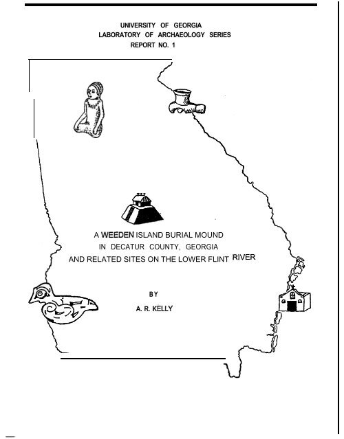
A WEEDEN ISLAND BURIAL MOUND<br />
IN DECATUR COUNTY, GEORGIA<br />
AND RELATED SITES ON THE LOWER FLINT<br />
BY<br />
A. R. KeLLY
UNIVERSITY OF GEORGIA<br />
LABORATORY OF ARCHAEOLOGY SERIES<br />
RKPORT NO. I<br />
AUEEDEN ISLANDBURIAL~fCDM)<br />
INDRCATIJRCOUNiX, GECRGIA<br />
ANB RILATEO SITRS ON TBE LONER FLINT RIVER<br />
Labwatory of Archaeology<br />
Department of Sociology and Anthropology<br />
University of Georgia<br />
Athens, Georgia
EBEFACE<br />
University of Gsorgia<br />
Laborntcry of Archaeology Series: Report No. I<br />
AI?EXR%NISLANDBURIAL~IOUND<br />
INDKCATURCOUNl'!i, GEORGIA<br />
ANDRELATED SITFS ONTFZLOURR FLINTRIvEx<br />
TABLE OF CONI'ENfS<br />
INTRODUCTION .............................................<br />
Excavation of the <strong>Burial</strong> Hound ...........................<br />
<strong>Burial</strong>s 1 to 22 ..........................................<br />
Stone and Shell Artifaots ................................<br />
The Pottery of Lake Douglas <strong>Mound</strong> ........................<br />
Needen <strong>Island</strong> Development in the Lower Flint Drainage ....<br />
RRLATRD SITES ONTRELCWER FLINE:<br />
Hale's Landing (9Drl5) ..........................<br />
Montgomery Field (SDrlO) ..........................<br />
Bower Plantation (SDr2) ..........................<br />
w~leyfs Mill Site (SSeW.. .......................<br />
SeaWe Plaatation (SS.32) .........................<br />
White Springs (SDr7) ..............................<br />
Comparison of Lower Flint with Ndrthwest Florida .........<br />
DRAIuNx, FLAl!Es, HAP:<br />
Drawings of &ofiles .................... following<br />
Plates hbs. 1 . 8 ....................... following<br />
Map of Woodruff Reservoir................ following<br />
i<br />
1<br />
4<br />
11<br />
l3<br />
20<br />
25<br />
28<br />
ii<br />
37<br />
39<br />
43<br />
2<br />
46<br />
19
EREFACE<br />
This Report Fo. I, issued from the Laboratory of Archeology,<br />
University of Georgia, initiates a new program of publication of<br />
the results of archaeological survey in Georgia. It fills a<br />
special need in making more immediately available notes, materials,<br />
and analyses of individual <strong>site</strong>s and units <strong>which</strong> do not require a<br />
more extensive and expensive medium as is necessary with longer<br />
papers or n;onographs. Some of this <strong>site</strong> data is currently needed by<br />
other investigators in river basin archaeology and the Laboratory<br />
reports can get these out sooner than would be possible under other<br />
arrangements.<br />
Final river basin reports and other reports on major <strong>site</strong>s<br />
will normally appear as part of the University of Georgia Anthropology<br />
Series, published by the University of Georgia &ess.<br />
Editorial Committee<br />
for the<br />
Laboratory of Archaeology Reports<br />
A. R. Kelly, Editor<br />
James H. Kellar and John Ii. Banner, Jr.<br />
Associate Editors
INTRODUCTION<br />
SIWV~ of the Jim Woodruff River Basin in Decatur and<br />
Seminole Counties, Georgia, began in the fall of 1947 when the<br />
author assumed his duties with the University of Georgia. Having<br />
no teaching assignments during this first year, I was able to<br />
devote full time to the initial phases of archeological reconnaissance<br />
in the area to be inundated along the lower Flint and lower<br />
Chattahooohee. Unfortunately, the beginning work was severely<br />
handicapped by unseasonably heavy rains, with a record-mahing down-<br />
fall of fifteen inches in twenty-four hours in the Bainbridge srsa.<br />
Under these circumstances, my attention was direoted to a<br />
survey of existing collections in the hands of collectors and in<br />
consultations with lumbermen, hunters, and fishermen who had<br />
extensive personal knowledge of the area. In this oonneotion, my<br />
attention uas dravn to the Twin Lakes Site, or Lake Douglas Nound,<br />
<strong>which</strong> had been excavated some years previously by local residents.<br />
As this <strong>site</strong> was out of the river basin, I was able to begin<br />
operations under circumstances <strong>which</strong> made investigation of other<br />
potential <strong>site</strong>s impossible. The collections from the previous<br />
unqualified excavations were not available, but from descriptions<br />
given by informants it seemed likely that a burial mound of the<br />
presumptive Needen <strong>Island</strong> Period was represented. Inspection of the<br />
mound <strong>site</strong> revealed a rather extensive pothole operation in the<br />
approximate center of the structure, with the peripheral portions<br />
largely undisturbed. Also, there were suggestions that burials<br />
i
encountered were scattered and few so that no concentrations of<br />
pottery had been encountered corresponding to the “burial cache”<br />
frequently found on the east margin of &eden <strong>Island</strong> burial mounds,<br />
There was a good chance that valuable archeological data and<br />
materials could still be obtained from the remnant,portions.<br />
The author was able to salvage the remaining portion of the<br />
Lake Douglas <strong>Mound</strong> inasmuch as the University of Georgia was using<br />
its own funds in this work, with none available from the River<br />
Basin Salvage Etogram. In any event archeological salvage is<br />
salvage whether the destruction comes from inundation or from the<br />
relic-hunting activities of relic hunters.<br />
The survey of the lower Flint and Chattahoochee continued<br />
for two more years and uncovered a number of <strong>site</strong> situations <strong>which</strong><br />
were recommended to the hhtional mk Service and the Smithsonian<br />
Institution as priority <strong>site</strong>s. A salvage program was undertaken<br />
in the next season by the Smithsonian Institution.<br />
Most of these <strong>site</strong>s were small and largely in the nature of<br />
camp<strong>site</strong>s. In the attachad report attention is given to the<br />
reporting of the burial mound <strong>site</strong> at Bainbridge (9DR21) and those<br />
other <strong>site</strong>s on the lower Flint, the analyais of <strong>which</strong> indicated<br />
them to belong to a perceived Heeden <strong>Island</strong> context related to the<br />
burial mound <strong>site</strong>. Earlier Arohaic and Roodland occupations were<br />
sparse and widely scattered and are not reported here. The proto-<br />
historio and historic occupations, with particular reference to<br />
the repeated efforts to locate important landmarks in the “fork” of<br />
the two rivers, have been written up and will be reported elsewhere.<br />
ii
The lower F3.int, from the junction of the Flint and the<br />
Chattahoochee to the area near Bainbridge, provides the locus of<br />
<strong>site</strong>s reported. As indicated, the report on the lower Chattahooohee<br />
will await current renewed survey activities along the lower to<br />
middle Chattahooohee region,<br />
Inasmuch as the first season of survey on the lower to<br />
middle Chattahoochee is alreaw indicating the occurrence of seeden<br />
<strong>Island</strong> <strong>site</strong>s in considerable profusion, the data on the lower Flint<br />
become increasingly important and are being made available in a<br />
mimeographed publication from the Laboratory of Archeology at the<br />
University of Georgia.<br />
Rumerous individuals assisted in giving information <strong>which</strong><br />
was helpful in the preliminary survey. Two Bainbridge citizens<br />
gave particular valuable aasistanoe in not only providing <strong>site</strong> data<br />
but also in acting as guides to specific <strong>site</strong> locations. These<br />
were Frank Jones and Roland Bower. The U. S. Corps of Engineers<br />
staff at Chattahoochee, Florida, was most helpful and the Corps of<br />
Engineerssupplied a survey car and maps. In all instances, owners<br />
of property <strong>which</strong> had not at that time been purchased by the<br />
government vere most cooperative.<br />
iii
A VEEDEN ISLAND BURIAL EODBD IN DECATUR COUBTY, GEORGIA<br />
Lake Douglas Eound - 9DEEl<br />
In August, 1948, the author undertook a preliudnary<br />
archeological reconnaissance of the Jim goodruff reservoir. The<br />
critical area extended from Bainbridge to the confluence of the<br />
Flint and Chattahoochee rivers, and carried up the Chattahoochee<br />
some fifteen riles. Heavy rains during the spring and suwer<br />
had filled the Flint basin alrost to the calculated reservoir<br />
pool when the dam would be constructed. Most of the immediate<br />
area on the rivers was under water so other survey was nade on<br />
<strong>site</strong>s whose salvage was necessary for reasons other than<br />
inundation.<br />
The Twin Lakes, or Lake Douglas, was a privately ouned<br />
artificial lake, belonging to Br. H. C. Allen of Bainbridge,<br />
Georgia, located off the Bainbridge-Camilla road, in the outskirts<br />
of Bainbridge. This easily available sand mound had attracted<br />
the attention of several Bainbridge residents some twenty years<br />
before our arrival on the scene, with the result that most of<br />
the central portions of the mound had been excavated to mound<br />
base or below. The collections from this operation, consisting<br />
of several pottery vessels and a few hurran bones, had been<br />
exhibited in years past in a local tavern. Bone of these materials<br />
survived for examination in 1948, and we were not able to<br />
interview any of the participants in the original digging.<br />
The crater of the sand mound still stood, with an appreciable<br />
round swell still showing along the east periphery, and a larger
expanse showing on the west and north sides. The pure sandy<br />
ground surface yielded scattered collections of potsherds for<br />
a distance of 50 yards around the mound. The area was then<br />
enclosed in a large pasture, overgrown with scrub oaks and pines,<br />
but had once been cultivated.<br />
Two profiles, a south profile of the center trench and a<br />
north profile axis trench, indicate the extent of the pothunters’<br />
operations <strong>which</strong> had preceded our salvage on the balance of the<br />
mound. In the east periphery of the mound our axis trench<br />
uncovered a small pottery cache confined within fivo-foot squares<br />
and a group of burials, made on round base, <strong>which</strong> seemed to be<br />
concentrated around the pottery cache. How closely the pothunters@<br />
dig had come to the cache is evident from the profile drawings<br />
of our excavations. The area of the cache contained numerous<br />
tree rootsand these may have served to lead the original digging<br />
away from the main concentration of burials and the cache itself.<br />
The material salvaged from the portions of the mound <strong>which</strong><br />
still showed good archeological context came from the mound fill,<br />
mound base, and the pottery cache. The 22 burials uncovered<br />
were in very poor condition of preservation. Only three carried<br />
burial furniture, in each case consisting of small disc-shaped<br />
shell beads. Other artifacts cataloged came from scattered<br />
points of the reraining shell of the mound and are exhibited in<br />
Plate Fo. 1. Twenty of the pottery vessels from the cache were<br />
cataloged in the field as “restorable”, but this proved to be<br />
an over-optimistic appraisal when the collections were<br />
-2-
AREA EXCAVATED swnmw<br />
~LOCATION OF PROl=lLES
asseshled in the laboratory.<br />
So little information is at hand from burial mounds along<br />
the Flint-Chattahoochee confluence that these salvaged materials<br />
and notations from the Lake Douglas aound are presented for<br />
whatever value they may have for investigators in the Florida-<br />
Georgia area. Clarence B. Moore bad excavated most of the<br />
burial mounds in this region at the turn of the century. He had<br />
made test excavations into several “domiciliary aoundse, <strong>which</strong><br />
on revisiting in our survey turned out to be plowed down or<br />
rudimentary in the half century that had elapsed since MooreIs<br />
day. The <strong>site</strong>s recossaended for salvage in the River Basin Survey<br />
of the Smithsonian Institution consisted of shell middens and<br />
village occupations, the two most important being at Fairchild’s<br />
Landing and Montgomery Fields.<br />
The excavation account will susmarize the notes on the<br />
22 burials uncovered at Lake Douglas and the pottery cache. Two<br />
profile cross-sections, a draught of the pottery cache and<br />
surrounding burials, are presented in connection with this<br />
description.<br />
The pottery from Lake Douglas shows some aberrant features,<br />
not duplicated elsewhere in the basin survey, particularly the<br />
severely conoidal aspect of some of the vessels recovered from<br />
the pottery cache. The question of the chronological position<br />
of this burial mound is raised, and preliminary presentation of<br />
these data might elicit some helpful conments.<br />
-3-
Notes on the Durials and Pottery Cache<br />
<strong>Burial</strong> PO. 1: Located at mound base, square ‘7Ll to ‘X2, this<br />
was a shallow burial pit eight inches below<br />
mound base, and poorly defined here. The burial consisted of<br />
a portion of a skull cap, mastoid bone, and two badly<br />
disintegrated femora. Long bones were found in position two<br />
feet from the skull fragment. It was a flexed burial (?) and<br />
could be a bundle reburial. h’o burial furniture was found.<br />
<strong>Burial</strong> ko. 2: This burial was located at approximately the mound<br />
femora, tibiae, and arm bones.<br />
base (see <strong>Burial</strong> Sketch); and consisted of skull,<br />
The facial portion of the skull<br />
was absent as the skull lay face down in the sand. Long bones<br />
were so deteriorated they could not be removed. The burial uas<br />
cataloged as a bundle reburial.<br />
<strong>Burial</strong> h’o. 3: This burial showed up in profile and consisted of<br />
only a badly deteriorated pile of long bones.<br />
There was no discernible skull. Considerable root disturbance<br />
at this point may have disrupted burial further. A few shell<br />
beads (disc-shaped) were found nearby.<br />
The relation of <strong>Burial</strong>s No. 2 and Xo. 3 to the “pottery<br />
cache” is described in the notes as follows:<br />
-6
u...iuportant feature in connection with <strong>Burial</strong> po. 2<br />
and No. 3 is a pottery cache entirely covering burial<br />
area, beginning approxiuately with these two burials<br />
and covering the contiguous sound base area, thinning<br />
out at the end of the present trench excavation at the<br />
east, seveo to eight feet in the east-west axis<br />
extension, and showing in the north-south profiles of<br />
the trench. All the vessels exposed were broken<br />
except for one srallbowl found on top of the cache<br />
nearest <strong>Burial</strong> No. 2 skull. This was a snail zoned<br />
punctate of Reeden <strong>Island</strong> type...a ‘killed! pot. An<br />
undeterndned nunber of broken vessels litter the seven<br />
to eight feet east of <strong>Burial</strong> No. 2 and 3. Several of<br />
these in first troweling seem to be probebly<br />
Vestorable’.. Majority are check-stamped and plain.<br />
No *Swift Creek’ vessels as yet, although Swift Creek<br />
sherds have been found scattered through noundfill as<br />
the east-west axis trench progresses.”<br />
<strong>Burial</strong> No. 4: Due to previous disturbances, no decisive burial<br />
data is available in regard to this burial. The<br />
following is a description of the burial from the notesr<br />
I’... In cleaning out the floor of the. east-west axis<br />
trench and dressing profile, indications of <strong>Burial</strong> Ro. 4<br />
found in the fill to a large pothunters~ trench showing<br />
in fill between sta. 8RL8R3. Rothing but scattered<br />
decayed long bones, so disturbed nothing can be inferred<br />
as to burial or associations. Near the bones, in fill,<br />
cataloged a slate gorget, about three inches long,<br />
perforated at broad end for suspension (Plate No. 1) ;<br />
also two sxmll cut sections of Busycon shell. The<br />
intrusive recent pit had started near the highest and<br />
central portion of the uound, wound in a NNll direction<br />
across the axis trench, just barely s&sing <strong>Burial</strong>s No,<br />
2 and 3 and the pottery cache. The relic hunters had<br />
evidently become disoouraged as their trench carried<br />
down toward the east periphery of the uound.u<br />
<strong>Burial</strong> h’o. 5: This burial was found alrcost underneath Station<br />
7R5, partially covered over by a pottery cache.<br />
gxtensive tree root disturbance may have disintegrated burial<br />
further. Skull parts and a lower jaw with 14 teeth and soue bone<br />
-5-
trails were found. It could be either a lone skull burial or<br />
a badly decayed secondary burial. The burial was along the<br />
mound base. ko burial furniture was found.<br />
The following are comments from notes on the relation of<br />
the burials and cache:<br />
II . . . The 16 restorable vessels appear to have been<br />
broken in situ, suggesting some sort of pot-bursting<br />
ceremo&l?l;-connection with the burials, of <strong>which</strong><br />
Nos. 2, 3, and 5 thus far are definitely connected.<br />
At least three of the vessels have conoidal bases, very<br />
pointed and distinctly Woodlandish~, and are ‘killed’.<br />
Actually, the pottery cache was rather narrowly confined<br />
within two najor five-foot squares with thin peripheries<br />
beyond that area. It was evident that placement was on<br />
the east periphery of the mound. The present round<br />
contours are deceptive as profiles through the area<br />
indicate that th:re had been considerable root disturbance.<br />
Statements from Bainbridge residents, including Negroes<br />
who played on the mound as children, indicate that this<br />
mound was once high enough to make rolling down its<br />
slopes an exciting game.”<br />
<strong>Burial</strong>s Xos, 6, ‘7, 8, 9, and 10: These burials were found close<br />
together and were described<br />
as a group. They were uncovered in a 5 - 10 foot block just<br />
beyond the pottery cache.<br />
<strong>Burial</strong> ko. 6 was a slrall skull (child’s) and was broken<br />
by root disturbance. A barely recognizable fevur and tibiae and<br />
one humerus were found. This was definitely a secondary burial.<br />
<strong>Burial</strong> k!o. 7 consisted of a thin, deteriorated section<br />
of parietal and spenoid bones, plus femora, one recognizable tibia,<br />
and one humerus. Bundle burial is again suggested.<br />
-6-
<strong>Burial</strong> No. 8 was without long bones, exhibiting only<br />
a decayed skull under <strong>which</strong> were troweled out about a dozen<br />
disc-shaped shell beads.<br />
<strong>Burial</strong> Do. 9 was a childls, containing basal skull<br />
and Darts of two femora.<br />
<strong>Burial</strong> Xo. 10 was located at mound base, oppo<strong>site</strong><br />
<strong>Burial</strong> h'o. 9, and consisted of middle shaft portions of three<br />
long bones and a portion of the calvarium.<br />
The pottery cache uncovered in the east end of the axis<br />
trench did not extend south into the N-foot block in <strong>which</strong> these<br />
burials occurred. Except for the shell beads, there was no burial<br />
furniture.<br />
<strong>Burial</strong> No, 11: This was rather definitely a seaondary burial of<br />
an adult. Distinguishable remains were of a<br />
skull, femora, tibiae, one humerus, and one radius. The burial<br />
was found at mound base, with skull on right side, and maxillary<br />
portion missing. There was noted marked frontal deformation, and<br />
some slight lashdoidal flattening. No burial furniture was found.<br />
as follows:<br />
The final clearing of the spottery cache" arsa is described<br />
-7-
‘I... Today removed the critical five foot square<br />
inmediately north of the axis trench. In this area,<br />
actually in west half of the square, no less than<br />
five +estorabler vessels and one polished greenstone<br />
celt were found (Plate h'o. 1). Total area<br />
covered by the cache definitely localized in two<br />
five-foot squares in the east mound periphery. The<br />
celt is a fine serpentine or greenstone, oval in<br />
cross-section, the blade ground down clean, neatly<br />
polished throughout. The pottery from this extended<br />
portion of the cache continues to show predominance<br />
of check stamped with two large plain bowls. The<br />
plain ware is burnished, smoothed, with a pleasant<br />
effect from clouding or mottling from firing."<br />
<strong>Burial</strong> No. 12: This burial was unusual in that it turned out<br />
to be a markedly flexed burial, the first<br />
instance in <strong>which</strong> the long bones and other skeletal parts were<br />
sufficiently preserved and in original anatomical order to indicate<br />
without ambiguity. <strong>Burial</strong> was mede on the back with femora,<br />
tibiae, and portions of pelvis in place to uake the tightly flexed<br />
condition obvious. It is possible that the poor‘condition of some<br />
of the burials nay have led to the premature conclusion of<br />
secondary interment. This still seems unlikely as uost burials<br />
were closer together than was the case with 3urial l?o. 12. The<br />
.<br />
skull to k'o. 12 is larger, more rugged, with large mastoids and<br />
strong supraorbitals, and was diagnosed as an adult male. hb<br />
furniture was found.<br />
<strong>Burial</strong> kn. 13: This burial consisted only of a badly decayed femur<br />
and smell mound of bone ash relic of a skull (1).<br />
In later troweling, a portion of a lower jaw was found, Constricted<br />
burial area implies that this was a bundle reburial. One
pear-shaped, perforated shell came from the skull ash.<br />
<strong>Burial</strong> X0. 14: This burial was troweled out at mound base in<br />
association with a considerable quantity of<br />
charred pine. Further troweling led to the conclusion that<br />
this association of charred pine was accidental, probably due<br />
to clearing of the rcound base before construction of the round<br />
(other indications of same in charred stumps). The burial<br />
consisted of a skull, jaw, feuora, tibiae, and other unidentified<br />
bone trails. A secondary burial was indicated.<br />
<strong>Burial</strong> ko. 15: This burial came out a few feet fron <strong>Burial</strong> ko. 11<br />
at a depth of 14 inches from present mund surface.<br />
It consisted of a badly disintegrated skull, jaw, tibiae, feuora,<br />
and one scapula. Evidently, this was a secondary burial. Long<br />
bones were found in one pile almost touching the skull. Fezoral<br />
epiphyses were only recently closed, and third ~~~lar.s were not<br />
yet erupted. It is indicated that this was a young female.<br />
Disc shell beads were found in the soil beneath the jaw (jaw<br />
position indicated by preserved crowns of teeth).<br />
<strong>Burial</strong>s Fos. 16, 17, and 18: These three burials came out as<br />
mall heaps of disintegrated bone,<br />
uncovered in a 5 x 20 foot block, 10 feet west of the pottery<br />
cache. These intements were aberrant in that they occurred 18<br />
to 20 inches above our estiaate of the kound base (huuic stains,<br />
organic matter only faintly indicated in E;UCIY of assumed mound area).<br />
-9-
<strong>Burial</strong> hro, 16 consisted of skull fragments; bone<br />
trails of long bones not identifiable. A half dozen badly<br />
decayed shell beads were noted. The burial is suggestive of<br />
a young fenale, with light bones and recently erupted third<br />
rolar.<br />
<strong>Burial</strong> 917 contained barely enough decayed bone to<br />
be catalogable as a burial -- two niblets of skull bone and<br />
two fragments of long bone.<br />
b o n e s .<br />
<strong>Burial</strong> Ko. 18 consisted of pieces .of skull and long<br />
<strong>Burial</strong>s Nos. 19, 20, 21, and 22: These burials were brought out<br />
in the west central portion of<br />
the round and contained extremely fragmentary remains--just<br />
enough to indicate burials.<br />
<strong>Burial</strong> hb. 19 consisted of shull fragments, part of a<br />
lower jaw, middle parts of two feuora, one tibia, and one<br />
humerus whioh were identifiable, in a small bone heap. Bundle<br />
r eburial?<br />
<strong>Burial</strong> Xo. 20 exhibited parts of two femurs, part of<br />
a lower jaw, and bone trail.<br />
<strong>Burial</strong> No. 21 was a handful of skull and long bone<br />
fragments; vastoid and petrous process, niblets of parietal, and<br />
portions of feuur and tibia wepe recognizable.<br />
<strong>Burial</strong> No. 22 showed mastoid, parietal,and parts of long<br />
bones <strong>which</strong> appeared almost oaloined but without local evidences<br />
-lo-
of burning.<br />
No furniture was found in any of these four burials.<br />
Stone and Shell Artifacts<br />
In two five-foot squares adjoining the pottery cache we<br />
found scattered at intervals along sound base nine pieces of<br />
conch shell. Two of these bad definitely been out. The<br />
sections showed no particular form and none exhibited designs.<br />
The presence of this material in immediate contiguity to the<br />
pottery cache ray have some significance.<br />
Stone artifacts were rare. Evidences of flint working<br />
occurred only sporadically in the form of flint scrap and a few<br />
core fragments. X sparse shoving of such scrap bad been noted<br />
in the surface sand around the mound so that these niblets might<br />
have been accidentally inoluded in bringing in basketloaded<br />
materials during mound construction.<br />
One projectile from moundfill (Plate No. 1) looks more<br />
like typical south Georgia archaic projectile types and may be<br />
intrusive with the mound construction. Most natural spring <strong>site</strong>s,<br />
such as Twin Lakes must have been before the building of an<br />
artificial lake, usually yield some scattered evidences of flint<br />
working.<br />
The polished stone oelt was found in situ in expcsing the<br />
pottery cache (see <strong>Burial</strong> Sketch). This would appear to be<br />
complementary to the cache.<br />
-ll-
The perforated gorget (Plate Do. 1) of olive slate was<br />
recovered from. moundfill and had been overlooked when the<br />
pothunters vade their excavations years ago. It was found in<br />
redistributed bones of what we cataloged as <strong>Burial</strong> Do. 4 and<br />
ray have been associated.<br />
A sxall hematite plurunet, 5.4 centimeters long, came<br />
from moundfill, approxiuately on mound base, close by the pottery<br />
cache. This is nicely smoothed, neatly perforated for suspension,<br />
and was made from heavy iron ore, possibly meteoric? This is<br />
also illustrated in Plate Do. 1.<br />
On the southern periphery of the mound in entering trench<br />
at round base was found a quartzite grindstone with a sxall<br />
rubbing stone on top, evidently a tool set or asseublage depo<strong>site</strong>d<br />
at this point. The mortar is a stream boulder about one foot<br />
long and four inches thick, flat and abraded but without concavity<br />
on one side. The mano or rubbing stone shovs even wear on the<br />
under side but with mnre completely abraded ends as if ussd in<br />
pounding. The two pieces do not resenble the usual mortar-pestle<br />
or rano ooubinations picked up on archeological <strong>site</strong>s in southwest<br />
Georgia. ko burials were in conjunction with this find, <strong>which</strong><br />
came out on the oppo<strong>site</strong> side of the mound from the pottery cache.<br />
Disc-shaped shell beads, possibly cut from core sections<br />
of a conch, were found with or near three burials on the periphery<br />
of the pottery cache. These wsre the only items definitely<br />
associated with any of the 22 burials found in working the mound<br />
remnant.<br />
-12-
The few artifacts listed above do seem to be assooiated<br />
with the period of mound construction and not acoidentally<br />
included, with the possible exception of the broad-stemmed<br />
projectile point and one other steamed projectile (broken).<br />
The 22 burials were relatively poor in furnishing and, except<br />
for scattered potsherds, little came from uoundfill.<br />
The Pottery of Lake Douglas Hound<br />
The pottery collections from the mound, including the<br />
cache, were not as extensive as might have been expected. The<br />
cache was srall, confined to two five-foot squares, and the<br />
material from moundfill was fairly sparse. There was no submound<br />
occupation, the original surface having been cleared as indicated<br />
by burned stumps of trees, without any evidences of occupation<br />
in situ. Most of the shards came from moundfill outside the<br />
oache and are presumed to be accidentally included incident to<br />
the construction of the mound, either being brought in with the<br />
basketloaded earth from a village area or perhaps broken on the<br />
spot by the uoundbuilders. The total sherd count, including<br />
material from the cache, amounts to close to 600. Possibly, if<br />
the material from the mound disturbed by the relic hunters had<br />
been available, there may have been a more substantial series,<br />
although this is doubtful if one considers the relative paucity<br />
of material in the undisturbed portions of the mound.<br />
Basically, then, we have a pottery collection accumulated<br />
or depo<strong>site</strong>d incident to the coastruotion of the mound. Although<br />
-1%
no village area was found anywhere near the mund in our<br />
survey, the possibility reaains that the moundfill sherds<br />
might have come from an older deposit at the time of mound<br />
construction. It may be that the village to <strong>which</strong> this burial<br />
round belongs is really nearby but is buried beneath the<br />
artificial lake. The logical first step in analysis is to<br />
compare the material in the pottery cache with that in the mound-<br />
fill.<br />
First, we consider the sherds from the cache srea, adding<br />
notes on the restored vessels from the cache. Two hundred eighty-<br />
five sherds vere idsntified with six general oeramio categories as<br />
follows: Plain, Complicated Stamped, Check Stamped, Incised,<br />
Fun&ate, Red Painted. Ro doubt many of these sherds are really<br />
part of other vessels either restored or partially restored from<br />
the cache. The specific pottery type is indicated for the<br />
restored vessels, but the generic classifications only are given<br />
for the sherds.<br />
Plain ware constituted nearly half of the total sherd<br />
count, 49.g These vessels were generally suoothed, sometimes<br />
burnished on the exterior. Temper was fine sand, occasionally<br />
suggesting a tamperless condition. Paste was evenly compacted<br />
and fairly evenly fired, with clouding from firing giving a<br />
rather pleasant effect in the generally light colored surfaces.<br />
Rims were small folded affairs, sometimes set off from the body<br />
of the vessel by small accenting incised or trailed lines.<br />
-14-
Vessel shapes indicated are bowls, some rather large, and<br />
globular jars. All the ceramic characters noted fall within<br />
the familiar descriptions of Beeden <strong>Island</strong> Plain. One large<br />
plain bowl uith snail folded rims. and too large Qill holes”<br />
punched out at the base, was restored (Plate E’o. 2).<br />
The third most numerous category comprises Complicated<br />
Stamped sherds. These amount to 15.7% of the total. There is<br />
a marked contrast in the range of size of designs and the<br />
r?lative excellence of execution of the stamps in the Complicated<br />
Stamped series. A majority, ll.Z$, represented a large, heavy,<br />
sprawling Complicated Stanp1 , with broad lands, usually weakly<br />
impressed, bearing some general resemblance to the type already<br />
described in the literature for southwest Georgia as Kolomoki<br />
Complicated Stamped. On the other hand, 4.5% were a small, neatly<br />
executed compo<strong>site</strong> Complicated Stamp <strong>which</strong> seems to correspond<br />
rather closely to the type described by J. R. Caldwell at<br />
Fairchild’s Landing, designated Fairchild’s Complicated Stamped.<br />
Both of these varieties occur together in the same pottery cache.<br />
There were no restored or restorable vessels. The implication.<br />
is clear that both the large, sprawling Complicated Stamp and<br />
the small neat variety occur together and were depo<strong>site</strong>d in the<br />
ceremnial breaking of mortuary ware that took place when the<br />
cache uas laid down.( Plate Ro. 3)<br />
Check Stamped shards comprise the second largest category,<br />
16.3% of the total of 285. The size of the checks vary<br />
-15-<br />
!<br />
~
considerably, from extremely small to fairly large, although<br />
the srall predominates. A tendency to smooth over the vessel<br />
before firing results in some obscuring of the oheok-stamping<br />
to the extent that close scrutiny is sometimes required to make<br />
sure that one is dealing with a check-stamped sherd, Paste,<br />
temper, and general morphology correspond to that of other types,<br />
including the plain pottery. Three restored, or partially<br />
restored, vessels exhibit the markedly conoidal base with a weakly<br />
impressed and partially obliterated check stamp covering the whole<br />
body to the slightly flared rim and its narrow fold (Plate go. 4).<br />
One restored check-stamped vessel is a mediumsized, globular pot,<br />
with a small folded rim,clearly impressed but over-stamped on<br />
parts of the surface. This vessel rim carries four small ears<br />
on a flat rim. The rim is narrowly set off from the check-stamped<br />
shoulder by an accenting incised line (Plate Ro.‘~). host of the<br />
check-stamped pottery is identifiable with the type described by<br />
Gordon R. Villey as gakulla Stamped, although a recent review of<br />
the check-stamped collections from the Flint-Chattahooohee<br />
drainage has led to the designation of Veeden <strong>Island</strong> Check Stamped.<br />
The writer found, in the course of initial survey reconnaissanoe<br />
in this region, <strong>site</strong> indications of a “puree check-stamped<br />
horizon, i.e., minus Beeden <strong>Island</strong> types or Complicated Stamped,<br />
Hales’ handing and Montgomery Field were the largest, although<br />
smaller <strong>site</strong>s were found in the lower Flint. Other <strong>site</strong>s on the<br />
Flint, Bower Plantation and Four Rile Creek, for example,
exhibited apparently the same Check Stamped in association with<br />
a late Swift Creek variant and other Beeden <strong>Island</strong> congeries.<br />
The diagnostic value of Check-Stamped in the general archaeological<br />
sub-area has been in dispute. The matter will be discussed further<br />
in the final section on Chronology.<br />
Painted ware constitutes an important minority in the caohe<br />
series, There were 25 painted sherds, mostly exhibiting exterior<br />
paint, but with a few showing both interior and exterior covering.<br />
Bowl shapes are indicated by sizeable rims. There is a noteable<br />
thickening and flattening of rims, with a few indications of<br />
projecting triangular ears. Tainted ware makes up 8.1% of the<br />
sherd count. There were no restorable vessels in the cache of<br />
this type.<br />
Two other minority categories in the cache are punctated<br />
and incised, 4.5% and 4.2% of the total respectively. One small,<br />
incised bowl (Plate 170. 7) was the only whole vessel found in the<br />
cat he. This shows incised lines in a repeated bird(?) motif,<br />
highly conventionalized, with saall dot punotates within incised<br />
zones. The rim of this bowl is missing (Plate Yo. 6). It was<br />
identified as TIeeden <strong>Island</strong> Incised. E!ost of the large shards<br />
show a zoned incised <strong>which</strong> probably belongs to the same type.<br />
A restored vessel (Plate PO. 7) shows a stab and drag stick<br />
pun&ate in parallel lines curving from rim to base. This has a<br />
slight shoulder constriction with mild castellation of the rim,<br />
It was identified as Carabelle lunctated.<br />
-17-
In the fill to the mound, outside the cache area, 320<br />
study sherds were cataloged. Small, eroded, and indetertrinate<br />
specimens were discarded. The sample here was taken from survey<br />
squares definitely separated from the cache concentration.<br />
Again, the Plain uare is by far the largest element, 145<br />
or 46.7% of the total. The characteristics were the same as the<br />
Plain ware found in the cache.<br />
The second largest category in moundfill was the<br />
Complicated Stamped, Twenty-nine percent of the total belongs<br />
to this class. The proportions of the large, sprawly, poorly<br />
impressed stamped variety to the small neatly executed stamp is<br />
about the same as that observed in the pottery cache on east<br />
mound periphery, that is 20.9% of the large variety and 8.7% of<br />
the small stamp. Rims are all small folded or rounded. The<br />
shoulder portion of the vessel is occasionally plain with the<br />
stamp extending over the body, Zoning is definitely a feature<br />
of the Complicated Stamped ware.<br />
Check Stamped becomes the third largest class with 10.6%<br />
of the total. Small folded rims, with occasional incised lines<br />
at the base of the rim to mark off the check-stamped body area,<br />
are found here as in the check-stamped sherds from the cache.<br />
Incised sherds at 2.9% of the total, punctated at 5,4%,<br />
and Red Painted at 5.1%, make up the minority groups.<br />
-18-
Comparison of the collections from the pottery cache<br />
and uoundfill leads to the following conclusions:<br />
1. The same types of pottery are found in both<br />
uoundfill and in the pottery cache.<br />
2. Nearly twice as u.uch Complicated Staaped ware<br />
is found in r~ouudfill as in the cache. There is,<br />
however, no change in the relative proportions of<br />
the large, poorly executed staup as the small, neat<br />
Complicated Stanp. This may mean siuplythat<br />
Complicated Stamped was not favored as a nortuary<br />
we.<br />
3. There is slightly uore Check Stamped pottery in the<br />
cache than in the rroundfill.<br />
4. Plain ware constitutes nearly half of the total<br />
series in both soundfill and cache.<br />
5. There is a slight suggestion, probably not significant<br />
in the light of the smallness of the sample, that<br />
there is more Red Fainted pottery in the cache.<br />
‘5. The whole pottery series, uoundfill and cache,<br />
comprises a relatively hofiiogeneous asseublage,<br />
apparently laid down at one time interval in the<br />
Ileeden <strong>Island</strong> period.<br />
7. Noticeably absent are the excised and effigy forms<br />
found elsewhere in southwest Georgia in Ceeden <strong>Island</strong><br />
burial Rounds (hoore on the Flint, Sears at Rolouoki<br />
Rounds, Blakely County, Georgia).<br />
-19-
Rlvor WOODRUFF<br />
.i---e-e-<br />
F-m--_<br />
RESERVOIR<br />
I I I I I<br />
v FM. w<br />
I<br />
Iam Lu--i1<br />
DR 21<br />
0
<strong>Weeden</strong> <strong>Island</strong> Development iv thz Lower Flint Drninnge<br />
In the years <strong>which</strong> have elapsed since ihe initial survey<br />
of <strong>site</strong>s along the lower Flint River by field parties of the<br />
University of Georgia, incident to the river basinprogram of<br />
salvage archaeology in that sector) new survey has been under-<br />
taken in the general region of southwest Georgia and fresh<br />
accessions of data have filled chronological gaps. Some obscure<br />
and confusing aspects of Needen <strong>Island</strong> cultural development in<br />
southwest and west Georgia give promise of being clarified by<br />
these new findings,<br />
On the basis of preliminary survey of the immediate Flint<br />
and Chattahoochee confluences at the Jim Woodruff dam, the<br />
University of Georgia recommended a minimum number of <strong>site</strong>s to<br />
the Smithsonian Institution for aare intensive salvage operations.<br />
Except for the Douglas Round, reported in this account, the<br />
University undertook no oxtensive.axoavations on any <strong>site</strong> in the<br />
reservoir,this phase of the work being cnrried out by the<br />
Smithsonian Jmtitution in the arrangements made at that time.<br />
Surface collections and.some testpitting and minor. trenching were<br />
made on individual <strong>site</strong>s, where-size and multiple occupations were<br />
indicated or special problems suggested by the ceramic series from<br />
the <strong>site</strong>s, in order more adequately to guage the scientific<br />
sigaificanoe of the <strong>site</strong>s. The University had no river basin<br />
appropriations from federal aouroes for the.Jim Woodruff Basin and<br />
the Smithsonian had limited funds to apply to recommended salvage<br />
on “A* <strong>site</strong>s.
In 1950, as a result cf ths preliminary investigations and<br />
recowendations made, two main si’sos rare indicated as most<br />
significant, Fairchild's Landing on the lower Chattahoochce, and<br />
Montgomery Field on the louer Flint west of &&bridge, Joseph<br />
R. Caldwell, for the Smithsonian Institution, carried out<br />
trxtensive opsrations at Fairchild@s Landing and extended hj,s work<br />
to the noarby <strong>site</strong> of WIro*s Landing, where C, B. Moore had<br />
excavated a large burial mound at the turn of the century. Carl<br />
Miller worked at theHontgomsry Field <strong>site</strong> and recovered<br />
considerable material. The Smithsonian surveiy has not been<br />
published at this writing and reporting on these <strong>site</strong>s here is on<br />
the basis of surface ooi'ections and some initial trenching and<br />
testpittiog carried out by students of the summer field sohool<br />
in archaeology conducted by the Uoiversity of Georgia in 1949 and<br />
1950.<br />
The author*a intention was to do a straight repertorial stint<br />
on the burial mound <strong>site</strong> at Lake Douglas, insofar as pertinent<br />
and significant information could be gleaned from the rsmnaot of<br />
this struoture. The fact that this <strong>site</strong> is a Needen <strong>Island</strong> burial<br />
mound, however, needs to be expanded to ioolude other <strong>site</strong>s on the<br />
lower Flint, i.e., between Baiobridge, Georgia, and the nFbintw or<br />
confluencewith theChattahoocheeRivertof'ormtheAppalaoMcofa,<br />
<strong>site</strong> of the Jim Woodruff Dam.<br />
At this time <strong>site</strong>s on the lower Chattahooohee are not rerfeuod<br />
as the whole lower to middle Chattahoochee basin is currently<br />
undergoiog inteosive survey and archeological salvage by field<br />
-2lP
parties of the Smithsoniar ?nst:‘.tu-iion rind the University of<br />
Georgia, incident to the Colunbiz. and %ltsr F. George Dam and<br />
reservoir constrtition. Some 300 <strong>site</strong>s have been located in<br />
the new reservoir pools and around 100 of these are perceived<br />
to have considerable <strong>site</strong> significance and will reooive whatever<br />
salvage attention is Ij?ssiblc with available funds and within the<br />
tino at our disposali<br />
Another archeological event of prime importance, subsequent<br />
to the original Jim Woodruff basin survey, was the sspioration of<br />
the Kolormki Nouads near Blakely, Georgia, by %.lliar;; H, Sears<br />
for the Gsorgia State Forks. Senrs published seasonal reports<br />
and a final report, desc: -‘.bi:;G in detail his findings and giving<br />
conclusions or intsrpretntions !&ich varied widely from<br />
theoretical reconstructions current at the time of MS work.<br />
The divergent views of Uesden <strong>Island</strong> chronology and sequential<br />
development, as seen in northwest Florida (‘!illwj and at<br />
Kolomoki (Sears) cover the whole continuum from early to ‘late and<br />
post-Veedcn <strong>Island</strong> times, “hen %rs was analyzing his Rolomoki<br />
ratsrials, that large and rlgosing sito appeared to be the<br />
northern terminus 02 the T!e?den <strong>Island</strong> extension up the Chattahoochee<br />
River. Tlo know from current Chattahooohee surveys that TIeeden<br />
<strong>Island</strong> occurs abundantly, in sovsral stages of development, all the<br />
way up to the Fort Benning IIilitary Reservation and Columbus,<br />
Georgia. Tie now know precisely where Yeeden island penetration<br />
stopped, at the rocky shoals area at Columbus Falls in the hcart of<br />
-22-
the Columbus industrial area, Beyond this point intensive survey<br />
of a ten-mile strip in the reservoir of the Oliver Dam disclosed<br />
over fifty archeological <strong>site</strong>s, r&y explored by the University<br />
of Georgia field parties in 1958,yielding only one Ueeden <strong>Island</strong><br />
sherd. Just why Heeden <strong>Island</strong> <strong>site</strong>s, so abundant downstream<br />
from Columbus, should come to a “screaming halt” at this point<br />
is a question of great ecological inter’est.<br />
Again, A. R. Kelly and David H. Chase, working under a<br />
federal Antiquities Act Permit covering the Fort Benning area,<br />
during the last four years have been carrying out emergency<br />
archeology incident to salvage of materials from <strong>site</strong>s disclosed<br />
by military operations and constructional work within the Military<br />
Reservation, These seem to provide a perceived continuum from<br />
late Swift Creek through incipient <strong>Weeden</strong> <strong>Island</strong> contacts to<br />
fully developed Needen <strong>Island</strong> to later variants. However, the<br />
long span of the Chattahooohee and the emerging picture of<br />
lieeden <strong>Island</strong> penetration and relations with other components<br />
afforded by this more complete <strong>site</strong> profile, is another story not<br />
yet ready to be treated adequately, Current operations and<br />
salvage archaeology oontemplated within the forthooming season of<br />
1960 promise a much fuller <strong>site</strong> documentation on Needen <strong>Island</strong><br />
history than seemed possible a short time ago.<br />
In the three seasons of <strong>site</strong> reconnaissance in the Jim<br />
Noodruff basin carried out by A, R. Kelly~lBAS, 1949, and 1950,<br />
the area between Bainbridge, Georgia and the Flint-Chattahoochee<br />
-2%
canflwnce had not yet been cleared of vegetative oover and was<br />
a wild and largely inaccessible woodlaad with heavy underbrush<br />
whose terrain was kbr miyto local huntersand fishermen.<br />
The old steamboat landings, logging trails, turpentine stills,<br />
snd a few old plantations were the chief laedmerka, The ground<br />
was hardly visible for inspection of <strong>site</strong> evidenoes except where<br />
occasional snail cultivated plots, old landing roads and trails,<br />
wild hog rootings, "gopher hills", ferry <strong>site</strong>s, disclosed or<br />
upheavad the soil enough to reveal shell, corominuted charcoal,<br />
or a fen potshards. Clarance B. Moore's archeological venture a<br />
half century before along the long Print bad been carried out<br />
iu u score caeualandless arduous fashian; heproceededleisurely<br />
upsti-Sam in the "Gopher", contactiugplantat4ouowners at<br />
&mtegic iutervals whsre mounds or burial grounds werereported,<br />
arrauged for local labor and excavated <strong>site</strong>s c&ulated to be<br />
aost rewmnerative from his poiot of view. In every case where<br />
our survey returned to Moore*s <strong>site</strong>s, fn search of village r&as<br />
associated with his burial or 18domi&Uarys mounds, the results<br />
wsre largely unrewarding. Local guides who had been around when<br />
Moore wade his original survey mat "lost" in trying to pick up<br />
old familiar fields and landmarks. Two <strong>site</strong>s <strong>which</strong> yielded<br />
materials and data of importance were Chason*s Blue Springs and<br />
the Bower Plantation beyond Four Mile Creek west of Bainbridge.<br />
Host of the <strong>site</strong>s cataloged in the three seasons of the Jim<br />
Noodruff <strong>site</strong>, however, were small and thinly occupied, <strong>which</strong> Moore<br />
would )Isrdly have notiaed.
Only those <strong>site</strong>s <strong>which</strong> are related to the Lake Douglas<br />
burial mound as part of a Deeden <strong>Island</strong> s&es, rind <strong>which</strong> were<br />
large enough or yicldcd sufficient survey material to make<br />
comparisons significant, are reported at this time.<br />
Halols landing (9Drl5)<br />
On one of the traditional steauboat landing <strong>site</strong>s a few<br />
miles west of Bainbridge the survq encountered scat&rod shell<br />
midden on the eroded surface, <strong>which</strong> on trenching (5 x 20 foot)<br />
disclosed shell pockets and lenses to a depth of 18 to 24 inches.<br />
The study series of potsherds from this accumulation yielded a<br />
total of 1129, of <strong>which</strong> 82.2% was a small check stamp identified<br />
with Dakulla Check Stamped (Dillsy); 23.9$ was a plain smooth or<br />
burnished grit tempered ware whose rim profiles indicated large<br />
bowl shapes, identified with <strong>Weeden</strong> <strong>Island</strong> Plain; and a third<br />
category of Roughened or Coarse Plain grit tempered ware making<br />
up 12.3% of the total. The great majority of the &lets landing<br />
series, 97$, thus was comprised in these three types. A small<br />
minority, l.8%, gave 11 punctated sherds, six Saift Creek Coolplicated<br />
Stamped (of <strong>which</strong> three were badly smeared and partially<br />
obliterated), two vaguely incised, and two sherds with plain<br />
exteriors and red painted interiors. This errall group seemed to be<br />
a residual classification ascribable to Veeden <strong>Island</strong> punctate and<br />
incised congeries. The strong showing of Dakulla Check Stamped,<br />
essential or identical in all decorative features and general<br />
morphology with the type described by ?iillqv for the northwest<br />
-25-
Florida Coast, along uith the grit or sand tempered Plain<br />
smoothad or burnished vare (<strong>Weeden</strong> <strong>Island</strong> Plain) were the most<br />
pronounced occurrences in the shell midden. The weak showing<br />
of ceramic types, punbtated and incised, belonging to fleeden<br />
<strong>Island</strong> as hitherto described, was the converse of the above.<br />
The punotates were not easily identifiable vith speoific<br />
Needen <strong>Island</strong> types, as the distribution of punotates was<br />
irregular and diffuse on the sherds, no particular style of<br />
arrangement except in two oases where some inaised lines ooourred<br />
assimilating these to Heeden Islnnd Inoised.<br />
About fifty feet from the area of the shell midden<br />
accumulation and the 5 x 20 foot test trench <strong>which</strong> yielded the<br />
above described sample uas a surface euposure of thin shell midden<br />
trunoated at the river margin. TMs gave a somewhat different<br />
piotute, from the sparse surface oollection, from that’indicated<br />
from the test trench. Out of 35 sherda no less than five were<br />
Swift Creek Complicated Stamp, nine were Nakulla Cheok Stamped,<br />
with the remainder being Plain or Roughened. This showing<br />
suggested a horicontal or differential deposit of shell in <strong>which</strong><br />
the Swift Creek component might have been higher than that<br />
exhibited in the deeper and richer deposit of shell eddden a short<br />
distance away.<br />
Some interesting aharacteristios of the small check stamped<br />
ware (%kulla) ere noted. The rim profiles showed a tendency for<br />
small jars having snmll folded rims, either flattened horizontally<br />
-26 -
and exteriorly with relatively constricted orifice or rolled<br />
folds with small scored or indented lines at the rim margins.<br />
Some very short and straight rius, or slightly everted, were<br />
correlated with interior beveling. A number of small check<br />
stamped jars of these types occurred with the pottery cache<br />
in the Lake Douglas burial mound. The ohecks were usually<br />
very small, either squared or oblong (diamond) with contrasting<br />
extremes of neat, clean but shallow stamps and others so lightly<br />
stamped, frequently smoothed over, so that refleoted light was<br />
necessary to observe the oheoks.<br />
The Woughenede category implies a deliberate texturing,<br />
although many sherds were simply eroded or finished coarse or<br />
simply did not receive the careful grooming <strong>which</strong> produced a<br />
definitely smoothed or burnished ware in the majority of cases.<br />
It is not always easy in handung individual aherds or even<br />
large portions of vessels to determine whether the observed<br />
effect is due to sloppy handling of the moist pot before firing<br />
or whether deliberate texturing, i.e., smearing and smoothing<br />
over a previously stamped or otherwise textured surface is oarried<br />
out. In subsequent study of whole vessels from the Chattahoochee<br />
belonging to the Veeden <strong>Island</strong> series, and even the earlier<br />
Swift Creek materials, as at Fairchild~s Landing in Seminole<br />
County, vessels showed upper body portions with good stamping<br />
intact and an obliteration through smearing of basal portions.<br />
Also, at several <strong>site</strong>s in the lower Flint, as much as 3C$ of the<br />
-27-
Nakulla Check serioa would show faint or eaxrothed areas oo<br />
otherwise well defined check stamped vessels. Where whole<br />
vessels are eocouotered, rare except in burial mound furniture<br />
or caches where the pots are restorable, the Nokulla Check<br />
stamps teod to be ao all-over treatment.<br />
Itmustbe emphasized that the implied deliberate<br />
texturiog in the “8oughened” category doea not detract from the<br />
large greup of definitely plain, smoothed or burnished vessels,<br />
usually large, wide brimed bowls, preseot io the series. Again,<br />
such bowls figured prominently in the pottery caohe on the east<br />
periphery of the burial mound at Lake Douglas. A single, deep<br />
or well-defined scored or incised line parallels the rim,<br />
demarcating a pressed down fold or a slightly thickened rim<br />
section. In all essential choraoteristios, and in the particular<br />
context here, we seem clearly to be dealing with the type<br />
described in the previous literature as <strong>Weeden</strong> <strong>Island</strong> Plain.<br />
Several of these large bowls io the pottery cache at Lake Douglas<br />
Hound had large Qill holes" in the base before they were broke0<br />
in the deposit.<br />
Hootgomery Field (9DrlO)<br />
Shell middeo exposed in a former cultivated field on a<br />
bluff ovarlooMng the Flint Diver covered a ooooentrated area of<br />
less than ooe acre. Differential growth in weeds oo the <strong>site</strong><br />
disclosed two central areas of hardpacked shell considered to<br />
indicate prehistoric house <strong>site</strong>s of large dimensions. Surface.<br />
-28-
collections were rade and several small testpits. 9DrlO was<br />
given "A" classification and recornnended to the Smithsonian<br />
Institution for salvage operations, <strong>which</strong> wore carried out<br />
subsequently by Carl Miller,<br />
The preliminary survey collection from Montgomery Field<br />
yielded a total of 441 study sherds. The depth of shell<br />
deposit varied but averaged around 12 - 14 inches. Testpits<br />
indicated a homogeneous assemblage, with no discernible change<br />
in the sherd population. These results are subject to the much<br />
more thorough and extensive excavation of the <strong>site</strong> by the<br />
Smithsonian, not yet reported, in <strong>which</strong> a large collection of<br />
material in good context was secured.<br />
Reliminary survey of 9Dr10, so far as the ceramic indices<br />
go, indicate even greater homogenedty than was found at Hale*9<br />
Landing, 9Dr15. Out of 441 study sherds at Montgomery Field,<br />
the three usual types emerged.- Wakulla Check Stamped, 79.9%;<br />
a plain smoothed or burnished ware, lS.S$; and a nBoughenedn<br />
classification of 11.s. There were no Complicated Stamps<br />
applicable to Swift Creek nor any punctated, incised, or painted<br />
categories <strong>which</strong> might be ascribed to <strong>Weeden</strong> <strong>Island</strong> <strong>site</strong> markem.<br />
Dot shapes and general morphology, rim treatment, fine sand<br />
temper varying to coarser varieties, all relate the two dominant<br />
component shsrds as Dakulla Check and Deeden <strong>Island</strong> Plain. The<br />
plain ware was composed almost completely of bowl shapes.<br />
-29-
Some of the "Roughened" category strongly suggests a<br />
smearing or smoothing over of a former stamped vessel. In<br />
some instances one can aluost see a vestige of a smeared stamp,<br />
either check or possibly, raore rarely, one of the complicated<br />
motifs. It has already been observed that the "Roughened"<br />
group seems to comprise a distinct class of deliberately textured<br />
or finished ware, although some of the coarsening or roughened<br />
exteriors undoubtedly is a residual effect of erosion in a<br />
cultivated field where the collections are largely surface finds<br />
and others come from an area of intensive "lived on” aspect, the<br />
presumptive residential levels of what is indicated to be a<br />
former building <strong>site</strong>.<br />
The complete absence of punctated, incised, or other<br />
characteristic pottery types in the Reeden <strong>Island</strong> roster, except<br />
for the check stamped and the fine suoothed or burnished plain,<br />
might imply a further logical development of the trend away from<br />
these types described by Gordon Willey and others aa <strong>site</strong><br />
narkers for geeden <strong>Island</strong> in the northwest Florida Coast.<br />
Montgomery Field, 9Dr10, then would be practically<br />
aasinrtlated culturally and temporally with the Ralers landing<br />
Site, 9DrlS, and would be another <strong>site</strong> on the Flint River,<br />
proceeding downstream from Bainbridge to the junction, <strong>which</strong><br />
marks the terminal peruutations in <strong>Weeden</strong> <strong>Island</strong> culture in the<br />
Flint drainage. As Rillsy had remarked for Florida, Swift Creek<br />
declines and disappears, as do most cf the other familiar ceramic.._<br />
-3o-
@ipea of' B&d&n .Islirnd; except f&~the:~check stauped'and':pl&in~x<br />
botil categories;<br />
The check stamped vessels still appear to belong to<br />
small, globular jars, with neat rounded or exteriorly pressed<br />
dorm or secondarily molded rims, in <strong>which</strong> the fold is merged<br />
with the contours of the vessel. The plain ware consists<br />
largely of bowl types.<br />
Both at Dale% landing and at IIontgomery Field we have<br />
dontinant domestic ware of the same types <strong>which</strong> figured<br />
prouinently in the pottery caohe at Lake Douglas burial mound.<br />
Do inmediate village <strong>site</strong> was correlated with the burial cache<br />
at Lake Douglas. The <strong>site</strong>s downstream on the Flint, where only<br />
village or caup<strong>site</strong> materials are found, present ordinary<br />
domestic wares assimilated to the pottery found in ,the ceremonial<br />
oache in the burial uound.<br />
Bower Plantation (9Dr2)<br />
One of the first <strong>site</strong>s to be vi<strong>site</strong>d in the Jim Iioodruff<br />
survey was the old Bower Plantation Site (SDr2), <strong>which</strong> had been<br />
one of C. B. Foore*s exoavation <strong>site</strong>s at the turn of the century.<br />
Roland Bower, a son of the former owner who had given permission<br />
to Moore to dig, was uy guide to the <strong>site</strong> and the scene of the<br />
mound excavation on a bluff overlooting the large cultivated field<br />
<strong>which</strong> yielded most of the surface oollection. Moore had euoavated<br />
all but a seal1 portion of the mound, a reunant still standing<br />
around a large oak stun& This sound, from eye-witnessaccounts,<br />
-31-
had been a srrall sand burial’ sound, some 25~ feet in diameter,<br />
<strong>which</strong> had yielded deteriorated human burials and some pottery.<br />
It could not be determined if he had encountered a “cache*’ with<br />
broken mortuary ware as found at the Lake Douglas Round.<br />
Duch of the surface collection had to be eliminated as<br />
too eroded and “beat up” to identify. Of the balance, 378 study<br />
sherds, 52.946 was small check stamped very similar to Vakulla<br />
Check encountered elsewhere on the lower Flint. It was difficult<br />
in the laboratory to distinguish between “Plain Smootha and the<br />
“Roughened” categories, as all of the pottery bad been repeatedly<br />
churned up in the cultivation of the old plantation field. Row-<br />
ever, examination of the cores and paste cross-sections indicated a<br />
larger percentage of coarse grit temper than had been found in<br />
the pottery from the Lake Douglas <strong>Mound</strong> (DDr21), a minor <strong>site</strong><br />
difference. The rims wsre much the same exoept that a larger<br />
proportion had long, flattened ‘Vibbon-like” pleats or exhibited<br />
a tendency to be thickened in the upper rim with a broad flat lip.<br />
This is a feature of the later Fort Iialton pottery. In the end<br />
the analysis yielded 16% for the approximate smooth plain with<br />
granular paste, although the asserhlage did not show the degree<br />
of smoothing or polish found on other lower Flint <strong>site</strong>s. The<br />
“Roughened” classification was muoh as that described for other<br />
lower Flint <strong>site</strong>s. Of these, seven appeared to be smoothed over,<br />
or smeared over, stamped sherds.<br />
Of the 15 sherds in the study collection <strong>which</strong> might be<br />
allocated to a <strong>Weeden</strong> <strong>Island</strong> decorative complex, seven were eroded<br />
-32-<br />
.-
or smeared Complicated Stamps, probably of Swift Creek derivation<br />
but part of a residual Beeden <strong>Island</strong> complex. Of the others,<br />
six showed crude parallel incised lines around the rim. There<br />
was one zoned red painted sherd, and two with large diffuse<br />
punotates.<br />
The surface collection from 9Dr2, Bower Plantation, thus<br />
exhibits much the same picture as Aale’s Plantation Site, with<br />
a snail minority of punctates, incised, and painted sherds<br />
reminisoent of Reeden <strong>Island</strong> I and II <strong>site</strong> markers, as described<br />
in the literature from northwest Florida. Over 95% of the<br />
total series falls into the small check stamped (Dakulla), the<br />
plain bowls, and the eRoughenede ware. The tendency to larger<br />
folds, “pleating” in broad ribbons, with thickening in the upper<br />
rim portions, has been noted.<br />
A larger proportion of the check stamped v&e showed a<br />
tendency to increase in size and the rims here were also thickened<br />
in the upper portions with broader flat lip sections. Grooving<br />
or indenting lines to demarcate the thickened rims occurred<br />
frequently. All of these features seem to mark a stylistic trend<br />
in the lower Flint in terms of rim treatment and general pottery<br />
morphology, leading consistently toward noroative Fort Ralton<br />
characteristics.<br />
Still, Bower Plantation does not represent a Fort Dalton<br />
facies, and one has only a subjective impression of a trend in<br />
that direction. Actually, one peroeives a further modification<br />
or change along the save lines show in ifale’s handing,
I:ontgomery Meld, and other lower Flint <strong>site</strong>s, with a dropping<br />
out of late Swift Creek Complicated and the usual <strong>site</strong> marker<br />
types of Needen <strong>Island</strong> punctates and incised forms. A check<br />
stamped ware, identified with Vakulla Check, but undergoing<br />
minor morphological and decorative changes,continues.strongl.y<br />
and dominates all of these <strong>site</strong>s.<br />
Whaley’s Mill Site (SSelO)<br />
About three quarters of a mile beyond the confluence of<br />
Spring Creek with the lower Flint river on a high bluff is the<br />
<strong>site</strong> of a saw mill <strong>which</strong> operated some twenty years before the<br />
archeological survey. Spring Creek is a large tributary fed by<br />
numerous deep springs in limestone sinks, a characteristic<br />
feature of southwest Georgia end the neigboring area. It runs<br />
north more than fifty miles from the Flint with the large springs<br />
interspersed at intervals of every few miles. The sandy bamnocks<br />
around the spring <strong>site</strong>s are generally covered with a heavy forest<br />
groivth and are frequently inaccessible by virtue of the inter-<br />
vening swales of low matsly ground. Access dirt roads and some<br />
cleared patches utilized by local hunters and fishermen, and<br />
logging trails, have cleared these significant locations to some<br />
extent. Each spring <strong>site</strong> area exhibits diffuse or scattered<br />
evidences of prehistoric occupation, usually in the form of widely<br />
separated, localized thin middens containing shell. The<br />
implications point to small hunting and fishing groups utilieing<br />
the water supply and the game and shellfish concentrations<br />
-34-
provided by the local ecology. No large village or peruanent<br />
settlements are found; the sitos appear uniformly to have been<br />
camp<strong>site</strong>s.<br />
The survey was led to the <strong>site</strong> of Vhaleyts Mill by the<br />
finding some years ago by a local resident sportsman of a<br />
rusted flintlock gun, projecting from the bank. Reconnaissance<br />
resulted in no surface findings of significance for any historic-<br />
Indian contacts or evidences on the <strong>site</strong> but did uncover some<br />
evidence of multiple <strong>site</strong> occupation belonging to the more<br />
remote prehistoric periods. It is still possible that more<br />
extensive testpitting or trenching on the <strong>site</strong> night disclose<br />
such evidence as the recent saw mill operations have churned up<br />
a fair proportion of the strategic terrain and have masked the<br />
ground with industrial debris including sawdust and reject<br />
burned timber. 9SelO is just across the line into Seminole County<br />
and within four miles of the junction of the Flint and Chattahoochee,<br />
thus within the critical or historical logistical area in <strong>which</strong><br />
the Seminole Indian farmers and refugees were congested in the<br />
17th and 18th centuries. One of the objectives of survey was to<br />
pinpoint an important early 18th century ufort” shown on early<br />
traps to be in the “Forks”. The highpoint on the bluff at Nhaleyts<br />
Mill put this <strong>site</strong> within the suspected territory. The search<br />
for the “Apalachicola Fort” was abortive, except that data was<br />
secured on early Seminole farmsteads <strong>which</strong> Lewis Ii. Larson and<br />
A. R. Relly have recently reworked with a view to publication as<br />
-35s
a separate paper. Our concern in this roport is with the<br />
keeden <strong>Island</strong> <strong>site</strong> contexts and IIhaley~s Mill will be<br />
examined from that point of view.<br />
The surface collections and brief trench and pit<br />
investigations were sparse but afford a clear indication that<br />
Vhaleyts Mill <strong>site</strong> falls into line with the results previously<br />
noted from other <strong>site</strong>s along the lower Flint River. Of 100<br />
study sherds gathered from a remnant of a shell midden that had<br />
been largely out away at the river nmrgin by highwater 5l$ was<br />
small check stamped (Ifakulla), 24,s was
Sealyts Flantation (9Se12)<br />
Sealy*s Plantation, 9Sel2, uas one of the sportsmen*s<br />
paradises centered on one of the more famous of the deep spring<br />
<strong>site</strong>s on Spring Creek. A series of deep springs, united by a<br />
common **rune, led to the juncture with the Flint River about<br />
two miles away. Ham~~ocky rises, set off by mucky swales,<br />
rimmed fhese,pools of clear water in <strong>which</strong> fish could be seen<br />
at depths of 40 feet as if in a goldfish bowl. A hunting lodge<br />
and a wide yard gave access to the nearest of the springs.<br />
Boded patches of shell showed at irregular intervals around the<br />
paths to and around the more accessible portions of the springs.<br />
Most of the surface collection oame from these exposures, plus<br />
some testpitting in a vegetable garden near the lodge and in<br />
the yard within a few feet to the entrance of the lodge. Even<br />
when allowance is made far the attrition of the terrain by daily<br />
and extensive use by fishermen and hunters, the fact emerges<br />
clearly enough that the midden accumulations tended to be in<br />
small patches ovsr a wide area around the deep springs. The<br />
middens yielded evidence of thin deposits of Unio and other<br />
freshwater species, along with the bones of small mammals and<br />
deer, and turtle, with charcoal and other indications of local<br />
cooking fires.<br />
One is impressed with the view that history has repeated<br />
itself at this <strong>site</strong>. Banters and fishermen congregate here<br />
today for the deer and the wild turkey and for the rockfish in<br />
the deep pools. In late <strong>Weeden</strong> <strong>Island</strong> times they came<br />
-37-
intermittently to catzp, to hunt and fish a wide variety of<br />
the local fauna, with the freshwater shellfish as an added<br />
attraction.<br />
A srall study collection of 158 shsrds came from a<br />
half dozen different looations around the springs and in the<br />
"@yard" to the lodge. This is a small sample but again it<br />
analyzes into a homogeneous assemblage <strong>which</strong> correlates<br />
close4 with the results of investigations at other <strong>site</strong>s along<br />
the lower Flint and at the "spring <strong>site</strong>s" along Spring Creek,<br />
One is struck by the heavier percentage of the small check<br />
stamped class (Vakulla), making up 126 sherds or 79.8% of the<br />
total. Of these 20 are good'rimsherds affording neat oross-<br />
sectional study of the general pottery morphology. The same<br />
rim types occur in the same proportion as at other <strong>site</strong>s,<br />
generally small folded rims, either rounded with a definite<br />
exterior beveling; or flattened or V'pleatedVV with the sxterior<br />
fold pressed down confluent with the body of the veseel. A<br />
tendency to small jars with more or less constricted orifices<br />
is noted. The cheeks vary from minute or small to intermediate<br />
and are shaped in squares or lozenges. They are not deeply<br />
impressed or stamped and vany show faintly only in rsfleoted<br />
light. Considsrable smoothing or smearing in parts of the body<br />
is evident, as much as 3C$ of the olass.<br />
Again, the two strongest minority wares are the snoothed<br />
plain or burnished ware, <strong>which</strong> occurs mostly in bowl forms, and<br />
-38-
a third category of “Roughened” in <strong>which</strong> former stamped pots<br />
(either checks or perhaps Complicated staups) have been<br />
deliberately smeared and smoothed down to give a roughened<br />
finish. In small sherds this mey be only a reflection of<br />
sloppy handling of the wet paste before firing, but. elsewhere<br />
we have indicated that there appears evidence of some deliberate<br />
texturing of surfaces.<br />
Some indication of this deliberate textured effect is<br />
shown in the fact that there are six Swift Creek Complicated<br />
sherds in the study collection, so smeared over and obscured<br />
that the stamping is barely recognizable. Only one orudely<br />
incised sherd with several. parallel lines of thin incision was<br />
noted.<br />
White Springs (9Dr7)<br />
In the edge of Decatur County the <strong>site</strong> of Rhitc Springs,<br />
9Dr7, provides another instance of ecological adaptation by the<br />
Needen <strong>Island</strong> group. Evidences of occupation at this large and<br />
impressive spring were found in the shape of several distinct<br />
shell deposits, two in small cooking pits and a third in a larger,<br />
scooped out depression, 8 feet wide and about 15 feet long when<br />
allowance is made for the slopping over of aholl on the shoulders<br />
of the depression, The naximum depth of shell in the larger<br />
deposit was three feet penoilling out to 6 - 8 inches on the<br />
shoulder margins.<br />
-39-
The intervening spacas botwecn the shall deposits or<br />
pits were bare of midden or sherds. Fach doposit can bo<br />
interpreted as an individual camp<strong>site</strong> occurrence of food gathering<br />
and cooking, with the larger accumulation representing a somewhat<br />
more protracted utilization of tho clambnka facility, yet still<br />
falling far short of any implications of more than casual<br />
settlement. Shell lenses, with individual pockQts burned blue,<br />
along with charcoal, burned areas, and other animal remains made<br />
up the midden fill.<br />
Intruded into the sloping shoulder section of the larger<br />
pit or saucer-like depression, at a depth of two feet from the<br />
surface, was the burial of an old woman, apparently inserted into<br />
a pocket cut out by the ocdupants during active food preparation.<br />
The norrow grave had been dug through a lense of shell and other<br />
shell lenses mantled the interment. Thkre was 110 burial<br />
furniture. The body had simply been cramned into the narrow<br />
opening.<br />
The shell deposits occur on relatively high ground, over-<br />
looking the spring <strong>site</strong>, <strong>which</strong> is heavily overgrown with<br />
secondary tisber and underbrush, <strong>which</strong> had not beon subject to<br />
recent cultivation. The pottery collections. from the discrete<br />
shell patohes and small pits were not large but the material<br />
had not beon eroded, broken, or chewed up as was usually the<br />
case in the open, cultivated fields. Soveral near restoruble<br />
vessels and other large rim sections permit good desoriptions of<br />
the pottery morphology,<br />
-4o-
The White Springs <strong>site</strong> is important in exhibiting<br />
special features implying small bands camping for short<br />
periods of time at strategic points, with the numerous deep,<br />
natural spring <strong>site</strong>s offering many ecological advantages. A<br />
shifting, mobile population, broken up into small,.essentially<br />
food guthering groups is suggested. No maize or other<br />
cultivated species was cataloged fron any of the specific<br />
cooking pits, although the presence of the shell would make<br />
for preservation and other shell and animal remains are<br />
preserved in charred fexm. This negative evidence might have<br />
some significance in connection with the data from other <strong>site</strong>s<br />
<strong>which</strong> fit consistently with the interpretation given to the<br />
White Springs encampments.<br />
It is entirely possible that the typical camp<strong>site</strong><br />
situations along the lower Flint in <strong>Weeden</strong> <strong>Island</strong> times reflect<br />
a seasonal adaptation. Thesc,might be small bands whioh joined<br />
larger and more permanent settlements during the growing season.<br />
Ethnographic accounts from the Georgia coast indicate some such<br />
seasonal shifting from the shell midden <strong>site</strong>s to the interior<br />
locations along major drainages. The implication grows, however,<br />
that these people still relied in large measure upon simple food<br />
gathering in their total subsistence patterns.<br />
Analysis of the 3hite Springs ceramic collections shows<br />
a muoh stronger complement of the Beeden <strong>Island</strong> Functate-<br />
Incised categories than was present on other Flint River <strong>site</strong>s.<br />
-4l-
Fortunately, the large sherd sections from body aad rim sections<br />
of typical vessels permit aore adequate study. The more<br />
striking examples are illustrated for the <strong>site</strong>. On the other<br />
hand, the characteristic R&ulla oheok stamped category is still<br />
very parch in evidence. It may be that many of these sherds<br />
really belong to a few vessels broken and incorporated in the<br />
few small shell middeo oontexts. Although the sample is small,<br />
it is considered that the fuller representation of Ileaden <strong>Island</strong><br />
types at White Springs is a significant deviation~from the norm<br />
of oiher camp<strong>site</strong>s along the glint.<br />
Analysis of the pottery from the "burial pit", the larger<br />
saucer-like shell deposit, in basal portions appears to give<br />
some indications of a stratigraphic succession. The upper shell<br />
midden accumulation, including the portions <strong>which</strong> slopped out<br />
over and mantled the shoulders gives the usual strong dominance<br />
of the small neat check stamped, with frequent scored liaes<br />
paralleling the rim base, the check stamping showlng both and<br />
above the scored or indented line. In the upper 12 - 16 inohes,<br />
inoluding the midden on shoulders, 114 study sherds yield 52.3$<br />
check stamped (Takulla), 33.3% plain smooth or burnished, l2.3$<br />
of the nkoughened", and less than 2$ of an Incised ware (Veeden<br />
<strong>Island</strong> Incised). Swift Creek Complicated Stamped is absent and<br />
the other decorative complex of Teeden <strong>Island</strong> is negligible.<br />
Contrasted with the above, in the basal portions, where<br />
the intruded burial was found inserted into the side of the dugout,<br />
-42-
the suall cheek stamped wart becomes a second choice in comparison<br />
with the plain smoothed ware and the strong showing of tha usual<br />
Needen <strong>Island</strong> decorative complex. Of 225 study sherds from the<br />
lower shell level, only 28.8% ark ascribed to Nakulla Check,<br />
55.5% is the suoothed or burnished plain, 7.7% Roughened, and<br />
8% belonging to the decorated types of Beeden <strong>Island</strong>, identified<br />
as follows:<br />
1 Swift Creek<br />
7 Carabelle Rurcto.te<br />
3 Keith Incised<br />
4 Carabelle Incised<br />
2 Tucker Ridge Pinched<br />
1 Interior Red Aint<br />
It does not seem possible that the time required to fill<br />
this small saucer with shell incident to successive %laubakes~@<br />
would require any protracted period. The <strong>site</strong> might have been<br />
occupied for a season, however , or may have been revi<strong>site</strong>d and<br />
used seasonally for a few years, and during this saall interval<br />
some cultural change is observable.<br />
Comparison of the Lower Flint River with Northwest Florida<br />
Gordon R. Killey utilized the ubiquitous Kakulla Check<br />
stamped ware as a time uarkar and diagoOsti0 to separate Besdeo<br />
<strong>Island</strong> I from Beeden <strong>Island</strong> II. There were other minor changes<br />
in the early to late picture of developing Beeden <strong>Island</strong> as set<br />
forth by him. For one thing, the “late Swift Creek Complicated<br />
Stamp” disappears in the terminal portions of TJeeden <strong>Island</strong><br />
-43-
oooupations in northwost.Florida. The other type classc~ TW<br />
Voodon <strong>Island</strong> tend to run through t’hc Veeden Xaland series<br />
with some strength.<br />
In tha sitcs reviewed along the lower Flint river, from<br />
Bainbridgo, Georgia in Decatur County to Itha junction with the<br />
Cbattahoochee in Seminole County, including <strong>site</strong>s on the Spring<br />
Creek tributary whioh is the approximate divl9ing~ounty~lime,<br />
the <strong>site</strong> profiles dovetail fairly homogeneously te suggest a<br />
middle to late Weedon <strong>Island</strong> settlement or occupation. All<br />
eitos tend to be dominated by tho liakulla Check Stamp, with the<br />
plain-smooth ware attributed to Veeden <strong>Island</strong> Plain constituting<br />
the strongest companion ware. The interesting feature of the<br />
lower Flint assemblages is the declining, almost nogligible<br />
showing of the Meeden <strong>Island</strong> Incised aad Tunctated series. Tha<br />
strongest oocurrence, 9$, was in tho basal deposits'ot Nhito<br />
Springs, BDr7. It was noted that there was a definite tendency<br />
for tho Swift Creek shsrds to come out in the mound fill at<br />
Lake Douglas burial mound, rather than ia the cache. Host of<br />
tho restorable or nearly-restorable vessels from the cache’ there<br />
were either Ifakulla Check Stamped narrow mouthed jars or large,<br />
broad-brimmod smooth to burnished plain bowls (yeeden <strong>Island</strong> Elain).<br />
The low* Flint-thus appears to,be a fringing area to the<br />
northwest Florida area in lieeden <strong>Island</strong> times, in the middle to<br />
late psriod, with the yeeden <strong>Island</strong> puactatc-incised types<br />
dropping out in the terminal <strong>site</strong>s more sharply than in Florida.
In fact, in terms of the northwest Florida chronology, ono<br />
cm conclude that Wecden <strong>Island</strong> I as defined hardly occurs in<br />
the lower Flint and that this tributary of Apalachicola<br />
drainage was occupied relatively late in Woedon <strong>Island</strong> times.<br />
Most of the <strong>site</strong>s are mall with thin, discrete shell<br />
deposits at intervals, implying seasonal use or camp<strong>site</strong>s by<br />
mall hunting, collecting bands. The burial uounds at Lake<br />
Douglas and at Bower Plantation uay indicate somewhnt uore<br />
settled <strong>site</strong>s with longer occupancy. Certainly the village area<br />
at Bower Plantation covered most of a 50 acre field with the<br />
sound excavated by C. B. Woore set off some 200 yards to one<br />
side. The village <strong>which</strong> corrosponds to the Lake Douglas burial<br />
uound was never located and uay be couplotely inundated by the<br />
large artificial lake at that point.<br />
The survey of the Jim Woodruff basin extended only a mile<br />
or so above the <strong>site</strong> of Bainbridge, Georgia. Fractically<br />
nothing is known of the archeology of the Flint River bwond<br />
that point, toward Albany.<br />
There am known sharp contrasts between this pioture of<br />
Weedan <strong>Island</strong> development and what is exhibited from <strong>site</strong>s<br />
encountered on the Chattahoochee, all the way from the "junction"<br />
to the Coluabus falls area. Faircbild~s Landing, 9Se14, was one<br />
of the "A" <strong>site</strong>s recommended for salvage in the Chattahaochae<br />
Basin and was extensively investigated by Joseph R. Caldwell for<br />
the Smithsonian Institution. Caldwell also encountered several<br />
-45-
I .<br />
large shell middens some five miles below Fairohild*s, including<br />
the burial mound at Ware's Landing, <strong>which</strong> provided a continuum<br />
of Ueeden <strong>Island</strong> history when taken in conjunction with<br />
Fairchildls neatly stratified middens. The basal deposits at<br />
FairchildIs were a relatively "pur# Swift Creek shell midden,<br />
with overlying shell lenses giving more and more evidence of<br />
successive <strong>Weeden</strong> <strong>Island</strong> penetration. The same tendency observed<br />
in the lower Flint was then asserted, with a dropping out of<br />
Swift Creek complicated stamps and a tapering off of the <strong>Weeden</strong><br />
<strong>Island</strong> in a new period <strong>which</strong> he called the Wakulla Period. 81s<br />
results correlated closely with those of Willey and Woodbury in<br />
their northwest Florida survey and in Willeycs summation thereof.<br />
Until the Smithsonian report on the lower Chattahoochee<br />
is published or made available, and pending the results of present<br />
extensive surveys on the lower to middle portions of the<br />
Chattahoochee by the Smithsonian Institution and the University<br />
of Georgia, it seems best to hold Flint-Chattahoochee comparisons<br />
for the near future when the pertinent data will be so much more<br />
abundant.<br />
-46-
--<br />
I<br />
.------_ r------------<br />
I<br />
1 8<br />
------- r --------- ---.<br />
1%<br />
e’““. IO<br />
I<br />
4<br />
----&$ ----------- ---<br />
9 DR 21-<br />
I<br />
POTT6Ri CACHE IYD<br />
ASSOCIATED BURIALS<br />
I<br />
I<br />
I<br />
I<br />
I<br />
I t<br />
I 0<br />
I I<br />
I<br />
I I<br />
I<br />
:<br />
_----c - - - - - - - ------------~---<br />
I<br />
- - - -<br />
1<br />
I<br />
I<br />
I<br />
1<br />
I
16” Dia.<br />
PLATE I<br />
6”<br />
. 4<br />
PLATE 2<br />
16” Dia.
-.<br />
PLATE 4<br />
L 3” (<br />
PLATE 5