Ye Pleasant Mount: 1989 1990 Excavations - Open site which ...
Ye Pleasant Mount: 1989 1990 Excavations - Open site which ...
Ye Pleasant Mount: 1989 1990 Excavations - Open site which ...

You also want an ePaper? Increase the reach of your titles
YUMPU automatically turns print PDFs into web optimized ePapers that Google loves.
<strong>Ye</strong> <strong>Pleasant</strong> <strong>Mount</strong>:<br />
<strong>1989</strong> & <strong>1990</strong> <strong>Excavations</strong><br />
'./<br />
LAMAR Institute Publication 11<br />
/<br />
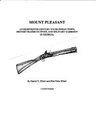
By Daniel T. Elliott<br />
LAMAR InIJtitute<br />
/<br />
/<br />
/
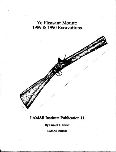
<strong>Ye</strong> <strong>Pleasant</strong> <strong>Mount</strong>:<br />
<strong>1989</strong> & <strong>1990</strong> <strong>Excavations</strong><br />
LAMAR Institute Publication 11<br />
By Daniel T. Elliott<br />
LAMAR Institute<br />
Watkinsville, Georgia<br />
@1991
Chapter<br />
1.<br />
2.<br />
3.<br />
4.<br />
5.<br />
6.<br />
Table of Contents<br />
List of Figures<br />
List of Tables<br />
Acknowledgements<br />
futroduction and Methodology<br />
History of <strong>Mount</strong> <strong>Pleasant</strong><br />
Archaeological Survey of <strong>Mount</strong> <strong>Pleasant</strong><br />
<strong>Excavations</strong> at Trader Point<br />
<strong>Mount</strong> <strong>Pleasant</strong> Viewed in Perspective<br />
References Cited<br />
Page<br />
11<br />
IV<br />
V<br />
1<br />
7<br />
23<br />
30<br />
102<br />
111<br />
Appendix I. Glass Beads from <strong>Mount</strong> <strong>Pleasant</strong>,<br />
By Marvin T. Smith 120<br />
Appendix ll. Zooarchaeological Analysis of the<br />
<strong>Mount</strong> <strong>Pleasant</strong> Site, Effingham County,<br />
Georgia, By Karen G. Wood 127<br />
Appendix ill Zooarchaeologial Analysis of the Mt. <strong>Pleasant</strong><br />
Site, 9Ef169, By Lisa D. O'Steen 152<br />
§<br />
i
Figure<br />
List ofFigures<br />
Page<br />
1. Portion ofWilliam DeBrahm's 1757 map ofSouth<br />
Carolina and Georgia 2<br />
2. William King's plat ofhis <strong>Mount</strong> <strong>Pleasant</strong> lands 22<br />
3. <strong>Mount</strong> <strong>Pleasant</strong> <strong>site</strong> plan, 9Efl69 26<br />
4. Plan ofBlocks A & B 31<br />
5. Englishdelftware 38<br />
6. Chinese porcelain, scratch blue stoneware, and<br />
refined white salt glazed stoneware 38<br />
7. Miscellaneous metal artifacts and decorated aboriginal pottery 39<br />
8. Reconstructed profile ofplain aboriginal pottery bowl<br />
with loop handle 40<br />
9. Reconstructed profile of plain aboriginal pottery bowl 41<br />
10. Indian pottery 42<br />
11. Pewter spoons and iron knife fragment 42<br />
12. Tableware and anns artifacts 43<br />
13. Decorated bone knife handle 44<br />
14. Glass trade beads 44<br />
15. Clothing items 56<br />
16. Miscellaneous artifacts 56<br />
17. Clothing artifacts 57<br />
18. Bone awls 58<br />
19. Gunparts and lead shot 58<br />
20. Arms artifacts 64<br />
21. Blunderbuss, hypothesized reconstruction 65<br />
22. English gunflints 66<br />
23. English, French, and local gunflints 67<br />
24. English, French, and local gunflints 68<br />
25. Tobacco pipes 71<br />
26. Tobacco pipes 72<br />
27. Tobacco pipes 73<br />
28. Bottle glass tools 75<br />
29. Plan ofFeatures 6, 20, 21, & 22 77<br />
30. Prome ofBlock B 78<br />
ii
Figure<br />
List ofFigures, continued<br />
31. Plan ofFeatures 8 & 9<br />
32. Profile ofFeatures 8 and 9<br />
33. Plan ofFeatures 10, 11, & 12<br />
34. Profl1e ofFeatures II, 13, and 15<br />
35. Plan ofFeature 13<br />
36. Plan ofFeature 14<br />
37. Plan of Feature 15<br />
38. Plan ofFeatures 16 & 17<br />
39. Plan ofFeature 18<br />
40. Plan ofFeature 19<br />
41. Profl1e ofFeatures 21,22, & 23<br />
42. Plan ofFeature 23<br />
§<br />
iii<br />
Page<br />
79<br />
80<br />
81<br />
82<br />
83<br />
84<br />
85<br />
86<br />
87<br />
88<br />
89<br />
90
Table<br />
List ofTables<br />
1. Deerskin traders at <strong>Mount</strong> <strong>Pleasant</strong><br />
2. Artifact summary, shovel tests<br />
3. Area C, test unit summary<br />
4. Artifact summary, midden<br />
5. Artifact summary, features<br />
6. Ceramic summary, midden<br />
7. Ceramic summary, features<br />
8. Minimum vessel estimate, non-Indian pottery<br />
9. Minimum vessel estimate, Indian pottery<br />
10. Button attributes<br />
11. Glass bead types<br />
12. Gunflint attributes<br />
13. Mean ceramic date calculation<br />
14. Pipe stem date calculation<br />
15. Artifact pattern analysis, Trader Point<br />
16. Revised frontier pattern compared with Trader Point midden<br />
17. Comparison of Indian pottery from <strong>Mount</strong> <strong>Pleasant</strong><br />
& the Chattahoochee River<br />
18. Gun types based on gunflint dimensions<br />
19. Summary ofEuro-American artifacts found at other<br />
historic Indian settlements in the Savannah River valley<br />
§<br />
iv<br />
Page<br />
15<br />
23<br />
28<br />
32<br />
37<br />
45<br />
48<br />
50<br />
52<br />
59<br />
60<br />
69<br />
96<br />
98<br />
100<br />
101<br />
105<br />
106<br />
107
Acknowledgements<br />
The author is indebted to many individuals who contributed their time and effort to<br />
make this project a success. The project was accomplished by major support from Richard<br />
C. Kessler, the Georgia Department of Natural Resources and the United States<br />
Department of the Interior, the National Park Service, and by volunteer labor. Richard,<br />
Martha, Mark, and Laura Kessler also provided food and labor during the field excavation<br />
phase. Neil Kessler provided for our comfort while at <strong>Mount</strong> <strong>Pleasant</strong>.<br />
The crew was assisted in the laboratory phase by Mark Williams. Selected metal<br />
artifacts were cleaned and conserved by Southeastern Archeological Services, Athens,<br />
Georgia under the direction of Jerald Ledbetter. Glass trade beads were analyzed by<br />
Marvin T. Smith. Faunal remains were analyzed by Karen G. Wood, Gwyneth Duncan,<br />
and Lisa D. O'Steen. Photographs were produced by Marshall Williams, Mark Williams,<br />
and Dan Elliott. Artifact illustrations and <strong>site</strong> maps were prepared by Rita Elliott Report<br />
production assistance was provided by Patrick H. Garrow and Garrow & Associates,<br />
Atlanta, Georgia and the staff at Southeastern Archeological Services. The report was<br />
edited by Debbie Hinrichs and Rita F. Elliott. Special thanks also to Alice Rhoda Ferrell<br />
and Charles Gnann who provided food, shelter, and entertainment at various times during<br />
the project<br />
§<br />
v
Chapter 1.<br />
Introduction & Methodology<br />
Introduction<br />
This reports details historical and archaeological research on the <strong>Mount</strong> <strong>Pleasant</strong> <strong>site</strong><br />
(9Ef169) in Effingham County, Georgia. Survey and excavation was undertaken there in<br />
<strong>1989</strong> and <strong>1990</strong> by the LAMAR Institute. The <strong>site</strong> boundaries were defined by<br />
systematically aligned shovel tests. One locale, Trader Point, was further investigated by<br />
two block excavation units totalling 23m 2 . These block units contained a rich midden<br />
deposit and 23 features. Components identified on the <strong>site</strong> span the early to mid-eighteenth<br />
century. This locality formerly contained a Yuchi Indian village, British trader factory, and<br />
ranger garrison. This study is particulary important because it represents the first in depth<br />
look at the archaeological manifestations of the Yuchi tribe--a tribe that has eluded<br />
historians and archaeologists for more than a century. This research is part of an ongoing<br />
project by the LAMAR Institute to investigate eighteenth-century settlements within the<br />
Savannah River watershed.<br />
<strong>Mount</strong> <strong>Pleasant</strong> is located northeast of Clyo, Georgia on a high bluff overlooking the<br />
Savannah River in Effingham County (Figure 1). The <strong>site</strong> lies within the interior coastal<br />
plain approximately 45 miles from the Atlantic Ocean. Today the <strong>site</strong> is in a mixed pine and<br />
hardwood growth area, but earlier in the twentieth century most of the <strong>site</strong> was under<br />
cultivation. The portion ofthe <strong>site</strong> identified as Trader Point probably was never cultivated<br />
because of its topographic setting. <strong>Mount</strong> <strong>Pleasant</strong> gets its name from its physical form.<br />
Within a few meters of the west bank of the Savannah River, the land rises abruptly to<br />
more than 90 feet above the river. From the crest of <strong>Mount</strong> <strong>Pleasant</strong> there is a clear view<br />
that stretches more than 10 miles to the east. Although there are many pronounced bluffs<br />
adjacent to the Savannah River floodplain in this region of the river valley, most of them<br />
abutt river swamp rather than the main river channel.<br />
At <strong>Mount</strong> <strong>Pleasant</strong> the river is very near the bluff, and it is a likely reason that this area<br />
became an important river crossing. This prominence was an obvious attraction for man.<br />
Its imposing form and steep approach makes it a defensible position from attack by the<br />
river. The presence of several springs on the bluff slopes insured a convenient supply of<br />
drinking water, especially important during times of siege. A wide variety ofplants grow<br />
on the shady sheltered slopes, many more common to the piedmont and mountain regions<br />
than the coastal plain. The vegetation, topography, ,and panoramic view give <strong>Mount</strong><br />
<strong>Pleasant</strong> a pleasing quality <strong>which</strong> is still evident today.<br />
The settlement began as a Yuchi Indian village. Though the exact year ofits settlement<br />
1
is not known, it may have been settled during the 1720s, but certainly was occupied by<br />
1735 when a German vi<strong>site</strong>d the town and recorded his visit in word and picture (Hvidt<br />
1980). Around 1740 a fort was established at <strong>Mount</strong> <strong>Pleasant</strong> <strong>which</strong> was manned by a<br />
dozen rangers and two officers. Several British deerskin traders also were living at <strong>Mount</strong><br />
<strong>Pleasant</strong> by the late 1730s, and possibly earlier. By 1758, the fon had been abandoned,<br />
the Indians and British traders had left the area, and the area became pan of the large<br />
Goldwire-King plantation. The British government, however, retained ownership ofa 100<br />
acre tract where the garrison formerly stood. It seems reasonable to estimate the age of the<br />
<strong>Mount</strong> <strong>Pleasant</strong> settlement as 1722 to 1757.<br />
Research Goals<br />
The goal of the first stage ofthe <strong>1989</strong> archaeological project was simple--to find <strong>Mount</strong><br />
<strong>Pleasant</strong>. This location was known from historical documents and maps, but it had not<br />
been identified on the ground. Historical research was conducted to narrow the search for<br />
the settlement. This consisted of a review ofprimary documents and maps and secondary<br />
historical sources containing peninent information about <strong>Mount</strong> <strong>Pleasant</strong>. At the request of<br />
the landowner, a survey was implemented to find the remains of<strong>Mount</strong> <strong>Pleasant</strong>. After the<br />
<strong>site</strong> had been located and its horizontal boundaries defined, the second stage of the <strong>1989</strong><br />
research project examined the archaeological potential ofone section ofthe <strong>site</strong> known as<br />
Trader Point. Research during <strong>1990</strong> was undertaken to better define the components of<br />
Trader Point. This required additional block excavation. The second season yielded<br />
information necessary for planning a full-scale excavation on Trader Point.<br />
Historical Research<br />
The historical research included a review of all references to <strong>Mount</strong> <strong>Pleasant</strong> in: the<br />
Colonial Records of Georgia (Candler 1904-1911 henceforth, CRG); Revolutionary<br />
Records of the State of Georgia (Candler 1908), Detailed Reports on the Salzburger<br />
Emigration who Settled in America....Edited by Samuel Urlsperger (Jones 1966, 1968,<br />
1969a, 1969b, 1972, 1973, 1985, 1988a, 1988b, <strong>1989</strong>a, <strong>1989</strong>b; <strong>1989</strong>c, <strong>1990</strong>a, <strong>1990</strong>b,<br />
Jones and Wilson 1976, 1980, 1981; Jones and Savelle 1983); early Georgia newspapers<br />
including Georgia Gazette; Gazette ofthe State ofGeorgia; Republican and Savannah<br />
Evening Ledger; and Columbia Museum and Savannah Advertiser; maps at the Georgia<br />
Surveyor General; records of Effingham County, Georgia (Lucas 1988); colonial land<br />
claims (Bryant 1975); grants issued in St Matthews Parish (Hemperly 1974); colonial plats<br />
for St. Matthews parish; and Effmgham County plats; Collections of the Georgia<br />
Historical Society; Georgia Historical Society in Savannah; Hargrett Rare Book and<br />
3
Manuscript Library, University of Georgia Libraries; Georgia State Archives, Atlanta; and<br />
Hvidt (1980).<br />
Field MethOds<br />
Fieldwork for the <strong>1989</strong> season began on March 1 with a two-person crew and was<br />
completed on March 13. The crew was assisted by four volunteers during the excavation<br />
phase--Richard Kessler, Martha Kessler, Laura Kessler, and Mark Kessler. A total of 26<br />
person-days were expended in completing the fieldwork.<br />
A total of 103 shovel tests were excavated along a 20 m interval grid. Grid North for<br />
the shovel test survey was established 45 degrees west of Magnetic North. These shovel<br />
test locations were located by pacing using a hand compass. All shovel tests were<br />
excavated to a minimum depth of40 cm below ground surface (BS). The entire contents of<br />
each shovel test were screened through 1/4 inch hardware mesh. The maximum depth of<br />
artifacts and soil stratigraphy were noted for each test. A plan map showing the<br />
approximate location of each shovel test was constructed in the field. The survey began<br />
with excellent ground visibility, but near the end of the project budding leaves hampered<br />
visibility. In addition, rain and sleet plagued the project, and shovel test artifacts were<br />
washed and analyzed during inclement weather outages.<br />
One shovel test was placed in a rich eighteenth-century midden and test excavations<br />
focused on this area known as Trader Point. A new grid was established on Trader Point<br />
using Magnetic North as Grid North. Initially six contiguous 1 m xl m test excavations<br />
were placed within this midden area, and each test was excavated in 10 cm vertical<br />
increments following removal of the plow-disturbed soil zone. All soil from these<br />
excavations was screened through 1/4 inch hardware mesh. Soil samples were taken from<br />
each stratigraphic zone for fme screen analysis. Field records were maintained for each<br />
level of excavation. Representative soil profl1es were mapped and photographed for each<br />
test unit. Selected levels were plan mapped, and distinct features were identified. Features<br />
were excavated and recorded separately from the midden fill. Excavation methods were<br />
consistent with the general excavation plan. All excavations were backfilled upon<br />
completion.<br />
The second field season was conducted by a two-person crew from May 21 to June I,<br />
<strong>1990</strong>. During this time, an additional 17m2 was excavated at Trader Point. Field methods<br />
employed during the second season were consistent with those used during the first season<br />
with the exception that all brick, daub, and mortar was recovered and quantified during the<br />
second season. The numbering system for test units and features followed consecutively<br />
from the previous season.<br />
4
Laboratory Methods<br />
All artifacts were returned to the laboratory for cleaning, analysis, and stabilization.<br />
Selected metal artifacts were submitted to Southeastern Archaeological Services, Inc. for<br />
cleaning and conservation under the direction of Jerald Ledbetter. All glass trade beads<br />
recovered during the <strong>1989</strong> season were submitted to Dr. Marvin T. Smith for analysis.<br />
Smith's analysis is included as Appendix I. Faunal remains from the <strong>1989</strong> season were<br />
submitted to Karen G. Wood for zooarchaeological analysis, and those recovered from the<br />
<strong>1990</strong> season were submitted to Lisa D. O'Steen for analysis. Wood's report is included as<br />
Appendix n and O'Steen's report is included as Appendix m.<br />
The analytical strategy for the artifacts was based on a slightly modified version of<br />
South's Group-Class-Type taxonomy (South 1977). Primary references utilized during the<br />
analysis included Ivor Noel Hume's (1983) Anifacts ofColonial America, Stone's (1977)<br />
Fort Michilimackinac 1715-1781, and Stanley South's (1977) Method and Theory in<br />
Historical Archaeology. All pottery was identified by type and when sufficient portions of<br />
the vessel were present, other morphological characteristics such as form and size were<br />
recorded. Minimum vessel estimates were determined using rim sherds and other sherds<br />
indicative of unique vessels. Pipe stem hole diameters were measured to the nearest 64th<br />
of an inch. All pipe stem dates were calculated using the Binford method (Noel Hume<br />
1983) and all mean ceramic dates were calculated after South (1977) with minor<br />
modifications. Artifact pattern analysis was conducted after South (1977) except that<br />
Indian pottery was included in the kitchen artifact group. Buttons were identified using<br />
South's and Olsen's button typology (South 1964; Olsen 1963). Hamilton was the<br />
primary source consulted for arms artifact group (Hamilton 1976; Hamilton and Emery<br />
1988). The length and width of gunflints were measured consistent with Hamilton's<br />
methods. Aboriginal pottery is described primarily by surface decoration and temper.<br />
Type designations were used sparingly, although the sherds recovered from the <strong>site</strong><br />
generally conform to the Ocmulgee Fields series that has been described for other historic<br />
Indian assemblages in Georgia (Smith <strong>1990</strong>).<br />
Curation<br />
All artifacts, notes, field analysis forms, maps, photographs, artifact analysis sheets,<br />
and other field records are temporarily housed in the office of the Georgia Salzburger<br />
Society within the main building of the New Ebenezer Retreat pending the creation of a<br />
more appropriate curatorial facility planned for the Ebenezer vicinity. In the absence ofany<br />
cataloguing and accessioning system at the existing Georgia Salzburger Society Museum, a<br />
system was created for labeling the artifacts. Under this system artifacts from the <strong>1989</strong><br />
5
project were designated by the numeral 3. followed by the bag number (Example: 3.49).<br />
Artifacts from the <strong>1990</strong> season were designated by the numeral 6. using the same method.<br />
§<br />
6
Chapter 2.<br />
History of <strong>Mount</strong> <strong>Pleasant</strong><br />
The Indian Era<br />
Before Euro-Americans anived, a tribe or band of native Americans inhabited <strong>Mount</strong><br />
<strong>Pleasant</strong>. The history of the earliest occupation of the <strong>site</strong> is not well known, and it rests<br />
upon archaeology to provide the missing infonnation. The Indian tribes associated with the<br />
<strong>Mount</strong> <strong>Pleasant</strong> vicinity during the eighteenth century include the Appalachicolas and<br />
Yuchi. During the seventeenth century this region was the domain of the Yamassee,<br />
although there are no records of any Yamassee towns at <strong>Mount</strong> <strong>Pleasant</strong>. Neither the<br />
Appalachicolas nor the Yuchi were native to this region, and it is not known what specific<br />
Indian tribes lived in the area prior to 1700. The area was probably abandoned sometime<br />
after 1400, and it may not have been occupied when Europeans first vi<strong>site</strong>d in the 1500s.<br />
The Appalachicola originally were settled along the Appalachicola and Chattahoochee<br />
Rivers. Spanish explorers may have encountered these Indians during the 1500s, but it<br />
was not until 1690 that the Spanish sent two Franciscan missionaries to the Appalachicolas.<br />
In 1703-4, the social order in the Appalachee region was severely disrupted by Col. James<br />
Moore's military campaign. Sometime after 1707, the Appalachicolas settled in the lower<br />
Savannah River area where they allied with the Yamassee. There were two villages of<br />
Appalachicolas in the Savannah River drainage in 1715 with a total population of 214.<br />
These Appalachicola were settled on the east side of the Savannah River a few miles<br />
downstream from <strong>Mount</strong> <strong>Pleasant</strong>. Some of the Appalachicola also may have lived at<br />
<strong>Mount</strong> <strong>Pleasant</strong> on the west side of the river. In 1716, the Appalachicolas had abandoned<br />
the Savannah River valley. Seven years later, the Appalachicolas' old town on the<br />
Savannah River was converted for use as a ranger garrison by the South Carolina<br />
government. This fort, known as Fort Prince George, was occupied until at least 1742<br />
(Swanton 1979; Ivers 1973).<br />
The Yuchis are the Indian group most solidly associated with <strong>Mount</strong> <strong>Pleasant</strong>. Their<br />
town at <strong>Mount</strong> <strong>Pleasant</strong> was not the largest of the Yuchi towns, but it played an important<br />
role in the early colonial history of Georgia. At its peak, historical estimates say it<br />
contained no more than 100 Indians and it probably existed for fewer than 25 years. After<br />
the town was abandoned, the Yuchis and Creeks continued to frequent the area until the late<br />
1750s.<br />
The Yuchi's Story. They were called Ani-Yusti by the Cherokee, Tahogalewi by the<br />
Delaware, Tamahitans by the eastern Siouans. Chisca by the Spanish, and the Round<br />
7
Town People, Uchee, and Hogologees by the English. Other names that have been linked<br />
to the Yuchi such as the Rickohockans and Westo, but researchers are not in complete<br />
agreement thatthese groups were indeed Yuchi (c.f. Swanton 1979; Milling 1969; Speck<br />
1909; Chase 1960; Huscher 1958; Bauxar 1957; Rogers 1979).<br />
The Yuchi were a very mobile tribe with settlements in Tennessee, Alabama, Georgia,<br />
South Carolina, North Carolina, and Florida. Consequently tracing their movements is<br />
very difficult. Most scholars agree that the Yuchi tribe heralded from the mountains of<br />
Tennessee and North Carolina. The Yuchean language is unlike any other southeastern<br />
Indian tongue, and this distinctiveness indicates a high degree of isolation between the<br />
Yuchi and their neighbors. Although by the eighteenth century, the Yuchi were closely<br />
allied with Muscogean tribes they retained a degree of autonomy throughout the historic<br />
period. Yuchean language stock is unique in North America, and as distinct from<br />
Iroquoian, Siouan, or Muscogean, as are English and Russian. Their homeland in the<br />
southern Appalachian mountains provided the isolation necessary for some ofthe language<br />
differences that are apparent Prior to the arrival ofEuropeans in North America, the Yuchi<br />
existed in near isolation for perhaps five thousand years.<br />
In 1541 Hernando De Soto learned of a people known as Chisca who were skilled in<br />
metalwork, and he dispatched a contingent to investigate them. This journey was<br />
unsuccessful, but later contact is documented between the Chisca and the Spanish troops<br />
from Santa Elena [near present day Beaufort, South Carolina] commanded by Juan Pardo<br />
during the 1560s. Swanton suspects that the Chisca probably were Yuchi (Swanton<br />
1979). The Chisca later were reported in Florida.<br />
Two early maps, John Barnwell's map (1715) and John Herbert's map (1725), both<br />
show the Hogelogees on the Savannah River north of Fort Moore near present day<br />
Augusta. Today, Uchee Creek in Columbia County, Georgia remains as a testament to the<br />
fact that the Yuchi and Hogelogees were one and the same. The Herbert map also shows<br />
Hogologees living on the Chattahoochee River in the vicinity ofpresent day Uchee Creek<br />
in Russell County, Alabama.<br />
A settlement ofYuchi remained near Augusta until the 17508, when they moved to join<br />
with the Creeks. The Yuchi also settled near Silver Bluff below Augusta near George<br />
Galphin's trading post. Neither the Barnwell map nor the Herbert map show Indian<br />
settlements at <strong>Mount</strong> <strong>Pleasant</strong><br />
In a 1715 census compiled by British traders, two towns ofYuchi were listed as having<br />
a total population of 400 people. In a 1725 census compiled by the Society for the<br />
Propagation of the Gospel in Foreign Parts (SPG), their population was listed at 530. By<br />
the late 1750s, the Yuchis had settled in villages on the Flint and Chattahoochee Rivers.<br />
By the mid 1770s their population totaled more than 1,500 as estimated by the naturalist<br />
William Bartram who vi<strong>site</strong>d their capital town on the Chattahoochee River. The town<br />
8
vi<strong>site</strong>d by Bartram was located in 1958 by archaeologist David Chase, and some<br />
excavations has been done there by the Smithsonian Institution under the direction of<br />
archaeologist Harold Huscher and by the Columbus Museum under the direction of<br />
archaeologist Frank Schnell (Huscher 1958; Chase 1960; Schnell 1982).<br />
Like the Yuchi, the Westo had settlements on the Savannah and Chattahoochee Rivers.<br />
The Westo were a fierce group who captured Indian slaves from the Cherokee and other<br />
tribes. First contact was made between the British and the Westo at their village near<br />
present-day Augusta during an exploration by Henry Woodward in 1674. The initial<br />
relationship between the two groups was favorable, but as British trading contacts spread<br />
to other groups in the region the Westo became more of a hindrance than an asset to the<br />
English. The British had trouble controlling the warfare and slave-taking habits of the<br />
Westo, and so they enlisted the aid ofa group ofShawnee from Pennsylvania to neutralize<br />
them. By 1680, the Westo population had been reduced until they were no longer a threat<br />
to the region. Because they were eliminated so early, there are few written descriptions of<br />
the Westo and their history is poorly understood. John Swanton, a late authority on<br />
southeastern Indians, associated the Westo with the Yuchi during the late seventeenth and<br />
early eighteenth centuries. Chapman Milling, author ofRed Carolinians, disagreed with<br />
Swanton as to the cultural affinity of the Westo, and he identified the Westo as distinct<br />
from, and enemies of the Yuchi (Milling 1969). Early maps show the Westo in similar<br />
locations to the Hogologee and Yuchi on the Savannah and Chattahoochee Rivers, but the<br />
identity of the Westo remains unresolved to the present day.<br />
The Yuchis probably settled at <strong>Mount</strong> <strong>Pleasant</strong> sometime after the Yamassee War,<br />
although the precise date is not known. In the summer of 1736, Baron Philip Georg<br />
Frederich von Reck, one of the leaders ofthe Ebenezer settlement, vi<strong>site</strong>d the Yuchi village<br />
at <strong>Mount</strong> <strong>Pleasant</strong> and recorded his visit in word and picture. His watercolors are the<br />
earliest depictions of Georgia's Native Americans and they contain valuable ethnographic<br />
information about the Yuchi people. He painted a portrait of their King, or Mico,<br />
Senkaitschi, and his wife. Von Reck also drew a portrait of the supreme commander of<br />
the Yuchi Indian nation whose name was Kipahalgwa, although his place ofresidence was<br />
not given (Hvidt 1980:114-129)'-<br />
Von Reck also painted pictures of an Indian encampment and numerous Indians at<br />
<strong>Mount</strong> <strong>Pleasant</strong>, and was the first European to describe an Indian Busk, or green corn<br />
ceremony. In his depiction of the Busk, he shows a group of Indians near an open hut<br />
with several trade guns suspended from the eaves. Von Reck wrote on July 19, "I went to<br />
Palachocolas andfrom there to Yuchi Town to ask the Indians to come to Ebenezer to<br />
shoot some gamefor the sick..." (Hvidt 1980:44) and on July 28 he wrote<br />
I went back to the Yuchi town to attend the busk, or annual Indian festivity. By water<br />
Palachocolas is twenty-five miles and Yuchi town thirty miles from Ebenezer, but by<br />
9
land Yuchi Town is twenty miles and Palachocolas is twenty-five...Their towns and<br />
dwellings are usually situated on a river...Their trade consists of skins, <strong>which</strong> they<br />
exchange for guns, powder, lead, rum, colors, mirrors, beads, woolen and linen cloth & c.<br />
(Hvidt 1980:44)<br />
<strong>Mount</strong> <strong>Pleasant</strong> again is mentioned in October, 1740, when two villains from Fort<br />
Argyle sought refuge there: "at a place called <strong>Mount</strong> <strong>Pleasant</strong>, or the Uchee Town (from<br />
some of those Indians inhabiting thereabout) on the River Savannah, and in the usual<br />
Place ofcrossing it to the Palachocolas: there the Rain had driven them for shelter into a<br />
hut." These two murderers were captured, put in jail, and later executed (eRG 4:660).<br />
One writer described <strong>Mount</strong> <strong>Pleasant</strong> in 1740<br />
Thirty miles above Ebenezer, on the Carolina side, lies the Palachocolas Fort. Five<br />
miles above the Palachocolas, on the Georgia side, lies the Euchee town (or <strong>Mount</strong><br />
<strong>Pleasant</strong>) to <strong>which</strong> about a hundred Indians belong; but few of them stay now in the<br />
town, they choosing rather to live dispersed. All the land from Ebenezer to the river<br />
briers belongs to those Indians, who will not part with the same, therefore it cannot be<br />
planted. One hundred and 44 miles above <strong>Mount</strong> <strong>Pleasant</strong>, on the Carolina side, is Silver<br />
Bluff, where there is another settlement ofEuchee Indians; on both sides of the river are<br />
fields ofcorn planted by them. (Collections ofthe Georgia Historical Society 2:71)<br />
The Yuchi were allied with the Lower Creek tribes, <strong>which</strong> included not only Creek<br />
Indians, but also the Hitchiti and Appalachicolas. This political alliance was not always<br />
pleasant. In 1746, according to South Carolina Governor Glen, a group of Creeks attacked<br />
the Yuchis and "killed six ofthem and carryed many others into slavery" (S.C. Records<br />
BPRO 22:151).<br />
Oglethorpe's 1733 treaty with the ,Indians for land on the lower Savannah River did not<br />
include representatives of the Yuchi. By July, 1736, however, Oglethorpe included the<br />
Yuchi in talks with the Lower and Upper Creeks. The Yuchi were identified at that time as<br />
friends of the Creeks and mutual enemies ofthe Cherokee (McPherson 1962:175).<br />
In July, 1739, Oglethorpe embarked from Savannah on a journey to meet with the<br />
Indians at Coweta town on the Chattahoochee River. This trip, fIrSt by water and later by<br />
land, led him through the settlement of <strong>Mount</strong> <strong>Pleasant</strong>. Georgia Governor William<br />
Stephens recorded the trip in his journal<br />
The General left us in the Forenoon, and proceeded up the River in the Cutter with<br />
Lieutenant Dunbar, Ensign Leman, and Mr. Eyre (a Cadet) his Attendants, besides<br />
Domesticks and menial servants: At the Euchie Town, about twenty-five Miles above<br />
10
Ebenezer, he purposed to quit the water, having appointed some of our principal Indian<br />
Traders to wait his coming there, with a Number of Horses, as well as for sumpture as<br />
Riding: and also some of our Rangers to assist; intending from thence to travel on to the<br />
Creek Nation & c. (Stephens 1742, 2:67)<br />
The Detailed Reports of the Salzburgers at Ebenezer include numerous references to<br />
Yuchi and Creek Indians camping near their settlements. On March 28,1741, Bo1tzius<br />
reponed that a Yuchi family had been camping between Ebenezer and the plantations<br />
located to the south for one-half year (Jones 1985:123).<br />
A letter, dated June, 1751, from Governor Glen of South Carolina reponed the<br />
movement of the Yuchis away from the Savannah River region: "The Euchees whom you<br />
also mention, did in like manner till lately live in this Province at Silver Bluff, but being a<br />
Tribe belonging to the Lower Creeks, they were called Home, when they broke out war<br />
with the Cherokees." (McDowell 1958:170).<br />
Although most Yuchi had desened <strong>Mount</strong> <strong>Pleasant</strong> by 1740, their continued presence in<br />
the area is recorded until the late l750s. In September, 1756, eight European refugee<br />
familes from the Ogeechee area fled to <strong>Mount</strong> <strong>Pleasant</strong> following an Indian attack. As late<br />
as May, 1757, a few Indians remained near <strong>Mount</strong> <strong>Pleasant</strong>. William Moore, a resident of<br />
the <strong>Mount</strong> <strong>Pleasant</strong> vicinity, stated that there were "40 [Indian] gun men in his<br />
neighborhood near <strong>Mount</strong> <strong>Pleasant</strong> who were willing under his command" to aid the<br />
Chickasaw (CRG 7:206, 390, 549).<br />
Governor Glen's letter suggests that the Yuchi were no longer settled along the<br />
Savannah River by the 1750s, and had moved westward to join the Lower Creek tribes,<br />
most likely on the Flint and Chattahoochee Rivers. Their resilience as a people is proven<br />
by the survival ofthe Yuchi people, their language, and their culture into the present day, in<br />
Oklahoma (Speck 1909; Bauxer 1957; Rogers 1979).<br />
Other Yuchi Settlements. In addition to the Yuchi town at <strong>Mount</strong> <strong>Pleasant</strong>, several other<br />
Yuchi settlements have been documented in Georgia, Alabama, Tennessee, and South<br />
Carolina. In Tennessee, <strong>site</strong>s containing Mouse Creek type pottery tentatively have been<br />
identified as Yuchi, although some researchers disagree with this association. The best<br />
known of the eighteenth-century Yuchi towns is located on the Chattahoochee River in<br />
Russell County, Alabama. This also was one ofthe largest towns reponed (Ruscher 1958;<br />
Chase 1960; SchneI11982).<br />
The Chattahoochee River town reponedly was first settled by an old chiefof Cussetuh<br />
[Kasita] whom the English referred to as Captain EIlick. Captain EIIick married three<br />
Yuchi women and brought them to Kasita. The Kasitas were not pleased, as apparently the<br />
Creeks and Yuchi infrequently bonded in such fashion. Captain Ellick along with his<br />
11
others left Kasita and settled on Uchee Creek. The Bonar map of 1757 shows the<br />
Euches [Yuchi] settled in this location, as does the Sturgess map of 1818 (DeVorsey<br />
1971:20; Sturgess 1818).<br />
William Bartram vi<strong>site</strong>d this town during the mid-1770s, and gave a glowing<br />
description ofYuchi town:<br />
The Uche town is situated in a vast plain, on the gradual ascent as we rise from a<br />
narrow strip of low ground immediately bordering on the river: it is the largest, most<br />
compact and best situated Indian town I ever saw; the habitations are large and neatly<br />
built; the walls of the houses are constructed of a wooden frame, then lathed and<br />
plastered inside and out with a reddish well tempered clay or mortar, <strong>which</strong> gives them<br />
the appearance of red brick walls; and these houses are neatly covered or roofed with<br />
Cypress bark or shingles of that tree. The town appeared to be populous and thriving,<br />
full of youth and young children: I suppose the number of inhabitants, men, women,<br />
and children, might amount to one thousand or fifteen hundred, as it is said they are<br />
able to muster five hundred gun-men or warriors. (Van Doren 1955:386)<br />
Benjamin Hawkins provided a brief description of the same town in 1798 or 1799;<br />
U-chee, is on the right bank of Chat-to-ho-che, ten and a half miles below Cow-e-tuh<br />
taI-lau-has-see [Coweta Old Town], on a flat of rich land, with hickory, oak, blackjack<br />
and long-leaf pine; the flat extends from one to two miles back from the river, Above<br />
the town, and bordering on it, Uchee Creek, eighty-five feet wide, joins the river.<br />
(Hawkins 1974:61)<br />
Hawkins noted that the Yuchi also were settled in three other villages on the Flint River<br />
drainage at the end ofthe eighteenth century, and the Flint River towns contained 250 gun<br />
men (Hawkins 1974;61). During a recent archaeological survey of the Flint River basin,<br />
John Worth (personal communication, 1991) reported finding surface remains ofPatsiliga<br />
town.<br />
Scattered evidence ofYuchi has been identified in the central Savannah Riverregion<br />
north and south ofAugusta. Historic Indian artifacts are reported in the midden on<br />
Stallings Island and at least one child burial has been identified as possibly early eighteenth<br />
century Yuchi (Claflin 1931; Neill 1955; Gresham, cited in Smith 1991).<br />
Isolated occurrences ofplain shell tempered pottery and eighteenth century dark green<br />
bottle glass were reported from the Mint's Point <strong>site</strong> at the mouth of Steven's Creek within<br />
sight of Stallings Island (Elliott 1983). Contemporary maps identify a Yuchi settlement<br />
several miles upstream from Stallings Island During his survey ofClark Hill Lake, carl<br />
Miller searched for this town and placed one test pit, <strong>which</strong> was located at the mouth of<br />
12
Uchee Creek in Columbia County, with negative results (Miller 1948a). An island in the<br />
Savannah River at the confluence ofUchee Creek also bears the name Uchee and it may<br />
have contained the Indian settlement This Yuchi town near the mouth ofUchee Creek may<br />
have been used for less than two years during the period 1714 to 1716 (Swanton<br />
1979:213).<br />
Silver Bluff, located in Aiken County, South Carolina approximately 15 miles<br />
downstream from Augusta, contained another Yuchi settlement A band ofYuchi lived<br />
there between 1746 and 1751 (Swanton 1979:214). In 1752 the land was purchased by<br />
trader George Galphin who established a trading post on the <strong>site</strong>. Archaeological<br />
investigations were conducted at Silver Bluffplantation in 1979 and 1980 by the SCIAA<br />
(Scurry et al. 1980). No shell tempered pottery indicative of the Yuchi presence was<br />
found. However, during an earlier visit to the locality by Neill, Indian ceramics and Euro<br />
American trade materials were found. This finding has led some researchers to associate<br />
these materials with the Yuchi, although Neill rejects this interpretation (Goggins 1958;<br />
Neill 1968). The historic Indian artifacts reported by Neill at Silver Bluffare not<br />
inconsistent with the Yuchi remains found at <strong>Mount</strong> <strong>Pleasant</strong><br />
Evidence of another Yuchi town on the Oconee River is suggested by Uchee Creek<br />
located in Wilkinson County, Georgia. A Yuchi settlement on Brier Creek in Burke or<br />
Screven Counties, Georgia also is referenced, but the location ofthis town has not been<br />
identified.<br />
The Fur Trade Era<br />
<strong>Mount</strong> <strong>Pleasant</strong> was an important river crossing along an Indian trading path that linked<br />
the Lower Creek tribes with Charleston. While most of the eighteenth century Indian<br />
traders worked outward from the Augusta vicinity, <strong>Mount</strong> <strong>Pleasant</strong> proved to be an<br />
important trading outpost. More than a dozen British deerskin traders and their assistants<br />
called <strong>Mount</strong> <strong>Pleasant</strong> their horne during the early- to mid-eighteenth century. The traders<br />
could reach Creek towns in Florida and the Chattahoochee River region from <strong>Mount</strong><br />
<strong>Pleasant</strong>. The geographical position of<strong>Mount</strong> <strong>Pleasant</strong> in the lower coastal plain facilitated<br />
access to Charleston--the key location in the economics ofthe Indian trade.<br />
Trading networks between the British in Carolina and the Creek Nation were<br />
established shortly after 1670. Savannah played only a minor role in the flow of the<br />
deerskin trade, while Charleston remained the leading exporter. This situation persisted<br />
even though Savannah was much closer to <strong>Mount</strong> <strong>Pleasant</strong> than Charleston. The deerskin<br />
trade was regulated by the Carolina and Georgia governments, and many Carolina<br />
documents relating to the trade still exist. Fewer documents regarding Georgia's regulation<br />
of the Indian trade have survived, however.<br />
13
The Indian trade represented a substantial portion of the British colonial economy in<br />
Carolina. A trading factory was established following the Yamassee War at Appalachicola<br />
town in South Carolina approximately five miles downstream from <strong>Mount</strong> <strong>Pleasant</strong>.<br />
Deerskins were the primary export, and several million skins were traded during the<br />
eighteenth century. These hides were obtained through exchange of European items that<br />
had more flash than substance, such as glass beads, mirrors, glass, ornaments, buckles,<br />
and brass bells. More useful items, such as guns, powder, and shot also formed part of<br />
the trade, although British trade guns were notorious for their inferior quality. The British,<br />
unlike the Spanish, permitted the trade of firearms. Alcohol was another item that was<br />
exchanged, although much of this trade was outside of the law. Rum and strong drink<br />
were not permitted in Georgia until the l750s, but South Carolina was much more<br />
permissive of the use of strong alcoholic beverages. Residents along the Savannah River<br />
quickly learned that liquor was only a river's-width away. More than one Georgia settler<br />
drowned while returning home drunk from Carolina during this period (Jones 1984).<br />
The Indian trade also was important for colonial Georgia, and ambitious entrepreneurs<br />
wasted no time in establishing the deerskin trade. By July, 1735, sixteen Indian traders<br />
applied for licenses in Savannah. In June, 1739, Georgia Governor William Stephens<br />
recorded, "Several Indian Traders began now to apply for Licences: some to obtain new,<br />
and some to renew their old ones" (McPherson 1962:97). There were 600 whites<br />
including traders, packhorsemen, servants, townsmen, and others who were dependant on<br />
the Indian trade business in Georgia by 1739 (Oldmixon 1969). Augusta served as the<br />
center of deerskin trade for Georgia and most traders regarded Augusta as their base of<br />
operation. As a deerskin trading point, <strong>Mount</strong> <strong>Pleasant</strong> was second only to Augusta in<br />
Georgia.<br />
Georgia and South Carolina competed for the Indian deerskin trade, and it was reported<br />
that General Oglethorpe, acting as Georgia's Commissary for Indian Affairs, drove away<br />
Carolina traders operating within Georgia who were not licensed by him. Discord was<br />
recorded by the Salzburger pastors at Ebenezer, Georgia between Carolina and Georgia<br />
Indian traders during early 1741. Some of the traders avoided this problem by obtaining<br />
licenses from both Georgia and South Carolina. Although unlicensed colonists were not<br />
permitted to trade with the Indians, exchanges of glass beads and wild game were reported<br />
at Ebenezer (McPherson 1962:272; Jones 1985:494).<br />
While many of the Indian traders remain anonymous in the historical record, several<br />
traders who lived at <strong>Mount</strong> <strong>Pleasant</strong> were identified by historical research. These British<br />
fur traders frequented <strong>Mount</strong> <strong>Pleasant</strong> on their journeys to the lower Creek tribes during the<br />
very late-seventeenth- and very early eighteenth century, but the early references to the<br />
trade provide no specific details regarding this place. Indian traders were reported near<br />
<strong>Mount</strong> <strong>Pleasant</strong> as early as 1712 (McDowell 1955:35). Among the early traders who lived<br />
at <strong>Mount</strong> <strong>Pleasant</strong> was Thomas Wiggin [also spelled Wiggan]. In 1738 Thomas Wiggin<br />
14
was: "supplying some Creek Indians [19 people] from <strong>Mount</strong> <strong>Pleasant</strong> with Provisions<br />
for their Journey to Charleston." Wiggin later became commander of the fort at <strong>Mount</strong><br />
<strong>Pleasant</strong> (Easterby 1951:447; McDowell 1958:175; S.C. Commons Journal 1739<br />
1741:389).<br />
Four other traders with 13 assistants listed <strong>Mount</strong> <strong>Pleasant</strong> as their primary residence in<br />
a 1743 inventory of Georgia Indian traders. A list of the <strong>Mount</strong> <strong>Pleasant</strong> traders is<br />
presented in Table 1.<br />
Table 1. Deerskin Traders at <strong>Mount</strong> <strong>Pleasant</strong>.<br />
TRADER ASSISTANTS HORSES<br />
Mr. Spencer 3 16<br />
Mr. Gilmore 4 20<br />
Mr.Bameu 3 20<br />
Mr. Ladson 3 20<br />
(Source: Collections of the Georgia Historical Society 2:123)<br />
John Spencer, among those listed in the 1743 inventory, swore in an affidavit in 1752<br />
that he was an Upper Creek Indian trader in the town of Mucklassies. Spencer also was<br />
licensed as a trader with South Carolina authorities and he owned land near Augusta. No<br />
references to the Indian traders Barnett, Ladson, or Gilmore were found by our research in<br />
the South Carolina records, and little else is known about them (McDowell 1958:337-338).<br />
In 1752, Stephen Forest was listed by South Carolina as a trader in the Utehee town of<br />
Ausichee probably located in present-day Russell County, Alabama. Forest had an<br />
assistant named Peter Randal. Randal's name appears in the early land grant records<br />
claiming the area along the lower Savannah River within five miles of <strong>Mount</strong> <strong>Pleasant</strong>.<br />
Perhaps Stephen Forest and Peter Randal were among the 16 unnamed assistants to the<br />
Indian traders who had been stationed earlier at <strong>Mount</strong> <strong>Pleasant</strong>. By that time, however,<br />
the Yuchi no longer lived at <strong>Mount</strong> <strong>Pleasant</strong>. As early as 1743, the trader, Forest, warned<br />
the Carolina government ofbad feelings between the Lower Creeks and the Carolina Yuchi<br />
(S. C. Commons Journal 11:286-287).<br />
Although the Indian trade at <strong>Mount</strong> <strong>Pleasant</strong> diminished during the 176Os, the location<br />
continued to be an important transit point for goods and services as indicated by a 1764<br />
15
oat advertisment in the Georgia Gazette: "To be sold by the Subscriber at <strong>Mount</strong><br />
<strong>Pleasant</strong>, A New Boat, eight feet wide, and forty feet long, with a small cabin, and every<br />
thing necessary for immediate use. Robert Hudson." (Georgia Gazette June 7,1764, p.<br />
5, c.1). Vessels of this type transported goods up and down the Savannah River during<br />
the eighteenth century. <strong>Mount</strong> <strong>Pleasant</strong> served as an important trading point for people<br />
headed north or south by both river and overland routes, and for those headed east or west<br />
by the overland route. By the 1770s, however, <strong>Mount</strong> <strong>Pleasant</strong>'s importance as a river<br />
crossing had been surpassed by more convenient ferrying points located both upstream and<br />
downstream.<br />
The Ranger Era<br />
In December, 1717, the government of South Carolina reorganized the Company of<br />
Southern Rangers and their base of operation was transferred to the Savannah River.<br />
These rangers were stationed near <strong>Mount</strong> <strong>Pleasant</strong>, <strong>which</strong> at that time was considered<br />
territory belonging to Carolina. The Company of Southern Rangers was disbanded in<br />
June, 1718. In 1723, a new group ofrangers built Fort Prince George near Apalachacola<br />
Old Town and this fort was maintained until 1742 (Ivers 1973, 1984).<br />
Larry Ivers, an authority on eighteenth century military affairs, provides a description<br />
of the typical ranger one might have encountered at Fort Prince George or <strong>Mount</strong> <strong>Pleasant</strong><br />
during the early eighteenth century<br />
Compared with smartly dressed British dragoons, the rangers of the southern colonies<br />
would have louked more like outlaws than soldiers. Rangers were nonnally required to<br />
outfit themselves with horses, saddles, bridles, weapons, clothing, and food. Their<br />
horses were small but rugged, bred in the colonies. The primary weapon was a<br />
flintlock carbine or a musket with the barrel sawed off short for easier handling on<br />
horseback. Two flintlock pistols were holstered in front of the saddle. Initially, only a<br />
sword was required to complement the three slow loading firearms, but by the end of<br />
the seventeenth century, rangers had begun to carry hatchets, <strong>which</strong> served as both<br />
weapons and tools on the forest trails. Clothing was usually the same civilian apparel<br />
worn by the English workingmen of the period. Rangers usually received good wages,<br />
paid in tobacco in Virginia and Maryland, in inflated paper currency in South Carolina,<br />
and later in bills of exchange in Georgia. (Ivers 1984:157)<br />
General Oglethorpe readily adopted the ranger system then in use by Carolina to form<br />
the Georgia rangers. Ivers provides a description of how the Georgia rangers were<br />
organized<br />
16
He [Oglethorpe] stationed small garrisons of rangers in tiny forts "upon the passes of<br />
the River[s] and the Roads to the Indian Countrey...Those men having horses patroll<br />
about the Countrey, and thereby give alarms of Indian Enemies, intercept Spies & c."<br />
By 1739 Oglethorpe was also using rangers as mobile scouting and raiding forces,<br />
operating on horseback and in their scout boats. They were organized into troops that<br />
varied in strength from about twelve to twenty-five men acquainted with Woods<br />
mounted on horseback[;] they not only carry advices through these vast Forests &<br />
swim Rivers, but in Action, by taking an Enemy in Flank or Rear, do great<br />
Service...They also are of great service in watching the Sea Coasts, since they can<br />
swiftly move from one Place to another, and engage to advantage Men with wet arms<br />
& Accoutrements, before they can be able to form themselves after landing. (Ivers<br />
1984:158)<br />
After his visit to <strong>Mount</strong> <strong>Pleasant</strong> in 1739, General Oglethorpe was so impressed with<br />
the majestic <strong>site</strong> of <strong>Mount</strong> <strong>Pleasant</strong> that he authorized construction of a military garrison<br />
there for defense ofGeorgia. Oglethorpe's directive stated<br />
<strong>Mount</strong> <strong>Pleasant</strong> is situated on the Georgia side of the River, almost oppo<strong>site</strong> to<br />
Palachocolas Fort; it was once the Habitation of a Tribe ofEuchees, who deserted it a few<br />
years since, chusing to settle farther up; but a few of them frequent it still, with some<br />
vagrant Creeks among them, and one Thomas Wiggin, an Indian Trader, keeps stores<br />
there; who being of long standing, and one whom the General has confidence in; he<br />
ordered him to build a Fort there giving him command of twelve men, as a sufficient<br />
Guard against any mischievous attempts from the Indians of any kind; and it is a Pass on<br />
the Way betwixt this and Fort Augusta. (eRG 4, supplement:86)<br />
In February, 1741, General Oglethorpe authorized a commander and a dozen rangers to<br />
be stationed at <strong>Mount</strong> <strong>Pleasant</strong>. Commanders ofthis fort were to include Anthony Willey,<br />
Thomas Wiggin, John Barnard, and William Moore. The names of the enlisted men<br />
stationed there are not recorded, but they probably included several of the traders who<br />
already lived on the <strong>site</strong>. By definition, the rangers often were away from their garrison<br />
while covering their assigned range. Their job was to patrol aggressively the frontier and<br />
confront hostile Indians or other opponents ofthe British Empire. Other military garrisons<br />
similar in character were established in Georgia, and included: Ebenezer on the Savannah<br />
River; Isle of Hope at the Skidaway Narrows, Fon Argyle on the Ogeechee River; and<br />
<strong>Mount</strong> Venture on the Altamaha River. More substantial garrisons were established at<br />
Darien, Frederica, and Savannah.<br />
Lieutenant Anthony Willey was listed at <strong>Mount</strong> <strong>Pleasant</strong> in February, 1741, but his<br />
17
esidence there was short-lived since he was mortally wounded by a self-inflicted gunshot<br />
in 1742 (CRG 4, supplement:85; Coulter and Saye 1949:102). On March 30, 1741,<br />
Governor Stephens made no reference to Lieutenant Willey when he wrote in his journal:<br />
"Wiggins with his men at <strong>Mount</strong> Pl'easant." (CRG 4, supplement:1l7). In 1756, the Earl<br />
of Egmont recorded that Mr. Barnard had been: "...made by Genl Oglethorpe<br />
Commander of<strong>Mount</strong> <strong>Pleasant</strong> and the Rangers there, in the place ofCapt. Wiggins who<br />
died last Winter." (CRG 5:659) An earlier reference, however, suggests that Barnard<br />
may have been in charge of the post even earlier. On February 24, 1744, John Barnard<br />
listed himself as commander ofthe <strong>Mount</strong> <strong>Pleasant</strong> garrison when he petitioned for a town<br />
lot in Savannah (CRG 6:94).<br />
Many of the Georgia rangers were decommissioned in 1748, but rangers were stationed<br />
at <strong>Mount</strong> <strong>Pleasant</strong> as late as 1756. Occupation of the fort may not have been continuous,<br />
however, throughout the period that it was in use. <strong>Mount</strong> <strong>Pleasant</strong> also served as a place of<br />
refuge for settlers during the French and Indian War. A resident of the <strong>Mount</strong> <strong>Pleasant</strong><br />
area, William Moore commanded 40 Indian gunmen during May, 1757 (CRG 7:549).<br />
William DeBrahm's 1757 map of South Carolina and Georgia shows "<strong>Mount</strong> <strong>Pleasant</strong> Ft"<br />
in a location that corresponds with the present location ofthe <strong>Mount</strong> <strong>Pleasant</strong> <strong>site</strong> examined<br />
by this study (see Figure 1).<br />
The Plantation Era<br />
The late 1750s ushered in an entirely new type of land use for <strong>Mount</strong> <strong>Pleasant</strong>--the<br />
development of small plantations by British colonists. During this period, settlement<br />
shifted from 9Ef169 to other areas of the <strong>Mount</strong> <strong>Pleasant</strong> vicinity. Most of these later<br />
settlements have not been identified archaeologically and they await further study.<br />
<strong>Mount</strong> <strong>Pleasant</strong> was used by Indian traders with no legal claim to their land. Most of<br />
these traders followed the Indian migration west to the Chattahoochee and Flint Rivers<br />
during the 1750s, since their occupation required close contact with the Indians. Some of<br />
the traders later tried to obtain grants for the <strong>Mount</strong> <strong>Pleasant</strong> land. The Indian trader and<br />
ranger commander, Thomas Wiggin, must have been pleased with the scenic location of<br />
<strong>Mount</strong> <strong>Pleasant</strong>. In 1741, he petitioned the Georgia Trustees for 500 acres of land "on<br />
this side the river Savannah near <strong>Mount</strong> <strong>Pleasant</strong>," but the decision of whether or not to<br />
grant his petition apparently was delayed (CRG 5:659). No later references were found<br />
regarding his attempts to claim land at <strong>Mount</strong> <strong>Pleasant</strong>. A letter to General Oglethorpe in<br />
1741 stated: "Mr. Wiggins has brot a stock ofcows and Young cattle lately from Carolina<br />
to <strong>Mount</strong> <strong>Pleasant</strong>" (CRG 23:39). This letter revealed the concern held by some of<br />
Georgia's settlers for how the lands north ofEbenezer Creek were used. In 1741, <strong>Mount</strong><br />
<strong>Pleasant</strong> legally was Indian land, however, and Thomas Wiggin had no rightful claim to it.<br />
18
Thomas Wiggin was dead by 1756, and he apparently never held a legal claim to land in the<br />
vicinity of<strong>Mount</strong> <strong>Pleasant</strong>.<br />
The Salzburger colony at Ebenezer, located 10 miles southeast of<strong>Mount</strong> <strong>Pleasant</strong>, also<br />
desired the Yuchi lands north of Ebenezer Creek and a certain amount of antagonism<br />
existed between the Yuchi and the Salzburgers because of this. General Oglethorpe wrote<br />
about this conflict in a 17361etter.<br />
They [SaIzburgersl also turned their cattle over the River some of whom strayed away and<br />
eat the Uchees com 20 miles above Ebenezer. But what vext the Uchees more was that<br />
some of the Carolina people swam a great Herd of Cattle over Savannah and sent up<br />
Negroes and began a Plantation on the Georgia side not far from the Uchees Town. The<br />
Uchees...sent up their King and 20 warriors (Collections of the Georgia Historical<br />
Society 3: 1736)<br />
In 1741, the Trustees asked Colonel Stephens to buy land from the Yuchi on the north<br />
side of Ebenezer Creek so that the area could be settled by 50 Salzburgers (Jones<br />
1985:417). The Salzburger's hungerfor Yuchi land continued into the 1750s as Reverend<br />
John Martin Boltzius wrote: "Above <strong>Mount</strong> <strong>Pleasant</strong> is (as we are told) a veryfertile and<br />
convenient Tract for a whole Body ofPeople." (CRG 6:339) Although the Creek and<br />
Yuchi Indians officially did not relinquish their claim to the lands, including <strong>Mount</strong><br />
<strong>Pleasant</strong>, until the treaty of 1763, white settlement north of Ebenezer Creek flourished<br />
throughout the 1750s and 176Os.<br />
Many colonists made land claims in the vicinity of <strong>Mount</strong> <strong>Pleasant</strong>, but the John<br />
Goldwire family was associated with the property containing the fonner Yuchi village,<br />
trading factory, and ranger fort. The arrival ofthe Goldwire family marked the beginning<br />
of plantation life at <strong>Mount</strong> <strong>Pleasant</strong>. John Goldwire was among the original Georgia<br />
colonists sent over by the Trustees during the 1730s, but he left Georgia for Carolina soon<br />
after his arrival. During the 1740s, Goldwire was living in Augusta but sometime after<br />
1748 he moved his family to <strong>Mount</strong> <strong>Pleasant</strong>. In November, 1758, he was granted 100<br />
acres "at a Place called <strong>Mount</strong> <strong>Pleasant</strong> on the River Savannah where he then lived and had<br />
made considerable improvements." The grant reserved: ''for his Majesty's use one<br />
hundred acres round and adjoining the Place where the Garrison was formerly kept."<br />
(CRG 7:828-829) This statement is very important for documenting the age of the<br />
archaeological <strong>site</strong> thought to be the fort or ranger garrison at <strong>Mount</strong> <strong>Pleasant</strong>. It also tells<br />
us that the Goldwires were already living at <strong>Mount</strong> <strong>Pleasant</strong> by 1758.<br />
The fort at <strong>Mount</strong> <strong>Pleasant</strong> was deserted by 1758, and the land where it was located<br />
was not used by John Goldwire. Goldwire's petition for land noted that he had received<br />
300 acres previously, and had a wife, four children, and two Negroes. Goldwire's<br />
19
warrant for the 100 acres at <strong>Mount</strong> <strong>Pleasant</strong> expired, but was renewed in 1759. Also in<br />
1759, he petitioned for an additional 100 acres, and in his petition he noted that he was<br />
"already granted 400 acres-one hundred acres whereoflay near <strong>Mount</strong> <strong>Pleasant</strong>" and he<br />
"wanted 100 acres granted him near <strong>Mount</strong> <strong>Pleasant</strong> aforesaid." (CRG 8:116, 125) This<br />
petition stated that Goldwire had three children and four negroes indicating a loss of one<br />
child and gain of two negroes since 1758. During the 176Os, Goldwire received additional<br />
grants for 500 acres in the area. By 1762 he had four children, six slaves, and a large herd<br />
of cattle (CRG 8:620). He reappears in the historical record through several newspaper<br />
notices for lost horses placed by "John Goldwire of <strong>Mount</strong> <strong>Pleasant</strong>" during the 1760s<br />
(Georgia Gazette May 30, 1765, p.3, c. 2; July 29, 1767, p. 2, c. 2.; January 13, 1768,<br />
p. 2, c. 2).<br />
John Goldwire died a wealthy man on August 10, 1774. From his will we learn that he<br />
then had 37 slaves and over 3,000 acres ofland in Georgia and South Carolina, in addition<br />
to money and other possessions. His will made no mention of his wife Sarah, and she is<br />
presumed to have died previously. He was survived by sons John, Jr., James, and<br />
daughter Sarah. Evidently John and Sarah Goldwire also had two other children who died<br />
prior to reaching adulthood.<br />
Goldwire left to his namesake, John Goldwire, Jr., a tract of land containing 300 acres,<br />
three Negro slaves named Tom, Caesar, and Prymis, and one half of his stock of cattle<br />
<strong>which</strong> were: "ranging around <strong>Mount</strong> <strong>Pleasant</strong>." He left to his daughter Sarah King, if<br />
John Goldwire Jr. died without any lawful heirs, the use of the labor of 10 slaves, use of a<br />
300 acre tract, one half of his cattle and hogs, three horses, a carriage, and household<br />
furniture with the exception of his clock and mahogany tables. He left to his son James,<br />
1,200 acres ofland in Georgia and 500 acres in South Carolina, as well as 14 slaves, one<br />
half of his hogs and horses, and other possessions. He left to his grandson John King,<br />
nine slaves, 750 acres, and two horses. He left to his granddaughter Sarah King, a young<br />
female slave named Bat. He left other gifts of money totalling £120 to Ann Goldwire<br />
(widow of his brother Benjamin) and her children Benjamin Goldwire, Mary Morell, Amy<br />
McGilvery, Joseph Goldwire, and John Goldwire.<br />
While none ofJohn Goldwire's original colonial plats were located by our research for<br />
his <strong>Mount</strong> <strong>Pleasant</strong> lands, an Effmgham County plat does depict his first two parcels of<br />
land. The <strong>Mount</strong> <strong>Pleasant</strong> <strong>site</strong> is located on this plat on a portion of a 1,110 acre tract<br />
shown as formerly owned by James Goldwire and resurveyed for William King in 1825<br />
(Effingham County Plat Book B:314).<br />
James Goldwire, son of John Goldwire, Sr., was born in Augusta, Georgia in 1747<br />
and moved to <strong>Mount</strong> <strong>Pleasant</strong> with his father. He married Sarah Stuart in 1772 and they<br />
had three children: Sarah, James Little, and John Wire. Although James Goldwire was<br />
identified as owner ofthe <strong>Mount</strong> <strong>Pleasant</strong> lands, his home<strong>site</strong> was not located. James was<br />
killed at Beech Island, South Carolina in 1780 during the American Revolution. His family<br />
20
continued to live near <strong>Mount</strong> <strong>Pleasant</strong> (Lucas 1976).<br />
Ownership of the area containing the <strong>Mount</strong> <strong>Pleasant</strong> <strong>site</strong> following the death ofJames<br />
Goldwire is not entirely clear, but the property remained in the Goldwire and King<br />
families. Before 1819 the plantation had passed to his nephew James King; then after his<br />
death to James' brother William King, Jr.; then to William's wife Margaret and their son<br />
James (Lucas 1976). Figure 2 shows an Effmgham County plat of William King's land.<br />
On a section of land within this plat is written "John Goldwire's first parcel of 288 acres",<br />
and below that is written "<strong>Mount</strong> <strong>Pleasant</strong>". The archaeological <strong>site</strong> under discussion is<br />
located a short distance south ofGoldwire's 288 acres.<br />
The Goldwire and King families owned considerable acreage in Effmgham County,<br />
and both owned many slaves. The 1820 census lists 35 slaves owned by Jonathan<br />
Goldwire as the estate of James Goldwire, and 28 slaves owned by William King (United<br />
States Census 1820:77-78). By the late eighteenth century, however, the original <strong>Mount</strong><br />
<strong>Pleasant</strong> <strong>site</strong> had been abandoned. The area later was used as a cemetery and for<br />
agricultural purposes.<br />
§<br />
21
Chapter 3.<br />
Archaeological Survey of <strong>Mount</strong> <strong>Pleasant</strong><br />
The <strong>Mount</strong> <strong>Pleasant</strong> archaeological <strong>site</strong> (9Ef169) fIrst was discovered by this project,<br />
although the area undoubtedly was vi<strong>site</strong>d by relic hunters in the centuries since the <strong>site</strong><br />
was abandoned. No <strong>site</strong>s were previously recorded in the vicinity, although archaeologist<br />
Joseph Caldwell and an amateur archaeologist, Mannaduke Floyd, had vi<strong>site</strong>d a related<br />
<strong>site</strong>-Fort Palachacolas, South Carolina-located on the oppo<strong>site</strong> side of the Savannah River,<br />
several miles downstream from <strong>Mount</strong> <strong>Pleasant</strong> (Floyd 1937; Caldwell 1948).<br />
The project area were subjected to an intensive subsurface survey. Shovel tests were<br />
placed at 20 meter intervals allowing the archaeologists to defIne the horizontal <strong>site</strong> limits<br />
(Figure 3). A total of 158 shovel tests was excavated, and 103 of these contained artifacts.<br />
Following excavation of the shovel tests, a block area was excavated (Table 2). In addition<br />
to the Indian town, fIve areas of historical interest were identifIed. Two excavation blocks<br />
were excavated in Area A (later designated Trader Point), and one 50 centimeter x 50<br />
centimeter test was dug in Area C.<br />
Most artifacts across the <strong>site</strong> were in the upper 40 centimeters of soil, and the deepest<br />
shovel test containing artifacts extended 66 centimeters. Soils typically consisted of a dark<br />
gray-brown sandy loam A-horizon 15 centimeters in thickness, overlying a yellow-brown<br />
sand <strong>which</strong> extends more than 70 centimeters below ground surface.<br />
Table 2. Artifact Summary, Shovel Tests.<br />
Artifact Description<br />
KITCHEN GROUP<br />
Cemmics, European<br />
Coarse earthenware<br />
<strong>Ye</strong>llow s1ipware<br />
Combed yellow s1ipware<br />
Undecorated delftware<br />
English blue decorated delftware<br />
Delftware without glaze<br />
White refined salt-gJazed stoneware<br />
Gray salt-glazed stoneware<br />
Greetvbrown lead-glazed stoneware<br />
23<br />
Count<br />
185<br />
27<br />
2<br />
4<br />
1<br />
8<br />
3<br />
2<br />
2<br />
1<br />
1
Table 2, Continued. Artifact Summary, Shovel Tests.<br />
Artifact Description<br />
White molded salt-glazed stoneware plate<br />
Green-glazed cream-bodied ware<br />
Whieldon ware<br />
Ceramics. Historic Indian<br />
Undecorated body<br />
Undecaaled rim<br />
Incised body<br />
Bnmedbody<br />
Notched applique rim<br />
Punctated body<br />
Ceramics. Other Prehistoric<br />
Cordmadred<br />
Stallings Island fiber tempered<br />
Residual. unidentifiable<br />
Other Kitchen Artifacts<br />
Dark green bottle glass<br />
Clear bottle glass<br />
ARCHITECTURAL GROUP<br />
Wrought nails<br />
Rosehead nails<br />
T-head nails<br />
Unidentified wrought nails<br />
Window glass<br />
Daub<br />
Iron lock plate<br />
ARMS GROUP<br />
Gunflint fragment<br />
l.eadsprue<br />
TOBACCO GROUP<br />
Pipe bowl<br />
Pipe stem<br />
Pipe bowl and stem<br />
CLOTHING GROUP<br />
Glass beads<br />
ACTIVITIES GROUP<br />
Bottle glass tools<br />
Iron fragments<br />
Sheet brnss fragment<br />
ABORIGINAL LITIDCS<br />
Chert undiagnostic flake tools<br />
24<br />
Count<br />
I<br />
I<br />
1<br />
147<br />
114<br />
9<br />
3<br />
15<br />
5<br />
1<br />
38<br />
5<br />
4<br />
29<br />
11<br />
10<br />
1<br />
28<br />
18<br />
5<br />
4<br />
9<br />
1<br />
8<br />
1<br />
3<br />
1<br />
2<br />
39<br />
15<br />
21<br />
3<br />
3<br />
3<br />
7<br />
3<br />
3<br />
1<br />
96<br />
1
Table 2, Continued. Artifact Summary, Shovel Tests.<br />
Artifact Description Count<br />
Chert undiagnostic flake tools I<br />
Chert chipped debris 94<br />
Quartz chipped debris -l<br />
TOTAL 361<br />
The Indian Town<br />
The Indian town at <strong>Mount</strong> <strong>Pleasant</strong> measured 360 m x 200 m as defined by the<br />
presence ofhistoric Indian ceramics in shovel tests. It is irregular in shape, hugs the bluff<br />
line, and centers around two deep gullies, each containing natural springs. The<br />
combination of a majestic view, sources of pure drinking water, well-drained soils, and<br />
ready access to the Savannah River all combined to make this a choice <strong>site</strong> for human<br />
settlement<br />
The artifacts most commonly found in the town were Indian pottery, European tobacco<br />
pipe fragments and dark green wine bottle glass. Indian pottery found includes plain,<br />
incised, and notched applique jars, and plain and incised bowls. Both shell and sand<br />
tempered vessels were found, although sand tempering was more common. Many ofthese<br />
artifacts provide clues as to when this area was occupied. Clay tobacco pipes are an<br />
example of one type of time-sensitive artifact A method, developed by archaeologist J. C.<br />
Harrington, later modified by Lewis Binford and Kathleen Deagan, for dating clay pipe<br />
stems is useful for dating <strong>site</strong>s from the seventeenth and eighteenth centuries (Noel Hume<br />
1985:299). A sample of 22 tobacco pipe sterns collected from the shovel tests yielded a<br />
pipe stem date of 1723 using the Binford method. Although this sample is small, it<br />
suggests that the age of the village post-dates the Yarnassee War (1719). By the end of the<br />
war, the Appalachicolas had left the region. The Yuchi were documented as living on this<br />
<strong>site</strong> in 1736, but they may have moved into the area shortly after the Yamassee left the<br />
region. We suspect that most ofthe village debris is associated with the Yuchi occupation.<br />
Trader Point (Area A)<br />
Trader Point is a narrow point ofland flanked by steep slopes on three sides. The most<br />
extensive excavations at <strong>Mount</strong> <strong>Pleasant</strong> have focused on this area. Work performed there<br />
is described in Chapter 4. This area was initially identified as an artifact-dense area when<br />
Shovel Test 103 cut through a rich eighteenth-eentury midden deposit. Trader Point<br />
25
---<br />
Area C<br />
Area D<br />
Level bluff top<br />
Mixed pines and<br />
hardwoods<br />
Leacnd<br />
• Positive shovel tests<br />
• Sterile ahovel tests<br />
• Cellar<br />
• •<br />
• •<br />
•
contains more recent artifacts than the rest ofthe village. This area probably was used after<br />
most of the Yuchi village was abandoned.<br />
Area B<br />
This area is located slightly downstream from the Indian town. The area was identified<br />
only by a surface feature and shovel tests, but several artifacts were found that lead us to<br />
believe that this occupation was associated with John Goldwire. Area B contained no<br />
historic Indian pottery, and it was isolated from the Indian village and fort. The ceramics<br />
from this area suggest an occupation sometime between 1759 and 1775--a time when the<br />
Goldwire's were associated with the vicinity. Both Whieldon ware and green glazed<br />
creamware were found in Area B. Whieldon ware was produced from 1740 until 1770,<br />
while green glazed cream-bodied ware was produced from 1759 unti11775. This area had<br />
a terminus post quem of 1759--one year after Goldwire received a grant for property north<br />
of this area.<br />
Area B contained a variety of architectural artifacts including rosehead nails, T-head<br />
nails, window glass, and daub or brick. This area also contained a rectangular cellar<br />
depression in association with wrought nails. The cellar and the architectural artifact scatter<br />
indicate that at least two eighteenth-century structures were present in this area. The<br />
presence of window glass in this area suggests a domestic structure that probably postdates<br />
the fort.<br />
Areas C and D<br />
These two areas are located within the Indian town southwest ofTrader Point and both<br />
contained Euro-American and Indian artifacts. Both areas have a terminus post quem of<br />
1720 based on the presence of refined white salt glazed stoneware <strong>which</strong> was produced<br />
from 1720 unti11805. Areas C and D also contained wrought nails and daub in sufficient<br />
quantities to indicate that each area formerly contained at least one eighteenth-century<br />
structure. Temporally diagnostic artifacts were uncommon in both areas. Because of the<br />
presence ofEuropean ceramics in these areas, we suspect these to be structures related to<br />
the British traders. Our tentative conclusion is that they both contained residences of the<br />
British Indian traders. One small 50 em x 50 cm test unit was excavated in Area C. This<br />
unit was excavated to a depth of 31 cm and artifacts were confined to the plowzone in a<br />
brown sandy loam (Table 3). Area D was examined only by shovel tests.<br />
27
Table 3. Area C, Test Unit Summary.<br />
COUNT<br />
European Artifacts<br />
Aboriginal Ceramics<br />
Lithic Artifacts<br />
.DESCRIPTION<br />
2 Dark green bottle glass<br />
I Light green phannaceutica1 bottle glass<br />
I Clear bottle glass<br />
4 Kaolin pipe stems<br />
I Combed yellow slipware rim sherd<br />
3 Wrought nails<br />
I L-head wrought nail<br />
I Iron scrap. small<br />
I Brick fragment, small<br />
I Brushed sand tempered body sherd<br />
I Medium incised sand tempered body sherd<br />
I Medium incised sand tempered rim shetd<br />
14 Plain sand tempered body sherds<br />
3 Light chert thinning f1akes<br />
I Quartz shatter<br />
Area E<br />
A cemetery containing two family groups, the Goldwires and the Morels, was located<br />
on the bluff near the southeastern end of the Indian town. This graveyard contains ten<br />
marked nineteenth-century graves and at least four unmarked graves. The death dates<br />
inscribed on the Goldwire tombstones range from 1832 to 1837, whereas those of the<br />
Morels range from 1864 to 1896. All ofthe marked graves date to the nineteenth century,<br />
but based on the lack of artifacts found during the survey dating to that time period, it is<br />
unlikely that anyone resided near the bluff during the nineteenth century. Several<br />
unmarked grave depressions were noted and these may contain earlier burials. No early to<br />
mid eighteenth-century tombstones are known to exist in Effingham County, and it was not<br />
until the very late eighteenth or early nineteenth centuries that stones were used to mark<br />
28
graves in that region.<br />
The John Goldwire who was buried in this graveyard was probably John Wire<br />
Goldwire, the son of James and grandson of John Goldwire, Sr. At the time of John Wire<br />
Goldwire's death, this property was owned by William King, Jr. Interestingly, no Kings<br />
are identified in the graveyard. This burial spot probably had a history of use as a family or<br />
community burying ground. Use of this area for a cemetery may have begun as early as<br />
the early eighteenth century, but the graves from the early period were not marked with<br />
tombstones. It is reasonable to surmise that John Goldwire, Sr. (who died in 1774), fur<br />
traders, and rangers are among those buried in this graveyard.<br />
§<br />
29
Chapter 4.<br />
<strong>Excavations</strong> at Trader Point<br />
Trader Point was examined by two block excavations (A & B). The fIrst season of<br />
excavation consisted of six contiguous 1 m x 1 m test excavations within this midden area.<br />
During the following season an additional 4m 2 unit was excavated adjacent to the previous<br />
block. These combined areas are referred to as Block A. Two trenches located south of<br />
Block A also were excavated during the <strong>1990</strong> season. These are referred to as Block B.<br />
Figure 4 shows the location of Blocks A and B with signifIcant features depicted in plan.<br />
On this illustration, the actual distance between the two blocks is foreshortened by 4.5 m in<br />
order to conveniently display both blocks on the same page. Block A includes Test Units 1<br />
through 6, 21 and 22. Block B includes Test Units 7 through 20. Both blocks<br />
encountered a midden deposit and cultural features, although the midden was richer in<br />
artifact content in Block A than Block B. Table 4 contains a summary ofartifacts recovered<br />
from the midden in each block, while Table 5 contains a summary of artifacts recovered<br />
from feature contexts.<br />
Kitchen Artifacts<br />
Kitchen related artifacts, or those artifacts used for the preparation and serving of food<br />
or beverage, were the most common type of artifacts found. Selected examples are<br />
illustrated in Figures 5 through 13. This category includes fragments of Indian, European,<br />
and Chinese pottery, glass bottles, goblets, pitchers, spoons, and knives. Table 6 contains<br />
a summary of pottery types recovered from the midden in Blocks A and B, while Table 7<br />
contains a summary of pottery recovered from feature contexts. Viewed as a group, the<br />
kitchen artifacts from Trader Point are indicative of a mixture of upper status Euro<br />
American and aboriginal culture. Porcelain, glass stemware, pewter spoons, and cutlery<br />
reflect the high status mode, while aboriginal ceramics and unglazed earthenwares attest to<br />
a more austere lifestyle.<br />
Non-Indian Pottery. This category includes pottery produced in Europe, China, and<br />
parts unknown. The unidentified category includes unrefined redware, coarse<br />
earthenware, and unidentifIed stonewares. For analytical purposes these unidentifIed<br />
sherds are included with the European wares, although some of them probably were<br />
produced in the colonies. Selected examples ofnon-Indian pottery are illustrated in Figures<br />
5 and 6.<br />
30
Table 4. Artifact Summary, Midden.<br />
Artifact Description LEVEL Block A BlockB TOTAL<br />
KITCHEN GROUP 1 114 71 185<br />
Ceramics 1 89 50 139<br />
Dark green wine bottle 1 11 14 25<br />
Medium green bottle 1 1 1<br />
Light green medicinal bottle 1 2 1 3<br />
Wine goblet 1 2 3 5<br />
Lead glass pitcher handle 1 1 1<br />
Clear lead glass 1 1 1 2<br />
Iron knife 1 1 1<br />
Pewter spoon fragments 1 8 8<br />
ARCHITECTURE GROUP 1 117 102 219<br />
Wrought nail 1 116 101 217<br />
Wrought iron spike 1 1 1<br />
Iron hinge 1 1 1<br />
Brick or daub· 1 93 324 417<br />
Mortar· 1 148 1 149<br />
CLOTIllNG GROUP 1 13 1 14<br />
Pewter button 1 3 3<br />
Glass bead 1 3 3<br />
Buckle, iron 1 2 2<br />
Buckle. brass 1 1 1 2<br />
Brass thimble 1 1 1<br />
Bone awl 1 1 1<br />
Iron scissors 1 1 1<br />
Lead bale seal 1 1 1<br />
TOBACCO GROUP 1 41 21 62<br />
Kaolin pipe stem 1 27 13 40<br />
Kaolin pipe bowl 1 12 8 20<br />
Kaolin stem and bowl 1 2 2<br />
PERSONAL GROUP 1 0 1 1<br />
Iron clasp knife 1 1 1<br />
ARMS GROUP 1 20 6 26<br />
Spall gunflint 1 9 1 10<br />
Blade gunflint 1 2 1 3<br />
Gunflint fragment 1 1 3 4<br />
Blunderbuss barrel. iron 1 1 1<br />
Brass trade gun dragon sideplate 1 1 1<br />
Brass triggerguard 1 1 1<br />
Lead musket shot I 1 1<br />
Small shot 1 4 4<br />
Lead sprue 1 1 1<br />
ACTIVITIES GROUP 1 13 14 27<br />
Flat iron fragments 1 5 10 15<br />
Unidentified iron object 1 1 1<br />
Brass fragment 1 3 1 4
Table 4. Artifact Summary, Midden, continued.<br />
Artifact Description LEVEL Block A BlockB TOTAL<br />
Pewter fragment 1 1 1<br />
Lead fragment 1 1 1 2<br />
Gray European flint flake 1 2 2<br />
Polisbed antler fragments 1 2 2<br />
ABORIGINAL LITIDCS 1 6 54 60<br />
Pebble hanunerstone 1 1 1<br />
Cbert biface 1 1 1<br />
Chert debris 1 4 54 58<br />
KITCHEN GROUP 2 242 103 345<br />
Ceramics 2 209 82 291<br />
Dark green wine bottle 2 22 15 37<br />
Light green medicinal bottle 2 3 1 4<br />
Wine goblet 2 1 4 5<br />
Oear lead glass 2 I I<br />
Iron & bone fork 2 1 1<br />
Engraved bone knife handle 2 1 1<br />
Iron knife 2 1 1 2<br />
Pewter spoon fragments 2 3 3<br />
ARCIDTECTURE GROUP 2 155 141 296<br />
Wrought nail 2 152 140 292<br />
Wrought iron spike 2 1 1 2<br />
Wrought iron staple 2 1 1<br />
Lock fragment, iron 2 1 1<br />
Brick or daub* 2 46 313 359<br />
Mortar* 2 76 2 78<br />
CLOTmNG GROUP 2 28 6 34<br />
Pewter button 2 3 3<br />
Brass button 2 5 4 9<br />
Pewter eyelet 2 3 3<br />
Brass jewelry clasp 2 1 1<br />
Glass bead 2 9 1 10<br />
Paste glass inset 2 1 1<br />
Buckle, iron 2 2 I 3<br />
Buckle. brass 2 I I<br />
Brass straight pin 2 3 3<br />
TOBACCO GROUP 2 96 53 149<br />
Kaolin pipe stem 2 44 22 66<br />
Kaolin pipe bowl 2 45 28 73<br />
Kaolin stem and bowl 2 7 3 10<br />
PERSONAL GROUP 2<br />
Glass mirror 2 2 2 4<br />
ARMS GROUP 2 25 9 34<br />
Spall gunflint 2 8 1 9<br />
Blade gunflint 2 1 1
Table 4. Artifact Summary, Midden, continued.<br />
Artifact Description LEVEL Block A BlockB TOTAL<br />
Local chert gunflint 2 I 1<br />
Gunflint fragment 2 1 1<br />
Iron lockplate 2 1 1<br />
Iron dirk handle 2 1 1<br />
Lead musket shot 2 5 4 9<br />
SmaIl shot 2 4 2 6<br />
Lead sprue 2 3 2 5<br />
ACfMTlES GROUP 2 21 10 31<br />
Flat iron fragments 2 8 4 12<br />
Unidentified iron object 2 3 3<br />
Brass fragment 2 6 6<br />
Pewter fragment 2 1 1<br />
Lead fragment 2 2 2 4<br />
Pewter sprue 2 1 1<br />
Lead fishing weight 2 1 1<br />
Gray English flint flake 2 2 2<br />
Honey French flint flake 2 1 1<br />
ABORIGINAL LInnCS 2 45 173 218<br />
Pebble hannnerstone 2 3 3<br />
Sandstone abrador 2 1 1<br />
Chert biface 2 1 1 2<br />
Utilized chert flake 2 2 2<br />
Dark green glass flake tool 2 1 1<br />
Chert debris 2 32 167 199<br />
Quartz debris 2 1 1<br />
Slate debris 2 1 1 2<br />
Dark green glass debris 2 3 3<br />
Firecracked rock 2 2 2 4<br />
KITCHEN GROUP 3 274 43 317<br />
Ceramics 3 257 38 295<br />
Dark green wine bottle 3 13 2 15<br />
Light green medicinal bottle 3 2 1 3<br />
Wine goblet 3 2 2<br />
Oearbottle 3 1 1<br />
Pewter spoon fragments 3 1 1<br />
ARCHITECTURE GROUP 3 80 39 119<br />
Wrought nail 3 79 39 118<br />
Brass tack 3 1 1<br />
Brick or daub* 3 20 45 65<br />
Mortar* 3 32 32<br />
CLOTffiNG GROUP 3 7 0 7<br />
Pewter button 3 1 1<br />
Glass bead 3 4 4<br />
Brass tinkler cone 3 1 1
Table 4. Artifact Summary, Midden, continued.<br />
Artifact Description LEVEL Block A Block B TOTAL<br />
Bone awl 3 1 1<br />
TOBACCO GROUP 3 93 23 116<br />
Kaolin pipe stem 3 44 8 52<br />
Kaolin pipe bowl 3 43 14 57<br />
Kaolin stem and bowl 3 6 1 7<br />
PERSONAL GROUP 3<br />
Iron clasp knife 3 1 1<br />
ARMS GROUP 3 10 4 14<br />
Spall gunflint 3 3 2 5<br />
Gunflint fragment 3 2 I 3<br />
Brass trade gun dragon sideplate 3 I 1<br />
Lead musket shot 3 1 1<br />
Small shot 3 2 2<br />
Lead sprue 3 2 2<br />
ACTIVITIES GROUP 3 16 5 21<br />
Flat iron fragments 3 2 2<br />
Unidentified iron object 3 2 2<br />
Brass fragment 3 2 2<br />
Pewter fragment 3 1 1<br />
Gray European flint flake 3 1 2 3<br />
Peach pits 3 10 10<br />
Polished hom fragment 3 1 1<br />
ABORIGINAL LITHICS 3 81 159 240<br />
Pebble hammerstone 3 1 1<br />
Chert stemmed projectile point 3 1 1<br />
Chert biface 3 3 3<br />
Utilized chert flake 3 1 1 2<br />
Dark green glass flake tool 3 2 2<br />
Chert debris 3 72 148 220<br />
Quartz debris 3 1 1<br />
Slate debris 3 2 2<br />
Dark green glass debris 3 4 4<br />
Firecracked rock 3 2 2<br />
Fossilized fIsh bone 3 1 1<br />
Soapstone worked fragment 3 1 1<br />
KITCHEN GROUP 4 69 12 81<br />
Ceramics 4 61 10 71<br />
Dark green wine bottle 4 3 1 4<br />
Light green medicinal bottle 4 4 1 5<br />
Clear lead glass 4 1 1<br />
ARCHITECTURE GROUP 4 13 18 31<br />
Wrought nail 4 11 18 29<br />
wrought iron spike 4 1 1<br />
Brass tack 4 1 1
Table 4. Artifact Summary, Midden, continued.<br />
Artifact Description LEVEL Block A BlockB TOTAL<br />
Brick or daub* 4 23 23<br />
Mortar* 4 21 21<br />
CLOTIllNG GROUP 4 2 1 3<br />
Glass bead 4 2 1 3<br />
TOBACCO GROUP 4 16 7 23<br />
Kaolin pipe stem 4 6 2 8<br />
Kaolin pipe bowl 4 10 5 15<br />
PERSONAL GROUP 4<br />
ARMS GROUP 4 4 3 7<br />
Spall gunflint 4 1 1 2<br />
Brass trade gun dragon sideplate 4 1 1<br />
Lead musket shot 4 2 2<br />
Small shot 4 1 1<br />
Lead sprue 4 1 1<br />
ACTIVITIES GROUP 4 6 2 8<br />
Flat iron fragments 4 1 1<br />
Pewter fragment 4 1 1<br />
Gray European flint flake 4 1 1<br />
Hickory nutshell 4 1 1<br />
Peach pits 4 3 3<br />
Polished antler fragments 4 1 1<br />
ABORIGINAL LITHICS 4 73 172 245<br />
Chert biface 4 2 2 4<br />
Utilized chert flake 4 1 2 3<br />
Dark green glass flake tool 4 2 2<br />
Chert debris 4 64 167 231<br />
Dark green glass debris 4 3 3<br />
Firecracked rock 4 1 1<br />
Pitted stone, schist 4 1 1<br />
KITCHEN GROUP 5 & Below 46 13 59<br />
Ceramics 5 & Below 44 8 52<br />
Dark green wine bottle 5 & Below 1 3 4<br />
Light green medicinal bottle 5 & Below 1 1<br />
Wine goblet 5 & Below 1 1<br />
Brass slotted spoon 5 & Below 1 1<br />
ARCHITECTURE GROUP 5 & Below 4 7 11<br />
Wrought nail 5 & Below 4 7 11<br />
Brick or daub* 5 & Below 13 13<br />
Mortar* 5 & Below 6 6<br />
CLOTIllNG GROUP 5 & Below 0 0 0<br />
TOBACCO GROUP 5 & Below 11 9 20<br />
Kaolin pipe stem 5 & Below 3 4 7<br />
Kaolin pipe bowl 5 & Below 8 4 12<br />
Kaolin stem and bowl 5 & Below 1 1
Table 4. Artifact Summary, Midden, continued.<br />
Artifact Description LEVEL Block A BlockB TOTAL<br />
PERSONAL GROUP 5 & Below 0 0 0<br />
ARMS GROUP 5 & Below 0 0 0<br />
ACI'IVITIES GROUP 5 & Below 4 1 5<br />
Gray European flint flake 5 & Below 1 1<br />
Hickory nutshell 5 & Below 3 3<br />
Polished antler fragments 5 & Below 1 1<br />
ABORIGINAL UTHICS 5 & Below 77 82 159<br />
Chert stemmed projectile point 5 & Below 1 1<br />
Chert biface 5 & Below 1 1<br />
Chert debris 5 & Below 75 78 153<br />
Dark green glass debris 5 & Below 1 1<br />
Petrified wood debris 5 & Below 1 1<br />
Pitted stone, gneiss 5 & Below 1 1<br />
Possible ground stone, gneiss 5&Below 1 1
Table 5. Artifact Summary. Features.<br />
FEATIJRE 4 6 8 9 10 11 12 13 14 IS 16 17 18 19 20 21 22 23<br />
KItchen Group 29 67 10 0 0 0 1 12 2 9 6 0 17 4 4 4 1 1<br />
Ceramics 28 62 10 I 11 2 9 6 IS 3 3 4 I I<br />
Dark sreen wine bottle I 2 I 2 I<br />
Medium sreen bottle 3<br />
Iron & bone fork I<br />
Arcblteetnre Group<br />
Wrought nail I S 3 26 5 I 5 2 5<br />
Iron binge I<br />
Briek or daub" S 4 4 37 39 2 I 2 I<br />
Mortar" 10 51 I 3 16<br />
Clothing Group<br />
Brass button I I<br />
Glass bead I<br />
Buekle, brass I<br />
Buckle, brass & pewter I<br />
Brass straight pin 13<br />
Tnba..n Group<br />
Kao1in pipe stem 3 6 I 3 1 2 I I<br />
Kaolin pipe bowl I 6 I 2 I 2 2 3<br />
Kaolin stem and bowl I 2 I<br />
Arms Group<br />
Spall gunl1int I 5<br />
Loca1 chert gunlIint I<br />
Gun barrel, iron 3<br />
Brass butt plate I<br />
Brass unid. gun hardware 3<br />
Lead musket shot I 10<br />
Small shot 28<br />
Personal Group<br />
Furniture Group<br />
Activities Group<br />
Flat iron fragments I I 4<br />
Brass fragment<br />
Pewter fragments 2<br />
Lead fragment I<br />
Pewter sprue 7<br />
Lead fishing weight I<br />
Dark sreen glass tool I<br />
Hickel}' nutshell 3<br />
Pescbplts 3 5<br />
Acorn I<br />
Pebble hammerstone I I<br />
Chert stemmed projectili> point I<br />
Chert biface I<br />
Chert debris 27 22 7 2 I 2 246 11 I 4 16 2<br />
Slate debris 2<br />
Darksreeo glass debris 6<br />
Fuecracked rock I 2
G ·' ;:. ,: ,':<br />
.:' .<br />
: .....<br />
A B<br />
c D<br />
E F<br />
Figure 7. Miscellaneous MetalArtifac:ts and Decorated Aboriginal Pottery.
· . '"<br />
, .
Figure 11. Pewter .p001l8 ad iron knife Irapwllts.
Table 6. Ceramic Summary, Midden.<br />
Artifact Description Level Block A BlockB TOTAL<br />
CERAMICS-EUROPEAN 1 59 22 81<br />
Lead glazed coarse earthenware 1 12 5 17<br />
Brown glazed refined redware 1 2 1 3<br />
Unrefined redware 1 1 1<br />
Plain delftware 1 10 5 15<br />
Blue and white delftware 1 9 5 14<br />
Polychrome delftware 1 8 8<br />
Jackfield earthenware 1 3 3<br />
Astbury ware 1 1 1<br />
Refined agateware 1 2 2 4<br />
Burlaem brown stoneware 1 1 1<br />
Scratch blue salt glazed stoneware 1 2 2<br />
Refined white salt glazed stoneware 1 9 1 10<br />
British brown salt glazed stoneware 1 1 1 2<br />
CERAMICS-CHINESE 1 10 1 11<br />
Plain porcelain 1 2 2<br />
Blue and white underglaze porcelain 1 8 8<br />
Overglaze red decorated porcelain 1 1 1<br />
CERAMICS-YUClll OR CREEK 1 20 27 47<br />
Plain 1 14 5 19<br />
Plain, shell tempered 1 2 15 17<br />
Folded pinched rim, shell tempered 1 3 3<br />
Incised, shell tempered 1 2 2<br />
Brushed 1 4 1 5<br />
Brushed, shell tempered 1 1 1<br />
CERAMICS-MISCELLANEOUS 1 1 19 20<br />
Check stamped 1 1 1<br />
Plain sand tempered 1 1 12 13<br />
Residual aboriginal 1 6 6<br />
CERAMICS-EUROPEAN 2 89 29 118<br />
Lead glazed coarse earthenware 2 28 5 33<br />
<strong>Ye</strong>llow brown slipware 2 1 1<br />
<strong>Ye</strong>llow slipware 2 3 3<br />
Combed yellow slipware 2 1 1<br />
Brown glazed refined redware 2 4 4<br />
Unrefmed redware 2 1 1 2<br />
Plain delftware 2 10 3 13<br />
Blue and white delftware 2 10 6 16<br />
Polychrome delftware 2 4 3 7<br />
Brown glazed cream colored ware 2 1 1 2<br />
Jackfield earthenware 2 1 1<br />
Astbury/Ralph Shaw ware 2 1 1<br />
Refined agoleware 2 1 2 3<br />
Burlsem brown stoneware 2 3 1 4<br />
Scratch blue salt glazed stoneware 2 4 1 5<br />
Refined white salt glazed stoneware 2 13 4 17<br />
British brown salt glazed stoneware 2 1 1 2<br />
Gray salt glazed stoneware 2 2 1 3<br />
CERAMICS-CHINESE 2<br />
Plain porcelain 2 2 1 3<br />
Blue and white underglaze porcelain 2 13 2 15
Table 6. Ceramic Summary, Midden, continued.<br />
Artifact Description Level Block A BlockB TOTAL<br />
CERAMICS-YUCHI OR CREEK 2 105 50 155<br />
Plain 2 74 24 98<br />
Plain, shell tempered 2 17 17 34<br />
Folded pinched rim 2 3 1 4<br />
Folded pinched rim, shell tempered 2 1 1<br />
Incised 2 2 2<br />
Incised, shell tempered 2 2 2<br />
Incised with notched applique strip 2 1 I<br />
Brushed 2 4 3 7<br />
Brushed, shell tempered 2 1 2 3<br />
Punctate, shell tempered 2 1 1<br />
Cord marked, grit tempered 2 1 1<br />
Cord marked, shell tempered 2 1 1<br />
CERAMICS-MISCELLANEOUS 2 5 35 40<br />
Check stamped 2 1 1 2<br />
Cord marked 2 2 8 10<br />
Rectilinear complicated stamped 2 1 1<br />
Plain sand tempered 2 14 14<br />
Residual aboriginal 2 1 12 13<br />
CERAMICS-EUROPEAN 3 37 9 46<br />
Lead glazed coarse earthenware 3 16 3 19<br />
<strong>Ye</strong>llow brown slipware 3 1 1<br />
<strong>Ye</strong>llow slipware 3 1 1 2<br />
Brown glazed refined redware 3 3 3<br />
Plain delftware 3 6 2 8<br />
Blue and white delftware 3 5 1 6<br />
Polychrome delftware 3 1 1<br />
Brown glazed cream colored ware 3 1 1<br />
Astbury ware 3 1 1<br />
Burlsem brown stoneware 3 1 1<br />
Refined white salt glazed stoneware 3 1 1<br />
British hrown salt glazed stoneware 3 2 2<br />
CERAMICS-CHINESE 3 9 3 12<br />
Plain porcelain 3 1 1<br />
Blue and white underglaze porcelain 3 6 3 9<br />
Overglaze red decorated porcelain 3 2 2<br />
CERAMICS-YUCHI OR CREEK 3 211 26 237<br />
Plain 3 132 8 140<br />
Plain, shell tempered 3 54 15 69<br />
Folded pinched rim 3 1 I<br />
Folded pinched rim, shell tempered 3 3 3<br />
Punctate applique rim, shell tempered 3 I 1<br />
Incised 3 1 1<br />
Incised with notched applique strip 3 2 2<br />
Brushed 3 13 13<br />
Brushed, shell tempered 3 2 1 3<br />
Punctate 3 2 2<br />
Punctate, shell tempered 3 1 1<br />
Cord marked, shell tempered 3 1 1<br />
CERAMICS-MISCELLANEOUS 3 6 39 45<br />
Check stamped 3 1 I
Table 6. Ceramic Summary, Midden, continued.<br />
Artifact Description Level Block A BlockB roFAL<br />
Cord marked 3 4 4<br />
Plain sand tempered 3 14 14<br />
Residual aboriginal 3 5 21 26<br />
CERAMICS-EUROPEAN 4 8 1 9<br />
Lead glazed coarse earthenware 4 2 2<br />
<strong>Ye</strong>llow brown s1ipware 4 1 1<br />
<strong>Ye</strong>llow slipware 4 1 1<br />
Blue and white delftware 4 3 1 4<br />
Refmed white salt glazed stoneware 4 1 I<br />
CERAMICS-CHINESE 4 I I 2<br />
Blue and white underglaze porcelain 4 I I 2<br />
CERAMICS-YUCHI OR CREEK 4 52 8 60<br />
Plain 4 36 5 41<br />
Plain, shell tempered 4 10 2 12<br />
Folded pinched rim 4 2 2<br />
Folded pinched rim, shell tempered 4 I I<br />
Incised 4 I I<br />
Brushed 4 I I<br />
Punctate 4 I I<br />
Punctate, shell tempered 4 I 1<br />
CERAMICS-MISCELLANEOUS 4 5 26 31<br />
Cord marked 4 I 6 7<br />
Incised, sand tempered 4 I I<br />
Punctate, sand tempered 4 I I<br />
Plain sand tempered 4 11 11<br />
Residual aboriginal 4 4 7 11<br />
CERAMICS-EUROPEAN 5&Below 3 2 5<br />
Lead glazed coarse earthenware 5 & Below I I 2<br />
Blue and white delftware 5 & Below I 1<br />
Polychrome delftware 5&Below I I<br />
Refmed white salt glazed stoneware 5 & Below I I<br />
CERAMICS-CHINESE 5 & Below 2 0 2<br />
Plain porcelain 5 & Below I I<br />
Blue and white underglaze porcelain 5 & Below 1 I<br />
CERAMICS-YUCHI OR CREEK 5 & Below 39 6 45<br />
Plain 5 & Below 29 4 33<br />
Plain, shell tempered 5 & Below 4 I 5<br />
Folded pinched rim 5 & Below I 1<br />
Folded pinched rim, shell tempered 5&Below I I<br />
Incised 5&Below I I 2<br />
Incised shell tempered 5 & Below I I<br />
Brushed 5 & Below 2 2<br />
CERAMICS-MISCELLANEOUS 5 & Below 6 25 31<br />
Check stamped 5 & Below I I<br />
Cord marked 5 & Below I 6 7<br />
Plain sand tempered 5 & Below 3 15 18<br />
Residual aboriginal 5 & Below I 4 5
Tobie 7. Ceramic SU111DUIIY. FeaIUreS.<br />
Feature 4 Ii 8 11 12 13 14 15 16 18 19 20 21 22 23 TOTAL<br />
EUROPEAN 4 1 1 Ii 3 15<br />
<strong>Ye</strong>llow llipw_ 2 2<br />
Blue and white delftw_ 1 I<br />
PIoin deIftw.... 1 I<br />
Coone eor1hatw-. leod glazed 2 I S 3 II<br />
CIUNESE 1 2 3<br />
Polychrome pcrcebin I I<br />
Blue and white porcelain I 1<br />
UDdecoraIed porcelain I 1<br />
ABORIGINAL 28 50 10 1 1 9 2 7 Ii 7 0 7 5 1 1 133<br />
Plain. obeIl tempnd 1 32 S 3 S 2 I 49<br />
Plain. pit .........ed 14 S 1 2 22<br />
Plain. land.........ed 21 1 1 3 2 1 29<br />
Plain, fiber tempnd I I<br />
FoJdecl rim. ohell'enijl&ed 1 I<br />
FoJdecl rim. land.........ed 1 I<br />
Incioed. medium, oholl'ellipered I 1 1 3<br />
InciJed, medium, pit'ellijlClied I 1<br />
InciJed '"punctate, medium, pit 1 1<br />
Pun
Types of European pottery recovered from Trader Point include yellow slipware<br />
(dotted, trailed, and combed varieties), delftware, Whieldonware, Astbury Ware, refined<br />
agateware, refined white salt-glazed stoneware, scratch blue stoneware, Jackfield<br />
stoneware, Burslem stoneware, and several varieties of gray and brown European saltglazed<br />
stoneware. All of these pottery types were in common use only during the<br />
eighteenth century, or earlier. Pottery imported from Europe comprised 58 percent of the<br />
ceramics in Levelland 41 percent from Level 2. In Levels 3 through 7, however, it is<br />
overshadowed by Aboriginal pottery.<br />
The most common European ware found at <strong>Mount</strong> <strong>Pleasant</strong> was English delftware.<br />
Three varieties were identified: undecorated, blue decorated, and polychrome decorated.<br />
Most of the delftware was found in the upper zone (Levels 1 and 2), but it also was present<br />
in the lower zone. Delft was uncommon in feature contexts--only two delftware sherds<br />
were recovered from features.<br />
The next most common non-Indian ceramic was coarse earthenware. This is a lowfired,<br />
predominately lead glazed ware that was used for utilitarian purposes (food<br />
processing, cooking, and storage). Similar pottery is extremely common at the Salzburger<br />
settlement of Ebenezer. As with delftware, coarse earthenware was recovered primarily<br />
from the upper zone, but unlike delftware, it was more common in features--ll sherds<br />
were recovered from features.<br />
A minimum vessel analysis was conducted on the ceramics recovered from Trader<br />
Point. This estimate was calculated using rim sherds, or body sherds in instances where<br />
unique vessel body sherds were found. A total of 72 distinctive vessels were<br />
conservatively estimated including 24 that were of Indian origin and 48 made by non<br />
Indians. Twenty-three distinct vessels ofEuropean manufacture and 13 imported Chinese<br />
vessels were identified. Twelve vessels were either ofEnglish manufacture or were locally<br />
made by European colonists. Imponed, or non-Indian, pottery included 16 cups, 13<br />
bowls, four creampans, three plates, three teapots, one jug, one lidded bowl or pot, and<br />
eight unidentified vessels. A minimum vessel estimate of non-Indian pottery found at<br />
Trader Point is presented in Table 8.<br />
Porcelain was an expensive pottery ware during the early eighteenth century, and one<br />
might not expect it to be found on the rugged frontier. Chinese porcelain comprises less<br />
than 10 percent of the ceramics at Trader Point. By comparison, it constitutes less than 2<br />
percent of the ceramics in the Ebenezer settlement. Although porcelain was found<br />
throughout the Trader Point midden, it is most common in the upper zone.<br />
South has observed that porcelain is often found on frontier military <strong>site</strong>s, and he<br />
suggests that the use of porcelain as pan of the tea ceremony helped to maintain social<br />
stratification within these settlements (South 1977). By serving tea in fine china, the<br />
British colonists set themselves apan from the lower classes.<br />
49
Table 8. Minimum Vessel Estimate, Non-Indian Pottery.<br />
CUPS<br />
English mOn14'acture<br />
I scratch blue stoneware<br />
I Burslem stoneware<br />
3 refined white salt glazed stoneware<br />
I Jackfield ware<br />
2 polychrome delftware<br />
Chinese manufacture<br />
7 blue decorated porcelain<br />
I overglaze polychrome porcelain<br />
BOWLS<br />
English manufacture<br />
I yellow slipware<br />
I scratch blue stoneware<br />
I refined white salt-glazed stoneware<br />
3 blue and white delftware<br />
I polychrome delftware<br />
Chinese manufacture<br />
I overglaze decorated porcelain<br />
Unknown manufacture<br />
I glazed redware<br />
3 brown-glazed coarse earthenware<br />
PLATES<br />
English manufacture<br />
TEAPOT<br />
I refined white salt-glazed stoneware<br />
Chinese manufacture<br />
2 blue decorated porcelain<br />
English manufacture<br />
I Astburyware<br />
Chinese manufacture<br />
I blue decorated porcelain<br />
I overglaze decorated porcelain<br />
50
Table 8, Continued. Minimum Vessel Estimate, Non-Indian Pottery.<br />
SMALL POT OR LIDDED BOWL<br />
Unknown man/lacture<br />
CREAMPANS<br />
JUG<br />
1 Wlglazed coarse eanhenware<br />
Unknown manufacture<br />
4 brown glazed eanhenware<br />
English manufacture<br />
1British brown stoneware<br />
UNIDENTIFIED VESSELS<br />
English manufacture<br />
2 yellow slipware<br />
1 brown glazed cream colored ware<br />
1refined agateware<br />
1plain delftware<br />
Unknown manufacture<br />
1gray salt glazed stoneware<br />
1glazed redware<br />
1 brown glazed coarse eanhenware<br />
Pottery plates were uncommon on the <strong>site</strong>. Most food during the early eighteenth<br />
century was consumed in bowls among the middle and lower classes. Plates were not<br />
common until after the mid-eighteenth century and, even then, plates remained uncommon<br />
on <strong>site</strong>s occupied by lower class colonists. Pewter plates and wooden trenchers also were<br />
used for food service, but both are rarely found on archaeological <strong>site</strong>s. Pewter was<br />
recycled because of its value, and wooden trenchers are rarely preserved in a <strong>site</strong> because<br />
the wood decayed<br />
Indian Pottery. Indian pottery was found in all midden excavation levels and in nine<br />
features. In Levels 2 through 7 it was the dominant ware. More than 80 percent of the<br />
pottery was found below Level 2. Indian pots at <strong>Mount</strong> <strong>Pleasant</strong> were of two forms--jars<br />
and bowls. Jars probably were used for storing foods, while bowls were used mostly as<br />
cooking and serving containers. The vast majority of the pottery sherds found were not<br />
decorated. Some vessels were decorated by brushing or scraping, incising, punctating, or<br />
51
y the addition of a notched/pinched applique strips placed around the rims ofjars and on<br />
the shoulders of bowls. Examples of decorated Indian ceramics are shown in Figures 7<br />
and 10. These types of decorations appear on pottery found on other eighteenth-century<br />
Yuchi and Creek <strong>site</strong>s along the Chattahoochee River (Ruscher 1958; Chase 1960;Schnell<br />
1982).<br />
Most of the Indian pottery sherds were too small to reconstruct the vessels although,<br />
from two larger sherds we were able to project vessel form. Both were small undecorated<br />
shell-tempered bowls. Their reconstructed profiles are depicted in Figures 8 and 9.<br />
A minimum vessel estimate also was calculated for the Indian pottery and it is presented<br />
in Table 9. Trader Point contained 24 distinct Indian pottery vessels including II jars, 11<br />
bowls, and two vessels whose form is unknown. Fourteen of these vessels were sand<br />
tempered, while 10 were shell tempered. Most of the sherds were too small to determine<br />
the vessel size, but measuring the rim diameter enabled archaeologists to make estimates for<br />
the overall size of three pots: one jar measured 30 cm in diameter, while two bowls<br />
measured 28 centimeters in diameter.<br />
Table 9. Minimum Vessel Estimate, Indian Pottery.<br />
JARS<br />
BOWLS<br />
Sand tempered<br />
1 with a plain flaring rim<br />
1 with a notched applique flaring rim<br />
1 with a notched applique rim and incised body<br />
I with a notched applique flaring rim<br />
I with a notched applique straight rim<br />
1 with a straight incised rim<br />
Shell tempered<br />
1 with a plain flaring rim<br />
1 with a notched applique flaring rim and incised body<br />
1 with with a folded, excurvate rim and incised exterior<br />
1 with a notched applique straight rim<br />
1 with a cane punctated rim<br />
Sand tempered<br />
1 with a plain folded rim<br />
1 with a cane punctated rim<br />
52
Table 9, Continued. Minimum Vessel Estimate, Indian Pottery.<br />
1 with an incurvate rim and incised interior<br />
1 with a notched applique strip on shoulder and incised body<br />
1 with a notched applique strip on shoulder and incised body<br />
1 with a plain incurvate flattened rim<br />
1 with a plain incurvate rim<br />
Shell tempered<br />
1 with a plain, incurvate rim<br />
2 with an incurvate rim and incised exterior<br />
1 with a punctate incurvate rim<br />
UNKNOWN VESSEL FORM<br />
Sand tempered<br />
1 brushed vessel<br />
Shell tempered<br />
1 brushed vessel<br />
Brushing, while evidenced on 24 sherds, was not found on any rim sherds. Brushing<br />
was found on both sand and shell tempered sherds, although it was more common on sand<br />
tempered sherds. Incising was observed in nearly equal amounts on both jars and bowls,<br />
and it was used on both sand and shell tempered vessels. Incising was used in<br />
combination with notched applique strips. Applique strips on jars were placed below the<br />
rim, while on bowls these strips were located on the shoulder, or "carination" of the bowl.<br />
Applique strips were applied to both sand and shell tempered vessels. Round cane<br />
punctations also were used to decorate bowls.<br />
Bottle glass. Ninety-one dark green wine bottle glass fragments were recovered from the<br />
midden, while four features contained dark green glass. No whole bottles were recovered.<br />
Pharmaceutical bottle parts were less common than wine bottle glass. Sixteen<br />
fragments of light green medicinal bottle glass were recovered from the midden, and none<br />
were found in feature contexts.<br />
Table Glassware. Drinking goblet styles changed throughout the eighteenth century, and<br />
certain styles are useful for dating <strong>site</strong>s. Thirteen clear lead glass goblet fragments were<br />
found. One fragment is a style that was produced from about 1720 until the mid-eighteenth<br />
53
century, further confirming the age of the <strong>Mount</strong> <strong>Pleasant</strong> <strong>site</strong> (Noel Hume 1985). Twelve<br />
other goblet glass fragments were found. One lead glass pitcher handle also was found.<br />
Spoons and Cutlery. Fragments of 13 pewter spoons were identified. Examples are<br />
illustrated in Figure 11. One of these bore a partial maker's mark J G GOTT. A thorough<br />
search of published lists ofEuropean and American pewterers (whitesmiths) revealed no<br />
matches for the name Gott. One pewter spoon was decorated with a molded scalloped<br />
design on the top, and it had a circular maker's mark on the underside. This maker's mark<br />
also was not identified. A third spoon handle had a molded teardrop design on the top, and<br />
it had no maker's mark. A spoon bowl was found, but it had no decoration. Several other<br />
small, unidentified, pewter fragments also were recovered from the <strong>site</strong>.<br />
It should be noted that pewter is relatively rare on eighteenth-century <strong>site</strong>s in the<br />
American colonies (Martin <strong>1989</strong>). Pewter was easily remelted and it could be recast into<br />
useful items. Scrap pewter also had a monetary value. The discard of so much pewter at<br />
<strong>Mount</strong> <strong>Pleasant</strong> suggests two possibilities: (1) its discard was unintentional, or (2) its<br />
discard was an oven display of wealth by the residents. Since pewter was scattered<br />
throughout the midden with other waste items, the former possibility seems unlikely. The<br />
obvious waste of pewter on the <strong>site</strong> contrasts sharply with the extreme curation afforded<br />
wine bottle glass. These extreme differences probably result from the distinct occupation<br />
ofthe <strong>site</strong> by Indians and Euro-Americans.<br />
In comparison with the <strong>Mount</strong> <strong>Pleasant</strong> data, no pewter spoons have been recovered<br />
from the excavations in New Ebenezer even though a much larger area has been excavated<br />
(Elliott and Elliott 1991). Pewter spoons fragments also were extremely rare on the<br />
Ebenezer Mill District (Smith 1986). It is unusual that so much pewter was thrown away at<br />
<strong>Mount</strong> <strong>Pleasant</strong>.<br />
Non-pewter metals included an iron knife blade that was fitted in a socketed handle, an<br />
engraved bone knife handle, and one other knife fragment. Two two-tine forks made of<br />
iron with bone handles were found. One was found in midden context and one was found<br />
in Feature 19. Both forks had pistol-grip style handles common to the eighteenth century<br />
(Noel Hume 1983). One of the forks is illustrated in Figure l2a.<br />
A small brass slotted spoon was found. This spoon, illustrated in Figure l2b, was cast<br />
in a decorative scallop-shell mold. Similar examples of this spoon type have not been<br />
reported from the Savannah River region, and its function is problematic. The slots in the<br />
spoon bowl probably served as a strainer, perhaps for use with tea service or to serve<br />
condiments. This is not an artifact one would expect on the frontier.<br />
54
Clothing Artifacts<br />
A variety of clothing artifacts was found. These include items of iron, brass, pewter,<br />
and glass. Selected examples are illustrated in Figures 14 through 18.<br />
Eighteen buttons were recovered from Trader Point. Sixteen buttons (7 pewter and 9<br />
brass) were found in the midden while two were found in feature contexts. One gold-gilt<br />
decorative brass button was found in Feature 18. The diagnostic buttons are summarized<br />
in Table 10. The Trader Point button assemblage includes colonial types recognized by<br />
Stanley South from his excavations at Brunswick Town, North Carolina including South's<br />
Type 1,3,4,6,7, and 10. Other types were identified corresponding to Olsen's Type A,<br />
B, C, and E. The button age range places the occupation of the <strong>site</strong> between 1726 and<br />
1812, although several types found on the <strong>site</strong> were outdated by the American Revolution<br />
(Olsen 1963; South 1977; Stone 1979). The age of the buttons is consistent with the<br />
known occupation date for the <strong>site</strong>. Nearly all of the buttons are associated with the upper<br />
midden zone. One brass cufflink with a molded geometric design also was found. With<br />
the possible exception of the Union Jack example, all of the buttons found at <strong>Mount</strong><br />
<strong>Pleasant</strong> were intended for civilian use. As pointed out by Ivers (1984), rangers usually<br />
were outfitted in civilian clothing and this is bourne out by the clothing related artifacts<br />
recovered from Trader Point. The military regalia that one would expect on a British<br />
colonial military <strong>site</strong> is absent at <strong>Mount</strong> <strong>Pleasant</strong>.<br />
Five iron and three brass buckles were found in midden contexts. Two were<br />
eighteenth-century style shoe buckles, while the third may have been a small harness<br />
buckle. The brass buckles include one cast example that has a royal crown motif as<br />
illustrated in Figure 17j. Iron clothing buckles generally were used by poorer classes,<br />
while brass, tinned brass, and silver buckles were used by the middle and upper classes.<br />
Buckles were a frequent trade item with the Indians. Iron buckles have been found in<br />
historic Creek and Yuchi burials on the Chattahoochee River towns in Georgia and<br />
Alabama (Willey and Sears 1953; Huscher 1958).<br />
Twenty glass beads were found in the midden, while none were recovered from<br />
features. Glass beads were used in trade and are sensitive markers for dating the period of<br />
<strong>site</strong> occupation. The glass beads from <strong>Mount</strong>' <strong>Pleasant</strong> found in the <strong>1989</strong> season were<br />
analyzed by Marvin T. Smith, a noted authority on glass trade beads. Smith's analysis is<br />
presented in Appendix I. Smith recognized two classes of beads based on differences in<br />
their manufacturing techniques. There were eight types ofdrawn cane necklace beads and<br />
six types of wire wound beads. The fourteen bead types defined by Smith are listed in<br />
Table 11. Date estimates based on the small sample ofbeads from <strong>Mount</strong> <strong>Pleasant</strong> ranged<br />
from 1725 to 1738, closely paralleling the dates identified for the clay tobacco pipes found<br />
in the area.<br />
55
Table 10. Button Attributes.<br />
Levell<br />
Level 2<br />
Level 3<br />
Metal Width Type* Surface Other Remarks<br />
Accession (mm)<br />
3.106 Pewter 16 South 1; Olsen A Floral Convex<br />
3.111 Brass 19 South 1; Olsen A Back piece only Concave, two-piece<br />
3.115 Brass 19 South 10 Plain Convex<br />
3.115 Pewter 16 South 6 Union Jack Convex<br />
3.119 Brass 16 South 7; Olsen C Plain Flat<br />
3.123 Brass/iron 16 South 6 Plain Convex<br />
6.7 Brass/iron 17 South 7; Olsen C Plain Flat<br />
6.44 Brass 17 Sonth 7; Olsen C Plain Flat<br />
6.66 Brass/iron 17 South 7; Olsen C Plain Flat<br />
6.88 Pewter 24 Sonth 11; Olsen B Plain Flat<br />
6.92 Pewter 16 South 11; Olsen B Plain Convex<br />
Feature 18 Figure A<br />
6.94 Brass 14 South 1; Olsen A Back piece only Concave, two-piece<br />
Feature 23 F18ureB<br />
6. 110 Brass! gold wash 16 South 3 & 4; Olsen B Nested crosses Convex, two-piece<br />
FigureC<br />
*Bulton types based on South 1977 and Olsen 1963
Smith concluded that<br />
The heads from <strong>Mount</strong> <strong>Pleasant</strong> fonn a small, but interesting collectinn. Many of the types<br />
are common in widespread areas of the Southeast, but a few of the beads have restricted<br />
distributions suggesting that perhaps they were ttaded only by the English. Thus beads such<br />
as Types I, 12, and 13 may prove to be good markers for eighteenth century English trade.<br />
(Smith Appendix 1, this volume)<br />
No new bead types were found during the <strong>1990</strong> season.<br />
One brass tinkler cone was found at Trader Point. This "funnel-shaped" piece,<br />
constructed from sheet brass, probably was attached by a leather or fur strip as dangling<br />
adornments on Indian apparel. These items are frequently found on eighteenth-century<br />
Indian and British fur trade <strong>site</strong>s. Other small pieces of scrap sheet brass also were found.<br />
The sheet brass probably was cut from brass kettles, a common practice on historic Indian<br />
<strong>site</strong>s.<br />
Sewing items found at Trader Point include a brass thimble (Figure 16c), part of a pair<br />
of iron scissors (Figure 16
Table 11, Continued. Glass Bead Types.<br />
Type Description Diameter Length<br />
3 Twnbled spherical transparent Brite Navy<br />
cane necklace bead, simple construction 8 7.5<br />
4 Twnbled spherical transparent mediwn blue<br />
necIdace bead, simple construction 8.5 8<br />
5 Clear/white tubular unwmbled cane bead,<br />
compound construction 4 10<br />
6 Oear/white torus and hanel-shaped, wmb1ed<br />
cane seed beads, compound construction 2-2.5 1-2<br />
7 ColorlesS/relligreen wmb1ed barrel shaped opaque<br />
necklace bead, compound construction 7 8<br />
8 Chevron bead: blue/white/redlwhite,<br />
unwmbled cane bead, compound construction 6 13<br />
9 SUbspherical black wound necIdace bead 10 8<br />
10 Spherical opalescent wound necklace bead 10-13 10-11<br />
11 Large, opaque medium blue wound necklace<br />
bead, fragment U/A U/A<br />
12 Transparent emerald green tlauened wound<br />
necIdace bead 5-7 9.5<br />
13 Opaque white flattened wound necklace bead 5.5-15.5 14<br />
14 Opaque white olive shaped wound necklace<br />
bead with eroded, flolll1 inlay 7 12<br />
U/A-lnfonnation Unavailable<br />
Architectural Artifacts<br />
Architectural, or building artifacts, were found only in specific areas of<strong>Mount</strong> <strong>Pleasant</strong><br />
notably Trader Point, and Areas B, C, and D. Generally, they were not distributed across<br />
the Yuchi town. Trader Point contained a variety of building materials including brick,<br />
daub, mortar, rosehead nails, T- head nails, rosehead spikes, a wrought iron staple, an iron<br />
hook, a pin hinge, a brass tack, and a lock fragment.<br />
Brick or daub fragments were the most common artifact found. A total of 877<br />
fragments were recovered from the midden while 98 fragments were found in features. A<br />
total of 286 mortar fragments were recovered from the midden while 81 fragments were<br />
61
found in features. Small pieces of burned and unburned oyster shell were ingredients in<br />
the mortar. In some instances, the oyster shell fragments were large and difficult to<br />
distinguish from food debris.<br />
A section of brick was uncovered partially in <strong>1989</strong> and it extended into an area that was<br />
excavated during the <strong>1990</strong> season. This brick section apparently represented either a<br />
footing for a building or a section of dismantled chimney. Bricks, daub, and mortar were<br />
not quantified during the <strong>1989</strong> season, but were during the <strong>1990</strong> season. All of the test<br />
units excavated during <strong>1989</strong> had significant amounts of these building materials sufficient<br />
to suggest that a structure had been located nearby. Brick or daub were found in nine<br />
features, while mortar was found in five features. Eight features contained wrought nails.<br />
The presence ofbrick, mortar, and nails probably indicates Euro-American presence.<br />
Bricks were not common on the Georgia frontier during the colonial period. The<br />
scarcity of bricks was evidenced in excavations at Ebenezer and Ebenezer Mill District.<br />
Bricks were not produced in the interior Savannah River region until 1750 when brick<br />
manufacture began downstream at Ebenezer. At the ranger garrison of Fort Argyle on the<br />
Ogeechee River, documents record the first use of bricks for chimneys in the barracks as<br />
early as 1741 (Braley et al. 1985). Perhaps the same order resulted in bricks being<br />
supplied for similar uses in the <strong>Mount</strong> <strong>Pleasant</strong> fort. While the artifacts and the brick<br />
feature show that at least one structure was present, the complete layout remains undefined.<br />
A total of 667 wrought nails and four spikes was found in midden contexts while 55<br />
nails were recovered from features. Most ofthe nails came from the upper rone suggesting<br />
an association with the Euro-American settlement. The total absence ofmachine cut square<br />
nails, invented in 1790, throughout the <strong>Mount</strong> <strong>Pleasant</strong> <strong>site</strong> suggests that all the structures<br />
on 9Efl69 were built before 1800. One unusual nail is illustrated in Figure 7b.<br />
Other architecture iron hardware recovered from the midden include an iron hinge and a<br />
lock part. None were found in feature contexts. The lock fragment was a stock lock<br />
spring common to the eighteenth century (Figure 100).<br />
Despite the abundance of architecturally-related artifacts found at Trader Point, no<br />
window glass was recovered. In fact, only one piece of window glass has been recovered<br />
from the entire <strong>site</strong> (see discussion of Area B in Chapter 3). Had the buildings in this area<br />
had glass windows, they would have most assuredly left an archaeological trace. Window<br />
openings probably were secured with wooden shutters or hides instead of glass panes.<br />
The fort at <strong>Mount</strong> <strong>Pleasant</strong> was probably similar to, but smaller than Fort Argyle on the<br />
Ogeechee River, an archaeologically identified <strong>site</strong> (Braley et al. 1985). Fort Argyle<br />
consisted of a rectangular enclosure with four diamond bastions on the comers, each<br />
guarded by a small cannon. The fort measured 110 feet square and had walls eight to<br />
eleven feet high. The wooden walls of the fort were six inches thick, and this was flanked<br />
by an outer earthen breastwork. Within the fort were two rows of barracks, a block house,<br />
and a stable for 30 horses. Troop strength at Fort Argyle ranged from 15 to 35 rangers,<br />
62
while <strong>Mount</strong> <strong>Pleasant</strong> had fewer than 15 rangers. A fortification 110 feet x 110 feet would<br />
fit almost perfectly on the point of land at Area A at <strong>Mount</strong> <strong>Pleasant</strong>. The steep slope on<br />
three sides would have precluded the need for a moat surrounding the fort. The fourth<br />
more exposed side may have been guarded with a ditch or moat<br />
Arms Artifacts<br />
Artifacts in the arms, or weapons group, were common at <strong>Mount</strong> <strong>Pleasant</strong>. Selected<br />
examples are shown in Figures 12, 16, and 19 through 24. Arms artifacts include gun<br />
parts, gunflints, lead shot (Figure 19a, b, d, e, 2Oe), lead sprue or residue from making<br />
lead balls, and an iron dirk handle (Figure 12c). Gun parts included an iron English<br />
blunderbuss barrel, other gunbarrels, iron ramrod tip (Figure 16a), British brass trade gun<br />
dragon sideplates (Figure 19c, 2Oc,d), brass gunbutt plate (Figure 20b), an iron lockplate<br />
(Figure 20a), a brass triggerguard (Figure 19f), and other small fragments of brass gun<br />
hardware. The gunflints found at <strong>Mount</strong> <strong>Pleasant</strong> include 32 English spall, one French<br />
spall, four French blades, and 5 bifacially-flaked types made from local chert probably of<br />
Indian manufacture. The gunflint assemblage is illustrated in Figures 22 through 24.<br />
Metric measurements and other attributes for these gunflints are detailed in Table 12.<br />
The blunderbuss of the seventeenth and eighteenth centuries was used for a variety of<br />
purposes. This weapon was the equivalent of a modem-day "sawed-off' shotgun. It was<br />
used on naval vessels to thwart invaders since it was a well suited weapon for repelling<br />
attackers who were attempting to board. On land, this type ofweapon was used for sentry<br />
duty, crowd control, and for guarding doorways, stairwells, and narrow entrances, and it<br />
would have been an excellent weapon for guarding the garrison at <strong>Mount</strong> <strong>Pleasant</strong> since it<br />
made a loud noise and did not have to be aimed with any precision to find its target. The<br />
iron blunderbuss recovered from <strong>Mount</strong> <strong>Pleasant</strong> consisted of the barrel section, although<br />
the breech end had jagged edges indicating the weapon exploded during use.<br />
This weapon is similar to Neumann's type M107 <strong>which</strong> was an English blunderbluss<br />
made between 1700 and 1710. The only difference between the <strong>Mount</strong> <strong>Pleasant</strong><br />
blunderbuss and Neumann's type M107 is that the <strong>Mount</strong> <strong>Pleasant</strong> gun has a front sight,<br />
while type M107 does not. Blunderbusses are not commonly found in archaeological<br />
literature, and this example from <strong>Mount</strong> <strong>Pleasant</strong> may be the first such weapon excavated in<br />
the Southeast (Neumann 1969; Peterson 1956:204-205). A hypothesized reconstruction of<br />
the <strong>Mount</strong> <strong>Pleasant</strong> blunderbuss is presented in Figure 21.<br />
Three other gun barrel fragments and a brass butt plate from a gun were recovered from<br />
Feature 19. Harmon (1986) has shown that gun barrel sections often were modified for<br />
use as other tools among the lower Cherokee.<br />
The dragon sideplates have an engraved dragon's tail similar to Thomas Hamilton's<br />
63
A c D<br />
E<br />
I
It B<br />
Fi ur 23 En isb<br />
E<br />
em<br />
J
Table 12. Gunflint Attributes.<br />
Type Material Length· Width· Suspected Use··<br />
Accession # (nun) (nun)<br />
Levell<br />
3.110 Spall English 21 26 Tradegun<br />
3.110 Spall English 19 20 Tradegun<br />
3.106 Spall English 19 27 Tradegun<br />
3.110 Spall English 28 25 Tradegun<br />
3.118 Spall English 20 31 Carbine<br />
3.106 Spall English 25 31 Carbine<br />
3.110 Spall English 29 34 Carbine<br />
3.110 Spall English 22 32 Carbine<br />
6.86 Spall English 16 20 Tradegun<br />
6.21 Spall English 19 24 Tradegun<br />
3.114 Spall French 15 25 Tradegun<br />
3.110 Blade French 15 21 Tradegun<br />
6.64 Blade French 27 32 Carbine<br />
3.119 Bifacial Local 27 36 Prefonn***<br />
Level 2<br />
3.107 Spall English 19 31 Carbine<br />
3.119 Spall English 18 25 Tradegun<br />
3.107 Spall English 25 28 Tradegun or Carbine<br />
3.115 Spall English 19 22 Tradegun<br />
3.111 Spall English 19 26 Tradegun<br />
3.119 Spall English 22 36 Military musket<br />
6.68 Spall English 19 27 Tradegun<br />
3.115 Blade French 20 25 Tradegun<br />
Level 3<br />
3.108 Spall English 18 27 Tradegun<br />
3.112 Spall English 22 26 Tradegun<br />
6.27 Spall English 20 28 Tradegun<br />
6.76 Spall English 21 26 Tradegun<br />
6.91 Spall English 19 23 Tradegun<br />
Level 4<br />
3.117 Spall English 20 27 Tradegun<br />
6.38 Spall English 24 28 Tradegun<br />
Feature 16<br />
6.78 Spall English 22 28 Tradegun<br />
Feature 20<br />
6.97 Spall English 19 26 Tradegun<br />
6.97 Spall English 19 21 Tradegun<br />
6.98 Spall English 20 26 Tradegun<br />
6.98 Spall English 20 21 Tradegun<br />
6.98 Spall English 23 24 Tradegun<br />
6.98 Bifacial Local 29 42 Preform***<br />
N=36<br />
* Length measured along axis ofbarrel; width measured perpendicular to barrel.<br />
** Source: Hamilton & Emery (1988:21)<br />
*** Gunflint prefonn probably meant to be snapped in half.
Type G, <strong>which</strong> is associated with British Indian tradeguns (Hamilton 1976:14). Tradeguns<br />
were intended primarily for Indian use, although some British also may have used them.<br />
Similar examples have been excavated from Fort Frederica and other British frontier <strong>site</strong>s.<br />
The iron ramrod tip is similar to a button-headed iron rammer described by colonial gun<br />
expen Neumann who dates this type of ramrod to the period 1710 to 1760. This date is<br />
consistent with the known occupation ofthe <strong>site</strong>.<br />
Most of the lead shot were small shot (11 to 20 caliber) fired as scatter shot. Larger<br />
lead shot include: one 62 caliber, five 60 caliber, two 57 caliber, and one 28 caliber. Most<br />
ofthe larger balls were cast in a mold,while the smaller shot were Rupen shot produced by<br />
pouring lead onto the ground from a tower. Several cut or mutilated lead balls were found<br />
whose caliber could not be determined. Two features yielded significant amounts of lead<br />
shot. Twenty-six lead shot were found throughout the midden including 13 large balls and<br />
13 small shot. Nine pieces oflead sprue also were found in the midden indicating that lead<br />
shot were manufactured on the <strong>site</strong>. In contrast, no lead sprue was recovered from the<br />
Rae's Creek <strong>site</strong> (Crook <strong>1990</strong>). Feature 13 contained 28 small shot and Feature 20<br />
contained 10 larger lead balls, or mutilated bullets. Several of the lead balls found in<br />
Feature 20 suggest that they were manufactured by hammering lead into a roughly spherical<br />
shape.<br />
Personal Items<br />
Personal items found included two clasp knives and four mirror glass fragments. One<br />
example of each is illustrated in Figure 16. The knives are similar to the modem-day<br />
pocket knife. The more complete specimen has an iron blade with iron and brass pans on<br />
the handle. Mirror glass was a common Indian trade item. It can be distinguished from<br />
eighteenth-century window glass by its greater thickness, clear color, and remnant traces of<br />
silvering of the back surface. Similar examples of mirror glass are reponed from<br />
excavations at Okfuskenena town on the Chattahoochee River and Tugalo on the Savannah<br />
River (Williams and Huscher 1969; Smith and Williams 1978).<br />
Tobacco Pipes<br />
Clay tobacco pipes were widely used by both Indian and Englishmen at <strong>Mount</strong><br />
<strong>Pleasant</strong>. The tobacco pipe assemblage contains varieties produced during the early- to<br />
mid-eighteenth century. These pipes were made of white clay, or kaolin, and in all<br />
probability were produced in Europe. Examples are illustrated in Figures 25 through 27.<br />
Even though all of the pipes were broken, many important clues about the <strong>site</strong> were<br />
revealed through this collection. Tobacco pipe stems can be used to determine the date that<br />
70
a <strong>site</strong> was occupied, as discussed earlier. For this type of analysis, large quantities ofpipe<br />
stems such as found at this <strong>site</strong> are necessary.<br />
Clay pipes with spurs, or heels, a trait commonly found on pipes dating after the mideighteenth<br />
century, were uncommon at Trader Point. Four pipe fragments retained the<br />
following maker's marks: R T, T D, I W, and T o. The initials R T probably stands for<br />
Robert Taylor, Robert Tippett, or Richard Taylor ofBath, while the other makers have not<br />
been identified.<br />
At New Ebenezer, T D type pipes were abundant in a 1750-1753 context, although<br />
many of the New Ebenezer specimens had heel appendiges (Elliott and Elliott 1991). No R<br />
T, TO, or I W type pipes were found at New Ebenezer, <strong>which</strong> suggest these types may<br />
date to the first two decades ofthe eighteenth century. Several pipe fragments had molded<br />
designs. Although some researchers place these raised-relief molded types around the<br />
Revolutionary War period, similar types were found at New Ebenezer in a 1750s context<br />
(Storey n.d.; Stone 1974:145-153; Elliott and Elliott 1991). Based on the age of other<br />
artifact types at Trader Point, the examples from <strong>Mount</strong> <strong>Pleasant</strong> probably date prior to<br />
1760.<br />
Activities Artifacts<br />
The activities artifact class comprised a minority of the artifacts recovered from Trader<br />
Point--never more than 5 percent in any of the excavation levels. Various types of cut and<br />
melted metal scrap are included in this category. Metals included iron, brass, pewter, and<br />
lead. Other artifact types included polished hom and antler and bottle glass tools and<br />
associated debitage. A lead weight, probably used for fishing, also is included in this class<br />
(Figure 7a).<br />
Bottle glass tools. Seven dark green bottle glass tools were recovered from <strong>Mount</strong><br />
<strong>Pleasant</strong>. Three examples are illustrated in Figure 28. All were made from fragments of<br />
dark green wine bottles. These tools fall into two broad categories: scrapers and drinking<br />
cups. The scrapers were found in various sizes and were worked both by bifacial and<br />
unifacial retouch. These tools probably were used for woodworking or scraping skins.<br />
Two cups made from wine bottles were found (Figure 28c). Both consisted of wine bottle<br />
bases that had been carefully worked to remove all the sharp edges and unnecessary side<br />
portions of the bottle. These two cups were found lying on the ground surface at a spring<br />
downslope from Trader Point. All of the large fragments of wine bottle glass that were<br />
found at <strong>Mount</strong> <strong>Pleasant</strong> had been modified for use as tools. Only the smallest fragments<br />
were discarded unmodified. This suggests that the Yuchi considered glass a precious<br />
commodity that was to be utilized fully. The tools were recovered from Levels 2 through<br />
74
o CIII 2<br />
Fi ure 28. Bottle lass tools.
4. Debitage also was found in these excavation levels. Although none of these tools were<br />
recovered from feature contexts, dark green bottle glass flaked debris was found in Feature<br />
6.<br />
Glass is chemically identical to and has similar properties as flint or chert. Since chert<br />
is not abundant in Effingham County, the Yuchi probably used every large fragment of<br />
wine bottle that they could acquire for purposes of tool manufacture. These glass tools<br />
probably were used for working wood or bone, and for scraping animal hides.<br />
The presence of debitage recovered from Trader Point indicates that these tools were<br />
produced on the <strong>site</strong>. Bottles were a valuable item during the eighteenth century, even<br />
among non-Indians. At New Ebenezer, bottle glass was slightly more common, but even<br />
there whole bottles were extremely rare. There also was evidence that wine goblet stems<br />
were being reused for flaked tools by the Indians at Trader Point. Although no tools were<br />
found of this material, intentionally produced flakes made from solid stem sections of<br />
goblet glass were found.<br />
Similar bottle glass tools also are reported from Rae's Creek and Silver Bluff on the<br />
Savannah River and from the Creek town of Kashita on the Chattahoochee River (Crook<br />
<strong>1990</strong>; Neill 1968; Willey and Sears 1953). Bottle glass arrowheads, reported by Crook<br />
(<strong>1990</strong>) at Rae's Creek, have not been found at <strong>Mount</strong> <strong>Pleasant</strong>. Apparently, the use of<br />
bottle glass for stone tool manufacture was widespread among the Indians in Georgia<br />
during the eighteenth century.<br />
Aboriginal Lithics<br />
A variety of stone artifacts were found at Trader Point that could not be positively<br />
associated with the historic component. Although some of these may date to the historic<br />
period, many date to the earlier Woodland or Archaic times. They included hafted bifaces,<br />
other bifaces, flake tools, hammerstones, pitted stones, abradors, other ground stone,<br />
worked soapstone, and several types of debitage. These artifacts may be associated with<br />
the Woodland and Late Archaic pottery found in the same area, but these artifacts could not<br />
be separated stratigraphically with any degree of success. They constitute a mixed<br />
assemblage oflimited research value. These artifacts are itemized in Tables 4 and 5.<br />
Features<br />
Twenty-three features were identified in the block excavations at Trader Point. Most<br />
were associated with the eighteenth century occupation. Each ofthe features is described in<br />
the following text. The horizontal location of each feature is shown in Figure 2. More<br />
detailed plan and profile drawings of selected features are shown in Figures 29 through 42.<br />
76
581N<br />
SOOE<br />
10 YR 5/4 Y.Uowish<br />
Brown Sond<br />
90 em B.D.<br />
10 YR 5/4 <strong>Ye</strong>llow<br />
BrownSIIId<br />
100 em B.D.<br />
Figure 29. Plan of Features 6, 20, 21, & 22.
10 YR 7/3 Very<br />
Pale Brown Fine Sand<br />
10 YR '16 <strong>Ye</strong>llowish Brown Clayey Sand<br />
10 YR 5/4 <strong>Ye</strong>llowish Brown Sand<br />
10 YR 5/4 <strong>Ye</strong>Uowiah Brown Sand<br />
t
10 YR S/3 Brown Sand<br />
10 YR 3/1 Very Dark Gray Sandy Loam<br />
Feature 18 80 em B.D.<br />
Feature 2:Z<br />
Aborilinal Sherd<br />
Figure 39. Plan or Feature 18.
501 N<br />
SOOE<br />
fa!<br />
I]<br />
120 em B.D.<br />
10YR 7(j Very Pale Brown Sand<br />
10 YR 6/4 Lisht <strong>Ye</strong>llowish Brown SllId<br />
Feature 13<br />
10 YR 4(3 Dirk Brown Sand<br />
Feature 13<br />
Figure 42. Plan of Feature 23.
Feature 1. Feature 1 was a circular dark brown stain identified in the wall ofTest Unit 1<br />
and extending into Test Unit 5. It measured a minimum of 120 cm nonh-south x 65 cm<br />
east-west. The feature continued to the south and west outside of the excavation unit. The<br />
stain had a compact clay cap and may represent a post mold No artifacts were recovered<br />
from the compact clay lens, but an aboriginal sherd was located beneath it. This feature<br />
overlays Feature 4.<br />
Feature 2. Feature 2 was a possible postmold that contained a dark brown, sandy loam<br />
fill located in Test Units 1 and 6. One small bone fragment and two wrought nails were<br />
recovered from this feature. This feature was 25 cm in diameter and extended from 20 to<br />
53 cm below ground surface.<br />
Feature 3. [See discussion ofFeature 19]<br />
Feature 4. Feature 4 was an oval stain located in Test Unit 5 at the base ofLevel 4. This<br />
pit contained light brown, sandy loam and a mottled peach colored clay fill. This feature<br />
was located beneath Feature 1, but appears to be a distinct construction. This feature<br />
probably originated in Level 3, but it was not recognized until completing excavation of<br />
Level 4. The feature measured a minimum of 85 cm north-south x 78 cm east-west and it<br />
extended to a depth of75 cm below ground surface. The excavation level above Feature 4<br />
contained a concentration of nails, suggesting that this feature served an architectural<br />
function. The clay that had been tightly packed into the pit may have supported a large<br />
post.<br />
Feature 5. Feature 5 was a possible postmold containing dark brown, sandy loam. It<br />
was recognized in the west profile during the excavation of Test Unit 3. It was not<br />
recognized as a feature until the completion ofLevel 4, although it probably originated at a<br />
slightly higher level. The feature measured approximately 18 cm in diameter, and it<br />
extended from 40 to 66 cm below ground surface. It contained one small unidentified bone<br />
fragment and one brick fragment.<br />
Feature 6. Feature 6 was a large oval pit located in Test Units 6 and 22. It extended<br />
from 70 to 118 cm below datum, and it lay beneath Feature 19. Feature 6 consisted of two<br />
discrete refuse pits. Zone A was a pit that intruded into Zone B, an earlier pit. Pit A<br />
contained darker fill and it lacked the clay lumps that characterized Zone B. The fill of<br />
Zone B was a brown sandy loam mixed with an orange clay. The pit measured a minimum<br />
of 90 cm east-west x 45 cm north-south, and it extended from 50 to 75 cm below ground<br />
91
surface. One half of the feature probably was excavated during <strong>1989</strong> while the remaining<br />
portion was excavated in <strong>1990</strong>. This pit was intruded by Feature 7. Indian and Euro<br />
American artifacts were recovered from both zones ofthe feature. Both appear to be refuse<br />
pits.<br />
Feature 7. Feature 7 was a small pit located in Test Units 1 and 6, and it also was not<br />
recognized until the completion ofLevel5. It measured approximately 25 cm in diameter,<br />
and it intruded into Feature 6. Since the fIll of both features was very similar it was<br />
diffIcult to determine the bottom depth of this feature. No artifacts were found with this<br />
feature.<br />
Feature 8. Feature 8 was an oval depression located in Test Unit 7 that was recognized at<br />
the base ofLevel 2. It is interpreted as an old stump hole that was subsequently fJIled with<br />
debris. The stain measured 67 cm northwest-southeast x 55 cm northeast-southwest.<br />
Artifacts were present only in the upper fJIl zone ofthe dark brown, sandy loam feature fill.<br />
This feature contained a small quantity ofIndian and Euro-American artifacts.<br />
Feature 9. Feature 9 was an irregular stain located in Test Unit 7 at the base ofLevel 2.<br />
It measured 82 cm north-south x 36 cm east-west. The feature was interpreted as a low<br />
spot in the midden. At its thickest point the feature measured 18 cm in depth. The fill of<br />
the feature consisted ofbrown and pale brown sand. It contained a small quantity ofIndian<br />
and Euro-American artifacts.<br />
Feature 10. Feature 10 was a circular stain that was poorly defmed upon excavation.<br />
The stain measured 50 cm northeast-southwest x 30 cm northwest-southeast The feature<br />
fIll consisted of yellowish brown, clayey sand. The stain extended at least 17 cm in depth,<br />
but it had no clear termination. It contained aboriginal artifacts, but no Euro-American<br />
artifacts. It is interpreted as a natural tree disturbance. This feature was located beneath<br />
Feature 14.<br />
Feature 11 Feature 11 was an oval basin that was very faint in defmition. It measured<br />
43 cm northwest-southeast x 37 cm northeast-southwest. The feature extended 11 cm in<br />
depth. The feature fill was yellowish brown sand. It contained very few aboriginal<br />
artifacts, and no Euro-American artifacts. It is interpreted as a cultural feature of unknown<br />
age.<br />
Feature 12. Feature 12 was a circular stain that was vague in its defInition. It was<br />
located along the north wall ofTest Units 11 and 12. The stain measured 58 cm east-west<br />
92
x 28 cm north-south and it was 19 cm in depth. The feature fill consisted ofbrown sandy<br />
loam and brown sandy clay. It contained a small quantity of Indian and Euro-American<br />
artifacts. This feature overlays feature 14.<br />
Feature 13. Feature 13 was an elongated oval stain that intruded into an earlier feature<br />
(Feature 14). The feature measured 56 cm northeast-southwest x 46 cm northwestsoutheast.<br />
This pit contained a variety ofEuro-American artifacts including several straight<br />
pins and small lead shot. Several of the artifacts from Test Unit 12, Level 3 also may be<br />
associated with this feature. The feature fill consisted ofbrown sand.<br />
Feature 14. Feature 14 was a linear trench feature that extended diagonally through Test<br />
Units 12, 13, and 14 at a bearing of295 degrees west-northwest. The feature measured 60<br />
cm x 2.8 meters. It was basin-shaped in profile. The feature ranged in depth from 67 to<br />
120 cm below datum. The feature fill consisted of brown and yellowish brown sand.<br />
Indian and Euro-American artifacts were recovered from the feature. This feature is<br />
interpreted as section of a pallisade ditch that surrounded the <strong>Mount</strong> <strong>Pleasant</strong> Fort. The<br />
construction of this feature predated Features 12 and 13.<br />
Feature 15. Feature 15 was an oval pit located in Test Unit 20. It was first recognized<br />
during the excavation of Level 2. The feature measured approximately 78 cm northeastsouthwest<br />
x 76 cm northwest-southeast, and it was 80 cm in depth. The feature fill<br />
con<strong>site</strong>d of yellowish brown sand and bricks. Indian and Euro-American artifacts were<br />
recovered from the feature. The concentration of bricks in the feature suggests an<br />
architectural function, although the alignment ofbricks within the feature appeared random.<br />
These bricks may have supported a post.<br />
Feature 16. Feature 16 was an irregular-shaped stain located in Test Units 17 and 18 at<br />
the base of Level 3. It measured 108 cm north-south x 49 cm east west, and it had a<br />
maximum depth of 56 cm. The feature fill consisted of yellowish brown sand. It may<br />
have been two overlapping features. Indian an4 Euro-American artifacts were recovered<br />
from the feature. Although the feature extended to a depth of 122 cm below datum, Euro<br />
American artifacts were not found below 90 cm.<br />
Feature 17. Feature 17 was a round stain that was either a natural tree disturbance or a<br />
post that had been disturbed by a tree root. It measured 15 em in diameter and was 36 cm<br />
in depth. The feature fill consisted of dark brown sand and charcoal. It contained one<br />
aboriginal artifact.<br />
93
Feature 18. Feature 18 was an oval depression visible on the surface and partially<br />
investigated by Test Unit 21. Upon excavation it appeared to be a basin-shaped pit with a<br />
post. The pit measured 88 xm north-south x 33 cm east-west, and it extended 23 cm in<br />
depth. The post measured 18 cm in diameter and 32 cm in depth. The feature fill con<strong>site</strong>d<br />
of dark grayish brown sand and dense brick and mortar rubble. Indian and Euro-American<br />
artifacts were recovered from the feature. This feature overlay Features 20 and 22.<br />
Feature 3 & 19. Features 3 and 19 was an irregular-shaped concentration oflarge Euro<br />
American artifacts including bricks, gun parts, ceramics, and other metal objects. The<br />
refuse concentration measured approximately 15 cm in thickness and it overlay Features 6,<br />
21, and 23. The feature fill consisted of very dark gray, sandy loam. Feature 3 was a<br />
cluster ofintact bricks and may represent the remnants of a brick fire chimney or a footing.<br />
The midden surrounding this feature contained a concentration of brick rubble and tabby<br />
mortar. Feature 3 measured a minimum of 55 cm east west x 70 cm north-south. Only a<br />
portion of this feature was exposed by the <strong>1989</strong> excavation. The remainder of the feature<br />
was excavated during <strong>1990</strong> as Feature 19. A concentration of glass trade beads was noted<br />
in the midden near Feature 3.<br />
Feature 20. Feature 20 was a large basin pit that contained Indian and Euro-American<br />
artifacts. The feature was intruded by Feature 18. The feature extended 44 cm in depth. A<br />
cluster of artifacts was recognized at the base of the pit at 134 cm below datum. This<br />
artifact cluster probably represents the remains of a small pouch that contained firearm<br />
accoutrements. A small pewter and brass buckle is evidence that the cluster was a pouch.<br />
The pouch contained gunflints, gunflint preforms, lead balls, cut lead scrap, a quartz<br />
pebble hammerstone, and nails. The gunflints within the pouch were bifacially modified<br />
and the preform also was bifacially produced from local chert. This method ofmanufacture<br />
and use suggests that the pouch had been owned by a Yuchi or other historic Indian<br />
warrior. This feature may represent a Yuchi burial whose skeleton has completely<br />
decayed, although this interpretation is quite speculative. A portion of this feature remains<br />
unexcavated.<br />
Feature 21. Feature 21 was a square historic post mold. The post mold measured 24 cm<br />
nonheast-southwest x 22 cm northwest-southeast, and it extended 22 cm in depth. The<br />
feature fIll consisted of mottled yellowish brown and dark brown sand. Euro-American<br />
artifacts were recovered from the fill. This feature was underneath Feature 19.<br />
Feature 22. Feature 22 was a small round pit that was intruded by Feature 18 and 20. It<br />
measured 21 cm in diameter and 11 cm in depth. The feature fill consisted of yellowish<br />
94
own sand. The feature contained only aboriginal artifacts and itprobably is ofprehistoric<br />
origin.<br />
Feature 23. Feature 23 was a large post mold that underlays Feature 19. It was subrectangular<br />
in plan and measured 34 em east west x 30 em north-south. It extended 75 em<br />
to a maximum depth of 155 em below datum. The feature fill consisted of mottled dark<br />
brown, light yellowish brown, and very pale brown sand. Indian and Euro-American<br />
artifacts were recovered from the post mold.<br />
Dating the Deposits<br />
Several types of artifacts were recovered from Trader Point that are useful in<br />
determining the age ofthe archaeological deposit. One ofthe most sensitive time indicators<br />
on eighteenth century <strong>site</strong>s is European pottery. Pottery manufactured in Europe is useful<br />
for dating archaeological <strong>site</strong>s because many production dates for European wares are<br />
known and some were produced only for a brief period. South's mean ceramic date, was<br />
calculated for the Trader Point assemblage (South 1977). The results of this exercise are<br />
presented in Table 13. A sample of 137 sherds from the excavations at Trader Point<br />
yielded a mean ceramic date of 1749.9. The majority were from the upper soil zone<br />
(Levels 1 & 2) <strong>which</strong> yielded a mean ceramic date of 1750.9, while 26 sherds from lower<br />
zone (Levels 3 through 7) yielded a mean ceramic date of 1745.5.<br />
Tobacco pipe stems also are sensitive time indicators, particnlarly on <strong>site</strong>s occupied<br />
prior to the American Revolution. A total of 370 tobacco pipe pieces were recovered from<br />
midden contexts while 37 pieces were found in 10 of the features. A total of 205 pipe<br />
stems from the midden assemblage was measured and a pipe stem date was calculated,<br />
using the Binford method. The resnlts of this exercise are presented in Table 14. Pipe<br />
sterns from the upper zone (N=114) produced a date of 1744.9, while the lower zone<br />
(N=71) yielded a date of 1743.8. Pipe stem samples from individual features were too<br />
small for an accurate date for each feature (N=20), but a compo<strong>site</strong> date of 1748.2 was<br />
calculated for all features combined. Pipe sterns from all other areas of town (N=22)<br />
produced a compo<strong>site</strong> date of 1723.<br />
The artifact assemblage from Trader Point has a terminus post quem, or a date after<br />
<strong>which</strong> the <strong>site</strong> had to be occupied, of 1744 based on the presence of scratch blue salt-glazed<br />
stoneware (South 1977). The time ofabandonment ofTrader Point is harder to determine,<br />
but the absence ofcrearnware <strong>which</strong> was in wide circulation after 1762 suggests that Trader<br />
Point was completely abandoned prior to 1762.<br />
The artifact dates span a time range <strong>which</strong> closely corresponds to the historically<br />
95
Table 13. Mean Ceramic Date Calculation<br />
Median Block A Block B TOTAL Product<br />
Levell Date<br />
Total ceramics used for dating 35 10 45 78847<br />
Blue and white delftware 1750.0 9 5 14 24500<br />
Polychrome delftware 1750.0 8 8 14000<br />
Iackfield earthenware 1760.0 3 3 5280<br />
Astbmyware 1738.0 1 1 1738<br />
Refined agateware 1758.0 2 2 4 7032<br />
Burlsem brown stoneware 1738.0 1 1 1738<br />
Scratch blue salt glazed stoneware 1759.5 2 2 3519<br />
Refined white salt glazed stoneware 1757.5 9 1 10 17575<br />
British brown salt glazed stoneware 1732.5 1 1 2 3465<br />
Levell<br />
MCD= 1752.16<br />
Level 2<br />
Total ceramics used for dating 46 20 66 115505<br />
<strong>Ye</strong>llow brown s1ipware 1733.0 1 1 1733<br />
<strong>Ye</strong>llow slipware 1733.0 3 3 5199<br />
Combed yellow s1ipware 1733.0 1 1 1733<br />
Blue and white delftware 1750.0 10 6 16 28000<br />
Polychrome delftware 1750.0 4 3 7 12250<br />
Brown glazed cream colored ware 1755.0 1 1 2 3510<br />
Iacldield earthenware 1760.0 1 1 1760<br />
Astbmy/Ralph Shaw ware 1741.0 1 1 1741<br />
Refined agateware 1758.0 1 2 3 5274<br />
Burlsem brown stoneware 1738.0 3 1 4 6952<br />
Scratch blue salt glazed stoneware 1759.5 4 1 5 8797.5<br />
Refined white salt glazed stoneware 1757.5 13 4 17 29877.5<br />
British brown salt glazed stoneware 1732.5 1 1 2 3465<br />
Gray salt glazed stoneware 1737.5 2 1 3 5212.5<br />
Level 2<br />
MCD= 1750.0<br />
Level 3<br />
Total ceramics used for dating 12 4 16 27902.5<br />
<strong>Ye</strong>llow brown s1ipware 1733.0 1 1 1733<br />
<strong>Ye</strong>llow slipware 1733.0 1 1 2 3466<br />
Blue and white delftware 1750.0 5 1 6 10500<br />
Polychrome delftware 1750.0 1 1 1750<br />
Brown glazed cream colored ware 1755.0 1 1 1755<br />
Astbmyware 1738.0 1 1 1738<br />
Burlsem brown stoneware 1738.0 1 1 1738<br />
Refined white salt glazed stoneware 1757.5 1 1 1757.5<br />
British brown salt glazed stoneware 1732.5 2 2 3465<br />
Level 3<br />
MCD= 1743.91
Table 13. Mean Ceramic Dale Calculation<br />
Median Block A Block B TOTAL Product<br />
Date<br />
Level 4<br />
Total ceramics used for dating 6 1 7 12223.5<br />
<strong>Ye</strong>llow brown slipware 1733.0 1 1 1733<br />
<strong>Ye</strong>llow s1ipware 1733.0 1 1 1733<br />
Blue and white delftware 1750.0 3 1 4 7000<br />
Refined white salt glazed stoneware 1757.5 1 I 1757.5<br />
Level 4<br />
MCI>: 1746.21<br />
Level 5 & deeper<br />
Total ceramics used for dating 2 1 3 52S7.5<br />
Blue and white delftware 1750.0 1 1 1750<br />
Polychrome delftware 1750.0 1 1 1750<br />
Refined white salt glazed stoneware 1757.5 1 1 1757.5<br />
Level 5 & deeper<br />
MCD= 1752.5
Table 14. Pipestem DllIe Calcu1alion.<br />
PROVENIENCE<br />
MIdden Levels<br />
Bore Diameter<br />
4/64" 5/64" 6/64" N Ava. Bore<br />
Estimated<br />
Pipestem Date<br />
Levell<br />
Level 2<br />
Level 3<br />
Leve14<br />
LevelS<br />
Level 6<br />
Leve17<br />
Midden Total<br />
5<br />
20<br />
9<br />
2<br />
1<br />
37<br />
33<br />
44<br />
42<br />
7<br />
3<br />
1<br />
130<br />
2<br />
10<br />
S<br />
1<br />
18<br />
40<br />
74<br />
56<br />
8<br />
S<br />
1<br />
1<br />
18S<br />
4.925<br />
4.86S<br />
4.929<br />
5.115<br />
4.6<br />
S<br />
4<br />
4.897<br />
1743.42<br />
174S.72<br />
1743.27<br />
173S.77 •<br />
17SS.8S •<br />
17405S •<br />
1778.81 •<br />
1744.49<br />
Features<br />
Feature 4 2 2 S 17405S •<br />
Feature 6 7 7 S 17405S •<br />
Feature 9 1 1 4 1778.81 •<br />
Feature 13 1 2 3 4.667 17S3.29 •<br />
Feature IS 1 1 S 17405S •<br />
Feature 16 1 1 S 17405S •<br />
Feature 18 2 1 3 4.333 1766.07 •<br />
Feature 20 1 1 S 174055 •<br />
Feature 21 1 1 S 17405S •<br />
All Features 4 16 0 20 4.8 1748.20<br />
GRAND TOTAL 41 146 18 20S 4.888 1744.84<br />
TraderPoint<br />
(MIdden" Features)<br />
UpperZoue<br />
(Levels 1 " 2) 15 77 12 114 4.886 1744.91<br />
Lower Zone<br />
(Levels3to7) 12 S3 6 71 4.916 1743.76<br />
• Denotes exttemely small sample size<br />
Dates caJcu1aIed using the Binford metbod<br />
(Pipestem Date=1931.8S-38.26 x Average Bore)
documented period (1735 to 1757) when the <strong>site</strong> was settled by Yuchi, traders, and<br />
rangers. The artifacts that were discarded at Trader Point probably represent the debris of<br />
all of three groups.<br />
The upper, or more recent, zone contained a greater diversity of European artifacts than<br />
did the lower zone. The upper zone had nails, knives, goblets, gunflints, lead shot, gun<br />
parts, glass beads, wine bottles, metal buttons, pewter spoons, European pottery, and<br />
Chinese porcelain. The upper zone contained a higher percentage of domesticated animal<br />
bones compared to wild animal species (see Appendices II & III). There also was a<br />
considerable amount ofIndian pottery in the upper zone. Most of the artifacts in the upper<br />
zone probably are associated with the ranger garrison, although it also may contain debris<br />
left by the Indian traders and Indians. The commander of the fon, Thomas Wiggin, was<br />
himself an Indian trader, and it is likely that others among the rangers also were traders.<br />
Since the English were on friendly terms with the Yuchi, it is not unlikely that Indians<br />
provided the British with wild foods and meals prepared in Indian vessels.<br />
The lower zone contained more tobacco pipe fragments, Indian pottery, and glass tools<br />
than the upper zone. There was more reliance on wild animals than domestic species in the<br />
lower levels (see Appendices II & III). Peach pits and hickory nuts also were found only<br />
in the lower levels. Most of the artifacts in the lower zone probably are associated with the<br />
Yuchi and British trader's occupations. The association of Indian pottery, tobacco pipes,<br />
and wine bottle glass observed in the lower zone more closely conforms to that observed<br />
across the Indian village.<br />
Artifact Pattern Analysis<br />
The artifacts recovered from Trader Point were grouped into analytical categories<br />
following methods established by South (1977). The only deviation between our analysis<br />
and South's is the inclusion of Indian pottery in the Kitchen category. The Trader Point<br />
data form a pattern unique to the <strong>site</strong> <strong>which</strong> can then be compared with other <strong>site</strong>s. A<br />
breakdown by level ofthe pattern analysis is presented in Table 15. Kitchen artifacts range<br />
from 35 to 62 percent and averaged 43.5 percent in the midden. Architecture ranges from<br />
12 to 41 percent, and avefJiged 29.8 percent. Tobacco ranged from 12 to 21 percent, and<br />
averaged 16.3 percent of the midden artifacts. All other categories including Clothing<br />
(2.6%), Arms (3.6%), Personal (0.3%), and Activities (4.1 %) averaged less than five<br />
percent of the total. No artifacts from the Furniture group were found at <strong>Mount</strong> <strong>Pleasant</strong>.<br />
Some vertical differences in the pattern ofdiscard are evident. Architectural debris is the<br />
dominant type found in Level 1 (41 %), but in all subsequent levels it is exceeded by the<br />
Kitchen group.<br />
99
Table IS. Ar1ifact Pattern AnalyJia, Trade< Point<br />
Block A BlockB TotlI1 Pe",enl<br />
Levell<br />
KITCHEN GROUP 114 71 ISS 35<br />
ARCIDTIlCI'URI! GROUP 117 102 219 41<br />
CLOl'HING GROUP 13 1 14 3<br />
TOBACCO GROUP 41 21 62 12<br />
PERSONAL GROUP 0 1 1 0<br />
ARMS GROUP 20 6 26 5<br />
FURNITURE GROUP 0 0 0 0<br />
ACI'IVrrIES GROUP 13 14 T1 5<br />
TOTAL 318 216 534<br />
Level 2<br />
KITCHEN GROUP 242 103 34S 39<br />
ARCHITBCl'URB GROUP ISS 141 296 33<br />
CLOl'HING GROUP 28 6 34 4<br />
TOBACCO GROUP 96 53 149 17<br />
PERSONAL GROUP 2 2 4 0<br />
ARMS GROUP 25 9 34 4<br />
FURNITURE GROUP 0 0 0 0<br />
ACI'IVrrIES GROUP 21 10 31 3<br />
TOTAL 569 324 893<br />
Level 3<br />
KITCHEN GROUP 274 43 317 53<br />
ARCIDTIlCI'URI! GROUP 80 39 119 20<br />
CLOl'HING GROUP 7 0 7 1<br />
TOBACCO GROUP 93 23 116 19<br />
PERSONAL GROUP I 0 I 0<br />
ARMS GROUP 10 4 14 2<br />
FURNITURB GROUP 0 0 0 0<br />
ACI'IVrrIES GROUP 16 5 21 4<br />
TOTAL 481 114 595<br />
Level 4<br />
KITCHEN GROUP 69 12 81 53<br />
ARCHlTBCTlJRB GROUP 13 18 31 20<br />
CLOl'HING GROUP 2 1 3 2<br />
TOBACCO GROUP 16 7 23 IS<br />
PBRSONAL GROUP 0 0 0 0<br />
ARMS GROUP 4 3 7 5<br />
FURNITURE GROUP 0 0 0 0<br />
ACI'IVrrIES GROUP 6 2 8 5<br />
TOTAL 110 43 153<br />
Level 5 & Deeper<br />
KITCHEN GROUP 46 13 S9 62<br />
ARCHlTBCTlJRB GROUP 4 7 11 12<br />
CLOl'HING GROUP 0 0 0 0<br />
TOBACCO GROUP 11 9 20 21<br />
PBRSONAL GROUP 0 0 0 0<br />
ARMS GROUP 0 0 0 0<br />
FURNITURE GROUP 0 0 0 0<br />
ACI'IVrrIES GROUP 4 1 5 5<br />
TOTAL 65 30 95<br />
Midden Total 0.4348<br />
KITCHEN GROUP 745 242 987 43<br />
ARCHlTBCTlJRB GROUP 369 307 676 30<br />
CLOl'HING GROUP SO 8 58 3<br />
TOBACCO GROUP 257 113 370 16<br />
PERSONAL GROUP 3 3 6 0<br />
ARMS GROUP 59 22 81 4<br />
FURNITURE GROUP 0 0 0 0<br />
ACI'IVrrIES GROUP 60 32 92 4<br />
TOTAL 1543 Tr1 2270
In Table 16, the Trader Point midden data are compared with the Revised Frontier<br />
Pattern presented by Wheaton et al. (1983:271) <strong>which</strong> is based on South's Frontier Pattern<br />
(1977). The Trader Point assemblage falls within the range ofkitchen, clothing, arms, and<br />
activities groups, but it is outside the range of the Revised Frontier Pattern for architecture,<br />
tobacco, personal, and furniture. The artifact pattern at Trader Point is complicated by the<br />
diversity of <strong>site</strong> types superimposed within it.<br />
Table 16. Revised Frontier Pattern compared with Trader Point<br />
Midden.<br />
GROUP<br />
Kitchen<br />
Architecture<br />
Furniture<br />
Anns<br />
Clothing<br />
Personal<br />
Tobacco Pipes<br />
Activities<br />
Revised Range Mean Trader Point<br />
35.5-43.8% 40.7% 43.5<br />
41.6-43.0 42.4 29.8<br />
0.1-1.3 0.6 0<br />
1.4-8.9 5.0 3.6<br />
0.3-1.6 0.9 2.6<br />
0.1 0.1 0.3<br />
1.3-14.0 7.9 16.3<br />
0.5-5.4 2.4 4.1<br />
§<br />
101
Chapter 5.<br />
<strong>Mount</strong> <strong>Pleasant</strong> Viewed in Perspective<br />
The survey and excavations at <strong>Mount</strong> <strong>Pleasant</strong> identified several important eighteenthcentury<br />
components that provide different potential for research. It is an important Indian<br />
<strong>site</strong> because few eighteenth-century Indian <strong>site</strong>s have been excavated in Georgia or South<br />
Carolina. Even fewer have been thoroughly reported. This is especially true for <strong>site</strong>s<br />
associated with the Yuchi tribe. The archaeology ofthe Yuchi is so poorly known that<br />
archaeologists are in complete disagreement ofwhat types ofpottery the Yuchi used.<br />
<strong>Mount</strong> <strong>Pleasant</strong> is important because it is firmly identified as a Yuchi <strong>site</strong> based on early<br />
historical diaries, drawings, maps, and other records. Although by the time the Yuchi<br />
moved to <strong>Mount</strong> <strong>Pleasant</strong> there was mixture with the lower Creek tribes, much oftheir<br />
culture remained intact. The <strong>Mount</strong> <strong>Pleasant</strong> Yuchi town is an important find for gauging<br />
the archaeology ofthe Yuchi. Its discovery will be helpful in identifying other Yuchi<br />
settlements throughout the Southeast.<br />
Comparsion of Ceramics from <strong>Mount</strong> <strong>Pleasant</strong> with Other Yuchi Towns<br />
The area near the mouth ofUchee Creek, Alabama was settled by the Yuchi shortly by<br />
1729 and no other tribes are associated with this location in historic times. Also Westo and<br />
Hogologes on the Chattahoochee may be synonomous with the Yuchi. At least six<br />
archaeological <strong>site</strong>s have been identified near the mouth ofUchee Creek in Russell County,<br />
Alabama that possibly are associated with the Yuchi. Of these, <strong>site</strong> lRu63 has been the<br />
most studied. Work on the <strong>site</strong> includes survey and test excavations by Chase (1960),<br />
additional excavations by Huscher (1958), and systematic shovel test survey by Schnell<br />
(1982).<br />
Chase's work resulted in the location of three burials, a large refuse pit, and a house<br />
floor. Burial 1 contained three small grit-tempered pottery vessels. Burial 2 contained one<br />
fine cord marked, grit-tempered pot and one incised, shell-tempered pot. Burial three<br />
contained the broken remains of one fine cordmarked shell-tempered pot with rim fillets<br />
just below the lip. Euro-American trade items were found with all three burials. The<br />
sealed house floor contained almost no brushed pottery and the collection was mostly shell<br />
tempered. Minor amounts of Ocmulgee Fields Incised and Kasita Red Filmed pottery also<br />
were found in the house. Commenting on the pottery Chase stated:<br />
the pottery was mostly shell-tempered burnished incised and plain wares occasionally<br />
with pinched rim fillets regarded generally as characteristic of the Ocmulgee Fields<br />
102
Period pottery. The paucity of Chattahoochee Brushed type, <strong>which</strong> is typical of the<br />
later phases of the Ocmulgee Fields period, suggested that the <strong>site</strong> was, at least in part,<br />
occupied during the earlier phase of this time. Pottery types recognized were:<br />
Ocmulgee Fields, Dallas Plain, and Walnut Roughened. (Chase 1960:3)<br />
Schnell excavated 49 shovel tests in a series of transects across the <strong>site</strong> (Schnell 1982).<br />
Schnell collected 1,241 sherds from the <strong>site</strong>. The sherds associated with the eighteenthcentury<br />
component include (in order of occurrence): plain (containing grit, sand, shell,<br />
grog/shell, sand/shell, and grit shell tempers) (88%), Chattahoochee Brushed (3%),<br />
Walnut Roughened «1%), Ocmulgee Fields Incised «1%), and Kasita Red Filmed<br />
«1%). Of the plain sherds, grit was the most common temper (61 %) followed by lesser<br />
amounts of sand (33%) and shell tempering (6%).<br />
Euro-American trade items reported from lRu63 include European ceramics, bottle<br />
glass, wrought nails, tobacco pipes, brass objects, gunflints, glass beads, brass hawks<br />
bells, brass buttons, iron buckles, and other miscellaneous iron items. This list, however,<br />
is incomplete since a majority of the collection from the <strong>site</strong> has not been analyzed<br />
completely.<br />
A simplified comparison of Indian pottery found at 9Efl69, Trader Point, and the<br />
Chattahoochee River Yuchi settlements is presented in Table 16. The Chattachoochee data<br />
is based on survey work conducted by Schnell (1982), Dickinson and Wayne (1985), and<br />
Elliott (1991). Pottery collected by Chase and Huscher is excluded because quantitative<br />
data for these sherds is not available. While these two Yuchi assemblages are generally<br />
consistent, minor variations are noted. The greater percentage of plain, or undecorated,<br />
pottery on the Chattahoochee is partially attributable to mixture with undecorated pottery<br />
from an earlier Mississippian component that was present there. The low percentage of<br />
folded, or applique rim treatments and punctations on the Chattahoochee may be a real<br />
difference, or this could reflect differences in analysis techniques. Kasita Red Filmed<br />
pottery is absent at <strong>Mount</strong> <strong>Pleasant</strong>, although these wares also are uncommon on the<br />
Chattahoochee. Even at the Kasita <strong>site</strong>, the Muscogean village where the pottery was first<br />
identified, Kasita Red Filmed makes up less than two percent of the assemblage (Willey<br />
and Sears 1953).<br />
Shell tempering appears to be more common at <strong>Mount</strong> <strong>Pleasant</strong> than on the<br />
Chattahoochee River or at Rae's Creek. Shell tempering is entirely absent in the Lower<br />
Cherokee assemblages. Shell tempering in the Trader Point tnidden ranges from 16 percent<br />
in the lowest levels to 49 percent in the upper levels. It averaged 33.5 percent throughout<br />
Trader Point. At <strong>Mount</strong> <strong>Pleasant</strong> shell tempering was observed on plain, incised, brushed,<br />
punctated, cordmarked, and folded applique rim decorations, or virtually on all types of<br />
historic Indian pottery that was found.<br />
103
Table 17. Comparison of Indian Pottery from <strong>Mount</strong> <strong>Pleasant</strong><br />
& the Chattahoochee River.<br />
Pottery Type<br />
TOWN TRADER CHATTAHOOCHEE<br />
9EF169 POINT YUCHI TOWN·<br />
Count % COIIDt % COllnt %<br />
Plain 123 83.7 571 86 1525 93<br />
Incised 3 2.0 17 2.5 48 3<br />
Brushed 15 10.2 39 5.9 67 4<br />
Applique sttip 5 3.4 26 3.9 1 0<br />
ConImarlced 0 0 3 0.5 0 0<br />
Kasita Red filmed 0 0 0 0 6 0.4<br />
Pupctated _1 0.6 -ll 1.2. II II<br />
TOTAL 147 664 1647<br />
·Does not include pottery recovered during excavations by Chase or Buscher.<br />
(Source: Schnell 1982; Dickinson and Wayne 1985; Elliott 1991)<br />
categories that probably reflect the types ofweapons they were used with. Following<br />
work by Hamilton, these categories break out as follows: pistol or trade gun, less than 20<br />
mm; trade gun 20-28 mm; carbine 28-34 mm; and musket, greater than 34 mm. Because<br />
several of the gunflints measured exactly 28 mm, an additional category oftrade gun or<br />
carbine had to be created to accomodate them. The results ofthis exercise are shown in<br />
Table 18.<br />
Trade guns were the most common weapon used on both <strong>site</strong>s, followed next by<br />
carbines. Muskets were more common at New Ebenezer where they comprised 12.9<br />
percent ofthe sample. Some ofthese differences may be attributed to the fact that Rupert<br />
Schrempff apparently produced gunflints from English flint ballast stone. Some ofthe<br />
gunflints classified as musket flints may be late stage production discards. Alternatively,<br />
there may have been more muskets at New Ebenezer than at <strong>Mount</strong> <strong>Pleasant</strong> Hamilton<br />
notes that muskets generally were not owned by civilians, but were military weapons.<br />
Both <strong>Mount</strong> <strong>Pleasant</strong> and New Ebenezer served military functions. Schrempffs cellar was<br />
located near the fort at New Ebenezer, and some ofthe musket flints may be associated<br />
105
with it. Since we know that Schrempff was an accomplished locksmith and blacksmith, it<br />
is not unreasonable to conclude that he also served as a gunsmith in the community. Some<br />
ofthe guntlints discarded in his cellar may have been removed from weapons brought to<br />
him for repair. Since guns were used by a broad section ofthe population, Schrempffmay<br />
have worked on firearms belonging to Indian, colonists, and soldiers.<br />
Table 18. Gun Types based on Gunflint Dimensions<br />
INFERRED WEAPON TYPE<br />
Trade gun<br />
Trade gun or carbine<br />
carbine<br />
Musket<br />
Tradegun or Pistol<br />
TOTAL<br />
<strong>Mount</strong> <strong>Pleasant</strong><br />
!:Jlum !&<br />
24 70.6<br />
3 8.8<br />
6 17.7<br />
1 2.9<br />
.Jl 0<br />
34<br />
Schremprr's Cellar<br />
!:Jlum<br />
17<br />
2<br />
7<br />
4<br />
....l<br />
31<br />
!&<br />
54.8<br />
Access to European Goods<br />
Since <strong>Mount</strong> <strong>Pleasant</strong> was located along a major eighteenth-century transportation route<br />
and it was the base ofoperation for several British traders, it is reasonable to expect that a<br />
variety ofEuro-American goods found their way to the <strong>site</strong>. A wide assortment of<br />
imported items were discarded there, particularly at Trader Point, and the diversity ofitems<br />
tells us several things about how <strong>Mount</strong> <strong>Pleasant</strong> functioned. There are several<br />
contradictions in the Trader Point assemblage that suggest a dual identity, or split<br />
persouality, ofthe <strong>Mount</strong> <strong>Pleasant</strong> <strong>site</strong>. While porcelain, lead crystal stemware, and pewter<br />
were discarded in considerable quantities, more mundane items such as wine bottle glass<br />
were highly curated on the <strong>site</strong>. Throughout mostof<strong>Mount</strong> <strong>Pleasant</strong> the diversity ofEuro<br />
American goods was extremely limited consisting of small fragments ofbottle glass,<br />
tobacco pipes, and iron fragments. In many ways, the Trader Point assemblage appears<br />
atypical ofthe <strong>site</strong> as a whole.<br />
Although the historical documentation suggests that the Yuchi essentially had<br />
abandoned the <strong>site</strong> by the time it was settled by Euro-Americans, the data suggest a<br />
continued Indian presence at <strong>Mount</strong> <strong>Pleasant</strong>. The survey data indicate a mean occupation<br />
106<br />
6.5<br />
22.6<br />
12.9<br />
3.2
date of 1723 based on the tobacco pipe stem date, and a tenninus post quem of 1720 based<br />
on European ceramics for most ofthe town. We know from Baron Von Reck (lIvidt<br />
1980) that the town was occupied by Yuchi in 1735, but by the mid 1740s there are<br />
indications that the <strong>site</strong> had been abandoned. British traders are associated with the <strong>site</strong> by<br />
1739, and possibly earlier. The abandonment of the town did not mean that Indians<br />
completely abandoned the <strong>site</strong>. Fons and trading posts were notorious for satellite<br />
settlements ofIndians. The Indians may have served as a labor source, or they may have<br />
settled nearby simply to have better access to trade goods. The traders often left for<br />
extended periods to gather pelts in exchange for trade goods. Once a large quantity ofpelts<br />
had been amassed they were taken to Charleston for sale. This exchange probably<br />
followed a seasonal cycle, and the Indian presence at <strong>Mount</strong> <strong>Pleasant</strong> also may have been<br />
seasonal. The Indian presence may have continued throughout the British trader and ranger<br />
garrison eras. During this period the Indians continued to produce pottery. They also<br />
scavenged bottles, and other useful items, for their use.<br />
A large pan of the artifact diversity observed at Trader Point may result from the British<br />
trader and ranger components. We suspect that Trader Point contains the actual <strong>Mount</strong><br />
<strong>Pleasant</strong> fon, and it probably was settled by traders prior to the construction of the fon.<br />
Euro-American trade items found at <strong>Mount</strong> <strong>Pleasant</strong> can be compared with artifacts<br />
from three contemporaneous areas in the Savannah River valley. Reported artifacts from<br />
the Cherokee lower towns (fugalo, Estatoe, Chauga, & Chattooga), the Rae's Creek Site<br />
near Augusta, and Pallachacolas Town near <strong>Mount</strong> <strong>Pleasant</strong> are compared with the <strong>Mount</strong><br />
<strong>Pleasant</strong> <strong>site</strong> in Table 19.<br />
Table 19. Summary of Euro-American Artifacts found at Other Historic<br />
Indian Settlements in the Savannah River Valley.<br />
KITCHEN GROUP<br />
Cherokee Raes Ck. Pallachacolas Mt. <strong>Pleasant</strong><br />
European ceramics x x x x<br />
Chinese porcelain x x<br />
boltle glass x x x x<br />
table glassware x<br />
iron butcher knives x x<br />
iron forks x<br />
pewler spoons x<br />
107
Table 19, Continued. Summary of Euro-American Artifacts found at Other<br />
Historic Indian Settlements in the Savannah River Valley.<br />
KITCHEN GROUP<br />
Cherokee Raes Ck. Pallachacolas Mt. <strong>Pleasant</strong><br />
brass kettle parts x x x x<br />
iron pot parts x<br />
ARCHITECTURE GROUP<br />
wrought iron nails x x x x<br />
iron hinges x<br />
iron lock parts x<br />
TOBACCO PIPES<br />
kaolin tobacco pipes x x x x<br />
ARMS GROUP<br />
iron axes x<br />
iron knives x x x<br />
brass anowhead x<br />
stone ttiangular arrowhead x<br />
Bottle glass arrowhead x<br />
lead bullets x x x x<br />
lead sprue x x<br />
Gun hardware<br />
sights x<br />
sideplates x x<br />
buttplates x x<br />
trigger gll8lds x x<br />
ramrod x x<br />
bullet worm x<br />
hammer x<br />
top jaw and screw x<br />
trigger x<br />
barrel x x<br />
frizzen x<br />
lockplate x<br />
Gunflints (Indian-made) x x<br />
Gunflints (English spall type) x x x x<br />
Gunflints (French blade) x x<br />
CLOTHING GROUP<br />
iron scissors x x<br />
108
Table 19, Continued. Summary of Euro-American Artifacts found at Other<br />
Historic Indian Settlements in the Savannah River Valley.<br />
CLOTHING GROUP<br />
Cherokee Raes Ck. Pallachacolas Mt. <strong>Pleasant</strong><br />
needle sharpener x<br />
brass thimble x<br />
brass straight pins x<br />
brass ornaments x<br />
bells x x<br />
tinkling cones x x x<br />
tubular beads x x<br />
gold-washed finger ring x<br />
armband x<br />
cuff link x x<br />
buttons x x<br />
pendant x<br />
buckles x<br />
silver buttons x<br />
silver earrings x<br />
silver pendant x<br />
iron buckles x x x<br />
pewter buttons x x<br />
glass beads x x x x<br />
glass pendant x<br />
PERSONAL GROUP<br />
iron clasp knives x x<br />
iron key x<br />
mirror glass x<br />
ACTIVITIES GROUP<br />
brass compass part x<br />
iron tools (pod auger. drill bit, hoe) x<br />
copper tube x<br />
iron scrap x x x x<br />
sheet copper or brass scrap x x x<br />
lead scrap x x<br />
riding laCk (bronze bridle, iron saddle brace) x<br />
109
Table 19, Continued. Summary of Euro-American Artifacts found at Other<br />
Historic Indian Settlements in the Savannah River VaHey.<br />
ACTIVITIES GROUP<br />
lead bale seal<br />
tools made from bottle glass<br />
metal fish hook<br />
lead fishing weight<br />
Cherokee Raes Ck.<br />
x<br />
x<br />
x<br />
Pallachacolas Mt. <strong>Pleasant</strong><br />
x<br />
(Sources: Kelly and DeBaillou 1961; Smith and Williams 1978; Kelly and Neitzel 1961a, 1961b; Elliott<br />
1984; Smith et aI. 1988;Crook <strong>1990</strong>; Floyd 1937; Caldwell 1948; Ferguson 1971; Bolen <strong>1990</strong>)<br />
Summary<br />
As a result of work conducted by the LAMAR Institute at the <strong>Mount</strong> <strong>Pleasant</strong> <strong>site</strong>, we<br />
now have a better understanding ofthis important historical landmark. During the early- to<br />
mid-eighteenth century the <strong>site</strong> served as a village for the Yuchi Indians, a base of<br />
operations for a sizeable contingent of British traders, and a fortification and base of<br />
operations for more than a dozen rangers. Archaeological survey has delineated the<br />
horizontal boundaries of the <strong>site</strong>. <strong>Excavations</strong> on one portion of the <strong>site</strong>, known as Trader<br />
Point, have provided a more detailed glimpse of life there during the frontier period of<br />
southern history. This is a fascinating period of America's past <strong>which</strong> has received too<br />
little attention in Georgia. This project explores and opens new avenues for eighteenthcentury<br />
historical archaeology research.<br />
Work conducted thus far at Trader Point has identified an enormous potential for<br />
research. A rich deposit ofmaterial culture, both Indian and Euro-American, is contained<br />
within a shallow midden, and there are many intact subsurface features that contain<br />
important information on subsistence, architecture, and the material culture of the<br />
eighteenth-century occupants of<strong>Mount</strong> <strong>Pleasant</strong> awaiting discovery.<br />
§<br />
110<br />
x<br />
x
References Cited<br />
Barnwell, John<br />
1715 John Barnwell Map. Map Collection, South Carolina Department of<br />
Archives and History, Columbia.<br />
Bauxar, 1. Joseph<br />
1957 Yuchi Ethnoarchaeo1ogy. Ethnohistory 4:279-301,369-464.<br />
Bolen, Kathleen M.<br />
<strong>1990</strong> Archaeological Inventory Survey of 14 Lots at Stokes Bluff Landing,<br />
Hampton & Jasper Counties, South Carolina. A. F. Consultants, Repon on file,<br />
University of South Carolina, Institute for Archeology and Anthropology,<br />
Columbia.<br />
Braley, Chad 0., Roy R. Doyon, and J. Mark Williams<br />
1985 The Archeological Confirmation ofFort Argyle (9Bry28) Bryan County,<br />
Georgia. Repon on file, National Park Service, Athens.<br />
Bryant, Pat (editor)<br />
1975 Entry Claims for Georgia Landholders, 1733-1755. State Printing Office,<br />
Atlanta.<br />
Caldwell, Joseph R.<br />
1948 Palachaco1as Town, Hampton County, South Carolina. Journal of the<br />
Washington Academy ofSciences 10:321-324.<br />
Candler, Allen D., compiler<br />
1904-1911 The Colonial Records of the State of Georgia. 26 Vo1s. Franklin<br />
Printing and Publishing Company, Atlanta.<br />
1908 The Revolutionary Records ofthe State ofGeorgia. 1769-1785.3 Vo1s. By<br />
the State Legislature, Atlanta<br />
Chase, David W.<br />
1960 An Historic Indian Town Site in Russell County Alabama. Coweta Memorial<br />
Association, Papers 2.<br />
111
Hemperley, Marion<br />
1974 English Crown Grants in St. Mathews Parish in Georgia 1755-1775. State<br />
Printing Office, Atlanta, Georgia.<br />
Herbert, John<br />
1725 John Herbert Map. Map Collection, South Carolina Department ofArchives<br />
and History, Columbia.<br />
Huscher, Harold<br />
1958 Archeological Survey ofthe Lower Chattahoochee Valley. Manuscript on file,<br />
University of Georgia, Laboratory ofArcheology, Athens.<br />
Hvidt, Kristian, editor<br />
1980 Von Reck's Voyages: Drawings and Journal ofPhilip George Von Reck.<br />
Beehive Press, Savannah, Georgia.<br />
Ivers, Larry E.<br />
1973 British Drums on the Southern Frontier. The Military Colonization of<br />
Georgia 1733-1749. University of North Carolina Press, Chapel Hill.<br />
1984 Rangers, Scouts, and Tythingmen. In Forty <strong>Ye</strong>ars ofDiversity Essays on<br />
Colonial Georgia..Edited by H. H. Jackson and P. Spalding, pp. 152-162.<br />
University ofGeorgia Press, Athens.<br />
Jones, George Fenwick<br />
1984 The Salzburger Saga. University ofGeorgia Press, Athens.<br />
1966 Detailed Reports on the Salzburger Emigrants Who Settled in America. Vol<br />
1. University ofGeorgia Press, Athens.<br />
1968 Detailed Reports on the Salzburger Emigrants Who Settled in America. Vol<br />
2. University ofGeorgia Press, Athens.<br />
1969a Detailed Reports on the Salzburger Emigrants Who Settled in America. Vol<br />
3. University ofGeorgia Press, Athens.<br />
1969b Detailed Reports on the Salzburger Emigrants Who Settled in America. Vol<br />
4. University of Georgia Press, Athens.<br />
114
1972 Detailed Reports on the Salzburger Emigrants Who Settled in America. Vol<br />
5. University ofGeorgia Press, Athens.<br />
1973 Detailed Reports on the Salzburger Emigrants Who Settled in America. Vol<br />
6. University ofGeorgia Press, Athens.<br />
1985 Detailed Reports on the Salzburger Emigrants Who Settled in America. Vol<br />
8. University ofGeorgia Press, Athens.<br />
1988a Detailed Reports on the Salzburger Emigrants Who Settled in America. Vol<br />
9. University ofGeorgia Press, Athens.<br />
1988b Detailed Reports on the Salzburger Emigrants Who Settled in America. Vol<br />
.10, University of Georgia Press, Athens.<br />
<strong>1989</strong> Detailed Reports on the Salzburger Emigrants Who Settled in America. Vol<br />
.11 & 12, University of Georgia Press, Athens.<br />
<strong>1989</strong>b DetailedReports on the Salzburger Emigrants Who Settled in America. Vol<br />
.13 & 14, University of Georgia Press, Athens.<br />
<strong>1990</strong> DetailedReports on the Salzburger Emigrants Who Settled in America. Vol<br />
.15, University ofGeorgia Press, Athens.<br />
Jones, George and R. Wilson<br />
1976 DetailedReports on the Salzburger Emigrants Who Settled in America. Vol 7<br />
· University of Georgia Press, Athens.<br />
1980 Detailed Reports on the Salzburger Emigrants Who Settled in America. Vol<br />
· University of Georgia Press, Athens.<br />
1981 DetailedReports on the Salzburger Emigrants Who Settled in America. Vol<br />
· University of Georgia Press, Athens.<br />
Jones, George and D. Savelle<br />
1983 Detailed Reports on the Salzburger Emigrants Who Settled in America. Vol<br />
· University of Georgia Press, Athens.<br />
115
Kelly, A. R. and R. S. Neitzel<br />
1961a Chauga Mound and Village (38OCl) and Other Sites in the Hartwell Basin<br />
Vol. 1 & 2. University of Georgia, Laboratory of Archeology, Manuscript 30,<br />
Athens.<br />
1961b Chauga Mound and Village Site (38OCl) in Oconee County, South Carolina<br />
University ofGeorgia, Laboratory ofArcheology Series, Report 3, Athens.<br />
Kelly, A. R., and C. DeBaillou<br />
1961 <strong>Excavations</strong> at the Presumtive Site ofEstatoe. Southern Indian Studies 12:3-<br />
30.<br />
Lucas, Silas Emmett, Jr.<br />
1976 Records ofEffingham County, Georgia. Southern Historical Press, Easley,<br />
South Carolina.<br />
McDowell, William L., editor<br />
1955 Journals ofthe Commissioners ofthe Indian Trade. Sept. 20, 1710--Aug.<br />
29,1718. South Carolina Archives Department, Columbia.<br />
1958 Documents Relating to Indian Affairs. May 23, l750--Aug.7, 1754. South<br />
Carolina Archives Department, Columbia<br />
McPherson, Roben G., editor<br />
1962 The Journal ofthe Earl ofEgmont. Abstractofthe Trustees Proceedings for<br />
Establishing the Colony ofGeorgia, 1732-1738. University of Georgia Press,<br />
Athens.<br />
Martin, Ann Sman<br />
<strong>1989</strong> The Role ofPewter as Missing Artifact: Consumer Attitudes Toward<br />
Tablewares in Late 18th Century Virginia. Historical Archaeology 23(2):1-27.<br />
Miller, Carl<br />
1948 Field Notebook, Clark Hill Lake, 2 Volumes. Carl Miller Collection, National<br />
Anthropological Archives, Smithsonian Institution, Washington.<br />
Milling, Chapman J.<br />
1969 Red Carolinians. University of South Carolina Press, Columbia.<br />
116
Neill, Wilfred T.<br />
1955 An Historic Indian Burial from Columbia County, Georgia. Southern Indian<br />
Studies 7:3-9.<br />
1968 The Galphin Trading Post Site at Silver Bluff, South Carolina. Florida<br />
Anthropologist 21(2 & 3):42-54.<br />
Neumann, George C.<br />
1967 The History of Weapons of the American Revolution. Harper and Row,<br />
New York, New York.<br />
Noel Hume, Ivor<br />
1985 A Guide to Artifacts of Colonial America. Alfred A. Knopf, Inc., New<br />
York, New York.<br />
Oldmixon, John<br />
1969 The British Empire in America. 2 Vols. Augustus M. Kelly, New York,<br />
New York (Reprint of 1741 edition)<br />
Olsen, Stanley J.<br />
1963 Dating Early Plain Buttons by Their Form. American Antiquity 28(4):551-<br />
554.<br />
Peterson, Harold L.<br />
1956 Arms and Armor in Colonial America 1526-1783. Bramhall House, New<br />
York, New York.<br />
Rogers, Ann F.<br />
1979 Ethnohistory, Archaeology and the Yuchi. Early Georgia 7(2):27-42.<br />
Schnell, Frank T., Jr.<br />
1982 Cultural Resources Investigation of Site lRu63 and 9Ce66, Fort Benning,<br />
Alabama and Georgia. Report submitted to the U. S. Army Corps ofEngineers,<br />
Savannah District.<br />
117
Smith, Marvin T.<br />
<strong>1990</strong> Historic Period Indian Archaeology ofNonhern Georgia. Georgia<br />
Archaeological Contexts 27, 28, & 29. Department ofAnthropology, Georgia<br />
State University, Atlanta.<br />
Smith, Marvin T., editor<br />
1986 Archaeological Testing ofSixteen Sites on the Fort Howard Tract Effingham<br />
County, Georgia. Report on file, U.S. Army Corps of Engineers, Savannah<br />
District, Savannah, Georgia.<br />
Smith, Marvin T., and J. M. Williams<br />
1978 European Trade Material from Tugalo, 9STl. Early Georgia 6(1 & 2):38-53.<br />
Smith, Marvin T., M. Williams, C. B. DePratter, M. Williams, and M. Harmon<br />
1988 Archaeological Investigations at Tomassee (38OCI86) A Lower Cherokee<br />
Town. University ofSouth Carolina, Institute ofArcheology and Anthropology,<br />
Research Manuscript Series 206, Columbia.<br />
South, Stanley<br />
1977 Method and Theory in Historical Archeology. Academic Press, New York,<br />
New York.<br />
South Carolina, Colonial Records<br />
various South Carolina Records, British Public Record Office, Microfilm,<br />
South Carolina Department ofArchives and History, Columbia.<br />
1755 Journal of the Commons House ofAssembly. 1739-1750 South Carolina<br />
Department of Archives and History, Columbia.<br />
Speck, Frank G.<br />
1909 Ethnology of the Yuchi Indians. Anthropological Publications University<br />
Museum University ofPennsylvania 1(1), Philadelphia.<br />
Stephens, William<br />
1742 A Journal ofthe Proceedings in Georgia, Beginning October 20, 1737.2<br />
Vols. W. Meadows, London, England. Readex Microprint Edition 1966.<br />
118
Stone, Lyle M.<br />
1974 Fon Michilmackinac 1715-1787: An Archaeological Perspective on the<br />
Revolutionary Frontier. Publications ofthe Museum, Michigan State University,<br />
Anthropological Series Vol. 2.<br />
Storey, C. E.<br />
n.d. Trade Beads and Other Relics of Historical Interest Found at Fon Moore<br />
(Savannah Town) and Silver Bluff. Manuscript on fl1e, Augusta Museum,<br />
Augusta, Georgia.<br />
Sturgess, Daniel<br />
1818 Georgia. Map collection, Office of Surveyor General, Atlanta, Georgia.<br />
Swanton, John R.<br />
1979 The Indians of the Southeastern United States. Smithsonian Institution<br />
Press, Washington, D. C..<br />
United States Bureau of Census<br />
1820 Fourth Census of the United States. Population Schedules. Effingham<br />
County, Georgia. Microfilm, University ofGeorgia Library, Athens.<br />
Van Doren, Mark, editor<br />
1955 Travels ofWilliam Bartram. Dover Press, Dover, Delaware.<br />
Watkins, G. Malcolm<br />
1954 Manuscript on European Anifacts from Tugalo, Georgia. University of<br />
Georgia, Laboratory ofArcheology, Manuscrpit 201, Athens.<br />
Wheaton, Thomas R., A. Friedlander, and P. H. Garrow<br />
1983 Yaughan and Curriboo Plantations: Studies in Afro-American Archaeology.<br />
Soil Systems, Marietta, Georgia.<br />
Willey, Gordon R., and William H. Sears<br />
1952 The Kasita Site. Southern Indian Studies 4:3-18.<br />
119<br />
§
Appendix I.<br />
Glass Beads from <strong>Mount</strong> <strong>Pleasant</strong>,<br />
by Marvin T. Smith.<br />
120
GLASS BEADS FROM MT. PLEASANT byMarvin T. Smith<br />
This report will describe and analyze 21 glass beads and bead fragments from Mt.<br />
<strong>Pleasant</strong>, a mid eighteenth century aboriginal <strong>site</strong> with resident Europeans. The<br />
report will discuss glass bead manufacturing techniques, describe the beads, and<br />
discuss the complete assemblage.<br />
Glass BeadManufacture<br />
Two major methods were used to manufacture the glass beads from the Mt.<br />
<strong>Pleasant</strong> Site. The majority ofthe beads were manufactured using the drawn<br />
cane technique, in <strong>which</strong> a large bubble ofglass is drawn outinto a long tube, or<br />
"cane," <strong>which</strong> is then cut into short sections for beads. These tubes could be<br />
further modified by grinding facets on the ends (faceted), tumbling them over heat<br />
with a polishing agent to produce a heat rounded, or "tumbled" bead, or left<br />
unmodified (untumbled). No faceted drawn cane beads were recovered from the<br />
<strong>site</strong>.<br />
The second major manufacturing technique is called the "mandrel wound," wire<br />
wound, or simply "wound" technique. Using this method, a thread ofmolton<br />
glass is wound around a rod or "mandrel" until a bead ofsuitable shape is formed.<br />
Wound beads can be further modified by molding, pressing facets in the glass<br />
while it is still plastic, or adding threads ofmolton glass to the surface to form<br />
flowers, leaves, vines, stripes, or dots.<br />
After beads are classified according to their manufacturing technique, they are<br />
further classified according to their structure. Simple beads are composed ofone<br />
layer ofglass, compound beads are composed oftwo or more layers ofglass,<br />
complex beads have applique or inset decorative elements, and compo<strong>site</strong> beads<br />
are multilayer (compound) beads with applied decorative elements.<br />
Beads are next classified according to their colors. Since a standard color chart is<br />
not available to this author, color descriptions are general. Beads are categorized<br />
as transparent when the perforation is visible when the bead is held up to the light,<br />
translucent iflight penetrates the bead, and opaque ifit does not. Beads are<br />
further classified by general shape categories: spherical, sub-spherical, barrel<br />
shaped, olive shaped, torus ("donut") shaped, etc. More detailed descriptions of<br />
bead manufacturing can be found in Kidd (1979), Good (1972), Karklins (1985), and<br />
Sprague (1985).<br />
BEAD TYPE DESCRIPTIONS<br />
The various types ofglass beads from Mt. <strong>Pleasant</strong> <strong>site</strong> will be described by<br />
manufacturing technique. Under each subdivision, necklace beads will be<br />
described first, followed by small embroidery (seed) beads. Seed beads have little<br />
1
value for comparative purposes, and will therefore not be discussed at length. The<br />
beads will also be compared with the typology developed for the Trudeau Site in<br />
Louisiana 1731-1764 (Brain 1979), Fort Michilimackinac in Michigan, 1715-1781<br />
(Stone 1974), and Guebert Site in Dlinois 1719-1833 (Good 1972), <strong>which</strong> provide<br />
excellent color photographs. It should be noted that all ofthese <strong>site</strong>s were within<br />
the French trading sphere. For this reason, several <strong>site</strong>s were also selected for<br />
comparison that were within the English trading sphere. Thus beads from the<br />
eighteenth century Cherokee Indian towns ofHiwassee Old Town (or Conasauga)<br />
(Fenstermaker 1978), Tugalo (Smith and Williams 1978), Tomassee (Smith et al.<br />
1988), and the important English trading post ofFort Moore (Story n.d.) were also<br />
chosen for comparison when useful. Itis hoped that beads typical ofthe English<br />
trade may be isolated by this analysis. The typology developed by Kenneth and<br />
Martha Kidd (1970) is also utilized for descriptive purposes for many ofthe beads.<br />
The provenience ofall specimens is listed in each type description.<br />
DrawnCaneNecklace Beads<br />
Type 1. Untumbled tubular transparent green cane necklace bead ofsimple<br />
construction. Number ofSpecimens: 2 whole and 4 fragmentary specimens.<br />
Diameter: 9-12mm. Length:53-58mm. Provenience: Test Unit 2, Level 2 (one<br />
complete and two fragmentary specimens); Test Unit 2, Level 3 (complete<br />
specimen); Test Unit 3, Level 3 (fragment); and Test Unit 4, Level 4 (fragment).<br />
This bead is Kidd Type Iall, but is not present at Guebert, Trudeau, or<br />
Michilimackinac. This bead is present at Fort Moore, an important English<br />
trading center and earlier Indian town <strong>site</strong>, ca. 1680-1750 (Story n.d.).<br />
Type 2. Untumbled tubular opaque baby blue cane necklace bead ofsimple<br />
construction. Number ofSpecimens: 1. Diameter: 4.5mm. Length: 1lmm.<br />
Provenience: Test Unit 5, Levell.<br />
This is Kidd type la16, Trudeau Variety IA2, Michilimackinac Variety C1, SA, T6,<br />
Ve (except the Micbilirnackinac variety is tumbled), and is not at Guebert. Brain<br />
(1979) does not give a date range for this type, but it is clearly presentin the mid<br />
eighteenth century, since the Trudeau <strong>site</strong> was occupied from 1731-1764. Itis also<br />
present at the eighteenth century Cherokee town ofHiwassee Old Town<br />
(Fenstermaker 1978:Plate 1).<br />
Type 3. Tumbled spherical transparent Brite Navy cane necklace bead ofsimple<br />
construction. Number ofSpecimens: 1. Diameter: 8mm. Length: 7.5mm<br />
Provenience: Test Unit 2, Level 2.<br />
This is Kidd type IIa55, Trudeau Variety IIA6, similar to the barrel shaped<br />
Michilimackinac Variety CI, SA, T4, Variety c., and does not have a clearly<br />
corresponding Guebert type. Brain (1979) notes that this bead is found commonly<br />
2
on <strong>site</strong>s dated from 1700 to 1740, and to a lesser extent, in <strong>site</strong>s dated from 1740 to<br />
1767.<br />
Type 4. Tumbled spherical transparent medium blue necklace bead ofsimple<br />
construction. Number ofSpecimens: 1. Diameter: 8.5mm. Length: 8mm.<br />
Provenience: Test Unit 2, Level 2.<br />
This is Kidd type lla44. Itis not present at Trudeau, Fort Michilimackinac, or<br />
Guebert, although all ofthese <strong>site</strong>s have similar beads that are somewhat greener<br />
in tint and may be related. Lack ofcolor illustrations hamper comparison with<br />
<strong>site</strong>s within the English trading sphere.<br />
Type 5. Clear/White tubular untumbled cane bead ofcompound<br />
construction.Number ofSpecimens: 1. Diameter: 4mm. Length: 10mm.<br />
Provenience: Shovel test 103.<br />
There is no Kidd type designation for this bead, butit is present at Trudeau<br />
(IIIA2), Guebert (Type 119), and Fort Michilimackinac (CI, SB, T2, Vb). Brain<br />
(1979) assigns a date range of1650-1835 and a mean date of 1748 to this variety. It<br />
is also common in English trading spheres, appearing at Hiwassee Old Town<br />
(Fenstermaker 1978), Tomassee (Smith et al. 1988), Tugalo (Smith and Williams<br />
1978), and Fort Moore (Specimen in Richmond County - Augusta Museum).<br />
Type 6. Clear/White torus and barrel-shaped,tumbled cane seed beads of<br />
compound construction. Number ofSpecimens: 2. Diameter: 2-2.5mm.<br />
Length: 1-2mm. Provenience: Test Unit 1, Levels 2 and 3 (one specimen each).<br />
This is an extremely common eighteenth century bead found at virtually all <strong>site</strong>s<br />
excavated. Brain (1979) gives a date range of1600-1890 and a mean date of1754 for<br />
this variety. There is no Kidd type designation for this bead.<br />
Type 7. ColorlesslRed/Green tumbled barrel shaped opaque necklace bead of<br />
compound construction. Number ofSpecimens: 1. Diameter: 7mm. Length:<br />
8mm. Provenience: Test Unit 4, Level 2.<br />
This bead is Kidd type IVa7, Guebert type 127, and Trudeau variety IVA2. This is<br />
a common bead type referred to as the Cornaline d' Aleppo. It has been found on<br />
virtually all eighteenth century <strong>site</strong>s that have been excavated. Brain (1979) gives a<br />
date range of1600-1836, and a mean date of1727 for this bead. Itis common on<br />
<strong>site</strong>s ofFrench, Spanish, and English trading contacts.<br />
Type 8. Chevron Bead: Bluelwhitelred/white. All layers except the blue have been<br />
molded in a star shaped mold causing the bead to have the appearance of<br />
concentric stars when viewed on end. This is therefore a compound, untumbled<br />
cane bead. Number ofSpecimens: 1. Diameter: 6mm. Length: 13mm.<br />
Provenience: Test Unit 2, Level 2.<br />
3
There is no Kidd designation for this type. Chevron beads are generally rare on<br />
eighteenth century <strong>site</strong>s, but a similar bead was found at Guebert (TypeI70) and at<br />
Fort Michilimackinac (CI, SD, T3, Va). No beads ofthis type were found at<br />
Trudeau, or at any ofthe English trading sphere <strong>site</strong>s selected for comparison.<br />
WoundBeads<br />
Type 9. Subspherical black necklace bead. Number ofSpecimens: 1. Diameter:<br />
10mm. Length: 8mm. Provenience: Test Unit I, Levell.<br />
This is Kidd type WIb-, and was present at Trudeau (WlA6), and Guebert (Type<br />
82), butit was not present at Fort Michilimackinac. Brain (1979) gives a date range<br />
of1700-1890 and a mean date of 1781 for this type.<br />
Type 10. Spherical opalescent wound necklace bead. Number ofSpecimens: 2.<br />
Diameter: 10-12mm. Length: 10-11mm.<br />
This is Kidd type WIb4. Itis present at Trudeau (WlAl), Guebert (Type 53,54), Fort<br />
Micbi!irnackinac (CII, SA,T8, Va - interpreted as French, ca. 1700-1750),<br />
Tomassee, Tugalo, and Hiwassee Old Town (Fenstermaker 1978). Brain (1979)<br />
gives a date range of 1680-1890 and a mean date of1764 for this type.<br />
Type 11. Fragment ofa large, opaque medium blue wound necklace bead (shape<br />
indeterminant). Number ofSpecimens: 1. Diameter: incomplete. Length:<br />
incomplete. Provenience: Shovel Test 103.<br />
This is probably variety WIA2 orWIC2 from Trudeau. Blue wound beads are not<br />
nearly as common on North American <strong>site</strong>s as the large opalescent wound beads.<br />
Type 12. Transparent emerald green flattened wound necklace bead. Number of<br />
Specimens: 1. Diameter: 5mm (minimum) 7mm(maximum). Length: 9.5mm.<br />
Provenience: Shovel Test 103.<br />
This bead was not present at Trudeau, Hiwassee Old Town, Guebert, or Fort<br />
Michilimackinac. A similar black wound bead was present at Fort Moore (Story<br />
n.d.: Type 214). This bead somewhat resembles mid-seventeenth century "com"<br />
beads found in the Northeast, butitis somewhat more elongated.<br />
Type 13. Opaque white flattened wound necklace bead. Number ofSpecimens: 1.<br />
Diameter: 5.5 mm (minimum) 15.5mm (maximum). Length: 14mm.<br />
Provenience: Test Unit 6, Level 3.<br />
This bead is type WIIb- in the Kidd typology, and it was not present at Trudeau,<br />
Guebert (but similar amber and blue beads are present), or Fort Michilimackinac.<br />
4
An identical bead is present in the University ofGeorgia collections from the<br />
Lower Cherokee town ofTugalo (Smith and Williams 1978) and is reported from<br />
the <strong>site</strong> ofFort Moore (Story n.d.: Type 179), both located upstream from Mt.<br />
<strong>Pleasant</strong>. It has also been reported from the Lower Cherokee town ofTomassee<br />
(Smith et al. 1988). This bead seems to be more common in the English sphere of<br />
trade.<br />
Type 14. Opaque white olive shaped wound necklace bead with eroded, floral<br />
inlay. None ofthe inlay remains, but beads ofthis type were commonly decorated<br />
with pink, red, blue, or green glass. Number ofSpecimens: 1. Diameter: 7mm.<br />
Length: 12mm. Provenience: Test Unit 2, Level 4.<br />
This is Kidd type WIlI--. No beads like this were found at Guebert, but similar<br />
beads were found at Fort Michilimackinac (CII, SC, Tl, Vc) and at Trudeau<br />
(WIIIB3). This bead has been observed in collections from Great Tellico, an<br />
important Overhill Cherokee town(author's notes), and are reported the Cherokee<br />
<strong>site</strong>s ofHiwassee Old Town (Fenstermaker 1978:Plate IV), Fort Moore (Story<br />
n.d.:Type 58,59), and Tomassee (Smith et al. 1988), all well within the English<br />
sphere ofinfluence and trade.<br />
Discussion<br />
The beads from <strong>Mount</strong> <strong>Pleasant</strong> form a small, but interesting collection. Many of<br />
the types are common in widespread areas ofthe Southeast, but a few ofthe beads<br />
have restricted distributions suggesting that perhaps they were traded only by the<br />
English. Thus beads such as Types I, 12, and 13 may prove to be good markers for<br />
eighteenth century English trade.<br />
REFERENCES CITED<br />
Brain, Jeffrey P.<br />
1979 Tunica Treasure. Papers ofthe Peabody Museum ofArchaeology and<br />
Ethnology Volume 71. Peabody Museum, Cambridge.<br />
Fenstermaker, Gerald B.<br />
1978 Tennessee Colored Bead Charts. Archaeological Research Booklet Volume<br />
XIII. Lancaster, Pa.<br />
Good, Mary Elizabeth<br />
1972 Guebert Site: an 18th century historic Kaskaskia Indian Village in<br />
Randolph County, Illinois. Central States Archaeological Societies,<br />
Memoir II.<br />
Karklins, Karlis<br />
1985 Glass Beads: The 19th Century Levin Catalogue and Venetian Bead Book<br />
and Guide to Description ofGlass Beads. Parks Canada, Ottawa,<br />
5
Ontario.<br />
Kidd, Kenneth E.<br />
1979 Glass Bead Making from the Middle Ages to the Early 19th Century.<br />
History andArchaeology 30. Parks Canada.<br />
Kidd, Kenneth E., and Martha A. Kidd<br />
1970 A Classification System for Glass Beads for the Use ofField<br />
Archaeologists. Canadian Historic Sites: Occasional Papers in<br />
Archaeology and History 1.<br />
Smith, Marvin T., and J. Mark Williams<br />
1978 European Trade Material from Tugalo, 9ST1. Early Georgia 6:38-53.<br />
Smith, Marvin, Mark Williams, Chester DePratter, Marshall Williams, and Mike<br />
Harmon<br />
1988 Archaeological Investigations at Tomassee (380c186): A Lower Cherokee<br />
Town. South Carolina Institute ofArchaeology and Anthropology Research<br />
Manuscript Series #206, Columbia, South Carolina.<br />
Sprague, Roderick<br />
1985 Glass Trade Beads: A Progress Report. Historical Archaeology<br />
19(2):87-105.<br />
Story, C. E.<br />
n.d. Trade Beads and other relics ofhistorical interest found at Fort Moore<br />
(Savannah Town) and Silver Bluff. Unpublished report on file at the<br />
Augusta-Richmond County Museum, Augusta, Georgia.<br />
Stone, Lyle M.<br />
1974 Fort Michilimackinac 1715-1781; An Archaeological Perspective on the<br />
Revolutionary Frontier. Publications ofthe Museum, Michigan State<br />
University, East Lansing.<br />
6
Appendix II.<br />
Zooarchaeological Analysis ofthe Mt. <strong>Pleasant</strong><br />
Site, Effingham County, Georgia,<br />
by Karen G. Wood.<br />
127
ZOOARCHAEOLOGICAL ANALYSIS OF THE MT.<br />
PLEASANT SITE, EFFINGHAM COUNTY, GEORGIA<br />
by<br />
Karen G. Wood<br />
Southeastern Archeological Services, Inc.<br />
P.O. Drawer 8086<br />
Athens, Georgia 30603<br />
and<br />
University of Georgia<br />
Zooarchaeological Laboratory<br />
Department of Anthropology<br />
Georgia Natural History Museum<br />
Athens, Georgia 30602<br />
29 January <strong>1990</strong>
ZOOARCHAEOLOGICAL ANALYSIS OF THE MT. PLEASANT SITE,<br />
EFFINGHAM COUNTY, GEORGIA<br />
Introduction<br />
The Mt. <strong>Pleasant</strong> <strong>site</strong>, located in the Coastal Plain on the Savannah River, is<br />
approximately 40 mi inland from the coast. The <strong>site</strong>, located on a high bluff 100 ft (30.5<br />
m) above the river (Effingham County), is situated on a small point of land with gullies<br />
dropping off from the edges of the landform. Dan and Rita Elliott tested the <strong>site</strong>, owned<br />
by Mr. Richard Kessler, during a survey of the area in <strong>1989</strong>.<br />
The <strong>site</strong> is located strategically close to a major Indian trail that crossed the<br />
Savannah River nearby. The Mt. <strong>Pleasant</strong> <strong>site</strong>, probably first occupied by Creeks, was<br />
abandoned sometime after the Yamassee War. The Yuchi Indians occupied the <strong>site</strong> during<br />
the 1730s. During the 17305 English traders also occupied the <strong>site</strong> setting up a trading<br />
post. Some remnant Indians probably remained at the <strong>site</strong> until the mid-17405. Around<br />
1739 James Oglethorpe established a Ranger Garrison there, perhaps employing some<br />
traders as Rangers. The <strong>site</strong> was abandoned as a Ranger Garrison probably around 1750.<br />
European and Indian artifacts were recovered from testing. CreeklYuchi pottery<br />
dating from 1730s (or possibly earlier) to around 1745 was identified. English trading<br />
materials dating to the 1730s and 17405 were recovered during testing. Historic ceramics,<br />
particularly porcelains, dating to Oglethorpe's Rangers Garrison (1739-1750) also were<br />
present on the <strong>site</strong>.<br />
Methods<br />
The faunal collection submitted for zooarchaeological analysis came from test pits<br />
and a few shovel tests; excavated materials were screened through one-quarter inch<br />
hardware cloth. A dark midden zone, detected from extensive shovel testing, was tested<br />
with six 1 x 1 m units. <strong>Excavations</strong> in the sheet midden were made in five stratigraphic<br />
levels. Although some mixing of archeological materials between stratum is likely,<br />
distinctions between levels 1 and 2 and levels 3, 4, and 5 were discerned. These two sheet<br />
midden units and one shovel test represent the three analytical units used for the<br />
zooarcheological analysis in this report. The upper sheet midden unit, levels 1 and 2, had<br />
a mean ceramic date of 1751.4 and a pipe stem date of 1737.64. Levels 3 through 5 had<br />
a mean ceramic date of 1745.2 and a pipe stem date of 1734.96.<br />
Standard zooarchaeological procedures were used during identification and analysis<br />
of the vertebrate materials. Identifications were made by Gwyneth A. Duncan, using the<br />
comparative skeletal collection of the Zooarchaeology Laboratory at the University of<br />
1
specimens that have been studied by these institutions to produce the allometric values in<br />
Table 1.<br />
There are inherent problems with biomass as well. The most apparent is that<br />
archeological bone weight is affected by a wide range of factors that can skew the biomass<br />
calculation (i.e., alterations occurring to the bone during processing for food or other uses<br />
and during archeological deposition). Further, just as MNI emphasizes small species,<br />
biomass emphasizes larger species by focusing attention on weight.<br />
Sample size biases can affect both MNI and biomass calculations. Some researchers<br />
have suggested that a sample of at least 200 individuals (MNI) or at least 1400 identifiable<br />
bone fragments is necessary for reliable interpretations of a faunal assemblage (Grayson<br />
1981; Wing and Brown 1979). Smaller samples may suggest inaccurate interpretations of<br />
the composition of taxa at a <strong>site</strong>. A certain taxon that may appear abundant in a small<br />
sample may in actuality be less significant when a larger sample from the same <strong>site</strong> is<br />
examined. Grayson (1984:129) showed that the apparent taxonomic abundance ofa species<br />
in a faunal assemblage may be more a function of sample size than actual population size<br />
and <strong>site</strong> utilization.<br />
In recent years paleontologists, zooarcheologists, and archeologists have been paying<br />
more attention to <strong>site</strong> formation process that affect bone as it enters the archeological or<br />
paleontological record. Taphonomy, "the science of the laws of embedding" as first<br />
discussed by Efremov (1940), has become an important methodology for consideration in<br />
studying vertebrate fauna. Several researchers have written about the influence of<br />
taphonomic process on archeological bone (Behrensmeyer and Hill 1980; Binford 1981;<br />
Brain 1981; and Gifford 1978).<br />
Many human and non-human influences affect pre-and post-depositional bone.<br />
Before deposition, butchering practices and other food processing and cooking methods,<br />
can alter the original shape and chemical composition of the bone. Bone that has been<br />
cooked, smoked, or chemically treated may be weakened by these processes and made<br />
more susceptible to decomposition. Disposal habits can further alter the bone assemblage<br />
recovered from a <strong>site</strong>. Not all bones that are butchered enter the ground simultaneously<br />
and once the bones are discarded they may be trampled by humans and other animals.<br />
Plowing, exposure to the sun, and other weathering forces such as the pH level of the soil<br />
continue the differential dispersal and decomposition of the bone. Gnawing by rodents and<br />
carnivores is another factor to consider in examining bone depositional processes. For <strong>site</strong>s<br />
containing large amounts of shell, the calcium in the shell serves as a medium that helps<br />
to preserve bone. The density of the bone itself is also an important criterion in bone<br />
preservation (Grayson 1984:25). Teeth, metapodials, and phalanges often preserve better<br />
because they are small, dense bones (Lyman 1985). It is also important to recognize that<br />
many bones that enter the archeological record do not represent food activities. Some<br />
bone results from fur exploitation, hide tanning or bone working. Exposed garbage,<br />
3
including food bone refuse, may attract scavengers (snakes, frogs, opossum, etc.), <strong>which</strong> can<br />
in turn become part of the faunal assemblage.<br />
More researchers should be aware of these taphonomic influences, so that the<br />
limitations imposed by them can be considered. Interpretation of a faunal assemblage<br />
should be made based on the best understanding of pre- and post- depositional processes<br />
that characterize a <strong>site</strong>.<br />
Results<br />
Bone preservation at the Mt. <strong>Pleasant</strong> <strong>site</strong> was good. A small amount of unidentified<br />
shell was present in the samples; the shell was not identified, only weighed. The sample<br />
size for the collection was small. The collection consisted of a total bone count of 1,248<br />
fragments, <strong>which</strong> equalled 2,758 grams in weight. As discussed earlier, small samples give<br />
a less reliable result than do larger samples. Therefore, it should be remembered during<br />
the following discussion that all the results are based on this small size. Although bone<br />
preservation was good, only 12.5 % (n=152) of the bone was identifiable beyond the class<br />
level. A much larger sample might give different results, perhaps with more identifications<br />
made to the family, species, and genus levels.<br />
A total MNI of 27 was estimated for the faunal collection. Three species tables (2<br />
through 4), one for each analytical unit, were assembled. Tables 5 and 6 present a<br />
summary of the taxa for <strong>which</strong> MNI and biomass were determined in the two sheet midden<br />
units. Biomass totals are included only for those taxa with corresponding MNI counts. No<br />
other tables were prepared for the shovel test besides the species list due small size. Most<br />
of the discussion that follows is directed toward the two sheet midden units.<br />
Fourteen different taxa were identified to genus or species from the sheet midden<br />
units. One taxon, Phasianidae (pheasant or quail), was identified at the family level only.<br />
Several other taxa were identified to family or Order, but in each case there were also taxa<br />
belonging to these identified at the species level.<br />
In the upper unit (levels 1 - 2), 30.8 % of the MNI and 34.5 % of the total biomass<br />
were attributed to wild terrestrial mammals (Table 5). Four species of wild mammals were<br />
identified: Opossum (Didelphis virginialla), squirrel (Sciurus spp.), and deer (Odocoileus<br />
virginiaIllLr). Domestic mammals equalled wild terrestrial mammals in MNI but the biomass<br />
was calculated at 63.7 % of the total biomass. Three domestic mammal species were<br />
identified: domestic cat (Felis domesticus), pig (Sus scrota), and cow (Bos taurus). The cat<br />
is not considered a food animal; although its biomass is nominal, it should be subtracted<br />
out of this category if strictly food biomass is considered.<br />
4
The next largest taxon category by MNI (15.4 %) count and biomass (0.9 %) in<br />
levels 1 -2 was fishes. Two species of catfish were identified: the channel catfish (lcta/unts<br />
PWlctatUS) and the white catfish (leta/untS caulS). The domestic bird category, <strong>which</strong> was<br />
represented by 7.7 % of the total MNI identified and 0.4 % of the total biomass, contained<br />
one species, a chicken (Gallus gallus). The wild birds category consisted of one species, a<br />
possible wood duck (Cf. Au spolISa). Aquatic reptile consisted of one taxon, a turtle<br />
belonging to the Emydidae family (box & water turtles).<br />
In the lower unit (levels 3 through 5), wild terrestrial mammals represented the<br />
largest category by MNI (33.3 %) count, but the second largest category by biomass<br />
(45 %). The river otter (Lutra calldellSis), squirrel, and deer were included in this category.<br />
Domestic mammals, wild birds, and fishes tied for the second largest category by MNI<br />
count. Domestic mammals were by far the largest taxon category based on biomass. Pig<br />
and cow were the only two domestic mammals identified in the lower unit. Two wild bird<br />
species were recognized, the turkey (Me/eagris gallapavo) and the pheasant/quail<br />
(Phasianidae. Fishes included the channel catfish and the snail bullhead (lcta/untS<br />
bnlllllellS). The chicken was the only domestic bird species and the chicken turtle<br />
(Deiroche/ys reticu/aria) was the only aquatic reptile.<br />
A standard procedure for all faunal materials analyzed at the Zooarchaeological<br />
Laboratory at the University of Georgia is to measure whole elements. Angela von den<br />
Driesch's (1976) measurement guide is used for this procedure. These measurements are<br />
presented in Table 7. Most of the measurable specimens were feet elements. These<br />
measurements are provided as comparative data for adding to a continuing data base. It<br />
is hoped that at some point in the future when more data has been collected, relative size<br />
of species can be compared. This might allow a better understanding of selective breeding<br />
practices.<br />
Tables 8 and 9 present data on observed bone alterations. Most of the bone<br />
showing modifications was unidentified mammal or unidentified bone. The most prevalent<br />
(55 %) type of bone alteration was burning. It is typical that burned bone is the most<br />
common bone modification in a sample. Eight percent of all the bone fragments in the<br />
collection were burned. The second most prevalent bone modification (33 %) for the<br />
levels was cut or hacked marks. Five percent of the bone from the whole sample showed<br />
cut or hacked marks. Fish elements rarely show bone modifications other than burning;<br />
therefore, it is notable that a catfish pectoral spine showed cut marks. Very little of the<br />
bone was sawed. Only 2.3 % (n=4) of the modified bone was sawed; this is 0.4 % of the<br />
total <strong>site</strong> assemblage of bone (levels 1 through 5). Gnawed bone, both rodent and<br />
carnivore, represented 6.3 % of the modified bone. This low percentage of gnawing might<br />
suggest that most of the bone was covered almost immediately after disposal. A total of<br />
seven bone fragments were worked (4 % of the modified bone). At least three of these<br />
probably were handles to flatware pieces; the unidentified fragment may be a handle also.<br />
There were two bone awls. Five of the seven worked fragments occurred in the top zone.<br />
5
No obvious patterns of preferential cuts were evident from the types of identified<br />
elements. Feet and cranium were the most prevalent categories of the carcass identified<br />
for all levels. These are typically the most prevalent elements identified on a historic or<br />
prehistoric <strong>site</strong>. The most bone elements are found in these portions of the skeleton. Feet<br />
and teeth elements tend to preserve better than other elements in the body. Few animal<br />
elements typically exhibit sex characteristics. Only two elements in the Mt. <strong>Pleasant</strong><br />
assemblage exhibited sexual characteristics. A tibiotarsus (lower leg element) of the<br />
Phasianidae showed medullary growth in the interior shaft. Medullary deposits are found<br />
in the interior shaft bones of laying hens in the Galliformes order (Rick 1975). A female<br />
pig also was identified from the lack of tusks (large canine teeth in the male boar) in a<br />
mandible.<br />
Tables 11 and 12 list those elements containing bone fusion evidence. Almost all<br />
elements are from the feet or cranium that are the less informative for determining age<br />
population patterns at a <strong>site</strong>. Several deciduous pig teeth were present in the sample. The<br />
presence of these juvenile elements, however, does not suggest conclusively the<br />
consumption of young pigs at the <strong>site</strong>. Deciduous mammal teeth can enter the<br />
archeological record as deposits resulting from the eruption of permanent teeth in the<br />
animal.<br />
Discussion<br />
The Mt. <strong>Pleasant</strong> <strong>site</strong> faunal assemblage is one of the first historic IndianlEngIish<br />
<strong>site</strong>s receiving zooarchaeological analysis to be reported on in Georgia. The small sample<br />
size of the assemblage placed limits on the interpretations of the data. Considering the<br />
sample came from only six 1 x 1 m tests units, the <strong>site</strong> shows significant potential for<br />
further study.<br />
The occupants of the <strong>site</strong> supplimented their diet of domesitcated meat foods with<br />
wild game from the <strong>site</strong> vicinity. The wild animals identified are all species expected to<br />
be found near the <strong>site</strong>. Deer range over a wide area from the flood plains to the<br />
ridgetops. The opossum and squirrel are species that inhabit wooded areas found along<br />
river banks and uplands. Wooded floodplains are the natural habitat for the river otter.<br />
The turkey and pheasant/quail often are found in wooded floodplain habitats. Wood ducks<br />
naturally occur on rivers such as the Savannah. Although the chicken turtle frequently<br />
walks on land, its normal habitat is the still waters of sloughs, ditches, ponds or swamps<br />
(Conant 1975:70). It could have been caught in traps, nets, hook and line, or simply<br />
gathered. The catfishes identified would have inhabited the Savannah River. Catfishes<br />
prefer still or slow moving water with soft mud or muck bottoms (Lee et aI. 1980:437<br />
476). They would have been caught by hook and line.<br />
6
The domestic animals, pig, cow, chicken, and cat, present in the assemblage are<br />
typical for historic European <strong>site</strong>s. Except for the cat, all the domestic species have been<br />
found typically on those historic Indian <strong>site</strong>s that have had zooarcheological analysis. The<br />
presence of mostly cranial and feet elements for the domesticated mammals, suggests that<br />
butchering took place at the <strong>site</strong>. These are the elements normally discarded from animal<br />
slaughtering. The pig is an exception to this since the head and feet are used sometimes<br />
for certain dishes (i.e., pickled pigs feet, headcheese, etc.). As mentioned earlier, these<br />
elements, particularly the feet elements, tend to preserve better and therefore may seem<br />
to occur at a higher frequency than other skeletal elements. A larger sample might have<br />
a more even frequency of scrap elements to the more meaty elements (humerus, scapula,<br />
femur, tibia, etc.).<br />
Comparative data from <strong>site</strong>s similar to Mt. <strong>Pleasant</strong> is seriously lacking for Georgia<br />
or bordering states. The Rae's Creek <strong>site</strong> located in the Georgia Piedmont on the<br />
Savannah River north of Augusta and Fort Frederica on St. Simon's Island on the Coastal<br />
Strand are probably the most comparable <strong>site</strong>s in the State. Neither of these <strong>site</strong>s are in<br />
the exact physiographic and ecological environment as the Mt. <strong>Pleasant</strong> <strong>site</strong>.<br />
A comparison of the upper and lower levels offered no particular contrasts between<br />
the two. A much larger sample might suggest some discrete variations related to different<br />
occupations and activities at the <strong>site</strong>.<br />
The Rae's Creek <strong>site</strong> recently received zooarcheological analysis (Wood <strong>1989</strong>). The<br />
faunal assemblage examined from the <strong>site</strong> possibly dates to a hundred year period between<br />
1650 and 1750. The faunal materials are thought to be refuse from historic period Indians<br />
involved in the deer skin trade around Augusta, Georgia. Species diversity at the <strong>site</strong> was<br />
limited, probably due to poor bone preservation and small sample size. Although the faunal<br />
sample at Rae's Creek was larger (3,588 fragments weighing 3,093 grams) than that at Mt.<br />
<strong>Pleasant</strong> (1,248 fragments weight 2,800 grams), the Mt. <strong>Pleasant</strong> sample has a much more<br />
diverse number of species. Rae's Creek had eight different species while Mt. <strong>Pleasant</strong> had<br />
fifteen different species. Most of the identified species at Rae's Creek were wild animals<br />
with very few domesticated animals (cow and pig). The most prevalent species by MNI,<br />
weight, and biomass was deer. Three types of turtle and two fish species were identified<br />
also. The prevalence of domestic species (by weight or biomass) at the Mt. <strong>Pleasant</strong> <strong>site</strong><br />
differs from Rae's Creek (Wood <strong>1989</strong>). For the two sheet midden levels (minus the<br />
plowzone) examined at Rae's Creek 17 % of the MNI and 12 % of the biomass was<br />
domestic mammals. At Mt. <strong>Pleasant</strong>, domestic mammals in the lower levels comprised<br />
17 % of the MNI and 54 % of the biomass.<br />
The only other similar <strong>site</strong>, time and general location wise, is the Fort Frederica<br />
(Thomas Hird Lot) <strong>site</strong> worked on by Honerkamp (1975, 1980). The time period is almost<br />
identical with the one at Mt. <strong>Pleasant</strong>. The Fort Frederica sample is much larger<br />
(25,266 fragments weighing 37,650 grams) than the Mt. <strong>Pleasant</strong> sample. The most preva-<br />
7
lent fauna group was domestic animals, <strong>which</strong> were represented by 20 % of the MNI and<br />
78 % of the biomass. Wild terrestrial animals and estuarine species contrihuted 31 % of<br />
the MNI and 21 % of the biomass for the total species assemblage at the Thomas Hird<br />
Lot.<br />
Reitz and Honerkamp (1983), using the data from the Thomas Hird Lot primarily,<br />
have identified a subsistence strategy for early historic settlers in the southeastern Coastal<br />
Plain. They determined that English settlers modified the English subsistence strategy (term<br />
the English barnyard complex by Anderson 1971) to fit the ecological and social constraints<br />
of their new country. The English subsistence pattern for meat in the diet was based on<br />
the consumption primarily of domesticated species. These included goats, sheep, aged<br />
cows, swine, domesticated rabbits, and several domesticated fowl. Only a small portion of<br />
the meat diet incorporated wild foods; these consisted mostly rabbit, deer,and a few<br />
offshore marine fishes. The New World adoption to this pattern continued a preference<br />
toward domesticated species, primarily cow, pig and chicken. Sheep, <strong>which</strong> were a<br />
significant component of the English diet, became nominal in the southeasterners' diet.<br />
More supplementation of wild foods also developed. Deer, rabbit, turkey and estuarine<br />
fishes and turtles were the most favored.· These changes can be attributed to the increased<br />
availability of these animals. In much of Europe by the eighteenth century only the<br />
wealthy and privileged classes could hunt wild game because of the limited number<br />
available. Sheep may have become less favored in the Southeast because of many diseases<br />
they were susceptible of and because of the extra care needed to protect them from<br />
predators.<br />
The fort <strong>site</strong> of Michilimackinac, located on the Straits of Michilimackinac in<br />
Michigan, offers an interesting comparative· study from a different region. Fort<br />
Michilimackinac has been studied extensively during the last two decades. Elizabeth Scott<br />
(1985) recently examined French subsistence at the Fort from 1715 to 1781. She found<br />
that the French priest's diet during the earliest occupation (1715-1730) of the fort was<br />
more heavily dependent on wild species. The sample used for this period was extremely<br />
small, however, and may be unreliable. During the period of 1730-1761, Scott determined<br />
that French subsistence showed decreased use of mammals but with an increased use of<br />
fish and wild bird species. None of the mammal bone was identifiable to a species. The .<br />
British period (1761-1781) occupation showed a dramatic increase in mammal and bird, but<br />
a decrease in fish species. Domesticated mammal species (cow and pig) were identified<br />
for the first time during this period.<br />
Scott concluded that the French missionaries and other early inhabitants of the fort<br />
adopted a diet similar to the aboriginal diet. This probably resulted from the lack of easy<br />
access to imported foods (the fort was isolated more than forts farther to the east). Later,<br />
during British occupation imported foods became more readily available and therefore an<br />
increased reliance on domesticated species occurred (Scott 1985). The British period at<br />
8
Fort Michilimackinac fit well with the Reitz and Honerkamp (1983) British Colonial<br />
subsistence patterns they detected for the Georgia coast.<br />
The subsistence patterns of historic Indians has been examined in a few<br />
zooarcheological studies of primarily Cherokee <strong>site</strong>s in Tennessee. These studies have had<br />
large faunal samples from the Overhill Cherokee <strong>site</strong>s of Toqua and Citico in the Little<br />
Tennessee River Valley (Bogan 1980 and 1983). Results from these studies suggest a<br />
reliance primarily on wild species, deer specifically. Cow and pig composed only 3.8 % of<br />
the mammal species at the Toqua <strong>site</strong>. Bogan (1983) noted that at the Citico <strong>site</strong> the<br />
Cherokee relied mainly on white-tailed deer and bear supplemented with turkey, turtles<br />
and certain seasonal fish. After the introduction of domesticated animals the diet of the<br />
Cherokee was dominated still by wild species, although pig and chicken were consumed on<br />
a more regular basis. It was not until the Federal Period did domesticated species<br />
substantially increase. The pig was the most dominant domesticated species followed by<br />
chicken.<br />
Gary Goodwin in his analysis of Cherokees ill TrallSitioll (1977) noted that<br />
domesticated animals were adopted so rapidly that by the mid-1700s pigs and horses were<br />
common in the Southern Appalachians. The pig was the most prevalent of the two,<br />
however. This was because the pig was mostly self-sufficient and could be allowed to<br />
forage for itself. Fattening of the pig took less time and land than for horses and cattle.<br />
The adoption of cows, chickens, goats, and sheep came a little later. The increase in<br />
domesticated animals coincided with a decrease in the native animal species population<br />
(Goodwin 1977:J25, 134). European intervention and an overemphasis on hunting (mainly<br />
for. deer skins but also other animal skins) resulted in the "disruption of ecological<br />
processes" (Goodwin 1977:138). This eventually led to a shift toward a more sedentary<br />
and agrarian society (Goodwin 1977:137).<br />
Creek subsistence has not been studied and reported on to any extent. Carolyn<br />
Rock's (1980) examination of the Abercrombie <strong>site</strong> on the Chattahoochee River in<br />
Alabama is one of the only zooarcheological reports available on a Creek <strong>site</strong>. The <strong>site</strong>,<br />
<strong>which</strong> is a protohistoric mound and village <strong>site</strong>, produced a large sample of well preserved<br />
bone. Monetary constraints, however, allowed the examination of only a small sample.<br />
There were no domesticates other than Callis {amiliaris, dog. Deer was the primary meat<br />
in the diet. Fish, turtles and birds provided important supplementation to the met portion<br />
of their diet.<br />
Although the sample size at Mt. <strong>Pleasant</strong> is small, the strong presence of<br />
domesticated mammals and birds suggest that most of the bone recovered from the <strong>site</strong><br />
was associated with the British occupation. The good bone preservation and the<br />
apparently intact midden on the <strong>site</strong> offer excellent potential for studying the subsistence<br />
patterns of a small outlying Colonial garrison and trading posts. The presence of Indian<br />
occupations that predate and possible are contemporary with the British occupation is also<br />
9
intriguing. The general lack of comparative zooarcheological data on subsistence for.<br />
protohistoric and historic Indian and early Colonial <strong>site</strong>s should be evident in this report.<br />
These studies are needed if we are to attain a more comprehensive understanding of the<br />
dynamics of acculturation and frontier society adaptations in subsistence strategies.<br />
10
REFERENCES CITED<br />
Anderson, Jay Allen<br />
1971 "A Solid Sufficiency": An Ethnography of <strong>Ye</strong>oman Foodways in Stuart England. PhD<br />
dissertation, University of Pennsylvania.<br />
Bogan, Arthur E.<br />
1980 A Comparison ofLate Prehistoric Dallas and Overhill Cherokee Subsistence SlTategle.f in Ihe Little<br />
Tennes.fee River Valley. PhD disserlation, Department of Anthropology, University of Tennessee,<br />
Knoxville.<br />
1983 Faunal Remains from the Historic Cherokee Occupation at Chico (4OMr7), Monroe Counly,<br />
Tennessee. Tennessee Anthropologisl 8(1):28-49.<br />
Behrensmeyer, A and AP. Hill<br />
1980 Fossils in the Making. University of Chicago Press.<br />
Binford, Lewis R.<br />
1981 Bones: Ancient Men and Modern Myths. Academic Press, New York.<br />
Brain, C. K.<br />
1981 The Hunters or Ihe Hunted? University of Chicago Press, Chicago.<br />
Casteel, Richard W.<br />
197R Faunal A
Grayson, Donald K.<br />
197:' On thc Mcthndology of Faunal Analysis. American Antiquity 38(4):432-438.<br />
1981 The Effects of Sample Size on Some Derived Measures in Vertebrate Faunal Analysis. Journal<br />
ofArchaeological Science 8:77-8.<br />
1984 Quantitative Zooarchaeology: Topics in the Analysis ofArchaeological Faunas. Academic Press,<br />
Inc., Orlando.<br />
Goodwin, Gary C.<br />
1977 Cht'l'Okees in Transirion: A Study ofChanging Culture and Environment Prior to 1775. Research<br />
Paper No. 181. The University of Chicago, Department of Geography.<br />
Honerkamp, Nicholas<br />
1975 The Material Culture of Fan Frederica: The Thomas Hird Lot. M.A thesis, Department of<br />
Anthropology, University of Florida, Gainesville.<br />
1980 Frontier Process in Eighteenth century Colonial Georgia: An Archaeological Approach. PhD<br />
dissertation, University of Florida. University Microfilms, Ann Arbor.<br />
Lee, David S., Carter R. Gilbert, Charles H. Hocutt, Robert E. Jenkins, Done E. McAllister, and Jay R.<br />
Stauffer, Jr.<br />
19l1l) Atlas of Nonh American Freshwater Fishes. Publication #1980-12 of the North Carolina<br />
Biological Survey. North Carolina State Museum. North Carolina Department of Agriculture.<br />
Lyman, Lee<br />
1985 Bone Density and Differential Survivorship of Fossil Oasses. Journal of Anthropological<br />
Archaeolow 3:259-299.<br />
Reitz, Elizabeth J. and Dan Cordier<br />
1983 Usc of Allometry in Zooarchaeological AnalysiS. In Animals and Archaeology, Shell Middens,<br />
Fishes and Birds, Vol. 2, edited by Juliet Clutton-Brock and Carolinc Grigson. British Archaeological<br />
Reports, London.<br />
Reitz, Elizaheth J. and Nicholas Honerkamp<br />
1983 British Colonial Subsistence Strategy on the Southeastern Coastal Plain. Historical Archaeology<br />
17(2):4-26.<br />
Reitz, Elizabeth J. Irvy R. Quitmyer, H. Steven Hale, S. J. Scudder, and Elizabeth S. Wing<br />
1987 Application of Allometry to Zooarchaeology. American Antiquity 52(2): 304-317.<br />
Rick, Ann M.<br />
1975 Bird Medullary Bone: A seasonal Dating Technique for Faunal Analysis. Canadian<br />
Archaeological Association Bulletin, No. 7:182·190.<br />
Rock, Carolyn Y.<br />
1980 An Analysis of Zooarchaeological Materials from the Abercrombie Site (IRu61), Alabama:<br />
An Example of Hunting Patterns of Protohistoric Indians in the Lower Chattahoochee Valley.<br />
Department of Anthropology course project, Georgia State Internship Program, University of<br />
Georgia, Athens.<br />
12
Schmid, Elizabeth F.<br />
1972 Atlas of Animal Bones. Elsevier Publishing Company, Amsterdam.<br />
Scoll, Elizabeth M.<br />
1985 French Subsistence at Fort Michilimackinac, 1715 - 1781: The aergy and the Traders.<br />
Archaeological Completion Report Series. Number 9. Mackinac Island State Park Commission,<br />
Mackinac Island, Michigan.<br />
Silver, I. A.<br />
1963 The Aging of Domestic Animals. In Science in Archaeology, edited by D. Brothwell and E.<br />
Higgs, pp. 250-268. Praeger, New York.<br />
Simpson, G.G., A. Roe, and R.C. Lewontin<br />
1960 Quantitative Zoology. Harcourt, Brace, & Co., New York.<br />
von den Dreish, Angela<br />
1976 A Guide to the Measurement of Animal Bones from Archaeological Sites. Peabody Museum<br />
Bulletin 1. Peabody Museum of Archaeology and Ethnology, Harvard University, Cambridge.<br />
Wing, Elizabeth S. and Antoinelle B. Brown<br />
1979 Paleonutrition: Method and Theory in Prehistoric Foodways. Academic Press, New York.<br />
Wing, Elizabeth S. and Irvy Quitmyer<br />
1983 Recovery ofAnimal Remains from Archaeological Contexts. Paper presented at the 48th Annual<br />
Meeting of the Society for American Archaeology, Pittsburg.<br />
Wood, Karen G.<br />
<strong>1989</strong> Zooarcheological Analysis of the Rae's Creek Site, Richmond County, Georgia. Draft Report.<br />
(To be included in final report by Dr. M. Ray Crook on the archeological investigations of the Rae's<br />
Creek Site).<br />
13
Table t. Allometric Values Used' For Biomass Calculations, Mt. <strong>Pleasant</strong> Site, 9EFt69.<br />
Faunal Category N Y-Intercept Slope(b) r'<br />
(Bone Weight to Body)<br />
Mammal 97 1.12 0.90 0.94<br />
Bird 307 1.04 0.91 0.97<br />
Turtle 26 0.51 0.67 0.55<br />
Osteichthyes 393 0.90 0.81 0.80<br />
(bony fish)<br />
Siluriformes 36 1.15 0.95 0.87<br />
Logarithimic Formula Used<br />
y=aX' or log y=b (log x) + log a<br />
Y=body weight, kg<br />
x=skeletal weight, kg<br />
a=Y-/nterr:ept<br />
b=slope<br />
r'=correlation co-efficient<br />
'(Reitz and Cordier 1983; Reitz, Quitmyer, Hale, Scudder, Wing 1985; Wing and Brown<br />
1979; Wing and Quitmyer 1983)<br />
14
Table 4. Species List, The Mt. <strong>Pleasant</strong> Site, 9EF169, Shovel Test 103.<br />
Taxon<br />
Ud. Mammal<br />
Sus scrofa<br />
Pig<br />
Ud. Fish<br />
Ictaluridae<br />
Catfish family<br />
Ud. Bone<br />
BONE TOTALS<br />
Ud. Shell<br />
• all scales<br />
Ct<br />
23<br />
1<br />
89'<br />
2<br />
1<br />
MNI<br />
# % Weight(g)<br />
1<br />
115 2<br />
50.0<br />
50.0<br />
17<br />
41.12<br />
1.22<br />
0.97<br />
0.64<br />
1.60<br />
45.55<br />
2.74
Table S. Species Summary For MNI and Biomass, 9En69, Levels 1 • 2.<br />
WI' MNI BIOMASS·<br />
Taxon Category Ct gm # % kg %<br />
Wild Terrestrial Mammal 15 175.45 4 30.8 2.810 34.5<br />
Domestic Mammals 46 332.50 4 30.8 5.196 63.7<br />
Wild Birds 3 0.77 1 7.7 0.016 0.2<br />
Domestic Birds 2 1.43 1 7.7 0.028 0.4<br />
Aquatic Reptiles 2 0.80 1 7.7 0.027 0.3<br />
Fishes 8 4.17 2 15.4 0.079 0.9<br />
TOTAL 76 515.12 13 8.156<br />
Table 6. Species Summary For MNI and Biomass, 9En69, Levels 3 • s.<br />
Taxon Category Ct<br />
WI'<br />
em<br />
MNI<br />
# %<br />
BIOMASS·<br />
kg %<br />
Wild Terrestrial Mammal 32 224.76 4 33.3 3.457 45.0<br />
Domestic Mammals to 272.42 2 16.6 4.133 53.8<br />
Wild Birds 2 1.69 2 16.6 0.035 0.5<br />
Domestic Birds I 0.28 I 8.3 0.006 0.1<br />
Aquatic Reptiles 1 0.52 1 8.3 0.020 0.3<br />
Fishes 3 1.18 2 16.6 0.024 0.3<br />
TOTAL 49 5410.85 12 7.675<br />
'Biomass shown only for those taxa with corresponding MNI counts<br />
18
Table 7. Bone Measurements' (in millimeters), Mt. <strong>Pleasant</strong>, 9En69.<br />
LEVELS 1 - 2<br />
Sus scrofa, pig<br />
Phalanx I<br />
Bd = 15.35 mm<br />
Phalanx II<br />
Bp = 16.65 mm<br />
OL = 24.80 mm<br />
Bd = 14.60 mm<br />
SO = 13.6 mm<br />
Odocoileus virginianus, deer<br />
Right Ulna<br />
Bp = 40.8 mm<br />
SO= 24.45 mm<br />
Left Calcaneus<br />
GL= 86.05 mm<br />
GB :, 29.20 mm<br />
Bos taurus, cow<br />
Phalanx II<br />
Bp = 29.65 mm<br />
SO = 23.20 mm<br />
GL = 39.30 mm<br />
Phalanx I<br />
SO = 31.10<br />
Bd 30.95<br />
Phalanx I<br />
Bd = 30.95<br />
Explanation of Abbreviations:<br />
LEVELS 3 - 5<br />
Odocoileus virginianus, deer<br />
Calcaneus<br />
OB = 29.65 mm<br />
OL = 86.45 mm<br />
Cullo-Navicular<br />
OB = 28.00 mm<br />
Bos taurus, cow<br />
Scapula<br />
OLP = 7UJO mm<br />
SLC = 53.95 mm<br />
BO = 49.00 mm<br />
LG = 59.50 mm<br />
Phalanx<br />
GLpe = 44.85 mm<br />
Bp = 34.55 mm<br />
SO = 27.50 mm<br />
Bd = 29.20 mm<br />
Bd=llreatest breadth of the dIstal end<br />
Bp=llreatest breadth of the proxImal end<br />
BG=breodth of the Illenold cnvlty (ortlculor process of 8aIpulo)<br />
J)Ic=llreotest cranlol dlollOnal (ortlcular process)<br />
GB=llreatest breadth<br />
(;L=llreatest length<br />
GLP=greatest lenllth of the processus artlcularls (glenoid process)<br />
GLPe=llreatest length of the peripheral half<br />
LG =-Ienilth of the Illenold cavity<br />
SD=smollest breadth of the diaphysis<br />
SLC=smollest lenllth of the neck of the scapulo<br />
'Von den Oriesch 1976<br />
GaUus gaUus, chicken<br />
Scapula<br />
Oic = 11.1 mm<br />
19
Table 8. Bone Modifications, Mt. <strong>Pleasant</strong>, Levels 1 - 2<br />
Cut! Rodent Curnlvore<br />
Taxon Burned Hocked Sawed Gnawed Gnawed Worked TOTAL<br />
Ud. Mammal 25 3 6 1 3' 38<br />
Squirrel 1 1 2<br />
Artiodactyla 2 2<br />
Pig 1 1 1 3<br />
Deer 1 2 1 4<br />
Ud. bird 2 2<br />
Emydidae 1 1<br />
Channel Cutfish 1 1<br />
Ud. Bone 12 1 I' 14<br />
TOTALS 13 7 4 67<br />
Table 9. Bone Modifications, Mt. <strong>Pleasant</strong>, Levels 3 - 5.<br />
Cut! Rodent Carnivore<br />
Taxon Burned Hocked Sowed Gnawed Gnawed Worked TOTAL<br />
Ud. Mammal 38 38 1 1 2' 80<br />
River Oller 1 1<br />
Artiodactyla 3 2 5<br />
Deer 3 3<br />
Cow 1 1 2<br />
Ud. Bird 1 1<br />
Pheasant 1 1<br />
Ud. Bone 12 12<br />
TOTALS 55 44 2 1 1 2 105<br />
J one has cross hatchinK marks & drilled .hole--probably knife or fork handle: one fragment is an awl andthe<br />
other fragment is an engra"ed knife handle<br />
, smoothed fragment with cut at one md--unknown fUnction<br />
.• one fragment is groo"ed and partially polished--probably knife or fork handle: the second fragment is an tMi<br />
20
Table 10. Element Distribution of Mammals at the Mt. <strong>Pleasant</strong> Site, 9En69.<br />
Ribs'<br />
Taxon Cmnlum Vertebme Forequarter Hindquarter Forefeet IIIndreet Feet TOTAL<br />
Levels 1 - 2<br />
Squirrel 2 2<br />
Opposum 1 1 1<br />
Cat 1 1 2<br />
Artiodactyla 2 1 3<br />
Pig II 3 6 10 30<br />
Deer 3 1 1 2 2 9<br />
Cow 7 1 7 15<br />
Duck 1 2 3<br />
Chicken 2 2<br />
TOTALS 24 1 4 8 3 8 20 68<br />
Levels 3 - 5<br />
Squirrel 1<br />
River Otter 1 1<br />
Artiodactyla 3 3 1 1 8<br />
Pig 4 2 6<br />
Deer 14 1 3 3 3 6 30<br />
Cow 1 1 2 4<br />
TOTALS 22 4 6 4 3 11 50<br />
21
Table 11. Element Fusion Data, Mt. <strong>Pleasant</strong> (9Efl69), Levels 1 ·2.<br />
EARLY FUSING:<br />
Phalanx, Proximal<br />
MIDDLE FUSING:<br />
Metapodials, Distal<br />
Total<br />
MIDDLE FUSING:<br />
Calcaneus, Proximal<br />
LATE FUSING:<br />
Ulna, Proximal<br />
Tibia, Proximal<br />
Total<br />
EARLY FUSING:<br />
Phalanx, Proximal<br />
MIDDLE FUSING:<br />
Calcaneus, Proximal<br />
Total<br />
UNFUSED<br />
1<br />
4<br />
5<br />
1<br />
1<br />
1<br />
1<br />
PIG<br />
DEER<br />
cow<br />
22<br />
FUSED<br />
1<br />
1<br />
1<br />
1<br />
1<br />
3<br />
3<br />
3<br />
TOTAL<br />
2<br />
4<br />
6<br />
2<br />
1<br />
1<br />
4<br />
3<br />
1<br />
4
Table 12. Element Fusion Data, Mt. <strong>Pleasant</strong> (9En69), Levels 3 - 5.<br />
EARLY FUSING:<br />
UNFUSED FUSED<br />
PIG<br />
TOTAL<br />
Radius, Proximal 1 1<br />
Metapodials, Proximal 1 1<br />
Phalanx, Proximal 1 1<br />
MIDDLE FUSING:<br />
Calcaneus, Proximal 1 1<br />
Total<br />
EARLY FUSING:<br />
Radius. Proximal<br />
MIDDLE FUSING:<br />
Calcaneus, Proximal<br />
Total<br />
2 2<br />
DEER<br />
23<br />
1<br />
1<br />
2<br />
4<br />
1<br />
1<br />
2
Appendix Ill.<br />
Zooarchaeological Analysis ofthe Mt. <strong>Pleasant</strong><br />
Site, 9En69,<br />
by Lisa D. O'Steen.<br />
152
INTRODUCTION<br />
ZOOARCHAEOLOGICALANALYSIS OF THE<br />
MT. PLEASANT SITE, 90069<br />
ByLisaD. O'Steen<br />
The Mt. <strong>Pleasant</strong> <strong>site</strong>, located in the Coastal Plain on the Savannah River, is<br />
approximately 40 mi inland from the coast. The <strong>site</strong> is located on a high bluff 100<br />
ft (30.5 m) above the river. The <strong>site</strong> was situated near a major Indian trail that<br />
crossed the Savannah River. The Mt. <strong>Pleasant</strong> <strong>site</strong> was probably first occupied by<br />
Creeks, and was abandoned sometime after the Yamassee War. The Yuchi<br />
Indians occupied the <strong>site</strong> during the 1730s. During the 1730s English traders also<br />
occupied the <strong>site</strong> and established a trading post. Some Indians probably remained<br />
at the post until the mid-1740s. Around 1739 James Oglethorpe established a<br />
Ranger Garrison at Mt. <strong>Pleasant</strong>. The garrison was abandoned around 1750.<br />
European and Indian artifacts have been recovered from excavations on the <strong>site</strong>.<br />
CreeklYuchi ceramics dating from the 1730s to around 1745 were identified.<br />
Historic ceramics, dating to the the garrison occupation, were also found on the<br />
<strong>site</strong>.<br />
A total of 506 vertebrate and 46 invertebrate (oyster and mussel) faunal remains<br />
was recovered from two test units and eight features at Mt. <strong>Pleasant</strong>. Fifteen<br />
percent (n=85) of the remains are identifiable to family, genus, or species. A<br />
minimum of four domestic mammals (2 pigs, 2 cows), two juvenile medium-large<br />
mammals (one Artiodactyla), six wild mammals (3 raccoons, 1 fox squirrel, 2<br />
deer), two domestic chickens, one wild turkey, and four fish were identified from<br />
the collections analyzed. No reptile or amphibian remains were identified.<br />
Unidentified medium to large bird bone fragments are probably chicken and<br />
turkey, but could not be definitely identified as such. Most of the unidentified<br />
large mammal fragments represent the two domestic species and deer, but,<br />
again, because of their fragmentary condition, could not be definitely identified to<br />
the species level. Differential preservation and the use of 0.25 inch screen<br />
probably resulted in a lower rate ofrecovery for very small bones, especially fish.<br />
MEI1IODS<br />
The faunal collection submitted for zooarchaeological analysis was recovered<br />
from Test Units 21 and 22, <strong>which</strong> were excavated in five arbitrary levels.<br />
Although some mixing of deposits between strata is likely, distinctions between<br />
upper and lower excavation levels were discerned. For purposes of this analysis,<br />
Levels 1 and 2 are grouped as one analytical unit and Levels 3, 4, and 5 are<br />
grouped as a second analytical unit. The average Mean Ceramic Date (MCD) for<br />
Levels 1 and 2 is 1751.2, while the average MCD for Levels 3, 4, and 5 is 1747.5.<br />
Although seven of the eight features are located in Units 21 and 22, the faunal<br />
remains from features are tabulated separately.<br />
1
Vertebrate faunal remains were identified using standard zooarchaeological<br />
analysis techniques, and a comparative skeletal collection. Eighteenth- and<br />
twentieth-century meat marketing and butchering manuals (Bradley 1755;<br />
Gerrard 1949; Aldrich 1922) and zoological and zooarchaeological references<br />
(Schmid 1972; Gilbert 1980; Gilbert et a!' 1981) were also consulted. One<br />
eighteenth-century English reference, The British Housewife, (Bradley 1755) was<br />
particularly useful since it describes the cuts of meat found in the contemporary<br />
English market, and methods of preparation of meat cuts for the English table.<br />
Since the eighteenth-century terminology used by Bradley and the twentiethcentury<br />
descriptions of butchering in Gerrard (1949) for the London and Home<br />
Counties region of England corresponded so closely, these descriptions were<br />
adhered to whenever pertinent in describing beefcuts. Bradley's (1755) book is not<br />
considered the final word on eighteenth-century meat butchering and<br />
preparation; however, given the difficulty of locating eighteenth-century<br />
butchering and meat preparation manuals, this reference presented the most<br />
practical approach. Seventeenth- and eighteenth-century cookbooks were<br />
consulted for references to food preparation techniques (Hooker 1984; Hess 1981;<br />
Robertson 1766; Bradley 1755).<br />
The minimum number of individuals (MNI) is calculated for each species, genus,<br />
and family, (where appropriate) from the sample proveniences. MNI is<br />
calculated using paired left; and right elements (White 1953), and where possible,<br />
comparative age, sex, and size of animals. The MNI for species in this sample is<br />
probably lower than it should be because the carcasses and bones were cut,<br />
chopped, or broken into numerous portions prior to, or after, preparation and<br />
disposal. MNI is calculated separately for Levels 1 and 2, Levels 3, 4, and 5, and<br />
eight features, in three test Units (7, 21, and 22). MNI is also calculated for the<br />
entire faunal sample as a unit. Problems related to MNI calculation have been<br />
discussed by Grayson (1973), and include a small sample size, the method by<br />
<strong>which</strong> analytical units are determined, and the fact that MNI emphasizes the<br />
number of small species over large ones.<br />
Biomass is calculated using a program developed by Irvy Quitmyer and Stephen<br />
Hale of the Florida State Museum in Gainesville, Florida (Hale et a!' 1985).<br />
Although there are acknowledged problems with this formula (Grayson 1981;<br />
Miller 1984), it is the most time efficient method available for calculating relative<br />
quantities of meat provided by particular animals, and is used only as an<br />
indicator of the relative importance of different species in the represented diet. A<br />
small sample size and a formula that emphasizes the representation of large<br />
species over small ones are biases that must be considered.<br />
Modifications of bone such as burning, bone pathologies, rodent and carnivore<br />
gnawing, and cut marks were recorded. Two types of cuts were identified in this<br />
assemblage. These consist of (1) hack marks made by an axlcleaver, and (2)<br />
superficial knife cuts or scratches. No sawed cuts were identified. Axlcleaver<br />
cuts made deep, "chopped out" marks on bone or actually broke the bone, while<br />
superficial knife cuts made shallow, smooth incisions.<br />
2
Mollusca<br />
A total of 46 fragments of American oyster and freshwater mussel shell was<br />
recovered from the sampled proveniences (Tables 1, 2, and 3). These shell<br />
fragments represent a minimum of two mussels and one oyster, based on hinge<br />
fragments. Shellfish provided a consistently low percentage ofthe biomass in the<br />
sample. The majority (67%) of the fragments were found in Levels 1 and 2.<br />
Differential preservation and secondary use or discard of shells probably affected<br />
the low count, and fragmentary nature of, the remains.<br />
Fish<br />
Sixty-four fragments (12% of total remains) of fish bone are identified from the<br />
samples at Mt. <strong>Pleasant</strong>, and ten were identifiable to genus or species.(Table 1, 2,<br />
3). A brown bullhead catfish was identified in Levels 1 and 2 ofTest Units 21 and<br />
22. A channel catfish and probable largemouth bass were identified in Levels 3, 4,<br />
and 5 of the same units. Feature 6 produced channel catfish remains.<br />
Unidentified fish scales were found in all levels and Features 6 and 18. The<br />
majority (84%; n=54) of fish elements were scales, <strong>which</strong> are difficult to identify<br />
below the family level, even with a comparative collection. The vast majority of<br />
fish remains and the majority of biomass contributed by fish in the sample was<br />
represented by remains from Levels 3, 4, and 5 (Table 2). These results suggest<br />
that fish provided a small, but consistent, portion ofthe diet at the <strong>site</strong>, especially<br />
during the protohistoric and contact period (Levels 3, 4, and 5). No burning was<br />
noted on fish remains in the sample.<br />
Birds<br />
A total of 35 fragments (6% of total remains) of bird bone is identified from the<br />
samples at Mt. <strong>Pleasant</strong>. Ofthese, five (14%) are identifiable to the species level,<br />
and represent chicken and turkey remains (Table 1). Birds provided<br />
approximately 2.5 percent of the biomass in both the upper and lower levels<br />
(Tables 1 and 2). Unidentified medium-large bird remains were found in<br />
Features 6 and 18 (Table 3).<br />
Medullary bone (indicating an egg-laying female bird) was identified in only one<br />
bird shaft fragment, suggesting either (1) that Galliforme birds were not<br />
regularly kept for egg production, or (2) that it represents a season when the birds<br />
were not laying, or (3) that faunal evidence for this was discarded elsewhere<br />
during deposition. One cut mark was noted on an unidentified bird shaft<br />
fragment. No burning was noted on bird elements in the sample.<br />
Mammals<br />
Domestic mammals were probably born, raised, butchered, and consumed on or<br />
near the <strong>site</strong>. During the seventeenth and eighteenth centuries domestic animals<br />
were allowed to range freely and forage for food. They were often butchered in the<br />
3
summer/fall, before they lost the weight put on during months of plentiful<br />
grazing.<br />
A total of 390 mammal remains (71% of total remains) was recovered from the<br />
sample proveniences Two domestic mammal species (cattle, pigs) and three wild<br />
mammal species (raccoon, fox squirrel, and deer) are identified in this sample.<br />
Cattle (Bos taurus) provide the largest proportion of biomass, followed by deer<br />
(Odocoileus virginianus), and domestic pig (Sus scrota). Raccoons (Procyon<br />
Zotor) and a fox squirrel (Sciurus niger) from Levels 1 and 2 provided the fourth<br />
highest percentage of biomass, and the highest MNI (4) (Tables 1, 2, and 3).<br />
Cattle, pork, and unidentified medium-large mammals provided the highest<br />
percentage of biomass in Levels 1 and 2, while deer and unidentified mediumlarge<br />
mammals provided the largest amount ofbiomass in Levels 3, 4, and 5. The<br />
data suggest that the utilization of deer during the historic period at Mt. <strong>Pleasant</strong><br />
decreased, and was supplanted to some extent by cattle and small wild mammals<br />
in the diet. The percentage of biomass provided by pork remains between 3-4<br />
percent through time (Tables 1 and 2).<br />
Modifications noted on mammal bone included cut and hack marks. Fourteen<br />
cow, deer and unidentified medium-large mammal bones exhibited superficial<br />
cuts or hack marks. No sawed cuts were identified. The only cut identified on pig<br />
bone was a cut through the distal humerus just above the articular end.<br />
Four elements of cattle exhibited cut or hack marks. Cuts through a vertebra may<br />
represent a rib or loin cut. A hacked fragment of pelvis could represent a rump or<br />
"aitchbone" cut (Gerrard 1949). One rib fragment was cut on two ends, and<br />
probably is part of a 6.5 in (16 cm) long portion ofribs. One unidentified long bone<br />
fragment was cut on one end.<br />
Three elements of deer exhibited cut or hack marks. A proximal radius and toe<br />
bone with superlicial cuts, and a proximal metacarpal with hack nuttks, probably<br />
represent butchering and discard of non-meaty shin and foot elements from the<br />
carcass. A pathologically "lipped" deer vertebra represents an arthritic<br />
individual.<br />
Forty-five unidentified medium-large mammal. bone fragments contained<br />
superficial cuts or hack marks. These included five rib fragments and 40 shaft<br />
fragments. Forty-five unidentified medium-large mammal bone fragments<br />
(9.4%) in the sample are burned. One medium-large mammal shaft fragment<br />
was rodent gnawed, and seven deer and unidentified medium-large mammal<br />
bones had been gnawed by carnivores.<br />
DISCUSSION<br />
This small assemblage of bone from Mt. <strong>Pleasant</strong> appears to reflect a relatively<br />
self-sufficient economy, and it is assumed that most of the domestic animals and<br />
birds represented in the assemblage were raised, butchered, and consumed on<br />
the <strong>site</strong> proper. Some species, such as the squirrel, raccoons, and turkey, might<br />
have been procured elsewhere, and then brought to the <strong>site</strong> for consumption.<br />
4
These data allow us to draw some conclusions about food procurement, diet, food<br />
preparation and cuts of meat consumed, and patterns of butchering in this<br />
eighteenth- to mid-nineteenth century system.<br />
DietaryElementsatMt. <strong>Pleasant</strong><br />
The Mt. <strong>Pleasant</strong> faunal assemblage seems to follow a pattern of increased<br />
reliance on domestic animals and birds, and a corresponding decrease in<br />
exploitation of deer through time. Bone and meat frequencies indicate that three<br />
species, deer, cattle, and pigs, respectively, dominated the diet during the earliest<br />
period of occupation. During the later period ofoccupation, cattle, pigs, and small<br />
wild mammals appear to have been more heavily utilized than deer. This may<br />
have been related to depopulation of deer through hunting during the period of<br />
occupation. Pigs provided a consistent, but low, percentage of biomass in both the<br />
upper and lower levels.<br />
It does appear that the adaptive strategy at Mt. <strong>Pleasant</strong> became more focal<br />
through time. A focal adaptation is based upon the intensive exploitation of a few<br />
species throughout the year, rather than the seasonal, scheduled exploitation of<br />
many different animals, and this may fit the pattern reflected in the Mt. <strong>Pleasant</strong><br />
faunal collection. During the later historic occupation, the Mt. <strong>Pleasant</strong> fauna<br />
suggest a consistent focus on domestic mammals and birds, supplemented by<br />
small, but consistent amounts of small wild animals, wild birds, fish, and<br />
molluscs. The domestic animals, cattle, pigs, and chickens, are typical of both<br />
historic Indian and historic European <strong>site</strong>s that have had zooarchaeological<br />
analysis.<br />
The Mt. <strong>Pleasant</strong> sample is very small and therefore difficult to compare with<br />
analyses of contemporary <strong>site</strong>s in the region. The faunal sample from the Rae's<br />
Creek <strong>site</strong> dated between ca. 1650 and 1750. Preservation was poor, but the<br />
identified sample was larger than that at Mt. <strong>Pleasant</strong>. Species diversity was<br />
lower at Rae's Creek (Wood <strong>1989</strong>) than at Mt. <strong>Pleasant</strong> during the earliest<br />
occupation (Wood <strong>1990</strong>). However, this is not reflected in the current Mt. <strong>Pleasant</strong><br />
sample, probably due to the small number of remains analyzed. At Rae's Creek,<br />
wild animals predominated. In the current Mt. <strong>Pleasant</strong> sample, deer and fish<br />
in the lower levels contributed 50 percent of the MNI and 33.6 percent of the<br />
biomass. The majority ofbiomass (52.9%) in Levels 3, 4, and 5 was contributed by<br />
unidentified medium-large mammal fragments, <strong>which</strong> could represent cattle,<br />
pigs, or deer. Wild animals represented only 2.9 percent of the biomass, while<br />
domestic animals contributed 47.8 percent of the biomass from Levels 1 and 2.<br />
Unidentified medium-large mammals represented the second highest percentage<br />
of biomass (44.2%).<br />
A much larger, though contemporary, faunal sample from the Thomas Hird Lot<br />
at the Fort Frederica <strong>site</strong> has been analyzed (Honerkamp 1975, 1980). Domestic<br />
animals dominated this assemblage, and represented 20 percent of the MNI and<br />
78 percent of the biomass. Wild terrestrial animals and estuarine species<br />
contributed 31 percent of the MNI and 21 percent of the biomass for the total<br />
species assemblage at this <strong>site</strong>.<br />
5
Reitz and Honerkamp (1983), using primarily the data from the Thomas Hird Lot,<br />
have identified a subsistence strategy for early historic settlers in the<br />
southeastern Coastal Plain. They determined that English settlers modified the<br />
English subsistence strategy to fit the ecological and social constraints of the new<br />
country. The English subsistence pattern for meat was based on the consumption<br />
of primarily domestic species. By the eighteenth century, deer and other wild<br />
game in Europe had been so depleted that only the wealthy and priviliged classes<br />
could hunt them. The New World adaptation to this pattern continued to include<br />
a preference for domesticated species, primarily cow, pig and chicken. Sheep,<br />
<strong>which</strong> had been a significant component of the Old World English diet, became<br />
nominal in diets in the southeastern United States, possibly because of predation<br />
or diseases. In the the southeastern United States, wild animals were more<br />
plentiful (for a time) than they had been in Europe. Deer, rabbit, turkey, and<br />
estuarine fishes and turtles were the most favored dietary supplements.<br />
The low percentage of burning on all sampled faunal remains (10%) at Mt.<br />
<strong>Pleasant</strong> suggests that preparation of meat and meat by-products was done most<br />
often by stewing, frying, roasting in a dutch oven, or baking (including puddings<br />
from blood and organs, etc.), and not from roasting on a spit over an open fire,<br />
where exposed, non-meaty bones such as shins and feet would be burned.<br />
ButcheringPractices and Cuts ofMeat<br />
This analysis of butchering and food preparation cuts is based on those bones that<br />
actually exhibit cuts, hack marks, or breakage near cuts. Blows designed to break<br />
a bone cannot always be differentiated from blows designed to cut through the<br />
flesh only, since meat processing blows will also produce gashes with secondary<br />
cracks extending from them.<br />
Hack marks may represent the following activities, (1) the separation of joints<br />
during primary butchering and carcass sectioning, (2) the removal of a thick or<br />
tough piece of meat or ligament from a bone, or (3) attempts at breaking a bone<br />
during butchering or while boning and/or trimming a portion of meat in the<br />
kitchen.<br />
Superficial cut marks on bones may represent (1) the trimming oflarge portions<br />
such as quarters into cuts for the table, (2) and/or the trimming oflegs and wings<br />
from fowl, and/or (3) the carving ofa meat portion or fowl at the table.<br />
Bones with no visible cut/hack marks on them might have been stored for later<br />
use, following the methods discussed above, or used for making soup, roast, or<br />
stew, in <strong>which</strong> case the meat could have fallen off without the aid of sharp<br />
instruments. They could also have been articulated with other bones that did<br />
receive cuts and blows, part of a larger cut of meat or debris from the trimming of<br />
meat portions, such as hind or forequarters. Therefore, cultural ideas of how an<br />
animal should be portioned and prepared for consumption need to be understood<br />
within the context ofthe times that they were utilized.<br />
6
Analysis of butchering patterns on domestic and wild animal bones is one<br />
contribution of this faunal assemblage. The results of this analysis suggest that<br />
the historic occupants consumed primarily beef, deer, and pork portions, some of<br />
<strong>which</strong> were hacked into roast-sized cuts before preparation by roasting, stewing,<br />
frying, or baking for the table. There is no evidence for cutting ofmeat into steaks,<br />
or smaller portions, although this may have been done after bones were removed<br />
from the portions, leaving no cut marks on the bones themselves. Birds were<br />
probably prepared whole, as only one of the preserved elements exhibits cut<br />
marks. With fowl, portions can be separated by breakage of the joints by hand,<br />
thereby showing no evidence of cut marks. Fish and small game were probably<br />
prepared whole, perhaps after filleting.<br />
To aid in an interpretation of butchering patterns and meat cuts, an eighteenthcentury<br />
text, The British Housewife, or, The Cook, Housekeeper's, and<br />
Gardiner's Companion (Bradley 1755), describing the portions of beef found in<br />
the contemporary London market and recipes for middle to upper class English<br />
cooking, was consulted. The beef portions and cuts described by Bradley in 1755<br />
correlate closely with those described and illustrated in The Book of the Meat<br />
Trade, a twentieth-century description of meat cuts and portions for London and<br />
the Home Counties in England (Gerrard 1949). While it is difficult to determine<br />
whether meat is portioned the same way in both texts, the similarity is rather<br />
convincing, as there is a basic pattern to how animals are cut up. The actual<br />
location where portioning cuts are made may change slightly or vary regionally,<br />
but they are generally made to produce the same portions of meat (i. e.,<br />
hindquarters, forequarters, mid-section, removal of head and lower legs).<br />
Probably the greatest variation occurs in how the trimming of these larger<br />
portions into smaller ones is done, and what is considered "proper" for the table.<br />
This can range from no further portioning at all to very small, thin portions such<br />
as steaks and ribs. The type of meat cuts that result are certainly influenced by<br />
socioeconomic status, individual preferences, and regional/cultural variation.<br />
Bradley (1755:20-21) describes the portioning of a beef carcass for the London<br />
market of 1755 as follows:<br />
"The Quarters are two, the fore and the Hind ; in the fore Quarter<br />
there is the Haunch; this is a large Piece, and includes what may be<br />
called four Joints; these are the Clod, the Marrow bone, the Shin,<br />
and the Sticking-piece. Next to the Haunch comes....the Leg of<br />
Mutton Piece; this has part of the Blade Bone. Then there are these<br />
four, the Chuck-piece, the Brisket, the fore Ribs, and the Middle Rib.<br />
This last is what is called the Chuck Rib. These pieces compose the<br />
fore Quarter. In the Hind Quarter there are fewer, but they are<br />
much finer pieces; there are the Sirloin, the Rump, the Thick Flank,<br />
the Thin Flank, the Veiny Piece, the Chuck Bone, the Buttock, and<br />
the Leg:'<br />
Apparently, in 1755, cuts from the hindquarter were considered of better quality<br />
than cuts from the forequarter, a trend that continues into the twentieth century<br />
(Aldrich 1922; Gerrard 1949).<br />
7
Cut and hack marks on cow bone in the sample suggest portioning or trimming of<br />
portions. Cuts were located on a vertebra, ribs, and a pelvis fragment, and<br />
probably represent the process of cutting the carcass into smaller portions. The<br />
cut vertebra and rib could have been part of a "chuck and blade", "sticking piece",<br />
"fore rib" or "middle rib" cut, while the pelvis could have been part of a "rump" or<br />
"buttock", as described in The British Housewife (Bradley 1755). More modem<br />
English terminology identifies this as an"aitchbone" cut (Gerrard. 1949).<br />
Unfortunately, cookbooks that provide such detailed accounts of beef portioning<br />
provide few details on the butchering ofpork. Bradley (1755:25) lists only five cuts<br />
in a pork carcass found in the London market of the eighteenth century. The<br />
forequarter contained the "Fore-Loin and Spring" and the "Spearrib", the<br />
hindquarter just "Leg and Loin". These terms for pork portions also appear in<br />
Martha Washington's Booke of Cookery (Hess 1981:57, 62), suggesting that this<br />
method of portioning pork was also practiced in colonial America. However, a cut<br />
through the distal humerus of a pig from the Mt. <strong>Pleasant</strong> <strong>site</strong> probably resulted<br />
during butchering or trimming of the lower leg from the upper, meatier portion of<br />
the shoulder ("fore-loin and spring"). In modem terminology this is a "shankless<br />
shoulder" (Aldrich 1922).<br />
Ifnot butchered on <strong>site</strong>, perhaps meat was procured anellor stored in quarters, or<br />
even halves, of carcasses. However, the presence of predominantly head, shin,<br />
and feet elements suggests that butchering and processing of pigs and cattle was<br />
conducted on the <strong>site</strong>. Entire legs or quarters may have occasionally been boned,<br />
or trimmed of lower legs and feet before or after transport to the kitchen. The<br />
lower leg cuts removed from animals may then have also been used for pickling<br />
or glue making (Bradley 1755; Hess 1981; Hooker 1984), before they were discarded<br />
in the general midden.<br />
8
REI ...ERENCES<br />
Aldrich, Paul I. (editor)<br />
1922 The Packer's Encyclopedia. The National Provisioner, Chicago.<br />
Bradley, Martha<br />
1775 The British Housewife, or, The Cook, Housekeeper's, and Gardiners<br />
Companion, London.<br />
Carson, Jane<br />
1985 Colonial Virginia Cookery. The Colonial Williamsburg Foundation,<br />
Williamsburg.<br />
Gerrard, Frank (editor)<br />
1949 The Book of the Meat Trade-·Volume 1. The Canon Publishing Co,<br />
Limited, London.<br />
Gilbert, B. Miles<br />
1980 Mammalian Osteology. Modem Printing Co., Laramie, WY.<br />
Gilbert, B. Miles, Larry D. Martin, and Howard G. Savage<br />
1981 Avian Osteology. Modem Printing Co., Laramie, WY.<br />
Grayson, Donald K<br />
1973 On the Methodology of Faunal Analysis. American Antiquity<br />
38(4):432-438.<br />
1981 The Effects ofSample Size on Some Derived Measures in Vertebrate<br />
Faunal Analysis. Journal ofArchaeological Science 8:77-78.<br />
Hale, Stephen H., Irvy Quitmyer, and Sylvia Scudder<br />
1985 Methods for Estimating Meat Weights for Faunal Remains from Sites<br />
in the Southeastern United States. Florida State Museum, University<br />
of Florida, Gainesville.<br />
Hess, Karen (transcriber)<br />
1981 Martha Washington's Booke of Cookery. Columbia University Press,<br />
New York.<br />
Honerkamp, Nicholas<br />
1975 The Material Culture ofFort Frederica: The Thomas Hird Lot. M.<br />
A, thesis, Department of Anthropology, University of Florida,<br />
Gainesville.<br />
1980 Frontier Process in Eighteenth Century Colonial· Georgia: An<br />
Archaeological Approach. Ph.D. dissertation, University of Florida.<br />
University Microfilms, Ann Arbor.<br />
9
Hooker, Richard J. (editor)<br />
1984 A Colonial Plantation Cookbook: The Receipt Book of Harriet<br />
Pinckney Horry, 1770. University of South Carolina Press,<br />
Columbia.<br />
Miller, Henry M.<br />
1984 Colonization and Subsistence Change in the 17th Century<br />
Chesapeake Frontier. Unpublished Ph.D. dissertation, Michigan<br />
State University.<br />
Reitz, Elizabeth J. and Nicholas Honerkamp<br />
1983 British Colonial Subsistence Strategy on the Southeastern Coastal<br />
Plain. Historical Archaeology 17(2):4-26.<br />
Robertson, Hannah<br />
1766 The Young Ladies School of Arts, Containing a Great Variety of<br />
Practical Receipts. Printed by Walter Ruddiman, Jr., Edinburgh,<br />
Scotland.<br />
Schmid, Elisabeth<br />
1972 Atlas ofAnimal Bones. Elsevier Publishing Co., New York.<br />
Wood, Karen G.<br />
<strong>1989</strong> Zooarchaeological Analysis of the Rae's Creek Site, Richmond<br />
County, Georgia. In Rae's Creek: A Multicomponent<br />
Archaeological Site in the Central Savannah River Valley. Draft<br />
Report submitted to the Environmental Analysis Bureau, Georgia<br />
Department of Transportation.<br />
<strong>1990</strong> Zooarchaeological Analysis of the Mt. <strong>Pleasant</strong> Site, Effingham<br />
County, Georgia. In The Lost City Survey by Daniel T. Elliott,<br />
Lamar Institute, Watkinsville, Georgia.<br />
10
Table 3. Fauna from Mt. <strong>Pleasant</strong>, Features 6, 8, 9, 13, 14, 18, 19, 21.<br />
Features<br />
Taxon 6 8 9 13 14 18 19 21<br />
It B , B , B , B • B B It B It B •<br />
Freshwater Mussel 3 .044 1 .018 1.011 3.031<br />
OSTEICHTHtES<br />
IctaJums nunctatu8 1 .008<br />
(Channel Catfish)<br />
Unidentified Fish 4 .005 3 .005<br />
TOTAL FISH 5 .013 3 .005<br />
AVES<br />
Unidentified<br />
Medium-Large Bird 2 .028 1 .005<br />
MAMMALIA<br />
Artiodactyla Guv.) 10 .142<br />
OdocojJeus yim 2 .296 2 .321 1 .04<br />