Ye Pleasant Mount: 1989 1990 Excavations - Open site which ...
Ye Pleasant Mount: 1989 1990 Excavations - Open site which ...
Ye Pleasant Mount: 1989 1990 Excavations - Open site which ...

Create successful ePaper yourself
Turn your PDF publications into a flip-book with our unique Google optimized e-Paper software.
Chapter 1.<br />
Introduction & Methodology<br />
Introduction<br />
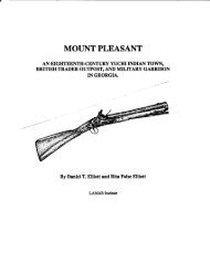
This reports details historical and archaeological research on the <strong>Mount</strong> <strong>Pleasant</strong> <strong>site</strong><br />
(9Ef169) in Effingham County, Georgia. Survey and excavation was undertaken there in<br />
<strong>1989</strong> and <strong>1990</strong> by the LAMAR Institute. The <strong>site</strong> boundaries were defined by<br />
systematically aligned shovel tests. One locale, Trader Point, was further investigated by<br />
two block excavation units totalling 23m 2 . These block units contained a rich midden<br />
deposit and 23 features. Components identified on the <strong>site</strong> span the early to mid-eighteenth<br />
century. This locality formerly contained a Yuchi Indian village, British trader factory, and<br />
ranger garrison. This study is particulary important because it represents the first in depth<br />
look at the archaeological manifestations of the Yuchi tribe--a tribe that has eluded<br />
historians and archaeologists for more than a century. This research is part of an ongoing<br />
project by the LAMAR Institute to investigate eighteenth-century settlements within the<br />
Savannah River watershed.<br />
<strong>Mount</strong> <strong>Pleasant</strong> is located northeast of Clyo, Georgia on a high bluff overlooking the<br />
Savannah River in Effingham County (Figure 1). The <strong>site</strong> lies within the interior coastal<br />
plain approximately 45 miles from the Atlantic Ocean. Today the <strong>site</strong> is in a mixed pine and<br />
hardwood growth area, but earlier in the twentieth century most of the <strong>site</strong> was under<br />
cultivation. The portion ofthe <strong>site</strong> identified as Trader Point probably was never cultivated<br />
because of its topographic setting. <strong>Mount</strong> <strong>Pleasant</strong> gets its name from its physical form.<br />
Within a few meters of the west bank of the Savannah River, the land rises abruptly to<br />
more than 90 feet above the river. From the crest of <strong>Mount</strong> <strong>Pleasant</strong> there is a clear view<br />
that stretches more than 10 miles to the east. Although there are many pronounced bluffs<br />
adjacent to the Savannah River floodplain in this region of the river valley, most of them<br />
abutt river swamp rather than the main river channel.<br />
At <strong>Mount</strong> <strong>Pleasant</strong> the river is very near the bluff, and it is a likely reason that this area<br />
became an important river crossing. This prominence was an obvious attraction for man.<br />
Its imposing form and steep approach makes it a defensible position from attack by the<br />
river. The presence of several springs on the bluff slopes insured a convenient supply of<br />
drinking water, especially important during times of siege. A wide variety ofplants grow<br />
on the shady sheltered slopes, many more common to the piedmont and mountain regions<br />
than the coastal plain. The vegetation, topography, ,and panoramic view give <strong>Mount</strong><br />
<strong>Pleasant</strong> a pleasing quality <strong>which</strong> is still evident today.<br />
The settlement began as a Yuchi Indian village. Though the exact year ofits settlement<br />
1