Ye Pleasant Mount: 1989 1990 Excavations - Open site which ...
Ye Pleasant Mount: 1989 1990 Excavations - Open site which ...
Ye Pleasant Mount: 1989 1990 Excavations - Open site which ...

Create successful ePaper yourself
Turn your PDF publications into a flip-book with our unique Google optimized e-Paper software.
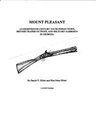
is not known, it may have been settled during the 1720s, but certainly was occupied by<br />
1735 when a German vi<strong>site</strong>d the town and recorded his visit in word and picture (Hvidt<br />
1980). Around 1740 a fort was established at <strong>Mount</strong> <strong>Pleasant</strong> <strong>which</strong> was manned by a<br />
dozen rangers and two officers. Several British deerskin traders also were living at <strong>Mount</strong><br />
<strong>Pleasant</strong> by the late 1730s, and possibly earlier. By 1758, the fon had been abandoned,<br />
the Indians and British traders had left the area, and the area became pan of the large<br />
Goldwire-King plantation. The British government, however, retained ownership ofa 100<br />
acre tract where the garrison formerly stood. It seems reasonable to estimate the age of the<br />
<strong>Mount</strong> <strong>Pleasant</strong> settlement as 1722 to 1757.<br />
Research Goals<br />
The goal of the first stage ofthe <strong>1989</strong> archaeological project was simple--to find <strong>Mount</strong><br />
<strong>Pleasant</strong>. This location was known from historical documents and maps, but it had not<br />
been identified on the ground. Historical research was conducted to narrow the search for<br />
the settlement. This consisted of a review ofprimary documents and maps and secondary<br />
historical sources containing peninent information about <strong>Mount</strong> <strong>Pleasant</strong>. At the request of<br />
the landowner, a survey was implemented to find the remains of<strong>Mount</strong> <strong>Pleasant</strong>. After the<br />
<strong>site</strong> had been located and its horizontal boundaries defined, the second stage of the <strong>1989</strong><br />
research project examined the archaeological potential ofone section ofthe <strong>site</strong> known as<br />
Trader Point. Research during <strong>1990</strong> was undertaken to better define the components of<br />
Trader Point. This required additional block excavation. The second season yielded<br />
information necessary for planning a full-scale excavation on Trader Point.<br />
Historical Research<br />
The historical research included a review of all references to <strong>Mount</strong> <strong>Pleasant</strong> in: the<br />
Colonial Records of Georgia (Candler 1904-1911 henceforth, CRG); Revolutionary<br />
Records of the State of Georgia (Candler 1908), Detailed Reports on the Salzburger<br />
Emigration who Settled in America....Edited by Samuel Urlsperger (Jones 1966, 1968,<br />
1969a, 1969b, 1972, 1973, 1985, 1988a, 1988b, <strong>1989</strong>a, <strong>1989</strong>b; <strong>1989</strong>c, <strong>1990</strong>a, <strong>1990</strong>b,<br />
Jones and Wilson 1976, 1980, 1981; Jones and Savelle 1983); early Georgia newspapers<br />
including Georgia Gazette; Gazette ofthe State ofGeorgia; Republican and Savannah<br />
Evening Ledger; and Columbia Museum and Savannah Advertiser; maps at the Georgia<br />
Surveyor General; records of Effingham County, Georgia (Lucas 1988); colonial land<br />
claims (Bryant 1975); grants issued in St Matthews Parish (Hemperly 1974); colonial plats<br />
for St. Matthews parish; and Effmgham County plats; Collections of the Georgia<br />
Historical Society; Georgia Historical Society in Savannah; Hargrett Rare Book and<br />
3