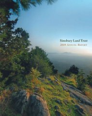
The Walkbook - Simsbury Land Trust
The Walkbook - Simsbury Land Trust
The Walkbook - Simsbury Land Trust

Create successful ePaper yourself
Turn your PDF publications into a flip-book with our unique Google optimized e-Paper software.
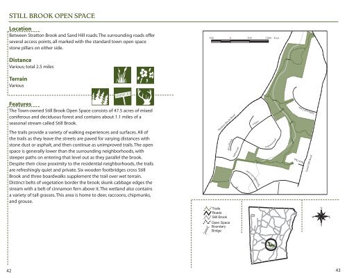
42<br />
STILL BROOK OPEN SPACE<br />
Location<br />
Between Stratton Brook and Sand Hill roads. <strong>The</strong> surrounding roads offer<br />
several access points, all marked with the standard town open space<br />
stone pillars on either side.<br />
Distance<br />
Various; total 2.5 miles<br />
Terrain<br />
Various<br />
SIMSBURY<br />
Features<br />
<strong>The</strong> Town-owned Still Brook Open Space consists of 47.5 acres of mixed<br />
coniferous and deciduous forest and contains about 1.1 miles of a<br />
seasonal stream called Still Brook.<br />
<strong>The</strong> trails provide a variety of walking experiences and surfaces. All of<br />
the trails as they leave the streets are paved for varying distances with<br />
stone dust or asphalt, and then continue as unimproved trails. <strong>The</strong> open<br />
space is generally lower than the surrounding neighborhoods, with<br />
steeper paths on entering that level out as they parallel the brook.<br />
Despite their close proximity to the residential neighborhoods, the trails<br />
are refreshingly quiet and private. Six wooden footbridges cross Still<br />
Brook and three boardwalks supplement the trail over wet terrain.<br />
Distinct belts of vegetation border the brook; skunk cabbage edges the<br />
stream with a belt of cinnamon fern above it. <strong>The</strong> wetland also contains<br />
a variety of tall grasses. This area is home to deer, raccoons, chipmunks,<br />
and grouse.<br />
Stratton Brook Road<br />
Woodleigh<br />
Stillwood<br />
Chase<br />
Springbrook Lane<br />
Aspenwood<br />
Tallwood Lane<br />
Red Oak<br />
Sand Hill Road<br />
43