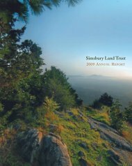
The Walkbook - Simsbury Land Trust
The Walkbook - Simsbury Land Trust
The Walkbook - Simsbury Land Trust

Create successful ePaper yourself
Turn your PDF publications into a flip-book with our unique Google optimized e-Paper software.
56<br />
THE TERRY’S PLAIN AREA<br />
<strong>The</strong> northeast quadrant of town, east of the river, consists of<br />
varied terrain and a pattern of narrow, winding roads, historic buildings,<br />
and agricultural uses that create a pleasing texture of scenic vistas.<br />
Resting on an ancient and fertile glacial terrace, Terry’s Plain is<br />
tucked between the basaltic ridge that forms the town’s eastern<br />
boundary and the Farmington River, the latter having spent the past<br />
10,000 years cutting the present-day floodplain out of the terrace.<br />
For most of this period, Native Americans lived in permanent<br />
villages along the river and created agricultural fields. From his<br />
nearby flower farm, the late Leslie Dewey assembled an extensive<br />
collection of pre-Columbian artifacts, some of which are on permanent<br />
display at the <strong>Simsbury</strong> Public Library.<br />
Named after one of the town’s early farmers, John Terry, Terry’s<br />
Plain was the early gateway to <strong>Simsbury</strong>. In 1648 the first colonials,<br />
John Griffen and Michael Humphry, followed pine trees for their tar<br />
and pitch business up the river from Bloomfield. From then until well<br />
into the 20th century, Terry’s Plain remained farmland, producing food<br />
crops and tobacco. As with many early communities, residents built<br />
their farm buildings on the terrace, grew crops there and along the<br />
floodplain, and gathered wood and pastured livestock on the hillsides.<br />
At the base of the hill, one farm also quarried stone on its land.<br />
As with most areas in town, Terry’s Plain has changed in recent<br />
years. Residential development and new roads have nearly tripled<br />
the population over the past three decades.Virtually all of the hillside<br />
and portions of the terrace and floodplain have been allowed to<br />
grow back into brush and woods. Nonetheless, several sizable<br />
parcels remain as open fields, invaluable as rich farmland and<br />
providing, along with the woods and wetlands, delightfully diverse<br />
wildlife habitats.<br />
Over the years the natural and historic features of Terry’s Plain<br />
have been recognized in several ways. In 1991 East Weatogue Street<br />
and Terry’s Plain Road were designated <strong>Simsbury</strong>’s first official Scenic<br />
Road. In 1993 the National Register of Historic Places recognized the<br />
area encompassing the glacial terrace and the early structures making<br />
up the agricultural area (from Pharos Farm on the north to Hall’s<br />
farm on the south) as historic working farmscape.<br />
NOTES<br />
57