Arroo Mountain cSAC Site Code 1403 Co. Leitrim - National Parks ...
Arroo Mountain cSAC Site Code 1403 Co. Leitrim - National Parks ...
Arroo Mountain cSAC Site Code 1403 Co. Leitrim - National Parks ...

You also want an ePaper? Increase the reach of your titles
YUMPU automatically turns print PDFs into web optimized ePapers that Google loves.
<strong>National</strong> <strong>Parks</strong> & Wildlife Service<br />
<strong>Co</strong>nservation Statement 2009<br />
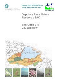
<strong>Arroo</strong> <strong>Mountain</strong> <strong>cSAC</strong><br />
<strong>Site</strong> <strong><strong>Co</strong>de</strong> <strong>1403</strong><br />
<strong>Co</strong>. <strong>Leitrim</strong>
SUMMARY<br />
Introduction<br />
<strong>Arroo</strong> <strong>Mountain</strong> <strong>cSAC</strong> has been designated as a candidate Special Area of <strong>Co</strong>nservation under the<br />
EU Habitats Directive. The site has been listed due to the presence of two priority habitats listed in<br />
Annex I of the Habitats Directive; Blanket bogs (active) and Petrifying (calcareous) springs. The<br />
site has also been listed for the presence of three other Annex I habitats including heath (Northern<br />
Atlantic wet heath), vegetated cliff areas (Calcareous rocky slopes with chasmophytic vegetation)<br />
and scree (Calcareous and calcshist screes of the montane to alpine levels).<br />
Nature <strong>Co</strong>nservation Value of <strong>Arroo</strong> <strong>Mountain</strong> <strong>cSAC</strong><br />
<strong>Arroo</strong> <strong>Mountain</strong> is a large mountain complex comprising a variety of habitats including blanket<br />
bog, heath, wooded ravines, limestone gorges, limestone pavement, and steep mountain cliffs.<br />
The steep cliffs and the talus screes on the north face of <strong>Arroo</strong> are of particular botanical interest<br />
and contain an exceptional diversity of ferns. Active erosion has created several interesting<br />
geomorphological features at their base, including sharp pinnacles and large rock slides. They have<br />
a distinctive flora which occurs rarely in the rest of the country including a very rich assemblage of<br />
calcareous mosses including some species of national importance. For some of these species it is<br />
their only recorded location within Ireland.<br />
The hydrology of the plateau is interesting and a number of unusual geomorphological features<br />
reflect the underlying limestone. Many streams and flushes drain into sinkholes and several large<br />
flushes found at the base of limestone cliffs have an enriched calcicole element in the flora.<br />
Springs, some of which have tufa formations, are also an interesting feature. These springs occur<br />
in association with calcareous habitats in the site and Stonewort species are abundant as are<br />
mosses, one of which is rare. This habitat is generally undisturbed and is in a natural state.<br />
Because of its extent and integrity, the blanket bog on <strong>Arroo</strong> is highly rated nationally and the<br />
heath flora is also well-developed. It forms a natural extension with and is of higher quality than<br />
the blanket bog on nearby Ben Bulben. The wet heath at this site is diverse in type and structure<br />
and has good moss cover. It is generally undisturbed and is mostly intact.<br />
Peregrine Falcon, Merlin, Golden Plover, Hen Harrier and Chough; all Annex I Birds Directive<br />
species, are found at <strong>Arroo</strong>.<br />
Because of its relative isolation, parts of this site are relatively undisturbed by humans. The quality<br />
and range of habitats and the variety of rare species within the site makes it of high scientific<br />
interest. Along with Ben Bulben, <strong>Arroo</strong> has been termed the botanically richest mountain in<br />
Ireland and is one of the best examples of an upland community with arctic-alpine species (which<br />
occur very rarely elsewhere in the country). The interesting geomorphological and hydrological<br />
facets add greatly to the ecological and educational value of the site as well as being of great<br />
aesthetic value.<br />
Dept. of Environment, Heritage and Local Government 1 CS Version 1.01 2009
2 <strong>Co</strong>nservation Statement <strong>Arroo</strong> <strong>Mountain</strong> <strong>cSAC</strong> — <strong>Site</strong> <strong><strong>Co</strong>de</strong> <strong>1403</strong><br />
Description of <strong>Arroo</strong> <strong>Mountain</strong> <strong>cSAC</strong><br />
This is a large mountain complex composed of a number of habitat types which have developed on<br />
the sides and the summit of an undulating plateau of Carboniferous limestone overlain by shale.<br />
Habitats include blanket bog, wet and dry heath, humid and dry calcareous grasslands, flushes,<br />
streams, small lakes, wooded ravines, limestone gorges, limestone scree, limestone pavement,<br />
swallow holes and steep limestone cliffs. Post-glacial slippage of sections of cliff has formed an<br />
interesting geomorphological feature at the northern end of the site. These cliffs and the slips<br />
below them are very important for the rich plant and moss communities that they support. A<br />
number of species that occur in the site have no other known occurrence in the country.<br />
On the summit of the plateau lies an extensive, almost intact, wet heath and blanket bog mosaic.<br />
This has been rated very highly on a national basis because of its intactness and size. Because the<br />
<strong>cSAC</strong> is developed on limestone, there are also several unusual geomorphological features and the<br />
hydrology of the plateau area of <strong>Arroo</strong> is interesting. Many streams and flushes have developed at<br />
the base of limestone cliffs that have an enriched calcicole element in the flora.<br />
Peregrine Falcon, Merlin, Golden Plover, Hen harrier and Chough; all species listed in Annex I<br />
Bird Directive, are recorded at the site.<br />
Most of the site is held in commonage.<br />
Main <strong>Co</strong>nservation Objectives<br />
• To maintain the Annex I habitats for which the <strong>cSAC</strong> has been selected at favourable<br />
conservation status; Blanket bogs (active) (18% area of site), Petrifying springs with tufa<br />
formation (Cratoneurion) (
TABLE OF CONTENTS<br />
Summary .......................................................................................................................................................1<br />
Reader’s Guide .......................................................................................................................................................5<br />
Legal Background....................................................................................................................................................6<br />
Nature <strong>Co</strong>nservation Legislation .........................................................................................................................6<br />
Roles of Government Departments and Agencies..............................................................................................7<br />
Implications of <strong>Site</strong> Designation for Landowners and other <strong>Site</strong> Users ..............................................................8<br />
Nature <strong>Co</strong>nservation Value of <strong>Arroo</strong> <strong>Mountain</strong> <strong>cSAC</strong> .............................................................................................9<br />
Reason for Designation of <strong>Arroo</strong> <strong>Mountain</strong> <strong>cSAC</strong>...............................................................................................9<br />
<strong>Co</strong>nservation Value of <strong>Arroo</strong> <strong>Mountain</strong> <strong>cSAC</strong>...................................................................................................10<br />
<strong>Co</strong>nservation Objectives ...................................................................................................................................11<br />
<strong>Site</strong> Description .....................................................................................................................................................12<br />
Location Including <strong>Site</strong> Boundaries...................................................................................................................12<br />
Legal Status.......................................................................................................................................................13<br />
Physical Features..............................................................................................................................................13<br />
Biological Features............................................................................................................................................15<br />
Land Use ...........................................................................................................................................................23<br />
Management Issues ..........................................................................................................................................25<br />
Scientific Monitoring & Inspection..........................................................................................................................26<br />
Dept. of Environment, Heritage and Local Government 3 CS Version 1.01 2009
4 <strong>Co</strong>nservation Statement for <strong>Arroo</strong> <strong>Mountain</strong> <strong>cSAC</strong> — <strong>Site</strong> <strong><strong>Co</strong>de</strong> <strong>1403</strong><br />
APPENDICES<br />
Appendix I: Glossary..............................................................................................................................................27<br />
Appendix II: Reference Material ............................................................................................................................33<br />
Appendix III: Climate..............................................................................................................................................35<br />
Appendix IV: Water Quality....................................................................................................................................36<br />
Appendix V: <strong>Co</strong>mpensation Procedures................................................................................................................37<br />
Appendix VI: Notifiable Actions..............................................................................................................................38<br />
Appendix VII: Farming <strong>Co</strong>nditions under REPS....................................................................................................63<br />
Appendix VIII: <strong>National</strong> <strong>Parks</strong> and Wildlife <strong>Co</strong>ntact Details...................................................................................66<br />
MAPS<br />
Map 1 Location and Boundary Map (Ver. 1.02)<br />
Map 2 <strong>Co</strong>mmonage Map<br />
Map 3 Indicative Habitat Map<br />
Dept. of Environment, Heritage and Local Government CS Version 1.01 2009
READER’S GUIDE<br />
The <strong>National</strong> <strong>Parks</strong> and Wildlife Service (NPWS) of the Department of the Environment, Heritage<br />
and Local Government (DEHLG) has produced this document to provide ecological information<br />
about <strong>Arroo</strong> <strong>Mountain</strong> <strong>cSAC</strong> and to outline the main objectives for the conservation of the special<br />
features of the site.<br />
The Legal background section outlines the legislative and policy drivers for the site’s designation<br />
and identifies the relevant authorities with responsibilities in relation to the site.<br />
The Nature <strong>Co</strong>nservation Value section describes the reasons for the site designation and lists<br />
the site specific <strong>Co</strong>nsevation Objectives.<br />
The <strong>Site</strong> Description section contains general information on the site’s boundaries and ownership<br />
and on the statutory bodies with responsibility for its conservation. It also contains sections on the<br />
physical aspects of the site such as the geology and hydrology as well as the biological features,<br />
in particular, the habitats and species found there. Land use and cultural features are also<br />
described.<br />
The Scientific Monitoring and Inspection section outlines the methodologies used for monitoring<br />
the conservation status of the site and identifying any changes that occur.<br />
The appendices include a glossary where scientific and technical terms are explained, reference<br />
material consulted in the preparation of the statement and a list of notifiable actions relevant to<br />
each habitat within the site.<br />
Dept. of Environment, Heritage and Local Government 5 CS Version 1.01 2009
LEGAL BACKGROUND<br />
Nature <strong>Co</strong>nservation Legislation<br />
The legal basis for selection and designation of Special Areas of <strong>Co</strong>nservation (SACs) is the EU<br />
Habitats Directive, which was adopted in 1992. Focusing on the conservation of natural and seminatural<br />
habitats and species of flora and fauna, the Habitats Directive seeks to establish “Natura<br />
2000”, a network of protected areas throughout the European <strong>Co</strong>mmunity. The Habitats Directive<br />
includes a list of habitats that require SAC designation and specific conservation measures. This<br />
list is known as Annex I and the habitats are referred to as Annex I habitats. On this list, habitats<br />
that require special attention because they are in danger of disappearance, are termed ‘priority<br />
habitats’. A second list, Annex II in the Habitats Directive comprises species that must be afforded<br />
special protection.<br />
In Ireland, the habitats and species that must be afforded protection under the Habitats Directive<br />
include:<br />
16 Annex I priority habitats that require particular attention – including raised bogs, active blanket<br />
bogs, turloughs and machair,<br />
45 other Annex I habitats – such as certain types of heaths, lakes and woodlands,<br />
25 Annex II species – including Otter, Freshwater Pearl Mussel and Killarney Fern.<br />
It is the responsibility of each member state to designate SACs to protect the Annex I habitats and<br />
Annex II species. These sites, together with the Special Protection Areas (SPAs) designated under<br />
the EU Birds Directive (1979), form the European “Natura 2000” network.<br />
The Birds Directive contains annexes, which are lists of birds that require particular conservation<br />
measures (Annex I), and also species that may be hunted, and species that may be sold. There are<br />
28 Annex I species regularly occurring in Ireland including Whooper Swan, Greenland Whitefronted<br />
Goose, Peregrine Falcon, <strong>Co</strong>rncrake and Terns. Member states are also required to protect<br />
wetlands and their associated water birds and sites that are important for migratory species such as<br />
ducks, geese and waders<br />
The Habitats Directive was transposed into Irish law through the European <strong>Co</strong>mmunities<br />
(Natural Habitats) Regulations 1997. The Wildlife Act 1976 is the main statute governing the<br />
protection of wildlife in Ireland and was amended in 2000 to take account of European law,<br />
particularly the Habitats and Birds Directives. The Wildlife (Amendment) Act 2000 also makes<br />
legal provision for the designation and protection of a national network of Natural Heritage Areas<br />
(NHAs). Over 1,100 proposed NHAs were published in 1995 and almost 400 of these are also<br />
selected as candidate SACs.<br />
Dept. of Environment, Heritage and Local Government 6 CS Version 1.01 2009
Legal Background<br />
The European <strong>Co</strong>mmunities (Natural Habitats) Regulations 1997 include the following points:<br />
The Minister for the Environment, Heritage and Local Government must transmit a candidate list<br />
of sites to the European <strong>Co</strong>mmission for consideration.<br />
Following adoption of this list by the <strong>Co</strong>mmission, the Minister will formally designate the sites as<br />
SACs.<br />
<strong>Site</strong>s are legally protected once they are publicly advertised.<br />
Landowners and other users with a legal entitlement should be notified of designation, and the<br />
Minister must make all reasonable efforts to do so. Notification also includes a list of activities<br />
that may alter, damage, destroy or interfere with the integrity of the site. A person who illegally<br />
damages a site may be prosecuted or required to repair damage.<br />
Landowners and other users with a legal entitlement may appeal the designation of lands on<br />
scientific grounds, within three months of the designation notification.<br />
Landowners and other users with a legal entitlement will be compensated for actual loss of<br />
income arising from restrictions imposed as a result of designation.<br />
Roles of Government Departments and<br />
Agencies<br />
Department of the<br />
Environment, Heritage and<br />
Local Government<br />
(DEHLG)<br />
<strong>National</strong> <strong>Parks</strong> & Wildlife<br />
Service (NPWS)<br />
DEHLG is the government department with responsibility for the<br />
designation and protection of wildlife habitats, species and areas of<br />
conservation interest. As part of their responsibility in relation to<br />
biodiversity and wildlife under the Wildlife Acts (1976 and 2000), the<br />
Minister’s brief extends far beyond the habitats and species listed in the<br />
annexes of the Habitats and Birds Directives.<br />
NPWS is the section of the DEHLG responsible for maintaining the<br />
nature conservation value of the site. Periodic inspection of the site is<br />
carried out by the local <strong>Co</strong>nservation Ranger.<br />
Regional staff also participate in research and survey projects by<br />
collecting data on the site, provide advice to planning authorities on the<br />
impacts of development applications and provide an education and<br />
advisory service to the public. See Appendix VIII for NPWS contact<br />
details.<br />
<strong>Leitrim</strong> <strong>Co</strong>unty <strong>Co</strong>uncil <strong>Leitrim</strong> <strong>Co</strong>unty <strong>Co</strong>uncil is the planning authority for the site. As such it is<br />
obliged to ensure appropriate assessment of the implications of<br />
developments requiring planning permission that may have an impact,<br />
either individually or in combination with other developments on the<br />
designated area.<br />
Environmental Protection<br />
Agency (EPA)<br />
The EPA is an independent state sponsored body with a wide range of<br />
statutory duties including monitoring environmental quality and<br />
overseeing the performance by local authorities of their statutory<br />
environmental protection functions.<br />
Dept. of Environment, Heritage and Local Government CS Version 1.01 2009<br />
7
8 <strong>Co</strong>nservation Statement <strong>Arroo</strong> <strong>Mountain</strong> <strong>cSAC</strong> — <strong>Site</strong> <strong><strong>Co</strong>de</strong> <strong>1403</strong><br />
Department of Agriculture,<br />
Fisheries and Food (DAFF)<br />
DAFF is the government department responsible for the development and<br />
regulation of agriculture, fisheries, forestry and the food industry,<br />
including the administration of schemes such as the Rural Environment<br />
Protection Scheme (REPS), the Native Woodland Scheme (NWS), and<br />
<strong>Co</strong>mmonage Framework Plans (CFPs). In 2007 the Department assumed<br />
the additional responsibility for sea fisheries, aquaculture, marine<br />
research, marine engineering and pier and harbour development (non<br />
commercial) and associated agencies such as Bord Iascaigh Mhara (BIM)<br />
and the Marine Institute.<br />
Under Regulation 31 of the EC (Natural Habitats) Regulations, DAFF<br />
have responsibility for ensuring that activities it regulates do not<br />
adversely affect <strong>cSAC</strong>s. Monitoring functions are carried out by<br />
individual divisions or executive agencies of the department.<br />
Local Authority Policy in Relation to the <strong>Site</strong><br />
The <strong>Leitrim</strong> Development Plan 2009-2015 (Section 2) states in Policy 2.7a; It is the policy of the<br />
<strong>Co</strong>uncil to protect and conserve Special Areas of <strong>Co</strong>nservation and Special Protection Areas<br />
including; “Candidate” and “Proposed” areas.<br />
In relation to development in or near a <strong>cSAC</strong> (subsection 2.07.03); Planning applications in such<br />
designated areas will need to satisfy to the Planning Authority that the development proposal will<br />
not adversely affect the integrity of the area. This applies to all development proposals likely to<br />
have a significant impact on the designated area, irrespective of whether they are actually located<br />
within the area or not.<br />
Subsection 2.07.02a; Where the site concerned hosts a priority natural habitat type and/or a<br />
priority species, the only considerations which may be raised are those relating to human health or<br />
public safety, to beneficial consequences of primary importance for the environment or, further to<br />
an opinion from the European <strong>Co</strong>mmission, to other imperative reasons of overriding public<br />
interest.<br />
Subsection 2.07.03; Planning applications located within these protected sites will be referred to<br />
the Heritage <strong>Co</strong>uncil, An Taisce and the Development applications unit of the DoEHLG – <strong>National</strong><br />
<strong>Parks</strong> and Wildlife Services Section. The <strong>Co</strong>uncil will generally be guided by their comments in<br />
reaching a decision.<br />
Implications of <strong>Site</strong> Designation for<br />
Landowners and other <strong>Site</strong> Users<br />
In most areas designated as <strong>cSAC</strong>s, current practices will not have to change significantly.<br />
In cases where users with a legal entitlement are required to change practices or restrict activities to<br />
protect the wildlife interest of the site, compensation will be payable based on actual loss of<br />
income. See Appendix V for further details.<br />
If a user with a legal entitlement wishes to carry out certain activities, not covered by licence or<br />
consent from another statutory body, within the designated area, they must consult with, and get<br />
consent from, the Minister for the Environment, Heritage and Local Government. These activities<br />
are listed as “Notifiable Actions” for each habitat (see Appendix VI).<br />
Dept. of Environment, Heritage and Local Government CS Version 1.01 2009
NATURE CONSERVATION VALUE<br />
OF ARROO MOUNTAIN CSAC<br />
Reason for Designation of <strong>Arroo</strong> <strong>Mountain</strong><br />
<strong>cSAC</strong><br />
This section outlines the habitats and species occurring within the site that are the basis for the<br />
designation of the site because of their relative importance, both at a national and <strong>Co</strong>mmunity<br />
level.<br />
HABITATS LISTED IN ANNEX I OF<br />
THE EU HABITATS DIRECTIVE<br />
• *Blanket bog (active) (EU Habitat<br />
<strong><strong>Co</strong>de</strong> 7130)<br />
• *Petrifying springs with tufa<br />
formation (Cratoneurion) (EU<br />
Habitat <strong><strong>Co</strong>de</strong> 7220)<br />
• Northern Atlantic wet heaths with<br />
Erica tetralix (EU Habitat <strong><strong>Co</strong>de</strong> 4010)<br />
• Calcareous rocky slopes with<br />
chasmophytic vegetation (EU<br />
Habitat <strong><strong>Co</strong>de</strong> 8210)<br />
• Calcareous and calcshist screes of<br />
the montane to alpine levels<br />
(Thlaspietea rotundifolii) (EU<br />
Habitat <strong><strong>Co</strong>de</strong> 8120)<br />
* Denotes ‘Priority’ habitat<br />
Dept. of Environment, Heritage and Local Government 9 CS Version 1.01 2009
10 <strong>Co</strong>nservation Statement <strong>Arroo</strong> <strong>Mountain</strong> <strong>cSAC</strong> — <strong>Site</strong> <strong><strong>Co</strong>de</strong> <strong>1403</strong><br />
<strong>Co</strong>nservation Value of <strong>Arroo</strong> <strong>Mountain</strong> <strong>cSAC</strong><br />
<strong>Arroo</strong> <strong>Mountain</strong> is a large mountain complex comprising a variety of habitats including blanket<br />
bog, heath, wooded ravines, limestone gorges, limestone pavement, and steep mountain cliffs.<br />
The steep cliffs and the talus screes on the north face of <strong>Arroo</strong> are of particular botanical interest<br />
and contain an exceptional diversity of ferns. Active erosion has created several interesting<br />
geomorphological features at their base, including sharp pinnacles and large rock slides. They have<br />
a distinctive flora which occurs rarely in the rest of the country including a very rich assemblage of<br />
calcareous mosses including some species of national importance. For some of these species it is<br />
their only recorded location within Ireland.<br />
The hydrology of the plateau is interesting and a number of unusual geomorphological features<br />
reflect the underlying limestone. Many streams and flushes drain into sinkholes and several large<br />
flushes found at the base of limestone cliffs have an enriched calcicole element in the flora.<br />
Springs, some of which have tufa formations, are also an interesting feature. These springs occur<br />
in association with calcareous habitats in the site and Stonewort species are abundant as are<br />
mosses, one of which is rare. This habitat is generally undisturbed and is in a natural state.<br />
Because of its extent and integrity, the blanket bog on <strong>Arroo</strong> is highly rated nationally and the<br />
heath flora is also well-developed. It forms a natural extension with and is of higher quality than<br />
the blanket bog on nearby Ben Bulben.<br />
The wet heath at this site is diverse in type and structure and has good moss cover. It is generally<br />
undisturbed and is mostly intact.<br />
Peregrine Falcon, Merlin, Golden Plover, Hen Harrier and Chough; all Annex I Birds Directive<br />
species, are found at <strong>Arroo</strong>.<br />
Because of its relative isolation, parts of this site are relatively undisturbed by humans. The quality<br />
and range of habitats and the variety of rare species within the site makes it of high scientific<br />
interest. Along with Ben Bulben, <strong>Arroo</strong> has been termed the botanically richest mountain in<br />
Ireland and is one of the best examples of an upland community with arctic-alpine species (which<br />
occur very rarely elsewhere in the country). The interesting geomorphological and hydrological<br />
facets add greatly to the ecological and educational value of the site as well as being of great<br />
aesthetic value.<br />
North-west view of <strong>Arroo</strong> <strong>Mountain</strong> <strong>cSAC</strong> at Agharoosky (M. Farrell, 2006).<br />
Dept. of Environment, Heritage and Local Government CS Version 1.01 2009
Nature <strong>Co</strong>nservation Value of <strong>Arroo</strong> <strong>Mountain</strong> <strong>cSAC</strong><br />
<strong>Co</strong>nservation Objectives<br />
European and national legislation places a collective obligation on Ireland and its citizens to<br />
maintain at favourable conservation status areas designated as candidate Special Areas of<br />
<strong>Co</strong>nservation. The Government and its agencies are responsible for the implementation and<br />
enforcement of regulations that will ensure the ecological integrity of these sites.<br />
According to the EU Habitats Directive, favourable conservation status of a habitat is achieved<br />
when:<br />
• its natural range, and area it covers within that range, is stable or increasing, and<br />
• the ecological factors that are necessary for its long-term maintenance exist and are likely to<br />
continue to exist for the foreseeable future, and<br />
• the conservation status of its typical species is favourable as defined below.<br />
The favourable conservation status of a species is achieved when:<br />
• population data on the species concerned indicate that it is maintaining itself, and<br />
• the natural range of the species is neither being reduced or likely to be reduced for the<br />
foreseeable future, and<br />
• there is, and will probably continue to be, a sufficiently large habitat to maintain its populations<br />
on a long-term basis.<br />
Objective 1: To maintain the Annex I habitats for which the <strong>cSAC</strong> has been selected at<br />
favourable conservation status; Blanket bogs (active) (18% area of site),<br />
Petrifying springs with tufa formation (Cratoneurion) (
SITE DESCRIPTION<br />
Location Including <strong>Site</strong> Boundaries<br />
This is the most north-easterly of the Ben Bulben range of mountains, located 3 km south-west of<br />
Kinlough, <strong>Co</strong>. <strong>Leitrim</strong> close to the Sligo border.<br />
Grid Ref.: G 850 490<br />
Latitude: N 54º23’06”<br />
Longitude: W 08º13’45”<br />
Area: 3977 ha<br />
Altitude Range: 107 m to 525 m<br />
Townlands: Aghaderrard East, Aghadunvane, Aghalateeve, Aghanlish, Aghavoghil,<br />
Aghnahaha, Aghnahoo, <strong>Arroo</strong>, Carrowrevagh, Cloghmeen, <strong>Co</strong>nwal<br />
South, <strong>Co</strong>rlea, <strong>Co</strong>rnagillagh, Cullionboy, Erriff, Fallacarra,<br />
Gorteenachurry, Gorteendarragh, Gortnacrieve, Gortnasillagh, Gubinea,<br />
Keeloges, Kinkillew, Largydonnell, Leckanarainey, Loughmuirran,<br />
Meenagraun, Rassaun East, Rassaun West and Sracleighreen.<br />
<strong>Site</strong> Boundaries<br />
The boundary of the site follows physical features where present such as ditches, embankments and<br />
walls. Elsewhere, the boundary follows unmarked features on the ground such as townland<br />
boundaries or contour lines.<br />
<strong>Site</strong> Infrastructure<br />
A number of bog roads and forestry roads extend up the sides of the mountain, some onto the site<br />
itself (see Map 3) but most of these are accessible only to four-wheel drive vehicles. Despite these<br />
roads, the site is relatively isolated and remote, with much of the interior of the site remaining<br />
relatively unaffected by human disturbance. Water is abstracted for both private and group water<br />
schemes at two points in the south of the site (Kinlough/Tullaghan and Erriff).<br />
Dept. of Environment, Heritage and Local Government 12 CS Version 1.01 2009
<strong>Site</strong> Description<br />
Legal Status<br />
Ownership<br />
2948 hectares are under commonage and the remainder of the site is non-commonage private land<br />
(See Map 2).<br />
Designations of the <strong>Site</strong><br />
candidate Special<br />
Area of <strong>Co</strong>nservation<br />
proposed Natural<br />
Heritage Area<br />
<strong>Site</strong>code IE000<strong>1403</strong> Published on March 1 st , 1997<br />
<strong>Site</strong>code <strong>1403</strong> Published in 1995<br />
Past Status and Designation of the <strong>Site</strong><br />
Parts of the site were listed as Areas of Scientific Interest (ASI) by An Foras Forbatha in 1973.<br />
Rights Pertaining to the <strong>Site</strong><br />
Rights of way A number of rights of way occur through the site to access turf plots.<br />
These are mapped as tracks in Map 3.<br />
Physical Features<br />
Climate<br />
The closest synoptic weather station to the site is the Claremorris station and the 30-year average<br />
information for this station was obtained from the Met Éireann website. The full details are<br />
presented in Appendix III. In summary, the mean daily air temperature at the station is 8.9 o C,<br />
ranging from an average low of 1.4 o C in January to an average high of 18.4 o C in July. The<br />
average annual rainfall is 1143 mm and the average daily duration of sunshine is 3.05 hours. The<br />
average wind speed is 8.8 knots. There is an annual average of 24.1 days with snow or sleet<br />
recorded for the Claremorris station, with 6.3 days when snow was still lying on the ground by<br />
9am.<br />
Geology & Geomorphology<br />
This is an upland site of Carboniferous limestone overlain by shale. It is the most north-easterly<br />
part of the Ben Bulben complex and forms an undulating limestone plateau with steep cliffs to the<br />
north. Erosion has created several interesting geomorphological features at the base of the cliffs<br />
including sharp pinnacles and large rock slides.<br />
Dept. of Environment, Heritage and Local Government CS Version 1.01 2009<br />
13
14 <strong>Co</strong>nservation Plan for <strong>Arroo</strong> <strong>Mountain</strong> <strong>cSAC</strong> — <strong>Site</strong> <strong><strong>Co</strong>de</strong> <strong>1403</strong><br />
Sharp pinnacles and outcrops at north face of <strong>Arroo</strong> <strong>Mountain</strong>s <strong>cSAC</strong> (M. Farrell, 2006).<br />
Soils & Soil Processes<br />
Soils are peaty gleys and peat on limestone. Some areas of peat are up to 3 m deep on the plateau,<br />
but other areas are extremely shallow and eroded to the bedrock.<br />
Hydrology & Water Quality<br />
Many streams and flushes have developed at the base of limestone cliffs that have an enriched<br />
calcicole element in the flora. Numerous small rivers and streams rise in the site e.g. tributaries of<br />
the Glenaniff and Duff Rivers and Aghavoghil Stream and there are a number of lakes such as<br />
Lough Adunny and Lough Nabrack. EPA data for the Rivers Duff and Glenaniff in 2003 show<br />
very good water quality (Appendix IV).<br />
Dept. of Environment, Heritage and Local Government CS Version 1.01 2009
Biological Features<br />
Habitats and Vegetation<br />
Note: Throughout the conservation statement, habitats are named and described under two<br />
different systems: the Annex I habitats are as listed in the EU Habitats Interpretation Manual<br />
Version EUR 27 (2007), while all other habitats are as listed according to the classification<br />
system of ‘A Guide to Habitats in Ireland’ (Fossitt, 2000).<br />
The following table lists the habitats within the site. The Annex I habitats of the Habitats Directive<br />
for which the site was selected are listed, with the relevant Guide to Habitats category also shown.<br />
Annex I priority habitats are denoted by an asterisk (*). The Indicative Habitat map for the site is<br />
presented in Map 3. The percentage area presented for each habitat type is based on the<br />
approximate geographic area of each habitat, as shown in Map 3.<br />
Habitats Found within <strong>Arroo</strong> <strong>Mountain</strong> <strong>cSAC</strong><br />
ANNEX I HABITAT TYPE HABITAT CATEGORY % AREA<br />
Northern Atlantic wet heaths with Erica<br />
tetralix (4010)<br />
Wet heath (HH3)<br />
*Blanket bogs (active) (7130) Upland blanket bog (PB2)<br />
Calcareous rocky slopes with chasmophytic<br />
vegetation (8210) Exposed calcareous rock (ER2)<br />
Calcareous and calcshist screes of the<br />
montane to alpine levels (Thlaspietea<br />
rotundifolii) (8120)<br />
*Petrifying springs with tufa formation<br />
(Cratoneurion) (7220)<br />
Calcareous scree and loose rock<br />
(ER4)<br />
40<br />
(in mosaic with 7130/ HH2)<br />
18<br />
(in mosaic with 4010/HH2)<br />
16 <strong>Co</strong>nservation Statement <strong>Arroo</strong> <strong>Mountain</strong> <strong>cSAC</strong> — <strong>Site</strong> <strong><strong>Co</strong>de</strong> <strong>1403</strong><br />
Annex I Habitats:<br />
Northern Atlantic wet<br />
heaths with Erica<br />
tetralix (4010) (40% of<br />
total site area or 1590<br />
ha)<br />
Blanket bogs (active)<br />
(7130) (18% of total<br />
site area or 716 ha)<br />
Most of the heath in this site is on top of the plateau and is found in<br />
mosaic with blanket bog and dry heath habitats. The wet heath is quite<br />
diverse in type and structure, occurring as it does on the sloping edges of<br />
the plateau, on gently sloping ground between blanket bog and areas of<br />
dry heath found on higher ground of the plateau. It has also developed in<br />
many areas where blanket bog has been eroded away to leave a thin<br />
covering of peat. The driest areas are on top of the plateau, while wetter<br />
heath areas with Cross-leaved Heath (Erica tetralix) have developed on<br />
the slopes. The dominant plant found here is Ling Heather (Calluna<br />
vulgaris) with Bilberry (Vaccinium myrtillus), Crowberry (Empetrum<br />
nigrum) and Bell Heather (Erica cinerea). The habitat is not heavily<br />
grazed for the most part and is in good condition.<br />
The blanket bog on the site is found in three main areas, in the south at<br />
Cloghmeen Bog, in the north-east of the site Carrowrevagh and as small<br />
pockets scattered over the plateau. It occurs in mosaic with wet and dry<br />
heath areas. The bog is very intact on the plateau though erosion is<br />
occurring on the highest peaks where bare peat and bedrock are exposed.<br />
Because of its large size and integrity, the blanket bog on this site was<br />
ranked very highly in a national survey (Douglas et. al., 1986). It forms a<br />
natural extension with and is of higher quality than the blanket bog on<br />
Ben Bulben.<br />
There is good bog moss cover in places with Sphagnum cuspidatum and<br />
S. auriculatum found in pools and S. capillifollium, S. tenellum, S.<br />
subnitens on hummocks. Grey Bearded Moss (Racomitrium<br />
languinosum) is found on top of larger hummocks. Clubmoss (Huperzia<br />
selago) has been recorded. The rich variety of mosses and liverworts is<br />
seen by the presence of Camplyopus atrovirens, C. brevipus, Bryum sp.,<br />
Rhytidiadelphus lorreus, Hylocomium splendens, Pleurozia purpurea and<br />
species indicative of base enrichment such as Drepanocladus revolvens,<br />
Aulacomium palustre, Scorpidium scorpioides and Bruetelia chrysocoma.<br />
There are many swallow holes scattered throughout the blanket bog areas.<br />
These range both in size and depth. Running water can be heard at the<br />
bottom of many of these and species such as Willow (Salix spp.), Holly<br />
(Ilex aquifolium) and Ash (Fraxinus excelsior) are found in these areas.<br />
These swallow holes are also usually colonised by Bog Moss (Sphagnum<br />
palustre, S. recurvum and S. papillosum).<br />
There is a good diversity of species occurring throughout the blanket bog<br />
habitat including Marsh Speedwell (Veronica scutellata), Water<br />
Crowfoot (Ranunculus aquatilis), Bog Asphodel (Narthecium<br />
ossifragum), Crowberry, Sundew (Drosera rotundifolia), Cross-leaved<br />
Heath, Ladies Smock (Cardamime pratensis), Lesser Spearwort<br />
(Ranunculus flammula), Hare’s Tail <strong>Co</strong>ttongrass (Eriophorum vaginatum,<br />
<strong>Co</strong>mmon <strong>Co</strong>ttongrass (E. angustipholium), <strong>Co</strong>mmon Butterwort<br />
(Pinguicula vulgaris) Deer Grass (Trichophorum caespitosum), Bulbous<br />
Rush (Juncus bulbosus) and sedges; Black Sedge (Carex nigra),<br />
Carnation Sedge (C. panicea), <strong>Co</strong>mmon Yellow Sedge (C. demissa),<br />
<strong>Co</strong>mmon Sedge (C. nigra) and Long-stalked Yellow Sedge (C.<br />
lepidocarpa).<br />
Bogbean (Menyanthes trifoliata) colonises large pools and Bog<br />
Pondweed (Potamogeton polygonifolius) is found in open channels.<br />
Dept. of Environment, Heritage and Local Government CS Version 1.01 2009
<strong>Site</strong> Description<br />
Calcareous rocky<br />
slopes with<br />
chasmophytic<br />
vegetation (8210)<br />
(
18 <strong>Co</strong>nservation Statement <strong>Arroo</strong> <strong>Mountain</strong> <strong>cSAC</strong> — <strong>Site</strong> <strong><strong>Co</strong>de</strong> <strong>1403</strong><br />
Calcareous and<br />
calcshist screes of the<br />
montane to alpine<br />
levels (Thlaspietea<br />
rotundifolii) (8120)<br />
(
<strong>Site</strong> Description<br />
Eroding/upland rivers<br />
(FW1)<br />
Lowland grassland at <strong>Arroo</strong> <strong>Mountain</strong>s <strong>cSAC</strong> (M. Farrell, 2006)<br />
Numerous small rivers and streams rise in the site. These often disappear<br />
down swallow holes. Those on the east and north east of the site run<br />
down towards Lough Melvin, while those on the west of the site<br />
eventually reach either the Bonet or Duff rivers. The Ballagh River has<br />
its source at Sandy Lough in the south-east of the site. Tributaries of the<br />
Glenaniff and Duff rivers also run through the site. The mosses Fontalis<br />
anti-pyretica and Climacium dendroides frequently occur on river banks.<br />
Yellow Pimpernel (Lysimachia nemorum) also occurs on the banks.<br />
Water Star-wort (Callitriche stagnalis), the liverwort <strong>Co</strong>nocephalum<br />
conicum and Golden Saxifrage are recorded in a stream in the west of the<br />
site.<br />
Streams in the north of the site have calcareous sediment (calcete)<br />
actively deposited on their edges. The banks are rich in herbaceous<br />
species such as Bitter Vetch (Lathyrus montanus), Meadowsweet<br />
(Filipendula ulmaria), Primrose, Marsh Horsetail (Equisetum palustre),<br />
Water Mint (Mentha aquatica), Plantain (Plantago major) and Creeping<br />
Jenny (Lysimachia nummularia). Chara hispida, a charaphyte species,<br />
also occurs.<br />
Dept. of Environment, Heritage and Local Government CS Version 1.01 2009<br />
19
20 <strong>Co</strong>nservation Statement <strong>Arroo</strong> <strong>Mountain</strong> <strong>cSAC</strong> — <strong>Site</strong> <strong><strong>Co</strong>de</strong> <strong>1403</strong><br />
Exposed calcareous<br />
rock (ER2)<br />
A number of areas of limestone pavement occur in the townlands of<br />
Aghanahaha, and <strong>Co</strong>rlea. These support species such as Bog Pimpernel<br />
(Anagallis tenella), Golden Saxifrage, Wood Sorrel (Oxalis acetosella),<br />
Mossy Saxifrage and Meadowsweet, Field Wood-rush (Luzula<br />
campestris), Primrose (Primula vulgaris) and Lady’s Bedstraw (Galium<br />
verum), Tormentil (Potentilla erecta), Dog Violet (Viola riviniana) and<br />
Daisy (Bellis perennis). Ferns such as Wall Rue (Aplenium rutamuraria),<br />
Maidenhair Spleenwort (Asplenium trichomanes), and Harts<br />
Tonuge (Phyllitis scolopendrium) also occur.<br />
Abundant fossils occur on the limestone pavement which are covered in<br />
lichens. Numerous swallow holes occur in this area also.<br />
Limestone pavement habitat near <strong>Co</strong>rlea in <strong>Arroo</strong> <strong>Mountain</strong> <strong>cSAC</strong> (F. Farrell, 2008).<br />
Scrub (WS1) Areas of scrub are mostly associated with deep gorges through which<br />
rivers and streams run. Species that occur include Blackthorn (Prunus<br />
spinosa), Hawthorn (Crataegus monogyna), Holly, Gorse (Ulex<br />
europeaus), Willow (Salix aurita), Ash, Hazel (<strong>Co</strong>rylus avellana) and<br />
Scots Pine (Pinus sylvestris). White Birch (Betula pubescens) and Silver<br />
Birch (Betula pendula) sometimes occur. The ground flora is diverse and<br />
features Anemone (Anemone nemorosa), Meadow Vetchling (Lathyrus<br />
pratensis), Herb Robert (Geranium robertianum), Honeysuckle (Lonicera<br />
pericylmenum) and <strong>Co</strong>mmon Dog Violet. Fern species recorded include<br />
Hard Fern (Blechnum spicant) and <strong>Co</strong>mmon Polypody (Polypodium<br />
vulgare). The moss Thuidium tamariscinum occurs in large quantities on<br />
the drier banks.<br />
Golden Saxifrage and Ladies Mantle are recorded in a streamside scrub in<br />
the north of the site.<br />
Dept. of Environment, Heritage and Local Government CS Version 1.01 2009
<strong>Site</strong> Description<br />
Oak-ash-hazel<br />
woodland (WN2)<br />
This woodland type occurs in a number of locations in ravines within the<br />
site and predominantly comprises Goat Willow (Salix caprea), Ash<br />
(Fraxinus excelsior), Hazel, Holly and White and Silver Birch. The<br />
woodland floor tends to be wet and the stream sides and banks support a<br />
diverse fern flora including Hard Fern and <strong>Co</strong>mmon Polypody. The main<br />
herbaceous species are Golden Saxifrage, Sanicle (Sanicula europea) and<br />
Lady’s Mantle.<br />
Wet grassland (GS4) Wetter areas of lowland grassland occur in the north west of the site and<br />
contain patches of <strong>Co</strong>mpact Rush (Juncus conglomeratus), Heath Rush<br />
(Juncus squarrosus) with some Bog moss species. Grasses that are found<br />
here include Sweet Vernal Grass and Wavy-hair Grass (Deschampsia<br />
flexuosa).<br />
Stone walls and other<br />
stonework (BL1)<br />
(not mapped)<br />
Spoil and bare ground<br />
(ED2)<br />
Notable Flora:<br />
Lower Plants<br />
Old stone walls and some remains of houses are found in the site. These<br />
are generally in a poor state of repair, with very little remaining of the<br />
houses. In addition there are stone circles in a number of parts of the site<br />
which may have been used as sheep holding pens in the past.<br />
A number of tracks and paths allow access to turf plots in the site. These<br />
are mapped as Tracks on Map 3.<br />
There are a number of rare bryophytes found on the site. Dicranella grevillea, Seligeria oelandia<br />
and Seligeria trifaria are listed as being of bryological interest in the Red Data book of European<br />
bryophytes (Averis and Stewart, 1995). Other bryophytes of interest (Natura 2000 form) are<br />
Barbula maximus, Gymnostomium insigne, Mnium thomsonii and Orthecium rufescens. The<br />
liverwort Pedinophyllum interruptem is of interest (Natura 2000 form).<br />
Higher Plants<br />
The following species are listed in the Irish Red Data Book of vascular plants:<br />
Northern Rock Cress is also listed on the 1999 Flora Protection Order. It is restricted to only two<br />
areas in Ireland; Glenade and <strong>Arroo</strong> Cliffs in <strong>Co</strong>. <strong>Leitrim</strong> and the Galtee <strong>Mountain</strong>s in <strong>Co</strong>.<br />
Tipperary (Curtis and McGeogh, 1988, Webb et al., 1996).<br />
Purple Saxifrage has only seven known stations in the whole country. This plant is categorised as<br />
rare (Curtis and McGeogh, 1988, Webb et al., 1996).<br />
Hoary Whitlowgrass is mainly found in the north west of the country and is rare (Webb et al.,<br />
1996). It has recently only been found in 9 sites in the Republic of Ireland (Curtis and McGeogh,<br />
1988).<br />
Moss Campion is only found in the mountains in the north-west of the country and is rare (Curtis<br />
and McGeogh, 1988, Webb et al., 1996).<br />
Yellow <strong>Mountain</strong> Saxifrage is confined to the mountains of the north west of Ireland. Its<br />
distribution here is scattered but locally abundant. It is categorised as rare (Curtis and McGeogh,<br />
1988, Webb et al., 1996).<br />
Tea-leaved Willow is only found on mountain cliffs and rocky ground in the north and west of<br />
Ireland and is rare (Curtis and McGeogh, 1988, Webb et al., 1996).<br />
Dept. of Environment, Heritage and Local Government CS Version 1.01 2009<br />
21
22 <strong>Co</strong>nservation Statement <strong>Arroo</strong> <strong>Mountain</strong> <strong>cSAC</strong> — <strong>Site</strong> <strong><strong>Co</strong>de</strong> <strong>1403</strong><br />
Fauna:<br />
Amphibians<br />
<strong>Co</strong>mmon Frog (Rana temporaria) a species listed on Annex V of the Habitats Directive, is found in<br />
the site.<br />
Birds<br />
Five bird species listed in Annex I of the Birds Directive are recorded at the site; Peregrine Falcon<br />
(Falco peregrinus), Merlin (Falco columbarius), Golden Plover (Pluvialis apricaria), Hen harrier<br />
(Circus cyaneus) and Chough (Pyrrhocorax pyrrhocorax). There is at least one pair of Peregrine<br />
Falcon breeding in the site.<br />
Golden Plover overwinter in the site. A flock of nineteen individuals has been recorded.<br />
Chough have been noted in the site. It is suspected that they breed here as there is plenty of<br />
suitable habitat.<br />
2 pairs of Red Grouse (Lagopus lagopus hibernicus) have been recorded in the site and Grouse<br />
droppings have also been noted. There is no information on breeding status of Red Grouse in the<br />
site.<br />
Other bird species recorded in site include Hooded Crow (<strong>Co</strong>rvus corone ssp. cornix), Kestrel<br />
(Falco tinnunculus), Meadow Pipit (Anthus pratensis), Raven (<strong>Co</strong>rvus corax), Skylark (Alauda<br />
arvensis), Snipe (Gallinago gallinago) and Woodcock (Scolopax rusticola).<br />
Mammals<br />
Golden Plover (R. Mills).<br />
There are many signs of Badger (Meles meles) (Internationally Important Species in Irish Red Data<br />
Book) all over the site. Rabbit (Oryctolagus cuniculus) are plentiful on the slopes below the cliffs<br />
on the North face of the mountain. Other species that occur on the site include Fox (Vulpes<br />
vulpes), Irish Hare (Lepus timidus hibernicus) (listed on Annex V of the Habitats Directive and<br />
rated as Internationally Important Species in Irish Red Data Book) and Otter (Lutra lutra) (rated as<br />
Internationally Important Species in Irish Red Data Book and listed on Annex II of the Habitats<br />
Directive).<br />
Dept. of Environment, Heritage and Local Government CS Version 1.01 2009
<strong>Site</strong> Description<br />
Land Use<br />
Land use on the site<br />
Agriculture 74% of the site is under commonage (Map 2). The impacts of grazing on<br />
the commonage areas of this site have been assessed by the <strong>Co</strong>mmonage<br />
Framework Project. Relevant commonage agricultural units are LE1-D1,<br />
LE-1-E1, LE-1-F1, LE-1-U, LE-3-A, LE-3-B, LE-3-E and LE-3-F.<br />
Sheep are grazed all over the site cattle graze on the gentler slopes to the<br />
north of the site.<br />
Turf cutting Turf cutting is carried out at about four locations within the site. Cutting<br />
is carried out by sausage machine and is thought to be for commercial<br />
use. Turf cutting activity has dramatically declined in the site in recent<br />
years with only these few areas remaining. These are situated near the<br />
boundary of the site and are easily accessed by trackways.<br />
Current turf cutting at Largydonnell in <strong>Arroo</strong> <strong>Mountain</strong>s <strong>cSAC</strong> (M. Farrell, 2006).<br />
Water abstraction Water is abstracted at two points within the site. At Erriff in the west,<br />
1300 m 3 of water is abstracted per day from a mountain spring for a<br />
private water scheme. At Kinlough/Tullaghan which is just north-west of<br />
Erriff, water is abstracted from a mountain stream, also for a private<br />
water scheme. Again, 1300 m 3 is abstracted per day at<br />
Kinlough/Tullaghan. These figures are lowest summer figures (<strong>Leitrim</strong><br />
<strong>Co</strong>unty <strong>Co</strong>uncil pers. comm., 2006).<br />
Recreation The <strong>Arroo</strong> <strong>Mountain</strong>s are used for recreational purposes by hillwalkers.<br />
There are no official walking routes and there is little impact by this<br />
activity on the site.<br />
Dept. of Environment, Heritage and Local Government CS Version 1.01 2009<br />
23
24 <strong>Co</strong>nservation Statement <strong>Arroo</strong> <strong>Mountain</strong> <strong>cSAC</strong> — <strong>Site</strong> <strong><strong>Co</strong>de</strong> <strong>1403</strong><br />
Land use adjacent to the site<br />
Agriculture Sheep grazing is carried out adjacent to the site<br />
Afforestation A number of plantations are situated adjacent to the site boundary in the<br />
north.<br />
Forestry planted right up to site boundary at northern side of <strong>Arroo</strong> <strong>Mountain</strong>s <strong>cSAC</strong> (M. Farrell, 2006)<br />
Turf cutting Peat extraction is for both commercial and domestic purposes. The most<br />
commonly used method is Sausage Machine, although some handcutting<br />
is ongoing. Turf cutting activity is occurring in small areas on all slopes<br />
leading up to the site.<br />
Past human use<br />
Little is known about the recent past human use on this site. It is probable that sheep have grazed<br />
on the mountain for a long time although stock levels are not known. Remains of stone walls are<br />
found up the mountain slopes and also a number of old dwelling houses lower down in the valleys.<br />
Stone extraction was carried out in the past. Limestone for house building had been removed from<br />
the southern end of the site. This extraction was carried out on a small scale by individuals who<br />
removed the stone using an ass and cart.<br />
Archaeology<br />
Monuments scheduled for inclusion in the Record of Monuments and Places as established under<br />
the section 12 of the <strong>National</strong> Monuments (Amendment) Act (1994).<br />
MONUMENT<br />
NO.<br />
DESCRIPTION<br />
LE002-028 Archaeological <strong>Co</strong>mplex Gorteendarragh<br />
LE004-001 Megalithic Tomb Largydonnell<br />
LE004-002 Cairn (Possible) <strong>Arroo</strong><br />
LE004-008 Standing Stone Erriff<br />
LE004-025 Cairn Gorteenachurry<br />
LE004-031 Enclosure Aghnahoo<br />
LE004-034 Enclosure Aghnahaha<br />
LE007-003 Childrens Burial Ground Leckanarainey<br />
TOWNLAND<br />
Dept. of Environment, Heritage and Local Government CS Version 1.01 2009
<strong>Site</strong> Description<br />
Management Issues<br />
The following issues have been identified for this site. They are listed in alphabetical order.<br />
• Forestry<br />
• Grazing<br />
• Turf cutting<br />
Forestry<br />
Drainage for forestry plantations outside of the site, but downslope of blanket bog may be<br />
damaging to areas of blanket bog within the site. This forestry is owned by <strong>Co</strong>illte and is adjacent<br />
to the northern site boundary at four locations. The plantations span the townlands of<br />
Gorteendarragh, Aghaderrard East, Aghavoghil, Meenagraun and Gorteenachurry.<br />
Grazing<br />
Grazing occurs throughout the site and parts of this are heavily grazed. The impact of grazing on<br />
the commonage areas of the site has been assessed by the <strong>Co</strong>mmonage Framework Planning<br />
Project (CFPP). These plans recommend de-stocking rates in areas that have been damaged by<br />
over-grazing. The <strong>Co</strong>mmonage Plans (CPs) produced for Agricultural Units LE-1-D1, LE-1-E1,<br />
and LE-1-U and CP LE-3-E and LE-3-B recommend destocking between 0 and 5.5%. CP for<br />
Agricultural Units LE-F-1, LE-3-A and LE-3-F were assessed as requiring destocking over 10%.<br />
These rates will be incorporated into REPS plans and /or NPWS farm plans for each farm and must<br />
be achieved within an agreed timescale from the beginning of the REPS/farm planning period.<br />
The CPs describe the area as ‘a large plateau dominated by blanket bog/wet heath…area grazed by<br />
sheep…is overall reasonably good, however southern boundary areas are damaged’. The objectives<br />
for these plans include ‘recovery of the moderate and severely damaged areas to prior undamaged<br />
status'.<br />
Recommended specific actions include the discontinuation of overwintering of all cattle, no<br />
application of organic or inorganic fertilisers or lime, no drainage, reclamation, reseeding or<br />
planting of identified areas.<br />
Turf cutting<br />
Recent peat cutting (within the last 5 years) has taken place using sausage machines on 4 sites<br />
within the SAC. However, turf cutting activity has scaled down within the site in the last 2 years.<br />
Most of the areas being cut are not extensive, with the exception of a new area of peat cutting at<br />
Aghavoghil townland, which has been estimated to have been worked in 2007. Each of the peat<br />
cutting areas is easily accessed from the road encircling the site.<br />
Dept. of Environment, Heritage and Local Government CS Version 1.01 2009<br />
25
SCIENTIFIC MONITORING &<br />
INSPECTION<br />
The inspection and monitoring regime for the site will comprise:<br />
Water quality<br />
monitoring<br />
Water quality is monitored at regular intervals by the EPA (see Appendix<br />
IV for water quality data for Duff and Glenaniff Rivers that have<br />
tributaries within the site).<br />
Under the Water Framework Directive local authorities are obliged to<br />
establish River Basin District plans covering all inland and coastal waters<br />
that will lead to the identification and implementation of effective<br />
measures for improved water management.<br />
NPWS will liaise with the EPA, the local authorities and other relevant<br />
statutory agencies and research organisations to:<br />
• determine the quality and quantity of waters associated with water<br />
dependent habitats<br />
• establish reference conditions necessary for monitoring the status of<br />
the habitats and species and to<br />
• ensure that the sampling regime is adequate to detect changes in their<br />
conservation status<br />
Scientific monitoring Monitoring of the conservation status of the Annex I habitats will be<br />
done by, or on behalf of, the staff of the Monitoring Section of the NPWS<br />
or staff working to NPWS in accordance with the procedures laid down<br />
by that section.<br />
Protocols for monitoring <strong>Arroo</strong> <strong>Mountain</strong> <strong>cSAC</strong> will be developed, in<br />
consultation with other agencies where appropriate, to determine if the<br />
site is being maintained at favourable conservation status.<br />
<strong>Site</strong> surveillance Regular inspection of the site by the NPWS staff, with special attention to<br />
the Annex I habitats will identify any major changes, damaging<br />
operations, or threats should they arise.<br />
Dept. of Environment, Heritage and Local Government 26 CS Version 1.01 2009
APPENDIX I: GLOSSARY<br />
ABSTRACTION - The process of taking water from a river, stream, spring, pond, lake or ground<br />
water. This process is “abstracting” water or making an “abstraction”.<br />
ACIDIC - When applied to soils, refers to soils which are of a low pH i.e. below 7. The term is<br />
often used in relation to the plant communities that an acid soil may support e.g. acidic grassland.<br />
AFFORESTATION - The planting of trees (usually conifers) over an area of previously unplanted<br />
ground.<br />
ALTITUDE - Vertical height above sea level.<br />
AMPHIBIANS – A vertebrate group whose members spend part of their life cycle in water and<br />
part on land e.g. Frog.<br />
ANNEX I - of the EU Birds Directive, lists birds that are strictly protected so that they cannot be<br />
killed, captured, disturbed or traded.<br />
ANNEX I - of the EU Habitats Directive, lists habitats including priority habitats for which SACs<br />
have to be designated.<br />
ANNEX II - of the EU Habitats Directive is a list of species for which SACs have to be designated.<br />
ASIs - Areas of Scientific Interest. Areas that were identified in the 1970s as being of conservation<br />
interest. The NHA designation developed from ASIs.<br />
ASSEMBLAGE - A collection of organisms.<br />
BIODIVERSITY – A general term used to describe all aspects of biological diversity, including:<br />
the number of species present in a given environment; the genetic diversity present within a<br />
species; the number of different ecosystems present within a given environment.<br />
BIRDS DIRECTIVE (<strong>Co</strong>uncil Directive 79/ 409/ 2nd April 1979) - Under this Directive Ireland is<br />
required to conserve the habitats of two categories of wild birds: 1) Listed rare and vulnerable<br />
species and 2) Regularly occurring migratory species. The Directive also obliges Ireland to<br />
conserve wetlands, especially those of international importance and regulates the hunting and<br />
trading of wildbirds. It was transposed into Irish legislation by the EU (Natural Habitats)<br />
Regulations, 1997.<br />
BLANKET BOG - Bogs which carpet the landscape, following the underlying topography. They<br />
can cover extensive areas along the west coast and on uplands throughout the country.<br />
BRYOPHYTES - A group of simple non-vascular spore-bearing green plants comprising the<br />
mosses, liverworts and hornworts.<br />
CALCAREOUS - Made of or containing calcium carbonate (CaCO3) and therefore alkaline-<br />
limestone for example.<br />
CALCICOLE – A plant or other organism that is limited to, or more abundant on, calcareous soils<br />
or in waters of high calcium status. Such soils are usually alkaline in nature.<br />
CANOPY LAYER - The tallest tree layer in a wood.<br />
CENSUS - An official periodic count of a population.<br />
Dept. of Environment, Heritage and Local Government 27 CS Version 1.01 2009
28 <strong>Co</strong>nservation Statement <strong>Arroo</strong> <strong>Mountain</strong> <strong>cSAC</strong> — <strong>Site</strong> <strong><strong>Co</strong>de</strong> <strong>1403</strong><br />
CHASMOPHYTIC VEGETATION - <strong>Co</strong>nsists of plant communities that colonise the cracks and<br />
fissures of rock faces. The type of plant community that develops is largely determined by the<br />
base-status of the rock face. Calcareous sub-types develop on lime-rich rocks such as limestone and<br />
calcareous schists, whereas siliceous communities develop on acid rocks.<br />
COMMONAGE – An area of land which is undivided but owned by more than one person / or the<br />
rights to use the land are owned by more than one person.<br />
COMMUNITY - a well-defined assemblage of plants and/or animals, clearly distinguishable from<br />
other such assemblages.<br />
CONSERVATION STATUS - The sum of the influences acting on a habitat and its typical species<br />
that may affect its long term distribution, structure and functions. Also refers to the long-term<br />
survival of its typical species within the European territory of the Member States.<br />
CUTOVER BOG – Areas of bog which have been previously cut, although not down to the marl<br />
layer or bedrock. Cut-over areas are normally a mosaic of cut areas, face banks, pools, drainage<br />
ditches, uncut areas of peat, scrub, grassland etc.<br />
DAF – The Department of Agriculture and Food.<br />
DEHLG - Department of Environment, Heritage and Local Government<br />
DEVELOPMENT PLANS - Local Authorities (<strong>Co</strong>. <strong>Co</strong>uncils & <strong>Co</strong>rporations) are obliged under<br />
statute to produce a document which sets out the planned development of their areas for a given<br />
number of years. In the future Local Authorities will be asked to incorporate designated NHAs,<br />
SACs and SPAs classifications into their development plans.<br />
DIVERSITY - see biodiversity.<br />
DOMESTIC PURPOSES - Used in relation to the cutting of peat. Peat that is cut for domestic<br />
purposes is not for commercial sale and is cut at the rate of one year’s supply for a household per<br />
year.<br />
DCMNR – Department of <strong>Co</strong>mmunications, Marine and Natural Resources<br />
ECOLOGY - The study of the interactions between organisms, and their physical, chemical and<br />
biological environment.<br />
ELEVATION - The height of something above a given place, usually above sea level.<br />
ENVIRONMENT – The biological and physical conditions in which an organism lives.<br />
EPA – Environmental Protection Agency<br />
EROSION - The processes whereby the materials of the Earth’s crust are dissolved, or worn away<br />
and simultaneously moved from one place to another by natural agencies which include<br />
weathering, solution, corrosion and transportation.<br />
EUROPEAN BIRDS DIRECTIVE (79/ 409/ 2nd April 1979) - See Birds Directive.<br />
EVALUATION - A considered or measured assessment of available information leading to a<br />
ranking or valuing.<br />
FAVOURABLE CONSERVATION STATUS - The conservation status of a natural habitat will be<br />
taken as “favourable” when: its natural range and areas it covers within that range are stable or<br />
increasing, and the specific structure and functions which are necessary for its long term<br />
maintenance exist and are likely to continue to exist for the foreseeable future, and the conservation<br />
status of its typical species is favourable.<br />
FLORA - Plant life.<br />
FLORA PROTECTION ORDER - under the 1976 Wildlife Act, particular plants can be protected<br />
under a Flora Protection Order. Under such an order it is an offence to cut, uproot or damage these<br />
plants unless under licence from the Minister. The same order prohibits damage to the habitats of<br />
these species.<br />
Dept. of Environment, Heritage and Local Government CS Version 1.01 2009
Appendix I: Glossary<br />
FORMATION – A geological term for a body of rocks having easily recognised boundaries that<br />
can be traced in the field, and large enough to be represented on a geological map as a practical and<br />
convenient unit for mapping and description.<br />
GEOMORPHOLOGY – The study of the form and structure of the landscape, which is shaped by<br />
the underlying geology.<br />
GLEY – Sticky blueish subsurface layer of clay found in some waterlogged soils.<br />
HABITAT - Refers to the environment defined by specific abiotic and biotic factors, in which a<br />
species lives at any stage of its biological cycle. In general terms it is a species home. In the<br />
Habitats Directive this term is used more loosely to mean plant communities and areas to be given<br />
protection.<br />
HABITATS DIRECTIVE - (<strong>Co</strong>uncil Directive 92/43/EEC). The Directive on the conservation of<br />
Natural Habitats and of Wild Flora and Fauna. This Directive seeks to legally protect wildlife and<br />
its habitats. It was transposed into Irish legislation by the EU (Natural Habitats) Regulations, 1997.<br />
HAND CUTTING OF PEAT - Refers to traditional cutting of peat using a slean or spade.<br />
HERBACEOUS - Seed plants with non-woody green stems.<br />
HERBICIDE - A chemical or biological preparation which kills plants.<br />
HYDROLOGY - The movement of water through a catchment area including freshwater and<br />
seawater inputs, water level changes and drainage mechanisms which are all influenced by the<br />
underlying geology.<br />
LATITUDE – The angular distance measured in degrees north or south of the equator.<br />
LIAISON COMMITTEE - This is a special group set up to discuss the contents of a conservation<br />
management plan and the implementation of the plan. The committee includes representation of<br />
landowners, right-holders and other interest groups. It is the function of the committee to advise<br />
NPWS managers on the interaction between site conservation management and local interests. The<br />
Liaison <strong>Co</strong>mmittee nominates a member to the official Appeals Board which considers appeals<br />
against site designation and other issues. The Liaison <strong>Co</strong>mmittee is independent from the NPWS.<br />
LIMESTONE - Sedimentary rock composed predominantly of calcium carbonate, often containing<br />
fossils.<br />
LOCAL – A term used in ecology which is applied to distribution of species when assessed on a<br />
national grid reference system. The assessment is made on the basis of the number of occupied 10<br />
km <strong>National</strong> Grid squares. Local applies to 26-75, 10 km squares in this context.<br />
MANAGEMENT AGREEMENTS - The Wildlife Act, 1976, enables DEHLG to enter into<br />
voluntary management agreements with private landowners. Under these agreements landowners<br />
will manage their lands to ensure that desirable wildlife habitats and species are protected. Payment<br />
for such responsible management may be agreed. However, the number and type of such<br />
agreements will vary depending on the resources available to the <strong>National</strong> <strong>Parks</strong> and Wildlife<br />
Service at the time.<br />
MECHANICAL PEAT EXTRACTION - Refers to the use of machinery to cut peat. This includes<br />
extrusion cutting such as by sausage machine (e.g. Difco) or any other type of mechanical cutter<br />
(e.g. Hopper).<br />
MONITORING – A repeat or repeats of a survey using the same methodology. Designed to look<br />
for or measure specific changes and the rate or extent of change. Used to check the “health”<br />
quantity or quality of a habitat or species.<br />
MOSAIC - Used to describe habitats that occur together and cannot easily be mapped separately.<br />
MULTIPLE PRIVATE OWNERSHIP- Lands that are divided into areas which are privately<br />
owned. There must be more than one private landowner under this heading. (lands in commonage<br />
are not described under this heading).<br />
Dept. of Environment, Heritage and Local Government CS Version 1.01 2009<br />
29
30 <strong>Co</strong>nservation Statement <strong>Arroo</strong> <strong>Mountain</strong> <strong>cSAC</strong> — <strong>Site</strong> <strong><strong>Co</strong>de</strong> <strong>1403</strong><br />
NATIONAL PARKS AND WILDLIFE SERVICE – NPWS is part of the Department of the<br />
Environment, Heritage & Local Government (DEHLG) that manages the Irish State's nature<br />
conservation responsibilities under <strong>National</strong> and European law.<br />
NATURA 2000 - A network of sites across the European <strong>Co</strong>mmunity, selected for the purpose of<br />
conserving natural habitats and species of plants and animals which are rare, endangered or<br />
vulnerable in the European <strong>Co</strong>mmunity. SACs and SPAs form the Natura 2000 network.<br />
NATURAL HERITAGE AREA – Designated areas that are important for wildlife conservation.<br />
Some of these sites are small, such as roosting areas for rare bats; others can be large such as a<br />
blanket bog or a sand dune system.<br />
NGO - Non-Governmental Organisation.<br />
NHA - Natural Heritage Area.<br />
NOTIFIABLE ACTIONS - Actions specified under the SAC regulations and are listed in the<br />
appendices of a conservation plan. These are actions which could cause damage to the site, and for<br />
which prior approval is required before they can be carried out.<br />
NPWS - <strong>National</strong> <strong>Parks</strong> and Wildlife Service<br />
OLIGO – Prefix denoting few or little<br />
OLIGOTROPHIC - Applied to waters that are relatively low in nutrients, as in lakes which are low<br />
in dissolved minerals and which can only support limited plant growth.<br />
ORGANISM - Any living thing.<br />
OS – Ordnance Survey.<br />
PEAT CUTTING BY HAND - See hand cutting of peat.<br />
PEAT CUTTING BY MACHINE - See mechanical peat extraction.<br />
pH - A quantitative expression for the acidity or alkalinity of a solution or soil. The scale ranges<br />
from 0-14: pH 7 is neutral, less than 7 is acidic and greater than 7 is alkaline.<br />
PLATEAU - A wide, mainly level area of elevated land.<br />
PRECIPITATION - Water moving from the atmosphere to the ground in the form of rain, fog,<br />
mist, snow or hail.<br />
PRIORITY HABITAT - A subset of the habitats listed in Annex I of the EU Habitats Directive.<br />
These are habitats which are in danger of disappearance and whose natural range mainly falls<br />
within the territory of the European Union. These habitats are of the highest conservation status and<br />
require measures to ensure that their favourable conservation status is maintained.<br />
PRIVATE OWNERSHIP - Land which is owned by one private landowner.<br />
QUALIFYING INTERESTS – The habitat(s) and/or species for which an SAC or SPA is<br />
designated.<br />
Q-VALUE – A biological index of river water quality ranging from Q5 (good water quality) to Q1<br />
(bad water quality).<br />
RARE - An ecological term applied to distribution of species when assessed on a national grid<br />
reference system. The assessment is made on the basis of the number of occupied 10 km <strong>National</strong><br />
Grid squares. A species is described as rare if has been recorded in to 3-10, 10 km squares.<br />
RED DATA BOOK – A register of threatened species that includes definitions of degrees of threat.<br />
RED DATA BOOK (lower plants) - This Red Data Book deals with Stoneworts which are<br />
recognised as a separate class, Characea, of the Green Algae Chlorophyta). Many of these species<br />
are threatened by loss of habitat or pollution.<br />
Dept. of Environment, Heritage and Local Government CS Version 1.01 2009
Appendix I: Glossary<br />
RED DATA BOOK 1 (vascular plants) This Red Data Book deals with rare and threatened<br />
flowering plants and ferns of Ireland with an account of their present distributions and conservation<br />
status.<br />
RED DATA BOOK 2 (mammals, birds, amphibians and fish) - identifies those species threatened<br />
in Ireland or those species whose populations are considered to be of international importance,<br />
though not necessarily threatened in Ireland. It details the current state of Irish vertebrates and<br />
provides a concise summary of the various legislation for each species.<br />
REPS - Rural Environment Protection Scheme. This is an Agri-Environmental programme which<br />
seeks to draw up agreements with farmers, according to the type of farming, landscape and features<br />
on the land. The overall objectives of REPS are to achieve: the use of farming practices which<br />
reduce the polluting effects of agriculture by minimising nutrient loss- an environmentally<br />
favourable extensification of crop farming, and sheep farming and cattle farming; - ways of using<br />
agricultural land which are compatible with protection and improvement of the environment, the<br />
countryside, the landscape, natural resources the soil and genetic diversity; - long-term set-aside of<br />
agricultural land for reasons connected with the environment; - land management for public<br />
access;- education and training for farmers in types of farming compatible with the requirements of<br />
environmental protection and upkeep of the countryside.<br />
SAC – Special Area of <strong>Co</strong>nservation<br />
SCIENTIFIC MONITORING - this is carried out by the monitoring section of the NPWS, whose<br />
function here is to ensure that the favourable conservation status of the site is maintained and where<br />
possible improved.<br />
SCRAGH - a floating mat of vegetation.<br />
SPA- Special Protection Area<br />
SPECIAL AREA OF CONSERVATION – Areas designated for nature conservation at a European<br />
level. SACs have been selected from the prime examples of wildlife conservation areas in Ireland.<br />
Their legal basis from which selection is derived is The Habitats Directive (92/43/EEC of the 21st<br />
May 1992).<br />
SPECIAL PROTECTION AREA - Areas which have been designated to ensure the conservation<br />
of certain categories of wild bird under the European Birds Directive (<strong>Co</strong>uncil Directive 79/ 409/<br />
2nd April 1979).<br />
SPECIES - the lowest unit of classification normally used for plants and animals.<br />
STRATEGY - A course of action or a broad approach towards achieving an objective . It is the<br />
general thrust of management towards achieving an objective. It is a description of how the<br />
objective is to be achieved.<br />
SUPPLEMENTARY FEEDING - The practice of providing livestock with additional food, usually<br />
carried out in winter. This term is most often used when hay, silage or other foods are brought into<br />
a site to supply cattle or sheep with food during times when growing conditions are poor.<br />
SURVEY - a) Study/visit to produce an inventory of what is present / record a situation.- b)<br />
Establishing a baseline (study).<br />
SUSTAINABLE - The highest rate at which a renewable resource can be used without reducing its<br />
supply (without causing damage to the resource).<br />
TERRESTRIAL - A term used to refer to living on land. The opposite of aquatic.<br />
TOPOGRAPHY - the study or detailed description of the surface features of a region.<br />
TRADITIONAL MANAGEMENT PRACTICES Land management practices which were carried<br />
out prior to the 1950s. These practices were often less intensified than today’s management<br />
practices. In REPS prescriptions traditional means an activity which has been carried out for a<br />
specified number of years on a site (usually 10 years).<br />
Dept. of Environment, Heritage and Local Government CS Version 1.01 2009<br />
31
32 <strong>Co</strong>nservation Statement <strong>Arroo</strong> <strong>Mountain</strong> <strong>cSAC</strong> — <strong>Site</strong> <strong><strong>Co</strong>de</strong> <strong>1403</strong><br />
TUFA - A calcium carbonate (CaCO3) deposit that forms by chemical precipitation from bodies of<br />
water with a high dissolved calcium content.<br />
TURBARY – Refers to the right to harvest turf.<br />
UNDERSTOREY - The plant layer below the tree canopy in a woodland.<br />
VERTEBRATES - Animals with backbones.<br />
Dept. of Environment, Heritage and Local Government CS Version 1.01 2009
APPENDIX II: REFERENCE<br />
MATERIAL<br />
Map References:<br />
O.S. 1/2 inch (1:126,720) map: 7<br />
Databases:<br />
O.S. Discovery (1:50,000) map: 16<br />
O.S. 6 inch (1: 10,560) map: LM 002, 003, 004, 005, 007<br />
NHA database, NPWS, The Department of Environment, Heritage and Local Government, 7 Ely<br />
Place, Dublin 2.<br />
Natura 2000 database, NPWS, The Department of Environment, Heritage and Local Government, 7<br />
Ely Place, Dublin 2.<br />
Environmental Protection Agency (EPA) ENVision interactive environmental data map<br />
viewer: http://maps.epa.ie/InternetMapViewer/MapViewer.aspx<br />
Photographic <strong>Co</strong>verage:<br />
Aerial photo no. 7033 and 7034 Flight line 20. Date 26/06/95<br />
Aerial photo no. 7142, 7143, 7144, 7145 and 7146. Flight line 18. Date 26/06/95<br />
Aerial photo no. 824, 825, 826, 827 and 828 Flight Line 18. Date: 05/05/00. NPWS, The<br />
Department of Environment, Heritage and Local Government, 7 Ely Place, Dublin 2.<br />
Relevant Legislation:<br />
S.I. No. 39 of 1976: Wildlife Act 1976<br />
S.I. No. 38 of 2000: Wildlife (Amendment) Act 2000<br />
S.I. No. 94/1997: European <strong>Co</strong>mmunities (Natural Habitats) Regulations 1997.<br />
Local Government (Planning and Development) Acts 1963-2002.<br />
Bibliography:<br />
Averis, A.B.G. and Stewart, N.F. 1995. Important areas for bryophyte diversity in Ireland. Red<br />
Data Book of European bryophytes, European <strong>Co</strong>mmittee for <strong>Co</strong>nservation of Bryophytes.<br />
Trondheim.<br />
Curtis, T.G.F. & Mc Gough, H.N. 1988. The Irish Red Data Book - 1 Vascular Plants. Wildlife<br />
Service, Dublin.<br />
Department of Agriculture and Food. 2004. The Rural Environmental Protection Scheme (REPS) –<br />
Specification for REPS Planners in the Preparation of REPS 3 Plans.<br />
http://www.agriculture.gov.ie/areasofi/reps3/reps3planner_spec_30june.doc<br />
Barrington, R. M. and Vowell, R. P. 1985. Report on the flora of Ben Bulben and the adjoining<br />
mountain range in Sligo and <strong>Leitrim</strong>. Proceedings of the Royal Irish Academy. 2nd Series. 4:<br />
493-517.<br />
Dept. of Environment, Heritage and Local Government 33 CS Version 1.01 2009
34 <strong>Co</strong>nservation Statement <strong>Arroo</strong> <strong>Mountain</strong> <strong>cSAC</strong> — <strong>Site</strong> <strong><strong>Co</strong>de</strong> <strong>1403</strong><br />
Douglas, C., Dunnells, D., Scally, L. and Wyse Jackson, M. 1990. Survey of <strong>Mountain</strong> Blanket<br />
Bogs in counties Donegal, Cavan, <strong>Leitrim</strong> and Roscommon. Unpublished report to the <strong>National</strong><br />
<strong>Parks</strong> and Wildlife Service, Dublin.<br />
European <strong>Co</strong>mmission. 2007. Interpretation Manual of European Habitats EUR 27.<br />
Fossitt, J.A. 2000. A Guide to Habitats in Ireland. The Heritage <strong>Co</strong>uncil, Kilkenny.<br />
Goodwillie, R.N. 1978. Areas of Scientific Interest in <strong>Co</strong>unty <strong>Leitrim</strong>. Unpublished report to<br />
<strong>Leitrim</strong> <strong>Co</strong>unty <strong>Co</strong>uncil. An Foras Forbatha, Dublin.<br />
<strong>Leitrim</strong> <strong>Co</strong>unty <strong>Co</strong>uncil. 2009. <strong>Leitrim</strong> <strong>Co</strong>unty Development Plan 2009-2015.<br />
<strong>National</strong> Monuments and Historic Properties Service. 1995. Recorded Monuments, <strong>Co</strong>unty<br />
<strong>Leitrim</strong>. Archaeological Survey of Ireland. OPW. Issued by the <strong>Co</strong>mmissioners of Public Works<br />
in Ireland.<br />
Newton, S., Donaghy, A., Allen, D., Gibbons, D. 1999. Birds of <strong>Co</strong>nservation <strong>Co</strong>ncern in Ireland,<br />
Irish Birds, 6 (3): 333-344, BirdWatch Ireland.<br />
Rohan P. K. 1986. The Climate of Ireland. Meteorological Office, Dublin.<br />
Scannell, M.J.P. & Synnott, D.M. 1987. Census Catalogue of the Flora of Ireland. Government<br />
Publications Office, Dublin.<br />
Stelfox, A.W. 1965. Salix hibernica Rechinger F. Irish Naturalists Journal, 15: 25-29.<br />
Synott, D.M. 1984. Notes on Salix Phylicifolia L. and related Irish willows. Glasra, 7 : 1-10.<br />
Toner, P., Bowman, J., Clabby, K., Lucey, J., McGarrigle, M., <strong>Co</strong>ncannon, C., Clenaghan, C.,<br />
Cunningham, P., Delaney, J., O’Boyle, S., MacCárthaigh, M., Craig, M. and Quinn, R. 2005.<br />
Water quality in Ireland 2001-2003. Environment Protection Agency.<br />
Whilde, A. 1993. The Irish Red Data Book 2-Vertebrates. Belfast HMSO.<br />
Dept. of Environment, Heritage and Local Government CS Version 1.01 2009
APPENDIX III: CLIMATE<br />
CLAREMORRIS<br />
monthly and annual mean and extreme values<br />
1961-1990<br />
TEMPERATURE (degrees Celsius) jan feb mar apr may jun jul aug sep oct nov dec year<br />
mean daily max. 7.2 7.6 9.6 12 14.5 17 18.4 18.2 16.1 13.2 9.5 7.9 12.6<br />
mean daily min. 1.4 1.3 2.3 3.3 5.5 8.2 10.2 9.8 8.1 6.3 3 2.3 5.1<br />
mean 4.3 4.5 5.9 7.6 10 12.6 14.3 14 12.1 9.8 6.2 5.1 8.9<br />
absolute max. 13.1 13.3 20.1 22.3 25.1 29.8 30.5 27.2 23.3 19.9 15.4 14.3 30.5<br />
absolute min. -11.7 -17.1 -8 -5.5 -3.1 -0.4 0.6 1.1 -1.2 -4 -5.3 -8.3 -17<br />
mean no. of days with air frost 9.7 8.9 6.8 3.9 0.8 0 0 0 0 1.1 6.1 8.3 45.6<br />
mean no. of days with ground frost 16 14.9 13.2 11.5 5.9 1 0.2 0.3 2 4.4 13.1 14.5 97<br />
RELATIVE HUMIDITY (%)<br />
mean at 0900UTC 91 91 88 84 80 81 84 87 89 92 92 92 88<br />
mean at 1500UTC 86 79 74 69 68 72 73 75 77 81 85 88 77<br />
SUNSHINE (hours)<br />
mean daily duration 1.45 2.11 2.87 4.4 5.08 4.64 3.79 3.81 3.1 2.39 1.81 1.11 3.05<br />
greatest daily duration 7.8 9.2 11.7 13.7 15.1 15.6 14.8 13.7 12.3 10.1 8.6 7 15.6<br />
mean no. of days with no sun 11 8 6 3 2 2 3 3 4 6 9 12 69<br />
RAINFALL (mm)<br />
mean monthly total 120.8 83.2 95.5 62.3 77.9 71.1 63.8 96.6 104.3 124.6 118.8 124.1 1143<br />
greatest daily total 33.1 27.9 27.5 19.8 42 74.6 38.8 55 41.6 59.5 49.2 41 74.6<br />
mean no. of days with >= 0.2mm 22 17 21 17 18 16 17 19 19 22 21 22 230<br />
mean no. of days with >= 1.0mm 18 14 17 12 14 12 11 14 15 17 17 17 178<br />
mean no. of days with >= 5.0mm 9 6 7 4 6 4 4 6 7 8 8 8 78<br />
WIND (knots)<br />
mean monthly speed 10 10 10.2 8.7 8.3 7.9 7.5 7.3 8 9 8.7 9.7 8.8<br />
max. gust 96 85 74 57 62 54 66 54 91 70 70 79 96<br />
max. mean 10-minute speed 59 48 45 36 41 36 39 33 60 46 40 51 60<br />
mean no. of days with gales 1.2 0.9 1 0.1 0.1 0.1 0 0 0.2 0.4 0.5 0.7 5.2<br />
WEATHER (mean no. of days with..)<br />
snow or sleet 6.5 5.4 4.7 1.9 0.3 0 0 0 0 0.1 1.7 3.5 24.1<br />
snow lying at 0900UTC 2.6 1.4 0.7 0.2 0 0 0 0 0 0 0.3 1.1 6.3<br />
hail 4.2 3.3 5.7 3.6 1.9 0.4 0 0 0.7 1 3 2.7 26.5<br />
thunder 0.4 0.2 0.2 0.3 0.5 0.9 0.9 0.4 0.2 0.4 0.3 0.5 5.1<br />
fog 4.4 2.7 1.9 2.4 1.7 2.3 2.3 4.1 4.1 4.6 3.6 3.7 37.9<br />
Source: Met Éireann<br />
Dept. of Environment, Heritage and Local Government 35 CS Version 1.01 2009
APPENDIX IV: WATER QUALITY<br />
Taken from Toner et al. 2005. Water quality in Ireland 2001-2003. Environment<br />
Protection Agency.<br />
These locations are downstream of <strong>Arroo</strong> <strong>Mountain</strong> <strong>cSAC</strong>.<br />
River OS<br />
Catchment<br />
No.<br />
Location Grid<br />
Reference<br />
*Q Value<br />
for Year<br />
2000<br />
Duff 120 Br. E of<br />
Cloontyprughlish<br />
G476789 5 5<br />
Duff 120 Br. S of Largydonnell G793512 4-5 4-5<br />
Duff 120 Br. S of<br />
Derreenavoggy<br />
G763528 4-5 4<br />
Duff 120 Bunduff Bridge G754569 4-5 4<br />
Glenaniff 114 Ford u/s Easky River<br />
conf.<br />
5 4-5<br />
Q Value<br />
for Year<br />
2003<br />
* Q-VALUE – A biological index of river water quality ranging from Q5 (good water quality) to<br />
Q1 (bad water quality).<br />
Dept. of Environment, Heritage and Local Government 36 CS Version 1.01 2009
APPENDIX V: COMPENSATION<br />
PROCEDURES<br />
The Government is committed, as part of the social partnership process, to the payment of a fair<br />
and proper level of compensation to landowners who have lands proposed as part of an SAC or<br />
SPA and to other users who have a legal entitlement in the site.<br />
A landowner or user with a legal entitlement may seek compensation for actual losses incurred due<br />
to restrictions imposed as a result of designation. Eligible persons should submit to NPWS details<br />
of the losses incurred as a result of the inclusion of lands in an SAC/SPA and outlining the basis for<br />
the calculations. Documentary evidence of past earnings and the activities that produced these<br />
should be included with the claim. Should the applicant be dissatisfied with a compensation offer,<br />
the case may be referred to an independent arbitrator who will review the matter and make a final<br />
decision.<br />
Where a landowner or user with a legal entitlement is restricted in carrying out an activity on their<br />
land or licensed area, the compensation due will exclude any payments that have been attracted<br />
under grant schemes.<br />
For farmers, there are two options available for receiving compensation for possible restrictions to<br />
their farming practices. Farmers may also receive payments for carrying out actions that enhance a<br />
nature conservation area.<br />
Rural Environment Protection Scheme (REPS)<br />
Lands within SACs, SPAs, NHAs or commonages are defined as ‘Target Areas’ under this scheme.<br />
A REPS plan usually covers an entire farm, but a farmer with land in a target area receives a higher<br />
payment for that area. Farmers with small areas of land in a designated area can get REPS<br />
payments for that part of their farm. In either case, the farmer is subject to certain conditions<br />
regarding farming and land use practices, set out in the REPS plan for the farm. REPS is<br />
administered by the Department of Agriculture, Fisheries and Food.<br />
NPWS Farm Plan Scheme<br />
Where a farmer chooses not to participate in REPS, and NPWS seeks to change the farm operation<br />
in some way or to restrict a particular activity, NPWS will pay for preparation of a farm plan. This<br />
scheme also applies to land within SACs, SPAs, NHAs and commonages.<br />
An NPWS farm plan will normally be confined just to the designated land and will address the<br />
conservation requirements, as well as any costs arising. Payment may also be made for work<br />
carried out that enhances the nature conservation value of the designated area. The farmer will have<br />
a substantial input into the plan.<br />
A list of trained and approved farm planners is available for farmers to choose from. For further<br />
information, contact NPWS.<br />
Dept. of Environment, Heritage and Local Government 37 CS Version 1.01 2009
APPENDIX VI: NOTIFIABLE<br />
ACTIONS<br />
The notifiable actions relating to the habitats that occur within the site are listed below:<br />
• Notifiable Action 2.1 Upland grasslands, scree, inland cliff<br />
• Notifiable Action 2.2 Dry lowland grasslands<br />
• Notifiable Action 2.3 Wet lowland grasslands<br />
• Notifiable Action 2.4 Limestone pavements<br />
• Notifiable Action 3.1 Blanket bog<br />
• Notifiable Action 3.2 Heath (including juniper scrub)<br />
• Notifiable Action 4.1 Raised bog, cutaway bog, bog woodland<br />
• Notifiable Action 4.2 Fens, transition mires, petrifying springs<br />
• Notifiable Action 5.2 Scrub<br />
• Notifiable Action 6.1 Rivers or streams.<br />
• Notifiable Action 6.2 Lakes, ponds, canals,<br />
• Notifiable Action 7.1 Ditches, hedges, cereals and intensive grasslands, walls, buildings,<br />
waste ground, bare soil, parkland grassland, bracken<br />
Dept. of Environment, Heritage and Local Government 38 CS Version 1.01 2009
Appendix VI: Notifiable Actions<br />
HABITAT TYPE 2.1<br />
UPLAND GRASSLAND, SCREE, AND INLAND CLIFF<br />
Under STATUTORY INSTRUMENT 94 of 1997, made under the EUROPEAN COMMUNITIES<br />
ACT 1972 and in accordance with the obligations inherent in the COUNCIL DIRECTIVE<br />
92/43/EEC of 21 May 1992 (the Habitats Directive) on the conservation of the natural habitats and<br />
species of wild fauna and flora, all persons must obtain the written consent, (in circumstances<br />
prescribed at section A and B below) of the Minister for The Environment, Heritage and Local<br />
Government before performing any of the operations on, or affecting, the following habitats where<br />
they occur on lands / waters within the candidate Special Area of <strong>Co</strong>nservation.<br />
Please note that where a landowner has a current approved plan under the Rural Environment<br />
Protection Scheme or any scheme which the Minister considers to be equivalent s/he need only<br />
notify the Minister of activities not covered in the plan.<br />
SECTION A<br />
Please note that the activities listed in Section A<br />
overleaf are required to be notified to the Minister<br />
for The Environment, Heritage and Local<br />
Government and should not be undertaken before<br />
consent.<br />
SECTION B<br />
Please note that the activities listed in Section B<br />
overleaf may, and in most cases do, require a<br />
licence or consent from another statutory authority<br />
(e.g. the local planning authority, the Minister for<br />
the Marine and Natural Resources, or the Minister<br />
for Agriculture and Food).<br />
If so, these notifiable actions do not apply.<br />
However, if such activities are not regulated by<br />
another statutory authority, the said activities are<br />
required to be notified to the Minister for The<br />
Environment, Heritage and Local Government.<br />
Dept. of Environment, Heritage and Local Government CS Version 1.01 2009<br />
39
40 NPWS <strong>Co</strong>nservation Statement <strong>Arroo</strong> <strong>Mountain</strong> <strong>cSAC</strong> — <strong>Site</strong> <strong><strong>Co</strong>de</strong> <strong>1403</strong><br />
HABITAT TYPE 2.1<br />
UPLAND GRASSLAND, SCREE, AND INLAND CLIFF<br />
Section A<br />
THE MINISTER FOR THE ENVIRONMENT,<br />
HERITAGE AND LOCAL GOVERNMENT IS<br />
REQUIRED TO BE NOTIFIED IN RELATION<br />
TO THE FOLLOWING ACTIVITIES AND<br />
SUCH ACTIVITIES SHOULD NOT PROCEED<br />
WITHOUT PRIOR CONSENT<br />
grazing of livestock above a sustainable density (as<br />
defined in approved farm plans)/grazing by<br />
livestock treated within the previous week with a<br />
pesticide which leaves persistent residues in the<br />
dung<br />
changing of traditional use from hay meadow (to<br />
either grazing or silage making), or from grazing to<br />
silage cutting/adding lime<br />
adding fertiliser of any sort to areas not previously<br />
fertilised applying fertiliser which would increase<br />
the level of nitrogen in the soil/<br />
applying fertiliser which would increase the level<br />
of phosphorous in the soil applying phosphorous to<br />
soils which already have in excess of the REPS<br />
index 2 levels<br />
using fertiliser on slopes over 25 degrees<br />
creation of new tracks or paths<br />
burning of vegetation<br />
reclamation, infilling, ploughing or land drainage<br />
reseeding, planting of trees or any other species<br />
rock removal/use of any pesticide or herbicide<br />
dumping, burning or storing any materials<br />
alteration of the banks, bed or flow of<br />
watercourses<br />
operation of commercial recreation facilities (e.g.<br />
pony trekking)/ introduction (or re-introduction)<br />
into the wild of plants or animals of species not<br />
currently found in the area<br />
any other activity of which notice may be given by<br />
the Minister from time to time<br />
Section B<br />
(NO REQUIREMENT TO NOTIFY IF<br />
ALREADY LICENSED BY ANOTHER<br />
MINISTER/BODY)<br />
developing leisure facilities including golf courses,<br />
sports pitches, caravan or camping facilities.<br />
removal of soil, mud, gravel, sand or minerals<br />
developing roads or car parks<br />
construction of fences, buildings or embankments<br />
afforestation<br />
commercial turf cutting<br />
erecting or operating a windfarm<br />
In a very limited number of cases it may be necessary for the Minister for The Environment,<br />
Heritage and Local Government to restrict existing activities. In these cases compensation will be<br />
payable for actual losses arising out of any such restriction. In the event of restrictions being<br />
imposed by the Minister for The Environment, Heritage and Local Government, an appropriate<br />
appeals procedure will be put in place.<br />
Dept. of Environment, Heritage and Local Government CS Version 1.01 2009
Appendix VI: Notifiable Actions<br />
HABITAT TYPE 2.2<br />
DRY LOWLAND GRASSLANDS<br />
Under STATUTORY INSTRUMENT 94 of 1997, made under the EUROPEAN COMMUNITIES<br />
ACT 1972 and in accordance with the obligations inherent in the COUNCIL DIRECTIVE<br />
92/43/EEC of 21 May 1992 (the Habitats Directive) on the conservation of the natural habitats and<br />
species of wild fauna and flora, all persons must obtain the written consent, (in circumstances<br />
prescribed at section A and B below) of the Minister for The Environment, Heritage and Local<br />
Government before performing any of the operations on, or affecting, the following habitats where<br />
they occur on lands / waters within the candidate Special Area of <strong>Co</strong>nservation.<br />
Please note that where a landowner has a current approved plan under the Rural Environment<br />
Protection Scheme or any scheme which the Minister considers to be equivalent s/he need only<br />
notify the Minister of activities not covered in the plan.<br />
SECTION A<br />
Please note that the activities listed in Section A<br />
overleaf are required to be notified to the Minister<br />
for The Environment, Heritage and Local<br />
Government and should not be undertaken before<br />
consent.<br />
SECTION B<br />
Please note that the activities listed in Section B<br />
overleaf may, and in most cases do, require a<br />
licence or consent from another statutory authority<br />
(e.g. the local planning authority, the Minister for<br />
the Marine and Natural Resources, or the Minister<br />
for Agriculture and Food).<br />
If so, these notifiable actions do not apply.<br />
However, if such activities are not regulated by<br />
another statutory authority, the said activities are<br />
required to be notified to the Minister for The<br />
Environment, Heritage and Local Government.<br />
Dept. of Environment, Heritage and Local Government CS Version 1.01 2009<br />
41
42 NPWS <strong>Co</strong>nservation Statement <strong>Arroo</strong> <strong>Mountain</strong> <strong>cSAC</strong> — <strong>Site</strong> <strong><strong>Co</strong>de</strong> <strong>1403</strong><br />
HABITAT TYPE 2.2<br />
DRY LOWLAND GRASSLANDS<br />
Section A<br />
THE MINISTER FOR THE ENVIRONMENT,<br />
HERITAGE AND LOCAL GOVERNMENT IS<br />
REQUIRED TO BE NOTIFIED IN RELATION<br />
TO THE FOLLOWING ACTIVITIES AND<br />
SUCH ACTIVITIES SHOULD NOT PROCEED<br />
WITHOUT PRIOR CONSENT<br />
grazing of livestock above a sustainable density (as<br />
defined in approved farm plans)/grazing by<br />
livestock treated within the previous week with a<br />
pesticide which leaves persistent residues in the<br />
dung<br />
changing of traditional use from hay meadow (to<br />
either grazing or silage making), or from grazing to<br />
silage cutting<br />
adding lime/adding fertiliser of any sort to areas not<br />
previously fertilised/ applying fertiliser which<br />
would increase the level of nitrogen in the<br />
soil/applying fertiliser which would increase the<br />
level of phosphorous in the soil/ applying<br />
phosphorous to soils which already have in excess<br />
of the REPS index 2 levels mowing grass before<br />
the 30th June (Note; if you have been notified that<br />
your lands hold breeding corncrakes, or certain<br />
rare meadows, special provisions will apply)<br />
burning of vegetation /ploughing or cultivation of<br />
lands which have not been so managed for the last<br />
20 years<br />
reclamation, infilling, or land drainage/ reseeding,<br />
planting of trees or any other species use of any<br />
pesticide or herbicide<br />
dumping, burning or storing any materials<br />
alteration of the banks, bed or low of watercourses<br />
operation of commercial recreation facilities (e.g.<br />
pony trekking)/introduction (or re-introduction)<br />
into the wild of plants or animals of species not<br />
currently found in the area<br />
any other activity of which notice may be given by<br />
the Minister from time to time<br />
Section B<br />
(NO REQUIREMENT TO NOTIFY IF<br />
ALREADY LICENSED BY ANOTHER<br />
MINISTER/BODY)<br />
developing leisure facilities including golf courses,<br />
sports pitches, caravan or camping facilities.<br />
removal of soil, mud, gravel, sand or minerals<br />
developing roads or car parks<br />
construction of fences, buildings or<br />
embankments<br />
afforestation<br />
In a very limited number of cases it may be necessary for the Minister for The Environment,<br />
Heritage and Local Government to restrict existing activities. In these cases compensation will be<br />
payable for actual losses arising out of any such restriction. In the event of restrictions being<br />
imposed by the Minister for The Environment, Heritage and Local Government, an appropriate<br />
appeals procedure will be put in place.<br />
Dept. of Environment, Heritage and Local Government CS Version 1.01 2009
Appendix VI: Notifiable Actions<br />
HABITAT TYPE 2.3<br />
WET LOWLAND GRASSLANDS<br />
Under STATUTORY INSTRUMENT 94 of 1997, made under the EUROPEAN COMMUNITIES<br />
ACT 1972 and in accordance with the obligations inherent in the COUNCIL DIRECTIVE<br />
92/43/EEC of 21 May 1992 (the Habitats Directive) on the conservation of the natural habitats and<br />
species of wild fauna and flora, all persons must obtain the written consent, (in circumstances<br />
prescribed at section A and B below) of the Minister for The Environment, Heritage and Local<br />
Government before performing any of the operations on, or affecting, the following habitats where<br />
they occur on lands / waters within the candidate Special Area of <strong>Co</strong>nservation.<br />
Please note that where a landowner has a current approved plan under the Rural Environment<br />
Protection Scheme or any scheme which the Minister considers to be equivalent s/he need only<br />
notify the Minister of activities not covered in the plan.<br />
SECTION A<br />
Please note that the activities listed in Section A<br />
overleaf are required to be notified to the Minister<br />
for The Environment, Heritage and Local<br />
Government and should not be undertaken before<br />
consent.<br />
SECTION B<br />
Please note that the activities listed in Section B<br />
overleaf may, and in most cases do, require a<br />
licence or consent from another statutory authority<br />
(e.g. the local planning authority, the Minister for<br />
the Marine and Natural Resources, or the Minister<br />
for Agriculture and Food).<br />
If so, these notifiable actions do not apply.<br />
However, if such activities are not regulated by<br />
another statutory authority, the said activities are<br />
required to be notified to the Minister for The<br />
Environment, Heritage and Local Government.<br />
Dept. of Environment, Heritage and Local Government CS Version 1.01 2009<br />
43
44 NPWS <strong>Co</strong>nservation Statement <strong>Arroo</strong> <strong>Mountain</strong> <strong>cSAC</strong> — <strong>Site</strong> <strong><strong>Co</strong>de</strong> <strong>1403</strong><br />
HABITAT TYPE 2.3<br />
WET LOWLAND GRASSLANDS<br />
Section A<br />
THE MINISTER FOR THE ENVIRONMENT,<br />
HERITAGE AND LOCAL GOVERNMENT IS<br />
REQUIRED TO BE NOTIFIED IN RELATION<br />
TO THE FOLLOWING ACTIVITIES AND<br />
SUCH ACTIVITIES SHOULD NOT PROCEED<br />
WITHOUT PRIOR CONSENT<br />
grazing of livestock above a sustainable density (as<br />
defined in approved farm plans)/grazing by<br />
livestock treated within the previous week with a<br />
pesticide which leaves persistent residues in the<br />
dung<br />
changing of traditional use from hay meadow (to<br />
either grazing or silage making), or from grazing to<br />
silage cutting<br />
adding lime/adding fertiliser of any sort to areas not<br />
previously fertilised/ applying fertiliser which<br />
would increase the level of nitrogen in the<br />
soil/applying fertiliser which would increase the<br />
level of phosphorous in the soil/ applying<br />
phosphorous to soils which already have in excess<br />
of the REPS index 2 levels mowing grass before<br />
the 30th June (Note; if you have been notified that<br />
your lands hold breeding corncrakes, or certain<br />
rare meadows, special provisions will apply)<br />
burning of vegetation<br />
reclamation, infilling, ploughing or land drainage/<br />
reseeding, planting of trees or any other species use<br />
of any pesticide or herbicide<br />
dumping, burning or storing any materials<br />
alteration of the banks, bed or low of watercourses<br />
operation of commercial recreation facilities (e.g.<br />
pony trekking)/introduction (or re-introduction)<br />
into the wild of plants or animals of species not<br />
currently found in the area<br />
any other activity of which notice may be given by<br />
the Minister from time to time<br />
Section B<br />
(NO REQUIREMENT TO NOTIFY IF<br />
ALREADY LICENSED BY ANOTHER<br />
MINISTER/BODY)<br />
developing leisure facilities including golf courses,<br />
sports pitches, caravan or camping facilities.<br />
removal of soil, mud, gravel, sand or minerals<br />
developing roads or car parks<br />
construction of fences, buildings or<br />
embankments<br />
afforestation<br />
In a very limited number of cases it may be necessary for the Minister for The Environment,<br />
Heritage and Local Government to restrict existing activities. In these cases compensation will be<br />
payable for actual losses arising out of any such restriction. In the event of restrictions being<br />
imposed by the Minister for The Environment, Heritage and Local Government, an appropriate<br />
appeals procedure will be put in place.<br />
Dept. of Environment, Heritage and Local Government CS Version 1.01 2009
Appendix VI: Notifiable Actions<br />
HABITAT TYPE 2.4<br />
LIMESTONE PAVEMENT<br />
Under STATUTORY INSTRUMENT 94 of 1997, made under the EUROPEAN COMMUNITIES<br />
ACT 1972 and in accordance with the obligations inherent in the COUNCIL DIRECTIVE<br />
92/43/EEC of 21 May 1992 (the Habitats Directive) on the conservation of the natural habitats and<br />
species of wild fauna and flora, all persons must obtain the written consent, (in circumstances<br />
prescribed at section A and B below) of the Minister for The Environment, Heritage and Local<br />
Government before performing any of the operations on, or affecting, the following habitats where<br />
they occur on lands / waters within the candidate Special Area of <strong>Co</strong>nservation.<br />
Please note that where a landowner has a current approved plan under the Rural Environment<br />
Protection Scheme or any scheme which the Minister considers to be equivalent s/he need only<br />
notify the Minister of activities not covered in the plan.<br />
SECTION A<br />
Please note that the activities listed in Section A<br />
overleaf are required to be notified to the Minister<br />
for The Environment, Heritage and Local<br />
Government and should not be undertaken before<br />
consent.<br />
SECTION B<br />
Please note that the activities listed in Section B<br />
overleaf may, and in most cases do, require a<br />
licence or consent from another statutory authority<br />
(e.g. the local planning authority, the Minister for<br />
the Marine and Natural Resources, or the Minister<br />
for Agriculture and Food).<br />
If so, these notifiable actions do not apply.<br />
However, if such activities are not regulated by<br />
another statutory authority, the said activities are<br />
required to be notified to the Minister for The<br />
Environment, Heritage and Local Government.<br />
Dept. of Environment, Heritage and Local Government CS Version 1.01 2009<br />
45
46 NPWS <strong>Co</strong>nservation Statement <strong>Arroo</strong> <strong>Mountain</strong> <strong>cSAC</strong> — <strong>Site</strong> <strong><strong>Co</strong>de</strong> <strong>1403</strong><br />
HABITAT TYPE 2.4<br />
LIMESTONE PAVEMENT<br />
Section A<br />
THE MINISTER FOR THE ENVIRONMENT,<br />
HERITAGE AND LOCAL GOVERNMENT IS<br />
REQUIRED TO BE NOTIFIED IN RELATION<br />
TO THE FOLLOWING ACTIVITIES AND<br />
SUCH ACTIVITIES SHOULD NOT PROCEED<br />
WITHOUT PRIOR CONSENT<br />
rock removal or blasting of rock<br />
grazing of livestock above a sustainable density (as<br />
defined in approved farm plans)/grazing by<br />
livestock treated within the previous week with a<br />
pesticide which leaves persistent residues in the<br />
dung<br />
grazing of stock from 1st April to 31st October,<br />
except as defined in REPS guidelines<br />
changing of traditional use from hay meadow (to<br />
either grazing or silage making), or from grazing to<br />
silage cutting/ supplementary feeding of stock,<br />
except as defined in REPS guidelines<br />
removal of scrub by bulldozer or similar machinery<br />
(cutting scrub is permitted)/grazing by sheep<br />
adding lime/adding fertiliser or organic material of<br />
any sort/ creation of new tracks or paths/<br />
burning of vegetation/ reclamation, importing of<br />
soil, infilling, ploughing or land drainage/<br />
reseeding, planting of trees or any other species/<br />
use of any pesticide or herbicide<br />
dumping, burning or storing any materials<br />
alteration of the banks, bed or low of watercourses<br />
operation of commercial recreation facilities (e.g.<br />
pony trekking)/introduction (or re-introduction)<br />
into the wild of plants or animals of species not<br />
currently found in the area<br />
any other activity of which notice may be given by<br />
the Minister from time to time<br />
Section B<br />
(NO REQUIREMENT TO NOTIFY IF<br />
ALREADY LICENSED BY ANOTHER<br />
MINISTER/BODY)<br />
developing leisure facilities including golf courses,<br />
sports pitches, caravan or camping facilities.<br />
removal of soil, mud, gravel, sand or minerals<br />
developing roads or car parks<br />
construction of fences, buildings or<br />
embankments<br />
afforestation<br />
erecting or operating a windfarm<br />
In a very limited number of cases it may be necessary for the Minister for The Environment,<br />
Heritage and Local Government to restrict existing activities. In these cases compensation will be<br />
payable for actual losses arising out of any such restriction. In the event of restrictions being<br />
imposed by the Minister for The Environment, Heritage and Local Government, an appropriate<br />
appeals procedure will be put in place.<br />
Dept. of Environment, Heritage and Local Government CS Version 1.01 2009
Appendix VI: Notifiable Actions<br />
HABITAT TYPE 3.1<br />
BLANKET BOG<br />
Under STATUTORY INSTRUMENT 94 of 1997, made under the EUROPEAN COMMUNITIES<br />
ACT 1972 and in accordance with the obligations inherent in the COUNCIL DIRECTIVE<br />
92/43/EEC of 21 May 1992 (the Habitats Directive) on the conservation of the natural habitats and<br />
species of wild fauna and flora, all persons must obtain the written consent, (in circumstances<br />
prescribed at section A and B below) of the Minister for The Environment, Heritage and Local<br />
Government before performing any of the operations on, or affecting, the following habitats where<br />
they occur on lands / waters within the candidate Special Area of <strong>Co</strong>nservation.<br />
Please note that where a landowner has a current approved plan under the Rural Environment<br />
Protection Scheme or any scheme which the Minister considers to be equivalent s/he need only<br />
notify the Minister of activities not covered in the plan.<br />
SECTION A<br />
Please note that the activities listed in Section A<br />
overleaf are required to be notified to the Minister<br />
for The Environment, Heritage and Local<br />
Government and should not be undertaken before<br />
consent.<br />
SECTION B<br />
Please note that the activities listed in Section B<br />
overleaf may, and in most cases do, require a<br />
licence or consent from another statutory authority<br />
(e.g. the local planning authority, the Minister for<br />
the Marine and Natural Resources, or the Minister<br />
for Agriculture and Food).<br />
If so, these notifiable actions do not apply.<br />
However, if such activities are not regulated by<br />
another statutory authority, the said activities are<br />
required to be notified to the Minister for The<br />
Environment, Heritage and Local Government.<br />
Dept. of Environment, Heritage and Local Government CS Version 1.01 2009<br />
47
48 NPWS <strong>Co</strong>nservation Statement <strong>Arroo</strong> <strong>Mountain</strong> <strong>cSAC</strong> — <strong>Site</strong> <strong><strong>Co</strong>de</strong> <strong>1403</strong><br />
HABITAT TYPE 3.1<br />
BLANKET BOG<br />
Section A<br />
THE MINISTER FOR THE ENVIRONMENT,<br />
HERITAGE AND LOCAL GOVERNMENT IS<br />
REQUIRED TO BE NOTIFIED IN RELATION<br />
TO THE FOLLOWING ACTIVITIES AND<br />
SUCH ACTIVITIES SHOULD NOT PROCEED<br />
WITHOUT PRIOR CONSENT<br />
grazing of livestock above a sustainable density or<br />
type of stock (as defined in approved farm plans)<br />
grazing by livestock treated within the previous<br />
week with a pesticide which leaves persistent<br />
residues in the dung<br />
supplementary feeding of stock, except as defined<br />
in REPS guidelines/ introduction of stock to<br />
formerly ungrazed areas<br />
adding lime/adding fertiliser of any sort<br />
creation of new tracks or paths/burning of<br />
vegetation/ reclamation, infilling, ploughing or land<br />
drainage<br />
reseeding, planting of trees or any other species<br />
rock removal/cutting turf except from existing<br />
banks; no cutting from intact (uncut) areas<br />
commercial peat moss or turf extraction<br />
use of any pesticide or herbicide, including sheep<br />
dip/ dumping, burning or storing any materials<br />
alteration of the banks, bed or flow of watercourses<br />
operation of commercial recreation facilities (e.g.<br />
pony trekking)<br />
introduction (or re-introduction) into the wild of<br />
plants or animals of species not currently found in<br />
the area<br />
any other activity of which notice may be given by<br />
the Minister from time to time<br />
Section B<br />
(NO REQUIREMENT TO NOTIFY IF<br />
ALREADY LICENSED BY ANOTHER<br />
MINISTER/BODY)<br />
developing leisure facilities including golf courses,<br />
sports pitches, caravan or camping facilities.<br />
removal of soil, mud, gravel, sand or minerals<br />
developing roads or car parks<br />
construction of fences, buildings or<br />
embankments<br />
afforestation<br />
erecting or operating a windfarm<br />
In a very limited number of cases it may be necessary for the Minister for The Environment,<br />
Heritage and Local Government to restrict existing activities. In these cases compensation will be<br />
payable for actual losses arising out of any such restriction. In the event of restrictions being<br />
imposed by the Minister for The Environment, Heritage and Local Government, an appropriate<br />
appeals procedure will be put in place.<br />
Dept. of Environment, Heritage and Local Government CS Version 1.01 2009
Appendix VI: Notifiable Actions<br />
HABITAT TYPE 3.2<br />
HEATH (INCLUDING JUNIPER SCRUB)<br />
Under STATUTORY INSTRUMENT 94 of 1997, made under the EUROPEAN COMMUNITIES<br />
ACT 1972 and in accordance with the obligations inherent in the COUNCIL DIRECTIVE<br />
92/43/EEC of 21 May 1992 (the Habitats Directive) on the conservation of the natural habitats and<br />
species of wild fauna and flora, all persons must obtain the written consent, (in circumstances<br />
prescribed at section A and B below) of the Minister for The Environment, Heritage and Local<br />
Government before performing any of the operations on, or affecting, the following habitats where<br />
they occur on lands / waters within the candidate Special Area of <strong>Co</strong>nservation.<br />
Please note that where a landowner has a current approved plan under the Rural Environment<br />
Protection Scheme or any scheme which the Minister considers to be equivalent s/he need only<br />
notify the Minister of activities not covered in the plan.<br />
SECTION A<br />
Please note that the activities listed in Section A<br />
overleaf are required to be notified to the Minister<br />
for The Environment, Heritage and Local<br />
Government and should not be undertaken before<br />
consent.<br />
SECTION B<br />
Please note that the activities listed in Section B<br />
overleaf may, and in most cases do, require a<br />
licence or consent from another statutory authority<br />
(e.g. the local planning authority, the Minister for<br />
the Marine and Natural Resources, or the Minister<br />
for Agriculture and Food).<br />
If so, these notifiable actions do not apply.<br />
However, if such activities are not regulated by<br />
another statutory authority, the said activities are<br />
required to be notified to the Minister for The<br />
Environment, Heritage and Local Government.<br />
Dept. of Environment, Heritage and Local Government CS Version 1.01 2009<br />
49
50 NPWS <strong>Co</strong>nservation Statement <strong>Arroo</strong> <strong>Mountain</strong> <strong>cSAC</strong> — <strong>Site</strong> <strong><strong>Co</strong>de</strong> <strong>1403</strong><br />
HABITAT TYPE 3.2<br />
HEATH (INCLUDING JUNIPER SCRUB)<br />
Section A<br />
THE MINISTER FOR THE ENVIRONMENT,<br />
HERITAGE AND LOCAL GOVERNMENT IS<br />
REQUIRED TO BE NOTIFIED IN RELATION<br />
TO THE FOLLOWING ACTIVITIES AND<br />
SUCH ACTIVITIES SHOULD NOT PROCEED<br />
WITHOUT PRIOR CONSENT<br />
grazing of livestock above a sustainable density or<br />
type of stock (as defined in approved farm<br />
plans)/grazing by livestock treated within the<br />
previous week with a pesticide which leaves<br />
persistent residues in the dung<br />
supplementary feeding of stock, except as defined<br />
in REPS guidelines<br />
introduction of stock to formerly ungrazed areas<br />
adding lime/ adding fertiliser of any sort<br />
Creation of new tracks or paths<br />
burning areas of vegetation over 5 ha, or burning<br />
any area more often than once every 15 years<br />
reclamation, infilling, ploughing or land drainage<br />
reseeding, planting of trees or any other species<br />
rock removal/cutting turf except from existing<br />
banks; no cutting from intact (uncut) areas<br />
commercial peat moss or turf extraction<br />
use of any pesticide or herbicide, including sheep<br />
dip<br />
dumping, burning or storing any materials<br />
alteration of the banks, bed or flow of watercourses<br />
operation of commercial recreation facilities (e.g.<br />
pony trekking)<br />
introduction (or re-introduction) into the wild of<br />
plants or animals of species not currently found in<br />
the area/any other activity of which notice may be<br />
given by the Minister from time to time<br />
Section B<br />
(NO REQUIREMENT TO NOTIFY IF<br />
ALREADY LICENSED BY ANOTHER<br />
MINISTER/BODY)<br />
developing leisure facilities including golf courses,<br />
sports pitches, caravan or camping facilities.<br />
removal of soil, mud, gravel, sand or minerals<br />
developing roads or car parks<br />
construction of fences, buildings or<br />
embankments<br />
afforestation<br />
erecting or operating a windfarm<br />
In a very limited number of cases it may be necessary for the Minister for The Environment,<br />
Heritage and Local Government to restrict existing activities. In these cases compensation will be<br />
payable for actual losses arising out of any such restriction. In the event of restrictions being<br />
imposed by the Minister for The Environment, Heritage and Local Government, an appropriate<br />
appeals procedure will be put in place.<br />
Dept. of Environment, Heritage and Local Government CS Version 1.01 2009
Appendix VI: Notifiable Actions<br />
HABITAT TYPE 4.1<br />
RAISED BOG, CUTAWAY BOG AND BOG WOODLAND<br />
Under STATUTORY INSTRUMENT 94 of 1997, made under the EUROPEAN COMMUNITIES<br />
ACT 1972 and in accordance with the obligations inherent in the COUNCIL DIRECTIVE<br />
92/43/EEC of 21 May 1992 (the Habitats Directive) on the conservation of the natural habitats and<br />
species of wild fauna and flora, all persons must obtain the written consent, (in circumstances<br />
prescribed at section A and B below) of the Minister for The Environment, Heritage and Local<br />
Government before performing any of the operations on, or affecting, the following habitats where<br />
they occur on lands / waters within the candidate Special Area of <strong>Co</strong>nservation.<br />
Please note that where a landowner has a current approved plan under the Rural Environment<br />
Protection Scheme or any scheme which the Minister considers to be equivalent s/he need only<br />
notify the Minister of activities not covered in the plan.<br />
SECTION A<br />
Please note that the activities listed in Section A<br />
overleaf are required to be notified to the Minister<br />
for The Environment, Heritage and Local<br />
Government and should not be undertaken before<br />
consent.<br />
SECTION B<br />
Please note that the activities listed in Section B<br />
overleaf may, and in most cases do, require a<br />
licence or consent from another statutory authority<br />
(e.g. the local planning authority, the Minister for<br />
the Marine and Natural Resources, or the Minister<br />
for Agriculture and Food).<br />
If so, these notifiable actions do not apply.<br />
However, if such activities are not regulated by<br />
another statutory authority, the said activities are<br />
required to be notified to the Minister for The<br />
Environment, Heritage and Local Government.<br />
Dept. of Environment, Heritage and Local Government CS Version 1.01 2009<br />
51
52 NPWS <strong>Co</strong>nservation Statement <strong>Arroo</strong> <strong>Mountain</strong> <strong>cSAC</strong> — <strong>Site</strong> <strong><strong>Co</strong>de</strong> <strong>1403</strong><br />
HABITAT TYPE 4.1<br />
RAISED BOG, CUTAWAY BOG AND BOG WOODLAND<br />
Section A<br />
THE MINISTER FOR THE ENVIRONMENT,<br />
HERITAGE AND LOCAL GOVERNMENT IS<br />
REQUIRED TO BE NOTIFIED IN RELATION<br />
TO THE FOLLOWING ACTIVITIES AND<br />
SUCH ACTIVITIES SHOULD NOT PROCEED<br />
WITHOUT PRIOR CONSENT<br />
grazing of livestock/grazing by livestock treated<br />
within the previous week with a pesticide which<br />
leaves persistent residues in the dung<br />
adding lime/adding fertiliser of any sort<br />
creation of new tracks or paths<br />
burning areas of vegetation reclamation, infilling,<br />
or ploughing /reseeding, planting of trees or any<br />
other species/cutting trees or removing timber<br />
drainage works on the bog or within the local water<br />
catchment area<br />
cutting turf or peat moss extraction<br />
use of any pesticide or herbicide, including sheep<br />
dip<br />
dumping, burning or storing any materials<br />
alteration of the banks, bed or flow of watercourses<br />
operation of commercial recreation facilities (e.g.<br />
botanical tours)<br />
introduction (or re-introduction) into the wild of<br />
plants or animals of species not currently found in<br />
the area<br />
any other activity of which notice may be given by<br />
the Minister from time to time<br />
Section B<br />
(NO REQUIREMENT TO NOTIFY IF<br />
ALREADY LICENSED BY ANOTHER<br />
MINISTER/BODY)<br />
developing leisure facilities including golf courses,<br />
sports pitches, caravan or camping facilities.<br />
removal of soil, mud, gravel, sand or minerals<br />
developing roads or car parks<br />
construction of fences, buildings or<br />
embankments<br />
afforestation<br />
erecting or operating a windfarm<br />
In a very limited number of cases it may be necessary for the Minister for The Environment,<br />
Heritage and Local Government to restrict existing activities. In these cases compensation will be<br />
payable for actual losses arising out of any such restriction. In the event of restrictions being<br />
imposed by the Minister for The Environment, Heritage and Local Government, an appropriate<br />
appeals procedure will be put in place.<br />
Dept. of Environment, Heritage and Local Government CS Version 1.01 2009
Appendix VI: Notifiable Actions<br />
HABITAT TYPE 4.2<br />
FENS, TRANSITION MIRES, PETRIFYING SPRINGS<br />
Under STATUTORY INSTRUMENT 94 of 1997, made under the EUROPEAN COMMUNITIES<br />
ACT 1972 and in accordance with the obligations inherent in the COUNCIL DIRECTIVE<br />
92/43/EEC of 21 May 1992 (the Habitats Directive) on the conservation of the natural habitats and<br />
species of wild fauna and flora, all persons must obtain the written consent, (in circumstances<br />
prescribed at section A and B below) of the Minister for The Environment, Heritage and Local<br />
Government before performing any of the operations on, or affecting, the following habitats where<br />
they occur on lands / waters within the candidate Special Area of <strong>Co</strong>nservation.<br />
Please note that where a landowner has a current approved plan under the Rural Environment<br />
Protection Scheme or any scheme which the Minister considers to be equivalent s/he need only<br />
notify the Minister of activities not covered in the plan.<br />
SECTION A<br />
Please note that the activities listed in Section A<br />
beloware required to be notified to the Minister for<br />
The Environment, Heritage and Local Government<br />
and should not be undertaken before consent.<br />
SECTION B<br />
Please note that the activities listed in Section B<br />
overleaf may, and in most cases do, require a<br />
licence or consent from another statutory authority<br />
(e.g. the local planning authority, the Minister for<br />
the Marine and Natural Resources, or the Minister<br />
for Agriculture and Food).<br />
If so, these notifiable actions do not apply.<br />
However, if such activities are not regulated by<br />
another statutory authority, the said activities are<br />
required to be notified to the Minister for The<br />
Environment, Heritage and Local Government.<br />
Dept. of Environment, Heritage and Local Government CS Version 1.01 2009<br />
53
54 NPWS <strong>Co</strong>nservation Statement <strong>Arroo</strong> <strong>Mountain</strong> <strong>cSAC</strong> — <strong>Site</strong> <strong><strong>Co</strong>de</strong> <strong>1403</strong><br />
HABITAT TYPE 4.2<br />
FENS, TRANSITION MIRES, PETRIFYING SPRINGS<br />
Section A<br />
THE MINISTER FOR THE ENVIRONMENT, HERITAGE<br />
AND LOCAL GOVERNMENT IS REQUIRED TO BE<br />
NOTIFIED IN RELATION TO THE FOLLOWING<br />
ACTIVITIES AND SUCH ACTIVITIES SHOULD NOT<br />
PROCEED WITHOUT PRIOR CONSENT<br />
grazing of livestock above a sustainable density (as defined in<br />
approved farm plans)<br />
grazing by livestock treated within the previous week with a<br />
pesticide which leaves persistent residues in the dung<br />
changing of traditional use from hay meadow (to either<br />
grazing or silage making), or from grazing to silage cutting<br />
adding lime within 50m of the fen or a water course running<br />
into it<br />
adding fertiliser of any sort within 50m or a water course<br />
running into it<br />
extracting water for irrigation or other purposes<br />
mowing grass before the 30th June (Note; if you have been<br />
notified that your lands hold breeding corncrakes, or certain<br />
rare meadows, special provisions will apply)<br />
supplementary feeding of stock<br />
operation of boat angling or shore angling business<br />
restocking with fish.<br />
reclamation, infilling, ploughing or land drainage within 50m<br />
of the fen<br />
reseeding, planting of trees or any other species within 50m of<br />
the fen<br />
use of any pesticide or herbicide within 50m of fen<br />
dumping, burning or storing any materials within 50m of the<br />
fen<br />
alteration of the banks, bed or flow of watercourses within the<br />
fen or running into or out of it<br />
harvesting reed or willow<br />
operation of commercial recreation facilities (e.g. bird<br />
watching tours)<br />
introduction (or re-introduction) into the wild of plants or<br />
animals of species not currently found in the area any other<br />
activity of which notice may be given by the Minister from<br />
time to time<br />
Section B<br />
(NO REQUIREMENT TO NOTIFY IF<br />
ALREADY LICENSED BY ANOTHER<br />
MINISTER/BODY)<br />
developing leisure facilities including golf courses,<br />
sports pitches, caravan or camping facilities.<br />
any activity which might cause pollution of the fen<br />
removal of soil, mud, gravel, sand or minerals<br />
developing roads or car parks<br />
construction of fences, buildings or embankments<br />
afforestation<br />
In a very limited number of cases it may be necessary for the Minister for The Environment,<br />
Heritage and Local Government to restrict existing activities. In these cases compensation will be<br />
payable for actual losses arising out of any such restriction. In the event of restrictions being<br />
imposed by the Minister for The Environment, Heritage and Local Government, an appropriate<br />
appeals procedure will be put in place.<br />
Dept. of Environment, Heritage and Local Government CS Version 1.01 2009
Appendix VI: Notifiable Actions<br />
HABITAT TYPE 5.2<br />
SCRUB<br />
Under STATUTORY INSTRUMENT 94 of 1997, made under the EUROPEAN COMMUNITIES<br />
ACT 1972 and in accordance with the obligations inherent in the COUNCIL DIRECTIVE<br />
92/43/EEC of 21 May 1992 (the Habitats Directive) on the conservation of the natural habitats and<br />
species of wild fauna and flora, all persons must obtain the written consent, (in circumstances<br />
prescribed at section A and B below) of the Minister for The Environment, Heritage and Local<br />
Government before performing any of the operations on, or affecting, the following habitats where<br />
they occur on lands / waters within the candidate Special Area of <strong>Co</strong>nservation.<br />
Please note that where a landowner has a current approved plan under the Rural Environment<br />
Protection Scheme or any scheme which the Minister considers to be equivalent s/he need only<br />
notify the Minister of activities not covered in the plan.<br />
SECTION A<br />
Please note that the activities listed in Section A<br />
overleaf are required to be notified to the Minister<br />
for The Environment, Heritage and Local<br />
Government and should not be undertaken before<br />
consent.<br />
SECTION B<br />
Please note that the activities listed in Section B<br />
overleaf may, and in most cases do, require a<br />
licence or consent from another statutory authority<br />
(e.g. the local planning authority, the Minister for<br />
the Marine and Natural Resources, or the Minister<br />
for Agriculture and Food).<br />
If so, these notifiable actions do not apply.<br />
However, if such activities are not regulated by<br />
another statutory authority, the said activities are<br />
required to be notified to the Minister for The<br />
Environment, Heritage and Local Government.<br />
Dept. of Environment, Heritage and Local Government CS Version 1.01 2009<br />
55
56 NPWS <strong>Co</strong>nservation Statement <strong>Arroo</strong> <strong>Mountain</strong> <strong>cSAC</strong> — <strong>Site</strong> <strong><strong>Co</strong>de</strong> <strong>1403</strong><br />
HABITAT TYPE 5.2<br />
SCRUB<br />
Section A<br />
THE MINISTER FOR THE ENVIRONMENT,<br />
HERITAGE AND LOCAL GOVERNMENT IS<br />
REQUIRED TO BE NOTIFIED IN RELATION<br />
TO THE FOLLOWING ACTIVITIES AND<br />
SUCH ACTIVITIES SHOULD NOT PROCEED<br />
WITHOUT PRIOR CONSENT<br />
grazing of livestock above a sustainable density (as<br />
defined in approved farm plans)/grazing by<br />
livestock treated within the previous week with a<br />
pesticide which leaves persistent residues in the<br />
dung<br />
supplementary feeding of stock (as defined in<br />
approved farm plans)<br />
adding lime /adding fertiliser of any sort<br />
reclaiming land covered by scrub; if scrub is cut it<br />
must be allowed to regrow<br />
reclamation, infilling, ploughing or land drainage<br />
reseeding, planting of trees or any other species<br />
felling of trees, removal of timber<br />
removal of foliage, moss or other materials<br />
killing ivy<br />
use of any pesticide or herbicide /dumping, burning<br />
or storing any Materials<br />
alteration of the banks, bed or flow of watercourses<br />
operation of commercial recreation facilities (e.g.<br />
walking tours)<br />
introduction (or re-introduction) into the wild of<br />
plants or animals of species not currently found in<br />
the area<br />
any other activity of which notice may be given by<br />
the Minister from time to time<br />
Section B<br />
(NO REQUIREMENT TO NOTIFY IF<br />
ALREADY LICENSED BY ANOTHER<br />
MINISTER/BODY)<br />
developing leisure facilities including golf courses,<br />
sports pitches, caravan or camping facilities.<br />
any activity which may cause pollution of the site<br />
removal of soil, mud, gravel, sand or minerals<br />
developing roads or car parks<br />
construction of fences, buildings or<br />
embankments<br />
felling trees or reafforestation<br />
In a very limited number of cases it may be necessary for the Minister for The Environment,<br />
Heritage and Local Government to restrict existing activities. In these cases compensation will be<br />
payable for actual losses arising out of any such restriction. In the event of restrictions being<br />
imposed by the Minister for The Environment, Heritage and Local Government, an appropriate<br />
appeals procedure will be put in place.<br />
Dept. of Environment, Heritage and Local Government CS Version 1.01 2009
Appendix VI: Notifiable Actions<br />
HABITAT TYPE 6.1<br />
RIVERS OR STREAMS<br />
Under STATUTORY INSTRUMENT 94 of 1997, made under the EUROPEAN COMMUNITIES<br />
ACT 1972 and in accordance with the obligations inherent in the COUNCIL DIRECTIVE<br />
92/43/EEC of 21 May 1992 (the Habitats Directive) on the conservation of the natural habitats and<br />
species of wild fauna and flora, all persons must obtain the written consent, (in circumstances<br />
prescribed at section A and B below) of the Minister for The Environment, Heritage and Local<br />
Government before performing any of the operations on, or affecting, the following habitats where<br />
they occur on lands / waters within the candidate Special Area of <strong>Co</strong>nservation.<br />
Please note that where a landowner has a current approved plan under the Rural Environment<br />
Protection Scheme or any scheme which the Minister considers to be equivalent s/he need only<br />
notify the Minister of activities not covered in the plan.<br />
SECTION A<br />
Please note that the activities listed in Section A<br />
overleaf are required to be notified to the Minister<br />
for The Environment, Heritage and Local<br />
Government and should not be undertaken before<br />
consent.<br />
SECTION B<br />
Please note that the activities listed in Section B<br />
overleaf may, and in most cases do, require a<br />
licence or consent from another statutory authority<br />
(e.g. the local planning authority, the Minister for<br />
the Marine and Natural Resources, or the Minister<br />
for Agriculture and Food).<br />
If so, these notifiable actions do not apply.<br />
However, if such activities are not regulated by<br />
another statutory authority, the said activities are<br />
required to be notified to the Minister for The<br />
Environment, Heritage and Local Government.<br />
Dept. of Environment, Heritage and Local Government CS Version 1.01 2009<br />
57
58 NPWS <strong>Co</strong>nservation Statement <strong>Arroo</strong> <strong>Mountain</strong> <strong>cSAC</strong> — <strong>Site</strong> <strong><strong>Co</strong>de</strong> <strong>1403</strong><br />
HABITAT TYPE 6.1<br />
RIVERS OR STREAMS<br />
Section A<br />
THE MINISTER FOR THE ENVIRONMENT,<br />
HERITAGE AND LOCAL GOVERNMENT IS<br />
REQUIRED TO BE NOTIFIED IN RELATION<br />
TO THE FOLLOWING ACTIVITIES AND<br />
SUCH ACTIVITIES SHOULD NOT PROCEED<br />
WITHOUT PRIOR CONSENT<br />
grazing of livestock above a sustainable density<br />
(as defined in approved farm plans) within 30m of<br />
the river or stream/grazing by livestock treated<br />
within the previous week with a pesticide which<br />
leaves persistent residues in the dung within 30m of<br />
the river or stream<br />
supplementary feeding of stock within 30m of the<br />
river or stream/adding lime within 30m of the river<br />
or stream/adding fertiliser of any sort within 30m<br />
of the river or stream<br />
extracting water for irrigation or other purposes<br />
operation of boat angling or shore angling business/<br />
restocking with fish<br />
reclamation, infilling, ploughing or land drainage<br />
within 30m of the river or stream/ reseeding,<br />
planting of trees or any other species within 30m of<br />
the river or stream/ removal of trees or any aquatic<br />
vegetation within 30m of the river/stream/ use of<br />
any pesticide or herbicide in the river or stream or<br />
within 30m of the river or stream<br />
dumping rubbish or other materials or disposing of<br />
any chemicals or wastes in streams/rivers or into<br />
water-courses running into them<br />
dumping, burning or storing any materials within<br />
30m of the river/stream including the land<br />
spreading of used pesticides (e.g. sheep<br />
dip)./alteration of the banks, channel, bed or flow<br />
of the river or stream<br />
harvesting or burning of reed or willow.<br />
causing siltation/ operation of commercial<br />
recreation facilities (e.g. bird watching tours)<br />
introduction (or re-introduction) into the wild of<br />
plants or animals of species not currently found in<br />
the area<br />
any other activity of which notice may be given by<br />
the Minister from time to time<br />
Section B<br />
(NO REQUIREMENT TO NOTIFY IF<br />
ALREADY LICENSED BY ANOTHER<br />
MINISTER/BODY)<br />
developing leisure facilities including golf courses,<br />
sports pitches, caravan or camping facilities.<br />
any activity which might cause pollution of the<br />
river or stream<br />
removal of soil, mud, gravel, sand or minerals<br />
developing roads or car parks<br />
construction of fences, buildings or embankments<br />
construction or operation of an aquaculture facility.<br />
fishing for eels or salmon<br />
bank maintenance and grading<br />
creation of weirs and dams<br />
In a very limited number of cases it may be necessary for the Minister for The Environment,<br />
Heritage and Local Government to restrict existing activities. In these cases compensation will be<br />
payable for actual losses arising out of any such restriction. In the event of restrictions being<br />
imposed by the Minister for The Environment, Heritage and Local Government, an appropriate<br />
appeals procedure will be put in place.<br />
Dept. of Environment, Heritage and Local Government CS Version 1.01 2009
Appendix VI: Notifiable Actions<br />
HABITAT TYPE 6.2<br />
LAKES, PONDS AND CANALS<br />
Under STATUTORY INSTRUMENT 94 of 1997, made under the EUROPEAN COMMUNITIES<br />
ACT 1972 and in accordance with the obligations inherent in the COUNCIL DIRECTIVE<br />
92/43/EEC of 21 May 1992 (the Habitats Directive) on the conservation of the natural habitats and<br />
species of wild fauna and flora, all persons must obtain the written consent, (in circumstances<br />
prescribed at section A and B below) of the Minister for The Environment, Heritage and Local<br />
Government before performing any of the operations on, or affecting, the following habitats where<br />
they occur on lands / waters within the candidate Special Area of <strong>Co</strong>nservation.<br />
Please note that where a landowner has a current approved plan under the Rural Environment<br />
Protection Scheme or any scheme which the Minister considers to be equivalent s/he need only<br />
notify the Minister of activities not covered in the plan.<br />
SECTION A<br />
Please note that the activities listed in Section A<br />
overleaf are required to be notified to the Minister<br />
for The Environment, Heritage and Local<br />
Government and should not be undertaken before<br />
consent.<br />
SECTION B<br />
Please note that the activities listed in Section B<br />
overleaf may, and in most cases do, require a<br />
licence or consent from another statutory authority<br />
(e.g. the local planning authority, the Minister for<br />
the Marine and Natural Resources, or the Minister<br />
for Agriculture and Food).<br />
If so, these notifiable actions do not apply.<br />
However, if such activities are not regulated by<br />
another statutory authority, the said activities are<br />
required to be notified to the Minister for The<br />
Environment, Heritage and Local Government.<br />
Dept. of Environment, Heritage and Local Government CS Version 1.01 2009<br />
59
60 NPWS <strong>Co</strong>nservation Statement <strong>Arroo</strong> <strong>Mountain</strong> <strong>cSAC</strong> — <strong>Site</strong> <strong><strong>Co</strong>de</strong> <strong>1403</strong><br />
HABITAT TYPE 6.2<br />
LAKES, PONDS AND CANALS<br />
Section A<br />
THE MINISTER FOR THE ENVIRONMENT, HERITAGE<br />
AND LOCAL GOVERNMENT IS REQUIRED TO BE<br />
NOTIFIED IN RELATION TO THE FOLLOWING<br />
ACTIVITIES AND SUCH ACTIVITIES SHOULD NOT<br />
PROCEED WITHOUT PRIOR CONSENT<br />
grazing of livestock above a sustainable density as defined in<br />
approved farm plans) within 50m of the lake, pond or canal<br />
grazing by livestock treated within the previous week with a<br />
pesticide which leaves persistent residues in the dung<br />
supplementary feeding of stock within 50m of the lake, pond<br />
or canal<br />
adding lime within 50m of the lake, pond or canal /adding<br />
fertiliser of any sort within 50m of the lake, pond or canal<br />
extracting water for irrigation or other purposes<br />
operation of boat angling or shore angling business/ restocking<br />
with fish.<br />
within 50m of the lake, pond or canal: reclamation, infilling,<br />
ploughing or land drainage<br />
reseeding, planting of trees or any other species /removal of<br />
trees or any aquatic vegetation/use of any pesticide or<br />
herbicide in the lake, pond or canal or within 50m of the lake,<br />
pond or canal<br />
dumping rubbish or other materials or disposing of any<br />
chemicals or wastes in streams/rivers or into water-courses<br />
running into them.<br />
dumping, burning or storing any materials within 50m of the<br />
lake pond or canal including the land spreading of used<br />
pesticides (e.g. sheep dip).<br />
alteration of the banks, channel, bed or flow of the lake, pond<br />
or canal or of watercourses running into or out of it<br />
harvesting or burning of reed or willow.<br />
causing siltation<br />
operation of commercial recreation facilities<br />
(e.g. bird watching tours)<br />
introduction (or re-introduction) into the wild of plants or<br />
animals of species not currently found in the area<br />
any other activity of which notice may be given by the<br />
Minister from time to time<br />
Section B<br />
(NO REQUIREMENT TO NOTIFY IF<br />
ALREADY LICENSED BY ANOTHER<br />
MINISTER/BODY)<br />
developing leisure facilities including golf courses,<br />
sports pitches, caravan or camping facilities.<br />
any activity which might cause pollution of the<br />
lake, pond or canal<br />
removal of soil, mud, gravel, sand or minerals<br />
developing roads or car parks<br />
construction of fences, buildings or embankments<br />
construction or operation of an aquaculture Facility.<br />
fishing for eels or salmon<br />
bank maintenance and grading<br />
creation of weirs and dams<br />
In a very limited number of cases it may be necessary for the Minister for The Environment,<br />
Heritage and Local Government to restrict existing activities. In these cases compensation will be<br />
payable for actual losses arising out of any such restriction. In the event of restrictions being<br />
imposed by the Minister for The Environment, Heritage and Local Government, an appropriate<br />
appeals procedure will be put in place.<br />
Dept. of Environment, Heritage and Local Government CS Version 1.01 2009
Appendix VI: Notifiable Actions<br />
HABITAT TYPE 7.1<br />
DITCHES, HEDGES, CEREALS AND INTENSIVE GRASSLANDS, WALLS,<br />
BUILDINGS, WASTE GROUND, BARE SOIL, PARKLAND GRASSLAND, BRACKEN,<br />
CAVES, OR QUARRIES<br />
Under STATUTORY INSTRUMENT 94 of 1997, made under the EUROPEAN COMMUNITIES<br />
ACT 1972 and in accordance with the obligations inherent in the COUNCIL DIRECTIVE<br />
92/43/EEC of 21 May 1992 (the Habitats Directive) on the conservation of the natural habitats and<br />
species of wild fauna and flora, all persons must obtain the written consent, (in circumstances<br />
prescribed at section A and B below) of the Minister for The Environment, Heritage and Local<br />
Government before performing any of the operations on, or affecting, the following habitats where<br />
they occur on lands / waters within the candidate Special Area of <strong>Co</strong>nservation.<br />
Please note that where a landowner has a current approved plan under the Rural Environment<br />
Protection Scheme or any scheme which the Minister considers to be equivalent s/he need only<br />
notify the Minister of activities not covered in the plan.<br />
SECTION A<br />
Please note that the activities listed in Section A<br />
overleaf are required to be notified to the Minister<br />
for The Environment, Heritage and Local<br />
Government and should not be undertaken before<br />
consent.<br />
SECTION B<br />
Please note that the activities listed in Section B<br />
overleaf may, and in most cases do, require a<br />
licence or consent from another statutory authority<br />
(e.g. the local planning authority, the Minister for<br />
the Marine and Natural Resources, or the Minister<br />
for Agriculture and Food).<br />
If so, these notifiable actions do not apply.<br />
However, if such activities are not regulated by<br />
another statutory authority, the said activities are<br />
required to be notified to the Minister for The<br />
Environment, Heritage and Local Government.<br />
Dept. of Environment, Heritage and Local Government CS Version 1.01 2009<br />
61
62 NPWS <strong>Co</strong>nservation Statement <strong>Arroo</strong> <strong>Mountain</strong> <strong>cSAC</strong> — <strong>Site</strong> <strong><strong>Co</strong>de</strong> <strong>1403</strong><br />
HABITAT TYPE 7.1<br />
DITCHES, HEDGES, CEREALS AND INTENSIVE GRASSLANDS, WALLS,<br />
BUILDINGS, WASTE GROUND, BARE SOIL, PARKLAND GRASSLAND, BRACKEN,<br />
CAVES, OR QUARRIES<br />
Section A<br />
THE MINISTER FOR THE ENVIRONMENT,<br />
HERITAGE AND LOCAL GOVERNMENT IS<br />
REQUIRED TO BE NOTIFIED IN RELATION<br />
TO THE FOLLOWING ACTIVITIES AND<br />
SUCH ACTIVITIES SHOULD NOT PROCEED<br />
WITHOUT PRIOR CONSENT<br />
disturbance of bats<br />
operation of commercial recreation facilities (e.g.<br />
bird watching tours)<br />
introduction (or re-introduction) into the wild of<br />
plants or animals of species not currently found in<br />
the area<br />
any other activity of which notice may be given by<br />
the Minister from time to time<br />
Section B<br />
(NO REQUIREMENT TO NOTIFY IF<br />
ALREADY LICENSED BY ANOTHER<br />
MINISTER/BODY)<br />
developing leisure facilities including sports<br />
pitches, caravan or camping facilities.<br />
developing roads or car parks<br />
construction of fences, buildings and embankments<br />
afforestation<br />
In a very limited number of cases it may be necessary for the Minister for The Environment,<br />
Heritage and Local Government to restrict existing activities. In these cases compensation will be<br />
payable for actual losses arising out of any such restriction. In the event of restrictions being<br />
imposed by the Minister for The Environment, Heritage and Local Government, an appropriate<br />
appeals procedure will be put in place.<br />
Dept. of Environment, Heritage and Local Government CS Version 1.01 2009
APPENDIX VII: FARMING<br />
CONDITIONS UNDER REPS<br />
These are the agreed Farming <strong>Co</strong>nditions under REPS (The Rural Environment Protection Scheme<br />
(REPS) – Specification for REPS planners in the preparation of REPS 4 plans, Department of<br />
Agriculture and Food, 2007).<br />
<strong>Co</strong>nditions for the conservation of blanket<br />
bogs, heaths and upland grasslands to be<br />
applied under REPS<br />
General Provisions<br />
These conditions for specific habitat types are supplementary to the agri-environmental plan<br />
requirements of the general REPS programmes. The conditions for the target areas under Natura<br />
2000/NHA/<strong>Co</strong>mmonage sites apply. Planners may seek a derogation from the Regional Inspector<br />
to vary these conditions in individual cases. All REPS plans in respect of NHAs must be approved<br />
and signed by the Planning Agency’s environmentalist/ecologist.<br />
Detailed <strong>Co</strong>nditions<br />
The conditions applicable to Natura 2000/NHA/<strong>Co</strong>mmonage sites apply; the guidelines set out<br />
below are complementary to these conditions.<br />
Stocking density<br />
In all cases an environmentally sustainable plan must be prepared and adhered to for the total area<br />
of the farm. Sustainable optimum stocking rates must be set down by the REPS planner following<br />
careful assessment of the environmental conservation needs of the lands.<br />
Where the stocking levels set down by the planner require a reduction in stock this must be<br />
achieved within one year of the commencement of the plan.<br />
There can be no increase in stocking levels, no introduction of stock to new areas and no changes<br />
in stock type during the period of the REPS plan without the prior approval of the Department of<br />
Agriculture, Fisheries and Food.<br />
The maximum number of sheep that may be kept on the farm as a whole must be set down in the<br />
REPS plan. The conditions set out for Natura 2000/NHA/<strong>Co</strong>mmonage areas must be followed.<br />
The following parameters apply:<br />
• Where there is no damage the current stocking levels are acceptable.<br />
Dept. of Environment, Heritage and Local Government 63 CS Version 1.01 2009
64 NPWS <strong>Co</strong>nservation Statement <strong>Arroo</strong> <strong>Mountain</strong> <strong>cSAC</strong> — <strong>Site</strong> <strong><strong>Co</strong>de</strong> <strong>1403</strong><br />
• If the level of damage is moderate a stocking reduction must be prescribed by the planner at a<br />
level related to the damage and sufficient for the vegetation to recover.<br />
• If the level of damage is severe, a stocking reduction of between 70% and 100% of ewe<br />
numbers on the damaged area must be prescribed for a specified period.<br />
• At the review of the REPS plan, the conservation status of the areas will be reviewed. A change<br />
in the stocking levels (increase or decrease) may be appropriate depending on progress.<br />
Stocking levels apply to Scottish Blackface sheep or similar medium sized sheep breeds. Stocking<br />
levels for cattle or other stock should be at livestock unit applicable rates taking account of<br />
Department of Agriculture, Fisheries and Food conversion rates for the various stock types. The<br />
stocking levels recommended in this document are maximum sustainable rates for year round<br />
grazing. If shorter periods of grazing are used the number of animals may be increased, though not<br />
necessarily pro rata.<br />
Supplementary feeding<br />
Supplementary feeding is permitted only on areas where it is currently practised. Locations of<br />
feeding points must be specified. To reduce heavy grazing, trampling, poaching and erosion<br />
problems, “feeding points” should be moved every 3 weeks and sited on ground with least habitat<br />
and wildlife value, preferably on grassland well away from stands of heather. Feeding on steep<br />
slopes and on peaty soils should be avoided where possible. The total amount of feed used must<br />
not be increased.<br />
Use of fertilisers and herbicides<br />
Neither organic nor inorganic fertilisers or lime can be applied on bogs, heaths or upland grasslands<br />
where they have not been used before. Fertilisers must not be used as a means of regenerating<br />
eroded areas. In the case of upland grasslands fertilisers can only be applied on the basis of the<br />
results of a soil test. Where fertilisers are being applied, the initial soil sampling should be<br />
relatively intensive with at least one sample per 2-4 ha. Target soil phosphate levels must not<br />
exceed the Index 2 level set out in this specification<br />
Spraying or broadcast application of herbicides must be avoided. Spot application and wipe-on<br />
treatments to eradicate docks, thistles, ragwort and similar noxious weeds may be used.<br />
Rhododendron may be removed by cutting and herbicide treatment. Bracken control may be by<br />
rolling, cutting and/or by controlled cattle trampling in early summer. In exceptional circumstances<br />
control of bracken by herbicides may be permitted.<br />
Water pollution<br />
The greatest care should be taken to observe the statutory requirements on water pollution. The<br />
hydrology of bogland areas is characterised by extremely nutrient poor surface waters which<br />
contain flora and fauna adapted to these conditions. These species would be adversely affected by<br />
nutrient enrichment. New sheep dip sites must be listed and located away from streams and flushes<br />
to reduce the possibility of water pollution and damage to flora and fauna.<br />
Restricted and prohibited practices<br />
The following practices must not be carried out on Blanket Bogs, Heaths or Upland Grasslands:<br />
• The areas must not be drained, ploughed, cultivated or reseeded.<br />
• There must be no infilling or rock removal.<br />
• Turf cutting on unexploited bogs is not permitted. Turf cutting for domestic use is permitted<br />
on existing banks.<br />
• Planting of trees or other crops is not permitted.<br />
• No new tracks or paths can be created.<br />
Dept. of Environment, Heritage and Local Government CS Version 1.01 2009
Appendix VII: Farming <strong>Co</strong>nditions under REPS<br />
• Burning is only allowed as a planned management practice.<br />
• Gorse may be controlled by cutting, spot spraying or exceptionally by burning outside of the<br />
bird nesting season (March 1 st . to August 31 st ).<br />
<strong>Co</strong>mplementary action<br />
Measures to prevent damage by non REPS participants<br />
The Department should take measures to ensure that the environmental benefits achieved in<br />
degraded areas under REPS are not negated or diminished by non-participants in the Scheme.<br />
Evaluation and monitoring<br />
Monitoring and evaluating the effects of REPS on blanket bogs, heaths and upland and unimproved<br />
grassland is essential in determining the environmental impact of REPS on these habitats so that<br />
appropriate modifications can be identified and effected where necessary. The effect of the<br />
grazing regime on the vegetation and wildlife should be monitored to assess recovery as well as<br />
any damage being caused by animals. To this end the Department of Agriculture, Fisheries and<br />
Food and the <strong>National</strong> <strong>Parks</strong> and Wildlife Service of the Department of Environment, Heritage and<br />
Local Government, in consultation with Teagasc and private planners, will monitor the<br />
environmental impact of REPS on these habitats on an ongoing basis. Progress in this regard will<br />
be reported to the <strong>Co</strong>nsultative <strong>Co</strong>mmittee on REPS.<br />
Farmer education / advice<br />
A REPS promotional campaign will be undertaken as soon as is practicable to inform farmers of<br />
the conservation needs of these areas and of the provisions of REPS. This campaign will be<br />
undertaken by the Department of Agriculture, Fisheries and Food. Farming and environmental<br />
organisations will also be invited to assist in this promotional campaign.<br />
Seminars for planners<br />
Seminars for REPS Planners shall be held to advise on the interpretation of these conditions at<br />
ground level.<br />
Demonstration farms<br />
A number of REPS participant demonstration farms will be set up in selected areas. Research<br />
work could also be carried out at these farms to assess the ability / rate of recovery of an area under<br />
different stocking conditions.<br />
Quota rights<br />
Any REPS participant farmer is guaranteed that their quota rights are protected and in the event of<br />
a possibility of increasing numbers arising such farmers would be allowed to do so, subject to the<br />
environmental condition of the participant farm.<br />
Scheme extension<br />
The application of REPS in the target areas will apply for periods of five years renewable for 15<br />
years.<br />
Local co-ordination<br />
The Department of Agriculture, Fisheries and Food will encourage co-ordination, at local level, of<br />
efforts to rejuvenate damaged areas.<br />
Dept. of Environment, Heritage and Local Government CS Version 1.01 2009<br />
65
APPENDIX VIII: NATIONAL<br />
PARKS AND WILDLIFE CONTACT<br />
DETAILS<br />
<strong>National</strong> <strong>Parks</strong> and Wildlife Service<br />
The Department of the Environment, Heritage and Local Government<br />
7 Ely Place,<br />
Dublin 2<br />
Phone Lo Call 1890 202021, (01) 8882000<br />
Fax (01) 8883272<br />
www.npws.ie<br />
Dept. of Environment, Heritage and Local Government 66 CS Version 1.01 2009
SCALE : 1:40,000<br />
0 250 500 1,000 M eters<br />
¯<br />
CEANTAR SPEISIALTA CAOMHNAITHE<br />
CANDIDATE SPECIAL AREA OF CONSERVATION<br />
ARROO MOUNTAIN 00<strong>1403</strong><br />
Boundary Version 1.02<br />
Date: May 2009<br />
The mapped boundaries are of an indicative and general nature only. Boundaries of designated<br />
areas are subject to revision.R eproduced from O rdnance Survey material by permission of the<br />
Government (Permit number E N 0059208).<br />
N íl sna teorainneacha ar na léarscá ileanna ach nod garshuiomhach gineará lta.<br />
F éadfar athbhreithnithe a déanamh ar theorainneacha na gceantar comharthaithe.M acasamhail<br />
d’á bhar na Suirbhéarachta O rdoná is le chead ón R ialtas (Ceadunas U imh. E N 0059208)<br />
UV<br />
O .S. halfinch sheet: sh007<br />
UV<br />
! MANORHAMILTON<br />
<strong>Co</strong>. <strong>Leitrim</strong><br />
CARRICK-ON-SHANNON<br />
!<br />
MAP 1<br />
SITE LOCATION AND BOUNDARY
LE -3-F 40%<br />
LE -3-B 5.54%<br />
LE -1-F 1 10.8%<br />
LE -3-A 18.03%<br />
CE AN TAR SPE ISIALTA CAO M HN AITHE<br />
CAN DIDATE SPE CIAL AR E A O F CO N SE R VATIO N<br />
The m apped boundaries are of an indicative and general nature only. Boundaries of designated areas are subject to revision. R eproduced from O rdnance<br />
Survey m aterial by perm ission of the Governm ent (Perm it num ber E N 0059208).<br />
N íl sna teorainneacha ar na léarscá ileanna ach nod garshuiom hach gineará lta. F éadfar athbhreithnithe a déanam h ar theorainneacha na gceantar<br />
com harthaithe. M acasam hail d’á bhar na Suirbhéarachta O rdoná is le chead ón R ialtas (Ceadunas U im h. E N 0059208)<br />
ARROO MOUNTAIN<br />
CO U N TY LE ITR IM<br />
0 375 750 1,500<br />
Meters<br />
1:40,000<br />
¯<br />
MAP 2:<br />
COMMONAGE<br />
Labels display agriculture unit and destocking rate<br />
M ap to be read in conjunction with N PW S <strong>Co</strong>nservation Statem ent<br />
version 1.01<br />
O .S. sixinch sheets: le001, 005, 006, 008<br />
Legend<br />
<strong>Co</strong>mm onage areas<br />
<strong>cSAC</strong> boundary<br />
SITE CODE<br />
<strong>cSAC</strong> 00<strong>1403</strong><br />
Version 1.02<br />
Date:<br />
May 2009
sheet 1 of 5<br />
sheet 2 of 5 sheet 3 of 5<br />
sheet 4 of 5 sheet 5 of 5<br />
CE AN TAR SPE ISIAL TA CAO M HN AITHE<br />
CAN DIDATE SPE CIAL AR E A O F CO N SE R VATIO N<br />
The m apped boundaries are of an indicative and general nature only. Boundaries of designated areas are subject to revision. R eproduced from O rdnance<br />
Survey m aterial by perm ission of the G overnm ent (Perm it num ber E N 0059208).<br />
N íl sna teorainneacha ar na léarscá ileanna ach nod garshuiom hach gineará lta. F éadfar athbhreithnithe a déanam h ar theorainneacha na gceantar<br />
com harthaithe. M acasam hail d’á bhar na Suirbhéarachta O rdoná is le chead ón R ialtas (Ceadunas U im h. E N 0059208)<br />
ARROO MOUNTAIN<br />
CO U N TY L E ITR IM<br />
0 500 1,000 2,000<br />
Meters<br />
Scale: 1:48,500<br />
Legend<br />
7130 / 4010 / HH2 Blanket bog (* if active bog) / Northern Atlantic wet heaths with E rica tetralix /<br />
Dry calcareous heath<br />
7220 *Petrifying springs with tufa form ation (Cratoneurion)<br />
8210 Calcareous rocky slopes with chasm ophytic vegetation<br />
8210 / E R 4 Calcareous rocky slopes with chasm ophytic vegetation / Calcareous scree and loose rock<br />
8210 / 8120 / E R 4 Calcareous rocky slopes with chasm ophytic vegetation /<br />
Calcareous and calcshist screes of the montane to alpine levels (Thlaspietea rotundifoli) /<br />
Calcareous scree and loose rock<br />
F L 2 Acid oligotrophic lakes<br />
F W 1 E roding/upland rivers<br />
G S1 Dry calcareous and neutral grassland<br />
G S3 Dry-hum id acid grassland<br />
G S4 W et grassland<br />
PB4 Cutover bog<br />
W N 2 O ak-ash-hazel woodland<br />
W S1 Scrub<br />
E R 2 E xposed calcareous rock<br />
E D2 Spoil and bare ground<br />
E R 2 / G S1 E xposed calcareous rock / Dry calcareous and neutral grassland<br />
E R 4 / G S1 Calcareous scree and loose rock / Dry calcareous and neutral grassland<br />
E R 4 / G S3 Calcareous scree and loose rock / Dry-hum id acid grassland<br />
E R 4 / W S1 Calcareous scree and loose rock / Scrub<br />
MAP 3:<br />
INDICATIVE HABITAT MAP<br />
Overview<br />
M ap to be read in conjunction with N PW S <strong>Co</strong>nservation Statem ent<br />
version 1.01<br />
O .S. sixinch sheets: le001, 005, 006, 008<br />
¯<br />
SITE CODE<br />
<strong>cSAC</strong> 00<strong>1403</strong><br />
Version 1.02<br />
Date:<br />
May 2009