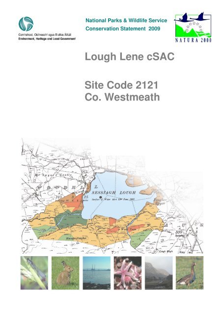
Lough Lene cSAC Site Code 2121 Co. Westmeath - National Parks ...
Lough Lene cSAC Site Code 2121 Co. Westmeath - National Parks ...
Lough Lene cSAC Site Code 2121 Co. Westmeath - National Parks ...

Create successful ePaper yourself
Turn your PDF publications into a flip-book with our unique Google optimized e-Paper software.
<strong>National</strong> <strong>Parks</strong> & Wildlife Service<br />
<strong>Co</strong>nservation Statement 2009<br />
<strong>Lough</strong> <strong>Lene</strong> <strong>cSAC</strong><br />
<strong>Site</strong> <strong><strong>Co</strong>de</strong> <strong>2121</strong><br />
<strong>Co</strong>. <strong>Westmeath</strong>
SUMMARY<br />
Introduction<br />
<strong>Lough</strong> <strong>Lene</strong> <strong>cSAC</strong> has been designated as a candidate Special Area of <strong>Co</strong>nservation under the EU<br />
Habitats Directive as it is an oligo-mesotrophic (low in nutrients) hard water marl lake with a<br />
diverse stonewort community. This habitat is listed in Annex I of the directive.<br />
The lake supported a good population of the internationally rare and protected White-clawed<br />
Crayfish in the 1980s. However, following recent survey work, the species is believed to be present<br />
in very low numbers or may even have disappeared altogether. This species is listed in Annex II of<br />
the Habitats Directive<br />
Nature <strong>Co</strong>nservation Value of <strong>Lough</strong> <strong>Lene</strong> <strong>cSAC</strong><br />
<strong>Lough</strong> <strong>Lene</strong> is a medium-sized hard water marl lake in fairly natural condition, with a diverse<br />
stonewort community. Water quality is good, being borderline oligo- to mesotrophic, though there<br />
have been algal blooms in recent years. Most of the land immediately adjacent to the stony shore<br />
comprises improved agricultural pasture, while the main areas of semi-natural terrestrial vegetation<br />
are largely confined to the west and east ends of the lake and include woodland, wet grassland, fen<br />
and swamp/marsh.<br />
The lake supported a population of White-clawed Crayfish, which was wiped out in 1987. This<br />
species subsequently recovered following a re-introduction programme, but its current status is<br />
unclear. The Irish population of Freshwater crayfish is important, as it is threatened in Europe. The<br />
lake also supports wintering wildfowl with nationally important numbers of some species.<br />
Description of <strong>Lough</strong> <strong>Lene</strong> <strong>cSAC</strong><br />
<strong>Lough</strong> <strong>Lene</strong> is a medium-sized clear hard-water lake with marl deposition, and is up to 20 m deep.<br />
At least three species of stoneworts, a type of alga, are abundant in the lake, along with other<br />
aquatic plants. Semi-natural lakeshore habitats are mainly found on the east and west shores of the<br />
lake, and include fen, wet woodland and cutover bog. A variety of wintering waterfowl use the<br />
lake, including some that occur in nationally important numbers.<br />
The White-clawed Crayfish population in the lake was wiped out in 1987 following an outbreak of<br />
crayfish fungus, and was subsequently re-introduced. Recent surveying indicates that the species<br />
may again be extinct in <strong>Lough</strong> <strong>Lene</strong>, or present in very low numbers.<br />
The lake is surrounded by improved agricultural land as well as some forestry and a public amenity<br />
area. Water to supply Castlepollard is abstracted from the lake.<br />
The greatest threat to the conservation status of the lake is nutrient enrichment (eutrophication) due<br />
to fertiliser run-off from adjacent land or effluent from wastewater treatment. Excessive amounts of<br />
Dept. of Environment, Heritage and Local Government 1 CS Version 1.01 2009
2 <strong>Co</strong>nservation Statement <strong>Lough</strong> <strong>Lene</strong> <strong>cSAC</strong> — <strong>Site</strong> <strong><strong>Co</strong>de</strong> <strong>2121</strong><br />
nutrients can cause increased growth of other aquatic species which then compete with and displace<br />
the stoneworts, with knock-on effects on wildfowl and other fauna. Reclamation and improvement<br />
of agricultural land could lead to the loss of more of the semi-natural lakeshore habitats.<br />
Main <strong>Co</strong>nservation Objectives<br />
• To maintain the Annex I habitat for which the SAC has been selected at favourable conservation<br />
status: Hard oligo-mesotrophic waters with benthic vegetation of Chara spp. (85% area of the<br />
site)<br />
• To maintain the Annex II species for which the SAC has been selected at favourable<br />
conservation status: White-clawed Crayfish<br />
• To maintain the extent, species richness and biodiversity of the entire site<br />
• To establish effective liaison and co-operation with landowners, legal users and relevant<br />
authorities<br />
Main Management Issues<br />
• Angling<br />
• Crayfish population status<br />
• Eutrophication<br />
• Grazing<br />
• Invasive species<br />
• Reclamation<br />
• Recreation/amenity<br />
• Water abstraction<br />
Scientific Monitoring and Inspection<br />
Monitoring of <strong>Lough</strong> <strong>Lene</strong> <strong>cSAC</strong> will be carried out by the Monitoring Section of the NPWS to<br />
determine if the Annex I habitat and Annex II species are being maintained at favourable<br />
conservation status. Regular inspection of the site by regional NPWS staff will identify any major<br />
changes that occur.<br />
Dept. of Environment, Heritage and Local Government CS Version 1.01 2009
TABLE OF CONTENTS<br />
Summary .......................................................................................................................................................1<br />
Reader’s Guide .......................................................................................................................................................5<br />
Legal Background....................................................................................................................................................6<br />
Nature <strong>Co</strong>nservation Legislation .........................................................................................................................6<br />
Roles of Government Departments and Agencies..............................................................................................7<br />
Implications of <strong>Site</strong> Designation for Landowners and other <strong>Site</strong> Users ..............................................................9<br />
Nature <strong>Co</strong>nservation Value of <strong>Lough</strong> <strong>Lene</strong> <strong>cSAC</strong> .................................................................................................10<br />
Reason for Designation of <strong>Lough</strong> <strong>Lene</strong> <strong>cSAC</strong> ..................................................................................................10<br />
<strong>Co</strong>nservation Value of <strong>Lough</strong> <strong>Lene</strong> <strong>cSAC</strong>.........................................................................................................10<br />
<strong>Co</strong>nservation Objectives ...................................................................................................................................11<br />
<strong>Site</strong> Description .....................................................................................................................................................12<br />
Location Including <strong>Site</strong> Boundaries...................................................................................................................12<br />
Legal Status.......................................................................................................................................................13<br />
Physical Features..............................................................................................................................................13<br />
Biological Features............................................................................................................................................15<br />
Land Use ...........................................................................................................................................................22<br />
Management Issues ..........................................................................................................................................24<br />
Scientific Monitoring & Inspection..........................................................................................................................26<br />
Dept. of Environment, Heritage and Local Government 3 CS Version 1.01 2009
4 <strong>Co</strong>nservation Statement for <strong>Lough</strong> <strong>Lene</strong> <strong>cSAC</strong> — <strong>Site</strong> <strong><strong>Co</strong>de</strong> <strong>2121</strong><br />
APPENDICES<br />
Appendix I: Glossary..............................................................................................................................................27<br />
Appendix II: Reference Material ............................................................................................................................32<br />
Appendix III: Climate..............................................................................................................................................34<br />
Appendix IV: Water Quality....................................................................................................................................35<br />
Appendix V: I-WeBS Bird <strong>Co</strong>unt Data ...................................................................................................................39<br />
Appendix VI: <strong>Co</strong>mpensation Procedures...............................................................................................................41<br />
Appendix VII: Notifiable Actions.............................................................................................................................42<br />
Appendix VIII: <strong>National</strong> <strong>Parks</strong> and Wildlife <strong>Co</strong>ntact Details...................................................................................69<br />
MAPS<br />
Map 1 <strong>Site</strong> Location and Boundary Map (Ver. 1.00)<br />
Map 2 Ownership Map<br />
Map 3 Indicative Habitat Map<br />
Dept. of Environment, Heritage and Local Government CS Version 1.01 2009
READER’S GUIDE<br />
The <strong>National</strong> <strong>Parks</strong> and Wildlife Service (NPWS) of the Department of the Environment, Heritage<br />
and Local Government (DEHLG) has produced this document to provide ecological information<br />
about <strong>Lough</strong> <strong>Lene</strong> <strong>cSAC</strong> and to outline the main objectives for the conservation of the special<br />
features of the site.<br />
The Legal background section outlines the legislative and policy drivers for the site’s designation<br />
and identifies the relevant authorities with responsibilities in relation to the site.<br />
The Nature <strong>Co</strong>nservation Value section describes the reasons for the site designation and lists<br />
the site specific <strong>Co</strong>nsevation Objectives.<br />
The <strong>Site</strong> Description section contains general information on the site’s boundaries and ownership<br />
and on the statutory bodies with responsibility for its conservation. It also contains sections on the<br />
physical aspects of the site such as the geology and hydrology as well as the biological features,<br />
in particular, the habitats and species found there. Land use and cultural features are also<br />
described.<br />
The Scientific Monitoring and Inspection section outlines the methodologies used for monitoring<br />
the conservation status of the site and identifying any changes that occur.<br />
The appendices include a glossary where scientific and technical terms are explained, reference<br />
material consulted in the preparation of the statement and a list of notifiable actions relevant to<br />
each habitat within the site.<br />
Dept. of Environment, Heritage and Local Government 5 CS Version 1.01 2009
LEGAL BACKGROUND<br />
Nature <strong>Co</strong>nservation Legislation<br />
The legal basis for selection and designation of Special Areas of <strong>Co</strong>nservation (SACs) is the EU<br />
Habitats Directive, which was adopted in 1992. Focusing on the conservation of natural and seminatural<br />
habitats and species of flora and fauna, the Habitats Directive seeks to establish “Natura<br />
2000”, a network of protected areas throughout the European <strong>Co</strong>mmunity. The Habitats Directive<br />
includes a list of habitats that require SAC designation and specific conservation measures. This<br />
list is known as Annex I and the habitats are referred to as Annex I habitats. On this list, habitats<br />
that require special attention because they are in danger of disappearance, are termed ‘priority<br />
habitats’. A second list, Annex II in the Habitats Directive comprises species that must be afforded<br />
special protection.<br />
In Ireland, the habitats and species that must be afforded protection under the Habitats Directive<br />
include:<br />
16 Annex I priority habitats that require particular attention – including raised bogs, active blanket<br />
bogs, turloughs and machair,<br />
45 other Annex I habitats – such as certain types of heaths, lakes and woodlands,<br />
25 Annex II species – including Otter, Freshwater Pearl Mussel and Killarney Fern.<br />
It is the responsibility of each member state to designate SACs to protect the Annex I habitats and<br />
Annex II species. These sites, together with the Special Protection Areas (SPAs) designated under<br />
the EU Birds Directive (1979), form the European “Natura 2000” network.<br />
The Birds Directive contains annexes, which are lists of birds that require particular conservation<br />
measures (Annex I), and also species that may be hunted, and species that may be sold. There are<br />
28 Annex I species regularly occurring in Ireland including Whooper Swan, Greenland Whitefronted<br />
Goose, Peregrine Falcon, <strong>Co</strong>rncrake and Terns. Member states are also required to protect<br />
wetlands and their associated water birds and sites that are important for migratory species such as<br />
ducks, geese and waders<br />
The Habitats Directive was transposed into Irish law through the European <strong>Co</strong>mmunities<br />
(Natural Habitats) Regulations 1997. The Wildlife Act 1976 is the main statute governing the<br />
protection of wildlife in Ireland and was amended in 2000 to take account of European law,<br />
particularly the Habitats and Birds Directives. The Wildlife (Amendment) Act 2000 also makes<br />
legal provision for the designation and protection of a national network of Natural Heritage Areas<br />
(NHAs). Over 1,100 proposed NHAs were published in 1995 and almost 400 of these are also<br />
selected as candidate SACs.<br />
Dept. of Environment, Heritage and Local Government 6 CS Version 1.01 2009
Legal Background<br />
The European <strong>Co</strong>mmunities (Natural Habitats) Regulations 1997 include the following points:<br />
The Minister for the Environment, Heritage and Local Government must transmit a candidate list<br />
of sites to the European <strong>Co</strong>mmission for consideration.<br />
Following adoption of this list by the <strong>Co</strong>mmission, the Minister will formally designate the sites as<br />
SACs.<br />
<strong>Site</strong>s are legally protected once they are publicly advertised.<br />
Landowners and other users with a legal entitlement should be notified of designation, and the<br />
Minister must make all reasonable efforts to do so. Notification also includes a list of activities<br />
that may alter, damage, destroy or interfere with the integrity of the site. A person who illegally<br />
damages a site may be prosecuted or required to repair damage.<br />
Landowners and other users with a legal entitlement may appeal the designation of lands on<br />
scientific grounds, within three months of the designation notification.<br />
Landowners and other users with a legal entitlement will be compensated for actual loss of<br />
income arising from restrictions imposed as a result of designation.<br />
Roles of Government Departments and<br />
Agencies<br />
Department of the<br />
Environment, Heritage and<br />
Local Government<br />
(DEHLG)<br />
<strong>National</strong> <strong>Parks</strong> & Wildlife<br />
Service (NPWS)<br />
DEHLG is the government department with responsibility for the<br />
designation and protection of wildlife habitats, species and areas of<br />
conservation interest. As part of their responsibility in relation to<br />
biodiversity and wildlife under the Wildlife Acts (1976 and 2000), the<br />
Minister’s brief extends far beyond the habitats and species listed in the<br />
annexes of the Habitats and Birds Directives.<br />
NPWS is the section of the DEHLG responsible for maintaining the<br />
nature conservation value of the site. Periodic inspection of the site is<br />
carried out by the local <strong>Co</strong>nservation Ranger.<br />
Regional staff also participate in research and survey projects by<br />
collecting data on the site, provide advice to planning authorities on the<br />
impacts of development applications and provide an education and<br />
advisory service to the public. See Appendix VIII for NPWS contact<br />
details.<br />
<strong>Westmeath</strong> <strong>Co</strong>unty <strong>Co</strong>uncil <strong>Westmeath</strong> <strong>Co</strong>unty <strong>Co</strong>uncil is the planning authority for the site. As such<br />
it is obliged to ensure appropriate assessment of the implications of<br />
developments requiring planning permission that may have an impact,<br />
either individually or in combination with other developments on the<br />
designated area. It also manages the amenity area at The Cut, and<br />
operates a water abstraction plant on the south-west shore, as well as<br />
monitoring the water quality of the lake.<br />
<strong>Co</strong>illte Teoranta <strong>Co</strong>illte Teoranta is the State-owned commercial forestry company, which<br />
owns public forests.<br />
Environmental Protection<br />
Agency (EPA)<br />
The EPA is an independent state sponsored body with a wide range of<br />
statutory duties including monitoring environmental quality and<br />
overseeing the performance by local authorities of their statutory<br />
environmental protection functions. <strong>Lough</strong> <strong>Lene</strong> is included in the EPA’s<br />
lake water quality monitoring programme, using the data gathered by<br />
<strong>Westmeath</strong> <strong>Co</strong>. <strong>Co</strong>.<br />
Dept. of Environment, Heritage and Local Government CS Version 1.01 2009<br />
7
8 <strong>Co</strong>nservation Statement <strong>Lough</strong> <strong>Lene</strong> <strong>cSAC</strong> — <strong>Site</strong> <strong><strong>Co</strong>de</strong> <strong>2121</strong><br />
Department of Agriculture,<br />
Fisheries and Food (DAFF)<br />
The Department of<br />
<strong>Co</strong>mmunications, Energy<br />
and Natural Resources<br />
(DCENR)<br />
The Central Fisheries<br />
Board<br />
Eastern Regional Fisheries<br />
Board<br />
DAFF is the government department responsible for the development and<br />
regulation of agriculture, fisheries, forestry and the food industry,<br />
including the administration of schemes such as the Rural Environment<br />
Protection Scheme (REPS), the Native Woodland Scheme (NWS), and<br />
<strong>Co</strong>mmonage Framework Plans (CFPs). In 2007 the Department assumed<br />
the additional responsibility for sea fisheries, aquaculture, marine<br />
research, marine engineering and pier and harbour development (non<br />
commercial) and associated agencies such as Bord Iascaigh Mhara (BIM)<br />
and the Marine Institute.<br />
Under Regulation 31 of the EC (Natural Habitats) Regulations, DAFF<br />
have responsibility for ensuring that activities it regulates do not<br />
adversely affect <strong>cSAC</strong>s. Monitoring functions are carried out by<br />
individual divisions or executive agencies of the department.<br />
DCENR is the government agency with responsibility for<br />
<strong>Co</strong>mmunications, Energy and Natural Resources, including the Inland<br />
Fisheries Division. It holds corporate governance of the Central and<br />
Regional Fisheries Boards and the <strong>Lough</strong>s Agency.<br />
The Central Fisheries Board is the statutory body is responsible for the<br />
co-ordination and support of the seven regional fisheries boards. Its<br />
responsibilities also include the control of commercial salmon licensing.<br />
The Eastern Regional Fisheries Board is responsible for maintaining and<br />
improving environmental quality and developing and protecting the<br />
fisheries resource in their region. The Boards responsibilities cover both<br />
inland waterways and out to the twelve-mile limit off the coast.<br />
Local Authority Policy in Relation to the <strong>Site</strong><br />
<strong>Westmeath</strong> <strong>Co</strong>unty Development Plan 2008-2014 (Section 2.5; Environment & Heritage) states<br />
several objectives and policies in relation to natural heritage and designated sites within the county.<br />
Objectives:<br />
O-EH2 To protect, manage and enhance the natural heritage, biodiversity, landscape and<br />
environment of <strong>Co</strong>unty <strong>Westmeath</strong> in recognition of its importance as a non-renewable resource,<br />
unique identifier and character of the county and as a natural resource asset.<br />
O-EH3 It is a key objective to ensure as far as possible that development does not impact<br />
adversely on wildlife habitats and species. In the interests of sustainability, biodiversity should be<br />
conserved for the benefit of future generations.<br />
O-EH4 The “polluter pays” and the “precautionary principles” are integral components of<br />
planning policies for environment and heritage. If uncertainty exists regarding the potential impact<br />
of a proposed development full account will be taken of the precautionary principle and the<br />
proposed development will be resisted unless or until its effects are more clearly understood.<br />
Policies in relation to Special Areas of <strong>Co</strong>nservation (SACs)<br />
P-EH8 To protect and conserve proposed candidate Special Areas of <strong>Co</strong>nservation. The most<br />
valuable wildlife habitats in <strong>Westmeath</strong> form part of a national network of protected areas and<br />
some species of wild plants and animals are protected by law.<br />
P-EH9 To protect plant, animal, species and habitats which have been identified by the Habitats<br />
Directive, Birds Directive, Wildlife Act (1976) and (Amendment Act) 2000, and the Flora<br />
Protection Order S.I No. 94 of 1999.<br />
P-EH10 To require appropriate environmental assessment such as EIA (Environmental Impact<br />
Assessment) or ecological appraisal for developments not directly connected with or necessary to<br />
Dept. of Environment, Heritage and Local Government CS Version 1.01 2009
Legal Background<br />
the management of a European site, or a proposed European <strong>Site</strong> and which are likely to have<br />
significant effects on the site individually or cumulatively.<br />
P-EH11 To consult with appropriate prescribed bodies and Government agencies when assessing<br />
development proposals affecting designated sites of European importance.<br />
Implications of <strong>Site</strong> Designation for<br />
Landowners and other <strong>Site</strong> Users<br />
In most areas designated as <strong>cSAC</strong>s, current practices will not have to change significantly.<br />
In cases where users with a legal entitlement are required to change practices or restrict activities to<br />
protect the wildlife interest of the site, compensation will be payable based on actual loss of<br />
income. See Appendix VI for further details.<br />
If a user with a legal entitlement wishes to carry out certain activities, not covered by licence or<br />
consent from another statutory body, within the designated area, they must consult with, and get<br />
consent from, the Minister for the Environment, Heritage and Local Government. These activities<br />
are listed as “Notifiable Actions” for each habitat (see Appendix VII).<br />
Dept. of Environment, Heritage and Local Government CS Version 1.01 2009<br />
9
NATURE CONSERVATION VALUE<br />
OF LOUGH LENE CSAC<br />
Reason for Designation of <strong>Lough</strong> <strong>Lene</strong><br />
<strong>cSAC</strong><br />
This section outlines the habitats and species occurring within the site that are the basis for the<br />
designation of the site because of their relative importance, both at a national and <strong>Co</strong>mmunity<br />
level.<br />
HABITAT LISTED IN ANNEX I OF THE EU<br />
HABITATS DIRECTIVE<br />
• Hard oligo-mesotrophic waters with benthic<br />
vegetation of Chara spp. (EU Habitat <strong><strong>Co</strong>de</strong> 3140)<br />
SPECIES LISTED IN ANNEX II OF THE EU<br />
HABITATS DIRECTIVE<br />
• Freshwater crayfish (Austropotamobius pallipes)<br />
<strong>Co</strong>nservation Value of <strong>Lough</strong> <strong>Lene</strong> <strong>cSAC</strong><br />
<strong>Lough</strong> <strong>Lene</strong> is a medium-sized hard water marl lake in fairly natural condition, with a diverse<br />
stonewort community. Water quality is good, being borderline oligo- to mesotrophic, though there<br />
have been algal blooms in recent years. Most of the land immediately adjacent to the stony shore<br />
comprises improved agricultural pasture, while the main areas of semi-natural terrestrial vegetation<br />
are largely confined to the west and east ends of the lake and include woodland, wet grassland, fen<br />
and swamp/marsh.<br />
The lake supported a population of White-clawed Crayfish, which was wiped out in 1987. This<br />
species subsequently recovered following a re-introduction programme, but its current status is<br />
unclear. The Irish population of Freshwater crayfish is important, as it is threatened in Europe. The<br />
lake also supports wintering wildfowl with nationally important numbers of some species.<br />
Dept. of Environment, Heritage and Local Government 10 CS Version 1.01 2009
Nature <strong>Co</strong>nservation Value of <strong>Lough</strong> <strong>Lene</strong> <strong>cSAC</strong><br />
<strong>Co</strong>nservation Objectives<br />
European and national legislation places a collective obligation on Ireland and its citizens to<br />
maintain at favourable conservation status areas designated as candidate Special Areas of<br />
<strong>Co</strong>nservation. The Government and its agencies are responsible for the implementation and<br />
enforcement of regulations that will ensure the ecological integrity of these sites.<br />
According to the EU Habitats Directive, favourable conservation status of a habitat is achieved<br />
when:<br />
• its natural range, and area it covers within that range, is stable or increasing, and<br />
• the ecological factors that are necessary for its long-term maintenance exist and are likely to<br />
continue to exist for the foreseeable future, and<br />
• the conservation status of its typical species is favourable as defined below.<br />
The favourable conservation status of a species is achieved when:<br />
• population data on the species concerned indicate that it is maintaining itself, and<br />
• the natural range of the species is neither being reduced or likely to be reduced for the<br />
foreseeable future, and<br />
• there is, and will probably continue to be, a sufficiently large habitat to maintain its populations<br />
on a long-term basis.<br />
Objective 1: To maintain the Annex I habitats for which the <strong>cSAC</strong> has been selected at<br />
favourable conservation status; Hard oligo-mesotrophic waters with<br />
benthic vegetation of Chara spp. (85% area of the site).<br />
Objective 2: To maintain the Annex II species for which the <strong>cSAC</strong> has been selected<br />
at favourable conservation status; White-clawed Crayfish<br />
(Austropotamobius pallipes).<br />
Objective 3: To maintain the extent, species richness and biodiversity of the entire site.<br />
Objective 4: To establish effective liaison and co-operation with landowners, legal<br />
users and relevant authorities.<br />
Dept. of Environment, Heritage and Local Government CS Version 1.01 2009<br />
11
SITE DESCRIPTION<br />
Location Including <strong>Site</strong> Boundaries<br />
<strong>Lene</strong> is 4 km north east of Castlepollard in <strong>Co</strong>. <strong>Westmeath</strong> (see Map 1).<br />
Grid Ref.: N 510 682<br />
Latitude: N 53º40’0”<br />
Longitude: W 07º14’0”<br />
Area: 491 ha<br />
Altitude Range: 95 m to 98 m<br />
Max. Depth 20 m<br />
Townlands: Ballany, <strong>Co</strong>llinstown,<br />
Cummerstown,<br />
<strong>Lough</strong>park,<br />
<strong>Lough</strong>anavagh/<br />
Newpark, Ranaghan,<br />
Teeverevagh,<br />
Windtown.<br />
<strong>Site</strong> Boundaries<br />
Much of the site boundary follows the high water level along the shoreline, which is marked by a<br />
fence or hedgerow in some places. Other site boundaries follow hedgerows and fences along field<br />
boundaries. The boundary is not marked on the ground at a few locations.<br />
<strong>Site</strong> Infrastructure<br />
Most of the shoreline is private land that is under pasture or woodland. A public amenity area (The<br />
Cut) managed by <strong>Westmeath</strong> <strong>Co</strong>unty <strong>Co</strong>uncil is found at the north-east corner of the lake. This<br />
includes a slipway and bathing area which are partly within the site, and public toilets and a car<br />
park which are on the shore outside the site.<br />
Dept. of Environment, Heritage and Local Government 12 CS Version 1.01 2009
<strong>Site</strong> Description<br />
Legal Status<br />
Ownership<br />
Land around the lake is in multiple private ownership, apart from a small area owned by <strong>Co</strong>illte<br />
(see Map 2). The lake itself appears to be in multiple private ownership, having historically been<br />
one of the so-called ‘State lakes’ which was subsequently granted by Letters Patent to private<br />
individuals.<br />
Designations of the <strong>Site</strong><br />
candidate Special<br />
Area of <strong>Co</strong>nservation<br />
proposed Natural<br />
Heritage Area<br />
Physical Features<br />
Climate<br />
<strong>Site</strong>code IE000<strong>2121</strong> Published on 1 st July 1999<br />
<strong>Site</strong>code <strong>2121</strong> Published in 1995<br />
The closest synoptic weather station to <strong>Lough</strong> <strong>Lene</strong> is at Mullingar, <strong>Co</strong>. <strong>Westmeath</strong>, approximately<br />
15 km from the site. 30-year average information for this station is presented in Appendix III. In<br />
summary, this region receives an average of 934.3 mm rainfall per annum. The annual mean daily<br />
air temperature is 8.8 o C, varying from a mean low of 4 o C in January to a mean high of 14.7 o C in<br />
July. This area has an average of 97.2 days per year with ground frost, and 214 days per year with<br />
greater than 0.2 mm of rain. The area receives approximately 3.5 hours per day of bright sunshine.<br />
Geology & Geomorphology<br />
<strong>Lough</strong> <strong>Lene</strong> lies in an area underlain by Carboniferous limestone of the Derravaragh Cherts<br />
Formation, which is characterised by mostly unfossiliferous dark-grey thinly-bedded limestones<br />
and shales.<br />
Around and to the north of <strong>Lough</strong> <strong>Lene</strong> the landscape is characterised by glacial deposits.<br />
Soils & Soil Processes<br />
Soils in the area comprise grey-brown podzolics, gleys and brown earths derived from limestone<br />
and shale glacial till, with basin peat found in some of the inter-drumlin hollows. Fen peats are<br />
found in low-lying ground around the lake.<br />
Hydrology & Water Quality<br />
The Irish Karst Working Group (2000) describes the hydrology of the region as follows: "The lakes<br />
of <strong>Co</strong>. <strong>Westmeath</strong> straddle the watershed between the River Inny (River Shannon) and the River<br />
Deel (River Boyne) catchments. It was remarked by Piers in 1682 the <strong>Lough</strong> <strong>Lene</strong> drains via a<br />
surface channel eastwards to the River Deel and subterraneously via sinkholes to springs in the<br />
settlement at Fore to the north, and hence flows both to the Atlantic and to the Irish Sea. A recent<br />
hydrological study demonstrated that water from the swallow holes on the shores of the lake does<br />
indeed flow underground to the southerly spring at Fore with a flow rate of 80 m per hour".<br />
Dept. of Environment, Heritage and Local Government CS Version 1.01 2009<br />
13
14 <strong>Co</strong>nservation Statement <strong>Lough</strong> <strong>Lene</strong> <strong>cSAC</strong> — <strong>Site</strong> <strong><strong>Co</strong>de</strong> <strong>2121</strong><br />
Swallow-hole on the north west shore. (Photo: Mieke Muyllaert)<br />
<strong>Lough</strong> <strong>Lene</strong> is fed by a number of small streams and springs. Water quality on the River Deel is<br />
monitored by the EPA and is currently classified as Q4-5, unpolluted.<br />
A past study on the lake (Flanagan and Toner 1975) found moderate standing crops of<br />
phytoplankton and noted that phosphate and nitrate concentrations were low, and that the water<br />
was moderately hard with low colour and high transparency.<br />
<strong>Westmeath</strong> <strong>Co</strong>unty <strong>Co</strong>uncil operates a water abstraction plant on the south-west shore of the lake,<br />
which takes approximately 6000-7000 cubic metres of water per day from the lake to supply<br />
Castlepollard. Due to its importance as a source of potable water, water quality of <strong>Lough</strong> <strong>Lene</strong> is<br />
subject to detailed annual monitoring carried out on behalf of <strong>Westmeath</strong> <strong>Co</strong>unty <strong>Co</strong>uncil. Reports<br />
for 2004 and 2005 (see Appendix IV) conclude that the lake is generally borderline oligomesotrophic<br />
with most parameters measured showing a shift towards mainly mesotrophic status.<br />
Blooms of blue-green algae occurred in both years and the report notes that their persistence in the<br />
lake is a cause for concern, with special vigilance needed on sources of diffuse nutrient run-off in<br />
the lake catchment.<br />
<strong>Westmeath</strong> <strong>Co</strong>unty <strong>Co</strong>uncil adopted the Water Pollution (Agricultural) Bye-laws in 2000, which<br />
requires farmers in named townlands, including those in the <strong>Lough</strong> <strong>Lene</strong> catchment, to have<br />
adequate facilities and a farm nutrient management plan to help prevent water pollution. The<br />
council carries out farm surveys/inspections to enforce the bye-laws.<br />
There are no wastewater treatment plants discharging into the lake; <strong>Co</strong>llinstown wastewater<br />
treatment plant effluent is pumped away from the catchment.<br />
Dept. of Environment, Heritage and Local Government CS Version 1.01 2009
<strong>Site</strong> Description<br />
Biological Features<br />
Habitats and Vegetation<br />
Note: Throughout the conservation statement, habitats are named and described under two<br />
different systems: the Annex I habitat is as listed in the EU Habitats Interpretation Manual<br />
Version EUR 27 (2007), while all other habitats are as listed according to the classification<br />
system of ‘A Guide to Habitats in Ireland’ (Fossitt, 2000).<br />
The following table lists the habitats within the site. The Annex I habitat of the Habitats Directive<br />
for which the site was selected is listed, with the relevant Guide to Habitats category also shown.<br />
The Indicative Habitat map for the site is presented in Map 3. The percentage area presented for<br />
each habitat type is based on the approximate geographic area of each habitat, as shown in Map 3.<br />
Habitats Found within <strong>Lough</strong> <strong>Lene</strong> <strong>cSAC</strong><br />
ANNEX I HABITAT TYPE HABITAT CATEGORY % AREA<br />
Hard oligo-mesotrophic waters with benthic<br />
vegetation of Chara spp. (EU <strong><strong>Co</strong>de</strong> 3140)<br />
Limestone/marl lakes (FL3) 85<br />
- Depositing /lowland rivers (FW2)
16 <strong>Co</strong>nservation Statement <strong>Lough</strong> <strong>Lene</strong> <strong>cSAC</strong> — <strong>Site</strong> <strong><strong>Co</strong>de</strong> <strong>2121</strong><br />
Annex I Habitat:<br />
Hard oligomesotrophic<br />
waters<br />
with benthic<br />
vegetation of Chara<br />
spp. (EU code 3140)<br />
(85% of total site area<br />
or 420 ha)<br />
<strong>Lough</strong> <strong>Lene</strong> is a medium-sized limestone lake with abundant charophytes<br />
(stoneworts). Species recorded from the lake include Lesser Bearded<br />
Stonewort (Chara curta), Hedgehog Stonewort (Chara pedunculata) and<br />
Delicate Stonewort (Chara virgata). Other aquatic species found in the<br />
lake are Canadian Pondweed (Elodea canadensis), Perfoliate Pondweed<br />
(Potamogeton perfoliatus) and Shining Pondweed (Potamogeton lucens).<br />
This habitat includes the stony shore, approximately 3-5 m wide, which is<br />
found around much of the lake margin. Characterised by small to<br />
medium-sized cobbles and boulders, the shoreline supports scattered<br />
vegetation comprising species such as Reed Canary-grass (Phalaris<br />
arundinacea), Jointed Rush (Juncus articulatus), Water Mint (Mentha<br />
aquatica), Marsh Ragwort (Senecio aquaticus), Creeping Bent-grass<br />
(Agrostis stolonifera) and Shoreweed (Littorella uniflora).<br />
A number of ‘swallow-hole’ features are found running into the<br />
broadleaved woodland from the north shore. These are fissures in the<br />
limestone bedrock into which the lake water overflows.<br />
There are two islands on the lake, both vegetated with trees and scrub.<br />
The rocks around Nuns Island are used by cormorants.<br />
South shore of <strong>Lough</strong> <strong>Lene</strong>, showing transition from semi-improved grassland to lakeshore (Photo: Mieke Muyllaert)<br />
Dept. of Environment, Heritage and Local Government CS Version 1.01 2009
<strong>Site</strong> Description<br />
Other Habitats:<br />
Depositing /lowland<br />
rivers (FW2)<br />
Drainage ditches<br />
(FW4)<br />
Reed and large sedge<br />
swamps (FS1)<br />
Improved agricultural<br />
grassland (GA1)<br />
Dry neutral and<br />
calcareous grassland<br />
(GS1)<br />
Dry meadows and<br />
grassy verges (GS2)<br />
A few small streams flow into the lake. These are generally heavily<br />
shaded and have little aquatic vegetation. The main species are Watercresses<br />
(Nasturtium spp.) and Fool’s Water-cress (Apium nodiflorum).<br />
Ditches from farmland surrounding the site drain into the lake and<br />
surrounding wetland habitats. Some of these are wet for only part of the<br />
year. The ditches support similar aquatic vegetation to that found in the<br />
streams, as well as species from the adjoining wetland habitats.<br />
Swamp dominated by <strong>Co</strong>mmon Reed (Phragmites australis) and<br />
<strong>Co</strong>mmon Club-rush (Schoenoplectus lacustris) is common around the<br />
lake margin, particularly in sheltered inlets. This habitat is typically<br />
species-poor, with Water Horse-tail (Equisetum fluviatile) and Spikerushes<br />
(Eleocharis spp.) the main species in the understorey. Bottle Sedge<br />
(Carex rostrata) is locally abundant.<br />
Some small sections of intensively managed improved/semi-improved<br />
grassland fields are included in the site, where they come down to the<br />
lake margin or where they are found immediately adjacent to semi-natural<br />
habitats. These are dominated by Meadow-grasses (Poa spp.), Bentgrasses<br />
(Agrostis spp.) and Perennial rye-grass (Lolium perenne). Weeds<br />
indicative of nutrient enrichment, such as Nettle (Urtica dioica) and<br />
Thistles (Cirsium spp.) can be locally abundant.<br />
Calcareous grassland is found on the peninsula in the west of the lake and<br />
supports species such as Quaking Grass (Briza media) and Downy Oatgrass<br />
(Helictotrichon pubescens) with Hawkbits (Leontodon spp.),<br />
Ribwort Plantain (Plantago lanceolata), Red Clover (Trifolium repens),<br />
Spotted-orchids (Dactylorhiza spp.), Selfheal (Prunella vulgaris) and<br />
Meadow Vetchling (Lathyrus pratensis).<br />
Dry grassland on the centre of the peninsula has not been recently grazed<br />
and is dominated by coarse grasses, mainly False Oat-grass<br />
(Arrhenatherum elatius), <strong>Co</strong>ck’s-foot (Dactylis glomerata) and Yorkshire<br />
Fog (Holcus lanatus). Red Fescue (Festuca rubra) and Sweet Vernalgrass<br />
(Anthoxanthum odoratum) are abundant.<br />
Wet grassland (GS4) Wet rushy grassland is found grading into the stony lakeshore habitat, as<br />
well as in fields adjacent to the lake. The main species are Soft Rush<br />
(Juncus effusus), Hard Rush (Juncus inflexus), Creeping Bent-grass<br />
(Agrostis stolonifera), Yorkshire Fog and Meadowsweet (Filipendula<br />
ulmaria), with Silverweed (Potentilla anserina), Sedges (Carex spp.),<br />
Jointed Rush (Juncus articulatus) and Marsh Bedstraw (Galium<br />
palustre).<br />
Cutover bog (PB4) Cutover bog is found in the west of the site. This was more extensive in<br />
the past but has been planted or recolonised with forestry/woodland. The<br />
bog surface is very uneven. Tall dry hummocks are dominated by Ling<br />
Heather (Calluna vulgaris) with Purple Moor-grass (Molinia caerulea),<br />
Cross-leaved Heath (Erica tetralix), Bilberry (Vaccinium myrtillus) and<br />
occasional Cranberry (Vaccinium oxycoccos). Lichens are abundant.<br />
Hollows in between the hummocks are wet and are dominated by bog<br />
mosses (Sphagnum spp.) with Bulrush (Typha latifolia).<br />
Dept. of Environment, Heritage and Local Government CS Version 1.01 2009<br />
17
18 <strong>Co</strong>nservation Statement <strong>Lough</strong> <strong>Lene</strong> <strong>cSAC</strong> — <strong>Site</strong> <strong><strong>Co</strong>de</strong> <strong>2121</strong><br />
Rich fen and flush<br />
(PF1)<br />
Wet willow-alder-ash<br />
woodland (WN6)<br />
Fen-type vegetation is found at a few locations along the lakeshore. It<br />
varies in species composition and wetness. Drier areas support abundant<br />
Purple Moor-grass and/or Black Bog-rush (Schoenus nigricans) with<br />
species such as Meadow Thistle (Cirsium dissectum), Glaucous Sedge<br />
(Carex flacca), Selfheal and bryophytes (mosses). Tormentil (Potentilla<br />
erecta), Sheep’s Sorrel (Rumex acetosella), Ling Heather, butterworts<br />
(Pinguicula spp.) and Lousewort (Pedicularis sylvestris) on hummocks<br />
indicate more acidic conditions. Wet areas are dominated by sedges such<br />
as Bottle Sedge with Water Horse-tail, Marsh Cinquefoil (Potentilla<br />
palustris), Water Mint (Mentha aquatica) and Marsh Pennywort<br />
(Hydrocotyle vulgaris).<br />
Wet woodland is found fringing the lakeshore in the east and west of the<br />
site. The dominant tree species are Alder (Alnus glutinosa) and willows<br />
(Salix spp.), while Ash can be locally frequent. Birch (Betula spp.) are<br />
occasional, as are Scots Pine (Pinus sylvestris), with Hawthorn<br />
(Crataegus monogyna) and Bramble (Rubus fruticosus) in the shrub<br />
layer. The field layer varies, with some areas being dominated by grasses<br />
with Nettle, while other areas are more diverse with species such as<br />
Hemp Agrimony (Eupatorium cannabinum), Meadowsweet, Marsh<br />
Ragwort (Senecio aquaticus), Cuckooflower (Cardamine pratensis),<br />
Lesser Spearwort (Ranunculus flammula), Yellow Iris (Iris pseudacorus),<br />
Wild Angelica (Angelica sylvestris) and bryophytes. Alder carr is found<br />
in the centre of the peninsula in the west of the site.<br />
Wet woodland on the south-east shore near The Cut.<br />
Dept. of Environment, Heritage and Local Government CS Version 1.01 2009
<strong>Site</strong> Description<br />
Bog woodland (WN7) Dominated by Downy Birch (Betula pubescens), this woodland is found<br />
on cutover bog in the west of the site. Other tree species include willows,<br />
Holly (Ilex aquifolium), Beech (Fagus sylvatica), oaks (Quercus spp.)<br />
and Mountain Ash (Sorbus aucuparia). As well as the species described<br />
for cutover bog (PB4) above, this woodland contains abundant Bracken<br />
(Pteridium aquilinum), frequent Gorse (Ulex europaeus), Honeysuckle<br />
(Lonicera periclymenum) and Ivy (Hedera helix). Mosses are abundant<br />
with occasional hummocks of Sphagnum capillifolium in some areas.<br />
Wood sorrel (Oxalis acetosella) is occasional. Towards the western edge<br />
of the site in Windtown, birch woodland seems to continue onto mineral<br />
soil and may have been planted in the past.<br />
(Mixed) broadleaved<br />
woodland (WD1)<br />
Mixed<br />
broadleaved/conifer<br />
woodland (WD2)<br />
Found in the east of Windtown on the north shore of the lake, this strip of<br />
broadleaved woodland is divided from the adjacent coniferous plantation<br />
by an old stone wall. Ash (Fraxinus excelsior) is dominant in the<br />
broadleaved woodland with occasional Beech, Sycamore (Acer<br />
pseudoplatanus) and Hazel (<strong>Co</strong>rylus avellana). A narrow band along the<br />
lakeshore is dominated by Alder. Bramble and Hawthorn are abundant in<br />
the shrub layer, while Ivy dominates the ground flora. Other frequent<br />
species are Ground Ivy (Glechoma hederacea), Nettle, Herb Robert<br />
(Geranium robertianum), Honeysuckle and Wood Sorrel. Hart’s-tongue<br />
Fern (Phyllitis scolopendrium) is frequent in rocky areas.<br />
In the absence of definitive information, the lake islands have been<br />
mapped as mixed broadleaved woodland.<br />
A small area of mature conifers found in the south east of the site<br />
comprises Sitka Spruce (Picea sitchensis) and Scots Pine with a eutrophic<br />
ground flora of Smooth Meadow-grass (Poa pratensis), Creeping bentgrass,<br />
Nettle and Hogweed (Heracleum sphondylium). Closer to the shore<br />
there is Birch, Alder and Willow with Holly and Hawthorn.<br />
Scrub (WS1) Scrub is a frequent component of the vegetation around the lake. In dry<br />
areas it is dominated by Hawthorn and Blackthorn with Gorse and<br />
Bramble. In wet areas it is dominated by Willows and/or Alder. Ground<br />
flora under dense scrub is sparse and tends to be grassy. Where scrub is<br />
scattered or more open, the ground flora comprises species of the main<br />
underlying or adjacent habitats. The non-native species Cherry Laurel<br />
(Prunus laurocerasus) is found at several locations around the lake. Alder<br />
scrub appears to be spreading on the low-lying ‘neck’ of the peninsula,<br />
while Hawthorn is spreading in the dry grassland habitat.<br />
Hedgerows (WL1) Most of the hedgerows in the site run perpendicular to the lakeshore, and<br />
so only the last few metres of hedgerow falls within the site boundary. A<br />
few hedgerows run parallel to the shore, or around fields that are included<br />
in the site, and so form the site boundary. They are generally dominated<br />
by Hawthorn with Blackthorn and Ash. Bramble and Ivy are abundant.<br />
Treelines (WL2) Treelines are found along the upper lakeshore and on some field<br />
boundaries. Species include Alder, Beech, Oak, Ash, Scots Pine, Sweet<br />
Chestnut (Castanea sativa) and Sitka Spruce.<br />
Stone walls and other<br />
stonework (BL1)<br />
Buildings and<br />
artificial surfaces<br />
(BL3)<br />
Stone walls are found along the lakeshore and some of the field<br />
boundaries. In some cases they run out into the lake below the high-water<br />
mark to divide adjacent plots.<br />
There is a concrete slipway and wooden boardwalk at the <strong>Westmeath</strong><br />
<strong>Co</strong>unty <strong>Co</strong>uncil amenity area.<br />
Dept. of Environment, Heritage and Local Government CS Version 1.01 2009<br />
19
20 <strong>Co</strong>nservation Statement <strong>Lough</strong> <strong>Lene</strong> <strong>cSAC</strong> — <strong>Site</strong> <strong><strong>Co</strong>de</strong> <strong>2121</strong><br />
Notable Flora:<br />
Lower Plants<br />
<strong>Lough</strong> <strong>Lene</strong> supports a diverse population of stoneworts (Charophytes). Stoneworts are a type of<br />
green alga and one of their characteristics is the accumulation of calcium carbonate (lime) on their<br />
surface. When the stoneworts die, the lime-encrusted material is deposited on the lakebed and<br />
contributes to the formation of marl. The species recorded from <strong>Lough</strong> <strong>Lene</strong> are Lesser Bearded<br />
Stonewort (Chara curta), Hedgehog Stonewort (Chara pedunculata) and Delicate Stonewort<br />
(Chara virgata). While none of these species are currently listed in the Red Data Book for<br />
Stoneworts as threatened in Ireland, C. curta and C. pedunculata are considered to be indicator<br />
species for marl lakes.<br />
Fauna:<br />
Invertebrates<br />
White-clawed Crayfish (Austropotamobius pallipes) is listed is Annex II of the Habitats Directive<br />
and is a qualifying interest for this site. White-clawed Crayfish were abundant as adults and<br />
juveniles in <strong>Lough</strong> <strong>Lene</strong> in 1980, but were wiped out in 1987 by crayfish plague fungus<br />
(Aphanomyces astaci). Crayfish were experimentally reintroduced to the lake in 1989 and 1991 and<br />
by 1996 the population appeared to be recovering. However, when <strong>Lough</strong> <strong>Lene</strong> was surveyed in<br />
2006 as part of a crayfish surveying methodology pilot study, none were found. Thus, it appears<br />
that the population has declined or is again extinct.<br />
Butterfly species recorded from the site include <strong>Co</strong>mmon Blue (Polyommatus icarus), Meadow<br />
Brown (Maniola jurtina), Ringlet (Aphantopus hyperantus), Orange Tip (Anthocharis cardamines)<br />
and Green-veined White (Artogeia napi).<br />
White-clawed Crayfish<br />
Dept. of Environment, Heritage and Local Government CS Version 1.01 2009
<strong>Site</strong> Description<br />
Fish<br />
This lake holds a good stock of wild Brown Trout (Salmo trutta) and this is complemented by<br />
regular stocking. Trout to 2.3 kg weight are not uncommon and in 1997 the largest recorded trout<br />
was a 2.7 kg fish taken in March. In addition, Rainbow Trout (Oncorhynchus mykiss), Minnow<br />
(Phoxinus phoxinus), Ten-spined Stickleback (Pungitius pungitius), Pike (Esox lucius) and Perch<br />
(Perca fluviatilis) occur in the lake. Brook Lamprey (Lampetra planeri) has been found in the<br />
outlet stream that runs to <strong>Lough</strong> Adeel.<br />
Amphibians and Reptiles<br />
The <strong>Co</strong>mmon Frog (Rana temporaria) is found in wetland habitats around the lakeshore. It is listed<br />
in the Red Data Book as Internationally Important, and is protected under the Bern <strong>Co</strong>nvention and<br />
Annex V of the EU Habitats Directive.<br />
Birds<br />
The site is monitored as part of the Irish Wetland Birds Survey (I-WeBS) network of winter<br />
wetland bird counting sites (see Appendix V), with 13 regularly occurring species of waterbirds.<br />
<strong>Lough</strong> <strong>Lene</strong> regularly supports nationally important numbers of Little Grebe. Pochard is also<br />
occasionally recorded in numbers of national importance.<br />
The following species have been recorded from <strong>Lough</strong> <strong>Lene</strong>.<br />
Wintering waterfowl:<br />
1 BoCCI red-listed species: Lapwing (Vanellus vanellus), Curlew (Numenius arquata).<br />
BoCCI amber-listed species: Great Crested Grebe (Podiceps cristatus), Pintail (Anas acuta),<br />
Wigeon (Anas penelope), Teal (Anas crecca), Pochard (Aythya ferina), Tufted Duck (Aythya<br />
fuligula), Goldeneye (Bucephala clangula).<br />
Others: Shoveler (Anas clypeata), Red Crested Pochard (Netta rufina, a vagrant).<br />
Breeding birds:<br />
BoCCI amber-listed species: <strong>Co</strong>ot (Fulica atra), Water Rail (Rallus aquaticus) (both also<br />
wintering), Snipe (Gallinago gallinago), Stonechat (Saxicola torquata), Grasshopper Warbler<br />
(Locustella naevia).<br />
Others: Little Grebe (Tachybaptus ruficollis), Mute Swan (Cygnus olor), Mallard (Anas<br />
platyrhynchos), Moorhen (Gallinula chloropus), Sedge Warbler (Acrocephalus schoenobaenus),<br />
Meadow Pipit (Anthus pratensis).<br />
Year-round presence, not breeding:<br />
<strong>Co</strong>rmorant (Phalacrocorax carbo), Grey Heron (Ardea cinerea), Herring Gull (Larus argentatus),<br />
Black-headed Gull (Larus ridibundus), Curlew (Numenius arquata).<br />
1 BoCCI - Birds of <strong>Co</strong>nservation <strong>Co</strong>ncern in Ireland – is a list of bird species prioritised for conservation in Ireland. The list is divided<br />
into Red (high conservation concern), Amber (medium conservation concern), and Green (not threatened).<br />
Dept. of Environment, Heritage and Local Government CS Version 1.01 2009<br />
21
22 <strong>Co</strong>nservation Statement <strong>Lough</strong> <strong>Lene</strong> <strong>cSAC</strong> — <strong>Site</strong> <strong><strong>Co</strong>de</strong> <strong>2121</strong><br />
Great Crested Grebe (photo Triona Finnen)<br />
Jay (Garrulus glandarius), Buzzard (Buteo buteo), Sparrowhawk (Accipiter nicus) and Reed<br />
Bunting (Emberiza schoeniclus) have all been recently recorded from the site.<br />
Mammals<br />
Otter (Lutra lutra) occur around the lake. Otters are listed in Annexes II and IV of the Habitats<br />
Directive.<br />
Grey Squirrel (Sciurus carolinensis) has been recently recorded for the site. These non-native<br />
squirrels were introduced to Ireland in the early 20 th century and are now widespread. Mink<br />
(Mustela vison), another introduced species, occur around the lakeshore.<br />
Land Use<br />
Land use on the site<br />
Agriculture The lake is surrounded by agricultural land. Where this lies inside the<br />
site, it is mainly low-intensity pasture. A few small areas of improved<br />
grassland are included in the site. Much of the shoreline is open for<br />
grazing and access to the lake for drinking by cattle.<br />
Angling The <strong>Lough</strong> <strong>Lene</strong> Angling Association controls fishing on the lake, which<br />
is a very popular game angling venue and hosts angling competitions.<br />
Angling is primarily carried out from boats. <strong>Lough</strong> <strong>Lene</strong>'s feeder streams<br />
are small in comparison to the size of the lake and the recruitment of wild<br />
brown trout is therefore limited. Thus, the lake is regularly stocked by the<br />
angling association with Brown and Rainbow Trout from a fish farm<br />
operated by the CFB in Roscrea. In 2006, the lake was stocked with<br />
50,000 fingerlings, 5,000 2-year old and 10,000 1-year old trout. The lake<br />
is noted for its large brown trout of over 1 kg.<br />
Dept. of Environment, Heritage and Local Government CS Version 1.01 2009
<strong>Site</strong> Description<br />
Amenity/Recreation <strong>Westmeath</strong> <strong>Co</strong>unty <strong>Co</strong>uncil maintains an amenity area at ‘The Cut’ at the<br />
east end of the lake, including a bathing area and slipway. This<br />
designated Bathing Water was awarded Blue Flag status in 2004 and<br />
2005, but lost it in 2006 due to littering and vandalism. The use of jet skis<br />
on <strong>Lough</strong> <strong>Lene</strong> (as well as other lakes) has been prohibited by <strong>Westmeath</strong><br />
<strong>Co</strong>unty <strong>Co</strong>uncil by adoption of bye-laws which came into effect on 3 rd<br />
October 2006.<br />
Evidence of campfires with a small amount litter was found in some of<br />
the woodland areas along the lakeshore.<br />
Individual boats are moored around the edge of the lake.<br />
Forestry <strong>Co</strong>illte owns woodland within the site near <strong>Lough</strong>park House in the west<br />
of the site, and at Windtown on the north shore. Both of these are<br />
included in the Lakelands Forestry District as biodiversity areas. The area<br />
near <strong>Lough</strong>park House is wet woodland and will not be subject to felling.<br />
The adjacent conifer plantation (outside the SAC) is due for clearfelling<br />
in approximately 6 years’ time. There is a plan to selectively fell<br />
Sycamore from Windtown over a period of approximately 40 years.<br />
Water abstraction <strong>Westmeath</strong> <strong>Co</strong>unty <strong>Co</strong>uncil abstracts water from the lake to supply<br />
Castlepollard (See Hydrology and Water Quality section).<br />
Land use adjacent to the site<br />
Agriculture Most of the land surrounding the lake is in agricultural use as intensive<br />
grassland.<br />
Forestry Relatively small areas of forestry plantation are found to the west and<br />
north of the lake. A more recent plantation on the northern shore<br />
comprises broadleaved tree species.<br />
Amenity/Recreation The amenity area at ‘The Cut’ includes public toilets and a car park,<br />
which are outside the site boundary.<br />
Past human use<br />
The revegetated cutover bog in the west of the site is the only remnant of this habitat found around<br />
the lake, and indicates that turf was cut in this area in the past. A small circle of trees and scrub<br />
adjacent to the northern shore may have been a crannóg. Some of the woodland in the west of the<br />
site may have been planted and there are indications of past management such as coppicing.<br />
Dept. of Environment, Heritage and Local Government CS Version 1.01 2009<br />
23
24 <strong>Co</strong>nservation Statement <strong>Lough</strong> <strong>Lene</strong> <strong>cSAC</strong> — <strong>Site</strong> <strong><strong>Co</strong>de</strong> <strong>2121</strong><br />
Management Issues<br />
The following issues have been identified for this site. They are listed in alphabetical order.<br />
• Angling<br />
• Crayfish population status<br />
• Eutrophication<br />
• Grazing<br />
• Invasive species<br />
• Reclamation<br />
• Recreation/amenity<br />
• Water abstraction<br />
Angling<br />
Angling itself does not cause any significant disturbance or other detrimental effects on the lake.<br />
However the introduction of invasive alien species such as Zebra Mussel (Dreissena polymorpha)<br />
on boats and tackle (see below), as well as crayfish plague, poses a threat to the ecology of the lake.<br />
The stocking of the lake with trout raised on fish farms has the potential to introduce disease or<br />
other organisms into <strong>Lough</strong> <strong>Lene</strong>. However, the fish used for stocking come from a CFB farm,<br />
which is subject to veterinary checks twice annually.<br />
Crayfish population status/crayfish plague<br />
White-clawed Crayfish may be extinct again in <strong>Lough</strong> <strong>Lene</strong>, and while not proven, it seems likely<br />
that crayfish plague is the cause.<br />
Eutrophication<br />
It appears that water quality in <strong>Lough</strong> <strong>Lene</strong> has had a fairly stable borderline mesotrophic status<br />
since the 1970s. However the occurrence of small but regular blooms of blue-green algae is of<br />
concern. Any increase in nutrient inputs would have a negative effect on water quality in the lake,<br />
with knock-on effects on the stonewort communities, wildfowl and other fauna. <strong>Westmeath</strong> <strong>Co</strong>unty<br />
<strong>Co</strong>uncil is actively seeking to manage nutrient inputs on surrounding farmland.<br />
Grazing<br />
Grazing on open stretches of the lakeshore is maintaining the wet grassland flora and in general<br />
appears to be at a sustainable level. The lack of grazing on the peninsula at the west of the site is<br />
leading to the development of species-poor dry grassland with encroaching scrub.<br />
Invasive species<br />
The invasive alien mollusc Zebra Mussel has not been recorded in <strong>Lough</strong> <strong>Lene</strong>. This species is<br />
found in the nearby Shannon catchment and also occurs in Rahan’s Lake on the Glyde system.<br />
Zebra mussels are thumbnail-sized shellfish that form dense clusters which attach themselves to<br />
hard surfaces such as underwater rocks, boats and pipes. They filter up to one litre of water a day<br />
and consume plankton that small fish and other aquatic life depend on for survival.<br />
Dept. of Environment, Heritage and Local Government CS Version 1.01 2009
<strong>Site</strong> Description<br />
Currently the Fisheries Boards provide information to anglers on how to avoid spreading this<br />
species from infected waters.<br />
Reclamation<br />
Agricultural improvement has caused some direct damage to wet grassland habitat. It would be<br />
expected that the long-term intensive management of reclaimed areas would lead to increased risk<br />
of nutrient run-off into adjacent semi-natural habitats. Given the relatively small amounts of seminatural<br />
habitats around the lake’s perimeter, any further reclamation would be detrimental to the<br />
overall ecology of the lake system.<br />
Recreation/amenity<br />
Disturbance on the lake due to jet skis is eliminated by the bye-laws brought in by <strong>Westmeath</strong><br />
<strong>Co</strong>unty <strong>Co</strong>uncil. Most recreational activity is low-level and limited to the bathing area at The Cut.<br />
<strong>Westmeath</strong> <strong>Co</strong>unty <strong>Co</strong>uncil manages this area and is endeavouring to control litter and other<br />
damaging activities associated with use of the amenity area. Waste water from the public toilets is<br />
treated via a septic tank and percolation area maintained by the council.<br />
It is not clear whether campfires with associated littering at remote parts of the shore are due to<br />
accessing the areas by boat or by land. This activity is not causing significant damage at its current<br />
level. If camping and/or lighting fires were to increase it could cause significant damage and<br />
disturbance to the site.<br />
Development of private mooring facilities along the lakeshore involving disturbance of the lake<br />
bed causes damage to habitats.<br />
Water abstraction<br />
Water abstraction by <strong>Westmeath</strong> <strong>Co</strong>unty <strong>Co</strong>uncil at the current level does not appear to be<br />
affecting the conservation value of the site. If the rate of abstraction was to increase, this could<br />
affect the ecological functioning of the lake.<br />
Dept. of Environment, Heritage and Local Government CS Version 1.01 2009<br />
25
SCIENTIFIC MONITORING &<br />
INSPECTION<br />
The inspection and monitoring regime for the site will comprise:<br />
Water quality<br />
monitoring<br />
Water quality is monitored at regular intervals by the local authority.<br />
Under the Water Framework Directive local authorities are obliged to<br />
establish River Basin District plans covering all inland and coastal waters<br />
that will lead to the identification and implementation of effective<br />
measures for improved water management.<br />
NPWS will liaise with the EPA, the local authorities and other relevant<br />
statutory agencies and research organisations to:<br />
• determine the quality and quantity of waters associated with water<br />
dependent habitats<br />
• establish reference conditions necessary for monitoring the status of<br />
the habitats and species and to<br />
• ensure that the sampling regime is adequate to detect changes in their<br />
conservation status<br />
Scientific monitoring Monitoring of the conservation status of the Annex I lake habitat will be<br />
done by, or on behalf of, the staff of the Monitoring Section of the NPWS<br />
or staff working to NPWS in accordance with the procedures laid down<br />
by that section.<br />
The lake will be monitored as part of a national monitoring programme<br />
for crayfish. This will be repeated every 5-10 years.<br />
Protocols for monitoring <strong>Lough</strong> <strong>Lene</strong> <strong>cSAC</strong> will be developed, in<br />
consultation with other agencies where appropriate, to determine if the<br />
site is being maintained at favourable conservation status.<br />
<strong>Site</strong> surveillance Regular inspection of the site by the NPWS staff, with special attention to<br />
the lake habitat will identify any major changes, damaging operations, or<br />
threats should they arise.<br />
Bird counts As part of the I-WeBS project, bird counts are carried out using standard<br />
methodology. These will be continued.<br />
Dept. of Environment, Heritage and Local Government 26 CS Version 1.01 2009
APPENDIX I: GLOSSARY<br />
ABSTRACTION - The process of taking water from a river, stream, spring, pond, lake or ground<br />
water. This process is “abstracting” water or making an “abstraction”.<br />
ACIDIC - When applied to soils, refers to soils which are of a low pH i.e. below 7. The term is<br />
often used in relation to the plant communities that an acid soil may support e.g. acidic grassland.<br />
ALGAE - Simple plants that are not differentiated into roots, stems and leaves and have no true<br />
vascular system. They can be microscopic, or very large and are capable of photosynthesis. They<br />
can be found in most habitats but the majority occurs in freshwater or marine environments.<br />
ALKALINE - When applied to soils it refers to soils of a calcareous nature and of a high pH, i.e.<br />
above 7. The term is often used to describe plant communities associated with such soils e.g.<br />
Alkaline Fens.<br />
ALTITUDE - Vertical height above sea level.<br />
AMPHIBIANS – A vertebrate group whose members spend part of their life cycle in water and<br />
part on land e.g. Frog.<br />
ANNEX I - of the EU Birds Directive, lists birds that are strictly protected so that they cannot be<br />
killed, captured, disturbed or traded.<br />
ANNEX I - of the EU Habitats Directive, lists habitats including priority habitats for which SACs<br />
have to be designated.<br />
ANNEX II - of the EU Birds Directive lists birds which may be hunted.<br />
ANNEX II - of the EU Habitats Directive is a list of species for which SACs have to be designated.<br />
ANNEX III - of the EU Habitats Directive gives the criteria for selecting sites to be designated as<br />
SACs.<br />
ANNEX IV - of the EU Habitats Directive lists animal and plant species of <strong>Co</strong>mmunity interest in<br />
need of strict protection.<br />
AQUATIC ENVIRONMENT – Rivers, streams, lakes, ponds, springs and features that depend on<br />
natural waters e.g. marsh, bogs and wetlands.<br />
ASIs - Areas of Scientific Interest. Areas that were identified in the 1970s as being of conservation<br />
interest. The NHA designation developed from ASIs.<br />
BERN CONVENTION – <strong>Co</strong>nvention on the <strong>Co</strong>nservation of European Wildlife and Natural<br />
Habitats. It obliges contracting States to protect a wide range of plant and animal species and their<br />
habitats through the formation of Biogenetic Reserves<br />
BIODIVERSITY – A general term used to describe all aspects of biological diversity, including:<br />
the number of species present in a given environment; the genetic diversity present within a<br />
species; the number of different ecosystems present within a given environment.<br />
BIRDS DIRECTIVE (<strong>Co</strong>uncil Directive 79/ 409/ 2nd April 1979) - Under this Directive Ireland is<br />
required to conserve the habitats of two categories of wild birds: 1) Listed rare and vulnerable<br />
species and 2) Regularly occurring migratory species. The Directive also obliges Ireland to<br />
conserve wetlands, especially those of international importance and regulates the hunting and<br />
Dept. of Environment, Heritage and Local Government 27 CS Version 1.01 2009
28 <strong>Co</strong>nservation Statement <strong>Lough</strong> <strong>Lene</strong> <strong>cSAC</strong> — <strong>Site</strong> <strong><strong>Co</strong>de</strong> <strong>2121</strong><br />
trading of wildbirds. It was transposed into Irish legislation by the EU (Natural Habitats)<br />
Regulations, 1997.<br />
BoCCI – Birds of <strong>Co</strong>nservation <strong>Co</strong>ncern in Ireland. A list of bird species prioritised for<br />
conservation in Ireland. The list is divided into Red (high conservation concern), Amber (medium<br />
conservation concern) and Green (not threatened).<br />
BONN CONVENTION - The convention on the <strong>Co</strong>nservation of Migratory Species of Wild<br />
Animals. Ireland ratified this <strong>Co</strong>nvention in 1983.<br />
BRYOPHYTES - A group of simple non-vascular spore-bearing green plants comprising the<br />
mosses, liverworts and hornworts.<br />
CALCAREOUS - Made of or containing calcium carbonate (CaCO3) and therefore alkaline-<br />
limestone for example.<br />
CANOPY LAYER - The tallest tree layer in a wood.<br />
CARR - Shrub or woodland communities growing in waterlogged ground.<br />
CATCHMENT - An area of land draining to a defined point. The term river catchment refers to the<br />
area of land that drains into a particular river system.<br />
COMMUNITY - a well-defined assemblage of plants and/or animals, clearly distinguishable from<br />
other such assemblages.<br />
CONSERVATION STATUS - The sum of the influences acting on a habitat and its typical species<br />
that may affect its long term distribution, structure and functions. Also refers to the long-term<br />
survival of its typical species within the European territory of the Member States.<br />
COPPICING - The process of cutting trees or bushes close to the ground to allow new shoots to<br />
grow from the stump, on a rotational basis.<br />
CUTOVER BOG – Areas of bog which have been previously cut, although not down to the marl<br />
layer or bedrock. Cut-over areas are normally a mosaic of cut areas, face banks, pools, drainage<br />
ditches, uncut areas of peat, scrub, grassland etc.<br />
DAFF – The Department of Agriculture, Fisheries and Food.<br />
DEHLG - Department of Environment, Heritage and Local Government<br />
DEVELOPMENT PLANS - Local Authorities (<strong>Co</strong>. <strong>Co</strong>uncils & <strong>Co</strong>rporations) are obliged under<br />
statute to produce a document which sets out the planned development of their areas for a given<br />
number of years. In the future Local Authorities will be asked to incorporate designated NHAs,<br />
SACs and SPAs classifications into their development plans.<br />
DIVERSITY - see biodiversity.<br />
DCMNR – Department of <strong>Co</strong>mmunications, Marine and Natural Resources<br />
DRUMLINS -A mound of glacial drift.<br />
ECOLOGY - The study of the interactions between organisms, and their physical, chemical and<br />
biological environment.<br />
ELEVATION - The height of something above a given place, usually above sea level.<br />
ENCROACHMENT - The invasion of a species (usually plants) into areas previously uncolonised.<br />
This term is often used when an undesirable species advances at the expense of a<br />
desirable species or habitat.<br />
ENVIRONMENT – The biological and physical conditions in which an organism lives.<br />
EPA – Environmental Protection Agency<br />
EUROPEAN BIRDS DIRECTIVE (79/ 409/ 2nd April 1979) - See Birds Directive.<br />
EUTROPHIC – Having high levels of nutrients or primary productivity.<br />
Dept. of Environment, Heritage and Local Government CS Version 1.01 2009
Appendix I: Glossary<br />
EUTROPHICATION - The nutrient enrichment of aquatic ecosystems usually by phosphates and<br />
nitrates. It may occur naturally but can also be the result of human activity (fertiliser run-off/<br />
sewage discharge/ seepage from silage etc.).<br />
EXOTIC SPECIES - Are those species which are considered to be non native.<br />
FAUNA - Animal life.<br />
FAVOURABLE CONSERVATION STATUS - The conservation status of a natural habitat will be<br />
taken as “favourable” when: its natural range and areas it covers within that range are stable or<br />
increasing, and the specific structure and functions which are necessary for its long term<br />
maintenance exist and are likely to continue to exist for the foreseeable future, and the conservation<br />
status of its typical species is favourable.<br />
FEN – A peat-forming wetland system that is fed by groundwater or moving surface waters.<br />
FLORA - Plant life.<br />
FORMATION – A geological term for a body of rocks having easily recognised boundaries that<br />
can be traced in the field, and large enough to be represented on a geological map as a practical and<br />
convenient unit for mapping and description.<br />
GAME FISH - Salmonid fish, i.e. trout and salmon.<br />
GEOMORPHOLOGY – The study of the form and structure of the landscape, which is shaped by<br />
the underlying geology.<br />
GLEY – Soil type subject to waterlogging because of the high content of impermeable clays.<br />
HABITAT - Refers to the environment defined by specific abiotic and biotic factors, in which a<br />
species lives at any stage of its biological cycle. In general terms it is a species home. In the<br />
Habitats Directive this term is used more loosely to mean plant communities and areas to be given<br />
protection.<br />
HABITATS DIRECTIVE - (<strong>Co</strong>uncil Directive 92/43/EEC). The Directive on the conservation of<br />
Natural Habitats and of Wild Flora and Fauna. This Directive seeks to legally protect wildlife and<br />
its habitats. It was transposed into Irish legislation by the EU (Natural Habitats) Regulations, 1997.<br />
HUMMOCK - A small hillock/mound. Often used to describe the surface of active bogs where the<br />
ground forms a pattern of mounds, hollows and pools. Such hummocks commonly comprise bog<br />
mosses.<br />
HYDROLOGY - The movement of water through a catchment area including freshwater and<br />
seawater inputs, water level changes and drainage mechanisms which are all influenced by the<br />
underlying geology.<br />
I-WeBS - Irish Wetland Bird Survey, published by Birdwatch Ireland, summarises winter<br />
waterfowl counts from sites in the Republic of Ireland.<br />
INVERTEBRATES - Animals without backbones.<br />
LATITUDE – The angular distance measured in degrees north or south of the equator.<br />
LIMESTONE - Sedimentary rock composed predominantly of calcium carbonate, often containing<br />
fossils.<br />
LOCAL – A term used in ecology which is applied to distribution of species when assessed on a<br />
national grid reference system. The assessment is made on the basis of the number of occupied 10<br />
km <strong>National</strong> Grid squares. Local applies to 26-75, 10 km squares in this context.<br />
MARGINAL VEGETATION - At or near the margin or border, often used to describe the<br />
vegetation at the edge of a lake or river.<br />
MESOTROPHIC – In trophic status, mesotrophic is between oligotrophic and eutrophic and has<br />
moderate levels of primary production or nutrients.<br />
Dept. of Environment, Heritage and Local Government CS Version 1.01 2009<br />
29
30 <strong>Co</strong>nservation Statement <strong>Lough</strong> <strong>Lene</strong> <strong>cSAC</strong> — <strong>Site</strong> <strong><strong>Co</strong>de</strong> <strong>2121</strong><br />
MONITORING – A repeat or repeats of a survey using the same methodology. Designed to look<br />
for or measure specific changes and the rate or extent of change. Used to check the “health”<br />
quantity or quality of a habitat or species.<br />
MULTIPLE PRIVATE OWNERSHIP- Lands that are divided into areas which are privately<br />
owned. There must be more than one private landowner under this heading. (lands in commonage<br />
are not described under this heading).<br />
NATIONAL PARKS AND WILDLIFE SERVICE – NPWS is part of the Department of the<br />
Environment, Heritage & Local Government (DEHLG) that manages the Irish State's nature<br />
conservation responsibilities under <strong>National</strong> and European law.<br />
NATURA 2000 - A network of sites across the European <strong>Co</strong>mmunity, selected for the purpose of<br />
conserving natural habitats and species of plants and animals which are rare, endangered or<br />
vulnerable in the European <strong>Co</strong>mmunity. SACs and SPAs form the Natura 2000 network.<br />
NATURAL HERITAGE AREA – Designated areas that are important for wildlife conservation.<br />
Some of these sites are small, such as roosting areas for rare bats; others can be large such as a<br />
blanket bog or a sand dune system.<br />
NHA - Natural Heritage Area.<br />
NOTABLE SPECIES - Plants or animals which are worthy of mentioning either because they are<br />
particularly typical of a habitat, or because they are rare/ scarce/ atypical.<br />
NOTIFIABLE ACTIONS - Actions specified under the SAC regulations and are listed in the<br />
appendices of a conservation plan. These are actions which could cause damage to the site, and for<br />
which prior approval is required before they can be carried out.<br />
NPWS - <strong>National</strong> <strong>Parks</strong> and Wildlife Service<br />
OLIGO – Prefix denoting few or little<br />
OLIGOTROPHIC - Applied to waters that are relatively low in nutrients, as in lakes which are low<br />
in dissolved minerals and which can only support limited plant growth.<br />
OS – Ordnance Survey.<br />
PODZOL – An acid soil, characteristically with a thin organic layer above a highly leached mineral<br />
layer.<br />
PRECIPITATION - Water moving from the atmosphere to the ground in the form of rain, fog,<br />
mist, snow or hail.<br />
QUALIFYING INTERESTS – The habitat(s) and/or species for which an SAC or SPA is<br />
designated.<br />
Q-VALUE – A biological index of river water quality ranging from Q5 (good water quality) to Q1<br />
(bad water quality).<br />
RARE - An ecological term applied to distribution of species when assessed on a national grid<br />
reference system. The assessment is made on the basis of the number of occupied 10 km <strong>National</strong><br />
Grid squares. A species is described as rare if has been recorded in to 3-10, 10 km squares.<br />
RARITY - Refers to how common or scarce a site/habitat/species is.<br />
RECLAIMED LAND - this is applied to lands which have been modified from their natural state<br />
by intervention such as: a) drainage, b) bulldozing, c) clearance of scrub, d) infilling of wetland, e)<br />
ploughing and reseeding.<br />
RED DATA BOOK – A register of threatened species that includes definitions of degrees of threat.<br />
RED DATA BOOK (lower plants) - This Red Data Book deals with Stoneworts which are<br />
recognised as a separate class, Characea, of the Green Algae Chlorophyta). Many of these species<br />
are threatened by loss of habitat or pollution.<br />
Dept. of Environment, Heritage and Local Government CS Version 1.01 2009
Appendix I: Glossary<br />
RED DATA BOOK 2 (mammals, birds, amphibians and fish) - identifies those species threatened<br />
in Ireland or those species whose populations are considered to be of international importance,<br />
though not necessarily threatened in Ireland. It details the current state of Irish vertebrates and<br />
provides a concise summary of the various legislation for each species.<br />
REPS - Rural Environment Protection Scheme. This is an Agri-Environmental programme which<br />
seeks to draw up agreements with farmers, according to the type of farming, landscape and features<br />
on the land. The overall objectives of REPS are to achieve: the use of farming practices which<br />
reduce the polluting effects of agriculture by minimising nutrient loss- an environmentally<br />
favourable extensification of crop farming, and sheep farming and cattle farming; - ways of using<br />
agricultural land which are compatible with protection and improvement of the environment, the<br />
countryside, the landscape, natural resources the soil and genetic diversity; - long-term set-aside of<br />
agricultural land for reasons connected with the environment; - land management for public<br />
access;- education and training for farmers in types of farming compatible with the requirements of<br />
environmental protection and upkeep of the countryside.<br />
REPTILES - <strong>Co</strong>ld-blooded vertebrates, most of which are terrestrial, having dry horny skin with<br />
scales or plates. Most reptiles lay eggs that have a leathery skin, although some are ovoviviparous.<br />
SAC – Special Area of <strong>Co</strong>nservation<br />
SCIENTIFIC MONITORING - this is carried out by the monitoring section of the NPWS, whose<br />
function here is to ensure that the favourable conservation status of the site is maintained and where<br />
possible improved.<br />
SEDIMENT - Solid particles that can originate by the weathering and erosion of pre-existing rock,<br />
by chemical precipitation from water, or by the breakdown of organisms.<br />
SEDIMENTARY - Formed by the deposition of sediment, i.e. rock particles or chemical<br />
precipitate, or pertaining to the process of sedimentation.<br />
SHALE - Fine-grained sedimentary rock, like mudstone but with an irregular parting.<br />
SPECIAL AREA OF CONSERVATION – Areas designated for nature conservation at a European<br />
level. SACs have been selected from the prime examples of wildlife conservation areas in Ireland.<br />
Their legal basis from which selection is derived is The Habitats Directive (92/43/EEC of the 21st<br />
May 1992).<br />
SPECIES - the lowest unit of classification normally used for plants and animals.<br />
STRATEGY - A course of action or a broad approach towards achieving an objective . It is the<br />
general thrust of management towards achieving an objective. It is a description of how the<br />
objective is to be achieved.<br />
SUSTAINABLE - The highest rate at which a renewable resource can be used without reducing its<br />
supply (without causing damage to the resource).<br />
TERRESTRIAL - A term used to refer to living on land. The opposite of aquatic.<br />
VERTEBRATES - Animals with backbones.<br />
Dept. of Environment, Heritage and Local Government CS Version 1.01 2009<br />
31
APPENDIX II: REFERENCE<br />
MATERIAL<br />
Map References:<br />
O.S. 1/2 inch (1:126,720) map: 12, 13<br />
Databases:<br />
O.S. Discovery (1:50,000) map: 41, 42<br />
O.S. 6 inch (1: 10,560) map: WM007, WM008<br />
NHA database, NPWS, The Department of Environment, Heritage and Local Government, 7 Ely<br />
Place, Dublin 2.<br />
Natura 2000 database, NPWS, The Department of Environment, Heritage and Local Government, 7<br />
Ely Place, Dublin 2.<br />
I-WeBS Database, BirdWatch Ireland, Rockingham House, Newcastle, <strong>Co</strong> Wicklow<br />
Environmental Protection Agency (EPA) ENVision interactive environmental data map<br />
viewer: http://maps.epa.ie/InternetMapViewer/MapViewer.aspx<br />
Photographic <strong>Co</strong>verage:<br />
Aerial photo No. 4623, Flight Line 30. Date: 2000. NPWS, The Department of Environment,<br />
Heritage and Local Government, 7 Ely Place, Dublin 2.<br />
Relevant Legislation:<br />
S.I. No. 39 of 1976: Wildlife Act 1976<br />
S.I. No. 38 of 2000: Wildlife (Amendment) Act 2000<br />
S.I. No. 94/1997: European <strong>Co</strong>mmunities (Natural Habitats) Regulations 1997.<br />
Local Government (Planning and Development) Acts 1963-2002.<br />
Bibliography:<br />
Aquatic Services Unit, <strong>Co</strong>rk. 2004 & 2005. Water Quality Survey of <strong>Lough</strong> Derravarragh, <strong>Lough</strong><br />
<strong>Lene</strong> & <strong>Lough</strong> Glore. For <strong>Westmeath</strong> <strong>Co</strong>. <strong>Co</strong>uncil.<br />
<strong>Co</strong>illte. 2006. District Strategic Plan 2006-2010 Lakelands District N3. Newtownmountkennedy,<br />
Wicklow.<br />
Crowe, O. 2005. Ireland’s wetlands and their waterbirds: status and distribution. BirdWatch<br />
Ireland, Newcastle, <strong>Co</strong>unty Wicklow.<br />
Department of Agriculture and Food. 2004. The Rural Environmental Protection Scheme (REPS) –<br />
Specification for REPS Planners in the Preparation of REPS 3 Plans.<br />
http://www.agriculture.gov.ie/areasofi/reps3/reps3planner_spec_30june.doc<br />
European <strong>Co</strong>mmission. 2007. Interpretation Manual of European Habitats EUR 27.<br />
Flanagan, P.J. & Toner, P.F. 1975. A Preliminary Survey of Irish Lakes. An Foras Forbartha,<br />
Dublin.<br />
Dept. of Environment, Heritage and Local Government 32 CS Version 1.01 2009
Appendix II: Reference Material<br />
Fossitt, J.A. 2000. A Guide to Habitats in Ireland. The Heritage <strong>Co</strong>uncil, Kilkenny.<br />
Karst Working Group. 2000. The Karst of Ireland - limestone landscapes, Caves and Groundwater<br />
Drainage Systems. Geological Survey of Ireland, Dublin.<br />
Matthews, M. A. & Reynolds, J.D. 1992. Ecological impact of crayfish plague in Ireland.<br />
Hydrobiologia 234: 1-6.<br />
Matthews, M. A. & Reynolds, J.D. 1995. A population study of the White-Clawed Crayfish<br />
Austropotamobius pallipes (Lereboullet) in an Irish Reservoir. Biology and Environment:<br />
Proceedings of the Royal Irish Academy 95B (2): 99-109. Dublin.<br />
Reynolds, J.D. 1982. Notes on the Irish distribution of the freshwater crayfish. Bulletin of the Irish<br />
Biogeographical Society 6: 18-24.<br />
Reynolds, J.D. 1988. Crayfish extinctions and crayfish plague in Central Ireland. Biological<br />
<strong>Co</strong>nservation 45: 279-285.<br />
Reynolds, J.D. 2006. Methods for monitoring stocks of white-clawed crayfish in Irish lakes -<br />
Technical manual (draft version). NPWS Unpublished Report.<br />
Reynolds, J.D. & Matthews, M.A. 1996. <strong>Co</strong>nservation strategies for the Irish Freshwater Crayfish.<br />
In: The conservation of Aquatic Systems. Reynolds, J.D. (ed.). Royal Irish Academy, Dublin.<br />
Reynolds, J.D. & Matthews, M.A. 1997. Successful reintroduction of crayfish to an Irish lake.<br />
Crayfish News 19 (2): 4-5.<br />
Preston, C.D., Pearman, D.A. and Dines, T.D. 2002. New Atlas of the British and Irish flora.<br />
Oxford University Press, Oxford.<br />
Rohan, P.K. 1986. The Climate of Ireland. Meteorological Service, Dublin.<br />
Scannell, M.J.P. and Synnott, D.M. 1987. Census catalogue of the flora of Ireland 2 nd ed.<br />
Stationery Office, Dublin.<br />
Sheppard, R., 1993. Ireland’s Wetland Wealth. IWC, Dublin.<br />
Stewart, N.F. & Church, J.M. 1992. Red Data Books of Britain & Ireland: Stoneworts. JNCC,<br />
Peterborough, UK.<br />
<strong>Westmeath</strong> <strong>Co</strong>unty <strong>Co</strong>uncil. 2008. <strong>Westmeath</strong> <strong>Co</strong>unty Development Plan 2008-2014.<br />
Dept. of Environment, Heritage and Local Government CS Version 1.01 2009<br />
33
APPENDIX III: CLIMATE<br />
MULLINGAR<br />
monthly and annual mean and extreme values<br />
1961-1990<br />
TEMPERATURE (degrees Celsius) jan feb mar apr may jun jul aug sep oct nov dec year<br />
mean daily max. 6.8 7.2 9.4 11.8 14.7 17.5 19 18.6 16.4 13.2 9.1 7.5 12.6<br />
mean daily min. 1.2 1.2 2 3.3 5.6 8.5 10.3 9.8 8.1 6.1 2.7 2 5.1<br />
mean 4 4.2 5.7 7.5 10.1 13 14.7 14.2 12.3 9.7 5.9 4.8 8.8<br />
absolute max. 13.3 14.7 20.1 22.6 25 28.8 29.7 28.9 24.4 21.6 17.3 14.6 29.7<br />
absolute min. -14.9 -8.7 -8.4 -3.9 -2.6 0.7 3.4 2.1 0 -4.2 -6.9 -12.4 -14.9<br />
mean no. of days with air frost 10.6 9.1 8 3.7 0.6 0 0 0 0 1.3 7.2 9.5 50<br />
mean no. of days with ground frost 17.5 15.6 14.2 10.8 4 0.6 0 0.2 1.4 4.6 13.2 15 97.2<br />
RELATIVE HUMIDITY (%)<br />
mean at 0900UTC 92 90 89 83 79 80 82 85 88 91 92 92 87<br />
mean at 1500UTC 85 79 73 68 68 70 70 72 74 79 83 86 76<br />
SUNSHINE (hours)<br />
mean daily duration 1.73 2.31 3.3 4.83 5.56 5.17 4.57 4.39 3.7 2.74 2.18 1.53 3.5<br />
greatest daily duration 8.1 9.5 11.8 13.9 15.5 16 15.6 14.4 11.7 10 8.9 7 16<br />
mean no. of days with no sun 11 8 5 3 2 2 2 2 4 6 9 12 66<br />
RAINFALL (mm)<br />
mean monthly total 93.1 66.3 72.3 59.1 72.4 66.2 61.8 81.2 85.9 94 88.2 93.8 934.3<br />
greatest daily total 31 38.7 29.5 21.6 42.2 26.2 69.8 49.9 42.2 60.2 48.6 54.1 69.8<br />
mean no. of days with >= 0.2mm 20 17 19 16 17 16 16 18 17 20 18 20 214<br />
mean no. of days with >= 1.0mm 16 12 14 12 14 12 11 13 13 14 13 15 157<br />
mean no. of days with >= 5.0mm 7 4 6 4 5 5 4 5 6 6 6 6 65<br />
WIND (knots)<br />
mean monthly speed 9.7 9.7 10 8.5 8 7.4 7.3 7.2 7.6 8.4 8.5 9.3 8.5<br />
max. gust 76 71 64 60 58 52 48 57 79 67 59 68 79<br />
max. mean 10-minute speed 45 41 42 37 36 35 28 34 45 45 39 45 45<br />
mean no. of days with gales 0.7 0.6 0.2 0.1 0.1 0 0 0 0.1 0.2 0.2 0.3 2.5<br />
WEATHER (mean no. of days with...)<br />
snow or sleet 6.4 5.7 4.4 1.9 0.2 0 0 0 0 0 1.2 3.6 23.5<br />
snow lying at 0900UTC 3.9 1.8 0.9 0.2 0 0 0 0 0 0 0.4 1.2 8.4<br />
hail 0.7 1 3.4 2.6 2 0.4 0.1 0.2 0.2 0.6 0.5 0.3 12.1<br />
thunder 0.1 0.1 0.3 0.3 0.9 1.1 1.3 0.7 0.3 0.2 0.2 0 5.3<br />
fog 6 4.5 3.3 3.2 2.7 2.5 2.8 5.3 5.8 5.6 5.6 5.5 52.6<br />
Source: Met Éireann<br />
Dept. of Environment, Heritage and Local Government 34 CS Version 1.01 2009
APPENDIX IV: WATER QUALITY<br />
Water Quality Survey of <strong>Lough</strong> Derravarragh, <strong>Lough</strong> <strong>Lene</strong> & <strong>Lough</strong> Glore<br />
Aquatic Services Unit, <strong>Co</strong>rk for <strong>Westmeath</strong> <strong>Co</strong>. <strong>Co</strong>uncil<br />
Overall conclusions for 2004 (<strong>Lough</strong> <strong>Lene</strong>) (see Table 1)<br />
The key trophic status indicators, mean total phosphorus, mean chlorophyll a, maximum<br />
chlorophyll a and mean minimum transparency, placed <strong>Lough</strong> <strong>Lene</strong> into the mesotrophic category,<br />
whereas minimum transparency placed <strong>Lough</strong> <strong>Lene</strong> into the oligotrophic category (OECD 1982,<br />
Table 16). Therefore, L. <strong>Lene</strong> can be classified as being mainly mesotrophic in 2004 and thus<br />
remains suitable as a source of potable water and a game fishery provided that suitable monitoring,<br />
particularly in relation to blue-green algae, is carried out (see below). <strong>Lough</strong> <strong>Lene</strong> has shifted its<br />
borderline oligo-mesotrophic status towards mainly mesotrophic in 2004.<br />
The phytoplankton survey showed that cell concentrations in <strong>Lough</strong> <strong>Lene</strong> nearly doubled in 2004<br />
compared to 2003. However it should be pointed out this is solely due to the blue-green algae<br />
bloom in the month of October and to a lesser extent in May. Overall, cell volumes were generally<br />
low in the other 6 months, which is one of the characteristics of a less productive lake. However,<br />
the persistent presence of blue-green algae, and particularly the major blue-green algae bloom in<br />
October was a cause for concern. With this in mind, special vigilance should be maintained with<br />
regard to potential sources of diffuse nutrient run-off in the catchment.<br />
The zooplankton survey for 2004 on the other hand suggested that <strong>Lough</strong> <strong>Lene</strong> is the least<br />
productive among the four <strong>Westmeath</strong> lakes examined, i.e. L. Owel, L. Derravarragh, L. <strong>Lene</strong> and<br />
L. Glore.<br />
Overall conclusions for 2005 (<strong>Lough</strong> <strong>Lene</strong>) (see Table 2)<br />
The key trophic status indicators for lakes, mean total phosphorus, maximum chlorophyll a and<br />
mean transparency, placed <strong>Lough</strong> <strong>Lene</strong> in the mesotrophic category, whereas minimum<br />
transparency placed <strong>Lough</strong> <strong>Lene</strong> in the oligotrophic category and mean chlorophyll a placed it<br />
borderline between the mesotrophic and eutrophic categories. Therefore, <strong>Lough</strong> <strong>Lene</strong> can be<br />
classified as being mainly mesotrophic in 2005 and it thus remains suitable as a source of potable<br />
water and a game fishery. Monitoring, particularly for blue-green algae needs to be continued (see<br />
below). <strong>Lough</strong> <strong>Lene</strong> shifted its borderline oligo-mesotrophic status towards mainly mesotrophic in<br />
2005.<br />
The phytoplankton survey showed that in <strong>Lough</strong> <strong>Lene</strong> the average cell volume in 2005 (1.53<br />
mm 3 /l) was comparable to that in 2004 (1.50 mm 3 /l), but significantly higher than that in 2003<br />
(0.79 mm 3 /l). While the high average cell volume in 2004 was solely due to the blue-green algae<br />
bloom in the month of October and to a lesser extent in May, the 2005 average was due to a<br />
combination of moderate monthly biomass levels detected in April, July, August and October.<br />
<strong>Lough</strong> <strong>Lene</strong> had the greatest average phytoplankton biomass among the four loughs surveyed, i.e.<br />
<strong>Lough</strong> Owel, <strong>Lough</strong> Derravaragh, <strong>Lough</strong> <strong>Lene</strong> and <strong>Lough</strong> Glore in 2005. The persistent presence<br />
of blue-green algae, and particularly the blue-green algae bloom in August is a cause for concern.<br />
With this in mind, special vigilance should be maintained with regard to potential sources of<br />
diffuse nutrient run-off in the catchment.<br />
Dept. of Environment, Heritage and Local Government 35 CS Version 1.01 2009
36 <strong>Co</strong>nservation Statement <strong>Lough</strong> <strong>Lene</strong> <strong>cSAC</strong> — <strong>Site</strong> <strong><strong>Co</strong>de</strong> <strong>2121</strong><br />
The zooplankton survey for 2005 on the other hand suggested that <strong>Lough</strong> <strong>Lene</strong> is the least<br />
productive among the four <strong>Westmeath</strong> lakes examined.<br />
Dept. of Environment, Heritage and Local Government CS Version 1.01 2009
Appendix IV: Water Quality 37<br />
Table 1. Results of the measurements of water quality characteristics in <strong>Lough</strong> <strong>Lene</strong> on 8 monthly sampling dates between March and October<br />
2004.Values shown are the range and arithmetic means of all values recorded for each parameter in the mixed layers of the lake on each date.<br />
Sample Date Total<br />
Phosphorus<br />
March 31st<br />
April 26th<br />
May 19th<br />
June 29th<br />
July 27th<br />
August 24th<br />
September<br />
28th<br />
October 26th<br />
Range over 8<br />
mths<br />
(Mean over 8<br />
mths)<br />
(mg P/l)<br />
0.010-0.013<br />
(0.012)<br />
0.009-0.013<br />
(0.010)<br />
0.010-0.019<br />
(0.012)<br />
0.013-0.015<br />
(0.014)<br />
0.008-0.015<br />
(0.012)<br />
0.014-0.019<br />
(0.015)<br />
0.012-0.019<br />
(0.015)<br />
0.011-0.017<br />
(0.014)<br />
0.008-0.019<br />
(0.013)<br />
Source: Aquatic Services Unit, <strong>Co</strong>rk.<br />
Orthophosphate<br />
(mg P/l)<br />
0.001-0.002<br />
(0.001)<br />
0.000-0.000<br />
(0.000)<br />
0.000-0.002<br />
(0.001)<br />
0.000-0.002<br />
(0.001)<br />
0.000-0.000<br />
(0.000)<br />
0.000-0.001<br />
(0.000)<br />
0.000-0.002<br />
(0.001)<br />
0.001-0.002<br />
(0.002)<br />
0.000-0.002<br />
(0.001)<br />
Oxidised<br />
Nitrogen<br />
(mg N/l)<br />
0.003-0.010<br />
(0.005)<br />
0.000-0.003<br />
(0.001)<br />
0.000-0.023<br />
(0.009)<br />
0.000-0.000<br />
(0.000)<br />
0.000-0.004<br />
(0.000)<br />
0.000-0.003<br />
(0.000)<br />
0.000-0.001<br />
(0.001)<br />
0.000-0.012<br />
(0.007)<br />
0.000-0.023<br />
(0.003)<br />
Ammonia<br />
(mg N/l)<br />
0.009-0.013<br />
(0.011)<br />
0.008-0.014<br />
(0.011)<br />
0.010-0.049<br />
(0.017)<br />
0.003-0.012<br />
(0.007)<br />
0.006-0.006<br />
(0.006)<br />
0.006-0.010<br />
(0.007)<br />
0.007-0.012<br />
(0.010)<br />
0.005-0.010<br />
(0.007)<br />
0.003-0.049<br />
(0.010)<br />
Chlorophyll a<br />
(mg/ m 3 )<br />
Transparency<br />
(m)<br />
Temperature<br />
(°C)<br />
Dissolved Oxygen<br />
% Saturation<br />
Dept. of Environment, Heritage and Local Government CS Version 1.01 2009<br />
5.11-5.84<br />
(5.48)<br />
1.36-1.88<br />
(1.62)<br />
2.71-3.65<br />
(3.32)<br />
3.65-3.75<br />
(3.70)<br />
2.81-7.82<br />
(5.16)<br />
5.21-9.80<br />
(7.02)<br />
6.15-11.68<br />
(9.96)<br />
15.01-22.10<br />
(17.58)<br />
1.36-22.10<br />
(6.76)<br />
5.5-5.5<br />
(5.5)<br />
5.9-6.2<br />
(6.1)<br />
5.2-5.7<br />
(5.5)<br />
4.7-4.8<br />
(4.8)<br />
5.8-5.9<br />
(5.9)<br />
3.2-3.4<br />
(3.3)<br />
3.5-4.0<br />
(3.8)<br />
2.8-3.8<br />
(3.3)<br />
2.8-6.2<br />
(4.6)<br />
8.0-8.0<br />
(8.0)<br />
10.0-12.0<br />
(11.3)<br />
11.5-15.5<br />
(14.2)<br />
15.6-16.2<br />
(16.0)<br />
17.0-17.5<br />
(17.2)<br />
17.3-17.8<br />
(17.6)<br />
14.7-15.0<br />
(14.9)<br />
10.2-10.2<br />
(10.2)<br />
8.0-17.8<br />
(13.5)<br />
97-97<br />
(97)<br />
90-101<br />
(98)<br />
70-104<br />
(95)<br />
96-104<br />
(100)<br />
86-99<br />
(93)<br />
78-89<br />
(84)<br />
90-97<br />
(92)<br />
94-97<br />
(95)<br />
77-104<br />
(95)
Appendix IV: Water Quality <strong>Co</strong>nservation Plan for <strong>Lough</strong> <strong>Lene</strong> <strong>cSAC</strong> — <strong>Site</strong> <strong><strong>Co</strong>de</strong> <strong>2121</strong><br />
Table 2. Results of the measurements of water quality characteristics in <strong>Lough</strong> <strong>Lene</strong> on 8 monthly sampling dates between March and October 2005.<br />
Values shown are the range and arithmetic means of all values recorded for each parameter in the mixed layers of the lake on each date.<br />
Sample Date Total<br />
Phosphorus<br />
March 30th<br />
April 25th<br />
May 29th<br />
June 27th<br />
July 21st<br />
August 30th<br />
October 4th<br />
October 18th<br />
Range over 8<br />
mths<br />
(Mean over 8<br />
mths)<br />
(mg P/l)<br />
0.013-0.016<br />
(0.014)<br />
0.014-0.019<br />
(0.016)<br />
0.013-0.026<br />
(0.017)<br />
0.012-0.017<br />
(0.014)<br />
0.014-0.018<br />
(0.016)<br />
0.012-0.034<br />
(0.020)<br />
0.015-0.026<br />
(0.017)<br />
0.014-0.019<br />
(0.015)<br />
0.012-0.034<br />
(0.016)<br />
Source: Aquatic Services Unit, <strong>Co</strong>rk<br />
Orthophosphate<br />
(mg P/l)<br />
0.000-0.001<br />
(0.001)<br />
0.000-0.001<br />
(0.000)<br />
0.000-0.002<br />
(0.001)<br />
0.000-0.001<br />
(0.000)<br />
0.000-0.001<br />
(0.001)<br />
0.000-0.004<br />
(0.001)<br />
0.001-0.004<br />
(0.002)<br />
0.001-0.002<br />
(0.002)<br />
0.000-0.004<br />
(0.001)<br />
Oxidised<br />
Nitrogen<br />
(mg N/l)<br />
0.085-0.102<br />
(0.093)<br />
0.053-0.070<br />
(0.060)<br />
0.000-0.000<br />
(0.000)<br />
0.002-0.017<br />
(0.007)<br />
0.007-0.008<br />
(0.008)<br />
0.000-0.005<br />
(0.001)<br />
0.000-0.000<br />
(0.000)<br />
0.000-0.002<br />
(0.000)<br />
0.000-0.102<br />
(0.022)<br />
Ammonia<br />
(mg N/l)<br />
0.022-0.031<br />
(0.026)<br />
0.007-0.017<br />
(0.012)<br />
0.014-0.019<br />
(0.016)<br />
0.000-0.066<br />
(0.010)<br />
0.004-0.010<br />
(0.007)<br />
0.003-0.012<br />
(0.007)<br />
0.009-0.015<br />
(0.012)<br />
0.011-0.040<br />
(0.017)<br />
0.000-0.066<br />
(0.014)<br />
Chlorophyll a<br />
(mg/ m3 )<br />
4.48-5.94<br />
(5.28)<br />
Transparency<br />
Dept. of Environment, Heritage and Local Government 38 CS Version 1.01 2009<br />
8.55-8.97<br />
(8.74)<br />
3.75-4.38<br />
(4.03)<br />
2.71-4.27<br />
(3.56)<br />
5.84-9.59<br />
(8.57)<br />
9.80-13.55<br />
(12.20)<br />
10.22-11.68<br />
(11.03)<br />
12.20-13.87<br />
(12.95)<br />
2.71-13.87<br />
(8.29)<br />
(m)<br />
7.3-7.8<br />
(7.6)<br />
5.0-5.0<br />
(5.0)<br />
5.3-6.0<br />
(5.7)<br />
4.1-5.0<br />
(4.6)<br />
3.5-4.0<br />
(3.8)<br />
4.1-4.6<br />
(4.4)<br />
3.4-3.5<br />
(3.5)<br />
3.1-3.2<br />
(3.2)<br />
3.1-7.8<br />
(4.7)<br />
Temperature<br />
(°C)<br />
9.0-9.5<br />
(9.2)<br />
10.0-10.0<br />
(10.0)<br />
13.4-14.2<br />
(13.9)<br />
15.4-20.2<br />
(18.4)<br />
18.5-19.0<br />
(18.8)<br />
17.5-18.0<br />
(17.9)<br />
13.0-13.5<br />
(13.4)<br />
12.5-13.0<br />
(13.0)<br />
9.0-20.2<br />
(14.1)<br />
Dissolved Oxygen<br />
% Saturation<br />
97-100<br />
(98)<br />
101-105<br />
(102)<br />
96-101<br />
(98)<br />
72-143<br />
(110)<br />
97-106<br />
(103)<br />
94-107<br />
(102)<br />
92-95<br />
(94)<br />
86-97<br />
(94)<br />
72-143<br />
(101)
APPENDIX V: I-WEBS BIRD COUNT DATA<br />
I-WeBS <strong>Site</strong>: <strong>Lough</strong> <strong>Lene</strong> <strong>cSAC</strong><br />
Species Name<br />
Season<br />
1995/96<br />
Season<br />
1996/97<br />
Season<br />
1997/98<br />
Dept. of Environment, Heritage and Local Government 39 CS Version 1.01 2009<br />
Season<br />
1998/99<br />
Season<br />
1999/00<br />
Season<br />
2001/02<br />
Season<br />
2002/03<br />
4 <strong>Co</strong>unts 3 <strong>Co</strong>unts 4 <strong>Co</strong>unts 4 <strong>Co</strong>unts 3 <strong>Co</strong>unts 1 <strong>Co</strong>unt 1 <strong>Co</strong>unt 7 Seasons<br />
counted<br />
Peak Month Peak Month Peak Month Peak Peak Month Month Peak Month Peak<br />
Mean of<br />
Month<br />
Peak<br />
Little Grebe 25 Dec 22 Nov 35 Sep 48 Sep 57 Sep 2 Jan<br />
Great Crested Grebe 7 Feb 7 Nov 15 Sep 6 Feb 11 Sep 7 Jan 1 Jan 8<br />
<strong>Co</strong>rmorant 29 Nov 26 Nov 18 Sep 13 Sep 14 Jan 4 Jan 5 Jan 15.5<br />
Grey Heron 3 Nov 1 Nov 3 Dec 2 Sep<br />
Mute Swan 5 Feb 7 Nov 6 Feb 6 Feb 3 Jan<br />
Wigeon 4 Nov 110 Jan 55 Feb 200 Dec 4 Jan<br />
Teal 12 Nov 10 Jan 4 Dec<br />
Mallard 150 Dec 20 Nov 50 Jan 270 Dec 43 Jan<br />
Pintail<br />
1 Jan<br />
27<br />
2<br />
2 Jan 5<br />
1 Jan 62<br />
Shoveler<br />
4 Nov<br />
4<br />
I-Webs: Irish Wetland Bird Survey data: Mean and Peak Monthly <strong>Co</strong>unts 1994 – 2001<br />
N <strong>Co</strong>unts = Number of <strong>Co</strong>unts, Peak = Peak <strong>Co</strong>unt for Season, Month = Month of Peak <strong>Co</strong>unt, Mean of Peak = Mean of all the Peak <strong>Co</strong>unts. Large bold type indicates nationally important numbers.<br />
*Species listed on Annex I of Birds Directive I<br />
9<br />
107<br />
1
Appendix V: I-WeBS Bird <strong>Co</strong>unt Data <strong>Co</strong>nservation Plan for <strong>Lough</strong> <strong>Lene</strong> <strong>cSAC</strong> — <strong>Site</strong> <strong><strong>Co</strong>de</strong> <strong>2121</strong><br />
I-WeBS <strong>Site</strong>: L ough <strong>Lene</strong> <strong>cSAC</strong> (continued…………….)<br />
Species Name<br />
Red Crested Pochard<br />
Season<br />
1995/96<br />
Season<br />
1996/97<br />
Season<br />
1997/98<br />
Dept. of Environment, Heritage and Local Government 40 CS Version 1.01 2009<br />
Season<br />
1998/99<br />
Season<br />
1999/00<br />
Season<br />
2001/02<br />
Season<br />
2002/03<br />
4 <strong>Co</strong>unts 3 <strong>Co</strong>unts 4 <strong>Co</strong>unts 4 <strong>Co</strong>unts 3 <strong>Co</strong>unts 1 <strong>Co</strong>unt 1 <strong>Co</strong>unt 7 Seasons<br />
counted<br />
Peak Month Peak Month Peak Month Peak<br />
Mean of<br />
Peak Month Month Peak Month Peak Month<br />
Peak<br />
1 Jan<br />
Pochard 431 Dec 599 Jan 700 Dec 400 Dec 350 Jan 39 Jan 9 Jan 383<br />
Tufted Duck 121 Feb 202 Jan 180 Jan 49 Dec 20 Jan 245 Jan 48 Jan 120<br />
Goldeneye 104 Feb 31 Jan 60 Jan 121 Dec 59 Jan<br />
Sep/<br />
42 Jan 7 Jan 53<br />
<strong>Co</strong>ot 15 Feb 10 Feb<br />
Jan/<br />
4 Dec 1 Jan<br />
7.5<br />
Moorhen 4 Feb 2 Nov 2 Feb 3 Dec<br />
3<br />
Water Rail 2 Nov<br />
Lapwing 25 Jan 40 Dec<br />
Curlew 3 Mar<br />
Black-headed Gull 207 Feb 50 Mar 27 Jan<br />
Jan/<br />
136 Mar 11 Sep<br />
86<br />
Herring Gull 1 Jan 2 Feb<br />
1.5<br />
I-Webs: Irish Wetland Bird Survey data: Mean and Peak Monthly <strong>Co</strong>unts 1994 – 2001<br />
N <strong>Co</strong>unts = Number of <strong>Co</strong>unts, Peak = Peak <strong>Co</strong>unt for Season, Month = Month of Peeak <strong>Co</strong>unt, Mean of Peak = Mean of all the Peak <strong>Co</strong>unts. Large bold type indicates nationally important numbers.<br />
*Species listed on Annex I of Birds Directive I<br />
1<br />
2<br />
32.5<br />
3
APPENDIX VI: COMPENSATION<br />
PROCEDURES<br />
The Government is committed, as part of the social partnership process, to the payment of a fair<br />
and proper level of compensation to landowners who have lands proposed as part of an SAC or<br />
SPA and to other users who have a legal entitlement in the site.<br />
A landowner or user with a legal entitlement may seek compensation for actual losses incurred due<br />
to restrictions imposed as a result of designation. Eligible persons should submit to NPWS details<br />
of the losses incurred as a result of the inclusion of lands in an SAC/SPA and outlining the basis for<br />
the calculations. Documentary evidence of past earnings and the activities that produced these<br />
should be included with the claim. Should the applicant be dissatisfied with a compensation offer,<br />
the case may be referred to an independent arbitrator who will review the matter and make a final<br />
decision.<br />
Where a landowner or user with a legal entitlement is restricted in carrying out an activity on their<br />
land or licensed area, the compensation due will exclude any payments that have been attracted<br />
under grant schemes.<br />
For farmers, there are two options available for receiving compensation for possible restrictions to<br />
their farming practices. Farmers may also receive payments for carrying out actions that enhance a<br />
nature conservation area.<br />
Rural Environment Protection Scheme (REPS)<br />
Lands within SACs, SPAs, NHAs or commonages are defined as ‘Target Areas’ under this scheme.<br />
A REPS plan usually covers an entire farm, but a farmer with land in a target area receives a higher<br />
payment for that area. Farmers with small areas of land in a designated area can get REPS<br />
payments for that part of their farm. In either case, the farmer is subject to certain conditions<br />
regarding farming and land use practices, set out in the REPS plan for the farm. REPS is<br />
administered by the Department of Agriculture, Fisheries and Food.<br />
NPWS Farm Plan Scheme<br />
Where a farmer chooses not to participate in REPS, and NPWS seeks to change the farm operation<br />
in some way or to restrict a particular activity, NPWS will pay for preparation of a farm plan. This<br />
scheme also applies to land within SACs, SPAs, NHAs and commonages.<br />
An NPWS farm plan will normally be confined just to the designated land and will address the<br />
conservation requirements, as well as any costs arising. Payment may also be made for work<br />
carried out that enhances the nature conservation value of the designated area. The farmer will have<br />
a substantial input into the plan.<br />
A list of trained and approved farm planners is available for farmers to choose from. For further<br />
information, contact NPWS.<br />
Dept. of Environment, Heritage and Local Government 41 CS Version 1.01 2009
APPENDIX VII: NOTIFIABLE<br />
ACTIONS<br />
The notifiable actions relating to the habitats that occur within the site are listed below:<br />
• Notifiable Action 2.2 Dry lowland grasslands<br />
• Notifiable Action 2.3 Wet lowland grasslands<br />
• Notifiable Action 4.1 Raised bog, cutaway bog, bog woodland<br />
• Notifiable Action 4.2 Fens, transition mires, petrifying springs<br />
• Notifiable Action 5.1 Woodlands<br />
• Notifiable Action 5.2 Scrub<br />
• Notifiable Action 6.1 Rivers or streams.<br />
• Notifiable Action 6.2 Lakes, ponds, canals,<br />
• Notifiable Action 6.3 Marshes and reedbeds<br />
• Notifiable Action 7.1 Ditches, hedges, cereals and intensive grasslands, walls, buildings,<br />
waste ground, bare soil, parkland grassland, bracken<br />
• Notifiable Action 8.3 River lamprey, sea lamprey, brook lamprey, salmon, twaite shad, fresh<br />
water pearl mussels, white-clawed crayfish, Killarney shad<br />
Dept. of Environment, Heritage and Local Government 42 CS Version 1.01 2009
Appendix VII: Notifiable Actions<br />
HABITAT TYPE 2.2<br />
DRY LOWLAND GRASSLANDS<br />
Under STATUTORY INSTRUMENT 94 of 1997, made under the EUROPEAN COMMUNITIES<br />
ACT 1972 and in accordance with the obligations inherent in the COUNCIL DIRECTIVE<br />
92/43/EEC of 21 May 1992 (the Habitats Directive) on the conservation of the natural habitats and<br />
species of wild fauna and flora, all persons must obtain the written consent, (in circumstances<br />
prescribed at section A and B below) of the Minister for The Environment, Heritage and Local<br />
Government before performing any of the operations on, or affecting, the following habitats where<br />
they occur on lands / waters within the candidate Special Area of <strong>Co</strong>nservation.<br />
Please note that where a landowner has a current approved plan under the Rural Environment<br />
Protection Scheme or any scheme which the Minister considers to be equivalent s/he need only<br />
notify the Minister of activities not covered in the plan.<br />
SECTION A<br />
Please note that the activities listed in Section A<br />
overleaf are required to be notified to the Minister<br />
for The Environment, Heritage and Local<br />
Government and should not be undertaken before<br />
consent.<br />
SECTION B<br />
Please note that the activities listed in Section B<br />
overleaf may, and in most cases do, require a<br />
licence or consent from another statutory authority<br />
(e.g. the local planning authority, the Minister for<br />
the Marine and Natural Resources, or the Minister<br />
for Agriculture and Food).<br />
If so, these notifiable actions do not apply.<br />
However, if such activities are not regulated by<br />
another statutory authority, the said activities are<br />
required to be notified to the Minister for The<br />
Environment, Heritage and Local Government.<br />
Dept. of Environment, Heritage and Local Government CS Version 1.01 2009<br />
43
44 <strong>Co</strong>nservation Statement <strong>Lough</strong> <strong>Lene</strong> <strong>cSAC</strong> — <strong>Site</strong> <strong><strong>Co</strong>de</strong> <strong>2121</strong><br />
HABITAT TYPE 2.2<br />
DRY LOWLAND GRASSLANDS<br />
Section A<br />
THE MINISTER FOR THE ENVIRONMENT,<br />
HERITAGE AND LOCAL GOVERNMENT IS<br />
REQUIRED TO BE NOTIFIED IN RELATION<br />
TO THE FOLLOWING ACTIVITIES AND<br />
SUCH ACTIVITIES SHOULD NOT PROCEED<br />
WITHOUT PRIOR CONSENT<br />
grazing of livestock above a sustainable density (as<br />
defined in approved farm plans)/grazing by<br />
livestock treated within the previous week with a<br />
pesticide which leaves persistent residues in the<br />
dung<br />
changing of traditional use from hay meadow (to<br />
either grazing or silage making), or from grazing to<br />
silage cutting<br />
adding lime/adding fertiliser of any sort to areas not<br />
previously fertilised/ applying fertiliser which<br />
would increase the level of nitrogen in the<br />
soil/applying fertiliser which would increase the<br />
level of phosphorous in the soil/ applying<br />
phosphorous to soils which already have in excess<br />
of the REPS index 2 levels mowing grass before<br />
the 30th June (Note; if you have been notified that<br />
your lands hold breeding corncrakes, or certain<br />
rare meadows, special provisions will apply)<br />
burning of vegetation /ploughing or cultivation of<br />
lands which have not been so managed for the last<br />
20 years<br />
reclamation, infilling, or land drainage/ reseeding,<br />
planting of trees or any other species use of any<br />
pesticide or herbicide<br />
dumping, burning or storing any materials<br />
alteration of the banks, bed or low of watercourses<br />
operation of commercial recreation facilities (e.g.<br />
pony trekking)/introduction (or re-introduction)<br />
into the wild of plants or animals of species not<br />
currently found in the area<br />
any other activity of which notice may be given by<br />
the Minister from time to time<br />
Section B<br />
(NO REQUIREMENT TO NOTIFY IF<br />
ALREADY LICENSED BY ANOTHER<br />
MINISTER/BODY)<br />
developing leisure facilities including golf courses,<br />
sports pitches, caravan or camping facilities.<br />
removal of soil, mud, gravel, sand or minerals<br />
developing roads or car parks<br />
construction of fences, buildings or<br />
embankments<br />
afforestation<br />
In a very limited number of cases it may be necessary for the Minister for The Environment,<br />
Heritage and Local Government to restrict existing activities. In these cases compensation will be<br />
payable for actual losses arising out of any such restriction. In the event of restrictions being<br />
imposed by the Minister for The Environment, Heritage and Local Government, an appropriate<br />
appeals procedure will be put in place.<br />
Dept. of Environment, Heritage and Local Government CS Version 1.01 2009
Appendix VII: Notifiable Actions<br />
HABITAT TYPE 2.3<br />
WET LOWLAND GRASSLANDS<br />
Under STATUTORY INSTRUMENT 94 of 1997, made under the EUROPEAN COMMUNITIES<br />
ACT 1972 and in accordance with the obligations inherent in the COUNCIL DIRECTIVE<br />
92/43/EEC of 21 May 1992 (the Habitats Directive) on the conservation of the natural habitats and<br />
species of wild fauna and flora, all persons must obtain the written consent, (in circumstances<br />
prescribed at section A and B below) of the Minister for The Environment, Heritage and Local<br />
Government before performing any of the operations on, or affecting, the following habitats where<br />
they occur on lands / waters within the candidate Special Area of <strong>Co</strong>nservation.<br />
Please note that where a landowner has a current approved plan under the Rural Environment<br />
Protection Scheme or any scheme which the Minister considers to be equivalent s/he need only<br />
notify the Minister of activities not covered in the plan.<br />
SECTION A<br />
Please note that the activities listed in Section A<br />
overleaf are required to be notified to the Minister<br />
for The Environment, Heritage and Local<br />
Government and should not be undertaken before<br />
consent.<br />
SECTION B<br />
Please note that the activities listed in Section B<br />
overleaf may, and in most cases do, require a<br />
licence or consent from another statutory authority<br />
(e.g. the local planning authority, the Minister for<br />
the Marine and Natural Resources, or the Minister<br />
for Agriculture and Food).<br />
If so, these notifiable actions do not apply.<br />
However, if such activities are not regulated by<br />
another statutory authority, the said activities are<br />
required to be notified to the Minister for The<br />
Environment, Heritage and Local Government.<br />
Dept. of Environment, Heritage and Local Government CS Version 1.01 2009<br />
45
46 <strong>Co</strong>nservation Statement <strong>Lough</strong> <strong>Lene</strong> <strong>cSAC</strong> — <strong>Site</strong> <strong><strong>Co</strong>de</strong> <strong>2121</strong><br />
HABITAT TYPE 2.3<br />
WET LOWLAND GRASSLANDS<br />
Section A<br />
THE MINISTER FOR THE ENVIRONMENT,<br />
HERITAGE AND LOCAL GOVERNMENT IS<br />
REQUIRED TO BE NOTIFIED IN RELATION<br />
TO THE FOLLOWING ACTIVITIES AND<br />
SUCH ACTIVITIES SHOULD NOT PROCEED<br />
WITHOUT PRIOR CONSENT<br />
grazing of livestock above a sustainable density (as<br />
defined in approved farm plans)/grazing by<br />
livestock treated within the previous week with a<br />
pesticide which leaves persistent residues in the<br />
dung<br />
changing of traditional use from hay meadow (to<br />
either grazing or silage making), or from grazing to<br />
silage cutting<br />
adding lime/adding fertiliser of any sort to areas not<br />
previously fertilised/ applying fertiliser which<br />
would increase the level of nitrogen in the<br />
soil/applying fertiliser which would increase the<br />
level of phosphorous in the soil/ applying<br />
phosphorous to soils which already have in excess<br />
of the REPS index 2 levels mowing grass before<br />
the 30th June (Note; if you have been notified that<br />
your lands hold breeding corncrakes, or certain<br />
rare meadows, special provisions will apply)<br />
burning of vegetation<br />
reclamation, infilling, ploughing or land drainage/<br />
reseeding, planting of trees or any other species use<br />
of any pesticide or herbicide<br />
dumping, burning or storing any materials<br />
alteration of the banks, bed or low of watercourses<br />
operation of commercial recreation facilities (e.g.<br />
pony trekking)/introduction (or re-introduction)<br />
into the wild of plants or animals of species not<br />
currently found in the area<br />
any other activity of which notice may be given by<br />
the Minister from time to time<br />
Section B<br />
(NO REQUIREMENT TO NOTIFY IF<br />
ALREADY LICENSED BY ANOTHER<br />
MINISTER/BODY)<br />
developing leisure facilities including golf courses,<br />
sports pitches, caravan or camping facilities.<br />
removal of soil, mud, gravel, sand or minerals<br />
developing roads or car parks<br />
construction of fences, buildings or<br />
embankments<br />
afforestation<br />
In a very limited number of cases it may be necessary for the Minister for The Environment,<br />
Heritage and Local Government to restrict existing activities. In these cases compensation will be<br />
payable for actual losses arising out of any such restriction. In the event of restrictions being<br />
imposed by the Minister for The Environment, Heritage and Local Government, an appropriate<br />
appeals procedure will be put in place.<br />
Dept. of Environment, Heritage and Local Government CS Version 1.01 2009
Appendix VII: Notifiable Actions<br />
HABITAT TYPE 4.1<br />
RAISED BOG, CUTAWAY BOG AND BOG WOODLAND<br />
Under STATUTORY INSTRUMENT 94 of 1997, made under the EUROPEAN COMMUNITIES<br />
ACT 1972 and in accordance with the obligations inherent in the COUNCIL DIRECTIVE<br />
92/43/EEC of 21 May 1992 (the Habitats Directive) on the conservation of the natural habitats and<br />
species of wild fauna and flora, all persons must obtain the written consent, (in circumstances<br />
prescribed at section A and B below) of the Minister for The Environment, Heritage and Local<br />
Government before performing any of the operations on, or affecting, the following habitats where<br />
they occur on lands / waters within the candidate Special Area of <strong>Co</strong>nservation.<br />
Please note that where a landowner has a current approved plan under the Rural Environment<br />
Protection Scheme or any scheme which the Minister considers to be equivalent s/he need only<br />
notify the Minister of activities not covered in the plan.<br />
SECTION A<br />
Please note that the activities listed in Section A<br />
overleaf are required to be notified to the Minister<br />
for The Environment, Heritage and Local<br />
Government and should not be undertaken before<br />
consent.<br />
SECTION B<br />
Please note that the activities listed in Section B<br />
overleaf may, and in most cases do, require a<br />
licence or consent from another statutory authority<br />
(e.g. the local planning authority, the Minister for<br />
the Marine and Natural Resources, or the Minister<br />
for Agriculture and Food).<br />
If so, these notifiable actions do not apply.<br />
However, if such activities are not regulated by<br />
another statutory authority, the said activities are<br />
required to be notified to the Minister for The<br />
Environment, Heritage and Local Government.<br />
Dept. of Environment, Heritage and Local Government CS Version 1.01 2009<br />
47
48 <strong>Co</strong>nservation Statement <strong>Lough</strong> <strong>Lene</strong> <strong>cSAC</strong> — <strong>Site</strong> <strong><strong>Co</strong>de</strong> <strong>2121</strong><br />
HABITAT TYPE 4.1<br />
RAISED BOG, CUTAWAY BOG AND BOG WOODLAND<br />
Section A<br />
THE MINISTER FOR THE ENVIRONMENT,<br />
HERITAGE AND LOCAL GOVERNMENT IS<br />
REQUIRED TO BE NOTIFIED IN RELATION<br />
TO THE FOLLOWING ACTIVITIES AND<br />
SUCH ACTIVITIES SHOULD NOT PROCEED<br />
WITHOUT PRIOR CONSENT<br />
grazing of livestock/grazing by livestock treated<br />
within the previous week with a pesticide which<br />
leaves persistent residues in the dung<br />
adding lime/adding fertiliser of any sort<br />
creation of new tracks or paths<br />
burning areas of vegetation reclamation, infilling,<br />
or ploughing /reseeding, planting of trees or any<br />
other species/cutting trees or removing timber<br />
drainage works on the bog or within the local water<br />
catchment area<br />
cutting turf or peat moss extraction<br />
use of any pesticide or herbicide, including sheep<br />
dip<br />
dumping, burning or storing any materials<br />
alteration of the banks, bed or flow of watercourses<br />
operation of commercial recreation facilities (e.g.<br />
botanical tours)<br />
introduction (or re-introduction) into the wild of<br />
plants or animals of species not currently found in<br />
the area<br />
any other activity of which notice may be given by<br />
the Minister from time to time<br />
Section B<br />
(NO REQUIREMENT TO NOTIFY IF<br />
ALREADY LICENSED BY ANOTHER<br />
MINISTER/BODY)<br />
developing leisure facilities including golf courses,<br />
sports pitches, caravan or camping facilities.<br />
removal of soil, mud, gravel, sand or minerals<br />
developing roads or car parks<br />
construction of fences, buildings or<br />
embankments<br />
afforestation<br />
erecting or operating a windfarm<br />
In a very limited number of cases it may be necessary for the Minister for The Environment,<br />
Heritage and Local Government to restrict existing activities. In these cases compensation will be<br />
payable for actual losses arising out of any such restriction. In the event of restrictions being<br />
imposed by the Minister for The Environment, Heritage and Local Government, an appropriate<br />
appeals procedure will be put in place.<br />
Dept. of Environment, Heritage and Local Government CS Version 1.01 2009
Appendix VII: Notifiable Actions<br />
HABITAT TYPE 4.2<br />
FENS, TRANSITION MIRES, PETRIFYING SPRINGS<br />
Under STATUTORY INSTRUMENT 94 of 1997, made under the EUROPEAN COMMUNITIES<br />
ACT 1972 and in accordance with the obligations inherent in the COUNCIL DIRECTIVE<br />
92/43/EEC of 21 May 1992 (the Habitats Directive) on the conservation of the natural habitats and<br />
species of wild fauna and flora, all persons must obtain the written consent, (in circumstances<br />
prescribed at section A and B below) of the Minister for The Environment, Heritage and Local<br />
Government before performing any of the operations on, or affecting, the following habitats where<br />
they occur on lands / waters within the candidate Special Area of <strong>Co</strong>nservation.<br />
Please note that where a landowner has a current approved plan under the Rural Environment<br />
Protection Scheme or any scheme which the Minister considers to be equivalent s/he need only<br />
notify the Minister of activities not covered in the plan.<br />
SECTION A<br />
Please note that the activities listed in Section A<br />
beloware required to be notified to the Minister for<br />
The Environment, Heritage and Local Government<br />
and should not be undertaken before consent.<br />
SECTION B<br />
Please note that the activities listed in Section B<br />
overleaf may, and in most cases do, require a<br />
licence or consent from another statutory authority<br />
(e.g. the local planning authority, the Minister for<br />
the Marine and Natural Resources, or the Minister<br />
for Agriculture and Food).<br />
If so, these notifiable actions do not apply.<br />
However, if such activities are not regulated by<br />
another statutory authority, the said activities are<br />
required to be notified to the Minister for The<br />
Environment, Heritage and Local Government.<br />
Dept. of Environment, Heritage and Local Government CS Version 1.01 2009<br />
49
50 <strong>Co</strong>nservation Statement <strong>Lough</strong> <strong>Lene</strong> <strong>cSAC</strong> — <strong>Site</strong> <strong><strong>Co</strong>de</strong> <strong>2121</strong><br />
HABITAT TYPE 4.2<br />
FENS, TRANSITION MIRES, PETRIFYING SPRINGS<br />
Section A<br />
THE MINISTER FOR THE ENVIRONMENT,<br />
HERITAGE AND LOCAL GOVERNMENT IS<br />
REQUIRED TO BE NOTIFIED IN RELATION<br />
TO THE FOLLOWING ACTIVITIES AND<br />
SUCH ACTIVITIES SHOULD NOT PROCEED<br />
WITHOUT PRIOR CONSENT<br />
grazing of livestock above a sustainable density (as<br />
defined in approved farm plans)<br />
grazing by livestock treated within the previous<br />
week with a pesticide which leaves persistent<br />
residues in the dung<br />
changing of traditional use from hay meadow (to<br />
either grazing or silage making), or from grazing to<br />
silage cutting<br />
adding lime within 50m of the fen or a water course<br />
running into it<br />
adding fertiliser of any sort within 50m or a water<br />
course running into it<br />
extracting water for irrigation or other purposes<br />
mowing grass before the 30th June (Note; if you<br />
have been notified that your lands hold breeding<br />
corncrakes, or certain rare meadows, special<br />
provisions will apply)<br />
supplementary feeding of stock<br />
operation of boat angling or shore angling business<br />
restocking with fish.<br />
reclamation, infilling, ploughing or land drainage<br />
within 50m of the fen<br />
reseeding, planting of trees or any other species<br />
within 50m of the fen<br />
use of any pesticide or herbicide within 50m of fen<br />
dumping, burning or storing any materials within<br />
50m of the fen<br />
alteration of the banks, bed or flow of watercourses<br />
within the fen or running into or out of it<br />
harvesting reed or willow<br />
operation of commercial recreation facilities (e.g.<br />
bird watching tours)<br />
introduction (or re-introduction) into the wild of<br />
plants or animals of species not currently found in<br />
the area any other activity of which notice may be<br />
given by the Minister from time to time<br />
Section B<br />
(NO REQUIREMENT TO NOTIFY IF<br />
ALREADY LICENSED BY ANOTHER<br />
MINISTER/BODY)<br />
developing leisure facilities including golf courses,<br />
sports pitches, caravan or camping facilities.<br />
any activity which might cause pollution of the fen<br />
removal of soil, mud, gravel, sand or minerals<br />
developing roads or car parks<br />
construction of fences, buildings or embankments<br />
afforestation<br />
In a very limited number of cases it may be necessary for the Minister for The Environment,<br />
Heritage and Local Government to restrict existing activities. In these cases compensation will be<br />
payable for actual losses arising out of any such restriction. In the event of restrictions being<br />
Dept. of Environment, Heritage and Local Government CS Version 1.01 2009
Appendix VII: Notifiable Actions<br />
imposed by the Minister for The Environment, Heritage and Local Government, an appropriate<br />
appeals procedure will be put in place.<br />
Dept. of Environment, Heritage and Local Government CS Version 1.01 2009<br />
51
52 <strong>Co</strong>nservation Statement <strong>Lough</strong> <strong>Lene</strong> <strong>cSAC</strong> — <strong>Site</strong> <strong><strong>Co</strong>de</strong> <strong>2121</strong><br />
HABITAT TYPE 5.1<br />
WOODLANDS<br />
Under STATUTORY INSTRUMENT 94 of 1997, made under the EUROPEAN COMMUNITIES<br />
ACT 1972 and in accordance with the obligations inherent in the COUNCIL DIRECTIVE<br />
92/43/EEC of 21 May 1992 (the Habitats Directive) on the conservation of the natural habitats and<br />
species of wild fauna and flora, all persons must obtain the written consent, (in circumstances<br />
prescribed at section A and B below) of the Minister for The Environment, Heritage and Local<br />
Government before performing any of the operations on, or affecting, the following habitats where<br />
they occur on lands / waters within the candidate Special Area of <strong>Co</strong>nservation.<br />
Please note that where a landowner has a current approved plan under the Rural Environment<br />
Protection Scheme or any scheme which the Minister considers to be equivalent s/he need only<br />
notify the Minister of activities not covered in the plan.<br />
SECTION A<br />
Please note that the activities listed in Section A<br />
overleaf are required to be notified to the Minister<br />
for The Environment, Heritage and Local<br />
Government and should not be undertaken before<br />
consent.<br />
SECTION B<br />
Please note that the activities listed in Section B<br />
overleaf may, and in most cases do, require a<br />
licence or consent from another statutory authority<br />
(e.g. the local planning authority, the Minister for<br />
the Marine and Natural Resources, or the Minister<br />
for Agriculture and Food).<br />
If so, these notifiable actions do not apply.<br />
However, if such activities are not regulated by<br />
another statutory authority, the said activities are<br />
required to be notified to the Minister for The<br />
Environment, Heritage and Local Government.<br />
Dept. of Environment, Heritage and Local Government CS Version 1.01 2009
Appendix VII: Notifiable Actions<br />
HABITAT TYPE 5.1<br />
WOODLANDS<br />
Section A<br />
THE MINISTER FOR THE ENVIRONMENT,<br />
HERITAGE AND LOCAL GOVERNMENT IS<br />
REQUIRED TO BE NOTIFIED IN RELATION<br />
TO THE FOLLOWING ACTIVITIES AND<br />
SUCH ACTIVITIES SHOULD NOT PROCEED<br />
WITHOUT PRIOR CONSENT<br />
grazing by livestock<br />
adding lime<br />
adding fertiliser of any sort<br />
reclamation, infilling, ploughing or land drainage<br />
reseeding, planting of trees or any other species<br />
felling of trees, removal of timber<br />
removal of foliage, moss or other materials<br />
killing ivy<br />
use of any pesticide or herbicide<br />
dumping, burning or storing any materials<br />
alteration of the banks, bed or flow of watercourses<br />
operation of commercial recreation facilities (e.g.<br />
bird watching tours)<br />
introduction (or re-introduction) into the wild of<br />
plants or animals of species not currently found in<br />
the area<br />
any other activity of which notice may be given by<br />
the Minister from time to time<br />
Section B<br />
(NO REQUIREMENT TO NOTIFY IF<br />
ALREADY LICENSED BY ANOTHER<br />
MINISTER/BODY)<br />
developing leisure facilities including golf courses,<br />
sports pitches, caravan or camping facilities.<br />
any activity which may cause pollution of the<br />
woodland<br />
removal of soil, mud, gravel, sand or minerals<br />
developing roads or car parks<br />
construction of fences, buildings or<br />
embankments<br />
felling trees or reafforestation<br />
In a very limited number of cases it may be necessary for the Minister for The Environment,<br />
Heritage and Local Government to restrict existing activities. In these cases compensation will be<br />
payable for actual losses arising out of any such restriction. In the event of restrictions being<br />
imposed by the Minister for The Environment, Heritage and Local Government, an appropriate<br />
appeals procedure will be put in place.<br />
Dept. of Environment, Heritage and Local Government CS Version 1.01 2009<br />
53
54 <strong>Co</strong>nservation Statement <strong>Lough</strong> <strong>Lene</strong> <strong>cSAC</strong> — <strong>Site</strong> <strong><strong>Co</strong>de</strong> <strong>2121</strong><br />
HABITAT TYPE 5.2<br />
SCRUB<br />
Under STATUTORY INSTRUMENT 94 of 1997, made under the EUROPEAN COMMUNITIES<br />
ACT 1972 and in accordance with the obligations inherent in the COUNCIL DIRECTIVE<br />
92/43/EEC of 21 May 1992 (the Habitats Directive) on the conservation of the natural habitats and<br />
species of wild fauna and flora, all persons must obtain the written consent, (in circumstances<br />
prescribed at section A and B below) of the Minister for The Environment, Heritage and Local<br />
Government before performing any of the operations on, or affecting, the following habitats where<br />
they occur on lands / waters within the candidate Special Area of <strong>Co</strong>nservation.<br />
Please note that where a landowner has a current approved plan under the Rural Environment<br />
Protection Scheme or any scheme which the Minister considers to be equivalent s/he need only<br />
notify the Minister of activities not covered in the plan.<br />
SECTION A<br />
Please note that the activities listed in Section A<br />
overleaf are required to be notified to the Minister<br />
for The Environment, Heritage and Local<br />
Government and should not be undertaken before<br />
consent.<br />
SECTION B<br />
Please note that the activities listed in Section B<br />
overleaf may, and in most cases do, require a<br />
licence or consent from another statutory authority<br />
(e.g. the local planning authority, the Minister for<br />
the Marine and Natural Resources, or the Minister<br />
for Agriculture and Food).<br />
If so, these notifiable actions do not apply.<br />
However, if such activities are not regulated by<br />
another statutory authority, the said activities are<br />
required to be notified to the Minister for The<br />
Environment, Heritage and Local Government.<br />
Dept. of Environment, Heritage and Local Government CS Version 1.01 2009
Appendix VII: Notifiable Actions<br />
HABITAT TYPE 5.2<br />
SCRUB<br />
Section A<br />
THE MINISTER FOR THE ENVIRONMENT,<br />
HERITAGE AND LOCAL GOVERNMENT IS<br />
REQUIRED TO BE NOTIFIED IN RELATION<br />
TO THE FOLLOWING ACTIVITIES AND<br />
SUCH ACTIVITIES SHOULD NOT PROCEED<br />
WITHOUT PRIOR CONSENT<br />
grazing of livestock above a sustainable density (as<br />
defined in approved farm plans)/grazing by<br />
livestock treated within the previous week with a<br />
pesticide which leaves persistent residues in the<br />
dung<br />
supplementary feeding of stock (as defined in<br />
approved farm plans)<br />
adding lime /adding fertiliser of any sort<br />
reclaiming land covered by scrub; if scrub is cut it<br />
must be allowed to regrow<br />
reclamation, infilling, ploughing or land drainage<br />
reseeding, planting of trees or any other species<br />
felling of trees, removal of timber<br />
removal of foliage, moss or other materials<br />
killing ivy<br />
use of any pesticide or herbicide /dumping, burning<br />
or storing any Materials<br />
alteration of the banks, bed or flow of watercourses<br />
operation of commercial recreation facilities (e.g.<br />
walking tours)<br />
introduction (or re-introduction) into the wild of<br />
plants or animals of species not currently found in<br />
the area<br />
any other activity of which notice may be given by<br />
the Minister from time to time<br />
Section B<br />
(NO REQUIREMENT TO NOTIFY IF<br />
ALREADY LICENSED BY ANOTHER<br />
MINISTER/BODY)<br />
developing leisure facilities including golf courses,<br />
sports pitches, caravan or camping facilities.<br />
any activity which may cause pollution of the site<br />
removal of soil, mud, gravel, sand or minerals<br />
developing roads or car parks<br />
construction of fences, buildings or<br />
embankments<br />
felling trees or reafforestation<br />
In a very limited number of cases it may be necessary for the Minister for The Environment,<br />
Heritage and Local Government to restrict existing activities. In these cases compensation will be<br />
payable for actual losses arising out of any such restriction. In the event of restrictions being<br />
imposed by the Minister for The Environment, Heritage and Local Government, an appropriate<br />
appeals procedure will be put in place.<br />
Dept. of Environment, Heritage and Local Government CS Version 1.01 2009<br />
55
56 <strong>Co</strong>nservation Statement <strong>Lough</strong> <strong>Lene</strong> <strong>cSAC</strong> — <strong>Site</strong> <strong><strong>Co</strong>de</strong> <strong>2121</strong><br />
HABITAT TYPE 6.1<br />
RIVERS OR STREAMS<br />
Under STATUTORY INSTRUMENT 94 of 1997, made under the EUROPEAN COMMUNITIES<br />
ACT 1972 and in accordance with the obligations inherent in the COUNCIL DIRECTIVE<br />
92/43/EEC of 21 May 1992 (the Habitats Directive) on the conservation of the natural habitats and<br />
species of wild fauna and flora, all persons must obtain the written consent, (in circumstances<br />
prescribed at section A and B below) of the Minister for The Environment, Heritage and Local<br />
Government before performing any of the operations on, or affecting, the following habitats where<br />
they occur on lands / waters within the candidate Special Area of <strong>Co</strong>nservation.<br />
Please note that where a landowner has a current approved plan under the Rural Environment<br />
Protection Scheme or any scheme which the Minister considers to be equivalent s/he need only<br />
notify the Minister of activities not covered in the plan.<br />
SECTION A<br />
Please note that the activities listed in Section A<br />
overleaf are required to be notified to the Minister<br />
for The Environment, Heritage and Local<br />
Government and should not be undertaken before<br />
consent.<br />
SECTION B<br />
Please note that the activities listed in Section B<br />
overleaf may, and in most cases do, require a<br />
licence or consent from another statutory authority<br />
(e.g. the local planning authority, the Minister for<br />
the Marine and Natural Resources, or the Minister<br />
for Agriculture and Food).<br />
If so, these notifiable actions do not apply.<br />
However, if such activities are not regulated by<br />
another statutory authority, the said activities are<br />
required to be notified to the Minister for The<br />
Environment, Heritage and Local Government.<br />
Dept. of Environment, Heritage and Local Government CS Version 1.01 2009
Appendix VII: Notifiable Actions<br />
HABITAT TYPE 6.1<br />
RIVERS OR STREAMS<br />
Section A<br />
THE MINISTER FOR THE ENVIRONMENT,<br />
HERITAGE AND LOCAL GOVERNMENT IS<br />
REQUIRED TO BE NOTIFIED IN RELATION<br />
TO THE FOLLOWING ACTIVITIES AND<br />
SUCH ACTIVITIES SHOULD NOT PROCEED<br />
WITHOUT PRIOR CONSENT<br />
grazing of livestock above a sustainable density<br />
(as defined in approved farm plans) within 30m of<br />
the river or stream/grazing by livestock treated<br />
within the previous week with a pesticide which<br />
leaves persistent residues in the dung within 30m of<br />
the river or stream<br />
supplementary feeding of stock within 30m of the<br />
river or stream/adding lime within 30m of the river<br />
or stream/adding fertiliser of any sort within 30m<br />
of the river or stream<br />
extracting water for irrigation or other purposes<br />
operation of boat angling or shore angling business/<br />
restocking with fish<br />
reclamation, infilling, ploughing or land drainage<br />
within 30m of the river or stream/ reseeding,<br />
planting of trees or any other species within 30m of<br />
the river or stream/ removal of trees or any aquatic<br />
vegetation within 30m of the river/stream/ use of<br />
any pesticide or herbicide in the river or stream or<br />
within 30m of the river or stream<br />
dumping rubbish or other materials or disposing of<br />
any chemicals or wastes in streams/rivers or into<br />
water-courses running into them<br />
dumping, burning or storing any materials within<br />
30m of the river/stream including the land<br />
spreading of used pesticides (e.g. sheep<br />
dip)./alteration of the banks, channel, bed or flow<br />
of the river or stream<br />
harvesting or burning of reed or willow.<br />
causing siltation/ operation of commercial<br />
recreation facilities (e.g. bird watching tours)<br />
introduction (or re-introduction) into the wild of<br />
plants or animals of species not currently found in<br />
the area<br />
any other activity of which notice may be given by<br />
the Minister from time to time<br />
Section B<br />
(NO REQUIREMENT TO NOTIFY IF<br />
ALREADY LICENSED BY ANOTHER<br />
MINISTER/BODY)<br />
developing leisure facilities including golf courses,<br />
sports pitches, caravan or camping facilities.<br />
any activity which might cause pollution of the<br />
river or stream<br />
removal of soil, mud, gravel, sand or minerals<br />
developing roads or car parks<br />
construction of fences, buildings or embankments<br />
construction or operation of an aquaculture facility.<br />
fishing for eels or salmon<br />
bank maintenance and grading<br />
creation of weirs and dams<br />
In a very limited number of cases it may be necessary for the Minister for The Environment,<br />
Heritage and Local Government to restrict existing activities. In these cases compensation will be<br />
payable for actual losses arising out of any such restriction. In the event of restrictions being<br />
imposed by the Minister for The Environment, Heritage and Local Government, an appropriate<br />
appeals procedure will be put in place.<br />
Dept. of Environment, Heritage and Local Government CS Version 1.01 2009<br />
57
58 <strong>Co</strong>nservation Statement <strong>Lough</strong> <strong>Lene</strong> <strong>cSAC</strong> — <strong>Site</strong> <strong><strong>Co</strong>de</strong> <strong>2121</strong><br />
HABITAT TYPE 6.2<br />
LAKES, PONDS AND CANALS<br />
Under STATUTORY INSTRUMENT 94 of 1997, made under the EUROPEAN COMMUNITIES<br />
ACT 1972 and in accordance with the obligations inherent in the COUNCIL DIRECTIVE<br />
92/43/EEC of 21 May 1992 (the Habitats Directive) on the conservation of the natural habitats and<br />
species of wild fauna and flora, all persons must obtain the written consent, (in circumstances<br />
prescribed at section A and B below) of the Minister for The Environment, Heritage and Local<br />
Government before performing any of the operations on, or affecting, the following habitats where<br />
they occur on lands / waters within the candidate Special Area of <strong>Co</strong>nservation.<br />
Please note that where a landowner has a current approved plan under the Rural Environment<br />
Protection Scheme or any scheme which the Minister considers to be equivalent s/he need only<br />
notify the Minister of activities not covered in the plan.<br />
SECTION A<br />
Please note that the activities listed in Section A<br />
overleaf are required to be notified to the Minister<br />
for The Environment, Heritage and Local<br />
Government and should not be undertaken before<br />
consent.<br />
SECTION B<br />
Please note that the activities listed in Section B<br />
overleaf may, and in most cases do, require a<br />
licence or consent from another statutory authority<br />
(e.g. the local planning authority, the Minister for<br />
the Marine and Natural Resources, or the Minister<br />
for Agriculture and Food).<br />
If so, these notifiable actions do not apply.<br />
However, if such activities are not regulated by<br />
another statutory authority, the said activities are<br />
required to be notified to the Minister for The<br />
Environment, Heritage and Local Government.<br />
Dept. of Environment, Heritage and Local Government CS Version 1.01 2009
Appendix VII: Notifiable Actions<br />
HABITAT TYPE 6.2<br />
LAKES, PONDS AND CANALS<br />
Section A<br />
THE MINISTER FOR THE ENVIRONMENT,<br />
HERITAGE AND LOCAL GOVERNMENT IS<br />
REQUIRED TO BE NOTIFIED IN RELATION<br />
TO THE FOLLOWING ACTIVITIES AND<br />
SUCH ACTIVITIES SHOULD NOT PROCEED<br />
WITHOUT PRIOR CONSENT<br />
grazing of livestock above a sustainable density as<br />
defined in approved farm plans) within 50m of the<br />
lake, pond or canal<br />
grazing by livestock treated within the previous<br />
week with a pesticide which leaves persistent<br />
residues in the dung<br />
supplementary feeding of stock within 50m of the<br />
lake, pond or canal<br />
adding lime within 50m of the lake, pond or canal<br />
/adding fertiliser of any sort within 50m of the lake,<br />
pond or canal<br />
extracting water for irrigation or other purposes<br />
operation of boat angling or shore angling business/<br />
restocking with fish.<br />
within 50m of the lake, pond or canal: reclamation,<br />
infilling, ploughing or land drainage<br />
reseeding, planting of trees or any other species<br />
/removal of trees or any aquatic vegetation/use of<br />
any pesticide or herbicide in the lake, pond or canal<br />
or within 50m of the lake, pond or canal<br />
dumping rubbish or other materials or disposing of<br />
any chemicals or wastes in streams/rivers or into<br />
water-courses running into them.<br />
dumping, burning or storing any materials within<br />
50m of the lake pond or canal including the land<br />
spreading of used pesticides (e.g. sheep dip).<br />
alteration of the banks, channel, bed or flow of the<br />
lake, pond or canal or of watercourses running into<br />
or out of it<br />
harvesting or burning of reed or willow.<br />
causing siltation<br />
operation of commercial recreation facilities<br />
(e.g. bird watching tours)<br />
introduction (or re-introduction) into the wild of<br />
plants or animals of species not currently found in<br />
the area<br />
any other activity of which notice may be given by<br />
the Minister from time to time<br />
Section B<br />
(NO REQUIREMENT TO NOTIFY IF<br />
ALREADY LICENSED BY ANOTHER<br />
MINISTER/BODY)<br />
developing leisure facilities including golf courses,<br />
sports pitches, caravan or camping facilities.<br />
any activity which might cause pollution of the<br />
lake, pond or canal<br />
removal of soil, mud, gravel, sand or minerals<br />
developing roads or car parks<br />
construction of fences, buildings or embankments<br />
construction or operation of an aquaculture Facility.<br />
fishing for eels or salmon<br />
bank maintenance and grading<br />
creation of weirs and dams<br />
In a very limited number of cases it may be necessary for the Minister for The Environment,<br />
Heritage and Local Government to restrict existing activities. In these cases compensation will be<br />
payable for actual losses arising out of any such restriction. In the event of restrictions being<br />
Dept. of Environment, Heritage and Local Government CS Version 1.01 2009<br />
59
60 <strong>Co</strong>nservation Statement <strong>Lough</strong> <strong>Lene</strong> <strong>cSAC</strong> — <strong>Site</strong> <strong><strong>Co</strong>de</strong> <strong>2121</strong><br />
imposed by the Minister for The Environment, Heritage and Local Government, an appropriate<br />
appeals procedure will be put in place.<br />
Dept. of Environment, Heritage and Local Government CS Version 1.01 2009
Appendix VII: Notifiable Actions<br />
HABITAT TYPE 6.3<br />
MARSHES AND REEDBEDS<br />
Under STATUTORY INSTRUMENT 94 of 1997, made under the EUROPEAN COMMUNITIES<br />
ACT 1972 and in accordance with the obligations inherent in the COUNCIL DIRECTIVE<br />
92/43/EEC of 21 May 1992 (the Habitats Directive) on the conservation of the natural habitats and<br />
species of wild fauna and flora, all persons must obtain the written consent, (in circumstances<br />
prescribed at section A and B below) of the Minister for The Environment, Heritage and Local<br />
Government before performing any of the operations on, or affecting, the following habitats where<br />
they occur on lands / waters within the candidate Special Area of <strong>Co</strong>nservation.<br />
Please note that where a landowner has a current approved plan under the Rural Environment<br />
Protection Scheme or any scheme which the Minister considers to be equivalent s/he need only<br />
notify the Minister of activities not covered in the plan.<br />
SECTION A<br />
Please note that the activities listed in Section A<br />
overleaf are required to be notified to the Minister<br />
for The Environment, Heritage and Local<br />
Government and should not be undertaken before<br />
consent.<br />
SECTION B<br />
Please note that the activities listed in Section B<br />
overleaf may, and in most cases do, require a<br />
licence or consent from another statutory authority<br />
(e.g. the local planning authority, the Minister for<br />
the Marine and Natural Resources, or the Minister<br />
for Agriculture and Food).<br />
If so, these notifiable actions do not apply.<br />
However, if such activities are not regulated by<br />
another statutory authority, the said activities are<br />
required to be notified to the Minister for The<br />
Environment, Heritage and Local Government.<br />
Dept. of Environment, Heritage and Local Government CS Version 1.01 2009<br />
61
62 <strong>Co</strong>nservation Statement <strong>Lough</strong> <strong>Lene</strong> <strong>cSAC</strong> — <strong>Site</strong> <strong><strong>Co</strong>de</strong> <strong>2121</strong><br />
HABITAT TYPE 6.3<br />
MARSHES AND REEDBEDS<br />
Section A<br />
THE MINISTER FOR THE ENVIRONMENT,<br />
HERITAGE AND LOCAL GOVERNMENT IS<br />
REQUIRED TO BE NOTIFIED IN RELATION<br />
TO THE FOLLOWING ACTIVITIES AND<br />
SUCH ACTIVITIES SHOULD NOT PROCEED<br />
WITHOUT PRIOR CONSENT<br />
grazing of livestock above a sustainable density (as<br />
defined in approved farm plans) within 50m of the<br />
marsh or reedbed<br />
grazing by livestock treated within the previous<br />
week with a pesticide which leaves persistent<br />
residues in the dung<br />
supplementary feeding of stock within 50m of the<br />
marsh or reedbed<br />
adding lime within 50m of the marsh or reedbed<br />
adding fertiliser of any sort within 50m of the<br />
marsh or reedbed<br />
extracting water for irrigation or other purposes<br />
operation of boat angling or shore angling Business<br />
restocking with fish.<br />
reclamation, infilling, ploughing or land drainage<br />
within 50m of the marsh or reedbed<br />
reseeding, planting of trees or any other species<br />
within 50m of the marsh or reedbed<br />
removal of trees or any aquatic vegetation within<br />
50m of the marsh or reedbed<br />
use of any pesticide or herbicide in the marsh or<br />
reedbed or within 50m of the marsh or reedbed<br />
dumping rubbish or other materials or disposing of<br />
any chemicals or wastes in marsh or reedbed or into<br />
water-courses Running into them.<br />
dumping, burning or storing any materials within<br />
50m of the marsh or reedbed including the land<br />
spreading of used pesticides (e.g. sheep dip).<br />
alteration of the banks, channel, bed or flow of the<br />
marsh or reedbed or of watercourses running into<br />
or out of it<br />
harvesting or burning of reed or willow.<br />
causing siltation<br />
operation of commercial recreation facilities (e.g.<br />
bird watching tours)<br />
introduction (or re-introduction) into the wild of<br />
plants or animals of species not currently found in<br />
the area<br />
any other activity of which notice may be given by<br />
the Minister from time to time<br />
Section B<br />
(NO REQUIREMENT TO NOTIFY IF<br />
ALREADY LICENSED BY ANOTHER<br />
MINISTER/BODY)<br />
developing leisure facilities including golf courses,<br />
sports pitches, caravan or camping facilities.<br />
any activity which might cause pollution of the<br />
marsh or reedbed<br />
removal of soil, mud, gravel, sand or minerals<br />
developing roads or car parks<br />
construction of fences, buildings or embankments<br />
construction or operation of an aquaculture facility.<br />
fishing for eels<br />
bank maintenance and grading<br />
creation of weirs and dams<br />
In a very limited number of cases it may be necessary for the Minister for The Environment,<br />
Heritage and Local Government to restrict existing activities. In these cases compensation will be<br />
payable for actual losses arising out of any such restriction. In the event of restrictions being<br />
Dept. of Environment, Heritage and Local Government CS Version 1.01 2009
Appendix VII: Notifiable Actions<br />
imposed by the Minister for The Environment, Heritage and Local Government, an appropriate<br />
appeals procedure will be put in place.<br />
Dept. of Environment, Heritage and Local Government CS Version 1.01 2009<br />
63
64 <strong>Co</strong>nservation Statement <strong>Lough</strong> <strong>Lene</strong> <strong>cSAC</strong> — <strong>Site</strong> <strong><strong>Co</strong>de</strong> <strong>2121</strong><br />
HABITAT TYPE 7.1<br />
DITCHES, HEDGES, CEREALS AND INTENSIVE GRASSLANDS, WALLS,<br />
BUILDINGS, WASTE GROUND, BARE SOIL, PARKLAND GRASSLAND, BRACKEN,<br />
CAVES, OR QUARRIES<br />
Under STATUTORY INSTRUMENT 94 of 1997, made under the EUROPEAN COMMUNITIES<br />
ACT 1972 and in accordance with the obligations inherent in the COUNCIL DIRECTIVE<br />
92/43/EEC of 21 May 1992 (the Habitats Directive) on the conservation of the natural habitats and<br />
species of wild fauna and flora, all persons must obtain the written consent, (in circumstances<br />
prescribed at section A and B below) of the Minister for The Environment, Heritage and Local<br />
Government before performing any of the operations on, or affecting, the following habitats where<br />
they occur on lands / waters within the candidate Special Area of <strong>Co</strong>nservation.<br />
Please note that where a landowner has a current approved plan under the Rural Environment<br />
Protection Scheme or any scheme which the Minister considers to be equivalent s/he need only<br />
notify the Minister of activities not covered in the plan.<br />
SECTION A<br />
Please note that the activities listed in Section A<br />
overleaf are required to be notified to the Minister<br />
for The Environment, Heritage and Local<br />
Government and should not be undertaken before<br />
consent.<br />
SECTION B<br />
Please note that the activities listed in Section B<br />
overleaf may, and in most cases do, require a<br />
licence or consent from another statutory authority<br />
(e.g. the local planning authority, the Minister for<br />
the Marine and Natural Resources, or the Minister<br />
for Agriculture and Food).<br />
If so, these notifiable actions do not apply.<br />
However, if such activities are not regulated by<br />
another statutory authority, the said activities are<br />
required to be notified to the Minister for The<br />
Environment, Heritage and Local Government.<br />
Dept. of Environment, Heritage and Local Government CS Version 1.01 2009
Appendix VII: Notifiable Actions<br />
HABITAT TYPE 7.1<br />
DITCHES, HEDGES, CEREALS AND INTENSIVE GRASSLANDS, WALLS,<br />
BUILDINGS, WASTE GROUND, BARE SOIL, PARKLAND GRASSLAND, BRACKEN,<br />
CAVES, OR QUARRIES<br />
Section A<br />
THE MINISTER FOR THE ENVIRONMENT,<br />
HERITAGE AND LOCAL GOVERNMENT IS<br />
REQUIRED TO BE NOTIFIED IN RELATION<br />
TO THE FOLLOWING ACTIVITIES AND<br />
SUCH ACTIVITIES SHOULD NOT PROCEED<br />
WITHOUT PRIOR CONSENT<br />
disturbance of bats<br />
operation of commercial recreation facilities (e.g.<br />
bird watching tours)<br />
introduction (or re-introduction) into the wild of<br />
plants or animals of species not currently found in<br />
the area<br />
any other activity of which notice may be given by<br />
the Minister from time to time<br />
Section B<br />
(NO REQUIREMENT TO NOTIFY IF<br />
ALREADY LICENSED BY ANOTHER<br />
MINISTER/BODY)<br />
developing leisure facilities including sports<br />
pitches, caravan or camping facilities.<br />
developing roads or car parks<br />
construction of fences, buildings and embankments<br />
afforestation<br />
In a very limited number of cases it may be necessary for the Minister for The Environment,<br />
Heritage and Local Government to restrict existing activities. In these cases compensation will be<br />
payable for actual losses arising out of any such restriction. In the event of restrictions being<br />
imposed by the Minister for The Environment, Heritage and Local Government, an appropriate<br />
appeals procedure will be put in place.<br />
Dept. of Environment, Heritage and Local Government CS Version 1.01 2009<br />
65
66 <strong>Co</strong>nservation Statement <strong>Lough</strong> <strong>Lene</strong> <strong>cSAC</strong> — <strong>Site</strong> <strong><strong>Co</strong>de</strong> <strong>2121</strong><br />
HABITAT TYPE 8.3<br />
RIVER LAMPREY, SEA LAMPREY, BROOK LAMPREY, SALMON, TWAITE SHAD,<br />
WHITE-CLAWED CRAYFISH, FRESH WATER PEARL MUSSEL<br />
(It is an offence under Wildlife Act 1976 to kill, injure or disturb these species)<br />
Under STATUTORY INSTRUMENT 94 of 1997, made under the EUROPEAN COMMUNITIES<br />
ACT 1972 and in accordance with the obligations inherent in the COUNCIL DIRECTIVE<br />
92/43/EEC of 21 May 1992 (the Habitats Directive) on the conservation of the natural habitats and<br />
species of wild fauna and flora, all persons must obtain the written consent, (in circumstances<br />
prescribed at section A and B below) of the Minister for The Environment, Heritage and Local<br />
Government before performing any of the operations on, or affecting, the following habitats where<br />
they occur on lands / waters within the candidate Special Area of <strong>Co</strong>nservation.<br />
Please note that where a landowner has a current approved plan under the Rural Environment<br />
Protection Scheme or any scheme which the Minister considers to be equivalent s/he need only<br />
notify the Minister of activities not covered in the plan.<br />
SECTION A<br />
Please note that the activities listed in Section A<br />
overleaf are required to be notified to the Minister<br />
for The Environment, Heritage and Local<br />
Government and should not be undertaken before<br />
consent.<br />
SECTION B<br />
Please note that the activities listed in Section B<br />
overleaf may, and in most cases do, require a<br />
licence or consent from another statutory authority<br />
(e.g. the local planning authority, the Minister for<br />
The Marine and Natural Resources, or the Minister<br />
for Agriculture and Food).<br />
If so, these notifiable actions do not apply.<br />
However, if such activities are not regulated by<br />
another statutory authority, the said activities are<br />
required to be notified to the Minister for The<br />
Environment, Heritage and Local Government.<br />
Dept. of Environment, Heritage and Local Government CS Version 1.01 2009
Appendix VII: Notifiable Actions<br />
HABITAT TYPE 8.3<br />
RIVER LAMPREY, SEA LAMPREY, BROOK LAMPREY, SALMON, TWAITE SHAD,<br />
WHITE-CLAWED CRAYFISH, FRESH WATER PEARL MUSSEL<br />
Section A<br />
THE MINISTER FOR THE ENVIRONMENT,<br />
HERITAGE AND LOCAL GOVERNMENT IS<br />
REQUIRED TO BE NOTIFIED IN RELATION<br />
TO THE FOLLOWING ACTIVITIES AND<br />
SUCH ACTIVITIES SHOULD NOT PROCEED<br />
WITHOUT PRIOR CONSENT<br />
fishing for fresh-water pearl mussels<br />
grazing of livestock above a sustainable density (as<br />
defined in approved farm plans) within 30m of the<br />
river or stream<br />
grazing by livestock treated within the previous<br />
week with a pesticide which leaves persistent<br />
residues in the dung<br />
supplementary feeding of stock within 30m of the<br />
river or stream/adding lime within 30m of the river<br />
or stream adding fertiliser of any sort within 30m<br />
of the river or stream extracting water for irrigation<br />
or other purposes<br />
operation of boat angling or shore angling business,<br />
restocking with fish<br />
reclamation, infilling, ploughing or land drainage<br />
within 30m of the river or stream<br />
reseeding, planting of trees or any other species<br />
within 30m of the river or stream<br />
removal of trees or any aquatic vegetation within<br />
30m of the river/stream<br />
use of any pesticide or herbicide in the river or<br />
stream or within 30m of the river or stream<br />
dumping rubbish or other materials or disposing of<br />
any chemicals or wastes in streams/rivers or into<br />
water-courses running into them<br />
dumping, burning or storing any materials within<br />
30m of the river/stream including the land<br />
spreading of used pesticides (e.g. sheep dip).<br />
alteration of the banks, channel, bed or flow of the<br />
river or stream/harvesting or burning of reed or<br />
willow./causing siltation<br />
operation of commercial recreation facilities (e.g.<br />
bird watching tours)<br />
introduction (or re-introduction) into the wild of<br />
plants or animals of species not currently found in<br />
the area<br />
any other activity of which notice may be given by<br />
the Minister from time to time<br />
Section B<br />
(NO REQUIREMENT TO NOTIFY IF<br />
ALREADY LICENSED BY ANOTHER<br />
MINISTER/BODY)<br />
culture of crayfish<br />
construction or operation of an aquaculture facility.<br />
Fishing for eels or salmon<br />
bank maintenance and grading<br />
creation of weirs and dams<br />
In a very limited number of cases it may be necessary for the Minister for The Environment,<br />
Heritage and Local Government to restrict existing activities. In these cases compensation will be<br />
Dept. of Environment, Heritage and Local Government CS Version 1.01 2009<br />
67
68 <strong>Co</strong>nservation Statement <strong>Lough</strong> <strong>Lene</strong> <strong>cSAC</strong> — <strong>Site</strong> <strong><strong>Co</strong>de</strong> <strong>2121</strong><br />
payable for actual losses arising out of any such restriction. In the event of restrictions being<br />
imposed by the Minister for The Environment, Heritage and Local Government, an appropriate<br />
appeals procedure will be put in place.<br />
Dept. of Environment, Heritage and Local Government CS Version 1.01 2009
APPENDIX VIII: NATIONAL<br />
PARKS AND WILDLIFE CONTACT<br />
DETAILS<br />
<strong>National</strong> <strong>Parks</strong> and Wildlife Service<br />
The Department of the Environment, Heritage and Local Government<br />
7 Ely Place,<br />
Dublin 2<br />
Phone Lo Call 1890 202021, (01) 8882000<br />
Fax (01) 8883272<br />
www.npws.ie<br />
Dept. of Environment, Heritage and Local Government 69 CS Version 1.01 2009
SCALE : 1:17,500<br />
0 125 250 500 M eters<br />
¯<br />
CE AN TAR SPE ISIALTA CAO M HN AITHE<br />
CAN DIDATE SPE CIAL AR E A O F CO N SE R VATIO N<br />
LOUGH LENE 00<strong>2121</strong><br />
Boundary Version 1.00<br />
Date: June 2009<br />
O .S. sixinch sheets: wm 007, wm 008<br />
The m apped boundaries are of an indicative and general nature only.<br />
Boundaries of designated areas are subject to revision.<br />
R eproduced from O rdnance Survey m aterial by perm ission of the Governm ent (Perm it num ber E N 0059208).<br />
N íl sna teorainneacha ar na léarscá ileanna ach nod garshuiom hach gineará lta.<br />
F éadfar athbhreithnithe a déanam h ar theorainneacha na gceantar com harthaithe.<br />
M acasam hail d’á bhar na Suirbhéarachta O rdoná is le chead ón R ialtas (Ceadunas U im h. E N 0059208)<br />
<strong>Co</strong>. <strong>Westmeath</strong><br />
MAP 1:<br />
UV<br />
UV<br />
MULLINGAR<br />
!<br />
SITE LOCATION AND BOUNDARY<br />
DELVIN<br />
!
CE AN TAR SPE ISIALTA CAO M HN AITHE<br />
CAN DIDATE SPE CIAL AR E A O F CO N SE R VATIO N<br />
The m apped boundaries are of an indicative and general nature only. Boundaries of designated areas are subject to revision. R eproduced from O rdnance<br />
Survey material by perm ission of the Governm ent (Perm it num ber E N 0059208).<br />
N íl sna teorainneacha ar na léarscá ileanna ach nod garshuiomhach gineará lta. F éadfar athbhreithnithe a déanam h ar theorainneacha na gceantar<br />
com harthaithe. M acasamhail d’á bhar na Suirbhéarachta O rdoná is le chead ón R ialtas (Ceadunas U im h. E N 0059208)<br />
LOUGH LENE<br />
CO U N TY W E STM E ATH<br />
0 125 250 500<br />
Meters<br />
Scale:<br />
1:12,500<br />
¯<br />
MAP 2: OWNERSHIP MAP<br />
M ap to be read in conjunction with N PW S <strong>Co</strong>nservation Statem ent<br />
version 1.01<br />
O .S. sixinch sheets: wm 007, wm 008<br />
Legend<br />
SITE CODE<br />
<strong>cSAC</strong> 00<strong>2121</strong><br />
Version: 1.00<br />
Date:<br />
June 2009<br />
<strong>Co</strong>ilte
CE AN TAR SPE ISIAL TA CAO M HN AITHE<br />
CAN DIDATE SPE CIAL AR E A O F CO N SE R VATIO N<br />
The m apped boundaries are of an indicative and general nature only. Boundaries of designated areas are subject to revision. R eproduced from O rdnance<br />
Survey m aterial by perm ission of the Governm ent (Perm it num ber E N 0059208).<br />
N íl sna teorainneacha ar na léarscá ileanna ach nod garshuiomhach gineará lta. F éadfar athbhreithnithe a déanam h ar theorainneacha na gceantar<br />
com harthaithe. M acasamhail d’á bhar na Suirbhéarachta O rdoná is le chead ón R ialtas (Ceadunas U im h. E N 0059208)<br />
À<br />
LOUGH LENE<br />
CO U N TY W E STM E ATH<br />
0 125 250 500<br />
Meters<br />
Scale:<br />
1:15,500<br />
¯<br />
Legend<br />
! ! !<br />
3140 Hard oligo-m esotrophic waters with benthic vegetation of Chara spp.<br />
F W 2 Depositing/lowland rivers<br />
GA1 Im proved agricultural grassland<br />
GS1 Dry calcareous and neutral grassland<br />
GS2 Dry m eadows and grassy verges<br />
GS4 W et grassland<br />
PB4 Cutover bog<br />
PF 1 R ich fen and flush<br />
W N 6 W et wilow-alder-ash woodland<br />
! ! ! W N 7 Bog woodland<br />
W D1 (M ixed) broadleaved woodland<br />
! ! ! !<br />
! ! ! ! W D2 M ixed broadleaved/conifer woodland<br />
! ! ! ! W S 1 Scrub<br />
W L 2 Treelines<br />
BL 3 Buildings and artificial surfaces<br />
MAP 3:<br />
INDICATIVE HABITAT MAP<br />
M ap to be read in conjunction with N PW S <strong>Co</strong>nservation Statem ent<br />
version 1.01<br />
O .S. sixinch sheets: wm 007, wm 008<br />
SITE CODE<br />
<strong>cSAC</strong> 00<strong>2121</strong><br />
Version: 1.00<br />
Date:<br />
June 2009