Portmore Sewerage Project Outline - National Water Commission
Portmore Sewerage Project Outline - National Water Commission
Portmore Sewerage Project Outline - National Water Commission
SHOW LESS

You also want an ePaper? Increase the reach of your titles
YUMPU automatically turns print PDFs into web optimized ePapers that Google loves.
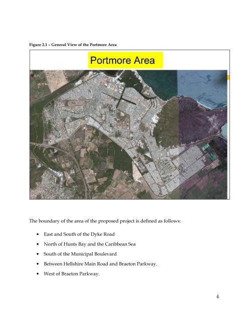
Figure 2.1 – General View of the <strong>Portmore</strong> Area<br />
The boundary of the area of the proposed project is defined as follows:<br />
• East and South of the Dyke Road<br />
• North of Hunts Bay and the Caribbean Sea<br />
• South of the Municipal Boulevard<br />
• Between Hellshire Main Road and Braeton Parkway.<br />
• West of Braeton Parkway.<br />
4