

Geology of the Shenandoah National Park Region - Csmres Jmu ...
Geology of the Shenandoah National Park Region - Csmres Jmu ...
Geology of the Shenandoah National Park Region - Csmres Jmu ...

Create successful ePaper yourself
Turn your PDF publications into a flip-book with our unique Google optimized e-Paper software.
The 2009 Virginia Geological Field Conference will highlight new research, visiting exposures along and<br />
near <strong>the</strong> Skyline Drive. The trip will be broad, encompassing bedrock and structural geology as well as<br />
surficial geology and rates <strong>of</strong> erosion at local and regional scales. <strong>Shenandoah</strong> <strong>National</strong> <strong>Park</strong> is too vast for<br />
a single day traverse; thus <strong>the</strong> Conference will focus on <strong>the</strong> geology between Big Meadows (milepost 51) and<br />
Blackrock Summit (milepost 85) in <strong>the</strong> central and sou<strong>the</strong>rn part <strong>of</strong> <strong>the</strong> <strong>Park</strong>. In addition to emphasizing new<br />
findings in <strong>Shenandoah</strong> we hope this trip will foster discussion about unanswered aspects about Blue Ridge<br />
geology and encourage future research in <strong>the</strong> <strong>Park</strong>.<br />
Weyers Cave<br />
38˚00’ N<br />
79˚00’ W<br />
Harrisonburg<br />
Gathright<br />
and o<strong>the</strong>rs,<br />
1986<br />
Fort<br />
Defiance<br />
Gathright<br />
and o<strong>the</strong>rs,<br />
1978<br />
Waynesboro<br />
West<br />
Gathright<br />
and o<strong>the</strong>rs,<br />
1977<br />
38˚30’ N<br />
Grottoes<br />
Gathright<br />
and o<strong>the</strong>rs,<br />
1978<br />
Crimora<br />
Gathright<br />
and o<strong>the</strong>rs,<br />
1978<br />
Waynesboro<br />
East<br />
Gathright<br />
and o<strong>the</strong>rs,<br />
1977<br />
Tenth<br />
Legion<br />
Whitmeyer<br />
and Heller<br />
Elkton West<br />
Heller<br />
McGaheysville<br />
Browns<br />
Cove<br />
Lamoreaux<br />
and o<strong>the</strong>rs,<br />
2009<br />
Crozet<br />
Lederer<br />
and o<strong>the</strong>rs,<br />
2009<br />
Edinburg<br />
Hamburg<br />
Stanley<br />
Whitmeyer<br />
and o<strong>the</strong>rs<br />
Elkton East Fletcher<br />
Swift Run<br />
Gap<br />
Bailey<br />
and o<strong>the</strong>rs,<br />
2009<br />
Free<br />
Union<br />
Southworth<br />
and Bailey<br />
Charlottesville<br />
West<br />
Big Meadows<br />
Whitmeyer<br />
and o<strong>the</strong>rs<br />
Tollo and<br />
o<strong>the</strong>rs<br />
Tollo and<br />
o<strong>the</strong>rs, 2004<br />
Stanardsville<br />
Burton<br />
and Bailey,<br />
2009<br />
Earlysville<br />
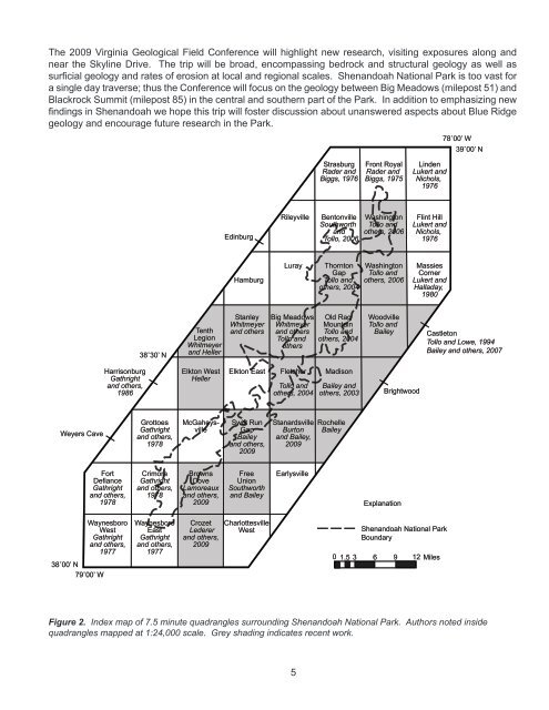
Figure 2. Index map <strong>of</strong> 7.5 minute quadrangles surrounding <strong>Shenandoah</strong> <strong>National</strong> <strong>Park</strong>. Authors noted inside<br />
quadrangles mapped at 1:24,000 scale. Grey shading indicates recent work.<br />
5<br />
Strasburg<br />
Rader and<br />
Biggs, 1976<br />
Rileyville Bentonville<br />
Southworth<br />
and<br />
Tollo, 2006<br />
Luray Thornton<br />
Gap<br />
Tollo and<br />
o<strong>the</strong>rs, 2004<br />
Old Rag<br />
Mountain<br />
Tollo and<br />
o<strong>the</strong>rs, 2004<br />
Madison<br />
Bailey and<br />
o<strong>the</strong>rs, 2003<br />
Rochelle<br />
Bailey<br />
Front Royal<br />
Rader and<br />
Biggs, 1975<br />
Washington<br />
Tollo and<br />
o<strong>the</strong>rs, 2006<br />
Washington<br />
Tollo and<br />
o<strong>the</strong>rs, 2006<br />
Woodville<br />
Tollo and<br />
Bailey<br />
Brightwood<br />
Explanation<br />
Linden<br />
Lukert and<br />
Nichols,<br />
1976<br />
Flint Hill<br />
Lukert and<br />
Nichols,<br />
1976<br />
Massies<br />
Corner<br />
Lukert and<br />
Halladay,<br />
1980<br />
<strong>Shenandoah</strong> <strong>National</strong> <strong>Park</strong><br />
Boundary<br />
0 1.5 3 6 9 12 Miles<br />
78˚00’ W<br />
39˚00’ N<br />
Castleton<br />
Tollo and Lowe, 1994<br />
Bailey and o<strong>the</strong>rs, 2007