CONSERVATION AREA STATEMENT - Stroud District Council
CONSERVATION AREA STATEMENT - Stroud District Council
CONSERVATION AREA STATEMENT - Stroud District Council

You also want an ePaper? Increase the reach of your titles
YUMPU automatically turns print PDFs into web optimized ePapers that Google loves.
Geology<br />
Between 140 and 200 million years ago, in the Lower Jurassic period, the site of Frampton on Severn was submerged<br />
in a warm, shallow, muddy sea, home to millions of small creatures and micro- organisms. Slowly, over generations,<br />
the tiny shells and micro-skeletons of dead sea creatures fell to the bottom of the sea bed, piling up in layers among<br />
accumulated silt.<br />
As time went on, the climate changed and the sea receded. The layers, or strata, of shells and silt dried out, compacted<br />
and hardened, forming blue lias limestone.<br />
Prey to the strong tides of the Severn, and the changing courses of its tributary rivers, the newly exposed land was<br />
prone to successive, frequent flooding. With time, the stone was overlaid by clays and gravel shelves created from<br />
material swept downstream from the hills. It is these deposits that have had the most influence on the topography<br />
and, later, the settlement patterns of the Vale.<br />
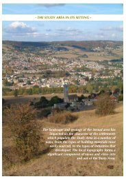
Topography and landscape<br />
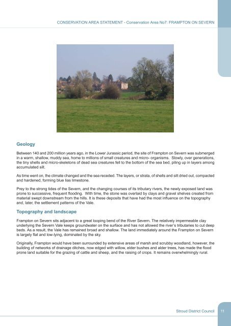
<strong>CONSERVATION</strong> <strong>AREA</strong> <strong>STATEMENT</strong> - Conservation Area No7: FRAMPTON ON SEVERN<br />
Frampton on Severn sits adjacent to a great looping bend of the River Severn. The relatively impermeable clay<br />
underlying the Severn Vale keeps groundwater on the surface and has not allowed the river’s tributaries to cut deep<br />
beds. As a result, the Vale has remained broad and shallow. The land immediately around the Frampton on Severn<br />
is largely flat and low-lying, dominated by the sky.<br />
Originally, Frampton would have been surrounded by extensive areas of marsh and scrubby woodland, however, the<br />
building of networks of drainage ditches, now edged with willow, elder bushes and alder trees, has made the flood<br />
prone land suitable for the grazing of cattle and sheep, and the raising of crops. It remains overwhelmingly rural.<br />
<strong>Stroud</strong> <strong>District</strong> <strong>Council</strong><br />
11