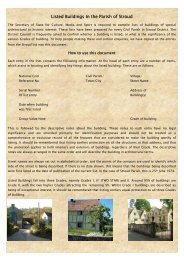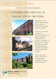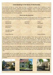
CONSERVATION AREA STATEMENT - Stroud District Council
CONSERVATION AREA STATEMENT - Stroud District Council
CONSERVATION AREA STATEMENT - Stroud District Council

Create successful ePaper yourself
Turn your PDF publications into a flip-book with our unique Google optimized e-Paper software.
Open space takes seven main forms within this sub-area:<br />
The churchyard<br />
Private gardens<br />
Farmyards<br />
Roads and lanes<br />
‘islands’ of grass<br />
Fields and orchards<br />
‘scrubby’ ground<br />
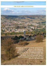
<strong>CONSERVATION</strong> <strong>AREA</strong> <strong>STATEMENT</strong> - Conservation Area No7: FRAMPTON ON SEVERN<br />
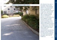
In many respects Church End retains its medieval form, with the settlement clustered around the church. Even though<br />
there are modern farm, industrial and domestic buildings, this part of Frampton seems to be almost timeless.<br />
A significant contribution to this is the lack of any kind of road markings and a minimal amount of signage. The lack<br />
of highways intervention encourages pedestrians to wander along the road, rather than to keep to one side. Cars are<br />
few and far between, and easily spotted along the straight stretch to the canal or as they slow to come around the<br />
corner from The Street.<br />
The area immediately surrounding the church has a tidy appearance, though not municipally so, with well tended<br />
verges and islands of grass breaking up what is actually quite a wide road area. One of Frampton’s many orchards<br />
ensures that the natural environment comes into the manicured. The bench sited on one of the grassy islands outside<br />
Tanhouse Barn provides a place to stop and enjoy the sight of the sheep keeping the grass down in the fields.<br />
The jumble of gardens are demarcated by iron railings and hedges and brick walls of differing heights. In places, the<br />
taller brick walls and hedges are quite overbearing, creating very impermeable hard edges to lanes, narrowing the<br />
spaces down; at other points, the low walls and hedges allow open peeks into the cottage gardens, and into the<br />
orchards and meadows and even down to the canal. Church End is made up of the juxtaposition of open areas and<br />
constrictive bottlenecks.<br />
Unfortunately, some non-traditional, overly suburban, boundary treatments have begun to erode Church End’s<br />
character. However, the overall effect is still naturalistic; picture post card, without being twee.<br />
The two farmyards in the sub- area have very different appearances. Part of the Tanhouse Farm complex has been<br />
converted into residential accommodation and has been neatened up and ‘sanitised’. Denfurlong Farm, by contrast<br />
is still in agricultural use, its busy yard still fully employed. Workaday, no- frills, modern materials, such as corrugated<br />
iron roofing, have helped keep the old farmyard buildings fit for purpose. It is one of the few reminders of Church<br />
End’s functional past- the industrial units adjacent to Tanhouse Farm on the lane to Splatt Bridge, do not seem to<br />
make any similarly ‘gritty’ contribution to the area.<br />
One of the more important spaces within the sub- area is the wild piece of land at the bottom of The Street. This gap<br />
marks the separation between The Street and the enclave of Church End. The views afforded across to the back of<br />
Tanhouse Farm (formerly including the manor house) and the church are a glimpse into the very heart of medieval<br />
Frampton.<br />
<strong>Stroud</strong> <strong>District</strong> <strong>Council</strong><br />
25