N9/N10 Kilcullen to Waterford Scheme - National Roads Authority
N9/N10 Kilcullen to Waterford Scheme - National Roads Authority
N9/N10 Kilcullen to Waterford Scheme - National Roads Authority

Create successful ePaper yourself
Turn your PDF publications into a flip-book with our unique Google optimized e-Paper software.
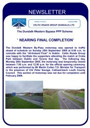
1<br />
2<br />
3<br />
4<br />
5<br />
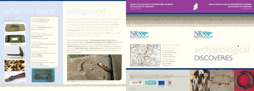
what we found background<br />
in brief:<br />
Some of the findings from the scheme:<br />
6<br />
1. Wooden animal trap<br />
Top view, from Prumples<strong>to</strong>wn Lower.<br />
(Pho<strong>to</strong>: Headland Archaeology Ltd)<br />
2. Wooden animal trap<br />
Base view, from Prumples<strong>to</strong>wn Lower. (Pho<strong>to</strong>:<br />
Headland Archaeology Ltd)<br />
3. Wooden axe handle<br />
Haft for a Late Bronze Age socketed axe from<br />
Prumples<strong>to</strong>wn Lower.<br />
(Pho<strong>to</strong>: Headland Archaeology Ltd)<br />
4. Pottery beads<br />
Pottery beads from Bur<strong>to</strong>wn Little separated from<br />
cremation deposit.<br />
(Pho<strong>to</strong>: Headland Archaeology Ltd)<br />
5. Drinking horn terminal<br />
Silver plated drinking horn terminal from the fill of a<br />
souterrain at Ballyvaas.<br />
(Pho<strong>to</strong>: John Sunderland)<br />
6. Bone and antler objects<br />
from medieval enclosing ditch, early Bronze Age<br />
cemetery site, at Moone.<br />
(Pho<strong>to</strong>: Headland Archaeology Ltd)<br />
This section of the <strong>N9</strong>/<strong>N10</strong> <strong>Kilcullen</strong> <strong>to</strong> <strong>Waterford</strong> <strong>Scheme</strong><br />
involves the construction of 27 km of High Quality Dual<br />
Carriageway linking the existing M9 mo<strong>to</strong>rway at <strong>Kilcullen</strong><br />
<strong>to</strong> the northern end of the Carlow Bypass, just south of<br />
Castledermot. Also incorporated is an 11 km single<br />
carriageway Athy Link Road, which will link Athy <strong>to</strong>wn with<br />
both the existing and new <strong>N9</strong> roads.<br />
Preliminary test excavation were undertaken by Irish Archaeological Consultancy Ltd (IAC Ltd) between<br />
Oc<strong>to</strong>ber and November 2005 and by Cultural Resource Development Services Ltd (CRDS Ltd) between May<br />
and August 2006. These works identified a <strong>to</strong>tal of 102 archaeological sites, which were fully excavated by<br />
Headland Archaeology Ltd between March and December 2007. All of the archaeological works were carried<br />
out on behalf of <strong>National</strong> <strong>Roads</strong> <strong>Authority</strong> and Kildare County Council. Up <strong>to</strong> 310 archaeologists were on the<br />
ground at any one time, divided in<strong>to</strong> 10 separate excavation teams, with an international flavour, as up <strong>to</strong> 20<br />
nationalities were represented.<br />
Ringfort at Ballyvaas with souterrain and pits in the interior. (Pho<strong>to</strong>: AirShots Ltd)<br />
<strong>N9</strong>/<strong>N10</strong> KILCULLEN TO WATERFORD SCHEME:<br />
KILCULLEN TO CARLOW,<br />
County Kildare<br />
© Ordnance Survey Ireland & Government of Ireland permit number EN0045206.<br />
front cover images<br />
LEFT: Early Bronze Age crouched burial with Food Vessel at Moone. (Pho<strong>to</strong>: Headland Archaeology Ltd)<br />
RIGHT: Twisted bronze ring, possibly an earring, from the prehis<strong>to</strong>ric cemetery at Woodlands West. (Pho<strong>to</strong>: Headland Archaeology Ltd)<br />
MIDDLE: Prehis<strong>to</strong>ric pit-circle in Prumples<strong>to</strong>wn Lower mid-excavation. (Pho<strong>to</strong>: AirShots Ltd)<br />
Published 2008.<br />
For more information<br />
please contact:<br />
Archaeology Section<br />
<strong>National</strong> <strong>Roads</strong> <strong>Authority</strong><br />
St. Martins House<br />
Waterloo Road, Dublin 4<br />
Tel: +353 1 660 2511<br />
Fax: +353 1 668 0009<br />
Email: info@nra.ie<br />
Web: www.nra.ie<br />
<strong>N9</strong>/<strong>N10</strong> KILCULLEN TO WATERFORD SCHEME:<br />
KILCULLEN TO CARLOW,<br />
County Kildare<br />
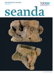
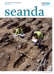
archaeological<br />
DISCOVERIES
prehis<strong>to</strong>ric early medieval<br />
Important Early Bronze Age<br />
cemetery sites were<br />
discovered either side of the<br />
River Lerr, close <strong>to</strong><br />
Castledermot.<br />
In Prumples<strong>to</strong>wn Lower, <strong>to</strong> the south of the river, a<br />
concentration of features incorporated a prehis<strong>to</strong>ric pitcircle<br />
of 10 large pits and a ring-ditch, along with<br />
associated inhumations and cremations.<br />
Prehis<strong>to</strong>ric ring-ditch, pit-circle and linear ditches in<br />
Prumples<strong>to</strong>wn Lower pre-excavation. (Pho<strong>to</strong>: AirShots Ltd)<br />
On the opposite side of the river in Woodlands West,<br />
three further ring-ditches and a horseshoe-shaped ditch<br />
were revealed, with numerous associated cremations. A<br />
cremation central <strong>to</strong> the horseshoe-shaped ditch yielded<br />
three small bronze pennanular rings, two of which<br />
displayed twisted decoration—possible earrings that<br />
would have adorned the body of a person committed<br />
<strong>to</strong> a funerary pyre. Two tiny blue glass beads<br />
accompanied the rings. Animal bone from the ditch fills<br />
included much deer antler and the jaws of young cattle.<br />
Prehis<strong>to</strong>ric ring-ditch, pit-circle, grave cuts and linear ditches in<br />
Prumples<strong>to</strong>wn Lower post-excavation. (Pho<strong>to</strong>: AirShots Ltd)<br />
The intervening low-lying, boggy river basin<br />
demonstrated evidence that may link the two cemetery<br />
areas and give an exceptional insight in<strong>to</strong> an overall<br />
prehis<strong>to</strong>ric landscape focused on the river. Crude<br />
structures and pathways would have allowed the<br />
wetlands <strong>to</strong> be accessed, used and traversed. Very<br />
significant wooden artefacts were discovered here,<br />
including the haft for a Late Bronze Age axe, a finely<br />
made spear and an intricate composite animal trap.<br />
Early Bronze Age crouched burial with Food Vessel at Moone.<br />
(Pho<strong>to</strong>: Headland Archaeology Ltd)<br />
A prehis<strong>to</strong>ric cremation deposit from Bur<strong>to</strong>wn Little on<br />
the Athy Link Road, yielded further evidence of body<br />
adornment in the form of pottery beads. Originally<br />
thought <strong>to</strong> have been a necklace, conservation work<br />
showed that there were 24 beads in <strong>to</strong>tal and would<br />
have made up a complete bracelet.<br />
In Moone, another important Early Bronze Age<br />
cemetery site was revealed, but in this instance an outer<br />
curvilinear ditch, 48 m in diameter, enclosed the site. The<br />
interior yielded the graves of seven adults and eight<br />
juveniles, along with two cremations in a variety of burial<br />
forms including a cist, an inverted urn, shallow pits and<br />
crouched single and double inhumations.<br />
Seven decorated Food Vessels, of both Bowl and Vase<br />
form, accompanied the burials. Finds from the enclosing<br />
ditch appear <strong>to</strong> date that feature <strong>to</strong> the medieval<br />
period, with no evidence at present <strong>to</strong> indicate that the<br />
ditch was a re-working of an earlier enclosure<br />
contemporary with the burials. Finds from the ditch<br />
Early Bronze Age urn cremation in situ at Moone.<br />
(Pho<strong>to</strong>: Headland Archaeology Ltd)<br />
included a decorated bone handle and two notched<br />
antler objects. Interestingly, post-medieval lazy-bed<br />
cultivation respected and avoided the precise locations<br />
of the individual burials, yet there was no evidence <strong>to</strong><br />
indicate any surface recognition of the burials at the<br />
time the lazy-beds would have been dug.<br />
Not all of the prehis<strong>to</strong>ric evidence related <strong>to</strong> ritual and<br />
ceremonial activities, as significant settlement sites were<br />
also uncovered, including a fine circular Bronze Age<br />
roundhouse, 7 m in diameter, at Mullamast. The<br />
structure consisted of a ring of evenly spaced posts<br />
around a central hearth and all surrounded by a dripgully<br />
for the roof.<br />
Other significant excavations included a prehis<strong>to</strong>ric<br />
landscape and radial ditches associated with a barrow<br />
monument that is located outside the landtake in<br />
Narrowmore, numerous fulachta fiadh/burnt mounds<br />
and a variety of prehis<strong>to</strong>ric ritual and settlement sites.<br />
A portion of an early<br />
medieval enclosure was<br />
uncovered close <strong>to</strong> the brow<br />
of a gravel ridge in Ballyvaas.<br />
Inside the enclosure, a large vertically-sided,<br />
rectangular cut had been dug in<strong>to</strong> the underlying<br />
gravels. The cut is likely <strong>to</strong> have originally formed an<br />
underground chamber or souterrain, which was<br />
probably timber-lined. Finds were very significant and<br />
included an eighth/ninth-century silver-plated terminal<br />
for a drinking horn in the shape of a dog’s head and a<br />
pinhead or clasp that was also silver-plated. Two<br />
fragmented bone combs, a metal spearhead and<br />
charred textiles were also recovered. The drinking<br />
horn, in particular, indicates that this site would have<br />
had quite important inhabitants. Nine burials were<br />
At Mullamast, part of a large<br />
deserted medieval village<br />
was excavated, the original<br />
founder of which was<br />
Souterrain within the ringfort at Ballyvaas.<br />
(Pho<strong>to</strong>: Headland Archaeology Ltd)<br />
excavated at a separate site in Ballyvaas; these were<br />
generally aligned west–east and are likely <strong>to</strong> be early<br />
medieval or medieval in date.<br />
medieval/<br />
post-medieval<br />
probably Walter de<br />
Riddlesford, a grandson-inlaw<br />
of King Henry I.<br />
This planned medieval village consisted of sizable<br />
boundary ditches, roads and pathways, a central<br />
village-green type open area, other open spaces,<br />
cobbled surfaces, house plots and agricultural and<br />
garden plots. The houses would have been formed of<br />
wattle-and-daub or possibly sod structures. The<br />
majority were probably built on above ground<br />
foundations—timber frames on pad-s<strong>to</strong>nes. In excess<br />
of 10,500 artefacts were recovered, predominantly<br />
pottery sherds of 12th- <strong>to</strong> 14th-century date,<br />
including imported wares from south-west England<br />
and France. A silver long-cross penny of King<br />
Edward I would have been minted in Canterbury<br />
between 1294 and 1299. Another coin appears <strong>to</strong> be<br />
a Roman coin of Constantine Augustus dating <strong>to</strong> the<br />
third century AD, which may have been brought back<br />
from Rome by a returning medieval traveller or<br />
missionary. Other objects included brooch fragments,<br />
knives, a chest key and two metal arrowheads,<br />
possibly crossbow bolts.<br />
Silver long-cross penny of King Edward 1 (front) from<br />
Mullamast. (Pho<strong>to</strong>: Claudia Koehler)<br />
Other significant excavations included a doubleditched<br />
ringfort in Woodlands West with artefactual<br />
evidence of medieval occupation, two rectangular<br />
medieval enclosures in Mullamast and Hallahoise,<br />
both of which abutted <strong>to</strong>wnland boundaries and may<br />
pre-date the boundaries, and a medieval settlement in<br />
Timolin. Two phases of burial were evident in eight<br />
child burials uncovered at a multi-period site in<br />
Moone. These burials are likely <strong>to</strong> date <strong>to</strong><br />
medieval/post-medieval times, with the first phase<br />
represented by supine (laid on their back) and<br />
crouched neonates (babies from birth <strong>to</strong> four weeks)<br />
with grave goods and the second by juveniles in<br />
formal west–east aligned rectangular grave cuts. In<br />
addition, a later medieval ditch at the Prumples<strong>to</strong>wn<br />
Lower prehis<strong>to</strong>ric cemetery site, possibly focused on<br />
the River Lerr, and produced a pristine Viking Dublintype<br />
bronze ringed pin. Evidence of extensive<br />
medieval and post-medieval rural industrial activity<br />
was also discovered along the scheme, including<br />
cereal-drying kilns, metal smelting areas and charcoalproduction<br />
pits.<br />
Silver-plated drinking horn terminal from the fill of a<br />
souterrain at Ballyvaas.<br />
(Pho<strong>to</strong>: John Sunderland)