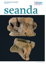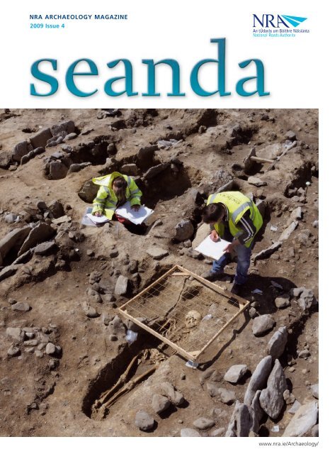
NRA ARchAeology MAgAziNe 2009 issue 4 - National Roads ...
NRA ARchAeology MAgAziNe 2009 issue 4 - National Roads ...
NRA ARchAeology MAgAziNe 2009 issue 4 - National Roads ...

Create successful ePaper yourself
Turn your PDF publications into a flip-book with our unique Google optimized e-Paper software.
<strong>NRA</strong> <strong>ARchAeology</strong> <strong>MAgAziNe</strong><br />
<strong>2009</strong> <strong>issue</strong> 4<br />
An tÚdarás um Bóithre Náisiúnta<br />
<strong>National</strong> <strong>Roads</strong> Authority<br />
www.nra.ie/Archaeology/
www.nra.ie<br />
seanda<br />
Contents<br />
PAGE<br />
02 Project Updates<br />
08 A treasury in time around Charlestown,<br />
Co. Mayo<br />
12 Revealing the ancient environment of<br />
Edercloon<br />
16 Settlement, burial and ritual:<br />
a Bronze Age landscape on the N9/N10<br />
19 Rites in transition: the story told<br />
by Holdenstown 1 and 2<br />
22 Ballyhanna Research Project <strong>2009</strong> Update<br />
28 A bone to pick:<br />
Bronze Age settlement in Westmeath<br />
30 More than meets the eye<br />
—burnt mounds and lithics on the N7<br />
32 France and Ireland: two archaeological<br />
systems for the same purpose<br />
34 Collecting and collating:<br />
managing data in archaeology<br />
36 Medieval life and death<br />
by the ‘broken river’<br />
40 A weave not to be forgotten<br />
42 The continuing enigma<br />
of Cappydonnell Big<br />
45 Dating the wood from the trees<br />
46 Fragments and furnaces:<br />
discoveries along the N18<br />
49 Clay, daub and porches in prehistoric<br />
roundhouses<br />
52 Ringing out the old:<br />
reconstructing the bell of Clonfad<br />
54 Ireland’s earliest wheel?<br />
56 Glossary<br />
08 A treasury in time<br />
around Charlestown,<br />
Co. Mayo<br />
Richard F Gillespie,<br />
an Archaeologist with<br />
Mayo County Council,<br />
previews some of the<br />
most interesting artefacts<br />
recovered during<br />
excavations on the N5<br />
Charlestown Bypass,<br />
which are the subject of a<br />
forthcoming book.<br />
28 A bone to pick: Bronze<br />
Age settlement in<br />
Westmeath<br />
EdLyne, Excavation<br />
Director for Irish<br />
Archaeological<br />
Consultancy Ltd (IAC<br />
Ltd), and Ian Riddler and<br />
Nicola Trzaska-Nartowski,<br />
Worked Bone Specialists,<br />
discuss a Bronze Age<br />
settlement at Creggan<br />
Lower, Co. Westmeath,<br />
excavated on the N6<br />
Kilbeggan–Athlone dual<br />
carriageway.<br />
49 Clay, daub and<br />
porches in prehistoric<br />
roundhouses<br />
Niall Roycroft, <strong>NRA</strong><br />
Archaeologist with<br />
the Eastern Team,<br />
offers some thoughts<br />
on the construction of<br />
roundhouses during the<br />
Bronze Age.
An tÚdarás um Bóithre Náisiúnta<br />
<strong>National</strong> <strong>Roads</strong> Authority<br />
Production Team<br />
EDITORIAL TEAM<br />
Ed Danaher<br />
James Eogan<br />
Jerry O'Sullivan<br />
Michael Stanley<br />
Rónán Swan<br />
Rachel Pierce (copy-editor,<br />
Verba Editing House)<br />
PRODUCTION, LAYOUT, DESIGN<br />
AND PRINTING<br />
Brunswick Press Limited<br />
Dublin<br />
ORIGINAL DESIGN CONCEPT<br />
Begley Hutton Design<br />
Consultants<br />
PUBLISHER<br />
<strong>National</strong> <strong>Roads</strong> Authority<br />
St Martin’s House<br />
Waterloo Road<br />
Dublin 4<br />
WEBSITE<br />
Visit www.nra.ie/Archaeology/ to<br />
view or download a PDF version<br />
of this magazine and other <strong>NRA</strong><br />
archaeology publications.<br />
© <strong>National</strong> <strong>Roads</strong> Authority <strong>2009</strong><br />
All rights reserved. No part of this<br />
magazine may be reprinted or reproduced<br />
or utilised in any electronic, mechanical<br />
or other means, now known or hereafter<br />
invented, including photocopying and<br />
recording, or otherwise without either the<br />
prior written consent of the publishers<br />
or a licence permitting restricted copying<br />
in Ireland <strong>issue</strong>d by the Irish Copyright<br />
Licensing Agency Ltd, The Writers’ Centre,<br />
19 Parnell Square, Dublin 1.<br />
Cover image: Excavation of an early medieval<br />
cemetery-settlement at Owenbristy, Co.<br />
Galway, on the N18 Oranmore–Gort road<br />
scheme. (Photo: John Sunderland)<br />
Welcome to the<br />
Fourth Edition Of Seanda<br />
FRED BARRY, Chief Executive of the <strong>National</strong> <strong>Roads</strong> Authority<br />
Fred Barry<br />
The appearance of the latest <strong>issue</strong> of Seanda magazine will, I hope, be greeted<br />
warmly by its many readers. Each of the previous editions has won numerous<br />
plaudits from members of the general public and the archaeological profession.<br />
The magazine has undoubtedly become one of the most popular vehicles for<br />
the dissemination of the results of <strong>NRA</strong>-funded archaeological investigations<br />
and research and I am confident that <strong>issue</strong> 4 will further cement this<br />
popularity. The <strong>NRA</strong> views the publication of archaeological discoveries made<br />
on national road schemes as a key responsibility to Ireland’s archaeological<br />
heritage and has done a great deal to promote this, whether it is in the form<br />
of papers in local and national archaeology journals and other periodicals, the<br />
publication of the proceedings of the <strong>NRA</strong> <strong>National</strong> Archaeology Seminars or<br />
as scheme-specific books published in the <strong>NRA</strong> Scheme Monographs series.<br />
You will note from reading the News section of the current <strong>issue</strong> that two new books have been<br />
published recently by the <strong>NRA</strong> (see pp. 2 and 5). At least two more publications are expected before the<br />
year is out: In the Shadow of the Galtees: archaeological excavations along the N8 Cashel–Mitchelstown<br />
road scheme is in press at the time of writing and the first monograph describing the results of<br />
excavations on the route of the M3 Clonee–North of Kells motorway scheme will shortly go to print.<br />
This second book, entitled Places Along the Way: first findings on the M3, will be eagerly anticipated<br />
and promises to be an attractive and informative introduction to some of the most significant sites<br />
discovered on the M3. This will bring the number of <strong>NRA</strong> Scheme Monographs to five—a considerable<br />
milestone and an achievement of which the <strong>NRA</strong> and the relevant archaeological consultancies can be<br />
duly proud. Moreover, if one takes the <strong>NRA</strong> Scheme Monographs series and the Archaeology and the<br />
<strong>National</strong> <strong>Roads</strong> Authority Monograph Series together (see back cover), we will soon be in double figures<br />
in terms of the total number of books published by the <strong>NRA</strong> since 2003. As several of the articles in<br />
this <strong>issue</strong> of Seanda allude to, numerous other books are in preparation and 2010 promises to be<br />
similarly prolific.<br />
The <strong>NRA</strong> is strong in its commitment to disseminating the results of the archaeological work that<br />
it funds, be it pre-development excavations as part of the overall road-planning process or formal<br />
archaeology research projects. This policy will continue to be pursued and past achievements will<br />
hopefully be eclipsed by future accomplishments as we explore ways to continue and enhance the many<br />
activities we currently undertake and to develop new ways of presenting the fruits of ‘road archaeology’.<br />
Seanda will continue to be a vital component in this endeavour and I trust that you will agree that the<br />
present <strong>issue</strong> builds on the achievements of previous editions.<br />
seanda The <strong>NRA</strong> Archaeology Magazine
News<br />
ProjectUpdates<br />
Near the Bend in the River<br />
From left to right: Councillor Tom Higgins, Mayor of County Waterford, Professor<br />
Emeritus Peter Woodman, UCC, Jacinta Kiely, Penny Johnston, John Tierney, Eachtra<br />
Archaeological Projects, and Rónán Swan, <strong>NRA</strong> Head of Archaeology (acting), at the<br />
launch of Near the Bend in the River. (Photo: James Eogan)<br />
On 22 January <strong>2009</strong> Dungarvan Library, Co. Waterford, kindly<br />
hosted the launch of the third publication in the <strong>NRA</strong> scheme-specific<br />
monograph series—Near the Bend in the River: the archaeology<br />
of the N25 Kilmacthomas realignment by Penny Johnston, Jacinta<br />
Kiely and John Tierney. Published at the end of 2008, this new book<br />
describes the results of archaeological investigations on the route of<br />
the N25 Kilmacthomas realignment in County Waterford, undertaken<br />
by Eachtra Archaeological Projects between 1998 and 2000. The<br />
<strong>NRA</strong> is very proud to publish this volume as it addresses a ‘legacy<br />
scheme’, the archaeological element of which was conducted before the<br />
appointment of <strong>NRA</strong> archaeologists, and, more importantly, because<br />
it is the first time that an integrated publication has been produced on<br />
the results of archaeological investigations undertaken as part of a large<br />
infrastructural project in County Waterford.<br />
The excavations resulted in the identification of evidence for past<br />
human activity in 30 separate areas along the length of this new road.<br />
Before this work only a single burnt mound/fulacht fiadh was known<br />
along the line of the realignment. The remains uncovered range from<br />
the nationally significant discovery of the foundation post-holes of a<br />
building constructed almost 4,500 years ago by people who used highly<br />
decorated Beaker pottery to the locally significant identification of a<br />
field system probably associated with the development of the settlement<br />
seanda The <strong>NRA</strong> Archaeology Magazine<br />
of Kilmacthomas in the medieval period. The excavations revealed<br />
almost continuous human activity in this part of Waterford during<br />
the last six millennia and the findings are presented in the form of a<br />
gazetteer, with an accompanying CD-ROM incorporating all of the<br />
final excavation and specialist reports.<br />
When launching Near the Bend in the River Professor Emeritus Peter<br />
Woodman, University College Cork, recalled negotiations by members<br />
of the Archaeology Sub-committee of the <strong>National</strong> Heritage Council<br />
with officials from the Department of Environment in the early 1990s<br />
when plans for the establishment of the <strong>NRA</strong> were being formulated.<br />
He expressed his satisfaction that owing to those discussions, the<br />
archaeological impacts of new roads are taken into account. The<br />
publication of this scheme monograph and others like it is one of the<br />
fruits of that process of engagement.<br />
Near the Bend in the River is published by the <strong>NRA</strong> and is available<br />
through bookshops or directly from Wordwell Book Sales, Wordwell<br />
Limited, Media House, South County Business Park, Leopardstown,<br />
Dublin 18 (tel: +353 1 2947860; e-mail: helen@wordwellbooks.com).<br />
Michael Stanley, <strong>NRA</strong> Archaeologist, <strong>NRA</strong> Head Office.
The People of Prehistoric<br />
Ireland research project<br />
The <strong>NRA</strong> is very pleased to be a partner in a new and exciting<br />
archaeological research project funded by the Heritage Council<br />
through the INSTAR (Irish <strong>National</strong> Strategic Archaeological Research)<br />
programme. The project is called The People of Prehistoric Ireland<br />
and is led by Dr Eileen Murphy of Queen’s University, Belfast (QUB),<br />
and Dr Barra Ó Donnabháin of University College Cork. The initial<br />
phase of the project, funding for which has recently been announced,<br />
will aim to collate information on all prehistoric human remains ever<br />
discovered in Ireland—burials dating from the Mesolithic period (c.<br />
8000–4000 BC) through to the end of the Iron Age (c. AD 450)—and<br />
to make this information available online (www.qub.ac.uk/sites/<br />
INSTARpeopleofprehistoricIreland/).<br />
Over the past<br />
number of years<br />
the roads-building<br />
programme has<br />
revealed a large<br />
number of discoveries<br />
of human remains<br />
dating from the<br />
prehistoric period,<br />
all of which will<br />
add greatly to the<br />
project’s database.<br />
The <strong>NRA</strong> looks<br />
forward to liaising<br />
with Drs Murphy and<br />
Ó Donnabháin and<br />
their project team,<br />
Dr Harry Welsh and<br />
Clare McGranaghan,<br />
QUB, and providing<br />
information on these<br />
discoveries and coordinating<br />
liaison<br />
between the project<br />
and the relevant<br />
archaeological<br />
consultancies.<br />
Michael MacDonagh,<br />
<strong>NRA</strong> Senior<br />
Archaeologist,<br />
North-west Team.<br />
M7 Nenagh–Limerick<br />
archaeology seminar<br />
A public seminar on the archaeological discoveries on the M7<br />
Nenagh–Limerick motorway scheme was held on 10 October <strong>2009</strong><br />
at the Abbey Court Hotel, Nenagh, Co. Tipperary. Representatives<br />
from Aegis Archaeology, the Department of Archaeology, University<br />
College Cork, Headland Archaeology Ltd, the <strong>NRA</strong> and TVAS<br />
(Ireland) Ltd presented papers outlining the nature and significance<br />
of their findings, which encompass Mesolithic stone axeheads,<br />
an important Neolithic site at Tullahedy, Co. Tipperary, and the<br />
extensive evidence for Bronze Age and early medieval settlement in<br />
the Limerick/North Tipperary region. Further information about<br />
the public seminar can be found on the <strong>NRA</strong> website, at www.nra.<br />
ie/Archaeology/News/.<br />
A book dealing exclusively with the excavation results from<br />
Tullahedy is currently in preparation and will be published<br />
towards the end of 2010. A further publication describing all of<br />
the archaeological discoveries made on the road scheme is also<br />
planned.<br />
Paul O’Keeffe, <strong>NRA</strong> Assistant Archaeologist, Mid-west Team.<br />
Aerial view of an early medieval enclosure at Gortybrigane, Co. Tipperary, excavated<br />
on the M7 Nenagh–Limerick motorway, with a greyscale image of geophysical survey<br />
results from the adjacent field. (Image: Markus Casey/Target Geophysics Ltd)<br />
seanda The <strong>NRA</strong> Archaeology Magazine
(Photos: Sheelagh Conran)<br />
News<br />
ProjectUpdates<br />
<strong>National</strong> Archaeology Seminar <strong>2009</strong><br />
Prehistoric pottery expert Eoin Grogan addressing the seminar.<br />
On 27 August <strong>2009</strong> the <strong>NRA</strong> held its annual <strong>National</strong> Archaeology<br />
Seminar at the Gresham Hotel, Dublin, to coincide with <strong>National</strong><br />
Heritage Week (22–30 August). The title of this year’s seminar was<br />
Creative Minds: production, manufacturing and invention in ancient<br />
Ireland. Within this theme the various speakers sought to investigate,<br />
understand and celebrate the creativity of our ancestors, as evidenced<br />
by the many discoveries made on national road schemes. Those who<br />
attended the seminar heard about the production of stone tools,<br />
pottery and textiles during prehistory; the manufacture of hand bells<br />
at a monastic site and other metalworking processes during the later<br />
prehistoric and medieval periods; and the inventive interpretations<br />
of some of the earliest evidence for wheeled transport in Ireland. As<br />
the last point alludes to, the seminar was equally a celebration of the<br />
creativity of archaeologists themselves. Interpreting the incomplete<br />
remains of past human activity is an exacting challenge and requires a<br />
good measure of creativity, not only in terms of trying to marshal and<br />
understand the evidence but also in its presentation. Through their use<br />
of experimental archaeology and computer-generated reconstructions,<br />
and by synthesising evidence from many sites around the country, the<br />
speakers abundantly demonstrated the requisite ingenuity to meet this<br />
challenge.<br />
The seminar series has proven to be a popular event in the<br />
archaeological calendar and it was a testimony to the continuing<br />
success of the seminars that there were so many people in attendance.<br />
The <strong>NRA</strong> would like to express its appreciation to all of the speakers<br />
and attendees for participating in and ensuring the success of the day.<br />
seanda The <strong>NRA</strong> Archaeology Magazine<br />
Abstracts from the presentations delivered at the seminar can<br />
be viewed on the <strong>NRA</strong> website, at www.nra.ie/Archaeology/<br />
ArchaeologySeminar<strong>2009</strong>/. All of the papers given at the Creative Minds<br />
seminar will be published in autumn 2010 in the Archaeology and the<br />
<strong>National</strong> <strong>Roads</strong> Authority Monograph Series.<br />
Michael Stanley, <strong>NRA</strong> Archaeologist, <strong>NRA</strong> Head Office.<br />
Replica early medieval hand bell on display at the seminar.<br />
Speakers Eoin Grogan, Chiara Chiriotti, Cathy Moore and Ellen O’Carroll during one of<br />
the question-and-answer sessions.<br />
Participants at the Creative Minds seminar: (left to right) Michael MacDonagh, Richard<br />
O’Brien, Angela Wallace, Eoin Grogan, Farina Sternke, John Tierney, Ellen O’Carroll, Cathy<br />
Moore, Chiara Chiriotti, Niall Kenny, Mary Deevy and Paul Stevens.
Latest <strong>NRA</strong> Seminar Proceedings<br />
On 27 August <strong>2009</strong> Mick Monk of the Department of Archaeology,<br />
University College Cork, launched Dining and Dwelling, edited by<br />
Michael Stanley, Ed Danaher and James Eogan. This new book is the<br />
sixth volume in the Archaeology and the <strong>National</strong> <strong>Roads</strong> Authority<br />
Monograph Series and contains the proceedings of the <strong>NRA</strong> <strong>National</strong><br />
Archaeology Seminar held on 28 August 2008 at the Gresham Hotel,<br />
Dublin, as part of <strong>National</strong> Heritage Week. In common with the most<br />
recent seminars in the series, the 2008 event focused on a particular<br />
theme—dining and dwelling, addressing the archaeological evidence for<br />
food production, processing and consumption and rural settlement in<br />
Ireland from the earliest farmers through to the 19th century. The book<br />
contains 15 papers in all and the authors, among them archaeologists,<br />
archaeobotanists and zooarchaeologists, describe a wealth of previously<br />
unknown archaeological remains uncovered in counties Carlow, Cork,<br />
Galway, Kildare, Kilkenny, Limerick, Offaly, Roscommon and Tipperary<br />
on new sections of the N6, N7, N8, N9/N10 and N17 routes.<br />
Highlights from Dining and Dwelling include the excavation of<br />
a spectacularly well-preserved early medieval wooden watermill at<br />
Kilbegly, Co. Roscommon; an account of the use of experimental<br />
archaeology to examine the theory that some Bronze Age burnt mounds/<br />
fulachta fiadh (ubiquitous on Irish road schemes) were actually microbreweries;<br />
an examination of early medieval feasting as evidenced by an<br />
exquisite zoomorphic, or animal-like, drinking-horn terminal mount of<br />
copper alloy recovered during excavations at Ballyvass, Co. Kildare; and<br />
a consideration of the challenges and opportunities presented by the use<br />
of advanced computer technology and visualisation software to create<br />
3D-animated reconstructions of ancient dwellings.<br />
Given the wealth of new environmental data described in the book,<br />
Mick Monk, one of Ireland’s leading environmental archaeologists for<br />
many years, was an obvious choice to launch Dining and Dwelling,<br />
which he praised as ‘an extremely important addition to the series,<br />
presenting, in a preliminary way, insights into the challenging new<br />
evidence’ from the roads-building programme, including sites that<br />
offered what he described as ‘gold nugget situations in archaeology’.<br />
In congratulating the authors and editors on producing ‘an excellent<br />
volume’ and ‘beautiful production’, he commended the book as a<br />
tribute to the teamwork and cooperation of the various archaeological<br />
consultancies, academic institutions and <strong>NRA</strong> archaeologists involved.<br />
He further commented that the Monograph Series was ‘a crucial avenue<br />
into the cascade of new evidence’ stemming from development-led<br />
archaeology, offering ‘a possibility to frame questions and research into<br />
the future’ from this new ‘gold’ information.<br />
Dining and Dwelling is published by the <strong>NRA</strong> and is available<br />
through bookshops or directly from Wordwell Book Sales, Wordwell<br />
Limited, Media House, South County Business Park, Leopardstown,<br />
Dublin 18 (tel: +353 1 2947860; e-mail: helen@wordwellbooks.com).<br />
Michael Stanley, <strong>NRA</strong> Archaeologist, <strong>NRA</strong> Head Office.<br />
Mick Monk of the Department of Archaeology,<br />
UCC, speaking during the launch of Dining and<br />
Dwelling.<br />
Mick Monk celebrating the launch of Dining and Dwelling with some of the authors: (left to<br />
right) Colm Flynn, Meriel McClatchie, Ken Hanley, John Tierney, Patricia Long, Mick Monk,<br />
Colm Moriarty, Melanie McQuade, Billy Quinn and Declan Moore.<br />
seanda The <strong>NRA</strong> Archaeology Magazine<br />
(Photos: Sheelagh Conran)
News<br />
ProjectUpdates<br />
<strong>NRA</strong> research<br />
partnerships<br />
The <strong>NRA</strong> is currently a research partner in two projects that were<br />
granted funds in 2008 and <strong>2009</strong> as part of the INSTAR (Irish<br />
<strong>National</strong> Strategic Archaeological Research) programme administered<br />
by the Heritage Council. The programme is intended to fund<br />
thematic research that contributes to a better understanding of<br />
Ireland’s archaeological heritage and facilitates collaboration between<br />
archaeological consultancies, academic institutions, international<br />
academic and research bodies and State bodies.<br />
One of these projects is Cultivating Societies: assessing the evidence<br />
for agriculture in Neolithic Ireland, led by the School of Geography,<br />
Archaeology and Palaeoecology at Queen’s University, Belfast (QUB).<br />
This project is examining the extent and nature of Neolithic farming in<br />
Ireland by drawing upon unpublished and published archaeobotanical,<br />
zooarchaeological, palaeoecological, C14, stable isotope and<br />
archaeological data from the commercial, state and academic sectors.<br />
A dedicated website has been created to provide information about the<br />
project and to communicate the results of the research (www.chrono.qub.<br />
ac.uk/instar/). Further outputs have included the presentation of a paper<br />
at the 2008 <strong>NRA</strong> <strong>National</strong> Archaeology Seminar and its subsequent<br />
publication in the seminar proceedings, Dining and Dwelling, launched<br />
last August (see p. 5). Further information about the full breadth of<br />
the ongoing work of the project’s researchers can be found in the news<br />
section of the Cultivating Societies website. (See p. 3 for news of The<br />
People of Prehistoric Ireland INSTAR project.)<br />
seanda The <strong>NRA</strong> Archaeology Magazine<br />
Ellen O’Carroll presenting her paper at<br />
the <strong>2009</strong> <strong>NRA</strong> <strong>National</strong> Archaeology<br />
Seminar. (Photo: Sheelagh Conran)<br />
In 2008 the <strong>NRA</strong> awarded funding from its Research Fellowship<br />
Programme to a PhD research project entitled Understanding<br />
environmental and landscape change in the midlands of Ireland through<br />
the cultural use of woodland. This research is being conducted by wood<br />
specialist and archaeologist Ellen O’Carroll of the Botany Department,<br />
Trinity College, Dublin, and is combining palaeoecological techniques<br />
and archaeological data (including information derived from <strong>NRA</strong>funded<br />
excavations) in order to quantify woodland use and its impact<br />
in the Irish midlands since the Mesolithic period. A paper describing<br />
the aims and methods of the project was presented at the <strong>2009</strong> <strong>NRA</strong><br />
<strong>National</strong> Archaeology Seminar (see p. 4) and this paper, offering<br />
preliminary research results, will be published in the seminar proceedings<br />
in autumn 2010. Further information about the project is available on the<br />
<strong>NRA</strong> website, at www.nra.ie/Research/ProjectProfiles/file,15940,en.pdf.<br />
Michael Stanley, <strong>NRA</strong> Archaeologist, <strong>NRA</strong> Head Office.<br />
‘Archaeology’ Scene Investigation: M1 museum exhibition<br />
The <strong>NRA</strong> in association with Louth County Museum, Dundalk,<br />
will present an exhibition of the archaeological discoveries of<br />
the M1 Motorway in north County Louth. The exhibition has<br />
an ‘Archaeology’ Scene Investigation theme and covers the 50<br />
archaeological sites excavated near Dundalk between 2002 and<br />
2006. It will run from November <strong>2009</strong> to January 2010, with<br />
a dedicated website and conference event. The focus is on clues<br />
revealed on archaeological excavations and how these are used to<br />
build up a picture of people in the past.<br />
Niall Roycroft, <strong>NRA</strong> Archaeologist, Eastern Team.<br />
Erratum<br />
Some readers may remember a past news item (Seanda, Issue 2 [2007],<br />
p. 4) and article (Seanda, Issue 3 [2008], pp. 46–8) that featured a<br />
Bronze Age gold button cover discovered on the N52 Tullamore Bypass.<br />
The provenance of the object was originally reported as being in the<br />
townland of Screggan, Co. Offaly. It has recently come to light that the<br />
correct townland location is, in fact, Mucklagh, Co. Offaly.
Update on the<br />
<strong>NRA</strong> Archaeological<br />
Database<br />
In the previous <strong>issue</strong> of Seanda (2008) the <strong>NRA</strong> announced the<br />
launch of a new, web-based database of archaeological sites<br />
excavated on <strong>NRA</strong> road schemes. The <strong>NRA</strong> Archaeological<br />
Database contains important baseline information relating<br />
to excavations carried out on road schemes throughout the<br />
country, and facilitates comparison between site types, locations<br />
and dating periods. Over the last year or more this new<br />
resource has attracted hundreds of people and has become a<br />
first port of call for many conducting archaeological research.<br />
In response to valuable feedback from a number of users,<br />
the database has been subject to ongoing refinement to ensure<br />
that it is as user-friendly as possible and fully meets the needs<br />
of the archaeological profession and the general public. The<br />
<strong>NRA</strong> Archaeological Database is continually updated as final<br />
excavation reports become available for inclusion and can be<br />
accessed on the <strong>NRA</strong> website, at<br />
www.nra.ie/Archaeology/<strong>NRA</strong>ArchaeologicalDatabase/.<br />
Michael Stanley, <strong>NRA</strong> Archaeologist, <strong>NRA</strong> Head Office.<br />
Tara symposium<br />
Reconstruction of the Lismullin post enclosure, based on the features excavated within the M3 road<br />
corridor on a computer-generated landscape. (Image: Archaeological Consultancy Services Ltd)<br />
Following the publication of reports on Seán P Ó Ríordáin’s excavations at<br />
the Mound of the Hostages (Muiris O’Sullivan 2005) and at the Rath of the<br />
Synods (Eoin Grogan 2008), the UCD School of Archaeology, in association<br />
with the John Hume Institute for Global Irish Studies, is hosting a symposium<br />
entitled Tara—From the Past to the Future. The symposium will explore<br />
the following themes: the archaeology of Tara; Tara in its local and regional<br />
setting; comparative perspectives on Tara; and the evolving significance of<br />
Tara since ancient times.<br />
Featuring approximately 40 papers by international scholars, the<br />
symposium focuses on the data from the two excavation volumes, but<br />
extends to a wider consideration of research undertaken at Tara over the past<br />
20 years. A number of papers will be presented drawing on the results of<br />
excavations conducted in advance of the construction of the M3 motorway.<br />
Donald Murphy of Archaeological Consultancy Services Ltd (ACS Ltd) will<br />
provide an overview of the archaeology of the M3 motorway scheme and<br />
Aidan O’Connell, former ACS Ltd Excavation Director, will present a paper<br />
on his excavations at the Lismullin archaeological complex, which included<br />
a rare Iron Age post enclosure—undoubtedly the best-known discovery made<br />
on the M3. A second paper focusing on Lismullin, entitled A study of the<br />
morphology, metrology and archaeoastronomy of the Iron Age enclosure,<br />
Lismullin, Co. Meath, will be given by Frank Prendergast, Head of the<br />
Department of Spatial Information Sciences at Dublin Institute of Technology.<br />
The symposium will take place between 23 and 26 October <strong>2009</strong> in<br />
the Clinton Auditorium, UCD, Belfield. Additional information about the<br />
symposium can be found on the UCD School of Archaeology website, at<br />
www.ucd.ie/archaeology/tarasymposium<strong>2009</strong>/.<br />
Michael Stanley, <strong>NRA</strong> Archaeologist, <strong>NRA</strong> Head Office.<br />
seanda The <strong>NRA</strong> Archaeology Magazine
Guest Writer<br />
A treasury in time around<br />
Richard F Gillespie, an Archaeologist with Mayo County Council,<br />
previews some of the most interesting artefacts recovered during<br />
excavations on the N5 Charlestown Bypass, which are the subject of a<br />
forthcoming book.<br />
Archaeological sites discovered on the N5<br />
Charlestown Bypass in counties Mayo and<br />
seanda The <strong>NRA</strong> Archaeology Magazine<br />
Roscommon have been summarised<br />
previously in New Routes to the Past<br />
(Archaeology and the <strong>National</strong> <strong>Roads</strong><br />
Authority Monograph Series No. 4) and<br />
are due for full publication as an <strong>NRA</strong> Scheme<br />
Monograph entitled Of Troughs and Tuyères. The<br />
excavated sites included settlement, funerary and industrial features<br />
of, variously, Neolithic, Bronze Age and early m e d i e v a l<br />
date. A selection of the artefacts from<br />
these sites is described below, based<br />
on specialist reports compiled by<br />
Nyree Finlay (stone tools), Rose<br />
Cleary (pottery), Mary Cahill<br />
and Paul Mullarkey (tin bead),<br />
Jim Higgins (anvil stone) and Niamh<br />
Whitfield (gold panel).<br />
Neolithic siltstone arrowhead<br />
A barbed-and-tanged siltstone arrowhead was found in Ballyglass West,<br />
Co. Mayo, adjacent to a spread of burnt stone and charcoal. This site<br />
was radiocarbon-dated to 3491–2921 BC, and this may be the earliest<br />
artefact described here. It has a rounded tang and one intact square<br />
barb. The other barb is absent, but the hollow is well defined. The<br />
tip has sustained slight damage but is still sharp. This piece is a large,<br />
Ballyclare-type arrowhead. They are common in Ireland and may have<br />
been manufactured by specialist craftsmen weaponers. Artefacts of<br />
siltstone were not encountered on any of the other sites, which also<br />
suggests specialised production.<br />
Neolithic Grooved Ware pot<br />
Charlestown, Co. Mayo<br />
The Grooved Ware pottery from Lowpark, Co. Mayo, comprises an<br />
assemblage of 28 vessels, based on a sherd count of 6,909—the largest<br />
known assemblage of this ware from Ireland. A pit associated with a<br />
timber circle contained a minimum of seven Grooved Ware vessels. The<br />
example described here, Vessel 1, was a large, bucket-shaped pot, with<br />
an estimated height of 220 mm and diameters of 220 mm at the rim and<br />
140 mm at the base. The pot was decorated with applied pellets below<br />
the rim. To date, this type of decoration is not known from any other<br />
Irish Late Neolithic context. There are sooty residues internally and<br />
externally and repair holes also occur. Hazel and alder charcoal from<br />
this pit was radiocarbon-dated to 2630–2470 BC, placing it within the<br />
known date range for Grooved Ware timber circles.<br />
Bronze Age tin bead<br />
Artefacts are relatively rare on Bronze Age burnt mounds/fulachta fiadh<br />
and generally consist of occasional stone tools. However, a biconical tin<br />
bead was found in a layer of moss below the floor of a well-preserved,<br />
wood-lined trough excavated at Sonnagh, Co. Mayo. The outer surface<br />
of each half of the bead is decorated with slightly raised ribs radiating<br />
from the centre to the perforations. Diametrically opposite one another<br />
are two small tabs of metal projecting from the circumference of the<br />
bead. There is some wear visible around the rims of both perforations,<br />
possibly caused by stringing.<br />
The metal was identified as tin by Dr Paul Mullarkey in the laboratory<br />
of the <strong>National</strong> Museum of Ireland, Collins Barracks, Dublin. Although<br />
tin was essential for the production of bronze, objects made of tin are<br />
extremely rare. The bead from Sonnagh is very similar to a number of<br />
tin beads found at Flag Fen, Norfolk, England—a Bronze Age ritual site<br />
consisting of a wooden causeway and platform in fen peat—although it<br />
is more elaborate than the Flag Fen beads, which are not ribbed. Flag<br />
Fen is the only site in Britain or Ireland to have produced a range of<br />
other tin objects (e.g. small tin wheels). The tin assemblage from Flag<br />
Fen has been dated to the peak in activity there, from the late 11th<br />
century BC through the 10th century. A radiocarbon date of 1407–1270<br />
BC from the trough at Sonnagh suggests that the date of the tin bead is<br />
considerably earlier than the beads from Flag Fen. More importantly,<br />
the Sonnagh bead is unique in an Irish context.<br />
Reconstruction drawing of the Grooved Ware pot, Vessel 1, from a pit associated with a<br />
timber circle at Lowpark, Co. Mayo. (Drawing: Patsi Bates)
Early medieval anvil stone<br />
A large granite boulder reused as a packing stone in an early medieval<br />
palisaded enclosure at Lowpark, Co. Mayo, was identified as a socketed<br />
base for a metal anvil. The palisade cut through an iron-working<br />
structure (radiocarbon-dated to AD 550–660) where the anvil stone<br />
may have had its primary use. The stone is broken and incomplete and<br />
seems to have been reused as a mortar. It was altered on several surfaces<br />
and had been worked on its upper surface to a rough, truncated<br />
pyramid with a flattened and tooled apex, where a double socket<br />
occurs. The first socket is circular in outline and cylindrical in shape<br />
to the depth of the first few centimetres, and below this is a further<br />
socket cut in the centre that tapers inwards to a blunt point. The sockets<br />
were obviously intended to house an object, most likely the base of a<br />
metalworker’s anvil. Such an anvil would have been tanged to secure it<br />
Multiple views of the biconical tin bead from<br />
Sonnagh, Co. Mayo (max. diameter incl. tabs 12.3<br />
mm; max. diameter of perforations 42 mm and 43<br />
mm). (Photo: <strong>National</strong> Museum of Ireland)<br />
Anvil stone from Lowpark showing the sockets on<br />
the upper surface. (Photo: Jonathan Hession)<br />
Barbed-and-tanged siltstone arrowhead (length 52 mm, width 25 mm) from Ballyglass West, Co. Mayo.<br />
(Photo: Jonathan Hession)<br />
in a solid base, usually of wood but in this case of stone, and the socket<br />
may have been lined with a shock absorber of leather or wood between<br />
the anvil base and socket.<br />
A deliberately worked oval hollow on the underside of the stone is<br />
tooled and basin-like. This is shallow towards the outer edge and deeper<br />
towards the middle. The surface is heavily worked and tooled and bears<br />
some brown staining. This has been interpreted as a mortar or grinding<br />
bowl, probably associated with metalworking, but whether the use of<br />
the boulder as a mortar followed its use as an anvil stone is unclear.<br />
Other evidence for on-site metalworking included metal slag, additional<br />
anvil stones, rotary grinding stones, sharpening stones, basin-like<br />
stones in which metal or metal ore was pulverised and the presence of<br />
metalworking structures at the site.<br />
seanda The <strong>NRA</strong> Archaeology Magazine
Early medieval gold panel<br />
A small, bent and curled gold panel of twisted wire<br />
(filigree) and foil was discovered within a post-hole<br />
(radiocarbon-dated to AD 800–1020) associated<br />
with a possible early medieval roundhouse within<br />
the palisaded enclosure at Lowpark. Its condition<br />
suggests that it had been removed from a larger<br />
object with the intention of melting and recycling the<br />
gold. Bent and rolled into an irregular shape (current<br />
maximum dimensions: c. 13.5 mm by 10mm; weight:<br />
0.41 g.), the panel was lozenge-shaped originally with<br />
a central, pointed oval cell, which is now empty, but<br />
is similar to cells in cloisonné work designed to hold<br />
garnet or glass. The cell is flanked on either side by<br />
patterns outlined in filigree, while the entire panel is<br />
framed by a filigree border.<br />
This is an extremely interesting find, not only<br />
because it is such a high-status piece but also because it<br />
provides a very close parallel for another filigree panel<br />
hitherto considered something of an oddity, which<br />
was discovered in the earliest level during excavations<br />
at Lagore crannog, Co. Meath. While not absolutely<br />
identical, the Lowpark panel is extraordinarily similar.<br />
Many of the elements they share occur elsewhere in<br />
early medieval Irish filigree (e.g. block-twisted round<br />
wire, the use of twisted ribbon and the ‘false cloison’<br />
technique). The particular combination of features<br />
0 seanda The <strong>NRA</strong> Archaeology Magazine<br />
Anvil stone from Lowpark showing the mortar on<br />
the lower surface. (Photo: Jonathan Hession)<br />
Iron knives from Lowpark, which may have been shaped on an anvil set in the anvil stone.<br />
(Photo: Jonathan Hession)<br />
Knife and sword handle (superimposed) following conservation treatment.
that is common to the two panels is not found elsewhere. These parallels are so close as<br />
to indicate that the panels are, at the very least, from the same phase of design, and may<br />
even be from the same workshop or from two very closely related workshops. They were<br />
likely to date to the sixth or seventh century and may have been mounted in specially<br />
prepared panels on a larger piece of metalwork, either ecclesiastical or secular. It is also<br />
possible, however, that they were riveted to a wooden object, such as a sword hilt.<br />
Conclusion<br />
Reconstruction of the gold panel from Lowpark.<br />
(Image: Fergus Niland, based on a line drawing by Nick Griffiths)<br />
These artefacts are representative of the quality of archaeological remains uncovered<br />
on the route of the N5 Charlestown Bypass and reflect the occupation of the landscape<br />
across a broad date range, particularly in Lowpark, where successive phases of human<br />
activity were identified. Artefacts related to many aspects of life in prehistoric and<br />
medieval times are represented, including dress, ornament, ritual, domestic and small-<br />
scale industry, are represented. The full story of these exciting discoveries can be read<br />
in 2010 in Of Troughs and Tuyères: the archaeology of the N5 Charlestown Bypass by<br />
Richard F Gillespie and Agnes Kerrigan, to be published by the <strong>NRA</strong>.<br />
Gold panel recovered from a possible roundhouse within the Lowpark palisaded enclosure.<br />
(Photo: Mayo County Council)<br />
seanda The <strong>NRA</strong> Archaeology Magazine
Guest Writers<br />
Revealing the ancient<br />
environment of Edercloon<br />
Environmental archaeologists Nóra Bermingham, Gill Plunkett, Eileen<br />
Reilly and Ingelise Stuijts describe the suite of scientific analyses used in<br />
reconstructing the past environment of Edercloon, Co. Longford, the scene<br />
of important wetland archaeological discoveries on the N4 in 2006.<br />
A key to understanding many archaeological sites is the reconstruction<br />
of ancient environments. This is achieved through a combination of<br />
numerous types of scientific analysis, although the success of such<br />
reconstructions ultimately depends on the state of preservation of<br />
environmental data, such as pollen, wood, microscopic organisms and<br />
insects. A wetland site excavated in Edercloon townland, Co. Longford,<br />
provided an abundance of environmental information, which is helping<br />
to place its archaeological discoveries in context.<br />
Approximately 45 wooden trackways were discovered during<br />
archaeological investigations at Edercloon, in advance of the N4<br />
Dromod–Roosky Bypass. The trackways were situated within an area<br />
of reclaimed, raised bog that was bisected by the existing N4, the<br />
seanda The <strong>NRA</strong> Archaeology Magazine<br />
Specialist coring equipment was used to retrieve<br />
a vertical peat sequence from the high bog at<br />
Edercloon. (Photo: Nóra Bermingham)<br />
upgrading of which necessitated these excavations. In conjunction with<br />
<strong>NRA</strong>-funded excavations conducted by Caitríona Moore on behalf of<br />
CRDS Ltd (see Seanda, Issue 2 [2007], pp. 20–21), a programme of<br />
palaeoenvironmental work was initiated, with the aim of reconstructing<br />
the environment through time. A range of microscopic, analytical and<br />
survey techniques was employed, including analyses of pollen, plant<br />
macrofossils, testate amoebae, insects, wood and tephra (see p. 14).<br />
Edercloon Bog is part of a string of bogs bordering the River Shannon.<br />
It is flanked by pasture and bisected by roads and by the Dublin–Sligo<br />
railway line. By the 20th century, Edercloon had been drained and was<br />
under grass, with peat-cutting, land reclamation and forestry plantation<br />
contributing to its reduction. A remnant of raised bog exists to the<br />
north, serving as a reminder of what this area of bog once looked like.<br />
Recording the raised bog<br />
Raised bogs are rain-fed systems that develop in former water-filled<br />
depressions. A typical bog comprises two major stages of development:
Aerial view of the excavation site at Edercloon, Co. Longford, looking east. The remnant of intact raised bog north of the site is visible to the left of the excavation cuttings.<br />
first, there is the growth of a fen—a wet, marshy system fed by<br />
groundwater and inhabited by reeds, sedges and small trees; in the<br />
second stage this may eventually be replaced by a Sphagnum moss bog,<br />
separated from the underlying fen by a transition horizon. Each stage<br />
therefore represents a distinct environment that would have presented<br />
different resources and challenges to past human populations. The best<br />
way to understand the development of any bog is to undertake a coring<br />
survey of the study area. At Edercloon, this involved taking multiple<br />
cores across the site and recording the nature of the peat stratigraphy<br />
from the base of the bog right up to the present surface.<br />
Microscopic techniques<br />
Peat is a waterlogged deposit in which a range of microfossils can be<br />
present. Pollen analysis enables reconstruction of past vegetation cover<br />
and different types of human land-use, such as grazing, tillage and<br />
woodland management. It can provide a picture of the developing wider<br />
landscape and the impact of people on their natural environment.<br />
Testate amoebae are single-cell organisms that inhabit wet terrestrial<br />
environments such as bogs. They are sensitive to changes in the bog<br />
watertable, with different species occupying different hydrological<br />
conditions, and can indicate wet–dry shifts in a bog through time.<br />
These shifts may relate to changes in climate and may have influenced<br />
human access to the bog.<br />
The waterlogged remains of plants that lived and grew on the bog can<br />
give further indication of changes in bog hydrology. Typically in these<br />
environments, leaves, stems and seeds of mosses, sedges and reeds,<br />
heathers and cotton grasses are preserved. The degree of preservation<br />
is linked to how wet or dry the bog was in the past.<br />
The habitat-specific nature of insects, such as beetles, ants and<br />
midges, provides further opportunity for site-specific environmental<br />
reconstruction. Analysis of peat from under, within and above<br />
trackways enables reconstruction of local conditions at the time a track<br />
was laid down. Linking sampling to trackway sites ensures that insects<br />
inadvertently imported either with building materials or through use of<br />
a track by humans or animals may be recovered.<br />
While the peat that enveloped the trackways at Edercloon is<br />
rich in microscopic remains, the trackways also hold a store of<br />
palaeoenvironmental data in the wood used in their construction. Wood<br />
studies involve identifying the tree species used and also analysing the<br />
age of the wood. These data reveal the character of the local landscape,<br />
plus as wood was a very important raw material throughout the past,<br />
its exploitation is linked to human activity at a variety of scales and for<br />
a wide range of purposes.<br />
Chronology<br />
Establishing when, for example, woodland was cleared or when<br />
conditions on the bog changed from wet to dry, was achieved using<br />
radiocarbon dating and tephra analyses. Tephra is material ejected<br />
into the air by a volcanic eruption. Ireland’s proximity to Iceland, a<br />
volcanically active zone, means tephras occur throughout the island<br />
in lakes and bogs, where they are often preserved as microscopic ash<br />
layers. As the dates of Icelandic eruptions in the past are known, the<br />
corresponding tephra deposits serve as markers in time against which<br />
other events or sites can be dated.<br />
Peopling Edercloon<br />
Late Mesolithic to Neolithic period<br />
The coring survey of Edercloon revealed that during the Neolithic<br />
period a wet, wooded fen occupied the site. The basin in which the fen<br />
developed was steep-sided with a gently undulating basin floor. Plant<br />
macrofossils show that it was populated by alder and, in places, by<br />
swathes of reeds. The fen was initially formed in the Late Mesolithic<br />
period, c. 6,000 years ago. Around the bog, the pollen record shows<br />
that in the Mesolithic period the landscape was dominated by woodland<br />
of oak, elm and hazel, while alder, birch and willow characterised the<br />
wetter woodland on and fringing the bog. During the Early Neolithic<br />
period, c. 4000–3500 BC, the woodland was opened up by early<br />
farmers to make way for pastures. Over the course of the Neolithic<br />
period and later, over 3 m of fen peat accumulated and within this<br />
environment four trackways were deposited, the earliest one (EDC45)<br />
around 3500 BC. By this time, however, the pastures seem to have been<br />
abandoned and woodland species, including ash in the Late Neolithic<br />
period (c. 3000–2500 BC) once again dominated the wider landscape.<br />
The insect assemblages from EDC45 and Late Neolithic/Early Bronze<br />
Age trackway EDC42 (2870–2490 BC), from opposite ends of the<br />
complex, had similar ecological profiles: dominated by wetland species,<br />
but with a strong carr woodland/dead wood signature. (Carr is a type<br />
of low-lying wetland with peaty soils, with a distinctive vegetation<br />
cover consisting of trees and shrubs such as alder.) The assemblages<br />
included wood-dependent insect species no longer found in Ireland. The<br />
insects recovered from EDC45 suggest open marsh conditions existed<br />
close to this site—a picture confirmed through stratigraphic survey,<br />
which showed reeds common to this location. In contrast, at EDC42<br />
dryland/heath species were significant, suggesting greater proximity to<br />
the dryland margin of the fen.<br />
Wood species used in trackway construction on this margin included<br />
birch, alder and rowan/whitebeam. Hazel was the building material<br />
seanda The <strong>NRA</strong> Archaeology Magazine<br />
(Photo: Hard Hat Photography)
of choice, however, and must have been brought to the site from the<br />
dryland. Other dryland species, such as ash, elm and oak, were hardly<br />
present and willow, a wetland species identified in the pollen record,<br />
was not selected for use.<br />
Bronze Age<br />
By the start of the Bronze Age, around 2500 BC, the trees and reeds of the<br />
fen were replaced by cotton grass, heather and Sphagnum moss, indicating<br />
the growth of the raised bog. This transformation occurred earlier in the<br />
north than in the south, where the fen appears to have survived into<br />
the first millennium BC. By this time, raised bog had expanded onto<br />
the slopes of the nearby, higher dry ground and enveloped the older<br />
fen. Woodlands fringed the raised bog to the east. Variation in the<br />
development of the raised bog is reflected in the insect assemblages from<br />
Bronze Age trackways. One example, trackway EDC38 (2200–1920 BC),<br />
broadly occupied the transition zone from fen to raised bog, though its<br />
insect assemblage has more in common with the fen. The southern part<br />
of trackway EDC5 (1120±9 BC) also displays more fen characteristics,<br />
although much of this structure spanned raised bog, suggesting that it<br />
crossed a long-lived fen or sank into older fen peat below.<br />
The testate record suggests that, initially, the raised bog was<br />
reasonably wet and became increasingly more so towards the end of the<br />
third millennium BC. Only one dated trackway, EDC38 (2200–1920<br />
BC), was constructed during these wet phases, although some human<br />
activity off the bog is suggested by interference with the surrounding<br />
woodland around 2100–1700 BC. From about 1800 BC, changes<br />
in testate fauna and plant remains reflect a substantial drop in the<br />
watertable and a shift to a drier bog surface. The majority of structures<br />
at Edercloon date to after 1000 BC, when there is a slight expansion<br />
of human activity, again evident in the pollen record. The low level of<br />
woodland clearance does not, however, suggest any great intensification<br />
of land-use or settlement pressure in the immediate vicinity of the bog<br />
during this time.<br />
In general, the Bronze Age insect assemblages suggest wet underlying<br />
ground conditions with the woodland signature gradually disappearing<br />
during this period, possibly reflecting expansion of the raised bog on the site<br />
rather than the loss of woodland from the surrounding landscape. Dryland/<br />
heath fauna still feature, particularly the ant Tetramorium caespitum. The<br />
seanda The <strong>NRA</strong> Archaeology Magazine<br />
elevated, drier conditions within trackways dating from 1200 to 800 BC<br />
may have allowed ant colonies to become established. Either that or they<br />
represent the growth of Calluna (heather) on the bog; indeed, its presence<br />
locally is reflected in the plant macrofossil record for this period.<br />
In the Bronze Age, hazel was used much less in trackway construction,<br />
despite its constant high representation in the pollen record. Another<br />
significant change is the regular use of ash, by now an important<br />
component of the surrounding woodland, along with some rotten oak<br />
and holly fragments that may represent the remains of gathered, rather<br />
than felled, trees. Birch was used commonly and formed an important<br />
part of the woodland at the bog margin, which was also inhabited by<br />
rowan/whitebeam. The wood record complements the pollen record<br />
in reflecting the character of the surrounding woodland as neither<br />
rowan/whitebeam or holly are represented in the pollen record during<br />
this time. Poplar, yew and elder feature only in the pollen record, on the<br />
other hand, but were likely minor constituents of the woodland.<br />
Bronze Age/Iron Age transition<br />
The Bronze Age/Iron Age transition appears to be a period of change for<br />
conditions on the bog. Towards the close of the Bronze Age, Edercloon is<br />
typically characterised by wetter conditions until about 715 BC, when an<br />
Icelandic tephra was deposited and there was a shift to drier conditions.<br />
Four trackways were constructed around 800–400 BC. Despite the<br />
wet conditions implied in the testate record, insect assemblages below<br />
and within trackway substructures contain significant dryland species<br />
indicators. There was a greater use of hazel, mostly of very young age,<br />
in trackway construction at this time. Ash was used frequently too, but<br />
oak and elm are absent from the trackways and willow was uncommon,<br />
although the pollen record demonstrates their availability in the region.<br />
Iron Age<br />
Analysis suggests a second major dry shift in the Iron Age, starting<br />
in transition to the Iron Age and ending around the start of the first<br />
millennium AD. This period corresponds with the most intense period<br />
of trackway construction, with at least eight dated structures. In the<br />
pollen record, a further phase of human activity is observed, with<br />
evidence for crop cultivation, including possibly hemp, although again,<br />
the level of woodland clearance near the bog appears to have been<br />
small. This overall dry phase in the bog’s development would have<br />
Examples of the microfossils analysed: a) pollen grain (ribwort plantain, an important indicator of open and pastoral land); b) testate amoebae (wet-loving Amphitrema flavum); c) plant<br />
macrofossil remains (Sphagnum section Acutifolia); d) a variety of beetle remains; e) cross-section of wood remains (hazel, showing spring growth before felling); f) tephra sherd.<br />
(Photos: Gill Plunkett, Eileen Reilly and Ingelise Stuijts)
facilitated access to the bog and<br />
trackway construction.<br />
In the locality of the trackways,<br />
however, the insect assemblages suggest<br />
locally wetter conditions. Fauna from<br />
the dryland margin, including woodland,<br />
dung and meadow/grassland species, are<br />
at their lowest during this time. However,<br />
the wetness signal may be in part due to<br />
the number and weight of structures built<br />
during this period sinking into the peat<br />
and displacing the local watertable. Heath<br />
indicators are once again significant in<br />
the trackway assemblages, suggesting<br />
trackways offered localised drier habitats<br />
for some species.<br />
Hazel was the primary choice in<br />
this period for trackway-building,<br />
with ash commonly used. Marginal<br />
woodland provided birch, alder<br />
and rowan/whitebeam, and willow<br />
was used more commonly than<br />
before. Oak and holly were used<br />
infrequently. Noteworthy are some<br />
worked pieces of yew in this period,<br />
whose representation in the pollen<br />
record, and presumably in the local<br />
landscape, increased at this time.<br />
Conditions on the bog changed in<br />
the opening centuries AD, in the Later<br />
Iron Age, when the bog watertable<br />
recovered and a generally wet regime<br />
Legend<br />
Late Bronze Age<br />
Late Bronze Age EDC 5<br />
Early 1st Millennium BC<br />
Early Iron Age<br />
Iron Age<br />
Medieval<br />
Stratigraphic survey point<br />
Higher ground<br />
Marginal woodland<br />
Raised bog<br />
Map showing the full extent of<br />
the raised bog, with fringing<br />
marginal woodland, higher, dry<br />
ground and dated trackways<br />
within the raised bog.<br />
resumed. Sphagnum moss dominates the macrofossil record, previously<br />
characterised by bog cotton and unidentifiable organic remains. The testate<br />
assemblage is more varied, with wet-loving species prevailing. During this<br />
period trackway construction ceased for a time, and the pollen record<br />
suggests that human activity in the surrounding area also declined.<br />
Substantial brushwood and roundwood trackway during excavation. Wood and peat<br />
from this site were examined in terms of insect and wood species.<br />
(Photo: CRDS Ltd)<br />
38<br />
12/13<br />
19<br />
10<br />
2<br />
31<br />
36<br />
7<br />
30<br />
1<br />
9<br />
25<br />
26<br />
49<br />
5<br />
44<br />
0 50 100 200<br />
m<br />
Early medieval period<br />
During the early medieval period the number of trackways is low, with<br />
only two dating to around AD 750, after which construction appears<br />
to have stopped. By this time the raised bog had probably reached its<br />
maximum extent, with marginal woodland firmly established on its<br />
edges. On the whole, the bog surface was generally wet and appears to<br />
have become increasingly more so until the modern era. Hazel, oak, ash<br />
and holly were all used for trackway-building, with artefacts mainly made<br />
of hazel, but also sloe, yew, oak, elm, ash and some large pieces of alder.<br />
A very low level of human activity on the surrounding dryland is evident<br />
in the pollen record from the fifth century, but is more noticeable between<br />
the eighth and ninth centuries. Trackway construction may have ceased, due<br />
to an increasingly wet surface, or may have shifted to another location within<br />
the raised bog. During the second millennium AD human impact on the<br />
landscape continued to expand, most particularly from the 13th century.<br />
Conclusions<br />
Palaeoenvironmental work from Edercloon is ongoing, but preliminary<br />
results demonstrate that the wetland sites were constructed within a<br />
dynamic and changing landscape both on and around the bog. The work<br />
has resulted in a new long-term record of landscape change in which links<br />
between trackway construction and environmental change are proposed.<br />
For example, the dry phase in the Iron Age is accompanied by increased<br />
trackway construction. That said, trackways were also built during wet<br />
phases, albeit in lower numbers. Trackways have emerged as possible<br />
micro-habitats that were attractive to ant colonies, with implications<br />
for distinguishing between natural and artificial habitats in the fossil<br />
record. The wider landscape was consistently characterised by mixed<br />
woodland, which contracted and regenerated over time, but which was<br />
never drastically cleared, even at times of considerable human activity on<br />
the bog. Patterns of wood species selection for trackway construction and<br />
artefact production provide insight into the exploitation and use of local<br />
resources. Taken all together, these results are helping to populate the<br />
past landscape with the trees, plants, fauna and people responsible for the<br />
trackways, platforms and finds deposited in this intriguing bog setting.<br />
seanda The <strong>NRA</strong> Archaeology Magazine<br />
(Drawing: Nóra Bermingham)
Guest Writers<br />
Settlement, burial and ritual:<br />
a Bronze Age landscape on<br />
the N9/N10<br />
Tim Coughlan, Senior Archaeologist, and<br />
Michelle Brick, Archaeological Researcher<br />
with Irish Archaeological Consultancy<br />
Ltd (IAC Ltd), present a preliminary<br />
overview of a newly discovered Bronze<br />
Age landscape on the N9/N10 Kilcullen–<br />
Waterford Scheme: Knocktopher to<br />
Powerstown.<br />
In Kilkenny and Carlow the route of a<br />
new section of the Dublin–Waterford<br />
road crosses the fertile plain through<br />
which flow the rivers Barrow and Nore.<br />
This road project offered an opportunity<br />
to explore a fertile, lowland plain in<br />
south-east Ireland. Several Bronze Age<br />
sites have been discovered in counties<br />
Kilkenny and Carlow by IAC Ltd during<br />
excavations along the route. In addition<br />
to discoveries from other periods, these<br />
sites have revealed a complex landscape<br />
with settlement, funerary and possible<br />
ritual activity spanning the entire Bronze<br />
Age, providing us with a significant<br />
counterweight to the known monumental<br />
archaeology of the region, which is<br />
dominated by upstanding medieval sites,<br />
exemplified by Kilkenny Castle<br />
Settlement<br />
Definitive evidence for settlement was<br />
identified at five locations. At Danesfort<br />
5, Co. Kilkenny, two houses, an enclosing<br />
ditch and other features were excavated.<br />
Structure 1 measured 6.8 m by 6 m and<br />
was partially enclosed by a semi-circular<br />
ditch on its east side, with a smaller partial<br />
ditch gully evident on the west. Structure 2<br />
measured 7 m by 9 m and was located 70<br />
m east of Structure 1. Both structures had<br />
internal hearths, with evidence for roasting<br />
pits, roof supports and an entrance porch.<br />
A waterhole and other features associated<br />
with industrial and domestic activity were<br />
also excavated at this site.<br />
Another large prehistoric settlement was<br />
excavated at Moanduff 2, Co. Carlow,<br />
which consisted of a shallow, curvilinear<br />
ditch/gully enclosing an area 170 m by<br />
130 m. Domestic activity was evident in<br />
the form of rectangular structures and pits<br />
seanda The <strong>NRA</strong> Archaeology Magazine<br />
Structure 1 within enclosure at Danesfort 5, Co. Kilkenny, looking south-west. (Photo: AirShots Ltd)<br />
Enclosed settlement at Moanduff 2, Co. Carlow, looking north. (Photo: AirShots Ltd)
containing domestic tools and prehistoric pottery,<br />
while industrial activity was represented by furnacetype<br />
features and pits with associated stake-holes<br />
and post-holes. A large quantity of chert and flint<br />
arrowheads, scrapers, whetstones and rubbing stones<br />
were recovered. Separately, a circular structure with<br />
a central hearth was discovered nearby at Moanmore<br />
2, Co. Carlow.<br />
At Garryduff 1, Co. Kilkenny, a circular structure<br />
was discovered comprising a ring of post-holes and<br />
stake-holes in a shallow slot-trench enclosing an area<br />
11 m in diameter. Part of an inner ring of larger postholes<br />
(7 m diameter) was also excavated. No entrance<br />
was identified. A grain stand may be represented by<br />
a circle of five posts located directly south of the<br />
structure. In the south-western corner of the site a<br />
curving arc of 18 post-holes and stake-holes was<br />
identified. This continued beyond the excavation<br />
limit and may represent an additional structure at<br />
this site.<br />
A large number of pits and post-holes uncovered at<br />
Ballyquirk 2, Co. Kilkenny, are thought to represent<br />
two structures. While both structures had numerous<br />
internal features, including evidence of roof supports,<br />
the larger of the two contained a substantial central<br />
pit. External features representing domestic activity<br />
produced some sherds of prehistoric pottery and a<br />
possible whetstone.<br />
Burial<br />
There were four definite Bronze Age cemeteries<br />
excavated along the scheme. The earliest evidence for<br />
funerary activity was discovered at Templemartin 5,<br />
Co. Kilkenny, where Late Neolithic Grooved Ware<br />
pottery vessels filled with cremated bone were found.<br />
These belong to a cemetery complex spanning the<br />
Late Neolithic/Early Bronze Age, which comprised of<br />
six ring-ditches and token cremations.<br />
At Paulstown 1, Co. Kilkenny, an extensive array of<br />
Bronze Age funerary activity was revealed, including<br />
three rectangular, stone-lined cist burials with<br />
cremation deposits. Two cremation burials contained<br />
within large Food Vessel pots were discovered, as<br />
well as an oval pit containing a human skull within<br />
a cremation deposit. A circular trough containing<br />
a deposit of animal bones also contained layers of<br />
charcoal and cremated human bone. A large number<br />
of small pits on the site contained cremated remains<br />
in varying quantities, many accompanied by sherds<br />
of Vase Food Vessel pottery. A small ring-ditch lay<br />
at the eastern extent of the excavated burial area,<br />
although it did not produce any evidence of burial<br />
or deposition.<br />
Continuity of use was also evident at a cemetery<br />
at Danesfort 12, Co. Kilkenny, where a pit circle<br />
and three ring-ditches were excavated. The pit circle,<br />
which produced Early Bronze Age pottery, consisted<br />
of six pits that were distributed regularly around a<br />
central pit. These were later enclosed by a ring-ditch<br />
(10 m diameter). Two ring-ditches were discovered to<br />
the north-east, one of which enclosed a hearth and a<br />
cremation pit.<br />
Ring-ditch cemetery at Templemartin 5, Co. Kilkenny, looking west. (Photo: Gavin Duffy, AirShots Ltd)<br />
Pit circle and ring-ditch at Danesfort 12, Co. Kilkenny, looking west. (Photo: Gavin Duffy, AirShots Ltd)<br />
Double ring-ditch at Kilree 4, Co. Kilkenny, looking east over the River Nore. (Photo: Gavin Duffy, AirShots Ltd)<br />
seanda The <strong>NRA</strong> Archaeology Magazine
Ring-ditches, which were a prevalent feature across<br />
the road scheme, characterise another cemetery at<br />
Holdenstown 1, Co. Kilkenny, which is discussed by<br />
Yvonne Whitty and Maeve Tobin (see p. 19). A large<br />
double ring-ditch associated with a possible token<br />
cremation was excavated on a terrace overlooking<br />
the River Nore at Kilree 4, Co. Kilkenny, just north of<br />
Bennettsbridge. Another double ring-ditch excavated<br />
at Kellymount 5, Co. Kilkenny, appears to have<br />
been situated on the site of an earlier burnt mound/<br />
fulacht fiadh. Single ring-ditches were discovered at<br />
Danesfort 4 and at Danesfort 1, Co. Kilkenny, and a<br />
possible ring-barrow was excavated at Rathcash East<br />
1, Co. Kilkenny, although this was heavily truncated<br />
by a later boundary. Central cremation pits occurred<br />
at the Danesfort 12 and Kellymount 5 ring-ditches.<br />
A single ring-ditch was also excavated at Danesfort<br />
13 and has been radiocarbon-dated to 503–384<br />
BC, indicating Early Iron Age activity. It is possible,<br />
therefore, that some other examples of similar activity<br />
from the road scheme may also date to the beginning<br />
of the Iron Age.<br />
A possible flat cemetery at Coolnakisha 2, Co.<br />
Carlow, consisted of 18 pits, five of which contained<br />
fragments of cremated bone. The remaining pits<br />
contained charcoal and stones. Similarly, Danesfort<br />
7, Co. Kilkenny, consisted of eight pits, five of<br />
which contained sherds of Bronze Age pottery. The<br />
pits devoid of cremated bone at Coolnakisha 2<br />
and Danesfort 7 may represent cenotaphs, perhaps<br />
replacing the need for formal deposition of cremated<br />
remains altogether. Other possible isolated cremation<br />
pits and token cremations were identified at a number<br />
of locations across the scheme.<br />
Ritual<br />
Three sites had possible evidence of ritual activity.<br />
Paulstown 2, Co. Kilkenny, located in proximity to<br />
the mixed cemetery at Paulstown 1, consisted of three<br />
circular post circles. These structures may have had a<br />
ritual significance associated with the nearby funerary<br />
activity. Structure A (5 m internal diameter and 5.7<br />
m external diameter) had no obvious entrance and<br />
was composed of 20 substantial post-holes, with four<br />
external posts possibly providing additional support.<br />
Internal features comprised pits and post-holes, and<br />
some of the post-holes may have supported a roof,<br />
but the structure is not thought to have been roofed.<br />
There were finds of Beaker pottery (possibly redeposited<br />
from nearby Beaker pits) and worked flint<br />
and chert associated with the structure. Structure B<br />
(5.5 m internal diameter and 6.2 m external diameter)<br />
lay 1 m north-west of Structure A and had a possible<br />
entrance in the east. It was formed by a circle of 13<br />
post-holes and four large post-holes were set in a<br />
rectangular formation within. Again, these may have<br />
supported a roof, but this is unlikely. Structure C (4.9<br />
m internal diameter and 5.2 m external diameter)<br />
lay 10 m north-east of Structure A; it had a possible<br />
entrance at the north and consisted of 14 post-holes.<br />
Three post-holes, a small pit and a later kiln were<br />
located within the structure.<br />
seanda The <strong>NRA</strong> Archaeology Magazine<br />
Double ring-ditch at Kellymount 5, Co. Kilkenny, looking south-east. (Photo: Gavin Duffy, AirShots Ltd)<br />
Structures A and B at Paulstown 2, Co. Kilkenny, looking south-west. (Photo: Gavin Duffy, AirShots Ltd)<br />
Three penannular, mini ring-ditches with associated post-holes (1.2–2.2 m diameter)<br />
represented possible ritual activity at the settlement of Moanduff 2, Co. Carlow. These<br />
were associated with charcoal-rich pits that contained a low frequency of burnt bone.<br />
Additionally, the Early Bronze Age activity at Danesfort 12 in the form of the central pit<br />
and surrounding pit circle may also demonstrate ritual activity.<br />
Conclusions<br />
It is important to note that none of these sites was evident prior to archaeological testing for<br />
this new section of road. Their discovery adds to our knowledge of the form and variety of<br />
Bronze Age settlement and ritual monuments. All of the sites discovered on the road scheme are<br />
in the post-excavation phase of analysis and therefore are still subject to further interpretation.<br />
Many additional sites with evidence of Bronze Age activity were excavated across the road<br />
scheme, including nearly 40 associated with burnt mounds/fulachta fiadh. Many sites remain<br />
unclassified, however, and are awaiting further post-excavation analysis. The significance of<br />
the nature of the distribution of these sites across the distinct physical landscapes of the rivers<br />
Barrow and Nore is still being assessed. It is hoped that completion of analysis, dating and<br />
research will aid our understanding of a complex and fascinating landscape.
Guest Writers<br />
Antler picks at the base of Ring-ditch 1.<br />
(Photo: IAC Ltd)<br />
RITES IN TRANSITION:<br />
the story told by<br />
Holdenstown 1 and 2<br />
Yvonne Whitty and Maeve Tobin, an Excavation<br />
Director and an Osteoarchaeologist with Irish<br />
Archaeological Consultancy Ltd (IAC Ltd), introduce<br />
the burial landscape of Holdenstown, Co. Kilkenny,<br />
which encompasses the transition from pagan to<br />
Christian burial practices.<br />
In the early centuries AD traditional burial practices<br />
in Ireland were changing owing to contact with<br />
Romanised communities in Britain and the Continent.<br />
In County Kilkenny two sites span this transitional<br />
period: Holdenstown 1 and 2, which are located<br />
within a landscape of gently rising hills east of the<br />
River Nore. The sites were excavated between August<br />
2007 and January 2008, in advance of the N9/N10<br />
Kilcullen–Waterford Road Scheme: Knocktopher to<br />
Powerstown, and offer an insight into the changing<br />
pattern of burial rites during the Early Christian<br />
conversion period.<br />
Holdenstown 1<br />
Holdenstown 1 offers a glimpse into the burial rites<br />
of the transitional phase between later prehistory (the<br />
Bronze Age/Iron Age) and the early medieval period.<br />
The site comprised of three ring-ditches, a linear<br />
boundary ditch, eight burials and a large, enclosing<br />
penannular ditch.<br />
Ring-ditch 1, the largest at 16.65 m in diameter,<br />
was penannular in plan and had a west-facing,<br />
causewayed entrance. Ring-ditches 1 and 2 exhibited<br />
evidence of re-cutting, which may be interpreted as<br />
a symbolic act of redefining the burial monument.<br />
Elevated view of Holdenstown 1, facing south.<br />
(Photo: Gavin Duffy, AirShots Ltd)<br />
seanda The <strong>NRA</strong> Archaeology Magazine
Background: Elevated view of the five grave cuts within Ring-ditch 2 at Holdenstown 1.<br />
(Photo: Gavin Duffy, AirShots Ltd)<br />
As these monuments commonly date to the Bronze Age, it is possible<br />
that these ditches date to this period and were re-cut in the Iron Age, as<br />
was also evidenced at a ring-ditch excavated at Cappydonnell Big, Co.<br />
Offaly (see p. 42 and Seanda, Issue 2 [2008], pp. 16–17).<br />
The primary phase revealed an interesting array of finds, including<br />
12 antler picks, flint débitage (production waste), a possible stone<br />
pendant and a significant quantity of animal bone. The antler picks<br />
appeared to have been deposited deliberately at the southern part of<br />
the ditch and were possibly used to excavate the ring-ditch, as some<br />
of the picks show evidence of wear. The backfill of Ring-ditches 1 and<br />
2 contained charcoal, seeds, animal bone and a quantity of cremated<br />
bone, unidentified as yet, which was suggestive of token cremation<br />
mixed with pyre debris.<br />
Five inhumation burials in unlined, earth-cut graves, aligned southwest–north-east,<br />
were identified to the south of this ditch and within<br />
Ring-ditch 2. These burials have been identified by archaeologist Dr<br />
Elizabeth O’Brien as forming part of a possible ferta (ancestral burial<br />
site) that spans the pagan–Christian transition. Ferta act as markers<br />
of territorial or familial links to a landscape and are often located at<br />
natural or man-made boundaries. Three further inhumation burials,<br />
aligned west–east, were located outside the ring-ditch to the east and<br />
south. Two of the outlying burials had evidence of stone lining.<br />
Ring-ditch 3 was the least well preserved of the three ring-ditches<br />
and as a result it was not possible to tell if the ditch had ever formed<br />
a complete circle, owing to the degree of truncation. Initial analysis of<br />
what remained of this feature indicates that it may be contemporary<br />
with the activities carried out at Ring-ditches 2 and 3, the process of<br />
Aerial view of double ring-barrow, facing south-east. (studiolab.ie)<br />
cremation. The fills of Ring-ditch 3 included cremated bone (unidentified<br />
as yet), seeds, charcoal, animal bone, shell and flint débitage.<br />
The latest phase of activity at Holdenstown 1 is represented by a<br />
large enclosure, 40 m in diameter, with an entrance causeway in the<br />
east. The layout of the enclosure respected the position of the earlier<br />
boundary ditch, confirming its significance in the landscape. The<br />
enclosure ditch truncated two of the burials within Ring-ditch 2 and<br />
one of the outlying burials.<br />
Following osteological analysis (the scientific study of bones),<br />
undertaken by Jennie Coughlan and Maeve Tobin, several individuals<br />
buried at Holdenstown 1 were identified as female. Dr O’Brien notes<br />
that early Irish literary sources record that during this transitional<br />
period high-status British and Pictish (tribes of north-eastern Scotland)<br />
A subsequent linear boundary ditch of possible Iron Age/early women intermarried with their Irish counterparts, and some of these<br />
medieval Aerial view date of enclosure cut Ring-ditch and double 2, to ring-barrow the north at Cappydonnell of the site. The Big, Co. position Westmeath, of facing women south. were (studiolab.ie) buried within ferta to legitimise their link to the ancestors.<br />
this linear ditch was respected by the large, penannular enclosure that In this transitional period religion was not an <strong>issue</strong> where burial rites<br />
in turn truncated two of the burials within Ring-ditch 2. Preliminary were concerned, therefore burial at sites like this may have been a<br />
analysis suggests that this ditch served as a boundary, defining the early political statement confirming entitlements (for the living and the dead)<br />
medieval phase of Holdenstown 2.<br />
and creating links with the past.<br />
0 seanda The <strong>NRA</strong> Archaeology Magazine<br />
Holdenstown 2<br />
Holdenstown 2, located 550 m north of Holdenstown 1, comprised<br />
a cemetery containing the remains of 94 individuals. The site was<br />
well organised into approximately seven rows of east–west-aligned<br />
inhumation burials and appeared to follow a pre-determined plan, with<br />
very little evidence for intercutting of graves; it may have been used by a<br />
single community over a few centuries. A known ecclesiastical enclosure<br />
and church site (Record of Monuments and Places no. KK024-020) is<br />
located c. 90 m to the north-west. Holdenstown 2 appears to be a multiperiod<br />
site, with activity spanning from prehistoric to early medieval<br />
times. The prehistoric features, including a series of pits and post-holes,<br />
have been dated by the pottery, flint and a fragment of a polished stone<br />
axehead contained within them.<br />
Elevated view showing the location of Holdenstown 2 in relation to the ecclesiastical enclosure and church site KK024-020 and Holdenstown 1.<br />
(Photo: Gavin Duffy, AirShots Ltd)
Reinterred remains of a disturbed juvenile<br />
burial within a later adult grave.<br />
(Photo: IAC Ltd)<br />
Early medieval activity was represented by a cemetery located on a<br />
gravel ridge and five kilns, two of which were substantial cereal-drying<br />
kilns. The burial ground was bounded to the east by a north-flowing<br />
stream and to the north by an area of waterlogged terrain that may have<br />
formed a pond.<br />
Preservation varied greatly across the site, with 50% of burials rated<br />
as poorly preserved, probably owing to their proximity to a nearby<br />
stream. As such, sex and age could only be determined for c. 30% and<br />
85% of the cemetery population, respectively. Every age category was<br />
represented, but the percentage of juveniles appears low when compared<br />
to known archaeological populations. Although the majority of burials<br />
were extended inhumations, a crouched burial was located in the southwestern<br />
limit.<br />
Burial 59, a possible male young adult, was interred with a piece<br />
of antler placed by the left foot. It is suggested that this burial may<br />
represent an early or key burial within the group. It is clear that the<br />
juvenile individuals at Holdenstown 2 were treated with reverence and<br />
respect. In three cases adults had been buried deliberately within primary<br />
juvenile graves, the disturbed bones were collected and reinterred within<br />
a pit in the later grave. A further later burial of a juvenile within a<br />
primary adult grave poses interesting questions with regard to identity<br />
and roles in society.<br />
Preliminary osteological analysis has highlighted several developmental<br />
anomalies, such as an asymmetric lower jawbone and a case of distinct<br />
asymmetry of the upper limbs (i.e. one side developed substantially larger<br />
than the other, resulting in a marked physical appearance). Two individuals<br />
exhibited ‘Inca bones’ (an extra bone at the back of the skull), which are<br />
thought to indicate genetic relationship. Musculoskeletal indicators of<br />
stress were noted within the majority of the population, however these<br />
were not excessive and are thought to be indicative of daily activity.<br />
Conclusions<br />
Burial 59, a possible male young adult, buried with a piece of antler.<br />
(Photo: IAC Ltd)<br />
The burials at Holdenstown 1 and 2 give us an exciting glimpse of burial<br />
practices during the transition from prehistoric to early medieval times. As<br />
is often the case with archaeological excavation, more questions are posed<br />
than are answered. It is suggested that the burials at Holdenstown 2 may<br />
have been subject to influences from outside the established community<br />
and traditions, owing to the uniformity of the burial layout and associated<br />
artefacts (including antler and shell). The site possibly represents the<br />
descendants of those buried in the ferta at Holdenstown 1. By the early<br />
eighth century AD the Church had begun to legislate with regard to<br />
acceptable burial practices for Christians. As monastic centres, possibly<br />
like the church site KK024-020, became more predominant, the use of<br />
familial cemeteries, such as Holdenstown 2, was gradually discontinued.<br />
The known archaeological record of the area offers a wealth of<br />
settlement evidence from the early medieval period, including 11<br />
enclosure sites and three ringforts within 1.5 km of Holdenstown 1<br />
and 2. These settlements are probably representative of the community<br />
associated with the ecclesiastical enclosure and familial cemetery at<br />
Holdenstown 2.<br />
Post-excavation analysis is ongoing and it is hoped that through a<br />
combination of osteological and other scientific analyses and radiocarbon<br />
dating we will gain a greater understanding of who these people were,<br />
where they came from and whether kinship linked the two burial sites.<br />
seanda The <strong>NRA</strong> Archaeology Magazine
Ballyhanna Research Project<br />
<strong>2009</strong> update<br />
Deirdre McCarthy<br />
Deirdre McCarthy, <strong>NRA</strong> Assistant<br />
Archaeologist with the North-west Team,<br />
introduces a series of brief articles that<br />
provide a timely update on the progress of<br />
the Ballyhanna Research Project.<br />
The first <strong>issue</strong> of Seanda, back in 2006,<br />
introduced the Ballyhanna Research Project,<br />
an exciting research initiative funded<br />
by the <strong>NRA</strong> that is studying the human<br />
remains excavated by Irish Archaeological<br />
Consultancy Ltd (IAC Ltd) from a medieval graveyard at Ballyhanna,<br />
Co. Donegal. The project had just been established as a partnership<br />
between the <strong>NRA</strong>, the Institute of Technology, Sligo (ITS), Queen’s<br />
University, Belfast (QUB) and Donegal County Council. A series<br />
of articles (Seanda, Issue 1 [2006], pp. 60–5) gave the background<br />
to the graveyard, its amazing discovery along the route of the N15<br />
Bundoran–Ballyshannon Bypass in 2003 and the excellent preservation<br />
of the 1,000+ burials. The Ballyhanna Research Project, which brings<br />
seanda The <strong>NRA</strong> Archaeology Magazine<br />
together archaeological and various analytical sciences under one<br />
investigative umbrella, was created to explore the research possibilities<br />
of this well-preserved skeletal assemblage and to maximise the amount<br />
of information that this important site could tell us about medieval<br />
Ireland. Over the last three years the various elements of the project<br />
have been progressing full steam ahead, so a brief update on how things<br />
have advanced and what is still to come seems timely.<br />
The QUB component of the project involves the osteological and<br />
palaeopathological analysis (the study of bones and ancient diseases)<br />
of the human skeletal remains recovered during the excavation of the<br />
graveyard. Catriona McKenzie, under the supervision of Dr Eileen<br />
Murphy and Dr Colm Donnelly, is undertaking doctoral research on<br />
the adult skeletons from the site. This major analysis is now complete<br />
and data has been compiled on each person’s age-at-death, sex and<br />
stature, and any evidence for past diseases or injuries. Dr Murphy<br />
has been studying the skeletons of the children who were buried<br />
at Ballyhanna and along with Róisín McCarthy’s analysis of the<br />
disarticulated remains, a huge amount of osteoarchaeological data has<br />
Human remains during excavations at the Ballyhanna graveyard. (Photo: IAC Ltd)
Below: Silver long-cross penny of King Edward I or II, minted in Canterbury sometime after AD 1302,<br />
found within grave deposits at Ballyhanna. (Photo: Richie Bromley)<br />
been catalogued on the burials. The Ballyhanna skeletal assemblage catalogue contains the details of 869 adults, 427 juveniles<br />
and the disarticulated remains. Catriona McKenzie is now undertaking the necessary analysis of the osteological results.<br />
It is this process that will provide us with much more information about lifestyles in a medieval Irish town, as well as<br />
burial practices.<br />
Two additional doctoral research projects are based in ITS. Tasneem Bashir, under the supervision of Dr Ted McGowan,<br />
is generating quantitative multi-element data to aid in the reconstruction of the palaeodiet and environmental conditions<br />
of the cemetery population and to gain insights on diseases that may have affected them. This is being achieved through<br />
analysis of concentrations of trace elements (substances, such as iron, that cannot be resolved by chemical means into simpler<br />
substances) in a representative sample of male, female and child bones from Ballyhanna. Sheila Tierney, under the supervision of Dr Jeremy Bird, is<br />
attempting to extract and amplify ancient DNA (aDNA) from the archaeological human remains. Results are now emerging in both areas of research<br />
and Sheila Tierney and Tasneem Bashir presented well-received papers outlining their research to date at the World Archaeological Congress held<br />
in University College Dublin in July 2008.<br />
Phillip McDonald and Naomi Carver of the Centre for Archaeological Fieldwork, QUB, are undertaking a reconstruction of the Ballyhanna burial<br />
sequence. Their work involves the analysis of position of skeletal remains in the graveyard and study of the stratigraphical relationship between the<br />
skeletons using site plans. It is hoped that this analysis, combined with radiocarbon dating, will show how the cemetery evolved over time. Their<br />
work could ultimately set a standard for excavating and interpreting graveyards in the future. The analysis is complete and work is now ongoing<br />
on the report aided by a comprehensive radiocarbon dating programme at QUB, which produced its first results in June <strong>2009</strong>. These initial dates<br />
indicate the site had been in use, but not continuously, from the eighth to the 16th century AD.<br />
This unique and comprehensive project has attracted both local and international attention, from Italy to the USA. Collaborations and discussions<br />
on the project and other possible research avenues with universities in the USA and Britain are ongoing, with the oversight, approval and much<br />
appreciated support of the <strong>National</strong> Museum of Ireland, building on the research established by the Ballyhanna Research Project.<br />
The results of the project will be published upon<br />
its completion in 2010. It is a unique project in Irish<br />
archaeology and one that is delivering exciting results.<br />
Its success is a reflection not only of the high level<br />
of preservation of the skeletons but more so of the<br />
commitment and vision of the researchers that the<br />
project has been able to attract. The forthcoming<br />
Ballyhanna Research Project monograph will draw<br />
together all the various areas of research to create a<br />
comprehensive overview of the graveyard and the life<br />
and times and struggles of those buried there.<br />
As part of national Science Week <strong>2009</strong>, ITS will<br />
host an evening of lectures entitled The Science of a<br />
Cemetery—The Ballyhanna Research Project at 7.30pm<br />
on Monday 9 November in Lecture Hall A0004 at the<br />
Institute of Technology, Sligo, Ballinode, Sligo.<br />
The Adults of Ballyhanna<br />
The analysis of the adult skeletons has been undertaken over the last couple of years by Catriona McKenzie (QUB) and Róisín McCarthy (ITS).<br />
A total of 869 adult skeletons have been examined and detailed information has been recorded on sex, age-at-death, height and any evidence of<br />
pathological changes or trauma-related injuries present on the skeletal remains.<br />
There was widespread evidence for trauma, ranging from the relatively minor, such as standard bone fractures, to trauma that was likely to have<br />
been fatal, such as sword wounds to the head. One particular case is very interesting because it provides evidence of medical surgery in the medieval<br />
period. A young female had a large trepanation on the top of her skull—a hole where a circular section of skull had been surgically removed. It is<br />
not possible to be sure why the surgery was undertaken, but extensive healing around the edges of the lesion indicates that the woman lived for<br />
some time after the surgery was performed.<br />
Evidence of disease in the Ballyhanna population is also extensive: dental disease, infections, developmental defects, joint diseases, circulatory<br />
disorders, diseases caused by dietary deficiency and evidence also of cancer. The identification and examination of these diseases and pathologies<br />
in the Ballyhanna population is providing us with valuable information concerning diet, health and lifestyle in a Gaelic medieval population.<br />
Catriona McKenzie, Osteoarchaeologist, QUB.<br />
Late 12th-/early 13th-century arrowhead, which was found associated with one of the Ballyhanna skeletons.<br />
(Photo: Richie Bromley)<br />
seanda The <strong>NRA</strong> Archaeology Magazine
(Photos: Jonathan Hession)<br />
The Children of Ballyhanna<br />
Analysis of the 427 child skeletons has been completed at QUB by Dr Eileen Murphy, with the assistance of Clare McGranaghan. Children of all<br />
ages were present, from premature babies to older teenagers. The palaeopathological findings for the children largely mirror that for the adult<br />
population. There was much evidence for non-specific infection and one 8.5–10.5-year-old child displayed lesions (body t<strong>issue</strong> abnormalities<br />
caused by damage owing to disease or trauma) due to tuberculosis. The disease had caused massive destruction of the bones of the spine and signs<br />
of the infection were widespread throughout the skeleton. General signs of poor health and diet during childhood were also apparent through<br />
the presence of lesions characteristic of iron deficiency anaemia and possibly even scurvy, which is due to Vitamin C deficiency and is commonly<br />
associated with medieval mariners. A number of minor developmental defects that would have been of little or no consequence to the affected<br />
children were also recorded. However, one 12–14-year-old adolescent displayed evidence of a major hip deformity (slipped femoral epiphysis),<br />
which would undoubtedly have caused some problems with walking and eventually, had the individual survived to adulthood, secondary arthritis.<br />
Evidence of unhealed injuries made from bladed weapons were visible in the remains of two older teenage boys and these injuries had without<br />
doubt been instrumental in their deaths. The synthesis of the results is ongoing and will undoubtedly contribute to a greater understanding of<br />
the health, diet and everyday lives of children in medieval Ireland.<br />
Eileen Murphy, Senior Lecturer in Osteoarchaeology, QUB.<br />
Catriona McKenzie (right) and Róisín McCarthy conducting osteoarchaeological analysis at the Institute of Technology, Sligo. (Photo: Studio Lab)<br />
Cribra orbitalia, due to iron deficiency anaemia, in the eye sockets<br />
of Skeleton 225, a 7–10-year-old child.<br />
seanda The <strong>NRA</strong> Archaeology Magazine<br />
View of the upper ends of the normal right and left femur (thigh<br />
bone) with slipped femoral capital epiphysis of Skeleton 355, a<br />
12–14-year-old adolescent.<br />
Sword cut on the left scapula (shoulder blade) of<br />
Skeleton 1C, a 14–18-year-old boy.
Multi-element Analysis of the Ballyhanna Bones<br />
The search for trace elements in skeletal material that may tell us about diets and social and environmental conditions is an exciting one, and<br />
the correlation of various trace elements with diet grants us information on medieval life that is otherwise very difficult to gather. The search<br />
for the trace elements is a complicated one and is predominantly affected by alterations to the bone that may occur over the time it is buried in<br />
the ground, at least several hundred years in the case of the Ballyhanna burials. Diagenesis refers to this alteration of archaeological bone due to<br />
the impact of the burial environment. This alteration may involve the substitution of original chemical entities within bone with those from soil.<br />
Significant bone diagenesis renders impossible any insights from bone chemistry regarding diet and health of the population. Happily, current<br />
indications, based on a measurement of calcium (Ca) to phosphorous (P) ratios, are that diagenesis of the Ballyhanna bones is quite low—low<br />
enough to deem them acceptable for the research project’s aim of investigating diet and disease.<br />
Elemental data for bone and teeth that are demonstrated to correlate with diet include: strontium (Sr), calcium (Ca), copper (Cu), barium<br />
(Ba), magnesium (Mg), manganese (Mn), iron (Fe) and zinc (Zn). Some trace elements, such as lead, cadmium and mercury, can indicate either<br />
environmental conditions or working environments. The ratio of barium to strontium obtained for the Ballyhanna bones sampled to date appears<br />
to indicate that the diet consumed was predominantly marine, based on a comparison with results obtained from another coastal site where the<br />
diet was known to be marine.<br />
Cross-referencing of the multi-element analysis results with details of age, sex and various pathologies gleaned from various burials will<br />
add overall value and significance to the results. Coupled with the establishment of an overall chronology for the site being fixed with the<br />
radiocarbon-dating programme and stratigraphical reconstruction by QUB, these results are providing us with new insights into the life of a<br />
medieval Irish population.<br />
Tasneem Bashir, Analytical Chemist, and Ted McGowan, Lecturer, ITS.<br />
Coring of femur (thigh bone) from the Ballyhanna assemblage<br />
as part of multi-elemental analysis. (Photo: Deirdre McCarthy)<br />
seanda The <strong>NRA</strong> Archaeology Magazine
Biomolecular Analysis of Ancient DNA from Ballyhanna<br />
To date DNA has been recovered from seven out of 16 disarticulated adult human bones from Ballyhanna. Recovery of ancient DNA (aDNA)<br />
is very much reliant on the degree of degradation of the DNA within each bone and varies widely between bones within an archaeological<br />
site. By following set ‘criteria of authenticity’, extracted DNA sequences can either be validated as ancient or ruled out as contemporary<br />
contaminants. These criteria provide a framework from which biomolecular archaeologists can critically authenticate their results. Adhering<br />
to these authenticity criteria, we have used a dedicated aDNA laboratory with admittance restricted to persons wearing the correct protective<br />
clothing and engaged solely in aDNA extraction work. Scrupulous care was taken to remove surface contamination from the bones by removing<br />
the external bone layer where modern human DNA would most likely be, and these precautions have proved successful.<br />
We also analysed DNA from animal remains recovered from Ballyhanna, to see if human contaminant DNA was present, thus giving an<br />
indication of the scale of contamination by modern human DNA. Human DNA was recovered from the external surface of the animal bones,<br />
but none was found in the internal layer from where bone powder is routinely taken for DNA extraction during sampling of the human bones.<br />
This indicates that the DNA that was recovered from the sampled remains was more than likely aDNA.<br />
This work is ongoing and it is hoped that further analysis will help authenticate our results as true aDNA sequences. Further research on<br />
skeletons exhibiting lesions consistent with tuberculosis has just begun. Ancient DNA will be used to confirm that the lesions are evidence<br />
of tuberculosis and to distinguish between infections caused by Mycobacterium tuberculosis or Mycobacterium bovis, the bacteria that most<br />
commonly causes tuberculosis.<br />
Sheila Tierney, Biomolecular Scientist, and Jeremy Bird, Head of School of Science, ITS.<br />
Sheila Tierney at work in sterile conditions in the dedicated aDNA lab at the<br />
Institute of Technology, Sligo. (Photo: Sheila Tierney)<br />
seanda The <strong>NRA</strong> Archaeology Magazine
Removal of inner layer of bone using a<br />
sterile scalpel for subsequent extraction of<br />
ancient DNA. (Photo: Deirdre McCarthy)<br />
Human remains during excavations at Ballyhanna. (Photo: IAC Ltd)<br />
Tasneem Bashir at work in the lab at the Institute of Technology, Sligo. (Photo: Deirdre McCarthy)<br />
seanda The <strong>NRA</strong> Archaeology Magazine
Guest Writers<br />
A bone to pick: Bronze Age<br />
settlement in Westmeath<br />
Ed Lyne, Excavation Director for Irish Archaeological Consultancy Ltd<br />
(IAC Ltd), and Ian Riddler and Nicola Trzaska-Nartowski, Worked<br />
Bone Specialists, discuss a Bronze Age settlement at Creggan Lower, Co.<br />
Westmeath, excavated on the N6 Kilbeggan–Athlone dual carriageway.<br />
In January 2006 an excavation was undertaken on the eastern edge<br />
of a gently sloping hilltop in the townland of Creggan Lower, Co.<br />
Westmeath, c. 1 km east of Athlone. Creggan Lower 1 appeared to<br />
represent a habitation area, consisting of a subrectangular, post-built<br />
house and a series of pits in close proximity. Pottery and stone tool<br />
analysis and radiocarbon dating all indicate a Bronze Age date, with a<br />
likely date range between 1200 BC and 800 BC. These are the bare facts<br />
about Creggan Lower, but what else can we hope to understand about<br />
this site? Examination of the material recovered can hopefully tell us<br />
something of the activities carried out at this intriguing prehistoric site.<br />
The house<br />
The subrectangular house was defined by 12 post-holes; it was<br />
oriented north–south and measured c. 5 m by c. 3 m. Charcoal analysis<br />
suggests that it was built using oak posts. Very few internal features<br />
were evident, but it was noticeable that all of the major pits on site<br />
were located external to the building, mainly to its immediate west<br />
and south-west, with a smaller group some 5 m away to the north.<br />
This suggests that work was being conducted mainly outside of the<br />
house, while the interior was used for domestic activity. There was no<br />
evidence for an internal hearth.<br />
Pit with<br />
worked bone<br />
Possible<br />
cereal-drying<br />
kiln<br />
seanda The <strong>NRA</strong> Archaeology Magazine<br />
House<br />
structure<br />
Post-excavation plan of the Late Bronze Age settlement at Creggan Lower, Co. Westmeath. (Drawing: IAC Ltd)<br />
When taking all factors into account (shape, date, geographical<br />
location, artefacts, etc.), there are few parallels. At Ballinderry crannog<br />
no. 2 (c. 700 BC), located 14 km east of Creggan Lower, two possible<br />
large rectangular structures were identified on a small island. These<br />
were identified as wooden foundations on a raised platform and were<br />
much larger than the structure at Creggan Lower. While Ballinderry<br />
2 produced a much richer artefact assemblage, at least three of the<br />
pottery vessels identified at Creggan Lower had good parallels with<br />
this site, suggesting broad contemporaneity.<br />
Artefacts<br />
Recovered artefacts included 77 fragments of Bronze Age pottery,<br />
64 pieces of worked chert and a range of implements, including two<br />
hammerstones, a whetstone and a range of pieces of worked bone.<br />
Other material included burnt and unburnt animal bone and charred<br />
cereal grains. The chert assemblage comprised of flakes, blades, cores,<br />
retouched artefacts and débitage. Analysis by stone tool specialist<br />
Farina Sternke suggested an unusual manner of tool manufacture for<br />
this period (perhaps the result of using inferior quality chert instead<br />
of flint), and the presence of at least two knappers, one skilled and<br />
one less so. The pottery assemblage represented a minimum of five<br />
vessels of Late Bronze Age form. Prehistoric pottery expert Dr Eoin<br />
Grogan described the vessels as having been well-fired, flat-based and<br />
bucket-shaped, in other words typical of domestic contexts and similar<br />
to examples from Ballinderry no. 2 and a Late Bronze Age wetland<br />
settlement at Clonfinlough, Co. Offaly.<br />
0 2.5 m<br />
Limit of excavation<br />
Legend<br />
House structure post-holes<br />
Post-holes<br />
Stake-holes<br />
Pits
The pit that contained the two awls and incomplete chisels of animal bone. (Photo: IAC Ltd)<br />
Diet<br />
Charred grains of barley were retrieved from some of the pits,<br />
suggesting that it formed part of the diet of the Bronze Age inhabitants<br />
and was most likely dried and processed on site. A total of 137 animal<br />
bone fragments were retrieved, including at least three sheep/goats (two<br />
lambs and one adult), three cattle (two adults, one calf), two pigs (one<br />
old adult, one juvenile) and one horse. Many of the bones displayed<br />
traces of butchery; some had gnaw marks, mainly by a dog. Burnt bone<br />
fragments from various features are indicative of the roasting process<br />
and it is evident that a variety of meat types was included in the diet.<br />
Site function<br />
While the presence of a structure suggests habitation, the pits seem to<br />
fall into two categories: those containing typical domestic waste, such<br />
as charred grains and discarded animal bones; and those containing<br />
industrial waste, such as unfinished bone and stone artefacts. The<br />
latter, in association with tools such as hammerstones, indicate that<br />
Creggan Lower was the residence of skilled craftspeople in the latter<br />
part of the Bronze Age.<br />
Bone-working seems to be particularly important to an understanding<br />
of the site. Two different types of bone awl with rounded ends and<br />
possibly differing in function were found in one pit. Bone awls<br />
commonly occur in Late Bronze Age contexts and where several are<br />
found together, they are usually of different types. The two awls had<br />
probably been discarded as their blunted ends showed traces of wear<br />
and polish. When sharp, the awls would have been suitable for piercing<br />
or drilling into soft materials, particularly hides.<br />
Alongside the awls lay two partially worked cattle ankle bones of the<br />
back leg, the metatarsus. These were worked into incomplete chisels,<br />
probably discarded as the bones had fractured in the wrong place. As<br />
such, they are rare examples of the early production stages in prehistoric<br />
bone tool manufacture. The lower ends of both bones had been removed<br />
and the larger metatarsus had been split along its length, whereupon it<br />
fractured. The next stage involved the trimming and shaping of both ends,<br />
at which point the smaller bone broke. These episodes of unsuccessful<br />
bone-working tell us a great deal about the techniques and possible<br />
intentions of the bone worker. Such chisels would have been suited for<br />
smoothing hides, which may have been their intended function. Cattle<br />
and horse have both been identified in the assemblage and, alongside deer,<br />
would have provided the majority of skins and hides in prehistory.<br />
The bigger picture<br />
At a nearby contemporary burnt mound site (Creggan Lower 2, c.<br />
250 m to the east), the recovery of plant material (hawthorn, bramble/<br />
blackberry, elder and buttercup) in a waterlogged pit is suggestive of<br />
food processing or, perhaps more intriguingly, an area for the dyeing<br />
of textiles. As these sites were contemporary, they might be viewed<br />
Worked bone recovered from the site. (Drawing: Alva MacGowan)<br />
together as a centre for the production of various commodities,<br />
including bone and chert implements, hides and perhaps coloured<br />
textiles of some form.<br />
This area of Westmeath has produced many high-status Middle to<br />
Late Bronze Age metal artefacts (e.g. gold torcs) and although it was<br />
not a high-status site, Creggan Lower 1 was certainly part of broader<br />
Bronze Age society, albeit as a centre of production and perhaps trade.<br />
It is important to note that Creggan Lower 1 is located just 4 km south<br />
of Lough Ree and a similar distance east of the River Shannon, placing<br />
it within 30 minutes walk of the greatest routeway (and presumably<br />
means of trade and exchange) in prehistoric Ireland.<br />
Given the presence of domestic artefacts and features (including<br />
a possible cereal-drying kiln radiocarbon-dated to 1004–846 BC),<br />
it is likely that this site functioned as a habitation area. Taking the<br />
industrial-type waste into account, however, we can suggest that<br />
Creggan Lower 1 may represent the abode of craftspeople who may<br />
have specialised in the production and working of leather and textiles<br />
and whose skills might have been valued by those at every level of<br />
Bronze Age society.<br />
Possible cereal-drying kiln during excavation. (Photo: IAC Ltd)<br />
seanda The <strong>NRA</strong> Archaeology Magazine
Guest Writer<br />
More than meets the eye<br />
–burnt mounds and lithics<br />
on the N7<br />
231<br />
Cullenwaine Culleenwaine 1 1 (E3741)<br />
284<br />
305<br />
0 4 8<br />
Metres ±<br />
Extent of mound of burnt material<br />
Farina Sternke, Freelance Lithic Finds Specialist, provides an appraisal<br />
of the lithics (stone tools) recovered from prehistoric burnt mounds/<br />
fulachta fiadh on the N7 Castletown–Nenagh: Derrinsallagh to<br />
Ballintotty road scheme.<br />
Burnt mounds and the absence of stone tools<br />
Burnt mounds/fulachta fiadh, which generally date from the Bronze<br />
Age, are the most numerous archaeological site-type in Ireland, but they<br />
are not known for their wealth of lithic artefacts. The majority of these<br />
sites are devoid of lithic assemblages, or indeed any material culture<br />
or faunal remains. This fact has led to alternative interpretations of<br />
their use, which often reject the traditional ‘cooking place’ explanation.<br />
These new interpretations generally centre on the theme of (ritual)<br />
bathing/saunas, while some have suggested that burnt mounds were<br />
used for brewing ale. The likelihood is that there were various and<br />
complex uses of burnt mounds.<br />
More than meets the eye<br />
Eachtra Archaeological Projects undertook the excavation of 23<br />
archaeological sites on the western section of the N7 Castletown–Nenagh<br />
scheme, passing through the Tipperary and Offaly county border<br />
regions. The excavations mentioned in this article were directed by<br />
Jacinta Kiely (Greenhills 1, 2 and 3, Co. Tipperary) Laurence McGowan<br />
(Derrybane 1 and 2, Co. Tipperary), Jo Ronayne (Clashnevin 1, Co.<br />
Tipperary) and John Tierney (Clash and Moatquarter, Co. Tipperary,<br />
0 seanda The <strong>NRA</strong> Archaeology Magazine<br />
21<br />
259<br />
208 243<br />
264<br />
247<br />
215<br />
30<br />
19<br />
223<br />
275<br />
241<br />
205<br />
292<br />
297<br />
303<br />
Cremation pits<br />
233<br />
102<br />
Mound 1<br />
113<br />
109<br />
111<br />
33<br />
4<br />
Mound 3<br />
23<br />
43<br />
82<br />
70<br />
78<br />
Mound 2<br />
72<br />
49<br />
58<br />
Early Neolithic Lithics<br />
0.02 - 0.05<br />
0.05 - 0.1<br />
0.1 - 0.2<br />
units per sq.m.<br />
Schematic plan of the archaeological features at Cullenwaine, Co. Offaly, indicating the density of Early Neolithic lithics recovered there.<br />
(Drawing: Maurizio Toscano, Eachtra Archaeological Projects)<br />
and Cullenwaine 1 and Drumroe, Co. Offaly). Overall the excavations<br />
along the N7 produced comparatively few lithic finds. This could be<br />
due to a number of reasons, for example, the particular location of the<br />
proposed route for this road may have been of low interest to early<br />
hunter-gatherers and farmers. A much more likely possibility is that<br />
the types of site uncovered are such that lithics may not have been of<br />
particular importance because of their specific function.<br />
The majority of the sites that produced lithics date from the Late<br />
Neolithic/Early Bronze Age or the Bronze Age and half can be classified<br />
as burnt mounds. Assemblages from two of the sites, Greenhills 2 and<br />
Cullenwaine 1, did, however, also contain Early Neolithic artefacts,<br />
such as a blade scraper and leaf-/lozenge-shaped arrowhead roughouts.<br />
Thus this part of Offaly and Tipperary was considered to be sufficiently<br />
important by early settlers to warrant persistent use of the same<br />
locations, particularly at Cullenwaine. Ten lithic assemblages deriving<br />
from Late Neolithic/Early Bronze Age and Bronze Age sites (four burnt<br />
mounds, four settlement sites, with the remains of roundhouses, and<br />
two groups of non-structural features) are discussed here.<br />
Only 45 stone tools were recovered from the 10 artefact-bearing Late<br />
Neolithic/Early Bronze Age and Bronze Age sites excavated along the<br />
N7. Seventeen of these were recovered from a single site (Cullenwaine<br />
1), while others only contained one or two lithics (e.g. Drumroe and<br />
Greenhills 1). Seven artefacts were classified as macro tools, such as<br />
saddle quern fragments, rubbing stones and manos (the rubbing stone<br />
MT<br />
Three lithics from the Bronze<br />
Age settlement sites.<br />
(Photo: John Sunderland)<br />
0 1 2 cm
associated with a saddle quern, which together were used for grinding<br />
grain into flour), hone stones, hammerstones, etc. The remainder are<br />
flaked lithics (i.e. stone tools that are the result of knapping).<br />
Site Name Site type No. of artefacts<br />
Castleroan Settlement site 6<br />
Clash Non-structural features 1<br />
Cullenwaine 1 Burnt mound 17<br />
Derrybane 1 Non-structural features 2<br />
Derrybane 2 Settlement site 3<br />
Drumroe Settlement site 1<br />
Greenhills 1 Burnt mound 1<br />
Greenhills 2 Burnt mound 8<br />
Greenhills 3 Burnt mound 3<br />
Moatquarter Settlement site 3<br />
Numbers of lithics recovered from prehistoric sites on the N7 Castletown–Nenagh.<br />
Below: Six scrapers from the N7 sites. (Photo: John Sunderland)<br />
0 1 2 cm<br />
Flint is available in County Offaly in the form of remanié pebbles<br />
(flint pebbles moved from the northern coast and deposited by the ice<br />
sheet that covered most of Ireland during the last Ice Age), but the flint<br />
used at the sites excavated along the N7 was probably introduced to the<br />
region in the form of beach flint pebbles from the coast. In addition,<br />
the abundant local cherts were frequently used at these sites. (Chert is<br />
a black, grey or blue siliceous rock that occurs in the form of bands in<br />
limestone deposits, particularly in the Midlands. It was often used as a<br />
substitute for or in conjunction with flint.) It should be noted, however,<br />
that lithic production did not take place at any of these sites. The only<br />
occurrence of flint knapping took place at the burnt mound at Greenhills<br />
3. There is, however, plenty of evidence for the use and re-sharpening of<br />
retouched tools, such as convex end scrapers. (Retouched tools are stone<br />
tools that have been worked into a particular shape, e.g. arrowheads, or<br />
have been modified along one or more edges for the purposes of hafting,<br />
easier handling or edge re-sharpening.) Both the discarded scrapers and<br />
their associated re-sharpening débitage (production waste) were recovered<br />
at the burnt mounds, suggesting that hide-processing and wood- and/or<br />
bone-working were some of the activities that could have been carried out<br />
at these sites. This is indicative of a domestic context for their uses.<br />
A remarkably similar picture emerges for three of the settlement sites,<br />
at which small scrapers are again the dominant retouched forms. This<br />
suggests that comparable activities were carried out at these locations.<br />
It is certain that the production of the flakes, blades and scrapers took<br />
place elsewhere, and that the tools were carried around the landscape,<br />
transferred from site to site and re-sharpened as and when required.<br />
A pattern is increasingly emerging in which Late Neolithic/Early Bronze<br />
Age and Bronze Age settlement sites are potentially associated with one or<br />
several burnt mounds. The N7 sites could hypothetically be grouped into<br />
three settlements/burnt mound clusters.<br />
1. Derrybane 1 and Derrybane 2 (settlement sites) and Clashnevin 1<br />
(burnt mound without associated lithics).<br />
2. Cullenwaine 1 (burnt mound).<br />
3. Drumroe, Castleroan and Moatquarter (settlement sites) and<br />
Greenhills 1–3 (burnt mounds).<br />
Together these clusters form a complex network of sites in a relatively<br />
small area and represent evidence for intense land use in the Late Neolithic/<br />
Early Bronze Age and Bronze Age period. Undoubtedly the settlement sites<br />
and associated burnt mounds are only one part of a wider prehistoric<br />
landscape, which also included lithic production and metalworking sites<br />
as well as burial sites.<br />
‘Oh, not another one’—pieces in a puzzle<br />
Burnt mounds/fulachta fiadh are poorly regarded in Irish archaeology, not<br />
least because they are so numerous and physically difficult to excavate,<br />
offering seemingly few rewards. These sites rarely contain any ‘goodies’<br />
and are considered boring: ‘if you have seen one, you have seen them all.’<br />
However, one cannot ignore the fact that different types of burnt mound<br />
have now been discerned as a result of large-scale excavations carried<br />
out on road schemes in the past decade. The pattern that is emerging is<br />
a compelling one. While many burnt mounds conform to a simple design<br />
involving one or two troughs and layers of heat-shattered stones mixed in<br />
with charcoal, many more complex examples have recently come to light.<br />
This variation in the composition and layout of burnt mounds may in fact<br />
be directly related to their different functions and in reality the situation<br />
may be even more complex, as some burnt mounds underwent later restructuring<br />
during several episodes of use and re-use.<br />
Two arrowheads from the N7 sites.<br />
(Photo: John Sunderland)<br />
0 1 2 cm<br />
The fact is that these sites did not exist in isolation and therefore should<br />
not be regarded as such. They formed part of a network of sites that were<br />
in all likelihood associated with permanent settlement sites and represent<br />
different activities associated with such settlements, e.g. domestic and/or<br />
ritual activities. One can easily envisage the transportation of stone tools<br />
and other materials from site to site resulting in a pattern of discarded<br />
materials, which warrants further exploration. The isolated study of these,<br />
often very small. assemblages from burnt mounds will remain largely<br />
uninformative if these sites and assemblages are not considered within a<br />
wider context. Only then will the ‘boring’ lithic assemblage from an ‘even<br />
more boring’ burnt mound become relevant to the study of Late Neolithic/<br />
Early Bronze Age and Bronze Age settlement. Thus will the humble burnt<br />
mound find its place in the puzzle that is the Ireland’s prehistoric past.<br />
seanda The <strong>NRA</strong> Archaeology Magazine
Guest Writer<br />
France and Ireland:<br />
two archaeological systems for the same purpose<br />
Aurélie Schneider, Curator for Archaeology with the Service Régional de<br />
l’Archéologie du Centre, France, offers a personal view of French and<br />
Irish archaeological practices following a work placement at <strong>NRA</strong> Head<br />
Office in early <strong>2009</strong>.<br />
Within the framework of my training in France, I had the chance to<br />
spend two months with the Archaeology Section of the <strong>NRA</strong>. I had<br />
chosen to do this placement because of my personal interest in Irish<br />
archaeology, but especially because I wanted to have a closer look at a<br />
country with a wide privatisation of archaeology. France and Ireland<br />
have had to face the same increase in development during the past 20<br />
years, but the answer found to avoid adverse impacts on our heritage<br />
is slightly different. Regarding my experience, I think we have a lot<br />
to learn from each other because we are all working to find a balance<br />
between heritage protection and 21st-century development. There are<br />
several methodological or political aspects that are really interesting,<br />
or sometimes puzzling, in the Irish system, but I want to focus here<br />
on two points that are, for me, enlightening as a way to compare Irish<br />
and French archaeology.<br />
Test-trenches on a section of the M7 Portlaoise–Castletown/M8 Portlaoise–Cullahill motorway scheme.<br />
(Photo: Narrowcast)<br />
seanda The <strong>NRA</strong> Archaeology Magazine<br />
Heritage within the development schedule: a very strong point<br />
What is striking for a French archaeologist is the integration of<br />
archaeology within a developer such as the <strong>NRA</strong>. The planning stages<br />
and the process, beginning with the need for a new road, enable the<br />
archaeologists to work in tandem with the developer, or at least in an<br />
atmosphere of acceptance. In France, on the other hand, archaeologists<br />
are still perceived as outsiders, those who come at the end of the process<br />
to delay the construction. The work of constraints study or preliminary<br />
researches, which is an important part of the contracts for the Irish<br />
archaeological companies, is limited in France. The archaeologists can<br />
give some advice when a road scheme is proposed, but the interpretation<br />
of their data is the preserve of the engineers and the drawing of the<br />
definitive route is completely out of the archaeologists’ hands.<br />
In my opinion, building a dialogue between archaeologists and<br />
developers is interesting for two reasons. The process used by the <strong>NRA</strong><br />
seems to be really efficient in terms of protecting archaeology. Thanks<br />
to the preliminary constraints studies, the developer can avoid the<br />
majority of known archaeological sites along a given route. Moreover,<br />
when the testing begins on a <strong>NRA</strong> road scheme, the time required to<br />
excavate the newly discovered and any known archaeology is already
allowed for in the schedule, so there is no real delay caused. In France,<br />
some developers have to wait several months before the testing or<br />
the excavations are completed, and most of the time they have not<br />
foreseen this delay. This point is a major <strong>issue</strong> for French archaeologists<br />
nowadays and I think that we have to learn from the Irish system. We<br />
have a very good inventory of monuments and sites in France, but it is<br />
still unknown or unused by a lot of developers. Irish archaeology can<br />
be considered as real preventive archaeology, whereas the French system<br />
still lies between preventive and rescue archaeology.<br />
The privatisation of archaeology: a weakness?<br />
Conversely, Irish archaeologists may also have something to learn from<br />
the French system. In France, the privatisation of archaeology hardly<br />
exists and State archaeologists often fear the increase in the numbers<br />
of private companies. Are they right? Does the private system lead to a<br />
commercial and non-scientific archaeology?<br />
The main advantages resulting from the growth of private companies<br />
could be more choices for developers and fewer delays. But a quick<br />
overview of Irish publications, as well as a quick chat with some Irish<br />
archaeologists, highlights the variable quality of the results produced by<br />
the companies. Regarding the fact that the testing is the most important<br />
stage, the results of which define the resources and time granted for the<br />
excavation of a site, the French legislation says that this stage can only<br />
be carried out and completed by a public institution. This type of system<br />
might be of benefit to Irish archaeology.<br />
A recent excavation at Plouedern, Bretagne, conducted by French public institute I<strong>NRA</strong>P (Institut <strong>National</strong><br />
de Recherches Archéologiques Préventives) in advance of the construction of a business park. With 1,800<br />
archaeologists, I<strong>NRA</strong>P is the most important archaeological organisation in France and undertakes the<br />
majority of archaeological testing and excavation. (Photo: Aurélie Schneider)<br />
Scientific supervision of private companies, and other non-commercial<br />
archaeologists, by state institutions is also of prime importance in<br />
order to guarantee shared standards of quality and to give a national<br />
coherence to archaeological research. The strong centralisation of<br />
archaeology in France allows the efficient supervision of archaeological<br />
work. Each région, or county, has its own archaeological section, which<br />
is in charge of preventive archaeology and research archaeology and<br />
reviews all of the excavation reports produced. Additionally, there<br />
are five commissions over several régions, which also read the reports<br />
and can give advice on excavation strategy. This kind of centralisation<br />
enables the formulation of a research programme that takes an overview<br />
of a territory. A national commission deals with wider <strong>issue</strong>s, such as<br />
methodology and guidelines. The excavation license (related directly to<br />
one company) is granted by this national commission, on advice from<br />
the local state archaeologist and the local commission. The French<br />
system therefore combines centralisation and a powerful network of<br />
local government offices.<br />
To conclude this brief comparison, I would like to stress the fact that<br />
in both countries the most important factor is the coherence of the work<br />
of all archaeologists, no matter by whom they are paid. In France, for<br />
example, every archaeological institution and company in the country is<br />
currently cooperating in a nationwide evaluation of the archaeological<br />
progress made during the past 10 years, and this will result in a book<br />
being published in each région.<br />
seanda The <strong>NRA</strong> Archaeology Magazine
(Drawing: Eachtra Archaeological Projects)<br />
Guest Writer<br />
Collecting and collating:<br />
managing data in archaeology<br />
Maurizio Toscano, a Geographical Information System (GIS) specialist<br />
with Eachtra Archaeological Projects, gives an insight into how one of<br />
Ireland’s archaeological consultancies marshals the evidence it recovers<br />
during excavations.<br />
Databases combined with a GIS should be the perfect tool for an<br />
archaeologist trying to untangle and manage the written records,<br />
lists, photographs and plans generated during an excavation. A GIS<br />
computer software package combines a map of the site with a database<br />
of the archaeology found, allowing the various aspects of the excavation<br />
record to be viewed and presented as a whole. A working system would<br />
allow all the recorded data to feed into the production of a realistic<br />
story about the activities and lives of the people represented by the<br />
mass of data collected from an archaeological site. For such a system<br />
to work, however, requires significant pre-excavation planning and<br />
system-building.<br />
Since September 2007 Eachtra has used an integrated database<br />
and GIS system for managing and analysing the data produced from<br />
75 archaeological excavations spread across three large-scale road<br />
projects: N7 Castletown–Nenagh, N18 Ornamore–Gort and N8<br />
Fermoy–Mitchelstown. The benefits have been such that we now<br />
routinely use the system at the outset of all excavation projects.<br />
The system that Eachtra has implemented is composed of two main<br />
cores: a relational database, used to store and manage pictures and<br />
Digitising process of site excavation plans. Individual plans of specific features are scanned and stitched together to form a mosaic<br />
of the entire excavation site, which is subsequently digitised.<br />
seanda The <strong>NRA</strong> Archaeology Magazine<br />
alphanumeric data (data made up of any of the letters of the alphabet<br />
and any digit from 0 to 9); and a geo-database (a database designed to<br />
store and manipulate spatial data), used to manage the post-excavation<br />
drawings completed in the field. The data-model for both databases<br />
has been created from scratch to specifically deal with archaeological<br />
data, merging the recording methodology already in use by Eachtra<br />
with the experience gained by the author in computer science in the<br />
Archaeological School of Siena, Italy. The structure has been organised<br />
in order to gather (in a stratified way) the whole information set of an<br />
excavation.<br />
The first group of data that is stored in the GIS database is the<br />
geographical extent of the excavation area and the site grid (a grid<br />
layout that divides the site for ease of recording features and artefacts<br />
recovered). The plans are scanned and geo-referenced (process of<br />
establishing the location in terms of map projections or coordinate<br />
systems) in the GIS platform. In this way, the plans are stitched<br />
together and a complete mosaic of the site is produced. This image is<br />
then used to digitise the plans. A large selection of other data sets, such<br />
as aerial photographs, geophysical data and historical maps, can also<br />
be geo-referenced and manipulated on the GIS platform.<br />
Our platform enables the production of a high-quality set of<br />
outputs, ranging from simple post-excavation plans to more advanced<br />
illustration of statistical and spatial analysis and on to a wide<br />
range of maps, including topographic,<br />
thematic and distribution, at various<br />
scales. The standard is comparable to any<br />
of the individual illustrating computer<br />
programmes currently available.<br />
Furthermore, storing the drawing in a<br />
proper database instead of using a simple<br />
CAD (Computer Aided Design) sheet<br />
enables us to link them with textual<br />
information in order to search and filter<br />
the data. It also prevents the creation<br />
of duplicates of the drawings, made<br />
for various purposes, and alleviates the<br />
common problem of updates.<br />
The second main core of the system<br />
is the EAPOD (Eachtra Archaeological<br />
Projects Office Database). Data entry<br />
starts during the excavation process,<br />
filling the EAPOD with on-site registers,<br />
context sheets and photographs. The use<br />
of a proper database instead of a simple<br />
spreadsheet gives us the ability to ensure<br />
the integrity of the data and to control the<br />
language. It is only with this tight control<br />
of the collected data that the full range of<br />
data-analysis techniques can be optimised.<br />
The data entry continues during the<br />
post-excavation phase, especially with
(Image: Eachtra Archaeological Projects)<br />
Registers<br />
Photos<br />
Context Sheets<br />
Permatrace<br />
Plans<br />
Post-ex Digital<br />
Drawings<br />
Site Data Entry<br />
O�ce Data Entry<br />
Seed & Charcoal<br />
Reports<br />
Pottery & Lithics<br />
Reports<br />
EAPOD<br />
the addition of all the specialist reports relating to artefacts and<br />
environmental samples. The final product is an archive that integrates<br />
all the available information, avoiding redundancy of data through a<br />
series of relationships established between the individual components.<br />
The context number, given initially on-site, represents the key that links<br />
the documentation together.<br />
The EAPOD, integrated with the GIS platform containing the postexcavation<br />
plans, offers the post-excavation team a circular data system<br />
that can follow and support the interpretation of the archaeological<br />
stratigraphy, in contrast to the more traditional system that comprised<br />
text documents, spreadsheets and individual images. The idea at the<br />
core of this system is linked data and the assumption that when you<br />
connect data together, you get an additional value in a way that does<br />
not happen with data stored and managed separately. It allows you to<br />
view, understand, question, interpret and visualise your data in ways<br />
simply not possible in the rows and columns of a spreadsheet.<br />
A good example of a significant archaeological site managed from the<br />
beginning with our system, as outlined, is Owenbristy (excavated on<br />
the route of the N18 Ornamore–Gort), which is discussed in the next<br />
article. The system is proving its usefulness by linking the substantial<br />
volume of site data created in the field (526 contexts, 95 skeletons, 132<br />
finds, 577 samples, 307 drawings and more than 2,000 photographs)<br />
and integrating it with the results of post-excavation analyses as they<br />
become available. This should result in all of the available data having<br />
an influence on the final excavation report.<br />
In conclusion, we can assert that the adoption of the GIS has resulted<br />
in various benefits in both data management and project development,<br />
which can be summarised by the following points.<br />
• The vast amount of data that forms the archaeological archive is all<br />
incorporated into the production of the excavation results.<br />
• At the end of the project, the GIS platform represents a complete<br />
digital archive, giving post-excavation researchers a powerful tool to<br />
improve the degree of accuracy of site interpretation and the quality<br />
of the final report.<br />
Link Plans - Registers<br />
GIS<br />
Post-ex Sta� Tasks<br />
Skeletons<br />
Report<br />
Databases Maintenance<br />
and Updating<br />
Automated Output GIS Specialist Tasks<br />
Consultation<br />
Preloaded Queries<br />
Filters<br />
Printable Registers<br />
Stratigraphic Groups<br />
Statistics<br />
Consultation<br />
Simple Queries<br />
Measuring<br />
Post-ex Plans<br />
Distribution<br />
Distributon Maps & Plans<br />
Thematic Maps<br />
Topographic Maps<br />
Advanced Measuring<br />
Data Analysis<br />
• GIS methodology requires an organised and standardised approach<br />
to all aspects of an excavation project, ranging from workflow and<br />
data-recording techniques to on-site data entry and digital storing.<br />
• The creation of a composite plan represents a comprehensive digital<br />
archive for all of the site’s drawings.<br />
• GIS approach transforms plans from an illustration of something<br />
already completed to an instrument of research that can be useful<br />
during site interpretation.<br />
• The digital archive becomes a valuable resource for future researchers.<br />
All kinds of data imported into or created in GIS can subsequently<br />
be manipulated and analysed in various ways (attributes and spatial<br />
queries, statistical and spatial analysis, measures, etc.). For this reason<br />
the GIS specialist should work in tandem with other team members to<br />
ensure that the data is suitable to be processed and should also have a<br />
strong archaeological background to be able to completely understand<br />
the goals and problems of the research.<br />
seanda The <strong>NRA</strong> Archaeology Magazine<br />
Diagram illustrating<br />
the Eachtra<br />
Archaeological<br />
Projects workflow.<br />
Screen shot of the EAPOD (Eachtra Archaeological Projects Office Database) graphic interface.<br />
(Image: Eachtra Archaeological Projects)
Medieval life and death by<br />
the ‘broken river’<br />
Finn Delaney, John Lehane and Katie Keefe of Eachtra Archaeological<br />
Projects and <strong>NRA</strong> Archaeologist Jerry O’Sullivan report on the excavation<br />
of an early medieval cemetery-settlement at Owenbristy, Co. Galway, on the<br />
N18 Oranmore–Gort road scheme.<br />
Owenbristy townland is located in the low-lying plain of south County<br />
Galway, about 3 km west of the village of Ardrahan. Soils are shallow<br />
and dry here, with frequent exposures of karstic limestone or limestone<br />
boulder fields. Grass pasture, within drystone field walls, is the dominant<br />
landuse today, though, unusually, there are some good tillage fields in the<br />
townland. A cashel, or stone-built ringfort, was erected here in the early<br />
medieval period. Its unrecorded, partly upstanding remains were concealed<br />
by blackthorn scrub and partly incorporated into later field boundaries, until<br />
the site was discovered in 2008 in advance of the N18 Oranmore–Gort road<br />
scheme. The most striking feature of the cashel’s setting is that floodwater<br />
wells up from an underground aquifer in the winter months, forming a<br />
seasonal lake or ‘turlough’ to the east, west and south. Local people say<br />
that this turlough is the abhann briste (literally ‘broken river’) that gives the<br />
townland its name.<br />
The cashel<br />
The cashel is located on the townland boundary between Owenbristy<br />
and Killeenhugh. Today the boundary is a well-built stone wall, but it is<br />
very likely that the turlough formed the original boundary, so that the site<br />
described here would originally have been located not in Owenbristy but<br />
in Killeenhugh. Beyond Killeenhugh, at the top of a long, gentle slope and<br />
seanda The <strong>NRA</strong> Archaeology Magazine<br />
View of Owenbristy cashel, with turlough visible to left.<br />
Plan of the cashel at Owenbristy.<br />
(Photo: AirShots Ltd)<br />
(Drawing: Eachtra Archaeological Projects)
(Drawing: Eachtra Archaeological Projects)<br />
about 1.5 km from the present site, are the remains of a later medieval<br />
church and cemetery in the townland of Killeenavarra. The ruins of<br />
a substantial medieval house are appended onto the south side of the<br />
church and this was a cell of the Augustinian canons of the ancient<br />
cathedral church of Kilmacduagh, near the border with County Clare,<br />
to the south.<br />
The cashel at Owenbristy was a circular, stone-built enclosure with<br />
a diameter of about 40 m. The wall was built with inner and outer<br />
faces of large fieldstones, filled with a smaller rubble core. It was best<br />
preserved in the south-east quadrant, where it survived to a height of<br />
2.1 m with a basal width of 1.6 m. Elsewhere, however, it was very<br />
much reduced and survived as a low, amorphous stony bank or merely<br />
as a basal course of large, edge-set stones protruding from the turf.<br />
The enclosure occupied more or less the whole surface of a small knoll,<br />
which became a promontory within the turlough when the floodwaters<br />
rose in winter. There was no surviving, identifiable entrance.<br />
Burials<br />
Within the cashel, a group of burials was restricted to an area within<br />
the east quadrant, measuring 20 m north–south by 8 m east–west. The<br />
graves were organised in three distinct north–south rows, with two<br />
distinct slab-lined burials marking the southern extent of the burials;<br />
however, no formal barrier was identified separating the burial ground<br />
from the rest of the enclosure.<br />
Plan of the cemetery at Owenbristy.<br />
View of the cemetery at Owenbristy, from north.<br />
The excavation recorded 81 skeletons in 65 graves, although ongoing<br />
post-excavation analysis has identified a minimum of 95 individuals<br />
to date. Of these, 45 were non-adults and 50 were adults, including<br />
both males and females. The skeletons exhibit an unusual amount of<br />
evidence for interpersonal violence, with blade wounds on at least eight<br />
individuals, and one adult male who was stabbed, slashed or chopped<br />
with assorted weapons over 100 times, certainly mutilated and possibly<br />
quartered.<br />
The burials were generally extended, supine (face up) and oriented<br />
west–east (the head being to the west), though several children’s<br />
skeletons and two adult skeletons were flexed. One of the flexed<br />
children’s skeletons was in the only grave that was aligned north–south.<br />
The main concentration of sub-adult burials was in the southern end<br />
of the burial ground.<br />
There were two distinct grave types: 39 were simple graves-pits; the<br />
remaining 26 were slab-lined graves, with or without lintel stones.<br />
Some slab-lined graves were cut by simple grave-pits and some gravepits<br />
were cut by slab-lined graves, so that it is not clear which form<br />
was earliest. Radiocarbon dates for the skeletons range from the first<br />
mid millennium to the modern period but most of the adults are early<br />
medieval in date.<br />
Of the 26 slab-lined graves, 19 contained a single articulated skeleton<br />
or the disarticulated remains of a single skeleton, while the remaining<br />
seanda The <strong>NRA</strong> Archaeology Magazine<br />
(Photo: John Sunderland)
(Drawing: Eachtra Archaeological Projects)<br />
Distribution plan of the grave-pits and slab-lined graves in the cemetery at Owenbristy.<br />
seven contained multiple burials. Both children and adults were buried in<br />
slab-lined graves. Where children were included within multiple burials<br />
they were always interred on top of adults. In three instances slab-<br />
lined graves contained only children and two had adults only. One had<br />
children only and here the younger of two children was placed on top of<br />
the other. A few artefacts were recovered from slab-lined graves, mostly<br />
in the form of highly corroded pieces of metal. One grave contained a<br />
possible belt buckle and from two others came three bone pins.<br />
Of the 39 grave-pits, 34 contained a single articulated skeleton and<br />
in one instance the disarticulated remains of a single skeleton. The<br />
remaining simple graves contained multiple burials. Both children and<br />
adults were present in the grave-pits and, again, where children were<br />
included they were always interred on top of the adults. In 22 instances<br />
only children were contained within the graves. Two of these contained<br />
two children and, again, in both cases the younger child was placed<br />
on top. One of the multiple burials consisted of adults only. Only two<br />
artefacts were recovered from the grave-pits. One grave contained a metal<br />
pin. In another, the skeleton (a possible adult male) had a metal collar or<br />
torc around its neck. This was the only tightly flexed adult inhumation.<br />
A building in the burial ground?<br />
The most striking feature is the interruption of the cemetery pattern that<br />
occurs towards the southern end of the group of burials. This coincides<br />
with a cluster of small pits and post-holes. The space is defined at its<br />
seanda The <strong>NRA</strong> Archaeology Magazine<br />
south side by an elongated group of intercutting graves. It is difficult<br />
to avoid the conclusion that these graves respected the south wall<br />
of a building and the most obvious interpretation is that this was a<br />
small wooden church. However, apart from the burials themselves, the<br />
material evidence from this site bears few other hallmarks of an early<br />
ecclesiastical settlement. There are no cross-slabs or bullaun stones, for<br />
instance, and no evidence for high-status craftwork or literacy. But if this<br />
site did once lie in Killeenhugh townland and not in Owenbristy, then<br />
perhaps this cashel once housed an early medieval church and cemetery<br />
dedicated to St Aodh. By extension, perhaps the later medieval church<br />
at Killeenavarra, on the hilltop to the north, is simply a migration of this<br />
earlier church to a more suitable site, when the church and lands came<br />
into Augustinian hands.<br />
Occupation evidence<br />
Apart from the possible building described above, a small number of<br />
shallow pits, post-holes and possible hearths were recorded elsewhere<br />
within the cashel. The finds from the site formed a typical early medieval<br />
assemblage and consisted of several bone and metal pins, a bone-<br />
handled iron knife, several other iron knife or blade fragments, several<br />
possible whetstones, a plain metal ring (possibly from a horse bridle),<br />
two blue glass beads, two fragments of a lignite wristband and several<br />
rotary quern fragments. The stone tools recovered are predominantly<br />
associated with metalworking activities, which may have taken place<br />
at the site. A number of slag residues also point towards on-site<br />
metalworking.<br />
Distribution plan of gender and age of burials in the cemetery at Owenbristy.<br />
(Drawing: Eachtra Archaeological Projects)
Conclusion<br />
Reporting and analysis of the results from Owenbristy are ongoing at the time of writing, but it is clear that it is a distinctive site, presenting an interpretive<br />
challenge. The enclosure was a drystone cashel that had been partly incorporated into surrounding field boundaries. The burials within it were in ordered<br />
rows, which were interrupted by a group of pits, suggesting a possible wooden building aligned east–west—possibly a church. The enclosure itself did<br />
not occupy elevated ground, but was in a low-lying and sheltered location where its walls were lapped every winter by the rising waters of the abhann<br />
briste turlough. It was located on a floodland boundary between two townlands, and within 2 km of a barony boundary to the south. Owenbristy may<br />
have been an early church site, ultimately supplanted in the later medieval period by Killeenavarra, on higher ground to the north.<br />
View of excavation of the cemetery at Owenbristy. (Photo: John Sunderland)<br />
seanda The <strong>NRA</strong> Archaeology Magazine
Guest Writer<br />
A weave not<br />
to be forgotten<br />
Pádraig Clancy, Assistant Keeper with the <strong>National</strong> Museum of<br />
Ireland, brings news of an exciting addition to the permanent<br />
exhibitions at Kildare Street—extraordinarily preserved artefacts<br />
from a hunter-gatherer fishing camp at Clowanstown, Co. Meath,<br />
the discovery of which was among the many revelations from the<br />
excavations on the M3 motorway.<br />
5 cm<br />
One of the woven basketry fish-traps from Clowanstown, Co.<br />
Meath, prior to conservation. (Photo: John Sunderland)<br />
The remains of a number of conical, woven basketry fish-traps, dating<br />
from the Late Mesolithic period (c. 5000–4000 BC), were excavated<br />
at Clowanstown, Co. Meath, by a team of archaeologists directed by<br />
Matt Mossop of Archaeological Consultancy Services Ltd. Now fully<br />
conserved, the traps have been placed on exhibition in the <strong>National</strong><br />
Museum of Ireland (Archaeology), Kildare Street, Dublin. Since the<br />
time of discovery, there has been little doubt that these unique and<br />
beautiful objects would be given pride of place in the Prehistoric<br />
Ireland exhibition. Basketry and organic materials from the early<br />
prehistoric period are exceptionally rare in Ireland, with only five<br />
known examples surviving (bags from Aghintemple, Co. Longford, and<br />
Twyford, Co. Westmeath; circular mats from Timoney, Co. Tipperary;<br />
a basket from Carrigdirty Rock, Co. Limerick; and fish-traps and a<br />
basket fragment from the North Wall Quay, Dublin). The significance<br />
of the Clowanstown traps lies not only in the fact that they now form<br />
the largest section of the national assemblage of organic material for<br />
the Mesolithic period but also for the information they add to our<br />
knowledge of economy, subsistence and craft for this period.<br />
From the moment that conservator Bridig Gallagher’s alteration<br />
licence application arrived at the Museum’s licensing section in spring<br />
2007, it was apparent that the proposed conservation project was<br />
0 seanda The <strong>NRA</strong> Archaeology Magazine<br />
seeking to stabilise artefacts that were invaluable additions to the<br />
national collection, and that the objects would feature in a future<br />
Museum exhibition. (A Museum-<strong>issue</strong>d license is required before any<br />
archaeological object can be altered for the purposes of, for example,<br />
sampling for radiocarbon dating or, as in this instance, conserving an<br />
artefact.) In advance of conservation the objects were photographed<br />
and drawn and 3D laser scans were made (see Seanda, Issue 2 [2007],<br />
pp. 49–51). The fragile nature of the objects led a team of conservators<br />
(Bridig Gallagher, Hege Hollund, Karena Morton and Kasia Berniciak<br />
on behalf of Arch Con Labs), liaising closely with the museum’s Head<br />
of Conservation, Anthony Read, to devise a cutting-edge conservation<br />
strategy in which the fish-traps and the peat they rested on were<br />
conserved and prepared for exhibition.<br />
Close-up view of one of the fish-traps prior to conservation.<br />
(Photo: John Sunderland)<br />
Almost three years after being excavated, the conserved fish-traps<br />
arrived at the doors of the <strong>National</strong> Museum to take the final steps<br />
to permanent exhibition. The Clowanstown fish-traps are exhibited<br />
in proximity to typical Mesolithic stone artefacts, such as microliths,<br />
flake axes, core axes, ground axes, a flint pick, Bann flakes and a stone<br />
spearhead. Other surviving Mesolithic organic material in the form of<br />
hazelnuts from Lough Boora, Co. Offaly, is also displayed.<br />
The Clowanstown fish-traps on display at the <strong>National</strong> Museum of Ireland (Archaeology),<br />
Kildare Street. (Photo: Michael Stanley)
One of the less intact fish-traps prior to conservation.<br />
(Photo: John Sunderland)<br />
The <strong>National</strong> Museum is happy to place the Clowanstown fish-<br />
traps on public display, while also acknowledging the roles played<br />
by both archaeologists and conservators in ensuring that these<br />
fragile treasures have been preserved for posterity. The mission of<br />
the <strong>National</strong> Museum of Ireland is to preserve, protect and exhibit<br />
the nation’s heritage, while also archiving the contexts of finds and<br />
the strands of history that lead to the accession of objects into the<br />
national collection. It is anticipated that other new and exciting finds<br />
uncovered in recent years will also be placed on exhibition in Kildare<br />
Street in the near future. The <strong>National</strong> Museum would like to invite<br />
all to come and view these rare objects and to attend its free autumn<br />
lectures detailing the discovery and conservation of the Clowanstown<br />
fish-traps.<br />
5 cm<br />
The Clowanstown fish-traps on display at the <strong>National</strong> Museum of Ireland. (Photo: Michael Stanley)<br />
Another fish-trap prior to conservation. (Photo: John Sunderland)<br />
5 cm<br />
Close-up view of one of the conserved fish-traps at the<br />
<strong>National</strong> Museum of Ireland. (Photo: Michael Stanley)<br />
seanda The <strong>NRA</strong> Archaeology Magazine
Guest Writer<br />
The continuing enigma of<br />
Cappydonnell Big<br />
Aerial view of the multi-phase site at Cappydonnell Big, Co. Offaly, looking south-east.<br />
Tim Coughlan, Excavation Director with Irish Archaeological<br />
Consultancy Ltd (IAC Ltd), provides an update on the interpretation<br />
of a multi-phase site at Cappydonnell Big, Co. Offaly, which was<br />
excavated on the N6 Kilbeggan–Athlone dual carriageway in 2005/6.<br />
In Seanda, Issue 2 (2007, pp. 16–17), preliminary interpretations of<br />
the excavation results from Cappydonnell Big were presented by the<br />
author. The main feature on the site was a probable medieval enclosure,<br />
previously documented in the Record of Monuments and Places as a<br />
ringfort. It was clear that activity at the site took place over a number<br />
of periods. The medieval enclosure was located on the site of an earlier<br />
monument, consisting of a possible Bronze Age ring-barrow (an earthen<br />
burial mound), with an associated stone-lined cist and post-holes.<br />
Additional medieval pits, possible structures and post-medieval furrows<br />
were also documented. Badly disturbed human remains were recorded<br />
just beneath the sod, but at the time the original article was written it<br />
was unclear as with which phase of the site these were associated.<br />
seanda The <strong>NRA</strong> Archaeology Magazine<br />
The final stages of the post-excavation analysis of the site are<br />
now being concluded and the final report is being compiled. Initial<br />
radiocarbon dating from the site produced a number of unexpected<br />
results, so it was decided to seek clarification with further dates. The<br />
results from the second batch of radiocarbon dates have just been<br />
returned and the significance of this information is now being assessed<br />
in combination with other specialist data. While the results of post-<br />
excavation analysis have confirmed some of the original interpretations<br />
of the site, the enigma of the site, as will be outlined below, continues.<br />
Early Bronze Age cemetery<br />
The earliest phase on the site consists of a cemetery that has been<br />
dated to the Early Bronze Age. Small fragments of Beaker pottery<br />
were identified from the primary fill of the stone-lined cist, which also<br />
produced a radiocarbon date of 2030–1885 BC from cremated bone.<br />
Three sherds from the rim and neck of a decorated pottery vessel, most<br />
probably a Vase of the Food Vessel tradition, were identified from a<br />
second fill within the cist. Vases are generally associated with funerary<br />
(Photo: Studio Lab)
Early Bronze Age cist burial during excavation. (Photo: IAC Ltd)<br />
sites, confirming that this was a disturbed burial. Four further spreads<br />
of cremated bone were identified in the general vicinity and these have<br />
been interpreted as the remains of other, more substantially disturbed<br />
burials. One of these has been dated to 1880–1685 BC. Fragmentary<br />
human skeletal remains were also recovered and produced a date<br />
of 1880–1840 BC, suggesting that this represented the remains of a<br />
crouched inhumation forming part of the same cemetery. All of this<br />
material was identified very close to the surface during the course of<br />
the excavation, so it is possible that this cemetery was originally more<br />
substantial, but that the evidence has not survived.<br />
Prehistoric pottery expert Eoin Grogan has identified Cappydonnell<br />
Big as being on the western edge of a significant concentration of Early<br />
Bronze Age burials that extend north and east into Westmeath from the<br />
area around Lug, Co. Offaly. This includes burials mainly associated<br />
with Bowl Food Vessels, although Vase Food Vessels were identified<br />
at Ballybrennan, Redmondstown, Rathconrath, Knockmant and<br />
Edmondstown in Westmeath. More recently, a disturbed inhumation<br />
associated with a Vase Food Vessel came from Gneevebeg, Co.<br />
Westmeath, 6 km ENE of Cappydonnell Big.<br />
Middle–Late Bronze Age ring-barrow<br />
Dating from the site has confirmed that the double ring-barrow<br />
element of the site represents a distinctly separate phase of activity to<br />
the stone-lined cist and cemetery. Deliberate continuation of activity<br />
at the site should not be underestimated, however. The barrow was<br />
located immediately to the south of the earlier cemetery. The outer ditch<br />
produced a date of 1190–1000 BC from charcoal within a primary<br />
fill. Another date, ranging from 730–395 BC, was retrieved from a<br />
bone fragment recovered from a lower, non-primary fill. It is likely<br />
that this shows evidence of gradual infilling of the ditch over time,<br />
but the possibility that the bone was intrusive/buried through animal<br />
burrowing, etc. must also be considered. There were no distinct burial<br />
remains primarily associated with the barrow, but it should be noted<br />
that the centre of the barrow was disturbed by later activity and any<br />
evidence in the form of a cremation pit may have been removed in<br />
antiquity.<br />
Iron Age ritual and burial<br />
A re-cut of the outer barrow ditch and a large furnace/pit that were<br />
originally interpreted as being contemporary have now been identified<br />
as two completely separate activities at the same location. The ditch re-<br />
cut had been filled with charcoal-rich material and produced 19 amber<br />
beads. Significant quantities of cremated bone were also recovered from<br />
this fill and these have been identified as human and dog. The charcoal<br />
from the deposit was dated to 90 BC–AD 60. As this Iron Age date<br />
was unexpected, a second sample from another location was sent for<br />
analysis and produced a date of 45 BC–AD 55. The deposits at the base<br />
seanda The <strong>NRA</strong> Archaeology Magazine
(Photo: IAC Ltd)<br />
Middle–Late Bronze Age double ring-barrow during excavation, looking north.<br />
of the furnace have been dated to AD 1450–1625, so it is clear<br />
that it cut through the Iron Age features.<br />
It is apparent that there has been re-use of the site for ritual<br />
purposes in the middle of the Iron Age. The identification of dog<br />
remains with the human remains and the associated deposition<br />
of the fine amber beads suggest the individual involved was<br />
of relatively high status in society. The Hill of Uisneach, Co.<br />
Westmeath, located c. 12 km north of Cappydonnell Big, must<br />
be considered when interpreting the significance of the findings<br />
on the site within the context of the Iron Age landscape.<br />
Early medieval activity<br />
A number of early medieval dates have been returned from a<br />
variety of features on the site. The significance of these is still<br />
being assessed, but they fall into two main phases. The first<br />
phase ranges from AD 665 to AD 770 and the second from<br />
AD 780 to AD 980. The dating of some individual features<br />
may need to be viewed with caution given stratigraphic<br />
relationships, but the fact that a total of six dates were retrieved<br />
from this period indicates that the site was definitely occupied<br />
over this time.<br />
The main enclosing ditch produced a number of dates.<br />
Both animal bone and charcoal were dated from a primary<br />
deposit and returned a combined date range of AD 900–1150.<br />
A secondary deposit complements this with a date of AD<br />
1045–1220.<br />
Medieval and post-medieval activity<br />
A number of pits and possible small structures have produced<br />
dates spanning the medieval and post-medieval periods,<br />
indicating continued occupancy of the site. Some of the pits<br />
have produced evidence of possible metalworking on the<br />
seanda The <strong>NRA</strong> Archaeology Magazine<br />
site. Others appear to have functioned as cereal-<br />
drying kilns. A variety of plant remains were<br />
identified from the processed samples across the<br />
site, including wheat, barley, oat and rye, but also<br />
broad/horse beans and field peas.<br />
Conclusions<br />
Cappydonnell Big clearly represents a significant<br />
site in terms of the local landscape of Offaly<br />
and Westmeath throughout the ages. It is in<br />
a prominent location, adjacent to the county<br />
boundary and on a slight natural rise. It has been<br />
a focus of human activity for 4,000 years, with<br />
each phase of this continued occupation proving<br />
as intriguing as the next. Although final analysis<br />
of the results and additional research may throw<br />
light on some aspects, it is likely that we may<br />
never fully understand the significance of this<br />
intriguing site.<br />
Charcoal-rich Iron Age re-cut of outer ring-barrow ditch, where 19 amber beads were recovered.<br />
(Photo: IAC Ltd)
Note<br />
Dating the wood<br />
Kevin Martin, <strong>NRA</strong> Assistant Archaeologist with the Eastern Team, reports<br />
on one of the longest lived oak trees dated by dendrochronology (tree-ring<br />
dating) by Queen’s University, Belfast (QUB).<br />
The discovery of bog oak frequently occurs during turf-cutting or through<br />
agricultural drainage works. This type of wood consists of oak trees that<br />
have been enveloped by or that grew in and were preserved by peat bogs<br />
and remained in an anaerobic (oxygen-free) environment over thousands<br />
of years. This environment, along with the natural tannins present in peat,<br />
prevents the decay of the wood from occurring.<br />
Kevin Martin<br />
During excavations by Archaeological Consultancy Services Ltd along<br />
the N3 Belturbet Bypass in 2008, the remains of ancient oak woodland<br />
preserved beneath a peat bog were uncovered in Drumalure Beg townland, located just south of<br />
Belturbet town, Co. Cavan. The ancient woodland was in the vicinity of a number of prehistoric<br />
features, consisting of spreads of burnt stone and charcoal, which were also newly discovered along the<br />
bypass route, and its proximity to these archaeological sites warranted further investigation. Following<br />
an initial examination of the bog oak on-site by wood specialist Ellen O’Carroll, three samples were<br />
selected for dendrochronological analysis at QUB to determine the age of the samples.<br />
(Photos: David Brown, QUB)<br />
Close-up of two complete annual growth rings from an<br />
oak sample. The larger vessels are the spring growth, which<br />
occurs during late April–May or early June, depending on<br />
the tree and the weather. The summer growth is more<br />
fibrous and has smaller vessels. The tree is dormant from<br />
November to March/April and the next ring starts with the<br />
larger vessels for the next year.<br />
Once at QUB the samples underwent an initial<br />
refinement process, which involved splitting<br />
each sample along the points that exposed the<br />
maximum number of tree-rings. The cut section<br />
faces were then trimmed using a scalpel and<br />
subsequently rubbed over with a finely ground<br />
chalk, which had the effect of defining the annual<br />
tree-ring boundaries more clearly. The tree-ring<br />
pattern on each sample was measured to an<br />
accuracy of 0.01 mm using a specialised computer<br />
scanner. These patterns were then compared<br />
against regional and local chronologies of oak<br />
from Ireland. This process resulted in only one<br />
of the three samples submitted being deemed<br />
suitable for dating analysis.<br />
The selected sample displayed 428 annual growth rings, which means that the oak tree from which<br />
it was recovered had been growing for 428 years before it died. It was noted by the QUB laboratory<br />
that this specimen thus represents one of the longest lived bog oak samples ever identified in Ireland.<br />
The tree-ring sequence identified corresponded quite closely with other oak samples from Garry Bog,<br />
Co. Antrim, and from Derrymacfall, Co. Armagh. The results of the dendrochronological analysis<br />
established that the oak tree from Drumalure Beg had lived between 4249 and 3822 BC. It was further<br />
determined from the particular form of the last tree-ring on the sample that the tree had died during<br />
the latter stages of the year of 3822 BC, or in early 3821 BC.<br />
It is remarkable to consider the timeline<br />
through which this oak tree has survived.<br />
It began life during the later stages of the<br />
Mesolithic period, some 6,249 years ago, a<br />
time when the population of Ireland were<br />
still hunter-gatherers. It survived into the<br />
Early Neolithic period when the first farming<br />
practices were being adopted in Ireland and<br />
populations began to settle more permanently<br />
on the landscape. It then lay preserved for<br />
nearly 6,000 years before being uncovered by<br />
archaeologists in 2008.<br />
from the trees<br />
Sample of oak from Drumalure Beg. The sample has been split to<br />
expose the maximum number of tree-rings and the cut section<br />
face trimmed and rubbed over with finely ground chalk<br />
to define the annual tree-ring boundaries more clearly.<br />
In Brief<br />
DENDROCHRONOLOGY<br />
The term dendrochronology derives from<br />
the Greek words for ‘tree’ (δένδρον,<br />
dendron) and ‘time’ (χρόνος, khronos). It<br />
is a scientific dating method based on the<br />
study of tree-ring layers, which, if present<br />
in sufficient numbers (at least 100 rings<br />
are required to date oak) and measured<br />
accurately, can provide precise dating results<br />
for the formation of each tree-ring layer. As<br />
well as providing an accurate calendar date,<br />
remarkably, in some cases the season and<br />
the climatic conditions in which the tree was<br />
felled can also be established.<br />
Every year a tree produces a growth<br />
layer that appears as a complete ring in the<br />
cross-section of its trunk. The size and width<br />
of each ring is dependent on the growth<br />
conditions in any particular year. Good<br />
growth conditions result in larger and wider<br />
rings; poor conditions (e.g. drought) are<br />
represented by smaller, narrower rings. To<br />
date a particular tree-ring sequence it must<br />
be compared to an established tree-ring<br />
chronology for that species. A chronology<br />
is an established pattern or sequence of<br />
tree-rings, which is devised by comparing<br />
ring-widths from a large sample of the same<br />
tree species. By matching variations in ring<br />
widths of an old wood sample with ring<br />
widths from recent wood samples (i.e. a<br />
dated ring pattern), the exact year in which<br />
an annual ring formed can be identified.<br />
In Ireland and elsewhere in Europe this<br />
chronology is based on wood from oak trees.<br />
If an oak sample from an archaeological site<br />
can be matched against this chronology,<br />
this will provide a calendar date for the age<br />
of the sample in question. Such precision<br />
dating became possible only through the<br />
establishment of an absolute chronology<br />
for Irish oak that extends back 7,000 years.<br />
This was achieved by Queen’s University,<br />
Belfast, in the 1980s by cross-matching/<br />
cross-dating the Irish dated series with<br />
other dated series in England, Germany and<br />
Switzerland.<br />
Kevin Martin, <strong>NRA</strong> Assistant Archaeologist,<br />
Eastern Team.<br />
seanda The <strong>NRA</strong> Archaeology Magazine
Guest Writer<br />
Fragments and furnaces: discoveries along<br />
Shane Delaney, Senior Archaeologist with Irish Archaeological Consultancy Ltd (IAC Ltd), provides an<br />
overview of recent discoveries along the N18 Gort–Crusheen road scheme.<br />
Background<br />
Over the winter of 2007/8, IAC Ltd carried out archaeological excavations on sites identified along the<br />
route of the N18 Gort–Crusheen road scheme. The excavations were the final stage of the archaeological<br />
programme carried out in advance of road construction and were directed by David Bayley, Shane Delaney,<br />
Ed Lyne, Siobhan MacNamara and Joe Nunan. Previous work had included test-trenching along the entire<br />
route to identify new sites, investigation of anomalies recorded by geophysical survey and test excavations<br />
of potential archaeological sites.<br />
The route of the new road is located to the east of the Burren and the landscape exhibits many of its<br />
characteristics, including thin soil cover, limestone rock outcrops, low hills, low-lying wetlands and lakes.<br />
In general, the topography along the route is gently undulated within an average range of 20–30 m above<br />
sea level. Most of the low-lying areas along the route were poorly drained bog and wet marshland, often<br />
close to seasonal lakes (known as turloughs) and of marginal agricultural use. The higher ground generally<br />
comprised well-drained, gently undulating land, used predominantly as pasture for cattle or sheep in small<br />
fields and bounded by drystone walls, embanked hedgerows or a combination of both.<br />
The sites<br />
The excavated sites ranged in date from the prehistory right up to the modern period. The oldest site<br />
excavated was a Neolithic settlement in the townland of Rathwilladoon, Co. Galway, ideally situated on a<br />
natural shelf on the sheltered south-east-facing slope of a hill overlooking a lake. The main area of activity<br />
comprised of post-holes, stake-holes and several pits forming a rectangular structure with a central hearth.<br />
Finds from across the site included pottery, stone tools and waste material from stone tool production; a<br />
pit beside the hearth produced a saddle quern fragment.<br />
seanda The <strong>NRA</strong> Archaeology Magazine<br />
Elevated view of a burnt mound/fulacht fiadh at Caheraphuca 6, Co. Clare, during excavation.<br />
(Photo: Gavin Duffy, AirShots Ltd)
the N18<br />
Further evidence of Neolithic activity was identified during the<br />
investigation of two Bronze Age burnt mound/fulacth fiadh sites<br />
in Caheraphuca, Co. Clare. At Caheraphuca 1 a waterlogged,<br />
peat-filled, natural hollow identified beneath the burnt mound<br />
site produced broken and discarded Neolithic stone tools, which<br />
included two broken stone axeheads, a plano-convex chert knife,<br />
a scraper and some worked chert pieces. During the excavation of<br />
Caheraphuca 8, on the edge of a former wetland, a broken stone<br />
axehead and other stone tools were identified sealed within a layer<br />
of wood that appears to have been cleared deliberately during the<br />
Neolithic period.<br />
A total of 26 burnt mounds/fulachta fiadh were excavated along<br />
the scheme. These were generally located on marginal land and were<br />
primarily characterised by the presence of mounds or spreads of<br />
heat-affected stone, with some examples having associated pits or<br />
troughs. The function of this site-type is traditionally described as<br />
Background: Elevated view of the prehistoric structure at Rathwilladoon 2, Co. Galway. (Photo: Gavin Duffy, AirShots Ltd)<br />
cooking or bathing, achieved through the process of placing heated<br />
stones into troughs of water. Evidence for timber-lined troughs was<br />
recorded at four of the sites. The most interesting concentration of<br />
burnt mound sites was identified in Caheraphuca, where 10 mounds<br />
were located around the edge of a peat basin.<br />
Two ring-ditches were excavated in Ballyboy, Co. Galway, and<br />
have been tentatively dated to the late Iron Age based on the finds<br />
recovered. These sites were burial monuments and both contained<br />
cremated bone. Ballyboy 1 was discovered just below the crest of an<br />
east-facing valley slope. The ring-ditch measured 8.6 m in diameter<br />
and charcoal and cremated bone was recovered from the ditch.<br />
In addition, a distinct cremation deposit had been placed on the<br />
western side of the ditch and a small cremation pit was positioned in<br />
the north-west quadrant of the area enclosed by the ditch.<br />
A later, subrectangular structure was identified cutting across the<br />
top of the ditch on the southern side. This well-defined structure<br />
Elevated<br />
Elevated<br />
view<br />
view<br />
of<br />
of<br />
Ballyboy<br />
Ballyboy<br />
1 ring-ditch,<br />
ring-ditch,<br />
Co.<br />
Co.<br />
Galway.<br />
Galway.<br />
(Photo:<br />
(Photo:<br />
Gavin<br />
Gavin<br />
Duffy,<br />
Duffy,<br />
AirShots<br />
AirShots<br />
Ltd)<br />
Ltd)<br />
seanda The <strong>NRA</strong> Archaeology Magazine
was evidenced by its foundation gullies and enclosed an area<br />
6 m north–south by 4.8 m east–west. Glass bead fragments<br />
and a bone gaming piece were recovered from the site.<br />
Ballyboy 2 ring-ditch was c. 1 km to the south on the lower<br />
slope of the same ridge. It measured 6.2 m in diameter and<br />
the ditch was reused a number of times to deposit distinct<br />
cremations. Approximately 100 glass bead fragments of<br />
various, but generally very small, size were recovered from<br />
the ditch fill. Many appear to have been fused and damaged<br />
by heat. Fragments of heat-damaged, copper-alloy objects,<br />
presumably jewellery, were also recovered. Four cremation<br />
pits were located on the interior enclosed by the ditch. They<br />
all contained cremated bone and formed a rough east–west<br />
line across the ring-ditch, just north of the centre.<br />
An as yet undated bowl furnace associated with small-<br />
scale metalworking was excavated in Derrygarriff, Co.<br />
Clare. The furnace was found in association with a possible<br />
charcoal production pit that contained high concentrations<br />
of charcoal, which may have been the fuel used to heat the<br />
furnace. Charcoal production pits such as this have been<br />
dated to the Iron Age and to the early medieval period.<br />
A stone-built, cereal-drying kiln was excavated beside an<br />
early medieval enclosure at Curtaun, Co. Galway, and is<br />
probably associated with that site. The kiln was rebuilt on<br />
three occasions, each time on a different alignment. The kiln<br />
was built into a prepared terrace on a hillside and formed a<br />
large open pit (where the fire was set) leading into a stone-<br />
lined and lintelled flue that opened into a circular drying<br />
chamber, all of which were built below ground level. Evidence<br />
for above-ground structures associated with the kiln was<br />
identified as circular foundation trenches to the west, which<br />
may represent the remains of the superstructure that housed<br />
the cereal as it dried.<br />
An enclosure of unknown date was excavated in<br />
Sranagalloon, Co. Clare. Half the site lay within the road<br />
corridor and only that portion affected by the road scheme<br />
was investigated. Upon excavation the site revealed nothing<br />
more on the interior than agricultural furrows and a large,<br />
waterlogged pit. It is probable that the site was merely<br />
an animal enclosaure and the pit may have been used for<br />
watering livestock in the recent past. The external area<br />
had been significantly scarped through agricultural activity,<br />
resulting in the small enclosure appearing to be raised above<br />
the surrounding ground.<br />
Conclusion<br />
Most of the sites on this road scheme were identified on<br />
the southern end of the route, where it extends through<br />
marginal and poorly drained land and where the landscape<br />
has remained relatively unchanged since the early 19th<br />
century. Twentieth-century mechanical land-clearance and<br />
improvements appear to have had more of an impact on the<br />
archaeological remains along the northern end, where fewer<br />
sites were identified. Post-excavation analyses and report<br />
writing have been underway since completion of fieldwork<br />
and we look forward to the results that this will reveal.<br />
seanda The <strong>NRA</strong> Archaeology Magazine<br />
Kilns under excavation at Curtaun, Co. Galway. (Photo: Shane Delaney)<br />
Bone gaming piece recovered from Ballyboy, Co. Galway. (Photo: IAC Ltd)<br />
Elevated view of enclosure at Sranagalloon, Co. Clare, during excavation.<br />
(Photo: Gavin Duffy, AirShots Ltd)
(Photo: AirShots Ltd)<br />
Enclosure at Camlin–Derrymore Area 1, Co. Tipperary, containing two buildings that likely had solid,<br />
plank-built walls inserted into the slot-trenches. A clay wall may have abutted the outside of these<br />
walls to wind- and weather-proof them.<br />
Clay, daub and porches in<br />
prehistoric roundhouses<br />
Niall Roycoft<br />
Niall Roycroft, <strong>NRA</strong> Archaeologist with the Eastern<br />
Team, offers some thoughts on the construction of<br />
roundhouses during the Bronze Age.<br />
The ‘skeletons’ of prehistoric houses are everywhere;<br />
some of their bones are fairly clear, but the soft t<strong>issue</strong><br />
remains a mystery. The first thing we can say about these<br />
roundhouses is that they were big—usually 7 m to 8 m<br />
across internally and up to 10 m across externally. From<br />
their large posts and solid structures it is fairly safe to say<br />
that these buildings were thatched and that the weight<br />
of the roof was supported by thick posts driven into the<br />
ground. In preparing illustrations of prehistoric enclosed<br />
settlements uncovered on the N7 Castletown–Nenagh:<br />
Derrinsallagh to Ballintotty road scheme, we had to<br />
address the question of what constituted the ‘soft t<strong>issue</strong>’<br />
of Bronze Age roundhouses.<br />
Many archaeologists conjecture that the walls of<br />
roundhouses were made of wattle (a panel of interlaced<br />
sticks) and daub (a mixture of mud, straw and manure).<br />
Some Irish Bronze Age houses have been portrayed as<br />
African-style huts (high walls and a low conical roof).<br />
However, the Irish weather does not really permit such<br />
a building style, and it is more likely the roof descended<br />
steeply to almost touch the ground. By adopting a ‘tepeestyle’<br />
profile, rainwater would have been cast off at the<br />
end of a wide eaves’ overhang.<br />
For most buildings, the walls were probably not<br />
plastered with daub in the traditional sense. A thick clay<br />
wall was probably built that incorporated stones, mud,<br />
turf and manure. Ideally, these walls would be laid on<br />
a layer of stones to help anchor the base and prevent<br />
rising damp. Such a wall could have been 1.5 m high and<br />
between 0.3 m and 1 m thick, and protected by the deep<br />
roof eaves. A clay wall would not have required a dug<br />
foundation, was guaranteed windproof and needed very<br />
little upkeep.<br />
The problem with clay-walled buildings is that they<br />
cannot be found. Instead, buildings or areas where<br />
buildings once stood are implied through blank spaces<br />
on settlements. Clay walls are a common feature of<br />
post-medieval Irish buildings and there is no real reason<br />
to presume mass-clay walls did not exist in the more<br />
distant past. An image of a dissolving post-medieval clay<br />
house from Stamullen, Co. Meath, helps show how these<br />
buildings can disappear without trace and could explain<br />
lost settlements of prehistory (particularly the Iron Age)<br />
and also rural medieval populations.<br />
Wattle-and-daub in the traditional sense is found on<br />
later Iron Age and Roman period buildings in Britain<br />
and has been occasionally noted on wattle panels in<br />
early medieval Ireland. However, many articles state that<br />
daub is a key feature of Irish prehistory when there is<br />
really very little evidence to support this assertion. Many<br />
seanda The <strong>NRA</strong> Archaeology Magazine
Collapsing, post-medieval, clay-walled building near Stamullen, Co. Meath. The clay walls have bricks and stones at the main structural points, but the whole structure<br />
collapses quickly once the roof is removed.<br />
Neolithic and Bronze Age houses were burnt to the ground, but burnt<br />
daub with tell-tale impressions of wattle sticks has not been found. A<br />
few fragments of burnt clay do not amount to conclusive evidence,<br />
since clay hearth surrounds and ovens are common features on these<br />
settlements.<br />
In a survey carried out on www.excavations.ie (an online database<br />
of summary Irish excavation reports), a search for ‘burnt daub’ brings<br />
up five results: only one of these is fragments of burnt clay from a<br />
Bronze Age house (Killoran, Co. Tipperary). Inputting ‘daub’ brings<br />
up 81 results, but the vast majority of these are using ‘daub’ instead<br />
of ‘natural clay’. Several references are made to ‘daub’ as a waterproof<br />
sealant in some burnt mound/fulacht fiadh troughs or ‘daub’ on<br />
post-medieval buildings. The only obvious reference to daub was at<br />
Taylorsgrange, Dublin, in 1998, where some Beaker period baked clay<br />
was ‘interpreted as daub’.<br />
It would appear that the most well-built buildings had an inner<br />
wall face of wooden planking with a clay wall exterior. The planking<br />
would have looked great, kept the inside cosy and clean and also<br />
helped to support the roof. Evidence for such inner wall lining is best<br />
seen in Neolithic rectangular buildings, but was also clear on Bronze<br />
Age houses inside enclosures at Camlin 3, Co. Tipperary, excavated<br />
by Colm Flynn, and Camlin–Derrymore Area 1, excavated by Colum<br />
Hardy, both of Valerie J Keeley Ltd, where slot-trenches survived.<br />
Wattle panels on the inner face of a clay wall would have been a<br />
cheaper alternative to a plank lining.<br />
Concerning the numerous Bronze Age ‘porches’ often found on these<br />
buildings, it is likely these porches did not extend, igloo-style, in front<br />
of the building, but simply occupied the wide space between the outer<br />
edge of the roof and the inner face of the wall. These porch areas were<br />
probably roofed separately, provided a grand entrance and helped keep<br />
out the wind.<br />
Occasionally, parts of the outer face of the roundhouse walls were<br />
also reinforced with wattle panels or planking, as was seen at Drumbaun<br />
2, Co. Tipperary, which was excavated by John Tierney of Eachtra<br />
Archaeological Projects. This reinforcement could have prevented<br />
erosion from weather or helped stabilise the wall. Windbreaks near<br />
doors seem to be a relatively common feature. The various gaps and<br />
0 seanda The <strong>NRA</strong> Archaeology Magazine<br />
cracks in the structure, for example between the walls and the roof or<br />
between or behind wattle panels, may have been stuffed with heather<br />
and other fibrous plants.<br />
The N7 Castletown–Nenagh Bronze Age houses fell into two camps.<br />
There were those with a central post (usually on a stone post-pad) and<br />
there were those with an internal circle or squared arrangement of<br />
posts. For a single, central-post building the key element was probably<br />
a post-pad. This stone was usually missing and because there is no hole<br />
in the ground, the central post frequently left no evidence. A post-pad<br />
provides a vital stable and damp-proof base for this most important<br />
structural post. The main function of this central post was to provide<br />
vertical support for the roof and often the downward weight and<br />
lateral supports would have been sufficient, so the post would not have<br />
needed to be anchored into the ground.<br />
The best example for a roundhouse with a circle of earth-fast posts<br />
was at Drumbaun 2. Here a ring of 12 posts measured 8 m in diameter<br />
and these posts probably held a ring of curved, horizontal elements that<br />
held the sloping spars supporting the roof. An upper ring, half-way up<br />
Houses at Drumbaun 2 showing the closely positioned buildings surrounded by pitting<br />
running up to a potential, clay-based, ‘invisible’ enclosure. (Drawing: Niall Roycroft,<br />
based on excavated evidence from John Tierney, Eachtra Archaeological Projects)<br />
(Photo: Niall Roycroft)
Camlin–Derrymore Area 1, showing palisade enclosure and unenclosed settlement. (Drawing: Niall Roycroft, based on<br />
excavated evidence from Colum Hardy, VJK Ltd)<br />
Neolithic-style building at Camlin 3, Co. Tipperary. This was a rectangular building with rounded corners. The two central posts helped form<br />
an internal partition. The main entrance is to the right, flanked by slot-trenches. There is a large drip gully to the left, which also protected<br />
the building from hillwash.<br />
the roof, was probably tied across the central roof support—perhaps<br />
even interlaced—to anchor the central post from lateral movement.<br />
Concerning internal division, there were occasional pits and clusters of<br />
stake-holes, but it is likely there were no formal partitions.<br />
There was a clear trend to place large pit-ovens around the internal<br />
edge of the walls. A clear example of this was seen at a Bronze Age<br />
house excavated at Caltragh, Co. Sligo, on the N4 Sligo Inner Relief<br />
Road. External drip gullies are occasionally found, such as at the<br />
Neolithic-style building at Camlin 3, but these gullies are very large and<br />
Reconstruction drawing of one of the two<br />
roundhouses at Drumbaun 2, Co. Tipperary, showing<br />
a ring of posts, a central support post on a postpad<br />
and roofing. (Drawing: Niall Roycroft, based<br />
on excavated evidence from John Tierney, Eachtra<br />
Archaeological Projects)<br />
would have had a run-off outlet. Given all of the above, it is likely that<br />
drip gullies were very much rarer than has been previously presumed.<br />
As archaeologists, we are always trying to interpret the physical<br />
evidence, but occasionally we have to speculate where there is only an<br />
absence of elements. Clay-walled buildings are one such item. Other<br />
conjectured elements include enclosures that were neither ditches nor<br />
palisades. Such ‘clay-based’ enclosures are implied by concentrations<br />
of settlement activity around buildings and a blank space beyond. An<br />
‘invisible’ enclosure potentially existed at Drumbaun 2.<br />
(Photo: AirShots Ltd)<br />
seanda The <strong>NRA</strong> Archaeology Magazine
Note<br />
Ringing out the old:<br />
reconstructing the bell of Clonfad<br />
Orlaith Egan<br />
seanda The <strong>NRA</strong> Archaeology Magazine<br />
Orlaith Egan, <strong>NRA</strong> Archaeologist with the Mid-west Team, provides the background to the<br />
manufacture of a replica early medieval hand bell.<br />
At the recent <strong>NRA</strong> <strong>National</strong> Archaeology Seminar, Creative Minds: production, manufacturing<br />
and invention in ancient Ireland (see p. 4), the <strong>NRA</strong> was delighted to put on display a replica<br />
early medieval hand bell. This wrought-iron hand bell was the product of a joint project<br />
between the <strong>NRA</strong>, the <strong>National</strong> Museum of Wales, Valerie J Keeley Ltd and GeoArch.<br />
During archaeological investigations in advance of the N6 Kinnegad–Kilbeggan road scheme,<br />
archaeologist Paul Stevens of Valerie J Keeley Ltd directed a major excavation at the early<br />
medieval ecclesiastical site of Clonfad, Co. Westmeath, in winter 2004/2005 (see Seanda,<br />
Issue 2 [2007], pp. 42–3). Stevens delivered a paper on the results of this excavation at the Seminar. In the course of<br />
the Clonfad investigations considerable evidence for iron-working was found, including a vitrified clay fragment with<br />
impressed circles and lines on one side. Archaeometallurgist Dr Tim Young of GeoArch concluded that this was a<br />
fragment of the brazing shroud for the manufacture of an iron hand bell. This brazing shroud would have been used<br />
to apply a very thin coating of bronze to the surface of an iron hand bell, making the metal<br />
of the bell continuous across the joins of the iron sheet used to make it and producing<br />
the characteristic ‘ring’.<br />
Of course, this was initially conjecture, so a small research project (co-funded<br />
by the <strong>National</strong> Museum of Wales and the <strong>NRA</strong>) was established to test<br />
this theory. Using original methods and techniques, Dr Young successfully<br />
manufactured two hand bells. One of these was commissioned for display<br />
in the <strong>National</strong> Museum of Wales and the other as part of the Hidden<br />
Landscapes: Searching for the Lost Kingdom of Mide exhibition, which<br />
showcases the excavation results from the N6 Kinnegad–Kilbeggan and N52<br />
Mullingar–Belvedere road schemes and has been on display at several locations<br />
in Westmeath since April 2008. Hidden Landscapes was also displayed as<br />
part of the <strong>NRA</strong> exhibition at the Sixth World Archaeological Congress<br />
in Dublin in summer 2008.<br />
In his paper to the seminar Paul Stevens quoted Dr Young when<br />
he described evidence of hand-bell manufacture from Clonfad as<br />
one of ‘the pinnacles of early medieval iron-working’. Further details<br />
of this remarkable discovery will be published in 2010 as part<br />
of the seminar proceedings and in a forthcoming book on the N6<br />
excavations. Dr Young has also written an account of his experimental<br />
hand-bell reconstruction, which can be found on the GeoArch website<br />
at www.geoarch.co.uk/experimental/bell.html.<br />
The remains of the brazing<br />
shroud that were recovered<br />
during excavations at Clonfad,<br />
Co. Westmeath. This artefact is<br />
the principal evidence for the<br />
production of hand bells at Clonfad.<br />
(Photo: VJK Ltd)
Background: The replica wrought-iron hand bell on display at the recent Creative Minds: production, manufacturing and<br />
invention in ancient Ireland seminar.<br />
The front of the replica hand bell.<br />
A view of the back of the replica hand bell emphasising the<br />
experimental nature of the reconstruction.<br />
(Photos: Sheelagh Conran)<br />
seanda The <strong>NRA</strong> Archaeology Magazine
Note<br />
Ireland’s earliest<br />
wheel?<br />
A computer-generated, X-ray image<br />
illustrating how a block wheel may<br />
have been constructed. (Image:<br />
Chiara Chiriotti, CRDS Ltd)<br />
seanda The <strong>NRA</strong> Archaeology Magazine<br />
The block wheel fragment following excavation.<br />
(Photo: John Sunderland)<br />
10 cm<br />
A computer-generated reconstruction indicates how the Edercloon<br />
block-wheel fragment may have looked as part of a complete wheel<br />
(Image: Chiara Chiriotti, CRDS Ltd)<br />
Caitríona Moore, Freelance Archaeologist, and<br />
Chiara Chiriotti, Archaeologist with CRDS Ltd,<br />
describe the earliest evidence for the use of the wheel<br />
in Ireland, discovered during excavations on the N4<br />
Dromod–Roosky Bypass.<br />
In 2006 excavations in reclaimed bogland at<br />
Edercloon, Co. Longford, uncovered a network of<br />
wooden roads, paths and platforms (see pp. 12–15<br />
for the results of environmental investigations at the<br />
site). Preserved by the waterlogged and anaerobic<br />
(oxygen-free) conditions of the bog, these structures<br />
contained a remarkable collection of wooden<br />
artefacts, including the remains of three wheels. The<br />
largest of these is part of a block wheel and was<br />
found in the base of a trackway dated to 1206–970<br />
BC and 1120 BC ± 9 years or later. This Late Bronze<br />
Age date makes this the earliest known evidence for<br />
the wheel in Ireland, some 600 years earlier than<br />
previously thought.<br />
The Edercloon block-wheel fragment consists of a<br />
piece of alder carved into a C-shape. Measuring 1190<br />
mm long and 70 mm thick, it was made to be part<br />
of a large, composite block wheel, with a diameter of<br />
over 1200 mm. Interestingly, it is not complete. At<br />
its widest part the outer curved edge is flat, owing to<br />
a mistake made during manufacturing, which meant<br />
there was not enough wood to complete the curve.<br />
Had it been finished, it would also have had two<br />
dowels, or wooden pegs, running through it to attach<br />
it to the other parts of the wheel. An X-ray image<br />
illustrates how such block wheels were constructed,<br />
with two outer C-shaped panels attached to a central<br />
board, through which was placed the axle. External<br />
brackets dowelled in position would have added<br />
extra strength. A digital reconstruction indicates<br />
how the Edercloon block-wheel fragment may have<br />
looked as part of a complete wheel.<br />
The full excavation results from Edercloon,<br />
including a wider discussion of all of the wheels<br />
discovered there, will be published as an <strong>NRA</strong><br />
Scheme Monograph in 2010.
The block wheel fragment as found in the base of<br />
a Late Bronze Age trackway at Edercloon,<br />
Co. Longford. (Photo: CRDS Ltd)<br />
seanda The <strong>NRA</strong> Archaeology Magazine
GLOSSARY<br />
Archaeological<br />
feature<br />
Any component of an archaeological site, such as a post-hole, pit, wall, ditch, or any deposit that may<br />
have accumulated on-site.<br />
Artefact Any movable object that has been used, modified or manufactured by humans.<br />
Bann flake A large, leaf-shaped stone tool characteristic of the Late Mesolithic period.<br />
Beaker pottery<br />
Bowl furnace<br />
Bronze Age<br />
Bullaun stone<br />
A type of highly decorated, beaker-shaped pottery drinking vessel introduced from the Continent and<br />
associated with the Beaker period, from the later Neolithic period to the Early Bronze Age.<br />
A small, open-air, bowl-shaped furnace, in which the flames are fanned by bellows. Used for heating<br />
minerals and metals, or for making glass.<br />
The era (c. 2400–600 BC) succeeding the Neolithic period, which saw the introduction of bronze for<br />
tools and weapons.<br />
A large boulder with an artificial basin-like cavity on its upper surface used to grind various substances<br />
or to hold water. These are frequently associated with early ecclesiastical sites.<br />
Chert A flint-like stone, usually grey, black or blue in colour.<br />
Cremation<br />
Débitage<br />
DNA<br />
Fill<br />
Food Vessel<br />
Fulacht fiadh<br />
Grooved Ware<br />
Iron Age<br />
The practice of burning the bodies of the dead. In prehistory the ashes were commonly placed in a<br />
pottery vessel and buried in a pit.<br />
Detached pieces of stone from larger stone cores that are discarded during the process of stone tool<br />
production.<br />
DNA (deoxyribonucleic acid) is a double-stranded nucleic acid in which the two strands twist together<br />
to form a helix. It carries the genetic information in the nucleus of all cells and forms the basis of<br />
inheritance in all organisms, except viruses.<br />
A term used to describe the individual layer(s) of material contained within archaeological features,<br />
such as post-holes, pits or ditches.<br />
A heavily decorated, biconical or bowl-shaped Early Bronze Age pot, mainly associated with cremation<br />
burials.<br />
A site, generally dating from the Bronze Age, consisting of a horseshoe-shaped mound of burnt stones,<br />
a hearth(s) and a trough(s). These sites were used to heat water for a variety of possible purposes. Also<br />
known as ancient cooking places.<br />
A type of Late Neolithic pottery consisting of flat-bottomed, tub-shaped pots, some decorated with<br />
parallel grooved lines.<br />
Final period of prehistory, beginning around 600 BC. In this period iron superseded bronze for the<br />
manufacture of tools and weapons.<br />
Knapping Breaking or chipping stone with sharp blows, as in shaping flint into tools.<br />
Lignite<br />
Medieval<br />
A soft, brownish-black coal in which the alteration of vegetable matter has proceeded further than<br />
in peat, but not as far as in bituminous coal. Polished lignite, or jet, was often used to make bracelets<br />
during the early medieval period.<br />
The period succeeding the Iron Age, which in Ireland is dated from the advent of Christianity in the<br />
fifth century up to the 16th century AD.
Mesolithic The Middle Stone Age, c. 8000–4000 BC, when Ireland was first settled by early hunters and foragers.<br />
Microlith<br />
Neolithic<br />
Plano-convex knife<br />
A very small stone tool, characteristic of the Early Mesolithic period, which is generally thought to have<br />
been hafted for use (e.g. as barbs and tips of arrows).<br />
The New Stone Age, c. 4000–2400 BC, preceded the introduction of metalworking and is characterised<br />
by the beginnings of farming.<br />
A flint knife, characteristic of the Neolithic period, with an elongated leaf-shaped outline. It has a flat<br />
lower surface and a convex upper surface. Also known as a slug knife.<br />
Post-hole The void or soil-filled hole where a post once stood.<br />
Post-medieval<br />
The period after the medieval period, often taken to be the era after the dissolution of the monasteries<br />
in the mid-16th century.<br />
Prehistoric Any period for which there is no contemporary documentary evidence.<br />
Quern-stone<br />
Radiocarbon dating<br />
Record of<br />
Monuments and<br />
Places<br />
Ring-barrow<br />
Ring-ditch<br />
A large stone used for grinding grain into flour. The four main categories of querns found in Ireland<br />
are, in chronological order: the saddle quern, beehive quern, rotary quern and pot quern.<br />
A scientific method of dating by measuring the decay of the radioactive isotope Carbon 14, which is<br />
present in all organic material.<br />
A list of archaeological sites with accompanying maps recorded on a county-by-county basis by the<br />
State. Inclusion in the list affords archaeological sites certain legal protections.<br />
A barrow is an earthen burial mound, generally dating to the Bronze Age and Iron Age. Ring-barrows<br />
are the most common form and consist of a low, circular mound of earth, 15–20 m in diameter,<br />
surrounded by a ditch with an external bank.<br />
A small, circular enclosure, defined by a ring-shaped ditch, which is often associated with prehistoric<br />
burials. Many have been discovered to be ploughed-out ring-barrows.<br />
Slag Glassy, non-metal residue and waste material left behind after the smelting of a metal.<br />
ACKNOWLEDGEMENTS<br />
The <strong>National</strong> <strong>Roads</strong> Authority would like to express its appreciation to the following individuals and organisations for<br />
contributing to the magazine and for their involvement in the featured road schemes:<br />
Tasneem Bashir, Nóra Bermingham, Jeremy Bird, Michelle Brick, Pádraig Clancy, Chiara Chiriotti, Sheelagh Conran, Tim<br />
Coughlan, Ed Danaher, Finn Delaney, Shane Delaney, Orlaith Egan, James Eogan, Richard Gillespie, Katie Keefe, John Lehane,<br />
Ed Lyne, Michael MacDonagh, Deirdre McCarthy, Ted McGowan, Catriona McKenzie, Kevin Martin, Caitríona Moore,<br />
Eileen Murphy, Paul O’Keeffe, Jerry O’Sullivan, Gill Plunkett, Eileen Reilly, Ian Riddler, Niall Roycroft, Aurélie Schneider,<br />
Michael Stanley, Farina Sternke, Ingelise Stuijts, Rónán Swan, Sheila Tierney, Maeve Tobin, Maurizio Toscano, Nicola Trzaska-<br />
Nartowski, Fintan Walsh, Yvonne Whitty, Archaeological Consultancy Services Ltd, Cavan County Council, Donegal County<br />
Council, CRDS Ltd, Eachtra Archaeological Projects, Galway County Council, Irish Archaeological Consultancy Ltd, Institute<br />
of Technology, Sligo, Kilkenny County Council, Laois County Council, Leitrim County Council, Mayo County Council, Meath<br />
County Council, <strong>National</strong> Museum of Ireland, Ordnance Survey Ireland, Queen’s University, Belfast, Valerie J Keeley Ltd and<br />
Westmeath County Council.<br />
Material from Ordnance Survey Ireland is reproduced with the permission of the Government of Ireland and Ordnance Survey<br />
Ireland under permit no. EN0045206.
OThER ARChAEOLOGICAL PUBLICATIONS AVAILABLE FROM ThE <strong>NRA</strong><br />
ARChAEOLOGY AND ThE NATIONAL ROADS AUThORITY<br />
MONOGRAPh SERIES<br />
The <strong>NRA</strong> initiated its Archaeology and the <strong>National</strong> <strong>Roads</strong> Authority Monograph Series in 2003 to publish<br />
the papers given at its annual <strong>National</strong> Archaeology Seminars. In common with the seminars, the monographs<br />
are presented in an informal and easily understood format and contain numerous colour illustrations. The sixth<br />
monograph in the series was published in August <strong>2009</strong> and the seventh volume is currently in preparation.<br />
<strong>NRA</strong> SChEME MONOGRAPhS<br />
The <strong>NRA</strong> launched its scheme-specific monograph series in December 2007. These monographs detail the results of<br />
discovery and archaeological excavation along specific national road schemes. An accompanying CD-ROM to each<br />
publication incorporates all the final excavation reports and specialist reports. The third monograph in the series was<br />
published in December 2008 and the fourth and fifth volumes are currently in press.<br />
All of the above publications are available through bookshops, or directly from Wordwell Books<br />
(www.wordwellbooks.com or tel: +353-1-2947860).<br />
An tÚdarás um Bóithre Náisiúnta<br />
<strong>National</strong> <strong>Roads</strong> Authority<br />
�� ��� ������ �� ��� �������<br />
�������������� ����������� ����� ��� �� ������ �� ������������ ���� ������<br />
������� �������� ������� ������ ��� ���� ��������