

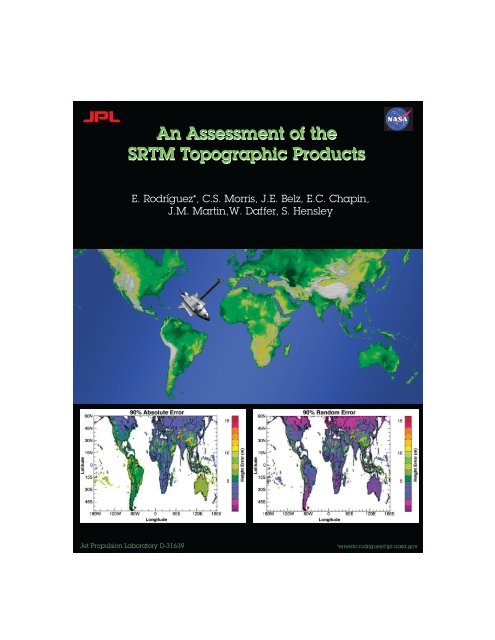
An Assessment of the SRTM Topographic Products - Jet Propulsion ...
An Assessment of the SRTM Topographic Products - Jet Propulsion ...
An Assessment of the SRTM Topographic Products - Jet Propulsion ...

Create successful ePaper yourself
Turn your PDF publications into a flip-book with our unique Google optimized e-Paper software.
<strong>An</strong> <strong>Assessment</strong> <strong>of</strong> <strong>the</strong><br />
<strong>SRTM</strong> <strong>Topographic</strong> <strong>Products</strong><br />
E. Rodríguez*, C.S. Morris, J.E. Belz, E.C. Chapin,<br />
J.M. Martin,W. Daffer, S. Hensley<br />
<strong>Jet</strong> <strong>Propulsion</strong> Laboratory D-31639 *ernesto.rodriguez@jpl.nasa.gov
Contents<br />
1 Overview 10<br />
1.1 <strong>SRTM</strong> Performance Requirements . . . . . . . . . . . . . . . . . . . . . . . . . . . . 11<br />
1.2 Verification Data Sets . . . . . . . . . . . . . . . . . . . . . . . . . . . . . . . . . . . 11<br />
1.2.1 Kinematic GPS Transects . . . . . . . . . . . . . . . . . . . . . . . . . . . . . 11<br />
1.2.2 DTED Level 2 Cells . . . . . . . . . . . . . . . . . . . . . . . . . . . . . . . . 13<br />
1.2.3 Height Patches . . . . . . . . . . . . . . . . . . . . . . . . . . . . . . . . . . . 13<br />
1.2.4 Ocean GCPs . . . . . . . . . . . . . . . . . . . . . . . . . . . . . . . . . . . . 13<br />
1.2.5 GeoSAR DEM Data . . . . . . . . . . . . . . . . . . . . . . . . . . . . . . . . 13<br />
1.2.6 O<strong>the</strong>r Ground Control Points . . . . . . . . . . . . . . . . . . . . . . . . . . . 14<br />
1.3 <strong>SRTM</strong> Error Sources . . . . . . . . . . . . . . . . . . . . . . . . . . . . . . . . . . . . 14<br />
1.3.1 Errors After Static and Dynamic Calibration . . . . . . . . . . . . . . . . . . 14<br />
1.3.2 Reduction <strong>of</strong> Static and Dynamic Errors . . . . . . . . . . . . . . . . . . . . . 16<br />
1.4 Summary <strong>of</strong> <strong>SRTM</strong> Residual Error Characteristics . . . . . . . . . . . . . . . . . . . 18<br />
1.5 <strong>SRTM</strong> Error Model . . . . . . . . . . . . . . . . . . . . . . . . . . . . . . . . . . . . . 20<br />
1.6 Performance Summary and <strong>SRTM</strong> Error <strong>Products</strong> . . . . . . . . . . . . . . . . . . . 21<br />
1.6.1 Cell and Subcell Random Errors . . . . . . . . . . . . . . . . . . . . . . . . . 23<br />
1.6.2 Cell and Subcell Absolute Errors . . . . . . . . . . . . . . . . . . . . . . . . . 23<br />
1.6.3 Cell and Subcell Relative Errors . . . . . . . . . . . . . . . . . . . . . . . . . 24<br />
2 Absolute Height Error 25<br />
2.1 Kinematic GPS GCP Comparison . . . . . . . . . . . . . . . . . . . . . . . . . . . . 25<br />
2.2 DTED Level 2 Comparison . . . . . . . . . . . . . . . . . . . . . . . . . . . . . . . . 32<br />
2.3 Height Patch Comparison . . . . . . . . . . . . . . . . . . . . . . . . . . . . . . . . . 37<br />
2.4 Ocean and Land GCP Comparison . . . . . . . . . . . . . . . . . . . . . . . . . . . . 44<br />
2.5 Land GCP Comparison . . . . . . . . . . . . . . . . . . . . . . . . . . . . . . . . . . 44<br />
2.6 Absolute Height Error Conclusions . . . . . . . . . . . . . . . . . . . . . . . . . . . . 55<br />
3 Spatial Structure <strong>of</strong> <strong>the</strong> <strong>SRTM</strong> Errors 56<br />
3.1 Long-Wavelength Error Characteristics from Kinematic GPS Transects . . . . . . . . 56<br />
3.2 Long-Wavelength Error Characteristics from Land and Ocean GCPs . . . . . . . . . 56<br />
3.3 The Height Error Structure and Correlation Functions . . . . . . . . . . . . . . . . . 60<br />
3.4 Spatial Structure Conclusions . . . . . . . . . . . . . . . . . . . . . . . . . . . . . . . 62<br />
2
CONTENTS 3<br />
4 Random Errors and <strong>the</strong> Terrain Height Error Data (THED) 72<br />
4.1 Validation <strong>of</strong> THED from DTED Level-2 Comparisons . . . . . . . . . . . . . . . . . 72<br />
4.2 Global Random and Absolute Error Performance . . . . . . . . . . . . . . . . . . . . 73<br />
5 Geolocation Error 83<br />
5.1 Geolocation Error from Corner Reflectors . . . . . . . . . . . . . . . . . . . . . . . . 83<br />
5.1.1 Ground Truth . . . . . . . . . . . . . . . . . . . . . . . . . . . . . . . . . . . . 83<br />
5.1.2 Range Estimation in <strong>the</strong> <strong>SRTM</strong> Range-Doppler Data <strong>Products</strong> . . . . . . . . 83<br />
5.1.3 Optimizing <strong>the</strong> Common Range Delay . . . . . . . . . . . . . . . . . . . . . . 84<br />
5.1.4 Error <strong>An</strong>alysis . . . . . . . . . . . . . . . . . . . . . . . . . . . . . . . . . . . 84<br />
5.1.5 Corner Reflector Location . . . . . . . . . . . . . . . . . . . . . . . . . . . . . 87<br />
5.2 Geolocation Error from Kinematic GPS GCPs . . . . . . . . . . . . . . . . . . . . . 89<br />
5.2.1 Geolocation Validation . . . . . . . . . . . . . . . . . . . . . . . . . . . . . . . 89<br />
6 Comparison Against GeoSAR High Resolution DEM 109<br />
6.1 Summary . . . . . . . . . . . . . . . . . . . . . . . . . . . . . . . . . . . . . . . . . . 109<br />
6.2 Discussion <strong>of</strong> GeoSAR and <strong>SRTM</strong> Data Used . . . . . . . . . . . . . . . . . . . . . . 109<br />
6.3 GeoSAR/<strong>SRTM</strong> Comparison . . . . . . . . . . . . . . . . . . . . . . . . . . . . . . . 110<br />
A <strong>SRTM</strong> Error Characteristics 126<br />
A.1 Introduction . . . . . . . . . . . . . . . . . . . . . . . . . . . . . . . . . . . . . . . . . 126<br />
A.2 Description <strong>of</strong> <strong>SRTM</strong> Geometry Measurements . . . . . . . . . . . . . . . . . . . . . 126<br />
A.3 Propagation <strong>of</strong> Geometric Measurement Errors . . . . . . . . . . . . . . . . . . . . . 129<br />
A.4 Electrical Error Sources . . . . . . . . . . . . . . . . . . . . . . . . . . . . . . . . . . 131<br />
A.5 The Interferometric Equations . . . . . . . . . . . . . . . . . . . . . . . . . . . . . . . 132<br />
A.6 Interferometric Error Model . . . . . . . . . . . . . . . . . . . . . . . . . . . . . . . . 134<br />
A.7 Application to <strong>SRTM</strong> Errors . . . . . . . . . . . . . . . . . . . . . . . . . . . . . . . 136<br />
A.8 From Vectors to Height Errors . . . . . . . . . . . . . . . . . . . . . . . . . . . . . . 138<br />
A.9 Geolocation Errors . . . . . . . . . . . . . . . . . . . . . . . . . . . . . . . . . . . . . 140
List <strong>of</strong> Figures<br />
1.1 Scatter plot <strong>of</strong> kinematic GPS height measurements and interpolated <strong>SRTM</strong> height<br />
values near St. Louis, MO, versus longitude . . . . . . . . . . . . . . . . . . . . . . . 12<br />
1.2 Post-calibration height error residuals for a long ocean data take . . . . . . . . . . . 16<br />
1.3 Long term drift <strong>of</strong> <strong>the</strong> <strong>SRTM</strong> phase for beam 4, estimated using ocean crossings over<br />
<strong>the</strong> lifetime <strong>of</strong> <strong>the</strong> mission . . . . . . . . . . . . . . . . . . . . . . . . . . . . . . . . . 17<br />
1.4 Height errors for ocean and land GCPs, prior to along-track and dynamic calibration<br />
and mosaic least-squares adjustments. . . . . . . . . . . . . . . . . . . . . . . . . . . 18<br />
1.5 Height errors for ocean and land GCPs, after along-track and dynamic calibration<br />
and mosaic least-squares adjustments. . . . . . . . . . . . . . . . . . . . . . . . . . . 19<br />
1.6 Histogram <strong>of</strong> <strong>the</strong> <strong>SRTM</strong> height error measured over <strong>the</strong> continent <strong>of</strong> Africa . . . . . 22<br />
2.1 Africa kinematic GPS height comparison . . . . . . . . . . . . . . . . . . . . . . . . . 26<br />
2.2 Australia kinematic GPS height comparison . . . . . . . . . . . . . . . . . . . . . . . 27<br />
2.3 Eurasia kinematic GPS height comparison . . . . . . . . . . . . . . . . . . . . . . . . 28<br />
2.4 North America kinematic GPS height comparison . . . . . . . . . . . . . . . . . . . . 29<br />
2.5 New Zealand kinematic GPS height comparison . . . . . . . . . . . . . . . . . . . . . 30<br />
2.6 South America kinematic GPS height comparison . . . . . . . . . . . . . . . . . . . . 31<br />
2.7 Histogram <strong>of</strong> <strong>the</strong> 90% error values for <strong>the</strong> comparison <strong>of</strong> <strong>the</strong> <strong>SRTM</strong> height data against<br />
<strong>the</strong> DTED Level-2 data. . . . . . . . . . . . . . . . . . . . . . . . . . . . . . . . . . . 35<br />
2.8 90% Height errors plotted against height difference median and standard deviations<br />
for <strong>the</strong> <strong>SRTM</strong> to DTED Level-2 comparisons. . . . . . . . . . . . . . . . . . . . . . . 36<br />
2.9 Histogram <strong>of</strong> <strong>the</strong> 90% error values for <strong>the</strong> comparison <strong>of</strong> <strong>the</strong> <strong>SRTM</strong> height data against<br />
<strong>the</strong> height patch data. . . . . . . . . . . . . . . . . . . . . . . . . . . . . . . . . . . . 42<br />
2.10 90% Height errors plotted against height difference median and standard deviations<br />
for <strong>the</strong> <strong>SRTM</strong> to patch height data comparisons . . . . . . . . . . . . . . . . . . . . . 43<br />
2.11 Africa ocean and land GCP height comparison . . . . . . . . . . . . . . . . . . . . . 45<br />
2.12 Australia ocean and land GCP height comparison . . . . . . . . . . . . . . . . . . . . 46<br />
2.13 Eurasia ocean and land GCP height comparison . . . . . . . . . . . . . . . . . . . . 47<br />
2.14 North America ocean and land GCP height comparison . . . . . . . . . . . . . . . . 48<br />
2.15 South America ocean and land GCP height comparison . . . . . . . . . . . . . . . . 49<br />
2.16 Africa land GCP height comparison . . . . . . . . . . . . . . . . . . . . . . . . . . . 50<br />
2.17 Australia land GCP height comparison . . . . . . . . . . . . . . . . . . . . . . . . . . 51<br />
2.18 Eurasia land GCP height comparison . . . . . . . . . . . . . . . . . . . . . . . . . . . 52<br />
2.19 North America land GCP height comparison . . . . . . . . . . . . . . . . . . . . . . 53<br />
4
LIST OF FIGURES 5<br />
2.20 South America land GCP height comparison . . . . . . . . . . . . . . . . . . . . . . 54<br />
3.1 <strong>SRTM</strong> minus kinematic GPS height differences averaged over 0.5 ◦ <strong>of</strong> latitude and<br />
longitude for Africa. . . . . . . . . . . . . . . . . . . . . . . . . . . . . . . . . . . . . 57<br />
3.2 <strong>SRTM</strong> minus kinematic GPS height differences averaged over 0.5 ◦ <strong>of</strong> latitude and<br />
longitude for Australia. . . . . . . . . . . . . . . . . . . . . . . . . . . . . . . . . . . 57<br />
3.3 <strong>SRTM</strong> minus kinematic GPS height differences averaged over 0.5 ◦ <strong>of</strong> latitude and<br />
longitude for Eurasia. . . . . . . . . . . . . . . . . . . . . . . . . . . . . . . . . . . . 58<br />
3.4 <strong>SRTM</strong> minus kinematic GPS height differences averaged over 0.5 ◦ <strong>of</strong> latitude and<br />
longitude for North America. . . . . . . . . . . . . . . . . . . . . . . . . . . . . . . . 58<br />
3.5 <strong>SRTM</strong> minus kinematic GPS height differences averaged over 0.5 ◦ <strong>of</strong> latitude and<br />
longitude for New Zealand. . . . . . . . . . . . . . . . . . . . . . . . . . . . . . . . . 59<br />
3.6 <strong>SRTM</strong> minus kinematic GPS height differences averaged over 0.5 ◦ <strong>of</strong> latitude and<br />
longitude for South America. . . . . . . . . . . . . . . . . . . . . . . . . . . . . . . . 59<br />
3.7 Africa residual long-wavelength errors for land and ocean GCPs after mosaic corrections<br />
are applied. . . . . . . . . . . . . . . . . . . . . . . . . . . . . . . . . . . . . . . 60<br />
3.8 Australia residual long-wavelength errors for land and ocean GCPs after mosaic corrections<br />
are applied. . . . . . . . . . . . . . . . . . . . . . . . . . . . . . . . . . . . . 61<br />
3.9 North America residual long-wavelength errors for land and ocean GCPs after mosaic<br />
corrections are applied. . . . . . . . . . . . . . . . . . . . . . . . . . . . . . . . . . . . 62<br />
3.10 South America residual long-wavelength errors for land and ocean GCPs after mosaic<br />
corrections are applied. . . . . . . . . . . . . . . . . . . . . . . . . . . . . . . . . . . . 63<br />
3.11 Structure function for <strong>the</strong> Kinematic GPS GCP errors for Africa . . . . . . . . . . . 64<br />
3.12 Structure function for <strong>the</strong> Kinematic GPS GCP errors for Australia . . . . . . . . . 65<br />
3.13 Structure function for <strong>the</strong> Kinematic GPS GCP errors for Eurasia . . . . . . . . . . 66<br />
3.14 Structure function for <strong>the</strong> Kinematic GPS GCP errors for North America . . . . . . 67<br />
3.15 Structure function for <strong>the</strong> Kinematic GPS GCP errors for South America . . . . . . 68<br />
3.16 Correlation function for all continents over <strong>the</strong> scale <strong>of</strong> two <strong>SRTM</strong> swaths. . . . . . . 69<br />
3.17 Zoom on <strong>the</strong> correlation function presented in Figure 3.16 for small distances from<br />
<strong>the</strong> origin. . . . . . . . . . . . . . . . . . . . . . . . . . . . . . . . . . . . . . . . . . . 70<br />
3.18 Variability <strong>of</strong> <strong>the</strong> structure function for different kinematic GPS tracks. . . . . . . . 71<br />
4.1 Topography for <strong>the</strong> 29 Palms DTED 2 cell used to illustrate random errors . . . . . 73<br />
4.2 Height RMS calculated using an 11 pixel averaging window . . . . . . . . . . . . . . 74<br />
4.3 THED values computed for <strong>the</strong> 29 Palms cell . . . . . . . . . . . . . . . . . . . . . . 75<br />
4.4 Statistical relationship between <strong>the</strong> THED values and <strong>the</strong> estimated random error . 76<br />
4.5 Africa random error map at 1/8 ◦ resolution. . . . . . . . . . . . . . . . . . . . . . . . 77<br />
4.6 Australia random error map at 1/8 ◦ resolution. . . . . . . . . . . . . . . . . . . . . . 77<br />
4.7 Eurasia random error map at 1/8 ◦ resolution. . . . . . . . . . . . . . . . . . . . . . . 78<br />
4.8 North America random error map at 1/8 ◦ resolution. . . . . . . . . . . . . . . . . . . 78<br />
4.9 South America random error map at 1/8 ◦ resolution. . . . . . . . . . . . . . . . . . . 79<br />
4.10 Africa estimated absolute 90% vertical error. . . . . . . . . . . . . . . . . . . . . . . 80<br />
4.11 Australia estimated absolute 90% vertical error. . . . . . . . . . . . . . . . . . . . . . 80<br />
4.12 Eurasia estimated absolute 90% vertical error. . . . . . . . . . . . . . . . . . . . . . . 81<br />
4.13 North America estimated absolute 90% vertical error. . . . . . . . . . . . . . . . . . 81<br />
4.14 South America estimated absolute 90% vertical error. . . . . . . . . . . . . . . . . . 82
LIST OF FIGURES 6<br />
5.1 Range <strong>of</strong>fset versus time delay for all GCPs in each <strong>of</strong> Beams 1-4 . . . . . . . . . . . 85<br />
5.2 Distribution <strong>of</strong> range <strong>of</strong>fsets for beams 1–4. Counts are are given per 0.5 m bin. . . . 86<br />
5.3 Range <strong>of</strong>fsets for beams 1-4 . . . . . . . . . . . . . . . . . . . . . . . . . . . . . . . . 88<br />
5.4 Range <strong>of</strong>fset versus time delay and <strong>the</strong> residual <strong>of</strong> a linear fit. . . . . . . . . . . . . . 90<br />
5.5 Kinematic GPS track over mountainous terrain . . . . . . . . . . . . . . . . . . . . . 91<br />
5.6 Surface plot <strong>of</strong> <strong>the</strong> standard deviation <strong>of</strong> <strong>the</strong> height error sampled along a kinematic<br />
GPS track over a mountainous <strong>SRTM</strong> cell . . . . . . . . . . . . . . . . . . . . . . . . 92<br />
5.7 Histogram <strong>of</strong> <strong>the</strong> <strong>SRTM</strong> descending image brightness sampled along a kinematic GPS<br />
track with all data and with rejected points removed . . . . . . . . . . . . . . . . . . 93<br />
5.8 Kinematic GPS track used in Figure 5.9. There are 3862 points. . . . . . . . . . . . 93<br />
5.9 Surface plot <strong>of</strong> <strong>the</strong> measured mean brightness along <strong>the</strong> kinematic GPS track for a<br />
single <strong>SRTM</strong> cell in <strong>the</strong> Australian outback . . . . . . . . . . . . . . . . . . . . . . . 94<br />
5.10 Best fit geolocation biases in ascending image data using 10 ◦ by 10 ◦ super-cells in<br />
North America. . . . . . . . . . . . . . . . . . . . . . . . . . . . . . . . . . . . . . . . 97<br />
5.11 Best fit geolocation biases in descending image data using 10 ◦ by 10 ◦ super-cells in<br />
North America. . . . . . . . . . . . . . . . . . . . . . . . . . . . . . . . . . . . . . . . 97<br />
5.12 Best fit geolocation biases in DEM data using 10 ◦ by 10 ◦ super-cells in North America. 98<br />
5.13 Best fit geolocation biases using combined height and image data for 10 ◦ by 10 ◦<br />
super-cells in North America . . . . . . . . . . . . . . . . . . . . . . . . . . . . . . . 98<br />
5.14 Best fit geolocation biases in ascending image data using 10 ◦ by 10 ◦ super-cells in<br />
South America. . . . . . . . . . . . . . . . . . . . . . . . . . . . . . . . . . . . . . . . 99<br />
5.15 Best fit geolocation biases in descending image data using 10 ◦ by 10 ◦ super-cells in<br />
South America. . . . . . . . . . . . . . . . . . . . . . . . . . . . . . . . . . . . . . . . 99<br />
5.16 Best fit geolocation biases in DEM data using 10 ◦ by 10 ◦ super-cells in South America.100<br />
5.17 Best fit geolocation biases using combined height and image data for 10 ◦ by 10 ◦<br />
super-cells in South America . . . . . . . . . . . . . . . . . . . . . . . . . . . . . . . 100<br />
5.18 Best fit geolocation biases in ascending image data using 10 ◦ by 10 ◦ super-cells in<br />
Africa. . . . . . . . . . . . . . . . . . . . . . . . . . . . . . . . . . . . . . . . . . . . . 101<br />
5.19 Best fit geolocation biases in descending image data using 10 ◦ by 10 ◦ super-cells in<br />
Africa. . . . . . . . . . . . . . . . . . . . . . . . . . . . . . . . . . . . . . . . . . . . . 101<br />
5.20 Best fit geolocation biases in DEM data using 10 ◦ by 10 ◦ super-cells in Africa. . . . 102<br />
5.21 Best fit geolocation biases using combined height and image data for 10 ◦ by 10 ◦<br />
super-cells in Africa . . . . . . . . . . . . . . . . . . . . . . . . . . . . . . . . . . . . 102<br />
5.22 Best fit geolocation biases in ascending image data using 10 ◦ by 10 ◦ super-cells in<br />
New Zealand. . . . . . . . . . . . . . . . . . . . . . . . . . . . . . . . . . . . . . . . . 103<br />
5.23 Best fit geolocation biases in descending image data using 10 ◦ by 10 ◦ super-cells in<br />
New Zealand. . . . . . . . . . . . . . . . . . . . . . . . . . . . . . . . . . . . . . . . . 103<br />
5.24 Best fit geolocation biases in DEM data using 10 ◦ by 10 ◦ super-cells in New Zealand. 104<br />
5.25 Best fit geolocation biases using combined height and image data for 10 ◦ by 10 ◦<br />
super-cells in New Zealand . . . . . . . . . . . . . . . . . . . . . . . . . . . . . . . . . 104<br />
5.26 Best fit geolocation biases in ascending image data using 10 ◦ by 10 ◦ super-cells in<br />
Eurasia. . . . . . . . . . . . . . . . . . . . . . . . . . . . . . . . . . . . . . . . . . . . 105<br />
5.27 Best fit geolocation biases in descending image data using 10 ◦ by 10 ◦ super-cells in<br />
Eurasia. . . . . . . . . . . . . . . . . . . . . . . . . . . . . . . . . . . . . . . . . . . . 105<br />
5.28 Best fit geolocation biases in DEM data using 10 ◦ by 10 ◦ super-cells in Eurasia. . . . 106
LIST OF FIGURES 7<br />
5.29 Best fit geolocation biases using combined height and image data for 10 ◦ by 10 ◦<br />
super-cells in Eurasia . . . . . . . . . . . . . . . . . . . . . . . . . . . . . . . . . . . . 106<br />
5.30 Best fit geolocation biases in ascending image data using 10 ◦ by 10 ◦ super-cells in<br />
Australia. . . . . . . . . . . . . . . . . . . . . . . . . . . . . . . . . . . . . . . . . . . 107<br />
5.31 Best fit geolocation biases in descending image data using 10 ◦ by 10 ◦ super-cells in<br />
Australia. . . . . . . . . . . . . . . . . . . . . . . . . . . . . . . . . . . . . . . . . . . 107<br />
5.32 Best fit geolocation biases in DEM data using 10 ◦ by 10 ◦ super-cells in Australia. . . 108<br />
5.33 Best fit geolocation biases using combined height and image data for 10 ◦ by 10 ◦<br />
super-cells in Australia . . . . . . . . . . . . . . . . . . . . . . . . . . . . . . . . . . . 108<br />
6.1 Overview image <strong>of</strong> GeoSAR data from Santa Barbara County, California with a single<br />
color wrap . . . . . . . . . . . . . . . . . . . . . . . . . . . . . . . . . . . . . . . . . . 111<br />
6.2 Overview image <strong>of</strong> GeoSAR data from Santa Barbara County, California with a single<br />
colors repeating every 100 m <strong>of</strong> elevation . . . . . . . . . . . . . . . . . . . . . . . . . 112<br />
6.3 Histogram <strong>of</strong> pixel by pixel height differences between <strong>SRTM</strong> and GeoSAR derived<br />
DEMs in Santa Barbara County, California . . . . . . . . . . . . . . . . . . . . . . . 113<br />
6.4 Five views <strong>of</strong> <strong>the</strong> same small area <strong>of</strong> <strong>the</strong> scene including X-Band GeoSAR backscatter<br />
amplitude, shaded relief <strong>of</strong> <strong>the</strong> GeoSAR DEM, <strong>SRTM</strong> heights, GeoSAR heights, and<br />
he <strong>SRTM</strong>-GeoSAR height difference . . . . . . . . . . . . . . . . . . . . . . . . . . . 115<br />
6.5 Five views <strong>of</strong> <strong>the</strong> same small area <strong>of</strong> <strong>the</strong> scene including X-Band GeoSAR heights,<br />
<strong>SRTM</strong> heights, shaded relief <strong>of</strong> <strong>the</strong> GeoSAR heights, shaded relief <strong>of</strong> <strong>the</strong> <strong>SRTM</strong><br />
heights, and <strong>the</strong> GeoSAR amplitude . . . . . . . . . . . . . . . . . . . . . . . . . . . 116<br />
6.6 Four views <strong>of</strong> <strong>the</strong> same small area <strong>of</strong> <strong>the</strong> scene including X-Band GeoSAR backscatter<br />
amplitude, shaded relief <strong>of</strong> <strong>the</strong> GeoSAR Dem, <strong>the</strong> GeoSAR heights (color wrap), and<br />
<strong>the</strong> <strong>SRTM</strong>-GeoSAR height difference . . . . . . . . . . . . . . . . . . . . . . . . . . . 117<br />
6.7 Line cuts through <strong>the</strong> <strong>SRTM</strong> and GeoSAR DEMs . . . . . . . . . . . . . . . . . . . . 118<br />
6.8 Histogram <strong>of</strong> pixel by pixel height differences between <strong>SRTM</strong> and GeoSAR derived<br />
DEMs in Santa Barbara County, California . . . . . . . . . . . . . . . . . . . . . . . 119<br />
6.9 W . . . . . . . . . . . . . . . . . . . . . . . . . . . . . . . . . . . . . . . . . . . . . . 120<br />
6.10 Wrapped height differences between <strong>the</strong> <strong>SRTM</strong> and GeoSAR derived DEMs in Santa<br />
Barbara County, California with <strong>the</strong> GeoSAR data having been filtered using a 2x2<br />
box car filter . . . . . . . . . . . . . . . . . . . . . . . . . . . . . . . . . . . . . . . . 121<br />
6.11 Wrapped height differences between <strong>the</strong> <strong>SRTM</strong> and GeoSAR derived DEMs in Santa<br />
Barbara County, California with <strong>the</strong> GeoSAR data having been filtered using a 3x3<br />
box car filter . . . . . . . . . . . . . . . . . . . . . . . . . . . . . . . . . . . . . . . . 122<br />
6.12 Wrapped height differences between <strong>the</strong> <strong>SRTM</strong> and GeoSAR derived DEMs in Santa<br />
Barbara County, California with <strong>the</strong> GeoSAR data having been filtered using a 4x4<br />
box car filter . . . . . . . . . . . . . . . . . . . . . . . . . . . . . . . . . . . . . . . . 123<br />
A.1 <strong>SRTM</strong> Measurement Geometry . . . . . . . . . . . . . . . . . . . . . . . . . . . . . . 127<br />
A.2 IFSAR measurement geometry . . . . . . . . . . . . . . . . . . . . . . . . . . . . . . 133<br />
A.3 Local Coordinate Systems . . . . . . . . . . . . . . . . . . . . . . . . . . . . . . . . . 139<br />
A.4 Action <strong>of</strong> <strong>the</strong> Projection Operator . . . . . . . . . . . . . . . . . . . . . . . . . . . . 142<br />
A.5 Rotation about <strong>the</strong> axis ˆz . . . . . . . . . . . . . . . . . . . . . . . . . . . . . . . . . 143
List <strong>of</strong> Tables<br />
1.1 Ground Truth Data Summary . . . . . . . . . . . . . . . . . . . . . . . . . . . . . . . 12<br />
1.2 Summary <strong>of</strong> <strong>the</strong> geographic distribution <strong>of</strong> DTED 2 patches. . . . . . . . . . . . . . 13<br />
1.3 Summary <strong>of</strong> <strong>SRTM</strong> height performance . . . . . . . . . . . . . . . . . . . . . . . . . 22<br />
2.1 Summary <strong>of</strong> kinematic GPS GCP comparison with <strong>SRTM</strong> data . . . . . . . . . . . . 25<br />
2.2 Statistics for <strong>the</strong> height difference between <strong>SRTM</strong> and DTED level 2 . . . . . . . . . 32<br />
2.3 Statistics for <strong>the</strong> height difference between <strong>SRTM</strong> and DTED level-2 data for Africa 32<br />
2.4 Statistics for <strong>the</strong> height difference between <strong>SRTM</strong> and DTED level-2 data for Eurasia 33<br />
2.5 Statistics for <strong>the</strong> height difference between <strong>SRTM</strong> and DTED level-2 data for North<br />
America . . . . . . . . . . . . . . . . . . . . . . . . . . . . . . . . . . . . . . . . . . . 34<br />
2.6 Statistics for <strong>the</strong> height difference between <strong>SRTM</strong> and DTED level-2 data for South<br />
America . . . . . . . . . . . . . . . . . . . . . . . . . . . . . . . . . . . . . . . . . . . 34<br />
2.7 Statistics for <strong>the</strong> height difference between <strong>SRTM</strong> and height patches . . . . . . . . . 37<br />
2.8 Statistics for <strong>the</strong> height difference between <strong>SRTM</strong> and height patch data for Australia 37<br />
2.9 Statistics for <strong>the</strong> height difference between <strong>SRTM</strong> and height patch data for Africa . 38<br />
2.10 Statistics for <strong>the</strong> height difference between <strong>SRTM</strong> and height patch data for Eurasia 39<br />
2.11 Statistics for <strong>the</strong> height difference between <strong>SRTM</strong> and height patch data for North<br />
America . . . . . . . . . . . . . . . . . . . . . . . . . . . . . . . . . . . . . . . . . . . 40<br />
2.12 Statistics for <strong>the</strong> height difference between <strong>SRTM</strong> and height patch data for South<br />
America . . . . . . . . . . . . . . . . . . . . . . . . . . . . . . . . . . . . . . . . . . . 41<br />
2.13 Summary <strong>of</strong> land and ocean GCP comparison with <strong>SRTM</strong> data . . . . . . . . . . . . 44<br />
2.14 Summary <strong>of</strong> land GCP comparison with <strong>SRTM</strong> data . . . . . . . . . . . . . . . . . . 44<br />
5.1 Common time delays, which are a correction to <strong>the</strong> two-way travel time, with statistical<br />
uncertainty for each beam. . . . . . . . . . . . . . . . . . . . . . . . . . . . . . . 87<br />
5.2 Moments <strong>of</strong> <strong>the</strong> distribution <strong>of</strong> range <strong>of</strong>fsets. . . . . . . . . . . . . . . . . . . . . . . . 87<br />
5.3 Temporal and spatial dependence <strong>of</strong> range <strong>of</strong>fsets. . . . . . . . . . . . . . . . . . . . 87<br />
6.1 Summary <strong>of</strong> height differences between <strong>SRTM</strong> and GeoSAR derived DEMs in Santa<br />
Barbara County, California . . . . . . . . . . . . . . . . . . . . . . . . . . . . . . . . 110<br />
8
Summary<br />
The NASA/NIMA (now NGA) Shuttle Radar Topography Mission (<strong>SRTM</strong>) collected interferometric<br />
radar data which has been used by JPL to generate a near-global topography data product for<br />
latitudes smaller than 60 ◦ . As part <strong>of</strong> <strong>the</strong> <strong>SRTM</strong> mission, an extensive global ground campaign<br />
was conducted by NIMA/NGA and NASA to collect ground-truth which would allow for <strong>the</strong> global<br />
validation <strong>of</strong> this unique data set. This report presents a detailed description <strong>of</strong> how <strong>the</strong> results in<br />
this table were obtained. It also presents detailed characterization <strong>of</strong> <strong>the</strong> different components <strong>of</strong><br />
<strong>the</strong> error, <strong>the</strong>ir magnitudes, and spatial structure.<br />
The performance requirements for <strong>the</strong> <strong>SRTM</strong> data products are:<br />
1. The linear vertical absolute height error shall be less than 16 m for 90% <strong>of</strong> <strong>the</strong> data.<br />
2. The linear vertical relative height error shall be less than 10 m for 90% <strong>of</strong> <strong>the</strong> data.<br />
3. The circular absolute geolocation error shall be less than 20 m for 90% <strong>of</strong> <strong>the</strong> data.<br />
4. The circular relative geolocation error shall be less than 15 m for 90% <strong>of</strong> <strong>the</strong> data.<br />
The table shown below summarizes <strong>the</strong> <strong>SRTM</strong> performance observed by comparing against <strong>the</strong><br />
available ground-truth. All quantities represent 90% errors in meters. It is clear from this table that<br />
<strong>SRTM</strong> met and exceeded its performance requirements.<br />
Africa Australia Eurasia Islands N. America S. America<br />
Absolute Geolocation Error 11.9 7.2 8.8 9.0 12.6 9.0<br />
Absolute Height Error 5.6 6.0 6.2 8.0 9.0 6.2<br />
Relative Height Error 9.8 4.7 8.7 6.2 7.0 5.5<br />
Long Wavelength Height Error 3.1 6.0 2.6 3.7 4.0 4.9<br />
We have found that <strong>the</strong> <strong>SRTM</strong> error could be divided into very long wavelength (continental<br />
scale or larger) errors and short wavelength random errors. To show <strong>the</strong> relative magnitude <strong>of</strong> <strong>the</strong><br />
two contributions, <strong>the</strong> table also lists <strong>the</strong> magnitude <strong>of</strong> <strong>the</strong> long wavelength error (which contributes<br />
to <strong>the</strong> absolute vertical accuracy).<br />
The ground truth data collected were not appropriate for validating relative geolocation errors. It<br />
is expected that <strong>the</strong> main sources <strong>of</strong> geolocation errors are also long wavelength, so that <strong>the</strong> relative<br />
geolocation error will in general be smaller than <strong>the</strong> absolute geolocation error, since common errors<br />
will cancel. The absolute geolocation performance is better than that required for <strong>the</strong> relative<br />
geolocation, which provides indirect evidence that <strong>the</strong> relative geolocation requirement was also<br />
met.<br />
9
Chapter 1<br />
Overview<br />
The Shuttle Radar Topography Mission (<strong>SRTM</strong>) [1] was a collaboration between <strong>the</strong> National Aeronautics<br />
and Space Administration (NASA) and <strong>the</strong> National Imagery and Mapping Agency (NIMA).<br />
[NIMA changed its name in November 2003 to <strong>the</strong> National Geospatial-Intelligence Agency (NGA).]<br />
<strong>SRTM</strong> collected interferometric radar data which has been used by <strong>the</strong> <strong>Jet</strong> <strong>Propulsion</strong> Laboratory<br />
(JPL) to generate a near-global topography data product for latitudes smaller than 60 ◦ . As part <strong>of</strong><br />
<strong>the</strong> <strong>SRTM</strong> mission, an extensive ground campaign was conducted by NIMA and NASA to collect<br />
ground-truth which would allow for <strong>the</strong> global validation <strong>of</strong> this unique data set.<br />
The purpose <strong>of</strong> this report is to document <strong>the</strong> analysis that was undertaken to verify <strong>the</strong> <strong>SRTM</strong><br />
performance and to show how <strong>the</strong> mission requirements were met and exceeded. Table 1.3 presents<br />
a summary <strong>of</strong> <strong>the</strong> <strong>SRTM</strong> performance for each mapped continent. This performance exceeded <strong>the</strong><br />
required performance by almost a factor <strong>of</strong> 2. O<strong>the</strong>r assessments <strong>of</strong> <strong>the</strong> <strong>SRTM</strong> performance have<br />
examined <strong>the</strong> spatial resolution <strong>of</strong> <strong>SRTM</strong> [2], or compared its performance against lidar for vegetated<br />
regions [3]. Unlike those studies, we will endeavor to characterize all components <strong>of</strong> <strong>the</strong> <strong>SRTM</strong> errors<br />
on a global basis.<br />
In this chapter, we review <strong>the</strong> <strong>SRTM</strong> measurement requirements, review <strong>the</strong> ground-truth data<br />
used for <strong>the</strong> instrument verification, and summarize <strong>the</strong> characteristics <strong>of</strong> <strong>the</strong> residual errors. The<br />
remaining chapters <strong>of</strong> this report present <strong>the</strong> details showing how summary numbers were derived.<br />
Chapter 2 shows in detail all comparisons made to verify that <strong>SRTM</strong> was meeting <strong>the</strong> most fundamental<br />
requirement on height accuracy. Chapter 3 studies in greater detail <strong>the</strong> different spatial<br />
components in <strong>the</strong> residual <strong>SRTM</strong> errors, and looks in some detail at <strong>the</strong> long wavelength errors.<br />
Chapter 4 concentrates on <strong>the</strong> high-frequency error components and validates <strong>the</strong> Terrain Height<br />
Error Data (THED) product put out by <strong>SRTM</strong>. This chapter also presents <strong>the</strong> random and absolute<br />
errors included as part <strong>of</strong> <strong>the</strong> <strong>SRTM</strong> height data headers. Chapter 5 details <strong>the</strong> methodology used to<br />
calibrate <strong>the</strong> system timing and geolocation and verifies <strong>the</strong> geolocation accuracy using radar identifiable<br />
kinematic GPS transects. Finally, Chapter 6 presents a detailed comparison <strong>of</strong> <strong>the</strong> <strong>SRTM</strong><br />
DEM against a high resolution and accuracy DEM obtained by <strong>the</strong> GeoSAR interferometer, allowing<br />
a cross-comparison <strong>of</strong> interferometric data sets.<br />
10
CHAPTER 1. OVERVIEW 11<br />
1.1 <strong>SRTM</strong> Performance Requirements<br />
The performance requirements for <strong>the</strong> <strong>SRTM</strong> data products are:<br />
1. The linear vertical absolute height error shall be less than 16 m for 90% <strong>of</strong> <strong>the</strong> data.<br />
2. The linear vertical relative height error shall be less than 10 m for 90% <strong>of</strong> <strong>the</strong> data.<br />
3. The circular absolute geolocation error shall be less than 20 m for 90% <strong>of</strong> <strong>the</strong> data.<br />
4. The circular relative geolocation error shall be less than 15 m for 90% <strong>of</strong> <strong>the</strong> data.<br />
1.2 Verification Data Sets<br />
The global verification <strong>of</strong> <strong>the</strong> <strong>SRTM</strong> product presents a unique challenge since <strong>the</strong> instrument accuracy<br />
was expected to be better than <strong>the</strong> accuracy <strong>of</strong> most topographic data sets which were globally<br />
available. In order to solve this problem, an extensive ground-truth data set was collected, with <strong>the</strong><br />
understanding that <strong>the</strong> quality <strong>of</strong> <strong>the</strong> globally available ground truth might not be sufficient for a<br />
complete verification <strong>of</strong> <strong>the</strong> <strong>SRTM</strong> data.<br />
1.2.1 Kinematic GPS Transects<br />
The most extensive ground-truth effort was made in collecting a globally distributed set <strong>of</strong> ground<br />
control points (GCPs) using kinematic Global Positioning System (KGPS) transects. The distribution<br />
<strong>of</strong> <strong>the</strong> data is shown in detail in Section 3.1. A typical KGPS transect spanned a substantial<br />
part <strong>of</strong> a continent, thus allowing for <strong>the</strong> characterization <strong>of</strong> errors at all length scales.<br />
The KGPS data were collected by driving vehicles carrying Global Positioning System (GPS)<br />
receivers along roads throughout <strong>the</strong> mapped areas, <strong>the</strong>reby producing a set <strong>of</strong> data representing<br />
a non-uniform sampling <strong>of</strong> <strong>the</strong> latitude, longitude and height along <strong>the</strong> surface feature. Most <strong>of</strong><br />
<strong>the</strong> data were collected by NIMA or cooperating agencies within <strong>the</strong> country in question. Data in<br />
Argentina and Paraguay were collected by JPL personnel. Much <strong>of</strong> <strong>the</strong> GPS data were processed by<br />
NIMA personel using <strong>the</strong> JPL GIPSY s<strong>of</strong>tware (http://gipsy.jpl.nasa.gov). The remaining datasets<br />
were processed under a NIMA contract by JPL and TRW, using <strong>the</strong> same GIPSY s<strong>of</strong>tware under<br />
<strong>the</strong> supervision <strong>of</strong> Dr. Frank Webb. The total data collection yielded nearly 9.4 million samples<br />
covering six continents with a general accuracy <strong>of</strong> ∼ 50 cm (1σ).<br />
Regions with significant discrepancy between ground-truth and <strong>the</strong> <strong>SRTM</strong> heights (near overpasses<br />
and bridges, for instance–see Figure 1.1, or in very forested regions) were eliminated during<br />
a visual Q/A process. GPS data with a standard deviation <strong>of</strong> more than 1 meter within a 30 m<br />
pixel, or more than 5 meters over a 3 by 3 pixel box (90 m × 90 m) were removed. Fur<strong>the</strong>rmore,<br />
data within 3 pixels <strong>of</strong> a void posting were removed, since <strong>the</strong>se areas were usually associated with<br />
<strong>SRTM</strong> unwrapping anomalies.<br />
Multiple GPS samples within a single <strong>SRTM</strong> 30 m data pixel were averaged so that each <strong>SRTM</strong><br />
pixel was equally weighted. Additional cuts for <strong>the</strong> image analysis (see Section 5.2) yielded over<br />
2 million ground truth points. The distribution <strong>of</strong> kinematic GPS GCPs and image ground-truth<br />
points for each continent is shown in Table 1.1.
CHAPTER 1. OVERVIEW 12<br />
Latitude<br />
Figure 1.1: Scatter plot <strong>of</strong> kinematic GPS height measurements (black) and interpolated <strong>SRTM</strong><br />
height values (red) near St. Louis, MO, versus longitude. Data from several bridges crossing <strong>the</strong><br />
Mississippi River are clearly evident, and were removed from <strong>the</strong> set <strong>of</strong> ground truth points.<br />
No. <strong>of</strong> No. <strong>of</strong> No. <strong>of</strong> No. <strong>of</strong><br />
“Continent” Kinematic Cells With Data GPS Samples Truth Points<br />
GPS Tracks ×1000 ×1000<br />
N. America 6 178 1750 402<br />
S. America 5 196 1005 328<br />
Africa 4 143 2439 395<br />
Eurasia 11 192 2622 445<br />
Australia 4 140 1145 381<br />
New Zealand 2 31 393 64<br />
Table 1.1: Ground Truth Data Summary
CHAPTER 1. OVERVIEW 13<br />
1.2.2 DTED Level 2 Cells<br />
As part <strong>of</strong> its Digital Terrain Elevation Data (DTED) Level 2 generation, NIMA produced a set <strong>of</strong><br />
42 one-degree cells whose accuracy was expected to be similar to, or better than <strong>the</strong> <strong>SRTM</strong> data,<br />
while its spatial resolution was similar to <strong>SRTM</strong>. The geographical distribution <strong>of</strong> DTED 2 cells is<br />
presented in Table 1.2. The exact locations <strong>of</strong> <strong>the</strong> DTED data are given in Section 2.2.<br />
Continent Number<br />
Africa 5<br />
Australia 0<br />
Eurasia 26<br />
Islands 0<br />
N. America 6<br />
S. America 5<br />
Table 1.2: Summary <strong>of</strong> <strong>the</strong> geographic distribution <strong>of</strong> DTED 2 patches.<br />
1.2.3 Height Patches<br />
In addition to <strong>the</strong> high-quality DTED 2 cells, NIMA generated a set <strong>of</strong> 142 height“chips”.[141 patches<br />
were used in our analyses.] The process used to generate <strong>the</strong>se chips (or patches) was similar to <strong>the</strong><br />
one used to generate DTED 2 data, but <strong>the</strong> final data sets did not go through <strong>the</strong> same rigorous<br />
quality assessment and editing. The distribution <strong>of</strong> <strong>the</strong>se patches was selected to be as random as<br />
possible, while concentrating on regions <strong>of</strong> some, but not extreme, relief.<br />
1.2.4 Ocean GCPs<br />
The ocean surface topography, which is a combination <strong>of</strong> <strong>the</strong> geoid, <strong>the</strong> ocean circulation, and tidal<br />
changes is very well known. In <strong>the</strong> deep ocean, altimeters have determined <strong>the</strong> ocean surface to<br />
centimetric levels and tidal and geoid models (e.g., EGM96) are accurate to similar accuracy. In<br />
coastal regions, both tidal and geoid models are less precise; never<strong>the</strong>less, <strong>the</strong> error in <strong>the</strong> topography<br />
is much smaller than 50 cm, which is more than sufficient to gauge <strong>the</strong> <strong>SRTM</strong> accuracy and provide<br />
GCPs for calibration purposes. For <strong>the</strong> <strong>SRTM</strong> mission, <strong>the</strong> EGM96, <strong>the</strong> TOPEX mean sea surface,<br />
toge<strong>the</strong>r with a tidal model tuned for coastal accuracy [4], were used to generate ocean ground-truth<br />
surfaces. These GCPs are used for calibration, mosaic formation, and assessment <strong>of</strong> <strong>the</strong> residual<br />
errors. GCPs were generated with a separation <strong>of</strong> 10 km for all <strong>the</strong> <strong>SRTM</strong> ocean data, which<br />
extended for at least 90 km from <strong>the</strong> coast.<br />
1.2.5 GeoSAR DEM Data<br />
<strong>An</strong> X-band interferometer DEM generated by <strong>the</strong> GeoSAR instrument was obtained by mosaicking<br />
6 GeoSAR data takes over Santa Barbara County, California. The DEM derived from each pass<br />
<strong>of</strong> GeoSAR data has a specified 1 sigma relative height accuracy <strong>of</strong> 1 m and an absolute height<br />
accuracy <strong>of</strong> 2.5 m averaged over <strong>the</strong> 10 km swath with 5 m postings. Since <strong>the</strong> DEM used for <strong>the</strong><br />
comparison is a syn<strong>the</strong>sis <strong>of</strong> multiple passes, <strong>the</strong> DEM is significantly more accurate than this in <strong>the</strong>
CHAPTER 1. OVERVIEW 14<br />
areas covered by more than 1 data take. In addition, <strong>the</strong> statistical uncertainties have been reduced<br />
by averaging <strong>the</strong> GeoSAR data when <strong>the</strong> posting was increased from 5 m to 30 m for comparison<br />
with <strong>the</strong> <strong>SRTM</strong> data.<br />
1.2.6 O<strong>the</strong>r Ground Control Points<br />
In addition to previous data sets, NIMA provided approximately 70,000 GCPs which had been<br />
obtained using various techniques over <strong>the</strong> years. Over 10,000 GCPs were obtained from <strong>the</strong> JPL<br />
automated GPS processing database were also added to <strong>the</strong> GCP database. Finally, over 6,000<br />
GCPs were derived from <strong>the</strong> GPS transcets (section 1.2.1). The total number <strong>of</strong> GCPs available<br />
was 86,774.<br />
This GCP dataset was used by <strong>the</strong> Ground Data Processing System as a quality assurance check<br />
during operational processing. In addition, a small subset <strong>of</strong> <strong>the</strong>se GCPs, with a minimum <strong>of</strong> 0.1<br />
degrees <strong>of</strong> latitude/longitude separation between GCPs, were used by <strong>the</strong> mosaic subsystem.<br />
However, use <strong>of</strong> this GCP database for verification was problematic. The distribution <strong>of</strong> GCPs<br />
was non-random with <strong>the</strong> majority <strong>of</strong> GCPs densely packed in a small number <strong>of</strong> geographic areas.<br />
<strong>An</strong>d while <strong>the</strong> majority <strong>of</strong> GCPs were in reasonable agreement with <strong>SRTM</strong> and o<strong>the</strong>r DEM sources,<br />
<strong>the</strong>re was a small, but significant percentage <strong>of</strong> GCPs that were obviously in error by many tens<br />
<strong>of</strong> meters - over 100 meters in some cases. Unfortunately, <strong>the</strong>re was no useful error assessment on<br />
individual GCPs. Given this lack <strong>of</strong> reliability and <strong>the</strong> vast quantity <strong>of</strong> o<strong>the</strong>r verification datasets,<br />
<strong>the</strong> analysis presented below does not dwell in great detail on <strong>the</strong> differences between this data set<br />
and <strong>the</strong> <strong>SRTM</strong> data set. It is sufficient to note that <strong>the</strong> inclusion <strong>of</strong> this relatively small data set does<br />
not significantly change <strong>the</strong> statistical results, while significantly increasing <strong>the</strong> number <strong>of</strong> outlier<br />
comparisons.<br />
Figure 1.4 shows an example <strong>of</strong> ground control points from all <strong>the</strong> sources listed above for Eurasia.<br />
1.3 <strong>SRTM</strong> Error Sources<br />
The error characteristics for Interferometric SAR’s are well understood and have been summarized<br />
in <strong>the</strong> open literature in [5] [6]. Rosen et al. [6] also review interferometric SAR up to <strong>the</strong> year<br />
2000, and <strong>the</strong> reader is referred <strong>the</strong>re for greater detail on <strong>the</strong> technique. In Appendix A, we give a<br />
detailed description <strong>of</strong> all <strong>the</strong> error sources which were present for <strong>the</strong> <strong>SRTM</strong> mission.<br />
1.3.1 Errors After Static and Dynamic Calibration<br />
Interferometric errors can be divided into static and time-varying errors. Static errors are those<br />
which can be regarded as having been constant over <strong>the</strong> data collection. Since <strong>the</strong>se errors are<br />
constant, <strong>the</strong>y can be calibrated by means <strong>of</strong> natural or man-made targets with know position and<br />
height. Time varying errors are due to motion <strong>of</strong> <strong>the</strong> interferometric mast and changes in <strong>the</strong> beam<br />
steering. These errors can be partially compensated by dynamic calibration and mosaicking.<br />
We list below <strong>the</strong> main contributors to <strong>the</strong> static and dynamic errors, <strong>the</strong> calibration method<br />
used to estimate <strong>the</strong>m, and <strong>the</strong> magnitude <strong>of</strong> <strong>the</strong> residual error after calibration.<br />
Baseline Roll Errors: <strong>An</strong> error in knowledge <strong>of</strong> <strong>the</strong> baseline roll angle will induce a cross-track<br />
slope error in <strong>the</strong> estimated topography whose magnitude is equal to <strong>the</strong> roll error. The<br />
<strong>SRTM</strong> instrument used a sophisticated metrology system (AODA) coupled with post-flight
CHAPTER 1. OVERVIEW 15<br />
filtering and estimation <strong>of</strong> <strong>the</strong> baseline position. The main components <strong>of</strong> <strong>the</strong> baseline motion<br />
are due to <strong>the</strong> natural modes <strong>of</strong> oscillation <strong>of</strong> <strong>the</strong> mast. These motions can be modeled and<br />
removed so that <strong>the</strong>y do not constitute a dominant error source. In addition, <strong>the</strong> baseline<br />
position is affected by <strong>the</strong> Shuttle’s attitude maneuvers. The time scale for residual roll errors<br />
is long, resulting in spatial errors with wavelength on <strong>the</strong> order <strong>of</strong> thousands <strong>of</strong> kilometers.<br />
They constitute <strong>the</strong> primary source for long-wavelength residual errors. Figure 1.2 shows a<br />
representative example <strong>of</strong> this residual long-wavelength error estimated by subtracting <strong>the</strong><br />
sea surface topography, which is know to centimetric accuracy from <strong>the</strong> <strong>SRTM</strong> estimated<br />
topography. The peak values <strong>of</strong> this residual error are ∼ ±10 m.<br />
Phase Errors: These errors are due to two sources: <strong>the</strong>rmal or differential speckle noise and systematic<br />
phase changes due to antenna pattern mismatches or long term drift <strong>of</strong> <strong>the</strong> instrument<br />
electronics. The noise contamination result in height errors which are random and which exhibit<br />
short spatial correlation lengths. These errors cannot be compensated during ground<br />
processing.<br />
The antenna patterns for each <strong>of</strong> <strong>the</strong> channels do not have identical far-field phase characteristics.<br />
If uncompensated, this phase mismatch causes results in a net systematic phase error<br />
(called <strong>the</strong> phase screen) which is a function <strong>of</strong> <strong>the</strong> look angle. Due to <strong>the</strong> stability <strong>of</strong> <strong>the</strong><br />
antenna far-field phase, this phase screen can be estimated by binning <strong>the</strong> height errors over<br />
<strong>the</strong> ocean as a function <strong>of</strong> look angle and applying <strong>the</strong> mean phase bias as a function <strong>of</strong> angle<br />
as a phase correction to <strong>the</strong> interferogram.<br />
To estimate this phase screen, <strong>SRTM</strong> collected data prior and after each continental crossing,<br />
as well as for a small number <strong>of</strong> basin-wide ocean data takes. Estimates <strong>of</strong> <strong>the</strong> phase screen<br />
were obtained as a function <strong>of</strong> time and for each <strong>of</strong> <strong>the</strong> four <strong>SRTM</strong> elevation beams and all<br />
beam positions. The phase screen correction was not observed to change significantly over <strong>the</strong><br />
mission lifetime: <strong>the</strong> estimated changes in <strong>the</strong> height error correction were estimated to be<br />
below 10 cm.<br />
Finally, a slow drift <strong>of</strong> <strong>the</strong> differential phase was observed over <strong>the</strong> lifetime <strong>of</strong> <strong>the</strong> mission (see<br />
Figure 1.3), probably due to slow changes in instrument temperature. The residual phase<br />
errors induce cross-track tilts which are practically indistinguishable from <strong>the</strong> residual roll<br />
errors discussed above.<br />
Beam Differential Errors: Systematic phase differences between <strong>the</strong> <strong>SRTM</strong> beams induce height<br />
differences at <strong>the</strong> beam overlaps. These difference can be time-varying since <strong>the</strong> beam steering<br />
angles are changed according to <strong>the</strong> topography to preserve <strong>the</strong> swath. This dynamic effect is<br />
corrected during ground processing by using <strong>the</strong> beam overlap height differences to estimate<br />
beam phase <strong>of</strong>fsets. Since <strong>the</strong> instrument was designed so that all beams overlapped continuously,<br />
a time varying along-track phase calibration could be estimated and applied to <strong>the</strong> data.<br />
This ensured that all beams had a consistent phase error. The residual error due to this phase<br />
mismatch was negligible (below 10 cm) after along-track calibration.<br />
Timing and Position Errors: These are induced by uncompensated delays in <strong>the</strong> system or errors<br />
in <strong>the</strong> estimated baseline position and result in geolocation errors. These errors are calibrated<br />
by using targets whose position was known and which could be identified in <strong>the</strong> radar image or<br />
topography, such as corner reflectors or kinematic GPS transects. The calibration procedure
CHAPTER 1. OVERVIEW 16<br />
is as discussed in in great detail in Section 5.1. The residual geolocation errors are discussed<br />
in Section 5.2.<br />
Figure 1.2: Post-calibration height error residuals for a long ocean data take. The values shown<br />
are cross-track averages for each <strong>of</strong> <strong>the</strong> four <strong>SRTM</strong> beams. The time scale shown corresponds to a<br />
spatial scale <strong>of</strong> approximately 9000 km<br />
1.3.2 Reduction <strong>of</strong> Static and Dynamic Errors<br />
The residual errors described in Section 1.3.1 can be compensated in three ways:<br />
Along-Track Calibration: Estimate <strong>the</strong> beam to beam height discontinuities, as described above.<br />
Dynamic Calibration: Use <strong>the</strong> know ocean topography (including tidal effects) to estimate static<br />
phase screens and time changing residual phase and roll errors and to generate ocean ground<br />
control points.<br />
Mosaic: Use <strong>the</strong> calibration data, toge<strong>the</strong>r with o<strong>the</strong>r GCPs (including a subset <strong>of</strong> <strong>the</strong> kinematic<br />
GPS GCPs), and pass-to-pass tie-points, to perform a continent scale weighted least squares<br />
adjustment to reduce residual height errors. The mosaic correction estimates system phase<br />
(or, equivalently, roll) errors, and corrects <strong>the</strong> data in height and position given <strong>the</strong> estimated<br />
phase errors. The adjustment implies that residual errors will have some correlation over long<br />
scales. Due to <strong>the</strong> lack <strong>of</strong> an extensive GCP data base in continent interiors, <strong>the</strong> errors are<br />
best constrained at <strong>the</strong> oceans and less constrained in <strong>the</strong> interiors.<br />
As an example <strong>of</strong> <strong>the</strong> mosaic/calibration error reduction, Figure 1.4 shows <strong>the</strong> errors after static<br />
calibration, but prior to least-squares adjustments. The dominant errors are swath to swath differences,<br />
as is evident from <strong>the</strong> obvious swath patterns in <strong>the</strong> data. Figure 1.5 shows <strong>the</strong> residual<br />
errors after adjustments. This figure shows that most swath discontinuities have disappeared, and
CHAPTER 1. OVERVIEW 17<br />
Figure 1.3: Long term drift <strong>of</strong> <strong>the</strong> <strong>SRTM</strong> phase for beam 4, estimated using ocean crossings over<br />
<strong>the</strong> lifetime <strong>of</strong> <strong>the</strong> mission. O<strong>the</strong>r beams show similar trends. The induced height errors are on <strong>the</strong><br />
order <strong>of</strong> 5 m–10 m.
CHAPTER 1. OVERVIEW 18<br />
<strong>the</strong> overall error variance has been reduced. Small residual long wavelength errors remain, as can<br />
be seen in Mongolia and Afghanistan.<br />
Latitude<br />
60N<br />
50N<br />
40N<br />
30N<br />
20N<br />
10N<br />
0<br />
10S<br />
Eurasia<br />
Pre-Fit GCP Average Error<br />
0 30E 60E 90E 120E 150E 180E<br />
Longitude<br />
Figure 1.4: Height errors for ocean and land GCPs, prior to along-track and dynamic calibration<br />
and mosaic least-squares adjustments.<br />
1.4 Summary <strong>of</strong> <strong>SRTM</strong> Residual Error Characteristics<br />
The detailed nature <strong>of</strong> <strong>the</strong> <strong>SRTM</strong> residual errors is presented in <strong>the</strong> subsequent chapters. In <strong>the</strong><br />
remainder <strong>of</strong> this chapter we summarize <strong>the</strong> spatial characteristics and magnitude <strong>of</strong> <strong>the</strong> errors and<br />
present a ma<strong>the</strong>matical model for <strong>the</strong> <strong>SRTM</strong> errors which has been used as an aid in populating <strong>the</strong><br />
systematic error fields in <strong>the</strong> <strong>SRTM</strong> product headers.<br />
It is useful to introduce <strong>the</strong> “structure function” as a tool for examining <strong>the</strong> spatial dependence<br />
<strong>of</strong> <strong>the</strong> data. This function is defined as<br />
<br />
D(∆) = (δh(x) − δh(x + ∆)) 2<br />
(1.1)<br />
where δh(x) is <strong>the</strong> height error as a function <strong>of</strong> position, ∆ is <strong>the</strong> spatial separation, and angular<br />
brackets denote ensemble averaging.<br />
For homogeneous statistical processes, it can be shown that <strong>the</strong> structure function can be related<br />
to <strong>the</strong> height error correlation function by<br />
C(∆) = 1 − D(∆)<br />
2σ 2<br />
4<br />
2<br />
0<br />
-2<br />
-4<br />
Average Error (m)<br />
(1.2)
CHAPTER 1. OVERVIEW 19<br />
Latitude<br />
60N<br />
50N<br />
40N<br />
30N<br />
20N<br />
10N<br />
0<br />
10S<br />
Eurasia<br />
GCP Average Error<br />
0 30E 60E 90E 120E 150E 180E<br />
Longitude<br />
Figure 1.5: Height errors for ocean and land GCPs, after along-track and dynamic calibration and<br />
mosaic least-squares adjustments.<br />
where σ is <strong>the</strong> standard deviation <strong>of</strong> <strong>the</strong> process (which is constant in space).<br />
Given <strong>the</strong>se preliminaries, <strong>the</strong> following list summarizes <strong>the</strong> results <strong>of</strong> <strong>the</strong> ground truth studies:<br />
a- The <strong>SRTM</strong> error meets and exceeds <strong>the</strong> performance requirements given in Section<br />
1.1. Conformance to <strong>the</strong> absolute height requirements is presented in Chapter 2. Relative<br />
error requirement conformance is presented in Chapter 4. Finally, Chapter 5 shows how <strong>the</strong><br />
absolute planimetric requirement was met.<br />
b- The correlation functions drops quickly for separations up to about 300m-400m.<br />
(Alternately, <strong>the</strong> structure function increases quickly from zero for <strong>the</strong>se separations). This<br />
implies that <strong>the</strong> <strong>SRTM</strong> error has a component which decorrelates quickly. However, this<br />
component does not account for <strong>the</strong> entire error since <strong>the</strong> structure function continues to<br />
increase for larger separations. Section 3.3 presents a detailed discussion and results.<br />
c- For larger separations, <strong>the</strong> structure function does always approach an asymptotic<br />
value, and its behavior varies with geographic location. This indicates that for large<br />
scales <strong>the</strong> process is not always homogeneous or stationary. Section 3.3 presents <strong>the</strong> behavior<br />
<strong>of</strong> <strong>the</strong> structure function for each continent.<br />
d- After removing long wavelength biases, <strong>the</strong> residual error standard deviation can<br />
be shown to be nearly linearly dependent on <strong>the</strong> (uncorrected) Terrain Height<br />
Error Data (THED) error estimates. This indicates that <strong>the</strong> <strong>SRTM</strong> predicted height<br />
4<br />
2<br />
0<br />
-2<br />
-4<br />
Average Error (m)
CHAPTER 1. OVERVIEW 20<br />
error is a good predictor <strong>of</strong> <strong>the</strong> random component <strong>of</strong> <strong>the</strong> error. Section 4.1 shows <strong>the</strong> details<br />
<strong>of</strong> this relationship.<br />
e- After removing <strong>the</strong> height error high and medium frequency components, <strong>the</strong> residual<br />
height error is still significant and exhibits very long wavelength behavior.<br />
These errors are due to residual motion errors, and are fur<strong>the</strong>r discussed in section 3.1.<br />
f- The horizontal resolution <strong>of</strong> <strong>the</strong> <strong>SRTM</strong> data is about 45 m. The resolution is defined as<br />
<strong>the</strong> separation between two measurements such that <strong>the</strong> correlation between <strong>the</strong> errors drops<br />
to a value <strong>of</strong> 0.5. This is documented in Chapters 3 and 6.<br />
1.5 <strong>SRTM</strong> Error Model<br />
A height error model consistent with <strong>the</strong>se observations can be written as<br />
δh(x) = L(x) + σ(x)n(x) (1.3)<br />
where L(x) represents <strong>the</strong> long wavelength error: a function nei<strong>the</strong>r homogeneous nor stationary;<br />
σ(x) represents <strong>the</strong> spatially varying standard deviation <strong>of</strong> <strong>the</strong> high frequency error, which<br />
depends on <strong>the</strong> THED values; and n(x) represents <strong>the</strong> high frequency error, a unit variance homogeneous<br />
stationary random process, statistically independent <strong>of</strong> L(x), with <strong>the</strong> following statistical<br />
characteristics<br />
〈n(x)〉 = 0 (1.4)<br />
〈n(x)n(x ′ )〉 = C(|x − x ′ |) (1.5)<br />
where C(|x − x ′ |) represents a correlation function whose correlation length is less than approximately<br />
100 m–400 m (see Section 3.3).<br />
The preceding error model is physically justified as follows: The long wavelength error component<br />
corresponds to residual roll (AODA) errors. The envelope function, σ(x) corresponds to ei<strong>the</strong>r<br />
modulations <strong>of</strong> <strong>the</strong> surface brightness due to surface variability, or <strong>the</strong> presence <strong>of</strong> slopes due to<br />
topography. Finally, n(x) represents <strong>the</strong> speckle noise, which decorrelates with a distance given by<br />
<strong>the</strong> width <strong>of</strong> <strong>the</strong> system impulse responses, after all spatial filtering has been included.<br />
Notice that given <strong>the</strong>se properties, <strong>the</strong> error variance is given by<br />
δh 2 (x) = δL 2 (x) + δσ 2 (x) <br />
This implies that if <strong>the</strong> total height variance is known over a continent, and <strong>the</strong> average height<br />
variance is known over a DTED cell, <strong>the</strong> long wavelength variance can be obtained by subtracting<br />
<strong>the</strong> two known quantities, provided <strong>the</strong> THED variance does not have much power for wavelengths<br />
outside <strong>the</strong> cell size.<br />
Notice that this proposed error model function is consistent with <strong>the</strong> results presented in <strong>the</strong><br />
previous section, but is by no means uniquely determined. It is introduced here for convenience in<br />
interpreting <strong>the</strong> results presented in <strong>the</strong> next sections.<br />
The structure function for this error model can <strong>the</strong>n be shown to be given by<br />
(1.6)
CHAPTER 1. OVERVIEW 21<br />
<br />
(δh(x) − δh(x ′ )) 2<br />
=<br />
<br />
(L(x) − L(x ′ )) 2<br />
+ σ 2 (x) +<br />
2 ′ ′ ′<br />
σ (x ) − 2 〈σ(x)σ(x )〉 C(|x − x |) (1.7)<br />
For scales much shorter than <strong>the</strong> scale <strong>of</strong> variability <strong>of</strong> <strong>the</strong> long wavelength errors or <strong>the</strong> spatially<br />
varying THED variance, <strong>the</strong> structure function can be approximated by<br />
<br />
(δh(x) − δh(x ′ )) 2<br />
= 2 σ 2 (¯x) (1 − C(|x − x ′ |)) (1.8)<br />
i.e., by a function which increases from zero to two times <strong>the</strong> average variance over a distance<br />
roughly equivalent to <strong>the</strong> correlation length <strong>of</strong> <strong>the</strong> high frequency process. In <strong>the</strong> previous equation,<br />
¯x = (x + x ′ )/2. This is consistent with <strong>the</strong> observations presented in Section 3.3.<br />
For scales much longer than <strong>the</strong> high frequency process correlation length, <strong>the</strong> structure function<br />
is given by<br />
<br />
(δh(x) − δh(x ′ )) 2<br />
<br />
= (δL(x) − δL(x ′ )) 2<br />
σ <br />
2 2 σ <br />
2 ′ 2<br />
+ (x) + (x ) (1.9)<br />
This is a positive function which fluctuates over long distances due to both <strong>the</strong> long wavelength<br />
fluctuations <strong>of</strong> <strong>the</strong> large scale error and <strong>the</strong> spatially varying variance <strong>of</strong> <strong>the</strong> short frequency error.<br />
This is consistent with <strong>the</strong> results presented in Section 3.3.<br />
The difference between <strong>the</strong> error and <strong>the</strong> average error over an NxN pixel region will be given by<br />
σ(x)<br />
<br />
n(x) − 1<br />
N 2<br />
<br />
n(x ′ <br />
)<br />
x ′<br />
(1.10)<br />
It is not difficult to convince oneself that <strong>the</strong> variance <strong>of</strong> this quantity will increase as <strong>the</strong> size <strong>of</strong><br />
<strong>the</strong> averaging box increases, due to <strong>the</strong> correlation between <strong>the</strong> high-frequency error and <strong>the</strong> values<br />
used to form <strong>the</strong> average. In <strong>the</strong> limit <strong>of</strong> a very small box, all <strong>the</strong> errors are correlated, and <strong>the</strong><br />
variance is zero. On <strong>the</strong> o<strong>the</strong>r hand, if all samples are independent, <strong>the</strong> box average will result in an<br />
accurate estimate <strong>of</strong> <strong>the</strong> random error. This result will be used in Chapter 4 to estimate <strong>the</strong> optimal<br />
averaging window size for estimating <strong>the</strong> random noise.<br />
1.6 Performance Summary and <strong>SRTM</strong> Error <strong>Products</strong><br />
In order to estimate <strong>the</strong> continental scale absolute height error, we relied mainly on <strong>the</strong> kinematic<br />
GPS data set since, as will be described in <strong>the</strong> following chapters, <strong>the</strong>re are significant uncertainties<br />
associated with <strong>the</strong> o<strong>the</strong>r (non-ocean) GCPs, or high quality data may not be available for <strong>the</strong><br />
continent.<br />
The <strong>SRTM</strong> continent-wide absolute height error is estimated by subtracting <strong>the</strong> interpolated<br />
DEM height from <strong>the</strong> GPS ground-truth. The interpolated datum is a cubic convolution, evaluated<br />
at <strong>the</strong> position <strong>of</strong> <strong>the</strong> GPS latitude and longitude. The continent-wide height error distribution (see<br />
Figure 1.6 for an example) is estimated, and <strong>the</strong> continent-wide 90% relative and absolute errors<br />
derived directly from it. Table 1.3 presents <strong>the</strong> estimated errors for each continent.<br />
Since <strong>the</strong> continent-wide error contains both short and long-wavelength error components, we<br />
attempt to separate <strong>the</strong> random error by averaging <strong>the</strong> kinematic GPS errors over scales which are
CHAPTER 1. OVERVIEW 22<br />
Figure 1.6: Histogram <strong>of</strong> <strong>the</strong> <strong>SRTM</strong> height error measured over <strong>the</strong> continent <strong>of</strong> Africa (black), with<br />
a Gaussian fit (red).<br />
expected to be larger than <strong>the</strong> correlation distance <strong>of</strong> <strong>the</strong> random error, which is mainly dependent<br />
on topography or surface brightness. Although <strong>the</strong>re is no clear-cut separation between residual<br />
long-wavelength error (e.g., Figure 1.2) and surface topography, we select <strong>the</strong> <strong>SRTM</strong> product cell<br />
(1 ◦ × 1 ◦ ) as a convenient scale. The results for <strong>the</strong> 90% residual long-wavelength error for each<br />
continent are presented in Table 1.3.<br />
The geolocation error was estimated using image and height matching <strong>of</strong> <strong>the</strong> kinematic GPS<br />
transects. The details are presented in Section 5.2, and <strong>the</strong> results summarized in Table 1.3.<br />
Africa Australia Eurasia Islands N. America S. America<br />
Absolute Geolocation Error 11.9 7.2 8.8 9.0 12.6 9.0<br />
Absolute Height Error 5.6 6.0 6.2 8.0 9.0 6.2<br />
Relative Height Error 9.8 4.7 8.7 6.2 7.0 5.5<br />
Long Wavelength Height Error 3.1 6.0 2.6 3.7 4.0 4.9<br />
Table 1.3: Summary <strong>of</strong> <strong>SRTM</strong> height performance. All quantities represent 90% errors in meters.<br />
Since <strong>the</strong> random error is dependent on <strong>the</strong> topography and radar brightness, continent-wide<br />
averages are <strong>of</strong> limited usefulness. <strong>An</strong> estimate <strong>of</strong> <strong>the</strong> random error can be obtained from <strong>the</strong><br />
interferometric correlation. This estimate is stored in <strong>the</strong> THED product, which is available for each<br />
height post. Section 4.1 presents <strong>the</strong> validation <strong>of</strong> <strong>the</strong> THED data product.<br />
In addition to <strong>the</strong> THED and <strong>the</strong> continent-wide error estimate, it is desirable to estimate <strong>the</strong><br />
combined error characteristics on a cell (1 ◦ × 1 ◦ ) and subcell (1/8 ◦ × 1/8 ◦ ) basis. To do so, we use
CHAPTER 1. OVERVIEW 23<br />
<strong>the</strong> error model presented in Section 1.5, as described in <strong>the</strong> following subsections. This information<br />
is <strong>the</strong>n stored in <strong>the</strong> <strong>SRTM</strong> height data headers.<br />
1.6.1 Cell and Subcell Random Errors<br />
Notice that averaging over n(x) but not over <strong>the</strong> process determining <strong>the</strong> THED dependent standard<br />
deviation variation, <strong>the</strong> expected height variance at a point (neglecting, for <strong>the</strong> moment, <strong>the</strong> long<br />
wavelength error) is given by<br />
δh 2 (x) <br />
n = σ2 (x) (1.11)<br />
The average error variance over a box (cell or subcell) is <strong>the</strong>n given by<br />
δh 2 (x) <br />
n<br />
<br />
B = σ 2 (x) <br />
B<br />
(1.12)<br />
where 〈〉 B indicates spatial averaging over <strong>the</strong> box (cell or subcell).<br />
Assuming Gaussian statistics, and making <strong>the</strong> same approximation made in <strong>the</strong> NIMA <strong>SRTM</strong><br />
Data Product Specification (DPS) document, <strong>the</strong> 90% random error over <strong>the</strong> cell or subcell is given<br />
by<br />
<br />
Random Error = 1.64 〈σ2 (x)〉 B<br />
1.6.2 Cell and Subcell Absolute Errors<br />
(1.13)<br />
If <strong>the</strong> long wavelength error is defined as that error which has scales greater than <strong>the</strong> a nominal<br />
cell size (say 110 km, or 1 degree at <strong>the</strong> Equator), an estimate <strong>of</strong> <strong>the</strong> energy contained in <strong>the</strong> long<br />
wavelength error can be obtained from <strong>the</strong> ground truth by averaging <strong>the</strong> observed error over scales<br />
smaller than <strong>the</strong> nominal cell size, and computing <strong>the</strong> variance <strong>of</strong> <strong>the</strong> residual. We will write that<br />
quantity as δL 2 (x) <br />
C<br />
, where <strong>the</strong> subscript C indicates continental averaging.<br />
Given <strong>the</strong> assumption <strong>of</strong> independence between long wavelength and short wavelength processes,<br />
<strong>the</strong> expected absolute error variance over <strong>the</strong> box (cell or subcell) is given by<br />
δh 2 (x) <br />
nBC = L 2 (x) <br />
C + σ 2 (x) <br />
B<br />
(1.14)<br />
Assuming Gaussian statistics, and making <strong>the</strong> same approximation made in <strong>the</strong> NIMA <strong>SRTM</strong><br />
DPS document, <strong>the</strong> 90% absolute error over <strong>the</strong> cell or subcell is given by<br />
<br />
Absolute Error = 1.64<br />
(1.15)<br />
〈L 2 (x)〉 C + 〈σ 2 (x)〉 B<br />
Notice that given <strong>the</strong> absolute and random errors, it is possible to recover <strong>the</strong> continent long<br />
wavelength error, so that this field could be updated if new estimates <strong>of</strong> <strong>the</strong> long wavelength error<br />
became available with better ground truth.
CHAPTER 1. OVERVIEW 24<br />
1.6.3 Cell and Subcell Relative Errors<br />
Under <strong>the</strong> assumption that <strong>the</strong> separation between two points is small enough so that long wavelength<br />
errors are identical for both points (as will be <strong>the</strong> case for <strong>the</strong> <strong>SRTM</strong> cells and subcells, by definition),<br />
<strong>the</strong> average (over <strong>the</strong> high frequency process, but not over <strong>the</strong> envelope) relative error variance can<br />
be written as <br />
(δh(x) − δh(x ′ )) 2<br />
≈ σ 2 (x) + σ 2 (x ′ ) − 2σ(x)σ(x ′ )C(|x − x ′ |) (1.16)<br />
and, if <strong>the</strong> separation between x and x ′ is greater than <strong>the</strong> correlation length, as will be <strong>the</strong> case for<br />
most points inside a cell or subcell, we have that<br />
<br />
(δh(x) − δh(x ′ )) 2<br />
≈ σ 2 (x) + σ 2 (x ′ ) (1.17)<br />
i.e., <strong>the</strong> relative error variance is <strong>the</strong> sum <strong>of</strong> <strong>the</strong> variances <strong>of</strong> <strong>the</strong> high frequency process. (Notice<br />
that this approximation is equivalent to assuming that <strong>the</strong> correlation function is a delta function).<br />
The average value <strong>of</strong> <strong>the</strong> relative error variance over a cell or subcell box is <strong>the</strong>n given by<br />
<br />
(δh(x) − δh(x ′ )) 2<br />
(1.18)<br />
B ≈ σ 2 (x) + σ 2 (x ′ ) <br />
B = 2 σ 2 (x) <br />
Making <strong>the</strong> same assumptions as for <strong>the</strong> absolute error, <strong>the</strong> 90% relative error over a cell or<br />
subcell is given by<br />
<br />
Relative Error = 1.64 2 〈σ2 (x)〉 B<br />
B<br />
(1.19)
Chapter 2<br />
Absolute Height Error<br />
In this chapter, we examine <strong>the</strong> difference between <strong>the</strong> <strong>SRTM</strong> height estimates and those from o<strong>the</strong>r<br />
sources. No attempt is made to corregister <strong>the</strong> data sets. The spatial distribution <strong>of</strong> <strong>the</strong> errors will<br />
be examined in <strong>the</strong> next chapter.<br />
2.1 Kinematic GPS GCP Comparison<br />
The most accurate measure <strong>of</strong> <strong>the</strong> height performance <strong>of</strong> <strong>SRTM</strong> over typical land surfaces is given<br />
by comparing with <strong>the</strong> kinematic GPS transects. Table 2.1 summarizes <strong>the</strong> performance, while<br />
Figures 2.1–2.6 show <strong>the</strong> histograms and cumulative distribution function for <strong>the</strong> height error and<br />
its magnitude.<br />
Continent Mean Standard Deviation 90% Absolute Error<br />
Africa 1.3 3.8 6.0<br />
Australia 1.8 3.5 6.0<br />
Eurasia -0.7 3.7 6.6<br />
North America 0.1 4.0 6.5<br />
New Zealand 1.4 5.9 10.0<br />
South America 1.7 4.1 7.5<br />
Table 2.1: Summary <strong>of</strong> kinematic GPS GCP comparison with <strong>SRTM</strong> data. All quantities are in<br />
meters.<br />
Examination <strong>of</strong> <strong>the</strong>se results shows a very consistent behavior for <strong>the</strong> means, standard deviations<br />
and absolute errors. The main exception is New Zealand, which has a much larger standard deviation<br />
and 90% error, but also many fewer points. The discrepancy may be due to <strong>the</strong> rugged terrain<br />
encountered by <strong>the</strong> New Zealand transect. Note that <strong>the</strong> main draw-back <strong>of</strong> <strong>the</strong> kinematic GPS<br />
data is that, since it is limited to roads, it will selectively avoid very rugged terrain. Thus, <strong>the</strong><br />
estimates presented in Table 2.1 may be optimistic for <strong>the</strong>se regions.<br />
25
CHAPTER 2. ABSOLUTE HEIGHT ERROR 26<br />
Counts<br />
CDF<br />
1<br />
0.8<br />
0.6<br />
0.4<br />
0.2<br />
300000<br />
25000<br />
20000<br />
15000<br />
10000<br />
5000<br />
0<br />
Mean: 1.3 m STD: 3.8 m 90% Absolute Error: 6.0 m<br />
(b)<br />
(a)<br />
Africa<br />
-20 -10 0 10 20<br />
Height Error (m)<br />
(d)<br />
(c)<br />
5 10 15 20<br />
|Height Error| (m)<br />
Figure 2.1: Africa kinematic GPS height comparison. Panel (a) shows <strong>the</strong> distribution <strong>of</strong> <strong>the</strong> signed<br />
error; panel (b) <strong>the</strong> corresponding cummulative distribution function; panel (c) is <strong>the</strong> distribution<br />
<strong>of</strong> <strong>the</strong> error magnitude; and panel (d) is <strong>the</strong> cummulative distribution <strong>of</strong> <strong>the</strong> error magnitude.
CHAPTER 2. ABSOLUTE HEIGHT ERROR 27<br />
Counts<br />
CDF<br />
1<br />
0.8<br />
0.6<br />
0.4<br />
0.2<br />
300000<br />
25000<br />
20000<br />
15000<br />
10000<br />
5000<br />
0<br />
Mean: 1.8 m STD: 3.5 m 90% Absolute Error: 6.0 m<br />
(b)<br />
(a)<br />
Australia<br />
-20 -10 0 10 20<br />
Height Error (m)<br />
(d)<br />
(c)<br />
5 10 15 20<br />
|Height Error| (m)<br />
Figure 2.2: Australia kinematic GPS height comparison. Panel (a) shows <strong>the</strong> distribution <strong>of</strong> <strong>the</strong><br />
signed error; panel (b) <strong>the</strong> corresponding cummulative distribution function; panel (c) is <strong>the</strong> distribution<br />
<strong>of</strong> <strong>the</strong> error magnitude; and panel (d) is <strong>the</strong> cummulative distribution <strong>of</strong> <strong>the</strong> error magnitude.
CHAPTER 2. ABSOLUTE HEIGHT ERROR 28<br />
Counts<br />
CDF<br />
1<br />
0.8<br />
0.6<br />
0.4<br />
0.2<br />
400000<br />
30000<br />
20000<br />
10000<br />
0<br />
Mean: -0.7 m STD: 3.7 m 90% Absolute Error: 6.5 m<br />
(b)<br />
(a)<br />
Eurasia<br />
-20 -10 0 10 20<br />
Height Error (m)<br />
(d)<br />
(c)<br />
5 10 15 20<br />
|Height Error| (m)<br />
Figure 2.3: Eurasia kinematic GPS height comparison. Panel (a) shows <strong>the</strong> distribution <strong>of</strong> <strong>the</strong> signed<br />
error; panel (b) <strong>the</strong> corresponding cummulative distribution function; panel (c) is <strong>the</strong> distribution<br />
<strong>of</strong> <strong>the</strong> error magnitude; and panel (d) is <strong>the</strong> cummulative distribution <strong>of</strong> <strong>the</strong> error magnitude.
CHAPTER 2. ABSOLUTE HEIGHT ERROR 29<br />
Counts<br />
CDF<br />
1<br />
0.8<br />
0.6<br />
0.4<br />
0.2<br />
200000<br />
15000<br />
10000<br />
5000<br />
0<br />
-10 -5 0 5 10<br />
Height Error (m)<br />
North America<br />
Mean: 0.1 m STD: 4.0 m 90% Absolute Error: 6.5 m<br />
0 2 4 6 8 10<br />
|Height Error| (m)<br />
Figure 2.4: North America kinematic GPS height comparison. Panel (a) shows <strong>the</strong> distribution<br />
<strong>of</strong> <strong>the</strong> signed error; panel (b) <strong>the</strong> corresponding cummulative distribution function; panel (c) is<br />
<strong>the</strong> distribution <strong>of</strong> <strong>the</strong> error magnitude; and panel (d) is <strong>the</strong> cummulative distribution <strong>of</strong> <strong>the</strong> error<br />
magnitude.
CHAPTER 2. ABSOLUTE HEIGHT ERROR 30<br />
CDF<br />
Counts<br />
1<br />
0.8<br />
0.6<br />
0.4<br />
0.2<br />
4000 0<br />
3000<br />
2000<br />
1000<br />
0<br />
Mean: 1.4 m STD: 5.9 m 90% Absolute Error: 10.0 m<br />
(b)<br />
(a)<br />
New Zealand<br />
-20 -10 0 10 20<br />
Height Error (m)<br />
(d)<br />
(c)<br />
5 10 15 20<br />
|Height Error| (m)<br />
Figure 2.5: New Zealand kinematic GPS height comparison. Panel (a) shows <strong>the</strong> distribution <strong>of</strong><br />
<strong>the</strong> signed error; panel (b) <strong>the</strong> corresponding cummulative distribution function; panel (c) is <strong>the</strong><br />
distribution <strong>of</strong> <strong>the</strong> error magnitude; and panel (d) is <strong>the</strong> cummulative distribution <strong>of</strong> <strong>the</strong> error<br />
magnitude.
CHAPTER 2. ABSOLUTE HEIGHT ERROR 31<br />
Counts<br />
CDF<br />
1<br />
0.8<br />
0.6<br />
0.4<br />
0.2<br />
300000<br />
25000<br />
20000<br />
15000<br />
10000<br />
5000<br />
0<br />
Mean: 1.7 m STD: 4.1 m 90% Absolute Error: 7.5 m<br />
(b)<br />
(a)<br />
South America<br />
-20 -10 0 10 20<br />
Height Error (m)<br />
(d)<br />
(c)<br />
5 10 15 20<br />
|Height Error| (m)<br />
Figure 2.6: South America kinematic GPS height comparison. Panel (a) shows <strong>the</strong> distribution<br />
<strong>of</strong> <strong>the</strong> signed error; panel (b) <strong>the</strong> corresponding cummulative distribution function; panel (c) is<br />
<strong>the</strong> distribution <strong>of</strong> <strong>the</strong> error magnitude; and panel (d) is <strong>the</strong> cummulative distribution <strong>of</strong> <strong>the</strong> error<br />
magnitude.
CHAPTER 2. ABSOLUTE HEIGHT ERROR 32<br />
2.2 DTED Level 2 Comparison<br />
Table 2.2 summarizes <strong>the</strong> continental average results for <strong>the</strong> DTED 2 comparisons, while Figure 2.7<br />
summarizes <strong>the</strong> global performance in a histogram. The results for all <strong>the</strong> continents are roughly<br />
consistent, with <strong>the</strong> exception <strong>of</strong> South America, which shows a significantly higher mean deviation.<br />
In order to investigate <strong>the</strong> source <strong>of</strong> large 90% errors, we plot in Figure 2.8 <strong>the</strong> behavior <strong>of</strong><br />
<strong>the</strong> 90% error against <strong>the</strong> median and standard deviation <strong>of</strong> <strong>the</strong> height difference. We also present<br />
in Tables 2.3–2.6 <strong>the</strong> detailed values for each cell. The largest differences are due to mean shifts<br />
between <strong>the</strong> two data sets. Since <strong>the</strong> <strong>SRTM</strong> data is continentally adjusted against <strong>the</strong> ocean, and<br />
because <strong>the</strong> kinematic GPS data did not show <strong>the</strong>se large deviations, it is possible that <strong>the</strong> average<br />
errors may be present in <strong>the</strong> DTED 2 data, ra<strong>the</strong>r than <strong>the</strong> <strong>SRTM</strong> data.<br />
On <strong>the</strong> o<strong>the</strong>r hand, Figure 2.8 shows that large errors can also occur due to large RMS differences.<br />
These may be due to degraded <strong>SRTM</strong> performance over regions <strong>of</strong> large slopes, such as Afghanistan<br />
(see next chapter).<br />
Continent Average Median 90% Diff STD RMS<br />
Africa 2.44 2.30 8.80 4.68 5.53<br />
Eurasia -0.07 -0.09 8.07 4.50 5.36<br />
N.America 1.38 1.40 7.67 4.01 4.88<br />
S.America 11.36 11.20 16.88 4.60 12.77<br />
Table 2.2: Statistics for <strong>the</strong> height difference between <strong>SRTM</strong> and DTED level 2. All quantities are<br />
in meters.<br />
Cell Average Median 90% Diff STD RMS<br />
n09e007 2.85 2.77 6.55 2.96 4.11<br />
n21e031 2.73 2.20 7.92 4.52 5.28<br />
n21e039 4.97 4.48 11.82 5.45 7.38<br />
n21e040 -0.07 0.34 12.17 7.10 7.10<br />
n22e048 1.72 1.70 5.54 3.36 3.77<br />
Average 2.44 2.30 8.80 4.68 5.53<br />
Table 2.3: Statistics for <strong>the</strong> height difference between <strong>SRTM</strong> and DTED level-2 data for Africa.<br />
All quantities are in meters. The cell name has <strong>the</strong> format n(latitude)e(longitude) denoting <strong>the</strong><br />
south-west corner <strong>of</strong> <strong>the</strong> <strong>SRTM</strong> height cell
CHAPTER 2. ABSOLUTE HEIGHT ERROR 33<br />
Cell Average Median 90% Diff STD RMS<br />
n29e066 -3.17 -2.92 8.85 4.82 5.76<br />
n25e119 1.94 1.64 6.93 4.07 4.50<br />
n30e061 4.64 4.73 6.93 1.98 5.04<br />
n30e064 0.02 0.01 5.24 3.26 3.26<br />
n30e065 -1.70 -1.67 5.84 3.42 3.82<br />
n30e066 -2.18 -2.06 6.72 3.71 4.30<br />
n31e064 -1.20 -0.98 5.15 2.93 3.16<br />
n31e065 -0.36 -0.33 5.68 4.20 4.22<br />
n31e066 -4.71 -4.48 8.99 3.88 6.10<br />
n32e062 3.23 3.38 6.12 3.04 4.43<br />
n32e064 1.21 1.40 9.02 6.23 6.35<br />
n32e065 -0.38 -0.52 9.20 6.51 6.52<br />
n33e069 -1.31 -1.23 7.50 4.83 5.01<br />
n34e062 1.72 1.91 5.71 3.36 3.77<br />
n34e069 -2.31 -2.13 11.48 7.06 7.42<br />
n34e070 1.72 2.00 8.92 5.89 6.13<br />
n35e062 6.00 6.18 10.38 3.62 7.01<br />
n36e065 -2.64 -2.67 6.47 3.04 4.02<br />
n36e066 -4.15 -3.90 8.24 3.51 5.44<br />
n36e067 -2.91 -2.68 9.77 5.82 6.51<br />
n36e068 -4.17 -3.93 9.02 5.13 6.61<br />
n37e066 -1.11 -1.04 3.67 2.10 2.37<br />
n37e068 -0.18 -0.10 5.40 3.64 3.65<br />
n44e017 1.97 0.66 14.08 8.51 8.73<br />
n44e020 1.83 1.30 7.32 4.41 4.77<br />
n46e014 6.40 5.06 17.20 8.09 10.32<br />
Average -0.07 -0.09 8.07 4.50 5.36<br />
Table 2.4: Statistics for <strong>the</strong> height difference between <strong>SRTM</strong> and DTED level-2 data for Eurasia.<br />
All quantities are in meters. The cell name has <strong>the</strong> format n(latitude)e(longitude) denoting <strong>the</strong><br />
south-west corner <strong>of</strong> <strong>the</strong> <strong>SRTM</strong> height cell
CHAPTER 2. ABSOLUTE HEIGHT ERROR 34<br />
Cell Average Median 90% Diff STD RMS<br />
n21w079 1.15 1.07 4.99 2.88 3.10<br />
n35w080 -1.50 -0.78 10.98 6.42 6.59<br />
n31w098 6.30 6.22 9.83 2.65 6.84<br />
n42w100 0.73 0.69 7.88 4.79 4.85<br />
n48w103 -0.53 -0.75 5.79 3.58 3.62<br />
n34w117 2.11 1.95 6.58 3.72 4.27<br />
Average 1.38 1.40 7.67 4.01 4.88<br />
Table 2.5: Statistics for <strong>the</strong> height difference between <strong>SRTM</strong> and DTED level-2 data for North<br />
America. All quantities are in meters. The cell name has <strong>the</strong> format n(latitude)e(longitude) denoting<br />
<strong>the</strong> south-west corner <strong>of</strong> <strong>the</strong> <strong>SRTM</strong> height cell<br />
Cell Average Median 90% Diff STD RMS<br />
w066s19 22.79 22.48 29.71 6.51 23.71<br />
w068s19 14.22 13.88 17.58 1.26 14.27<br />
w065s20 5.45 4.99 14.98 7.97 9.65<br />
w067s20 4.96 4.96 9.30 3.82 6.26<br />
w068s20 9.36 9.67 12.84 3.43 9.97<br />
Average 11.36 11.20 16.88 4.60 12.77<br />
Table 2.6: Statistics for <strong>the</strong> height difference between <strong>SRTM</strong> and DTED level-2 data for South<br />
America. All quantities are in meters. The cell name has <strong>the</strong> format n(latitude)e(longitude) denoting<br />
<strong>the</strong> south-west corner <strong>of</strong> <strong>the</strong> <strong>SRTM</strong> height cell
CHAPTER 2. ABSOLUTE HEIGHT ERROR 35<br />
DTED Cells<br />
6<br />
5<br />
4<br />
3<br />
2<br />
1<br />
DTED Comparison Summary<br />
0<br />
0 2 4 6 8 10 12 14 16 18 20<br />
90% Error (m)<br />
Figure 2.7: Histogram <strong>of</strong> <strong>the</strong> 90% error values for <strong>the</strong> comparison <strong>of</strong> <strong>the</strong> <strong>SRTM</strong> height data against<br />
<strong>the</strong> DTED Level-2 data.
CHAPTER 2. ABSOLUTE HEIGHT ERROR 36<br />
Standard Deviation (m)<br />
10<br />
9<br />
8<br />
7<br />
6<br />
5<br />
4<br />
3<br />
2<br />
1<br />
DTED Level-2 Comparison 90% Error<br />
0<br />
-10 0 10 20 30<br />
Median Difference (m)<br />
Figure 2.8: 90% Height errors plotted against height difference median and standard deviations<br />
for <strong>the</strong> <strong>SRTM</strong> to DTED Level-2 comparisons. Note <strong>the</strong> largest differences are due to a mean shift<br />
between <strong>the</strong> two data sets.<br />
16<br />
14<br />
12<br />
10<br />
8<br />
6<br />
4<br />
2<br />
0<br />
90% Height Error
CHAPTER 2. ABSOLUTE HEIGHT ERROR 37<br />
2.3 Height Patch Comparison<br />
Table 2.7 and Figure 2.9 summarize <strong>the</strong> patch comparison results. The results show no consistent<br />
mean shift, but <strong>the</strong> 90% error is larger than for ei<strong>the</strong>r <strong>the</strong> kinematic GPS or <strong>the</strong> DTED 2 comparisons.<br />
In order to examine more closely <strong>the</strong> additional source in error, Figure 2.10 presents <strong>the</strong> behavior<br />
<strong>of</strong> <strong>the</strong> 90% error as a function <strong>of</strong> <strong>the</strong> median difference and <strong>the</strong> standard deviation. The detailed<br />
results are presented in Tables 2.9–2.12. What <strong>the</strong>se results show is that a large part <strong>of</strong> <strong>the</strong> differences<br />
can be attributed to mean shifts between <strong>the</strong> two data sets. These shifts tend to average out over<br />
a continent, indicating that <strong>the</strong> variability may be due to errors in <strong>the</strong> mean height for selected<br />
patches.<br />
Continent Min Max Average Median 90% Diff STD RMS<br />
Africa -39.79 42.13 4.13 3.31 10.15 4.26 7.63<br />
Australia -25.28 21.73 2.10 2.25 7.67 3.44 5.04<br />
Eurasia -40.17 36.44 -1.79 -1.36 12.48 5.99 8.28<br />
N.America -40.01 38.79 -0.61 -0.54 9.99 4.86 6.74<br />
Table 2.7: Statistics for <strong>the</strong> height difference between <strong>SRTM</strong> and height patches. All quantities are<br />
in meters.<br />
Patch Lat Lon Min. Max. Average Median 90% Diff STD RMS<br />
ex2p4 -23.5 133.0 -27.91 7.67 -2.30 -1.95 5.37 2.43 3.34<br />
ex2p7 -35.5 149.0 -20.27 26.17 5.27 5.21 9.90 3.79 6.50<br />
ex6p02 -23.0 118.7 -27.66 31.36 3.33 3.50 7.75 4.10 5.28<br />
Average -25.28 21.73 2.10 2.25 7.67 3.44 5.04<br />
Table 2.8: Statistics for <strong>the</strong> height difference between <strong>SRTM</strong> and height patch data for Australia.<br />
All height quantities are in meters. Latitude and longitude are approximated to <strong>the</strong> nearest tenth<br />
<strong>of</strong> a degree.
CHAPTER 2. ABSOLUTE HEIGHT ERROR 38<br />
Patch Lat Lon Min. Max. Average Median 90% Diff STD RMS<br />
ss10a1 28.6 33.6 -73.75 79.43 14.90 15.00 27.29 11.33 18.72<br />
ss10b1 28.9 33.9 -77.03 67.04 15.92 16.10 20.86 4.71 16.60<br />
ss10c1 28.8 34.9 -78.17 79.54 5.35 5.64 17.26 9.45 10.86<br />
ss10d1 27.9 34.1 -65.45 48.10 3.87 4.49 12.20 6.82 7.84<br />
ss52a -30.8 23.8 -37.62 39.93 4.88 5.18 10.66 5.18 7.12<br />
ss52b -30.3 25.3 -23.40 28.61 4.75 5.02 9.86 4.50 6.54<br />
ss52c -31.1 25.2 -37.98 44.16 2.06 2.20 4.70 2.66 3.36<br />
ss52d -31.2 24.7 -46.15 20.99 0.30 0.37 3.47 2.33 2.35<br />
ss52e -30.5 24.4 -23.68 9.86 -1.61 -1.62 4.46 2.30 2.81<br />
ss56a -2.3 29.3 -78.96 79.39 -3.52 -4.01 14.97 9.46 10.09<br />
ss56b -1.3 29.7 -24.31 21.68 -0.93 -0.81 4.61 2.96 3.10<br />
ss56c -1.8 30.2 -42.88 53.41 5.88 5.69 10.44 4.12 7.18<br />
ss56d -2.5 30.2 -27.59 22.69 0.22 0.41 4.98 3.20 3.21<br />
ss56e -2.1 29.9 -15.23 23.31 1.05 1.02 4.68 2.76 2.95<br />
ss61a 9.5 10.8 -73.95 74.44 7.72 7.78 11.97 4.37 8.87<br />
ss61b 10.5 11.6 -46.30 53.11 5.30 5.37 8.78 3.53 6.37<br />
ss61c 9.7 11.9 -39.32 65.60 5.49 5.37 9.68 3.97 6.78<br />
ss61d 9.2 11.8 -62.55 48.69 6.63 6.82 9.99 3.19 7.36<br />
ss61e 9.8 11.3 -67.26 77.08 5.31 5.55 8.63 3.57 6.40<br />
ss63a 30.5 -5.3 -23.82 13.62 -5.11 -5.17 8.86 3.09 5.98<br />
ss63b 31.3 -5.1 -32.83 41.15 -1.45 -1.51 8.10 4.86 5.08<br />
ss63c 31.2 -4.6 -41.19 53.64 3.59 3.71 7.29 3.36 4.92<br />
ss63d 30.7 -4.1 -21.19 17.80 -0.60 -0.48 4.13 2.66 2.72<br />
ss63e 30.5 -4.7 -19.16 14.36 -0.44 -0.46 4.76 2.89 2.93<br />
ss101 28.5 34.0 -38.98 49.22 8.99 9.25 14.86 5.11 10.34<br />
ex1p9 15.0 44.0 -35.43 50.13 6.03 6.53 13.19 6.19 8.64<br />
ex2p11 34.0 50.0 -47.87 58.98 -3.16 -3.34 8.58 5.06 5.97<br />
ex3p53 -23.5 29.1 -7.65 6.00 -1.26 -1.28 3.35 1.63 2.06<br />
ex3p55 -2.7 35.5 -33.55 23.65 -3.96 -3.89 9.42 4.45 5.96<br />
ex3p57 -17.0 31.0 -31.13 39.56 4.93 4.84 8.36 3.02 5.78<br />
ex3p62 13.5 22.5 -13.48 12.85 -1.24 -1.27 3.71 1.91 2.28<br />
ex4p59 22.5 6.5 -74.77 27.48 -2.48 -2.36 6.04 3.30 4.13<br />
ex5p54 -24.5 16.5 -7.51 12.51 2.60 2.51 4.43 1.49 3.00<br />
ex5p58 -9.5 16.5 -22.30 14.42 2.26 2.37 4.89 2.28 3.22<br />
Average -38.81 37.98 2.42 2.50 8.88 4.01 6.06<br />
Table 2.9: Statistics for <strong>the</strong> height difference between <strong>SRTM</strong> and height patch data for Africa. All<br />
height quantities are in meters. Latitude and longitude are approximated to <strong>the</strong> nearest tenth <strong>of</strong> a<br />
degree.
CHAPTER 2. ABSOLUTE HEIGHT ERROR 39<br />
Patch Lat Lon Min. Max. Average Median 90% Diff STD RMS<br />
ss12a 34.1 62.6 -38.33 63.86 1.87 1.76 10.96 6.65 6.91<br />
ss12b 34.6 63.0 -31.75 29.24 0.31 0.25 6.76 4.21 4.22<br />
ss12c 34.5 63.8 -70.77 79.73 -1.83 -2.36 28.38 18.48 18.57<br />
ss12d 33.6 62.8 -40.64 48.94 3.58 3.39 12.55 7.00 7.86<br />
ss12e 34.0 62.8 -43.58 36.63 0.86 0.93 9.60 5.87 5.93<br />
ss13a 41.4 76.5 -79.38 74.44 -4.81 -4.67 17.99 10.62 11.65<br />
ss13b 41.8 77.0 -68.79 79.68 -4.47 -4.32 10.99 6.00 7.48<br />
ss13c 41.6 77.5 -57.09 43.06 -6.66 -6.23 14.37 6.22 9.11<br />
ss13d 40.9 75.8 -77.60 77.43 0.89 0.58 9.72 6.94 7.00<br />
ss13e 41.3 76.8 -31.68 42.03 -0.36 -0.46 7.51 4.75 4.76<br />
ss16a 53.9 89.2 -35.91 38.50 -3.49 -2.68 10.93 5.07 6.15<br />
ss16b 54.3 89.2 -69.48 14.21 -14.58 -13.60 27.35 9.28 17.28<br />
ss16c 54.6 90.3 -20.16 27.33 -5.92 -5.85 8.11 1.97 6.23<br />
ss16d 53.5 90.2 -25.88 16.18 -5.75 -5.74 11.68 4.58 7.35<br />
ss16e 53.9 90.1 -24.88 15.63 -7.29 -7.21 13.88 5.06 8.88<br />
ss21a 49.8 121.3 -30.71 19.60 -4.62 -3.39 11.14 4.73 6.61<br />
ss21b 50.3 121.1 -12.64 20.88 3.03 2.81 7.29 3.29 4.47<br />
ss21c 50.6 122.0 -24.44 19.59 -1.20 -0.91 7.59 4.49 4.65<br />
ss21d 49.8 122.4 -29.77 22.99 -7.71 -7.37 14.48 5.10 9.25<br />
ss21e 50.0 122.1 -45.73 27.86 -7.72 -6.31 16.97 6.63 10.17<br />
ss29a 16.8 100.6 -32.82 17.67 0.81 0.92 5.83 3.58 3.67<br />
ss29b 17.4 100.5 -23.43 79.26 22.36 21.31 32.59 9.00 24.10<br />
ss29c 17.3 101.1 -28.65 28.87 2.75 2.67 7.61 3.84 4.73<br />
ss29d 16.9 101.8 -67.89 30.44 2.39 3.29 8.80 5.53 6.03<br />
ss29e 16.9 101.1 -78.79 51.72 -31.25 -31.98 39.05 7.56 32.15<br />
ss38a 39.8 26.8 -49.60 38.61 -0.29 -0.16 9.42 5.74 5.75<br />
ss38b 40.1 26.8 -17.15 20.00 1.84 1.84 6.28 3.40 3.86<br />
ss38c 40.5 27.8 -23.24 24.56 -1.19 -1.14 8.20 4.82 4.96<br />
ss38d 39.6 28.4 -11.23 29.19 7.48 7.33 11.58 3.41 8.22<br />
ss38e 40.1 27.5 -26.06 42.66 2.56 2.60 7.99 4.35 5.05<br />
ex1p26 31.0 90.0 -10.09 19.38 5.86 5.87 8.49 2.26 6.28<br />
ex1p27 37.0 103.9 -19.30 31.53 7.79 7.90 12.14 3.77 8.66<br />
ex1p34 48.0 8.0 -44.62 32.32 -6.69 -6.88 15.33 7.07 9.73<br />
ex1p36 49.0 21.0 -25.80 21.89 0.89 0.86 5.84 3.48 3.60<br />
ex2p8 42.0 44.0 -23.58 17.02 -0.68 -0.60 4.39 2.91 2.99<br />
ex2p15 49.0 76.0 -16.90 16.59 -0.35 -0.31 5.04 3.07 3.09<br />
ex2p22 55.0 129.5 -27.37 4.50 -6.71 -5.68 12.65 4.33 7.99<br />
ex4p25 23.0 77.0 -12.97 9.56 -0.01 -0.05 3.23 1.98 1.98<br />
ex4p28 25.0 104.0 -51.67 36.90 -2.63 -2.76 8.51 4.82 5.49<br />
ex4p30 42.0 121.0 -23.46 9.43 -6.18 -6.21 9.71 2.95 6.85<br />
ex4p32 39.5 -4.5 -23.19 14.93 -3.37 -3.25 6.98 2.94 4.47<br />
ex5p17 43.5 89.0 -79.35 72.36 -5.78 -4.58 18.73 9.92 11.48<br />
ex5p19 56.0 107.5 -35.90 11.39 -5.48 -5.23 12.18 6.19 8.26<br />
ex5p33 46.0 2.0 -42.34 18.14 -3.37 -1.85 12.76 6.46 7.28<br />
ex6p14 39.0 75.5 -72.24 58.34 4.66 5.43 16.04 9.35 10.45<br />
ex6p18 39.5 54.5 -31.58 29.72 1.59 1.67 3.31 1.75 2.37<br />
ex6p20 47.0 100.0 -23.98 34.92 -2.53 -2.49 5.88 2.90 3.85<br />
ex6p23 33.0 75.0 -75.77 79.72 -4.25 -3.71 15.12 8.91 9.87<br />
ex6p24 10.0 77.0 -70.54 62.65 -1.64 -1.64 12.04 7.38 7.56<br />
ex6p35 55.9 -3.0 -79.99 79.99 -2.14 -0.51 40.00 28.88 28.96<br />
Average -40.17 36.44 -1.79 -1.57 12.48 5.99 8.28<br />
Table 2.10: Statistics for <strong>the</strong> height difference between <strong>SRTM</strong> and height patch data for Eurasia.
CHAPTER 2. ABSOLUTE HEIGHT ERROR 40<br />
Patch Lat Lon Min. Max. Average Median 90% Diff STD RMS<br />
ss42a 30.0 -108.1 -47.03 20.92 -10.35 -9.88 19.36 6.90 12.44<br />
ss42b 31.1 -107.4 -38.97 11.35 -4.82 -4.51 9.36 3.79 6.13<br />
ss42c 30.9 -107.1 -49.64 41.32 -10.86 -10.59 14.86 3.73 11.48<br />
ss42d 29.9 -106.9 -133.52 118.57 -6.61 -6.60 10.79 6.33 9.15<br />
ss42e 30.6 -107.7 -90.39 91.46 -7.66 -7.34 16.37 7.61 10.80<br />
ss44a 37.5 -116.1 -68.61 81.28 7.65 7.36 12.81 4.78 9.02<br />
ss44b 37.9 -116.1 -57.13 47.01 5.78 5.72 11.42 4.90 7.58<br />
ss44c 38.1 -115.7 -44.42 64.13 2.18 2.04 10.02 6.24 6.61<br />
ss44d 36.8 -115.1 -129.62 144.79 0.85 0.53 12.05 10.16 10.20<br />
ss44e 37.5 -115.5 -46.45 38.11 4.16 4.28 6.81 3.31 5.32<br />
ss47a 34.5 -95.6 -20.18 23.25 1.45 1.78 8.59 5.05 5.25<br />
ss47b 35.1 -94.6 -18.90 19.15 1.95 2.31 6.48 3.58 4.08<br />
ss47c 34.7 -94.1 -19.53 28.22 2.49 2.50 9.90 5.53 6.06<br />
ss47d 34.4 -94.1 -20.79 28.76 -0.15 -0.63 9.32 5.74 5.75<br />
ss47e 34.5 -94.9 -15.50 26.76 4.98 6.14 11.67 5.91 7.73<br />
ss51a 40.4 -79.0 -31.35 24.80 -4.99 -4.67 12.59 5.85 7.69<br />
ss51b 40.8 -79.0 -22.96 28.14 1.26 1.16 9.46 5.52 5.66<br />
ss51c 41.2 -77.7 -17.88 21.37 -2.18 -2.26 7.89 4.27 4.79<br />
ss51d 40.7 -77.7 -26.77 11.95 -6.98 -7.51 12.31 4.54 8.32<br />
ss51e 41.0 -78.3 -21.62 25.79 3.58 4.19 10.00 5.24 6.35<br />
ex4p46 35.4 -102.1 -8.84 26.04 2.08 2.07 4.45 1.90 2.81<br />
ex4p48 47.0 -96.0 -7.52 5.54 -1.80 -1.82 3.22 1.13 2.13<br />
ex4p50 45.0 -91.5 -30.60 17.07 -4.67 -5.07 8.84 4.11 6.22<br />
ex5p41 26.0 -101.0 -21.86 19.38 4.05 4.08 6.18 1.88 4.46<br />
ex6p45 40.0 -105.1 -19.70 7.15 -6.88 -6.89 9.87 2.43 7.30<br />
Average -40.39 38.89 -1.02 -0.94 10.18 4.82 6.93<br />
Table 2.11: Statistics for <strong>the</strong> height difference between <strong>SRTM</strong> and height patch data for North<br />
America. All height quantities are in meters. Latitude and longitude are approximated to <strong>the</strong><br />
nearest tenth <strong>of</strong> a degree.
CHAPTER 2. ABSOLUTE HEIGHT ERROR 41<br />
Patch Lat Lon Min. Max. Average Median 90% Diff STD RMS<br />
ss66a 9.6 -75.1 -27.06 23.84 0.16 0.42 6.71 4,21 4.21<br />
ss66b 10.6 -75.2 -24.45 30.13 0.50 0.50 7.86 4.79 4.81<br />
ss66c 10.7 -73.6 -76.17 31.90 -17.71 -17.27 26.42 7.19 19.12<br />
ss66d 10.1 -73.9 -45.12 30.99 -1.26 -0.97 8.84 5.19 5.34<br />
ss66e 10.8 -73.8 79.83 79.94 -17.07 -17.08 27.77 10.23 19.90<br />
ss68a -4.3 -79.7 -72.19 44.09 -3.88 -4.06 15.04 8.42 9.27<br />
ss68b -4.9 -79.5 -77.43 79.77 -0.84 -2.36 20.45 13.85 13,88<br />
ss68c -4.1 -78.4 -65.64 79.95 7.10 6.38 19.98 10.68 12.83<br />
ss70a -28.6 -49.7 -79.20 79.39 -1.15 1.21 11.64 8.98 9.06<br />
ss70b -28.6 -50.2 -21.45 12.08 -3.60 -3.54 6.55 2.52 4.39<br />
ss70c -28.0 -50.1 -18.50 12.73 -2.31 -2.30 6.23 3.10 3.86<br />
ss70d -27.8 -48.9 -51.04 55.72 -2.26 -2.66 11.79 7.02 7.38<br />
ss70e -28.3 -49.6 -76.33 79.59 1.95 2.07 6.08 4.18 4.62<br />
ss73a -14.7 -41.9 -9.07 19.52 1.68 1.63 4.32 2.11 2.69<br />
ss73b -14.2 -41,8 -19.40 19.56 4.57 4.62 7.28 2.30 5.12<br />
ss73c -14.1 -41.7 -18.33 21.36 1.91 1.85 5.22 2.65 3.27<br />
ss73d -14.7 -41.8 -8.38 9.49 0.56 0.58 3.07 1.78 1.87<br />
ss73e -14.4 -41.3 -20.53 28.7 2.65 2.73 6.25 2.97 3.98<br />
ss76a -53.9 -71.9 -75.35 79.83 4.02 4.01 12.97 7.82 8.80<br />
ss76b -53.5 -72.9 -77.76 78.97 1.37 2.66 15.02 9.98 10,07<br />
ss76c -53.1 -72.5 -24.08 43.93 8.44 8.63 13.27 4.35 9.50<br />
ss76d -53.7 -71.5 -58.06 73.28 6.66 6.63 12.04 6.18 9.08<br />
ss76e -53.2 -71.8 -32.02 66.20 2.61 2.85 9.13 5.73 6.29<br />
ex3p69 -11.5 -63.5 -25.05 2.91 -9.20 -9.06 12.25 2.43 9.52<br />
ex5p67 5.0 -61.9 -23.19 27.07 4.16 4.27 8.38 3.61 5.51<br />
ex6p74 -30.9 -64.9 -42.63 36.52 1.38 1.45 6.48 3.83 4.07<br />
Average -44.16 44.13 -0.37 -0.355 11.19 5,62 7,63<br />
Table 2.12: Statistics for <strong>the</strong> height difference between <strong>SRTM</strong> and height patch data for South<br />
America. All height quantities are in meters. Latitude and longitude are approximated to <strong>the</strong><br />
nearest tenth <strong>of</strong> a degree.
CHAPTER 2. ABSOLUTE HEIGHT ERROR 42<br />
Height Patches<br />
10<br />
9<br />
8<br />
7<br />
6<br />
5<br />
4<br />
3<br />
2<br />
1<br />
Height Patch Comparison Summary<br />
0<br />
0 2 4 6 8 10 12 14 16 18 20<br />
90% Error (m)<br />
Figure 2.9: Histogram <strong>of</strong> <strong>the</strong> 90% error values for <strong>the</strong> comparison <strong>of</strong> <strong>the</strong> <strong>SRTM</strong> height data against<br />
<strong>the</strong> height patch data.
CHAPTER 2. ABSOLUTE HEIGHT ERROR 43<br />
Standard Deviation (m)<br />
30<br />
25<br />
20<br />
15<br />
10<br />
5<br />
Patch Comparison 90% Error<br />
0<br />
-40 -20 0 20 40 60<br />
Median Difference (m)<br />
Figure 2.10: 90% Height errors plotted against height difference median and standard deviations<br />
for <strong>the</strong> <strong>SRTM</strong> to patch height data comparisons. Note that <strong>the</strong> largest differences are due to mean<br />
shifts in <strong>the</strong> two data sets, but <strong>the</strong>re are a few data sets for which <strong>the</strong> difference is attributable to<br />
<strong>the</strong> within-cell RMS height difference.<br />
16<br />
14<br />
12<br />
10<br />
8<br />
6<br />
4<br />
2<br />
0<br />
90% Height Error
CHAPTER 2. ABSOLUTE HEIGHT ERROR 44<br />
2.4 Ocean and Land GCP Comparison<br />
Even though <strong>the</strong> mosaic procedure uses <strong>the</strong> ocean and land GCPs for error reduction, <strong>the</strong> number<br />
<strong>of</strong> parameters estimated by <strong>the</strong> mosaicker (on <strong>the</strong> order <strong>of</strong> thousands) is much smaller than <strong>the</strong><br />
number <strong>of</strong> ground control points (on <strong>the</strong> order <strong>of</strong> millions). Therefore, <strong>the</strong> post-fit residuals <strong>of</strong> <strong>the</strong><br />
GCP data is still a valid measure <strong>of</strong> <strong>the</strong> instrument performance. In general, <strong>the</strong> ocean is darker<br />
than land, and we can expect higher random noise in <strong>the</strong> residuals. On <strong>the</strong> o<strong>the</strong>r hand, <strong>the</strong> slopes<br />
for <strong>the</strong> ocean are negligible, and slope induced errors will be minimized. The land GCPs used for<br />
this data set include a subset <strong>of</strong> <strong>the</strong> kinematic GPS GCPs, as well as a specially collected set <strong>of</strong><br />
GCPs over Afghanistan, which is a region with extreme topography.<br />
Table 2.13 summarizes <strong>the</strong> performance for each continent, while Figures 2.11–2.15 present <strong>the</strong><br />
height error and error magnitude distribution functions. Notice that <strong>the</strong>se results are consistent<br />
with those obtained using <strong>the</strong> kinematic GPS transects. For most <strong>of</strong> <strong>the</strong> data, <strong>the</strong> probability<br />
density function is well characterized by a Gaussian distribution, but for some continents (e.g.,<br />
South America) a number <strong>of</strong> outliers exist which significantly deviate from a Gaussian distribution<br />
in <strong>the</strong> tails <strong>of</strong> <strong>the</strong> distribution.<br />
Continent Mean Standard Deviation 90% Absolute Error<br />
Africa 0.4 4.8 7.5<br />
Australia 0.1 4.4 6.5<br />
Eurasia 0.2 5.0 7.0<br />
North America -0.2 4.6 6.5<br />
South America 0.0 5.1 6.5<br />
Table 2.13: Summary <strong>of</strong> land and ocean GCP comparison with <strong>SRTM</strong> data. All quantities are in<br />
meters.<br />
2.5 Land GCP Comparison<br />
To examine fur<strong>the</strong>r <strong>the</strong> deviation from Gaussian behavior, we separate <strong>the</strong> land only GCPs and<br />
recompute <strong>the</strong> histograms. The summary results are presented in Table 2.14 and in Figures 2.16–<br />
2.20. These results show that most <strong>of</strong> <strong>the</strong> outliers in <strong>the</strong> distribution do indeed come from <strong>the</strong> land<br />
GCPs. There is no mean shift in <strong>the</strong> bias, however, and <strong>the</strong> increase in 90% height error is due<br />
mainly to <strong>the</strong> increased proportion <strong>of</strong> outliers. The height error performance is still superior to that<br />
predicted by <strong>the</strong> height patches and by some <strong>of</strong> <strong>the</strong> DTED 2 cells.<br />
Continent Mean Standard Deviation 90% Absolute Error<br />
Africa 1.0 5.4 8.0<br />
Australia 0.7 6.3 7.5<br />
Eurasia 0.5 6.1 8.5<br />
North America -0.8 8.3 8.5<br />
South America -0.5 9.6 8.5<br />
Table 2.14: Summary <strong>of</strong> land GCP comparison with <strong>SRTM</strong> data. All quantities are in meters.
CHAPTER 2. ABSOLUTE HEIGHT ERROR 45<br />
Counts<br />
CDF<br />
1000<br />
100<br />
10<br />
1<br />
1<br />
0.8<br />
0.6<br />
0.4<br />
0.2<br />
0<br />
Mean: 0.4 m STD: 4.8 m 90% Absolute Error: 7.5 m<br />
(b)<br />
(a)<br />
-40 -20 0 20 40<br />
Height Error (m)<br />
Africa GCPs<br />
(d)<br />
(c)<br />
0 10 20 30 40 50<br />
|Height Error| (m)<br />
Figure 2.11: Africa ocean and land GCP height comparison. Panel (a) shows <strong>the</strong> distribution <strong>of</strong><br />
<strong>the</strong> signed error; panel (b) <strong>the</strong> corresponding cummulative distribution function; panel (c) is <strong>the</strong><br />
distribution <strong>of</strong> <strong>the</strong> error magnitude; and panel (d) is <strong>the</strong> cummulative distribution <strong>of</strong> <strong>the</strong> error<br />
magnitude.
CHAPTER 2. ABSOLUTE HEIGHT ERROR 46<br />
CDF<br />
Counts<br />
1<br />
0.8<br />
0.6<br />
0.4<br />
0.2<br />
0<br />
1000<br />
100<br />
10<br />
1<br />
Mean: 0.1 m STD: 4.4 m 90% Absolute Error: 6.5 m<br />
(b)<br />
(a)<br />
-40 -20 0 20 40<br />
Height Error (m)<br />
Australia GCPs<br />
(c)<br />
(d)<br />
0 10 20 30 40 50<br />
|Height Error| (m)<br />
Figure 2.12: Australia ocean and land GCP height comparison. Panel (a) shows <strong>the</strong> distribution<br />
<strong>of</strong> <strong>the</strong> signed error; panel (b) <strong>the</strong> corresponding cummulative distribution function; panel (c) is<br />
<strong>the</strong> distribution <strong>of</strong> <strong>the</strong> error magnitude; and panel (d) is <strong>the</strong> cummulative distribution <strong>of</strong> <strong>the</strong> error<br />
magnitude.
CHAPTER 2. ABSOLUTE HEIGHT ERROR 47<br />
Counts<br />
CDF<br />
1<br />
0.8<br />
0.6<br />
0.4<br />
0.2<br />
0<br />
10000<br />
1000<br />
100<br />
10<br />
1<br />
Mean: 0.2 m STD: 5.0 m 90% Absolute Error: 7.0 m<br />
(b)<br />
(a)<br />
-40 -20 0 20 40<br />
Height Error (m)<br />
Eurasia GCPs<br />
(d)<br />
(c)<br />
0 10 20 30 40 50<br />
|Height Error| (m)<br />
Figure 2.13: Eurasia ocean and land GCP height comparison. Panel (a) shows <strong>the</strong> distribution<br />
<strong>of</strong> <strong>the</strong> signed error; panel (b) <strong>the</strong> corresponding cummulative distribution function; panel (c) is<br />
<strong>the</strong> distribution <strong>of</strong> <strong>the</strong> error magnitude; and panel (d) is <strong>the</strong> cummulative distribution <strong>of</strong> <strong>the</strong> error<br />
magnitude.
CHAPTER 2. ABSOLUTE HEIGHT ERROR 48<br />
Counts<br />
CDF<br />
1<br />
0.8<br />
0.6<br />
0.4<br />
0.2<br />
0<br />
10000<br />
1000<br />
100<br />
10<br />
1<br />
Mean: -0.2 m STD: 4.6 m 90% Absolute Error: 6.5 m<br />
(b)<br />
(a)<br />
-40 -20 0 20 40<br />
Height Error (m)<br />
North America GCPs<br />
(d)<br />
(c)<br />
0 10 20 30 40 50<br />
|Height Error| (m)<br />
Figure 2.14: North America ocean and land GCP height comparison. Panel (a) shows <strong>the</strong> distribution<br />
<strong>of</strong> <strong>the</strong> signed error; panel (b) <strong>the</strong> corresponding cummulative distribution function; panel (c) is<br />
<strong>the</strong> distribution <strong>of</strong> <strong>the</strong> error magnitude; and panel (d) is <strong>the</strong> cummulative distribution <strong>of</strong> <strong>the</strong> error<br />
magnitude.
CHAPTER 2. ABSOLUTE HEIGHT ERROR 49<br />
CDF<br />
Counts<br />
1<br />
0.8<br />
0.6<br />
0.4<br />
0.2<br />
0<br />
1000<br />
100<br />
10<br />
1<br />
Mean: 0.0 m STD: 5.1 m 90% Absolute Error: 6.5 m<br />
(b)<br />
(a)<br />
-40 -20 0 20 40<br />
Height Error (m)<br />
South America GCPs<br />
(c)<br />
(d)<br />
0 10 20 30 40 50<br />
|Height Error| (m)<br />
Figure 2.15: South America ocean and land GCP height comparison. Panel (a) shows <strong>the</strong> distribution<br />
<strong>of</strong> <strong>the</strong> signed error; panel (b) <strong>the</strong> corresponding cummulative distribution function; panel (c) is<br />
<strong>the</strong> distribution <strong>of</strong> <strong>the</strong> error magnitude; and panel (d) is <strong>the</strong> cummulative distribution <strong>of</strong> <strong>the</strong> error<br />
magnitude.
CHAPTER 2. ABSOLUTE HEIGHT ERROR 50<br />
CDF<br />
Counts<br />
1<br />
0.8<br />
0.6<br />
0.4<br />
0.2<br />
0<br />
1000<br />
100<br />
10<br />
1<br />
Mean: 1.0 m STD: 5.4 m 90% Absolute Error: 8.0 m<br />
(b)<br />
(a)<br />
Africa Land GCPs<br />
-40 -20 0 20 40<br />
Height Error (m)<br />
(d)<br />
(c)<br />
10 20 30 40 50<br />
|Height Error| (m)<br />
Figure 2.16: Africa land GCP height comparison. Panel (a) shows <strong>the</strong> distribution <strong>of</strong> <strong>the</strong> signed<br />
error; panel (b) <strong>the</strong> corresponding cummulative distribution function; panel (c) is <strong>the</strong> distribution<br />
<strong>of</strong> <strong>the</strong> error magnitude; and panel (d) is <strong>the</strong> cummulative distribution <strong>of</strong> <strong>the</strong> error magnitude.
CHAPTER 2. ABSOLUTE HEIGHT ERROR 51<br />
CDF<br />
Counts<br />
1<br />
0.8<br />
0.6<br />
0.4<br />
0.2<br />
0<br />
100<br />
10<br />
1<br />
Mean: 0.7 m STD: 6.3 m 90% Absolute Error: 7.5 m<br />
(a)<br />
(b)<br />
-40 -20 0 20 40<br />
Height Error (m)<br />
Australia Land GCPs<br />
(d)<br />
(c)<br />
0 10 20 30 40 50<br />
|Height Error| (m)<br />
Figure 2.17: Australia land GCP height comparison. Panel (a) shows <strong>the</strong> distribution <strong>of</strong> <strong>the</strong> signed<br />
error; panel (b) <strong>the</strong> corresponding cummulative distribution function; panel (c) is <strong>the</strong> distribution<br />
<strong>of</strong> <strong>the</strong> error magnitude; and panel (d) is <strong>the</strong> cummulative distribution <strong>of</strong> <strong>the</strong> error magnitude.
CHAPTER 2. ABSOLUTE HEIGHT ERROR 52<br />
CDF<br />
Counts<br />
1<br />
0.8<br />
0.6<br />
0.4<br />
0.2<br />
0<br />
1000<br />
100<br />
10<br />
1<br />
Mean: 0.5 m STD: 6.1 m 90% Absolute Error: 8.5 m<br />
(a)<br />
(b)<br />
-40 -20 0 20 40<br />
Height Error (m)<br />
Eurasia Land GCPs<br />
(d)<br />
(c)<br />
0 10 20 30 40 50<br />
|Height Error| (m)<br />
Figure 2.18: Eurasia land GCP height comparison. Panel (a) shows <strong>the</strong> distribution <strong>of</strong> <strong>the</strong> signed<br />
error; panel (b) <strong>the</strong> corresponding cummulative distribution function; panel (c) is <strong>the</strong> distribution<br />
<strong>of</strong> <strong>the</strong> error magnitude; and panel (d) is <strong>the</strong> cummulative distribution <strong>of</strong> <strong>the</strong> error magnitude.
CHAPTER 2. ABSOLUTE HEIGHT ERROR 53<br />
Counts<br />
CDF<br />
100<br />
10<br />
1<br />
1<br />
0.8<br />
0.6<br />
0.4<br />
0.2<br />
0<br />
Mean: -0.8 m STD: 8.3 m 90% Absolute Error: 8.5 m<br />
(b)<br />
(a)<br />
North America Land GCPs<br />
-40 -20 0 20 40<br />
Height Error (m)<br />
(d)<br />
(c)<br />
0 10 20 30 40 50<br />
|Height Error| (m)<br />
Figure 2.19: North America land GCP height comparison. Panel (a) shows <strong>the</strong> distribution <strong>of</strong><br />
<strong>the</strong> signed error; panel (b) <strong>the</strong> corresponding cummulative distribution function; panel (c) is <strong>the</strong><br />
distribution <strong>of</strong> <strong>the</strong> error magnitude; and panel (d) is <strong>the</strong> cummulative distribution <strong>of</strong> <strong>the</strong> error<br />
magnitude.
CHAPTER 2. ABSOLUTE HEIGHT ERROR 54<br />
Counts<br />
CDF<br />
100<br />
10<br />
1<br />
1<br />
0.8<br />
0.6<br />
0.4<br />
0.2<br />
0<br />
Mean: -0.5 m STD: 9.6 m 90% Absolute Error: 8.5 m<br />
(a)<br />
(b)<br />
-40 -20 0 20 40<br />
Height Error (m)<br />
South America Land GCPs<br />
(d)<br />
(c)<br />
0 10 20 30 40 50<br />
|Height Error| (m)<br />
Figure 2.20: South America land GCP height comparison. Panel (a) shows <strong>the</strong> distribution <strong>of</strong><br />
<strong>the</strong> signed error; panel (b) <strong>the</strong> corresponding cummulative distribution function; panel (c) is <strong>the</strong><br />
distribution <strong>of</strong> <strong>the</strong> error magnitude; and panel (d) is <strong>the</strong> cummulative distribution <strong>of</strong> <strong>the</strong> error<br />
magnitude.
CHAPTER 2. ABSOLUTE HEIGHT ERROR 55<br />
2.6 Absolute Height Error Conclusions<br />
For all <strong>of</strong> <strong>the</strong> data sets examined, <strong>the</strong> <strong>SRTM</strong> data meets and exceeds <strong>the</strong> performance criteria, <strong>of</strong>ten<br />
by a factor <strong>of</strong> 2. There is a broad agreement between all <strong>the</strong> ground-truth data sources, but <strong>the</strong><br />
largest deviations are exhibited by <strong>the</strong> height patches and some <strong>of</strong> <strong>the</strong> DTED 2 patches and land<br />
GCPs. Given <strong>the</strong> overall consistency in <strong>the</strong> mean error shown by <strong>the</strong> <strong>SRTM</strong> data, it is possible that<br />
<strong>the</strong> mean shifts between <strong>the</strong> data sets are not due to <strong>SRTM</strong>.
Chapter 3<br />
Spatial Structure <strong>of</strong> <strong>the</strong> <strong>SRTM</strong><br />
Errors<br />
3.1 Long-Wavelength Error Characteristics from Kinematic<br />
GPS Transects<br />
In order to separate long-wavelength errors from topographic errors, we average <strong>the</strong> <strong>SRTM</strong> errors<br />
relative to <strong>the</strong> kinematic GPS data using 0.5 ◦ boxcar low-pass filters (i.e., for any given latitude<br />
and longitude, all <strong>the</strong> differences <strong>of</strong> <strong>SRTM</strong> height minus <strong>the</strong> KGPS height within 0.25 ◦ degrees <strong>of</strong><br />
latitude or longitude <strong>of</strong> <strong>the</strong> desired point are averaged). The resulting average errors for <strong>the</strong> different<br />
continents are shown in Figures 3.1–3.6.<br />
Examination <strong>of</strong> <strong>the</strong>se figures shows that <strong>the</strong> average errors have coherent long-wavelength signatures<br />
which can vary significantly over a continent. These errors are consistent with residual motion<br />
errors. There seems to no apparent correlation <strong>of</strong> <strong>the</strong> error to <strong>the</strong> underlying topography, or a preferred<br />
scale or direction <strong>of</strong> <strong>the</strong> error which persists across continents. The fact that <strong>the</strong> kinematic<br />
GPS data is essentially unbiased relative to <strong>SRTM</strong> show that <strong>the</strong> mosaicker has removed <strong>the</strong> mean<br />
long-wavelength error over <strong>the</strong> continent. The magnitude <strong>of</strong> <strong>the</strong> error is on <strong>the</strong> order <strong>of</strong> ∼ 2 m.<br />
These errors are consistent with <strong>the</strong> error model introduced in Section 1.5.<br />
3.2 Long-Wavelength Error Characteristics from Land and<br />
Ocean GCPs<br />
To fur<strong>the</strong>r visualize <strong>the</strong> nature <strong>of</strong> <strong>the</strong> long wavelength errors, we apply <strong>the</strong> same 0.5 ◦ boxcar low-pass<br />
smoothing filter as in section 3.1 to <strong>the</strong> land and ocean GCP residuals after <strong>the</strong> mosaic corrections.<br />
The results are presented in Figures 3.7–3.10 and Figure 1.5.<br />
What <strong>the</strong>se figures show is that, after mosaic corrections, <strong>the</strong>re are no detectable residual tilts<br />
over <strong>the</strong> continents, <strong>the</strong>re are still some detectable residual long-wavelength modulations over <strong>the</strong><br />
water, although <strong>the</strong>ir magnitude is small. The magnitude <strong>of</strong> <strong>the</strong> long wavelength error <strong>the</strong>n grows<br />
as <strong>the</strong> distance from <strong>the</strong> coast increases. The pre-eminent example <strong>of</strong> this behavior is <strong>the</strong> residual<br />
56
CHAPTER 3. SPATIAL STRUCTURE OF THE <strong>SRTM</strong> ERRORS 57<br />
Latitude<br />
45N<br />
30N<br />
15N<br />
0<br />
Africa Average Error<br />
15W 0 15E 30E 45E 60E<br />
Longitude<br />
Figure 3.1: <strong>SRTM</strong> minus kinematic GPS height differences averaged over 0.5 ◦ <strong>of</strong> latitude and longitude<br />
for Africa.<br />
Latitude<br />
15S<br />
30S<br />
Australia Average Error<br />
120E 135E 150E<br />
Longitude<br />
Figure 3.2: <strong>SRTM</strong> minus kinematic GPS height differences averaged over 0.5 ◦ <strong>of</strong> latitude and longitude<br />
for Australia.<br />
4<br />
2<br />
0<br />
-2<br />
-4<br />
4<br />
2<br />
0<br />
-2<br />
-4<br />
Average Error (m)<br />
Average Error (m)
CHAPTER 3. SPATIAL STRUCTURE OF THE <strong>SRTM</strong> ERRORS 58<br />
Latitude<br />
60N<br />
45N<br />
30N<br />
15N<br />
0<br />
Eurasia Average Error<br />
0 30E 60E 90E 120E<br />
Longitude<br />
Figure 3.3: <strong>SRTM</strong> minus kinematic GPS height differences averaged over 0.5 ◦ <strong>of</strong> latitude and longitude<br />
for Eurasia.<br />
Latitude<br />
60N<br />
45N<br />
30N<br />
North America Average Error<br />
120W 105W 90W 75W 60W<br />
Longitude<br />
Figure 3.4: <strong>SRTM</strong> minus kinematic GPS height differences averaged over 0.5 ◦ <strong>of</strong> latitude and longitude<br />
for North America.<br />
4<br />
2<br />
0<br />
-2<br />
-4<br />
4<br />
2<br />
0<br />
-2<br />
-4<br />
Average Error (m)<br />
Average Error (m)
CHAPTER 3. SPATIAL STRUCTURE OF THE <strong>SRTM</strong> ERRORS 59<br />
Latitude<br />
30S<br />
35S<br />
40S<br />
45S<br />
New Zealand Average Error<br />
50S<br />
160E 165E 170E 175E 180E 185E<br />
Longitude<br />
Figure 3.5: <strong>SRTM</strong> minus kinematic GPS height differences averaged over 0.5 ◦ <strong>of</strong> latitude and longitude<br />
for New Zealand.<br />
Latitude<br />
0<br />
15S<br />
30S<br />
45S<br />
South America Average Error<br />
60S<br />
90W 75W 60W<br />
Longitude<br />
45W 30W<br />
Figure 3.6: <strong>SRTM</strong> minus kinematic GPS height differences averaged over 0.5 ◦ <strong>of</strong> latitude and longitude<br />
for South America.<br />
4<br />
2<br />
0<br />
-2<br />
-4<br />
4<br />
2<br />
0<br />
-2<br />
-4<br />
Average Error (m)<br />
Average Error (m)
CHAPTER 3. SPATIAL STRUCTURE OF THE <strong>SRTM</strong> ERRORS 60<br />
Latitude<br />
40N<br />
30N<br />
20N<br />
10N<br />
0<br />
10S<br />
20S<br />
30S<br />
Africa<br />
GCP Average Error<br />
30W 20W 10W 0 10E 20E 30E 40E 50E 60E 70E<br />
Longitude<br />
Figure 3.7: Africa residual long-wavelength errors for land and ocean GCPs after mosaic corrections<br />
are applied.<br />
GCPs in Central Asia which can be seen in Figure 1.5. One can also notice in <strong>the</strong>se figures that<br />
GCP outliers (black) tend to occur in isolated points.<br />
3.3 The Height Error Structure and Correlation Functions<br />
To study <strong>the</strong> spatial characteristics <strong>of</strong> <strong>the</strong> error, we compute <strong>the</strong> structure function (Equation 1.1)<br />
for <strong>the</strong> height error along <strong>the</strong> kinematic GPS tracks. The results are shown in Figures 3.11–3.15.<br />
These results show that, when averaged over an entire continent, <strong>the</strong> structure function can ei<strong>the</strong>r<br />
approach an asymptotic value (South America), show a slightly increasing trend with separation<br />
(North America, Australia), or show non-stationary behavior (Africa and Eurasia). These results<br />
show <strong>the</strong> presence <strong>of</strong> long-wavelength errors which can be coherent over continental scales, as one<br />
would expect for residual motion errors. On <strong>the</strong> o<strong>the</strong>r hand, even though fluctuations and long<br />
wavelength correlations exist, <strong>the</strong> magnitude <strong>of</strong> <strong>the</strong> relative RMS error is almost always smaller than<br />
6 m, which corresponds to a relative 90% height error <strong>of</strong> about 10 m, which is <strong>the</strong> measurement<br />
requirement for <strong>SRTM</strong>.<br />
To study <strong>the</strong> short-wavelength behavior <strong>of</strong> <strong>the</strong> error, we compute <strong>the</strong> height error correlation<br />
function using Equation 1.2. Figure 3.16 presents <strong>the</strong> behavior <strong>of</strong> <strong>the</strong> correlation function on separation<br />
scales from 0 to 400 km, or about twice <strong>the</strong> <strong>SRTM</strong> swath. The generic behavior is <strong>the</strong><br />
same for all continents: a rapid decrease from a peak value followed by a plateau <strong>of</strong> correlation.<br />
Three continents (South America, North America, and Africa) exhibit almost identical behavior,<br />
although <strong>the</strong>ir structure function differs at larger scales. Australia and Eurasia show significantly<br />
4<br />
2<br />
0<br />
-2<br />
-4<br />
Average Error (m)
CHAPTER 3. SPATIAL STRUCTURE OF THE <strong>SRTM</strong> ERRORS 61<br />
Latitude<br />
10S<br />
20S<br />
30S<br />
40S<br />
Australia<br />
GCP Average Error<br />
100E 110E 120E 130E 140E 150E 160E 170E 180E<br />
Longitude<br />
Figure 3.8: Australia residual long-wavelength errors for land and ocean GCPs after mosaic corrections<br />
are applied.<br />
higher correlation plateaus. This is probably due to <strong>the</strong> fact that, since <strong>the</strong> kinematic GPS tracks<br />
were collected over flatter regions, <strong>the</strong> long wavelength error component makes up a larger fraction<br />
<strong>of</strong> <strong>the</strong> total error compared to regions which have greater topography. The results over New Zealand<br />
can be similarly explained as being caused by large topographic variations. However, more work<br />
needs to be done to verify <strong>the</strong>se conjectures.<br />
All <strong>of</strong> <strong>the</strong> correlation functions exhibit a very similar behavior near <strong>the</strong> origin. To study <strong>the</strong><br />
fur<strong>the</strong>r, Figure 3.17 presents a zoom <strong>of</strong> <strong>the</strong> previous figure around <strong>the</strong> origin. It is clear from this<br />
figure that in all cases, <strong>the</strong> correlation drops from its peak value <strong>of</strong> 1 at <strong>the</strong> origin to <strong>the</strong> plateau<br />
region for separations greater than approximately 100 m–200 m, while significant correlations are<br />
still apparent for separations <strong>of</strong> 50 m. This is consistent with <strong>the</strong> <strong>SRTM</strong> spatial averaging scheme,<br />
which applied a three pixel boxcar filter (∼ 45 m correlation length) to reduce speckle noise.<br />
Although <strong>the</strong> previous figures present <strong>the</strong> average behavior for a continent, it should be remembered<br />
that <strong>the</strong> short-wavelength behavior within a continent will show variability reflecting <strong>the</strong> local<br />
random errors. Figure 3.18 shows <strong>the</strong> variability in <strong>the</strong> short wavelength structure function for<br />
nearby kinematic GPS tracks which were processed as part <strong>of</strong> <strong>the</strong> same least squares adjustment.<br />
As can be seen, significant variability in <strong>the</strong> short wavelength behavior is present due to changes in<br />
<strong>the</strong> local conditions.<br />
4<br />
2<br />
0<br />
-2<br />
-4<br />
Average Error (m)
CHAPTER 3. SPATIAL STRUCTURE OF THE <strong>SRTM</strong> ERRORS 62<br />
Latitude<br />
60N<br />
50N<br />
40N<br />
30N<br />
20N<br />
10N<br />
North America<br />
GCP Average Error<br />
180W 150W 120W 90W 60W<br />
Longitude<br />
Figure 3.9: North America residual long-wavelength errors for land and ocean GCPs after mosaic<br />
corrections are applied.<br />
3.4 Spatial Structure Conclusions<br />
The <strong>SRTM</strong> error can be thought <strong>of</strong> as consisting <strong>of</strong> three parts: first, a long wavelength component,<br />
due to residual roll errors, with a magnitude <strong>of</strong> about 2 m and a spatially non-stationary behavior.<br />
The second component consists <strong>of</strong> random (i.e., medium to short wavelength) errors which add an<br />
additional spatially varying error component. Finally, at <strong>the</strong> shortest scales, speckle noise decorrelates<br />
for separations on <strong>the</strong> order <strong>of</strong> one to two pixels. The next chapter examines <strong>the</strong> nature <strong>of</strong> <strong>the</strong><br />
random error in greater detail.<br />
4<br />
2<br />
0<br />
-2<br />
-4<br />
Average Error (m)
CHAPTER 3. SPATIAL STRUCTURE OF THE <strong>SRTM</strong> ERRORS 63<br />
Latitude<br />
10N<br />
0<br />
10S<br />
20S<br />
30S<br />
40S<br />
50S<br />
South America<br />
GCP Average Error<br />
100W 90W 80W 70W 60W 50W 40W 30W<br />
Longitude<br />
Figure 3.10: South America residual long-wavelength errors for land and ocean GCPs after mosaic<br />
corrections are applied.<br />
4<br />
2<br />
0<br />
-2<br />
-4<br />
Average Error (m)
CHAPTER 3. SPATIAL STRUCTURE OF THE <strong>SRTM</strong> ERRORS 64<br />
1/2 (m)<br />
10<br />
8<br />
6<br />
4<br />
2<br />
Africa GCPs<br />
Point RMS error: 3.8 m<br />
RMS error<br />
Counts<br />
0<br />
0 2000 4000 6000 8000<br />
Separation (km)<br />
1e+06<br />
5e+05<br />
Figure 3.11: Structure function for <strong>the</strong> Kinematic GPS GCP errors for Africa (black, left axis) and<br />
number <strong>of</strong> points used in <strong>the</strong> estimate (red, right axis). The RMS height error computed using all<br />
points is 3.8 m.<br />
0<br />
Counts
CHAPTER 3. SPATIAL STRUCTURE OF THE <strong>SRTM</strong> ERRORS 65<br />
1/2 (m)<br />
10<br />
8<br />
6<br />
4<br />
2<br />
Australia<br />
Point RMS error: 3.5 m<br />
Counts<br />
RMS error<br />
0<br />
0 1000 2000<br />
Separation (km)<br />
3000<br />
0<br />
4000<br />
3e+06<br />
2e+06<br />
1e+06<br />
Figure 3.12: Structure function for <strong>the</strong> Kinematic GPS GCP errors for Australia (black, left axis)<br />
and number <strong>of</strong> points used in <strong>the</strong> estimate (red, right axis). The RMS height error computed using<br />
all points is 3.5 m.<br />
Counts
CHAPTER 3. SPATIAL STRUCTURE OF THE <strong>SRTM</strong> ERRORS 66<br />
1/2 (m)<br />
10<br />
8<br />
6<br />
4<br />
2<br />
Eurasia<br />
Point RMS error: 3.7 m<br />
Counts<br />
RMS error<br />
0<br />
0 2000 4000 6000 8000<br />
0<br />
10000<br />
Separation (km)<br />
1.5e+06<br />
1e+06<br />
5e+05<br />
Figure 3.13: Structure function for <strong>the</strong> Kinematic GPS GCP errors for Eurasia (black, left axis) and<br />
number <strong>of</strong> points used in <strong>the</strong> estimate (red, right axis). The RMS height error computed using all<br />
points is 3.7 m.The different domains are caused by a different mean error in Malaysia.<br />
Counts
CHAPTER 3. SPATIAL STRUCTURE OF THE <strong>SRTM</strong> ERRORS 67<br />
1/2 (m)<br />
10<br />
8<br />
6<br />
4<br />
2<br />
North America<br />
Point RMS error: 4.0 m<br />
Counts<br />
RMS error<br />
0<br />
0 1000 2000 3000 4000<br />
0<br />
5000<br />
Separation (km)<br />
3e+06<br />
2.5e+06<br />
2e+06<br />
1.5e+06<br />
1e+06<br />
5e+05<br />
Figure 3.14: Structure function for <strong>the</strong> Kinematic GPS GCP errors for North America (black, left<br />
axis) and number <strong>of</strong> points used in <strong>the</strong> estimate (red, right axis). The RMS height error computed<br />
using all points is 4.0 m.<br />
Counts
CHAPTER 3. SPATIAL STRUCTURE OF THE <strong>SRTM</strong> ERRORS 68<br />
1/2 (m)<br />
10<br />
8<br />
6<br />
4<br />
2<br />
South America<br />
Point RMS error: 4.1 m<br />
RMS error<br />
Counts<br />
0<br />
0 1000 2000 3000 4000 5000<br />
0<br />
6000<br />
Separation (km)<br />
2e+06<br />
1.5e+06<br />
1e+06<br />
5e+05<br />
Figure 3.15: Structure function for <strong>the</strong> Kinematic GPS GCP errors for South America (black, left<br />
axis) and number <strong>of</strong> points used in <strong>the</strong> estimate (red, right axis). The RMS height error computed<br />
using all points is 4.1 m.<br />
Counts
CHAPTER 3. SPATIAL STRUCTURE OF THE <strong>SRTM</strong> ERRORS 69<br />
Correlation<br />
1<br />
0.8<br />
0.6<br />
0.4<br />
0.2<br />
0<br />
Africa<br />
Australia<br />
Eurasia<br />
North America<br />
New Zealand<br />
South America<br />
-0.2<br />
0 100 200<br />
Separation (km)<br />
300 400<br />
Figure 3.16: Correlation function for all continents over <strong>the</strong> scale <strong>of</strong> two <strong>SRTM</strong> swaths.
CHAPTER 3. SPATIAL STRUCTURE OF THE <strong>SRTM</strong> ERRORS 70<br />
Correlation<br />
1<br />
0.9<br />
0.8<br />
0.7<br />
0.6<br />
0.5<br />
0.4<br />
0.3<br />
0.2<br />
0.1<br />
Africa<br />
Australia<br />
Eurasia<br />
North America<br />
New Zealand<br />
South America<br />
0<br />
0 1 2 3 4 5<br />
Separation (km)<br />
Figure 3.17: Zoom on <strong>the</strong> correlation function presented in Figure 3.16 for small distances from <strong>the</strong><br />
origin.
CHAPTER 3. SPATIAL STRUCTURE OF THE <strong>SRTM</strong> ERRORS 71<br />
Figure 3.18: Variability <strong>of</strong> <strong>the</strong> structure function for different kinematic GPS tracks.
Chapter 4<br />
Random Errors and <strong>the</strong> Terrain<br />
Height Error Data (THED)<br />
4.1 Validation <strong>of</strong> THED from DTED Level-2 Comparisons<br />
Random errors (i.e., zero-mean errors with very short spatial correlation lengths) are caused by<br />
instrument <strong>the</strong>rmal noise and geometric decorrelation effects [5] [6]. The geometric decorrelation<br />
can be compensated suitable spectral filtering, at a loss in resolution, as proposed by Gatelli et<br />
al. [7]. For <strong>SRTM</strong>, spectral filtering was applied based on a flat reference surface, which left residual<br />
decorrelation for non-zero slopes.<br />
Once <strong>the</strong> channel-to-channel correlation, γ, is estimated from <strong>the</strong> radar interferogram, <strong>the</strong> interferometric<br />
phase error can be computed by means <strong>of</strong> <strong>the</strong> equation<br />
δΦ =<br />
1<br />
√ 2NL<br />
1 − γ 2<br />
where NL is <strong>the</strong> number <strong>of</strong> independent radar realizations, or “looks”. In Appendix A, we describe<br />
in detail how <strong>the</strong> height error can be obtained from <strong>the</strong> phase error (see equation A.46). Special care<br />
must be taken when counting <strong>the</strong> number <strong>of</strong> looks since <strong>the</strong> looks used in forming <strong>the</strong> interferogram<br />
can be correlated [8]. The <strong>the</strong>oretical estimates obtained by using this process were made into <strong>the</strong><br />
“Terrain Height Error Data” product delivered by JPL to NIMA.<br />
To validate <strong>the</strong> <strong>the</strong> <strong>the</strong>oretical predictions we estimated <strong>the</strong> true, high frequency, random error<br />
by high passing <strong>the</strong> difference between known topography and <strong>the</strong> <strong>SRTM</strong> estimate. The high-pass<br />
filter was implemented by selecting a box size, removing a mean error plane by comparing against<br />
DTED Level-2 ground truth, and computing <strong>the</strong> root mean squared (RMS) <strong>of</strong> <strong>the</strong> residual. The<br />
selection <strong>of</strong> <strong>the</strong> optimal box size is governed by two factors: first, if <strong>the</strong> box is too small, equation 1.10<br />
predicts that <strong>the</strong> error will be underestimated due to <strong>the</strong> correlation properties <strong>of</strong> <strong>the</strong> random error<br />
discussed in <strong>the</strong> previous chapter. On <strong>the</strong> o<strong>the</strong>r hand, if <strong>the</strong> box is too large, <strong>the</strong> topography will<br />
start to alias into <strong>the</strong> signal. After some experimentation, it was found that an average box size <strong>of</strong><br />
11 pixels represented a suitable compromise between <strong>the</strong>se two criteria.<br />
Figure 4.2 shows an example <strong>of</strong> <strong>the</strong> estimated random error for <strong>the</strong> topography around 29 Palms,<br />
California, shown in Figure 4.1. The greatest errors are associated with regions <strong>of</strong> higher relief,<br />
72<br />
γ<br />
(4.1)
CHAPTER 4. RANDOM ERRORS AND THE TERRAIN HEIGHT ERROR DATA (THED) 73<br />
but also with regions <strong>of</strong> reduced radar brightness. Figure 4.3 shows <strong>the</strong> computed THED values<br />
computed from <strong>the</strong> correlation after scaling for <strong>the</strong> effective number if looks.. The correlation<br />
between <strong>the</strong> two images is apparent, although <strong>the</strong> THED seems to underestimate <strong>the</strong> measured<br />
errors for large errors (or low correlation).<br />
In order to formalize this relationship, we used 22 <strong>of</strong> <strong>the</strong> DTED 2 cells and repeated <strong>the</strong> procedure<br />
outlined above. The results <strong>of</strong> <strong>the</strong> comparisons are shown in Figure 4.4. There is a tight correlation<br />
between <strong>the</strong> two data sets, with a small deviation at <strong>the</strong> higher error values. This underestimate<br />
<strong>of</strong> <strong>the</strong> error may be due to <strong>the</strong> high-pass filtering process aliasing or biases in <strong>the</strong> estimation <strong>of</strong><br />
correlation for low correlation values. However, for <strong>the</strong> bulk <strong>of</strong> <strong>the</strong> data, <strong>the</strong> correlation is quite<br />
good. The results presented in Figure 4.4 validate <strong>the</strong> accuracy <strong>of</strong> <strong>the</strong> <strong>SRTM</strong> THED using globally<br />
distributed DTED 2 data with about 31 million observations.<br />
29 Palms DTED 2 Topography<br />
3450<br />
2650<br />
1850<br />
1050<br />
Figure 4.1: Topography for <strong>the</strong> 29 Palms DTED 2 cell used to illustrate random errors<br />
4.2 Global Random and Absolute Error Performance<br />
Given <strong>the</strong> THED values generated by <strong>the</strong> processor, it is possible to combine <strong>the</strong>m following <strong>the</strong><br />
prescription presented in section 1.6 to generate global maps <strong>of</strong> <strong>the</strong> random and absolute errors.<br />
Figures 4.5–4.9 show <strong>the</strong> random error maps for each <strong>of</strong> <strong>the</strong> major continents. These maps show<br />
how <strong>the</strong> increased number <strong>of</strong> looks which are obtained at higher latitudes reduces <strong>the</strong> random error.<br />
250<br />
WGS84 Height (m)
CHAPTER 4. RANDOM ERRORS AND THE TERRAIN HEIGHT ERROR DATA (THED) 74<br />
29 Palms Random Height Error<br />
Figure 4.2: Height RMS calculated using an 11 pixel averaging window. This is an estimate <strong>of</strong> <strong>the</strong><br />
height random error.<br />
16<br />
12<br />
8<br />
4<br />
0<br />
RMS Height Error (m)
CHAPTER 4. RANDOM ERRORS AND THE TERRAIN HEIGHT ERROR DATA (THED) 75<br />
29 Palms THED Values<br />
Figure 4.3: THED values computed for <strong>the</strong> 29 Palms cell.<br />
11.9<br />
9.2<br />
5.9<br />
3.3<br />
0.7<br />
THED Value (m)
CHAPTER 4. RANDOM ERRORS AND THE TERRAIN HEIGHT ERROR DATA (THED) 76<br />
Height RMS (m)<br />
15<br />
10<br />
5<br />
Number <strong>of</strong> points: 31484072<br />
0<br />
0 5 10<br />
THED Value (m)<br />
15 0<br />
2e+06<br />
1.5e+06<br />
1e+06<br />
5e+05<br />
Figure 4.4: Statistical relationship between <strong>the</strong> THED values and <strong>the</strong> estimated random error. The<br />
red dashed curve represents <strong>the</strong> (arbitrarily normalized) histogram <strong>of</strong> <strong>the</strong> values used to derive <strong>the</strong><br />
relationship. Notice <strong>the</strong> excellent agreement for most <strong>of</strong> <strong>the</strong> data range. A slight underestimate <strong>of</strong><br />
<strong>the</strong> validation error estimates can be seen for large error values.<br />
Number <strong>of</strong> Observations
CHAPTER 4. RANDOM ERRORS AND THE TERRAIN HEIGHT ERROR DATA (THED) 77<br />
Latitude<br />
Latitude<br />
30N<br />
15N<br />
0<br />
15S<br />
30S<br />
10N<br />
20N<br />
30S<br />
40S<br />
Africa<br />
90% Random Error<br />
30W 15W 0 15E 30E 45E 60E<br />
Longitude<br />
Figure 4.5: Africa random error map at 1/8 ◦ resolution.<br />
Australia<br />
90% Random Error<br />
110E 120E 130E 140E 150E 160E 170E<br />
Longitude<br />
Figure 4.6: Australia random error map at 1/8 ◦ resolution.<br />
15<br />
10<br />
5 Height Error (m)<br />
15<br />
10<br />
5 Height Error (m)
CHAPTER 4. RANDOM ERRORS AND THE TERRAIN HEIGHT ERROR DATA (THED) 78<br />
Latitude<br />
Latitude<br />
60N<br />
50N<br />
40N<br />
30N<br />
20N<br />
10S<br />
0<br />
10S<br />
60N<br />
50N<br />
40N<br />
30N<br />
20N<br />
Eurasia<br />
90% Random Error<br />
0 30E 60E 90E 120E 150E 180E<br />
Longitude<br />
Figure 4.7: Eurasia random error map at 1/8 ◦ resolution.<br />
North America<br />
90% Random Error<br />
10N<br />
150W 120W 90W 60W<br />
Longitude<br />
Figure 4.8: North America random error map at 1/8 ◦ resolution.<br />
15<br />
10<br />
5 Height Error (m)<br />
15<br />
10<br />
5 Height Error (m)
CHAPTER 4. RANDOM ERRORS AND THE TERRAIN HEIGHT ERROR DATA (THED) 79<br />
Latitude<br />
10N<br />
0<br />
10S<br />
20S<br />
30S<br />
40S<br />
50S<br />
South America<br />
90% Random Error<br />
100W 90W 80W 70W 60W 50W 40W 30W<br />
Longitude<br />
Figure 4.9: South America random error map at 1/8 ◦ resolution.<br />
15<br />
10<br />
5 Height Error (m)<br />
Because <strong>the</strong> number <strong>of</strong> looks varied at lower latitudes, a cross-hatched pattern is seen in some areas.<br />
This again reflects <strong>the</strong> fact that areas with additional data will have lower random errors.<br />
The maps also show <strong>the</strong> relationship between topography and random error (Himalayas, <strong>An</strong>des,<br />
Rockies, etc.) and between radar brightness and random error (Sahara, Saudi Arabia). Except in<br />
areas <strong>of</strong> high relief or low cross section, <strong>the</strong> error is typically < 5 m. At higher latitudes or for flat<br />
regions with good coverage, <strong>the</strong> magnitude <strong>of</strong> <strong>the</strong> random error can be < 2 m (90%). In <strong>the</strong> areas<br />
<strong>of</strong> highest error, values are on <strong>the</strong> order <strong>of</strong> 10 m.<br />
Finally, we combine <strong>the</strong> random errors toge<strong>the</strong>r with <strong>the</strong> long wavelength error estimates to<br />
obtain <strong>the</strong> formal estimates <strong>of</strong> absolute error shown in Figures 4.10–4.14. Note that some <strong>of</strong> <strong>the</strong><br />
patterning in <strong>the</strong> random error maps, due to variations in sampling, is also seen in <strong>the</strong> absolute error<br />
maps.
CHAPTER 4. RANDOM ERRORS AND THE TERRAIN HEIGHT ERROR DATA (THED) 80<br />
Latitude<br />
Latitude<br />
30N<br />
15N<br />
0<br />
15S<br />
30S<br />
10N<br />
20N<br />
30S<br />
40S<br />
Africa<br />
90% Absolute Error<br />
30W 15W 0 15E 30E 45E 60E<br />
Longitude<br />
Figure 4.10: Africa estimated absolute 90% vertical error.<br />
Australia<br />
90% Absolute Error<br />
110E 120E 130E 140E 150E 160E 170E<br />
Longitude<br />
Figure 4.11: Australia estimated absolute 90% vertical error.<br />
15<br />
10<br />
5 Height Error (m)<br />
15<br />
10<br />
5 Height Error (m)
CHAPTER 4. RANDOM ERRORS AND THE TERRAIN HEIGHT ERROR DATA (THED) 81<br />
Latitude<br />
Latitude<br />
60N<br />
50N<br />
40N<br />
30N<br />
20N<br />
10S<br />
0<br />
10S<br />
60N<br />
50N<br />
40N<br />
30N<br />
20N<br />
Eurasia<br />
90% Absolute Error<br />
0 30E 60E 90E 120E 150E 180E<br />
Longitude<br />
Figure 4.12: Eurasia estimated absolute 90% vertical error.<br />
North America<br />
90% Absolute Error<br />
10N<br />
150W 120W 90W 60W<br />
Longitude<br />
15<br />
10<br />
5 Height Error (m)<br />
15<br />
10<br />
5 Height Error (m)<br />
Figure 4.13: North America estimated absolute 90% vertical error.
CHAPTER 4. RANDOM ERRORS AND THE TERRAIN HEIGHT ERROR DATA (THED) 82<br />
Latitude<br />
10N<br />
0<br />
10S<br />
20S<br />
30S<br />
40S<br />
50S<br />
South America<br />
90% Absolute Error<br />
100W 90W 80W 70W 60W 50W 40W 30W<br />
Longitude<br />
15<br />
10<br />
5 Height Error (m)<br />
Figure 4.14: South America estimated absolute 90% vertical error.
Chapter 5<br />
Geolocation Error<br />
In contrast to <strong>the</strong> previous sections, <strong>the</strong> estimation <strong>of</strong> geolocation accuracy requires <strong>the</strong> identification<br />
<strong>of</strong> specific geometric features in ei<strong>the</strong>r <strong>the</strong> <strong>SRTM</strong> topography or in <strong>the</strong> image. In <strong>the</strong> following sections,<br />
both techniques are utilized, sometimes jointly to obtain estimates <strong>of</strong> <strong>the</strong> geolocation accuracy<br />
<strong>of</strong> <strong>SRTM</strong>.<br />
In <strong>the</strong> first section, radar corner reflectors, which can be identified in <strong>the</strong> image (both in <strong>the</strong><br />
range-Doppler and ground planes) are used to estimate <strong>the</strong> system delay errors, which cause a<br />
geolocation error in <strong>the</strong> look direction <strong>of</strong> <strong>the</strong> radar.<br />
In <strong>the</strong> second section, kinematic GPS track topography and road detection are combined to<br />
estimate <strong>the</strong> residual planimetric errors after timing errors are corrected.<br />
The final geolocation results are reported in Table 1.3, which shows that <strong>the</strong> geolocation requirements<br />
are amply met by <strong>the</strong> <strong>SRTM</strong> data.<br />
5.1 Geolocation Error from Corner Reflectors<br />
5.1.1 Ground Truth<br />
Standard 6 ′ (1.8 meter) and 8 ′ (2.4 meter) trihedral corner reflectors were deployed at calibration<br />
sites in California and Australia for both <strong>the</strong> ascending-orbit and descending-orbit phases <strong>of</strong> <strong>the</strong><br />
<strong>SRTM</strong> mission. Ground truth was established to within 10 cm (absolute) by surveying <strong>the</strong> GCP<br />
locations using <strong>the</strong> GPS and reducing data with <strong>the</strong> JPL GIPSY s<strong>of</strong>tware.<br />
5.1.2 Range Estimation in <strong>the</strong> <strong>SRTM</strong> Range-Doppler Data <strong>Products</strong><br />
For each patch <strong>of</strong> data produced by <strong>the</strong> <strong>SRTM</strong> GloboProc processor, raw data are motion compensated<br />
to a reference path P (Sp), which is linear in <strong>the</strong> SCH-coordinate system, and parameterized<br />
in terms <strong>of</strong> <strong>the</strong> platform’s along track coordinate Sp:<br />
Cp(Sp) = C0 + (Sp − S0) dC<br />
dS<br />
Hp(Sp) = H0 + (Sp − S0) dH<br />
dS ,<br />
83<br />
(5.1)
CHAPTER 5. GEOLOCATION ERROR 84<br />
where (S0, C0, H0) are <strong>the</strong> platform’s initial position. The range to <strong>the</strong> GCP is <strong>the</strong>n:<br />
r(Sp) = || <br />
r(Sp)||, (5.2)<br />
r(Sp) = P (Sp) − PGCP,<br />
where PGCP is this fixed target position. The GCPs Doppler shift as <strong>the</strong> platform moves along-track<br />
is:<br />
f(Sp, r) = 2<br />
λ V · r<br />
,<br />
r<br />
(5.3)<br />
where λ is <strong>the</strong> radar wavelength and V is <strong>the</strong> platform velocity. The Doppler centroid along <strong>the</strong><br />
ground swath (as given in <strong>the</strong> baseline file) is approximated by a cubic polynomial in range:<br />
f0(Sp, |r|) = d0 + d1|r(Sp)| + d2|r(Sp)| 2 + d3|r(Sp)| 3 . (5.4)<br />
In order to find <strong>the</strong> platform position at imaging, Equation 5.3 and Equation 5.4 are evaluated at<br />
possible platform positions associated with records in <strong>the</strong> baseline file, and interpolated so that <strong>the</strong><br />
values <strong>of</strong> S i p that yields<br />
f(S i p, r) ≈ f0(S i p, |r|) (5.5)<br />
can be obtained. The platform position at imaging is given by Equation 5.1 evaluated at Sp = S i p.<br />
Corner reflector positions are extracted from <strong>the</strong> single-look complex (SLC) data products using<br />
a 32-fold oversampling (i.e., Nyquist interpolating <strong>the</strong> band-limited data so that <strong>the</strong> point to point<br />
separation is 1/32 <strong>of</strong> <strong>the</strong> original data spacing). The peak pixel position Npix is converted to a range<br />
using<br />
||r|| = r0 + δrNpix; (5.6)<br />
<strong>the</strong> starting range r0 and range bin size δr = 13.24 m are obtained from <strong>the</strong> processor by setting <strong>the</strong><br />
mocomp_params debug flag.<br />
5.1.3 Optimizing <strong>the</strong> Common Range Delay<br />
The optimum common range delays are determined for each beam as follows: Range <strong>of</strong>fsets are<br />
measured for each GCP for five time delays spanning 0.08 µs near <strong>the</strong> optimum. At each time delay,<br />
<strong>the</strong> average range <strong>of</strong>fset is calculated for all GCPs, and <strong>the</strong> resulting 5 points are fit with a line.<br />
The optimum time delay is <strong>the</strong>n <strong>the</strong> root <strong>of</strong> <strong>the</strong> linear fit. The results are shown in Fig 5.1, and <strong>the</strong><br />
optimum time delays are given in Table 5.1.<br />
5.1.4 Error <strong>An</strong>alysis<br />
The standard deviation <strong>of</strong> <strong>the</strong> range error for each beam is given in Table 5.2. The average value is<br />
1.3 m. The distribution <strong>of</strong> range <strong>of</strong>fsets for all beams is shown in Figure 5.2.<br />
Systematic Dependences<br />
The range <strong>of</strong>fsets are plotted versus orbit number in Figure 5.3, along with a linear fit <strong>of</strong> <strong>the</strong> range<br />
<strong>of</strong>fset versus orbit. The slope <strong>of</strong> <strong>the</strong> linear fit is −5.9 ± 4.2 mm/orbit. Dividing <strong>the</strong> measurements<br />
into descending and ascending orbits (early and late times) gives <strong>the</strong> time-dependence shown in
CHAPTER 5. GEOLOCATION ERROR 85<br />
Figure 5.1: Range <strong>of</strong>fset versus time delay for all GCPs in each <strong>of</strong> Beams 1-4. The various symbols<br />
are assigned to different GCPs and <strong>the</strong> black dashed lines are linear fits to each GCP. The green<br />
line shows <strong>the</strong> fit to <strong>the</strong> average as described in <strong>the</strong> text, and <strong>the</strong> red point shows <strong>the</strong> optimum time<br />
delay, t0, along with <strong>the</strong> one standard deviation (statistical) uncertainty.
CHAPTER 5. GEOLOCATION ERROR 86<br />
Figure 5.2: Distribution <strong>of</strong> range <strong>of</strong>fsets for beams 1–4. Counts are are given per 0.5 m bin.
CHAPTER 5. GEOLOCATION ERROR 87<br />
Table 5.1: Common time delays, which are a correction to <strong>the</strong> two-way travel time, with statistical<br />
uncertainty for each beam.<br />
Beam Time Delay (µs)<br />
1 16.070 ± 0.0009<br />
2 16.071 ± 0.0004<br />
3 16.072 ± 0.0011<br />
4 16.072 ± 0.0016<br />
Table 5.2: Moments <strong>of</strong> <strong>the</strong> distribution <strong>of</strong> range <strong>of</strong>fsets.<br />
Beam No. <strong>of</strong> GCPs 〈δR〉 σ<br />
(m) (m)<br />
1 27 −0.11 ± 0.23 1.2<br />
2 22 −0.24 ± 0.23 1.1<br />
3 21 +0.31 ± 0.39 1.8<br />
4 10 +0.16 ± 0.49 1.6<br />
Table 5.3. There is a change <strong>of</strong> −0.37±0.32 m going from descending to ascending orbits. Dividing<br />
<strong>the</strong> GCPs into Nor<strong>the</strong>rn Hemishpere (California) and Sou<strong>the</strong>rn Hemispere (Australia) yields no<br />
systematic differences.<br />
5.1.5 Corner Reflector Location<br />
The location <strong>of</strong> <strong>the</strong> corner reflector peak in <strong>the</strong> SLC imagery should move linearly with respect to<br />
changes in <strong>the</strong> time delay. The response for a typical corner reflector is shown in Figure 5.4 (top).<br />
The observed slope <strong>of</strong> −150±2 m/µs is consistent with <strong>the</strong> expected value 0.5c/n, where c is <strong>the</strong><br />
speed <strong>of</strong> light and n ≈ 1 is <strong>the</strong> index <strong>of</strong> refraction. Figure 5.4 (bottom) shows <strong>the</strong> residual <strong>of</strong> <strong>the</strong><br />
linear fit. The residual is oscillatory with a peak range <strong>of</strong> roughly ±0.6 m; <strong>the</strong> mimima occur when<br />
<strong>the</strong> GCP peak is located ei<strong>the</strong>r at a pixel edge or center. No corrections for this effect were applied<br />
Table 5.3: Temporal and spatial dependence <strong>of</strong> range <strong>of</strong>fsets.<br />
Data No. <strong>of</strong> GCPs Mean Range<br />
Qualifier Offset (m)<br />
Descending 39 +0.21±0.27<br />
Ascending 31 −0.16±0.17<br />
California 43 −0.02±0.20<br />
Australia 27 +0.09±0.22
CHAPTER 5. GEOLOCATION ERROR 88<br />
Figure 5.3: Range <strong>of</strong>fsets for beams 1 (open squares), 2 (filled squares), 3 (open circles) and 4 (filled<br />
circles). The dashed line is a linear fit.
CHAPTER 5. GEOLOCATION ERROR 89<br />
to this analysis.<br />
5.2 Geolocation Error from Kinematic GPS GCPs<br />
5.2.1 Geolocation Validation<br />
DEM Geolocation Validation<br />
The DEM Geolocation validation is derived by testing how well <strong>the</strong> shape <strong>of</strong> a kinematic GPS track<br />
conforms to <strong>the</strong> DEM surface, on a cell by cell basis (see Figure 5.5). The GPS track is shifted from<br />
its nominal position over a grid <strong>of</strong> ±2 arc-seconds in 0.1 arc-second steps, in both <strong>the</strong> North/South,<br />
East/West directions. For each grid point, <strong>the</strong> standard deviation σ(δlat, δlon) <strong>of</strong> <strong>the</strong> height error<br />
(i.e., <strong>the</strong> difference between <strong>the</strong> 32-oversampled <strong>SRTM</strong> heights and <strong>the</strong> GPS heights) is recorded.<br />
The best-fit geolocation error is determined by <strong>the</strong> minimum <strong>of</strong> <strong>the</strong> surface over <strong>the</strong> grid. The<br />
surface for a mountainous region appears in Figure 5.6. If each <strong>SRTM</strong> pixel were independent, <strong>the</strong><br />
uncertainty in <strong>the</strong> minimum’s position, (δx, δy), could be estimated by <strong>the</strong> extent <strong>of</strong> <strong>the</strong> one-sigma<br />
contour defined by:<br />
σ(δlat, δlon) ≤ σ min + σmin<br />
√ N , (5.7)<br />
where N is <strong>the</strong> number <strong>of</strong> pixels in <strong>the</strong> cell containing at least one ground truth point and σ min<br />
is standard deviation at <strong>the</strong> minimum. It has been determined empirically that Eq. 5.7 overestimated<br />
<strong>the</strong> uncertainty by about a factor <strong>of</strong> two, and this discrepancy is attributed to pixel-to-pixel<br />
correlations in <strong>the</strong> height error.<br />
Image Geolocation Validation<br />
The DEM Geolocation image validation is based on <strong>the</strong> assumption that roads are darker than <strong>the</strong>ir<br />
surroundings. The image brightness, at a GPS point is defined by a cubic convolution interpolation<br />
<strong>of</strong> <strong>the</strong> image at <strong>the</strong> latitude and longitude <strong>of</strong> <strong>the</strong> GPS data point.<br />
For a surface <strong>of</strong> constant brightness (e.g., a road), <strong>the</strong> brightness <strong>of</strong> <strong>the</strong> sampled points will be<br />
χ 2 -distributed with 2n degrees <strong>of</strong> freedom, where n is <strong>the</strong> number <strong>of</strong> looks. <strong>SRTM</strong> data typically<br />
have between 2 and 5 looks.<br />
Data are analyzed on a cell by cell basis. In order to avoid contamination <strong>of</strong> <strong>the</strong> measured mean<br />
brightness by bright objects such as buildings or vehicles, any data point within 3 pixels <strong>of</strong> a point<br />
brighter than 8 times <strong>the</strong> median brightness is rejected (Figure 5.7).<br />
The entire GPS track over a cell is shifted from its nominal position over a grid <strong>of</strong> ±2 arc-seconds<br />
in 0.1 arc-second steps, in both <strong>the</strong> North/South, East/West directions. For each grid point, <strong>the</strong><br />
mean brightness <strong>of</strong> <strong>the</strong> interpolated Ī(δlat, δlon) image is recorded. The best-fit geolocation error is<br />
determined by <strong>the</strong> minimum <strong>of</strong> <strong>the</strong> surface over <strong>the</strong> grid. A surface for a typical cell appears in<br />
Figure 5.9. The uncertainty in <strong>the</strong> position <strong>of</strong> <strong>the</strong> minimum is estimated by <strong>the</strong> extent one-sigma<br />
contour defined by:<br />
Ī(δlat, δlon) ≤ Īmin + σmin<br />
Ī √ , (5.8)<br />
N<br />
where σmin is <strong>the</strong> standard deviation at <strong>the</strong> minimum. As with <strong>the</strong> height error analysis, correlations<br />
in <strong>the</strong> magnitude <strong>of</strong> adjacent pixels cause Eq. 5.8 to overestimated <strong>the</strong> uncertainty in <strong>the</strong> position<br />
<strong>of</strong> <strong>the</strong> minimum by about a factor <strong>of</strong> two.
CHAPTER 5. GEOLOCATION ERROR 90<br />
Figure 5.4: Top: Range <strong>of</strong>fset versus time delay (open circles) and a linear fit (solid line). Bottom:<br />
Residual <strong>of</strong> linear fit. The range data were originally sampled at 13.24 m, but were processed to<br />
obtain a final sampling <strong>of</strong> 0.41 m.
CHAPTER 5. GEOLOCATION ERROR 91<br />
Figure 5.5: Kinematic GPS track over mountainous terrain, used in Figure 5.6. There are 6941<br />
points.
CHAPTER 5. GEOLOCATION ERROR 92<br />
Figure 5.6: Surface plot <strong>of</strong> <strong>the</strong> standard deviation <strong>of</strong> <strong>the</strong> height error sampled along a kinematic<br />
GPS track over a mountainous <strong>SRTM</strong> cell (Figure 5.5). The best-fit σ is 2.38 meters. Eq. 5.7 yields<br />
a one-σ contour <strong>of</strong> 2.40 meters.
CHAPTER 5. GEOLOCATION ERROR 93<br />
Figure 5.7: Histogram <strong>of</strong> <strong>the</strong> <strong>SRTM</strong> descending image brightness sampled along a kinematic GPS<br />
track with all data (Black) and with rejected points removed (Red). Note that <strong>the</strong>re are 200 counts<br />
in <strong>the</strong> overflow bin (far right end <strong>of</strong> plot) that represent brightness values as great as 18.4. These<br />
large values are among <strong>the</strong> points that must be removed for <strong>the</strong> algorithm to work. The mean<br />
number <strong>of</strong> looks is 2.5.<br />
Figure 5.8: Kinematic GPS track used in Figure 5.9. There are 3862 points.
CHAPTER 5. GEOLOCATION ERROR 94<br />
Figure 5.9: Surface plot <strong>of</strong> <strong>the</strong> measured mean brightness along <strong>the</strong> kinematic GPS track for a single<br />
<strong>SRTM</strong> cell in <strong>the</strong> Australian outback (Figure 5.8). The minimum brightness is 0.0426. Eq. 5.8 yields<br />
a one-σ contour <strong>of</strong> 0.0431. Along <strong>the</strong> direction <strong>of</strong> <strong>the</strong> road, <strong>the</strong> constraint is weak; however, in <strong>the</strong><br />
cross direction it is stronger.
CHAPTER 5. GEOLOCATION ERROR 95<br />
Continental Geolocation Validation<br />
For each continent, <strong>the</strong> individual cells are combined into separate 10 by 10 degree super-cells<br />
in which mean geolocation errors are calculated from a weighted average <strong>of</strong> <strong>the</strong> aggregate cells.<br />
For instance, if a super cell contains Nc cells with latitude and longitude biases and uncertainties<br />
(xi, yi)±(δxi, δyi) (i = 1, 2, ..., Nc), <strong>the</strong>n <strong>the</strong> weighted mean latitude bias for <strong>the</strong> super cell is defined<br />
by:<br />
where <strong>the</strong> weights are given by<br />
and <strong>the</strong> total weight is<br />
¯x = 1<br />
W<br />
The uncertainty in <strong>the</strong> weighted mean bias is<br />
Nc <br />
i=1<br />
wixi, (5.9)<br />
wi = 1<br />
, (5.10)<br />
δx2 Nc <br />
W = wi. (5.11)<br />
i=1<br />
δ¯x = σW<br />
√ , (5.12)<br />
Neff<br />
where <strong>the</strong> weighted standard deviation is <strong>the</strong> defined from <strong>the</strong> weighted variance<br />
σ 2 W = Nc<br />
and <strong>the</strong> effective number <strong>of</strong> measurements is<br />
Nc<br />
1 <br />
wi(xi − ¯x)<br />
Nc − 1 W<br />
2 , (5.13)<br />
i=1<br />
Neff = 1<br />
W (<br />
Nc 1<br />
δx<br />
i=1<br />
)2 . (5.14)<br />
The longitude biases for <strong>the</strong> super cells are similarly defined with <strong>the</strong> yi for each data set.<br />
Because Eq. 5.7 and 5.8 over estimate <strong>the</strong> uncertainty in <strong>the</strong> position, <strong>the</strong> individual uncertainties<br />
(δx, δy) have to be rescaled so that <strong>the</strong> uncertainty given by Eq. 5.12 is correct. This is done by<br />
defining two global scaling factors–one for both ascending and descending image data and one for<br />
height data–and <strong>the</strong>n forcing <strong>the</strong> total chi-squared per degree-<strong>of</strong>-freedom for all super cells to be<br />
unity:<br />
χ 2 /ν = 1<br />
N<br />
Nsupercell <br />
j=1<br />
N j<br />
c<br />
<br />
i=1<br />
(x j<br />
i − ¯xj ) 2<br />
(δx j<br />
i<br />
i − ¯yj ) 2<br />
(yj<br />
+<br />
)2 (δy j ≡ 1 (5.15)<br />
)2<br />
Here j = (1, ..., Nsupercell) runs over <strong>the</strong> super cells and <strong>the</strong> various i = (1, ..., N j c ) label <strong>the</strong> cells<br />
within <strong>the</strong> j th super cell. For image data, <strong>the</strong> number <strong>of</strong> degrees-<strong>of</strong>-freedom is twice that for height<br />
data, because both <strong>the</strong> ascending and descending data are combined. The resulting scale factors are<br />
both approximately 0.5.<br />
Finally, <strong>the</strong> combined bias estimates are constructed by forming <strong>the</strong> weighted average <strong>of</strong> <strong>the</strong><br />
ascending image, descending image, and height biases (in a manner analogous to Eqs 5.9–5.14). The<br />
i
CHAPTER 5. GEOLOCATION ERROR 96<br />
complete results are show in Figures 5.10–5.33. The summary <strong>of</strong> <strong>the</strong> horizontal accuracy for each<br />
continent appears in Table 1.3. These values are derived from <strong>the</strong> weighted average <strong>of</strong> <strong>the</strong> black<br />
points, denoted by <strong>the</strong> red point, in <strong>the</strong> combined results (Figs. 5.13, 5.17, 5.21, 5.25, 5.29, and<br />
5.33). The final results show that <strong>SRTM</strong> meets <strong>the</strong> geolocation accuracy requirements given in <strong>the</strong><br />
first chapter.
CHAPTER 5. GEOLOCATION ERROR 97<br />
Figure 5.10: Best fit geolocation biases in ascending image data using 10 ◦ by 10 ◦ super-cells in North<br />
America.<br />
Figure 5.11: Best fit geolocation biases in descending image data using 10 ◦ by 10 ◦ super-cells in<br />
North America.
CHAPTER 5. GEOLOCATION ERROR 98<br />
Figure 5.12: Best fit geolocation biases in DEM data using 10 ◦ by 10 ◦ super-cells in North America.<br />
Figure 5.13: Best fit geolocation biases using combined height and image data for 10 ◦ by 10 ◦ supercells<br />
in North America. The 90% absolute (relative) limits are represented by <strong>the</strong> green (blue)<br />
circles.
CHAPTER 5. GEOLOCATION ERROR 99<br />
Figure 5.14: Best fit geolocation biases in ascending image data using 10 ◦ by 10 ◦ super-cells in South<br />
America.<br />
Figure 5.15: Best fit geolocation biases in descending image data using 10 ◦ by 10 ◦ super-cells in<br />
South America.
CHAPTER 5. GEOLOCATION ERROR 100<br />
Figure 5.16: Best fit geolocation biases in DEM data using 10 ◦ by 10 ◦ super-cells in South America.<br />
Figure 5.17: Best fit geolocation biases using combined height and image data for 10 ◦ by 10 ◦ supercells<br />
in South America. The 90% absolute (relative) limits are represented by <strong>the</strong> green (blue)<br />
circles.
CHAPTER 5. GEOLOCATION ERROR 101<br />
Figure 5.18: Best fit geolocation biases in ascending image data using 10 ◦ by 10 ◦ super-cells in<br />
Africa.<br />
Figure 5.19: Best fit geolocation biases in descending image data using 10 ◦ by 10 ◦ super-cells in<br />
Africa.
CHAPTER 5. GEOLOCATION ERROR 102<br />
Figure 5.20: Best fit geolocation biases in DEM data using 10 ◦ by 10 ◦ super-cells in Africa.<br />
Figure 5.21: Best fit geolocation biases using combined height and image data for 10 ◦ by 10 ◦ supercells<br />
in Africa. The 90% absolute (relative) limits are represented by <strong>the</strong> green (blue) circles.
CHAPTER 5. GEOLOCATION ERROR 103<br />
Figure 5.22: Best fit geolocation biases in ascending image data using 10 ◦ by 10 ◦ super-cells in New<br />
Zealand.<br />
Figure 5.23: Best fit geolocation biases in descending image data using 10 ◦ by 10 ◦ super-cells in<br />
New Zealand.
CHAPTER 5. GEOLOCATION ERROR 104<br />
Figure 5.24: Best fit geolocation biases in DEM data using 10 ◦ by 10 ◦ super-cells in New Zealand.<br />
Figure 5.25: Best fit geolocation biases using combined height and image data for 10 ◦ by 10 ◦ supercells<br />
in New Zealand. The 90% absolute (relative) limits are represented by <strong>the</strong> green (blue) circles.
CHAPTER 5. GEOLOCATION ERROR 105<br />
Figure 5.26: Best fit geolocation biases in ascending image data using 10 ◦ by 10 ◦ super-cells in<br />
Eurasia.<br />
Figure 5.27: Best fit geolocation biases in descending image data using 10 ◦ by 10 ◦ super-cells in<br />
Eurasia.
CHAPTER 5. GEOLOCATION ERROR 106<br />
Figure 5.28: Best fit geolocation biases in DEM data using 10 ◦ by 10 ◦ super-cells in Eurasia.<br />
Figure 5.29: Best fit geolocation biases using combined height and image data for 10 ◦ by 10 ◦ supercells<br />
in Eurasia. The 90% absolute (relative) limits are represented by <strong>the</strong> green (blue) circles.
CHAPTER 5. GEOLOCATION ERROR 107<br />
Figure 5.30: Best fit geolocation biases in ascending image data using 10 ◦ by 10 ◦ super-cells in<br />
Australia.<br />
Figure 5.31: Best fit geolocation biases in descending image data using 10 ◦ by 10 ◦ super-cells in<br />
Australia.
CHAPTER 5. GEOLOCATION ERROR 108<br />
Figure 5.32: Best fit geolocation biases in DEM data using 10 ◦ by 10 ◦ super-cells in Australia.<br />
Figure 5.33: Best fit geolocation biases using combined height and image data for 10 ◦ by 10 ◦ supercells<br />
in Australia. The 90% absolute (relative) limits are represented by <strong>the</strong> green (blue) circles.
Chapter 6<br />
Comparison Against GeoSAR High<br />
Resolution DEM<br />
6.1 Summary<br />
The GeoSAR radar interferometer (http://southport.jpl.nasa.gov/html/projects/geosar/geosar.html)<br />
is an airborne X- and P-Band interferometer with an X-band 1 m to 3 m absolute height accuracy<br />
and a 0.5 m to 1.2 m relative height accuracy. The spatial height posting is 5 m. We have compared<br />
<strong>the</strong> <strong>SRTM</strong> height data collected over a portion <strong>of</strong> Santa Barbara County to a mosaic <strong>of</strong> GeoSAR<br />
data covering <strong>the</strong> same areas. The principal conclusions are below.<br />
• Cross-correlation analysis between <strong>the</strong> <strong>SRTM</strong> and GeoSAR height data shows that <strong>the</strong> <strong>SRTM</strong><br />
data are planimetrically correct to better than 1 0.00028 ◦ <strong>SRTM</strong> pixel.<br />
• The <strong>SRTM</strong> DEM average height difference is 0.54 m. Over 90 % <strong>of</strong> <strong>the</strong> pixels have a difference<br />
<strong>of</strong> less than 6 m.<br />
• Comparisons <strong>of</strong> <strong>the</strong> GeoSAR and <strong>SRTM</strong> data suggest that <strong>the</strong> <strong>SRTM</strong> data are posted at a<br />
finer spacing than <strong>the</strong> measurement spatial resolution. These results are consistent with those<br />
presented by Smith and Sandwell [2].<br />
6.2 Discussion <strong>of</strong> GeoSAR and <strong>SRTM</strong> Data Used<br />
One <strong>of</strong> <strong>the</strong> three sites used for GeoSAR calibration is located in Santa Barbara County. As part <strong>of</strong><br />
<strong>the</strong> GeoSAR calibration activity, multiple data takes were collected at <strong>the</strong> site in 2001 and 2002. The<br />
site was instrumented with eight corner reflectors, and a photogrammetrically derived true ground<br />
surface DEM was provided which covers part <strong>of</strong> <strong>the</strong> data collection area.<br />
The X-Band GeoSAR DEM that was used for this comparison was made by mosaicking <strong>the</strong><br />
data from 6 data takes collected for GeoSAR calibration in mid-July 2002. GeoSAR is a dual sided<br />
imager, and data imaged from both sides <strong>of</strong> <strong>the</strong> aircraft were included in <strong>the</strong> mosaic. GeoSAR<br />
has two 160 MHz bandwidth data collection modes. Data from both <strong>of</strong> <strong>the</strong>se high resolution data<br />
collection modes were used.<br />
109
CHAPTER 6. COMPARISON AGAINST GEOSAR HIGH RESOLUTION DEM 110<br />
Valid Points 1111669<br />
Maximum Difference (m) 40.16<br />
Minimum Difference (m) -68.94<br />
Average Difference (m) 0.54<br />
Standard Deviation (m) 3.32<br />
Median Difference (m) 0.62<br />
50 % <strong>of</strong> <strong>the</strong> <strong>SRTM</strong>-GeoSAR Height Differences are between -0.9 and 2.1 m<br />
90 % <strong>of</strong> <strong>the</strong> <strong>SRTM</strong>-GeoSAR Height Differences are between -4.5 and 5.8 m<br />
Table 6.1: Summary <strong>of</strong> height differences between <strong>SRTM</strong> and GeoSAR derived DEMs in Santa<br />
Barbara County, California<br />
The DEM derived from each pass <strong>of</strong> GeoSAR data has a specified 1 sigma relative height accuracy<br />
<strong>of</strong> 1 m and an absolute height accuracy <strong>of</strong> 2.5 m averaged over <strong>the</strong> 10 km swath with 5 m postings.<br />
Since <strong>the</strong> DEM used for <strong>the</strong> comparison is a syn<strong>the</strong>sis <strong>of</strong> multiple passes, <strong>the</strong> DEM is significantly<br />
more accurate than this in <strong>the</strong> areas covered by more than 1 data take. In addition, <strong>the</strong> statistical<br />
uncertainties have been reduced by averaging <strong>the</strong> GeoSAR data when <strong>the</strong> posting was increased<br />
from 5 m to 30 m for comparison with <strong>the</strong> <strong>SRTM</strong> data.<br />
Figures 6.1 and 6.2 provide overview images <strong>of</strong> <strong>the</strong> 30 m GeoSAR data from Santa Barbara<br />
County. Much <strong>of</strong> <strong>the</strong> scene is covered by ocean, which is not suitable for comparison with <strong>the</strong> <strong>SRTM</strong><br />
heights. Point Sal appears in <strong>the</strong> upper left corner <strong>of</strong> <strong>the</strong> images. The center <strong>of</strong> <strong>the</strong> images is dominated<br />
by <strong>the</strong> agricultural fields surrounding <strong>the</strong> Santa Ynez River near <strong>the</strong> town <strong>of</strong> Lompoc. North<br />
<strong>of</strong> <strong>the</strong> Santa Ynez River is San <strong>An</strong>tonio Creek and <strong>the</strong> vineyards <strong>of</strong> <strong>the</strong> Los Alamos valley. Point<br />
Arguello appears near <strong>the</strong> center <strong>of</strong> <strong>the</strong> bottom <strong>of</strong> <strong>the</strong> images. The scene shown is approximately<br />
42 km by 36 km.<br />
The <strong>SRTM</strong> 1 ◦ cell with a south west corner <strong>of</strong> 34 ◦ North and 121 ◦ West was downloaded from<br />
<strong>the</strong> USGS website. The only manipulations that were done to <strong>the</strong> data were to convert <strong>the</strong> data<br />
from integer to floating point and to remove <strong>the</strong> EGM96 geoid; thus, converting <strong>the</strong> data back to<br />
<strong>the</strong> reference WGS-84 ellipsoid to match <strong>the</strong> GeoSAR data. The GeoSAR data were reprojected to<br />
match <strong>the</strong> equiangular <strong>SRTM</strong> DEM.<br />
6.3 GeoSAR/<strong>SRTM</strong> Comparison<br />
The first comparison performed was to look for planimetric errors in <strong>the</strong> <strong>SRTM</strong> data. Cross correlations<br />
<strong>of</strong> <strong>the</strong> terrain were performed throughout <strong>the</strong> scene. This analysis revealed that <strong>the</strong> <strong>SRTM</strong><br />
data was planimetrically correct to better than 1 <strong>SRTM</strong> pixel.<br />
Next a pixel by pixel comparison <strong>of</strong> <strong>the</strong> height data was performed. Figure 6.3 shows a histogram<br />
<strong>of</strong> <strong>the</strong> pixel by pixel height differences between <strong>the</strong> <strong>SRTM</strong> and <strong>the</strong> GeoSAR heights. Table 6.1<br />
provides <strong>the</strong> summary statistics <strong>of</strong> <strong>the</strong> pixel by pixel comparisons.<br />
Images <strong>of</strong> <strong>the</strong> height differences reveal various interesting features <strong>of</strong> <strong>the</strong> <strong>SRTM</strong> height data.<br />
Figure 6.4 shows a section <strong>of</strong> <strong>the</strong> scene where <strong>the</strong>re are buildings and planted lines <strong>of</strong> trees. Nei<strong>the</strong>r<br />
<strong>the</strong> GeoSAR X-Band data nor <strong>the</strong> <strong>SRTM</strong> C-Band data actually measure <strong>the</strong> true ground surface. In<br />
<strong>the</strong> areas with buildings, both DEMs show extremely similar heights. However, in <strong>the</strong> areas where
CHAPTER 6. COMPARISON AGAINST GEOSAR HIGH RESOLUTION DEM 111<br />
GeoSAR Santa Barbara County<br />
0 100 200 300 400<br />
Clipped Height (m) Scaled by Amplitude<br />
N<br />
0 2 4 6 8 10<br />
kilometers<br />
Figure 6.1: Overview image <strong>of</strong> GeoSAR data from Santa Barbara County, California. In this image,<br />
<strong>the</strong> radar backscatter overlays color which indicates <strong>the</strong> elevation. A single color wrap is used to<br />
show global elevation difference. Out <strong>of</strong> range height data is clipped to <strong>the</strong> plot end values.
CHAPTER 6. COMPARISON AGAINST GEOSAR HIGH RESOLUTION DEM 112<br />
GeoSAR Santa Barbara County<br />
0 20 40 60 80 100<br />
Wrapped Height (m) Scaled by Amplitude<br />
N<br />
0 2 4 6 8 10<br />
kilometers<br />
Figure 6.2: Overview image <strong>of</strong> GeoSAR data from Santa Barbara County, California. In this image,<br />
<strong>the</strong> radar backscatter overlays color which indicates <strong>the</strong> elevation. The colors repeat for every 100 m<br />
<strong>of</strong> elevation.
CHAPTER 6. COMPARISON AGAINST GEOSAR HIGH RESOLUTION DEM 113<br />
Counts/Total<br />
0.03<br />
0.02<br />
0.01<br />
Histogram <strong>of</strong> Height Differences<br />
<strong>SRTM</strong> Height − GeoSAR Derived Height (m)<br />
0<br />
−15 −10 −5 0<br />
Height Difference (m)<br />
5 10 15<br />
Figure 6.3: Histogram <strong>of</strong> pixel by pixel height differences between <strong>SRTM</strong> and GeoSAR derived<br />
DEMs in Santa Barbara County, California
CHAPTER 6. COMPARISON AGAINST GEOSAR HIGH RESOLUTION DEM 114<br />
<strong>the</strong>re are trees, <strong>the</strong> heights differ significantly, up to 15 m, fundamentally because <strong>the</strong> regions with<br />
trees appear to be wider in <strong>the</strong> <strong>SRTM</strong> DEM.<br />
The effects <strong>of</strong> vegetation are also shown in Figure 6.5 which shows a small section <strong>of</strong> <strong>the</strong> overall<br />
area compared. Figure 6.5 focuses on <strong>the</strong> area where <strong>the</strong> Santa Ynez River enters <strong>the</strong> Pacific Ocean<br />
south <strong>of</strong> Purisima Point. Both DEMs clearly show <strong>the</strong> ribbon <strong>of</strong> trees growing along <strong>the</strong> Santa Ynez<br />
river. However, <strong>the</strong> feature that jumps out in <strong>the</strong> comparison is <strong>the</strong> expected larger statistical height<br />
error <strong>of</strong> <strong>the</strong> <strong>SRTM</strong> data relative to <strong>the</strong> GeoSAR data. This is especially noticeable in <strong>the</strong> water at<br />
<strong>the</strong> extreme left <strong>of</strong> <strong>the</strong> image.<br />
Figure 6.6 shows a section <strong>of</strong> <strong>the</strong> scene just north <strong>of</strong> Point Arguello where <strong>the</strong>re is significant<br />
terrain. Looking at <strong>the</strong> height comparisons in this Figure it appears that <strong>the</strong> <strong>SRTM</strong> DEM does not<br />
have as high resolution as its planimetric posting. This is essentially <strong>the</strong> same conclusion we came<br />
to from viewing <strong>the</strong> lines <strong>of</strong> trees. This resolution issue is also brought out in Figure 6.7. The hill<br />
tops are sheared <strong>of</strong>f and <strong>the</strong> valleys are not as deep in <strong>the</strong> <strong>SRTM</strong> data as in <strong>the</strong> GeoSAR data.<br />
In order to probe <strong>the</strong> actual planimetric resolution <strong>of</strong> <strong>the</strong> <strong>SRTM</strong> data, we box car filtered <strong>the</strong><br />
30 m posted GeoSAR DEM data and <strong>the</strong>n compared it on a point by point basis to <strong>the</strong> <strong>SRTM</strong><br />
data. Figure 6.8 shows a histogram <strong>of</strong> <strong>the</strong> height differences with <strong>the</strong> GeoSAR DEMs with variable<br />
amounts <strong>of</strong> filtering. Of <strong>the</strong> cases tested, <strong>the</strong> standard deviation is <strong>the</strong> lowest when <strong>the</strong> GeoSAR<br />
data was smoo<strong>the</strong>d using a 3x3 box car filter, giving <strong>the</strong> GeoSAR data an effective 45 m resolution,<br />
defining resolution as <strong>the</strong> separation such that <strong>the</strong> correlation between measurement errors drops by<br />
0.5. If, instead <strong>of</strong> <strong>the</strong> half-power point definition <strong>of</strong> <strong>the</strong> resolution, one uses <strong>the</strong> first zero-crossing<br />
definition, <strong>the</strong> <strong>SRTM</strong> effective resolution would be 90 m. Figures 6.9, 6.10, 6.11, and 6.12 show<br />
<strong>the</strong> height differences for <strong>the</strong> whole mapped areas. The reduction in <strong>the</strong> standard deviation <strong>of</strong> <strong>the</strong><br />
height differences can be seen by comparing <strong>the</strong> four images. In Figure 6.9, <strong>the</strong> height differences<br />
when compared with 30 m resolution GeoSAR data, lots <strong>of</strong> high frequency structure can be seen in<br />
<strong>the</strong> height difference map. In Figures 6.10 and 6.11 <strong>the</strong> high frequency structures are disappearing,<br />
and fewer pixels have large differences. In Figure 6.12,which displays <strong>the</strong> height differences when<br />
compared with 120 m resolution GeoSAR data,<strong>the</strong> image is starting to show small scale structures<br />
indicating that <strong>the</strong> GeoSAR data are now over smoo<strong>the</strong>d.
CHAPTER 6. COMPARISON AGAINST GEOSAR HIGH RESOLUTION DEM 115<br />
Figure 6.4: This figure consists <strong>of</strong> five views <strong>of</strong> <strong>the</strong> same small area <strong>of</strong> <strong>the</strong> scene. The area shown<br />
is approximately 7.5 km by 4.3 km. The upper left image is <strong>the</strong> X-Band GeoSAR backscatter<br />
amplitude image reduced to 30 m resolution and reprojected to match <strong>the</strong> <strong>SRTM</strong> data. The upper<br />
right image is a shaded relief <strong>of</strong> <strong>the</strong> GeoSAR DEM. The middle left image is <strong>the</strong> <strong>SRTM</strong> heights<br />
shown on a 40 m height wrap. The middle right image is <strong>the</strong> GeoSAR heights shown on a 40 m<br />
height wrap. The bottom is <strong>the</strong> <strong>SRTM</strong>-GeoSAR height difference shown on a 20 m height wrap.
CHAPTER 6. COMPARISON AGAINST GEOSAR HIGH RESOLUTION DEM 116<br />
Figure 6.5: G<br />
eoSAR heights, and he <strong>SRTM</strong>-GeoSAR height difference] This figure consists <strong>of</strong> five views <strong>of</strong> <strong>the</strong><br />
same small area <strong>of</strong> <strong>the</strong> scene. The area shown is approximately 1.7 km by 0.9 km. The upper left<br />
image is <strong>the</strong> X-Band GeoSAR height map reduced to 30 m resolution and reprojected to match <strong>the</strong><br />
<strong>SRTM</strong> data and shown with a 20 m height wrap. The upper right image is <strong>the</strong> <strong>SRTM</strong> height data<br />
shown <strong>the</strong> same way. The center left image is a shaded relief <strong>of</strong> <strong>the</strong> GeoSAR heights. The center<br />
right image is a shaded relief <strong>of</strong> <strong>the</strong> <strong>SRTM</strong> heights. The bottom image is <strong>the</strong> GeoSAR amplitude<br />
image.
CHAPTER 6. COMPARISON AGAINST GEOSAR HIGH RESOLUTION DEM 117<br />
Figure 6.6: This figure consists <strong>of</strong> four views <strong>of</strong> <strong>the</strong> same small area <strong>of</strong> <strong>the</strong> scene. The area shown<br />
is approximately 7.5 km by 4.3 km. The upper left image is <strong>the</strong> X-Band GeoSAR backscatter<br />
amplitude image reduced to 30 m resolution and reprojected to match <strong>the</strong> <strong>SRTM</strong> data. The upper<br />
right image is a shaded relief <strong>of</strong> <strong>the</strong> GeoSAR DEM. The bottom left image is <strong>the</strong> GeoSAR heights<br />
shown on a 100 m height wrap. The bottom right image is <strong>the</strong> <strong>SRTM</strong>-GeoSAR height difference<br />
shown on a 35 m height wrap.
CHAPTER 6. COMPARISON AGAINST GEOSAR HIGH RESOLUTION DEM 118<br />
Height (m)<br />
300<br />
275<br />
250<br />
225<br />
200<br />
East−West Cut Through Height Data<br />
GeoSAR DEM, GeoSAR DEM Smoo<strong>the</strong>d with a 3x3 Box Car, and <strong>SRTM</strong> DEM<br />
GeoSAR Height<br />
GeoSAR LP3 Height<br />
<strong>SRTM</strong> Height<br />
175<br />
1350 1400 1450 1500<br />
East−West Pixel Number<br />
Figure 6.7: Line cuts through <strong>the</strong> <strong>SRTM</strong> and GeoSAR DEMs. The red line indicates <strong>the</strong> height in<br />
<strong>the</strong> GeoSAR 30 m DEM, <strong>the</strong> black line indicates <strong>the</strong> height in <strong>the</strong> <strong>SRTM</strong> 30 m data, and <strong>the</strong> blue<br />
curve is <strong>the</strong> cut through a version <strong>of</strong> <strong>the</strong> GeoSAR DEM that has been filtered with a 3x3 box car.
CHAPTER 6. COMPARISON AGAINST GEOSAR HIGH RESOLUTION DEM 119<br />
Counts/Total <strong>of</strong> 1111669<br />
0.02<br />
0.015<br />
0.01<br />
0.005<br />
Histogram <strong>of</strong> <strong>SRTM</strong>−GeoSAR Heights<br />
No Filtering<br />
2x2 LP Filter<br />
3x3 LP Filter<br />
4x4 LP Filter<br />
Difference with Filtered <strong>SRTM</strong> Data<br />
0<br />
−15 −10 −5 0<br />
Height Difference (m)<br />
5 10 15<br />
Figure 6.8: Histogram <strong>of</strong> pixel by pixel height differences between <strong>SRTM</strong> and GeoSAR derived DEMs<br />
in Santa Barbara County, California. Each curve represents <strong>the</strong> difference between <strong>the</strong> <strong>SRTM</strong> data<br />
and <strong>the</strong> GeoSAR data with a different amount <strong>of</strong> filtering applied to <strong>the</strong> GeoSAR data. For <strong>the</strong><br />
red curve, a 2 pixel by 2 pixel low pass filter was applied to <strong>the</strong> GeoSAR data. A 3 pixel by 3 pixel<br />
filter was used for <strong>the</strong> green curve, and a 4 pixel by 4 pixel filter was used for <strong>the</strong> blue curve.
CHAPTER 6. COMPARISON AGAINST GEOSAR HIGH RESOLUTION DEM 120<br />
East-West Distance (km)<br />
40<br />
30<br />
20<br />
10<br />
0<br />
No Filtering<br />
0 10 20 30 40<br />
North-South Distance (km)<br />
-20 -10 0 10<br />
<strong>SRTM</strong>-GeoSAR Height Difference (m)<br />
Figure 6.9: W<br />
rapped height differences between <strong>the</strong> <strong>SRTM</strong> and GeoSAR derived DEMs in Santa Barbara County,<br />
California] Wrapped height differences between <strong>the</strong> <strong>SRTM</strong> and GeoSAR derived DEMs in Santa<br />
Barbara County, California. For example, yellow pixels correspond to <strong>the</strong> GeoSAR data being<br />
approximately 8 m higher than <strong>the</strong> <strong>SRTM</strong> data, and blue pixels correspond to <strong>the</strong> <strong>SRTM</strong> data<br />
being approximately 10 m higher than <strong>the</strong> GeoSAR data.
CHAPTER 6. COMPARISON AGAINST GEOSAR HIGH RESOLUTION DEM 121<br />
East-West Distance (km)<br />
40<br />
30<br />
20<br />
10<br />
0<br />
2x2 Box Car Filtering<br />
0 10 20 30 40<br />
North-South Distance (km)<br />
-20 -10 0 10<br />
<strong>SRTM</strong>-GeoSAR Height Difference (m)<br />
Figure 6.10: Wrapped height differences between <strong>the</strong> <strong>SRTM</strong> and GeoSAR derived DEMs in Santa<br />
Barbara County, California. For this comparison <strong>the</strong> GeoSAR data have been filtered using a 2x2<br />
box car filter.
CHAPTER 6. COMPARISON AGAINST GEOSAR HIGH RESOLUTION DEM 122<br />
East-West Distance (km)<br />
40<br />
30<br />
20<br />
10<br />
0<br />
3x3 Box Car Filtering<br />
0 10 20 30 40<br />
North-South Distance (km)<br />
-20 -10 0 10<br />
<strong>SRTM</strong>-GeoSAR Height Difference (m)<br />
Figure 6.11: Wrapped height differences between <strong>the</strong> <strong>SRTM</strong> and GeoSAR derived DEMs in Santa<br />
Barbara County, California. For this comparison <strong>the</strong> GeoSAR data have been filtered using a 3x3<br />
box car filter.
CHAPTER 6. COMPARISON AGAINST GEOSAR HIGH RESOLUTION DEM 123<br />
East-West Distance (km)<br />
40<br />
30<br />
20<br />
10<br />
0<br />
4x4 Box Car Filtering<br />
0 10 20 30 40<br />
North-South Distance (km)<br />
-20 -10 0 10<br />
<strong>SRTM</strong>-GeoSAR Height Difference (m)<br />
Figure 6.12: Wrapped height differences between <strong>the</strong> <strong>SRTM</strong> and GeoSAR derived DEMs in Santa<br />
Barbara County, California. For this comparison <strong>the</strong> GeoSAR data have been filtered using a 4x4<br />
box car filter.
CHAPTER 6. COMPARISON AGAINST GEOSAR HIGH RESOLUTION DEM 124<br />
Acknowledgements<br />
This work was conducted by <strong>the</strong> <strong>Jet</strong> <strong>Propulsion</strong> Laboratory, California Institute <strong>of</strong> Technology, under<br />
contract with <strong>the</strong> National Aeronautics and Space Administration (NASA). A data comparison <strong>of</strong><br />
this magnitude is <strong>the</strong> work <strong>of</strong> many people across many continents, <strong>of</strong> whom we cannot acknowledge<br />
only a few since, in many cases, we do not know <strong>the</strong>ir names. In addition to <strong>the</strong>se many field workers,<br />
we would like to give special thanks to AUSLIG, <strong>An</strong>thony Milne (UNSW), Ca<strong>the</strong>rine Ticehurst<br />
(CSIRO), Alex Held (CSIRO), John Homer (U. Queensland) in Australia for <strong>the</strong>ir invaluable help<br />
in collecting ground truth data in adverse conditions. In Argentina, we would like to acknowledge<br />
<strong>the</strong> Instituto Geográfico Militar for <strong>the</strong>ir help in collecting Kinematic GPS data. In NIMA, now<br />
NGA, we would like to thank all <strong>the</strong> people who made <strong>the</strong> kinematic GPS data collections possible<br />
and provided us with ground truth data. In particular, we would like to thank Paul Salamanowicz,<br />
James Slater, and Barry Heady for <strong>the</strong>ir help and support. At Ohio State University, we would like<br />
to thank C.K. Shum and his team with <strong>the</strong>ir help regarding ocean tides. At JPL, we would like<br />
to thank Frank Webb (Kinematic GPS), Paul Rosen (<strong>SRTM</strong> Algorithm development), Yunjin Kim<br />
(<strong>SRTM</strong> project manager), Tom Farr and Mike Kobrick (Science), David Perz, Joanne Shimada, and<br />
Brian Swift (Operational Processing), Eric Gurrola, Brian Pollard, Ali Safaeinili, and Marc Simard,<br />
Jonathan Meager, Ziad Haddad (Ground Truth Experiments), and all <strong>the</strong> o<strong>the</strong>r talented engineers<br />
and scietists who made <strong>SRTM</strong> and this study possible. Finally, we would like to thank Paul Rosen<br />
(JPL) and James Slater (NGA) for a close reading <strong>of</strong> <strong>the</strong> report and <strong>the</strong>ir many helpful suggestions.
Bibliography<br />
[1] J. van Zyl, “The shuttle radar topography mission (srtm): A breakthrough in remote sensing <strong>of</strong><br />
topography,” ACTA ASTRONAUTICA, vol. 48, no. 5-12, pp. 559–565, 2001.<br />
[2] B. Smith and D. Sandwell, “Accuracy and resolution <strong>of</strong> shuttle radar topography mission data,”<br />
GEOPHYSICAL RESEARCH LETTERS, vol. 30, May 2003.<br />
[3] G. Sun, K. Ranson, V. Khairuk, and et al., “Validation <strong>of</strong> surface height from shuttle radar<br />
topography mission using shuttle laser altimeter,” REMOTE SENSING OF ENVIRONMENT,<br />
vol. 88, pp. 401–411, December 2003.<br />
[4] C. Tierny, L. Kantha, and G. Born, “Shallow and deep water global ocean tides from altimetry<br />
and numerical modeling,” J. Geophys. Res., vol. 105, pp. 11,259–11,277, May 2000.<br />
[5] E. Rodríguez and J. M. Martin, “Theory and design <strong>of</strong> interferometric syn<strong>the</strong>tic aperture radars,”<br />
IEE Proc.-F, vol. 139, no. 2, pp. 147–159, 1992.<br />
[6] P. Rosen, S. Hensley, I. Joughin, F. Li, S. Madsen, E. Rodriguez, and R. Goldstein, “Syn<strong>the</strong>tic<br />
aperture radar interferometry - invited paper,” PROCEEDINGS OF THE IEEE, vol. 88, no. 3,<br />
pp. 333–382, 2000.<br />
[7] F. Gatelli, A. Monti-Guarnieri, F. Parizzi, P. Pasquali, C. Prati, and F. Rocca, “The wavenumber<br />
shift in SAR interferometry,” IEEE Trans. Geosci. Remote Sensing, vol. 32, no. 4,<br />
pp. 855–865, 1994.<br />
[8] S. Hensley, “Origin <strong>of</strong> <strong>the</strong> low srtm height error estimates,” tech. rep., <strong>Jet</strong> <strong>Propulsion</strong> Laboratory,<br />
June 2002. JPL Technical Memorandum.<br />
125
Appendix A<br />
<strong>SRTM</strong> Error Characteristics<br />
A.1 Introduction<br />
The purpose <strong>of</strong> this appendix is to derive <strong>the</strong> error model for <strong>the</strong> <strong>SRTM</strong> measurements in terms <strong>of</strong><br />
<strong>the</strong> quantities measured by <strong>the</strong> AODA and <strong>the</strong> interferometer, ra<strong>the</strong>r than derived quantities, such<br />
as <strong>the</strong> interferometric baseline. This will aid in conducting system trade-<strong>of</strong>fs and in obtaining <strong>the</strong><br />
calibration and verification error models which will allow for inversion <strong>of</strong> <strong>the</strong> instrument parameters.<br />
Throughout this appendix, a geometric, ra<strong>the</strong>r than coordinate system dependent, approach will<br />
be presented. This will aid in <strong>the</strong> understanding <strong>of</strong> <strong>the</strong> geometric nature <strong>of</strong> <strong>the</strong> interferometric<br />
errors, as well as provide more compact formulas which are independent <strong>of</strong> conventions, such as<br />
<strong>the</strong> Euler angle orders. The presentation uses some concepts such as dyadic operators in order to<br />
obtain cleaner expressions for <strong>the</strong> sensitivities. A brief review <strong>of</strong> <strong>the</strong>se techniques is presented in<br />
Appendix C, for those who are unfamiliar with <strong>the</strong>m.<br />
In <strong>the</strong> first section, we review <strong>the</strong> geometry <strong>of</strong> <strong>the</strong> measurement system and establish our conventions.<br />
The second section examines <strong>the</strong> effect <strong>of</strong> AODA measurement errors on <strong>the</strong> baseline and<br />
position <strong>of</strong> <strong>the</strong> inboard antenna phase center. The third section reviews <strong>the</strong> interferometric equations,<br />
while <strong>the</strong> fourth discusses <strong>the</strong> general geometric characteristics <strong>of</strong> <strong>the</strong> measurement errors.<br />
Finally, in <strong>the</strong> sixth section we derive <strong>the</strong> final formulas for <strong>the</strong> measurement error model.<br />
A.2 Description <strong>of</strong> <strong>SRTM</strong> Geometry Measurements<br />
In order to tie in <strong>the</strong> interferometric measurement to an Earth-fixed coordinate system (which will<br />
be assumed to be WGS84 henceforth), it is necessary to provide measurements in this coordinate<br />
system <strong>of</strong> three vectors: 1) <strong>the</strong> interferometric baseline vector, B, defined as <strong>the</strong> vector from <strong>the</strong><br />
phase center <strong>of</strong> <strong>the</strong> inboard antenna to <strong>the</strong> phase center <strong>of</strong> <strong>the</strong> outboard antenna; 2) a vector, P,<br />
from <strong>the</strong> origin <strong>of</strong> <strong>the</strong> Earth-fixed coordinate system to <strong>the</strong> phase center <strong>of</strong> <strong>the</strong> inboard antenna;<br />
and, 3) <strong>the</strong> platform velocity vector, V = ˙P. <strong>An</strong> additional parameter, <strong>the</strong> time-tag τ, associates<br />
with each measurement a position in <strong>the</strong> along track direction.<br />
The AODA subsystem provides <strong>the</strong>se measurements using <strong>the</strong> geometry shown in Figure A.1.<br />
The measurements made by <strong>the</strong> current AODA baseline system are as follows:<br />
126
APPENDIX A. <strong>SRTM</strong> ERROR CHARACTERISTICS 127<br />
✁<br />
✁<br />
✁<br />
✁✁<br />
✁<br />
✁<br />
✁<br />
✁<br />
✁<br />
✁✁<br />
✁✁✁<br />
✁<br />
✁<br />
✁✁✁<br />
✻<br />
✲ ✒<br />
✻<br />
✲ ✒<br />
✁ ✁✁<br />
✁ ✁✁<br />
<br />
✟<br />
✒<br />
✟✟✟✟✟✟✟✟✟✟✟✟✟✟✟✟✟✟✟✟✟✟✟✟✟✯<br />
✁<br />
✁<br />
✲✁<br />
✁<br />
✁<br />
✁<br />
✁<br />
✁<br />
✁<br />
✁<br />
✁<br />
✁<br />
✁<br />
✁<br />
✁<br />
✁<br />
✁ ✁<br />
✁<br />
✁<br />
✁✕<br />
❩⑥<br />
❇▼<br />
❩<br />
❇<br />
❩<br />
❩<br />
❇<br />
❩ ❇<br />
❩ ❇<br />
❩<br />
❩<br />
❇<br />
❩ ❇<br />
❩ ❇<br />
✡<br />
✡<br />
✡<br />
✡<br />
✡<br />
✡<br />
✡ ✡<br />
✡<br />
✡<br />
✡<br />
✡<br />
✡<br />
✡<br />
✡✡✣ GPS <strong>An</strong>tenna<br />
Outboard Phase Center<br />
G<br />
Po<br />
Outboard Coordinate System<br />
PG<br />
B<br />
A<br />
To Origin <strong>of</strong> WGS84<br />
Inboard Phase Center<br />
Pi<br />
Inboard<br />
Coordinate System<br />
P<br />
<br />
To Origin <strong>of</strong> WGS84<br />
Figure A.1: <strong>SRTM</strong> Measurement Geometry
APPENDIX A. <strong>SRTM</strong> ERROR CHARACTERISTICS 128<br />
• PG is a vector from <strong>the</strong> Earth-fixed frame to a GPS receiver located in <strong>the</strong> outboard antenna<br />
assembly, measured in an Earth-fixed coordinate system. (By convention, all vectors will be<br />
written in bold type).<br />
• G = Gˆg is a vector from <strong>the</strong> origin <strong>of</strong> <strong>the</strong> outboard coordinate system to <strong>the</strong> GPS receiver,<br />
measured relative to <strong>the</strong> outboard coordinate system. The measurement <strong>of</strong> its magnitude, G,<br />
will be made prior to launch. The unit vector ˆg (by convention, all unit vectors will be written<br />
as bold lower case letters with hats) is tied in to <strong>the</strong> outboard coordinate system, and will<br />
rotate when this coordinate system rotates.<br />
Measurements <strong>of</strong> <strong>the</strong> <strong>of</strong> rotation <strong>of</strong> <strong>the</strong> outboard coordinate system relative to <strong>the</strong> inboard<br />
coordinate system are performed by <strong>the</strong> AODA camera, located close to <strong>the</strong> origin <strong>of</strong> <strong>the</strong><br />
inboard coordinate system. We will denote <strong>the</strong> rotation operator taking <strong>the</strong> outboard system<br />
into <strong>the</strong> inboard system by M ICS<br />
OCS and write it in terms <strong>of</strong> a rotation vector Ωi o as<br />
M ICS<br />
OCS = exp Ω i o× ≡ 1 + Ω i o × + 1<br />
2 Ωi o × Ω i o× + . . . (A.1)<br />
<strong>An</strong>y arbitrary rotation, Ω = Ω ˆω can be written in this way: Ω, gives <strong>the</strong> magnitude <strong>of</strong><br />
<strong>the</strong> rotation angle, and ˆω, a unit vector perpendicular to <strong>the</strong> plane <strong>of</strong> rotation, gives <strong>the</strong><br />
orientation. These two quantities define three independent parameters (a magnitude and<br />
two direction cosines) which are equivalent to <strong>the</strong> Euler angles. Specifying rotations in this<br />
way, however, is independent <strong>of</strong> coordinate system, Euler angle sequence, etc., and simplifies<br />
considerably subsequent analysis and <strong>the</strong> resulting measurement error formulas.<br />
• Po = Poˆpo is a vector from <strong>the</strong> origin <strong>of</strong> <strong>the</strong> outboard coordinate system to <strong>the</strong> phase center<br />
<strong>of</strong> <strong>the</strong> outboard antenna, measured relative to <strong>the</strong> outboard coordinate system. It is measured<br />
in a similar way to G, and <strong>the</strong> same comments apply.<br />
• A = Aâ is a vector from <strong>the</strong> origin <strong>of</strong> <strong>the</strong> inboard coordinate system to <strong>the</strong> origin <strong>of</strong> <strong>the</strong><br />
outboard coordinate system. The unit vector â is measured by <strong>the</strong> AODA camera located<br />
near <strong>the</strong> origin <strong>of</strong> <strong>the</strong> inboard coordinate system. The magnitude A will be ei<strong>the</strong>r measured<br />
by a laser ranging system, or modeled.<br />
This vector is measured relative to <strong>the</strong> inboard coordinate system. The rotation operator<br />
which relates <strong>the</strong> inboard coordinate system to <strong>the</strong> Earth-fixed system will be denoted by<br />
MWGS ICS , and <strong>the</strong> associated rotation vector by Ωwi . The rotation necessary to go from <strong>the</strong><br />
inboard coordinate system to <strong>the</strong> Earth-fixed coordinate system is accomplished using <strong>the</strong> star<br />
trackers located close to <strong>the</strong> origin <strong>of</strong> <strong>the</strong> inboard coordinate system.<br />
Notice that to go from <strong>the</strong> outboard coordinate system to <strong>the</strong> Earth-fixed system, <strong>the</strong> rotation<br />
operator is given by<br />
(A.2)<br />
M WGS<br />
OCS = M WGS<br />
ICS · M ICS<br />
OCS<br />
• Pi = Piˆpi, a vector from <strong>the</strong> origin <strong>of</strong> <strong>the</strong> inboard coordinate system to <strong>the</strong> phase center <strong>of</strong> <strong>the</strong><br />
inboard antenna. The magnitude Pi will be measured prior to launch, while <strong>the</strong> direction ˆpi is<br />
tied to <strong>the</strong> orientation <strong>of</strong> <strong>the</strong> inboard coordinate system relative to <strong>the</strong> Earth-fixed coordinate<br />
system.
APPENDIX A. <strong>SRTM</strong> ERROR CHARACTERISTICS 129<br />
Given <strong>the</strong>se measurements, <strong>the</strong> interferometric baseline and <strong>the</strong> position <strong>of</strong> <strong>the</strong> inboard antenna<br />
phase center are given by:<br />
B = A − Pi + Po (A.3)<br />
P = PG − (G + A − Pi) (A.4)<br />
The platform velocity vector V is measured using a mixture <strong>of</strong> an inertial navigation unit located<br />
near <strong>the</strong> origin <strong>of</strong> <strong>the</strong> inboard coordinate system and velocity estimates derived from <strong>the</strong> GPS<br />
measurements. It is thus a mixture <strong>of</strong> measurements taken using <strong>the</strong> inboard and Earth-fixed<br />
frames. To complicate matters even fur<strong>the</strong>r, <strong>the</strong> velocity used for processing is not necessarily<br />
<strong>the</strong> instantaneous velocity, but ra<strong>the</strong>r <strong>the</strong> velocity <strong>of</strong> a reference track obtained by fitting <strong>the</strong> true<br />
displacement over a period <strong>of</strong> time. The major assumption made in this memo will be that errors in<br />
this reference velocity are independent from errors in <strong>the</strong> interferometric baseline. Notice that this<br />
assumption is not correct if <strong>the</strong> velocity is measured solely using inertial methods in <strong>the</strong> inboard<br />
platform: in that case an error in <strong>the</strong> inboard platform orientation translates into an error in <strong>the</strong><br />
orientation <strong>of</strong> <strong>the</strong> velocity vector due to errors in <strong>the</strong> rotation operator M WGS<br />
ICS .<br />
In <strong>the</strong> previous paragraphs, we have presented <strong>the</strong> integrated AODA measurements, ra<strong>the</strong>r than<br />
<strong>the</strong> raw AODA measurements. A more detailed traceback to <strong>the</strong> raw measurements is obtained by<br />
examining <strong>the</strong> measurement <strong>of</strong> <strong>the</strong> vector A in detail. A is composed <strong>of</strong> a vector from <strong>the</strong> ICS to <strong>the</strong><br />
baseline attitude determination camera, C, a vector from <strong>the</strong> camera to <strong>the</strong> center <strong>of</strong> <strong>the</strong> outboard<br />
LED target array, L, and a vector from <strong>the</strong> center <strong>of</strong> <strong>the</strong> outboard target array to <strong>the</strong> OCS, O.<br />
A = C + L + O<br />
The vector L will probably be obtained by separate measurements <strong>of</strong> <strong>the</strong> vector direction ˆ l by <strong>the</strong><br />
baseline attitude determination camera, and a measurement <strong>of</strong> <strong>the</strong> magnitude <strong>of</strong> L obtained by <strong>the</strong><br />
laser ranger. The laser ranger itself does not measure |L|, but <strong>the</strong> distance from <strong>the</strong> laser ranger to<br />
<strong>the</strong> ranger target, which we denote by D. In order to relate this to L, we must introduce <strong>the</strong> lever<br />
arms from <strong>the</strong> camera to <strong>the</strong> ranger, DC, and <strong>the</strong> lever arm from <strong>the</strong> ranger target to <strong>the</strong> center <strong>of</strong><br />
<strong>the</strong> LED array, DL, and write <strong>the</strong> range measurement as<br />
|L| = |D + DC + DL|<br />
In <strong>the</strong> following section, we will not examine in detail <strong>the</strong> error propagation at this finer level for<br />
two reasons: 1) <strong>the</strong> lever arms involved are small and static, and do not make a major contribution<br />
to <strong>the</strong> eror budget; 2) examination at <strong>the</strong> finer scale does not provide any additional understanding,<br />
but clutters up <strong>the</strong> presentation. If <strong>the</strong> error budget needs to be broken down at this finer level,<br />
one simply performs linear propagation <strong>of</strong> errors starting from <strong>the</strong> formulas derived in <strong>the</strong> following<br />
sections.<br />
A.3 Propagation <strong>of</strong> Geometric Measurement Errors<br />
In this section, we study how errors in <strong>the</strong> measured vectors A, G, Po, Pi, and PG propagate to<br />
errors in B and P. It will be assumed that <strong>the</strong>se quantities will be known well enough so that <strong>the</strong><br />
calculation accurate to first order in <strong>the</strong> magnitude <strong>of</strong> <strong>the</strong> rotation angle errors will be sufficient.<br />
This assumption is justified by noting that <strong>the</strong> position errors introduced by including <strong>the</strong> effects <strong>of</strong>
APPENDIX A. <strong>SRTM</strong> ERROR CHARACTERISTICS 130<br />
second order rotations are, in <strong>the</strong> worst case, <strong>of</strong> order δP ≤ O(Riδθ 2 ), as we will see later on when<br />
discussing <strong>the</strong> interferometric equations. Assuming a range Ri <strong>of</strong> 400 km and an angular error <strong>of</strong><br />
δθ = 11 arcsec, <strong>the</strong> error in <strong>the</strong> position will be δP ≤ 1 mm, and can be neglected.<br />
This fact simplifies <strong>the</strong> analysis considerably since <strong>the</strong> error associated with a vector v by an<br />
error in <strong>the</strong> estimated rotation about its origin, is given by<br />
δv = δΩ ˆω × v (A.5)<br />
where δΩ is <strong>the</strong> error in <strong>the</strong> rotation angle magnitude and ˆω specifies <strong>the</strong> orientation <strong>of</strong> <strong>the</strong> rotation<br />
error. In particular, this greatly simplifies <strong>the</strong> consideration <strong>of</strong> <strong>the</strong> effects <strong>of</strong> <strong>the</strong> composition <strong>of</strong><br />
transformations (e.g., <strong>the</strong> transformation from OCS to WGS coordinates). The first order error<br />
associated with two rotation errors is given by<br />
δv = (1 + δΩ1 ˆω1×)(1 + δΩ2 ˆω2×)v − v<br />
≈ δΩ1 ˆω1 × v + δΩ2 ˆω2 × v (A.6)<br />
i.e., first order rotation errors commute, and may <strong>the</strong>refore be considered independently.<br />
We now consider <strong>the</strong> different sources <strong>of</strong> error:<br />
1. Errors due to Uncertainty in <strong>the</strong> ICS Attitude Relative to WGS: From <strong>the</strong> discussion<br />
above, and using equations (A.3), (A.4), (A.5), we can write <strong>the</strong> effect due to an attitude error<br />
δΩw i ˆω as<br />
δB = δΩ w i ˆω w i × B (A.7)<br />
δP = δΩ w i ˆω w i × (P − PG) (A.8)<br />
where we have used <strong>the</strong> fact that PG is independent <strong>of</strong> <strong>the</strong> ICS.<br />
2. Errors due to Uncertainty in <strong>the</strong> OCS Attitude Relative to <strong>the</strong> ICS: This measurement<br />
is made by <strong>the</strong> inboard imaging system. Noting that only G and Po are affected, we can<br />
write<br />
δB = δΩ i o ˆω i o × Po (A.9)<br />
δP = −δΩ i o ˆω i o × G (A.10)<br />
3. Errors in <strong>the</strong> Measurement <strong>of</strong> <strong>the</strong> Unit Vector from <strong>the</strong> ICS to <strong>the</strong> OCS: The vector<br />
â = A/A is measured by <strong>the</strong> inboard imaging system, and is independent (to first order) <strong>of</strong><br />
o<strong>the</strong>r attitude measurements. Assuming that <strong>the</strong> error is given by δΩa ˆωa, <strong>the</strong> associated<br />
errors will be<br />
δB = δΩa ˆωa × A (A.11)<br />
δP = −δΩa ˆωa × A (A.12)<br />
4. Errors in <strong>the</strong> Magnitude <strong>of</strong> A: The magnitude <strong>of</strong> A will be estimated using a laser ranger<br />
(or possibly, merely modeled). The associated errors are given by<br />
δB = δA â (A.13)<br />
δP = −δA â (A.14)
APPENDIX A. <strong>SRTM</strong> ERROR CHARACTERISTICS 131<br />
5. Errors in <strong>the</strong> Magnitude <strong>of</strong> G, Pi, Po: These quantities are measured in <strong>the</strong> ground and<br />
are expected to change very little under normal operations. This may change, however, if any<br />
<strong>of</strong> <strong>the</strong> panels in <strong>the</strong> antennas fail, shifting <strong>the</strong> phase centers. The associated errors are given<br />
by<br />
δB = −δPi ˆpi + δPo ˆpo (A.15)<br />
δP = −δG ˆg + δPi ˆpi (A.16)<br />
6. Errors in <strong>the</strong> GPS Location: These errors only affect <strong>the</strong> position, and are given by<br />
δP = δPG<br />
(A.17)<br />
7. Errors in <strong>the</strong> Time Tag: These errors only affect <strong>the</strong> along-track component <strong>of</strong> <strong>the</strong> position,<br />
and are given by<br />
δP = V δτ (A.18)<br />
It is <strong>of</strong>ten more intuitive or convenient to think <strong>of</strong> <strong>the</strong> baseline errors as being composed <strong>of</strong> errors<br />
in <strong>the</strong> baseline magnitude and direction. To obtain <strong>the</strong>se from δB, one uses <strong>the</strong> chain rule to obtain<br />
<strong>the</strong> intuitive result<br />
δB = ˆ b · δB (A.19)<br />
δˆ <br />
b = 1 − ˆ bˆ <br />
b · δB<br />
(A.20)<br />
B<br />
Equation (A.20) can be rewritten as a rotation, δˆ b = δΩb ˆωb × ˆ rotation and its direction are given by<br />
b, where <strong>the</strong> magnitude <strong>of</strong> <strong>the</strong><br />
δΩb = |δB|<br />
<br />
<br />
ˆb<br />
· δB<br />
1 −<br />
B |δB|<br />
(A.21)<br />
ˆωb = ˆ b × δB 1<br />
<br />
|δB|<br />
1 −<br />
ˆb·δB<br />
|δB|<br />
<br />
(A.22)<br />
This list represents all <strong>the</strong> errors in <strong>the</strong> baseline and position vectors due to <strong>the</strong> measurements<br />
<strong>of</strong> <strong>the</strong> AODA subsystem. In <strong>the</strong> following sections, we shall see how <strong>the</strong>y can be translated into<br />
geolocation errors.<br />
A.4 Electrical Error Sources<br />
In addition to geometric errors, <strong>the</strong> interferometric measurement suffers from two additional error<br />
sources: phase shifts and time delays. These two quantities are simply related for many configurations.<br />
However, <strong>the</strong>re are configurations for which a phase shift measurement is independent <strong>of</strong> <strong>the</strong><br />
corresponding time delay, and we will henceforth treat <strong>the</strong>se two error sources independently.<br />
Systematic Phase Shifts: One can associate a phase shift with each interferometric channel.<br />
However, since only phase difference measurements are important in interferometry, what really
APPENDIX A. <strong>SRTM</strong> ERROR CHARACTERISTICS 132<br />
counts is <strong>the</strong> differential delay between interferometric pairs. In <strong>SRTM</strong>, <strong>the</strong>re will be four interferometric<br />
pairs, corresponsing to each swath, and, consequently, four sources <strong>of</strong> measurement error,<br />
δΦi 1 ≤ i ≤ 4. These errors are due to errors in estimating <strong>the</strong> interferometric phase from calibration<br />
tones, or due to <strong>the</strong> fact that a part <strong>of</strong> <strong>the</strong> transmit-receive chain is not included in <strong>the</strong> route <strong>of</strong><br />
<strong>the</strong> calibration tone. Typically, one requires that <strong>the</strong> differential phase biases be known to a few<br />
degrees.<br />
Random Phase Shifts: There exist random (uncorrelated from pixel to pixel) phase shifts in<br />
<strong>the</strong> interferometric phase due to <strong>the</strong>rmal noise and speckle decorrelation. A lower (but fairly good)<br />
bound for this error is given by <strong>the</strong> Crámer-Rao bound for <strong>the</strong> standard deviation<br />
σΦ =<br />
1<br />
√ 2NL<br />
1 − γ 2<br />
γ<br />
(A.23)<br />
where γ is <strong>the</strong> interferometric correlation between <strong>the</strong> two signal channels, and NL is <strong>the</strong> number <strong>of</strong><br />
looks.<br />
Time Delays: A time delay will induce a range in <strong>the</strong> range location <strong>of</strong> <strong>the</strong> target, causing<br />
a geolocation error. More importantly, differential time delays introduce decorrelation and pahse<br />
shifts in <strong>the</strong> image because <strong>the</strong> pixels in <strong>the</strong> two images are misaligned. Typically, one requires<br />
that <strong>the</strong> relative shifts between <strong>the</strong> two images be less than a few wavelengths, in order to minimize<br />
signal loss due to decorrelation. The common time delay for <strong>SRTM</strong> induces a geolocation error,<br />
and must be less than about 1 m in order to meet <strong>the</strong> error budget. The loss <strong>of</strong> correlation due to<br />
misregistration has been treated elsewhere and will not be studied in detail here, since it depends<br />
on <strong>the</strong> processor range weighting, which has not been determined. As a worst case, <strong>the</strong> correlation<br />
is decreased by a multiplicative factor given by<br />
γ ′ = γ [1 − BδT ] (A.24)<br />
where δT is <strong>the</strong> differential channel delay, and B is <strong>the</strong> system range bandwidth. The typical<br />
requirement in order to obtain acceptable degradations <strong>of</strong> <strong>the</strong> correlation is that BδT ≤ 10 −2 .<br />
A.5 The Interferometric Equations<br />
The <strong>SRTM</strong> IFSAR system determines <strong>the</strong> position vector <strong>of</strong> a pixel given <strong>the</strong> following measurements<br />
(see Figure A.2): 1) P, <strong>the</strong> position vector in an Earth fixed coordinate system to <strong>the</strong> phase center<br />
<strong>of</strong> <strong>the</strong> inboard antenna; 2) Ro and Ri, <strong>the</strong> distances to a resolution cell (in this memo, we neglect<br />
tropospheric delays) from <strong>the</strong> interferometric outboard and inboard antennas, respectively; 3) Φ,<br />
<strong>the</strong> interferometric phase difference; 4) B, <strong>the</strong> interferometric baseline; 5) V, <strong>the</strong> platform velocity;<br />
and, 6) k <strong>the</strong> effective wavenumber <strong>of</strong> <strong>the</strong> radiation in <strong>the</strong> medium. We define ˆn as a unit vector<br />
pointing from <strong>the</strong> reference point to <strong>the</strong> resolution cell. To define <strong>the</strong> direction in which <strong>the</strong> baseline<br />
vector points, we will use <strong>the</strong> convention B = Ro − Ri.<br />
These measurements, toge<strong>the</strong>r with <strong>the</strong> following auxiliary equations<br />
Φ = k(Ri − Ro) (A.25)<br />
2πfD = 2kˆn · V (A.26)<br />
ˆn · ˆn = 1 (A.27)
APPENDIX A. <strong>SRTM</strong> ERROR CHARACTERISTICS 133<br />
P<br />
<br />
<br />
<br />
✻<br />
✲<br />
<br />
<br />
✒❈<br />
❈<br />
❈∆R<br />
❈<br />
B<br />
✘❈<br />
❈ ✘❈<br />
❈<br />
✘✘✘✘✘ ❈<br />
✘✘✘✘ ❈<br />
❅<br />
❈<br />
❅ ˆn<br />
Ro<br />
❈<br />
❅❅ ❈<br />
❅❅❘ ❅<br />
❈<br />
❅<br />
❈<br />
❅<br />
❈<br />
❅<br />
❈<br />
❅<br />
Ri<br />
❈<br />
❅<br />
❈<br />
❅<br />
❈<br />
❅<br />
❈<br />
❅<br />
❈<br />
❅<br />
R<br />
❈<br />
❅❅❘ ❈❲<br />
Figure A.2: IFSAR measurement geometry
APPENDIX A. <strong>SRTM</strong> ERROR CHARACTERISTICS 134<br />
must be used to determine <strong>the</strong> line <strong>of</strong> sight direction to <strong>the</strong> pixel, ˆn. In <strong>the</strong> previous equations, k<br />
is <strong>the</strong> electromagnetic wavenumber, and fD is <strong>the</strong> Doppler frequency. Given ˆn and r, <strong>the</strong> position<br />
vector to <strong>the</strong> resolution cell, R, can be obtained by means <strong>of</strong> <strong>the</strong> equation<br />
The equation (A.25) may be solved for ˆn · ˆ b to obtain<br />
ˆn · ˆ b = −Φ<br />
<br />
1 −<br />
Bk<br />
1<br />
<br />
B Φ<br />
−<br />
2 Bk<br />
1 B<br />
2<br />
R = P + Riˆn (A.28)<br />
Ri<br />
Ri<br />
(A.29)<br />
For a 60 m baseline and a range <strong>of</strong> 400 km, <strong>the</strong> phasefront curvature term B/Ri ∼ 1.5 × 10⁻⁴ .<br />
From equation (A.28), it is clear that <strong>the</strong> position error due to errors in <strong>the</strong> look direction, δθ, is <strong>of</strong><br />
order rδθ, and given <strong>the</strong> range assumed above, it is clear that one can only neglect effects for which<br />
δθ ≤ 10−7 . Thus, <strong>the</strong> phasefront curvature effects may not be neglected when using equation (A.29).<br />
However, as we show in Appendix A, <strong>the</strong>se terms can be dropped when considering <strong>the</strong> contribution<br />
<strong>the</strong> make to <strong>the</strong> sensitivity analysis. Therefore, for <strong>the</strong> sake <strong>of</strong> <strong>the</strong> sensitivity analysis, we will<br />
approximate equation (A.29) by<br />
ˆn · ˆ b ≈ −Φ<br />
(A.30)<br />
Bk<br />
It can be shown that <strong>the</strong> effects <strong>of</strong> tropospheric propagation do not significantly change <strong>the</strong> form <strong>of</strong><br />
<strong>the</strong>se equations. We will use <strong>the</strong> simplified equations in our subsequent analysis since <strong>the</strong> use <strong>of</strong> <strong>the</strong><br />
exact equations adds unnecessarily to <strong>the</strong> algebra without contributing to physical understanding,<br />
or, in any significant way, to <strong>the</strong> numerical accuracy <strong>of</strong> <strong>the</strong> error analysis.<br />
The interferometric positioning equations can be given a geometric interpretation: equations (A.30)<br />
and (A.26) define two cones with axes in <strong>the</strong> ˆ b and ˆv directions, respectively. A point in three dimensional<br />
space is defined as <strong>the</strong> locus <strong>of</strong> intersection <strong>of</strong> <strong>the</strong> two cones and <strong>the</strong> sphere <strong>of</strong> radius r.<br />
This locus is not uniquely defined: in general, <strong>the</strong> cones intersect along two straight lines starting<br />
at <strong>the</strong> origin, symmetric about <strong>the</strong> plane spanned by B and V. The intersection with <strong>the</strong> range<br />
sphere occurs at two points. Discrimination between <strong>the</strong>se two points is accomplished by specifying<br />
which side <strong>of</strong> <strong>the</strong> B-V plane <strong>the</strong> point occupies. Ma<strong>the</strong>matically, this is reflected by <strong>the</strong> fact that<br />
equations (A.30) and (A.26) determine two components <strong>of</strong> ˆn: <strong>the</strong> ones in <strong>the</strong> plane determined by<br />
<strong>the</strong> baseline and velocity vectors. The third component is specified (up to a sign) by requiring <strong>the</strong><br />
look direction to be a unit vector.<br />
A.6 Interferometric Error Model<br />
From equation ( A.28 ), δR, <strong>the</strong> error in <strong>the</strong> interferometric measurement can be written as<br />
δR = δP + ˆnδRi + Riδˆn (A.31)<br />
Section A.3 has given a detailed accounting <strong>of</strong> <strong>the</strong> position error sources, δP. The second type <strong>of</strong><br />
errors are those that contribute to errors in <strong>the</strong> range, i.e., contributions to δRi. These errors can<br />
be ei<strong>the</strong>r due to system timing and delay errors, or to signal delays due to propagation through<br />
an inaccurately modeled medium. Typically, system timing errors are very small and will have a<br />
negligible contribution to topographic measurements. System delays, on <strong>the</strong> o<strong>the</strong>r hand, are due to a
APPENDIX A. <strong>SRTM</strong> ERROR CHARACTERISTICS 135<br />
variety <strong>of</strong> sources (waveguide delays, active elements phase shifts), and must be carefully calibrated<br />
to account for <strong>the</strong>ir effects. However, once calibrated, <strong>the</strong>se delays are typically stable for a well<br />
designed system (although temperature effects must be taken into account) and <strong>the</strong>ir contribution<br />
to <strong>the</strong> topographic measurement may be removed by calibration <strong>of</strong> <strong>the</strong> system delays and, possibly,<br />
by means <strong>of</strong> ground control points in <strong>the</strong> scene.<br />
While <strong>the</strong> first two types <strong>of</strong> errors are typical <strong>of</strong> all position measurements by triangulation, <strong>the</strong><br />
last type, contributions to δˆn, are specific to interferometric measurements and we will concentrate<br />
on <strong>the</strong>m in this section. From <strong>the</strong> discussion in <strong>the</strong> previous section, four measurements are required<br />
in order to determine ˆn: 1) <strong>the</strong> interferometric phase difference, Φ; 2) <strong>the</strong> baseline vector, B; 3)<br />
<strong>the</strong> velocity vector, V; and, 4) <strong>the</strong> effective (in <strong>the</strong> medium) wavenumber k corresponding to <strong>the</strong><br />
radar center frequency. The measurement <strong>of</strong> each <strong>of</strong> <strong>the</strong>se quantities is potentially in error. In this<br />
section we derive an equation connecting <strong>the</strong> error induced on <strong>the</strong> position vector by <strong>the</strong> presence<br />
<strong>of</strong> measurement errors for <strong>the</strong>se parameters.<br />
It is clear that any errors in <strong>the</strong> baseline or velocity which do not affect equations ( A.30 )<br />
and ( A.26 ) will not introduce positioning errors: i.e., <strong>the</strong> interferometer is insensitive to errors<br />
which are perpendicular to ˆn. This implies that if <strong>the</strong> antenna baseline is orthogonal to <strong>the</strong> look<br />
direction, a dilation <strong>of</strong> <strong>the</strong> baseline will not introduce positioning errors (to <strong>the</strong> accuracy <strong>of</strong> <strong>the</strong><br />
previous equations).<br />
Characterization <strong>of</strong> <strong>the</strong> last error source can be made by noting, since ˆn is a unit vector, that<br />
δˆn · ˆn = 0 (A.32)<br />
Hence, errors due to this term must lie in a plane perpendicular to <strong>the</strong> look direction. The error<br />
can be fur<strong>the</strong>r characterized by specifying <strong>the</strong> error source: phase error, velocity error, or baseline<br />
error. We have assumed that <strong>the</strong> measurement <strong>of</strong> interferometric phase and platform velocities are<br />
independent. Differentiating equations ( A.30 ) and ( A.26 ) one obtains, respectively<br />
∂ˆn<br />
· B<br />
∂V<br />
= 0 (A.33)<br />
∂ˆn<br />
· V<br />
∂B<br />
= 0 (A.34)<br />
Toge<strong>the</strong>r with equation ( A.32 ), <strong>the</strong> first equation implies that an error due to velocity errors must<br />
be simultaneously perpendicular to <strong>the</strong> look and <strong>the</strong> baseline directions. This condition is only<br />
satisfied if <strong>the</strong> position error lies along <strong>the</strong> axis defined by <strong>the</strong> vector ˆn × B. Similarly, an error in<br />
<strong>the</strong> baseline will induce a position error which lies on <strong>the</strong> axis defined by <strong>the</strong> vector ˆn × V.<br />
Using this reasoning, it is simple to obtain simple geometric expressions for <strong>the</strong> error in <strong>the</strong><br />
look direction for <strong>the</strong> cases mentioned above. We illustrate <strong>the</strong> procedure assuming that <strong>the</strong>re is no<br />
velocity error, and obtain <strong>the</strong> dual equation by analogy. We define an orthonormal triad by choosing<br />
ˆv, ˆ β ≡ (1 − ˆvˆv) · ˆ b/|(1 − ˆvˆv) · ˆ b|, and ˆγ ≡ ˆv × ˆ β, use δˆn · ˆv = −ˆn · δˆv = 0 (from our assumption),<br />
and δˆn · ˆn = 0, to obtain <strong>the</strong> equation<br />
δˆn = δˆn · ˆ ˆn × ˆv<br />
β<br />
ˆn · ˆγ<br />
which, after some massaging, gives us our final results<br />
δˆn = − δ (Φ/kB) + ˆn · δˆ b<br />
|(1 − ˆvˆv) · ˆ b|<br />
ˆn × ˆv<br />
ˆb · (ˆn × ˆv)<br />
(A.35)
APPENDIX A. <strong>SRTM</strong> ERROR CHARACTERISTICS 136<br />
where we have use δˆn · ˆ b = −δ (Φ/kB) − ˆn · δ ˆ b, which follows from equation ( A.30 ). This equation<br />
is suitable for characterizing errors due to baseline magnitude, orientation, and phase, since <strong>the</strong>se<br />
errors are independent <strong>of</strong> velocity. As expected, <strong>the</strong> error vector lies along <strong>the</strong> vector ˆn × ˆv. This<br />
implies that no along-track errors are produced by <strong>the</strong>se error source. In terms <strong>of</strong> <strong>the</strong> sch-coordinate<br />
system, all errors are in <strong>the</strong> c-h plane.<br />
<strong>An</strong> analogous derivation for <strong>the</strong> case where <strong>the</strong>re are only velocity dependent errors obtains<br />
ˆn · δˆv<br />
δˆn = −<br />
|(1 − ˆ bˆ ˆn ×<br />
b) · ˆv|<br />
ˆ b<br />
<br />
ˆv · ˆn × ˆ (A.36)<br />
b<br />
where we used <strong>the</strong> fact that <strong>the</strong> Doppler frequency is held constant during processing, toge<strong>the</strong>r with<br />
δˆn · ˆv + ˆn · δˆv = 0, which follows from applying <strong>the</strong> chain rule to equation ( A.26 ). As expected,<br />
<strong>the</strong>se errors are perpendicular to <strong>the</strong> baseline and look directions, so that <strong>the</strong>y lie nearly in <strong>the</strong><br />
along-track direction, for <strong>the</strong> <strong>SRTM</strong> geometry.<br />
In general, <strong>the</strong> geometric characteristics <strong>of</strong> errors in ˆn due to errors in <strong>the</strong> wavenumber, k, or,<br />
equivalently, in <strong>the</strong> speed <strong>of</strong> light or wavelength, are not as apparent from <strong>the</strong> previous equations<br />
as those for velocity and baseline errors since k is present in both equations ( A.26 ) and ( A.30 ).<br />
From <strong>the</strong> condition ˆn · δˆn = 0, one obtains<br />
δˆn =<br />
1<br />
ˆb · (ˆn × ˆv)<br />
<br />
(ˆn × ˆv) δˆn · ˆ β −<br />
<br />
ˆn × ˆ <br />
β δˆn · ˆv<br />
Differentiating ( A.26 ) and ( A.30 ), one obtains <strong>the</strong> pair <strong>of</strong> equations<br />
δˆn · ˆv = −ˆn · ˆv δk<br />
k<br />
δˆn · ˆ β = − 1<br />
ˆβ · ˆ <br />
ˆn ·<br />
b<br />
ˆ <br />
b − ˆb<br />
δk<br />
· ˆv<br />
k<br />
(A.37)<br />
(A.38)<br />
(A.39)<br />
Replacing ( A.38 ) and ( A.39 ) intp ( A.37 ), and using <strong>the</strong> definition <strong>of</strong> ˆ β, one obtains <strong>the</strong> final<br />
answer for <strong>the</strong> wavenumber induced error<br />
1 1<br />
δˆn =<br />
ˆb · (ˆn × ˆv) |(1 − ˆvˆv) · ˆ <br />
ˆn ·<br />
b|<br />
ˆ <br />
b ˆn × ˆv − (ˆn · ˆv) ˆn × ˆ <br />
δk<br />
b<br />
(A.40)<br />
k<br />
A.7 Application to <strong>SRTM</strong> Errors<br />
In principle, equations ( A.31 ), ( A.35 ), and ( A.36 ), toge<strong>the</strong>r with <strong>the</strong> equations in Section A.3<br />
provide a complete description <strong>of</strong> all <strong>SRTM</strong> errors. In this section, we examine a few <strong>of</strong> <strong>the</strong> more<br />
important terms in greater detail.<br />
1. Errors due to Uncertainty in <strong>the</strong> ICS Attitude Relative to WGS: From equations<br />
( A.7 ), ( A.35 ), and ( A.28 ) it follows that <strong>the</strong> error in position due to errors in<br />
<strong>the</strong> look direction will be<br />
δR = −RiδΩ w i<br />
<br />
ˆn · ˆω w i × ˆ <br />
b<br />
|(1 − ˆvˆv) · ˆ b|<br />
ˆn × ˆv<br />
ˆb · (ˆn × ˆv)<br />
(A.41)
APPENDIX A. <strong>SRTM</strong> ERROR CHARACTERISTICS 137<br />
Notice that in this case, <strong>the</strong>re is an additional position error, also, as given in equation ( A.8 ):<br />
it is typically much smaller than <strong>the</strong> error due to <strong>the</strong> baseline rotation.<br />
We examine three axes <strong>of</strong> rotation separately:<br />
(a) Roll Errors: The roll axis is defined by <strong>the</strong> velocity vector: ˆω w i<br />
equation ( A.41 ), we obtain<br />
δR = −RiδΩ w i<br />
ˆn × ˆv<br />
|(1 − ˆvˆv) · ˆ b|<br />
= ˆv. Replacing into<br />
(A.42)<br />
Since both ˆn and ˆ b are nearly perpendicular to <strong>the</strong> velocity vector, we see that <strong>the</strong> effect<br />
<strong>of</strong> a roll error is to tilt <strong>the</strong> entire scene about <strong>the</strong> reference phase center. This is one <strong>of</strong><br />
<strong>the</strong> dominating <strong>SRTM</strong> errors.<br />
(b) Yaw Errors: We define <strong>the</strong> yaw axis as being perpendicular to bot <strong>the</strong> velocity and<br />
baseline directions: ˆω w i = ˆv × ˆ b/|ˆv × ˆ b|. Replacing into equation ( A.41 ), we obtain<br />
δR = −RiδΩ w i<br />
ˆn · (1 − ˆ b ˆ b) · ˆv<br />
|(1 − ˆvˆv) · ˆ b| 2<br />
ˆn × ˆv<br />
ˆb · (ˆn × ˆv)<br />
(A.43)<br />
We notice that <strong>the</strong> magnitude <strong>of</strong> this expression is dependent on ˆn · ˆv and ˆv · ˆ b. In<br />
Appendix B, we show that, if <strong>the</strong> data is processed to fD = 0, ˆn · ˆv ≤ 4.4 × 10 −2 , and<br />
ˆv · ˆ b ≪ ˆn · ˆv in general. This implies that <strong>the</strong> errors associated with pitch are more than<br />
an order <strong>of</strong> magnitude smaller than thos associated with roll.<br />
(c) Pitch Errors: Defining <strong>the</strong> pitch axis as being orthogonal to roll and yaw (<strong>the</strong>y form<br />
<strong>the</strong> orthonormal triad roll-pitch-yaw), we obtain<br />
δR = −RiδΩ w i ˆv · ˆ b<br />
ˆn × ˆv<br />
|(1 − ˆvˆv) · ˆ b| 2<br />
which, since it depends on ˆv · ˆ b, we conclude to be even smaller than <strong>the</strong> yaw error.<br />
(A.44)<br />
2. Errors Due to Baseline Dilations Only: From equation ( A.35 ), we obtain <strong>the</strong> expression<br />
for <strong>the</strong> position error<br />
δB ˆn ·<br />
δR = Ri<br />
B<br />
ˆ b<br />
|(1 − ˆvˆv) · ˆ ˆn × ˆv<br />
(A.45)<br />
b| ˆb · (ˆn × ˆv)<br />
Notice that this equation predicts (to first order in δB/B), that <strong>the</strong>re will be no error when<br />
ˆn · ˆ b, which lies at <strong>the</strong> center <strong>of</strong> <strong>the</strong> swath, for <strong>SRTM</strong>. The error grows like Ri sin φδB/B,<br />
where φ is <strong>the</strong> angle away from <strong>the</strong> nominal antenna boresight.<br />
3. Phase Errors: From equation ( A.35 ), we obtain <strong>the</strong> expression for <strong>the</strong> position error<br />
δΦ<br />
δR = Ri<br />
kB<br />
1<br />
|(1 − ˆvˆv) · ˆ b|<br />
ˆn × ˆv<br />
ˆb · (ˆn × ˆv)<br />
(A.46)<br />
Since <strong>the</strong> velocity, baseline, and look direction are close to being perpendicular, <strong>the</strong> main<br />
variation in <strong>the</strong> magnitude <strong>of</strong> <strong>the</strong> location error due to phase is due to <strong>the</strong> increase in Ri with<br />
angle.
APPENDIX A. <strong>SRTM</strong> ERROR CHARACTERISTICS 138<br />
4. Errors in <strong>the</strong> Measurement <strong>of</strong> <strong>the</strong> Unit Vector from <strong>the</strong> ICS to <strong>the</strong> OCS: Since A<br />
is not parallel to B, <strong>the</strong> total position error due to <strong>the</strong> look direction (o<strong>the</strong>r position errors are<br />
much smaller) involves both a dilation and a rotation. The magnitude <strong>of</strong> <strong>the</strong> dilation is given<br />
by (see equation ( A.19 )<br />
The change in ˆ b will be given by<br />
δB<br />
B<br />
δ ˆ b = δΩa<br />
= A<br />
B δΩa ˆ b · (ˆωa × a) (A.47)<br />
A<br />
B (1 − ˆ b ˆ b) · (ˆωa × a) (A.48)<br />
These equations can now be replaced in <strong>the</strong> equations derived above for dilation and rotation<br />
errors. Notice that due to <strong>the</strong> large lever arm, an error in this attitude measurement does not<br />
necessarily induce a small dilation error. A similar discussion also holds for <strong>the</strong> errors in <strong>the</strong> OCS<br />
attitude relative to <strong>the</strong> ICS, but in this case <strong>the</strong> lever arm, Po is much smaller.<br />
A.8 From Vectors to Height Errors<br />
In <strong>the</strong> previous sections, we derived <strong>the</strong> total position error. Often, we are more concerned in<br />
determining <strong>the</strong> error in height relative to <strong>the</strong> local tangent plane. In this section, we derive <strong>the</strong><br />
height errors and also introduce a coordinate system which has become conventional when dealing<br />
with interferometric geometry.<br />
The convention at JPL has been to use <strong>the</strong> s (along-track) c (cross-track) h (height) coordinate<br />
system when reporting heights. This system is defined by projecting onto a sphere, whose radius is<br />
determined by <strong>the</strong> WGS84 ellipsoid radius <strong>of</strong> curvature at a peg point, whose equator is determined<br />
by <strong>the</strong> IFSAR displacement. In this coordinate system, s measures distance along <strong>the</strong> equator<br />
(i.e., longitude from <strong>the</strong> peg point times <strong>the</strong> radius <strong>of</strong> curvature), c measures distance from <strong>the</strong><br />
equator (i.e., latitude measured from <strong>the</strong> equator times <strong>the</strong> radius <strong>of</strong> curvature), and h measures<br />
<strong>the</strong> displacement normal to <strong>the</strong> reference sphere. This system is ma<strong>the</strong>matically simple, although it<br />
suffers from convergenge <strong>of</strong> <strong>the</strong> meridians: iso-s lines are only approximately parallel.<br />
If we place our coordinate system at <strong>the</strong> center <strong>of</strong> <strong>the</strong> approximating sphere, we will have that a<br />
unit vector in <strong>the</strong> radial direction is given by (see Figure A.3)<br />
ˆh = R<br />
|R| =<br />
ˆ<br />
hP + (Ri/P ) ˆn<br />
<br />
1 + 2 (Ri/P ) ˆ hP · ˆn + (Ri/P ) 2<br />
(A.49)<br />
where we have used equation ( A.28 ), and introduce hP , <strong>the</strong> height unit vector at <strong>the</strong> platform,<br />
which points radially away from <strong>the</strong> center <strong>of</strong> <strong>the</strong> sphere.<br />
Since δˆn · ˆn = 0, for all error sources affecting <strong>the</strong> look direction, one will have that<br />
δˆn · ˆ h =<br />
ˆhP · δˆn<br />
<br />
1 + 2(Ri/P ) ˆ hP · ˆn + (Ri/P ) 2<br />
(A.50)<br />
One can now proceed to obtain expression for <strong>the</strong> height error by replacing δˆn by <strong>the</strong> appropriate<br />
expression from <strong>the</strong> previous sections. We illustrate <strong>the</strong> results for <strong>the</strong> velocity independent look
APPENDIX A. <strong>SRTM</strong> ERROR CHARACTERISTICS 139<br />
✻ ❆<br />
❆❆❆❆❆❆❆❆❯✁ ❆❆❯<br />
✁ ✁✕<br />
✻<br />
<br />
✟✟✯<br />
❍<br />
❍❍❥<br />
✒ ˆhP ˆsP<br />
✲ ĉP<br />
θ ˆn<br />
Ri<br />
P<br />
ˆh<br />
ˆs<br />
✁ ✁<br />
✁<br />
✁<br />
✁✁✁✁✁✕ R<br />
η<br />
Figure A.3: Local Coordinate Systems<br />
errors. Replacing ( A.35 ) into ( A.50 ), one obtains<br />
δ (Φ/kB) + ˆn · δ<br />
δh = −Ri<br />
ˆ b<br />
|(1 − ˆvˆv) · ˆ b|<br />
1<br />
ˆb · (ˆn × ˆv)<br />
ĉ<br />
ˆhP · (ˆn × ˆv)<br />
<br />
1 + 2 (Ri/P ) ˆ hP · ˆn + (Ri/P ) 2<br />
(A.51)<br />
Introducing <strong>the</strong> local sch coordinate system defined at <strong>the</strong> platform by ˆ hP , ˆsP = (1 − ˆ hP ˆ hP ) ·<br />
ˆv/|(1 − ˆ hP ˆ hP ) · ˆv| and ĉP = ˆsP × ˆ hP , and introducing <strong>the</strong> look angle θ defined by sin θ = ˆn · ĉP ,<br />
<strong>the</strong> previous expression can be written as<br />
δh = −Ri(θ) δ (Φ/kB) + ˆn · δˆ b<br />
|(1 − ˆvˆv) · ˆ b|<br />
1<br />
cos ν sin θ<br />
<br />
ˆb · (ˆn × ˆv) 1 − 2 (Ri(θ)/P ) cos θ + (Ri(θ)/P ) 2<br />
(A.52)<br />
where we have introduced ν, <strong>the</strong> angle between ˆsP and ˆv.<br />
From Figure A.3, one has that R 2 i = R2 + P 2 − 2RP cos η, where η is <strong>the</strong> sphere’s interior angle.<br />
Using <strong>the</strong> law <strong>of</strong> sines, sin η = (Ri/R) sin θ and one can approximate cos η ≈ 1 − 1/2(Ri/R) 2 sin 2 θcv<br />
, where we have neglected terms <strong>of</strong> order O(Ri/R) 4 , to obtain<br />
Ri(θ) = H 1<br />
<br />
cos θ<br />
2 1 − (H/R) tan θ<br />
(A.53)<br />
We have reduced almost all terms in equation ( A.35 ) to terms which depend on <strong>the</strong> look angle<br />
alone. One could continue to reduce this equation to angle variables only by writing <strong>the</strong> baseline,<br />
look, and velocity directions in terms <strong>of</strong> angles measured in <strong>the</strong> platform sch coordinate system.<br />
A full decomposition <strong>of</strong> <strong>the</strong> errors in this coordinate system is presented in Appendix D. Here,
APPENDIX A. <strong>SRTM</strong> ERROR CHARACTERISTICS 140<br />
for illustrative purposes, we deal with <strong>the</strong> case when ˆ b and ˆn are in a plane perpendicular to ˆv.<br />
We introduce α, <strong>the</strong> angle between <strong>the</strong> baseline vector and <strong>the</strong> ĉP direction, and after a bit <strong>of</strong><br />
manipulation show that |(1 − ˆvˆv) · ˆ b| = 1 and<br />
Putting all <strong>the</strong> components toge<strong>the</strong>r, equation ( A.35 ) becomes<br />
δh = −Ri(θ) δ (Φ/kB) + ˆn · δˆ b<br />
cos (θ − α)<br />
ˆb · (ˆn × ˆv) = cos (θ − α) (A.54)<br />
cos ν sin θ<br />
<br />
1 − 2 (Ri(θ)/P ) cos θ + (Ri(θ)/P ) 2<br />
(A.55)<br />
In this section, we showed how to obtain <strong>the</strong> height errors from <strong>the</strong> total position error. The<br />
geolocation errors can be obtained by subtracting <strong>the</strong> height error from <strong>the</strong> total error. These errors<br />
will have components along both <strong>the</strong> c and s directions. However, in order to determine how much<br />
<strong>the</strong> error is in each <strong>of</strong> <strong>the</strong>se directions, we must take into account <strong>the</strong> fact that we are now working in<br />
a curved coordinate system and <strong>the</strong> unit vectors depend on <strong>the</strong> position <strong>of</strong> <strong>the</strong> point on <strong>the</strong> reference<br />
sphere. We treat this subject in <strong>the</strong> next section.<br />
A.9 Geolocation Errors<br />
Neglecting Phasefront Curvature Terms<br />
Taking <strong>the</strong> variation <strong>of</strong> equation ( A.29 ), we obtain<br />
δ(ˆn · ˆ <br />
Φ<br />
b) = −δ 1 −<br />
kB<br />
1<br />
<br />
B Φ<br />
−<br />
2 Ri kB<br />
1<br />
2 δ<br />
<br />
B<br />
1 −<br />
Ri<br />
Φ<br />
<br />
kB<br />
(A.56)<br />
To first order, we have that δθ ∼ δ <br />
Φ<br />
−5<br />
kB ∼ 11arcsec ∼ 5 × 10 . Assuming B = 60 m and<br />
Ri = 400 km, <strong>the</strong>n B/Ri ∼ 1.5 × 10⁻⁴ . Finally, using Φ/kB ∼ sin θ, we have that <strong>the</strong> contribution<br />
<strong>of</strong> <strong>the</strong> second term in <strong>the</strong> first square bracket is <strong>of</strong> order<br />
<br />
Φ B<br />
δ<br />
kB<br />
≤ 10 −8<br />
(A.57)<br />
and can <strong>the</strong>refore be neglected.<br />
on <strong>the</strong> o<strong>the</strong>r hand,<br />
Ri<br />
<br />
B<br />
δ =<br />
Ri<br />
δB<br />
−<br />
Ri<br />
B δRi<br />
Ri Ri<br />
(A.58)<br />
Assuming δB ≤ 10 −2 m and δRi ≤ 1 m, we see that <strong>the</strong> contribution <strong>of</strong> equation ( A.58 ) to<br />
δθ ≤ 10 −7 , and can again be neglected.<br />
Zero Doppler Geometry<br />
If fD = 0, one must have that<br />
ˆn · (V − VE) = 0 (A.59)
APPENDIX A. <strong>SRTM</strong> ERROR CHARACTERISTICS 141<br />
where VE is <strong>the</strong> Earth’s velocity at <strong>the</strong> point being imaged. Introduce <strong>the</strong> orthonormal triad ˆr, ˆv,<br />
and ˆp ≡ ˆr × ˆv, where ˆr is <strong>the</strong> unit vector which points from <strong>the</strong> center <strong>of</strong> <strong>the</strong> Earth to <strong>the</strong> platform.<br />
For a fixed look angle θ0, one has that<br />
ˆr · ˆn = cos θ0<br />
(A.60)<br />
We now assume that <strong>the</strong> platform height is small enough so that one can assume that ˆr·VE = 0; i.e.,<br />
<strong>the</strong> radial direction at <strong>the</strong> platform and <strong>the</strong> observation point are approximately <strong>the</strong> same. Using<br />
this, toge<strong>the</strong>r with equation ( A.59 ), results in <strong>the</strong> equation<br />
(1 − ɛ sin α) ˆn · ˆv = ɛˆn · p cos α (A.61)<br />
where we have defined ɛ = VE/V and <strong>the</strong> orbit inclination angle α is defined by ˆvE · ˆv = sin α.<br />
Using ˆn · ˆn = 1, toge<strong>the</strong>r with equations ( A.60 ) and ( A.61 ), we obtain<br />
ˆn · ˆv =<br />
ɛ cos α sin θ0<br />
√ 1 − 2ɛ sin α + ɛ 2<br />
(A.62)<br />
which obeys ˆn · ˆv → 0 as ɛ → 0 (stationary earth), and ˆn · ˆv → 0 as α → π/2 (equatorial orbit), as<br />
expected.<br />
At <strong>the</strong> equator, <strong>the</strong> magnitude <strong>of</strong> <strong>the</strong> Earth’s tangential velocity is approximately VE ∼ 4.6 ×<br />
10 −1 km/sec. Assuming that <strong>the</strong> platfor velocity is V = 7 km/sec and taking α = 24 ◦ and <strong>the</strong>ta0 =<br />
45 ◦ , one obtains ˆn · ˆv ∼ 4.4 × 10 −2 , corresponding to a steering angle <strong>of</strong> about 2.5 ◦ .<br />
Assuming that for <strong>the</strong> zero-Doppler geometry, ˆ b lies in <strong>the</strong> ˆr–ˆn plane, one obtains<br />
ˆv · ˆ b = ˆv · ˆnˆ b · ˆn<br />
sin θ0<br />
which vanishes for ˆ b · ˆn = 0. i.e., at <strong>the</strong> center <strong>of</strong> <strong>the</strong> swath.<br />
Some Vector/Rotation Fun(damentals)<br />
What is a Dyad and Why Should I Care?<br />
(A.63)<br />
In <strong>the</strong> same way that a function is a machine which given a number (or a series <strong>of</strong> numbers) will<br />
spit out a number, a dyad is a machine which will spit out a vector when given a vector input. A<br />
dyad is represented by a pair <strong>of</strong> vectors standing next to each o<strong>the</strong>r (or a sum <strong>of</strong> such pairs), and<br />
it operates on vectors, ei<strong>the</strong>r on <strong>the</strong> right or <strong>the</strong> left, by taking a dot product, as follows (∠b is <strong>the</strong><br />
dyad, and C is an arbitrary vector)<br />
<br />
∠<br />
<br />
b · C = â ˆb · C<br />
(A.64)<br />
<br />
C · ∠<br />
b = (C · â) ˆ b (A.65)<br />
Many people are used to thinking that matrices are <strong>the</strong> natural way <strong>of</strong> representing operators which<br />
take vectors into vectors. However, thinking in terms <strong>of</strong> matrices has <strong>the</strong> disadvantage that <strong>the</strong><br />
matrix will change if <strong>the</strong> coordinate system changes, obscuring <strong>the</strong> geometrical meaning <strong>of</strong> <strong>the</strong><br />
operation.
APPENDIX A. <strong>SRTM</strong> ERROR CHARACTERISTICS 142<br />
A dyadic pair (which is a special case <strong>of</strong> second rank tensors) has a clear geometric meaning,<br />
independent <strong>of</strong> coordinate systems: it finds <strong>the</strong> projection <strong>of</strong> <strong>the</strong> operand on one <strong>of</strong> <strong>the</strong> dyad vectors,<br />
and multiplies <strong>the</strong> remaining vector by <strong>the</strong> result. A specially useful dyad which appears repeatedly<br />
in <strong>the</strong> text is <strong>the</strong> projector dyad, which takes <strong>the</strong> form (1 − ˆxˆx), where ˆx is a unit vector. When<br />
acting on an arbitrary vector y, a projector will return <strong>the</strong> component <strong>of</strong> y which lies in <strong>the</strong> plane<br />
perpendicular to ˆx (see Figure A.4). To see this, notice that<br />
ˆx · ((1 − ˆxˆx) · y) = ˆx · [y − (ˆx · y) ˆx] (A.66)<br />
= ˆx · y − ˆx · y = 0 (A.67)<br />
This can also be seen from <strong>the</strong> fact that <strong>the</strong> projection operator can be written as<br />
ˆx<br />
<br />
<br />
<br />
<br />
<br />
✒<br />
(1 − ˆxˆx)<br />
✲<br />
· y<br />
y<br />
✻<br />
α<br />
Figure A.4: Action <strong>of</strong> <strong>the</strong> Projection Operator<br />
(1 − ˆxˆx) · y = ˆx × (y × ˆx) (A.68)<br />
It can easily be checked that a projector has <strong>the</strong> same effect whe<strong>the</strong>r acting to <strong>the</strong> right or <strong>the</strong><br />
left, and applying a projector twice is <strong>the</strong> same as applying once: once you have projected out <strong>the</strong><br />
orthogonal component, <strong>the</strong> projector acts as an identity.<br />
<br />
<strong>An</strong>o<strong>the</strong>r expression which makes a frequent appearance has <strong>the</strong> generic form | (1 − ˆxˆx) · y| =<br />
|y| 1 − (y · ˆx) 2 = |y| sin α where α is <strong>the</strong> angle between y and ˆx, as shown in Figure A.4<br />
Rotations as Cross <strong>Products</strong><br />
Suppose that we want to rotate a vector A an infinitesimal amount, δΩ about <strong>the</strong> axis defined by<br />
<strong>the</strong> unit vector ˆz (see Figure A.5). If we pick <strong>the</strong> coordinate system such that ˆz defines <strong>the</strong> third<br />
axis, <strong>the</strong> effect <strong>of</strong> <strong>the</strong> rotation on <strong>the</strong> components <strong>of</strong> A can be written as<br />
⎛<br />
⎝<br />
A ′ x<br />
A ′ y<br />
A ′ z<br />
⎞<br />
⎠ =<br />
≈<br />
⎛<br />
⎝<br />
⎛<br />
⎝<br />
cos δΩ sin δΩ 0<br />
− sin δΩ cos δΩ 0<br />
0 0 1<br />
1 δΩ 0<br />
−δΩ 1 0<br />
0 0 1<br />
⎞ ⎛<br />
⎠<br />
⎞ ⎛<br />
⎠<br />
⎝ Ax<br />
Ay<br />
which can be written more conveniently in <strong>the</strong> geometric notation<br />
Az<br />
⎝ Ax<br />
Ay<br />
⎞<br />
Az<br />
⎞<br />
⎠ (A.69)<br />
⎠ (A.70)<br />
δA = A ′ − A = δΩ ˆz × A (A.71)
APPENDIX A. <strong>SRTM</strong> ERROR CHARACTERISTICS 143<br />
ˆz<br />
❍<br />
❍❍❍❍❍❥ δΩ<br />
✻<br />
A<br />
✲<br />
<br />
<br />
<br />
✒<br />
✡<br />
✡<br />
✡<br />
✡✡✡✡✡✡✣<br />
Figure A.5: Rotation about <strong>the</strong> axis ˆz<br />
which is an equation which has been made use <strong>of</strong> repeatedly in <strong>the</strong> text.<br />
If we are interested in a finite rotation Ω about ˆz, we should think <strong>of</strong> dividing Ω into N component<br />
rotations <strong>of</strong> magnitude Ω/N, and letting N → ∞. Using our previous result for infinitesimal<br />
rotations, we obtain<br />
Now we use <strong>the</strong> well known result<br />
to write<br />
A ′ <br />
= limN → ∞ 1 + Ω<br />
N ˆz×<br />
N A (A.72)<br />
<br />
limN → ∞ 1 + x<br />
N = e<br />
N<br />
x<br />
(A.73)<br />
A ′ = exp [Ω ˆz×] A (A.74)<br />
≡ A + Ω ˆz × A + 1<br />
Ω ˆz × (Ω ˆz × A) + . . .<br />
2<br />
(A.75)<br />
where <strong>the</strong> exponential <strong>of</strong> an operator is understood as an infinite series, as presented in equation<br />
( A.1 ). This method for presenting rotations allows one to describe <strong>the</strong> rotation by its geometrical<br />
characteristics (axis and magnitude), ra<strong>the</strong>r than by its specific representation in any<br />
coordinate system. (Note for those with some ma<strong>the</strong>matical curiosity: <strong>the</strong> description <strong>of</strong> rotations<br />
in terms <strong>of</strong> anticommuting cross-products is intrinsically tied to <strong>the</strong> frequent use <strong>of</strong> quaternion algebra<br />
to represents rotations, as is commonly done throughout JPL. It is also intrinsically related<br />
to <strong>the</strong> infinitesimal generators <strong>of</strong> <strong>the</strong> rotation group, O(3).)