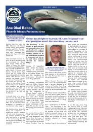
Nomination for a World Heritage Site 2009 - Phoenix Islands ...
Nomination for a World Heritage Site 2009 - Phoenix Islands ...
Nomination for a World Heritage Site 2009 - Phoenix Islands ...

Create successful ePaper yourself
Turn your PDF publications into a flip-book with our unique Google optimized e-Paper software.
ut may point to either hot spot motion or magmatism caused by short-term local lithospheric<br />
extension as the origin of the Tokelau ridge.<br />
The geological processes that <strong>for</strong>med the Kiribati <strong>Phoenix</strong> <strong>Islands</strong> and associated seamounts<br />
are likely the same as <strong>for</strong> Howland and Baker. Atoll and reef island development began when<br />
the volcanic foundations were still emergent islands in the Cretaceous to Eocene periods,<br />
followed by subsidence being offset by upward reef growth maintaining proximity to the sea<br />
surface over long time periods.<br />
The summits of Baker and Howland <strong>Islands</strong> are the smallest of the Pacific remote islands of<br />
the USA, and the highest point on any of these lies just 8 m above sea level. Their tops are all<br />
isolated peaks rising from the deep ocean (3,000 m or greater) with no surrounding ridges or<br />
other connected features. Although the flanks of these islands are very steep with slopes<br />
between 30° and 40° down to a depth of about 1,000 m, both also have small shallow terraces<br />
that probably reflect previous sea level stands. The terraces marked by the areas of low slope,<br />
are present between ~7 and 17 m and between ~90 and 130 m around the islands. Additional<br />
terraces are present at multiple depths off Howland Island. According to bathymetric<br />
in<strong>for</strong>mation available (see also chapter on bathymetry), it is probable that the PIPA islands<br />
and seamounts, are similarly isolated volcanic peaks extending from deep sea. Seafloor age<br />
adjacent at Baker and Howland is estimated to be 123-124 (Ma).<br />
Larson and Chase (1972) correlated the magnetic anomaly sets near the <strong>Phoenix</strong> <strong>Islands</strong>, east<br />
of Japan, and west of Hawaii as part of their analyses of patterns and evolution of sea-floor<br />
spreading in the Cretaceous and Cenozoic periods. This was based on the <strong>Phoenix</strong> lineation<br />
set of magnetic anomaly data. A magnetic reversal model was derived and applied. This<br />
shows that the <strong>Phoenix</strong> <strong>Islands</strong>, Japan, and Hawaii were <strong>for</strong>med during the Cretaceous and<br />
Cenozoic period.<br />
Magnetic anomaly data around the <strong>Phoenix</strong> <strong>Islands</strong> was used to analyze sea-floor spreading<br />
in the Cretaceous and Cenozoic periods. In the 1970s, Pacific <strong>Islands</strong> Applied Geoscience<br />
Commission (SOPAC) conducted manganese nodule surveys around the <strong>Phoenix</strong> <strong>Islands</strong>.<br />
The eastern side of the <strong>Phoenix</strong> <strong>Islands</strong> portion of the Kiribati EEZ appeared to have higher<br />
amounts of manganese nodules than the western side. <strong>Phoenix</strong> <strong>Islands</strong> manganese nodules<br />
had an average of 1.35 percent Ni content. These nodules (and nodules from all of Kiribati’s<br />
EEZs) were of low grade and appear to have no economic value <strong>for</strong> commercial harvest in<br />
the <strong>for</strong>eseeable future.<br />
Several bathymetric surveys have been completed in the <strong>Phoenix</strong> <strong>Islands</strong>. Seabed surface<br />
composition was primarily calcareous ooze, siliceous-calcareous clay, and brown clay. Most<br />
of the seamounts on the eastern side of the <strong>Phoenix</strong> <strong>Islands</strong> portion of the Kiribati EEZ were<br />
surveyed by the Japanese in the late 1980s.<br />
The substrate of the <strong>Phoenix</strong> <strong>Islands</strong> is almost entirely limestone with accumulated organic<br />
matter (Fosberg and Sachet c1976). Garnett (1983a) noted that the soils on Kanton were<br />
composed of coral sand and larger fragments of dead corals and other biogenic materials.<br />
Little or no humic material was in the soil. Soil samples at most sites around Kanton were<br />
primarily sand (GoK 1995).<br />
Darwin has been reported to have used some of the <strong>Phoenix</strong> <strong>Islands</strong> as a basis <strong>for</strong><br />
development of his theory of coral reef and atoll development.<br />
15