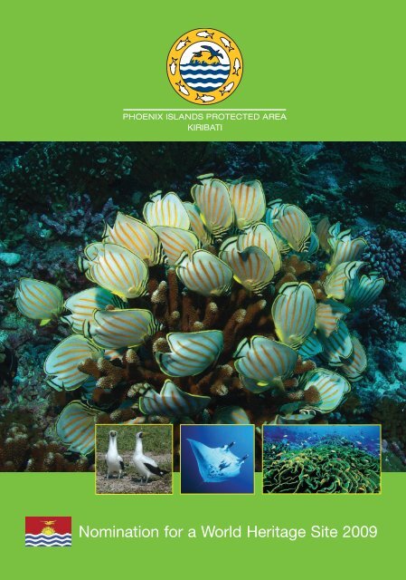
Nomination for a World Heritage Site 2009 - Phoenix Islands ...
Nomination for a World Heritage Site 2009 - Phoenix Islands ...
Nomination for a World Heritage Site 2009 - Phoenix Islands ...

You also want an ePaper? Increase the reach of your titles
YUMPU automatically turns print PDFs into web optimized ePapers that Google loves.
<strong>Nomination</strong> <strong>for</strong> a <strong>World</strong> <strong>Heritage</strong> <strong>Site</strong> <strong>2009</strong>
Cover Photo Credits: Cat Holloway, Gregory Stone, Paul Nicklen and Mary Jane Adams<br />
Map by Kerry Lagueux, New England Aquarium
TABLE OF CONTENTS<br />
List of Acronyms 3<br />
Executive Summary 5<br />
1. Identification of the Property 9<br />
2. Description 12<br />
3. Justification <strong>for</strong> Inscription 83<br />
4. State of Conservation and Factors Affecting the Property 104<br />
5. Protection and Management of the Property 115<br />
6. Monitoring 135<br />
7. Documentation 140<br />
8. Contact In<strong>for</strong>mation of Responsible Authorities 143<br />
9. Signature on behalf of the State Party 145<br />
10. Appendices – PIPA Maps 146<br />
Page<br />
11. List of Annexes (annexes are provided in separate document) 153<br />
2
List of acronyms<br />
BEN South Equatorial Current<br />
BES South equatorial branch of the South Equatorial Current<br />
CBD Convention on Biological Diversity<br />
CEPF Critical Ecosystem Partnership Fund<br />
CI Conservation International<br />
CITES Convention on International Trade in Endangered Species of<br />
Wild Fauna and Flora<br />
COP Conference of Parties<br />
CRISP Coral Reef InitiativeS in the Pacific<br />
DSL Deep Scattering Layer<br />
DWFN Distant Water Fishing Nation<br />
EEZ Exclusive Economic Zone<br />
EIC Equatorial Intermediate Current<br />
ENSO El Niño-Southern Oscillation<br />
FAD Fish Aggregating Device<br />
FFA Forum Fisheries Agency<br />
FSP Foundation of the Peoples of South Pacific<br />
GBRMPA Great Barrier Reef Marine Park Authority<br />
GCF Global Conservation Fund of Conservation International<br />
GEF Global Environment Facility<br />
GLISPA Global Island Partnership<br />
GoK Government of Kiribati<br />
IBA Important Bird Area of Birdlife International<br />
IFAW International Fund <strong>for</strong> Animal Wellfare<br />
IUCN International Union <strong>for</strong> the Conservation of Nature<br />
KANGO Kiribati Association of Non-Governmental Organisations<br />
KBA Key Biodiversity Area of Conservation International<br />
MELAD Ministry of Environment, Lands and Agricultural<br />
Development<br />
MIC Micronesians in Island Conservation<br />
MLPID Ministry of Line and <strong>Phoenix</strong> <strong>Islands</strong><br />
MOU Memorandum of Understanding<br />
MPA Marine Protected Area<br />
NBSAP National Biodiversity Strategy and Action Plan<br />
NDS National Development Strategy<br />
NEAq New England Aquarium<br />
NOAA National Oceanic and Atmospheric Administration<br />
NSCC North Subsurface Countercurrent<br />
NZ-DOC New Zealand Department of Conservation<br />
NZODA New Zealand Overseas Development Agency<br />
PAS Pacific Alliance <strong>for</strong> Sustainability<br />
PCB Polychlorinated Biphenyl<br />
PIF Project Identification Form<br />
PII Pacific Invasives Initiative<br />
PIPA <strong>Phoenix</strong> <strong>Islands</strong> Protected Area<br />
PIPA-MC <strong>Phoenix</strong> <strong>Islands</strong> Protected Area Management Committee<br />
PISC <strong>Phoenix</strong> <strong>Islands</strong> Steering Committee<br />
POP Persistent Organic Pollutants<br />
3
RNHP Regional Natural <strong>Heritage</strong> Programme of Australia<br />
SAMTEC The Space and Missile Test Center<br />
SECC South Subsurface Countercurrent<br />
SOPAC Secretariat of the Pacific <strong>Islands</strong> Applied Geoscience Commission<br />
SPC Secretariat of the Pacific Community<br />
SPREP Secretariat of the Pacific Regional Environment Programme<br />
TBAP Tuna and Billfish Assessment Programme<br />
TIGHAR The International Group <strong>for</strong> Historic Aircraft Recovery<br />
UNDP United Nations Development Programme<br />
VMS Vessel Monitoring System<br />
WCU Wildlife Conservation Unit<br />
WWF <strong>World</strong> Wide Fund For Nature<br />
4
EXECUTIVE SUMMARY<br />
State Party<br />
State, Province or Region<br />
Name of Property<br />
Geographical coordinates to the nearest second<br />
Textual description of the boundary(ies) of the<br />
nominated property<br />
Justification<br />
Statement of Outstanding Universal Value<br />
(text should clarify what is considered to be the<br />
outstanding universal value embodied by the<br />
nominated property)<br />
5<br />
Kiribati<br />
<strong>Phoenix</strong> <strong>Islands</strong><br />
<strong>Phoenix</strong> <strong>Islands</strong> Protected Area<br />
Longitude Latitude<br />
174.242794 0 W 0.983476 0 S<br />
169.706032 0 W 0.983476 0 S<br />
169.706032 0 W 6.466132 0 S<br />
173.220373 0 W 6.470758 0 S<br />
173.510230 0 W 6.616143 0 S<br />
175.865776 0 W 6.617835 0 S<br />
175.865776 0 W 2.091330 0 S<br />
PIPA‘s boundaries consists of a heptangular (7 corner points)<br />
shaped area that encompass some 408,250 sq km and includes<br />
8 atoll islands, two submerged reefs and at least 14 identified<br />
seamounts and their surrounding mainly deep water marine<br />
area.<br />
As a vast expanse of largely pristine mid-ocean environment,<br />
replete with a suite of largely intact uninhabited atolls, truly an<br />
oceanic wilderness, the PIPA, the largest marine protected<br />
area in the world (408,250 sq km), is globally exceptional and<br />
as such is a superlative natural phenomenon of global<br />
importance.<br />
A feature of the marine environment of PIPA is an<br />
outstanding collection of large submerged volcanoes,<br />
presumed extinct, rising direct from the extensive deep<br />
seafloor with an average depth of more than 4,500 metre and a<br />
maximum depth of over 6,000 metres. Included in the<br />
collection of large volcanoes are no less than 14 recognised<br />
seamounts, submerged mountains that don’t penetrate to the<br />
surface. The collection of atolls represent coral reef cappings<br />
on 8 other volcanic mountains that approach the surface.<br />
The large bathymetric range of the submerged seamount<br />
landscape provides depth defined habitat types fully<br />
representative of the mid oceanic biota. The widely<br />
recognized local endemicity and distinctive species<br />
assemblages associated with seamounts generally, specifically<br />
demonstrable in PIPA, is evidence of on-going insitu<br />
evolution of marine ecosystems and communities of plants<br />
and animals.<br />
PIPA is of crucial scientific importance in identifying and<br />
monitoring the processes of sea level change, growth rates and<br />
age of reefs and reef builders, (both geologically and<br />
historically) and in evaluating effects from climate change.<br />
The reef systems are so remote and exhibit such near pristine<br />
conditions that PIPA can serve as a benchmark <strong>for</strong>
Criteria under which property is nominated<br />
(itemize criteria)<br />
understanding and potentially restoring other degraded hard<br />
coral ecosystems. The islands are acknowledged as critical<br />
sites <strong>for</strong> ongoing study of: global climate change and sea-level<br />
events in that they are located in a region less affected by other<br />
anthropogenic stresses; the growth of reefs, evolution of reef<br />
systems, biological behavioural studies, recruitment processes<br />
in isolation, size classes and population dynamics of all<br />
marine organism groups and reef species diversity studies. As<br />
such, the oceanic Central Pacific islands are natural<br />
laboratories <strong>for</strong> understanding the natural history of the<br />
Pacific.<br />
As a known breeding site <strong>for</strong> numerous nomadic, migratory<br />
and pelagic marine and terrestrial species, PIPA makes a<br />
significant contribution to on-going ecological and biological<br />
processes in the evolution and development of global marine<br />
ecosystems and communities of plants and animals.<br />
Due to its great isolation, PIPA occupies a unique position in<br />
the biogeography of the Pacific as a critical stepping stone<br />
habitat <strong>for</strong> migratory and pelagic/planktonic species and <strong>for</strong><br />
ocean currents in the region. PIPA embraces a range of<br />
associated marine environments that display high levels of<br />
marine abundance as well as the full spectrum of age and size<br />
cohorts, increasingly rare in the tropics, and especially in the<br />
case of apex predator fish, sea turtles, sea birds, corals, giant<br />
clams, and coconut crabs, most which have been depleted<br />
elsewhere. The overall marine trophic dynamics <strong>for</strong> these<br />
island communities across this archipelago are better<br />
functioning (relatively intact) compared with other island<br />
systems where human habitation and exploitation has<br />
significantly altered the environment.<br />
PIPA provides important natural habitats <strong>for</strong> in-situ<br />
conservation of globally important oceanic biological<br />
diversity, both marine and terrestrial. It is the most important<br />
secure habitat of the local endemic and now endangered<br />
<strong>Phoenix</strong> petrel and serves as crucial breeding and resting area<br />
<strong>for</strong> a number of threatened migratory birds. PIPA collectively<br />
provides very important habitat <strong>for</strong> the continued existence of<br />
a number of globally endangered species (e.g. Napoleon<br />
wrasse, hawksbill turtle), vulnerable species (e.g. Whitethroated<br />
storm petrel, Bristle-thighed curlew, green turtle,<br />
giant clam, bumbhead parrotfish) and numerous others<br />
globally depleted species, both marine and terrestrial,<br />
including <strong>for</strong> example apex predators such as sharks.<br />
The remoteness of the area and absence of permanent human<br />
settlement provides a unique opportunity <strong>for</strong> a high standard<br />
of habitat protection <strong>for</strong> species and ecosystems of global<br />
importance to science and conservation, from atoll to deep<br />
sea.<br />
(vii) ( ix) (x)<br />
6
Name and contact in<strong>for</strong>mation of official local<br />
institution/agency<br />
A4 (or "letter") size map of the nominated<br />
property, showing boundaries and buffer zone<br />
(if present)<br />
7<br />
<strong>Phoenix</strong> <strong>Islands</strong> Protected Area (PIPA) Office<br />
Ministry of Environment Lands and Agricultural<br />
Development<br />
P.O Box 234<br />
Bikenibeu, Tarawa<br />
Republic of Kiribati<br />
Telephone: (686) 28211 and 686-29762<br />
Fax: (686) 28334<br />
Email: tteroroko@phoenixislands.org<br />
(or tukabutravel@yahoo.com)<br />
Webaddress: www.phoenixislands.org<br />
<strong>Phoenix</strong> <strong>Islands</strong> Protected Area - Boundary Map
Map 1. <strong>Phoenix</strong> <strong>Islands</strong> Protected Area Boundary Map<br />
8
SECTION 1. IDENTIFICATION OF THE PROPERTY<br />
1. a) Country<br />
Republic of Kiribati<br />
1. b) State, Province or Region<br />
<strong>Phoenix</strong> <strong>Islands</strong><br />
1. c) Name of Property<br />
<strong>Phoenix</strong> <strong>Islands</strong> Protected Area<br />
1. d) Geographical coordinates to the nearest second<br />
The coordinates <strong>for</strong> PIPA’s boundary corner points are presented in the map in section 1.e).<br />
Coordinates <strong>for</strong> each island within PIPA:<br />
Kanton: 2˚46.2’S to 2˚52.2’S;<br />
171˚37.4’W to 171˚43.4’W<br />
Enderbury: 3˚6.3’S to 3˚8.9’S;<br />
171˚4.7’W to 171˚5.7’W<br />
Rawaki: 3˚43.0’S to 3˚43.6’S<br />
170˚42.5’W to 170˚43.0’W<br />
Manra: 4˚26.2’S to 4˚28.0’S;<br />
171˚13.6’W to 171˚15.9’W<br />
Orona: 4˚29.0’S to 4˚32.3’S;<br />
172˚8.1’W to 172˚13.1’W<br />
Birnie: 3˚34.8’S to 3˚35.4’S;<br />
171˚30.7W to 171˚31.2’W<br />
McKean: 3˚35.5’S to 3˚36.1’S;<br />
174˚7.2’W to 174˚7.6’W<br />
Nikumaroro: 4˚39.2’S to 4˚41.8’S;<br />
174˚29.8’W to 174˚32.8’W<br />
9
1. e) Maps and plans, showing the boundaries of the nominated property and buffer zone<br />
Map 1. <strong>Phoenix</strong> <strong>Islands</strong> Protected Area Boundary Map<br />
10
In addition to the previous map a series of PIPA maps have been generated and are given in<br />
the Appendices as listed below:<br />
Appendix 1. Location of the <strong>Phoenix</strong> <strong>Islands</strong> Protected Area (PIPA) within the Pacific<br />
Ocean.<br />
Appendix 2. Location of the <strong>Phoenix</strong> <strong>Islands</strong> Protected Area (PIPA) within Kiribati.<br />
Appendix 3. PIPA Locality Map in relation to other major MPAs.<br />
Appendix 4. Bathymetry of PIPA.<br />
Appendix 5. PIPA Phase 1 (current) Zonation.<br />
Appendix 6. PIPA Phase 2 draft proposed Zonation map.<br />
1.f) Area of nominated property (ha.) and proposed buffer zone (ha.)<br />
Total marine area: c. 408, 224.49 km2<br />
Total land area: c. 25.51 km 2<br />
Total nominated area: 408,250 km 2<br />
Island Total area (ha) Land area (ha)<br />
Manra - c.500<br />
Rawaki 73.24 58.14<br />
Enderbury 596.6 500+<br />
Birnie 50.95 48.2<br />
Kanton - c.900<br />
McKean 74.32 48.77<br />
Orona - c.600<br />
Nikumaroro - c.400<br />
(According to Ray Pierce 2008)<br />
Because the islands are small islands with large reef flat areas, they tend to change size<br />
depending on the weather and time, hence the approximate sizes.<br />
Areas of islands are still not <strong>for</strong>mally surveyed and most recent calculations by Ray Pierce et<br />
al in 2008 suggest smaller than above calculations in the table, i.e. Rawaki calculated 2008 to<br />
be 66 ha and McKean 32 ha incl. lagoons, the latter of which were 15.3 and 11.2 ha<br />
respectively. Birnie is probably also smaller than all the previous calculations suggest.<br />
There is no specific buffer zone designated; PIPA being the largest Marine Protected Area in the<br />
world it provides sufficient self buffering to effectively protect the <strong>World</strong> <strong>Heritage</strong> values of the<br />
site.<br />
11
SECTION 2. DESCRIPTION<br />
2. a) Description of Property<br />
Kiribati is an ocean nation stretching over 3,600,000km 2 in the central Pacific on both sides of<br />
the equator approximately midway between Australia in the southern Hemisphere and Hawaii<br />
in the northern hemisphere. Kiribati’s marine area is dotted by three island groups, Gilbert,<br />
<strong>Phoenix</strong> and Line <strong>Islands</strong>, that together contain 33 islands and land area of 811 km 2 . With its<br />
land area well less than 1% of its sovereign domain Kiribati is truly an ‘oceanic nation’.<br />
The <strong>Phoenix</strong> <strong>Islands</strong> Protected Area (hereafter called PIPA) situated in the <strong>Phoenix</strong> Island group<br />
constitutes 11.34% of Kiribati’s Exclusive Economic Zone (EEZ). With a size of 408,250 km 2<br />
PIPA is the largest Marine Protected Area (MPA) in the world, first established in 2006 and<br />
further extended in February 2008. PIPA presently contributes 17.5% by area of global MPA<br />
ef<strong>for</strong>t, and it is the largest MPA yet attempted by any developingnation.<br />
PIPA is the world’s first large, truly deep water, mid-ocean marine protected area. Whilst the<br />
greater part by area of PIPA comprises mainly ocean floor with a water column averaging<br />
more than 4,000 metres, an important feature of the marine environment is the abundance of<br />
large extinct underwater volcanoes. These underwater mountains contribute a huge diversity<br />
of marine habitat types - atoll, low reef island, submerged reef, seamount and deep seabed as<br />
well as open ocean habitats. It can also be described as an underwater ‘mountain-scape’ with<br />
the highest peaks of the volcanic mountains, some rising more than 5,000 metres above the<br />
adjacent seabed, the highest reaching almost to the surface <strong>for</strong>ming atolls, reef islands and,<br />
just below the surface, shallow submerged reefs.<br />
Bathymetric Context of PIPA in Pacific Ocean<br />
Note location of PIPA in a deep ocean basin. Two existing <strong>World</strong> <strong>Heritage</strong> listed Marine Protected Areas (Great<br />
Barrier Reef and Lagoons of New Caledonia), together with Papahanaumokuakea in Hawaii, an MPA currently<br />
nominated <strong>for</strong> WHA are illustrated diagrammatically. Base map courtesy J.Maragos.<br />
12
The <strong>Phoenix</strong> Island group is situated between the Gilbert <strong>Islands</strong> to the west and the Line<br />
<strong>Islands</strong> to the east, extending across the centre of Kiribati. Two of the <strong>Phoenix</strong> <strong>Islands</strong>,<br />
Howland and Baker, are low reef islands in adjacent territory of the United States to the north<br />
of Kiribati.<br />
Located directly north of the Tonga-Kermadec ocean trench, the <strong>Phoenix</strong> <strong>Islands</strong> region<br />
shows no evidence of a northward extension of the trench; rather it is located on the Tokelau<br />
Ridge, incorporating some of the many Tokelau volcanoes aligned along the ridge (See map<br />
in Bathymetry and Seamounts section). Beyond the Tokelau seamounts there is a well<br />
defined cluster of volcanoes to the east, including Kanton, Enderbury, Rawaki, Birnie, Manra<br />
and Orona atolls and low reef islands, all within PIPA. Beyond the volcanoes, the sea floor is<br />
typical flat terrain mid-ocean sea floor. With an average water depth of 4,500 m and<br />
maximum depth of 6,147 m, the highest peaks of the underwater volcanoes reach to the<br />
surface where they are capped by coral atolls and reefs.<br />
As many as ten of these massive volcanoes have a surface or near surface manifestation; four<br />
are capped with coral atolls (Orona, Manra, Kanton and Nikumaroro), six occurring as low<br />
reef islands (Birnie, Rawaki, McKean and Enderbury in Kiribati, Baker and Howland in US<br />
territory) and two as submerged reefs (Carondelet and Winslow).<br />
PIPA includes all eight atoll and low reef islands of the Kiribati section of the <strong>Phoenix</strong> group:<br />
Rawaki, Enderbury, Nikumaroro, McKean, Manra, Birnie, Kanton and Orona. Their tops are<br />
all isolated peaks rising from the deep ocean floor (3,000 m or greater) with several other<br />
presumed old volcanoes rising to near the surface, and many more known only from<br />
bathymetric study that do not reach to near the surface. Two known submerged reefs,<br />
Carondelet Reef, located 125 km southeast from Nikumaroro, and Winslow Reef located 240<br />
km northwest from the McKean Island, are shallow plat<strong>for</strong>m reefs with Carondelet Reef<br />
being as little as 3-4 m underwater at low tide.<br />
The 8 atolls and low reef islands and the two submerged reefs of PIPA represent only the<br />
highest of numerous large and long-extinct volcanoes. An even larger number of large<br />
volcanoes do not reach to within 200 metres of the surface and are there<strong>for</strong>e technically<br />
classified as seamounts. A few of PIPA’s seamount volcanoes have been studied<br />
bathymetrically and <strong>for</strong>mally named and entered into the Seamount Catalogue, including the<br />
Carondelet and Winslow seamounts near their namesake submerged reeds. The catalogued<br />
seamounts also include Fautasi, Siapo, Polo, Tai, Tanoa, Tau Tau, Gardner, and four<br />
unnamed seamounts. Another large unnamed seamount is located in the south east of PIPA<br />
(170º 15´W, 5º 36´S).<br />
These atolls and low reef islands are surrounded by some of the most pristine coral reefs in<br />
the world. The waters are teeming with fish in quantities rarely seen elsewhere and tens of<br />
thousands of seabirds find refuge on the atolls.<br />
The <strong>Phoenix</strong> group islands have no permanent inhabitants, although most islands have a<br />
recent cultural history extending over the past 150 years. The one currently inhabited atoll,<br />
Kanton, has a non-permanent population of approximately 50 people comprising government<br />
employees and their families engaged in protection and management of Kiribati interests in<br />
the region.<br />
13
Meteorology<br />
PIPA is located in the Pacific equatorial dry zone that experiences droughts and periods of<br />
heavy rainfall. During El Niño periods, the <strong>Phoenix</strong> <strong>Islands</strong> may experience high rainfall.<br />
Historic Kanton rainfall data indicates that precipitation between 1940 and 1965 was much<br />
lower than that between 1986 and 2001. Overall, the rainfall in the <strong>Phoenix</strong> <strong>Islands</strong> is among<br />
the lowest in the Central Pacific. Most of the <strong>Phoenix</strong> <strong>Islands</strong> receive less than 1,000<br />
millimetres (mm) of rain annually with a dry period from March through June. The northern<br />
most islands in the <strong>Phoenix</strong> are the driest, i.e. Kanton and Enderbury. Birnie, Rawaki,<br />
Nikumaroro and McKean are wetter. Orona and Manra are the wettest.<br />
Air temperature ranges from 21.7° to 36.7°C with an average 28.9°C. Relative humidity<br />
ranges from 57 to 85 percent.<br />
Nunn (1994) noted that the intertropical convergence zone remains relatively stationary<br />
during the year over the central Pacific Ocean. However, the South Pacific convergence zone<br />
moves north from January to July. The <strong>Phoenix</strong> <strong>Islands</strong> are between the two zones throughout<br />
the year. Between 5 0 N to 5 0 S particularly in the central Pacific Ocean (where the <strong>Phoenix</strong><br />
<strong>Islands</strong> are located), there is persistent high pressure preventing the development of tropical<br />
cyclones (hurricanes).<br />
The meteorological conditions have a big influence on fish stocks in the region. Lehodey et al<br />
(1997) examined the El Niño - Southern Oscillation (ENSO) in relationship to the western<br />
equatorial Pacific warm pool. During ENSO events this warm water pool shifts to the east<br />
and skipjack tuna populations also shift to the east extending significant catches to the<br />
<strong>Phoenix</strong> <strong>Islands</strong>. The <strong>Phoenix</strong> <strong>Islands</strong> region appears to be the centre of El Niño activities in<br />
the Pacific so may be ideal <strong>for</strong> studying the El Niño phenomenon and more generally in<br />
relation to climate change.<br />
Geology<br />
There has been little study of geology of the atolls and seamounts in PIPA but based on what<br />
is known from Howland and Baker, the US islands within the <strong>Phoenix</strong> Group, some<br />
extrapolations can be made <strong>for</strong> the origins and geological history of PIPA. Joyce Miller in<br />
Maragos et al provide the following in<strong>for</strong>mation (Chapter 15, Coral Reefs of the USA, 2008):<br />
The Line and Tokelau (PIPA is located across the Tokelau ridge) ridges lie within the Darwin<br />
Rise, on magnetically “quiet” seafloor <strong>for</strong>med during the Cretaceous Normal Superchron<br />
(120–83 Ma) (Atwater et al. 1993). The seafloor underlying the northern part of the Tokelau<br />
ridge is dated between 120.4 and 131.9 Ma (Early Cretaceous) (Muller et al. 1997; Clouard<br />
and Bonneville 2005).<br />
Recent research by Koppers and Staudigel (2005) along the Tokelau ridge and Gilbert Island<br />
chain establishes seamount ages from dredge samples in these areas, particularly focusing on<br />
dating the bends that occur in the two chains. These seamount ages are combined with<br />
predicted hotspot traces from extinct hotspots (Wessel et al. 2003; Kroenke et al. 2004) to<br />
compare the age of Tokelau (57 Ma) and Gilbert (67 Ma) bends with the 47 Ma age of the<br />
Hawaiian–Emperor Bend (Dalrymple and Clague 1976), which has recently been revised to<br />
50 Ma (Sharp and Clague 2006). Koppers and Staudigel (2005) argue that because the ages of<br />
the three bends are asynchronous, these data do not support a stationary hot spot paradigm,<br />
14
ut may point to either hot spot motion or magmatism caused by short-term local lithospheric<br />
extension as the origin of the Tokelau ridge.<br />
The geological processes that <strong>for</strong>med the Kiribati <strong>Phoenix</strong> <strong>Islands</strong> and associated seamounts<br />
are likely the same as <strong>for</strong> Howland and Baker. Atoll and reef island development began when<br />
the volcanic foundations were still emergent islands in the Cretaceous to Eocene periods,<br />
followed by subsidence being offset by upward reef growth maintaining proximity to the sea<br />
surface over long time periods.<br />
The summits of Baker and Howland <strong>Islands</strong> are the smallest of the Pacific remote islands of<br />
the USA, and the highest point on any of these lies just 8 m above sea level. Their tops are all<br />
isolated peaks rising from the deep ocean (3,000 m or greater) with no surrounding ridges or<br />
other connected features. Although the flanks of these islands are very steep with slopes<br />
between 30° and 40° down to a depth of about 1,000 m, both also have small shallow terraces<br />
that probably reflect previous sea level stands. The terraces marked by the areas of low slope,<br />
are present between ~7 and 17 m and between ~90 and 130 m around the islands. Additional<br />
terraces are present at multiple depths off Howland Island. According to bathymetric<br />
in<strong>for</strong>mation available (see also chapter on bathymetry), it is probable that the PIPA islands<br />
and seamounts, are similarly isolated volcanic peaks extending from deep sea. Seafloor age<br />
adjacent at Baker and Howland is estimated to be 123-124 (Ma).<br />
Larson and Chase (1972) correlated the magnetic anomaly sets near the <strong>Phoenix</strong> <strong>Islands</strong>, east<br />
of Japan, and west of Hawaii as part of their analyses of patterns and evolution of sea-floor<br />
spreading in the Cretaceous and Cenozoic periods. This was based on the <strong>Phoenix</strong> lineation<br />
set of magnetic anomaly data. A magnetic reversal model was derived and applied. This<br />
shows that the <strong>Phoenix</strong> <strong>Islands</strong>, Japan, and Hawaii were <strong>for</strong>med during the Cretaceous and<br />
Cenozoic period.<br />
Magnetic anomaly data around the <strong>Phoenix</strong> <strong>Islands</strong> was used to analyze sea-floor spreading<br />
in the Cretaceous and Cenozoic periods. In the 1970s, Pacific <strong>Islands</strong> Applied Geoscience<br />
Commission (SOPAC) conducted manganese nodule surveys around the <strong>Phoenix</strong> <strong>Islands</strong>.<br />
The eastern side of the <strong>Phoenix</strong> <strong>Islands</strong> portion of the Kiribati EEZ appeared to have higher<br />
amounts of manganese nodules than the western side. <strong>Phoenix</strong> <strong>Islands</strong> manganese nodules<br />
had an average of 1.35 percent Ni content. These nodules (and nodules from all of Kiribati’s<br />
EEZs) were of low grade and appear to have no economic value <strong>for</strong> commercial harvest in<br />
the <strong>for</strong>eseeable future.<br />
Several bathymetric surveys have been completed in the <strong>Phoenix</strong> <strong>Islands</strong>. Seabed surface<br />
composition was primarily calcareous ooze, siliceous-calcareous clay, and brown clay. Most<br />
of the seamounts on the eastern side of the <strong>Phoenix</strong> <strong>Islands</strong> portion of the Kiribati EEZ were<br />
surveyed by the Japanese in the late 1980s.<br />
The substrate of the <strong>Phoenix</strong> <strong>Islands</strong> is almost entirely limestone with accumulated organic<br />
matter (Fosberg and Sachet c1976). Garnett (1983a) noted that the soils on Kanton were<br />
composed of coral sand and larger fragments of dead corals and other biogenic materials.<br />
Little or no humic material was in the soil. Soil samples at most sites around Kanton were<br />
primarily sand (GoK 1995).<br />
Darwin has been reported to have used some of the <strong>Phoenix</strong> <strong>Islands</strong> as a basis <strong>for</strong><br />
development of his theory of coral reef and atoll development.<br />
15
To summarize, PIPA illustrates evolutionary stages of volcanic subsidence and corresponding<br />
reef growth culminating in the <strong>for</strong>mation of large biogenic structures. The <strong>Phoenix</strong> <strong>Islands</strong><br />
are among the most ancient atoll archipelagos in the world. All were <strong>for</strong>med as coralline<br />
limestone accumulated atop subsiding volcanoes over a period of millions of years.<br />
Subsequent development of lagoons and dunes has continued during sea level changes in the<br />
Holocene. Fringing coral reefs continue to develop around the islands.<br />
The <strong>Phoenix</strong> <strong>Islands</strong> reflect a geological sequence of globally significant mid-oceanic<br />
archipelagos, capturing a diversity of <strong>for</strong>ms and developmental stages of ancient atolls, low<br />
reef islands, submerged reefs and seamounts, recording in their rock strata the <strong>for</strong>mation of<br />
the world’s largest biogenic structures (atolls and reef islands) over the past 10 to 80 million<br />
years. These <strong>for</strong>mations collectively contain one of the world’s largest pristine atoll<br />
archipelagos, which in turn contribute essential habitat <strong>for</strong> coral communities, benthic algae<br />
communities, giant clam beds, intact atoll <strong>for</strong>ests and intact atoll dry scrubs. It is a unique<br />
opportunity to have nominated as <strong>World</strong> <strong>Heritage</strong>, an entire suite of atolls, low reef islands,<br />
submerged reefs and seamounts set on a deep mid-ocean sea floor and that have had minimal<br />
anthropogenic impact.<br />
Bathymetry and Seamounts<br />
PIPA has a huge bathymetric range with waters reaching to maximum of 6,147 meters depth<br />
but the main seafloor averages around 4,500 metres below the ocean surface. Additional to<br />
the ancient volcanoes that reach or approach the surface, bathymetry reveals a series of<br />
topographic features which are interpreted to also be volcanoes which technically qualify as<br />
‘seamounts’ – ‘submerged mountains with a height of more than 1,000 metres above the sea<br />
floor but whose peak lies below the photic zone’.<br />
Based on bathymetry alone, it is estimated that there may be more than 30 seamounts to be<br />
found within the PIPA nomination. Globally the Pacific Ocean contains the highest density<br />
of seamounts followed by the Atlantic and Indian Oceans. Several estimates on the number of<br />
seamounts globally have been made ranging up to 30,000 but less than 150 seamounts have<br />
been explored. One of the most recent estimates is 14,287 seamounts published by<br />
Kitchingman & Lai 2004 (from http://www.ga.gov.au/ausgeonews/ausgeonews200706/marine.jsp)<br />
which was based on an analysis of the ETOPO2 raster bathymetric dataset produced by the<br />
United States National Oceanographic and Atmospheric Agency (NOAA). The map of<br />
geomorphic features below shows 6739 seamounts (47%) within EEZs, with the remainder<br />
(7548 or 53%) on the high seas. Note the higher density of seamounts in the Central Pacific,<br />
including Kiribati. The total area of the oceans covered by seamounts is very small (probably<br />
less than 1%), since most seamounts are less than 20 kilometres in radius.<br />
16
Map of seafloor geomorphic features (after Agapova et al 1979), with distribution of seamounts (after<br />
Kitchingman & Lai 2004) superimposed relative to the 200-mile EEZ.<br />
(Map source http://www.ga.gov.au/ausgeonews/ausgeonews200706/marine.jsp)<br />
Research to study the seamounts and other volcanoes of PIPA is on-going. To date, some 14<br />
seamounts have been identified within PIPA, thirteen of which have been <strong>for</strong>mally registered<br />
but only nine of those have yet been named viz Tai, Polo, Siapo, Gardner, Tanoa, Fautasi,<br />
Tau Tau, Carondelet and Winslow Reef, which are the larger seamounts. The Government of<br />
Kiribati will likely recommend re-naming of some of the seamounts, proposing culturally<br />
appropriate Kiribati names.<br />
A further exploratory cruise will be conducted in the <strong>Phoenix</strong> <strong>Islands</strong> in <strong>2009</strong> led by the New<br />
England Aquarium. The primary objective of this cruise will be to obtain further in<strong>for</strong>mation<br />
on seamounts in the <strong>Phoenix</strong> <strong>Islands</strong> area utilising remotely operated submarine equipment.<br />
17
Topographic Features of <strong>Phoenix</strong> <strong>Islands</strong> Protected Area (PIPA):<br />
Map base is a Merged Bathymetric Map courtesy of http://www.earthref.org/SBN/. Labelling and placement<br />
using Google Earth is indicative only.<br />
Atolls and Reef <strong>Islands</strong> are shown with flag icons, submerged reefs with concentric circles<br />
and seamounts with triangles. Most of the confirmed seamounts are part of the Tokelau<br />
Seamounts array extending north-south. Also located on the Tokelau ridge are two atolls –<br />
McKean and Nikumaroro – as well, two submerged reefs – Winslow and Carondelet - both of<br />
which are associated with adjacent large seamounts.<br />
Six of the <strong>Phoenix</strong> <strong>Islands</strong>, in the east of PIPA, occur as a cluster on a lateral ridge extending<br />
eastward from the Tokelau Ridge.<br />
18
Seamounts within PIPA<br />
PIPA Topography in 3 Dimensions<br />
19<br />
This three dimensional map<br />
shows the underwater<br />
topography of PIPA. The<br />
atolls (4), reef (4) islands,<br />
submerged reefs (2) and 9 of<br />
the 14 confirmed seamounts<br />
have been named. Average<br />
depth of the seafloor is about<br />
4,500 metres, with a<br />
maximum of 6,147 m. Details<br />
on each of the topographic<br />
features are provided<br />
elsewhere in the nomination<br />
document.
Carondelet Reef and adjacent unnamed seamounts<br />
Carondelet Reef is located 125 km southeast from Nikumaroro. It is 1.2 km (¾ mile) northnortheast<br />
and south-southwest in the shape of a horse shoe; about 732 m long (north-south)<br />
and 640 m wide (east-west). It is totally submerged. The maximum depth is 3.7 m. Depth just<br />
off the reef is 9.1 to 18 m. There can be an occasional wave break over the reef. Carondelet<br />
Reef was first confirmed by the H.M.S. Wellington in 1937.<br />
The seamount next to Carondelet Reef (confusingly also named Carondelet in the map below<br />
although it is a separate from the Carondelet Reef described above) is located at 5º 34.7' S,<br />
173º 51.9' W. It is 4365 m high with the top at -700 m and the ocean bottom at -5065 m. The<br />
seamount has a volume of 2359 km 3 and is slightly elongated. The edges are fairly smooth. A<br />
single summit is observed. A saddle to the northwest connects Carondelet to another<br />
unnamed seamount.<br />
20
Unnamed Seamount<br />
Unnamed Seamount SMNT-054S-1740W is located at 5º 24.5' S, 173º 58.4' W and is part of<br />
the Tokelau Seamounts on the Pacific Plate. It is 4707 m high with the top at -400 m and the<br />
ocean bottom at -5107 m. The seamount has a volume of 3395 km 3 and is slightly elongated.<br />
The edges are relatively smooth but several rifts are seen radiating out from a central ridge.<br />
To the southeast there is a saddle connecting the seamount to Carondelet Volcanic Island.<br />
21
Fautasi Seamount<br />
Fautasi Seamount is located at 5º 48.9' S, 174º 6.7' W and is part of the Tokelau Seamounts<br />
on the Pacific Plate. It is 3745 m high with the top at -1700 m and the ocean bottom at -5445<br />
m. The seamount has a volume of 2457 km 3 and is cross-shaped with very little elongation<br />
and only slightly irregular edges. Carondelet is located to the northeast of Fautasi.<br />
22
Winslow Reef and two adjacent unnamed seamounts<br />
Winslow Reef is located 240 km northwest from the island of McKean. Its exact location was<br />
confirmed in 1944 but not reaffirmed in 2008. The depth is about 11.0 m and it is 1.6 km (1<br />
mile) long in an east to west direction, and 0.8 km (0.5 miles) wide.<br />
The seamount next to Winslow Reef (confusingly also called as Winslow Reef in the map<br />
below although it is a separate from the Winslow Reef described above) is located at 1º 41.2'<br />
S, 175º 14.7' W and is part of the Tokelau Seamounts on the Pacific Plate. It is 3700 m high<br />
with the top at -1500 m and the ocean bottom at -5200 m. The reef has a volume of 4677 km3<br />
and is slightly elongated. The edges are slightly irregular and four predominant rifts are<br />
observed. There is a saddle to the east, connecting it with the rest of the Winslow Reef.<br />
23
Siapo Seamount<br />
Siapo Seamount is located at 2º 34.3' S, 175º 24.1' W and is part of the Tokelau Seamounts<br />
on the Pacific Plate. It is 3212 m high with the top at -2200 m and ocean bottom at -5412 m.<br />
The seamount has a volume of 1258 km3 and is fairly round with slightly irregular edges.<br />
There are five predominate rifts meeting at a single summit. A saddle connects this seamount<br />
with the Polo Seamount to the south.<br />
24
Polo Seamount<br />
Polo Seamount is located at 2º 42.9' S, 175º 5.4' W and is part of the Tokelau Seamounts on<br />
the Pacific Plate. It is 4229 m high with the top at -1100 m and the ocean bottom at -5329 m.<br />
The seamount has a volume of 3225 km 3 and is slightly elongated. The edges of the seamount<br />
are slightly irregular and there is one predominate rift which radiates out to the southwest<br />
from the summit. A saddle to the northwest connects Polo to Siapo Seamount.<br />
25
Tai Seamount<br />
Tai Seamount, featured in the map below, is located at 3º 52.4' S, 173º 16.1' W halfway<br />
between McKean low reef island and Orona atoll. It is 3590 m high with the top at -2000 m<br />
and the ocean bottom at -5590 m. The seamount has a volume of 6507 km 3 and is very<br />
elongated. The edges of the seamount are slightly irregular but none of the rifts are very<br />
pronounced.<br />
26
Tanoa Seamount<br />
Tanoa Seamount is located at 5º 60.0' S, 173º 46.0' W and is part of the Tokelau Seamounts<br />
on the Pacific Plate. It is 2748 m high with the top at -2600 m and the ocean bottom at -5348<br />
m. The seamount has a volume of 1080 km3 and is moderately elongated. The edges of the<br />
seamount are slightly irregular and there are multiple rifts radiating out from a central<br />
summit. A saddle exists to the south connecting Tanoa to Tau Tau Seamount. Tanoa is the<br />
northern most volcano in a cluster of volcanoes on a common plat<strong>for</strong>m.<br />
27
Tau Tau seamount<br />
Tau Tau Seamount is located at 6º 11.3' S, 173º 39.0' W and is part of the Tokelau Seamounts<br />
on the Pacific Plate. It is 3592 m high with the top at -1600 m and the ocean bottom at -5192<br />
m. The seamount has a volume of 1665 km 3 and is slightly elongated. The edges are slightly<br />
irregular with rifts radiating out from the center. Tau Tau is part of a cluster of volcanoes. A<br />
saddle connects Tau Tau to Tanoa Seamount to the north and to an unnamed seamount to the<br />
south.<br />
28
Gardner Seamount<br />
Nikumaroro Volcanic Island (previously known as Gardner Island) is located at 4º 42.0' S,<br />
174º 30.3' W and is part of the Tokelau Seamounts on the Pacific Plate. It is 4584 m high<br />
with the top at -600 m and the ocean bottom at -5184 m. The seamount has a volume of 7506<br />
km 3 and is slightly elongated. The edges of the volcano are relatively smooth and no<br />
dominate rifts are seen. Gardner Seamount is connected via a saddle to Nikumaroro atoll to<br />
the south.<br />
29
Unnamed Seamount 1<br />
Unnamed Guyot SMNT-034S-1747W is located at 3º 24.6' S, 174º 42.2' W west from<br />
McKean Island and is part of the Tokelau Seamounts on the Pacific Plate. It is 4633 m high<br />
with the top at -1100 m and the ocean bottom at -5733 m. The guyot has a volume of 5231<br />
km3 and is a fairly round with relatively smooth edges. There appears to be three rifts to the<br />
south and two rifts to the northwest. The top is relatively flat resulting in the classification as<br />
a guyot. To the southeast a saddle connects the guyot to an unnamed seamount.<br />
30
Unnamed Seamount 2<br />
Unnamed Seamount SMNT-037S-1746W is located at 3º 41.6' S, 174º 33.6' W west from<br />
McKean Island and is part of the Tokelau Seamounts on the Pacific Plate. It is 2835 m high<br />
with the top at -2400 m and the ocean bottom at -5235 m. The seamount has a volume of 577<br />
km 3 and is fairly round with relatively smooth edges. There are six predominate peaks<br />
radiating out from a single summit. The seamount is connected by a saddle to another<br />
unnamed seamount to the north.<br />
31
Unnamed Seamount 3<br />
Unnamed Seamount SMNT-042S-1748W is located at 4º 11.2' S, 174º 49.7' W south-west<br />
from McKean Island and is part of the Tokelau Seamounts on the Pacific Plate. It is 4458 m<br />
high with the top at -1100 m and the ocean bottom at -5558 m. The seamount has a volume of<br />
5934 km 3 and is slightly elongated. The edges are very irregular and two predominant rifts<br />
radiate out to the east and south of a peak in the northwest corner of the seamount.<br />
32
No previous resource surveys have been identified <strong>for</strong> Carondelet or Winslow reefs, or <strong>for</strong><br />
the unnamed reefs in the <strong>Phoenix</strong> <strong>Islands</strong>. A survey was attempted at Winslow in August<br />
2008 but the reef could not be located (Jim Maragos, US Fish and Wildlife Service, oral<br />
in<strong>for</strong>mation). These remote untouched reefs undoubtedly have high species diversity and<br />
populations of endangered species. The draft management plan has an objective to complete<br />
baseline surveys of the reefs of Carondelet and Winslow and of other unnamed reefs in the<br />
<strong>Phoenix</strong> <strong>Islands</strong> using standardized quantitative methods. The <strong>2009</strong> expedition by New<br />
England Aquarium is expected to provide more in<strong>for</strong>mation on these reefs. Establishing notake<br />
zones around Carondelet and Winslow Reefs is <strong>for</strong>eseen in the new management plan.<br />
More in<strong>for</strong>mation on the ecology of seamounts is provided later in this nomination in the<br />
chapter on Seamounts.<br />
Oceanography<br />
Sea surface temperatures within PIPA are normally between 28-30°C. There is no significant<br />
thermocline down to 50 m depth. Sea level observations on Kanton show regular four-day<br />
oscillations related to equatorial waves. Oceanographic studies reveal that silicate and<br />
phosphate levels in the waters around the <strong>Phoenix</strong> <strong>Islands</strong> are elevated compared adjacent<br />
waters. This may be a result of upwelling and have high importance <strong>for</strong> the pelagic food<br />
chain in the region. For example in 2000, McKean water temperature was slightly cooler than<br />
that of Nikumaroro. This suggested up-welling and mixing of deeper water on McKean. The<br />
minimum water temperature recorded was 26.7 0 C at Nikumaroro (Obura and Stone 2003).<br />
The <strong>Phoenix</strong> <strong>Islands</strong> are adjacent to the equator and are predominantly influenced by the<br />
westward-flowing Equatorial Current (northern equatorial branch of the South Equatorial<br />
Current (BEN) and south equatorial branch of the South Equatorial Current (BES) (TBAP<br />
1993). Offshore currents are generally westward. The strength of the currents varies with the<br />
wind. Usual current speed is 1.9 km per hour (1 knot), with a maximum of 3.7 km per hour (2<br />
knots).<br />
The <strong>Phoenix</strong> <strong>Islands</strong> are subject to the ENSO that occurs every two to seven years and lasts<br />
<strong>for</strong> 18 to 24 months. During ENSO events, the westward trade winds are reduced and the<br />
main water currents experience variations and even reversal. This deepens the eastern Pacific<br />
thermocline. More specifically, the <strong>Phoenix</strong> <strong>Islands</strong> are located within the region of the<br />
Central Pacific in which warm pool of surface waters develops at the onset of El Niño phases,<br />
and can experience persistent hotspots lasting 1 year or more, as occurred in 2002-3. This<br />
unique environment of high exposure to warm water pools may exert unusual selective<br />
pressures on marine organisms relevant to climate change adaptation, discussed further in<br />
later sections.<br />
The Tuna and Billfish Assessment Programme (TBAP 1993) provided diagrams (some<br />
shown below) of the seasonal changes in major equatorial surface currents around the<br />
<strong>Phoenix</strong> <strong>Islands</strong>.<br />
33
Vertical sections of the central Pacific, including the <strong>Phoenix</strong> <strong>Islands</strong>, showing mean temperature, and current<br />
profiles <strong>for</strong> JUNE between the surface and 400 m (source: TBAP 1993).<br />
Vertical sections of the central Pacific, including the <strong>Phoenix</strong> <strong>Islands</strong>, showing mean temperature, and current<br />
profiles <strong>for</strong> DECEMBER between the surface and 400 m (source: TBAP 1993).<br />
34
Jamie Gove in Maragos et al (2008) provided a sketch of the equatorial current system in the<br />
central Pacific shown in the figure below. The <strong>Phoenix</strong> <strong>Islands</strong> were in an area of unique<br />
subsurface water currents. This may have great significance <strong>for</strong> dispersing larvae originating<br />
from the <strong>Phoenix</strong> <strong>Islands</strong>.<br />
Sketch of equatorial current system in the central Pacific Ocean (170 0 W) including the Equatorial Intermediate<br />
Current (EIC), the North and South Subsurface Countercurrents (NSCC and SECC). (Source: Maragos et al<br />
Coral Reefs of the USA, 2008). Cross-sectional sketch of the equatorial current system in the central Pacific<br />
Ocean (170° W). Shown in crosshatch are the North and South Equatorial Countercurrent (NECC and SECC),<br />
subsurface Equatorial Intermediate Current (EIC), North and South Subsurface Countercurrents (NSCC and<br />
SSCC), and Equatorial Undercurrent (EUC ). Eastward flow is colored green or brown, and all westward flow is<br />
white, including the North Equatorial Current (NEC) north of 5° N and the South Equatorial current (SEC )<br />
south of 5° N and outside the EIC. Black numbers in italics were observations from January 1984 to June 1986<br />
(latitude 165° E), and bold red numbers were observations from April 1979 to March 1980 (latitude 155° W),<br />
with both representing transports in Sverdrups (Sv = 106 m3/s) (Modified from Tomczak and Godfrey (2003).<br />
MARINE ECOSYSTEMS<br />
The marine environment of the PIPA is extremely diverse. It varies from the spectacular<br />
turquoise lagoons with huge coral heads and clams to pristine and colorful coral reefs that<br />
<strong>for</strong>m and surround the atoll, low reef islands and submerged reefs down the slopes of the<br />
massive volcanoes to the ocean floor to over 6,000 meters deep. The marine environment of<br />
the PIPA is known to support a number of globally endangered and endemic species and<br />
hosts interesting and unique species assemblages not found elsewhere in the world.<br />
From a marine science perspective the PIPA is extremely important because of the minimal<br />
human impacts and hence it’s near pristine state. In addition PIPA is biogeographically<br />
uniquely situated in the center of the equatorial Pacific. PIPA plays a significant role in<br />
movements and dispersal of marine animals and larvae. Little is still known about the full<br />
effect of these islands on the surrounding pelagic marine species and systems, which in turn<br />
support internationally important seabird populations and numerous migratory birds.<br />
Signs (prolific algae growth) of unusually high nutrient levels <strong>for</strong> oceanic atolls have been<br />
observed in the <strong>Phoenix</strong> <strong>Islands</strong>. This effect could be caused by a combination of lagoon<br />
enrichment, leaching of guano deposits or oceanic upwelling caused by deep currents striking<br />
the massive seamounts underlying each of the <strong>Phoenix</strong> <strong>Islands</strong>. Pierce et al (2006) suggested<br />
35
that the <strong>Phoenix</strong> <strong>Islands</strong> are affecting and supporting the pelagic marine life/seabird ecology<br />
by increasing nutrient status, which has a food chain effect reaching outwards <strong>for</strong> a very long<br />
distance off shore.<br />
The <strong>Phoenix</strong> <strong>Islands</strong> are considered spawning grounds <strong>for</strong> skipjack tuna. Hence their<br />
protection should also contribute to increase in tuna stocks. Tuna is the most important<br />
income earner <strong>for</strong> Pacific island countries including Kiribati.<br />
Below are a few testimonials from scientists that have visited PIPA in recent years.<br />
Dr. Ray Pierce, internationally renowned bird expert and leader of PIPA invasive species<br />
eradications, in Pierce et al (2006) describe their underwater experience in the <strong>Phoenix</strong><br />
<strong>Islands</strong>: “Our survey ef<strong>for</strong>t and experience of the <strong>Phoenix</strong> <strong>Islands</strong> supports the view that this<br />
Island group exhibits many of the characteristic of an oceanic coral reef system which is<br />
close to pristine and free of human impacts, most notably fishing. With some exceptions our<br />
data certainly rein<strong>for</strong>ces this description. There were many unique experiences underwater at<br />
these islands which our team had not experienced in a decade of diving in the Central Pacific<br />
and Eastern Pacific. The impression a diver gets is one of sheer abundance of fish and an<br />
almost unsettling presence of many very large fish. In diving there you are immediately<br />
aware that these large fish are playing out their ecological role on the reef in an impressive<br />
manner. Watching a giant napoleon wrasse <strong>for</strong>aging on a coral, with a swarm of other reef<br />
fish in close attendance sorting through the cloud of debris, is an impressive sight. We were<br />
‘examined’ on several occasions by manta rays spiralling around us within touching<br />
distance. We were treated to witnessing trevally schools charging at tremendous speed into<br />
clouds of Anthias far too numerous to find cover on the reef. What is so important about the<br />
<strong>Phoenix</strong> <strong>Islands</strong> is that there is almost no reef systems left where the full range of naturally<br />
occurring species and reef ecology is so unaffected.”<br />
Fish expert Dr. Gerald Allen has dived extensively on reefs of the Indo-Pacific region over<br />
the past 35 years. This experience provides an excellent basis of comparison, which<br />
encompasses a huge variety of reefs from the coast of the Americas to East Africa. He<br />
considers the <strong>Phoenix</strong> <strong>Islands</strong> as one of the best examples of a near-pristine atoll<br />
environment. Moreover, the islands seem to have escaped coral-bleaching episodes up until<br />
the event of late 2002. There<strong>for</strong>e, there is excellent justification <strong>for</strong> establishing a<br />
conservation reserve that incorporates at least a portion of these islands.<br />
The New England Aquarium explorers Dr. David Obura and Dr. Greg Stone testify the<br />
uniqueness of the <strong>Phoenix</strong> <strong>Islands</strong>. At his first underwater glimpse of the coral reefs of the<br />
<strong>Phoenix</strong> <strong>Islands</strong>, ocean explorer Greg Stone realized that they were among the most pristine<br />
coral reefs in the world. They also had a chance to witness a mass spawning of Pacific<br />
longnose parrotfishes, as Greg Stone describes in a National Geographic (February 2004)<br />
article: “Then, like the start of a breeze, the water began to move. Nearly imperceptible at<br />
first, the strengthening current gradually diverted our bubbles at a slight angle as they<br />
ascended. The flow increased steadily and a roar replaced the peaceful silence as water<br />
began to gush out the lagoon's entrance into the ocean on the full moon ebb tide. Cued by<br />
this outgoing current, a school of perhaps 5,000 Pacific longnose parrotfish gathered around<br />
us and started to circle. Our bubbles were flowing sideways now as we clung to bottom rocks,<br />
and our hair and dive gear flapped and fluttered in the torrential tide. If we had let go of the<br />
rocks, we would have been swept out into the ocean. The foot-long parrotfish tightened their<br />
school and swam faster. This was what we had come here to see: the periodic spawning of<br />
36
the parrotfish on the outgoing tide. Within the group, a few fish swam faster and shook,<br />
stimulating the entire school to spiral and bolt upward, releasing ecstatic bursts of eggs and<br />
sperm along the way like biological fireworks. The egg and sperm clouds they left behind<br />
were so dense they dulled the penetration of sunlight through the water. Again and again the<br />
fish repeated this act, spiralling toward the surface every ten to fifteen seconds. For almost<br />
an hour the school exploded in a rite of reproduction, relying on the fast ebb tide to carry the<br />
fertilized eggs far out to sea, where they would be safer from predators. As I watched from<br />
the seafloor, a large shadow passed over me. A half-ton manta ray, hovering magically and<br />
somehow unmoved by the current, was feeding serenely on the parrotfish eggs and sperm.<br />
Too soon, our nearly empty air tanks <strong>for</strong>ced us to return to the surface and our waiting skiff.<br />
"Incredible—I've never seen anything like<br />
it!" said David Obura, a specialist in coral<br />
reefs who has spent more than a thousand<br />
hours underwater studying ocean life. I also<br />
was deeply moved. As vice president <strong>for</strong><br />
global marine programs at the New England<br />
Aquarium, I've made it my goal to find<br />
Earth's last pockets of primal ocean, those<br />
underwater havens that have remained<br />
unspoiled as long as the ocean can<br />
remember. Here in this lagoon we had<br />
discovered such a place.”<br />
37<br />
Photo Credit: David Obura<br />
Dr. Jim Maragos, the world renowned coral reef scientist from the US Fish and Wildlife<br />
Service, has been diving all over Pacific <strong>for</strong> over 40 years. He quotes: "The <strong>Phoenix</strong> <strong>Islands</strong><br />
Protected Area is the single-most important conservation achievement in the modern history<br />
of Oceania. The Republic of Kiribati, a nation of low islands and atolls, made this noble<br />
commitment. The importance of the eight mostly uninhabited <strong>Phoenix</strong> <strong>Islands</strong> and atolls in<br />
the Protected Area include near pristine coral reefs, deep reefs, marine mammals, marine<br />
reptiles, seabirds, and shorebirds that will become even more important as these continue to<br />
decline and vanish elsewhere on the earth. The Republic and supporters, including local<br />
communities, nongovernmental organizations and scientists, deserve considerable credit <strong>for</strong><br />
this achievement, and I hope that other nations will be encouraged to establish additional<br />
large scale marine protected areas within their jurisdictions. The <strong>Phoenix</strong> <strong>Islands</strong> clearly<br />
warrant recognition from the global community and <strong>World</strong> <strong>Heritage</strong> status."<br />
Coral reefs<br />
The <strong>Phoenix</strong> <strong>Islands</strong> of Kiribati consist of three atolls with lagoons encircled by perimeter<br />
coral reefs (Orona, Nikumaroro, and Kanton) and five (Manra, Rawaki, Birnie, McKean and<br />
Enderbury) low reef islands surrounded by fringing coral reefs. Two additional outlying low<br />
reef islands (Baker and Howland) to the northwest are territories of the United States and<br />
protected as National Wildlife Refuges. Collectively they are among the least disturbed coral<br />
reefs in the world. The reef system is so remote and largely pristine (except <strong>for</strong> Kanton which<br />
was modified as a military base between WWII and the mid 1970s) that it can serve as a<br />
benchmark <strong>for</strong> understanding and potentially restoring other degraded hard coral ecosystems.
The <strong>Phoenix</strong> Island reefs provide a model of what atoll and low reef islands in this part of the<br />
Pacific Ocean are like with minimal human disturbance.<br />
The <strong>Phoenix</strong> <strong>Islands</strong> reefs show classic features of small<br />
remote atoll islands, including:<br />
• Extreme exposure to surf and storms on three quarters<br />
of the island perimeters;<br />
• Infelicity of marine fauna and unusual species<br />
assemblages of reef organisms (algae, corals and fishes);<br />
and<br />
• Relatively moderate species diversity but high<br />
abundances of normally rare species;<br />
Photo: Mary Jane Adams<br />
Researchers have identified a total of over 200 coral species in the <strong>Phoenix</strong> <strong>Islands</strong>. A list of<br />
coral species is attached to the nomination. Preliminary assessments of the coral fauna<br />
indicate range extensions of 2 species from the Eastern Pacific (Pavona eplanulata and<br />
Pavona chiriquensis) and little-known species also only recorded from other remote Pacific<br />
islands without protection status such as in the Line <strong>Islands</strong>. Coral reefs of the <strong>Phoenix</strong><br />
<strong>Islands</strong> were notable <strong>for</strong> the moderate coral cover (20-40%) and evidence of high physical<br />
breakage by wave energy on the southern, eastern and northern shores of the islands.<br />
While the islands and coastal waters of these islands have been explored, there is no evidence<br />
of anyone systematically diving and studying these reefs prior to the New England Aquarium<br />
<strong>Phoenix</strong> Rising expeditions of 2000 and 2005 except <strong>for</strong> limited marine assessments of<br />
Kanton Atoll in 1973 (Maragos and Jokiel 1978, Jokiel and Maragos 1978) and the August<br />
2008 surveys (Maragos unpublished).<br />
Typical reef structure comprised 4 zones, from deep to shallow, with 2 additional zones on<br />
atolls with both islands and lagoons:<br />
• Reef slope – between 60-85 o slope, surveyed from 20 to 50m deep, and extending beyond<br />
the range of visibility to > 100 meters depth. Upper slopes tend to have high cover of rubble<br />
and Halimeda, some with up to 60-70% coral cover. Soft corals are common, dominated by<br />
leathery <strong>for</strong>ms.<br />
• Reef edge – transition between the steep slope and the near-horizontal shallow plat<strong>for</strong>m,<br />
about 12-20m deep.<br />
• Shallow plat<strong>for</strong>m – from 12-20m at its deep edge, to the shallow surge zone at 5-6m.<br />
Depending on wave exposure, it can be covered with hard and soft coral growth with close to<br />
100% cover in patches, or dominated by rubble and coralline algae on wave exposed slopes.<br />
• Surge zone – extends from 4-6m to the surface, and typically cut into buttresses and surge<br />
channels with up to 3m vertical relief.<br />
On Nikumaroro, Orona and Kanton Atolls two additional zones have been recorded:<br />
• Passes and dredged Channel – shallow passes <strong>for</strong> Orona and Nikumaroro (
In general, the greater the distance between islands, the fewer species are found on the more<br />
remote islands. This is because reef animals with short larval life spans or specialized habitat<br />
requirements do not make it across the gaps of open ocean. The atolls, especially Kanton<br />
which has been more thoroughly studied, appear to support higher species numbers because<br />
of larger size and additional habitats (protected lagoons, pinnacles, patch reefs, passes, and<br />
dredged channel).<br />
Coral cover varied considerably around Kanton depending on the site visited (Stone et al<br />
2001). In some sites, coral cover was more than 50 percent. Coral communities were more<br />
highly developed on Kanton than on other islands in the <strong>Phoenix</strong> <strong>Islands</strong>. The lagoon coral<br />
gardens on Kanton were among the most highly developed Acropora communities ever<br />
observed by investigators. Dominant coral species on the outer reefs of the <strong>Phoenix</strong> <strong>Islands</strong><br />
includes Acropora spp., Pocillopora spp., Favia stelligera, Plerogyra sinuosa, Lobophyllia<br />
hemprichii, Porites spp. and others. Within the lagoons, apart from the branching and<br />
tabulate Acropora stands, common corals include Pavona spp., Montipora spp., Goniastrea<br />
pectinata, and Favia spp., and in some locations beds of the rare coral Anacropora <strong>for</strong>besi.<br />
Regional endemics include Montipora capitata and M. dilatata, the latter currently only<br />
known elsewhere from two small locations outside the <strong>Phoenix</strong> <strong>Islands</strong>.<br />
In July 2002 and into 2003, there was a seawater hot-spot over the <strong>Phoenix</strong> <strong>Islands</strong>. This<br />
caused mass bleaching and mortality of corals most notably in the lagoon and sheltered<br />
western reefs of Kanton. This was the first time that coral bleaching was reported from<br />
Kiribati.<br />
Bleaching in the most highly developed Acropora stands in Kanton lagoon and the<br />
Acropora/mixed communities on the western shores was near 100 percent. The bleaching<br />
may have been exacerbated by the residual effects of previous WWII military dredging and<br />
filling at Kanton. Farther from these zones, coral mortality decreased to between 60 and 30<br />
percent on Kanton, and on the other islands of the group. By the time of surveys in 2004<br />
(Planetary Coral Reef Foundation) and 2005 (NEAq), many coral recruits and juveniles up to<br />
10 cm diameter were observed. This indicated that significant recruitment had taken place<br />
after the mass mortality event. Also deep water corals stayed in good condition, with<br />
mortality ending at about 15-20 m on the east-facing sides and 30-35 m on the west-facing<br />
sides. These are a sign of resilience of the <strong>Phoenix</strong> reefs, with rapid recruitment from refuge<br />
populations in deep waters, and resistant corals in shallow reefs.<br />
Also in 2006, Kerr and Wragg conducted coral health rapid assessment surveys on Manra,<br />
Rawaki, Enderbury, Birnie, McKean, Orona, and Nikumaroro. All surveys were completed<br />
on the lee sides of these islands. They reported no evidence of the recent coral bleaching<br />
events and they did not observe any significant coral diseases, also reaffirming recovery of<br />
reefs post the bleaching event.<br />
Even though coral reefs of the <strong>Phoenix</strong> <strong>Islands</strong> are not isolated from the effects of global<br />
warming (such as bleaching) their ability to regenerate appears much better than reefs in<br />
more populated areas in part because of lack of other threats and stresses to the reefs. This<br />
provides an important and likely unsurpassed opportunity to research and understand climate<br />
change impacts on coral reef systems in the virtual absence of other anthropogenic factors.<br />
39
A list of all coral species identified from PIPA is attached to the nomination in the Species<br />
List attachment.<br />
Fish<br />
Documented fish fauna of the <strong>Phoenix</strong> <strong>Islands</strong> consists mainly of shallow water species<br />
associated with coral reefs. The most abundant families in terms of number of species are<br />
wrasses (Labridae), groupers (Serranidae), gobies (Gobiidae), damselfishes (Pomacentridae),<br />
surgeonfishes (Acanthuridae), moray eels (Muraenidae), butterflyfishes (Chaetodontidae),<br />
blennies (Blenniidae), squirrelfishes (Holocentridae), and cardinalfishes (Apogonidae).<br />
These 10 families collectively account <strong>for</strong> 62 percent of the total reef fish fauna. Deep sea<br />
and open ocean species have not been surveyed, except <strong>for</strong> tuna resources.<br />
The total known shallow reef-fish fauna of the <strong>Phoenix</strong> <strong>Islands</strong> now stands at 518 species,<br />
consisting of the following: 192 species originally recorded by Schultz (1943), 100 species<br />
recorded by the year 2000 expedition (Stone et al. 2001), 9 species recorded in various<br />
generic revisions, and 217 new species from the 2002 New England Aquarium expedition. A<br />
<strong>for</strong>mula <strong>for</strong> predicting the total reef fish fauna based on the number of species in six key<br />
indicator families (Allen, unpublished data) indicates that at least 576 species, over 50 more<br />
than currently listed, can be expected to occur at the <strong>Phoenix</strong> <strong>Islands</strong>. A new species of<br />
damselfish, Chrysiptera albata, was collected in 42-50m depth at Nikumaroro Island (Allen<br />
and Bailey 2003). Other potential undescribed species were found in the genera Myripristis<br />
(Holocentridae), Eviota (Gobiidae), and Trimma (Gobiidae).<br />
Certain species are particularly common on <strong>Phoenix</strong> <strong>Islands</strong> reefs, occurring in much higher<br />
densities and full age/size cohorts than at most localities in the Indo-Pacific region. These<br />
include various surgeonfishes (Holocentridae), Eviota (Gobiidae), and Trimma (Gobiidae)<br />
(Acanthurus guttatus, A. nigricans, A. triostegus, A. xanthopterus, Naso literatus, and<br />
Zebrasoma veliferum) and parrotfishes (Hipposcarus longiceps and Scarus ghobban). All of<br />
these species can be frequently sighted in extraordinarily large aggregations in the <strong>Phoenix</strong><br />
<strong>Islands</strong>.<br />
The composition of local reef fish communities in the Indo-Pacific region is largely<br />
dependent on habitat variability and consequent availability of food and shelter. The<br />
relatively limited faunal diversity of the <strong>Phoenix</strong> <strong>Islands</strong> compared to areas further to the west<br />
is primarily due to two factors: 1) the distance from the “coral triangle”, which is generally<br />
acknowledged as the center of Indo-Pacific coral reef fish diversity, and 2) the relatively<br />
homogenous nature of the reef environment. <strong>Phoenix</strong> Island reefs, typical of atolls, are<br />
generally characterised by limited habitat diversity, and are consequently inhabited mainly by<br />
fishes typical of atoll seaward reefs, with the exception of the 26 lagoon species. The few<br />
islands that contain substantial lagoons (Nikumaroro, Kanton and Orona) possess relatively<br />
impoverished lagoon faunas due to poor circulation, extensive shallows, lack of reef<br />
structure, or combination of these factors. However, what they may lack in species number or<br />
diversity is made up <strong>for</strong> in the sheer robustness and abundance of reef fish species, especially<br />
apex predators, seldom observed in these quantities in other reef systems.<br />
Perhaps the most interesting segment of the <strong>Phoenix</strong> fauna is the group of species that are<br />
largely restricted to the central Pacific. Springer (1982) provided ample evidence <strong>for</strong> a<br />
discrete Pacific Plate province characterized by a high degree of endemism, particularly <strong>for</strong><br />
40
shore fishes. Allen (in press) estimated that approximately 19 percent of the overall Pacific<br />
Plate fauna is endemic, based on an analysis of 17 common reef fish families.<br />
The endemicity of reef fish is largely unknown. The recently described damselfish<br />
(Chrysiptera albata) and goby (Trimma squamicanta) are currently known only from the<br />
<strong>Phoenix</strong> <strong>Islands</strong>. However, they can be expected at other areas in the central Pacific such as<br />
the Line <strong>Islands</strong>.<br />
<strong>Phoenix</strong> <strong>Islands</strong> fishes with apparent restricted distributions:<br />
Species General Distribution<br />
Myripristis earlei (Holocentridae) Marquesas and <strong>Phoenix</strong> <strong>Islands</strong><br />
Paracirrhitus nisus (Cirrhitidae) Tuamotus and <strong>Phoenix</strong> <strong>Islands</strong><br />
Kuhlia petit (Kuhliidae) Marquesas and Phoneix <strong>Islands</strong><br />
Chaetodon declivis (Chaetodontidae) Marquesas, Line Is., and <strong>Phoenix</strong> Is.<br />
Apolemichthys xanthopunctatus (Pomacanthidae) Gilbert, <strong>Phoenix</strong>, and Line <strong>Islands</strong><br />
Chrysiptera albata (Pomacentridae) Nikumaroro Atoll<br />
Bodianus prognathus (Labridae) Line and <strong>Phoenix</strong> <strong>Islands</strong><br />
Coris centralis (Labridae) Line and <strong>Phoenix</strong> <strong>Islands</strong><br />
Parapercis lata (Pinguipedidae) Line and <strong>Phoenix</strong> <strong>Islands</strong><br />
Ctenogobiops sp. (Gobiidae) Line and <strong>Phoenix</strong> <strong>Islands</strong><br />
Priolepis ailina (Gobiidae) Society and <strong>Phoenix</strong> <strong>Islands</strong><br />
Trimma squamicana (Gobiidae) <strong>Phoenix</strong> <strong>Islands</strong><br />
Inter-island comparisons:<br />
Although general diving conditions of the various islands are similar due to the relatively<br />
homogenous atoll environment, each island possesses distinctive faunal characteristics.<br />
Below some of the most obvious fish faunal highlights or peculiarities of each island are<br />
mentioned (from Allen and Bailey).<br />
Nikumaroro Atoll. – Huge numbers of surgeonfishes were one of the most impressive faunal<br />
features of the <strong>Phoenix</strong> <strong>Islands</strong> in general and some of the largest aggregations were<br />
witnessed here. Schooling species included Acanthurus triostegus, A. guttatus, A. nigroris, A.<br />
xanthopterus, and Zebrasoma veliferum. Nikumaroro was also the best location <strong>for</strong> sharks,<br />
including Charcharhinus amblyrhynchos, C. melanopterus, and Triaenodon obesus. As many<br />
as 15-20 sharks were seen on each dive. Other highlights included large schools of Lutjanus<br />
fulvus and an inordinate number of hawkfishes, which were generally abundant throughout<br />
the <strong>Phoenix</strong> Group.<br />
Manra Island. – Manra was notable <strong>for</strong> its abundance of the surgeonfish Acanthurus guttatus,<br />
which <strong>for</strong>med large feeding shoals in shallow, wave-affected gutters. In addition, an<br />
extensive sand patch at dive site 18 yielded about 20 individuals of Malacanthus brevirostris<br />
as well as numerous Coris centralis. Other extraordinarily abundant fishes included Kyphosus<br />
cinerascens and Mulloidichthys mimicus.<br />
Rawaki Island. – Plectognaths (triggerfishes, puffers, and allies) were generally abundant.<br />
The most puffers (Arothron meleagris) were seen at this island, including up to 15-20 fish in<br />
a single aggregation. There was also an abundance of the relatively rare Xanthichthys<br />
triggerfishes (X. auromarginatus and X. caeruleolineatus).<br />
41
Kanton Atoll. – The relatively wide, deep passage and interconnected lagoon habitat were<br />
unique physical features associated with a number of fish species that were seen here and<br />
nowhere else in the <strong>Phoenix</strong> <strong>Islands</strong>: Heteroconger haasi, Atherinomorus lacunosa,<br />
Doryhamphus dactyliophorus, Epinephelus socialis, Kuhlia petit, K, mugil, Gerres argyreus,<br />
Centropyge bicolor, Heniochus acuminatus, Chromis ternatensis, Amblygobius nocturnus,<br />
Ctenogobiops sp., and Pleurosicya micheli. In addition, the following species were sighted<br />
only on the outer reef at Kanton: Belonoperca chabanaudi, Apogon taeniopterus, A.<br />
semiornatus, Fowleria punctulata, Chromis weberi, Halichoeres chrysus, H. pallidus,<br />
Hologymnosus doliatus, Ptereleotris evides, and Siganus argenteus. Parrotfishes were<br />
generally more numerous at Kanton compared to the other islands. Especially notable in this<br />
regard were huge spawning aggregations of Hipposcarus longiceps, encountered on the outer<br />
reef at the entrance to the main passage. Spectacular early morning (during outgoing spring<br />
tides) spawning episodes were witnessed on two occasions. Also, with the exception of one<br />
sighting at Birnie Island, Scarus altipinnis was confined to Kanton, and present in large<br />
numbers. Other fishes with unusually high abundance included Caranx lugubris, Chaetodon<br />
lunula (a school of 70 individuals seen in the lagoon), and C. trifascialis (confined to the<br />
lagoon).<br />
Birnie Island. – This small island was subject to strong surge, and consequently exhibited<br />
relatively low coral relief and a lower level of fish diversity. One notable observation was the<br />
presence of the normally deeper dwelling Paracentropyge multifasciatus and Xanthichthys<br />
auromarginatus in only 8-9 m depth. Conversely, Myripristis woodsi, usually found in less<br />
than 12 m, was seen as deep as 32 m. This soldierfish was exceptionally common. Other<br />
species that were seen in higher than usual numbers included Epinephelus polyphekadion and<br />
Bodianus prognathus.<br />
Orona Atoll. – Large shoals of Bumphead Parrotfish (Bulbometopon muricatus), included up<br />
to 200 or more individuals. This impressive fish was seen on most dives at Orona, both in the<br />
lagoon and on outer reefs. Kanton and Nikumaroro were the only other locations where it was<br />
sighted, but only small groups were encountered. The lagoon at Orona was also notable <strong>for</strong><br />
its population of juvenile Napoleon Wrasse (Cheilinus undulatus), with observations of as<br />
many as 20-25 per dive.<br />
As part of the NEAq 2002 fish dive surveys, fish abundance was estimated (Obura and Stone<br />
2003). Fish densities averaged 0.522 fish per m 2 . No apparent pattern was seen regarding fish<br />
abundance according to site exposure or island. Overall, fish populations were healthy and<br />
representative of coral reef communities. Key fish indicator species had similar abundance in<br />
2002 (Obura and Stone 2003) as in 2000 (Stone et al 2001). The exceptions were dogtooth<br />
tuna and sharks, both of which declined significantly in abundance. Dogtooth went from<br />
being present in 75% of large fish sampled (in 2000, see Stone et al 2001) to zero in 2002<br />
(Obura and Stone 2003). Reef shark density was similar between 2000 and 2003 in<br />
Enderbury, Nikumaroro, and Birnie. On Rawaki (<strong>Phoenix</strong>), Manra, Kanton, and Orona, shark<br />
density had dropped significantly and were absent in many sites. This was attributed to the<br />
shark fishing operations between those two survey years.<br />
Sapolu (2005) reported that the relative density of angelfishes (family Pomacanthidae) was<br />
higher on isolated islands, peaking at 14 species in the <strong>Phoenix</strong> <strong>Islands</strong>. There was high<br />
correlation between isolation and endemism in pomacanthids. In addition, shallow water<br />
substrate was an important factor driving species diversity. For the Pomacanthidae, the<br />
42
<strong>Phoenix</strong> <strong>Islands</strong> were the most diverse in terms of species per unit area of shallow water<br />
substrate.<br />
The <strong>Phoenix</strong> <strong>Islands</strong> population of Napoleon<br />
Wrasse (Cheilinus undulates,) usually a good<br />
indicator of local fishing pressure, is exceptional<br />
compared to other internationally recognized<br />
marine biodiversity hotspots recently surveyed in<br />
the Indo-Pacific (Table below). As many as 20-25<br />
individuals were seen on each dive in PIPA. The<br />
population could be quickly devastated if <strong>for</strong>eign<br />
or local ventures started fishing operations. This<br />
species is presently protected under Appendix II<br />
of CITES and although it is not necessarily<br />
threatened by extinction, it could easily vanish if<br />
the trade is not closely controlled.<br />
Photo: David Obura<br />
Frequency of Napoleon Wrasse (Cheilinus undulatus) <strong>for</strong> various locations in the Indo-<br />
Pacific previously surveyed by Conservation International:<br />
Location No. sites % of total Approx. no.<br />
where seen sites seen<br />
<strong>Phoenix</strong> <strong>Islands</strong> 2002 47 83.92 412<br />
Milne Bay, PNG – 2000 28 49.12 90<br />
Milne Bay, PNG – 1997 28 52.83 85<br />
Raja Ampat <strong>Islands</strong> – 2001 7 15.55 7<br />
Togean/Banggai <strong>Islands</strong> – 1998 6 12.76 8<br />
Weh Island, Sumatra – 1999 0 0.00 0<br />
Calamianes Is., Philippines – 1998 3 7.89 5<br />
Shimada (1951) reported that juvenile skipjack were available in the <strong>Phoenix</strong> <strong>Islands</strong>,<br />
indicating that this area was a skipjack spawning area. Further surveys are needed to<br />
determine the extent and importance of the spawning area. Also spawning areas of yellowfin<br />
and bigeye tuna within PIPA need to be investigated.<br />
A list of fish species is attached to the nomination dossier in the Species List attachment.<br />
Marine invertebrates<br />
The motile invertebrate fauna of the <strong>Phoenix</strong> <strong>Islands</strong> is low in diversity, has a number of<br />
taxonomic gaps, and densities of large invertebrates are generally low. During 2002 New<br />
England Aquarium expedition echinoderms were the most diverse and prominent phylum<br />
sampled, though with low species richness, noticeable <strong>for</strong> all the major classes – sea stars, sea<br />
cucumbers, brittle stars and sea urchins. Some species were abundant on all islands, such as<br />
the sea star Linckia multi<strong>for</strong>a and in shallow waters, the urchin Echinometra mathaei.<br />
Kanton and Orona host spectacular giant clam (Tridacna maxima) communities in sizes<br />
rarely seen elsewhere in the world. The density of these giant clams in Orona lagoon is the<br />
highest ever observed by the New England Aquarium expedition scientists (2002), a<br />
particularly unique feature within PIPA. Obura (in press) reported patches of Tridacna<br />
43
(dominated by T. squamosa) clams in Orona’s<br />
lagoon with densities in patches over 50 clams<br />
per m 2 .<br />
Giant clams have been harvested <strong>for</strong> food by I-<br />
Kiribati (Kiribati citizens) settled in the past on<br />
Orona. However Orona is no longer inhabited<br />
and with the protected status and effective<br />
management of PIPA it is expected that clam<br />
populations will remain healthy and abundant<br />
within PIPA.<br />
Sea turtles<br />
Endangered green (Chelonia mydas) (Vu) and<br />
hawksbill (Eretmochelys imbricata) (CE) turtles have<br />
been sighted in the <strong>Phoenix</strong> <strong>Islands</strong>. In 2002, turtle<br />
surveys were conducted on Kanton, Birnie, Enderbury,<br />
Manra, Nikumaroro, Orona, and Rawaki (Obura and<br />
Stone 2003). The highest number of turtles was seen at<br />
Kanton, the largest island. Most islands showed signs of<br />
turtle nesting, as old depressions in the sand without<br />
recent tracks, or from recent tracks and fresh nesting<br />
depressions, particularly at Enderbury and Nikumaroro.<br />
All tracks observed appeared to be of green sea turtles.<br />
Mating green turtles were observed on 3 occasions, at<br />
Nikumaroro, Manra and Enderbury.<br />
Results of recent turtle surveys in PIPA are presented in the tables below.<br />
Photo: David Obura<br />
Number of turtles observed on dives and number of nests observed in 2002.<br />
(Source: Obura and Stone 2003)<br />
Photo: David Obura<br />
44
Turtle nests observed on the <strong>Phoenix</strong> <strong>Islands</strong> in April to May 2006.<br />
(Source: Pierce et al 2006)<br />
Data analyzed from the 2000 and 2002 NEAq <strong>Phoenix</strong> <strong>Islands</strong> surveys showed significant<br />
declines in green turtles on Kanton. Obura, Mangubhai et al (in press) suggested that the<br />
commercial shark fishing vessel that fished at Kanton may also have reduced turtle<br />
populations on those islands.<br />
Di Piazza and Pearthree (2004) and Pierce et al (2006) noted that Enderbury was still among<br />
one of the most important green turtle, Chelonia mydas, nesting sites in the Central Pacific.<br />
In May-June 2008 Rawaki showed sign of 100+ old turtle diggings and a green turtle was<br />
seen ashore. These beaches were eroded during the 2006 visit (Ray Pierce, oral in<strong>for</strong>mation).<br />
Marine mammals<br />
There are several marine mammals that transit or live within the waters of the central Pacific<br />
Ocean, the South Pacific Regional Environment Programme (SPREP) area (Reeves et al<br />
1999). The SPREP area includes the <strong>Phoenix</strong> <strong>Islands</strong>. Marine mammals that may<br />
occasionally transit or live within <strong>Phoenix</strong> <strong>Islands</strong> waters include:<br />
1) Bryde’s whale, Balaenoptera edeni;<br />
2) Sperm whale, Physeter macrocephalus;<br />
3) Pygmy sperm whale, Kogia breviceps;<br />
4) Dwarf sperm whale, Kogia simus;<br />
5) Short-finned pilot whale, Globicephala macrorhynchus;<br />
6) Killer whale, Orcinus orca;<br />
7) False killer whale, Pseudorca crassidens;<br />
8) Melon-headed whale, Peponocephala electra;<br />
9) Pygmy killer whale, Feresa attenuata;<br />
10) Risso’s dolphin, Grampus griseus;<br />
11) Bottlenose dolphin, Tursiops truncatus;<br />
12) Striped dolphin, Stenella coeruleoalba;<br />
13) Pan-tropical spotted dolphin, Stenella attenuata;<br />
14) Spinner dolphin, Stenella longirostri;<br />
15) Fraser’s dolphin, Lagenodelphis hosei;<br />
16) Rough-toothed dolphin, Steno bredanensis;<br />
17) Southern bottlenose whale, Hyperoodon planifrons;<br />
18) Cuvier’s beaked whale, Ziphius cavirostris; and<br />
45
19) Other beaked whales, Mesoplodon spp.<br />
Whales, and in particular sperm whales were once abundant in the Central Pacific, including<br />
<strong>Phoenix</strong> <strong>Islands</strong>. Hutchinson (1950) compared sperm whale population levels with plankton<br />
levels across the equatorial Pacific. Plankton levels were highest at about 2°S (the latitude of<br />
the <strong>Phoenix</strong> <strong>Islands</strong>) and that corresponded with the peak in sperm whale levels. However<br />
heavy whaling in the 1800’s depleted these species in the Central Pacific. In recent years<br />
sightings of sperm whales near <strong>Phoenix</strong> <strong>Islands</strong> have been very rare. For example Stone et al<br />
(2001) noted that during the 2000 NEAq expedition to the <strong>Phoenix</strong> <strong>Islands</strong>, few cetaceans<br />
were seen. Odontocetes were the most common sub-order observed and bottlenose dolphins<br />
(Tursiops truncatus) the most common species. Also spinner dolphins (Stenella longirostrus)<br />
are a relatively common sight in <strong>Phoenix</strong> <strong>Islands</strong> waters.<br />
Pierce et al (2006) recorded no whales during a period of 27 days which is a concern<br />
considering the extensive time spent observing in <strong>Phoenix</strong> Island waters. However resident<br />
dolphin populations were recorded <strong>for</strong> most islands. During 33 days in May-June 2008 no<br />
whales were seen, the only cetaceans recorded were bottle-nosed dolphins (Ray Pierce, oral<br />
in<strong>for</strong>mation). It is noted however that no dedicated surveys <strong>for</strong> cetaceans have been carried<br />
out and this is a gap in survey ef<strong>for</strong>t that needs to be remedied.<br />
PIPA, by virtue of its large size offers significant potential benefit <strong>for</strong> cetacean conservation.<br />
However, as many of these species are migratory e.g. sperm whales this is seen as only a<br />
partial solution. The apparent lack of recovery of sperm whales, after decades of protection,<br />
is particularly worrisome and warrants further investigation.<br />
Open Ocean and Deep Sea<br />
PIPA is the first marine protected area in the Central Tropical Pacific bioregion and one of<br />
the few in the world which includes large areas of open ocean, deep sea and extensive<br />
seamount habitats. By nominating PIPA as <strong>World</strong> <strong>Heritage</strong>, Kiribati is showing exceptional<br />
leadership in protecting the little studied but highly important deep sea, seamounts and atolls.<br />
Waters around the <strong>Phoenix</strong> <strong>Islands</strong> reach over 6,000 metres depth with maximum at 6,147<br />
meters. It thus safeguards the habitat of many deepwater species, undoubtedly including<br />
many species yet to be discovered or studied. PIPA also serves as a buffer area against the<br />
global changes in marine biodiversity.<br />
The <strong>Phoenix</strong> <strong>Islands</strong> are subject to major global oceanic and meteorological processes that<br />
together function as large scale mid-oceanic climatic and marine environment drivers. The<br />
islands are influenced by ocean and atmospheric connections from both east-west and northsouth<br />
directions within a relatively pristine ocean environment. The currents generate<br />
localized upwelling and marine productivity and enhance marine larvae dispersal and<br />
biodiversity levels on affected reefs and islands as well as within the open ocean.<br />
By convention, oceanic waters are divided into different zones according to water depth. All<br />
these zones can be found within PIPA. Below are general descriptions <strong>for</strong> different depth<br />
zones of oceans.<br />
Closest to the surface is the epipelagic zone which reaches to 200 meters depth. This<br />
illuminated surface zone has enough light <strong>for</strong> photosynthesis and there<strong>for</strong>e plants and animals<br />
are largely concentrated in this zone. Nearly all primary production in the ocean occurs here.<br />
46
This layer is the domain of many fish species such as tuna, many sharks, dolphin fish, and<br />
jellyfish.<br />
Mesopelagic zone reaches from 200 meter to about 1000 meters depth. Although some light<br />
penetrates this deep, it is insufficient <strong>for</strong> photosynthesis. At about 500 m the water becomes<br />
depleted of oxygen. Still, an abundance of life copes with more efficient gills or minimal<br />
movement. Animals such as swordfish, squid, wolffish, a few species of cuttlefish, and other<br />
semi-deep-sea fauna can be found in this zone.<br />
Below 1000 meters depth starts the deep sea area where very little or no light penetrates.<br />
Most of its organisms rely <strong>for</strong> subsistence on falling organic matter (known as ‘marine<br />
snow’) and carcasses derived from the productive zone above. For this reason it was assumed<br />
life would be sparse in these great depths, but virtually every probe has revealed that, on the<br />
contrary, life is abundant in the deep sea. To date the deep sea represents one of the least<br />
explored areas on Earth, it is less known than the moon. The deep sea has been divided into<br />
bathypelagic, abyssopelagic and hadopelagic zones.<br />
Bathypelagic zone extends from a depth of 1000 to 4000 meters below the ocean surface. The<br />
average temperature is about 4 ºC. Although larger by volume than the above euphotic zone,<br />
the bathyal zone is less densely populated. Sunlight does not reach this zone, meaning there<br />
can be no primary production. Many <strong>for</strong>ms of nekton live in the bathyal zone, such as squid,<br />
viperfish, deepwater sharks, large whales, and octopuses. Sponges, brachiopods, sea stars,<br />
and echinoids are also common in the bathyal zone. The fish in this zone have become very<br />
energy efficient. Many have slow metabolic rates, to conserve energy. By volume the<br />
bathypelagic zone is the most widespread habit in PIPA.<br />
Abyssopelagic zone extends from 4,000 to 6,000 meters and contains the very deep benthic<br />
communities near the bottom of oceans. This zone remains in perpetual darkness and never<br />
receives daylight. Species found in this zone include the Black swallower, tripod fish, deepsea<br />
anglerfish and the giant squid which are able to withstand the immense pressures of the<br />
ocean depths, up to 76 megapascals (11,000 psi – pounds per square inch). The deep trenches<br />
or fissures that plunge down thousands of metres below the ocean floor are almost<br />
unexplored. These regions are also characterized by continuous cold and lack of nutrients.<br />
The abyssal zone has temperatures around 2 to 3 ºC.<br />
Hadopelagic zone is the delineation <strong>for</strong> the deepest trenches in the ocean. This zone is found<br />
from a depth of around 6,000 meters to the bottom of the ocean. The pressure can reach over<br />
1,100 standard atmospheres (110 MPa /16,000 psi). The most common fauna include<br />
jellyfish, viperfish, tube worms, clams, and the deep sea angler fish.<br />
The deep sea species have a number of ways to adapt to these extreme conditions. For<br />
example the midwater fish are small, usually under 25cm; they have slow metabolisms and<br />
unspecialized diets, preferring to sit and wait <strong>for</strong> food rather than waste energy searching <strong>for</strong><br />
it. Because of the sparse distribution and lack of light, finding a partner with which to breed<br />
is difficult, and many organisms are hermaphroditic.<br />
It is noteworthy that globally the ocean floor between 4,000 m and 6,000 m is the single most<br />
extensive natural habitat, representing about 60% of the surface of the planet.<br />
47
Seamounts<br />
An important feature of PIPA is the more than 24 large submerged and relatively unexplored<br />
volcanic mountains rising direct from a generally level sea floor at an average depth of about<br />
4,500 metres, including at least 10 of which extend to the surface or to within 200 metres, of<br />
the ocean surface. Collectively the more western of these volcanoes <strong>for</strong>m part of the Tokelau<br />
chain of islands and submerged mountains extending north-south across the Central Pacific.<br />
The highest of these volcanoes carry coral cappings as atolls (4), low reef islands (4) and<br />
submerged reefs (2). Numerous other large submerged mountains occur throughout the<br />
nominated property but which do not extend to within 200 metres of the surface and so by<br />
definition are known as seamounts. Seamounts are isolated underwater mountains, believed<br />
to typically comprise extinct volcanoes and defined as rising more than 1000 metres above<br />
the seafloor but not reaching within 200 metres of the surface. Typically they exhibit varying<br />
geological features, such as terraces, ridges, banks, plateaux and shelves.<br />
PIPA is one of the very few large marine protected areas in the world that contains numerous<br />
seamounts and the only such one in the tropics. PIPA includes an outstanding array of<br />
confirmed and named seamounts together with other as yet unconfirmed and unnamed<br />
seamounts that collectively <strong>for</strong>m part of the Tokelau seamount chain. It is estimated that there<br />
could be more than 30 seamounts within the boundaries of PIPA. There are 14 confirmed<br />
seamounts, 13 of which have been registered in the international Seamount Catalog. Of the<br />
registered seamounts, only 9 have been officially named. Although there has been limited<br />
exploration of the PIPA seamounts to date, seamounts generally are renowned <strong>for</strong> being very<br />
important habitat <strong>for</strong> pelagic fish and from an ecological conservation perspective.<br />
Seamounts are fragile ecosystems and although very little is known of their biodiversity, they<br />
are renowned <strong>for</strong> their very particular fauna. Almost every time a seamount is explored, a<br />
high percentage of species discovered are new to science, exhibiting a high degree of<br />
endemism. The protection of seamounts and other related ecosystems e.g. high seas has been<br />
called <strong>for</strong> by the United Nations General Assembly, the Convention on Biological Diversity<br />
and reaffirmed by the Pacific <strong>Islands</strong> Forum Leaders <strong>for</strong> example in the Nadi Communiqué<br />
(2006) to prevent destructive fishing practises on the highly vulnerable seamounts.<br />
As deep currents sweep past seamounts they swirl and eddy, which serves to concentrate<br />
plankton and carry nutrients up from deeper water layers. This upwelling turns these features<br />
into important feeding sites <strong>for</strong> a wide variety of bottom-dwelling and pelagic species. Many<br />
seamounts support dense assemblages of suspension feeding species such as corals<br />
(gorgonian, scleratinian and antipatharian), crinoids, hydroids, ophiuroids, and sponges<br />
(Rogers 1994). Orange roughy, pelagic armourhead, and oreos are some of the commercially<br />
important deep water fish species known to aggregate at seamounts to feed. Frequent pelagic<br />
visitors to seamounts include swordfish, tuna, sharks, turtles and whales (see<br />
UNEP/CBD/COP/7/INF/25).<br />
Although relatively few (less than 200 in the world) seamounts have been comprehensively<br />
sampled, research has shown that seamounts are hot spots <strong>for</strong> the evolution of new species,<br />
refuges <strong>for</strong> ancient species, and stepping-stones <strong>for</strong> species to spread across ocean basins<br />
(Stone et al. 2004; Roberts 2002b; Koslow et al. 2001 and Richer de Forges et al. 2000).<br />
Rates of endemism are considered very high, ranging from 35% on seamounts off Tasmania,<br />
36% <strong>for</strong> seamounts on the Norfolk Ridge; 31% on the Lord Howe Island seamounts, and 44%<br />
<strong>for</strong> fishes and 52% <strong>for</strong> invertebrates on the Nasca and Sala-y-Gomez chain off Chile (Stone et<br />
48
al 2004). Research suggests that these high rates are not just an artifact due to limited<br />
sampling, <strong>for</strong> adjacent seamounts in New Caledonian waters have been found to share an<br />
average of just 21% of their species, and seamounts on separate ridges approximately 1000<br />
km apart in the Tasman and Coral Seas have only 4% of their species in common (Richer de<br />
Forges et al. 2000. See also UNEP/CBD/COP/7/INF/25).<br />
The biological characteristics of most deep-sea species associated with seamount ecosystems<br />
render them particularly sensitive to human disturbance and exploitation. The slow growth,<br />
longevity, late sexual maturity, and restricted distribution of many of these species (<strong>for</strong><br />
example, deep-sea corals, sponges and fish) make them particularly vulnerable to human<br />
impacts and the risk of extinction. Concerns over the impact of fishing and the potential loss<br />
of this biodiversity are amplified by the limited in<strong>for</strong>mation about the taxonomy, biology and<br />
ecology of most of the species found in deep ocean areas. Destructive fishing activities in<br />
these areas could bring about extinctions of entire groups of organisms that are still<br />
undiscovered (UNEP/CBD/COP/7/INF/25).<br />
(From: www.cbd.int/doc/meetings/pa/pawg-01/in<strong>for</strong>mation/pawg-01-inf-01-en.pdf)<br />
In regards to the relevance of seamounts to pelagic ecology and fisheries, the summit depth<br />
below the surface appears to be as important as the elevation above the sea floor. From this<br />
point of view, seamounts can be classified into 3 classes (Anon., 2006)<br />
(From: www.wcpfc.int/sc2/pdf/SC2_EB_IP5.pdf):<br />
1) Shallow: summit reaching the euphotic zone<br />
2) Intermediate: summit not reaching the euphotic zone but above the lower limit of<br />
the Deep Scattering Layer (DSL), and<br />
3) Deep: summit below the DSL.<br />
Seamounts in Class 1 and 2 may be characterised by specific oceanographic features linked to<br />
a more dynamic environment that will have a potential impact on the pelagic ecosystem and<br />
fisheries exploiting it. Feeding is probably the main reason why large pelagics gather around<br />
seamounts.<br />
From in<strong>for</strong>mation collected from exploratory cruises, benthic fauna on seamounts appears to<br />
be characterised by a very high percentage of organisms previously unknown to science. The<br />
high number of undescribed species makes it difficult to compare the biodiversity of different<br />
seamounts or of continental slope and seamounts. Seamounts are different from continental<br />
slopes and can be compared to islands as far as faunal biogeography is concerned; this has<br />
been demonstrated with corals. Like oceanic islands, seamounts appear to be characterised by<br />
a high level of endemism and closely adjacent seamounts can exhibit very distinctly different<br />
benthic fauna with high degrees of local endemism.<br />
The 2000 deep-sea surveys by New England Aquarium recorded the first distribution records<br />
of sixgill (Hexanchus griseus) and Pacific sleeper (Somniosus pacificus) sharks <strong>for</strong> this part<br />
of the Pacific from 900 meters depth near Kanton. It is probable that the seamounts of PIPA<br />
have great importance <strong>for</strong> pelagic and commercially important fishery such as tuna and<br />
skipjack. With 25% of the world’s seamounts already degraded the pristine seamounts of<br />
PIPA provide critical protection <strong>for</strong> these fragile ecosystems and associated species,<br />
representing a conservation resource of global significance.<br />
49
A research expedition led by the New England Aquarium is scheduled <strong>for</strong> <strong>2009</strong> to further<br />
study the PIPA seamounts. The cruise will assist in addressing in<strong>for</strong>mation gaps and will look<br />
at the connectivity issues between atoll terrestrial, coastal and deep sea habitats.<br />
50
TERRESTRIAL ECOSYSTEMS<br />
The marine environment of the <strong>Phoenix</strong> <strong>Islands</strong> is matched by the terrestrial environment<br />
with varied atoll and low reef islands, all with their own specific characteristics, species<br />
assemblages and history. The islands exhibit classic<br />
remote island and atoll characteristics, including steep<br />
reef drop-offs, relatively low species diversity<br />
coupled with endemicity, unusual species<br />
assemblages, harsh island habitats and vegetation,<br />
and large seabird nesting colonies. The islands also<br />
include a full range of marine and land-locked<br />
lagoons, freshwater lakes and ponds, whose waters<br />
vary from freshwater to hypersaline; deep to shallow;<br />
and limited circulation to good circulation.<br />
Photo: Gregory Stone<br />
The aerial views of the atolls are superb characterized by lagoons and interesting land<br />
<strong>for</strong>mations. Spectacular numbers of sea birds can be seen to take off and return in the<br />
evenings to the islands to breed and rest. In addition to birds, some of the islands host<br />
significant populations of crabs, most notably the coconut crabs on Nikumaroro.<br />
Island habitats<br />
Of the eight islands within the PIPA, four are classified as atolls and four as low reef islands.<br />
The islands are all reefal in origin, composed of coral and coralline algae limestone, molluscs<br />
and associated detrital material. As a result, most have poor soil development, except <strong>for</strong><br />
Nikumaroro and Orona, on which decomposing litter from Pisonia grandis, Cordia<br />
subcordata and Cocus nucifera have <strong>for</strong>med thick topsoil.<br />
The highest species and habitat diversity are found on the larger atolls Kanton, Orona, and<br />
Nikumaroro. The small islands have lower diversity plant communities and dense low-lying<br />
vegetation, indicative of the harsh physical conditions imposed by wind, salt spray and<br />
shallow, poor soils.<br />
Freshwater resources in the <strong>Phoenix</strong> <strong>Islands</strong> are extremely limited or non-existent because of<br />
the arid climate at the PIPA. Surface freshwater resources may occur during and after heavy<br />
rainfall, however these are not permanent. Freshwater lens are present, especially after heavy<br />
rains. However, these are not dependable long term sources of freshwater. During periods of<br />
drought, the freshwater lens can turn brackish, and become unfit <strong>for</strong> human consumption.<br />
There are no free-standing bodies of freshwater on any of the islands, though all the atolls<br />
have lagoons and the reef islands have central lakes. On the smaller islands (Enderbury,<br />
Birnie, Rawaki) these <strong>for</strong>m brackish ponds, while the larger islands (Orona, Nikumaroro and<br />
Kanton) have true marine lagoons with channels to the sea. Fresh water lenses are found on<br />
the larger islands of Kanton and Orona. On Orona, the lens is deep (4 m) and of high quality,<br />
with no indication of salinity or contamination. On Kanton, however, the lens is shallow (
Vegetation<br />
The islands have a sparse and simple vegetation cover, with no open fresh water, and<br />
groundwater only on the larger islands. Significantly, mangroves are totally absent from the<br />
island group.<br />
Vegetation, plants and fungi have been surveyed and reported on periodically since the<br />
1950s. About 20 to 30 species of plants are considered native.<br />
Native flora of Kanton was identified by E.L. Caum and reported by Van Zwaluwenburg<br />
(1941). They were as follows:<br />
1) Digitaria pacifica,<br />
2) Eragrostis whitneyi var. typical,<br />
3) Lepturus repens,<br />
4) Cocos nucifera,<br />
5) Boerhavia diffusa,<br />
6) Sesuvium portulacastrum,<br />
7) Portulaca lutea,<br />
8) Cassytha fili<strong>for</strong>mis,<br />
9) Tribulus cistoides,<br />
10) Suriana maritime,<br />
11) Triumfetta procumbens,<br />
12) Sida fallax,<br />
13) Ipomoea pes-caprae,<br />
14) Ipomoea grandiflora,<br />
15) Cordia subcordata,<br />
16) Tourne<strong>for</strong>tia argentea,<br />
17) Morinda citrifolia, and<br />
18) Scaevola frustiscens.<br />
The primary factor influencing vegetation is the extreme fluctuations in rainfall from year to<br />
year. There are years during which no rain falls. During and after WWII and during the<br />
resettlement program starting in the late 1930s, large numbers of plants were introduced. Of<br />
the 129 species introduced to Kanton in the early 1950s, only 14 persisted until 1973. There<br />
have been several attempts to establish coconut plantations on key <strong>Phoenix</strong> <strong>Islands</strong>. Most<br />
attempts have failed due to the periodic droughts experienced there.<br />
Fosberg and Stoddart (1994) reviewed the flora of the <strong>Phoenix</strong> <strong>Islands</strong> and noted that there<br />
were 87 species in 36 families. However, only 28 species (32 percent) were considered<br />
native. An additional 60 species were recorded in the literature, but many of these species<br />
have not survived.<br />
There are several species of plants that are used <strong>for</strong> traditional Kiribati medicines. With<br />
population increases, land clearing, and urbanization of the Gilbert <strong>Islands</strong>, especially<br />
Tarawa, these plants are quickly disappearing. Several of these plants still exist in the<br />
<strong>Phoenix</strong> <strong>Islands</strong>. As such PIPA can serve as the genetic depository <strong>for</strong> these important<br />
traditional medicinal plants.<br />
Fosberg and Stoddart (1994) noted that large numbers of plant species were introduced<br />
during the colonization scheme and the military and aviation periods. Most exotic species<br />
could not exist without the assistance of man. Weeds have been brought in accidentally and<br />
have persisted, including Cenchrus echinatus, Eleusine indica, Portulaca oleracea,<br />
Euphorbia hirta, E. hypericifolia, Pluchea carolinensis, P. indica, Tridax procumbens, and<br />
Vernonia cinerea.<br />
Not withstanding the relatively large numbers of species that have in the past been introduced<br />
to the <strong>Phoenix</strong> group, few such species have persisted and generally the vegetation of the<br />
islands remains little-modified. There are some noticeable differences between the southern<br />
52
and north-eastern islands (Stoddart 1994). The low rainfall islands of the north and east<br />
support few or no trees, but a low number of grasses (e.g. Lepturus) and prostrate shrubs such<br />
as Tribulus, Portulaca, Boerhavea, Sesuvium and the parasitic vineCassytha are present. The<br />
higher rainfall islands of the south and southwest do support indigenous <strong>for</strong>est, including<br />
Pisonia, Cordia, and Pandanus, with the <strong>for</strong>ests of Orona being the most intact and extensive<br />
of the Group. However, these southern islands also support coconut plantations that were<br />
planted during a resettlement programme between the 1930s and 1960s (Maude 1937,<br />
Garnett 1983).<br />
Mueller-Dombois and Fosberg (1998) reported that there were 15 more or less definable<br />
natural vegetation types or communities in the <strong>Phoenix</strong> <strong>Islands</strong>. These included the following<br />
(Kiribati name in brackets):<br />
1) Pisonia grandis <strong>for</strong>est - Nikumaroro, Orona;<br />
2) Cordia subcordata (te ango) <strong>for</strong>est and tall scrub – Manra, Kanton, Enderbury.<br />
3) Scaevola taccada (te mao) scrub – Manra, Nikumaroro, Orona, Kanton.<br />
4) Tourne<strong>for</strong>tia argentea (te ren) scrub – Enderbury, Kanton.<br />
5) Morinda citrifolia tall scrub – Nikumaroro, Manra, Orona.<br />
6) Pemphis acidula (te ngea) scrub – Orona.<br />
7) Suriana maritima scrub – Kanton, Orona.<br />
8) Sida fallax (te kaura) scrub and dwarf scrub – All <strong>Phoenix</strong> <strong>Islands</strong>.<br />
9) Triumfetta procumbens (te kiaou) mat – Kanton, Enderbury.<br />
10) Sesuvium portulacastrum var. griseum mat – All <strong>Phoenix</strong> <strong>Islands</strong>.<br />
11) Tribulus cistoides mat – No <strong>Phoenix</strong> Island named.<br />
12) Lepturus repens and Lepturus pilgerianus meadows – All <strong>Phoenix</strong> <strong>Islands</strong>.<br />
13) Fimbristylis cymosa (te uteute ni mwane) turf – Nikumaroro, Manra, Orona.<br />
14) Digitaria pacifica bunchgrass cover – No <strong>Phoenix</strong> Island named.<br />
15) Mixed-species communities – Kanton.<br />
Pierce et al (2006) estimated the vegetation types <strong>for</strong> each islands presented in the table<br />
below.<br />
Key physical features and vegetation of the <strong>Phoenix</strong> <strong>Islands</strong>.(Source: Pierce et al 2006)<br />
Island Total Land Lagoon Substrate Vegetation<br />
area area<br />
(ha) (ha)<br />
Manra - c.500 Closed Not visited Forest, scrub, coconut<br />
Rawaki 73.24 58.14 Closed Rubble, c.50% sand Grass, low scrub<br />
Enderbury 596.6 500+ Closed Rubble, extensive sand Grass, low scrub<br />
Birnie 50.95 48.2 Closed Rubble, limited sand Grass, low scrub<br />
Kanton - c.900 Open Varied, extensive sand Forest, scrub, coconut<br />
McKean 74.32 48.77 Closed Rubble, < 30% sand Grass, low scrub<br />
Orona - c.600 Open Rubble, sand Forest, scrub, coconut<br />
Nikumaroro - c.400 Open Rubble, sand Forest, scrub, coconut<br />
Note: Land areas are total atoll area minus lagoon area; Rawaki, McKean and Birnie data courtesy of T.<br />
Conaghan, NZ Department of Conservation, others from Garnett (1983). Note that some land area estimates are<br />
significantly greater than previously reported, notably Birnie (48.2 ha, c.f. 20 ha in Garnett 1983).<br />
A list of native and medicinal plants is attached to this nomination in the Species List<br />
attachment.<br />
53
Terrestrial fauna<br />
Terrestrial invertebrates include primarily arachnids and land crabs. Species of other<br />
invertebrates have been surveyed on Kanton. Land crab species were recently documented<br />
<strong>for</strong> the <strong>Phoenix</strong> <strong>Islands</strong> (except Manra). Nikumaroro had been known as having an abundance<br />
of coconut crabs. However, in the late 1990s, coconut crabs were almost extinct there<br />
presumably as a result of over-harvesting by visiting vessel(s). By the mid-2000s, coconut<br />
crab populations showed signs of recovery.<br />
Pierce et al (2006) examined the species<br />
diversity of various terrestrial crab species<br />
on Nikumaroro and found that the coconut<br />
crab, Birgus latro, was again abundant on<br />
Nikumaroro. There were an estimated 40 to<br />
50 animals per ha in the main coconut<br />
plantation there.<br />
Ant species were recently documented <strong>for</strong><br />
the <strong>Phoenix</strong> <strong>Islands</strong> (except Manra which<br />
was not surveyed). None of these species<br />
were considered invasive species. Coconut Crab Photo: Ray Pierce<br />
Reptiles include marine turtles that lay their eggs on land. Other species of reptiles present<br />
include species of geckos and skinks. These were found on all <strong>Phoenix</strong> <strong>Islands</strong> except Birnie.<br />
Lizard species recorded on the <strong>Phoenix</strong> <strong>Islands</strong>, April to May 2006.<br />
(source: Pierce et al 2006).<br />
*note: Lepdodactylus, should read Lepidodactylus<br />
Terrestrial mammals are primarily introduced and are considered destructive to native species<br />
of vegetation and birds. There are at least two species of rats and perhaps one species of<br />
mouse on various <strong>Phoenix</strong> <strong>Islands</strong>. It was speculated that the Polynesian rat was introduced<br />
by early Polynesian visitors. The Asian or black rat may have been introduced recently from<br />
a Korean fishing vessel that grounded. The mouse species was identified on Kanton and<br />
could have been introduced during WWII. Ironically, the one island with rabbits (deliberately<br />
introduced by guano collectors in the 1860s) did not have any rats. Settlers in the past have<br />
also introduced cats, dogs, and pigs with varying levels of success. In 2006 a comprehensive<br />
invasive species assessment and eradication programme was designed with the first 2 urgent<br />
eradications completed in 2008.More in<strong>for</strong>mation on invasive species is provided in the state<br />
of conservation chapter later in this nomination.<br />
54
Birds<br />
Bird species and populations have been documented on the <strong>Phoenix</strong> <strong>Islands</strong> starting in 1891.<br />
Birds were the source of the guano that was<br />
extracted from many of the <strong>Phoenix</strong> <strong>Islands</strong> in the<br />
late 1800s. Millions of seabirds have been<br />
reported <strong>for</strong> the <strong>Phoenix</strong> <strong>Islands</strong> which are well<br />
known as a key breeding site <strong>for</strong> many species of<br />
birds. Nineteen bird species have been recorded<br />
breeding within PIPA with a total population<br />
exceeding 1 million birds in the islands. Bird<br />
colonies on key <strong>Phoenix</strong> <strong>Islands</strong> have been<br />
mapped. Extensive bird tagging studies were<br />
conducted in the early 1960s. Tag returns<br />
indicated that <strong>Phoenix</strong> Island birds migrate to<br />
other Pacific islands and as far as Asia.<br />
Photo: Jim Maragos<br />
Together with Kiribati’s Line <strong>Islands</strong>, the <strong>Phoenix</strong> <strong>Islands</strong> support among the largest<br />
assemblages of tropical seabirds in the world both in terms of species diversity and total<br />
populations. PIPA hosts <strong>for</strong>ested and arid seabird islands of high global significance (>40<br />
breeding colonies with several of the world's largest seabird breeding populations). The<br />
islands support globally important breeding colonies or concentrations of the following<br />
species: Audubon‘s shearwater, Christmas shearwater, <strong>Phoenix</strong> petrel, white-throated stormpetrel,<br />
great frigatebird, lesser frigatebird, brown booby, masked booby, sooty tern, greybacked<br />
tern and blue noddy.<br />
McKean had the world’s largest nesting population of lesser frigatebirds (Fregata ariel) (up<br />
to 85,000) but the arrival of Asian ship rat (Rattus tanezumi) has greatly reduced numbers of<br />
all bird species on McKean recently. With the eradication of rats that took place in June 2008<br />
it is hoped that lesser frigatebird numbers will increase to previous levels.<br />
55
Preliminary estimates of number of seabird pairs in the <strong>Phoenix</strong> <strong>Islands</strong>, April-May<br />
2006. (Source: Pierce et al 2006)<br />
Common<br />
name<br />
Audubon’s<br />
shearwater<br />
Christmas<br />
shearwater<br />
Wedge-tailed<br />
shearwater<br />
<strong>Phoenix</strong><br />
petrel<br />
Bulwer’s<br />
petrel<br />
Whitethroated<br />
storm petrel<br />
Red-tailed<br />
tropicbird<br />
White-tailed<br />
tropicbird<br />
Masked<br />
booby<br />
Brown booby<br />
Red-footed<br />
booby<br />
Great<br />
frigatebird<br />
Lesser<br />
frigatebird<br />
Sooty tern<br />
Grey-backed<br />
tern<br />
Black noddy<br />
Brown noddy<br />
Blue noddy<br />
White tern<br />
Approx total<br />
pairs<br />
Total species<br />
Scientific<br />
name<br />
Rawaki Ender-<br />
Bury<br />
McKean Birnie Kanton Orona Nikum<br />
-aroro<br />
Manra Approx<br />
total<br />
pairs<br />
Puffinus<br />
l'herminieri<br />
800+ 50 60 0 0 0 0 0 910+<br />
P. nativitatis 500+ 2 0 0 0 0 0 0 500+<br />
P. pacificus 250+ 47 2 i 0 0 0 0 0 300+<br />
Pterodroma<br />
alba<br />
Bulweria<br />
bulwerii<br />
Nesofregetta<br />
fuliginosa<br />
11+ 1 i 0 0 0 0 0 0 20+<br />
1 i 0 0 0 0 0 0 0 1i<br />
20+ 0 10+ 0 0 0 0 0 30+<br />
Phaethon<br />
rubricauda<br />
70 500+ 34 4 0 50+ 100+
Shore and land birds on the <strong>Phoenix</strong> <strong>Islands</strong>, April to May 2006 (total number<br />
observed). (Source: Pierce et al 2006)<br />
Species Rawaki Enderbury McKean Birnie Kanto<br />
n<br />
Orona Nikumaroro Manra<br />
Dates 19-21/4 22-24/4 28/4-1/5 25/4 26/4 2-4/5 5-6/5 18/4<br />
Pacific reef heron<br />
Egretta sacra<br />
Pacific golden<br />
0 0 0 0 0 0 1 -<br />
plover Pluvialis<br />
fulva<br />
100+ 200+ 30 Present 2+ 10+ 6 Present<br />
Bristle-thighed<br />
curlew Numenius<br />
tahitiensis<br />
c.60 c.50 6<br />
2 anvil<br />
sites<br />
10+ 5 2 Present<br />
Ruddy turnstone<br />
Arenaria interpres<br />
Wandering tattler<br />
120+ 100+ 60 20+ 2+ 20+ 70+ Present<br />
Heteroscelus<br />
incanus<br />
Sharp-tailed<br />
2 Present 30 2+ 2+ 30+ 15 Present<br />
sandpiper Calidris<br />
acuminata<br />
1<br />
Great crested tern<br />
Sterna bergii<br />
Long-tailed cuckoo<br />
1 1<br />
Eudynamis<br />
taitensis<br />
2<br />
Differences in different bird counts may be explained by different time of year when the<br />
counts have taken place as well as different methodologies used. Some species of birds only<br />
visit the <strong>Phoenix</strong> <strong>Islands</strong> during certain times of the year (seasonal visitors). They may come<br />
there during their trans-Pacific migrations or stay <strong>for</strong> a while to nest. There<strong>for</strong>e the time of<br />
year when a survey is completed is critical. If a survey is completed at a time when migrants<br />
are not present, bird counts will be low. If surveys are completed when there is nesting, then<br />
bird counts would be higher. Each bird species has its own schedule <strong>for</strong> visiting the <strong>Phoenix</strong><br />
<strong>Islands</strong>. In addition, some birds would undoubtedly be residents. In addition, the<br />
methodology <strong>for</strong> conducting surveys has differed between researchers. This makes results<br />
difficult to compare.<br />
The PIPA also support migratory shorebirds that breed in the Arctic and winter on the<br />
islands. The four commonest species in the PIPA are Bristle-thighed curlew (VU), Pacific<br />
golden plover, ruddy turnstone and wandering tattler, with the PIPA being a critically<br />
important safe wintering area <strong>for</strong> the curlew. The islands of the PIPA provide important<br />
stepping stones <strong>for</strong> all four of these shorebird species between <strong>for</strong> example the Samoan and<br />
Tokelau <strong>Islands</strong> to the south and the NW Hawaiian <strong>Islands</strong> to the north.<br />
To summarize, the <strong>Phoenix</strong> <strong>Islands</strong> also contain:<br />
- Very important feeding grounds <strong>for</strong> at least 15 transequatorial and other latitudinal migrants<br />
particularly Pterodroma and Puffinus spp. from the Australasian region, notably Mottled<br />
petrel (Pt inexpectata), Cook’s petrel (Pt cookie) (EN), Pycroft’s petrel (Pt pycrofti) (Vu),<br />
Black-winged petrel (Pt nigripennis), Gould’s petrel (Pt leucoptera), Collared petrel (Pt<br />
brevipes), Pt externa, Sooty shearwater (Pu griseus), Short-tailed shearwater Pu tenuirostris,<br />
Buller’s shearwater Pu bulleri (Vu), Flesh-footed shearwater Pu carneipes; also Streaked<br />
shearwater (Calonectris leucomelas).<br />
57
- Important wintering grounds <strong>for</strong> Arctic breeding shorebirds (10 species, including the<br />
Vulnerable Bristle-thighed curlew Numenius tahitiensis)<br />
- Wintering grounds (wetter islands) <strong>for</strong> the east-west, annually migrating Long-tailed Koel<br />
(Eudynamys taitensis), a New Zealand cuckoo.<br />
It has been estimated (by Ray Pierce) that over 100,000 austral seabirds crossed during one<br />
day through the Tokelau-PIPA area on their northern migrations. Several of these species are<br />
red listed – Cook’s petrel (Pterodroma cookii) (EN), Pycroft’s petrel (Pterodroma pycrofti)<br />
(Vu), Buller’s shearwater (Puffinus bulleri) (Vu) or Least Concern species e.g. Streaked<br />
shearwater (Calonectris leucomelas) and Flesh-footed shearwater (Puffinus carneipes).<br />
Two species of birds permanently found in the <strong>Phoenix</strong> <strong>Islands</strong> have been listed in the 2007<br />
IUCN Red List of Threatened Species (www.iucnredlist.org):<br />
1) The <strong>Phoenix</strong> petrel, Pterodroma alba - endangered.<br />
2) White-throated storm-petrel, Nesofregetta fuliginosa - vulnerable.<br />
In addition to these, several other red listed species feed or pass through PIPA as mentioned<br />
in above paragraphs.<br />
The <strong>Phoenix</strong> <strong>Islands</strong> have been identified as an important bird area by Birdlife International<br />
(Pierce 2006).<br />
Seabird colony locations on Enderbury in 2006.<br />
(Source: Pierce et al 2006)<br />
The above diagram illustrates the way in which different seabird species utilise different<br />
habitat types or seek geographic separation on Enderbury Island.<br />
Pierce et al (2006) noted that Rawaki had the highest diversity of seabirds in the <strong>Phoenix</strong><br />
group with 18 species. It was the only island that still had a breeding population of blue<br />
noddies and the endangered <strong>Phoenix</strong> petrel, Pterodroma alba, and the vulnerable white-<br />
58
throated storm petrel, Nesofregetta fuliginosa. <strong>Phoenix</strong> petrel and shearwater colonies on<br />
Rawaki were identified in the figure below.<br />
<strong>Phoenix</strong> petrel pairs and shearwater colonies on Rawaki in 2006.<br />
(Source: Pierce et al 2006)<br />
Pierce et al (2006) noted that the very high density of rabbits, Oryctolagus cuniculus, was<br />
negatively impacting seabirds on Rawaki. Rabbits competed <strong>for</strong> burrows and shaded shelters.<br />
In addition, they trampled eggs and nestlings. Rabbits also consumed palatable species of<br />
vegetation, reducing nest site availability and burrow stability. Rabbits were eradicated in<br />
June 2008 and it is now hoped the breeding bird populations will recover well.<br />
More recent surveys of the <strong>Phoenix</strong> <strong>Islands</strong> (Pierce et al. 2006) revealed that whilst there<br />
have been declines in the bird numbers in PIPA since the 1960s caused by invasive species,<br />
the full suite of breeding seabird species (19) are still present. Strategic eradications have<br />
already begun to initially secure populations on smaller PIPA islands and then restore larger<br />
islands via pest eradications. First eradications of invasive species in Rawaki and McKean<br />
took place in June 2008. It is expected that the bird numbers will recover to previous levels.<br />
In particular, threatened and near-threatened species (<strong>Phoenix</strong> petrel, white-throated stormpetrel,<br />
blue noddy) and the sensitive shearwater and tern species will no longer rely upon just<br />
one single island (Rawaki) <strong>for</strong> their continued survival in the PIPA.<br />
More in<strong>for</strong>mation on invasive species and their eradication plans is presented later in this<br />
document in the State of Conservation section.<br />
59
ISLAND SUMMARIES<br />
Descriptions and summaries <strong>for</strong> each island are provided below (Source:<br />
www.phoenixislands.org and D.Obura).<br />
McKean<br />
Land Area: 0.47 sq. km<br />
Altitude: 5 m<br />
Island Type: A treeless low reef island nearly ½ mile in diameter set in a heart-shaped reef.<br />
Ecosystems:<br />
Atoll scrub of 7 species; 1 species reptile; fringing reefs 100-200 m wide; Percent shoreline:<br />
Coral Reef: 99% Mangrove: 0%<br />
Invasive Species: Asian ship rat - eradicated June 2008.<br />
Special Features:<br />
Formerly very important seabird colonies, now much depleted. With the rat eradication<br />
project that took place in June 2008 it is hoped that lesser frigatebird numbers will increase to<br />
previous levels, perhaps returning to being the world’s largest nesting population of lesser<br />
frigatebirds (Fregata ariel).<br />
Human Occupation:<br />
Uninhabited, <strong>for</strong>mer phosphate mining McKean Island<br />
60
McKean is among the three smallest of the <strong>Phoenix</strong> <strong>Islands</strong> and is the most circular,<br />
measuring 1.07 km along its longest axis. The reef perimeter is 6.25 km and area is 1.27 km 2 .<br />
As with the other small islands, it has no lagoon, though the island does have a brackish pond<br />
in its center. The entire northern to southwestern flanks of the island are expected to be<br />
windward in character (this zone has not been surveyed). The western side is more sheltered,<br />
though because of the island’s small size there is likely to be no true leeward side. The<br />
subtidal reef width is 177 m. This is the least known island of the group.<br />
McKean Island was named by U.S. Commander Charles Wilkes during an exploration<br />
expedition in August 1840. An American company mined the island <strong>for</strong> guano from 1859<br />
to1870, until there was reportedly that no guano left on the island to mine. McKean Island<br />
has a depression in the centre resulting from the guano mining. There is very little vegetation<br />
on the island and the flat openness and the pond in the centre makes it ideal habitat <strong>for</strong><br />
resident seabirds that have claimed the island as their own.<br />
McKean Lesser Frigate colony.<br />
Image source: Pacific <strong>Islands</strong> Biodiversity In<strong>for</strong>mation Forum<br />
61
Nikumaroro<br />
Land Area: 4.1 sq. km<br />
Altitude: < 5 m elevation<br />
Island Type:<br />
Atoll from 11 to 27m high to the tops of trees; it encloses a lagoon encumbered with coral<br />
heads into which there are no navigable passages although there is tidal exchange between<br />
the lagoon and open ocean. Fringed by a reef that dries extending about 370 meters offshore<br />
except at NW and SE extremities where it is extending<br />
Ecosystems:<br />
Atoll <strong>for</strong>est and scrub;, 5 reptile/amphibian species; windward and leeward atoll reefs 100-<br />
300 m wide, lagoon with coral heads and patch reefs; Coral Reef: 99% Mangrove 0%<br />
Invasive Species:<br />
Rats and <strong>for</strong>merly feral cats, dogs, pigs<br />
Special Features:<br />
Seabird colonies, turtle nesting area, significant coconut crab populations<br />
Human Occupation:<br />
Uninhabited, <strong>for</strong>merly inhabited by Gilbertese settlers (1938-1963) and coconut plantation<br />
workers be<strong>for</strong>e 1938.<br />
Nikumaroro is the second largest atoll in the <strong>Phoenix</strong> group, and has two main channels<br />
connecting the lagoon to the ocean. It is triangular in shape, measuring nearly 4 square<br />
kilometers. Pisonia <strong>for</strong>est and pockets of coconut trees cover most of the island rim.<br />
62
Nikumaroro has the highest coral diversity in addition to Kanton and Orona due to large area<br />
effect and lagoon habitat. It may contain key source and refuge sites <strong>for</strong> corals and other reef<br />
species during stressful events.<br />
The atoll rim perimeter of 21.6 km encloses a lagoon of approximately 6 km 2 , with one inlet<br />
on the western side, and one on the south western side that is periodically open depending on<br />
weather and sedimentation conditions. It thus has the most restricted circulation of the<br />
lagoons in the <strong>Phoenix</strong> <strong>Islands</strong>, and the water within the lagoon is a milky colour with<br />
visibility less than 1 m. Maximum depths in the lagoon are estimated at 3-4 m.<br />
The outer reef area of Nikumaroro is estimated at 3.64 km 2 , about the same size as Enderbury<br />
and only slightly larger than Manra. The intertidal reefs of Nikumaroro are relatively broad<br />
due to the wide intertidal reef shelf at the lagoon channel. The subtidal reef plat<strong>for</strong>m averages<br />
151 m wide and is particularly narrow on the western shore where the reef drops from the<br />
intertidal rim to > 40 m within 50 m in some locations. The north/northwestern point is a<br />
typical feature of some of the islands (including Kanton, <strong>Phoenix</strong>, Birnie), where the plat<strong>for</strong>m<br />
extends out several 100s of meters from the reef crest and is swept by strong westerly<br />
currents and waves from the northeast shoreline, and sometimes strong southerly currents<br />
flowing up the leeward reef. These meet over the northern plat<strong>for</strong>m at the point creating<br />
swirling currents and a rip-current off the island, attracting large aggregations of barracuda,<br />
jacks and other schooling and pelagic predators.<br />
Nikumaroro was originally named “Gardner” in 1828 after Gideon Gardner of Nantucket, the<br />
owner/agent <strong>for</strong> the ship the Ganges. The uninhabited island was used by a British shipping<br />
company until 1938 when the I-Kiribati leadership established the <strong>Phoenix</strong> <strong>Islands</strong> Settlement<br />
Scheme to solve the problem of high population density in southern Tarawa. Eighty people<br />
settled on the island until 1963, when drought and lack of fresh water drove the British<br />
colonial government to abandon the settlement scheme.<br />
A closer view of Nikumaroro<br />
63
Nikumaroro is a classic tropical atoll, the coral rim comprising the surface manifestation of a<br />
huge underwater volcano. The lagoon remains connected to the sea.<br />
Image:<br />
Catalog ID:<br />
10100100057D7200 Acq<br />
Date: Feb 22, 2007 Center<br />
Lat/Long: -174.526°/-4.672°<br />
Avg Off Nadir Angle: 4°<br />
Avg Target Azimuth: 305°<br />
Sensor: QB02<br />
64
Kanton<br />
Area: 9.1 sq. km<br />
Altitude: 5 m<br />
Island Type:<br />
Coral atoll enclosing spacious lagoon studded with coral heads. There are coconut palms in<br />
places and inside the high raised beach; the island is partially covered with coarse grass and<br />
low scrub.<br />
Ecosystems:<br />
Some atoll <strong>for</strong>est with Cordia and Tourne<strong>for</strong>tia, mostly atoll scrub and grasses; 18 plant<br />
species; Windward and leeward atoll reef and lagoon with patch reefs; Percent shoreline:<br />
Coral Reef: 99% Mangrove: 0%<br />
Invasive Species:<br />
Rats, feral cats and periodically dogs and pigs.<br />
Special Features:<br />
Seabird colonies, turtle nesting area, lagoon corals and clams<br />
65
Human Occupation:<br />
Inhabited by government caretakers only (
Enderbury<br />
Area: 5.1 sq. km,<br />
Altitude: 7 m<br />
Island type:<br />
Low reef island about 10 m high with a few palm trees and scattered patches of grass; fringed<br />
by a steep-to reef which is awash at LW<br />
Offshore Dangers:<br />
Banks with depths of less than 9m over them extend about 5 cables NNE and 3 cables SE<br />
from the island.<br />
Ecosystems:<br />
Mostly atoll scrub and grasses with small groves of trees; 18 plants, 2 reptiles; fringing reef<br />
50- 200 m wide; Percent shoreline: Coral Reef: 99% Mangrove: 0%<br />
Invasive Species:<br />
Pacific rats, <strong>for</strong>merly feral cats.<br />
Special Features:<br />
Large seabird colonies, turtle nesting area; most important green turtle nesting area in<br />
<strong>Phoenix</strong> group.<br />
Human Occupation:<br />
Uninhabited, abandoned in 1979, <strong>for</strong>mer military base, <strong>for</strong>mer phosphate mining<br />
Enderbury is the largest of the <strong>Phoenix</strong> <strong>Islands</strong> without a true lagoon, and is unique in being<br />
elongated north-south, measuring 4.6 km long. As with the other small islands, it has a<br />
67
ackish pond in its center that is partially filled with soft muddy materials that was<br />
principally bird guano. The outer reef of Enderbury is estimated to have a perimeter of 16.3<br />
km and area of 3.78 km 2 , which is larger than the reef area of Nikumaroro. The intertidal rim<br />
of Enderbury is narrow, while the subtidal reef width is 201 m with a plat<strong>for</strong>m sticking out to<br />
the northeast up to 700 m.<br />
Enderbury is the most important green sea turtle nesting area in the <strong>Phoenix</strong> group. With few<br />
trees and an open expanse, Enderbury is also popular among seabirds, in particular frigate<br />
birds, boobies and terns. Because of the many birds, beginning in 1860, Enderbury became an<br />
important source <strong>for</strong> guano. Guano mining left the island uninhabitable <strong>for</strong> humans, but ideal<br />
<strong>for</strong> the birds. The only evidence remaining on Enderbury is a number of mounds covered now<br />
with scant vegetation, and remnant sandstone and coral slabs <strong>for</strong>ming parts of building<br />
structures.<br />
Enderbury was once a military base and phosphate mining site, but has been uninhabited<br />
since 1979.<br />
A higher resolution image of Enderbury, a low reef island with no true lagoon.<br />
68
Rawaki<br />
Area: 0.5 sq. km<br />
Altitude: 6 m<br />
Island Type:<br />
Low reef island; bare with shallow brackish lagoon in center which sometimes dries.<br />
Offshore Dangers:<br />
Shoals, which break heavily, extend up to 3 cables off the NW and E sides of the island.<br />
Ecosystems:<br />
Atoll scrub, 6-7 species of plants; Fringing reef 30-100m wide; Percent shoreline: Coral Reef:<br />
99% Mangrove: 0%<br />
Invasive Species:<br />
Feral rabbits - eradicated June 2008.<br />
Special Features:<br />
Critically important seabird colonies of c.18 species, including the <strong>Phoenix</strong> petrel; turtle<br />
nesting area.<br />
Human Occupation:<br />
Uninhabited, phosphate mined 1859-1871.<br />
Rawaki is among the three smallest of the <strong>Phoenix</strong> <strong>Islands</strong>, measuring 1.12 km along its<br />
longest axis. The atoll rim perimeter of 3.07 km, and area of 0.74 km 2 are the smallest of the<br />
entire group. As with the other small islands, it has no lagoon, though does have a brackish<br />
pond in its center.<br />
69
Rawaki is the most important sea bird island within PIPA with 18 seabird species. It is the<br />
only island which still has breeding population of blue noddies, endangered <strong>Phoenix</strong> petrel<br />
and vulnerable White-throated storm petrels.<br />
During NEAq expedition in 2000 it had the largest aggregations of sharks, in particular grey<br />
sharks.<br />
The original island name was likely given <strong>for</strong> the <strong>Phoenix</strong>, a ship under the command of<br />
Captain Moore in the central Pacific in 1794. Guano mining commenced in 1859, lasting <strong>for</strong><br />
twelve years, until most of the guano was harvested.<br />
70
Manra<br />
Area: 4.4 sq. km<br />
Altitude: 6 m<br />
Depth to nearest land: 5000 m<br />
Island Type:<br />
Low reef island; Triangular atoll, 6m high to tops of trees, entirely enclosing a circular lake;<br />
the fringing reef is steep-to except on its W side. The brackish central lake, which is not<br />
directly connected to the sea, is surrounded by dense vegetation.<br />
Ecosystems:<br />
Atoll <strong>for</strong>est and scrub of 14 species; fringing reef 50 m wide; Percent shoreline: Coral Reef:<br />
99% Mangrove: 0%<br />
Invasive Species:<br />
No current data, but rats, feral cats, dogs, pigs all recorded in the past.<br />
Special Features:<br />
Seabird colonies, turtle nesting area.<br />
Human Occupation:<br />
Uninhabited, <strong>for</strong>merly inhabited; coconut plantation, <strong>for</strong>mer phosphate mining. Settled in<br />
1938 by Gilbertese who were evacuated in 1958 because of a lack of water.<br />
Manra is the second largest of the <strong>Phoenix</strong> <strong>Islands</strong> without a marine lagoon, measuring 4.2<br />
km across its widest axis (east-west), and like all islands smaller in size is nearly round in<br />
shape. The reef perimeter of 15.2 km is slightly shorter than Enderbury’s. This island has the<br />
71
largest brackish lagoon with a depth of 5.5.m, though the dense <strong>for</strong>est of trees and shrubs<br />
makes it difficult to access. The size and salinity of the lagoon depend on rainfall.<br />
The outer reef area of Manra is estimated at 2.97 km 2 , slightly less than that of Enderbury due<br />
to the lack of an extended plat<strong>for</strong>m. The subtidal reef width is a relatively uni<strong>for</strong>m 161 m<br />
wide. Manra is the smallest island with tree vegetation, including coconut trees and<br />
indigenous species.<br />
Captain Emment discovered and named this island “Sydney” the same year he found Birnie<br />
Island. The island was used by various American and British guano mining and copra<br />
companies until the island was placed under the jurisdiction of the Gilbert and Ellice <strong>Islands</strong><br />
Colony.<br />
72
Orona<br />
Area: 3.9 sq. km<br />
Altitude: 9 m<br />
Island Type:<br />
Atoll; Rim of land enclosing a large lagoon which is encumbered with numerous coral heads<br />
but with tidal exchange between the ocean and lagoon; Coconut palms from 12 to 18m (40-<br />
60ft) high stand on the W extremity; the remainder of the island is covered with trees and<br />
brush 6 to 12 m (20-40 ft) high.<br />
Ecosystems:<br />
Atoll <strong>for</strong>est and scrub of 19 species; 4 reptiles; windward and leeward atoll reefs 80-240 m<br />
wide, lagoon; Coral Reef: 99% Mangrove: 0%.<br />
Invasive Species:<br />
Feral cats, possibly rats, and in the past dogs and pigs.<br />
Special Features:<br />
Major seabird colonies, turtle nesting area, giant clams.<br />
Human Occupation:<br />
Uninhabited, <strong>for</strong>merly inhabited by I-Kiribati settlers in 1938 that were evacuated in 1963<br />
because of a lack of water: There was a recent settlement from 2001 to 2004.<br />
73
Orona is the second largest atoll, with a maximum length of 9.9 km oriented on a northeastsouthwest<br />
axis. The atoll reef perimeter of 30.8 km encloses a lagoon of approximately 22<br />
km 2 second in size to Kanton, with numerous inlets on the northern and southern side and is<br />
thus the leakiest of the atolls allowing exchange between the lagoon and surrounding ocean in<br />
the <strong>Phoenix</strong> <strong>Islands</strong>. Like Kanton, Orona’s lagoon contains a variety of remnant knolls and<br />
pinnacles, though no line reef structures. The lagoon has a maximum depth of 10m, ringed by<br />
shallow rubble patches on very fine white sand. Towards the main channel it has good<br />
development of bommies and rocky/rubble patches, with a low diversity of corals and high<br />
abundance of small and medium size Tridacna clams.<br />
The outer reef area of Orona is estimated at 5.91 km 2 . The subtidal reef width of Orona is 159<br />
m, with steep drop-offs starting uni<strong>for</strong>mly at 15-20 m. Orona is the only island to have an<br />
extensive shallow bank on its most windward, extending out about 500 m. The western point<br />
is a unique site in the <strong>Phoenix</strong> <strong>Islands</strong>. It is strongly dominated by turf and fleshy algae (both<br />
brown algae and Halimeda) with < 5% coral cover even be<strong>for</strong>e recent human settlement in<br />
2001, giving it the appropriate name ‘Algae Corner’. A large ship’s chain was located at the<br />
southern end of the study site potentially causing iron enrichment and suppression of coral<br />
and invertebrate growth, and the site appears subject to natural eutrophication from nutrient<br />
accumulation based on lagoon production, terrestrial vegetation and groundwater seepage.<br />
Orona has the highest coral diversity in addition to Kanton and Nikumaroro due to large area<br />
effect and lagoon habitat. It may contain key source and refuge sites <strong>for</strong> corals and other reef<br />
species during stressful events. According to NEAq 2000 expedition two Orona dive sites had<br />
particularly high coral cover and diverse communities with high biodiversity and ecological<br />
complexity.<br />
There are extensive stands of coconut trees on Orona that were planted in the late 1880s and<br />
then again in the last two decades. Intermingled with the coconut trees are Pisonia trees<br />
which stand tall and thick, <strong>for</strong>ming an almost impenetrable <strong>for</strong>est.<br />
The island was named “Hull” by the Commander Charles Wilkes <strong>for</strong> Commodore Isaac Hull,<br />
U.S.N. in 1840, when the U.S.S. Vincenne visited the island as part of its U.S. Exploring<br />
Expedition. Orona remained uninhabited until 1887 when Sir Albert Ellis and his brother<br />
James Ellis established a base and planted more than 20,000 coconuts. Formerly inhabited in<br />
1929 and 1938-1963 and there was a recent settlement from 2001 to 2004.<br />
74
A higher resolution image of Orona atoll highlighting the numerous coral heads in the<br />
lagoon. Orona atoll is the only surface expression of a massive extinct volcano rising 5,000<br />
metres from deep ocean floor.<br />
75
Birnie<br />
Area: Land area 48.2 ha, total area 50.95 ha<br />
Island type: Low reef island, subtidal reef averages 280 m wide<br />
Ecosystems:<br />
Atoll scrub and grass; reef area of 2.64 km 2 ; Percent shoreline: Coral Reef: 99% Mangrove:<br />
0%<br />
Invasive Species:<br />
Pacific Rat<br />
Special Features:<br />
Long plat<strong>for</strong>m reef extending to south (1.05 km, the longest in the island group).<br />
Human Occupation:<br />
Island was used temporarely by several British mining and shipping companies from 1899 to<br />
1937.<br />
Birnie is the largest of the three smallest <strong>Phoenix</strong> <strong>Islands</strong>, in terms of reef area, though<br />
smallest in terms of island size (0.72km 2 ). It is elongate, measuring 1.03 km along its longest<br />
axis. The reef perimeter of 8.12 km and area of 2.64 km 2 are high because of the long<br />
plat<strong>for</strong>m extending south (1.05 km, the longest in the island group) and north from the island.<br />
As with the other small islands, it has no lagoon, though the island does have a brackish pond<br />
in its center. Often the lagoon is nearly dry, but its size and salinity depend on rainfall. The<br />
phosphate deposits of Birnie were never worthwhile to exploit. Birnie’s vegetation is mostly<br />
grass and low scrub.<br />
76
The entire northern to southern flanks of the island are exposed and windward. The western<br />
shore is more sheltered, though because of the island’s small size there is no true leeward<br />
side. Because of the long subtidal reef extending south and exposed to wave energy, it is<br />
likely that > 4/5 of Birnie’s reefs are ‘windward’ in nature, with only a small proportion to<br />
the west of the island being leeward. The subtidal reef averages 280 m wide, the widest<br />
among all the islands.<br />
Birnie was discovered and named in 1823 by Captain Emment, and was likely named after<br />
Richard Birnie, a prominent English businessman and governmental official. The island was<br />
used by several British mining and shipping companies from 1899 to 1937, when the islands<br />
were placed under the jurisdiction of the Gilbert and Ellice <strong>Islands</strong> Colony. It is considered a<br />
sanctuary <strong>for</strong> seabirds, but also hosts Pacific rats as an invasive species.<br />
77
IUCN Red List of Threatened Species - Species found in PIPA<br />
(source: http://www.iucnredlist.org/, cited March 6, 2008)<br />
Critically endangered, endangered, vulnerable and near threatened as well as data deficient<br />
species found in Kiribati are listed below. Species found in the <strong>Phoenix</strong> <strong>Islands</strong> have been<br />
marked.<br />
Species Common Name Status PIPA<br />
Alopias vulpinus Thresher shark Data deficient ?<br />
Birgus latro Coconut crab Data deficient +<br />
Bolbometopon<br />
muricatum<br />
Bumbhead parrotfish Vulnerable +<br />
Carcharhinus<br />
Gray reef shark Low risk, near +<br />
amblyrhynchos<br />
threatened<br />
Carcharhinus falci<strong>for</strong>mis Silky shark Low risk, least ?<br />
concern<br />
Carcharhinus<br />
Blacktip reef shark Low risk, near +<br />
melanopterus<br />
threatened<br />
Cheilinus undulatus Napoleon wrasse Endangered +<br />
Chelonia mydas Green turtle Endangered +<br />
Epinephelus lanceolatus Brindle bass Vulnerable +<br />
Eretmochelys imbricata Hawksbill turtle Critically<br />
endangered<br />
+<br />
Epinephelus timorensis Yellowspotted grouper Data deficient ?<br />
Feresa attenuata Pygmy killer whale Data deficient ?<br />
Galeocerdo cuvier Tiger shark Low risk, near ?<br />
threatened<br />
Hippopus hippopus Bear paw clam Lower risk,<br />
Isurus oxyrinchus Shortfin mako<br />
conservation<br />
dependent<br />
Low risk, near<br />
threatened<br />
Lagenodelphis hosei Fraser’s dolphin Data deficient ?<br />
Mesoplodon densirostris Blainville’s beaked whale Data deficient Mesoplodon<br />
sp.<br />
Mesoplodon ginkgodens Ginkgo-toothed beaked<br />
whale<br />
?<br />
?<br />
Observed<br />
Data deficient Mesoplodon<br />
sp.<br />
Observed<br />
Vulnerable +<br />
Nesofregetta fuliginosa White-throated<br />
petrelstorm-<br />
Numenius tahitiensis Bristle-thighed curlew Vulnerable +<br />
Plectropomus areolatus Polkadot cod Vulnerable +<br />
Prionace glauca Blue shark Low risk, near ?<br />
threatened<br />
Prosobonia cancellata Tuamotu sandpiper Endangered<br />
Pseudocarcharias Crocodile shark Low risk, near ?<br />
kamoharai<br />
threatened<br />
Pterodroma alba <strong>Phoenix</strong> petrel Endangered +<br />
78
79<br />
Species Common Name Status PIPA<br />
Rhincodon typus Whale shark Vulnerable +<br />
Sphyrna lewini Scalloped hammerhead Low risk, near ?<br />
threatened<br />
Stenella longirostris Long-beaked dolphin Lower risk, +<br />
Steno bredanensis Rough-toothed dolphin<br />
conservation<br />
dependent<br />
Data deficient ?<br />
Thunnus alalunga Albacore tuna Data deficient ?<br />
Thunnus obesus Bigeye tuna Vulnerable +<br />
Triaenodon obesus Whitetip reef shark Low risk, near +<br />
threatened<br />
Tridacna gigas Giant clam Vulnerable +<br />
Tridacna maxima Small giant clam Lower risk, +<br />
conservation<br />
dependent<br />
Tridacna squamosa Fluted clam Lower risk, ?<br />
Vini kuhlii Kuhl’s lorikeet<br />
conservation<br />
dependent<br />
Endangered<br />
Xiphias gladius Swordfish Data deficient ?<br />
In addition to the above list, several Red Listed bird species feed or pass through PIPA during<br />
their migrations. These species include Cook’s petrel (Pterodroma cookii) (EN), Pycroft’s<br />
petrel (Pterodroma pycrofti) (Vu), Buller’s shearwater (Puffinus bulleri) (Vu) or Least<br />
Concern species e.g. Streaked shearwater (Calonectris leucomelas) and Fleas-footed<br />
shearwater (Puffinus carneipes).<br />
2. b) History and Development<br />
Archeological evidence indicates that there have been a few settlements in the <strong>Phoenix</strong><br />
<strong>Islands</strong> but because of their isolation from larger population centers, these early settlers never<br />
stayed <strong>for</strong> very long. For the early canoe explorers who originally mapped the South Pacific<br />
some 3000-5000 years ago the <strong>Phoenix</strong> <strong>Islands</strong> must have been diminutive in comparison to<br />
the lushness and largesse to other Pacific islands such as Fiji, Samoa and Hawaii. The<br />
<strong>Phoenix</strong> <strong>Islands</strong> show the typical legacy of temporary and sporadic human use and settlement<br />
over several hundreds years, with species introduction both of plants (e.g. coconuts) and<br />
animals (e.g. rats, rabbits), and remnants of guano mining. None of the islands have hosted<br />
long-term human settlements due to scarcity of terrestrial and freshwater resources. Only one<br />
island, Kanton, is currently inhabited.<br />
The <strong>Phoenix</strong> <strong>Islands</strong> were inhabited by Polynesian settlers in varying periods during AD 950<br />
to 1500. They left stone building foundations that resembled marae from eastern Polynesia.<br />
In addition to building foundations, ancient stone weirs and fish traps were also discovered<br />
on some of the <strong>Phoenix</strong> <strong>Islands</strong>. It was speculated that the <strong>Phoenix</strong> <strong>Islands</strong> were abandoned<br />
because of droughts. Evidence was also found that suggested the <strong>Phoenix</strong> <strong>Islands</strong> were visited<br />
by Caroline Islanders (Micronesians). Most archaeological structures have been found on<br />
Orona and Manra.
The islands may have been visited as early as 1794 by European and North American vessels.<br />
Western discovery of the <strong>Phoenix</strong> <strong>Islands</strong> began in earnest with the expansion of the<br />
American whale fleet into the Pacific in the early 1800s. Many of the <strong>Phoenix</strong> <strong>Islands</strong> were<br />
discovered by American or British whalers. However, the names and locations of each island<br />
were not a priority <strong>for</strong> whalers. There are varied accounts of who discovered which island<br />
and when they discovered it. It was not until the U.S. Exploring Expedition of 1838 to 1842,<br />
that the exact position of many of the <strong>Phoenix</strong> <strong>Islands</strong> was determined.<br />
In the 1800s, American whalers from Nantucket and New Bed<strong>for</strong>d, MA, discovered the rich<br />
concentration of sperm whales in the Pacific. Much of the historic whaling grounds were<br />
located in what were to become Kiribati waters. At times, more than 600 whale ships plied<br />
these waters and whalers were so effective that even today the waters surrounding the<br />
<strong>Phoenix</strong> <strong>Islands</strong> appear largely devoid of sperm whales. Relics of the whaling days litter the<br />
islands. Examples of these artifacts include: rusted iron grown into coral, ballast stones and<br />
muntz metal sheathing.<br />
Based on his observations on his five-year voyage (1831-1836), Charles Darwin published an<br />
explanation <strong>for</strong> the creation of coral atolls in the South Pacific in 1842. In his descriptions of<br />
the various islands, Darwin specifically mentions <strong>Phoenix</strong> (Rawaki) and Sydney (Manra)<br />
islands. His explanation has been largely upheld as a correct interpretation.<br />
Guano became an important agricultural input worldwide. The 1856 U.S. Guano Act allowed<br />
American citizens to claim previously unclaimed and uninhabited islands <strong>for</strong> guano<br />
extraction. Most of the <strong>Phoenix</strong> <strong>Islands</strong> were claimed and registered under this act. Guano<br />
was extracted from many of the <strong>Phoenix</strong> <strong>Islands</strong>. Some of the islands were knee-deep in birds<br />
and their phosphate-rich guano.<br />
After major deposits had been depleted, leases were bought up by J.T. Arundel who was able<br />
to extract additional guano from some of the islands. After the guano era, J.T. Arundel<br />
focused on trans<strong>for</strong>ming the <strong>Phoenix</strong> <strong>Islands</strong> into coconut plantations. Coconut trees were<br />
planted, but many died due to drought conditions. The <strong>Phoenix</strong> <strong>Islands</strong> were transferred<br />
between various companies in the early 1900s.<br />
After years of use by British and American guano mining and shipping companies, the<br />
<strong>Phoenix</strong> <strong>Islands</strong> were placed under the jurisdiction of the British Gilbert and Ellice <strong>Islands</strong><br />
Colony in 1937. Two years later, the United States became interested in these islands, and<br />
claimed Kanton and Enderbury islands. Pan American Airways started using Kanton Island’s<br />
lagoon as a refueling spot <strong>for</strong> seaplanes en route to New Zealand.<br />
In 1937, Amelia Earhart and Fred Noonan tried to fly from Lae in Papua New Guinea to<br />
Howland Island, 400 miles north of the <strong>Phoenix</strong> <strong>Islands</strong>. Their plane disappeared on July 2,<br />
and no traces of it were ever found. The International Group <strong>for</strong> Historic Aircraft Recovery<br />
(TIGHAR) hypothesizes that Earhart took a wrong turn and crashed on Nikumaroro Island in<br />
the <strong>Phoenix</strong> <strong>Islands</strong>. TIGHAR has conducted five expeditions to the island since 1990, but<br />
has yet to find conclusive evidence that Earhart crashed there.<br />
The United States and U.K. agreed to jointly control these islands <strong>for</strong> a period of 50 years,<br />
which started in 1939, and ended prematurely in 1979, when Kiribati declared independence.<br />
During this time, several plans to settle the <strong>Phoenix</strong> <strong>Islands</strong> were established as ways to<br />
relieve the imminent overcrowding on the Gilbert <strong>Islands</strong> or to start copra (dried coconut<br />
80
meat) farms, but, by 1963, all had failed. These islands, unlike their southern counterparts,<br />
have inferior water sources, dooming long-term self-sufficient settlements.<br />
Kanton atoll has seen the most use over the years, perhaps due to its relatively large size (8<br />
square kilometers) and protected lagoon. During <strong>World</strong> War II, U.S. <strong>for</strong>ces used Kanton as a<br />
base of operations in the Pacific and built a landing strip on the island. Later, NASA used<br />
Kanton as a satellite tracking station and the United States Air Force tracked missiles in the<br />
Pacific from this atoll until the mid 1970s. Remnants of all this activity over the years,<br />
including everything from whaling relics to decaying bulldozers to burial mounds, are still<br />
there.<br />
At this point PIPA is nominated only <strong>for</strong> natural values but work is under way to determine<br />
the importance of the cultural values of PIPA and so whether those values are of ‘outstanding<br />
universal value’.<br />
In summary, a number of identified cultural values that PIPA has include:<br />
• Archaeological evidence, including walled structures, is evidence of early<br />
colonization by both Micronesians and Polynesians, providing an important cultural<br />
link and an example of island voyaging over time and the limits to which human<br />
settlement can extend – even into modern times. The <strong>Phoenix</strong> <strong>Islands</strong> could be<br />
considered an overlap area of these two important Pacific <strong>Islands</strong> peoples.<br />
• The island Nikumaroro was named by Gilbertese settlers in 1937 in honour of the<br />
island of Nikumaroro, in the south of the Gilbert Group, from which the famous<br />
Gilbertese ancestress Nei Manganibuka came, bringing with her the traditional lore of<br />
deep-sea navigation and the first buka tree.<br />
• Nikumaroro is possibly the site of the crash landing of Amelia Earhardt on her failed<br />
trans-Pacific flight in 1938. Remains of a well-documented <strong>World</strong> War II crash exist<br />
on the island of Manra.<br />
• Several islands in the group hold archaeological remains of settlements, guano mining<br />
and whaling/transiting ships from the 19th and early 20 th centuries.<br />
• Archaeological remains of the 20th century world beyond the <strong>Phoenix</strong> <strong>Islands</strong> and<br />
Kiribati borders include British and United States military bases from the Second<br />
<strong>World</strong> War, the airfield markers and base <strong>for</strong> the Trans-Pacific Pan-Am Clipper<br />
seaplane flights of the mid 1940-50s, and the United States missile testing base<br />
SAMTEC.<br />
In 1979, the Treaty of Friendship was signed between the USA and the Government of<br />
Kiribati (GoK). The USA gave up its claims to Kanton and Enderbury. After Kiribati<br />
independence in 1979, GoK the declared a 200 nautical mile EEZ around the <strong>Phoenix</strong><br />
<strong>Islands</strong>. In 2001 the Kakai resettlement scheme on Orona was initiated. The scheme was not<br />
successful and was closed in 2004.<br />
In the 2000s, New England Aquarium (NEAq) began periodic visits to the <strong>Phoenix</strong> <strong>Islands</strong> to<br />
document conditions on and around these islands. The result of NEAq studies was the March<br />
2006 GoK declaration of the <strong>Phoenix</strong> <strong>Islands</strong> Protected Area (PIPA), which was later<br />
extended in early 2008 to become the largest marine protected area in the world.<br />
Prior to the establishment of PIPA McKean, Birnie, and Rawaki (<strong>Phoenix</strong>) were designated<br />
protected under the wildlife conservation ordinance (GEIC 1977b). However they were not<br />
effectively patrolled due to limited resources and their remoteness.<br />
81
The Government of Kiribati (GoK), New England Aquarium, and Conservation International<br />
(CI) signed a MOU in 2005 <strong>for</strong> the development of a management and financial plan to<br />
support the PIPA. GoK <strong>for</strong>mally declared the PIPA at the Eighth Conference of the Parties to<br />
the Convention on Biological Diversity (March, 2006). CI’s Global Conservation Fund and<br />
Australia’s Regional Natural <strong>Heritage</strong> Programme have financially supported the design and<br />
establishment of the PIPA. There is also commitment by CI to begin the capitalization of the<br />
endowment to support the PIPA. An inter-agency steering committee (PIPA SC) was<br />
established by GoK to oversee PIPA development. In February 2008 GoK completed full<br />
legal establishment and regulations <strong>for</strong> PIPA, including its outer boundary making PIPA the<br />
largest MPA in the world.<br />
82
SECTION 3. JUSTIFICATION OF INSCRIPTION<br />
83<br />
3. a) Criteria under which inscription is proposed<br />
(vii) contain superlative natural phenomena or areas of exceptional natural beauty and<br />
aesthetic importance:<br />
Superlative natural phenomena<br />
Given the great extent to which modern human activities have detrimentally impacted<br />
onoceanic islands and marine ecosystems globally, the relative intactness or naturalness of<br />
PIPA is exceptional. Notwithstanding evidence of prehistoric and recent failed attempts at<br />
human colonisation on some of the atolls, the <strong>Phoenix</strong> group is sufficiently remote and<br />
inhospitable to human colonisation as to be exceptional in terms of the minimal evidence of<br />
the impacts of modern human activities both on the atolls and in the adjacent seas. PIPA, at<br />
408,250 sq. km is more than 600 kms across, a very large protected area, even by marine<br />
standards, a vast wilderness domain where nature prevails and man is but an occasional<br />
visitor, still a superlative natural phenomenon.<br />
The marine wilderness that is PIPA is further distinguished by containing a large suite of<br />
seamounts, huge and mysterious underwater volcanic mountains – natural phenomena that<br />
are all but hidden from the eyes of man. Although there are predicted to be tens of thousands<br />
of seamounts in the deeps of the world’s oceans, our knowledge of their <strong>for</strong>mation and their<br />
associated biota has been limited by their difficulty of access. Scientific research has<br />
confirmed the often distinctive or even unique biota of each seamount already studied –<br />
including in PIPA - but equally the exceptional fragility of their ecosystems. PIPA is the only<br />
major marine protected area to contain an extensive and diverse suite of seamounts, complete<br />
with a broad expanse of contextual abyssal plain – constituting a superlative natural<br />
phenomenon of global significance which hopefully will remain the province of nature and<br />
protected from the exploits of industrial fishing.<br />
As a vast expanse of near pristine mid-ocean environment, replete with a suite of intact<br />
uninhabited* atolls, the PIPA is the largest marine protected area in the world (408,250 sq<br />
km) and so is a superlative natural phenomenon of global importance, truly an oceanic<br />
wilderness that we have only begun to understand and appreciate. *(none permanent, only small<br />
government post on one atoll)<br />
Natural Beauty<br />
Given the essentially pristine environment, outstanding underwater clarity, the spectacle of<br />
large groups of charismatic aquatic animals (e.g. bumphead parrotfish, Napolean wrasse,<br />
surgeonfishes, parrotfishes, groupers, maori wrasse, sharks, turtles, dolphins, manta rays,<br />
giant clams) in quantities rarely found elsewhere in the world, aesthetically outstanding coral<br />
reef features (e.g. giant clams, large coral heads) together with the spectacle of huge<br />
concentrations of seabirds on remote atolls, PIPA is a truly kaleidoscopic natural<br />
‘oceanscape’ exhibiting exceptional natural beauty of global significance.
The exceptional mid-ocean remoteness,<br />
minimal evidence of human activity,<br />
exceptional ecological integrity and<br />
effective protection are major contributors<br />
to the abundance of tropical bird and<br />
marine life, including many charismatic<br />
species, which offer widespread, diverse<br />
and spectacularly bounteous displays of<br />
nature at its best – exceptional natural<br />
beauty of global significance. As such,<br />
PIPA – the <strong>Phoenix</strong> <strong>Islands</strong> Protected Area<br />
– is of outstanding universal value and<br />
meets criterion (vii).<br />
Photo Credit: Cat Holloway<br />
(ix) be outstanding examples representing significant ongoing ecological and biological<br />
processes in the evolution and development of terrestrial, fresh water, coastal and<br />
marine ecosystems and communities of plants and animals;<br />
By global standards PIPA is a very large tract (408,250 sq km or more than 41 million ha) -<br />
the largest marine protected area in the world - of mid-oceanic environment with a<br />
bathymetric elevation range of over 6,000 metres – from deep abyssal plain ocean floor to<br />
atoll capped submerged volcanoes. The average depth of the water column is about 4,500<br />
metres (4.5 kilometres) and maximum depth 6,147 metres. The ocean floor of the nominated<br />
area is punctuated by a series of massive seamounts (submerged mountains), some rising<br />
more than 5,000 metres from the ocean floor, eight of which reach the surface and are capped<br />
by emergent coral atolls. Several other major seamounts extend to within a few metres of the<br />
surface and are recognised as submerged reefs. A total of 14 major seamounts have been<br />
mapped using radar and <strong>for</strong>mally recognised, some thirteen registered, nine officially named<br />
and still others predicted from bathymetric studies but not yet studied or explored.<br />
PIPA is there<strong>for</strong>e not just the largest marine protected area in the world but it also exhibits a<br />
great diversity of habitat. The ecological diversity of the water column of this mid ocean<br />
protected area there<strong>for</strong>e ranges from a still largely unknown deep sea habitat where no light<br />
penetrates – a largely unexplored ‘inner space’ - through a sequence of ecological zones<br />
dictated by water depth and/or topographic position on the slopes of the diverse array of<br />
seamounts and, approaching the ocean surface, ultimately to the relatively well documented<br />
shallows of emergent coral atolls atop those 8 volcanic mountains which reach to the surface.<br />
PIPA is the world’s first deep water, mid-ocean protected area to be nominated <strong>for</strong> <strong>World</strong><br />
<strong>Heritage</strong>. Whereas the terrestrial and marine ecology of the coral atolls is relatively well<br />
known, knowledge of the deepwater ecology is inverse to the water depth and knowledge of<br />
the deepest waters will only be slowly revealed as logistics, technology and resources are<br />
available to facilitate the exploration of this ‘inner space’ – deep water in the middle of the<br />
world’s largest ocean. However the importance of protecting these highly vulnerable habitats<br />
is internationally recognized and seen as requiring considerable urgency, even be<strong>for</strong>e we<br />
know all the details about them. Already 25% of world’s seamounts are degraded, and many<br />
others are increasingly threatened. By contrast, PIPA’s seamounts can be expected to remain<br />
intact and pristine.<br />
84
The large bathymetric range of the submerged seamount landscape provides bathymetrically<br />
differentiated habitat types and so is expected to broadly represent the mid oceanic biota. The<br />
widely recognized local endemicity and distinctive species assemblages associated with<br />
seamounts generally, already demonstrable in PIPA, is evidence of on-going insitu evolution<br />
of marine ecosystems and communities of plants and animals.<br />
PIPA, as a very remote, intact, protected oceanic environment, is of scientific importance as a<br />
global benchmark <strong>for</strong> identifying and monitoring the processes of sea level change, growth<br />
rates and age of reefs and reef builders, (both geologically and historically) and in evaluating<br />
effects from climate change and coral bleaching events without the confounding factors of<br />
pollution or resource extraction. The reef system is so remote from industrial activities that it<br />
can serve as a critical benchmark <strong>for</strong> understanding and potentially guiding restoration of<br />
other degraded hard coral ecosystems. The atolls and associated reef systems are<br />
acknowledged as critical sites <strong>for</strong> ongoing study of:<br />
• global climate change, ocean acidifcation and sea-level events in that they are located<br />
in a region less affected by other anthropogenic stresses;<br />
• growth of reefs, evolution of reef systems, biological behavioural studies, recruitment<br />
processes in isolation, size classes and population dynamics of all marine organism<br />
groups and reef species diversity studies.<br />
As such, the PIPA has exceptional value as a natural laboratory <strong>for</strong> the study and<br />
understanding of the significant ongoing ecological and biological processes in the evolution<br />
and development of marine ecosystems of the Pacific, the world’s largest ocean, indeed all<br />
oceans.<br />
As a known breeding site <strong>for</strong> numerous nomadic, migratory and pelagic marine and terrestrial<br />
species, PIPA makes a significant contribution to on-going ecological and biological<br />
processes in the evolution and development of global marine ecosystems and communities of<br />
plants and animals. What sets PIPA apart in this context is the highly unusual opportunity to<br />
study and understand how the many component ecosystems that comprise PIPA, all in<br />
relatively pristine condition, interact with each other at an appropriate oceanic scale.<br />
It is the known and confidently predicted high level of biodiversity and endemicity associated<br />
with these isolated mid-ocean atolls, submerged reefs and seamounts of the nominated site<br />
that represents clearest evidence of outstanding examples “representing significant ongoing<br />
ecological and biological processes in the evolution and development of marine ecosystems<br />
and communities of plants and animals”. The PIPA nomination there<strong>for</strong>e readily meets<br />
criterion (ix).<br />
(x) contain the most important and significant natural habitats <strong>for</strong> in-situ conservation of<br />
biological diversity, including those containing threatened species of outstanding universal<br />
value from the point of view of science or conservation.<br />
Due to its extreme isolation PIPA occupies a unique position in the biogeography of the<br />
Pacific as a suite of critical stepping stone habitats <strong>for</strong> migratory bird and marine species.<br />
PIPA embraces a range of associated marine environments that display high levels of marine<br />
abundance as well as the full spectrum of age and size cohorts, presently unknown elsewhere<br />
in the tropics, and especially in the case of apex predator fish, sea turtles, sea birds, corals,<br />
giant clams, and coconut crabs, many of which have been seriously depleted elsewhere. The<br />
overall marine trophic dynamics <strong>for</strong> these island communities are better functioning<br />
(relatively intact) compared with other island systems where human extraction has<br />
85
significantly altered the environment. PIPA also provides important refuges <strong>for</strong> marine<br />
mammals such as long-snouted spinner dolphins (Stenella longirostrus) and bottlenose<br />
dolphins (Tursiops truncatus).<br />
Although largely unexplored at depth, extrapolation from other better researched seamounts<br />
supports the belief that the outstanding suite of large seamounts in PIPA represent great<br />
potential <strong>for</strong> discovery of many more deeper water coral species and communities, including<br />
high levels of local and regional endemism. For example, the Stylasterid corals, one of the<br />
most diverse coral groups, are known to occur to depths up to 2,800 metres. New hypothesis<br />
now being tested provides compelling evidence that many typically shallow water organisms<br />
such as Stylasterid corals had their evolutionary origins in deep sea habitat.<br />
A total of 14 large seamounts have been confirmed within the boundaries of PIPA and<br />
doubtless other smaller seamounts will be discovered as bathymetric exploration of the ‘inner<br />
space’ of deep ocean continues. The biological characteristics of most deep-sea species<br />
associated with seamount ecosystems render them particularly sensitive to human disturbance<br />
and exploitation. The slow growth rate, longevity, late sexual maturity, and restricted<br />
distribution of many of these species (<strong>for</strong> example, deep-sea corals, sponges and fish) make<br />
them particularly vulnerable to human impacts and the risk of extinction. With 25% of the<br />
worlds seamounts already degraded, almost entirely as a consequence of deep sea fishing,<br />
PIPA provides critical protection <strong>for</strong> a large suite of seamounts and their associated globally<br />
important and fragile ecosystems and associated species.<br />
Birds<br />
The <strong>Phoenix</strong> <strong>Islands</strong>, Kiribati, are located mid ocean in the central Pacific between Australia<br />
and Hawaii, close to the equator between latitudes 2-5deg S. They are identified as a Key<br />
Biodiversity Area (KBA) by Conservation International and currently being finalised as an<br />
Important Bird Area (IBA) of Birdlife International.<br />
The islands of PIPA provide critical habitat <strong>for</strong> important seabird populations that are of<br />
global significance including 19 species of breeding seabirds, and several endangered<br />
species, such as the <strong>Phoenix</strong> Petrel (EN), White-throated (Polynesian) Storm Petrel (Vu) and<br />
Blue-grey Noddy (Pierce et al 2006). Rawaki and Enderbury are among the most important<br />
sea bird islands in the world, particularly <strong>for</strong> seabird nesting and feeding grounds <strong>for</strong> frigate<br />
birds, terns, boobies, White-throated storm-petrel and members of the petrel family (Ray<br />
Pierce, oral in<strong>for</strong>mation).<br />
The atolls and associated marine environments of PIPA are<br />
demonstrably important as significant habitat <strong>for</strong> a range of<br />
bird species, including long distance migratory species and<br />
local endemic species such as the <strong>Phoenix</strong> Petrel (EN),<br />
including <strong>for</strong> species that are globally threatened.<br />
Photo: Gregory Stone<br />
In addition, PIPA is a critical component of Pacific polar-tropical flyways <strong>for</strong> migratory<br />
seabirds and shorebird species. At least 15 transequatorial and other latitudinal migrants pass<br />
through this area particularly petrels (Pterodroma spp.) and shearwaters (Puffinus spp.) from<br />
the Australasian region, many of them also feeding. Notable species are Cook’s petrel<br />
(Pterodroma cookii) (EN), Pycroft’s petrel (Pt pycrofti) (Vu), Pt inexpectata, Pt nigripennis,<br />
86
Pt leucoptera, Pt brevipes, Pt externa, Pu griseus, Pu tenuirostris, Buller’s shearwater Pu<br />
bulleri (Vu), Pu carneipes and Calonectris leucomelas. It has been estimated (by Ray Pierce)<br />
that over 100,000 austral seabirds crossed during one day through the Tokelau-PIPA area on<br />
their northern migrations several of which are red listed. PIPA also hosts important wintering<br />
grounds and/or stepping stones <strong>for</strong> four Arctic breeding shorebirds species, including the<br />
vulnerable Bristle-thighed curlew. One cuckoo, the Long-tailed koel, visits the <strong>for</strong>ested<br />
islands of PIPA annually from New Zealand.<br />
Plants<br />
Several of the islands in PIPA have suffered the introduction of non-native species of plants.<br />
However, a number of the smaller <strong>Phoenix</strong> <strong>Islands</strong>, notably Rawaki, Birnie, Enderbury, and<br />
McKean, are of exceptional importance from a vegetation viewpoint, including some of the<br />
best remaining examples of relatively intact natural atoll plant ecosystems in the world.<br />
Scientific study of these relatively simple, intact and remote eco-systems could provide<br />
greater understanding of more complex eco-systems such as found on large islands and<br />
continents.<br />
Marine Reptiles<br />
PIPA islands such as Kanton, Rawaki and Enderbury have important nesting beaches <strong>for</strong><br />
threatened green turtles (Vu) and possibly also <strong>for</strong> hawksbill turtles (CR) as well as safe<br />
breeding and feeding sites <strong>for</strong> both species. Di Piazza and Pearthree (2004) and Pierce et al<br />
(2006) noted that Enderbury was among one of the most important green turtle (Chelonia<br />
mydas) nesting sites in the Central Pacific. Turtle nests have been found on other <strong>Phoenix</strong><br />
<strong>Islands</strong> as well. Importantly, the absence of a permanent human population, the high level of<br />
protection and the general remoteness all contribute to the global importance of PIPA as<br />
habitat <strong>for</strong> these globally threatened species.<br />
Fish<br />
Currently 518 shallow reef fish species are recorded<br />
from PIPA while several remain unidentified. A<br />
<strong>for</strong>mula <strong>for</strong> predicting the total reef fish fauna based on<br />
the number of species in six key indicator families<br />
(Allen, unpublished data) indicates that at least 576<br />
species, over 50 more than currently listed, can be<br />
expected to occur in the coastal reef ecosystem of<br />
PIPA. Fish diversity of seamounts is unknown but<br />
expected to have high levels of endemism. PIPA is not<br />
only outstanding in its reef fish biodiversity but is<br />
outstanding <strong>for</strong> the extraordinary abundance and size of<br />
fish, indicative of the high habitat quality and level of<br />
protection.<br />
Many fish species in PIPA are seen in exceptional sizes and occur in much higher densities<br />
than occurin many other localities in the Indo-Pacific region, noteworthy species including<br />
surgeonfishes (Holocentridae), Eviota (Gobiidae), and Trimma (Gobiidae) (Acanthurus<br />
87<br />
Photo: Cat Holloway
guttatus, A. nigricans, A. triostegus, A. xanthopterus, Naso literatus, and Zebrasoma<br />
veliferum) and parrotfishes (Hipposcarus longiceps and Scarus ghobban) further testimony to<br />
their general lack of exploitation and habitat quality occasioned by remoteness and <strong>for</strong>mal<br />
protection. All of these species can be readily sighted in extraordinarily large aggregations in<br />
PIPA. Especially noteworthy are the huge spawning aggregations of longnose parrotfish<br />
(Hipposcarus longiceps) found at Kanton and large shoals (>200) of the threatened<br />
Bumphead Parrotfish (Bulbometopon muricatum) (Vu) seen on most dives at Orona, both in<br />
the lagoon and on outer reefs (Allen and Bailey). The lagoon at Orona is also notable <strong>for</strong> its<br />
population of juvenile Napoleon Wrasse (Cheilinus undulatus) (EN) thus providing a safe<br />
breeding area <strong>for</strong> this globally endangered species. Overall, the <strong>Phoenix</strong> <strong>Islands</strong> population of<br />
Napoleon Wrasse (Cheilinus undulatus), usually a good indicator of absence of local fishing<br />
pressure, is exceptional compared to other internationally recognized marine hotspots<br />
recently surveyed in the Indo-Pacific region by Conservation International (see also table on<br />
page 24).<br />
PIPA hosts the highest regional diversity of corals and fish including a large proportion of<br />
regional (Central Pacific) and local endemic species, species new to science (Allen and<br />
Bailey), and unusual species assemblages. Spectacular mass spawnings by parrotfish and<br />
wrasse species have been observed and documented within PIPA. PIPA hosts spawning<br />
ground <strong>for</strong> the commercially important skipjack tuna. The near-pristine coral reefs provide<br />
important protected habitat <strong>for</strong> populations of higher predators such as sharks.<br />
Molluscs<br />
Kanton and Orona lagoons host spectacular giant clam (Tridacna maxima and T. squamosa)<br />
communities in sizes rarely seen elsewhere in the world. The density of these giant clams in<br />
Orona lagoon, the highest ever observed by the New England Aquarium expedition scientists<br />
(2002), is an outstanding feature of PIPA and augurs well <strong>for</strong> the long term conservation of<br />
this increasingly threatened species.<br />
Coral reefs<br />
Coral reefs flourish in shallow, tropical waters<br />
that are clear and nutrient poor (oligotrophic).<br />
"Occurring almost exclusively between 30 deg N<br />
and 30 deg S, they are concentrated in four large<br />
tracts: the Red Sea and the western Indian Ocean,<br />
the Indian Ocean and the western Pacific Ocean,<br />
the south Pacific Ocean, and the Caribbean Sea<br />
and western Atlantic Ocean " (Coral <strong>World</strong>,<br />
National Geographic, 2000).<br />
Photo: Mary Jane Adams<br />
The coral reefs of PIPA are among the least disturbed coral reefs in the world. Currently<br />
more than 200 coral species are known from PIPA but undoubtedly many more deep water<br />
coral species associated to seamounts remain unidentified within PIPA. The reef system is so<br />
remote and untouched by human activities that it can serve as a benchmark <strong>for</strong> understanding<br />
and potentially providing guidance <strong>for</strong> restoring other degraded hard coral ecosystems. The<br />
<strong>Phoenix</strong> Island reefs provide a model of what atoll reefs in this part of the Pacific Ocean are<br />
88
like with minimal human disturbance. The PIPA coral reefs offer a unique opportunity <strong>for</strong><br />
coral reef research and conservation which is important on an international scale.<br />
Most coral species have been listed as threatened or near-threatened as a result of global<br />
warming. PIPA, lying in the equatorial Pacific where El Niño-Southern Oscillation (ENSO)<br />
cycles are generated, provide a unique geographic location <strong>for</strong> acclimatization and evolution<br />
of resistance to warming temperatures in corals. The widespread survival of corals in PIPA<br />
during unprecedented warming in 2005-6 suggests this region may hold a key role in the long<br />
term adaptation and survival of coral species. Their ability to regenerate is much better than<br />
reefs in more populated areas due to the general lack of other environmental stresses on the<br />
reefs. This provides an important and likely unsurpassed opportunity to research and<br />
understand climate change impacts on coral reef systems in the virtual absence of other<br />
anthropogenic factors.<br />
Summary<br />
PIPA provides very extensive and important natural habitats <strong>for</strong> in-situ conservation of<br />
globally important oceanic biological diversity, both marine and terrestrial. Current pest<br />
eradication on several of the islands (in progress) will ensure that all of the PIPAislands are<br />
secure habitats <strong>for</strong> productive breeding and recovery of 18-19 seabird species including the<br />
endangered <strong>Phoenix</strong> petrel and vulnerable White-throated storm-petrel. PIPA also provides<br />
important breeding, passage and/or wintering areas <strong>for</strong> a number of threatened migratory<br />
oceanic birds. PIPA represents very important habitat <strong>for</strong> the continued existence of a number<br />
of other globally endangered (e.g. Napoleon wrasse, hawksbill turtle), vulnerable (e.g.<br />
Bristle-thighed Curlew, green turtle, giant clam, bumphead parrotfish, polkadot cod, brindle<br />
bass) and numerous other globally depleted species, both marine and terrestrial, including <strong>for</strong><br />
apex predators such as sharks and endemic and fragile species associated with seamounts.<br />
The remoteness of the area and absence of permanent human habitation provide a unique<br />
opportunity <strong>for</strong> a high standard of habitat protection <strong>for</strong> species and ecosystems of global<br />
importance to science and conservation.<br />
The extreme remoteness of PIPA from industrialised human settlement – mid-ocean in the<br />
largest ocean – combined with the absence of permanent human habitation, largely intact<br />
existing natural condition and effective <strong>for</strong>mal protection from threatening exploitation will<br />
ensure that the important natural habitat value of this major protected area will be maintained<br />
in the long term. PIPA there<strong>for</strong>e represents “important and significant natural habitats <strong>for</strong> insitu<br />
conservation of biological diversity, including threatened species of outstanding<br />
universal value from the point of view of science or conservation”, thereby meeting criterion<br />
(x).<br />
3. b) Statement of Significance<br />
As a vast expanse of largely pristine mid-ocean, replete with a suite of largely intact<br />
uninhabited atolls, truly an oceanic wilderness, the PIPA, the largest marine protected area in<br />
the world (408,250 km 2 ), is globally exceptional and as such is a superlative natural<br />
phenomenon of global importance.<br />
The large bathymetric range of the submerged seamount landscape provides elevation<br />
defined habitat types broadly representative of the mid oceanic biota. The widely recognized<br />
local endemicity and distinctive species assemblages associated with seamounts generally,<br />
89
specifically demonstrable in PIPA, is evidence of on-going insitu evolution of marine<br />
ecosystems and communities of plants and animals.<br />
PIPA is of crucial scientific importance in identifying and monitoring the processes of sea<br />
level change, growth rates and age of reefs and reef builders, (both geologically and<br />
historically) and in evaluating effects from climate change. The reef system is so remote and<br />
so little impacted by industrial man that it can serve as a critical benchmark <strong>for</strong> understanding<br />
and potentially restoring other degraded hard coral ecosystems. The islands are<br />
acknowledged as critical sites <strong>for</strong> ongoing study of: global climate change and sea-level<br />
events in that they are located in a region less affected by other anthropogenic stresses; the<br />
growth of reefs, evolution of reef systems, biological behavioural studies, recruitment<br />
processes in isolation, size classes and population dynamics of all marine organism groups<br />
and reef species diversity studies. As such, the oceanic Central Pacific islands are natural<br />
laboratories <strong>for</strong> understanding the natural history of the Pacific.<br />
As a known breeding site <strong>for</strong> numerous nomadic, migratory and pelagic marine and terrestrial<br />
species, PIPA makes a significant contribution to on-going ecological and biological<br />
processes in the evolution and development of global marine ecosystems and communities of<br />
plants and animals.<br />
Due to its remoteness and isolation, PIPA occupies a unique position in the biogeography of<br />
the Pacific as a critical stepping stone habitat <strong>for</strong> migratory and pelagic/planktonic species<br />
and <strong>for</strong> ocean currents in the region. PIPA embraces a range of associated marine<br />
environments that display high levels of marine abundance as well as the full spectrum of age<br />
and size cohorts, presently unknown elsewhere in the tropics <strong>for</strong> its sheer robustness and<br />
intactness across an archipelagic system, especially in the case of apex predator fish, sea<br />
turtles, sea birds, corals, giant clams, and coconut crabs, most which have been depleted<br />
elsewhere. The overall marine trophic dynamics <strong>for</strong> these island communities are better<br />
functioning (relatively intact) compared with other island systems where human extraction<br />
has significantly altered the environment.<br />
PIPA provides important natural habitats <strong>for</strong> in-situ conservation of globally important<br />
oceanic biological diversity, both marine and terrestrial. It is the most important secure<br />
habitat of the local endemic and now endangered <strong>Phoenix</strong> petrel and serves as crucial<br />
breeding, feeding and resting area <strong>for</strong> a number of threatened seabirds and migratory birds.<br />
PIPA collectively provides very important habitat <strong>for</strong> the continued existence of a number of<br />
globally endangered (e.g. Napoleon wrasse, hawksbill turtle), vulnerable (e.g. White-throated<br />
storm petrel, Bristle-thighed curlew, green turtle, giant clam, bumbhead parrotfish) and<br />
numerous other globally depleted species, both marine and terrestrial, including <strong>for</strong> example<br />
apex predators such as sharks. The remoteness of the area and absence of permanent human<br />
inhabitants provide a unique opportunity <strong>for</strong> a high standard of habitat protection <strong>for</strong> species<br />
and ecosystems of global importance to science and conservation.<br />
Management and protection requirements necessary to maintain these values are reflected<br />
both in the interim management measures and the draft management plan. Within this the<br />
values of PIPA are planned to be maintained and in some cases improved eg nesting<br />
seabirds/invasive species eradications will allow recovery of impacted bird populations. Key<br />
framework tools being used are:<br />
90
91<br />
• Zonation – in this currently 7 of the 8 atolls are fully protected as no take zones<br />
inclusive of terrestrial environments, lagoons, coral reefs and coastal habitat out to 12<br />
nautical miles. One atoll, Kanton, has permissible harvest of resources <strong>for</strong><br />
subsistence purposes only <strong>for</strong> the government caretaker population. In Phase 2 no<br />
take zones are to be increased by an additional 25% making PIPA NTZ<br />
approximately 28.5% of the entire area. Priorities <strong>for</strong> increase in NTZ coverage<br />
include full protection of the two submerged reefs and increasing protection of<br />
seamounts and around each atoll/reef island – this NTZ placement is currently being<br />
finalised as part of the management plan completion.<br />
• Permits – all visitors (tourists, researchers) are required to have a permit and once in<br />
PIPA complete immigration requirements on Kanton. Permit in<strong>for</strong>mation clearly<br />
approved and banned activities within PIPA.<br />
• Atoll Restoration Programme – an assessment of atolls <strong>for</strong> invasive species and<br />
priority eradications to improve seabird/threatened species has been made in 2006.<br />
This first two priority eradications have been carried out and further are planned in<br />
coming years. The long term expectation is that the PIPA islands will fully recover to<br />
provide quality habitat <strong>for</strong> a suite of globally important seabirds and migratory bird<br />
species as described in the early 1960s.<br />
• Fisheries management – in addition to the zonation provisions outlined above, GoK<br />
Fisheries now require 100% observer coverage on all DWFN vessels, VMS, partial<br />
time-based FAD bans, which together provide a suite of measures that will improve<br />
status of tuna stocks, including spawning grounds within PIPA. Strengthening<br />
surveillance and en<strong>for</strong>cement by Fisheries and Wildlife Conservation Unit capacity<br />
on Kanton is expected to significantly contribute to ensuring management and<br />
protection measures are adhered to.<br />
• Research – much is unknown about PIPA eg seamount habitat. As resources and<br />
partnerships allow these habitats will be increasingly explored, <strong>for</strong> example a <strong>2009</strong><br />
Deep sea Expedition is being lead by NEAq/Kiribati to further current deep sea<br />
survey ef<strong>for</strong>t (current survey ef<strong>for</strong>t has samped down to 900 metres).<br />
• Climate Change – this is the one key issue that ef<strong>for</strong>t within PIPA cannot effectively<br />
address and provides a threat to PIPA’s values. The basic management strategy here is<br />
to remove all other anthropogenic stressors to the PIPA environment eg reduce<br />
fishing ef<strong>for</strong>t on the basis that PIPA would then have the best chance to cope with<br />
impacts of climate change. It is noted that the existing relatively anthropogenic stressfree<br />
environs of PIPA make this protected area important <strong>for</strong> understanding and<br />
research climate change.<br />
• Sustainable financing – the establishment of a PIPA Trust and implementation of the<br />
agreed Endowment Strategy together with partner resources and other grants<br />
available eg GEF will ensure resources to meet the needs articulated above.
3. c) Comparative analysis (including state of conservation of similar properties)<br />
The <strong>Phoenix</strong> <strong>Islands</strong> in a national context:<br />
Kiribati is an ocean nation dotted by 33 islands spread over a total area 3,600,000km 2 . The land<br />
area consists of three island groups: Gilbert, <strong>Phoenix</strong> and Line <strong>Islands</strong>. The <strong>Phoenix</strong> <strong>Islands</strong><br />
Protected Area constitutes 11.34 % of Kiribati’s Exclusive Economic zone. It is the largest<br />
marine protected area in the world. The diversity of its pristine coral reefs is better known and<br />
considered superior to the other island groups of Kiribati. The number of tropical sea bird<br />
species within PIPA is comparable only with the Line <strong>Islands</strong> of Kiribati. However the <strong>Phoenix</strong><br />
<strong>Islands</strong> are almost uninhabited whereas some of the Line <strong>Islands</strong> are being developed. There<br />
have been few direct anthropogenic influences in the last several decades in PIPA. The<br />
remoteness has allowed the <strong>Phoenix</strong> <strong>Islands</strong> to revert to a natural state and to have basically<br />
intact marine and terrestrial living resources.<br />
The globally endangered endemic <strong>Phoenix</strong> petrel is found both in the <strong>Phoenix</strong> <strong>Islands</strong> and<br />
Kiritimati Island in the Line <strong>Islands</strong> group. Kiritimati may still have a larger population of<br />
<strong>Phoenix</strong> petrel but following the eradications carried out in June 2008 in PIPA the habitat <strong>for</strong><br />
<strong>Phoenix</strong> petrel is more secure within PIPA than at Kiritimati, where invasive species numbers<br />
and the human population are increasing.<br />
A management plan is being developed <strong>for</strong> PIPA but there are already clear agreed interim<br />
management measures being implemented. PIPA will also benefit from a trust fund <strong>for</strong> its<br />
management. There<strong>for</strong>e PIPA’s islands and reefs more readily meet <strong>World</strong> <strong>Heritage</strong> integrity<br />
requirements than the Line <strong>Islands</strong> where no management plan is in place <strong>for</strong> the archipelago.<br />
However, some of the more remote Line <strong>Islands</strong> are conservation areas and in future they may<br />
be proposed as <strong>World</strong> <strong>Heritage</strong> as well. There is work in-process to establish MPAs and<br />
protected areas on Kiritimati and other Line <strong>Islands</strong>.<br />
The <strong>Phoenix</strong> <strong>Islands</strong> Protected Area (PIPA) is by far the largest, best protected and most<br />
important marine protected area in Kiribati.<br />
The <strong>Phoenix</strong> <strong>Islands</strong> in a Pacific context:<br />
Maragos et al (Coral Reefs of the USA, 2008) has classified the tropical Pacific Ocean into<br />
five biogeographic provinces, excluding adjacent continents, based upon the distribution of<br />
atolls, reef islands and coral taxa as well as by previous work e.g. by Ekman (1953) based<br />
upon endemism and distribution patterns of key fauna within the Pacific. The provinces<br />
consist of:<br />
92
Comparative Analysis of Geographic Profiles – <strong>World</strong> <strong>Heritage</strong> listed and nominated Marine Protected Areas<br />
Name of Protected<br />
Area<br />
93<br />
Size<br />
(ha)<br />
PIPA 40,825,000<br />
(99+ % marine)<br />
Great Barrier Reef,<br />
Australia<br />
New Caledonia,<br />
France<br />
Papahanaumokuake<br />
a, Hawai, USA<br />
Nominated 2008<br />
Shark Bay,<br />
Australia<br />
Belize Barrier Reef,<br />
Belize<br />
Cocos Island, Costa<br />
Rica<br />
Galapagos <strong>Islands</strong>,<br />
Ecuador<br />
Coiba Island,<br />
Panama<br />
34,870,000<br />
(95% marine)<br />
1,574,300 (100%<br />
marine)<br />
35,688,107<br />
(99+% marine)<br />
2,197,300<br />
(31% marine)<br />
96,300<br />
(50% marine)<br />
199,790<br />
(97% marine)<br />
14,066,514<br />
(95% marine)<br />
430,825 (50%<br />
marine)<br />
Sian Ka’an, Mexico 528,000 (23%<br />
marine)<br />
Tubbataha Reef,<br />
Philippines<br />
East Rennell,<br />
Solomon <strong>Islands</strong><br />
Aldabra Atoll,<br />
Seychelles<br />
33,200<br />
(99% marine)<br />
37,000<br />
(plus marine)<br />
34,200 (41%<br />
marine)<br />
Socotra, Yemen 410,460 (32%<br />
marine)<br />
Oceanic region Climatic<br />
region<br />
Geographic context Water depth -<br />
Average (m)<br />
Water depth –<br />
Maximum (m)<br />
Seamounts (number) Atolls & reef islands<br />
(number)<br />
Pacific Tropical Deep Ocean 4,500 6,147 14+ 8 -<br />
Pacific<br />
Tropical Continental shelf 35 NK - - 618<br />
Pacific Tropical (sub) Continental<br />
shelf<br />
Pacific Subtropical Volcanic hotspot<br />
ridge<br />
(Hawaii-Emperor)<br />
●The southeast tropical Pacific: including scattered volcanic islands and 83 atolls and reef<br />
islets in French Polynesia and a few United Kingdom atolls.<br />
●The central tropical Pacific: including collectively about 47 mostly isolated atolls and<br />
reef islets in eastern American Samoa, <strong>Phoenix</strong> and Line Island, northern Cook <strong>Islands</strong>,<br />
Tokelau, and Ellice <strong>Islands</strong> (Tuvalu).<br />
●The northwest tropical Pacific: including a few volcanic islands, many raised reef islands,<br />
and approximately 90 atolls and reef islets in the Marshall <strong>Islands</strong> (including Wake Atoll),<br />
Gilbert <strong>Islands</strong> of Kiribati, Caroline <strong>Islands</strong> (Palau and Federated States of Micronesia),<br />
Mariana <strong>Islands</strong>, and Nauru.<br />
●The southwest tropical Pacific: dominated by many large volcanic and continental islands,<br />
numerous raised reef islands, and approximately 69 atolls and reef islets in Papua New<br />
Guinea, Solomon <strong>Islands</strong>, Vanuatu, Fiji, Tonga, Samoan <strong>Islands</strong>, and New Caledonia.<br />
●Hawaiian <strong>Islands</strong>: including ~20 large and small volcanic islands: seven atolls and reef<br />
islets; and Johnston Atoll in the isolated tropical/subtropical north Pacific.<br />
Map courtesy of J. Maragos (unpublished).<br />
According to this division there are no existing or proposed marine<strong>World</strong> <strong>Heritage</strong> sites in the<br />
“Central Tropical Pacific” biogeographic province other than PIPA.<br />
The <strong>Phoenix</strong> <strong>Islands</strong> group, adjacent to both the Equator (00º Latitude) and International Date<br />
Line (180º Longitude) are the last relatively pristine coral reef archipelago in the Pacific<br />
Ocean. The coral reefs and bird populations of the islands are unique, virtually untouched by<br />
man – a true wilderness of natural beauty whereas many populated islands in the Pacific<br />
region are often severely impacted by fishing, egg harvesting, development, pollution,<br />
introduced species and coral bleaching events. The Kiribati <strong>Phoenix</strong> group is the first large<br />
94
marine protected area in the Central Pacific and also the first <strong>World</strong> <strong>Heritage</strong> nomination<br />
from the region.<br />
PIPA hosts significant regional diversity of corals and fish as well as some endemic species.<br />
Ecologically, PIPA represents a glimpse into the Pacific's past times teeming with wildlife<br />
and crystalline waters, a true modern-day tropical island wildernesses.<br />
Two <strong>World</strong> <strong>Heritage</strong> sites in the Pacific islands that are relevant to PIPA are East Rennell in<br />
the Solomon <strong>Islands</strong> and Henderson Island (U.K.) in the Southern Central Pacific. Both East<br />
Rennell and Henderson islands are limestone islands, <strong>for</strong>med from uplifted coral atolls. Only<br />
East Rennell retains a lagoon, indeed a perched lagoon of great scientific interest. Henderson<br />
Island vegetation and sea birds are comparable to some of the <strong>Phoenix</strong> <strong>Islands</strong> but the sea<br />
bird numbers are higher in PIPA. Both the Henderson Island and East Rennell <strong>World</strong><br />
<strong>Heritage</strong> sites are small (3,700 ha. and 37,000 ha respectively) compared with PIPA (>40<br />
million ha). Henderson is terrestrial and so does not include any marine section. East Rennell<br />
has an arbitrary 3km marine extension but the site is primarily terrestrial. PIPA is very<br />
different, comprising the largest marine protected area in the world and comprises the whole<br />
seascape from atoll tops to deepest ocean (until 6,147 m). PIPA includes eight superb<br />
examples of coral islands, technically classified as four atolls and four low reef islands.<br />
95
Map extract courtesy Conservation International (2008) See Appendix 3.<br />
Other natural <strong>World</strong> <strong>Heritage</strong> sites around the Pacific rim include Galapagos (Ecuador),<br />
Cocos Island (Costa Rica), Malpelo (Columbia) and Coiba (Panama) <strong>World</strong> <strong>Heritage</strong> sites<br />
along the Eastern rim of the Pacific Ocean, and New Caledonia, Lord Howe and the Great<br />
Barrier Reef <strong>World</strong> <strong>Heritage</strong> sites in the West. All those sites are situated in different<br />
biogeographic regions to PIPA and most are more continental and have very different<br />
geogpraphic and geological features, ecosystems and species composition when compared<br />
with PIPA.<br />
The four island based natural <strong>World</strong> <strong>Heritage</strong> sites in the Eastern Tropical Pacific (Galapagos<br />
(Ecuador), Cocos Island (Costa Rica), Malpelo (Columbia) and Coiba (Panama) are all<br />
centred on volcanic islands, contain no atolls and most have very limited coral reef<br />
96
development. Coiba is immediately adjacent to mainland Central America and so is under<br />
continental influence. All have marine components, the largest of which is and impressive<br />
140,665 sq. km in the Galapagos site, but none of the marine areas are directly comparable<br />
with the marine environment of PIPA. Malpelo has a marine component (8,755 sq. km)<br />
surrounding the island and includes one documented seamount, Bajo Bojarca.<br />
Of the existing <strong>World</strong> <strong>Heritage</strong> sites situated in the Pacific only Galapagos contains an<br />
isolated archipelago, none of which are atolls. PIPA reaches down to 6147 metres depth thus<br />
containing all the deep sea habitats while the deepest areas in Galapagos <strong>World</strong> <strong>Heritage</strong> site<br />
are only 3,600 metres. Galapagos does not contain atolls or significant coral reefs. The<br />
<strong>for</strong>mation of the Galapagos archipelago is more directly comparable with the Hawaiian<br />
archipelago, Papahanaumokuakea Marine National Monument in particular, sharing a hotspot<br />
genesis.<br />
Of all these sites in the tropical and sub-tropical Pacific, PIPA is the only remote mid ocean<br />
site that includes and is predominantly deep ocean and which features a major suite of remote<br />
atolls and numerous large seamounts.<br />
Quite unlike PIPA, the Great Barrier Reef and New Caledonia sites – indeed other barrier<br />
reef systems - are located on shallow continental or sub-continental shelves. Both contain<br />
extensive shallow water coral reefs.Their geographic <strong>for</strong>m and proximity to land masses no<br />
doubt contributes to their known high species diversity – as well to on-going threats to their<br />
integrity. Notwithstanding PIPA’s smaller area of shallow coral reefs, it excels in population<br />
sizes and size classes found within a number of species such as giant clams. Also the shallow<br />
reef <strong>for</strong>mations are very different in New Caledonia and the Great Barrier Reef both being<br />
classic barrier reef systems while the reefs of PIPA are typical remote fringing reefs<br />
associated with atolls. The reefs of New Caledonia and Great Barrier Reef suffer from<br />
anthropogenic stresses and are at on-going risk of pollution (e.g. mining, eutrophication,<br />
shipping) due to their proximity to large land masses and shipping lanes while the reefs of<br />
PIPA are in near pristine state and far from any significant sources of pollutants and other<br />
threats. Coral reef ecosystems are predicted to decline globally due to climate change. This<br />
highlights the global importance of PIPA <strong>for</strong> safeguarding the fragile coral reef ecosystems<br />
well into the future.<br />
On-going research is steadily revealing a previously unexpected high diversity of deepwater<br />
corals, albeit somewhat different <strong>for</strong>mations to the shallow reef <strong>for</strong>ming corals. The extensive<br />
seamount slopes on the more than 24 large submerged volcanoes (8 islands, 2 submerged<br />
reefs, 14 seamounts) extending down to the deep ocean PIPA offers great potential <strong>for</strong><br />
discovery of many hitherto unknown deepwater marine organisms, including corals.<br />
In comparing PIPA with the proposed Northern Marshall <strong>Islands</strong> Atolls (NMIA) <strong>World</strong><br />
<strong>Heritage</strong> site, it is noteworthy that again the two proposed sites lie in different<br />
biogeographical areas, with the NMIA lying at the north-eastern corner of the Micronesian<br />
region, the ”Northwest Tropical Pacific”region of Maragos et al 2008. While the NMIA reef<br />
system may exhibit higher species diversity, the degree of endemism is expected to be higher<br />
in the <strong>Phoenix</strong> <strong>Islands</strong>. While the NMIA has experienced human activity <strong>for</strong> a period of more<br />
than 3,000 years, the <strong>Phoenix</strong> <strong>Islands</strong> have remained largely undisturbed throughout most of<br />
their history and rank highly in terms of intactness and abundance and full functioning<br />
ecosystems.<br />
97
The Marine Protected Area that deserves closest comparison with PIPA is the<br />
Papahanaumokuakea Marine National Monument of the United States given that together<br />
they are the two largest marine protected areas in the world and both situated in the Pacific<br />
Ocean. Both are on the <strong>World</strong> <strong>Heritage</strong> Tentative List and are being concurrently nominated<br />
to the <strong>World</strong> <strong>Heritage</strong> List. They are both archipelagos with little human use and situated far<br />
from continental influences and they are both predator dominated ecosystems, an indicator of<br />
their ecosystem health. However they are situated in different biogeographic regions,<br />
represent quite different geo-genesis and geomorphic features, Papahanaumokuakea is mostly<br />
in the sub-tropics whereas PIPA is equatorial. Not surprisingly their species compositions<br />
differ markedly. PIPA has more biomass due to its location in the tropics whereas<br />
Papahanaumokuakea is situated on the edge of the tropics. Hence also the reef fish and stony<br />
coral species numbers are higher in PIPA (518 versus 250 and over 200 versus 57,<br />
respectively). Both include very important seabird habitats but they protect a different set of<br />
species e.g. the endemic and endangered <strong>Phoenix</strong> petrel is only found in Kiribati.<br />
Also the geological history is different; all the atolls within PIPA are true atolls, coral caps on<br />
large isolated volcanoes rising from the deep ocean floor while the islands and atolls within<br />
Papahanaumokuakea are aerial expressions of a well defined high volcanic ridge running<br />
northwest from Hawaii. PIPA, with an area of 40, 825,000 ha is significantly larger than<br />
Papahanaumokuakea at 35,688,107 ha. The maximum depth of Papahanaumokuakea is less<br />
than 4000 meters with extensive areas much shallower while PIPA extends down to 6,147<br />
meters with a mean depth of around 4,500 metres. The elongate <strong>for</strong>m of the nominated<br />
Papahanaumokuakea closely follows the well defined line of old volcanoes extending north<br />
west of Hawaii and so the extent of deep water environment is very limited. PIPA by contrast<br />
is predominantly deep water with a wider scatter of much older submerged volcanoes -<br />
seamounts.<br />
In many respects, PIPA and Papahanaumokuakea are complementary and both are considered<br />
of outstanding universal value. Together they represent two very different oceanic<br />
environments; PIPA is more representive of the older remote deep ocean environment<br />
featuring a series of large extinct volcanoes in equatorial waters with only limited surface<br />
expression as atolls and low reef islands. By contrast, Papahanaumokuakea is dominated by a<br />
relatively shallow prominent ridge of recent volcanic origin culminating in the present day<br />
Hawaii islands with large active on-shore volcanoes in subtropical waters. The origins of the<br />
two chains of volcanoes are also different with the linear chain of Hawaiian <strong>Islands</strong> <strong>for</strong>ming<br />
over a hotspot in the north central Pacific crust and the <strong>Phoenix</strong> <strong>Islands</strong> (as well as the<br />
Marshall <strong>Islands</strong>) probably originating as volcanoes growing in deep water from the mid<br />
oceanic ridge of the Pacific Ocean.<br />
PIPA is uniquely situated in the centre of the ocean thus serving as a critical stepping stone<br />
<strong>for</strong> migratory and pelagic/planktonic species.<br />
The <strong>Phoenix</strong> <strong>Islands</strong> in a global context:<br />
PIPA is arguably one of the very few, if not the only essentially pristine oceanic coral reef<br />
archipelago remaining in the world – marine habitats and species assemblages which remain<br />
largely intact. A unique feature of the <strong>Phoenix</strong> archipelago, PIPA in particular, is the<br />
remoteness and essentially uninhabited status (except <strong>for</strong> Kanton atoll).<br />
98
The <strong>Phoenix</strong> <strong>Islands</strong> Protected Area embraces a complex of a mid-oceanic reef island and<br />
atoll archipelago and a large array of associated massive seamounts whereas existing oceanic<br />
<strong>World</strong> <strong>Heritage</strong> sites consist of either single island units (Cocos, Malpelo, Coiba, Henderson,<br />
Lord Howe) or – in the case of Galapagos – a small archipelago.<br />
Atolls are largely confined to the tropical regions of the Pacific and Indian Oceans. <strong>World</strong><br />
<strong>Heritage</strong> listed Aldabra Atoll (Seychelles) in the Indian Ocean shares many similarities with<br />
East Rennel and Henderson Island <strong>World</strong> <strong>Heritage</strong> sites in the Pacific, comprising single<br />
limestone islands derived from uplift of atolls. Aldabra retains part of its once extensive<br />
lagoon still linked to the sea, East Rennell retains its lagoon, perched and no longer tidally<br />
linked, and Henderson has lost its lagoon. Both Aldabra and East Rennell sites include small<br />
marine extensions though East Rennell WHC site only includes part of the uplifted atoll. By<br />
contrast, the PIPA nomination includes not only an archipelago with 8 atoll islands (4 atolls,<br />
4 reef islands), numerous seamounts, two submerged reefs but also a huge surrounding tract<br />
of deep sea and open ocean areas with all the associated depth ranges represented.<br />
Currently over 200 coral species and 518 shallow-reef fish species have been identified in the<br />
<strong>Phoenix</strong> <strong>Islands</strong>, while undoubtedly many unidentified and unknown deepwater and<br />
seamount fish and coral species remain to be discovered. For example, a <strong>for</strong>mula <strong>for</strong><br />
predicting the total reef fish fauna based on the number of species in six key indicator<br />
families (Allen, unpublished data) indicates that at least 576 species, over 50 more than<br />
currently listed, can be expected to occur at the <strong>Phoenix</strong> <strong>Islands</strong>. In terms of species diversity<br />
of the existing <strong>World</strong> <strong>Heritage</strong> sites only the Great Barrier Reef, Tubbataha Reef, New<br />
Caledonia and Socotra have more coral species than PIPA and only the Great Barrier Reef,<br />
<strong>Islands</strong> and Protected Areas of the Gulf of Cali<strong>for</strong>nia, Coiba, Socotra and New Caledonia<br />
have more fish species than PIPA. However this differential is explicable as largely the result<br />
of biogeography and the PIPA being located in a more species-poor region in the middle of<br />
the ocean remote from the influence of continents (Australia, Africa, North America) or<br />
continental fragments (New Caledonia). The state of conservation of PIPA is considered<br />
superior to other more continental sites based on PIPA’s isolation and remoteness from<br />
anthropogenic and other stresses.<br />
In addition, PIPA has a number of unique and endemic species and rare species assemblages<br />
not found elsewhere in the world. For example many of the fish species found in PIPA are<br />
present in outstanding numbers and sizes such as the Napoleon Wrasse (Cheilinus undulatus),<br />
usually a good indicator of minimal local fishing pressure, is exceptional compared to other<br />
internationally recognized marine hotspots recently surveyed in the Indo-Pacific region by<br />
Conservation International (see also table on page 24). PIPA also contains prime examples of<br />
pristine & near-pristine, dry equatorial island plant communities, <strong>for</strong> example the Pisonia<br />
<strong>for</strong>ests of Orona. In the lagoons of Orona and Kanton large Tridacna clam communities can<br />
still be found whereas they are seriously depleted in most other locations in the world.<br />
Together with Kiribati’s Line <strong>Islands</strong>, the <strong>Phoenix</strong> <strong>Islands</strong> support among the largest<br />
assemblages of tropical seabirds in the world in terms of species diversity and total<br />
populations. PIPA hosts <strong>for</strong>ested and arid seabird islands of high global significance (>40<br />
breeding colonies with several of the world's largest seabird breeding populations). The<br />
islands support globally important breeding colonies or concentrations of the following<br />
species: Audubon‘s shearwater, Christmas shearwater, <strong>Phoenix</strong> petrel, white-throated stormpetrel,<br />
great frigatebird, lesser frigatebird, brown booby, masked booby, sooty tern, greybacked<br />
tern and blue noddy.<br />
99
The only other island groups with comparable seabird populations and diversity in the world's<br />
tropics and subtropics are the Kiribati Line <strong>Islands</strong> and the remote island refuges of the USA,<br />
viz. Northwest Hawaiian <strong>Islands</strong>, Jarvis, Palmyra (Line <strong>Islands</strong>), and Baker & Howland<br />
(USA part of the <strong>Phoenix</strong> <strong>Islands</strong> group). Tropical island groups with significant seabird<br />
populations & diversity include Galapagos (WH), Clipperton, Ducie, Henderson (WH) &<br />
Oeno (Pitcairn Group), Christmas Island (Indian Ocean -Australia), Gough Island (WH) &<br />
Tristan da Cunha and Ascension (Atlantic), Aldabra (WH) & a few other Seychelles <strong>Islands</strong><br />
such as Aride & Cousin (Indian Ocean). However, these islands all protect a different suite of<br />
species than PIPA.<br />
A document entitled Seabird <strong>Islands</strong> of Global Importance (2004) by Angela Kay Kepler,<br />
which is based largely on 1960s surveys, concludes that the <strong>Phoenix</strong> <strong>Islands</strong> (together with<br />
the Line <strong>Islands</strong>) have traditionally been recognized as the most prolific and globally<br />
important seabird islands in the world <strong>for</strong> decades. This is because they are little-modified<br />
and are largely uninhabited, in contrast to most other island groups. More recent surveys of<br />
the <strong>Phoenix</strong> <strong>Islands</strong> (Pierce et al. 2006) revealed that whilst there have been declines in the<br />
bird numbers in PIPA since the 1960s caused by invasive species, the full suite of breeding<br />
seabird species (19) are still present. Strategic eradications now underway have already<br />
begun to secure populations on smaller PIPA islands and progressively restore larger islands<br />
with bird numbers expected to increase again to previous levels. In particular, threatened and<br />
near-threatened species (<strong>Phoenix</strong> petrel, white-throated storm-petrel, blue noddy) and the<br />
sensitive shearwater and tern species will no longer rely upon just one single island (Rawaki)<br />
<strong>for</strong> their continued survival in the PIPA.<br />
The PIPA also supports migratory shorebirds that breed in the Arctic and winter on the<br />
islands. The four commonest species in the PIPA are Bristle-thighed curlew (VU), Pacific<br />
golden plover, ruddy turnstone and wandering tattler, with the PIPA being a critically<br />
important safe wintering area <strong>for</strong> the curlew. The islands of the PIPA also provide important<br />
stepping stones <strong>for</strong> all four of these shorebird species between <strong>for</strong> example the Samoan and<br />
Tokelau <strong>Islands</strong> to the south and the NW Hawaiian <strong>Islands</strong> to the north. The <strong>for</strong>ested<br />
southern islands of the PIPA also provide the northernmost wintering habitat <strong>for</strong> one<br />
landbird, the Long-tailed koel, which migrates here from its breeding grounds in New<br />
Zealand.<br />
One of the recent estimate of seamounts in the world is 14,287, of which there are only 6739<br />
seamounts (47%) within EEZs (and thus legally possible to protect and nominate as <strong>World</strong><br />
<strong>Heritage</strong>), with the remainder (7548 or 53%) on the high seas. Collectively the total area of<br />
the oceans covered by seamounts is very small (probably less than 1%), since most<br />
seamounts are less than 20 kilometres in radius.<br />
(From http://www.ga.gov.au/ausgeonews/ausgeonews200706/marine.jsp)<br />
There are no other sites on the <strong>World</strong> <strong>Heritage</strong> List that are comparable to PIPA, being<br />
located in deep ocean environment and featuring so many large extinct volcanoes. The four<br />
island based natural <strong>World</strong> <strong>Heritage</strong> sites in the Eastern Tropical Pacific (Galapagos<br />
(Ecuador), Cocos Island (Costa Rica), Malpelo (Columbia) and Coiba (Panama) are all<br />
centred on volcanic islands, contain no atolls and most have very limited coral reef<br />
development. Coiba is immediately adjacent to mainland Central America and so is under<br />
continental influence. All have marine components, the largest of which is an impressive<br />
140,665 sq. km in the Galapagos site, but none of the marine areas are directly comparable<br />
100
with the marine environment of PIPA. Malpelo has a marine component (8,755 sq. km)<br />
surrounding the island and includes one documented seamount, Bajo Bojarca.<br />
Of the existing <strong>World</strong> <strong>Heritage</strong> sites situated in the Pacific only Galapagos contains an<br />
isolated archipelago; however none of its islands are atolls. PIPA reaches down to 6147<br />
metres depth thus containing all the deep sea habitats, the deepest areas in Galapagos <strong>World</strong><br />
<strong>Heritage</strong> site is 3,600 metres. Galapagos does not contain atolls or significant coral reefs. The<br />
<strong>for</strong>mation of the Galapagos archipelago is more directly comparable with the Hawaiian<br />
archipelago, Papahanaumokuakea Marine National Monument in particular, sharing a hotspot<br />
genesis.<br />
PIPA contains at least 24 submerged volcanoes, 14 recognised as seamounts. Seamounts in<br />
the Galapagos site are really ridge extensions along continuous bathyscapes running out from<br />
the islands. Most of PIPA’s volcanoes (atolls and seamounts) are often isolated, very large,<br />
some reaching up to 5,000 meters from the deep seafloor – submerged mountains of<br />
comparable scale to Mont Blanc in the European Alps.<br />
There are very few Marine Protected Areas in the world that contain seamounts. These<br />
include the Bowie Seamount MPA in Canadian temperate waters and which has a bottom<br />
depth of nearly 3100 metres and which rises to within 25 metres of the ocean's surface<br />
compared with seamounts of in PIPA which may reach over 5000 metres from seafloor and<br />
up to 3-4 meters from surface (Carondelet Reef). Also some MPAs located in USA, New<br />
Zealand and Australian waters feature seamounts but like the Canadian MPA they feature<br />
small numbers of seamounts and all are situated in sub-tropical or temperate regions and thus<br />
host a very different set of species and ecosystems. By contrast PIPA contains about 24 large<br />
submerged volcanoes, eight of which reach the surface, two approach the surface and another<br />
14 are technically recognised as seamounts reaching various depths in equatorial mid-ocean<br />
waters, (see bathymetry maps in Bathymetry and Seamounts chapter earlier in this<br />
nomination) whereas most other MPAs that do have have seamounts only protect 1-2<br />
seamounts per MPA (e.g. Malpelo WH site).<br />
3. d) Integrity<br />
As of January 2008 the boundaries of the <strong>Phoenix</strong> <strong>Islands</strong> Protected Area were extended to<br />
encompass a total area of 408,250 km 2 thus making it the largest Marine Protected Area<br />
(MPA) in the world. The whole of the MPA and hence the nomination is within Kiribati’s<br />
Exclusive Economic Zone (EEZ). PIPA is the first truly large scale oceanic <strong>World</strong> <strong>Heritage</strong><br />
nomination, a predominantly deep ocean environment but including as well an array of large<br />
and ancient volcanoes rising from deep ocean floor. At least 24 large volcanoes have been<br />
identified, ranging from the eight that rise to the surface and are capped by coral (4 atolls, 4<br />
reef islands), two which reach to within metres of the surface, the summits of which are<br />
classified as submerged reefs and 14 other identified large volcanoes classified as seamounts.<br />
Other smaller seamounts are likely to be identified as deep sea exploration continues.<br />
PIPA is there<strong>for</strong>e of sufficient size and diversity to be fully representative of the land<strong>for</strong>ms of<br />
deep oceanic environments.<br />
The full representation of the marine land<strong>for</strong>ms and landscape components of a deep ocean<br />
region ensures that PIPA incorporates a full representation of all habitat types from the<br />
terrestrial habitat of eight oceanic islands, through shallow fringing coral reefs, deeper<br />
101
submerged reefs, seamount summits, the extensive slopes of the seamounts and down to the<br />
very extensive ocean floor habitats peaking at 6,147 metres, together of course with the full<br />
range of water column habitats above, including the open ocean. There is there<strong>for</strong>e full<br />
vertical and lateral connectivity between terrestrial, ocean floor and open ocean habitats<br />
within the nominated property.<br />
The nominated property is there<strong>for</strong>e of sufficient size, exhibits excellent connectivity, and<br />
embraces all the key components needed to maintain the long-term integrity and ecological<br />
functioning of the property.<br />
There are two other islands that are considered part of the <strong>Phoenix</strong> <strong>Islands</strong> group, Howland<br />
and Baker (northern <strong>Phoenix</strong> <strong>Islands</strong>). Both are U.S. territories and are part of the U.S. Fish<br />
and Wildlife Service refuge system and designated protected areas. This is important<br />
buffering, further enhancing the effective integrity of PIPA.<br />
The very large tract of marine habitat of PIPA provides feeding grounds <strong>for</strong> resident and<br />
migratory seabirds and protection <strong>for</strong> wide-ranging marine species. There<strong>for</strong>e PIPA contains<br />
all the habitats needed to maintain the most diverse flora and fauna characteristic of the<br />
Central Pacific biogeographic region, the central core of the world’s largest ocean. PIPA<br />
seamounts exhibit a full range of elevation/height (hence ecological diversity) - from those<br />
that reach the surface (over 5,000 metres high) and have classic atoll collars or caps, those<br />
that reach within metres of the surface and have no tidal atoll collar and those whose summits<br />
are at various depths and only known from remote sensing.<br />
PIPA has almost negligible evidence of immediate and on-going threats, including crown-ofthorns<br />
seastars, and land-based pollutants – in stark contrast to other reefs environments in<br />
close proximity of human populations, both in Kiribati and tropical countries. Large<br />
predators, particularly sharks, trevally, tuna and Napoleon wrasse are still abundant within<br />
PIPA and the densities of Napoleon wrasse are the highest recorded in the Indo-Pacific<br />
region, all indicators of a high ecological integrity.<br />
Perhaps the greatest current threats to the ecological integrity of PIPA are the terrestrial<br />
invasive species that threaten the seabird populations and native vegetation on the atolls.<br />
However an eradication programme has already commenced (2008) on the most critical<br />
islands (McKean and Rawaki) and the programme is planned to continue with support by a<br />
number of partners and governments. A high level of success is anticipated in the near future.<br />
PIPA is located in the core region from which strong El Niño events are generated in the<br />
Central Pacific. This has two contrasting effects. One is that very long periods of warmer<br />
surface waters can occur, as occurred in 2002-3, causing a great degree of stress to<br />
ecosystems. The widespread coral bleaching in 2002 is an indicator of this. Conversely, since<br />
the region has historically experienced these longer warm periods, species and ecosystems<br />
here may have higher tolerance levels to warming than from other locations, and resident<br />
species may have evolved much higher resistance levels to temperature increases, and could<br />
there<strong>for</strong>e prove to be an important gene pool <strong>for</strong> genetic diversity in a warming world. The<br />
high survival rate and rapid recovery of corals from the 2002-3 bleaching event is an<br />
indicator of this.<br />
The Government of Kiribati is committed to the conservation of PIPA. The property is<br />
protected by the declaration in 2006 and its subsequent extension by Cabinet decision in<br />
102
January 2008 with new and supporting legislation. PIPA regulations were enacted in<br />
February 2008 and are attached to this nomination. An agreed set of interim management<br />
actions have been prepared to guide management while the management plan is being<br />
prepared <strong>for</strong> finalisation by February <strong>2009</strong> as required by the PIPA regulations. Financing <strong>for</strong><br />
the management and future conservation of the site has been secured through the ongoing<br />
<strong>Phoenix</strong> <strong>Islands</strong> Protected Area project, which has set up a national project office, in<br />
operation since 2005. Other sources of financing include proposed GEF, CEPF projects and<br />
support from other nations such as Australia and New Zealand. More in<strong>for</strong>mation is given in<br />
the financing section of this nomination. An endowment fund is in a process of being set up<br />
to ensure the site’s long-term sustainability and viability. The fund already has US$ 2.5<br />
million of committed funds. It is expected that the potential threats to the site as described<br />
later in this nomination will be significantly reduced as a result with implementation of<br />
PIPA’s management plan.<br />
In summary, PIPA is in an interim stage of its management and development with clearly<br />
agreed interim management measures and actions. Clearly a number of significant and<br />
outstanding achievements (e.g. eradication of invasive species in 2008) have been made<br />
during this time. Additional resources have been secured and new partnerships are being<br />
actively fostered. At the time of nomination all activities related to the <strong>Phoenix</strong> <strong>Islands</strong> are<br />
reviewed and recommended as appropriate by the PIPA office, decided upon by the multi<br />
agency PIPA Management Committee and with official approval required by the Minister of<br />
Environment, Lands, and Agricultural Development (MELAD). This includes any research,<br />
economic development or other activity.<br />
The Line and <strong>Phoenix</strong> <strong>Islands</strong> of Kiribati have been discussed as a part of the <strong>World</strong> <strong>Heritage</strong><br />
Central Pacific Project which has the long-term goal of establishing a transboundary and<br />
serial <strong>World</strong> <strong>Heritage</strong> site extending from the reefs and islands of the Central and South<br />
Pacific US territories, through Kiribati and Cook <strong>Islands</strong> to French Polynesia. Eventually all<br />
these sites could be included in one serial and transboundary <strong>World</strong> <strong>Heritage</strong> site. PIPA could<br />
logically be considered as the first stage of such serial and transboundary nomination. Not<br />
withstanding future decisions about serial and transboundary nominations, PIPA has the<br />
values and integrity that ensure it can stand alone as being a site of outstanding universal<br />
value, <strong>World</strong> <strong>Heritage</strong>.<br />
103
SECTION 4. STATE OF CONSERVATION AND FACTORS AFFECTING THE<br />
PROPERTY<br />
4. a) Present State of Conservation<br />
At present PIPA is in an excellent state of conservation due to its remoteness and proactive<br />
management of the fish resources. Taken as a whole the marine conservation values of PIPA<br />
are outstanding on an international scale. There are few coastal areas in the world that can be<br />
observed in a virtually unfished state, by industrial or domestic fishing operations. The PIPA<br />
offers us this precious opportunity.<br />
The main threats to PIPA are represented by<br />
invasive species on terrestrial habitats that have<br />
reduced nesting bird numbers on some of the<br />
islands, vulnerability to illegal shark finning,<br />
potential over fishing by DWFN <strong>for</strong> tuna resources,<br />
potential ship groundings, and coral bleaching. All<br />
are discussed in greater detail below.<br />
Indicators <strong>for</strong> monitoring these and other trends are<br />
presented under monitoring section of this<br />
document.<br />
Photo: Mary Jane Adams<br />
A summary of the present condition of some the property’s key natural values from the draft<br />
management plan is presented below:<br />
(1) Pristine coral reefs with natural populations of higher predators (sharks, large fish) –<br />
Coral reefs are near-pristine from human impacts. In the early 2000s, legal and illegal shark<br />
fishing occurred in many of the <strong>Phoenix</strong> <strong>Islands</strong>. After the PIPA declaration in 2006, all shark<br />
fishing was terminated. In 2006, one illegal shark fishing vessel was identified and<br />
apprehended. There has been no inshore fishery in the <strong>Phoenix</strong> <strong>Islands</strong> since the termination<br />
of the Kakai scheme in the early 2000s, except <strong>for</strong> some subsistence fishing by the<br />
government caretakers and their families on Kanton (maximum 50 inhabitants). Coral reefs<br />
were impacted by a global bleaching event in 2002. These bleaching events do not appear to<br />
have impacted fish populations or diversity. Coral recovery appeared to be much quicker<br />
than in more stressed environments that are heavily influenced by anthropogenic factors,<br />
possibly because human activities in the <strong>Phoenix</strong> <strong>Islands</strong> are minimal. Spectacular giant clam<br />
communities exist, a rarity in most other atoll lagoons where there is human habitation or<br />
exploitation.<br />
(2) Important marine turtle nesting beaches (Enderbury and Kanton) and breeding/feeding<br />
sites – The <strong>Phoenix</strong> <strong>Islands</strong> is an important nesting area <strong>for</strong> marine turtles. It has been<br />
speculated that the recently noted decline in sea turtle populations may be attributable to the<br />
illegal shark fishing operations in the early 2000s. With the 2006 capture of an illegal shark<br />
fishing vessel, the termination of all inshore commercial fishing projects, and the declaration<br />
of PIPA, sea turtle populations have a better chance to recover.<br />
(3) Significant coconut crab populations on Nikumaroro – Coconut crabs exist on several of<br />
the <strong>Phoenix</strong> <strong>Islands</strong>, but are most abundant on Nikumaroro. In the past, coconut crabs have<br />
been harvested and numbers depleted but with the declaration of PIPA, their harvest has been<br />
104
anned. This protective action has seen coconut crab populations once again flourishing on<br />
Nikumaroro.<br />
(4) Traditional Kiribati medicinal plants now rare in the Gilbert <strong>Islands</strong> still exist in the<br />
<strong>Phoenix</strong> <strong>Islands</strong> – There are several species of plants that are used <strong>for</strong> traditional Kiribati<br />
medicines. With population increases, land clearing, and urbanization of the Gilbert <strong>Islands</strong>,<br />
especially Tarawa, these plants are quickly disappearing. Several of these species still exist in<br />
the <strong>Phoenix</strong> <strong>Islands</strong> where they are not collected. As such PIPA can serve as a genetic<br />
depository <strong>for</strong> these important traditional medicinal plants.<br />
(5) Important seabird rookeries (particularly on Rawaki and Enderbury) especially <strong>for</strong><br />
greater/lesser frigate birds, terns and boobies – An initial assessment of threatening exotic<br />
species was completed by Pierce et al in 2006. Plans have been approved <strong>for</strong> a phased<br />
approach to removal of the most threatening species throughout the <strong>Phoenix</strong> <strong>Islands</strong>. Support<br />
funding has been secured from New Zealand <strong>for</strong> the first phase of eradications. As harmful<br />
exotic species, including mammalian predators are removed; seabird rookeries are<br />
confidently expected to recover. The first eradications took place in June 2008. The removal<br />
of harmful Persistent Organic Pollutants (POP) from Kanton in 2006 should also be<br />
beneficial to bird populations and other wildlife on Kanton.<br />
(6) A large number of seamounts – Seamounts are known to have a high level of endemism<br />
and often contain high percentages of species that are new to science. Seamount ecosystems<br />
are of very special interest <strong>for</strong> conservation. Seamounts are particularly vulnerable to serious<br />
impact and local extinctions as a consequence of concentrated commercial fishing. It is<br />
estimated that as much as 25% of the world’s seamounts have already been degraded by deep<br />
sea fishing.<br />
A total of 24 large underwater volcanoes have so far been identified within the boundaries of<br />
the nominated property, at least 14 of which are technically classified as seamounts.<br />
Seamounts are proving to be of exceptional interest and value <strong>for</strong> conservation, often<br />
exhibiting a high degree of local endemism and unique local species assemblages. PIPA is<br />
<strong>for</strong>tunate in being so remote that the PIPA seamounts have escaped deep sea fishing and so<br />
their biota is believed intact and with protection remain so, a valuable conservation asset.<br />
PIPA’s seamounts represent the largest suite of protected intact seamounts in the world’s<br />
tropics and their conservation and scientific importance is now assured by the high level of<br />
on-going protection now in place.<br />
4. b) Factors affecting the property<br />
(i) Development Pressures<br />
Fishing:<br />
Offshore fisheries<br />
Interest in offshore fisheries resources (tuna) around the <strong>Phoenix</strong> <strong>Islands</strong> began after WWII<br />
and was stimulated by Hawaiian fishing interests. The Kiribati longline fishery began in the<br />
1950s. By the mid-1960s the Korean longline fleet entered the fishery and concentrated ef<strong>for</strong>t<br />
in the Line and <strong>Phoenix</strong> EEZ area. Since the mid-1970s, the Korean longline fleet has<br />
105
dominated this fishery. Korean longline fishing ef<strong>for</strong>t from the <strong>Phoenix</strong> EEZ area from about<br />
1980 to 2000 was about 20 percent of their total Kiribati EEZ ef<strong>for</strong>t.<br />
The offshore fisheries (tuna) were active prior to Kiribati independence in 1979. However,<br />
Kiribati Government control over its waters was not established until 1979 when the 200<br />
nautical mile EEZ was declared. This included waters around the <strong>Phoenix</strong> <strong>Islands</strong>. In 1987,<br />
the USA and certain Pacific Island states entered into a Multilateral Treaty on Fisheries. This<br />
allowed US purse seiners to operate in Kiribati waters (including the <strong>Phoenix</strong> <strong>Islands</strong>). Data<br />
indicate that periodically during certain years the Kiribati EEZ around the <strong>Phoenix</strong> <strong>Islands</strong> is<br />
a significant source of tuna. Apparently during periods of El Niño, sea surface temperatures<br />
increase in the <strong>Phoenix</strong> <strong>Islands</strong> along with skipjack landings. Low catches were related to La<br />
Niña, while high purse seine catches were related to El Niño conditions. The <strong>Phoenix</strong> and<br />
Line EEZ areas represent the eastern extremity of the distribution of skipjack; there<strong>for</strong>e the<br />
availability of this species was more sensitive to La Niña conditions.<br />
Langley (2003) reported that about 20 percent of total purse seine landings within the Kiribati<br />
EEZ came from the <strong>Phoenix</strong> EEZ area. Most of this ef<strong>for</strong>t was by the U.S. purse seine fleet<br />
under the Multilateral Fishing Treaty.<br />
With the establishment of the management plan and the trust fund, tuna fishing will be<br />
phased out within the PIPA boundaries under a ‘reverse fishing license’ whereby the interest<br />
from the endowment will increasingly compensate <strong>for</strong> lost DWFN access fee revenue. More<br />
in<strong>for</strong>mation on fishing restrictions is provided in the Protection and Management Section of<br />
this nomination.<br />
Inshore fisheries<br />
As small isolated islands, the <strong>Phoenix</strong> <strong>Islands</strong> are vulnerable to resource extraction from<br />
inshore fisheries by unlicensed illegal <strong>for</strong>eign vessels. High-value fisheries such as the live<br />
reef fish trade, aquarium fish, shark fin and sea cucumbers pose significant threats.<br />
The inshore fisheries in the <strong>Phoenix</strong> <strong>Islands</strong> have been limited. Various trial gillnet, rod,<br />
handline, and spear fishing surveys were conducted in the 1970s to 1990s on select <strong>Phoenix</strong><br />
<strong>Islands</strong>. In the 2000s, large indicator fish were surveyed by different researchers. Results<br />
from various surveys have indicated that beche-de-mer resources were too small to support<br />
any commercial exploitation. In the early 1990s, there were recreational fishing trials on<br />
Kanton <strong>for</strong> bonefish. This generated much interest in the development of Kanton as a<br />
recreational fishing destination. Plans were made, but nothing was developed.<br />
The islands have been targeted by shark fin fishers. According to New England Aquarium<br />
research in 2002, the abundance of reef sharks showed a clear and highly significant<br />
difference among the islands. Enderbury, Nikumaroro and Birnie had high shark populations,<br />
at 1.2±1.2 per 150m 2 , while Rawaki, Manra, Kanton and Orona had significantly lower shark<br />
populations of 0.05±0.1 per 150m 2 . At the low-abundance islands, sharks were completely<br />
absent at several sites, most dramatically at Kanton and Orona. At the latter, not a single<br />
shark was recorded in circular transects in 2002.<br />
In the interval between the 2000 and 2002 surveys, fisheries <strong>for</strong> shark fin started in the<br />
<strong>Phoenix</strong> <strong>Islands</strong>, and caused the declines in large predator species, including tuna. Two<br />
fishing initiatives were started:<br />
106
1. Two hundred villagers were settled on Orona Island early in 2001, with one of their<br />
primary activities being to catch sharks <strong>for</strong> the shark fin market.<br />
2. A fishing vessel based in American Samoa, the Maddee, obtained permission to harvest<br />
shark fin in the <strong>Phoenix</strong> <strong>Islands</strong>, visiting Kanton, Manra, Rawaki and Orona.<br />
As a result of these fishing ef<strong>for</strong>ts, shark populations at those islands that were fished<br />
declined dramatically to near-zero levels. Fished sites lost almost all of their small sharks,<br />
leaving the populations with low renewal and regeneration potential. The results demonstrate<br />
how quickly shark populations on small remote islands can be decimated.<br />
Following the PIPA declaration in 2006, all shark fishing has been terminated. In 2006, one<br />
illegal shark fishing vessel was identified and caught. Nowadays there is no inshore fishery in<br />
the <strong>Phoenix</strong> <strong>Islands</strong> since the termination of the Kakai scheme in the early 2000s, except <strong>for</strong><br />
some subsistence fishing by the government caretakers and their families on Kanton<br />
(maximum 50 inhabitants).<br />
In<strong>for</strong>mation on fishing restrictions is provided in the Protection and Management Section of<br />
this nomination.<br />
Invasive species:<br />
As with many small oceanic islands, <strong>Phoenix</strong> <strong>Islands</strong> suffer from a number of invasive<br />
mammal species, most notably rats and rabbits that pose a threat to nesting bird populations<br />
and to native vegetation.<br />
Pierce et al (2006) summarized significant seabird population changes in the <strong>Phoenix</strong> <strong>Islands</strong><br />
since the 1960s. Species with similar population sizes from 1960s to 2006 included both<br />
locally-breeding tropicbird species, all three species of locally-breeding booby, sooty tern,<br />
and black noddy. Species with serious decline (2 to 10 fold decline) included all three locallybreeding<br />
shearwater species, <strong>Phoenix</strong> petrel, both locally-breeding frigatebirds, grey-backed<br />
tern, brown noddy, blue noddy, and white tern. Species that experienced catastrophic declines<br />
(over 10 fold) included the Bulwer’s petrel, and white-throated storm petrel. Invasive species,<br />
mainly rats and rabbits are recognised as the cause of declines. Plans <strong>for</strong> pest eradication have<br />
been prepared and adopted to deal with these threats. (See later in this dossier as well as in<br />
the management plan). First critical eradications on Rawaki and McKean were conducted in<br />
June 2008.<br />
There have been significant changes in the status of mammal and bird species in the <strong>Phoenix</strong><br />
<strong>Islands</strong> since the last comprehensive fauna surveys in the 1960s. The greatest change has<br />
been on McKean where the large Asian rat (Rattus tanezumi) arrived recently, coinciding<br />
with a 40% decline in seabird species diversity, including the total loss of blue noddies (bluegrey<br />
ternlets; (Procelsterna caerulea) and most procellarii<strong>for</strong>m species. Most of the seabird<br />
species that were still persisting on McKean in 2006 were present in greatly reduced numbers<br />
and were generally breeding unsuccessfully. Fortunately, some pest species have<br />
disappeared from at least two of the larger islands including house cat (Felis catus) from<br />
Enderbury and Nikumaroro, and apparently Pacific rats (Rattus exulans) from Orona, but the<br />
precise status of pests on the last two islands need confirmation. Pacific rats are present on<br />
Birnie. (Pierce et al 2006).<br />
107
The island with the highest diversity (18 species) of seabirds in 2006 was Rawaki. This is the<br />
only island in the <strong>Phoenix</strong> group that still supports a breeding population of blue noddies and<br />
the endangered <strong>Phoenix</strong> petrel (Pterodroma alba) and the vulnerable White-throated storm<br />
petrel (Nesofregetta albigularis), while many other species also breed there, as was the case<br />
in the 1960s. These seabird populations on Rawaki are critically important. The very high<br />
density of rabbits (Oryctolagus cuniculus) has impacted on many seabirds on Rawaki through<br />
competition <strong>for</strong> burrows and shaded shelters with associated trampling of eggs and nestlings.<br />
Rabbits were also impacting on the vegetation with the loss or decline of the more palatable<br />
species; this in turn reduces nest site availability and burrow stability <strong>for</strong> burrowing seabirds<br />
and impacts on the ecosystem as a whole. (Pierce et al 2006). Rabbits were eradicated from<br />
Rawaki in June 2008 but monitoring is required to confirm success.<br />
Pierce et al (2006) reported that with the introduction of the Asian rat, Rattus tanezumi, to<br />
McKean, there was a 40 percent decline in seabird species diversity. Breeding success has<br />
been very low.<br />
Pierce et al (2006) recommended ground operations to target pests on the smaller islands and<br />
aerial applications of rat poison on some of the larger islands. Operational plans <strong>for</strong> pest<br />
eradication from Rawaki, McKean and Birnie have been prepared and included in the draft<br />
PIPA management plan. Priority eradications were undertaken successfully in June 2008 <strong>for</strong><br />
McKean and Rawaki.<br />
108
Invasive mammal species in the <strong>Phoenix</strong> <strong>Islands</strong> previously recorded and recorded in<br />
2006. (Source: Pierce et al 2006)<br />
Note in Table: Pacific rat (kiore) confirmed present on Birnie in 2008 (Ray Pierce, oral<br />
in<strong>for</strong>mation). Eradication will be scheduled.<br />
109
Population estimates of mammal species in the <strong>Phoenix</strong> <strong>Islands</strong>, 2006.<br />
(source: Pierce et al 2006)<br />
Likely impacts of different pests on seabirds in the <strong>Phoenix</strong> <strong>Islands</strong>.<br />
(source: Pierce et al 2006)<br />
The highest priority actions <strong>for</strong> exotic species eradication in the <strong>Phoenix</strong> <strong>Islands</strong> have been<br />
determined to be:<br />
1) Incorporate pest eradication plans into the conservation management plan including<br />
biosecurity measures to prevent reinvasion of mammals and invasive ants and plant pests.<br />
2) Eradicate the rabbit, Oryctolagus cuniculus, from Rawaki (completed June 2008).<br />
3) Eradicate the Asian rat, Rattus tanezumi, from McKean (completed June 2008).<br />
4) Eradicate the Pacific rat, Rattus exulans, from Birnie.<br />
110
Second level priority actions <strong>for</strong> exotic species in the <strong>Phoenix</strong> <strong>Islands</strong>:<br />
1) Eradicate the Pacific rat, Rattus exulans, from Enderbury.<br />
2) Complete follow-up surveys to confirm pest status on Orona, Nikumaroro, and Manra, and<br />
seabird diversity on Kanton and Manra.<br />
3) Monitor seabird populations on above islands. 4) Eradicate cats (and rodents if present) on<br />
Orona.<br />
Finally, after priority issues are completed, eradication plans will be developed <strong>for</strong> pests on<br />
Nikumaroro, Manra, and the small islets inside the entrance to Kanton lagoon.<br />
The first two urgent eradications listed above - to eradicate rabbits from Rawaki and Asian<br />
rats from McKean were undertaken in May-June 2008. The final success of these operations<br />
will not be known until the next survey in <strong>2009</strong>. This project was managed by the PIPA<br />
MELAD office together with the New Zealand Department of Conservation, funded by the<br />
New Zealand Government’s International Aid and Development Agency and overseen by the<br />
Pacific Invasives Initiative. A team of eradication experts, led by Dr. Ray Pierce, included<br />
members of the Kiribati Wildlife Conservation Unit and Department of Agriculture. Financial<br />
and technical resources <strong>for</strong> the eradications were also provided by Conservation International.<br />
The long-term aim is to rid the <strong>Phoenix</strong> of all invasive species and prevent any new<br />
introductions. Eradicating invasive species is the first step in restoring these atolls. The work<br />
includes training PIPA management staff on further eradication ef<strong>for</strong>ts and raising awareness<br />
in Kiribati and the wider region about the threat of invasive species and to promote stronger<br />
biosecurity.<br />
Toxic wastes:<br />
Various toxic materials were left by the US military on Kanton after WWII. Some of these<br />
materials had leaked from their containers and had spilled onto concrete floors. Asbestos<br />
strips were common at <strong>for</strong>mer military sites on Kanton. Polychlorinated Biphenyls (PCB’s)<br />
were found in trans<strong>for</strong>mers and probably also was present in switches and other electronic<br />
equipment. Toxic wastes were inventoried in 2002 and most were removed in 2006.<br />
An explosives ocean dumping area was established south-westward of Kanton at the end of<br />
WWII. Coordinates <strong>for</strong> the dumping area are 3 0 09’S to 3 0 28’S, and 171 0 53’W and 172 0 13’W.<br />
Vessel Groundings and Oil Spills:<br />
The <strong>Phoenix</strong> <strong>Islands</strong> have had numerous vessel groundings over the years. One of the earliest<br />
recorded groundings was the whaler Canton on the island now called Kanton in 1854.<br />
Undoubtedly, there have been other groundings that were not permanent, did not result in<br />
vessel loss, or were not reported. Ships have caused localised coral damage during grounding<br />
and break-up. Ship grounding was also the most likely means by which the Asian rat was<br />
introduced to McKean Island.<br />
111
(ii) Environmental Pressures<br />
Climate change and sea level rise:<br />
The effects of global climate change and global warming are expected to be experienced even<br />
in the remote areas such as PIPA. In fact PIPA is located in the part of the Central Pacific<br />
from which warm surface waters that drive the El Niño phenomenon originate. There have<br />
been various meteorological studies that suggested that the <strong>Phoenix</strong> <strong>Islands</strong> region is ideally<br />
placed <strong>for</strong> monitoring changes in weather patterns, especially ENSO activities in the central<br />
Pacific. The impacts of these changes could be amplified in the frail and unique ecosystems<br />
of the <strong>Phoenix</strong> <strong>Islands</strong>. Rising sea levels could submerge these atolls (though individual<br />
islands may be rising tectonically) and warming sea surface temperatures can result in coral<br />
bleaching.<br />
Sea level rise is well documented throughout the world’s oceans, but local data at the <strong>Phoenix</strong><br />
<strong>Islands</strong> is lacking. Thus, the magnitude of changes in sea level and their impacts on PIPA<br />
ecosystems are currently speculative. The impacts of changes in atmospheric and oceanic<br />
chemical concentrations are also mostly unknown. However, the islands of PIPA could<br />
provide unique baselines <strong>for</strong> monitoring future changes at the Equator. In addition, analysis<br />
of coral cores from reefs never affected by prolonged human use or habitation may reveal<br />
historical patterns of variation in environmental factors.<br />
In 2002, the <strong>Phoenix</strong> <strong>Islands</strong> experienced a bleaching event. Inside the lagoon of Kanton the<br />
luxuriant community of Acropora spp. corals suffered near 100% mortality and there was an<br />
estimated 62% mortality of corals along the reefs outside the lagoon. The fish populations<br />
were not as noticeably affected and a total of 153 species of fish were identified along<br />
transects. There is little or no significant input from any source of land based pollution on<br />
Kanton and no obvious populations of coral predators such as Acanthaster planci. The most<br />
plausible explanation <strong>for</strong> the mass mortality of coral species and coverage is death due to<br />
persistent, excessive water temperatures recorded in the <strong>Phoenix</strong> <strong>Islands</strong> by NOAA/NESDIS<br />
(www.osdpd.noaa.gov) from the months of August 2002 through March 2003. This case<br />
study is extremely important because these corals were devastated by a planetary<br />
phenomenon, not a local one.<br />
The <strong>Phoenix</strong> coral reefs have shown spectacular and rapid signs of recovery. Very likely the<br />
healthy fish populations were helping to keep the reef from becoming an algae garden, and<br />
this significant vector assisted the reef to recover. Also, deeper water corals stayed in good<br />
shape during the bleaching event, species of fish remained robust, and there were signs of<br />
regeneration on even the most badly hit reefs shortly after the bleaching occurred. That is<br />
taken to be a positive sign and suggests both the resilience of the <strong>Phoenix</strong> <strong>Islands</strong> reefs to<br />
global climate change and the value of these remote island reefs as global benchmarks.<br />
With the predictions of accelerated global warming, the tragic example of massive coral<br />
mortality in Kanton is both a clear example that global warming can have devastating<br />
implications <strong>for</strong> life and as well as a case study of how this reef and its fish populations may<br />
adapt and recover. Support should be given to conduct repeat studies on Kanton in order to<br />
closely observe the progress of the reef's recovery, and to support the Government of Kiribati<br />
with their exemplary ef<strong>for</strong>ts over the years to protect their reefs and fish stocks.<br />
112
With the extent of damage which has occurred to corals after the bleaching in 2002, McKean<br />
Island offers a unique opportunity to learn about the recovery capacity of these islands<br />
following coral die-off events. The adaptation of the reef system to the drastic change in the<br />
coral community is another dynamic that warrants investigation. It could be argued that the<br />
scenario of catastrophic coral damage and recovery apparent now at McKean Island will<br />
become more the norm in a warming global environment, and thus McKean Island offers us<br />
an early preview of the consequences of this change (Pierce et al 2006).<br />
Coral reef ecosystems are predicted to decline globally due to climate change. Signs of this<br />
are visible already even at well protected areas such as the Great Barrier Reef <strong>World</strong> <strong>Heritage</strong><br />
site. The <strong>Phoenix</strong> <strong>Islands</strong> are situated far from anthropogenic stresses and pollution sources<br />
that often contribute to the destruction of reefs. This highlights the global importance of<br />
<strong>Phoenix</strong> <strong>Islands</strong> <strong>for</strong> safeguarding these fragile coral reef ecosystems <strong>for</strong> future generations.<br />
Climate change is considered the most significant environmental risk to Kiribati as a nation<br />
and this includes significant potential risk to the development and integrity of the PIPA. The<br />
proposed GEF investment strategy <strong>for</strong> PIPA includes assessment and understanding of<br />
PIPA's ecosystem in order to incorporate strategies <strong>for</strong> resilience and adaptation in PIPA<br />
design and implementation. In essence the PIPA is a 'biological insurance policy' <strong>for</strong> Kiribati.<br />
The opportunity to conserve the resources of the <strong>Phoenix</strong> <strong>Islands</strong>, largely due to their<br />
isolation and absence of significant population, means that 1 of the 3 Kiribati island groups,<br />
the largest atoll nation in the world, can act as a significant storehouse of conserved<br />
resources and a buffer against environmental changes <strong>for</strong> the people of Kiribati.<br />
(iii) Natural disasters and risk preparedness<br />
Risk <strong>for</strong> sudden natural disasters in the <strong>Phoenix</strong> <strong>Islands</strong> is minimal. Main threats are<br />
occasional high waves washed ashore. In future sea level raise may also occur.<br />
<strong>Phoenix</strong> <strong>Islands</strong> appear to be the focal point of El Nino in the Central Pacific. Effects are<br />
amplified there which can be seen in the great variation in annual rain fall and periods (years)<br />
of drought that have been experienced in various <strong>Phoenix</strong> <strong>Islands</strong>. This is also why the<br />
resettlement ef<strong>for</strong>ts in the late 1930s failed: no rain, drought, no freshwater.<br />
Periodically emergencies and disasters could occur within the PIPA area. These include<br />
events such as hazardous material spills and vessel groundings. Both of these events can<br />
cause major environmental impacts to the sensitive marine and terrestrial resources in the<br />
<strong>Phoenix</strong> <strong>Islands</strong>. It is the responsibility of the vessel captain and vessel owner to clear their<br />
mess or meet costs incurred. Mechanisms need to be developed to deal with such<br />
emergencies. A chain of command is needed and protocols on how to assess and minimize<br />
the impacts of these occurrences need to be established be<strong>for</strong>e such events occur. The new<br />
management plan has a goal to develop an emergency disaster protocol <strong>for</strong> events such as<br />
hazardous material spills and vessel groundings within the PIPA area.<br />
(iv) Visitor/Tourism Pressure<br />
Currently very few visitors visit the <strong>Phoenix</strong> <strong>Islands</strong> and there are presently no regular<br />
tourism operations. Occasional visitors are normally ocean going yachts and by special boat<br />
charters <strong>for</strong> recreational divers and various researchers.<br />
113
There may be a number of unregulated visitors to the <strong>Phoenix</strong> <strong>Islands</strong>. These are primarily<br />
private yachts that may anchor and stay on one of the <strong>Phoenix</strong> <strong>Islands</strong> <strong>for</strong> extended periods.<br />
All visitors are supposed to clear Customs and Immigration on Kanton upon arrival and<br />
departure from the country. However, this may not always be the case.<br />
There are environmental concerns with unregulated visitors. These include: disposal of<br />
sewage and wastes, anchor damage to coral reefs, illegal collection and harvest of terrestrial<br />
and marine resources, disturbance of bird populations and potential introduction of invasive<br />
species. Yoshinaga (2002) reported that egg poaching was a significant activity on Kanton<br />
from residents and passing boats.<br />
Future terrestrial threats include the potential <strong>for</strong> unplanned settlements and tourism<br />
developments, and possibly high-tech facilities related to satellite communication or space<br />
programs. However with the new management plan these threats will be addressed and<br />
regulated.<br />
Due to the fragile nature of the islands, even short term exploitation can cause negative<br />
impacts. For example coconut crab populations were allegedly severely depleted by<br />
expeditions related to the search <strong>for</strong> the remains of Amelia Earhart on Nikumaroro but the<br />
coconut crabs have since recovered.<br />
(v) Number of inhabitants within the property and the buffer zone<br />
The only habitants on <strong>Phoenix</strong> <strong>Islands</strong> are government caretakers and their families<br />
(population approximately 50 people) on Kanton.<br />
114
SECTION 5. PROTECTION AND MANAGEMENT OF THE PROPERTY<br />
5. a) Ownership<br />
The property is owned by the Sovereign State of Kiribati.<br />
5. b) Protective Designation<br />
Protected Area Status<br />
The initial authority <strong>for</strong> designating PIPA as a Marine Protected Area was by decision of the<br />
GoK Cabinet in early 2006. This authorized the Minister of Environment, Lands and<br />
Agricultural Development, the Hon. Martin Puta Tofinga to declare the PIPA at the<br />
Biodiversity Convention COP8 meeting in March 2006 in Brazil. A copy of the<br />
announcement is attached to this nomination.<br />
The PIPA was fully legally established in early 2008 with the adoption by the GoK Cabinet<br />
of the <strong>Phoenix</strong> <strong>Islands</strong> Protected Area Regulations 2008 under the Environment Act (1999)<br />
and it’s Environment (Amendment) Act 2007. At this time the Cabinet approved extension<br />
of the PIPA area from the originally declared 187,600 sq km to 408,250 sq km making PIPA<br />
the world’s largest marine protected area. The PIPA Regulations 2008 as approved by the<br />
GoK Cabinet decision are attached to the nomination dossier.<br />
Kiribati’s main law relevant to protected areas is the Environment Act (1999) and its<br />
subsequent Amendment in 2007. Specific guidance is provided in the Act’s Division 2 –<br />
Protected Areas (Sections 42 to 48) including <strong>for</strong> protected areas that are listed <strong>for</strong> <strong>World</strong><br />
<strong>Heritage</strong> (Section 48). PIPA is established under sections 43(1) and 86(1) of the Act. A<br />
copy of the Environment (Amendment) Act 2007 is attached to this nomination.<br />
It is important to note that the Environment (Amendment) Act 2007 gives special recognition<br />
and protection to listed <strong>World</strong> <strong>Heritage</strong> sites (Section 48) with a fine provision of up to<br />
$100,000AUD and a maximum of 5 years in prison <strong>for</strong> an offence relating to a listed Kiribati<br />
<strong>World</strong> <strong>Heritage</strong> site (Section 28).<br />
The PIPA Regulations 2008 have three key objectives:<br />
115<br />
(1) “… to prescribe a protected area <strong>for</strong> the terrestrial and marine resources of the<br />
<strong>Phoenix</strong> <strong>Islands</strong>,<br />
(2) .. to prescribe particular license and permits <strong>for</strong> regulating certain activities in the<br />
PIPA and to establish a schedule of penalties..<br />
(3) ..to approve the nomination of PIPA to the <strong>World</strong> <strong>Heritage</strong> list.”<br />
The PIPA Regulations 2008 came into <strong>for</strong>ce in February 2008 and provide the commitment<br />
<strong>for</strong> PIPA to be nominated to the <strong>World</strong> <strong>Heritage</strong> List and gives specifications <strong>for</strong> PIPA’s<br />
Management Plan consistent with furthering the obligations of the <strong>World</strong> <strong>Heritage</strong><br />
Convention. These regulations give protected area status to all 8 atoll/islands, their lagoons<br />
and internal waters, adjacent Kiribati territorial sea and exclusive economic zone (EEZ) to<br />
the outer boundary specified. PIPA is considered to be Category Ib under IUCN protected<br />
areas categories: Wilderness Area: protected area managed mainly <strong>for</strong> wilderness protection.<br />
The PIPA Regulations specify the following:
(1) Requirements of the PIPA management plan;<br />
(2) The PIPA Management Committee;<br />
(3) General conservation and management measures;<br />
(4) PIPA permit, licence and penalty provisions;<br />
(4) The status of DWFN fishing access agreements; and<br />
(5) Reporting requirements <strong>for</strong> the state on PIPA.<br />
Additionally, Kiribati has codified national legal instruments regarding coastal and marine<br />
resource conservation. These are listed in the table below and have relevance <strong>for</strong> PIPA.<br />
National legal instruments relating to marine and coastal resources in Kiribati/<strong>Phoenix</strong><br />
<strong>Islands</strong><br />
*source:<br />
1. Mangubhai (2002);<br />
2. MLPID (1999);<br />
3. Garnett (1983c); and<br />
4. Pulea and Farrier (1993).<br />
116
Closed District Act - The Closed District Act 1990 was a re-enactment of a 1936 ordinance<br />
and followed the Constitutional (Laws Adaptation) Order 1980 (Pulea and Farrier 1993).<br />
Under this law, Kanton, as well as Kiritimati, Tabuaeran, and Teraina were declared closed<br />
areas. Access was limited to permit holders. This was rescinded during President Tito’s<br />
administration (in the mid 1990s).<br />
Environment Act - Environment Act of 1999 and as amended in the Environment<br />
(Amendment) Act 2007.<br />
The Fisheries (Pacific Island States’ Treaty with the USA) Act - The Fisheries Act gave<br />
effect to the Treaty on Fisheries between the Governments of certain Pacific Island States and<br />
the Government of the USA (MLPID 1999). The Treaty allowed tuna purse seine vessels<br />
from the USA to fish in Kiribati waters (including the Kiribati EEZ around the <strong>Phoenix</strong><br />
<strong>Islands</strong>).<br />
The Fisheries Ordinances of 1977 and amendments, and the Fisheries Act of 1984 – These<br />
regulations and laws relate to marine tenure and resource use (MLPID 1999).<br />
The Fisheries Act provided the regulatory framework <strong>for</strong> the operation of the fishery in<br />
Kiribati (Sharp n.d.). However, the Fisheries Act provided no guidance on fisheries<br />
conservation or sustainable development. Other key points of the Fisheries Act included:<br />
1) Vessels over 7 m require a license;<br />
2) Foreign vessels must have a permit prior to entry into the fishery; and<br />
3) Fishing permits were issued annually with fees subject to negotiation.<br />
Vessels involved in transhipping must also be registered and licensed and must pay<br />
transhipment fees (Sharp n.d.).<br />
According to the Fisheries Act, the Minister has the power to make regulations on closed<br />
seasons, closed areas, size limits, gear limitations, and other measures as appropriate. Various<br />
fisheries regulations have been promulgated to manage the fishery including regulations <strong>for</strong><br />
processing and export of fishery products and <strong>for</strong> vessel licensing. Kiribati Fisheries have<br />
implemented a zonation <strong>for</strong> the <strong>Phoenix</strong> <strong>Islands</strong> which includes a 60 nautical mile purse seine<br />
ban around Kanton Island and 12 nautical mile bans around all 8 atolls which close these<br />
waters to Distant Water Fishing Nations (DWFN).<br />
In 2005 under the Fisheries Ordinance, Kiribati instituted the Line and <strong>Phoenix</strong> <strong>Islands</strong><br />
Prohibited Fishing (Protection of Bonefish) Regulations. These provide strict regulations <strong>for</strong><br />
local and tourist fishing of bone fish together with catch limits permit fees (tourists), gear ban<br />
(e.g. nets) and release of fish caught.<br />
Foreshore and Land Reclamation Ordinance - The Foreshore and Land Reclamation<br />
Ordinance included the general provision that the State owns the <strong>for</strong>eshore and the seabed<br />
(MLPID 1999). However, the public has the right of navigation, fishing and passing over the<br />
<strong>for</strong>eshore.<br />
Importation of Animals Ordinance – The Importation of Animals Ordinance regulated the<br />
importation of animals (MLPID 1999).<br />
Land Planning Ordinance - The Land Planning Ordinance provided <strong>for</strong> control of<br />
development and use of land (MLPID 1999).<br />
117
Local Government Act - The Local Government Act gave the local island councils wideranging<br />
functions, including regulation of local fisheries (MLPID 1999).<br />
Marine Zone (Declaration) Act – The Marine Zone (Declaration) Act related to the internal<br />
waters, archipelagic waters, territorial sea, the EEZ, and the contiguous zone of Kiribati<br />
(MLPID 1999).<br />
Merchant Shipping (oil pollution) Order - The Merchant Shipping (oil pollution) Order was<br />
the application of the UK Merchant Shipping (oil pollution) Act of 1971 (MLPID 1999).<br />
Native Lands Ordinance of 1956 – The Native Lands Ordinance relates to land tenure<br />
(MLPID 1999).<br />
Plant Ordinance - The Plant Ordinance provided <strong>for</strong> the protection of endangered or<br />
culturally important plant species (MLPID 1999).<br />
Prohibited Areas Ordinance 1957 – The Prohibited Areas Ordinance had a provision <strong>for</strong><br />
setting aside areas <strong>for</strong> nature conservation purposes (Pulea and Farrier 1993). Unauthorized<br />
persons were not allowed into prohibited areas (GEIC 1977a). Under this ordinance, Birnie,<br />
Kanton, Enderbury and Orona (Hull) were declared protected areas (L.N. 46/72; see GEIC<br />
1977a).<br />
Quarantine Ordinance - The Quarantine Ordinance regulated importation of agricultural and<br />
other products that may harbour dangerous pathogens (MLPID1999).<br />
Wildlife Conservation Ordinance of 1975, amended in 1979 – The Wildlife Conservation<br />
Ordinance covered the conservation of wildlife (Anon. 1985). For a full text of the Wildlife<br />
Conservation Laws (Chapter 100) see GoK (1977), and GEIC (1977b).<br />
The Environment Act Amendment (2007) has attempted to harmonise previous laws and<br />
regulations related to the environment. There may still be some inconsistencies between<br />
various laws, regulations, and treaties that are related to the <strong>Phoenix</strong> <strong>Islands</strong>. Rationalisation<br />
is provided <strong>for</strong> in the PIPA Management Committee established under regulation and<br />
inclusive of all government agencies with a responsibility/stakeholder interest in the <strong>Phoenix</strong><br />
<strong>Islands</strong>. Capacity to effectively implement existing laws and regulations is limited; however,<br />
PIPA is seen as an opportunity to integrate management of the <strong>Phoenix</strong> <strong>Islands</strong>, inclusive of<br />
all sectoral interest.<br />
International and Regional agreements and instruments relating to marine and coastal<br />
resources in Kiribati/<strong>Phoenix</strong> <strong>Islands</strong><br />
Additionally, Kiribati has made various commitments to international and regional, legal<br />
instruments regarding biodiversity and coastal and marine resource conservation. These<br />
international and regional agreements are listed in the table below.<br />
118
Legal Instrument Year<br />
International<br />
Convention on the Prevention of Marine Pollution by Dumping of 1982<br />
Wastes and Other Matter (London Dumping Convention)<br />
Nuclear Non-Proliferation Treaty 1985<br />
Convention on Biological Diversity 1992<br />
UNFCCC United Nations Framework Convention on Climate Change 1993<br />
<strong>World</strong> <strong>Heritage</strong> Convention 2000<br />
Maritime Pollution Convention (MARPOL)<br />
International Convention <strong>for</strong> the Control and Management of Ships’ 2007<br />
Ballast Water and Sediment (BWM Convention)<br />
Regional<br />
Convention on Conservation of Nature in the South Pacific (Apia 1976<br />
Convention)<br />
Nauru Agreement Concerning Cooperation in the Management of 1982<br />
Fisheries of Common Interest<br />
Convention <strong>for</strong> the Protection of the Natural Resources and 1986<br />
Environment of the South Pacific Region (SPREP Convention)<br />
South Pacific Nuclear Free Zone Treaty (Rarotonga Treaty) 1986<br />
Treaty on Fisheries between the Governments of Certain Pacific Island 1987<br />
States and the Government of the USA<br />
Convention <strong>for</strong> the Prohibition of Fishing with Long Driftnets in the 1992<br />
South Pacific (Tarawa Declaration)<br />
Cooperation in Fisheries Surveillance and Law En<strong>for</strong>cement in the 1993<br />
South Pacific (Niue Treaty)<br />
Kiribati has announced PIPA as one of it primary commitments to obligations under the CBD<br />
(2006). At this time Kiribati also placed PIPA as its first commitment to GLISPA (Global<br />
Island Partnership) which is internationally recognized as an important implementation<br />
mechanism <strong>for</strong> the CBD Island Biodiversity Programme of Work.<br />
Protected Status of <strong>Phoenix</strong> <strong>Islands</strong> Resources:<br />
Protected Species have been prescribed by the Wildlife Conservation Ordinance 1975. The<br />
current situation with regard to species protection in the <strong>Phoenix</strong> <strong>Islands</strong> is presented below<br />
drawn from existing laws and regulations and measures agreed in PIPA’s interim<br />
management. The new management plan (preparation and approval required by PIPA<br />
Regulations by February <strong>2009</strong>) will support these and add further protection <strong>for</strong> key species<br />
within PIPA.<br />
119
Birds -. In Schedule 1 of the Wildlife Conservation Ordinance, fully protected birds are listed<br />
(table below).<br />
Birds fully protected throughout Kiribati (including the <strong>Phoenix</strong> <strong>Islands</strong>).<br />
(Source: GEIC 1977b)<br />
Local Name English Name Scientific Name<br />
1. Te Eitei, Katafa Great Frigatebird Fregata minor<br />
2. Te Eitei Lesser Frigatebird Fregata ariel<br />
3. Te Taake Red-tailed Tropicbird Phaethon rubiricauda<br />
4. Te Ngutu White-tailed Tropicbird Phaethon lepturus<br />
5. Te Mouakena Masked or Bluefaced Booby Sula dactylatra<br />
6. Te Kibui Brown Booby Sula leucogaster<br />
7. Te Kota, Makitaba Red-footed Booby Sula sula<br />
8. Te Korobaro Wedge-tailed Shearwater Puffinua pacificus<br />
9. Te Tinebu Christmas Island Shearwater Puffinus nativitatus<br />
10. Te Nna Audubon's Shearwater Puffinus inherminieri<br />
11. Te Tangiuoua, Ruru <strong>Phoenix</strong> Petrel Pterodroma alba<br />
12. - Bulwer's Petrel Bulweria bulweri<br />
13. Te Bwebwe ni marawa White-throated Storm Petrel Nesofregata albigularis.<br />
14. Te Tiriwenei Pintail Duck Anas acuta<br />
15. Te Kaai Reef Heron Demigretta sacra<br />
16. Te Mangkiri, Takiri Black or Whitecapped Anous tenuirostris<br />
Noddy<br />
17. Te Kunei, Io Brown or Common Noddy Anous stolidus<br />
18. - Blue-grey Noddy Proceisterna caerulea<br />
19. Te Tarariki, Kereekere Sooty Tern Sterna fuscata<br />
20. Te Tarangongo Grey-backed Tern Sterna lunata<br />
21. Te Kiakia Black-naped Tern Sterna sumatrana<br />
22. Te Karakara Crested Tern Thalasseus bergi<br />
23. Te Matawa White or Fairy Tern Gygis alba<br />
24. Te Kun Pacific Golden Plover Pluvialis dominica<br />
25. Te Kitiba, Kolili Rudy Turnstone Arenaria interpres<br />
26. Te Kewe Bristle-thighed Curlew Numenius tahitiensis<br />
27. Te Kiriri Wandering Tattler Heteroscelus incanus<br />
28. Te Kaka Bar-tailed Godwit Limosa lapponica<br />
Green turtles - Under the Wildlife Conservation Ordinance (Chapter 100 Wildlife<br />
Conservation), green turtles - their eggs and nests, were protected in most of the <strong>Phoenix</strong><br />
<strong>Islands</strong>, excluding Kanton and Enderbury (Anon. 1985; see also Dahl 1980; see also GoK<br />
1977 and GEIC 1977b). According to Pulea and Farrier (1993), the green turtle was fully<br />
protected in the following designated areas: Birnie, Nikumaroro (Gardner), Orona (Orana,<br />
Hull), McKean, Rawaki (<strong>Phoenix</strong>), and Manra (Sydney). Prohibited acts included: (1)<br />
hunting, killing or capturing, (2) possession of any part, (3) searching <strong>for</strong>, taking, or wilfully<br />
120
destroying or damaging eggs and nests, and (4) possession, acquiring, selling or giving eggs<br />
or nests. Pulea and Farrier (1993) note that green turtles were protected on certain <strong>Phoenix</strong><br />
<strong>Islands</strong>, but were not protected at sea.<br />
Other turtle species - Other marine turtles were protected on land by Section 7 of the<br />
Wildlife Conservation Ordinance (Pulea and Farrier 1993). Hunting, capture, and killing<br />
other marine turtles while on land were prohibited without a permit. However, like the green<br />
turtle, they were not protected at sea.<br />
Tuna – Under Kiribati’s Fisheries law a 60 nautical mile purse seine exclusion zone applies<br />
around Kanton Atoll. Additionally all DWFN ef<strong>for</strong>t is banned in a 12 nautical mile zone<br />
around each of the <strong>Phoenix</strong> <strong>Islands</strong> atolls. Further under recent sub regional arrangements<br />
(Nauru Agreement) Kiribati has agreed to ban the use of FADs <strong>for</strong> fishing <strong>for</strong> 3 months (July<br />
to September) <strong>for</strong> all DWFN and instituted a mandatory 100% observer coverage. These and<br />
related measures are now in <strong>for</strong>ce under the 3 rd Arrangement under the Nauru Agreement and<br />
are being progressively phased in as DWFN licenses (largely annual except <strong>for</strong> USA purse<br />
seiners) expire.<br />
Bonefish – Under the Fisheries Ordinance the catching of bone fish was strictly regulated in<br />
2005, restrictions include method (gear type) and amount of catch, catch and release and fees<br />
<strong>for</strong> tourism fishing.<br />
Additional protective measures taken as part of PIPA’s interim management:<br />
As part of PIPA Permitting and Biosecurity measures under implementation during the<br />
management plan process additional restrictions on visitors (researchers, tourists, and<br />
operators) have been made (refer to PIPA Visitor Guidelines attached). This includes a fee<br />
structure and specific rules consistent with the current PIPA Zonation (see below). Six<br />
permits have been issued to date under this interim regime: TIGHAR (2), Pacific Expeditions<br />
(2), NEAq (1) and the University of Hawaii (1).<br />
121
PIPA Zonation Phase 1 – the current PIPA Zonation is given below.<br />
A more detailed version of this map is given in Appendix 5.<br />
The management implications of the current zonation are summarised below.<br />
1. All 8 atolls, and their internal waters and lagoons (if any), are now designated as<br />
protected areas <strong>for</strong> the purposes of conservation and sustainable use. Only one atoll<br />
Kanton is inhabited and it is this atoll where take of natural resources is allowable <strong>for</strong><br />
subsistence purposes by the government caretaker population (
4. The area between 12 nautical miles and the outer boundary of the PIPA allows fishing by<br />
DWFN as per their license or agreement provisions (note 3 above). Other visitors<br />
(researchers, tourists) are allowed to fish <strong>for</strong> tuna species <strong>for</strong> subsistence purposes while<br />
in PIPA, other species must be released (e.g. billfish).<br />
5. The area within 12 nautical miles of any of the eight <strong>Phoenix</strong> <strong>Islands</strong> and Winslow and<br />
Carondelet reefs are designated areas to avoid. Vessels that are solely transiting the PIPA<br />
area are to avoid these areas; however, a visitor can obtain a permit <strong>for</strong> recreational<br />
activities.<br />
6. The area within 12 nautical miles of any of the eight <strong>Phoenix</strong> <strong>Islands</strong> is designated <strong>for</strong> no<br />
discharge of ballast or sewage water, or rubbish.<br />
Phase 2 Zonation parameters have also been agreed by PIPA MoU partners (GoK, CI, NEAq)<br />
(see attached draft Map <strong>for</strong> Phase 2 Appendix 6)), however the exact placement of additional<br />
no-take zones is under discussion at the time of the nomination file’s preparation and the map<br />
is considered as the current draft favored option only and will require the agreement of the<br />
GoK. Pelagic no-take zones will be further extended beyond the 12 nm as resources from the<br />
endowment allow. Three further phases are envisaged. Phase 2 objective is to designate an<br />
additional 25% of PIPA as a no-take zone to Phase 1 (current) Zonation. This conservation<br />
design will focus on complete protection of 7atolls/islands and associated coral reef systems,<br />
the two semi-submerged reef systems, and seamounts. Kanton atoll will receive further<br />
attention and more detailed zonation as a multiple use area to accommodate the subsistence<br />
needs of the caretaker population. Other areas where fishing would be allowed are the<br />
shallow tuna fisheries in epi-pelagic zones, which are the only licensed activities. This<br />
zonation plan completely protects and manages the coral reef communities and creates a de<br />
facto buffer zone around the archipelago, but initially allows some extraction from the more<br />
productive pelagic tuna fisheries. This objective is broadly consistent with the example set by<br />
Australia's Great Barrier Reef Marine Park, where about 30% of the MPA is a no-take zone.<br />
The additional 25% no take zone added to the PIPA Phase 1 (current) Zonation will mean<br />
that just over 28% of the PIPA area is completely protected from commercial fishing.<br />
5. c) Means of implementing protective measures<br />
PIPA Management 2005-2007<br />
In August 2005 the GoK and partners NEAq and CI agreed a MOU to design and establish<br />
PIPA. This was based on results of two scientific expeditions and extensive consultations<br />
amongst the partners. GoK <strong>for</strong>mally declared PIPA in March 2006. From 2006 until<br />
February 2008 all activities in PIPA were overseen and decided upon the <strong>Phoenix</strong> <strong>Islands</strong><br />
Steering Committee (PISC). Whilst the focus of this Committee’s ef<strong>for</strong>t was on the design<br />
and full establishment of PIPA numerous management decisions and protective measures<br />
were also instigated during this time including:<br />
• 2005 assessment of coral reef bleaching recovery and associated reef and atoll<br />
monitoring<br />
• 2006 assessment of status of protected bird species<br />
• 2006 assessment of impact of invasive species and feasibility of priority<br />
eradications, and<br />
• 2006 prosecution of illegal shark finning<br />
123
PIPA Management 2008- <strong>2009</strong><br />
PIPA is established under the Environment (Amendment) Act 2007 and is covered by all<br />
legal processes under this law. Any infraction of the law is subject to fines or imprisonment<br />
(the standard court procedure).<br />
The PIPA Regulations (2008) have given full legal establishment to PIPA. Under the<br />
Regulations the PISC is now <strong>for</strong>mally established under law as the <strong>Phoenix</strong> <strong>Islands</strong> Protected<br />
Area Management Committee. Its membership is based on the earlier PISC and is inclusive<br />
of all government agencies (12) with a responsibility <strong>for</strong> the <strong>Phoenix</strong> <strong>Islands</strong> (refer to<br />
attached PIPA Regulations). The PIPA-MC is chaired by the Secretary of Ministry of<br />
Environment, Lands, and Agricultural Development (MELAD) and it meets regularly with<br />
meeting decisions and follow-up implementation well documented and reported by the PIPA<br />
Director. It is noted that significant government (12 agencies) and NGO staff time from<br />
within Kiribati has been given to the PIPA developments to date.<br />
The PIPA Management Committee is tasked with finalizing a PIPA Management Plan within<br />
one year of the coming into <strong>for</strong>ce of the PIPA Regulations (i.e. by February <strong>2009</strong>). A draft<br />
Management Plan has been prepared (attached to nomination) and is on track <strong>for</strong> finalization<br />
by this time. A companion draft Implementation Plan has also been prepared and a<br />
preliminary cost analysis has been conducted made.<br />
In the interim the PIPA Management Committee has agreed and successfully implemented,<br />
with various partners, management actions which implement PIPA Regulations (2008) and<br />
are aimed at increasing protection of PIPA. These include:<br />
• Successful 2008 Invasive Species Eradication Mission (NZODA, NZ-DOC, MELAD,<br />
Pacific Invasives Initiative, Pacific Expeditions)<br />
• Visitor Permit system and associated Rules, Regulations and Fees<br />
• Research Permit System and associated Rules, Regulations and Fees<br />
• Tourism Operator Permit system and associated Rules, Regulations and Fees, and<br />
• Completion of PIPA Resource Valuation, Endowment Strategy and draft Trust fund<br />
legislation<br />
The 2008 Invasives Eradication Mission led by Dr Ray Pierce has eradicated rabbits from<br />
Rawaki Island and Asian rats from McKean Island. Additionally there has been significant<br />
training and capacity building undertaken to improve biosecurity in both Line <strong>Islands</strong><br />
(Kirimati) and as part of the <strong>Phoenix</strong> eradication mission. Follow up visits and monitoring is<br />
scheduled <strong>for</strong> <strong>2009</strong> to ensure that the eradications have long term success in removal of these<br />
pest species. Eradications of these pests paves the way <strong>for</strong> atoll restoration and seabird<br />
recovery (18 species) in not only these two atolls but also more widely in the <strong>Phoenix</strong><br />
<strong>Islands</strong>.<br />
Further, the current zonation plan (see above) has been agreed and is being used. Fisheries<br />
surveillance and en<strong>for</strong>cement has continued during this time as well as the annual GoK patrol<br />
vessel visits. Currently the Governments of Australia, New Zealand and France provide<br />
aerial surveillance of the <strong>Phoenix</strong> <strong>Islands</strong> area and positive discussions indicate that Australia<br />
and New Zealand will consider increasing surveillance and en<strong>for</strong>cement ef<strong>for</strong>t. Specific<br />
cooperation to assist with surveillance and en<strong>for</strong>cement technology and capacity building is<br />
under discussion with the USA’s Papahanaumokuakea Marine National Monument. Through<br />
discussions with Fisheries and the FFA (Forum Fisheries Agency) a ‘geofence’ will be<br />
124
instituted around the PIPA boundary alerting Fisheries officials in the regional agency and in<br />
Kiribati to the entry /exit/location in real time of any VMS vessel in PIPA. Further, under the<br />
3 rd Arrangement to the Nauru Agreement Kiribati has instituted, together with 7 other Pacific<br />
Island states, a mandatory 100% observer coverage on DWFN vessels. This is now being<br />
phased in with all new licenses (largely annual). For PIPA this means that all legal vessels<br />
will have observer coverage and be able to be tracked (VMS) in real time, they can also act as<br />
an additional surveillance tool to detect illegal/non licensed vessels.<br />
Additionally, Kiribati has signed a Declaration on Deep-Sea Bottom Trawling to Protect<br />
Biodiversity in the High Seas (Nadi Communiqué, Pacific <strong>Islands</strong> Forum, October 2006)<br />
which commits the members of the Pacific <strong>Islands</strong> Forum to urgently take actions consistent<br />
with international law to prevent destructive fishing practices on seamounts in the Western<br />
Tropical Pacific <strong>Islands</strong> Area.<br />
Visitors (researchers, tourists) to PIPA are now required under their permit to report other<br />
vessels and key research trips also undertake follow up monitoring and observations <strong>for</strong> PIPA<br />
management on areas beyond their primary objective e.g. the June 2008 invasive species<br />
eradication mission also made marine mammal/turtle observations and reported fishing<br />
vessels they saw in the area.<br />
Surveillance and en<strong>for</strong>cement are a key priority in PIPA. Maximal use of resources and<br />
support has been made to date; with the expected operation of the GEF Pacific Alliance <strong>for</strong><br />
Sustainability PIPA project in <strong>2009</strong> -20011 further capacity and resources are targeted to this<br />
area. It is noted that in this isolated area vessels go there <strong>for</strong> a purpose – they do not merely<br />
transit as it is too ‘off the track’ – thus this isolation point alone restricts vessels coming to<br />
PIPA.<br />
No development permits are being issued by the GoK at this time and are not envisioned until<br />
the management plan is finalised. Those activities compatible with conservation are being<br />
approved (primarily research).<br />
Kiribati’s management of PIPA to date has continually demonstrated significant commitment<br />
of their domestic resources (e.g. staff time) and effective use of currently limited financial<br />
resources and capacity to achieve outstanding gains in protected area management. Further,<br />
in Kiribati there is increased interest from civil society to engage with PIPA (FSP, KANGO,<br />
Theo, EcoCare). However it is recognised that this is not yet sufficient and work is well<br />
underway <strong>for</strong> a significant increase in resources and capacity and tools to ensure effective<br />
PIPA management. This currently includes:<br />
125<br />
• Finalization of PIPA Management Plan (by February <strong>2009</strong>, required by Regulation)<br />
and associated finalization of first Implementation Plan.<br />
• Establishment of PIPA Trust Fund and associated structures under Kiribati Law (draft<br />
legislation has been prepared and is expected to be adopted in early <strong>2009</strong>).<br />
• Implementation of agreed Phased Approach to capitalization of the PIPA Endowment<br />
and terms of Conservation Contract which cover compensation to GoK <strong>for</strong> tuna<br />
fishing access fees (commensurate with 25% closure additional to current zonation)<br />
and management plan implementation costs not covered by other grants.<br />
• Extension of PIPA GoK/NEAq/CI MOU - extends work on the Trust Fund,<br />
Endowment, Research and Management Plan implementation <strong>for</strong> a further 2 years<br />
with core resources secured from CI’s Global Conservation Fund (GCF) and NEAq
(>$420,000 USD from 2008-2010). This is in addition to the original $450,000<br />
commitment to date by CI’s GCF.<br />
• Finalisation of GEF Pacific Alliance <strong>for</strong> Sustainability (PAS) – PIPA project. GEF<br />
PAS have made a provisional commitment of $1 Million USD to the PIPA with<br />
UNEP as the agreed Implementation Agency. The PIPA Project Identification Form<br />
(PIF) has been finalized and project documentation is in preparation.<br />
Discussions on further support are also underway with existing and potential partners as<br />
follows:<br />
• Government of New Zealand – technical and financial support to further atoll<br />
restoration initiatives in the <strong>Phoenix</strong> and Line <strong>Islands</strong>.<br />
• Government of Australia – assistance with <strong>World</strong> <strong>Heritage</strong> nomination of PIPA,<br />
technical and financial support to further atoll restoration initiatives, further technical<br />
advice from GBRMPA.<br />
• Government of the USA – partnership <strong>for</strong> entire <strong>Phoenix</strong> archipelago management<br />
(USA has northern Howland and Baker atolls) under the 1979 USA Kiribati Treaty of<br />
Friendship, cooperation discussions with Papahanaumokuakea Marine National<br />
Monument, investigation of cooperation with the proposed new USA Marine National<br />
Monument in the central Pacific which includes Howland and Baker in the <strong>Phoenix</strong><br />
archipelago.<br />
• Critical Ecosystem Partnership Fund – Polynesia/Micronesia Hotspot <strong>for</strong> invasive and<br />
threatened species actions.<br />
Under the GoK/NEAq/CI MOU partners are actively fund raising <strong>for</strong> the agreed first phase of<br />
the PIPA Endowment. CI’s GCF has confirmed an initial $2.5 million USD subject to<br />
matching funding.<br />
In summary, PIPA is in an interim stage of its management and development with clearly<br />
agreed interim management measures and follow up actions undertaken with significant<br />
success to date. Clearly a number of significant and outstanding achievements e.g.<br />
eradications of invasive species have been made during this time. Additional resources have<br />
been secured and new partnerships are being actively fostered. A draft Management Plan has<br />
been developed and is being revised to ensure full consistency with the new PIPA<br />
regulations. At the current time all activities related to the <strong>Phoenix</strong> <strong>Islands</strong> are reviewed and<br />
approved as appropriate by the PIPA office and PIPA-MC with official approval by the<br />
Minister of Environment, Lands, and Agricultural Development (MELAD). This includes<br />
any research, economic development or other activity.<br />
5. d) Existing plans related to municipality and region in which the proposed property is<br />
located (e.g. regional or local plan, conservation plan, tourism development plan)<br />
The only previous management plan <strong>for</strong> the <strong>Phoenix</strong> <strong>Islands</strong> was prepared by Garnett in<br />
1983. It focused mainly on terrestrial resources and was never effectively implemented.<br />
Pierce et al (2006) developed pest eradication plans <strong>for</strong> the <strong>Phoenix</strong> <strong>Islands</strong>. The plans are<br />
partially implemented (first priority eradications) and follow up is included in the draft<br />
management plan attached to this nomination.<br />
126
Permit conditions <strong>for</strong> researchers, tourism operators and visitors to PIPA have been instituted<br />
(see above) together with fees and related rules.<br />
GoK is developing a new national tourism plan and the development of PIPA’s tourism is<br />
being integrated into this plan together with tourism issues being addressed by the new<br />
Management Plan.<br />
The PIPA Management Committee is finalizing the first PIPA Management Plan by February<br />
<strong>2009</strong> consistent with the PIPA Regulations (2008). In the interim an agreed set of<br />
management activities have been endorsed and are being implemented (see above).<br />
5. e) Property management plan or other management system<br />
The first PIPA Management Plan is under preparation and the draft is attached to the<br />
nomination. The PIPA Regulations 2008 require its finalization by February <strong>2009</strong> and it is on<br />
track to achieve this. The Regulations stipulate that pending adoption of the management<br />
plan, no activity that takes place in or effects the PIPA or places at risk the ecological<br />
integrity of the PIPA shall be licensed, approved or undertaken by any public authority<br />
without the express written authorization of the Minister. As described above a series of<br />
interim management measures have been agreed have been acted on whilst the plan is being<br />
finalized.<br />
PIPA Regulations<br />
2008: Key<br />
Management<br />
Provisions<br />
5(1) New outer boundary<br />
updated in regulations<br />
5(3) <strong>Nomination</strong> to<br />
<strong>World</strong> <strong>Heritage</strong> listing<br />
5(4) recognised &<br />
managed as IUCN<br />
Category 1b Wilderness<br />
Area<br />
6 (1) PIPA Management<br />
Committee<br />
127<br />
Interim Management<br />
Measures/Response<br />
Draft Management Plan<br />
New boundary basis <strong>for</strong> management New boundary is now basis <strong>for</strong><br />
<strong>Nomination</strong> file preparation 2007management<br />
Currently reflects nomination process in<br />
2008 with submission planned by 1 first phase of management plan<br />
February <strong>2009</strong><br />
implementation.<br />
All interim measures checked <strong>for</strong> Recognises this categorization and provides<br />
consistency with 1b categorization. mechanism to sustain these wilderness<br />
values.<br />
Established and operational. Will continue to operate as per Regulations<br />
with additional management capacity<br />
planned.<br />
6(2a) Management Plan Interim management measures<br />
agreed and actions during plan<br />
preparation.<br />
6(4) Zonation Phase 1 (current) Zonation agreed &<br />
under implementation (Map attached<br />
)<br />
Phase 2 Zonation parameters of<br />
additional 25% no take zone agreed<br />
(draft Map attached ) & rationalized<br />
against the agreed Endowment<br />
Management Plan required to be completed<br />
by February <strong>2009</strong>, the draft plan was<br />
prepared in advance of Regulations and<br />
agreement of phased Endowment Strategy<br />
and the draft Management Plan is currently<br />
been updated to be fully consistent with the<br />
regulations and agreements and to reflect<br />
new resource availability (e.g. GEF PAS).<br />
Will continue to implement Phase 1<br />
(current) Zonation & implement Phase 2<br />
Zonation as endowment resources allow<br />
(expected time frame <strong>for</strong> transition 3 years).<br />
Further increase in no take zones enabled<br />
under regulations and revisions of<br />
management plan as resources
6(6) Monitoring<br />
Programme<br />
8(2) Management<br />
Principles/Objectives<br />
10 PIPA permit, license<br />
and penalties.<br />
11. Savings &<br />
Transitional - Fisheries<br />
Management<br />
Capitalisation Strategy (endowment) allow.<br />
Climate change and coral bleaching –<br />
long term temperature loggers in<br />
place since 2002, marine monitoring<br />
and survey expeditions June 2005,<br />
and part of Atoll Restoration and<br />
monitoring in June 2006, August<br />
2008.<br />
Atoll Restoration and monitoring<br />
PIPA baseline and monitoring trips<br />
(June 2006, June 2008 – eradications,<br />
August 2008, planned partial in<br />
October 2008, June <strong>2009</strong>) – these are<br />
secured<br />
Marine mammals and turtle<br />
monitoring covered in 2005/6/8<br />
(2)/and proposed <strong>for</strong> <strong>2009</strong>.<br />
Deep sea base line assessment and<br />
monitoring programme resourced <strong>for</strong><br />
first survey in <strong>2009</strong>.<br />
These guide current interim<br />
management.<br />
Visitor (researcher, tourist, tourism<br />
operator) PIPA permit, license and<br />
fees together with required conditions<br />
(e.g. biosecurity) developed and<br />
being used (4 permits issued to date).<br />
3 rd arrangement under Nauru<br />
Agreement has come into <strong>for</strong>ce and<br />
provides <strong>for</strong> additional pelagic<br />
fisheries conservation measures<br />
including:<br />
• 100% observer coverage (at<br />
DWFN cost)<br />
• Ban on purse seine use of FADs<br />
(Fisheries Aggregation Devices)<br />
from July to September each<br />
year - this protects juvenile tuna<br />
• Restrictions on DWFN in<br />
adjacent high seas if they want to<br />
fish in Kiribati EEZ<br />
Monitoring programme is a key part of the<br />
draft Management Plan<br />
Reflected in draft management plan.<br />
The current permit process will be the basis<br />
<strong>for</strong> this activity in the Management Plan;<br />
will need to ensure capacity on Kanton to<br />
participate in PIPA permit process.<br />
Draft Management Plan will be updated to<br />
reflect new pelagic fisheries management<br />
measures<br />
Please refer to draft Management Plan <strong>for</strong> more detail on the above aspects. This<br />
Management Plan will be finalized during the WHC nomination process and will be provided<br />
to WHC when completed.<br />
The following summarizes the draft PIPA Management Plan contents.<br />
The vision <strong>for</strong> PIPA is:<br />
“to conserve and manage the natural and cultural heritage of the <strong>Phoenix</strong> <strong>Islands</strong><br />
<strong>for</strong> the sustained benefit of the peoples of the Republic of Kiribati and the world.”<br />
There are a number of guiding principles that <strong>for</strong>m the foundation of the plan, namely:<br />
intergenerational equity, ecological sustainability, the precautionary principle, integrated<br />
planning and management, stakeholder consultation and participation, capacity-building and<br />
technology transfer, adaptive management, ecosystem approach, resilience, and transparency<br />
of decision making. These are explained in further detail in the draft management plan.<br />
128
The draft plan has several goals and objectives. These include the following:<br />
(1) to protect and manage substantial examples of marine and terrestrial systems to ensure<br />
their long-term viability and to maintain the distinctive genetic diversity and natural values<br />
and beauty;<br />
(2) to protect depleted, threatened, rare or endangered species and populations such as<br />
whales, green turtles, and migratory seabirds, and, in particular, to preserve natural habitats<br />
considered critical <strong>for</strong> the survival of such species;<br />
(3) to protect and manage areas of significance to the lifecycles of economically important<br />
species such as tuna;<br />
(4) to prevent outside activities from detrimentally affecting the marine and terrestrial<br />
protected areas such as nesting sites <strong>for</strong> green turtles and migratory birds;<br />
(5) to preserve, protect, and manage historical and cultural sites such as the ancient<br />
Polynesian marae structures in the <strong>Phoenix</strong> <strong>Islands</strong> and natural aesthetic values and beauty of<br />
marine and terrestrial areas, <strong>for</strong> present and future generations;<br />
(6) to facilitate the interpretation of marine and terrestrial systems <strong>for</strong> the purposes of<br />
conservation, education, and tourism;<br />
(7) to accommodate within appropriate management regimes a broad spectrum of human<br />
activities compatible, including ecologically sound tourism and economic development, with<br />
the primary goal of preservation of the marine and terrestrial environment, naturalness,<br />
beauty, and distinctive habitats and species of the PIPA;<br />
(8) to provide <strong>for</strong> research and training, and <strong>for</strong> monitoring the environmental effects of<br />
human activities, including the direct and indirect effects of development activities.<br />
The objectives listed above will be achieved by the application of specific management<br />
strategies. These include:<br />
(1) PIPA Management Committee/Authority;<br />
(2) PIPA Managing Director;<br />
(3) Advisory committees;<br />
(4) Interagency agreements or agreements with private agencies;<br />
(5) Boundaries;<br />
(6) IUCN category;<br />
(7) Zonation;<br />
(8) Cooperation and collaboration;<br />
(9) Laws, regulations and rules;<br />
(10) Resource studies;<br />
(11) Resource management; and<br />
(12) Interpretation of resources.<br />
The draft plan gives detailed guidance on conservation and management measures <strong>for</strong> PIPA.<br />
These include environmentally significant activities that require an environmental license<br />
129
under the Environment (Amendment) Act 2007, fisheries conservation, vessel operations, use<br />
of living and non-living resources, and visitors. Permit and license requirements <strong>for</strong> specific<br />
activities such as research, recreational fishing and visitation are provided <strong>for</strong>.<br />
Since the PIPA area is so large, the task of effective management (including surveillance and<br />
en<strong>for</strong>cement) is a significant but not insurmountable challenge. In addition to surveillance<br />
support from the NZ and Australian programmes and regional fisheries agencies (FFA) and<br />
in order to assist in the detection of illegal activities, visitors and residents are also required to<br />
assist with monitoring, control and surveillance and to report any suspicious activities. It is<br />
also noted that the mandatory 100% observer coverage being instituted by Kiribati under the<br />
3 rd Arrangement of the Nauru Agreement will significantly help surveillance. Adequate<br />
en<strong>for</strong>cement capacity in the <strong>Phoenix</strong> <strong>Islands</strong> supported by capacity in Tarawa and Kiritimati<br />
Island are a key challenge <strong>for</strong> the management plan to be resourced and effectively<br />
implemented.<br />
Also separate to the management plan are the ef<strong>for</strong>ts to establish a Trust Fund to support<br />
PIPA operations and to compensate GoK <strong>for</strong> lost DWFN access fees from fishing fleets that<br />
fished in the PIPA area (see below).<br />
5 .f) Sources and levels of finance<br />
PIPA has been developed and resourced to date under a partnership (MOU) between the<br />
Government of Kiribati, New England Aquarium and Conservation International. In this<br />
arrangement the partners have committed significant resources that can be summarised as:<br />
• GoK – significant staff time from more than 12 government agencies in the design,<br />
establishment and operation of the PIPA to date. This includes senior level<br />
commitments e.g. the Secretary of MELAD chairs the PIPA Management Committee,<br />
hosting the PIPA office at MELAD, facilitating endowment negotiations (Secretary to<br />
Cabinet) to key operational staff e.g. Wildlife Conservation Unit and Agriculture staff<br />
working on PIPA invasive species eradications. GoK has also expressed strong<br />
interest to contribute, from its existing national Trust Fund, a contribution to the PIPA<br />
Trust Fund.<br />
• NEAq – has provided and facilitated scientific and legal advice and secured resources<br />
from key foundations e.g. Oak Foundation <strong>for</strong> PIPA work. NEAq has also continued<br />
to provide significant staff time to the PIPA project.<br />
• Conservation International – CI’s Global Conservation Fund and Pacific <strong>Islands</strong><br />
Programme continue to commit resources <strong>for</strong> PIPA design and operation. From<br />
2004-2008 this amounted to more than $450,000USD and consisted of key PIPA<br />
office operations, technical and planning support, research and monitoring costs. CI<br />
has committed a further $420,000USD <strong>for</strong> core PIPA operation from 2008-2010. CI’s<br />
GCF has secured a first contribution to the PIPA Trust Fund of $2.5 Million USD<br />
(subject to match provisions) and together with GoK and NEAq is actively fund<br />
raising. A further $57,000 USD has been secured from CI’s Marine Managed Area<br />
Science Programme <strong>for</strong> deep sea assessments and connectivity analyses.<br />
• Critical Ecosystem Partnership Fund (Governments of Japan, France, MacArthur<br />
Foundation, CI, GEF) has provided initial funding <strong>for</strong> invasive species and seabird<br />
assessments ($80,000USD). In the second phase of the CEPF in this region further<br />
support is envisaged <strong>for</strong> follow up atoll restoration and biosecurity measures.<br />
130
131<br />
• Government of Australia – has been a consistent and strong supporter of the PIPA<br />
throughout its genesis. In 2006 Australia’s RNHP (Regional Natural <strong>Heritage</strong><br />
Programme) granted $240,000 AUD <strong>for</strong> PIPA design and establishment costs. Further<br />
Australia provided funding and expertise <strong>for</strong> a joint Kiribati and Australia mission to<br />
the <strong>Phoenix</strong> <strong>Islands</strong> that successfully removed toxic chemical wastes (POPs) in 2005.<br />
Australia has also provided expertise and related funding to support the PIPA WHC<br />
nomination.<br />
• Government of New Zealand – NZODA has been the primary donor to the atoll<br />
restoration with a commitment of more than $360,000 NZD.<br />
• UNESCO <strong>World</strong> <strong>Heritage</strong> Centre – Netherland Funds in Trust has provided more than<br />
$30,000 USD and significant staff time to the PIPA nomination process. Previously<br />
<strong>World</strong> <strong>Heritage</strong> Fund and France-UNESCO Convention have provided support <strong>for</strong><br />
Kiribati’s tentative listing process <strong>for</strong> approximately $ 40,000 USD.<br />
• GEF Pacific Alliance <strong>for</strong> Sustainability – has committed $1Million USD to the PIPA<br />
– project documents are currently in preparation.<br />
In order to ensure the long-term sustainability of the PIPA, the MOU partners (GoK, NEA<br />
and CI’s Global Conservation Fund) have agreed to jointly establish a Trust Fund, which will<br />
be an autonomous long-term financing vehicle with an independent governance and<br />
management structure. The Trust will:<br />
(1) be the licensee under the ‘reverse fishing license’ / ‘conservation contract’ with the<br />
GoK, under which the Trust will compensate the GoK <strong>for</strong> certain lost fishing revenues<br />
resulting from the creation of the PIPA;<br />
(2) issue annual grants to the GoK to assist with the costs of managing the PIPA; and<br />
(3) seek to generate and coordinate international, national and local support <strong>for</strong> the<br />
protection of the marine and terrestrial ecosystems in and around the PIPA.<br />
Trust Fund legislation has been drafted and scheduled <strong>for</strong> submission to Parliament in<br />
December 2008.<br />
The MOU partners are currently in the final stages of fully realizing the PIPA. This stage has<br />
three components: (1) the creation of the PIPA (completed) and the management plan (in<br />
draft); (2) the resource valuation (completed); and (3) the creation of the Trust (draft<br />
legislation based on agreed design together with agreed phased endowment strategy). Key<br />
elements of the endowment strategy in its first phase aim <strong>for</strong> a US$ 25 million endowment<br />
and 25% no-take zone in addition to the existing zonation. This would completely protect the<br />
atoll terrestrial environs, core coral reefs associated with the atolls and submerged reef<br />
systems, noting that the subsistence use of resources from Kanton Atoll by the local<br />
caretakers will remain. This endowment strategy will also support the PIPA Trust Fund<br />
operation and Management Plan implementation costs (prioritized and in addition to grant<br />
funding).<br />
5. g) Sources of expertise and training in conservation and management techniques<br />
The <strong>Phoenix</strong> <strong>Islands</strong> are the focus of a joint conservation management project between the<br />
Government of Kiribati and the New England Aquarium and Conservation International (CI),<br />
which will provide support <strong>for</strong> protection of the islands’ <strong>World</strong> <strong>Heritage</strong> values. The attached<br />
MOU gives further details on this and parties have agreed to extend the MOU <strong>for</strong> a further<br />
two years from October 2008.
GoK’s PIPA Director Mr. Tukabu Teroroko has more than 35 years working experience with<br />
GoK, including as Secretary of the Ministry of Fisheries and MELAD and as such is superbly<br />
placed expertise <strong>for</strong> PIPA development.<br />
Both CI and NEAq continue to prioritise significant staff resources to support the PIPA<br />
process. NEAq’s Dr Greg Stone gives international leadership and profile to the PIPA project<br />
together with international expertise from NEAq scientists. CI’s regional programme<br />
allocated 35% time of the CI Pacific <strong>Islands</strong> Marine Director (Sue Miller Taei) to the PIPA.<br />
Ms. Taei has more than 20 years working experience in MPAs in the Pacific <strong>Islands</strong> region<br />
including working <strong>for</strong> and with (GEF, <strong>World</strong> Bank, SPREP, UNDP, IUCN, WWF, IFAW,<br />
CRISP and CI). Further CI has donated significant trust fund and legal expertise to the<br />
process.<br />
All projects and partnerships fostered under the PIPA programme have an in-built expertise<br />
sourcing, training and capacity building components e.g. the PIPA 2008 invasive species<br />
eradication programme.<br />
Additionally expertise and training opportunities have been accessed from SPREP, SPC<br />
(Secretariat of the Pacific Community), MIC (Micronesians in Island Conservation), The<br />
Nature Conservancy, University of the South Pacific, Governments of Australia, New<br />
Zealand and USA. PIPA continues to foster these opportunities to build local capacity <strong>for</strong><br />
PIPA’s conservation and management.<br />
5. h) Visitor facilities and statistics<br />
Currently very few visitors arrive to <strong>Phoenix</strong> <strong>Islands</strong>. No regular tourism visits are arranged<br />
at the moment. Occasional visitors are normally ocean going yachts and by special boat<br />
charters <strong>for</strong> recreational divers and various researchers. There may be a number of<br />
unregulated visitors to the <strong>Phoenix</strong> <strong>Islands</strong>. These are primarily private yachts. All visitors<br />
are mandated to apply <strong>for</strong> permits from the PIPA office (with associated fees) and to clear<br />
Customs and Immigration on Kanton upon arrival and departure from the country. This is<br />
working well <strong>for</strong> research and tourism operators but is as yet not sufficient <strong>for</strong> private<br />
recreational vessels visiting PIPA. The PIPA website is being updated to help address this. A<br />
database has been developed to keep records of visitors to PIPA.<br />
There are no facilities <strong>for</strong> visitors except <strong>for</strong> the local community’s hospitality and some very<br />
old buildings left from WWII and the 1950s in Kanton. There is also an old runway <strong>for</strong> large<br />
aircrafts and a port there that is still functional and used by inter-island vessels.<br />
5. i) Policies and programmes related to the presentation and promotion of the property<br />
PIPA, as the strategy <strong>for</strong> conservation and sustainable use of the <strong>Phoenix</strong> <strong>Islands</strong> is<br />
recognised and supported at the highest levels of government (e.g. President Tong’s Policy<br />
Statement) and reflected in the new National Development Strategy (NDS) and in Kiribati’s<br />
National Biodiversity Strategy and Action Plan (NBSAP).<br />
PIPA is the declared first substantial commitment by Kiribati to the implementation of the<br />
Convention on Biological Diversity and has received priority attention in the GEF Pacific<br />
Alliance <strong>for</strong> Sustainability, indeed it is the only named protected area <strong>for</strong> support which<br />
132
ecognizes this new scale of investment in PAs in the region under this programme. PIPA is<br />
a direct fit and unparalled opportunity to work at meaningful scale (integrated whole island<br />
archipelago management) with significant contribution in PIPA's first phase across 5 GEF<br />
Strategic Programmes (BD-SP1-PA Financing, BD-SP2-Marine PA, BD-SP7-Invasive Spp,<br />
IW-SP1-Coastal Marine Fisheries, CC-SP8-Climate Change Adaptation). In this first stage of<br />
GEF support to PIPA funding will be received under the Biodiversity Focal Area.<br />
PIPA is also Kiribati’s commitment to the Global Island Partnership (GLISPA) - a<br />
partnership between Island jurisdictions that developed during the Mauritius International<br />
Meeting in January of 2005 and is recognized as a key implementation mechanism <strong>for</strong> the<br />
CBD’s <strong>Islands</strong> Biodiversity Programme of Work. The importance of the <strong>Phoenix</strong> <strong>Islands</strong> is<br />
also recognised in the <strong>World</strong> <strong>Heritage</strong> Pacific <strong>2009</strong> Strategy and proposed Central Pacific<br />
Transboundary <strong>Site</strong>. PIPA is a recognized demonstration site <strong>for</strong> the NZ funded PII (Pacific<br />
Invasives Initiative). PIPA is also CRISP (Coral Reef Initiatives in the Pacific) supported site<br />
through CI co financing as part of CI's commitment to CRISP Component 1 MPAs and<br />
Watersheds.<br />
At the regional level the PIPA partnership works with related initiatives in the region such as<br />
SPREP’s Coastal Management, Marine Species and Invasive Species programmes. It has<br />
also received significant technical support from the region's fisheries agencies (Secretariat of<br />
the Pacific Commission (SPC) Fisheries, FFA (Forum Fisheries Agency) and bilateral<br />
programmes (e.g. Australia's RNHP (Regional Natural <strong>Heritage</strong> Programme). Overall PIPA<br />
and its partners have invested significant ef<strong>for</strong>t over 3 years in planning to ensure that the<br />
PIPA is well coordinated, benefits from, and contributes to related initiatives at the national,<br />
regional and global levels.<br />
Current PIPA Management is focused on interim management measures, completion of the<br />
management plan, atoll restoration, climate change adaptation research, tourism development<br />
surveillance and en<strong>for</strong>cement, and marine research and monitoring. The draft management<br />
plan <strong>for</strong>esees development of an interpretation plan <strong>for</strong> local and international public as well<br />
as a visitor in<strong>for</strong>mation program. More details of these plans are presented in the<br />
management plan but they include radio and television programmes, posters, website<br />
(implemented), stamps (implemented), DVD (implemented) fact sheets (regularly updated)<br />
books etc.<br />
The local population of Kiribati needs to be kept in<strong>for</strong>med about the special features of the<br />
<strong>Phoenix</strong> <strong>Islands</strong>, and about progress in managing this resource. To facilitate this, a special<br />
radio programme of 10 minutes was initiated in November 2008. Local support <strong>for</strong> PIPA is<br />
essential <strong>for</strong> its success. In addition, the global community is most interested in PIPA<br />
developments and its many unique features. Many know of the declaration of PIPA, but many<br />
more need to be made aware of the unique resources and features of the <strong>Phoenix</strong> <strong>Islands</strong>.<br />
Finally, visitors to the <strong>Phoenix</strong> <strong>Islands</strong> need to be in<strong>for</strong>med about PIPA. They can also be<br />
enlisted to assist in monitoring activities on the islands. Internationally the <strong>Phoenix</strong> <strong>Islands</strong><br />
have been featured <strong>for</strong> example in the National Geographic magazine (Feb 2004).<br />
5. j) Staffing levels (professional, technical, maintenance)<br />
The PIPA Office and Director are based in Tarawa at MELAD in order to ensure full<br />
government process and engagement in the PIPA design, operation and management.<br />
133
Within PIPA there are about 50 people living on Kanton. This is currently the only inhabited<br />
<strong>Phoenix</strong> Island. These people are either government employees or their families. These are<br />
caretakers and are assigned to the <strong>Phoenix</strong> <strong>Islands</strong> <strong>for</strong> a fixed period of time (circa 3 years).<br />
Included in this group is a police officer. The police officer keeps order and also acts as the<br />
immigration agent <strong>for</strong> visitors so that they can clear customs and immigration when visiting the<br />
<strong>Phoenix</strong> <strong>Islands</strong>.<br />
As part of the draft PIPA Management Plan there are job descriptions and skill requirements <strong>for</strong><br />
<strong>for</strong>eseen personnel of the PIPA management authority. During Phase I (years 1 to 5), the PIPA-<br />
MELAD office (staffed by the managing director, accountant, and public education<br />
specialist) and a surveillance specialist at the National Surveillance Center in Police<br />
Headquarters, Betio are planned. This is complemented by extra resources and capacity<br />
building to the Wildlife Conservation Unit (WCU) on Kirimati Island and proposed<br />
WCU/PIPA staff person on <strong>Phoenix</strong> <strong>Islands</strong> (Kanton atoll). Extra staff and capacity are also<br />
planned <strong>for</strong> as resources allow.<br />
134
SECTION 6. MONITORING<br />
6. a) Key indicators <strong>for</strong> measuring state of conservation<br />
Section 6(2d) of the PIPA Regulations requires that the PIPA Management Committee<br />
monitor the management of PIPA and Section 6(6) further requires that a monitoring<br />
programme be implemented in accordance with the Environment Act, PIPA Regulations and<br />
Management Plan. This monitoring programme is being finalised as part of the PIPA<br />
Management Plan.<br />
Existing monitoring since the establishment of PIPA has included water temperature loggers<br />
and monitoring of pre and post coral bleaching, assessment and follow up monitoring of key<br />
seabird and invasive species populations as part of the atoll restoration programme, marine<br />
and terrestrial surveys and observations as part of boat visits to PIPA, and ongoing fisheries<br />
surveillance of Kiribati’s EEZ (inclusive of PIPA). In<strong>for</strong>mation and ef<strong>for</strong>t cost from existing<br />
monitoring ef<strong>for</strong>ts are being factored into the integrated monitoring programme under current<br />
design.<br />
The draft management plan envisages that the Minister, in consultation with the PIPA<br />
Management Committee and the Principal Environment Officer, shall issue a report on the<br />
state of the PIPA every four years.<br />
The report would include the following environmental and management indicators:<br />
i. Bird population trends;<br />
ii. Bird nesting pairs population trends;<br />
iii. Live coral cover trends;<br />
iv. Selected reef fish population trends;<br />
v. Reef shark population trends;<br />
vi. Turtle population trends;<br />
vii. pelagic conditions within the PIPA, including fisheries landing trends;<br />
viii. annual visitor number trends; and<br />
ix. such other matters as the PIPA MC shall choose to report<br />
All records will be located within the Ministry of Environment, Lands and Agricultural<br />
Development in Tarawa, Kiribati.<br />
A summary table of monitoring ef<strong>for</strong>t and proposed parameters is given below. This will be<br />
finalised in the PIPA Management Plan. It is noted that there four yearly periodicity is<br />
considered a minimum and many parameters will be more frequently measured<br />
opportunistically as part of research, other surveys and visitor programmes to the site.<br />
135
1. Marine Ecosystem Monitoring<br />
Indicator Parameter Periodicity Location of Record<br />
Coral Reef Health Coral cover, benthic Previous (2000,2002,2005) PIPA Office, MELAD<br />
cover<br />
@ 4 years<br />
NEAq, CI<br />
Coral Diversity and Previous (2000,2002,2005) PIPA Office, MEALD<br />
Health (Disease,<br />
Bleaching)<br />
@ 4 years<br />
NEAq, CI<br />
Water temperatures Continuous water temperature PIPA Office, MELAD<br />
loggers since 2000, satellite<br />
data, continuous since 1990s.<br />
NEAq, CI<br />
Selected indicator Reef Fish and Diversity, Abundance, Previous (2000,2002,2005) PIPA Office, MELAD<br />
threatened species e.g. clams Size class structure,<br />
Endemism<br />
@ 4 years<br />
NEAq, CI<br />
Sharks Diversity<br />
Previous (2000,2002,2005) PIPA Office, MELAD<br />
Abundance<br />
Lagoon nursery<br />
populations<br />
@ 4 years<br />
NEAq, CI<br />
Turtles Diversity<br />
Previous (2000,2002,2005) PIPA Office, MELAD<br />
Abundance – nesting<br />
surveys<br />
@ 4 years<br />
NEAq, CI<br />
Tuna/Offshore Fishing Ef<strong>for</strong>t<br />
Continuous by GoK Fisheries Fisheries, SPC/FFA, PIPA<br />
Catch<br />
as part of DWFN management, Office, MELAD<br />
Bycatch<br />
note 100% observer coverage<br />
is now mandatory in Kiribati<br />
waters.<br />
Submerged Reefs/Seamounts Baseline surveys 2002 (partial survey down to NEAq, PIPA Office, MELAD<br />
Species diversity 900 m)<br />
And abundance Ef<strong>for</strong>t will be based on<br />
resources available – deep sea<br />
mission planned <strong>for</strong> mid <strong>2009</strong>.<br />
2. Terrestrial Ecosystem Monitoring<br />
Indicator Parameter Periodicity Location of Record<br />
Seabirds Species Diversity and<br />
relative abundance<br />
using pelagic transects<br />
and fly-on surveys of<br />
key indicator species<br />
Population Surveys by<br />
prescribed counts of<br />
colonies and nesting<br />
pairs<br />
Terrestrial biota Vegetation – photopoints,<br />
plant lists<br />
Vertebrate fauna<br />
(lizards, land-birds,<br />
shorebirds) - relative<br />
abundance, counts<br />
Invasive species Species presence and<br />
abundance<br />
Eradication monitoring<br />
Monitoring key<br />
indicator species<br />
amongst seabirds<br />
(above)<br />
Visitor Number Trends Permit Monitoring<br />
(tourism, research)<br />
Previous (1960s, 2006,<br />
2008),<br />
Future - species diversity<br />
opportunistically Population<br />
counts at least every 3-5<br />
years<br />
Previously 1960s, 2006<br />
2008<br />
Future – at least every 3-5<br />
years<br />
Previous (2000,2002,2006,<br />
2008)<br />
Future annually as part of<br />
atoll restoration until at least<br />
2012 then every 3-5 years<br />
where possible using<br />
existing charters and<br />
biosecurity patrols.<br />
PIPA Office, MELAD<br />
NEAq, EcoOceania, CI<br />
PIPA, MELAD, EcoOceania<br />
PIPA Office, MELD<br />
NEAq, EcoOceania, CI<br />
Continuous Kanton Immigration, PIPA Office<br />
MELAD, CI<br />
136
Actual field work will be contracted out and/or or completed in collaboration with local and<br />
other agencies under the direction of the PIPA Management Committee and PIPA Director.<br />
All opportunities <strong>for</strong> local capacity building in these surveys will be made to benefit Kiribati<br />
more widely. For bird and invasive species surveys, the Government of Kiribati Wildlife<br />
Unit under MELAD is on Kiritimati Island. The WCU already participates in bird or wildlife<br />
surveys <strong>for</strong> PIPA. Regional organizations, such as the University of the South Pacific (with<br />
the Atoll Research Unit in Tarawa, and main campus in Suva, Fiji), are willing to assist in<br />
field work. PIPA partners NEAq and CI will continue to assist in expertise and resources <strong>for</strong><br />
surveys and monitoring. The PIPA office is seen as a catalyst or coordinating body, rather<br />
than a large organization doing all the research and monitoring surveys itself. These reports<br />
and the raw data will be housed within the PIPA office. Ultimately, it is the responsibility of<br />
the PIPA Director to ensure that all field data and survey reports are provided to the PIPA<br />
Management Committee (as part of any research permit).<br />
Several terrestrial and marine surveys have been conducted over the past decades in the<br />
<strong>Phoenix</strong> <strong>Islands</strong>. Results <strong>for</strong> many of these surveys are available. However, since the<br />
methodologies used by researchers were different, it is difficult to compare results over time<br />
to document changes to these resources. Another difficulty in past surveys is that many were<br />
not quantitative. With the new management plan the objective is to standardize quantitative<br />
methods <strong>for</strong> each key species or group of organisms so that results can be comparable over<br />
time. The process is explained in further detail in the management plan as well as tasks<br />
relating to a monitoring plan.<br />
6. b) Administrative arrangements <strong>for</strong> monitoring property<br />
Give the name and contact in<strong>for</strong>mation of the agency(ies) responsible <strong>for</strong> the monitoring referenced in 6.a.<br />
<strong>Phoenix</strong> <strong>Islands</strong> Protected Area (PIPA) Office<br />
Ministry of Environment Lands and Agricultural Development<br />
P.O Box 234<br />
Bikenibeu, Tarawa<br />
Republic of Kiribati<br />
Telephone: (686) 28211 and 686-29762<br />
Fax: (686) 28334<br />
Email: tteroroko@phoenixislands.org (or tukabutravel@yahoo.com)<br />
6. c) Results of previous reporting exercises<br />
There have been various expeditions to the <strong>Phoenix</strong> <strong>Islands</strong> to collect marine specimens and<br />
conduct scientific studies of marine and terrestrial life. The first expedition that collected<br />
marine specimens was the U.S. Exploring Expedition in 1838 to 1842. The first<br />
comprehensive surveys of marine flora and fauna <strong>for</strong> the <strong>Phoenix</strong> <strong>Islands</strong> were conducted in<br />
2000. All of the <strong>Phoenix</strong> <strong>Islands</strong> were surveyed except McKean. Previous studies were<br />
limited to one or two islands or notes on a species.<br />
Some of the coral reefs of the <strong>Phoenix</strong> <strong>Islands</strong> were studied by Charles Darwin <strong>for</strong> his 1842<br />
work on the structure and distribution of coral reefs. In the early 1970s, extensive surveys and<br />
137
studies were carried out primarily on the coral reefs of Kanton as part of the USAF’s ef<strong>for</strong>ts<br />
to document environmental impacts on that island. Since then, several other surveys and<br />
studies have been conducted on the corals of the <strong>Phoenix</strong> <strong>Islands</strong>. In 2002, a hot-spot was<br />
reported over the <strong>Phoenix</strong> <strong>Islands</strong> and coral bleaching and mortality was subsequently<br />
surveyed and reported. By 2006, recovery of coral was reported.<br />
Marine turtles and their nests have been routinely reported in the <strong>Phoenix</strong> <strong>Islands</strong>. Initial<br />
surveys were conducted in the mid-1970s on Kanton. Subsequent surveys were conducted in<br />
the 2000s by various researchers. Sightings and observations were primarily of green and<br />
hawksbill turtles. Enderbury was considered an important turtle nesting area <strong>for</strong> the central<br />
Pacific.<br />
The scientific literature on the <strong>Phoenix</strong> <strong>Islands</strong> is limited (Lovell et al. 2000, Stone et al.<br />
2001), and is primarily derived from survey expeditions during the last century and<br />
assessments related to military use and decommissioning of the islands following the Second<br />
<strong>World</strong> War (Degener and Gillaspy 1955, Degener and Degener 1959), the Smithsonian<br />
Institution’s Pacific programme and the first collection of fish from the island group in 1939<br />
(Schultz 1943) and limited marine assessments of Kanton Atoll in the 1970s and 80s<br />
(Maragos and Jokiel 1978, Jokiel and Maragos 1978, Maragos and Jokiel 1986).<br />
The first full account of the marine environments of the whole archipelago was compiled by<br />
the <strong>Phoenix</strong> <strong>Islands</strong> Expedition of the New England Aquarium in 2000 (G. Stone and D.<br />
Obura et al). The second New England expedition took place in 2002 to prepare terrestrial<br />
and marine assessments. A third expedition by New England Aquarium took place in 2006 to<br />
follow up on coral bleaching recovery monitoring. These NEAq visits were of key<br />
importance and lead to establishment of PIPA and the <strong>Phoenix</strong> <strong>Islands</strong> Project to support<br />
management of PIPA.<br />
Terrestrial and seabird studies were conducted extensively in the 1960s and 70s by the<br />
Smithsonian Institution and reported in the Atoll Research Bulletin (Clap 1964). More<br />
recently, The International Group <strong>for</strong> Historic Aircraft Recovery (TIGHAR) has conducted a<br />
number of expeditions to Nikumaroro Island searching <strong>for</strong> Amelia Earhart’s plane wreckage<br />
hypothesized to have crashed there in 1937, resulting in some terrestrial and marine records<br />
(Holloway 1999, King et al. 2001). A report on economic options <strong>for</strong> the <strong>Phoenix</strong> <strong>Islands</strong> has<br />
been prepared by the <strong>Phoenix</strong> <strong>Islands</strong> Expedition (Mangubhai 2002) outlining the potential<br />
benefits and threats to the islands’ biota from different types of resource use and<br />
development.<br />
The Pacific Ocean Biological Survey Programme undertook comprehensive biological<br />
Surveys of the <strong>Phoenix</strong> <strong>Islands</strong> between March-July 1965 including multiple visits to some<br />
islands (Clabb and Sibley 1967), although the results of this work remain largely unpublished<br />
(A. Kepler, pers. comm.). Most of the recent accounts of <strong>Phoenix</strong> biota, including the<br />
<strong>Phoenix</strong> <strong>Islands</strong> Management Plan (Garnett 1983) and some other publications on frigate<br />
birds and unusual sightings (Sibley and Clapp 1967) are derived from the 1960s surveys.<br />
Vegetation surveys have been carried out by Stoddart 1994.<br />
Two significant recent surveys of avifauna took place in January 2000 and March 2002.<br />
The first of these was the Millennium Sunrise Line and <strong>Phoenix</strong> <strong>Islands</strong> Expedition (Kepler<br />
2000) which enabled bird observers to land <strong>for</strong> a few hours on each of four islands – Kanton,<br />
Manra, Orona and Nikumaroro. The second was a Kiribati Government expedition<br />
138
(Bukaireiti and Rabaua 2002) which enabled ornithological counts to be made during a few<br />
hours on most of the 8 <strong>Phoenix</strong> <strong>Islands</strong>. Although these two expeditions were limited to<br />
daytime surveys (and so excluded complete assessment of procellarii<strong>for</strong>m species in<br />
particular) and to a few hours per island, they nevertheless provided accurate data on many<br />
<strong>Phoenix</strong> <strong>Islands</strong> avifauna species. The findings of the latter report assisted in the<br />
interpretation of changed pest status, particularly in the case of McKean Island.<br />
Ray Pierce et al (2006) carried out <strong>Phoenix</strong> <strong>Islands</strong> conservation survey and assessment of<br />
restoration feasibility to determine the feasibility of pest eradication from the <strong>Phoenix</strong> <strong>Islands</strong><br />
and to collect in<strong>for</strong>mation in particular on sea birds and invasive species. The mission<br />
recommended priority eradications of which first were carried out in 2008. The key<br />
recommendations and results of this survey are presented earlier in this nomination.<br />
Uwate and Teroroko (2007) have prepared a summary of over 600 publications and reports<br />
related to the <strong>Phoenix</strong> <strong>Islands</strong> with a list of references. A DVD has been created and is<br />
attached to this nomination dossier.<br />
139
Id.<br />
No<br />
Format<br />
(slide/<br />
print/<br />
video)<br />
7. DOCUMENTATION<br />
7. a) Photographs, slides, image inventory and authorization table and other audiovisual<br />
materials<br />
States Parties shall provide a sufficient number of recent images (prints, slides and, where possible, electronic <strong>for</strong>mats,<br />
videos and aerial photographs) to give a good general picture of the property.<br />
Slides shall be in 35mm <strong>for</strong>mat and electronic images in jpg <strong>for</strong>mat at a minimum of 300 dpi (dots per inch) resolution. If<br />
film material is provided, Beta SP <strong>for</strong>mat is recommended <strong>for</strong> quality assurances.<br />
This material shall be accompanied by the image inventory and photograph and audiovisual authorization <strong>for</strong>m as set out<br />
below.<br />
At least one photograph that may be used on the public web page illustrating the property shall be included.<br />
States Parties are encouraged to grant to UNESCO, in written <strong>for</strong>m and free of charge, the non exclusive cession of rights to<br />
diffuse, to communicate to the public, to publish, to reproduce, to exploit, in any <strong>for</strong>m and on any support, including digital,<br />
all or part of the images provided and license these rights to third parties.<br />
The non exclusive cession of rights does not impinge upon intellectual property rights (rights of the photographer / director of the<br />
video or copyright owner if different) and that when the images are distributed by UNESCO a credit to the photographer / director<br />
of the video is always given, if clearly provided in the <strong>for</strong>m.<br />
All possible profits deriving from such cession of rights will go to the <strong>World</strong> <strong>Heritage</strong> Fund.<br />
IMAGE INVENTORY AND PHOTOGRAPH AND AUDIOVISUAL<br />
AUTHORIZATION FORM<br />
Caption Date of<br />
Photo<br />
(mo/yr)<br />
Photographer/Directo<br />
r of the video<br />
Copyright owner (if<br />
different than<br />
photographer/director<br />
of video)<br />
Contact details of copyright<br />
owner (Name, address, tel/fax,<br />
and e-mail)<br />
Slide Moray Eel 2002 Mary Jane Adams Mary Jane Adams<br />
1<br />
divepng@yahoo.com<br />
Slide Butterflyfish 2002 Cat Holloway/Naia Cat Holloway<br />
2<br />
feeding<br />
cat@naia.com.fj<br />
Slide Barracuda 2002 David Obura David Obura<br />
3<br />
School<br />
dobura@neaq.org<br />
slide Seabird Colony 2002 Paul Nicklen National Geographic Wendy Glassmire<br />
4<br />
Image Collection Account Executive, Image<br />
Collection/Sales National<br />
Geographic Society<br />
1145 17th Street, NW<br />
Washington, DC 20036-4688<br />
Tel: 202-857-7560<br />
Fax: 202-429-5776<br />
5 slide PIPA lagoon 2002 Paul Nicklen National Geographic Wendy Glassmire<br />
invertebrates<br />
Image Collection Account Executive, Image<br />
Collection/Sales National<br />
Geographic Society<br />
1145 17th Street, NW<br />
Washington, DC 20036-4688<br />
Tel: 202-857-7560<br />
Fax: 202-429-5776<br />
6 DVD 2005 New England<br />
New England Aquarium<br />
Aquarium<br />
Central Wharf<br />
Boston, MA 02110<br />
Attn: KC Stover<br />
617-226-2196<br />
Non exclusive<br />
cession of<br />
rights<br />
yes<br />
yes<br />
yes<br />
yes<br />
yes<br />
yes<br />
140
7. b) Texts relating to protective designation, copies of property management plans or<br />
documented management systems and extracts of other plans relevant to the property<br />
Attached<br />
7. c) Form and date of most recent records or inventory of property<br />
Roger Uwate and Tukabu Teroroko (2007): Compilation of reports related to the <strong>Phoenix</strong><br />
<strong>Islands</strong>. PIPA Technical Report No 1. 530 pages.- a DVD is attached to the nomination.<br />
Pierce, R.J., T. Etei, V. Kerr, E. Saul, A. Teatata, M. Thorsen, and G. Wragg. 2006. <strong>Phoenix</strong><br />
<strong>Islands</strong> conservation survey and assessment of restoration feasibility: Kiribati. Report<br />
prepared <strong>for</strong>: Pacific Invasives Initiative, CEPF and Conservation International, Samoa.<br />
Allen, G, Bailey, S. Reef fishes of the <strong>Phoenix</strong> <strong>Islands</strong>, Central Pacific Ocean. Results of<br />
survey in the <strong>Phoenix</strong> <strong>Islands</strong> June/July 2002.<br />
David Obura and Gregory S. Stone (Editors) 2002. <strong>Phoenix</strong> <strong>Islands</strong>, Summary of Marine and<br />
Terrestrial Assessments, Conducted in the Republic of Kiribati, June 5-July 10, 2002<br />
Primal Ocean Project Technical Report: NEAq-03-02<br />
Nielson, P, Obura, D. Observations on the terrestrial fauna and flora of the <strong>Phoenix</strong> <strong>Islands</strong>,<br />
2002<br />
Gregory Stone, David Obura, Steven Bailey, Austen Yoshinaga, Cat Holloway, Robert<br />
Barrel, Sangeeta Mangubhai 2000. Marine Biological Journeys of the <strong>Phoenix</strong> <strong>Islands</strong>,<br />
Summary of Expedition Conducted from June 24 – July 15, 2000<br />
Obura, D, O, Stone, G, Mangubhai, S, Bailey, S, Yoshinaga, A, Holloway, C, Barrel, R.<br />
Baseline marine biological surveys of the <strong>Phoenix</strong> <strong>Islands</strong>, July 2000.<br />
Obura, D.O. Coral reef structure and zonation of the <strong>Phoenix</strong> <strong>Islands</strong><br />
Obura, D.O, Mangubhai, S. Yoshinaga, A. Sea turtles of the <strong>Phoenix</strong><br />
<strong>Islands</strong>, 2000-2002<br />
Uwate, K.R., W. FitzGerald, and T. Teroroko. Draft. Valuation of <strong>Phoenix</strong> <strong>Islands</strong><br />
Marine and Fisheries Resources. <strong>Phoenix</strong> <strong>Islands</strong> Protected Area, Ministry of Environment,<br />
Lands and Agricultural Development, Government of Kiribati. 116 + xiii ms pages.<br />
“Uwate, K.R., and T. Teroroko. Draft. <strong>Phoenix</strong> <strong>Islands</strong> Protected Area – Stakeholder<br />
opinions. <strong>Phoenix</strong> <strong>Islands</strong> Protected Area, Ministry of Environment, Lands and Agricultural<br />
Development, Government of Kiribati, Bikenibeu, Tarawa, Republic of Kiribati. 8 + iv ms<br />
pages.<br />
7.d Address where inventory, records and archives are held<br />
<strong>Phoenix</strong> <strong>Islands</strong> Protected Area (PIPA) Office<br />
Ministry of Environment Lands and Agricultural Development<br />
P.O Box 234<br />
141
Bikenibeu, Tarawa<br />
Republic of Kiribati<br />
Telephone: (686) 28211 and 686-29762<br />
Fax: (686) 28334<br />
Email: tteroroko@phoenixislands.org (or tukabutravel@yahoo.com)<br />
7. e) Bibliography<br />
Roger Uwate and Tukabu Teroroko (2007): Compilation of reports related to the <strong>Phoenix</strong><br />
<strong>Islands</strong>. PIPA Technical Report No 1.<br />
A DVD including the above document is attached to the nomination dossier. This document<br />
includes a list (73 pages) of published references in relation to <strong>Phoenix</strong> <strong>Islands</strong>, including<br />
those sited within this nomination text. There<strong>for</strong>e all the references used within text are not<br />
repeated here or in section 7.c.<br />
142
SECTION 8. CONTACT INFORMATION OF RESPONSIBLE AUTHORITIES<br />
8. a) Preparer<br />
Name: Tukabu Teroroko<br />
Title: Director of PIPA<br />
Address: P.O Box 234<br />
City, Province/State, Country: Bikenibeu, Tarawa<br />
Republic of Kiribati<br />
E-mail: tteroroko@phoenixislands.org (or tukabutravel@yahoo.com)<br />
Assistance was provided by a group of international experts and the Kiribati PIPA Management<br />
Committee.<br />
8. b) Official Local Institution/Agency<br />
Mrs. Tarsu Murdoch<br />
Secretary<br />
Ministry of Environment Lands and Agricultural Development<br />
P.O. Box 234<br />
Bikenibeu, Tarawa<br />
Republic of Kiribati<br />
Telephone: (686) 28211 and 686-29762<br />
Fax: (686) 28334<br />
Email: tarsumurdoch@yahoo.com<br />
Mr. Tukabu Teroroko<br />
PIPA Director<br />
<strong>Phoenix</strong> <strong>Islands</strong> Protected Area (PIPA) Office<br />
Ministry of Environment Lands and Agricultural Development<br />
P.O. Box 234<br />
Bikenibeu, Tarawa<br />
Republic of Kiribati<br />
Telephone: (686) 28211 and 686-29762<br />
Fax: (686) 28334<br />
Email: tteroroko@phoenixislands.org (or tukabutravel@yahoo.com)<br />
8. c) Other Local Institutions<br />
Visitor Centre (Tourism Office):<br />
Mr. Tarataake Teannaki<br />
Tel: 686 26003<br />
Fax: 686 26193<br />
e-mail: sto@mict.gov.ki<br />
Museum (Cultural Centre):<br />
Mr. Tekautu Ioane<br />
Tel: 686 28283<br />
Fax: 686 29267 (CDSD)<br />
e-mail: tekautun@yahoo.com<br />
143
8. d) Official Web address<br />
http:// http://www.phoenixislands.org<br />
Contact name: Tukabu Teroroko<br />
E-mail: tukabutravel@yahoo.com<br />
144
SECTION 9. SIGNATURE ON BEHALF OF THE STATE PARTY<br />
145<br />
______________________<br />
Hon. Tetabo Nakara<br />
Minister of Environment, Lands and Agricultural Development
SECTION 10. APPENDICES – PIPA MAPS<br />
Appendix 1. Location of the <strong>Phoenix</strong> <strong>Islands</strong> Protected Area (PIPA) within the Pacific<br />
Ocean.<br />
Appendix 2. Location of the <strong>Phoenix</strong> <strong>Islands</strong> Protected Area (PIPA) within Kiribati.<br />
Appendix 3. PIPA Locality Map in relation to other major MPAs.<br />
Appendix 4. Bathymetry of PIPA.<br />
Appendix 5. PIPA Phase 1 (current) Zonation.<br />
Appendix 6. PIPA Phase 2 draft proposed Zonation map.<br />
146
Appendix 1. Location of the <strong>Phoenix</strong> <strong>Islands</strong> Protected Area (PIPA) within the Pacific Ocean.<br />
147
Appendix 2. Location of the <strong>Phoenix</strong> <strong>Islands</strong> Protected Area (PIPA) within Kiribati.<br />
148
Appendix 3. PIPA Locality Map in relation to other major MPAs.<br />
149
Appendix 4. Bathymetry of PIPA.<br />
150
Appendix 5. PIPA Phase 1 (current) Zonation<br />
151
Appendix 6. PIPA Phase 2 Zonation map - draft proposed.<br />
152
SECTION 11. LIST OF ANNEXES<br />
These documents and materials are annexed to the nomination dossier:<br />
Annex 1. Draft PIPA Management Plan<br />
Annex 2. <strong>Phoenix</strong> <strong>Islands</strong> Protected Area Regulations 2008, Republic of Kiribati,<br />
Environment Act 1999<br />
Annex 3. Environment (Amendment) Act 2007<br />
Annex 4. PIPA announcement at CBD COP8<br />
Annex 5. PIPA Visitor Guidelines<br />
Annex 5a. PIPA Visitor Permit<br />
Annex 6. MOU & MOU extension between the Government of Kiribati, Conservation<br />
International and New England Aquarium<br />
Annex 7. Species Lists <strong>for</strong> the <strong>Phoenix</strong> <strong>Islands</strong> Protected Area<br />
Annex 8. DVDs of Uwate & Teroroko 2007 Compilation of Reports Related to the<br />
<strong>Phoenix</strong> <strong>Islands</strong> (Separate – in folder)<br />
Annex 9. DVD of <strong>Phoenix</strong> <strong>Islands</strong> References (PIPA Office) Greenstone Digital<br />
Library (Separate – in folder)<br />
Annex 10. DVD movie of <strong>Phoenix</strong> <strong>Islands</strong> (NEAq) (Separate – in folder)<br />
153
PHOENIX ISLANDS PROTECTED AREA (PIPA) OFFICE<br />
Ministry of Environment, Lands & Agricultural Development<br />
P.O. Box 234, Bikenibeu, Tarawa, Kiribati<br />
Telephone Number: (686) 29762, Fax Number: (686) 29762