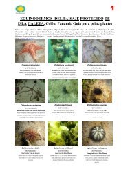
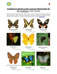
Download - Smithsonian Tropical Research Institute - Smithsonian ...
Download - Smithsonian Tropical Research Institute - Smithsonian ...
Download - Smithsonian Tropical Research Institute - Smithsonian ...

Create successful ePaper yourself
Turn your PDF publications into a flip-book with our unique Google optimized e-Paper software.
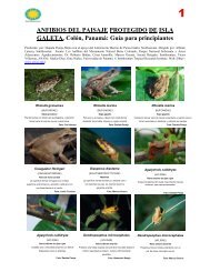
Vol. XXXIX: Supplement THE FESTIVUS Page 3<br />
therefore, is the first land mass to be intermittently<br />
exposed to the North Equatorial Countercurrent from<br />
the west which brings source elements including<br />
planktotrophic larvae across the Barrier. The nearest<br />
atoll Pukapuka, in the Tuamotu Archipelago, is 4,280<br />
km to the southwest and the closest island is Ua Huka of<br />
the Marquesas and is at a distance of 3,965 km.<br />
Secondly, low habitat diversity of the atoll, which is<br />
mainly prolific coral cover, makes suitable habitats for<br />
these planktonic links from the west. Those source<br />
elements from the east on the North Equatorial Current<br />
encounter a lack of the coarse intertidal and subtidal<br />
environments of the coastal diversity. Clipperton lacks<br />
the rocky shores, mud and sand bottoms, mangroves, and<br />
such food sources as marine algae and other plants that<br />
are necessary to establish a hold and maintain viable<br />
populations for many west American mainland (TEP)<br />
taxa.<br />
Physical Environment<br />
Île Clipperton located at the nexus of the Panamic<br />
Province (10/18'N and 109/13'W), is somewhat<br />
characteristic of Pacific atolls having volcanic<br />
foundations. Where the top of the highest peak of the<br />
submarine Clipperton Ridge, described by Menard &<br />
Fisher (1958), reaches the surface of the sea, an eggshaped<br />
coral reef supports a narrow, low, uninterrupted<br />
land strip of limestone debris with a single cavernous<br />
mass of altered trachyte rising to approximately 20 m<br />
(Clipperton rock) on the southeastern border.<br />
Clipperton is a “near atoll,” since a true atoll has no<br />
volcanic outcroppings. The small ring is 11.8 km in<br />
circumference, with only 1.7 square km of exposed land<br />
encircled by a healthy fringing coral reef (Figure 1). The<br />
lagoon, which makes up 85% of the atoll, is surrounded<br />
by a ribbon of land variable in width from 25 m to 320<br />
m (pers. comm., John Munch, 2007). Beyond the wavewashed<br />
outer ring of the atoll are reef-flats lined by<br />
coral-sand beaches or cobble strands. From there, white<br />
ridges of unconsolidated limestone fragments (coral bits)<br />
reach a maximum elevation of four meters from where<br />
the land mass slopes down and encloses the sizeable (7.2<br />
km square) central lagoon.<br />
The lagoon has sediment of fine organic debris and<br />
hordes of minute biting isopods (Cirolana sp.) Poupin,<br />
pers. comm, 2007). Clipperton has a landing strip built<br />
in 1944 on the northwest side of the widest part of the<br />
atoll. The strip consists of coral pieces that are stained<br />
dark gray or black by microscopic algae and is not<br />
recommended for use today.<br />
The following eight habitats are represented at<br />
Clipperton and environs:<br />
(1) large deposits of storm-generated coral, with one<br />
extensive volcanic outcropping, bordering an intolerably<br />
low salinity lagoon (Figure 3),<br />
Figure 3. Aerial view taken from the south of Clipperton Rock located<br />
on the edge of the lagoon, 2005. Photo: C. Fresser.<br />
(2) a shallow, often tidally exposed reef front with low<br />
coral cover and abundant crustose coralline algae (Figure<br />
4),<br />
Figure 4. Tidally exposed reef front on west side of Clipperton, 2005.<br />
Photo: C. Fresser.