

Chapters 1 - U.S. Fish and Wildlife Service
Chapters 1 - U.S. Fish and Wildlife Service
Chapters 1 - U.S. Fish and Wildlife Service

You also want an ePaper? Increase the reach of your titles
YUMPU automatically turns print PDFs into web optimized ePapers that Google loves.
U.S. <strong>Fish</strong> <strong>and</strong> <strong>Wildlife</strong> <strong>Service</strong><br />
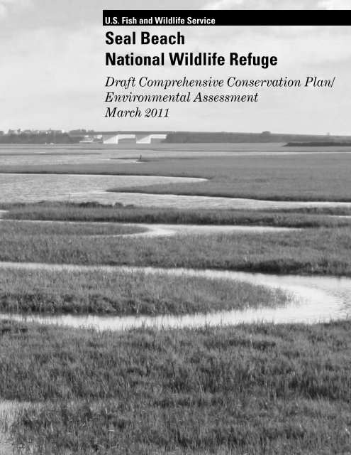
Seal Beach<br />
National <strong>Wildlife</strong> Refuge<br />
Draft Comprehensive Conservation Plan/<br />
Environmental Assessment<br />
March 2011
Comprehensive Conservation Plans provide long-term guidance for management decisions <strong>and</strong> set<br />
forth goals, objectives, <strong>and</strong> strategies needed to accomplish refuge purposes <strong>and</strong> identify the<br />
<strong>Service</strong>’s best estimate of future needs. These plans detail program planning levels that are<br />
sometimes substantially above current budget allocations <strong>and</strong>, as such, are primarily for <strong>Service</strong><br />
strategic planning <strong>and</strong> program prioritization purposes. The plans do not constitute a commitment<br />
for staffing increases, operational <strong>and</strong> maintenance increases, or funding for future l<strong>and</strong><br />
acquisition.
U.S. <strong>Fish</strong> & <strong>Wildlife</strong> <strong>Service</strong><br />
Seal Beach<br />
National <strong>Wildlife</strong> Refuge<br />
Draft Comprehensive Conservation Plan/<br />
Environmental Assessment<br />
March 2011<br />
Vision Statement<br />
Tidal channels me<strong>and</strong>ering through a sea of cordgrass deliver moisture <strong>and</strong><br />
nourishment to support a healthy marsh ecosystem. As the quiet calm of the<br />
morning is interrupted by the clacking of a light-footed clapper rail, school<br />
children <strong>and</strong> other visitors, st<strong>and</strong>ing on the elevated observation deck, point<br />
with excitement in the direction of the call hoping for a glimpse of the rare<br />
bird. Shorebirds dart from one foraging area to another feasting on what<br />
appears to be an endless supply of food hidden within the tidal flats.<br />
California least terns fly above the tidal channels searching for small fish to<br />
carry back to their nests on NASA Isl<strong>and</strong>. A diverse array of marine<br />
organisms, from tube worms <strong>and</strong> sea stars to rays <strong>and</strong> sharks, <strong>and</strong> even an<br />
occasional green sea turtle, thrive within the tidal channels <strong>and</strong> open water<br />
areas of the Refuge’s diverse marsh complex, while Nelson’s sharp-tailed<br />
sparrows <strong>and</strong> other upl<strong>and</strong> birds find food <strong>and</strong> shelter within the native<br />
upl<strong>and</strong> vegetation that borders the marsh.<br />
U. S. <strong>Fish</strong> <strong>and</strong> <strong>Wildlife</strong> <strong>Service</strong><br />
Pacific Southwest Region<br />
2800 Cottage Way, Room W-1832<br />
Sacramento, CA 95825-1846<br />
March 2011
Seal Beach National <strong>Wildlife</strong> Refuge<br />
Draft Comprehensive Conservation Plan/Environmental Assessment<br />
Orange County, California<br />
Type of Action: Administrative<br />
Lead Agency: U.S. Department of the Interior, <strong>Fish</strong> <strong>and</strong> <strong>Wildlife</strong> <strong>Service</strong><br />
Responsible Official: Ren Lohoefener, Regional Director, Pacific Southwest Region<br />
For Further Information: Victoria Touchstone, Refuge Planner<br />
San Diego NWR Complex<br />
6010 Hidden Valley Road, Suite 101<br />
Carlsbad, CA 92011<br />
(760) 431-9440 extension 349<br />
Abstract: This Draft Comprehensive Conservation Plan/Environmental Assessment (CCP/EA)<br />
describes <strong>and</strong> evaluates various alternatives for managing the Seal Beach National <strong>Wildlife</strong> Refuge<br />
(NWR). Three alternatives, including a No Action Alternative (Alternative A) as required by the<br />
National Environmental Policy Act (NEPA) regulations, are described, compared, <strong>and</strong> assessed<br />
for the Seal Beach NWR. The three alternatives are summarized below:<br />
Alternative A – No Action: This alternative assumes no change from past management<br />
programs <strong>and</strong> serves as the baseline to which all other action alternatives are compared.<br />
There would be no major changes in habitat management or the current public use program<br />
under this alternative.<br />
Alternative B – Maximize Salt Marsh Restoration, Continue Current Public Uses: Under<br />
this alternative, current wildlife <strong>and</strong> habitat management activities would be exp<strong>and</strong>ed to<br />
include evaluation of current baseline data for fish, wildlife, <strong>and</strong> plants on the Refuge,<br />
identification of data gaps, implementation of species surveys to address data gaps as staff<br />
time <strong>and</strong> funding allows, <strong>and</strong> support for new research projects that would benefit Refuge<br />
resources <strong>and</strong> Refuge management. Also proposed is the restoration of approximately 22<br />
acres of intertidal habitat (salt marsh <strong>and</strong> intertidal mudflat) <strong>and</strong> 15 acres of wetl<strong>and</strong>/upl<strong>and</strong><br />
transition habitat. Pest control would be implemented in accordance with an Integrated Pest<br />
Management (IPM) program <strong>and</strong> mosquito monitoring <strong>and</strong> control would be guided by a<br />
Mosquito Management Plan. No changes to the current public use program are proposed.<br />
Alternative C (Proposed Action) – Optimize Upl<strong>and</strong>/Wetl<strong>and</strong> Restoration, Improve<br />
Opportunities for <strong>Wildlife</strong> Observation: The majority of the management activities,<br />
including the IPM program <strong>and</strong> Mosquito Management Plan, proposed in Alternative B would<br />
also be implemented under this Alternative. The primary difference between Alternatives B<br />
<strong>and</strong> C is that under Alternative C a larger portion of the areas to be restored would consist of<br />
upl<strong>and</strong> <strong>and</strong> wetl<strong>and</strong>/upl<strong>and</strong> transition habitat. Approximately 12 acres of currently disturbed<br />
upl<strong>and</strong> would be restored to native upl<strong>and</strong> habitat, about 10 acres would be restored to<br />
wetl<strong>and</strong>/upl<strong>and</strong> transition habitat, <strong>and</strong> approximately 15 acres would be restored to intertidal<br />
habitat. In addition, Alternative C includes limited expansion of the current public use<br />
program, including exp<strong>and</strong>ed opportunities for wildlife observation.<br />
Draft Comprehensive Conservation Plan/Environmental Assessment
Abstract <br />
The issues addressed in this Draft CCP/EA include the potential effects of the various alternatives<br />
on the physical environment, biological <strong>and</strong> cultural resources, <strong>and</strong> the social/economic<br />
environment. The adverse <strong>and</strong> beneficial effects of implementing the alternatives are generally<br />
described in the following action categories: habitat <strong>and</strong> wildlife management, pest management,<br />
<strong>and</strong> public use.<br />
Providing Comments: Your comments on the Draft CCP/EA should be mailed, faxed, or emailed<br />
to the San Diego NWR Complex no later than May 11, 2011. Comments should be mailed to:<br />
Victoria Touchstone<br />
U.S. <strong>Fish</strong> <strong>and</strong> <strong>Wildlife</strong> <strong>Service</strong><br />
San Diego NWR Complex<br />
6010 Hidden Valley Road, Suite 101<br />
Carlsbad, CA 92011<br />
Faxed comments should be directed to Victoria Touchstone at (760) 930-0256 <strong>and</strong> emailed<br />
comments should be directed to Victoria_Touchstone@fws.gov (please include “Seal Beach CCP”<br />
in the subject line).<br />
Comments should be provided to the <strong>Service</strong> during the public review period of this Draft<br />
CCP/EA. This will enable us to analyze <strong>and</strong> respond to the comments at one time <strong>and</strong> to use this<br />
input in the preparation of the Final CCP. Comments should be specific <strong>and</strong> should address the<br />
document’s adequacy <strong>and</strong> the merits of the alternatives described. Environmental objections that<br />
could have been raised at the draft stage may be waived if not raised until after the completion of<br />
the Finding of No Significant Impact (FONSI).<br />
All comments received from the public will be placed in the <strong>Service</strong>’s record for this action. As part<br />
of the record, comments will be made available for inspection by the general public, <strong>and</strong> copies may<br />
be provided to the public. For persons who do not wish to have their names <strong>and</strong> other identifying<br />
information made available, anonymous comments will be accepted.<br />
Seal Beach National <strong>Wildlife</strong> Refuge
Reader’s Guide<br />
The U.S. <strong>Fish</strong> <strong>and</strong> <strong>Wildlife</strong> <strong>Service</strong> will manage the Seal Beach National <strong>Wildlife</strong> Refuge (NWR) in<br />
accordance with an approved Comprehensive Conservation Plan (CCP). This CCP provides long<br />
range guidance on Refuge management through its vision, goals, objectives, <strong>and</strong> strategies. The<br />
CCP also provides a basis for a long-term adaptive management process including implementation,<br />
monitoring progress, evaluating <strong>and</strong> adjusting, <strong>and</strong> revising plans accordingly. Additional stepdown<br />
planning will be required prior to implementation of certain programs <strong>and</strong> projects.<br />
This document combines both a Draft Comprehensive Conservation Plan <strong>and</strong> Environmental<br />
Assessment (Draft CCP/EA). Following the completion of public review <strong>and</strong> evaluation of the<br />
comments received, the <strong>Service</strong> will identify the preferred alternative. Assuming no significant<br />
adverse effects are identified, the <strong>Service</strong> will also issue a Finding of No Significant Impact<br />
(FONSI). Once the FONSI is signed, the Final CCP will be prepared.<br />
The following chapter <strong>and</strong> appendix descriptions are provided to assist readers in locating <strong>and</strong><br />
underst<strong>and</strong>ing the various components of the CCP/EA.<br />
Chapter 1, Introduction, includes the purpose of <strong>and</strong> need for the CCP <strong>and</strong> EA; an overview of the<br />
National <strong>Wildlife</strong> Refuge System; legal <strong>and</strong> policy guidance for planning for <strong>and</strong> managing the<br />
resources on National <strong>Wildlife</strong> Refuges; setting, regional context, <strong>and</strong> history of the Seal Beach<br />
NWR; <strong>and</strong> Refuge purposes, vision, <strong>and</strong> goals for future management.<br />
Chapter 2, The Planning Process, describes the CCP planning process, including the public<br />
involvement aspects of the process. This chapter also provides background on major planning<br />
issues identified by Refuge staff, Federal, Tribal, State, <strong>and</strong> local agencies, <strong>and</strong>/or the public, as<br />
well as a variety of management concerns <strong>and</strong> opportunities.<br />
Chapter 3, Alternatives, describes three management alternatives proposed for the Refuge. Each<br />
alternative represents a different approach to achieving the vision, goals, <strong>and</strong> objectives for the<br />
Refuge. Alternative A (No Action) describes current management practices. Alternative C is the<br />
proposed action.<br />
Chapter 4, Affected Environment, describes the existing physical <strong>and</strong> biological environment,<br />
public uses, cultural resources, <strong>and</strong> socioeconomic conditions. They represent baseline conditions<br />
for the comparisons made in Chapter 5.<br />
Chapter 5, Environmental Consequences, describes the potential impacts of each of the<br />
alternatives on the resources, programs, <strong>and</strong> conditions outlined in Chapter 4.<br />
Chapter 6, Implementation, presents the details of how the proposed action (Alternative C) for<br />
the Seal Beach NWR would be implemented if it is selected as the preferred alternative when the<br />
Final CCP is approved, including details regarding the objectives <strong>and</strong> strategies necessary to<br />
achieve the Refuge goals. This chapter also addresses step-down planning, adaptive management,<br />
compliance requirements, <strong>and</strong> Refuge operations, including funding <strong>and</strong> staffing proposals.<br />
Chapter 7, Reference Cited, provides bibliographic references for the citations in this document.<br />
Draft Comprehensive Conservation Plan/Environmental Assessment RG-1
Reader’s Guide <br />
Appendix A, Compatibility Determinations (draft), describe uses, anticipated impacts,<br />
stipulations, <strong>and</strong> a determination of compatibility for wildlife observation, interpretation, <strong>and</strong><br />
environmental education, as well as scientific research <strong>and</strong> mosquito management. The latter two<br />
uses also include a determination of appropriate use.<br />
Appendix B, List of Preparers, Planning Team Members, <strong>and</strong> Persons/Agencies Consulted,<br />
lists those individuals involved in the preparation of the CCP/EA, as well as those agencies<br />
consulted during the preparation of this planning document.<br />
Appendix C, Integrated Pest Management Program (draft), is a step-down management plan<br />
that provides guidance for managing pests on the Refuge, including invasive plant species control.<br />
This program does not address the control of mosquitoes.<br />
Appendix D, Mosquito Management Plan (draft), is a step-down management plan that presents<br />
a phased approach to mosquito management, including monitoring <strong>and</strong> control, on the Refuge.<br />
Appendix E, Federal <strong>and</strong> State Ambient Air Quality St<strong>and</strong>ards, presents the currently adopted<br />
Federal <strong>and</strong> State Ambient Air Quality St<strong>and</strong>ards.<br />
Appendix F, Species Lists, contains a list of the bird species observed on the Refuge, as well as<br />
additional lists for mammalian, plant, <strong>and</strong> reptile species that have been observed on the Refuge.<br />
Appendix G, Fire Management Plan Exemption, documents that the Seal Beach NWR has been<br />
exempted from the requirement to prepare a fire management plan.<br />
Appendix N, Wilderness Inventory, outlines the process used to determine that the Seal Beach<br />
NWR does not meet the criteria for a wilderness review or designation.<br />
Appendix I, Request for Cultural Resource Compliance Form, is an example of the form that<br />
must be submitted to initiate cultural resource review.<br />
Appendix J, Glossary of Terms, contains acronyms, abbreviations, <strong>and</strong> definitions of terms used in<br />
this document.<br />
Appendix K, Distribution List, contains the list of Federal, Tribal, State, <strong>and</strong> local agencies,<br />
nongovernmental organizations, libraries, <strong>and</strong> individuals who received notification of the<br />
availability of the Draft CCP/EA <strong>and</strong> other planning updates associated with this planning effort.<br />
RG-2 Seal Beach National <strong>Wildlife</strong> Refuge
Table of Contents<br />
Chapter 1 – Introduction ..................................................................................................... 1-1<br />
1.1 Introduction ............................................................................................................................. 1-1<br />
1.2 Purpose <strong>and</strong> Need for the Plan ............................................................................................ 1-1<br />
1.3 U.S. <strong>Fish</strong> <strong>and</strong> <strong>Wildlife</strong> <strong>Service</strong> <strong>and</strong> National <strong>Wildlife</strong> Refuge System ........................... 1-4<br />
1.3.1 U.S. <strong>Fish</strong> <strong>and</strong> <strong>Wildlife</strong> <strong>Service</strong> .................................................................................... 1-4<br />
1.3.2 National <strong>Wildlife</strong> Refuge System .............................................................................. 1-4<br />
1.4 Legal <strong>and</strong> Policy Guidance .................................................................................................... 1-5<br />
1.4.1 National <strong>Wildlife</strong> Refuge System Improvement Act of 1997 ................................. 1-5<br />
Compatibility Policy .............................................................................................. 1-6<br />
Appropriate Use Policy ......................................................................................... 1-7<br />
Biological Integrity, Diversity <strong>and</strong> Environmental Health Policy ................. 1-8<br />
Wilderness Stewardship Policy ........................................................................... 1-9<br />
1.4.2 National Environmental Policy Act of 1969 ........................................................... 1-10<br />
1.5 Seal Beach National <strong>Wildlife</strong> Refuge ................................................................................ 1-10<br />
1.5.1 Location ....................................................................................................................... 1-10<br />
1.5.2 Physical Setting .......................................................................................................... 1-10<br />
1.5.3 Ecosystem Context .................................................................................................... 1-11<br />
Sonoran Joint Venture Bi-national Bird Conservation .................................. 1-12<br />
California <strong>Wildlife</strong> Action Plan .......................................................................... 1-12<br />
Watershed Management ..................................................................................... 1-12<br />
1.5.4 Refuge Purpose <strong>and</strong> Authority ................................................................................. 1-12<br />
1.5.5 Refuge Vision <strong>and</strong> Goals ............................................................................................ 1-13<br />
1.5.6 History of Refuge Establishment ............................................................................ 1-14<br />
Chapter 2 – The Planning Process ................................................................................... 2-1<br />
2.1 Preparing a Comprehensive Conservation Plan ................................................................ 2-1<br />
2.2 Preplanning ............................................................................................................................. 2-1<br />
2.3 Public Involvement in Planning ........................................................................................... 2-2<br />
2.4 Overview of Issues <strong>and</strong> Public Scoping Comments ........................................................... 2-3<br />
Habitat Management ................................................................................................... 2-3<br />
Threatened <strong>and</strong> Endangered Species Management ............................................... 2-3<br />
<strong>Wildlife</strong>-Dependent Recreational Use ....................................................................... 2-3<br />
Research ........................................................................................................................ 2-3<br />
Refuge Operations ........................................................................................................ 2-3<br />
Expansion of the Refuge Boundary ........................................................................... 2-3<br />
2.5 Management Concerns/Opportunities ................................................................................ 2-4<br />
Climate Change/Sea Level Rise ................................................................................. 2-4<br />
Subsidence ..................................................................................................................... 2-4<br />
Invasive Species ............................................................................................................ 2-5<br />
Predation of Listed Species ........................................................................................ 2-5<br />
Contaminants ................................................................................................................ 2-5<br />
Refuge Access………………………………………………………………... 2-5<br />
Opportunities ................................................................................................................ 2-6<br />
2.6 Development of a Refuge Vision .......................................................................................... 2-6<br />
2.7 Development of Refuge Goals, Objectives, <strong>and</strong> Strategies .............................................. 2-6<br />
Draft Comprehensive Conservation Plan i
Table of Contents <br />
2.8 Alternative Development Process ....................................................................................... 2-7<br />
2.9 Selection of theRefuge Proposed Action ............................................................................ 2-7<br />
2.10 Plan Implementation ............................................................................................................. 2-7<br />
Chapter 3 – Alternatives ..................................................................................................... 3-1<br />
3.1 Introduction ............................................................................................................................ 3-1<br />
3.2 Alternative Development Process ....................................................................................... 3-1<br />
3.3 Past <strong>and</strong> Current Refuge Management .............................................................................. 3-2<br />
3.3.1 Background .................................................................................................................. 3-3<br />
3.3.2 Existing Management Plans ...................................................................................... 3-3<br />
3.3.3 Management History <strong>and</strong> Past Refuge Actions ...................................................... 3-4<br />
Management History ............................................................................................ 3-4<br />
Past Refuge Actions .............................................................................................. 3-4<br />
3.3.4 Coordination with NWSSB ......................................................................................... 3-5<br />
3.3.5 Current Refuge Management .................................................................................... 3-6<br />
3.4 Proposed Management Alternatives ..................................................................................... 3-7<br />
3.4.1 Summary of Alternatives ............................................................................................ 3-7<br />
Alternative A (No Action) .................................................................................... 3-7<br />
Alternative B .......................................................................................................... 3-7<br />
Alternative C (Proposed Action) ......................................................................... 3-7<br />
3.4.2 Similarities Among the Alternatives ......................................................................... 3-8<br />
3.4.2.1 Features Common to All Alternatives ............................................................ 3-8<br />
3.4.2.2 Features Common to All Action Alternatives .............................................. 3-10<br />
3.4.3 Detailed Description of the Alternatives ................................................................ 3-11<br />
3.4.3.1 Alternative A (No Action) ............................................................................... 3-11<br />
<strong>Wildlife</strong> <strong>and</strong> Habitat Management ........................................................... 3-11<br />
Public Use Program .................................................................................... 3-19<br />
Refuge Operations ...................................................................................... 3-20<br />
Environmental Contaminants Coordination ........................................... 3-20<br />
Cultural Resource Management ............................................................... 3-20<br />
Volunteeers <strong>and</strong> Partners .......................................................................... 3-21<br />
Mosquito Monitoring <strong>and</strong> Control............................................................3-21<br />
3.4.3.2 Alternative B – Maximize Salt Marsh Restoration, Continue Current.... 3-23<br />
<strong>Wildlife</strong> <strong>and</strong> Habitat Management ............................................................ 3-23<br />
Habitat Restoration .................................................................................... 3-31<br />
Public Use Program .................................................................................... 3-33<br />
Refuge Operations ...................................................................................... 3-33<br />
Environmental Contaminants Coordination ........................................... 3-33<br />
Cultural Resource Management ............................................................... 3-33<br />
Volunteeers <strong>and</strong> Partners .......................................................................... 3-34<br />
3.4.3.3 Alternative C – Optimize Upl<strong>and</strong>/Wetl<strong>and</strong> Restoration,Improve<br />
Opportunities for <strong>Wildlife</strong> Observation ..................................................... 3-34<br />
<strong>Wildlife</strong> <strong>and</strong> Habitat Management ........................................................... 3-34<br />
Public Use Program .................................................................................... 3-38<br />
Refuge Operations ...................................................................................... 3-38<br />
Coordination with NWSSB........................................................................3-38<br />
Environmental Contaminants Coordination ........................................... 3-38<br />
Cultural Resource Management ............................................................... 3-38<br />
ii Seal Beach National <strong>Wildlife</strong> Refuge
Table of Contents<br />
Volunteeers <strong>and</strong> Partners ................................................................................... 3-39<br />
3.4.4 Alternatives Considered but Eliminated from Detailed Analysis ....................... 3-39<br />
Exp<strong>and</strong> the Number of California Least Tern Nesting Sites ....................... 3-39<br />
Exp<strong>and</strong> the Refuge Boundary to Include the Los Cerritos Wetl<strong>and</strong>s ........ 3-39<br />
Include Oil Isl<strong>and</strong> into the Refuge Following Termination of Oil<br />
Production Activities .......................................................................................... 3-39<br />
Improve Public Access onto the Refuge ........................................................... 3-40<br />
3.4.5 Comparison of Alternatives by Issue ....................................................................... 3-40<br />
Chapter 4 –Refuge Resources ............................................................................................. 4-1<br />
4.1 Environmental Setting .......................................................................................................... 4-1<br />
4.1.1 Location <strong>and</strong> Property Description ........................................................................... 4-1<br />
4.1.2 Flyway Setting .............................................................................................................. 4-1<br />
4.1.3 Historic Setting ............................................................................................................. 4-3<br />
4.2 Physical Environment ........................................................................................................... 4-8<br />
4.2.1 Topography/Visual Quality ......................................................................................... 4-8<br />
4.2.2 Geology <strong>and</strong> Soils ........................................................................................................ 4-11<br />
4.2.3 Mineral Resources ...................................................................................................... 4-14<br />
4.2.4 Agricultural Resources .............................................................................................. 4-14<br />
4.2.5 Hydrology/Water Quality .......................................................................................... 4-15<br />
4.2.5.1 Hydrology .......................................................................................................... 4-15<br />
4.2.5.2 Water Quality .................................................................................................... 4-21<br />
4.2.5.3 Watershed Planning ......................................................................................... 4-27<br />
4.2.6 Climate/Climate Change/Sea Level Rise ................................................................ 4-28<br />
4.2.7 Air Quality ................................................................................................................... 4-30<br />
4.2.8 Greenhouse Gas Emissions ....................................................................................... 4-32<br />
4.2.9 Contaminants .............................................................................................................. 4-34<br />
4.3 Biological Resources .............................................................................................................. 4-37<br />
4.3.1 Regional <strong>and</strong> Historical Context .............................................................................. 4-37<br />
4.3.2 Regional Conservation Planning .............................................................................. 4-38<br />
4.3.2.1 Ecoregion/L<strong>and</strong>scape Conservation Cooperative Planning ....................... 4-38<br />
4.3.2.2 Applicable Species Recovery Plans ................................................................ 4-39<br />
4.3.2.3 Shorebird Conservation Planning .................................................................. 4-39<br />
4.3.2.4 Waterbird Conservation .................................................................................. 4-40<br />
4.3.2.5 Sonoran Joint Venture Bi-national Bird Conservation ............................... 4-40<br />
4.3.2.6 Marine Protected Areas .................................................................................. 4-41<br />
4.3.2.7 California <strong>Wildlife</strong> Action Plan ....................................................................... 4-41<br />
4.3.3 Habitat <strong>and</strong> Vegetation ............................................................................................. 4-41<br />
4.3.3.1 Shallow Subtidal Habitat ................................................................................. 4-42<br />
4.3.3.2 Intertidal Channels <strong>and</strong> Tidal Mudflat Habitats ......................................... 4-44<br />
4.3.3.3 Coastal Salt Marsh Habitat ............................................................................. 4-45<br />
4.3.3.4 Upl<strong>and</strong> Habitat ................................................................................................. 4-46<br />
4.3.3.5 Sensitive Plants ................................................................................................. 4-47<br />
4.3.4 <strong>Wildlife</strong> ........................................................................................................................ 4-47<br />
Draft Comprehensive Conservation Plan/Environmental Assessment iii
Table of Contents <br />
4.3.4.1 Birds ................................................................................................................... 4-47<br />
Wintering Birds ........................................................................................... 4-48<br />
Migrant Birds .............................................................................................. 4-48<br />
Summer Residents ...................................................................................... 4-48<br />
Year-Round Residents ............................................................................... 4-49<br />
4.3.4.2 Mammals ........................................................................................................... 4-49<br />
4.3.4.3 Reptiles <strong>and</strong> Amphibians ................................................................................ 4-50<br />
4.3.4.4 Terrestrial Invertebrates ................................................................................ 4-50<br />
4.3.4.5 Marine Invertebrates ...................................................................................... 4-55<br />
4.3.4.6 <strong>Fish</strong>es ................................................................................................................. 4-56<br />
4.3.5 Federally Listed Endangered <strong>and</strong> Threatened Species ...................................... 4-59<br />
4.3.5.1 California Least Tern ...................................................................................... 4-59<br />
4.3.5.2 Light-footed Clapper Rail ............................................................................... 4-63<br />
4.3.5.3 Western Snowy Plover .................................................................................... 4-67<br />
4.3.5.4 Salt Marsh Bird’s-beak .................................................................................... 4-68<br />
4.3.5.5 East Pacific Green Turtle ............................................................................... 4-69<br />
4.3.6 State Listed Species .................................................................................................. 4-70<br />
4.3.6.1 Belding’s Savannah Sparrow .......................................................................... 4-70<br />
4.3.7 Species of Concern <strong>and</strong> Other Special Status Species .......................................... 4-71<br />
4.3.8 Invasive Species ......................................................................................................... 4-75<br />
4.3.8.1 Invasive Plants .................................................................................................. 4-75<br />
4.3.8.2 Invasive Terrestrial Animals .......................................................................... 4-75<br />
4.3.8.3 Invasive Marine Organisms ............................................................................ 4-76<br />
4.4 Cultural Resources .............................................................................................................. 4-77<br />
4.4.1 Introduction ................................................................................................................ 4-77<br />
4.4.2 Cultural Setting .......................................................................................................... 4-77<br />
4.4.2.1 Early Man (Initial Occupation – 7,500 B.P.) ................................................. 4-77<br />
4.4.2.2 Millingstone Period (7,500 – 3,000 B.P.) ........................................................ 4-78<br />
4.4.2.3 Intermediate Period (3,000 – 1,000 B.P.) ...................................................... 4-78<br />
4.4.2.4 Late Prehistoric Period (1,000 B.P. – 1800 A.D.)......................................... 4-78<br />
4.4.2.5 Ethnohistory ..................................................................................................... 4-79<br />
4.4.2.6 Historic Period .................................................................................................. 4-79<br />
4.4.3 Existing Cultural Resources Investigations <strong>and</strong> Research ................................. 4-80<br />
4.5 Social <strong>and</strong> Economic Environment .................................................................................... 4-82<br />
4.5.1 L<strong>and</strong> Use ..................................................................................................................... 4-82<br />
4.5.1.1 Current Uses on the Refuge ........................................................................... 4-82<br />
4.5.1.2 Surrounding L<strong>and</strong> Uses .................................................................................. 4-84<br />
4.5.2 Public Safety ............................................................................................................... 4-87<br />
4.5.3 Traffic Circulation ...................................................................................................... 4-87<br />
4.5.4 Public Utilities/Easements ....................................................................................... 4-88<br />
4.5.5 Vectors <strong>and</strong> Odors ...................................................................................................... 4-88<br />
4.5.6 Economics/Employment ........................................................................................... 4-88<br />
4.5.7 Environmental Justice .............................................................................................. 4-89<br />
Chapter 5 – Environmental Consequences ..................................................................... 5-1<br />
5.1 Introduction ............................................................................................................................ 5-1<br />
5.2 Effects to the Physical Environment .................................................................................. 5-1<br />
iv Seal Beach National <strong>Wildlife</strong> Refuge
Table of Contents<br />
5.2.1 Alternative A -- No Action .......................................................................................... 5-3<br />
5.2.1.1 Effects to Topography/Visual Quality ............................................................. 5-3<br />
5.2.1.2 Effects to Geology/Soils ..................................................................................... 5-3<br />
5.2.1.3 Effects on Mineral Resources ........................................................................... 5-4<br />
5.2.1.4 Effects to Agricultural Resources .................................................................... 5-4<br />
5.2.1.5 Effects to Hydrology .......................................................................................... 5-4<br />
5.2.1.6 Effects to Water Quality .................................................................................... 5-4<br />
5.2.1.7 Effects from Climate Change/Sea Level Rise ................................................ 5-7<br />
5.2.1.8 Effects to Air Quality ......................................................................................... 5-9<br />
5.2.1.9 Effects Related to Greenhouse Gas Emissions ............................................ 5-10<br />
5.2.1.10Effects to Related to Contaminants ............................................................... 5-11<br />
5.2.2 Alternative B – Maximize Salt Marsh Restoration, Continue Current<br />
Public Uses .................................................................................................................. 5-12<br />
5.2.2.1 Effects to Topography/Visual Quality ........................................................... 5-12<br />
5.2.2.2 Effects to Geology/Soils ................................................................................... 5-13<br />
5.2.2.3 Effects to on Mineral Resources .................................................................... 5-14<br />
5.2.2.4 Effects to Agricultural Resources .................................................................. 5-14<br />
5.2.2.5 Effects to Hydrology ........................................................................................ 5-14<br />
5.2.2.6 Effects to Water Quality .................................................................................. 5-16<br />
5.2.2.7 Effects from Climate Change/Sea Level Rise .............................................. 5-21<br />
5.2.2.8 Effects to Air Quality ....................................................................................... 5-21<br />
5.2.2.9 Effects Related to Greenhouse Gas Emissions ............................................ 5-24<br />
5.2.2.10Effects Related to Contaminants ................................................................... 5-24<br />
5.2.3 Alternative C (Proposed Action) – Optimize Upl<strong>and</strong>/Wetl<strong>and</strong> Restoration,<br />
Improve Opportunities for <strong>Wildlife</strong> Observation ................................................... 5-25<br />
5.2.3.1 Effects to Topography/Visual Quality ........................................................... 5-25<br />
5.2.3.2 Effects to Geology/Soils ................................................................................... 5-26<br />
5.2.3.3 Effects on Mineral Resources ......................................................................... 5-27<br />
5.2.3.4 Effects to Agricultural Resources .................................................................. 5-27<br />
5.2.3.5 Effects to Hydrology ........................................................................................ 5-27<br />
5.2.3.6 Effects to Water Quality .................................................................................. 5-27<br />
5.2.3.7 Effects from Climate Change/Sea Level Rise .............................................. 5-28<br />
5.2.3.8 Effects to Air Quality ....................................................................................... 5-28<br />
5.2.3.9 Effects Related to Greenhouse Gas Emissions ............................................ 5-29<br />
5.2.3.10Effects to Related to Contaminants ............................................................... 5-30<br />
5.3 Effects to Habitat <strong>and</strong> Vegetation Resources .................................................................. 5-30<br />
5.3.1 Alternative A -- No Action ........................................................................................ 5-30<br />
5.3.2 Alternative B – Maximize Salt Marsh Restoration, Continue Current<br />
Public Uses .................................................................................................................. 5-33<br />
5.3.3 Alternative C (Proposed Action) – Optimize Upl<strong>and</strong>/Wetl<strong>and</strong> Restoration,<br />
Improve Opportunities for <strong>Wildlife</strong> Observation ................................................... 5-36<br />
5.4 Effects to <strong>Wildlife</strong> <strong>and</strong> <strong>Fish</strong>eries ........................................................................................ 5-37<br />
5.4.1 Alternative A -- No Action ........................................................................................ 5-38<br />
5.4.1.1 Effects to Waterfowl, Seabirds, Shorebirds <strong>and</strong> Other Waterbirds ......... 5-38<br />
5.4.1.2 Effects to L<strong>and</strong>birds ........................................................................................ 5-40<br />
5.4.1.3 Effects to <strong>Fish</strong> <strong>and</strong> Other Marine Organisms .............................................. 5-41<br />
5.4.1.4 Effects to Terrestrial Invertebrates, Amphibians, <strong>and</strong> Reptiles .............. 5-42<br />
5.4.1.5 Effects to Mammals ......................................................................................... 5-43<br />
Draft Comprehensive Conservation Plan/Environmental Assessment v
Table of Contents <br />
5.4.2 Alternative B – Maximize Salt Marsh Restoration, Continue Current<br />
Public Uses .................................................................................................................. 5-44<br />
5.4.2.1 Effects to Waterfowl, Seabirds, Shorebirds <strong>and</strong> Other Waterbirds ......... 5-44<br />
5.4.2.2 Effects to L<strong>and</strong>birds ........................................................................................ 5-46<br />
5.4.2.3 Effects to <strong>Fish</strong> <strong>and</strong> Other Marine Organisms .............................................. 5-47<br />
5.4.2.4 Effects to Terrestrial Invertebrates, Amphibians, <strong>and</strong> Reptiles .............. 5-48<br />
5.4.2.5 Effects to Mammals ......................................................................................... 5-50<br />
5.4.3 Alternative C (Proposed Action) – Optimize Upl<strong>and</strong>/Wetl<strong>and</strong> Restoration,<br />
Improve Opportunities for <strong>Wildlife</strong> Observation .................................................. 5-51<br />
5.4.3.1 Effects to Waterfowl, Seabirds, Shorebirds <strong>and</strong> Other Waterbirds ......... 5-51<br />
5.4.3.2 Effects to L<strong>and</strong>birds ........................................................................................ 5-52<br />
5.4.3.3 Effects to <strong>Fish</strong> <strong>and</strong> Other Marine Organisms .............................................. 5-53<br />
5.4.3.4 Effects to Terrestrial Invertebrates, Amphibians, <strong>and</strong> Reptiles .............. 5-53<br />
5.4.3.5 Effects to Mammals ......................................................................................... 5-54<br />
5.5 Effects to Endangered <strong>and</strong> Threatened Species <strong>and</strong> Other Species of Concern ....... 5-54<br />
5.5.1 Alternative A -- No Action ........................................................................................ 5-55<br />
5.5.1.1 Effects to California Least Tern .................................................................... 5-55<br />
5.5.1.2 Effects to Light-footed Clapper Rail ............................................................. 5-57<br />
5.5.1.3 Effects to Western Snowy Plover .................................................................. 5-57<br />
5.5.1.4 Effects to Salt Marsh Bird’s-Beak ................................................................. 5-58<br />
5.5.1.5 Effects to Pacific Green Sea Turtle ............................................................... 5-58<br />
5.5.1.6 Effects to Belding’s Savannah Sparrow ........................................................ 5-59<br />
5.5.2 Alternative B – Maximize Salt Marsh Restoration, Continue Current<br />
Public Uses .................................................................................................................. 5-59<br />
5.5.2.1 Effects to California Least Tern .................................................................... 5-59<br />
5.5.2.2 Effects to Light-footed Clapper Rail ............................................................. 5-60<br />
5.5.2.3 Effects to Western Snowy Plover .................................................................. 5-61<br />
5.5.2.4 Effects to Salt Marsh Bird’s-Beak ................................................................. 5-61<br />
5.5.2.5 Effects to Pacific Green Sea Turtle………………………………………..5-61<br />
5.5.2.6 Effects to Belding’s Savannah Sparrow ........................................................ 5-62<br />
5.5.3 Alternative C (Proposed Action) – Optimize Upl<strong>and</strong>/Wetl<strong>and</strong> Restoration,<br />
Improve Opportunities for <strong>Wildlife</strong> Observation .................................................. 5-63<br />
5.5.3.1 Effects to California Least Tern .................................................................... 5-63<br />
5.5.3.2 Effects to Light-footed Clapper Rail ............................................................. 5-63<br />
5.5.3.3 Effects to Western Snowy Plover .................................................................. 5-64<br />
5.5.3.4 Effects to Salt Marsh Bird’s-Beak ................................................................. 5-65<br />
5.5.3.5 Effects to Pacific Green Sea Turtle ............................................................... 5-65<br />
5.5.3.6 Effects to Belding’s Savannah Sparrow ........................................................ 5-65<br />
5.6 Effects to Cultural Resources ............................................................................................ 5-66<br />
5.6.1 Alternative A -- No Action ........................................................................................ 5-68<br />
5.6.2 Alternative B – Maximize Salt Marsh Restoration, Continue Current<br />
Public Uses .................................................................................................................. 5-69<br />
5.6.3 Alternative C (Proposed Action) – Optimize Upl<strong>and</strong>/Wetl<strong>and</strong> Restoration,<br />
Improve Opportunities for <strong>Wildlife</strong> Observation .................................................. 5-70<br />
5.7 Effects to the Social <strong>and</strong> Economic Environment ........................................................... 5-71<br />
5.7.1 Alternative A -- No Action ........................................................................................ 5-73<br />
5.7.1.1 Effects to L<strong>and</strong> Use ......................................................................................... 5-73<br />
5.7.1.2 Effects Related to Public Safety .................................................................... 5-73<br />
vi Seal Beach National <strong>Wildlife</strong> Refuge
Table of Contents<br />
5.7.1.3 Effects to Traffic Circulation .......................................................................... 5-74<br />
5.7.1.4 Effects to Public Utilities/Easements ........................................................... 5-74<br />
5.7.1.5 Effects Related to Vectors <strong>and</strong> Odors ........................................................... 5-74<br />
5.7.1.6 Effects to Economics/Employment ............................................................... 5-75<br />
5.7.1.7 Effects to Environmental Justice ................................................................... 5-76<br />
5.7.2 Alternative B – Maximize Salt Marsh Restoration, Continue Current<br />
Public Uses .................................................................................................................. 5-76<br />
5.7.2.1 Effects to L<strong>and</strong> Use ......................................................................................... 5-76<br />
5.7.2.2 Effects Related to Public Safety .................................................................... 5-76<br />
5.7.2.3 Effects to Traffic Circulation .......................................................................... 5-77<br />
5.7.2.4 Effects to Public Utilities/Easements ........................................................... 5-77<br />
5.7.2.5 Effects Related to Vectors <strong>and</strong> Odors ........................................................... 5-77<br />
5.7.2.6 Effects to Economics/Employment ............................................................... 5-78<br />
5.7.2.7 Effects to Environmental Justice ................................................................... 5-78<br />
5.7.3 Alternative C (Proposed Action) – Optimize Upl<strong>and</strong>/Wetl<strong>and</strong> Restoration,<br />
Improve Opportunities for <strong>Wildlife</strong> Observation ................................................... 5-78<br />
5.7.3.1 Effects to L<strong>and</strong> Use ......................................................................................... 5-78<br />
5.7.3.2 Effects Related to Public Safety .................................................................... 5-79<br />
5.7.3.3 Effects to Traffic Circulation .......................................................................... 5-79<br />
5.7.3.4 Effects to Public Utilities/Easements ........................................................... 5-79<br />
5.7.3.5 Effects Related to Vectors <strong>and</strong> Odors ........................................................... 5-80<br />
5.7.3.6 Effects to Economics/Employment ............................................................... 5-80<br />
5.7.3.7 Effects to Environmental Justice ................................................................... 5-80<br />
5.8 Indian Tribal Assets ............................................................................................................. 5-80<br />
5.9 Cumulative Effects ............................................................................................................... 5-81<br />
5.9.1 Cumulative Effects to the Physical Environment ................................................. 5-84<br />
5.9.2 Cumulative Effects to Biological Resources .......................................................... 5-85<br />
5.9.3 Cumulative Effects to Cultural Resources ............................................................. 5-85<br />
5.9.4 Cumulative Effects to the Social <strong>and</strong> Economic Environment ............................ 5-85<br />
5.10 Summary of Effects ............................................................................................................. 5-86<br />
Chapter 6 - Implementation ............................................................................................... 6-1<br />
6.1 Introduction ............................................................................................................................. 6-1<br />
6.2 Refuge Goals, Objectives <strong>and</strong> Strategies ............................................................................ 6-2<br />
Goal 1 .............................................................................................................................. 6-2<br />
Goal 2 .............................................................................................................................. 6-8<br />
Goal 3 ............................................................................................................................ 6-14<br />
Goal 4 ............................................................................................................................ 6-18<br />
6.3 Monitoring ............................................................................................................................. 6-18<br />
6.4 Adaptive Management ......................................................................................................... 6-19<br />
6.5 Partnership Opportunities .................................................................................................. 6-19<br />
6.6 Step-down Plans ................................................................................................................... 6-20<br />
6.6.1 Draft Step-Down Plans.............................................................................................. 6-21<br />
Draft Integrated Pest Management Plan ........................................................ 6-21<br />
Draft Mosquito Management Plan .................................................................... 6-21<br />
6.7 Compliance Requirements .................................................................................................. 6-23<br />
6.7.1 Federal Regulations, Executive Orders, <strong>and</strong> Legislative Acts ........................... 6-23<br />
Human Rights Regulations ................................................................................ 6-23<br />
Draft Comprehensive Conservation Plan/Environmental Assessment vii
Table of Contents ───────────────────────────────────────────<br />
Cultural Resources Regulations ....................................................................... 6-23<br />
Biological Resources Regulations ..................................................................... 6-24<br />
L<strong>and</strong> <strong>and</strong> Water Use Regulations ..................................................................... 6-24<br />
Tribal Coordination ............................................................................................. 6-25<br />
Wilderness Review .............................................................................................. 6-25<br />
6.7.2 Potential Future Permit, Approval, <strong>and</strong>/or Review Requirements .................... 6-26<br />
6.7.3 Conservation Measures to be Incorporated into Future Projects ...................... 6-27<br />
6.8 Refuge Operations ............................................................................................................... 6-28<br />
6.8.1 Funding <strong>and</strong> Staffing ................................................................................................. 6-29<br />
Current <strong>and</strong> Future Staffing Needs ................................................................. 6-32<br />
Potential Funding Sources for Implementing CCP Projects ....................... 6-33<br />
6.8.2 Compatibility/Appropriate Use Determinations ................................................... 6-33<br />
Chapter 7 – References Cited ............................................................................................. 7-1<br />
Appendices<br />
Appendix A. Compatibility Determinations (draft)<br />
A-1 <strong>Wildlife</strong> Observation, Interpretation, <strong>and</strong> Environmental Education<br />
A-2 Scientific Research (with accompanying Finding of Appropriateness)<br />
A-3 Mosquito Management (with accompanying Finding of Appropriateness)<br />
Appendix B. List of Preparers, Planning Team Members, <strong>and</strong> Persons/Agencies Consulted<br />
Appendix C. Integrated Pest Management Program (draft)<br />
Appendix D. Mosquito Management Plan (draft)<br />
Appendix E. Federal <strong>and</strong> State Ambient Air Quality St<strong>and</strong>ards<br />
Appendix F. Species Lists<br />
Appendix G. Fire Management Plan Exemption<br />
Appendix H. Wilderness Inventory<br />
Appendix I. Request of Cultural Resource Compliance Form<br />
Appendix J. Glossary of Terms<br />
Appendix K. Distribution List<br />
List of Figures<br />
1-1 Regional Vicinity Map for the Seal Beach National <strong>Wildlife</strong> Refuge ............................. 1-2<br />
1-2 Location Map .......................................................................................................................... 1-3<br />
1-3 Artist's Rendition of Proposed Freeway Bisecting Anaheim Marsh ........................... 1-16<br />
2-1 Comprehensive Conservation Planning Process ............................................................... 2-2<br />
3-1 Seal Beach National <strong>Wildlife</strong> Refuge Site Map ................................................................. 3-2<br />
3-2 Alternative A ........................................................................................................................ 3-12<br />
3-3 Approved Mosquito Monitoring <strong>and</strong> Control Areas ...................................................... 3-22<br />
3-4 Alternative B......................................................................................................................... 3-24<br />
3-5 Alternative C ......................................................................................................................... 3-35<br />
4-1 Seal Beach NWR Site Map ................................................................................................... 4-2<br />
4-2 Historical (1894) Coastal Wetl<strong>and</strong>s of Los Angeles <strong>and</strong> Orange Counties.................... 4-4<br />
4-3 Historical (1875) Wetl<strong>and</strong>s of Anaheim Bay ...................................................................... 4-5<br />
4-4 Aerial View of Anaheim Bay <strong>and</strong> Salt Marsh Complex in 1922 ...................................... 4-6<br />
4-5 Comparison of Anaheim Bay in 1873 <strong>and</strong> 1976 .................................................................. 4-7<br />
viii Seal Beach National <strong>Wildlife</strong> Refuge ────────────────────────────────
─────────────────────────────────────────── Table of Contents<br />
4-6 Oblique Aerial View of the Seal Beach NWR, Anaheim Bay, Northern Orange County<br />
<strong>and</strong> Distant Santa Ana Mountains ................................................................................ 4-9<br />
4-7 USGS Topographic Map of Refuge ................................................................................... 4-10<br />
4-8 Steep, Scoured Bank at NE Corner of Kitts-Bolsa Cell ................................................ 4-11<br />
4-9 Soils Map ............................................................................................................................... 4-12<br />
4-10 Anaheim Bay-Huntington Harbour Watershed .............................................................. 4-16<br />
4-11 Tidal <strong>and</strong> Freshwater Conveyance Points ........................................................................ 4-18<br />
4-12 Installation Restoration Program Sites in Proximity to Seal Beach NWR ................. 4-35<br />
4-13 Habitats Types on the Seal Beach NWR .......................................................................... 4-43<br />
4-14 Light-footed Clapper Rail Counts on Seal Beach NWR, 1980-2005 ............................. 4-65<br />
4-15 Areas of Previous Archaeological Surveys at Seal Beach NWR ................................... 4-81<br />
4-16 L<strong>and</strong> Use in the Vicinity of Seal Beach NWR ................................................................. 4-86<br />
List of Tables<br />
3-1 Current Pesticide Use Information for the Seal Beach NWR………………………..3-26<br />
3-2 OCVCD Criteria for Considering Pesticide Application to Control Immature Mosquito<br />
Populations ..................................................................................................................... 3-26<br />
3-3 OCVCD Criteria for Considering Adulticide Application .............................................. 3-27<br />
3-4 Habitat Restoration Proposals for Alternative B……………………………………...3-31<br />
3-5 Habitat Restoration Proposals for Alternative C……………………………………...3-37<br />
3-6 Comparison of Alternatives by Issue…………………………………………………...3-41<br />
4-1 Historical Acreages of Coastal Los Angeles <strong>and</strong> Orange County Wetl<strong>and</strong>s ................. 4-3<br />
4-2 C<strong>and</strong>idate Toxix Hot Spots in <strong>and</strong> around Anaheim Bay ............................................... 4-24<br />
4-3 Water Column Measurements for Three Locations in Anaheim Bay from August 2001<br />
<strong>and</strong> February/April 2003 .............................................................................................. 4-26<br />
4-4 Summary of Installation Restoration Program Sites On <strong>and</strong> <strong>and</strong> Immediately<br />
Surrounding Seal Beach National <strong>Wildlife</strong> Refuge .................................................. 4-36<br />
4-5 Summary of the Habitat Types Occurring on the Seal Beach NWR ........................... 4-42<br />
4-6 Reptiles <strong>and</strong> Amphibians Expected to Occur on NWSSB ............................................. 4-51<br />
4-7 Top Five <strong>Fish</strong> Taxa Collected in Anaheim Bay from September 1990 to July 1995 .. 4-57<br />
4-8 California Least Terns Nesting Results for Seal Beach NWR ..................................... 4-61<br />
4-9 Light-footed Clapper Rail Breeding Pair Estimates for Anaheim Bay ....................... 4-65<br />
4-10 Belding’s Savannah Sparrow Territories at Seal Beach NWR ..................................... 4-71<br />
4-11 Birds of Conservation Concern on <strong>and</strong> adjacent to the Seal Beach NWR .................. 4-72<br />
4-12 California Special Status Species Observed or with the Potential to Occur on the<br />
Seal Beach NWR ........................................................................................................... 4-74<br />
4-13 Annual Visitation to Seal Beach NWR .............................................................................. 4-84<br />
4-14 Refuge Visits Associated with Special Events ................................................................. 4-84<br />
4-15 Economic/Employment Data for Orange County, California ........................................ 4-90<br />
4-16 Seal Beach NWR Staff <strong>and</strong> Budget (Estimate Based on FY2008) ............................... 4-90<br />
4-17 Census Data for Areas in Proximity to Seal Beach NWR ............................................. 4-91<br />
5-1 Scenarios Used to Run SLAMM 5 ....................................................................................... 5-8<br />
5-2 Environmental Fate of Herbicides Used on the Refuge………………………………5-19<br />
5-3 Estimated Visitation <strong>and</strong> Expenditures for the Seal Beach NWR in 2006………...... 5-75<br />
5-4 Economic Impacts from Seal Beach NWR Visitation in 2006 ....................................... 5-76<br />
5-5 Summary of Potential Effects of Implementing Alternatives A, B, or C .................... 5-86<br />
6-1 Step-down Plans Proposed for the Seal Beach NWR……………………………........6-20<br />
─────────────── Draft Comprehensive Conservation Plan/Environmental Assessment ix
Table of Contents ───────────────────────────────────────────<br />
6-2 Proposed Update to the SAMMS Database………...... .................................................. 6-30<br />
6-3 Proposed Update to the RONS Database ........................................................................ 6-31<br />
6-4 Estimated Staffing Needs to Fully Implement the Seal Beach NWRP ...................... 6-32<br />
x Seal Beach National <strong>Wildlife</strong> Refuge ────────────────────────────────
1 Introduction<br />
1.1 Introduction<br />
Seal Beach National <strong>Wildlife</strong> Refuge (NWR or Refuge) encompasses approximately 965 acres of<br />
coastal wetl<strong>and</strong>s <strong>and</strong> upl<strong>and</strong>s in northwestern Orange County, California (see Figure 1-1). The<br />
Refuge, which is managed by the U.S. <strong>Fish</strong> <strong>and</strong> <strong>Wildlife</strong> <strong>Service</strong> (<strong>Service</strong>) as part of the National<br />
<strong>Wildlife</strong> Refuge System (NWRS), is located entirely within the boundaries of Naval Weapons<br />
Station Seal Beach (NWSSB) (Figure 1-2). The tidally influenced wetl<strong>and</strong> habitat protected<br />
within the Refuge supports thous<strong>and</strong>s of migratory birds that travel along the Pacific Flyway <strong>and</strong><br />
provides habitat for listed species including the California least tern (Sternula antillarum browni)<br />
<strong>and</strong> light-footed clapper rail (Rallus longirostris levipes), both of which nest on the Refuge.<br />
This Comprehensive Conservation Plan (CCP) has been prepared to describe the desired future<br />
conditions of the Seal Beach NWR. It is also intended to provide long-range guidance <strong>and</strong><br />
management direction to achieve the purposes for which the Refuge was established; to help fulfill<br />
the mission of the National <strong>Wildlife</strong> Refuge System; to maintain <strong>and</strong>, where appropriate, restore<br />
the ecological integrity of the Refuge <strong>and</strong> the Refuge System; <strong>and</strong> to meet other m<strong>and</strong>ates.<br />
1.2 Purpose <strong>and</strong> Need for the Plan<br />
The purpose <strong>and</strong> need for the Seal Beach NWR CCP is to provide guidance to the Refuge Manager<br />
<strong>and</strong> others for how this Refuge should be managed to best achieve the purposes for which it was<br />
established <strong>and</strong> to contribute to the mission of the NWRS. The CCP when completed is intended<br />
to provide a 15-year management plan for addressing the conservation of fish, wildlife, <strong>and</strong> plant<br />
resources <strong>and</strong> their related habitats, while also presenting the opportunities on the Refuge for<br />
compatible wildlife-dependent recreational uses. It is through the CCP process that the<br />
overarching wildlife, public use, <strong>and</strong>/or management needs for the Refuge, as well as any issues<br />
affecting the management of Refuge resources <strong>and</strong> public use programs, are identified; <strong>and</strong><br />
various strategies for meeting Refuge needs <strong>and</strong>/or resolving issues that may be impeding the<br />
achievement of Refuge purposes are evaluated <strong>and</strong> ultimately presented for implementation.<br />
The CCP is intended to:<br />
Ensure that Refuge management is consistent with the NWRS mission <strong>and</strong> Refuge<br />
purposes <strong>and</strong> that the needs of wildlife come first, before other uses;<br />
Provide a scientific foundation for Refuge management;<br />
Establish a clear vision statement of the desired future conditions for Refuge habitat,<br />
wildlife, other species, visitor services, staffing, <strong>and</strong> facilities;<br />
Communicate the <strong>Service</strong>’s management priorities for the Refuge to its neighbors, visitors,<br />
partners, state, local, <strong>and</strong> other Federal agencies, <strong>and</strong> to the general public;<br />
Ensure that current <strong>and</strong> future uses of the Refuge are compatible with Refuge purposes;<br />
Provide long-term continuity in Refuge management; <strong>and</strong><br />
Provide a basis for budget requests to support the Refuge’s needs for staffing, operations,<br />
maintenance, <strong>and</strong> capital improvements.<br />
Draft Comprehensive Conservation Plan/Environmental Assessment 1-1
Ventura<br />
County<br />
Hopper Mt. NWR<br />
P a c i f i c<br />
O c e a n<br />
Legend<br />
^_ Seal Beach NWR<br />
Other NWR<br />
§¨¦<br />
County Seat<br />
U.S. Interstate<br />
County Boundary<br />
Seal Beach National <strong>Wildlife</strong> Refuge<br />
Regional Location, Southern California<br />
§¨¦ 5<br />
S a n t a<br />
M onica<br />
B a y<br />
Kern County<br />
§¨¦ 405<br />
Seal Beach NWR<br />
Santa Catalina Isl<strong>and</strong><br />
San Clemente Isl<strong>and</strong><br />
Los Angeles<br />
County<br />
§¨¦ 210<br />
Los Angeles<br />
¯<br />
^_<br />
Santa Ana<br />
0 10 20 30 40 Miles<br />
§¨¦ 10<br />
Orange<br />
County<br />
§¨¦ 5<br />
§¨¦ 15<br />
§¨¦ 15<br />
San Bernardino<br />
County<br />
San Bernardino<br />
Riverside<br />
§¨¦ 5<br />
San Diego<br />
San Diego Bay NWR<br />
Tijuana Slough NWR<br />
U.S. <strong>Fish</strong> <strong>and</strong> <strong>Wildlife</strong> <strong>Service</strong><br />
California<br />
§¨¦ 15<br />
Nevada<br />
Seal Beach NWR<br />
^_<br />
Riverside<br />
County<br />
San Diego<br />
NWR<br />
San Diego<br />
County<br />
§¨¦ 8<br />
M e x i c o<br />
Utah<br />
Arizona<br />
Figure 1-1. Regional Vicinity Map for the Seal Beach National <strong>Wildlife</strong> Refuge<br />
Figure 1-1. Regional Vicinity Map of Seal Beach National <strong>Wildlife</strong> Refuge
Los Angeles<br />
County<br />
Long Beach Harbor<br />
California<br />
Nevada<br />
Seal Beach NWR<br />
^_<br />
¯<br />
Seal Beach National <strong>Wildlife</strong> Refuge U.S. <strong>Fish</strong> <strong>and</strong> <strong>Wildlife</strong> <strong>Service</strong><br />
Refuge Location, Los Angeles/Long Beach/Santa Ana Metro Area<br />
Los Angeles<br />
River<br />
Utah<br />
Arizona<br />
0 1 2 3 4Miles<br />
Long Beach<br />
San Pedro Bay<br />
Legend<br />
§¨¦<br />
!(<br />
1<br />
Los<br />
Cerritos<br />
Wetl<strong>and</strong>s<br />
Seal Beach NWR<br />
San Gabriel<br />
River<br />
Anaheim Bay<br />
Seal<br />
Beach<br />
Huntington Harbour<br />
Naval Weapons Station<br />
Seal Beach<br />
City<br />
U.S. Interstate<br />
State Highway<br />
County Boundary<br />
Naval<br />
Weapons<br />
Station<br />
Seal Beach<br />
Seal<br />
Beach<br />
NWR<br />
Bolsa<br />
Chica<br />
Wetl<strong>and</strong>s<br />
Bolsa Chica State Beach<br />
Pacific<br />
Ocean<br />
Figure 1-2. Location Map Mapof<br />
Seal Beach National <strong>Wildlife</strong> Refuge<br />
Westminster<br />
Huntington Beach<br />
1<br />
§¨¦ 405<br />
Huntington<br />
State Beach<br />
Garden Grove<br />
22<br />
Newport Bay<br />
Orange<br />
County<br />
Fountain Valley<br />
Costa Mesa<br />
55<br />
Santa<br />
Ana<br />
73<br />
Newport Beach
Chapter 1 <br />
The development of this CCP is also required to fulfill legislative obligations of the <strong>Service</strong>. Its<br />
preparation is m<strong>and</strong>ated by the National <strong>Wildlife</strong> Refuge System Administration Act of 1966, as<br />
amended by the National <strong>Wildlife</strong> Refuge System Improvement Act of 1997 (the Improvement<br />
Act) (Public Law 105-57). The Improvement Act requires that a CCP be prepared for each refuge<br />
or related complex of refuges within 15 years of the law’s enactment. In accordance with the Act,<br />
the <strong>Service</strong> is developing a CCP for each refuge included within the NWRS.<br />
Currently, the plans available to direct management on the Seal Beach NWR are limited to: the<br />
General Plan for Use of U.S. Navy L<strong>and</strong>s <strong>and</strong> Waters for <strong>Wildlife</strong> Conservation <strong>and</strong><br />
Management, approved in 1973; Management Plan for the Seal Beach NWR, approved in 1974;<br />
<strong>and</strong> the Endangered Species Management <strong>and</strong> Protection Plan, approved in 1991. Although<br />
general direction is provided in these plans, there is no overarching management plan in place that<br />
describes the future strategies that should be implemented to address current <strong>and</strong> future changes<br />
in Refuge conditions, such as sea level rise, or for achieving Refuge purposes. The CCP will<br />
provide the first comprehensive management plan for the Refuge.<br />
Once approved, the CCP will set forth Refuge goals <strong>and</strong> objectives, which are based on specific<br />
Refuge purposes, Federal laws, NWRS goals, <strong>and</strong> <strong>Service</strong> policies, <strong>and</strong> will describe the strategies<br />
to be implemented to achieve these goals <strong>and</strong> objectives. The CCP addresses all activities that will<br />
occur on the Refuge; however, the noted management activities or strategies may be broadly<br />
stated. In such cases, the Refuge staff will prepare detailed step-down plans to describe how a<br />
management strategy, such as habitat restoration, will be implemented. As such, these step-down<br />
plans provide specific strategies <strong>and</strong> implementation schedules for meeting the various goals <strong>and</strong><br />
objectives identified in the CCP. The step-down plans to be developed for the Seal Beach NWR<br />
following CCP approval are described in Chapter 6.<br />
1.3 U.S. <strong>Fish</strong> <strong>and</strong> <strong>Wildlife</strong> <strong>Service</strong> <strong>and</strong> National <strong>Wildlife</strong> Refuge System<br />
1.3.1 U.S. <strong>Fish</strong> <strong>and</strong> <strong>Wildlife</strong> <strong>Service</strong><br />
The <strong>Service</strong> is the primary Federal agency responsible for conserving <strong>and</strong> enhancing the nation’s<br />
fish <strong>and</strong> wildlife populations <strong>and</strong> their habitats. Although this responsibility is shared with other<br />
Federal, State, Tribal, local, <strong>and</strong> private entities, it is the <strong>Service</strong> that has specific responsibilities<br />
for migratory birds, threatened <strong>and</strong> endangered species, interjurisdictional fish, <strong>and</strong> certain<br />
marine mammals. The <strong>Service</strong> also has similar trust responsibilities for the l<strong>and</strong>s <strong>and</strong> waters it<br />
administers to support the conservation <strong>and</strong> enhancement of fish <strong>and</strong> wildlife.<br />
1.3.2 National <strong>Wildlife</strong> Refuge System<br />
The NWRS is the largest system of l<strong>and</strong>s <strong>and</strong> waters in the world specifically dedicated to the<br />
conservation of fish <strong>and</strong> wildlife. Operated <strong>and</strong> managed by the <strong>Service</strong>, the NWRS currently<br />
includes more than 150 million acres, consisting of 553 national wildlife refuges <strong>and</strong> other units of<br />
the Refuge System <strong>and</strong> 37 wetl<strong>and</strong> management districts. The majority of refuge l<strong>and</strong>s (over 77<br />
million acres) are in Alaska. The remaining acreage is scattered across the other 49 states <strong>and</strong><br />
several isl<strong>and</strong> territories. About 21 million acres are managed as wilderness under the Wilderness<br />
Act of 1964.<br />
The NWRS started in 1903, when President Theodore Roosevelt established Pelican Isl<strong>and</strong> as the<br />
nation’s first bird sanctuary. With this action, pelicans, herons, ibis, <strong>and</strong> roseate spoonbills nesting<br />
on a small isl<strong>and</strong> in Florida’s Indian River were given protection from feather collectors who were<br />
decimating their colonies. President Roosevelt went on to establish many other sanctuaries for<br />
1-4 Seal Beach National <strong>Wildlife</strong> Refuge
Introduction<br />
wildlife during his tenure. This small network of sanctuaries continued to exp<strong>and</strong>, later becoming<br />
the NWRS. In contrast to other public l<strong>and</strong>s, which are managed under a multiple-uses m<strong>and</strong>ate<br />
(e.g., National Forests managed by the U.S. Forest <strong>Service</strong>, <strong>and</strong> l<strong>and</strong>s administered by the U.S.<br />
Bureau of L<strong>and</strong> Management ), the l<strong>and</strong>s within the NWRS are managed primarily for the benefit<br />
of fish, wildlife, <strong>and</strong> plant resources <strong>and</strong> their habitats.<br />
The mission of the NWR System is “to administer a national network of l<strong>and</strong>s <strong>and</strong> waters for the<br />
conservation, management <strong>and</strong>, where appropriate, restoration of the fish, wildlife <strong>and</strong> plant<br />
resources <strong>and</strong> their habitats within the United States for the benefit of present <strong>and</strong> future<br />
generations of Americans” (the Improvement Act).<br />
The administration, management, <strong>and</strong> growth of the NWRS are guided by the following goals<br />
(<strong>Fish</strong> <strong>and</strong> <strong>Wildlife</strong> <strong>Service</strong> Manual, Part 601 FW1, NWRS Mission <strong>and</strong> Goal, <strong>and</strong> Refuge<br />
Purposes):<br />
Conserve a diversity of fish, wildlife, <strong>and</strong> plants <strong>and</strong> their habitats, including species that<br />
are endangered or threatened with becoming endangered.<br />
Develop <strong>and</strong> maintain a network of habitats for migratory birds, anadromous <strong>and</strong><br />
interjurisdictional fish, <strong>and</strong> marine mammal populations that is strategically distributed<br />
<strong>and</strong> carefully managed to meet important life history needs of these species across their<br />
ranges.<br />
Conserve those ecosystems, plant communities, wetl<strong>and</strong>s of national or international<br />
significance, <strong>and</strong> l<strong>and</strong>scapes <strong>and</strong> seascapes that are unique, rare, declining, or<br />
underrepresented in existing protection efforts.<br />
Provide <strong>and</strong> enhance opportunities to participate in compatible wildlife-dependent<br />
recreation (hunting, fishing, wildlife observation <strong>and</strong> photography, <strong>and</strong> environmental<br />
education <strong>and</strong> interpretation).<br />
Foster underst<strong>and</strong>ing <strong>and</strong> instill appreciation of the diversity <strong>and</strong> interconnectedness of<br />
fish, wildlife, <strong>and</strong> plants <strong>and</strong> their habitats.<br />
1.4 Legal <strong>and</strong> Policy Guidance<br />
Legal m<strong>and</strong>ates <strong>and</strong> <strong>Service</strong> policies govern the <strong>Service</strong>’s planning <strong>and</strong> management of the NWRS.<br />
A list <strong>and</strong> brief description can be found at the “Division of Congressional <strong>and</strong> Legislative Affairs,<br />
USFWS” Web site (http://www.fws.gov/laws/Lawsdigest.html). In addition, the <strong>Service</strong> has<br />
developed policies to guide NWRS planning <strong>and</strong> management. These policies can be found at the<br />
“NWRS Policies Web site” (http://www.fws.gov/refuges/policies<strong>and</strong>budget/refugepolicies.html).<br />
The main sources of legal <strong>and</strong> policy guidance for the CCP <strong>and</strong> EA are described below.<br />
1.4.1 National <strong>Wildlife</strong> Refuge System Improvement Act of 1997<br />
Statutory authority for <strong>Service</strong> management <strong>and</strong> associated habitat management planning on units<br />
of the NWRS is derived from the National <strong>Wildlife</strong> Refuge System Administration Act of 1966<br />
(Refuge Administration Act), which was significantly amended by the National <strong>Wildlife</strong> Refuge<br />
System Improvement Act of 1997 (Improvement Act, 16 U.S.C. 668dd-668ee). Section 4(a)(3) of<br />
the Improvement Act states, “With respect to the National <strong>Wildlife</strong> Refuge System, it is the policy<br />
of the United States that – (A) each refuge shall be managed to fulfill the mission of the System, as<br />
well as the specific purposes for which that refuge was established . . .” The Improvement Act also<br />
states that the, “purposes of the refuge <strong>and</strong> purposes for each refuge mean the purposes specified<br />
in or derived from law, proclamation, executive order, agreement, public l<strong>and</strong> order, donation<br />
Draft Comprehensive Conservation Plan/Environmental Assessment 1-5
Chapter 1 <br />
document, or administrative memor<strong>and</strong>um establishing, authorizing , or exp<strong>and</strong>ing a refuge,<br />
refuge unit, or refuge subunit.”<br />
The Refuge Administration Act, as amended, clearly establishes wildlife conservation as the core<br />
NWRS mission. House Report 105-106, accompanying the Improvement Act, states that “the<br />
fundamental mission of our Refuge System is wildlife conservation: wildlife <strong>and</strong> wildlife<br />
conservation must come first.” In contrast to other systems of public l<strong>and</strong>s, which are managed on<br />
the sustained–yield basis for multiple uses, the NWRS is a primary-use network of l<strong>and</strong>s <strong>and</strong><br />
waters. First <strong>and</strong> foremost, refuges are managed for fish <strong>and</strong> wildlife, plants <strong>and</strong> their habitats. In<br />
addition, units of the NWRS are legally closed to all public access <strong>and</strong> use, including economic<br />
uses, unless <strong>and</strong> until they are officially opened through an analytical, public process called the<br />
refuge compatibility process. With the exception of refuge management activities, which are not<br />
economic in nature, all other uses are subservient to the NWRS’ primary wildlife management<br />
responsibility <strong>and</strong> they must be determined compatible before being authorized.<br />
The Improvement Act provides clear st<strong>and</strong>ards for management, use, planning, <strong>and</strong> growth of the<br />
NWRS. Its passage followed the promulgation of Executive Order 12996 (April 1996),<br />
“Management of Public Uses on National <strong>Wildlife</strong> Refuges,” reflecting the importance of<br />
conserving natural resource for the benefit of present <strong>and</strong> future generations of people. The<br />
Improvement Act recognizes that wildlife-dependent recreational uses involving hunting, fishing,<br />
wildlife observation <strong>and</strong> photography, <strong>and</strong> environmental education <strong>and</strong> interpretation, when<br />
determined to be compatible with the mission of the NWRS <strong>and</strong> purposes of the Refuge, are<br />
legitimate <strong>and</strong> appropriate public uses of the Refuge System.<br />
Section 5 of the Improvement Act directs the Secretary of the Interior to ensure or conduct 14<br />
actions in administering the NWRS. In addressing these actions, a number of policies have been<br />
developed to help guide the administration of Refuge l<strong>and</strong>s. These policies are summarized below.<br />
Compatibility Policy<br />
The Improvement Act states “the Secretary shall not initiate or permit a new use of a Refuge<br />
or exp<strong>and</strong>, renew, or extend an existing use of a Refuge, unless the Secretary has determined<br />
that the use is a compatible use <strong>and</strong> that the use is not inconsistent with public safety.” The<br />
Improvement Act also states that “compatible wildlife-dependent recreational uses [hunting,<br />
fishing, wildlife observation <strong>and</strong> photography, or environmental education <strong>and</strong> interpretation]<br />
are the priority general public uses of the System <strong>and</strong> shall receive priority consideration in<br />
Refuge planning <strong>and</strong> management; <strong>and</strong> when the Secretary determines that a proposed<br />
wildlife–dependent recreational use is a compatible use within a refuge, that activity should be<br />
facilitated, subject to such restrictions or regulations as may be necessary, reasonable, <strong>and</strong><br />
appropriate.”<br />
In accordance with the Improvement Act, the <strong>Service</strong> has adopted a Compatibility Policy (<strong>Fish</strong><br />
<strong>and</strong> <strong>Wildlife</strong> <strong>Service</strong> Manual, Part 603 FW 2) that includes guidelines for determining if a use<br />
proposed on a NWR is compatible with the purposes for which the refuge was established. A<br />
compatible use is defined in the policy as a proposed or existing wildlife-dependent recreational<br />
use or any other use of a NWR that, based on sound professional judgment, will not materially<br />
interfere with or detract from the fulfillment of the NWRS mission or the purposes for which<br />
the Refuge was established. The Policy also includes procedures for documentation <strong>and</strong><br />
periodic review of existing refuge uses.<br />
When a determination is made as to whether a proposed use is compatible or not, this<br />
determination is provided in writing <strong>and</strong> is referred to as a compatibility determination. An<br />
1-6 Seal Beach National <strong>Wildlife</strong> Refuge
Introduction<br />
opportunity for public review <strong>and</strong> comment is required for all compatibility determinations.<br />
Compatibility determinations prepared concurrently with a CCP are included in the public<br />
review process for the draft CCP <strong>and</strong> associated NEPA document. The Refuge has completed<br />
draft compatibility determinations for wildlife observation, interpretation <strong>and</strong> environmental<br />
education, as well as mosquito control <strong>and</strong> research. These compatibility determinations are<br />
available for review <strong>and</strong> comment in Appendix A.<br />
Appropriate Use Policy<br />
Refuges are first <strong>and</strong> foremost national treasures for the conservation of wildlife. Through<br />
careful planning, consistent system-wide application of regulations <strong>and</strong> policies, diligent<br />
monitoring of the impacts of uses on wildlife resources, <strong>and</strong> preventing or eliminating uses not<br />
appropriate to the Refuge System, the conservation mission of the Refuge System can be<br />
achieved, while also providing the public with lasting opportunities to enjoy <strong>and</strong> appreciate the<br />
resources protected within the Refuge System. The Appropriate Use Policy (<strong>Fish</strong> <strong>and</strong><br />
<strong>Wildlife</strong> <strong>Service</strong> Manual, Part 603 FW 1) provides a national framework for determining<br />
appropriate refuge uses <strong>and</strong> outlines the procedures refuge managers must follow when<br />
deciding if a new or existing use is an appropriate use on the refuge. If an existing use is not<br />
appropriate, the refuge manager will eliminate or modify the use as expeditiously as<br />
practicable. If a proposed use is not determined to be appropriate, the use will not be allowed<br />
<strong>and</strong> a compatibility determination will not be prepared.<br />
To be considered appropriate, a proposed or existing use on a refuge must meet at least one of<br />
the four conditions described below. All uses determined to be appropriate are also reviewed<br />
for compatibility.<br />
1) The use is a wildlife-dependent recreational use as identified in the Improvement Act<br />
(i.e., hunting, fishing, wildlife observation <strong>and</strong> photography, <strong>and</strong> environmental<br />
education <strong>and</strong> interpretation).<br />
2) The use contributes to fulfilling the refuge purpose(s), the Refuge System mission, or<br />
goals or objectives described in a refuge management plan approved after October 9,<br />
1997.<br />
3) The use involves the take of fish <strong>and</strong> wildlife under State regulations. (States have<br />
regulations concerning take of wildlife that includes hunting, fishing, <strong>and</strong> trapping.<br />
Take of wildlife under such regulations is considered appropriate; however, the refuge<br />
manager must determine if the activity is compatible before allowing it on a refuge.)<br />
4) The use has been found to be appropriate after considering the following criteria:<br />
a) The <strong>Service</strong> has jurisdiction over the use. (If the <strong>Service</strong> does not have jurisdiction<br />
over the use or the area where the use would occur, no authority exists to consider<br />
the use.)<br />
b) The use complies with all applicable laws <strong>and</strong> regulations (e.g., Federal, State, tribal,<br />
<strong>and</strong> local). (Uses prohibited by law are not appropriate.)<br />
c) The use is consistent with applicable Executive Orders <strong>and</strong> Department <strong>and</strong> <strong>Service</strong><br />
policies. (If a use conflicts with an applicable Executive Order or Department or<br />
<strong>Service</strong> policy, the use is not appropriate.)<br />
d) The use is consistent with public safety. (If a use creates an unreasonable level of<br />
risk to visitors or refuge staff, or if the use requires refuge staff to take unusual<br />
safety precautions to assure the safety of the public or other refuge staff, the use is<br />
not appropriate.)<br />
Draft Comprehensive Conservation Plan/Environmental Assessment 1-7
Chapter 1 <br />
e) The use is consistent with refuge goals <strong>and</strong> objectives in an approved management<br />
plan or other document. (If a use, either itself or in combination with other uses or<br />
activities, conflicts with a refuge goal, objective, or management strategy, the use is<br />
generally not appropriate.)<br />
f) The use has been previously considered in a refuge planning process or under this<br />
policy <strong>and</strong> was rejected as not appropriate. (Unless circumstances or conditions<br />
have changed significantly, the use need not be considered further.)<br />
g) The use would not divert management efforts or resources away from the proper<br />
<strong>and</strong> reasonable management of a refuge or the implementation of a wildlifedependent<br />
recreational use. (A use, other than a wildlife-dependent recreational<br />
uses [i.e., hunting, fishing, wildlife observation <strong>and</strong> photography, <strong>and</strong> environmental<br />
education <strong>and</strong> interpretation], that diverts available resources is generally not<br />
appropriate.)<br />
h) The use will be manageable in the future within existing resources. (If a use would<br />
lead to recurring requests for the same or similar activities that will be difficult to<br />
manage in the future, then the use is not appropriate. However, if the use can be<br />
managed so that impacts to natural <strong>and</strong> cultural resources are minimal or<br />
inconsequential, or if clearly defined limits can be established, then the use may be<br />
further considered.)<br />
i) The use contributes to the public’s underst<strong>and</strong>ing <strong>and</strong> appreciation of the refuge’s<br />
natural or cultural resources, or is beneficial to the refuge’s natural or cultural<br />
resources. (If this is not the case, such a use would generally be considered not<br />
appropriate.)<br />
j) The use can be accommodated without impairing existing wildlife-dependent<br />
recreational uses or reducing the potential to provide quality, compatible, wildlifedependent<br />
recreation into the future. (If this is not the case, such a use would<br />
generally be considered not appropriate.)<br />
This Policy also states that if, during preparation of the CCP, a previously approved use can no<br />
longer be considered appropriate on the refuge, the reasons for this determination must be<br />
clearly explained to the public <strong>and</strong> a description of how the use will be eliminated or modified<br />
must also be provided. The documentation for both appropriateness findings <strong>and</strong> compatibility<br />
determinations are provided in Appendix A.<br />
Although a refuge use may be both appropriate <strong>and</strong> compatible, the refuge manager retains<br />
the authority to not allow the use or to modify the use. For example, on some occasions, two<br />
appropriate <strong>and</strong> compatible uses may be in conflict with each other. In these situations, even<br />
though both uses are appropriate <strong>and</strong> compatible, the refuge manager may need to limit or<br />
entirely curtail one of the uses in order to provide the greatest benefit to refuge resources <strong>and</strong><br />
the public.<br />
Biological Integrity, Diversity <strong>and</strong> Environmental Health Policy<br />
Section 4(a)(4)(B) of the Improvement Act states, "In administering the System, the Secretary<br />
shall . . . ensure that the biological integrity, diversity, <strong>and</strong> environmental health of the System<br />
are maintained for the benefit of present <strong>and</strong> future generations of Americans . . .” This<br />
legislative m<strong>and</strong>ate represents an additional directive to be followed while achieving refuge<br />
purposes <strong>and</strong> the NWRS mission. The Improvement Act requires the consideration <strong>and</strong><br />
protection of a broad spectrum of fish, wildlife, plant <strong>and</strong> habitat resources found on a refuge.<br />
To implement this m<strong>and</strong>ate, the <strong>Service</strong> has issued the Biological Integrity, Diversity <strong>and</strong><br />
Environmental Health Policy (<strong>Fish</strong> <strong>and</strong> <strong>Wildlife</strong> <strong>Service</strong> Manual, Part ,601 FW 3), which<br />
provides policy for maintaining <strong>and</strong> restoring, where appropriate, the biological integrity,<br />
1-8 Seal Beach National <strong>Wildlife</strong> Refuge
Introduction<br />
diversity, <strong>and</strong> environmental health of the NWRS. This policy provides a refuge manager with<br />
an evaluation process to analyze his/her refuge <strong>and</strong> recommend the best management direction<br />
to prevent further degradation of environmental conditions; <strong>and</strong> where appropriate, <strong>and</strong> in<br />
concert with refuge purposes <strong>and</strong> the NWRS mission, to restore lost or severely degraded<br />
resource components. Within section 3[3.7B] of the policy, the relationships among biological<br />
integrity, diversity, <strong>and</strong> environmental health; the NWRS mission; <strong>and</strong> refuge purposes are<br />
explained as follows, “…each refuge will be managed to fulfill refuge purpose(s) as well as to<br />
help fulfill the System mission, <strong>and</strong> we will accomplish these purposes(s) <strong>and</strong> our mission by<br />
ensuring that the biological integrity, diversity, <strong>and</strong> environmental health of each refuge are<br />
maintained <strong>and</strong> where appropriate, restored.”<br />
When evaluating the appropriate management direction for refuges, refuge managers will use<br />
sound professional judgment to determine their refuge’s contribution to biological integrity,<br />
diversity, <strong>and</strong> environmental health at multiple l<strong>and</strong>scape scales. Sound professional judgment<br />
incorporates field experience, an underst<strong>and</strong>ing of the refuge’s role within an ecosystem, <strong>and</strong><br />
the knowledge of refuge resources, applicable laws, <strong>and</strong> best available science, including<br />
consultation with resource experts both inside <strong>and</strong> outside of the <strong>Service</strong>.<br />
The priority public uses of the NWRS are not in conflict with this policy when they have been<br />
determined to be compatible. The directives of this policy do not envision or necessitate the<br />
exclusion of visitors or the elimination of visitor use structures from refuges; however,<br />
maintenance <strong>and</strong>/or restoration of biological integrity, diversity, <strong>and</strong> environmental health may<br />
require spatial or temporal zoning of visitor use programs <strong>and</strong> associated infrastructures.<br />
General success in maintaining or restoring biological integrity, diversity, <strong>and</strong> environmental<br />
health will produce higher quality opportunities for wildlife-dependent recreational uses.<br />
Wilderness Stewardship Policy<br />
The Wilderness Stewardship Policy, described in Part 610 FW 1 – 5 of the <strong>Fish</strong> <strong>and</strong> <strong>Wildlife</strong><br />
<strong>Service</strong> Manual, provides an overview <strong>and</strong> foundation for implementing the National <strong>Wildlife</strong><br />
Refuge System Administration Act of 1966, as amended, <strong>and</strong> the Wilderness Act of 1964. In<br />
the Wilderness Act, Congress called for the establishment of a National Wilderness<br />
Preservation System to secure an ‘‘enduring resource of wilderness’’ for the American public.<br />
Wilderness, as defined in Section 2(c) of the Wilderness Act, is an area that “. . . generally<br />
appears to have been affected primarily by the forces of nature with the imprint of man’s work<br />
sustainably unnoticeable . . . has outst<strong>and</strong>ing opportunities for solitude or a primitive <strong>and</strong><br />
unconfined type of recreation . . . [<strong>and</strong>] has at least five thous<strong>and</strong> acres of l<strong>and</strong> or is of sufficient<br />
size as to make practicable its preservation <strong>and</strong> use in an unimpaired condition…”<br />
The Wilderness Stewardship Policy provides refuge managers with guidance on conducting<br />
wilderness reviews on Refuge System l<strong>and</strong>s to determine if these l<strong>and</strong>s should be<br />
recommended for wilderness designation. It also establishes policy for managing wilderness<br />
study areas <strong>and</strong> recommended <strong>and</strong> proposed wilderness. The Policy also prescribes how<br />
refuge managers will preserve the character <strong>and</strong> qualities of designated wilderness while<br />
managing for refuge establishing purpose(s).<br />
Part 610 FW 4 of the <strong>Service</strong> Manual describes the wilderness review process, a process that<br />
must be followed when identifying <strong>and</strong> recommending for congressional designation Refuge<br />
System l<strong>and</strong>s <strong>and</strong> waters that merit inclusion in the National Wilderness Preservation System.<br />
Wilderness reviews are to be conducted as part of a scheduled CCP or CCP revision, but can<br />
also be conducted at any time if significant new information becomes available, ecological<br />
conditions change (including the restoration of significant acreage to natural conditions so that<br />
Draft Comprehensive Conservation Plan/Environmental Assessment 1-9
Chapter 1 <br />
area now meets the definition of wilderness), or major refuge expansion occurs. The process<br />
must include interagency <strong>and</strong> tribal coordination, public involvement, <strong>and</strong> National<br />
Environmental Policy Act (NEPA) compliance. The wilderness review conducted for the Seal<br />
Beach NWR as part of the CCP process is described in Chapter 6, Implementation.<br />
1.4.2 National Environmental Policy Act of 1969<br />
As the basic national charter for the protection of the environment, the National Environmental<br />
Policy Act (NEPA) requires Federal agencies to consider the environmental effects of all actions<br />
(i.e., policies, plans, programs, or projects that are implemented, funded, permitted, or controlled<br />
by a Federal agency or agencies) they undertake. Agencies must also consider the environmental<br />
effects of all reasonable <strong>and</strong> feasible alternatives to a proposed action, <strong>and</strong> must make public the<br />
environmental effects of the proposed action <strong>and</strong> possible alternatives. If adverse environmental<br />
effects cannot be entirely avoided, NEPA requires an agency to show evidence of its efforts to<br />
reduce these adverse effects <strong>and</strong> to restore <strong>and</strong> enhance environmental quality as much as<br />
possible. The contents of an environmental assessment (EA) or Environmental Impact Statement<br />
(EIS) document that an agency has addressed all of these issues.<br />
Each CCP process must comply with the provisions of NEPA through the concurrent preparation<br />
of an EA or EIS that can accompany or be integrated into the draft CCP. The Seal Beach NWR<br />
CCP has been prepared consistent with the requirements of NEPA, the Council on Environmental<br />
Quality (CEQ) NEPA regulations (40 CFR §1500 et seq.), <strong>and</strong> the Department of Interior’s NEPA<br />
procedures (Department Manual, Part 516). To comply with CEQ NEPA regulations <strong>and</strong> ensure<br />
the NEPA process to be integrated into the CCP process at the earliest possible time, an EA has<br />
been integrated directly into the draft CCP document for the Seal Beach NWR. In this document,<br />
the primary components of the EA (Section 1508.9 of the CEQ NEPA regulations) include Chapter<br />
1, which addresses the purpose <strong>and</strong> need for the proposed action; Chapter 3 which presents the<br />
proposed action <strong>and</strong> the alternatives to the proposed action; Chapter 4, which describes the<br />
affected environment; Chapter 5, which presents the environmental consequences of the proposed<br />
action <strong>and</strong> the alternatives; <strong>and</strong> Appendix B, which lists the agencies <strong>and</strong> persons consulted.<br />
1.5 Seal Beach National <strong>Wildlife</strong> Refuge<br />
1.5.1 Location<br />
The 965-acre Seal Beach NWR, which is included entirely within NWSSB, is located in the<br />
northwest corner of Orange County between the City of Seal Beach to the northwest <strong>and</strong> the City<br />
of Huntington Beach to the southeast (refer to Figures 1-1 <strong>and</strong> 1-2). The Refuge is situated in an<br />
area that is generally bordered to the southwest by Pacific Coast Highway, to the west by Seal<br />
Beach Boulevard, to the north by Westminster Avenue, <strong>and</strong> to the east <strong>and</strong> southeast by the Bolsa<br />
Chica flood control channel. The habitats within the Refuge are buffered from surrounding urban<br />
development on the north, east, <strong>and</strong> west by NWSSB, while the boating <strong>and</strong> residential<br />
development associated with Sunset Harbour Marina <strong>and</strong> the community of Huntington Harbour<br />
occur immediately to the south of the Refuge’s coastal salt marsh habitat (refer to Figure 1-2).<br />
1.5.2 Physical Setting<br />
Located along the coast of southern California, Seal Beach NWR protects a remnant of what was<br />
once a vast wetl<strong>and</strong> complex extending inl<strong>and</strong> along the southern California bight from the Los<br />
Angeles <strong>and</strong> San Gabriel Rivers to the Santa Ana River. Marine <strong>and</strong> terrestrial wildlife thrived in<br />
the San Pedro, Los Alamitos, Anaheim, Bolsa, <strong>and</strong> Newport Bay estuaries. The Refuge protects<br />
all of what remains of Anaheim Bay’s historical intertidal salt marsh complex (approximately 750<br />
1-10 Seal Beach National <strong>Wildlife</strong> Refuge
Introduction<br />
acres). These coastal wetl<strong>and</strong>s are characterized by long tidal channels that transport ocean<br />
waters deep into the salt marsh habitat; tidal flats that are exposed during low tides; <strong>and</strong> large<br />
expanses of cordgrass-dominated salt marsh habitat. Another 116 acres of the Refuge support<br />
restored subtidal <strong>and</strong> intertidal ponds constructed in the early 1990s as part of a Port of Long<br />
Beach mitigation project. The remaining l<strong>and</strong>s within the Refuge include several upl<strong>and</strong> areas,<br />
some natural <strong>and</strong> some filled in the past to support military activities, as well as an area of muted<br />
salt marsh habitat.<br />
The Seal Beach NWR is an important stopover <strong>and</strong> wintering location within the Pacific Flyway,<br />
providing relatively undisturbed habitat for thous<strong>and</strong>s of migratory birds including shorebirds,<br />
waterfowl, <strong>and</strong> raptors. The Refuge supports several Federally <strong>and</strong>/or state listed endangered or<br />
threatened avian species, including the California least tern, light-footed clapper rail, <strong>and</strong> Belding’s<br />
savannah sparrow (Passerculus s<strong>and</strong>wichensis beldingi), all of which nest <strong>and</strong> raise their young on<br />
the Refuge. The Federally listed endangered eastern Pacific green turtle (Chelonia mydas) has<br />
also been observed within the Refuge.<br />
1.5.3 Ecosystem Context<br />
To the extent possible, the CCP will assist in meeting conservation goals established in existing<br />
national <strong>and</strong> regional plans, California’s <strong>Wildlife</strong> Action Plan, <strong>and</strong> other l<strong>and</strong>scape-scale plans<br />
covering the same watershed or ecosystem in which the Refuge resides (602 FW 3.3). With respect<br />
to l<strong>and</strong>scape-scale planning, the Seal Beach NWR is included within the California Geographic<br />
Area, one of 21 Geographic Areas that were developed by aggregating Bird Conservation Regions<br />
(BCRs), biologically based units representing long-st<strong>and</strong>ing partnerships that facilitate<br />
conservation planning <strong>and</strong> design at l<strong>and</strong>scape scales. Seal Beach NWR is included within the<br />
California L<strong>and</strong>scape Conservation Cooperative (LCC). LCCs are applied conservation science<br />
partnerships between the <strong>Service</strong> <strong>and</strong> other federal agencies, states, tribes, non-governmental<br />
organizations (NGOs), universities <strong>and</strong> stakeholders within a geographically defined area. The<br />
LCCs will do work that will inform resource management decisions <strong>and</strong> actions to address<br />
l<strong>and</strong>scape-scale stressors, such as habitat fragmentation, genetic isolation, invasive species, <strong>and</strong><br />
water scarcity, all of which are accelerated by climate change. LCCs will reflect the principles <strong>and</strong><br />
practices of adaptive management in all of their activities, especially in developing conservation<br />
strategies, evaluating their effectiveness, <strong>and</strong> revising them. This iterative process of information<br />
sharing will help scientists <strong>and</strong> resource managers deal with uncertainties on the l<strong>and</strong>scape <strong>and</strong><br />
provide tools to compare <strong>and</strong> contrast the implications of management alternatives.<br />
The California Geographic Area will be divided into several subunits. Seal Beach NWR will be<br />
included within the Coastal Southern Subunit, which covers the coastal mountain ranges of central<br />
California, southern California <strong>and</strong> northern Mexico, l<strong>and</strong>s between the Mojave Desert <strong>and</strong> the<br />
Pacific Ocean, <strong>and</strong> numerous offshore isl<strong>and</strong>s. Like other LCCs, the California LCC will provide a<br />
forum for information exchange <strong>and</strong> feedback among partners <strong>and</strong>, secondarily, among other<br />
interested parties (e.g., organizations, scientists, <strong>and</strong> managers). In addition, LCC partners will<br />
jointly decide on the highest priority needs <strong>and</strong> interests of the LCC <strong>and</strong> will have a role in helping<br />
partners identify common goals <strong>and</strong> priorities.<br />
Also from an ecosystem context, the Seal Beach NWR provides essential foraging <strong>and</strong> resting<br />
habitat for migratory birds traveling along the Pacific Flyway during migration, <strong>and</strong> protects<br />
Essential <strong>Fish</strong> Habitat for various fish species managed under the Pacific Groundfish <strong>and</strong> Coastal<br />
Pelagic Species <strong>Fish</strong>ery Management Plans. The Refuge, which is located between the Los<br />
Cerritos wetl<strong>and</strong> complex to the north (partially in Los Angeles County) <strong>and</strong> the Bolsa Chica<br />
wetl<strong>and</strong>s to the south, is one of only seven remaining wetl<strong>and</strong> complexes along the Orange County<br />
coast (refer to Section 4.1 for additional details).<br />
Draft Comprehensive Conservation Plan/Environmental Assessment 1-11
Chapter 1 <br />
Additional ecosystem planning efforts that address the resources managed within the Seal Beach<br />
NWR are described below. Regional plans that address resource management at the local level<br />
are described in greater detail in Chapter 4.<br />
Sonoran Joint Venture Bi-national Bird Conservation<br />
The Sonoran Joint Venture is a partnership of diverse organizations <strong>and</strong> individuals from the<br />
southwestern United States <strong>and</strong> northwestern Mexico that share a common commitment to<br />
bird conservation within the region. The Strategic Plan for the Sonoran Joint Venture<br />
presents a regional strategy to protect, conserve, restore, <strong>and</strong> enhance bird populations <strong>and</strong><br />
their habitats. The strategic plan <strong>and</strong> the joint venture’s actions in general are intended to<br />
address <strong>and</strong> integrate the conservation recommendations of the North American Waterfowl<br />
Management Plan, the Partners in Flight North American L<strong>and</strong>bird Conservation Plan, the<br />
U.S. Shorebird Conservation Plan, <strong>and</strong> North American Waterbird Conservation Plan for the<br />
areas included within this joint venture. For more information about these bird conservation<br />
plans, refer to Chapter 4.<br />
Seal Beach NWR is located within the Californian Coast <strong>and</strong> Mountains Region of the Sonoran<br />
Joint Venture Bird Conservation Plan. Orange County coastal wetl<strong>and</strong>s, which include<br />
Anaheim Bay, are identified in the plan as a focus area (e.g., locations that have been identified<br />
as having significant bird populations <strong>and</strong> habitat values, <strong>and</strong>/or the potential to be restored to<br />
a condition that supports bird populations). The primary conservation needs identified in the<br />
plan for the coastal wetl<strong>and</strong> areas in this region are the protection of the remaining coastal<br />
wetl<strong>and</strong> habitat, including eelgrass beds; the protection of existing avian nesting colonies, the<br />
development of education programs; <strong>and</strong> the promotion of sustainable fisheries (Sonoran Joint<br />
Venture Technical Committee 2006).<br />
California <strong>Wildlife</strong> Action Plan<br />
Seal Beach NWR is located within California’s South Coast Region as designated by the<br />
California <strong>Wildlife</strong> Action Plan (California Department of <strong>Fish</strong> <strong>and</strong> Game 2007). The Plan’s<br />
conservation actions that apply to the management of the Seal Beach NWR include protecting<br />
<strong>and</strong> restoring coastal wetl<strong>and</strong>s; eradicating or controlling invasive species; considering effects<br />
to resources related to global warming; promoting wildlife <strong>and</strong> natural resources conservation<br />
education; <strong>and</strong> protecting sensitive species <strong>and</strong> important wildlife habitats on Federal l<strong>and</strong>s.<br />
Watershed Management<br />
The Refuge is also included within the planning area for the North Orange County Integrated<br />
Regional Watershed Management Plan (Orange County 2009). This plan addresses water<br />
management objectives for the watershed, as well as recommends strategies for achieving<br />
these objectives. The plan also addresses issues related to water supply, water quality, flood<br />
control, ecosystem restoration, <strong>and</strong> climate change. An important component of plan<br />
implementation is obtaining funding for projects that will benefit water <strong>and</strong> habitat quality<br />
throughout the watershed, as well as achieve other watershed objectives.<br />
1.5.4 Refuge Purpose <strong>and</strong> Authority<br />
Legislation authorizing the establishment of the Seal Beach NWR was signed by President<br />
Richard M. Nixon on August 29, 1972. Public Law 92-408 (86 Stat. 633) states “The Refuge<br />
shall consist of certain l<strong>and</strong>s, to be determined by the Secretary of the Interior with the advice<br />
<strong>and</strong> consent of the Secretary of the Navy, within the United States Naval Weapons Station,<br />
Seal Beach, California.” It goes on to state that “The Secretary of the Interior shall administer<br />
the refuge in accordance with the National <strong>Wildlife</strong> Refuge System Administration Act of 1966,<br />
1-12 Seal Beach National <strong>Wildlife</strong> Refuge
Introduction<br />
as amended (80 Stat. 927; 16 U.S.C. 668dd – 668ee), <strong>and</strong> pursuant to the plans which are<br />
mutually acceptable to the Secretary of the Interior <strong>and</strong> the Secretary of the Navy.”<br />
Following the approval of the General Plan for Use of U.S. Navy L<strong>and</strong>s <strong>and</strong> Waters for<br />
<strong>Wildlife</strong> Conservation <strong>and</strong> Management by the Secretary of the Navy <strong>and</strong> the Secretary of the<br />
Interior in 1973, <strong>and</strong> the approval of a subsequent Management Plan by the Comm<strong>and</strong>ing<br />
Officer of Naval Weapons Station Seal Beach (NWSSB) <strong>and</strong> <strong>Service</strong>’s Regional Director in<br />
May 1974, the Refuge was officially established on July 11, 1974 when the Notice of<br />
Establishment was published in the Federal Register (39 FR 25522).<br />
The establishment legislation (86 Stat. 633) states that l<strong>and</strong>s to be included in the Seal Beach<br />
NWR are to be administered in accordance with the National <strong>Wildlife</strong> Refuge System<br />
Administration Act of 1966, as amended, <strong>and</strong> pursuant to plans which are mutually acceptable to<br />
the Secretary of the Interior <strong>and</strong> the Secretary of the Navy. Additional details regarding the<br />
refuge purposes are found in the Report from the Committee on Merchant Marine <strong>and</strong><br />
<strong>Fish</strong>eries that accompanied House of Representative Bill 10310 (H.R. 10310). This report<br />
states that the purpose of the legislation to establish the Seal Beach National <strong>Wildlife</strong> Refuge<br />
is “to protect <strong>and</strong> preserve a salt water marsh <strong>and</strong> estuarine habitat valuable for migratory<br />
waterfowl <strong>and</strong> other wildlife in the State of California.” Additional direction related to refuge<br />
purposes is provided in the Management Plan for Seal Beach National <strong>Wildlife</strong> Refuge,<br />
prepared in 1974 per the requirements of the establishment legislation. The Management Plan<br />
includes two principal objectives of the Refuge: 1) preservation <strong>and</strong> management of habitat<br />
necessary for the perpetuation of two endangered species, the light-footed clapper rail <strong>and</strong><br />
California least tern; <strong>and</strong> 2) preservation of habitat used by migratory waterfowl, shorebirds,<br />
<strong>and</strong> other waterbirds.<br />
1.5.5 Refuge Vision <strong>and</strong> Goals<br />
Our vision for the future of the Seal Beach NWR is:<br />
Tidal channels me<strong>and</strong>ering through a sea of cordgrass deliver moisture <strong>and</strong> nourishment<br />
to support a healthy marsh ecosystem. As the quiet calm of the morning is interrupted by<br />
the clacking of a light-footed clapper rail, school children <strong>and</strong> other visitors, st<strong>and</strong>ing on<br />
the elevated observation deck, point with excitement in the direction of the call hoping for<br />
a glimpse of the rare bird. Shorebirds dart from one foraging area to another feasting on<br />
what appears to be an endless supply of food hidden within the tidal flats. California least<br />
terns fly above the tidal channels searching for small fish to carry back to their nests on<br />
NASA Isl<strong>and</strong>. A diverse array of marine organisms, from tube worms <strong>and</strong> sea stars to<br />
rays <strong>and</strong> sharks, <strong>and</strong> even an occasional green sea turtle, thrive within the tidal channels<br />
<strong>and</strong> open water areas of the Refuge’s diverse marsh complex, while Nelson’s sharp-tailed<br />
sparrows <strong>and</strong> other upl<strong>and</strong> birds find food <strong>and</strong> shelter within the native upl<strong>and</strong><br />
vegetation that borders the marsh.<br />
The goals for the Seal Beach NWR include:<br />
Goal 1: Support recovery <strong>and</strong> protection efforts for the federally <strong>and</strong> state listed<br />
threatened <strong>and</strong> endangered species <strong>and</strong> species of concern that occur within the<br />
Seal Beach NWR.<br />
Draft Comprehensive Conservation Plan/Environmental Assessment 1-13
Chapter 1 <br />
Goal 2: Protect, manage, enhance, <strong>and</strong> restore coastal wetl<strong>and</strong> <strong>and</strong> upl<strong>and</strong> habitats to<br />
benefit migratory birds, as well as other native fish, wildlife, <strong>and</strong> plant species.<br />
Goal 3: Enhance public appreciation, underst<strong>and</strong>ing, <strong>and</strong> enjoyment of the Refuge’s<br />
biological <strong>and</strong> cultural resources through outreach opportunities <strong>and</strong> quality<br />
wildlife-dependent recreation, including wildlife observation, environmental<br />
education, <strong>and</strong> interpretation.<br />
Goal 4: Further strengthen the management partnerships between the Seal Beach<br />
National <strong>Wildlife</strong> Refuge <strong>and</strong> Naval Weapons Station Seal Beach, while preserving<br />
our respective missions.<br />
1.5.6 History of Refuge Establishment<br />
In 1944, the Department of the Navy (Navy) acquired about 5,000 acres of l<strong>and</strong> in <strong>and</strong> around<br />
Anaheim Bay from the Alamitos L<strong>and</strong> Company. Although the Navy purchased the l<strong>and</strong>, the<br />
underlying mineral rights were retained by the former owners. Following the purchase of this<br />
property, all of the submerged l<strong>and</strong>s (areas below the Mean High Water Mark) within the Station<br />
were excluded from the deed <strong>and</strong> are now held in public trust by the California State L<strong>and</strong>s<br />
Commission.<br />
Interest in establishing a Refuge at Anaheim Bay on Navy l<strong>and</strong> was initiated in 1954 by waterfowl<br />
hunters seeking opportunities for public hunting areas in coastal Orange County. A number of<br />
private duck clubs had been established in the vicinity of Anaheim Bay, but there were no areas<br />
open to the general public. Supporters of public hunting areas had hoped that the Lea Act (16<br />
U.S.C. 695-695c; 62 Stat. 238), which authorized the Secretary of the Interior to acquire <strong>and</strong><br />
develop waterfowl <strong>and</strong> other wildlife management areas in California, would provide the funding<br />
necessary to create one or more public hunting areas in Orange County. However, the Lea Act<br />
included language stating that no sums appropriated under the Act for the acquisition of l<strong>and</strong>s<br />
could be utilized unless California also set aside funds for the purchase of equivalent acreage. Due<br />
to the restrictive limitations placed on l<strong>and</strong> acquisition by the State, there was no confidence that<br />
State funding would be made available for such acquisitions. As a result, waterfowl hunters<br />
approached the <strong>Service</strong> about establishing a public hunting area at Seal Beach.<br />
In May 1954, the <strong>Service</strong> contacted the Navy, which owned the l<strong>and</strong> in <strong>and</strong> around Anaheim Bay,<br />
regarding a potential hunting program on their l<strong>and</strong>. The Navy responded that in the interest of<br />
public safety, hunting or any public use of its l<strong>and</strong>s would not be permitted. Between 1954 <strong>and</strong><br />
1956, the <strong>Service</strong> made several additional proposals to the Navy for managing the Navy’s l<strong>and</strong>s<br />
including raising food crops to support waterfowl <strong>and</strong> permitting bow <strong>and</strong> arrow hunting of deer.<br />
The Navy expressed no interest in any of these proposals.<br />
In 1956, the Navy expressed an interest in developing a fish <strong>and</strong> wildlife conservation program on<br />
the station. However, the upl<strong>and</strong> area the <strong>Service</strong> had hoped to manage as foraging habitat for<br />
waterfowl was not available because the Navy was already in negotiations to renew a lease for<br />
agricultural use in that area. As a result, the <strong>Service</strong> turned its focus to the 500+ acres of<br />
marshl<strong>and</strong> on the station. However, following a biological assessment of the area, the <strong>Service</strong><br />
determined it would provide only limited benefits for waterfowl.<br />
In 1961, interest in protecting the marshl<strong>and</strong>s resurfaced when the Navy decided to sell some of its<br />
tidal marshl<strong>and</strong> along the easterly border of the base to Orange County for development as a<br />
marina. In response to the Navy’s proposal to sell a portion of the marsh, a private citizen,<br />
1-14 Seal Beach National <strong>Wildlife</strong> Refuge
Introduction<br />
Shumway Suffel, wrote the following in a letter to the <strong>Service</strong>, “I realize that this is not an ideal<br />
Refuge area for game birds, as such, but it certainly is the last refuge <strong>and</strong> hope for many<br />
marshbirds in Southern California.” With knowledge that the Navy was considering releasing<br />
some of its wetl<strong>and</strong>s, the <strong>Service</strong> renewed its efforts to manage the marshl<strong>and</strong>s on the Navy’s<br />
holdings. The <strong>Service</strong> contacted the General <strong>Service</strong>s Administration about the surplus l<strong>and</strong>s only<br />
to learn that the sale was completed in July 1962. Orange County acquired 63.23 acres <strong>and</strong> another<br />
5.5 acres was sold at public auction. In August 1962, Mr. Suffel once again contacted the <strong>Service</strong>,<br />
informing them of the Navy’s plan to sell additional marshl<strong>and</strong> to Orange County. With this<br />
information in h<strong>and</strong>, the <strong>Service</strong> immediately arranged to meet with the Navy to express the<br />
<strong>Service</strong>’s desire to manage this important coastal habitat. As a result, the Navy decided to<br />
maintain ownership of the l<strong>and</strong>.<br />
In 1963, Congressman Richard Hanna told the <strong>Service</strong> he was interested in establishing a Refuge<br />
between Huntington Beach <strong>and</strong> Seal Beach, just behind Bolsa Chica <strong>and</strong> immediately east of<br />
Highway 101. The <strong>Service</strong> responded that such an acquisition would be too costly <strong>and</strong> instead<br />
recommended designating part of the Naval Weapons Station as a waterfowl sanctuary under<br />
Defense Department Directive Number 5500.5, which required a cooperative plan for the<br />
management of fish <strong>and</strong> wildlife resources. This cooperative plan for 600 acres of tidal marsh on<br />
NWSSB was approved in 1964 through a three way agreement among the Navy, the <strong>Service</strong>, <strong>and</strong><br />
the California Department of <strong>Fish</strong> <strong>and</strong> Game.<br />
In 1971, significant public controversy over a proposal to construct a portion of freeway (Route<br />
605) through the existing tidal l<strong>and</strong>s prompted new discussions about establishing a Refuge at this<br />
location (Figure 1-3). Although then Secretary of the Interior Rogers C. B. Morton indicated<br />
support for the proposal, he stated that the site did not qualify for acquisition as a Refuge.<br />
Continued controversy <strong>and</strong> public input ultimately triggered political intervention by U.S.<br />
Congressman Craig Hosmer <strong>and</strong> California State Senator Dennis Carpenter. Through the efforts<br />
of Congressman Hosmer, Public Law 92-408, authorizing the establishment of a National <strong>Wildlife</strong><br />
Refuge on the NWSSB, was signed by President Nixon in August 1972. That same year, State<br />
Senator Carpenter was successful in amending the State Freeway Master Plan to delete the<br />
portion of the freeway that was shown to extend through NWSSB. The Refuge was officially<br />
established on July 11, 1974 when the Notice of Establishment, which included the specific<br />
boundaries of the Refuge, was published in the Federal Register (39 FR 25522). Describing<br />
the Refuge <strong>and</strong> its boundaries involved the approval of the General Plan for Use of U.S. Navy<br />
L<strong>and</strong>s <strong>and</strong> Waters for <strong>Wildlife</strong> Conservation <strong>and</strong> Management by the Secretary of the<br />
Interior <strong>and</strong> the Secretary of the Navy in 1973 <strong>and</strong> the approval of the Management Plan for<br />
the Seal Beach NWR by the Comm<strong>and</strong>ing Officer of NWSSB <strong>and</strong> <strong>Service</strong>’s Regional Director in<br />
May 1974.<br />
The approved Refuge boundary included l<strong>and</strong>s held in trust for the residents of California by the<br />
California State L<strong>and</strong>s Commission <strong>and</strong> therefore required a lease agreement between the <strong>Service</strong><br />
<strong>and</strong> the State L<strong>and</strong>s Commission to manage these areas as part of the Refuge. A 49-year lease<br />
was secured from the State L<strong>and</strong>s Commission in April 1981 for the approximately 60 acres of<br />
state tidel<strong>and</strong>s that were included within the Refuge boundary.<br />
An amendment to the “General Plan for the Use of U.S. Navy L<strong>and</strong>s <strong>and</strong> Waters for <strong>Wildlife</strong><br />
Conservation <strong>and</strong> Management” was approved in 1992 resulting in the addition of an eight-acre<br />
parcel to the Refuge. This parcel, which is separated from the rest of the Refuge by the main<br />
channel into Huntington Harbour, is located adjacent to Pacific Coast Highway at the south end of<br />
NWSSB.<br />
Draft Comprehensive Conservation Plan/Environmental Assessment 1-15
Figure 1-3. Artist’s Rendition of the Proposed Freeway Bisecting Anaheim Marsh
2 The Planning Process<br />
2.1 Preparing a Comprehensive Conservation Plan<br />
The purpose of the Comprehensive Conservation Plan (CCP) for the Seal Beach NWR is to guide<br />
the management of the Refuge over the next 15 years. The CCP <strong>and</strong> an associated EA have been<br />
prepared to meet the dual compliance requirements of the Improvement Act <strong>and</strong> NEPA.<br />
Development of the CCP is also guided by Refuge Planning Policy as outlined in Part 602, FW 1, 3,<br />
<strong>and</strong> 4 of the <strong>Service</strong> Manual (USFWS 2000). <strong>Service</strong> policy, the Improvement Act, <strong>and</strong> NEPA<br />
provide specific guidance for the planning process, such as seeking public involvement throughout<br />
the planning process <strong>and</strong> analyzing a “reasonable” range of management alternatives, including a<br />
“no action” alternative, that reflect current conditions <strong>and</strong> management strategies. The<br />
management alternatives analyzed in this document, including the proposed action (Alternative C),<br />
are described in detail in Chapter 3.<br />
Key steps in the CCP <strong>and</strong> parallel NEPA processes include:<br />
Preplanning<br />
Public scoping <strong>and</strong> involvement<br />
Identifying issues, opportunities, <strong>and</strong> concerns<br />
Defining <strong>and</strong> revising vision statement <strong>and</strong> Refuge goals<br />
Developing <strong>and</strong> assessing alternatives<br />
Identifying preferred alternative plan<br />
Draft CCP <strong>and</strong> EA<br />
Revising draft documents <strong>and</strong> releasing final CCP<br />
Implementing the CCP<br />
Monitoring/feedback<br />
Figure 2-1 shows the overall CCP steps <strong>and</strong> process in a linear cycle, but the planning process is<br />
actually a non-sequential movement among the steps, with many revisions occurring during plan<br />
development.<br />
2.2 Preplanning<br />
Preplanning for this CCP began in October 2006 with the establishment of a core planning team.<br />
The team consists of the Refuge Manager, a refuge planner, <strong>and</strong> other members of the San Diego<br />
NWR Complex, as well as Environmental Program staff at NWSSB. Appendix B lists the<br />
members of the planning team, as well as other participants who provided important insight<br />
regarding planning issues <strong>and</strong> ongoing refuge management. The State was invited to participate<br />
as a core team member, but due to time constraints, was not available to participate at this level.<br />
The State did however participate as part of an extended planning team.<br />
One of the first tasks of the core planning team was to identify preliminary issues, concerns, <strong>and</strong><br />
opportunities. To do this, the team relied on information derived from wildlife <strong>and</strong> habitat<br />
monitoring <strong>and</strong> field experience associated with the past management of the Refuge. Through this<br />
process, three primary areas of focus were identified: habitat management, endangered species<br />
Draft Comprehensive Conservation Plan/Environmental Assessment 2-1
Chapter 2 <br />
recovery, <strong>and</strong> wildlife-dependent recreation. These areas of focus were presented to the public<br />
during the scoping process to encourage input regarding the future management of the Refuge.<br />
Figure 2-1. Comprehensive Conservation Planning Process<br />
2.3 Public Involvement in Planning<br />
Public involvement is an essential component of the CCP <strong>and</strong> NEPA process. The <strong>Service</strong> initiated<br />
the CCP planning effort for Seal Beach NWR in the Federal Register on April 16, 2007. In March<br />
2007, in anticipation of the Federal Register notice, a newsletter or “planning update” was<br />
distributed to various agencies, organizations, Tribes, <strong>and</strong> members of the public to describe the<br />
planning process <strong>and</strong> request input regarding the future management of the Refuge. The <strong>Service</strong><br />
also held two public scoping meetings in April 2007 to further develop <strong>and</strong> ascertain Refuge<br />
planning issues. Once the issues were compiled, a second planning update was prepared that<br />
provided interested parties with the results of the initial scoping process. A third planning update<br />
followed a number of months later to solicit public input related to the draft Refuge goals <strong>and</strong><br />
preliminary management alternatives that were developed as a result of the initial scoping process.<br />
This draft CCP/EA represents the next step in the public involvement process. The public review<br />
process for this document will once again provide interested parties with the opportunity to<br />
provide comments <strong>and</strong> suggestions for how the Refuge should be managed.<br />
2-2 Seal Beach National <strong>Wildlife</strong> Refuge
The Planning Process<br />
2.4 Overview of Issues <strong>and</strong> Public Scoping Comments<br />
The planning team identified issues, concerns, <strong>and</strong> opportunities internally <strong>and</strong> through<br />
discussions with other federal, state, <strong>and</strong> local agency representatives, wildlife <strong>and</strong> habitat<br />
professionals, <strong>and</strong> other key contacts. In addition, a variety of issues, concerns, <strong>and</strong><br />
recommendations were received during the public scoping process that focused on topics such as<br />
wildlife <strong>and</strong> habitat management, listed species management, wildlife-dependent recreation,<br />
research, refuge operations, <strong>and</strong> expansion of the Refuge boundary. Public scoping comments<br />
were received in writing via regular mail <strong>and</strong> email <strong>and</strong> verbally at the public scoping meetings.<br />
All of this input was compiled by the <strong>Service</strong> <strong>and</strong> taken into consideration during the development<br />
of management alternatives. This input was also used to further refine Refuge goals. A summary<br />
of the key issues <strong>and</strong> comments compiled during the public scoping process is provided below.<br />
Habitat Management<br />
Comments <strong>and</strong> recommendations on managing wildlife habitat ranged from improving the<br />
quality of the existing Refuge habitats to exp<strong>and</strong>ing the diversity of habitats within the Refuge.<br />
Suggested actions for improving the quality of the Refuge’s cordgrass habitat included raising<br />
the existing elevations within the marsh <strong>and</strong> restoring seasonal freshwater flows within the<br />
marsh. Other recommendations included monitoring ongoing erosion along the edges of the<br />
marsh, controlling invasive plant <strong>and</strong> animal species within the marsh <strong>and</strong> adjacent upl<strong>and</strong><br />
areas, <strong>and</strong> monitoring water quality <strong>and</strong> tidal elevations within the marsh. Protecting salt pan<br />
habitat to support the various tiger beetle species found on the Refuge was also proposed.<br />
Threatened <strong>and</strong> Endangered Species Management<br />
Comments related to listed species included implementing actions to increase fledgling success<br />
for the California least tern <strong>and</strong> reestablishing the endangered plant salt marsh bird’s-beak<br />
(Cordylanthus maritimus maritimus) on the Refuge. Suggestions were also made about<br />
exp<strong>and</strong>ing nesting habitat on the Refuge for the least tern <strong>and</strong> western snowy plover.<br />
<strong>Wildlife</strong>-Dependent Recreational Use<br />
Comments regarding public use focused primarily on exp<strong>and</strong>ing access onto the Refuge for<br />
wildlife observation <strong>and</strong> interpretation <strong>and</strong> implementing actions that would improve<br />
opportunities for wildlife observation such as the installation of a boardwalk along the marsh<br />
<strong>and</strong> the construction an observation tower near the Refuge office.<br />
Research<br />
Research projects that provide information relevant to Refuge management were encouraged.<br />
Refuge Operations<br />
The comments related to Refuge operations focused on the need for additional staff to<br />
implement Refuge activities, achieve Refuge goals, <strong>and</strong> support the Friends group.<br />
Expansion of the Refuge Boundary<br />
Two proposals to exp<strong>and</strong> the current Refuge boundary were suggested during public scoping<br />
process. These included exp<strong>and</strong>ing the Refuge management responsibilities to include<br />
management of the Los Cerritos wetl<strong>and</strong>s, located to the north of NWSSB, <strong>and</strong> incorporating<br />
Oil Isl<strong>and</strong> into the Refuge once it is no longer needed for oil extraction.<br />
Draft Comprehensive Conservation Plan/Environmental Assessment 2-3
Chapter 2 <br />
2.5 Management Concerns/Opportunities<br />
In addition to the issues raised during the public scoping process, the planning team, with input<br />
from other partners, also identified several challenges, threats, <strong>and</strong>/or opportunities that will likely<br />
affect Refuge management over the next 15 years <strong>and</strong> beyond. These concerns include a number<br />
of factors (e.g., climate change, sea level rise, subsidence, <strong>and</strong> the inadvertent release of non-native<br />
terrestrial <strong>and</strong> marine species into the Refuge environment) that cannot be altered by actions<br />
undertaken by Refuge staff; instead Refuge management actions must be evaluated from time to<br />
time to adapt to these changing conditions. Other concerns that can be addressed through<br />
enhanced Refuge management actions include mammalian <strong>and</strong> avian predation of listed species<br />
<strong>and</strong> the need to increase the availability of upl<strong>and</strong> refugia for marsh birds <strong>and</strong> shorebirds during<br />
periods of high tide. All of these challenges, which are described in greater detail below, were<br />
considered during the development of the alternatives presented in Chapter 3 of this document.<br />
Climate Change/Sea Level Rise<br />
Increasing carbon dioxide <strong>and</strong> other greenhouse gas emissions from anthropogenic sources<br />
have undeniably altered the temperature over the last century. Such temperature changes can<br />
have different consequences worldwide from sea-level rise to greater meteorological<br />
fluctuations. The <strong>Service</strong> recognizes that a changing climate will impact natural resources on<br />
refuges <strong>and</strong> has been charged by the Secretary of the Interior (Secretarial Order 3289) to<br />
include climate change in our planning processes. Anticipated impacts may include: species<br />
range shifts, species extinctions, phenological changes, <strong>and</strong> increases in primary productivity.<br />
This challenge is especially important at the Seal Beach NWR because a sea level rise of only a<br />
few inches could have significant adverse effects on the quality of the cordgrass-dominated salt<br />
marsh habitat <strong>and</strong> other intertidal habitats present within the Refuge. Intertidal habitats<br />
could slowly convert to subtidal habitat, eliminating habitat essential to the light-footed clapper<br />
rail, Belding’s savannah sparrow, <strong>and</strong> other intertidal-dependent species. At present there are<br />
only limited areas of upl<strong>and</strong> habitat within the Refuge that could be made available for<br />
conversion to intertidal habitat as sea level rises. The effects of climate change <strong>and</strong> sea level<br />
rise on Refuge resources, facilities, <strong>and</strong> management activities are critical components of all<br />
Refuge management decisions.<br />
Addressing the effects of climate change <strong>and</strong> sea level rise will require coordination among a<br />
variety of agencies at all levels of government. To adequately address issues such as<br />
identifying opportunities for accommodating new intertidal habitats along the southern<br />
California coast that will support the diversity <strong>and</strong> abundance of intertidal-dependent species<br />
currently present will involve a significant commitment of time <strong>and</strong> resources. The coastal<br />
refuges of southern California (i.e., Tijuana Slough, San Diego Bay, <strong>and</strong> Seal Beach NWRs), as<br />
well as other protected coastal habitats along the southern California coast, will be important<br />
components of a future strategy for ensuring the adequate availability of intertidal habitats to<br />
support listed species, migratory birds, <strong>and</strong> estuarine fisheries. Additional discussion of<br />
climate change <strong>and</strong> sea level rise is provided in Chapter 4.<br />
Subsidence<br />
Both subsidence <strong>and</strong> rebound of the marsh plain within Anaheim Bay has been documented in<br />
studies conducted between 1968 <strong>and</strong> 1994. Based on the results of these studies, there appears<br />
to be a net reduction in the elevation of the marsh plain between 1968 <strong>and</strong> 1994 of between 0.18<br />
to 0.4 feet across the marsh. The reasons for subsidence in this area is likely related to a<br />
combination of oil extraction activities in the area <strong>and</strong> historic extraction of groundwater for<br />
2-4 Seal Beach National <strong>Wildlife</strong> Refuge
The Planning Process<br />
agriculture <strong>and</strong> other uses. Additional details regarding the effects of subsidence on Refuge<br />
habitats are provided in Chapter 4.<br />
Invasive Species<br />
Non-native plant <strong>and</strong> animal species <strong>and</strong> other organisms introduced into areas where<br />
conditions are favorable for their establishment have the potential to outcompete native species<br />
when natural predators <strong>and</strong>/or competitors are not present. Under these circumstances, nonnative<br />
species can cause harm to the environment, the economy, or human health. Non-native<br />
species that cause harm are collectively referred to as invasive species (National Invasive<br />
Species Council 2008). Invasive species such as common periwinkle (Littorina littorea),<br />
fountain grass (Pennisetum setaceum), fire ants (Solenopsis sp.), marine killer algae<br />
(Caulerpa taxilfoia), <strong>and</strong> West Nile virus, have the potential to harm native species or degrade<br />
habitat quality on the Refuge. Efforts to control invasive species on the Refuge are<br />
coordinated between the <strong>Service</strong> <strong>and</strong> NWSSB. More information about the various invasive<br />
species that could threaten the habitat quality on the refuge is provided in Chapter 4.<br />
Predation of Listed Species<br />
The Refuge’s California least tern <strong>and</strong> light-footed clapper populations are vulnerable to<br />
predation from both mammalian <strong>and</strong> avian predators. Predation has a direct effect on the total<br />
population of rails on the Refuge, as well as on the number of least tern chicks that are<br />
successfully fledged from NASA Isl<strong>and</strong> each year. Predators occurring on the Refuge range<br />
from coyotes (Canis latrans), raccoons (Procyon lotor), <strong>and</strong> other mammals to crows (Corvus<br />
brachyrhynchos), various raptors, <strong>and</strong> great blue herons (Ardea herodias). Predation of<br />
young least tern chicks by gull-billed terns (Sterna nilotica vanrossemi) has been welldocumented<br />
in southern San Diego County for several years; however, it was not until the 2009<br />
nesting season that predation of a least tern by a gull-billed tern was documented in Orange<br />
County. The range of the gull-billed tern appears to be exp<strong>and</strong>ing northward <strong>and</strong> gull-billed<br />
terns were observed depredating least terns at Seal Beach NWR in 2009 <strong>and</strong> again in 2010<br />
(pers. comm. Kirk Gilligan). In 1991, the <strong>Service</strong> <strong>and</strong> NWSSB approved an Endangered<br />
Species Management <strong>and</strong> Protection Plan (described in greater detail in Chapter 3), which<br />
addresses predator control on the Refuge. This plan does not however address predation<br />
issues related to gull-billed terns, which are protected under the Migratory Bird Act.<br />
Contaminants<br />
Pesticides, metals, industrial chemicals such as dioxins <strong>and</strong> PCBs, <strong>and</strong> other toxic chemicals<br />
can be carried into coastal wetl<strong>and</strong>s by the tides or by surface waters carrying stormwater <strong>and</strong><br />
urban runoff from upstream. Other pollutants may be dispersed by aerial deposition. Once<br />
present within the wetl<strong>and</strong>, wildlife can be exposed to these contaminants through dermal<br />
contact, inhalation, or ingestion. <strong>Fish</strong>, invertebrates, <strong>and</strong> plants provide pathways for<br />
transporting contaminants from sediments <strong>and</strong> surface waters to other species. <strong>Fish</strong> in<br />
particular tend to accumulate contaminants in concentrations higher than those present in the<br />
sediments from which they were exposed. Bioaccumulation can occur through direct exposure<br />
to contaminated sediments or through dietary intake of other exposed organisms <strong>and</strong> has the<br />
potential to adversely affect Refuge resources, even at relatively low concentration levels. The<br />
effects, which can sometimes be hard to detect, may impair reproduction, damage the nervous<br />
system, inhibit nutrient uptake, or diminish an organism’s overall health. Low concentrations<br />
of multiple pollutants can also have synergistic effects that have yet to be identified.<br />
Draft Comprehensive Conservation Plan/Environmental Assessment 2-5
Chapter 2 <br />
Refuge Access<br />
The Refuge is situated within the boundaries of NWSSB which provides challenges with<br />
respect to public access onto the Refuge. Because the mission for NWSSB is to provide<br />
ordnance loading, storage, <strong>and</strong> maintenance support to the U.S. Pacific Fleet <strong>and</strong> other<br />
Department of Defense <strong>and</strong> Homel<strong>and</strong> Security organizations, security is a primary issue at<br />
this location. As a result, the Navy controls all public access onto the Refuge, <strong>and</strong> there may<br />
be periods when public access is prohibited for an extended period of time, as was the case<br />
following the events of September 11, 2001. Currently, all public access onto the Refuge is<br />
reviewed <strong>and</strong> approved by the Navy <strong>and</strong> supervised by Refuge staff.<br />
Opportunities<br />
Despite the issues <strong>and</strong> threats described above, opportunities exist for protecting the Refuge’s<br />
habitat quality, listed species populations, <strong>and</strong> other trust species. These opportunities<br />
include: 1) forming partnerships with other state, local, <strong>and</strong> regional agencies to address water<br />
quality issues upstream of the Refuge, as well as in the adjacent harbor areas; <strong>and</strong> 2) working<br />
cooperatively with the Navy <strong>and</strong> others to reduce the potential for introducing invasive<br />
terrestrial <strong>and</strong> marine organisms into Anaheim Bay <strong>and</strong> its surrounding environs. Responses<br />
to the effects of climate change <strong>and</strong> sea level rise are somewhat more difficult to address at the<br />
Refuge level. Adaptive management provides an important tool for adjusting current<br />
management practices to address changing circumstances. However, to more fully address the<br />
effects of climate change <strong>and</strong> sea level rise on coastal resources will require regional or even<br />
nationwide initiatives.<br />
2.6 Development of a Refuge Vision<br />
A vision statement, which is developed or reviewed for each individual refuge unit as part of the<br />
CCP process, is defined as “A concise statement of what the planning unit should be, or what we<br />
hope to do, based primarily upon the Refuge System mission <strong>and</strong> specific refuge purposes, <strong>and</strong><br />
other m<strong>and</strong>ates” (<strong>Service</strong> Manual, 602 FW 1.5 (Z)). The Refuge vision provides a descriptive<br />
picture of how the Refuge will look in the future, <strong>and</strong> describes the desired future conditions in the<br />
long term (more than 15 years). The Refuge vision is presented in Chapter 1.<br />
2.7 Development of Refuge Goals, Objectives, <strong>and</strong> Strategies<br />
Goals <strong>and</strong> objectives are the unifying elements of successful Refuge management. They identify<br />
<strong>and</strong> focus management priorities, provide a context for resolving issues <strong>and</strong> concerns raised during<br />
the scoping process, guide specific projects, provide rationale for decisions, <strong>and</strong> offer a defensible<br />
link among management actions, Refuge purpose(s), <strong>Service</strong> policy, <strong>and</strong> the NWRS mission. In<br />
developing goals <strong>and</strong> objectives, there is a natural progression from the general to the specific.<br />
Goals define general targets in support of the Refuge vision, while objectives address the<br />
incremental <strong>and</strong> measurable steps to be taken to achieve the goals. Finally, strategies identify<br />
specific tools, actions, or techniques that would be implemented to accomplish project objectives.<br />
The goals <strong>and</strong> objectives provide long-term guidance to Refuge managers <strong>and</strong> staff <strong>and</strong> help<br />
integrate science, improve management practices, <strong>and</strong> justify compatible use decisions. The<br />
Refuge System defines goals as a “…descriptive, open-ended, <strong>and</strong> often broad statement of desired<br />
future conditions that conveys a purpose but does not define measurable units” (<strong>Service</strong> Manual,<br />
602 FW 1). The goals for the Seal Beach NWR are presented in Chapter 1.<br />
2-6 Seal Beach National <strong>Wildlife</strong> Refuge
The Planning Process<br />
Each goal is subdivided into one or more objectives. Objectives are defined as “concise statements<br />
of what we want to achieve, how much we want to achieve, when <strong>and</strong> where we want to achieve it,<br />
<strong>and</strong> who is responsible for the work” (<strong>Service</strong> Manual, 602 FW 1). The number of objectives per<br />
goal can vary depending upon the number needed to satisfy a particular goal. In cases where there<br />
are many objectives, an implementation schedule may be developed to better define when <strong>and</strong> how<br />
the strategies presented under each objective would be implemented to ensure that each objective<br />
<strong>and</strong> the overarching goals can be effectively <strong>and</strong> efficiently achieved. The objectives <strong>and</strong> strategies<br />
developed for the proposed action (Alternative C) are presented in Chapter 6.<br />
2.8 Alternative Development Process<br />
As indicated in Section 2.1, each CCP must comply with the provisions of NEPA. To facilitate<br />
compliance, NEPA compliance requirements have been integrated directly into the overall CCP<br />
process. This includes the requirement to analyze a reasonable range of alternatives or<br />
approaches to Refuge management that could be reasonably undertaken to achieve Refuge goals<br />
<strong>and</strong> refuge purposes; help fulfill the Refuge System mission; maintain <strong>and</strong>, where appropriate,<br />
restore the ecological integrity of each refuge <strong>and</strong> the Refuge System; <strong>and</strong> resolve identified<br />
issues. These alternatives are to consist of different sets of objectives <strong>and</strong> strategies for<br />
management of the Refuge. NEPA also requires analysis of a no-action alternative, which<br />
constitutes a continuation of current conditions <strong>and</strong> management practices.<br />
The process of developing alternatives involves analyzing current conditions, identifying various<br />
measures that if implemented would help achieve Refuge goals, <strong>and</strong> incorporating, as appropriate,<br />
input provided during the public scoping process <strong>and</strong> other information gathered during<br />
subsequent meetings <strong>and</strong> workshops <strong>and</strong> from various interested individuals, agencies, <strong>and</strong><br />
organizations. In Chapter 3 of this draft CCP/EA, a range of alternatives for the Seal Beach NWR<br />
CCP, including a no action <strong>and</strong> two action alternatives, are presented <strong>and</strong> an equal <strong>and</strong> full<br />
assessment of the environmental effects of each of these alternatives is presented in Chapter 5.<br />
The three alternatives described in Chapter 3 differ in the extent <strong>and</strong> focus of the wildlife <strong>and</strong><br />
habitat management actions to be implemented on the Refuge, as well as in the types <strong>and</strong> levels of<br />
public use opportunities to be provided.<br />
2.9 Selection of the Refuge Proposed Action<br />
As part of the CCP planning process, we have identified Alternative C as the proposed action<br />
based on our preliminary analysis of environmental effects <strong>and</strong> Refuge issues, goals, <strong>and</strong><br />
objectives. This alternative may be modified following the completion of the public review <strong>and</strong><br />
comment period based on comments received from the public, agencies, <strong>and</strong>/or other stakeholders.<br />
The Final CCP will describe the preferred alternative, which may be identical to the proposed<br />
action, or could include a combination of components from one or more of the alternatives<br />
presented in the draft CCP/EA. The final preferred alternative for the Seal Beach NWR will be<br />
the management alternative that best achieves Refuge purposes, vision, <strong>and</strong> goals; helps fulfill the<br />
Refuge System mission; maintains <strong>and</strong>, where appropriate, restores the ecological integrity of the<br />
Refuge; is consistent with principles of sound fish <strong>and</strong> wildlife management; <strong>and</strong> minimizes adverse<br />
effects on the environment.<br />
2.10 Plan Implementation<br />
During the 15 years following CCP approval, the CCP will serve as the primary reference<br />
document for all Refuge planning, operations, <strong>and</strong> management. Chapter 6 describes how the<br />
Draft Comprehensive Conservation Plan/Environmental Assessment 2-7
Chapter 2 <br />
approved CCP will be implemented, <strong>and</strong> presents the various wildlife <strong>and</strong> habitat management <strong>and</strong><br />
visitor services (public use) objectives <strong>and</strong> strategies for achieving the Refuge goals <strong>and</strong> purposes.<br />
In addition to management priorities, the Implementation Section also addresses personnel <strong>and</strong><br />
project funding, current <strong>and</strong> potential partnerships, step-down management plans needed to<br />
implement the CCP, <strong>and</strong> the monitoring framework that will be used to assess the effectiveness of<br />
the plan strategies in achieving Refuge goals <strong>and</strong> objectives.<br />
2-8 Seal Beach National <strong>Wildlife</strong> Refuge
3 Alternatives<br />
3.1 Introduction<br />
An important step in the planning process is the development <strong>and</strong> analysis of alternatives.<br />
Alternatives are developed to identify <strong>and</strong> analyze different ways to achieve Refuge purposes,<br />
contribute to the mission of the NWRS, meet Refuge goals, <strong>and</strong> resolve issues identified during<br />
scoping <strong>and</strong> throughout the CCP process. The development of alternatives is also an important<br />
component of the NEPA process, <strong>and</strong> as described in <strong>Chapters</strong> 1 <strong>and</strong> 2, compliance with NEPA for<br />
this CCP is being accomplished through an integrated document, a draft CCP/EA, which<br />
addresses both the requirements of NEPA <strong>and</strong> the CCP process. As such, this chapter describes<br />
the process that was followed to develop a range of management alternatives for the Seal Beach<br />
NWR; provides detailed descriptions of each alternative; identifies the proposed action; compares<br />
the way in which each alternative addresses identified issues; summarizes the similarities among<br />
the alternatives; <strong>and</strong> presents alternatives that were considered, but eliminated from detailed<br />
study.<br />
3.2 Alternative Development Process<br />
The alternatives development process for the Seal Beach NWR was an iterative process that<br />
required consideration of a number of factors, some of which were known at the beginning of the<br />
process <strong>and</strong> others that became evident during the process as a result of public comments, analysis<br />
by the planning team, <strong>and</strong> information provided by other agencies <strong>and</strong> interested parties. The<br />
issues, constraints, <strong>and</strong> opportunities affecting management of the Seal Beach NWR (described in<br />
Chapter 2, Sections 2.4 <strong>and</strong> 2.5) were all taken into consideration during alternatives development.<br />
Also influencing this process were the Refuge purposes, as well as the vision, goals, <strong>and</strong> objectives.<br />
One of the first steps in the alternatives development process was identifying <strong>and</strong> describing the<br />
various programs <strong>and</strong> management actions currently being implemented on the Refuge, as these<br />
practices represent the “No Action” Alternative. Under the No Action Alternative, the current<br />
management of the Refuge would continue to be implemented for the next 15 years or until<br />
management direction is revised through a revision to the CCP. It is important to describe this<br />
alternative accurately because the No Action Alternative serves as the baseline to which all other<br />
alternatives are compared.<br />
Next, the planning team considered a wide range of management actions (or strategies) that would<br />
address the issues, constraints, <strong>and</strong> opportunities identified <strong>and</strong> would assist in achieving Refuge<br />
goals <strong>and</strong> objectives. These actions were refined during several planning team meetings <strong>and</strong> then<br />
clustered into logical groupings to form the two action alternatives. Many actions are common to<br />
more than one alternative, but the various actions described for each alternative reflect a common<br />
management approach for that particular alternative, as presented in detail below.<br />
Draft Comprehensive Conservation Plan/Environmental Assessment 3-1
San Gabriel<br />
River<br />
California<br />
Nevada<br />
Seal Beach NWR<br />
^_<br />
Los Cerritos<br />
Wetl<strong>and</strong>s<br />
Utah<br />
Refuge<br />
Headquarters<br />
Anaheim Bay<br />
Seal Beach National <strong>Wildlife</strong> Refuge<br />
Refuge Site Map<br />
Arizona<br />
Pacific<br />
Ocean<br />
§¨¦ 405<br />
Oil<br />
Isl<strong>and</strong><br />
PL-1<br />
Bolsa Cell<br />
1<br />
PL-2<br />
NASA<br />
Isl<strong>and</strong><br />
Hog<br />
Isl<strong>and</strong><br />
Naval Weapons<br />
Station<br />
Seal Beach<br />
Bicentennial L<strong>and</strong><br />
Heritage Program<br />
Project<br />
PL-3<br />
PL-4<br />
Legend<br />
U.S. <strong>Fish</strong> <strong>and</strong> <strong>Wildlife</strong> <strong>Service</strong><br />
Seal Beach NWR<br />
Port of Long Beach<br />
Restoration Sites<br />
Lease Areas<br />
Naval Weapons Station<br />
Seal Beach<br />
Huntington<br />
Harbour<br />
U.S. Interstate<br />
PL-1 - Forrestal Pond<br />
PL-2 - Case Road Pond<br />
- 7th Pond<br />
¯ PL-4<br />
0 0.25 0.5 1<br />
Miles<br />
State Highway<br />
County Boundary<br />
Figure 3-1. Seal Beach National <strong>Wildlife</strong> Refuge Site Map<br />
Figure 3-1. Seal Beach National <strong>Wildlife</strong> Refuge Site Map<br />
§¨¦<br />
!(<br />
PL-3<br />
- Perimeter Pond
Management Alternatives<br />
3.3 Past <strong>and</strong> Current Refuge Management<br />
3.3.1 Background<br />
The Seal Beach NWR is located entirely within the boundaries of Naval Weapons Station Seal<br />
Beach, with the majority of the Refuge l<strong>and</strong> <strong>and</strong> water owned by the U.S. Navy (Figure 3-1). The<br />
only exceptions are three larger tidal channels located near the south end of the Refuge. These<br />
three areas, depicted on Figure 3-1, are held by the State of California as State tidel<strong>and</strong>s <strong>and</strong><br />
leased to the <strong>Service</strong> for management as part of a national wildlife refuge. Oil Isl<strong>and</strong> <strong>and</strong> the two<br />
access roads that serve Oil Isl<strong>and</strong> are excluded from the Refuge.<br />
3.3.2 Existing Management Plans<br />
The first management document prepared for the soon-to-be-established Seal Beach NWR was the<br />
“General Plan for the Use of U.S. Navy L<strong>and</strong>s <strong>and</strong> Waters for <strong>Wildlife</strong> Conservation <strong>and</strong><br />
Management, Seal Beach National <strong>Wildlife</strong> Refuge.” This plan was jointly signed by the Secretary<br />
of the Interior <strong>and</strong> the Secretary of the Navy in 1973. The purpose of the plan was to identify the<br />
l<strong>and</strong>s <strong>and</strong> waters within NWSSB that: 1) were available for fish <strong>and</strong> wildlife conservation; 2) were<br />
consistent with the primary <strong>and</strong> collateral purposes of the Naval Weapons Station; <strong>and</strong> 3) provided<br />
value in carrying out the National Migratory Bird Management Program. The plan stated that the<br />
specified area would be managed by the Department of the Interior for the conservation <strong>and</strong><br />
management of migratory birds <strong>and</strong> other fish <strong>and</strong> wildlife in accordance with the National <strong>Wildlife</strong><br />
Refuge System Administration Act of 1966, as amended, <strong>and</strong> pursuant to plans which are mutually<br />
acceptable to the Secretary of the Interior <strong>and</strong> the Secretary of the Navy. The plan further stated<br />
that the necessary details related to the management of the Refuge would be covered in a<br />
cooperative agreement to be mutually agreed to <strong>and</strong> signed by the Regional Director of the <strong>Service</strong><br />
<strong>and</strong> the Secretary of the Navy, or his authorized representative. Finally, the plan allows for<br />
adjustments in the boundaries of the “refuge” so long as they are mutually agreed upon by the<br />
Regional Director <strong>and</strong> the Secretary of the Navy, or his authorized representative.<br />
In accordance with the General Plan, the “Management Plan for the Seal Beach NWR” was<br />
approved in 1974 by the Regional Director of the <strong>Service</strong> <strong>and</strong> the Comm<strong>and</strong>ing Officer, NWSSB.<br />
The management plan amended the <strong>Fish</strong> <strong>and</strong> <strong>Wildlife</strong> Cooperative Plan that the Navy had<br />
prepared in cooperation with the California Department of <strong>Fish</strong> <strong>and</strong> Game in 1969. The 1974<br />
Management Plan included the following objectives:<br />
Preserve <strong>and</strong> manage the habitat necessary for the perpetuation of two endangered<br />
species, the light-footed clapper rail <strong>and</strong> the California least tern, <strong>and</strong><br />
Preserve habitat used by migrant waterfowl, shorebirds <strong>and</strong> other waterbirds.<br />
The Management Plan prohibits hunting <strong>and</strong> fishing on the Refuge <strong>and</strong> assigns law <strong>and</strong> security<br />
enforcement to the Navy. Management of the Refuge by the <strong>Service</strong> is described as primarily for<br />
natural estuarine or salt marsh habitat. Per the management plan, any habitat manipulation<br />
requires approval by NWSSB <strong>and</strong> any non-routine activities involving Refuge visitation require<br />
prior contact with the Station Comm<strong>and</strong>er or his representative. Support for limited ecological<br />
studies/research on the Refuge is also included in the plan.<br />
The Endangered Species Management <strong>and</strong> Protection Plan, approved in 1991, is the other plan<br />
that continues to provide direction to the Refuge Manager for setting management priorities. The<br />
objective of this Plan is to create <strong>and</strong> maintain a more naturally balanced ecosystem requiring<br />
minimum human intervention to support <strong>and</strong> protect endangered species. The Plan calls for the<br />
Draft Comprehensive Conservation Plan/Environmental Assessment 3-3
Chapter 3 <br />
implementation of the following actions on the Refuge <strong>and</strong> adjacent NWS: 1) species monitoring,<br />
particularly nocturnal, predatory species, California least terns, <strong>and</strong> light-footed clapper rails, to<br />
determine abundance <strong>and</strong> population trends; 2) studying the population dynamics <strong>and</strong> habitat use<br />
of the California least tern <strong>and</strong> light-footed clapper rail; 3) implementing predator control<br />
activities, including lethal take <strong>and</strong> relocation, to protect listed species particularly during the<br />
nesting season; 4) habitat management; 5) restoration <strong>and</strong> enhancement; 6) evaluation <strong>and</strong><br />
remediation as necessary of contaminated sites; <strong>and</strong> 7) public education.<br />
3.3.3 Management History <strong>and</strong> Past Refuge Actions<br />
Management History<br />
From the time the Seal Beach NWR was established in 1974 until 1991, the Refuge was managed<br />
as an unstaffed satellite of the Kern NWR Complex, located 225 miles to the northeast. The<br />
wildlife biologist assigned to the Hopper Mountain NWR also had on-site management<br />
responsibilities at Seal Beach NWR. As a result, <strong>Service</strong> staff presence on the Refuge was rare<br />
<strong>and</strong> primarily involved endangered species recovery work. The first on-site manager was assigned<br />
to the Refuge in November 1996 after the Refuge was incorporated into the San Diego NWR<br />
Complex. Seal Beach NWR is one of four refuges managed through the San Diego NWR<br />
Complex.<br />
Today, staff for the Refuge includes one full-time permanent Refuge Manager <strong>and</strong> one part-time<br />
maintenance worker. Additional support for Refuge maintenance <strong>and</strong> management comes from<br />
dedicated Friends of Seal Beach NWR volunteers, the San Diego NWR Complex, <strong>and</strong> the <strong>Service</strong>’s<br />
Coastal Program, Contaminants Program, <strong>and</strong> Ecological <strong>Service</strong>s Program stationed in the<br />
Carlsbad <strong>Fish</strong> <strong>and</strong> <strong>Wildlife</strong> Office. The Refuge Manager also receives assistance from NWSSB<br />
personnel in the Environmental Programs <strong>and</strong> <strong>Service</strong>s Department, Public Affairs Office,<br />
Facilities Department, <strong>and</strong> other departments responsible for operations at NWSSB.<br />
Past Refuge Actions<br />
The first significant habitat modification projects on the Refuge occurred in 1977. In that year, the<br />
Navy determined that the man-made 2.9-acre NASA Isl<strong>and</strong> site was no longer needed for military<br />
purposes <strong>and</strong> turned the site over to the <strong>Service</strong> for conversion to a least tern nesting site (Figure<br />
3-1). From 1963 to 1974, a 40-acre section of NWSSB, including NASA Isl<strong>and</strong>, was granted to the<br />
National Aeronautics <strong>and</strong> Space Administration (NASA) for design <strong>and</strong> manufacture of the second<br />
stage of the Saturn V rocket as part of the Apollo program. The massive rocket stages were<br />
assembled on NSWSB <strong>and</strong> NASA Isl<strong>and</strong> was created for use as a rocket testing site. It was used<br />
for this purpose until the site turned over to the <strong>Service</strong> for least tern management. Prior to use as<br />
a nesting site, the site was leveled <strong>and</strong> capped with s<strong>and</strong>. In 1979, following the capping of<br />
approximately five percent of the site with clean s<strong>and</strong> <strong>and</strong> crushed shell, California least terns<br />
began nesting on the site. Nesting has occurred annually since that time.<br />
Another project implemented in 1977 was the installation of a screw-type tide gate <strong>and</strong> headwall in<br />
Case Road to increase tidal flow to about 50 acres of degraded salt marsh habitat that was isolated<br />
from the rest of the marsh when Case Road was constructed. Today, this area is referred to as the<br />
Bolsa Cell. Once installation was completed, tidal flows into this area were controlled seasonally.<br />
In the winter, tidal influence into the marsh habitat was increased to support shorebirds <strong>and</strong><br />
waterfowl, <strong>and</strong> in the summer the gate was closed to reduce the potential for mosquito breeding.<br />
In 1979, the Refuge was awarded $185,000 in Bicentennial L<strong>and</strong> Heritage Program funds to<br />
restore approximately 165 acres of salt marsh habitat located to the south of the small weapons<br />
range parcel between 7 th Street <strong>and</strong> Case Road (refer to Figure 3-1). The project, which began in<br />
1981 <strong>and</strong> was completed in the spring of 1982, involved removing old fills <strong>and</strong> dikes to restore tidal<br />
3-4 Seal Beach National <strong>Wildlife</strong> Refuge
Management Alternatives<br />
flows to the historic marsh area <strong>and</strong> improve the diversity <strong>and</strong> productivity of the wetl<strong>and</strong> habitat.<br />
The primary objective was to increase foraging <strong>and</strong> nesting areas for the light-footed clapper rail.<br />
Also, in 1981, the Navy in coordination with the <strong>Service</strong> <strong>and</strong> California Department of <strong>Fish</strong> <strong>and</strong><br />
Game, replaced several collapsed metal culverts under Bolsa Avenue. This project improved tidal<br />
flushing for about 50 acres of degraded salt marsh habitat in the Bolsa Cell.<br />
In 1982, 1985, <strong>and</strong> 1986, several attempts were made to re-establish salt marsh bird’s beak on the<br />
Refuge in an upl<strong>and</strong> transition area located along Kitts Highway to the south of Bolsa Avenue.<br />
Although many of the introduced seeds germinated <strong>and</strong> the plants produced flowers, the plants<br />
never spread <strong>and</strong> eventually died out (refer to Chapter 4 for further information).<br />
In 1982 <strong>and</strong> 1985, two projects were implemented to create nesting mounds for light-footed clapper<br />
rails within the Refuge. The first involved constructing five hummocks above the extreme high<br />
tide level near the northeast corner of the Refuge, to the south of Bolsa Avenue. Unfortunately,<br />
wind wave <strong>and</strong> tidal erosion quickly reduced these mounds to lower than optimal elevations. The<br />
second project involved creating 11 nesting mounds in three separate locations along an existing<br />
berm that extended south from the southern terminus of Case Road. More successful<br />
management of light-footed clapper rail nesting began in 1987 with the installation of 28 floating<br />
nesting rafts in the marsh. This management activity, which is also addressed in Chapter 4,<br />
continues today.<br />
The largest restoration project implemented on the Refuge was the Port of Long Beach Mitigation<br />
Project. This $7 million project, which enhanced <strong>and</strong> reclaimed approximately 116 acres of tidally<br />
influenced wetl<strong>and</strong> habitat, began in 1989 <strong>and</strong> was completed in early 1990. Following project<br />
completion, biological monitoring of birds, fish, invertebrates, <strong>and</strong> vegetation was conducted for a<br />
period of five years. Additional information about this restoration project is provided in Chapter 4.<br />
In 1986, the <strong>Service</strong> <strong>and</strong> Navy prepared an environmental assessment to address the<br />
environmental consequences of implementing predator management on NWSSB to protect listed<br />
species. A major emphasis of the proposal was the control of non-native red foxes which had<br />
become established on the Station <strong>and</strong> represented an immediate threat to the survival of the<br />
California least tern <strong>and</strong> light-footed clapper rail populations on the Refuge. A law suit was<br />
brought against the <strong>Service</strong> <strong>and</strong> the Navy in July 1986 that required the preparation of an EIS<br />
prior to implementing any further predator management to control the red fox. An EIS was<br />
prepared <strong>and</strong> following the issuance of the Record of Decision in 1991, the Endangered Species<br />
Management <strong>and</strong> Protection Plan was approved <strong>and</strong> control of red foxes was initiated.<br />
In 1996, 3,000 cubic yards of s<strong>and</strong> from Shellmaker Isl<strong>and</strong> in Newport Beach was spread over a<br />
portion of the least tern nesting site on NASA Isl<strong>and</strong> to enhance nesting habitat for the terns. In<br />
2004, a layer of salt was applied to a portion of the nesting area in an effort to reduce the numbers<br />
of weedy plants emerging on the site after the winter rains. Nesting substrate was again enhanced<br />
in 2007, when crush oyster shell was spread over a portion of the nesting site.<br />
3.3.4 Coordination with NWSSB<br />
As a Refuge that overlays NWSSB, management of the Seal Beach NWR must be consistent not<br />
only with the Refuge purposes <strong>and</strong> goals <strong>and</strong> the mission of the NWRS, but also with the mission<br />
of NWSSB. Unlike the "wildlife first" mission of the NWRS, the mission for NWSSB is to provide<br />
ordnance loading, storage, <strong>and</strong> maintenance support to the U.S. Pacific Fleet <strong>and</strong> other<br />
Department of Defense <strong>and</strong> Homel<strong>and</strong> Security organizations. While the primary focus of the<br />
Draft Comprehensive Conservation Plan/Environmental Assessment 3-5
Chapter 3 <br />
activities at NWSSB are directed toward achieving this mission, there are also various actions<br />
taken at NWSSB to conserve the Station’s natural resources. Existing laws <strong>and</strong> regulations, such<br />
as the Sikes Improvement Act of 1997 (Sikes Act), provide guidance for achieving a balance on<br />
military l<strong>and</strong>s between ensuring the continued support of the military mission <strong>and</strong> protecting<br />
natural resources.<br />
The “General Plan for Use of U.S. Navy L<strong>and</strong>s <strong>and</strong> Waters for <strong>Wildlife</strong> Conservation <strong>and</strong><br />
Management, Seal Beach National <strong>Wildlife</strong> Refuge” states that the Secretary of the Interior shall<br />
administer the l<strong>and</strong>s <strong>and</strong> waters identified by the Navy as available for fish <strong>and</strong> wildlife<br />
conservation <strong>and</strong> management purposes pursuant to plans which are mutually acceptable to the<br />
Secretary of the Interior <strong>and</strong> the Secretary of the Navy. As such, coordination with NWSSB to<br />
ensure that management is consistent with the primary <strong>and</strong> collateral purposes of the Station is an<br />
essential part of the Refuge management program at Seal Beach NWR. The Refuge Manager<br />
coordinates habitat <strong>and</strong> wildlife management <strong>and</strong> public use activities with the Comm<strong>and</strong>ing<br />
Officer <strong>and</strong> various appropriate departments at NWSSB. Coordination occurs most often with the<br />
Environmental Programs <strong>and</strong> <strong>Service</strong>s Department, Public Affairs Office, Security Department,<br />
<strong>and</strong> Facilities Department. The NWSSB also provides funding for some of the management<br />
actions implemented on the Refuge.<br />
To continue cooperative management within the Refuge, the <strong>Service</strong> has been coordinating with<br />
staff from NWSSB in the development of this CCP. At the same time, NWSSB, in accordance with<br />
the Sikes Act, has been coordinating the completion of the Integrated Natural Resources<br />
Management Plan (INRMP) for NWSSB. The purposes of a CCP <strong>and</strong> an INRMP are similar in<br />
many ways. Both provide a framework for managing natural resources on l<strong>and</strong>s owned or<br />
controlled by the entity preparing the plan. Just as CCPs are required for all Refuges, the Sikes<br />
Act has committed the Department of Defense to develop INRMPs for all of its military<br />
installations. An INRMP is intended to help installation comm<strong>and</strong>ers manage their natural<br />
resources in a manner that is consistent with sustainability of those resources <strong>and</strong> to ensure<br />
continued support of the military mission. At NWSSB the INRMP is ecosystem based <strong>and</strong> is<br />
developed in cooperation with the <strong>Service</strong> <strong>and</strong> the California Department of <strong>Fish</strong> <strong>and</strong> Game.<br />
3.3.5 Current Refuge Management<br />
The Management Plan for the Seal Beach NWR, the Endangered Species Management <strong>and</strong><br />
Protection Plan, <strong>and</strong> applicable recovery plans <strong>and</strong> bird conservation plans provide the basis for<br />
the current management activities being implemented on the Refuge. Between the late 1980s to<br />
today, Refuge management has involved monitoring of listed species; implementation of predator<br />
management; control of invasive upl<strong>and</strong> plants; maintenance of NASA Isl<strong>and</strong> to optimize<br />
conditions for least tern nesting; repair or replacement of light-footed clapper rail nesting<br />
platforms; maintenance, <strong>and</strong> where necessary, replacement of culverts that facilitate tidal flow<br />
within the main marsh <strong>and</strong> adjacent restored wetl<strong>and</strong>s; <strong>and</strong> planting of native upl<strong>and</strong> plants in<br />
disturbed upl<strong>and</strong> areas.<br />
The majority of the wildlife <strong>and</strong> habitat management activities being conducted on the Refuge are<br />
directed primarily at the protection <strong>and</strong> management of the Federally listed endangered California<br />
least tern <strong>and</strong> light-footed clapper rail, both of which nest on the Refuge. However, these <strong>and</strong><br />
other activities conducted on the Refuge also provide benefits to the other native species that are<br />
supported on the Refuge.<br />
The Refuge Manager is also responsible for ensuring the protection of cultural resources;<br />
coordinating issues related to contaminants with the Navy <strong>and</strong> the <strong>Service</strong>’s Environmental<br />
Contaminants Program; <strong>and</strong> coordinating with the Navy on activities occurring on the Refuge<br />
3-6 Seal Beach National <strong>Wildlife</strong> Refuge
Management Alternatives<br />
related to public use. A detailed description of the wildlife <strong>and</strong> habitat management activities<br />
currently being implemented on the Refuge, as well as the Refuge’s current public use program,<br />
are described in detail in Section 3.3.3.1 (Alternative A - No Action).<br />
3.4 Proposed Management Alternatives<br />
Before the process of developing alternatives began, the planning team reviewed <strong>and</strong> evaluated<br />
both the comments received during the initial phases of the CCP planning process, including<br />
scoping, as well as the issues, management concerns, threats, <strong>and</strong> opportunities presented in<br />
Chapter 2 of this document. Through further analysis of the issues <strong>and</strong> general public comment,<br />
the team developed various objectives for achieving Refuge goals, the mission of the NWRS, <strong>and</strong><br />
other m<strong>and</strong>ates. Based on the objectives <strong>and</strong> an analysis of the types of strategies that might be<br />
implemented to achieve the objectives, a range of draft alternatives were developed for how the<br />
Refuge should be managed over the next 15 years. These draft alternatives were further refined<br />
during the analysis of environmental consequences.<br />
As a result of this process, three management alternatives, including a no action alternative <strong>and</strong><br />
two action alternatives, were developed for evaluation in the draft CCP/EA. The three alternatives<br />
differ in the extent <strong>and</strong> focus of wildlife <strong>and</strong> habitat management actions to be implemented on the<br />
Refuge <strong>and</strong> in the types <strong>and</strong> levels of public use opportunities to be provided. Management<br />
Alternative “C” represents the proposed action. Following consideration of the comments<br />
received during public review of the draft CCP/EA, this alternative may be altered to include one<br />
or more of the actions addressed in another alternative, or some elements of the alternative may be<br />
modified or deleted. The preferred management alternative will be described in the Final CCP.<br />
3.4.1 Summary of Alternatives<br />
The three management alternatives evaluated for the Seal Beach NWR are summarized below <strong>and</strong><br />
described in greater detail in the sections that follow.<br />
Alternative A - No Action<br />
Under this alternative, past <strong>and</strong> present management activities would remain unchanged. Current<br />
conservation <strong>and</strong> management actions would continue per available funding <strong>and</strong> wildlife<br />
observation, interpretation, <strong>and</strong> environmental education would continue at current levels. This<br />
alternative represents the baseline from which other “action” alternatives will be evaluated.<br />
Alternative B – Maximize Salt Marsh Restoration, Continue Current Public Uses<br />
Under this alternative, current wildlife <strong>and</strong> habitat management activities would be exp<strong>and</strong>ed to<br />
include evaluation of current baseline data for fish, wildlife, <strong>and</strong> plants on the Refuge, identification<br />
of data gaps, implementation of species surveys to address data gaps as staff time <strong>and</strong> funding<br />
allows, <strong>and</strong> support for new research projects that would benefit Refuge resources <strong>and</strong> Refuge<br />
management. Also proposed is the restoration of approximately 22 acres of intertidal habitat (salt<br />
marsh <strong>and</strong> intertidal mudflat) <strong>and</strong> 15 acres of wetl<strong>and</strong>/upl<strong>and</strong> transition habitat. Pest control<br />
would be implemented in accordance with an Integrated Pest Management program <strong>and</strong> mosquito<br />
monitoring <strong>and</strong> control would be guided by a Mosquito Management Plan. No changes to the<br />
current public use program are proposed.<br />
Alternative C (Proposed Action) - Optimize Upl<strong>and</strong>/Wetl<strong>and</strong> Restoration, Improve Opportunities for<br />
<strong>Wildlife</strong> Observation<br />
The majority of the management activities proposed in Alternative B would also be implemented<br />
under this Alternative. The primary difference between Alternatives B <strong>and</strong> C is that under<br />
Draft Comprehensive Conservation Plan/Environmental Assessment 3-7
Chapter 3 <br />
Alternative C a larger portion of the areas to be restored would consist of upl<strong>and</strong> <strong>and</strong><br />
wetl<strong>and</strong>/upl<strong>and</strong> transition habitat. Under this alternative, approximately 12 acres would be<br />
restored to upl<strong>and</strong> habitat, approximately 10 acres would be restored to wetl<strong>and</strong>/upl<strong>and</strong> transition<br />
habitat, <strong>and</strong> approximately 15 acres would be restored to intertidal habitat. In addition,<br />
Alternative C includes limited expansion of the current public use program, including exp<strong>and</strong>ed<br />
opportunities for wildlife observation.<br />
3.4.2 Similarities Among the Alternatives<br />
Although there are differences among the range of alternatives presented for managing the Seal<br />
Beach NWR, the alternatives also include various features <strong>and</strong> management components that<br />
would be part of the CCP regardless of the alternative selected for implementation.<br />
3.4.2.1 Features Common to All Alternatives<br />
Features common to all alternatives are summarized below. To reduce repetition<br />
in the alternatives descriptions, those features that are common among all of the<br />
alternatives are described in detail only under Alternative A – No Action.<br />
Monitoring of Listed Species – Annual monitoring of California least terns <strong>and</strong><br />
light-footed clapper rails would continue, per available funding. Monitoring<br />
involves site visits during the nesting season for both species to record<br />
numbers of pairs <strong>and</strong> nests, <strong>and</strong> to estimate the numbers of chicks fledged.<br />
Fall high tide <strong>and</strong> spring call counts for rails are also conducted.<br />
Management of NASA Isl<strong>and</strong> to Support California Least Tern Nesting – Site<br />
preparation prior to the nesting season would continue at NASA Isl<strong>and</strong>, as<br />
would measures to reduce the potential for predation by mammalian <strong>and</strong> avian<br />
species.<br />
Actions to Improve the Reproductive Success <strong>and</strong> Genetic Diversity of the<br />
Refuge’s Light-footed Clapper Rail Population – Nesting platforms installed in<br />
the marsh improve the rails’ potential to successful raise their young. Annual<br />
inspection, maintenance, <strong>and</strong> replacement of these platforms would continue<br />
under all alternatives. In addition, periodic releases of captive-bred rails would<br />
continue to ensure genetic diversity within the population.<br />
Mosquito Monitoring <strong>and</strong> Control – Under all alternatives, the Orange<br />
County Vector Control District would be allowed to monitor <strong>and</strong> manage<br />
mosquito populations on the Refuge for public health <strong>and</strong> safety purposes.<br />
These activities are permitted through the issuance of annual Special Use<br />
Permits.<br />
Invasive Plant Species Control – Periodic control of invasive plant species,<br />
involving the use of <strong>Service</strong> approved herbicides, would be conducted in upl<strong>and</strong><br />
<strong>and</strong> upl<strong>and</strong> transition areas of the Refuge. <strong>Service</strong> approved pesticides (which<br />
include herbicides) would be used under all alternatives. Pesticide approvals<br />
would include a detailed evaluation of the proposed pesticide noting<br />
environmental hazards, efficacy, vulnerability of the target pest, <strong>and</strong> the Stateissued<br />
Certified Pesticide Applicators’ identification number for proposed use<br />
of any restricted use pesticides.<br />
3-8 Seal Beach National <strong>Wildlife</strong> Refuge
Management Alternatives<br />
Upl<strong>and</strong> Habitat Enhancement – In disturbed upl<strong>and</strong> areas, such as along<br />
existing roadways, appropriate native plant material (i.e., specimen plants or<br />
seeds) would be installed following invasive plant species control to enhance<br />
habitat quality in these areas.<br />
Trash <strong>and</strong> Debris Removal – Periodic volunteer events to remove trash <strong>and</strong><br />
debris from upl<strong>and</strong> <strong>and</strong> upl<strong>and</strong> transition areas, as well as along the edges of<br />
the marsh, would continue to be held under all alternatives.<br />
Culvert Maintenance – Culverts would continue to be periodically inspected,<br />
cleaned, <strong>and</strong>/or replaced to ensure that adjacent wetl<strong>and</strong> areas are receiving<br />
adequate tidal flow.<br />
Coordination with NWSSB – The <strong>Service</strong> would continue to coordinate with<br />
personnel at NWSSB to ensure that the mission of both the Navy <strong>and</strong> NWRS<br />
are being met.<br />
Support for the Friends of Seal Beach NWR - The <strong>Service</strong> would continue to<br />
support the activities of the Friends of Seal Beach NWR, who assist in<br />
management activities, tending of a native plant garden, <strong>and</strong> public outreach.<br />
Environmental Contaminants Coordination – The Refuge Manager would<br />
continue to work with the Navy <strong>and</strong> the <strong>Service</strong>’s Environmental<br />
Contaminants Program to ensure that trust resources are not being adversely<br />
affected by contaminants originating on site, as well as from offsite sources.<br />
Protection of Cultural Resources – Recorded <strong>and</strong> any yet to be discovered<br />
cultural resources located within the Refuge would be managed in accordance<br />
with existing Federal laws <strong>and</strong> <strong>Service</strong> <strong>and</strong> Navy policies. The Refuge<br />
Manager would continue to consider the effects of all proposed actions on<br />
cultural resources <strong>and</strong> prior to implementing any ground-disturbing projects,<br />
would consult with <strong>Service</strong> <strong>and</strong> NWSSB cultural resources personnel, <strong>and</strong>,<br />
when appropriate, the SHPO, federally recognized Tribes, <strong>and</strong> interested<br />
parties.<br />
<strong>Wildlife</strong> Observation – Opportunities for wildlife observation would continue to<br />
be provided.<br />
Interpretation <strong>and</strong> Environmental Education – The Friends would continue<br />
to assist in the implementation of on- <strong>and</strong> off-Refuge environmental education<br />
programs, <strong>and</strong> interpretive signs <strong>and</strong> presentations would be available at the<br />
Refuge.<br />
Facilitation of Scientific Research – Under any alternative, scientific research<br />
activities would be encouraged, provided the activities are consistent with<br />
Refuge purposes <strong>and</strong> the mission of the NWRS.<br />
Predator Management – Predator management would continue to be<br />
implemented in accordance with the Endangered Species Management <strong>and</strong><br />
Protection Plan, approved by the <strong>Service</strong> <strong>and</strong> Navy 1991.<br />
Draft Comprehensive Conservation Plan/Environmental Assessment 3-9
Chapter 3 <br />
3.4.2.2 Features Common to All Action Alternatives<br />
Endangered Species Management – To aid in the recovery of the light-footed<br />
clapper rail <strong>and</strong> California least tern, the Refuge Manager will work with the<br />
NWSSB to reduce the number of perching opportunities for avian predators<br />
around the marsh. Additionally, the Refuge Manager will implement a study<br />
to better underst<strong>and</strong> the habitat qualities <strong>and</strong> species dynamics of the natural<br />
rail nesting areas located between Hog Isl<strong>and</strong> <strong>and</strong> Perimeter Pond in order to<br />
determine if these conditions can be replicated elsewhere on the Refuge.<br />
Integrated Pest Management (IPM) – Pest management on the Refuge would<br />
be implemented through an integrated pest management approach. The draft<br />
IPM Plan (Appendix C) presents a comprehensive, environmentally sensitive<br />
approach to managing pests that includes a combination of strategies that pose<br />
the least hazard to people, property, <strong>and</strong> the environment.<br />
Mosquito Management Plan – Mosquito management, including monitoring<br />
<strong>and</strong> control, is conducted by the Orange County Vector Control District<br />
through a Refuge Special Use Permit. The Mosquito Management Plan<br />
(Appendix D) presents an integrated pest management approach to mosquito<br />
control on the Refuge <strong>and</strong> provides the Refuge Manager with guidance on how<br />
this approach to mosquito control should be addressed in future Special Use<br />
Permits.<br />
Replacement of the Western Culverts in the Bolsa Cell – The deteriorating<br />
culverts at the western end of the Bolsa Cell would be removed <strong>and</strong> a new<br />
water control structure would be installed near the center of the levee to<br />
improve tidal exchange <strong>and</strong> allow for better regulation of water levels within<br />
the cell.<br />
Removal of Concrete <strong>and</strong> Other Debris – Remnants of concrete structures <strong>and</strong><br />
other debris would be removed from the marsh per available funding.<br />
Exp<strong>and</strong>ed Invasive Plant Control – Through a coordinated effort with<br />
NWSSB, invasive plant control would be implemented on NWSSB l<strong>and</strong>s<br />
around the perimeter of the Refuge. Partnering with the NWSSB, the Refuge<br />
Manager would also seek to actively control aggressive invasive weed species<br />
growing along agricultural fields <strong>and</strong> around weapons magazines on the NWS.<br />
Document the Health of the Refuge’s Cordgrass Habitat – A field study<br />
documenting the current health of the cordgrass st<strong>and</strong>s within the Refuge<br />
would be initiated per available funding. The study would also include an<br />
evaluation of those factors that could be inhibiting optimum plant health,<br />
density, <strong>and</strong> height.<br />
Increase Efforts to Inventory Refuge Species – Directed searches for tiger<br />
beetles, an inventory of native plant species, vertebrate <strong>and</strong> invertebrate<br />
surveys, <strong>and</strong> updated fish species data for Anaheim Bay would be implemented<br />
by Refuge staff or others as funding for these studies is identified.<br />
3-10 Seal Beach National <strong>Wildlife</strong> Refuge
Management Alternatives<br />
Implement Water Quality Monitoring – A water quality monitoring program<br />
to regularly collect data regarding the basic physical parameters of the waters<br />
within the Refuge would be implemented per available funding.<br />
Monitor Tidal Channel Bathymetry <strong>and</strong> Channel Bank Stability – Tidal<br />
channel bathymetry <strong>and</strong> channel bank stability would be monitored annually to<br />
determine changes related to erosion <strong>and</strong>/or sedimentation.<br />
Exp<strong>and</strong> Opportunities of Research – Research projects that are consistent<br />
with Refuge purposes <strong>and</strong> the mission of the NWRS would be identified for<br />
implementation on the Refuge to benefit Refuge resources <strong>and</strong> improve<br />
management effectiveness.<br />
Monitor Changes Related to Climate Change <strong>and</strong> Sea Level Rise – Funding<br />
<strong>and</strong> partnerships would be sought to routinely monitor <strong>and</strong> record tidal<br />
elevations, changes in habitat quality <strong>and</strong>/type over time, <strong>and</strong> changes in avian<br />
<strong>and</strong> fish species composition to better underst<strong>and</strong> <strong>and</strong> address the effects of<br />
climate change <strong>and</strong> sea level rise on Refuge resources.<br />
Improve the Quality of Runoff Entering the Marsh – Through the formation of<br />
a multiple agency partnership, measures to reduce water pollution levels in the<br />
Bolsa Chica <strong>and</strong> East Garden Grove-Wintersburg flood control channels would<br />
be designed <strong>and</strong> implemented.<br />
Restore Native Habitat – Habitat restoration would be implemented on<br />
approximately 37 acres of disturbed upl<strong>and</strong> within the Refuge. The types of<br />
habitats to be restored vary among the two action alternatives.<br />
3.4.3 Detailed Description of the Alternatives<br />
3.4.3.1 Alternative A - No Action<br />
The No Action Alternative (Figure 3-2) proposes no changes to the present management or<br />
public use activities occurring on the Refuge. However, as is the case today, if the Navy were<br />
to determine that the mission of NWSSB could be compromised by the public use activities<br />
currently occurring on the Refuge, these activities could be curtailed or eliminated.<br />
<strong>Wildlife</strong> <strong>and</strong> Habitat Management<br />
The majority of the wildlife <strong>and</strong> habitat management activities occurring on the Refuge are<br />
being implemented in accordance with the approved Endangered Species Management <strong>and</strong><br />
Protection Plan (Protection Plan) (USFWS <strong>and</strong> Navy 1991). The primary objective of this<br />
plan was <strong>and</strong> continues to be the establishment of a more naturally balanced ecosystem to<br />
support the endangered species <strong>and</strong> other native wildlife occurring within the Refuge <strong>and</strong><br />
surrounding NWSSB. To achieve this objective, two important milestones had to be achieved:<br />
1) eliminate the non-native population of red fox on the Refuge <strong>and</strong> adjacent Station; <strong>and</strong> 2)<br />
reestablish a coyote population to maintain a healthy predator balance. Both of these<br />
Draft Comprehensive Conservation Plan/Environmental Assessment 3-11
Pacific Co ast H wy<br />
A n a h e i m B a y<br />
Surfside Beach<br />
Seal Beach National <strong>Wildlife</strong> Refuge U.S. <strong>Fish</strong> <strong>and</strong> <strong>Wildlife</strong> <strong>Service</strong><br />
Alternative A: No Action<br />
Signal Rd<br />
Kitts Hwy<br />
Forrestal Ln<br />
Refuge Headquarters <strong>and</strong> Other Facilities<br />
Existing <strong>Wildlife</strong> Observation Platform<br />
Interpretive Trail<br />
Refuge Boundary<br />
Figure 3-2. Alternative A<br />
5th St<br />
Hog<br />
Isl<strong>and</strong><br />
Least Tern Nesting Site<br />
Invasive Plant Control<br />
Native Plant Garden<br />
Naval Weapons<br />
Station<br />
Seal Beach<br />
Bolsa Ave<br />
Paci fic Oc e an<br />
CA<br />
Seal Beach<br />
NWR<br />
0.3 Miles<br />
Sources: US <strong>Fish</strong> & <strong>Wildlife</strong> <strong>Service</strong>,<br />
I3 Imagery from ArcGIS Online © 2009 i-cubed.<br />
Figure 3-2. Alternative A
Management Alternatives<br />
milestones have been achieved. Other plan components include: species population<br />
monitoring; endangered species studies; endangered species protection; predator control;<br />
habitat restoration <strong>and</strong> enhancement; monitoring <strong>and</strong> researching environmental quality;<br />
public use <strong>and</strong> education; <strong>and</strong> staff <strong>and</strong> funding. The Protection Plan, which is incorporated by<br />
reference into the CCP/EA, serves as the Refuge’s “step-down” plan for predator<br />
management, which is discussed in greater detail below.<br />
Refuge cleanups involving volunteers <strong>and</strong> Refuge staff are organized periodically to remove<br />
trash <strong>and</strong> other debris from the edges of the marsh <strong>and</strong> adjacent upl<strong>and</strong>s. Refuge staff works<br />
with the Navy to have more significant debris, such as old pieces of pipe, tires, <strong>and</strong> large pieces<br />
of wood that have been pushed into the Refuge by high tides, removed from the marsh.<br />
Concrete debris located to the southeast of NASA Isl<strong>and</strong> has been identified as remnants of a<br />
structure associated with a “plugged <strong>and</strong> ab<strong>and</strong>oned – dry hole” as listed on the California<br />
Division of Oil, Gas, <strong>and</strong> Geothermal Resources website. This is actually the site of an<br />
ab<strong>and</strong>oned oil well that was drilled in 1929. It was ab<strong>and</strong>oned <strong>and</strong> capped in 1930 by<br />
CalResources LLC. The total depth of the drill hole is 4,573 feet, of which 972 feet is metal<br />
casing filled with cement. Although there was a requirement to remove all visible structures as<br />
part of the original ab<strong>and</strong>onment process, the concrete associated with the well is still present<br />
on the site. The area affected by the ab<strong>and</strong>oned well is less than 500 square feet in size.<br />
The current responsible party for this site has been identified <strong>and</strong> has agreed to remove the<br />
remaining structures. Removal <strong>and</strong> clean-up will require the use of heavy equipment to break<br />
up an estimated 1,400-1,600 metric tons of concrete <strong>and</strong> to load trucks that will haul the<br />
concrete material to an appropriate off-Refuge disposal site. Where footings go below the<br />
surface of the ground, several feet of the concrete located below the surface will be removed<br />
<strong>and</strong> the disturbed area will be filled with clean material to reestablish the historic marsh<br />
elevation. In addition, the well pipe head may be lowered to beneath ground level as part of<br />
this project. Any vegetation or dirt currently on top of concrete will be salvaged <strong>and</strong> replaced<br />
upon completion of project. Temporary dams <strong>and</strong> dewatering may be required to limit the tidal<br />
flow into the work area while removing the footings. Once all of the structures are removed<br />
<strong>and</strong> the proper elevations have been achieved, native salt marsh vegetation appropriate to this<br />
site will be planted to accelerate site restoration.<br />
Work at the site will be limited to September 15 through February 1 to avoid impacts to<br />
nesting least terns <strong>and</strong> light-footed clapper rails. Any work lighting will be fully shielded to<br />
prevent light from spilling into adjacent habitat areas, <strong>and</strong> best management practices will be<br />
implemented to protect water quality <strong>and</strong> habitat. These conditions will be outlined in a<br />
Refuge Special Use Permit to be issued to the contractor prior to commencement of any work<br />
on the site. Similar conditions will likely be required by NWSSB, which will also need to<br />
approve this work. The project will also be required to comply with the provisions of the Clean<br />
Water Act, the Endangered Species Act, the Coastal Management Act, <strong>and</strong> NEPA.<br />
Endangered, Threatened, <strong>and</strong> Sensitive Species Management. A number of actions are<br />
implemented on the Refuge specifically to protect <strong>and</strong> aid in the recovery of the California<br />
least tern <strong>and</strong> light-footed clapper rail. These include annual pre-nesting site preparation,<br />
predator management, <strong>and</strong> population monitoring. Population monitoring is conducted to<br />
determine species abundance <strong>and</strong> ongoing population trends on the Refuge <strong>and</strong> endangered<br />
species studies are conducted per available funding to study population dynamics <strong>and</strong> habitat<br />
use by least terns <strong>and</strong> clapper rails.<br />
Draft Comprehensive Conservation Plan/Environmental Assessment 3-13
Chapter 3 <br />
For the California least tern, annual pre-nesting site preparation involves killing weedy<br />
vegetation at the NASA Isl<strong>and</strong> nesting site through the use of chemical or mechanical means;<br />
cleaning up any debris <strong>and</strong>/or trash; improving substrate quality when necessary by spreading<br />
additional clean, light s<strong>and</strong> <strong>and</strong> shell fragments over some or all of the site; inspecting <strong>and</strong><br />
repairing the electrified perimeter fence; <strong>and</strong> addressing any erosion problems around the<br />
outer edges of the nesting site. In 2007, approximately 40 percent of NASA Isl<strong>and</strong> was<br />
mechanically scraped <strong>and</strong> clean, light s<strong>and</strong> was deposited over the prepared area. Volunteers<br />
then assisted in manually removing vegetation from the remainder of the site. This was<br />
followed in 2008 by the placement of crushed oyster shells on those areas of the site that were<br />
recently covered in clean s<strong>and</strong>. Vegetation growing on the site is normally killed in late winter<br />
through use of approved herbicides or salt water treatments.<br />
California least tern monitoring begins at NASA Isl<strong>and</strong> when the first least terns are observed<br />
on the Refuge, which is generally between April <strong>and</strong> early May of each year. Monitoring is<br />
conducted one day per week until the terns leave the nest site, which usually occurs in late July<br />
or August each year. To monitor the nesting terns, terra cotta tiles are placed inside the<br />
colony for grid marking. These tiles also provide protection for tern chicks from avian<br />
predators. The grid spacing is generally set at 30 feet. This grid assists the tern monitors in<br />
recording <strong>and</strong> mapping tern nests. Monitoring data provide information about the number of<br />
adults present at the nesting site, the numbers of nests, chicks, <strong>and</strong> successful fledges, <strong>and</strong><br />
information about adult, chick, <strong>and</strong>/or egg mortality <strong>and</strong>/or predation. This monitoring data<br />
are provided to the California Department of <strong>Fish</strong> <strong>and</strong> Game for inclusion in the statewide<br />
California Least Tern Annual Report <strong>and</strong> are also maintained at the Refuge Headquarters for<br />
use in comparing population levels <strong>and</strong> productivity from year to year <strong>and</strong> over extended<br />
periods of time.<br />
To reduce the potential for predation by avian predators, particularly crows, ravens, <strong>and</strong> gulls,<br />
a least tern predator monitoring program is implemented annually on the Refuge during the<br />
nesting season. This program, often referred to as the Eyes on the Colony Program, involves<br />
the use of volunteers <strong>and</strong>/or contractors who are stationed at a lookout site a short distance<br />
from the nesting colony. From this location, they can observe the activities going on at the<br />
nesting site. When participants observe potential avian predators in the vicinity of the nesting<br />
colony, they take actions to haze (scare off) the potential predators from entering the site.<br />
Participants stay in contact with the Refuge Manager to provide updates on site conditions <strong>and</strong><br />
nesting activity, as well as to report potential threats or apparent evidence of predation<br />
activity.<br />
Pre-nesting season preparation for the light-footed clapper rail involves conducting annual<br />
inspections of, <strong>and</strong> when necessary, repairs to the clapper rail nesting platforms that have been<br />
placed within the marsh (refer to Chapter 4 for additional information). Navy contractors <strong>and</strong><br />
Refuge volunteers assist the Refuge Manager in this task. The design of these platforms is<br />
continually being improved to ensure that the rails have safe <strong>and</strong> secure locations to nest <strong>and</strong><br />
take refuge during higher high tide events that occur throughout the year. Each year a<br />
number of new platforms are placed within the marsh to replace old or damaged platforms.<br />
From 2003 to 2008, the total number of nesting platforms located within the Refuge was<br />
between 79 <strong>and</strong> 82 (Hoffman 2009).<br />
Light-footed clapper rail monitoring involves annual fall high tide counts <strong>and</strong> spring call<br />
counts. Fall high tide counts are conducted at least once a year in the fall during daytime +6.7<br />
foot or higher tides in order to estimate the overall Refuge population. Spring call counts are<br />
conducted annually during early phases of rail breeding, usually in March or April in order to<br />
3-14 Seal Beach National <strong>Wildlife</strong> Refuge
Management Alternatives<br />
estimate population size, composition, <strong>and</strong> breeding status. Monthly monitoring of clapper rail<br />
nesting platforms <strong>and</strong> natural nesting areas are conducted throughout the nesting season by<br />
Navy contractors, generally February through July or August of each year. Monitoring is<br />
conducted to identify nest locations, gather information about breeding success, predation,<br />
signs of the presence of predators in the area, <strong>and</strong> any other breeding biology information that<br />
could be useful in adapting current management <strong>and</strong>/or monitoring techniques. Rail sightings<br />
are also recorded during the Refuge’s monthly high tide <strong>and</strong> low tide bird counts.<br />
To reduce disturbance to rails, public access on the Refuge is generally limited to areas located<br />
away from potential rail habitat. Activities such as trash <strong>and</strong> debris clean-ups that occur along<br />
the edge of the marsh are conducted outside of the clapper rail nesting season.<br />
Over the past several years, captive-bred light-footed clapper rails have been released on the<br />
Refuge in an effort to increase the genetic diversity of the rail population. Additional releases<br />
may occur in the future if monitoring indicates that low population levels warrant such action.<br />
Another important management activity implemented to protect least tern <strong>and</strong> clapper rail<br />
adults, chicks, <strong>and</strong> eggs is predator management. Implemented throughout the nesting season<br />
in accordance with the Endangered Species Management <strong>and</strong> Protection Plan (USFWS <strong>and</strong><br />
Navy 1991), predator management involves monitoring for signs of the presence of potential<br />
predators in the vicinity of least tern <strong>and</strong> light-footed clapper rail nesting habitat areas, <strong>and</strong><br />
implementing predator control as necessary to protect listed species. The details of the<br />
Refuge’s predator management plan are discussed in detail below.<br />
Management actions to support the State endangered Belding’s savannah sparrow include<br />
limiting human disturbance in <strong>and</strong> around the marsh during the nesting season; minimizing<br />
disturbance in occupied Belding’s habitat throughout the year; <strong>and</strong> accommodating the Statewide<br />
Belding’s savannah sparrow survey that is conducted approximately every five years.<br />
General Site Management. General site management involves the control of invasive plant<br />
species, native plant installation, <strong>and</strong> trash <strong>and</strong> debris removal. These activities result in<br />
improved wetl<strong>and</strong> <strong>and</strong> upl<strong>and</strong> habitat quality that benefit the array of species supported on the<br />
Refuge. Invasive plant removal includes both mechanical <strong>and</strong> chemical control methods, with<br />
control focused on invasive, weedy plant species present in the Refuge’s upl<strong>and</strong> <strong>and</strong> upl<strong>and</strong><br />
transition areas, including the upl<strong>and</strong> area north of the Case Street Pond, the area southeast of<br />
the 7 th Street Pond, Hog Isl<strong>and</strong>, <strong>and</strong> all other upl<strong>and</strong> edges bordering the salt marsh. When<br />
controlling invasive plants using chemical methods, Refuge staff applies herbicides to target<br />
plants or cut stumps by using spray bottles, backpack sprayers or a tank <strong>and</strong> hose mounted on<br />
a gator or other type of “all terrain vehicle” (ATV).<br />
All herbicides used on the Refuge must be reviewed <strong>and</strong> approved as part of the <strong>Service</strong>’s<br />
Pesticide Use Proposal System (PUPS). The PUPS identify specific pesticides approved for<br />
use on each Refuge, <strong>and</strong> includes details on target pests, products applied, application dates,<br />
rates, methods of use, number of applications, site description, sensitive habitats, <strong>and</strong> best<br />
management practices to avoid impacts to sensitive resources. All herbicides used on the<br />
Refuge must be reviewed <strong>and</strong> approved as part of the <strong>Service</strong>’s Pesticide Use Proposal System<br />
(PUPS). The PUPS identifies specific pesticides approved for use on each Refuge, <strong>and</strong><br />
includes details on target pests, products applied, application dates, rates, methods of use,<br />
number of applications, site description, sensitive habitats, <strong>and</strong> best management practices to<br />
avoid impacts to sensitive resources. Pesticide use on the Refuge also conforms to the<br />
requirements of the Navy’s approved Integrated Pest Management Plan for NWSSB, which<br />
Draft Comprehensive Conservation Plan/Environmental Assessment 3-15
Chapter 3 <br />
requires that all pesticides used on the Refuge be approved by the Navy prior to initial use.<br />
Additionally, the details of pesticide application on the Refuge are to be documented in the<br />
Navy On-line Pesticide Reporting System.<br />
The herbicides currently approved for use on the Refuge include Aquamaster <strong>and</strong> Glyphoste<br />
Pro 4, with the active ingredient glyphosate; Habitat, with the active ingredient imazapyr; <strong>and</strong><br />
Surflan AS, with the active ingredient oryzalin. Table 3-1 provides information regarding the<br />
specific uses <strong>and</strong> application of each of these pesticide products on the Refuge.<br />
Table 3-1<br />
Current Pesticide Use Information for the Seal Beach NWR<br />
PRODUCT NAME GLYPHOSATE<br />
PRO 4<br />
Active Ingredient<br />
Target Pests<br />
Glyphosate<br />
(post-emergent<br />
herbicide)<br />
Non-native, invasive<br />
broadleaf<br />
weeds/grasses<br />
Treatment Site terrestrial<br />
AQUAMASTER HABITAT SURFLAN AS<br />
Glyphosate<br />
(post-emergent<br />
herbicide)<br />
Non-native, invasive<br />
broadleaf weeds <strong>and</strong><br />
shrubs<br />
terrestrial areas<br />
immediately adjacent<br />
to wetl<strong>and</strong>s<br />
Imazapyr<br />
(pre- <strong>and</strong> post-<br />
emergent herbicide)<br />
Perennial<br />
pepperweed,<br />
Brazilian pepper tree,<br />
other invasive<br />
shrubs/trees<br />
Oryzalin<br />
(pre-emergent<br />
herbicide)<br />
Non-native, invasive<br />
annual grasses,<br />
broadleaf weeds, <strong>and</strong><br />
woody shrubs<br />
terrestrial terrestrial<br />
Treatment Area Size 30 acres 30 acres 5 acres 30 acres<br />
Application Method<br />
Application Rate<br />
Application<br />
Equipment<br />
Foliar (low volume)<br />
5% solution<br />
ATV sprayer<br />
Foliar (low volume)<br />
2% solution<br />
ATV sprayer<br />
Foliar (low volume)<br />
5% solution<br />
ATV sprayer<br />
Foliar (low volume)<br />
5% solution<br />
Backpack Sprayer<br />
Cut Surface<br />
66% solution<br />
H<strong>and</strong>-held<br />
Soil application<br />
2 quarts/acre<br />
ATV sprayer<br />
Soil application<br />
4quarts/acre<br />
ATV sprayer<br />
Applications/year 2 applications/year 2 applications/year 2 applications/year 3 applications/year<br />
Best Management<br />
Practices<br />
Only apply when<br />
wind speeds are less<br />
than 10 mph;<br />
Do not apply during<br />
inversion conditions;<br />
Follow label<br />
instructions;<br />
Calibrate application<br />
equipment; <strong>and</strong><br />
Monitor site prior to<br />
application<br />
Only apply when wind<br />
speeds are less than<br />
10 mph;<br />
Do not apply during<br />
inversion conditions;<br />
Follow label<br />
instructions;<br />
Monitor site prior to<br />
application;<br />
Provide buffer<br />
between sensitive<br />
areas <strong>and</strong> application<br />
area<br />
Only apply when<br />
wind speeds are less<br />
than 10 mph;<br />
Do not apply during<br />
inversion conditions;<br />
Follow label<br />
instructions;<br />
Calibrate application<br />
equipment; <strong>and</strong><br />
Monitor site prior to<br />
application<br />
Only apply when<br />
wind speeds are less<br />
than 10 mph;<br />
Do not apply during<br />
inversion conditions;<br />
Follow label<br />
instructions;<br />
Calibrate application<br />
equipment; <strong>and</strong><br />
Monitor site prior to<br />
application<br />
3-16 Seal Beach National <strong>Wildlife</strong> Refuge
Management Alternatives<br />
Mechanical methods used to remove invasive plants can include digging by h<strong>and</strong>, a nylon<br />
filament trimmer (weed “whacker”), chain saw, uprooting the plant with a jack or h<strong>and</strong> pulling,<br />
among other mechanical methods. The areas where weed removal occurs are generally seeded<br />
or planted with native plant species.<br />
Other management activities include protecting <strong>and</strong> maintaining existing native upl<strong>and</strong> plant<br />
restoration areas near Hog Isl<strong>and</strong>, Kitts Highway, Bolsa Avenue, the eastern edge of the 7 th<br />
Street Pond, <strong>and</strong> to the north of Case Street Pond; supporting the Navy’s efforts to conduct<br />
eelgrass surveys in Anaheim Bay; <strong>and</strong> cooperating in assessing the performance of the<br />
Refuge’s tidal mitigation areas using the California Rapid Assessment Method. Also<br />
implemented when funding can be secured is the maintenance, <strong>and</strong> where necessary<br />
replacement, of existing culverts to enhance or restore tidal flow within the main marsh <strong>and</strong><br />
adjacent restored wetl<strong>and</strong>s.<br />
Night mammal surveys are conducted on the Refuge <strong>and</strong> the adjacent NWS in partnership<br />
with the NWSSB. These surveys are conducted to assess the population of potential<br />
mammalian predators that could adversely affect listed species. Volunteers also conduct<br />
monthly high tide <strong>and</strong> low tide bird counts; the National Audubon Society conducts its annual<br />
Christmas bird count; <strong>and</strong> a variety of research projects (e.g., round stingray surveys,<br />
Trematode surveys, ghost shrimp study, invasive snail [Littorina littorea] surveys) are<br />
conducted on the Refuge that provide relevant information about Refuge resources or data<br />
that can benefit Refuge management. These scientific investigations require a Special Use<br />
Permit from the Refuge Manager.<br />
Predator Management. Monitoring for the presence of mammalian <strong>and</strong> avian predators that<br />
could pose a threat to the California least tern nesting colony <strong>and</strong>/or the light-footed clapper<br />
rail population on the Refuge is an important component of the Refuge’s wildlife <strong>and</strong> habitat<br />
management program. Predator management continues to be implemented in accordance with<br />
the Endangered Species Management <strong>and</strong> Protection Plan (USFWS <strong>and</strong> Navy 1991), which<br />
addresses predator management throughout NWSSB, including the Refuge.<br />
The Endangered Species Management <strong>and</strong> Protection Plan (USFWS <strong>and</strong> Navy 1991) is a<br />
comprehensive plan that includes species population monitoring, endangered species studies,<br />
endangered species protection, predator control, habitat management, habitat restoration <strong>and</strong><br />
enhancement, <strong>and</strong> monitoring <strong>and</strong> researching environmental quality. An objective of the plan<br />
is to establish a more naturally balanced ecosystem within the Refuge <strong>and</strong> NWSSB that is<br />
supportive of endangered species <strong>and</strong> other native wildlife. The principal means for providing<br />
endangered species protection on the Refuge involves habitat modification <strong>and</strong> population<br />
management. All methods used for controlling predators on the Refuge are implemented in<br />
conformance with government regulations <strong>and</strong> have been approved subject to <strong>Service</strong> <strong>and</strong> U.S.<br />
Department of Agriculture, Animal Damage Control guidelines <strong>and</strong> requirements.<br />
Predator management on the Refuge includes indirect <strong>and</strong> direct control of predators.<br />
Indirect control includes maintenance of barriers <strong>and</strong> fencing around NASA Isl<strong>and</strong> <strong>and</strong> the<br />
“Eyes on the Colony” volunteer program. Direct control includes live capture <strong>and</strong> release offsite,<br />
live capture <strong>and</strong> euthanization, shooting, <strong>and</strong> toxicant application.<br />
In general, predator species are controlled based on location, seasonality, <strong>and</strong> number of<br />
predator signs or sightings. The following factors are considered before implementing control<br />
of a particular predator: the nature <strong>and</strong> degree of threat to endangered species; the estimated<br />
population of the predator species; location of the predator sightings <strong>and</strong> signs to endangered<br />
Draft Comprehensive Conservation Plan/Environmental Assessment 3-17
Chapter 3 <br />
species habitat; the season during which the predator is present; <strong>and</strong> the level of vulnerability<br />
of endangered species to the particular predator species. Based on the specific criteria<br />
associated with these factors, various actions are taken to assure that endangered species<br />
protection <strong>and</strong> population objectives are achieved while avoiding excessive removal of<br />
predatory animals.<br />
The control of mammalian <strong>and</strong> avian species with the potential to harm the Refuge’s listed<br />
species is currently conducted by the Refuge Manager. In the past, this activity has been<br />
implemented by an outside contractor who maintains regular contact with the Refuge<br />
Manager. At the end of each breeding season, a predator management report describing the<br />
monitoring <strong>and</strong> control methods implemented during the past year is prepared <strong>and</strong> kept on file<br />
in the Refuge Headquarters. Control methods can range from harassing potential avian<br />
predators to keep them away from nesting areas to rare instances in which lethal control of<br />
known problem individuals is the only remaining option. To reduce the need for lethal control,<br />
a number of actions are taken to reduce the potential for predation. These actions include the<br />
installation of an electrified fence around NASA Isl<strong>and</strong>, placement of terra cotta tiles in the<br />
nesting area to provide some protection for chicks from avian predators, hazing of avian<br />
predators at the tern nesting colony, <strong>and</strong> placement <strong>and</strong> continual maintenance of nesting<br />
platforms in the marsh to provide safe refuge for light-footed clapper rails year-round, <strong>and</strong><br />
particularly during the nesting season.<br />
Predator management generally starts one month before anticipated nesting, which is about<br />
March 1 for the California least tern, <strong>and</strong> continues until all nests are fledged. Predator<br />
management surveys are conducted regularly during the nesting season <strong>and</strong> consist of routine<br />
walks around the Refuge noting tern activity, looking for evidence of potential mammalian or<br />
avian predator activity in proximity to listed species habitats (e.g., actual sightings, tracks,<br />
scat, holes or digging), inspecting the integrity of the electric fencing around NASA Isl<strong>and</strong>,<br />
looking for signs of any illegal public access, <strong>and</strong> checking any traps for content. Endangered<br />
species monitoring also assists the Refuge Manager in identifying potential predator problems<br />
before they elevate to the point that lethal take would be necessary. Night mammal surveys<br />
are conducted monthly on the Refuge <strong>and</strong> portions of the NWSSB. From these counts, the<br />
Refuge Manager can obtain information about the range of potential predators present in the<br />
immediate area <strong>and</strong> develop a general underst<strong>and</strong>ing of the number of each potential predator<br />
species that may present.<br />
Predator control methods for predatory mammals on the Refuge include live trapping <strong>and</strong><br />
shooting of feral cats, opossums, striped skunks, coyotes, <strong>and</strong> red fox. Manual live capture<br />
methods such as box-type mammal traps, h<strong>and</strong>held capture poles, padded leg-hold traps, or<br />
other manual techniques may be employed. All traps are inspected in accordance with State<br />
<strong>Fish</strong> <strong>and</strong> Game Code <strong>and</strong> <strong>Service</strong> policy. When suitable relocation sites or facilities are<br />
available, captured animals are transported <strong>and</strong> released to those locations. In the absence of<br />
suitable relocation sites, captured predatory animals are euthanized at the trap site. Trapped<br />
animals that do not pose a threat to listed species because of the time of year, the total<br />
estimated number of that species on the NWS, or other factors are released at the trap site or,<br />
if appropriate for the long term protection of listed species, to an area on the NWS that is well<br />
away from the marsh. Problem avian predators are generally live-captured <strong>and</strong> released at an<br />
appropriate distant off-site location. Lethal removal of predatory birds occurs in rare cases<br />
when a problem predator cannot be trapped, there is an imminent threat to endangered<br />
species, or it returns after release away from the Refuge <strong>and</strong> continues to prey on endangered<br />
species. The techniques for avian predator control are implemented in accordance with agency<br />
policies for safety <strong>and</strong> humane treatment of animals.<br />
3-18 Seal Beach National <strong>Wildlife</strong> Refuge
Management Alternatives<br />
The common raven (Corvus corax) <strong>and</strong> American crow (Corvus brachyrhynchos) are<br />
documented predators of least tern chicks <strong>and</strong> eggs. In recent years limited numbers of<br />
ravens (three individuals in 2007) have had to be lethally removed. Another potential way to<br />
control crows <strong>and</strong> ravens is the use of DRC-1339. Although proposed for use in the approved<br />
predator management plan for this Refuge, DRC-1339 has never been used on the Refuge.<br />
DRC-1339 is a pesticide used to control corvid (i.e., crow <strong>and</strong> raven) populations. It is injected<br />
into chicken eggs, which are then secured onto strategically placed elevated bait stations in the<br />
vicinity of endangered species nesting areas. Ingestion of the pesticide is lethal to the crow or<br />
raven. Specific baiting <strong>and</strong> pre-baiting activities are conducted to eliminate the possibility of<br />
attracting non-target species.<br />
Public Use Program<br />
Although the Refuge Improvement Act requires that the six wildlife-dependent recreational<br />
uses of the NWRS (hunting, fishing, wildlife observation, photography, environmental<br />
education, <strong>and</strong> interpretation) receive priority consideration in refuge planning, the fact that<br />
this Refuge is located on a military weapons station necessarily limits the types of activities<br />
permitted to occur here. Currently, the Refuge provides opportunities for wildlife observation,<br />
interpretation, <strong>and</strong> environmental education.<br />
Public Access. Public access on the Refuge is restricted to guided tours <strong>and</strong> outings in<br />
accordance with NWSSB’s military mission. Currently, a public tour of the Refuge is offered<br />
once a month <strong>and</strong> special tours are periodically conducted to support the Refuge’s objective of<br />
providing opportunities for wildlife observation, interpretation, <strong>and</strong> environmental education.<br />
<strong>Wildlife</strong> Observation <strong>and</strong> Interpretation. A three-hour public walking tour of the Refuge is<br />
offered on the last Saturday of each month. Reservations must be made in advance <strong>and</strong><br />
attendance is generally limited to 50 people. These tours, which are led by USFWS staff <strong>and</strong><br />
the Friends of the Seal Beach NWR, are conducted in cooperation with NWSSB. Visitors<br />
enjoy videos in the visitor contact station that describe the resources on the Refuge <strong>and</strong><br />
provide an overview of the National <strong>Wildlife</strong> Refuge System. The tours also include a visit to<br />
the native plant garden <strong>and</strong> a walk along Bolsa Avenue to an existing observation platform.<br />
Along the way, an information station is set up where visitors can learn about the aquatic<br />
organisms supported within Anaheim Bay.<br />
A six to eight-foot-wide pedestrian pathway, consisting of compacted decomposed granite,<br />
provides access from the Refuge Headquarters east along Bolsa Avenue to an existing<br />
observation deck, located about a half of a mile east of the intersection of Bolsa Avenue <strong>and</strong><br />
Kitts Highway. The observation deck is located on the south side of Bolsa Avenue <strong>and</strong><br />
provides the public with views into the marsh. Spotting scopes, binoculars, <strong>and</strong> interpretive<br />
signage with information about the habitats <strong>and</strong> species protected on the Refuge are provided<br />
on the observation deck during the tours to enhance the public’s experience.<br />
Other opportunities for wildlife observation <strong>and</strong> interpretation include periodic special tours<br />
for birding groups, girl <strong>and</strong> boy scout groups, <strong>and</strong> other interested groups, as well as volunteer<br />
opportunities related to habitat restoration, weed removal, <strong>and</strong> general clean-up. These<br />
volunteer opportunities are often associated with National Public L<strong>and</strong>s Day, International<br />
Migratory Bird Day, or other state or nation-wide annual events.<br />
Environmental Education. Special tours of the Refuge are also held for school groups of all<br />
ages. An additional Refuge-related off-site environmental education program, implemented by<br />
the Friends of Seal Beach NWR, serves about 500 students annually.<br />
Draft Comprehensive Conservation Plan/Environmental Assessment 3-19
Chapter 3 <br />
<strong>Wildlife</strong> Photography. Cameras are not permitted on NWSSB without written permission<br />
from the Navy. Occasionally, the Navy will grant permission for Refuge staff or Refuge<br />
volunteers to take photographs of Refuge resources to help promote wetl<strong>and</strong> conservation <strong>and</strong><br />
increase public awareness of the birds <strong>and</strong> habitats protected on the Refuge.<br />
Hunting <strong>and</strong> <strong>Fish</strong>ing. To avoid conflicts with the mission of NWSSB, hunting <strong>and</strong> fishing are<br />
prohibited on the Refuge.<br />
Refuge Operations<br />
Under this alternative, the Refuge would continue to be managed by one full-time Refuge<br />
Manager <strong>and</strong> one part-time maintenance worker. Additional assistance would be available<br />
from Refuge Complex staff.<br />
The Refuge Headquarters, which consists of a small military building identified by NWSSB as<br />
Building Number 226, is located outside the Refuge boundary near the southwest corner of<br />
Kitts Highway <strong>and</strong> Bolsa Avenue. The building includes two small offices spaces, storage<br />
areas, a single restroom, <strong>and</strong> a moderately-sized assembly area where Refuge information <strong>and</strong><br />
interpretive displays are provided for public viewing. Video presentations for approximately<br />
25 people can also be accommodated in the assembly area. Just to the south of the Refuge<br />
Headquarters are small storage sheds <strong>and</strong> outdoor storage areas for Refuge equipment <strong>and</strong><br />
tools. In addition, a native plant garden, developed <strong>and</strong> maintained by the Friends of Seal<br />
Beach NWR, is located to the north, west, <strong>and</strong> southwest of the Refuge Headquarters. An<br />
interpretive kiosk has been constructed adjacent to the Refuge Headquarters to provide<br />
visitors with additional information about the Refuge. Neither the Refuge Headquarters nor<br />
the native plant garden is located within the Refuge boundary.<br />
Environmental Contaminants Coordination<br />
As illustrated in Figure 3-1, the U.S. Navy owns the majority of the l<strong>and</strong>s <strong>and</strong> waters included<br />
within the Refuge boundary. As a result, the Navy is responsible for the identification,<br />
assessment, characterization, <strong>and</strong> clean-up or control of contaminated sites within the Refuge,<br />
as well as throughout NWSSB. In 1985, the Navy conducted an assessment of NWSSB, which<br />
included the Refuge, <strong>and</strong> identified eight sites within the Refuge boundary (U.S. Navy 2007b).<br />
Of the eight sites, only three have yet to be fully remediated. For two of the sites, remediation<br />
is the responsibility of the Navy, while the third site, Oil Isl<strong>and</strong>, is the responsibility of the<br />
facility operator, Breitburn Energy Corporation. Chapter 4 provides further information<br />
about these sites <strong>and</strong> their remediation.<br />
The <strong>Service</strong>’s Contaminants Program is available to assist the Refuge Manager in issues<br />
related to contaminants, as well as to conduct studies related to the effects of contamination on<br />
Refuge trust resources. The Contaminants Program at the Carlsbad <strong>Fish</strong> <strong>and</strong> <strong>Wildlife</strong> Office<br />
is currently conducting a multiple-year contaminants study on the light-footed clapper rail<br />
population at the Seal Beach NWR involving analysis of blood, feathers, <strong>and</strong> nonviable eggs.<br />
The Refuge will continue to coordinate with the NWSSB, as well as with the <strong>Service</strong>’s<br />
Contaminants Program, to ensure that potential contaminants issues are appropriately<br />
addressed as part of the overall management plan for the Refuge.<br />
Cultural Resource Management<br />
It is the policy of the NWRS to identify, protect, <strong>and</strong> manage cultural resources located on<br />
<strong>Service</strong> l<strong>and</strong>s <strong>and</strong> affected by <strong>Service</strong> undertakings for the benefit of present <strong>and</strong> future<br />
generations. The Navy, as the l<strong>and</strong>owner, also has responsibilities for insuring the protection<br />
3-20 Seal Beach National <strong>Wildlife</strong> Refuge
Management Alternatives<br />
of cultural resources within the Refuge. In accordance with its responsibilities, the Navy has<br />
initiated cultural resource surveys for various projects on NWSSB. In addition, as part of the<br />
CCP process, a Cultural Resources Review was conducted for the Refuge to provide the<br />
Refuge Manager with pertinent information about the cultural resources on the Refuge, as<br />
well as to provide guidance on how to ensure the long term protection of known <strong>and</strong> unknown<br />
cultural resources within the Refuge boundary. As a result of these surveys <strong>and</strong> reviews, all of<br />
the areas within the Refuge that are accessible have been surveyed for archaeological<br />
resources. The Refuge’s inaccessible wetl<strong>and</strong>s have not been surveyed.<br />
Because there is the potential for undiscovered cultural resources to be present beneath the<br />
surface within previously surveyed <strong>and</strong> yet to be surveyed areas within the Refuge, any ground<br />
disturbing activities proposed within the Refuge boundary are reviewed by the <strong>Service</strong>’s<br />
Cultural Resources Program for compliance with Section 106 of the Historic Preservation Act.<br />
The review process involves the preparation of a Request for Cultural Resources Compliance<br />
which is submitted to the Regional Cultural Resources Office for review. With information<br />
about the project location <strong>and</strong> extent of the proposed ground-disturbing activity, the Cultural<br />
Resources Office will determine the potential effect of the proposal on cultural resources.<br />
Those projects that would result in only minor impacts to subsurface materials could fall under<br />
the <strong>Service</strong>’s programmatic agreement with SHPO, while other projects requiring greater<br />
ground disturbance would require SHPO review <strong>and</strong> concurrence.<br />
Volunteers <strong>and</strong> Partners<br />
The Friends of Seal Beach NWR are an essential part of the Refuge management team.<br />
Consisting of local citizen volunteers, the Friends devote thous<strong>and</strong>s of hours each year to<br />
habitat restoration, endangered species monitoring, environmental education programs, public<br />
outreach, <strong>and</strong> much more. Without assistance from the Friends, it would not be possible to<br />
implement the monthly public tours of the Refuge or conduct special tours <strong>and</strong> other public<br />
events that allow the public to enjoy the wildlife <strong>and</strong> habitats protected within the Refuge.<br />
This group of dedicated individuals has been involved in the stewardship of the Refuge for<br />
several decades. It is through their efforts that the <strong>Service</strong> is able to spread the word about<br />
the Seal Beach NWR.<br />
As described above, the Navy is also an important partner in the management of the Refuge,<br />
providing oversight of some issues, providing funding to assist in various aspects of wildlife <strong>and</strong><br />
habitat management, <strong>and</strong> assisting in the Refuge’s visitor program. Other partners include<br />
local universities, whose students conduct research on the Refuge; local agencies that assist in<br />
mosquito control <strong>and</strong> storm water management; <strong>and</strong> state <strong>and</strong> federal agencies, such as the<br />
California Department of <strong>Fish</strong> <strong>and</strong> Game <strong>and</strong> the National Marine <strong>Fish</strong>eries <strong>Service</strong>, that<br />
coordinate with the Refuge Manager on issues affecting coastal southern California resources.<br />
Mosquito Monitoring <strong>and</strong> Control<br />
The Orange County Vector Control District (OCVCD) is responsible for monitoring <strong>and</strong><br />
controlling mosquitoes on the Refuge <strong>and</strong> adjacent Navy l<strong>and</strong>s. On the Refuge, these activities<br />
are conducted in accordance with a Special Use Permit (SUP) <strong>and</strong> approved Pesticide Use<br />
Proposals (PUPs), both of which are prepared on an annual basis. The SUP permits OCVCD<br />
to control populations of mosquitoes at selected locations on Refuge for the purpose of<br />
protecting human <strong>and</strong> wildlife health <strong>and</strong> safety. Locations currently approved for mosquito<br />
monitoring <strong>and</strong> control are indicated in Figure 3-3. The SUP states that mosquito control shall<br />
rely on the use of physical <strong>and</strong> biological control as much as practicable prior to using chemical<br />
Draft Comprehensive Conservation Plan/Environmental Assessment 3-21
l<br />
Bolsa Ave.<br />
Seal Beach National <strong>Wildlife</strong> Refuge<br />
Mosquito Monitoring <strong>and</strong> Control Areas<br />
Area 2<br />
NASA<br />
Isl<strong>and</strong><br />
Hog<br />
Isl<strong>and</strong><br />
Case Road<br />
Area 3<br />
7th Street<br />
Area 4<br />
7th Street Pond<br />
Perimeter<br />
Pond<br />
Edinger Ave.<br />
Naval Weapons Station<br />
Seal Beach<br />
Area 5B<br />
Area 5A<br />
Area 6<br />
Area 7B<br />
Figure 3-3. Approved Mosquito Monitoring <strong>and</strong> Control Areas on the<br />
Figure 3-3. Approved Mosquito Monitoring <strong>and</strong> Control Areas on the<br />
Seal Beach National <strong>Wildlife</strong> Refuge<br />
Seal Beach National <strong>Wildlife</strong> Refuge<br />
U.S. <strong>Fish</strong> <strong>and</strong> <strong>Wildlife</strong> <strong>Service</strong><br />
Legend<br />
Seal Beach NWR<br />
Approved Mosquito Monitoring<br />
<strong>and</strong> Control Areas<br />
Naval Weapons Station<br />
Seal Beach<br />
0 250 500 1,000<br />
Feet<br />
¯<br />
Perimeter Road
Management Alternatives<br />
larvicides. Larvicides approved for use on the Refuge include Bacillus thuringienensis var.<br />
israelensis (Bti), Bacillus sphaericus (Bs), <strong>and</strong> Altosid®. Bti <strong>and</strong> Bs, both naturally occurring<br />
soil bacteria, are used to control mosquitoes in wetl<strong>and</strong>s prior to their emergence as adults.<br />
Altosid® is a trade name for methoprene, an insect development regulator used in the control<br />
of mosquitoes. Methoprene is considered a biochemical pesticide because rather than<br />
controlling target pests through direct toxicity, it interferes with an insect’s life cycle by<br />
mimicking a growth hormone found in mosquitoes that prevents the mosquito from reaching<br />
maturity or reproducing (USEPA 2001).<br />
The special conditions of the SUP include: coordinate all activities with the Refuge Manager at<br />
least two business days prior to entry onto the Refuge or provide the Refuge Manager with a<br />
schedule of seasonal activities prior to the beginning of the mosquito season; limit activities to<br />
approved locations on the Refuge; enter approved locations by foot only; report any pesticide<br />
application within one week of application; <strong>and</strong> adhere to U.S. Environmental Protection<br />
Agency (USEPA) application regulations.<br />
3.4.3.2 Alternative B - Maximize Salt Marsh Restoration, Continue Current Public Uses<br />
Under Alternative B (Figure 3-4), the wildlife <strong>and</strong> habitat management activities described in<br />
Alternative A would be exp<strong>and</strong>ed to include new activities intended to: protect <strong>and</strong> aid in the<br />
recovery of the light-footed clapper rail <strong>and</strong> California least tern; increase our underst<strong>and</strong>ing<br />
of the array of species present within the Refuge <strong>and</strong> their relationship with other species <strong>and</strong><br />
existing habitats; broaden our underst<strong>and</strong>ing of how the Refuge’s trust resources are being<br />
affected by climate change <strong>and</strong> sea level rise; <strong>and</strong> restore the remaining disturbed habitat<br />
areas on the Refuge to functional salt marsh <strong>and</strong> wetl<strong>and</strong>/upl<strong>and</strong> transition habitat. No<br />
changes to the public use program described in Alternative A are proposed.<br />
<strong>Wildlife</strong> <strong>and</strong> Habitat Management<br />
In addition to the wildlife <strong>and</strong> habitat management activities described under Alternative A,<br />
including predator management, the following new or exp<strong>and</strong>ed actions would also be<br />
implemented under this alternative:<br />
Endangered Species Management. Management of the light-footed clapper rail under this<br />
alternative would be exp<strong>and</strong>ed to include developing a greater underst<strong>and</strong>ing of the habitat<br />
qualities <strong>and</strong> species dynamics present in the natural rail nesting areas located between Hog<br />
Isl<strong>and</strong> <strong>and</strong> Perimeter Pond. Efforts would be made to encourage research projects that: 1)<br />
identify the factors that appear to favor natural nesting in this area; 2) compare the fledgling<br />
success rates in these natural areas to fledgling success on nesting platforms; <strong>and</strong> 3) explore<br />
various options for improving habitat quality in other parts of the marsh in part to increase<br />
opportunities for natural nest sites on the Refuge.<br />
In an effort to reduce avian predation of rails <strong>and</strong> least terns, the Refuge Manager would work<br />
with the NWSSB to reduce perching opportunities around the marsh. Potential actions could<br />
range from installing anti-perching materials on existing power poles <strong>and</strong> rooftops to<br />
relocating the existing poles well away from the marsh.<br />
Integrated Pest Management. Under Alternative B, an Integrated Pest Management (IPM)<br />
Plan (Appendix C) would be implemented for the Refuge. In accordance with 517 DM 1 <strong>and</strong><br />
569 FW 1, an IPM approach would be utilized, where practicable, to eradicate, control, or<br />
contain pest <strong>and</strong> invasive species (herein collectively referred to as pests) on the Refuge.<br />
Draft Comprehensive Conservation Plan/Environmental Assessment 3-23
Pacific Co ast H wy<br />
A n a h e i m B a y<br />
Surfside Beach<br />
Seal Beach National <strong>Wildlife</strong> Refuge U.S. <strong>Fish</strong> <strong>and</strong> <strong>Wildlife</strong> <strong>Service</strong><br />
Alternative B: Maximize Salt Marsh Restoration, Continue Current Public Uses<br />
Signal Rd<br />
Kitts Hwy<br />
Forrestal Ln<br />
Refuge Headquarters <strong>and</strong> Other Facilities<br />
Existing <strong>Wildlife</strong> Observation Platform<br />
Remove Concrete<br />
Remove Drop Tower<br />
Interpretive Trail<br />
Potential Perching Sites<br />
New Water Control Structure<br />
Refuge Boundary<br />
Figure 3-4. Alternative B<br />
5th St<br />
Hog<br />
Isl<strong>and</strong><br />
Least Tern Nesting Site<br />
Invasive Plant Control<br />
Native Plant Garden<br />
Clapper Rail Natural Nesting<br />
Habitat (Protect/Study)<br />
Potential Marsh Enhancement Site<br />
Salt Marsh Restoration<br />
Wetl<strong>and</strong>/Upl<strong>and</strong> Transition<br />
Habitat Restoration<br />
Naval Weapons<br />
Station<br />
Seal Beach<br />
Bolsa Ave<br />
Paci fic Oc e an<br />
CA<br />
Seal Beach<br />
NWR<br />
0.3 Miles<br />
Sources: US <strong>Fish</strong> & <strong>Wildlife</strong> <strong>Service</strong>,<br />
I3 Imagery from ArcGIS Online © 2009 i-cubed.<br />
Figure 3-4. Alternative B
Management Alternatives<br />
Implementing the IPM Plan would involve using methods based upon effectiveness, cost, <strong>and</strong><br />
minimal ecological disruption, which considers minimum potential effects to non-target species<br />
<strong>and</strong> the refuge environment.<br />
Under the IPM Plan, pesticides may be used where physical, cultural, <strong>and</strong> biological methods<br />
or combinations thereof, are impractical or incapable of providing adequate control,<br />
eradication, or containment. If a pesticide is necessary for use on the Refuge, the most specific<br />
(selective) chemical available for the target species would be used unless considerations of<br />
persistence or other environmental <strong>and</strong>/or biotic hazards would preclude it. In accordance with<br />
517 DM 1, pesticide usage would be further restricted because only pesticides registered with<br />
the USEPA in full compliance with the Federal Insecticide, Fungicide, <strong>and</strong> Rodenticide Act<br />
(FIFRA) <strong>and</strong> as provided in regulations, orders, or permits issued by USEPA may be applied<br />
on l<strong>and</strong>s <strong>and</strong> waters under refuge jurisdiction. The types of pesticides that can be used on the<br />
Seal Beach NWR are also limited to those products available for sale in the State of California.<br />
Before a pesticide product can be sold or offered for sale in California, is must be approved <strong>and</strong><br />
registered by the State’s Department of Pesticide Regulation.<br />
Environmental harm by pest species would refer to a biologically substantial decrease in<br />
environmental quality as indicated by a variety of potential factors including declines in native<br />
species populations or communities, degraded habitat quality or long-term habitat loss, <strong>and</strong>/or<br />
altered ecological processes. Environmental harm may be a result of direct effects of pests on<br />
native species including preying <strong>and</strong> feeding on them; causing or vectoring diseases;<br />
preventing them from reproducing or killing their young; out-competing them for food,<br />
nutrients, light, nest sites or other vital resources; or hybridizing with them so frequently that<br />
within a few generations, few if any truly native individuals remain. Environmental harm also<br />
can be the result of an indirect effect of pest species. For example, decreases in native<br />
pollinator diversity <strong>and</strong> abundance may result from invasive plant infestations that reduce the<br />
availability <strong>and</strong>/or abundance of native upl<strong>and</strong> plants that support native pollinator species.<br />
Environmental harm may involve detrimental changes in ecological processes. For example,<br />
invasive nonnative plant species can outcompete <strong>and</strong> ultimately replace native species of forbs<br />
<strong>and</strong> shrubs, altering the function of the historic plant community. Environmental harm may<br />
also cause or be associated with economic losses <strong>and</strong> damage to human, plant, <strong>and</strong> animal<br />
health. For example, invasions by fire-promoting nonnative grasses that alter entire plant <strong>and</strong><br />
animal communities can also increase the frequency <strong>and</strong> intensity of wild fires, which in turn<br />
increases fire-fighting costs <strong>and</strong> threats to adjacent developments.<br />
The IPM Plan proposed for implementation on the Seal Beach NWR is provided in Appendix<br />
C. Along with a more detailed discussion of IPM techniques, this documentation describes the<br />
selective use of pesticides for pest management on the Refuge, where necessary. Throughout<br />
the life of the CCP, with the exception of mosquito-related pesticides, all pesticides proposed<br />
for use on the Refuge would be evaluated by the IPM Regional Coordinator for potential<br />
effects to refuge biological resources <strong>and</strong> environmental quality. The results of this evaluation,<br />
including the potential effects of each product, would be documented in “Chemical Profiles.”<br />
Chemical profiles have already been completed for those pesticides that are currently being<br />
used on the Refuge <strong>and</strong> are available for review in Attachment B of Appendix C. Only those<br />
pesticides that are likely to result in only minor, temporary, <strong>and</strong>/or localized effects to species<br />
<strong>and</strong> environmental quality based upon non-exceedance of threshold values in Chemical Profiles<br />
would be approved for use on the Refuge. In all cases, best management practices would be<br />
implemented during the h<strong>and</strong>ling <strong>and</strong> application of pesticides, <strong>and</strong> in some cases, nonexceedance<br />
of threshold values may be achieved through the implementation of additional<br />
Draft Comprehensive Conservation Plan/Environmental Assessment 3-25
Chapter 3 <br />
BMPs that further define how, when, where, <strong>and</strong> to what extent a specific pesticide may be<br />
applied.<br />
As described under Alternative A, pesticide use on the Refuge also conforms to the<br />
requirements of the Navy’s approved Integrated Pest Management Plan for NWSSB, which<br />
requires that all pesticides used on the Refuge be approved by the Navy prior to initial use.<br />
Additionally, the details of pesticide application on the Refuge are documented on the Navy<br />
On-line Pesticide Reporting System.<br />
Mosquito Management Plan. Under this alternative, mosquito management implemented on<br />
the Refuge by the OCVCD would have to conform to the management approach included in the<br />
Refuge’s Mosquito Management Plan (Appendix D). This plan presents a phased approach to<br />
mosquito monitoring <strong>and</strong> control on the Refuge. These phases are summarized below <strong>and</strong><br />
described in detail in Appendix D.<br />
Phase 1. In Phase 1, mosquitoes are known to breed on the Refuge, but mosquito<br />
threshold treatment levels on the Refuge have not been exceeded during the current<br />
breeding season. Under these conditions, mosquito monitoring would be implemented<br />
throughout the breeding season, but no mosquito control would be conducted. Mosquito<br />
monitoring would be conducted consistent with current practices, as described under<br />
Alternative A.<br />
Phase 2. In Phase 2, the control mosquito larvae would be permitted on the Refuge when<br />
mosquito breeding is documented on the Refuge <strong>and</strong> the numbers of mosquito larvae<br />
present exceed OCVCD’s mosquito larvae threshold treatment levels. The criteria used by<br />
OCVCD (2010) to determine when treatment to control mosquito larvae should be<br />
considered are presented in Table 3-2.<br />
Table 3-2<br />
OCVCD Criteria for Considering Pesticide Application to<br />
Control Immature Mosquito Populations<br />
Mosquito Species Criteria for Considering Treatment<br />
Anopheles spp. > 2 immatures/40 dips<br />
Culex spp. > 2 immatures/20 dips<br />
Aedes spp. 1 > 2 immatures/10 dips<br />
Culiseta spp. > 2 immatures/10 dips<br />
Source: (Orange County Vector Control District 2010)<br />
1 Aedes is currently the only genus of mosquito known to breed on the Refuge.<br />
In this phase, mosquito monitoring would be implemented throughout the breeding season,<br />
actions to reduce potential mosquito breeding habitat on the Refuge would be conducted<br />
per available funding, <strong>and</strong> the Refuge Manager may allow compatible mosquito larvae<br />
control when the numbers of immature mosquitoes present in an area exceed the threshold<br />
criteria presented in Table 1. In addition, mosquito monitoring on the Refuge would be<br />
exp<strong>and</strong>ed to include an evaluation of the effectiveness of the mosquito control measures<br />
being implemented to control mosquito larvae populations on the Refuge.<br />
Phase 3. In Phase 3, mosquitoes are known to breed on the Refuge; the numbers of<br />
mosquito larvae in the later instar stages <strong>and</strong>/or pupae present on the Refuge have<br />
3-26 Seal Beach National <strong>Wildlife</strong> Refuge
Management Alternatives<br />
exceeded established mosquito threshold treatment levels (Table 1); <strong>and</strong> the species of<br />
mosquitoes breeding on the Refuge pose an immediate threat to human health. Based on<br />
these criteria, the actions that would occur under Phase 3 include: mosquito monitoring<br />
throughout the breeding season; actions to reduce potential mosquito breeding habitat on<br />
the Refuge per available funding; <strong>and</strong> treatment of mosquito larvae <strong>and</strong> pupae that is<br />
compatible with Refuge purposes.<br />
Phase 4. Phase 4 of the Mosquito Management Plan would include the use of an adulticide<br />
to control mosquito populations on the Refuge. The following conditions must be met<br />
before an adulticide could be applied on the Refuge:<br />
A public health emergency has been declared by the Orange County Health Care<br />
Agency (OCHCA) or the California Department of Public Health for an area that<br />
includes the Refuge;<br />
Infected mosquitoes have been identified on the Refuge or infected mosquitoes of<br />
the species known to breed on the Refuge have been identified within the published<br />
flight range of mosquito breeding areas on the Refuge;<br />
The criteria established in the OCVCD’s Integrated Vector Management <strong>and</strong><br />
Response Plan (OCVCD 2010) for determining when treatment of adult populations<br />
of mosquitoes (Table 3-3) should be considered has been exceeded on the Refuge<br />
for the mosquito species of concern;<br />
The FWS Integrated Pest Management Coordinator has approved the adulticide<br />
proposed for use through the PUPs review process; <strong>and</strong><br />
The SUP issued to OCVCD has been modified by Refuge Manager to address<br />
adulticide application.<br />
OCVCD has coordinated with the Refuge Manager <strong>and</strong> Navy Environmental<br />
Office staff on how, when, <strong>and</strong> where an adulticide would be applied on the Refuge.<br />
Table 3-3<br />
OCVCD Criteria for Considering Adulticide Application<br />
Mosquito Species Criteria for Considering Treatment<br />
Culex spp. 25 or more females per collection per trap night<br />
Anopheles spp. 25 or more females per collection per trap night<br />
Aedes spp. 1<br />
5 or more females per collection per trap night 2<br />
Culiseta spp. 10 or more females per collection per trap night<br />
Multiple species 25 or more total female mosquitoes per collection per trap night<br />
Source: (Orange County Vector Control District 2010)<br />
1<br />
Aedes is currently the only genus of mosquito known to breed on the Refuge.<br />
2<br />
The total number of trapped females is lower for Aedes spp. than other species of<br />
mosquitoes because Aedes spp. demonstrated a limited attraction to CO2 traps. New<br />
types of traps are currently being considered by OCVCD to more accurately establish<br />
populations of Aedes spp. in Orange County (Jim Green pers. comm.).<br />
To reduce the potential for additional applications of adulticide within a season, all<br />
adulticide application shall occur in conjunction with the application of larvicides <strong>and</strong><br />
pupacides. In addition, adulticides shall only be applied using vehicle mounted or backpack<br />
fitted ultra-low volume spray equipment <strong>and</strong> applications shall only occur along those<br />
roads that extend along the northern, eastern, <strong>and</strong> western perimeter of the Refuge <strong>and</strong><br />
only when meteorological conditions are stable <strong>and</strong> favorable with a consistent wind<br />
Draft Comprehensive Conservation Plan/Environmental Assessment 3-27
Chapter 3 <br />
greater than three miles per hour from the south or southwest. No aerial spraying over<br />
the Refuge would be permitted. OCVCD shall also coordinate with the Refuge Manager<br />
<strong>and</strong> NWSSB prior to applying any adulticides, as well as during the monitoring <strong>and</strong><br />
evaluation of the effectiveness of the treatment in eliminating the threat to human health.<br />
Under Alternative B, the following mosquito control products would be considered for use<br />
under appropriate condition: the larvicides Bacillus thuringiensis var. israelensis (Bti),<br />
Bacillus sphaericus (Bs), Altosid, <strong>and</strong> Natular; the pupacide, monomolecular biodegradable<br />
film (e.g., Agnique MMF); <strong>and</strong> adulticides with the active ingredient sumithrin (e.g., Anvil<br />
10+10 ULV, AquaAnvil).<br />
Other Management Activities. Other management actions proposed under this alternative to<br />
benefit listed species, as well as the other trust species supported by the Refuge include:<br />
1. Replacement of the Western Culverts in the Bolsa Cell<br />
Two 30-inch culverts were installed within the western levee of the Bolsa Cell as part<br />
of the Port of Long Beach restoration project (refer to Section 4.2.5.1 for more<br />
information). These culverts, which facilitate the flow of bay water into the western<br />
end of the cell, have over the years been plugged to reduce the volume of water<br />
entering the cell <strong>and</strong> then subsequently reopened in an attempt to better regulate<br />
water levels, all with limited degrees of success. The existing culverts are in poor<br />
condition, with significant signs of deterioration. Tidal flow through the culverts has<br />
been severely compromised by mussel fouling, while pipe erosion is allowing water to<br />
flow around the culvert, threatening the stability of the levee. Under this alternative,<br />
the culverts would be removed, the levee repaired, <strong>and</strong> a new water control structure<br />
installed near the center of the levee.<br />
The preliminary design for the water control structure indicates that the structure<br />
would likely consist of pre-cast concrete headwalls <strong>and</strong> tail walls, a stainless steel<br />
slide/screw gate, <strong>and</strong> two 30-inch diameter, 40-foot-long High Density Polyethylene<br />
(HDPE) pipe, which is highly resistant to biological buildup (e.g., mussel fouling) <strong>and</strong> is<br />
not susceptible to corrosion. The incorporation of a slide/screw gate into the design<br />
would allow for the precise management of tidal flows into <strong>and</strong> out of the Bolsa Cell.<br />
Although the specific design of the structure could change during final design, the<br />
general way in which the structure would be operated would remain the same.<br />
Installation of the new structure would require the use of coffer dams, or the<br />
implementation of other appropriate actions, during construction to prevent tidal<br />
exchange through the construction site. The tide gate structure would be placed on<br />
base rock <strong>and</strong> then back filled with appropriate clean material. Once the areas around<br />
the concrete headwalls <strong>and</strong> tailwalls are back filled <strong>and</strong> properly compacted, rip-rap<br />
would be placed around the structure to prevent any erosion of the back fill material.<br />
Following installation <strong>and</strong> testing of the new water control structure, the old culverts<br />
would be removed <strong>and</strong> this portion of the levee would be filled <strong>and</strong> stabilized with the<br />
rip-rap. Installation of the new structure, culvert removal, <strong>and</strong> levee stabilization<br />
would be implemented using a conventional l<strong>and</strong> excavator. Debris <strong>and</strong> any excess fill<br />
from the project would be trucked away for disposal at an appropriate off-site location.<br />
All work would be conducted between September 1 <strong>and</strong> February 1 to avoid impacts to<br />
nesting birds <strong>and</strong> best management practices would be implemented to protect water<br />
quality <strong>and</strong> native habitat.<br />
3-28 Seal Beach National <strong>Wildlife</strong> Refuge
Management Alternatives<br />
Once all construction <strong>and</strong> site cleanup has been accomplished, the top of the levee<br />
would be planted with appropriate native wetl<strong>and</strong>/upl<strong>and</strong> transitional <strong>and</strong> upl<strong>and</strong><br />
vegetation. In addition to NEPA, which is addressed through this document, this<br />
project will also be required to comply with the requirements of the Clean Water Act,<br />
the Endangered Species Act, Section 106 of the Historic Preservation Act, <strong>and</strong> the<br />
Coastal Management Act.<br />
2. Removal of Concrete <strong>and</strong> Debris from the Marsh<br />
Old concrete <strong>and</strong> other miscellaneous debris can be found in various locations<br />
throughout the marsh complex. Under this alternative, this debris would be removed<br />
<strong>and</strong> the area restored to native vegetation. Removal would likely require the use of an<br />
excavator, although some debris may be removed with a crane. To the extent feasible,<br />
heavy equipment used to remove the debris would remain on adjacent roads to reduce<br />
the potential for impacts to sensitive habitat. Where appropriate, such as in higher<br />
marsh areas or areas expected to support wetl<strong>and</strong>/upl<strong>and</strong> transitional habitat, locally<br />
native plants would be installed to ensure appropriate native plant species diversity.<br />
This alternative also proposes to work with NWSSB to remove the ab<strong>and</strong>oned<br />
structure located on Hog Isl<strong>and</strong>. Activities associated with the removal of this<br />
structure would occur on existing roads <strong>and</strong>/or in disturbed upl<strong>and</strong> areas. Activities<br />
would be restricted to the period between September 1 <strong>and</strong> February 1.<br />
3. Invasive Plant Control Beyond the Refuge Boundary<br />
To reduce the spread of non-native weeds on Refuge l<strong>and</strong>s, this alternative includes a<br />
proposal to seek <strong>Service</strong> <strong>and</strong>/or grant funding that would enable NWSSB to implement<br />
an invasive plant control project for the upl<strong>and</strong> areas located outside the Refuge along<br />
the perimeter of the Refuge boundary. The Refuge would also assist the NWSSB in<br />
identifying potential funding sources to support regular monitoring in the harbor <strong>and</strong><br />
marsh for the invasive marine algae, Caulerpa taxifoli. If this species is located during<br />
monitoring, immediate actions would be taken to contain <strong>and</strong> eradicate it before it<br />
becomes established.<br />
4. Document the Health of the Refuge’s Cordgrass Habitat<br />
High quality cordgrass habitat is important to the light-footed clapper rail population<br />
on the Refuge. For reasons that have not yet been analyzed, the quality of the<br />
cordgrass habitat on the Refuge is not optimal. Therefore, under this alternative,<br />
funding <strong>and</strong> partnerships would be sought to develop <strong>and</strong> implement a study to<br />
describe the current health of the cordgrass st<strong>and</strong>s within the Refuge; identify those<br />
factors that could be inhibiting optimum plant health, density, <strong>and</strong> height; <strong>and</strong> develop<br />
strategies for improving the overall health of the cordgrass habitat, if necessary.<br />
5. Implement Directed Surveys for Tiger Beetles<br />
Several tiger beetle species have been identified on the Refuge, particularly in salt pan<br />
areas; however, a directed survey to provide baseline data for tiger beetle diversity <strong>and</strong><br />
abundance on the Refuge has never been conducted. Under this alternative, funding<br />
<strong>and</strong> partnerships would be sought to implement a directed search for tiger beetles.<br />
Special emphasis would be placed on identifying any habitat areas that support tiger<br />
beetle species such as Gabb’s tiger beetle (Cicindela gabbii) <strong>and</strong> Frost’s tiger beetle<br />
(Cicindela senilis frosti), which have been identified by the state as highly imperiled,<br />
(CDFG 2008).<br />
Draft Comprehensive Conservation Plan/Environmental Assessment 3-29
Chapter 3 <br />
6. Increase Efforts to Inventory Refuge Species<br />
Baseline data for avian species diversity <strong>and</strong> abundance are well established for the<br />
Seal Beach NWR <strong>and</strong> baseline data is also available for fish species presence in<br />
Anaheim Bay. Significantly less information is currently available for native plant<br />
species, other vertebrate, <strong>and</strong> invertebrate species that occur on the Refuge. To<br />
exp<strong>and</strong> the information available for the array of species present within the Refuge<br />
<strong>and</strong> their relationship to other species <strong>and</strong> existing habitats, this alternative proposes<br />
to exp<strong>and</strong> <strong>and</strong>/or update the existing biological baseline information for the Refuge by<br />
locating <strong>and</strong> compiling historic monitoring <strong>and</strong>/or survey data <strong>and</strong> seeking funding<br />
<strong>and</strong>/or developing partnerships to implement periodic (every three to five years)<br />
surveys for the array of organisms supported on the Refuge.<br />
7. Implement a Five-Year Water Quality Monitoring Program<br />
Funding <strong>and</strong>/or partnerships would be sought to implement a five-year water quality<br />
monitoring program on the Refuge to regularly collect data on the basic physical<br />
parameters of the waters within the Refuge, including water temperature, dissolved<br />
oxygen, water salinity, pH, light attenuation, turbidity, <strong>and</strong> levels of inorganic nitrogen<br />
<strong>and</strong> phosphorus. This program would also include first flush monitoring of runoff<br />
entering the Refuge from adjacent drainage channels, as well as regular quarterly<br />
monitoring at pre-designated tide cycles <strong>and</strong> sample locations throughout the Refuge.<br />
8. Monitor Tidal Channel Bathymetry <strong>and</strong> Channel Bank Stability<br />
The slopes along major tidal channels <strong>and</strong> around the perimeter of the restoration<br />
ponds would be photographed to establish a baseline from which the effects of ongoing<br />
erosion in these areas can be assessed. These areas would then be photographed <strong>and</strong><br />
evaluated annually at similar tide cycles to determine if remediation is necessary to<br />
protect natural marsh edges for shorebird foraging <strong>and</strong> as refugia for migratory birds<br />
during high tides. An initial bathymetric survey of the main tidal channels in the<br />
marsh would also be conducted to establish baseline channel depths. This survey<br />
would be repeated every three to five years to determine what, if any, changes in<br />
channel bathymetry are occurring.<br />
9. Exp<strong>and</strong> Opportunities for Research on the Refuge<br />
During the scoping process, the need for research <strong>and</strong> associated studies of the species<br />
<strong>and</strong> biological processes occurring on the Refuge was identified. To address this need,<br />
the Refuge would reach out to various graduate programs to seek researchers<br />
interested in addressing research questions that benefit Refuge resources <strong>and</strong> improve<br />
management effectiveness.<br />
10. Monitor Changes Related to Climate Change <strong>and</strong> Sea Level Rise<br />
To better underst<strong>and</strong> how the Refuge’s trust resources are being affected by climate<br />
change <strong>and</strong> sea level rise, funding <strong>and</strong>/or partnerships would be sought to facilitate<br />
routine monitoring <strong>and</strong> recording of tidal elevations within the marsh <strong>and</strong> changes in<br />
habitat quality <strong>and</strong> type over time. Changes in avian species composition would be<br />
determined by comparing monthly high <strong>and</strong> low tide counts with data provided from<br />
previous years. Additionally, periodic (every five to ten years) fish surveys would be<br />
conducted to compare current conditions to those documented in comprehensive<br />
surveys conducted in past years. Data from endangered species monitoring would also<br />
be analyzed to identify any potential change in site use, species population sizes,<br />
productivity, <strong>and</strong> other relevant factors that might be associated with climate change<br />
<strong>and</strong>/or sea level rise. Underst<strong>and</strong>ing how conditions are changing as a result of climate<br />
3-30 Seal Beach National <strong>Wildlife</strong> Refuge
Management Alternatives<br />
change <strong>and</strong> sea level rise would assist the Refuge Manager in making necessary<br />
changes in ongoing management strategies to ensure that Refuge goals <strong>and</strong> purposes<br />
can continue to be achieved.<br />
11. Improve the Quality of Runoff Entering the Marsh<br />
Refuge staff would coordinate with other federal, state, <strong>and</strong> local agencies to identify<br />
actions <strong>and</strong> policies that when implemented would lead to improvements in the quality<br />
of the water entering the marsh from upstream sources. Through a multi-agency<br />
partnership, funding would be sought to design <strong>and</strong> implement specific projects on or<br />
off the Refuge to reduce the level of pollutants at the source <strong>and</strong> throughout the flood<br />
control system, including within the Bolsa Chica <strong>and</strong> East Garden Grove-Wintersburg<br />
flood control channels, both of which empty into Anaheim Bay.<br />
Habitat Restoration<br />
There are several opportunities for habitat restoration within the Refuge. Approximately 37<br />
acres of disturbed upl<strong>and</strong> have been identified as future restoration sites including: 22 acres<br />
located to the north of Case Road Pond; approximately one acre on the eastern-most isl<strong>and</strong> in<br />
the Case Road Pond; nine acres to the southeast of 7 th Street Pond; <strong>and</strong> five acres located along<br />
the western edge of 7 th Street Pond <strong>and</strong> around the existing drop tower at the southern end of<br />
7 th Street. These areas <strong>and</strong> the habitat types proposed for each site are presented in Figure 3-<br />
4. Table 3-4 provides a breakdown of proposed habitat acreages per location.<br />
These restoration proposals could be implemented under one project proposal, or the<br />
restoration could be phased over a number of years. The extent <strong>and</strong> timing of when various<br />
restoration proposals are implemented would be dependent upon the level of funding that is<br />
secured to implement restoration. The overall cost of implementing the restoration proposals<br />
would be lower if all of the sites could be restored as part of single project, but this option may<br />
not be feasible based on the limited availability of funding sources for restoration. It is the<br />
intent of this document to fulfill the NEPA requirements for future implementation of these<br />
restoration proposals. Once the final restoration plans are completed, the project(s) will be<br />
reviewed for consistency with the analysis provided in this document. If consistent, no further<br />
actions related to NEPA will be necessary. Future restoration projects will however be<br />
required to comply with the requirements of the Clean Water Act, the Endangered Species<br />
Act, Section 106 of the Historic Preservation Act, <strong>and</strong> the Coastal Management Act.<br />
Table 3-4<br />
Habitat Restoration Proposals for Alternative B<br />
Area Area<br />
(acres)<br />
Habitat to be Restored<br />
Northern portion of Case Road Pond site 9 Wetl<strong>and</strong>/upl<strong>and</strong> transition<br />
Southern portion of Case Road Pond site 12 Intertidal salt marsh <strong>and</strong> mudflat<br />
Eastern-most isl<strong>and</strong> in the Case Road Pond 1 Wetl<strong>and</strong>/upl<strong>and</strong> transition<br />
Triangle-shaped area to southeast of 7 th Street<br />
Pond<br />
2 Wetl<strong>and</strong>/upl<strong>and</strong> transition<br />
Boomerang-shaped area to southeast of 7 th<br />
Street Pond<br />
8 Intertidal salt marsh <strong>and</strong> mudflat<br />
Area at southwestern tip of 7 th<br />
Street Pond <strong>and</strong><br />
east of the drop tower<br />
2 Intertidal salt marsh <strong>and</strong> mudflat<br />
Strip of l<strong>and</strong> to the west of 7 th<br />
Street Pond <strong>and</strong><br />
square area in vicinity of drop tower<br />
3 Wetl<strong>and</strong>/upl<strong>and</strong> transition<br />
Draft Comprehensive Conservation Plan/Environmental Assessment 3-31
Chapter 3 <br />
The upl<strong>and</strong> areas to the north of Case Road Pond <strong>and</strong> to the southeast of 7 th Street Pond were<br />
created in the 1920s when four to five feet of fill material was deposited into the historic marsh<br />
to create farml<strong>and</strong>. At present, these areas, as well as the upl<strong>and</strong> area to the east of 7 th Street<br />
Pond, are dominated by non-native, invasive upl<strong>and</strong> plants. Restoration of these areas would<br />
involve the removal of fill material to achieve elevations supportive of type of habitat proposed<br />
for each site. The Case Road site, the area to the southeast of 7 th Street Pond, <strong>and</strong> the area to<br />
the east of the drop tower would under this alternative be restored to a range of subtidal,<br />
intertidal mudflat, salt marsh, <strong>and</strong> wetl<strong>and</strong>/upl<strong>and</strong> transitional habitat, while the berm to the<br />
west of 7 th Street <strong>and</strong> west of the drop tower would be restored to wetl<strong>and</strong>/upl<strong>and</strong> transitional<br />
habitat (refer to Figure 3-4). Conventional l<strong>and</strong> excavators, motor graders, <strong>and</strong> dump trucks<br />
would be used to achieve the desired elevations <strong>and</strong> excess material would be removed to an<br />
appropriate location either on or off the Refuge.<br />
The salt marsh restoration sites near Case Road <strong>and</strong> 7 th Street would be designed <strong>and</strong><br />
constructed to include me<strong>and</strong>ering subtidal channels that would extend from the existing edge<br />
of the subtidal habitat through the range of salt marsh zones (i.e., low, middle, high) that would<br />
be created. The channels would be constructed to include broad side slopes to support<br />
increased habitat diversity. Once the desired elevations have been achieved within the<br />
restoration sites, native plants appropriate to the range of elevations present at each site would<br />
be installed to supplement natural species recruitment. Areas proposed for wetl<strong>and</strong>/upl<strong>and</strong><br />
transitional habitat would require the greatest density of installed plant material. To the<br />
extent practicable, cuttings <strong>and</strong> other vegetative matter, as well as plants sprouted from seeds<br />
collected within the Refuge’s existing wetl<strong>and</strong> habitats, would be used to vegetate the salt<br />
marsh <strong>and</strong> transition habitat areas.<br />
Before salt marsh restoration could occur on the 7 th Street sites, four inactive water monitoring<br />
wells would have to be removed from the area to the southeast of the pond <strong>and</strong> the Navy would<br />
have to agree to have the small bunkers removed from the area located to the west of the pond.<br />
Elimination of the wells would involve removing the well casing to below the elevations of the<br />
future restoration project <strong>and</strong> then either filling the remaining well with s<strong>and</strong> <strong>and</strong> installing a<br />
concrete cap or filling the well entirely with concrete. Removal of the wells would require<br />
compliance with applicable County of Orange regulations. Removal of the bunkers would<br />
generate additional material for offsite disposal.<br />
Restoration of the eastern-most isl<strong>and</strong> in the Case Road Pond would involve the removal of the<br />
invasive weeds from the tops of the four highest mounds on the isl<strong>and</strong> <strong>and</strong> the installation of<br />
appropriate native wetl<strong>and</strong>/upl<strong>and</strong> transition species.<br />
The installation of wetl<strong>and</strong>/upl<strong>and</strong> vegetation would begin in the fall when temperatures are<br />
cooler <strong>and</strong> the likelihood for precipitation is higher. The plant species to be installed would<br />
include alkali heath (Frankenia gr<strong>and</strong>ifolia), estuary seablite (Suaeda esteroa), alkali weed<br />
(Cressa truxillensis), salt grass (Distichlis spicata), sea lavender (Limonium californicum),<br />
<strong>and</strong> shore grass (Monanthochloe littoralis). Soil amendments <strong>and</strong> moisture gel packs would be<br />
provided when the plants are installed. If sufficient natural rainfall does not occur during the<br />
first three months after planting, additional moisture gel packs would be provided to ensure<br />
successful plant establishment.<br />
In addition to the restoration sites described above, other areas of upl<strong>and</strong> on the Refuge<br />
including areas located adjacent to pathways, along the edges of existing wetl<strong>and</strong> areas, <strong>and</strong><br />
beyond the shoulder of existing roadways would be planted with native upl<strong>and</strong> species<br />
following invasive plant removal. This would reduce the potential for reinvasion of the area by<br />
3-32 Seal Beach National <strong>Wildlife</strong> Refuge
Management Alternatives<br />
nonnative plants, exp<strong>and</strong> habitat for native wildlife, <strong>and</strong> minimize the potential for erosion. A<br />
typical species list for such plantings would include: flat-top or California buckwheat<br />
(Eriogonum fasciculatum), California sagebrush (Artemisia californica), lemonade berry<br />
(Rhus integrifolia), broom baccharis (Baccharis sarothroides), coyote brush (Baccharis<br />
pilularis), California encelia (Encelia californica), white sage (Salvia apiana), <strong>and</strong> coastal<br />
goldenbush (Isocoma menziesii).<br />
Public Use Program<br />
No changes to the current public use program, as described under Alternative A, are proposed.<br />
Refuge Operations<br />
Under Alternative B, Refuge operations would include the construction of a maintenance<br />
storage building <strong>and</strong> new public restroom. These facilities would be constructed once funding is<br />
identified <strong>and</strong> the projects have been reviewed <strong>and</strong> approved by NWSSB. Both facilities would<br />
be constructed outside of the Refuge boundary adjacent to the existing Refuge Headquarters,<br />
located near the southwest corner of Kitts Highway <strong>and</strong> Bolsa Avenue (refer to Figure 3-3).<br />
This proposal does not require an expansion of the Refuge boundary. With Navy approval,<br />
these facilities can be constructed on Navy l<strong>and</strong> <strong>and</strong> would be used to serve management <strong>and</strong><br />
public use activities occurring on the adjacent Refuge. Additional details regarding these two<br />
facilities are provided below.<br />
Maintenance Storage Building. Currently, most of the Refuge tools <strong>and</strong> equipment are<br />
stored is three small sheds located adjacent to the existing Refuge Headquarters. Due to<br />
the lack of adequate storage space, some tools <strong>and</strong> equipment are also being stored in<br />
outdoor areas located adjacent to the sheds. Refuge vehicles must be stored outdoors,<br />
where they are subject to wire damage from rodents <strong>and</strong> rabbits. Maintenance work must<br />
also be conducted outdoors. To address these storage <strong>and</strong> maintenance problems, this<br />
alternative proposes the construction of a maintenance storage building on disturbed l<strong>and</strong><br />
to the south of the Refuge Headquarters. The approximately 3,000-square-foot building<br />
would include three vehicle bays to house a gator, small riding mower, <strong>and</strong> two passenger<br />
vehicles. The building would also provide storage space for tools <strong>and</strong> equipment, a work<br />
area <strong>and</strong> small office for a maintenance worker, <strong>and</strong> a restroom facility with a shower.<br />
Public Restroom Facility. The existing restroom facility in the Refuge Headquarters only<br />
has the capacity to accommodate one person at a time. This facility is woefully inadequate<br />
for meeting the needs of the public during monthly <strong>and</strong> special guided tours of the Refuge.<br />
To improve the visitor experience on the Refuge, this alternative includes a proposal to<br />
construction additional permanent male <strong>and</strong> female restrooms to accommodate the current<br />
need. This restroom facility, which would be constructed using green technologies to<br />
reduce water use <strong>and</strong> energy, would most likely be provided in a detached building placed<br />
on the north side of the Refuge Headquarters.<br />
Environmental Contaminants Coordination<br />
Environmental contaminants coordination would continue as described in Alternative A.<br />
Cultural Resource Management<br />
Although cultural resource management would continue to be implemented as described in<br />
Alternative A, this alternative also proposes to provide opportunities for archaeological <strong>and</strong><br />
historical research on the Refuge. Potential research topics might include: the effects of<br />
changes in the paleoenvironment on prehistoric people in the area of the Refuge; the<br />
prehistoric occupation patterns on the Refuge’s historic upl<strong>and</strong> areas; the identification of<br />
Draft Comprehensive Conservation Plan/Environmental Assessment 3-33
Chapter 3 <br />
Native American subsistence <strong>and</strong> settlement patterns in <strong>and</strong> around the Refuge; <strong>and</strong> coastal<br />
<strong>and</strong> inl<strong>and</strong> trading patterns.<br />
Volunteers <strong>and</strong> Partners<br />
Support for the Friends of Seal Beach NWR <strong>and</strong> coordination with the Refuge’s other<br />
partners, including NWSSB, would continue as described in Alternative A.<br />
3.4.3.3 Alternative C (Proposed Action) - Optimize Upl<strong>and</strong>/Wetl<strong>and</strong> Restoration, Improve<br />
Opportunities for <strong>Wildlife</strong> Observation<br />
All of the management activities described in Alternative A, as well as the additional habitat<br />
<strong>and</strong> wildlife management actions described in Alternative B, with the exception of Alternative<br />
B’s habitat restoration proposals, would also be implemented under Alternative C (Figure 3-5).<br />
The primary differences between Alternative B <strong>and</strong> Alternative C involve a few additional<br />
wildlife <strong>and</strong> habitat management actions; enhancement of light-footed clapper rail habitat; a<br />
greater focus on the restoration of upl<strong>and</strong> <strong>and</strong> wetl<strong>and</strong>/upl<strong>and</strong> transition habitat; <strong>and</strong> the<br />
expansion of existing opportunities for wildlife observation.<br />
<strong>Wildlife</strong> <strong>and</strong> Habitat Management<br />
In addition to the actions described under Alternative B, the following additional actions would<br />
be implemented under Alternative C:<br />
1. Management of Habitat to Support Tiger Beetles<br />
In addition to conducting directed surveys for tiger beetles, as proposed under<br />
Alternative B, Alternative C proposes to seek funding <strong>and</strong>/or partnerships that would<br />
facilitate the preparation <strong>and</strong> implementation of a tiger beetle management plan. The<br />
Plan would identify measures for protecting, maintaining, <strong>and</strong> if necessary, enhancing<br />
habitat to protect current tiger beetle abundance <strong>and</strong> diversity on the Refuge.<br />
2. Establish Salt Marsh Bird’s-Beak on the Refuge<br />
As part of restoration planning for the Case Road Pond restoration site, potential sites<br />
for the establishment of one or more populations of the Federally listed endangered<br />
plant, salt marsh bird’s-beak, would be evaluated, <strong>and</strong> if appropriate locations are<br />
identified in this area, salt marsh bird’s-beak seeds would be planted as part of the<br />
restoration project. The site would then be monitored for successful germination <strong>and</strong><br />
plant development. If seeding is successful <strong>and</strong> plants produce flowers <strong>and</strong> set seeds,<br />
the site would be monitored annually to record the size <strong>and</strong> quality of the population at<br />
each site. Other potential establishment sites would be evaluated along the eastern<br />
edge of Kitts Highway to the south of Bolsa Avenue <strong>and</strong> on the south side of Bolsa<br />
Avenue just south of the interpretive trail.<br />
3. Enhancement of Light-footed Clapper Rail Habitat<br />
Management of the light-footed clapper rail would be exp<strong>and</strong>ed to include an analysis<br />
of the extent to which the existing habitat quality within the salt marsh complex<br />
supports natural clapper rail nesting activities. Based on this analysis, strategies for<br />
improving habitat quality for nesting rails through the marsh complex would be<br />
developed, <strong>and</strong> as specific strategies are implemented, monitoring would be conducted<br />
to determine their effectiveness in supporting rail nesting <strong>and</strong> improving rail<br />
productivity. This proposal for enhancing light-footed clapper rail habitat would be<br />
further developed as part of a step-down habitat management plan for the Refuge.<br />
3-34 Seal Beach National <strong>Wildlife</strong> Refuge
Pacific Co ast H wy<br />
A n a h e i m B a y<br />
Surfside Beach<br />
Seal Beach National <strong>Wildlife</strong> Refuge U.S. <strong>Fish</strong> <strong>and</strong> <strong>Wildlife</strong> <strong>Service</strong><br />
Alternative C: Optimize Upl<strong>and</strong>/Wetl<strong>and</strong> Restoration, Improve Opportunities for <strong>Wildlife</strong> Observation<br />
Signal Rd<br />
Kitts Hwy<br />
Forrestal Ln<br />
Refuge Headquarters <strong>and</strong> Other Facilities<br />
Existing <strong>Wildlife</strong> Observation Platform<br />
Proposed <strong>Wildlife</strong> Observation Platform<br />
Potential Salt Marsh Bird's-beak<br />
Reintroduction Site<br />
Remove Concrete<br />
Remove Drop Tower<br />
Interpretive Trail<br />
Potential Perching Sites<br />
New Water Control Structure<br />
Refuge Boundary<br />
Figure 3-5. Alternative C<br />
5th St<br />
Hog<br />
Isl<strong>and</strong><br />
Least Tern Nesting Site<br />
Invasive Plant Control<br />
Native Plant Garden<br />
Clapper Rail Natural Nesting<br />
Habitat (Protect/Study)<br />
Potential Marsh Enhancement Site<br />
Salt Marsh Restoration<br />
Wetl<strong>and</strong>/Upl<strong>and</strong> Transition<br />
Habitat Restoration<br />
Potential Seabird Nesting Site<br />
Salt Panne Restoration<br />
Upl<strong>and</strong> Restoration<br />
Naval Weapons<br />
Station<br />
Seal Beach<br />
Bolsa Ave<br />
Paci fic Oc e an<br />
CA<br />
Seal Beach<br />
NWR<br />
Miles<br />
0 0.3<br />
Sources: US <strong>Fish</strong> & <strong>Wildlife</strong> <strong>Service</strong>,<br />
I3 Imagery from ArcGIS Online © 2009 i-cubed.<br />
Figure 3-5. Alternative C
Chapter 3 <br />
One proposal that would likely be evaluated as part of this step-down planning process<br />
is the pumping of sediment of appropriate grain size <strong>and</strong> nutrient content over a<br />
portion of the marsh (refer to Figure 3-4) to raise the elevation of the marsh plain in<br />
response to subsidence <strong>and</strong> sea level rise. Enough sediment would be distributed over<br />
the existing vegetation to provide for a slight increase in the elevation of the marsh<br />
plain, while still enabling the vegetation to grow up through the added sediment. Pre-<br />
<strong>and</strong> post-project monitoring would be conducted to identify any changes in cordgrass<br />
height <strong>and</strong> vitality, clapper rail use of the area for foraging, <strong>and</strong> clapper rail use of the<br />
area for nesting, as well as other factors.<br />
4. Removal of the Drop Tower<br />
Under this alternative, the drop tower located at the end of 7 th Street would be<br />
removed <strong>and</strong> the area currently occupied by the tower would be restored to<br />
wetl<strong>and</strong>/upl<strong>and</strong> transition <strong>and</strong> native upl<strong>and</strong> habitats, as described below. Removal of<br />
the tower would eliminate a significant perching site for raptors <strong>and</strong> great blue herons,<br />
which have been documented preying on light-footed clapper rail <strong>and</strong>/or California<br />
least tern adults, chicks, <strong>and</strong>/or eggs.<br />
5. Habitat Restoration<br />
As described under Alternative B, there are several opportunities for habitat<br />
restoration on the approximately 37 acres of disturbed upl<strong>and</strong> habitat located within<br />
the Refuge boundary. These same areas would be restored under Alternative C, as<br />
illustrated in Figure 3-5, but the habitat proposals for these areas would provide a<br />
greater mix of upl<strong>and</strong> <strong>and</strong> wetl<strong>and</strong>/upl<strong>and</strong> transition habitat than is proposed in<br />
Alternative B. The rational for emphasizing these higher elevation habitats in this<br />
alternative is to address issues related to sea level rise. Much of the Refuge already<br />
supports low elevation salt marsh habitat, with relatively few areas available on the<br />
Refuge as high tide refugia for clapper rails <strong>and</strong> other marsh-dependent avian species.<br />
To ensure some areas of upl<strong>and</strong> <strong>and</strong> upl<strong>and</strong>/wetl<strong>and</strong> transition at the edges of the<br />
marsh in the future, not all of the area available for wetl<strong>and</strong> restoration would be used<br />
for that purpose under this alternative. The acres of each proposed habitat type per<br />
restoration site are provided in Table 3-5.<br />
The Case Road Pond site <strong>and</strong> the area to the southeast of 7 th Street Pond would be<br />
restored to a range of habitats including intertidal mudflat, salt marsh, wetl<strong>and</strong>/upl<strong>and</strong><br />
transitional, <strong>and</strong> coastal sage scrub. The intertidal habitats (i.e., mudflat, salt marsh)<br />
would include me<strong>and</strong>ering shallow subtidal channels with gentle side slopes to provide<br />
a diversity of microhabitats. A disturbed strip of l<strong>and</strong> to the west of 7 th Street, an area<br />
at the southwestern end of the 7 th Street Pond, <strong>and</strong> a portion of the area around the<br />
existing drop tower would be restored to wetl<strong>and</strong>/upl<strong>and</strong> transitional habitat. The area<br />
located to the east of the drop tower would be restored to salt pan habitat, <strong>and</strong> as<br />
discussed in Alternative B, the inactive monitoring wells in the vicinity of 7 th Street <strong>and</strong><br />
the bunkers to the west of 7 th Street Pond would be removed prior to restoration.<br />
These restoration proposals could be implemented under one project proposal, or the<br />
restoration could be phased over a number of years. The extent <strong>and</strong> timing of when<br />
various restoration proposals are implemented would be dependent upon the level of<br />
funding that is secured to implement restoration. The overall cost of implementing the<br />
restoration proposals would be lower if all of the sites could be restored as part of<br />
single project, but this option may not be feasible based on the limited availability of<br />
funding sources for restoration.<br />
3-36 Seal Beach National <strong>Wildlife</strong> Refuge
Management Alternatives<br />
Table 3-5<br />
Habitat Restoration Proposals for Alternative C<br />
Area Area<br />
(acres)<br />
Habitat to be Restored<br />
Northern portion of Case Road Pond site 8 Upl<strong>and</strong> (coastal sage scrub)<br />
iddle portion of Case Road Pond site 4 Wetl<strong>and</strong>/upl<strong>and</strong> transition<br />
Southern portion of Case Road Pond site 10 Intertidal salt marsh <strong>and</strong> mudflat<br />
Eastern-most isl<strong>and</strong> in the Case Road Pond 1 Seabird nesting site<br />
Northern portion of area to southeast of 7 th<br />
Street Pond<br />
5 Intertidal salt marsh <strong>and</strong> mudflat<br />
Middle portion of area to southeast of 7 th<br />
Street<br />
Pond<br />
1 Wetl<strong>and</strong>/upl<strong>and</strong> transition<br />
Southern portion of area to southeast of 7 th<br />
Street Pond, <strong>and</strong> square area where the drop<br />
tower is currently located<br />
3 Upl<strong>and</strong> (coastal sage scrub)<br />
Northern portion of area at southwestern tip of<br />
7 th<br />
Street Pond<br />
1 Wetl<strong>and</strong>/upl<strong>and</strong> transition<br />
Southern portion of area at southwestern tip of<br />
7 th<br />
Street Pond<br />
1 Salt pan habitat<br />
Strip of l<strong>and</strong> to the west of 7 th Street Pond 3 Combination of wetl<strong>and</strong>/upl<strong>and</strong><br />
transition <strong>and</strong> upl<strong>and</strong> (coastal sage<br />
scrub)<br />
Conventional l<strong>and</strong> excavators, motor graders, <strong>and</strong> dump trucks would be used to<br />
achieve the desired elevations <strong>and</strong> excess material would be removed to an appropriate<br />
offsite location. The restoration proposals in Alternative C include 11 acres of restored<br />
coastal sage scrub. Little, if any, earthwork would be required to prepare these areas<br />
for restoration. All of the restoration proposals in Alternative B would require some<br />
level of earthwork, with the greatest volume of cut occurring in areas proposed for<br />
intertidal salt marsh <strong>and</strong> mudflat habitat. As a result, the amount of grading necessary<br />
to implement Alternative C would be considerably less that that required for<br />
Alternative B. The specific details regarding volumes of cut <strong>and</strong> fill <strong>and</strong> overall site<br />
design <strong>and</strong> grading would be provided during the preparation of preliminary <strong>and</strong> final<br />
restoration plans <strong>and</strong> construction specifications.<br />
Once grading has been completed <strong>and</strong> the desired elevations have been achieved,<br />
native plants appropriate to the range of elevations present at each site would be<br />
installed to supplement natural species recruitment. Areas proposed for<br />
wetl<strong>and</strong>/upl<strong>and</strong> transitional <strong>and</strong> coastal sage scrub would require the greatest density<br />
of installed plant material. Wetl<strong>and</strong>/upl<strong>and</strong> transitional habitat <strong>and</strong> coastal sage scrub<br />
habitat would be planted in the fall when temperatures are cooler <strong>and</strong> the likelihood for<br />
precipitation is higher. The native wetl<strong>and</strong>/upl<strong>and</strong> transitional vegetation would<br />
consist of species such as alkali heath, estuary seablite, alkali weed, salt grass, sea<br />
lavender, <strong>and</strong> shore grass. The primary components of the coastal sage scrub habitat<br />
would include flat-top or California buckwheat, California sagebrush, lemonade berry,<br />
coyote brush, coast sunflower, white sage, <strong>and</strong> coastal goldenbush. Soil amendments<br />
<strong>and</strong> a moisture gel packs would be used as described under Alternative B.<br />
Under this alternative, the non-native vegetation on the four highest mounds of the<br />
eastern-most isl<strong>and</strong> in Case Road Pond would be removed <strong>and</strong> the sites topped with<br />
Draft Comprehensive Conservation Plan/Environmental Assessment 3-37
Chapter 3 <br />
clean s<strong>and</strong> suitable for nesting by ground nesting seabirds such as Forster’s terns<br />
(Sterna forsteri) <strong>and</strong> black skimmers (Rhynchops niger).<br />
Also, as described under Alternative B, other areas of upl<strong>and</strong> adjacent to pathways,<br />
along the edges of existing wetl<strong>and</strong> areas, <strong>and</strong> beyond the shoulder of existing<br />
roadways would be planted with native upl<strong>and</strong> species following invasive plant removal.<br />
6. Integrated Pest Management<br />
The Integrated Pest Management (IPM) Plan (Appendix C) proposed under<br />
Alternative B would also be implemented under Alternative C.<br />
7. Mosquito Management<br />
Under Alternative C, mosquito management on the Refuge would be implemented<br />
through the phased approach summarized in Alternative B <strong>and</strong> presented in detail in<br />
the Mosquito Management Plan presented in Appendix D. The only difference<br />
between Alternatives B <strong>and</strong> C with respect to mosquito management <strong>and</strong> control is<br />
that under Alternative C, the use of the larvicide Natular would not be permitted for<br />
use on the Refuge.<br />
Public Use Program<br />
Alternative C proposes to exp<strong>and</strong> the existing visitor services opportunities on the Refuge.<br />
The current monthly tours <strong>and</strong> special tours would continue to be provided in coordination with<br />
NWSSB, as would on- <strong>and</strong> off-Refuge environmental education activities. This alternative also<br />
proposes to work with NWSSB to increase public access onto the Refuge for wildlife<br />
observation <strong>and</strong> environmental education purposes. In addition, in partnership with the<br />
NWSSB, funding would be sought to design <strong>and</strong> construct a two-level, 20-foot-high observation<br />
tower along the east side of Kitts Highway across from the Refuge Headquarters.<br />
Under this alternative, the Refuge, together with NWSSB, would also increase the promotion<br />
of opportunities for environmental education <strong>and</strong> connecting people with nature on the Refuge<br />
by supporting requests for visits to the Refuge by educational institutions, non-governmental<br />
organizations, <strong>and</strong> archaeological/historical societies.<br />
Refuge Operations<br />
In addition to the actions addressed under Alternative B, this alternative proposes to exp<strong>and</strong><br />
on-site Refuge staff, which currently consists of a full-time Refuge Manager <strong>and</strong> a part-time<br />
maintenance worker, to also include a full-time <strong>Wildlife</strong> Biologist. This proposal is addressed<br />
in greater detail in Chapter 6.<br />
Coordination with NWSSB<br />
Coordination with NWSSB would continue as described in Alternative A.<br />
Environmental Contaminants Coordination<br />
Environmental contaminants coordination would continue to be implemented as described in<br />
Alternative A.<br />
Cultural Resource Management<br />
Cultural resource management would be implemented as described in Alternative B.<br />
3-38 Seal Beach National <strong>Wildlife</strong> Refuge
Management Alternatives<br />
Volunteers <strong>and</strong> Partners<br />
Support for the Friends of Seal Beach NWR would continue as described in Alternative A <strong>and</strong><br />
coordination with the Refuge’s other partners, including NWSSB, would continue to be an<br />
important Refuge strategy.<br />
3.4.4 Alternatives Considered but Eliminated from the Detailed Analysis<br />
The alternatives development process is designed to allow consideration of the widest possible<br />
range of issues <strong>and</strong> potential management approaches. During this process, various objectives <strong>and</strong><br />
strategies for achieving Refuge goals were considered but not selected for detailed study. Those<br />
alternatives that were eliminated from detailed study are presented below.<br />
Exp<strong>and</strong> the Number of California Least Tern Nesting Sites within the Refuge<br />
The potential for providing additional locations on the Refuge to support nesting least terns<br />
was given considerable thought by the planning team, <strong>and</strong> was discussed with other interested<br />
parties during our Habitat <strong>and</strong> <strong>Wildlife</strong> Management Review. The general consensus was that<br />
the existing least tern site on the Refuge has adequate capacity to support additional pairs of<br />
terns <strong>and</strong> there is currently no need for an additional site on the Refuge. Adding another site<br />
would require splitting time spent by predator management <strong>and</strong> monitoring personnel<br />
between the existing site <strong>and</strong> the new site, which could result in reduced protection for nesting<br />
birds at both locations. Based on these factors, identifying additional least tern nesting sites<br />
on the Refuge was eliminated from detailed study.<br />
Exp<strong>and</strong> the Refuge Boundary to Include the Los Cerritos Wetl<strong>and</strong>s<br />
During the public comment period, the suggestion was made that the Los Cerritos Wetl<strong>and</strong>s,<br />
located approximately one mile to the northwest of the Refuge, be incorporated into the<br />
boundaries of the Seal Beach NWR. These wetl<strong>and</strong>s are currently overseen by the Los<br />
Cerritos Wetl<strong>and</strong>s Authority, a joint powers authority of the City of Long Beach, City of Seal<br />
Beach, State Coastal Conservancy, <strong>and</strong> the Rivers <strong>and</strong> Mountains Conservancy. The purpose<br />
of the Authority is to provide for a comprehensive program of acquisition, protection,<br />
conservation, restoration, maintenance <strong>and</strong> operation <strong>and</strong> environmental enhancement of the<br />
Los Cerritos Wetl<strong>and</strong>s area consistent with the goals of flood protection, habitat protection<br />
<strong>and</strong> restoration, <strong>and</strong> improved water supply, water quality, groundwater recharge <strong>and</strong> water<br />
conservation. The Authority has the ability to acquire <strong>and</strong> own real property <strong>and</strong> to conduct<br />
<strong>and</strong> implement restoration planning.<br />
Including the Los Cerritos Wetl<strong>and</strong>s within the management responsibilities of the Seal Beach<br />
NWR was determined to be outside the scope of the purposes for which the Seal Beach NWR<br />
was established. Additionally, these wetl<strong>and</strong>s, which are not contiguous with Anaheim Bay, are<br />
currently being managed by a Joint Powers Authority (JPA), consisting of local, state, <strong>and</strong> a<br />
nongovernmental agency. This JPA has been established for the specific purpose of<br />
overseeing the comprehensive conservation of these wetl<strong>and</strong>s.<br />
Include Oil Isl<strong>and</strong> into the Refuge Following Termination of Oil Production Activities<br />
Several proposals were initially considered for the reuse of Oil Isl<strong>and</strong> once oil production<br />
ceases at this site. However, after further review, the reuse of Oil Isl<strong>and</strong> is not currently a<br />
viable option based on the operator’s current agreement with the Navy. This agreement<br />
requires that Oil Isl<strong>and</strong> be removed <strong>and</strong> salt marsh habitat to be restored when oil production<br />
ceases at this location. Any proposal to do something other than restore salt marsh habitat at<br />
this site would require a full evaluation of alternatives, appropriate NEPA documentation, <strong>and</strong><br />
potential permits from various state <strong>and</strong>/or federal agencies.<br />
Draft Comprehensive Conservation Plan/Environmental Assessment 3-39
Chapter 3 <br />
Improve Public Access onto the Refuge<br />
A number of comments were received during the scoping process related to improving the<br />
public’s ability to gain access onto the Refuge. Some proposals sought to reduce the<br />
restrictions for access onto the Refuge through NWSSB, while others suggested creating a<br />
new access point that would allow direct access onto the Refuge from adjacent properties to<br />
the southeast. These proposals were considered but eliminated from further analysis because<br />
these access proposals would have conflicted with the mission of NWSSB.<br />
3.4.5 Comparison of Alternatives by Issue<br />
Table 3-6 presents an issue-by-issue comparison of the three management alternatives described<br />
in this chapter for the Seal Beach NWR.<br />
3-40 Seal Beach National <strong>Wildlife</strong> Refuge
Issue Raised During Scoping<br />
<strong>Wildlife</strong> <strong>and</strong> Habitat Management<br />
Exp<strong>and</strong> nesting habitat for<br />
the California least tern on<br />
the Refuge<br />
Increase the overall<br />
population of light-footed<br />
clapper rails on the Refuge<br />
Reduce the potential for<br />
avian predation of least terns<br />
<strong>and</strong> light-footed clapper rails<br />
Establish the Federally listed<br />
endangered plant, salt marsh<br />
bird’s-beak, on the Refuge<br />
Exp<strong>and</strong> the acreage available<br />
for seabird nesting on the<br />
Refuge<br />
Manage appropriate habitats<br />
on the Refuge to support tiger<br />
beetles<br />
Address the effects of climate<br />
change/sea level rise on<br />
habitat quality<br />
Address issues related to<br />
wind/water erosion in<br />
restored wetl<strong>and</strong> areas<br />
Exp<strong>and</strong> the Refuge boundary<br />
to include the Los Cerritos<br />
Wetl<strong>and</strong>s<br />
Alternative A<br />
(No Action)<br />
Expansion of least tern nesting habitat is not<br />
proposed; refer to Section 3.4.4. Instead,<br />
continue to support <strong>and</strong> maintain the current<br />
least tern nesting site on NASA Isl<strong>and</strong><br />
Continue to implement predator management;<br />
conduct monitoring; maintain nesting platforms;<br />
<strong>and</strong> occasionally release captive-bred rails into<br />
the marsh<br />
Continue to implement the predator<br />
management actions included in the approved<br />
Endangered Species Management <strong>and</strong><br />
Protection Plan (USFWS <strong>and</strong> Navy 1991)<br />
No plans to establish salt marsh bird’s-beak on<br />
the Refuge<br />
Continue to maintain NASA Isl<strong>and</strong> as a<br />
California least tern nesting site<br />
No active management for tiger beetles on the<br />
Refuge<br />
No actions are being implemented to address<br />
climate change or sea level rise<br />
Continue to maintain existing culverts <strong>and</strong> areas<br />
with existing slope protection<br />
Current refuge management does not include<br />
the Los Cerritos Wetl<strong>and</strong>s<br />
Table 3-6<br />
Comparison of Alternatives for the Seal Beach NWR CCP<br />
Alternative B<br />
(Maximize Salt Marsh Restoration, Continue Current Public Uses)<br />
Same as Alternative A Same as Alternative A<br />
Same as Alternative A, as well as protect <strong>and</strong> study the Refuge’s natural<br />
rail nesting areas to better underst<strong>and</strong> the conditions <strong>and</strong> then manage<br />
for these conditions elsewhere on the Refuge; work with partners to<br />
improve the design of clapper rail nesting platforms, all in an effort to<br />
increase fledgling success<br />
Same as Alternative A, as well as coordinate with NWSSB to eliminate<br />
potential perching sites on power poles <strong>and</strong> other structures on <strong>and</strong><br />
around the Refuge<br />
Alternative C – Preferred Alternative<br />
(Optimize Upl<strong>and</strong>/Wetl<strong>and</strong> Restoration, Improve<br />
Opportunities for <strong>Wildlife</strong> Observation)<br />
Same as Alternative B, as well as study the potential for<br />
improving the habitat quality of the Refuge’s cordgrass<br />
habitat for nesting rails<br />
Same as Alternative B, as well as remove the drop tower<br />
near the 7 th Street Pond that provides perching for raptors<br />
<strong>and</strong> great blue herons<br />
No plans to establish salt marsh bird’s-beak on the Refuge Identify appropriate locations for establishing salt marsh<br />
bird’s-beak on the Refuge, sow seeds, <strong>and</strong> monitor these<br />
sites for plant establishment <strong>and</strong> annually reproduction<br />
Same as Alternative A Provide 0.6 acre of seabird nesting habitat on the<br />
easternmost isl<strong>and</strong> in Case Road Pond<br />
Establish baseline data for tiger beetle diversity <strong>and</strong> abundance on the<br />
Refuge<br />
Monitor sea level rise, changes in habitat quality <strong>and</strong> species<br />
composition over time; <strong>and</strong> evaluate potential actions to address these<br />
changes<br />
Same as Alternative A, as well as monitor, record, <strong>and</strong> photo-document<br />
ongoing changes <strong>and</strong> develop methods for reducing erosion as<br />
appropriate<br />
Expansion of refuge management to include the Los Cerritos Wetl<strong>and</strong>s<br />
is not proposed (refer to Section 3.4.4 for additional details)<br />
Same as Alternative B, as well as implement, as<br />
appropriate, tiger beetle habitat management<br />
Same as Alternative B<br />
Same as Alternative B<br />
Same as Alternative B<br />
Draft Comprehensive Conservation Plan/Environmental Assessment 3-41
Issue Raised During Scoping<br />
Habitat Restoration<br />
Restore upl<strong>and</strong> habitat to<br />
exp<strong>and</strong> the Refuge’s native<br />
habitat diversity<br />
Exp<strong>and</strong> wetl<strong>and</strong> habitat on<br />
the Refuge<br />
Public Use<br />
Provide the public with<br />
opportunities to enjoy the<br />
resources preserved on the<br />
Refuge<br />
Construct new facilities to<br />
improve opportunities for<br />
wildlife observation<br />
Support environmental<br />
education<br />
Improve the public’s ability to<br />
access the Refuge<br />
Refuge Operations<br />
Provide adequate<br />
funding/staffing to achieve<br />
Refuge goals<br />
Research<br />
Encourage research that will<br />
benefit Refuge resources <strong>and</strong><br />
future Refuge management<br />
Alternative A<br />
(No Action)<br />
Continue to control invasive plant species on the<br />
upl<strong>and</strong> areas within the Refuge, as well as install<br />
native plants following invasive plant control to<br />
prevent reinvasion of nonnative species<br />
Continue to manage the +950 acres of coastal<br />
wetl<strong>and</strong>s within the Refuge boundary to support<br />
fish, birds, <strong>and</strong> other marine organisms<br />
Continue to provide monthly public tours of the<br />
Refuge, as well as special tours <strong>and</strong> other special<br />
events<br />
Current opportunities for wildlife observation<br />
are provided along the interpretive trail that<br />
extends from the Refuge office/visitor contact<br />
station to the observation deck on Bolsa Avenue<br />
Continue to support the Friends in their efforts<br />
to implement on- <strong>and</strong> off-refuge environmental<br />
education programs<br />
Continue to work with the NWSSB to<br />
accommodate opportunities for the public to<br />
access the Refuge when accompanied by Refuge<br />
or NWSSB personnel<br />
Continue current staff levels <strong>and</strong> provide<br />
support <strong>and</strong> encouragement for the Refuge’s<br />
Friends Group<br />
Continue to support research on the Refuge that<br />
benefits Refuge management while taking into<br />
consideration potential endangered species<br />
impacts <strong>and</strong> Navy access restrictions<br />
Table 3-6 (continued)<br />
Comparison of Alternatives for the Seal Beach NWR CCP<br />
Alternative B<br />
(Maximize Salt Marsh Restoration, Continue Current Public Uses)<br />
Same as Alternative A, as well as work with the Navy to exp<strong>and</strong> invasive<br />
plant control to include NWSSB l<strong>and</strong>s adjacent to the Refuge; exp<strong>and</strong><br />
invasive species control on the Refuge <strong>and</strong> plant appropriate upl<strong>and</strong><br />
species to prevent reinvasion of nonnative plants<br />
Restore 22 acres of intertidal habitat (i.e., 12 acres to the north of Case<br />
Road Pond, 8 acres to the southeast of 7 th Street Pond, 2.4 acres to the<br />
southwest of 7 th Street Pond) <strong>and</strong> an additional 15 acres of<br />
wetl<strong>and</strong>/upl<strong>and</strong> transition habitat throughout the restoration areas to<br />
support coastal dependent species<br />
Alternative C – Preferred Alternative<br />
(Optimize Upl<strong>and</strong>/Wetl<strong>and</strong> Restoration, Improve<br />
Opportunities for <strong>Wildlife</strong> Observation)<br />
Same as Alternative B, as well as restore 11 acres of coastal<br />
sage scrub habitat on the Refuge, including 8 acres north of<br />
Case Road Pond <strong>and</strong> 3 acres southeast of the 7 th Street Pond<br />
Restore 14 acres of intertidal habitat (i.e., 10 acres north of<br />
Case Road Pond, 5 acres to the southeast of 7 th Street Pond)<br />
<strong>and</strong> 10 acres of wetl<strong>and</strong>/upl<strong>and</strong> transition habitat<br />
throughout the restoration areas to support coastal<br />
dependent species<br />
Same as Alternative A Same as Alternative A, as well as work with NWSSB to<br />
increase the number of opportunities available annually for<br />
wildlife observation <strong>and</strong> environmental education purposes<br />
Same as Alternative A Same as Alternative A, as well as partner with the NWSSB<br />
to construct an elevated observation deck along the east side<br />
of Kitts Highway across from the Refuge office/visitor<br />
contact station<br />
Same as Alternative A Same as Alternative A<br />
Same as Alternative A Same as Alternative A (refer to Section 3.4.4. for more<br />
information)<br />
Same as Alternative A Exp<strong>and</strong> on-site Refuge staff by adding a full time <strong>Wildlife</strong><br />
Biologist<br />
Identify needed areas for research <strong>and</strong> possible associated studies that<br />
benefit Refuge management <strong>and</strong> resources <strong>and</strong> are consistent with<br />
Refuge purposes <strong>and</strong> the mission of the NWRS<br />
Same as Alternative B<br />
3-42 Seal Beach National <strong>Wildlife</strong> Refuge
4 Refuge Resources<br />
This chapter presents relevant information regarding the affected environment in <strong>and</strong> around the<br />
Seal Beach NWR. Additional details regarding some aspects of the effected environment are<br />
presented in two additional documents: 1) draft Integrated Natural Resources Management Plan<br />
for Naval Weapons Station Seal Beach (U.S. Navy 2011); <strong>and</strong> 2) The Natural Resources of<br />
Anaheim Bay (CDFG <strong>and</strong> USFWS 1976). Relevant information from these two documents is<br />
summarized in this chapter <strong>and</strong> the documents themselves are incorporated herein by reference.<br />
4.1 Environmental Setting<br />
4.1.1 Location <strong>and</strong> Property Description<br />
Seal Beach NWR, which encompasses approximately 965 acres, is located in the northwest corner<br />
of Orange County between the City of Seal Beach to the northwest <strong>and</strong> the City of Huntington<br />
Beach to the southeast (Figure 4-1). The Refuge is buffered from the surrounding urban<br />
development on the north, east, <strong>and</strong> west by NWSSB, while the boating <strong>and</strong> residential<br />
development associated with Sunset Harbour Marina <strong>and</strong> the community of Huntington Harbour<br />
border the Refuge to the south.<br />
The coastal wetl<strong>and</strong>s of Anaheim Bay, consisting of tidal channels, tidal flats, <strong>and</strong> salt marsh<br />
habitat, occupy the majority of the Refuge (748 acres). Another 116 acres (often referred to as the<br />
Anaheim Bay Wetl<strong>and</strong>s Restoration Project) support restored wetl<strong>and</strong>s constructed by the Port of<br />
Long Beach in 1990. This restoration project was implemented to mitigate the loss of fish habitat<br />
associated with the expansion of Pier J in San Pedro Bay. Restoration involved the creation of four<br />
tidal basins: Forrestal Pond, Case Road Pond, 7 th Street Pond, <strong>and</strong> Perimeter Pond (refer to<br />
Figure 4-1), as well as the construction of feeder channels, dikes, <strong>and</strong> culverts needed to facilitate<br />
tidal flow in <strong>and</strong> out of the basins. Forrestal <strong>and</strong> Perimeter Ponds provide subtidal habitat to<br />
support marine fish, while Case Road <strong>and</strong> 7 th Street Ponds were constructed to provide a mix of<br />
channels <strong>and</strong> isl<strong>and</strong>s to support both fish <strong>and</strong> bird habitat (Moffatt & Nichol Engineers 1987).<br />
The remaining acreage includes: NASA Isl<strong>and</strong>, a three-acre least tern nesting site; Hog Isl<strong>and</strong>,<br />
supporting upl<strong>and</strong> habitat; muted salt marsh habitat in the Bolsa Cell, located north of Bolsa<br />
Avenue; disturbed upl<strong>and</strong> to the north of the Case Road Pond <strong>and</strong> to the south <strong>and</strong> west of the 7 th<br />
Street Pond; <strong>and</strong> some 40 acres of developed l<strong>and</strong> consisting of roads, railroad tracks, <strong>and</strong><br />
miscellaneous structures (refer to Figure 4-1). The Refuge office <strong>and</strong> a native plant garden are<br />
located on approximately four acres at the southwest corner of Kitts Highway <strong>and</strong> Bolsa Avenue,<br />
outside of the Refuge boundary.<br />
4.1.2 Flyway Setting<br />
Situated along the Pacific Flyway, the Seal Beach NWR is an important stopover <strong>and</strong> wintering<br />
location within the Flyway for thous<strong>and</strong>s of shorebirds <strong>and</strong> waterfowl migrating between wintering<br />
<strong>and</strong> breeding grounds. The Refuge provides foraging <strong>and</strong> resting habitat for migrating shorebirds<br />
in the fall <strong>and</strong> spring <strong>and</strong> important wintering habitat for waterfowl. Spring migration occurs from<br />
February through May for species moving north, while fall migration begins in late summer for<br />
bird heading south. Peak bird abundance typically occurs from November through February (U.S.<br />
Navy 2011).<br />
Draft Comprehensive Conservation Plan/Environmental Assessment 4-1
Figure 4-1. Seal Beach NWR – Site Plan
Refuge Resources<br />
4.1.3 Historic Setting<br />
In the 1890s, the 55-mile-long coastline along the western boundary of Los Angeles <strong>and</strong> Orange<br />
counties included seven major coastal wetl<strong>and</strong>s collectively supporting over 17,300 acres of salt<br />
marsh, tidal channel, mudflat, <strong>and</strong> salt pan habitat (Figure 4-2 <strong>and</strong> Table 4-1). One of these<br />
wetl<strong>and</strong>s was Anaheim Bay. Anaheim Bay <strong>and</strong> its associated salt marsh complex occupied an area<br />
of approximately 2,300 acres in 1875 (Figure 4-3). Several creeks, including Anaheim Creek,<br />
emptied into the bay from the north providing important seasonal freshwater flows.<br />
Table 4-1<br />
Historical Acreages of Coastal Los Angeles<br />
<strong>and</strong> Orange County Wetl<strong>and</strong>s*<br />
Wetl<strong>and</strong> Area (acres)<br />
Newport Bay 2,350<br />
Santa Ana River Marsh 2,950<br />
Bolsa Bay 2,300<br />
Anaheim Bay 2,300<br />
New River Slough (Alamitos Bay) 2,400<br />
San Pedro Bay 3,450<br />
Ballona Bay 1,550<br />
Total 17,300<br />
*Acreages obtained from a series of topographic sheets covering<br />
areas surveyed in 1894. Source: (CDFG <strong>and</strong> USFWS 1976)<br />
The first major change to Anaheim Bay occurred in the 1860’s when a small boat port was created<br />
at the entrance to the bay. This area was known as Anaheim L<strong>and</strong>ing. In 1904, the Pacific Electric<br />
Railway constructed a rail line along what is now the alignment of Pacific Coast Highway, just to<br />
the south of the Refuge (CDFG <strong>and</strong> FWS 1976). Between the 1870’s <strong>and</strong> the 1940’s Anaheim Bay<br />
was used primarily for hunting <strong>and</strong> fishing (U.S. Navy 2011). Photographs taken in the 1920s of<br />
the area now occupied by the Refuge <strong>and</strong> Naval Weapons Station indicate that some portions of<br />
Anaheim Bay were likely filled to support agricultural uses prior to the Navy’s acquisition of the<br />
l<strong>and</strong> (Figure 4-4).<br />
Major changes to the bay occurred following the Navy’s acquisition of the property in 1944 when<br />
the harbor <strong>and</strong> wharves were constructed at the entrance to the bay. Other portions of the<br />
wetl<strong>and</strong>s were altered to construct roads, dikes, isl<strong>and</strong>s, magazines, <strong>and</strong> other fills needed to<br />
support the general activities of an ammunition depot (U.S. Navy 1988). In 1954, a private<br />
company that held the mineral rights for the area below Anaheim Bay filled approximately 6.5<br />
acres of wetl<strong>and</strong> near the center of Anaheim Bay to create a base from which oil <strong>and</strong> natural gas<br />
could be extracted. The most significant changes to Anaheim Bay began in the 1960s, when<br />
more than 850 acres of salt marsh habitat located adjacent to present day NWSSB were<br />
acquired by the Huntington Harbour Corporation to build a marine-oriented residential<br />
development. The dredging <strong>and</strong> filling that began in 1961 <strong>and</strong> lasted for 14 years developed all<br />
of the wetl<strong>and</strong>s that historically occurred to the east of Sunset Beach (CDFG <strong>and</strong> FWS 1976).<br />
Another 63 acres of marshl<strong>and</strong>, property declared surplus l<strong>and</strong> by the Navy, was sold to<br />
Orange County in 1962. Much of this l<strong>and</strong> was subsequently developed into a marina, resulting<br />
in the further reduction of the historic Anaheim Bay wetl<strong>and</strong>s. Figure 4-5 illustrates the<br />
changes that have occurred in Anaheim Bay between 1873 <strong>and</strong> 1976.<br />
Draft Comprehensive Conservation Plan/Environmental Assessment 4-3
Figure 4-2. Historical (1894) Coastal Wetl<strong>and</strong>s of Los Angeles <strong>and</strong> Orange Counties
Figure 4-3. Historical (1875) Wetl<strong>and</strong>s of Anaheim Bay
Figure 4-4. Aerial View of Anaheim Bay <strong>and</strong> the Salt Marsh Complex in 1922
Figure 4-5. Comparison of Anaheim Bay in 1873 <strong>and</strong> 1976
Chapter 4 <br />
With the exception of the area restored by the Port of Long Beach in 1990, the configuration of the<br />
marsh plain <strong>and</strong> associated tidal channels protected within the Refuge boundary remains much the<br />
same as it was in the 1800s (refer to Figure 4-5). Although wider in some places <strong>and</strong> more<br />
constricted in others, the tidal creeks remain in essentially the same locations, as does the<br />
extensive marsh plain. Habitat quality has however been compromised to some degree by a<br />
reduction in the marsh’s tidal prism following the completion of Huntington Harbour, as well as by<br />
the significant reduction in seasonal freshwater flows that once flowed into the marsh. The volume<br />
of freshwater entering the marsh was significantly reduced following the flood of 1862, which<br />
changed the course of the Santa Ana River, diverting the floodway well to the south of Anaheim<br />
Bay. As a result of this <strong>and</strong> other major flood events, the watershed upstream of Anaheim Bay<br />
continued to be altered through the construction of flood control channels, including the<br />
construction of the Bolsa Chica <strong>and</strong> East Garden Grove-Wintersburg flood control channels.<br />
These channels divert essentially all of the freshwater flow from the streams <strong>and</strong> creeks upstream<br />
of Anaheim Bay. Instead of following through the marsh, these flows follow a man-made channel<br />
around the eastern edge of NWSSB <strong>and</strong> empty directly into the western end of Anaheim Bay<br />
(Figure 4-6). Despite the changes that have occurred in Anaheim Bay over the past 100 years, 748<br />
acres of the marsh remain essentially intact <strong>and</strong> represent some of the best quality coastal wetl<strong>and</strong><br />
habitat remaining in southern California. This is due in large part to regular, unobstructed tidal<br />
influence that supports a diversity of plants, fish, birds, <strong>and</strong> other coastal dependent organisms.<br />
4.2 Physical Environment<br />
Elements of the physical environment include topography, visual quality, geology/soils,<br />
agricultural resources, mineral resources, paleontology, hydrology/water quality, climate/climate<br />
change/sea level rise, air quality, greenhouse gas emissions, contaminants, <strong>and</strong> noise.<br />
The Quaternary alluvium floodplains that dominant the area included within the Seal Beach NWR<br />
were formed during recent times, therefore the potential for the presence of paleontological<br />
resources beneath the surface is very low, particularly in the upper levels of the formation. Fossils<br />
have however been found at greater depths in nearby areas underlain by the same geological<br />
formations. Because of the low potential for paleontological resources <strong>and</strong> the limited potential for<br />
significant ground disturbing activity on the Refuge, no effects to paleontological resources are<br />
anticipated; therefore, this topic is not addressed any further in the EA. Similarly, the Seal Beach<br />
NWR is not located in proximity to any sensitive noise receptors (e.g., housing, hospitals, libraries),<br />
therefore, there is no potential for adverse noise impacts to such uses as a result of activitities<br />
occurring on the Refuge. No further discussion related to noise is therefore required.<br />
4.2.1 Topography/Visual Quality<br />
The elevations within the 965-acre Refuge range from -2.0 feet below mean sea level (MSL) to just<br />
over 9.0 feet above MSL. The majority of the Refuge, approximately 793 acres, supports tidal<br />
channels, associated mud flats, <strong>and</strong> extensive areas of salt marsh (Figure 4-7). The areas restored<br />
as part of the Port of Long Beach mitigation project include 116 acres divided among four tidal<br />
basins <strong>and</strong> several feeder channels that facilitate tidal exchange within the basins. Forrestal <strong>and</strong><br />
Perimeter ponds support open water habitat, while Case Road Pond <strong>and</strong> 7 th Street Pond support a<br />
combination of open water, salt marsh, <strong>and</strong> periodically exposed mudflats. The Case Road <strong>and</strong> 7 th<br />
Street Ponds also include constructed isl<strong>and</strong>s that support a range of intertidal habitats. These<br />
isl<strong>and</strong>s average about 1.7 feet above MSL. The easternmost isl<strong>and</strong> in the Case Road Pond includes<br />
several mounds that achieve an elevation of approximately four feet above MSL.<br />
4-8 Seal Beach National <strong>Wildlife</strong> Refuge
Naval Weapons<br />
Station Seal Beach<br />
Figure 4-6 Oblique Arial View of the Seal Beach NWR, Anaheim Bay, Northern Orange County, <strong>and</strong><br />
Figure 4-6. Oblique Distant Aerial Santa Ana ViewMountains of the Seal Beach NWR, Anaheim Bay, Northern Orange County <strong>and</strong><br />
Distant Santa Ana Mountains
im Bay<br />
California<br />
Nevada<br />
Seal Beach NWR<br />
^_<br />
Pacific<br />
Ocean<br />
Seal Beach National <strong>Wildlife</strong> Refuge<br />
Topographic Map<br />
Utah<br />
Arizona<br />
U.S. <strong>Fish</strong> <strong>and</strong> <strong>Wildlife</strong> <strong>Service</strong><br />
(USGS Seal Beach <strong>and</strong> Los Alamitos 1:24,000 Quadrangle Maps)<br />
Legend<br />
Huntington<br />
Harbour<br />
Seal Beach NWR<br />
Figure 4-7. USGS Topographic Map for the Seal Beach National <strong>Wildlife</strong> Refuge<br />
Figure 4-7. USGS Topographic Map for the Seal Beach National <strong>Wildlife</strong> Refuge<br />
¯<br />
0 0.25<br />
0.5<br />
Miles
Refuge Resources<br />
Overall, the Refuge is relatively flat with little visible topographic relief. The highest areas on the<br />
Refuge l<strong>and</strong>scape are those furthest inl<strong>and</strong> near the northern boundary, where unaltered natural<br />
elevations rise to about 5.0 above MSL. The area north of Case Road Pond ranges from about 3.5<br />
to 5.3 feet above MSL <strong>and</strong> the area to the southeast of the 7 th Street Pond ranges from 3.8 to 4.8<br />
feet above MSL. The site of the existing drop tower appears to have been filled in the past <strong>and</strong> is<br />
currently situated at about 7.5 feet above MSL. Forrestal Avenue ranges from 9.1 to 8.9 feet above<br />
MSL, while Bolsa Avenue where it crosses the Refuge ranges from 5.9 feet above MSL to a low of<br />
4.3 feet above MSL.<br />
Within the marsh plain, the highest sites, including NASA Isl<strong>and</strong> <strong>and</strong> Oil Isl<strong>and</strong>, have been<br />
artificially filled to achieve an elevation range above the highest high tides, approximately 10 to 15<br />
feet above MSL. Other portions of the site filled to accommodate roads, dikes, levees, <strong>and</strong> rail<br />
lines, range from 8 to 15 feet above MSL. Hog Isl<strong>and</strong>, the only natural upl<strong>and</strong> area within the<br />
marsh, is situated approximately 10 feet above MSL.<br />
The steepest topography on the Refuge consists of the banks alongside roads, dikes, <strong>and</strong> levees<br />
that slope, sometimes steeply over very short distances, into the tidal marsh (Figure 4-8). These<br />
banks are subject to erosion<br />
<strong>and</strong> slumping (Everest<br />
2007). The most significant<br />
visual asset of the Refuge,<br />
viewed both from on the<br />
Refuge itself, as well as<br />
from nearby areas on<br />
NWSSB <strong>and</strong> along Pacific<br />
Coast Highway <strong>and</strong> Seal<br />
Beach Boulevard, is the<br />
undeveloped marsh plain<br />
where green <strong>and</strong> brown<br />
marsh vegetation <strong>and</strong> open<br />
water are the dominant<br />
elements. While occurring<br />
on a small scale, these<br />
visual qualities, although<br />
Figure 4-8. Steep, Scoured Bank at NE Corner of Kitts-Bolsa Cell<br />
compromised somewhat by the visual prominence of nearby artificial structures such as roads,<br />
transmission lines, <strong>and</strong> large buildings, are still valuable to surrounding communities, commuters,<br />
<strong>and</strong> visitors. Vertical elements consisting of large eucalyptus trees <strong>and</strong> buildings demarcate the<br />
perimeter of the Refuge.<br />
4.2.2 Geology <strong>and</strong> Soils<br />
The Refuge is underlain by a Pleistocene syncline depression that has been partially filled by<br />
alluvial deposits from a combination of historic river flows <strong>and</strong> tidal origins (Lane <strong>and</strong> Woods<br />
1975). All of the area is part of the historic floodplain for the ancestral, freely migrating Santa<br />
Ana, San Gabriel, <strong>and</strong> Los Angeles Rivers. As a result of a series of floods that occurred in the<br />
1860s, the courses of these rivers shifted to the north <strong>and</strong> south, <strong>and</strong> subsequent development <strong>and</strong><br />
channelization of the rivers ended their ability to freely change course which could have led to a<br />
reconnection with Anaheim Bay during a later flood event.<br />
The soils on the Refuge, as described in the Soil Survey for Orange County <strong>and</strong> parts of Riverside<br />
County (USDA 1978), are predominately tidal flats that contain stratified clay <strong>and</strong> s<strong>and</strong> deposits<br />
(Figure 4-9). These soils are poorly drained <strong>and</strong> have high salt content. The areas to the north of<br />
Draft Comprehensive Conservation Plan/Environmental Assessment 4-11
Pacific Co ast H wy<br />
A n a h e i m B a y<br />
Surfside Beach<br />
Seal Beach National <strong>Wildlife</strong> Refuge U.S. <strong>Fish</strong> <strong>and</strong> <strong>Wildlife</strong> <strong>Service</strong><br />
Soils on the Seal Beach NWR<br />
Signal Rd<br />
SOIL TYPES<br />
Kitts Hwy<br />
Forrestal Ln<br />
Bolsa silt loam, drained<br />
Myford s<strong>and</strong>y loam<br />
Tidal flat<br />
Water<br />
Figure 4-9. Soils Map<br />
Figure 4-9. Soils Occurring on the Seal Beach NWR.<br />
5th St<br />
Hog<br />
Isl<strong>and</strong><br />
Naval Weapons<br />
Station<br />
Seal Beach<br />
Bolsa Ave<br />
Paci fic Oc e an<br />
CA<br />
Seal Beach<br />
NWR<br />
0.3 Miles<br />
Sources: US <strong>Fish</strong> & <strong>Wildlife</strong> <strong>Service</strong>,<br />
USDA Natural Resources Conservation <strong>Service</strong>;<br />
I3 Imagery from ArcGIS Online © 2009 i-cubed.
Refuge Resources<br />
Case Road Pond <strong>and</strong> along the western edge of <strong>and</strong> to the southeast of the 7 th Street Pond appear<br />
to be overlain with Bolsa silt loam, drained. This soil type generally occurs on large alluvial fans.<br />
A geotechnical investigation conducted in association with the Port of Long Beach restoration<br />
project for the Forrestal, Case Road, <strong>and</strong> 7 th Street Pond restoration sites found that there was<br />
considerable variation in soil conditions within <strong>and</strong> between each of the three sites. Generally,<br />
subsurface conditions consisted of clean fine to coarse s<strong>and</strong> to clayey silts <strong>and</strong> silty clays (Moffatt &<br />
Nichol, Engineers 1987). The Refuge office <strong>and</strong> native plant garden are located primarily on<br />
Myford s<strong>and</strong>y loam, which is formed from s<strong>and</strong>y sediments <strong>and</strong> generally occurs on broad terraces<br />
(USDA 1978).<br />
Anaheim Bay is part of a physiographic region known as Sunset Gap, which is mostly flat <strong>and</strong><br />
typical of southern California’s coastal floodplains. However, within this flat coastal plain is Hog<br />
Isl<strong>and</strong>, a natural upl<strong>and</strong> area that is part of a dissected scarp of the Newport-Inglewood Fault<br />
(Lane <strong>and</strong> Woods 1975). This fault runs parallel to the coast <strong>and</strong> acts as a hydraulic barrier to<br />
lateral ground water movement.<br />
The active Newport-Inglewood Fault Rupture Hazard Zone is a system of right-lateral strike-slip<br />
faults that runs northwest through the Refuge (refer to Figure 4-9). This fault zone is associated<br />
with the San Andreas system. The estimated potential size of an earthquake along the Newport-<br />
Inglewood fault zone ranges from magnitude 6.0 to 7.4. The last major earthquake on this fault,<br />
the Long Beach earthquake, was a magnitude 6.3 quake that occurred in March 1933. Another<br />
fault zone in the vicinity of the Refuge is the Palos Verdes Fault Zone, which lies 8.5 miles offshore<br />
to the southwest.<br />
A serious earthquake hazard exists from the proximity of these fault lines to the Refuge. The<br />
resulting damage could be exacerbated by potential liquefaction near the coast. Liquefaction<br />
occurs when saturated soils develop a fluid consistency. Liquefied sediment loses strength <strong>and</strong><br />
may fail, potentially causing damage to buildings, bridges, walls, <strong>and</strong> other structures.<br />
Historically, liquefaction-induced ground failure has been a major cause of earthquake damage in<br />
southern California (DMG 1998). During the 1971 San Fern<strong>and</strong>o <strong>and</strong> 1994 Northridge<br />
earthquakes, significant damage to roads, utility pipelines, buildings, <strong>and</strong> other structures was<br />
caused by liquefaction-induced ground displacement.<br />
The Seismic Hazards Mapping Act of 1990 directs the California Department of Conservation<br />
(DOC), Division of Mines <strong>and</strong> Geology (DMG) to delineate Seismic Hazard Zones (DMG 1998).<br />
The map produced by DMG for the Seal Beach quadrangle shows that the entire Refuge is within a<br />
liquefaction zone, that is, an area “where historic occurrence of liquefaction, or local geological,<br />
geotechnical <strong>and</strong> groundwater conditions indicate a potential for permanent ground displacements<br />
such that mitigation...would be required” (DMG 1998).<br />
Another factor affecting the Refuge is subsidence. Subsidence of shallow marine sediments can<br />
occur as a result of groundwater extraction, oil extraction, or tectonic activity. Monitoring studies<br />
conducted between 1968 <strong>and</strong> 1994 have documented both subsidence <strong>and</strong> rebound in the vicinity of<br />
the Refuge (U.S. Navy 2011). These studies were conducted due to concerns over possible impacts<br />
to habitat quality on the Refuge as a result of subsidence. Subsidence alters the natural elevations<br />
within the marsh plain which can have significant adverse effects on the vegetative communities<br />
within the marsh, particularly cordgrass-dominated salt marsh habitat (USFWS 1987). As the<br />
natural elevations are lowered, the depth of the tides relative to the height of the cordgrass<br />
increases. This situation can adversely affect the health of the vegetation <strong>and</strong> the recovery of the<br />
light-footed clapper rail, which relies on this vegetation for cover <strong>and</strong> nesting.<br />
Draft Comprehensive Conservation Plan/Environmental Assessment 4-13
Chapter 4 <br />
The results of studies conducted between 1968 <strong>and</strong> 1985 indicated a dramatic change in elevation<br />
with subsidence in the range of 0.2 to 0.5 feet occurring within the marsh. Additional studies<br />
conducted between 1985 <strong>and</strong> 1994 indicated that changes in elevation within the marsh had<br />
stabilized, with fluctuations of less than 0.1 foot recorded. The later study also showed a slight<br />
rebound in elevation with increases of approximately 0.02 to 0.08 feet indicated in all areas (U.S.<br />
Navy 2011).<br />
4.2.3 Mineral Resources<br />
Oil was first discovered in the Seal Beach area in 1926. The oil field situated under NWSSB, which<br />
is located about one-half mile inl<strong>and</strong> of the Pacific Ocean, was originally discovered in 1927.<br />
Additional exploration in 1979 led to the discovery of another, yet untapped, portion of this field<br />
(U.S. Navy 2011). When the Navy acquired the l<strong>and</strong> for NWSSB, the mineral rights were not<br />
included as part of the purchase. As a result, today the mineral rights are under private<br />
ownership. In 1954, a 6.5-acre isl<strong>and</strong>, referred to as Oil Isl<strong>and</strong> (refer to Figure 4-1), was created in<br />
Anaheim Bay to serve as a base from which oil <strong>and</strong> natural gas could be extracted. Between 1954<br />
<strong>and</strong> 1958, 27 wells were drilled to depths ranging from 6,000 to 8,000 feet (Naval Energy <strong>and</strong><br />
Environmental Support Activity 1985). All of the wells are located on the isl<strong>and</strong> (USFWS 1987).<br />
The oil wells on Oil Isl<strong>and</strong> continue to operate <strong>and</strong> have far exceeded their original life expectancy<br />
of 15 years.<br />
4.2.4 Agricultural Resources<br />
Approximately 20 acres of upl<strong>and</strong> located to the north of Case Road Pond <strong>and</strong> another 30 acres of<br />
upl<strong>and</strong> located to the south of 7 th Street Pond are identified on the Orange County <strong>and</strong> Western<br />
Part of Riverside County Soil Survey map (USDA 1978) as being overlain with the soil type Bolsa<br />
silt loam, drained. According to the USDA’s L<strong>and</strong> Inventory <strong>and</strong> Monitoring Project for the<br />
Orange County <strong>and</strong> Western Part of Riverside County Soil Survey (California Department of<br />
Conservation 2009), this soil type meets the criteria for Prime Farml<strong>and</strong>. However to be shown on<br />
the Farml<strong>and</strong> Mapping <strong>and</strong> Monitoring Program’s Important Farml<strong>and</strong> Maps as Prime Farml<strong>and</strong>,<br />
the l<strong>and</strong> must meet both the following criteria:<br />
1. The l<strong>and</strong> has been used for irrigated agricultural production at some time during the<br />
four years prior to the Important Farml<strong>and</strong> Map date, <strong>and</strong><br />
2. The soil must meet the physical <strong>and</strong> chemical criteria for Prime Farml<strong>and</strong> as<br />
determined by the USDA Natural Resources Conservation <strong>Service</strong>.<br />
The l<strong>and</strong>s on the Refuge that are overlain with Bolsa silt loam have not been in irrigated<br />
agricultural production during the past four years. In fact, these l<strong>and</strong>s have not been farmed at<br />
any time since the Refuge was established in 1974. As a result, these areas are not identified as<br />
Prime Farml<strong>and</strong> or Farml<strong>and</strong> of Statewide Importance on the Orange County Important<br />
Farml<strong>and</strong> Map (California Department of Conservation 2007). This map does however identify<br />
the l<strong>and</strong>s to the east of the Refuge, those l<strong>and</strong>s currently under cultivation on NWSSB, as Prime<br />
Farml<strong>and</strong>.<br />
Another designation considered by the California Department of Conservation is Farml<strong>and</strong> of<br />
Local Importance. These l<strong>and</strong>s represent farml<strong>and</strong>s that are important to the local economy, as<br />
defined by each county's local advisory committee <strong>and</strong> adopted by its Board of Supervisors.<br />
In the case of Orange County, the Board of Supervisors has determined that there is no Farml<strong>and</strong><br />
of Local Importance within the county.<br />
4-14 Seal Beach National <strong>Wildlife</strong> Refuge
Refuge Resources<br />
4.2.5 Hydrology/Water Quality<br />
4.2.5.1 Hydrology<br />
Historically, the Los Angeles Basin was a large, relatively flat area bordered by the San Gabriel<br />
Mountains, the San Bernardino Mountains, <strong>and</strong> Santa Ana Mountains that served as the floodplain<br />
through which the Los Angeles, San Gabriel, <strong>and</strong> Santa Ana Rivers flowed. Prior to<br />
channelization, the courses of these rivers were subject to significant changes as a result of major<br />
flood events (USFWS <strong>and</strong> U.S. Navy, 1990). Several such events were recorded in the 1800s. The<br />
Los Angeles River changed course in 1825 when flood waters redirected river flows from Ballona<br />
to San Pedro Bay. In 1862, flood waters caused a reconfiguration of the Santa Ana River course<br />
that captured much of the freshwater flows that previously had drained into Anaheim Bay. The<br />
San Gabriel River, which prior to 1867 was merely a tributary of the Los Angeles River, shifted its<br />
course during heavy floods in the winter of 1867 to create its own course to the ocean through<br />
Alamitos Bay (Lane <strong>and</strong> Woods 1975, Brennan 2007). In 1884, another massive flood event<br />
resulted in the temporary merging of the Los Angeles, San Gabriel, <strong>and</strong> Santa Ana Rivers. All of<br />
these rivers are now controlled through detention dams <strong>and</strong> concrete-lined channels.<br />
The construction of flood control structures along the Santa Ana River eliminated floodplain that<br />
led to the loss of hundreds of acres of riparian <strong>and</strong> marsh habitat. Dams, grade control structures,<br />
<strong>and</strong> extensive armoring of the river channel <strong>and</strong> associated flood control channels now prevent<br />
seasonal flooding within downstream marshes, including the salt marsh habitat within the Refuge,<br />
<strong>and</strong> redirect freshwater flows <strong>and</strong> sediment away from the remaining marsh habitat.<br />
Today, Anaheim Bay is part of the Westminster Watershed, which covers 74.1 square miles in the<br />
northwestern corner of Orange County (Figure 4-10). There are three major tributaries, or flood<br />
control channels, that drain this watershed, including two, the Bolsa Chica <strong>and</strong> East Garden Grove-<br />
Wintersburg flood control channels that flow into Anaheim Bay. The third, Los Alamitos flood<br />
control channel, drains into the San Gabriel River. The Bolsa Chica flood control channel empties<br />
into lower Huntington Harbour within the Anaheim Bay-Huntington Harbour complex <strong>and</strong> the<br />
East Garden Grove-Wintersburg channel drains through Outer Bolsa Bay into Huntington<br />
Harbour. The latter two channels <strong>and</strong> their tributaries convey runoff from approximately 90<br />
square miles of watershed, draining much of the northern portion of Orange County, including the<br />
highly urbanized cities of Anaheim, Stanton, Cypress, Orange, Santa Ana, Garden Grove,<br />
Westminster, Fountain Valley, Los Alamitos, Seal Beach, <strong>and</strong> Huntington Beach (California<br />
Water Boards 2007). These channels, which function primarily as flood control channels, direct<br />
storm flows <strong>and</strong> urban runoff around the marshl<strong>and</strong>s in Anaheim Bay rather than draining<br />
through them. Nevertheless, the quality of the water carried through these channels does<br />
influence water quality within the Refuge, particularly when storm water from the Bolsa Chica<br />
channel is pushed into the marsh by the incoming tides.<br />
Approximately 48,000 <strong>and</strong> 50,000 acres of primarily developed l<strong>and</strong> drain into the Anaheim<br />
Bay/Huntington Harbor Complex via the Bolsa Chica <strong>and</strong> East Garden Grove-Wintersburg flood<br />
control channel. The Bolsa Chica channel, which conveys runoff from a large portion of the Bay’s<br />
watershed, empties into Anaheim Bay between the Sunset Harbour Marina <strong>and</strong> Huntington<br />
Harbour. The channel was designed to carry seasonal storm runoff, which generally amounts to<br />
less than 100 acre-feet per month on average; however, the channel also serves as a conduit for<br />
urban runoff which tends to flow at low levels throughout the year. Occasionally, severe storms<br />
can overwhelm these channels. Upstream of Anaheim Bay, the Bolsa Chica channel overtopped in<br />
1995 when rainfall depths exceeded 100-year <strong>and</strong> 200-year return frequencies. However,<br />
Draft Comprehensive Conservation Plan/Environmental Assessment 4-15
Figure 4-10. Anaheim Bay-Huntington Harbour Watershed
Refuge Resources<br />
downstream of Interstate 405, in the vicinity of the Refuge, the channel appears to provide<br />
adequate flood protection (U.S. Army Corps of Engineers 2001).<br />
Today, seasonal freshwater flows into the Refuge are of low volume <strong>and</strong> intermittent in nature, <strong>and</strong><br />
are dependent on rainfall <strong>and</strong> excess l<strong>and</strong>scape irrigation runoff. Some natural rainfall enters the<br />
marsh as a result of sheet flow from adjacent upl<strong>and</strong> areas that drain into the marsh during larger<br />
rainfall events, while the majority of the freshwater flows enter the Refuge via two small swales.<br />
The larger of the two swales parallels Kitts Highway, emptying into the Refuge through a culvert<br />
at the northeast corner of Kitts Highway <strong>and</strong> Bolsa Avenue. The second swale carries runoff from<br />
the agricultural areas to the north, draining into the Refuge at the north end of the Case Road<br />
Pond (Figure 4-11).<br />
Tidal waters enter <strong>and</strong> exit the Refuge’s wetl<strong>and</strong> areas through a channel that extends under the<br />
Pacific Coast Highway bridge <strong>and</strong> connects the outer harbor of Anaheim Bay with Huntington<br />
Harbour <strong>and</strong> the intertidal wetl<strong>and</strong>s of upper Anaheim Bay. On an incoming tide, ocean water<br />
flows through this channel <strong>and</strong> up the three major tidal channels that extend into the Refuge (refer<br />
to Figure 4-1). Generally, two high <strong>and</strong> two low tides, which range from +7.2 <strong>and</strong> -1.7 feet mean<br />
lower low water, occur each day. On some high tides, the marsh is almost completely submerged<br />
with only the highest patches of cordgrass exposed. When the tide is extremely low, extensive<br />
mudflats with only a small trickle of water in the upper arms of the tidal slough are visible. The<br />
volume of water in the main channel is reduced by 40-50 percent during low tides.<br />
The portion of the Refuge located to the south of Bolsa Avenue <strong>and</strong> west of 7 th Street generally<br />
experiences unobstructed regular tidal inundation, however, there are some areas of historic<br />
marshl<strong>and</strong> that have been cut off from regular tidal inundation by the construction of roads or<br />
other facilities. These areas are generally located at the southeast corner of the Refuge, as well as<br />
on Navy l<strong>and</strong>s to the east of the Refuge. One of the first projects implemented on the Refuge to<br />
restore tidal flow into a portion of the marsh that was cut off by road construction occurred in 1977<br />
in an area to the east of Case Road <strong>and</strong> the west of 7 th Street. A screw-type tide gate <strong>and</strong> a<br />
headwall were installed in Case Road to improve tidal flow to about 35 acres of degraded salt<br />
marsh habitat. Tidal flows were allowed to flow into the area in the winter, but were closed in the<br />
summer to reduce the potential for mosquito breeding. Between 1981 <strong>and</strong> 1982, restoration of the<br />
wetl<strong>and</strong> habitat behind Case Road was exp<strong>and</strong>ed. Old fills <strong>and</strong> dikes were removed to fully restore<br />
tidal flows <strong>and</strong> improve habitat diversity <strong>and</strong> productivity to approximately 100 acres of non-tidal<br />
pickleweed flats, salt flats, <strong>and</strong> weed-dominated upl<strong>and</strong>s.<br />
The area to the north of Bolsa Avenue, as well as the restored ponds on the site (i.e., Forrestal<br />
Pond, Case Road Pond, 7 th Street Pond, <strong>and</strong> Perimeter Ponds), which are dependent on<br />
constructed channels <strong>and</strong> culverts to convey tidal flows, are significantly muted compared to a full<br />
ocean tide range. The majority of the culverts <strong>and</strong> constructed channels on the Refuge were<br />
installed as part of the mitigation project implemented on the Refuge by the Port of Long Beach.<br />
The Port of Long Beach mitigation project, which restored 116 acres of wetl<strong>and</strong> habitat on the<br />
Refuge, was designed to maximize subtidal habitat, such that at least 50 percent of the acreage<br />
would be subtidal with an elevation of -4.8 feet mean sea level (MSL) or lower, not more than 35<br />
percent of the acreage would form slopes between -4.8 feet <strong>and</strong> -0.3 feet MSL (low intertidal), <strong>and</strong><br />
not more than 15 percent of the acreage would occur above -0.3 feet MSL (high intertidal) (MEC<br />
1995). However, at the end of the five-year monitoring program, it was determined that although<br />
the project met the intent of the mitigation design, it did not meet the elevation goals. Specifically,<br />
41.5 percent of the total acreage was at or below -4.8 feet MSL, 37.2 percent was between -4.8 <strong>and</strong> -<br />
0.3 feet MSL, <strong>and</strong> 21.3 percent was above -0.3 feet MSL (MEC 1995).<br />
Draft Comprehensive Conservation Plan/Environmental Assessment 4-17
Figure 4-11. Tidal <strong>and</strong> Freshwater Conveyance Points
Refuge Resources<br />
A 45-acre area to the north of Bolsa Avenue <strong>and</strong> south of the railroad tracks (referred to as the<br />
Bolsa Cell) was separated from unobstructed tidal influence at some point in the past by the<br />
construction of Bolsa Avenue. According to existing topography <strong>and</strong> utilities drawings prepared<br />
for the Port of Long Beach (Moffatt <strong>and</strong> Nichol, Engineers 1988) in preparation for developing<br />
restoration plans for various portions of the Refuge, tidal influence, although limited, was<br />
maintained within the Bolsa Cell through a series of culverts. Two 30-inch-diameter culverts (the<br />
western culverts) were identified under Bolsa Avenue about 300 feet to the east of the intersection<br />
of Bolsa Avenue <strong>and</strong> Kitts Highway, <strong>and</strong> three 30-inch-diameter culverts (the central culverts)<br />
were present under Bolsa Avenue about half way between Kitts Highway <strong>and</strong> Case Road. Despite<br />
a muted tidal range, tidal exchange in the Bolsa Cell supported, <strong>and</strong> continues to support, high<br />
marsh habitat <strong>and</strong> a large population of Belding savannah sparrows.<br />
To avoid any impacts to the wetl<strong>and</strong> habitat in the Bolsa Cell as a result of the Port of Long Beach<br />
mitigation project, restoration plans included preserving the majority of the Bolsa Cell. The<br />
restoration project did require that the western end of the Bolsa Cell be converted into a channel<br />
(referred to as the mitigation channel) to convey water from Anaheim Bay to Forrestal <strong>and</strong> Case<br />
Road Ponds. To create this 300-foot-wide channel required that the remainder of the Bolsa Cell be<br />
separated from the channel by a dike extending north from Bolsa Avenue to the railroad tracks<br />
located along the northern edge of the Cell. The mitigation channel continues to convey tidal flows<br />
from the main wetl<strong>and</strong>s complex to the south of Bolsa Avenue via a series of large culverts into the<br />
restored areas in Forrestal Pond <strong>and</strong> Case Road Pond(refer to Figure 4-11). The two western<br />
culverts that had previously provided tidal exchange into the western end of the Cell were<br />
demolished. To continue to provide tidal exchange to the western end of the Cell, two 30-inch pipe<br />
culverts were placed in the new dike <strong>and</strong> the three 30-inch-diameter central culverts were retained.<br />
Over the years, various changes have been made to the two culverts that connect the mitigation<br />
channel to the Bolsa Cell in an effort to address water levels in the Cell, as well as water quality<br />
issues. Shortly after completion of the restoration project, first one <strong>and</strong> then both culverts were<br />
sealed at the request of the <strong>Service</strong> over concerns that the water level in the Cell was too high (Sea<br />
Dyn, Inc. 1993). The central culverts were unaffected by this action.<br />
In 1993, the <strong>Service</strong> once again raised concerns regarding the habitat quality in the Bolsa Cell, this<br />
time citing issues related to degraded water quality <strong>and</strong> unacceptably low water levels. Modeling<br />
of the hydraulic circulation within the Bolsa Cell concluded that the tidal range within the Cell<br />
following the sealing of the two culverts was lower than the historical range by approximately 0.9<br />
feet (Sea Dyn, Inc. 1993). Based on the modeling results, which indicated that higher high tide<br />
water levels nearly identical to pre-restoration conditions might be achieved by reestablishing the<br />
connection between the Bolsa Cell <strong>and</strong> the mitigation channel, the culverts were re-opened.<br />
Although no data are currently available to verify the prediction of the 1993 modeling, the model<br />
did predict that reopening the culverts would not result in the lower low water levels that occurred<br />
in the Cell prior to restoration (Sea Dyn, Inc. 1993). These lower low water levels could only be<br />
achieved by restoring a direct connection between the Bolsa Cell <strong>and</strong> Anaheim Bay, which would<br />
require installing new culverts under Bolsa Avenue near the western end of the Bolsa Cell.<br />
Even after the culverts were reopened, the Bolsa Cell continues to experience fluctuations in tidal<br />
flow <strong>and</strong> water quality due to biofouling (the accumulation of mussels within the culvert) <strong>and</strong> pipe<br />
corrosion. Biofouling has restricted tidal flow through the culverts which in turn has resulted in a<br />
lower tidal range <strong>and</strong> degraded water quality. Water levels <strong>and</strong> water quality are restored once<br />
the culverts are clean out. Currently, the culverts are in very poor condition, showing significant<br />
signs of deterioration. This is resulting in tidal seepage around the culverts, which could ultimately<br />
Draft Comprehensive Conservation Plan/Environmental Assessment 4-19
Chapter 4 <br />
lead to a breach in the dike that separates the Bolsa Cell from the mitigation channel. The<br />
condition of the culverts at the center of the Cell is currently unknown.<br />
To provide adequate tidal exchange between the existing main wetl<strong>and</strong>s complex <strong>and</strong> the two<br />
eastern restoration sites, 7 th Street Pond <strong>and</strong> Perimeter Pond, the southernmost tidal channel in<br />
the main wetl<strong>and</strong>s complex was extensively modified. The main length of this east/west aligned<br />
channel from just northeast of Hog Isl<strong>and</strong> to a point to the southeast of the terminus of 7 th Street<br />
was widened, <strong>and</strong> a new connector channel was dredged from the main channel southeast to the<br />
proposed site of Perimeter Pond (refer to Figure 4-11). In addition, a box culvert was installed at<br />
the south end of the 7 th Street Pond to convey tidal flows from the modified channel under an<br />
existing unpaved access road <strong>and</strong> into the 7 th Street Pond.<br />
Shortly after construction, concerns were also raised regarding the high velocities observed during<br />
incoming <strong>and</strong> outgoing tides in the vicinity of the box culvert installed at the south end of the 7 th<br />
Street Pond. An extreme hydrodynamic condition known as a vortex was observed in the area<br />
during times when high speed water currents were being drawn through the submerged culvert.<br />
This condition, which continues today, was evaluated during the five-year monitoring period for the<br />
Port of Long Beach mitigation project. The extreme vortex formation occurring adjacent to the 7 th<br />
Street Pond culvert, as well as erosion occurring in some of the created tidal basins <strong>and</strong> around<br />
associated culverts was evaluated during this monitoring period (Sea Dyn, Inc. 1993). The vortex<br />
formation was a concern because of the adverse effect it was having on diving birds. To eliminate<br />
or reduce the strength of the vortices forming at the 7 th Street Pond culvert, the study<br />
recommended installing flow vanes within the existing culvert wing walls. The flows vanes would<br />
consist of steel plates bolted onto the culvert (Sea Dyn, Inc. 1993). The results of this analysis<br />
indicated that altering the culvert in this manner would not be expected to impact the current tidal<br />
flow into <strong>and</strong> out of the 7 th Street basin; however, the channel slope located opposite of the culvert<br />
would likely have to be armored. No actions have been implemented to date to address this issue,<br />
<strong>and</strong> prior to considering this or any other alterations, additional modeling <strong>and</strong> analysis would be<br />
conducted to more fully underst<strong>and</strong> the potential effects to existing hydraulic conditions <strong>and</strong> the<br />
surrounding habitat, as well as to large fish, marine mammals, sea turtles, <strong>and</strong> other marine<br />
organisms traveling through the existing culvert.<br />
Tidal current, water levels, <strong>and</strong> habitat areas were monitored by MEC Analytical Systems, Inc.<br />
between March 16, 1990 to December 18, 1990 <strong>and</strong> March 27, 1992 to October 7, 1992 (MEC 1995).<br />
Monitoring of tidal currents revealed that the currents were high enough to cause sediment<br />
transport throughout the channel system in the restored areas, as well as local scour in the vicinity<br />
of the culverts. The subsequent 1993 erosion study (Sea Dyn, Inc. 1993) concluded that scour in<br />
the 7 th Street basin <strong>and</strong> the associated supply channel appeared to have reached equilibrium <strong>and</strong><br />
that scour opposite the culvert exit will probably continue, but at a much slower <strong>and</strong> diminishing<br />
rate. The 1993 report also concluded that “given the present equilibrium state, no slope protection<br />
measures are appropriate at the present time. However, if any changes are made to the tidal<br />
response of the basin or the flow field around the culvert, slope protection measures may be<br />
required” (Sea Dyn, Inc. 1993). Periodic visual inspection of the slopes was recommended.<br />
Erosion <strong>and</strong> scour processes within the restoration area were once again analyzed in late 2006 <strong>and</strong><br />
early 2007 by Everest International Consultants, Inc. (2007) due to continued concerns about the<br />
stability of the slopes <strong>and</strong> channels in the restored area. Everest concluded that erosion continues<br />
to occur within the restoration area <strong>and</strong> that erosion appears to have exp<strong>and</strong>ed to areas that were<br />
not identified as problems in prior reports. A previously undocumented flow vortex was also<br />
observed in the vicinity of the large culvert that conveys tidal waters from the main marsh complex<br />
under Bolsa Avenue <strong>and</strong> through the Bolsa mitigation channel to the Forrestal Pond <strong>and</strong> Case<br />
4-20 Seal Beach National <strong>Wildlife</strong> Refuge
Refuge Resources<br />
Road Pond. Based on these observations <strong>and</strong> an analysis of the results of previous studies<br />
conducted on the site, Everest recommended that the Refuge establish an annual monitoring<br />
program to quantify the rate of erosion throughout the restored areas in terms of impacts to<br />
habitat <strong>and</strong> infrastructure.<br />
The causes for the erosion observed on the Refuge were categorized into three groups: 1) current<br />
induced scour causing undercutting <strong>and</strong> slope failure, 2) wind wave induced undercutting leading to<br />
slope failure, <strong>and</strong> 3) bioturbation (e.g., burrowing from squirrels) in combination with other causes<br />
(Everest 2007). Current induced scour occurs when the shear stress at the water/sediment<br />
interface exceeds critical values for the existing sediment. On the Refuge, this process was<br />
observed in locations where high water velocities occur near eroded banks. At various tidal stages<br />
the currents are fastest during flooding <strong>and</strong> ebbing conditions, removing sediment particles along<br />
the bank. This undercuts the lower portion of the bank leading to upper slope failure. Locations<br />
within the Refuge impacted by current induced scour include: the dike that separates the Bolsa<br />
Cell from the constructed tidal channel <strong>and</strong> the area to the southeast of the 7 th Street Pond.<br />
Potential remedial measures include flow realignment, channel recontouring, armoring (riprap<br />
<strong>and</strong>/or concrete units), <strong>and</strong> biotechnical stabilization (Everest 2007).<br />
Another potential cause of erosion comes from wind waves, which develop through the interaction<br />
of wind on the surface of open water, increasing with the wind speed <strong>and</strong> length of interface with<br />
the water surface. The normal wind condition on the Refuge, as measured at Sunset Marina<br />
Harbour, is characterized by winds from the south <strong>and</strong> southwest at greater than 10 knots<br />
beginning at 11AM <strong>and</strong> continuing until dusk (Everest 2007). This process is causing erosion in the<br />
northeast corner of Forrestal Pond. Here, the afternoon southwest winds blow directly across the<br />
open water of the pond creating waves that lap up against the north <strong>and</strong> east banks. These waves<br />
loosen bottom material <strong>and</strong> redistribute it off the bank resulting in undercutting <strong>and</strong> ultimately<br />
slope failure. No high speed water currents or current induced erosion were observed in this area.<br />
Other areas impacted by wind waves are the southwest edge of NASA Isl<strong>and</strong> <strong>and</strong> the eastern edge<br />
of the 7 th Street Pond. Possible remedial measures include bank recontouring, armoring (riprap<br />
<strong>and</strong>/or concrete units), <strong>and</strong> biotechnical stabilization.<br />
Biota, hydrology, tidal channel geometry, <strong>and</strong> geologic structure all contribute to the competing<br />
processes of sediment erosion <strong>and</strong> deposition within main marsh complex. These systems<br />
naturally tend to be more depositional with low velocity flow in tidal channels <strong>and</strong> over the marsh.<br />
This results in the gradual accumulation of finer-textured, highly organic sediment within the<br />
channels <strong>and</strong> adjacent marsh plain. Further deposition normally occurs from the network of tidal<br />
channels delivering sediment <strong>and</strong> nutrients to the wetl<strong>and</strong> surface from the ocean. However,<br />
research shows that over the past 100 years, the Anaheim Bay system has experienced a net loss of<br />
sediment (U.S. Navy 2011). Possible reasons for this net loss of salt marsh sediment include the<br />
loss of sediment deposition from fluvial sources (i.e., almost complete elimination of freshwater<br />
storm flows into the system) <strong>and</strong> the periodic dredging of the harbor area <strong>and</strong> trunk channel, which<br />
prevents ocean-derived sediments from being transported into <strong>and</strong> deposited within the upper<br />
reaches of Anaheim Bay.<br />
4.2.5.2 Water Quality<br />
Water quality in intertidal wetl<strong>and</strong>s is influenced by the level, range, <strong>and</strong>/or timing of water<br />
temperature, salinity, pH, nutrients, oxygen availability, <strong>and</strong> turbidity, as well as the frequency<br />
<strong>and</strong> timing of tidal mixing <strong>and</strong> flushing (U.S. Navy 2011). The ebb <strong>and</strong> flow of the tides within<br />
Anaheim Bay circulate <strong>and</strong> mix ocean <strong>and</strong> salt marsh waters, <strong>and</strong> transport nutrients <strong>and</strong><br />
organisms in <strong>and</strong> out of the system. The tides produce currents, induce small, localized changes in<br />
Draft Comprehensive Conservation Plan/Environmental Assessment 4-21
Chapter 4 <br />
salinity, <strong>and</strong> alternately expose mudflats <strong>and</strong> adjacent shorelines. Tidal flushing is an important<br />
factor in dispersing pollutants, maintaining water quality, <strong>and</strong> moderating water temperature.<br />
In an unaltered salt marsh system, salinity in the marsh can vary significantly depending upon the<br />
amount of freshwater that flows into the marsh during storm events. As discussed above, the<br />
system has been disturbed to the point that freshwater flows into this marsh are extremely low,<br />
which can affect the quality of some vegetation. Salinity, temperature, dissolved oxygen, <strong>and</strong><br />
turbidity data were first collected <strong>and</strong> recorded in Anaheim Bay in 1969 when monthly sampling<br />
occurred at one station within the marsh (Chan <strong>and</strong> Lane in California Department of <strong>Fish</strong> <strong>and</strong><br />
Game 1975). This site was located to the south of Bolsa Avenue <strong>and</strong> the west of the Oil Isl<strong>and</strong><br />
access road. In January 1970, three additional stations were added within the north, central, <strong>and</strong><br />
south sections of the middle tidal channel that extends north/south through the main marsh<br />
complex. By December 1970, a total of 15 sampling stations were established to include the west,<br />
middle, <strong>and</strong> east tidal channels, as well as areas of cordgrass-dominated salt marsh (Chan <strong>and</strong><br />
Lane in California Department of <strong>Fish</strong> <strong>and</strong> Game 1975).<br />
Sampling results indicate considerable daily <strong>and</strong> seasonal fluctuations in water temperature within<br />
the marsh complex, due in large part to average channel depths of approximately two to three<br />
meters at high tide. During this study, the maximum <strong>and</strong> minimum monthly mean water<br />
temperatures in the marsh were 23.7 Celsius (74.7 Fahrenheit) in the summer <strong>and</strong> 12.4 Celsius<br />
(54.3 Fahrenheit) in the winter (California Department of <strong>Fish</strong> <strong>and</strong> Game 1975). A fluctuation in<br />
water temperature due to tidal influx was also observed, with temperature fluctuations of 1 to 3<br />
Celsius (1.8 to 5.4 Fahrenheit) often observed. In general, water temperatures in the higher<br />
elevations of the marsh were cooler in the winter <strong>and</strong> warmer in the summer than in the lower<br />
elevations of the marsh (California Department of <strong>Fish</strong> <strong>and</strong> Game 1975).<br />
In addition to changes in temperature over time, water temperature also varies within the water<br />
column. This is most notable in the summer, when surface temperatures are approximately 0.5<br />
Celsius (0.9 Fahrenheit) warmer than the temperatures at the bottom of the water column (U.S.<br />
Navy 2011). These seasonal temperature fluctuations are greater in the higher marsh elevations<br />
where water levels are generally very shallow.<br />
Data collected in the 1970s indicated an average salinity in the marsh between May <strong>and</strong> October of<br />
between 34.2 <strong>and</strong> 34.5 parts per thous<strong>and</strong> (ppt), slightly higher than the salinities recorded in the<br />
outer harbor of Anaheim Bay, which ranged from 33.5 to 34 ppt. Once the rainy season began<br />
surface water salinity levels dropped <strong>and</strong> were often recorded at less than 30 ppt (California<br />
Department of <strong>Fish</strong> <strong>and</strong> Game 1975); however, high salinity levels were recorded below the<br />
surface. Salinity data were also collected between 1990 <strong>and</strong> 1992 as part of the monitoring effort<br />
for the Port of Long Beach mitigation project. Thirteen tidal wetl<strong>and</strong>s at the four mitigation sites<br />
<strong>and</strong> one reference site (located within the main marsh complex, between NASA Isl<strong>and</strong> <strong>and</strong> Hog<br />
Isl<strong>and</strong>) were sampled between June <strong>and</strong> November 1990 <strong>and</strong> then bimonthly through July 1992.<br />
Salinity of surface water ranged from 22.2 to 34.3 ppt, <strong>and</strong> bottom water salinity levels ranged from<br />
29.11 to 34.22 ppt (MEC 1995, Navy 2011).<br />
Dissolved oxygen data collected during the 1970s study included a uniform vertical oxygen<br />
distribution in the marsh’s tidal channels. Seasonal variation was small, with dissolved oxygen<br />
levels at about 6 to 8 milligrams per liter (mg/l) in the summer months <strong>and</strong> 7 to 11 mg/l in the<br />
winter months (California Department of <strong>Fish</strong> <strong>and</strong> Game 1975). Dissolved oxygen values<br />
recorded between 1990 <strong>and</strong> 1992 for the Port of Long Beach reference site ranged from 10.2 mg/l<br />
in the winter of 1990-1991 to a low of 3.7 mg/l the following May. On average, the dissolved oxygen<br />
concentration exceeded 5 mg/l throughout the water column during each survey (MEC 1995).<br />
4-22 Seal Beach National <strong>Wildlife</strong> Refuge
Refuge Resources<br />
Water quality in Anaheim Bay is also influenced by past <strong>and</strong> present activities within the<br />
watershed. Throughout the Santa Ana River Basin, urban development, streambed alteration, <strong>and</strong><br />
the removal of native vegetation from the floodways <strong>and</strong> floodplains have impacted water quality<br />
within the primary drainage channels, as well as within downstream bays <strong>and</strong> estuaries. Two<br />
major control channels, the Bolsa Chica channel <strong>and</strong> the East Garden Grove-Wintersburg channel,<br />
drain into the Anaheim Bay/Huntington Harbour Complex. Water quality in Anaheim Bay is<br />
affected by the storm water <strong>and</strong> urban runoff carried downstream within these two major flood<br />
control channels. It is also affected by boats <strong>and</strong> boating related activities, atmospheric deposition,<br />
agricultural runoff, <strong>and</strong> the loss of historical inputs (County of Orange 2000).<br />
In 1989, the California State Legislature established the Bay Protection <strong>and</strong> Toxic Cleanup<br />
Program. This program has four major goals: 1) protect present <strong>and</strong> future beneficial uses of the<br />
bays <strong>and</strong> estuarine waters of California; 2) identify <strong>and</strong> characterize toxic hot spots; 3) plan for<br />
toxic hot spot cleanup or other remedial or mitigation actions; <strong>and</strong> 4) develop prevention <strong>and</strong><br />
control strategies for toxic pollutants that will prevent creation of new toxic hot spots or the<br />
perpetuation of existing ones within the bays <strong>and</strong> estuaries of the State. The Regional Toxic Hot<br />
Spot Cleanup Plan for the Santa Ana River Basin (Santa Ana RWQCB 1998), which provides<br />
direction for the remediation or prevention of toxic hot spots in the Santa Ana Region, identifies<br />
portions of Anaheim Bay as c<strong>and</strong>idate toxic hot spots for sediment toxicity. This cleanup plan<br />
defines toxic hot spots as areas in enclosed bays, estuaries, or adjacent waters where the<br />
contamination affects the interests of the state <strong>and</strong> where hazardous substances have accumulated<br />
in the water or sediment to levels which 1) pose a substantial present or potential hazard to aquatic<br />
life, wildlife, fisheries or human health; 2) adversely affect the beneficial uses of bay, estuary or<br />
ocean waters as defined in water quality control plans; or 3) exceed adopted water quality or<br />
sediment quality objectives (Santa Ana RWQCB 1998).<br />
The c<strong>and</strong>idate toxic hot spots in Anaheim Bay include four sites within the Refuge <strong>and</strong> an<br />
additional site that is located within NWSSB. Specific information regarding each of these sites is<br />
provided in Table 4-2. Toxic hot spots are ranked based on the degree to which they impact human<br />
health <strong>and</strong> aquatic life; how often established water quality objectives are exceeded; <strong>and</strong> the<br />
likelihood that the site could improve without intervention. A work plan for cleanup of these<br />
problem areas is partly implemented through the Bay Protection <strong>and</strong> Toxic Cleanup Program<br />
(m<strong>and</strong>ated under California Water Code Sections 13390-13396). In addition, Anaheim Bay (inl<strong>and</strong><br />
of Pacific Coast Highway) <strong>and</strong> Huntington Harbour are both designated as no discharge areas for<br />
vessel sanitary wastes. Pump out facilities are in place throughout Huntington Harbour to<br />
facilitate compliance (Santa Ana RWQCB 1995). The County of Orange’s general stormwater<br />
permit also requires the implementation of best management practices (BMPs) <strong>and</strong> other<br />
measures in the watershed to control the introduction of pollutants into the watershed to the<br />
maximum extent practicable.<br />
Water quality issues in <strong>and</strong> around Anaheim Bay are addressed in the Water Quality Control Plan<br />
(Basin Plan) for the Santa Ana River Basin (Santa Ana RWQCB 1995). The State Water<br />
Resources Control Board (SWRCB) <strong>and</strong> the Santa Ana Regional Water Quality Control Board<br />
(RWQCB or Regional Board) are responsible for the protection <strong>and</strong>, where possible, the<br />
enhancement of the quality of the waters within the Santa Ana River Basin, including Anaheim<br />
Bay <strong>and</strong> Huntington Harbour. The Basin Plan for the Santa Ana River Basin, which forms the<br />
basis for the Regional Board’s regulatory programs, establishes water quality st<strong>and</strong>ards for the<br />
ground <strong>and</strong> surface waters of the region. The term “water quality st<strong>and</strong>ards,” as used in the Clean<br />
Water Act, includes both the beneficial uses of specific water bodies <strong>and</strong> the levels of quality which<br />
must be met <strong>and</strong> maintained to protect those uses. In order to evaluate whether water quality is<br />
adequate in a specific location, the Basin Plan identifies specific thresholds for designated<br />
Draft Comprehensive Conservation Plan/Environmental Assessment 4-23
Chapter 4 <br />
“beneficial uses.” The following beneficial uses are identified in the Basin Plan for Anaheim Bay:<br />
contact <strong>and</strong> non-contact recreation; navigation; biological habitat of special significance; wildlife<br />
habitat; rare, threatened or endangered species habitat; fish spawning; <strong>and</strong> marine habitat.<br />
Table 4-2<br />
C<strong>and</strong>idate Toxic Hot Spots in <strong>and</strong> around Anaheim Bay<br />
Water Body Segment Site Identification Reason for Constituents of<br />
Name (Latitude/Longitude) Listing Concern (Pollutants<br />
Present)<br />
Anaheim Bay Naval 33,44,12N/118,05,31 Sediment Chlordane, DDE<br />
Reserve W<br />
toxicity<br />
Seal Beach Navy Marsh 33,43,88N/118,04,72 Sediment DDE<br />
NWR<br />
W<br />
toxicity<br />
Seal Beach Bolsa 33,44,65N/118,04,66 Sediment Arsenic<br />
NWR<br />
Avenue W<br />
toxicity<br />
Seal Beach Middle 33,44,44N/118,04,40 Sediment Arsenic<br />
NWR<br />
Reach W<br />
toxicity<br />
Seal Beach Left Reach 33,44,26N/118,05,18 Sediment Unknown<br />
NWR<br />
W<br />
toxicity<br />
Huntington Upper Reach 33,42,80N/118,03,67 Sediment Chlordane, DDE,<br />
Harbour<br />
W<br />
toxicity Chlorpyrifos<br />
Source: (Regional Water Quality Control Board Santa Ana Region 1998)<br />
The Basin Plan also includes an implementation plan that describes the actions that are necessary<br />
to achieve <strong>and</strong> maintain specific water quality objectives (Santa Ana RWQCB 1995). The Basin<br />
Plan’s (Santa Ana RWQCB 1995) water quality objectives for Anaheim Bay <strong>and</strong> the other enclosed<br />
bays <strong>and</strong> estuaries within the Santa Ana River Basin address algal growth, total coliform, residual<br />
chlorine, color, floatables, oil <strong>and</strong> grease, dissolved oxygen, pH, radioactivity, suspended <strong>and</strong><br />
settleable solids, sulfides, surfactants, taste <strong>and</strong> order, temperature, toxic substances, <strong>and</strong><br />
turbidity. The 1995 Basin Plan identifies Anaheim Bay as a known toxic hot spot for cadmium,<br />
copper, lead, <strong>and</strong> chromium <strong>and</strong> a potential toxic hot spot for aldrin, chlordane, lindane<br />
chlorbenside, PCBs, DDT, chlorpyrifos, endosulfan, heptachlorepoxide, <strong>and</strong> hexachlorbenzene.<br />
Section 305(b) of the 1972 Clean Water Act requires the State of California to prepare <strong>and</strong> submit<br />
to the U.S. Environmental Protection Agency (USEPA) a report on the status of the state's<br />
ambient water quality. This report includes regional water quality assessments (WQA) for the<br />
various water bodies within the state. The WQA lists the water bodies that are assessed, the<br />
pollutants of concern, <strong>and</strong> the potential pollutant sources. Water bodies identified in the 305(b)<br />
report as not supporting one or more beneficial uses are considered "impaired" <strong>and</strong> are then placed<br />
on the Clean Water Act Section 303(d) list of impaired water bodies. Once included on the 303(d)<br />
list, the Clean Water Act requires that total maximum daily loads (TMDL) be developed to address<br />
the parameters responsible for impairment.<br />
In 1991, Anaheim Bay was listed as a Clean Water Act Section 303(d) Impaired Water Body for<br />
toxic metals <strong>and</strong> pesticides, while the adjoining Huntington Harbour was listed for bacteria, toxic<br />
metals, <strong>and</strong> sedimentation (California Water Boards 2007). The listing was based on California’s<br />
statewide Mussel Watch data collected prior to 1991. The Mussel Watch program, which is<br />
implemented to detect <strong>and</strong> evaluate the occurrence of toxic substances in marine waters, identified<br />
levels of lead, cadmium, selenium, DDT, chlorobenzenes, <strong>and</strong> lindane above elevated data levels<br />
4-24 Seal Beach National <strong>Wildlife</strong> Refuge
Refuge Resources<br />
(EDL) in the tissue of mussels placed in Anaheim Bay for the purposes of the study (California<br />
Water Boards 2007). The Mussel Watch data for Huntington Harbour showed levels of lead,<br />
chromium, aldrin, chlordane, DDE, DDT, endrin, <strong>and</strong> heptachlor above EDL. These data,<br />
although an indication of the present of toxics, do not provide adequate information to determine if<br />
beneficial uses within the water bodies are being impacted. As a result, a thorough toxicity study<br />
of Anaheim Bay <strong>and</strong> Huntington Harbour was initiated in 2001.<br />
In 2007, the Santa Ana Regional Water Quality Control Board released the results of the Anaheim<br />
Bay <strong>and</strong> Huntington Harbour Sediment <strong>and</strong> Water Column Toxicity Study (California Water<br />
Boards 2007), initiated in 2001. The goal of the study was to attain a comprehensive <strong>and</strong> current<br />
assessment of the ambient water <strong>and</strong> sediment quality in the Anaheim Bay/Huntington Harbour<br />
Complex <strong>and</strong> to establish baseline conditions for the area. The monitoring design involved a<br />
stratified-r<strong>and</strong>om sampling design with a spatially systematic component that prevented the<br />
clustering of sampling sites in an effort to achieve an unbiased representation of water quality<br />
throughout the study area. The monitoring study consisted of sampling 60 sites, 30 each in<br />
Anaheim Bay <strong>and</strong> Huntington Harbour. None of the sampling locations occurred within the<br />
Refuge boundary; however, one sampling location (#26) was situated just to the east of the Pacific<br />
Coast Highway bridge <strong>and</strong> two additional sampling sites (#3 <strong>and</strong> #29) were located to the just to<br />
the southeast of the large, central tidal channel that extends up into the Refuge (refer to Figure 4-<br />
1). The remaining sampling locations in Anaheim Bay were located to the west of Pacific Coast<br />
Highway in Anaheim Bay proper. Sampling was conducted to measure sediment chemistry,<br />
surface water chemistry, <strong>and</strong> benthic infauna. At each sample location, field measurements of the<br />
water column were taken to measure pH, dissolved oxygen, temperature, salinity, bottom depth,<br />
turbidity, <strong>and</strong> total suspended solids. The results of the field measurements of the water column<br />
for the three sampling sites located closest to the Refuge are provided in Table 4-3.<br />
The toxicity study noted seasonal differences in the concentrations of various metals <strong>and</strong> organics<br />
in sediments collected in Anaheim Bay. These differences occurred between wet <strong>and</strong> dry months;<br />
however, a particular season was not consistently higher than the other. For example, wet season<br />
samples had significantly higher concentrations of mercury than the dry season samples. Silver<br />
concentrations on the other h<strong>and</strong> were higher in the dry season samples than in the wet season<br />
samples. Total DDT <strong>and</strong> PCB concentrations were higher in the dry season than in the wet season<br />
(California Water Boards 2007). In total for sampling sites near the Refuge, contaminants likely<br />
to be associated with toxicity were present in sediments at sampling location #3, but at low<br />
concentrations. The overall conclusions of the study were that Anaheim Bay supports a diverse<br />
infaunal community that does not appear to be impaired. “The sediment geochemistry <strong>and</strong><br />
sediment toxicity analysis indicate a low probability of adverse effects” (California Water Boards<br />
2007). Some seasonal effects were observed, particularly during the wet season when some<br />
sediment toxicity was observed. This wet season toxicity is likely related to increased runoff from<br />
watershed sources during the rainy season.<br />
The Clean Water Act Section 303(d) Impaired Water Bodies list is updated about every two years.<br />
In the latest update prepared in 2006 <strong>and</strong> approved by the USEPA on June 28, 2007, Anaheim Bay<br />
was once again classified as an impaired water body on the 303(d) list. Identified pollutants or<br />
stressors include dieldrin, nickel, polychlorinated biphenyls (PCBs), <strong>and</strong> sediment toxicity. The<br />
proposed date for developing a TMDL for this water body is 2019. The adjacent Huntington<br />
Harbour is also listed in the 2006 303(d) list. The identified pollutants in this water body include<br />
chlordane, copper, lead, nickel, pathogens from urban runoff, PCBs, <strong>and</strong> sediment toxicity.<br />
In accordance with California Water Code Section 13393, the California State Water Resources<br />
Control Board (SWRCB) has developed sediment quality objectives for toxic pollutants for<br />
Draft Comprehensive Conservation Plan/Environmental Assessment 4-25
Chapter 4 <br />
Station<br />
Location<br />
East of Pacific<br />
Coast<br />
Highway<br />
(Sample #26)<br />
Southeast of<br />
Main Tidal<br />
Channel<br />
(Sample #3)<br />
Southeast of<br />
Main Tidal<br />
Channel<br />
(Sample #29)<br />
Table 4-3<br />
Water Column Measurements for Three Locations in Anaheim Bay from August 2001 <strong>and</strong> February/April 2003<br />
Sampling<br />
Date<br />
08-2001<br />
Feb/April<br />
2003<br />
08-2001<br />
Feb/April<br />
2003<br />
08-2001<br />
Feb/April<br />
2003<br />
Depth<br />
(meters)<br />
1<br />
2<br />
3<br />
4<br />
5<br />
6<br />
No data<br />
No data<br />
1<br />
2<br />
3<br />
4<br />
1<br />
2<br />
3<br />
1<br />
2<br />
3<br />
Source: (California Water Boards 2007)<br />
Temperature<br />
C (F)<br />
21.03 (69.85)<br />
21.01 (69.82)<br />
20.86 (69.55)<br />
20.78 (69.40)<br />
20.78 (69.40)<br />
20.74 (69.33)<br />
No data<br />
No data<br />
17.18 (62.92)<br />
16.80 (62.24)<br />
16.45 (61.61)<br />
16.42 (61.56)<br />
20.09 (68.16)<br />
19.46 (67.03)<br />
19.39 (66.90)<br />
17.2 (62.96)<br />
16.9 (62.42)<br />
16.7 (62.06)<br />
pH Oxygen<br />
(mg/l)<br />
7.68<br />
7.70<br />
7.72<br />
7.73<br />
7.74<br />
7.76<br />
No<br />
data<br />
No<br />
data<br />
8.18<br />
8.17<br />
8.20<br />
8.21<br />
7.78<br />
7.81<br />
7.52<br />
8.13<br />
8.14<br />
8.16<br />
5.46<br />
5.51<br />
5.53<br />
5.52<br />
5.50<br />
5.58<br />
No data<br />
No data<br />
7.51<br />
7.57<br />
7.64<br />
7.97<br />
4.42<br />
6.23<br />
6.57<br />
6.96<br />
6.83<br />
6.65<br />
SBE DO<br />
Saturation<br />
(mg/l)<br />
Transmissivity<br />
(%)<br />
Salinity<br />
(ppt)<br />
Density<br />
4-26 Seal Beach National <strong>Wildlife</strong> Refuge <br />
7.31<br />
7.31<br />
7.33<br />
7.34<br />
7.34<br />
7.35<br />
No data<br />
No data<br />
8.26<br />
8.45<br />
18.77<br />
24.60<br />
7.44<br />
7.52<br />
7.54<br />
4.08<br />
6.31<br />
6.52<br />
43.1<br />
41.6<br />
41.5<br />
43.0<br />
44.6<br />
-15.2<br />
No data<br />
No data<br />
18.9<br />
22.6<br />
28.0<br />
37.7<br />
20.7<br />
49.4<br />
52.0<br />
15.8<br />
30.1<br />
37.0<br />
33.4<br />
33.4<br />
33.4<br />
33.4<br />
33.4<br />
33.5<br />
No data<br />
No data<br />
22.8<br />
30.2<br />
31.1<br />
26.9<br />
33.4<br />
33.5<br />
33.2<br />
19.7<br />
28.0<br />
31.6<br />
23.3<br />
23.3<br />
23.3<br />
23.4<br />
23.4<br />
23.4<br />
No data<br />
No data<br />
16.1<br />
21.9<br />
22.7<br />
19.5<br />
23.5<br />
23.7<br />
23.6<br />
13.8<br />
20.1<br />
22.9
Refuge Resources<br />
California’s enclosed bays <strong>and</strong> estuaries. These objectives are presented in the “Water Quality<br />
Control Plan (WQCP) for Enclosed Bays <strong>and</strong> Estuaries – Part 1 Sediment Quality” (SWRCB<br />
2009), which became effective in August 2009. This first phase of the WQCP establishes the<br />
following sediment quality objectives (SQOs) for enclosed bays <strong>and</strong> estuaries: 1) pollutants in<br />
sediments shall not be present in quantities that, alone or in combination, are toxic to benthic<br />
communities in bays <strong>and</strong> estuaries of California; <strong>and</strong> 2) pollutants shall not be present in sediments<br />
at levels that will bioaccumulate in aquatic life to levels that are harmful to human health.<br />
Part 1 of the WQCP integrates chemical <strong>and</strong> biological measures to determine if the sediment<br />
dependent biota are protected or degraded as a result of exposure to toxic pollutants in sediment.<br />
This information is then used in an effort to protect human health. Part 1 is not intended to<br />
address low dissolved oxygen, pathogens, or nutrients including ammonia; instead it focuses<br />
primarily on the protection of benthic communities. Part 2 of the WQCP will focus on the benthic<br />
community protection indicators <strong>and</strong> the development of an improved approach to address<br />
sediment quality related human health risk associated with consumption of fish tissue.<br />
Implementation of Part 1 will involve specific indicators, tools, <strong>and</strong> implementation provisions to<br />
determine if the sediment quality at a station or multiple stations meets the narrative objectives; a<br />
description of appropriate monitoring programs; <strong>and</strong> a sequential series of actions that shall be<br />
initiated when a sediment quality objective is not met.<br />
As authorized by the Clean Water Act, the National Pollutant Discharge Elimination System<br />
(NPDES) Permit Program regulates the discharge of pollutants into waters of the United States.<br />
Regulations initially focused on controlling point sources (i.e., discrete conveyances such as pipes<br />
or man-made ditches) from sewage treatment facilities, industrial sites, <strong>and</strong> power plant outfalls.<br />
With discharges from these sources improving, regulation has exp<strong>and</strong>ed to include nonpoint source<br />
pollution <strong>and</strong> storm water discharge. Storm drains are now being treated as a point source of<br />
pollution <strong>and</strong> are required to be covered under a NPDES permit. The County of Orange <strong>and</strong> all of<br />
the cities in the County are under a General Municipal Stormwater Permit. The U.S. Navy,<br />
including NWSSB, is covered under the statewide General Industrial NPDES Stormwater Permit.<br />
The California State Water Board recently approved a NPDES General Permit for Storm Water<br />
Discharges Associated with Construction <strong>and</strong> L<strong>and</strong> Disturbance Activities that will go into effect in<br />
July 2010. This General Permit authorizes discharges of stormwater associated with construction<br />
activity so long as the dischargers comply with all requirements, provisions, limitations <strong>and</strong><br />
prohibitions in the permit. Covered under this General Permit are all discharges of pollutants in<br />
storm water associated with construction activity (storm water discharges) to waters of the United<br />
States from construction sites that disturb one or more acres of l<strong>and</strong> surface, or that are part of a<br />
common plan of development or sale that disturbs more than one acre of l<strong>and</strong> surface. Coverage<br />
under this General Permit is obtained by filing a Notice of Intent, Storm Water Pollution<br />
Prevention Plan, <strong>and</strong> other appropriate documents with the State Water Board. In some cases, a<br />
General Permit may be determined by the Regional Water Board to be inappropriate for a specific<br />
construction project, requiring the discharger to obtain an Individual Permit or apply for coverage<br />
under a more specific General Permit. To make this finding, the Regional Water Board must<br />
determine that this General Permit does not provide adequate assurance that water quality would<br />
be protected, or that there is a site-specific reason for obtaining an individual permit.<br />
4.2.5.3 Watershed Planning<br />
The Refuge is included within the planning area for the North Orange County Integrated Regional<br />
Watershed Management Plan (Orange County 2009). The plan, which is currently in draft form,<br />
presents water management objectives, as well as strategies to achieve these objectives, that<br />
Draft Comprehensive Conservation Plan/Environmental Assessment 4-27
Chapter 4 <br />
address issues related to water supply, water quality, flood control, ecosystem restoration, <strong>and</strong><br />
climate change. The plan objectives can be summarized under the following categories:<br />
Protect <strong>and</strong> enhance water quality in region,<br />
Enhance local water supplies,<br />
Promote flood management,<br />
Enhance <strong>and</strong> maintain wetl<strong>and</strong>s/coastal areas <strong>and</strong> wetl<strong>and</strong> functions,<br />
Manage runoff <strong>and</strong> its related impacts from existing <strong>and</strong> future l<strong>and</strong> uses,<br />
Maximize funding from state <strong>and</strong> federal sources,<br />
Promote <strong>and</strong> support public education programs <strong>and</strong> available information,<br />
Reduce invasive species <strong>and</strong> enhance <strong>and</strong> maintain habitat,<br />
Promote environmental justice, <strong>and</strong><br />
Enhance recreational opportunities in the watershed.<br />
The primary purpose of this Integrated Regional Watershed Management Plan is to provide for<br />
more effective collaboration among the various agencies within the planning area in order to<br />
implement multiple purpose projects that will fulfill the water related management needs of the<br />
region.<br />
4.2.6 Climate/Climate Change/Sea Level Rise<br />
Current Conditions. Hot, dry summers <strong>and</strong> relatively mild winters characterize the typically<br />
Mediterranean climate within north coastal Orange County. Rainfall during the winters can range<br />
from drought to torrential downpours. Average annual rainfall (measured from July to June<br />
annually) for the area in <strong>and</strong> around the Refuge is about 12 inches (County of Orange no date) <strong>and</strong><br />
most of this rain occurs between the months of December <strong>and</strong> February. Annual rainfall totals can<br />
vary widely, from a low of 2.73 inches in 1960/61 to a high of 23.4 inches in 2004/05 (recorded at<br />
Los Alamitos, the closest active precipitation recording site) (County of Orange no date).<br />
Extremely low precipitation (2.87 inches) was also recorded in 2001/02.<br />
Average monthly temperatures range from a low of 13.9Celsius (57 Fahrenheit) in December<br />
<strong>and</strong> January, to 23Celsius (73.5 Fahrenheit) in August. Heavy fog <strong>and</strong> low clouds – the “marine<br />
layer” – occur during winter, generally between the months of February <strong>and</strong> April. In the summer<br />
months, low clouds often persist until early afternoon, but then burn off, leaving clear skies <strong>and</strong><br />
higher temperatures. Winds from the southwest keep these months relatively cool with occasional<br />
autumn winds from the inl<strong>and</strong> deserts (known locally as Santa Ana winds) that create extremely<br />
dry, hot weather lasting from a few hours to a few days.<br />
Climate Change. Scientific evidence acknowledges that world climate is changing as indicated by<br />
increases in global surface temperature, altered precipitation patterns, warming of the oceans, sea<br />
level rise, increases in storm intensity, changes in wind patterns, <strong>and</strong> changes in ocean pH<br />
(Bierbaum et al. 2007, Coastal Resources Center, University of Rhode Isl<strong>and</strong> <strong>and</strong> International<br />
Resources Group (CRC&IRG) 2009). This is significant because “climate is a dominant factor<br />
influencing the distributions, structures, functions <strong>and</strong> services of ecosystems” (CCSP 2008).<br />
Climate change, defined as any change in climate over time whether due to natural variability or as<br />
a result of human activity (CCSP 2008), can interact with other environmental changes to affect<br />
biodiversity <strong>and</strong> the future condition of ecosystems.<br />
Shifts in precipitation patterns <strong>and</strong> hydrological cycles, sea level rise, <strong>and</strong> more frequent <strong>and</strong><br />
severe weather events (e.g., storms <strong>and</strong> storm surge) are the result of the warming of air <strong>and</strong> sea.<br />
These effects are already being experienced along the world’s coastal regions <strong>and</strong> are expected to<br />
4-28 Seal Beach National <strong>Wildlife</strong> Refuge
Refuge Resources<br />
intensify in the coming years (CRC&IRG 2009). Changes in current climate patterns will have<br />
significant consequences for the world’s coastal areas. Anticipated effects include accelerated<br />
coastal erosion <strong>and</strong> loss of l<strong>and</strong> <strong>and</strong> property, flooding, saltwater intrusion, shifts in the distribution<br />
<strong>and</strong> abundance of valuable marine habitats, species <strong>and</strong> biodiversity, <strong>and</strong> the accelerated spread of<br />
exotic <strong>and</strong> invasive species (CRC&IRG 2009).<br />
In California, maximum, average, <strong>and</strong> minimum air temperatures have shown an increase over the<br />
past century, with the greatest increase seen in minimum temperatures (Anderson et al. 2008).<br />
Precipitation on the other h<strong>and</strong> has been highly variable over this period with no statistically<br />
significant trend, <strong>and</strong> it is unknown how climate change could affect the amount, form, <strong>and</strong> timing<br />
of precipitation statewide. In southern California, temperatures are predicted to increase over<br />
time. These increases in temperature could result in extended periods of excessive heat; generally<br />
drier conditions; <strong>and</strong> an increase in the number of days in which air quality st<strong>and</strong>ards for ozone<br />
levels are exceeded (Cayan in Southern California Association of Governments [SCAG] 2009).<br />
Several of the recent climate simulations for southern California suggest that summer<br />
temperatures will increase more than those in winter, with the effects felt most significantly in the<br />
interior areas of Southern California (Cayan in SCAG 2009).<br />
Climate change research <strong>and</strong> monitoring is ongoing <strong>and</strong> information about local <strong>and</strong> global climate<br />
conditions <strong>and</strong> trends continues to be exp<strong>and</strong>ed <strong>and</strong> updated. In a recent study, researchers found<br />
that global temperatures did not increase as quickly between 2000 <strong>and</strong> 2009 as they had in previous<br />
years (Solomon et al. 2010). This reduction in temperature increase appears to be the result of a<br />
ten percent decrease in water vapor in the stratosphere. The reason for this decline in water vapor<br />
is unknown; however, as a result of this decline, the rise in average global surface temperatures<br />
from 2000 to 2009 was approximately 25 percent lower than expected, with average temperatures<br />
rising only 0.1 degrees Celsius during the period, rather than the 0.14 degree increase expected<br />
because of increases in other greenhouse gases (Solomon et al. 2010).<br />
Sea Level Rise. “Sea levels are constantly in flux, subject to the influence of astronomical forces<br />
from the sun, moon, <strong>and</strong> earth, as well as meteorological effects like El Niño” (Heberger et al.<br />
2009). According to the water level data collected by a worldwide network of tidal gages, the global<br />
mean sea level is rising. Over the past century, sea level has risen nearly eight inches along the<br />
California coast (Heberger et al. 2009).<br />
The Intergovernmental Panel on Climate Change (IPCC) Special Report on Emissions Scenarios<br />
reports that global average sea level has risen since 1961 at an average rate of 1.8 [1.3 to 2.3]<br />
millimeters per year (mm/yr) (0.071 [0.051 to 0.091] inches per year) <strong>and</strong> since 1993 at 3.1 [2.4 to<br />
3.8] mm/yr (0.122 [0.094 to 0.150] inches per year). The factors contributing to these rises in sea<br />
level include thermal expansion <strong>and</strong> melting glaciers, ice caps, <strong>and</strong> polar ice sheets. The IPCC<br />
states that it is unclear whether the faster rate for 1993 to 2003 reflects decadal variation or an<br />
increase in the longer-term trend (IPCC 2007).<br />
Although global sea level rise is a well-documented phenomenon (CALFED 2007), predictions vary<br />
regarding the rate at which sea level will rise in the future. The IPCC report suggested that global<br />
sea level will increase by approximately 30 cm (11.8 inches) to 100 cm (39.4 inches) by 2100 (IPCC<br />
2001). Rahmstorf (2007) suggests that this range may be too conservative <strong>and</strong> that the feasible<br />
range by 2100 could be 50 cm (19.7 inches) to 140 cm (55.1 inches). Pfeffer et al. (2008) suggests<br />
that 200 cm (78.7 inches) by 2100 is at the upper end of plausible scenarios due to physical<br />
limitations on glaciological conditions.<br />
Draft Comprehensive Conservation Plan/Environmental Assessment 4-29
Chapter 4 <br />
The CALFED Independent Science Board (CALFED 2007) has stated “the most recent empirical<br />
models project a mid-range rise this century of 70-100 centimeters (cm) (28-39 inches) with a full<br />
range of variability of 50-140 cm (20-55 inches).” This is based on modeling conducted by<br />
Rahmstorf (2007), who considered the relationship between global mean surface temperature <strong>and</strong><br />
global sea-level rise in projecting sea level rise for the period 1990 through 2100. In the State of<br />
California, the California Coastal Conservancy Board has adopted a Climate Change Policy (June<br />
4, 2009) that includes the determination that until the National Academies of Science report on sea<br />
level rise is completed, the Conservancy will consider for its purposes a sea level rise scenario of 16<br />
inches (40 cm) by 2050 <strong>and</strong> 55 inches (140 cm) by 2100 (Conservancy 2009). Studies indicate that a<br />
sea level rise of 55 inches would flood approximately 150 square miles of l<strong>and</strong> immediately adjacent<br />
to current wetl<strong>and</strong>s, <strong>and</strong> the large sections of the Pacific coast that are not vulnerable to flooding,<br />
would be subject to accelerated erosion, resulting in a loss of 41 square miles of California’s coast<br />
by 2100 (Heberger et al. 2009).<br />
4.2.7 Air Quality<br />
Seal Beach NWR is located within the South Coast Air Basin regulated by the South Coast Air<br />
Quality Management District (SCAQMD), with the nearest monitoring stations in Costa Mesa <strong>and</strong><br />
North Long Beach. The South Coast Air Basin includes Orange County <strong>and</strong> major portions of Los<br />
Angeles, San Bernardino, <strong>and</strong> Riverside Counties. Air quality within the South Coast Air Basin is<br />
influenced by topography <strong>and</strong> climate. An atmospheric condition known as a temperature<br />
inversion frequently affects air quality within the basin. During a temperature inversion, air<br />
temperatures get warmer with increasing altitude rather than cooler. Inversions occur during the<br />
warmer months (May through October), but can occur at any time throughout the year, when<br />
descending air associated with a Pacific high-pressure cell comes into contact with cool marine air.<br />
The boundary between the layers of air represents a temperature inversion that traps pollutants<br />
below it. Inversion layers impact local air quality by inhibiting the dispersion of pollutants, which<br />
results in the temporary degradation of air quality.<br />
Air quality in a given location is defined by the concentration of various pollutants in the<br />
atmosphere, which is generally expressed in units of parts per million (ppm) or micrograms per<br />
cubic meter (g/m 3 ). Pollutants are generated from a variety of sources. The most significant<br />
regional sources of ozone (O 3), nitrogen dioxide (NO 2), <strong>and</strong> carbon monoxide (CO) are automobiles<br />
<strong>and</strong> other on-road vehicles. O 3 is formed by the reaction of volatile organic compounds (VOC) <strong>and</strong><br />
oxides of nitrogen (NOx), which are combustion products from gas <strong>and</strong> diesel engines. Other<br />
important sources of VOC are paints, coatings, <strong>and</strong> process solvents. The major sources of PM-10<br />
particulate matter (particulate matter equal to or less than 10 microns in size) <strong>and</strong> PM-2.5 fine<br />
particulate matter (particulate matter equal to or less than 2.5 microns in size) are construction,<br />
demolition, <strong>and</strong> dust from paved <strong>and</strong> unpaved roads. A large body of scientific evidence associates<br />
air pollution exposure with a variety of harmful health effects. To protect human health, the<br />
USEPA <strong>and</strong> the California Air Resources Board have adopted ambient (outdoor) air quality<br />
st<strong>and</strong>ards. These Federal <strong>and</strong> State Ambient Air Quality St<strong>and</strong>ards, which are provided as<br />
Appendix E, identify outdoor pollutant levels that are considered safe for the public, including<br />
those individuals most sensitive to the effects of air pollution, such as children <strong>and</strong> the elderly.<br />
These st<strong>and</strong>ards also provide the basis for determining the significance of a particular pollutant<br />
concentration.<br />
The Federal Clean Air Act (42 U.S.C. §§ 7401-7671q) requires the USEPA to set outdoor air<br />
quality st<strong>and</strong>ards for the nation, referred to as National Ambient Air Quality St<strong>and</strong>ards (NAAQS).<br />
To date, st<strong>and</strong>ards have been established for sulfur dioxide (SO 2), CO, NO 2, O 3, PM-10, PM-2.5, <strong>and</strong><br />
lead (Pb). The Clean Air Act also permits states to adopt additional or more protective air quality<br />
st<strong>and</strong>ards if needed. Within California, the California Ambient Air Quality St<strong>and</strong>ards (CAAQS)<br />
4-30 Seal Beach National <strong>Wildlife</strong> Refuge
Refuge Resources<br />
set parameters for certain pollutants, such as particulate matter <strong>and</strong> ozone, that provide greater<br />
protection of public health than the respective Federal st<strong>and</strong>ards. California has also set<br />
st<strong>and</strong>ards for some pollutants that are not addressed by Federal st<strong>and</strong>ards, including sulfates<br />
(SO 4), hydrogen sulfide (H 2S), <strong>and</strong> visibility reducing particles.<br />
Air pollution controls established by SCAQMD have had a positive impact on the Basin’s air<br />
quality, but some air quality st<strong>and</strong>ards are still being exceeded. Orange County was declared an<br />
attainment area for NO 2 in 1998 <strong>and</strong> an attainment area for CO in June 2007. The 8-hour ozone<br />
levels have been reduced by half over the past 30 years, but the USEPA continues to identify<br />
Orange County as a severe non-attainment area for 8-hour ozone. Orange County is also<br />
designated by the USEPA as a serious non-attainment area for PM-10 <strong>and</strong> a non-attainment area<br />
for PM-2.5 (USEPA 2008a). In March 2008, the USEPA adopted a new 8-hour ozone st<strong>and</strong>ard of<br />
0.075 ppm (the previous st<strong>and</strong>ard was 0.08 ppm). California’s recommendations for which areas<br />
should be designated as non-attainment areas are due to the USEPA in March 2009. The USEPA<br />
is expected to make final area designations by March 2010.<br />
To address 8-hour ozone <strong>and</strong> PM-2.5 issues, SCAQMD prepared <strong>and</strong> approved a Final Air Quality<br />
Management Plan (AQMP) for the SCAQMD in 2007. The AQMP is intended to meet both state<br />
<strong>and</strong> federal Clean Air Act planning requirements for all areas in the district, including Orange<br />
County. The AQMP, which incorporates a variety of new control strategies, requires more focused<br />
control of SOx, directly-emitted PM2.5, <strong>and</strong> NOx supplemented with volatile organic compounds<br />
(VOC) to achieve federal PM-2.5 st<strong>and</strong>ards. The AQMP’s 8-hour ozone control strategy, which<br />
builds upon the previous PM-2.5 strategy for the district, has been augmented with additional NOx<br />
<strong>and</strong> VOC reductions in an effort to meet the federal st<strong>and</strong>ard. The control measures in the 2007<br />
AQMP consist of four components: 1) SCAQMD's Stationary <strong>and</strong> Mobile Source Control Measures;<br />
2) the California Air Resources Board’s (CARB) proposed State Strategy; 3) SCAQMD staff’s<br />
proposed policy options to supplement CARB’s control strategy; <strong>and</strong> 4) Regional Transportation<br />
Strategy <strong>and</strong> Control Measures provided by the Southern California Association of Governments.<br />
The 2007 AQMP relies on a comprehensive <strong>and</strong> integrated control approach aimed at achieving the<br />
PM-2.5 st<strong>and</strong>ard by 2015 through implementation of short-term <strong>and</strong> midterm control measures<br />
<strong>and</strong> achieving the 8-hour ozone st<strong>and</strong>ard by 2024 based on implementation of additional long-term<br />
measures.<br />
Conditions in the vicinity of the Refuge differ to some extent from the rest of the basin due in large<br />
part to the prevailing sea breeze which transports polluted air inl<strong>and</strong>. This is particularly true for<br />
ozone. Monitoring results indicate that at no time in 2005 was the federal ozone, PM-10, or PM-2.5<br />
st<strong>and</strong>ards exceeded in the vicinity of the Refuge (SCAQMD 2007). The local source of air<br />
pollutants near the Refuge is primarily vehicle exhaust from Pacific Coast Highway to the south<br />
<strong>and</strong> Interstate 405 (I-405) to the north. In addition, a local major point source (defined as a source<br />
generating a minimum of 100 tons per year of primary air pollutants) is the Haynes Steam Plant,<br />
located approximately one mile northeast of the Refuge (USFWS <strong>and</strong> U.S. Navy 1990).<br />
In addition to monitoring regional ambient air quality, SCAQMD also evaluates <strong>and</strong> issues air<br />
quality permits to ensure that proposed new <strong>and</strong> changed operations <strong>and</strong> industrial equipment<br />
meet emission st<strong>and</strong>ards. Construction <strong>and</strong> operation permits are required for any operation or<br />
equipment capable of emitting air contaminants. Persons building, altering, or replacing<br />
equipment, which may emit air pollutants, are required to obtain an Authority to Construct<br />
Permit. Persons operating equipment, which may emit air pollutants, are also required to obtain a<br />
Permit to Operate.<br />
Draft Comprehensive Conservation Plan/Environmental Assessment 4-31
Chapter 4 <br />
Within the South Coast Air Basin, the SCAQMD regulates activities <strong>and</strong> man-made conditions that<br />
are capable of generating fugitive dust through Rule 403 of the SCAQMD Regulations. Fugitive<br />
dust is defined as any solid particulate matter, other than that emitted from an exhaust stack,<br />
which becomes airborne either directly or indirectly as a result of the activities of any person. The<br />
purpose of Rule 403 is to reduce the amount of particulate matter released into the air as a result<br />
of man-made dust sources by requiring actions to prevent, reduce, or mitigate fugitive dust<br />
emissions. Best available control measures <strong>and</strong> guidance for reducing dust have been developed by<br />
the SCAQMD <strong>and</strong> are available in Tables 1 <strong>and</strong> 2 of Rule 403 (SCAQMD 2005).<br />
Rule 1901 (General Conformity) of the AQMD Regulations applies to Federal actions conducted<br />
within the air basin <strong>and</strong> was incorporated into the regulations in accordance with Part 51, Subpart<br />
W, Title 40 of the Code of Federal Regulations (CFR). CFR Section 51.850 states the no<br />
department, agency, or instrumentally of the Federal Government shall engage in, support in any<br />
way, or provide financial assistance for, license or permit, or approve any activity which does not<br />
conform to the applicable air quality implementation plan, in this case the SCAQMD’s 2007 AQMP<br />
(SCAQMD 2007). In the South Coast Air Basin, a conformity determination is required for each<br />
pollutant, where the total direct <strong>and</strong> indirect emissions in a nonattainment or maintenance area<br />
caused by a Federal action would equal or exceed established rates. In nonattainment areas, the<br />
following rates apply:<br />
Ozone (VOCs or NO x) – 25 tons/year,<br />
CO – 100 tons/year,<br />
SO 2 or NO 2 – 100 tons/year,<br />
PM-10 – 70 tons/year,<br />
PM-2.5 direct emissions – 100/tons/year,<br />
PM-2.5 SO 2 – 100/tons/year,<br />
PM-2.5 NO x – 100/tons/year,<br />
PM-2.5 VOC or ammonia – 100/tons/year, or<br />
Pb – 25 tons/year.<br />
In maintenance areas, the following rates apply:<br />
Ozone (NO x, SO 2, NO 2) – 100 tons/year,<br />
Ozone (VOCs) – 50 tons/year,<br />
CO – 100 tons/year,<br />
SO 2 or NO 2 – 100 tons/year,<br />
PM-10 – 100 tons/year,<br />
PM-2.5 direct emissions – 100/tons/year,<br />
PM-2.5 SO 2 – 100/tons/year,<br />
PM-2.5 NO x – 100/tons/year,<br />
PM-2.5 VOC or ammonia – 100/tons/year, or<br />
Pb – 25 tons/year.<br />
The requirements of Rule 1901 do not apply to Federal actions where the total of direct <strong>and</strong><br />
indirect emissions is below these emission levels. However, when the total of direct <strong>and</strong> indirect<br />
emissions of a pollutant from a Federal action represents 10 percent or more of an area’s total<br />
emissions of that pollutant, the action is defined as a regionally significant action.<br />
4.2.8 Greenhouse Gas Emissions<br />
There is general scientific consensus that increases in greenhouse gases (GHGs) in the atmosphere<br />
are a contributing factor to increases in average global temperatures. GHGs trap heat in the<br />
atmosphere, which in turn heats the surface of the Earth. Some GHGs occur naturally <strong>and</strong> are<br />
4-32 Seal Beach National <strong>Wildlife</strong> Refuge
Refuge Resources<br />
emitted to the atmosphere through natural processes, while others are created <strong>and</strong> emitted solely<br />
through human activities. The emission of GHGs through the combustion of fossil fuels (i.e., fuels<br />
containing carbon) in conjunction with other human activities, appears to be closely associated with<br />
global warming (State of California Office of Planning <strong>and</strong> Research 2008). The USEPA <strong>and</strong> the<br />
State of California identify the principal GHGs that enter the atmosphere because of human<br />
activities as: carbon dioxide (CO 2), methane (CH 4), nitrous oxide (N 2O), <strong>and</strong> fluorinated gases (i.e.,<br />
hydrofluorocarbons, perfluorocarbons, <strong>and</strong> sulfur hexafluoride). The most common GHG that<br />
results from human activity is carbon dioxide, followed by methane, <strong>and</strong> nitrous oxide.<br />
Carbon dioxide enters the atmosphere through the burning of fossil fuels. Methane is emitted<br />
during the production <strong>and</strong> transport of coal, natural gas, <strong>and</strong> oil, <strong>and</strong> is also emitted as a result of<br />
livestock <strong>and</strong> other agricultural practices <strong>and</strong> the decay of organic waste in municipal solid waste<br />
l<strong>and</strong>fills. Nitrous oxide is emitted during agricultural <strong>and</strong> industrial activities, as well as during<br />
combustion of fossil fuels <strong>and</strong> solid waste. Fluorinated gases are synthetic, powerful greenhouse<br />
gases that are emitted from a variety of industrial processes <strong>and</strong> are sometimes used as substitutes<br />
for ozone-depleting substances.<br />
California, where the Refuge is located, is a substantial contributor of GHGs, emitting over 400<br />
million tons of carbon dioxide a year (California Energy Commission 2006). Climate studies<br />
indicate that California is likely to see an increase of three to four degrees Fahrenheit over the<br />
next century. As primary GHGs have a long lifetime in the atmosphere, accumulate over time, <strong>and</strong><br />
are generally well-mixed, their impact on the atmosphere is mostly independent of the point of<br />
emission.<br />
The impact of anthropogenic activities on global climate change is apparent in the observational<br />
record. Air trapped by ice has been extracted from core samples taken from polar ice sheets to<br />
determine the global atmospheric variation of carbon dioxide, methane, <strong>and</strong> nitrous oxide from<br />
before the start of the industrialization (approximately 1750), to over 650,000 years ago. For that<br />
period, it was found that carbon dioxide concentrations ranged from 180 ppm to 300 ppm. For the<br />
period from approximately 1750 to the present, global carbon dioxide concentrations increased<br />
from a pre-industrialization period concentration of 280 ppm to 379 ppm in 2005, with the 2005<br />
value far exceeding the upper end of the pre-industrial period range (IPCC 2007). The IPCC<br />
constructed several emission trajectories of GHGs needed to stabilize global temperatures <strong>and</strong><br />
climate change impacts <strong>and</strong> concluded that a stabilization of GHGs at 400 to 450 ppm carbon<br />
dioxide-equivalent concentration is required to keep mean global climate change below 2°C (3.6°F).<br />
To address GHG emissions at the Federal level, President Obama on October 5, 2009 signed<br />
Executive Order 13514 on Federal Sustainability, setting measureable environmental performance<br />
goals for Federal Agencies. Each Federal Agency was required to submit a 2020 GHG pollution<br />
reduction target from its estimated 2008 baseline to the White House Council on Environmental<br />
Quality <strong>and</strong> to the Director of the Office of Management <strong>and</strong> Budget by January 4, 2010. On<br />
January 29, 2010, President Obama announced that the Federal Government will reduce its GHG<br />
emissions by 28 percent by 2020. To achieve this goal, each Federal agency must develop a<br />
“Sustainability Plan” that defines how sustainability goals will be met, energy use will be reduced,<br />
long-term savings will be achieved, taxpayer dollars will be saved, <strong>and</strong> local clean energy jobs will<br />
be created.<br />
In California, to avert the consequences of climate change, California Assembly Bill 32 (AB 32), the<br />
Global Warming Solutions Act of 2006, was signed into law in 2002. AB 32 establishes a state goal<br />
of reducing GHG emissions to 1990 levels by the year 2020. It also directed the California Air<br />
Resources Board (CARB) to begin developing discrete early actions to reduce greenhouse gases<br />
Draft Comprehensive Conservation Plan/Environmental Assessment 4-33
Chapter 4 <br />
while also preparing a scoping plan to identify how best to reach the 2020 limit. The CARB<br />
recently adopted a statewide 2020 GHG emissions limit <strong>and</strong> an emissions inventory, along with<br />
requirements to measure, track, <strong>and</strong> report GHG emissions by the industries it determined to be<br />
significant sources of GHG emissions. In addition, the CARB has developed a Scoping Plan that<br />
outlines California’s strategies for reducing GHG emissions. In addition to the passage of AB 32,<br />
the Governor of California also set a long range reduction goal of reducing GHGs to 80 percent<br />
below 1990 levels by 2050.<br />
4.2.9 Contaminants<br />
With the exception of any contamination <strong>and</strong> spills associated with the oil operation on Oil Isl<strong>and</strong>,<br />
the Navy is responsible for the identification, assessment, characterization, <strong>and</strong> clean-up or control<br />
of contaminated sites within NWSSB, including the areas within the Refuge that were<br />
contaminated prior to establishment of the Refuge. In 1985, the Navy conducted an assessment of<br />
NWSSB, which included the Refuge, to identify sites posing a potential threat to human health or<br />
the environment that might warrant further investigation. The assessment identified eight sites<br />
within the Refuge boundary (U.S. Navy 2011). To address these sites, which are referred to as<br />
“restoration sites,” the Navy has established an Installation Restoration (IR) program that is<br />
administered by Naval Facilities Southwest Division with regulatory oversight provide by the<br />
California-EPA Department of Toxic Substance Control <strong>and</strong> the California Water Resources<br />
Control Board, Santa Ana RWQCB. As illustrated in Figure 4-12, some of these sites are located<br />
only partially within the Refuge boundary, while others are located entirely within the Refuge.<br />
Table 4-4 provides a brief description of each site <strong>and</strong> the current status of their remediation. Of<br />
the eight sites, only three have yet to be fully remediated. For two of the sites, remediation is the<br />
responsibility of the Navy, while the third site, Oil Isl<strong>and</strong>, is the responsibility of the facility<br />
operator, Breitburn Energy Corporation. Possible contaminants from these three sites include<br />
lead, antimony, polycyclic aromatic hydrocarbons (PAHs), solvents, fossil fuels <strong>and</strong> derived<br />
products, asbestos, <strong>and</strong> mercury (U.S. Navy 2011).<br />
Contaminants can also enter the Refuge via a variety of transport pathways involving surface<br />
water, groundwater, wind, <strong>and</strong> living organisms. Surface water enters the Refuge from adjacent<br />
Navy l<strong>and</strong>s via several small drainage channels; urban runoff <strong>and</strong> storm water from upstream<br />
urban areas flows into Anaheim Bay via the Bolsa Chica channel <strong>and</strong> the East Garden Grove-<br />
Wintersburg channel; <strong>and</strong> runoff from adjacent roads such as Pacific Coast Highway <strong>and</strong><br />
Westminster Boulevard enters Anaheim Bay via various drainage culverts. Some common<br />
pollutants that can be carried in these waters include fertilizers, pesticides, oil <strong>and</strong> grease,<br />
detergents, coolant, <strong>and</strong> paint. Groundwater transport is less likely to move contaminants from<br />
outside NWSSB, but could transport contaminants from adjacent IR sites into the Refuge’s<br />
wetl<strong>and</strong> areas. Wind can transport airborne contaminants such as fine particulate matter into<br />
wetl<strong>and</strong> areas.<br />
<strong>Fish</strong>, invertebrates, plants, <strong>and</strong> other organisms can also provide pathways for transporting<br />
contaminants from sediments, surface waters, <strong>and</strong>/or groundwater to other species. <strong>Fish</strong>, which<br />
are the most likely organisms to transport contaminants into the Refuge from other parts of the<br />
bay or open ocean, tend to accumulate contaminants in concentrations higher than those present in<br />
the sediments from which they were exposed. This bioaccumulation can occur through direct<br />
exposure to contaminated sediments or through dietary intake of other exposed organisms. This<br />
could put other species, such as the California least tern, at risk for exposure to contaminants<br />
because they forage on small fish that are subject to bioaccumulation.<br />
4-34 Seal Beach National <strong>Wildlife</strong> Refuge
Figure 4-12. Installation Restoration Program Sites in Proximity to Seal Beach NWR
Chapter 4 <br />
Site<br />
Number<br />
Table 4-4<br />
Summary of Installation Restoration Program Sites<br />
On <strong>and</strong> Immediately Surrounding Seal Beach National <strong>Wildlife</strong> Refuge<br />
Source of<br />
Description<br />
Contamination <strong>and</strong> Waste Types Current Status<br />
Release Period<br />
4 Unpaved perimeter road, extending<br />
along the southeast boundary of<br />
the Refuge <strong>and</strong> around eastern <strong>and</strong><br />
northern perimeter of NWSSB<br />
5 Clean fill disposal area located<br />
along the eastern edge of Kitts<br />
Highway, just to the south of the<br />
Refuge headquarters<br />
6 Explosives burning ground located<br />
to the southeast of the 7 th Street<br />
Pond<br />
7 Station l<strong>and</strong>fill located to the east<br />
of Perimeter Pond; 33-acre site<br />
located on <strong>and</strong> adjacent to the<br />
Refuge<br />
14 Ab<strong>and</strong>oned underground storage<br />
tanks, located off the Refuge near<br />
the Refuge office<br />
22 Oil Isl<strong>and</strong>, located in the southwest<br />
quadrant of Anaheim Bay, outside<br />
the Refuge boundary<br />
40 Concrete pit/gravel area, located<br />
off the Refuge, west of the Refuge<br />
office<br />
42 Underground storage tank, along<br />
Kitts Highway near Refuge<br />
boundary<br />
44 Former waste Otto fuel drum<br />
storage area, located immediately<br />
to the east of the Bolsa Cell<br />
45 Floor drain outlet, located<br />
immediately to the east of the<br />
Bolsa Cell<br />
74 Former skeet range, located<br />
primarily on Navy l<strong>and</strong>, just south<br />
of the current small weapons range<br />
Source: (U.S. Navy 2007)<br />
Dust control on roads;<br />
conducted from 1960s<br />
- 1973<br />
Navy l<strong>and</strong>fill used<br />
between 1943 -1944<br />
Burned explosives<br />
from 1945 - 1971<br />
Navy l<strong>and</strong>fill used<br />
from mid 1950s - 1973<br />
Fuel storage 1940s-<br />
1960s<br />
Current commercial oil<br />
production area;<br />
waste holding<br />
impoundments in use<br />
in 1954<br />
Engine work area <strong>and</strong><br />
drainage, used from<br />
late 1940s – 1978<br />
Waste oil tank used<br />
from 1950 – 1972<br />
Drum storage yard<br />
from mid 1940s –<br />
1970s<br />
Floor drain impacting<br />
area through early<br />
1980s<br />
Skeet shooting from<br />
the late 1960s – early<br />
1990s<br />
Waste oils Removal action implemented<br />
<strong>and</strong> groundwater monitoring<br />
completed in 2004; clean up<br />
has been completed<br />
Construction<br />
debris <strong>and</strong> fill.<br />
Various types<br />
of ordnance<br />
contaminants<br />
Trash, debris,<br />
solvents, oils,<br />
paint sludge,<br />
asbestos,<br />
mercury<br />
Diesel <strong>and</strong><br />
leaded<br />
gasoline<br />
Drilling muds,<br />
oily wastes,<br />
drill cuttings<br />
Oil <strong>and</strong><br />
chlorinated<br />
solvents<br />
Removal action implemented<br />
in 2001, groundwater<br />
monitoring completed in<br />
2006; clean up has been<br />
completed<br />
Work completed under IR<br />
Program<br />
Removal action implemented<br />
in 2004, groundwater <strong>and</strong><br />
soil cover monitoring ongoing<br />
Implementing baseline<br />
survey report monitoring<br />
Removal action to clean up<br />
contaminated soil <strong>and</strong><br />
groundwater is<br />
recommended; site<br />
management is implemented<br />
by the oil operator<br />
Remedial action planned<br />
Water oil Removal action planned for<br />
pipe discharge portion of the<br />
site, no other action planned<br />
Waste Otto<br />
fuel<br />
Removal action implemented<br />
for the sediment; clean up<br />
has been completed<br />
Unknown Removal action implemented<br />
in 2006; clean up has been<br />
completed<br />
Lead,<br />
antimony, <strong>and</strong><br />
PAHs<br />
Removal action plan<br />
currently being evaluated,<br />
but not yet implemented<br />
4-36 Seal Beach National <strong>Wildlife</strong> Refuge
Refuge Resources<br />
Limited sediment studies were conducted within the Refuge by the Navy in 1988 as part of the IR<br />
program. These studies identified levels of total petroleum hydrocarbons <strong>and</strong> chromium in some<br />
locations that exceeded Santa Ana Regional Water Quality Control Board designated levels for<br />
marine waters, which were set at 100 mg/kg <strong>and</strong> 20 mg/kg, respectively (U.S. Navy 2011). These<br />
levels may have been associated with oil drilling at Oil Isl<strong>and</strong>.<br />
In 1995, a study to assess the effects of operations at NWSSB on the Refuge’s salt marsh biota was<br />
conducted. The study focused on potential bioaccumulation of chemicals in species that are the<br />
primary food items of the endangered California least tern <strong>and</strong> light-footed clapper rail.<br />
Observed levels of contaminants in prey species collected in the restored ponds around the<br />
perimeter of the Refuge <strong>and</strong> within the Refuge’s main tidal channels did not warrant a concern for<br />
immediate remediation (U.S. Navy 2011). However, contaminants in prey species were found in<br />
concentrations sufficient to potentially produce sublethal effects in the least tern <strong>and</strong> clapper rail.<br />
These contaminants included cadmium, chromium, copper, lead, nickel, zinc, dichloro-diphenylethylene<br />
(DDE, a stable breakdown product of the insecticide DDT), <strong>and</strong> polychlorinated<br />
biphenyls (PCBs) (U.S. Navy 2011).<br />
Another potential source of contamination is the agricultural activity occurring on Navy l<strong>and</strong>s<br />
located adjacent to the Refuge. The INRMP identifies the potential for small amounts of<br />
agricultural tailwater to enter the Refuge from north of Bolsa Avenue, <strong>and</strong> Refuge staff has<br />
observed significant amounts of rainwater runoff entering the Refuge from the agricultural l<strong>and</strong>s<br />
near the corner of Case Road <strong>and</strong> Bolsa Avenue. Tailwater <strong>and</strong> runoff could transport trace<br />
amounts of pesticides <strong>and</strong>/or fertilizers into the marsh, as well as residual DDT <strong>and</strong> DDE that<br />
persists in the soil as a result of past agricultural practices.<br />
4.3 Biological Resources<br />
4.3.1 Regional <strong>and</strong> Historical Context<br />
Coastal southern California includes a unique combination of physical features, climate, <strong>and</strong><br />
hydrology that have resulted in a diversity of plants <strong>and</strong> wildlife unlike any other region in North<br />
America. Southern California also has the dubious distinction of having more species listed as<br />
threatened or endangered than any other region in the continental United States (USFWS 2006).<br />
The habitats in Seal Beach NWR support two federally listed species, including the endangered<br />
California least tern <strong>and</strong> light-footed clapper rail. The Refuge also supports the state endangered<br />
Belding’s savannah sparrow. The coastal wetl<strong>and</strong> habitats protected within this Refuge are<br />
essential to the migratory birds of the Pacific Flyway, as these habitats provide opportunities for<br />
resting <strong>and</strong> feeding with minimal potential for human disturbance. The site also provides<br />
significant nesting habitat for California least terns, which migrate north into southern California<br />
in the spring from Mexico to mate <strong>and</strong> raise their young. Seal Beach NWR benefits from being<br />
situated within the Southern California Bight, a distinct bioregion of California that includes the<br />
marine-coastal interface <strong>and</strong> extends inl<strong>and</strong> to include the coastal wetl<strong>and</strong>s <strong>and</strong> watersheds of<br />
southern California. The Bight’s embayments, which include Anaheim Bay, <strong>and</strong> its marshes <strong>and</strong><br />
estuaries, are among the most productive habitats on the Pacific Coast. Unfortunately, estimates<br />
by the Southern California Coastal Wetl<strong>and</strong> Inventory prepared by the California Coastal<br />
Conservancy indicate that less than 30 percent of the wetl<strong>and</strong>s that once occurred within the Bight<br />
are still present today. As a result, the coastal habitats that do remain within the Bight are of<br />
regional significance because of the many wetl<strong>and</strong> dependent organisms supported by these<br />
habitats.<br />
Draft Comprehensive Conservation Plan/Environmental Assessment 4-37
Chapter 4 <br />
At present, there are approximately 40 areas of salt marsh habitat (representing a combined total<br />
of 12,000 acres) located along the Southern California Bight between Point Conception <strong>and</strong> just<br />
south of the Mexican border (including the Channel Isl<strong>and</strong>s) (U.S. Navy 2011). Many of these<br />
coastal wetl<strong>and</strong>s are either permanently closed or frequently closed to tidal influence primarily as<br />
a result of human disturbance. Anaheim Bay is one of the wetl<strong>and</strong> systems that remains<br />
permanently open to tidal flushing, which increases the significance of this wetl<strong>and</strong> within the<br />
region. As a result of daily tidal flushing, this wetl<strong>and</strong> supports a high diversity of salt marsh plant<br />
species, including a number of low marsh species, such as cordgrass, annual pickleweed<br />
(Salicornia bigelovii), <strong>and</strong> saltwort (Batis maritima), that are generally absent from nontidal<br />
wetl<strong>and</strong> systems. Similarly, this site likely supports a greater diversity of fish <strong>and</strong> benthic<br />
organisms that in turn support a diverse <strong>and</strong> abundant array of migratory <strong>and</strong> resident birds <strong>and</strong><br />
larger marine organisms. The inclusion of the Refuge within a military facility ensures minimal<br />
human disturbance to the migratory birds <strong>and</strong> other resident waterbirds supported on the Refuge.<br />
Maintaining such a protected site along the Orange County coast is important because of the<br />
limited number of coastal wetl<strong>and</strong> complexes remaining <strong>and</strong> the level of disturbance occurring<br />
within several of these areas.<br />
In the 1890s, over 12,300 acres of salt marsh, tidal channel, mudflat, <strong>and</strong> salt pan habitat occurred<br />
along the Orange County coastline. Today, only seven remnants of these much larger wetl<strong>and</strong><br />
complexes remain. Some of these remaining wetl<strong>and</strong> areas, such as the Anaheim Bay marsh<br />
complex <strong>and</strong> Upper Newport Bay, although reduced in size, still retain a general sense of their<br />
historic configuration. Other areas, such as Bolsa Chica, the Hellman Ranch wetl<strong>and</strong>s, <strong>and</strong> the<br />
Huntington Beach wetl<strong>and</strong>s have been or are currently part of extensive restoration actions; while<br />
portions of the Los Cerritos <strong>and</strong> Banning Ranch wetl<strong>and</strong>s are in need of restoration to improve<br />
habitat quality <strong>and</strong> remediate years of human impacts to these historic wetl<strong>and</strong> areas. Although<br />
these wetl<strong>and</strong>s are not connected, together they represent a significant resource for the tens of<br />
thous<strong>and</strong>s of migratory birds that forage, nest, <strong>and</strong> winter along the southern California coast, as<br />
well as for the array of marine organisms, particularly fish, that live along the coast <strong>and</strong> use these<br />
areas for foraging <strong>and</strong> nursery areas.<br />
In 1876, the area from what is now Seal Beach Boulevard southeast to Warner Avenue <strong>and</strong> from<br />
about the location of Pacific Coast Highway to just north of Forrestal Avenue consisted of an<br />
expansive salt marsh plain crossed by estuaries, rivulets <strong>and</strong> shallow tidal basins (refer to Figure<br />
4-3). Today, the Anaheim Bay-Huntington Harbour wetl<strong>and</strong> area, which encompasses<br />
approximately 1,255 acres, is all that remains of the estimated 2,300 acres of the historical wetl<strong>and</strong>s<br />
that were mapped at this location in 1876. Approximately 748 acres of these remaining wetl<strong>and</strong>s<br />
are protected within the Seal Beach NWR. The events that led to the loss of a large portion of the<br />
historical Anaheim Bay wetl<strong>and</strong>s are summarized in Section 4.1.1.<br />
4.3.2 Regional Conservation Planning<br />
4.3.2.1 Ecoregion/L<strong>and</strong>scape Conservation Cooperative Planning<br />
Seal Beach NWR is located within the Southern California Ecoregion, as designated by the<br />
<strong>Service</strong>. This ecoregion includes distinct coastal <strong>and</strong> desert components, a rare combination of<br />
diverse habitat types, <strong>and</strong> one of the Nation’s highest concentrations of threatened <strong>and</strong><br />
endangered species.<br />
Seal Beach NWR is also included within the California LCC, which is divided into several subunits.<br />
The Coastal Southern Subunit, in which Seal Beach is included, covers the coastal mountain ranges<br />
of central California, southern California <strong>and</strong> northern Mexico, l<strong>and</strong>s between the Mojave Desert<br />
4-38 Seal Beach National <strong>Wildlife</strong> Refuge
Refuge Resources<br />
<strong>and</strong> the Pacific Ocean, <strong>and</strong> numerous offshore isl<strong>and</strong>s. The California LCC will provide a forum for<br />
information exchange <strong>and</strong> feedback among partners <strong>and</strong>, secondarily, among other interested<br />
parties (e.g., organizations, scientists, <strong>and</strong> managers).<br />
4.3.2.2 Applicable Species Recovery Plans<br />
The <strong>Service</strong> has prepared recovery plans for the federally listed species that occur or historically<br />
occurred on the l<strong>and</strong>s included within the Refuge. These recovery plans, which include the<br />
California Least Tern Recovery Plan (USFWS 1985a), Salt Marsh Bird’s-Beak (Cordylanthus<br />
maritimus maritimus) Recovery Plan (USFWS 1985b), <strong>and</strong> Light-footed Clapper Rail Recovery<br />
Plan (USFWS 1985c), are intended to serve as guidance documents for agencies, l<strong>and</strong>owners, <strong>and</strong><br />
the public. Each plan includes recommendations for actions considered necessary to satisfy the<br />
biological needs <strong>and</strong> assure the recovery of the listed species. These plans also emphasize<br />
opportunities for improved management of listed species on Federal <strong>and</strong> state l<strong>and</strong>s.<br />
Recommended actions generally include protection, enhancement, <strong>and</strong> restoration of those<br />
habitats deemed important for recovery, monitoring, research, <strong>and</strong> public outreach.<br />
The recommendations provided in the recovery plans for those listed species that occur or have<br />
historically occurred on the l<strong>and</strong>s included within the Refuge have been considered during the<br />
development of the CCP. Recommendations specific to the Seal Beach NWR are reflected in the<br />
CCPs goals, objectives, <strong>and</strong> strategies.<br />
4.3.2.3 Shorebird Conservation Planning<br />
The Seal Beach NWR is located within the Southern Pacific Shorebird Planning Region, as defined<br />
by the U.S. Shorebird Conservation Plan (Brown et. al. 2001). The Southern Pacific Region is an<br />
important wintering area for shorebirds that breed in the arctic <strong>and</strong> temperate zones, but is also<br />
important during migration, particularly for arctic breeding species traveling long distances<br />
between their wintering <strong>and</strong> breeding grounds. There are also important breeding populations in<br />
the region. The major regional goal of the U.S. Shorebird Conservation Plan is “to ensure that<br />
adequate quantity <strong>and</strong> quality of habitat is identified <strong>and</strong> maintained to support the different<br />
shorebirds that breed in, winter in, <strong>and</strong> migrate through each region.” A critical management<br />
activity identified in the Shorebird Plan for the Southern Pacific Region is increasing the area <strong>and</strong><br />
quality of tidal wetl<strong>and</strong>s along the southern Pacific coast.<br />
The Southern Pacific Shorebird Conservation Plan (Hickey et al. 2003) includes several priorities<br />
for conservation of shorebird populations that are relevant to Seal Beach NWR. These include<br />
increasing or maintaining the breeding populations of the black-necked stilt, American avocet, <strong>and</strong><br />
killdeer by restoring, enhancing, or creating nesting habitat; <strong>and</strong> increasing migratory <strong>and</strong><br />
wintering populations of all key shorebird species in the region using various protection,<br />
restoration, enhancement, <strong>and</strong> management strategies. Refuge-related general habitat goals in<br />
the Shorebird Plan include restoring tidal flats <strong>and</strong> marshes on the southern California coast;<br />
enhancing tidal action in existing wetl<strong>and</strong>s as needed; <strong>and</strong> limiting human disturbance to<br />
shorebirds in all seasons.<br />
The Shorebird Plan acknowledges Seal Beach NWR as a “wetl<strong>and</strong> of importance on the California<br />
coast.” Thous<strong>and</strong>s of shorebirds are supported on the Refuge during migration <strong>and</strong>/or throughout<br />
the winter. In addition, a few species, including black-necked stilt <strong>and</strong> killdeer, regularly nest<br />
within the Refuge.<br />
Draft Comprehensive Conservation Plan/Environmental Assessment 4-39
Chapter 4 <br />
The Shorebird Plan identifies the following priority conservation actions for the Refuge:<br />
Reduce human disturbance.<br />
Reduce predation pressure on nesting birds.<br />
Protect <strong>and</strong> restore adjacent historic coastal wetl<strong>and</strong>s <strong>and</strong> protect high tide roosting areas<br />
to benefit shorebirds.<br />
Exp<strong>and</strong> the Refuge by 200 acres through acquisition of adjacent wetl<strong>and</strong> habitat; <strong>and</strong><br />
enhance the acquired habitat for nesting, migrating, <strong>and</strong> wintering shorebirds.<br />
4.3.2.4 Waterbird Conservation<br />
The North American Waterbird Conservation Plan (Kushlan et al. 2002) provides a continentalscale<br />
framework for the conservation <strong>and</strong> management of 210 species of waterbirds, including<br />
seabirds, coastal waterbirds, wading birds, <strong>and</strong> marshbirds. Seal Beach NWR is located in Bird<br />
Conservation Region #32 (Coastal California).<br />
Eighty percent of the species addressed in the Waterbird Plan are colonial nesters. Of this group,<br />
approximately one third of the species are considered to be at risk of serious population loss. Many<br />
non-colonial waterbirds are also considered at risk. Threats to these species include habitat loss<br />
(e.g., destruction of coastal wetl<strong>and</strong>s), introduced predators <strong>and</strong> invasive species, pollutants, human<br />
disturbance, <strong>and</strong> conflicts among species.<br />
The habitat goal for this plan is “to protect, restore, <strong>and</strong> manage sufficient high quality habitat <strong>and</strong><br />
key sites for waterbirds throughout the year to meet species <strong>and</strong> population goals.” Five species<br />
known to occur on the Refuge are identified as high concern species in the Waterbird Plan: black<br />
skimmer (Rynchops niger), least tern (Sternula antillarum), snowy egret (Egretta thula), little<br />
blue heron (E. caerulea), <strong>and</strong> tricolored heron (E. tricolor). Although both the little blue heron <strong>and</strong><br />
tricolored heron have been observed on the Refuge, these observations are rare <strong>and</strong> are considered<br />
unusual occurrences.<br />
4.3.2.5 Sonoran Joint Venture Bi-national Bird Conservation<br />
The Sonoran Joint Venture (SJV) is a partnership of diverse organizations <strong>and</strong> individuals from<br />
the southwestern United States <strong>and</strong> northwestern Mexico who share a common commitment to<br />
bird conservation. The SJV region includes much of Arizona, southern California, the Mexican<br />
states of Sonora, Sinaloa, Baja California, <strong>and</strong> Baja California Sur, <strong>and</strong> the Gulf of California <strong>and</strong><br />
its endemic-rich isl<strong>and</strong>s. The Seal Beach NWR occurs within the boundaries of the SJV.<br />
The mission of the SJV is to protect, restore, <strong>and</strong> enhance bird populations <strong>and</strong> habitats in the<br />
southwestern United States <strong>and</strong> northwestern Mexico through collaborative partnerships. The<br />
steps to achieving this mission are addressed in the SJV Bird Conservation Plan, which provides<br />
the biological foundation for the bird conservation activities of the SJV. The SJV is divided into<br />
four ecological Regions, each of which has unique habitats, birds, <strong>and</strong> conservation issues. The<br />
Seal Beach NWR is located within the Californian Coast <strong>and</strong> Mountains Region. This region, in<br />
addition to its coastal scrubl<strong>and</strong>, chaparral, <strong>and</strong> various forest types, includes critically important<br />
coastal wetl<strong>and</strong>s. Orange County coastal wetl<strong>and</strong>s, which include Anaheim Bay, are identified in<br />
the plan as a focus area (i.e., a location identified as having significant bird populations <strong>and</strong> habitat<br />
values, <strong>and</strong>/or the potential to be restored to a condition that supports bird populations).<br />
Of the various priority species identified for the Californian Coasts <strong>and</strong> Mountains Region, the<br />
Refuge supports 29 species of continental concern, 17 species of regional concern, <strong>and</strong> five<br />
stewardship species. Of the 43 priority species listed for coastal wetl<strong>and</strong>s, the Refuge supports 37<br />
of these species during some part of the year.<br />
4-40 Seal Beach National <strong>Wildlife</strong> Refuge
Refuge Resources<br />
4.3.2.6 Marine Protected Areas<br />
Marine Protected Areas (MPAs) are defined by Section 2(a) of Executive Order 13158 as “any area<br />
of the marine environment that has been reserved by the Federal, State, territorial, tribal, or local<br />
laws or regulations to provide lasting protection for part or all of the natural <strong>and</strong> cultural resources<br />
therein” (65 Federal Register 34909, May 26, 2000). MPAs may be established by Federal, State,<br />
or local governments to protect marine habitats <strong>and</strong> natural <strong>and</strong> cultural resources from<br />
overexploitation, destructive uses, or other threats, or to conserve species, habitat, or biological<br />
diversity. They may also be created to provide valuable opportunities for recreation, enjoyment,<br />
<strong>and</strong> study. The Seal Beach NWR is included on the marine managed areas inventory, which will be<br />
used to form a pool of sites that may later be considered for the list of MPAs. However, inclusion<br />
on the inventory does not necessarily mean that the site would ultimately become a MPA.<br />
4.3.2.7 California <strong>Wildlife</strong> Action Plan<br />
The California <strong>Wildlife</strong> Action Plan (California Department of <strong>Fish</strong> <strong>and</strong> Game 2007) identifies the<br />
species <strong>and</strong> habitats at greatest risk in California; describes the major stressors affecting wildlife<br />
<strong>and</strong> habitats; <strong>and</strong> presents statewide <strong>and</strong> regional conservation actions needed to restore <strong>and</strong><br />
conserve ecosystems <strong>and</strong> wildlife populations.<br />
Seal Beach NWR is located within the South Coast Region as designated by the Action Plan. The<br />
South Coast Region is acknowledged as one of the world’s hotspots for biological diversity. It is<br />
home to a total of 476 vertebrate animal species – 287 birds, 87 mammals, 52 reptiles, 16<br />
amphibians, <strong>and</strong> 34 fish – about 38 percent of all the vertebrate species found in California. Of<br />
these species, 14 are endemic to the South Coast Region (that is, found nowhere else in the world),<br />
<strong>and</strong> 14 other species found here are endemic to California. With regard to invertebrates, 43 taxa<br />
are included on California’s Special Animals List, including 38 arthropod taxa <strong>and</strong> five mollusk<br />
taxa. Of these, 29 are endemic to the South Coast Region, <strong>and</strong> nine other taxa found here are<br />
endemic to California but not restricted to this region.<br />
The South Coast Region is also marked by massive population growth <strong>and</strong> urbanization that have<br />
transformed the l<strong>and</strong>scape since the 1940s. The juxtaposition of outst<strong>and</strong>ing biological resources<br />
<strong>and</strong> urbanization on a vast scale has made the South Coast Region the most threatened biologically<br />
diverse area in the continental United States. More than 150 vertebrate animal species (of the 476<br />
total vertebrates) <strong>and</strong> 200 species of plants are either listed as protected or considered sensitive by<br />
wildlife agencies <strong>and</strong> conservation groups.<br />
Conservation actions that apply to the management of the Seal Beach NWR include:<br />
protect <strong>and</strong> restore the best remaining examples of coastal wetl<strong>and</strong>s that provide<br />
important wildlife habitat;<br />
provide greater resources <strong>and</strong> coordinate efforts to eradicate or control existing<br />
occurrences of invasive species <strong>and</strong> to prevent new introductions;<br />
consider the most current projections of the effects of global warming;<br />
give greater priority to wildlife <strong>and</strong> natural resources conservation education; <strong>and</strong><br />
provide sufficient protection for sensitive species <strong>and</strong> important wildlife habitats on public<br />
agency l<strong>and</strong>s, <strong>and</strong> ensure adequate funding <strong>and</strong> staffing to protect important resources.<br />
4.3.3 Habitat <strong>and</strong> Vegetation<br />
The Seal Beach NWR protects most of what remains of historical Anaheim Bay. Technically,<br />
today the “bay” is not a bay at all; rather it consists of a man-made inner <strong>and</strong> outer harbor <strong>and</strong> the<br />
remnants of a much larger salt marsh complex (CDFG <strong>and</strong> UFWS 1976). The majority of the 965<br />
Draft Comprehensive Conservation Plan/Environmental Assessment 4-41
Chapter 4 <br />
acres within the Refuge support habitats historically found along the southern California coast,<br />
with much of the site falling under the estuarine intertidal or estuarine subtidal habitat<br />
classification per the National Wetl<strong>and</strong>s Inventory (USFWS 2009). As indicated in Figure 4-13,<br />
approximately 740 acres within the Refuge are subject to regular, unobstructed tidal influence,<br />
supporting 565 acres of coastal salt marsh vegetation, 60 acres of intertidal mudflats, <strong>and</strong> 115 acres<br />
of tidal channels <strong>and</strong> open water. Another 160 acres of the Refuge have been restored, providing a<br />
combination of coastal salt marsh, mudflat, <strong>and</strong> subtidal habitats. Although these restored areas<br />
are subject to regular tidal flushing, the tidal regime within these areas is muted. The remaining<br />
+65 acres of the Refuge have either been developed or support disturbed upl<strong>and</strong> habitat consisting<br />
primarily of non-native grasses <strong>and</strong> weeds. The approximate acreage of each habitat type<br />
occurring on the Refuge is presented in Table 4-5. A partial list of the plant species present on the<br />
Refuge is provided in Appendix F.<br />
Table 4-5<br />
Summary of the Habitat Types Occurring on the Seal Beach NWR<br />
Habitat Type Approximate Acres<br />
Subtidal<br />
Eelgrass present<br />
No eelgrass<br />
4-42 Seal Beach National <strong>Wildlife</strong> Refuge <br />
95<br />
166<br />
Intertidal mudflat 52<br />
Intertidal salt marsh 565<br />
Tern nesting isl<strong>and</strong> 3<br />
Restored Upl<strong>and</strong> (coastal sage scrub) 5<br />
Disturbed Upl<strong>and</strong> 34<br />
Developed (roads, structures) 45<br />
TOTAL ACREAGE 965<br />
4.3.3.1 Shallow Subtidal Habitat<br />
The muted tidal regimes within the Refuge’s four tidal basins (i.e., Forrestal Pond, Case Road<br />
Pond, 7 th Street Pond, <strong>and</strong> Perimeter Pond) support large areas of continually submerged, shallow<br />
subtidal habitat. These ponds were created in the early 1990s as mitigation for the Port of Long<br />
Beach’s Pier J L<strong>and</strong>fill project. In total, 116 acres of wetl<strong>and</strong> habitat was restored within the<br />
Refuge as a result of this project. Tidal waters from Anaheim Bay enter <strong>and</strong> exit the restored<br />
ponds via constructed channels <strong>and</strong> culverts that pass under the surrounding roadways. The<br />
largest of these culverts are located to the east of the intersection of Kitts Highway <strong>and</strong> Bolsa<br />
Avenue, under the railroad tracks paralleling Forrestal Avenue, <strong>and</strong> at the southeast corner of the<br />
7 th Street Pond. The 14.4-acre Forrestal Pond, which is surrounded on three sides by roads, <strong>and</strong><br />
the 7.5-acre Perimeter Pond, which is surrounded on all sides by salt marsh habitat, each support<br />
predominantly shallow subtidal habitat. The other two ponds, the 52.4-acre Case Road Pond <strong>and</strong><br />
the 41.3-acre 7 th Street Pond, in addition to supporting shallow, subtidal habitat, also include<br />
isl<strong>and</strong>s mostly comprised of salt marsh habitat. Additional areas of shallow subtidal habitat occur<br />
at the southern most ends of the three major tidal arms that extend from the main channel that<br />
connects the marsh to the ocean through the inner <strong>and</strong> outer harbors (refer to Figure 4-13).<br />
Eelgrass (Zostera marina), a type of seagrass, occurs in various locations throughout the Refuge’s<br />
subtidal habitat, including some of the subtidal channels <strong>and</strong> all of the mitigation ponds (refer to<br />
Figure 4 -13). Eelgrass beds provide microhabitats for a wide variety of invertebrates <strong>and</strong> small<br />
fishes, <strong>and</strong> provide important foraging areas for black brant <strong>and</strong> other types of waterfowl. The
Pacific Co ast H wy<br />
A n a h e i m B a y<br />
Surfside Beach<br />
Eelgrass<br />
Seal Beach National <strong>Wildlife</strong> Refuge U.S. <strong>Fish</strong> <strong>and</strong> <strong>Wildlife</strong> <strong>Service</strong><br />
Habitats on the Seal Beach NWR<br />
Signal Rd<br />
Kitts Hwy<br />
Forrestal Ln<br />
HABITAT TYPES<br />
Intertidal salt marsh<br />
Intertidal mudflat<br />
Coastal sage scrub<br />
5th St<br />
Invasive upl<strong>and</strong><br />
Developed<br />
Subtidal open water<br />
Hog<br />
Isl<strong>and</strong><br />
Figure 4-13. Habitat Types on the Seal Beach NWR<br />
Figure 4-13. Habitat Types on the Seal Beach NWR.<br />
Naval Weapons<br />
Station<br />
Seal Beach<br />
Bolsa Ave<br />
Least Tern<br />
nesting site<br />
Paci fic Oc e an<br />
CA<br />
Seal Beach<br />
NWR<br />
0.3 Miles<br />
Sources: US <strong>Fish</strong> & <strong>Wildlife</strong> <strong>Service</strong>,<br />
USDA Natural Resources Conservation <strong>Service</strong>;<br />
I3 Imagery from ArcGIS Online © 2009 i-cubed.
Chapter 4 <br />
roots <strong>and</strong> rhizomes of the eelgrass help to stabilize the channel bottoms <strong>and</strong> the eelgrass blades<br />
help to cut down wave action, supporting fine sediment deposition.<br />
The unvegetated portions of the shallow subtidal habitat within the Refuge are also important<br />
because of the major species assemblage that occurs there. Nematode <strong>and</strong> polychaete worms,<br />
gastropod mollusks, crabs, isopods, <strong>and</strong> a wide variety of smaller crustaceans transform detritus<br />
<strong>and</strong> smaller invertebrates into usable food for larger invertebrates <strong>and</strong> fishes (U.S. Navy 2000).<br />
4.3.3.2 Intertidal Channels <strong>and</strong> Tidal Mudflat Habitats<br />
Only the southernmost end of the tidal channel system supports subtidal habitat; the rest of the<br />
system is considered intertidal. Intertidal habitat encompasses the area between the high <strong>and</strong> low<br />
tides <strong>and</strong> is subject to varying degrees of tidal submergence (U.S. Navy 2011). A comparison of<br />
the pattern of the tidal channels that cut through the marsh plain in Anaheim Bay in 1873 (refer to<br />
Figures 4-3 <strong>and</strong> 4-5) with the channel pattern in 2008 indicates surprisingly little change within the<br />
area of the marsh that is now protected within the Refuge. This complex tidal channel network<br />
ensures full tidal circulation throughout the natural marsh habitat, transporting oxygen <strong>and</strong><br />
nutrients <strong>and</strong> regulating salinity levels. These tidal channels also serve as pathways for fish <strong>and</strong><br />
other marine organisms to reach the rich foraging areas available within the marsh. Within the<br />
tidal channels, the principal vegetation is algae. The dominant species of algae within the Refuge,<br />
as recorded during surveys conducted in 1971 <strong>and</strong> 1972, included Enteromorpha sp., the most<br />
abundant genus, <strong>and</strong> Ulva lactuca (State of California 1975).<br />
Intertidal flats occur between the lowest cordgrass area <strong>and</strong> the highest eelgrass beds,<br />
approximately 3 to 0 feet Mean Lower Low Water (MLLW). Intertidal flats can consist of various<br />
combinations of clay, silt, s<strong>and</strong>, shell fragments, <strong>and</strong> organic debris. The water levels on the flats<br />
are determined by the daily tidal cycles, which submerge or expose the surface approximately<br />
twice per day (Goals Project 2000). These mudflats contain abundant organic matter <strong>and</strong><br />
microorganisms, but not at the level found in eelgrass beds or salt marsh habitat. Although<br />
generally thought of as unvegetated, mudflats often contain areas of microorganisms, including<br />
diatoms <strong>and</strong> blue-green algae, which provide food for various species of worms <strong>and</strong> other<br />
invertebrates. Seasonal growth of macroalgae, such as Enteromorpha sp., Cladophora sp., <strong>and</strong> sea<br />
lettuce (Ulva sp.), can also occur. The invertebrates found on these mudflats include organisms<br />
that feed on detritus <strong>and</strong> algae, as well as snails, crabs, <strong>and</strong> polychaete worms, that glean food from<br />
the mud substrate or capture prey in the shallow water.<br />
When the tide enters Anaheim Bay, numerous fishes, sharks, <strong>and</strong> rays move in to take advantage<br />
of the productivity of the mudflats. While most mudflat fish are transient visitors, a short list of<br />
mudflat fish species are full-time residents, typically residing in the burrows of marine<br />
invertebrates. Still other fishes are seasonal visitors during juvenile life stages. The tidal flats<br />
serve as nurseries for the resident juveniles <strong>and</strong> the sub-adults, which migrate to the subtidal area<br />
to avoid low tide conditions on the flats. While relatively constant salinities <strong>and</strong> temperatures in<br />
offshore waters benefit larval development, these larvae eventually drift onto tidal flats so that the<br />
juvenile stages of these fish may take advantage of higher temperatures, abundant food, <strong>and</strong> the<br />
absence of large predators. Tidal channels support important nurseries for several species of sport<br />
<strong>and</strong> commercial fish such as California corbina (Menticirrhus undulatus) <strong>and</strong> California halibut<br />
(Paralichthys californicus).<br />
When the tide ebbs, shorebirds appear on the scene to consume invertebrate prey. Each shorebird<br />
species is adapted to a certain zone, as revealed in a spectrum of bill lengths <strong>and</strong> specialized<br />
feeding behaviors that correspond to the different lifestyles <strong>and</strong> niches of mud-dwelling<br />
4-44 Seal Beach National <strong>Wildlife</strong> Refuge
Refuge Resources<br />
invertebrates. Shorebirds are the most conspicuous species depending upon intertidal habitat for<br />
feeding, roosting, <strong>and</strong> resting. The highest densities of nearly all shorebirds are found in intertidal<br />
flats <strong>and</strong> channels; likewise, the majority of large <strong>and</strong> small wading bird species occur in these<br />
habitats.<br />
4.3.3.3 Coastal Salt Marsh Habitat<br />
Coastal salt marsh habitat (classified as estuarine intertidal wetl<strong>and</strong>s) is composed of salt tolerant<br />
vegetation <strong>and</strong> occurs in the upper intertidal zone above the mudflats. It is within the range of<br />
regular (daily) to irregular (less than daily) tidal inundation <strong>and</strong> is exposed more than inundated.<br />
Occupying approximately 565 acres, coastal salt marsh habitat is the predominant habitat type<br />
within the Refuge.<br />
Although shorebirds use salt marsh to a lesser degree than tidal flats, salt marsh does provide<br />
nesting, feeding, <strong>and</strong> a high-water escape area for many species of birds, including the Federally<br />
listed endangered light-footed clapper rail <strong>and</strong> State endangered Belding’s savannah sparrow. In<br />
addition, some shorebird species such as the willet, least s<strong>and</strong>piper, <strong>and</strong> long-billed dowitcher use<br />
salt marsh habitat for diurnal <strong>and</strong> nocturnal roost sites perhaps because it provides some<br />
protection from predators (Hickey et al. 2003). The Refuge’s salt marsh habitat also provides food<br />
<strong>and</strong> cover for some 40 species of fish <strong>and</strong> more than 100 species of marine invertebrates. Nineteen<br />
species of vascular plants commonly occur in the salt marsh habitat <strong>and</strong> of these plants, 12 species<br />
comprise the majority of the vegetation.<br />
Coastal salt marsh habitat is most often described in terms of elevational zones (i.e. low, middle,<br />
<strong>and</strong> high marsh); however, some argue that zones based primarily on elevation inaccurately<br />
describe the overall plant species composition of the marsh plain, which is influenced by a number<br />
of other variables beyond elevation such as salinity, temperature, nutrient levels, sediment<br />
characteristics, <strong>and</strong> past disturbance (Zedler et al. 1999). Zedler suggests that the various habitat<br />
designations within Southern California salt marsh would be better described as cordgrass<br />
(Spartina foliosa) habitat, marshplain, <strong>and</strong> high marsh dominated by glasswort (Salicornia<br />
subterminalis). Regardless of how they are described, there are three distinctive zones or<br />
subtypes within coastal salt marsh habitat.<br />
At lower elevations, salt marsh habitat overlaps with intertidal flats <strong>and</strong> is subject to regular<br />
inundation. The predominant plant in this zone is cordgrass. Other plant species found in this<br />
zone include pickleweed (Salicornia virginica), saltwort (Batis maritima), <strong>and</strong> annual pickleweed<br />
(S. bigelovii). Although cordgrass is quite abundant within the Refuge, its pattern of growth is<br />
quite different from that of nearby Upper Newport Bay. The density (number of stems) of the<br />
cordgrass in the two locations is very similar, however, the height <strong>and</strong> cover is much greater in<br />
Upper Newport Bay (Massey et al. 1984). Cordgrass vigor in Anaheim Bay appears to be<br />
compromised by several factors including the relative lack of freshwater influence within the<br />
marsh (USFWS 1990) <strong>and</strong> l<strong>and</strong> subsidence. Subsidence of the marsh appears to be related to oil<br />
extraction that is occurring beneath the bay. Studies conducted between 1957 <strong>and</strong> 1970 indicated<br />
that the marsh elevation dropped a total of 4.9 inches (12.5 centimeters) during the study period<br />
(Massey et al. 1984). Subsequent studies conducted between 1985 <strong>and</strong> 1994 indicated a slight<br />
rebound in the elevation with increases in elevation of approximately 0.24 inches (0.6 centimeters)<br />
to 0.96 inches (2.4 centimeters) throughout the marsh (U.S. Navy 2011). This lower elevation<br />
combined with short stem height, which is associated with limited freshwater input, results in the<br />
complete inundation of the cordgrass st<strong>and</strong>s in Anaheim Bay during all but the lowest of high tides.<br />
This prolonged immersion has additional adverse effects on plant vigor as a result of reduced<br />
oxygen availability to the roots <strong>and</strong> reduced sunlight to the stems (Massey et al. 1984). The<br />
influence that freshwater has on cordgrass vigor was observed in 2005 (Zembal et al. 2006)<br />
Draft Comprehensive Conservation Plan/Environmental Assessment 4-45
Chapter 4 <br />
following a period of significant rainfall in late 2004 <strong>and</strong> early 2005. The increased height <strong>and</strong> vigor<br />
of the cordgrass was noted on November 15, 2005 when a significant amount of protruding<br />
cordgrass cover was visible during an extremely high 6.7-foot tide.<br />
Middle marsh, or marsh plain, is typically characterized by the presence of saltwort <strong>and</strong><br />
pickleweed. Other species identified in the upper portion of the pickleweed zone include arrow<br />
grass (Triglochin concinna) <strong>and</strong> Jaumea (Jaumea carnosa) (Baker in Lane <strong>and</strong> Hill 1975). At<br />
Anaheim Bay, middle marsh species are found at the outer edge of the marsh, with no clear line of<br />
demarcation between these species <strong>and</strong> cordgrass (CDFG <strong>and</strong> USFWS 1976).<br />
The upper zone of salt marsh habitat lies above the mean high tide line <strong>and</strong> is flooded only during<br />
the highest spring tides. Dominant plants include glasswort <strong>and</strong> pickleweed, with a variety of<br />
other plant species also present including alkali heath, estuary seablite, alkali weed, salt grass, sea<br />
lavender, <strong>and</strong> shore grass. Within those portions of Anaheim Bay that are subject to full tidal<br />
flushing, high marsh habitat is limited to narrow strips of l<strong>and</strong> located along the edges of the road<br />
fills <strong>and</strong> old berms. High marsh habitat also occurs in portions of Case Road Pond, around the<br />
edges of some of the isl<strong>and</strong>s present in 7 th Street Pond, <strong>and</strong> in the Bolsa Cell, located to the north<br />
of Bolsa Avenue. The muted tidal regime in this area isolates the salt marsh habitat from full tidal<br />
influence, supporting dense st<strong>and</strong>s of pickleweed.<br />
The highest elevations of the high marsh zone are often referred to as wetl<strong>and</strong>/upl<strong>and</strong> transition or<br />
upl<strong>and</strong> transition marsh. This habitat zone is not considered a distinct community; rather it<br />
represents a gradient between the upper marsh <strong>and</strong> the native upl<strong>and</strong> habitats of coastal sage<br />
scrub <strong>and</strong> maritime succulent scrub. Unfortunately, no remnants of historical upl<strong>and</strong> transition<br />
habitat remain around Anaheim Bay. Some areas adjacent to the marsh habitat do support a few<br />
native species, but for the most part, these areas are dominated by non-native weeds <strong>and</strong> grasses.<br />
Other areas have been planted with native upl<strong>and</strong> species in an effort to create a more natural<br />
wetl<strong>and</strong>/upl<strong>and</strong> transition zone.<br />
4.3.3.4 Upl<strong>and</strong> Habitat<br />
The Refuge contains about 65 acres of upl<strong>and</strong>s, most of which were historically wetl<strong>and</strong>s that were<br />
filled during the last century to support a variety of uses associate primarily with military <strong>and</strong><br />
agricultural activities. Approximately 41 acres of these upl<strong>and</strong>s have been developed to support<br />
roads, berms, railroad tracks, <strong>and</strong> other structures associated with past or current operations on<br />
NWSSB. The remaining undeveloped upl<strong>and</strong>s consist of non-native grassl<strong>and</strong>s, natural <strong>and</strong> manmade<br />
isl<strong>and</strong>s, <strong>and</strong> native shrub revegetation areas.<br />
The only area within the Refuge that historically supported native upl<strong>and</strong> vegetation is Hog Isl<strong>and</strong>,<br />
located in the southern portion of the Refuge. None of the original native vegetation exists on Hog<br />
Isl<strong>and</strong> today, <strong>and</strong> the area referred to as Hog Isl<strong>and</strong> is actually larger today than it was in the past.<br />
Only about one acre at the center of present day Hog Isl<strong>and</strong> is actually part of the original natural<br />
upl<strong>and</strong> isl<strong>and</strong>. The three “arms” that extend out from the isl<strong>and</strong> consist of fill material placed<br />
there to support past military uses. These “arms” were recently planted with native vegetation to<br />
support upl<strong>and</strong>s birds, as well as to provide cover for shorebirds <strong>and</strong> other waterbirds during high<br />
tides.<br />
Another upl<strong>and</strong> area within the marsh is NASA Isl<strong>and</strong>. This 2.9-acre isl<strong>and</strong> is man-made <strong>and</strong> was<br />
constructed for rocket testing in the mid 1960s. It was used for this purpose until about 1977, when<br />
the site was turned over to the <strong>Service</strong> for conversion to a nesting site for the California least tern<br />
(USFWS 1985). To make the site suitable for nesting, the area was leveled <strong>and</strong> portions of the site<br />
4-46 Seal Beach National <strong>Wildlife</strong> Refuge
Refuge Resources<br />
were capped with s<strong>and</strong>. Over the years, additional improvements have been made to enhance the<br />
quality of the site for nesting least terns.<br />
The triangular area located to the southeast of the 7 th Street Pond currently supports<br />
predominately non-native, weedy vegetation such as fivehorn smotherweed (Bassia hyssopifolia),<br />
common thistle (Cirsium vulgare), Maltese star-thistle (Centaurea melitensis), milk thistle<br />
(Silybum marianum), tumbleweed (Salsola paulsenii), <strong>and</strong> black mustard (Brassica nigra), as<br />
well as patches of native pickleweed. Another upl<strong>and</strong> isl<strong>and</strong>, created in Case Road Pond as part of<br />
the Port of Long Beach mitigation project, supports native intertidal vegetation at its lower<br />
elevations <strong>and</strong> predominantly non-native, weedy vegetation on the upper elevations near the center<br />
of the small isl<strong>and</strong>.<br />
The largest undeveloped upl<strong>and</strong> area within the Refuge, occupying about 21 acres, is located to the<br />
north of Case Road Pond. In 1977, a portion of this area was planted with crested wheatgrass, a<br />
non-native bunchgrass intended to provide food <strong>and</strong> cover for wildlife. Since that time, the area<br />
has been reinvaded with non-native annual grasses <strong>and</strong> other weedy species. Additional native<br />
shrub plantings have been initiated in this area over the years; the site continues to support a mix<br />
of native <strong>and</strong> non-native species.<br />
4.3.3.5 Sensitive Plants<br />
A number of sensitive plants have been previously recorded on the Refuge including estuary<br />
seablite (Suaeda esteroa), seaside cal<strong>and</strong>rinia (Cal<strong>and</strong>rinia maritima), <strong>and</strong> southern tarplant<br />
(Hemizonia parryi ssp. australis). Coulter's goldfields (Lasthenia glabrata ssp. coulteri) has also<br />
been recorded on NWSSB immediately to the east of the Refuge <strong>and</strong> although not yet documented<br />
could also be present on the Refuge in appropriate habitat areas.<br />
4.3.4 <strong>Wildlife</strong><br />
The extensive subtidal, intertidal mudflat, <strong>and</strong> salt marsh habitat on the Refuge supports a diverse<br />
array of species. The fish, benthic invertebrates, <strong>and</strong> other marine organisms supported on the<br />
Refuge provide important food sources for migratory birds <strong>and</strong> various marine organisms,<br />
including species important to commercial <strong>and</strong> recreational fishing interests. Also important to<br />
many fish, birds, <strong>and</strong> marine organisms are the extensive eelgrass beds present in the subtidal<br />
channels <strong>and</strong> large mitigation ponds.<br />
4.3.4.1 Birds<br />
Seal Beach NWR <strong>and</strong> several nearby coastal wetl<strong>and</strong> areas have collectively been recognized by<br />
the National Audubon Society as the Orange Coast Wetl<strong>and</strong>s Important Bird Area (IBA). The<br />
areas within the Orange Coast Wetl<strong>and</strong>s (each of which could qualify as a separate IBA) protect<br />
some of south California’s most extensive wetl<strong>and</strong>s, wetl<strong>and</strong>s that provide essential foraging,<br />
resting, <strong>and</strong> nesting habitat for a variety of coastal-dependent migratory <strong>and</strong> resident bird species<br />
(California Audubon Society 2008).<br />
Monthly high <strong>and</strong> low tide bird counts have been conducted on the Refuge since 1996. As a result<br />
of these surveys, approximately 190 bird species have been documented on the Refuge. Of these,<br />
approximately 32 species of birds are known to breed on the Refuge <strong>and</strong> 32 additional species of<br />
birds have been recorded on the adjacent NWSSB, which includes open grassl<strong>and</strong>, ocean shoreline,<br />
<strong>and</strong> other habitats not present on the Refuge. A complete species list of the birds observed on the<br />
Refuge is included in Appendix F.<br />
Draft Comprehensive Conservation Plan/Environmental Assessment 4-47
Chapter 4 <br />
A variety of foraging habitats are available for the different guilds of birds observed on the Refuge.<br />
Shorebirds feed mostly on invertebrates present within the mudflats <strong>and</strong> tidal channels, while<br />
gulls, terns, cormorants, grebes, egrets, herons, <strong>and</strong> pelicans forage on a variety of fish species<br />
present within the subtidal <strong>and</strong> intertidal zones of the marsh. Dabbling ducks eat plant material,<br />
including eelgrass, <strong>and</strong>/or invertebrates in shallower waters <strong>and</strong> diving ducks prey on<br />
invertebrates or small fish in deeper waters. Canada geese (Branta canadensis), which tend to<br />
feed on grasses, seeds, <strong>and</strong> sprouts in adjacent upl<strong>and</strong> areas, use the marsh as a resting area.<br />
Wintering Birds<br />
The Refuge’s bird populations can be divided into several broad categories according to when they<br />
are present. The greatest species diversity <strong>and</strong> overall bird abundance on the Refuge occurs when<br />
wintering birds (consisting primarily of shorebirds, waterfowl, <strong>and</strong> raptors) are present. The<br />
Refuge’s tidal <strong>and</strong> intertidal habitats are important foraging <strong>and</strong> resting areas for these <strong>and</strong> other<br />
birds traveling along the Pacific Flyway. Shorebirds, generally the first to arrive, can be expected<br />
in August, with the first ducks generally following in September. Past observations indicated that<br />
peak bird abundance is typically observed from November through February. Those birds that<br />
choose to stay on the Refuge for the entire winter are generally present until April.<br />
Raptors, which are also included in this group of wintering birds, are most abundant on the Refuge<br />
in the fall <strong>and</strong> winter. Of the fifteen species of raptors that have been documented on the Refuge<br />
<strong>and</strong> surrounding NWSSB l<strong>and</strong>s, six species are present to some extent throughout the year. These<br />
species include osprey, northern harrier, Cooper’s hawk, red-tailed hawk, American kestrel, <strong>and</strong><br />
peregrine falcon. Other less common species, such as ferruginous hawk, merlin, <strong>and</strong> prairie falcon,<br />
are seasonal visitors generally observed during the fall <strong>and</strong> winter months. Some of these species<br />
stop for a while to hunt <strong>and</strong> refuel, while others may spend the entire winter in the area. The<br />
marsh provides significant foraging habitat for a variety of raptors including osprey, northern<br />
harrier, peregrine falcon, red-tailed hawk, merlin, <strong>and</strong> kestrel. Other species forage in the open<br />
grassl<strong>and</strong>s on NWSSB <strong>and</strong> may be seen roosting on a power pole or other structure within the<br />
Refuge.<br />
Another wintering bird of interest on the Refuge is the Nelson’s sharp-tailed sparrow<br />
(Ammodramus nelsoni). This species, which forages on insects, spiders, snails, <strong>and</strong> seeds,<br />
typically winters along the Atlantic Coast from New York to Florida <strong>and</strong> along the Gulf Coast from<br />
Florida to Texas (Cornell Lab of Ornithology 2003). However, the species can also be found<br />
wintering in a few areas along the California coast (Sibley 1996), including Seal Beach NWR.<br />
When present, this species can be found within the shrubby habitat along the northern <strong>and</strong> eastern<br />
edges of Hog Isl<strong>and</strong>.<br />
Migrant Birds<br />
Another category of birds supported by the Refuge are migrant birds that use the wetl<strong>and</strong>s as<br />
feeding <strong>and</strong> resting stops on their journeys between breeding <strong>and</strong> wintering grounds. Migratory<br />
birds moving south for the winter generally begin arriving at the Refuge in late summer, <strong>and</strong> are<br />
most abundant in the fall. Spring migration generally occurs from February through May for<br />
species heading north. Some of the Refuge’s spring migrants include Wilson’s phalarope, rednecked<br />
phalarope, black tern, white-throated swift, green heron, <strong>and</strong> common merganser (CDFG<br />
& USFWS 1976).<br />
Summer Residents<br />
Summer residents, the third category of the birds that utilize the Refuge, are present in much<br />
smaller numbers than are wintering birds. Many of the summer residents arrive at the Refuge<br />
4-48 Seal Beach National <strong>Wildlife</strong> Refuge
Refuge Resources<br />
with the intent of breeding <strong>and</strong> raising their young. The most important of these is the Federally<br />
endangered California least tern, which nests annually on NASA Isl<strong>and</strong>. Other summer residents<br />
that have nested on the Refuge include the black skimmer, western kingbird, western bluebird,<br />
<strong>and</strong> hooded oriole. In addition to nesting summer residents, the Refuge also provides late summer<br />
habitat for post-breeding species such as California brown pelican <strong>and</strong> elegant tern. Most postbreeding<br />
species stay for only a few weeks before moving on to their winter foraging areas (CDFG<br />
& USFWS 1976).<br />
Year-Round Residents<br />
Year-round residents of the Refuge include water-dependent birds, as well as birds typically<br />
associated with upl<strong>and</strong> areas. Some of these birds breed on the Refuge, while others forage on the<br />
Refuge, but breed in nearby areas. Still others are migratory birds represented year-round in the<br />
marsh by nonbreeding, summering individuals (e.g., willet, black-bellied plover, long-billed curlew,<br />
marbled godwit). Gadwall <strong>and</strong> mallard are two species of migratory ducks that are represented<br />
year-round by those individuals that choose to nest <strong>and</strong> raise their young on the Refuge. The<br />
Federally endangered light-footed clapper rail <strong>and</strong> State endangered Belding’s savannah sparrow<br />
are two the Refuge’s most important year-round residents. Both spend their entire lives within the<br />
coastal salt marsh habitat, with the rail favoring cordgrass-dominated salt marsh areas <strong>and</strong> the<br />
sparrow generally utilizing the pickleweed-dominated salt marsh habitat.<br />
Other species that can be observed year-round <strong>and</strong> regularly or occasionally nest on the Refuge<br />
include great blue heron, red-tailed hawk, American kestrel, killdeer, black-necked stilt, American<br />
avocet, northern mockingbird, loggerhead shrike, <strong>and</strong> song sparrow.<br />
4.3.4.2 Mammals<br />
A comprehensive mammal survey has not been conducted for the Refuge; therefore, information<br />
about the mammalian populations on the Refuge must be derived from data obtained during<br />
monthly night mammal surveys conducted throughout NWSSB <strong>and</strong> observations made during<br />
general Refuge management activities <strong>and</strong> monthly bird surveys. Nineteen species of mammals<br />
were listed as present or potentially present on NWSSB, including Refuge l<strong>and</strong>s, in 1990. Since<br />
then, the red fox ((Vulpes vulpes regalis or macroura), a native of North America but not of<br />
southern California, is believed to have been extirpated from the site. In addition, no evidence of<br />
badger or gray fox activity has been observed in the area for many years, although both species<br />
historically occurred on the site. Based on this information <strong>and</strong> the limited amount of upl<strong>and</strong><br />
habitat located within the Refuge boundary, it is likely that fewer than 17 species of mammals are<br />
currently present on the Refuge. This includes two potential bat species, Brazilian free-tailed bat<br />
(Tadarida brasiliensis) <strong>and</strong> big brown bat (Eptesicus fiscus) (USFWS <strong>and</strong> U.S. Navy 1990),<br />
however, no survey data for bats are available to verify the presence or absence of specific bat<br />
species. Finally, this figure does not include feral cats, which may be present on the Refuge from<br />
time to time.<br />
Some of the species known to be present on the Refuge include: San Diego black-tailed jackrabbit<br />
(Lepus californicus bennettii), a California Species of Concern, California ground squirrel<br />
(Spermophilus beecheyi), <strong>and</strong> coyote (Canis latrans). The burrowing habits of the ground squirrel<br />
have contributed to erosion problems along the artificial slopes of the Refuge’s restored ponds,<br />
particularly Forrestal Pond <strong>and</strong> Case Road Pond. Coyote, which generally prey on smaller<br />
mammals such as mice, squirrels, <strong>and</strong> rabbits, also pose a threat to the light-footed clapper rail <strong>and</strong><br />
California least tern because of their appetite for chicks <strong>and</strong> eggs.<br />
Draft Comprehensive Conservation Plan/Environmental Assessment 4-49
Chapter 4 <br />
Harbor seals (Phoca vitulina) <strong>and</strong> California sea lions (Zalophus californianus) have also been<br />
observed in the Refuge’s tidal channels <strong>and</strong> restored tidal ponds. A complete list of the mammals<br />
likely to be found on the Refuge is provided in Appendix F.<br />
4.3.4.3 Reptiles <strong>and</strong> Amphibians<br />
Reptiles <strong>and</strong> amphibians are generally not well represented within salt marshes; hence their<br />
species richness on the Refuge is low, but ongoing upl<strong>and</strong> habitat restoration continues to increase<br />
habitat availability for these species. Four species of reptiles are known to occur within the<br />
Refuge’s upl<strong>and</strong> habitats: the western fence lizard (Scheloperus occidentalis), common sideblotched<br />
lizard (Uta stansburiana), southern alligator lizard (Gerrhonotus multicarinatus) <strong>and</strong><br />
gopher snake (Pituophis melanoleucus). The San Diego horned lizard (Phrynosoma coronatum<br />
blainvillii), a California Species of Concern, has been observed on NWSSB in the past, but its<br />
presence has not been confirmed in recent years. A survey of reptiles <strong>and</strong> amphibians was<br />
conducted on NWSSB in 2007 (Tierra Data Inc. 2008), but none of the sample sites were located<br />
within the Refuge. A total of seven species of herps (i.e., reptiles <strong>and</strong> amphibians) were observed<br />
on the NWS, <strong>and</strong> of these, three species were located near the Refuge boundary.<br />
During a study of fish abundance in relation to seasonal water temperatures that was conducted on<br />
the Refuge between July 2006 <strong>and</strong> October 2008, on ten different days, the primary researcher,<br />
Katherine Jirik, <strong>and</strong> other colleagues observed eastern Pacific green sea turtles in the 7 th Street<br />
Pond, as well as the channel leading to the 7 th Street Pond. On 50 percent of these days, groups of<br />
two to four individuals were observed (Jirik <strong>and</strong> Lowe, in review).<br />
Table 4-6 provides a list of the reptile <strong>and</strong> amphibian species that have been observed on or near<br />
the Refuge; are expected to occur on or near the Refuge; or have historically occurred on or near<br />
the Refuge.<br />
4.3.4.4 Terrestrial Invertebrates<br />
The insects present in the salt marsh <strong>and</strong> adjacent upl<strong>and</strong>s of the Refuge provide prey for birds,<br />
mammals, reptiles, <strong>and</strong> other invertebrates. They are also essential to the process of cycling<br />
nutrients by turning soils, feeding on detritus <strong>and</strong> other organic material, <strong>and</strong> adding nitrogen in<br />
the form of deposited organic fecal material (U.S. Navy 2011). Several studies have been<br />
conducted over the years that provide some insight into the diversity <strong>and</strong> abundance of terrestrial<br />
invertebrates present on the Refuge.<br />
In the late 1970s, Assis de Moraes (1977) conducted a survey of the insects present within the<br />
Refuge’s salt marsh habitat. Moraes identified 11 insect orders <strong>and</strong> 93 families, with an estimated<br />
202 species represented within these taxa (USFWS <strong>and</strong> U.S. Navy 1990). The most abundant<br />
insects identified by Moraes in the Refuge’s salt marsh habitat were in the taxonomic orders<br />
Coleoptera (beetles), Diptera (flies), Lepidoptera (butterflies <strong>and</strong> moths), Hymenoptera (ants,<br />
wasps, <strong>and</strong> bees), <strong>and</strong> Homoptera (plant hoppers, aphids, scales, <strong>and</strong> allies) (USFWS <strong>and</strong> CDFG<br />
1976). Among the Coleopteran families, the carnivorous beetle families Carabidae (predaceous<br />
ground beetles) <strong>and</strong> Staphylinidae (rove beetles) had the largest number of species.<br />
Dolichopodidae (long-legged flies) <strong>and</strong> Ephydridae (shore flies) were the families with the largest<br />
number of species.<br />
Tiger Beetles. In 1979, Nagano (1980) conducted field work along the southern California coast<br />
from the San Luis Obispo/Santa Barbara County line south to the Mexican border to determine<br />
the population status of tiger beetles (Cicindela) along the coast. Of the seven species that were<br />
documented in southern California during this study, three species were located within the mudflat<br />
4-50 Seal Beach National <strong>Wildlife</strong> Refuge
Refuge Resources<br />
<strong>and</strong> salt panne habitats on the Seal Beach NWR. Two of the three species found on the Refuge,<br />
including Gabb’s tiger beetle <strong>and</strong> Frost’s tiger beetle, have been identified by the state as highly<br />
imperiled, (CDFG 2008). The third species, mudflat tiger beetle (Cicindela trifasciata sigmoidea),<br />
currently has no listing status. Additional species were previously documented at Seal Beach, but<br />
were not observed during the 1979 study.<br />
Table 4-6<br />
Reptiles <strong>and</strong> Amphibians Expected to Occur on NWSSB 1<br />
Scientific Name Common Name<br />
Amphibians<br />
Conservation<br />
Status<br />
Status on the Refuge<br />
Bufo boreas halophilus California toad Yes 3<br />
Hyla regilla Pacific tree frog Yes 4<br />
Anniella pulchra pulchra<br />
Reptiles<br />
silvery (California) legless lizard CSC 2 Yes 4<br />
Aspidoscelis hyperythra Belding’s orange-throated<br />
CSC<br />
beldingi<br />
whiptail<br />
2<br />
Not observed, but<br />
potential for occurrence<br />
Chelonia mydas eastern Pacific green sea turtle Federal<br />
Endangered<br />
Yes<br />
Elgaria multicarinata southern alligator lizard<br />
Yes 3<br />
Phrynosoma coronatum coast (San Diego) horned lizard CSC<br />
(blainvillii)<br />
2 Historically occurred<br />
here<br />
Pituophis melanoleucus gopher snake Yes 3<br />
Sceloporus occidentalis western fence lizard Yes 4<br />
Uta stansburiana common side-blotched lizard Yes 4<br />
Source: (Tierra Data, Inc. 2008, Jirik <strong>and</strong> Lowe in review)<br />
1<br />
Includes documented species, species known to have historically occurred here, <strong>and</strong> species for which<br />
suitable habitat exists on the site.<br />
2<br />
CSC: California Species of Special Concern, California Department of <strong>Fish</strong> <strong>and</strong> Game<br />
3<br />
Observed in proximity to the Refuge during the 2007 survey.<br />
4<br />
Observed on NWSSB during the 2007 survey, but not in proximity to the Refuge.<br />
The genus Cicindela is the only genus of tiger beetles commonly found along the southern<br />
California coast (Nagano 1980). Adult tiger beetles are highly active terrestrial predators that<br />
feed on small arthropods, <strong>and</strong> are generally found on mud or s<strong>and</strong> near permanent bodies of water.<br />
On the Refuge, they are found on the semi-dry, saline flats within the salt marsh habitat.<br />
Shorebirds have been observed preying on tiger beetles within the Refuge.<br />
The grub-like larva of the tiger beetle inhabit vertical burrows in areas were adults are also<br />
present. The depth of these burrows varies according to the species, the age of the larva, <strong>and</strong> the<br />
surrounding natural conditions (Nagano 1980). Intensive human <strong>and</strong> animal foot traffic can<br />
adversely affect local tiger beetle populations, because larval burrows are easily collapsed <strong>and</strong> the<br />
larvae crushed. The literature also notes potential adverse effects to tiger beetles from insecticides<br />
used to control salt marsh mosquitoes (Dunn in Nagano 1980); however, the specific insecticide in<br />
question is not identified. Although it is unlikely that the current mosquito control occurring on<br />
the Refuge could adversely affect existing tiger beetle populations, additional research is needed to<br />
determine if this activity could pose a threat to these species.<br />
Draft Comprehensive Conservation Plan/Environmental Assessment 4-51
Chapter 4 <br />
W<strong>and</strong>ering Skipper. A butterfly of interest that occurs on the Refuge is the w<strong>and</strong>ering skipper<br />
(Panoquina errans), identified by the state as a highly imperiled species (CDFG 2008). Restricted<br />
to the coastal zone, the larval form of this species is always found in association with salt grass. In<br />
all, Moraes identified approximately 15 species of butterflies <strong>and</strong> moths on the Refuge (USFWS<br />
1976).<br />
Mosquitoes. Mosquitoes, generally considered a vector requiring some level of control, are also<br />
present on the Refuge. A vector is any insect or other arthropod, rodent, or other animal of public<br />
health significance capable of causing human discomfort, injury, or capable of harboring or<br />
transmitting the causative agents of human disease. The mosquito is the vector of most interest<br />
within this Refuge. Twelve mosquito borne viruses are currently known to occur in California.<br />
The three forms of most concern in Orange County include western equine encephalitis virus, St.<br />
Louis encephalitis virus, <strong>and</strong> West Nile virus. All are carried by wild birds. Infected birds are<br />
then bitten by local mosquitoes that can pass the virus on to humans through future bites.<br />
The Orange County Vector Control District (OCVCD) is responsible for the monitoring <strong>and</strong><br />
control of vectors, <strong>and</strong> in particular mosquitoes, in Orange County. OCVCD actively works with<br />
NWSSB <strong>and</strong> Refuge staff to monitor <strong>and</strong> control mosquito populations on Navy <strong>and</strong> Refuge l<strong>and</strong>s.<br />
About 100 mosquito traps are monitored throughout the county to determine what mosquito<br />
species are present <strong>and</strong> in what numbers. Mosquitoes are also tested to determine what, if any,<br />
diseases they may be carrying. OCVCD uses two different types of traps: a carbon dioxide trap<br />
<strong>and</strong> a gravid trap. The carbon dioxide trap is used as an attractant for recently mated females.<br />
After females mate, they need to find a blood-source to be able to produce eggs. Carbon dioxide is<br />
what all animals exhale when they are breathing so the trap mimics a potential blood-meal to the<br />
mosquito. The gravid trap is a foul-smelling trap that egg-laying female mosquitoes are attracted<br />
to as a potential place to lay their eggs. Some mosquito surveillance locations in the county also<br />
include cowbird traps. These traps are used to catch <strong>and</strong> take blood samples from live wild birds to<br />
determine which, if any, mosquito-borne diseases are present in the wild bird population.<br />
Three mosquito surveillance trap stations are located in proximity to the Seal Beach NWR. These<br />
include traps maintained adjacent to the Wintersburg flood control channel at the northwestern<br />
corner of the Bolsa Chica marsh complex (17531 Bates Circle, Huntington Beach); at the western<br />
end of Adolfo Lopez Drive in Seal Beach, just to the northwest of the Refuge across Seal Beach<br />
Boulevard; <strong>and</strong> near the junction of State Route 22, Interstate 605, <strong>and</strong> Interstate 405, several<br />
miles to the northwest of the Refuge. The first two locations, which are located closest to the<br />
Refuge, include cowbird traps, as well as carbon dioxide <strong>and</strong> gravid traps. Two carbon dioxide<br />
traps were also recently installed on or near the Refuge, including one at the Refuge office <strong>and</strong> one<br />
at the drop tower. Another trap was installed just off the Refuge to the north of Case Road.<br />
Based on results provided by OCVCD for all trap stations described above (Jim Green, pers.<br />
comm. November 6, 2008), the following species of mosquitoes have the potential to be present on<br />
the Refuge. Only the black salt marsh mosquito (Ochlerotatus [Aedes] taeniorhynchus), California<br />
salt marsh mosquito (Ochlerotatus [Aedes] squamiger), <strong>and</strong> western encephalitis mosquito (Culex<br />
tarsalis) have been collected or trapped on the Refuge in recent years.<br />
Culex quinquefasciatus: The majority of Orange County’s mosquito abatement services <strong>and</strong><br />
related control activities are directed at this species. Females are active nearly year-around.<br />
Larvae are commonly associated with all types of “urban waters” held in sources ranging from<br />
swimming pools to flower pots. This species may serve as both Orange County’s primary <strong>and</strong><br />
secondary vector of St. Louis encephalitis virus <strong>and</strong> West Nile virus.<br />
4-52 Seal Beach National <strong>Wildlife</strong> Refuge
Refuge Resources<br />
Culex tarsalis: This species is considered by most mosquito biologists to be the principal<br />
encephalitis vector throughout much of its range in North America. It is Orange County’s<br />
primary vector of western equine encephalitis <strong>and</strong> primary/secondary vector of St. Louis<br />
encephalitis virus. Adults are active during the spring, winter, <strong>and</strong> fall. Though more common<br />
in rural areas, the species has been found breeding throughout the county in association with<br />
most types of clean, st<strong>and</strong>ing water sources.<br />
Culex stigmatosoma: This close relative of Culex tarsalis breeds in stagnant or polluted<br />
waters. Females are present throughout the County from spring to early fall. Although this<br />
species seldom bites humans, it is an efficient vector of St. Louis encephalitis virus, <strong>and</strong><br />
therefore represents an important link in the maintenance of the disease in the area’s wildlife<br />
populations.<br />
Culex erythrothorax: The species has a distinctive reddish-color <strong>and</strong> is associated with coastal<br />
<strong>and</strong> inl<strong>and</strong> permanent wetl<strong>and</strong>s. Though females do not disperse far (less than 1/4 mile) from<br />
breeding sources to bite, their painful bite is usually followed by a severe local reaction. This<br />
species has been found naturally infected with western equine encephalitis virus <strong>and</strong> St. Louis<br />
encephalitis virus, but is considered an incompetent vector of either of these mosquito-borne<br />
diseases. Laboratory tests have demonstrated this species to be an efficient vector of West<br />
Nile virus.<br />
Anopheles hermsi: This spring, summer, <strong>and</strong> fall mosquito is found sporadically throughout<br />
the County in association with breeding sources containing floating mats of filamentous algae.<br />
It is rarely found in salt marsh habitat. Although not a problem in Orange County at this time,<br />
this species is known as a competent vector of malaria when the disease is present in an area.<br />
Anopheles franciscanus: This species is rarely found in salt marsh habitat <strong>and</strong> only occurs in<br />
limited numbers in Orange County. When present, it can be active during the spring, summer,<br />
<strong>and</strong> fall. It breeds in water sources supporting abundant algal-growths <strong>and</strong> floating mats of<br />
vegetation. This species seldom bites humans <strong>and</strong> does not experimentally transmit human<br />
malaria in the laboratory.<br />
Culiseta particeps: This species usually breeds during the cooler months of the year in shaded<br />
algae-laden pools along foothill streams both inl<strong>and</strong> <strong>and</strong> near the coast. This species is rarely<br />
found in salt marsh habitat.<br />
Ochlerotatus washinoi (formerly Oc. increpitus): This species occurs along the coast <strong>and</strong><br />
sporadically inl<strong>and</strong> where it can be locally annoying to residents following wet winters. Larvae<br />
develop in the upl<strong>and</strong> portions of salt marshes <strong>and</strong> in floodwater sections of coastal <strong>and</strong> inl<strong>and</strong><br />
streams. An annoying day biter, this species is more of a nuisance than a disease vector.<br />
Culiseta inornata: This large, rust-colored winter mosquito is the most commonly<br />
encountered mosquito during the cooler months of the year. Larvae develop in all types of<br />
natural <strong>and</strong> man-made sources. Abundant larval populations occur in association with Aedes<br />
squamiger in salt marsh habitats. At times, this species, which is known elsewhere to be a<br />
vector for a number of mosquito-borne encephalitides viruses, can be locally annoying to<br />
coastal residents.<br />
Culiseta incidens: This cool weather species is most often encountered from February<br />
through March <strong>and</strong> is found throughout the county in association with rainwater pools,<br />
Draft Comprehensive Conservation Plan/Environmental Assessment 4-53
Chapter 4 <br />
artificial containers, <strong>and</strong> ornamental ponds. It can breed in fresh or brackish water. Although<br />
this species is not considered to be a disease vector, it can be a biting nuisance.<br />
Ochlerotatus (Aedes) taeniorhynchus: This summer species, with highly contrasting black <strong>and</strong><br />
white coloration, is one of the most widespread mosquito species in the U.S. Larvae develop in<br />
upper portions of salt marshes within pickleweed that has been flooded by high tides. The<br />
species is known to fly long distances (up to 20 miles), <strong>and</strong> although not considered a vector, it<br />
is an aggressive biter, <strong>and</strong> can be troublesome to residents living near breeding sources.<br />
Ochlerotatus (Aedes) squamiger: This species, the California salt marsh mosquito, is a late<br />
winter <strong>and</strong> early spring species that breeds in coastal wetl<strong>and</strong>s flooded by seasonal rainfall.<br />
Larvae usually occur in rainwater or high tide filled depressions in association with pickleweed<br />
<strong>and</strong> salt grass. It is an extremely aggressive day <strong>and</strong> dusk biter with the capacity to disperse<br />
long distances of up to 15 miles (Maffei in Goals Project 2000) to obtain a blood meal. Bolsa<br />
Chica populations have been found naturally infected with a California group encephalitis<br />
(Morro Bay) virus. The potential impact of this virus on residents inhabiting coastal areas is<br />
unknown (OCVCD no date).<br />
Of the species outlined above, only black salt marsh mosquitoes <strong>and</strong> California salt marsh<br />
mosquitoes are known to breed on the Refuge. No freshwater habitat is present on the Refuge;<br />
therefore, other species that may have been found in traps on or near the Refuge would have breed<br />
on NWSSB or other properties located in proximity to the Refuge.<br />
The life cycle of mosquitoes varies widely among species. Some female mosquitoes lay single eggs<br />
on water surfaces, while others lay batches of 100 or more eggs. Other species, such as the black<br />
salt marsh mosquito, lay single eggs on moist soil where later flooding is likely. Eggs deposited on<br />
water surfaces usually hatch within a day or so, but eggs laid on soil surfaces do not hatch until<br />
flooding occurs, which can be months or even years later.<br />
First instar larvae, which are nearly invisible to the naked eye, hatch from the eggs. Larvae molt<br />
three more times growing larger after each molt. The fourth instar larvae molt again to become<br />
pupae. Adult mosquitoes emerge from pupae within one to two days, with male mosquitoes always<br />
emerging first. The entire life cycle, from egg to adult, can be completed in a week or less<br />
depending upon water temperature. Adult mosquitoes mate soon after emergence.<br />
To control mosquitoes in Orange County, OCVCD uses a variety of control methods, including<br />
mechanical control, biological control, <strong>and</strong> chemical control, as well as public education. On the<br />
Refuge, the three current forms of control include Bacillus thuringiensis israelensis (Bti),<br />
Bacillus sphaericus (Bs), <strong>and</strong> Altosid® with the active ingredient methoprene.<br />
Bti, a naturally occurring bacterium, is used to kill mosquitoes <strong>and</strong> black flies in the larval form. It<br />
is sold under the trade name Vectobac. When ingested, Bti interferes with metamorphosis. Bs is<br />
also a naturally occurring soil bacterium that when eaten by mosquito <strong>and</strong> black fly larvae toxins<br />
are released into the mosquito's gut, causing the larvae to stop eating <strong>and</strong> die. Bs is sold under the<br />
trade name Vectolex. Both products are only effective when active feeding mosquito larvae are<br />
present, neither product is effective on mosquito pupae or adults.<br />
Methoprene is a chemical insect growth regulator that retards the completion of the life cycle of<br />
the mosquito by preventing the larva from transforming to the pupa (stage between the larva <strong>and</strong><br />
adult) <strong>and</strong>/or the adult from emerging from the pupae. The forms of methoprene approved for use<br />
on the Refuge include Altosid® XR Briquets (EPA Registration No. 2724-421) <strong>and</strong> Altosid®<br />
4-54 Seal Beach National <strong>Wildlife</strong> Refuge
Refuge Resources<br />
Pellets WSP (EPA Registration No. 2724-448). Although methoprene is not used very often on the<br />
Refuge, when needed, it is generally applied as Altosid® XR Briquets, which provides up to 150<br />
days of control. This product is generally applied to an area prior to inundation by extreme high<br />
tides. Methoprene is to be used on the Refuge only as a second line of defense.<br />
The OCVCD recently requested that the Refuge allow the use of three new mosquito control<br />
products on the Refuge: Natular, a larvicide with the active ingredient spinosad; Agnique®, a<br />
larvicide <strong>and</strong> pupacide made from renewable plant oils; <strong>and</strong> AquaAnvil, a adulticide with the<br />
active ingredients Sumithrin, a synthetic pyrethrin, <strong>and</strong> piperonyl butoxide.<br />
Natular includes the active ingredient spinosad, a product of bacterial fermentation. Spinosad,<br />
classified as a “reduced-risk” compound by the USEPA, triggers continuous involuntary nervous<br />
stimulus in mosquito larvae that leads to paralysis <strong>and</strong> death. This product comes in several<br />
formulation types including liquid, granule, <strong>and</strong> extended release tablet.<br />
Agnique is an invisible monomolecular biodegradable film (MMF) made from renewable plant oils<br />
that reduces surface tension on st<strong>and</strong>ing water. The presence of the film makes it difficult for<br />
mosquito larvae <strong>and</strong> pupae to attach to the surface of the water <strong>and</strong> ultimate leads to drowning.<br />
This product employs a physical, as opposed to toxic, mode of action to control mosquito <strong>and</strong> midge<br />
larvae <strong>and</strong> pupae. This product can be applied using a backpack sprayer <strong>and</strong> is persistent for up to<br />
22 days.<br />
The adulticides AquaAnvil, a water-based formulation, <strong>and</strong> Anvil 10 +10 ULV, a mineral oilbased<br />
formulation, include the active ingredient sumithrin (a combination of a synthetic phenothrin<br />
<strong>and</strong> piperonyl butoxide [PBO]). Phenothrin is a synthetic pyrethroid made to mimic the<br />
insecticidal properties of pyrethrins. It works upon physical contact with an insect or after<br />
ingestion as a nerve stimulant that affects the nerve channels of insects <strong>and</strong> ultimately leads to<br />
paralysis (USEPA 2008). These products are also formulated with piperonyl butoxide, a synergist,<br />
to increase the effectiveness of phenothrin. AquaAnvil <strong>and</strong> Anvil 10 + 10 ULV can be applied with<br />
all ultra-low volume (ULV) spray equipment, including non-thermal ULV portable backpack<br />
sprayers <strong>and</strong> suitable truck-mounted thermal fogging equipment.<br />
4.3.4.5 Marine Invertebrates<br />
Surveys conducted in the 1970s identified at least 116 species of marine invertebrates in the salt<br />
marsh area of Anaheim Bay (Reish et al. 1975). Of the species identified, polychaetes comprised<br />
about 65 percent, crustaceans about 15 percent, <strong>and</strong> mollusks 13 percent. This <strong>and</strong> other studies<br />
indicate that a diverse array of invertebrates inhabit the estuarine <strong>and</strong> marsh habitats on the<br />
Refuge including polychaete worms, sea stars, s<strong>and</strong> dollars, crustaceans (especially penaeid <strong>and</strong><br />
palamonid shrimps, <strong>and</strong> portunid crabs), bivalves (i.e., clams) <strong>and</strong> gastropods. These creatures<br />
fulfill many purposes within the Bay <strong>and</strong> the marsh, including scavenging, filter feeding, <strong>and</strong><br />
detritus feeding.<br />
Survey data collected in the early 1990s at the Port of Long Beach mitigation ponds showed the<br />
most abundant subtidal <strong>and</strong> intertidal species to be worms (polychaetes, oligochaetes, <strong>and</strong><br />
nematodes) <strong>and</strong> crustaceans (amphipods, ostracods, <strong>and</strong> copepods). Polychaetes are a class of<br />
annelid worm <strong>and</strong> are primarily deposit feeders. They live in <strong>and</strong> on sediments <strong>and</strong> can reach high<br />
densities. At the time of Reish’s 1975 survey, at least eight polychaete species occurring in the<br />
area were unknown from any other bay or harbor in Southern California. Based on total survey<br />
numbers, Cossura c<strong>and</strong>ida was the most common species in the marsh, comprising almost onethird<br />
of all polychaetes in the area.<br />
Draft Comprehensive Conservation Plan/Environmental Assessment 4-55
Chapter 4 <br />
Mollusk communities in southern California salt marshes are typically dominated by Cerithidea<br />
californica, Melampus olivaceous, <strong>and</strong> Assiminea californica, which are all epifaunal surface<br />
feeders (USFWS <strong>and</strong> U.S. Navy 1990). Most mollusks are detritus <strong>and</strong> filter feeders or grazers,<br />
<strong>and</strong> to a lesser extent, predators. The California hornsnail (Cerithidia californica), which serves<br />
as food for species such as crabs <strong>and</strong> birds, is widespread in the Refuge.<br />
Eighteen species of crustaceans have been documented in Anaheim Bay. In their larval form they<br />
are an important food source for birds <strong>and</strong> fish. Crabs are conspicuous as they forage on mudflats.<br />
Amphipods, ostracods <strong>and</strong> copepods are abundant in subtidal <strong>and</strong> intertidal areas. Amphipods<br />
(Orchestia traskiana <strong>and</strong> O. californica) <strong>and</strong> isopods are found under debris near the upper<br />
margins of the marsh <strong>and</strong> ghost shrimp (Callianassa californiensis) live in muddy sediments. Also<br />
found on the Refuge is the California brackish water snail (Tryonia imitator), a species that has<br />
been identified by the State of California as imperiled (USFWS <strong>and</strong> U.S. Navy 1990). This<br />
species, which inhabits coastal lagoons, estuaries, <strong>and</strong> salt marshes, is found only in permanently<br />
submerged areas <strong>and</strong> can tolerate a wide range of salinities <strong>and</strong> inhabit a variety of sediment types<br />
(Kellogg 1980).<br />
4.3.4.6 <strong>Fish</strong>es<br />
The earliest available information regarding fish populations in Anaheim Bay is from a paper<br />
published in 1916 by Carl Hubbs, who collected fish in the Bay in 1913. Additional collections were<br />
made by Hubbs <strong>and</strong> the California State <strong>Fish</strong>eries Laboratory between 1919 <strong>and</strong> 1928 (Lane 1975).<br />
No attempts to record the diversity of fish fauna in Anaheim Bay were made again until 1969,<br />
when a four year effort to describe the biology of the bay was undertaken by faculty <strong>and</strong> staff at<br />
California State University, Long Beach. Surveys to establish fish diversity in the Bay were<br />
conducted between 1969 <strong>and</strong> 1971. A full account of the fish <strong>and</strong> other resources in the Bay as a<br />
result of undertaking are provided in <strong>Fish</strong> Bulletin #165, “The Marine Resources of Anaheim Bay”<br />
(CDFG 1975). Additional data were collected in the 1990s as part of the Port of Long Beach’s<br />
mitigation <strong>and</strong> monitoring program.<br />
The surveys conducted in the early 1970s identified 45 fish in the Refuge portion of Anaheim Bay,<br />
the most common of which was topsmelt (Atherinop affinis). Other common species included the<br />
round stingray (Urobatis halleria), California killifish (Fundulus parvipinnis), <strong>and</strong> California<br />
halibut (Paralichthys californicus). California halibut, as well as diamond turbot (Hypsopsetta<br />
guttulata), another commercially <strong>and</strong> recreationally important fish, use the bay as juveniles, but<br />
move out to the open ocean as they approach maturity. Topsmelt, shiner perch (Cymatogaster<br />
aggregata), Pacific staghorn sculpin (Leptocottus armatus), California killifish (Fundulus<br />
parvipinnis), Pacific anchovy (Engraulis moradx), white seabass (Atractoscion nobilis), <strong>and</strong><br />
California corbina (Menticirrhus undulatus) all spawn in the bay (CDFG <strong>and</strong> USFWS 1976). The<br />
results of these studies also indicated that total numbers of fish were relatively higher in spring<br />
<strong>and</strong> summer months <strong>and</strong> species diversity was greatest in winter <strong>and</strong> spring (Reish et al. 1975).<br />
In comparing the results of the collections made in the 1920s with those of the early 1970s, one can<br />
find several significant differences between the two collections. It should be noted that the<br />
collection made in the 1920s preceded the dredging of the outer harbor <strong>and</strong> construction of the<br />
jetties at the western end of Anaheim Bay, which may account for some of these differences.<br />
Several species collected in the 1920s were not collected in the early 1970s including California<br />
butterfly ray (Gymnura marmorata), Señorita (Oxyjulis californica), <strong>and</strong> California scorpionfish<br />
(Scorpaena guttata). California butterfly ray was however recently collected on the Refuge during<br />
stingray research conducted by Kate Jirick.<br />
4-56 Seal Beach National <strong>Wildlife</strong> Refuge
Refuge Resources<br />
There were also a number of fish collected in the early 1970s that were not collected in the 1920s.<br />
These included: California corbina, spotted seabass (Paralabrax maculatofasciatus), white<br />
croaker (Genyonemus lineatus), pipe surfperch (Damalichthys= Rhacochilus vacca), white<br />
surfperch (Phanerodon furcatus), giant kelpfish (Heterostichus rostratus), <strong>and</strong> notably, topsmelt,<br />
which was abundant in the 1970s study <strong>and</strong> one of the top ten fish taxa collected in the 1990s.<br />
Also notable is that in the 1970s, many species, including bonefish (Albula vulpes) <strong>and</strong> cheekspot<br />
goby (Ilypnus gilberti), were found to be uncommon in the Bay <strong>and</strong> kelp pipefish (Syngnathus<br />
californiensis) <strong>and</strong> barred pipefish (Syngnathus auliscus) were completely absent. However,<br />
collections made in the 1990s as part of the Port of Long Beach’s restoration monitoring program<br />
found cheekspot goby <strong>and</strong> barred pipefish to be relatively common on the Refuge.<br />
One of the requirements of the Port of Long Beach’s restoration project, which restored<br />
approximately 116 acres of subtidal <strong>and</strong> intertidal habitat on the Refuge, was to conduct a five-year<br />
monitoring program to demonstrate that the objectives of the restoration had been met. The<br />
Forrestal, Case Road, 7 th Street, <strong>and</strong> Perimeter Ponds were all created as part of this mitigation<br />
project to offset impacts to fish habitat. To assess the habitat quality of the restored areas relative<br />
to the natural wetl<strong>and</strong>s in Anaheim Bay, data on fish abundance, species richness, <strong>and</strong> composition<br />
in the restored areas were collected between 1990 <strong>and</strong> 1995. The data obtained from the restored<br />
areas were then compared with data collected at an undisturbed reference site in Anaheim Bay.<br />
The results of the monitoring indicated that fish abundance in the mitigation area was not<br />
significantly different from the reference site; however, significantly more species of fish were<br />
collected in the mitigation areas (MEC 1995). There were also substantial differences in species<br />
composition, which indicated that the mitigation areas provided more habitat for fish than did the<br />
reference site. One reason for this may be that the subtidal habitat in the mitigation areas is<br />
substantially deeper across the tidal range than at the reference site. By the end of the five-year<br />
monitoring program, portions of the ponds had been colonized by eelgrass, which provided quality<br />
habitat for pipefish, shiner surfperch, <strong>and</strong> topsmelt (MEC 1995). The mitigation ponds continue to<br />
provide important habitat for fish <strong>and</strong> other marine organisms. Table 4-7 lists the five most<br />
commonly collected fish species in the mitigation areas <strong>and</strong> the reference site during the five-year<br />
monitoring program.<br />
Table 4-7<br />
Top Five <strong>Fish</strong> Taxa Collected in Anaheim Bay From September 1990 to July 1995<br />
Collection Site Taxa Common Name<br />
Restoration Areas<br />
(Forrestal, Case Road, 7 th<br />
Street, <strong>and</strong> Perimeter<br />
Ponds)<br />
Reference Site<br />
(Anaheim Bay south of<br />
Bolsa Avenue)<br />
Source: (MEC 1995)<br />
Gobiidae (unidentifiable juveniles) Goby (unidentifiable juveniles)<br />
Clevel<strong>and</strong>ia ios Arrow goby<br />
Atherinops affinis Topsmelt<br />
Engraulidae (unidentifiable juveniles) Anchovy (unidentifiable juveniles)<br />
Engraulis mordax Northern anchovy<br />
Gobiidae Goby<br />
Atherinops affinis Topsmelt<br />
Atherinidae (unidentifiable juveniles) Silverside (unidentifiable juveniles)<br />
Clevel<strong>and</strong>ia ios Arrow goby<br />
Atherinidae (
Chapter 4 <br />
The data collected during the 1990s monitoring program confirmed the list of common species<br />
developed as a result of the work conducted in the 1970s, <strong>and</strong> added deepbody anchovy (Anchoa<br />
compressa) to the list of most commonly captured fish from May to November (U.S. Navy 2011).<br />
Also common in the Bay were killifish, California grunion (Leuresthes tenuis), pipefish<br />
(Syngnathus spp.), <strong>and</strong> round stingray. Various fish species, including topsmelt <strong>and</strong> California<br />
killifish, found in the shallow salt marsh channels adjacent to NASA Isl<strong>and</strong> provide an important<br />
food source for the endangered California least tern, as well as numerous other seabirds,<br />
waterfowl, <strong>and</strong> waterbirds. Although not recorded as a result of any of these studies, tidewater<br />
goby (Eucyclogobius newberryi), is a Federally listed endangered species that has the potential to<br />
occur in Anaheim Bay (USFWS <strong>and</strong> U.S. Navy 1990).<br />
Essential <strong>Fish</strong> Habitat. The Magnuson-Stevens Act, as amended in 1996, states that “one of the<br />
greatest long-term threats to the viability of commercial <strong>and</strong> recreational fisheries is the<br />
continuing loss of marine, estuarine, <strong>and</strong> other aquatic habitats. Habitat considerations should<br />
receive increased attention for the conservation <strong>and</strong> management of fishery resources of the<br />
United States (16 U.S.C. 1801 (A)(9)).” The Magnuson-Stevens Act, as amended, requires <strong>Fish</strong>ery<br />
Management Councils to amend all of their <strong>Fish</strong> Management Plans to describe <strong>and</strong> identify<br />
Essential <strong>Fish</strong> Habitat (EFH) for the fishery based on guidelines established by National Marine<br />
<strong>Fish</strong>eries <strong>Service</strong> (NMFS) to minimize to the extent practicable adverse effects on such habitat<br />
caused by fishing, <strong>and</strong> to identify other actions to encourage the conservation <strong>and</strong> enhancement of<br />
EFH. In addition, the Act requires Federal agencies undertaking permitting or funding activities<br />
that may adversely affect EFH to consult with NMFS prior to implementing such activities.<br />
Essential <strong>Fish</strong> Habitat is defined by the Magnuson-Stevens Act as “those waters <strong>and</strong> substrate<br />
necessary to fish for spawning, breeding, feeding, or growth to maturity.” EFH can include both<br />
the water column <strong>and</strong> the underlying bottom substrate of a particular area. Areas designated as<br />
EFH contain habitat that is critical to the long-term health of our nation's fisheries. Various<br />
properties within the water column such as temperature, nutrients, or salinity can significantly<br />
influence which species are present. If these properties are changed, some species could be<br />
displaced. The integrity of the underlying ocean floor or tidal channel can also effect species<br />
composition <strong>and</strong> abundance. Some species may require unvegetated s<strong>and</strong>y or rocky bottoms, while<br />
others require underlying surfaces that are vegetated with seagrasses or kelp. Still others rely on<br />
structurally complex coral or oyster reefs. A single species may use many different habitats<br />
throughout its life to support breeding, spawning, nursery, feeding, <strong>and</strong> protection functions. EFH<br />
encompasses all of those habitats necessary to ensure healthy fisheries now <strong>and</strong> in the future<br />
(NOAA <strong>Fish</strong>eries, Office of Habitat Conservation, Essential <strong>Fish</strong> Habitat Webpage).<br />
Some EFH has been further refined to address Habitat Areas of Particular Concern (HAPCs).<br />
HAPCs, which are to be identified in specific fish management plans to help provide additional<br />
focus for conservation efforts, consist of areas supporting ecological functions that are extremely<br />
important or are especially vulnerable to degradation. A specific habitat area may be designated<br />
as an HAPC based on the importance of the ecological function provided by the habitat, the extent<br />
to which the habitat is sensitive to human-induced environmental degradation, the rarity of the<br />
habitat type, <strong>and</strong>/or the extent to which development activities are, or could be, stressing the<br />
habitat. The HAPC designation does not impose additional protection or restrictions upon an area.<br />
Anaheim Bay includes areas identified as EFH for various life stages of fish species managed<br />
under the Pacific Groundfish <strong>and</strong> Coastal Pelagic Species <strong>Fish</strong>ery Management Plans. The Pacific<br />
Coast Groundfish <strong>Fish</strong>ery Management Plan (National Marine <strong>Fish</strong>eries <strong>Service</strong> 2005) manages<br />
more than 82 species. <strong>Fish</strong> such as rockfish, sablefish, flatfish, <strong>and</strong> Pacific whiting that are often<br />
(but not exclusively) found on or near the ocean floor or other structures are managed under this<br />
4-58 Seal Beach National <strong>Wildlife</strong> Refuge
Refuge Resources<br />
plan. EFH for groundfish includes all areas from the high tide line (<strong>and</strong> parts of estuaries) to<br />
3,500 meters in depth. Two of the HAPCs that have been identified for this EFH, estuaries <strong>and</strong><br />
seagrass, occur within the Refuge. Three of the species managed under this Plan have been<br />
recorded from Anaheim Bay either recently or in the past. These include: leopard shark (Triakis<br />
semifasciata), which use the Refuge wetl<strong>and</strong>s as nursery habitat; California scorpionfish<br />
(Scorpena guttatta), which was collected in the Bay in the 1920s (Lane 1975); <strong>and</strong> English sole<br />
(Parophrys vetulus), which was collected in the 1970s (Klingbeil et al. 1975).<br />
The Coastal Pelagic Species <strong>Fish</strong>ery Management Plan (Pacific <strong>Fish</strong>ery Management Council<br />
1998) includes four finfish, Pacific sardine (Sardinops sagax), Pacific (chub or blue) mackerel<br />
(Scomber japonicus), northern anchovy (Engraulis mordax), <strong>and</strong> jack mackerel (Trachurus<br />
symmetricus), as well as market squid (Loligo opalescens). Coastal pelagic species generally live<br />
nearer to the surface than the seafloor <strong>and</strong> the EFH is based on the temperature range where they<br />
are found, <strong>and</strong> on the geographic area where they occur at any life stage. This range varies widely<br />
according to ocean temperatures. This EFH includes all marine <strong>and</strong> estuary waters from the<br />
coasts of California, Oregon, <strong>and</strong> Washington to the 200-mile limit <strong>and</strong> above the thermocline<br />
where sea surface temperatures range between 10° <strong>and</strong> 26° centigrade. Refuge habitats support<br />
two of the species managed under this plan, northern anchovy <strong>and</strong> pacific sardine.<br />
4.3.5 Federally Listed Endangered <strong>and</strong> Threatened Species<br />
The federally-listed endangered <strong>and</strong> threatened species that utilize the habitats within the Seal<br />
Beach NWR are described below. This Refuge includes no Critical Habitat areas.<br />
4.3.5.1 California Least Tern (Sternula antillarum browni)<br />
The California least tern is the smallest subspecies of the least tern species, measuring less than<br />
ten inches in length <strong>and</strong> weighing 45 to 55 grams. The total wing length is approximately four<br />
inches (110 millimeters) (Massey 1976). This subspecies has a short, forked tail, <strong>and</strong> a long,<br />
slightly decurved, tapered bill (Sibley 2000). Males <strong>and</strong> females are both characterized by a black<br />
cap, gray wings with black wingtips, white underbody, orange legs, <strong>and</strong> a black-tipped yellow bill.<br />
The California least tern breeds in the United States only along the immediate coast of California<br />
from San Francisco Bay south to the Mexican border. Unfrequented s<strong>and</strong>y beaches close to<br />
estuaries <strong>and</strong> coastal embayments had historically served as nesting sites for this species, but by<br />
the 1960s, suitable nesting areas were severely reduced due primarily to coastal development <strong>and</strong><br />
intense human recreational use of beaches. As a result, the California least tern’s numbers<br />
plummeted from uncountable thous<strong>and</strong>s to several hundred by 1970, when the least tern was<br />
added to the Federal Endangered Species List as an endangered subspecies.<br />
Since 1970, nesting sites have been recorded from San Francisco Bay to Bahia de San Quintin,<br />
Baja California. The nesting range in California has apparently always been widely discontinuous,<br />
with the majority of birds nesting in southern California from Santa Barbara County south<br />
through San Diego County. The loss of historic undisturbed “natural” breeding sites has forced<br />
least terns to adapt to a wide variety of alternatives; however, these alternative sites share several<br />
basic ecological requirements. Specifically, alternative sites must be relatively flat, open areas,<br />
with a s<strong>and</strong>y or dried mud substrate; relatively secluded from disturbance <strong>and</strong> predation; <strong>and</strong> in<br />
proximity to a lagoon or estuary with a dependable food supply (Longhurst 1969, Craig 1971,<br />
Swickard 1971, Massey 1974).<br />
The California least tern is migratory, usually arriving in its breeding area in April <strong>and</strong> departing<br />
in August for the coast of Central or South America. Least terns are colonial but do not nest in as<br />
dense a concentration as many other tern species. The nest is a simple scrape or depression in the<br />
Draft Comprehensive Conservation Plan/Environmental Assessment 4-59
Chapter 4 <br />
s<strong>and</strong>, in which one to four eggs are laid, usually two. At Seal Beach NWR, the first eggs are<br />
generally laid in the second week of May <strong>and</strong> the last eggs are laid in late June (Collins 2007).<br />
Range-wide, only one brood is raised; however, the birds will re-nest if eggs or chicks are lost.<br />
Parents continue to feed their young even after they are strong fliers<br />
Observations indicated that California least terns lay their eggs at different times generally based<br />
on the age of the birds. The first eggs at a nesting site are generally laid by older birds, with a<br />
second round of egg laying by younger birds (2 to 3 years old) generally initiated by June 15<br />
(Massey <strong>and</strong> Atwood 1981). Re-nesting by the older birds may also occur in June for those that<br />
lost eggs or young chicks during the initial nesting period. The peak of egg laying at Seal Beach<br />
from 2003 to 2007 was the third <strong>and</strong> fourth weeks of May <strong>and</strong> the first week of June (Collins 2007).<br />
This tern species is an exclusive fish-eater, typically feeding on topsmelt, northern anchovy, gobies,<br />
<strong>and</strong> jacksmelt (Massey 1974, Atwood <strong>and</strong> Kelly 1984). Studies on fish dropped at nesting sites<br />
suggest that fish size, rather than species, is the essential requirement of suitable prey for the least<br />
tern. Feeding is carried out in the calm waters of narrow estuaries or large bays <strong>and</strong> for a short<br />
distance (i.e., usually within two miles of the beach) in the open ocean. The hovering <strong>and</strong> plunging<br />
habits of this species are conspicuous. Adults that are not feeding young tend to go farther <strong>and</strong><br />
prey on larger fish. After the eggs have hatched, however, the parents make shorter trips,<br />
bringing back smaller fish for their chicks. This need to locate smaller fish appears to result in the<br />
increased use of freshwater marsh systems <strong>and</strong> estuarine areas during the post-breeding dispersal<br />
phase, suggesting the importance of such habitats when juveniles are learning to fish.<br />
The California Least Tern Recovery Plan, which was originally approved in 1980 <strong>and</strong> updated in<br />
1985 (USFWS 1985a), outlines the actions that should be implemented to restore the California<br />
least tern to a stable, non-endangered status. The plan’s primary recovery objective is to restore<br />
<strong>and</strong> subsequently maintain the breeding population of California least terns at a secure level so<br />
that delisting can be considered. According to the 1985 recovery plan, the annual breeding<br />
population in California must increase to at least 1,200 pairs distributed among secure colonies in<br />
at least 20 coastal management areas throughout their breeding range. In addition, each secure<br />
coastal management area must have a five-year mean reproductive rate of at least 1.0 young<br />
fledged per breeding pair.<br />
According to the results of the five year review for the California least tern prepared by the<br />
<strong>Service</strong> in 2006 (USFWS 2006), the reproductive rate for the species in 2005 was 0.23 to 0.36<br />
fledglings per pair, which is considerably lower than the values recommended in the Recovery<br />
Plan. Despite this lower reproductive rate, the California least tern population in 2005 was<br />
estimated at approximately 7,100 pairs, nearly six times greater than the number identified in the<br />
Recovery Plan for downlisting <strong>and</strong> delisting. The <strong>Service</strong> in the five year review for the least tern<br />
indicated that current population figures suggest that the recovery criterion of no less than one<br />
fledgling per pair may not be necessary for recovery of this species as populations increases<br />
appear to be occurring despite lower reproductive rates. Preliminary estimates of the number of<br />
breeding pairs in California in 2010 range from 6,428 to 6,585 breeding pairs, with an estimated<br />
0.27 to 0.37 fledglings per pair (Dan Marschalek, CDFG, 11/17/10).<br />
At Seal Beach NWR, least terns currently nest on a peninsula referred to as NASA Isl<strong>and</strong>, a<br />
three-acre fill site that was converted from military use to a potential least tern nesting site<br />
between 1977 <strong>and</strong> 1979. Historically, California least terns likely foraged in Anaheim Bay <strong>and</strong><br />
nested on the adjacent coastal beaches of Seal Beach <strong>and</strong> Sunset Beach (Collins 2007). Intensive<br />
human use of these beaches likely caused the birds to seek nesting sites elsewhere along the coast.<br />
In 1969, least terns were found nesting on a fill area in Sunset Aquatic Park <strong>and</strong> utilized the area<br />
4-60 Seal Beach National <strong>Wildlife</strong> Refuge
Refuge Resources<br />
between 1969 <strong>and</strong> 1972; another fill site in Huntington Harbour was also used between 1970 <strong>and</strong><br />
1972 (Collins 2007). Terns began nesting on NASA Isl<strong>and</strong> in 1979 <strong>and</strong> by 1998, approximately 165<br />
breeding pairs were observed using the site.<br />
The recovery strategies included in the California Least Tern Recovery Plan that are specific to<br />
the NASA Isl<strong>and</strong> nesting site in Anaheim Bay include:<br />
Preserve <strong>and</strong> manage existing nesting colonies, such as the one at NASA Isl<strong>and</strong>;<br />
Develop <strong>and</strong> implement management plans to construct <strong>and</strong> manage new nesting sites<br />
in protected areas including Anaheim Bay;<br />
Protect <strong>and</strong> manage adequate feeding habitat for nesting colonies;<br />
Monitor the least tern population to determine status, distribution, <strong>and</strong> progress of<br />
management during the breeding season;<br />
Conduct research to obtain necessary information for tern management (e.g., effects of<br />
environmental pollutants, factors affecting choice of roosting, loafing, <strong>and</strong> feeding<br />
areas used during breeding <strong>and</strong> post-breeding seasons, causes of colony disruption <strong>and</strong><br />
site ab<strong>and</strong>onment, methods for enhancing nesting sites in existing colonies); <strong>and</strong><br />
Develop <strong>and</strong> implement a conservation education program.<br />
The NASA Isl<strong>and</strong> nesting site has been monitored annually since 1998. Monitoring results for this<br />
nesting site are provided in Table 4-8.<br />
Table 4-8<br />
California Least Tern Nesting Results for Seal Beach NWR<br />
Year Estimated Number of Nests Estimated Estimated<br />
Number of<br />
Number of Fledgling per Pair<br />
Breeding Pairs<br />
Fledglings<br />
Ratio<br />
1987 1 69 n/a 97 – 109 1.4 – 1.6<br />
1988 1<br />
82 n/a 65 0.79<br />
1989 1 97 97 109 1.1<br />
1993 2<br />
198 201 * *<br />
1998 3<br />
165 165 94 – 104 0.57 – 0.63<br />
2000 4 107 107 180 1.68<br />
2003 5 30 30 0 0<br />
2004 5 206 206 73 0.38<br />
2005 5 130 145 87 0.66<br />
2006 5 170 186 78 0.47<br />
2007 6<br />
165 166 12 0.04<br />
2008 7<br />
166 - 200 206 44 .22 – .27<br />
2009 8<br />
168-177 177 80 0.45 - 0.48<br />
2010 9 260 265 32 0.12<br />
* Data for these two categories were considered substantially over estimated based on the<br />
methodology used to determine total fledglings <strong>and</strong> therefore is not included on the table.<br />
Source: 1 (USFWS 1990), 2 (Caffrey 1994), 3 (Keane 1999), 4 (Patton 2002), 5 (Collins 2007), 6 (Marschalek 2008),<br />
7 (Marschalek 2009), 8 (Marschalek 2010), 9 (per comm. Marschalek 11/17/10)<br />
The number of breeding pairs <strong>and</strong> the number of fledglings at NASA Isl<strong>and</strong> fluctuate in some<br />
years as a result of various factors including food supply <strong>and</strong> predation. In 2003, the area<br />
Draft Comprehensive Conservation Plan/Environmental Assessment 4-61
Chapter 4 <br />
experienced late rain showers, which resulted in the growth of weedy vegetation on the site. This<br />
led to nest ab<strong>and</strong>onment <strong>and</strong> predation of the remaining eggs (Collins 2007). In 2006, an unusually<br />
high number of nests <strong>and</strong> eggs were lost for reasons that could not be positively documented;<br />
however, great blue heron tracks were noted in the colony (Collins 2007). In 2007, predation by<br />
both a great blue heron <strong>and</strong> a coyote, which greatly reduced the number of fledglings produced<br />
that year, were observed <strong>and</strong> documented (Collins 2007). It has not been since 2000 that the<br />
fledgling to breeding pair ratio has been above 0.70, which is considered by some to be the ratio<br />
needed for a stable population (Fancher 1992).<br />
The recovery strategies included in the California Least Tern Recovery Plan that are specific to<br />
Anaheim Bay (Seal Beach NWR) include:<br />
Preserve <strong>and</strong> manage existing nesting colonies, such as the one at NASA Isl<strong>and</strong>;<br />
Develop <strong>and</strong> implement management plans to construct <strong>and</strong> manage new nesting sites<br />
in protected areas including Anaheim Bay;<br />
Protect <strong>and</strong> manage adequate feeding habitat for nesting colonies;<br />
Monitor the least tern population to determine status, distribution, <strong>and</strong> progress of<br />
management during the breeding season;<br />
Conduct research to obtain necessary information for tern management (e.g., effects of<br />
environmental pollutants, factors affecting choice of roosting, loafing, <strong>and</strong> feeding<br />
areas used during breeding <strong>and</strong> post-breeding seasons, causes of colony disruption <strong>and</strong><br />
site ab<strong>and</strong>onment, methods for enhancing nesting sites in existing colonies); <strong>and</strong><br />
Develop <strong>and</strong> implement a conservation education program.<br />
The NASA Isl<strong>and</strong> nesting site is intensely managed immediately prior to <strong>and</strong> during the breeding<br />
season. These activities are often implemented <strong>and</strong>/or funded through a partnership with the<br />
Navy. Pre-nesting season activities include chemical <strong>and</strong>/or mechanical treatment or removal of<br />
invasive weeds <strong>and</strong> grasses from the s<strong>and</strong>y nesting substrate; enhancing nesting substrate with<br />
additional s<strong>and</strong> <strong>and</strong>/or shell fragments, as necessary; <strong>and</strong> making any necessary repairs to the<br />
electrified chain-link fence that surrounds the site.<br />
During the nesting season, the Refuge Manager <strong>and</strong> the Friends of Seal Beach NWR recruit <strong>and</strong><br />
train contractors <strong>and</strong> volunteers for the “Eyes on the Colony” program. Participants in this<br />
program watch the nesting site <strong>and</strong> when necessary take actions to scare off potential predators,<br />
such as crows <strong>and</strong> ravens. They also report any evidence of mammalian predators or evidence of<br />
potential predation to the Refuge Manager. The nest site itself is also monitored weekly to<br />
estimate <strong>and</strong> record breeding pairs; count nests, eggs, <strong>and</strong> chicks; <strong>and</strong> estimate the number of<br />
chicks that are successfully fledged from the site. At the end of the nesting season, the monitoring<br />
results are forwarded to the California Department of <strong>Fish</strong> <strong>and</strong> Game for inclusion in annual<br />
California least tern breeding survey reports. Monitors also attempt to identify the causes of<br />
adult, chick, <strong>and</strong> egg mortality, which can be due to predation (often recorded as potential,<br />
suspected, or documented) or non-predation (e.g., ab<strong>and</strong>onment, flooding, human damage). With<br />
this information, it may be possible to modify predator management or site protection to avoid<br />
such losses in the future. A predator management program has been approved for the Refuge <strong>and</strong><br />
is implemented year-round to control coyotes, feral cats <strong>and</strong> dogs, <strong>and</strong> other potential predators.<br />
Predator management is conducted in accordance with the program developed in 1990 <strong>and</strong><br />
described in the Final Environmental Impact Statement for the Endangered Species Management<br />
<strong>and</strong> Protection Plan prepared by the <strong>Service</strong> <strong>and</strong> NWSSB (USFWS <strong>and</strong> U.S. Navy 1990).<br />
Another activity important to the recovery of this species is public education. The significance of<br />
the least tern nesting site on the Refuge <strong>and</strong> the need to protect nesting colonies in other locations<br />
4-62 Seal Beach National <strong>Wildlife</strong> Refuge
Refuge Resources<br />
throughout southern California is presented to the public by the Refuge Manager <strong>and</strong> volunteers<br />
during a variety of Refuge activities, including monthly Refuge tours <strong>and</strong> special guided birding<br />
tours. The Friends of Seal Beach NWR also attend off-refuge events where they provide<br />
information about the endangered species protected on the Refuge.<br />
4.3.5.2 Light-footed Clapper Rail (Rallus longirostris levipes)<br />
The light-footed clapper rail is a hen-sized marsh bird that is long-legged, long-toed, <strong>and</strong><br />
approximately 14 inches (36 centimeters) long. It has a slightly down-curved beak <strong>and</strong> a short,<br />
upturned tail. Males <strong>and</strong> females are identical in plumage. Their cinnamon breast contrasts with<br />
the streaked plumage of the grayish brown back <strong>and</strong> gray <strong>and</strong> white barred flanks.<br />
The light-footed clapper rail uses southern California coastal salt marshes, lagoons, <strong>and</strong> their<br />
maritime environs. The birds typically nest in the lower littoral zone of coastal salt marshes where<br />
dense st<strong>and</strong>s of cordgrass are present. They have also been known to reside <strong>and</strong> nest in<br />
freshwater marshes, although this is not common. They require shallow water <strong>and</strong> mudflats for<br />
foraging, with adjacent higher vegetation for cover during high water (Massey et al. 1984).<br />
Very limited evidence exists for inter-marsh movements by light-footed clapper rails. This<br />
subspecies is resident in its home marsh except under unusual circumstances. Movement within<br />
the marsh is also confined <strong>and</strong> generally of no greater spread than 1,300 feet (400 meters) (Zembal<br />
1989). Minimum home range sizes for nine clapper rails that were radio-harnessed for telemetry at<br />
Upper Newport Bay varied from approximately 0.8 to 4.1 acres. The larger areas <strong>and</strong> daily<br />
movements were by first year birds attempting to claim their first breeding territories.<br />
Light-footed clapper rails forage in all parts of the salt marsh, concentrating their efforts in the<br />
lower marsh when the tide is out, <strong>and</strong> moving into the higher marsh as the tide advances.<br />
Foraging activity is greatest in the early morning, while vocalizing shows a strong peak just before<br />
dark. Activities are also tide-dependent. The rails are omnivorous <strong>and</strong> opportunistic foragers.<br />
They rely mostly on salt marsh invertebrates, such as beetles (Coleoptera), garden snails (Helix<br />
spp.), California hornsnails, salt marsh snails (Melampus olivaceus), fiddler <strong>and</strong> hermit crabs<br />
(including Pachygrapsus crassipes, Hemigrapsus oregonensis, <strong>and</strong> probably Uca crenulata),<br />
crayfish, isopods, <strong>and</strong> decapods. This species may also forage on frog tadpoles (Hyla spp.),<br />
California killifish, <strong>and</strong> even California meadow mice (Microtus californicus). The rails ingest<br />
some vegetable matter, including cordgrass stems <strong>and</strong> pickleweed tips, but this is uncommon.<br />
The pair bond in light-footed clapper rails endures throughout the season, <strong>and</strong> often from year to<br />
year. Nesting usually begins in March <strong>and</strong> late nests have usually hatched by August. Females<br />
lay approximately four to eight eggs, which hatch in 18-27 days. Both parents care for the young.<br />
While one adult is foraging, the other adult broods the chicks. By the age of two days, chicks will<br />
accompany adults on foraging trips; however, adults have been observed feeding fully grown chicks<br />
of at least six weeks of age within 82 feet (25 meters) of their incubation nest. This incubation nest<br />
is a second nest constructed by the rails <strong>and</strong> is used for brooding the young.<br />
Typically, light-footed clapper rail nests are placed to avoid flooding by tides, yet in dense enough<br />
cover to be hidden from predators <strong>and</strong> support the relatively large nest. Cordgrass provides the<br />
preferred nesting habitat for light-footed clapper rails. Massey et al. (1984) describes the classical<br />
clapper rail nest as follows:<br />
A nest, built in the low littoral zone in a st<strong>and</strong> of tall dense cordgrass, constructed primarily of<br />
dead cordgrass stems. The platform of the nest is built up from the ground or supported in the<br />
cordgrass, the rim level as high as 45 centimeters off the ground. A canopy of live cordgrass<br />
Draft Comprehensive Conservation Plan/Environmental Assessment 4-63
Chapter 4 <br />
stems is pulled over <strong>and</strong> entwined above the nest, hiding the nest completely from above. The<br />
surrounding tall cordgrass provides cover <strong>and</strong> also allows the nest to float upwards in place<br />
during a high tide. A ramp of dead cordgrass stems leads from the platform down <strong>and</strong> along<br />
the ground.<br />
Light-footed clapper rails inhabit coastal marshes from the Carpinteria Marsh in Santa Barbara<br />
County, California, to Bahia de San Quintin, Baja California, Mexico. It is believed that most salt<br />
marshes along the coastline at one time supported clapper rails. However, recent census data<br />
indicate that less than 50 percent of the coastal wetl<strong>and</strong>s in California are currently occupied.<br />
Southern California’s largest subpopulation of these rails, located in the Upper Newport Bay, has<br />
been successfully reproducing since 1980. In contrast, the second <strong>and</strong> third largest subpopulations<br />
at Tijuana Marsh <strong>and</strong> Seal Beach NWR are known to have undergone significant <strong>and</strong><br />
episodic decreases in their numbers.<br />
Destruction of coastal wetl<strong>and</strong>s in southern California has been so extensive that many estuaries<br />
where light-footed clapper rails were once abundant have been reduced to remnants. Although<br />
salt marsh habitat loss, degradation, <strong>and</strong> fragmentation are the leading threats to these rails, they<br />
are also threatened by disturbance, diseases, contaminants, <strong>and</strong> predation by coyotes, feral cats,<br />
crows, raptors, <strong>and</strong> other avian predators. The light-footed clapper rail was federally listed as<br />
endangered in 1970.<br />
The Light-footed Clapper Rail Recovery Plan, approved in 1985 (USFWS 1985b), outlines the<br />
actions that if implemented will make possible consideration of reclassification of this subspecies to<br />
threatened status. The recovery objective for the light-footed clapper rail is to increase the<br />
breeding population in California to at least 800 pairs by preserving, restoring, <strong>and</strong>/or creating<br />
approximately 10,000 acres of adequately protected, suitable managed wetl<strong>and</strong> habitat consisting<br />
of at least 50 percent suitable marsh vegetation in at least 20 marsh complexes. Recovery Plan<br />
strategies specific to Anaheim Bay (Seal Beach NWR) include:<br />
Restore tidal action to surrounding upl<strong>and</strong>s;<br />
Determine causes of elevational differences between Anaheim Bay <strong>and</strong> Upper Newport<br />
Bay, investigate feasibility of corrective actions;<br />
Develop fringing freshwater marsh <strong>and</strong> create nest hummocks;<br />
Enhance Spartina vigor;<br />
Control pollutants/debris;<br />
Identify <strong>and</strong> resolve water quality problems;<br />
Coordinate with vector control personnel;<br />
Establish <strong>and</strong> monitor permanent vegetation transects in Anaheim Bay; <strong>and</strong><br />
Obtain information on the biology of the rail <strong>and</strong> its ecosystem to enhance recovery,<br />
including investigating factors limiting rail population size in Anaheim Bay.<br />
The first clapper rail count available for the Refuge was conducted in the early 1970s <strong>and</strong> resulted<br />
in an estimate of 100-200 individual birds within Anaheim Bay (Wilbur 1974). Annual counts on the<br />
Refuge began in 1979 <strong>and</strong> call counts conducted throughout the bird’s U.S. range were initiated in<br />
1980. The results of spring call counts <strong>and</strong> high tide counts for the Refuge from 1980 to 2005 are<br />
provided in Figure 4-14. In 2007, 32 rails were documented during the fall high tide count, <strong>and</strong> the<br />
spring call count detected eight breeding pair, four single birds, <strong>and</strong> one advertising male<br />
(Hoffman 2008). In 2008, 20 rails were documented during the fall high tide count, while the 2008<br />
spring call count identified only one breeding pair (Hoffman 2009). In 2009, 50 rails were<br />
documented during the fall high tide count, while the 2009 spring call count detected 12 breeding<br />
pairs. Breeding pair estimates for the Refuge between 1980 <strong>and</strong> 2008 are provided in Table 4-9.<br />
4-64 Seal Beach National <strong>Wildlife</strong> Refuge
Refuge Resources<br />
Figure 4-14. Light-footed Clapper Rail Counts on Seal Beach NWR, 1980-2005<br />
Table 4-9<br />
Light-footed Clapper Rail Breeding Pair Estimates for Anaheim Bay<br />
(Seal Beach NWR)<br />
Year Breeding Year Breeding Year Breeding<br />
Pairs<br />
Pairs<br />
Pairs<br />
1980 30 1990 16 2000 10<br />
1981 19 1991 28 2001 11<br />
1982 28 1992 36 2002 24<br />
1983 20 1993 65 2003 23<br />
1984 24 1994 66 2004 16<br />
1985 11 1995 51 2005 15<br />
1986 5 1996 52 2006 24<br />
1987 7 1997 37 2007 24<br />
1988 7 1998 16 2008 17<br />
1989 6 1999 15 2009 19<br />
Source: 1980 - 2005 (Zembal et al. 2006), 2006-2008 (Hoffman 2009)<br />
The Refuge’s rail population suffered two drastic declines over this period. It was nearly<br />
eliminated in the 1980’s as a result of non-native red fox predation. In 1984, 24 pairs were<br />
documented, but by 1986, only five pairs were observed. The removal of red fox <strong>and</strong> the provision<br />
of floating nesting rafts resulted in a substantial increase in the rail population by 1990. In 1993<br />
<strong>and</strong> 1994, respectively, 65 <strong>and</strong> 66 breeding pairs were observed; however, in 2000, the population<br />
dropped to just 10 pairs. Avian predation was suspected for this decline.<br />
The number of clapper rails present on the Refuge began to decrease again in 2004, creating<br />
concern for the viability of this subpopulation. There are currently no clear reasons for the decline<br />
(Zembal et al. 2006), although predation is suspected to be at least a contributing factor. A<br />
Draft Comprehensive Conservation Plan/Environmental Assessment 4-65
Chapter 4 <br />
condition that could be influencing the current trend is the level of the tides relative to the height<br />
of the existing vegetation. Tides of 6.5 feet (MLLW) or higher, which occur regularly in the late<br />
summer usually in darkness <strong>and</strong> the fall or winter in the early morning, force the rails to find<br />
higher ground on debris or the edge of the marsh where there is little cover (Zembal et al. 2006).<br />
This exposes the rails to potential avian <strong>and</strong> mammalian predators.<br />
Current management activities conducted on the Refuge to protect <strong>and</strong> assist in the recovery of<br />
the light-footed clapper rail include pre-season nesting preparation, monitoring during the nesting<br />
season, minimizing human disturbance, <strong>and</strong> implementing predator management. Pre-season<br />
nesting preparation involves surveying the current condition of the nesting platforms that have<br />
been installed in Anaheim Bay to provide cover <strong>and</strong> high tide refugia for clapper rail adults, chicks,<br />
<strong>and</strong> eggs. Currently there are approximately 85 of these nesting platforms installed throughout<br />
the salt marsh. They are essential to the long term survival of the Refuge’s rail population because<br />
the probability of a natural nest surviving even moderately high tides in Anaheim Bay’s primary<br />
salt marsh habitat is extremely low. This is due to the elevation of these high tides relative to the<br />
height of the cordgrass. The majority of the marsh is almost completely inundated during<br />
moderately high or higher tides. Only one area in the marsh seems to be high enough to avoid<br />
complete inundation during these tides. This area is located generally between Hog Isl<strong>and</strong> <strong>and</strong><br />
Perimeter Pond, where active natural clapper rail nests are documented annually. Prior to the<br />
nesting season, all nesting platforms in need of repair are removed, refurbished, <strong>and</strong> replaced or<br />
they are discarded <strong>and</strong> replaced with a new platform. Platforms that based on monitoring do not<br />
appear to be used by clapper rails may be removed <strong>and</strong> relocated, or discarded if they are in<br />
disrepair.<br />
Use of nesting platforms on the Refuge began in 1987, when 28 floating rafts were installed in the<br />
marsh. Each raft consisted of a wooden platform anchored with two wooden dowels. The dowels<br />
were installed in such a way that the platform was anchored but could also float up <strong>and</strong> down with<br />
the tide. To provide cover, dense tumbleweed was secured on top of the platform. Rails began<br />
using the platforms for nesting the first year they were installed. Over the past twenty years, the<br />
design of the platforms has changed to include a more secure cover over the nesting platform.<br />
Other improvements were made to: 1) provide increased stability during strong winds <strong>and</strong> high<br />
tides; 2) eliminate the potential for avian predator perching; 3) increase durability; 4) reduce<br />
construction costs; <strong>and</strong> 5) increase the easy of initial construction <strong>and</strong> subsequent repairs. Nesting<br />
platforms have been installed throughout the marsh, with the greatest number of platforms located<br />
between Oil Isl<strong>and</strong> <strong>and</strong> NASA Isl<strong>and</strong> <strong>and</strong> between NASA Isl<strong>and</strong> <strong>and</strong> Hog Isl<strong>and</strong>.<br />
Other activities that have been implemented on the Refuge to improve nesting habitat for the rail<br />
occurred in 1982 <strong>and</strong> 1985. In 1982, five nesting hummocks were constructed in the marsh at an<br />
elevation above extreme high tide. Over time, natural erosion processes have reduced the height<br />
of the hummocks to lower than optimal elevation <strong>and</strong> they are no longer used for nesting. In 1985,<br />
eleven nesting mounds were created in three separate locations by cutting existing berms <strong>and</strong> old<br />
roadways that extended from upl<strong>and</strong> habitat into the marsh. Rail nesting occurred on these<br />
mounds for several years, until eggs predation became too common <strong>and</strong> the rails stopped using the<br />
sites for nesting.<br />
Clapper rail monitoring on the Refuge is conducted in partnership with NWSSB <strong>and</strong> involves<br />
monthly monitoring of clapper rail nests, spring clapper rail call counts, <strong>and</strong> fall high tide call<br />
counts. Call count surveys are conducted during the breeding season <strong>and</strong> throughout the marsh to<br />
estimate the ratio of males to females <strong>and</strong> of paired to unpaired rails. High tide counts are<br />
conducted at least once annually in the fall during daytime +6.7 foot or higher tides. During these<br />
very high tides, rails are forced to seek higher ground, generally in pickleweed habitat or on<br />
4-66 Seal Beach National <strong>Wildlife</strong> Refuge
Refuge Resources<br />
nesting platforms, where they are easily visible to observers. These counts, which provide<br />
minimum population estimates, have been conducted since 1975. Annual monitoring reports are<br />
prepared to document the data <strong>and</strong> observations made during the year.<br />
The predator management program approved for the Refuge in 1990 also addresses protection of<br />
the light-footed clapper rail from potential mammalian <strong>and</strong> avian predators. Predator<br />
management is implemented year round to control coyotes, feral cats <strong>and</strong> dogs, <strong>and</strong> other potential<br />
predators. The non-native red fox appears to have been extirpated from the site, however,<br />
monthly nighttime predator monitoring is still conducted to determine the types <strong>and</strong> densities of<br />
potential predators on the site <strong>and</strong> to ensure that no red foxes are present.<br />
To address another issue affecting the light-footed clapper rail population on the Refuge, that of<br />
low genetic diversity, translocation of light-footed clapper rail eggs <strong>and</strong> captive bred birds has<br />
occurred on the Refuge on several occasions. Most recently, 13 light-footed clapper rails were<br />
released in fall 2008 from the captive rail propagation program occurring in San Diego through a<br />
partnership with the San Diego NWR Complex, Chula Vista Nature Center, Sea World of San<br />
Diego, San Diego Zoological Society, U.S. Navy, <strong>and</strong> Clapper Rail Study Team of the Huntington<br />
Beach Wetl<strong>and</strong> Conservancy. The translocated birds were b<strong>and</strong>ed with a U.S. <strong>Fish</strong> <strong>and</strong> <strong>Wildlife</strong><br />
<strong>Service</strong> b<strong>and</strong> on the left leg <strong>and</strong> a blue plastic b<strong>and</strong> on the right leg to denote the 2008 annual code.<br />
In August 2009, an additional five light-footed clapper rails were released on the Refuge from the<br />
captive breeding program.<br />
4.3.5.3 Western Snowy Plover (Charadrius alex<strong>and</strong>rinus nivosus)<br />
The western snowy plover is a sparrow-sized, white <strong>and</strong> tan colored shorebird with dark patches on<br />
either side of the neck, behind the eyes, <strong>and</strong> on the forehead (Page et al. 1995). The coastal<br />
western snowy plover population is defined as those individuals that nest adjacent to or near tidal<br />
waters <strong>and</strong> includes all nesting colonies on the mainl<strong>and</strong> coast, peninsulas, offshore isl<strong>and</strong>s,<br />
adjacent bays, <strong>and</strong> estuaries. The breeding range of the western snowy plover extends along<br />
coastal beaches from the southern portion of Washington State to southern Baja California, Mexico<br />
(USFWS 1993).<br />
The breeding season of the western snowy plover extends from March 1 through September 15.<br />
Generally, three eggs are laid in a nest, which consists of a shallow depression scraped in s<strong>and</strong>y or<br />
saline substrates. Some nests are lined with plant parts, small pebbles, or shell fragments. Both<br />
sexes incubate the eggs for an average of 27 days (Warriner et al. 1986). Snowy plovers will renest<br />
after loss of a clutch or brood. Snowy plover chicks are precocious <strong>and</strong> leave the nest within<br />
hours of hatching in search of food. The tending adult(s) provide danger warnings, thermoregulation<br />
assistance, <strong>and</strong> guide the chicks to foraging areas, but do not provide food to their<br />
chicks. Broods rarely stay in the immediate area of the nest. Young birds are able to fly within<br />
approximately 31 days of hatching (Warriner et al. 1986). Adults <strong>and</strong> young forage on<br />
invertebrates along intertidal areas, along beaches in wet s<strong>and</strong> <strong>and</strong> surf cast kelp, in foredune<br />
areas of dry s<strong>and</strong> above the high tide, on salt pans, <strong>and</strong> along the edges of salt marshes <strong>and</strong> salt<br />
ponds. The snowy plover is primarily a run <strong>and</strong> glean type of forager.<br />
Some snowy plovers remain in their coastal breeding areas year-round, while others migrate south<br />
or north for the winter (USFWS 2007). Flocks of nonbreeding birds, consisting of a mixture of<br />
adult <strong>and</strong> hatching-year birds, begin to form along the Pacific coast in early July. During<br />
migration <strong>and</strong> winter, these flocks range in size from a few individuals to up to 300 birds. In the<br />
vicinity of the Refuge, near Huntington Beach <strong>and</strong> the Bolsa Chica wetl<strong>and</strong>s, the numbers of<br />
wintering snowy plovers typically range from 30 to 60 individuals (USFWS 2007). A few<br />
Draft Comprehensive Conservation Plan/Environmental Assessment 4-67
Chapter 4 <br />
individuals are also observed each year at Whiskey 8 Beach on the Naval Weapons Station during<br />
the winter count.<br />
Human disturbance, predation, <strong>and</strong> inclement weather, combined with the loss of nesting habitat to<br />
urban development <strong>and</strong> the encroachment of introduced beachgrass (Ammophila arenaria), have<br />
led to an overall decline in the breeding <strong>and</strong> wintering population of the western snowy plover<br />
along the Pacific Coast. In southern California, the very large human population <strong>and</strong> resulting<br />
recreation activities have precluded the western snowy plover from breeding on historic beach<br />
str<strong>and</strong> nesting habitat. As a result of these factors, the Pacific Coast population of the western<br />
snowy plover was federally-listed as threatened in 1993.<br />
There are only a h<strong>and</strong>ful of snowy plover breeding locations currently used in southern California.<br />
Well used locations include Bolsa Chica (Orange County), Camp Pendleton, Batiquitos Lagoon,<br />
NAB Coronado, Silver Str<strong>and</strong> State Beach, Naval Radio Receiving Facility, <strong>and</strong> Tijuana Estuary<br />
in San Diego County. No western snowy plover nesting has been documented on the Refuge <strong>and</strong><br />
although foraging opportunities do exist on the Refuge for the plover, this species is rarely<br />
observed on the Refuge. The few observations of this bird that do occur annually on the Refuge<br />
are generally limited to the non-breeding season.<br />
4.3.5.4 Salt Marsh Bird’s-beak (Cordylanthus maritimus spp. maritimus)<br />
Salt marsh bird’s-beak is an annual plant that typically grows in the upper elevations of tidal salt<br />
marsh habitat, but can also occasionally be found in nontidal salt marsh. Three bird’s-beak<br />
subspecies grow in the saline marshes of the western United States <strong>and</strong> Baja California, with the<br />
subspecies Cordylanthus maritimus maritimus occurring in the coastal marshes of northern Baja<br />
California <strong>and</strong> southern California from San Diego to Santa Barbara Counties.<br />
Salt marsh bird’s-beak has an upright, branched growth form with an abundance of purple<br />
pigment in its tissues. A hemiparasitic plant, salt marsh bird’s beak is believed to derive water <strong>and</strong><br />
perhaps nutrients through specialized root connections with other species (USFWS 1985c). Often<br />
found in association with pickleweed, shore grass, salt grass, Frankenia, <strong>and</strong> sea lavender, salt<br />
marsh bird’s-beak grows in well-drained/well-aerated soils that dry during the summer <strong>and</strong> where<br />
the only freshwater input is rainfall. Germination occurs in spring when soil salinities are low <strong>and</strong><br />
soil moisture is high. Studies indicate that freshwater influence in the spring encourages<br />
germination <strong>and</strong> that salinities at the time of germination usually cannot exceed 12 ppt. Flowering<br />
usually spans May to October but can sometimes occur during the winter. Pollination by upl<strong>and</strong>,<br />
native bees is considered important to seed production, <strong>and</strong> yearly population numbers depend<br />
directly on seed dispersal <strong>and</strong> a site that provides the precise conditions required for germination.<br />
Colonies of salt marsh bird’s-beak are found in only a few scattered salt marsh habitats between<br />
Santa Barbara <strong>and</strong> San Diego Counties. It is currently surviving at Carpinteria Marsh, Mugu<br />
Lagoon/Orm<strong>and</strong> Beach, Upper Newport Bay, Sweetwater Marsh, Naval Radio Receiving Facility<br />
(YMCA Surf Camp site), <strong>and</strong> Tijuana Slough. This species was listed as endangered in 1970 due to<br />
destruction <strong>and</strong> degradation of southern California’s coastal salt marsh systems.<br />
The recovery objective for this species is to protect, secure, <strong>and</strong> manage sufficient salt marsh<br />
bird’s-beak colonies (20 acres of high marsh habitat at appropriate elevations) in 12 major marshes<br />
within the historic range of the plant in the United States (USFWS 1985c). The recovery<br />
strategies described in the recovery plan for this species that are relevant to the Seal Beach NWR<br />
include:<br />
4-68 Seal Beach National <strong>Wildlife</strong> Refuge
Refuge Resources<br />
Reestablish bird’s-beak colonies in suitable marshes within its historic range; <strong>and</strong><br />
Develop <strong>and</strong> implement a public education <strong>and</strong> awareness program for the preservation of<br />
the species <strong>and</strong> its coastal salt marsh ecosystem.<br />
Herbarium records indicate that salt marsh bird’s-beak historically occurred at Anaheim Bay<br />
(USFWS 1985c); however, it was not present during plant surveys conducted in 1975. The species<br />
was reintroduced to three small plots just east of Kitts Highway in early March 1982 using seeds<br />
collected from plants occurring in Upper Newport Bay. The seeds sprouted <strong>and</strong> grew in one of the<br />
plots in 1982. Seeds were sown again in 1983 <strong>and</strong> 1984. A study to monitor the growth <strong>and</strong> spread<br />
of the plants was conducted in 1985 <strong>and</strong> 1986 (Massey 1985, Massey 1987). In 1985, there were 123<br />
plants in one of the plots <strong>and</strong> one plant in the other. The third plot had no salt marsh bird’s-beak<br />
plants. This survey indicated that although there were plants, they were not growing in dense<br />
clumps, as is characteristic of this species. The plants did not appear to be spreading.<br />
Based on the recommendations of the 1985 study, additional seeds were planted in the same<br />
general vicinity in 1986. Seeds sprouted from the 1986 plot <strong>and</strong> the 1982 plot; however, no<br />
spreading of the seeds was evident (Massey 1985, Massey 1987). The problem could not be<br />
determined conclusively, but seed set was apparently low (Parsons <strong>and</strong> Zedler 1997). After 1986,<br />
the number of salt marsh bird’s-beak plants declined steadily, <strong>and</strong> the population is now believed to<br />
be extinct on the Refuge.<br />
Despite these initial attempts at reintroduction, the Salt Marsh Bird’s-beak Recovery Plan<br />
indicates that with the right conditions, Anaheim Bay is an appropriate site for future<br />
reintroduction attempts. This is because the site offers secure habitat with minimal potential for<br />
disturbance. According to the recovery plan, the factors that should be considered in identifying<br />
future reintroduction sites on the Refuge include: ensuring that the proper host <strong>and</strong> hydrology<br />
requirements for maintenance of salt marsh bird’s-beak vigor are met <strong>and</strong> that appropriate native<br />
pollinators are present to ensure adequate seed production.<br />
4.3.5.5 East Pacific Green Turtle (Chelonia mydas)<br />
The East Pacific green turtle is listed as endangered throughout its range (National Marine<br />
<strong>Fish</strong>eries <strong>Service</strong> <strong>and</strong> USFWS 1998). This regionally important population of the green turtle has<br />
exhibited an extreme decline over the last 30 years. This population decline is attributed to severe<br />
overharvest of wintering turtles in the Sea of Cortez between 1950 <strong>and</strong> 1970, the intense collection<br />
of eggs between 1960 <strong>and</strong> early 1980 on mainl<strong>and</strong> beaches of Mexico, nesting habitat destruction,<br />
<strong>and</strong> incidental capture in commercial fisheries. Primary threats to the species in U.S. waters are<br />
from entanglement in debris, boat collisions, fisheries bycatch, <strong>and</strong> entrainment in coastal power<br />
plants.<br />
The East Pacific green turtle is distinguished from the green turtle mainly by size, coloration<br />
<strong>and</strong> carapace shape. The carapace of the adult East Pacific green turtle is narrower, more<br />
strongly vaulted <strong>and</strong> more indented over the rear flippers than that of the green turtle (National<br />
Marine <strong>Fish</strong>eries <strong>Service</strong> <strong>and</strong> USFWS 1998). The East Pacific green turtle is also conspicuously<br />
smaller <strong>and</strong> lighter than the green turtle. The East Pacific green turtle has a heart-shaped shell,<br />
small head, <strong>and</strong> single-clawed flippers. The adult carapace is smooth, keel-less, <strong>and</strong> light to dark<br />
brown with dark mottling, with whitish to light yellow plastron. Adults feed almost exclusively on<br />
sea grasses, including eelgrass, <strong>and</strong> marine algae.<br />
Although they do not nest as far north as the California coast, Pacific green turtles are often found<br />
during the summer months in waters off the coast of California, Oregon, <strong>and</strong> sometimes as far<br />
Draft Comprehensive Conservation Plan/Environmental Assessment 4-69
Chapter 4 <br />
north as Alaska (Southwest <strong>Fish</strong>eries Science Center 2007). Stinson (1984) reviewed sea turtle<br />
sighting records from northern Baja California to Alaska <strong>and</strong> determined that the East Pacific<br />
green turtle was the most commonly observed hard-shelled sea turtle on the U.S. Pacific coast.<br />
Most of the sightings (62.0%) were reported from northern Baja California <strong>and</strong> southern<br />
California. The northernmost reported resident population of East Pacific green turtles occurs in<br />
San Diego Bay.<br />
On the Seal Beach NWR, East Pacific green turtles have been observed in the 7 th Street Pond, as<br />
well as the channel that extends from Anaheim Bay into the 7 th Street Pond. Between 2006 <strong>and</strong><br />
2008, turtles were often observed in groups of two to four individuals.<br />
4.3.6 State Listed Species<br />
Two of the federally listed endangered species supported by Seal Beach NWR, including California<br />
least tern <strong>and</strong> light-footed clapper rail, are also listed as endangered by the State of California.<br />
The salt marsh habitat within the Refuge also supports the Belding’s savannah sparrow, another<br />
species listed by the State of California as endangered.<br />
4.3.6.1 Belding’s Savannah Sparrow (Passerculus s<strong>and</strong>wichensis beldingi)<br />
The Belding’s savannah sparrow is one of four subspecies of savannah sparrows that are otherwise<br />
widely distributed <strong>and</strong> occur in a variety of habitat types, including grassl<strong>and</strong>, high-elevation<br />
meadow, <strong>and</strong> marshes (AOU 1983; James <strong>and</strong> Stadtl<strong>and</strong>er 1991). The Belding’s savannah sparrow<br />
is unique in that it represents one of only two wetl<strong>and</strong>-dependant avian species that reside yearround<br />
in the coastal salt marshes of southern California (Powell <strong>and</strong> Collier 1998). This salt marsh<br />
species is therefore reliant upon coastal salt marsh habitat for its entire life history requirements.<br />
This subspecies ranges along the southern California coast from Santa Barbara County (Goleta<br />
Slough) in the north to El Rosario, Baja California, Mexico in the south (James <strong>and</strong> Stadtl<strong>and</strong>er<br />
1991).<br />
The Belding’s savannah sparrow is a small brown sparrow with fine streaking on the head <strong>and</strong> face,<br />
pale beige to white belly; it often shows a dark central breast spot. As with most ground-dwelling<br />
species, this bird is inconspicuous <strong>and</strong> blends well with its environment. The most distinguishing<br />
characteristic is the yellowish color of the lores (area between the bill <strong>and</strong> eyes) (Massey 1979).<br />
This subspecies prefers to nest in the mid- to upper-littoral zones of coastal salt marshes (Collier<br />
<strong>and</strong> Powell 1998) generally nests within dense st<strong>and</strong>s of pickleweed. The breeding season is<br />
generally defined as March 1 to September 1. Breeding territories can be very small <strong>and</strong> the birds<br />
nest semi-colonially or locally concentrated within a larger block of habitat (Zembal <strong>and</strong> Hoffman<br />
2002).<br />
The main factors that influence the long-term survivability of this subspecies are the health <strong>and</strong><br />
security of its habitat. In southern California, the long-term protection of coastal salt marsh<br />
habitat is closely tied to ownership <strong>and</strong> use of the l<strong>and</strong>. While threats to salt marsh habitat loss or<br />
degradation due to the direct impacts of urban development have slowed, the indirect impacts of<br />
intensifying development adjacent to areas of coastal salt marsh continue to increase. Human<br />
impacts, such as trespassing into closed areas, off-trail use in areas open to the public, <strong>and</strong><br />
domestic <strong>and</strong> feral pets entering the marsh, continue to represent a serious threat to the long-term<br />
survivability of the Belding’s savannah sparrow throughout its range.<br />
This subspecies was listed as endangered by the State of California in 1974 due to a dramatic<br />
decrease in the Belding’s savannah sparrow population (Zembal et al. 1988). This population<br />
decrease was attributed to the development, degradation, <strong>and</strong> fragmentation of coastal salt marsh<br />
4-70 Seal Beach National <strong>Wildlife</strong> Refuge
Refuge Resources<br />
habitat. The subspecies has no status under the Federal Endangered Species Act. Since being<br />
listed as endangered by the State, many research studies have been completed on this species,<br />
including a life history study (Massey 1979), studies on habitat requirements (USFWS 1986,<br />
Johnson 1987, Powell 1993), research on the effects of habitat loss <strong>and</strong> fragmentation (Powell <strong>and</strong><br />
Collier 1998), <strong>and</strong> various localized (Zembal 1986, Kus 1990) <strong>and</strong> rangewide surveys (Bradley 1973,<br />
Zembal et al. 1988, James <strong>and</strong> Stadtl<strong>and</strong>er 1991).<br />
Because of the secretive nature of this sparrow, it can be difficult to obtain accurate population<br />
estimates (Zembal et al. 1988). Census techniques consist of searching for territorial males in<br />
suitable habitat during the breeding season (late March through early July). Territorial behavior<br />
is ascertained through detection or observation of singing, scolding, aerial chases, nest-building,<br />
feeding young, or extended perching of individuals or presumed mates perching in an area.<br />
The Belding’s savannah sparrow population estimates in California appear to be increasing with<br />
1,084 pairs present in 1973, 2,274 pairs in 1986, 2,350 pairs in 1996, <strong>and</strong> 3,372 in 2010 (Zembal <strong>and</strong><br />
Hoffman 2010). However, statewide censuses of Belding’s savannah sparrows reveal wide<br />
fluctuations in local population sizes, with local extirpations occurring in some years.<br />
Belding’s savannah sparrows occur year-round on the<br />
Refuge, with relatively large numbers of territories<br />
documented annually around the marsh edges. Table<br />
4-10 provides survey data for each of the surveys<br />
conducted between 1973 <strong>and</strong> 2010. During the April<br />
2010 survey, 130 pairs of Belding’s savannah<br />
sparrows were identified in the area of the Refuge<br />
located to the north of Bolsa Avenue. Twelve of these<br />
pairs were found in the pickleweed habitat occurring<br />
around the edges of the three isl<strong>and</strong>s in the Case<br />
Road Pond. Other areas of concentration included<br />
the edges of NASA <strong>and</strong> Hog Isl<strong>and</strong>s <strong>and</strong> the<br />
southeast corner of the Refuge, which was restored<br />
in 1980 (Zembal <strong>and</strong> Hoffman 2010). In 2010, the<br />
Refuge supported the second largest number of<br />
Belding’s savannah sparrow territories in California.<br />
Table 4-10<br />
Belding’s Savannah Sparrow<br />
Territories at Seal Beach NWR<br />
Year Number of<br />
Territories<br />
1973 125<br />
1977 267<br />
1986 244<br />
1991 138<br />
1996 234<br />
2001 293<br />
2006 289<br />
2010 326<br />
Source: (Zembal <strong>and</strong> Hoffman 2010)<br />
4.3.7 Species of Concern <strong>and</strong> Other Special Status Species<br />
The 1988 amendment to the <strong>Fish</strong> <strong>and</strong> <strong>Wildlife</strong> Conservation Act m<strong>and</strong>ates the <strong>Service</strong> to “identify<br />
species, subspecies, <strong>and</strong> populations of all migratory nongame birds that, without additional<br />
conservation actions, are likely to become c<strong>and</strong>idates for listing under the Endangered Species Act<br />
of 1973.” The most recent effort to carry out this proactive conservation m<strong>and</strong>ate is the approval of<br />
the <strong>Service</strong>’s report, Birds of Conservation Concern 2008. The overall goal of the report is to<br />
accurately identify bird species at each geographic scale that represent <strong>Service</strong> conservation<br />
priorities <strong>and</strong> draw attention to species in need of conservation action. The bird species identified<br />
are primarily derived from prioritization scores from three major bird conservation plans: The<br />
Partners in Flight, U.S. Shorebird Conservation Plan, <strong>and</strong> North American Waterbird<br />
Conservation Plan (Kushlan et al. 2002). Birds included in the Birds of Conservation Concern<br />
2008 report are deemed priorities for conservation action. These lists are to be consulted in<br />
accordance with Executive Order 13186 “Responsibilities of Federal Agencies to Protect<br />
Migratory Birds.”<br />
Draft Comprehensive Conservation Plan/Environmental Assessment 4-71
Chapter 4 <br />
The 2008 report encompasses three distinct geographic scales: the Bird Conservation Regions<br />
(BCR) of the United States <strong>and</strong> Canada, <strong>and</strong> the cross-border BCRs agreed on with Mexico as part<br />
of the North American Bird Conservation Initiative; the USFWS Regions, which each consist of<br />
several states in the same geographic area, <strong>and</strong> the National List, which encompasses the United<br />
States, including U.S. isl<strong>and</strong> “territories” in the Caribbean <strong>and</strong> Pacific. Birds of Conservation<br />
Concern supported by the Seal Beach NWR are included in the BCR 32 (Coastal California) List,<br />
USFWS Region 8 List, <strong>and</strong> the National List. Table 4-11 lists the Birds of Conservation Concern<br />
that have been observed on the Refuge or the adjacent NWSSB.<br />
Table 4-11<br />
Birds of Conservation Concern on <strong>and</strong> adjacent to the Seal Beach NWR<br />
Common Name Scientific Name Foraging Abundance Included on BCC List<br />
Habitat(s) on Seal BCR Region<br />
Beach NWR 32 8<br />
Reddish egret Egretta rufescens Wetl<strong>and</strong>s Unusual No No Yes<br />
Bald eagle Haliaeetus<br />
leucocephalus<br />
Wetl<strong>and</strong>s Rare Yes Yes Yes<br />
Swainson’s hawk Buteo swainsoni Upl<strong>and</strong>s n/a No No Yes<br />
Peregrine falcon Falco peregrinus Upl<strong>and</strong>s, Salt<br />
Marsh<br />
Occasional Yes Yes Yes<br />
Mountain Plover Charadrius montanus Grassl<strong>and</strong>s n/a Yes Yes Yes<br />
Black Oystercatcher Haematopus<br />
bachmani<br />
Intertidal Rare Yes Yes Yes<br />
Lesser Yellowlegs Tringa flavipes Intertidal Rare No No Yes<br />
Whimbrel Numenius phaeopus Intertidal Seasonally Yes Yes Yes<br />
hudsonicus<br />
Common<br />
Long-billed curlew Numenius<br />
Intertidal Seasonally Yes Yes Yes<br />
americanus<br />
Common<br />
Marbled godwit Limosa fedoa fedoa Intertidal Common Yes Yes Yes<br />
Red knot Calidris canutus<br />
roselaari<br />
Intertidal Occasional Yes Yes Yes<br />
Dunlin Calidris alpina Intertidal Common No No Yes<br />
Short-billed dowitcher Limnodromus griseus Intertidal Occasional Yes Yes Yes<br />
Black skimmer Rynchops niger niger Open Water, Seasonally Yes Yes Yes<br />
Intertidal Common<br />
Burrowing owl Athene cunicularia<br />
hypugaea<br />
Upl<strong>and</strong>s Occasional Yes Yes No<br />
Short-eared owl Asio flammeus Upl<strong>and</strong>s Occasional No No Yes<br />
Costa’s hummingbird Calypte costae Upl<strong>and</strong>s Unusual Yes Yes Yes<br />
Rufous hummingbird Selasphorus rufus Upl<strong>and</strong>s n/a No No Yes<br />
Allen’s hummingbird Selasphorus sasin Upl<strong>and</strong>s Rare Yes Yes Yes<br />
Loggerhead shrike Lanius ludovicianus Upl<strong>and</strong>s Rare Yes Yes Yes<br />
Sage thrasher Oreoscoptes<br />
montanus<br />
Yellow warbler Dendroica petechia<br />
brewsteri<br />
Upl<strong>and</strong>s Rare No Yes No<br />
Upl<strong>and</strong>s Rare Yes Yes No<br />
4-72 Seal Beach National <strong>Wildlife</strong> Refuge <br />
U.S. 1
Refuge Resources<br />
Table 4-11<br />
Birds of Conservation Concern on <strong>and</strong> adjacent to the Seal Beach NWR<br />
Common Name Scientific Name Foraging Abundance Included on BCC List<br />
Habitat(s) on Seal BCR Region<br />
Beach NWR 32 8<br />
Common yellowthroat Geothlypis trichas<br />
sinuosa<br />
Upl<strong>and</strong>s Occasional Yes Yes No<br />
Green-tailed towhee Pipilo chlorurus Upl<strong>and</strong>s Unusual No Yes No<br />
Nelson’s Sharp-tailed<br />
Sparrow<br />
Ammodramus nelsoni Upl<strong>and</strong>s Occasional No No Yes<br />
Tricolored blackbird Agelaius tricolor Wetl<strong>and</strong> n/a Yes Yes Yes<br />
1 National List Observed on the adjacent NWS Seal Beach, but not on the Refuge. Source: (USFWS 2008)<br />
The California Department of <strong>Fish</strong> <strong>and</strong> Game (2009) maintains a list a special status mammals,<br />
birds, reptiles, amphibians, <strong>and</strong> fish. The taxa on this list, which are considered to be those of<br />
greatest conservation need in California, include species, subspecies, or distinct population of a<br />
species native to California that generally fall into one or more of the following criteria:<br />
Officially listed or proposed for listing under the State <strong>and</strong>/or Federal Endangered<br />
Species Acts;<br />
State or Federal c<strong>and</strong>idate for possible listing;<br />
Meet the criteria for listing, even if not currently included on any list;<br />
California Species of Special Concern, as defined by the Department of <strong>Fish</strong> <strong>and</strong> Game;<br />
Biologically rare, very restricted in distribution, declining throughout their range, or have<br />
a critical, vulnerable stage in their life cycle that warrants monitoring;<br />
Populations in California that may be on the periphery of a taxon’s range, but are<br />
threatened with extirpation in California;<br />
Closely associated with a habitat that is declining in California at an alarming rate; <strong>and</strong><br />
Designated as a special status, sensitive, or declining species by other state or federal<br />
agencies, or non-governmental organization.<br />
The State also maintains a special plants list entitled “Special Vascular Plants, Bryophytes, <strong>and</strong><br />
Lichens List” (California Department of <strong>Fish</strong> <strong>and</strong> Game 2010). “Special Plants” is a broad term<br />
used to refer to all the plant taxa inventoried by the Department of <strong>Fish</strong> <strong>and</strong> Game’s California<br />
Natural Diversity Database (CNDDB), regardless of their legal or protection status. Special<br />
Plants include vascular plants, high priority bryophytes (mosses, liverworts, <strong>and</strong> hornworts), <strong>and</strong><br />
lichens. Special Plant taxa, which can include vascular plants, high priority bryophytes (e.g.,<br />
mosses, liverworts, <strong>and</strong> hornworts), <strong>and</strong> lichens, are species, subspecies, or varieties that fall into<br />
one or more of the following categories: 1) officially listed by California or the Federal government<br />
as endangered, threatened, or rare; 2) a c<strong>and</strong>idate for state or federal listing as endangered,<br />
threatened, or rare; 3) taxa which meet the criteria for listing, even if not currently included on any<br />
list, per the California Environmental Quality Act Guidelines; 4) Bureau of L<strong>and</strong> Management,<br />
USFWS, or U.S. Forest <strong>Service</strong> Sensitive Species; 5) taxa listed in the California Native Plant<br />
Society’s Inventory of Rare <strong>and</strong> Endangered Plants of California; 6) taxa that are biologically<br />
rare, very restricted in distribution, or declining throughout their range but not currently<br />
threatened with extirpation; 7) population(s) in California that may be peripheral to the major<br />
portion of a taxon’s range but are threatened with extirpation in California; <strong>and</strong> 8) taxa closely<br />
associated with a habitat that is declining in California at a significant rate.<br />
Draft Comprehensive Conservation Plan/Environmental Assessment 4-73<br />
U.S. 1
Chapter 4 <br />
Presented in Table 4-12 are plant <strong>and</strong> animal species, identified as Special Status Species by the<br />
State of California, which have been observed on the Refuge in the past or have the potential to<br />
occur on the Refuge based on their habitat needs <strong>and</strong> historic distribution.<br />
Table 4-12<br />
California Special Status Species Observed or with the Potential to Occur on the<br />
Seal Beach NWR<br />
Scientific Name Common Name<br />
INSECTS<br />
Cicindela gabbii western tidal-flat tiger beetle<br />
Cicindela senilis frosti Senile tiger beetle<br />
Panoquina errans w<strong>and</strong>ering skipper<br />
REPTILES<br />
Anniella pulchra pulchra silvery legless lizard<br />
Aspidoscelis hyperythra orange-throated whiptail<br />
Chelonia mydas eastern Pacific green sea turtle<br />
Phrynosoma coronatum blainvillii coast (San Diego) horned lizard<br />
BIRDS<br />
Agelaius tricolor tricolored blackbird<br />
Asio flammeus short-eared owl<br />
Athene cunicularia burrowing owl<br />
Aythya americana redhead<br />
Branta bernicla black brant<br />
Circus cyaneus northern harrier<br />
Cistothorus palustris clarkae Clark’s marsh wren<br />
Charadrius montanus mountain plover<br />
Chlidonias niger black tern<br />
Dendroica petechia yellow warbler<br />
Lanius ludovicianus loggerhead shrike<br />
Passerculus s<strong>and</strong>wichensis rostratus large-billed savannah sparrow<br />
Pelecanus erythrorynchos American white pelican<br />
Rynchops niger black skimmer<br />
Xanthocephalus xanthocephalus yellow-headed blackbird<br />
PLANTS<br />
Atriplex coulteri Coulter’s saltbush<br />
Atriplex serenana var. davidsonii Davidson’s saltscale<br />
Cal<strong>and</strong>rinia maritima seaside cal<strong>and</strong>rinia<br />
Camissonia lewisii Lewis’ evening primrose<br />
Centromadia parryi australis southern tarplant<br />
Lasthenia glabrata coulteri Coulter’s goldfields<br />
Suaeda esteroa estuary seablite<br />
The large-billed savannah sparrow (Passerculus s<strong>and</strong>wichensis rostratus), a California Species of<br />
Special Concern (Shuford <strong>and</strong> Gardali 2008), also occurs on the Refuge during the winter. This<br />
subspecies is typically found in the same areas occupied by the Refuge’s Belding’s savannah<br />
4-74 Seal Beach National <strong>Wildlife</strong> Refuge
Refuge Resources<br />
sparrow populations. During a count conducted on the Refuge in December 2000 a minimum of 47<br />
large-billed savannah sparrows were identified.<br />
4.3.8 Invasive Species<br />
Invasive species are organisms that are introduced into a non-native ecosystem <strong>and</strong> which cause,<br />
or are likely to cause, harm to the environment, economy, or human health. Invasive species can<br />
be plants, animals, <strong>and</strong> other organisms (e.g., microbes) <strong>and</strong> human actions are the primary means<br />
of invasive species introduction. Under favorable conditions, introduced exotic or alien (invasive)<br />
species can become established <strong>and</strong> out-compete a site’s native species. In the case of plants,<br />
altered hydrologic, soil, <strong>and</strong> fire regimes are the primary factors contributing to invasive plant<br />
germination <strong>and</strong> establishment. The introduction of other non-native organisms such as birds,<br />
insects, or marine organisms can result in problems because there are no natural predators or<br />
parasites in the area, which allows the exotic species to multiply <strong>and</strong> out-compete the native<br />
species, often resulting in adverse affects to native species.<br />
4.3.8.1 Invasive Plants<br />
On Seal Beach NWR, the areas most impacted by invasive plants are the upl<strong>and</strong>s, where nonnative<br />
grasses <strong>and</strong> annual weeds such as wild oats (Avena spp.), bromes (Bromus spp.), ryegrasses<br />
(Lolium spp.), mustard species (Brassica spp.), filarees (Erodium spp.), fennel (Foeniculum<br />
vulgare), thistles (Cirsium spp.) <strong>and</strong> wild radish (Raphanus raphanistrum) dominate the<br />
l<strong>and</strong>scape. Other invasive plants found in these areas <strong>and</strong> adjacent wetl<strong>and</strong>/upl<strong>and</strong> transition<br />
areas include Russian thistle (Salsola tragus), fountain grass (Pennisetum setaceum), hottentot fig<br />
(Carpobrotus edulis), Australian saltbush (Atriplex semibaccata), perennial pepperweed<br />
(Lepidium densiflorum) <strong>and</strong> garl<strong>and</strong> chrysanthemum (Chrysanthemum coronarium).<br />
Invasive plants on the Refuge are controlled using a combination of mechanical (i.e., physical<br />
removal either by h<strong>and</strong>, h<strong>and</strong> tool, or heavier equipment) <strong>and</strong> chemical (i.e., conventional<br />
herbicides applied in accordance with label requirements) methods. Other methods that are<br />
available but are not currently proposed include biological (i.e., introduction of a known natural<br />
predator or parasite) <strong>and</strong> controlled burns.<br />
4.3.8.2 Invasive Terrestrial Animals<br />
A number of non-native mammals occur on the Refuge, many of which have minimal if any adverse<br />
effects on the area’s native species. These include Norway rat (Rattus norvegicus), house mouse<br />
(Mus musculus), <strong>and</strong> Virginia opossum (Didelphis virginiana). The population sizes of these<br />
species appear to stay in check in the native habitat areas as a result of coyote <strong>and</strong> avian predation<br />
<strong>and</strong> limited areas of suitable upl<strong>and</strong> habitat.<br />
One non-native species that invaded the site in the 1970s following a significant reduction in the<br />
coyote population on the Refuge <strong>and</strong> NWSSB was the red fox. This sub-species of red fox, which is<br />
believed to be native to the Midwest or the Rocky Mountains, was introduced to the area by people<br />
who brought it here for hunting <strong>and</strong> fur farming. With the coyote no longer present to ward off<br />
competitors, the red fox, which is highly adaptable <strong>and</strong> an adept hunter, quickly established a<br />
population on NWSSB. By the mid-1980s, the fox population was having a devastating effect on<br />
the light-footed clapper rails <strong>and</strong> California least terns that nested on the Refuge. The red fox,<br />
which is considered a surplus hunter that commonly kills <strong>and</strong> caches prey in excess of their<br />
immediate food needs, was far more devastating to the Refuge’s listed species than the coyote.<br />
The effects of red fox predation on these listed species prompted the development <strong>and</strong><br />
implementation of predator management on the Refuge <strong>and</strong> NWSSB, which is described in detail<br />
in the Final Environmental Impact Statement for the Endangered Species Management <strong>and</strong><br />
Draft Comprehensive Conservation Plan/Environmental Assessment 4-75
Chapter 4 <br />
Protection Plan for Naval Weapons Station Seal Beach <strong>and</strong> Seal Beach National <strong>Wildlife</strong> Refuge<br />
(USFSW <strong>and</strong> U.S. Navy 1990). As a result of this management plan, the non-native red fox is no<br />
longer present on NWSSB or the Refuge.<br />
4.3.8.3 Invasive Marine Organisms<br />
The principal pathway for the introduction of invasive marine species into bay environments is via<br />
the release of ship ballast water. The release of ballast water could convey benthic species native<br />
to other parts of the world into water bodies where no natural predators are present. This could<br />
result in serious affects to native marine species. <strong>Fish</strong> <strong>and</strong> plankton species can also be<br />
transported in ballast water. Other potentially invasive organisms can be transported on the hulls<br />
of ships <strong>and</strong> pleasure boats, or directly released into the water by aquarists or bait fishermen.<br />
The common periwinkle (Littorina littorea) is a persistent mollusk that impacts intertidal<br />
ecosystems. It fundamentally alters the circulation <strong>and</strong> abundance of algae on rocky shorelines<br />
<strong>and</strong> converts soft sediment to hard substrate. L. littorea is native to the northeastern Atlantic. In<br />
October 2002, a copious number of L. littorea shells were found along the base of a chain-link fence<br />
in Anaheim Bay, just north of U.S. Highway 1 within the Refuge. Recreational fishermen<br />
frequented this location until a fence was erected in 2003 with the intent of protecting sensitive<br />
coastal resources, detering trespassers, <strong>and</strong> enhancing base security. In June 2004, the largest<br />
population of L. littorea presently documented on the Pacific Coast of North America was<br />
discovered at the southwestern edge of the Refuge along a tidal flat that parallels the east side of<br />
parallels Pacific Highway <strong>and</strong> the west side of the channel connecting Anaheim Bay with<br />
Huntington Harbour. No other populations were detected within the bay at that time. Efforts to<br />
remove L. littorea from the channel were initiated in August 2004. Monitoring for this species was<br />
conducted until its presence was no longer detected <strong>and</strong> was deemed eradicated.<br />
An invasive species which has not been found at Anaheim Bay, but that deserves special attention,<br />
is the marine algae known as “killer algae” (Caulerpa taxifolia). It was discovered in a coastal<br />
lagoon in Carlsbad in June of 2000, <strong>and</strong> more recently in Huntington Harbour. These<br />
introductions into California waters were probably from aquarium water illegally emptied into or<br />
near a storm drain, creek, lagoon, bay, or the ocean. C. taxifolia spreads mainly by fragmentation<br />
<strong>and</strong> can be transported by boats <strong>and</strong> fishing gear. Although this species does not pose a human<br />
health threat, it does represent a significant threat to the biodiversity of coastal habitats in<br />
California. C. taxifolia grows extremely rapidly (approximately one inch per day) <strong>and</strong> can form a<br />
dense mat on any surface including rock, s<strong>and</strong>, or mud. This dense mat chokes out or smothers all<br />
native aquatic vegetation in its path when introduced in a non-native marine habitat. Thus, fish,<br />
invertebrates, marine mammals, <strong>and</strong> sea birds that are dependent on native marine vegetation are<br />
displaced or die off from the areas where they once thrived. In 1998, C. taxifolia was designated a<br />
prohibited species under the federal Noxious Weed Act <strong>and</strong> the importation, sale, transport, <strong>and</strong><br />
interstate trade of the species is a federal offense.<br />
Other invasive species that have invaded intertidal waters in southern California include Japanese<br />
mussel (Musculista senhousia), which forms dense mats on substrata that alters sediment<br />
properties <strong>and</strong> may displace native bivalves, <strong>and</strong> the Australasian isopod Sphaeroma quoyanum,<br />
which has invaded Sweetwater Marsh in San Diego Bay. S. quoyanum burrows into the banks of<br />
the marsh’s tidal channels <strong>and</strong> along marsh edge habitat often in very high densities, resulting in<br />
increased bank erosion <strong>and</strong> loss of salt marsh habitat (Talley et. al. 2001).<br />
4-76 Seal Beach National <strong>Wildlife</strong> Refuge
Refuge Resources<br />
4.4 Cultural Resources<br />
4.4.1 Introduction<br />
All accessible l<strong>and</strong>s (dry l<strong>and</strong> areas) within the Seal Beach NWR have been surveyed for cultural<br />
resources, <strong>and</strong> one site, CA-ORA-298, has been identified within the Refuge boundary. This site<br />
was previously evaluated <strong>and</strong> determined to be eligible for listing in the National Register of<br />
Historic Places (NRHP). Four additional cultural sites have been recorded just beyond the<br />
Refuge boundary within NWSSB.<br />
Requirements for Federal agencies to identify, evaluate, <strong>and</strong> protect cultural resources are<br />
outlined in several Federal regulations, including the National Historic Preservation Act (NHPA)<br />
of 1966, as amended (PL 89-665; 50 STAT 915; 16 USC 470 et seq. 36 CFR 800). The NHPA sets<br />
inventory, nomination, protection, <strong>and</strong> preservation responsibilities for Federally-owned cultural<br />
properties <strong>and</strong> directs Federal agencies to take into account the effects of their actions on items or<br />
sites listed or eligible for listing in the NRHP. The criteria used to evaluate eligibility to the<br />
NRHP, as contained in 36 CFR 60.4, include, among others, consideration of the quality of the<br />
property’s significance in American history, architecture, archaeology, <strong>and</strong> culture <strong>and</strong> the<br />
property’s known or likely ability to yield information important in prehistory or history. An<br />
historical property must also retain the integrity of its physical identity that existed during the<br />
resource’s period of significance. Integrity is evaluated with regard to the retention of location,<br />
design, setting, materials, workmanship, feeling, <strong>and</strong> association.<br />
In accordance with the applicable cultural resource regulations, a Cultural Resources Review for<br />
Seal Beach NWR (Zepeda-Herman, C. <strong>and</strong> J. Underwood 2007) was prepared to assemble known<br />
information about the cultural resources located within <strong>and</strong> near the Refuge, to identify gaps in the<br />
existing data base, <strong>and</strong> to establish procedures for ensuring compliance with all applicable cultural<br />
resource regulations in the context of the CCP process. The findings of this overview are<br />
summarized in the sections that follow.<br />
There are currently no federally recognized Tribes in Orange County. However, representatives<br />
of the Cahuilla B<strong>and</strong> of Indians, Juaneno B<strong>and</strong> of Mission Indians, <strong>and</strong> Gabrieleno/Tongva Indians<br />
of California were contacted as part of the formal scoping process <strong>and</strong> have been receiving<br />
Planning Updates regarding the CCP process for the Seal Beach NWR. No responses have been<br />
received to date regarding any traditional uses or the potential existence of sacred sites within the<br />
Refuge boundary.<br />
4.4.2 Cultural Setting<br />
While the date that human settlement first began in the coastal area of Orange County is unknown,<br />
archaeological evidence indicates people were present in the area at least by the end of the<br />
Pleistocene Epoch, over 11,000 years ago. The cultural history for Orange County describes<br />
people living during four traditions or horizons: Early Man, Millingstone Horizon, Intermediate,<br />
<strong>and</strong> Late Prehistoric. These periods, which are described below, were first identified by Wallace<br />
(1955) <strong>and</strong> later modified by Warren (1968) <strong>and</strong> again by Mason <strong>and</strong> Peterson (1994).<br />
4.4.2.1 Early Man (Initial Occupation – 7,500 B.P.)<br />
The initial occupation of coastal southern California appears to have occurred between 11,000<br />
<strong>and</strong> 8,500 B.P. (Before Present) (Jones 1992). Although little is known about this period in<br />
Orange County, the recovery of primarily lithic tools from this period led both Wallace (1955)<br />
<strong>and</strong> Warren (1968) to believe that hunting of terrestrial game was the focus of these highly<br />
Draft Comprehensive Conservation Plan/Environmental Assessment 4-77
Chapter 4 <br />
mobile early occupants. More recent evidence suggests that these people had a more diverse<br />
subsistence focus than previously thought. A possible pre-Millingstone component has been<br />
identified at a site near the head of Newport Bay (Drover et al. 1983), where significant evidence<br />
for shellfish collecting <strong>and</strong> some evidence for fishing <strong>and</strong> bird procurement have been documented.<br />
4.4.2.2 Millingstone Period (7,500 – 3,000 B.P.)<br />
Archaeological sites dating to the period following about 8,000 B.P. appear in a variety of settings<br />
<strong>and</strong> are much more common in Orange County than are the earlier sites. They are characterized<br />
by abundant groundstone assemblages, including manos <strong>and</strong> metates. These milling tools<br />
permitted the processing of hard seeds <strong>and</strong> a wide range of plants. Along the coast, shellfish<br />
collecting was an important aspect of the diet, <strong>and</strong> hunting continued to be a source of food.<br />
The relatively extensive deposits <strong>and</strong> diverse artifact assemblages often seen at Millingstone sites<br />
have led some researchers to argue that many of these sites were residential base camps (e.g.,<br />
Glassow et al. 1988, Drover et al. 1983). More recently, Mason <strong>and</strong> Peterson (1994) have proposed<br />
that Millingstone settlement on the Newport Coast consisted of movement among a sequence of<br />
reused temporary camps located along resource paths year after year.<br />
4.4.2.3 Intermediate Period (3,000 – 1,000 B.P.)<br />
The period beginning about 3,000 B.P. is characterized by important settlement, subsistence, <strong>and</strong><br />
technological changes. The introduction of the mortar <strong>and</strong> pestle suggests the advent of the acorn<br />
as a food staple. <strong>Fish</strong>ing technology advanced with shell fishhooks (Raab et al. 1995). Projectile<br />
points become smaller, implying the use of the bow <strong>and</strong> arrow (U.S. Navy 1988). The use of<br />
steatite also begins during this time, indicating trade across the ocean to Catalina Isl<strong>and</strong>, the local<br />
source for steatite (Wlodarski et al. 1985). Many of these innovations seem to signal intensification<br />
of subsistence strategies to accommodate a growing population (Erl<strong>and</strong>son 1994). Large camps<br />
<strong>and</strong> habitation sites are first evident during this period, implying a more sedentary <strong>and</strong> territorial<br />
settlement system (Mason <strong>and</strong> Peterson 1994).<br />
4.4.2.4 Late Prehistoric Period (1,000 B.P. – 1800 A.D.)<br />
Between 1,500 <strong>and</strong> 1,300 B.P. population densities increased significantly, leading to complex<br />
social, political, <strong>and</strong> technological systems (Wallace 1955). Economic systems continued to<br />
diversify <strong>and</strong> intensify. Trade networks were well established <strong>and</strong> the use of shell-bead money<br />
began. Inshore <strong>and</strong> offshore fishing became central to the economic system (Erl<strong>and</strong>son 1994)<br />
<strong>and</strong> reflect an effective fishing technology (Glassow 1980). Much of the maritime adaptation<br />
was probably influenced by the Chumash. The lifestyle patterns that emerged during this<br />
period appear to resemble those of the ethnohistoric Luiseño (including the Juaneño),<br />
Gabrieliño, <strong>and</strong> other Shoshonean speakers.<br />
Several settlement changes in coastal Orange <strong>and</strong> southern Los Angeles counties occurred at<br />
this time: the San Joaquin Hills, ab<strong>and</strong>oned during the Intermediate Period, were reoccupied,<br />
while Huntington Beach Mesa <strong>and</strong> Bolsa Chica Mesa seem to have been ab<strong>and</strong>oned. Some of<br />
these settlement shifts may have resulted from the siltation of coastal lagoon habitats <strong>and</strong><br />
from climate-related disruptions. Most people settled into a relatively limited number of<br />
permanent settlements that were located close to a variety of resources. Associated with these<br />
primary settlements was an array of hunting <strong>and</strong> gathering areas that could be utilized<br />
seasonally (Mason <strong>and</strong> Peterson 1994).<br />
4-78 Seal Beach National <strong>Wildlife</strong> Refuge
Refuge Resources<br />
4.4.2.5 Ethnohistory<br />
Anthropologists (e.g. Bean <strong>and</strong> Smith 1978, Kroeber 1925, White 1963) have generally placed<br />
the project area within the traditional territory of the Native American group known as the<br />
Gabrieliño. At the time of contact with the Spanish, Gabrieliño territory is thought to have<br />
extended from the San Fern<strong>and</strong>o Valley to Aliso Creek, just south of Laguna Beach. Their<br />
territory’s east-west boundaries extended from Topanga Canyon to present San Bernardino<br />
(Bean <strong>and</strong> Smith 1978, Kroeber 1925). To the south were the Luiseño (White 1963). The<br />
Spanish called them Juaneño, after their mission at San Juan Capistrano. But they had<br />
essentially the same language <strong>and</strong> culture as the Luiseño (White 1963). Juaneño descendents,<br />
as well as Gabrieliño, have expressed traditional cultural interest in the Seal Beach area.<br />
The Gabrieliño, <strong>and</strong> the closely related Luiseño, Cahuilla, <strong>and</strong> Cupeño spoke languages within the<br />
Takic family of the Uto-Aztecan stock (Shipley 1978). This group is also known as the southern<br />
California Shoshonean speakers (e.g., Kroeber 1925). The Gabrieliño lived in large primary<br />
villages situated near water sources, with secondary hunting <strong>and</strong> gathering camps occupied<br />
seasonally. Their houses were circular, semi-subterranean, domed structures covered with tule or<br />
fern. According to Costanso, a diarist with the Portola Expedition of 1769, some were as large as<br />
60 feet in diameter, housing several families (Teggart 1911). Subsistence focused on hunting,<br />
gathering, <strong>and</strong> fishing. Groundstone implements, primarily mortars/pestles <strong>and</strong> manos/metates,<br />
were used for grinding both animal <strong>and</strong> plant foods. Trade was also important, with the<br />
distribution of goods focused on shell beads, dried fish, sea otter pelts, steatite, deerskins, <strong>and</strong><br />
various kinds of seeds (Reid 1939[1852]).<br />
4.4.2.6 Historic Period<br />
Spanish settlers arrived in Orange County around 1600 <strong>and</strong> established large cattle ranches. The<br />
mission at San Gabriel was founded in 1771, <strong>and</strong> the pueblo of Los Angeles was founded ten years<br />
later in 1781. Large tracts of l<strong>and</strong> grants were issued to military veterans who established ranchos<br />
(Robinson 1979). An area of about 300,000 acres, which included the wetl<strong>and</strong>s from Alamitos Bay<br />
to Bolsa Chica, was granted by a Spanish concession to an early Spanish settler in 1795 (U.S. Navy<br />
2011). The missionaries <strong>and</strong> Spanish military disrupted the Gabrieliño lifestyle <strong>and</strong> forced them to<br />
provide cheap labor for the ranchos <strong>and</strong> missions (Phillips 1980, Reid 1939[1852], Wilson<br />
1952[1852]). Cattle ranching continued to dominate the economy of Orange County until the late<br />
19 th century.<br />
In 1821, Mexico won independence from Spain, <strong>and</strong> in 1833 the missions were secularized by the<br />
Mexican government. Hundreds of l<strong>and</strong> grants were issued to encourage settlement in Alta<br />
California (Phillips 1980, Reid 1939[1852], Wilson 1952[1852]). An area that included the<br />
Alamitos Bay wetl<strong>and</strong>s <strong>and</strong> part of the Anaheim Bay was encompassed by the 27,142-acre Los<br />
Alamitos Rancho established by Manuel Nieto in 1784. Abel Stearns, an American<br />
businessman, bought the l<strong>and</strong> in 1842. The American Period began with the end of the<br />
Mexican War <strong>and</strong> the Treaty of Guadalupe Hidalgo in 1848. By 1881 the rancho had been<br />
divided into three parts with three owners (U.S. Army Corps of Engineers 2001). Sheep <strong>and</strong><br />
cattle ranching dominated the economy of the area in the late 19th century; however, crop<br />
cultivation gradually became more important.<br />
From about 1833 to 1868, Anaheim Bay <strong>and</strong> its associated wetl<strong>and</strong>s were left relatively<br />
undisturbed, although it is likely that some freshwater sources that historically flowed into the<br />
wetl<strong>and</strong>s were diverted to provide water for agriculture <strong>and</strong> human use. By about the 1850s,<br />
towns <strong>and</strong> small farms began to replace large cattle ranches.<br />
Draft Comprehensive Conservation Plan/Environmental Assessment 4-79
Chapter 4 <br />
German immigrants from San Francisco arrived to grow grapes <strong>and</strong> produce wine; they<br />
bought a portion of the Los Alamitos Rancho in the 1850s <strong>and</strong> named it Anaheim. To support<br />
their agricultural endeavors, water was diverted from the Santa Ana River near the presentday<br />
location of Prado Dam (U.S. Navy 2011). As this community thrived, the need for a port to<br />
ship out the produce emerged. By 1868, the Germans had established the port of Anaheim<br />
L<strong>and</strong>ing, west of the Refuge (Lavender 1987). Anaheim L<strong>and</strong>ing also became popular as a<br />
seaside resort when farmers together with their families brought their produce to ship. The<br />
importance of the L<strong>and</strong>ing as a port lessened with the arrival of the Southern Pacific <strong>and</strong> the<br />
Santa Fe railroads, but the resort area continued to grow.<br />
Early development in the area now known as Seal Beach began around the small harbor in<br />
Anaheim Bay. By 1903, development plans for the community of Seal Beach (originally known<br />
as Bay City) were being implemented by the Bayside L<strong>and</strong> Company. This development<br />
began about the same time (1904) that the Pacific Electric Railway Company commenced<br />
operating Red Car <strong>Service</strong> on the Newport–Balboa Line. This railway, built on l<strong>and</strong>fill, played<br />
an important role in the growth of Seal Beach, but by 1940, ridership was so low that<br />
passenger service on the line was ab<strong>and</strong>oned.<br />
The 1924 discovery of oil at Seal Beach <strong>and</strong> then later at Long Beach <strong>and</strong> Huntington Beach<br />
stimulated an economic development boom. Seaside resorts that had begun at Anaheim<br />
L<strong>and</strong>ing flourished between Long Beach <strong>and</strong> Huntington Beach. The City of Seal Beach<br />
became a tourist destination, popular for its roller coaster, the longest pier south of San<br />
Francisco, bathhouses, gambling halls <strong>and</strong> ships, saloons <strong>and</strong> bars, <strong>and</strong> rum runners.<br />
The Navy acquired the property that is now NWSSB in 1944 <strong>and</strong> began creation of a harbor<br />
<strong>and</strong> the construction of wharves. After World War II, NWSSB was operated on a reduced<br />
workload, but returned to full operation during the Korean War. The Cold War brought<br />
aircraft <strong>and</strong> rocket production facilities into the area (U.S. Navy 1988). Between the 1940s <strong>and</strong><br />
the early 1970s, several areas of NWSSB that are now included in the Refuge were used for a<br />
variety of military purposes, including clean fill disposal areas, a l<strong>and</strong>fill operation, explosive<br />
burning grounds, primer/salvage yard, <strong>and</strong> quenching water disposal (Naval Energy <strong>and</strong><br />
Environmental Support Activity 1985).<br />
4.4.3 Existing Cultural Resources Investigations <strong>and</strong> Research<br />
Numerous cultural resource surveys have been conducted within NWSSB, <strong>and</strong> the areas<br />
previously surveyed within the Refuge are indicated in Figure 4-15. The earliest survey appears to<br />
have been carried out in 1980 on 160 acres in the southeast part of the Refuge (Cottrell <strong>and</strong> Cooley<br />
1980). No cultural resources were identified. By 1992, the majority of NWSSB had been surveyed<br />
(Brock 1985, U.S. Navy 1988, Stickel 1991, Clevenger <strong>and</strong> Crawford 1997a), including all of the<br />
areas of dry l<strong>and</strong> within the boundaries of the Refuge.<br />
One of the sites recorded during these surveys, CA-ORA-298, is located within the Refuge<br />
boundary. This site, which was first identified as a shell midden with a low density of associated<br />
artifacts, was evaluated for listing on the National Register for Historic Places (NRHP) in 1993.<br />
Test excavations associated with this evaluation indicated an area of relatively undisturbed cultural<br />
deposit. Recovered artifacts included debitage fragments, a biface, a metate fragment, <strong>and</strong> a<br />
fragment of modified bone. The majority of the biface <strong>and</strong> debitage fragments were made from<br />
chert, with a few made from volcanic material <strong>and</strong> obsidian. Artifacts were recovered to a depth of<br />
80 centimeters. Radiocarbon analysis yielded a date of 4,530 ± 60 years B.P. (2535 B.C.). This<br />
date places the site occupation during the Millingstone Period <strong>and</strong> is similar to the radiocarbon<br />
4-80 Seal Beach National <strong>Wildlife</strong> Refuge
Figure 4-15. Areas of Previous Archaeological Surveys<br />
Figure 4-15. Areas of Previous Archaeological Surveys
Chapter 4 <br />
date for sites located to the west of NWSSB (Clevenger <strong>and</strong> Crawford 1997a). Despite recent<br />
disturbance, CA-ORA-298 was determined eligible for listing on the NRHP because the site is<br />
likely to yield information regarding coastal adaptation <strong>and</strong> settlement during the Late Prehistoric<br />
Period. Although all of the areas within the Refuge that are accessible have been surveyed for<br />
archaeological resources, the Refuge’s coastal wetl<strong>and</strong> areas remain unsurveyed due to<br />
inaccessibility. The potential for archaeological resources to be present in the existing wetl<strong>and</strong>s is<br />
low because these areas were also covered with water during the prehistoric occupation period<br />
(Clevenger <strong>and</strong> Crawford 1997b). There is however the potential for yet undiscovered buried<br />
deposits to be present within the previous surveyed low elevation dry areas within the Refuge<br />
(Underwood <strong>and</strong> Clel<strong>and</strong> 2002).<br />
A record search of the California Native American Heritage Commission Sacred L<strong>and</strong> Files was<br />
conducted in 1993 by Ogden Environmental in association with the Historic <strong>and</strong> Archaeological<br />
Resources Protection Plan (HARP) completed for the NWSSB. No sacred l<strong>and</strong>s were identified.<br />
Two studies of historic buildings <strong>and</strong> structures at NWSSB were completed in 1995 <strong>and</strong> 1999. The<br />
first study focused on building <strong>and</strong> structures of the World War II era (those built prior to 1946)<br />
<strong>and</strong> the second study focused on Cold War era properties. Neither study identified any buildings<br />
on the Refuge that were considered eligible for listing on the NRHP. The Refuge contains<br />
foundations from previously demolished buildings, magazines, a drop tower (Building 436), Oil<br />
Isl<strong>and</strong> buildings, <strong>and</strong> several buildings (Buildings 73, 76, 83, <strong>and</strong> 88) not in use by the Refuge.<br />
Although the <strong>Service</strong> has the primary responsibility for management within the Refuge, the latter<br />
buildings <strong>and</strong> the Oil Isl<strong>and</strong> buildings are the responsibility of the Navy <strong>and</strong>/or a private entity.<br />
The Refuge Office (Building 226) is located outside the Refuge boundary, but within NWSSB.<br />
Building 436, the drop tower, was built in 1964 <strong>and</strong> was determined not eligible for listing on the<br />
NRHP under the Cold War era context (JRP Historical Consulting <strong>Service</strong>s 1999).<br />
4.5 Social <strong>and</strong> Economic Environment<br />
Elements of the social <strong>and</strong> economic environment include l<strong>and</strong> use, public safety, traffic circulation,<br />
public utilities/easements; public access <strong>and</strong> recreational opportunities, vectors <strong>and</strong> odors,<br />
economics/employment; <strong>and</strong> environmental justice. Although there are a few recreational<br />
opportunities provided on NWSSB that occur in proximity to the Refuge, including the Bunker 33<br />
Recreation Center <strong>and</strong> adjacent recreational vehicle park, these facilities are open only to active<br />
<strong>and</strong> retired Navy personnel <strong>and</strong> their families. Activities occurring on the Refuge have no<br />
potential to affect the operation of these facilities or any of the public recreational facilities that<br />
occur to the south <strong>and</strong> southeast of the Refuge (refer to Section 4.5.1); therefore, no further<br />
analysis is needed with respect to this issue.<br />
4.5.1 L<strong>and</strong> Use<br />
The Seal Beach NWR is situated entirely within the boundaries of NWSSB, which is located in<br />
City of Seal Beach, Orange County, California. All of the area within the Refuge is owned by the<br />
U.S. Navy with the exception of approximately 58 acres (see Figure 4-7) that are held in trust for<br />
the citizens of California by the State L<strong>and</strong>s Commission <strong>and</strong> leased to the <strong>Service</strong> for<br />
management as part of the National <strong>Wildlife</strong> Refuge System. The Refuge is also included within<br />
the California Coastal Zone Boundary.<br />
4.5.1.1 Current Uses on the Refuge<br />
The Seal Beach NWR is managed in accordance with the National <strong>Wildlife</strong> Refuge System<br />
Administration Act of 1966, as amended <strong>and</strong> pursuant to the General Plan approved by the<br />
Comm<strong>and</strong>er Officer at NWSSB <strong>and</strong> the Regional Director of the <strong>Service</strong> in May 1974.<br />
4-82 Seal Beach National <strong>Wildlife</strong> Refuge
Refuge Resources<br />
Management actions are directed primarily at preserving <strong>and</strong> managing the habitat to support the<br />
light-footed clapper rail <strong>and</strong> the California least tern, as well as preserving habitat used by migrant<br />
waterfowl, shorebirds, <strong>and</strong> other water birds.<br />
<strong>Wildlife</strong> <strong>and</strong> habitat management actions on the Refuge include controlling invasive plant species<br />
through mechanical <strong>and</strong> chemical methods, planting native shrubs <strong>and</strong> grasses, constructing <strong>and</strong><br />
installing nesting platforms in the marsh for light-footed clapper rails, preparing the California<br />
least tern site, species monitoring, <strong>and</strong> culvert repair <strong>and</strong> replacement. Ongoing wildlife <strong>and</strong><br />
habitat management actions, some of which are funded in whole or in part by the U.S. Navy, may<br />
be divided into four main areas: management for California least terns at NASA Isl<strong>and</strong>,<br />
management of light-footed clapper rails, general habitat management, <strong>and</strong> general wildlife<br />
management. The primary activities for each of these areas include:<br />
Management for California Least Terns at NASA Isl<strong>and</strong><br />
Pre-nesting season site preparation, as needed (weed control, substrate enhancement)<br />
Eyes on the Colony (predator monitoring program supervised by the Refuge)<br />
Weekly nest site monitoring during the nesting season<br />
Predator management<br />
<br />
Management of Light-footed Clapper Rails<br />
High tide counts <strong>and</strong> spring call counts (to obtain breeding population size estimates)<br />
Monitoring during nesting season<br />
Maintenance, construction, <strong>and</strong> deployment of nesting platforms<br />
Predator management<br />
Habitat Management<br />
Invasive plant species removal<br />
Native plant restoration<br />
Trash <strong>and</strong> debris removal<br />
Culvert maintenance, as needed to maintain tidal flow<br />
<strong>Wildlife</strong> Management<br />
Monthly night mammals surveys<br />
Monthly high tide <strong>and</strong> low tide bird counts<br />
Public Use<br />
Pedestrian pathway along the south side of Bolsa Avenue<br />
Interpretive signs along the pathway<br />
Native plant garden adjacent to the Refuge office<br />
Scientific research when it benefits Refuge management <strong>and</strong>/or Refuge resources<br />
The Refuge Headquarters occupies approximately five acres of Navy l<strong>and</strong> situated just off the<br />
Refuge near the southwest corner Kitts Highway <strong>and</strong> Bolsa Avenue. The site includes a Navy<br />
building that is used for Refuge offices <strong>and</strong> tour group presentations. Several storage facilities<br />
necessary to support refuge operations are located to the southwest of the Refuge office.<br />
Public access to the Refuge is restricted, because of NWSSB’s military mission of storing <strong>and</strong><br />
h<strong>and</strong>ling ordnance. To enter the Refuge, non-military visitors must have a military escort, possess<br />
a pass indicating a valid purpose for being on the station, or sign up prior to a Refuge event.<br />
Participants in the Refuge’s public events must be escorted by Refuge or Navy personnel. The<br />
Draft Comprehensive Conservation Plan/Environmental Assessment 4-83
Chapter 4 <br />
ability for the public to gain access onto NWSSB is always subject to change due to ongoing<br />
security concerns. Currently, a three-hour public walking tour of the Refuge is offered once a<br />
month. These tours, led by the Friends of the Seal Beach NWR <strong>and</strong> Refuge staff, are conducted in<br />
cooperation with the Navy. Occasional birding tours are also conducted on the Refuge throughout<br />
the year <strong>and</strong> an off-site environmental education program is conducted by the Friends.<br />
Since 2005, the total number of visitors has averaged about 1,000 people per year, as shown in<br />
Table 4-13. About 15 percent of these visits are from non-residents <strong>and</strong> 85 percent are from<br />
Orange or Los Angeles County communities (K. Gilligan pers. com. December 2008). These visits<br />
involve primarily wildlife observation; an estimated 350 visits also involve some interpretation.<br />
The average visit length is about four hours.<br />
Table 4-13<br />
Annual Visitation to Seal Beach NWR<br />
Year Number of Visitors<br />
2005 1,100<br />
2006 1,030<br />
2007 1,030<br />
2008 1,050<br />
Two special events are held on the Refuge each year <strong>and</strong> attract larger groups of visitors: National<br />
Public L<strong>and</strong>s Day, held on the last Saturday in September, <strong>and</strong> Tern Isl<strong>and</strong> Clean-up <strong>and</strong> Site<br />
Preparation, scheduled in early spring. The numbers of visitors from these two annual events<br />
combined is shown in Table 4-14.<br />
Table 4-14<br />
Refuge Visits Associated with Special Events<br />
Year Number of Visitors<br />
2005 1,000<br />
2006 400<br />
2007 432<br />
2008 250<br />
Facilities that are currently available to accommodate public use on the Refuge include a six to<br />
eight-foot-wide pedestrian pathway, consisting of decomposed granite, that leads from the Refuge<br />
office east along Bolsa Avenue to an existing observation deck, located about a quarter of a mile<br />
east of the intersection of Bolsa Avenue <strong>and</strong> Kitts Highway. The observation deck is located on the<br />
south side of Bolsa Avenue <strong>and</strong> provides views into the marsh. Interpretive signage on the deck<br />
provides the public with information about the habitats <strong>and</strong> species protected on the Refuge. Also<br />
available to the public during organized tours are trails that me<strong>and</strong>er through the native plant<br />
garden. Signs have been placed throughout the garden to identify the various native plants <strong>and</strong><br />
the wildlife in the area.<br />
4.5.1.2 Surrounding L<strong>and</strong> Uses<br />
Uses on NWSSB. The Refuge is surrounded by the NWSSB, which has largely been developed<br />
into support facilities for the Station, including magazines for ordnance storage, office buildings,<br />
roads, railroad revetments, parking lots, housing, recreation facilities, <strong>and</strong> open space. Basic<br />
4-84 Seal Beach National <strong>Wildlife</strong> Refuge
Refuge Resources<br />
infrastructure includes 220 buildings, 49 miles of railroad track, 68 miles of paved road, <strong>and</strong> 127<br />
ammunition magazines.<br />
In addition to the developed areas at the station, more than 2,000 acres of open l<strong>and</strong> on the Station<br />
are leased for agriculture use through a leasing program managed by the Navy (U.S. Navy 2011).<br />
Some fields are dry farmed, while others are irrigated using primarily water from Station wells.<br />
Primary crops include barley, lima beans, garbanzo beans, nopales (cactus), cucumbers,<br />
cauliflower, green beans, celery, lettuce, squash, peppers, watermelon, strawberries, <strong>and</strong> cabbage.<br />
Approximately two acres of the l<strong>and</strong> set aside for agriculture can be used for apiary (beekeeping)<br />
purposes in conjunction with bean production.<br />
A small weapons shooting range, used by military <strong>and</strong> other government agency personnel, as well<br />
as private shooting clubs, is located immediately adjacent to the Refuge, near the corner of Bolsa<br />
Avenue <strong>and</strong> Case Road. As a result of this activity, a portion of the Refuge located near NASA<br />
Isl<strong>and</strong> is closed to use when the range is operating. This proximity of the range to the Refuge has<br />
had an impact on the Refuge’s ability to fully implement the Eyes on the Colony Program, because<br />
participants in the program are not permitted to use the portion of the access road closest to<br />
NASA Isl<strong>and</strong>. This situation makes it difficult for participants to get close to the nesting colony<br />
<strong>and</strong> reduces the effectiveness of the monitoring activities. The Refuge is continuing coordination<br />
efforts with the Navy in an effort to resolve this issue.<br />
Another use occurring within NWSSB, but outside the Refuge boundary, is oil production. When<br />
the federal government condemned the l<strong>and</strong> occupied by the NWS in the 1940s, the former owner,<br />
Alamitos L<strong>and</strong> Company, retained the mineral rights. In 1954, the first oil well was drilled into<br />
Anaheim Bay by Hancock Oil Company from the 6.5-acre “oil isl<strong>and</strong>” that the company built in the<br />
wetl<strong>and</strong>s (refer to Figure 4-1). Roads, which are now maintained by the current holder of the<br />
mineral rights (BreitBurn Energy Corporation), were also constructed in the marsh to connect the<br />
isl<strong>and</strong> to Pacific Coast Highway <strong>and</strong> Bolsa Avenue. In total, the current mineral rights apply to<br />
approximately 112 acres, a portion of which are located below the wetl<strong>and</strong>s included within the<br />
Refuge. In accordance with the current agreement between the oil operator <strong>and</strong> the Navy<br />
(Agreement NOY(R)-48519), when the resources within the oil field have been depleted, the oil<br />
operator will restore the site, including Oil Isl<strong>and</strong> <strong>and</strong> the associated roadways, to coastal salt<br />
marsh habitat (USFWS <strong>and</strong> U.S. Navy 1990). The operator has approached the Navy regarding<br />
an amendment to the agreement that would allow the isl<strong>and</strong> to remain in the marsh where it could<br />
be used to accommodate future visitor activities (CDFG <strong>and</strong> USFWS 1976).<br />
Uses Beyond NWSSB. The properties immediately surrounding NWSSB consist of a mix of<br />
industrial <strong>and</strong> commercial uses <strong>and</strong> low to medium-density residential development (Figure 4-16).<br />
Oil extraction sites are scattered throughout the area. Immediately to the south of the Refuge <strong>and</strong><br />
to the northwest of the Bolsa Chica flood control channel are recreational uses, including Sunset<br />
Marina Park <strong>and</strong> Sunset Marina Harbour. Although these uses are located within the city limits of<br />
Seal Beach, most of the property is owned in fee title by the County of Orange. A portion of the<br />
southeast corner of the site is held in the public trust as state tidel<strong>and</strong>s, which are leased to the<br />
County of Orange. The developed portion of this property, which is leased to a private operator by<br />
the County, is situated on approximately 76 acres <strong>and</strong> supports primarily boating related activities.<br />
Facilities include a marina with approximately 245 boat slips, a public boat launch ramp, <strong>and</strong> a<br />
marine repair yard. The site also includes an Orange County Sheriff’s Harbor Patrol facility;<br />
Sunset Marina Park, a small passive public park; approximately seven acres of parking to<br />
accommodate 273 boat trailers <strong>and</strong> vehicle spaces; <strong>and</strong> a six-acre dry st<strong>and</strong> board storage facility<br />
Draft Comprehensive Conservation Plan/Environmental Assessment 4-85
Figure 4-16. L<strong>and</strong> Use in the Vicinity of Seal Beach NWR
Refuge Resources<br />
that provides storage for 314 boats. A 100-foot buffer is provided between the developed areas <strong>and</strong><br />
the adjacent wetl<strong>and</strong>s. To the west of the marina is a 5.5-acre least tern nesting site maintained by<br />
the County of Orange. Access to the area is via an existing earthen causeway.<br />
A portion of the City of Huntington Beach abuts the Refuge at the City’s northwestern-most<br />
corner, where commercial office development, including the Simple Green building, is located.<br />
Further to the east in Huntington Harbour the primary l<strong>and</strong> use is residential.<br />
In general, the areas surrounding NWSSB are highly urbanized areas with about 18 million people<br />
living within about a two-hour drive of the Refuge. NWSSB is bordered on the northwest by the<br />
City of Long Beach in Los Angeles County <strong>and</strong> the City of Seal Beach in Orange County. To the<br />
north is the City of Los Alamitos, to northeast the City of Garden Grove, to the east the City of<br />
Westminster, <strong>and</strong> to the south the City of Huntington Beach. To the southwest is the Pacific<br />
Ocean. The 300-acre Bolsa Chica Ecological Reserve, managed by CDFG, is located about two<br />
miles to the southeast, on the other side of Huntington Harbour.<br />
The objectives <strong>and</strong> policies for the Refuge <strong>and</strong> associated marshl<strong>and</strong>s as presented in the Seal<br />
Beach General Plan (City of Seal Beach 2003) include:<br />
Work <strong>and</strong> cooperate with federal interests to ensure preservation of this area’s natural<br />
assets. Preserving the marshl<strong>and</strong>s <strong>and</strong> wetl<strong>and</strong>s in a pristine state is considered to be a<br />
matter of significance;<br />
Develop constructed wetl<strong>and</strong>s on Navy property to improve wastewater runoff quality as it<br />
drains to Anaheim Bay; <strong>and</strong><br />
Improve open space habitat on non-essential Navy acreage as buffer zones adjacent to the<br />
<strong>Wildlife</strong> Refuge.<br />
4.5.2 Public Safety<br />
The military mission at NWSSB is to support the Pacific Fleet’s combat readiness <strong>and</strong><br />
sustainability, including safely storing <strong>and</strong> maintaining ordnance. For this reason, all refuge<br />
related activities are generally restricted to l<strong>and</strong>s within the approved Refuge boundary.<br />
A small weapons shooting range operates on NWSSB to the southeast of the intersection of Bolsa<br />
Avenue <strong>and</strong> Case Road. To ensure that no injuries occur in the vicinity of the facility as a result of<br />
a stray bullet, a buffer area – the Explosive Safety Quantity Distance (ESQD) - extends southwest<br />
from the facility onto the Refuge to just southeast of NASA Isl<strong>and</strong>. No activity is permitted within<br />
this area when the shooting range is “hot” (i.e., firearms are being fired). Red flags are used to<br />
designate a “hot” range.<br />
As a result of historic military operations on NWSSB, there is a potential for buried <strong>and</strong> unburied<br />
unexploded ordnance on the Refuge. To protect the safety of those working on the Refuge, all<br />
Refuge staff <strong>and</strong> volunteers are trained in how to deal with unexploded ordnance if it is<br />
encountered.<br />
4.5.3 Traffic Circulation<br />
Access to the Refuge is available via a system of local streets <strong>and</strong> regional transportation corridors<br />
as shown in Figure 1-1 <strong>and</strong> 1-2. The closest regional transportation corridors include Interstate<br />
405 <strong>and</strong> Pacific Coast Highway. The segment of Interstate 405 from State Highway 22 to State<br />
Highway 55 has been identified as one of the highest congestion areas in the Los Angeles/Orange<br />
County area. Traffic volumes on the segment of Pacific Coast Highway that extends through the<br />
Draft Comprehensive Conservation Plan/Environmental Assessment 4-87
Chapter 4 <br />
City of Seal Beach exceed the design capacity of the road (City of Seal Beach 2003), resulting in<br />
congestion during peak hours, as well as during some non-peak hours. The Seal Beach General<br />
Plan indicates that as a primary highway (4 lanes divided), there is insufficient capacity on Pacific<br />
Coast Highway to accommodate existing, as well as future traffic volumes.<br />
From these regional corridors, visitors would likely use Seal Beach Boulevard or Westminster<br />
Avenue to get to approved parking areas on NWSSB. Both Seal Beach Boulevard <strong>and</strong><br />
Westminster Avenue in the vicinity of the Refuge, currently experience traffic volumes below<br />
existing design capacity <strong>and</strong> therefore operate within acceptable Levels of <strong>Service</strong> even during<br />
peak travel periods.<br />
One of two entrances is available for controlled public access onto the Refuge at any one time. The<br />
first, located at the intersection of Seal Beach Boulevard <strong>and</strong> Forrestal Avenue, includes a parking<br />
lot that is located outside the entry gate to NWSSB. The second, located off Westminster Avenue<br />
at Kitts Highway, has controlled parking available inside the entry gate. Both entrances are<br />
accessed via signalized intersections.<br />
4.5.4 Public Utilities/Easements<br />
A number of public utilities, including electrical lines, sewer lines, <strong>and</strong> storm drain facilities, are<br />
located within the Refuge boundary. Electrical power lines, maintained by Southern California<br />
Edison, consist primarily of 12 kilovolt electrical power lines <strong>and</strong> associated utility poles that<br />
extend east/west along the south side of Bolsa Avenue, <strong>and</strong> on the north side of Bolsa Avenue to<br />
the east of the Bolsa Cell. An underground power line with associated manholes also extends from<br />
the north into the Bolsa Cell, just to the east of Forrestal Pond. The northern boundary of the<br />
disturbed upl<strong>and</strong> area to the north of Case Road Pond supports an electrical power line <strong>and</strong><br />
telephone communications line. A sewer line also cuts across the northwest corner of this<br />
disturbed upl<strong>and</strong> area. A water line extends along the southern edge of Case Road Pond.<br />
A sewer line extends east/west from Kitts Highway via Forrestal Avenue than along the south<br />
edge of the Case Road Pond to Bolsa Avenue where it exits the Refuge <strong>and</strong> extends further onto<br />
Navy l<strong>and</strong>. Another sewer line <strong>and</strong> an adjacent water line extend along the west side of Kitts<br />
Highway <strong>and</strong> power lines <strong>and</strong> communication lines extend along the east side of Kitts Highway, all<br />
outside of the Refuge boundary.<br />
4.5.5 Vectors <strong>and</strong> Odors<br />
As described in Section 4.3.4.4, a number of mosquito species have been documented on the<br />
Refuge. All mosquitoes are generally considered vectors, <strong>and</strong> require some level of monitoring <strong>and</strong><br />
possible control. Mosquito monitoring <strong>and</strong> control on the Refuge is implemented by the County of<br />
Orange in accordance with conditions included in a Special Use Permit issued to the County by the<br />
Refuge Manager (details regarding mosquito management on the Refuge is provided in Section<br />
3.4.3.1). The County actively works with NWSSB <strong>and</strong> Refuge staff to monitor <strong>and</strong> when necessary<br />
control mosquito larvae on Refuge l<strong>and</strong>s.<br />
Given Anaheim Bay’s status as a reasonably well-flushed coastal salt marsh, with healthy levels of<br />
dissolved oxygen, odors have not been a problem for nearby residents <strong>and</strong> visitors.<br />
4.5.6 Economics/Employment<br />
The Refuge is situated in the northwestern-most corner of Orange County near the Orange<br />
County/Los Angeles County border. Recent studies conducted by the Southern California<br />
Association of Governments (SCAG) regarding the regional economy for this area include the<br />
greater Southern California area of Los Angeles, Orange, Ventura, Riverside, San Bernardino, <strong>and</strong><br />
4-88 Seal Beach National <strong>Wildlife</strong> Refuge
Refuge Resources<br />
Imperial Counties. This region’s diverse economic base includes foreign trade, motion picture<br />
production, tourism, apparel manufacturing, <strong>and</strong> software <strong>and</strong> professional services. In 2000, the<br />
estimated gross regional product was nearly $500 billion, representing the 12th largest economy in<br />
the world (SCAG 2000), <strong>and</strong> in 2008, the estimated gross regional product was $865 billon with a<br />
ranking of 16 th among all national economies (SCAG 2008). Between 2000 <strong>and</strong> 2006, the region’s<br />
job growth rates were better every year relative to the rest of the state <strong>and</strong> the nation (SCAG<br />
2007). Some of this growth can be attributed to increases in housing wealth (due to higher home<br />
equity) <strong>and</strong> housing construction between 2000 <strong>and</strong> 2005. The region also experienced higher<br />
population growth than the rest of the nation between 2000 <strong>and</strong> 2006, which contributed to job<br />
growth in the retail trade, education, <strong>and</strong> health care (SCAG 2007). Figures that reflect the<br />
current downturn in the economy nationwide are not yet available, so it is unclear how these trends<br />
in estimated gross regional product or job growth have been affected over the past year.<br />
The three largest job sectors in Orange County are professional/technical services, manufacturing,<br />
<strong>and</strong> retail trade (Table 4-15). In the State of California as a whole, the four largest sectors are<br />
educational, health, <strong>and</strong> social services; manufacturing; professional, scientific, management,<br />
administrative, <strong>and</strong> waste management services; <strong>and</strong> retail trade.<br />
In 2006, the professional <strong>and</strong> business services section was the largest job generator in Orange<br />
County (SCAG 2007). In Los Angeles County, job growth in 2006 was attributed to the<br />
professional <strong>and</strong> business services, retail trade, logistics, <strong>and</strong> leisure <strong>and</strong> hospitality sectors (SCAG<br />
2007). The average wage per job in Orange County in 2007 was $49,126 (Stats Indiana 2008b),<br />
while the real average wage per job in the region was $46,414 in 2006 (SCAG 2007).<br />
The Refuge’s effect on the overall economy within the region is nominal. Refuge staff includes one<br />
full time Refuge Manager <strong>and</strong> one part-time maintenance worker. The Refuge Manager is<br />
responsible for the daily operations of the Refuge including wildlife <strong>and</strong> habitat management <strong>and</strong><br />
implementation of the limited public use program. The maintenance worker is responsible for the<br />
upkeep of maintenance buildings, vehicles, trails, <strong>and</strong> other property of the Refuge. Some of the<br />
activities conducted on the Refuge, such as monitoring of endangered species by consultants <strong>and</strong><br />
predator management, are funded in whole or in part by the NWSSB. In addition, staff from<br />
NWSSB’s Environmental Program provides assistance with management actions. Overall,<br />
Refuge expenditures are quite limited (approximately $167,000 per year), as listed in Table 4-16.<br />
In some years, expenditures can be greater depending upon the availability of funding for deferred<br />
maintenance projects or other special projects.<br />
4.5.7 Environmental Justice<br />
The goal of environmental justice in the United States is to afford the same degree of protection<br />
from environmental <strong>and</strong> health hazards to all individuals <strong>and</strong> communities throughout the nation.<br />
Environmental justice is defined as the fair treatment <strong>and</strong> meaningful involvement of all people<br />
regardless of race, color, national origin, or income with respect to the development,<br />
implementation, <strong>and</strong> enforcement of environmental laws, regulations, <strong>and</strong> policies. Fair treatment<br />
means that no group of people, including racial, ethnic, or socioeconomic group, should bear a<br />
disproportionate share of the negative environmental consequences resulting from industrial,<br />
municipal, <strong>and</strong> commercial operations or the execution of Federal, State, local, <strong>and</strong> tribal programs<br />
<strong>and</strong> policies. To achieve meaningful involvement requires that all potentially affected individuals<br />
have an appropriate opportunity to participate in decisions about proposed activities that could<br />
affect their environment <strong>and</strong>/or health <strong>and</strong> that the concerns of all participants are considered in<br />
the decision making process.<br />
Draft Comprehensive Conservation Plan/Environmental Assessment 4-89
Chapter 4 <br />
Table 4-15<br />
Economic/Employment Data for Orange County, California<br />
Annual Industry Distribution of Jobs<br />
<strong>and</strong> Avg. Wage in 2006 (NAICS)<br />
Establishments Jobs<br />
Pct Dist.<br />
in<br />
County<br />
Annual<br />
Average<br />
Wage<br />
Per Job<br />
4-90 Seal Beach National <strong>Wildlife</strong> Refuge <br />
Rank in<br />
U.S.<br />
Total Covered Employment <strong>and</strong> Wages 95,046 1,514,873 100.0% $49,126 69<br />
Private 93,664 1,367,703 90.3% $48,901 84<br />
Agriculture, forestry, hunting 161 5,423 0.4% $26,093 645<br />
Mining 58 609 0.0% $69,151 141<br />
Construction 7,055 107,770 7.1% $52,880 90<br />
Manufacturing 5,531 181,796 12.0% $59,139 178<br />
Wholesale trade 7,245 83,172 5.5% $67,640 61<br />
Retail trade 9,314 161,164 10.6% $32,079 28<br />
Transportation, warehousing 1,277 D D D N/A<br />
Utilities 119 6,640 0.4% $82,409 95<br />
Information 1,394 32,102 2.1% $66,781 84<br />
Finance <strong>and</strong> Insurance 6,416 99,057 6.5% $85,016 41<br />
Real Estate, rental, leasing 4,943 D D D N/A<br />
Professional, technical services 13,910 110,946 7.3% $70,285 126<br />
Mgmt. of companies, enterprises 492 28,487 1.9% $85,158 195<br />
Administrative, waste services 4,708 137,223 9.1% $31,282 288<br />
Educational services 1,802 D D D N/A<br />
Health care, social assistance 8,912 D D D N/A<br />
Arts, entertainment, recreation 1,000 D D D N/A<br />
Accommodation <strong>and</strong> food services 6,002 D D D N/A<br />
Other services, exc. public admin. 14,386 D D D N/A<br />
Public administration 294 40,750 2.7% $64,423 47<br />
Source: (US Bureau of Labor Statistics (BLS); Stats Indiana 2008a)<br />
D = Not shown to avoid disclosure of confidential information.<br />
N/A = This item is not available.<br />
Note: Average wage may not match published numbers due to rounding.<br />
Table 4-16<br />
Seal Beach NWR Staff <strong>and</strong> Budget<br />
(Estimate Based on FY2010)<br />
Expenditure Cost<br />
Refuge Salaries $124,000<br />
Maintenance <strong>and</strong> Operations $43,000<br />
TOTAL $167,000
Refuge Resources<br />
To underst<strong>and</strong> the current proposal’s potential effect as is relates to environmental justice, the<br />
following information is presented regarding the economic <strong>and</strong> ethnic composition of the<br />
communities that surround the Seal Beach NWR.<br />
Orange County, California is about 790 square miles in size, <strong>and</strong> in 2006 the estimated<br />
population was three million, representing a population density of approximately 3,800<br />
residents per square mile (U.S. Census Bureau 2008). According to the U.S. Census Bureau<br />
(2008), in 2002 approximately 47 percent of the population in Orange County identified<br />
themselves as white, 33 percent as Hispanic, 16 percent as Asian, 1.9 percent as African-<br />
American, 0.8 percent as American Indian or Alaska native, <strong>and</strong> 0.4 percent as native Hawaiian<br />
or other Pacific Isl<strong>and</strong>er. Over forty percent of the population in the County over the age of<br />
five speaks a language other than English in their home. This percentage is similar to the<br />
percentage for California as a whole.<br />
Closer to the Refuge are the cities of Westminster, Garden Grove, Huntington Beach, Seal<br />
Beach, <strong>and</strong> Long Beach. Table 4-17 provides census data for each city <strong>and</strong> illustrates the<br />
differences in ethnic composition among of these cities <strong>and</strong> Orange County as a whole.<br />
With respect to household income, Orange County had a median household income in 2004 of<br />
$58,605, which was above the median household income of $49,894 statewide in 2004. For the<br />
greater Southern California region, the median household income in 2006 was $55,678, which<br />
was below the median household income of $56,645 for the entire state in 2006 (SCAG 2007).<br />
Table 4-17<br />
Census Data for Areas in Proximity to Seal Beach NWR<br />
Census Data Westminster Garden Huntington Long Seal<br />
Grove Beach Beach Beach<br />
Total Population,<br />
2006<br />
89,520 166,296 194,436 472,494 24,157<br />
(2000)<br />
Orange<br />
County<br />
3,002,048<br />
White, 2000 45.0% 46.9% 79.2% 45.2% 88.9% 1<br />
47.4%<br />
Hispanic, 2000 22.0% 32.5% 14.7% 35.8% 6.4% 2<br />
32.9%<br />
Asian, 2000<br />
African American,<br />
38.0% 30.9% 9.3% 12% 5.7% 16.1%<br />
2000<br />
American Indian or<br />
1.0% 1.3% 0.8% 14.9% 1.4% 1.9%<br />
Alaska Native, 2000<br />
Hawaiian or other<br />
0.6% 0.8% 0.7% 0.8% 0.3% 0.8%<br />
Pacific Isl<strong>and</strong>er, 2000<br />
Persons reporting two<br />
0.5% 0.7% 0.2% 1.2% 0.2% 0.4%<br />
or more races, 2000<br />
Those living below<br />
4.0% 4.1% 3.9% 5.3% 2.2% 2.0%<br />
the poverty line, 1999 13.5% 13.9% 6.6% 22.8% 5.5% 10.2%<br />
Source: (U.S. Census Bureau 2008).<br />
1 These data do not exclude people of Hispanic origin.<br />
2<br />
These data include any race of Hispanic or Latino.<br />
The U.S. Department of Housing <strong>and</strong> Urban Development (HUD) defines low income as 80<br />
percent of the median household income for the area, subject to adjustment for areas with<br />
unusually high or low incomes or housing costs. According to the 2000 Census, the median<br />
Draft Comprehensive Conservation Plan/Environmental Assessment 4-91
Chapter 4 <br />
household income in 1999 dollars was $49,450 in Westminster, $47,754 in Garden Grove,<br />
$64,824 in Huntington Beach, $42,079 in Seal Beach, <strong>and</strong> $37,270 in Long Beach (U.S. Census<br />
Bureau 2008). This compares with an estimated region wide median household income in 1999<br />
of $58,000. An income of $46,400 in 1999 dollars would represent 80 percent of the median<br />
family income for the region; therefore, based on the figures available, several of the<br />
communities that surround the Refuges would meet the definition of low income.<br />
Poverty is defined as not having the economic resources needed to support a minimum<br />
acceptable st<strong>and</strong>ard of living. The poverty line is adjusted for family size. For example, in<br />
2006, a family of four earning less than $20,444 a year, or a family of three earning less than<br />
$15,769, or a family of two earning less than $13,500, or an individual earning less than $10,488<br />
is considered living in poverty. In California, 13.2 percent of all people were living in poverty<br />
in 2005 (SCAG 2007). Within the region, 13.6 percent of residents lived in poverty in 2006, with<br />
African American (20 percent) <strong>and</strong> Hispanic (19 percent) residents experiencing much higher<br />
poverty rates than non-Hispanic White (8 percent) <strong>and</strong> Asian (10 percent) residents (SCAG<br />
2007). Orange County’s poverty rate of 9.7 percent is the lowest of the six counties included<br />
within the southern California region (SGAG 2007).<br />
4-92 Seal Beach National <strong>Wildlife</strong> Refuge
5 Environmental Consequences<br />
5.1 Introduction<br />
This chapter provides an analysis <strong>and</strong> evaluation of the environmental consequences of<br />
implementing the alternatives described in Chapter 3. Impact evaluation has been conducted for<br />
each aspect of the environments described in Chapter 4 – Refuge Resources, including physical,<br />
biological, cultural, <strong>and</strong> socio-economic resources. The adverse <strong>and</strong> beneficial effects of each<br />
alternative are generally described under two main action categories – <strong>Wildlife</strong> <strong>and</strong> Habitat<br />
Management (including habitat enhancement/restoration) <strong>and</strong> Public Use. Cumulative effects on<br />
the environment of implementing the three alternatives are presented in Section 5.8.<br />
5.2 Effects to the Physical Environment<br />
Topics addressed under the physical environment section of this document include direct <strong>and</strong><br />
indirect effects to topography, visual quality, geology <strong>and</strong> soils, mineral resources, agricultural<br />
resources, hydrology, <strong>and</strong> water quality, climate change <strong>and</strong> sea level rise, air quality, <strong>and</strong><br />
greenhouse gas emissions.<br />
The criteria used in this document to determine if a particular impact represents a significant<br />
adverse effect are present below for each topic.<br />
Topography – An adverse topographic effect is considered significant if grading or other<br />
l<strong>and</strong> altering activity is proposed in a highly scenic area or would alter a locally or<br />
regionally important topographic l<strong>and</strong>mark, or if any proposed activities would<br />
substantially alter the existing l<strong>and</strong>form.<br />
Visual Quality – An adverse visual impact would be considered significant if a proposal<br />
would substantially alter the natural l<strong>and</strong>form or block public views to a public resource<br />
such as the Pacific Ocean or Anaheim Bay.<br />
Geology/Soils – Impacts related to geology <strong>and</strong> soils would be considered significant if a<br />
proposed action would trigger or accelerate substantial slope instability, subsidence,<br />
ground failure, or erosion affecting onsite facilities or adjacent facilities, such as roadway<br />
embankments <strong>and</strong> bridge abutments. Impacts would also be considered significant if any<br />
proposed structures would be susceptible to geological hazards, such as liquefaction,<br />
settlement, ground rupture, or lateral spreading.<br />
Mineral Resources – Impacts to mineral resources would be considered significant if a<br />
proposed action could result in the loss of availability of a known mineral resource that<br />
would be of value to the region.<br />
Agricultural Resources – A significant adverse effect on agricultural resources would occur<br />
if a proposed Refuge action would impact adjacent Prime Farml<strong>and</strong> or cause the<br />
conversion of Prime Farml<strong>and</strong> to non-agricultural uses.<br />
Draft Comprehensive Conservation Plan/Environmental Assessment 5-1
Chapter 5 <br />
Hydrology – An adverse hydrologic effect is considered significant if an action would result<br />
in increased storm <strong>and</strong>/or tidal flooding on- or off-site, a net deficit in the aquifer volume, a<br />
drop in the local groundwater table, or changes in tidal circulation that would trigger or<br />
accelerate slope/bank instability or erosion affecting facilities located both on <strong>and</strong> off the<br />
Refuge.<br />
Water Quality – Adverse impacts to water quality would be considered significant if the<br />
action would violate any water quality st<strong>and</strong>ards or waste discharge requirements,<br />
substantially increase sedimentation or turbidity in adjacent tidal waters, introduce<br />
contaminants (non-point source pollution) into the watershed, or otherwise substantially<br />
degrade water quality.<br />
Climate Change/Sea Level Rise – Although the proposals described in this document<br />
would have no influence over climate change or sea level rise, changing conditions<br />
associated with climate change <strong>and</strong> sea level rise could adversely affect Refuge resources<br />
or influence future Refuge management. The predicted effects of climate change <strong>and</strong>/or<br />
sea level rise could be significant if these effects would substantially alter or degrade<br />
sensitive habitats that support listed species, migratory birds, or other species of concern.<br />
In addition, effects of climate change <strong>and</strong>/or sea level rise would be considered significant if<br />
Refuge property, such as structures, trails, roads, signage, <strong>and</strong> other facilities, could be<br />
damaged or destroyed as a result of changing site conditions, including increasingly severe<br />
weather conditions.<br />
Air Quality – Direct adverse effects related to air quality would be considered significant if<br />
the action would result in emissions equal to or in excess of the NAAQS; sensitive<br />
receptors are exposed to substantial pollutant concentrations, including air toxics such as<br />
diesel particulates; or air contaminants are released beyond the boundaries of the Refuge.<br />
Significant indirect effects to air quality would occur if a proposed Refuge action results in<br />
the degradation of the existing level of service on adjacent roadways. Significant<br />
cumulative effects would occur if the “de minimis” (minimum) thresholds developed by the<br />
EPA for proposed Federal actions in a non-attainment area are exceeded.<br />
Greenhouse Gas Emissions – The <strong>Service</strong> has not developed a quantitative threshold for<br />
determining whether a project’s greenhouse gas (GHG) emissions will have a significant<br />
effect on the environment <strong>and</strong> no statewide threshold has been adopted by the State of<br />
California. The California Air Pollution Officers Association (CAPCOA) in its publication<br />
“CEQA & Climate Change: Evaluating <strong>and</strong> Addressing Greenhouse Gas Emissions from<br />
Projects Subject to the California Environmental Quality Act” (2008) does explore various<br />
options for establishing significance thresholds for GHG emissions. These options include<br />
setting the threshold at zero <strong>and</strong> setting a non-zero level for GHG emissions. Another<br />
option involves addressing project effects without establishing a threshold. This could be<br />
accomplished through a quantitative or qualitative evaluation of individual projects.<br />
Because significance thresholds for GHG emissions have yet to be established, our<br />
significance determination is currently based on the specific context of an individual action.<br />
To the extent possible, our determination is based on a quantitative evaluation of the<br />
effects of the action’s GHG emissions on the environment, including an estimate of the<br />
expected GHG emissions, <strong>and</strong> the extent to which efforts are made to reduce expected<br />
emissions.<br />
5-2 Seal Beach National <strong>Wildlife</strong> Refuge
Environmental Consequences<br />
Contaminants – Adverse effects related to contaminants are considered significant when<br />
constituents of concern are present in the soil, groundwater, or surface water at levels that<br />
exceed st<strong>and</strong>ard screening levels for assessing ecological risk.<br />
5.2.1 Alternative A – No Action<br />
5.2.1.1 Effects to Topography/Visual Quality<br />
<strong>Wildlife</strong> <strong>and</strong> Habitat Management<br />
Conducting the wildlife <strong>and</strong> habitat management activities currently occurring on the Refuge,<br />
including monitoring of listed endangered <strong>and</strong> threatened avian species; management of NASA<br />
Isl<strong>and</strong> to support least tern nesting; trash <strong>and</strong> debris removal, culvert management, scientific<br />
research, <strong>and</strong> predator management would not result in adverse effects to topography.<br />
Annual pre-nesting site preparation for the California least tern involves removing weedy<br />
vegetation from the NASA Isl<strong>and</strong> nesting site <strong>and</strong> improving substrate quality when necessary by<br />
spreading additional clean, light s<strong>and</strong> <strong>and</strong> shell fragments over some or all of the site; <strong>and</strong><br />
addressing any erosion problems around the outer edges of the nesting site. The continuation of<br />
these types of actions would result in negligible changes to the topography within the nesting site;<br />
therefore, no adverse effects related to topography would occur.<br />
Current Refuge wildlife <strong>and</strong> habitat management activities that could affect visual quality include<br />
the removal of weeds, repair to subsurface culverts, removal of trash <strong>and</strong> debris, installation of<br />
clapper rail nesting platforms, <strong>and</strong> yearly maintenance at the NASA Isl<strong>and</strong> California least tern<br />
nesting site. While some of these activities, including vegetation removal associated with culvert<br />
maintenance <strong>and</strong> control of invasive species, may change the visual character of the affected areas;<br />
these impacts are temporary in nature <strong>and</strong> result in only minor changes to the Refuge’s visual<br />
quality. Following construction, affected areas are replaced with appropriate native vegetation<br />
<strong>and</strong> areas where invasive species are controlled are replanted with native upl<strong>and</strong> species. These<br />
actions serve to mitigate temporary changes in the visual character of the site. Therefore,<br />
continuation of these management activities would not result in significant adverse effects to visual<br />
quality. Some minor beneficial effects would be expected as a result of trash <strong>and</strong> debris removal<br />
<strong>and</strong> the replacement of weedy species with native plants.<br />
Public Use<br />
No changes to the existing topography within the Refuge occur as a result of conducting the<br />
existing limited public use program on the Refuge; therefore, no impacts to topography related to<br />
public use would occur under this alternative.<br />
The facilities provided on the Refuge to accommodate public use include a pedestrian pathway<br />
along the south side of Bolsa Avenue east of Kitts Highway, an observation deck at the end of the<br />
pathway, low interpretive signage along the pathway <strong>and</strong> at the deck, <strong>and</strong> a kiosk to the north of<br />
the Refuge office/visitor contact station. None of these facilities block views of the Refuge, nor do<br />
they create any significant adverse effect to the visual quality of the Refuge.<br />
5.2.1.2 Effects to Geology/Soils<br />
<strong>Wildlife</strong> <strong>and</strong> Habitat Management<br />
None of the wildlife <strong>and</strong> habitat management activities currently occurring on the Refuge would<br />
trigger or accelerate substantial slope instability, subsidence, ground failure, or erosion, nor would<br />
they make the Refuge <strong>and</strong> its facilities any more susceptible to geological hazards, such as<br />
Draft Comprehensive Conservation Plan 5-3
Chapter 5 <br />
liquefaction, settlement, ground rupture, or lateral spreading. Therefore, no adverse effects<br />
related to geology or soils are anticipated under this alternative.<br />
Public Use<br />
Existing soil <strong>and</strong> geological conditions on the site do not pose a hazard, nor do these conditions<br />
adversely affect the function of the pathway that provides access for the public from the Refuge<br />
office/visitor contact station to the observation deck or the observation deck itself. Therefore, the<br />
facilities used in association with the existing public use program would not be impacted as a result<br />
of the geological or soil conditions on the Refuge.<br />
5.2.1.3 Effects on Mineral Resources<br />
Continuing current management practices <strong>and</strong> public use programs on the Refuge would have no<br />
effect on the ongoing oil extraction operation at Oil Isl<strong>and</strong>.<br />
5.2.1.4 Effects to Agricultural Resources<br />
<strong>Wildlife</strong> <strong>and</strong> Habitat Management<br />
L<strong>and</strong>s identified as Prime Farml<strong>and</strong> occur immediately adjacent to the Refuge <strong>and</strong> these l<strong>and</strong>s are<br />
currently being farmed under the authority of the U.S. Navy. The continuation of wildlife <strong>and</strong><br />
habitat management activities <strong>and</strong> public use programs currently occurring on the Refuge would<br />
have no effect on these ongoing farming operations. No effects to adjacent agricultural resources<br />
are therefore anticipated under Alternative A.<br />
5.2.1.5 Effects to Hydrology<br />
<strong>Wildlife</strong> <strong>and</strong> Habitat Management<br />
The primary management activities occurring on the Refuge that could have an effect on the<br />
hydrology in <strong>and</strong> around the Refuge involves the repair <strong>and</strong> replacement of existing culverts that<br />
facilitate tidal flows in <strong>and</strong> out of the restored wetl<strong>and</strong> areas on the Refuge. These repairs are<br />
intended to maintain, <strong>and</strong> in some cases restore, tidal circulation between the main marsh complex<br />
<strong>and</strong> the restored subtidal areas of Forrestal, Case Road, 7 th Street, <strong>and</strong> Perimeter Ponds, as well<br />
as improve tidal circulation within the marsh to levels that existed prior to culvert deterioration.<br />
The activities would not result in any significant adverse changes to the hydrological conditions<br />
within the Refuge. As described in Chapter 4, erosion resulting from tidal action <strong>and</strong> wind waves,<br />
along with other factors, is occurring along the banks of Forrestal Pond, Case Road Pond, <strong>and</strong> the<br />
mitigation channel to the west of the Bolsa Cell. No actions are proposed under Alternative A to<br />
address this issue; therefore, erosion of the banks would be expected to continue under this<br />
alternative.<br />
Public Use<br />
The existing public use program does not involve any activities that would impact hydrology within<br />
or outside of the Refuge; therefore, there would be no effect to hydrology from the continuation of<br />
the existing public use program on the Refuge.<br />
5.2.1.6 Effects to Water Quality<br />
<strong>Wildlife</strong> <strong>and</strong> Habitat Management<br />
BMPs are currently implemented by Refuge staff as necessary during culvert maintenance<br />
activities to minimize erosion <strong>and</strong> sedimentation into adjacent wetl<strong>and</strong>s. These BMPs (e.g., fiber<br />
rolls, silt fencing, cofferdams) are implemented during repairs to culverts, as well as other<br />
maintenance activities occurring in areas upstream or adjacent to the marsh. The continued<br />
implementation of these types of measures would minimize or avoid water quality impacts to the<br />
coastal wetl<strong>and</strong>s on the Refuge, as well as the adjacent Anaheim Bay. Monitoring <strong>and</strong> cleanup of<br />
5-4 Seal Beach National <strong>Wildlife</strong> Refuge
Environmental Consequences<br />
environmental contaminants on the Refuge would continue to be directed by NWSSB <strong>and</strong> the<br />
<strong>Service</strong>’s Contaminants Program at the Carlsbad <strong>Fish</strong> <strong>and</strong> <strong>Wildlife</strong> Office to ensure that potential<br />
contaminants issues are appropriately addressed as part of the Refuge’s overall management plan.<br />
Pest Management<br />
The control of invasive plant species on the Refuge involves mechanical removal <strong>and</strong> the periodic<br />
application of herbicides, particularly in the disturbed upl<strong>and</strong> areas that border the marsh.<br />
Although mechanical removal has the potential to expose soils to wind <strong>and</strong> water erosion, these<br />
activities are generally limited to the use of h<strong>and</strong> tools <strong>and</strong> focus on individual plant removal,<br />
rather than the removal of large areas of vegetation. Therefore, the continuation of mechanical<br />
control methods is not expected to impact water quality within adjacent wetl<strong>and</strong> areas.<br />
Section 569 FW1 of the <strong>Service</strong> Manual requires that before any insecticide, herbicide, fungicide,<br />
or other pesticide can be used on a Refuge, a pesticide use proposal (PUP) must be prepared <strong>and</strong><br />
approved for use. The <strong>Service</strong> uses this formal pesticide use review process to ensure that all<br />
chemical pesticides approved for use have been reviewed for their potential impacts to<br />
groundwater, surface water <strong>and</strong> terrestrial <strong>and</strong> aquatic non-target vegetation <strong>and</strong> wildlife,<br />
including threatened <strong>and</strong> endangered species. All PUPs, which are stored in the Pesticide Use<br />
Proposal System, identify specific pesticides, such as herbicides <strong>and</strong> mosquito control products,<br />
proposed for use on a Refuge, as well as details on target pests, products applied, application dates,<br />
rates, methods, number of applications, site description, sensitive habitats, <strong>and</strong> best management<br />
practices employed to avoid impacts to Refuge resources. Pesticides approved for use must be<br />
shown to pose the lowest toxicity-related threat to non-target terrestrial <strong>and</strong> aquatic ecosystems,<br />
while addressing the specific pest control objectives. The pesticides currently approved for use on<br />
the Seal Beach NWR are described in greater detail in Chapter 3.<br />
The use of herbicides to control invasive plants could also pose several environmental risks,<br />
including water contamination <strong>and</strong> persistence in the environment (Bossard et al. 2000). The<br />
potential for such risks under this alternative are considered minimal due to the types, limited<br />
quantities, <strong>and</strong> use restrictions that have been established for each herbicide used on the Refuge.<br />
In all cases, the application of a pesticide product must be conducted in accordance with the<br />
specifications on the product label. Further, through the PUPs review process, as described in<br />
Appendix C, each product to be used on the Refuge, as well as the proposed application quantities<br />
<strong>and</strong> proposed number of applications per season is reviewed to ensure that no adverse effects to<br />
Refuge resources, including water resources, will occur as a result of the application of a particular<br />
product. When necessary to ensure adequate protection for sensitive resources, application<br />
amounts or the number of applications per season are reduced <strong>and</strong>/or buffer areas are established<br />
to adequately separate sensitive habitat areas from treated areas.<br />
Aquamaster <strong>and</strong> Glyphosate Pro 4, both with the active ingredient glyphosate, are used on the<br />
Refuge to control post-emergent invasive plants. Aquamaster is permitted for use adjacent to<br />
wetl<strong>and</strong>s, while Glyphosate Pro 4 is permitted for use in upl<strong>and</strong> areas. Although glyphosate is<br />
highly soluble in water, it is also strongly adsorbed to suspended organic <strong>and</strong> mineral matter,<br />
which greatly reduces the potential for groundwater contamination. There is however some risk of<br />
surface water contamination from aquatic use of this product, as well as the risk of short term<br />
impacts to water quality should soil from treated areas erode into adjacent wetl<strong>and</strong>s. To minimize<br />
the potential for impacts to water quality as a result of applying glyphosate on the Refuge,<br />
Glyphosate Pro 4 is only used in terrestrial environments <strong>and</strong> is not applied if rain is predicted<br />
within 24 hours of proposed application. In addition, a buffer area between all treated areas <strong>and</strong><br />
sensitive habitats, particularly wetl<strong>and</strong>s, is maintained during the application of Aquamaster.<br />
Draft Comprehensive Conservation Plan 5-5
Chapter 5 <br />
Surflan AS, with the active ingredient oryzalin, is soluble in water <strong>and</strong> does not have a strong<br />
tendency to adsorb to soil particles. It leaches downward to a limited extent with rainfall <strong>and</strong> has a<br />
moderate potential to contaminate groundwater. To minimize the potential for impacts to water<br />
quality, Surflan AS is only used in upl<strong>and</strong> areas. The implementation of the following BMPs when<br />
using this product would further reduce the potential for water quality impacts: reduce the<br />
number of applications to one per year at an application rate of 1.5 pound of active ingredient per<br />
acre per year; maintain a minimum 25-foot buffer between all upl<strong>and</strong> treatment site(s) <strong>and</strong> the high<br />
water mark of the nearest wetl<strong>and</strong> area; <strong>and</strong> avoid the application of oryzalin to sites that are<br />
upslope of any surface water resources when the slope gradient is greater than 17 percent.<br />
Sunlight breaks down imazapyr, the active ingredient in Habitat, very quickly in water. This<br />
product is considered a reduced risk herbicide that is permitted for use in upl<strong>and</strong>s, riparian <strong>and</strong><br />
aquatic habitats. It is used on the Refuge primarily for control of invasive, terrestrial plants <strong>and</strong><br />
no impacts to water quality from the use of this product are anticipated.<br />
Under Alternative A, mosquito monitoring <strong>and</strong> control would continue to be conducted by OCVCD.<br />
Monitoring <strong>and</strong> surveillance activities would not affect water quality because this work is<br />
conducted by driving on existing roads <strong>and</strong> walking where no roads are present. As a result, there<br />
is limited potential for ground disturbance that could result in siltation or erosion of soils into<br />
adjacent wetl<strong>and</strong> areas. In addition, no contaminants would be introduced into the Refuge’s<br />
wetl<strong>and</strong>s as a result of this activity.<br />
The application of pesticides on the Refuge to control mosquitoes could affect water resources,<br />
because pesticide application to control mosquitoes occurs in an aquatic environment, specifically<br />
coastal salt marsh habitat. The products currently being used on the Refuge include Altosid<br />
Briquets <strong>and</strong> Altosid Pellets WSP, with the active ingredient methoprene; VectoBac 12AS <strong>and</strong><br />
VectoBac G, both with the active ingredient Bacillus thuringiensis israelensis, <strong>and</strong> VectoLex<br />
WDG, with the active ingredient Bacillus sphaericus.<br />
According to the Ninth Circuit Court (Headwaters, Inc. v. Talent Irrigation District (9th Cir. 2001)<br />
243 F.3d 526), aquatic pesticides that are applied to waters of the United States in accordance with<br />
FIFRA label requirements are not considered pollutants; however, pesticides or by-products that<br />
persist in or leave the area of treatment after a specified treatment period are considered<br />
pollutants <strong>and</strong> require coverage under a National Pollutant Discharge Elimination System<br />
(NPDES) Permit. Currently, aquatic pesticides applied to surface waters of the United States for<br />
vector control are covered in California under NPDES General Permit No. CAG990004. Each<br />
discharger seeking coverage under this General Permit is required to submit a Monitoring Plan for<br />
approval by the appropriate RWQCB <strong>and</strong> must implement the monitoring plan as approved. The<br />
OCVCD has coverage under this General Permit.<br />
The USEPA <strong>and</strong> California Department of Pesticide Regulation require that aquatic pesticides<br />
undergo toxicity testing <strong>and</strong> meet specific toxicity requirements before registering the pesticide<br />
for application to surface waters. USEPA has found that the application of properly registered<br />
aquatic pesticides pose a minimum threat to people <strong>and</strong> the environment. Additionally, the effects<br />
of these pesticides on water quality will be mitigated through compliance with FIFRA label<br />
requirements, <strong>and</strong> monitoring.<br />
To mitigate potential effects to water quality resulting from pesticide applications, the NPDES<br />
General Permit requires that dischargers implement BMPs when conducting aquatic vector<br />
control programs. Dischargers are required to consider feasible alternatives to applying selected<br />
aquatic pesticides if the alternatives would reduce potential water quality impacts. If alternatives<br />
5-6 Seal Beach National <strong>Wildlife</strong> Refuge
Environmental Consequences<br />
are identified that could reduce potential water quality impacts <strong>and</strong> they are also feasible,<br />
practicable, <strong>and</strong> cost-effective, the discharger is required to implement the identified alternative<br />
measures. One effective BMP identified in the General Permit is the use non-toxic <strong>and</strong> less toxic<br />
controls. These include larvicides with very low toxicity that pose very little or no threat to the<br />
environment. USEPA has concluded that microbial larvicides (e.g., Bacillus thuringiensis<br />
israelensis, Bacillus sphaericus) do not pose risks to the environment; <strong>and</strong> methoprene, as used in<br />
vector control programs, does not pose unreasonable risks to the environment (California State<br />
Water Resources Board 2004). Therefore, the current vector control practices being conducted on<br />
the Refuge are not expected to result in any adverse effects to water quality.<br />
Public Use<br />
The pathway that provides access for the public from the Refuge office/visitor contact station to<br />
the observation deck consists of decomposed granite installed along a relatively flat surface. No<br />
signs of erosion along the pathway are evident <strong>and</strong> the pathway continues to provide a firm <strong>and</strong><br />
stable surface, therefore, the continuation of the public use program currently conducted on the<br />
Refuge would have little, if any, effect to water quality in the adjacent wetl<strong>and</strong>s.<br />
5.2.1.7 Effects from Climate Change/Sea Level Rise<br />
Overview<br />
Climate change, especially sea level rise, will significantly alter the existing conditions on the coast,<br />
making coastal intertidal habitats, including the salt marsh habitat protected within the Seal Beach<br />
NWR, some of the most at risk habitats in the world. As sea level rises, intertidal mudflats <strong>and</strong><br />
salt marsh habitat will be converted to subtidal habitat. In addition, decreases in precipitation<br />
could adversely affect the health of the remaining cordgrass <strong>and</strong> other salt marsh vegetation that<br />
depends on some seasonal freshwater input to promote plant vigor.<br />
Although global sea level rise is well-documented, as described in Section 4.2.5.2, there are<br />
currently no clear answers regarding how fast <strong>and</strong> to what extent sea level rise will impact these<br />
existing habitats. This makes it difficult to establish specific long-term management strategies for<br />
protecting this important habitat. We must instead rely on adaptive management to help us<br />
identify measures to insure that coastal intertidal habitat <strong>and</strong> the wildlife it supports can persist at<br />
some level as conditions change.<br />
In an effort to better underst<strong>and</strong> the potential effects of sea level rise on the habitat at the Seal<br />
Beach NWR, the <strong>Service</strong> contracted the application of the Sea Level Affecting Marshes Model<br />
(SLAMM) for the refuge. SLAMM 5.0.1, which accounts for the dominant processes involved in<br />
wetl<strong>and</strong> conversion <strong>and</strong> shoreline modifications during long-term sea level rise, predicts the<br />
changes in tidal marsh area <strong>and</strong> habitat type as a result of sea level rise (Park et al. 1989;<br />
www.warrenpinnacle.com/prof/SLAMM). The primary set of global sea level rise scenarios used<br />
within SLAMM was derived from the work of the IPCC (IPCC 2001) <strong>and</strong> was run using the IPCC<br />
<strong>and</strong> fixed-rate scenarios presented in Table 5-1. These scenarios, which include new information<br />
related to assumptions of one meter <strong>and</strong> 1.5 meters of global sea level rise by the year 2100 (Chen<br />
et al. 2006, Monaghan et al. 2006), indicate that global sea level may be rising progressing more<br />
rapidly than was previously assumed. The A1B maximum (A1B Max) scenario incorporates the<br />
suggestion by Rahmstorf (2007) that a feasible range by 2100 might be 50 cm (19.7 inches) to 140<br />
cm (55.1 inches).<br />
The SLAMM analysis for the Seal Beach NWR also incorporated a number of other factors<br />
including: digital elevation mapping derived from LIDAR <strong>and</strong> ifSAR data from 2003 <strong>and</strong> 1998,<br />
respectively; 2005 wetl<strong>and</strong> boundary data from the National Wetl<strong>and</strong>s Inventory; historic trends in<br />
Draft Comprehensive Conservation Plan 5-7
Chapter 5 <br />
sea level rise in the general vicinity of the Refuge; the approximate tidal range at the site; salt<br />
marsh accretion rates; <strong>and</strong> the assumption that all of the Refuge’s tidally influenced habitats have<br />
unrestricted tidal flow (Clough <strong>and</strong> Larson 2008). The historic trend for sea level rise in the<br />
general vicinity of the Refuge was estimated at 1.5 mm/year (0.059 inches/year) using the average<br />
of the three closest stations (9410660, Los Angeles California; 9410580, Newport Beach California;<br />
9410840, Santa Monica California). There are no long-term sea level trend data available for the<br />
gage at Long Beach CA. The measured rate at this location is roughly equal to the global average<br />
for the last 100 years.<br />
Scenario<br />
Global SLR 1<br />
by 2025 (cm)<br />
Table 5-1<br />
Scenarios Used to Run SLAMM 5<br />
Global SLR 1 by<br />
2050 (cm)<br />
Global SLR 1 by<br />
2075 (cm)<br />
Global SLR 1 by 2100<br />
(cm)<br />
A1B Mean 8 17 28 39<br />
A1B Max 14 30 49 69<br />
1 meter 13 28 48 100<br />
1.5 meter<br />
1<br />
Sea Level Rise<br />
18 41 70 150<br />
Source: (Clough <strong>and</strong> Larson 2008)<br />
The tide range at the Refuge was estimated at 1.67 meters using the average of the four closest<br />
NOAA oceanic gages (9410660, Los Angeles California; 9410580, Newport Beach California;<br />
9410680, Long Beach, Terminal Isl<strong>and</strong> California; 9410650, Cabrillo Beach California). The USGS<br />
topographical map for this region suggests an approximate tidal range of four feet (1.22 meters)<br />
(Clough <strong>and</strong> Larson 2008).<br />
The salt marsh accretion rate used in the model for this site was 2 mm per year (0.079 inches per<br />
year), which represents the low end of measured accretion rates for salt marsh. This rate was<br />
deemed appropriate because freshwater input into the marsh is extremely limited <strong>and</strong> subsidence<br />
has occurred in the area in the past. The rate of 2 mm per year does account for biogenic<br />
production <strong>and</strong> the possibility that increased sea level rise will deliver additional sediment to the<br />
Refuge (Clough <strong>and</strong> Larson 2008).<br />
Although the results of the SLAMM for the Seal Beach NWR indicate that the Refuge would have<br />
differing degrees of vulnerability to sea level rise depending on the scenario of sea level rise<br />
analyzed, the results confirm that the Refuge will be adversely affected by sea level rise in all<br />
scenarios. Under the most conservative sea level rise scenario (A1B Mean), 0.39 meter (1.28 feet)<br />
by 2100, roughly one quarter of the Refuge’s salt marsh habitat would be converted to subtidal<br />
habitat. The amount of salt marsh acres lost to habitat conversion increases to two thirds under<br />
scenario A1B Max, a 0.69 meter (2.26 feet) rise by 2100, <strong>and</strong> nearly one hundred percent of the salt<br />
marsh habitat would be lost under scenarios that assume a rise of greater than one meter (3.28<br />
feet). The small quantity of undeveloped dry l<strong>and</strong> on the Refuge is predicted to be vulnerable<br />
under all scenarios run, while the developed dry l<strong>and</strong> was assumed to be maintained <strong>and</strong> protected<br />
in this analysis (Clough <strong>and</strong> Larson 2008).<br />
A review of results presented in Table 5-1 indicates that under the sea level rise scenario adopted<br />
by the California Coastal Conservancy Board (40 cm [16 inches] by 2050 <strong>and</strong> 140 cm [55 inches] by<br />
2100) roughly one quarter of the salt marsh habitat on the Refuge would be converted to subtidal<br />
5-8 Seal Beach National <strong>Wildlife</strong> Refuge
Environmental Consequences<br />
habitat by 2050 <strong>and</strong> all of the salt marsh habitat <strong>and</strong> undeveloped upl<strong>and</strong> areas would be converted<br />
to subtidal habitat by 2100.<br />
<strong>Wildlife</strong> <strong>and</strong> Habitat Management<br />
Under Alternative A, the Refuge would continue to be managed as it is today, with no specific<br />
actions being taken to address sea level rise. However, management actions such as the<br />
monitoring of the Refuge’s light-footed clapper rail population <strong>and</strong> conducting monthly avian<br />
surveys could provide some insight into how sea level rise may be affecting wildlife resources on<br />
the Refuge.<br />
Over the next 15 years, it is likely that the effects of sea level rise (e.g., higher high tide elevations,<br />
increases in the frequency of surface flooding due to higher high tides that occur during storm<br />
events) will become more evident. However, the effects of sea level rise over the next 15 years are<br />
not anticipated to adversely affect Refuge resources.<br />
As time goes on, these effects are expected to become progressively more profound. Based on the<br />
results of the SLAMM, sea level rise over the next 25 to 100 years could inundate the cordgrass<br />
habitat on the Refuge; adversely impacting the light-footed clapper rail <strong>and</strong> the habitat that<br />
supports this species. In addition, the condition of existing culverts serving the restoration areas<br />
of the Refuge could be degraded as a result of increased tidal elevations. Wind <strong>and</strong> wave erosion<br />
would also be expected to increase along the slopes located adjacent to the restored area at the<br />
north end of the Refuge, as well as around the perimeter of NASA Isl<strong>and</strong>. Actions to address<br />
these impacts will be required at some point in the future, possibly requiring major revisions to the<br />
Refuge goals <strong>and</strong> objectives to address the changes associated with sea level rise.<br />
Public Use<br />
The SLAMM assumes that the developed dry l<strong>and</strong> within the Refuge (e.g., areas supporting<br />
streets, buildings, <strong>and</strong> other facilities) would be maintained <strong>and</strong> protected; however, there are no<br />
assurances that this will in fact be the case. Bolsa Avenue, which includes a public use trail along<br />
its western edge, is already subject to tidal flooding during extreme high tides. The cost of<br />
protecting this road from more frequent inundation may be excessive <strong>and</strong> would likely be the<br />
responsibility of the Navy. Therefore, the trail, an existing observation deck, <strong>and</strong> interpretive<br />
signs that have been installed along the length of the trail would be subject to damage as a result of<br />
sea level rise. These effects are not anticipated to occur over the next 15 years, but are anticipated<br />
to occur at some point in the future. At such time as inundation becomes too frequent, these<br />
facilities would have to be ab<strong>and</strong>oned or relocated. Monitoring of tidal elevations over time will<br />
provide insight into when plans should be initiated to address the removal <strong>and</strong>/or relocation of<br />
these existing facilities. Opportunities for wildlife observation, interpretation, <strong>and</strong> environmental<br />
education would however continue to be available despite the effects of sea level rise. No new<br />
facilities are proposed under Alternative A; therefore, the anticipated impacts to the Refuge’s<br />
public use facilities would be limited to those facilities that are already present on the Refuge.<br />
5.2.1.8 Effects to Air Quality<br />
<strong>Wildlife</strong> <strong>and</strong> Habitat Management<br />
Current wildlife <strong>and</strong> habitat management activities on the Refuge require the use of motorized<br />
vehicles for access to various project sites, to accommodate habitat <strong>and</strong> species monitoring, to<br />
deliver tools, supplies, <strong>and</strong> other equipment to habitat management sites, <strong>and</strong> for removing trash<br />
<strong>and</strong> debris from the marsh. The staff on the Refuge consists of one full-time Refuge Manager <strong>and</strong><br />
a part-time maintenance worker, generating approximately 32 vehicle trips to <strong>and</strong> from the Refuge<br />
per week. Refuge volunteers who assist at the Refuge generate an estimated 20 additional trips<br />
Draft Comprehensive Conservation Plan 5-9
Chapter 5 <br />
per week. The sum of these activities contributes extremely low levels of air quality emissions <strong>and</strong><br />
the pollutions generated as a result of these activities are considered negligible in the context of<br />
the larger air basin regulated by the South Coast Air Quality Management District.<br />
Pest Management<br />
Several pesticides are used on the Refuge including herbicides to control invasive plants <strong>and</strong><br />
insecticides, applied by OCVCD, to control mosquitoes. Pesticides in general can volatilize from<br />
soil <strong>and</strong> plant surfaces <strong>and</strong> move from the treated area into the atmosphere. The potential for a<br />
pesticide to volatilize is determined by the pesticide’s vapor pressure. Surflan AS, VectoBac 12AS,<br />
VectoBac G, <strong>and</strong> VectoLex WDG are considered non volatile, while Altosid, Aquamaster,<br />
Glyphosate Pro 4, <strong>and</strong> Habitat are volatile. Because all of these products are used at such low<br />
volumes on the Refuge, even the volatile products quickly become diluted in the atmosphere,<br />
minimizing the effect on local air quality. The potential for adverse air quality impacts as a result<br />
of pesticide use is also lessen through compliance with all federal, state, <strong>and</strong> local pesticide use laws<br />
<strong>and</strong> regulations, as well as Departmental, <strong>Service</strong>, <strong>and</strong> NWRS pesticide-related policies. This<br />
includes compliance with the Federal Insecticide, Fungicide <strong>and</strong> Rodenticide Act of 1996 (FIFRA),<br />
which requires all pesticides to be applied at the rates <strong>and</strong> with the application equipment specified<br />
on the pesticide label. The use of herbicides on the Refuge also requires the implementation of<br />
BMPs developed as part of the PUP review process. These include restricting herbicide<br />
application to periods when wind speeds are less than ten miles per hour <strong>and</strong> no inversion<br />
conditions exist.<br />
Based on the analysis provided above <strong>and</strong> the actions taken to minimize potential effects, the<br />
implementation of the habitat <strong>and</strong> pest management proposals included under Alternative A will<br />
not adversely affect air quality.<br />
Public Use<br />
The public use program currently conducted on the Refuge generates vehicular emissions as a<br />
result of visitors traveling to <strong>and</strong> from the Refuge for monthly tours <strong>and</strong> other special events. In<br />
addition, <strong>Service</strong> vans are used to transport visitors onto the Refuge from outlying parking areas.<br />
The total number of trips, if calculated on a per week basis, would total approximately 45 trips per<br />
week. In the context of the emissions generated throughout the air basin, these emissions are<br />
negligible. Therefore, continuation of the current public use program would not adversely affect<br />
air quality.<br />
5.2.1.9 Effects Related to Greenhouse Gas Emissions<br />
The scientific community overwhelmingly agrees that the earth’s climate is becoming warmer, <strong>and</strong><br />
that human activity is contributing to this change. Unlike other environmental impacts, climate<br />
change is a global phenomenon, in which large <strong>and</strong> small GHG generators throughout the earth<br />
contribute to the impact. Therefore, although many GHG sources are individually too small to<br />
make any noticeable difference to climate change, the number of small sources around the world<br />
combine to produce a very substantial portion of total GHG emissions (CAPCOA 2008).<br />
On February 23, 2010, the Council on Environmental Quality (CEQ) issued draft guidance on when<br />
<strong>and</strong> how Federal agencies should analyze the environmental effects of GHG emissions <strong>and</strong> climate<br />
change when they describe the environmental impacts of a proposed action under NEPA. As part<br />
of this draft guidance, CEQ proposes to advise Federal agencies to consider whether analysis of<br />
direct <strong>and</strong> indirect GHG emissions from a proposed action may provide meaningful information to<br />
decision makers <strong>and</strong> the public. CEQ is suggesting that direct emissions of 25,000 metric tons or<br />
more of CO 2-equivalent GHG emissions on an annual basis should be considered the indicator that<br />
a quantitative <strong>and</strong> qualitative assessment may be warranted. This annual volume of GHG<br />
5-10 Seal Beach National <strong>Wildlife</strong> Refuge
Environmental Consequences<br />
emissions is not however intended to be an indicator of a threshold of significant direct or indirect<br />
effects. Further, CEQ does not propose to make this guidance applicable to Federal l<strong>and</strong> <strong>and</strong><br />
resource management actions <strong>and</strong> is instead seeking public comment on the appropriate means for<br />
assessing the GHG emissions of Federal l<strong>and</strong> <strong>and</strong> resource management decisions.<br />
At the state level, various options are being considered for setting a threshold for GHG emissions<br />
in California including zero <strong>and</strong> non-zero levels, while another option involves addressing project<br />
effects without establishing a threshold. The latter could be accomplished through a quantitative<br />
or qualitative evaluation of individual projects.<br />
Activities that would occur on the Refuge under Alternative A that would emit GHGs include the<br />
use of vehicles by staff <strong>and</strong> volunteers to get to <strong>and</strong> from the Refuge, the use of vehicles by visitors<br />
to the Refuge, the use of motorized equipment to implement management actions, the occasional<br />
use of trucks to provide supplies to the Refuge, <strong>and</strong> the use of electricity for power <strong>and</strong> heat within<br />
the Refuge office. Quantifying the amount of GHG emissions generated from these types of uses is<br />
difficult; however, through the use of the USEPA’s Greenhouse Gas Equivalencies Calculator<br />
(USEPA 2009), it is possible to get a general idea of the magnitude of the emission associated with<br />
such uses. To obtain an estimate the number of metric tons of CO 2 emissions that could be<br />
generated annually as a result of implementing Alternative A, we estimated the number of miles<br />
traveled by Refuge staff, visitors, <strong>and</strong> volunteers to get to <strong>and</strong> from the Refuge on an annual basis<br />
<strong>and</strong> then translated in gallons of gasoline consumed per year as a result of this travel. Based on<br />
data provided by the USEPA Calculator, approximately 42 metric tons of CO 2 emissions would be<br />
generated annually as a result of these trips. The operation of the Refuge Office/Visitor Contact<br />
Station requires approximately 14 kilowatt hours per month (168 kilowatt hours per year), which<br />
represents about 0.12 metric tons of CO 2 emissions per year (USEPA 2009). Based on these<br />
calculations, Alternative A would be expected to generate annual GHG emissions generally<br />
equivalent to the annual GHG emissions generated by eight passenger vehicles.<br />
Another aspect of Alternative A is the proposal to protect <strong>and</strong> manage native habitats on the<br />
Refuge. The majority of the Refuge supports salt marsh habitat, which is considered very effective<br />
in removing carbon from the atmosphere <strong>and</strong> storing it in marsh soils (Chmura, et al. 2003).<br />
Further, unlike freshwater marshes, tidal salt marshes release only negligible amounts of<br />
methane, a powerful greenhouse gas, so the overall benefits of carbon sequestration provided by<br />
salt marsh are great (Brevik <strong>and</strong> Homburg 2004).<br />
In the absence of more specific guidance on how to determine a level of significance, we have<br />
compared the level of GHG emissions from this proposal to other types of GHG emission<br />
generators, as well as considered the carbon sequestration benefits of the salt marsh habitat<br />
present on the Refuge. Based on these factors, we have concluded that given the very low levels of<br />
GHG emissions that would result from the implementation of Alternative A, the GHG emissions<br />
from this project do not represent a significant direct or indirect impact on the environment.<br />
5.2.1.10 Effects Related to Contaminants<br />
<strong>Wildlife</strong> <strong>and</strong> Habitat Management<br />
Under Alternative A, the primary ground disturbing activity that would continue to occur on the<br />
Refuge is the planting of native vegetation following invasive plant species control. This activity<br />
generally occurs in upl<strong>and</strong> areas around the eastern perimeter of 7 th Street Pond, on the outer<br />
edges of Hog Isl<strong>and</strong>, <strong>and</strong> other disturbed upl<strong>and</strong> areas on the perimeter of the Refuge. Areas<br />
identified by the Navy through their Installation Restoration program that could contain<br />
Draft Comprehensive Conservation Plan 5-11
Chapter 5 <br />
contaminants related to past military activities are avoided to ensure no adverse effects related to<br />
contaminants.<br />
Prior studies conducted on the Refuge by the Navy as part of their Installation Restoration<br />
program identified total petroleum hydrocarbon <strong>and</strong> chromium levels that exceeded State Water<br />
Resources Control Board designated levels to protect marine waters. Additionally, in 1995 a study<br />
was completed to assess the effects of operations at NWSSB on the biota of the Refuge’s salt<br />
marsh habitat. This study focused on the potential bioaccumulation of chemicals in species that are<br />
primary food items of the California least tern <strong>and</strong> light-footed clapper rail. Although observed<br />
contaminant levels in primary food items did not warrant a concern for immediate remediation,<br />
levels were sufficient to potentially produce sublethal effects in the least tern <strong>and</strong> clapper rail.<br />
Because a major pathway for contaminants of concern, including cadmium, chromium, copper,<br />
lead, nickel, zinc, DDE, <strong>and</strong> polychlorinated biphenyl (PCB), are erosion <strong>and</strong> runoff from<br />
surrounding upl<strong>and</strong> areas, the draft INRPM for NWSSB (U.S. Navy 2011) recommends further<br />
monitoring to assess bioaccumulation of chemicals in these species particularly in the northwest<br />
<strong>and</strong> southeast areas of the Refuge.<br />
Public Use<br />
No contaminants are known or expected to be present in areas used by the public as part of the<br />
public use programs currently conducted on the Refuge.<br />
5.2.2 Alternative B – Maximize Salt Marsh Restoration, Continue Current<br />
Public Uses<br />
Under Alternative B, the wildlife <strong>and</strong> habitat management activities described in Alternative A<br />
would be exp<strong>and</strong>ed to include additional activities intended to protect <strong>and</strong> aid in the recovery of the<br />
light-footed clapper rail <strong>and</strong> California least tern; to increase our underst<strong>and</strong>ing of the array of<br />
species present within the Refuge <strong>and</strong> their relationship with other species <strong>and</strong> existing habitats;<br />
to broaden our underst<strong>and</strong>ing of how the Refuge’s trust resources are being affected by climate<br />
change <strong>and</strong> sea level rise; <strong>and</strong> to restore the remaining disturbed habitat areas on the Refuge to<br />
functional salt marsh <strong>and</strong> wetl<strong>and</strong>/upl<strong>and</strong> transition habitat. This alternative also includes the<br />
implementation of an IPM Plan <strong>and</strong> a Mosquito Management Plan. No changes to the public use<br />
program described in Alternative A would occur under this alternative.<br />
5.2.2.1 Effects to Topography/Visual Quality<br />
<strong>Wildlife</strong> <strong>and</strong> Habitat Management<br />
Each of the management activities conducted under Alternative A would also occur under<br />
Alternative B. None of these would result in adverse effects to topography. In addition,<br />
Alternative B calls for restoration of salt marsh <strong>and</strong> wetl<strong>and</strong>/upl<strong>and</strong> transitional habitats in several<br />
locations around the Refuge. The proposed restoration sites include: approximately 20 acres of<br />
l<strong>and</strong> located to the north of Case Road Pond; one acre on the eastern-most isl<strong>and</strong> in the Case Road<br />
Pond; ten acres to the southeast of 7 th Street Pond; <strong>and</strong> five to six acres located along the western<br />
edge of 7 th Street Pond <strong>and</strong> around the existing drop tower at the southern end of 7 th Street.<br />
Restoration of the areas to the north of Case Road Pond <strong>and</strong> southeast of 7 th Street Pond would<br />
involve the removal of fill material to achieve elevations supportive of the type of habitat proposed<br />
for each site. The Case Road site, the area to the southeast of 7 th Street Pond, <strong>and</strong> the area to the<br />
east of the drop tower would be restored to a range of sub-tidal, intertidal mudflat, salt marsh, <strong>and</strong><br />
wetl<strong>and</strong>/upl<strong>and</strong> transitional habitat, while the area to the west of 7 th Street Pond <strong>and</strong> west of the<br />
drop tower would be restored to wetl<strong>and</strong>/upl<strong>and</strong> transitional habitat. Conventional l<strong>and</strong><br />
5-12 Seal Beach National <strong>Wildlife</strong> Refuge
Environmental Consequences<br />
excavators, motor graders, <strong>and</strong> dump trucks would be used to achieve the desired elevations <strong>and</strong><br />
excess material would be removed to an appropriate offsite location.<br />
The salt marsh restoration sites near Case Road <strong>and</strong> 7 th Street would be designed <strong>and</strong> constructed<br />
to include me<strong>and</strong>ering subtidal swales that would extend from the existing edge of the subtidal<br />
habitat through the range of salt marsh zones (i.e., low, middle, <strong>and</strong> high) that would be created.<br />
The swales would be constructed to include broad side slopes to support increased habitat<br />
diversity.<br />
The sum total of these proposed restoration efforts would be to change the topography <strong>and</strong><br />
elevations on approximately 36 acres of the Refuge. These changes would not however be adverse,<br />
as they would not negatively modify a highly scenic area nor would they affect a locally or<br />
regionally important topographic l<strong>and</strong>mark. Neither would the proposed grading substantially<br />
alter the existing l<strong>and</strong>form by creating manufactured slopes higher than ten feet or steeper than<br />
2:1 (50 percent).<br />
Alternative B calls for restoration of salt marsh <strong>and</strong> wetl<strong>and</strong>/upl<strong>and</strong> transitional habitats at several<br />
sites around the Refuge, the replacement of existing culverts in the Bolsa Cell with a new water<br />
control structure, <strong>and</strong> the removal of concrete <strong>and</strong> other debris from the marsh. At present, the<br />
restoration sites, as well as the upl<strong>and</strong> area to the east of 7 th Street Pond, are dominated by nonnative,<br />
invasive upl<strong>and</strong> plants. Conventional l<strong>and</strong> excavators, motor graders, <strong>and</strong> dump trucks<br />
would be used to achieve the desired elevations in the restored areas. Excess material from the<br />
restoration site, as well as concrete <strong>and</strong> other debris removed from the marsh, would be removed<br />
to an appropriate offsite location using dump trucks. While grading activities in the restoration<br />
areas are underway, there would be temporary, minor adverse effects to visual quality. However,<br />
once grading has concluded <strong>and</strong> the sites have had the chance to be restored to native salt marsh<br />
<strong>and</strong> transitional habitats, visual quality would be improved over the present condition.<br />
No substantive change in the appearance of the levee in the Bolsa Cell would result from the<br />
replacement of the existing culverts with a new water control structure, <strong>and</strong> removal of the 1,400 to<br />
1,600 metric tons of concrete debris from the marsh would have a beneficial effect. Overall,<br />
Alternative B would have a long-term, beneficial impact on visual resources at the Refuge.<br />
Public Use<br />
No changes to the current public use program are proposed under Alternative B, therefore, as<br />
described under Alternative A above, no impacts to topography or visual quality would result from<br />
the continuation of the limited public use program that is currently conducted on the Refuge.<br />
5.2.2.2 Effects to Geology/Soils<br />
<strong>Wildlife</strong> <strong>and</strong> Habitat Management<br />
As noted in the sections above, each of the management activities conducted under Alternative A<br />
would also occur under Alternative B. None of these activities would trigger or accelerate<br />
substantial slope instability, subsidence, ground failure, or erosion, thus affecting onsite facilities<br />
or adjacent facilities, such as roadway embankments <strong>and</strong> bridge abutments <strong>and</strong> pilings.<br />
Alternative B proposes to exp<strong>and</strong> existing management activities to include habitat restoration in<br />
several locations within the Refuge. Restoration of salt marsh <strong>and</strong> wetl<strong>and</strong>/upl<strong>and</strong> transitional<br />
habitats could temporarily expose soil to wind <strong>and</strong> water erosion if Best Management Practices<br />
(BMPs) are not implemented during construction. To avoid such impacts, all restoration<br />
construction specifications would include the requirement to implement appropriate BMPs for<br />
erosion <strong>and</strong> sediment control during construction to minimize the potential for water <strong>and</strong> wind<br />
Draft Comprehensive Conservation Plan 5-13
Chapter 5 <br />
erosion at the project site. In addition, all slopes associated with future restoration would have a<br />
slope gradient of 4:1 or flatter to avoid the potential for erosion in the future. The restoration of<br />
portions of the Refuge’s upl<strong>and</strong> areas would have no effect on the site’s current susceptibility to<br />
geological hazards, such as liquefaction, settlement, ground rupture, or lateral spreading.<br />
To avoid erosion <strong>and</strong> soil loss during the installation of a new water control structure in the levee to<br />
the west of the Bolsa channel, BMPs such as the use of silt fencing, cofferdams, straw wattles, <strong>and</strong><br />
filter fabric to protect exposed soil would be implemented during project construction. The slopes<br />
adjacent to the structure would be protected from erosion through the use of rip rap or native<br />
vegetation as deemed appropriate during final design.<br />
The implementation of appropriate BMPs during habitat restoration would reduce the potential for<br />
impacts to soil erosion to below a level of significance. Additionally, the restoration proposals<br />
included in Alternative B would not trigger or accelerate substantial slope instability, subsidence,<br />
ground failure, or erosion that could adversely affect onsite facilities or adjacent facilities, such as<br />
roadway embankments <strong>and</strong> bridge abutments <strong>and</strong> pilings.<br />
Public Use<br />
The continuation of the limited public use program as currently conducted at Seal Beach NWR<br />
would not adversely affect geology or soils for the same reasons described under Alternative A.<br />
5.2.2.3 Effects to Mineral Resources<br />
The wildlife <strong>and</strong> habitat management proposals included under Alternative B include working with<br />
the Navy <strong>and</strong> others to reduce the number of avian predator perching sites on <strong>and</strong> adjacent to the<br />
Refuge. At present, above-ground power poles extend along the northern access road to Oil<br />
Isl<strong>and</strong>. To implement the proposal to reduce perching sites would require coordination with the<br />
operator of the Oil Isl<strong>and</strong> site. Adding anti-perching features to the tops of the existing poles is not<br />
expected to result in any adverse effects to the ongoing oil extraction operations at Oil Isl<strong>and</strong>.<br />
Alternative B does not include any new public use proposals; therefore, as described in Alternative<br />
A, no adverse effects to the operations at Oil Isl<strong>and</strong> would occur as a result of continuing the<br />
current public use programs on the Refuge.<br />
5.2.2.4 Effects to Agricultural Resources<br />
<strong>Wildlife</strong> <strong>and</strong> Habitat Management<br />
Under Alternative B, there is a proposal to work with the Navy to create a buffer around the outer<br />
boundary of the Refuge where invasive plant species would be controlled in an effort to reduce the<br />
potential for reinvasion of restored upl<strong>and</strong> areas on the Refuge by non-native weedy plants.<br />
Although this effort could extend a few feet into existing agricultural areas, the potential effects to<br />
existing agricultural operations would be minimal.<br />
Public Use<br />
The continuation of the limited public use program currently conducted on the Refuge would not<br />
result in any significant adverse effects to nearby farming activities on the NWSSB.<br />
5.2.2.5 Effects to Hydrology<br />
<strong>Wildlife</strong> <strong>and</strong> Habitat Management<br />
Implementation of the proposal to exp<strong>and</strong> salt marsh <strong>and</strong> wetl<strong>and</strong>/upl<strong>and</strong> transition habitat on<br />
much of the remaining upl<strong>and</strong> areas within the Refuge would result in the restoration of tidal<br />
influence to areas that were historically subject to tidal action. The proposed restoration would<br />
have no effect on the limited freshwater drainages that enter the Bay from the north <strong>and</strong> would<br />
5-14 Seal Beach National <strong>Wildlife</strong> Refuge
Environmental Consequences<br />
result in only minor changes to the hydrology in Anaheim Bay. These proposals could however<br />
result in localized changes to the existing hydrology within the Refuge warranting additional study<br />
prior to restoration. Specifically, the proposal to restore approximately 20 acres just to the<br />
northeast of Case Road Pond would result in a minor expansion of the tidal prism in the area north<br />
of Bolsa Avenue. This could in turn increase the volume of water flowing through the existing<br />
culverts that connect Case Road Pond to the unrestricted portion of Anaheim Bay, located to the<br />
south of Bolsa Avenue.<br />
To ensure that the rate of flow through these culverts during incoming <strong>and</strong> receding tides would<br />
not create the potential for erosion around the existing culverts, modeling would be conducted in<br />
conjunction with restoration engineering to determine the anticipated flow rates at the culverts.<br />
This modeling effort would also evaluate the adequacy of the other culverts in the area to h<strong>and</strong>le<br />
the anticipated flows. Should the results of this modeling indicate the potential for erosion,<br />
appropriate measures, such as altering the restoration design to reduce tidal velocities <strong>and</strong>/or<br />
armoring the areas around the affected culverts to minimize the potential for erosion, would be<br />
incorporated into the final restoration design.<br />
As described in Chapter 4 (Section 4.2.5.1), the culverts that convey tidal flows into the western<br />
portion of the Bolsa Cell from the mitigation channel are in very poor condition, showing<br />
significant signs of deterioration. To correct this problem <strong>and</strong> address past concerns related to<br />
how much tidal flow should be permitted within the Bolsa Cell, Alternative B proposes to remove<br />
the deteriorated culverts, repair the levee, <strong>and</strong> rather than replace the existing culverts, install a<br />
new water control structure near the center of the levee.<br />
The replacement of the existing culverts with a new water control structure would eliminate<br />
unregulated fluctuations in tidal flow, as experienced in the Bolsa Cell since 1990. This will enable<br />
Refuge staff to protect habitat for the Belding’s savannah sparrow, while also improving habitat in<br />
the cell for the light-footed clapper rail. It will also allow regulation of water levels during periods<br />
of heavy rainfall <strong>and</strong> higher high tides to protect existing structures to the east of the Bolsa Cell<br />
from flooding. Prior to the completion of final design for the water control structure, a numerical<br />
model of the tidal hydraulics in the Bolsa Cell under existing conditions <strong>and</strong> in the future assuming<br />
the construction of a new water control structure will be conducted to establish how best to design<br />
the structure to meet the habitat <strong>and</strong> flood protection needs of the Refuge. Modeling would also<br />
provide the data necessary to determine if the installation of this structure could affect flows in the<br />
existing culvert that connects the mitigation channel to Anaheim Bay, as well as to assist in the<br />
final design of the water control structure, including the appropriate size <strong>and</strong> invert elevation of<br />
the inlet.<br />
Installation of the new water control structure would require the use of cofferdams, or the<br />
implementation of other appropriate actions, to prevent tidal exchange through the construction<br />
site while the structure is being installed. The existing culverts would remain in place during this<br />
phase of the project to ensure continued tidal exchange within the Bolsa Cell. Once installed, tidal<br />
flows through the water control structure could be adjusted to maintain tidal elevations in the<br />
Bolsa Cell that would optimize habitat quality for light-footed clapper rails <strong>and</strong> Belding’s savannah<br />
sparrows, while remaining low enough to ensure that adjacent structures would not be subject to<br />
inundation. This structure would also enable the Refuge Manager to regulate elevations in the<br />
Bolsa Cell in the future as needed to respond to the effects of sea level rise.<br />
The proposal to conduct further analysis, including modeling of proposed actions, prior to<br />
implementing any projects that could affect the hydrology within the Refuge’s coastal wetl<strong>and</strong>s,<br />
Draft Comprehensive Conservation Plan 5-15
Chapter 5 <br />
would ensure that no significant adverse impacts related to hydrology <strong>and</strong> flooding would result<br />
from the implementation of Alternative B.<br />
Public Use<br />
The continuation of the limited public use program proposed under Alternative B would not result<br />
in any significant adverse effects to local hydrology on the Refuge or beyond the Refuge boundary<br />
in Anaheim Bay.<br />
5.2.2.6 Effects to Water Quality<br />
<strong>Wildlife</strong> <strong>and</strong> Habitat Management<br />
Habitat restoration <strong>and</strong> enhancement proposals included under Alternative B that could have an<br />
effect on water quality include the grading activity associated with the restoration of tidal influence<br />
to approximately 36 acres within the Refuge, as well as activities associated with replacing existing<br />
culverts, including the culverts in the Bolsa Levee. These actions have the potential to increase<br />
erosion <strong>and</strong> sedimentation into adjacent wetl<strong>and</strong> areas, particularly during storm events. Excess<br />
sediment in runoff from a construction site both during <strong>and</strong> after construction can cause increased<br />
turbidity in natural water systems, reducing the amount of sunlight reaching aquatic plants, such<br />
as eelgrass, clogging fish gills, <strong>and</strong> blanketing aquatic habitat <strong>and</strong> potential spawning areas with<br />
silt. Sediment introduced into adjacent waterway can also transport other pollutants such as<br />
nutrients, metals, <strong>and</strong> oils <strong>and</strong> greases into adjacent wetl<strong>and</strong>s. These effects can be avoided<br />
through appropriate construction design <strong>and</strong> construction activity.<br />
To avoid such water quality impacts, the construction specifications for each individual restoration<br />
project would include the requirement to implement appropriate BMPs. These BMPs could<br />
include the use of silt fencing, straw wattles, <strong>and</strong> filter fabric to prevent the introduction of exposed<br />
soils into adjacent wetl<strong>and</strong> areas, the installation of cofferdams during construction, proper<br />
maintenance <strong>and</strong> fueling of construction vehicles to avoid spills <strong>and</strong> tracking of dirt onto public<br />
roadways, <strong>and</strong> appropriate erosion control techniques following construction to minimize the<br />
potential for erosion while the desired vegetation becomes established. With the implementation<br />
of appropriate BMPs, no adverse effects to water quality within the Refuge or Anaheim Bay would<br />
occur as a result of any ground disturbing activities proposed under Alternative B.<br />
The potential for impacts to water quality would be further reduced by the implementation of a<br />
Storm Water Pollution Prevention Plan (SWPPP) during construction, as required by the State of<br />
California as part of the California NPDES General Permit for Storm Water Discharges<br />
Associated with Construction <strong>and</strong> L<strong>and</strong> Disturbance Activities. Coverage under this General<br />
Permit, which involves electronically filing the Permit Registration Documents (i.e., Notice of<br />
Intent, SWPPP, <strong>and</strong> other compliance related documents required by this General Permit) with<br />
the State, would be obtained for all construction projects on the Refuge, including restoration<br />
projects, which disturb one or more acres of l<strong>and</strong> surface.<br />
Alternative B also proposes the implementation of a water quality monitoring program to regularly<br />
collect data on the basic physical parameters of the waters within the Refuge. Additionally, Refuge<br />
staff would participate in other federal, state, <strong>and</strong> local agency activities related to the<br />
improvement of quality of water throughout the watersheds that ultimately empty into Anaheim<br />
Bay. Through such a multi-agency partnership, the Refuge would seek to implement measures<br />
that would reduce the level of pollutants in the Bolsa Chica <strong>and</strong> East Garden Grove-Wintersburg<br />
channels that could adversely affect habitat quality <strong>and</strong> trust resources on the Refuge. To the<br />
extent that its aims could be achieved, this proposal’s effects on water quality would be beneficial.<br />
5-16 Seal Beach National <strong>Wildlife</strong> Refuge
Environmental Consequences<br />
Pest Management<br />
The effects to water quality of continuing to use Aquamaster <strong>and</strong> Glyphosate Pro 4 (active<br />
ingredient glyphosate), Surflan AS (active ingredient oryzalin), Habitat (active ingredient<br />
imazapyr), Altosid Briquets <strong>and</strong> Altosid Pellets WSP (active ingredient methoprene), VectoBac<br />
12AS <strong>and</strong> VectoBac G (active ingredient Bacillus thuringiensis israelensis), <strong>and</strong> VectoLex WDG<br />
(active ingredient Bacillus sphaericus) would be similar to those described under Alternative A.<br />
The difference between Alternatives A <strong>and</strong> B is that under Alternative B, the use of these products<br />
would be implemented in accordance with the IPM Plan, presented in Appendix C, <strong>and</strong> the<br />
Mosquito Management Plan, presented in Appendix D. These plans address a number of BMPs<br />
that would be implemented to minimize any adverse effects of pesticide application to water<br />
quality.<br />
As described in Appendix C, along with the selective use of pesticides, IPM involves the<br />
implementation of a number of other strategies for eradicating, controlling, <strong>and</strong> containing pest<br />
species. These strategies include prevention, mechanical <strong>and</strong> physical methods, cultural methods,<br />
biological control methods, <strong>and</strong> habitat maintenance, enhancement, <strong>and</strong> restoration. The effects of<br />
these non-pesticide IPM strategies (e.g., the physical removal of invasive plants with h<strong>and</strong> tools,<br />
possible use of biological controls to eliminate tamarisk, restoration of native species in disturbed<br />
areas) to address pest species on the Refuge would be similar to those effects described elsewhere<br />
within this chapter, where they are discussed specifically as habitat management techniques to<br />
achieve resource management objectives.<br />
All pesticides considered for use on the Refuge, including any new pesticides that may be applied<br />
following the approval of this CCP, are evaluated through the PUP review process using scientific<br />
information <strong>and</strong> analyses that is documented in “Chemical Profiles” of the IPM (Appendix C,<br />
Attachment B). These profiles, which are described in detail in Section 7 of the IPM Plan, provide<br />
quantitative assessment/screening tools <strong>and</strong> threshold values to evaluate potential effects to water,<br />
soil, <strong>and</strong> air. The use of specific pesticides on the Refuge is approved when the Chemical Profiles<br />
prepared for each active ingredient indicate sufficient scientific evidence that potential impacts to<br />
the Refuge’s physical environment are likely to be only minor, temporary, or localized in nature.<br />
This analysis, which is conducted by the Regional IPM Coordinator, may indicate the need to<br />
adjust application timing <strong>and</strong>/or quantities <strong>and</strong>/or the need for specific BMPs to protect water<br />
quality.<br />
A number of BMPs intended to protect water quality are included in the IPM Plan that would be<br />
implemented on the Refuge whenever pesticide application occurs. Some of these BMPs include:<br />
As a precaution against spilling, spray tanks will not be left unattended during filling.<br />
Refuge staff will consider the water quality parameters (e.g., pH, hardness) that are<br />
important to ensure the greatest efficacy, when specified on the pesticide label.<br />
All pesticide spills will be addressed immediately using procedures identified in the<br />
Refuge’s spill respond plan.<br />
A one-foot no-spray buffer from the water’s edge will be used, where applicable, <strong>and</strong><br />
when it does not detrimentally influence effective control of pest species.<br />
Refuge staff will use low impact herbicide application techniques (e.g., spot treatment,<br />
cut stump, oil basal, Thinvert system applications) rather than broadcast foliar<br />
applications (e.g., boom sprayer, other larger tank w<strong>and</strong> applications), where practical.<br />
Equipment will be calibrated regularly to ensure that the proper rate of pesticide is<br />
applied to the target area or species.<br />
Draft Comprehensive Conservation Plan 5-17
Chapter 5 <br />
Spray applications will not be conducted on days with >30% forecast for rain within six<br />
hours, except for pesticides that are rapidly rain fast (e.g., glyphosate in 1 hour) to<br />
minimize or eliminate potential runoff.<br />
A complete list of the BMPs to be implemented on the Refuge is provided in Section 5.0 of the draft<br />
IPM Plan (Appendix C).<br />
In some cases (as described in the Environmental Fate discussion found in Section 7.6 of the draft<br />
IPM Plan [Appendix C]), product specific BMPs must be implemented to ensure that impacts to<br />
water quality are not significant. For example, to minimize the potential for groundwater quality<br />
degradation as a result of leaching <strong>and</strong>/or surface runoff, a pesticide with a soil half life or aquatic<br />
persistence half life of more than 100 days would only be approved for use on the Refuge if one or<br />
more of the following BMPs are implemented: 1) limiting application of a particular product to one<br />
application per site per year; 2) not using a particular product on coarse-textured soils where the<br />
groundwater table is less than 10 feet below the surface <strong>and</strong> the average annual precipitation is<br />
greater than 12 inches; <strong>and</strong>/or 3) not using a particular product on steep slopes if substantial<br />
rainfall is expected within 24 hours or the ground is already saturated. The same BMPs are<br />
required if the soil or aquatic dissipation time (DT 50) (i.e., the time required for 50 percent of the<br />
deposited pesticide to degrade <strong>and</strong> move from a treated site) for a proposed product is greater<br />
than 100 days.<br />
The potential for a pesticide to move to groundwater is another factor that is considered in the<br />
PUP approval process. This potential is determined using the Groundwater Ubiquity Score (GUS)<br />
(refer Section 7.6 of Appendix C for more information about GUS). Where GUS is greater than<br />
4.0, a PUP will only be approved with additional BMPs implemented specifically to protect water<br />
quality. These are the same BMPs described above for soil half life <strong>and</strong> DT 50.<br />
Based on scientific information <strong>and</strong> analyses documented in the “Chemical Profiles” in the IPM<br />
Plan, pesticides allowed for use on refuge l<strong>and</strong>s would be relatively low risk to surface <strong>and</strong><br />
groundwater quality as a result of low toxicity or short persistence in the environment, <strong>and</strong>/or the<br />
implementation of general <strong>and</strong> pesticide specific BMPs. The risks to water quality of particular<br />
pesticides presented in Table 5-2 is derived from pesticide product labels <strong>and</strong> the Pesticide<br />
Properties Database (PPDB 2009) developed by the Agriculture & Environment Research Unit of<br />
the University of Hertfordshire http://sitem.herts.ac.uk/aeru/footprint/en/index.htm.<br />
As described above, additional BMPs may be required for certain products proposed for use on the<br />
Refuge. The following specific BMPs are identified in the Chemical Profiles for the use of<br />
glyphosate <strong>and</strong> oryzalin:<br />
Glyphosate: Apply aquatic labeled or surfactant free glyphosate formulations to aquatic<br />
habitats <strong>and</strong> riparian habitats within 25 feet of surface water resources.<br />
Oryzalin: Allow one application at 1.5 pounds of active ingredient per acre per year;<br />
maintain a minimum 25-foot buffer zone between all upl<strong>and</strong> treatment site(s) <strong>and</strong> the high<br />
water mark of the nearest surface water resource(s); <strong>and</strong> avoid the application of oryzalin<br />
to sites that are upslope of any surface water resources when the slope gradient is greater<br />
than 17 percent.<br />
No specific BMPs are required for the use of products containing the active ingredient imazapyr.<br />
5-18 Seal Beach National <strong>Wildlife</strong> Refuge
Environmental Consequences<br />
Active<br />
Ingredient<br />
Product<br />
Name(s)<br />
Glyphosate Glyphosate Pro<br />
4 (includes a<br />
surfactant)<br />
Table 5-2<br />
Environmental Fate of Herbicides Used on the Refuge<br />
(Factors Specific to Water Quality)<br />
Formulation <strong>and</strong><br />
application details<br />
Mix with water <strong>and</strong> spray<br />
or apply with a wiper or<br />
sponge bar<br />
Glyphosate Aquamaster Mix with water <strong>and</strong> a<br />
nonionic surfactant, <strong>and</strong><br />
spray or apply with a<br />
wiper or sponge bar<br />
Imazapyr Habitat Mix with water <strong>and</strong> a<br />
surfactant, <strong>and</strong> spray<br />
Oryzalin Surflan AS Usually mix with water<br />
<strong>and</strong> spray<br />
Solubility<br />
in Water<br />
at 20°C<br />
High<br />
(emulsifies)<br />
High<br />
(completely<br />
miscible)<br />
High<br />
(miscible)<br />
Low<br />
(miscible)<br />
Soil<br />
Degradation<br />
Nonpersistent <br />
Nonpersistent <br />
Nonpersistent<br />
Moderately<br />
persistent<br />
Aquatic<br />
Degradation<br />
GUS<br />
Leaching<br />
Potential<br />
Chapter 5 <br />
The USEPA (2008b) describes the environmental fate <strong>and</strong> transport of phenothrin as follows:<br />
Phenothrin’s moderate persistence in surface soils, its relatively high affinity for binding to<br />
soils, <strong>and</strong> low solubility indicate a high potential for the chemical to enter surface waters<br />
during runoff events that contribute to soil erosion during the weeks following an application<br />
event. Phenothrin could also reach surface waters as the result of spray drift following an<br />
application with ULV [ultra-low volume] equipment. Its low leaching potential, however, also<br />
means that it is likely to remain immobile once it binds to soil sediments. Furthermore, it is<br />
unlikely to seep into groundwater supplies <strong>and</strong> cause contamination. Even though<br />
phenothrin is likely to undergo photolysis in water, its high affinity for binding to particulate<br />
matter make photolysis less likely to happen, except during the brief period in which the<br />
chemical is suspended in water without binding to sediment. The photolysis of phenothrin is<br />
expected to occur in shallow waters or in the upper levels of the water column where sunlight<br />
is able to penetrate. Phenothrin’s large binding affinity for sediment or suspended solids in<br />
the water column also indicate a high potential for continued persistence in aquatic systems .<br />
. . Leaching does not appear to be a significant route of dissipation for phenothrin . . .<br />
Unbound phenothrin is unlikely to remain free in the water column for any significant<br />
period of time. If multiple applications are made, however, phenothrin bound to sediment <strong>and</strong><br />
free in the water column could accumulate significantly in aquatic ecosystems. Acute <strong>and</strong><br />
chronic exposure risks from phenothrin exist to organisms living in the water column <strong>and</strong> in<br />
the benthic sediments lining water bodies.<br />
Piperonyl butoxide, the other active ingredient in Anvil products, is a synergist that is typically<br />
combined with sumithrin. It enhances the effectiveness of sumithrin by inhibiting the metabolism<br />
of the pyrethroid by mosquitoes. It is not expected to adsorb to sediment, therefore, it would be<br />
expected to leach from soil <strong>and</strong> be released in water. It may photodegrade in surface waters, but<br />
its degradation in the aquatic environment is currently unknown.<br />
No other adulticides, including the organophosphates malathion <strong>and</strong> naled, are currently proposed<br />
for use on the Refuge.<br />
To minimize or avoid adverse effects to water quality related to all forms of mosquito control, the<br />
following BMPs are required to be implemented in accordance with the Mosquito Management<br />
Plan (Appendix D):<br />
Where mosquito control is necessary, use the most effective means that pose the<br />
lowest risk to abiotic <strong>and</strong> biotic resources;<br />
Apply pesticides only in specific, discrete areas where monitoring data justify its use.<br />
Use of drift retardants (thickeners designed to minimize the formation of droplets<br />
smaller than 150 microns), which have also been evaluated through the PUP review<br />
process, to reduce aerial drift of pesticides;<br />
Employ wind speed restrictions on spraying;<br />
Any application of adulticides should occur at an ultra-low volume (lowest possible<br />
dilution rate that is still effective);<br />
All adulticide applications should be conducted from the roads that extend along the<br />
northern, eastern, <strong>and</strong> western perimeter of the Refuge <strong>and</strong> only when meteorological<br />
conditions are stable <strong>and</strong> favorable with a consistent wind greater than three miles per<br />
hour from the south or southwest; <strong>and</strong><br />
Any application of adulticide should be limited in terms of number of applications per<br />
season <strong>and</strong> shall only occur when a public health emergency has been declared, <strong>and</strong> the<br />
use of an adulticide shall be coupled with larvicide treatment to prevent a second adult<br />
emergence.<br />
5-20 Seal Beach National <strong>Wildlife</strong> Refuge
Environmental Consequences<br />
Public Use<br />
The potential effects to water quality from implementing the current public use program, as<br />
proposed under Alternative B, would be same as those discussed under Alternative A.<br />
5.2.2.7 Effects from Climate Change/Sea Level Rise<br />
<strong>Wildlife</strong> <strong>and</strong> Habitat Management<br />
The effects of climate change <strong>and</strong> sea level rise on Refuge resources <strong>and</strong> facilities would be the<br />
same for Alternative B as those described under Alternative A, above. However, unlike<br />
Alternative A, Alternative B includes strategies intended to assist Refuge staff in identifying <strong>and</strong><br />
addressing changes related to sea level rise. These strategies include the development <strong>and</strong><br />
implementation of a plan to annually track changes in tidal elevations within various areas of the<br />
refuge <strong>and</strong> establish benchmarks, based on the duration of inundation, high tide levels, <strong>and</strong> other<br />
appropriate factors, for implementing actions to address these changes.<br />
Additionally, by 2015 a study will be completed that will analyze various measures that could be<br />
implemented on the Refuge to reduce the effect of sea level rise on sensitive coastal habitats. Such<br />
measures could include retrofitting existing water control structures to manipulate tidal flows<br />
entering the previously restored portions of the Refuge, including Forrester Pond, Case Road<br />
Pond, <strong>and</strong> 7 th Street Pond; installing new water control structures elsewhere on the Refuge for the<br />
same purpose; <strong>and</strong> raising the elevations of the existing marsh plain by spraying or otherwise<br />
applying appropriate sediment over the existing marsh vegetation. The implementation of these<br />
types of measures is expected to adequately address the effects of sea level rise over the 15-year<br />
life of this CCP. However, despite these actions, the SLAMM results indicate that sea level rise<br />
over the next 25 to 100 years are likely to have a profound impact on the trust resources protected<br />
within the Seal Beach NWR. Therefore, reevaluation of the goals, objectives, <strong>and</strong> strategies<br />
addressed in this the CCP may be necessary in the future to determine if <strong>and</strong> how additional<br />
strategies for addressing the effects of sea level rise on these coastal resources should be<br />
implemented.<br />
Public Use<br />
Alternative B does not propose any changes to the existing public use program implemented on the<br />
Refuge; therefore, the effects of sea level rise on public uses would be the same for Alternative B<br />
as were described for Alternative A.<br />
5.2.2.8 Effects to Air Quality<br />
<strong>Wildlife</strong> <strong>and</strong> Habitat Management<br />
Each of the management activities conducted under Alternative A would also occur under<br />
Alternative B. As described in Section 5.2.1.8 above, none of these activities would result in<br />
adverse effects to air quality. The additional management activities included within Alternative B<br />
that relate to habitat restoration, culvert replacement, <strong>and</strong> concrete debris removal would result in<br />
temporary, localized adverse impacts to air quality related to fugitive dust <strong>and</strong> tailpipe emissions<br />
generated by construction equipment (e.g., l<strong>and</strong> excavators, motor graders, dump trucks,<br />
excavator with a hydraulic hammer). The various activities would take place over a period of one to<br />
two months <strong>and</strong> are not expected to generate emissions in excess of current air quality st<strong>and</strong>ards.<br />
To ensure that all emissions are minimized to the maximum extent practicable, the following<br />
measures would be included in the construction specifications for all proposed restoration <strong>and</strong><br />
enhancement projects implemented on the Refuge:<br />
Draft Comprehensive Conservation Plan 5-21
Chapter 5 <br />
Measures shall be implemented to prevent visible dust emissions from leaving the project<br />
site boundary, including, but not limited to, watering prior to <strong>and</strong> during any earth<br />
movement; watering exposed soil three times per day, as applicable; installing wind<br />
fencing; covering excavated materials to prevent erosion; <strong>and</strong> stopping work during high<br />
wind conditions.<br />
The load of all haul vehicles shall be covered to reduce fugitive dust generated during the<br />
transport of materials <strong>and</strong> any stock piled material shall be covered to reduce the<br />
production of dust.<br />
Construction equipment <strong>and</strong> vehicles shall not track dirt <strong>and</strong> dust onto public roads <strong>and</strong> all<br />
equipment <strong>and</strong> tires shall be washed/swept prior to leaving the project site.<br />
All equipment used on the site shall meet SCAQMD st<strong>and</strong>ards.<br />
The additional activities proposed under Alternative B would not generate any additional vehicle<br />
trips following project completion, therefore, these proposal would not generate any long-term air<br />
emissions beyond those already described for Alternative A. Through the implementation of the<br />
measures described above, short-term emissions generated as a result of the proposed restoration<br />
would not contribute significantly to a cumulative increase in short-term emissions.<br />
Compliance with SCAQMD rules <strong>and</strong> regulations, as well as the implementation of the air quality<br />
measures described above, would ensure that air emission from the implementation of this<br />
alternative would not contribute significantly to a cumulative increase in emissions. Finally, the<br />
proposals in this alternative are not expected to exceed SCAQMD thresholds <strong>and</strong> Federal “de<br />
minimis” levels, however general conformity analysis may be implemented in the future when<br />
more detailed information about the restoration proposal is available.<br />
Pest Management<br />
Several pesticides are used on the Refuge including herbicides to control invasive plants <strong>and</strong><br />
insecticides, applied by OCVCD, to control mosquitoes. Pesticides in general can volatilize from<br />
soil <strong>and</strong> plant surfaces <strong>and</strong> move from the treated area into the atmosphere. The potential for a<br />
pesticide to volatilize is determined by the pesticide’s vapor pressure. Surflan AS is considered<br />
non volatile, while Aquamaster, Glyphosate Pro 4, <strong>and</strong> Habitat are volatile. Because all of these<br />
products are used at such low volumes on the Refuge, even the volatile products quickly become<br />
diluted in the atmosphere, minimizing the effect on local air quality. The potential for adverse air<br />
quality impacts as a result of pesticide use is further reduced through compliance with all federal,<br />
state, <strong>and</strong> local pesticide use laws <strong>and</strong> regulations, as well as Departmental, <strong>Service</strong>, <strong>and</strong> NWRS<br />
pesticide-related policies. This includes compliance with the Federal Insecticide, Fungicide <strong>and</strong><br />
Rodenticide Act of 1996 (FIFRA), which requires all pesticides to be applied at the rates <strong>and</strong> with<br />
the application equipment specified on the pesticide label. The IPM Plan (Appendix C) includes a<br />
number of BMPs that would be implemented in association with pesticide use of the Refuge to<br />
further minimize potential effects to air quality. Some of these BMPs include:<br />
Refuge staff will use low impact herbicide application techniques (e.g., spot treatment,<br />
cut stump, oil basal, Thinvert system applications) rather than broadcast foliar<br />
applications (e.g., boom sprayer, other larger tank w<strong>and</strong> applications), where practical;<br />
Refuge staff will use low volume rather than high volume foliar applications when the<br />
low impact methods described above are not feasible or practical, to maximize<br />
herbicide effectiveness <strong>and</strong> ensure correct <strong>and</strong> uniform application rates;<br />
5-22 Seal Beach National <strong>Wildlife</strong> Refuge
Environmental Consequences<br />
Applicators will use <strong>and</strong> adjust spray equipment to apply the coarsest droplet size<br />
spectrum with optimal coverage of the target species while reducing drift;<br />
Applicators will use the largest droplet size that results in uniform coverage;<br />
Applicators will use drift reduction technologies such as low-drift nozzles, where<br />
possible;<br />
Where possible, spraying will occur during low (average
Chapter 5 <br />
Equipment will be calibrated regularly to ensure that the proper rate of pesticide is<br />
applied to the target area or species;<br />
When spraying large areas, use drift retardants to reduce aerial drift of pesticides;<br />
Spray applications will be made at the lowest height for uniform coverage of target<br />
pests to minimize or eliminate potential drift; <strong>and</strong><br />
If windy conditions frequently occur during afternoons, spraying (especially boom<br />
treatments) will typically be conducted during early morning hours.<br />
Public Use<br />
The continuation of the limited public use program as currently conducted on the Refuge would not<br />
result in any significant adverse effects to air quality. Vehicular emissions from the travel of<br />
visitors to the Refuge for monthly tours are negligible in the context of the wider airshed of the<br />
SCAQMD.<br />
5.2.2.9 Effects Related to Greenhouse Gas Emissions<br />
<strong>Wildlife</strong> <strong>and</strong> Habitat Management<br />
In addition to the management activities described for Alternative A, Alternative B also proposes<br />
the restoration <strong>and</strong> enhancement of approximately 36 acres of tidally influenced habitat, replace<br />
the culverts in the Bolsa Cell, <strong>and</strong> remove concrete debris from the marsh. These additional<br />
activities will result in a temporary increase in GHG emissions over those anticipated under<br />
Alternative A, however, the proposed construction activities will occur over relatively short period<br />
of time. The overall GHG emissions generated by two or three construction vehicles operating<br />
over a one to two month period would be relatively low compared to the other activities occurring<br />
within the SCAQMD. Therefore, the GHG emissions anticipated to result from the<br />
implementation of this alternative are not expected to represent a significant direct or indirect<br />
impact on the environment.<br />
To further reduce the total GHG emissions generated from the operation <strong>and</strong> maintenance of the<br />
Refuge, as vehicles are replaced, new vehicles will be selected that have better fuel economy. In<br />
addition, where ever possible, tasks requiring off-Refuge travel will be combined to reduce the<br />
total number of miles driven by Refuge staff. Office equipment, including light fixtures, will be<br />
evaluated <strong>and</strong> replaced as necessary with “Energy Star” qualified products. The power<br />
management features on all computers <strong>and</strong> monitors will be activated, laptop power cords will be<br />
unplugged when not in use, <strong>and</strong> all equipment <strong>and</strong> lights will be turned off at the end of the day.<br />
Public Use<br />
The effects of the Refuge’s existing public use program on GHG emissions would be the same<br />
under Alternative B as were described in Section 5.2.1.9 for Alternative A.<br />
5.2.2.10 Effects Related to Contaminants<br />
<strong>Wildlife</strong> <strong>and</strong> Habitat Management<br />
Under Alternative B, several areas on the Refuge are proposed as sites for future restoration. Of<br />
these restoration sites, the area southeast of the 7 th Street Pond was formerly used by the Navy as<br />
an explosives burning ground. Groundwater sampling at this site in 2003 <strong>and</strong> 2004 indicated that<br />
no contaminants concerns were present at the site <strong>and</strong> the site was considered closed.<br />
Nevertheless, coordination with the Navy during the development of specific restoration plans for<br />
this site would be conducted to ensure that no constituents of concern to Refuge trust resources or<br />
water quality are present at the site. In addition, the monitoring wells that were installed at this<br />
site to facilitate monitoring of contaminants levels would have to be removed prior to restoration.<br />
5-24 Seal Beach National <strong>Wildlife</strong> Refuge
Environmental Consequences<br />
No other areas proposed for restoration have been identified as including any constituents of<br />
concern. However, prior to restoration around the existing drop tower, this area would be<br />
evaluated to ensure that no buried ordinance is present in the vicinity of the proposed restoration.<br />
Public Use<br />
No contaminants are known or expected to be present in areas used by the public as part of the<br />
public use programs currently conducted on the Refuge.<br />
5.2.3 Alternative C (Proposed Action) – Optimize Upl<strong>and</strong>/Wetl<strong>and</strong> Restoration, Improve<br />
Opportunities for <strong>Wildlife</strong> Observation<br />
All of the management activities described in Alternative A would also be implemented under<br />
Alternative C. In addition, this alternative includes restoration <strong>and</strong> enhancement proposals for the<br />
same areas proposed under Alternative B; however, under Alternative C these areas would be<br />
restored to a combination of tidally influenced wetl<strong>and</strong>s <strong>and</strong> native upl<strong>and</strong> areas. Other activities<br />
proposed under Alternative C include developing a management plan for tiger beetles, establishing<br />
salt marsh bird’s-beak on the Refuge, removing the existing drop tower near the 7 th Street Pond,<br />
<strong>and</strong> implementing actions in a portion of the marsh to improve conditions to support cordgrassdominated<br />
salt marsh habitat. Finally, this alternative proposes to exp<strong>and</strong> the opportunities<br />
available on the Refuge for wildlife observation.<br />
5.2.3.1 Effects to Topography/Visual Quality<br />
<strong>Wildlife</strong> <strong>and</strong> Habitat Management<br />
The same areas proposed for habitat restoration in Alternative B (approximately 36 acres) would<br />
be restored under Alternative C, but the habitat proposals for these areas would provide a greater<br />
mix of upl<strong>and</strong> <strong>and</strong> wetl<strong>and</strong>/upl<strong>and</strong> transitional habitat than is proposed in Alternative B. Areas<br />
proposed for upl<strong>and</strong> habitat would experience little or no changes in elevation, while tidal<br />
restoration sites would be excavated to achieve elevations that would support the desired tidal<br />
wetl<strong>and</strong> habitat (i.e., low marsh, mid marsh, high marsh, upl<strong>and</strong>/wetl<strong>and</strong> transition). The overall<br />
extent of change to the existing l<strong>and</strong>form would be less under Alternative C than that required<br />
under Alternative B, although the effects to the existing topographic character of the Refuge<br />
would be minimal under either alternative.<br />
Under Alternative C, spraying of clean sediment of appropriate grain size <strong>and</strong> nutrient content<br />
onto a portion of the marsh to improve the quality of the cordgrass would be evaluated <strong>and</strong><br />
potentially implemented. Under this proposal, enough sediment would be distributed over the<br />
existing vegetation to provide for a slight increase in the elevation of the marsh plain, while still<br />
enabling the vegetation to grow up through the added sediment. The increased elevation of the<br />
marsh plain would not however be discernible to the casual observer; therefore, no adverse effects<br />
related to topography would occur.<br />
The proposal to replace existing culverts <strong>and</strong> remove the drop tower would not result in any<br />
adverse effects related to topography.<br />
As in Alternative B, under Alternative C, while grading activities are underway during the<br />
restoration of habitats, there would be temporary, minor adverse effects to visual quality.<br />
However, once grading has concluded <strong>and</strong> the sites have had the chance to be restored to native<br />
salt marsh <strong>and</strong> transitional habitats, visual quality would be improved over the present condition.<br />
Thus, Alternative C would also have a long-term, beneficial impact on visual resources at the<br />
Draft Comprehensive Conservation Plan 5-25
Chapter 5 <br />
Refuge. Removal of concrete <strong>and</strong> debris from existing marsh areas <strong>and</strong> removal of the drop tower<br />
would augment these beneficial visual impacts.<br />
Public Use<br />
Alternative C would exp<strong>and</strong> opportunities for environmental education, interpretation, wildlife<br />
observation, <strong>and</strong> wildlife photography by increasing the number of guided tours <strong>and</strong> constructing<br />
an elevated wildlife observation deck. These proposals would have no effect on the topographic<br />
character of the Refuge. Because the elevated observation deck proposed for construction under<br />
this alternative would be constructed in the general vicinity of other existing structures including<br />
the Refuge headquarters <strong>and</strong> various Navy buildings, it would not fundamentally alter the current<br />
visual character of the area. Therefore, the public use proposals included under this alternative<br />
would not adversely affect the character or visual quality of the area.<br />
5.2.3.2 Effects to Geology/Soils<br />
<strong>Wildlife</strong> <strong>and</strong> Habitat Management<br />
Each of the management activities conducted under Alternative A would also occur under<br />
Alternative C. None of these activities would trigger or accelerate substantial slope instability,<br />
subsidence, ground failure, or erosion, thus affecting onsite facilities or adjacent facilities, such as<br />
roadway embankments <strong>and</strong> bridge abutments <strong>and</strong> pilings. Alternative C proposes to exp<strong>and</strong><br />
existing management activities to include habitat restoration, culvert replacement, concrete debris<br />
removal, improvements to cordgrass habitat, <strong>and</strong> removal of the drop tower. Restoration<br />
activities could temporarily expose soil to wind <strong>and</strong> water erosion if BMPs are not implemented<br />
during construction. To avoid such impacts, all restoration construction specifications would<br />
include the requirement to implement appropriate BMPs for erosion <strong>and</strong> sediment control during<br />
construction to minimize the potential for water <strong>and</strong> wind erosion at the project site. In addition,<br />
all slopes associated with future restoration would have a slope gradient of 4:1 or flatter to avoid<br />
the potential for erosion in the future. The restoration of portions of the Refuge’s upl<strong>and</strong> areas<br />
would have no effect on the site’s current susceptibility to geological hazards, such as liquefaction,<br />
settlement, ground rupture, or lateral spreading.<br />
To avoid erosion <strong>and</strong> soil loss during the installation of a new water control structure in the levee to<br />
the west of the Bolsa channel, BMPs such as the use of silt fencing, cofferdams, straw wattles, <strong>and</strong><br />
filter fabric to protect exposed soil would be implemented during project construction. The slopes<br />
adjacent to the structure would be protected from erosion through the use of rip rap or native<br />
vegetation as deemed appropriate during final design.<br />
The implementation of appropriate BMPs during habitat restoration would reduce the potential for<br />
impacts to soil erosion to below a level of significance. Additionally, the restoration proposals<br />
included in Alternative C would not trigger or accelerate substantial slope instability, subsidence,<br />
ground failure, or erosion that could adversely affect onsite facilities or adjacent facilities, such as<br />
roadway embankments <strong>and</strong> bridge abutments <strong>and</strong> pilings.<br />
Public Use<br />
Alternative C would exp<strong>and</strong> opportunities for environmental education, interpretation <strong>and</strong> wildlife<br />
observation <strong>and</strong> wildlife photography by increasing the number of guided tours <strong>and</strong> constructing<br />
an elevated wildlife observation deck. These proposals would have no effects on the Refuge’s<br />
geology or soils <strong>and</strong> the proposed observation deck would not be susceptible to geological hazards,<br />
such as liquefaction, settlement, ground rupture, or lateral spreading.<br />
5-26 Seal Beach National <strong>Wildlife</strong> Refuge
Environmental Consequences<br />
5.2.3.3 Effects to Mineral Resources<br />
As described under Alternative B, adding anti-perching features to the tops of the existing power<br />
poles used by the ongoing oil extraction operations at Oil Isl<strong>and</strong> would not adversely affect the<br />
ability of the operator to continue extract oil from beneath the site. Additionally, none of the<br />
exp<strong>and</strong>ed public use proposals included under Alternative C would affect current oil extraction<br />
operations. Therefore, no adverse effects relate to mineral resources are anticipated under this<br />
Alternative.<br />
5.2.3.4 Effects to Agricultural Resources<br />
<strong>Wildlife</strong> <strong>and</strong> Habitat Management<br />
The effects to adjacent agricultural resources of implementing the wildlife <strong>and</strong> habitat<br />
management actions proposed under Alternative C would be the same as those described under<br />
Alternative B.<br />
Public Use<br />
Exp<strong>and</strong>ing public use opportunities on the Refuge, as proposed under this alternative, would have<br />
no effects on the adjacent farming activities on NWSSB.<br />
5.2.3.5 Effects to Hydrology<br />
<strong>Wildlife</strong> <strong>and</strong> Habitat Management<br />
The effects to hydrology under Alternative C would be essentially the same as those described for<br />
Alternative B. Therefore, no adverse effects related to hydrology are expected from any of the<br />
wildlife <strong>and</strong> habitat management activities proposed under Alternative C. For additional details,<br />
refer to Section 5.2.2.5 above.<br />
Public Use<br />
Exp<strong>and</strong>ing public use opportunities on the Refuge, as proposed under Alternative C, would not<br />
result in adverse effects to hydrology on the Refuge or in Anaheim Bay.<br />
5.2.3.6 Effects to Water Quality<br />
<strong>Wildlife</strong> <strong>and</strong> Habitat Management<br />
Proposals under Alternative C that could have an effect on water quality within Anaheim Bay<br />
include grading activity associated with the restoration of approximately 36 acres within the<br />
Refuge, as well as activities associated with replacing existing culverts. As described under<br />
Alternative B (Section 5.2.2.6), to avoid water quality impacts as a result of construction <strong>and</strong><br />
restoration projects, the construction specifications for each individual project would include the<br />
requirement to implement appropriate BMPs to prevent the introduction of exposed soils into<br />
adjacent wetl<strong>and</strong> areas. In addition, these projects would be required to implement the actions<br />
included in the Storm Water Pollution Prevention Plan prepared for the project prior to<br />
construction. With the implementation of these measures, no adverse effects to water quality<br />
within the Refuge or Anaheim Bay would be anticipated from the implementation of the wildlife<br />
<strong>and</strong> habitat management actions associated with Alternative C. The implementation of a water<br />
quality monitoring program, as described for Alternative B, would also be implemented under<br />
Alternative C.<br />
Pest Management<br />
The analysis of potential effects to water quality from the implementation of the IPM Plan <strong>and</strong><br />
Mosquito Management Plan under Alternative C would be generally the same as those described<br />
under Alternative B. The effects, if any, to water quality as a result of the use of Natular on the<br />
Refuge would be avoided because the use of this product is not proposed under Alternative C.<br />
Draft Comprehensive Conservation Plan 5-27
Chapter 5 <br />
Public Use<br />
Exp<strong>and</strong>ing the public use program at Seal Beach NWR would not result in any significant adverse<br />
effects to water quality on the Refuge or in Anaheim Bay.<br />
5.2.3.7 Effects from Climate Change/Sea Level Rise<br />
<strong>Wildlife</strong> <strong>and</strong> Habitat Management<br />
The effects of climate change <strong>and</strong> sea level rise on Refuge resources <strong>and</strong> facilities would be the<br />
same for Alternative C as those described under Alternative A, above. However, Alternative C<br />
also includes the strategies intended to assist Refuge staff in identifying <strong>and</strong> addressing changes<br />
related to sea level rise, as described in Alternative B, as well as an additional strategy for<br />
attempting to replace intertidal habitats anticipated to be converted to subtidal habitat as a result<br />
of sea level rise. The implementation of these types of measures is expected to adequately address<br />
the effects of sea level rise over the 15-year life of this CCP. However, despite these actions, the<br />
SLAMM results indicate that sea level rise over the next 25 to 100 years are likely to have a<br />
profound impact on the trust resources protected within the Seal Beach NWR. Therefore,<br />
reevaluation of the goals, objectives, <strong>and</strong> strategies addressed in this the CCP may be necessary in<br />
the future to determine if <strong>and</strong> how additional strategies for addressing the effects of sea level rise<br />
on these coastal resources should be implemented.<br />
Public Use<br />
Of the proposals included in Alternative C to exp<strong>and</strong> opportunities for public use, the proposal to<br />
construct an elevated observation deck could be subject to impacts related to sea level rise at some<br />
point in the future. In order to avoid impacts related to sea level rise, the SLAMM results will be<br />
taken into consideration in selecting the site for the proposed elevated observation deck.<br />
5.2.3.8 Effects to Air Quality<br />
<strong>Wildlife</strong> <strong>and</strong> Habitat Management<br />
Each of the management activities conducted under Alternative A would also occur under<br />
Alternative C. As described in Section 5.2.1.8 above, none of these activities would result in<br />
adverse effects to air quality. The additional management activities included within Alternative C<br />
that relate to habitat restoration, culvert replacement, concrete debris removal, removal of the<br />
drop tower, <strong>and</strong> improvements to support cordgrass habitat in the marsh would result in<br />
temporary, localized adverse impacts to air quality related to fugitive dust <strong>and</strong> tailpipe emissions<br />
generated by construction equipment (e.g., l<strong>and</strong> excavators, motor graders, dump trucks,<br />
excavator with a hydraulic hammer, generators). The various activities would take place over a<br />
period of two to three months <strong>and</strong> are not expected to generate emissions in excess of current air<br />
quality st<strong>and</strong>ards. To ensure that all emissions are minimized to the maximum extent practicable,<br />
the following measures would be included in the construction specifications for all construction<br />
related projects implemented on the Refuge:<br />
Measures shall be implemented to prevent visible dust emissions from leaving the project<br />
site boundary, including, but not limited to, watering prior to <strong>and</strong> during any earth<br />
movement; watering exposed soil three times per day, as applicable; installing wind<br />
fencing; covering excavated materials to prevent erosion; <strong>and</strong> stopping work during high<br />
wind conditions.<br />
The load of all haul vehicles shall be covered to reduce fugitive dust generated during the<br />
transport of materials <strong>and</strong> any stock piled material shall be covered to reduce the<br />
production of dust.<br />
5-28 Seal Beach National <strong>Wildlife</strong> Refuge
Environmental Consequences<br />
Construction equipment <strong>and</strong> vehicles shall not track dirt <strong>and</strong> dust onto public roads <strong>and</strong> all<br />
equipment <strong>and</strong> tires shall be washed/swept prior to leaving the project site.<br />
All equipment used on the site shall meet SCAQMD st<strong>and</strong>ards.<br />
The construction activities proposed under Alternative C would not generate any long-term vehicle<br />
trips; therefore, no long-term impacts to air quality are anticipated. Through the implementation<br />
of the measures described above, short-term emissions generated as a result of the proposed<br />
management activities would not contribute significantly to direct or cumulative increases in shortterm<br />
emissions.<br />
Compliance with SCAQMD rules <strong>and</strong> regulations, as well as the implementation of the air quality<br />
measures described above, would ensure that air emission from the implementation of this<br />
alternative would not result in the further degradation of air quality within the SCAQMD. Finally,<br />
the proposals in this alternative are not expected to exceed SCAQMD thresholds <strong>and</strong> Federal de<br />
minimis levels, however general conformity analysis may be implemented in the future when more<br />
detailed information about the restoration proposal is available.<br />
Pest Management<br />
The analysis of potential effects to air quality from the implementation of the IPM <strong>and</strong> Mosquito<br />
Management plans would be the same under this alternative as described previously for<br />
Alternative B.<br />
Public Use<br />
Exp<strong>and</strong>ing the public use program on the Refuge would result in minor increases in annual<br />
visitation to the Refuge, representing an increase in vehicle trips generated. This increase is not<br />
however expected to be significant as access to the Refuge is limited by the security needs of the<br />
Navy. Vehicular emissions from the travel of visitors to the Refuge under this alternative would be<br />
negligible in the context of the wider airshed of the SCAQMD.<br />
5.2.3.9 Effects Related to Greenhouse Gas Emissions<br />
<strong>Wildlife</strong> <strong>and</strong> Habitat Management<br />
The GHG emissions generated as a result of implementing the management activities included<br />
under Alternative C would be slightly higher than those anticipated under Alternative B. The<br />
increase would be attributed to the temporary use of generators to facilitate hydraulic spraying of<br />
marsh mud onto existing cordgrass habitat. Some of these emissions would be offset by a slight<br />
reduction in construction emission, as upl<strong>and</strong> restoration would require less grading activity than<br />
would the extent of salt marsh restoration proposed under Alternative B.<br />
Although this alternative would result in a slight increase in the generation of temporary GHG<br />
emissions, the emissions would occur over relatively short period of time. Therefore, the GHG<br />
emissions anticipated to result from the implementation of this alternative are not expected to<br />
represent a significant direct or indirect impact on the environment.<br />
The measures described for reducing GHG emissions associated with Refuge management, as<br />
described under Alternative B, would also be implemented under this alternative.<br />
Public Use<br />
Although the public use program would be exp<strong>and</strong>ed under this alternative, the increase in<br />
visitation that would result would not of a sufficient magnitude to generate significant volumes of<br />
Draft Comprehensive Conservation Plan 5-29
Chapter 5 <br />
GHG emissions. Therefore, this alternative would not represent a significant contribution, either<br />
directly or cumulatively, to the GHG emissions generated in the SCAQMD air basin.<br />
5.2.3.10 Effects Related to Contaminants<br />
<strong>Wildlife</strong> <strong>and</strong> Habitat Management<br />
The areas proposed for restoration under Alternative C are the same areas proposed for<br />
restoration under Alternative B, only the habitat types would differ, therefore, the potential for<br />
impacts related to contaminants would be the same as those described under Alternative B.<br />
Public Use<br />
No contaminants are known or expected to be present in areas were exp<strong>and</strong>ed public use programs<br />
as proposed under Alternative C, would be conducted.<br />
5.3 Effects to Habitat <strong>and</strong> Vegetation Resources<br />
The effects to the habitats <strong>and</strong> vegetation supported on the Seal Beach NWR as a result of<br />
implementing the three alternatives are described below. Potential impacts to these resources are<br />
characterized by evaluating direct, indirect, <strong>and</strong> cumulative effects. Direct impacts would involve<br />
the removal of vegetation as a result of ground-disturbing actions, while indirect impacts would<br />
involve changes to habitat or vegetation that are incidental to the implementation of an action.<br />
Cumulative impacts to habitat <strong>and</strong> vegetation resources, described in Section 5.9.2.2, would result<br />
when the incremental impact of an action is added to other, closely related past, present, or<br />
reasonably foreseeable future actions.<br />
An adverse effect to habitat or vegetation resources would be considered significant if:<br />
A substantial portion of native habitat would be removed or otherwise modified to<br />
accommodate a proposed action.<br />
An action would result in the direct mortality or habitat loss, lowered reproductive success,<br />
or habitat fragmentation of a sensitive or narrow endemic plant species.<br />
A significant cumulative effect would occur if the loss or modification of native habitat or a<br />
sensitive or narrow endemic plant species as a result of the proposed action is minor but, when<br />
considered in light of other similar losses or gains within the region, would be considerable.<br />
The potential effects to habitats, including subtidal, coastal salt marsh, transitional <strong>and</strong> upl<strong>and</strong><br />
habitats, <strong>and</strong> to native vegetation are described below for each of the three alternatives.<br />
5.3.1 Alternative A – No Action<br />
<strong>Wildlife</strong> <strong>and</strong> Habitat Management<br />
The area of each major habitat type on the Refuge would remain generally unchanged under<br />
Alternative A, as would the relative quality of each habitat type. That is, unrestored upl<strong>and</strong> areas<br />
dominated by ruderal or invasive plants would continue in this sub-optimal condition. The muted<br />
tidal regimes of the Refuge’s four tidal basins would continue to support large areas of continually<br />
submerged, shallow subtidal habitat. Tidal waters from Anaheim Bay would continue to enter <strong>and</strong><br />
exit the restored ponds via constructed channels <strong>and</strong> culverts that pass under the surrounding<br />
roadways. Eelgrass beds would likely continue to be found in various locations throughout the<br />
Refuge’s subtidal habitat, including some of the subtidal channels <strong>and</strong> all of the mitigation ponds.<br />
5-30 Seal Beach National <strong>Wildlife</strong> Refuge
Environmental Consequences<br />
Coastal salt marsh, covering approximately 565 acres within the Refuge, would continue to be the<br />
dominant habitat type on the Refuge <strong>and</strong> intertidal channels <strong>and</strong> tidal mudflats would not be<br />
altered. No actions would be implemented to address the effects of limited sources of freshwater<br />
input <strong>and</strong> higher tidal elevations <strong>and</strong>/or subsidence on the overall quality of the cordgrassdominated<br />
habitat on the Refuge.<br />
The Refuge’s upl<strong>and</strong> habitat, most of which was historically wetl<strong>and</strong> habitat that was filled during<br />
the last century to accommodate development, would be retained under Alternative A. Hog Isl<strong>and</strong>,<br />
which is the only area within the Refuge that historically supported native upl<strong>and</strong> vegetation,<br />
would also remain unchanged under Alternative A.<br />
Management activities proposed under Alternative A that could have an effect on the existing<br />
habitat <strong>and</strong> vegetation on the Refuge include:<br />
Light-footed clapper rail monitoring to record nesting activity <strong>and</strong> estimate overall<br />
population size;<br />
Conducting monthly bird surveys;<br />
Inspecting, maintaining, replacing <strong>and</strong>/or installing clapper rail nesting platforms in<br />
salt marsh habitat;<br />
Conducting invasive plant control in upl<strong>and</strong> <strong>and</strong> upl<strong>and</strong> transition areas;<br />
Removing trash <strong>and</strong> debris from upl<strong>and</strong> <strong>and</strong> upl<strong>and</strong> transition areas, as well as along<br />
the edges of the marsh;<br />
Inspecting, cleaning, <strong>and</strong>/or replacing culverts on the Refuge that convey tidal waters<br />
into various portions of the Refuge; <strong>and</strong><br />
Implementing predator management, including conducting periodic night surveys to<br />
identify potential predators.<br />
Monitoring of light-footed clapper rails is generally conducted from the edges of the marsh <strong>and</strong><br />
from non-motorized boats traveling through the marsh. Actions related to the nesting platforms<br />
are also conducted using boats. Monitoring teams <strong>and</strong> volunteers are trained to underst<strong>and</strong> the<br />
importance of protecting the sensitive marsh habitat <strong>and</strong> every effort is taken to avoid the<br />
trampling of vegetation during these activities. As a result, adverse effects to native habitat<br />
related to clapper rail management are minimal <strong>and</strong> do not represent a significant adverse impact<br />
on the environment.<br />
The effects to habitat <strong>and</strong> vegetation as a result of conducting monthly bird surveys are similar to<br />
those described for clapper rail monitoring. Therefore, this activity would not result in any<br />
significant adverse impacts to the environment.<br />
Removal of trash <strong>and</strong> other debris from the Refuge could result in temporary impacts related to<br />
trampling of vegetation; however, the majority of trash removal occurs in areas dominated by<br />
nonnative vegetation or at the edges of the marsh. Any trampling of marsh vegetation that may<br />
occur would be minor <strong>and</strong> would be offset by the benefits of removing trash <strong>and</strong> debris from the<br />
marsh.<br />
Monitoring, cleaning, <strong>and</strong>/or replacing of the various culverts on the Refuge could result in some<br />
temporary impacts to marsh habitat, but these effects would be minimal <strong>and</strong> the benefits of<br />
maintaining adequate tidal circulation within the various wetl<strong>and</strong> areas on the Refuge would offset<br />
any temporary impacts to existing habitat. If permanent impacts to native habitat would occur as<br />
a result of the activities associated with culvert replacement, mitigation in the form of habitat<br />
Draft Comprehensive Conservation Plan 5-31
Chapter 5 <br />
restoration/creation using accepted replacement ratios for the affected native habitat would be<br />
provided.<br />
Predator management is generally conducted from the edges of the marsh <strong>and</strong> in the vicinity of the<br />
least tern nesting area, therefore, the potential for trampling of sensitive habitat <strong>and</strong> vegetation is<br />
minimal.<br />
Based on the information provided above, the wildlife <strong>and</strong> habitat management actions associated<br />
with Alternative A would not result in significant adverse impacts to Refuge habitats or sensitive<br />
vegetation. Rather, the effects to these habitats of implementing this alternative would tend to be<br />
neutral or in some cases beneficial.<br />
Pest Management<br />
Under Alternative A, invasive plant removal involves both mechanical <strong>and</strong> chemical control<br />
methods, with control focused on invasive, weedy plant species present in the Refuge’s upl<strong>and</strong> <strong>and</strong><br />
upl<strong>and</strong> transition areas. The primarily locations on the Refuge where this control occurs include:<br />
the upl<strong>and</strong> area north of the Case Street Pond; the area southeast of the 7 th Street Pond; NASA<br />
Isl<strong>and</strong>; <strong>and</strong> Hog Isl<strong>and</strong>. Other focus areas include the shoulders of Bolsa Avenue, Forrestal Lane,<br />
<strong>and</strong> the east side of Kitts Highway. The use of herbicides to control invasive, nonnative plants,<br />
could adversely impact non-target plants due to pesticide drift, if appropriate application<br />
techniques are not employed. However, the potential for adverse effects is considered minimal<br />
because of the small quantities of herbicide used <strong>and</strong> the precautionary measures taken during<br />
application, including applying all herbicides in accordance with label requirements. H<strong>and</strong><br />
weeding, rather than spraying, would be conducted in sensitive habitat areas, such as areas<br />
dominated by native salt marsh habitat. If spraying is proposed in proximity to sensitive habitat<br />
areas, the area to be sprayed would first be surveyed for sensitive species <strong>and</strong> areas to be avoided<br />
during spraying would be flagged or otherwise delineated to ensure avoidance of these areas.<br />
H<strong>and</strong> weeding <strong>and</strong> limited herbicide spraying would also provide minor benefits to habitat areas by<br />
providing opportunities for increased native plant cover.<br />
Activities associated with mosquito management on the Refuge could result in impacts to<br />
vegetation related to trampling. This is of particular concern in areas that support salt marsh<br />
habitat. To minimize such impacts, access into the marsh by mechanized vehicles is prohibited <strong>and</strong><br />
mosquito monitoring <strong>and</strong> control is limited to six specific areas on the Refuge. These areas are<br />
located around the perimeter of the salt marsh complex, <strong>and</strong> can only be accessed via foot traffic.<br />
If a significant mosquito problem is identified elsewhere on the Refuge, access into the affected<br />
area requires prior approval by the Refuge Manager <strong>and</strong> OCVCD staff must be accompanied into<br />
the area by authorized <strong>Service</strong> personnel.<br />
The application of VectoBac 12AS, VectoBac G, VectoLex WDG <strong>and</strong> Altosid to control mosquito<br />
production on the Refuge is not likely to adversely affect vegetation directly because these<br />
pesticides are not known to harm plants. Although reductions in certain invertebrate populations<br />
as a result of repeated pesticide applications may have the potential to impact specific<br />
invertebrate-plant interactions (e.g., pollination) on the Refuge, because only a limited portion of<br />
the Refuge is subject to mosquito control, the adverse effects to vegetation <strong>and</strong> habitat quality of<br />
such an impact would be minimal.<br />
Public Use<br />
Activities associated with the existing public use program on the Refuge are limited to existing<br />
roadways, trails, <strong>and</strong> unvegetated areas to avoid impacts to sensitive habitat <strong>and</strong> vegetation.<br />
Therefore, the continuation of these programs would not adversely affect any Refuge habitats.<br />
5-32 Seal Beach National <strong>Wildlife</strong> Refuge
Environmental Consequences<br />
Another use that occasionally occurs on the Refuge is scientific research. Scientific research<br />
activities are encouraged on the Refuge provided the activities are consistent with Refuge<br />
purposes <strong>and</strong> the mission of the NWRS. To ensure that activities related to scientific research do<br />
not result in adverse effects to Refuge resources, each researcher must obtain a Refuge Special<br />
Use Permit from the Refuge Manager. The Special Use Permit includes various conditions related<br />
to access, seasonally restrictions, <strong>and</strong> research methods that the researcher must agree to abide by<br />
in order to avoid impacts to sensitive resources.<br />
5.3.2 Alternative B – Maximize Salt Marsh Restoration, Continue Current Public Uses<br />
<strong>Wildlife</strong> <strong>and</strong> Habitat Management<br />
The primary difference between Alternative A <strong>and</strong> Alternative B with regard to habitats is that<br />
Alternative B includes restoration <strong>and</strong> enhancement proposals that would replace upl<strong>and</strong> areas<br />
supporting nonnative vegetation with coastal salt marsh <strong>and</strong> wetl<strong>and</strong>/upl<strong>and</strong> transitional habitat.<br />
Under Alternative B, the area of subtidal <strong>and</strong> intertidal habitats would remain unchanged, while<br />
much of the disturbed upl<strong>and</strong> habitat would be restored to tidally influenced habitat or native<br />
wetl<strong>and</strong>/upl<strong>and</strong> transition habitat. The existing upl<strong>and</strong> sites proposed for restoration are all areas<br />
that were originally wetl<strong>and</strong>s or transitional habitat, but were filled prior to the establishment of<br />
the Refuge to support upl<strong>and</strong> uses.<br />
The proposed salt marsh <strong>and</strong> wetl<strong>and</strong>/upl<strong>and</strong> transition restoration sites include 21 acres of l<strong>and</strong><br />
located to the north of Case Road Pond, 0.6 acre on the eastern-most isl<strong>and</strong> in the Case Road Pond,<br />
9.4 acres to the southeast of 7 th Street Pond, <strong>and</strong> 5.5 acres located along the western edge of 7 th<br />
Street Pond <strong>and</strong> around the existing drop tower at the southern end of 7 th Street. The remaining<br />
areas of nonnative upl<strong>and</strong> habitat located along roadways, pathways, <strong>and</strong> upl<strong>and</strong> edges of existing<br />
wetl<strong>and</strong> areas would over time be planted with appropriate native upl<strong>and</strong> species. Such plantings<br />
would generally occur following invasive plant removal to avoid reinvasion of the treated area by<br />
nonnative plants <strong>and</strong> to minimize the potential for erosion of exposed soils into adjacent wetl<strong>and</strong><br />
areas. To ensure that no significant short- or long-term impacts to existing native habitat would<br />
occur as a result of the restoration <strong>and</strong> enhancement proposals included in Alternative B, native<br />
habitat in the immediate vicinity of a restoration or enhancement project would be protected with<br />
temporary fencing <strong>and</strong> appropriate BMPs would be implemented to minimize the potential for<br />
erosion <strong>and</strong>/or sedimentation within <strong>and</strong> adjacent to the project site. Overall, these restoration<br />
proposals would result in beneficial effects to the Refuge’s native habitat areas.<br />
All of the management activities proposed under Alternative A would also be implemented under<br />
Alternative B, <strong>and</strong> the following additional activities would be implemented under Alternative B:<br />
Replace the western culvert in the Bolsa Cell with a water control structure;<br />
Remove concrete <strong>and</strong> debris from the marsh;<br />
Exp<strong>and</strong> management <strong>and</strong> study of light-footed clapper rail habitat;<br />
Implement surveys for tiger beetles, native plant species, fish, <strong>and</strong> other vertebrates<br />
<strong>and</strong> invertebrates;<br />
Implement an IPM program that includes coordinating with NWSSB to exp<strong>and</strong><br />
invasive plant control beyond the Refuge boundary;<br />
Implement a water quality monitoring program; <strong>and</strong><br />
Monitor tidal channel bathymetry, channel bank stability, <strong>and</strong> changes related to sea<br />
level rise.<br />
Draft Comprehensive Conservation Plan 5-33
Chapter 5 <br />
Replacement of the existing culvert in the Bolsa Cell with a new water control structure would<br />
require excavation within the existing levee <strong>and</strong> the edges of the adjacent wetl<strong>and</strong>, resulting in<br />
temporary impacts to habitat <strong>and</strong> native vegetation. For the most part, the levee banks are<br />
covered with rip rap to reduce the potential for erosion <strong>and</strong> levee failure. However, some wetl<strong>and</strong><br />
<strong>and</strong> wetl<strong>and</strong>/upl<strong>and</strong> transition vegetation is present on the banks <strong>and</strong> along the top of the levee.<br />
This vegetation would be removed when the old culvert is removed <strong>and</strong> the new water structure is<br />
constructed. To compensate for the loss of native vegetation, the site of the old culvert <strong>and</strong> any<br />
exposed areas around the new water control structure would be revegetated with appropriate<br />
native habitat following construction. Impacts to adjacent subtidal habitat would be temporary<br />
<strong>and</strong> following project completion would be expected to quickly reestablish through natural plant<br />
recruitment. All mitigation for the permanent loss of native habitat would be mitigated using<br />
replacement ratios appropriate for the affected habitat. The implementation of site appropriate<br />
BMPs to reduce erosion, as described in Section 5.2.2.3, would reduce the potential for indirect<br />
impacts to surrounding native habitat to below a level of significance.<br />
An excavator with a hydraulic hammer would be used to break apart an estimated 1,400 to 1,600<br />
metric tons of concrete <strong>and</strong> debris from the marsh. The majority of the construction activity could<br />
be implemented from existing roadways located near the site of the debris. Once the material is<br />
broken up, it would be loaded by excavator into trucks to be hauled away for appropriate disposal.<br />
In those places where the debris extends below the marsh surface, the concrete would be removed<br />
with an excavator, <strong>and</strong> the vacated area would be filled with appropriate material from on site to<br />
reestablish the appropriate marsh elevation. The proposed activity could result in temporary<br />
impacts to marsh habitat; however, following the removal of the debris from the site, appropriate<br />
marsh plants would be installed in disturbed areas to restore the native vegetation. Overall, the<br />
proposal would have a beneficial effect on the habitat quality of the marsh.<br />
Proposals related to the expansion of monitoring, species surveys, <strong>and</strong> habitat studies would<br />
require access into sensitive habitat areas, however, with adherence to appropriate protocols for<br />
minimizing trampling of vegetation <strong>and</strong> using non-motorized boats to access remote areas of the<br />
marsh, impacts to these habitats would be minimal. To ensure that all efforts to minimize impacts<br />
to Refuge resources are implemented, the Refuge Manager would be responsible for developing<br />
protocols <strong>and</strong> sharing this information with all monitors, surveyors, <strong>and</strong> researchers prior to<br />
commencement of specific field activities.<br />
The proposal to increase the opportunities for scientific research on the Refuge could result in<br />
minor trampling of vegetation. However, measures to avoid such impacts, involving the inclusion<br />
of conditions within individual Refuge Special Use Permits related to where <strong>and</strong> how sensitive<br />
resource areas can be accessed <strong>and</strong> general oversight of research activities by the Refuge Manager<br />
would reduce the potential for adverse impacts to below a level of significance.<br />
Pest Management<br />
Potential effects to Refuge habitat associated with the implementation of the IPM Plan would be<br />
minor, temporary, or localized in nature. Along with the selective use of pesticides, the IPM<br />
program also describes other appropriate strategies (biological, physical, mechanical, <strong>and</strong> cultural<br />
methods) to eradicate, control, or contain pest species in order to achieve resource management<br />
objectives. Based on scientific information <strong>and</strong> analyses documented in “Chemical Profiles,”<br />
pesticides allowed for use on the Refuge would be of relatively low risk to non-target species as a<br />
result of low toxicity, short persistence in the environment, <strong>and</strong> implementation of BMPs. The<br />
implementation of BMPs related to proper application of each product, precautions to be taken<br />
during mixing, <strong>and</strong> various steps to be taken to avoid overspray or drift (refer to Section 5 of<br />
5-34 Seal Beach National <strong>Wildlife</strong> Refuge
Environmental Consequences<br />
Appendix C for a complete listing of BMPs) would ensure that adverse effects to non-target<br />
vegetation is minimized <strong>and</strong>/or avoided.<br />
The proposal to exp<strong>and</strong> control of invasive plant species to beyond the boundaries of the Refuge<br />
through a cooperative effort with the Navy, would be implemented in accordance with the IPM<br />
program <strong>and</strong> would therefore also have minor, temporary, or localized impacts on native Refuge<br />
habitat.<br />
Under this alternative, mosquito management would be implemented in accordance with the<br />
Mosquito Management Plan presented in Appendix D. In addition, the OCVCD has requested that<br />
the Refuge consider the use of an additional product larvicide, Natular, on the Refuge. Therefore<br />
the use of the product is being evaluated as part of this alternative, although is not proposed for<br />
use in the Mosquito Management Plan.<br />
The effects of Agnique MMF on salt marsh vegetation are unknown, while spinosad, the active<br />
ingredient in Natular, is known to be partly taken up by leaf tissue. Spinosad has a low potential<br />
for acute toxicity to aquatic plants <strong>and</strong> a moderate potential for acute toxicity to algae. USEPA<br />
categorizes spinosad as highly toxic to bees. It can also impact species in the orders Lepidoptera<br />
<strong>and</strong> Coleoptera (Thompson et al. no date), including some pollinating insects. As a result, use of<br />
this product has the potential to adversely affect specific invertebrate-plant interactions (e.g.,<br />
pollination) on the Refuge.<br />
From a habitat perspective, marine, estuarine, <strong>and</strong> terrestrial habitats are potentially at risk from<br />
spray drift <strong>and</strong> runoff following a ULV application of products containing phenothrin. The<br />
USEPA reports that there are currently no acceptable data available evaluating the toxicity of<br />
phenothrin to algae or aquatic macrophytes; therefore, risks to aquatic plants from phenothrin<br />
exposure cannot be fully assessed, <strong>and</strong> remain an uncertainty (USEPA 2008b). There are,<br />
however, no documented accounts of aquatic plant toxicity from phenothrin <strong>and</strong> because this<br />
compound acts as a neural toxin, phytotoxic effects are unlikely (USEPA 2008b). The fact that<br />
phenothrin is applied at very low application rates <strong>and</strong> the Mosquito Management Plan does not<br />
allow the application of adulticides over the Refuge’s coastal wetl<strong>and</strong> habitat, direct effects to<br />
aquatic plants from the application of phenothrin on the Refuge are not anticipated.<br />
The Mosquito Management Plan (Appendix D) includes BMPs that address proper h<strong>and</strong>ling <strong>and</strong><br />
application of pesticides to minimize impacts to non-target species, including plants. These BMPs<br />
<strong>and</strong> the stipulations included in the Compatibility Determination for Mosquito Management<br />
(Appendix A-3) would be incorporated in the annual SUP issued to the OCVCD, therefore,<br />
ensuring that the potential for adverse effects to sensitive plant resources would be minimized.<br />
Public Use<br />
Alternative B would continue the limited public use program currently conducted on the Refuge, as<br />
well as exp<strong>and</strong> opportunities for scientific research on the Refuge. As described for Alternative A,<br />
these uses would not result in significant adverse effects to subtidal, intertidal, coastal salt marsh,<br />
transitional, <strong>and</strong> upl<strong>and</strong> habitats.<br />
Draft Comprehensive Conservation Plan 5-35
Chapter 5 <br />
5.3.3 Alternative C (Proposed Action) – Optimize Upl<strong>and</strong>/Wetl<strong>and</strong> Restoration, Improve<br />
Opportunities for <strong>Wildlife</strong> Observation<br />
<strong>Wildlife</strong> <strong>and</strong> Habitat Management<br />
Under Alternative C, the areas of subtidal habitat would not change, but as in Alternative B, areas<br />
of nonnative upl<strong>and</strong> habitat would be restored to salt marsh, mudflats, <strong>and</strong> transitional habitats.<br />
Although the proposed restoration sites under Alternative C would be generally the same as under<br />
Alternative B, under Alternative C, there would be a greater mix of upl<strong>and</strong> <strong>and</strong> wetl<strong>and</strong>/upl<strong>and</strong><br />
transitional habitat than is proposed in Alternative B.<br />
A 21-acre area located to the north of Case Road Pond <strong>and</strong> a 9.4-acre area to the southeast of 7 th<br />
Street Pond would be restored to a range of habitats including intertidal mudflat, salt marsh,<br />
wetl<strong>and</strong>/upl<strong>and</strong> transition, <strong>and</strong> coastal sage scrub. The intertidal habitats (i.e., mudflat, salt marsh)<br />
would also include me<strong>and</strong>ering shallow subtidal channels with gentle side slopes to provide a<br />
diversity of microhabitats. A strip of l<strong>and</strong> to the west of 7 th Street, an area at the southwestern end<br />
of the 7 th Street Pond, <strong>and</strong> the area around the existing drop tower (refer to Figure 3-5) would be<br />
restored to wetl<strong>and</strong>/upl<strong>and</strong> transitional habitat <strong>and</strong> the area located to the east of the drop tower<br />
would be restored to salt pan habitat. All of the areas proposed for restoration are currently<br />
dominated by nonnative upl<strong>and</strong> vegetation; therefore, no direct impacts to sensitive native habitats<br />
would result from the proposed restoration. To avoid indirect impacts to sensitive native habitats<br />
during restoration, the implementation of the BMPs described in Section 5.2.2.3, would minimize<br />
the potential for erosion or sedimentation in existing native habitat areas. In addition, sensitive<br />
habitat located in proximity to a proposed restoration area would be fenced prior to any<br />
construction activity to ensure that inadvertent entry into sensitive habitat areas is avoided.<br />
Overall, the replacement of nonnative vegetation with native coastal habitat would represent a<br />
benefit to the environment.<br />
Other potential beneficial effects of Alternative C related to habitat include the establishment of<br />
one or more populations of the Federally listed endangered salt marsh bird’s-beak as part of<br />
marsh restoration efforts, improving the quality of the Refuge’s cordgrass-dominated salt marsh<br />
habitat by pumping clean sediment of appropriate grain size <strong>and</strong> nutrient content onto a portion of<br />
the marsh, <strong>and</strong> restoration of wetl<strong>and</strong>/upl<strong>and</strong> habitat in the vicinity of the drop tower.<br />
In addition to restoration, Alternative C includes a number of other management activities<br />
intended to support the trust resources on the Refuge. These management activities include those<br />
proposed under Alternatives A <strong>and</strong> B (the potential effects of which have been addressed<br />
previously), as well as the following additional activities that could have an effect on habitat or<br />
vegetation:<br />
Manage some areas of salt pan <strong>and</strong> upl<strong>and</strong> habitat to support tiger beetles;<br />
Establish one or more populations of salt marsh bird’s-beak on the Refuge;<br />
Improve the habitat quality of the Refuge’s cordgrass-dominated salt marsh habitat; <strong>and</strong><br />
Remove the drop tower located near 7 th Street Pond.<br />
Under Alternative C, a management plan would be developed to determine how best to manage<br />
existing salt pan <strong>and</strong> wetl<strong>and</strong>/upl<strong>and</strong> transition areas to support the various species of tiger beetles<br />
present on the Refuge. Until the management plan is prepared, it is not possible to determine all<br />
of the actions that may be proposed for implementation; however, it is anticipated that these<br />
actions would result in improvements to existing <strong>and</strong>/or restored habitat <strong>and</strong> would not have any<br />
adverse effects of sensitive habitats or vegetation.<br />
5-36 Seal Beach National <strong>Wildlife</strong> Refuge
Environmental Consequences<br />
The removal of the drop tower located at the end of 7 th Street would allow for full restoration of the<br />
area in <strong>and</strong> around the current site of the drop tower to native habitat, therefore, no impacts to<br />
sensitive habitat or vegetation would result from this proposal.<br />
Also under this alternative, efforts to underst<strong>and</strong> <strong>and</strong> improve the quality of the Refuge’s<br />
cordgrass-dominated salt marsh habitat would be exp<strong>and</strong>ed beyond the study described in<br />
Alternative B to include consideration for examining the effectiveness of pumping clean sediment<br />
of appropriate grain size <strong>and</strong> nutrient content onto a portion of the marsh as illustrated in Figure<br />
3-5. Enough sediment would be distributed over the existing vegetation to provide for a slight<br />
increase in the elevation of the marsh plain, while still enabling the vegetation to grow up through<br />
the added sediment. This activity, which would be limited to a few locations within the marsh, is<br />
intended to improve the vigor <strong>and</strong> overall health of the cordgrass, therefore, the temporary<br />
impacts to these areas would be offset by improved habitat value following establishment of the<br />
affected cordgrass vegetation.<br />
Pest Management<br />
The analysis of potential effects to habitat quality from the implementation of the IPM <strong>and</strong><br />
Mosquito Management Plans would be generally the same under this alternative as described<br />
previously for Alternative B. Natular would not be permitted for use on the Refuge under this<br />
alternative.<br />
Public Use<br />
The visitor services opportunities described in Alternative A would continue to occur under<br />
Alternative C. As described for Alternative A, these uses would not result in significant adverse<br />
effects to sensitive habitats or vegetation. Alternative C also includes proposals that would exp<strong>and</strong><br />
to a limited extent the existing public uses already implemented on the Refuge. The expansion of<br />
these uses, which would include additional Refuge tours <strong>and</strong>/or bird watching events, would not<br />
result increase the potential for impacts to sensitive habitats. The site of the proposed two-level,<br />
20-foot-high observation tower, which is located along the east side of Kitts Highway across from<br />
the Refuge headquarters, does not currently support native vegetation; therefore, no adverse<br />
effects to sensitive habitat or vegetation would occur as a result of this project.<br />
5.4 Effects to <strong>Wildlife</strong> <strong>and</strong> <strong>Fish</strong>eries<br />
The effects to wildlife <strong>and</strong> fisheries as a result of implementing the various alternatives are<br />
described below. Once again, potential impacts to these resources are characterized by evaluating<br />
direct, indirect, <strong>and</strong> cumulative effects. Direct impacts involve the primary effect of implementing<br />
an action, such as the flushing of foraging shorebirds as a result of wildlife observation activities.<br />
Indirect impacts include habitat modifications that result in a change in abundance or breeding<br />
success of a species (or group of species), such as increasing the availability of fish in the vicinity of<br />
seabird nesting areas following levee breaching. Cumulative impacts would occur when the<br />
incremental direct or indirect impact of an action is added to other related actions that would affect<br />
the same species (or group of species), such as the effect of exp<strong>and</strong>ing nesting habitat for the lightfooted<br />
clapper rail on the Refuge combined with similar habitat expansion elsewhere in the region.<br />
An effect to wildlife <strong>and</strong> fisheries would be considered significant if:<br />
An action would result in a substantial change in the amount or quality of available habitat<br />
of a wildlife species.<br />
Draft Comprehensive Conservation Plan 5-37
Chapter 5 <br />
An action would result in a substantial adverse effect, either directly or through habitat<br />
modifications, on any wildlife or fish species identified as a sensitive or special status<br />
species in local or regional plans, policies, regulations, by California Department of <strong>Fish</strong><br />
<strong>and</strong> Game (CDFG), or USFWS or any avian species identified as a Bird of Conservation<br />
Concern.<br />
There would be a permanent loss of occupied sensitive species habitat or the direct<br />
mortality of individuals of sensitive species as a result of a proposed action.<br />
An action would substantially interfere with the movement of any native resident or<br />
migratory wildlife species or with established native resident or migratory wildlife<br />
corridors, or impede the use of native wildlife nursery sites for longer than two weeks.<br />
There would be a substantial reduction in the population abundance of fish species<br />
inhabiting Anaheim Bay as a result of a proposed action.<br />
An action would substantially change in the availability of habitat for fish.<br />
A significant cumulative impact would result from habitat modifications affecting wildlife <strong>and</strong>/or<br />
fish that would be considered minor for the proposed action but when considered in light of other<br />
similar losses within the region would be considerable.<br />
5.4.1 Alternative A – No Action<br />
5.4.1.1 Effects to Waterfowl, Seabirds, Shorebirds, <strong>and</strong> Other Waterbirds<br />
<strong>Wildlife</strong> <strong>and</strong> Habitat Management<br />
Under Alternative A, current wildlife <strong>and</strong> habitat management activities on the Refuge, including<br />
invasive plant control, trash <strong>and</strong> debris removal, culvert maintenance <strong>and</strong> replacement,<br />
environmental contaminants coordination, native upl<strong>and</strong> plant restoration, species surveys, <strong>and</strong><br />
predator management, would continue. As described in the section above, these activities would<br />
not result in significant adverse effects to sensitive habitats, including habitats that support<br />
foraging, resting, or breeding birds. However, these activities could result in the flushing of<br />
foraging or nesting birds. To minimize the effects of such disturbance, management activities with<br />
the potential to disturb nesting birds are generally limited to periods outside the breeding season,<br />
<strong>and</strong> where such activities must occur during the nesting season, they are not conducted in<br />
proximity to known or potential nesting areas. In addition, activities related to surveys,<br />
monitoring, <strong>and</strong> invasive plant species control are generally limited to one or two days a month <strong>and</strong><br />
generally for periods not longer than two to four hours. The Refuge Manager also schedules these<br />
activities to avoid peak migration periods. Through the implementation of these considerations,<br />
the potential for significant adverse effects related to changes in the presence, populations, or<br />
distribution of waterbirds on the Refuge is less than significant. Further, the implementation of<br />
these activities is considered cumulatively beneficial.<br />
The implementation of the Endangered Species Management <strong>and</strong> Protection Plan (USFWS <strong>and</strong><br />
Navy 1990) has resulted in the loss of one great blue heron (Ardea herodias). In 2007, lethal<br />
removal of the great blue heron was required after the heron was observed eating least tern<br />
chicks. In total, four chicks were confirmed taken by this heron (Ross 2007). No predation by<br />
herons was observed in subsequent years, however, there is the potential that the lethal take of a<br />
heron could occur again in the future if an individual heron is thought to pose a risk to a listed<br />
species supported on the Refuge. Because the lethal take of a heron is a very rare event, the<br />
5-38 Seal Beach National <strong>Wildlife</strong> Refuge
Environmental Consequences<br />
continued implementation of predator management on the Refuge would not represent a<br />
significant impact to the heron population on the Refuge.<br />
Pest Management<br />
Mechanical <strong>and</strong> chemical control of invasive weedy plants is conducted on the Refuge primarily<br />
within the disturbed upl<strong>and</strong>s that surround the salt marsh complex. Some invasive plant control<br />
also occurs on the least tern nesting site on NASA Isl<strong>and</strong> <strong>and</strong> on Hog Isl<strong>and</strong>, a natural upl<strong>and</strong> area<br />
on the Refuge. This activity can result in disturbance to migratory birds; however to minimize the<br />
potential for adverse effects, control of invasive plants is not conducted in proximity to known<br />
nesting areas during the nesting season <strong>and</strong> invasive plant control is only implemented periodically<br />
throughout the year.<br />
The primary herbicides used on the Refuge contain the active ingredient glyphosate. These<br />
herbicides, including Aquamaster <strong>and</strong> Glyphosate Pro 4, are post emergent, systematic herbicides<br />
with no residual soil activity. These products are acceptable for use in wetl<strong>and</strong> areas <strong>and</strong> wildlife<br />
management areas <strong>and</strong> if used in accordance with the product label, would not adversely affect<br />
waterbirds. Surflan AS, containing the active ingredient oryzalin, is used strictly in upl<strong>and</strong> areas<br />
to control saltbush, Bermuda grass, mustard, salt cedar, <strong>and</strong> other invasive weeds. This product is<br />
a pre-emergent, surface-applied chemical that does not control emerged weeds. When used in<br />
accordance with label instructions, this product will not adversely affect waterbirds or other<br />
wildlife. Habitat, containing the active ingredient imazapyr, is used on the Refuge to control<br />
perennial pepperweed, myoporum, Brazilian pepper, <strong>and</strong> other invasive shrubs <strong>and</strong> trees. USEPA<br />
(2006a) has determined that this product poses no risks of concern to birds.<br />
The pesticides currently used by the OCVCD to control mosquito populations on the Seal Beach<br />
NWR have been approved through the PUP review process. These pesticides include the<br />
larvicides Bacillus thuringiensis israelensis (Bti) <strong>and</strong> Bacillus sphaericus (Bs) <strong>and</strong> Altosid®, a<br />
biochemical pesticide with the active ingredient methoprene. Methoprene is to be used on the<br />
Refuge only as a second line of defense.<br />
Testing indicates that when Bti <strong>and</strong> Bs are used according to label directions these microbial<br />
pesticides pose no significant direct effect to non-target species or the environment (USEPA<br />
2007b). The products are not considered toxic to mammals, birds, fish, <strong>and</strong> most non-target<br />
invertebrates (insects <strong>and</strong> worms) (Davis <strong>and</strong> Peterson 2008); however, some research indicates<br />
that there may be indirect effects on the ecosystem as a result of multiple applications of these<br />
products. These effects relate to disruptions in the invertebrate food web that can affect nontarget<br />
wetl<strong>and</strong> fauna (Hershey et al. 1998, Poulin et al. 2010). According to USEPA evaluations of<br />
ecological effects on mallard ducks <strong>and</strong> bobwhite quail, methoprene is considered practically nontoxic<br />
to birds (USEPA 2001).<br />
The Compatibility Determination for Mosquito Management (Appendix A-3) includes a list of<br />
stipulations that when implemented would ensure the compatibility of this use with the purposes of<br />
the Refuge <strong>and</strong> the mission of the Refuge System. These stipulations also serve as mitigation to<br />
ensure that no significant adverse effects to Refuge resources would result from the<br />
implementation of mosquito monitoring <strong>and</strong> control on the Refuge.<br />
Public Use<br />
Public tours of the Refuge are generally limited to the areas around the visitor contact station <strong>and</strong><br />
the trail that extends along Bolsa Avenue from Kitts Highway to the existing observation deck.<br />
The potential for flushing waterbirds from these locations is relatively low because of the distances<br />
between the public use areas <strong>and</strong> high use waterbird habitat. Additionally, public tours are only<br />
Draft Comprehensive Conservation Plan 5-39
Chapter 5 <br />
conducted once a month, so the overall effect on wildlife from this activity is low. Special bird<br />
watching tours are also conducted on the Refuge, but most of the bird observation is conducted<br />
from existing roads or pathways. Although there is a greater potential for flushing foraging birds<br />
during these events than from general public tours, disturbance is still considered relatively low.<br />
Therefore, the continuation of the limited public use program as currently conducted on the<br />
Refuge is not expected to cause adverse effects to waterfowl, seabirds, shorebirds, <strong>and</strong> other<br />
waterbirds.<br />
5.4.1.2 Effects to L<strong>and</strong>birds<br />
<strong>Wildlife</strong> <strong>and</strong> Habitat Management<br />
The effects to l<strong>and</strong>birds as a result of implementing the wildlife <strong>and</strong> habitat management activities<br />
proposed under Alternative A would be similar to those described for waterbirds. Specifically,<br />
actions related to invasive species control, surveys <strong>and</strong> monitoring, trash <strong>and</strong> debris removal, <strong>and</strong><br />
culvert maintenance/replacement could result in some disturbance to l<strong>and</strong>birds, however, the<br />
extent <strong>and</strong> duration of disturbance would be limited <strong>and</strong> all activity in potential nesting areas<br />
would be avoided during the nesting season.<br />
Predator management conducted on the Refuge in accordance with the Endangered Species<br />
Management <strong>and</strong> Protection Plan (USFWS <strong>and</strong> Navy 1990) would continue to result in the loss of<br />
some individual l<strong>and</strong>birds considered a threat to the endangered California least tern <strong>and</strong> lightfooted<br />
clapper rail. The effects of predator management on l<strong>and</strong>birds was addressed in detail in<br />
the Endangered Species Management <strong>and</strong> Protection Plan EIS prepared by the <strong>Service</strong> <strong>and</strong> the<br />
Navy in 1990 <strong>and</strong> the Record of Decision, which was signed in 1991. Both documents are<br />
incorporated by reference into this EA. The Endangered Species Management <strong>and</strong> Protection<br />
Plan EIS (USFWS <strong>and</strong> Navy 1990) concludes that the removal of a few problem raptors would not<br />
affect the overall population levels of any species of raptor supported on the Refuge or NWSSB.<br />
In addition, implementation of predator management would benefit ground-nesting birds, such as<br />
mourning doves <strong>and</strong> killdeer.<br />
Between 2007 <strong>and</strong> 2009, the number of l<strong>and</strong>birds controlled to protect endangered species was<br />
very low. In 2007, three ravens were lethally removed from the site <strong>and</strong> a red-tailed hawk (Buteo<br />
jamaicensis) <strong>and</strong> a kestrel (Falco sparverious) were trapped <strong>and</strong> transported to a distant location<br />
for release (Ross 2007). In addition, non-lethal hazing of peregrine falcons (Falco peregrinus) was<br />
implemented after frequent intrusions into the least tern nesting site were observed. Although<br />
labor intensive, hazing proved to be very effective at discouraging falcons from entering the<br />
nesting colony. In 2008, two kestrels were trapped <strong>and</strong> transported to a distant location for<br />
release, <strong>and</strong> peregrine falcons <strong>and</strong> a female northern harrier (Circus cyaneus) were successfully<br />
hazed from the nesting colony (Ross 2008). American kestrels were once again observed hunting<br />
in the nesting colony in 2009. This resulted in two kestrels being live trapped <strong>and</strong> transported to<br />
an offsite location for release. An additional kestrel had to be lethally removed. Hazing was<br />
effective in discouraging a red-tailed hawk <strong>and</strong> a peregrine falcon from hunting in the site (Ross<br />
2009).<br />
Based on the small number of l<strong>and</strong>birds lost to predator control, the continuation of past predator<br />
management practices is not expected to result in any significant changes in the current population<br />
of l<strong>and</strong>birds on the Refuge or NWSSB.<br />
Pest Management<br />
As described above, birds foraging <strong>and</strong> nesting on the Refuge are not considered at risk as a result<br />
of the use of the herbicides <strong>and</strong> mosquito control products currently being used on the Refuge.<br />
5-40 Seal Beach National <strong>Wildlife</strong> Refuge
Environmental Consequences<br />
However, some research indicates that there may be indirect effects on the ecosystem as a result<br />
of multiple applications of mosquito control products. These effects relate to disruptions in the<br />
invertebrate food web that can affect non-target fauna (Hershey et al. 1998, Poulin et al. 2010).<br />
For instance, the availability of prey for birds such as swallows could be adversely affected over<br />
time. There is however limited research on this topic, therefore, the degree to which Refuge birds<br />
could be impacted is not known.<br />
Public Use<br />
The effects to l<strong>and</strong>birds as a result of continuing the limited public use program currently<br />
conducted on the Refuge would be similar to those described above for waterbirds. No significant<br />
adverse impacts to l<strong>and</strong>birds are therefore anticipated.<br />
5.4.1.3 Effects to <strong>Fish</strong> <strong>and</strong> other Marine Organisms<br />
<strong>Wildlife</strong> <strong>and</strong> Habitat Management<br />
Continuing to conduct wildlife <strong>and</strong> habitat activities related to trash <strong>and</strong> debris removal, invasive<br />
plant control, culvert maintenance <strong>and</strong> periodic replacement, environmental contaminants<br />
coordination, native upl<strong>and</strong> plant restoration, species surveys, <strong>and</strong> predator management would<br />
have limited potential for impacts to fish <strong>and</strong> marine organisms. Of the management activities<br />
proposed under Alternative A, culvert maintenance/replacement <strong>and</strong> invasive plant control would<br />
have the potential for adverse impacts to fish <strong>and</strong> other marine organisms if BMPs are not<br />
implemented as part of these activities. To avoid any adverse effects to these species, activities<br />
related to the inspection, cleaning, <strong>and</strong>/or replacement of culverts would include the<br />
implementation of BMPs. Culverts are generally inspected on an annual basis <strong>and</strong> cleaned every<br />
five to ten years, if needed. Replacement only occurs if there is significant evidence of corrosion.<br />
To reduce the potential for impacts to fish <strong>and</strong> other marine organisms from these activities,<br />
BMPs, as described in Section 5.2.1.6, would be implemented to minimize the introduction of<br />
sediment into the Refuge’s wetl<strong>and</strong> areas, reduce the potential for increased turbidity levels within<br />
the water column, prevent general degradation of water quality, reduce the potential loss of fish<br />
during construction, <strong>and</strong> avoid impacts to eelgrass habitat. Any impacts to eelgrass habitat would<br />
be mitigated in accordance with the requirements of the Southern California Eelgrass Mitigation<br />
Policy, adopted July 31, 1991.<br />
Pest Management<br />
As described in Section 5.4.1.1, invasive plant control on the Refuge currently involves mechanical<br />
removal, as well as the application of herbicides. Glyphosate-based herbicides are post emergent,<br />
systematic herbicides acceptable for use in wetl<strong>and</strong> areas. If used in accordance with the product<br />
label, these products pose no hazard to fish or other marine organisms. Specifically, terrestrial<br />
formulations of these herbicides are only used in upl<strong>and</strong> areas <strong>and</strong> a minimum buffer of 50 feet is<br />
maintained between application areas <strong>and</strong> adjacent wetl<strong>and</strong>s. Additionally, on this Refuge, aquatic<br />
formulations of glyphosate-based herbicides are only used along the margins of wetl<strong>and</strong> areas <strong>and</strong><br />
a minimum buffer of 25 feet is maintained between the application area <strong>and</strong> the adjacent wetl<strong>and</strong>.<br />
Surflan AS, which contains the active ingredient oryzalin, is toxic to fish <strong>and</strong> therefore is not<br />
permitted for use in wetl<strong>and</strong> areas. When used in accordance with label instructions <strong>and</strong> in<br />
association with BMPs, this product is not expected to adversely affect fish or other marine<br />
organisms.<br />
Further, microbial larvicides <strong>and</strong> methoprene are used on the Refuge by the OCVCD to control<br />
mosquitoes. When applied in accordance with label directions, microbial larvicides (Bti <strong>and</strong> Bs) are<br />
not expected to pose a risk to fish or other marine organisms.<br />
Draft Comprehensive Conservation Plan 5-41
Chapter 5 <br />
Methoprene applied at levels recommended on the label are not likely to be toxic to non-target<br />
species. For example, methoprene was found to have an effect on copepods, crabs, <strong>and</strong> shrimp,<br />
although these effects were generally observed at concentrations higher than those of operational<br />
rates (Bircher <strong>and</strong> Ruber 1988, Marten et al. 1993, Hershey et al. 1998). According to the latest<br />
USEPA fact sheet for methoprene (USEPA 2001), data generated under laboratory <strong>and</strong> field<br />
conditions indicate that methoprene mosquito product formulations, including slow release<br />
briquette formulations, have a maximal rate of release of 4 parts per billion (ppb). The typical<br />
amount of methoprene necessary for mosquito control is < 1.0 ppb. The initial concentrations of<br />
Methoprene when applied to aquatic habitats may reach 4 to 10 ppb, but residual concentrations<br />
are approximately 0.2 ppb (Ross et al. 1994). Most non-target organisms support margins of safety<br />
of >200 ppb, therefore, exposure to methoprene would not be expected to reach levels which are<br />
toxic to aquatic non-target species either after acute or chronic exposure. Once methoprene is<br />
released into the aquatic environment, it is non-persistent with a half-life of about 30-40 hours.<br />
The conclusions of a few longer term studies of the effects of Bti <strong>and</strong> methoprene on the<br />
environment do however indicate that repeated use of these products may have indirect effects<br />
related to disruptions in the invertebrate food web that could affect non-target wetl<strong>and</strong> fauna<br />
(Hershey et al. 1998, Poulin et al. 2010). The general conclusion of these studies is that an<br />
integrated approach to mosquito control is necessary to avoid long term detrimental effects on the<br />
environment that appear to be occurring as a result of the continuous (year after year) application<br />
of these types of pesticides within a given area (Hershey et al. 1998, Walker et al. 2005, Tilquin et<br />
al. 2008, Poulin et al. 2010). To minimize the potential for impacts to fish <strong>and</strong> other marine<br />
organisms from mosquito control, the OCVCD’s Special Use Permit limits the application of these<br />
products to areas around the perimeter of the salt marsh complex.<br />
Public Use<br />
The current public use program does not include any uses with the potential to impact fish or<br />
marine organisms. Research activities are directed by the Refuge Manager through Special Use<br />
Permits that include project specific conditions to avoid any adverse effects to Refuge resources.<br />
Therefore, no adverse effects to fish or marine organisms would result from the continuation of<br />
these programs.<br />
5.4.1.4 Effects to Terrestrial Invertebrates, Amphibian, <strong>and</strong> Reptiles<br />
<strong>Wildlife</strong> <strong>and</strong> Habitat Management<br />
The Refuge management activities that would continue under Alternative A would have limited<br />
potential for impacts to terrestrial invertebrates, amphibians, or reptiles in part because<br />
population numbers <strong>and</strong> appropriate habitat to support these organisms is relatively low on the<br />
Refuge. Mechanical removal of invasive vegetation could adversely affect some individuals, but<br />
such losses would be low <strong>and</strong> therefore not considered significant. In areas that have the potential<br />
to support tiger beetles, habitat disturbance associated with Refuge management is minimized to<br />
the maximum extent practicable. Generally, nonnative plant control <strong>and</strong> culvert maintenance are<br />
not required in these areas. Other activities such as trash removal, surveys/monitoring, <strong>and</strong><br />
predator control when conducted in these areas, are limited to reduce the potential for direct <strong>and</strong><br />
indirect impacts to these invertebrates.<br />
Pest Management<br />
Based on available literature, the USEPA has concluded that glyphosate is practically nontoxic to<br />
invertebrates, including honeybees (USEPA 1993). The use of products with the active ingredient<br />
oryzalin is not expected to impact terrestrial invertebrates, amphibians, or reptiles. In addition,<br />
oryzalin is classified as practically nontoxic to honey bees (USEPA 1994). According to the<br />
5-42 Seal Beach National <strong>Wildlife</strong> Refuge
Environmental Consequences<br />
USEPA ecotoxicity criteria, imazapyr is practically non-toxic to insects; however, little data is<br />
available regarding the toxicity effects of imazapyr to reptiles <strong>and</strong> amphibians. Adherence to the<br />
label requirements of these products <strong>and</strong> implementation of BMPs related to herbicide application<br />
will ensure that the use of these products on the Refuge will not adversely affect invertebrates or<br />
any reptiles <strong>and</strong>/or amphibians present on the Refuge.<br />
Mosquito control involving the use of Bti <strong>and</strong> Bs are also not expected to significantly impact these<br />
organisms. The USEPA, after considering the available studies, has concluded that methoprene<br />
applied at levels recommended on the label is of low toxicity <strong>and</strong> poses very little hazard to nontarget<br />
species (USEPA 2001). However, earlier studies of some species in the order Coleoptera<br />
did show some sensitivity to methoprene (Marten et al. 1993). This is of concern on the Refuge<br />
because at least two of the areas currently being treated for mosquitoes are believed to support<br />
one or more species of tiger beetles (in the order Coleoptera). A search of the existing literature<br />
did not find any studies that evaluated the effect of methoprene on tiger beetles; therefore, the risk<br />
of using this product in areas where these organisms occur is unknown. To avoid potential impacts<br />
to sensitive tiger beetle species, under this alternative, future SUPs for mosquito control will<br />
restrict the use of methoprene to those areas of the Refuge that are not known or expected to<br />
support high numbers of tiger beetles.<br />
Public Use<br />
Public use activities are primarily limited to existing roads <strong>and</strong> pathways, therefore, no adverse<br />
effects to terrestrial invertebrates, amphibians <strong>and</strong> reptiles would result from the continuation of<br />
the existing public use program on the Refuge.<br />
5.4.1.5 Effects to Mammals<br />
<strong>Wildlife</strong> <strong>and</strong> Habitat Management<br />
The management activities proposed under Alternative A would have minimal effect on the<br />
mammal populations that occur on the Refuge. The activity with the greatest potential for impact<br />
to mammals is predator management, which is implemented as part of the Endangered Species<br />
Management <strong>and</strong> Protection Plan (USFWS <strong>and</strong> Navy 1990). Additional information about this<br />
plan is provided in Section 3.4.3.1.<br />
Implementation of the predator management plan between 2007 <strong>and</strong> 2009 has only resulted in the<br />
lethal control of one mammal, a coyote (Canis latrans) in 2007. This individual was responsible for<br />
predating approximately 160 least tern nests before it was removed from the site (Ross 2007). In<br />
2008, a small barrier fence was installed on each side of the site near the entrance to nesting area,<br />
to further discourage coyote activity in the vicinity of the nesting site. This management action<br />
proved effective. No evidence of coyote activity was observed near the site; therefore, no direct<br />
control of coyotes was required in 2008 or 2009. Based on past actions, continuing the existing<br />
predator management plan would not adversely affect the mammal populations on the Refuge.<br />
Pest Management<br />
The active ingredients glyphosate, oryzalin, <strong>and</strong> imazapyr are all considered to be practically<br />
nontoxic to mammals by the USEPA (USEPA 1993, 1994, <strong>and</strong> 2006b); therefore, no adverse affects<br />
to mammal present on the Refuge are anticipated as a result of the continued use of these products<br />
in accordance with label requirements <strong>and</strong> the implementation of appropriate BMPs.<br />
According to the USEPA, various tests conducted for Bti <strong>and</strong> Bs revealed no expected harm to<br />
non-target organisms, therefore, when applied in accordance with label directions, microbial<br />
larvicides (Bti <strong>and</strong> Bs) are not expected to pose a risk to mammals. Studies also demonstrate that<br />
Draft Comprehensive Conservation Plan 5-43
Chapter 5 <br />
in mammals, methoprene is rapidly <strong>and</strong> completely broken down <strong>and</strong> excreted, mostly in the urine<br />
<strong>and</strong> feces. It is considered non-persistent <strong>and</strong> non-toxic to mammals <strong>and</strong> presents no long-term<br />
hazard to mammals at recommended application rates (IPCS no date).<br />
Public Use<br />
None of the public use activities implemented on the Refuge would have the potential for adverse<br />
impacts to mammals, as all activities are limited to existing roads <strong>and</strong> pathways.<br />
5.4.2 Alternative B – Maximize Salt Marsh Restoration, Continue Current Public Uses<br />
5.4.2.1 Effects to Waterfowl, Seabirds, Shorebirds, <strong>and</strong> Other Waterbirds<br />
<strong>Wildlife</strong> <strong>and</strong> Habitat Management<br />
Under this alternative, all of the actions described in Alternative A would also be implemented.<br />
Therefore, the effects on waterbirds of implementing these specific actions would be the same as<br />
those described above for Alternative A.<br />
In addition to the actions described in Alternative A, Alternative B would also involve the<br />
restoration of approximately 36 acres of disturbed upl<strong>and</strong> to tidal wetl<strong>and</strong> <strong>and</strong> wetl<strong>and</strong>/upl<strong>and</strong><br />
transition habitat; the replacement of the existing culverts in the Bolsa Cell levee with a water<br />
control structure; the removal of concrete debris from the marsh; <strong>and</strong> the implementation of an<br />
IPM program for the Refuge. Restoration, installation of a water control structure, <strong>and</strong> removal of<br />
concrete debris would all result in temporary adverse impacts to waterbirds due to increased noise<br />
levels <strong>and</strong> overall disturbance from construction equipment. To avoid impacts to nesting birds, all<br />
construction activity would occur outside of the breeding season. The level of disturbance would<br />
also be minimized through appropriate siting of construction access routes. Access would be taken<br />
from areas furthest from existing wetl<strong>and</strong>s. In addition, temporary fencing would be installed to<br />
delineate the construction site <strong>and</strong> keep construction equipment out of habitat areas. Although<br />
impacts related to disturbance would be adverse to foraging <strong>and</strong> resting waterbirds, these impacts<br />
would be short in duration <strong>and</strong> limited in area, therefore, the anticipated disturbance would be less<br />
than significant. Once completed, these actions would benefit waterbirds by improving habitat<br />
quality <strong>and</strong>/or providing additional areas for foraging <strong>and</strong> resting.<br />
Installation of a water control structure within the Bolsa Cell levee would also provide enhanced<br />
management capabilities over the amount of tidal flow entering or exiting the Bolsa Cell. This<br />
would improve the function <strong>and</strong> habitat values of this area for waterbirds. Other additional actions<br />
associated with this alternative may also benefit waterbirds by improving the quality <strong>and</strong> quantity<br />
of habitat. For example, monitoring tidal channel bathymetry <strong>and</strong> channel bank stability, as<br />
proposed, could help protect natural marsh edges for shorebird foraging <strong>and</strong> as refugia for<br />
migratory bird during high tides.<br />
Pest Management<br />
Under Alternative B, the control of pests on the Refuge would be conducted using an integrated<br />
approach to pest management. The control of pests, other than mosquitoes, will be conducted in<br />
accordance with the IPM Plan prepared for the Seal Beach NWR (Appendix C), while mosquito<br />
monitoring <strong>and</strong> control would occur in accordance the Mosquito Management Plan (Appendix D).<br />
Under this alternative, Natular, used to control mosquito larvae, would also be permitted for use<br />
on the Refuge.<br />
Herbicide use currently being implemented on the Refuge, as described for Alternative A would<br />
also continue under this alternative. Additional products may also be approved for the Refuge in<br />
5-44 Seal Beach National <strong>Wildlife</strong> Refuge
Environmental Consequences<br />
the future through the PUP approval process. Under the IPM Plan, the potential effects to<br />
Refuge resources from the proposed site-, time-, <strong>and</strong> target-specific use of current <strong>and</strong> potentially<br />
future pesticides on the Refuge would be evaluated using scientific information <strong>and</strong> analyses<br />
documented in “Chemical Profiles” of the IPM Plan (Appendix C). These profiles provide<br />
quantitative assessment/screening tools <strong>and</strong> threshold values to evaluate potential effects to<br />
species groups (e.g., birds, mammals, <strong>and</strong> fish). A PUP (including appropriate BMPs) is approved<br />
where the Chemical Profiles provide scientific evidence that potential impacts to biological<br />
resources are likely to be only minor, temporary, or localized in nature. Along with the selective<br />
use of pesticides, the IPM Plan proposes other appropriate strategies (i.e., biological, physical,<br />
mechanical, cultural methods) to eradicate, control, or contain pest species in order to achieve<br />
resource management objectives. Based on scientific information <strong>and</strong> analyses documented in<br />
“Chemical Profiles” (see Appendix C), pesticides allowed for use on the Refuge would be of<br />
relatively low risk to non-target organisms as a result of low toxicity or short-term persistence in<br />
the environment. Therefore, waterbirds would not be substantially affected as a result of the use<br />
of these pesticides.<br />
The proposal to exp<strong>and</strong> control of invasive plant species to beyond the boundaries of the Refuge<br />
through a cooperative effort with the Navy, would be implemented in accordance with the IPM<br />
Plan <strong>and</strong> would therefore also have the potential for only minor, temporary, or localized impacts to<br />
waterbirds.<br />
Mosquito management proposed under this alternative would also be conducted through an<br />
integrated, phased approach in part to minimize the potential for impacts to wildlife. However, as<br />
described under Alternative A, most chemical control of mosquitoes can result in direct <strong>and</strong><br />
indirect adverse effects to one or more non-target species. The altered ecological communities that<br />
may result from these control efforts can impact biological integrity <strong>and</strong> diversity through<br />
disruptions in food webs <strong>and</strong> other ecological functions. The effect to some waterbirds could be a<br />
temporary reduction in prey species at or near the control site. Some pesticides also have the<br />
potential to directly impact individual birds, as described in greater detail below.<br />
The OCVCD has requested permission to use three new products to control mosquitoes on the<br />
Refuge: Natular, a larvicide with the active ingredient spinosad; Agnique®, a larvicide <strong>and</strong><br />
pupacide made from renewable plant oils; <strong>and</strong> Anvil in the forms AquaAnvil <strong>and</strong> Anvil 10+10<br />
ULV, both used in adult mosquito control. The label for Natular identifies this product as toxic to<br />
aquatic organisms. In addition, non-target aquatic invertebrates may be killed in waters where<br />
this pesticide is applied. Agnique is potentially lethal to any aquatic insect that lives on the water<br />
surface or requires contact with the air-water interface. As a result, the use of either of these<br />
products on the Refuge could have indirect, albeit limited, effects on the food base of bird species<br />
that prey on aquatic insects.<br />
In considering direct effects on birds, spinosad, the active ingredient in Natular, shows slight<br />
toxicity to birds, while Agnique, which is considered to be “practically nontoxic,” is not known to<br />
cause direct chronic or acute toxicological effects to birds.<br />
Based on studies of avian acute dietary toxicity <strong>and</strong> avian acute oral toxicity tests, USEPA (2008b)<br />
classifies phenothrin as practically non-toxic to avian species. Piperonyl butoxide, the other<br />
component of sumithrin, is also considered practically nontoxic to birds on an acute basis (USEPA<br />
2006c). In addition, USEPA has concluded that there is low likelihood of chronic risks to birds<br />
from phenothrin use (USEPA 2008b). The application of AquaAnvil <strong>and</strong> Anvil 10+10 ULV on the<br />
Refuge could however pose a threat to non-target species, such as birds (due to disturbance<br />
Draft Comprehensive Conservation Plan 5-45
Chapter 5 <br />
associated with the application of these products) <strong>and</strong> to the prey upon which birds may forage<br />
(due to pesticide drift).<br />
AquaAnvil <strong>and</strong> Anvil 10+10 ULV are applied as ultra-low volume sprays meant to target adult<br />
mosquitoes as they fly. When applied, the mist consists of very small liquid droplets that range in<br />
size from eight to 30 microns (Davis et al. 2007). The insecticide in the droplets is absorbed<br />
through the insect cuticle <strong>and</strong> takes effect soon after contact. If these droplets were to enter the<br />
shallow tidal waters of the Refuge’s marsh habitat, estuarine invertebrates in these areas could be<br />
adversely affected, as both phenothrin <strong>and</strong> piperonyl butoxide are considered highly toxic to<br />
estuarine invertebrates (USEPA 2006c <strong>and</strong> 2008b). The result could be a temporary decrease in<br />
the availability of waterbird prey species in some portions of the Refuge. The effects of pesticide<br />
drift <strong>and</strong> disturbance would be reduced through restrictions in the SUP on when <strong>and</strong> where<br />
adulticides can be applied on the Refuge; the concurrent application of approved larvicides <strong>and</strong>/or<br />
pupacides on the site to prevent future adult outbreaks, thus reducing the potential for subsequent<br />
spraying of adulticides; <strong>and</strong> strict adherence to label requirements.<br />
Public Use<br />
As no new public use opportunities are proposed under Alternative B, the effects to waterbirds<br />
would be the same as those described for Alternative A.<br />
5.4.2.2 Effects to L<strong>and</strong>birds<br />
<strong>Wildlife</strong> <strong>and</strong> Habitat Management<br />
All of the actions described in Alternative A (e.g., predator management, invasive plant control,<br />
culvert maintenance <strong>and</strong>/or replacement, monitoring) would also be implemented under<br />
Alternative B. Therefore, the effects of implementing these specific actions on l<strong>and</strong>birds would be<br />
the same as those described for Alternative A.<br />
New actions proposed under Alternative B include the restoration of approximately 36 acres of<br />
disturbed upl<strong>and</strong> to tidal wetl<strong>and</strong> <strong>and</strong> wetl<strong>and</strong>/upl<strong>and</strong> transition habitat; the replacement of the<br />
existing culverts in the Bolsa Cell levee with a water control structure; the removal of concrete<br />
debris from the marsh; <strong>and</strong> the implementation of an IPM program for the Refuge. The<br />
restoration proposals included under Alternative B would eliminate some of the low-quality upl<strong>and</strong><br />
habitat present on the Refuge, replacing it with salt marsh <strong>and</strong> wetl<strong>and</strong>/upl<strong>and</strong> transition habitats.<br />
The proposal to convert disturbed upl<strong>and</strong> habitat to native tidally influenced habitat would displace<br />
some resident or migratory l<strong>and</strong>birds, however, the numbers of l<strong>and</strong>birds affected would be low<br />
<strong>and</strong> no listed or special status l<strong>and</strong>bird species would be affected. Therefore, the effect on<br />
l<strong>and</strong>birds of restoring habitat in accordance with Alternative B would be less than significant.<br />
Changes to the water control structures in the Bolsa Cell <strong>and</strong> the removal of concrete from the<br />
marsh would have no effect on l<strong>and</strong>birds.<br />
Pest Management<br />
The potential for direct effects to l<strong>and</strong>birds from the implementation of the IPM Plan <strong>and</strong><br />
Mosquito Management Plan would be similar to those described in Section 5.4.2.1.<br />
The expansion of mosquito control to include the use of a spinosad, monomolecular films, <strong>and</strong><br />
adulticides with the active ingredient sumithrin could result in temporary <strong>and</strong> generally localized<br />
reductions in the availability of insect prey for upl<strong>and</strong> birds due to the potential for these products<br />
to kill some non-target insect species (see Section 5.4.2.4 for additional details). This situation<br />
could adversely affect biological integrity <strong>and</strong> diversity on the Refuge through disruptions in food<br />
5-46 Seal Beach National <strong>Wildlife</strong> Refuge
Environmental Consequences<br />
webs <strong>and</strong> other ecological functions. The implementation of the measures described in Section<br />
5.4.2.1 would also minimize the effects of spray drift <strong>and</strong> disturbance on l<strong>and</strong>birds.<br />
Public Use<br />
As no new public use opportunities are proposed under Alternative B, the effects to l<strong>and</strong>birds<br />
would be the same as those described for Alternative A.<br />
5.4.2.3 Effects to <strong>Fish</strong> <strong>and</strong> Other Marine Organisms<br />
<strong>Wildlife</strong> <strong>and</strong> Habitat Management<br />
Under this alternative, all of the actions described in Alternative A would also be implemented.<br />
Therefore, the effects to fish <strong>and</strong> other organisms of implementing these specific actions would be<br />
the same as those described above for Alternative A.<br />
In addition to the actions described in Alternative A, Alternative B would also involve the<br />
restoration of approximately 36 acres of disturbed upl<strong>and</strong> to tidal wetl<strong>and</strong> <strong>and</strong> wetl<strong>and</strong>/upl<strong>and</strong><br />
transition habitat; the replacement of the existing culverts in the Bolsa Cell levee with a water<br />
control structure; the removal of concrete debris from the marsh; <strong>and</strong> the implementation of an<br />
IPM program for the Refuge. Restoration, installation of a water control structure, <strong>and</strong> removal of<br />
concrete debris would all have the potential for adverse impacts to fish <strong>and</strong> other marine<br />
organisms if BMPs are not implemented as part of project implementation. To avoid any short or<br />
long term adverse effects to these species, BMPs, as described in Section 5.2.1.6, would be<br />
implemented to minimize the introduction of sediment into the Refuge’s wetl<strong>and</strong> areas, reduce the<br />
potential for increased turbidity within the water column, prevent general degradation of water<br />
quality, reduce the potential loss of fish during construction, <strong>and</strong> avoid impacts to eelgrass habitat.<br />
Pest Management<br />
The pest management actions described under Alternative A would likely continue as part of the<br />
proposed IPM Plan to be implementation under Alternative B. Therefore, the potential effects of<br />
continuing to use the pesticides described under Alternative A would also occur under this<br />
alternative. In addition, under the IPM Plan any new pesticide products proposed for use on the<br />
Refuge would be evaluated using scientific information <strong>and</strong> analyses documented in “Chemical<br />
Profiles.” Following this procedure would ensure that potential impacts to biological resources,<br />
including fish <strong>and</strong> other marine organisms, would be minor, temporary, or localized in nature.<br />
Additionally, this evaluation would ensure that appropriate BMPs can be implemented to further<br />
control the potential effects of the proposed product. Thus, potential impacts to fish <strong>and</strong> other<br />
marine organisms from implementing the proposed IPM Plan would be less than significant.<br />
The proposal to exp<strong>and</strong> control of invasive plant species to beyond the boundaries of the Refuge<br />
through a cooperative effort with the Navy, would be implemented in accordance with the IPM<br />
Plan <strong>and</strong> would therefore be unlikely to have any effect on fish or marine organisms.<br />
Implementation of the Mosquito Management Plan, which presents a phased approach to mosquito<br />
control on the Refuge, could result in the use of additional pesticides on the Refuge. Exp<strong>and</strong>ing<br />
the types of mosquito control used on the Refuge per the OCVCD’s request (which require<br />
approval through the PUP review process) would result in potential impacts to fish <strong>and</strong> marine<br />
organisms as described below.<br />
Natular is considered toxic to aquatic organisms <strong>and</strong> non-target aquatic invertebrates may be<br />
killed in waters where this pesticide is applied. The liquid form of spinosad, the active ingredient<br />
in Natular, is highly toxic to marine mollusks on an acute basis. Spinosad is also identified as<br />
Draft Comprehensive Conservation Plan 5-47
Chapter 5 <br />
moderately toxic to fish. Intertidal habitat extends almost to the edges of the Refuge; therefore,<br />
the use of this product even in the areas currently designated for mosquito control could adversely<br />
affect the marine organisms present in these estuarine habitats.<br />
Agnique is considered to be “practically nontoxic.” Studies show no effects on the various life<br />
stages of long-nose killifish, fiddler crab, snail, or marine plants. This product is however<br />
potentially lethal to any aquatic insect that lives on the water surface or requires contact with the<br />
air-water interface. As a result, its use on the Refuge could have adverse indirect effects on the<br />
food base of fish species that prey on aquatic insects, but these effects are considered minimal.<br />
Synthetic pyrethrin/piperonyl butoxide products, such as AquaAnvil <strong>and</strong> Anvil 10 +10 ULV,<br />
used to control adult mosquitoes, are moderately toxic (LC50 = 3.94 ppm) to estuarine <strong>and</strong> marine<br />
fish <strong>and</strong> highly toxic to estuarine invertebrates (LC50 = 0.49 ppm) (USEPA 2006b). The Material<br />
Safety Data Sheet (August 2006) for AquaAnvil states that this product is toxic to aquatic<br />
organisms, including fish <strong>and</strong> aquatic invertebrates, <strong>and</strong> according to the product label should not<br />
be applied to “bodies of water (lakes, rivers, permanent streams, natural ponds, commercial fish<br />
ponds, swamps, marshes or estuaries), except when necessary to target areas where adult<br />
mosquitoes are present, <strong>and</strong> weather conditions will facilitate movement of applied material away<br />
from the water in order to minimize incidental deposition into the water body.” The active<br />
ingredient piperonyl butoxide is considered by the USEPA to be moderately toxic (LC50 = 3.94<br />
ppm) to estuarine <strong>and</strong> marine fish <strong>and</strong> highly toxic to estuarine invertebrates (LC50 = 0.49 ppm)<br />
(USEPA 2006b). The marine organisms supported in the Refuge’s estuarine habitats would likely<br />
be adversely affected if this product is applied in a manner that would result in measurable drift of<br />
the product over sensitive wetl<strong>and</strong> areas.<br />
To minimize the adverse effects to marine <strong>and</strong> estuarine organisms <strong>and</strong> the species that forage on<br />
these organisms, the use of sumithrin products (adulticides) on the Refuge would only be<br />
permitted when pathogen activity is documented in mosquito pool(s) on the Refuge <strong>and</strong> a public<br />
health emergency has been declared by the appropriate health authority servicing the area in<br />
which the Refuge is located. Additional measures to minimize the potential impacts to fish <strong>and</strong><br />
other marine organisms involve spatial <strong>and</strong> temporal separation of aerosol applications in<br />
proximity to sensitive wetl<strong>and</strong> areas <strong>and</strong> pre-application evaluation of wind speed, direction, <strong>and</strong><br />
presence or absence of a temperature inversion to ensure that product drift can be managed to<br />
avoid entering wetl<strong>and</strong> areas or other areas that may support sensitive non-target organisms.<br />
Implementation of these measures, as well as the BMPs outlined in Appendix D, the stipulations in<br />
the Compatibility Determination for Mosquito Management, <strong>and</strong> the conditions included in annual<br />
SUPs would ensure that impacts to fish <strong>and</strong> other marine organisms are minimized <strong>and</strong> temporary<br />
in nature.<br />
Public Use<br />
As no new public use opportunities are proposed under Alternative B, the effects to fish <strong>and</strong> other<br />
marine organisms would be the same as those described for Alternative A.<br />
5.4.2.4 Effects to Terrestrial Invertebrates, Amphibians, <strong>and</strong> Reptiles<br />
<strong>Wildlife</strong> <strong>and</strong> Habitat Management<br />
Reptiles <strong>and</strong> amphibians are generally not well represented within salt marshes <strong>and</strong> marine<br />
habitats, <strong>and</strong> the limited amount of upl<strong>and</strong> area on the Refuge generally supports low quality<br />
nonnative habitat. As a result, species diversity of these organisms on the Refuge is low. The<br />
Refuge management activities described in Alternative A would also be implemented in<br />
5-48 Seal Beach National <strong>Wildlife</strong> Refuge
Environmental Consequences<br />
Alternative B, <strong>and</strong> as previously described, these activities would not result in any significant<br />
impacts to terrestrial invertebrates, amphibians, or reptiles.<br />
The proposed restoration of the majority of the Refuge’s remaining disturbed upl<strong>and</strong> habitat to<br />
tidally influenced habitat could adversely affect some individuals of native terrestrial invertebrates<br />
<strong>and</strong> reptiles, but such losses would be low <strong>and</strong> therefore not considered significant. In areas<br />
around the 7 th Street Pond, where tiger beetles may be present, a more detailed survey of potential<br />
tiger beetle habitat would be conducted prior to completing specific restoration plans for adjacent<br />
upl<strong>and</strong> areas. If important tiger beetle habitat is identified, preservation of that habitat, as<br />
appropriate, would be incorporated into the future restoration design for that area.<br />
Pest Management<br />
Implementation of the draft IPM Plan for the Refuge (Appendix C), as described above, would<br />
ensure that no adverse effects to the Refuge’s terrestrial invertebrates, amphibians, or reptiles<br />
would occur as a result of the use of pesticides. Studies indicate sensitivity of some species in the<br />
order Coleoptera to methoprene (Marten et al. 1993). This is of concern on the Refuge because at<br />
least two of the areas currently being treated for mosquitoes are believed to support one or more<br />
species of tiger beetles (in the order Coleoptera). A search of the existing literature did not find<br />
any studies that evaluated the effect of methoprene on tiger beetles; therefore, the risk of using<br />
this product in areas where these organisms occur is unknown. To avoid any adverse effects to<br />
tiger beetles, a stipulation in the Compatibility Determination for mosquito use (Appendix A-3) is<br />
to prohibit the use of Altodsid in areas of the Refuge that are known or expected to support high<br />
numbers of tiger beetles.<br />
Of the mosquito control products proposed for use on the Refuge under this alternative, Natular,<br />
AquaAnvil, <strong>and</strong> Anvil 10 + 10 ULV all have the potential to adversely affect terrestrial<br />
invertebrates. Spinosad, the active ingredient in Natular, is a broad-spectrum pesticide but is only<br />
active if ingested or contacted while in liquid form. The USEPA categorizes spinosad as highly<br />
toxic to bees, with topical acute activity of less than 1 microgram per bee. It also impacts species in<br />
the orders Lepidoptera <strong>and</strong> Coleoptera (Thompson et al. no date). Some spinosad products are<br />
used to kill fire ants, a soil dwelling species. It is not known if these or other spinosad-based<br />
products could have adverse effects on native ants or other soil fauna. As a result, native<br />
pollinators <strong>and</strong> other non-target species could be at risk should this product be used on the Refuge.<br />
According to the USEPA (2008b), phenothrin is highly toxic on an acute contact basis to non-target<br />
terrestrial insects, particularly to honeybees. Honeybees could also face indirect dietary risks<br />
from phenothrin toxicity. Piperonyl butoxide, which is also present in the adulticides proposed for<br />
use of the Refuge, increases the toxicity of phenothrin to non-target insects (USEPA 2006c).<br />
Because the control of adult mosquitoes would likely be required between the months of April <strong>and</strong><br />
October, the time of year when non-target insects are most active, the potential for non-target<br />
insect to be exposed to sumithrin during its application would be considered high. Therefore, the<br />
application of sumithrin may pose significant acute risks to non-target insects.<br />
A number of studies have been conducted to evaluate the effects of ultra-low volume pesticide<br />
applications on non-target insects of various kinds. Boyce et al. (2007) in studying the effects of the<br />
aerial application of a pyrethrin insecticide synergized with piperonyl butoxide found no adverse<br />
effects to larger arthropods such as dragonflies, butterflies, spiders, <strong>and</strong> honeybees, but did<br />
identify a measurable impact on a wide range of small-bodied organisms. It is noted in the study<br />
that “although the diversity of affected species was high, the overall numbers of any given taxon<br />
were quite low” (Boyce et al. 2007). The authors conclude that “additional, carefully controlled<br />
studies [of vector control activities] are needed to more fully underst<strong>and</strong> the short- <strong>and</strong> long-term<br />
Draft Comprehensive Conservation Plan 5-49
Chapter 5 <br />
impacts on nontarget species.” Kwan et al. (2009) reported similar results in a study conducted in<br />
2007, <strong>and</strong> concluded that a considerable number of small-bodied insects are killed as a result of a<br />
single application of ultra-low volume pyrethrins; however, the effect is short lived at the<br />
population level. Another study conducted at some seasonal ponds on the Sutter NWR found that<br />
although there was a decrease in the number of flying insects following application of adulticides,<br />
including pyrethrin, the numbers rebounded within 48 hours (Jensen et al. 1999). Although these<br />
studies looked at the effects of various adulticides, they did not include the use of phenothrin.<br />
However, phenothrin is a synthetic form of pyrethrin; therefore, the outcomes would be expected<br />
to be similar.<br />
Although the application of ultra-low volume adulticides can result in the loss of significant<br />
numbers of non-target insects within <strong>and</strong> surrounding a treatment area, it appears from the<br />
literature that the effects would be localized <strong>and</strong> temporary in nature. The anticipated limited use<br />
of ultra-low volume adulticide application on the Refuge is expected to be very infrequent <strong>and</strong> use<br />
will be limited to specific locations <strong>and</strong> under specific meteorological conditions; all of which will<br />
further reduce the potential for significant adverse effects on terrestrial invertebrates.<br />
Public Use<br />
As no new public use opportunities are proposed under Alternative B, the effects to insects,<br />
reptiles, <strong>and</strong> amphibians would be the same as those described for Alternative A.<br />
5.4.2.5 Effects to Mammals<br />
<strong>Wildlife</strong> <strong>and</strong> Habitat Management<br />
Under Alternative B, all of the actions described in Alternative A would also be implemented.<br />
Therefore, the effects to mammal as a result of implementing these specific actions, including<br />
predator management, would be the same as those described above for Alternative A.<br />
Impacts to l<strong>and</strong> mammals would be similar to those described for l<strong>and</strong>birds in that upl<strong>and</strong> habitat<br />
would be converted to wetl<strong>and</strong> <strong>and</strong> transitional habitat resulting in the loss of habitat to support<br />
upl<strong>and</strong> oriented species. The mammalian species that occur on the Refuge also occur on the<br />
adjacent upl<strong>and</strong>s of NWSSB, as well as along the edges of the marsh, therefore, some habitat to<br />
support these species will continue to be present on the Refuge. Because the population of<br />
mammals on the Refuge is small <strong>and</strong> no special status or sensitive species are supported<br />
exclusively on the Refuge, the loss of upl<strong>and</strong> habitat would not represent a significant adverse<br />
impact to mammals.<br />
Avoidance of significant adverse effects to seals <strong>and</strong> sea lions that occasionally enter the Refuge<br />
through the larger tidal channels that extend to Perimeter Pond <strong>and</strong> 7 th Street Pond would occur<br />
through the implementation of measures similar to those described to protect sea turtles during<br />
construction <strong>and</strong> culvert replacement. These measures include conducting presence/absence<br />
surveys prior to construction, monitoring for these species during construction, <strong>and</strong> installing<br />
appropriate barriers, as appropriate, to keep these species out of the restoration areas during<br />
construction.<br />
Pest Management<br />
Implementation of the IPM Plan for the Refuge (Appendix C), as described above, would ensure<br />
that no adverse effects to the Refuge’s mammals would occur as a result of the use of pesticides.<br />
The pesticides proposed for use under this alternative to control mosquitoes are not expected to<br />
adversely affect mammalian species supported on the Refuge. Spinosad is relatively low in toxicity<br />
5-50 Seal Beach National <strong>Wildlife</strong> Refuge
Environmental Consequences<br />
to mammals (Thompson et al. no date), while no effects to mammals would be expected as a result<br />
of the use of Agnique MMF. Phenothrin (Anvil) is not known to be acutely toxic at high exposure<br />
levels to humans or mammals, but exhibits low acute toxicity by oral, dermal, <strong>and</strong> inhalation routes<br />
of exposure (USEPA 2008b). The data also indicates that piperonyl butoxide does not effectively<br />
act as a pyrethroid synergist in mammals.<br />
Public Use<br />
As no new public use opportunities are proposed under Alternative B, the effects to mammals<br />
would be the same as those described for Alternative A.<br />
5.4.3 Alternative C (Proposed Action) – Optimize Upl<strong>and</strong>/Wetl<strong>and</strong> Restoration, Improve<br />
Opportunities for <strong>Wildlife</strong> Observation<br />
5.4.3.1 Effects to Waterfowl, Seabirds, Shorebirds, <strong>and</strong> Other Waterbirds<br />
<strong>Wildlife</strong> <strong>and</strong> Habitat Management<br />
Management actions under Alternative C would be similar to those provided under Alternative B.<br />
The primary difference between the two alternatives involves the types of habitats that would be<br />
restored. Under Alternative C, there would be a greater mix of upl<strong>and</strong> <strong>and</strong> wetl<strong>and</strong>/upl<strong>and</strong><br />
transitional habitat restored than is proposed in Alternative B. Despite this difference, the effects<br />
to waterbirds of implementing the restoration proposals included under Alternative C would be<br />
generally the same as those described for Alternative B.<br />
The proposal to improve the habitat quality within a portion of the Refuge’s cordgrass-dominated<br />
salt marsh habitat would have a temporary adverse effect on waterbirds as a result of the<br />
disturbance <strong>and</strong> temporary loss of habitat from placing a thin layer of soil on top of the existing<br />
cordgrass vegetation. This activity would occur outside of the nesting season <strong>and</strong> outside of peak<br />
migration periods to minimize impacts to avian species present in the marsh. Only a small portion<br />
of the marsh would be impacted at any one time <strong>and</strong> cordgrass would be expected to grow up<br />
through the soil within several months, therefore, impacts would be short in duration <strong>and</strong> limited in<br />
area resulting in less than significant impacts to avian species. This activity is expected to improve<br />
habitat quality within cordgrass habitat resulting in benefits to a variety of marsh-dependent avian<br />
species.<br />
The removal of the drop tower would eliminate a current great blue heron nesting site. In 2009,<br />
approximately three pair of herons nested on the drop tower <strong>and</strong> similar numbers of nesting pairs<br />
have used the tower over the last several years (pers. comm. John Fitch, April 7, 2010). Herons<br />
have also been observed nesting in the eucalyptus trees on NWSSB near the recreational vehicle<br />
park, located to the northwest of the Refuge, <strong>and</strong> on buoys in the outer portion of Anaheim Bay.<br />
The drop tower supports relatively few nesting herons compared to other known nesting sites in<br />
Orange County, including nesting sites at Anaheim Lake, where up to 50 nesting pairs have been<br />
observed <strong>and</strong> Irvine Lake where up to 40 nests have been observed (Hamilton <strong>and</strong> Willick 1996).<br />
Although the removal of the drop tower would displace nesting herons, the elimination of this<br />
nesting site would not represent a significant adverse impact to the regional population of nesting<br />
great blue herons. Other nesting opportunities are available in the area, including elsewhere on<br />
NWSSB, at Bolsa Chica, <strong>and</strong> in various locations in adjacent Huntington Beach <strong>and</strong> Long Beach.<br />
Pest Management<br />
The analysis of potential effects to waterfowl, seabirds, shorebirds, <strong>and</strong> other waterbirds from the<br />
implementation of the IPM <strong>and</strong> Mosquito Management Plans would be the same under this<br />
Draft Comprehensive Conservation Plan 5-51
Chapter 5 <br />
alternative as described previously for Alternative B; however, the use of Natular is not proposed<br />
under this alternative.<br />
Public Use<br />
The visitor services opportunities described in Alternative A would continue to occur under<br />
Alternative C <strong>and</strong> additional opportunities for public use would also be provided, including<br />
increasing the number of days available annually for Refuge tours <strong>and</strong>/or bird watching events <strong>and</strong><br />
constructing a two-level, 20-foot-high observation tower along the east side of Kitts Highway<br />
across from the Refuge visitor contact station. Although the number of tours <strong>and</strong> bird watching<br />
events would increase, the areas used to accommodate these activities would remain the same. As<br />
result, the potential for flushing waterbirds would remain relatively low <strong>and</strong> the frequency of<br />
disturbance would still be limited to just a few times a month. Therefore, the public use program<br />
proposed under Alternative C would not be expected to result in any significant adverse effects to<br />
waterfowl, seabirds, shorebirds, <strong>and</strong> other waterbirds.<br />
5.4.3.2 Effects to L<strong>and</strong>birds<br />
<strong>Wildlife</strong> <strong>and</strong> Habitat Management<br />
All of the actions described in Alternative A (e.g., predator management, invasive plant control,<br />
culvert maintenance <strong>and</strong>/or replacement, monitoring) <strong>and</strong> the majority of the actions described in<br />
Alternative B, with the exception of the specific restoration proposals, would also be implemented<br />
under Alternative C. Therefore, the effects of implementing these specific actions on l<strong>and</strong>birds<br />
would be similar to those described for Alternatives A <strong>and</strong> B.<br />
The primary difference between Alternatives B <strong>and</strong> C with respect to l<strong>and</strong>birds is the proposal in<br />
Alternative C to restore native upl<strong>and</strong> habitat near the northeast corner of the Case Road Pond<br />
<strong>and</strong> the southeast corner of the 7 th Street Pond instead of wetl<strong>and</strong>/upl<strong>and</strong> transition habitat, as<br />
proposed under Alternative B. In total, approximately 36 acres of disturbed upl<strong>and</strong> would be<br />
restored under Alternative C, with 11 acres to be restored to coastal sage scrub habitat (refer to<br />
Figure 3-5). The proposed restoration would eliminate much of the low-quality upl<strong>and</strong> habitat<br />
present on the Refuge, which would displace l<strong>and</strong>birds during construction. This would represent<br />
a temporary adverse impact, but the impacts would not be considered significant because the<br />
numbers of l<strong>and</strong>birds affected would be low <strong>and</strong> no listed or special status species supported by<br />
upl<strong>and</strong> habitat would be affected. The establishment of 11 acres of coastal sage scrub habitat on<br />
the Refuge would provide long-term benefits to l<strong>and</strong>birds, including raptors whose prey base<br />
would increase slightly as a result of the availability of new native upl<strong>and</strong> habitat.<br />
Although the removal of the drop tower near the 7 th Street Pond would eliminate perching<br />
opportunities for raptors <strong>and</strong> other l<strong>and</strong>birds, this action would not represent a significant adverse<br />
effect to l<strong>and</strong>birds because there are numerous perching opportunities available for these birds<br />
just beyond the Refuge boundary. The actions associated with improving habitat quality within<br />
portions of the Refuge’s cordgrass habitat would have no effect on l<strong>and</strong>birds.<br />
Pest Management<br />
The analysis of potential effects to l<strong>and</strong>birds from the implementation of the IPM <strong>and</strong> Mosquito<br />
Management Plans would be the same under this alternative as described previously for<br />
Alternative B; however, the use of Natular is not proposed under this alternative.<br />
Public Use<br />
Alternative C would exp<strong>and</strong> available public use opportunities on the Refuge as described in<br />
Section 5.4.3.2; however, the level of disturbance to l<strong>and</strong>birds as a result of this limited increase in<br />
5-52 Seal Beach National <strong>Wildlife</strong> Refuge
Environmental Consequences<br />
public use would be less than significant. The observation platform would be constructed on<br />
disturbed habitat that only supports limited numbers of l<strong>and</strong>birds; therefore, no impacts to <strong>and</strong><br />
birds are anticipated as a result of this proposal.<br />
5.4.3.3 Effects to <strong>Fish</strong> <strong>and</strong> Other Marine Organisms<br />
<strong>Wildlife</strong> <strong>and</strong> Habitat Management<br />
The impacts to fish <strong>and</strong> other marine organisms as a result of implementing Alternative C would<br />
be similar to those described under Alternative B. All of the measures discussed in Section 5.4.2.3<br />
to avoid significant adverse impacts to fish <strong>and</strong> other marine organisms would also be implemented<br />
under Alternative C. Benefits to fish <strong>and</strong> other marine organisms would be slightly lower than<br />
those provided under Alternative B, as approximately 11 acres of the proposed restoration area<br />
would be restored to upl<strong>and</strong> rather than tidally influenced habitat under Alternative C.<br />
Removal of the drop tower would have no effect on fish or other marine organisms, while the<br />
proposal to improve habitat quality within portions of the Refuge’s cordgrass habitat could<br />
adversely affect marine organisms. To minimize the potential for impacts to fish <strong>and</strong> other marine<br />
organisms as a result of depositing a layer of clean material over portions of the Refuge’s<br />
cordgrass habitat, silt fencing or other techniques for controlling sediment movement outside of<br />
the proposed enhancement area would be installed to reduce the potential for increased turbidity<br />
throughout the marsh. In addition, treatment areas would be limited in size to further reduce the<br />
effects of this activity on overall water quality within the Refuge.<br />
Pest Management<br />
The analysis of potential effects to fish <strong>and</strong> other marine organisms from the implementation of the<br />
IPM <strong>and</strong> Mosquito Management Plans would be essentially the same under this alternative as<br />
described previously for Alternative B. The exception is that the use of Natular is not proposed<br />
under this alternative, therefore, potential adverse effects to marine <strong>and</strong> estuarine organisms<br />
related to use of Natular would not occur.<br />
Public Use<br />
Expansion of the public use program <strong>and</strong> construction of an observation tower would have no effect<br />
on fish or other marine organisms.<br />
5.4.3.4 Effects to Terrestrial Invertebrates, Amphibians, <strong>and</strong> Reptiles<br />
<strong>Wildlife</strong> <strong>and</strong> Habitat Management<br />
The impacts to terrestrial invertebrates, amphibians, <strong>and</strong> reptiles, particularly sea turtles, as a<br />
result of implementing Alternative C would be similar to those described under Alternative B. All<br />
of the measures discussed in Section 5.4.2.4 to avoid significant adverse impacts to sea turtles<br />
would also be implemented under Alternative C. As noted earlier, amphibians <strong>and</strong> reptiles are<br />
generally not well represented on the Refuge, <strong>and</strong> impacts to these organisms as a result of<br />
restoration would be minimal. Restoring approximately 36 acres of low quality upl<strong>and</strong> habitat<br />
would reduce the area available to support terrestrial invertebrates, amphibians, <strong>and</strong> reptiles;<br />
however, the proposal to restore approximately 11 acres of high quality coastal sage scrub habitat<br />
would actually improve overall conditions on the Refuge for these species.<br />
Under Alternative C, in addition to conducting directed surveys for tiger beetles, if possible, a tiger<br />
beetle management plan would be implemented that identifies measures for protecting,<br />
maintaining, <strong>and</strong> where necessary, enhancing habitat to protect current tiger beetle species<br />
abundance <strong>and</strong> diversity on the Refuge. Thus, Alternative C would be the most beneficial of the<br />
three alternatives for tiger beetles.<br />
Draft Comprehensive Conservation Plan 5-53
Chapter 5 <br />
The removal of the drop tower <strong>and</strong> the proposal to enhance habitat quality in portions of the<br />
Refuge’s cordgrass-dominated salt marsh habitat would have no effect on terrestrial invertebrates,<br />
amphibians, or reptiles.<br />
Pest Management<br />
The analysis of potential effects to terrestrial invertebrates, amphibians, <strong>and</strong> reptiles from the<br />
implementation of the IPM <strong>and</strong> Mosquito Management Plans would be the same under this<br />
alternative as described previously for Alternative B; however, the use of Natular is not proposed<br />
under this alternative.<br />
Public Use<br />
Expansion of the public use program <strong>and</strong> construction of an observation tower would have no effect<br />
on terrestrial invertebrates, amphibians, or reptiles.<br />
5.4.3.5 Effects to Mammals<br />
<strong>Wildlife</strong> <strong>and</strong> Habitat Management<br />
Impacts to l<strong>and</strong> mammals would be similar to those described for l<strong>and</strong>birds, in that disturbed<br />
upl<strong>and</strong> habitat would be converted to wetl<strong>and</strong>, transitional, <strong>and</strong> native upl<strong>and</strong> habitat. This would<br />
result in the temporary loss of approximately 36 acres of upl<strong>and</strong> habitat <strong>and</strong> the permanent loss of<br />
26 acres of upl<strong>and</strong> habitat. Because the population of mammals on the Refuge is small <strong>and</strong> no<br />
special status or sensitive species are supported exclusively on the Refuge, this loss of upl<strong>and</strong><br />
habitat would not represent a significant adverse impact to mammals.<br />
Avoidance of significant adverse effects to seals <strong>and</strong> sea lions would occur through the<br />
implementation of measures similar to those described to protect sea turtles during construction<br />
<strong>and</strong> culvert replacement. These measures include conducting presence/absence surveys prior to<br />
construction, monitoring for these species during construction, <strong>and</strong> installing appropriate barriers,<br />
as appropriate, to keep these species out of the restoration areas during construction.<br />
Pest Management<br />
The analysis of potential effects to mammals from the implementation of the IPM <strong>and</strong> Mosquito<br />
Management Plans would be the same under this alternative as described previously for<br />
Alternative B however, the use of Natular is not proposed under this alternative.<br />
Public Use<br />
Expansion of the public use program <strong>and</strong> construction of an observation tower would have no effect<br />
on the limited number of mammals present within the Refuge.<br />
5.5 Effects to Endangered <strong>and</strong> Threatened Species <strong>and</strong> Other Species of<br />
Concern<br />
The direct, indirect, <strong>and</strong> cumulative effects to endangered <strong>and</strong> threatened species <strong>and</strong> other<br />
species of concern as a result of implementing the various alternatives are described below. An<br />
adverse effect to these species would be considered significant if:<br />
An action would result in the direct mortality or habitat loss, lowered reproductive success,<br />
or habitat fragmentation of a federally or state listed plant species.<br />
5-54 Seal Beach National <strong>Wildlife</strong> Refuge
Environmental Consequences<br />
Permanent loss of occupied listed species habitat, substantial loss of foraging or nesting<br />
habitat for a listed or special status species, or the direct mortality of individuals of a listed<br />
species would occur as a result of a proposed action.<br />
An indirect beneficial impact would occur if an action would result in the creation of substantial<br />
new areas of foraging, roosting, or nesting habitat for listed or special status wildlife species, or<br />
substantial new areas of habitat appropriate to support listed or special status plant species. A<br />
significant cumulative impact would result from habitat modifications affecting listed or special<br />
status species that would be considered minor for the proposed action but would be significant<br />
when considered in light of other similar losses within the region.<br />
Information about the list species <strong>and</strong> other species of concern that are known to occur or have the<br />
potential to occur on the Refuge is provided in Chapter 4, Sections 4.3.5 – 4.3.7.<br />
5.5.1 Alternative A – No Action<br />
5.5.1.1 Effects to California Least Tern<br />
<strong>Wildlife</strong> <strong>and</strong> Habitat Management<br />
Management activities currently being implemented on the Refuge would continue under<br />
Alternative A. Those existing activities that could have a direct effect on the California least tern<br />
include annual maintenance of the least tern nesting site at NASA Isl<strong>and</strong>, including site<br />
preparation, invasive weed control, <strong>and</strong> fence repair; implementation of predator management;<br />
conducting the Eyes on the Colony volunteer program; monitoring of the least tern nesting colony<br />
throughout the nesting season; monthly bird surveys, <strong>and</strong> periodic night surveys. The majority of<br />
these activities are implemented to benefit the least tern nesting colony. Other activities<br />
associated with Refuge management such as trash <strong>and</strong> debris removal are scheduled to avoid<br />
sensitive locations during the nesting season, while major projects such as culvert maintenance or<br />
replacement would occur outside of the nesting seasons. These measures would avoid any<br />
potential impacts to nesting terns.<br />
Temporary disturbance of nesting terns can occur when site monitors enter or get close to the<br />
nesting area. This disturbance can cause adult terns to momentarily leave the nest, putting chicks<br />
or eggs at risk of predation. To reduce the potential for disturbance, monitoring protocols, such as<br />
limiting the number <strong>and</strong> duration of visits to the nesting site, are implemented throughout the<br />
nesting season. Past experience has demonstrated that when these protocols are followed, the<br />
benefits of the data provided as a result of monitoring outweigh the minor temporary adverse<br />
effects that occur during monitoring.<br />
On-site monitoring also facilitates timely adaptive management. If during monitoring it is<br />
determined that disturbance impacts are becoming a threat to the nesting terns, the existing<br />
protocols can be reevaluated <strong>and</strong> additional measures (e.g., greater use of blinds, further limiting<br />
the time spent in the colony, scheduling monitoring activities to avoid periods of increased<br />
disturbance from other sources, such as adverse weather conditions or the presence of potential<br />
predators) can be implemented. Another benefit of monitoring is the ability to quickly respond to<br />
any signs of potential predation, thus avoiding any loss of adult terns, chicks, or eggs.<br />
Depredation of California least terns by mammalian <strong>and</strong> avian predators was the primary limiting<br />
factor to the reproductive success of this species throughout its range in 2000, however in 2008,<br />
overall least tern mortality due to non-predation factors was greater than mortality due to<br />
predation (Marschalek 2009). At Seal Beach NWR in 2008, an estimated 206 nests were<br />
Draft Comprehensive Conservation Plan 5-55
Chapter 5 <br />
established on NASA Isl<strong>and</strong>, but only 44 fledglings were produced. It is believed that great blue<br />
heron predation was responsible for the high levels of mortality at this site. The implementation of<br />
predator management on the Refuge is intended to benefit the least tern by reducing mortality in<br />
the tern nesting colony through the control of potential predators before they enter the site.<br />
Unfortunately, this is not always possible <strong>and</strong> predators do find access into the site. For<br />
mammalian predators, this often occurs at night, while avian predation can occur at any time. The<br />
predator management program as currently implemented does not result in any adverse impacts<br />
to the nesting terns, but does provide important benefits. The overall effectiveness of the program<br />
could be improved by enhancing visual access into the nesting area for the Eyes on the Colony<br />
volunteers.<br />
An issue that may arise in the near future is the predation of young least tern chicks by gull-billed<br />
terns, a Bird of Conservation Concern. Predation of least tern chicks by gull-billed terns has been<br />
repeatedly documented in San Diego County <strong>and</strong> at least one account of predation by a gull-billed<br />
tern was recorded in Orange County during the 2009 nesting season. A pair of gull-billed terns<br />
was observed picking up two least tern chicks on NASA Isl<strong>and</strong> in June 2009, but for unknown<br />
reasons, the chicks were dropped <strong>and</strong> the gull-billed terns ultimately left the site. The current<br />
predator management plan for the Refuge does not address specific measures for controlling gullbilled<br />
terns either directly or indirectly, therefore, adverse effects to least terns as a result of gullbilled<br />
tern predation could occur in the future. The <strong>Service</strong> is currently meeting to develop<br />
management solutions for the benefit both species. Depending upon the types of solutions<br />
approved to address this issue, amendments to the existing predator management plan for Seal<br />
Beach NWR could be proposed at some time in the future. Substantive changes or additions to the<br />
way in which predator management is implemented on the Refuge would require additional NEPA<br />
compliance prior to the approval of the revised plan.<br />
Pest Management<br />
Herbicides are used on NASA Isl<strong>and</strong> to control invasive, weedy species. Applications within the<br />
nesting site are conducted outside of the nesting season when the terns are not present on the<br />
Refuge. Products that have been used in this area include Surflan AS, Glyphosate Pro 4, <strong>and</strong><br />
Aquamaster. Surflan AS is an effective pre-emergent that has reduced the need for extensive<br />
annual control of weedy species. Glyphosate Pro 4 <strong>and</strong> Aquamaster are currently used for spot<br />
treatment of weedy plants on the nesting site. USEPA has determined that oryzalin, the active<br />
ingredient in Surflan, may be characterized as "slightly toxic" to birds in acute studies <strong>and</strong><br />
"practically non-toxic" in dietary studies (USEPA 1994). Glyphosate is described by the USEPA as<br />
“no more than slightly toxic to birds” (USEPA 1993).<br />
No mosquito monitoring or control is implemented on NASA Isl<strong>and</strong> or in the primary foraging<br />
areas around the nesting isl<strong>and</strong>, therefore, no adverse effects to terns as a result of mosquito<br />
control would be anticipated.<br />
Public Use<br />
No public use activities are permitted in the immediately vicinity of NASA Isl<strong>and</strong> during the<br />
nesting season, therefore, no impacts to nesting terns are anticipated as a result of continuing the<br />
current public use program on the Refuge. Volunteer activities including clean-up <strong>and</strong> weed<br />
pulling on NASA Isl<strong>and</strong> occurs annually just prior to the commencement of nesting season. This<br />
public use activity represents a benefit to the nesting terns.<br />
5-56 Seal Beach National <strong>Wildlife</strong> Refuge
Environmental Consequences<br />
5.5.1.2 Effects to Light-footed Clapper Rail<br />
<strong>Wildlife</strong> <strong>and</strong> Habitat Management<br />
Current management activities conducted on the Refuge to protect <strong>and</strong> assist in the recovery of<br />
the light-footed clapper rail include pre-season nesting platform maintenance <strong>and</strong> replacement,<br />
monitoring during the nesting season, annual population estimates, occasional release of captivebred<br />
rails into the marsh, <strong>and</strong> implementing predator management. All of these activities, which<br />
would continue under Alternative A, could result in potential adverse effects on the light-footed<br />
clapper rail. Additional activities conducted on the Refuge that could affect rails include:<br />
conducting monthly bird surveys; inspecting, removing trash <strong>and</strong> debris from the marsh; <strong>and</strong><br />
maintaining <strong>and</strong> replacing culverts. To avoid impacts to nesting rails, all of these activities with the<br />
exception of nesting season monitoring, predator management, <strong>and</strong> monthly bird surveys would be<br />
conducted outside of the nesting season. This measure avoids the potential for disturbance-related<br />
impacts to rail fledgling success.<br />
Outside of the breeding season, all activities that require access into the marsh are conducted in a<br />
manner that would avoid any direct impacts to rails, as well as minimize the potential for indirect<br />
impacts related to disturbance of individual rails <strong>and</strong>/or native marsh vegetation. Although most<br />
activities implemented on the Refuge occur on the edges of the marsh, some activities, such as the<br />
inspection or replacement of nesting platforms or conducting rail counts, require access into<br />
sensitive marsh habitat. To minimize disturbance to rails <strong>and</strong> vegetation, access into these areas is<br />
often obtain through the use of non-motorized boats, primarily canoes. The protocols followed<br />
when working in rail habitat have been established to ensure that no significant adverse impacts to<br />
rails would occur as a result of Refuge management activities.<br />
Pest Management<br />
Little, if any, herbicide application occurs in or near known light-footed clapper rail habitat,<br />
therefore, impacts related to disturbance <strong>and</strong> indirect impacts from the chemicals themselves<br />
would not be anticipated. Indirect impacts are also minimized by only applying herbicides in<br />
accordance with the product label.<br />
The SUP issued each year to the OCVCD for mosquito management on the Refuge prohibits<br />
access into sensitive light-footed clapper rail habitat, therefore, impacts related to disturbance <strong>and</strong><br />
indirect impacts from the mosquito control products currently used on the Refuge are not<br />
anticipated.<br />
Public Use<br />
No public use activities are permitted within the marsh; therefore, no impacts to the light-footed<br />
clapper rail are anticipated as a result of continuing the current public use program on the Refuge.<br />
5.5.1.3 Effects to Western Snowy Plover<br />
<strong>Wildlife</strong> <strong>and</strong> Habitat Management<br />
The western snowy plover does not nest on the Refuge <strong>and</strong> is only observed on the Refuge in small<br />
numbers during the winter months. Other than general management of the coastal wetl<strong>and</strong>s<br />
within the Refuge to benefit migratory birds, no programs or actions are implemented on this<br />
Refuge specifically to benefit the western snowy plover. This would remain the case under<br />
Alternative A. The potential effects to the western snowy plover of implementing Alternative A<br />
would be the same as those described for waterbirds in Section 5.4.1.1.<br />
Draft Comprehensive Conservation Plan 5-57
Chapter 5 <br />
Pest Management<br />
Herbicide treatment does not occur in proximity to potential western snowy plover foraging<br />
habitat <strong>and</strong> mosquito control does not occur during the time that plovers would be likely to occur<br />
on the Refuge, therefore, no adverse effects to plovers would result from the implementation of<br />
pest management on the Refuge under this alternative.<br />
Public Use<br />
The potential effects to the western snowy plover of continuing to implement the existing public<br />
use program on the Refuge would be the same as those described for waterbirds in Section 5.4.1.1.<br />
5.5.1.4 Effects to Salt Marsh Bird’s-Beak<br />
<strong>Wildlife</strong> <strong>and</strong> Habitat Management<br />
Salt marsh bird’s-beak is not currently known to occur on the Refuge; however, there are historic<br />
accounts of its presence around Anaheim Bay. Several unsuccessful attempts have been made in<br />
the past to establish a population of this species on the Refuge. Alternative A would not renew<br />
these attempts; therefore, this alternative would neither benefit nor impact this listed species.<br />
Pest Management<br />
Salt marsh bird’s-beak is not currently known to occur on the Refuge <strong>and</strong> Alternative A would not<br />
renew attempts to establish this species on the Refuge; therefore, no effects to this species would<br />
result from ongoing pest management.<br />
Public Use<br />
Salt marsh bird’s-beak is not currently known to occur on the Refuge; therefore, no adverse or<br />
beneficial effects to salt marsh bird’s-beak would result from the public use program carried out<br />
under Alternative A.<br />
5.5.1.5 Effects to Eastern Pacific Green Turtle<br />
<strong>Wildlife</strong> <strong>and</strong> Habitat Management<br />
Eastern Pacific green turtles have been observed in the 7 th Street Pond as well as the channel<br />
leading to the 7 th Street Pond, therefore, any enhancement work or culvert replacement projects<br />
proposed in this area, as well as throughout the Refuge, could adversely affect this species if<br />
appropriate measures are not implemented to ensure their safety. Measures that would protect<br />
turtles present on the Refuge would include: conducting a presence/absence survey for turtles<br />
prior to <strong>and</strong> during any proposed construction, using impingement barrier structures, rock filters,<br />
or other types of exclusion structures around temporary water intake structures to prevent turtle<br />
entrainment, prohibiting the placement of any materials into subtidal habitat that have the<br />
potential for entangling sea turtles, <strong>and</strong> considering potential turtle movement in the design <strong>and</strong><br />
sizing of culverts <strong>and</strong> water control structures. The incorporation of these measures into future<br />
construction project specifications would avoid any adverse effects to sea turtles.<br />
Pest Management<br />
Activities associated with invasive plant control <strong>and</strong> mosquito management would not be expected<br />
to adversely affect the sea turtles that are occasionally present on the Refuge, provided all<br />
pesticides are applied in accordance with label requirements.<br />
Public Use<br />
The public uses permitted on the Refuge under Alternative A are restricted to the roads <strong>and</strong><br />
pathway that traverse the upl<strong>and</strong> areas surrounding the Refuge’s sensitive wetl<strong>and</strong> areas. The<br />
open water areas of the Refuge where sea turtles have been observed are closed to any public use,<br />
5-58 Seal Beach National <strong>Wildlife</strong> Refuge
Environmental Consequences<br />
therefore, the potential for disturbance from the public is minimal <strong>and</strong> there is no potential for<br />
direct impacts related to public use on the Refuge. Therefore, no adverse effects to sea turtles<br />
would result from the public use program carried out under Alternative A.<br />
5.5.1.6 Effects to Belding’s Savannah Sparrow<br />
<strong>Wildlife</strong> <strong>and</strong> Habitat Management<br />
Belding’s savannah sparrows occur year-round on the Refuge. Under Alternative A, continuing<br />
management actions to support the State endangered Belding’s savannah sparrow would include<br />
limiting human disturbance within Belding’s savannah sparrow habitat, particularly during the<br />
nesting season, <strong>and</strong> accommodating the State-wide Belding’s savannah sparrow survey that is<br />
conducted approximately every five years. The potential effects to this species of implementing<br />
Alternative A would be similar to those described for waterbirds in Section 5.4.1.1.<br />
Pest Management<br />
Human activity associated with mosquito management could result in disturbance to Belding’s<br />
savannah sparrow, which occur along the upper edges of the marsh <strong>and</strong> within the wetl<strong>and</strong>/upl<strong>and</strong><br />
transition areas. To minimize disturbance to this species, mosquito monitoring <strong>and</strong> control is<br />
limited to specific locations on the Refuge (see Chapter 3) <strong>and</strong> within those locations, all activity<br />
must be conducted on foot. Specifics regarding where <strong>and</strong> how access can occur in <strong>and</strong> around the<br />
marsh is provided in detail in the SUP that is prepared annually for this use. No significant<br />
adverse effects to this species are anticipated as a result of continuing the current mosquito control<br />
practices on the Refuge.<br />
Public Use<br />
Activities associated with the existing limited public use program which includes Refuge tours <strong>and</strong><br />
bird watching opportunities is generally confined to the existing streets <strong>and</strong> pathways within the<br />
Refuge. Further, in most cases, these streets <strong>and</strong> pathways extend around large areas of salt<br />
marsh rather than through the marsh. Considering the limited human presence on the Refuge<br />
(i.e., approximately two to three events per month) <strong>and</strong> the separation of that limited human<br />
activity from high quality Belding’s savannah sparrow habitat, the levels of disturbance that could<br />
affect this species are low <strong>and</strong> do not represent a significant adverse effect.<br />
5.5.2 Alternative B – Maximize Salt Marsh Restoration, Continue Current Public Uses<br />
5.5.2.1 Effects to California Least Tern<br />
<strong>Wildlife</strong> <strong>and</strong> Habitat Management<br />
In addition to those steps <strong>and</strong> measures undertaken on behalf of the California least tern under<br />
Alternative A, under Alternative B the Refuge Manager would work with the Navy to reduce<br />
perching opportunities for raptors around the marsh. Potential actions could range from installing<br />
anti-perching materials on existing power poles <strong>and</strong> rooftops to relocating the existing poles well<br />
away from the marsh. Because several of the raptor species observed on NWSSB are known to<br />
prey on least tern adults <strong>and</strong> chicks, eliminating potential perching sites could reduce the incidence<br />
of avian predation <strong>and</strong> disturbance in the least tern colony, representing a benefit to least terns.<br />
Other activities proposed under Alternative B such as removal of concrete <strong>and</strong> debris from the<br />
marsh <strong>and</strong> installing a new water control structure to improve water circulation in the Bolsa Cell<br />
would be implemented during the non-breeding season, therefore, these activities would have no<br />
effect on least terns. In addition, the implementation of a water quality monitoring program would<br />
have no effect on least terns, as monitoring stations would be established away from sensitive<br />
nesting <strong>and</strong> foraging areas.<br />
Draft Comprehensive Conservation Plan 5-59
Chapter 5 <br />
Pest Management<br />
Implementation of an IPM program, which is designed to minimize the potential for impacts to<br />
Refuge resources, would have effects similar to those described for waterbirds in Section 5.4.2.1.<br />
The Mosquito Management Plan prepared for the Refuge provides a phased approach to mosquito<br />
control <strong>and</strong> monitoring <strong>and</strong> continues to endorse the existing access limitations that are currently<br />
included in annual SUPs issued to the OCVCD. Therefore, no adverse effects to the least tern are<br />
anticipated as a result of mosquito monitoring <strong>and</strong> control in accordance with the Mosquito<br />
Management Plan.<br />
Public Use<br />
The potential effects to least terns of implementing public use proposals as described in<br />
Alternative B would be the same as those described for waterbirds in Section 5.4.1.1.<br />
5.5.2.2 Effects to Light-footed Clapper Rail<br />
<strong>Wildlife</strong> <strong>and</strong> Habitat Management<br />
In addition to those actions to be undertaken on behalf of the light-footed clapper rail under<br />
Alternative A, under Alternative B the Refuge Manager would work with the Navy to reduce<br />
perching opportunities for raptors around the marsh, as well as work with researchers <strong>and</strong> others<br />
to develop a better underst<strong>and</strong>ing of the habitat qualities <strong>and</strong> species dynamics of the natural rail<br />
nesting areas located between Hog Isl<strong>and</strong> <strong>and</strong> Perimeter Pond. Efforts will be made to identify<br />
those factors that may favor natural nesting in this area; to compare fledgling success rates for<br />
natural areas versus nesting platforms; <strong>and</strong> to determine what options might be available for<br />
improving nesting habitat quality for rails in other parts of the marsh. All of these actions could<br />
result in benefits for the rail population on the Refuge.<br />
Among the other actions proposed under Alternative B that could benefit the rail is the installation<br />
of a water control structure in the Bolsa Cell levee. This water structure would allow the water<br />
levels in the Bolsa Cell to be adjusted to maintain tidal elevations in portions of the cell at levels<br />
optimal for supporting cordgrass habitat. The tide gate could also be adjusted in the future in<br />
response to sea level rise. Proposals to restore additional salt marsh habitat on the Refuge could<br />
also benefit rails once the habitat is established.<br />
The construction of the water control structure, removal of concrete <strong>and</strong> debris from the marsh,<br />
<strong>and</strong> restoration adjacent to rail habitat could result in temporary adverse impacts to the rail. To<br />
minimize the potential direct <strong>and</strong> indirect effects of construction on the rail, various measures<br />
would be incorporated into the scope of work including prohibiting any construction during the<br />
nesting season, conducting presence/absence surveys for rails in construction areas that could<br />
support rails, <strong>and</strong> providing temporary fencing of the construction site perimeter to discourage<br />
rails from entering the site <strong>and</strong> keeping construction equipment out of sensitive habitat. The<br />
implementation of these measures would reduce the potential for adverse effects to rails.<br />
Pest Management<br />
The potential effects to light-footed clapper rails of implementing the IPM <strong>and</strong> Mosquito<br />
Monitoring Plans would be essentially the same as those described for waterbirds in Section<br />
5.4.2.1. In addition, if the application of an adulticide is required due to a declared public health<br />
emergency, the SUP would be amended prior to application to include additional conditions<br />
intended to ensure that no adverse effects to the Refuge’s clapper rail population would occur.<br />
5-60 Seal Beach National <strong>Wildlife</strong> Refuge
Environmental Consequences<br />
Public Use<br />
The potential effects to light-footed clapper rails of implementing public use proposals as described<br />
in Alternative B would be the same as those described for waterbirds in Section 5.4.1.1.<br />
5.5.2.3 Effects to Western Snowy Plover<br />
<strong>Wildlife</strong> <strong>and</strong> Habitat Management<br />
The western snowy plover does not nest on the Refuge <strong>and</strong> is only observed on the Refuge in small<br />
numbers during the winter months. Other than general management of the coastal wetl<strong>and</strong>s<br />
within the Refuge to benefit migratory birds, Alternative B does not include any programs or<br />
actions intended specifically for the benefit the western snowy plover. The potential effects to the<br />
western snowy plover of implementing Alternative B would be the same as those described for<br />
waterbirds in Section 5.4.2.1.<br />
Pest Management<br />
The potential effects to the western snowy plover of implementing the pest management proposals<br />
described in Alternative B would be the same as those described in Section 5.5.1.3.<br />
Public Use<br />
The potential effects to western snowy plovers of implementing public use proposals as described<br />
in Alternative B would be the same as those described for waterbirds in Section 5.4.1.1.<br />
5.5.2.4 Effects to Salt Marsh Bird’s-Beak<br />
<strong>Wildlife</strong> <strong>and</strong> Habitat Management<br />
Salt marsh bird’s-beak does not presently occur on the Refuge; however unsuccessful attempts to<br />
establish it here have been made in recent decades. Alternative B does not propose to renew these<br />
attempts; therefore, the implementation of Alternative B would have no effect on this listed<br />
species.<br />
Pest Management<br />
Salt marsh bird’s-beak is not currently known to occur on the Refuge <strong>and</strong> Alternative B would not<br />
renew attempts to establish this species on the Refuge; therefore, no effects to this species would<br />
result from ongoing pest management.<br />
Public Use<br />
Salt marsh bird’s-beak is not currently present on the Refuge <strong>and</strong> no attempts to reestablish it on<br />
the Refuge are proposed under this alternative, therefore, no adverse or beneficial effects to salt<br />
marsh bird’s-beak would result from the public use program carried out under Alternative B.<br />
5.5.2.5 Effects to Eastern Pacific Green Turtle<br />
<strong>Wildlife</strong> <strong>and</strong> Habitat Management<br />
Incorporation of the measures described in Section 5.5.1.5 into the scope of the restoration <strong>and</strong><br />
enhancement projects proposed under Alternative B would minimize the potential for impacts to<br />
sea turtles.<br />
Pest Management<br />
Implementation of the BMPs included in the IPM <strong>and</strong> Mosquito Management Plans would<br />
minimize the potential for impacts to sea turtles.<br />
Draft Comprehensive Conservation Plan 5-61
Chapter 5 <br />
Public Use<br />
No adverse or beneficial effects to Pacific green sea turtle would result from the public use<br />
program carried out under Alternative B.<br />
5.5.2.6 Effects to Belding’s Savannah Sparrow<br />
<strong>Wildlife</strong> <strong>and</strong> Habitat Management<br />
Under Alternative B, management actions such as limiting human disturbance in <strong>and</strong> around the<br />
marsh, particularly during the nesting season, <strong>and</strong> accommodating the State-wide Belding’s<br />
savannah sparrow survey, would continue. These actions provide direct <strong>and</strong> indirect benefits to<br />
the State endangered Belding’s savannah sparrow, <strong>and</strong> would not result in any significant adverse<br />
effects to this species (refer to Section 5.5.1.5 above).<br />
Other actions included in Alternative B, such as construction of the water control structure in the<br />
Bolsa Cell levee, the removal of concrete <strong>and</strong> debris from the marsh, species monitoring, <strong>and</strong> the<br />
restoration of various areas throughout the Refuge could result in temporary adverse impacts to<br />
this species. To minimize the potential direct <strong>and</strong> indirect effects of construction on Belding’s<br />
savannah sparrows, various measures would be incorporated into the scope of work including<br />
prohibiting any construction during the nesting season <strong>and</strong> protecting sensitive salt marsh habitat<br />
adjacent to construction sites from temporary direct or indirect effects of construction by clearly<br />
delineating construction boundaries <strong>and</strong> monitoring construction activities throughout the duration<br />
of the project. In addition, time spent conducting monitoring <strong>and</strong> other activities in sensitive<br />
habitat areas would be limited to reduce the disturbance levels that could be associated with<br />
monitoring. The implementation of these measures would reduce the potential for adverse effects<br />
to Belding’s savannah sparrows as a result of construction activities to below a level of significance.<br />
Replacement of the existing culverts at the west end of the Bolsa Cell with a water control<br />
structure is expected to eliminate the fluctuations in tidal flow into the Cell that over the years<br />
have resulted in excessively high or low water levels <strong>and</strong> degraded water quality. This will in turn<br />
provide more consistent conditions in the Cell for supporting habitat preferred by the Belding’s<br />
savannah sparrow. Based on previous modeling results (Sea Dyn, Inc. 1993), the higher high<br />
water <strong>and</strong> lower low water levels in the Bolsa Cell are directly influenced by the tidal regime in the<br />
mitigation channel. Therefore, the higher high water levels in the Bolsa Cell could achieve levels<br />
similar to those experienced in the Cell prior to the Port of Long Beach restoration project, while<br />
the lower low water levels would be approximately 0.3 feet higher than pre-restoration levels. The<br />
water control structure would therefore be used primarily to control the higher high tide levels in<br />
the cell, <strong>and</strong> these water levels would be regulated to optimize habitat for a range of wetl<strong>and</strong><br />
dependent species, including the Belding’s savannah sparrow. The water control structure would<br />
also allow for adjustments in response to sea level rise.<br />
Alternative B proposes to regulate water levels in the Bolsa Cell, as well as restore approximately<br />
15 acres of coastal salt marsh. These proposals would benefit the Belding’s savannah sparrow.<br />
Pest Management<br />
Herbicide treatments are generally limited to areas of disturbed weedy upl<strong>and</strong> vegetation;<br />
therefore, impacts to Belding’s savannah sparrow <strong>and</strong> its habitat are not anticipated. The<br />
implementation of the BMPs included in the IPM Plan for the Refuge would ensure that pesticides<br />
used during invasive plant control does not enter or drift over into occupied salt marsh habitat.<br />
Potential effects to Belding’s savannah sparrow as a result of mosquito management would be<br />
minimized through adherence to the conditions related to access included in the annual SUP issued<br />
5-62 Seal Beach National <strong>Wildlife</strong> Refuge
Environmental Consequences<br />
to the OCVCD, as well as compliance with the BMPs included in the Mosquito Management Plan.<br />
The potential for impacts related to specific control products used or proposed for use on the<br />
Refuge would be the same as those described in Sections 5.4.2.1 <strong>and</strong> 5.4.2.2.<br />
Public Use<br />
The effects of continuing the existing public use program, as proposed under Alternative B, would<br />
result in the same effects as described under Section 5.5.1.5.<br />
5.5.3 Alternative C (Proposed Action) – Optimize Upl<strong>and</strong>/Wetl<strong>and</strong> Restoration, Improve<br />
Opportunities for <strong>Wildlife</strong> Observation<br />
5.5.3.1 Effects to California Least Tern<br />
<strong>Wildlife</strong> <strong>and</strong> Habitat Management<br />
The effects to the California least tern of implementing the actions described in Alternatives A <strong>and</strong><br />
B would also be realized under Alternative C. Of the additional actions proposed under Alternative<br />
C, only the proposal to remove the drop tower would have an effect on the California least tern.<br />
Removal of the drop tower located at the end of 7 th Street would eliminate a significant avian<br />
predator perching spot. The drop tower is currently used by raptors, corvids, <strong>and</strong> great blue<br />
herons, all of which are known to prey on least tern adults, chicks, <strong>and</strong>/or eggs. Therefore, the<br />
removal of this tower would represent a benefit to the tern colony. Removal of the drop tower<br />
would occur outside of the breeding season to avoid any direct or indirect impacts to nesting least<br />
terns as a result of demolition. The differences in proposed habitat restoration between<br />
Alternatives B <strong>and</strong> C would have no effect on the least tern colony.<br />
Pest Management<br />
The analysis of potential effects to the California least tern from the implementation of the IPM<br />
<strong>and</strong> Mosquito Management Plans would be the same under this alternative as described previously<br />
for Alternative B.<br />
Public Use<br />
The limited increase in public use activities on the Refuge, as proposed under Alternative C, would<br />
have no effect on California least terns, as no public access is permitted in proximity to NASA<br />
Isl<strong>and</strong> during the tern nesting season. The elevated observation platform would be located a<br />
sufficient distance from the nesting colony to prevent its use as an avian predator perch <strong>and</strong> would<br />
therefore have no effect on least terns.<br />
5.5.3.2 Effects to Light-footed Clapper Rail<br />
<strong>Wildlife</strong> <strong>and</strong> Habitat Management<br />
The effects to the light-footed clapper rail of implementing the actions described in Alternatives A<br />
<strong>and</strong> B would also be realized under Alternative C. Of the additional actions proposed under<br />
Alternative C, the proposals to remove the drop tower <strong>and</strong> to study <strong>and</strong> implement actions to<br />
improve the quality of the cordgrass-dominated salt marsh habitat on the Refuge would have an<br />
effect on the light-footed clapper rail. Removal of the drop tower, which sits at the edge of the<br />
marsh, would eliminate a substantial perching structure, where avian predators known to prey on<br />
adult rails <strong>and</strong> chicks have been observed. The removal of this structure is therefore likely to<br />
benefit rails. Removal of the drop tower would occur outside of the breeding season to avoid any<br />
direct or indirect impacts to nesting rails as a result of demolition.<br />
Draft Comprehensive Conservation Plan 5-63
Chapter 5 <br />
Proposals to better underst<strong>and</strong> the natural nesting habitat requirements of the clapper rail <strong>and</strong><br />
subsequent actions to improve habitat quality for the clapper rail are expected to benefit the rail<br />
population. However, measures will also be taken during the implementation of studies in the<br />
marsh to ensure that the Refuge’s rail population is not subject to any significant adverse direct or<br />
indirect impacts. Disturbance during the nesting season to study nesting rails will be minimized to<br />
the maximum extent practicable <strong>and</strong> actions to improve habitat quality would only be implemented<br />
outside of the nesting season.<br />
The effects to the clapper rail from the restoration proposals under Alternative C (more<br />
wetl<strong>and</strong>/upl<strong>and</strong> transitional habitat for refugia during higher high tides) would be different from<br />
those provided in Alternative B (more salt marsh habitat for foraging <strong>and</strong>/or nesting), but both<br />
would provide benefits to the rail following establishment.<br />
Pest Management<br />
The analysis of potential effects to the light-footed clapper rail from the implementation of the<br />
IPM <strong>and</strong> Mosquito Management Plans would be the same under this alternative as described<br />
previously for Alternative B.<br />
Public Use<br />
No public use activities are permitted within the marsh; therefore, no impacts to the light-footed<br />
clapper rail are anticipated as a result of the limited increase in public use proposed under<br />
Alternative C.<br />
5.5.3.3 Effects to Western Snowy Plover<br />
<strong>Wildlife</strong> <strong>and</strong> Habitat Management<br />
The western snowy plover does not nest on the Refuge <strong>and</strong> is only observed on the Refuge in small<br />
numbers during the winter months. Other than general management of the coastal wetl<strong>and</strong>s<br />
within the Refuge to benefit migratory birds, Alternative C does not include any programs or<br />
actions intended specifically for the benefit the western snowy plover. The potential effects to the<br />
western snowy plover of implementing Alternative C would be the same as those described for<br />
waterbirds in Section 5.4.3.1.<br />
Pest Management<br />
The analysis of potential effects to the western snowy plover from the implementation of the IPM<br />
<strong>and</strong> Mosquito Management Plans would be the same under this alternative as described previously<br />
for Alternative B.<br />
Public Use<br />
The visitor services opportunities described in Alternative A would continue to occur under<br />
Alternative C <strong>and</strong> additional opportunities for public use would also be provided, including<br />
increasing the number of days available annually for Refuge tours <strong>and</strong>/or bird watching events <strong>and</strong><br />
constructing a two-level, 20-foot-high observation tower along the east side of Kitts Highway<br />
across from the Refuge visitor contact station. Although the number of tours <strong>and</strong> bird watching<br />
events would increase, the areas used to accommodate these activities would remain the same. As<br />
result, the potential for flushing shorebirds, including wintering western snowy plovers, would<br />
remain relatively low <strong>and</strong> the frequency of disturbance would still be limited to just a few times a<br />
month. Therefore, public use program proposed under Alternative C would not be expected to<br />
result in any significant adverse effects to western snowy plovers.<br />
5-64 Seal Beach National <strong>Wildlife</strong> Refuge
Environmental Consequences<br />
5.5.3.4 Effects to Salt Marsh Bird’s-Beak<br />
<strong>Wildlife</strong> <strong>and</strong> Habitat Management<br />
Under Alternative C, potential sites for the establishment of one or more populations of the salt<br />
marsh bird’s-beak would be evaluated during the development of restoration plans for the area<br />
north of Case Road Pond, as well as for the area along the western edge of the Refuge. If<br />
appropriate locations are identified in one or both of these areas, actions to establish salt marsh<br />
bird’s-beak would be initiated. The site would then be monitored for successful germination <strong>and</strong><br />
plant development. If seeding is successful <strong>and</strong> plants produce flowers <strong>and</strong> set seeds, the site<br />
would be monitored annually to record the size <strong>and</strong> quality of the population at each site.<br />
Establishment of salt marsh bird’s-beak at this location would represent a benefit to the species.<br />
Pest Management<br />
Herbicides, such as oryzalin (USEPA 1994), that have an acute risk to non-target plants, including<br />
threatened <strong>and</strong> endangered plants, would not be applied in proximity to any where attempts are<br />
being made to reestablish salt marsh bird’s-beak. Additionally, implementation of the BMPs<br />
included in the IPM Plan would reduce the potential for unintended impacts to this species as a<br />
result of herbicide use on the Refuge.<br />
If salt marsh bird’s-beak is reestablished on the Refuge, the SUP prepared for annual mosquito<br />
monitoring <strong>and</strong> control would prohibit access to those areas where salt marsh bird’s-beak is<br />
present. This would avoid any potential direct impacts to the species.<br />
Public Use<br />
Currently, no salt marsh bird’s-beak is present on the Refuge; therefore, no adverse or beneficial<br />
effects to this species would result from the exp<strong>and</strong>ed public use program proposed under<br />
Alternative C. If establishment of this species on the Refuge is successful, appropriate measures<br />
would be implemented to keep the public out of areas where these plants are present.<br />
5.5.3.5 Effects to Eastern Pacific Green Turtles<br />
<strong>Wildlife</strong> <strong>and</strong> Habitat Management<br />
Incorporation of the measures described in Section 5.5.1.5 into the scope of the restoration <strong>and</strong><br />
enhancement projects proposed under Alternative C would minimize the potential for impacts to<br />
sea turtles.<br />
Pest Management<br />
Implementation of the BMPs included in the IPM <strong>and</strong> Mosquito Management Plans would<br />
minimize the potential for impacts to sea turtles.<br />
Public Use<br />
No adverse or beneficial effects to Pacific green sea turtle would result from the public use<br />
program carried out under Alternative B.<br />
5.5.3.6 Effects to Belding’s Savannah Sparrow<br />
<strong>Wildlife</strong> <strong>and</strong> Habitat Management<br />
The effects to the Belding’s savannah sparrow of implementing the actions described in<br />
Alternatives A <strong>and</strong> B would also be realized under Alternative C. Implementation of actions to<br />
protect other species, such as removing the drop tower <strong>and</strong> improving the quality of the cordgrass<br />
habitat on the Refuge, would occur outside of the breeding season <strong>and</strong> would be implemented in a<br />
manner that would minimize impacts to existing native habitat. No significant adverse effects to<br />
the Belding’s savannah sparrow are anticipated as a result of implementing these actions.<br />
Draft Comprehensive Conservation Plan 5-65
Chapter 5 <br />
Pest Management<br />
The analysis of potential effects to the Belding’s savannah sparrow from the implementation of the<br />
IPM <strong>and</strong> Mosquito Management Plans would be the same under this alternative as described<br />
previously for Alternative B.<br />
Public Use<br />
Recent research on the effects of disturbance on Belding’s savannah sparrow indicates that overall<br />
tolerance of human disturbance varies depending upon the level of disturbance occurring in a given<br />
area, as well as between seasons (Fernández-Juricic et al. 2009).<br />
In areas where there are little if any public use activities, alert <strong>and</strong> flight responses to human<br />
approaches were observed to be greater than those observed in higher use areas. Suggested<br />
reasons for this difference in response includes: habituation (birds become accustomed to some<br />
level of human disturbance) <strong>and</strong>, 2) existing vegetative structure (higher vegetation seems to<br />
screen approaching humans, some human activity can be closer before a bird takes flight). On the<br />
Refuge, the vegetation in the wetl<strong>and</strong>/upl<strong>and</strong> transition areas adjacent to Belding’s savannah<br />
sparrow habitat is generally low, therefore, disturbance adjacent to remote areas of the Refuge<br />
would likely result in a trend for alert distance (the distance at which the bird becomes alert <strong>and</strong><br />
flees the area) <strong>and</strong> flight distance (the distance fled) to be greater than in areas where human<br />
activity is slightly higher <strong>and</strong>/or the vegetation between the human use <strong>and</strong> the marsh is higher.<br />
There also appears to be a trend for greater alert distance <strong>and</strong> flight distance in the non-breeding<br />
season (Fernández-Juricic et al. 2009).<br />
Public tours of the Refuge are conducted along an established route that directs people around the<br />
marsh, not through the marsh; therefore, the potential for disturbance to Belding’s savannah<br />
sparrows is low. Increasing the number of tours permitted on the Refuge would not substantially<br />
change the overall effects of tours on Refuge resources, including the Belding’s savannah sparrow.<br />
The proposed observation tower would be located in a disturbed area where no impacts to<br />
Belding’s savannah sparrows are anticipated.<br />
If changes in the tour routes are considered, the design of the route should take into consideration<br />
the recommendation that a setback of approximately 210 feet be provided between the public use<br />
area <strong>and</strong> existing breeding territories <strong>and</strong>/or areas frequently used by the Belding’s savannah<br />
sparrow during the non-breeding season (Fernández-Juricic et al. 2009). With the implementation<br />
of these measures, no adverse or beneficial effects to the Belding’s savannah sparrow would result<br />
from the exp<strong>and</strong>ed public use program proposed under Alternative C.<br />
5.6 Effects to Cultural Resources<br />
The National Historic Preservation Act (NHPA) of 1966, as amended, establishes the federal<br />
government’s policy on historic preservation <strong>and</strong> the programs through which that policy is<br />
implemented. Relevant policies on historic preservation <strong>and</strong> associated programs, including the<br />
National Register of Historic Places (NRHP), were described previously in Section 4.4.1.<br />
According to the NHPA, historic properties include “any prehistoric or historic district, site,<br />
building, structure, or object included in, or eligible for inclusion in, the National Register of<br />
Historic Places” (16 USC 470w(5)). The criteria used to evaluate eligibility are presented in<br />
Section 4.4.1 of this document.<br />
5-66 Seal Beach National <strong>Wildlife</strong> Refuge
Environmental Consequences<br />
Section 106 (16 USC 470f) of the NHPA requires federal agencies, prior to taking action, to take<br />
into account the effects of their undertaking on historic properties. Specific regulations regarding<br />
compliance with Section 106 state that although the tasks necessary to comply with Section 106<br />
may be delegated to others, the federal agency is ultimately responsible for ensuring that the<br />
process is completed according to statute. The four steps in the Section 106 process are:<br />
Identify <strong>and</strong> evaluate historic properties;<br />
Assess adverse effects of the project on historic properties;<br />
Resolve any adverse effects of the project on historic properties in consultation with the<br />
SHPO/Tribal Historic Preservation Officer (THPO), <strong>and</strong> other interested parties, resulting<br />
in a Memor<strong>and</strong>um of Agreement (MOA); <strong>and</strong><br />
Proceed in accordance with the MOA.<br />
To determine if a proposed action could impact a cultural resource, it is necessary to conduct a<br />
survey of the Area of Potential Effects (APE) or if a survey has been previously conducted, to<br />
review the results of that survey <strong>and</strong> determine if any resources identified are eligible for inclusion<br />
in the NRHP. The APE is defined as the geographic area or areas within which an undertaking<br />
may directly or indirectly cause alterations in the character or use of historic properties. It is not<br />
necessary to know that the area in question contains historic properties, or even to suspect that<br />
such properties exist, in order to determine the APE. The APE is influenced by the scale <strong>and</strong><br />
nature of an undertaking <strong>and</strong> may be different for different kinds of effects caused by the<br />
undertaking. In addition, the APE is not always a contiguous area; there may be multiple<br />
alternative project sites or multiple areas in which changes are anticipated.<br />
A number of actions on the ground are proposed to implement the CCP. Each action would have<br />
its own project-specific APE. For example, the APE for the restoration of salt marsh in several<br />
locations under Alternatives B <strong>and</strong> C would include those areas proposed for restoration. As<br />
described in Section 4.4.3 <strong>and</strong> shown in Figure 4-18, investigations, surveys <strong>and</strong> research have<br />
previously been conducted for various portions of the APE <strong>and</strong> cultural resources have been<br />
identified. By 1992, the majority of NWSSB had been surveyed, including all of the areas of dry<br />
l<strong>and</strong> within the boundaries of the Refuge. One of the sites recorded during these surveys, CA-<br />
ORA-298, is located within the Refuge boundary. This site has been determined to be eligible for<br />
listing on the NRHP because the site is likely to yield information regarding coastal adaptation<br />
<strong>and</strong> settlement during the Late Prehistoric Period.<br />
The Refuge’s coastal wetl<strong>and</strong> areas remain unsurveyed due to inaccessibility. The potential for<br />
archaeological resources to be present in the existing wetl<strong>and</strong>s is low because these areas were<br />
also covered with water during the prehistoric occupation period. There is also the potential for<br />
yet undiscovered buried deposits to be present within the previously surveyed low-elevation dry<br />
areas within the Refuge. Surveys of these areas <strong>and</strong> determinations of eligibility for any features<br />
that have not yet been evaluated would be required prior to the implementation of any grounddisturbing<br />
or other activities that may affect historic resources.<br />
An impact to cultural resources would be considered significant if it adversely affects a resource<br />
listed in or eligible for listing in the NRHP. In general, an adverse effect may occur if a cultural<br />
resource would be physically damaged or altered, isolated from the context considered significant,<br />
affected by project elements that would be out of character with the significant property or its<br />
setting. Title 36 CFR Part 800 defines effects <strong>and</strong> adverse effects on historic resources as follows:<br />
Draft Comprehensive Conservation Plan 5-67
Chapter 5 <br />
Section 800.5(1) Criteria of Adverse Effects. An adverse effect is found when an<br />
undertaking may alter, directly or indirectly, any of the characteristics of a historic<br />
property that qualify the property for inclusion in the NRHP in a manner that would<br />
diminish the integrity of the property's location, design, setting, materials, workmanship,<br />
feeling, or association. Consideration shall be given to all qualifying characteristics of a<br />
historic property, including those that may have been identified subsequent to the original<br />
evaluation of the property's eligibility for the NRHP. Adverse effects may include<br />
reasonably foreseeable effects caused by the undertaking that may occur later in time, be<br />
farther removed in distance or be cumulative.<br />
Section 800.5(2) Examples of Adverse Effects. Adverse effects on historic properties<br />
include, but are not limited to:<br />
(i) Physical destruction, damage, or alteration of all or part of the property;<br />
(ii) Alteration of a property, including restoration, rehabilitation, repair, maintenance,<br />
stabilization, hazardous material remediation <strong>and</strong> provision of h<strong>and</strong>icapped access, that<br />
is not consistent with the Secretary’s St<strong>and</strong>ards for the Treatment of Historic<br />
Properties (36 CFR part 68) <strong>and</strong> applicable guidelines;<br />
(iii) Removal of the property from its historic location;<br />
(iv) Change of the character of the property’s use or of physical features within the<br />
property's setting that contributes to its historic significance;<br />
(v) Introduction of visual, atmospheric or audible elements that diminish the integrity<br />
of the property's significant historic features;<br />
(vi) Neglect of a property which causes its deterioration, except where such neglect<br />
<strong>and</strong> deterioration are recognized qualities of a property of religious <strong>and</strong> cultural<br />
significance to an Indian tribe or Native Hawaiian organization; <strong>and</strong><br />
(vii) Transfer, lease, or sale of property out of Federal ownership or control without<br />
adequate <strong>and</strong> legally enforceable restrictions or conditions to ensure long-term<br />
preservation of the property's historic significance.<br />
Cumulative impacts to cultural resources could result from individually minor but collectively<br />
significant actions taking place over a period of time. Cumulative effects often occur to districts,<br />
where several minor changes to contributing properties, their l<strong>and</strong>scaping,<br />
5.6.1 Alternative A – No Action<br />
<strong>Wildlife</strong> <strong>and</strong> Habitat Management<br />
It is the policy of the NWRS to identify, protect, <strong>and</strong> manage cultural resources located on <strong>Service</strong><br />
l<strong>and</strong>s <strong>and</strong> affected by <strong>Service</strong> undertakings for the benefit of present <strong>and</strong> future generations. The<br />
Navy, as the l<strong>and</strong>owner, also has responsibilities for insuring the protection of cultural resources<br />
within the Refuge.<br />
In accordance with its responsibilities, the Navy has initiated cultural resource surveys for various<br />
projects on NWSSB <strong>and</strong> as a result, all of the areas within the Refuge that are accessible have<br />
been surveyed for archaeological resources. These surveys resulted in the identification of one site<br />
(CA-ORA-298) within the Refuge boundary <strong>and</strong> several sites located on the adjacent NWS in<br />
proximity to the Refuge. The site located on the Refuge was previously tested <strong>and</strong> following<br />
evaluation was determined to be eligible for listing on the NRHP. Routine maintenance <strong>and</strong><br />
monitoring activities, particularly when conducted with motorized vehicles, could adversely affect<br />
the site. The surface of the site has been subject to disturbance for decades, yet the integrity<br />
5-68 Seal Beach National <strong>Wildlife</strong> Refuge
Environmental Consequences<br />
around the perimeter of the knoll is intact. A dirt road <strong>and</strong> turnabout on the top of the knoll are<br />
used periodically by the Refuge <strong>and</strong> Navy personnel, but the area is otherwise off-limits to the<br />
public. Because of the site’s research potential, the current use of the road is being monitored for<br />
effects. It is recommended that if damage to the site is eminent, the site be protected or capped to<br />
prevent deterioration. The <strong>Service</strong> <strong>and</strong> Navy will coordinate the preservation efforts. Changes in<br />
the use of the area or the proposed preservation techniques will be assessed for effects in<br />
accordance with the regulations of the NHPA.<br />
The Refuge’s inaccessible wetl<strong>and</strong>s have not been surveyed <strong>and</strong> although there is a potential for<br />
archaeological resources to be present, this potential is low because these areas were also covered<br />
with water during the prehistoric occupation period. There is also the potential for yet<br />
undiscovered buried deposits to be present within the previous surveyed low elevation dry areas<br />
within the Refuge. Therefore, any ground-disturbing activities proposed within the Refuge<br />
boundary – either to accommodate wildlife <strong>and</strong> habitat management or public use – must be<br />
reviewed in accordance with Section 106 <strong>and</strong> the procedures established by the <strong>Service</strong>’s Cultural<br />
Resources Program to ensure that no adverse effects to known or unknown cultural resources<br />
occur as a result of Refuge activities.<br />
The existing wildlife <strong>and</strong> habitat management activities implemented on the Refuge have limited or<br />
no potential for subsurface disturbance. For those activities that could result in ground<br />
disturbance, such as culvert replacement, the specific proposal is reviewed by the <strong>Service</strong>’s<br />
Cultural Resources Program prior to implementation to ensure compliance with Section 106. The<br />
continuing to follow these established procedures would avoid any adverse impacts to cultural<br />
resources.<br />
Public Use<br />
The potential for ground disturbing activities to occur in association with the Refuge’s limited<br />
public use program is limited; therefore, no adverse effects to cultural resources are anticipated as<br />
a result of continuing the current public use program as proposed under Alternative A. Refuge<br />
staff will continue to work with the Navy to assess potential effects to CA-ORA-298 as a result of<br />
conducting special bird watching outings on the Refuge. If damage to the site is eminent, the site<br />
would be protected or capped to prevent deterioration. The <strong>Service</strong> <strong>and</strong> Navy will coordinate the<br />
preservation efforts.<br />
5.6.2 Alternative B – Maximize Salt Marsh Restoration, Continue Current Public Uses<br />
<strong>Wildlife</strong> <strong>and</strong> Habitat Management<br />
All of the areas proposed for restoration have been previously surveyed <strong>and</strong> no cultural resources<br />
have been encountered. However, because two sites (P-30-001503 <strong>and</strong> P-30-001504) located on a<br />
low elevation dry area of NWSSB were found to contain buried archaeological deposits during<br />
excavation, low elevation dry areas within the Refuge may also have undiscovered buried deposits<br />
(Underwood <strong>and</strong> Clel<strong>and</strong> 2002). To avoid adverse effects to cultural resources, a map indicating<br />
the APE of all restoration projects along with a detailed project description would be submitted for<br />
review to the <strong>Service</strong>’s Cultural Resources Program, as well as appropriate Navy cultural<br />
resources staff, prior to finalizing any proposed restoration plans. Based on this information,<br />
<strong>Service</strong> <strong>and</strong> Navy staff will determine the appropriate measures to be implemented to protect<br />
cultural resources. It is anticipated that the following measure would apply to all of the restoration<br />
projects proposed under this alternative:<br />
Draft Comprehensive Conservation Plan 5-69
Chapter 5 <br />
An archaeological monitor, meeting the Secretary of the Interior’s Guidelines, would be<br />
present during ground-disturbing activities in areas of sensitivity for archaeological<br />
resources. These areas include any dry section within the Refuge, as well as previously<br />
undisturbed wetl<strong>and</strong> areas <strong>and</strong> any areas located in proximity to previously identified sites<br />
(e.g., CA-ORA-1463, CA-ORA-1455, P-30-001503, P-30-001504) whether they occur on the<br />
Refuge or on the adjacent NWS.<br />
If any cultural resources are discovered during excavation, all earthwork on the site would be<br />
halted <strong>and</strong> the Regional Historic Preservation Officer would be contacted to review the materials<br />
<strong>and</strong> recommend a treatment that is consistent with applicable laws <strong>and</strong> policies. The treatment<br />
plan would likely require the boundaries of the site to be defined before excavation can be<br />
reinitiated in an area well away from the discovered resource. The site would also be recorded <strong>and</strong><br />
evaluated for eligibility to the NRHP. Once this work is completed, additional measures may be<br />
required depending upon the results of the eligibility determination. If any site is encountered<br />
that is determined to be eligible to the NRHP, the <strong>Service</strong> would consult with SHPO, federally<br />
recognized Tribes, <strong>and</strong> interested parties. Implementation of the procedures described above is<br />
expected to avoid adverse effects to cultural resources.<br />
To identify <strong>and</strong> preserve traditional cultural properties <strong>and</strong> sacred sites <strong>and</strong> to determine the level<br />
of confidentiality necessary to protect them, the Refuge would work with interested tribal groups<br />
to establish government-to-government relationships that would ensure meaningful consultation<br />
with tribal governments during the planning phase of projects. The <strong>Service</strong> would also work with<br />
interested tribal groups to create a Memor<strong>and</strong>um of Underst<strong>and</strong>ing (MOU) to implement the<br />
inadvertent discovery clause of NAGPRA. Development of this MOU would involve identifying the<br />
Native American Tribes, Groups, <strong>and</strong> direct lineal descendants that may be affiliated with these<br />
Refuge l<strong>and</strong>s, initiating consultation with the affiliated parties, developing procedures to follow for<br />
intentional <strong>and</strong> inadvertent discoveries, <strong>and</strong> identifying the persons to contact for the purposes of<br />
NAGPRA.<br />
Public Use<br />
The effects of implementing the public use proposals in Alternative B would be the same as those<br />
described under Alternative A.<br />
5.6.3 Alternative C (Proposed Action) – Optimize Upl<strong>and</strong>/Wetl<strong>and</strong> Restoration, Improve<br />
Opportunities for <strong>Wildlife</strong> Observation<br />
<strong>Wildlife</strong> <strong>and</strong> Habitat Management<br />
Like Alternative B, Alternative C proposes habitat restoration for various locations within the<br />
Refuge. The measures described in Alternative B would also be implemented under Alternative C;<br />
therefore, with the implementation of these measures, no significant adverse effects to cultural<br />
resources as a result of habitat restoration are anticipated.<br />
The only other wildlife <strong>and</strong> habitat management action proposed under Alternative C that could<br />
have an effect on cultural resources is the proposal to remove the drop tower. If the tower is still<br />
st<strong>and</strong>ing after 2014, it will have been in place for 50 years <strong>and</strong> would be required to be evaluated<br />
for listing on the NRHP prior to formally proposing its removal. If the structure is determined to<br />
be eligible to the NRHP, plans to demolish the structure would have to be assessed for potential<br />
effects to the historic property. Because the proposal calls for the removal of the structure, if it is<br />
deemed eligible to the NRHP, mitigation must be developed <strong>and</strong> stipulated in a Memor<strong>and</strong>um of<br />
Agreement (MOA) with SHPO <strong>and</strong> the Advisory Council on Historic Preservation. Other<br />
5-70 Seal Beach National <strong>Wildlife</strong> Refuge
Environmental Consequences<br />
interested parties, such as local historical societies, would likely be interested parties in this<br />
process <strong>and</strong> would be invited to participate in the MOA. Following this procedure would ensure<br />
compliance with all applicable federal policies related to the protection of historic properties;<br />
however, additional NEPA analysis would be required prior to removal if the structure were to be<br />
deemed eligible for listing on the NRHP. If the structure is removed before 2014 or it is<br />
determined that the structure does not meet the criteria for eligibility to the NRHP, then no<br />
adverse effects related to cultural resources would result from the removal of this structure.<br />
Public Use<br />
There is little potential for ground disturbing activities to occur in association with an increase in<br />
the Refuge’s limited public use program; therefore, no adverse effects to cultural resources are<br />
anticipated under Alternative C. As described under Alternative A, Refuge staff would continue to<br />
work with the Navy to assess potential effects to CA-ORA-298 as a result of conducting special<br />
bird watching outings on the Refuge.<br />
Constructing the proposed observation tower could result in some ground disturbance associated<br />
with site preparation <strong>and</strong> footings, therefore, a map indicating the project’s APE along with a<br />
detailed project description would be submitted for review to the <strong>Service</strong>’s Cultural Resources<br />
Program, as well as appropriate Navy cultural resources staff. Based on this information, <strong>Service</strong><br />
<strong>and</strong> Navy staff will determine the appropriate measures to be implemented to protect cultural<br />
resources. It is anticipated that an archaeological monitor, meeting the Secretary of the Interior’s<br />
Guidelines, would be required to be present during all ground-disturbing activities.<br />
5.7 Effects to the Social <strong>and</strong> Economic Environment<br />
This section examines the effects of the three management alternatives to the social <strong>and</strong> economic<br />
environment in which the Refuge is located, including effects related to: l<strong>and</strong> use; public safety;<br />
traffic circulation; public utilities/easements; vectors <strong>and</strong> odors; economics/employment; <strong>and</strong><br />
environmental justice.<br />
With regard to l<strong>and</strong> use, this section analyzes the potential l<strong>and</strong> use conflicts between the habitat<br />
management <strong>and</strong> public use proposals presented in each alternative <strong>and</strong> the existing <strong>and</strong> planned<br />
l<strong>and</strong> uses in the immediate vicinity of the Refuge. Adverse effects related to l<strong>and</strong> use would be<br />
considered significant if:<br />
Substantial incompatibility between proposed uses or activities <strong>and</strong> adjacent existing uses<br />
would occur.<br />
Substantial changes in use or the intensity of use are proposed, where the resulting activity<br />
or use pattern would create significant noise, traffic, public safety, or similar environment<br />
impacts that would adversely affect the existing or future the use of adjacent areas.<br />
The analysis of impacts related to public safety considers the level to which various current <strong>and</strong><br />
past activities on or adjacent to the Refuge could pose a hazard to Refuge visitors <strong>and</strong>/or<br />
personnel. Adverse effects related to public safety would be considered significant if:<br />
Refuge visitors or personnel are present in areas identified by the Navy as potentially<br />
hazardous due to the presence or potential presence of ordnance or active small arms fire.<br />
The analysis of impacts related to traffic circulation considers the estimated level of traffic that<br />
could be generated by the implementation of the strategies proposed under each alternative. Also<br />
Draft Comprehensive Conservation Plan 5-71
Chapter 5 <br />
included in this section is an analysis of the potential effects of increased traffic on local <strong>and</strong><br />
regional traffic circulation. Adverse effects related to traffic would be considered significant if:<br />
Project-related traffic would exceed accepted increases in roadway volume to capacity<br />
ratios as established by the affected jurisdictions.<br />
The public utilities/easements section analyzes the potential effects of the various management<br />
alternatives on existing public utilities <strong>and</strong> easements in the immediate vicinity of the Refuge.<br />
Adverse effects to public utilities <strong>and</strong> easements would be considered significant if:<br />
Direct or indirect damage to utilities, utility service, or other public facilities would occur<br />
as a result of a proposed action.<br />
Utilities or other public facilities would be relocated, either permanently or temporarily to<br />
accommodate a proposed action.<br />
Disruption of access to a public utility or other facility or temporary obstruction of an<br />
easement would occur during implementation of a proposed action.<br />
With regard to vectors <strong>and</strong> odors, this section discusses the potential prevalence of vector<br />
populations under each of the alternatives, as well as the potential generation of unpleasant odors.<br />
Effects related to vectors would be considered significant if:<br />
Habitat changes would necessitate substantially increasing levels of mosquito abatement<br />
programs to maintain mosquito populations at pre-project levels (adverse).<br />
Habitat changes would result in a substantial decline of available mosquito breeding<br />
habitat (beneficial).<br />
The generation of offensive odors could represent a nuisance to adjacent residents located in<br />
adjacent recreational areas, work sites, <strong>and</strong> commercial areas. Offensive odors can represent a<br />
significant adverse effect if the strength <strong>and</strong>/or the persistence of the odors are substantial <strong>and</strong> if<br />
the odors would affect a substantial number of people.<br />
With regard to economics/employment, this section discusses the direct <strong>and</strong> indirect economic<br />
effects on the regional economy of implementing the various alternatives presented for the Refuge.<br />
Economic or social changes resulting from an action are considered to produce significant effects if<br />
they result in a substantial adverse physical change in the environment (e.g., urban blight).<br />
The environmental justice section evaluates the potential for adverse human health or<br />
environmental effects to minority populations or low-income populations living in the vicinity of the<br />
Refuge as a result of implementing the various actions proposed in each alternative. Impacts<br />
related to environmental justice would be considered significant if:<br />
A proposed action would result in disproportionate adverse human health impacts or<br />
environmental effects to low-income or minority populations.<br />
5-72 Seal Beach National <strong>Wildlife</strong> Refuge
Environmental Consequences<br />
5.7.1 Alternative A – No Action<br />
5.7.1.1 Effects to L<strong>and</strong> Use<br />
<strong>Wildlife</strong> <strong>and</strong> Habitat Management<br />
Under Alternative A, all existing uses <strong>and</strong> activities on the Refuge would continue. These uses <strong>and</strong><br />
activities, all of which would continue to be oriented towards wildlife conservation <strong>and</strong> habitat<br />
management, are consistent <strong>and</strong> compatible with the surrounding mix of l<strong>and</strong> uses on the NWSSB<br />
<strong>and</strong> the adjacent City of Seal Beach as shown in Figure 4-18. Thus, no adverse effects to l<strong>and</strong> use<br />
from the wildlife <strong>and</strong> habitat management associated with Alternative A are anticipated.<br />
Public Use<br />
Proposed public use opportunities at the Refuge, including public tours <strong>and</strong> bird watching<br />
opportunities, would be implemented in compliance with NWSSB’s public access policies;<br />
therefore, no adverse effect to the uses on the NWS or the surrounding area would result from the<br />
continuation of this public use program.<br />
5.7.1.2 Effects Related to Public Safety<br />
<strong>Wildlife</strong> <strong>and</strong> Habitat Management<br />
Management of the California least tern nesting population on NASA Isl<strong>and</strong> has historically<br />
included the use of volunteers to monitor <strong>and</strong> haze potential avian predators, such as crows <strong>and</strong><br />
ravens, from the nesting site. The monitoring site for this activity is located in proximity to an<br />
existing small arms range located in the southeast corner of the intersection of Bolsa Avenue <strong>and</strong><br />
Case Road. Having volunteers present in this area when the range is active or “hot,” represents a<br />
potentially significant hazard to volunteers <strong>and</strong> Refuge staff. To avoid any significant safety<br />
issues, st<strong>and</strong>ard operating procedures have been developed between the Refuge <strong>and</strong> the Navy that<br />
requires coordination between Eyes on the Colony volunteers <strong>and</strong> the operators at the shooting<br />
range. Volunteers must be outside the area of potential effect of the shooting ranges at all times<br />
when the red flags are up signifying that the range is “hot.”<br />
To avoid the potential for impacts to Refuge personnel <strong>and</strong> volunteers implementing other wildlife<br />
<strong>and</strong> habitat management activities in the vicinity of the small arms range, advanced coordination<br />
with NWSSB is required.<br />
Because of the military activities that have occurred on the l<strong>and</strong>s within the Refuge in the past,<br />
Refuge staff coordinates with NWSSB prior to any significant ground disturbance in areas with<br />
the potential to support unexploded ordinance or other discarded munitions.<br />
Pest Management<br />
The PUP review process is employed to ensure that all chemical pesticides approved for use on the<br />
Refuge have been reviewed for their potential impacts not only to the environment, but also to<br />
Refuge staff <strong>and</strong> visitors. Refuge staff <strong>and</strong> other agencies permitted to apply pesticides on the<br />
Refuge are required to comply with use <strong>and</strong> application instructions on the pesticide labels, which<br />
include specifications for personal protective equipment, user safety, storage <strong>and</strong> disposal, mixing,<br />
application, <strong>and</strong> where necessary appropriate signage to keep the public out of recently sprayed<br />
areas. Adherence to these specifications would minimize the potential for public safety impacts<br />
related to the use of pesticides on the Refuge.<br />
Public Use<br />
To ensure public safety, visitors are escorted onto the Refuge by Refuge staff <strong>and</strong> volunteers.<br />
Pedestrian access is supervised at all times <strong>and</strong> is restricted to the existing pedestrian pathway<br />
Draft Comprehensive Conservation Plan 5-73
Chapter 5 <br />
that extends along Bolsa Avenue between the native plant garden at the visitor contact station to<br />
the existing observation deck. Other public access onto the Refuge, such as special tours, are also<br />
conducted by volunteers <strong>and</strong> supervised by Refuge staff.<br />
5.7.1.3 Effects to Traffic Circulation<br />
The current vehicle trips generated as a result of Refuge-related management <strong>and</strong> public use<br />
activities are estimated at a maximum of 10 trips per day during the work week. About 50 to 60<br />
trips may be generated on a weekend day when a public event is occurring on the Refuge. Because<br />
the volume of traffic generated by Refuge uses is very low <strong>and</strong> the majority of the trips occur<br />
during non-peak hours, activities on the Refuge have no observable effects on the local <strong>and</strong><br />
regional transportation system.<br />
5.7.1.4 Effects to Public Utilities/Easements<br />
<strong>Wildlife</strong> <strong>and</strong> Habitat Management<br />
The Refuge works closely with NWSSB’s Public Works Department to ensure that none of the<br />
wildlife <strong>and</strong> habitat management activities implemented on the Refuge would result in impacts to<br />
existing public utilities or easements within or outside of the Refuge boundaries. Therefore,<br />
Alternative A would not adversely affect public utilities or easements.<br />
Public Use<br />
Continuation of the existing public use program currently implemented on the Refuge would have<br />
limited impacts on public utilities (i.e., limited water consumption <strong>and</strong> utilization of the sewage<br />
system during public tours) <strong>and</strong> no impacts to existing easements. Therefore, the implementation<br />
of the public uses proposed under Alternative A would not result in any significant adverse effects<br />
to existing public utilities <strong>and</strong> easements.<br />
5.7.1.5 Effects Related to Vectors <strong>and</strong> Odors<br />
<strong>Wildlife</strong> <strong>and</strong> Habitat Management<br />
The only management activity that would be implemented on the Refuge under Alternative A that<br />
could have an effect on vectors <strong>and</strong> odors is the proposal to maintain the existing culverts within<br />
the restored wetl<strong>and</strong>s. Maintaining these culverts in a manner that ensures adequate tidal<br />
circulation with the restored wetl<strong>and</strong>s would reduce the potential for habitat beneficial to mosquito<br />
production. The majority of the areas on the Refuge that currently provide habitat for mosquitoes<br />
would remain unchanged under this alternative.<br />
Pest Management<br />
As described in Chapter 4, Section 5.2.2.6 <strong>and</strong> elsewhere in this chapter, mosquitoes, generally<br />
considered a vector requiring some level of control, occur on the Refuge. Mosquito control on the<br />
Refuge is implemented by the OCVCD in accordance with conditions included in a Refuge Special<br />
Use Permit, which is issued annually by the Refuge Manager. Mosquito control would continue<br />
under Alternative A <strong>and</strong> stipulations in the Compatibility Determination for Mosquito Monitoring<br />
<strong>and</strong> Control (Appendix A-3) would ensure that no adverse effects to refuge resources would result<br />
from the implementation of mosquito management on the Refuge.<br />
Given Anaheim Bay’s status as a reasonably well-flushed coastal salt marsh, characterized by<br />
healthy levels of dissolved oxygen, odors do not appear to be a problem at present for nearby<br />
residents <strong>and</strong> visitors. This would not change under Alternative A, <strong>and</strong> thus this alternative would<br />
have no impact related to odors.<br />
5-74 Seal Beach National <strong>Wildlife</strong> Refuge
Environmental Consequences<br />
Public Use<br />
The public use activities proposed under Alternative A would have no adverse effects related to<br />
vectors <strong>and</strong> odors.<br />
5.7.1.6 Effects to Economics/Employment<br />
<strong>Wildlife</strong> <strong>and</strong> Habitat Management<br />
Under Alternative A, the Refuge would continue to maintain its existing staffing levels (i.e., one full<br />
time permanent Refuge Manager <strong>and</strong> one part time term maintenance worker). Therefore, the<br />
effects to economics <strong>and</strong> employment at the local <strong>and</strong> regional level of implementing Alternative A<br />
would be negligible.<br />
Public Use<br />
Since the Refuge would continue to have limited opportunities for public access, the economic<br />
benefit of the Refuge to the regional economy is low. The Refuge does however provide some<br />
regional economic benefits. An estimate of these benefits was developed using the procedures <strong>and</strong><br />
data in Banking on Nature 2006: The Economic Benefits to Local Communities of National<br />
<strong>Wildlife</strong> Refuge Visitation (Carver <strong>and</strong> Caudill 2007).<br />
The estimate took into consideration the following information. The Refuge’s average total<br />
number of visitors annually is approximately 1,000, with an average visit lasting four hours. The<br />
two special event days draw additional visitors. Since hunting <strong>and</strong> fishing are not allowed on this<br />
Refuge, all of the Refuge’s visitors participate in non-consumptive activities such as interpretation<br />
<strong>and</strong> wildlife observation. The retail sales associated with Refuge visitation were calculated using<br />
visitor days <strong>and</strong> the average recreation expenditures per person per visitor day for the Region 1<br />
area, which included California at the time the 2006 study was prepared. Retail sales include<br />
lodging <strong>and</strong> transportation. Table 5-3 depicts the estimated visitation <strong>and</strong> expenditures for the<br />
Seal Beach NWR in 2006 based on this study. Expenditures are likely to be somewhat lower in<br />
2010 as a result of the current economic downturn.<br />
Table 5-3<br />
Estimated Visitation <strong>and</strong> Expenditures<br />
for the Seal Beach NWR in 2009<br />
Number of Visitors Visitor Days Retail Sales<br />
Resident 1,216 607.75 $18,165<br />
Non-Resident 215 107.25 $11,687<br />
Total Impacts $1,430 $715 $29,852<br />
Using these retail expenditures <strong>and</strong> a regional multiplier, the final dem<strong>and</strong> was calculated, which is<br />
the difference in all final consumers’ expenditures in the area attributable to refuge visitation<br />
(Carver <strong>and</strong> Caudill 2007). This spending creates jobs. The IMPLAN software was used to<br />
calculate the jobs <strong>and</strong> tax revenue generated from the visitation of the Refuge using Orange<br />
County <strong>and</strong> Los Angeles County data (Caudill 2008). These economic benefits are provided in<br />
Table 5-4. All of these benefits would continue under Alternative A.<br />
Draft Comprehensive Conservation Plan 5-75
Chapter 5 <br />
Table 5-4<br />
Economic Impacts from Seal Beach NWR Visitation in 2006<br />
Final Dem<strong>and</strong> 1 Federal Tax State <strong>and</strong> Local<br />
Jobs Job Income Revenue Tax Revenue<br />
Resident $32,384 0.6 $13,587 $2,798 $2,458<br />
Non-Resident<br />
Total<br />
$21,589 0.35 $7,539 $1,963 $1,654<br />
Impacts $53,973 0.95 $21,126 $4,761 $4,112<br />
Final dem<strong>and</strong> is the difference in all final consumers’ expenditures in the area attributable to Refuge visitation.<br />
1<br />
5.7.1.7 Effects to Environmental Justice<br />
<strong>Wildlife</strong> <strong>and</strong> Habitat Management<br />
The wildlife <strong>and</strong> habitat management activities that would be implemented under Alternative A<br />
would have no effects on any areas outside of the Refuge boundary; therefore, there would be no<br />
disproportionate adverse impacts on any residents in the region, particularly minority or lowincome<br />
residents.<br />
Public Use<br />
The continuation of the existing public use program on the Refuge would provide the surrounding<br />
public with opportunities to visit the Refuge, as well as provide the public with off-Refuge<br />
opportunities to better underst<strong>and</strong> Refuge purposes <strong>and</strong> the purposes of the NWRS. The public<br />
use program would result in no adverse effects on any areas outside of the Refuge boundary;<br />
therefore, there would be no disproportionate adverse impacts on any residents in the region,<br />
particularly minority or low-income residents.<br />
5.7.2 Alternative B – Maximize Salt Marsh Restoration, Continue Current Public Uses<br />
5.7.2.1 Effects to L<strong>and</strong> Use<br />
<strong>Wildlife</strong> <strong>and</strong> Habitat Management<br />
The wildlife <strong>and</strong> habitat management actions currently implemented on the Refuge would continue<br />
under Alternative B, <strong>and</strong> the effects of implementing these actions would be the same as described<br />
for Alternative A. In addition, Alternative B includes proposal to restore approximately 36 acres of<br />
non-native upl<strong>and</strong> habitat on the Refuge to appropriate coastal habitats. None of these proposals<br />
are expected to impact the current uses implemented by the Navy on the l<strong>and</strong>s adjacent to the<br />
Refuge. To avoid any potential for conflicts, these restoration proposals would be coordinated with<br />
NWSSB staff prior to final design. This process would also be implemented for other proposals in<br />
Alternative B, including the installation of a new water control structure for the Bolsa Cell,<br />
removal of concrete debris from the marsh, <strong>and</strong> implementation of an IPM program. Therefore, no<br />
adverse effects to l<strong>and</strong> use from the wildlife <strong>and</strong> habitat management associated with Alternative A<br />
are anticipated.<br />
Public Use<br />
The effects on l<strong>and</strong> use of continuing the existing public use program under Alternative B would be<br />
the same as those described for Alternative A.<br />
5-76 Seal Beach National <strong>Wildlife</strong> Refuge
Environmental Consequences<br />
5.7.2.2 Effects Related to Public Safety<br />
<strong>Wildlife</strong> <strong>and</strong> Habitat Management<br />
Under Alternative B, the effects related to public safety of implementing the wildlife <strong>and</strong> habitat<br />
management practices on the Refuge would be the same as those described for Alternative A.<br />
Pest Management<br />
Under Alternative B, pest management would be implemented in accordance with an IPM Plan<br />
(Appendix C) <strong>and</strong> Mosquito Management Plan (Appendix D). Both of these plans include BMPs<br />
for ensuring the no adverse effects to the environment or public safety would result from the use of<br />
pesticides on the Refuge. These plans also address the need for posting pesticide application areas<br />
when certain products have been applied in order to ensure public <strong>and</strong> staff safety.<br />
Public Use<br />
The effects related to public safety of continuing the current public use program on the Refuge<br />
under Alternative B would be the same as those described for Alternative A.<br />
5.7.2.3 Effects to Traffic Circulation<br />
<strong>Wildlife</strong> <strong>and</strong> Habitat Management<br />
The day to day effects to traffic circulation under this alternative would be similar to those<br />
described under Alternative A. However, this alternative also includes several restoration<br />
proposals that would likely result in short term increases in the number of truck <strong>and</strong> car trips<br />
generated as a result of the construction activity associated with restoration. To minimize the<br />
number of trips generated during construction, efforts will be made to dispose of graded material<br />
within the boundaries of NWSSB. If material must be trucked off the site, appropriate traffic<br />
control measures will be implemented to minimize the effects of these trucks on local traffic. In<br />
addition, truck trips will be timed to avoid peak traffic periods. The implementation of these<br />
measures would minimize the potential for impacts to traffic circulation.<br />
5.7.2.4 Effects to Public Utilities/Easements<br />
<strong>Wildlife</strong> <strong>and</strong> Habitat Management<br />
To avoid any potential for adversely affecting public utilities <strong>and</strong> easements as a result of restoring<br />
habitat on the Refuge, Refuge staff would coordinate all restoration efforts, as well as<br />
culvert/water control structure projects with NWSSB prior to finalizing restoration or construction<br />
plans. This would ensure that any potential adverse effects to utilities <strong>and</strong> easements would be<br />
avoided.<br />
Public Use<br />
The effects on public utilities/easements of continuing the existing public use program under<br />
Alternative B would be the same as those described for Alternative A.<br />
5.7.2.5 Effects Related to Vectors <strong>and</strong> Odors<br />
<strong>Wildlife</strong> <strong>and</strong> Habitat Management<br />
The proposal to restore approximately 36 acres of non-native upl<strong>and</strong> to native coastal habitat is<br />
expected to reduce existing habitat for salt marsh mosquito breeding. Areas that currently pond<br />
as a result of higher high tides would be recontoured to support high quality native habitat <strong>and</strong> to<br />
reduce the potential for ponding during high tides.<br />
Given Anaheim Bay’s status as a reasonably well-flushed coastal salt marsh, characterized by<br />
healthy levels of dissolved oxygen, odors do not appear to be a problem at present for nearby<br />
Draft Comprehensive Conservation Plan 5-77
Chapter 5 <br />
residents <strong>and</strong> visitors. This would not change under the proposal to increase salt marsh habitat, as<br />
described in Alternative B; therefore, this alternative would not result in any significant adverse<br />
effects related to odors.<br />
Pest Management<br />
Under this alternative, mosquito control would be implemented in accordance with a Mosquito<br />
Management Plan (see Appendix C). This plan, which includes a phased approach to mosquito<br />
control, involves the implementation of pesticide <strong>and</strong> non-pesticide strategies for reducing threats<br />
from mosquitoes to human <strong>and</strong> wildlife populations. Under this plan, impacts to refuge resources<br />
from pesticide applications would be expected to be minor, temporary, or localized in nature, <strong>and</strong><br />
potential impacts to the public as a result of mosquito production on the Refuge would be expected<br />
to be minimal.<br />
Public Use<br />
The public use activities proposed under Alternative B would have no adverse effects related to<br />
vectors <strong>and</strong> odors.<br />
5.7.2.6 Effects to Economics/Employment<br />
<strong>Wildlife</strong> <strong>and</strong> Habitat Management<br />
Under Alternative B, the Refuge would continue to maintain its existing staffing levels (i.e., one full<br />
time permanent Refuge Manager <strong>and</strong> one part time term maintenance worker). Additionally,<br />
several opportunities for contractor work would be created as a result of implementing the<br />
restoration, enhancement, <strong>and</strong> infrastructure proposals included in Alternative B. Carrying out<br />
the habitat restoration projects included in Alternative B would inject approximately $3 million<br />
into the local economy, temporarily increasing employment <strong>and</strong> expenditures. However, in the<br />
context of the multi-billion dollar Orange County economy, which includes nearly 1.5 million<br />
workers, this effect would be negligible.<br />
Public Use<br />
Effects of public use under Alternative B to economics/employment would be identical to those<br />
described for Alternative A.<br />
5.7.2.7 Effects to Environmental Justice<br />
<strong>Wildlife</strong> <strong>and</strong> Habitat Management<br />
The exp<strong>and</strong>ed wildlife <strong>and</strong> habitat management activities associated with Alternative B would not<br />
create any adverse impacts that could disproportionally affect minority or low-income residents in<br />
the region.<br />
Public Use<br />
The benefits of implementing the current public use program, which is proposed to continue under<br />
Alternative B, would be identical to those described for Alternative A.<br />
5.7.3 Alternative C (Proposed Action) – Optimize Upl<strong>and</strong>/Wetl<strong>and</strong> Restoration, Improve<br />
Opportunities for <strong>Wildlife</strong> Observation<br />
5.7.3.1 Effects to L<strong>and</strong> Use<br />
<strong>Wildlife</strong> <strong>and</strong> Habitat Management<br />
The effects to l<strong>and</strong> use of implementing the wildlife <strong>and</strong> habitat management actions proposed<br />
under Alternative C would be essentially the same as those described for Alternative B.<br />
5-78 Seal Beach National <strong>Wildlife</strong> Refuge
Environmental Consequences<br />
Public Use<br />
Despite limited increases in public use opportunities at the Refuge under Alternative C, overall<br />
public use opportunities would remain at a sufficiently small scale <strong>and</strong> would have no adverse<br />
effects to l<strong>and</strong> uses on the NWSSB or properties within the City of Seal Beach.<br />
5.7.3.2 Effects Related to Public Safety<br />
<strong>Wildlife</strong> <strong>and</strong> Habitat Management<br />
The effects to public safety of implementing the wildlife <strong>and</strong> habitat management practices on the<br />
Refuge associated with Alternative C would be the same as those described for Alternative B.<br />
Pest Management<br />
The effects to public safety under Alternative C as they relate to pest management would be the<br />
same as those described under Alternative B.<br />
Public Use<br />
The effects related to public safety of increasing the number of public events permitted on the<br />
Refuge as described under Alternative C would be the same as those described for Alternative A.<br />
In addition, any new public use facilities, such as the proposed observation platform, would be<br />
constructed well away from the small arms range <strong>and</strong> selection of construction sites would be<br />
coordinated with the Navy to avoid potential hazards associated with ordnance.<br />
5.7.3.3 Effects to Traffic Circulation<br />
Some short term increases in construction traffic, similar to those described under Alternative B,<br />
would occur as a result of the restoration proposals included under this alternative. Through the<br />
implementation of the measures described under Alternative B, no adverse impacts to traffic<br />
circulation would be anticipated. Also under Alternative C, the total number of Refuge staff could<br />
increase by one, generating potentially four additional trips per day. This would increase the total<br />
trips generated as a result of everyday Refuge-related management activities to 14 trips per day<br />
during the work week. Expansion of the public use programs would increase the number of<br />
weekends in which trips to <strong>and</strong> from the Refuge would be generated, but the estimate of about 50<br />
to 60 trips generated per weekend day when a public event is occurring on the Refuge would<br />
remain the same. Therefore, under this alternative, the volume of traffic generated by Refuge<br />
uses would remain low <strong>and</strong> the majority of the trips would continue to occur during non-peak<br />
hours. Therefore, no observable effects on the local <strong>and</strong> regional transportation system are<br />
anticipated.<br />
5.7.3.4 Effects to Public Utilities/Easements<br />
<strong>Wildlife</strong> <strong>and</strong> Habitat Management<br />
The effects on public utilities/easement of implementing the wildlife <strong>and</strong> habitat management<br />
actions proposed under Alternative C would be essentially the same as those described for<br />
Alternative B.<br />
Public Use<br />
Even with minor increases in public use, as proposed under Alternative C, the Refuge’s public use<br />
program would have limited impacts on public utilities (i.e., limited water consumption <strong>and</strong><br />
utilization of the sewage system during public tours) <strong>and</strong> no impacts to existing easements.<br />
Therefore, the implementation of the public uses proposed under Alternative C would not result in<br />
any significant adverse effects to existing public utilities <strong>and</strong> easements.<br />
Draft Comprehensive Conservation Plan 5-79
Chapter 5 <br />
5.7.3.5 Effects Related to Vectors <strong>and</strong> Odors<br />
<strong>Wildlife</strong> <strong>and</strong> Habitat Management<br />
Effects to surrounding areas related to vectors <strong>and</strong> odors that could be generated on the Refuge<br />
would be similar to those described above for Alternative B. Additionally, as described under<br />
Alternative B, the implementation of the restoration proposals on the Refuge are not expected to<br />
result in adverse impacts related to odors.<br />
Pest Management<br />
The effects of the pest management proposals included under Alternative C would be same as<br />
those described under Alternative B.<br />
Public Use<br />
The public use proposals included in Alternative C would have no adverse effects related to vectors<br />
<strong>and</strong> odors.<br />
5.7.3.6 Effects to Economics/Employment<br />
<strong>Wildlife</strong> <strong>and</strong> Habitat Management<br />
The effects to economics/employment of implementing the wildlife <strong>and</strong> habitat management plans<br />
included in Alternative C would be essentially the same as those described for Alternative B. The<br />
cost of restoration would be slightly lower under Alternative C, as less excavation would be<br />
required to achieve wetl<strong>and</strong>/upl<strong>and</strong> transitional <strong>and</strong> native upl<strong>and</strong> habitat.<br />
Public Use<br />
Effects to economics/employment of exp<strong>and</strong>ing the public use program as proposed in Alternative<br />
C would be somewhat larger than those of Alternatives A <strong>and</strong> B (refer to Sections 5.7.1.5 above), as<br />
several hundred additional visits to the Refuge could be realized under Alternative C. In spite of<br />
this increase, these economic benefits of implementing Alternative C would still be negligible in<br />
comparison with the economies <strong>and</strong> employment bases of Orange County <strong>and</strong> metro Los Angeles.<br />
5.7.3.7 Effects to Environmental Justice<br />
<strong>Wildlife</strong> <strong>and</strong> Habitat Management<br />
<strong>Wildlife</strong> <strong>and</strong> habitat management activities proposed under Alternative C would not have<br />
disproportionate adverse impacts on minority or low-income residents in the region.<br />
Public Use<br />
The public use program proposed under Alternative C would exp<strong>and</strong> opportunities for the public to<br />
observe <strong>and</strong> better underst<strong>and</strong> the habitats <strong>and</strong> wildlife supported on the Refuge. The availability<br />
of this resource in proximity to several lower income communities would represent a benefit to<br />
these communities <strong>and</strong> would not result in disproportionate adverse impacts on minority or lowincome<br />
residents in the region.<br />
5.8 Indian Trust Assets<br />
Indian trust assets (ITAs) are legal interests in assets that are held in trust by the United States<br />
Government for Federally recognized Indian tribes or individuals. The trust relationship usually<br />
stems from a treaty, Executive Order, or act of Congress. The Secretary of the Interior is the<br />
trustee for the United States on behalf of federally recognized Indian tribes. “Assets” are<br />
anything owned that holds monetary value. “Legal interests” means there is a property interest<br />
for which there is a legal remedy, such as compensation or injunction, if there is improper<br />
5-80 Seal Beach National <strong>Wildlife</strong> Refuge
Environmental Consequences<br />
interference. Assets can be real property, physical assets, or intangible property rights, such as a<br />
lease, or right to use something. ITAs cannot be sold, leased or otherwise alienated without the<br />
United States’ approval. Trust assets may include l<strong>and</strong>s, minerals, <strong>and</strong> natural resources, as well<br />
as hunting, fishing, <strong>and</strong> water rights. Indian reservations, Rancherias, <strong>and</strong> public domain<br />
allotments are examples of l<strong>and</strong>s that are often considered trust assets. In some cases, ITAs<br />
assets may be located off trust l<strong>and</strong>.<br />
The <strong>Service</strong> shares the responsibility with all other agencies of the Executive Branch to protect<br />
<strong>and</strong> maintain ITAs reserved by or granted to Indian tribes, or Indian individuals by treaty, statute,<br />
or Executive Order.<br />
There are no known tribes possessing legal property interests held in trust by the United States in<br />
the l<strong>and</strong>s or natural resources addressed in the alternatives for this CCP.<br />
5.9 Cumulative Effects<br />
Cumulative effects can result from the incremental effects of a project when added to other past,<br />
present, <strong>and</strong> reasonably foreseeable future projects in the area. Cumulative impacts can result<br />
from individually minor but cumulatively significant actions over a period of time. Such impacts<br />
can be difficult to quantify, as this would require speculative estimates of impacts such as the<br />
geographic diversity of impacts (i.e., impacts associated with various developments may affect<br />
different areas), variations in timing of impacts (i.e., impacts from the various proposals would<br />
likely occur at different times, particularly in the case of temporary construction impacts),<br />
complete data are not available for all future development, <strong>and</strong> data for future development may<br />
change following subsequent approvals. Despite these limitations, a qualitative cumulative impact<br />
analysis is presented that describes the combined effect of, <strong>and</strong> relationship between projects in<br />
the general vicinity of the Seal Beach NWR.<br />
In conducting this analysis, the interaction of activities at Seal Beach NWR with other actions<br />
occurring over a larger spatial reference <strong>and</strong> a temporal reference of about 15 years (the intended<br />
life of this CCP) has been considered. For purposes of this analysis, a list of recently approved,<br />
currently proposed, <strong>and</strong> reasonably foreseeable future projects within a ten mile radius of the<br />
Refuge have been compiled <strong>and</strong> are presented below.<br />
Integrated Natural Resources Management Plan Naval Weapons Station Seal Beach<br />
The purpose of the INRMP is to provide NWSSB with a viable framework for future<br />
management of natural resources on l<strong>and</strong>s it owns or controls. When completed, the INRMP,<br />
a five-year, ecosystem-based plan to be developed in cooperation with the <strong>Service</strong> <strong>and</strong> the<br />
California Department of <strong>Fish</strong> <strong>and</strong> Game, will facilitate compliance with natural resource<br />
protection laws, integrating the military mission of the NWS with the natural resource<br />
component of existing plans for NWSSB. The proposals in the INRMP cover all of NWSSB,<br />
including the Refuge, <strong>and</strong> the INRMP proposals for the Refuge are consistent with the<br />
proposals in the draft CCP. In addition to the proposals described for the Refuge, the INRMP<br />
also includes a number of conceptual restoration proposals for areas of the station located<br />
beyond the Refuge boundary. These include the restoration of high to mid-marsh habitat at<br />
the southeast corner of the station, coastal grassl<strong>and</strong> enhancement, <strong>and</strong> bluff <strong>and</strong> beach dune<br />
special status species enhancement.<br />
Draft Comprehensive Conservation Plan 5-81
Chapter 5 <br />
Harmony Cove Residential Condo <strong>and</strong> Marina Development<br />
This project, which would be constructed on a 2.28-acre site located approximately 1.5 miles to<br />
the southeast of the Refuge, involves a proposal to construct 15 condominiums <strong>and</strong> a 25-boat<br />
slip marina. Construction of the marina would require replacement of an existing revetment of<br />
rock riprap with a vertical seawall. Approximately 16,000 cubic yards of material would be<br />
dredged from the submerged portion of the site, which is part of the Huntington Harbour<br />
channels. Impervious areas on the site would increase from 80 percent coverage to 90 percent<br />
coverage, representing a slight increase in runoff over existing conditions.<br />
Los Cerritos Wetl<strong>and</strong>s Conceptual Restoration Plan<br />
Approximately 600 acres of disturbed <strong>and</strong> functional wetl<strong>and</strong>s are included within an area<br />
referred to as the Los Cerritos Wetl<strong>and</strong>s. This wetl<strong>and</strong> complex, situated approximately two<br />
miles northeast of the Refuge, is located on both the north <strong>and</strong> south side of the San Gabriel<br />
River. Conceptual restoration planning envisions full tidal flushing, if possible, for the entire<br />
wetl<strong>and</strong> complex. Funding <strong>and</strong> a time table for implementation of a phased restoration project<br />
have not yet been identified.<br />
Alamitos Bay Marina Rehabilitation Project<br />
The project site consists of various marina basins located throughout Alamitos Bay. The<br />
project, which is situated approximately 2.5 miles north of the Refuge, proposes to rehabilitate<br />
existing marina facilities by restoring existing boats slips; dredge approximately 300,000 cubic<br />
yards of material from various basins within the bay to restore the original design depths; <strong>and</strong><br />
repair <strong>and</strong>/or replace associated marina facilities, such as restrooms, seawalls, <strong>and</strong> parking<br />
lots. The proposed project is anticipated to be implemented in 12 phases over approximately<br />
six years.<br />
Bahia Marina<br />
This project, located approximately 2.5 miles north of the Refuge, involves maintenance<br />
dredging for the Cerritos Bahia Marina to maintain sufficient water depth for marina<br />
operations. The volume of material to be removed is 26,867 cubic yards <strong>and</strong> the project will<br />
take approximately 66 days to complete.<br />
Shops at Rossmoor<br />
Three separate building construction projects are proposed for this area, which is located near<br />
the corner of Seal Beach Boulevard <strong>and</strong> St. Cloud Drive, approximately three miles to the<br />
north of the Refuge. The proposed construction includes a 17,500- square-foot drug store, a<br />
6,000-square-foot retail building, <strong>and</strong> a 3,500-square-foot fast food facility.<br />
Second+PHC Project<br />
This mixed-use development with retail, residential, hotel, restaurant, <strong>and</strong> entertainment uses<br />
would be constructed on approximately 11 acres located about three miles north of the Refuge.<br />
Located between the San Gabriel River <strong>and</strong> the Los Cerritos Channel at the southwest corner<br />
of Pacific Coast Highway (PCH) <strong>and</strong> 2nd Street in the City of Long Beach, this development<br />
would include retail uses, 325 residential units, a 100room hotel, a theater, restaurant space,<br />
<strong>and</strong> a marine/science learning center.<br />
Bolsa Chica Lowl<strong>and</strong>s Restoration<br />
Major construction activity for the Bolsa Chica Lowl<strong>and</strong>s Restoration project, located<br />
approximately four miles south of the Seal Beach NWR, was completed at the end of 2006. The<br />
restoration process continues, with biological, physical, <strong>and</strong> beach conditions monitoring<br />
programs being implemented to document the changing conditions over time. The project<br />
5-82 Seal Beach National <strong>Wildlife</strong> Refuge
Environmental Consequences<br />
involved excavation of the project site to restore approximately 560 acres of tidally influenced<br />
habitat within the Bolsa Chica Ecological Preserve. To restore the site, approximately 1.8<br />
million cubic yards of material was removed to create full tidal <strong>and</strong> muted tidal basins. The<br />
project is expected to result in the creation of subtidal, tidal flats, cordgrass- <strong>and</strong> pickleweeddominated<br />
salt marsh, <strong>and</strong> native upl<strong>and</strong> habitats.<br />
Colorado Lagoon Restoration<br />
This project involves the restoration <strong>and</strong> enhancement of an approximately 12-acre tidally<br />
influenced body of water, Colorado Lagoon. Colorado Lagoon, which is located approximately<br />
five miles north of the Refuge, is connected to Alamitos Bay <strong>and</strong> the Pacific Ocean through an<br />
underground tidal culvert to Marine Stadium. The purpose of the proposed project is to<br />
restore the site’s ecosystem, improve the estuarine habitat, provide enhanced recreation<br />
facilities, improve water <strong>and</strong> sediment quality, <strong>and</strong> manage storm water.<br />
Goldenwest Assisted Living Facility<br />
This project involves the construction of a 120,000-square-foot convalescent facility on 3.38<br />
acres of previously developed property, located approximately six miles southeast of the<br />
Refuge. The proposed convalescent facility would include senior assisted living <strong>and</strong><br />
Alzheimer’s/memory care components with 13 studio units, 85 one-bedroom units, <strong>and</strong> 23 twobedroom<br />
units. Approximately 70 people will be employed within the facility, with a maximum<br />
of 36 employees per shift.<br />
The Ridge – A 22-Unit Single-Family Development<br />
This project proposes the development of 22 single-family units on five acres located<br />
approximately seven miles southeast of the Seal Beach NWR. The project also involves the<br />
construction of infrastructure improvements including street, curbs, sidewalks, <strong>and</strong> storm<br />
drain facilities.<br />
Orizaba Park Expansion Project<br />
The Orizaba Park Expansion Project is a comprehensive master plan for an existing park<br />
located approximately seven miles north of the Refuge. The project also involves the<br />
acquisition of a 1.10-acre parcel to accommodate expansion of the existing park. Construction<br />
to implement proposed park improvements began in late 2009.<br />
Aquarium of the Pacific<br />
The proposed project involves the construction of a 23,330-square-foot addition, representing a<br />
14 percent floor area increase, to the existing 166,447-square-foot aquarium facility in Long<br />
Beach, approximately eight miles north of the Refuge. The project consists of a new wing with<br />
a “media-based chamber,” an exp<strong>and</strong>ed retail store, <strong>and</strong> a new front entrance.<br />
Magnolia Marsh Restoration<br />
The restoration of the Magnolia Marsh, located about 10 miles south of the Seal Beach NWR,<br />
involved the excavation of approximately 40,000 cubic yards of fill to recreate a historical<br />
channel system, remove the seaward levee of the Huntington flood control channel to restore<br />
tidal influence, <strong>and</strong> restore approximately 41 acres of coastal wetl<strong>and</strong>s. Excavation was<br />
completed in spring 2010.<br />
Seawater Desalination Project at Huntington Beach<br />
Poseidon Resources Corporation proposes to construct <strong>and</strong> operate a 50 million gallon per day<br />
seawater desalination facility within the City of Huntington Beach. The proposed desalination<br />
project would consist of a seawater intake system, pretreatment facilities, a seawater<br />
Draft Comprehensive Conservation Plan 5-83
Chapter 5 <br />
desalination facility utilizing reverse osmosis technology, post-treatment facilities, product<br />
water storage, chemical storage, electrical substation, on- <strong>and</strong> off-site booster pump stations,<br />
<strong>and</strong> 48- to 54-inch diameter product water transmission pipelines in Huntington Beach <strong>and</strong><br />
Costa Mesa. The project site is located approximately 10 miles to the south of the Seal Beach<br />
NWR on a 13-acre site located at 21730 Newl<strong>and</strong> Street in Huntington Beach.<br />
Off-site construction associated with underground booster pump stations, a bypass station, <strong>and</strong><br />
two metering stations is also proposed in the vicinity of the proposed plant. Optional water<br />
transmission pipeline routes <strong>and</strong> pump stations are also being considered for installation in<br />
Huntington Beach, Fountain Valley, Westminster, Garden Grove, Santa Ana, <strong>and</strong> Costa Mesa.<br />
Newl<strong>and</strong> Street Widening<br />
The widening of Newl<strong>and</strong> Street between Pacific Coast Highway <strong>and</strong> Hamilton Avenue,<br />
including widening reinforced concrete bridge at Huntington Channel, installation of storm<br />
drain in Newl<strong>and</strong> Street, <strong>and</strong> miscellaneous utility relocations is currently underway. The<br />
project site is located approximately ten miles south of the Seal Beach NWR.<br />
Edison Community Center<br />
This proposal by the City of Huntington Beach Community <strong>Service</strong>s Department involves the<br />
establishment of a park Master Plan to reconfigure existing open space areas at the Edison<br />
Community Center, located approximately ten miles southeast of the Refuge. The project<br />
proposes to construct additional recreational amenities, reconfigure an existing parking lot <strong>and</strong><br />
construct new parking areas, install new l<strong>and</strong>scape <strong>and</strong> hardscape, <strong>and</strong> construct four lighted<br />
practice soccer fields <strong>and</strong> a lighted multi-purpose field. The master plan is proposed to be<br />
carried out in four phases of construction over eight years.<br />
This list of projects includes a combination of development <strong>and</strong> habitat enhancement projects. The<br />
majority of the construction projects represent redevelopment in previously disturbed areas, while<br />
a few represent new development. All would involve temporary impacts associated with the use of<br />
construction equipment, but only the development projects would result in long-term use of<br />
resources such as power <strong>and</strong> water <strong>and</strong> long-term effects related to air emissions <strong>and</strong> urban runoff.<br />
5.9.1 Cumulative Effects to the Physical Environment<br />
The projects included in the cumulative effects analysis range from new development <strong>and</strong><br />
redevelopment to habitat restoration. The development <strong>and</strong> redevelopment projects would result<br />
in modifications to existing community character <strong>and</strong> visual quality within the area immediately<br />
surrounding the different project sites. Habitat restoration <strong>and</strong> management proposals, such as<br />
those proposed as part of the Seal Beach NWR CCP, would alter the existing character of the l<strong>and</strong><br />
by converting disturbed upl<strong>and</strong>s <strong>and</strong> wetl<strong>and</strong>s to higher quality habitat areas that are reminiscent<br />
of prior undisturbed historic conditions. All of these proposals would result in incremental changes<br />
in community character <strong>and</strong>/or visual quality, but would not be considered of a sufficient<br />
magnitude to constitute a significant cumulative effect.<br />
With respect to water quality, the redevelopment <strong>and</strong> development projects would result in<br />
increases in impervious surfaces, resulting in incremental increases in urban runoff entering<br />
existing flood control channels, natural <strong>and</strong> developed waterways, estuaries, <strong>and</strong> the Pacific Ocean.<br />
The habitat restoration projects could result in temporary increases in turbidity in adjacent<br />
waterways, however, through the implementation of best management practices, these temporary<br />
impacts would be expected to be minimal. Following restoration, these wetl<strong>and</strong>s would provide<br />
incremental benefits to downstream water quality as a result of the natural filtering process<br />
provided by wetl<strong>and</strong> vegetation. The proposal to implement the Seal Beach NWR CCP would not<br />
5-84 Seal Beach National <strong>Wildlife</strong> Refuge
Environmental Consequences<br />
however significantly contribute to cumulative water quality impacts or benefits in the general<br />
area.<br />
Impacts from the operation of construction equipment associated with development, facilities<br />
improvements or maintenance, <strong>and</strong> restoration, although relatively short in duration, would<br />
contribute incrementally to the overall concentration of fugitive dust <strong>and</strong> particulate matter in the<br />
air, as well as incrementally contribute to temporary increases in ozone levels within the Region.<br />
These operations would also result in the generation of GHG emissions. The cumulative effect of<br />
these temporary increases in air emissions is difficult to quantify because the projects would be<br />
implemented at different times, with only a portion of the projects occurring at any given time.<br />
Because the generation of fugitive dust, particulate matter, ozone, <strong>and</strong> GHGs as a result of<br />
implementing the restoration proposals included in the Seal Beach NWR CCP would be relatively<br />
low <strong>and</strong> only generated for a limited time, the cumulative contributions from this project to the<br />
local, regional, <strong>and</strong> global environment are not considered significant. Implementation of the Seal<br />
Beach NWR CCP would not result in any measurable increases in the existing operational<br />
emissions associated with Refuge management, nor would Refuge operations exceed regional<br />
pollutant emission thresholds of significance. Therefore, the proposal would not contribute<br />
cumulatively to long term regional air quality impacts or the production of long-term GHG<br />
emissions.<br />
5.9.2 Cumulative Effects to Biological Resources<br />
The majority of the development projects proposed in the vicinity of the Refuge are redevelopment<br />
projects that are not expected to impact significant biological resources. A few projects are<br />
proposed in or adjacent to sensitive habitat areas <strong>and</strong> could result in disturbance to wildlife,<br />
impacts to native habitat, or impacts to the marine environment. The restoration projects<br />
proposed in the area could result in temporary impacts to biological resources; however, these<br />
impacts would be minimized by avoiding construction activity during the breeding seasons, while<br />
other impacts would be offset by the benefits of restoration. Any adverse effects to biological<br />
resources as a result of the implementation of the CCP would be minor <strong>and</strong> would not represent a<br />
significant cumulative effect to biological resources.<br />
5.9.3 Cumulative Effects to Cultural Resources<br />
Adherence to the policies <strong>and</strong> regulations pertaining to the protection of cultural resources would<br />
avoid or mitigate any significant adverse effects as a result of implementing the various projects<br />
listed above; therefore, the proposed project would not result in any adverse cumulative impacts to<br />
cultural resources.<br />
5.9.4 Cumulative Effects to the Social <strong>and</strong> Economic Environment<br />
Although several of the projects being considered for development in the vicinity of the Refuge<br />
would generate traffic volumes that could have cumulative effects on the local <strong>and</strong> regional<br />
circulation systems, the minor increases in the already low levels of traffic generated as a result of<br />
Refuge activities would not contribute cumulatively to localized or regional traffic impacts.<br />
Although the development proposals in the vicinity of the Refuge would result in a cumulative<br />
increase in the dem<strong>and</strong> for water, sewer, <strong>and</strong> energy, the proposals in the CCP would not result in<br />
any increases in the long-term dem<strong>and</strong> for water, sewer, or energy on the Refuge.<br />
A number of restoration proposals are under consideration in the project vicinity which when<br />
implemented could provide habitat for various vectors, primarily salt marsh mosquitoes. The<br />
restored conditions on these sites would however be less likely to support the diversity <strong>and</strong><br />
Draft Comprehensive Conservation Plan 5-85
Chapter 5 <br />
abundance of mosquitoes currently supported within disturbed wetl<strong>and</strong> areas. Therefore, the<br />
restoration proposals on the Refuge, as well as those proposed in the general project vicinity,<br />
would not result in a significant cumulative impact related to vectors.<br />
The proposals included in the CCP would have no effect on issues related to environmental justice;<br />
therefore, the implementation of the CCP would not contribute to any impacts related to<br />
environmental justice that may result from the implementation of the other projects under<br />
consideration in the general vicinity of the project.<br />
5.10 Summary of Effects<br />
Provided in Table 5-5 is a summary of the potential effects associated with each of the alternatives<br />
evaluated as part of the Seal Beach NWR CCP.<br />
Table 5-5<br />
Summary of Potential Effects of Implementing Alternatives A, B, or C<br />
for the Seal Beach National <strong>Wildlife</strong> Refuge Comprehensive Conservation Plan<br />
Resource Alternative A Alternative B Alternative C<br />
Physical Environment<br />
Topography<br />
Visual Quality<br />
No changes to the<br />
existing topography on<br />
the Refuge occur as a<br />
result of implementing<br />
ongoing Refuge<br />
activities<br />
No adverse effects to<br />
the existing visual<br />
quality of the Refuge<br />
l<strong>and</strong>s occur as a result<br />
of implementing<br />
ongoing Refuge<br />
activities<br />
Proposed restoration<br />
efforts would change the<br />
topography <strong>and</strong> elevations<br />
on approximately 36 acres<br />
of the Refuge; these<br />
changes would not result<br />
in any adverse effects to<br />
the existing topographic<br />
character on the Refuge<br />
Temporary, minor adverse<br />
effects to visual quality<br />
would occur during site<br />
preparation for habitat<br />
restoration; the long-term<br />
effect of the restoration<br />
process would be<br />
improved visual quality<br />
within the restoration sites<br />
Same as Alternative B<br />
Same as Alternative B;<br />
the installation of an<br />
elevated observation<br />
platform would alter the<br />
visual character of the<br />
area near the<br />
intersection of Kitts<br />
Highway <strong>and</strong> Bolsa<br />
Avenue, however, this<br />
change in visual<br />
character would not<br />
represent a significant<br />
impact on the<br />
environment<br />
5-86 Seal Beach National <strong>Wildlife</strong> Refuge
Environmental Consequences<br />
Table 5-5<br />
Summary of Potential Effects of Implementing Alternatives A, B, or C<br />
for the Seal Beach National <strong>Wildlife</strong> Refuge Comprehensive Conservation Plan<br />
Resource Alternative A Alternative B Alternative C<br />
Physical Environment<br />
Geology/Soils<br />
Agricultural Resources<br />
Hydrology<br />
No adverse effects<br />
related to geology <strong>and</strong><br />
soils occur on the<br />
Refuge as a result of<br />
implementing ongoing<br />
Refuge activities,<br />
including annual<br />
preparation of the least<br />
tern nesting site on<br />
NASA Isl<strong>and</strong><br />
No agricultural<br />
resources are present<br />
on the Refuge; current<br />
Refuge operations have<br />
no effect on adjacent<br />
agricultural fields<br />
Ongoing Refuge<br />
activities such as<br />
culvert replacement, as<br />
needed, result in<br />
improvements in tidal<br />
circulation within the<br />
marsh; no activities are<br />
implemented that<br />
adversely affect tidal<br />
circulation within the<br />
Refuge<br />
Habitat restoration would<br />
remove artificial fill to<br />
achieve elevations<br />
supportive of type of<br />
habitat proposed for each<br />
site. BMPs to minimize<br />
erosion would be<br />
implemented, reducing<br />
potential impacts to<br />
below a level of<br />
significance<br />
Same as Alternative B<br />
Same as Alternative A Same as Alternative A<br />
Installation of a water<br />
control structure to<br />
control tidal flows<br />
entering <strong>and</strong> exiting the<br />
Bolsa Cell would provide<br />
benefits to the tidal<br />
circulation within the<br />
Bolsa Cell <strong>and</strong> is not<br />
expected to impact tidal<br />
circulation elsewhere on<br />
the Refuge; other culvert<br />
<strong>and</strong>/or water control<br />
structures could be<br />
replaced if needed to<br />
improve tidal circulation<br />
within the Refuge<br />
Same as Alternative B<br />
Draft Comprehensive Conservation Plan 5-87
Chapter 5 <br />
Table 5-5<br />
Summary of Potential Effects of Implementing Alternatives A, B, or C<br />
for the Seal Beach National <strong>Wildlife</strong> Refuge Comprehensive Conservation Plan<br />
Resource Alternative A Alternative B Alternative C<br />
Physical Environment<br />
Water Quality<br />
Air Quality<br />
Biological Resources<br />
Native Habitat<br />
Periodic application of<br />
EPA <strong>and</strong> <strong>Service</strong>approved<br />
herbicides as<br />
part of chemical control<br />
of invasive plants is not<br />
anticipated to<br />
adversely impact water<br />
quality<br />
No change in existing<br />
air quality conditions<br />
<strong>and</strong> no adverse effects<br />
No adverse impacts to<br />
existing native habitats<br />
would result; habitat<br />
maintenance <strong>and</strong><br />
management would<br />
benefit these habitats<br />
No adverse effects are<br />
anticipated, water quality<br />
monitoring <strong>and</strong><br />
coordination with other<br />
agencies to improve<br />
water quality entering the<br />
marsh from upstream<br />
could eventually improve<br />
water quality throughout<br />
the marsh; BMPs would<br />
be implemented during<br />
restoration/enhancement<br />
projects, <strong>and</strong> BMPs<br />
would be implemented<br />
per the IPM <strong>and</strong><br />
Mosquito Management<br />
5-88 Seal Beach National <strong>Wildlife</strong> Refuge <br />
Plans<br />
Temporary, localized,<br />
impacts to air quality<br />
from construction<br />
equipment used to<br />
implement habitat<br />
restoration; no significant<br />
long-term impacts to air<br />
quality would occur;<br />
implementing BMPs in<br />
the IPM <strong>and</strong> Mosquito<br />
Management Plans<br />
would avoid impacts to<br />
local air quality<br />
The overall acreage of<br />
native habitats would<br />
increase as a result of<br />
proposed restoration;<br />
invasive plant removal<br />
<strong>and</strong> replacement with<br />
native upl<strong>and</strong> species<br />
would also provide minor<br />
benefits<br />
Same as Alternative B<br />
Same as Alternative B<br />
Same as Alternative B
Environmental Consequences<br />
Table 5-5<br />
Summary of Potential Effects of Implementing Alternatives A, B, or C<br />
for the Seal Beach National <strong>Wildlife</strong> Refuge Comprehensive Conservation Plan<br />
Resource Alternative A Alternative B Alternative C<br />
Biological Resources<br />
Waterfowl, Seabirds,<br />
Shorebirds <strong>and</strong> Other<br />
Waterbirds<br />
L<strong>and</strong>birds<br />
<strong>Fish</strong> <strong>and</strong> other Marine<br />
Organisms<br />
Invertebrates, Amphibians,<br />
<strong>and</strong> Reptiles<br />
Not likely to result in<br />
any changes to the<br />
current diversity <strong>and</strong><br />
abundance<br />
Not likely to result in<br />
any changes to the<br />
current diversity <strong>and</strong><br />
abundance of these<br />
birds on the Refuge<br />
Ongoing Refuge<br />
maintenance projects,<br />
such as culvert<br />
replacement, indirectly<br />
benefits fish by<br />
improving water<br />
circulation in the<br />
marsh<br />
Presence/ distribution<br />
of invertebrates,<br />
amphibians, <strong>and</strong><br />
reptiles would be<br />
unlikely to change<br />
Habitat restoration <strong>and</strong><br />
enhancement activities<br />
would provide minor<br />
benefits to these birds<br />
Would likely result in a<br />
minor, indirect adverse<br />
effect to l<strong>and</strong>birds due to<br />
conversion of existing<br />
disturbed upl<strong>and</strong> habitat<br />
to salt marsh <strong>and</strong><br />
wetl<strong>and</strong>/upl<strong>and</strong><br />
transitional habitat<br />
Proposed restoration <strong>and</strong><br />
enhancement projects<br />
would likely result in<br />
some indirect beneficial<br />
effects to fish<br />
populations;<br />
implementing BMPs <strong>and</strong><br />
other conditions during<br />
the application of<br />
pesticides would<br />
minimize the potential for<br />
adverse effects; the use<br />
of Natular in coastal<br />
wetl<strong>and</strong>s could adversely<br />
affect fish <strong>and</strong> marine<br />
organisms<br />
Minor, indirect adverse<br />
effects could result from<br />
restoration/enhancement<br />
projects due to loss of<br />
transitional habitat;<br />
BMPs during pesticide<br />
use will minimize adverse<br />
effects from pesticides<br />
Same as Alternative B<br />
Less likely to result in a<br />
minor, indirect adverse<br />
effect to l<strong>and</strong>birds as<br />
existing disturbed<br />
upl<strong>and</strong> habitat would<br />
be converted primarily<br />
to native upl<strong>and</strong> <strong>and</strong><br />
wetl<strong>and</strong>/upl<strong>and</strong><br />
transitional habitat<br />
Same as Alternative B,<br />
except Natular is not<br />
proposed for use on the<br />
Refuge under this<br />
alternative<br />
Generally the same as<br />
Alternative B, but under<br />
Alternative C a tiger<br />
beetle management<br />
plan would be<br />
implemented to protect<br />
tiger beetle populations<br />
on the Refuge<br />
Draft Comprehensive Conservation Plan 5-89
Chapter 5 <br />
Table 5-5<br />
Summary of Potential Effects of Implementing Alternatives A, B, or C<br />
for the Seal Beach National <strong>Wildlife</strong> Refuge Comprehensive Conservation Plan<br />
Resource Alternative A Alternative B Alternative C<br />
Biological Resources<br />
Presence, distribution,<br />
<strong>and</strong> abundance of<br />
mammals would be<br />
unlikely to change;<br />
Mammals<br />
predator management<br />
could result in the loss<br />
of individual mammals<br />
that pose a threat to<br />
listed species<br />
Endangered <strong>and</strong> Threatened Species<br />
Management actions<br />
would continue to<br />
benefit nesting terns<br />
on NASA Isl<strong>and</strong><br />
California Least Tern<br />
Light-footed Clapper Rail<br />
Management actions,<br />
including monitoring,<br />
predator control, <strong>and</strong><br />
nesting platform<br />
maintenance would<br />
continue to benefit this<br />
species<br />
No adverse effects to<br />
mammals are anticipated<br />
Same as Alternative A,<br />
plus habitat restoration/<br />
enhancement actions<br />
would provide minor<br />
benefits to fish species<br />
preyed upon by foraging<br />
least terns; removal of<br />
potential avian predator<br />
perches would benefit<br />
tern chicks <strong>and</strong> eggs;<br />
activities near the tern<br />
nesting site would be<br />
limited to the non-nesting<br />
season to reduce the<br />
potential for disturbance<br />
Same as Alternative A,<br />
plus benefits from actions<br />
to improve nesting<br />
conditions, remove<br />
potential avian predator<br />
perching sites, <strong>and</strong><br />
restore/enhance habitat.<br />
Construction would be<br />
restricted seasonally near<br />
rail habitat; BMPs <strong>and</strong><br />
site restrictions would be<br />
imposed to minimize<br />
impacts related to<br />
pesticide use<br />
Same as Alternative B<br />
Same as Alternative B,<br />
plus the removal of the<br />
drop tower would<br />
further reduce the<br />
ability of potential<br />
avian predators to<br />
perch in the vicinity of<br />
NASA Isl<strong>and</strong><br />
Same as Alternative B,<br />
plus the removal of the<br />
drop tower would<br />
further reduce perching<br />
sites for potential avian<br />
predators, upl<strong>and</strong> <strong>and</strong><br />
wetl<strong>and</strong>/upl<strong>and</strong><br />
transitional habitat<br />
restoration areas would<br />
provide cover for rails<br />
during periods of high<br />
tide, proposals to<br />
improve cordgrass vigor<br />
would also benefit rails<br />
5-90 Seal Beach National <strong>Wildlife</strong> Refuge
Environmental Consequences<br />
Table 5-5<br />
Summary of Potential Effects of Implementing Alternatives A, B, or C<br />
for the Seal Beach National <strong>Wildlife</strong> Refuge Comprehensive Conservation Plan<br />
Resource Alternative A Alternative B Alternative C<br />
Endangered <strong>and</strong> Threatened Species<br />
Management actions<br />
are not implemented<br />
specifically to benefit<br />
Western Snowy Plover<br />
the plover<br />
Salt Marsh Bird’s Beak<br />
Eastern Pacific Green<br />
Turtle<br />
Belding’s Savannah<br />
Sparrow<br />
Cultural Resources<br />
Cultural, historical, <strong>and</strong><br />
archaeological resources<br />
Not currently present<br />
on the Refuge;<br />
therefore no adverse or<br />
beneficial effects to<br />
this species are<br />
realized<br />
No management<br />
actions are<br />
implemented<br />
specifically to benefit<br />
this species<br />
No management<br />
actions are<br />
implemented<br />
specifically to benefit<br />
this species<br />
Adherence to existing<br />
regulations/policies<br />
would minimize the<br />
potential for impacts to<br />
cultural resources<br />
No adverse effects to this<br />
species would occur<br />
under this alternative<br />
Same as Alternative B<br />
Same as Alternative A Reintroduction of this<br />
species to the Refuge,<br />
if successful, would<br />
represent a significant<br />
benefit to the species<br />
<strong>and</strong> its possible future<br />
recovery<br />
Restoration <strong>and</strong><br />
enhancement projects<br />
could impact this species;<br />
design <strong>and</strong> construction<br />
specifications<br />
incorporated into the<br />
scope of these projects<br />
would minimize the<br />
potential for impacts<br />
Restoration <strong>and</strong><br />
enhancement of salt<br />
marsh habitat could<br />
benefit this species;<br />
construction <strong>and</strong> public<br />
use activities would be<br />
planned to avoid impacts<br />
during the nesting season<br />
Same as Alternative B<br />
Potential benefits<br />
would be less than<br />
under Alternative B, as<br />
this alternative<br />
emphasizes restoration<br />
of upl<strong>and</strong> <strong>and</strong><br />
wetl<strong>and</strong>/upl<strong>and</strong><br />
transitional habitat<br />
Same as Alternative A Same as Alternative A<br />
Draft Comprehensive Conservation Plan 5-91
Chapter 5 <br />
Table 5-5<br />
Summary of Potential Effects of Implementing Alternatives A, B, or C<br />
for the Seal Beach National <strong>Wildlife</strong> Refuge Comprehensive Conservation Plan<br />
Resource Alternative A Alternative B Alternative C<br />
Social <strong>and</strong> Economic Environment<br />
No adverse effects to Same as Alternative A Same as Alternative A<br />
L<strong>and</strong> Use<br />
l<strong>and</strong> use<br />
Potential for adverse<br />
effects to public safety<br />
Same as Alternative A Same as Alternative A<br />
Public Safety<br />
are minimized through<br />
access policies<br />
Traffic Circulation Trips generated as a<br />
result of Refuge<br />
activities would be too<br />
low to result in an<br />
observable impacts to<br />
traffic circulation<br />
Same as Alternative A Same as Alternative A<br />
No adverse effects on Same as Alternative A Same as Alternative A<br />
Public Utilities/<br />
existing public utilities<br />
Easements<br />
<strong>and</strong> easements<br />
Mosquitoes are known Implementation of the Same as Alternative B<br />
to occur on the Refuge, Mosquito Management<br />
impacts are minimized Plan would ensure the<br />
through existing protection of wildlife<br />
Vectors <strong>and</strong> Odors monitoring <strong>and</strong> control while also addressing the<br />
activities by OCVCD; need to protect public<br />
odors are not an issue health <strong>and</strong> safety; no<br />
on the Refuge issues related to odor<br />
Effects to economics<br />
<strong>and</strong> employment both<br />
Same as Alternative A Same as Alternative A<br />
Economics/Employment locally <strong>and</strong> regionally<br />
would be negligible<br />
No adverse impacts on<br />
minority or low-income<br />
Same as Alternative A Same as Alternative A<br />
Environmental Justice residents as a result of<br />
Refuge activities;<br />
however the proximity<br />
of the Refuge to large<br />
urban populations<br />
would increase<br />
opportunities for the<br />
public to connect with<br />
the resources<br />
protected in the NWRS<br />
5-92 Seal Beach National <strong>Wildlife</strong> Refuge
6 Implementation<br />
6.1 Introduction<br />
This chapter presents the details of how the proposed action (Alternative C) for the Seal Beach<br />
NWR would be implemented if it is selected as the preferred alternative when the Final CCP is<br />
approved. The planning team recommends this proposed action as the alternative that could best<br />
achieve Refuge purposes, vision, <strong>and</strong> goals while helping to fulfill the Refuge System mission.<br />
Management under Alternative C acknowledges the importance of naturally functioning ecological<br />
communities on the Refuge. However, changes to the l<strong>and</strong>scape have affected the ability of the<br />
<strong>Service</strong> to manage the Refuge solely as a naturally functioning ecological community. Those<br />
changes resulted from human alterations to the l<strong>and</strong>scape, past refuge management to restore<br />
wetl<strong>and</strong>s, <strong>and</strong> special management actions to protect listed species.<br />
Refuge goals <strong>and</strong> objectives, as well as the specific strategies (projects) for achieving the goals <strong>and</strong><br />
objectives, are presented below. Although it is our intent to implement the proposed strategies by<br />
the dates presented in this chapter, the timing of implementation may vary depending upon a<br />
variety of factors, including funding, staffing, compliance with Federal regulations, partnerships,<br />
<strong>and</strong> the results of monitoring <strong>and</strong> evaluation. Some strategies, such as those related to habitat<br />
restoration, will require the preparation of step-down plans, coordination with NWSSB, <strong>and</strong><br />
completion of appropriate environmental compliance documents before they can be implemented.<br />
During the 15 years following CCP approval, the CCP will serve as the primary reference<br />
document for all Refuge planning, operations, <strong>and</strong> management. The strategies presented would<br />
be implemented with assistance from new <strong>and</strong> existing partners, including public agencies, tribes,<br />
non-governmental organizations, <strong>and</strong> the public. Consistent public outreach <strong>and</strong> continued<br />
coordination with Refuge constituents are essential components of this implementation process.<br />
Some of the partnership opportunities to be explored during the 15-year life of this CCP are also<br />
described below, as are the step-down plans, monitoring responsibilities, <strong>and</strong> staffing <strong>and</strong> funding<br />
requirements needed to successfully implement the CCP.<br />
CCPs are intended to evolve with each Refuge, <strong>and</strong> the Improvement Act specifically requires that<br />
these plans be formally revised <strong>and</strong> updated at least every 15 years. The formal revision process<br />
will follow the same steps as those implemented for the initial CCP development process, with a<br />
major emphasis placed on public involvement. Until a formal revision is initiated, the <strong>Service</strong> will<br />
periodically review <strong>and</strong> update the CCP (at least as often as every five years) to address needs<br />
identified as a result of monitoring or in response to adaptive management procedures. This CCP<br />
will also be informally reviewed by Refuge staff while preparing annual work plans <strong>and</strong> updating<br />
the Refuge databases. It may also be reviewed during routine inspections or programmatic<br />
evaluations. Results of any or all of these reviews may indicate a need to modify the plan. The<br />
goals described in this CCP will not change until they are reevaluated as part of the formal CCP<br />
revision process. However, the objectives <strong>and</strong> strategies may be revised to better address<br />
changing circumstances or to take advantage of increased knowledge of Refuge resources. If<br />
revisions to the CCP are required prior to the initiation of formal revisions, the level of public<br />
involvement <strong>and</strong> associated NEPA documentation will be determined by the Refuge Manager.<br />
Draft Comprehensive Conservation Plan 6-1
Chapter 6 <br />
6.2 Refuge Goals, Objectives <strong>and</strong> Strategies<br />
The development of the Refuge vision <strong>and</strong> goals, which is defined in greater detail in Chapter 2, is<br />
one of the most important components of the CCP process. It is through this process that we<br />
establish the desired future conditions of the Refuge.<br />
Our vision of the future conditions on the Seal Beach NWR is:<br />
Tidal channels me<strong>and</strong>ering through a sea of cordgrass deliver moisture <strong>and</strong> nourishment<br />
to support a healthy marsh ecosystem. As the quiet calm of the morning is interrupted by<br />
the clacking of a light-footed clapper rail, school children <strong>and</strong> other visitors, st<strong>and</strong>ing on<br />
the elevated observation deck, point with excitement in the direction of the call hoping for<br />
a glimpse of the rare bird. Shorebirds dart from one foraging area to another feasting on<br />
what appears to be an endless supply of food hidden within the tidal flats. California least<br />
terns fly above the tidal channels searching for small fish to carry back to their nests on<br />
NASA Isl<strong>and</strong>. A diverse array of marine organisms, from tube worms <strong>and</strong> sea stars to<br />
rays <strong>and</strong> sharks, <strong>and</strong> even an occasional green sea turtle, thrive within the tidal channels<br />
<strong>and</strong> open water areas of the Refuge’s diverse marsh complex, while Nelson’s sharp-tailed<br />
sparrows <strong>and</strong> other upl<strong>and</strong> birds find food <strong>and</strong> shelter within the native upl<strong>and</strong><br />
vegetation that borders the marsh.<br />
Goals <strong>and</strong> objectives are the unifying element of Refuge management, intended to identify <strong>and</strong><br />
focus management priorities <strong>and</strong> provide a link between management actions, Refuge purposes,<br />
<strong>and</strong> NWRS mission <strong>and</strong> goals. The objectives, which are concise statements of what will be<br />
achieved to meet a particular goal, are derived from the goals <strong>and</strong> provide the basis for<br />
determining strategies <strong>and</strong> monitoring Refuge accomplishments. Refuge strategies describe<br />
specific actions, tools, <strong>and</strong> techniques that can be used to meet Refuge objectives. In some cases,<br />
strategies describe specific projects in enough detail to assess funding <strong>and</strong> staffing needs. In other<br />
cases, further site-specific detail is required to implement a strategy. This additional detail takes<br />
the form of a step-down management plan, restoration plan, or site plan.<br />
Although the goals are the same for each of the three alternatives described for the Seal Beach<br />
NWR, there are a variety of ways in which to achieve these goals. Therefore, the objectives <strong>and</strong><br />
strategies for each goal vary among alternatives. The following discussion presents objective<br />
statements <strong>and</strong> associated strategies for each Refuge goal. The objectives have been written to<br />
address the proposed action (Alternative C). In addition, the various strategies that would<br />
implement the objective in whole or in part are provided in a table format that allows the reader to<br />
determine which strategies would be implemented under each alternative. Specific acreage<br />
figures, time frames, <strong>and</strong> other measurable elements presented in the objectives may change<br />
depending upon which alternative is ultimately selected for implementation.<br />
The goals, objectives, <strong>and</strong> strategies for the proposed action are presented below.<br />
Goal 1: Support recovery <strong>and</strong> protection efforts for the federally <strong>and</strong> state listed<br />
threatened <strong>and</strong> endangered species <strong>and</strong> species of concern that occur within the<br />
Seal Beach NWR.<br />
6-2 Seal Beach National <strong>Wildlife</strong> Refuge
Implementation<br />
Objective 1.1: California Least Tern<br />
Maintain the three-acre least tern nesting site on NASA Isl<strong>and</strong> as suitable nesting habitat for<br />
the California least tern to support an average of 0.50 fledged chicks per least tern pair over a<br />
period of fifteen years.<br />
Rationale: Many of the historic nesting grounds once used by the California least tern have been<br />
lost to intensive human encroachment along the coast, causing this tern to seek nesting sites on<br />
mud <strong>and</strong> s<strong>and</strong> flats set back from the ocean. NASA Isl<strong>and</strong>, an artificial upl<strong>and</strong> area located in<br />
Anaheim Bay, is one of these alternate types of nesting sites. Foraging opportunities for least<br />
terns using this nesting site include Anaheim Bay <strong>and</strong> the Pacific Ocean, which is located less than<br />
one mile from the site. Least tern nesting on NASA Isl<strong>and</strong> has occurred annually since 1979. The<br />
number of breeding pairs using NASA Isl<strong>and</strong> has fluctuated over the years, with a low of 30<br />
breeding pair recorded in 2003 (Collins 2007) <strong>and</strong> a high of 260 in 2010 (per comm. Marschalek<br />
11/17/10). Between 2004 <strong>and</strong> 2010 the average numbers of nesting pairs per year observed at<br />
NASA Isl<strong>and</strong> was 183 pairs (refer to Table 4-8 for more information). The reasons for the annual<br />
fluctuations in numbers of nesting pairs at the site are not known.<br />
Factors influencing nesting success or failure, such as food supply <strong>and</strong> predation, are somewhat<br />
better understood. Nesting success can be affected by the number of mammalian <strong>and</strong> avian<br />
predators present, the amount of nesting activity occurring in a given area, the presence or<br />
absence of appropriate nesting substrate, <strong>and</strong> access to adequate food sources. At NASA Isl<strong>and</strong>,<br />
providing support for successful tern nesting requires annual predator management <strong>and</strong><br />
vegetation control. Occasional substrate enhancements (e.g., capping the nesting area with s<strong>and</strong><br />
<strong>and</strong> adding shell fragments) is also required. Such measures are consistent with recovery actions<br />
presented in the approved California Least Tern Recovery Plan (USFWS 1985a).<br />
The Recovery Plan suggests that a three-year mean reproductive rate of no less than 1.0 young<br />
fledged per breeding pair should be achieved to recover the species (USFWS 1985a). However,<br />
recent recovery data presented in the Five Year Review for the California Least Tern (USFWS<br />
2006b) suggest that the overall population of this tern has increased at lower productivity levels.<br />
For example, the tern’s reproductive rate in 2005 was considerably lower (0.23 to 0.36 fledglings<br />
per pair) than the values recommended for recovery in the Recovery Plan, while the overall<br />
population of this tern has increased from 600 pairs in 1973 to approximately 7,100 pairs in 2005<br />
(USFWS 2006b). This greatly exceeds the suggested population levels in the Recovery Plan of<br />
1,200 pairs nesting in 20 management areas (USFWS 1985a). Through continued management<br />
actions, including predator control, the objective of 0.50 fledglings per pair over a 15 year period is<br />
considered achievable at Seal Beach <strong>and</strong> is highly likely to benefit recovery efforts for this species.<br />
Alternative<br />
A B C<br />
<br />
<br />
<br />
<br />
<br />
<br />
Objective 1.1 - California Least Tern<br />
Comparison by Alternative<br />
Strategy<br />
Continue to partner with NWSSB to annually prepare the NASA Isl<strong>and</strong><br />
site for least tern nesting by removing weedy vegetation, maintaining an<br />
adequate s<strong>and</strong> cap of six to twelve inches of light s<strong>and</strong>, adding shell<br />
fragment as needed, <strong>and</strong> ensuring that the surrounding fence is in good<br />
repair.<br />
Conduct predator management in accordance with the approved<br />
Endangered Species Management <strong>and</strong> Protection Plan to reduce<br />
predation of least tern chicks, eggs, <strong>and</strong> adults.<br />
Draft Comprehensive Conservation Plan 6-3
Chapter 6 <br />
Objective 1.1 - California Least Tern (continued)<br />
Comparison by Alternative<br />
Alternative<br />
A B C<br />
Strategy<br />
Reduce mammalian disturbance in the nesting area by annually<br />
maintaining electrified fencing around the site.<br />
Utilize volunteers to monitor the least tern colony from a distance,<br />
implement hazing to scare off potential avian predators, <strong>and</strong> inform the<br />
Refuge Manager of any evidence of the presence of potential predators in<br />
<strong>and</strong> around the nesting site.<br />
Annually monitor nesting season activity, fledgling productivity, <strong>and</strong> type<br />
<strong>and</strong> extent of predation.<br />
Coordinate with NWSSB to remove debris <strong>and</strong> miscellaneous structures<br />
from the vicinity of NASA Isl<strong>and</strong> that could serve as avian predator<br />
perches, <strong>and</strong> eliminate potential access routes that could provide<br />
mammalian predators with entry into the colony.<br />
By 2014, coordinate with NWSSB to remove the drop tower located to the<br />
west of 7 th Street to eliminate perching opportunities for avian predators.<br />
Objective 1.2: Light-footed Clapper Rail<br />
Between 2010 <strong>and</strong> 2025, support an average of 30 pairs of light-footed clapper rails annually<br />
within the Refuge’s 740-acre marsh habitat in Anaheim Bay.<br />
Rationale: The substantial loss of wetl<strong>and</strong>s along the California coast is the primary cause for the<br />
drastic decline in the light-footed clapper rail population, although other factors such as predation<br />
by raptors <strong>and</strong> mammals have also contributed to this decline. The primary objective of the Lightfooted<br />
Clapper Rail Recovery Plan (USFWS 1985b) is to increase the breeding population of this<br />
species by preserving, restoring, <strong>and</strong>/or creating adequately protected, suitably managed wetl<strong>and</strong><br />
habitat consisting of at least 50 percent marsh vegetation. The proposed action includes proposals<br />
to restore <strong>and</strong> enhance habitat on the Refuge to support the light-footed clapper rail.<br />
Implementing these proposals would support the Recovery Plan’s primary objective. Between<br />
1980 <strong>and</strong> 2008, the estimated number of light-footed clapper rail pairs has varied significantly with<br />
five pairs recorded in 1986 to 66 pairs recorded in 1994 (Zembal et al. 2006). The highest number<br />
of pairs recorded between 2000 <strong>and</strong> 2008 has been 24 (Zembal et al. 2006 <strong>and</strong> Hoffman 2009). In<br />
2008, approximately 17 breeding pairs of rails were present on the Refuge (Hoffman 2009).<br />
Several strategies have been incorporated into the proposed actions that are intended to improve<br />
habitat quality for rails <strong>and</strong> subsequently increase the number of pairs present on the Refuge.<br />
Objective 1.2 - Light-footed Clapper Rail<br />
Comparison by Alternative<br />
Alternative<br />
A B C<br />
Strategy<br />
Conduct predator management in accordance with the approved<br />
Endangered Species Management <strong>and</strong> Protection Plan to reduce the<br />
loss of light-footed clapper rail adults, chicks, <strong>and</strong> eggs to avian <strong>and</strong><br />
mammalian predators.<br />
Restrict human access to clapper rail nesting areas during the nesting<br />
season.<br />
6-4 Seal Beach National <strong>Wildlife</strong> Refuge
Implementation<br />
Objective 1.2 - Light-footed Clapper Rail (continued)<br />
Comparison by Alternative<br />
Alternative<br />
A B C<br />
Strategy<br />
In partnership with NWSSB, conduct monthly monitoring of clapper rail<br />
nests during the nesting season; spring clapper rail call counts; <strong>and</strong> fall<br />
high tide clapper rail counts.<br />
Work with partners to improve the design of clapper rail nesting<br />
platforms with the goal of reducing the potential for predator perching,<br />
increasing the stability of the platform during strong wind <strong>and</strong>/or water<br />
events, <strong>and</strong> increasing the long term durability of the structure.<br />
By 2015, identify funding for <strong>and</strong> implement a study to evaluate the<br />
current conditions (e.g., site elevation, variability in tidal elevation,<br />
salinity, plant height <strong>and</strong> density) in areas of the Refuge that support<br />
cordgrass vegetation.<br />
Over the next five years, coordinate with NWSSB to remove or<br />
otherwise address potential avian predator perches located near rail<br />
habitat.<br />
Maintain in good repair at least 80 nesting platforms within the marsh.<br />
Protect <strong>and</strong> study the overall nesting <strong>and</strong> fledgling success of those<br />
areas within the marsh where rails are nesting in native vegetation,<br />
rather than on nesting platforms.<br />
By 2014, coordinate with NWSSB to remove the drop tower located to<br />
the west of 7 th Street that provides perching opportunities for potential<br />
avian predators.<br />
By 2020, identify funding for <strong>and</strong> implement: 1) a pilot project that would<br />
raise the elevation in a portion of the cordgrass-dominated salt marsh<br />
habitat on the Refuge <strong>and</strong> 2) a post-construction monitoring plan to<br />
elevate the effects of raising the marsh plain elevation on cordgrass<br />
health <strong>and</strong> vigor.<br />
Continue to work with the Clapper Rail Recovery Team to release<br />
captive bred light-footed clapper rails on the Refuge as appropriate to<br />
increase genetic diversity within the rail population on the Refuge.<br />
Objective 1.3: Establish Salt Marsh Bird’s-Beak on the Refuge<br />
Within five years of CCP approval, develop <strong>and</strong> initiate a plan to establish on the Refuge at<br />
least one self-sustaining population of salt marsh bird’s-beak, consisting of approximately<br />
200 individuals within ten years of planting.<br />
Rationale: The occurrence of salt marsh bird’s-beak along the coast of southern California has<br />
decreased significantly over the past 60 years as a result of the extensive alteration <strong>and</strong> filling of<br />
wetl<strong>and</strong>s. Historical records indicate that colonies of salt marsh bird’s-beak were present in 18<br />
southern California marshes (Parsons <strong>and</strong> Zedler 1997, USFWS 1985c); however, today this<br />
species, which was listed as endangered in 1970, is only known from six general areas within its<br />
historic range. The high marsh habitat around Anaheim Bay is believed to be one of the 18<br />
marshes that historically supported this species.<br />
Although a previous attempt to reestablish salt marsh bird’s-beak on the Refuge in the 1980s was<br />
unsuccessful, it is believed that with changes in conditions <strong>and</strong> new information about the factors<br />
Draft Comprehensive Conservation Plan 6-5
Chapter 6 <br />
affecting reestablishment of this plant, there is now a greater potential for its successful<br />
establishment at this location. The Salt Marsh Bird’s-beak Recovery Plan (USFWS 1985c)<br />
identifies the establishment of self-sustaining populations of this species within its historic range as<br />
essential to the recovery of this species.<br />
Alternative<br />
A B C<br />
<br />
Objective 1.3 - Establish Salt Marsh Bird’s-Beak on the Refuge<br />
Comparison by Alternative<br />
Strategy<br />
Within five years of CCP approval, identify areas on the Refuge with<br />
suitable site conditions (e.g., appropriate site elevation, presence of host<br />
plants, nutrient <strong>and</strong> periodic freshwater inflows, pollinators, ongoing<br />
canopy disturbance) for supporting seed germination <strong>and</strong> seedling<br />
establishment <strong>and</strong> design <strong>and</strong> implement a plan to attempt to establish salt<br />
marsh bird’s-beak in these areas.<br />
Objective 1.4: Protect Access into the Refuge’s Open Water Areas for Sea Turtles<br />
Throughout the life of the CCP, ensure that appropriate measures are incorporated into any<br />
restoration or enhancement project to facilitate continued unobstructed access into the open<br />
water areas within Perimeter Pond <strong>and</strong> 7 th Street Pond for visiting sea turtles.<br />
Rationale: In recent years, small groups of east Pacific green turtles has been observed on the<br />
Refuge, generally in the vicinity of the 7 th Street Pond <strong>and</strong> the channel that extends from Anaheim<br />
Bay into the 7 th Street Pond. These areas provide the turtles with opportunities for foraging <strong>and</strong><br />
resting in the absence of any human disturbance. The turtles are entering the 7 th Street Pond<br />
despite the presence of a large drainage culvert that provides a connection between the pond <strong>and</strong><br />
the bay. Plans to restore the area to the southeast of this culvert could include a redesign of the<br />
existing culvert to reduce ongoing erosion to surrounding areas caused by high water velocities<br />
during ebb tides. To ensure continued safe access into 7 th Street Pond <strong>and</strong> Perimeter Pond for sea<br />
turtles, future restoration <strong>and</strong> enhancement plans will be designed to address the ingress <strong>and</strong><br />
egress requirements of sea turtles.<br />
Alternative<br />
Objective 1.4 - Protect Access for Sea Turtles on the Refuge<br />
Comparison by Alternative<br />
A B C<br />
Strategy<br />
<br />
Maintain the culverts in the vicinity of the 7th Street Pond to ensure<br />
maximum clearance for sea turtle ingress <strong>and</strong> egress.<br />
Design future restoration <strong>and</strong> enhancement project s in a manner that will<br />
not impede sea turtle ingress <strong>and</strong> egress into the 7th Street Pond or<br />
Perimeter Pond.<br />
Objective 1.5: Belding’s Savannah Sparrow<br />
Continue current management strategies to annually support a minimum of 250 Belding’s<br />
savannah sparrow territories within the Refuge.<br />
Rationale: Belding’s savannah sparrow is one of the few bird species that occupies southern<br />
California coastal salt marsh habitat year round. As a result, this species has been particularly<br />
impacted by the loss of salt marsh habitat throughout the region. Loss of habitat combined with<br />
6-6 Seal Beach National <strong>Wildlife</strong> Refuge
Implementation<br />
increased human impacts to the remaining salt marsh habitat resulted in significant reductions in<br />
the species’ population <strong>and</strong> ultimately to its listing as endangered by the State of California in 1974.<br />
Since the time of its listing, Belding’s savannah sparrow population estimates in California have<br />
been increasing with 1,084 pairs present in 1973, 2,274 pairs in 1986, 2,350 pairs in 1996, <strong>and</strong> 3,372<br />
in 2010 (Zembal <strong>and</strong> Hoffman 2010). However, statewide censuses of Belding’s savannah<br />
sparrows reveal wide fluctuations in local population sizes, with local extirpations occurring in<br />
some years. Since 1996, the Seal Beach NWR has supported relatively large numbers of Belding’s<br />
savannah sparrow territories. The largest number of territories on the Refuge to date were<br />
recorded in 2010, when 326 territories were recorded, the second largest number of Belding’s<br />
savannah sparrow territories in California (Zembal <strong>and</strong> Hoffman 2010).<br />
Alternative<br />
A B C<br />
<br />
<br />
<br />
<br />
<br />
<br />
<br />
<br />
Objective 1.5 - Belding’s Savannah Sparrow<br />
Comparison by Alternative<br />
Strategy<br />
Minimize human disturbance during the nesting season in habitat known<br />
to support Belding’s savannah sparrows.<br />
Continue to maintain muted tidal flows within the Bolsa Cell to protect<br />
Belding’s savannah sparrow habitat.<br />
Belding’s savannah sparrow habitat present around the edges of the<br />
isl<strong>and</strong>s in Case Road Pond will be protected during restoration activities.<br />
Objective 1.6: Protect Coastal Habitats to Benefit Listed <strong>and</strong> Other Species of Concern<br />
Over the life of the CCP, protect <strong>and</strong> maintain 875 acres of coastal wetl<strong>and</strong>s <strong>and</strong> adjacent<br />
wetl<strong>and</strong>/upl<strong>and</strong> transition habitat to provide foraging, resting, <strong>and</strong> nesting habitat to benefit<br />
listed <strong>and</strong> other species of concern.<br />
Rationale: Various conservation planning documents have been prepared that include<br />
recommendations for ensuring the conservation of one or more of the coastal dependent<br />
species found on the Seal Beach NWR. These recommendations include protecting extensive<br />
areas of native habitat to support bird conservation (Pashley et al. 2000, Brown et al. 2001,<br />
Kushlan et al. 2002). Specific recommendations for habitat protection <strong>and</strong> management are<br />
also included in the California Least Tern <strong>and</strong> Light-footed Clapper Rail Recovery Plans<br />
(USFWS 1985a <strong>and</strong> 1985b), while other recommendations for conserving Birds of<br />
Conservation Concern <strong>and</strong> other species of concern are included in the U.S. Shorebird<br />
Conservation Plan (Brown et al. 2001), North American Waterbird Conservation Plan<br />
(Kushlan et al. 2002), <strong>and</strong> California <strong>Wildlife</strong> Action Plan (California Department of <strong>Fish</strong> <strong>and</strong><br />
Game 2007).<br />
Objective 1.6 – Protect Habitat to Benefit List <strong>and</strong> Other Species of Concern<br />
Comparison by Alternative<br />
Alternative<br />
A B C<br />
Strategy<br />
Continue to protect <strong>and</strong> maintain the salt marsh complex to the south of<br />
<br />
<br />
Bolsa Avenue.<br />
By 2013, develop a step-down Habitat Management Plan for the Refuge<br />
that incorporates conservation planning recommendations to benefit<br />
the Refuge’s listed species <strong>and</strong> other species of concern.<br />
Draft Comprehensive Conservation Plan 6-7
Chapter 6 <br />
Objective 1.6 – Protect Habitat to Benefit List <strong>and</strong> Other Species of Concern<br />
(continued)<br />
Comparison by Alternative<br />
Alternative<br />
A B C<br />
Strategy<br />
By 2014, implement directed searches for tiger beetles on the Refuge.<br />
If direct searches identify the presence of sensitive tiger beetle<br />
populations on the Refuge, by 2015, prepare <strong>and</strong> implement a stepdown<br />
tiger beetle management <strong>and</strong> monitoring plan for the Refuge.<br />
Goal 2: Protect, manage, enhance, <strong>and</strong> restore coastal wetl<strong>and</strong> <strong>and</strong> upl<strong>and</strong> habitats to<br />
benefit migratory birds, as well as other native fish, wildlife, <strong>and</strong> plant species.<br />
Objective 2.1: Baseline Data for Species Presence <strong>and</strong> Relative Abundance on the Refuge<br />
Obtain baseline data on species composition <strong>and</strong> relative abundance for fish, bird, wildlife,<br />
<strong>and</strong> plant species supported within the Refuge’s various coastal habitats within two years of<br />
the CCP’s approval. Data will meet the minimum statistical st<strong>and</strong>ard of being within 20<br />
percent of the mean at the 80 percent confidence level.<br />
Rationale: To effectively manage the diversity of resources present within the Refuge’s coastal<br />
wetl<strong>and</strong> habitats, it is important to update our existing knowledge of refuge species. Once the<br />
baseline data has been compiled, habitat monitoring can be implemented to detect changes over<br />
time (e.g., changes in vegetative structure <strong>and</strong>/or composition, changes in bird species composition<br />
<strong>and</strong>/or abundance) due to factors such as sea level rise, climate change, <strong>and</strong>/or invasion by exotic<br />
species.<br />
Objective 2.1 - Baseline Data of Species Presence <strong>and</strong> Relative Abundance<br />
Comparison by Alternative<br />
Alternative<br />
A B C<br />
Strategy<br />
<br />
<br />
By 2012, compile all existing survey data for Refuge species composition<br />
<strong>and</strong> relative abundance; identify data gaps, <strong>and</strong> develop survey plans to<br />
obtain data for those species that are not adequately addressed in the<br />
existing database.<br />
By 2013, complete all additional surveys deem necessary to supplement the<br />
existing species data available for the Refuge.<br />
Objective 2.2: Climate Change <strong>and</strong> Sea Level Rise<br />
Within ten years of CCP approval, complete a general assessment of the anticipated changes<br />
over the next 25 years in the current distribution <strong>and</strong> structure (canopy cover <strong>and</strong> height) of<br />
the intertidal habitats within Anaheim Bay, <strong>and</strong> identify the potential impacts to the wildlife<br />
species supported by these habitats as a result of anticipated changes.<br />
Rationale: Scientific evidence acknowledges that world climate is changing (Bierbaum et al. 2007)<br />
as indicated by increases in global surface temperature, altered precipitation patterns, warming of<br />
the oceans, sea level rise, increases in storm intensity, <strong>and</strong> changes in ocean pH. This is significant<br />
because “climate is a dominant factor influencing the distributions, structures, functions <strong>and</strong><br />
services of ecosystems” (CCSP 2008). Climate change (defined as any change in climate over time,<br />
whether due to natural variability or as a result of human activity (CCSP 2008)) can interact with<br />
6-8 Seal Beach National <strong>Wildlife</strong> Refuge
Implementation<br />
other environmental changes to affect biodiversity <strong>and</strong> the future condition of ecosystems. It is,<br />
therefore, essential to underst<strong>and</strong> how these changes are <strong>and</strong> will continue to impact existing<br />
resources, <strong>and</strong> to develop strategies for protecting affected resources. The extent to which these<br />
resources are affected will depend on how <strong>and</strong> at what rate conditions such as temperature,<br />
precipitation, <strong>and</strong> tidal elevations change over time, the degree of sensitivity of the ecosystem to<br />
the climate change, <strong>and</strong> the availability of adaptation options for effective management responses.<br />
Objective 2.2 - Climate Change <strong>and</strong> Sea Level Rise<br />
Comparison by Alternative<br />
Alternative<br />
A B C<br />
Strategy<br />
By 2015, develop <strong>and</strong> implement a study to update previous subsidence studies<br />
conducted in Anaheim Bay to determine if high water levels relative to current<br />
marsh vegetation are being influenced by ground subsidence.<br />
By 2016, implement a seasonal monitoring program to document changes in<br />
tidal elevations over time during spring <strong>and</strong> neap tide events in areas of<br />
restricted <strong>and</strong> unrestricted tidal flow.<br />
By 2018, complete a general assessment of the anticipated future condition <strong>and</strong><br />
distribution of tidal marsh plant communities within Anaheim Bay over the<br />
next 25 years, document the potential impacts to currently supported wildlife<br />
species, <strong>and</strong> identify those species <strong>and</strong> habitats most vulnerable to climate<br />
change <strong>and</strong> /or sea level rise.<br />
By 2020, develop the most reasonable adaption strategies for the species <strong>and</strong><br />
habitats identified as most vulnerable to climate change/sea level rise.<br />
By 2022, develop an adaptive management framework for the highest priority<br />
conservation targets (species <strong>and</strong> habitats) <strong>and</strong> as part of this framework,<br />
identify the desired future state of the conservation targets <strong>and</strong> the alternative<br />
strategies for achieving this future state. Finally, design an approach for<br />
determining the effectiveness of these alternative strategies that focuses on<br />
monitoring outcomes.<br />
Objective 2.3: Control Invasive Non-native Upl<strong>and</strong> Plant Species<br />
Using an integrated approach to pest management, increase native upl<strong>and</strong> plant species<br />
richness along the upl<strong>and</strong> areas that border the marsh by at least 30 percent <strong>and</strong> reduce nonnative,<br />
invasive upl<strong>and</strong> plants to less than five percent cover over the next 15 years.<br />
Rationale: Although a few upl<strong>and</strong> areas on the Refuge have been restored to native upl<strong>and</strong><br />
habitat, other portions remain dominated by invasive, non-native weedy plants that provide<br />
minimum cover for native species. Controlling non-native upl<strong>and</strong> plants along the boundaries of<br />
the Refuge’s coastal salt marsh habitat, followed by the planting of appropriate upl<strong>and</strong> native<br />
plants in the controlled areas would provide new opportunities for secretive marsh <strong>and</strong> other<br />
wetl<strong>and</strong>-dependent bird species to find cover during extreme high tides, while also providing<br />
habitat for a variety of upl<strong>and</strong> species. Additionally, native upl<strong>and</strong> vegetation can benefit native<br />
pollinators essential to the reestablishment of salt marsh bird’s-beak.<br />
Draft Comprehensive Conservation Plan 6-9
Chapter 6 <br />
Objective 2.3 - Control Invasive, Non-Native Upl<strong>and</strong> Plant Species<br />
Comparison by Alternative<br />
Alternative Strategy<br />
A B C<br />
Monitor <strong>and</strong> maintain native plant restoration areas near Hog Isl<strong>and</strong> <strong>and</strong> along<br />
Kitts Highway, Bolsa Avenue, <strong>and</strong> Case Road to ensure that these areas are not<br />
reinvaded with invasive non-native plants.<br />
Beginning in 2012, work with NWSSB to exp<strong>and</strong> invasive plant species control to<br />
the areas along existing roadways <strong>and</strong> agricultural fields that abut the Refuge.<br />
Address the prevention, detection, <strong>and</strong> management of native <strong>and</strong> nonnative pest<br />
species through an integrated pest management approach.<br />
Objective 2.4: Watershed Management Planning<br />
Coordinate with State <strong>and</strong> local agencies working on management plans for watersheds<br />
affecting this Refuge <strong>and</strong> assist in developing measures that would restore <strong>and</strong> protect the<br />
habitat quality of the Refuge’s 945 acres of coastal wetl<strong>and</strong>s.<br />
Rationale: The storm water <strong>and</strong> urban runoff that flows into Anaheim Bay originates from<br />
throughout the watershed, traveling across a variety of jurisdictional boundaries. Water quality is<br />
influenced by numerous l<strong>and</strong> use practices; practices that may be regulated differently in each<br />
jurisdiction. To account for these differences, efforts to implement effective measures for<br />
improving <strong>and</strong> protecting water quality throughout the watershed must be addressed at the<br />
regional level. One such regional effort is the development <strong>and</strong> implementation of the Watershed<br />
Management Area Integrated Regional Water Management Plan Comprehensive Management<br />
Plan for North Orange County (Orange County Watersheds Program 2008). An objective of this<br />
plan is the protection <strong>and</strong> improvement of surface water quality in the rivers, streams, harbors <strong>and</strong><br />
channels within the North Orange County Watershed Management Area to reduce impacts on<br />
these systems <strong>and</strong> their receiving waters. Taking an active role in this <strong>and</strong> other regional<br />
watershed planning efforts would help to ensure that regional water quality control efforts will<br />
continue to address water quality issues in the waterways that flow onto the Refuge.<br />
<br />
Alternative<br />
A B C<br />
<br />
<br />
<br />
<br />
Objective 2.4 - Watershed Management Planning<br />
Comparison by Alternative<br />
Strategy<br />
Participate in the development <strong>and</strong> implementation of those watershed<br />
management plans that address watersheds that could influence habitat<br />
quality within Anaheim Bay.<br />
Within five years of CCP approval, seek funding to model the amount <strong>and</strong><br />
quality of water that reaches the primary marsh habitat in Anaheim Bay<br />
from the Bolsa Chica <strong>and</strong> Wintersberg channels, <strong>and</strong> to conduct associated<br />
water quality analyses of these flows to better underst<strong>and</strong> the levels of<br />
pollutants entering the Refuge from these sources.<br />
Objective 2.5: Restore Coastal Wetl<strong>and</strong> <strong>and</strong> Wetl<strong>and</strong>/Upl<strong>and</strong> Transitional Habitats<br />
When funding is identified, restore approximately 14 acres of disturbed upl<strong>and</strong> located to the<br />
north of the Case Road Pond to wetl<strong>and</strong> <strong>and</strong> wetl<strong>and</strong>/upl<strong>and</strong> transitional habitat <strong>and</strong><br />
approximately 10 acres of disturbed upl<strong>and</strong> located to the southeast <strong>and</strong> west of the 7 th Street<br />
Pond to wetl<strong>and</strong> <strong>and</strong> wetl<strong>and</strong>/upl<strong>and</strong> transition habitat.<br />
6-10 Seal Beach National <strong>Wildlife</strong> Refuge
Implementation<br />
Rationale: It is estimated that 40 percent of the wetl<strong>and</strong> acreage in Anaheim Bay has been lost to<br />
development <strong>and</strong> agricultural uses. Even greater losses have occurred in the adjacent Huntington<br />
Harbor area (USFWS <strong>and</strong> CDFG 1976). Statewide, 80 percent of California’s coastal wetl<strong>and</strong>s<br />
have been converted to urban or agricultural use (USFWS 1999). This significant loss in coastal<br />
wetl<strong>and</strong> habitat has led to a decline in several native species that are now federally-listed as<br />
threatened or endangered. The loss of these wetl<strong>and</strong>s also represents a significant loss in habitat<br />
for many species of migratory shorebirds (Hickey et al. 2003).<br />
This objective is also consistent with the principles of l<strong>and</strong>scape ecology, as described under<br />
Objective 2.4, <strong>and</strong> would adhere to <strong>Service</strong> policy m<strong>and</strong>ating that habitats be managed to maintain<br />
<strong>and</strong> restore biological integrity, diversity, environmental health. Where historic habitat has been<br />
lost or severely degraded, we are encouraged to restore these habitats where it is feasible <strong>and</strong><br />
supports the fulfillment of refuge purposes. Restoration of these habitats would also support the<br />
<strong>Service</strong>’s congressional m<strong>and</strong>ate to preserve, restore, <strong>and</strong> enhance natural habitats for threatened<br />
<strong>and</strong> endangered species, migratory <strong>and</strong> resident birds, wildlife, <strong>and</strong> plants; the recovery actions<br />
recommended for the light-footed clapper rail; <strong>and</strong> actions recommended in the Southern Pacific<br />
Shorebird Conservation Plan (Hickey et al. 2003) to support migratory birds.<br />
Objective 2.5 - Restore Tidal Wetl<strong>and</strong>s<br />
Comparison by Alternative<br />
Alternative<br />
A B C<br />
Strategy<br />
By 2015, seek funding to prepare <strong>and</strong> implement restoration plans for the<br />
nine acres of disturbed habitat located to the southeast of 7th Street Pond.<br />
By 2017, seek funding to prepare <strong>and</strong> implement restoration plans for the<br />
22 acres of disturbed habitat located to the north of the Case Road Pond.<br />
Following the completion of initial restoration efforts to the north of the<br />
Case Road Pond <strong>and</strong> to the southeast of 7<br />
<br />
th Street Pond, develop <strong>and</strong><br />
implement a monitoring program to document natural recruitment of<br />
intertidal vegetation <strong>and</strong> fish <strong>and</strong> wildlife response to restoration.<br />
By 2014, coordinate with NWSSB to remove the drop tower <strong>and</strong><br />
surrounding structures along the west side of 7th Street to facilitate<br />
restoration.<br />
By 2017, prepare <strong>and</strong> implement restoration plans for the five acres of<br />
disturbed habitat located to the west of the 7th Street Pond.<br />
Objective 2.6: Restore Native Upl<strong>and</strong> Habitat<br />
When funding is identified, restore a minimum of ten acres of appropriate native upl<strong>and</strong><br />
habitat in areas of existing disturbed upl<strong>and</strong> habitat to achieve at least 50 percent coverage of<br />
native perennial species such as California buckwheat, California sagebrush, coast sunflower,<br />
<strong>and</strong> coastal goldenbush.<br />
Rationale: The native upl<strong>and</strong> habitat that once existed around the perimeter of Anaheim Bay has<br />
been all but lost to agricultural, urban development, <strong>and</strong> military uses. This habitat once provided<br />
important cover for wetl<strong>and</strong> dependent birds during extreme high tides. In addition to providing<br />
cover for birds <strong>and</strong> other wildlife, native upl<strong>and</strong> vegetation also attracts native pollinators <strong>and</strong><br />
assists in the stabilization of soils located adjacent to wetl<strong>and</strong> area. Restoring native upl<strong>and</strong><br />
habitat in proximity the Refuge’s salt marsh complex would improve overall habitat quality for<br />
Refuge trust species.<br />
Draft Comprehensive Conservation Plan 6-11
Chapter 6 <br />
Objective 2.6 - Restore Native Upl<strong>and</strong>s<br />
Comparison by Alternative<br />
Alternative<br />
A B C<br />
Strategy<br />
Continue to plant native upl<strong>and</strong> vegetation in areas of the Refuge where<br />
nonnative, invasive vegetation is actively being controlled.<br />
As part of the restoration plan for the area located to the north of Case<br />
Road Pond, include approximately eight acres of native upl<strong>and</strong> habitat<br />
restoration along the northern most portion of this area.<br />
As part of the restoration plan for the area located to southeast of 7<br />
<br />
th Street<br />
Pond, include approximately three acres of native upl<strong>and</strong> habitat<br />
restoration along the eastern edge of this area.<br />
Objective 2.7: Protect <strong>and</strong> Enhance Habitat for <strong>Fish</strong> <strong>and</strong> Other Marine Organisms<br />
Protect the habitat quality within the Refuge’s 740 acres of regular, unobstructed tidal area,<br />
maintain adequate tidal flows within an additional 160 acres of restored subtidal <strong>and</strong><br />
intertidal habitat, <strong>and</strong> enhance habitat quality for marine organisms.<br />
Rationale: The Improvement Act requires the maintenance of the Refuge System’s biological<br />
integrity, diversity, <strong>and</strong> environmental health. This is best achieved by applying the principles of<br />
l<strong>and</strong>scape ecology to Refuge management. L<strong>and</strong>scape ecology is a sub-discipline of ecology, which<br />
focuses on spatial relationships <strong>and</strong> interactions between patterns <strong>and</strong> processes. This emerging<br />
science integrates hydrology, geology, geomorphology, soil science, vegetation science, wildlife<br />
science, economics, sociology, law, engineering <strong>and</strong> l<strong>and</strong> use planning to conserve, enhance, restore<br />
<strong>and</strong> protect the sustainability of ecosystems.<br />
Over time, natural patterns of climate, hydrology, geology, soils, vegetation, <strong>and</strong> wildlife resulted<br />
in a rich natural diversity. Human cultural practices associated with modern civilization have<br />
greatly altered natural physical processes, resulting in declining biological diversity. This is<br />
evident in the areas around the Seal Beach NWR, where vast areas of historic salt marsh have<br />
been filled to first accommodate farming <strong>and</strong> later accommodate urban development, <strong>and</strong> where<br />
substantial portions of the area’s major rivers have been channelized in an attempt to address<br />
flooding concerns. As a result of these losses of natural habitat <strong>and</strong> changes in the natural patterns<br />
of hydrology, it is that much more important to preserve <strong>and</strong> manage the relatively undisturbed,<br />
natural habitats that remain within the current l<strong>and</strong>scape.<br />
Anaheim Bay <strong>and</strong> its associated native wetl<strong>and</strong> habitats provide important resources for a wide<br />
variety of organisms including listed birds such as the California least tern <strong>and</strong> commercially<br />
important fisheries such as California halibut <strong>and</strong> spotted s<strong>and</strong> bass. The invertebrate fauna is<br />
also an important component of the Refuge’s salt marsh ecosystem. The loss of wetl<strong>and</strong> areas<br />
throughout California has adversely affected a range of coastal dependent species, therefore, it is<br />
essential that what remains of these habitats be maintained in a manner that will protect <strong>and</strong><br />
sustain the long-term health of these coastal habitats, as well as the organisms these habitats<br />
support.<br />
6-12 Seal Beach National <strong>Wildlife</strong> Refuge
Implementation<br />
Objective 2.7 - Protect <strong>and</strong> Enhance Habitat for <strong>Fish</strong> <strong>and</strong> Other Marine Organisms<br />
Comparison by Alternative<br />
Alternative<br />
A B C<br />
Strategy<br />
Monitor the condition of <strong>and</strong> maintain in good repair the culverts on the<br />
Refuge that facilitate adequate tidal exchange in restored <strong>and</strong> natural<br />
wetl<strong>and</strong> areas.<br />
Support NWSSB in its efforts to periodically assess the health of the<br />
eelgrass beds throughout Anaheim Bay <strong>and</strong> work with researchers <strong>and</strong><br />
other interested parties to identify opportunities for exp<strong>and</strong>ing <strong>and</strong>/or<br />
improving the health of these eelgrass beds within the Refuge.<br />
Based on the result of site-specific hydrological studies, design <strong>and</strong> install a<br />
new water control structure within the western levee of the Bolsa Cell to<br />
allow for better regulation of tidal flows into <strong>and</strong> out of the Bolsa Cell.<br />
By 2015, implement a five-year water quality monitoring program (with<br />
basic physical parameters such as water temperature, dissolved oxygen,<br />
water salinity, pH, light attenuation, turbidity, <strong>and</strong> levels of inorganic<br />
nitrogen <strong>and</strong> phosphorus) in Anaheim Bay that includes first flush<br />
monitoring of runoff entering the Refuge from adjacent drainage channels,<br />
as well as regular quarterly monitoring at pre-designated tide cycles <strong>and</strong><br />
<br />
<br />
<br />
<br />
<br />
<br />
<br />
sample locations throughout the Refuge.<br />
Seek funding to update existing baseline data for fish <strong>and</strong> marine<br />
invertebrate distribution <strong>and</strong> abundance within the marsh complex, <strong>and</strong><br />
follow this up with surveys every three to five years to identify any changes<br />
in species diversity or abundance.<br />
By 2012, design <strong>and</strong> implement a five-year water quality monitoring<br />
program for the main marsh complex, as well as the 160 acres of restored<br />
tidal habitat at the north end of the Refuge.<br />
In partnership with NWSSB, establish a regular program to monitor<br />
subtidal areas in Anaheim Bay for the invasive marine algae, Caulerpa<br />
taxifolia, <strong>and</strong> if detected take immediate action to aggressively contain <strong>and</strong><br />
eradicate it from the area.<br />
By 2015, install one or more underwater structures in appropriate areas<br />
within the Refuge to provide shelter for a variety of marine organisms <strong>and</strong><br />
establish a monitoring program to determine if these structures are<br />
providing benefits to fish <strong>and</strong> other marine organisms.<br />
Objective 2.8: Migratory Birds<br />
Ensure the continued availability of approximately 900 acres of foraging habitat throughout<br />
the Refuge to support the current diversity <strong>and</strong> abundance of shorebirds <strong>and</strong> other migratory<br />
birds within the Refuge, exp<strong>and</strong> areas suitable for high tide roosting by restoring<br />
approximately 11 acres of coastal sage scrub habitat, one acre of salt pan habitat, <strong>and</strong> nine<br />
acres of wetl<strong>and</strong>/upl<strong>and</strong> transition habitat, <strong>and</strong> restore approximately 15 acres of disturbed<br />
upl<strong>and</strong> to tidally influenced salt marsh habitat.<br />
Rationale: Shorebirds represent a significant proportion of bird use within this Refuge<br />
throughout the year. Many of these shorebirds are identified as either Birds of Conservation<br />
Concern (USFWS 2002b) or considered highly imperiled or of high conservation concern by the<br />
U.S. Shorebird Conservation Plan (2004). Due to the extensive loss of historical foraging habitat<br />
Draft Comprehensive Conservation Plan 6-13
Chapter 6 <br />
for migratory birds throughout California, it is imperative that the remaining wetl<strong>and</strong>s be<br />
protected, enhanced, <strong>and</strong> where possible exp<strong>and</strong>ed through restoration to ensure the continued<br />
availability of adequate foraging habitat for the range of species that travel along the Pacific<br />
Flyway.<br />
Objective 2.8 - Migratory Birds<br />
Comparison by Alternative<br />
Alternative<br />
A B C<br />
Strategy<br />
Continue to conduct monthly high <strong>and</strong> low tide bird counts throughout<br />
the Refuge.<br />
Minimize disturbance to shorebird foraging, loafing, <strong>and</strong> nesting habitat<br />
throughout the year.<br />
Beginning in 2015, annually conduct surveys of bird use on the isl<strong>and</strong>s<br />
within the Case Road <strong>and</strong> 7th Street Ponds <strong>and</strong> use this information to<br />
better manage the habitats on these isl<strong>and</strong>s to support migratory birds.<br />
By 2015, seek funding to prepare <strong>and</strong> implement restoration plans for<br />
the nine acres of disturbed habitat located to the southeast of 7th Street<br />
Pond.<br />
By 2017, seek funding to prepare <strong>and</strong> implement restoration plans for<br />
the 22 acres of disturbed habitat located to the north of the Case Road<br />
Pond.<br />
By 2017, prepare <strong>and</strong> implement restoration plans for the five acres of<br />
disturbed habitat located to the west of the 7th Street Pond.<br />
Work with NWSSB to provide foraging opportunities for wintering<br />
waterfowl within the agricultural fields that surround the Refuge.<br />
By 2012, remove the invasive weeds from the tops of the four mounds on<br />
the easternmost isl<strong>and</strong> in the Case Road Pond <strong>and</strong> place six to eight<br />
inches of clean s<strong>and</strong> on top of the mounds to support tern, avocet, <strong>and</strong>/or<br />
black-necked stilt nesting on this isl<strong>and</strong>.<br />
Goal 3: Enhance public appreciation, underst<strong>and</strong>ing, <strong>and</strong> enjoyment of the Refuge’s<br />
biological <strong>and</strong> cultural resources through outreach opportunities <strong>and</strong> quality<br />
wildlife-dependent recreation, including wildlife observation, environmental<br />
education, <strong>and</strong> interpretation.<br />
Objective 3.1: Connecting People with Nature<br />
In partnership with the Friends of Seal Beach <strong>and</strong> NWSSB, by 2015 conduct a minimum of<br />
four events focused on connecting families with nature each year. In addition, continue to<br />
conduct or participate in other activities that reach 1,000 people annually on the Refuge <strong>and</strong><br />
another 3,000 people annually at off-refuge events.<br />
Rationale: Research shows that children are suffering from too much time inside, with children<br />
spending an average of 6.5 hours a day with electronics (e.g., television, computers, video games).<br />
If a child is raised with little or no connection to nature, they may miss out on the many health<br />
benefits of playing outdoors. Studies show that children’s health is declining. Childhood obesity<br />
rates are increasing, as are the number of children taking prescription medications to treat<br />
Attention Deficit Hyperactivity Disorder (ADHD) <strong>and</strong> depression. Fortunately, research also<br />
shows that connecting children <strong>and</strong> families with nature can provide positive benefits leading to<br />
6-14 Seal Beach National <strong>Wildlife</strong> Refuge
Implementation<br />
improved physical <strong>and</strong> mental health. Being out in nature can improve student learning <strong>and</strong> can<br />
build strong family bonds.<br />
A connection with nature also helps children develop positive attitudes <strong>and</strong> behaviors towards the<br />
environment. Positive interactions with the environment can lead to a life-long interest in enjoying<br />
<strong>and</strong> preserving nature. In fact, in 2007, the <strong>Service</strong> declared that “connecting people with nature”<br />
is among the agency’s highest national priorities.<br />
Alternative<br />
A B C<br />
<br />
<br />
<br />
<br />
<br />
Objective 3.1 - Connecting People with Nature<br />
Comparison by Alternative<br />
Strategy<br />
Continue to support the Friends with their participation in off-refuge<br />
events.<br />
In partnership with the Friends <strong>and</strong> NWSSB, incorporate a connecting<br />
people with nature theme into one of the many special events (e.g., National<br />
Public L<strong>and</strong>s Day, Refuge Week) held on the Refuge.<br />
Each year, host two activities, involving 20 to 25 people who might not<br />
normally come to the Refuge, so they can experience their activity in a<br />
nature setting. Activities may include a nature related scavenger hunt for<br />
after-school groups, a tour of the nature garden for local garden clubs, <strong>and</strong><br />
watercolor painting sessions for senior’s groups.<br />
Objective 3.2: <strong>Wildlife</strong> Observation<br />
By 2012, improve wildlife observation opportunities on the Refuge through the installation of<br />
an elevated observation platform, enabling more than 1,000 visitors annually to enjoy more of<br />
the sights <strong>and</strong> sounds of the salt marsh habitat, without comprising habitat quality or the<br />
mission of NWSSB.<br />
Rationale: To comply with the mission of NWSSB, many of the uses available on other refuges in<br />
the NWRS are not possible to implement on this Refuge. <strong>Wildlife</strong> observation, which is one of the<br />
six priority public uses of the NWRS, is one use that can be implemented during supervised visits<br />
to the Refuge. As a priority public use, wildlife observation provides the Refuge with a tool to<br />
promote a broader public underst<strong>and</strong>ing of the value of natural resources <strong>and</strong> the need to conserve<br />
habitat <strong>and</strong> wildlife. Visitors to the Seal Beach NWR are drawn by the opportunities available to<br />
observe the Refuge’s diverse array of migratory birds. Others visit in hopes of catching a glimpse<br />
of the elusive light-footed clapper rails that live on the Refuge year round. Currently, the best<br />
viewing areas require driving the public from Refuge headquarters to various places on the<br />
Refuge. Unfortunately, the number of people that can be transported around the Refuge is limited<br />
by the number of vans available for this use. The construction of an observation platform within<br />
walking distance from the Refuge headquarters would significantly improve the public’s<br />
opportunity to observe the diversity of migratory birds that visit the Refuge, particularly during<br />
scheduled monthly tours. To get our message out <strong>and</strong> connect new visitors with nature, every<br />
effort should be made to facilitate opportunities for wildlife observation when it can be provided<br />
without compromising wildlife <strong>and</strong> habitat values or the mission of NWSSB.<br />
Draft Comprehensive Conservation Plan 6-15
Chapter 6 <br />
Alternative<br />
A B C<br />
<br />
<br />
<br />
<br />
<br />
<br />
<br />
<br />
Objective 3.2 - <strong>Wildlife</strong> Observation<br />
Comparison by Alternative<br />
Strategy<br />
Continue to provide opportunities for wildlife observation by maintaining<br />
in good condition the 0.6-mile interpretive trail system that extends from<br />
the native plant garden to Bolsa Avenue <strong>and</strong> on out to an observation deck.<br />
Continue to provide opportunities for wildlife observation by conducting<br />
regularly scheduled monthly tours, special group tours, <strong>and</strong> periodic<br />
special bird watching outings for interested groups <strong>and</strong> organizations.<br />
Exp<strong>and</strong> opportunities for wildlife observation by constructing an elevated<br />
observation platform within walking distance of the Refuge headquarters.<br />
By 2015, install video cameras in the least tern nesting area <strong>and</strong>/or the<br />
marsh to provide live images, available for viewing at the Refuge <strong>and</strong><br />
possibly on-line, of the activities occurring in these areas.<br />
Objective 3.3: Environmental Interpretation<br />
When funding is available, design <strong>and</strong> implement in partnership with NWSSB an exp<strong>and</strong>ed<br />
environmental interpretation program for the Refuge that will address multiple topics to<br />
reach a broad sector of the community.<br />
Rationale: The Seal Beach NWR, which is situated within a highly urbanized metropolitan area,<br />
provides an excellent opportunity for visitors to escape the urban environment <strong>and</strong> experience the<br />
natural coastal resources that once dominated the southern California coastline. The Refuge’s<br />
proximity to this urban area also provides the opportunity to interpret the mission of the NWRS<br />
<strong>and</strong> the many resources found on the Refuge. Interpretation should be exp<strong>and</strong>ed to more<br />
thoroughly address the Refuge’s full array of natural <strong>and</strong> cultural resources. Interpretive<br />
elements related to early Native American activities around Anaheim Bay are extremely limited.<br />
There is also a need within the Refuge Complex to identify innovative ways to reach new <strong>and</strong> nontraditional<br />
audiences through exp<strong>and</strong>ed partnerships, special events, <strong>and</strong> off-site programs.<br />
Alternative<br />
A B C<br />
<br />
<br />
<br />
<br />
<br />
Objective 3.3 - Environmental Interpretation<br />
Comparison by Alternative<br />
Strategy<br />
Continue to maintain the existing interpretive elements provided along the<br />
0.6-mile trail that connects the native plant garden to the observation deck.<br />
By 2015, develop a comprehensive interpretive video that will be shown in<br />
the visitor contact station during monthly tours of the Refuge.<br />
Design/install additional interpretive elements on the Refuge to showcase<br />
the fish, wildlife, <strong>and</strong> plant species supported on the Refuge, <strong>and</strong> interpret<br />
the history of the area <strong>and</strong> its importance to native cultures.<br />
Objective 3.4: Environmental Education<br />
In partnership with the Friends of Seal Beach, continue to provide opportunities for<br />
environmental education both on- <strong>and</strong> off-Refuge to reach 500 students annually.<br />
Rationale: Environmental education activities are essential to implementing the purposes of the<br />
Refuge <strong>and</strong> the mission of the NWRS. They also assist in getting children connected with nature.<br />
6-16 Seal Beach National <strong>Wildlife</strong> Refuge
Implementation<br />
The Friends of Seal Beach have developed a number of opportunities for partnering with others to<br />
implement environmental education programs that are conducted both on <strong>and</strong> off the Refuge. The<br />
San Diego NWR Complex will continue to provide the Friends with the support they need to<br />
implement these important activities.<br />
Alternative<br />
A B C<br />
<br />
<br />
<br />
<br />
<br />
<br />
Objective 3.4 - Environmental Education<br />
Comparison by Alternative<br />
Strategy<br />
Continue to provide support to the Friends in their efforts to implement<br />
environmental education activities both on <strong>and</strong> off-refuge, in-classroom<br />
instruction, <strong>and</strong> special school outings on the Refuge that enable teachers<br />
to conduct curriculum st<strong>and</strong>ards-based activities in an outdoor setting.<br />
Continue the current traveling library display program that showcases the<br />
wildlife found on the Refuge.<br />
Objective 3.5: Cultural Resource Program<br />
Implement proactive management of cultural resources that focuses on meeting the<br />
requirements of the National Historic Preservation Act, including consultation,<br />
identification, inventory, evaluation, <strong>and</strong> protection of cultural resources.<br />
Rationale: It is the policy of the <strong>Service</strong> to identify, protect, <strong>and</strong> manage cultural resources<br />
located on <strong>Service</strong> l<strong>and</strong>s <strong>and</strong> affected by <strong>Service</strong> undertakings. Cultural resources connect us to<br />
our past, providing the means to study <strong>and</strong> reflect upon the events <strong>and</strong> processes that have shaped<br />
our nation, our communities <strong>and</strong> ourselves. Their true value rests in what they offer us in terms of<br />
scientific information, interpretive opportunities, <strong>and</strong> cultural identity. Cultural resources can<br />
provide important information about changes to our environment <strong>and</strong> l<strong>and</strong>scapes over thous<strong>and</strong>s of<br />
years. This information contributes directly to the <strong>Service</strong>'s primary mission of managing wildlife<br />
<strong>and</strong> natural l<strong>and</strong>scapes. Interpretation of cultural resources provides the <strong>Service</strong> with the<br />
opportunity to educate refuge visitors about how humans interact with their natural environment<br />
<strong>and</strong> changes to l<strong>and</strong>scapes over time.<br />
Objective 3.5 - Cultural Resource Program<br />
Comparison by Alternative<br />
Alternative<br />
A B C<br />
Strategy<br />
Comply with all applicable cultural resource regulations <strong>and</strong> policies<br />
prior to implementing projects that would disturb any surface or<br />
subsurface cultural resources.<br />
Create <strong>and</strong> utilize a Memor<strong>and</strong>um of Underst<strong>and</strong>ing with Native<br />
American groups to implement the inadvertent discovery clause of the<br />
Native American Graves Protection <strong>and</strong> Repatriation Act (NAGPRA).<br />
Seek funding to protect an existing cultural resource on the Refuge.<br />
Design <strong>and</strong> implement a native plant area <strong>and</strong> interpretive program that<br />
focus on past Native American l<strong>and</strong> use practices on the Refuge; design<br />
of these interpretive elements would be coordinated with federally<br />
recognized Tribes <strong>and</strong> other interested parties.<br />
Draft Comprehensive Conservation Plan 6-17
Chapter 6 <br />
Goal 4: Further strengthen the management partnerships between the Seal Beach<br />
National <strong>Wildlife</strong> Refuge <strong>and</strong> Naval Weapons Station Seal Beach, while<br />
preserving our respective missions.<br />
Objective 4.1: Effective Interaction to Preserve Respective Missions<br />
Preserve the mission of the NWRS <strong>and</strong> the goals of the Seal Beach NWR, as well as the<br />
mission of NWSSB, through effective communication, coordination, <strong>and</strong> collaboration<br />
between the <strong>Service</strong> <strong>and</strong> the Navy.<br />
Rationale: The Seal Beach NWR was established by Congress to be administered by the <strong>Service</strong><br />
in accordance with Refuge policy, but also pursuant to plans which are mutually acceptable to the<br />
Secretary of the Interior <strong>and</strong> the Secretary of the Navy. To achieve the missions of both the<br />
<strong>Service</strong> <strong>and</strong> the Navy necessarily requires a fully functional partnership. Although the missions of<br />
both agencies differ, the m<strong>and</strong>ates for protecting natural <strong>and</strong> cultural resources are very similar,<br />
<strong>and</strong> the proposals included within the CCP are intended to be compatible with the proposals<br />
included in the INRMP for NWSSB. It is through close communication <strong>and</strong> coordination that the<br />
management proposals established by each agency can be must effectively implemented.<br />
Objective 4.1 - Effective Interaction to Preserve Respective Missions<br />
Comparison by Alternative<br />
Alternative<br />
A B C<br />
Strategy<br />
Continue to inform appropriate departments at NWSSB of potential<br />
projects <strong>and</strong> activities on the Refuge that may affect station operations<br />
<strong>and</strong> coordinate with NWSSB on implementation actions.<br />
<br />
Finalize a Memor<strong>and</strong>um of Underst<strong>and</strong>ing between the <strong>Service</strong> <strong>and</strong> the<br />
Navy on management actions affecting the Refuge <strong>and</strong> the Naval<br />
Weapons Station.<br />
Continue to work with NWSSB to resolve conflicts between the activities<br />
on the small arms range <strong>and</strong> endangered species management on the<br />
Refuge.<br />
6.3 Monitoring<br />
Monitoring the effects of management actions on the Refuge’s trust resources is an important<br />
component of the CCP, as is the documentation of the Refuge’s baseline conditions. By completing<br />
baseline inventories <strong>and</strong> monitoring specific management actions, Refuge staff can better<br />
underst<strong>and</strong> the species, habitats, <strong>and</strong> physical processes that occur on the Refuge <strong>and</strong> the<br />
ecological interactions that occur between species. Monitoring of federally listed species is an<br />
ongoing management activity on the Refuge that will continue per available funding.<br />
The collection of baseline data for avian species on the Refuge will also continue <strong>and</strong> partners <strong>and</strong><br />
funding will be sought to conduct a native plant species inventory for the Refuge <strong>and</strong> directed<br />
searches for native pollinators <strong>and</strong> tiger beetles, as well as gather additional information about the<br />
marine organisms present on the Refuge. Studies related to water quality, sea level rise <strong>and</strong><br />
climate change will also be conducted per available funding. This data will be used for such things<br />
as updating existing species lists <strong>and</strong> monitoring changes in habitat quality <strong>and</strong> type. Monitoring<br />
will also be conducted to evaluate the effectiveness of the various wildlife <strong>and</strong> habitat management<br />
6-18 Seal Beach National <strong>Wildlife</strong> Refuge
Implementation<br />
strategies proposed in this CCP <strong>and</strong> to determine if changes in management direction are<br />
necessary to achieve Refuge purposes <strong>and</strong> goals.<br />
Monitoring of public use programs will involve the continued collection of visitor use statistics. The<br />
data obtained will then be used to evaluate the effects of public use on Refuge habitat <strong>and</strong> wildlife<br />
populations, as well as to determine if the public use opportunities provided by the Refuge are<br />
achieving proposed objectives for improving visitor underst<strong>and</strong>ing of Refuge resources, connecting<br />
people with nature, <strong>and</strong> providing a positive visitor experience.<br />
6.4 Adaptive Management<br />
The <strong>Service</strong> acknowledges that much remains to be learned about the species, habitats, <strong>and</strong><br />
physical processes that occur on the Refuge, <strong>and</strong> about the ecological interactions between them.<br />
Developing a better underst<strong>and</strong>ing of these processes <strong>and</strong> interactions is further complicated by<br />
ongoing changes associated with sea level rise <strong>and</strong> climate change. Uncertainty is an unavoidable<br />
component of managing natural systems because of the inherent variability in these systems <strong>and</strong><br />
gaps in our knowledge of their functions. Adaptive management involves sequential decision<br />
making, integrating project design, management, <strong>and</strong> monitoring to systematically test<br />
assumptions. It strives to reduce some of that uncertainty <strong>and</strong> improve management over time by<br />
allowing us to evaluate <strong>and</strong> refine management based on the results of management activities <strong>and</strong><br />
the status of the managed resource. The <strong>Service</strong> has been practicing adaptive management on the<br />
Refuge since its establishment <strong>and</strong> plans to continue the practice. Accordingly, the proposed<br />
management scenario (Alternative C) provides for ongoing adaptive management of the Refuge,<br />
such as is described in Objectives 2.2 <strong>and</strong> 2.3, above.<br />
In designing <strong>and</strong> implementing the adaptive management strategy for this Refuge, is may be<br />
necessary at some point during the next 15 years to amend the CCP in response to changing<br />
conditions. Adequate baseline data, clearly defined <strong>and</strong> measurable project objectives, a<br />
monitoring plan focused on measurable results, <strong>and</strong> a process for refining <strong>and</strong> improving current<br />
<strong>and</strong> future management actions are all essential components of a successful adaptive management<br />
approach. For proposed restoration projects, the details of the adaptive management approach<br />
would be integrated into final restoration plans.<br />
The adaptive management process would also be used to evaluate our success in achieving our<br />
public use goals <strong>and</strong> objectives. These periodic evaluations would be used over time to adapt both<br />
our public use objectives <strong>and</strong> strategies to better achieve our goals. Such a system embraces<br />
uncertainty, reduces option foreclosure, <strong>and</strong> provides new information for future decision-making.<br />
6.5 Partnership Opportunities<br />
The primary partners currently assisting in the management of this Refuge include NWSSB <strong>and</strong><br />
the Friends of Seal Beach NWR. NWSSB contributes funding <strong>and</strong>/or personnel to assist in<br />
various aspects of Refuge management, including, but not limited to, predator management,<br />
contaminant assessment <strong>and</strong> cleanup, clapper rail monitoring, California least tern monitoring <strong>and</strong><br />
site preparation, monthly public tours of the Refuge, <strong>and</strong> special events (e.g., volunteer restoration<br />
projects, Public L<strong>and</strong>s Day events). Members of the Friends of Seal Beach NWR volunteer their<br />
time to accomplish an enormous amount of work directly related to Refuge management.<br />
Contributions include conducting the monthly public tours of the Refuge, conducting special tours,<br />
maintaining the Refuge’s native plant garden, conducting regular bird counts, assisting in clapper<br />
rail monitoring, participating in predator monitoring for nesting California least terns, conducting<br />
Draft Comprehensive Conservation Plan 6-19
Chapter 6 <br />
public outreach at on- <strong>and</strong> off-Refuge events, assisting with special events, <strong>and</strong> conducting general<br />
maintenance activities around the Refuge. Other partners have included local Audubon Society<br />
chapters, scouting <strong>and</strong> other youth organizations, local colleges <strong>and</strong> universities, <strong>and</strong> the California<br />
Waterfowl Association.<br />
Partnerships will likely play an important role in implementing the various strategies presented<br />
above. Implementation of the restoration proposals could involve a combination of state <strong>and</strong>/or<br />
federal agencies, such as the California Coastal Conservancy <strong>and</strong>/or the National Oceanic <strong>and</strong><br />
Atmospheric Administration (NOAA) Restoration Center, as well as nongovernmental<br />
organization partners such as the California Waterfowl Association, who assisted both in the<br />
design of the restoration concepts described in the CCP <strong>and</strong> in preparing grant applications. As<br />
the CCP is implemented, the Refuge will seek additional partners to assist in visitor services <strong>and</strong><br />
public outreach; research, surveys, <strong>and</strong> monitoring; <strong>and</strong> addressing regional issues such as water<br />
quality.<br />
6.6 Step-down Plans<br />
Some projects such as public use programs <strong>and</strong> habitat restoration proposals require more indepth<br />
planning than the CCP process is designed to provide. For these projects, the <strong>Service</strong><br />
prepares step-down plans. Step-down plans provide additional planning <strong>and</strong> design details<br />
necessary to implement the strategies (projects or programs) identified in the CCP. Two stepdown<br />
plans have been prepared for review as part of this CCP. These include an Integrated Pest<br />
Management Plan, provided as Appendix C, <strong>and</strong> a Mosquito Management Plan, provided as<br />
Appendix D. A predator management plan (described in detail in Chapter 3) was prepared <strong>and</strong><br />
approved for the Refuge in 1991 <strong>and</strong> will continue to be implemented as part of the approved CCP.<br />
Several additional step-down plans are proposed for completion following the approval of the CCP.<br />
Table 1 lists these step-down plans along with the target dates for completion.<br />
Table 6-1<br />
Step-down Plans Proposed for the Seal Beach NWR<br />
Plan Target for Completion<br />
Habitat Management Plan 2013<br />
Habitat Restoration Plans for areas around Case Road Pond <strong>and</strong> 7 th<br />
Street<br />
Pond<br />
2015/2017<br />
Per the Department of the Interior fire management policy, all refuges with vegetation that can<br />
sustain fire must have a Fire Management Plan (FMP) that details fire management guidelines for<br />
operational procedures <strong>and</strong> values to be protected <strong>and</strong> enhanced. The Seal Beach NWR was<br />
exempted from this requirement in January 2003 (Appendix G). The reasons for this exemption<br />
include the limited availability of burnable vegetation, the lack of ignition sources, a long history of<br />
no wildfires, <strong>and</strong> little chance of human-ignited fire due to restricted public access onto the site <strong>and</strong><br />
little potential for trespass. Additionally, NWSSB has prepared a comprehensive fire management<br />
plan for the NWS that addresses fire protection <strong>and</strong> suppression activities over the entire facility,<br />
including the Refuge. As a result, no step-down fire management plan will be prepared for this<br />
Refuge.<br />
6-20 Seal Beach National <strong>Wildlife</strong> Refuge
Implementation<br />
6.6.1 Draft Step-Down Plans<br />
Draft Integrated Pest Management Plan<br />
An Integrated Pest Management (IPM) Plan has been developed for the Seal Beach NWR in<br />
accordance with the Federal Insecticide, Fungicide, <strong>and</strong> Rodenticide Act (FIFRA) (7 U.S.C. 136r-<br />
1) <strong>and</strong> Part 517 DM 1 of the Department of the Interior’s Departmental Manual. The complete<br />
document is provided for review in Appendix C.<br />
The purpose of preparing an IPM Plan is to provide a sustainable approach to managing pests by<br />
combining biological, cultural, physical, <strong>and</strong> chemical tools in a way that minimizes economic,<br />
health, <strong>and</strong> environmental risks. The <strong>Service</strong> is m<strong>and</strong>ated to manage pests <strong>and</strong> use IPM principles<br />
in a manner that reduces risks from both the pests <strong>and</strong> associated pest management activities.<br />
IPM is a science-based, decision-making process that incorporates management goals, consensus<br />
building, research, pest biology, environmental factors, pest detection, monitoring, <strong>and</strong> the<br />
selection of the best available technology to prevent unacceptable levels of pest damage. In<br />
developing the IPM Plan, full consideration has been given to the safety <strong>and</strong> protection of humans<br />
<strong>and</strong> other non-target organisms <strong>and</strong> resources.<br />
Along with a detailed discussion of IPM techniques, the IPM Plan describes the selective use of<br />
pesticides for pest management on the Seal Beach NWR. It also describes the approval process to<br />
be followed when pesticides are proposed for use on the Refuge. Depending on the product,<br />
Pesticide Use Proposals (PUPs) are submitted for review <strong>and</strong> approval at the Project Leader,<br />
Regional Office, or Washington Office level. Unless an IPM Plan is in place, all PUPs must be<br />
submitted for review <strong>and</strong> approval at the appropriate level on an annual basis. With an approved<br />
IPM Plan <strong>and</strong> Mosquito Management Plan in place for the Seal Beach NWR, PUPs would initially<br />
be reviewed <strong>and</strong> approved at the appropriate level, then for the next four years these PUPs would<br />
only need review <strong>and</strong> approval at the field level. If however the Refuge is proposing a substantial<br />
change in the use pattern of an approved PUP, review by the Regional or Washington Office would<br />
be required before this change could be implemented on the Refuge.<br />
The primary focus of the IPM Plan for the Seal Beach NWR is on controlling invasive upl<strong>and</strong><br />
plants. The IPM Plan, which will be evaluated for approval as part of the CCP process, will<br />
continue to be reviewed <strong>and</strong> updated as needed to address new information <strong>and</strong> policy changes.<br />
Draft Mosquito Management Plan<br />
In an effort to address concerns related to mosquito control on refuges <strong>and</strong> to provide a process for<br />
determining if <strong>and</strong> how to manage mosquito populations within the NWRS, the <strong>Service</strong> has drafted<br />
a Mosquito <strong>and</strong> Mosquito-Borne Disease Management Policy. The draft policy, which was<br />
published in the Federal Register on October 15, 2007 (72FR58321), states that a mosquito<br />
management plan is to be prepared for Refuges with current mosquito control or mosquito<br />
monitoring programs. Although the <strong>Service</strong>’s mosquito policy has not yet been approved, a<br />
Mosquito Management Plan for the Seal Beach NWR has been prepared because mosquito<br />
management is already being implemented on the Refuge by the Orange County Vector Control<br />
District (OCVCD). The Mosquito Management Plan, which will be evaluated for approval as part<br />
of the CCP process, will continue to be reviewed <strong>and</strong> updated as needed to address new<br />
information <strong>and</strong> policy changes.<br />
Until now, OCVCD has conducted mosquito management under annually approved Refuge Special<br />
Use Permits (SUPs). However, future mosquito management on the Refuge will be subject to the<br />
conditions included in annually issued SUPs, as well as the guidance <strong>and</strong> procedures presented in<br />
the Mosquito Management Plan, provided as Appendix D of the Seal Beach NWR CCP. This Plan<br />
Draft Comprehensive Conservation Plan 6-21
Chapter 6 <br />
describes when <strong>and</strong> how mosquito monitoring, management, <strong>and</strong> control should be implemented on<br />
the Refuge. The Refuge <strong>and</strong> OCVCD both advocate for an integrated approach to mosquito<br />
management that includes a range of tools to improve habitat conditions for estuarine wildlife<br />
while reducing threats to public health from mosquito species capable of transmitting disease to<br />
humans. It is the intent of the Mosquito Management Plan to further define this approach to<br />
mosquito surveillance <strong>and</strong> control on the Seal Beach NWR.<br />
Because of the nature of mosquito-borne diseases, as well as the limited information available<br />
regarding the effects of these diseases on wildlife of the Refuge, the phasing approach presented in<br />
the Mosquito Management Plan focuses on the implementation of a mosquito management<br />
program to protect human health. The plan presents four different mosquito scenarios for the<br />
Refuge, from a condition in which there are relatively low numbers of mosquito larvae present on<br />
the Refuge to a situation in which there are significant numbers of adult mosquitoes present on the<br />
Refuge during a declared public health emergency related to mosquito-borne disease. Each<br />
successive phase includes an exp<strong>and</strong>ed approach to addressing the threat to human health<br />
associated with specific mosquito conditions on the Refuge. The four phases are summarized<br />
below <strong>and</strong> presented in detailed in the Plan.<br />
Phase 1. In Phase 1, mosquitoes are known to breed on the Refuge, but mosquito<br />
threshold treatment levels on the Refuge have not been exceeded during the current<br />
breeding season. Under these conditions, mosquito monitoring would be implemented<br />
throughout the breeding season.<br />
Phase 2. In Phase 2, mosquitoes are known to breed on the Refuge <strong>and</strong> the numbers of<br />
mosquito larvae present exceed established mosquito larvae threshold treatment levels.<br />
Under these conditions, mosquito monitoring would be implemented throughout the<br />
breeding season, actions to reduce potential mosquito breeding habitat on the Refuge<br />
would be conducted per available funding, <strong>and</strong> the Refuge Manager would consider the use<br />
of compatible mosquito larvae control. The Plan permits the use of Bti, Bs, <strong>and</strong> Altosid<br />
briquets for larvae control.<br />
Phase 3. In Phase 3, mosquitoes are known to breed on the Refuge, the numbers of<br />
mosquito larvae in late instar phases <strong>and</strong>/or pupae present on the Refuge exceed mosquito<br />
threshold treatment levels, <strong>and</strong> the species exceeding these thresholds pose an immediate<br />
threat to human health. Under these conditions, mosquito monitoring would be<br />
implemented throughout the breeding season, actions to reduce potential mosquito<br />
breeding habitat on the Refuge would be conducted per available funding, <strong>and</strong> the Refuge<br />
Manager would consider the use of compatible mosquito larvae <strong>and</strong> pupae control. The<br />
Plan permits the use of monomolecular biodegradable film to control mosquito pupae.<br />
Phase 4. In Phase 4, an adulticide would be considered for application on specific portions<br />
of the Refuge if all of the following conditions apply: a public health emergency has been<br />
declared by OCHCA or the California Department of Public Health for an area that<br />
includes the Refuge, infected mosquitoes have been identified on the Refuge or within the<br />
published flight range of breeding areas on the Refuge, <strong>and</strong> the number of female<br />
mosquitoes trapped on the Refuge exceeds established thresholds. The Plan permits the<br />
use of adulticides with the active ingredient sumithrin, which includes AquaAnvil <strong>and</strong> Anvil<br />
10+10 ULV. Use of an adulticide requires prior approval of the product through the PUPs<br />
review process <strong>and</strong> revisions to the SUP.<br />
6-22 Seal Beach National <strong>Wildlife</strong> Refuge
Implementation<br />
6.7 Compliance Requirements<br />
6.7.1 Federal Regulations, Executive Orders, <strong>and</strong> Legislative Acts<br />
All projects <strong>and</strong> step-down plans described in the CCP will be required to comply with NEPA <strong>and</strong><br />
the Improvement Act, as well as a variety of other Federal regulations, executive orders, <strong>and</strong><br />
legislative acts. Federal regulations, executive orders, or legislative acts that may be applicable to<br />
projects implemented in this Refuge include:<br />
Human Rights Regulations<br />
Executive Order 12898, Environmental Justice. Federal agencies are m<strong>and</strong>ated to achieve<br />
environmental justice by identifying <strong>and</strong> addressing disproportionately high <strong>and</strong> adverse<br />
human health or environmental effects of its programs, policies, <strong>and</strong> activities on minority<br />
populations <strong>and</strong> low-income populations.<br />
Americans with Disabilities Act of 1990 (ADA). Discrimination is prohibited on the basis of<br />
disability in employment, State <strong>and</strong> local government, public accommodations, commercial<br />
facilities, transportation, <strong>and</strong> telecommunications.<br />
Cultural Resources Regulations<br />
Executive Order 11593, Protection <strong>and</strong> Enhancement of the Cultural Environment. The<br />
<strong>Service</strong> is required to comply with Section 106 of the National Historic Preservation Act of<br />
1966, as amended, by consulting with Federal <strong>and</strong> State Historic Preservation Officers<br />
when development activities are proposed that would affect the archaeological or historical<br />
sites.<br />
Executive Order 13007, Indian Sacred Sites. This order provides for access to <strong>and</strong><br />
ceremonial use of Indian sacred sites on Federal l<strong>and</strong> used by Indian religious<br />
practitioners <strong>and</strong> directs Federal l<strong>and</strong> managers to avoid adversely affecting the physical<br />
integrity of such sacred sites.<br />
Antiquities Act of 1906. This act authorizes the scientific investigation of antiquities on<br />
Federal l<strong>and</strong>; prohibits <strong>and</strong> provides penalties for unauthorized search for or collection of<br />
artifacts or other objects of scientific interest; <strong>and</strong> authorizes the president to establish<br />
national monuments <strong>and</strong> cultural areas on Federal l<strong>and</strong>s.<br />
National Historic Preservation Act of 1966, as amended (PL 89-665; 50 STAT 915; 16 USC<br />
470 et seq.: 36 CFR 800) (NHPA). Federal agencies are directed to take into account the<br />
effects of their actions on items or sites listed or eligible for listing in the National Register<br />
(Section 106). Section 110(a) sets inventory, nomination, protection, <strong>and</strong> preservation<br />
responsibilities for federally owned cultural properties.<br />
American Indian Religious Freedom Act of 1978 (PL 95-341; 92 STAT 469; 42 USC 1996).<br />
This act protects <strong>and</strong> preserves the right of American Indians to believe, express, <strong>and</strong><br />
exercise their traditional religions, including but not limited to access to sites, use <strong>and</strong><br />
possession of sacred objects, <strong>and</strong> the freedom to worship through ceremonials <strong>and</strong><br />
traditional rites.<br />
Archaeological Resources Protection Act of 1979, as amended (PL 96-95; 93 STAT 722; 16<br />
USC 470aa-47011) (ARPA). This Act protects archeological resources on public l<strong>and</strong>s.<br />
Draft Comprehensive Conservation Plan 6-23
Chapter 6 <br />
Native American Graves Protection <strong>and</strong> Repatriation Act of 1990 (PL 101-601; 25 USC<br />
3001 et seq.) (NAGPRA). Federal agencies are required to provide information about<br />
Native American cultural items (e.g., human remains, funerary objects, sacred objects, <strong>and</strong><br />
objects of cultural patrimony) to parties with st<strong>and</strong>ing, such as lineal descendants,<br />
culturally affiliated Indian tribes, or Native Hawaiian organizations, <strong>and</strong>, upon<br />
presentation of a valid request, dispose of or repatriate these objects to them.<br />
Curation of Federally-Owned <strong>and</strong> Administered Archaeological Collections (36 CFR 79).<br />
Federal agencies are responsible for ensuring proper care of federally owned <strong>and</strong><br />
administered archaeological collections, including ensuring that significant prehistoric <strong>and</strong><br />
historic artifacts, <strong>and</strong> associated records, are deposited in an institution with adequate<br />
long-term curatorial capabilities. Repositories, whether Federal, State, local, or tribal,<br />
must be able to provide professional, systematic, <strong>and</strong> accountable curatorial services on a<br />
long-term basis.<br />
Biological Resources Regulations<br />
Executive Order 13186, Responsibilities of Federal Agencies to Protect Migratory Birds.<br />
This order instructs Federal agencies to conserve migratory birds by several means,<br />
including the incorporation of strategies <strong>and</strong> recommendations found in Partners in Flight<br />
Bird Conservation Plans, The North American Waterfowl Plan, the North American<br />
Waterbird Conservation Plan, <strong>and</strong> the United States Shorebird Conservation Plan, into<br />
agency management plans <strong>and</strong> guidance documents.<br />
Executive Order 13112, Invasive Species. Federal agencies whose actions may affect the<br />
status of invasive species are required to use relevant programs <strong>and</strong> authorities to prevent,<br />
control, monitor, <strong>and</strong> research such species <strong>and</strong> coordinate complementary, cost-efficient,<br />
<strong>and</strong> effective activities concerning invasive species by relying on existing organizations<br />
already in place that address invasive species issues.<br />
Migratory Bird Treaty Act of 1918, as amended (MBTA). This Act provides protection for<br />
bird species that migrate across state <strong>and</strong> international boundaries.<br />
<strong>Fish</strong> <strong>and</strong> <strong>Wildlife</strong> Act of 1956, as amended (16 U.S.C. §§742a-742j, not including 742d-742l).<br />
This act provides the Secretary of the Interior with authority to protect <strong>and</strong> manage fish<br />
<strong>and</strong> wildlife resources <strong>and</strong> provides direction to administer the act with regard to the<br />
inherent right of every citizen <strong>and</strong> resident to fish for pleasure, enjoyment, <strong>and</strong> betterment<br />
<strong>and</strong> to maintain <strong>and</strong> increase public opportunities for recreational use of fish <strong>and</strong> wildlife<br />
resources.<br />
Endangered Species Act of 1973, as amended (16 USC 1531 et seq.) (ESA). This act<br />
provides for the conservation of ecosystems upon which threatened <strong>and</strong> endangered<br />
species of fish, wildlife, <strong>and</strong> plants depend, both through Federal action <strong>and</strong> by<br />
encouraging the establishment of State programs. Section 7 of the ESA requires Federal<br />
agencies to insure that any action authorized, funded, or carried out by them is not likely to<br />
jeopardize the continued existence of listed species or modify their critical habitat.<br />
L<strong>and</strong> <strong>and</strong> Water Use Regulations<br />
Executive Order 11988, Floodplain Management. Federal agencies are prohibited from<br />
contributing to the "adverse impacts associated with the occupancy <strong>and</strong> modification of<br />
floodplains" <strong>and</strong> the "direct or indirect support of floodplain development." In addition,<br />
before proposing, conducting, supporting, or allowing an action in a floodplain, each agency<br />
6-24 Seal Beach National <strong>Wildlife</strong> Refuge
Implementation<br />
is to determine if planned activities will affect the floodplain <strong>and</strong> evaluate the potential<br />
effects of the intended actions on its functions.<br />
Executive Order 11990, Protection of Wetl<strong>and</strong>s. Each agency shall provide leadership <strong>and</strong><br />
shall take action to minimize the destruction, loss or degradation of wetl<strong>and</strong>s, <strong>and</strong> preserve<br />
<strong>and</strong> enhance the natural <strong>and</strong> beneficial values of wetl<strong>and</strong>s when conducting Federal<br />
activities <strong>and</strong> programs affecting l<strong>and</strong> use, including but not limited to water <strong>and</strong> related<br />
l<strong>and</strong> resources planning, regulating, <strong>and</strong> licensing activities.<br />
Executive Order No. 12996, Management <strong>and</strong> General Public Use of the National <strong>Wildlife</strong><br />
Refuge System. This order directs the Secretary of the Interior to recognize compatible<br />
wildlife-dependent recreational activities involving hunting, fishing, wildlife observation<br />
<strong>and</strong> photography, <strong>and</strong> environmental education/interpretation as priority general public<br />
uses on the refuge system.<br />
Refuge Recreation Act of 1962, as amended. This act authorized the Secretary of the<br />
Interior to administer refuges, hatcheries, <strong>and</strong> other conservation areas for recreational<br />
use, when such uses do not interfere with the area's primary purposes.<br />
National <strong>Wildlife</strong> Refuge System Act of 1966, as amended (16 USC 668dd-668ee). This act<br />
requires that refuges are managed as a national system of related l<strong>and</strong>s, waters, <strong>and</strong><br />
interests for the protection <strong>and</strong> conservation of our Nation's wildlife resources. Any use of<br />
a refuge is permitted provided "such uses are compatible with the major purposes for<br />
which such areas were established.”<br />
Coastal Zone Management Act of 1972 (16 USC 1451-1464). This act requires that all<br />
Federal actions proposed in the coastal zone be conducted in a manner consistent with the<br />
approved coastal zone management plan.<br />
Federal Water Pollution Control Act of 1948, as amended (33 U.S.C. 1251 - 1376; Chapter<br />
758; P.L. 845; 62 Stat. 1155) (Clean Water Act). This act established the basic structure for<br />
regulating discharges of pollutants into the waters of the United States. Section 402 of the<br />
act established the National Pollutant Discharge Elimination System (NPDES) to<br />
authorize EPA issuance of discharge permits (33 U.S.C. 1342) <strong>and</strong> Section 404 authorized<br />
the U.S. Army, Corps of Engineers to issue permits for the discharge of dredged or fill<br />
material into navigable waters at specified disposal sites (33 U.S.C. 1344).<br />
Tribal Coordination<br />
Executive Order 13175, Consultation <strong>and</strong> Coordination with Indian Tribal Governments.<br />
This order requires Federal agencies to implement an accountable process to ensure<br />
meaningful <strong>and</strong> timely input by tribal officials as policies are developed that have tribal<br />
implications.<br />
Wilderness Review<br />
Wilderness Act of 1964 (16 U.S.C. 1131-1136, 78 Stat. 890). The Wilderness Act of 1964<br />
directed the Secretary of the Interior, within 10 years, to review every roadless area of<br />
5,000 or more acres <strong>and</strong> every roadless isl<strong>and</strong> (regardless of size) within National <strong>Wildlife</strong><br />
Refuge <strong>and</strong> National Park Systems <strong>and</strong> to recommend to the President the suitability of<br />
each such area or isl<strong>and</strong> for inclusion in the National Wilderness Preservation System.<br />
Refuge planning policy requires a wilderness review concurrent with the CCP process [602<br />
FW 3(1)(c)].<br />
Draft Comprehensive Conservation Plan 6-25
Chapter 6 <br />
(The <strong>Service</strong> l<strong>and</strong>s <strong>and</strong> waters within the Seal Beach NWR have been inventoried <strong>and</strong> no<br />
areas were found that meet the eligibility criteria for a Wilderness Study Area as defined<br />
by the Wilderness Act. Therefore, potential wilderness designation of l<strong>and</strong>s <strong>and</strong> waters<br />
within the Seal Beach NWR is not analyzed further in the CCP. The results of the<br />
wilderness inventory are documented in Appendix H.)<br />
6.7.2 Potential Future Permit, Approval, <strong>and</strong>/or Review Requirements<br />
The implementation of some actions described in this CCP may require additional analysis <strong>and</strong><br />
review under NEPA, particularly those actions associated with future step-down plans or<br />
individual projects that are to be described in greater detail in the future. Additionally, prior to<br />
implementation of the various management actions, the <strong>Service</strong> may be required to obtain local,<br />
state, or federal permits or approvals. Permits, approvals, or reviews that may be required for<br />
projects on this Refuge include:<br />
U.S. <strong>Fish</strong> <strong>and</strong> <strong>Wildlife</strong> <strong>Service</strong>, Refuges - Project level internal Section 7 consultation, as<br />
appropriate under the authorities of the Endangered Species Act, prior to implementing<br />
any actions that may affect federally listed endangered or threatened species.<br />
U.S. <strong>Fish</strong> <strong>and</strong> <strong>Wildlife</strong> <strong>Service</strong>, Regional Cultural Resources Team - Project level<br />
internal review of actions that could have an adverse effect on cultural resources pursuant<br />
to the National Historic Preservation Act <strong>and</strong>/or other regulations related to the protection<br />
of cultural resources. Compliance involves submitting a Request for Cultural Resource<br />
Compliance Form (Appendix I) to the Regional Cultural Resources Team, who will<br />
determine if consultation with the California State Historic Preservation Officer is<br />
required.<br />
U.S. Navy, Naval Weapons Station Seal Beach – Coordination with the Navy regarding<br />
actions proposed on the Refuge, as described in a forthcoming Memor<strong>and</strong>um of<br />
Underst<strong>and</strong>ing (MOU). A draft MOU that describes when <strong>and</strong> to what extent project<br />
coordination will occur between the Navy <strong>and</strong> the <strong>Service</strong> is currently being reviewed by<br />
both parties. The draft MOU defines proposals as falling into one of three categories:<br />
actions that require no involvement by the Navy; actions that require informing the Navy<br />
of a proposed activity or action; <strong>and</strong> actions that require concurrence from the Navy. The<br />
procedures for communication between parties under these various categories are also<br />
described in the draft MOU. Until the MOU is approved, Refuge staff will continue to<br />
coordinate with the appropriate departments at NWSSB on activities <strong>and</strong> actions proposed<br />
on the Refuge as described in the General Plan <strong>and</strong> Management Plan that were prepared<br />
in association with Refuge establishment.<br />
NOAA, National Marine <strong>Fish</strong>eries <strong>Service</strong> – Project level consultation, as appropriate<br />
under the authorities of the Endangered Species Act for any actions that may affect<br />
threatened or endangered marine species; <strong>and</strong> project level consultation, per the<br />
requirements of the Magnuson-Stevens <strong>Fish</strong>ery Conservation <strong>and</strong> Management Act, for<br />
any actions that may adversely affect essential fish habitat.<br />
U.S. Army Corps of Engineers - Clean Water Act Section 404 or Rivers <strong>and</strong> Harbors Act<br />
Section 10 Permits for wetl<strong>and</strong> restoration projects or other actions that could discharge<br />
dredged or fill material into waters of the U.S. or into navigable waters of the U.S.<br />
6-26 Seal Beach National <strong>Wildlife</strong> Refuge
Implementation<br />
California State Water Resources Control Board, Santa Ana Region- Clean Water Act<br />
Section 401 certification for discharges into waters of the U.S. <strong>and</strong> a General Permit for<br />
Discharges of Storm Water Associated with Construction Activity.<br />
California State Historic Preservation Office - Section 106 consultations under the<br />
authorities of the National Historic Preservation Act for any actions that may affect<br />
historic properties or cultural resources associated with listed properties (or those eligible<br />
for listing) on the National Register of Historic Places.<br />
California Coastal Commission - Coastal consistency determination in accordance with<br />
the federal Coastal Zone Management Act (CZMA) of 1972.<br />
6.7.3 Conservation Measures to be Incorporated into Future Projects<br />
To ensure that the future projects <strong>and</strong> other actions described in this CCP do not result in<br />
significant adverse effects to the environment, conservation measures shall be implemented, as<br />
appropriate, in association with the development <strong>and</strong>/or carrying out of future proposed projects<br />
<strong>and</strong>/or actions. Various conservation measures to be considered are outlined below.<br />
General Conservation Measure for all Project Categories<br />
Follow all terms <strong>and</strong> conditions provided in regulatory permits <strong>and</strong> other official<br />
project authorizations or approvals.<br />
Habitat <strong>and</strong> Species Protection Conservation Measures<br />
Avoid any disturbance within <strong>and</strong> provide adequate no disturbance buffers around<br />
all nesting areas during the breeding season;<br />
Minimize disturbance (e.g., noise, lighting, human presence) in sensitive habitat<br />
areas year round;<br />
To the extent feasible, use existing roadways or travel paths for access related to<br />
both project implementation <strong>and</strong> ongoing refuge activities;<br />
When projects are proposed in subtidal habitat areas, conduct surveys for <strong>and</strong> map<br />
the presence of any eelgrass areas prior to any construction <strong>and</strong> again following<br />
construction to determine the extent, if any, of impact to existing eelgrass beds <strong>and</strong><br />
based on that information implement mitigation, if appropriate, in accordance with<br />
the Southern California Eelgrass Mitigation Policy (adopted July 31, 1991);<br />
Adhere to the specific BMPs included on pesticide product Chemical Profiles to<br />
avoid impacts to Refuge trust species (refer to Appendix C for more details);<br />
Include in the SUP that is issued annually to the OCVCD the BMPs presented in<br />
the Mosquito Management Plan (Appendix D), the stipulations included in the<br />
Compatibility Determination for Mosquito Management (Appendix A-3); <strong>and</strong> any<br />
specific BMPs included on the pesticide product Chemical Profiles for mosquito<br />
control products;<br />
Conduct presence/absence surveys for seals, sea lions, <strong>and</strong> sea turtles prior to any<br />
construction activities proposed in areas where these species may be present,<br />
monitor for the presence of these species during construction, <strong>and</strong>/or, if necessary,<br />
install appropriate barriers to keep these species out of the restoration area during<br />
construction; <strong>and</strong><br />
Consider the potential for seals, sea lions, <strong>and</strong>/or sea turtles to enter/exit culverts<br />
or other water control structures when designing these facilities.<br />
Draft Comprehensive Conservation Plan 6-27
Chapter 6 <br />
Water Quality Conservation Measures<br />
Obtain a Construction General Permit (2009-0009-DWQ) from the California State<br />
Water Resources Control Board <strong>and</strong> prepare a Storm Water Pollution Prevention<br />
Plan (SWPPP) for any construction or demolition activity or any other activity that<br />
results in a l<strong>and</strong> disturbance of equal to or greater than one acre;<br />
Implement appropriate erosion control measures (e.g., fiber rolls, filter fabric, silt<br />
fencing, cofferdams) for any l<strong>and</strong> disturbance that occurs within or adjacent to a<br />
wetl<strong>and</strong> or upstream of a storm drain system;<br />
Fence or otherwise delineate the boundaries of the project to avoid disturbance to<br />
surrounding vegetation;<br />
Carrying out the appropriate BMPs, including those outlined in the IPM <strong>and</strong><br />
Mosquito Management Plans, when applying pesticides on the Refuge; <strong>and</strong><br />
Implement the following BMPs when construction vehicles or equipment are being<br />
used on the Refuge:<br />
o Specify <strong>and</strong> follow vehicle <strong>and</strong> equipment fueling procedures <strong>and</strong> practices<br />
that are designed to minimize or eliminate the discharge of fuel spills <strong>and</strong><br />
leaks into adjacent wetl<strong>and</strong>s or the storm drain system;<br />
o To the extent practicable, do not allow vehicle/equipment fueling within 50<br />
feet of a wetl<strong>and</strong> or downstream drainage facility <strong>and</strong> use berms <strong>and</strong>/or<br />
dikes around fueling areas to prevent run-on, runoff, <strong>and</strong> to contain spills;<br />
o Inspect construction vehicles <strong>and</strong> equipment for leaks prior to each day of<br />
use <strong>and</strong> if a leak is discovered, immediately implement repairs; <strong>and</strong><br />
o Maintain a spill kit on the construction site at all times when construction<br />
equipment is present.<br />
Air Quality Conservation Measures<br />
Effectively stabilize graded or disturbed areas during construction to minimize<br />
dust generation by:<br />
o watering prior to <strong>and</strong> during any earth movement;<br />
o watering exposed soil three times per day, as applicable;<br />
o installing wind fencing, if deemed necessary;<br />
o stopping work during high wind conditions;<br />
Cover piles of excavated material with a suitable cover such as a tarp;<br />
Revegetate disturbed construction sites with appropriated native plant species<br />
within one week of project completion;<br />
Cover the load of all haul vehicles during the transport of dirt or other dust<br />
generating materials;<br />
Wash or swept all construction vehicles <strong>and</strong> equipment prior to leaving the project<br />
site to avoid tracking dirt <strong>and</strong> dust onto public roads;<br />
Ensure that all construction equipment meets SCAQMD air quality st<strong>and</strong>ards; <strong>and</strong><br />
Carrying out the appropriate BMPs, as outlined in the IPM <strong>and</strong> Mosquito<br />
Management Plans (Appendix C <strong>and</strong> D), when applying herbicides or pesticides.<br />
6.8 Refuge Operations<br />
The CCP will serve as the primary management reference document for Refuge operations,<br />
management, <strong>and</strong> step-down planning for the next 15 years or until the CCP is formally revised or<br />
amended. The <strong>Service</strong> will implement the final CCP with assistance from existing <strong>and</strong> new partner<br />
agencies <strong>and</strong> organizations <strong>and</strong> from the public. The timing <strong>and</strong> achievement of the management<br />
strategies proposed in this document is contingent upon a variety of factors, including funding <strong>and</strong><br />
6-28 Seal Beach National <strong>Wildlife</strong> Refuge
Implementation<br />
staffing, completion of step-down plans, accomplishing the required compliance requirements, <strong>and</strong><br />
monitoring outcomes.<br />
Each of these factors is discussed as it applies to the CCP. The CCP provides long-term guidance<br />
for management decisions <strong>and</strong> identifies the <strong>Service</strong>’s best estimate of future needs. These plans<br />
detail program planning levels that are sometimes substantially above current budget allocations<br />
<strong>and</strong>, as such, are primarily for <strong>Service</strong> strategic planning <strong>and</strong> program prioritization purposes.<br />
Accordingly, the plans do not constitute a commitment for staffing increases, operational <strong>and</strong><br />
maintenance increases, or funding for future l<strong>and</strong> acquisition.<br />
6.8.1 Funding <strong>and</strong> Staffing<br />
For fiscal year (FY) 2010, the general operating costs (excluding staff costs which are discussed<br />
below) for the Seal Beach NWR have been estimated at $43,000. Base funding available to<br />
Refuges varies annually. In addition, specific funding may be provided in a given year to address<br />
deferred maintenance needs, to fund a specific Refuge construction project, or to address specific<br />
management actions. For instance, in FY 2010, $5,000 in additional funding was provided to the<br />
Seal Beach NWR for control of invasive plants. Special funding may also be available from time to<br />
time through a competitive process initiated to fund special projects, such as visitor services<br />
projects that implement the <strong>Service</strong>’s initiative for connecting people with nature.<br />
The annual budget for the Refuge System is not always adequate to address the replacement <strong>and</strong><br />
maintenance needs on individual Refuges; therefore, a database of deferred maintenance projects<br />
is retained as part of the <strong>Service</strong> Asset Maintenance Management System (SAMMS). The<br />
deferred maintenance projects for the Seal Beach NWR include replacement of culverts; removal<br />
of concrete debris from the marsh, <strong>and</strong> replacement of interpretive signs. The SAMMS database<br />
also includes new constructions projects. The deferred maintenance projects there were included<br />
in the SAMMS database prior to the approval of the CCP totaled approximately $420,000 <strong>and</strong> the<br />
new construction project proposals totaled approximately $1.1 million.<br />
With the completion of the CCP, the SAMMS database will be updated to reflect the proposals<br />
included in the preferred management alternative for the Refuge. Table 6-2 presents the<br />
proposals that would be included in the SAMMS database if the proposed action, Alternative C, is<br />
selected as the preferred alternative. The projects are listed in order of priority for completion.<br />
Another database, the Refuge Operating Needs System (RONS), includes new or exp<strong>and</strong>ed<br />
funding for projects <strong>and</strong> staffing to support activities related to plan implementation, attainment of<br />
Refuge goals, or satisfying legal m<strong>and</strong>ates. Data within RONS are used regularly in budget<br />
justifications presented to the Department of the Interior, the Office of Management <strong>and</strong> Budget,<br />
<strong>and</strong> Congress. All of the RONS projects within the San Diego NWR Complex, of which the Seal<br />
Beach NWR is a part, are prioritized to identify the most important projects within the Complex.<br />
Each year RONS projects are submitted for consideration <strong>and</strong> compete with similar projects<br />
throughout the nation for Refuge funds.<br />
Following the completion of the CCP for the Seal Beach NWR, the RONS database will be<br />
updated to reflect the proposals included in the preferred management alternative for the Refuge.<br />
To illustrate the changes to the RONS database as a result of the approval of the CCP, Table 6-3<br />
presents the proposals include in the proposed action, Alternative C. If this alternative is selected<br />
as the preferred alternative, these are the projects that would be included in the updated RONS<br />
database. For each project, the corresponding CCP objective, as described in Section 6.2, is also<br />
provided. The costs presented in Table 6-3 are rough estimates <strong>and</strong> will be refined as more details<br />
are available. To fully implement the proposed actions <strong>and</strong> achieve the goals <strong>and</strong> objectives of the<br />
Draft Comprehensive Conservation Plan 6-29
Chapter 6 <br />
CCP, additional staff will be necessary, as presented in Table 6-4. The projects listed in Table 6-3<br />
are presented in order of priority (from highest to lowest) within the Refuge.<br />
Table 6-2<br />
Proposed Update to the SAMMS Database<br />
Deferred Maintenance <strong>and</strong> New Construction Projects<br />
Described in the Proposed Action (Alternative C)<br />
Proposed Capital Improvement Projects (SAMMS)<br />
(presented in order of priority)<br />
Corresponding<br />
CCP Objective<br />
First Year<br />
Cost<br />
Operating Costs<br />
Recurring<br />
Annual Cost<br />
Install a new water control structure near the center of the<br />
western Bolsa Cell levee; remove existing culverts at the<br />
southern end of the levee (revises deferred maintenance<br />
projects 2009972618 <strong>and</strong> 2009964689 in Table 6-2)<br />
2.4, 2.7, 2.8 $110,000 $2,000<br />
Restore five-acres of existing weedy vegetation around the<br />
margins of the marsh to appropriate native upl<strong>and</strong> habitat<br />
2.6 $14,000 $1,500<br />
Prepare sites appropriate for establishing populations of salt<br />
marsh bird’s-beak<br />
1.3 $20,000 $1,000<br />
Remove the existing drop tower 1.1, 1.2, 2.5 $50,000 0<br />
Construct a 2,500-square-foot maintenance building adjacent<br />
to the existing Refuge headquarters<br />
Restore 15 acres of disturbed l<strong>and</strong> located to the southeast<br />
2.3, 3.1 $300,000 $3,000<br />
<strong>and</strong> west of the 7th Street Pond to a range of native wetl<strong>and</strong><br />
<strong>and</strong> upl<strong>and</strong> habitats<br />
Restore 22 acres of nonnative upl<strong>and</strong> habitat at the north end<br />
2.5, 2.6, 2.8 $1,170,000 $2,000<br />
of the Case Road Pond to a range of native wetl<strong>and</strong> <strong>and</strong><br />
upl<strong>and</strong> habitats<br />
2.5, 2.6, 2.8 $1,630,000 $1,000<br />
Protect an existing cultural resource on the Refuge by capping<br />
the site with clean fill<br />
3.5 $100,000 0<br />
Remove debris <strong>and</strong> miscellaneous structures from the marsh 2.7, 2.8 $100,000 0<br />
Prepare the upl<strong>and</strong> portions of the easternmost isl<strong>and</strong> in the<br />
Case Road Pond to support seabird <strong>and</strong> shorebird nesting<br />
Raise the elevation in portions of the marsh by spraying a<br />
2.8 $50,000 $2,000<br />
layer of marsh mud on the cordgrass vegetation to improve<br />
habitat quality; implement in phases with monitoring <strong>and</strong><br />
adaptive management components<br />
1.2 $300,000 0<br />
Install video cameras at the least tern nesting area <strong>and</strong> in the<br />
marsh to provide real-time viewing for the public<br />
Design <strong>and</strong> implement a native plant area <strong>and</strong> interpretive<br />
3.1,3.2 $14,000 $500<br />
program that focuses on past Native American l<strong>and</strong> use<br />
practices on the Refuge<br />
Construct a combination kiosk <strong>and</strong> rest-room facility with an<br />
3.5 $35,000 $500<br />
interpretive focus on wise water use to the north of the<br />
Refuge headquarters<br />
3.3 $200,000 $2,000<br />
Construct an elevated observation platform within walking<br />
distance of the Refuge headquarters<br />
3.2 $100,000 $1,000<br />
Total $4,213,000 $160,500<br />
6-30 Seal Beach National <strong>Wildlife</strong> Refuge
Implementation<br />
Table 6-3<br />
Proposed Update to the RONS Database<br />
Based on the Proposals Described in Alternative C (Proposed Action)<br />
Proposed RONS Projects<br />
(presented in order of priority)<br />
Corresponding<br />
CCP Objective<br />
Operating Costs<br />
First Year<br />
Cost<br />
Recurring<br />
Annual Cost<br />
Conduct hydrological modeling to assist in the design of<br />
a new water control structure near the center of the<br />
western Bolsa Cell levee<br />
2.7 $45,000 0<br />
Update previous subsidence study for Anaheim Bay<br />
Prepare restoration <strong>and</strong> monitoring plans for the 15<br />
2.2 $50,000 0<br />
acres of disturbed l<strong>and</strong> located southeast <strong>and</strong> west of<br />
7th Street Pond<br />
Prepare restoration <strong>and</strong> monitoring plans for the 22<br />
2.5, 2.6 $60,000 0<br />
acres of nonnative upl<strong>and</strong> habitat at the north end of<br />
Case Road Pond<br />
Design <strong>and</strong> implement a program to monitor physical<br />
<strong>and</strong> biological changes (e.g., changes in tidal<br />
2.6 $65,000 0<br />
elevations, precipitation, distribution of tidal marsh<br />
plant communities, wildlife species diversity <strong>and</strong><br />
abundance) on the Refuge that may be related to sea<br />
level rise <strong>and</strong> climate change<br />
2.2 $30,000 $20,000<br />
Design <strong>and</strong> implement a water quality monitoring<br />
program throughout the Refuge<br />
Study freshwater flows originating from the Bolsa Chica<br />
2.7 $35,000 $25,000<br />
<strong>and</strong> Wintersberg flood control channels to underst<strong>and</strong><br />
the effects on water quality in the marsh complex<br />
Evaluate the current conditions (e.g., site elevation,<br />
variability in tidal elevations, salinity, plant height <strong>and</strong><br />
density) in areas of the Refuge that support cordgrass<br />
2.7 $50,000 0<br />
vegetation <strong>and</strong> design a study, with appropriate postproject<br />
monitoring protocols, to evaluate the effects on<br />
cordgrass health <strong>and</strong> vigor of raising the elevation in<br />
portions of the marsh plain<br />
1.2, 2.2 $45,000 0<br />
Install/ monitor the effectiveness of underwater<br />
structures to support marine organisms<br />
Inventory fish <strong>and</strong> marine invertebrate populations in<br />
2.7 $20,000 $500<br />
Anaheim Bay every three to five years in an effort to<br />
update existing baseline studies<br />
Update, or where appropriate establish, baseline data<br />
2.1 $30,000 $6,000<br />
for plant <strong>and</strong> wildlife species composition <strong>and</strong> relative<br />
abundance<br />
Implement directed searches for tiger beetles <strong>and</strong>, if<br />
2.1 $50,000 0<br />
appropriate, prepare <strong>and</strong> implement a management<br />
plan to protect sensitive species<br />
2.1 $20,000 $500<br />
Draft Comprehensive Conservation Plan 6-31
Chapter 6 <br />
Table 6-3 (continued)<br />
Proposed Update to the RONS Database<br />
Based on the Proposals Described in Alternative C (Proposed Action)<br />
Proposed RONS Projects<br />
(continued)<br />
Corresponding<br />
CCP Objective<br />
Operating Costs<br />
First Year<br />
Cost<br />
Recurring<br />
Annual Cost<br />
Produce a Refuge resources interpretive video for public<br />
viewing at the Refuge Headquarters<br />
Exp<strong>and</strong> invasive plant species control to Navy l<strong>and</strong>s<br />
3.1, 3.3 $25,000 0<br />
abutting the Refuge, such as along roads <strong>and</strong> in<br />
adjacent agricultural fields<br />
2.3 $50,000 $50,000<br />
Total Estimated Cost $575,000 $102,000<br />
The estimated cost for implementing the SAMMS <strong>and</strong> RONS projects described in the proposed<br />
action (Tables 6-2 <strong>and</strong> 6-3) is $4,768,000 <strong>and</strong> the anticipated reoccurring annual cost for these new<br />
projects is estimated at $262,500.<br />
Current <strong>and</strong> Future Staffing Needs<br />
The Seal Beach NWR is part of the San Diego NWR Complex, which provides supervisory,<br />
administrative, <strong>and</strong> logistical support for the Refuge Manager at Seal Beach NWR. The<br />
percentages of time staff within the Complex that are dedicated to the operations at Seal Beach<br />
NWR are reflected in Table 6-4, as are the current <strong>and</strong> future (proposed) on-site staff needs for the<br />
Refuge. Based on the actions proposed in the CCP, the need for one additional on-site staff<br />
position (a full time wildlife biologist [GS 5/7/9]) was identified. If this position was to be filled, <strong>and</strong><br />
funding was available for project implementation, the Refuge would be able to carry out all aspects<br />
of CCP to a reasonable st<strong>and</strong>ard. If the position is not filled, some aspects of the Plan may not be<br />
completed within the timeframe presented in Section 6.2. The estimated cost of providing the<br />
staffing needs for maintaining <strong>and</strong> operating the Seal Beach NWR is approximately $340,000.<br />
Table 6-4<br />
Estimated Staffing Needs to Fully Implement the Seal Beach NWR CCP<br />
Position (grade) Quantity Unit 1<br />
San Diego NWR Complex<br />
Project Leader (GS-14) .20 FTE<br />
Deputy Project Leader (GS-13) .25 FTE<br />
Administrative Office (GS-7) .25 FTE<br />
Refuge Planner (GS-12) .25 FTE<br />
Environmental Education Specialist (GS-11) .25 FTE<br />
Seal Beach NWR<br />
Refuge Manager (GS-11) 1.0 FTE<br />
Maintenance Worker (WG-5) 1.0 PTE<br />
<strong>Wildlife</strong> Biologist 2 (GS-5/7/9) 1.0 FTE<br />
1 FTE = Full Time Equivalency Position; PTE = Part Time Equivalency Position<br />
2 New position proposed in the CCP<br />
6-32 Seal Beach National <strong>Wildlife</strong> Refuge
Implementation<br />
Potential Funding Sources for Implementing CCP Projects<br />
Many projects included in the CCP may be implemented in full or in part by sources other than the<br />
Refuge annual budget. These projects could be funded through partnerships with other local, state,<br />
or federal agencies, special legislative appropriations, or grants (e.g., National <strong>Fish</strong> <strong>and</strong> <strong>Wildlife</strong><br />
Foundation, National Coastal Wetl<strong>and</strong>s Grants Program, NOAA Restoration Center Grants).<br />
Other potential sources of funding for restoration projects include: the North American Wetl<strong>and</strong>s<br />
Conservation Act Grants Program; <strong>and</strong> the Cooperative Endangered Species Conservation Fund.<br />
6.8.2 Compatibility <strong>and</strong> Appropriate Use Determinations<br />
As described in Chapter 1, the Improvement Act requires that all uses permitted on a NWR must<br />
be compatible with Refuge purposes <strong>and</strong> the mission of the NWRS <strong>and</strong> shall not be inconsistent<br />
with public safety. Before activities or uses are allowed on a Refuge, uses must be found to be<br />
both appropriate <strong>and</strong> compatible. A compatible use is defined as a proposed or existing wildlifedependent<br />
recreational use or any other use of a Refuge that, based on sound professional<br />
judgment, will not materially interfere with or detract from the fulfillment of the Refuge System<br />
mission or the purposes for which a Refuge was established. A determination of whether or not a<br />
use is appropriate is required for all but wildlife-dependent recreational uses, which are identified<br />
in the Improvement Act as hunting, fishing, wildlife observation <strong>and</strong> photography, <strong>and</strong><br />
environmental education <strong>and</strong> interpretation.<br />
Compatibility determinations have been prepared for wildlife observation, interpretation, <strong>and</strong><br />
environmental education. Both an appropriate use evaluation <strong>and</strong> compatibly determination have<br />
been prepared for mosquito management. These documents are provided for public review <strong>and</strong><br />
comment in Appendix A.<br />
Draft Comprehensive Conservation Plan 6-33
7 References Cited<br />
Anderson, J., F. Chung, M. Anderson, L. Brekke, D. Easton, M. Ejeta, R. Peterson, <strong>and</strong> R.<br />
Snyder. 2008. “Progress on Incorporating Climate Change into Management of California’s<br />
Water Resources,” in Climatic Change, Springer, Netherl<strong>and</strong>s, Volume 89, Supplement 1,<br />
March 2008. Published online 12-22-2007. ISSN: 0165-0009 (Print) 1573-1480 (Online). DOI:<br />
10.1007/s10584-007-9353-1.<br />
Assis De Moraes, A. P. 1977. Flies (Diptera) Attracted to Blacklight at the Anaheim Bay Salt<br />
Marsh, California. Unpublished Master’s Thesis, California State University, Long Beach.<br />
Long Beach, CA. 50 pp.<br />
Atwood, J.L. <strong>and</strong> P.R. Kelly. 1984. <strong>Fish</strong> dropped on breeding colonies as indicators of least tern<br />
food habits. Wilson Bulletin 96:34-47.<br />
Bean, L. J. <strong>and</strong> C. R. Smith. 1978. Gabrieliño. In H<strong>and</strong>book of North American Indians,<br />
California Volume 8. pp. 538-549. Robert F. Heizer, editor. Smithsonian Institution,<br />
Washington, D.C.<br />
Bierbaum, R. M., J. P. Holdren, M. C. MacCracken, R. H. Moss, <strong>and</strong> P. H. Ravens (eds). 2007.<br />
Confronting Climate Change Avoiding the Unmanageable <strong>and</strong> Managing the Unavoidable.<br />
Report prepared for the United Nations Commission on Sustainable Development. Sigma Xi,<br />
Research Triangle Park, NC, <strong>and</strong> the United Nations Foundation, Washington DC.<br />
Bircher, L. <strong>and</strong> E. Ruber. 1988. Toxicity of methoprene to all stages of the salt marsh copepod,<br />
Apocyclops spartinus (Cycylopoida). Journal of the American Mosquito Control Association<br />
4: 520-523.<br />
Bossard, C. C., J. M. R<strong>and</strong>all, <strong>and</strong> M. C. Hoshovsky, editors. 2000. Invasive Plants of California’s<br />
Wildl<strong>and</strong>s. University of California Press, Berkeley <strong>and</strong> Los Angeles, California.<br />
Boyce, W.M., S.P. Lawler, J.M. Schultz, S.J. McCauley, L.S. Kimsey, M.K. Niemela, C.F. Nielsen,<br />
<strong>and</strong> W.K. Reisen. 2007. Nontarget Effects of the Mosquito Adulticide Pyrethrin Applied<br />
Aerially during a West Nile Virus Outbreak in an Urban California Environment. Journal of<br />
the American Mosquito Control Association 23(3):335-339.<br />
Bradley, R.A. 1973. “A population census of the Belding’s savannah sparrow (Passerculus<br />
s<strong>and</strong>wichensis beldingi).” Western Bird B<strong>and</strong>er 48(3):40-43.<br />
Brevik, E.C., <strong>and</strong> J.A. Homburg. 2004. A 5000 year record of carbon sequestration from a coastal<br />
lagoon <strong>and</strong> wetl<strong>and</strong> complex, Southern California, USA. Catena 57:221–232.<br />
Brock, J. 1985. Cultural Resource Assessment of Two Study Areas in the Seal Beach National<br />
<strong>Wildlife</strong> Refuge. Archaeological Advisory Group, Long Beach, California. On file at South<br />
Central Coastal Information Center.<br />
Draft Comprehensive Conservation Plan 7-1
Chapter 7 <br />
Brown, S., C. Hickey, B. Harrington, <strong>and</strong> R. Gill, eds. 2001. The U.S. Shorebird Conservation Plan,<br />
2nd ed. Manomet Center for Conservation Sciences, Manomet, MA.<br />
Caffrey, Carolee. 1994. California Least Tern Breeding Survey, 1993 Season. Prepared for the<br />
California Department of <strong>Fish</strong> <strong>and</strong> Game. Nongame Bird <strong>and</strong> Mammal Section Report, 94-07.<br />
CALFED Independent Science Board. September 6, 2007. Sea Level Rise <strong>and</strong> Delta Planning.<br />
http://science.calwater.ca.gov/pdf/isb/meeting_082807/ISB_response_to_ls_sea_ level_<br />
090707.pdf<br />
California Air Pollution Control Officers Association (CAPCOA). 2008. CEQA & Climate Change:<br />
Evaluating <strong>and</strong> Addressing Greenhouse Gas Emissions from Projects Subject to the California<br />
Environmental Quality Act.<br />
California Audubon Society Important Bird Areas (website).<br />
http://ca.audubon.org/iba/iba_sites.shtml<br />
California Department of Conservation. 2007. Orange County Important Farml<strong>and</strong> 2006.<br />
Division of L<strong>and</strong> Resource Protection, Farml<strong>and</strong> Mapping <strong>and</strong> Monitoring Program,<br />
Sacramento, California.<br />
California Department of Conservation. 2009. Farml<strong>and</strong> Mapping <strong>and</strong> Monitoring Program Soil<br />
C<strong>and</strong>idate Listing for Prime Farml<strong>and</strong> <strong>and</strong> Farml<strong>and</strong> of Statewide Importance, Orange<br />
County. Published on July 19, 1995; updated on August 11, 2009.<br />
California Department of <strong>Fish</strong> <strong>and</strong> Game (CDFG). 1975. The Marine Resource of Anaheim Bay.<br />
<strong>Fish</strong> Bulletin 165. E. David Lane <strong>and</strong> Cliff W. Hill editors.<br />
California Department of <strong>Fish</strong> <strong>and</strong> Game (CDFG). 2007. California <strong>Wildlife</strong>: Conservation<br />
Challenges (California’s <strong>Wildlife</strong> Action Plan). Prepared by UC Davis <strong>Wildlife</strong> Health Center,<br />
D. Bunn, A. Mummert, M. Hoshovsky, K. Gilardi, <strong>and</strong> S. Shanks.<br />
California Department of <strong>Fish</strong> <strong>and</strong> Game (CDFG). 2009. California Natural Diversity Database,<br />
Special Animals (883 taxa) Natural Resources Agency, Department of <strong>Fish</strong> <strong>and</strong> Game,<br />
Biogeographic Data Branch.<br />
California Department of <strong>Fish</strong> <strong>and</strong> Game, Natural Diversity Database. January 2010. Special<br />
Vascular Plants, Bryophytes, <strong>and</strong> Lichens List. Quarterly publication.<br />
California Department of <strong>Fish</strong> <strong>and</strong> Game <strong>and</strong> U.S. <strong>Fish</strong> <strong>and</strong> <strong>Wildlife</strong> <strong>Service</strong> (CDFG <strong>and</strong> USFWS).<br />
1976. The Natural Resources of Anaheim Bay.<br />
California Energy Commission. 2006. Inventory of California Greenhouse Gas Emissions <strong>and</strong><br />
Sinks: 1990 to 2004.<br />
California, State of. Office of Planning <strong>and</strong> Research. 2008. Technical Advisory - CEQA <strong>and</strong><br />
Climate Change: Addressing Climate Change through California Environmental Quality Act<br />
(CEQA) Review. June 19, 2008.<br />
7-2 Seal Beach National <strong>Wildlife</strong> Refuge
References Cited<br />
California State Water Resources Control Board. 2004. Water Quality Order No. 2004-0008-DWQ<br />
Statewide General National Pollutant Discharge Elimination System Permit for Discharges of<br />
Aquatic Pesticides to Surface Waters of the United States for Vector1 Control (General<br />
Permit) General Permit No. CAG990004.<br />
California State Water Resources Control Board. 2009. Water Quality Control Plan for Enclosed<br />
Bays <strong>and</strong> Estuaries – Part 1 Sediment Quality. California Environmental Protection Agency.<br />
California Water Boards. 2007. Surface Water Ambient Monitoring Program Report: Anaheim<br />
Bay <strong>and</strong> Huntington Harbour Sediment <strong>and</strong> Water Column Toxicity Study. Prepared by<br />
Pavlova Vitale, Environmental Scientist, Santa Ana Regional Water Quality Control Board.<br />
June 7, 2007.<br />
Carver, Erin <strong>and</strong> James Caudill. 2007. Banking on Nature 2006: The Economic Benefits to Local<br />
Communities of National <strong>Wildlife</strong> Refuge Visitation. Prepared for the Division of Economics,<br />
U.S. <strong>Fish</strong> <strong>and</strong> <strong>Wildlife</strong> <strong>Service</strong>. Washington, D.C.<br />
Cayan, Dan. 2009. “Climate Change – What Southern California Should Prepare for?” in Climate<br />
Change <strong>and</strong> the Future of Southern California. Southern California Association of<br />
Governments. July 2009.<br />
CCSP. 2008. Preliminary review of adaptation options for climate-sensitive ecosystems <strong>and</strong><br />
resources. A Report by the U.S. Climate Change Science Program <strong>and</strong> the Subcommittee on<br />
Global Change Research. [Julius, S.H., J.M. West (eds.), J.S. Baron, B. Griffith, L.A. Joyce, P.<br />
Kareiva, B.D. Keller, M.A. Palmer, C.H. Peterson, <strong>and</strong> J.M. Scott (Authors)]. U.S.<br />
Environmental Protection Agency, Washington, DC, USA.<br />
Chen, J. L., Wilson, C. R., Tapley, B. D., 2006 “Satellite Gravity Measurements Confirm<br />
Accelerated Melting of Greenl<strong>and</strong> Ice Sheet” Science 2006 0: 1129007<br />
Chmura, G. L., S.C. Anisfeld, D.R. Cahoon, <strong>and</strong> J.C. Lynch (2003), Global carbon sequestration in<br />
tidal, saline wetl<strong>and</strong> soils. Global Biogeochemical Cycles, 17(4), 1111, doi:<br />
10.1029/2002GB001917.<br />
City of Seal Beach. 2003. City of Seal Beach General Plan.<br />
Clevenger, J., <strong>and</strong> K. A. Crawford. 1997a. Historic Properties Overview <strong>and</strong> Evaluations on the<br />
Naval Weapons Station, Seal Beach. Prepared by Ogden Environmental <strong>and</strong> Energy <strong>Service</strong>s<br />
Co., Inc., for the Southwest Division, Naval Facilities Engineering Comm<strong>and</strong>, San Diego.<br />
Clevenger, J., <strong>and</strong> K. A. Crawford. 1997b. Final Historic <strong>and</strong> Archaeological Resources Protection<br />
(HARP) Plan for the Naval Weapons Station, Seal Beach. Prepared by Ogden Environmental<br />
<strong>and</strong> Energy <strong>Service</strong>s Co., Inc. for the Southwest Division, Naval Facilities Engineering<br />
Comm<strong>and</strong>, San Diego.<br />
Clough, Jonathan S. <strong>and</strong> Evan C. Larson. 2008. Application of the Sea-Level Affecting Marshes<br />
Model (SLAMM 5.0) to Seal Beach NWR. Prepared for USFWS, NWRS Division of Natural<br />
Resources <strong>and</strong> Conservation Planning by Warren Pinnacle Consulting, Inc., Warren, VT.<br />
Coastal Resources Center, University of Rhode Isl<strong>and</strong> <strong>and</strong> International Resources Group. 2009.<br />
Adapting To Coastal Climate Change: A Guidebook for Development Planners.<br />
Draft Comprehensive Conservation Plan 7-3
Chapter 7 <br />
Collier, Christine L. <strong>and</strong> Powell, Abby N. 1998. Reproductive Success of Belding's Savannah<br />
Sparrows in a Highly Fragmented L<strong>and</strong>scape. The Auk 115(2):508-513. Jamestown, ND:<br />
Northern Prairie <strong>Wildlife</strong> Research Center Online.<br />
http://www.npwrc.usgs.gov/resource/birds/belding/index.htm (Version 18MAY98).<br />
Collins, C. T. 2007. Biology of the California Least Tern at Naval Weapons Station Seal Beach, in<br />
the 2003 to 2007 Breeding Seasons. Unpublished report prepared for the Environmental Core<br />
Naval Facilities Engineering Comm<strong>and</strong> Southwest, San Diego, California under agreement<br />
with California State University Long Beach Foundation, Long Beach, California.<br />
Comrack, L., B. Bolster, J. Gustafson, D. Steele, <strong>and</strong> E. Burkett. April 10, 2008. Species of Special<br />
Concern: A Brief Description of an Important California Department of <strong>Fish</strong> <strong>and</strong> Game<br />
Designation. California Department of <strong>Fish</strong> <strong>and</strong> Game, <strong>Wildlife</strong> Branch, Nongame <strong>Wildlife</strong><br />
Program Report 2008-03, Sacramento, CA.<br />
Cornell Lab of Ornithology. 2003. All About Birds (website).<br />
http://www.birds.cornell.edu/AllAboutBirds/BirdGuide/Nelsons_Sharptailed_<br />
Sparrow_dtl.html.<br />
Cottrell, M. <strong>and</strong> T. Cooley. 1980. Report of an Archaeological Resources Survey of a 160 Acre<br />
Portion of the Seal Beach National <strong>Wildlife</strong> Refuge, Seal Beach, California. Archaeological<br />
Resource Management Corp., Garden Grove, California.<br />
Craig, A.M. 1971. Survey of California least tern nesting sites. California Department of <strong>Fish</strong> <strong>and</strong><br />
Game, Special <strong>Wildlife</strong> Investigation, Project W-54-R-4, Final Report, Job II-5.1.<br />
Davis, Ryan S. <strong>and</strong> Robert K.D. Peterson. 2008. Effects of Single <strong>and</strong> Multiple Applications of<br />
Mosquito Insecticides on Nontarget Arthropods. Journal of the American Mosquito Control<br />
Association 24(2):270-280.<br />
Davis, Stephen, Joseph Williams, Wendy Adams, And Stephanie Brown. 1984. The Effect of Egg<br />
Temperature on Attentiveness in the Belding's Savannah Sparrow. The Auk, 101(3): 556-566.<br />
DMG. 1998. California Department of Conservation, Division of Mines <strong>and</strong> Geology. Seismic<br />
Hazard Zone Report for the Seal Beach 7.5-Minute Quadrangle, Los Angeles <strong>and</strong> Orange<br />
Counties, California. Seismic Hazard Zone Report 020.<br />
Drover, C.E., H.C. Koerper, <strong>and</strong> P. Langenwalter II. 1983. Early Holocene Human Adaptation on<br />
the Southern California Coast: A Summary Report of Investigations at the Irvine Site (CA-<br />
ORA-64), Newport Bay, Orange County, California, Pacific Coast Archeological Society<br />
Quarterly, 19(3)&4):1-84.<br />
Erl<strong>and</strong>son, Jon M. 1994. Early Hunter-Gatherers of the California Coast. Plenum Press, New<br />
York.<br />
Everest. 2007. Consultation Related to Ongoing Erosion in Restored Salt Marsh Habitat on the<br />
Seal Beach National <strong>Wildlife</strong> Refuge for the Seal Beach National <strong>Wildlife</strong> Refuge<br />
Comprehensive Conservation Plan. Everest International Consultants, Inc. Submitted to the<br />
U.S. <strong>Fish</strong> <strong>and</strong> <strong>Wildlife</strong> <strong>Service</strong>. August 30.<br />
7-4 Seal Beach National <strong>Wildlife</strong> Refuge
References Cited<br />
Extension Toxicology Network (EXTOXNET). 1993a. Malathion. Available at:<br />
http://pmep.cce.cornell.edu/profiles/extoxnet/haloxyfop-methylparathion/malathion-ext.html<br />
Extension Toxicology Network (EXTOXNET). 1993b. Naled. Available at:<br />
http://pmep.cce.cornell.edu/profiles/extoxnet/metiram-propoxur/naled-ext.html<br />
Fancher, J. M. 1992. Population status <strong>and</strong> trends of the California Least Tern. Transactions of<br />
the Western Section of the <strong>Wildlife</strong> Society 28:59-66.<br />
Fernández-Juricic, E., E. F. Zahn, T. Parker, <strong>and</strong> T. Stankowich. 2009. California's endangered<br />
Belding's savannah sparrow (Passerculus s<strong>and</strong>wichensis beldingi): tolerance of pedestrian<br />
disturbance. Avian Conservation <strong>and</strong> Ecology - Écologie et conservation des oiseaux 4(2): 1.<br />
[online] URL: http://www.ace-eco.org/vol4/iss2/art1/.<br />
Glassow, M. A., L. Wilcoxon, <strong>and</strong> J. Erl<strong>and</strong>son. 1988. Cultural <strong>and</strong> Environmental Change during<br />
the Early Period of Santa Barbara Channel Prehistory. In The Archaeology of Prehistoric<br />
Coastlines, edited by Geoff Bailey <strong>and</strong> John Parkington, pp. 64-77. Cambridge University<br />
Press, New York.<br />
Goals Project. 2000. Bayl<strong>and</strong>s Ecosystem Species <strong>and</strong> Community Profiles: Life histories <strong>and</strong><br />
environmental requirements of key plants, fish <strong>and</strong> wildlife. Prepared by the San Francisco<br />
Bay Area Wetl<strong>and</strong>s Ecosystem Goals Project. P.R. Olofson, editor. San Francisco Bay<br />
Regional Water Quality Control Board. Oakl<strong>and</strong>, California.<br />
Hamilton, R.A. <strong>and</strong> D.R. Willick. 1996. The Birds of Orange County, California: Status <strong>and</strong><br />
Distribution. Sea <strong>and</strong> Sage Press, Sea <strong>and</strong> Sage Audubon Society, Irvine.<br />
Heberger, Matthew, Heather Cooley, Pablo Herrera, Peter H. Gleick, <strong>and</strong> Eli Moore. 2009. The<br />
Impacts of Sea-Level Rise <strong>and</strong> the California Coast. A Paper from the California Climate<br />
Change Center, prepared by members of the Pacific Institute. Oakl<strong>and</strong> California.<br />
Hershey, Anne, Ann Lima, Gerald Niemi, <strong>and</strong> Ronald Regal. 1998. Effects of Bacillus<br />
Thuringiensis Israelensis (BTI) <strong>and</strong> Methoprene on Nontarget Macroinvertebrates in<br />
Minnesota Wetl<strong>and</strong>s. Ecological Applications 8(1):41-60.<br />
Hickey, C., W.D. Shuford, G.W. Page, <strong>and</strong> S. Warnock. 2003. Version 1.1. The Southern Pacific<br />
Shorebird Conservation Plan: A strategy for supporting California’s Central Valley <strong>and</strong> coastal<br />
shorebird populations. PRBO Conservation Science, Stinson Beach, CA.<br />
Hoffman, Susan M. 2006. Light-footed Clapper Rail Management at Seal Beach National <strong>Wildlife</strong><br />
Refuge, 2006. California State University, Long Beach Foundation, Report to Seal Beach<br />
National <strong>Wildlife</strong> Refuge, NAVWPNSTA Seal Beach <strong>and</strong> Southwest Division,<br />
NAVVFAVENGCOM. October.<br />
Hoffman, Susan. 2009. Light-footed Clapper Rail Management at Seal Beach National <strong>Wildlife</strong><br />
Refuge, 2008 (draft). Prepared for the USFWS, NWS Seal Beach, <strong>and</strong> Naval Facilities<br />
Engineering <strong>and</strong> Comm<strong>and</strong> Southwest.<br />
Intergovernmental Panel on Climate Change (IPCC). 2001. "Climate Change 2001: The<br />
Scientific Basis", Intergovernmental Panel on Climate Change,<br />
http://www.grida.no/climate/ipcc_tar/wg1/index.htm.<br />
Draft Comprehensive Conservation Plan 7-5
Chapter 7 <br />
Intergovernmental Panel on Climate Change (IPCC). 2007a. Climate Change 2007: The Physical<br />
Science Basis. Contribution of Working Group I to the Fourth Assessment Report of the<br />
Intergovernmental Panel on Climate Change. Cambridge University Press.<br />
Intergovernmental Panel on Climate Change (IPCC). 2007b. Climate Change 2007b: Impacts,<br />
Adaptation <strong>and</strong> Vulnerability. Contribution of Working Group II to the Third Assessment<br />
Report of the Intergovernmental Panel on Climate Change [Parry, Martin L., Canziani,<br />
Osvaldo F., Palutikof, Jean P., van der Linden, Paul J., <strong>and</strong> Hanson, Clair E. (eds.)].<br />
Cambridge University Press, Cambridge, United Kingdom.<br />
IPCS (The International Programme on Chemical Safety) INCHEM. No Date. Data Sheets on<br />
Pesticides No. 47 Methoprene. Accessed on the web on February 9, 2011 at<br />
http://www.inchem.org/documents/pds/pest47_e.htm.<br />
James, R. <strong>and</strong> D. Stadtl<strong>and</strong>er. 1991. A survey of the Belding’s savannah sparrow (Passerculus<br />
s<strong>and</strong>wichensis beldingi) in California, 1991. A report of the California Department of <strong>Fish</strong> <strong>and</strong><br />
Game, Nongame Bird <strong>and</strong> Mammal Section Report 91-05.<br />
Jensen, T., S.P. Lawler, <strong>and</strong> D.A. Dritz. 1999. Effects of Ultra-Low Volume Pyrethrin, Malathion,<br />
<strong>and</strong> Permethrin on Nontarget Invertebrates, Sentinel Mosquitoes, <strong>and</strong> Mosquitofish in<br />
Seasonally Impounded Wetl<strong>and</strong>s. Journal of the American Mosquito Control Association<br />
15(3):330-338.<br />
Jirik, KE <strong>and</strong> CG Lowe. First reported occurrences of the green sea turtle, Chelonia<br />
mydas, in the Anaheim Bay Estuary (Seal Beach, California). In review.<br />
Johnson, J. 1987. Correlations between vegetative characteristics of six salt marshes <strong>and</strong><br />
Belding’s sparrow densities. M.Sc. thesis. Calif. State University, Los Angeles.<br />
Jones, Terry L. 1992. Settlement Trends along the California Coast. In Essays on the Prehistory<br />
of Maritime California, edited by Terry L. Jones, pp.1-38. No. 10, Center for Archaeological<br />
Research at Davis, University of California at Davis.<br />
JRP Historical Consulting <strong>Service</strong>s. 1999. National Register of Historic Places Evaluation of Cold<br />
War-Era Buildings <strong>and</strong> Structures. Naval Weapons Station, Seal Beach, Orange County,<br />
California.<br />
Keane, K. 1999. California Least Tern Breeding Survey 1998 Season. Final Report to California<br />
Department of <strong>Fish</strong> <strong>and</strong> Game, Sacramento (Contract FG6138).<br />
Kellogg, M. G. 1980. “Status of the California Brackishwater Snail, Tryonia imitator, in Central<br />
California.” Inl<strong>and</strong> <strong>Fish</strong>eries Endangered Species Program, Special Publication 80-3.<br />
California Department of <strong>Fish</strong> <strong>and</strong> Game: Sacramento, CA.<br />
Klingbeil, R. A., R. D. S<strong>and</strong>ell <strong>and</strong> A. W. Wells. 1975. An annotated checklist of the elasmobranchs<br />
<strong>and</strong> teleosts of Anaheim Bay. In E.D. Lane, C.W. Hill, eds., the Marine Resources of Anaheim<br />
Bay. California Department of <strong>Fish</strong> <strong>and</strong> Game, <strong>Fish</strong> Bulletin 165.<br />
Kroeber, A. L. 1925. H<strong>and</strong>book of the Indians of California. Bureau of American Ethnology<br />
Bulletin 78. Smithsonian Institution, Washington.<br />
7-6 Seal Beach National <strong>Wildlife</strong> Refuge
References Cited<br />
Kus, B.E. 1990. Status of the Belding’s savannah sparrow (Passerculus s<strong>and</strong>wichensis beldingi)<br />
at the Tijuana Estuary, 1990. Prepared for the Dept. of the Army, Corps of Engineers, Los<br />
Angeles District, Los Angeles, California.<br />
Kushlan, J.A., J. Steinkamp, K.C. Parsons, J. Capp, M. Acosta Cruz, M. Coulter, I. Davidson, L.<br />
Dickson, N. Edelson, R. Elliot, R. M. Erwin, S. Hatch, S. Kress, R. Milko, S. Miller, K.<br />
Wheeler, <strong>and</strong> K. Wohl. 2002. Waterbird Conservation for the Americas: The North American<br />
Waterbird Conservation Plan, Version 1. Waterbird Conservation for the Americas,<br />
Washington, DC, U.S.A.<br />
Kwan, J.A., M.G. Novak, T.S. Hyles, <strong>and</strong> M.K. Niemela. 2009. Mortality of Nontarget Arthropods<br />
from an Aerial Application of Pyrethrins. Journal of the American Mosquito Control<br />
Association 25(2):218-220.<br />
Lane, E. David. 1975. Early Collections of <strong>Fish</strong>es from Anaheim Bay Made Between 1919 <strong>and</strong><br />
1928. In The Marine Resource of Anaheim Bay. <strong>Fish</strong> Bulletin 165. California Department of<br />
<strong>Fish</strong> <strong>and</strong> Game. 1975. E. David Lane <strong>and</strong> Cliff W. Hill editors.<br />
Lane, J. M. <strong>and</strong> Alan Woods. 1975. A History of Anaheim Bay. In The Marine Resource of<br />
Anaheim Bay. <strong>Fish</strong> Bulletin 165. California Department of <strong>Fish</strong> <strong>and</strong> Game. 1975. E. David<br />
Lane <strong>and</strong> Cliff W. Hill editors.<br />
Lavender, D. 1987. Historical Narrative, Rancho Los Alamitos. Rancho Los Alamitos<br />
Foundation, Long Beach, California.<br />
Longhurst, A.R. 1969. The status of an endangered bird (Sterna albifrons) in San Diego County,<br />
1969. U.S. Bureau of Commercial <strong>Fish</strong>eries, La Jolla, California Unpublished report.<br />
Management Plan.<br />
Marschalek, Daniel. 2007. California Least Tern Breeding Survey 2006 Season. Department of<br />
<strong>Fish</strong> <strong>and</strong> Game, <strong>Wildlife</strong> Branch. Nongame <strong>Wildlife</strong> Unit Report, 2007-01.<br />
Marschalek, Daniel A. 2008. California Least Tern Breeding Survey – 2007 Season. State of<br />
California, The Resources Agency, Department of <strong>Fish</strong> <strong>and</strong> Game, <strong>Wildlife</strong> Branch. Nongame<br />
<strong>Wildlife</strong> Program 2008-01.<br />
Marschalek, D.A. 2009. California least tern breeding survey, 2008 season. California Department<br />
of <strong>Fish</strong> <strong>and</strong> Game, <strong>Wildlife</strong> Branch, Nongame <strong>Wildlife</strong> Program Report, 2009-02. Sacramento,<br />
CA.<br />
Marschalek, D.A. 2010. California least tern breeding survey, 2009 season. California Department<br />
of <strong>Fish</strong> <strong>and</strong> Game, <strong>Wildlife</strong> Branch, Nongame <strong>Wildlife</strong> Program Report, 2010-03. Sacramento,<br />
CA.<br />
Marten, Gearld, Wenyan Che, <strong>and</strong> Edgar Bordes. 1993. Compatibility of Cyclopoid Copepods<br />
with Mosquito Insecticides. Journal of the American Mosquito Control Association 9(2):150-<br />
154.<br />
Draft Comprehensive Conservation Plan 7-7
Chapter 7 <br />
Mason, R.D. <strong>and</strong> M.L. Peterson. 1994. Newport Coast Settlement Systems: Analysis <strong>and</strong><br />
Discussion, Volume I. Prepared for Coastal Community Builders, Newport Beach, California.<br />
Prepared by The Keith Companies, Costa Mesa.<br />
Massey, B.W. 1974. Breeding biology of the California least tern. Proc. Linnaean Soc. 72:1-24.<br />
Massey, B.W. 1976. Vocal differences between American least terns <strong>and</strong> the European little tern.<br />
Auk 93(4):760-773.<br />
Massey, B.W. 1979. Belding’s Savannah Sparrow. Contract No. DACW09-78-C-0008, U.S. Army<br />
Corps of Engineers, Los Angeles District.<br />
Massey, B.W. 1985. The Status of the Light-footed Clapper Rail <strong>and</strong> Salt Marsh Bird’s Beak in<br />
Anaheim Bay, Orange County, California, 1985. Prepared for USFWS.<br />
Massey, B.W. 1987. The Status of the Light-footed Clapper Rail <strong>and</strong> Salt Marsh Bird’s Beak in<br />
Anaheim Bay, Orange County, California, 1986. Prepared for USFWS.<br />
Massey, B.W. <strong>and</strong> J.L. Atwood. 1981. Second-wave nesting of the California least tern: age<br />
composition <strong>and</strong> reproductive success. Auk 98:596-605.<br />
Massey, B.W.; R. Zembal, <strong>and</strong> P.D. Jorgensen. 1984. Nesting habitat of the Light-footed Clapper<br />
Rail in Southern California. Journal of Field Ornithology 55(1): 67-80.<br />
MEC Analytical Systems, Inc. 1995. Anaheim Bay Biological Monitoring Project. Final Report.<br />
Prepared for the Port of Long Beach.<br />
Moffatt & Nichol, Engineers. 1987. Anaheim Bay Mitigation Project, Final Report. Prepared for<br />
the Port of Long Beach.<br />
Moffatt & Nichol, Engineers. 1991. Anaheim Bay Wetl<strong>and</strong>s Evaluation. Prepared for the Port of<br />
Long Beach. July 1991.<br />
Monaghan, A. J. et al. 2006. “Insignificant Change in Antarctic Snowfall Since the International<br />
Geophysical Year” Science 2006 313: 827-831.<br />
Nagano, Christopher D. 1980. Population Status of the Tiger Beetles of the Genus Cicindela<br />
(Coleoptera: Cicindeliedae) Inhabiting the Marine Shoreline of Southern California. Atala<br />
(Journal of the Xerces Society) 8(2):33-42.<br />
National Invasive Species Council. 2008. 2008-2012 National Invasive Species Management Plan.<br />
National Oceanic <strong>and</strong> Atmospheric Administration (NOAA), National Marine <strong>Fish</strong>eries <strong>Service</strong><br />
Essential <strong>Fish</strong> Habitat Webpage: http://www.nmfs.noaa.gov/habitat/<br />
habitatprotection/efh/index.htm.<br />
National Marine <strong>Fish</strong>eries <strong>Service</strong>. 2005. Pacific Coast Groundfish <strong>Fish</strong>ery Management Plan<br />
Essential <strong>Fish</strong> Habitat Designation <strong>and</strong> Minimization of Adverse Impacts Final<br />
Environmental Impact Statement. NMRS, Northwest Region. Seattle, WA.<br />
7-8 Seal Beach National <strong>Wildlife</strong> Refuge
References Cited<br />
National Marine <strong>Fish</strong>eries <strong>Service</strong> <strong>and</strong> U.S. <strong>Fish</strong> <strong>and</strong> <strong>Wildlife</strong> <strong>Service</strong>. 1998. Recovery Plan<br />
for U.S. Pacific Populations of the East Pacific Green Turtle (Chelonia mydas). National<br />
Marine <strong>Fish</strong>eries <strong>Service</strong>, Silver Spring, MD.<br />
National Marine Protected Areas Center. 2008. Framework for the National System of Marine<br />
Protected Areas of the United States of America. NOAA’s Office of Ocean <strong>and</strong> Coastal<br />
Resource Management. Silver Spring, Maryl<strong>and</strong>.<br />
Naval Energy <strong>and</strong> Environmental Support Activity. 1985. Initial Assessment Study, Naval<br />
Weapons Station, Seal Beach California. UIC: N60701.<br />
Newhart, KayLynn. 2006. Environmental Fate of Malathion. California Environmental<br />
Protection Agency, Department of Pesticide Regulation, Environmental Monitoring Branch.<br />
North American Waterfowl Management Plan, Plan Committee. 2004. North American Waterfowl<br />
Management Plan 2004. Implementation Framework: Strengthening the Biological<br />
Foundation. Canadian <strong>Wildlife</strong> <strong>Service</strong>, USFWS, Secretaria de Medio Ambiente y Recursos<br />
Naturales.<br />
Orange, County of. No date. Hydrological Data Report 2004-2005 Season, Volume XLI.<br />
Resources <strong>and</strong> Development Management Department.<br />
Orange County Vector Control District (OCVCD). 2010. Integrated Vector Management <strong>and</strong><br />
Response Plan.<br />
Orange County Vector Control District (OCVCD). No Date. Mosquitoes of Orange County.<br />
Available at: http://www.ocvcd.org/bulletins/Mosquitoes%20of%20O.%20C%202006-M5.pdf<br />
Orange County. 2009. Final Draft North Orange County Integrated Regional Water Management<br />
Plan. Orange County Watersheds Program.<br />
Pacific <strong>Fish</strong>ery Management Council. 1998. Coastal Pelagic Species <strong>Fish</strong>ery Management Plan.<br />
Portl<strong>and</strong>. OR. Available on-line at: http://www.pcouncil.org/coastal-pelagic-species/fisherymanagement-plan-<strong>and</strong>-amendments/.<br />
Page, G.W., J.S. Warriner, J.C. Warriner, <strong>and</strong> P.W.C. Paton. 1995. Snowy plover (Charadrius<br />
alex<strong>and</strong>rinus). In The Birds of North America, No. 154 (A. Poole <strong>and</strong> F. Gill, eds.). The<br />
Academy of Natural Sciences, Philadelphia, PA <strong>and</strong> The American Ornithologists’ Union,<br />
Washington, D.C.<br />
Park, R.A., M.S. Trehan, P.W. Mausel, <strong>and</strong> R.C. Howe. 1989. The Effects of Sea Level Rise on<br />
U.S. Coastal Wetl<strong>and</strong>s. In The Potential Effects of Global Climate Change on the United<br />
States: Appendix B - Sea Level Rise, edited by J.B. Smith <strong>and</strong> D.A. Tirpak, 1-1 to 1-55. EPA-<br />
230-05-89-052. Washington, D.C.: U.S. Environmental Protection Agency.<br />
Parsons, L.S. <strong>and</strong> J. Zedler. 1997. Factors Affecting Reestablishment of an Endangered Annual<br />
Plant at a California Salt marsh. Ecological Applications. 7:253-267.<br />
Pashley, D.N., C.J. Beardmore, J.A. Fitzgerald, R.P. Ford, W.C. Hunter, M.S. Morrison, K.V.<br />
Rosenberg. 2000. Partners in Flight: Conservation of the L<strong>and</strong> Birds of the United States.<br />
American Bird Conservancy, The Plains, VA.<br />
Draft Comprehensive Conservation Plan 7-9
Chapter 7 <br />
Patton, R.T. 2002. California least tern breeding survey, 2000 Season. California Department of<br />
<strong>Fish</strong> <strong>and</strong> Game, Species Conservation <strong>and</strong> Recovery Program Report, 2002-03.<br />
Pesticide Properties Database (PPDB). 2009. PPDB, developed by the Agriculture &<br />
Environment Research Unit (AERU),University of Hertfordshire, funded by UK national<br />
sources <strong>and</strong> the EU-funded FOOTPRINT project (FP6-SSP-022704).<br />
Pfeffer, W. T., J. T. Harper, <strong>and</strong> S. O'Neel. 2008. Kinematic Constraints on Glacier Contributions<br />
to 21 st Century Sea-Level Rise. Science 5 September 2008: Vol. 321. No. 5894, pp. 1340 - 1343.<br />
Phillips, G.H. 1980. Indians in Los Angeles. 1781-1875: Economic, Integration, Social<br />
Disintegration. Pacific Historic Review 59(3):427-451.<br />
Poulin, Brigitte, Gaetan Lefebvre, <strong>and</strong> Leire Paz. 2010. Red Flag for Green Spray: Adverse<br />
Trophic Effects of Bti on Breeding Birds. Journal of Applied Ecology 47(4):884–889.<br />
Powell, A.N. <strong>and</strong> C.L. Collier. 1998. Reproductive success of Belding’s savannah sparrows in a<br />
highly fragmented l<strong>and</strong>scape. Auk 115(2): 508-513.<br />
Powell, Abby. 2006. Are Southern California’s Fragmented Saltmarshes Capable of Sustaining<br />
Endemic Bird Populations? In Studies in Avian Biology No. 32, Terrestrial Vertebrates of<br />
Tidal Marshes: Evolution, Ecology, <strong>and</strong> Conservation. The Cooper Ornithological Society.<br />
Raab, M. L., J.L. Porcasi, K. Bradford, <strong>and</strong> A. Yatsko. 1995. Beyond the 50-Precent Solution:<br />
Maritime Intensification at Eel Point, San Clemente, Isl<strong>and</strong>, California. Presented the Annual<br />
Meetings of the Society for California Archaeology, Eureka.<br />
Rahmstorf, S. 2007. A Semi-Empirical Approach to Projecting Sea-Level Rise. Science v. 315, pp.<br />
368-370.<br />
Regional Water Quality Control Board (RWQCB) Santa Ana Region. 1995. 1995 Water Quality<br />
Control Plan (Basin Plan) for the Santa Ana River Basin. Updated in February 2008.<br />
Regional Water Quality Control Board (RWQCB) Santa Ana Region. 1998. Regional Toxic Hot<br />
Spot Cleanup Plan.<br />
Reid, H. 1939 (1852). Los Angeles County Indians. In Susanna B. Dakin, A Scotch Paisano in Old<br />
Los Angeles. University of California Press, Berkeley.<br />
Reish, J.R., T.K.J. Kauwling <strong>and</strong> T. C. Schreiber. 1975. Annotated checklist of the marine<br />
invertebrates of Anaheim Bay. Pages 41 - 51 in E.D. Lane, C.W. Hill, eds., the Marine<br />
Resources of Anaheim Bay. California Department of <strong>Fish</strong> <strong>and</strong> Game, <strong>Fish</strong> Bulletin 165.<br />
Rich, T. D., C. J. Beardmore, H. Berlanga, P. J. Blancher, M. S. W. Bradstreet, G. S. Butcher, D.<br />
W. Demarest, E. H. Dunn, W. C. Hunter, E. E. Iñigo-Elias, J. A. Kennedy, A. M. Martell, A. O.<br />
Panjabi, D. N. Pashley, K. V. Rosenberg, C. M. Rustay, J. S. Wendt, T. C. Will. 2004.<br />
Partners in Flight North American L<strong>and</strong>bird Conservation Plan. Cornell Lab of Ornithology.<br />
Ithaca, NY. Partners in Flight website. http://www.partnersinflight.org/cont_plan/<br />
(VERSION: March 2005).<br />
7-10 Seal Beach National <strong>Wildlife</strong> Refuge
References Cited<br />
Robinson, W.W. 1979. L<strong>and</strong> in California: The Story of Mission L<strong>and</strong>s, Ranchos, Squatters,<br />
Mining Claims, Railroad Grants, L<strong>and</strong> Scrip, <strong>and</strong> Homesteads. University of California<br />
Press.<br />
Ross, D. H., D. Judy, B. Jacobson, R. Howell. 1994. Methoprene concentrations in freshwater<br />
microcosms treated with sustained-release Altosid formulations. Journal of the American<br />
Mosquito Control Association 10:202-210.<br />
Ross, W. L. 2007. U.S. <strong>Fish</strong> <strong>and</strong> <strong>Wildlife</strong> <strong>Service</strong> Seal Beach National <strong>Wildlife</strong> Refuge California<br />
Least Tern 2007 Breeding Season Predator Management Report.<br />
Ross, W. L. 2008. U.S. <strong>Fish</strong> <strong>and</strong> <strong>Wildlife</strong> <strong>Service</strong> Seal Beach National <strong>Wildlife</strong> Refuge California<br />
Least Tern 2008 Breeding Season Predator Management Report.<br />
Ross, W. L. 2009. U.S. <strong>Fish</strong> <strong>and</strong> <strong>Wildlife</strong> <strong>Service</strong> Seal Beach National <strong>Wildlife</strong> Refuge California<br />
Least Tern 2009 Breeding Season Predator Management Report.<br />
Scott, J.M., B. Griffith, R.S. Adamcik, D.M. Ashe, B. Czech, R.L. Fischman, P. Gonzalez, J.J.<br />
Lawler, A.D. McGuire, <strong>and</strong> A. Pidgorna. 2008. National <strong>Wildlife</strong> Refuges. In: Preliminary<br />
review of adaptation options for climate-sensitive ecosystems <strong>and</strong> resources. A Report by the<br />
U.S. Climate Change Science Program <strong>and</strong> the Subcommittee on Global Change Research<br />
[Julius, S.H., J.M. West (eds.), J.S. Baron, B. Griffith, L.A. Joyce, P. Kareiva, B.D. Keller,<br />
M.A. Palmer, C.H. Peterson, <strong>and</strong> J.M. Scott (Authors)]. U.S. Environmental Protection<br />
Agency, Washington, DC, USA.<br />
Sea Dyn, Inc. 1993. Anaheim Bay Wetl<strong>and</strong>s Special Studies. Prepared for the Port of Long<br />
Beach.<br />
Shipley, W. 1978. Native Languages of California. In H<strong>and</strong>book of North American Indians,<br />
California Vol. 8, pp 80-90, R.F. Heizer, editor. Smithsonian Institution, Washington, D.C.<br />
Shuford, W. D., <strong>and</strong> Gardali, T., editors. 2008. California Bird Species of Special Concern: A<br />
ranked assessment of species, subspecies, <strong>and</strong> distinct populations of birds of immediate<br />
conservation concern in California. Studies of Western Birds 1. Western Field Ornithologists,<br />
Camarillo, California, <strong>and</strong> California Department of <strong>Fish</strong> <strong>and</strong> Game, Sacramento.<br />
Sibley, D. A. 2000. The Sibley Guide to Birds. National Audubon Society.<br />
Solomon, Susan, Karen Rosenlof, Robert Portmann, John Daniel, Sean Davis, Todd Sanford, <strong>and</strong><br />
Gian-Kasper Plattner. 2010. Contributions of Stratospheric Water Vapor to Decadal Changes<br />
in the Rate of Global Warming (28 January 2010) Science [DOI: 10.1126/science.1182488].<br />
Sonoran Joint Venture Technical Committee. Beardmore, C.J., ed. 2006. Sonoran Joint Venture:<br />
Bird Conservation Plan, Version 1.0. Tucson: Sonoran Joint Venture.<br />
South Coast Air Quality Management District (SCAQMD). 2005. SCAQMD Rule Book. Rule 403,<br />
Fugitive Dust (Adopted: May 7, 1976)(Amended: November 6, 1992, July 9, 1993, February 14,<br />
1997,December 11, 1998, April 2, 2004, June 3, 2005). Available on-line at:<br />
http://www.arb.ca.gov/drdb/sc/cur.htm.<br />
South Coast Air Quality Management District. 2007. Final 2007 Air Quality Management Plan.<br />
Draft Comprehensive Conservation Plan 7-11
Chapter 7 <br />
Southern California Association of Governments (SCAG). 2000. New Solutions for a New<br />
Economic Environmental. The Economy Chapter of the Regional Comprehensive Plan <strong>and</strong><br />
Guide.<br />
Southern California Association of Governments (SCAG). 2007. State of the Region 2007,<br />
Measuring Regional Progress. Part of the State of the Region 2007 Report.<br />
Southern California Association of Governments (SCAG). 2008. Regional Pocket Guide 2008.<br />
Southern California Association of Governments (SCAG). 2009. Climate Change <strong>and</strong> the Future<br />
of Southern California. Available on-line at: http://www.scag.ca.gov/publications/pdf/2009/<br />
ClimateChange/ClimateChange_Full_lores.pdf.<br />
Southern California Coastal Water Research Project. 1998. Southern California Bight 1994 Pilot<br />
Project Executive Summary. January 1998. Westminster, CA.<br />
(http://www.sccwrp.org/regional/94scbpp/exesumry/94scbexesum.htm)<br />
Southwest <strong>Fish</strong>eries Science Center. 2007. San Diego Bay Sea Turtle. Southwest <strong>Fish</strong>eries<br />
Science Center, NOAA <strong>Fish</strong>eries <strong>Service</strong>, Protected Resources Division Website. 4/2/2007.<br />
(http://swfsc.noaa.gov/textblock.aspx?Division=PRD&ParentMenuId=212&id=4378).<br />
Stats Indiana. 2008a. Overview for Orange County, CA. USA Counties IN Profile. Accessed 2-22-<br />
08 on the World Wide Web at: http://www.stats.indiana.edu/uspr/a/us_profile_frame.html.<br />
Stats Indiana. 2008b. BLS Covered Employment for Orange County, CA. USA Counties IN<br />
Profile. Accessed 2-22-08 on the World Wide Web at:<br />
http://www.stats.indiana.edu/uspr/a/us_profile_frame.html.<br />
Stickel, G. E. 1991. A Baseline Archaeological Study for the City of Seal Beach, California. On file<br />
at South Central Coastal Information Center.<br />
Stinson, M.L. 1984. Biology of sea turtles in San Diego Bay, California, <strong>and</strong> in northeastern<br />
Pacific Ocean. Master of Science thesis, San Diego State Univ., California.<br />
Swickard, D. 1971. The status of the California least tern at Camp Pendleton, 1971. Rept.<br />
National Resources Office, Marine Corps Base, Camp Pendleton, Oceanside, California.<br />
Talley, T.S., J.A. Crooks, <strong>and</strong> L.A. Levin. 2001. “Habitat Utilization <strong>and</strong> Alteration by the<br />
Invasive Burrowing Isopod, Sphaeroma quoyanum, in California Salt Marshes.” Marine<br />
Biology (2001) 138:561-573.<br />
Teggart, F. (ed.). 1911. The Portola Expedition of 1769-1770: Diary of Miguel Costanso.<br />
Publications of the Academy of Pacific Coast History 2(4).<br />
Thompson, Gary, Scott H. Hutchins, <strong>and</strong> Thomas C. Sparks. No date. Development of Spinosad<br />
<strong>and</strong> Attributes of a New Class of Insect Control Products. In: E. B. Radcliffe,W. D. Hutchison<br />
& R. E. Cancelado [eds.], Radcliffe's IPM World Textbook, URL: http://ipmworld.umn.edu,<br />
University of Minnesota, St. Paul, MN.<br />
Tierra Data Inc. 2008. Naval Weapons Station Seal Beach 2007 Herpetological Survey Report.<br />
7-12 Seal Beach National <strong>Wildlife</strong> Refuge
References Cited<br />
Underwood, J. <strong>and</strong> J. Clel<strong>and</strong>. 2002. Archaeological Testing at Sites P-30-001503, P-30-001503,<br />
<strong>and</strong> P-30-001504 Naval Weapons Station, Seal Beach, Orange County, California.<br />
Tilquin Mathieu, Margot Paris, Stephane Reynaud, Laurence Despres, Partrick Ravanel, Roberto<br />
Geremia, <strong>and</strong> Jerome Gury. 2008. Long Lasting Persistence of Bacillus thuringiensis Subsp.<br />
israelensis (Bti) in Mosquito Natural Habitats. PLoS ONE 3(10): e3432.<br />
U.S. Army Corps of Engineers. 2001a. Westminster Reconnaissance Study Section 905(B)<br />
(WRDA 86) Analysis (http://www.ocwatersheds.com/documents/<br />
WestminsterReconnaissanceStudy1.pdf).<br />
U.S. Army Corps of Engineers. 2001b. Draft Integrated Cultural Resources Management Plan for<br />
the Naval Weapons Station, Seal Beach, Orange County, California 2001-2005. On file at Naval<br />
Weapons Station, Seal Beach, California.<br />
U.S. Census Bureau. 2008. State <strong>and</strong> County QuickFacts: Orange County, California. Accessed<br />
2-22-08 on the World Wide Web at: http://quickfacts.census.gov/qfd/states/06/06059.html<br />
U.S. Department of Agriculture. 1978. Soil Survey of Orange County <strong>and</strong> Western Part of<br />
Riverside County, California. Soil Conservation <strong>Service</strong> <strong>and</strong> Forest <strong>Service</strong> in cooperation<br />
with University of California Agricultural Experiment Station.<br />
U.S. Environmental Protection Agency (USEPA). 1993. Reregistration Eligibility Decision<br />
(RED) Facts Glyphosate. EPA-738-R-93-014.<br />
U.S. Environmental Protection Agency (USEPA). 1994. Reregistration Eligibility Decision<br />
(RED) Facts Oryzalin.<br />
U.S. Environmental Protection Agency (USEPA). 2001. June 2001 Update of the March 1991<br />
Methoprene Reregistration Eligibility Decision (RED) Fact Sheet.<br />
U.S. Environmental Protection Agency (USEPA). 2006a. Reregistration Eligibility Decision<br />
(RED) for Malathion. Case No. 0248.<br />
U.S. Environmental Protection Agency. 2006b. Reregistration Eligibility Decision (RED)<br />
Document for Imazapyr, List C, Case Number 3078.<br />
U.S. Environmental Protection Agency. 2006c. Reregistration Eligibility Decision (RED)<br />
Document for Piperonyl Butoxide (PBO). List B, Case No. 2525, Approved June 14, 2006.<br />
U.S. Environmental Protection Agency (USEPA). 2007a. Currently Designated Nonattainment<br />
Areas for All Criteria Pollutants. Accessed on February 4, 2008 at:<br />
http://www.epa.gov/oar/oaqps/greenbk/ancl.html#CALIFORNIA.<br />
U.S. Environmental Protection Agency (USEPA). 2007b. Pesticides: Mosquito Control;<br />
Larvicides for Mosquito Control. Data current as of April 11, 2007. Accessed 3-29-10 on the<br />
World Wide Web at<br />
http://www.epa.gov/pesticides/health/mosquitoes/larvicides4mosquitoes.htm#methoprene.<br />
Draft Comprehensive Conservation Plan 7-13
Chapter 7 <br />
U.S. Environmental Protection Agency (USEPA). 2008a. Green Book. Accessed on the World<br />
Wide Web at: http://www.epa.gov/air/oaqps/greenbk/anay.html. (Data current on December<br />
16, 2008.)<br />
U.S. Environmental Protection Agency (USEPA). 2008b. Reregistration Eligibility Decision for<br />
d-Phenothrin ( List A, Case No. 0426).<br />
U.S. Environmental Protection Agency (USEPA). 2009a. Greenhouse Gas Equivalencies<br />
Calculator Website: http://www.epa.gov/RDEE/energy-resources/calculator.html. Updated<br />
November 2009.<br />
U.S. Environmental Protection Agency (USEPA). 2009b. Naled Summary Document<br />
Registration Review: Initial Docket March 2009.<br />
U.S. <strong>Fish</strong> <strong>and</strong> <strong>Wildlife</strong> <strong>Service</strong>. 1985a. Revised California Least Tern Recovery Plan. USFWS,<br />
Portl<strong>and</strong>, Oregon. September 27. Accessed on the World Wide Web at:<br />
http://ecos.fws.gov/docs/recovery_plan/850927.pdf .<br />
U.S. <strong>Fish</strong> <strong>and</strong> <strong>Wildlife</strong> <strong>Service</strong>. 1985b. Recovery Plan for the Light-footed Clapper Rail. Portl<strong>and</strong>,<br />
Oregon.<br />
U.S. <strong>Fish</strong> <strong>and</strong> <strong>Wildlife</strong> <strong>Service</strong>. 1985c. Salt Marsh Bird’s Beak (Cordylanthus maritimus subsp.<br />
maritimus) Recovery Plan.<br />
U.S. <strong>Fish</strong> <strong>and</strong> <strong>Wildlife</strong> <strong>Service</strong>. 1986. Executive Summary, Proposed Acquisition of Sweetwater<br />
River Wetl<strong>and</strong>s Complex, San Diego County, California (November 1986).<br />
U.S. <strong>Fish</strong> <strong>and</strong> <strong>Wildlife</strong> <strong>Service</strong>. 1987. Management Plan Document Parts I & II for Seal Beach<br />
National <strong>Wildlife</strong> Refuge.<br />
U.S. <strong>Fish</strong> <strong>and</strong> <strong>Wildlife</strong> <strong>Service</strong>. 1993. Endangered <strong>and</strong> threatened wildlife <strong>and</strong> plants;<br />
determination of threatened status for the Pacific coast population of the western snowy<br />
plover; final rule. Federal Register 58(42):12864-12874.<br />
U.S. <strong>Fish</strong> <strong>and</strong> <strong>Wildlife</strong> <strong>Service</strong>. 2002. Regional Shorebird Conservation Plan (United States<br />
Shorebird Conservation Plan). Preliminary List of Important Shorebird Migratory Stopovers,<br />
May 2002. http://shorebirdplan.fws.gov/RegionalShorebird.htm.<br />
U.S. <strong>Fish</strong> <strong>and</strong> <strong>Wildlife</strong> <strong>Service</strong>. 2006a. San Diego Bay National <strong>Wildlife</strong> Refuge, Sweetwater<br />
Marsh <strong>and</strong> South San Diego Bay Units, Final Comprehensive Conservation Plan <strong>and</strong><br />
Environmental Impact Statement. August.<br />
U.S. <strong>Fish</strong> <strong>and</strong> <strong>Wildlife</strong> <strong>Service</strong>. 2006b. California Least Tern (Sternula antillarum browni) 5-<br />
Year Review Summary <strong>and</strong> Evaluation. Carlsbad <strong>Fish</strong> <strong>and</strong> <strong>Wildlife</strong> Office, Carlsbad, CA.<br />
U.S. <strong>Fish</strong> <strong>and</strong> <strong>Wildlife</strong> <strong>Service</strong>. 2007. Recovery Plan for the Pacific Coast Population of Western<br />
Snowy Plover (Charadrius alex<strong>and</strong>rinus nivosus). California Nevada Operations Office,<br />
Sacramento, CA.<br />
U.S. <strong>Fish</strong> <strong>and</strong> <strong>Wildlife</strong> <strong>Service</strong>. 2008. Birds of Conservation Concern 2008. Division of Migratory<br />
Bird Management, Arlington, Virginia.<br />
7-14 Seal Beach National <strong>Wildlife</strong> Refuge
References Cited<br />
U.S. <strong>Fish</strong> <strong>and</strong> <strong>Wildlife</strong> <strong>Service</strong> <strong>and</strong> U.S. Navy, Naval Weapons Station Seal Beach. 1974.<br />
Management Plan for Seal Beach National <strong>Wildlife</strong> Refuge.<br />
U.S. <strong>Fish</strong> <strong>and</strong> <strong>Wildlife</strong> <strong>Service</strong> <strong>and</strong> U.S. Navy, Naval Weapons Station Seal Beach. 1991. Final<br />
Environmental Impact Statement for the Endangered Species Management <strong>and</strong> Protection<br />
Plan Naval Weapons Station Seal Beach <strong>and</strong> Seal Beach National <strong>Wildlife</strong> Refuge.<br />
U.S. Navy. 1988. Master Plan Update 1988: Cultural Resources Assessment Final Report for<br />
Naval Weapons Station, Seal Beach.<br />
U.S. Navy. 2002. Naval Weapons Station Seal Beach: News Letter of the Environmental<br />
Investigation <strong>and</strong> Cleanup Program. Accessed on February 4, 2008 at:<br />
https://www.cnic.navy.mil/navycni/groups/public/@pub/@southw/@sealbeach/documents/docu<br />
ment/cnic_048578.pdf.<br />
U.S. Navy. 2007. Naval Weapons Station Seal Beach. Newsletter of the Environmental<br />
Investigation <strong>and</strong> Cleanup Program. October 2007.<br />
U.S. Navy. 2011. Integrated Natural Resources Management Plan (Draft) – Naval Weapons<br />
Station Seal Beach. U.S. Department of the Navy, Naval Weapons Station Seal Beach,<br />
Environmental Department. Under Contract with Naval Facilities (NAVFAC) Southwest,<br />
Contract No. N68711-00-D-4413/0029.<br />
U.S. Shorebird Conservation Plan. 2004. High Priority Shorebirds 2004. Unpublished Report,<br />
U. S. <strong>Fish</strong> <strong>and</strong> <strong>Wildlife</strong> <strong>Service</strong>, 4401 N. Fairfax Dr., MBSP 4107, Arlington, VA, 22203 U.S.A.<br />
Walker, Anna, Bush Parshall, Jonathan Puritz, Thomas Wilson, Ernest Chang, Tim Miller,<br />
Kenneth Holloway, <strong>and</strong> Michael Horst. 2005. Bioaccumulation <strong>and</strong> Metabolic Effects of the<br />
Endocrine Disruptor Methoprene in the Lobster, Homarus americanus. Integrative <strong>and</strong><br />
Comparative Biology 45(1):118-126.<br />
Wallace, W. J. 1955. A Suggested Chronology for Southern California Coastal Archaeology.<br />
Southwestern Journal of Anthropology 11(3):214-230.<br />
Warren, C. N. 1968. Cultural Tradition <strong>and</strong> Ecological Adaptation on the Southern California<br />
Coast. In Archaic Prehistory in the Western United States, edited by C. Irwin-Williams.<br />
Eastern New Mexico Contributions in Anthropology 1(3):1-14. Portales.<br />
Warriner, J.S., J.C. Warriner, G.W. Page, <strong>and</strong> L.E. Stenzel. 1986. Mating system <strong>and</strong><br />
reproductive success of a small population of polygamous snowy plovers. Wilson Bulletin<br />
98(1):15-37.<br />
White, R. C. 1963. Luiseño Social Organization. University of California Press, Berkeley.<br />
Wilbur, S. R. 1974. The Status of the Light-footed Clapper Rail. American Birds. 28:868-870.<br />
Wilson, B.D. 1952 (1852). The Indians of Southern California in 1852: The B.D. Wilson Report<br />
<strong>and</strong> a Selection of Contemporary Comment, edited by John W. Caughey. Huntington Library,<br />
San Marino, California.<br />
Draft Comprehensive Conservation Plan 7-15
Chapter 7 <br />
Wlodarski, Robert J., John F. Romani, <strong>and</strong> Dan A. Larson. 1985. Archaeological Investigations at<br />
CA-ORA-1054, Orange County, California. Pacific Coast Archaeological Society Quarterly 21<br />
(3) 1-24.<br />
York, A. <strong>and</strong> J. Underwood. 2002. Archaeological Investigations within the Hellman Ranch Specific<br />
Plan Area, Seal Beach, California. Prepared for the City of Seal Beach. On file at EDAW, San<br />
Diego, California.<br />
Zedler, J.B., J.C. Callaway, J.S. Desmond, F. Vivian-Smith, G.D. Williams, G. Sullivan, A.E.<br />
Brewster, <strong>and</strong> B.K. Bradshaw. 1999. “Californian Salt-Marsh Vegetation: An Improved Model<br />
of Spatial Pattern.” Ecosystems 2:19-35.<br />
Zembal, R.L. 1986. A survey of Belding’s Savannah Sparrows on the Marine Corps Base, Camp<br />
Pendleton, California, 1984-1985. U.S. <strong>Fish</strong> <strong>and</strong> <strong>Wildlife</strong> <strong>Service</strong>, Laguna Niguel, California.<br />
[Available from the Carlsbad <strong>Fish</strong> <strong>and</strong> <strong>Wildlife</strong> Office, Carlsbad, California].<br />
Zembal, R. 1989. Proposal <strong>and</strong> Permit Request for Light-footed Clapper Rail Translocations,<br />
Management, <strong>and</strong> Survey, 1999-2001.<br />
Zembal, R.L. <strong>and</strong> S.M. Hoffman. 2002. A Survey of the Belding’s Savannah Sparrow (Passerculus<br />
s<strong>and</strong>wichensis beldingi) in California, 2001. Species Conservation <strong>and</strong> Recovery Program<br />
Report No. 2002-01. Prepared under contract to the California Department of <strong>Fish</strong> <strong>and</strong> Game.<br />
Zembal, R.L. <strong>and</strong> S.M. Hoffman. 2010. A Survey of the Belding’s Savannah Sparrow (Passerculus<br />
s<strong>and</strong>wichensis beldingi) in California, 2010 (Draft). Species Conservation <strong>and</strong> Recovery<br />
Program Report No. 2010-xx. Prepared under contract to the California Department of <strong>Fish</strong><br />
<strong>and</strong> Game.<br />
Zembal, R.L., J. Konecny, <strong>and</strong> S.M. Hoffman. 2006. A Survey of the Belding’s Savannah Sparrow<br />
(Passerculus s<strong>and</strong>wichensis beldingi) in California 2006. Species Conservation <strong>and</strong> Recovery<br />
Program Report No. 2006-03. Prepared under contract with the Clapper Rail Recovery Fund<br />
of the Huntington Beach Wetl<strong>and</strong>s Conservancy for the California Department of <strong>Fish</strong> <strong>and</strong><br />
Game. July 2006.<br />
Zembal, R.L., K.J. Kramer, R.J. Bransfield, <strong>and</strong> N. Gilbert. 1988. A survey of Belding’s savannah<br />
sparrows in California. American Birds 42(5): 1233-1236.<br />
Zembal, R.L., S.M. Hoffman, C. Gailb<strong>and</strong>, <strong>and</strong> L. Conrad. 2006. Light-footed Clapper Rail<br />
Management Study, <strong>and</strong> Translocation in California, 2005.<br />
Zepeda-Herman, C. <strong>and</strong> J. Underwood. 2007. Seal Beach National <strong>Wildlife</strong> Refuge<br />
Cultural Resources Review for Comprehensive Conservation Planning, Seal Beach, California.<br />
Prepared for U.S. Department of the Interior, <strong>Fish</strong> <strong>and</strong> <strong>Wildlife</strong> <strong>Service</strong>, San Diego National<br />
<strong>Wildlife</strong> Refuge Complex, by RECON, San Diego, CA.<br />
7-16 Seal Beach National <strong>Wildlife</strong> Refuge
Seal Beach National <strong>Wildlife</strong> Refuge<br />
San Diego National <strong>Wildlife</strong> Refuge Complex<br />
6010 Hidden Valley Road, Suite 101<br />
Carlsbad, CA 92011<br />
Telephone: 760/930-0168<br />
Fax: 760/930-0256<br />
California Relay <strong>Service</strong><br />
TTY 1800/735-2929<br />
Voice 1 800/735-2922<br />
U.S. <strong>Fish</strong> <strong>and</strong> <strong>Wildlife</strong> <strong>Service</strong><br />
http://www.fws.gov/cno/<br />
For Refuge Information<br />
1 800/344 WILD<br />
March 2011<br />
Photo: USFWS/K. Gilligan


