Public Hearing Draft (clean) - City of Bainbridge Island
Public Hearing Draft (clean) - City of Bainbridge Island
Public Hearing Draft (clean) - City of Bainbridge Island

You also want an ePaper? Increase the reach of your titles
YUMPU automatically turns print PDFs into web optimized ePapers that Google loves.
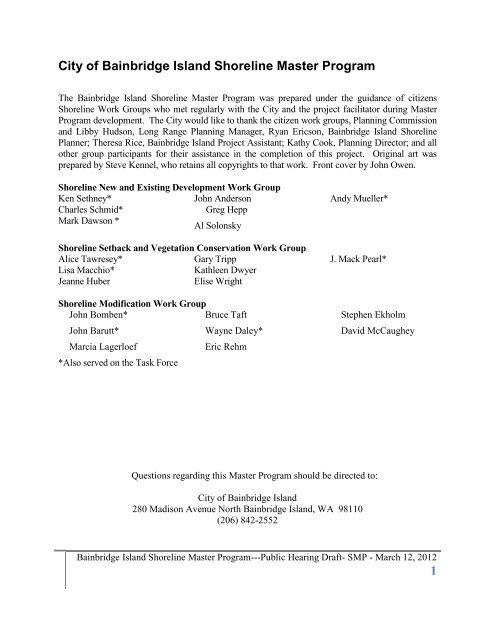
<strong>City</strong> <strong>of</strong> <strong>Bainbridge</strong> <strong>Island</strong> Shoreline Master Program<br />
The <strong>Bainbridge</strong> <strong>Island</strong> Shoreline Master Program was prepared under the guidance <strong>of</strong> citizens<br />
Shoreline Work Groups who met regularly with the <strong>City</strong> and the project facilitator during Master<br />
Program development. The <strong>City</strong> would like to thank the citizen work groups, Planning Commission<br />
and Libby Hudson, Long Range Planning Manager, Ryan Ericson, <strong>Bainbridge</strong> <strong>Island</strong> Shoreline<br />
Planner; Theresa Rice, <strong>Bainbridge</strong> <strong>Island</strong> Project Assistant; Kathy Cook, Planning Director; and all<br />
other group participants for their assistance in the completion <strong>of</strong> this project. Original art was<br />
prepared by Steve Kennel, who retains all copyrights to that work. Front cover by John Owen.<br />
Shoreline New and Existing Development Work Group<br />
Ken Sethney*<br />
Charles Schmid*<br />
Mark Dawson *<br />
John Anderson<br />
Greg Hepp<br />
Al Solonsky<br />
Shoreline Setback and Vegetation Conservation Work Group<br />
Alice Tawresey*<br />
Lisa Macchio*<br />
Jeanne Huber<br />
Gary Tripp<br />
Kathleen Dwyer<br />
Elise Wright<br />
Shoreline Modification Work Group<br />
John Bomben*<br />
Bruce Taft<br />
John Barutt*<br />
Marcia Lagerloef<br />
*Also served on the Task Force<br />
Wayne Daley*<br />
Eric Rehm<br />
Andy Mueller*<br />
J. Mack Pearl*<br />
Stephen Ekholm<br />
Questions regarding this Master Program should be directed to:<br />
<strong>City</strong> <strong>of</strong> <strong>Bainbridge</strong> <strong>Island</strong><br />
280 Madison Avenue North <strong>Bainbridge</strong> <strong>Island</strong>, WA 98110<br />
(206) 842-2552<br />
David McCaughey<br />
<strong>Bainbridge</strong> <strong>Island</strong> Shoreline Master Program---<strong>Public</strong> <strong>Hearing</strong> <strong>Draft</strong>- SMP - March 12, 2012<br />
1
Table <strong>of</strong> Contents<br />
1.0 INTRODUCTION ............................................................................................ 5<br />
1.1 Shoreline Master Program Introduction ............................................................................ 5<br />
1.2 Requirements <strong>of</strong> the Shoreline Management Act ........................................................... 5<br />
1.3 <strong>Bainbridge</strong> <strong>Island</strong>’s Shoreline Master Program (SMP) ................................................... 10<br />
1.4 Restoration ............................................................................................................... 14<br />
1.5 Master Goal .............................................................................................................. 15<br />
2.0 SHORELINE INVENTORY AND CHARACTERIZATION .................................. 16<br />
2.1 Summary .................................................................................................................. 16<br />
3.0 SHORELINE DESIGNATION POLICIES AND REGULATIONS ..... 16<br />
3.1 General ..................................................................................................................... 17<br />
3.2 Upland Designations ................................................................................................. 18<br />
3.2.1 Urban .................................................................................................................... 18<br />
3.2.2 Shoreline Residential ............................................................................................. 19<br />
3.2.3 Shoreline Residential Conservancy ........................................................................ 20<br />
3.2.4 <strong>Island</strong> Conservancy .............................................................................................. 21<br />
3.2.5 Natural Designation .............................................................................................. 23<br />
3.3 Aquatic Designations ................................................................................................ 25<br />
3.3.1 Aquatic ................................................................................................................. 25<br />
3.3.2 Priority Aquatic ..................................................................................................... 26<br />
3.4 Designation Strategy ................................................................................................. 30<br />
<strong>Bainbridge</strong> <strong>Island</strong> Shoreline Master Program---<strong>Public</strong> <strong>Hearing</strong> <strong>Draft</strong> SMP - March 12, 2012<br />
2
4.0 GENERAL (ISLAND-WIDE) POLICIES AND REGULATIONS ......................... 32<br />
Introduction ......................................................................................................................... 32<br />
Master Program Summary Matrices (Tables 4-1; 4-2; 4-2) ............................................................... 33<br />
4.1 General—Environmental Quality and Conservation ..................................................... 59<br />
4.1.1 Shorelines <strong>of</strong> State-wide Significance .................................................................... 59<br />
4.1.2 Environmental Impacts .......................................................................................... 60<br />
4.1.3 Vegetation Management ....................................................................................... 69<br />
4.1.4 Land Modification ................................................................................................. 85<br />
4.1.5 Critical Areas ......................................................................................................... 87<br />
4.1.6 Water Quality and Stormwater Management .......................................................... 93<br />
4.1.7 Flood Hazard......................................................................................................... 97<br />
4.1.8 Shoreline Restoration and Enhancement ............................................................. 101<br />
4.2 General Use ............................................................................................................ 105<br />
4.2.1 Nonconforming Development ............................................................................. 105<br />
4.2.2 Archaeological and Historic Resources ................................................................ 112<br />
4.2.3 Parking ................................................................................................................ 116<br />
4.2.4 <strong>Public</strong> Access - Visual and Physical ..................................................................... 120<br />
4.2.5 Signs ................................................................................................................... 126<br />
4.2.6 Transportation Facilities ...................................................................................... 128<br />
4.2.7 Utilities (Primary and Accessory) ......................................................................... 132<br />
5.0 SPECIFIC SHORELINE USE AND DEVELOPMENT POLICIES<br />
AND REGULATIONS .............................................................................. 139<br />
Introduction ....................................................................................................................... 139<br />
5.1 Agriculture.............................................................................................................. 139<br />
5.2 Aquaculture ............................................................................................................ 140<br />
5.3 Boating Facilities ..................................................................................................... 147<br />
5.4 Commercial Development ........................................................................................ 156<br />
5.5 Forest Practices ....................................................................................................... 160<br />
5.6 Industry .................................................................................................................. 162<br />
<strong>Bainbridge</strong> <strong>Island</strong> Shoreline Master Program---<strong>Public</strong> <strong>Hearing</strong> <strong>Draft</strong>- SMP - March 12, 2012<br />
3
5.7 Mining .................................................................................................................... 165<br />
5.8 Recreational Development ....................................................................................... 166<br />
5.9 Residential Development ......................................................................................... 172<br />
6.0 SHORELINE MODIFICATION POLICIES AND REGULATIONS .................... 178<br />
6.1 General Shoreline Modification Provisions ................................................................ 178<br />
6.2 Shoreline Stabilization ............................................................................................. 181<br />
6.3 Overwater Structures .............................................................................................. 191<br />
6.4 Dredging and Dredge Material Disposal ................................................................... 203<br />
6.5 Landfill ................................................................................................................... 208<br />
7.0 DEFINITIONS....................................................................................................... 211<br />
Administration<br />
Moved to Title 2 <strong>of</strong> the <strong>Bainbridge</strong> <strong>Island</strong> Municipal Code.<br />
APPENDICES<br />
Appendix A. Designation Map……………………………………………………………247<br />
Appendix B. Critical Areas…..……………………………………………………………248<br />
Appendix C. Buffer Recommendation Memorandum………………………………..301<br />
Appendix D. Single Family Residential Mitigation Manual………………………….328<br />
Appendix E. Harbor Structure Limit Line Map 340<br />
<strong>Bainbridge</strong> <strong>Island</strong> Shoreline Master Program---<strong>Public</strong> <strong>Hearing</strong> <strong>Draft</strong> SMP - March 12, 2012<br />
4
1.0 Introduction<br />
1.1 Shoreline Master Program Introduction<br />
This Shoreline Master Program (SMP) establishes policies and regulations for protection and<br />
development <strong>of</strong> <strong>Bainbridge</strong> <strong>Island</strong>’s shoreline areas. The regulations in the Shoreline Master<br />
Program state specific legal requirements which future development must follow. The policies<br />
in the Shoreline Master Program state the underlying objectives the regulations are intended to<br />
accomplish. The policies are a component <strong>of</strong> the <strong>City</strong>’s Comprehensive Plan and guide the<br />
interpretation and enforcement <strong>of</strong> the Shoreline Master Program’s regulations. The policies<br />
are not regulations in themselves and, therefore, do not impose requirements beyond those set<br />
forth in the regulations.<br />
1.1.1 Purpose and Intent<br />
The Shoreline Master Program is intended to implement the Shoreline Management Act <strong>of</strong> 1971<br />
(Revised Code <strong>of</strong> Washington (RCW 90.58) by:<br />
Planning for and guiding the orderly development <strong>of</strong> the shoreline in a positive, effective,<br />
and equitable manner, protecting shoreline resources, and helping to assure public access<br />
to the shoreline;<br />
Promoting the health, safety, and general welfare <strong>of</strong> the community by providing long<br />
range, comprehensive policies and effective, reasonable regulations for use and<br />
development <strong>of</strong> <strong>Bainbridge</strong> <strong>Island</strong>’s shorelines;<br />
Ensuring, at minimum, no net loss <strong>of</strong> shoreline ecological functions and processes;<br />
Planning for the restoration <strong>of</strong> shorelines that have been impaired or degraded in the past<br />
and in a manner that educates the community in the use and protection <strong>of</strong> its shorelines;<br />
and<br />
Adhering to and fostering the policies <strong>of</strong> the Act contained in RCW 90.58.020 for<br />
shorelines <strong>of</strong> the state.<br />
1.2 Requirements <strong>of</strong> the Shoreline Management Act<br />
In June 1971, the Washington State Legislature approved a comprehensive regulatory<br />
program for shorelines <strong>of</strong> the state with the adoption <strong>of</strong> the Shoreline Management Act <strong>of</strong><br />
1971 (SMA or Act). The Act carried with it provisions for a vote by the people and in<br />
November 1972, the people <strong>of</strong> the State <strong>of</strong> Washington enacted the Shoreline Management<br />
Act (RCW 90.58). The Act’s paramount objectives are to protect and restore the valuable<br />
natural resources that shoreline represent, and to plan for and foster all “reasonable and<br />
appropriate uses” that are dependent upon a waterfront location, including single family<br />
development, or that <strong>of</strong>fer the opportunities for the public to enjoy the State’s shoreline. With<br />
this clear mandate, the Shoreline Management Act establishes a planning and regulatory<br />
program, initiated at the local level under State guidelines.<br />
<strong>Bainbridge</strong> <strong>Island</strong> Shoreline Master Program---<strong>Public</strong> <strong>Hearing</strong> <strong>Draft</strong>- SMP - March 12, 2012<br />
5
1.2.1 Shoreline Management Act Administration<br />
Administration <strong>of</strong> the Shoreline Act is a cooperative effort balancing local and statewide interest<br />
in the management and development <strong>of</strong> shoreline areas by requiring local government to plan<br />
(via Shoreline Master Programs) and regulate (via permits) shoreline development. Local<br />
government actions are monitored by the Washington State Department <strong>of</strong> Ecology (Ecology),<br />
which approves new or amended Shoreline Master Programs, reviews substantial development<br />
permits, and approves shoreline Conditional Use permits and Variances. The master program is<br />
essentially a shoreline comprehensive plan with distinct environmental orientation applicable to<br />
shoreline areas and customized to local circumstances. Collectively, the local master programs<br />
comprise the State Shoreline Master Program. By law, the <strong>City</strong> is responsible for the following:<br />
1. Preparation <strong>of</strong> a "Shoreline Master Program" in accordance in accordance with the<br />
policies and requirements <strong>of</strong> the Act and the State Shoreline Guidelines (WAC 173-26).<br />
The purpose <strong>of</strong> a Shoreline Master Program is to protect shoreline resources, manage the<br />
uses and activities on local shorelines, and assure continued public use <strong>of</strong> waters <strong>of</strong> the<br />
State.<br />
2. The Act specifies that local master programs include goals and policy statements for<br />
each <strong>of</strong> the required elements and take into account economic development, public<br />
access, circulation and transportation, and recreation. Local government is further<br />
encouraged to identify any other elements that are deemed appropriate and necessary to<br />
implement the intent <strong>of</strong> the Shoreline Management Act, and to develop goals and<br />
policies for those additional elements.<br />
3. Master program regulations are developed and adopted by local government to<br />
implement the goals and policies for each <strong>of</strong> the elements, These regulations address<br />
various types <strong>of</strong> shoreline development, including agriculture, aquaculture, forest<br />
management, commercial development, marinas, mining, outdoor advertising and signs,<br />
residential development, utilities, ports and water-related industries, bulkheads,<br />
breakwaters, jetties and groins, landfills, solid waste disposal.<br />
4. Administration <strong>of</strong> a shoreline permit system to further the goals and policies <strong>of</strong> both the<br />
Act and the local master program for proposed substantial development within two<br />
hundred (200) feet <strong>of</strong> the ordinary high water mark (OHWM) <strong>of</strong> designated water<br />
bodies. (Local government has the option to adopt the administrative process as part <strong>of</strong><br />
the SMP or as a reference document not considered part <strong>of</strong> the SMP. This allows local<br />
government to make changes without the need <strong>of</strong> a SMP amendment. See WAC 173-26-<br />
191(2)(a)(C).<br />
5. Development <strong>of</strong> an inventory <strong>of</strong> natural characteristics and land use patterns along those<br />
designated water bodies. Local governments are required to prepare a detailed shoreline<br />
inventory that provides the foundation for development <strong>of</strong> a system that classifies the<br />
shoreline into distinct shoreline “environments” These environments, or designations,<br />
provide the framework for implementing shoreline policies and regulatory measures.<br />
6. Local governments have the primary responsibility for initiating the planning program<br />
and administering the regulatory requirements. The <strong>City</strong> <strong>of</strong> <strong>Bainbridge</strong> <strong>Island</strong> Shoreline<br />
<strong>Bainbridge</strong> <strong>Island</strong> Shoreline Master Program---<strong>Public</strong> <strong>Hearing</strong> <strong>Draft</strong> SMP - March 12, 2012<br />
6
Master Program must be consistent with the policies and requirements <strong>of</strong> the Shoreline<br />
Management Act and the State Shoreline Master Program Guidelines. The role <strong>of</strong> the<br />
Department <strong>of</strong> Ecology is to provide support and review <strong>of</strong> the Shoreline Master<br />
Program and subsequent shoreline development permits and approvals and ensure<br />
compliance with the policies and provisions <strong>of</strong> the SMA. Scope <strong>of</strong> Shoreline<br />
Management Act.<br />
1.2.2 Scope <strong>of</strong> Shoreline Management Act<br />
The Shoreline Management Act covers all shorelines <strong>of</strong> the state, including shorelines and<br />
“shorelines <strong>of</strong> state-wide significance.” Figure 1-1 illustrates shoreline jurisdiction on coastal<br />
shorelines.<br />
Figure 1-1 Shoreline Jurisdiction<br />
<strong>Bainbridge</strong> <strong>Island</strong> Shoreline Master Program---<strong>Public</strong> <strong>Hearing</strong> <strong>Draft</strong>- SMP - March 12, 2012<br />
7
Provisions <strong>of</strong> the Act apply to the following, geographical, shoreline areas:<br />
1. All marine waters <strong>of</strong> the state, together with the lands underlying them;<br />
2. Streams and rivers with a mean annual flow <strong>of</strong> 20 cubic feet per second (cfs) or more;<br />
3. Lakes and reservoirs larger than 20 acres in area;<br />
4. Wetlands (a specific Shoreline Management Act term which includes related upland,<br />
shoreland, and wetland areas) associated with all <strong>of</strong> the above; and<br />
5. Shorelines <strong>of</strong> state-wide significance as defined in RCW 90.58.030 or its successor. This<br />
includes those areas <strong>of</strong> Puget Sound lying seaward from the line <strong>of</strong> extreme low tide.<br />
1.2.3 Development <strong>of</strong> the <strong>City</strong>’s Shoreline Master Program<br />
The <strong>City</strong> <strong>of</strong> <strong>Bainbridge</strong> <strong>Island</strong> adopted a Shoreline Master Program in 1996 after annexation <strong>of</strong><br />
the entire <strong>Island</strong> occurred in March 1991. Prior to annexation, <strong>Bainbridge</strong> <strong>Island</strong>’s shorelines<br />
were managed under the Kitsap County Shoreline Master Program and the <strong>City</strong> <strong>of</strong> Winslow<br />
Shoreline Master Program. The goals and policies in the Shoreline Master Program are an<br />
element <strong>of</strong> the <strong>City</strong>’s Comprehensive Plan. All other portions <strong>of</strong> the SMP, including the use<br />
regulations, are part <strong>of</strong> the <strong>City</strong>’s development regulations.<br />
1.2.4 <strong>Public</strong> Involvement<br />
<strong>Public</strong> participation strategies were used in developing the Shoreline Master Program adopted in<br />
1996, and updating the Program in 2012.<br />
For the 1996 SMP, the <strong>City</strong> convened a citizen committee that worked from 1991-1993 to<br />
develop the first shoreline master program for the <strong>City</strong> <strong>of</strong> <strong>Bainbridge</strong> <strong>Island</strong>. In addition,<br />
approximately 45 citizen volunteers participated in a shoreline survey. The city used a variety <strong>of</strong><br />
tools for public outreach, and conducted several public meetings, special topic meetings, and<br />
public hearings.<br />
In updating this Program, the <strong>City</strong> first developed a public participation plan with the community<br />
in March, 2010. The public participation plan was accepted by the <strong>City</strong> Council in May, 2010,<br />
and the <strong>City</strong> used the plan as a guide for public involvement and notification throughout the<br />
update process. An SMP Ad Hoc Committee composed <strong>of</strong> two members from the <strong>City</strong> Council<br />
and two members from the Planning Commission also helped guide the public participation plan.<br />
The public participation plan developed with the community identified the following key<br />
challenges and opportunities:<br />
Build Common Understanding<br />
Clearly Address the Use <strong>of</strong> Science<br />
Engage the Community<br />
Allow Respectful Dialog<br />
Sustain Community Involvement<br />
Formed Ad Hoc Committee<br />
<strong>Bainbridge</strong> <strong>Island</strong> Shoreline Master Program---<strong>Public</strong> <strong>Hearing</strong> <strong>Draft</strong> SMP - March 12, 2012<br />
8
To meet these challenges, the <strong>City</strong> developed the following outreach components:<br />
Setup Shoreline Master Program Update web page<br />
Identified stakeholders in the SMP Update process<br />
Created community outreach list<br />
Developed a Shoreline Education series to inform the community and decision makers<br />
about the natural resource processes and the legal requirements <strong>of</strong> updating the SMP<br />
At the Shoreline Education series, experts in the field presented information related to the<br />
program update and <strong>Bainbridge</strong> <strong>Island</strong>. At the end <strong>of</strong> each presentation, there was an open<br />
discussion with the presenter related to issues <strong>of</strong> the SMP Update. Each <strong>of</strong> these educational<br />
events was advertised and filmed, and the video was made available on the <strong>City</strong>’s SMP Update<br />
webpage. The education series included the following topics:<br />
June 3, 2010, Event #1 Ecology’s Role in the SMP Update with Department <strong>of</strong> Ecology<br />
representatives Ge<strong>of</strong>f Tallent, Regional Manager, and Barbara Nightingale, the city’s<br />
Ecology contact;<br />
June 17, 2010 Event #2, Shoreline Processes with Hugh Shipman, coastal geologist with<br />
the Dept. <strong>of</strong> Ecology's Shorelands and Environmental Assistance program, and Jeff<br />
Adams, Marine Water Quality Specialist with Washington Sea Grant;<br />
June 22, 2010 Event #3, Property Rights/Listening Session with Dawn Findlay Reitan,<br />
Interim <strong>City</strong> Attorney from the firm <strong>of</strong> Inslee Best;<br />
July 8, 2010 Event #4 Coastal Bluffs and Beaches with Jim Johannesen, principle<br />
scientist at Coastal Geological Services; and<br />
July 27, 2010 Event #5 Nearshore Assessment with Ron Thom, who leads the Coastal<br />
Assessment and Restoration group at Battelle’s Marine Sciences Laboratory.<br />
Citizen Committees<br />
The <strong>City</strong> solicited citizen volunteers and formed topic-based workgroups to assist in drafting<br />
revisions to SMP policies and regulations that reflected the requirements <strong>of</strong> the State SMP<br />
Guidelines and community values. Four community organizations (<strong>Bainbridge</strong> Shoreline<br />
Property Owners, <strong>Bainbridge</strong> Concerned Citizens, Association for <strong>Bainbridge</strong> Communities and<br />
<strong>Bainbridge</strong> <strong>Island</strong> People for Puget Sound) self-selected members to represent their organization<br />
on the SMP Workgroups. The remaining volunteers were selected by the SMP Ad Hoc<br />
Committee. The three topic-based workgroups focused on major issues <strong>of</strong> the program. A fourth<br />
committee, the SMP Task Force, was formed from members selected from each <strong>of</strong> the three<br />
topic-based workgroups. The committees drafted the revisions between September 2010 and<br />
August 2011, over the course <strong>of</strong> approximately 45 public meetings. The citizen committee’s<br />
recommendations were made available on the <strong>City</strong>’s website for public review and forwarded to<br />
the Planning Commission in July 2011. <strong>Public</strong> comment was accepted throughout the process,<br />
and comments were posted on the <strong>City</strong>’s website.<br />
<strong>Bainbridge</strong> <strong>Island</strong> Shoreline Master Program---<strong>Public</strong> <strong>Hearing</strong> <strong>Draft</strong>- SMP - March 12, 2012<br />
9
From July 2011 through March 2012, the Planning Commission reviewed the recommendations<br />
and made amendments. <strong>Public</strong> comment opportunity was provided at each <strong>of</strong> the Planning<br />
Commission’s seventeen study sessions. A public hearing on the draft amendments was held on<br />
(TBD), 2012, and after (TBD) additional study sessions, the Commission forwarded their<br />
recommendation to the <strong>City</strong> Council for consideration.<br />
The <strong>City</strong> Council (TBD).<br />
1.3 <strong>Bainbridge</strong> <strong>Island</strong>’s Shoreline Master Program (SMP)<br />
1.3.1 <strong>Bainbridge</strong> <strong>Island</strong>'s Shorelines<br />
<strong>Bainbridge</strong> <strong>Island</strong> has approximately 53 miles <strong>of</strong> waterfront. (See Figure 1-2 Map <strong>of</strong> <strong>Bainbridge</strong><br />
<strong>Island</strong>.) It has seven harbors or bays, each having a long and interesting history and a wide<br />
variety <strong>of</strong> uses. Eagle Harbor has the most activity, including a ferry landing, shipyard repair, a<br />
boatyard, numerous marinas and restaurants, a waterfront park, a Superfund site, condominiums,<br />
detached homes, and a live-aboard community. Most <strong>of</strong> the waterfront on <strong>Bainbridge</strong> shorelines<br />
has been developed with single family residences, from small summer cabins to large mansions.<br />
Their locations range from below ordinary high water to cliffs nearly 200 feet above the water.<br />
At the north end <strong>of</strong> the island is a large sandspit called Point Monroe, while at the south end is<br />
Restoration Point, composed <strong>of</strong> raised bedrock located on the Seattle fault.<br />
<strong>Bainbridge</strong> <strong>Island</strong>'s shorelines exhibit many uses and geologic characteristics. The shoreline is<br />
home for about twenty percent <strong>of</strong> the island residents, as well as numerous species <strong>of</strong> fish and<br />
wildlife. Bald eagles, herons, seals, otters, and numerous waterfowl depend on the shoreline.<br />
There are also salmon streams and bays necessary for fish, shellfish, clams, and vegetation to<br />
survive. At the south end <strong>of</strong> the island is an aquaculture farm for salmon. In short, <strong>Bainbridge</strong><br />
<strong>Island</strong> shorelines support a wide variety <strong>of</strong> life.<br />
Located on the eastern border <strong>of</strong> Kitsap County, <strong>Bainbridge</strong> <strong>Island</strong> is connected to the rest <strong>of</strong><br />
Kitsap County by one bridge and to Seattle (King County) by a 35-minute ferry ride. Because <strong>of</strong><br />
its proximity to Seattle, the island has close cultural and economic ties to Seattle. Approximately<br />
23,000 people currently live on <strong>Bainbridge</strong> <strong>Island</strong>. The population increased from 15,846 in<br />
1990 to 23,000 in 2011. Until 2008 with the national economic decline, t he <strong>Island</strong> grew at a<br />
fairly steady rate <strong>of</strong> approximately 300 people each year. This increased growth, reflected in<br />
higher waterfront land values and taxes, along with a growing concern for the environment,<br />
motivated citizen participation in the update <strong>of</strong> the Shoreline Master Program. The program<br />
must strike a balance between imposing regulatory powers for the benefit <strong>of</strong> the community at<br />
large and the rights <strong>of</strong> the individual property holder. Fortunately, the Shoreline Management<br />
Act and the public trust doctrine provide the guidance to create a program which recognizes both<br />
these values.<br />
<strong>Bainbridge</strong> <strong>Island</strong> Shoreline Master Program---<strong>Public</strong> <strong>Hearing</strong> <strong>Draft</strong> SMP - March 12, 2012<br />
10
1.3.2 Title<br />
Figure 1-2 Map <strong>of</strong> <strong>Bainbridge</strong> <strong>Island</strong><br />
This document shall be known as the <strong>Bainbridge</strong> <strong>Island</strong> Shoreline Master Program ("the Master<br />
Program" or "the Program", or the “SMP”).<br />
<strong>Bainbridge</strong> <strong>Island</strong> Shoreline Master Program---<strong>Public</strong> <strong>Hearing</strong> <strong>Draft</strong>- SMP - March 12, 2012<br />
11
1.3.3 Adoption Authority<br />
This Master Program is adopted under the authority granted by RCW 90.58 and WAC 15 173-<br />
26.<br />
1.3.4 Relationship to Other Plans and Regulation<br />
The Shoreline Master Program regulations are used as an overlay to other <strong>City</strong> policies and<br />
regulations for properties within shoreline jurisdiction. The following provisions apply to this<br />
program in relationship to other plans and regulations:<br />
1. In addition to compliance with the provisions <strong>of</strong> the Shoreline Management Act <strong>of</strong> 1971<br />
and the state Shoreline Master Program Guidelines, this Shoreline Master Program must<br />
be consistent with local plans and policy documents, specifically, the <strong>City</strong>’s<br />
Comprehensive Plan and the <strong>City</strong>'s critical areas regulations. This program must be<br />
consistent with the regulations developed by the <strong>City</strong> to implement its plans, such as the<br />
zoning code and subdivision code, as well as regulations relating to building<br />
construction and safety.<br />
2. Uses and developments regulated by this Program may also be subject to other<br />
provisions <strong>of</strong> the <strong>Bainbridge</strong> <strong>Island</strong> Municipal Code, the <strong>City</strong> <strong>of</strong> <strong>Bainbridge</strong> <strong>Island</strong><br />
Comprehensive Plan, the Washington State Environmental Policy Act (RCW 43.21C<br />
and WAC 197-11), and other local, state and federal laws.<br />
3. Project proponents are responsible for complying with all applicable laws prior to<br />
commencing any use, development or activity.<br />
4. Where this Program makes reference to any RCW, WAC, or other state or federal law or<br />
regulation the most recent amendment or current edition shall apply.<br />
5. In the event a conflict occurs between the provisions <strong>of</strong> this program and the laws,<br />
regulations, codes or rules <strong>of</strong> any other authority having jurisdiction within the <strong>City</strong>, the<br />
regulations that provide more protection to the shoreline area shall apply, except when<br />
constrained by federal or state law, or where specifically provided otherwise in this<br />
program.<br />
6. Other activities that could occur along the shoreline (starting bonfires, disposing or<br />
spilling/releasing <strong>of</strong> regulated or hazardous waste products, use <strong>of</strong> pesticides, activities<br />
within wetlands) may require other permits, review, or approval not identified here.<br />
1.3.5 Applicability <strong>of</strong> <strong>Bainbridge</strong> <strong>Island</strong> Shoreline Master Program<br />
1. All proposed uses and development occurring within shoreline jurisdiction must<br />
conform to Chapter 90.58 RCW, the Shoreline Management Act and this Shoreline<br />
Master Program. All uses, even those not meeting the definition <strong>of</strong> development, are<br />
subject to the provisions and development regulations <strong>of</strong> this SMP, even though a permit<br />
may not be required.<br />
2. Any person wishing to undertake activities constituting “development” within shoreline<br />
jurisdiction shall apply to the Administrator for a Shoreline Permit. Based on the<br />
<strong>Bainbridge</strong> <strong>Island</strong> Shoreline Master Program---<strong>Public</strong> <strong>Hearing</strong> <strong>Draft</strong> SMP - March 12, 2012<br />
12
provisions <strong>of</strong> this Master Program, the Administrator shall determine if a Letter <strong>of</strong><br />
Exemption, a Substantial Development Permit, a Shoreline Conditional Use Permit,<br />
and/or a Shoreline Variance is required. Substantial development shall not be undertaken<br />
within the jurisdiction <strong>of</strong> the Act and this Master Program unless a Substantial<br />
Development Permit has been obtained and the appeal period has been completed and<br />
any appeals have been resolved and/or the project proponent is allowed to proceed under<br />
the provisions <strong>of</strong> the Shoreline Management Act or by court order. "Substantial<br />
development" shall be defined as it is by the Act (§90.58.030 RCW) and supplementing<br />
provisions <strong>of</strong> the Washington Administrative Code (§173-27- 040 WAC).<br />
3. Developments exempt from a Substantial Development Permit, which are outlined in<br />
BIMC Section 2.16.165, shall require a Letter <strong>of</strong> Exemption. A project that qualifies as<br />
“exempt development” may also require a Shoreline Conditional Use Permit, and/or a<br />
Shoreline Variance.<br />
1.3.6 Program provisions<br />
1. Exempt developments shall not be undertaken within the jurisdiction <strong>of</strong> the Act and this<br />
Master Program, unless a Letter <strong>of</strong> Exemption has been obtained documenting that the<br />
development is consistent with the policies and procedures <strong>of</strong> the Act, all applicable<br />
state regulations and this Master Program.<br />
2. The request for a Letter <strong>of</strong> Exemption shall be in writing, on forms required by the<br />
Administrator, and include the information required by the Administrator.<br />
3. This Master Program shall apply to every individual, firm, partnership, association,<br />
organization, corporation, local or state governmental agency, public or municipal<br />
corporation, or other entity which develops, owns, leases or administers lands, wetlands<br />
or waters that fall under the jurisdiction <strong>of</strong> the Act.<br />
4. The “policies” in this Master Program provide broad guidance and direction and will be<br />
used by the <strong>City</strong> in applying the “regulations.”<br />
5. Applicability <strong>of</strong> this Master Program to federal lands and agencies shall be consistent<br />
with WAC 173-27-060 as currently exists or is hereinafter amended.<br />
1.3.7 <strong>Bainbridge</strong> <strong>Island</strong> Shoreline Master Program Administrative<br />
Procedures<br />
As described in adopted ordinance 2012-04, the general administrative sections <strong>of</strong> Shoreline<br />
Master Program as listed below are included in Title 2 <strong>of</strong> the <strong>Bainbridge</strong> <strong>Island</strong> Municipal Code.<br />
The use <strong>of</strong> separate local administrative and enforcement procedures is consistent with the 2003<br />
Washington State Shoreline Master Program Guidelines, Administrative provisions [WAC 173-<br />
26-191(2)(a)(iii)(C)]:<br />
“Local governments may include administrative, enforcement, and permit review procedures in<br />
the master program or the procedures may be defined by a local government ordinance separate<br />
<strong>Bainbridge</strong> <strong>Island</strong> Shoreline Master Program---<strong>Public</strong> <strong>Hearing</strong> <strong>Draft</strong>- SMP - March 12, 2012<br />
13
from the master program. In either case, these procedures shall conform to the Shoreline<br />
Management Act, specifically RCW 90.58.140, 90.58.143, 90.58.210 and 90.58.220 and to<br />
chapter 173-27 WAC.”<br />
This allows the <strong>City</strong> to revise local administrative procedures (fees, application meetings,<br />
authority <strong>of</strong> Administrator, etc) without another formal SMP amendment process. These chapters<br />
must still be consistent and remain consistent with the related provisions in the Shoreline<br />
Management Act and state shoreline rules (WACs). In the event <strong>of</strong> a conflict, the state RCW or<br />
WAC, as amended, will prevail over the local ordinance.<br />
The following sections are part <strong>of</strong> the <strong>Bainbridge</strong> <strong>Island</strong> Municipal Code, BIMC 2.16.165:<br />
Shoreline Master Program Administration:<br />
1. Permit or Exemption Required- Before Undertaking Development or Activity.<br />
2. Applications.<br />
3. Statement <strong>of</strong> Exemptions from Shoreline Substantial Development Permit.<br />
4. Shoreline Substantial Development Permit.<br />
5. Shoreline Variance.<br />
6. Shoreline Conditional Use Permits.<br />
7. Shoreline Application Appeals.<br />
1.4 Restoration Planning<br />
To achieve island-wide improvements in ecological functions as required by WAC 173-26-<br />
201(2)(f) and meet the no net loss standard <strong>of</strong> WAC 173-26-201(2)(c), the <strong>City</strong> developed a<br />
restoration plan that guides improvements <strong>of</strong> degraded shoreline areas over time by restoring<br />
shoreline ecological functions and processes over time. The Restoration Plan is linked to the<br />
goals and polices <strong>of</strong> Section 4.1.8, and is intended to be accomplished through voluntary and<br />
incentive-based public and private programs that restore and enhance shoreline areas<br />
identified and prioritized for improvement. The Restoration Plan can be found on the <strong>City</strong>’s<br />
web page: www.ci.bainbridge-isl.wa.us<br />
The Restoration Plan provides the following information for shoreline improvements:<br />
1. Identification <strong>of</strong> degraded areas and opportunities for restoration.<br />
2. Identification <strong>of</strong> development that is harming shorelines.<br />
3. Opportunities for protection and conservation.<br />
4. Identification <strong>of</strong> programmatic restoration strategies.<br />
5. A summary <strong>of</strong> ongoing and proposed restoration projects.<br />
6. A summary <strong>of</strong> completed restoration projects.<br />
<strong>Bainbridge</strong> <strong>Island</strong> Shoreline Master Program---<strong>Public</strong> <strong>Hearing</strong> <strong>Draft</strong> SMP - March 12, 2012<br />
14
1.5 Master Goal<br />
The <strong>City</strong>'s shorelines are among the most valuable and fragile <strong>of</strong> our natural resources and<br />
their use, protection, restoration, and preservation is <strong>of</strong> public interest to all residents <strong>of</strong> the<br />
<strong>City</strong>. The <strong>Island</strong> shorelines provide for a significant part <strong>of</strong> our way <strong>of</strong> life as a place <strong>of</strong><br />
residence, recreational enjoyment, and occupation. It is the intent <strong>of</strong> this program to manage<br />
the shorelines <strong>of</strong> <strong>Bainbridge</strong> <strong>Island</strong> consistent with the requirements <strong>of</strong> the Shoreline<br />
Management Act, the Shoreline Master Program Guidelines, and the Growth Management<br />
Act, giving preference to water-dependent and water-related uses, and to encourage all<br />
reasonable and appropriate development and other activities to occur in a manner which will<br />
promote and enhance the public interest and protect environmental resources. An overarching<br />
goal <strong>of</strong> this master program is to ensure that future use and development <strong>of</strong> the <strong>City</strong>’s<br />
shoreline maintain a balance between competing uses, results in no net loss <strong>of</strong> shoreline<br />
ecological functions, and achieves a net ecosystem improvement over time.<br />
<strong>Bainbridge</strong> <strong>Island</strong> Shoreline Master Program---<strong>Public</strong> <strong>Hearing</strong> <strong>Draft</strong>- SMP - March 12, 2012<br />
15
2.0 Shoreline Inventory and Characterization<br />
2.1 Summary<br />
To characterize the <strong>Island</strong>’s 53 miles <strong>of</strong> shoreline, the <strong>City</strong> initiated a series <strong>of</strong> studies to update<br />
the Shoreline Master Program with the most current science. A shoreline structure inventory<br />
and two shoreline characterization reports were completed. The primary inventory and<br />
characterization data is found in the Nearshore Habitat Characterization and Assessment,<br />
Management Strategy Prioritization, and Monitoring Recommendations produced by Battelle<br />
Laboratories for the <strong>City</strong> <strong>of</strong> <strong>Bainbridge</strong> <strong>Island</strong> in 2004 (Battelle 2004). The assessment uses a<br />
conceptual mode to determine potential level <strong>of</strong> impact from alterations to the nearshore<br />
environment. The conceptual model identifies nine controlling factors which represent<br />
physical, biological, and chemical attributes <strong>of</strong> the nearshore marine habitats. The integrated<br />
spread-sheet model and geographical information system developed by Battelle, quantifies<br />
existing anthropogenic impacts by converting qualitative factor values to standardized scores.<br />
The model’s scoring approach uses a 5-point scale to assign to qualitative categories to<br />
potential impacts for the nine controlling factors identified in the nearshore conceptual model.<br />
The model divides the shoreline into 201 reaches, which are then grouped into nine (9)<br />
management units. The controlling factor score for each reach represents the predicted impacts<br />
affecting nearshore processes. To allow <strong>Island</strong>-wide comparison across different types <strong>of</strong><br />
shorelines, a normalized index was calculated called the cumulative reach index. Controlling<br />
factor scores are best used to prioritize conservation and restoration efforts in the nearshore as<br />
indicators for identifying the probability for successful conservation and restoration strategies<br />
(Battelle 2004).<br />
The model uses ecological information collected by Washington Department <strong>of</strong> Natural<br />
Resources (WDNR) for a regional shoreline inventory. The data is available through the<br />
Department <strong>of</strong> Ecology, Coastal Atlas. Additional datasets from the <strong>City</strong>’s shoreline structural<br />
inventory and other sources are listed in Table 3 in the Battelle document.<br />
An <strong>Island</strong>-wide inventory <strong>of</strong> current geomorphic features and an accompanying analysis <strong>of</strong><br />
historic conditions was produced for the <strong>City</strong> in 2010 by Coastal Geological Services. This<br />
study maps coastal geomorphic shoretypes (such as “feeder bluffs”) and prioritizes restoration<br />
and conservation sites. The study includes current and historic mapping <strong>of</strong> coastal processes<br />
and process-impaired areas. Report conclusions integrate a qualitative, coastal processes-based<br />
prioritization with an objective <strong>of</strong> restoring and preserving coastal processes that sustain and<br />
maintain critical habitats.<br />
These documents can be accessed from the <strong>City</strong>’s website (www.bainbridgewa.gov).<br />
<strong>Bainbridge</strong> <strong>Island</strong> Shoreline Master Program---<strong>Public</strong> <strong>Hearing</strong> <strong>Draft</strong> SMP - March 12, 2012<br />
16
3.0 Shoreline Designation Policies and Regulations<br />
3.1 General<br />
The Master Program establishes seven shoreline designations based on a combination <strong>of</strong><br />
existing shoreline features and conditions and intended types <strong>of</strong> existing and potential future<br />
use. When applied to geographic areas <strong>of</strong> the island, these designations form an overlay for<br />
applying shoreline considerations to the <strong>City</strong>'s land use regulations. Uses which are consistent<br />
with a particular are encouraged, while uses which are in conflict are discouraged or<br />
prohibited. A conditional use process is available when further review is needed to determine<br />
whether the use is compatible with the particular designation at the proposed site. Table 4.1,<br />
provides a summary <strong>of</strong> uses in relation to the various shoreline designations. Existing uses and<br />
activities which are incompatible with their shoreline designation are subject to provisions for<br />
nonconforming shoreline uses and structures. (See BIMC Section 2.16.165.)<br />
Shoreline Designation Map<br />
The <strong>of</strong>ficial <strong>Bainbridge</strong> <strong>Island</strong> Shoreline Designation Map (Appendix A) shall be in the<br />
custody <strong>of</strong> the Department <strong>of</strong> Planning and Community Development and shall be available for<br />
public inspection during normal business hours.<br />
The purpose <strong>of</strong> the map is to depict those areas <strong>of</strong> <strong>Bainbridge</strong> <strong>Island</strong> within the jurisdiction <strong>of</strong><br />
the Master Program and the various shoreline designations.<br />
Designation Boundaries<br />
Where the shoreline jurisdiction or designation is uncertain, the <strong>of</strong>ficial shoreline designation<br />
map shall be used to determine boundary location. If the conflict cannot be resolved using the<br />
shoreline designation map, the following rules shall apply:<br />
1. Boundaries indicated as approximately following the center lines <strong>of</strong> streets, highways, alleys,<br />
or other roadways shall be construed to follow such center lines.<br />
2. Boundaries indicated as approximately following lot, fractional section, or other subdivision<br />
lines shall be construed as following such subdivision lines.<br />
3. Boundaries indicated as parallel to or extensions <strong>of</strong> features identified in subsections 1 and 2<br />
above shall be so construed.<br />
4. When not specifically indicated on the Shoreline Designation Map, distances shall be<br />
determined by the scale <strong>of</strong> the map.<br />
Where existing physical or cultural features are at variance with those shown on the Shoreline<br />
Designation Map and cannot be determined with certainty by applying subsections 1 through 4<br />
above, the Department shall determine the location or existence <strong>of</strong> such feature utilizing any<br />
appropriate criteria contained in the Master Program.<br />
<strong>Bainbridge</strong> <strong>Island</strong> Shoreline Master Program---<strong>Public</strong> <strong>Hearing</strong> <strong>Draft</strong>- SMP - March 12, 2012<br />
17
3.2 Upland Designations<br />
3.2.1 Urban<br />
3.2.1.1 Purpose<br />
The purpose <strong>of</strong> Urban is to provide for high-intensity water-oriented commercial,<br />
transportation, industrial, mixed-use, multi-family residential, and recreational uses while<br />
protecting existing natural resources, ecological functions and restoring ecological functions<br />
in areas that have been previously degraded. An additional purpose is to provide appropriate<br />
public access and recreational uses.<br />
3.2.1.2 Designation Criteria<br />
Areas to be designated Urban should not have biophysical limitations to development such<br />
as wetlands and estuaries, floodplains, steep slopes, slide hazard areas, and/or other sensitive<br />
areas; and meet one or more <strong>of</strong> the following criteria:<br />
1. Shorelines used or designated for commercial, industrial, or recreational use, or for<br />
multifamily residential development.<br />
2. Areas where adjacent land use is urban and urban services are available or designated for<br />
higher intensity use under the comprehensive plan.<br />
3. Shorelines used for water-oriented and port activities.<br />
3.2.1.3 Management Policies<br />
1. Priority should be given to water-dependent, water-related, and water-enjoyment uses over<br />
other uses. Uses which derive minimal benefit from a water location should be<br />
discouraged or prohibited. Nonwater-oriented uses should be allowed only if the use is<br />
otherwise compatible with the purpose <strong>of</strong> the Urban designation and the setting, does not<br />
displace water-dependent uses, and results in no net loss <strong>of</strong> ecological functions.<br />
2. Assure new development will not result in a net loss <strong>of</strong> shoreline ecological functions<br />
3. Establish environmental <strong>clean</strong>up and restoration priorities for the shoreline that comply<br />
with relevant state and federal law.<br />
4. Because urban use tends to preclude other shoreline uses, emphasis should be given to<br />
directing new development into already developed areas consistent with the Master<br />
Program.<br />
5. Full utilization <strong>of</strong> existing urban areas should be achieved before additional areas are<br />
designated Urban.<br />
6. Visual and physical public access should be required and implemented where feasible.<br />
Industrial and commercial facilities should be designed to permit pedestrian waterfront<br />
activities. Planning for the acquisition <strong>of</strong> land for permanent public access to the water in<br />
the Urban designation should be encouraged and implemented, where feasible.<br />
<strong>Bainbridge</strong> <strong>Island</strong> Shoreline Master Program---<strong>Public</strong> <strong>Hearing</strong> <strong>Draft</strong> SMP - March 12, 2012<br />
18
7. To protect shoreline character and promote compatible development within the Urban<br />
designation, a esthetic considerations should be actively promoted by mechanisms such as<br />
sign control regulations, appropriate development siting, screening and architectural<br />
standards, flexible lot design process, and through the maintenance <strong>of</strong> shoreline<br />
vegetation conservation and management zones.<br />
8. In order to make maximum use <strong>of</strong> the available shoreline resource and to accommodate<br />
future water-dependent uses, the redevelopment and restoration for a net ecosystem<br />
improvement <strong>of</strong> substandard or degraded urban shoreline areas should be encouraged.<br />
9. Developments within the Urban designation should be compatible with uses and activities<br />
in adjacent designations, including Aquatic and Priority Aquatic.<br />
3.2.2 Shoreline Residential<br />
3.2.2.1 Purpose<br />
The purpose <strong>of</strong> Shoreline Residential is to provide for residential development and<br />
appurtenant structures that are consistent with the Shoreline Management Act, while<br />
protecting existing natural resources, ecological functions and restoring ecological functions<br />
in previously degraded areas. An additional purpose is to provide appropriate public access<br />
and recreational uses.<br />
3.2.2.2 Designation Criteria<br />
Areas to be designated Shoreline Residential should include the following:<br />
1. Areas presently zoned, platted or developed for residential use; and should meet one or<br />
more <strong>of</strong> the following criteria:<br />
2. Areas having the physical ability to support low to medium density residential uses and<br />
associated recreational and public service facilities; and/or<br />
3. Areas which can provide, and have the capabilities to support, the necessary public<br />
services, utilities, and access to accommodate low to medium density development.<br />
Sewage disposal and water supply facilities may be provided on an individual or<br />
community basis.<br />
3.2.2.3 Management Policies<br />
1. For development and new uses assure no net loss <strong>of</strong> shoreline ecological function by<br />
establishing:<br />
a. Minimum frontage width, setbacks, and buffers;<br />
b. Lot coverage limitations;<br />
c. Shoreline stabilization standards; and<br />
<strong>Bainbridge</strong> <strong>Island</strong> Shoreline Master Program---<strong>Public</strong> <strong>Hearing</strong> <strong>Draft</strong>- SMP - March 12, 2012<br />
19
d. Protective measures for vegetation conservation, critical areas and water quality.<br />
2. New development should be permitted only in those shoreline areas that are capable <strong>of</strong><br />
supporting the proposed use in a manner which protects or enhances the shoreline<br />
environment, and reflects the character <strong>of</strong> the surrounding area such as providing open<br />
space or maintaining shoreline vegetation buffers.<br />
3. <strong>Public</strong> access to shorelines should be required for multiple family residences, apartments,<br />
and large subdivisions. Common access for small, single-family residential subdivisions<br />
should be encouraged and should be required where feasible.<br />
4. Recreational developments should provide shoreline areas for community or public open<br />
space and public access.<br />
5. Access, utilities and public services should be available and adequate to serve existing<br />
needs and planned future development.<br />
6. Developments within the Shoreline Residential designation should be compatible with uses<br />
and activities in adjacent designations, including Aquatic and Priority Aquatic.<br />
7. High intensity development should be prohibited and commercial uses are intended to be<br />
accessory uses, consistent with zoning regulations, that are limited to water-oriented uses.<br />
8. Encourage restoration <strong>of</strong> shoreline ecological functions through non regulatory programs.<br />
3.2.3 Shoreline Residential Conservancy<br />
3.2.3.1 Purpose<br />
The purpose <strong>of</strong> Shoreline Residential Conservancy is to accommodate compatible residential<br />
uses while protecting, conserving, and restoring shoreline ecological functions <strong>of</strong> open space,<br />
floodplains, and other sensitive lands. It is the further purpose to conserve and manage<br />
valuable historic and cultural resources where they exist. Due to the more sensitive<br />
characteristics <strong>of</strong> these areas, a higher level <strong>of</strong> development standards is warranted.<br />
3.2.3.2 Designation Criteria<br />
Areas to be designated Shoreline Residential Conservancy should include the following<br />
criteria.<br />
1. Areas that are appropriate and planned for water-related or water-enjoyment uses that are<br />
compatible with maintaining or restoring ecological functions; or<br />
2. Areas that are not generally suitable for water-dependent uses or more intensive uses due<br />
to the potential impacts these uses may have on the existing shoreline characteristics; and<br />
one or more <strong>of</strong> the following criteria:<br />
3. Areas subject to severe biophysical limitations such as:<br />
a. Steep slopes and landslide hazard areas.<br />
b. Sediment sources for littoral cell.<br />
<strong>Bainbridge</strong> <strong>Island</strong> Shoreline Master Program---<strong>Public</strong> <strong>Hearing</strong> <strong>Draft</strong> SMP - March 12, 2012<br />
20
c. Flood-prone areas.<br />
d. Areas with soils that have poor drainage limiting design <strong>of</strong> on-site septic systems.<br />
e. Geo-hydraulic shoreforms (e.g., accretion beaches, point bars, spits).<br />
f. Wetlands and estuaries.<br />
g. Areas important to the maintenance <strong>of</strong> surface and groundwater flow and water<br />
quality.<br />
h. Biodiversity maintenance.<br />
4. Areas that retain important ecological functions, even through partially developed.<br />
5. Areas containing natural resources which lend themselves to management on a sustainedyield<br />
basis, such as shellfish harvesting.<br />
6. Areas with valuable historic or cultural features.<br />
3.2.3.3 Management Policies<br />
1. New residential and other development that preserves the natural character <strong>of</strong> the area,<br />
maintains shoreline vegetation buffers and/or promotes preservation <strong>of</strong> open space,<br />
floodplains or sensitive lands, either directly or over the long term, should be the primary<br />
uses. Development that enhances or results in restoration <strong>of</strong> ecological functions should be<br />
encouraged if the use is otherwise compatible with the purpose <strong>of</strong> the environment, the<br />
setting, and with adjacent uses and activities, including aquatic environments.<br />
2. Standards should be established for protecting the sensitive shoreline characteristics in<br />
this designation to assure no net loss <strong>of</strong> shoreline ecological functions and process,<br />
including measures that provide the following:<br />
a. Minimum frontage width, setbacks, and shoreline buffers;<br />
b. Lot coverage limitations;<br />
c. Shoreline modification standards; and<br />
d. Protective measures for vegetation conservation, critical area and water quality.<br />
3. Water-oriented uses should be given priority over nonwater-oriented uses. For shoreline<br />
areas adjacent to commercially navigable waters, water-dependent uses should be given<br />
highest priority.<br />
4. <strong>Public</strong> access and public recreation objectives should be implemented as required<br />
whenever feasible and significant ecological impacts can be mitigated.<br />
3.2.4 <strong>Island</strong> Conservancy<br />
<strong>Bainbridge</strong> <strong>Island</strong> Shoreline Master Program---<strong>Public</strong> <strong>Hearing</strong> <strong>Draft</strong>- SMP - March 12, 2012<br />
21
3.2.4.1 Purpose<br />
The purpose <strong>of</strong> <strong>Island</strong> Conservancy is to accommodate a variety <strong>of</strong> private or public<br />
recreational uses that might have a higher level <strong>of</strong> impact than would be allowed in the<br />
Natural designation. Uses should incorporate elements compatible with protecting,<br />
conserving and restoring ecological functions <strong>of</strong> open space, floodplains and other sensitive<br />
lands and manage valuable historic and cultural resources where they exist.<br />
3.2.4.2 Designation Criteria<br />
Areas to be designated <strong>Island</strong> Conservancy should include the following criteria:<br />
1. Areas that are in public ownership such as open space or parks; in private ownership which<br />
is voluntarily designated and one <strong>of</strong> the following:<br />
a. Areas that are appropriate and planned for development that is compatible with<br />
maintaining or restoring ecological functions; or<br />
b. Areas suitable for water-related or water-enjoyment uses.<br />
c. Areas <strong>of</strong> high scenic or recreational value.<br />
d. Areas that are suitable for water-oriented uses, but not generally suitable for<br />
intensive uses due to the potential impacts these uses may have on the existing<br />
shoreline characteristics.<br />
e. Areas free from extensive development that retain important ecological functions such<br />
as:<br />
i. Steep slopes and landslide hazard areas.<br />
ii. Sediment source for littoral cell.<br />
iii. Flood-prone areas.<br />
iv. Areas with soils that have poor drainage.<br />
v. Geo-hydraulic shoreforms (e.g., accretion beaches, point bars, spits).<br />
vi. Areas important to the maintenance <strong>of</strong> surface and groundwater flow and<br />
water quality.<br />
vii. Maintaining biodiversity<br />
viii. Wetlands and estuaries.<br />
2. Areas containing natural resources which lend themselves to management on a sustainedyield<br />
basis, such as shellfish harvesting.<br />
3. Areas with extensive or unique historic or cultural resources.<br />
4. Areas where intensive development or use would interfere with natural processes and<br />
result in significant damage to other resources.<br />
<strong>Bainbridge</strong> <strong>Island</strong> Shoreline Master Program---<strong>Public</strong> <strong>Hearing</strong> <strong>Draft</strong> SMP - March 12, 2012<br />
22
3.2.4.3 Management Policies<br />
1. New recreational uses that preserve the natural character <strong>of</strong> the area or promote<br />
preservation <strong>of</strong> open space, floodplain or sensitive lands either directly or over the long<br />
term should be the primary uses. Uses that enhance or result in restoration <strong>of</strong> ecological<br />
functions should be strongly encouraged if the use is otherwise compatible with the<br />
purpose <strong>of</strong> the designation, the setting, and with adjacent uses and activities, including<br />
aquatic environments.<br />
2. When required by this program or other land use covenants public access and public<br />
recreation objectives should be implemented whenever feasible and when significant<br />
ecological impacts can be mitigated.<br />
3. Uses in the "<strong>Island</strong> Conservancy " should be limited to those which sustain the shoreline<br />
area's physical and biological resources and uses <strong>of</strong> a nonpermanent nature, except those<br />
preferred uses in (4), that do not substantially degrade ecological functions or the rural or<br />
natural character <strong>of</strong> the shoreline area.<br />
4. Water-dependent and water-enjoyment recreation facilities that do not deplete the resource<br />
over time, such as boating facilities, angling, wildlife viewing trails, and swimming<br />
beaches, are preferred uses, provided shoreline resources are conserved over time and<br />
significant adverse impacts, including cumulative impacts, to the shoreline are mitigated.<br />
5. Commercial and industrial uses are not permitted except as noted. Low intensity, wateroriented<br />
commercial uses may be permitted in limited instances where sites possess<br />
shoreline conditions and services to support the development.<br />
6. Construction <strong>of</strong> new structural shoreline stabilization and flood control works should only<br />
be allowed where there is a documented need to protect an existing structure (Shoreline<br />
Stabilization Section) or ecological functions and mitigation is applied, consistent with<br />
WAC 173-26-231. New development should be designed and located to preclude the need<br />
for such work.<br />
7. When allowed, new shoreline stabilization, flood control measures, vegetation removal,<br />
and other shoreline modifications should be designed and managed consistent with these<br />
guidelines to ensure that the natural shoreline functions are protected. Such shoreline<br />
modification should be consistent with planning provisions for restoration <strong>of</strong> shoreline<br />
ecological functions.<br />
3.2.5 Natural<br />
3.2.5.1 Purpose<br />
The purpose <strong>of</strong> the Natural designation is to protect those shoreline areas where the majority<br />
<strong>of</strong> natural ecological shoreline functions and/or processes are retained, <strong>of</strong>ten evidenced by the<br />
shoreline configuration and the presence <strong>of</strong> native vegetation. Generally, but not necessarily,<br />
<strong>Bainbridge</strong> <strong>Island</strong> Shoreline Master Program---<strong>Public</strong> <strong>Hearing</strong> <strong>Draft</strong>- SMP - March 12, 2012<br />
23
they include ecologically intact shorelines that are free <strong>of</strong> structural shoreline modifications,<br />
structures, and intensive human uses.<br />
3.2.5.2 Designation Criteria<br />
Areas to be designated Natural shall meet the following criteria:<br />
1. Areas that perform irreplaceable shoreline ecological functions or ecosystem-wide process<br />
that would be damaged by human activity, including areas that contain largely undisturbed<br />
shoreline features or unique natural features, such as wetlands, estuaries, unstable bluffs,<br />
coastal dunes, spits, and ecologically intact shoreline habitats, and one or more <strong>of</strong> the<br />
following:<br />
a. Wildlife Habitats.<br />
i. A shoreline area that provides food, water, or cover and protection for any<br />
rare, endangered, or diminishing species, or for significant populations <strong>of</strong> flora<br />
or fauna during critical stages <strong>of</strong> their life cycle.<br />
ii. A seasonal haven for concentrations <strong>of</strong> native animals, fish, or fowl such as a<br />
migration route, breeding site, larval rearing ground, or spawning site.<br />
b. Areas <strong>of</strong> Scientific and Educational Value.<br />
i. Areas considered to best represent basic ecosystems and geologic types that<br />
are <strong>of</strong> particular scientific and educational interest.<br />
ii. Shoreline areas which best represent undisturbed natural areas.<br />
iii. Shoreline areas with established histories <strong>of</strong> scientific research.<br />
c. Areas <strong>of</strong> Scenic and Recreational Value.<br />
i. Those shoreline areas having an outstanding or unique scenic feature in their<br />
natural state.<br />
ii. Shoreline areas having a high value for wilderness experience.<br />
iii. Areas which in their natural state have a high value for low intensity<br />
recreational use.<br />
d. Areas with Restoration Potential.<br />
i. Areas which have been degraded, but which have a high potential <strong>of</strong> being<br />
successfully restored to a natural or near natural condition, or are capable <strong>of</strong><br />
natural regeneration if left undisturbed.<br />
3.2.5.3 Management Policies<br />
1. Any use that would substantially degrade the ecological functions or natural character <strong>of</strong><br />
the shoreline area should not be allowed. The following new uses should not be allowed in<br />
the Natural designation:<br />
a. Residential uses.<br />
<strong>Bainbridge</strong> <strong>Island</strong> Shoreline Master Program---<strong>Public</strong> <strong>Hearing</strong> <strong>Draft</strong> SMP - March 12, 2012<br />
24
. Agriculture uses.<br />
c. Commercial uses.<br />
d. Industrial uses.<br />
e. Nonwater-oriented recreation.<br />
f. Roads, utility corridors, and parking areas that can be located outside <strong>of</strong> Natural<br />
designated shorelines.<br />
2. Limited access should be permitted for scientific, historical, educational, and low-intensity<br />
recreational purposes, provided that no significant, adverse impact on the area will result.<br />
3. Physical alterations, including new development or extensive vegetation removal, should<br />
only be considered when they serve to protect a significant, unique, or highly valued<br />
feature which might otherwise be degraded or destroyed and when alterations would not<br />
result in a net loss <strong>of</strong> shoreline ecological functions, would not further degrade other<br />
shoreline values or the vegetation removal would not reduce the capability <strong>of</strong> vegetation to<br />
perform normal ecological functions.<br />
4. Subdivision <strong>of</strong> property should be prohibited.<br />
5. Uses and activities within the Natural designation should be compatible with uses and<br />
activities in adjacent, including aquatic, environments.<br />
3.3 Aquatic Designations<br />
3.3.1 Aquatic<br />
3.3.1.1 Purpose<br />
The purpose <strong>of</strong> the Aquatic designation is to protect, restore and manage the sensitive and<br />
unique characteristics and resources <strong>of</strong> the waters <strong>of</strong> the Puget Sound, tidelands, and<br />
submerged intertidal areas located waterward <strong>of</strong> the ordinary high-water mark . The Aquatic<br />
designation may allow either multiple water-dependent uses or specific dominant waterdependent<br />
uses. It is intended to promote sustainable use <strong>of</strong> the natural features and<br />
resources <strong>of</strong> Aquatic areas which are substantially different in character from those <strong>of</strong> the<br />
adjoining uplands and backshores.<br />
3.3.1.2 Designation Criteria<br />
Aquatic areas include:<br />
1. All marine areas seaward <strong>of</strong> the ordinary high water mark (OHWM) which have not been<br />
designated Priority Aquatic.<br />
2. All wetlands associated to the above.<br />
<strong>Bainbridge</strong> <strong>Island</strong> Shoreline Master Program---<strong>Public</strong> <strong>Hearing</strong> <strong>Draft</strong>- SMP - March 12, 2012<br />
25
3.3.1.3 Management Policies<br />
1. Uses that adversely impact the ecological functions <strong>of</strong> critical saltwater and freshwater<br />
habitats should not be allowed except where necessary to achieve the restoration<br />
objectives, and then only when their impacts are mitigated to assure no net loss <strong>of</strong><br />
ecological functions. Compatibility between upland and aquatic uses should be confirmed.<br />
2. New over-water structures are allowed only for water-dependent uses, public access or<br />
ecological restoration and such structures must be limited to the minimum size necessary<br />
to support the structure’s intended use while protecting and conserving aquatic resources.<br />
3. Diverse public access opportunities should be encouraged and developed and should be<br />
compatible with the existing shoreline and aquatic uses.<br />
4. Aquaculture practices, should be limited to those activities that can demonstrate that<br />
significant impacts to ecological functions, ecosystem-wide processes, and adjacent land<br />
uses will not occur. Aquaculture should be encouraged in those tidelands, waters and beds<br />
most suitable for such use. Prohibit intensive shellfish aquaculture.<br />
5. Multiple use <strong>of</strong> over-water facilities or tidelands is preferred over single industry use. In<br />
appropriate areas, fishing and water recreation should be protected from competing uses.<br />
6. All developments and uses on navigable waters or their beds should be located to avoid<br />
and designed to minimize interference with navigation.<br />
7. Development and uses on navigable waters or their beds should be located to avoid and<br />
designed to minimize impacts to public views.<br />
8. Development and uses on navigable waters or their beds should be designed and located to<br />
allow for the safe, unobstructed passage <strong>of</strong> fish and wildlife, including species whose life<br />
cycles are dependent on migration that would be impacted by in-water development.<br />
9. Deep draft uses and filling operations, if allowed, should not occur in areas requiring<br />
extensive initial or maintenance dredging or if significant adverse environmental impacts<br />
cannot be mitigated.<br />
10. Development <strong>of</strong> underwater pipelines and cables on tidelands should be discouraged<br />
except where adverse environmental impacts can be shown to be less than the impact <strong>of</strong><br />
upland alternatives. When permitted, such facilities should include adequate provisions to<br />
ensure against substantial or irrevocable damage to the environment and no net loss <strong>of</strong><br />
ecological functions.<br />
11. Abandoned and/or neglected structures which cause adverse visual impacts or are a hazard<br />
to public health, safety, and welfare should be removed or restored to a usable condition<br />
consistent with the provisions <strong>of</strong> this program.<br />
12. Restoration or enhancement <strong>of</strong> aquatic resources and adjacent uplands is encouraged.<br />
3.3.2 Priority Aquatic<br />
<strong>Bainbridge</strong> <strong>Island</strong> Shoreline Master Program---<strong>Public</strong> <strong>Hearing</strong> <strong>Draft</strong> SMP - March 12, 2012<br />
26
3.3.2.1 Purpose<br />
The purpose <strong>of</strong> the Priority Aquatic designation is to protect, preserve, restore and manage<br />
aquatic areas <strong>of</strong> sensitive and unique ecological value that include those portions <strong>of</strong> the<br />
marine waters <strong>of</strong> the <strong>City</strong> that exist in a relatively natural state, free <strong>of</strong> human influence, or<br />
which contain resources, biological diversity, or other features that are particularly sensitive<br />
to human activity, or which contain unique, historical, archeological, cultural, or educational<br />
features that merit special protection.<br />
3.3.2.2 Designation Criteria<br />
A number <strong>of</strong> separate criteria are required to define the diverse character <strong>of</strong> Priority Aquatic<br />
types. Tidal lagoons and sensitive portions <strong>of</strong> tidal inlets will require protection in terms <strong>of</strong><br />
water salinity and quality, sediment quality and quantity, vegetative native vegetation zones<br />
on adjacent shorelines, and remaining areas <strong>of</strong> native salt-tolerant vegetation. Other types,<br />
such as aquatic vegetation, have similar requirements. The Priority Aquatic designation<br />
requires additional restrictions then the Aquatic designation on the intensity and type <strong>of</strong><br />
permitted uses to maintain the integrity <strong>of</strong> the shoreline environment. Two subcategories <strong>of</strong><br />
Priority Aquatic will be established for partially enclosed critical habitats in order to<br />
recognize the level <strong>of</strong> development adjacent to the Priority Aquatic.<br />
Strategy 1: Priority Aquatic Category A is more protective and intended to be the default<br />
classification.<br />
Strategy 2: Priority Aquatic areas located adjacent to upland areas with a high level <strong>of</strong><br />
existing development will be classified as Priority Aquatic B.<br />
3.3.2.3 Type 1: Tidal lagoons<br />
Bodies <strong>of</strong> saline water (salinity greater than [>] 0.5 parts per thousand) with a constricted or<br />
subsurface outlet that is subject to periodic, but not necessarily daily, exchange <strong>of</strong> water with<br />
Puget Sound or a tidal inlet. The connection between the sea and the lagoon may be<br />
subsurface through permeable gravel or sand berms. The upland boundary <strong>of</strong> the lagoon<br />
shall be the ordinary high water mark (OHWM). There are four tidal lagoons currently<br />
identified on the <strong>Island</strong>, “Fletcher Bay Lagoon”, “Point Monroe Lagoon”, “Wing Point<br />
Lagoon”, "Tolo Lagoon" located in Sections 17 and 18, Township 25 N, Range 2 E, and<br />
"Battle Point Lagoon" located in Section 18, Township 25 N, Range 2 E.<br />
3.3.2.4 Type 2: Salt marshes and mud flats in tidal inlets<br />
Saltwater bays and related intertidal areas subject to the daily influence <strong>of</strong> tides where they<br />
support salt-tolerant vegetation and/or exposed mudflats. Tidal inlet areas should be<br />
designated Priority Aquatic if they meet either Criterion I or II below. Only those areas <strong>of</strong><br />
Priority Aquatic-designated shorelines which meet one <strong>of</strong> those criteria for the environment<br />
will be subject to its policies and regulations.<br />
<strong>Bainbridge</strong> <strong>Island</strong> Shoreline Master Program---<strong>Public</strong> <strong>Hearing</strong> <strong>Draft</strong>- SMP - March 12, 2012<br />
27
This type <strong>of</strong> Priority Aquatic designation shall extend from the OHWM to six (6) feet below<br />
mean lower low water (MLLW). If the inlet is less than six hundred (600) feet wide, or less<br />
than six (6) feet deep at mean lower low water (MLLW), the resource should be considered<br />
to be a single system encompassing both sides and the channel. In these cases, boundaries<br />
should be drawn from the OHWM to a line perpendicular to the average direction <strong>of</strong> the tidal<br />
flow where the criteria are no longer met. Parts <strong>of</strong> tidal inlets that do not fit either criterion,<br />
and do not fit other types <strong>of</strong> Priority Aquatic designation, shall be designated Aquatic.<br />
Criterion I: The area between the OHWM and MLLW that provides a habitat for at<br />
least one quarter (1/4) acre <strong>of</strong> salt-tolerant vegetation. Vegetated patches<br />
may be smaller than one quarter (1/4) acre, but the total vegetated area<br />
must be at least one quarter (1/4) acre.<br />
Criterion II: At least one quarter (1/4) acre <strong>of</strong> exposed flats is exhibited between<br />
ordinary high water (OHWM) and mean lower low water (MLLW)<br />
whose sediments are at least thirty (30) percent muds.<br />
3.3.2.5 Type 3: Marine vegetation<br />
Areas seaward <strong>of</strong> the mean lower low water (MLLW) that support a sustainable communitty<br />
<strong>of</strong> kelp, or eelgrass and/or other submerged aquatic vegetation in sufficient quantities to<br />
provide special value as habitat for marine life.<br />
Consideration for Priority Aquatic designation under Type 3 may be initiated by any<br />
interested person, group, or the <strong>City</strong>. A citizen petition for nomination shall be submitted by<br />
an interested person or group. The following information shall be used by the <strong>City</strong> to<br />
determine when an area meets the criteria for Priority Aquatic:<br />
1. Delineation <strong>of</strong> proposed area, including aerial extent and bathymetric contours.<br />
2. Inventory <strong>of</strong> submerged aquatic vegetation. Use percent coverage for macro algae and<br />
turion (shoot) density for eelgrass.<br />
3. Further information, as determined by the Administrator, may be required in addition to<br />
the above including but not limited to:<br />
a. Relationship <strong>of</strong> proposed area to nearby ecosystems.<br />
b. List <strong>of</strong> species utilizing the proposed area.<br />
c. Abundance and diversity <strong>of</strong> species in the proposed area.<br />
The <strong>City</strong> shall keep a record and review data annually to determine whether sites are<br />
appropriate for nomination. If areas are determined to be appropriate for designation, an<br />
amendment to this program is required to designate Priority Aquatic and shall be processed<br />
as an amendment as specified in the Shoreline Master Program Administration, BIMC<br />
Section 2.16.200.<br />
<strong>Bainbridge</strong> <strong>Island</strong> Shoreline Master Program---<strong>Public</strong> <strong>Hearing</strong> <strong>Draft</strong> SMP - March 12, 2012<br />
28
3.3.2.6 Type 4: Other areas<br />
Areas, as designated through the Shoreline Master Program amendment process [BIMC<br />
Section 2.16.200], whose existing natural state is relatively free <strong>of</strong> human influence, or whose<br />
resources, biological diversity, or other features are particularly sensitive to human activity,<br />
or whose unique ecology, historical, archeological, cultural, or educational features merit<br />
special protection. Designation under this type shall be based on a report documenting the<br />
presence, function, and distribution <strong>of</strong> the resources in the area to be designated.<br />
The <strong>City</strong> shall map the limits <strong>of</strong> the designations with assistance from the Washington State<br />
Departments <strong>of</strong> Ecology, Natural Resources, Fish and Wildlife, and other cooperating<br />
agencies. Any aquatic area in which actions have been taken under an approved permit that<br />
create, restore, or enhance characteristics <strong>of</strong> the aquatic area that meet any <strong>of</strong> these Type<br />
criteria shall be designated Priority Aquatic through an amendment to this program as<br />
specified in BIMC Section 2.16.200. Where there is a conflict between the map and criteria,<br />
the criteria will prevail provided a report is prepared by a qualified pr<strong>of</strong>essional verifying that<br />
the map is in error. The report will be the responsibility <strong>of</strong> the party requesting the map<br />
change. If areas are determined to be appropriate for designation, an amendment to this<br />
program is required to designate Priority Aquatic and shall be processed as specified in<br />
Shoreline Master Program Administration, BIMC Section 2.16.200.<br />
3.3.2.7 Priority Aquatic Category A Management Policies<br />
1. The <strong>City</strong> should develop a program plan for aquatic areas that identifies critical saltwater<br />
habitat areas appropriate for greater protection under the provisions <strong>of</strong> the Priority Aquatic<br />
shoreline designation. The plan should include a process to review citizen petitions for<br />
Priority Aquatic designation.<br />
2. Uses and activities which would potentially degrade or significantly alter the natural or<br />
visual character or ecological functions <strong>of</strong> the shoreline should be severely restricted or<br />
prohibited and only allowed if adverse impacts can be mitigated to ensure no net loss <strong>of</strong><br />
ecological functions.<br />
3. <strong>Public</strong> use and access should be permitted for scientific, historical, educational, and<br />
low-intensity recreational purposes, where it is compatible with the purposes <strong>of</strong> this<br />
designation and where no significant, adverse impact to the biological and visual resources<br />
<strong>of</strong> the areas will result.<br />
4. In conjunction with the <strong>Island</strong>-wide shoreline restoration plan physical alterations should<br />
only be considered when they serve to protect or enhance significant, unique, or highly<br />
valued features which might otherwise be degraded or destroyed<br />
5. Uses and activities adjacent to shorelines designated Priority Aquatic should be compatible<br />
with and not compromise the integrity <strong>of</strong> the Priority Aquatic designation.<br />
<strong>Bainbridge</strong> <strong>Island</strong> Shoreline Master Program---<strong>Public</strong> <strong>Hearing</strong> <strong>Draft</strong>- SMP - March 12, 2012<br />
29
6. Protection <strong>of</strong> shoreline vegetation should be established in all adjacent upland designations<br />
to protect the ecological functions and characteristics <strong>of</strong> the Priority Aquatic designation.<br />
(See Section 4.1.5, Critical Areas.)<br />
7. A management study <strong>of</strong> each area should be conducted with appropriate agencies and<br />
residents <strong>of</strong> each area to determine possible refinements to the adopted types, changes in<br />
the boundaries <strong>of</strong> the areas included in the Priority Aquatic designation, and inclusion <strong>of</strong><br />
additional management strategies.<br />
8. Restoration or enhancement <strong>of</strong> aquatic resources and adjacent uplands is encouraged.<br />
3.3.2.8 Priority Aquatic Category B Management Policies<br />
1. Implement policy number 1 in Priority Aquatic A management policies (3.3.2.7)<br />
2. Uses and activities which would potentially degrade or significantly alter the natural or<br />
visual character or ecological functions <strong>of</strong> the shoreline should be limited and only allowed<br />
when adverse impacts can be mitigated to ensure no net loss <strong>of</strong> ecological functions.<br />
3. <strong>Public</strong> use and access should be permitted for:<br />
a. Scientific, historical, educational;<br />
b. Recreational shellfish harvesting <strong>of</strong> a de minimis nature;<br />
c. Ingress/egress, when vessels are operated to limit wake and noise impacts; and<br />
d. Uses compatible with the purpose <strong>of</strong> this designation, provided that no significant,<br />
adverse impact to the biological and visual resources <strong>of</strong> on the areas will result.<br />
4. In conjunction with the part <strong>of</strong> an <strong>Island</strong>-wide shoreline restoration plan physical<br />
alterations should only be considered when they serve to protect or enhance significant,<br />
unique, or highly valued features which might otherwise be degraded or destroyed.<br />
5. Protection and enhancement <strong>of</strong> shoreline buffers should be established in all adjacent<br />
upland designation to protect the ecological functions and characteristics <strong>of</strong> the Priority<br />
Aquatic designation areas. (See 4.1.5 Critical Areas.)<br />
6. Restoration or enhancement <strong>of</strong> aquatic resources and adjacent uplands is encouraged.<br />
3.4 Shoreline Residential and Shoreline Residential Conservancy<br />
Designation Strategy<br />
In general, shoreline designations for single family residential are based on the existing<br />
characteristics <strong>of</strong> the shoreline environment and modified by the expected land use. Criteria<br />
were established for each <strong>of</strong> the shoreline designation. To ensure consistent application <strong>of</strong><br />
assigning residential designations a framework for assigning residential designations was<br />
developed to meet natural resource management strategies recommended by the Environmental<br />
Technical Advisory Committee. The committee recommended using a broad stroke approach<br />
to manage natural resources in an attempt to avoid a piecemeal development pattern. This<br />
approach is consistent to WAC 173-26-211. The following rules apply:<br />
<strong>Bainbridge</strong> <strong>Island</strong> Shoreline Master Program---<strong>Public</strong> <strong>Hearing</strong> <strong>Draft</strong> SMP - March 12, 2012<br />
30
1. For properties zoned single family residential, the default shoreline designation is Shoreline<br />
Residential.<br />
2. Property depth and existing conditions shall be considered when applying designations to<br />
limit nonconformity.<br />
3. If less than 1,000 linear feet exist between Shoreline Residential Conservancy designations,<br />
then the properties between the two designations will also be designated Shoreline<br />
Residential Conservancy to avoid fragmented management <strong>of</strong> ecological functions and<br />
ecosystem wide processes.<br />
4. When contiguous mapped estuarine or associated wetlands exist on consecutive properties at<br />
the end <strong>of</strong> a Shoreline Residential Conservancy designation or are located adjacent to <strong>Island</strong><br />
Conservancy designated property, than the Shoreline Residential Conservancy designation<br />
shall be applied to those properties to extend management measures for water quality and<br />
riparian vegetation, unless properties are within the Winslow Master Plan.<br />
5. When existing properties are located adjacent to a reach with at least 30% overhanging<br />
vegetation along the reach, and these properties are located at the end <strong>of</strong> a Shoreline<br />
Residential Conservancy designation or adjacent to <strong>Island</strong> Conservancy designation, then the<br />
Shoreline Residential Conservancy designation shall be applied to these properties to extend<br />
management measures to protect existing riparian conditions.<br />
6. If consecutive properties are adjacent to an Priority Aquatic designation and all lots are a<br />
adjacent to a reach with at least 30% overhanging vegetation along the reach, and these<br />
properties are located at the end <strong>of</strong> a Shoreline Residential Conservancy designation, then the<br />
Shoreline Residential Conservancy shall extend no more than 500 linear feet to include these<br />
properties to extend management measures to protect existing riparian conditions.<br />
7. If a property has a conservation easement and is adjacent to either a Shoreline Residential<br />
Conservancy or <strong>Island</strong> Conservancy designation, then the property is designated Shoreline<br />
Residential Conservancy.<br />
8. All publicly owned open space or park properties shall be designated <strong>Island</strong> Conservancy.<br />
9. All publicly owned saltwater road ends shall be designated <strong>Island</strong> Conservancy.<br />
<strong>Bainbridge</strong> <strong>Island</strong> Shoreline Master Program---<strong>Public</strong> <strong>Hearing</strong> <strong>Draft</strong>- SMP - March 12, 2012<br />
31
4.0 General (<strong>Island</strong>-wide) Policies and Regulations<br />
Introduction<br />
The following general policies and regulations apply to all designations. These provisions are to<br />
be used in conjunction with the more specific shoreline use (referred to as "uses") and shoreline<br />
modification activity (referred to as "activities") policies and regulations found in Sections 4.0<br />
and 5.0 respectively.<br />
1. All new shoreline uses and shoreline modification activities, including those that do not require<br />
a Shoreline Substantial Development Permit, must conform to all applicable goals, polices,<br />
shoreline designations (including the shoreline designation map) and regulations and use tables<br />
provided in this Master.<br />
2. Shoreline modification activities must be in support <strong>of</strong> an allowable shoreline use which<br />
conforms to the provisions <strong>of</strong> the Master Program. Except as otherwise noted, all shoreline<br />
modification activities not associated with a legally existing or approved shoreline use are<br />
prohibited.<br />
3. Shoreline uses, modification activities, and conditions listed as "prohibited" shall not be eligible<br />
for consideration as a Shoreline Variance or Shoreline Conditional Use Permit.<br />
4. The policies listed in the Master Program shall provide broad guidance and direction and shall<br />
be used by the Director in interpreting the "regulations."<br />
5. Where provisions <strong>of</strong> this Master Program conflict, the more restrictive provisions shall apply<br />
unless specifically stated otherwise.<br />
6. The use table (Table 4-1), shoreline setback table (Table 4-2), and the shoreline buffer table<br />
(Table 4-3) provide regulatory use and dimensional provisions for each shoreline designation.<br />
<strong>Bainbridge</strong> <strong>Island</strong> Shoreline Master Program---<strong>Public</strong> <strong>Hearing</strong> <strong>Draft</strong> SMP - March 12, 2012<br />
32
Master Program Summary Matrices<br />
Table 4-1. Shoreline Use and Modification Activity Matrix<br />
Table 4-1 Shoreline Use and Modification Activity Matrix<br />
“P” = Permitted Use<br />
“C” = Conditional Use<br />
SHORELINE USE<br />
Natural<br />
“X” = Prohibited Use<br />
“#” = Same as Upland Property<br />
<strong>Island</strong><br />
Conservancy<br />
UPLAND DESIGNATION<br />
Shoreline<br />
Residential<br />
Conservancy<br />
Point Monroe<br />
District<br />
(reserved)<br />
Natural Resource Management<br />
Shoreline<br />
Residential<br />
<strong>Bainbridge</strong> <strong>Island</strong> Shoreline Master Program---<strong>Public</strong> <strong>Hearing</strong> <strong>Draft</strong>- SMP - March 12, 2012<br />
33<br />
“A” = Accessory Use<br />
“CA” – Conditional Accessory Use<br />
Urban Aquatic<br />
AQUATIC<br />
DESIGNATION<br />
Priority<br />
Aquatic<br />
A B<br />
Agriculture X X X X X N/A N/A N/A<br />
Aquaculture X C C C C # / P[1] P[1] P[1]<br />
Flood Hazard Management [7] X C C C C # X X<br />
Stormwater Management [7] X P P P P # X X<br />
Forest Practices X X C C C N/A N/A N/A<br />
Shoreline Restoration & Beach<br />
Nourishment / Mitigation<br />
P P P P P P P P<br />
Commercial Development<br />
Boating Facilities X C [8] C [9] C [9] P # X X<br />
Nonwater-Oriented X P[8] X X CUP X X X<br />
Use Specific<br />
Standards<br />
16.12.xxx
Table 4-1 Shoreline Use and Modification Activity Matrix<br />
“P” = Permitted Use<br />
“C” = Conditional Use<br />
SHORELINE USE<br />
Natural<br />
“X” = Prohibited Use<br />
“#” = Same as Upland Property<br />
<strong>Island</strong><br />
Conservancy<br />
UPLAND DESIGNATION<br />
Shoreline<br />
Residential<br />
Conservancy<br />
Point Monroe<br />
District<br />
(reserved)<br />
Shoreline<br />
Residential<br />
<strong>Bainbridge</strong> <strong>Island</strong> Shoreline Master Program---<strong>Public</strong> <strong>Hearing</strong> <strong>Draft</strong> SMP - March 12, 2012<br />
34<br />
“A” = Accessory Use<br />
“CA” – Conditional Accessory Use<br />
Urban Aquatic<br />
AQUATIC<br />
DESIGNATION<br />
Priority<br />
Aquatic<br />
A B<br />
Water-Dependent X X X C P # X X<br />
Water-Related and Enjoyment X X X C P X X X<br />
Educational and Community Facilities<br />
Educational Facility X C C C P X X X<br />
Governmental Facility X X C C P X X X<br />
Religious Facility X C C C P X X X<br />
Cultural and Entertainment Facilities<br />
Club X C C C P X X X<br />
Commercial Amusement X X C C P X X X<br />
Cultural Facility X C C C P X X X<br />
Entertainment Facility X C C C P N/A N/A N/A<br />
Industrial<br />
Mining X X X X X X X X<br />
Nonwater-Oriented X X X X X X X X<br />
Solid Waste Disposal X X X X X X X X<br />
Water-Dependent X X X X P # X X<br />
Water-Related X X X X C # X X<br />
Use Specific<br />
Standards<br />
16.12.xxx
Table 4-1 Shoreline Use and Modification Activity Matrix<br />
“P” = Permitted Use<br />
“C” = Conditional Use<br />
SHORELINE USE<br />
Natural<br />
“X” = Prohibited Use<br />
“#” = Same as Upland Property<br />
<strong>Island</strong><br />
Conservancy<br />
UPLAND DESIGNATION<br />
Shoreline<br />
Residential<br />
Conservancy<br />
Point Monroe<br />
District<br />
(reserved)<br />
Overwater Structures<br />
Shoreline<br />
Residential<br />
<strong>Bainbridge</strong> <strong>Island</strong> Shoreline Master Program---<strong>Public</strong> <strong>Hearing</strong> <strong>Draft</strong>- SMP - March 12, 2012<br />
35<br />
“A” = Accessory Use<br />
“CA” – Conditional Accessory Use<br />
Urban Aquatic<br />
AQUATIC<br />
DESIGNATION<br />
Priority<br />
Aquatic<br />
A B<br />
Boatlift X X P P P # X P<br />
Marine Railway X X P P P # X X<br />
Marine Railway, Retractable<br />
[12]<br />
X P P P P # P P<br />
Mooring Buoys X X P P P # X X<br />
Use Specific<br />
Standards<br />
16.12.xxx<br />
Piers and Docks X C P P P # X P JOINT USE<br />
Recreational Floats X X X P P # X X<br />
Recreational Development<br />
Golf Courses X C C C C X X X<br />
Nonwater-Oriented X X X C C X X X<br />
Park, Active Recreation X C C C P # X X<br />
Park, Passive Recreation P P P P P # P[14] P[14]<br />
Event, Recreation, Culture,<br />
Education<br />
Water-Oriented X P P P P # X X
Table 4-1 Shoreline Use and Modification Activity Matrix<br />
“P” = Permitted Use<br />
“C” = Conditional Use<br />
SHORELINE USE<br />
Natural<br />
“X” = Prohibited Use<br />
“#” = Same as Upland Property<br />
<strong>Island</strong><br />
Conservancy<br />
UPLAND DESIGNATION<br />
Shoreline<br />
Residential<br />
Conservancy<br />
Residential<br />
Point Monroe<br />
District<br />
(reserved)<br />
Shoreline<br />
Residential<br />
<strong>Bainbridge</strong> <strong>Island</strong> Shoreline Master Program---<strong>Public</strong> <strong>Hearing</strong> <strong>Draft</strong> SMP - March 12, 2012<br />
36<br />
“A” = Accessory Use<br />
“CA” – Conditional Accessory Use<br />
Urban Aquatic<br />
AQUATIC<br />
DESIGNATION<br />
Priority<br />
Aquatic<br />
A B<br />
Accessory Dwelling Unit X C C C C X X X<br />
Flex-lot Subdivision C C P P P # # #<br />
Multi-family X X X P P X X X<br />
Single-family X C P P P X X X<br />
Beach Enhancement (nonrestoration)<br />
[6]<br />
Shoreline/Aquatic Modification [5] [7]<br />
Use Specific<br />
Standards<br />
16.12.xxx<br />
C [12] C [12] C [12] C [12] C [12] # X C CUP [12]<br />
Breakwaters X X X X X X X X<br />
Dredging X X X X X C C C 16.12.6.3<br />
Drift Sill X X X X X P P P 16.12.4.4.7<br />
Landfill C C C C C # X X 16.12.6.4<br />
Repair <strong>of</strong> Shoreline Stabilization X P P P P # # #<br />
New or Replacement Shoreline Stabilization, Hard [ [4]<br />
Bulkheads X C P P P # X X<br />
Gabions X X X X X X X X<br />
Groins (rock or concrete) X X X X X X X X
Table 4-1 Shoreline Use and Modification Activity Matrix<br />
“P” = Permitted Use<br />
“C” = Conditional Use<br />
SHORELINE USE<br />
Natural<br />
“X” = Prohibited Use<br />
“#” = Same as Upland Property<br />
<strong>Island</strong><br />
Conservancy<br />
UPLAND DESIGNATION<br />
Shoreline<br />
Residential<br />
Conservancy<br />
Point Monroe<br />
District<br />
(reserved)<br />
Shoreline<br />
Residential<br />
<strong>Bainbridge</strong> <strong>Island</strong> Shoreline Master Program---<strong>Public</strong> <strong>Hearing</strong> <strong>Draft</strong>- SMP - March 12, 2012<br />
37<br />
“A” = Accessory Use<br />
“CA” – Conditional Accessory Use<br />
Urban Aquatic<br />
AQUATIC<br />
DESIGNATION<br />
Priority<br />
Aquatic<br />
A B<br />
Jetties X X X X X X X X<br />
Levees/Dikes X X X X X X X X<br />
Retaining Walls and Bluff<br />
Walls<br />
X C C C C # X X<br />
Revetments X X [2] X [2] X [2] X [2] # X X<br />
Seawalls X X X X X X X X<br />
Hybrid X P [1] P [1] P [1] P [1] # # #<br />
Non-Structural Stabilization,<br />
S<strong>of</strong>t-treatment<br />
New or Replacement Shoreline Stabilization Non-Structural and S<strong>of</strong>t<br />
X P P P P # # #<br />
Transportation<br />
Roads<br />
Existing Road repair X C C C P X X X<br />
Arterials X X X X X X X X<br />
Highways X X X X X X X X<br />
Use Specific<br />
Standards<br />
16.12.xxx
Table 4-1 Shoreline Use and Modification Activity Matrix<br />
“P” = Permitted Use<br />
“C” = Conditional Use<br />
SHORELINE USE<br />
Natural<br />
“X” = Prohibited Use<br />
“#” = Same as Upland Property<br />
<strong>Island</strong><br />
Conservancy<br />
UPLAND DESIGNATION<br />
Shoreline<br />
Residential<br />
Conservancy<br />
Point Monroe<br />
District<br />
(reserved)<br />
Shoreline<br />
Residential<br />
<strong>Bainbridge</strong> <strong>Island</strong> Shoreline Master Program---<strong>Public</strong> <strong>Hearing</strong> <strong>Draft</strong> SMP - March 12, 2012<br />
38<br />
“A” = Accessory Use<br />
“CA” – Conditional Accessory Use<br />
Urban Aquatic<br />
AQUATIC<br />
DESIGNATION<br />
Priority<br />
Aquatic<br />
A B<br />
Secondary Roads X X X X X X X X<br />
Float Plane Facilities and<br />
Services<br />
X X X X C # X X<br />
Heliports X X X X X X X X<br />
Additional Bridge to <strong>Bainbridge</strong><br />
<strong>Island</strong><br />
X X X X X X X X<br />
Parking (primary) X X X X X X X X<br />
<strong>Public</strong> Ferry Terminal Facilities<br />
and Services<br />
<strong>Public</strong> Access Facilities<br />
X X X X C [10] # X X<br />
Railroads X X X X X X X X<br />
Trails P P P P P N/A N/A N/A<br />
Utilities & Telecommunication<br />
Utilities (primary) X X C [11] C [11] C [11] # X X<br />
Accessory Structures<br />
All Uses<br />
Use Specific<br />
Standards<br />
16.12.xxx<br />
Potable Water Wells X A A A A X X X 16.12.4.1.3.7
Table 4-1 Shoreline Use and Modification Activity Matrix<br />
“P” = Permitted Use<br />
“C” = Conditional Use<br />
SHORELINE USE<br />
Natural<br />
“X” = Prohibited Use<br />
“#” = Same as Upland Property<br />
<strong>Island</strong><br />
Conservancy<br />
UPLAND DESIGNATION<br />
Shoreline<br />
Residential<br />
Conservancy<br />
Point Monroe<br />
District<br />
(reserved)<br />
Shoreline<br />
Residential<br />
<strong>Bainbridge</strong> <strong>Island</strong> Shoreline Master Program---<strong>Public</strong> <strong>Hearing</strong> <strong>Draft</strong>- SMP - March 12, 2012<br />
39<br />
“A” = Accessory Use<br />
“CA” – Conditional Accessory Use<br />
Urban Aquatic<br />
AQUATIC<br />
DESIGNATION<br />
Priority<br />
Aquatic<br />
A B<br />
Use Specific<br />
Standards<br />
16.12.xxx<br />
Tram X A A A A X X X 16.12.4.1.3.7<br />
Underground Utilities X A A A A X X X 16.12.4.1.3.7<br />
Primary Appurtenant Structures<br />
and Non-habitable Structures<br />
(boat house, deck, patio,<br />
stairway)<br />
Primary appurtenant structures<br />
that either support public<br />
access or are necessary to<br />
support a water-dependent use<br />
[13]<br />
<strong>Public</strong> pathways to the<br />
shoreline<br />
Residential<br />
X CA A A A # X X 16.12.4.1.3.8<br />
Commercial/Industrial<br />
X X CA CA A # X X 16.12.4.1.3.9<br />
<strong>Public</strong> Park<br />
X A A A A # # # 16.12.4.1.3.10<br />
Access Roads X A A A A
Table 4-1 Shoreline Use and Modification Activity Matrix<br />
“P” = Permitted Use<br />
“C” = Conditional Use<br />
SHORELINE USE<br />
Primary appurtenant structures<br />
that either support public<br />
access or are necessary to<br />
support a water-dependent<br />
recreational<br />
Natural<br />
“X” = Prohibited Use<br />
“#” = Same as Upland Property<br />
<strong>Island</strong><br />
Conservancy<br />
UPLAND DESIGNATION<br />
Shoreline<br />
Residential<br />
Conservancy<br />
Point Monroe<br />
District<br />
(reserved)<br />
Shoreline<br />
Residential<br />
<strong>Bainbridge</strong> <strong>Island</strong> Shoreline Master Program---<strong>Public</strong> <strong>Hearing</strong> <strong>Draft</strong> SMP - March 12, 2012<br />
40<br />
“A” = Accessory Use<br />
“CA” – Conditional Accessory Use<br />
Urban Aquatic<br />
AQUATIC<br />
DESIGNATION<br />
Priority<br />
Aquatic<br />
A B<br />
Use Specific<br />
Standards<br />
16.12.xxx<br />
X A A A A # X # 16.12.4.1.3.10<br />
[1] Allowed for non-commercial activities for recovery <strong>of</strong> native populations, restoration, and personal use as defined in Aquaculture 16.12 5.3<br />
[2] Revetments are prohibited unless they are constructed as part <strong>of</strong> a public facilities project.<br />
[3] Construction <strong>of</strong> a bulkhead, revetment, or other structure for the purpose <strong>of</strong> retaining a landfill or creating dry land is prohibited, unless it is proposed in<br />
conjunction with a water-dependent or public use.<br />
[4] Stabilization that would cause significant impacts to adjacent to down current properties is prohibited.<br />
[5] Shoreline modification should not be located on feeder bluffs, except when the area is already developed with a single family primary structure, in<br />
which case stabilization may be allowed pursuant to the provisions in Section 6.2, Shoreline Stabilization.<br />
[6] Beach enhancement is prohibited if it interferes with the normal public use <strong>of</strong> the navigable waters <strong>of</strong> the state.<br />
[7] Shoreline stabilization and flood protection works are prohibited in wetlands (located in both the upland and the shoreline jurisdiction). They are also<br />
prohibited in salmon and trout spawning areas, except for fish or wildlife habitat enhancement.<br />
[8] <strong>Public</strong> parks only. Nonwater-oriented commercial development only for concessions as accessory use.<br />
[9] Community and joint use docks providing moorage for six or more vessels are permitted with an SSDP but must comply with the provisions in BIMC<br />
16.12.5.4, Boating facilities, as well as the provisions in BIMC 16.12.6.3, Overwater Structures.<br />
[10] New overwater facilities are permitted as a conditional use only in the ferry terminal district. Normal repair and maintenance <strong>of</strong> existing facilities do<br />
not require a conditional use permit, but may require an SSDP.<br />
[11] Permitted as a conditional use if no feasible alternative exists.<br />
[12] If upland <strong>of</strong> Priority Aquatic designation, then the use is not allowed.<br />
[13] All structures are prohibited in Zone 1 upland <strong>of</strong> a Priority Aquatic Category A designation.<br />
[14] Passive recreational uses and activities are allowed. Development and associated structures is allowed through a Shoreline Variance.
Permitted and Conditional Uses<br />
Permitted and conditional uses allowed in each zone district are shown in the Use Table.<br />
18.09.010 EXPLANATION OF TABLE ABBREVIATIONS1<br />
The abbreviations used in the Permitted Use Table have the following meanings.<br />
“P” in a cell indicates that the use is permitted by right in that district. Permitted uses are<br />
subject to all other applicable regulations <strong>of</strong> this Code, including the use-specific standards set<br />
forth in this chapter.<br />
“C” in a cell indicates that, in the respective district, the use is a conditional use that is<br />
allowed only if reviewed and approved in accordance with the procedures set forth in BIMC<br />
Title 2. Unless otherwise stated in this Code or in a conditional use approval, conditional uses<br />
are subject to all other applicable regulations <strong>of</strong> this Code, including the use-specific<br />
standards set forth in this Chapter.<br />
An “A” in a cell indicates that the use is permitted as an accessory use to a permitted use or to<br />
an approved conditional use in the same district. In the case <strong>of</strong> approved conditional uses,<br />
accessory uses listed in the table are permitted unless the terms <strong>of</strong> the conditional use permit<br />
prohibit that accessory use.<br />
A “CA” in a cell indicates that the use is permitted as an accessory use to a permitted use or to<br />
an approved conditional use, but that a conditional use permit is always required.<br />
An “X” indicates that the use is prohibited in the respective zoning district.<br />
The column headed “Use Specific Standards” identifies a subsection within BIMC 16.12 that<br />
imposes additional standards with which the use must comply except as authorized by the<br />
Code. The use specific standard may limit the “P” or “C” designation to certain areas, or may<br />
indicate that a “C” use will be treated as a “P” use in some areas.<br />
1 This is a new section inserted to explain the use table.<br />
<strong>Bainbridge</strong> <strong>Island</strong> Shoreline Master Program---<strong>Public</strong> <strong>Hearing</strong> <strong>Draft</strong>- SMP - March 12, 2012<br />
41
Table 4-2 16.xx.xxx Dimensional Standards Table<br />
Shoreline Setbacks Standards for each district<br />
are listed in Table 16.12.XX.XX<br />
SHORELINE USE<br />
Natural Resource Management<br />
Aquaculture<br />
Setbacks<br />
UPLAND DESIGNATION<br />
Natural<br />
<strong>Island</strong><br />
Conservancy<br />
Shoreline<br />
Residential<br />
Conservancy<br />
Point<br />
Monroe<br />
District<br />
Shoreline<br />
Residential<br />
Water-dependent N/A 0’ 0’ 0’ 0’<br />
Water-related N/A 25’ 25’ 25’ 25’<br />
Nonwater-oriented N/A 150’ 115’ 100’ 100’<br />
Height Limit<br />
Upland N/A 30’ 30’ 30’ 30’<br />
Setbacks<br />
Aquaculture, Noncommercial for Recovery <strong>of</strong> Native Population<br />
Water-dependent N/A 0’ 0’ 0’ 0’<br />
Water-related N/A 25’ 25’ 25’ 25’<br />
Nonwater-oriented N/A 150’ 115’ 100’ 100’<br />
Height Limit<br />
<strong>Bainbridge</strong> <strong>Island</strong> Shoreline Master Program---<strong>Public</strong> <strong>Hearing</strong> <strong>Draft</strong> SMP - March 12, 2012<br />
42<br />
Additional Use restrictions for BIMC Titles 17 and 18 may apply<br />
AQUATIC<br />
DESIGNATION<br />
Urban Aquatic<br />
Priority<br />
Aquatic<br />
A B<br />
Use Specific<br />
Standards<br />
16.12.xxx
Table 4-2 16.xx.xxx Dimensional Standards Table<br />
Shoreline Setbacks Standards for each district<br />
are listed in Table 16.12.XX.XX<br />
SHORELINE USE<br />
UPLAND DESIGNATION<br />
Natural<br />
<strong>Island</strong><br />
Conservancy<br />
Shoreline<br />
Residential<br />
Conservancy<br />
Point<br />
Monroe<br />
District<br />
Shoreline<br />
Residential<br />
Upland N/A 30’ 30’ 30’ 30’<br />
Commercial Development<br />
Boating Facilities<br />
Setbacks<br />
Accessory Structures N/A N/A N/A 50’ 30’<br />
Water-dependent N/A N/A N/A 0’ 0’<br />
Dry Moorage N/A N/A 100’ 100’ 100’<br />
Height Limit<br />
Dry moorage N/A N/A 20’ 20’ 30’<br />
Buildings N/A N/A 20’ 20’ 30’<br />
Nonwater-Oriented<br />
Setbacks<br />
N/A N/A N/A 200[2] 200’[2]<br />
<strong>Bainbridge</strong> <strong>Island</strong> Shoreline Master Program---<strong>Public</strong> <strong>Hearing</strong> <strong>Draft</strong>- SMP - March 12, 2012<br />
43<br />
Additional Use restrictions for BIMC Titles 17 and 18 may apply<br />
AQUATIC<br />
DESIGNATION<br />
Urban Aquatic<br />
Priority<br />
Aquatic<br />
A B<br />
Use Specific<br />
Standards<br />
16.12.xxx
Table 4-2 16.xx.xxx Dimensional Standards Table<br />
Shoreline Setbacks Standards for each district<br />
are listed in Table 16.12.XX.XX<br />
SHORELINE USE<br />
Height Limit<br />
Water-Dependent<br />
Setback<br />
Height Limit<br />
Water-Related and Enjoyment<br />
Setback<br />
Height Limit<br />
UPLAND DESIGNATION<br />
Natural<br />
<strong>Island</strong><br />
Conservancy<br />
Shoreline<br />
Residential<br />
Conservancy<br />
Point<br />
Monroe<br />
District<br />
Shoreline<br />
Residential<br />
N/A N/A N/A 30’ 30’<br />
N/A N/A N/A 0’ 0’<br />
N/A N/A N/A 30’ 30’<br />
N/A N/A N/A 50’[1] 30’<br />
N/A 50’[1] N/A 30’ 30’<br />
<strong>Bainbridge</strong> <strong>Island</strong> Shoreline Master Program---<strong>Public</strong> <strong>Hearing</strong> <strong>Draft</strong> SMP - March 12, 2012<br />
44<br />
Additional Use restrictions for BIMC Titles 17 and 18 may apply<br />
AQUATIC<br />
DESIGNATION<br />
Urban Aquatic<br />
Priority<br />
Aquatic<br />
A B<br />
Use Specific<br />
Standards<br />
16.12.xxx
Table 4-2 16.xx.xxx Dimensional Standards Table<br />
Shoreline Setbacks Standards for each district<br />
are listed in Table 16.12.XX.XX<br />
SHORELINE USE<br />
UPLAND DESIGNATION<br />
Natural<br />
Educational and Community Facilities<br />
Educational Facility<br />
Setbacks<br />
<strong>Island</strong><br />
Conservancy<br />
Shoreline<br />
Residential<br />
Conservancy<br />
Point<br />
Monroe<br />
District<br />
Shoreline<br />
Residential<br />
Water-dependent N/A N/A 0’ 0’ 0’<br />
Water-related N/A N/A 50’[1] 30’[1] 30’[1]<br />
Nonwater-oriented N/A N/A 115’[1] 30’[1] 30’[1]<br />
Height Limit<br />
Upland N/A N/A 30’ 30’ 30’<br />
Governmental Facility<br />
Setbacks<br />
Water-dependent N/A N/A 0’ 0’ 0’<br />
Water-related N/A N/A 50’[1] 30’[1] 30’[1]<br />
Nonwater-oriented N/A N/A 115’ 75’ 30’<br />
<strong>Bainbridge</strong> <strong>Island</strong> Shoreline Master Program---<strong>Public</strong> <strong>Hearing</strong> <strong>Draft</strong>- SMP - March 12, 2012<br />
45<br />
Additional Use restrictions for BIMC Titles 17 and 18 may apply<br />
AQUATIC<br />
DESIGNATION<br />
Urban Aquatic<br />
Priority<br />
Aquatic<br />
A B<br />
Use Specific<br />
Standards<br />
16.12.xxx
Table 4-2 16.xx.xxx Dimensional Standards Table<br />
Shoreline Setbacks Standards for each district<br />
are listed in Table 16.12.XX.XX<br />
SHORELINE USE<br />
Height Limit<br />
UPLAND DESIGNATION<br />
Natural<br />
<strong>Island</strong><br />
Conservancy<br />
Shoreline<br />
Residential<br />
Conservancy<br />
Point<br />
Monroe<br />
District<br />
Shoreline<br />
Residential<br />
Upland 30’ 30’ 30’ 30’ 30’<br />
Religious Facility<br />
Setbacks<br />
Water-dependent N/A 0’ 0’ 0’ 0’<br />
Water-related N/A 50’[1] 50’[1] 30’[1] 30’<br />
Nonwater-oriented N/A 150’ 115’ 75’ 30’<br />
Height Limit<br />
Upland N/A 30’ 30’ 30’ 30’<br />
Cultural and Entertainment Facilities<br />
Club<br />
Setbacks<br />
Water-dependent 0’ 0’ 0’ 0’ 0’<br />
Water-related 100’ 50’[1] 50’[1] 30’[1] 30’<br />
<strong>Bainbridge</strong> <strong>Island</strong> Shoreline Master Program---<strong>Public</strong> <strong>Hearing</strong> <strong>Draft</strong> SMP - March 12, 2012<br />
46<br />
Additional Use restrictions for BIMC Titles 17 and 18 may apply<br />
AQUATIC<br />
DESIGNATION<br />
Urban Aquatic<br />
Priority<br />
Aquatic<br />
A B<br />
Use Specific<br />
Standards<br />
16.12.xxx
Table 4-2 16.xx.xxx Dimensional Standards Table<br />
Shoreline Setbacks Standards for each district<br />
are listed in Table 16.12.XX.XX<br />
SHORELINE USE<br />
UPLAND DESIGNATION<br />
Natural<br />
<strong>Island</strong><br />
Conservancy<br />
Shoreline<br />
Residential<br />
Conservancy<br />
Point<br />
Monroe<br />
District<br />
Shoreline<br />
Residential<br />
Nonwater-oriented 100’ 150’ 115’ 75’ 30’<br />
Height Limit<br />
Upland 30’ 30’ 30’ 30’ 30’<br />
Commercial Amusement<br />
Setbacks<br />
Water-dependent N/A N/A 0’ 0’ 0’<br />
Water-related N/A N/A 50’[1] 30’[1] 30’<br />
Nonwater-oriented N/A N/A 150’ 75’ 30’<br />
Height Limit<br />
Upland N/A N/A 30’ 30’ 30’<br />
Cultural Facility<br />
Setbacks<br />
Water-dependent 0’ 0’ 0’ 0’ 0’<br />
<strong>Bainbridge</strong> <strong>Island</strong> Shoreline Master Program---<strong>Public</strong> <strong>Hearing</strong> <strong>Draft</strong>- SMP - March 12, 2012<br />
47<br />
Additional Use restrictions for BIMC Titles 17 and 18 may apply<br />
AQUATIC<br />
DESIGNATION<br />
Urban Aquatic<br />
Priority<br />
Aquatic<br />
A B<br />
Use Specific<br />
Standards<br />
16.12.xxx
Table 4-2 16.xx.xxx Dimensional Standards Table<br />
Shoreline Setbacks Standards for each district<br />
are listed in Table 16.12.XX.XX<br />
SHORELINE USE<br />
UPLAND DESIGNATION<br />
Natural<br />
<strong>Island</strong><br />
Conservancy<br />
Shoreline<br />
Residential<br />
Conservancy<br />
Point<br />
Monroe<br />
District<br />
Shoreline<br />
Residential<br />
Water-related 100’ 50’[1] 50’[1] 30’[1] 20’<br />
Nonwater-oriented 100’ 150’ 115’ 75’ 20’<br />
Height Limit<br />
Upland 30’ 30’ 30’ 30’ 30’<br />
Entertainment Facility<br />
Setbacks<br />
Water-dependent N/A 0’ 0’ 0’ 0’<br />
Water-related N/A 100’[1] 100’[1] 50’[1] 30’<br />
Nonwater-oriented N/A 150’ 115’ 75’ 30’<br />
Height Limit<br />
Industrial<br />
Upland N/A 30’ 30’ 30’ 30’<br />
Water-Dependent<br />
Setbacks<br />
N/A N/A N/A N/A 0’’<br />
<strong>Bainbridge</strong> <strong>Island</strong> Shoreline Master Program---<strong>Public</strong> <strong>Hearing</strong> <strong>Draft</strong> SMP - March 12, 2012<br />
48<br />
Additional Use restrictions for BIMC Titles 17 and 18 may apply<br />
AQUATIC<br />
DESIGNATION<br />
Urban Aquatic<br />
Priority<br />
Aquatic<br />
A B<br />
Use Specific<br />
Standards<br />
16.12.xxx
Table 4-2 16.xx.xxx Dimensional Standards Table<br />
Shoreline Setbacks Standards for each district<br />
are listed in Table 16.12.XX.XX<br />
SHORELINE USE<br />
Height Limit<br />
Water-Related<br />
UPLAND DESIGNATION<br />
Natural<br />
<strong>Island</strong><br />
Conservancy<br />
Shoreline<br />
Residential<br />
Conservancy<br />
Point<br />
Monroe<br />
District<br />
Shoreline<br />
Residential<br />
Upland N/A N/A N/A N/A 30’<br />
Setbacks<br />
Height Limit<br />
N/A N/A N/A N/A 100’<br />
Upland N/A N/A N/A N/A 30’<br />
Overwater Structures<br />
Marine Railway<br />
Setbacks<br />
Height Limit<br />
N/A N/A BIMC 16.12.5.4.8.2<br />
<strong>Bainbridge</strong> <strong>Island</strong> Shoreline Master Program---<strong>Public</strong> <strong>Hearing</strong> <strong>Draft</strong>- SMP - March 12, 2012<br />
49<br />
Additional Use restrictions for BIMC Titles 17 and 18 may apply<br />
AQUATIC<br />
DESIGNATION<br />
Urban Aquatic<br />
Priority<br />
Aquatic<br />
A B<br />
Use Specific<br />
Standards<br />
16.12.xxx
Table 4-2 16.xx.xxx Dimensional Standards Table<br />
Shoreline Setbacks Standards for each district<br />
are listed in Table 16.12.XX.XX<br />
SHORELINE USE<br />
UPLAND DESIGNATION<br />
Natural<br />
<strong>Island</strong><br />
Conservancy<br />
Shoreline<br />
Residential<br />
Conservancy<br />
Point<br />
Monroe<br />
District<br />
Shoreline<br />
Residential<br />
<strong>Bainbridge</strong> <strong>Island</strong> Shoreline Master Program---<strong>Public</strong> <strong>Hearing</strong> <strong>Draft</strong> SMP - March 12, 2012<br />
50<br />
AQUATIC<br />
DESIGNATION<br />
Urban Aquatic<br />
Upland N/A N/A BIMC 16.12.5.4.8.2 N/A<br />
Marine Railway, Retractable [12]<br />
Setbacks<br />
Height Limit<br />
Mooring Buoys<br />
N/A BIMC 16.12.5.4.8.2<br />
Priority<br />
Aquatic<br />
A B<br />
Upland N/A BIMC 16.12.5.4.8.2 N/A N/A N/A<br />
Setbacks<br />
From Overwater<br />
Structures<br />
Additional Use restrictions for BIMC Titles 17 and 18 may apply<br />
N/A N/A N/A N/A N/A 100’ N/A N/A<br />
BIM<br />
C<br />
16.1<br />
2.5.4<br />
.8.2<br />
Use Specific<br />
Standards<br />
16.12.xxx<br />
16.12.5.4.8.2
Table 4-2 16.xx.xxx Dimensional Standards Table<br />
Shoreline Setbacks Standards for each district<br />
are listed in Table 16.12.XX.XX<br />
SHORELINE USE<br />
Piers and Docks<br />
Setbacks<br />
Recreational Floats<br />
Setbacks<br />
From Overwater<br />
Structures<br />
Recreational Development<br />
Height Limit<br />
UPLAND DESIGNATION<br />
Natural<br />
<strong>Island</strong><br />
Conservancy<br />
Shoreline<br />
Residential<br />
Conservancy<br />
Point<br />
Monroe<br />
District<br />
Shoreline<br />
Residential<br />
N/A N/A N/A N/A N/A<br />
<strong>Bainbridge</strong> <strong>Island</strong> Shoreline Master Program---<strong>Public</strong> <strong>Hearing</strong> <strong>Draft</strong>- SMP - March 12, 2012<br />
51<br />
AQUATIC<br />
DESIGNATION<br />
Urban Aquatic<br />
Priority<br />
Aquatic<br />
A B<br />
BIMC 16.12.6.6.<br />
N/A N/A N/A N/A N/A 100’ 100’ 100’<br />
Upland N/A 20’ 20’ 20’ 30’<br />
Nonwater-oriented<br />
Setbacks<br />
200’ 200’ 200’ 200’ 100’<br />
Additional Use restrictions for BIMC Titles 17 and 18 may apply<br />
Use Specific<br />
Standards<br />
16.12.xxx
Table 4-2 16.xx.xxx Dimensional Standards Table<br />
Shoreline Setbacks Standards for each district<br />
are listed in Table 16.12.XX.XX<br />
SHORELINE USE<br />
Park, Active Recreation<br />
Setbacks<br />
Water-Dependent<br />
Primary Structure<br />
UPLAND DESIGNATION<br />
Natural<br />
<strong>Island</strong><br />
Conservancy<br />
Shoreline<br />
Residential<br />
Conservancy<br />
Point<br />
Monroe<br />
District<br />
Shoreline<br />
Residential<br />
<strong>Bainbridge</strong> <strong>Island</strong> Shoreline Master Program---<strong>Public</strong> <strong>Hearing</strong> <strong>Draft</strong> SMP - March 12, 2012<br />
52<br />
AQUATIC<br />
DESIGNATION<br />
Urban Aquatic<br />
Priority<br />
Aquatic<br />
A B<br />
N/A [2] [2] [2] [2] [2] [2] [2]<br />
Car/RV Camp Site N/A 100’ 100’ 100’ 50’<br />
Golf Course N/A 100’ 100’ 100’ 100’<br />
Play-structure N/A 100’ 100’ 100’ 50’<br />
Playfields or other<br />
Intensive use areas<br />
Park, Passive Recreation<br />
Setbacks<br />
Water-Dependent<br />
Primary Structure<br />
N/A 150’ 150’ 100’ 100’<br />
N/A [2] [2] [2] [2] [2] [2]<br />
Picnic Area and Related N/A 75’[1] 75’[1] 75’[1] 30’[1]<br />
Kayak/Hiking and<br />
Related Camp Site<br />
N/A 50’[1] 50’[1] 50’[1] 30’[1]<br />
Additional Use restrictions for BIMC Titles 17 and 18 may apply<br />
Use Specific<br />
Standards<br />
16.12.xxx
Table 4-2 16.xx.xxx Dimensional Standards Table<br />
Shoreline Setbacks Standards for each district<br />
are listed in Table 16.12.XX.XX<br />
SHORELINE USE<br />
Accessory Use<br />
Setbacks<br />
UPLAND DESIGNATION<br />
Natural<br />
<strong>Island</strong><br />
Conservancy<br />
Shoreline<br />
Residential<br />
Conservancy<br />
Point<br />
Monroe<br />
District<br />
Shoreline<br />
Residential<br />
<strong>Bainbridge</strong> <strong>Island</strong> Shoreline Master Program---<strong>Public</strong> <strong>Hearing</strong> <strong>Draft</strong>- SMP - March 12, 2012<br />
53<br />
AQUATIC<br />
DESIGNATION<br />
Urban Aquatic<br />
Access Roads N/A 75’[1][3] 75’[1][3] 75’[1] 50’[1][3]<br />
Parking N/A 100’[1] 100’[1] 100’ 50’<br />
Events, Recreation; Education; Culture<br />
Setbacks<br />
Residential<br />
Water-Dependent N/A 0’ 0’ 0’ 0’<br />
Water-related/Enjoyment N/A 50’[1] 50’[1] 50’[1] 30’<br />
Flex lot Subdivision<br />
Setbacks<br />
Additional Use restrictions for BIMC Titles 17 and 18 may apply<br />
SUBJECT TO 30% SIDE YARD SETBACK, SHORELINE SETBACK AND ZONING AND SUBDIVISION REQUIREMENTS<br />
Priority<br />
Aquatic<br />
A B<br />
Use Specific<br />
Standards<br />
16.12.xxx
Table 4-2 16.xx.xxx Dimensional Standards Table<br />
Shoreline Setbacks Standards for each district<br />
are listed in Table 16.12.XX.XX<br />
SHORELINE USE<br />
Height Limit<br />
Multi-family<br />
UPLAND DESIGNATION<br />
Natural<br />
<strong>Island</strong><br />
Conservancy<br />
Shoreline<br />
Residential<br />
Conservancy<br />
Point<br />
Monroe<br />
District<br />
Shoreline<br />
Residential<br />
Upland N/A 30’ 30’ 30’ 30’ 30’<br />
Setbacks<br />
See T. 18<br />
Height Limit<br />
Single-family<br />
Upland N/A N/A 30’ N/A 30’ 30’<br />
Setbacks<br />
SUBJECT TO 30% SIDE YARD SETBACK, SHORELINE SETBACK AND ZONING REQUIREMENTS<br />
Height Limit<br />
Upland N/A 30’ 30’ 30’ 30’ 30’<br />
Shoreline/Aquatic Modification [5] [7]<br />
Utilities & Telecommunication<br />
Utilities (primary)<br />
<strong>Bainbridge</strong> <strong>Island</strong> Shoreline Master Program---<strong>Public</strong> <strong>Hearing</strong> <strong>Draft</strong> SMP - March 12, 2012<br />
54<br />
Additional Use restrictions for BIMC Titles 17 and 18 may apply<br />
AQUATIC<br />
DESIGNATION<br />
Urban Aquatic<br />
Priority<br />
Aquatic<br />
A B<br />
Use Specific<br />
Standards<br />
16.12.xxx
Table 4-2 16.xx.xxx Dimensional Standards Table<br />
Shoreline Setbacks Standards for each district<br />
are listed in Table 16.12.XX.XX<br />
SHORELINE USE<br />
Height<br />
UPLAND DESIGNATION<br />
Natural<br />
<strong>Island</strong><br />
Conservancy<br />
Shoreline<br />
Residential<br />
Conservancy<br />
Point<br />
Monroe<br />
District<br />
Shoreline<br />
Residential<br />
Distribution Poles N/A N/A 50’[1] N/A 30’[1] 30’[1]<br />
Buildings, storage<br />
Tanks, Accessory Uses<br />
Accessory Structures<br />
Residential<br />
Primary Appurtenant Structures<br />
and Non-habitable Structures<br />
(boat house, deck, patio,<br />
stairway)<br />
Setbacks<br />
Height<br />
Boat house, shed,<br />
wellhouse, etc.<br />
N/A N/A 50’[1] N/A 30’[1]’ 30’[1]<br />
SUBJECT TO 30% SIDE YARD SETBACK, SHORELINE SETBACK AND<br />
ZONING REQUIREMENTS<br />
N/A 12’ 12’ 12’ 12’ 12’<br />
<strong>Bainbridge</strong> <strong>Island</strong> Shoreline Master Program---<strong>Public</strong> <strong>Hearing</strong> <strong>Draft</strong>- SMP - March 12, 2012<br />
55<br />
Additional Use restrictions for BIMC Titles 17 and 18 may apply<br />
AQUATIC<br />
DESIGNATION<br />
Urban Aquatic<br />
Priority<br />
Aquatic<br />
A B<br />
Use Specific<br />
Standards<br />
16.12.xxx<br />
16.12.4.1.3.8<br />
16.12.5.11.4
Table 4-2 16.xx.xxx Dimensional Standards Table<br />
Shoreline Setbacks Standards for each district<br />
are listed in Table 16.12.XX.XX<br />
SHORELINE USE<br />
Commercial/Industrial<br />
Primary appurtenant structures<br />
that either support public access<br />
or are necessary to support a<br />
water-dependent use [13]<br />
Setbacks<br />
<strong>Public</strong> Park<br />
Primary appurtenant structures<br />
that either support public access<br />
or are necessary to support a<br />
water-dependent recreational<br />
Setbacks<br />
UPLAND DESIGNATION<br />
Natural<br />
Event, Recreation; Culture; Education<br />
Setbacks<br />
<strong>Island</strong><br />
Conservancy<br />
Shoreline<br />
Residential<br />
Conservancy<br />
Point<br />
Monroe<br />
District<br />
Shoreline<br />
Residential<br />
<strong>Bainbridge</strong> <strong>Island</strong> Shoreline Master Program---<strong>Public</strong> <strong>Hearing</strong> <strong>Draft</strong> SMP - March 12, 2012<br />
56<br />
AQUATIC<br />
DESIGNATION<br />
Urban Aquatic<br />
Priority<br />
Aquatic<br />
A B<br />
Use Specific<br />
Standards<br />
16.12.xxx<br />
16.12.4.1.3.9<br />
SUBJECT TO ZONING, SHORELINE SETBACK REQUIREMENTS 16.12.4.1.3.8<br />
N/A 75’ 75’ 75’ 50’<br />
N/A 75’[1] 75’[1] 75’[1] 75’[1]<br />
Parking N/A 100’[1][3] 100’[1[3]] 100’[3] 100’[3]<br />
Additional Use restrictions for BIMC Titles 17 and 18 may apply<br />
16.12.5.10.5
Table 4-2 16.xx.xxx Dimensional Standards Table<br />
Shoreline Setbacks Standards for each district<br />
are listed in Table 16.12.XX.XX<br />
SHORELINE USE<br />
UPLAND DESIGNATION<br />
Natural<br />
<strong>Island</strong><br />
Conservancy<br />
Shoreline<br />
Residential<br />
Conservancy<br />
[1] Must be located outside <strong>of</strong> site specific Zone 1<br />
[2] Same as Use specific setback<br />
[3] ADA access roads may be allowed a lesser setback than standard 5.6.5(2)<br />
Point<br />
Monroe<br />
District<br />
<strong>Bainbridge</strong> <strong>Island</strong> Shoreline Master Program---<strong>Public</strong> <strong>Hearing</strong> <strong>Draft</strong>- SMP - March 12, 2012<br />
57<br />
Additional Use restrictions for BIMC Titles 17 and 18 may apply<br />
Shoreline<br />
Residential<br />
AQUATIC<br />
DESIGNATION<br />
Urban Aquatic<br />
Priority<br />
Aquatic<br />
A B<br />
Use Specific<br />
Standards<br />
16.12.xxx
Table 4-3 16.xx.xxx Shoreline Buffer Standards Table<br />
SHORELINE USE<br />
Natural<br />
<strong>Island</strong><br />
Conservancy<br />
UPLAND DESIGNATION<br />
Shoreline<br />
Residential<br />
Conservancy<br />
Point<br />
Monroe<br />
District<br />
Shoreline<br />
Residential<br />
<strong>Bainbridge</strong> <strong>Island</strong> Shoreline Master Program---<strong>Public</strong> <strong>Hearing</strong> <strong>Draft</strong> SMP - March 12, 2012<br />
58<br />
Urban Aquatic<br />
AQUATIC<br />
DESIGNATION<br />
Aquatic<br />
Conservancy<br />
Use<br />
Specific<br />
Standards<br />
16.12.xxx<br />
The shoreline buffer consists <strong>of</strong> two management areas Zone 1 and Zone2. Zone 1 is located closest to the water; it is a minimum <strong>of</strong> 30 feet and<br />
expands to include existing native vegetation. Zone 2 is the remaining area <strong>of</strong> the shoreline buffer. See figure XXX<br />
Category A: lots with 65% Canopy Area in Zone 1, OR spit/barrier/backshore, marsh lagoon, or bedrock.<br />
Category B: lots with a depth < 200’ or High Bank.<br />
Geomorphic Class (i.e. low bank, High Bluff) shall be determined by Battelle 2004 Nearshore Characterization and Inventory.<br />
Developed lots<br />
Category A 200’ 150’’ 115’ N/A 75’ 30’<br />
Category B 200’ 100’[1] 75’[1] N/A 50’[1] 30 [1]<br />
Undeveloped Lots N/A 150’ 150’ N/A 75/150’[2] 30’<br />
1. For High bank properties the greater distance <strong>of</strong> 50’ from the top <strong>of</strong> the bluff or the standard shoreline buffer.<br />
2. If adjacent to the Priority Aquatic district then 150’ is required.<br />
Additional Use restrictions for BIMC Titles 17 and 18 may apply
4.1 Environmental Quality and Conservation<br />
4.1.1 Shorelines <strong>of</strong> State-wide Significance<br />
4.1.1.1 Purpose<br />
The Shoreline Management Act shoreline areas as shorelines <strong>of</strong> state-wide significance<br />
(SSWS). Because these shorelines are resources from which all people in the state derive<br />
benefit, preference is given to uses which favor public and long-range goals.<br />
4.1.1.2 Applicability<br />
Within the <strong>City</strong>'s jurisdiction all those areas lying seaward from the line <strong>of</strong> extreme low tide<br />
are shorelines <strong>of</strong> state-wide significance. [RCW 90.58.030 (1)(e)(iii) or its successor].<br />
4.1.1.3 Policies (In order <strong>of</strong> preference)<br />
1. Recognize and protect the state-wide interest over local interest.<br />
a. Solicit comments and opinions from groups and individuals representing state-wide<br />
interests by circulating the Master Program, and any amendments there<strong>of</strong> affecting<br />
Shorelines <strong>of</strong> State-wide Significance, to State agencies, adjacent jurisdictions,<br />
citizen's advisory committees and local <strong>of</strong>ficials, and state-wide interest groups.<br />
b. Recognize and take into account State agencies' policies, programs, and<br />
recommendations in developing and administering use regulations, and in approving<br />
shoreline permits.<br />
c. Solicit comments, opinions, and advice from individuals with expertise in ecology,<br />
geology, limnology, aquaculture, and other scientific fields pertinent to shoreline<br />
management.<br />
2. Preserve the natural character <strong>of</strong> the shoreline.<br />
a. Designate and administer shoreline designation and use regulations to minimize<br />
damage to the ecology and environment <strong>of</strong> the shoreline as a result <strong>of</strong> man-made<br />
intrusions on shorelines.<br />
3. Result in long-term over short-term benefit.<br />
a. Evaluate the short-term economic gain or convenience <strong>of</strong> developments relative to<br />
the long-term and potentially costly impairments to the natural shoreline.<br />
b. In general, preserve resources and values <strong>of</strong> shorelines <strong>of</strong> state-wide significance for<br />
future generations and restrict or prohibit development that would irretrievably<br />
damage shoreline resources.<br />
<strong>Bainbridge</strong> <strong>Island</strong> Shoreline Master Program---<strong>Public</strong> <strong>Hearing</strong> <strong>Draft</strong>- SMP - March 12, 2012<br />
59
c. Actively promote aesthetic considerations when contemplating new development,<br />
redevelopment <strong>of</strong> existing facilities, or general enhancement <strong>of</strong> shoreline areas.<br />
4. Protect the resources and ecology <strong>of</strong> the shoreline.<br />
a. Minimize development activity that will interfere with the natural functioning <strong>of</strong> the<br />
shoreline ecosystem including, but not limited to, stability, drainage, aesthetic values,<br />
and water quality.<br />
b. All shoreline development should be located, designed, constructed, and managed to<br />
avoid disturbance <strong>of</strong>, and to minimize adverse impacts on, fish and wildlife resources<br />
including spawning, nesting, rearing, and habitat areas and migratory routes.<br />
c. Restrict or prohibit public access onto areas which cannot be maintained in a natural<br />
condition under human uses.<br />
d. Shoreline materials including, but not limited to, bank substrate, soils, beach sands,<br />
and gravel bars should be left undisturbed by shoreline development.<br />
5. Increase public access to publicly owned areas <strong>of</strong> the shorelines.<br />
a. Give priority to developing paths and trails to shoreline areas, linear access along the<br />
shorelines, and to upland parking.<br />
b. Locate development landward <strong>of</strong> the ordinary high water mark.<br />
c. Limit public access when environmental or habitat values warrant such limitations.<br />
6. Increase recreational opportunities for the public on the shoreline.<br />
a. Plan for and encourage development <strong>of</strong> facilities for recreational use <strong>of</strong> the<br />
shorelines.<br />
<strong>Bainbridge</strong> <strong>Island</strong> Shoreline Master Program---<strong>Public</strong> <strong>Hearing</strong> <strong>Draft</strong> SMP - March 12, 2012<br />
60
4.1.2 Environmental Impacts<br />
4.1.2.1 Applicability<br />
All shoreline development and activity shall be located, designed, constructed, and managed<br />
in a manner that avoids, minimizes and/or mitigates adverse impacts to the environment.<br />
The preferred mitigation sequence (avoid, minimize, rectify, reduce, or compensate for the<br />
environmental impact) shall follow that listed in WAC 173-26-201(2)(e), see also definition<br />
<strong>of</strong> “Mitigation” listed in this Master Program, in Section 7.0, Definitions).<br />
In approving shoreline developments, the <strong>City</strong> shall ensure that shoreline development, use,<br />
and/or activities will result in no net loss <strong>of</strong> ecological functions necessary to sustain<br />
shoreline resources, including loss that may result from the cumulative impacts <strong>of</strong> similar<br />
developments over time to the extent consistent with constitutional and statutory limitations<br />
on the regulation <strong>of</strong> private property. To this end, the <strong>City</strong> may require modifications to the<br />
site plan and/or adjust or prescribe project dimensions, intensity <strong>of</strong> use, and screening as<br />
deemed appropriate. If impacts cannot be avoided through design modifications, the <strong>City</strong><br />
shall require mitigation commensurate with the project’s adverse impacts.<br />
4.1.2.2 Goal<br />
Minimize impacts <strong>of</strong> shoreline uses and activities on the environment during all phases <strong>of</strong><br />
development (e.g. design, construction, and management).<br />
4.1.2.3 Policies<br />
1. Ensure all shoreline uses, activities and developments are designed and located in a<br />
manner that prevents or mitigates adverse impacts to shoreline ecological function and<br />
ecosystem wide processes, including the use <strong>of</strong> the mitigation sequence (avoid, minimize,<br />
rectify, reduce, compensate); and make available flexible alternatives to accommodate<br />
preferred shoreline uses.<br />
2. Ensure, through appropriate monitoring and enforcement measures that all required<br />
conditions are met, and improvements are installed and properly maintained.<br />
3. Promote shoreline uses and activities within critical areas which do not cause significant<br />
adverse impacts to ecological functions and ecosystem-wide processes, such as public<br />
access on publicly owned lands.<br />
4. In assessing the potential for new uses, activities and developments to cause adverse<br />
impacts, the <strong>City</strong> should take into account all <strong>of</strong> the following:<br />
a. Effects on ecological functions and ecosystem processes; and<br />
b. Effects that occur on-site and effects that may occur <strong>of</strong>f-site; and<br />
c. Immediate effects and long-term effects; and<br />
<strong>Bainbridge</strong> <strong>Island</strong> Shoreline Master Program---<strong>Public</strong> <strong>Hearing</strong> <strong>Draft</strong>- SMP - March 12, 2012<br />
61
d. Direct effects and indirect effects <strong>of</strong> the project; and<br />
e. Individual effects <strong>of</strong> the project and the incremental or cumulative effects resulting<br />
from the project added to other past, present, and reasonably foreseeable future<br />
actions; and<br />
f. Compensatory mitigation actions that <strong>of</strong>fset adverse impacts <strong>of</strong> the development<br />
action and/or use.<br />
5. To provide for comprehensive management strategies for shoreline areas, integrate<br />
planning and regulatory measures, such as those within the comprehensive plan, regional<br />
watershed plans, or state and federal regulations.<br />
4.1.2.4 Regulations—Impact Analysis and No Net Loss Standard<br />
1. All shoreline use and development, including preferred uses, and uses that are exempt<br />
from permit requirements, shall be located, designed, constructed, and maintained in a<br />
manner that protects ecological functions and ecosystem wide processes and avoids,<br />
minimizes and/or mitigates adverse impacts to the environment as determined through a<br />
site-specific impact analysis such that all shoreline uses and activities:<br />
a. Utilize effective erosion and scour control methods during project construction and<br />
operation; and<br />
b. Minimize adverse impacts to critical salt water habitat, fish and wildlife conservation<br />
areas, and/or other ecological functions, such as those provided by existing shoreline<br />
vegetation; and including<br />
c. Minimize interference with beneficial natural shoreline processes such as water<br />
circulation, sand and gravel transport movement, erosion, and accretion; and<br />
d. Avoid hazards to public health and safety; and<br />
e. Minimize the need for shoreline stabilization measures and flood protection in the<br />
future; a geotechnical analysis may be required to ensure that the proposed activity<br />
meets this regulation (See Section 6.2 Shoreline Stabilization); and<br />
f. Result in no net loss <strong>of</strong> ecological functions necessary to sustain shoreline resources,<br />
including loss that may result from the cumulative impacts <strong>of</strong> similar developments<br />
over time.<br />
2. In reviewing and approving shoreline developments, regardless <strong>of</strong> whether a permit is<br />
required:<br />
a. The Administrator shall condition the shoreline development, use, and/or activities<br />
such that it will:<br />
i. Result in no net loss <strong>of</strong> ecological functions necessary to sustain shoreline<br />
resources, including loss that may result from the cumulative impacts <strong>of</strong><br />
similar developments over time; and<br />
ii. Employ measures to mitigate adverse impacts on shoreline functions and<br />
<strong>Bainbridge</strong> <strong>Island</strong> Shoreline Master Program---<strong>Public</strong> <strong>Hearing</strong> <strong>Draft</strong> SMP - March 12, 2012<br />
62
processes, if necessary; and<br />
iii. Modify the site plan and/or adjust the project dimensions, intensity <strong>of</strong> use, or<br />
screening as deemed appropriate to address impacts If impacts cannot be<br />
avoided through design modifications, the Administrator shall require<br />
mitigation; pursuant to regulations in Sections 4.1.2.5 and 4.1.2.6; and<br />
b. If a proposed shoreline development, use or activity is determined by the<br />
Administrator to result in significant short term, long term, or cumulative adverse<br />
environmental impacts lacking appropriate mitigation, it shall be sufficient reason for<br />
the Administrator to deny a permit.<br />
3. In order to assure that development activities contribute to meeting the no net loss<br />
provisions by avoiding, minimizing, and applying compensatory mitigating for adverse<br />
impacts to ecological functions or ecosystem-wide processes pursuant to subsection 1 and<br />
2, above, an applicant is required to submit a site-specific analysis <strong>of</strong> potential impacts<br />
and a mitigation plan, including compensatory mitigation measures when determined<br />
necessary as a result <strong>of</strong> the analysis, in accordance with Section 4.1.2.9 which utilizes the<br />
mitigation sequence provided in Section 4.1.2.6(1), below.<br />
4. To mitigate anticipated impacts and meet the no net loss standards in subsection 1 through<br />
3 above, an applicant for a single family residential development may choose to use the<br />
Standard Residential Mitigation Manual, Appendix D, in lieu <strong>of</strong> a site-specific impact<br />
analysis and mitigation plan. Compensatory mitigation requirements <strong>of</strong> the table shall be<br />
included in the project submittal. If an applicant uses the Single Family Residential<br />
Mitigation Manual, prescriptive monitoring requirements found in Appendix D will<br />
satisfy the requirements for a project monitoring plan.<br />
4.1.2.5 Regulations – Revegetation Standards<br />
1. Vegetation replanting is required for all development, uses or activities, which alters<br />
existing vegetation whether a permit is required or not. This includes invasive species<br />
removal. Minimum requirements for planting plans can be found in the <strong>City</strong>’s<br />
Administrative Vegetation Management Manual.<br />
a. When the disturbed area is less than 120 square feet, then applicant must submit an<br />
annotated list <strong>of</strong> proposed plants and their spacing specifications.<br />
b. When the disturbed area is greater than 120 square feet, then the applicant must<br />
submit a planting plan.<br />
c. If the disturbance is greater than 200 square feet, the applicant’s required planting<br />
plan shall be completed by a qualified pr<strong>of</strong>essional.<br />
d. If the disturbance is related to shoreline stabilization, the applicant shall meet<br />
regulation (5) below instead <strong>of</strong> regulation (4).<br />
<strong>Bainbridge</strong> <strong>Island</strong> Shoreline Master Program---<strong>Public</strong> <strong>Hearing</strong> <strong>Draft</strong>- SMP - March 12, 2012<br />
63
2. All new plantings shall meet provisions in Section 4.1.3.5(3), Location and Design<br />
Standard Shoreline Buffer.<br />
3. If the Shoreline Buffer is altered or reduced, the following shall occur in Zone 1:<br />
a. Retain existing native vegetation; and<br />
b. Landscape the entire area except for areas <strong>of</strong> allowed alteration approved pursuant to<br />
Sections 4.1.3.7 and 4.1.3.8 through 4.1.3.11 Vegetation Management; and<br />
c. Obtain a 65% native vegetation canopy coverage within 10 years, with planting<br />
material that consists <strong>of</strong> a mix <strong>of</strong> native trees and shrubs appropriate to the specific<br />
site conditions as specified in this section.<br />
4. When vegetation mitigation is required for new development, uses, or activities as<br />
determined through a site-specific impact analysis pursuant to Section 4.1.2.4, the<br />
mitigation plan shall include new plantings that are protective <strong>of</strong> views from the primary<br />
structure <strong>of</strong> the subject property and in proportion to the identified impact. Mitigation<br />
plantings shall be located in the following order <strong>of</strong> preference and in accordance with this<br />
Section and Section 4.1.3, Vegetation Management:<br />
a. Within Zone 1, retain existing native vegetation and landscape the entire area<br />
excluding allowed alterations in Sections 4.1.3.7 and 4.1.3.8 through 4.1.3.11<br />
Vegetation Management, to obtain a minimum 65% native vegetation canopy<br />
coverage within 10 years, consisting <strong>of</strong> a mix <strong>of</strong> native trees, and shrubs, appropriate<br />
to the specific site conditions; as specified in this section.<br />
b. In the portion <strong>of</strong> Zone 2, amend existing plantings to increase canopy coverage, to<br />
meet standards in Section 4.1.3.6(5) in a manner that promotes contiguous vegetation<br />
<strong>of</strong> areas nearest the shoreline;<br />
c. In the Shoreline Buffer, plant in a manner that promotes a contiguous native<br />
vegetated corridor that connects to the shoreline;<br />
d. Outside <strong>of</strong> the Shoreline Buffer, plant in a manner that promotes a contiguous<br />
vegetated corridor to the shoreline;<br />
e. Outside <strong>of</strong> the Shoreline Buffer; or<br />
f. At an <strong>of</strong>f-site location approved by the Administrator, within Zone 1, plant to meet<br />
the standard <strong>of</strong> either a. or b, above.<br />
5. When plants are disturbed or mitigation is required pursuant to 4.1.2.6 the planting plan<br />
shall include the following, unless an alternative planting plan is approved by the<br />
Administrator:<br />
a. Replant at least 75% <strong>of</strong> the nearshore riparian area located along the edge <strong>of</strong> the<br />
ordinary high water mark extending a depth <strong>of</strong> a minimum <strong>of</strong> ten (10) feet shall<br />
be replanted, unless found to be infeasible. If unfeasible, a publicly owned site<br />
shall be replanted or the applicant shall submit a monetary amount for mitigation;<br />
<strong>Bainbridge</strong> <strong>Island</strong> Shoreline Master Program---<strong>Public</strong> <strong>Hearing</strong> <strong>Draft</strong> SMP - March 12, 2012<br />
64
i. The depth may be reduced to five (5) feet to allow for variation in<br />
landscape provided that the total square footage <strong>of</strong> the area planted equals<br />
75%; and<br />
b. Planting plans shall meet provisions in Section 4.1.3.5(4), Regulations - General<br />
and Section 4.1.3.6(5), Location and Design Shoreline Buffer with a focus on<br />
providing shade bearing plants at known fish spawning sites; and<br />
c. Include one tree per every 20 linear feet <strong>of</strong> shoreline and one shrub per every five<br />
linear feet which may be planted with due consideration <strong>of</strong> views from the<br />
primary structure <strong>of</strong> the subject property.<br />
4.1.2.6 Regulations - Mitigation<br />
1. Mitigation Sequence: Mitigation shall include the following actions in order <strong>of</strong> priority(ae);<br />
and (f) is required for all mitigation activities:<br />
a. Avoiding the impact altogether by not taking a certain action or parts <strong>of</strong> an action;<br />
which result in a mitigation plan not being required;<br />
b. Minimizing impacts by limiting the degree or magnitude <strong>of</strong> the action and its<br />
implementation by using appropriate technology or by taking affirmative steps to<br />
avoid or reduce impacts;<br />
c. Rectifying the impact by repairing, rehabilitating, or restoring the affected<br />
environment;<br />
d. Reducing or eliminating the impact over time by preservation and maintenance<br />
operations;<br />
e. Compensating for the impact by replacing, enhancing, or providing substitute<br />
resources or environments; and<br />
f. Monitoring the impact and the compensation projects and taking appropriate<br />
corrective measures.<br />
2. When mitigation is necessary to <strong>of</strong>fset impacts, compensatory mitigation measures in the<br />
immediate vicinity <strong>of</strong> the impact shall be the preferred mitigation option. Property owners<br />
may be required to perform the balance <strong>of</strong> compensatory mitigation <strong>of</strong>f-site if the property<br />
cannot support required mitigation or when <strong>of</strong>f-site mitigation can be demonstrated to the<br />
satisfaction <strong>of</strong> the Administrator to be more beneficial to shoreline ecological functions.<br />
For example, <strong>of</strong>f-site mitigation may be the better choice if large, cohesive areas are<br />
available <strong>of</strong>f-site while only small fragmented areas are available on-site for mitigation.<br />
3. Mitigation actions shall not have a significant adverse impact on other preferred shoreline<br />
uses promoted by the policies <strong>of</strong> the Shoreline Management Act.<br />
4. When compensatory mitigation measures are required, all <strong>of</strong> the following shall apply:<br />
<strong>Bainbridge</strong> <strong>Island</strong> Shoreline Master Program---<strong>Public</strong> <strong>Hearing</strong> <strong>Draft</strong>- SMP - March 12, 2012<br />
65
a. The quality and quantity <strong>of</strong> the replaced, enhanced, or substituted resources shall be<br />
the same or better than the affected resources; and<br />
b. The mitigation site and associated vegetative planting shall be nurtured and<br />
maintained such that healthy native plant communities can grow and mature over<br />
time; and<br />
c. Unless alternative mitigation is being used for single-family residential development<br />
pursuant to Section 4.1.2.4 (4), the mitigation shall be informed by pertinent<br />
scientific and technical studies, including but not limited to the Shoreline Inventory<br />
and Characterization Report, the Shoreline Restoration Plan and other background<br />
studies prepared in support <strong>of</strong> this Program; and to ensure no net loss, the mitigation<br />
shall replace the functions as quickly as possible following the impacts; and<br />
d. The mitigation activity shall be monitored and maintained to ensure that it achieves<br />
its intended functions and values, pursuant to Bonding Regulations Section 4.1.2.7.<br />
5. To encourage shoreline property owners to remove bulkheads and perform other<br />
beneficial shoreline restoration actions in advance <strong>of</strong> shoreline development or<br />
redevelopment, the <strong>City</strong> may give mitigation credit to any beneficial restoration action<br />
that occurred within 10 years <strong>of</strong> the proposed development/redevelopment activity<br />
provided that:<br />
a. The applicant/property owner declares the intent <strong>of</strong> the restoration or enhancement<br />
project as mitigation at the time <strong>of</strong> permit submittal; and<br />
b. The <strong>City</strong> can confirm via site inspection, photographs, affidavits or other evidence<br />
that the restoration actions have improved shoreline conditions.<br />
6. Where feasible, replacement compensatory mitigation shall be required prior to impact<br />
and, if applicable , prior to final inspection and approval <strong>of</strong> building occupancy.<br />
4.1.2.7 Regulations - Bonding<br />
1. The applicant/property owner shall provide assurance to the satisfaction <strong>of</strong> the<br />
Administrator, that the restoration area (including for <strong>of</strong>f-site mitigation), will be<br />
maintained in perpetuity. The assurance can be in the form <strong>of</strong> a notice on title,<br />
conservation easement, or similar mechanism as approved by the <strong>City</strong> Attorney.<br />
2. Except for projects undertaken by public entities, performance or maintenance bonds or<br />
other security shall be required by the <strong>City</strong> to assure that work is completed, monitored,<br />
and maintained. The bond/surety shall be refunded to the applicant/proponent upon<br />
completion <strong>of</strong> the mitigation activity and any required monitoring.<br />
4.1.2.8 Regulations - Monitoring<br />
1. When mitigation is required, the <strong>City</strong> shall require periodic monitoring for up to five years<br />
from the date <strong>of</strong> completed development to ensure the success <strong>of</strong> required mitigation. The<br />
monitoring period may be extended if the success criteria set forth in the approved<br />
<strong>Bainbridge</strong> <strong>Island</strong> Shoreline Master Program---<strong>Public</strong> <strong>Hearing</strong> <strong>Draft</strong> SMP - March 12, 2012<br />
66
mitigation plan fail to be accomplished, or the approved mitigation plan states a longer<br />
period <strong>of</strong> monitoring.<br />
2. Monitoring plans shall be forwarded, for review and comment to state and/or federal<br />
resource agencies and affected Tribes with jurisdiction.<br />
3. When required, monitoring plans shall meet the requirements established in Monitoring<br />
Requirements, Appendix B. 16.20.110(C)(e).<br />
4. All new and replacement structural stabilization projects shall complete and submit a five-<br />
year maintenance and monitoring plan that addresses the shoreline stabilization mitigation<br />
measures, and which shall at a minimum include:<br />
a. An annual site visit by a qualified pr<strong>of</strong>essional for each <strong>of</strong> the five (5) years to assess<br />
the effectiveness <strong>of</strong> the mitigation; and<br />
b. A progress report submitted to the Administrator annually, which includes any<br />
monitoring or maintenance recommendations <strong>of</strong> the qualified pr<strong>of</strong>essional.<br />
4.1.2.9 Submittal Requirements - Site-Specific Impact Analysis and<br />
Mitigation Plan<br />
The Administrator may waive some or all <strong>of</strong> the following based on specific project<br />
requirements.<br />
1. In addition to the general submittal requirements for all applications specified in BIMC<br />
Section 2.16.020(H), and the requirements for critical areas reports contained in the<br />
shoreline-specific Critical Areas Regulations found in Appendix B, the site-specific<br />
impact analysis and mitigation plan shall include the following unless otherwise waived<br />
by the Administrator:<br />
a. An inventory <strong>of</strong> the existing shoreline environment including the physical, chemical<br />
and biological elements and an assessment <strong>of</strong> their condition;<br />
b. An analysis by a qualified pr<strong>of</strong>essional <strong>of</strong> the project's impacts and their effect on the<br />
ecological functions necessary to support existing and future shoreline resources;<br />
c. An assessment and description <strong>of</strong> any federal, state, or local special management<br />
recommendations which have been developed for wetlands or nearshore species or<br />
habitats located on the site and their applicability to the proposal;<br />
d. A description <strong>of</strong> measures to preserve existing habitats and opportunities to restore<br />
habitats that were degraded prior to the proposed land use activity;<br />
e. Planting and soil specifications;<br />
f. A description and evaluation <strong>of</strong> anticipated effectiveness <strong>of</strong> proposed measures,<br />
which mitigate the impacts <strong>of</strong> the project to ensure no net loss <strong>of</strong> shoreline ecological<br />
functions, values, and proposed success criteria;<br />
<strong>Bainbridge</strong> <strong>Island</strong> Shoreline Master Program---<strong>Public</strong> <strong>Hearing</strong> <strong>Draft</strong>- SMP - March 12, 2012<br />
67
g. A description <strong>of</strong> proposed management practices which will protect fish and wildlife<br />
habitat both during construction, and after the project site has been fully developed,<br />
including proposed monitoring and maintenance programs;<br />
h. A contingency plan or adaptive management plan if the mitigation fails to meet<br />
established success criteria;<br />
i. Any additional information necessary to determine the impacts <strong>of</strong> a proposal and<br />
mitigation <strong>of</strong> the impacts; and<br />
j. Compensatory mitigation plans and/or critical areas reports shall be forwarded for<br />
review and comment to the appropriate state and/or federal resource agencies and<br />
affected Tribes.<br />
<strong>Bainbridge</strong> <strong>Island</strong> Shoreline Master Program---<strong>Public</strong> <strong>Hearing</strong> <strong>Draft</strong> SMP - March 12, 2012<br />
68
4.1.3 Vegetation Management<br />
4.1.3.1 Applicability<br />
Vegetation Management is required for protection and conservation within the Shoreline<br />
Jurisdiction. Dimensional and other development standards, including buffers, are<br />
established based on site-specific development and conditions or as specified for that<br />
particular shoreline environment. The purpose <strong>of</strong> Vegetation Management Areas is to<br />
protect and enhance the <strong>Island</strong>’s natural character, water quality, native plant communities,<br />
and wildlife habitat along the shoreline. Vegetation Management activities may also be<br />
reviewed under Section 4.1.4, Modification; Section 4.1.5, Critical Areas; Appendix B; and<br />
BIMC Chapter 15.18, Land Clearing, when applicable.<br />
Vegetation management includes conservation activities to protect and restore vegetation<br />
along or near marine and freshwater shorelines that contribute to the ecological functions <strong>of</strong><br />
shoreline areas. Vegetation management provisions includes vegetation restoration, the<br />
prevention or restriction <strong>of</strong> plant clearing and earth grading, and the control <strong>of</strong> invasive<br />
weeds and nonnative species.<br />
The Vegetation Management provisions apply to all shoreline development, and regulate<br />
uses and activities, including those that do not require a shoreline permit. Similar to other<br />
master program provisions, vegetation standards do not apply retroactively to existing uses<br />
and structures unless changes or alterations are proposed. Standards for Vegetation<br />
Management are established using current scientific and technical information pursuant to<br />
WAC 173-26-221(5)(b) and 173-26-201(2)(a), and are based on the use category, shoreline<br />
characterization and the designation. Standards are provided in Section 4.0, General (<strong>Island</strong>wide)<br />
Regulations, Table 4-3. In some cases, the standards are further refined by regulations<br />
in Section 5.0, Specific Use Policies and Regulations.<br />
4.1.3.2 Goal<br />
Protect and restore shoreline vegetation to maintain and enhance ecological functions,<br />
shoreline views and vistas, human safety, and personal property.<br />
4.1.3.3 Policies<br />
1. Maintain existing shoreline vegetation and marine riparian zones to protect ecological<br />
functions and/or processes from adverse impacts <strong>of</strong> uses, activities and developments<br />
within the shoreline jurisdictions.<br />
2. Emphasize the use <strong>of</strong> native plant species to maintain the ecological functions and/or<br />
processes and mitigate the direct, indirect and/or cumulative impacts <strong>of</strong> shoreline uses,<br />
activities and developments.<br />
3. Provide flexible dimensional standards for Shoreline Buffers and building setbacks that<br />
are based on performance standards designed to protect shoreline ecological functions and<br />
<strong>Bainbridge</strong> <strong>Island</strong> Shoreline Master Program---<strong>Public</strong> <strong>Hearing</strong> <strong>Draft</strong>- SMP - March 12, 2012<br />
69
ecosystem-wide processes, including considering alternatives to planting native species if<br />
it can be demonstrated that the same ecological functions can be provided.<br />
4. Use monitoring programs to ensure the protection <strong>of</strong> shoreline ecological functions within<br />
the Vegetation Management areas, particularly when non-native plant species are used as<br />
an alternative to native plants.<br />
5. Encourage the restoration or enhancement <strong>of</strong> shoreline vegetation through incentive<br />
programs.<br />
6. Establish Shoreline Buffers immediately upland <strong>of</strong> OHWM for each shoreline use and<br />
shoreline designation, recognizing the pattern <strong>of</strong> development, shoreline ecological<br />
functions and ecosystem wide processes, and using current science and technical<br />
information, as described in WAC 173-26-201(2)(a).<br />
7. Site-specific dimensional standards within Vegetation Management Areas should be<br />
established for shoreline use, activity or development at the time <strong>of</strong> a proposal. Standards<br />
must protect ecological functions <strong>of</strong> the shoreline and should consider land use patterns to<br />
minimize the number <strong>of</strong> existing structures that would not conform to dimensional<br />
standards <strong>of</strong> a Shoreline Buffer.<br />
8. Implement a public education program emphasizing the importance <strong>of</strong> shoreline<br />
vegetation management.<br />
9. Selective vegetation clearing for views should be allowed for new development and to<br />
maintain views from existing residences when slope stability and ecological functions are<br />
not compromised. Trimming and pruning are generally preferred over removal <strong>of</strong> native<br />
shoreline vegetation.<br />
10. Develop specific regulations for Point Monroe, based on vegetation and management<br />
practices appropriate for sand spits or sub-estuaries (pocket estuary).<br />
4.1.3.4 Regulations—Exceptions<br />
1. Vegetation management standards shall not apply retroactively to existing legally<br />
established uses and developments, including maintenance <strong>of</strong> existing residential<br />
landscaping, such as lawns and gardens. Property owners are strongly encouraged to<br />
voluntarily improve shoreline vegetation conditions over the long term.<br />
2. The <strong>City</strong> shall recognize and adhere to existing buffers and setbacks that have been<br />
established through previously approved subdivisions and are indicated on the face <strong>of</strong> an<br />
approved plat.<br />
4.1.3.5 Regulations—General<br />
1. Two alternative methods may be used to meet the goals and policies <strong>of</strong> shoreline<br />
vegetation management, as follows:<br />
a. Site-Specific Vegetation Management Areas<br />
i. An applicant may propose specific dimensional standards that meet the<br />
<strong>Bainbridge</strong> <strong>Island</strong> Shoreline Master Program---<strong>Public</strong> <strong>Hearing</strong> <strong>Draft</strong> SMP - March 12, 2012<br />
70
Vegetation Management goals and policies as determined through a Habitat<br />
Management Plan prescribed in Appendix B, Section B-4, provided that the<br />
applicant demonstrates the following:<br />
A. The proposed development will protect shoreline ecological functions <strong>of</strong><br />
the property and ecosystem-wide processes and will not result in a loss<br />
<strong>of</strong> ecological functions or ecosystem wide processes pursuant to Section<br />
4.1.2.4, Impact Analysis and No Net Loss; and<br />
B. The specific proposal meets the goals and policies <strong>of</strong> the Vegetation<br />
Management section, and is as protective as, or more protective than the<br />
Shoreline Buffer standards outlined in Section 4.1.3.5(1)(b).<br />
ii. The alternative buffer proposal shall be reviewed by the Administrator, who<br />
may approve, approve with conditions, or deny the request. The<br />
Administrator may, at his/her discretion, have the request reviewed by an<br />
independent third party, the cost <strong>of</strong> which will be borne by the applicant. In<br />
determining the need for a third-party review, the Administrator shall base<br />
the decision upon such factors as whether there has been an incomplete<br />
submittal or data or inadequate design work, whether the project is largescale,<br />
and/or whether the development site is complex.<br />
iii. When an alternative buffer proposal is approved, the applicant shall record a<br />
Notice on Title, or other similar document subject to the approval <strong>of</strong> the<br />
Administrator, with the County Auditor prior to permit issuance.<br />
b. Shoreline Buffer (Table 4-3)<br />
i. A Shoreline Buffer, located within the 200-foot shoreline jurisdiction, shall<br />
be maintained immediately landward <strong>of</strong> the OHWM and managed according<br />
to provisions <strong>of</strong> this section. The Shoreline Buffer shall be composed <strong>of</strong> two<br />
zones: Zone 1, an inner protective buffer area located immediately adjacent<br />
<strong>of</strong> the OHWM; and Zone 2, the remaining portion <strong>of</strong> the Shoreline Buffer<br />
located immediately adjacent to Zone 1. The dimensions <strong>of</strong> the zone shall be<br />
those established for the particular shoreline use and shoreline designation as<br />
listed in Table 4-3. The Shoreline Buffer shall meet the location and design<br />
standards <strong>of</strong> Section 4.1.3.6, below.<br />
2. The Shoreline Buffer or Site-specific Vegetation Management Area shall be maintained in<br />
a predominantly natural, undisturbed and vegetated condition except as otherwise allowed<br />
within this section. Existing native vegetation within the Shoreline Buffer or Site-specific<br />
Vegetation Management Area shall remain unless specifically allowed to be altered or<br />
removed under the provisions <strong>of</strong> this section. The following shall be exempt from this<br />
requirement:<br />
a. Maintenance <strong>of</strong> existing residential landscaping, such as lawns and gardens, as<br />
defined in Section 4.1.3.6. Existing landscape areas may be retained within the<br />
<strong>Bainbridge</strong> <strong>Island</strong> Shoreline Master Program---<strong>Public</strong> <strong>Hearing</strong> <strong>Draft</strong>- SMP - March 12, 2012<br />
71
Shoreline Buffer or Site-specific Vegetation Management Area; however, any<br />
changes from the existing landscape to a different landscaping use or activity will<br />
require that the modified area comply with the provisions <strong>of</strong> Section, 4.1.3<br />
Vegetation Management, and the intent <strong>of</strong> the Shoreline Buffer to conserve and<br />
maintain native vegetation that protects ecological functions;<br />
b. Maintenance trimming <strong>of</strong> vegetation with main stem or supporting structures less<br />
than three (3) inches in diameter, except that tree topping or vegetation removal are<br />
not exempt. All other trimming and pruning must meet the Vegetation Alteration<br />
standards <strong>of</strong> section 4.1.3.8 through 4.1.3.11;<br />
c. Buffer enhancement by removal <strong>of</strong> noxious or invasive weeds, based on consultation<br />
with the Kitsap County Noxious Weed Board or species on the Washington State<br />
Noxious Weed List (WAC 16-750, or its successor) and conducted in a manner<br />
consistent with best management practices, and/or planting native vegetation in<br />
accordance with Section 4.1.2.5, Revegetation Standards;<br />
d. For single-family residential property, construction <strong>of</strong> one pervious surface trail for<br />
non-motorized use, provided the trail is no wider than four (4) feet and the vegetation<br />
trimming is limited to four (4) feet on either side <strong>of</strong> the trail; and further provided that<br />
no significant trees are removed and the trail is not constructed in a geologically<br />
hazard area; and<br />
e. Removal <strong>of</strong> hazard trees, as defined in Appendix B, where trimming is not sufficient<br />
to address the hazard, subject to a report by an arborist or other approved expert, and<br />
approval by the Administrator:<br />
i. The Administrator shall require that replacement trees and vegetation be<br />
replanted for mitigation as necessary in accordance with Section 4.1.2.<br />
Environmental Impacts, and may require that the downed tree be retained on<br />
site to provide wildlife habitat and enhance marine habitat if present.<br />
ii. When a hazard tree is located in a geologically hazard area, the applicant<br />
shall submit a Bluff Management Plan pursuant to Section 4.1.5, Critical<br />
Areas. The hazard tree may be removed prior to the approval <strong>of</strong> the plan if it<br />
is necessary to protect life and property. The cost and preparation <strong>of</strong> the plan<br />
is the responsibility <strong>of</strong> the applicant.<br />
3. New vegetation in the Shoreline Buffer, unless provided for in zone-specific requirements<br />
Section 4.1.3.6 (5), shall use a native plant community approach <strong>of</strong> multi-storied, diverse<br />
plant species that are native to the Central Puget Sound marine riparian zone. Other<br />
approved plant species, that are similar to the associated native species in diversity, type,<br />
density, wildlife habitat value, water quality characteristics and slope stabilizing qualities,<br />
excluding noxious/invasive species, may be approved provided it is demonstrated to the<br />
satisfaction <strong>of</strong> the Administrator that the selected ornamental plants can serve the same<br />
ecological function as native plant species.<br />
4. Tree retention outside the Shoreline Buffer or Site-specific Vegetation Management Area,<br />
but within the shoreline jurisdiction, shall meet the vegetation management standards for<br />
<strong>Bainbridge</strong> <strong>Island</strong> Shoreline Master Program---<strong>Public</strong> <strong>Hearing</strong> <strong>Draft</strong> SMP - March 12, 2012<br />
72
no net loss <strong>of</strong> ecological function, Section 4.1.2. Environmental Impacts. The<br />
Administrator may require alterations to a site plan in order to retain significant trees,<br />
including minor adjustments to the location <strong>of</strong> building footprints, the location <strong>of</strong><br />
driveways and access ways, or the location <strong>of</strong> walkways, easements or utilities.<br />
4.1.3.6 Regulations - Shoreline Buffer - Location and Design Standard<br />
1. The Shoreline Buffer consists <strong>of</strong> two zones. The total depth <strong>of</strong> the Shoreline Buffer is<br />
based on the shoreline designation in Table 4-3. See Figure 4-1. The depth <strong>of</strong> each zone<br />
within the Shoreline Buffer is determined as follows:<br />
a. Zone 1 shall extend from the ordinary high water mark (OHWM) to the limit <strong>of</strong><br />
existing native vegetation (trees, shrubs and native groundcover, excluding invasive /<br />
noxious species), as determined through a site-specific analysis <strong>of</strong> existing vegetation<br />
conditions, and shall be no greater than the established total depth <strong>of</strong> the Shoreline<br />
Buffer.<br />
b. Zone 2 shall be established immediately landward <strong>of</strong> the Zone 1 and extend no<br />
further then the established total depth <strong>of</strong> the Shoreline Buffer.<br />
2. The total area <strong>of</strong> the Shoreline Buffer shall be the equivalent <strong>of</strong> the length <strong>of</strong> the property<br />
along the shoreline, multiplied by the required buffer depth as prescribed for the specific<br />
shoreline environment designation in which the property is located. See Figure 4-1.<br />
3. The minimum and maximum depth <strong>of</strong> the Shoreline Buffer will be determined by the<br />
Administrator according to criteria and as specified in Table 4.3. The city shall maintain a<br />
geographic information system (GIS) database to determine the extent <strong>of</strong> existing<br />
vegetation. The database shall be utilized by staff to provide the preliminary extent <strong>of</strong> the<br />
Shoreline Buffer boundaries (including the depth <strong>of</strong> Zone 1). Site-specific review will be<br />
necessary to verify buffer dimensions at the time <strong>of</strong> any development application.<br />
4. The following standards shall apply except as otherwise provided in Sections 4.1.3.8<br />
through 4.1.3.11, Alterations to Buffers, or elsewhere in the Shoreline Master Program:<br />
a. All native shrubs and significant trees within the Shoreline Buffer shall be retained;<br />
b. All activities shall be performed in compliance with the applicable standards<br />
contained in this section, unless the applicant demonstrates that alternate measures or<br />
procedures are equal or superior to the provisions <strong>of</strong> this section, including no net<br />
loss <strong>of</strong> ecological function, in accomplishing the purpose and intent <strong>of</strong> this section.<br />
5. All new plantings in the Shoreline Buffer, unless provided for in zone-specific<br />
requirements below, shall meet the requirements <strong>of</strong> Section 4.1.3.5 Regulations- General.<br />
The following zone specific planting regulations apply:<br />
a. New lawns are not permitted in Zone 1.<br />
b. In Zone 2, one-third (1/3) <strong>of</strong> the total square footage may be planted in grass lawns<br />
and/or contain structures as allowed in Sections 4.1.3.8 through 4.1.3.11, provided no<br />
<strong>Bainbridge</strong> <strong>Island</strong> Shoreline Master Program---<strong>Public</strong> <strong>Hearing</strong> <strong>Draft</strong>- SMP - March 12, 2012<br />
73
significant native trees are removed to establish such use. The remaining two-thirds<br />
(2/3) <strong>of</strong> Zone 2 shall be retained or maintained in a native vegetative state, with<br />
preference given to native species for new plantings as provided in Section 4.1.3.5<br />
Regulations - General. Planted areas in which fertilizers and/or pesticides might be<br />
applied, as allowed in Section 4.1.6, Water Quality and Stormwater, shall be located<br />
as far landward <strong>of</strong> Zone 1, as feasible.<br />
6. Buffers are not required to extend beyond an existing public paved road or an area which<br />
is determined by the <strong>City</strong> to be functionally isolated from the shoreline or critical area. In<br />
these limited instances the no net loss <strong>of</strong> shoreline ecological function and processes shall<br />
apply to properties within the shoreline jurisdiction.<br />
4.1.3.7 Regulations - Shoreline Structure Setback View Requirement<br />
1. For the purpose <strong>of</strong> protecting existing views and accommodating shoreline views for a<br />
new single-family primary residential structure or addition to a primary structure, the<br />
Administrator may allow the Shoreline Buffer to be reduced or increased when there is an<br />
existing primary residential structure located within 100 feet <strong>of</strong> the property line <strong>of</strong> the<br />
subject property and topographical or other relevant information indicates that the view <strong>of</strong><br />
the shoreline from the subject property or the adjacent residence would be impacted by<br />
existing or proposed development.<br />
2. If the Shoreline Buffer on the subject property is reduced below the depth requirements<br />
identified in Table 4.3, mitigation shall be required pursuant to Section 4.1.2<br />
Environmental Impacts.<br />
3. In no case shall the subject property be permitted to locate a new primary structure closer<br />
than the site’s specified Zone 1 distance from OHWM, unless a shoreline variance is<br />
granted.<br />
4. The setback requirement for the subject property shall be based on the location <strong>of</strong> the<br />
adjacent properties’ primary residential structure(s) as described in subsections (a)<br />
through (d) below.<br />
a. Existing Primary Residential Structure located on one side <strong>of</strong> the subject property<br />
within 100 feet <strong>of</strong> the property line the shoreline structure setback line shall be<br />
determined by a line drawn between two points as follows:<br />
i. If the neighboring primary residence is landward <strong>of</strong> Zone 1, the shoreline<br />
setback line is determined by drawing a line from the most waterward point<br />
<strong>of</strong> that portion <strong>of</strong> the neighboring primary residential structure to a point in<br />
which the subject property’s Shoreline Buffer boundary intersects the<br />
opposite property line. (See Figure 4.1.a below)<br />
ii. If the neighboring primary residence is located waterward <strong>of</strong> Zone 1, then the<br />
shoreline structure setback line shall be determined by drawing a line from<br />
the intersection <strong>of</strong> the subject property and the neighboring property’s Zone<br />
1. (See Figure 4.1.b, below).<br />
<strong>Bainbridge</strong> <strong>Island</strong> Shoreline Master Program---<strong>Public</strong> <strong>Hearing</strong> <strong>Draft</strong> SMP - March 12, 2012<br />
74
. Existing Primary Residential Structure located on both sides <strong>of</strong> the subject property<br />
within 100 feet <strong>of</strong> the property line.<br />
i. If the neighboring primary residential structures are located landward <strong>of</strong> Zone<br />
1, then the shoreline structure setback line shall be determined by drawing a<br />
line between the most waterward points <strong>of</strong> each <strong>of</strong> the neighboring primary<br />
residential structures.<br />
ii. If either <strong>of</strong> the neighboring primary residences is located waterward <strong>of</strong> Zone<br />
1, then the shoreline structure setback line shall be determined by drawing a<br />
line from the intersection <strong>of</strong> the subject property and the neighboring<br />
property’s Zone 1. (See Figure 4.1.b, below).<br />
c. Existing Primary Residential Structure Located on Both Sides <strong>of</strong> a Shoreline<br />
Forming a Cove or Headland.<br />
i. If the adjacent primary residential structures are situated on a shoreline<br />
forming a cove or headland as determined by the Administrator, the shoreline<br />
structure setback line shall be determined by averaging the shoreline setback<br />
lines <strong>of</strong> the two adjacent primary residential structures. (See Figure 4.1.c,<br />
below).<br />
ii. If either <strong>of</strong> the neighboring primary residential structures is located<br />
waterward <strong>of</strong> Zone 1, then the distance from the OHWM to the intersection<br />
<strong>of</strong> the subject property and the neighboring property’s Zone 1 shall be used<br />
for the purposes <strong>of</strong> calculating the average. If there is an adjacent primary<br />
residential structure on only one side, then subsection (i) above shall apply.<br />
d. Setbacks for the purposes <strong>of</strong> this subsection are based on the location <strong>of</strong> primary<br />
residential structure(s) existing at the time a new primary residential building permit<br />
is submitted. A primary residential structure constructed in compliance with the<br />
required shoreline setback is not made nonconforming by the later construction or<br />
replacement <strong>of</strong> a primary residential structure in a different location on an adjacent<br />
lot.<br />
<strong>Bainbridge</strong> <strong>Island</strong> Shoreline Master Program---<strong>Public</strong> <strong>Hearing</strong> <strong>Draft</strong>- SMP - March 12, 2012<br />
75
Figure 4.1.a<br />
<strong>Bainbridge</strong> <strong>Island</strong> Shoreline Master Program---<strong>Public</strong> <strong>Hearing</strong> <strong>Draft</strong> SMP - March 12, 2012<br />
76
Figure 4.1.b<br />
<strong>Bainbridge</strong> <strong>Island</strong> Shoreline Master Program---<strong>Public</strong> <strong>Hearing</strong> <strong>Draft</strong>- SMP - March 12, 2012<br />
77
Figure 4.1.c<br />
<strong>Bainbridge</strong> <strong>Island</strong> Shoreline Master Program---<strong>Public</strong> <strong>Hearing</strong> <strong>Draft</strong> SMP - March 12, 2012<br />
78
4.1.3.8 Regulations - General Vegetation Alteration Standards<br />
1. Unless otherwise exempt in Section 4.1.3.5(2), no clearing, grading, or construction may<br />
be undertaken within the Shoreline Buffer except for specific uses and activities as<br />
provided in Sections 4.1.3.8 through 4.1.3.11, and the following activities as prescribed<br />
below and pursuant to Section 4.1.4, Land Modification may be allowed. Such activities<br />
may also require a clearing permit, pursuant to BIMC Chapter 15.18.<br />
a. Approval Required for Minor Vegetation and Tree Removal.<br />
A vegetation clearing and tree removal request shall be submitted in writing to the<br />
<strong>City</strong> prior to any alterations or removal <strong>of</strong> vegetation or trees within the Shoreline<br />
Buffer. The request shall include the location, number, type and size <strong>of</strong> tree(s) and<br />
vegetation being removed and the proposed replacement tree(s) and a riparian<br />
vegetation planting plan meeting the standards required in Section 4.1.2.5,<br />
Revegetation Standards. The <strong>City</strong> shall inspect the tree replacement once installation<br />
is complete.<br />
b. Minor Pruning. Tree pruning, including thinning <strong>of</strong> lateral branches to enhance<br />
views, or trimming, shaping, thinning or pruning <strong>of</strong> a tree necessary for plant health<br />
and growth and which is not intended to harm the health <strong>of</strong> the plant, is allowed<br />
consistent with the following standards:<br />
i. All pruning shall meet the American National Standards Institute (ANSI) tree<br />
pruning standards;<br />
ii. In no circumstance shall removal <strong>of</strong> more than one-fourth (1/4) <strong>of</strong> the<br />
original crown be permitted within a three year period;<br />
iii. Pruning shall not include topping, stripping <strong>of</strong> branches or creation <strong>of</strong> an<br />
imbalanced canopy; and<br />
iv. Pruning shall retain branches that overhang the water, to the maximum extent<br />
feasible.<br />
c. New Construction-related Vegetation Removal. Tree or vegetation removal<br />
associated with reconstruction <strong>of</strong> a primary structure or maintenance <strong>of</strong> existing<br />
public facilities including: roads, paths, bicycle ways, trails, bridges, sewer<br />
infrastructure facilities, storm drainage facilities, fire hydrants, water meters,<br />
pumping stations, street furniture, potable water facilities, and other similar public<br />
infrastructure, must meet the requirements <strong>of</strong> Section 4.1.2, Environmental Impacts<br />
including planting native vegetation; except that the following activities are exempt:<br />
i. Removal <strong>of</strong> vegetative obstructions required for sight distance and visual<br />
clearance at street intersections provided in the <strong>Public</strong> Works Design and<br />
Construction Standards and Specifications.<br />
ii. Removal <strong>of</strong> trees pursuant to a Forest Practices Permit (Class II, III and IV-S<br />
<strong>Bainbridge</strong> <strong>Island</strong> Shoreline Master Program---<strong>Public</strong> <strong>Hearing</strong> <strong>Draft</strong>- SMP - March 12, 2012<br />
79
only) issued by the Washington State Department <strong>of</strong> Natural Resources.<br />
Unless otherwise stated, the vegetation management regulations <strong>of</strong> this<br />
Program do not apply to commercial forest practices as defined by this<br />
Program when such activities are covered under the Washington State Forest<br />
Practices Act (RCW 76.09), except where such activities are associated with<br />
a conversion to other uses or other forest practice activities over which local<br />
governments have authority. For the purposes <strong>of</strong> this Program, preparatory<br />
work associated with the conversion <strong>of</strong> land to non-forestry uses and/or<br />
developments shall not be considered a forest practice and shall be reviewed<br />
in accordance with the provisions for the proposed non-forestry use, the<br />
general provisions <strong>of</strong> this Program, including Appendix B, and shall be<br />
limited to the minimum necessary to accommodate an approved use.<br />
d. View Maintenance.<br />
Shoreline uses or developments shall use all feasible techniques to maximize<br />
retention <strong>of</strong> existing native shoreline vegetation within the Shoreline Buffer.<br />
i. Limited removal <strong>of</strong> existing trees or vegetation on the same property as a<br />
single-family residence may be allowed to maintain a pre-existing view from<br />
the primary structure, or establish a view for a new primary structure<br />
provided that the following are met:<br />
A. The applicant demonstrates to the satisfaction <strong>of</strong> the Administrator that<br />
the tree removal is the minimum necessary to reestablish or establish a<br />
view <strong>of</strong> the water enjoyed by other residences in the area and that<br />
pruning methods are not sufficient to provide an adequate view <strong>of</strong> the<br />
water similar to that enjoyed by other residences in the areas; and<br />
B. Existing significant native trees are not removed within the Shoreline<br />
Buffer, except when determined to be a hazard tree pursuant to Section<br />
4.1.3.5(2e); and<br />
C. In no instance shall vegetation removal exceed twenty (20) percent <strong>of</strong><br />
the required Shoreline Buffer area or fifteen (15) linear feet <strong>of</strong> the water<br />
frontage, whichever is greater, and the alterations shall not reduce the<br />
vegetation canopy to less than 65%; and<br />
D. The applicant shall obtain an approved Bluff Management Plan pursuant<br />
to Section 4.1.5, Critical Areas for any vegetation alteration in a<br />
geologically hazardous area. The cost and preparation <strong>of</strong> the plan is the<br />
responsibility <strong>of</strong> the applicant; and<br />
E. All vegetation removal complies with other applicable requirements <strong>of</strong><br />
this Program (such as clearing and grading, forest practices, and<br />
protection standards for fish and wildlife habitat) and the no net loss<br />
and/or revegetation standard in Section 4.1.2, Environmental Impacts.<br />
ii. The Administrator may deny a request or condition approval for vegetation<br />
alteration proposals for view maintenance if it is determined that the action<br />
<strong>Bainbridge</strong> <strong>Island</strong> Shoreline Master Program---<strong>Public</strong> <strong>Hearing</strong> <strong>Draft</strong> SMP - March 12, 2012<br />
80
will result in an adverse effect to any <strong>of</strong> the following:<br />
A. Slope stability;<br />
B. Habitat value;<br />
C. Health <strong>of</strong> surrounding vegetation;<br />
D. Risk <strong>of</strong> wind damage to surrounding vegetation;<br />
E. Nearby surface or ground water; or<br />
F. Water quality <strong>of</strong> a nearby water body.<br />
e. Underground Utilities. Utilities that run approximately perpendicular to the buffer<br />
(for example, a stormwater tightline to the water to protect a slope or a sewer line to a<br />
marina), may be allowed within the Shoreline Buffer, provided that disturbance is<br />
minimized and the buffer is revegetated after construction. (See Section 4.1.2,<br />
Environmental Impacts, Section 4.1.5, Critical Areas and Section 4.1.6, Water<br />
Quality and Stormwater Management may apply); and<br />
f. Other Approved Development in the Shoreline Buffer.<br />
i. Potable water wells;<br />
ii. Shoreline stabilization in accordance with Section 6.0; and<br />
iii. Construction <strong>of</strong> one (1) approved tram, provided this development is<br />
approved pursuant to Section 6.1, Shoreline Modifications.<br />
2. Shoreline Buffer Reductions.<br />
a. When the prescriptive buffer depth is reduced or dimensions altered, the applicant<br />
shall record a Notice on Title, or other similar document subject to the approval <strong>of</strong><br />
the Administrator, with the County Auditor prior to permit issuance.<br />
b. If the Shoreline Buffer required depth is reduced in accordance with the Shoreline<br />
Setback provisions <strong>of</strong> Section 4.1.3.7 or other reductions allowed through this<br />
Program, Zone 1 must be restored in accordance with provisions <strong>of</strong> Section 4.1.2.5,<br />
Revegetation Standards.<br />
c. For undeveloped lots in which the Shoreline Buffer is predominately comprised <strong>of</strong><br />
Zone 1 (making up 75% or more <strong>of</strong> the Shoreline Buffer), a 25% reduction to the<br />
Shoreline Buffer may be allowed by the Administrator for the construction <strong>of</strong> a new<br />
primary single family residence provided the following can be met:<br />
i. The lot is not considered a legal nonconforming lot under the provisions <strong>of</strong><br />
Section 4.2.1.7, Regulations - Non Conforming; and<br />
ii. The provisions <strong>of</strong> Section 4.1.3.7, Shoreline Structure Setback Line are met;<br />
and<br />
<strong>Bainbridge</strong> <strong>Island</strong> Shoreline Master Program---<strong>Public</strong> <strong>Hearing</strong> <strong>Draft</strong>- SMP - March 12, 2012<br />
81
iii. Mitigation is provided pursuant to Section 4.1.2, Environmental Impacts, as<br />
determined through a site-specific impact analysis.<br />
4.1.3.9 Vegetation Alteration Standards - Residential Development<br />
Minor clearing, grading, or construction may be allowed within the Shoreline Buffer for a<br />
residential development with approval <strong>of</strong> the Administrator pursuant to Section<br />
4.1.3.8(1)(a), above, and only for the following activities as prescribed below and pursuant<br />
to Section 4.1.4, Land Modification :<br />
1. One (1) hand installed pervious path to the shoreline not more than four (4) feet in width,<br />
which may include hand installed steps, and designed to minimize environmental impacts.<br />
The path may be wider when required for handicapped or public access; Staircase design<br />
shall follow residential building standards for staircase construction BIMC 15.04 for:<br />
a. Handrails; and<br />
b. Tread depth and riser height; and<br />
c. When feasible, safety landings.<br />
2. Primary appurtenant structures to a single family use and non-habitable structures, such<br />
as a boat house, deck/patio and/or stairway may be allowed consistent with the following<br />
standards, except that all structures are prohibited in Zone 1 upland <strong>of</strong> a Priority Aquatic<br />
designation.<br />
a. The total square footage <strong>of</strong> all buildings or structures must not exceed 400 square feet<br />
or 10% <strong>of</strong> the Shoreline Buffer area, whichever is less.<br />
b. Only 10% <strong>of</strong> the total allowed square footage or 300 square feet, whichever is less,<br />
can be located in Zone 1.<br />
c. All structures must be designed to not significantly impact views from adjacent<br />
property primary buildings.<br />
d. All structures must meet the following standards:<br />
i. Only water-related structures are allowed in Zone 1, including a boathouse,<br />
permeable deck, boat storage, or staircase;<br />
ii. Buildings shall not exceed 12 feet in height above existing grade;<br />
iii. Stairways shall not exceed 250 square feet. Stairways shall conform to the<br />
standards <strong>of</strong> the International Residential Building Code as adopted in BIMC<br />
Chapter 15.04. If a larger staircase is required to obtain access to the beach, a<br />
tram will be required, unless a staircase design is demonstrated to the<br />
satisfaction <strong>of</strong> the Administrator to provide greater protection <strong>of</strong> slope<br />
stability and ecological function; and<br />
iv. Decks and/or patios shall be permeable and shall not exceed 30 inches in<br />
height above existing grade.<br />
<strong>Bainbridge</strong> <strong>Island</strong> Shoreline Master Program---<strong>Public</strong> <strong>Hearing</strong> <strong>Draft</strong> SMP - March 12, 2012<br />
82
4.1.3.10 Vegetation Alteration Standards - Commercial and Industrial<br />
Development<br />
Minor clearing, grading, or construction may be approved within the Shoreline Buffer for a<br />
commercial or industrial development with approval <strong>of</strong> the Administrator pursuant to<br />
Section 4.1.3. 8(1)(a) and only for the following activities as prescribed below and pursuant<br />
to Section 4.1.4, Land Modification:<br />
1. Primary appurtenant structures to a commercial use that either support public access or<br />
are necessary to support a water-dependent use shall be allowed within the buffer when<br />
the applicant has demonstrated a need for the shoreline location, except that all<br />
structures are prohibited in Zone 1 upland <strong>of</strong> a Priority Aquatic designation.<br />
2. When appurtenant structures are allowed they must be the minimum necessary to meet<br />
the needs <strong>of</strong> the water-dependent use or public access requirements <strong>of</strong> Section 4.2.4,<br />
<strong>Public</strong> Access.<br />
4.1.3.11 Vegetation Alteration Standards - <strong>Public</strong> Park Development<br />
Minor clearing, grading, or construction may be allowed within the Shoreline Buffer for a<br />
public park development with approval <strong>of</strong> the Administrator pursuant to Section<br />
4.1.3.8(1)(a) and only for the following:<br />
1. The size and extent <strong>of</strong> proposed disturbed areas within the Shoreline Buffer have been<br />
determined as part <strong>of</strong> a park development plan or master park plan, with due<br />
consideration <strong>of</strong> the intended park use; and all proposed disturbance areas meet the no<br />
net loss standards pursuant to in accordance with Section 4.1.2. Environmental<br />
Impacts; and appropriate permits are obtained including those pursuant to Section<br />
4.1.4, Land Modification;<br />
2. Activities as prescribed below and pursuant to Section 4.1.4, Land Modification, may<br />
be allowed without an approved park development plan or master park plan:<br />
a. <strong>Public</strong> pathways to the shoreline shall be allowed within the Shoreline Buffer<br />
provided it is demonstrated that the size and extent <strong>of</strong> public pathways have been<br />
determined with due consideration <strong>of</strong> the intended park use. Primary appurtenant<br />
structures to a public park and recreational use that either support public access or<br />
are necessary to support a water-dependent recreational use shall be allowed<br />
within the buffer when a need for the shoreline location is demonstrated, except<br />
that all structures are prohibited in Zone 1 upland <strong>of</strong> an Priority Aquatic<br />
designation. When appurtenant structures are allowed, they must be the minimum<br />
necessary to meet the needs <strong>of</strong> the water-dependent use or public access<br />
requirements <strong>of</strong> Section 4.2.4, <strong>Public</strong> Access.<br />
b. The total square footage <strong>of</strong> all buildings or structures must not exceed 6000 square<br />
feet or 10% <strong>of</strong> the Shoreline Buffer area, whichever is less.<br />
c. Only 10% <strong>of</strong> the total allowed square footage or 1000 square feet, whichever is<br />
<strong>Bainbridge</strong> <strong>Island</strong> Shoreline Master Program---<strong>Public</strong> <strong>Hearing</strong> <strong>Draft</strong>- SMP - March 12, 2012<br />
83
less, can be located in Zone 1.<br />
d. All structures must be designed to not significantly impact views from adjacent<br />
property primary buildings. All structures must meet the following standards:<br />
i. Only water-related recreational furniture, amenities and structures are<br />
allowed in Zone 1, including but not limited to, picnic tables, benches,<br />
interpretive kiosks, viewing platforms, boardwalks, pervious trails or<br />
staircases;<br />
ii. Accessory recreation buildings, including restrooms, picnic pavilions and<br />
service roads that serve such structures may be allowed in Zone 2 and<br />
buildings shall not exceed 12 feet in height above existing grade;<br />
iii. Stairways may exceed 250 square feet, provided that it is demonstrated that a<br />
greater area is necessary to meet public access and public use demands.<br />
Stairways shall conform to the standards <strong>of</strong> the Building Code as adopted in<br />
BIMC Chapter 15.04.; and<br />
iv. Boat ramps and other boating facilities may be allowed pursuant to Section<br />
5.4, Boating Facilities.<br />
<strong>Bainbridge</strong> <strong>Island</strong> Shoreline Master Program---<strong>Public</strong> <strong>Hearing</strong> <strong>Draft</strong> SMP - March 12, 2012<br />
84
4.1.4 Land Modification<br />
4.1.4.1 Applicability<br />
All shoreline uses and activities must conform to the clearing and grading provisions herein,<br />
including development which does not require a shoreline permit. (See also Section 4.1.6,<br />
Water Quality and Stormwater Management for related provisions.)<br />
4.1.4.2 Polices<br />
1. Allow alteration <strong>of</strong> the natural landscape only in association with existing legal uses or<br />
new permitted or allowed shoreline use/or development. Prohibit speculative clearing,<br />
grading, or vegetation removal.<br />
2. Avoid and minimize potential adverse impacts from land surface modification<br />
activities through proper site planning, construction timing practices, and use <strong>of</strong><br />
erosion and drainage control methods. Generally, these activities should limit alteration<br />
<strong>of</strong> the natural landscape to the extent necessary to accommodate the proposed use, or to<br />
remove invasive vegetation, and should be designed and located to protect shoreline<br />
ecological functions and ecosystem-wide processes.<br />
3. Assure clearing and grading activities are consistent with the Stormwater Manual to<br />
prevent adverse impact to wildlife habitat, streams, lakes, and wetlands from erosion.<br />
4. For clearing and grading proposals, provide a clearing and grading plan addressing<br />
native species removal, erosion and sedimentation control, and protection <strong>of</strong> critical<br />
areas and shoreline vegetation conservation and management zones. Use low impact<br />
development techniques to minimize adverse impacts to natural hydrologic conditions,<br />
such as soil compaction and transpiration.<br />
5. Promptly replant disturbed areas following project completion. Replanting with native<br />
shoreline vegetation should be a priority, however, flexible planting plans that<br />
incorporate non-native plant species which provide similar functions can be<br />
considered.<br />
4.1.4.3 Regulations - Prohibited<br />
1. All clearing and/or grading not associated with an approved development is prohibited.<br />
Clearing and/or grading within shoreline jurisdiction, shall only be permitted upon<br />
approval <strong>of</strong> a detailed landscape plan for vegetation, in accordance with mitigation and<br />
revegetation requirements in Section 4.1.2, Environmental Impacts and Section 4.1.3,<br />
Vegetation Management.<br />
4.1.4.4 Regulations – General<br />
1. Clearing and grading shall be associated with a permitted shoreline use, provided that<br />
upon completion <strong>of</strong> construction, remaining cleared areas shall be replanted within the<br />
<strong>Bainbridge</strong> <strong>Island</strong> Shoreline Master Program---<strong>Public</strong> <strong>Hearing</strong> <strong>Draft</strong>- SMP - March 12, 2012<br />
85
first applicable planting season. Replanted areas shall be established in accordance<br />
with Section 4.1.2.5, Revegetation Standards and 4.1.3, Vegetation Management).<br />
2. All vegetation that is intended to be retained but may likely to be disturbed by the<br />
clearing and grading activity shall be protected in accordance with the standards <strong>of</strong><br />
BIMC Chapter 15.18.<br />
3. Land alteration (clearing, grading, filling) shall be limited to the minimum necessary<br />
for development. All land alteration must meet the standards <strong>of</strong> BIMC Chapter 15.20.<br />
<strong>Bainbridge</strong> <strong>Island</strong> Shoreline Master Program---<strong>Public</strong> <strong>Hearing</strong> <strong>Draft</strong> SMP - March 12, 2012<br />
86
4.1.5 Critical Areas<br />
4.1.5.1 Applicability<br />
This section provides policies and regulations that apply to critical areas including critical<br />
saltwater and freshwater habitats as defined by WAC 173-26-221(2)(c)(iii) and (iv),<br />
including those portions <strong>of</strong> streams and wetlands, and flood plans. These policies and<br />
regulations apply in addition to the critical areas protection standards for fish and wildlife<br />
habitat conservation areas found in Appendix B. All shoreline uses and activities, including<br />
development which does not require Shoreline permit, must conform to these environmental<br />
impact provisions.<br />
4.1.5.2 Goal<br />
Comprehensively manage shoreline uses and activities to protect, enhance and restore<br />
existing ecological functions and ecosystem-wide processes <strong>of</strong> critical areas by utilizing the<br />
most current, accurate, and complete scientific and technical information.<br />
4.1.5.3 Policies<br />
1. Protect shoreline resource areas, including, but not limited to, critical areas; including<br />
fish and wildlife habitat conservation areas and critical saltwater habitats.<br />
2. Encourage development proposals to include elements <strong>of</strong> preservation, conservation,<br />
restoration, or enhancement <strong>of</strong> critical areas, including saltwater habitat and fish and<br />
wildlife conservation areas through incentives and ecosystem-wide restoration<br />
planning.<br />
3. All shoreline uses and activities should be located, designed, constructed, and managed<br />
in ways which assures no net loss <strong>of</strong> shoreline ecological function and ecosystem-wide<br />
processes and protects critical saltwater habitat, including fish and wildlife habitat<br />
conservation areas.<br />
4. Locate and design shoreline uses, activities, and/or developments to avoid risks to<br />
people and property. See also Section 3.0, Shoreline Designation, for additional<br />
provisions.<br />
5. Ensure that proposed shoreline uses, activities and/or developments, which are located<br />
in areas adjacent to critical area features or their buffers, will not adversely impact<br />
critical areas; including fish and wildlife habitat conservation areas and critical<br />
saltwater habitats, or ecological function and/or processes.<br />
6. Promote and manage shoreline uses and activities, such as public access and recreation<br />
that are compatible with critical areas, provided they do not adversely impact<br />
ecological function.<br />
7. Monitor critical areas, including saltwater habitats, and fish and wildlife habitat<br />
conservation areas, to assure that these areas are not being adversely impacted by<br />
<strong>Bainbridge</strong> <strong>Island</strong> Shoreline Master Program---<strong>Public</strong> <strong>Hearing</strong> <strong>Draft</strong>- SMP - March 12, 2012<br />
87
approved development or restoration projects.<br />
4.1.5.4 Regulations - General<br />
1. Development and uses proposed within shorelines <strong>of</strong> the state shall meet the<br />
requirements <strong>of</strong> the <strong>City</strong>’s shoreline-specific Critical Areas Regulations as contained in<br />
Appendix B, in addition to the requirements found elsewhere in the Master Program.<br />
2. Special Reports. For marine bluffs, steep slopes, erosion hazard areas, and landslide<br />
hazard areas, a geotechnical report shall be required to review potential hazards and<br />
propose measures to mitigate such hazards consistent with the requirements <strong>of</strong> this<br />
Master Program and attached appendices.<br />
4.1.5.5 Regulations - Fish and Wildlife Habitat Conservation Areas<br />
and Critical Saltwater Habitat<br />
1. Water-dependent development and uses, including marinas, docks, piers, mooring areas,<br />
underwater parks, utility crossings, and shoreline modifications, shall not intrude into or<br />
be built over critical saltwater habitat unless the applicant can show that all <strong>of</strong> the<br />
following criteria can be met:<br />
a. The use preferences <strong>of</strong> Section 4.1.1 shall be utilized for uses in Shoreline <strong>of</strong><br />
Statewide Significance;<br />
b. A public need for such a structure is clearly demonstrated and an alternative<br />
alignment or location on the property that would avoid impacts to critical saltwater<br />
habitats is not feasible or would result in unreasonable and disproportionate cost to<br />
accomplish the same general purpose. An alternatives analysis will be required for<br />
any non-exempt project proposed within Fish and Wildlife Habitat Conservation<br />
Areas. The analysis should include in part, shoreline bathymetry, shoreline<br />
features at the site, and substrate composition;<br />
c. It can be demonstrated that the project is consistent with the State’s interest in<br />
resource protection and species recovery; and<br />
d. Impacts to critical saltwater habitat functions are mitigated to result in equal or<br />
better ecological function; except<br />
e. Private, non-commercial docks for individual residential or community use may be<br />
authorized provided that:<br />
i. Avoidance <strong>of</strong> impacts to critical saltwater habitats by an alternative<br />
alignment or location is not feasible;<br />
ii. The project including any required mitigation, will result in no net loss <strong>of</strong><br />
ecological functions associated with critical saltwater habitat.<br />
2. Except as a habitat improvement or restoration measure, aquatic herbicide treatments,<br />
mechanical removal <strong>of</strong> vegetation and aquatic pesticide treatments shall not be used on<br />
critical salt-water habitats.<br />
<strong>Bainbridge</strong> <strong>Island</strong> Shoreline Master Program---<strong>Public</strong> <strong>Hearing</strong> <strong>Draft</strong> SMP - March 12, 2012<br />
88
3. Sand, gravel or other materials shall neither be added nor removed from critical salt-water<br />
habitats, except when part <strong>of</strong> an approved restoration effort or beach nourishment<br />
program or as allowed in 1, above.<br />
4. New outfalls (including stormwater and sewer outfalls) and discharge pipes shall not be<br />
located in critical salt water habitats or areas where outfall or discharge will adversely<br />
affect critical salt water habitats unless the applicant can show that all <strong>of</strong> the following can<br />
be met:<br />
a. There is no alternative location for the outfall or pipe.<br />
b. The outfall or pipe is placed below the surface <strong>of</strong> the beach or bed <strong>of</strong> the water body.<br />
c. The discharge point(s) on the outfall or discharge pipe is located so the discharges,<br />
including nutrients in the discharge and flow, do not adversely affect critical saltwater<br />
habitats.<br />
d. For public sewage outfalls:<br />
i. The outfall discharges waterward <strong>of</strong> the intertidal zone.<br />
ii. The disturbed area will be revegetated with native plants.<br />
5. The use <strong>of</strong> existing outfalls shall be maximized to limit the need for additional outfalls<br />
provided the existing outfall meets the standards <strong>of</strong> this section or unless an alternatives<br />
analysis demonstrates that dispersal is less impacting to the shoreline environment.<br />
6. The maximum prescribed buffer areas for activities adjacent to fish and wildlife habitat<br />
conservation areas shall apply. These buffers can be modified on a case-by-case basis<br />
through a habitat management plan to protect such habitat conservation areas, pursuant to<br />
Section B-4 contained in Appendix B. In order to determine the need or extent <strong>of</strong> a buffer,<br />
a critical area report shall be required for all development in or adjacent to a habitat<br />
conservation area.<br />
a. Including requirements for Habitat Management Plans in Appendix B, the plan shall<br />
describe actions that will be implemented to ensure that buffer areas provide<br />
ecological functions equivalent to a dense native vegetation community to the extent<br />
possible given the area that is feasibly available and demonstrating no net loss<br />
through all relevant functions and critical saltwater habitats addressed in WAC 173-<br />
26-201(3)(d) and WAC 173-26-221(2)(c)(iii).<br />
7. Until an inventory <strong>of</strong> critical saltwater habitat is completed prior to construction, all over<br />
water and near-shore developments shall conduct an inventory <strong>of</strong> site and adjacent beach<br />
sections to assess the presence <strong>of</strong> critical saltwater habitats and functions. The methods<br />
and extent <strong>of</strong> inventory shall be consistent with accepted research methodology. New<br />
studies shall be required only when existing information is out dated or does not exist.<br />
<strong>Bainbridge</strong> <strong>Island</strong> Shoreline Master Program---<strong>Public</strong> <strong>Hearing</strong> <strong>Draft</strong>- SMP - March 12, 2012<br />
89
4.1.5.6 Regulations - Frequently Flooded Areas<br />
1. All new development and new uses within the jurisdiction <strong>of</strong> this Master Program shall<br />
comply with the provisions <strong>of</strong> Section B-1, Frequently Flooded Areas located in<br />
Appendix B <strong>of</strong> this Master Program.<br />
4.1.5.7 Regulations - Geologically Hazardous Areas<br />
1. All new development and new uses within the jurisdiction <strong>of</strong> this Master Program shall<br />
comply with regulations for Geologically Hazardous Areas are set forth in the shorelinespecific<br />
Critical Areas Regulations contained in Section B-3 <strong>of</strong> Appendix B <strong>of</strong> this Master<br />
Program. Note that in addition to the buffers applied therein, vegetation preservation may<br />
be required by Section 6.0, Specific Shoreline Modification Policies and Development<br />
Regulations.<br />
2. Additional standards for marine bluffs (i.e., slopes greater than 40 percent that exceed a<br />
vertical height <strong>of</strong> 10 feet within the marine shorelines jurisdiction) are provided in section<br />
4.1.5.9 and 4.1.5.10, below.<br />
4.1.5.8 Special Reports and Determination <strong>of</strong> Buffers<br />
1. Applicants proposing development adjacent to a marine bluff shall submit a geotechnical<br />
engineering report, prepared in accordance with the requirements <strong>of</strong> this Master Program<br />
and the shoreline-specific Critical Areas Regulations contained in Appendix B, when<br />
development is proposed within:<br />
a. 50-foot crest <strong>of</strong> a marine bluff, or a distance equal to the height <strong>of</strong> the slope from the<br />
crest (measured from the top), whichever is greater.<br />
2. The geotechnical engineering report shall be prepared by a Washington State licensed<br />
pr<strong>of</strong>essional civil engineer with a specialty in geotechnical engineering or an engineering<br />
geologist with a Washington specialty license in engineering geology as specified in<br />
RCW 18.220. The report shall be based upon the most appropriate and current science,<br />
existing and proposed uses, risks <strong>of</strong> slope failure, and coastal erosion rates over at least<br />
100 years, if applicable.<br />
3. All proposed development on the face <strong>of</strong> a marine bluff or in the required buffer area shall<br />
be prohibited, except:<br />
a. As may be allowed in the shoreline-specific Critical Areas Regulations under<br />
Subsection B-3.5 <strong>of</strong> Appendix B <strong>of</strong> this Master Program;<br />
b. Minor development for public access (e.g., public trails, stairs or view points),<br />
provided that impacts are mitigated and the development can be shown to be safe;<br />
and<br />
c. Minor development permitted in the vegetation management area pursuant to<br />
Sections 4.1.3.8 through 4.1.3.11 such as boathouses, decks, stairs, trams, piers and<br />
docks except at the toe <strong>of</strong> unstabilized feeder bluffs.<br />
<strong>Bainbridge</strong> <strong>Island</strong> Shoreline Master Program---<strong>Public</strong> <strong>Hearing</strong> <strong>Draft</strong> SMP - March 12, 2012<br />
90
4. All alterations to the vegetation within a geological hazardous area shall develop a Bluff<br />
Management Plan developed by qualified pr<strong>of</strong>essional(s) to address vegetation<br />
management for slope stability and ecological functions and processes for a ten year<br />
period. The plan at a minimum shall include:<br />
a. A geotechnical analysis <strong>of</strong> slope stability as defined in Geological Hazardous section<br />
<strong>of</strong> Appendix B.<br />
b. A site plan showing existing vegetation location and species.<br />
c. An analysis <strong>of</strong> identified vegetation appropriate for removal or alteration.<br />
d. An analysis <strong>of</strong> vegetation management strategies for slope stability.<br />
e. A mitigation plan developed according to Section 4.1.2, Environmental Impacts and<br />
Section 4.1.3 Vegetation Management.<br />
f. The Administrator may include additional conditions for site-specific analysis and<br />
require a third party review by a qualified pr<strong>of</strong>essional at the cost <strong>of</strong> the applicant.<br />
4.1.5.9 Regulations - Bluff drainage<br />
1. Surface drainage shall be directed away from marine bluffs. When no other solution is<br />
feasible, surface drainage piping may be located on the face <strong>of</strong> a steep slope when<br />
contained in a tight line (closed, non-leaking pipe) and in such a way that erosion will not<br />
be exacerbated at the base <strong>of</strong> the bluff and that physical access along the shoreline is not<br />
degraded. Furthermore, conditions may be applied to mitigate for aesthetic impacts <strong>of</strong><br />
drainage systems as viewed from public areas.<br />
4.1.5.10 Regulations - Wetlands<br />
1. All development, development proposals and alterations that are located within or<br />
adjacent to shoreline jurisdictional wetlands or their buffers, or that are likely to<br />
significantly impact shoreline jurisdictional wetlands shall prepare a wetland analysis<br />
pursuant to Subsection B-4.7 in Appendix B, shoreline-specific Critical Areas<br />
Regulations, <strong>of</strong> this Master Program. The wetland analysis shall include the wetland<br />
rating (using the Washington State Wetland Rating System for Western Washington<br />
(2006) or as revised by Ecology), a functional assessment <strong>of</strong> potential buffers (based on<br />
Ecology’s best available science for wetlands), notes <strong>of</strong> any water features and other<br />
critical areas and their related buffers in the proximity <strong>of</strong> the wetland.<br />
2. Wetlands will be delineated using the Regional Supplement to the Corps <strong>of</strong> Engineers<br />
Wetland Delineation Manual: Western Mountains, Valleys, and Coast Region or the<br />
current Washington State Department <strong>of</strong> Ecology methodology. The wetland buffer for<br />
shoreline wetlands shall be established pursuant to the provisions <strong>of</strong> Subsection B-10 in<br />
Appendix B <strong>of</strong> this Master Program.<br />
3. Prohibit alteration <strong>of</strong> wetlands and their buffers unless:<br />
<strong>Bainbridge</strong> <strong>Island</strong> Shoreline Master Program---<strong>Public</strong> <strong>Hearing</strong> <strong>Draft</strong>- SMP - March 12, 2012<br />
91
a. Doing so will constitute a violation <strong>of</strong> constitutional or statutory limitations on<br />
regulations <strong>of</strong> private property or<br />
b. The proponent can conclusively demonstrate to the satisfaction <strong>of</strong> the Administrator<br />
that impacts are unavoidable.<br />
4. In either case, the proponent shall provide mitigation to achieve no net loss <strong>of</strong> wetland<br />
function or value, according to an approved mitigation plan prepared consistent with this<br />
Master Program, including Section B-4 <strong>of</strong> Appendix B, shoreline-specific Critical Areas<br />
Regulations.<br />
<strong>Bainbridge</strong> <strong>Island</strong> Shoreline Master Program---<strong>Public</strong> <strong>Hearing</strong> <strong>Draft</strong> SMP - March 12, 2012<br />
92
4.1.6 Water Quality and Stormwater Management<br />
4.1.6.1 Principles<br />
Maintaining high water quality standards and restoring degraded systems is mandated in the<br />
Shoreline Management Act (RCW 90.58.020 or its successor). Water quality is affected in<br />
numerous ways by human activity. The increase in non-porous surfaces that accompanies<br />
development increases surface water run<strong>of</strong>f, which causes scouring and erosion <strong>of</strong><br />
streambanks. Erosion increases suspended solid levels and carries heavy metals, household<br />
wastes, and excess nutrients into the water. Increased nutrient enrichment depresses<br />
dissolved oxygen levels. This degradation <strong>of</strong> water quality adversely impacts wildlife<br />
habitat and public health. The purpose <strong>of</strong> these provisions is to minimize water quality<br />
impacts <strong>of</strong> shoreline uses and activities.<br />
4.1.6.2 Applicability<br />
These provisions apply to all shoreline development, including that which does not require a<br />
Shoreline Substantial Development Permit.<br />
4.1.6.3 Goal<br />
Maintaining high water quality standards and restoring degraded systems is mandated in the<br />
Shoreline Management Act (RCW 90.58.020 or its successor). The purpose <strong>of</strong> these<br />
provisions is to maintain existing water quality, restore impaired water bodies and minimize<br />
water quality impacts <strong>of</strong> shoreline uses and activities.<br />
4.1.6.4 Policies<br />
1. Require all shoreline uses and activities, and developments to be located, designed,<br />
constructed, and maintained to avoid or minimize adverse impacts to water quality,<br />
quantity, or hydrology.<br />
2. Ensure that shoreline uses, activities, and developments are consistent with the <strong>City</strong>’s<br />
Stormwater Management Plan and Stormwater Ordinances. Protect ecological functions<br />
and/or processes by avoiding and minimizing adverse impacts to water quality through<br />
shoreline vegetation c management and stormwater management.<br />
3. Use effective public education programs, site planning and best management practices to<br />
avoid or minimize the need for chemical fertilizers, pesticides, herbicides, fungicides that<br />
could contaminate surface or ground water or cause adverse effects on shoreline<br />
ecological functions.<br />
4. Encourage the use <strong>of</strong> Low Impact development techniques as water quality treatment <strong>of</strong><br />
surface water run<strong>of</strong>f, unless precluded by soil conditions, slope or other sensitive area<br />
conditions.<br />
<strong>Bainbridge</strong> <strong>Island</strong> Shoreline Master Program---<strong>Public</strong> <strong>Hearing</strong> <strong>Draft</strong>- SMP - March 12, 2012<br />
93
4.1.6.5 Regulations -General<br />
1. All shoreline development shall minimize any increase in surface run<strong>of</strong>f through control,<br />
treatment, and release <strong>of</strong> surface water run<strong>of</strong>f so that the receiving water quality and shore<br />
properties and features are not adversely affected, and through compliance with the<br />
standards established in the <strong>City</strong>’s adopted Stormwater Manual in effect at the time <strong>of</strong><br />
permit application BIMC 15.20.<br />
2. Shoreline use and development shall incorporate measures to protect and maintain surface<br />
and ground water quantity and quality in accordance with all applicable laws.<br />
3. Unless the <strong>City</strong> determines that the site is unsuitable, Low Impact Development<br />
techniques shall be considered and implemented consistent with the <strong>City</strong>’s adopted Low<br />
Impact Development Manual BIMC 15.20.<br />
a. When a direct discharge pipe is demonstrated to be necessary, the conveyance shall<br />
consist <strong>of</strong> the following:<br />
i. A welded HDPE pipe; and<br />
ii. Anchors to keep the pipe stationary and set <strong>of</strong>f <strong>of</strong> bank; and<br />
iii. A energy dissipation pad or water dissipater installed at the end <strong>of</strong> the pipe.<br />
The dissipation pad shall extend the minimum distance necessary to protect<br />
the beach substrate.<br />
4. All proposals for bulk storage <strong>of</strong> oil, fuel, chemicals, or hazardous materials, on either a<br />
temporary or a permanent basis, shall require adequate secondary containment and an<br />
emergency spill response plan in place. It shall be the responsibility <strong>of</strong> property owners to<br />
fund and implement the approved spill containment and <strong>clean</strong>up plans and to complete the<br />
work by the deadline established in the plans according to BIMC 15.26.<br />
5. Deviations from the required stormwater management standards <strong>of</strong> BIMC 15.20 may be<br />
approved by the <strong>City</strong>, provided it can be demonstrated that <strong>of</strong>f-site facilities would<br />
provide better treatment, or where common retention, detention and/or water quality<br />
facilities meeting such standards have been approved as part <strong>of</strong> a comprehensive<br />
stormwater management plan.<br />
6. Best management practices (BMPs) for control <strong>of</strong> erosion and sedimentation shall be<br />
implemented for all development in shorelines through an approved temporary erosion<br />
and sediment control (TESC) plan, as required by BIMC 15.20 or administrative<br />
conditions.<br />
7. To avoid water quality degradation by malfunctioning or failing septic systems located<br />
within shoreline jurisdiction, on-site sewage systems shall be located on the landward side<br />
<strong>of</strong> any new residence or business or in a location approved by the Administrator and<br />
designed to meet all applicable water quality, utility, and health standards. The owner<br />
must be in compliance with the Kitsap Health District, and any state and federal laws.<br />
<strong>Bainbridge</strong> <strong>Island</strong> Shoreline Master Program---<strong>Public</strong> <strong>Hearing</strong> <strong>Draft</strong> SMP - March 12, 2012<br />
94
8. New residences or businesses on the shoreline within two hundred (200) feet <strong>of</strong> an<br />
existing sewer line and/or within an established sewer service area shall be connected to<br />
the sewer system.<br />
9. All shoreline development shall comply with the applicable requirements <strong>of</strong> the<br />
Stormwater Management Manual for the Puget Sound Basin (Washington State<br />
Department <strong>of</strong> Ecology publication #91-75) as amended by the <strong>City</strong>’s Engineering Design<br />
and Development Standards Manual.<br />
10. All materials that may come in contact with water shall be constructed <strong>of</strong> materials, such<br />
as untreated wood, concrete, approved plastic composites or steel, that will not adversely<br />
affect water quality or aquatic plants or animals. Materials used for decking or other<br />
structural components shall be approved by applicable state agencies for contact with<br />
water to avoid discharge <strong>of</strong> pollutants from wave splash, rain, or run<strong>of</strong>f. Wood treated<br />
with creosote, copper chromium arsenic or pentachlorophenol is prohibited in or above<br />
shoreline water bodies, except where allowed in section (Section 6.3, Overwater<br />
Structures).<br />
11. As a condition <strong>of</strong> approval <strong>of</strong> a permit issued in accordance with this Master Program, the<br />
Administrator may apply the following conditions to protect water quality: Shoreline uses<br />
and activities shall apply Best Management Practices (BMPs) to minimize any increase in<br />
surface run<strong>of</strong>f and to control, treat and release surface water run<strong>of</strong>f so that receiving<br />
properties, receiving waters, wetlands or streams, and are not adversely affected,<br />
consistent with the <strong>City</strong>’s adopted Stormwater Management Manual. All types <strong>of</strong> BMPs<br />
shall be regularly maintained to continue to function as intended, according to the BIMC<br />
15.21. Such measures may include, but are not limited to:<br />
a. Landscaped shoreline buffers and setbacks.<br />
b. Low Impact Development techniques for infiltration (rain gardens, impervious<br />
surfaces).<br />
c. Methods described in the <strong>City</strong> adopted Stormwater Manual (catch basins or settling<br />
ponds, oil interceptor drains, grassy swales).<br />
d. The release <strong>of</strong> oil, chemicals (including pesticides and herbicides), fertilizer or<br />
hazardous materials onto land or into the water is prohibited within the shoreline<br />
jurisdiction.<br />
e. Equipment for the transportation, storage, handling, or application <strong>of</strong> such materials<br />
shall be maintained in a safe and leak-pro<strong>of</strong> condition. If there is evidence <strong>of</strong> leakage,<br />
the further use <strong>of</strong> such equipment shall be suspended until the deficiency has been<br />
satisfactorily corrected.<br />
12. All shoreline developments and activities shall comply with the following standards in the<br />
application <strong>of</strong> pesticides, herbicides, or fertilizers:<br />
<strong>Bainbridge</strong> <strong>Island</strong> Shoreline Master Program---<strong>Public</strong> <strong>Hearing</strong> <strong>Draft</strong>- SMP - March 12, 2012<br />
95
a. The application <strong>of</strong> pesticides, herbicides or fertilizers within shoreline buffer shall<br />
utilize Best Management Practices (BMPs) outlined in the BMPs for Landscaping<br />
and Lawn/Vegetation Management Section <strong>of</strong> the <strong>City</strong>’s adopted Stormwater<br />
Management Manual, to prevent contamination <strong>of</strong> surface and ground water and/or<br />
soils, and adverse effects on shoreline ecological functions and values.<br />
b. Pesticides, herbicides, or fertilizers shall be applied in a manner that minimizes their<br />
transmittal to adjacent water bodies. The direct run<strong>of</strong>f <strong>of</strong> chemical-laden waters into<br />
adjacent water bodies is prohibited. Spray application <strong>of</strong> pesticides shall not occur<br />
within 100 feet <strong>of</strong> open waters including wetlands, ponds, and streams, sloughs and<br />
any drainage ditch or channel that leads to open water except when approved by the<br />
<strong>City</strong> or appropriate state agency.<br />
c. The use <strong>of</strong> pesticides, herbicides or fertilizers within the shorelines jurisdiction,<br />
including applications <strong>of</strong> herbicides to control noxious aquatic vegetation, shall<br />
comply with regulations <strong>of</strong> Section 4.1.5, Critical Areas and responsible federal and<br />
state agencies.<br />
<strong>Bainbridge</strong> <strong>Island</strong> Shoreline Master Program---<strong>Public</strong> <strong>Hearing</strong> <strong>Draft</strong> SMP - March 12, 2012<br />
96
4.1.7 Flood Hazard<br />
4.1.7.1 Applicability<br />
These provisions apply to primary flood hazard projects or programs. They also apply to<br />
construction, maintenance, repair, modification and/or expansion <strong>of</strong> flood hazard<br />
management systems. Provisions applicable to individual properties are in Section 6.0,<br />
Shoreline Modification Policies and Regulations. Some provisions in Section 4.0, General<br />
Policies and Regulations, may also apply.<br />
4.1.7.2 Policies<br />
1. Base flood hazard management planning on applicable watershed management plans,<br />
critical area ordinances, and other comprehensive planning efforts. Coordinate flood<br />
hazard management among affected property owners and public agencies considering the<br />
system-wide impacts <strong>of</strong> individual projects, cumulative impacts <strong>of</strong> individual projects,<br />
and ensure that flood hazard protection measures do not result in a net loss <strong>of</strong> ecological<br />
function.<br />
2. Removal <strong>of</strong> gravel for flood control should be allowed only if a biological and<br />
geomorphological study demonstrates a long-term benefit to flood hazard reduction and<br />
no net loss <strong>of</strong> ecological function. Removal must be part <strong>of</strong> a comprehensive flood<br />
management solution.<br />
3. Flood hazard management works should be located, designed, constructed, and<br />
maintained to provide:<br />
a. Protection <strong>of</strong> the physical integrity <strong>of</strong> the shore process corridor and other properties<br />
which may be damaged by interruptions <strong>of</strong> the geo-hydraulic system;<br />
b. Protection <strong>of</strong> water quality and natural ground water movement;<br />
c. Protection <strong>of</strong> fish, vegetation and other life forms and their habitat vital to the aquatic<br />
food chain; and<br />
d. Protection <strong>of</strong> recreation resources and aesthetic values such as point and channel<br />
bars, islands, and other shore features and scenery.<br />
4. Preference is given to non-structural methods over structural flood control methods<br />
wherever feasible, including prohibiting or limiting development in historically flood<br />
prone areas, regulating structural design, and limiting increases in peak-flow run<strong>of</strong>f from<br />
new upland development. Structural solutions to reduce shoreline damage should be<br />
allowed only after it is demonstrated that nonstructural solutions would not sufficiently<br />
reduce the damage.<br />
<strong>Bainbridge</strong> <strong>Island</strong> Shoreline Master Program---<strong>Public</strong> <strong>Hearing</strong> <strong>Draft</strong>- SMP - March 12, 2012<br />
97
4.1.7.3 Regulations - General<br />
1. Flood hazard management shall be a conditional use in the Shoreline Residential<br />
Conservancy, <strong>Island</strong> Conservancy, Shoreline Residential, Urban and Aquatic designations<br />
and prohibited in the Natural and Priority Aquatic designations.<br />
2. The <strong>City</strong> shall require the applicant to provide the following information during its review<br />
<strong>of</strong> shoreline flood management projects and programs.<br />
a. Channel hydraulics and floodway characteristics up and downstream from the project<br />
area;<br />
b. Existing shoreline stabilization and flood protection works within the area;<br />
c. Physical, geological and soil characteristics <strong>of</strong> the area; and<br />
d. A biological resource inventory and analysis prepared by a qualified pr<strong>of</strong>essional<br />
biologist that describes the anticipated effects <strong>of</strong> the project on fish and wildlife<br />
resources.<br />
e. A hydraulic analysis prepared by a licensed pr<strong>of</strong>essional engineer that describes<br />
anticipated effects <strong>of</strong> the project on hydraulics including:<br />
i. Potential increases in base flood elevation; and<br />
ii. Geo-hydraulic processes leading to erosion or adverse effects to shoreline<br />
resources and uses; and<br />
iii. Potential for redirection <strong>of</strong> the normal flow <strong>of</strong> the affected stream.<br />
iv. Predicted impact upon adjacent properties and shoreline and water uses; and<br />
v. Analysis <strong>of</strong> alternative flood protection measures, both structural and<br />
nonstructural; and<br />
vi. An analysis <strong>of</strong> the flood frequency, duration and severity and expected health<br />
and safety risks as a rationale and justification for the proposed structure; and<br />
vii. Proposed provisions for accommodating public access to and along the<br />
affected shoreline, as well as any proposed on-site recreational features; and<br />
viii. A description <strong>of</strong> any proposed plans to remove vegetation and re-vegetate the<br />
site following construction.<br />
3. The <strong>City</strong> shall require flood control structures to be pr<strong>of</strong>essionally engineered and<br />
designed prior to final approval. The design shall be consistent with the Department <strong>of</strong><br />
Fish and Wildlife Aquatic Habitat Guidelines and other applicable guidance and<br />
regulatory requirements.<br />
4. Flood control structures shall be permitted only when there is credible engineering and<br />
scientific evidence that:<br />
a. They are necessary to protect existing, lawfully established development; and<br />
<strong>Bainbridge</strong> <strong>Island</strong> Shoreline Master Program---<strong>Public</strong> <strong>Hearing</strong> <strong>Draft</strong> SMP - March 12, 2012<br />
98
. They are consistent with BIMC 15.16, Flood Damage Prevention and the <strong>City</strong><br />
Comprehensive Plan; and<br />
c. Non-structural flood hazard reduction measures are infeasible; and<br />
d. Proposed measures are consistent with an adopted comprehensiveflood hazard<br />
management plan if available.<br />
5. When permitted, flood control structures shall be:<br />
a. Constructed and maintained in a manner that does not degrade the quality <strong>of</strong> affected<br />
waters or the habitat value associated with the in stream and riparian area; and<br />
b. Placed landward <strong>of</strong> the OHWM except for weirs, current deflectors and similar<br />
structures whose primary purpose is to protect public bridges and roads; and<br />
c. Placed landward <strong>of</strong> associated wetlands and designated habitat conservation areas,<br />
except for structures whose primary purpose is to improve ecological functions; and<br />
d. Designed based on engineering and scientific analyses that provide the highest degree<br />
<strong>of</strong> protection to shoreline ecological functions or processes; and<br />
e. Designed to allow for normal ground water movement and surface run<strong>of</strong>f. Natural instream<br />
features such as snags, uprooted trees, or stumps should be left in place unless<br />
they are actually causing bank erosion or higher flood stages; and<br />
f. Designed to allow streams to maintain point bars and associated aquatic habitat<br />
through normal accretion so that the stream can maintain normal meander<br />
progression and maintain most <strong>of</strong> its natural storage capacity.<br />
6. No flood control structure shall be installed or constructed without the developer having<br />
obtained all applicable federal, state, and local permits and approvals, including but not<br />
limited to a Hydraulic Project Approval (HPA) from the Department <strong>of</strong> Fish and Wildlife.<br />
Conditions <strong>of</strong> the Hydraulic Project Approval permit (HPA) issued by Washington State<br />
Department <strong>of</strong> Fish and Wildlife shall be incorporated into permits issued for flood<br />
protection.<br />
7. Flood control works are prohibited on estuary or embayment shores, on point and channel<br />
bars, and in salmonid spawning areas, except for the purpose <strong>of</strong> fish or wildlife habitat<br />
enhancement or restoration.<br />
8. Flood control structures and stream channelization projects that damage fish and wildlife<br />
resources, recreation or aesthetic resources, or create high flood stages and velocities shall<br />
be prohibited.<br />
9. Removal <strong>of</strong> beaver dams to control or limit flooding shall be allowed provided that the<br />
project proponent coordinates with the Department <strong>of</strong> Fish and Wildlife and obtains all<br />
necessary permits and approvals from the state.<br />
<strong>Bainbridge</strong> <strong>Island</strong> Shoreline Master Program---<strong>Public</strong> <strong>Hearing</strong> <strong>Draft</strong>- SMP - March 12, 2012<br />
99
10. Flood protection measures that alter, reroute, or change the shoreline may be approved as<br />
a conditional use only if it is demonstrated that other flood protection and planning<br />
measures would be insufficient. Alternative measures shall be considered in the<br />
following sequence:<br />
a. Comprehensive planning.<br />
b. Shoreline setbacks.<br />
c. Bioengineering.<br />
d. Development restrictions.<br />
<strong>Bainbridge</strong> <strong>Island</strong> Shoreline Master Program---<strong>Public</strong> <strong>Hearing</strong> <strong>Draft</strong> SMP - March 12, 2012<br />
100
4.1.8 Shoreline Restoration and Enhancement<br />
4.1.8.1 Applicability<br />
This section provides for restoration and enhancement <strong>of</strong> ecologically impaired areas with<br />
the goal <strong>of</strong> achieving a net gain in shoreline ecological functions and ecosystem-wide<br />
processes above the baseline conditions as <strong>of</strong> the adoption <strong>of</strong> this shoreline master program.<br />
Restoration and enhancement provisions apply to activities and projects proposed and<br />
conducted specifically for the purpose <strong>of</strong> establishing, restoring, or enhancing ecological<br />
functions within shoreline upland, beach and/or aquatic areas measured below the ordinary<br />
high water mark (OHWM).<br />
4.1.8.2 Goal<br />
Over time, create net ecosystem-wide improvement in the shoreline environment by<br />
improving impaired shoreline ecological functions and processes, which have been degraded<br />
or diminished. This will be accomplished through voluntary and incentive-based public and<br />
private programs and actions that restore and enhance shoreline areas prioritized through a<br />
restoration plan.<br />
4.1.8.3 Policies<br />
1. Restoration and enhancement actions will improve shoreline ecological functions and<br />
processes and should be designed using principles <strong>of</strong> landscape and conservation ecology.<br />
The primary goal being to restore and/or enhance physical and biological ecosystem-wide<br />
processes that create and sustain shoreline habitat structures and functions.<br />
2. Encourage and facilitate cooperative shoreline restoration and enhancement programs<br />
between local, state, and federal agencies, tribes, non-pr<strong>of</strong>it organizations, and landowners<br />
to address shorelines with impaired ecological functions and/or processes.<br />
3. Target restoration and enhancement actions to improve habitat requirements <strong>of</strong> priority<br />
species, such as Chinook and other species; and/or locally important plant, fish and<br />
wildlife species; and/or other populations or habitats for which a prioritized restoration or<br />
recovery plan is available.<br />
4. Integrate restoration and enhancement with other natural resource management efforts<br />
such as Puget Sound Salmon recovery planning, West Sound Watershed planning and<br />
WRIA 15 Watershed Management planning.<br />
5. As feasible, include provisions for shoreline vegetation restoration, fish and wildlife<br />
habitat enhancement, and low impact development techniques in projects located within<br />
the shoreline through project mitigation and incentive-based restoration.<br />
6. Seek funding from state, federal, private and other sources to implement restoration and<br />
enhancement, and provide support to restoration work, by identifying shoreline restoration<br />
<strong>Bainbridge</strong> <strong>Island</strong> Shoreline Master Program---<strong>Public</strong> <strong>Hearing</strong> <strong>Draft</strong>- SMP - March 12, 2012<br />
101
priorities and organizing information on available funding sources for restoration<br />
implementation.<br />
7. Encourage restoration and enhancement projects by developing project permitting and<br />
processing guidelines that will streamline the review <strong>of</strong> restoration-only projects.<br />
8. Identify and encourage the use <strong>of</strong> tax incentive programs, mitigation banking, grants, land<br />
swaps, or other programs, as they are developed, to encourage restoration and<br />
enhancement <strong>of</strong> shoreline ecological functions and to protect habitat for fish, wildlife and<br />
plants.<br />
9. All shoreline restoration and enhancement projects should avoid adverse impacts to<br />
existing saltwater critical areas, fish and wildlife habitat conservation areas, water quality,<br />
and flood holding capacities.<br />
10. Shoreline restoration and enhancement projects are intended to restore or enhance a<br />
shoreline in conjunction with shoreline stabilization, recreational enhancement, and<br />
aquatic habitat creation or restoration, and should not be utilized to create new land area<br />
along the shoreline below the OHWM or to raise the elevation to create dry upland areas.<br />
11. Supplementary beach nourishment should be encouraged where existing shoreline<br />
stabilization is likely to increase impoverishment <strong>of</strong> existing beach materials at or downdrift<br />
from the project site and should be coordinated with an <strong>Island</strong>-wide shoreline<br />
restoration plan.<br />
12. Shoreline stabilization should incorporate beach restoration or enhancement in accordance<br />
with the restoration provisions <strong>of</strong> this master program.<br />
4.1.8.4 Objectives<br />
1. Encourage and facilitate cooperative restoration and enhancement programs between<br />
local, state, and federal public agencies, tribes, non-pr<strong>of</strong>it organizations, and landowners<br />
to address shorelines with impaired ecological functions and/or processes.<br />
2. Restore and enhance shoreline ecological functions and processes as well as shoreline<br />
features through voluntary and incentive-based public and private programs.<br />
3. Target restoration and enhancement towards improving habitat requirements <strong>of</strong> priority<br />
and/or locally important wildlife species.<br />
4. Ensure restoration and enhancement is consistent with and, where practicable, prioritized<br />
based on the biological recovery goals for Chinook, bull trout populations and other<br />
species and/or populations for which a recovery plan is available.<br />
5. Seek funding for various restoration actions and programs from local sources and by<br />
working with the <strong>Bainbridge</strong> <strong>Island</strong> Metropolitan Park and Recreation District and other<br />
jurisdictions in the Water Resource Inventory Area (WRIA) 15 and stakeholders to seek<br />
federal, state, grant and other funding opportunities.<br />
6. Continue to develop and implement the <strong>City</strong>’s Shoreline Stewardship Program as a public<br />
education program to inform private property owners in the shoreline jurisdiction and in<br />
<strong>Bainbridge</strong> <strong>Island</strong> Shoreline Master Program---<strong>Public</strong> <strong>Hearing</strong> <strong>Draft</strong> SMP - March 12, 2012<br />
102
the remainder <strong>of</strong> the <strong>City</strong> about the effects <strong>of</strong> land management practices and other<br />
unregulated activities (such as vegetation removal, pesticide/herbicide use, car washing)<br />
or fish and wildlife habitats.<br />
4.1.8.5 Regulations- Restoration<br />
1. Restoration activities are permitted and shall be carried out in accordance with the<br />
objectives <strong>of</strong> an approved shoreline restoration plan and in accordance with the policies<br />
and regulations <strong>of</strong> this Program.<br />
4.1.8.6 Beach Nourishment and Enhancement<br />
4.1.8.6.1 Policies<br />
1. All beach enhancement projects should ensure that aquatic habitats, existing water<br />
quality levels and flood-holding capacities are maintained.<br />
2. Beach restoration/enhancement utilizing naturally regenerating systems should be<br />
required where:<br />
a. The length and configuration <strong>of</strong> the beach will accommodate such systems;<br />
b. Such protection is a reasonable solution to the needs <strong>of</strong> the specific site; and<br />
c. Beach restoration/enhancement will accomplish one or more <strong>of</strong> the following<br />
objectives:<br />
i. Recreate or enhance natural conditions.<br />
ii. Create or enhance natural habitat.<br />
iii. Mitigate erosion.<br />
iv. Enhance access to the shoreline.<br />
3. Supplementary beach nourishment should be encouraged where existing shoreline<br />
stabilization is likely to increase impoverishment <strong>of</strong> existing beach materials at or<br />
downdrift from the project site.<br />
4.1.8.6.2 Regulations - Prohibited<br />
1. Dikes, levees, jetties, groins, gabions and breakwaters, are prohibited. Drift sills for<br />
enhancement or restoration projects may be allowed.<br />
2. Beach nourishment is prohibited, unless part <strong>of</strong> a mitigation plan or restoration project<br />
within spawning, nesting, or breeding habitat and/or where littoral drift <strong>of</strong> the<br />
enhancement materials enhances shoreline functions and does not adversely affects<br />
shoreline ecological functions and shoreline ecosystem wide process or adjacent<br />
properties.<br />
<strong>Bainbridge</strong> <strong>Island</strong> Shoreline Master Program---<strong>Public</strong> <strong>Hearing</strong> <strong>Draft</strong>- SMP - March 12, 2012<br />
103
4.1.8.6.3 Regulations - General<br />
1. Design Alternatives. Design alternatives shall include the best available technology<br />
such as, but not limited to:<br />
a. Gravel berms, drift sills, beach nourishment, and beach enhancement when<br />
appropriate.<br />
b. Planting with short-term mechanical assistance, when appropriate. All plantings<br />
provided shall be selected, monitored and maintained, in accordance with<br />
Vegetation Conservation Section.<br />
2. Design Criteria. Mitigation/enhancement/restoration shall not:<br />
a. Detrimentally interrupt littoral drift, or redirect waves, current or sediments to other<br />
shorelines;<br />
b. Result in any exposed groin-like structures, provided that small "driftsill" groins<br />
may be used as a means <strong>of</strong> stabilizing restored sediment as part <strong>of</strong> a permitted beach<br />
restoration program;<br />
c. Extend waterward more than the minimum amount necessary to achieve the desired<br />
stabilization;<br />
d. Result in contours sufficiently steep to impede easy pedestrian passage, or trap<br />
drifting sediments;<br />
e. Create additional dry land mass; and<br />
f. Disturb significant amounts <strong>of</strong> valuable shallow water fish/wildlife habitat as<br />
determined by the Department <strong>of</strong> Fish and Wildlife, unless such habitat is<br />
immediately replaced by new habitat that is comparable or better.<br />
3. Beach Restoration Construction Standards:<br />
a. The size and/or mix <strong>of</strong> new materials to be added to a beach shall be as similar as<br />
possible to the undisturbed bluff sediment, Washington Department <strong>of</strong> Fish and<br />
Wildlife approved material (i.e. “Fish mix), or smaller grain size. Material cannot<br />
be similar in grain size to clay or silt.<br />
b. The restored beach shall approximate, and may slightly exceed, the natural beach<br />
width, height, bulk, or pr<strong>of</strong>ile (but not so as to obviously create additional dry land<br />
mass).<br />
4.1.8.6.4 Specific Regulations - Beach Enhancement<br />
1. Beach enhancement shall be a conditional use in all environments and shall be<br />
undertaken only for restoration, enhancement, and maintenance <strong>of</strong> natural resources,<br />
or to enhance public access to the shoreline.<br />
<strong>Bainbridge</strong> <strong>Island</strong> Shoreline Master Program---<strong>Public</strong> <strong>Hearing</strong> <strong>Draft</strong> SMP - March 12, 2012<br />
104
4.2 General Use<br />
4.2.1 Nonconforming Development<br />
4.2.1.1 Applicability<br />
This section applies to shoreline uses and/or structures that were lawfully established or<br />
constructed prior to the effective date <strong>of</strong> the initial adoption <strong>of</strong> the Master Program<br />
(November 26, 1996) or its amendments, but which do not conform to present regulations or<br />
standards <strong>of</strong> the Master Program<br />
4.2.1.2 Goal:<br />
It is the purpose <strong>of</strong> this program to recognize legally established primary residential<br />
structures, and to allow them to be maintained, repaired, remodeled, replaced and in some<br />
cases expanded in conformance with these rules. Residential structures that do not conform<br />
to this program should, over time as the owner proposes changes to the structure, conform as<br />
completely as possible to this program, with due regard to unique site conditions and<br />
property rights.<br />
It is further the purpose <strong>of</strong> this program to ultimately, over time, have commercial uses and<br />
commercial structures conform to the provisions <strong>of</strong> this program. Over time, uses and<br />
commercial structures that do not conform to the standards <strong>of</strong> this program should be phased<br />
out as uses cease or redevelopment <strong>of</strong> structures occurs.<br />
Note: Existing residential structures that do not conform to this program are not required to<br />
meet its requirements, unless the owner proposes changes to a structure that would require<br />
review under this Program.<br />
4.2.1.3 Policies<br />
1. Lawfully constructed residential structures shall be allowed to be repaired, maintained,<br />
expanded, or remodeled provided that the expansion does not increase the nonconformity.<br />
2. Lawfully constructed structures, established uses, public facilities, transportation<br />
structures, and/or lots <strong>of</strong> record located within the shoreline jurisdiction prior to the<br />
effective date <strong>of</strong> the Master Program but which do not conform to the present policies,<br />
regulations or standards, shall be allowed to continue.<br />
3. Nonconforming structures may be expanded or remodeled, provided that the expansion or<br />
remodel does not increase the nonconformity and meets the goal <strong>of</strong> no net loss <strong>of</strong><br />
ecological function.<br />
4. Once discontinued, re-establishment <strong>of</strong> nonconforming uses located in the shoreline<br />
jurisdiction shall be restricted.<br />
<strong>Bainbridge</strong> <strong>Island</strong> Shoreline Master Program---<strong>Public</strong> <strong>Hearing</strong> <strong>Draft</strong>- SMP - March 12, 2012<br />
105
5. Legally established nonconforming commercial structures that are located in the shoreline<br />
jurisdiction are to be phased out over time. Depending on the extent and intensity <strong>of</strong> the<br />
nonconformity, a primary residential structure and primary appurtenance, may be allowed<br />
certain alteration or expansion, provided that adverse impacts to shoreline ecological<br />
functions and shoreline processes are mitigated or restored.<br />
6. Legally established nonconforming structures that are destroyed by fire, explosion, flood,<br />
or other casualty may be restored or replaced without increasing or expanding the<br />
nonconformity, and are encouraged to decrease nonconformity. Legally established<br />
overwater structures that are destroyed may be reconstructed to the same size, but the<br />
configuration may be altered to reduce the impact to the shoreline environment provided<br />
the size <strong>of</strong> the nonconformity is not increased. Such redevelopments may be permitted<br />
provided that impacts to shoreline functions and processes are mitigated or restored, and<br />
the reconstruction application is submitted within two years <strong>of</strong> the date <strong>of</strong> the destruction.<br />
7. Provisions for reconstruction <strong>of</strong> a damaged legally established nonconforming residential<br />
house shall allow certain expansions <strong>of</strong> the nonconforming structure when it can be<br />
demonstrated that the expansion will not result in adverse impacts to shoreline ecological<br />
functions and shoreline processes are mitigated or restored.<br />
8. Legally created nonconforming lots <strong>of</strong> record may be developed provided that adverse<br />
impacts to shoreline ecological functions and shoreline processes are mitigated or<br />
restored.<br />
9. Redevelopment <strong>of</strong> nonconforming public rights-<strong>of</strong>-way and associated transportation<br />
structures may be permitted for purposes <strong>of</strong> facilitating essential public access,<br />
development <strong>of</strong> public trails and/or public shoreline access.<br />
4.2.1.4 Regulations – General<br />
1. Nonconforming uses, buildings, structures, and/or developments that were lawfully<br />
constructed or existed prior to the effective date <strong>of</strong> initial adoption <strong>of</strong> this Program<br />
(November 26, 1996), or its amendments, but which do not meet the specific standards <strong>of</strong><br />
this Program, may be continued subject to the provisions <strong>of</strong> this section; provided that<br />
shoreline modifications shall conform to Shoreline Modification Section 6.1 and<br />
Shoreline Stabilization Section 6.2.<br />
2. A complete application for any reconstruction under this section must be submitted within<br />
two (2) years <strong>of</strong> the date <strong>of</strong> damage or removal, and upon approval <strong>of</strong> the application,<br />
redevelopment must be completed within one (1) year <strong>of</strong> the commencement <strong>of</strong><br />
reconstruction. A one (1) year extension may be granted, provided that a written request is<br />
submitted no later than twenty-one (21) days prior to either deadline and provided that the<br />
owner is not responsible for the delay.<br />
3. An existing use designated as a conditional use that lawfully existed prior to the adoption<br />
<strong>of</strong> the Program or the adoption <strong>of</strong> an applicable amendment hereto and which has not<br />
obtained a conditional use permit, shall be considered a legal nonconforming use and may<br />
<strong>Bainbridge</strong> <strong>Island</strong> Shoreline Master Program---<strong>Public</strong> <strong>Hearing</strong> <strong>Draft</strong> SMP - March 12, 2012<br />
106
e continued subject to the provisions <strong>of</strong> this section without obtaining a conditional use<br />
permit.<br />
4. A structure for which a variance has been issued but which does not comply with<br />
applicable requirements <strong>of</strong> this Program as amended shall be considered a legal<br />
nonconforming structure and the requirements <strong>of</strong> this section shall apply.<br />
5. Any permitted remodel or expansion shall not cause adverse impacts to shoreline<br />
ecological functions and/or processes.<br />
4.2.1.5 Regulations - Nonconforming Uses<br />
1. Nonconforming uses shall not be altered or expanded in any way that increases the<br />
nonconformity.<br />
2. If a nonconforming use is discontinued for twelve (12) consecutive months, any<br />
subsequent use shall be conforming.<br />
3. A nonconforming use cannot be changed to another nonconforming use.<br />
4. Change <strong>of</strong> ownership, tenancy, or management <strong>of</strong> a nonconforming use shall not affect its<br />
nonconforming status; provided that all provisions are met.<br />
4.2.1.6 Regulations - Nonconforming Structures<br />
4.2.1.6.1 General Provisions - Nonconforming Structures<br />
1. Nonconforming structures shall not be altered or expanded except as provided in this<br />
section, or through a variance, or if being brought into conformance with this Program<br />
and the Shoreline Management Act.<br />
2. Nonconforming structures may be maintained, repaired, renovated, or remodeled to the<br />
extent that nonconformance with the standards and regulations <strong>of</strong> this Program is not<br />
increased, except as otherwise provided in this section, or the structure is brought into<br />
conformance with this Program; except that as a conditional use, a nonconforming dock<br />
may be modified, reoriented or altered within the same general location to be more<br />
consistent with the provisions <strong>of</strong> this Program.<br />
3. If an existing primary nonconforming structure is damaged or destroyed by fire,<br />
explosion, earthquake, flooding or other casualty, it may be reconstructed to the<br />
configuration existing immediately prior to the catastrophic event, including building<br />
height and footprint <strong>of</strong> the structure, provided the use is conforming or meets the<br />
provisions <strong>of</strong> Section 4.2.1.4 and 4.2.1.5, above.<br />
a. This provision shall not apply to structures that are destroyed due to a criminal act<br />
initiated by the property owner; and<br />
b. The replacement structure shall not warrant new shoreline armoring for the life <strong>of</strong><br />
the new structure; and<br />
<strong>Bainbridge</strong> <strong>Island</strong> Shoreline Master Program---<strong>Public</strong> <strong>Hearing</strong> <strong>Draft</strong>- SMP - March 12, 2012<br />
107
c. The remodel or expansion shall not cause additional adverse impacts to shoreline<br />
ecological functions and/or processes.<br />
4.2.1.6.2 Nonconforming Structures – Commercial and Industrial (Primary and<br />
Accessory)<br />
1. Nonconforming commercial structures shall not be altered or expanded in any way<br />
that increases the nonconformity without first obtaining a variance.<br />
2. Reconstruction <strong>of</strong> commercial structures and buildings intentionally demolished or<br />
destroyed in any other manner than described in Section 4.2.1.6.1(3) above, shall be<br />
brought into conformance with all standards <strong>of</strong> the Program.<br />
4.2.1.6.3 Nonconforming Structures - Residential Single Family: Primary<br />
Structure.<br />
1. If a nonconforming primary residential structure is damaged or destroyed as described<br />
in Section 4.2.1.6.1(3), the nonconforming primary residential structure configuration<br />
may be altered or expanded pursuant to subsections 4.2.1.6.3 (2-5), below.<br />
2. If a portion or all <strong>of</strong> a nonconforming primary residential structure is intentionally<br />
demolished, it may be reconstructed under the following conditions.<br />
a. A nonconforming primary residential structure may be reconstructed to the same<br />
configuration as existed prior to the demolition, including building height and<br />
footprint <strong>of</strong> the structure, provided that mitigation provisions <strong>of</strong> Section 4.1.2,<br />
Environmental Impacts are met, including the mitigation <strong>of</strong> the shoreline buffer as<br />
detailed in Section 4.1.2.5(3).<br />
b. A nonconforming primary residential structure may be reconstructed and the<br />
building configuration may be altered or expanded, including the footprint and/or<br />
the height increased, to the extent allowed by this Program, if:<br />
i. The enlargement or expansion <strong>of</strong> the building configuration, including any new<br />
impervious surfaces located within the Shoreline Buffer, shall in no case exceed<br />
25% <strong>of</strong> the original building footprint; the expansion shall be located landward <strong>of</strong><br />
the existing or original building footprint; and any vertical expansion must meet<br />
height requirements <strong>of</strong> this Program and be located within the existing building<br />
footprint; and<br />
ii. Existing demolished foundation and/or impervious surfaces located within the<br />
Shoreline Buffer shall be removed; and<br />
iii. Mitigation <strong>of</strong> the shoreline buffer is be provided in accordance with Section 4.1.2,<br />
Environmental Impacts; and<br />
iv. The remodel or expansion shall not cause adverse impacts to shoreline ecological<br />
functions and/or processes; and<br />
<strong>Bainbridge</strong> <strong>Island</strong> Shoreline Master Program---<strong>Public</strong> <strong>Hearing</strong> <strong>Draft</strong> SMP - March 12, 2012<br />
108
v. All other applicable standards and provisions are met, including regulations <strong>of</strong><br />
this Program, the <strong>Bainbridge</strong> <strong>Island</strong> Municipal Code, the septic system<br />
requirements <strong>of</strong> the Kitsap Health District, and any state and federal laws.<br />
3. Permitted expansion <strong>of</strong> a nonconforming structure shall not obstruct the existing views<br />
<strong>of</strong> the water from primary waterfront residences or public rights-<strong>of</strong>-way to any greater<br />
degree than a fully conforming structure.<br />
4. Increases in structure footprint outside <strong>of</strong> the shoreline buffer shall be allowed, even if<br />
all or a portion <strong>of</strong> the previously approved footprint is within the shoreline buffer. In<br />
such case, such addition or enlargement shall be treated as a separate building or<br />
structure in determining conformity to all <strong>of</strong> the requirements <strong>of</strong> this Program.<br />
5. To the extent feasible based on available land area, the vegetation requirements <strong>of</strong><br />
Sections 4.1.3.5 and 4.1.3.6 and Sections 4.1.2, Environmental Impacts shall apply for<br />
either <strong>of</strong> the following situations:<br />
a. The proposal includes an increase <strong>of</strong> at least 10 percent in gross floor area <strong>of</strong> any<br />
nonconforming structure located in the shoreline jurisdiction, excluding detached<br />
dwelling unit and public park uses; or<br />
b. The proposal includes an alteration to any nonconforming structure(s) in shorelines<br />
jurisdiction, the cost <strong>of</strong> which exceeds 50 percent <strong>of</strong> the replacement cost <strong>of</strong> all<br />
structures on the subject property.<br />
4.2.1.6.4 Nonconforming Structures – Multifamily Residential: Primary<br />
Structure<br />
1. If a nonconforming primary residential structure is damaged or destroyed by fire,<br />
explosion, earthquake, flooding or other casualty, it may be reconstructed to the<br />
configuration existing immediately prior to the catastrophic event, including building<br />
height and footprint <strong>of</strong> the structure.<br />
a. This provision shall not apply to structures that are destroyed due to a criminal act<br />
involving the property owner; and<br />
b. The replacement structure shall not warrant new shoreline armoring for the life <strong>of</strong><br />
the new structure; and<br />
c. The remodel or expansion shall not cause adverse impacts to shoreline ecological<br />
functions and processes.<br />
d. The building configuration may be altered or expanded, including the footprint<br />
and/or the height increased, to the extent allowed by this Program, pursuant to<br />
Sections 4.2.1.6.3(2-5).<br />
2. If a portion or all <strong>of</strong> a nonconforming primary multifamily residential structure is<br />
intentionally demolished, it may be reconstructed, altered, or expanded, including the<br />
footprint and/or the height increased, to the extent allowed by this Program, if public<br />
<strong>Bainbridge</strong> <strong>Island</strong> Shoreline Master Program---<strong>Public</strong> <strong>Hearing</strong> <strong>Draft</strong>- SMP - March 12, 2012<br />
109
access and mitigation <strong>of</strong> the shoreline buffer is provided to meet no net loss, as<br />
detailed in Section 4.1.2, Environmental Impacts, including revegetation standards in<br />
Section 4.1.2.5(3).<br />
4.2.1.6.5 Nonconforming Structures - Residential Single Family: Accessory<br />
Structures<br />
1. Expansion <strong>of</strong> nonconforming accessory structures is prohibited unless a variance is<br />
granted and shall not be altered or expanded in any way that increases the<br />
nonconformity without first obtaining a variance.<br />
2. Essential Single Family Residential Accessory Structures. If a nonconforming<br />
accessory structure that is essential to a single family residential development is<br />
damaged or destroyed by natural causes or casualty, or purposely destroyed or<br />
demolished, it may be reconstructed to the same size, location or configuration if<br />
mitigation <strong>of</strong> the shoreline buffer is provided as detailed in Section 4.1.2.5,<br />
Revegetation Standards.<br />
4.2.1.7 Regulations – Nonconforming Lots<br />
1. New single family development on any legal nonconforming lot located in shoreline<br />
jurisdiction that is not subject to landslide hazard areas, may be allowed to develop<br />
without a shoreline variance when all <strong>of</strong> the following criteria are met:<br />
a. Nonconforming lots with a building area <strong>of</strong> 2,500 square feet or more available for a<br />
single family residence and normal appurtenances and unrestricted by buffers from<br />
shorelines or critical areas shall comply with the provisions <strong>of</strong> this Program. The<br />
building area means the entire area that will be disturbed to construct the home,<br />
normal appurtenances (except drainfields), and landscaping; and<br />
b. Nonconforming lots that do not meet the requirement <strong>of</strong> subsection 1.a above shall<br />
provide the maximum buffer dimension feasible while providing for a building area<br />
<strong>of</strong> not more than 2,500 square feet on the portion <strong>of</strong> the lot farthest from the<br />
required buffer; provided that consideration shall be given to view impacts. All<br />
single family residences approved under this section shall not extend waterward <strong>of</strong><br />
the shoreline view setback as measured in accordance with Section 4.1.3.7; and<br />
c. The area between the structure and the shoreline and/or critical area shall comply<br />
with revegatation standards in Section 4.1.2.5(3), the vegetation conservation<br />
standards <strong>of</strong> Section 4.1.3, Vegetation Management, Section 4.1.5 Critical Areas,<br />
and Appendix B; and<br />
d. Development may not take place waterward <strong>of</strong> the ordinary high water mark; and<br />
e. Facilities such as a conventional drainfield system may be allowed outside <strong>of</strong> the<br />
building area specified above, and allowed within buffer areas, except wetlands<br />
buffers. Such facilities shall not be located closer than 75ft to OHWM; and shall be<br />
subject to regulations <strong>of</strong> Section 4.1.5, Critical Areas.<br />
<strong>Bainbridge</strong> <strong>Island</strong> Shoreline Master Program---<strong>Public</strong> <strong>Hearing</strong> <strong>Draft</strong> SMP - March 12, 2012<br />
110
4.2.1.8 Regulations - Nonconforming <strong>Public</strong> Facilities &<br />
Transportation<br />
1. Nonconforming <strong>Public</strong> facilities shall be allowed to continue and to be repaired,<br />
maintained, or remodeled.<br />
2. Redevelopment <strong>of</strong> nonconforming public rights-<strong>of</strong>-way and associated transportation<br />
structures may be permitted for purposes <strong>of</strong> facilitating essential public access,<br />
development <strong>of</strong> public trails, and/ or public shoreline access, provided that, such<br />
redevelopment shall be otherwise consistent with the provisions <strong>of</strong> this Program,<br />
including but not limited to the provisions for public access and no net loss <strong>of</strong> shoreline<br />
ecological functions and processes.<br />
4.2.1.9 Nonconforming Aquatic Structures – Residential and<br />
Commercial: Accessory Aquatic Structures<br />
1. Replacement <strong>of</strong> more than 50% <strong>of</strong> the footprint <strong>of</strong> any nonconforming structures,<br />
including shoreline modifications, or buildings or portions there<strong>of</strong> within the Aquatic<br />
designation shall comply with this Program’s requirements for materials and standards to<br />
the extent practicable; If the structure is composed <strong>of</strong> several components, such as a dock,<br />
then the 50% shall be calculated independently for each component. The 50% provision<br />
shall only be used once within any five (5) year period.<br />
2. If the normal repair <strong>of</strong> a structure would be replacement, such as a float or pile, then it<br />
shall comply with this Program’s requirements for materials and standards to the extent<br />
practicable.<br />
3. The replacement shall meet Section 4.1.2, Environmental Impacts, including the<br />
mitigation sequencing standards <strong>of</strong> Section 4.1.2.6, to meet the standard <strong>of</strong> no net loss <strong>of</strong><br />
shoreline ecological functions and/or processes. Shoreline stabilization shall also meet the<br />
alternative analysis provision <strong>of</strong> Section 6.2.8(1).<br />
<strong>Bainbridge</strong> <strong>Island</strong> Shoreline Master Program---<strong>Public</strong> <strong>Hearing</strong> <strong>Draft</strong>- SMP - March 12, 2012<br />
111
4.2.2 Archaeological and Historic Resources<br />
4.2.2.1 Applicability<br />
The following provisions apply to archaeological and historic resources that are either<br />
recorded at the State Historic Preservation Office, affected Indian Tribes and/or by local<br />
jurisdictions or have been inadvertently uncovered. Archaeological sites located both in and<br />
outside shoreline jurisdiction are subject to chapter 27.44 RCW (Indian graves and records)<br />
and chapter 27.53 RCW (Archaeological sites and records) and development or uses that<br />
may impact such sites shall comply with chapter 25-48 WAC as well as the provisions <strong>of</strong><br />
this chapter.<br />
4.2.2.2 Policies<br />
1. Due to the limited and irreplaceable nature <strong>of</strong> the resource(s), prevent the destruction <strong>of</strong> or<br />
damage to any site having historic, cultural, scientific, or educational value as identified<br />
by the appropriate authorities, including affected Indian tribes, and the Office <strong>of</strong><br />
Archaeology and Historic Preservation.<br />
2. Ensure public or private uses and activities are compatible with any site having historic,<br />
prehistoric, cultural, scientific or educational purpose or value as identified by the<br />
appropriate authorities.<br />
3. Develop guidelines to direct private and public development with regard to historic<br />
structures and areas. Require on-site interpretive signs, plaques, or other interpretive and<br />
educational measures when a project impacts or retains cultural resources, unless<br />
prohibited by law.<br />
4. Coordinate with the Metropolitan Park District to ensure Comprehensive Plan’s<br />
consistency with cultural resource management policies.<br />
4.2.2.3 Regulations – General<br />
1. New or expanded shoreline use and development, including preferred uses and uses<br />
exempt from permit requirements, shall:<br />
a. Preserve and protect historic, archaeological and cultural resources that are recorded<br />
by the Washington State Department <strong>of</strong> Archaeology and Historic Preservation,<br />
local registry and resources that are inadvertently discovered during use or<br />
development activities; and<br />
b. Consult the <strong>City</strong>, the Washington State Department <strong>of</strong> Archaeology and Historic<br />
Preservation, and affected tribes prior to beginning development so there is ample<br />
time to assess the site and make arrangements to preserve historical, cultural and<br />
archaeological resources; and<br />
c. Comply with all state and federal regulations pertaining to archaeological sites.<br />
2. Significant archaeological and historic resources shall be permanently preserved for<br />
scientific study, education, and public observation. Employ all feasible means to ensure<br />
<strong>Bainbridge</strong> <strong>Island</strong> Shoreline Master Program---<strong>Public</strong> <strong>Hearing</strong> <strong>Draft</strong> SMP - March 12, 2012<br />
112
that data, structures, and sites having historical, archaeological, cultural, scientific, or<br />
educational significance are preserved, extracted, or used in a manner commensurate with<br />
their importance. The <strong>City</strong> may postpone development a maximum <strong>of</strong> 90 days to allow:<br />
a. Development <strong>of</strong> a Cultural Resource Management Plan and/or retrieval and<br />
preservation <strong>of</strong> significant artifacts.<br />
Investigation <strong>of</strong> public acquisition potential, including:<br />
i. Consult with Historic Preservation Commission on grant opportunities; and<br />
ii. Inform <strong>City</strong> Council <strong>of</strong> opportunity<br />
3. When determining potential impacts to cultural resources the project area shall be limited<br />
to proposed development use pattern including associated areas such as paths, equipment<br />
storage, and appurtenances.<br />
4. Archaeological excavations may be permitted subject to the provisions <strong>of</strong> this program.<br />
4.2.2.4 Regulations - Procedure<br />
1. When reviewing a permit the <strong>City</strong> will use the following methods to determine<br />
probability <strong>of</strong> cultural resources occurrence:<br />
a. Predictive models<br />
b. Local and State Inventory<br />
c. Registries:<br />
i. National Register <strong>of</strong> Historic Places<br />
ii. Washington Heritage Register<br />
iii. Heritage Barn Register<br />
2. If a Cultural Resource Assessment identifies significant archaeological or historical<br />
resources the applicant shall be required to submit a Cultural Resource Management Plan<br />
(CRMP) the plan shall include:<br />
a. An analysis <strong>of</strong> actions to be taken by the property owner, developer, archaeologist, or<br />
historic preservation pr<strong>of</strong>essional, in the event that an inadvertent discovery <strong>of</strong><br />
historic, archaeological, or cultural sites or artifacts occurs during site development;<br />
and<br />
b. An explanation <strong>of</strong> why the proposed activity requires a location on, or access across<br />
and/or through, a significant historic or archaeological resource; and<br />
c. A description <strong>of</strong> the historic/archaeological resources affected by the proposal; and<br />
d. An assessment <strong>of</strong> the historic/archaeological resource and an analysis <strong>of</strong> the potential<br />
adverse impacts as a result <strong>of</strong> the activity; and<br />
<strong>Bainbridge</strong> <strong>Island</strong> Shoreline Master Program---<strong>Public</strong> <strong>Hearing</strong> <strong>Draft</strong>- SMP - March 12, 2012<br />
113
e. Recommended measures to prevent adverse impacts; and comments from the <strong>City</strong>,<br />
Washington State Department <strong>of</strong> Archaeology and Historic Preservation, and<br />
affected tribes;<br />
f. Recommended measures for mitigation; and<br />
g. Address the need for interpretive signs, plaques, or other interpretive and educational<br />
measures <strong>of</strong> historical and archaeological features shall be provided, except when<br />
location <strong>of</strong> cultural resources are protected by state or federal laws.(see Applicability<br />
for laws governing Archaeological sites)appropriate.<br />
3. Permits or statements <strong>of</strong> exemptions issued in areas known to or have a significant<br />
probability to contain archaeological artifacts and data the <strong>City</strong> shall:<br />
a. Notify Washington State Department <strong>of</strong> Archaeology and Historic Preservation, and<br />
affected tribes <strong>of</strong> the proposed activity including timing, location, scope, and<br />
resources affected; and<br />
b. Require that the developer provide for a Cultural Resource Site Assessment; and<br />
c. Prior to site development activities require applicants to identify areas and fence <strong>of</strong>f<br />
<strong>of</strong> known or suspected archaeological middens and areas <strong>of</strong> cultural or historical<br />
significance according to the CRMP.<br />
4. If any archaeological resource is inadvertently uncovered during any new shoreline use<br />
or development the applicant(s) is required to immediately stop work and comply with the<br />
following:<br />
a. Notify the <strong>City</strong>, affected Indian tribes and the State Office <strong>of</strong> Archaeology and<br />
Historic Preservation;<br />
b. Provide a cultural resource site assessment;<br />
c. Prepare a CRMP if site is determined to be significant by the <strong>City</strong>. Costs for Cultural<br />
Resource Site Assessment and Cultural Resource Management Plan are the<br />
responsibility <strong>of</strong> the applicant; and<br />
d. The applicant(s) shall receive permission from the State Office <strong>of</strong> Archaeology and<br />
Historic Preservation and the <strong>City</strong> prior to further disturbance <strong>of</strong> the site (RCW<br />
27.53.060 or its successor).<br />
5. Identified historical or archaeological resources shall be considered during project<br />
planning for all park, open space, public access, and projects with access to such areas.<br />
Projects shall be designed and managed to give maximum protection to retained cultural<br />
resources and surrounding environment.<br />
6. In the event that unforeseen factors constituting an emergency, as defined in RCW<br />
90.58.030 or its successor, necessitate rapid action to retrieve or preserve artifacts or data<br />
identified above, the project may be exempted from any shoreline permit requirements.<br />
The <strong>City</strong> shall notify the Washington State Department <strong>of</strong> Ecology, the State Attorney<br />
General's Office, and the State Historic Preservation Office <strong>of</strong> such a waiver in a timely<br />
manner.<br />
<strong>Bainbridge</strong> <strong>Island</strong> Shoreline Master Program---<strong>Public</strong> <strong>Hearing</strong> <strong>Draft</strong> SMP - March 12, 2012<br />
114
4.2.2.5 Submittal Requirements<br />
1. When required pursuant to this section, the following shall be submitted prior to issuance<br />
<strong>of</strong> building or other development permits, or statements <strong>of</strong> exemptions:<br />
a. Cultural resource site assessment identifying the presence <strong>of</strong> significant historic or<br />
archaeological resources; and<br />
b. Cultural Resource Management Plan (CRMP).<br />
2. Site assessments and CRMPs required by this section shall be prepared by a qualified<br />
pr<strong>of</strong>essional archaeologist or historic preservation pr<strong>of</strong>essional, as applicable. The<br />
landowner or project applicant shall be responsible for any pr<strong>of</strong>essional service fees.<br />
3. The Administrator may reject or request revision <strong>of</strong> the conclusions reached in a CRMP<br />
when she/he can demonstrate that the assessment is inaccurate or which does not address<br />
the management concerns involved.<br />
<strong>Bainbridge</strong> <strong>Island</strong> Shoreline Master Program---<strong>Public</strong> <strong>Hearing</strong> <strong>Draft</strong>- SMP - March 12, 2012<br />
115
4.2.3 Parking<br />
4.2.3.1 Applicability<br />
The following provisions apply only to parking that is accessory to a permitted shoreline<br />
use. Additional parking regulations in the BIMC Title 18, Zoning, may apply.<br />
4.2.3.2 Policies<br />
1. Parking should directly serve a shoreline use and be sensitive to adjacent shorelines and<br />
properties. Encourage accessible parking for road ends. Restrict accessory motorized<br />
parking within the shoreline jurisdiction, except for ADA parking services. Encourage<br />
parking facilities for non-motorized transportation.<br />
2. Parking facilities should be located, designed, constructed, and operated to minimize<br />
adverse impacts to water quality, aesthetics, public access, vegetation and habitat,<br />
stormwater run<strong>of</strong>f, noise, and glare. Low impact development techniques, such as<br />
permeable surfaces and/or rain gardens (bio-retention cells), should be required <strong>of</strong> all<br />
parking, including single family residences where suitable site conditions exist.<br />
3. Design and locate parking to serve more than one use (e.g., recreational use on weekends,<br />
commercial uses on weekdays).<br />
4.2.3.3 Regulations - Prohibited Uses<br />
1. Parking as a primary use is prohibited within the shoreline jurisdiction.<br />
2. Parking shall be prohibited over water except at the publicly-owned ferry terminal in the<br />
Urban designation.<br />
3. Parking as a principal use (i.e., not accessory to an authorized use) is prohibited, except<br />
when provided as part <strong>of</strong> a public road end or scenic vista.<br />
4.2.3.4 Regulations - General<br />
1. Parking in the shoreline jurisdiction shall directly serve a shoreline use and is a<br />
conditional use in the Natural designation.<br />
2. Parking for specific land use activities within the shoreline jurisdiction is subject to the<br />
requirements and standards set forth in BIMC 18.15.020, in addition to the specific use<br />
regulations <strong>of</strong> this section.<br />
3. Parking shall be prohibited over water except at the publicly-owned ferry terminal in the<br />
Urban designation.<br />
4. Parking in the shoreline jurisdiction shall directly serve a shoreline use and is a<br />
conditional use in the Natural designation.<br />
5. Parking areas shall serve multiple facilities unless shown to the satisfaction <strong>of</strong> the<br />
Administrator not to be feasible.<br />
<strong>Bainbridge</strong> <strong>Island</strong> Shoreline Master Program---<strong>Public</strong> <strong>Hearing</strong> <strong>Draft</strong> SMP - March 12, 2012<br />
116
4.2.3.5 Regulations - Location and Design<br />
Parking shall comply with the following design standards as applicable (e.g., items 1 and 2<br />
would not apply to over-water ferry terminal parking):<br />
1. Parking facilities shall be located upland <strong>of</strong> the water-oriented portions <strong>of</strong> the<br />
development, where feasible, landward <strong>of</strong> the principal buildings unless contained within<br />
a permitted structure, and set back from the OHWM as established in Section 4.0, Table<br />
4-2, Shoreline Setback.<br />
2. The design and construction <strong>of</strong> parking facilities shall assure that surface water run<strong>of</strong>f will<br />
not pollute adjacent waters or cause soil or beach erosion, and shall meet the standards <strong>of</strong><br />
Section 4.1.6, Water Quality. Oil separators and detention facilities shall be required for<br />
new parking facilities. Alternatives to conventional storm water treatment, such as use <strong>of</strong><br />
pervious materials, shall be considered where appropriate in order to minimize impacts<br />
due to run<strong>of</strong>f and/or the need for storm water treatment.<br />
3. Security lighting associated with parking facilities shall be beamed, hooded, or directed so<br />
as to not cause nuisance glare.<br />
4. Parking facilities shall be separated from residential, recreation, and natural areas (e.g., the<br />
shoreline) by landscaping and/or screening in accordance with the landscaping<br />
requirements <strong>of</strong> BIMC, Title 18).<br />
5. Parking facilities shall be designed and landscaped to minimize adverse impacts to<br />
adjacent shorelines and properties. Landscaping shall be designed and installed pursuant<br />
to BIMC 18.15.010(F), Parking Lot Landscaping and shall provide screening within three<br />
(3) years <strong>of</strong> planting. Plantings shall be maintained for the life <strong>of</strong> the parking facility. The<br />
requirement for screening may be waived or modified by the Administrator, where<br />
screening would impact shoreline views from public property or public roadway or to<br />
address public safety concerns. Landscape areas shall not be used for the storage <strong>of</strong><br />
materials or parking <strong>of</strong> automobiles, or recreational or other vehicles.<br />
6. Parking facilities shall provide safe and convenient pedestrian circulation within the<br />
parking area, and to the shoreline and building entrances. Pedestrian connections must be<br />
at least five (5) feet wide and shall either be a raised sidewalk or composed <strong>of</strong> a different<br />
material than the parking lot material.<br />
7. Surface parking areas shall be developed using low impact development techniques<br />
whenever possible including but not limited to the use <strong>of</strong> permeable surfacing materials.<br />
8. Parking facilities contained in buildings that face a public pedestrian walkway, public use<br />
area, or public park must incorporate vegetation and/or building surface treatment to<br />
mitigate the visual impacts <strong>of</strong> the structured parking.<br />
<strong>Bainbridge</strong> <strong>Island</strong> Shoreline Master Program---<strong>Public</strong> <strong>Hearing</strong> <strong>Draft</strong>- SMP - March 12, 2012<br />
117
4.2.3.6 Regulations - Use Specific Parking and Circulation<br />
1. See Table 4-1, Shoreline Use and Table 4-2, Shoreline Setback, for restrictions related to<br />
specific uses and the following regulations<br />
4.2.3.7 Specific Regulations - Boating Facilities Parking<br />
1. Short-term loading areas may be located at ramps or near berthing areas. Long-term<br />
parking that is greater than 24 hours, and long-term paved storage areas shall be separated<br />
from the OHWM by a vegetated native vegetation zone <strong>of</strong> at least one-hundred (100) feet,<br />
unless demonstrated to the satisfaction <strong>of</strong> the Administrator to not be feasible.<br />
2. To the maximum extent possible, marinas and accessory uses shall share parking<br />
facilities, with marina usage given preference.<br />
3. Parking facilities shall be provided according to the following schedule:<br />
First 50 moorage slips: 1 vehicle space per 2 slips<br />
Slips 51 to 100: 1 vehicle space per 3 slips<br />
Slips over 100: 1 vehicle space per 4 slips<br />
4. Additional parking space shall be provided as follows:<br />
a. An additional space for every four hundred (400) square feet <strong>of</strong> interior floor space<br />
devoted to accessory retail sales or services.<br />
b. Where live-aboards are permitted, additional parking shall be provided at a rate <strong>of</strong> 1<br />
vehicle per live-aboard vessel or houseboat allowed except open water moorage and<br />
anchorage areas shall follow (c) and (d) below.<br />
c. Live-aboard tenants <strong>of</strong> open water moorage and anchorage areas shall provide either :<br />
i. Evidence <strong>of</strong> access to one legal vehicle parking space per anchorage/moorage<br />
space for the duration <strong>of</strong> the anchorage/moorage period; or<br />
ii. An affidavit stating that no vehicle is owned or used by the tenant.<br />
d. Two load/unload parking spaces shall be provided for transient users <strong>of</strong> open water<br />
moorage and anchorage areas.<br />
5. Marinas and launch ramps shall be located where access streets are adequate to handle the<br />
traffic load generated by the facility and shall be designed to minimize other circulation<br />
and access conflicts. Backing <strong>of</strong> trailers on public roads shall be discouraged and<br />
appropriate signage shall be provided.<br />
6. Collector roads between marinas and arterial routes shall have all-weather surfacing and<br />
be satisfactory to the <strong>City</strong> in terms <strong>of</strong> width, safety, alignment, sign distance, grade, and<br />
intersection controls.<br />
7. Marinas and boat launches shall be designed so that existing or potential public access<br />
along beaches is not unnecessarily blocked nor made dangerous, and so that public use <strong>of</strong><br />
the surface waters below the OHWM is not unduly impaired.<br />
<strong>Bainbridge</strong> <strong>Island</strong> Shoreline Master Program---<strong>Public</strong> <strong>Hearing</strong> <strong>Draft</strong> SMP - March 12, 2012<br />
118
8. At each public or quasi-public launch ramp, at least ten (10) car and trailer spaces at least<br />
ten (10) feet by forty (40) feet shall be provided for each ramp lane.<br />
4.2.3.8 Specific Regulations - Road Ends and Scenic Viewpoints<br />
Parking Facilities<br />
1. Vista parking facilities shall include a significant public view and provide recreational<br />
opportunities such as picnic tables or viewing benches.<br />
2. Road ends shall contain a minimum number <strong>of</strong> two parking stalls, if feasible, which shall<br />
be designed pursuant to BIMC 18.15.020.<br />
3. Trails shall contain a minimum number <strong>of</strong> two parking stalls, if feasible, which shall be<br />
designed pursuant to BIMC 18.15.020.<br />
<strong>Bainbridge</strong> <strong>Island</strong> Shoreline Master Program---<strong>Public</strong> <strong>Hearing</strong> <strong>Draft</strong>- SMP - March 12, 2012<br />
119
4.2.4 <strong>Public</strong> Access - Visual and Physical<br />
4.2.4.1 Principles<br />
The provisions <strong>of</strong> this section are intended to:<br />
1. Promote and enhance the public interest with regard to rights to access waters held in<br />
public trust by the state while protecting private property rights and public safety.<br />
2. Protect the rights <strong>of</strong> navigation and space necessary for water-dependent uses.<br />
3. To the greatest extent feasible consistent with the overall best interest <strong>of</strong> the state and the<br />
people generally, protect the public's opportunity to enjoy the physical and aesthetic<br />
qualities <strong>of</strong> shorelines <strong>of</strong> the state, including views <strong>of</strong> the water.<br />
4. Regulate the design, construction, and operation <strong>of</strong> permitted uses in the shorelines <strong>of</strong> the<br />
state to minimize, ins<strong>of</strong>ar as practical, interference with the public’s use <strong>of</strong> the water.<br />
4.2.4.2 Applicability<br />
<strong>Public</strong> access includes the ability <strong>of</strong> the general public to reach, touch, and enjoy the water’s<br />
edge, to travel on the waters <strong>of</strong> the state, and to view the water and the shoreline from<br />
adjacent locations. <strong>Public</strong> access provisions apply to all shoreline as prescribed by this<br />
program. Development, uses, and activities shall be consistent with Section 4.1.3,<br />
Vegetation Management.<br />
4.2.4.3 Goal:<br />
Provide, maintain and enhance a safe, convenient and balanced system <strong>of</strong> visual and<br />
physical public access to the shoreline which includes a diversity <strong>of</strong> opportunities for the<br />
public to enjoy the shorelines <strong>of</strong> the state, including access for people with disabilities to the<br />
extent feasible, while recognizing or acknowledging the fragile natural features <strong>of</strong> the<br />
shoreline and the rights <strong>of</strong> private property ownership.<br />
4.2.4.4 Policies<br />
1. Develop, adopt and implement a comprehensive shoreline public access plan that<br />
incorporates public access into new shoreline development, unifies individual public<br />
access points into a system plan, and seeks new waterfront access points to increase visual<br />
and physical shoreline access through enhancement <strong>of</strong> publicly held land, incentives,<br />
easements, land acquisition, and other appropriate means.<br />
2. Locate, design, manage and maintain public access in a manner that protects shoreline<br />
ecological functions and processes and the public health and safety.<br />
3. Preserve and enhance physical and visual shoreline access. Shoreline development, uses,<br />
and activities should not unreasonably impair or detract from the public's physical and<br />
visual access to the water. Development provisions, such as height limits, setbacks and<br />
view corridors, should be utilized to minimize impacts to existing views from public<br />
property or substantial numbers <strong>of</strong> residences. Physical public access shall have priority<br />
<strong>Bainbridge</strong> <strong>Island</strong> Shoreline Master Program---<strong>Public</strong> <strong>Hearing</strong> <strong>Draft</strong> SMP - March 12, 2012<br />
120
over maintenance <strong>of</strong> views from adjacent properties, unless there is a compelling reason<br />
to the contrary. View enhancement should not adversely impact the ecological functions<br />
<strong>of</strong> shoreline vegetation.<br />
4. Expand the amount and diversity <strong>of</strong> public shoreline access opportunities and promote<br />
public access to the water via unopened road rights-<strong>of</strong>-way ("road ends") and public<br />
utility corridors and easements (where possible), with a goal <strong>of</strong> providing comparable<br />
access in all neighborhoods.<br />
5. New commercial use development or development by public entities must include public<br />
access to the shoreline as part <strong>of</strong> each development project, unless such access is shown to<br />
be incompatible due to reasons <strong>of</strong> safety, security, or impact to the shoreline environment.<br />
Where feasible, public access should be provided parallel to the beach (such as a<br />
walking/bicycling path or promenade) and waterward <strong>of</strong> all buildings in all commercial<br />
and all Urban environment.<br />
6. The Winslow Waterfront Trail should be completed and protected through acquisition,<br />
easement dedication, or other appropriate means.<br />
7. Consider public access, both visual and physical, as a condition <strong>of</strong> approval for any new<br />
private or public shoreline development which diminishes existing public access or<br />
increases demand for public access commensurate with the impacts <strong>of</strong> such development<br />
and the corresponding benefit to the public. In such cases, public access should be<br />
required unless health, safety, or environmental protection needs cannot be met.<br />
8. <strong>Public</strong> access should be designed to avoid or minimize adverse impacts to the shoreline<br />
environment; to minimize impacts to private property and individual privacy; to<br />
distinguish between public and private property; and to ensure public safety.<br />
9. <strong>City</strong>-owned shorelines should be reserved for water-dependent or public recreational uses,<br />
or maintained as open space.<br />
10. Shoreline and water views from public upland areas should be preserved and enhanced<br />
where it would not risk environmental damage. However, vegetation alteration or<br />
removal to achieve a filtered view should not be excessive.<br />
4.2.4.5 Regulations - General<br />
1. New development increasing demand for public access and/or reducing existing access by<br />
blocking or discouraging its use, shall incorporate provisions for visual and/or physical<br />
public access into any shoreline development that meets one or more <strong>of</strong> the following<br />
tests:<br />
a. Is located in the Urban environment;<br />
b. Includes commercial, industrial or any nonresidential uses located in any shoreline<br />
environments;<br />
<strong>Bainbridge</strong> <strong>Island</strong> Shoreline Master Program---<strong>Public</strong> <strong>Hearing</strong> <strong>Draft</strong>- SMP - March 12, 2012<br />
121
c. Includes residential development and/or residential land division that provides five<br />
or more dwelling units or building lots located in any shoreline environments; or<br />
d. Includes new development or a use located on public land or managed by a public<br />
entity.<br />
2. When public access provisions are required for development, the Administrator shall<br />
prepare written findings demonstrating consistency with the principles <strong>of</strong> nexus and<br />
proportionality and the test stated in regulation (1), above. The staff report shall include:<br />
a. Project specific expected impacts;<br />
b. Specific reasoning for determination <strong>of</strong> need for public access requirements;<br />
c. How the suitable public access options are related to the specific project.<br />
3. <strong>Public</strong> access will not apply as prescribed in regulation (1) above, if the Staff Report does<br />
not demonstrate need or the applicant demonstrates to the satisfaction <strong>of</strong> the <strong>City</strong> one or<br />
more <strong>of</strong> the following:<br />
a. Unavoidable health or safety hazards to the public exist which cannot be prevented<br />
by any practical means.<br />
b. Inherent security requirements <strong>of</strong> the use cannot be satisfied through the application<br />
<strong>of</strong> alternative design features or other solutions.<br />
c. The cost <strong>of</strong> providing the access, easement, or an alternative public access amenity<br />
on or <strong>of</strong>f the development site is unreasonably disproportionate to the total long-term<br />
cost <strong>of</strong> the proposed development.<br />
d. Unacceptable environmental harm which cannot be adequately mitigated will result<br />
from the public access.<br />
e. Significant undue and unavoidable conflict between any access provisions and the<br />
proposed use and/or adjacent uses would occur and cannot be mitigated.<br />
4. Prior to deciding public access is not required pursuant to regulation (2) or (3) above, the<br />
applicant must first demonstrate, and the <strong>City</strong> determine in its findings, that all reasonable<br />
alternatives have been exhausted, including, but not limited to:<br />
a. Regulating access by such means as maintaining a gate and/or limiting hours <strong>of</strong> use.<br />
b. Designing separation <strong>of</strong> uses and activities (e.g., fences, terracing, use <strong>of</strong> one-way<br />
glazing, hedges, other landscaping).<br />
c. Provision(s) for access on a site geographically separate from the proposal such as a<br />
road end, vista, tideland or trail system.<br />
5. Development, uses, and activities shall be designed and operated to avoid blocking,<br />
reducing, or adversely interfering with the public's existing physical and visual access to<br />
the water and shorelines; and shall balance the public’s visual access to the shoreline with<br />
the retention <strong>of</strong> existing shoreline vegetation so as not to adversely impact the ecological<br />
functions <strong>of</strong> existing shoreline vegetation.<br />
<strong>Bainbridge</strong> <strong>Island</strong> Shoreline Master Program---<strong>Public</strong> <strong>Hearing</strong> <strong>Draft</strong> SMP - March 12, 2012<br />
122
a. The public’s physical shoreline access is a priority over maintenance <strong>of</strong> adjacent<br />
shoreline properties shoreline views.<br />
b. Where a development or use will interfere with an existing public access, the<br />
development or use shall apply mitigation sequencing principles and provide public<br />
access in proportion to the impact.<br />
c. <strong>Public</strong> upland properties may preserve and enhance public shoreline views through<br />
limited vegetation pruning and/or vegetation removal to achieve a filtered view as<br />
described in the landscaping provisions <strong>of</strong> BIMC 18.15.010, filtered screen, provided<br />
that it is demonstrated to the satisfaction <strong>of</strong> the Administrator that such visual<br />
enhancement measures:<br />
i. Do not adversely impact the environment, including the ecological functions<br />
<strong>of</strong> shoreline vegetation; and<br />
ii. Meet the standards <strong>of</strong> Section 4.1.3, Vegetation Management <strong>of</strong> this Master<br />
Program.<br />
6. The public's visual and physical access provided by shoreline road ends, public utilities,<br />
and rights-<strong>of</strong>-way shall not be diminished. [RCW 35.79.035 or its successor and RCW<br />
36.87.130 or its successor]. Submerged public rights-<strong>of</strong>-way shall be preserved for public<br />
access.<br />
7. <strong>Public</strong>ly owned shoreline properties shall be reserved for public water-dependent uses,<br />
public recreational uses, or public open space.<br />
4.2.4.6 Regulations - <strong>Public</strong> Access Design and Location Standards<br />
1. <strong>Public</strong> access shall consist <strong>of</strong> a dedication <strong>of</strong> land, easement, and/or a physical<br />
improvement such as a walkway, trail, bikeway, corridor, viewpoint, park, deck,<br />
observation tower, pier, boat launching ramp, dock or pier area, or other area serving as a<br />
means <strong>of</strong> view and/or physical approach to public waters and may include interpretive<br />
centers and displays.<br />
2. The minimum width <strong>of</strong> public access easements shall be 10 feet, unless the Administrator<br />
determines that undue hardship would result. In such cases, easement widths may be<br />
reduced only to the extent necessary to relieve the hardship.<br />
3. <strong>Public</strong> access shall incorporate the following location and design standards:<br />
a. A public pedestrian access walkway located generally parallel to the ordinary high<br />
water mark <strong>of</strong> the property and waterward <strong>of</strong> buildings shall be required in the Urban<br />
designation, or for new commercial developments or where open space is provided<br />
along the shoreline, provided that the public access can be designed in a manner that<br />
will not adversely impact shoreline ecological functions and/or processes. The<br />
walkway shall be buffered from sensitive ecological features and provide limited and<br />
controlled access to sensitive features and the water’s edge where appropriate.<br />
<strong>Bainbridge</strong> <strong>Island</strong> Shoreline Master Program---<strong>Public</strong> <strong>Hearing</strong> <strong>Draft</strong>- SMP - March 12, 2012<br />
123
Fencing may be provided temporarily to control damage to plants and other sensitive<br />
ecological features and permanently where appropriate. Trails should be constructed<br />
<strong>of</strong> materials , such as permeable material, appropriate for conditions to limit impacts<br />
to ecologically sensitive areas and should be limited to 4 feet in width to reduce<br />
impacts to ecologically sensitive resources.<br />
b. <strong>Public</strong> access where applicable should be designed to:<br />
i. Be located adjacent to other public areas, accesses or connecting trails;<br />
ii. Connect to the nearest public street and include connections to the Winslow<br />
Waterfront Trail and other planned trails as required and specified in the<br />
<strong>City</strong>’s Non-Motorized Transportation Plan or Metropolitan Park District<br />
Comprehensive Plan; and<br />
iii. Include provisions for handicapped and physically impaired persons where<br />
feasible and consistent with applicable state and federal law.<br />
c. Where views <strong>of</strong> the water or shoreline are available and physical access to the water’s<br />
edge is not present or appropriate, a public viewing area shall be provided.<br />
d. Design shall minimize intrusions on privacy by avoiding locations adjacent to<br />
windows and/or outdoor private open spaces or by screening or other separation<br />
techniques.<br />
e. <strong>Public</strong> amenities that are appropriate to the level <strong>of</strong> expected use shall be provided to<br />
serve the users <strong>of</strong> a public access area, such as benches, picnic tables and sufficient<br />
public parking.<br />
f. <strong>Public</strong> facilities, public uses and commercial developments that attract a substantial<br />
number <strong>of</strong> people, and developments by government/public entities may be required<br />
to provide public restrooms, facilities for disposal <strong>of</strong> animal waste, and other<br />
appropriate public facilities.<br />
4.2.4.7 Regulations - <strong>Public</strong> Access Permit Requirements<br />
1. Developments approved with public access permit requirement shall meet the following:<br />
a. The required public access shall be fully developed and available for public use at the<br />
time <strong>of</strong> occupancy <strong>of</strong> the use or activity in accordance with permit conditions, or in<br />
accordance with other provisions for guaranteeing installation within a 5-year period<br />
through a monetary performance assurance as approved by the <strong>City</strong> Attorney.<br />
b. <strong>Public</strong> access easements and permit conditions shall be recorded on the deed <strong>of</strong> title<br />
and/or on the face <strong>of</strong> the plat or short plat as a condition running with the authorized<br />
land use. Recording with the County Auditor's <strong>of</strong>fice shall occur at the time <strong>of</strong><br />
permit approval. [RCW 58.17.110 or its successor].<br />
c. The standard State-approved logo or other approved sign(s) that indicate the public's<br />
right <strong>of</strong> access and hours <strong>of</strong> access shall be constructed, installed, and maintained by<br />
the <strong>City</strong> in conspicuous locations at public access sites. In accordance with<br />
<strong>Bainbridge</strong> <strong>Island</strong> Shoreline Master Program---<strong>Public</strong> <strong>Hearing</strong> <strong>Draft</strong> SMP - March 12, 2012<br />
124
egulation (3)(a) above, signs may control or restrict public access as a condition <strong>of</strong><br />
permit approval.<br />
d. <strong>Public</strong> access facilities shall be maintained over the life <strong>of</strong> the use or development<br />
unless the <strong>City</strong> approves amending access to provide equal or greater public access<br />
than currently provided. Future actions by the applicant, successors in interest, or<br />
other parties shall not diminish the usefulness or value <strong>of</strong> the public access provided.<br />
2. When properties are subdivided, owners <strong>of</strong> newly created lots which do not have frontage<br />
on the water shall be provided common access to the water, to the extent feasible and<br />
provided that it will not cause unacceptable environmental harm which cannot be<br />
adequately mitigated.<br />
<strong>Bainbridge</strong> <strong>Island</strong> Shoreline Master Program---<strong>Public</strong> <strong>Hearing</strong> <strong>Draft</strong>- SMP - March 12, 2012<br />
125
4.2.5 Signs<br />
4.2.5.1 Applicability<br />
Signs are regulated through BIMC 15.08, Sign Code. The following policies apply to all<br />
signs within the jurisdiction <strong>of</strong> the Shoreline Master Program, including signs used for the<br />
purpose <strong>of</strong> providing information related specifically to enhancing the public enjoyment <strong>of</strong><br />
the shorelines through education and/or noting areas <strong>of</strong> special cultural or historical<br />
significance. These policies do not apply to publicly owned signs where the purpose is to<br />
provide information regarding safety, direction, directions, and the like.<br />
4.2.5.2 Policies<br />
1. Signs should be designed and placed so they are compatible with the aesthetic quality <strong>of</strong><br />
the existing shoreline and adjacent land and water uses.<br />
2. Signs should not block or otherwise interfere, during daylight or non-daylight hours, with<br />
visual access to the water or shorelands.<br />
3. Signs should be <strong>of</strong> a permanent nature, should serve an approved use, and should be<br />
located on the property approved for such use.<br />
4.2.5.3 Regulations - General<br />
1. Signs for specific land use activities within the shoreline jurisdiction are subject to the<br />
requirements and standards set forth in the <strong>Bainbridge</strong> <strong>Island</strong> Municipal Code, Chapter<br />
15.08, in addition to the regulations <strong>of</strong> this section.<br />
2. Overwater signs or signs on floats or pilings shall be prohibited, except when related to<br />
navigation or a water-dependent use.<br />
3. The following types <strong>of</strong> signs may be permitted, subject to the provisions contained within<br />
this section:<br />
a. Water navigational signs and highway and road signs necessary for operation, safety<br />
and direction;<br />
b. <strong>Public</strong> information/interpretive signs directly relating to a shoreline resource, use or<br />
activity;<br />
c. Off-premise, free signs for community identification, information, or directional<br />
purposes;<br />
d. Signs with changing messages, provided that the information displayed on a nonlighted<br />
sign is limited to displaying time, temperature or date or public non<br />
commercial messages. Commercial electronic signs with changing messages are<br />
prohibited;<br />
e. National, state or institutional flags or temporary decorations customary for special<br />
holidays and similar events <strong>of</strong> a public nature; and<br />
<strong>Bainbridge</strong> <strong>Island</strong> Shoreline Master Program---<strong>Public</strong> <strong>Hearing</strong> <strong>Draft</strong> SMP - March 12, 2012<br />
126
f. Temporary directional signs to public or quasi-public events if removed within ten<br />
(10) days following the event.<br />
4.2.5.4 Regulation - <strong>Public</strong> Access Signs<br />
1. Signs indicating the public’s right to access shoreline areas shall be installed and<br />
maintained in conspicuous locations at recreational facility points <strong>of</strong> access and entrances.<br />
2. The location <strong>of</strong> new public access sites shall be clearly identified. Signs with the<br />
appropriate agency’s logo shall be constructed, installed and maintained by the project<br />
proponent in conspicuous locations at public access sites and/or along RCW Chapter<br />
36.87.130 common routes to public access sites. The signs shall indicate the public’s right<br />
<strong>of</strong> access, the hours <strong>of</strong> access, and other information.<br />
<strong>Bainbridge</strong> <strong>Island</strong> Shoreline Master Program---<strong>Public</strong> <strong>Hearing</strong> <strong>Draft</strong>- SMP - March 12, 2012<br />
127
4.2.6 Transportation Facilities<br />
4.2.6.1 Applicability<br />
Transportation facilities are also subject to Section 4.0, General Policies and Regulations,<br />
including Table 4-1 through 4-3; Section 3.0, Shoreline Designations; Section 6.0, Shoreline<br />
Modification Policies and Regulations, and Section 4.1.5, Critical Areas.<br />
4.2.6.2 Policies<br />
1. Plan, locate and design proposed transportation and parking facilities where routes will<br />
have the least possible adverse effect on unique or fragile shoreline features, and will not<br />
result in a net loss <strong>of</strong> shoreline ecological functions or adversely impact existing or<br />
planned water-dependent uses.<br />
2. In planning for new transportation systems, priority should be given to transportation<br />
modes favoring multimodal systems. New roads and bridges, except access roads<br />
(including driveways) or when a bridge provides the least adverse impact to ecological<br />
functions and ecosystem wide process, should not be allowed.<br />
3. Trail and bicycle systems should be encouraged as a preferred access to and along the<br />
shoreline. Road reconstruction projects should include non-motorized transportation<br />
facilities.<br />
4. When existing transportation corridors are vacated, they should be acquired for waterdependent<br />
use or public access.<br />
5. Joint use <strong>of</strong> transportation and utility rights-<strong>of</strong>-way within shoreline jurisdiction for roads<br />
and utilities should be encouraged.<br />
6. State highway and public street modifications which promote stream restoration or<br />
mitigate existing environmental damage should be encouraged.<br />
7. Encourage the completion <strong>of</strong> the Eagle Harbor Waterfront Trail.<br />
8. Nonwater-oriented and water-related transportation facilities should be located outside the<br />
shoreline jurisdiction.<br />
9. Promote public views from roads and encourage projects to incorporate ADA compliant<br />
shoreline access opportunities.<br />
10. <strong>Public</strong> roads located in the shoreline that are in danger <strong>of</strong> loss or substantial damage and<br />
which serve as the primary means <strong>of</strong> access to a substantial number <strong>of</strong> residents, may be<br />
reconstructed if no feasible alternative is possible for relocating the road out <strong>of</strong> danger or<br />
where it would cause more ecological damage to do so, and where mitigation <strong>of</strong> impacts<br />
would not cause a net loss <strong>of</strong> shoreline ecological functions and ecosystem-wide<br />
processes.<br />
4.2.6.3 Regulations - Prohibited<br />
1. The following transportation facilities are prohibited:<br />
<strong>Bainbridge</strong> <strong>Island</strong> Shoreline Master Program---<strong>Public</strong> <strong>Hearing</strong> <strong>Draft</strong> SMP - March 12, 2012<br />
128
a. New highways, arterials, secondary arterials, railroad facilities, and heliports;<br />
b. Additional bridges over Puget Sound waters to and from <strong>Bainbridge</strong> <strong>Island</strong>;<br />
c. In the Priority Aquatic designation all transportation facilities, except trails; and<br />
d. New transportation facilities in front <strong>of</strong> feeder bluffs, over driftways or on accretion<br />
shoreforms. Transportation Facilities shall be subject to Section 4.1.5, Critical Areas<br />
and Appendix B.<br />
2. Landfills for transportation facility development are prohibited in water bodies, wetlands,<br />
marshes, bogs, swamps and on accretion beaches except when there is a demonstrated<br />
purpose and public need that supports the uses consistent with this program, and<br />
alternatives to accomplish the same purpose have been shown to be infeasible. Such fill<br />
may be permitted by a Conditional Use Permit and must comply with the provisions <strong>of</strong><br />
Section 6.5, Landfill. Transportation facilities must comply with Section 4.1.5, Critical<br />
Areas and Appendix B.<br />
4.2.6.4 Regulations – General<br />
1. Pervious trails shall be permitted in upland shoreline designations.<br />
2. <strong>Public</strong>ly-owned ferry terminals and services, except over-water facilities, are allowed as a<br />
permitted use in the Urban designation and in the adjacent aquatic environment. New<br />
over-water facilities in conjunction with a permitted ferry terminal are a conditional use in<br />
the Urban designation and in the adjacent aquatic environment and are prohibited in all<br />
other environments.<br />
3. Float plane facilities and services are a conditional use in the Urban designation.<br />
4. New access roads shall be allowed only where required because <strong>of</strong> one <strong>of</strong> the following:<br />
a. Other means <strong>of</strong> access are demonstrated to the satisfaction <strong>of</strong> the Administrator to be<br />
infeasible or environmentally unacceptable; or<br />
b. The road is needed for ferry service.<br />
5. Transportation facilities and services shall utilize existing transportation corridors<br />
whenever possible, provided that facility additions and modifications will not adversely<br />
impact shoreline resources and are otherwise consistent with this program. Expansion <strong>of</strong><br />
the existing corridor shall meet the provisions <strong>of</strong> Section 4.1.3, Environmental Impacts.<br />
6. Shoreline road ends may not be vacated except in compliance with RCW 35.79.035 or its<br />
successor.<br />
7. Transportation facilities including, but not limited to, ferry terminals, float plane terminals<br />
shall meet the height and setback standards in Table 4-2 and are subject to applicable<br />
landfill and dredging provisions in Sections 6.4, Dredging and Dredge Material Disposal<br />
and 6.5, Landfill <strong>of</strong> this Shoreline Master Program.<br />
<strong>Bainbridge</strong> <strong>Island</strong> Shoreline Master Program---<strong>Public</strong> <strong>Hearing</strong> <strong>Draft</strong>- SMP - March 12, 2012<br />
129
4.2.6.5 Regulation - Design, Construction and Maintenance<br />
4.2.6.5.1 Construction and Maintenance<br />
1. Overburden, debris, and other waste materials from both construction and<br />
maintenance activities, including drainage ditch clearing, shall not be deposited into or<br />
cast on the side <strong>of</strong> roads within a shoreline, water body, wetland, estuary, tideland,<br />
accretion beach, and other unique natural area. Such materials shall be deposited in<br />
stable locations where re-entry and erosion into such areas is prevented.<br />
4.2.6.5.2 Revegetation<br />
1. Transportation facility construction and maintenance shall be required to provide a<br />
Vegetation Management Plan, and SWPPP approved by the Administrator.<br />
Revegetation and stabilization shall occur with approved vegetation by seeding,<br />
mulching, or other effective means immediately upon completion <strong>of</strong> the construction<br />
or maintenance activity. Such vegetation shall be maintained by the agency or<br />
developer constructing or maintaining the road until the vegetation is established.<br />
2. The <strong>City</strong> shall give preference to mechanical means rather than the use <strong>of</strong> herbicides<br />
for roadside brush control on city roads in shoreline jurisdiction and by means <strong>of</strong> a<br />
city-approved integrated pest management plan (Section, 4.1.6 Water Quality and<br />
Stormwater).<br />
3. No machinery shall be operated within or along a stream bed, marine shoreline, lake,<br />
wetland or pond except in compliance with a hydraulics permit issued by the<br />
Washington State Department <strong>of</strong> Fish and Wildlife, if hydraulic permit is not required,<br />
operation <strong>of</strong> machinery may be approved by the Administrator.<br />
4. Existing roads which are parallel to shoreline areas shall be adequately maintained<br />
with site appropriate, native vegetation where feasible to provide slope stability and to<br />
enhance shoreline function. Shoreline scenic drives and viewpoints may provide<br />
breaks periodically in the vegetative buffer to allow open views <strong>of</strong> the water.<br />
4.2.6.5.3 Road Design<br />
1. Transportation facilities should employ pervious materials and other appropriate low<br />
impact development techniques where soils and geologic conditions are suitable and<br />
where such measures could measurably reduce stormwater run<strong>of</strong>f.<br />
2. Transportation and primary utility facilities shall be required to make joint use <strong>of</strong><br />
rights-<strong>of</strong>-way and to consolidate crossings <strong>of</strong> water bodies where doing so minimizes<br />
adverse impacts to the shoreline.<br />
3. Roadway design shall include facilities for bicycle and pedestrian routes as prioritized<br />
in the Non-Motorized Transportation Plan.<br />
4. Culverts, bridges and similar devices shall be designed to pass water, sediment, and<br />
debris loads anticipated under appropriate hydraulic analysis in compliance with the<br />
<strong>Bainbridge</strong> <strong>Island</strong> Shoreline Master Program---<strong>Public</strong> <strong>Hearing</strong> <strong>Draft</strong> SMP - March 12, 2012<br />
130
stormwater regulations <strong>of</strong> BIMC 15.20, and shall not impede the migration <strong>of</strong><br />
anadromous fish.<br />
<strong>Bainbridge</strong> <strong>Island</strong> Shoreline Master Program---<strong>Public</strong> <strong>Hearing</strong> <strong>Draft</strong>- SMP - March 12, 2012<br />
131
4.2.7 Utilities (Primary and Accessory)<br />
4.2.7.1 Applicability<br />
These provisions apply to services and facilities that produce, convey, store, or process<br />
power, gas, sewage, communications, oil, waste, and the like. On-site utility features serving<br />
a primary use, such as a water, sewer or gas line to a residence, are "accessory utilities" and<br />
shall be considered a part <strong>of</strong> the primary use. Section 4.1.3, Environmental Impacts, Section<br />
4.1.5, Critical Areas, Section 3.0, Shoreline Designations, and Section 6.0, Shoreline<br />
Modification Policies and Regulations also apply.<br />
4.2.7.2 Policies - Primary Utility<br />
1. All utility facilities are designed and located to assure no net loss shoreline ecological<br />
functions, preserve the natural landscape, and minimize conflicts with present and<br />
planned land and shoreline uses while meeting the needs <strong>of</strong> future populations in areas<br />
planned to accommodate growth.<br />
2. Utilities should utilize existing transportation and utility sites, rights-<strong>of</strong>-way, and corridors<br />
whenever possible, rather than creating new corridors. Joint use <strong>of</strong> rights-<strong>of</strong>-way and<br />
corridors should be encouraged.<br />
3. Utility production and processing facilities, such as power plants, sewage treatment<br />
plants, and solid waste disposal activities and facilities and, or parts <strong>of</strong> those facilities, that<br />
are nonwater-oriented shall not be allowed in shoreline areas unless it can be<br />
demonstrated that no other feasible option is available.<br />
4. New utilities should not be allowed where extensive shoreline stabilization is required.<br />
5. Utilities and utility corridors locations should not obstruct or otherwise affect scenic<br />
views. Whenever feasible, such facilities should be placed underground or alongside or<br />
under bridges.<br />
6. Transmission facilities for the conveyance <strong>of</strong> services, such as power lines, cables, and<br />
pipelines, shall be located outside <strong>of</strong> the shoreline area where feasible and when<br />
necessarily located within the shoreline area shall assure no net loss <strong>of</strong> shoreline<br />
ecological function; while communication towers shall be prohibited in the shoreline area.<br />
7. Development <strong>of</strong> pipelines and cables on tidelands, particularly those running roughly<br />
parallel to the shoreline, and development <strong>of</strong> facilities that may require periodic<br />
maintenance which disrupt shoreline ecological functions should be discouraged except<br />
where no other feasible alternative exists. When permitted, provisions shall assure that the<br />
facilities do not result in a net loss <strong>of</strong> shoreline ecological functions or significant impacts<br />
to other shoreline resources and values.<br />
4.2.7.3 Policies - Accessory Utilities<br />
1. On-site Utilities and rights <strong>of</strong> way should be:<br />
<strong>Bainbridge</strong> <strong>Island</strong> Shoreline Master Program---<strong>Public</strong> <strong>Hearing</strong> <strong>Draft</strong> SMP - March 12, 2012<br />
132
a. Located outside <strong>of</strong> the shoreline area to the maximum extent possible. When utility<br />
lines require a shoreline location, they should be placed underground.<br />
b. Designed and located on-site utility facilities in a manner which preserves the<br />
shoreline ecology, water quality and the natural landscape to avoid and minimize<br />
adverse affects to shoreline ecological functions and minimizes conflicts with<br />
existing or planned land uses.<br />
4.2.7.4 Regulations - Prohibited<br />
1. The following uses associated with utilities shall be prohibited within shoreline<br />
jurisdiction:<br />
a. New solid waste disposal sites and facilities;<br />
b. Radio, cellular phone and microwave towers;<br />
c. Utilities requiring withdrawal <strong>of</strong> water from streams, and<br />
d. Primary power-generating facilities including solar power and wind generation that<br />
are not considered accessory structures in BIMC 18.09, except public facilities<br />
necessary to serve a public system, such as sewer lift stations or similar facilities<br />
which must be located within the shoreline area due to the system design <strong>of</strong> the<br />
existing public facility.<br />
4.2.7.5 Regulations - General<br />
1. Primary utilities may be allowed as a conditional use in the Shoreline Residential<br />
Conservancy, Shoreline Residential, Urban, and Aquatic designations. They are<br />
prohibited in Natural, <strong>Island</strong> Conservancy and Priority Aquatic designations.<br />
2. Utility development shall comply with required setbacks. (See Section 3.0, Shoreline<br />
Designations.) Primary Utilities shall provide screening <strong>of</strong> facilities from water bodies<br />
and adjacent properties. Type <strong>of</strong> screening required shall be determined by the <strong>City</strong> on a<br />
case-by-case basis.<br />
3. All utilities shall meet the height and setback standards in Table 4-2.<br />
4. Utilities shall be located and designed so as to avoid the use <strong>of</strong> any shoreline stabilization<br />
or flood protection works.<br />
5. Where utilities own rights-<strong>of</strong>-way in fee title, utility development shall, through<br />
coordination with local government agencies, provide for compatible, multiple use <strong>of</strong> sites<br />
and rights-<strong>of</strong>-way, provided such uses will not unduly interfere with utility operations,<br />
endanger public health and safety, or create a significant and disproportionate liability for<br />
the owner. Such uses include shoreline access points, trail systems, and other forms <strong>of</strong><br />
recreation and transportation.<br />
6. Utility lines, such as transmission and distribution, shall:<br />
<strong>Bainbridge</strong> <strong>Island</strong> Shoreline Master Program---<strong>Public</strong> <strong>Hearing</strong> <strong>Draft</strong>- SMP - March 12, 2012<br />
133
a. Utilize existing rights-<strong>of</strong>-way, corridor and/or bridge crossings whenever possible,<br />
and shall avoid duplication and construction <strong>of</strong> new or parallel corridors in all<br />
shoreline areas. Proposals for new corridors or water crossings must fully<br />
substantiate the infeasibility <strong>of</strong> existing routes.<br />
b. Be completely buried under the stream bed in all in-stream crossings except for<br />
appropriate water or sewage treatment plant intake pipes or outfalls.<br />
c. Cross areas <strong>of</strong> shoreline jurisdiction by the shortest, most direct route feasible, unless<br />
such route would cause significant environmental damage.<br />
d. Where major facilities must be placed in a shoreline area, the location and design<br />
shall be chosen to minimize impacts to scenic shoreline views.<br />
7. Landfilling in shoreline jurisdiction for utility or utility line development purposes is<br />
prohibited. Permitted crossings shall utilize pier or open pile techniques.<br />
8. Clearing <strong>of</strong> native vegetation for the installation or maintenance <strong>of</strong> utilities shall be kept to<br />
a minimum. Upon project completion, disturbed vegetation areas shall replanted<br />
according to the provisions <strong>of</strong> Section 4.1.3, Vegetation Management. Other disturbed<br />
areas shall be replanted with native or other approved species. Replanted areas shall be<br />
regularly maintained until established.<br />
9. Utility development shall, through coordination with government agencies, provide for<br />
compatible multiple use <strong>of</strong> sites and rights-<strong>of</strong>-way. Such uses include shoreline access<br />
points, trails, and other forms <strong>of</strong> recreation and transportation systems, provided such uses<br />
will not unduly interfere with utility operations or endanger public health and safety.<br />
4.2.7.6 Regulations - Primary Utility Location and Design<br />
4.2.7.6.1 Water Systems<br />
1. Components <strong>of</strong> water systems which are not water-dependent shall be located away<br />
from shoreline jurisdiction unless alternative locations, including alternative<br />
technology, are demonstrated to be infeasible to the Administrator and the facilities do<br />
not result in a net loss <strong>of</strong> shoreline ecological functions and processes or significant<br />
adverse impacts to other shoreline resources and values such as parks and recreation<br />
facilities, public access or archaeological, historic and cultural resources, or aesthetic<br />
resources.<br />
2. Private and public intake facilities, and wells in the shoreline jurisdiction should be<br />
located where there will be no net loss in ecological functions or adverse impacts upon<br />
shoreline resources, values, natural features, or other users. Construction and<br />
maintenance activities shall follow best management practices and meet provisions <strong>of</strong><br />
Section 4.1.6, Water Quality and Stormwater Management.<br />
3. Desalinization facilities shall be located consistent with critical area regulations and<br />
buffers, except for water-dependent components such as water intakes.<br />
4.2.7.6.2 Sewage Systems<br />
<strong>Bainbridge</strong> <strong>Island</strong> Shoreline Master Program---<strong>Public</strong> <strong>Hearing</strong> <strong>Draft</strong> SMP - March 12, 2012<br />
134
1. Sewage trunk lines, interceptors, pump stations, treatment plants and other<br />
components that are not water-dependent shall be located away from shoreline<br />
jurisdiction unless alternative locations, including alternative technology, are<br />
demonstrated to be infeasible to the Administrator and the facilities do not result in a<br />
net loss <strong>of</strong> shoreline ecological functions and processes or significant impacts to other<br />
shoreline resources and values such as parks and recreation facilities, public access or<br />
archaeological, historic and cultural resources, or aesthetic resources.<br />
2. Outfall pipelines and diffusers are water-dependent, but should be located only where<br />
there will be no net loss in shoreline ecological functions and processes or adverse<br />
impacts upon shoreline resources and values.<br />
4.2.7.6.3 Natural Gas Transmission<br />
1. Natural gas pipelines, except local service lines, shall not be located in shoreline<br />
jurisdiction unless alternatives are demonstrated to be infeasible to the Administrator<br />
and shall include analysis <strong>of</strong> alternative routes avoiding aquatic lands and including<br />
alternative technology.<br />
2. Natural gas local service lines shall not be located in shoreline areas unless serving<br />
approved shoreline uses. Crossings <strong>of</strong> water bodies shall not be approved unless<br />
alternatives are demonstrated to be infeasible to the Administrator. Application<br />
materials shall include an analysis <strong>of</strong> alternative routes avoiding aquatic lands,<br />
including an analysis <strong>of</strong> alternative technology.<br />
3. Application for natural gas pipelines shall demonstrate that the facilities do not result<br />
in a net loss <strong>of</strong> shoreline ecological functions and processes or significant impacts to<br />
other shoreline resources and values.<br />
4. Developers and operators <strong>of</strong> pipelines and related appurtenances for natural gas are be<br />
required to demonstrate adequate provisions for preventing spills or leaks, as well as<br />
established procedures for mitigating damages from spills or other malfunctions and<br />
shall demonstrate that periodic maintenance will not disrupt shoreline ecological<br />
functions.<br />
5. Utilities for new development within the shoreline shall be installed underground.<br />
4.2.7.6.4 Electrical Energy and Communication Systems<br />
1. Energy and communication systems including substations, towers, transmission and<br />
distribution lines have critical location requirements, but are not normally waterdependent.<br />
System components that are not water-dependent shall not be located in<br />
shoreline jurisdiction unless alternatives are demonstrated to be infeasible to the<br />
Administrator. Application materials for such facilities shall include an analysis <strong>of</strong><br />
alternative routes avoiding aquatic lands, including an analysis <strong>of</strong> alternative<br />
technology.<br />
<strong>Bainbridge</strong> <strong>Island</strong> Shoreline Master Program---<strong>Public</strong> <strong>Hearing</strong> <strong>Draft</strong>- SMP - March 12, 2012<br />
135
2. Underground placement <strong>of</strong> lines shall be required for new or replacement lines that are<br />
parallel to the shoreline, and do not cross water or other critical areas regulated in<br />
Section 4.1.5, Critical Areas and defined in Appendix B, provided that maintenance <strong>of</strong><br />
existing aerial lines may be permitted above ground where alternatives are<br />
demonstrated to be impractical and/or infeasible to the Administrator.<br />
3. New or replacement lines that cross water bodies or other critical areas regulated in<br />
Section 4.1.5, Critical Area and defined in Appendix B, may be required to be placed<br />
underground depending on impacts on ecological functions and processes and visual<br />
impacts; provided that maintenance <strong>of</strong> existing aerial lines may be permitted above<br />
ground where alternatives are demonstrated to be impractical and/or infeasible to the<br />
Administrator.<br />
4. Poles or other supports treated with creosote or other wood preservatives that may<br />
leach contamination in water shall not be used along shorelines or associated wetlands.<br />
No new overhead wiring shall be installed between the road and OHWM, where road<br />
right-<strong>of</strong>-ways or easements are within 150 feet and also are parallel to the shoreline for<br />
more than 500 feet.<br />
5. Utilities for new development within the shoreline shall be installed underground.<br />
4.2.7.6.5 Tidal Energy<br />
1. System components <strong>of</strong> tidal energy or tidal power-generating facilities which are not<br />
water-dependent shall be located away from shoreline jurisdiction unless alternative<br />
locations, including alternative technology, are demonstrated to the Administrator to<br />
be infeasible, and that the facilities do not result in a net loss <strong>of</strong> shoreline ecological<br />
functions and processes or significant adverse impacts to other shoreline resources and<br />
values such as parks and recreation facilities, public access or archaeological, historic<br />
and cultural resources, or aesthetic resource.<br />
4.2.7.6.6 Fire Protection Facilities<br />
1. Storage and handling facilities for water borne fire fighting or rescue equipment may<br />
be permitted on shoreline jurisdiction at locations which are demonstrated to the<br />
Administrator to be suitable considering the purpose <strong>of</strong> the proposal and the policies<br />
<strong>of</strong> this Program.<br />
4.2.7.6.7 Other Essential <strong>Public</strong> Utility Facilities<br />
1. Other utility processing facilities, such as power plants, that are nonwater-oriented<br />
shall not be allowed in shoreline jurisdiction unless no other feasible alternative is<br />
available.<br />
4.2.7.6.8 Site Coverage<br />
1. Maximum site coverage for utility development including parking and storage areas<br />
shall not exceed standards in the underlying zoning in BIMC Title 18, and shall not<br />
<strong>Bainbridge</strong> <strong>Island</strong> Shoreline Master Program---<strong>Public</strong> <strong>Hearing</strong> <strong>Draft</strong> SMP - March 12, 2012<br />
136
exceed fifty percent (50%) on Urban, and thirty-five percent (35%) on Shoreline<br />
Residential and Shoreline Residential Conservancy.<br />
4.2.7.7 Regulations - Accessory Utility Location and Design<br />
Accessory utility must be subordinate to a primary use such utilities serving a residential use<br />
and shall meet BIMC 18.09 in addition to the provisions below.<br />
1. Temporary storage <strong>of</strong> solid waste in suitable receptacles is permitted as an accessory use<br />
to a primary permitted use, or for litter control.<br />
2. New residences or businesses on the shoreline within two hundred (200) feet <strong>of</strong> an<br />
existing sewer line and/or within an established sewer service area shall be connected to<br />
the sewer system. Existing residences shall be connected when the on-site sewage<br />
system has reached the end <strong>of</strong> its useful life.<br />
3. On-site sewage systems shall be located on the landward side <strong>of</strong> any new residence or<br />
business or in a location approved by the Administrator and designed to meet all<br />
applicable water quality, utility, and health standards.<br />
4.2.7.8 Submittal Requirements - Primary Utility<br />
In addition to the general submittal requirements for all applications specified in BIMC<br />
Section 2.16.020(H), all applications for new or expanded utilities shall be accompanied by<br />
adequate documentation that the proposal meets the policies and regulations <strong>of</strong> this Program,<br />
including but not limited to:<br />
1. Description <strong>of</strong> the proposed facilities.<br />
2. Plans for traffic and noise control during construction and operation.<br />
3. Documentation that the facility cannot be feasibly located outside <strong>of</strong> shoreline jurisdiction<br />
due to the uses served or the need to cross shorelands to connect specific end points. New<br />
or expanded public or private utilities should be located inland from the land/water<br />
interface, preferably out <strong>of</strong> shoreline jurisdiction.<br />
4. An analysis <strong>of</strong> alternatives shall be require and include alternative locations considered<br />
and reasons for their elimination locating the proposed facility at another existing utility<br />
site or within an existing utility right-<strong>of</strong>-way.<br />
5. Documentation that the proposed facilities comply with critical area regulations in<br />
Appendix B.<br />
6. Documentation <strong>of</strong> how the location, design and use achieves no net loss <strong>of</strong> shoreline<br />
ecological functions and incorporates appropriate mitigation in accordance with Section<br />
4.1.2, Environmental Impacts. In addition a restoration plan for disturbed areas both<br />
during construction and following decommissioning and/or completion <strong>of</strong> the primary<br />
utility's useful life shall be required.<br />
<strong>Bainbridge</strong> <strong>Island</strong> Shoreline Master Program---<strong>Public</strong> <strong>Hearing</strong> <strong>Draft</strong>- SMP - March 12, 2012<br />
137
7. Documentation that facilities will avoid public recreation areas and significant natural,<br />
archaeological, historic or cultural sites, and that all feasible measures to minimize<br />
adverse impacts to such resources have been incorporated into the proposal. This<br />
requirement may not satisfy Cultural Site Assessment requirements or Cultural Resource<br />
Management Plan. Section 4.2.2.<br />
8. Applications must demonstrate adequate provisions for preventing spills or leaks, as well<br />
as procedures for mitigating damages from spills or other malfunctions and shall<br />
demonstrate that periodic maintenance will not disrupt shoreline ecological functions.<br />
9. Individual documentation requirements may be waived by the Administrator based on<br />
specific projects.<br />
<strong>Bainbridge</strong> <strong>Island</strong> Shoreline Master Program---<strong>Public</strong> <strong>Hearing</strong> <strong>Draft</strong> SMP - March 12, 2012<br />
138
5.0 SPECIFIC SHORELINE USE AND DEVELOPMENT<br />
POLICIES AND REGULATIONS<br />
Introduction<br />
This section contains policies and regulations for the following shoreline uses: agriculture,<br />
aquaculture, boating facilities, commercial development, forestry, industry, mining, multifamily<br />
subdivisions, overwater structures, recreational development, and residential development. The<br />
policies and regulations developed for each shoreline use, or category, are the primary set <strong>of</strong><br />
criteria for evaluating proposed shoreline development. Some proposals will be subject to<br />
provisions <strong>of</strong> more than one use. Proposed development must also comply with Section 4.0,<br />
General Policies and Regulations and Section 6.0, Shoreline Modification Activity provisions.<br />
While not all shoreline uses require a shoreline permit, no development shall be undertaken on<br />
the shorelines <strong>of</strong> <strong>Bainbridge</strong> <strong>Island</strong> except those which are consistent with the Shoreline<br />
Management Act (Act), applicable State guidelines, and the Master Program.<br />
Shoreline uses which are not specifically identified shall be evaluated on a case-by-case basis for<br />
consistency with the Act and the requirements <strong>of</strong> the Master Program, and shall require a<br />
conditional use permit.<br />
5.1 Agriculture<br />
5.1.1 Applicability<br />
These provisions apply to activities which are primarily commercial including cultivation <strong>of</strong> soil,<br />
production <strong>of</strong> crops, or the raising <strong>of</strong> livestock. Gardening activities primarily for on-site<br />
consumption and maintenance <strong>of</strong> household pets shall be considered accessory to residential<br />
uses.<br />
5.1.2 Policies<br />
1. Agriculture shall not be allowed in the shoreline jurisdiction.<br />
5.1.3 Regulation - General<br />
1. Agriculture is prohibited in the shoreline jurisdiction.<br />
<strong>Bainbridge</strong> <strong>Island</strong> Shoreline Master Program---<strong>Public</strong> <strong>Hearing</strong> <strong>Draft</strong>- SMP - March 12, 2012<br />
139
5.2 Aquaculture<br />
5.2.1 Applicability<br />
These provisions apply to the commercial cultivation and harvesting <strong>of</strong> fish, shellfish or other<br />
aquatic animals or plants, but also to non-commercial harvesting, and to the incidental<br />
preparation <strong>of</strong> fish and shellfish for human consumption, or cultivation for restoration purposes.<br />
Incidental small-scale aquaculture that is strictly for personal consumption may be considered<br />
accessory to residential use and must adhere to all applicable regulations. Aquaculture, like all<br />
other uses, is subject to the provisions in Section 3.0, Environment Designations, including the<br />
standards in Tables 4-1 through 4-3. Section 4.0, General Policies and Regulations also apply.<br />
Aquaculture activities are not considered dredging nor subject to the regulations found in Section<br />
6.4, Dredging and Dredge Material Disposal.<br />
5.2.2 Policies<br />
1. When properly managed, aquaculture can result in long-term ecological and economic<br />
benefits. Identify and encourage aquaculture activities which may provide opportunities<br />
for creating ecosystem improvements. Engage in coordinated planning to identify<br />
potential aquaculture areas and assess regional long-term needs for aquaculture and<br />
coordinated education efforts to provide information on best practices to those operating<br />
small-scale aquaculture for personal use and consumption. This includes working with<br />
the Department <strong>of</strong> Fish and Wildlife (DFW), the Department <strong>of</strong> Natural Resources<br />
(DNR), area tribes and shellfish interests to identify areas that are suitable for<br />
aquaculture and protect them from uses that would threaten aquaculture’s long-term<br />
sustainability.<br />
2. Experimental forms <strong>of</strong> aquaculture involving the use <strong>of</strong> new species, new growing<br />
methods or new harvesting techniques may be allowed when they are consistent with<br />
applicable state and federal regulations and this Program. Experimental aquaculture<br />
projects should be limited in scale and should be approved for a limited period <strong>of</strong> time.<br />
When feasible, limit or restrict new development proposals in areas which would affect<br />
existing experimental monitoring programs.<br />
3. Limit aquaculture, including intensive shellfish aquaculture to activities that do not<br />
create adverse impacts to ecological functions and ecosystem-wide process. Prohibit<br />
aquaculture where it would result in a net loss <strong>of</strong> shoreline ecological functions;<br />
adversely affect the quality or extent <strong>of</strong> habitat for native species including eelgrass,<br />
kelp, and other macroalgae; adversely impact <strong>City</strong> and State critical habitat areas and<br />
other habitat conservation areas; or interfere with navigation or other water-dependent<br />
uses.<br />
4. Aquaculture should be prohibited where such development or activity would:<br />
a. Result in any significant adverse environmental impacts that cannot be eliminated<br />
or adequately mitigated through enforceable conditions <strong>of</strong> approval; or<br />
<strong>Bainbridge</strong> <strong>Island</strong> Shoreline Master Program---<strong>Public</strong> <strong>Hearing</strong> <strong>Draft</strong> SMP - March 12, 2012<br />
140
. Where impacts to other existing and approved land and water uses would<br />
substantially and materially conflict, including impacts to navigation, moorage,<br />
sport or commercial fishing, underwater utilities, active scientific research, and/or<br />
the aesthetic qualities <strong>of</strong> a project area; and/or<br />
c. In areas where water quality, temperature, oxygen content, current, and salinity<br />
restrictions make the area unsuitable for the type(s) <strong>of</strong> aquaculture under<br />
consideration.<br />
5. Preference should be given to those forms <strong>of</strong> aquaculture that have less environmental<br />
and/or visual impacts. Preference is given to those projects that require fewer submerged<br />
or intertidal structures, fewer land-based facilities, limited substrate modification, and<br />
reliance on artificial feeding.<br />
6. Ensure installation <strong>of</strong> net-pens, raft cultures or surface embedded structures do not cause<br />
cumulative environmental impacts and aesthetic impacts, or interfere with navigation.<br />
5.2.3 Regulations - Prohibited<br />
1. Aquaculture shall be prohibited in the Natural and Priority Aquatic designations, except<br />
as noted in Section 5.2.4 (1), below.<br />
2. Aquaculture is prohibited in the following areas:<br />
a. Areas where aquaculture development would have potential adverse impacts on the<br />
physical environment; on other existing and approved land and water uses,<br />
including navigation; and on the aesthetic qualities <strong>of</strong> a project area.<br />
b. Areas where an aquacultural proposal will result in any significant adverse<br />
environmental impacts that cannot be eliminated or adequately mitigated through<br />
enforceable conditions <strong>of</strong> approval.<br />
c. Areas devoted to established uses <strong>of</strong> the aquatic environment with which the<br />
proposed aquacultural method(s) would substantially and materially conflict. Such<br />
uses would include, but are not limited to navigation, moorage, sport or commercial<br />
fishing, log rafting, underwater utilities and active scientific research.<br />
d. Areas that have water quality, temperature, oxygen content, current, and salinity<br />
restrictions that make the areas unsuitable for the type(s) <strong>of</strong> aquaculture under<br />
consideration.<br />
e. Areas that have little natural potential for the type(s) <strong>of</strong> aquaculture under<br />
consideration.<br />
3. Aquaculture that uses or releases herbicides, pesticides, antibiotics, fertilizers, nonindigenous<br />
species, parasites, pharmaceuticals, genetically modified organisms, feed or<br />
other materials known to be potentially harmful into surrounding waters is prohibited,<br />
except that the following may be allowed:<br />
<strong>Bainbridge</strong> <strong>Island</strong> Shoreline Master Program---<strong>Public</strong> <strong>Hearing</strong> <strong>Draft</strong>- SMP - March 12, 2012<br />
141
a. Experimental forms <strong>of</strong> aquaculture involving new species, new growing methods or<br />
new harvesting techniques may be allowed consistent with this program and<br />
applicable state and federal regulations.<br />
b. Shellfish seeding/culturing may be permitted when conducted for native population<br />
recovery in accordance with a government/Tribal approved plan.<br />
5.2.4 Regulations - General<br />
1. Aquaculture may be allowed as a conditional use in the <strong>Island</strong> Conservancy, Shoreline<br />
Residential Conservancy, Shoreline Residential, Urban and Aquatic designations<br />
Aquaculture shall be prohibited in the Natural and Priority Aquatic designations, except<br />
that non-commercial aquiculture may be allowed as part <strong>of</strong> an approved restoration<br />
project in Priority Aquatic A and B and incidental small-scale aquaculture for personal<br />
consumption may be allowed in the Priority Aquatic B as provided in Section 5.2.5(8),<br />
below.<br />
2. When a shoreline conditional use permit is issued for a new aquaculture use or<br />
development, that permit shall apply to the initial siting, construction, and/or planting or<br />
stocking <strong>of</strong> the facility or farm, and shall be valid for the period specified in the permit.<br />
3. Aquaculture facilities shall avoid:<br />
a. Loss <strong>of</strong> ecological functions,<br />
b. Impacts to eelgrass and macro algae,<br />
c. Significant conflict with navigation and water-dependent uses,<br />
d. The spreading <strong>of</strong> disease,<br />
e. Introduction <strong>of</strong> non-native species, or<br />
f. Impacts to shoreline aesthetic qualities.<br />
4. Any unavoidable impacts remaining after application <strong>of</strong> mitigation sequencing in<br />
Section 4.1.2, Environmental Impacts shall be mitigated.<br />
5. Legally established aquacultural enterprises, including authorized experimental projects,<br />
shall be protected from incompatible uses which may seek to locate nearby.<br />
Demonstration <strong>of</strong> a high probability that such an adjacent use would result in damage to,<br />
or destruction <strong>of</strong>, a legally established aquacultural enterprise shall be grounds for<br />
modification or denial <strong>of</strong> that use.<br />
5.2.5 Regulations - Design Standards<br />
1. The location <strong>of</strong> floating and submerged aquaculture structures shall minimize<br />
interference with navigable waters and the public’s use <strong>of</strong> the water and shoreline.<br />
Floating structures shall remain shoreward <strong>of</strong> principal navigation channels. Other<br />
restrictions on the scale <strong>of</strong> aquaculture activities to protect navigational access may be<br />
necessary based on the size and shape <strong>of</strong> the affected water body.<br />
<strong>Bainbridge</strong> <strong>Island</strong> Shoreline Master Program---<strong>Public</strong> <strong>Hearing</strong> <strong>Draft</strong> SMP - March 12, 2012<br />
142
2. Aquacultural structures and activities that are not water-dependent (e.g., warehouses for<br />
storage <strong>of</strong> products, parking lots) shall be located landward <strong>of</strong> the OHWM, upland <strong>of</strong><br />
water-dependent portions <strong>of</strong> the project, and shall minimize detrimental impacts to the<br />
shoreline.<br />
3. Hatchery and other aquaculture operations shall be required to maintain a vegetated<br />
buffer zone along the affected streamway as prescribed BIMC 16.20, provided that<br />
clearing <strong>of</strong> vegetation shall be permitted for essential water access points.<br />
4. Onshore support structures shall meet the height and setback standards established in<br />
Table 4-2, Site Development Standards Matrix, except that reduced setbacks may be<br />
permitted where necessary for the operation <strong>of</strong> hatcheries and rearing ponds.<br />
5. Aquacultural proposals that include net-pens or rafts shall not be located closer than one<br />
(1) nautical mile to any other aquacultural facility that includes net-pens or rafts,<br />
provided that a lesser distance may be authorized by the <strong>City</strong> if the applicant can<br />
demonstrate to the <strong>City</strong>'s satisfaction that the environmental and aesthetic concerns<br />
expressed in the Master Program shall be addressed. If a lesser distance is requested, the<br />
burden <strong>of</strong> pro<strong>of</strong> shall be on the applicant to demonstrate that the cumulative impacts <strong>of</strong><br />
the existing and proposed operations would not be contrary to the policies and<br />
regulations <strong>of</strong> the Master Program.<br />
6. Floating/hanging aquaculture facilities, and associated equipment, except navigation<br />
aids, shall use colors and materials that blend into the surrounding environment in order<br />
to minimize visual impacts. All materials, including those used for incidental<br />
aquaculture for personal consumption, shall be marked with owners contact information<br />
to provide identification after storm disturbance.<br />
7. For floating culture facilities, the <strong>City</strong> shall reserve the right to require a visual impact<br />
analysis consisting <strong>of</strong> information comparable to that found in the Department <strong>of</strong><br />
Ecology's Aquacultural Siting Study (1986), as updated. Such analysis may be prepared<br />
by the applicant without pr<strong>of</strong>essional assistance, provided that it includes an adequate<br />
assessment <strong>of</strong> impacts.<br />
8. Incidental small-scale aquaculture for personal consumption is allowed as an accessory<br />
use to a primary residential use provided the following can be met:<br />
a. the cultivation and harvesting is limited to native species <strong>of</strong> shellfish; and<br />
b. the operation may utilize bottom culture or <strong>of</strong>f-bottom culture bags in accordance<br />
with best management practices and shall not significantly alter the tidal bed; and<br />
c. the area used for cultivation is area no greater than 400 square feet in area.<br />
5.2.6 Regulations - Operational Standards<br />
<strong>Bainbridge</strong> <strong>Island</strong> Shoreline Master Program---<strong>Public</strong> <strong>Hearing</strong> <strong>Draft</strong>- SMP - March 12, 2012<br />
143
1. Aquacultural structures and equipment shall be <strong>of</strong> sound construction and shall be so<br />
maintained. Abandoned or unsafe structures and equipment shall be removed or<br />
repaired promptly by the owner.<br />
2. Operational monitoring may be required if and to the extent that it is necessary to<br />
determine, ensure, or confirm compliance with predicted or required performance,<br />
including periodic benthic analysis. Such monitoring requirements shall be established<br />
as a condition <strong>of</strong> the permit and shall be conducted at the applicant's (operator's)<br />
expense.<br />
3. No processing <strong>of</strong> any aquacultural product, except for the sorting or culling <strong>of</strong> the<br />
cultured organisms and the washing or removal <strong>of</strong> surface materials or organisms, shall<br />
occur in or over the water after harvest, unless specifically approved by permit. All<br />
other processing and processing facilities shall be located on land and shall be governed<br />
by, in addition to these provisions, the policies and regulations <strong>of</strong> other applicable<br />
sections <strong>of</strong> the Master Program, in particular, provisions addressing commercial and<br />
industrial uses.<br />
4. Aquacultural wastes shall be disposed <strong>of</strong> in a manner that will ensure compliance with<br />
all applicable governmental waste disposal standards. No garbage, wastes, or debris<br />
shall be allowed to accumulate at the site <strong>of</strong> any aquaculture operation.<br />
5. Predator control shall not involve the killing or abusive harassment <strong>of</strong> birds or mammals.<br />
Approved controls include, but are not limited to, double netting for seals, overhead<br />
netting for birds, and three-foot high fencing or netting for otters. The use <strong>of</strong> other<br />
nonlethal, non-abusive predator control measures shall be contingent upon receipt <strong>of</strong><br />
written approval from the National Marine Fisheries Service and/or the U.S. Fish and<br />
Wildlife Service, as required.<br />
6. For aquacultural projects using over-water structures, storage <strong>of</strong> necessary tools and<br />
apparatus seaward <strong>of</strong> the OHWM shall be limited to containers <strong>of</strong> not more than three<br />
(3) feet in height, as measured from the surface <strong>of</strong> the raft or dock, provided that, in<br />
locations where the visual impact <strong>of</strong> the proposed aquaculture structures will be<br />
minimal, the <strong>City</strong>, based upon written findings and without requiring a variance, may<br />
authorize storage containers <strong>of</strong> greater height. In such cases, the burden <strong>of</strong> pro<strong>of</strong> shall be<br />
on the applicant. Materials which are not necessary for the immediate and regular<br />
operation <strong>of</strong> the facility shall not be stored seaward <strong>of</strong> the ordinary high water mark.<br />
7. Mechanical and/or hydraulic clam harvesting or other activities that involve substantial<br />
substrate modification through dredging, trenching, or digging shall be prohibited in<br />
existing kelp beds or in beds <strong>of</strong> native eel grass (Zostera marina) containing more than<br />
two (2) turions per one-quarter (1/4) square meter in winter or three (3) turions per onequarter<br />
(1/4) square meter in summer.<br />
8. Except as provided in Regulation 7 above, aquacultural developments approved on an<br />
experimental basis shall not exceed five (5) acres in area, except anchorage for floating<br />
systems, and five (5) years in duration, provided that the <strong>City</strong> may issue a new permit to<br />
continue an experimental project as many times as is deemed necessary and appropriate.<br />
<strong>Bainbridge</strong> <strong>Island</strong> Shoreline Master Program---<strong>Public</strong> <strong>Hearing</strong> <strong>Draft</strong> SMP - March 12, 2012<br />
144
5.2.7 Submittal Requirements<br />
1. Applicants shall include in their applications all information needed to conduct thorough<br />
evaluations <strong>of</strong> their aquaculture proposals, including but not limited to the items listed in<br />
BIMC Section 2.16.020(H ), General Application Submittal, and the following:<br />
a. Species to be reared.<br />
b. Aquaculture method(s).<br />
c. Anticipated use <strong>of</strong> any feed, pesticides, herbicides, antibiotics, or other substances<br />
and their predicted impacts.<br />
d. Manpower/employment necessary for the project.<br />
e. Harvest and processing location, method, and timing.<br />
f. Location and plans for any shoreside activities, including loading, unloading, and<br />
product processing.<br />
g. Methods <strong>of</strong> traffic control and waste disposal<br />
h. Environmental assessment, including best available background information on<br />
water quality, turbidity, tidal variations, prevailing storm wind conditions, current<br />
flows, flushing rates, aquatic and benthic organisms, including existing kelp beds<br />
or in beds <strong>of</strong> native eel grass (Zostera marina),and probable impacts on water<br />
quality, biota, currents, littoral drift, and any existing shoreline or water uses.<br />
Further baseline studies may be required, depending upon the adequacy <strong>of</strong> available<br />
information, existing conditions, the nature <strong>of</strong> the proposal, and probable adverse<br />
environmental impacts. Baseline monitoring shall be at the applicant's expense<br />
unless otherwise provided for.<br />
i. Method <strong>of</strong> disposal <strong>of</strong> dead fish to control noxious odors.<br />
j. Methods <strong>of</strong> predator control, if any.<br />
k. Use <strong>of</strong> lights and noise-generating equipment and their potential impacts on<br />
surrounding uses.<br />
l. Other pertinent information deemed necessary by the <strong>City</strong> such as noise levels and<br />
visual impact.<br />
m. List all pesticides, herbicides, antibiotics, vaccines, growth stimulants, anti-fouling<br />
agents, or other chemicals that the applicant anticipates using. Such materials shall<br />
not be used until approval is obtained from all appropriate State and Federal<br />
agencies, including, but not limited to, the U.S. Food and Drug Administration, the<br />
Washington State Departments <strong>of</strong> Ecology, Fish and Wildlife and Agriculture, as<br />
required, and pro<strong>of</strong> there<strong>of</strong> is submitted to the <strong>City</strong>. When feasible, the <strong>clean</strong>ing <strong>of</strong><br />
nets and other apparatus shall be accomplished by air drying, spray washing, or<br />
hand washing, rather than chemical treatment and application.<br />
<strong>Bainbridge</strong> <strong>Island</strong> Shoreline Master Program---<strong>Public</strong> <strong>Hearing</strong> <strong>Draft</strong>- SMP - March 12, 2012<br />
145
n. List any noise generation associated with the project and also the amount <strong>of</strong> marine<br />
and truck or other vehicle traffic that will occur during the regular operation <strong>of</strong> the<br />
facility.<br />
<strong>Bainbridge</strong> <strong>Island</strong> Shoreline Master Program---<strong>Public</strong> <strong>Hearing</strong> <strong>Draft</strong> SMP - March 12, 2012<br />
146
5.3 Boating Facilities<br />
5.3.1 Applicability<br />
Boating facilities include marinas (both backshore and foreshore, dry storage, and wet moorage<br />
and open water types), boat launch ramps, covered moorage, marine railways, and marine travel<br />
lifts (Refer to Section 7.0, Definitions). Community, yacht club, camp, and resort moorage<br />
facilities must comply with boating facility requirements if they provide moorage for six (6) or<br />
more vessels. Both marina and non-marina boating facilities, including single-family, must<br />
comply with Section 6.3, Overwater Structure. Boating facilities are also subject to Section 3.0,<br />
Shoreline Designations and Section 4.0, General Policies and Regulations, including the<br />
standards in Table 4-1 through 4-3. Other portions <strong>of</strong> this Program may also apply.<br />
Accessory uses found in marinas may include fuel docks and storage, boating equipment sales<br />
and rental, repair services, boat launches, bait and tackle shops, potable water, waste disposal,<br />
administration, parking, and grocery and dry good shops. Uses which are not clearly accessory<br />
are also subject to their respective provisions in this section. (Examples might include<br />
commercial, industrial, or transportation facilities.)<br />
Regulations governing boating activities in the bays and harbors <strong>of</strong> <strong>Bainbridge</strong> <strong>Island</strong> are<br />
contained in BIMC 12.24 and 12.40 and may also apply. See Section 6.3.7.9 and 10, for<br />
regulations governing mooring buoys. Boating facility development and/or renovation shall<br />
comply with all other applicable State and Federal agency policies and regulations including, but<br />
not limited to, the Department <strong>of</strong> Fish and Wildlife, Federal Marine Sanitation standards<br />
(Environmental Protection Agency 1972) requiring water quality certification from the U.S.<br />
Army Corps <strong>of</strong> Engineers (Section 10), U.S. Army Corps <strong>of</strong> Engineers dredging standards<br />
(Section 404), and State and Federal standards for the storage <strong>of</strong> fuels and toxic materials.<br />
5.3.2 Goal<br />
Boating facilities, including marinas and boat launch ramps, are priority water-dependent uses<br />
and should be located, designed, and operated with appropriate mitigation to avoid and<br />
minimize adverse effects on shoreline functions and processes; prevent conflicts with<br />
navigation and other allowed uses; and provide public access and enjoyment <strong>of</strong> water <strong>of</strong> the<br />
state.<br />
5.3.3 Policies<br />
1. Locate new or expanding boating facilities only where suitable environmental conditions<br />
are present. Avoid:<br />
a. Critical saltwater habitat including kelp beds, eelgrass beds, spawning areas for<br />
forage fish (such as herring, surf smelt and sandlance);<br />
b. Subsistence, commercial and recreational shellfish beds; mudflats, intertidal<br />
habitats with vascular plants;<br />
<strong>Bainbridge</strong> <strong>Island</strong> Shoreline Master Program---<strong>Public</strong> <strong>Hearing</strong> <strong>Draft</strong>- SMP - March 12, 2012<br />
147
c. Areas with which priority species have a primary association; and<br />
d. Areas which have been identified as hazardous due to storm tides, high winds, or<br />
flooding and in embayments with poor flushing action.<br />
2. Design and locate boating facilities to minimize adverse effects upon shoreline processes<br />
such as erosion, littoral or riparian transport, and where feasible, enhance degraded,<br />
scarce, and valuable shore features including accretion shoreforms.<br />
3. Design, locate, construct, and maintain boating facilities to avoid adverse proximity<br />
impacts such as noise, light and glare; to assure that their structures and operations will<br />
be aesthetically compatible with the area visually affected, and will not unreasonably<br />
impair shoreline views from adjacent shoreline properties or the public’s visual access to<br />
the shore. Vegetation screening should be utilized to reduce visual impacts <strong>of</strong> associated<br />
parking and storage.<br />
4. Consider regional as well as local needs when determining the location <strong>of</strong> marinas and<br />
boat launches. Identify potential sites near high-use or potentially high-use areas.<br />
5. Consumption <strong>of</strong> limited shoreline resources should be minimized by considering:<br />
a. The expansion <strong>of</strong> existing marinas over the addition <strong>of</strong> new marina sites;<br />
b. The development <strong>of</strong> marinas and launch ramps over the development <strong>of</strong> individual<br />
docking facilities for private, noncommercial pleasure craft; and<br />
c. The use <strong>of</strong> launching ramps and recreational boat dry storage or other new<br />
technologies over year-round wet-moorage.<br />
6. The location and design <strong>of</strong> boating facilities should not unduly obstruct navigable<br />
waters, and should avoid adverse effects to recreational opportunities or the use and<br />
enjoyment <strong>of</strong> the water or beach on adjoining properties.<br />
7. Design, locate and construct new marina facilities to accommodate public access and<br />
enjoyment <strong>of</strong> the shoreline, including provisions for walkways, view points, restroom<br />
facilities, and other recreational uses according to the scale <strong>of</strong> the facility.<br />
8. Encourage innovative construction techniques and open-type construction <strong>of</strong> foreshore<br />
marinas to prevent degradation <strong>of</strong> fish and/or shellfish resources and habitat.<br />
9. Require the installation and maintenance <strong>of</strong> sewage disposal (pump-out) facilities or<br />
services. These should be conveniently available to all users <strong>of</strong> marina facilities.<br />
10. Prohibit floating homes. Allow houseboats and live-aboard vessels only in those limited<br />
circumstances where their environmental and use impacts can be substantially avoided,<br />
minimized, or mitigated. Prohibit floating homes.<br />
11. Transient moorage should be made available, with most <strong>of</strong> this need being met through<br />
use <strong>of</strong> short-term vacancies.<br />
12. Work with the Harbor Commission to establish regulations governing a uniform speed<br />
code, harbor safety and harbor navigation through amendments to BIMC 12.24 and<br />
12.40.<br />
<strong>Bainbridge</strong> <strong>Island</strong> Shoreline Master Program---<strong>Public</strong> <strong>Hearing</strong> <strong>Draft</strong> SMP - March 12, 2012<br />
148
5.3.4 Regulations - Prohibited<br />
1. Boating facilities shall be prohibited in the Shoreline Residential Conservancy, <strong>Island</strong><br />
Conservancy, Natural, and Priority Aquatic designations, except that boating facilities<br />
may be permitted as a conditional use in public parks designated <strong>Island</strong> Conservancy.<br />
5.3.5 Regulations - General<br />
1. Boating facilities, including marinas, shall be allowed as follows:<br />
a. Boating facilities shall be permitted in the Urban designation and allowed as a<br />
conditional use in the Shoreline Residential designation.<br />
b. Boating facilities in the Aquatic environment are allowed if permitted in the<br />
adjacent upland environment, allowed as a conditional use if so permitted in the<br />
adjacent upland environment, and prohibited if prohibited in the adjacent upland<br />
environment.<br />
c. One (1) public open water moorage and anchorage area shall be a permitted use in<br />
the Aquatic environment located in Eagle Harbor.<br />
2. Accessory uses at a marina or public launch ramp shall be limited to those which are<br />
water-dependent, related to boating, necessary for marina operation, or which provide<br />
physical or visual shoreline access to substantial numbers <strong>of</strong> the general public.<br />
Accessory uses shall be consistent in scale and intensity with the marina and/or launch<br />
ramp and surrounding uses.<br />
3. All marina developments shall provide boater education addressing boater impacts on<br />
water quality and other shoreline resources, boater safety and requirements for boater<br />
use <strong>of</strong> sewage pump-outs to their marina users.<br />
4. New marinas and expansion areas in existing marinas shall not have covered moorage.<br />
5. Floating homes shall be prohibited within the shoreline jurisdiction <strong>of</strong> <strong>Bainbridge</strong> <strong>Island</strong>.<br />
Live-aboard vessels, including houseboats, shall be permitted only in marinas. No more<br />
than 10% <strong>of</strong> the surface area <strong>of</strong> a marina or 10% <strong>of</strong> its slips, whichever is less, shall be<br />
devoted to live-aboard vessels, including houseboats, except that the percentage <strong>of</strong> liveaboard<br />
vessels in marinas may potentially be increased up to 25% through an approved<br />
conditional use permit. [WAC 332-30-171, or its successor]<br />
5.3.6 Regulations - Location<br />
1. When new sites are considered, sufficient evidence must be presented to show that<br />
existing marinas are inadequate and cannot be expanded to meet regional demand.<br />
2. Marinas shall be sited to prevent any restrictions in the use <strong>of</strong> commercial and<br />
recreational shellfish beds or commercial aquaculture operations. The specific distance<br />
shall be determined in conjunction with the Washington State Department <strong>of</strong> Health<br />
<strong>Bainbridge</strong> <strong>Island</strong> Shoreline Master Program---<strong>Public</strong> <strong>Hearing</strong> <strong>Draft</strong>- SMP - March 12, 2012<br />
149
Services, the Washington State Department <strong>of</strong> Ecology, and other agencies with<br />
expertise. Criteria for determining the specific distance may include:<br />
a. The size and depth <strong>of</strong> the water body;<br />
b. Tidal flushing action in the project area;<br />
c. Size <strong>of</strong> the marina and projected intensity <strong>of</strong> use;<br />
d. Whether fuel will be handled or stored;<br />
e. Existence <strong>of</strong> a sewer hook-up; and<br />
f. Expected or planned changes in adjacent land uses that could result in additional<br />
water quality impacts or sanitary treatment requirements.<br />
3. Marina shall be allowed only on stable shorelines where water depths are adequate to<br />
eliminate or minimize the need for <strong>of</strong>fshore or foreshore channel construction dredging,<br />
maintenance dredging, spoil disposal, filling, beach enhancement, and other harbor and<br />
channel maintenance activities.<br />
4. Marinas shall be located only in areas where there is adequate water mixing and flushing<br />
and shall be designed so as not to retard or negatively influence flushing characteristics.<br />
5. Boating facilities shall not require fixed breakwaters.<br />
6. Marina shall be clearly separated from beaches commonly used for swimming and shall<br />
provide signage and provide protection measures to insure the safety <strong>of</strong> swimmers.<br />
7. Marinas shall not be located at or along:<br />
a. Significant littoral drift cells, including resource material areas such as feeder bluffs<br />
and accretion beaches, points, spits and hooks; or<br />
b. Wetlands, marshes, bogs, swamps and lagoons; or<br />
c. Mud flats and salt marshes; or<br />
d. Fish and shellfish spawning and rearing areas.<br />
8. Backshore marinas involving the creation <strong>of</strong> a basin for wet moorage are prohibited by<br />
the Master Program.<br />
9. Marinas shall not extend seaward farther than the following limits:<br />
a. In Eagle Harbor, the Construction Limit Line or to the Harbor Structure Limit Line;<br />
except that public open water moorage and anchorage areas shall be allowed<br />
waterward and seaward <strong>of</strong> the Construction Limit Line.<br />
b. Elsewhere, no further than two hundred (200) feet beyond extreme low tide, or the -<br />
18 MLLW contour, whichever is closer to shore. However, the distance from shore<br />
may be less in locations where it is necessary to protect the navigational rights <strong>of</strong><br />
the public. [WAC 332-30-122(1) (ii) or its successor]<br />
5.3.7 Regulations - Design/Renovation/Expansion<br />
<strong>Bainbridge</strong> <strong>Island</strong> Shoreline Master Program---<strong>Public</strong> <strong>Hearing</strong> <strong>Draft</strong> SMP - March 12, 2012<br />
150
1. Proposals for marinas shall include public launch facilities unless the applicant can<br />
demonstrate that providing such facilities is not feasible.<br />
2. Boating facilities shall be designed, constructed and maintained to:<br />
a. Provide thorough flushing <strong>of</strong> all enclosed water areas and shall not restrict the<br />
movement <strong>of</strong> aquatic life requiring shallow water<br />
b. Minimize interference with geo-hydraulic processes and disruption <strong>of</strong> existing<br />
shore forms.<br />
c. Be aesthetically compatible with existing shoreline features and uses.<br />
d. Avoid adverse proximity impacts such as noise, light and glare.<br />
e. Include vegetative screening for parking, and upland storage areas and facilities<br />
consistent with landscaping standards for parking lots as prescribed in BIMC<br />
18.15.010.<br />
f. Include public access, such as walkways, view points, public restrooms or other<br />
recreational uses according to the scale <strong>of</strong> the facility.<br />
3. Short-term loading/unloading areas and hand launch storage areas may be located at<br />
ramps or near berthing areas and should be constructed <strong>of</strong> pervious material. Long-term<br />
parking dry moorage (for 6 or more vessels) and all other storage areas shall be set back<br />
at a distance <strong>of</strong> one-hundred (100) feet from the OHWM.<br />
4. <strong>Public</strong> access, both visual and physical, shall be an integral part <strong>of</strong> all marina design and<br />
development commensurate with the particular proposal and must meet the standards <strong>of</strong><br />
Section 4.2.4, <strong>Public</strong> Access.<br />
5. The Administrator shall allow innovative construction techniques and open-type<br />
construction <strong>of</strong> foreshore marinas when demonstrated to prevent degradation <strong>of</strong> fish<br />
migration, critical saltwater habitat and/or shellfish resources.<br />
5.3.8 Regulations - Utilities<br />
1. All marinas shall have accessible boat sewage disposal systems on-site or other pumpout<br />
services available. Existing marinas shall comply within one (1) year <strong>of</strong> the effective<br />
date <strong>of</strong> this regulation.<br />
2. The marina shall provide facilities for the adequate collection and dumping <strong>of</strong> marina<br />
originated materials including, but not limited to, sewage, solid waste, and petroleum<br />
waste.<br />
3. All marinas shall provide restrooms for boaters' use, including upland or floating<br />
facilities supporting open water moorage and anchorage areas. Upland restrooms shall<br />
be located within seventy-five (75) feet <strong>of</strong> the landward end <strong>of</strong> the dock or pier and<br />
floating restroom facilities shall be located to conveniently serve the tenants. Restrooms<br />
shall be identified by signs and be accessible to tenants twenty-four (24) hours a day.<br />
<strong>Bainbridge</strong> <strong>Island</strong> Shoreline Master Program---<strong>Public</strong> <strong>Hearing</strong> <strong>Draft</strong>- SMP - March 12, 2012<br />
151
Marinas with fewer than ten (10) slips shall provide one (1) toilet and hand washing<br />
facility. Marinas with ten to one hundred slips shall provide one (1) toilet and hand<br />
washing facility for each gender. Marinas exceeding one hundred (100) slips shall<br />
provide an additional toilet and lavatory for each gender. Existing marinas shall comply<br />
within one (1) year <strong>of</strong> the effective date <strong>of</strong> this regulation.<br />
4. Distribution systems for plumbing and wiring at a marina site shall be placed at or below<br />
ground and dock levels, in accordance with national marine standards.<br />
5. <strong>Public</strong> boat launch facilities shall provide and maintain restrooms or portable toilets.<br />
6. <strong>Public</strong> boat launch facilities that also include a public dock shall provide and maintain a<br />
dump station.<br />
5.3.9 Regulations - Management and Operations<br />
1. The discharge <strong>of</strong> sewage and/or toxic material from boats and/or shore installations is<br />
prohibited. The responsibility for the adequate and approved collection and disposal <strong>of</strong><br />
marina originated sewage, solid waste, and petroleum waste is that <strong>of</strong> the marina<br />
operator. An emergency spill kit and use instructions shall be provided for tenants in an<br />
easy to access area.<br />
2. No commercial fish or shellfish processing discharge or discarding <strong>of</strong> unused bait,<br />
scrapfish, or viscera shall be permitted.<br />
3. Swimming shall be prohibited within marina facilities unless the swimming area is<br />
adequately separated, protected, and posted.<br />
4. If dredging at marina entrances changes the littoral drift processes and adversely affects<br />
adjacent shores, the marina operator shall be required to periodically replenish these<br />
shores with the appropriate quantity and quality <strong>of</strong> aggregate as determined by a geohydraulic<br />
study, paid for by the operator and completed to the satisfaction <strong>of</strong> the<br />
Administrator.<br />
5. Temporary vacant moorage spaces shall be made available for "transient moorage" (less<br />
than two-week stay) when at least one <strong>of</strong> the following applies:<br />
a. The marina is owned, operated, or franchised by a governmental agency for use by<br />
the public;<br />
b. The marina provides more than three thousand (3,000) lineal feet <strong>of</strong> moorage; or<br />
c. The marina is part <strong>of</strong> a mixed-use development which includes restaurants or other<br />
water-enjoyment uses.<br />
6. Additional transient moorage requirements may be established for Eagle Harbor in the<br />
Winslow Master Plan.<br />
7. Marina operators shall execute a lease, contract, or deed which establishes permission to<br />
use a slip for a stated period <strong>of</strong> time and which establishes conditions for use <strong>of</strong> the slip,<br />
including the requirement that all boats meet applicable sanitation regulations.<br />
<strong>Bainbridge</strong> <strong>Island</strong> Shoreline Master Program---<strong>Public</strong> <strong>Hearing</strong> <strong>Draft</strong> SMP - March 12, 2012<br />
152
8. Live-aboard vessels must comply with all marine regulations, policies and procedures <strong>of</strong><br />
the Coast Guard, Federal and State governments which pertain to health, safety and/or<br />
environmental protection. Pro<strong>of</strong> <strong>of</strong> seaworthiness <strong>of</strong> the vessel and the adequacy <strong>of</strong> the<br />
mooring arrangement must be provided and laws governing all the citizens <strong>of</strong><br />
<strong>Bainbridge</strong> <strong>Island</strong> must be obeyed<br />
9. New marinas shall meet the following before final occupancy and existing marinas shall<br />
comply with the following within 1 year from adoption <strong>of</strong> this program:<br />
a. Marinas which dispense fuel shall have adequate facilities and establish posted<br />
operational procedures for fuel handling and storage in order to prevent/minimize<br />
accidental spillage.<br />
b. Marinas shall have facilities, equipment, such as emergency spill kits, and<br />
established posted procedures for containment, recovery, and mitigation <strong>of</strong> spilled<br />
petroleum, sewage, and toxic products.<br />
c. Marina operators shall post signs where they are readily visible to all marina users<br />
describing regulations:<br />
i. Pertaining to handling and disposal <strong>of</strong> waste, wastewater, toxic materials, and<br />
recycling;<br />
ii. Prohibiting the use <strong>of</strong> marine toilets (i.e., no untreated sewage discharge);<br />
iii. Prohibiting the disposal <strong>of</strong> fish and shellfish <strong>clean</strong>ing wastes; and<br />
iv. Describing best management practices (BMPs) for boat maintenance and<br />
repairs on site.<br />
d. Garbage or litter receptacles shall be provided and maintained by the marina<br />
operator at several locations convenient to users in sufficient numbers to properly<br />
store all solid waste generated on site.<br />
e. Marina docks shall be equipped with adequate lifesaving equipment such as life<br />
rings, hooks, ropes and ladders, or equivalent, on the end <strong>of</strong> fingers every fifty (50)<br />
feet or at least one ladder to serve each two slips.<br />
5.3.10 Regulations - Boat Launches (includes marine railways)<br />
5.3.10.1 Regulations - Prohibited<br />
1. Boat launches are prohibited in:<br />
a. Significant littoral drift cells, including resource material areas such as feeder bluffs<br />
and accretion beaches, points, spits and hooks; except for a public launch as provided<br />
for in this section.<br />
b. Wetlands, marshes, bogs, swamps and lagoons;<br />
c. Mud flats and salt marshes;<br />
<strong>Bainbridge</strong> <strong>Island</strong> Shoreline Master Program---<strong>Public</strong> <strong>Hearing</strong> <strong>Draft</strong>- SMP - March 12, 2012<br />
153
d. Fish and shellfish spawning and rearing areas.<br />
5.3.10.2 Regulations – Design and Location<br />
1. Launch ramps shall be located:<br />
a. On stable shorelines where water depths are adequate to eliminate or minimize the<br />
need for:<br />
i. <strong>of</strong>fshore or foreshore channel construction dredging, or<br />
ii. maintenance dredging, or<br />
iii. spoil disposal, or<br />
iv. filling, or<br />
v. beach enhancement, and<br />
vi. other harbor and channel maintenance activities.<br />
b. In areas where there is adequate water mixing and flushing and shall be designed so<br />
as not to retard or negatively influence flushing characteristics.<br />
2. For public launch ramps innovative or hinged boat launches may be permitted on marine<br />
accretion shoreforms, provided that continual grading is not required. When grading is<br />
permitted it must not adversely affect ecological functions and ecosystem wide processes.<br />
Accessory facilities shall be located out <strong>of</strong> the critical area.<br />
3. <strong>Public</strong> boat launches may be allowed on stable banks where no or a minimum number <strong>of</strong><br />
current deflectors or other stabilization structures will be necessary.<br />
4. Boat launches shall not be permitted where the upland slope within twenty-five (25) feet<br />
<strong>of</strong> the OHWM exceeds twenty-five (25) percent and/or where substantial cutting, grading,<br />
filling, or defense works is necessary.<br />
5. Boat launches, minor accessory buildings, and haul out facilities shall be designed to be in<br />
character and scale with the surrounding shoreline.<br />
6. Boat launches shall be built from flexible, hinge-segmented pads which can adapt to<br />
changes in beach pr<strong>of</strong>iles, unless a solid structure is demonstrated to be more appropriate<br />
for the intended level <strong>of</strong> use.<br />
7. Boat launches shall be placed and kept near flush with the foreshore slope to minimize the<br />
interruption <strong>of</strong> geo-hydraulic processes and critical salt water habitat.<br />
8. Marine railways for boat launching shall be located the minimum distance necessary<br />
above existing grade as not to obstruct access or littoral drift to and along the shoreline.<br />
9. Boat launch facilities shall be clearly separated from beaches commonly used for<br />
swimming and shall provide signage and provide protection measures to insure the safety<br />
<strong>of</strong> swimmers.<br />
5.3.11 Submittal Requirements<br />
<strong>Bainbridge</strong> <strong>Island</strong> Shoreline Master Program---<strong>Public</strong> <strong>Hearing</strong> <strong>Draft</strong> SMP - March 12, 2012<br />
154
1. In addition to the general submittal requirements specified in BIMC Section<br />
2.16.020(H), the <strong>City</strong> shall require the following information in its review <strong>of</strong> marina<br />
proposals:<br />
a. Existing natural shoreline and backshore features and uses and bathymetric<br />
contours (1-foot increments);<br />
b. Geo-hydraulic processes and flushing characteristics, volume, rates, and<br />
frequencies;<br />
c. Biological resources and habitats for the backshore, foreshore, and aquatic<br />
designations;<br />
d. Area <strong>of</strong> surface waters appropriated, and leased areas;<br />
e. Site orientation; exposure to wind, waves, flooding or tidal/storm surges; and type<br />
and extent <strong>of</strong> shore defense works or shoreline stabilization and flood protection<br />
necessary;<br />
f. Impact upon existing and created demand for shoreline and water uses including<br />
physical access, recreation, and views;<br />
g. The regional need for additional facilities;<br />
h. The design <strong>of</strong> the facilities including sewage disposal, restrooms, solid waste<br />
disposal, proposed signage, proposed exterior lighting, a proposed landscaping<br />
plan, and proposed use <strong>of</strong> noise-generating equipment;<br />
i. Management and operations including accommodation <strong>of</strong> live-aboard vessels,<br />
including houseboats, provisions for the prevention and control <strong>of</strong> fuel spillage, and<br />
restrictions related to disposal <strong>of</strong> wastes and toxic materials; and<br />
j. Additional information that may be required or the above requirements may be<br />
waived as the Administrator determines necessary for the review <strong>of</strong> the proposal.<br />
<strong>Bainbridge</strong> <strong>Island</strong> Shoreline Master Program---<strong>Public</strong> <strong>Hearing</strong> <strong>Draft</strong>- SMP - March 12, 2012<br />
155
5.4 Commercial Development<br />
5.4.1 Applicability<br />
Commercial development is subject to the provisions <strong>of</strong> Section 3.0, Shoreline Designations,<br />
including the standards in Tables 4-1 through 4-3. Uses associated with commercial<br />
development which are identified as separate uses in the Master Program are also subject to<br />
those regulations. Examples are industry, boating facilities, transportation facilities, and utilities.<br />
Shoreline modification activities, such as piers, docks, and bulkheads, are subject to provisions in<br />
Section 6.0, Shoreline Modifications, Section 4.0, General Policies and Regulations, also applies<br />
to all commercial uses.<br />
5.4.2 Policies<br />
1. Design and operate commercial uses, activities and developments to avoid or minimize<br />
adverse impacts to ecological functions and ecosystem wide processes. As mitigation for<br />
commercial development, restoration <strong>of</strong> impaired ecological functions and ecosystem<br />
wide process should be encouraged.<br />
2. Give priority to those commercial developments that are dependent on shoreline<br />
locations or that allow a substantial number <strong>of</strong> people to actively or passively enjoy the<br />
shoreline; preference should first be given to water-dependent uses, then to water-related<br />
and water-enjoyment uses.<br />
3. Discourage nonwater-oriented commercial uses unless the use contains a mix <strong>of</strong><br />
commercial and residential development hat also includes either a public use benefit<br />
(open space, shoreline access, recreation), or a water-enjoyment commercial use.<br />
4. Prohibit over water commercial developments unless the use is water-dependent and<br />
requires over-water development.<br />
5. Locate new commercial development on shorelines areas with existing, compatible<br />
commercial uses and in a manner that will promote infill.<br />
6. Provide physical or visual access to the shoreline as part <strong>of</strong> all new commercial<br />
development. Existing development should be required to provide public access<br />
amenities when building improvements are proposed. Incentives for commercial use<br />
proposals to include additional public amenities should be provided.<br />
7. Commercial development should be aesthetically and acoustically compatible with the<br />
surrounding area.<br />
8. View protection both to the water and from the water should be considered in the design<br />
and review <strong>of</strong> commercial development.<br />
5.4.3 Regulations - General<br />
1. Commercial uses should be located on shoreline with existing compatible commercial<br />
uses and are regulated in the shoreline environments as follows:<br />
<strong>Bainbridge</strong> <strong>Island</strong> Shoreline Master Program---<strong>Public</strong> <strong>Hearing</strong> <strong>Draft</strong> SMP - March 12, 2012<br />
156
a. Water-oriented commercial use and development shall be permitted in the Urban<br />
environment and may be allowed under a conditional use permit in the Residential<br />
environment<br />
b. Water-dependent commercial development that requires an over-water location<br />
may be permitted in the Aquatic environment when permitted in the upland<br />
environment.<br />
c. Nonwater-oriented commercial uses are prohibited in the shoreline except as<br />
follows:<br />
i. As a conditional use in the Urban environment when located on a site<br />
physically separated from the shoreline by another property in separate<br />
ownership or by a public right-<strong>of</strong>-way such that water access is precluded,<br />
provided that the property conditions were lawfully established prior to the<br />
effective date <strong>of</strong> this Program; and<br />
ii. As a permitted use if located in a mixed-use development in the Urban<br />
environment as a subordinate to a more dominant water-oriented commercial,<br />
residential or recreational use contained in the same development which also<br />
provides significant public benefit amenities such as public open space or<br />
recreation, public access, or shoreline restoration.<br />
d. Commercial uses shall be prohibited in all other shoreline designations.<br />
2. A use or development shall not be considered water-dependent, water-related or waterenjoyment<br />
until the Administrator makes the determination that the proposed design,<br />
layout and operation <strong>of</strong> the use or development meets the definition and intent <strong>of</strong> the<br />
water-dependent, water-related or water-enjoyment designation.<br />
3. Where commercial development is allowed, it shall be located, designed and constructed<br />
in a manner that minimizes adverse impacts to shoreline resources and shall include<br />
mitigation to ensure no net loss <strong>of</strong> shoreline ecological functions and processes (Section<br />
4.1.2, Environmental Impacts).<br />
4. New commercial development shall provide public access in conformance with the<br />
<strong>Public</strong> Access requirements <strong>of</strong> Section 4.2.4.<br />
5. When permitted, proposals that include nonwater-oriented commercial uses shall<br />
provide a significant public benefit in addition to any required public access, as follows:<br />
a. Additional public access in the form <strong>of</strong> unrestricted open space. The Administrator<br />
shall determine the amount <strong>of</strong> access in accordance with the provisions <strong>of</strong> Section<br />
4.2.4, <strong>Public</strong> Access, on a case-by-case basis.<br />
b. If no water-oriented commercial uses are located on or adjacent to the water as part<br />
<strong>of</strong> a mixed use development, eighty percent (80%) <strong>of</strong> the shoreline and associated<br />
buffers shall be preserved or restored to provide shoreline ecological functions that<br />
approximate the functions provided by the site in natural conditions.<br />
<strong>Bainbridge</strong> <strong>Island</strong> Shoreline Master Program---<strong>Public</strong> <strong>Hearing</strong> <strong>Draft</strong>- SMP - March 12, 2012<br />
157
c. The requirement in regulation (a) and (b) may be modified when:<br />
i. The site is designated as a public access area by a shoreline public access plan,<br />
in which case public access consistent with that plan element shall be<br />
provided; or<br />
ii. Specific findings are made demonstrating that the size <strong>of</strong> the parcel and the<br />
presence <strong>of</strong> adjacent uses preclude restoration <strong>of</strong> shoreline ecological<br />
functions. Where on-site restoration is infeasible, equivalent <strong>of</strong>f-site restoration<br />
shall be provided consistent with the policies and regulations <strong>of</strong> this Program.<br />
d. Where restoration is proposed, buffers shall be designed as appropriate to protect<br />
shoreline resources based on a specific restoration plan and may differ from the<br />
standard buffer dimensions provided in Table 4.3, provided that the building<br />
envelope for the proposed nonwater-oriented use shall be based on current site<br />
conditions.<br />
e. The requirements <strong>of</strong> this section shall not apply to those nonwater-oriented<br />
commercial uses located on a site physically separated from the shoreline where<br />
access to the land/water interface is precluded.<br />
5.4.4 Regulations - Design and Location<br />
1. The design and location <strong>of</strong> commercial facilities shall meet the following:<br />
a. Those portions <strong>of</strong> the commercial development which are accessory to and not<br />
considered water-dependent and/or do not require direct contact with the water<br />
shall be set back from the shoreline at a sufficient distance to minimize impacts to<br />
water quality, to other shoreline uses and to the shoreline as a scenic view. (See<br />
Section 3.0, Shoreline Designations, Section 4.1.6, Water Quality, and Shoreline<br />
Setback Table 4-2.)<br />
b. Water-dependent commercial development shall be designed and operated to<br />
promote joint use <strong>of</strong> over-water and accessory facilities such as:<br />
i. Piers;<br />
ii. Docks;<br />
iii. Storage; and<br />
iv. Parking.<br />
c. When demonstrated to the satisfaction <strong>of</strong> the Administrator not be feasible this<br />
regulation may be reduced in scope or waived.<br />
5.4.5 Submittal Requirements<br />
1. In addition to the general submittal requirements for all applications specified in BIMC<br />
Section 2.16.020(H), the following submittal items are required. The Administrator may<br />
waive some or all <strong>of</strong> the following based on specific project requirements.<br />
<strong>Bainbridge</strong> <strong>Island</strong> Shoreline Master Program---<strong>Public</strong> <strong>Hearing</strong> <strong>Draft</strong> SMP - March 12, 2012<br />
158
a. Nature <strong>of</strong> the commercial activity (water-dependent, water-related, waterenjoyment,<br />
nonwater-oriented, mixed-use), including a breakdown <strong>of</strong> specific<br />
components;<br />
b. Need for shoreline location;<br />
c. Special considerations for enhancing the relationship <strong>of</strong> the activity to the<br />
shoreline;<br />
d. Provisions for public visual and physical access to the shoreline;<br />
e. When required a mitigation plan as specified in Section 4.1.2, Environmental<br />
Impacts, addressing provisions to ensure that the development will minimize<br />
adverse impacts to shoreline resources and mitigation measures that ensure no net<br />
loss <strong>of</strong> shoreline ecological functions and processes;<br />
f. For mixed-use proposals, proposed mix <strong>of</strong> water-oriented and nonwater-oriented<br />
uses and activities, including an analysis <strong>of</strong> public versus private spaces; and<br />
g. Site design, structure locations, height and bulk considerations.<br />
<strong>Bainbridge</strong> <strong>Island</strong> Shoreline Master Program---<strong>Public</strong> <strong>Hearing</strong> <strong>Draft</strong>- SMP - March 12, 2012<br />
159
5.5 Forest Practices<br />
5.5.1 Applicability<br />
Forest Practices are primarily regulated by the Washington Department <strong>of</strong> Natural Resources<br />
under WAC Title 222 or its successor pursuant to the Forest Practices Act (RCW 76.09 or its<br />
successor). This section supplements those regulations. Activities which are not regulated under<br />
the Forest Practices Act are subject to clearing and grading provisions in Section 4.1.4, Land<br />
Modification. Forest Practices are subject to Section 3.0, Shoreline Designations, Section 4.0,<br />
General Policies and Regulations, and Section 6.0, Shoreline Modification <strong>of</strong> the Master<br />
Program.<br />
5.5.2 Policies<br />
1. The <strong>City</strong> should rely on the Forest Practice Act and rules implementing the act and the<br />
Forest and Fish Report as adequate management <strong>of</strong> commercial operations within the<br />
shoreline jurisdiction.<br />
2. Timber harvesting practices should be conducted in a manner that does not cause<br />
adverse impacts to shoreline ecological function or ecosystem wide processes and avoids<br />
impacts to navigation, recreation and public access.<br />
3. Timber harvest in all shoreline areas should be limited to selective cutting which protects<br />
the shoreline as a scenic view. Shorelines having outstanding scenic or habitat qualities<br />
should be left in a substantially natural condition.<br />
4. Revegetation in shorelines should be accomplished as quickly as possible in accordance<br />
with the provisions <strong>of</strong> Forest Practice Act. For provisions applying to forest conversion<br />
(Class IV Permits regulated under the Forest Practices Act and locally), see Section<br />
4.1.3, Vegetation Management.<br />
5.5.3 Regulations - General<br />
1. All timber harvesting and forest practices except conversions conducted with a Class IV-<br />
General permit shall comply with the current rules and regulations adopted under the<br />
Forest Practices Act and the Timber, Fish and Wildlife agreement or their successors.<br />
2. Timber harvesting and forest practices conducted under a Class II, III or IV Special<br />
permit from Department <strong>of</strong> Natural Resources shall not be regulated by this Program and<br />
shall not require a shoreline permit. These permit categories shall only be authorized for<br />
lands that meet the definition DNR forestland including any policies <strong>of</strong> DNR relating to<br />
proximity to structures for hazard trees.<br />
3. Site preparation by burning and scarification piles shall be prohibited within shoreline<br />
jurisdiction.<br />
4. When timberland is to be converted to another use, such conversion shall be clearly<br />
indicated on the Forest Practices application. Failure to indicate the intent to convert the<br />
timberland to another use on the application will result in subsequent conversion<br />
<strong>Bainbridge</strong> <strong>Island</strong> Shoreline Master Program---<strong>Public</strong> <strong>Hearing</strong> <strong>Draft</strong> SMP - March 12, 2012<br />
160
proposals being reviewed as conditional use applications. Such failure to declare intent<br />
to convert on the application may provide adequate grounds for denial <strong>of</strong> subsequent<br />
conversion proposals for a period <strong>of</strong> six (6) years from the date <strong>of</strong> the Forest Practices<br />
application approval, [RCW 76-09-060(3)(b)(I) or its successor].<br />
5. Conversion <strong>of</strong> forest land to non-forestry uses (Class IV - General Forest Practice<br />
Permit) shall be reviewed in accordance with the provisions for the proposed nonforestry<br />
use and the general provisions in the Shoreline Master Program and shall be<br />
subject to any permit requirements associated with the non-forestry use.<br />
6. Timber harvest shall not be permitted until local plat approval or other applicable land<br />
use authorization has been given, and any required shoreline permits have been issued<br />
for the land division(s) or intended use(s).<br />
7. Commercial timber cutting within the shoreline jurisdiction shall be by selective cutting<br />
and shall not exceed thirty (30) percent <strong>of</strong> the merchantable trees in any ten-year period<br />
as required by WAC 222-30-110.<br />
<strong>Bainbridge</strong> <strong>Island</strong> Shoreline Master Program---<strong>Public</strong> <strong>Hearing</strong> <strong>Draft</strong>- SMP - March 12, 2012<br />
161
5.6 Industry<br />
5.6.1 Applicability<br />
Uses and activities identified as separate uses associated with industrial development (this<br />
section) or as shoreline modification activities (Section 6.0, Shoreline Modification) are also<br />
subject to those regulations. Examples include transportation facilities, utilities, dredging,<br />
landfill, piers and docks, and bulkheads. Industrial development is subject to Section 4.0,<br />
General Policies and Regulations, and Section 3.0, Shoreline Designations.<br />
5.6.2 Policies<br />
1. Review new industrial proposals with consideration <strong>of</strong> regional and state-wide needs for<br />
industrial facilities as well as in allocating shorelines for such development. Coordinate<br />
with port districts, adjacent counties and cities, and the State in order to minimize new<br />
industrial development which would unnecessarily duplicate under-utilized facilities<br />
elsewhere in the region or result in unnecessary adverse impacts on other jurisdictions.<br />
2. Encourage expansion or redevelopment <strong>of</strong> existing, legally established industrial areas,<br />
facilities, and services with the possibility <strong>of</strong> incorporating mixed-use development in<br />
lieu <strong>of</strong> the addition and/or location <strong>of</strong> new or single-purpose industrial facilities.<br />
3. Strongly encourage joint use <strong>of</strong> piers, cargo handling, storage, parking, and other<br />
accessory facilities among private or public entities in waterfront industrial areas.<br />
4. Design and locate industrial development to avoid or minimize adverse impacts to<br />
ecological functions and ecosystem wide processes.<br />
5. Require new industrial development to provide physical and/or visual access to<br />
shorelines and visual access to facilities whenever possible, and when such access does<br />
not cause significant interference with operations or hazards to life and property.<br />
6. Preference should be given to locating new industrial development on those parts <strong>of</strong> the<br />
shoreline where industrial development is already permitted. Industrial uses and<br />
redevelopment are encouraged to locate where environmental <strong>clean</strong>up and restoration<br />
can be accomplished.<br />
7. Limit new industrial uses to existing industrial or water dependant commercial sites,<br />
such as marinas, where that use is consistent with the shoreline designation. Preferred<br />
industrial sites should be limited to water-oriented uses, and encourage the development<br />
<strong>of</strong> preferred industrial uses such as small boat haul-out and repair facilities, vessel<br />
fueling facilities and water-oriented industry serving local boating needs.<br />
8. Discourage nonwater-oriented uses unless use is in a mixed-use development containing<br />
a public use benefit such as open space or recreation use and includes a water-oriented<br />
commercial use.<br />
5.6.3 Regulations - General<br />
<strong>Bainbridge</strong> <strong>Island</strong> Shoreline Master Program---<strong>Public</strong> <strong>Hearing</strong> <strong>Draft</strong> SMP - March 12, 2012<br />
162
1. Water-dependent industry shall be permitted in the Urban designation, and those<br />
portions <strong>of</strong> the Aquatic designation which are waterward <strong>of</strong> the Urban designation and<br />
shall be prohibited in all other designations. Water-related industry shall be a<br />
conditional use in the Urban designation and prohibited in all other designations.<br />
Nonwater-oriented industry shall be prohibited in all designation.<br />
2. Where industrial development is allowed, it shall be located, designed and constructed in<br />
a manner that minimizes adverse impacts to shoreline resources and shall include<br />
mitigation to ensure no net loss <strong>of</strong> shoreline ecological functions and processes.<br />
a. Water-dependent industrial uses, such as small boat haul-out and repair facilities or<br />
vessel fueling facilities shall be given preference over water-related and waterenjoyment<br />
industrial and port uses.<br />
b. A use or development shall not be considered water-dependent, water-related or<br />
water-enjoyment until the Administrator makes the determination that the proposed<br />
design, layout and operation <strong>of</strong> the use or development meets the definition and<br />
intent <strong>of</strong> the water-dependent, water-related or water-enjoyment designation.<br />
3. Proposed industrial developments shall be consistent with any applicable comprehensive<br />
waterfront and/or long-range harbor development plans and should be coordinated with<br />
applicable adopted regional and state plans.<br />
4. New industrial development shall be compatible with existing uses <strong>of</strong> the shoreline<br />
environment in which it is located.<br />
5. Proposed industrial development shall be located to maximize the use <strong>of</strong> legally<br />
established, existing industrial facilities, and in areas where environmental <strong>clean</strong>up and<br />
restoration can be accomplished; and shall avoid duplication <strong>of</strong> pier and dock facilities<br />
before expanding into undeveloped areas or building new facilities.<br />
6. Water-related industrial development shall be set back from the OHWM a sufficient<br />
distance to avoid disturbance <strong>of</strong> the shoreline vegetation management area. (See Section<br />
4.1.3, Vegetation Management for shoreline vegetation management requirements and<br />
Section 4.0, General Policies and Regulations, Tables 4-1 through 4-3 for dimensions.)<br />
7. Accessory industrial development which does not require a location at or near the<br />
water’s edge shall be located upland <strong>of</strong> the water-dependent portions <strong>of</strong> the development<br />
and outside <strong>of</strong> the Shoreline Buffer as established in Section 4.0, General Policies and<br />
Regulations Table 4-3.<br />
8. New industrial development that includes <strong>of</strong>fshore facilities, floating docks, and deepwater<br />
port expansion shall not be permitted except by conditional use permit, and only<br />
when it can be demonstrated that:<br />
a. Such development is fundamental for the allowed industrial operation; and<br />
b. Such development results in no net loss <strong>of</strong> shoreline ecological functions or<br />
ecosystem-wide processes.<br />
<strong>Bainbridge</strong> <strong>Island</strong> Shoreline Master Program---<strong>Public</strong> <strong>Hearing</strong> <strong>Draft</strong>- SMP - March 12, 2012<br />
163
9. Storage and/or disposal <strong>of</strong> industrial wastes is prohibited within shoreline jurisdiction.<br />
10. At new or expanded port and/or industrial developments, as specified by state and local<br />
agencies, the best available facilities practices and procedures shall be employed for the<br />
safe handling <strong>of</strong> fuels and toxic or hazardous materials to prevent them from entering the<br />
water, and optimum means shall be employed for prompt and effective <strong>clean</strong>-up <strong>of</strong> those<br />
spills that do occur.<br />
11. Log storage in water shall be prohibited.<br />
5.6.4 Regulations – Design and Location<br />
1. The design and location <strong>of</strong> industrial facilities shall meet the following:<br />
a. Those portions <strong>of</strong> the industrial development which are accessory to and not<br />
considered water-dependent and/or do not require direct contact with the water<br />
shall be set back from the shoreline at a sufficient distance to minimize impacts to<br />
water quality, to other shoreline uses and to the shoreline as a scenic view. (See<br />
Section 4.1.6, Water Quality and Stormwater Management, Section 3.0, Shoreline<br />
Designations, and Table 4-1, through 4-3.)<br />
b. Industrial facilities shall be designed and operated to promote joint use <strong>of</strong> overwater<br />
and accessory facilities such as piers, docks, storage, and parking whenever<br />
practicable.<br />
c. Consistent with provisions in Section 4.2.4, <strong>Public</strong> Access, ports and/or waterdependent<br />
industry shall provide public access to the shoreline.<br />
2. Display and other exterior lighting shall be designed and operated to minimize glare<br />
impacts to nearby properties and local traffic, and shall meet the lighting standards <strong>of</strong> the<br />
BIMC, Section 18.15.040.<br />
3. See Section 4.1.6, Water Quality and Stormwater Management, for stormwater<br />
requirements.<br />
5.6.5 Regulations - Ship and Boat Building and Repair Yards<br />
1. Shipyards and mobile services shall employ best management practices (BMPs)<br />
concerning the various services and activities performed and the impacts on the<br />
surrounding water quality. Standards for BMPs shall be found in the Washington State<br />
Department <strong>of</strong> Ecology’s most recent editions <strong>of</strong> the “Boat yard General Permit,<br />
National Pollution Discharge Elimination System (NPDES)” and the “Storm Water<br />
Pollution Prevention Plan for Facilities Covered Under the Boatyard General Permit”.<br />
<strong>Bainbridge</strong> <strong>Island</strong> Shoreline Master Program---<strong>Public</strong> <strong>Hearing</strong> <strong>Draft</strong> SMP - March 12, 2012<br />
164
5.7 Mining<br />
5.7.1 Applicability<br />
Mining is the removal and primary processing <strong>of</strong> naturally occurring materials from the earth for<br />
economic use. For purposes <strong>of</strong> this definition, “processing” includes screening, crushing,<br />
stockpiling, all <strong>of</strong> which utilize materials removed from the site where the processing activity is<br />
located. Mining activities also include in-water dredging activities related to mineral extraction.<br />
Processing does not include general manufacturing, such as the manufacture <strong>of</strong> molded or cast<br />
concrete or asphalt products, asphalt mixing operations, or concrete batching operations.<br />
5.7.2 Policies<br />
1. Mining is prohibited within the shoreline jurisdiction.<br />
5.7.3 Regulations - General<br />
1. Mining, including the excavation <strong>of</strong> sand, gravel, and other minerals, shall be prohibited<br />
within the shoreline jurisdiction.<br />
2. Impacts to shorelands and water bodies due to mining operations upland <strong>of</strong> the shoreline<br />
jurisdiction shall be minimized.<br />
<strong>Bainbridge</strong> <strong>Island</strong> Shoreline Master Program---<strong>Public</strong> <strong>Hearing</strong> <strong>Draft</strong>- SMP - March 12, 2012<br />
165
5.8 Recreational Development<br />
5.8.1 Applicability<br />
These provisions apply to development, not to casual use <strong>of</strong> undeveloped open space. They also<br />
apply to both publicly and privately owned facilities intended for use by the general public,<br />
private clubs, groups, associations, or individuals. Recreational development is subject to<br />
Section 4.0, General Policies and Regulations; Section 3.0, Shoreline Designations; including<br />
Tables 4-1 through 4-3, Section 3.0, Shoreline Designations, and Section 6.0, Shoreline<br />
Modifications Policies and Regulations.<br />
5.8.2 Goal<br />
Provide substantial recreational opportunities for the public along the shoreline and manage the<br />
development <strong>of</strong> recreational uses to assure that shoreline ecological functions are not adversely<br />
impacted.<br />
5.8.3 Policies<br />
1. <strong>Public</strong> recreation on public lands is a preferred use <strong>of</strong> the shoreline. Water-dependent<br />
recreational uses, such as swimming, boating and fishing, are priority uses and should be<br />
encouraged.<br />
2. Encourage the coordination <strong>of</strong> local, State and Federal recreation planning to mutually<br />
satisfy recreational needs. Shoreline recreational developments should be consistent with<br />
all adopted park, recreation, and open space plans.<br />
3. Encourage a variety <strong>of</strong> compatible recreational experiences and activities to satisfy<br />
diverse recreational needs. The location and design <strong>of</strong> shoreline recreational<br />
developments should relate to local population characteristics, density, and special<br />
activity demands. Acquisition priorities should consider these needs, demands, and<br />
special opportunities as well as public transit access and access for the physically<br />
impaired, where planned or available.<br />
4. Identify shoreline areas with potential for recreation or public access. Acquire identified<br />
areas through lease, purchase, or easement and incorporate these areas into the public<br />
park and open space system.<br />
5. Where feasible, link shoreline parks, recreation areas, and public access points as linear<br />
systems, such as hiking paths, bicycle paths, easements and/or scenic drives.<br />
6. Locate, design and operate recreational developments to facilitate appropriate use <strong>of</strong><br />
shoreline resources while also conserving those resources by minimizing adverse impacts<br />
to ecological functions and ecosystem-wide processes. Design recreational development<br />
to preserve, enhance or create scenic shoreline views and vistas.<br />
7. Where appropriate, passive recreational uses may be permitted in floodplain areas.<br />
8. Encourage the use <strong>of</strong> shoreline road ends and publicly owned lands for public shoreline<br />
access and promote the development <strong>of</strong> shoreline recreational opportunities at suitable<br />
<strong>Bainbridge</strong> <strong>Island</strong> Shoreline Master Program---<strong>Public</strong> <strong>Hearing</strong> <strong>Draft</strong> SMP - March 12, 2012<br />
166
areas.<br />
9. Shoreline use <strong>of</strong> <strong>of</strong>f-road recreational vehicle or recreational water equipment, such as jet<br />
skis and wake boards, should be limited or prohibited where needed to protect the<br />
ecological functions <strong>of</strong> the shoreline or sensitive wildlife habitat areas.<br />
10. All recreational developments should make adequate provisions for:<br />
a. Vehicular and pedestrian access, both on-site and <strong>of</strong>f-site;<br />
b. Proper wastewater and solid waste disposal methods;<br />
c. Security and fire protection;<br />
d. The prevention <strong>of</strong> overflow and trespass onto adjacent properties, including, but not<br />
limited to, landscaping, fencing, and posting <strong>of</strong> property; and<br />
e. Screening and native vegetation zoning <strong>of</strong> such development from adjacent private<br />
property.<br />
11. Trails and pathways on steep shoreline bluffs should be located, designed, and<br />
maintained to protect bank stability.<br />
12. Protect and restore publicly owned natural resource areas located within the shoreline<br />
area and include public access and use as appropriate for the particular resource area.<br />
13. Promote shoreline conservation through acquisition, preservation, and rehabilitation <strong>of</strong><br />
important natural areas and manage natural areas <strong>of</strong> public shoreline parks to protect and<br />
restore ecological functions, values and features.<br />
14. Use best management practices and low impact development technologies in the<br />
construction, maintenance and renovation <strong>of</strong> recreational facilities and grounds for public<br />
shoreline parks.<br />
15. Incorporate opportunities for educational and interpretive information regarding shoreline<br />
ecological functions and processes in the design and operation <strong>of</strong> public recreation<br />
facilities and other amenities such as nature trails.<br />
5.8.4 Regulations - General<br />
1. Water-oriented recreational development is a priority use in the shoreline and the primary<br />
focus shall be to provide access to, and enjoyment and use <strong>of</strong> the water and shorelines <strong>of</strong><br />
the State and shall be consistent with the development regulations for the shoreline<br />
designation in which it occurs. Valuable shoreline resources and fragile or unique areas<br />
such as marshes, bogs, swamps, estuaries, wetlands, and accretion beaches, shall be used<br />
only for passive and nondestructive recreational activities.<br />
2. Water-oriented recreational uses shall be consistent with the shoreline designation in<br />
which it is being proposed and permitted in the <strong>Island</strong> Conservancy, Shoreline<br />
Residential Conservancy, Shoreline Residential, Urban, and Aquatic designations.<br />
<strong>Bainbridge</strong> <strong>Island</strong> Shoreline Master Program---<strong>Public</strong> <strong>Hearing</strong> <strong>Draft</strong>- SMP - March 12, 2012<br />
167
Development to accommodate passive (non-intensive) water-dependent and/or wateroriented<br />
recreational or educational uses shall be allowed as a conditional use in the<br />
Natural designation. Recreational development shall be prohibited in the Priority Aquatic<br />
designation, however, motorized boating shall be allowed when operated at 5 knots or<br />
less, or such that a wake is not created.<br />
3. Water-oriented recreational use/development shall be allowed when the proponent<br />
demonstrates that it will not result in a net loss <strong>of</strong> shoreline ecological functions or<br />
processes or have adverse impacts on other shoreline uses, resources and/or values such<br />
as navigation and public access, and will provide mitigation in accordance with Section<br />
4.1.2 Environmental Impacts.<br />
4. Activities provided by recreational facilities must bear a substantial relationship to the<br />
shoreline, or provide physical or visual access to the shoreline. Facilities for waterdependent<br />
recreation such as fishing, clamming, swimming, boating, and wading, and<br />
water-related recreation such as picnicking, hiking, and walking should be located near<br />
the shoreline, while nonwater-related recreation facilities shall be located inland.<br />
5. Recreational development on the shoreline shall provide physical or visual public access<br />
consistent with this program, Section 4.2.4, <strong>Public</strong> Access.<br />
6. Recreational development on the shoreline shall protect existing shoreline vegetation<br />
consistent with this program, Section 4.1.3, Vegetation Management.<br />
7. Use <strong>of</strong> fertilizers, pesticides, or other toxic chemical use shall be consistent with the<br />
regulations <strong>of</strong> this program, Section 4.1.6, Water Quality.<br />
8. The <strong>City</strong> shall consult applicable state and local health regulations issuing shoreline<br />
permits for recreational facilities. [WAC 173-16-060-21(k) or its successor].<br />
9. Recreational development is required to comply with local and regional recreation plans<br />
and to link to linear open space, recreational, or scenic systems as provided in the State<br />
Comprehensive Outdoor Recreation Planning Document (SCORP), <strong>Bainbridge</strong> <strong>Island</strong><br />
Metropolitan Park and Recreation District Comprehensive Park Plan, the <strong>City</strong> <strong>of</strong><br />
<strong>Bainbridge</strong> <strong>Island</strong>’s Winslow Master Plan, and Non-motorized Plan.<br />
10. The use <strong>of</strong> motor vehicles including unlicensed <strong>of</strong>f-road vehicles is permitted only on<br />
roads and trails specifically designated for such use. Such use is prohibited on tidelands,<br />
backshore beaches, streams, or wetlands, except as necessary for public health and safety<br />
or maintenance or as provided in Regulation-Operation (1), below.<br />
11. The use <strong>of</strong> jet skis and similar recreational equipment shall be prohibited in the Priority<br />
Aquatic designation.<br />
5.8.5 Regulations – Design and Location<br />
1. Recreational development shall be located, designed and constructed to meet the no-netloss<br />
standard <strong>of</strong> the Section 4.1.2, Environmental Impacts and not result in a net loss <strong>of</strong><br />
shoreline ecological functions or processes, and shall maintain, enhance, or restore scenic<br />
views, aesthetic values, and public access as appropriate. Through the site planning and<br />
<strong>Bainbridge</strong> <strong>Island</strong> Shoreline Master Program---<strong>Public</strong> <strong>Hearing</strong> <strong>Draft</strong> SMP - March 12, 2012<br />
168
permit review process, the <strong>City</strong> may adjust and/or prescribe project dimensions, location<br />
<strong>of</strong> on-site project components, intensity <strong>of</strong> use, screening, parking requirements, and<br />
setbacks as deemed appropriate to meet the recreational needs <strong>of</strong> the project and the<br />
standards <strong>of</strong> this program.<br />
2. Recreational developments shall provide vehicular access and parking in accordance with<br />
Section 4.2.3, Parking <strong>of</strong> this program and shall provide facilities for nonmotorized<br />
access to the shoreline such as bicycle and/or pedestrian paths, as prescribed in the <strong>City</strong>’s<br />
Non- Motorized Transportation Plan connection.<br />
3. Shoreline trails and pathways shall be located, designed, constructed and maintained to<br />
protect bank stability.<br />
4. All permanent, substantial, recreational structures and facilities shall be located outside<br />
<strong>of</strong>ficially mapped floodplains and floodways, provided the <strong>City</strong> may grant administrative<br />
exceptions for passive recreational uses and minor accessory uses (e.g., picnic tables,<br />
tennis courts, etc.).<br />
5. Substantial accessory use facilities; such as restrooms, recreation halls and gymnasiums,<br />
commercial services, access roads, and parking areas, shall be set back from the OHWM<br />
unless it can be shown that the facilities are water-dependent. These areas may be linked<br />
to the shoreline by walkways.<br />
6. Trails utilized for motorized vehicles, including golf carts, shall be set back two hundred<br />
(200) feet from OHWM, unless these are combined with a public access trail system. If<br />
combined with a public access trail, trails shall be located at least one hundred (100) feet<br />
from OHWM.<br />
7. The removal <strong>of</strong> on-site native vegetation shall be limited to the minimum necessary for<br />
recreational development areas, such as picnic areas, campsites, selected views, or other<br />
permitted structures or facilities. (See Section 4.1.3, Vegetation and Conservation.)<br />
Snags and living trees (i.e., large cedar, fir, alder, maple, etc.) shall not be removed from<br />
the required vegetation buffer area unless they are deemed extreme hazards by a<br />
pr<strong>of</strong>essional arborist and the area biologist <strong>of</strong> the Washington Department <strong>of</strong> Fish and<br />
Wildlife.<br />
8. Recreational buildings or structures shall not be built over water, except as provided for<br />
in Section 5.3, Boating Facilities and Section 6.0, Shoreline Modifications.<br />
9. Proposals for recreational development shall include adequate facilities for water supply<br />
and sewage and garbage disposal, and recycling commensurate with the intensity <strong>of</strong> the<br />
proposed use. Where sewage treatment facilities are not available, the appropriate<br />
reviewing authority shall limit the intensity <strong>of</strong> development to meet local and state on-site<br />
sewage disposal requirements. On-site sewage disposal systems shall be located<br />
landward <strong>of</strong> the development unless not feasible due to site or development constraints<br />
and location is on-site disposal system is consistent with requirements <strong>of</strong> the reviewing<br />
and permitting authority.<br />
<strong>Bainbridge</strong> <strong>Island</strong> Shoreline Master Program---<strong>Public</strong> <strong>Hearing</strong> <strong>Draft</strong>- SMP - March 12, 2012<br />
169
10. Recreational facilities shall incorporate appropriate mitigation to minimize light and<br />
noise impacts on adjacent and nearby public and private property through use <strong>of</strong><br />
screening, native vegetation, fences, signs and related measures.<br />
11. Recreational proposals for publicly-owned shoreline parks shall provide the following:<br />
a. Recreational development and activities shall provide appropriate public<br />
recreational opportunities and promote the ecological restoration <strong>of</strong> the shoreline<br />
environment. <strong>Public</strong> shoreline areas are intended to provide access to, and<br />
enjoyment and use <strong>of</strong> the water and shorelines while conserving ecological<br />
functions and protecting shoreline resources and fragile areas.<br />
b. Best Management Practices (BMPs) and Low Impact Development (LID)<br />
techniques shall be incorporated into the design, construction, and operation <strong>of</strong><br />
public recreation proposals in order to reduce erosion impacts and prevent harmful<br />
concentrations <strong>of</strong> chemicals and sediments from entering water bodies and meet the<br />
standards <strong>of</strong> Section 4.1.6, Water Quality and Stormwater Management.<br />
c. Educational and historical interpretation specific to the site’s shoreline ecology and<br />
local history shall be incorporated into the design and operation <strong>of</strong> a public<br />
shoreline recreational development through site amenities such as interpretive signs<br />
or other amenities.<br />
5.8.6 Regulations –Operations<br />
1. Motorized vehicular access is prohibited on all beaches and spits, except at approved boat<br />
launching facilities (Section 5.3, Boating Facilities). Operation <strong>of</strong> motorized vehicles,<br />
including utility and maintenance vehicles, shall only be allowed in designated areas<br />
specifically designed vehicular use.<br />
2. The use <strong>of</strong> jet skis and similar recreational equipment shall be limited in sensitive aquatic<br />
areas and prohibited in the Priority Aquatic designation.<br />
3. A chemical management plan designed to eliminate the possibility <strong>of</strong> damage to riparian<br />
vegetation, wildlife, and surface and ground water quality shall be prepared and<br />
implemented for golf courses located in shoreline jurisdiction.<br />
4. Broadleaf and broad-spectrum (capable <strong>of</strong> killing all vegetation) herbicides shall be used<br />
only for spot application with wicking, or small spray equipment on noxious weeds on<br />
the applicable USDA Soil Conservation Service list <strong>of</strong> noxious weeds, within the two<br />
hundred (200) foot native vegetation zone. Hand and mechanical control <strong>of</strong> noxious<br />
weeds shall be encouraged in the chemical management plan. All other applicable local,<br />
State and Federal regulations and label requirements shall be adhered to in the use <strong>of</strong><br />
such chemicals.<br />
5. Recreational fires in commercial uses, public parks and common areas shall only be<br />
allowed within designated barbeque\fire pits, which shall be designed and spaced to<br />
facilitate the control <strong>of</strong> fires both within recreational facilities and between adjacent<br />
properties and public lands.<br />
<strong>Bainbridge</strong> <strong>Island</strong> Shoreline Master Program---<strong>Public</strong> <strong>Hearing</strong> <strong>Draft</strong> SMP - March 12, 2012<br />
170
5.8.7 Regulations - Golf Courses- Design & Location<br />
1. Golf courses shall be a conditional use requiring both a conditional use permit and a<br />
substantial development permit in the upland shoreline designations <strong>of</strong> <strong>Island</strong><br />
Conservancy, Residential Conservancy, Residential, and Urban designations, and shall be<br />
prohibited in the Natural designations.<br />
2. Golf course fairways shall not cross streams which are within shoreline jurisdiction.<br />
Courses which are proposed to occupy both sides <strong>of</strong> such streams should be designed to<br />
avoid bridge crossings.<br />
<strong>Bainbridge</strong> <strong>Island</strong> Shoreline Master Program---<strong>Public</strong> <strong>Hearing</strong> <strong>Draft</strong>- SMP - March 12, 2012<br />
171
5.9 Residential Development<br />
5.9.1 Applicability<br />
All development in the shoreline jurisdiction must comply with the Shoreline Management Act<br />
(Chapter 90.58 RCW or its successor) and the Master Program. While an individual owneroccupied,<br />
single-family residence and its "normal appurtenances" are exempt from the<br />
requirement that a substantial development permit (SSDP) be obtained from the local<br />
government (WAC 173-27-040 or its successor), they must comply with this section and other<br />
provisions <strong>of</strong> the Master Program. Subdivisions and short plats must also comply with all<br />
applicable provisions.<br />
Residential development is subject to Section 4.1,3 Vegetation Management which contains<br />
provisions for a vegetation conservation and management adjacent to and landward <strong>of</strong> the<br />
ordinary high water mark (OHWM), Section 4.1.4 Land Modification restrictions, Section 4.2.4,<br />
<strong>Public</strong> Access, 4.2.7 Utilities Primary and Accessory, Section 3.0, Shoreline Designations, and<br />
others. Shoreline modifications (e.g., bulkheads and revetments, piers and docks) are provided<br />
for in Section 6.0. Residential development is also subject to the Section 4.1.5 Critical Areas and<br />
Appendix B.<br />
The following provisions shall apply to all residential development. Residential development in<br />
the Shoreline Residential and Shoreline Residential Conservancy designation, when permitted by<br />
BIMC Title 18, shall be permitted only when the standards <strong>of</strong> this section are met.<br />
5.9.2 Goal<br />
Promote residential development opportunities along the shoreline that are consistent with<br />
controlling pollution and preventing damage to the natural environment, recognizing that singlefamily<br />
residential development is a priority use in the shoreline and that impacts to other<br />
shoreline priority uses such as, shoreline views, aesthetics and access, should be considered and<br />
minimized.<br />
5.9.3 Policies<br />
1. Single-family residential use is a priority use in the shoreline. Develop single-family<br />
residences in a manner consistent with producing no net loss <strong>of</strong> shoreline functions or<br />
ecosystem-wide processes, and in conformance with the requirements <strong>of</strong> this Shoreline<br />
Master Program.<br />
2. Residential development should be located where there are suitable provisions for<br />
utilities, circulation and access and should be designed to:<br />
a. Maintain or improve ecological functions and processes to assure no net loss; and<br />
b. Provide building setbacks; and<br />
c. Preserve and enhance shoreline vegetation; and<br />
d. Protect water quality; and,<br />
<strong>Bainbridge</strong> <strong>Island</strong> Shoreline Master Program---<strong>Public</strong> <strong>Hearing</strong> <strong>Draft</strong> SMP - March 12, 2012<br />
172
e. Control erosion and provide stormwater management; and<br />
f. Provide ample open space in sideyards to preserve views from both the land and<br />
water.<br />
3. The overall density <strong>of</strong> development, location <strong>of</strong> structures and access, lot coverage, and<br />
height should be consistent with <strong>Bainbridge</strong> <strong>Island</strong> Comprehensive Plan goals and<br />
policies, the provisions <strong>of</strong> the Zoning Code, BIMC Title 18, and this Program, and should<br />
be appropriate to the physical capabilities and characteristics <strong>of</strong> the site.<br />
4. Design and locate residential structures and appurtenances such that:<br />
a. Shoreline open space, views from the shoreline, and vistas <strong>of</strong> the shoreline are<br />
preserved;<br />
b. Structures are visually compatible with adjacent cultural and shoreline features,<br />
reasonable in size and purpose; and<br />
c. Impacts on the environment result in no net loss to shoreline ecological functions<br />
and processes.<br />
5. Development <strong>of</strong> side yards should be restricted in order to preserve vegetation between<br />
developments, mitigate the effect <strong>of</strong> a "wall" <strong>of</strong> structures along the shoreline, and<br />
enhance public and private view potential.<br />
6. When waterfront properties are divided, common access to the water should be provided<br />
to all resulting lots.<br />
7. New residential development and accessory uses should be prohibited from locating in<br />
critical areas (and their vegetation conservation and management zones) including<br />
marshes, bogs, swamps, mud flats, steep or unstable slopes, floodways, fish and wildlife<br />
habitat, migratory routes and spawning areas, and marine vegetation areas.<br />
8. New overwater residences are not permitted. Existing, legally established overwater<br />
residences should not be enlarged or expanded.<br />
9. New residential land subdivisions within the shoreline shall be configured to prevent the<br />
loss <strong>of</strong> shoreline ecological functions at full build-out <strong>of</strong> the subdivision; to reduce the<br />
impacts to shoreline processes by preventing the need for new shoreline stabilization or<br />
flood hazard reduction measures; maintain waterfront areas for the common use <strong>of</strong> all<br />
property owners within the development, and, if creating four or more lots, to provide<br />
public access to the shoreline; minimize individual docks and promote community docks.<br />
10. New multi-family residential development shall provide public access to the shoreline.<br />
11. Residential development should include measures to protect existing native vegetation<br />
and/or restore vegetation along shorelines. Conservation measures should require that<br />
residential development avoid, minimize, mitigate, or restore shoreline vegetation<br />
functions and achieve no net loss <strong>of</strong> shoreline ecological functions and processes.<br />
Vegetation conservation may include avoidance or minimization <strong>of</strong> clearing or grading,<br />
<strong>Bainbridge</strong> <strong>Island</strong> Shoreline Master Program---<strong>Public</strong> <strong>Hearing</strong> <strong>Draft</strong>- SMP - March 12, 2012<br />
173
estoration <strong>of</strong> shoreline vegetation, and/or control <strong>of</strong> invasive or non-native vegetation.<br />
12. For new residential development and alterations to existing residential development, nonregulatory<br />
methods should be used when possible to protect, enhance, and restore<br />
shoreline ecological functions and other shoreline resources. Such methods may include<br />
voluntary alternatives to address impacts to shoreline ecological functions and processes,<br />
low impact development techniques, voluntary protection and enhancement projects,<br />
habitat management planning, education, or other incentive programs. Such programs<br />
must be supported by current scientific and technical information, as described in WAC<br />
173-26-201(2)(a).<br />
5.9.4 Regulations - General<br />
1. Residential development shall be permitted in the Shoreline Residential, Shoreline<br />
Residential Conservancy, and Urban designations and shall be conditional uses in the<br />
<strong>Island</strong> Conservancy designation, and shall be prohibited in the Natural, Aquatic, and<br />
Priority Aquatic designations.<br />
2. Land subdivision, consistent with BIMC Title 17, is permitted in the Shoreline<br />
Residential, Shoreline Residential Conservancy, and Urban designations and shall be<br />
allowed as a conditional use in the Natural and <strong>Island</strong> Conservancy designations.<br />
Subdivision <strong>of</strong> property in water designations, Aquatic and Priority Aquatic, shall be<br />
regulated the same as the adjacent upland.<br />
3. Residential development shall meet setback and height standards in Table 4-2 and<br />
dimensional provisions <strong>of</strong> the Zoning Code, BIMC Title 18.<br />
4. Residential development shall meet all provisions <strong>of</strong> the Section 4.1.2, Environmental<br />
Impacts, such that the development results in no net loss to shoreline ecological<br />
functions and processes.<br />
5. The buffer requirements in Table 4-1 <strong>of</strong> this Program shall apply to residences and<br />
appurtenances. Residential development shall retain and protect existing native<br />
vegetation <strong>of</strong> the shoreline area, or restore and enhance native vegetation according to<br />
the Vegetation Management and Land Modification provisions <strong>of</strong> the SMP Section 4.1.3<br />
and Section 4.1.4.<br />
6. Side setbacks, except in the Urban designation, shall total at least thirty (30) percent <strong>of</strong><br />
the lot width and shall remain free <strong>of</strong> buildings and impervious surfaces as described<br />
below<br />
a. Building. The minimum side setback shall be that established by the Zoning Code<br />
(BIMC Title 18). Setbacks for each accessory building shall conform to the side<br />
setbacks required <strong>of</strong>, or established by, the primary building, with such setbacks<br />
continuing through the full depth <strong>of</strong> shoreline jurisdiction. Structures in the side<br />
setbacks may not exceed four feet in height from existing grade, except that fences<br />
may have an additional two feet (2’) <strong>of</strong> non-screening material for a total <strong>of</strong> six feet<br />
(6’).<br />
<strong>Bainbridge</strong> <strong>Island</strong> Shoreline Master Program---<strong>Public</strong> <strong>Hearing</strong> <strong>Draft</strong> SMP - March 12, 2012<br />
174
. Impervious Surfaces. No more than a total <strong>of</strong> 200 square feet <strong>of</strong> impervious<br />
surface is allowed in the side yards and outside <strong>of</strong> the Shoreline Standard Buffer.<br />
c. Average Lot. Width Measurement. In determining allowed lot coverage for this<br />
subsection, average lot width shall be measured as depicted BIMC (TBD)<br />
7. All residential development shall meet BIMC 15.20 and Section 4.1.6, Water Quality<br />
and Stormwater Management <strong>of</strong> this Program.<br />
8. Home occupations meeting the criteria <strong>of</strong> BIMC Title 18 shall be considered a<br />
residential use.<br />
5.9.5 Regulations - Primary Residential Design and Location<br />
1. Residential Development shall be:<br />
a. Located and designed to avoid the need for shoreline stabilization and flood<br />
protection works for the life <strong>of</strong> the structure, as provided for in Section 6.2,9<br />
Shoreline Stabilization.<br />
b. Located and designed to protect existing ecological function in accordance with<br />
Section 4.1.2, Environmental Impact and Section 4.1.3, Vegetation Management<br />
and Section 4.1.6.5(3) to use low impact development techniques to:<br />
i. Minimize area <strong>of</strong> disturbance as provide in the land alteration section; and<br />
ii. Minimize soil compaction; and<br />
iii. Infiltrate stormwater run<strong>of</strong>f, when site is suitable.<br />
c. Stormwater conveyance shall be designed according to the provisions <strong>of</strong> Section<br />
4.1.6, Water Quality and Stormwater Management.<br />
d. Located to protect existing views from adjacent primary buildings on adjacent<br />
properties.<br />
i. Primary Structures shall meet the provisions for structure setback line in<br />
Vegetation Management, Section 4.1.3.7 and shall follow the provision for<br />
Shoreline Exemption permit in Shoreline Master Program Administration<br />
Section, BIMC Section 2.16.165.<br />
e. Designed to provide a physical separation to reinforce the distinction between<br />
public and private space. Including but not limited to:<br />
i. Screening with a landscape plan, approved by the Administrator, developed in<br />
accordance with vegetation requirements in the Vegetation Conservation<br />
Section and BIMC Landscaping, or<br />
ii. Provide an open space setback recorded on plat or title; or<br />
iii. Fences or other means.<br />
<strong>Bainbridge</strong> <strong>Island</strong> Shoreline Master Program---<strong>Public</strong> <strong>Hearing</strong> <strong>Draft</strong>- SMP - March 12, 2012<br />
175
5.9.6 Regulations - Accessory Design and Location<br />
1. Accessory uses and structures proposed within the buffer shall meet the standards <strong>of</strong><br />
Section 4.1.3, Vegetation Management.<br />
7. New or altered residential developments <strong>of</strong> more than four (4) dwelling units adjacent to<br />
the waterfront, shall dedicate, improve, and maintain public access area sufficient to<br />
<strong>Bainbridge</strong> <strong>Island</strong> Shoreline Master Program---<strong>Public</strong> <strong>Hearing</strong> <strong>Draft</strong> SMP - March 12, 2012<br />
176<br />
a. Accessory structures allowed in the Shoreline Buffer in Table 4-3, which require a<br />
building permit, shall follow the provision for noticing a Shoreline Exemption<br />
permit in the Shoreline Master Program Administration, Section 2.16.165, BIMC.<br />
5.9.7 Regulations -Residential Subdivisions (Single-Family and<br />
Multifamily, including ADU)<br />
1. Multifamily development, including accessory dwelling units, shall be allowed as a<br />
conditional use in the, Shoreline Residential, Shoreline Residential Conservancy, Urban,<br />
and prohibited in the Natural and <strong>Island</strong> Conservancy designations. Properties in water<br />
designations, Aquatic and Priority Aquatic, shall be regulated the same as the adjacent<br />
upland.<br />
2. New land subdivision that would require shoreline stabilization is prohibited [WAC 173-<br />
26-231(3)(a)(iii)(A)]. Land subdivision shall be designed to assure future development<br />
will not require shoreline armoring for the next 100 years as demonstrated by a<br />
geotechnical report.<br />
3. All new subdivisions shall provide for vegetation management to mitigate cumulative<br />
impacts <strong>of</strong> intensification <strong>of</strong> use within or adjacent to the shoreline that shall include<br />
compliance with vegetation conservation requirements, together with replanting and<br />
control <strong>of</strong> invasive species within setbacks and open space to assure establishment and<br />
continuation <strong>of</strong> a vegetation community as provided in Section 4.1.3, Vegetation<br />
Management.<br />
4. Accessory dwelling units are conditional uses for all lots within the shoreline<br />
jurisdiction.<br />
5. New or expanded subdivisions and all multifamily residential developments shall<br />
provide a community recreation and/or open space area for the benefit <strong>of</strong> all residents or<br />
property owners in the development; provided that, such provisions shall not apply to lot<br />
line adjustment, lot consolidation, and subdivision <strong>of</strong> land into four (4) or fewer lots.<br />
6. New or expanded subdivisions <strong>of</strong> less than four (4) lots and all multifamily residential<br />
developments shall provide a common physical or visual access for the benefit <strong>of</strong> all<br />
residents or property owners in the development that meets the conditions <strong>of</strong> No Net<br />
Loss in Sections 4.1.2, Environmental Impacts. An access easement shall be recorded<br />
on the face <strong>of</strong> the plat or title report.<br />
a. If one or more dwelling unit exists prior to the division <strong>of</strong> land or further residential<br />
development, the feasibility <strong>of</strong> providing a common access shall be determined by<br />
the Administrator.
ensure usable access to the shoreline for all residents <strong>of</strong> the development and the general<br />
public. The amount and configuration <strong>of</strong> public access shall depend on the proposed<br />
use(s), provisions in Section 4.2.4, <strong>Public</strong> Access, and the following criteria:<br />
a. Subdivisions within the shoreline that have views <strong>of</strong> water areas shall provide a<br />
public pedestrian viewing area.<br />
b. Subdivisions adjacent to public waterways and marine waters shall provide visual<br />
and physical access to public waterways, public marine waters, and public tidelands<br />
that are physically accessible at low tide or low water.<br />
c. Subdivisions subject to requirements for dedication <strong>of</strong> land to provide open space<br />
or mitigate recreation demands <strong>of</strong> the development shall dedicate such land on or<br />
adjacent to public waterways or marine shorelines, as applicable, unless the<br />
ecological sensitivity <strong>of</strong> such land precludes public access. Portions <strong>of</strong> the<br />
dedicated area may be fenced or otherwise restricted to limit public access to<br />
ecologically sensitive areas.<br />
5.9.8 Regulations - Residential Development Overwater<br />
1. Residential development over water, including floating homes, is prohibited.<br />
2. Live-aboard vessels, shall be allowed only at marinas or in the public open water marina<br />
in Eagle Harbor in accordance with Section 5.3, Boating Facilities.<br />
3. All new subdivisions shall record a prohibition on new single use private docks on the<br />
face <strong>of</strong> the plat. Shared moorage with less than 6 slips may be approved if it meets all<br />
requirements for community docks in Boating Facilities.<br />
<strong>Bainbridge</strong> <strong>Island</strong> Shoreline Master Program---<strong>Public</strong> <strong>Hearing</strong> <strong>Draft</strong>- SMP - March 12, 2012<br />
177
6.0 SHORELINE MODIFICATION POLICIES AND<br />
REGULATIONS<br />
6.1 General Shoreline Modification Provisions<br />
6.1.1 Applicability<br />
Shoreline modifications are generally related to construction <strong>of</strong> a physical element such as a<br />
dike, bulkhead, dredged basin, pier or fill, but they can include other actions such as clearing,<br />
grading, application <strong>of</strong> chemicals, or significant vegetation removal. Shoreline modifications<br />
usually are undertaken in support <strong>of</strong> or in preparation for a shoreline use; for example, fill<br />
(shoreline modification) required for a ferry terminal (industrial use) or dredging (shoreline<br />
modification) to allow for a marina (boating facility use).<br />
The provisions in this section apply to all shoreline modifications within the shoreline<br />
jurisdiction associated with Section 4.0, General Policies and Regulations, Section 5.0, Specific<br />
Shoreline Use Policies and Regulations and Section 4.1.8, Restoration and Enhancement. They<br />
also apply to projects in which the chief intent is to protect the shoreline <strong>of</strong> a particular property<br />
for which the permit applies. Flood control projects and flood control programs must also<br />
conform to the provisions in Section 4.1.7, Flood Hazard and Section 4.1.6, Water Quality and<br />
Stormwater Management.<br />
6.1.2 Goal<br />
Manage shoreline modifications and flood protection to avoid, minimize, or mitigate adverse<br />
impacts and assure that individually and cumulatively, shoreline modifications do not result in a<br />
net loss <strong>of</strong> ecological functions.<br />
6.1.3 Policies<br />
1. Allow structural shoreline modifications only where they are demonstrated to be<br />
necessary to support or protect an allowed primary structure or a legally existing<br />
shoreline use that is in danger <strong>of</strong> loss or substantial damage or are necessary for<br />
reconfiguration <strong>of</strong> the shoreline for mitigation or enhancement purposes.<br />
2. Reduce the adverse effects <strong>of</strong> shoreline modifications and, as much as possible, limit<br />
shoreline modifications in number and extent.<br />
3. Allow only shoreline modifications that are appropriate to the specific type <strong>of</strong> shoreline<br />
and environmental conditions for which they are proposed.<br />
4. Give preference to those types <strong>of</strong> shoreline modifications that have a lesser impact on<br />
ecological functions. Require mitigation <strong>of</strong> identified impacts resulting from shoreline<br />
modifications.<br />
5. Plan for the enhancement <strong>of</strong> impaired ecological functions where feasible and appropriate<br />
while accommodating permitted uses. As shoreline modifications occur, incorporate all<br />
feasible measures to protect ecological shoreline functions and ecosystem-wide<br />
<strong>Bainbridge</strong> <strong>Island</strong> Shoreline Master Program---<strong>Public</strong> <strong>Hearing</strong> <strong>Draft</strong> SMP - March 12, 2012<br />
178
processes.<br />
6. Avoid and reduce significant ecological impacts according to the mitigation sequence in<br />
Section 4.1.2.6.<br />
7. Shoreline modification projects should provide for long-term multiple use and shoreline<br />
public access, where appropriate.<br />
8. Natural features such as snags and stumps which support fish and other aquatic systems,<br />
and which do not intrude on navigational uses or threaten other permitted uses, should be<br />
left undisturbed except in cases <strong>of</strong> an approved beach stabilization project.<br />
6.1.4 Regulations – Prohibited Uses<br />
1. Shoreline stabilization and flood protection works are prohibited in wetlands (located in<br />
both the upland and the shoreline jurisdiction). They are also prohibited in salmon and<br />
trout spawning areas, except for fish or wildlife habitat enhancement.<br />
2. Beach enhancement is prohibited if it interferes with the normal public use <strong>of</strong> the<br />
navigable waters <strong>of</strong> the State.<br />
3. Shoreline Modification should not be located on feeder bluffs, except when the area is<br />
already developed with a primary residential structure, in which case stabilization may be<br />
allowed pursuant to the provisions in Section 6.2, Shoreline Stabilization.<br />
6.1.5 Regulations - General<br />
1. A pre-application meeting shall be required prior to submitting an application for a<br />
replacement, repair or new shoreline modification project.<br />
2. All shoreline modification activities must be necessary to support or protect an allowed<br />
primary structure or a legally existing shoreline use that is in danger <strong>of</strong> loss or substantial<br />
damage. Exception: Shoreline stabilization may be allowed as a shoreline use provided it<br />
can be demonstrated that it is necessary for reconfiguration <strong>of</strong> the shoreline for mitigation<br />
or enhancement purposes.<br />
3. All applicable Federal and State permits, including the Army Corps <strong>of</strong> Engineers and the<br />
Washington Department <strong>of</strong> Fish and Wildlife shall be obtained and complied with in the<br />
construction and operation <strong>of</strong> shoreline stabilization and flood protection works.<br />
4. All new development activities, including additions to existing structures, shall be located<br />
away from geologically hazardous areas, unless specifically allowed in Section 4.1.5.7,<br />
Geologically Hazardous Areas or Appendix B, and designed to prevent the need for<br />
shoreline stabilization for the life <strong>of</strong> the development or 100 years, whichever is greater.<br />
5. All new, replacement and repair modification activities shall be limited to the minimum<br />
footprint necessary to protect an allowed primary structure or legally existing shoreline<br />
use.<br />
<strong>Bainbridge</strong> <strong>Island</strong> Shoreline Master Program---<strong>Public</strong> <strong>Hearing</strong> <strong>Draft</strong>- SMP - March 12, 2012<br />
179
6. All new, replacement and repair modification activity applications shall examine and<br />
implement alternatives as specified in their specific use sections.<br />
7. All new, replacement and repair modification activity applications shall be designed,<br />
located, sized and constructed to assure no net loss <strong>of</strong> ecological functions pursuant to<br />
Section 4.1.2, Environmental Impacts, including considering impacts in conformance<br />
with mitigation sequencing.<br />
8. Shoreline stabilization shall be designed in a manner that minimizes:<br />
a. Scouring <strong>of</strong> the beach at the toe <strong>of</strong> the structure; and<br />
b. Erosion on the level <strong>of</strong> the seaward beach; and<br />
c. Impact to adjacent properties; and<br />
d. The need for mitigation measures.<br />
9. Upon project completion, all disturbed shoreline areas shall be restored and replanted<br />
pursuant to Section 4.1.2.5, Revegetation Standards.<br />
10. <strong>Public</strong>ly financed or subsidized works should provide for long-term multiple use and<br />
public pedestrian shoreline access.<br />
<strong>Bainbridge</strong> <strong>Island</strong> Shoreline Master Program---<strong>Public</strong> <strong>Hearing</strong> <strong>Draft</strong> SMP - March 12, 2012<br />
180
6.2 Shoreline Stabilization<br />
6.2.1 Principles<br />
Shorelines are by nature unstable, although in varying degrees. Erosion and accretion are natural<br />
processes that provide ecological functions and thereby contribute to sustaining the ecology <strong>of</strong><br />
the shoreline. Human use <strong>of</strong> the shoreline has typically led to hardening <strong>of</strong> the shoreline for<br />
various reasons including reducing erosion, providing useful space at the shore, or for access to<br />
docks and piers. The impacts <strong>of</strong> hardening any one property may be minimal, but cumulatively<br />
the impact <strong>of</strong> this type <strong>of</strong> shoreline modification is significant.<br />
Shoreline hardening typically results in adverse impacts to shoreline ecological functions and<br />
habitat degradation such as:<br />
Starvation and/or impoundment <strong>of</strong> beach sediment which diminishes longshore sediment<br />
transport;<br />
Loss <strong>of</strong> shoreline vegetation and large woody debris;<br />
Ground water and hydraulic impacts; and<br />
Exacerbation <strong>of</strong> erosion.<br />
There are nonstructural and structural methods <strong>of</strong> shoreline stabilization. Nonstructural methods<br />
include building setbacks, relocation <strong>of</strong> the structure to be protected, ground water management,<br />
and planning and regulatory measures to avoid the need for structural stabilization. Structural<br />
stabilization methods can be “hard” or “s<strong>of</strong>t”. "Hard" structural stabilization measures refer to<br />
those with solid, hard surfaces, such as concrete bulkheads, while "s<strong>of</strong>t" structural measures rely<br />
on less rigid materials, such as bioengineering vegetation or beach enhancement. Generally, the<br />
harder the construction measure, the greater the impact on shoreline processes, such as sediment<br />
transport, geomorphology, and biological functions.<br />
The range <strong>of</strong> non-structural and structural measures varying from s<strong>of</strong>t to hard:<br />
“S<strong>of</strong>t”<br />
“Hard”<br />
Upland drainage control;<br />
Vegetation enhancement;<br />
Beach enhancement;<br />
Bioengineering measures;<br />
Anchor trees; and<br />
Gravel placement.<br />
Rock revetments;<br />
Gabions;<br />
<strong>Bainbridge</strong> <strong>Island</strong> Shoreline Master Program---<strong>Public</strong> <strong>Hearing</strong> <strong>Draft</strong>- SMP - March 12, 2012<br />
181
Groins (rock or concrete);<br />
Retaining walls and bluff walls;<br />
Bulkheads; and<br />
Seawalls.<br />
6.2.2 Applicability<br />
Shoreline stabilization includes actions taken to address erosion impacts to property and<br />
dwellings, businesses, or structures resulting from natural processes, such as currents, flood tides,<br />
wind, or wave action. These actions include structural and nonstructural methods. Nonstructural<br />
methods include building setbacks, relocation <strong>of</strong> the structure to be protected, ground water<br />
management, and planning and regulatory measures to avoid the need for structural stabilization. The<br />
provisions <strong>of</strong> this section also apply to the construction, replacement and repair <strong>of</strong> structures<br />
intended to stabilize shorelines or protect property from erosion impacts. For this section, repair,<br />
replacement and new stabilization are defined in Section 7.0, Definitions. Even when exempt,<br />
however, these structures must comply with all applicable Master Program regulations. A<br />
statement <strong>of</strong> exemption for an individual, single-family residence must be obtained from the <strong>City</strong><br />
before commencing construction <strong>of</strong> any bulkhead or revetment. All proposed shoreline<br />
stabilization must also meet the provisions <strong>of</strong> Section 6.1, Shoreline Modification.<br />
6.2.3 Policies<br />
1. Discourage shoreline stabilization, particularly “hard” structural stabilization, through<br />
application <strong>of</strong> appropriate shoreline environment use designations, development<br />
standards, and public education.<br />
2. Design, locate, size and construct new or replacement shoreline stabilization to minimize<br />
and mitigate adverse impacts on shoreline ecological functions and shoreline ecosystemwide<br />
processes. An evaluation <strong>of</strong> the proposal should consider causes and effects <strong>of</strong><br />
erosion, including upland erosion, and beach dynamics, such as sediment conveyance,<br />
geo-hydraulic processes and ecological relationships, and address these on a reachspecific<br />
basis.<br />
3. Design and locate new development, including the creation <strong>of</strong> new lots, in a manner that<br />
prevents the need for shoreline stabilization and armoring.<br />
4. Structural shoreline stabilization should be permitted only when it has been<br />
demonstrated that shoreline stabilization is necessary for the protection <strong>of</strong> existing<br />
legally established structures, primary uses or public improvements in danger <strong>of</strong> loss,<br />
and when it can be demonstrated that there are no alternative options to the proposed<br />
shoreline stabilization that have less impact on the shoreline environment.<br />
5. Existing “hard” shoreline stabilization structures may be replaced if there is a<br />
demonstrated need to protect principal uses or structures from erosion and the<br />
replacement structure is designed, located, sized and constructed to assure no net loss <strong>of</strong><br />
ecological functions.<br />
<strong>Bainbridge</strong> <strong>Island</strong> Shoreline Master Program---<strong>Public</strong> <strong>Hearing</strong> <strong>Draft</strong> SMP - March 12, 2012<br />
182
6. Preference is given to those types <strong>of</strong> shoreline stabilization that have a lesser impact on<br />
ecological functions. To protect ecological functions, alternatives to shoreline<br />
stabilizations should be considered and be based on the following sequencing <strong>of</strong><br />
solutions:<br />
a. Avoidance (allow the shoreline to retreat naturally, increase building setbacks or<br />
relocate structures);<br />
b. Flexible defense works constructed <strong>of</strong> natural materials including “s<strong>of</strong>t” shore<br />
protection, bioengineering, including beach nourishment, protective berms, or<br />
vegetative stabilizations;<br />
c. Combination <strong>of</strong> “s<strong>of</strong>t” and structural “hard” shoreline stabilization, or hybrid<br />
design measures, which excludes structural stabilization below the ordinary high<br />
water mark;<br />
d. “Hard” structural stabilization, or rigid works constructed <strong>of</strong> artificial materials<br />
such as riprap or concrete;<br />
7. Materials used for construction <strong>of</strong> shoreline stabilization should be selected for long<br />
term durability, ease <strong>of</strong> maintenance, compatibility with local shore features, including<br />
aesthetic values and flexibility for future uses.<br />
8. Ensure that publicly financed or subsidized shoreline erosion control measures do not<br />
restrict appropriate public access to the shoreline except where such access is determined<br />
to be infeasible because <strong>of</strong> incompatible uses, safety, security, or harm to ecological<br />
functions. Where feasible, incorporate ecological restoration and public access<br />
improvements into the project.<br />
9. Shoreline stabilization should not be constructed waterward <strong>of</strong> feeder bluffs.<br />
10. Encourage neighboring property owners to coordinate planning and development <strong>of</strong><br />
shoreline stabilization or other solutions for an entire drift cell or shoreline reach, to<br />
avoid erosion <strong>of</strong> down-drift properties and to address ecological and geo-hydraulic<br />
processes, sediment conveyance, and beach management.<br />
11. Where feasible, any failing, harmful, unnecessary, or ineffective structures should be<br />
removed and shoreline ecological functions and processes should be restored consistent<br />
with the priorities <strong>of</strong> an ecosystem-wide restoration plan, and replaced using shoreline<br />
stabilization measures that result in less impact to shoreline ecological functions and<br />
processes.<br />
12. Encourage non-structural stabilization using non-regulatory methods to protect, enhance,<br />
and restore shoreline ecological functions and other shoreline resources. Non-regulatory<br />
methods should include incentive programs to utilize low impact development<br />
techniques and habitat/resource planning, voluntary enhancement and restoration<br />
projects, or programs that provide technical assistance and education to shoreline<br />
property owners.<br />
<strong>Bainbridge</strong> <strong>Island</strong> Shoreline Master Program---<strong>Public</strong> <strong>Hearing</strong> <strong>Draft</strong>- SMP - March 12, 2012<br />
183
13. Shoreline stabilization should incorporate beach restoration or enhancement in<br />
accordance with the restoration provisions <strong>of</strong> this master program.<br />
6.2.4 Regulations -Prohibited<br />
1. Gabions (wire mesh filled with concrete or rocks), groins, vertical, concave and flat<br />
(hard) faced structures (not including near-vertical rock riprap bulkheads) in shoreline<br />
stabilization construction.<br />
2. Revetments for any purpose unless part <strong>of</strong> a public facilities project.<br />
3. Construction <strong>of</strong> a bulkhead, revetment, or other structure for the purpose <strong>of</strong> retaining a<br />
landfill or creating dry land; unless it is proposed in conjunction with a commercial or<br />
industrial water-dependent use or public use.<br />
4. Shoreline stabilization (except for proposals to protect a primary single family structure),<br />
proposed on shores where valuable geo-hydraulic or biological processes are sensitive to<br />
interference or critical to shoreline conservation, such as:<br />
a. Feeder bluffs;<br />
b. Marshes;<br />
c. Wetlands; or<br />
d. Accretion shore forms such as spits, hooks, bars, or barrier beaches.<br />
5. The use <strong>of</strong> hard structural stabilization to protect a vacant platted lot or to protect a<br />
developed lot where a primary structure or essential accessory structure is not in danger<br />
from erosion as demonstrated through a geotechnical report.<br />
6. Stabilization that would cause significant impacts to adjacent or down current properties.<br />
6.2.5 Regulations - General<br />
1. All shoreline stabilization proposals shall meet applicable provision <strong>of</strong> Section 6.1,<br />
Shoreline Modifications, including assurance <strong>of</strong> no net loss <strong>of</strong> ecological functions<br />
[Section 6.1.5(7]).<br />
2. The following chart provides the application requirement specific to the structural<br />
stabilization proposed, dependent on the shoreline designation.<br />
Table 6-1<br />
E= Exemption<br />
SD = substantial development<br />
CU = conditional use<br />
X = Prohibited<br />
Repair <strong>of</strong> existing structural<br />
stabilization<br />
Natural<br />
<strong>Island</strong><br />
Conservancy<br />
Shoreline<br />
Residential<br />
Conservancy<br />
Shoreline<br />
Residential<br />
Urban<br />
X E E E E<br />
<strong>Bainbridge</strong> <strong>Island</strong> Shoreline Master Program---<strong>Public</strong> <strong>Hearing</strong> <strong>Draft</strong> SMP - March 12, 2012<br />
184
New or Replacement Structural<br />
stabilization, hard<br />
New or Replacement Structural<br />
stabilization, hybrid<br />
New or Replacement Structural<br />
stabilization, s<strong>of</strong>t-treatment or<br />
non-structural<br />
X X E/ E/ E/<br />
SD SD SD<br />
X X E/ E/ E/<br />
SD SD SD<br />
X E E E E<br />
* If a proposal is on a feeder bluff, then a conditional use permit is required.<br />
Note: Repair <strong>of</strong> a structure is considered repairing or replacing less than 50% <strong>of</strong> the existing structure. See Repair <strong>of</strong><br />
Existing Structural Stabilization, Section 6.2.9 and<br />
Replacement <strong>of</strong> a structure is considered repairing or replacing 50% or more <strong>of</strong> the existing structure. See<br />
Replacement and New Structural Stabilization, section 6.2.10 and 6.2.11.<br />
6.2.6 Regulations – Location and Design <strong>of</strong> Shoreline Stabilization<br />
1. Shoreline stabilization shall not be approved in any known or suspected midden site<br />
without the written permission <strong>of</strong> the Director <strong>of</strong> the State Office <strong>of</strong> Archaeology and<br />
Historic Preservation (the State Historic Preservation Officer) (RCW 27.53.060 or its<br />
successor).<br />
2. On all shorelines, hard structural stabilization shall be located landward <strong>of</strong> the OHWM.<br />
Other structural stabilization shall be located landward <strong>of</strong> protective berms (artificial or<br />
natural), and generally parallel to the natural shoreline except as allowed below:<br />
a. On high bluffs where no other stabilization structures are adjacent, such structures<br />
shall be as close to OHWM as feasible to accommodate the design <strong>of</strong> shoreline<br />
stabilization. However, a revetment footing may extend waterward only the<br />
minimum extent necessary to permit adequate run-up to dissipate wave energy.<br />
b. Shoreline stabilization shall tie in flush with existing stabilization on adjoining<br />
properties, except when the action will create dry land, in which case the location<br />
requirements <strong>of</strong> the above shall apply.<br />
c. S<strong>of</strong>t-treatment stabilization may be permitted waterward <strong>of</strong> the OHWM if the<br />
stabilization measures provide restoration <strong>of</strong> shoreline ecological functions.<br />
3. Replacement structures may be located in the same location if relocation landward <strong>of</strong><br />
OWHM is demonstrated to be infeasible to the satisfaction <strong>of</strong> the Administrator.<br />
4. Shoreline stabilization shall be designed to permit the passage <strong>of</strong> surface or ground water<br />
without causing ponding or saturation <strong>of</strong> retained soil/materials.<br />
5. S<strong>of</strong>t-treatment stabilization shall be used to the maximum extent feasible.<br />
6. Hard structural stabilization, including those portions <strong>of</strong> hybrids, shall be limited to the<br />
portion or portions <strong>of</strong> the site where necessary.<br />
<strong>Bainbridge</strong> <strong>Island</strong> Shoreline Master Program---<strong>Public</strong> <strong>Hearing</strong> <strong>Draft</strong>- SMP - March 12, 2012<br />
185
7. When allowed on feeder bluffs, hard structural stabilization, including those portions <strong>of</strong><br />
hybrid structures shall be located landward <strong>of</strong> the OHWM.<br />
8. Hard structural stabilization, including those portions <strong>of</strong> hybrid structures located in a<br />
shoreline area that does not include a feeder bluff, shall be located landward <strong>of</strong> the<br />
ordinary high water mark and shall follow the natural contours <strong>of</strong> the shoreline; unless it<br />
is found to be infeasible to locate the entire hard structural stabilization landward.<br />
9. When a hard structure is required at a public access site, provision for safe access to the<br />
water shall be incorporated into its design.<br />
10. Stairs or other permitted upland structures may tie into existing hard structural<br />
stabilization, but shall not extend waterward <strong>of</strong> it, unless it is found to the satisfaction <strong>of</strong><br />
the Administrator to be infeasible to locate the entire stairway landward.<br />
11. Overwater structures may tie into existing hard structural stabilization.<br />
12. Shoreline stabilization shall be designed to provide adequate toe protection to ensure<br />
future mitigation or hard structural stabilization measures are not required.<br />
13. Materials used in hard shoreline stabilization construction shall utilize stable,<br />
nonerosion-prone, homogeneous materials such as concrete, wood, rock riprap, or other<br />
suitable materials which will accomplish the desired end with the maximum preservation<br />
<strong>of</strong> natural shoreline characteristics. See Section 4.1.6, Water Quality and Stormwater<br />
Management for additional provision for type <strong>of</strong> allowable material.<br />
6.2.6.1 Regulations - Location Specific for Replacement <strong>of</strong> Hard<br />
Structural Stabilization<br />
1. Replacement <strong>of</strong> hard structural stabilization shall not encroach waterward <strong>of</strong> the OHWM<br />
or waterward <strong>of</strong> the existing shoreline stabilization measure unless: the primary structure<br />
was constructed prior to January 1, 1992; and there is overriding safety or environmental<br />
concerns if the stabilization measure is moved landward <strong>of</strong> the OHWM. In such cases, the<br />
replacement structure shall be constructed to abut the existing shoreline stabilization<br />
structure. All other replacement structures shall be located at or landward <strong>of</strong> the existing<br />
shoreline stabilization structure.<br />
6.2.7 Regulations - Repair <strong>of</strong> Existing Structural Stabilization<br />
1. The <strong>City</strong> shall allow repair <strong>of</strong> s<strong>of</strong>t-treatment stabilization.<br />
2. Repair <strong>of</strong> existing structural stabilization shall be allowed when:<br />
a. Failing, damaged structural stabilization may be repaired up to 50% <strong>of</strong> the linear<br />
length. Repair area that exceeds 50% shall be considered a replacement.<br />
b. Repairs may require mitigation pursuant to Section 4.1.2, Environmental Impacts.<br />
c. Repair applications shall be considered with cumulative approvals <strong>of</strong> each<br />
successive application within a five year period to ensure that the repair continues<br />
to fall under the 50% repair threshold.<br />
<strong>Bainbridge</strong> <strong>Island</strong> Shoreline Master Program---<strong>Public</strong> <strong>Hearing</strong> <strong>Draft</strong> SMP - March 12, 2012<br />
186
6.2.8 Regulations – New or Replacement Structural Stabilization<br />
Note: New and replacement shoreline stabilization is subject to the following provisions and the<br />
specific sections for the type <strong>of</strong> proposal and provisions for the kind (hard, s<strong>of</strong>t, etc.) <strong>of</strong> shoreline<br />
stabilization measure being proposed.<br />
1. When evaluating the need for new, expanded or replacement structural stabilization<br />
measures, the Administrator shall require the applicant to provide an analysis that<br />
examines and implements alternatives in the following order <strong>of</strong> preference:<br />
a. No action (allow the shoreline to retreat without intervention.<br />
b. Non-structural measures such as vegetation enhancement or addressing upland<br />
drainage concerns.<br />
c. Increase building setbacks and/or relocate structures to a feasible location and/or<br />
elevate the structures.<br />
d. Implement flexible/natural materials and methods, beach nourishment, protective<br />
berms, bioengineered stabilization or other s<strong>of</strong>t-treatment measures.<br />
e. Hybrid structure.<br />
f. Exclusively hard stabilization materials.<br />
2. Analysis for these alternatives shall be included with each replacement or new structural<br />
stabilization application including a description <strong>of</strong> cost, maintenance needs and success<br />
in protecting the primary structure.<br />
6.2.8.1 Specific Regulations: Replacement <strong>of</strong> Existing Structural<br />
Stabilization<br />
1. Replacement <strong>of</strong> existing structural stabilization is allowed to protect public transportation<br />
infrastructure, essential public facilities, and primary structures when all the following<br />
apply:<br />
a. The replacement is located landward <strong>of</strong> OHWM, unless demonstrated to the<br />
satisfaction <strong>of</strong> the Administrator to be infeasible, then is located in the same location,<br />
except as provided in subsection 3, below; and<br />
b. A geotechnical report demonstrates a need to protect the primary structure and<br />
primary appurtenance from danger <strong>of</strong> loss or substantial damage within five (5) years<br />
due to shoreline erosion caused by tidal action, current, or waves at the toe <strong>of</strong> the<br />
slope rather than due to landslides, sloughing or other forms <strong>of</strong> shoreline erosion<br />
unrelated to water action; except the following is not required to identify danger <strong>of</strong><br />
loss or substantial damage through a geotechnical report:<br />
i. an existing primary single family residential structure located within ten (10)<br />
feet or less from the OHWM; or<br />
<strong>Bainbridge</strong> <strong>Island</strong> Shoreline Master Program---<strong>Public</strong> <strong>Hearing</strong> <strong>Draft</strong>- SMP - March 12, 2012<br />
187
ii. An existing primary single family residential structure located within ten (10)<br />
feet or less from the top <strong>of</strong> a high bluff (>15 ft); (top <strong>of</strong> bluff as defined in<br />
Appendix B; and<br />
c. The replacement structure is designed, located, sized and constructed to assure no net<br />
loss <strong>of</strong> ecological functions.<br />
d. Replacement structures may encroach waterward <strong>of</strong> the OHWM for s<strong>of</strong>t-treatment<br />
stabilization that provide restoration <strong>of</strong> ecological functions.<br />
2. Where a geotechnical report confirms a need to prevent potential damage to a primary<br />
structure, but the need is not as immediate as five (5) years, the report may be used to<br />
justify more immediate authorization to protect against erosion using s<strong>of</strong>t-treatment<br />
stabilization or hybrid structural measures.<br />
3. Hard structural stabilization shall not encroach waterward <strong>of</strong> the OHWM or waterward <strong>of</strong><br />
the existing shoreline stabilization measure unless the primary structure was constructed<br />
prior to January 1, 1992, and there is overriding safety or environmental concerns if the<br />
stabilization measure is moved landward <strong>of</strong> the OHWM. In such cases, the replacement<br />
structure shall abut the existing shoreline stabilization structure. All other replacement<br />
structures shall be located at or landward <strong>of</strong> the existing shoreline stabilization structure.<br />
6.2.8.2 Specific Regulations: New Shoreline Stabilization<br />
1. The <strong>City</strong> may approve new or enlarged structural stabilization measures to protect public<br />
transportation infrastructure, essential public facilities, and primary structures when all the<br />
following apply:<br />
a. The danger <strong>of</strong> loss or substantial damage from shoreline erosion is caused by tidal<br />
action, current, and waves rather than landslides, sloughing or other forms <strong>of</strong><br />
shoreline erosion unrelated to water action at the toe <strong>of</strong> the slope and such has been<br />
identified through a geotechnical report except as provided in subsection (b), below.<br />
b. A geotechnical report demonstrates there is significant possibility that the primary<br />
structure or primary appurtenance structures will be damaged within three (3) years<br />
as a result <strong>of</strong> shoreline erosion in the absence <strong>of</strong> hard structural stabilization<br />
measures; except the following is not required to identify danger <strong>of</strong> loss or substantial<br />
damage through a geotechnical report:<br />
i. an existing primary single family residential structure located within ten (10)<br />
feet or less from the OHWM; or<br />
ii. An existing primary single family residential structure located within ten (10)<br />
feet or less from the top <strong>of</strong> a high bluff (>15 ft); (top <strong>of</strong> bluff as defined in<br />
Appendix B.<br />
c. Hard structural shoreline stabilization, including those portions <strong>of</strong> hybrid structures,<br />
is limited to the zone <strong>of</strong> impacts for protecting a primary structure and its primary<br />
appurtenances (See Section 7.0 for definition <strong>of</strong> 'zone <strong>of</strong> impact.'.;<br />
<strong>Bainbridge</strong> <strong>Island</strong> Shoreline Master Program---<strong>Public</strong> <strong>Hearing</strong> <strong>Draft</strong> SMP - March 12, 2012<br />
188
d. The new or expanded structure is designed, located, sized and constructed to assure<br />
no net loss <strong>of</strong> ecological functions; and<br />
e. Non-structural measures, including planting <strong>of</strong> vegetation, relocation <strong>of</strong> existing<br />
structures or installing on-site drainage improvements are shown not to be feasible or<br />
sufficient.<br />
2. Where a geotechnical report confirms a need to prevent potential damage to a residential<br />
primary structure, but the need is not as immediate as three years, the report may be used<br />
to justify more immediate authorization to protect against erosion using s<strong>of</strong>t-treatment<br />
structural measures.<br />
6.2.9 Regulations - Subdivisions<br />
1. Land subdivision shall be designed to assure future development will not require<br />
shoreline stabilization for the next 100 years as demonstrated by a geotechnical report.<br />
6.2.10 Submittal Requirements for All Shoreline Modification Project<br />
Applications<br />
1. In addition to the general submittal requirements for all applications specified in BIMC<br />
Section 2.16.020(H), the following shall be submitted to the <strong>City</strong> including those<br />
applications where no primary structure exists:<br />
a. Purpose <strong>of</strong> the project; and<br />
b. Plan and cross section views <strong>of</strong> the existing and proposed shoreline configuration,<br />
showing accurate existing and proposed topography and ordinary high water mark<br />
(OHWM); and<br />
c. Documentation <strong>of</strong> pre-construction shoreline characteristics; and<br />
d. Description <strong>of</strong> physical, geological and/or soil characteristics <strong>of</strong> the site including<br />
existing and proposed slope pr<strong>of</strong>iles; and<br />
e. Examination and implementation <strong>of</strong> alternatives in the order <strong>of</strong> preference as<br />
described in Section 6.2.10 New and Replacement Structural Stabilization; and<br />
f. Existing shoreline stabilization within the reach <strong>of</strong> the proposed project; and<br />
g. Any outreach efforts to coordinate with property owners within the shoreline reach<br />
to address an ecosystem-wide restoration plan; and<br />
h. A description <strong>of</strong> opportunities for providing public access to and along the affected<br />
shoreline, as well as any proposed on-site recreational features if applicable; and<br />
i. A description <strong>of</strong> any waste and debris disposal sites for materials generated during<br />
construction; and<br />
<strong>Bainbridge</strong> <strong>Island</strong> Shoreline Master Program---<strong>Public</strong> <strong>Hearing</strong> <strong>Draft</strong>- SMP - March 12, 2012<br />
189
j. An assessment <strong>of</strong> the cause <strong>of</strong> erosion, looking at processes occurring both<br />
waterward and landward <strong>of</strong> the OHWM and on-site drainage.<br />
k. Mitigation report as specified by Section 4.1.2 Environmental Impacts; and<br />
l. Geotechnical report including the estimated rate <strong>of</strong> erosion and urgency (3 years)<br />
and the following:<br />
i. Pro<strong>of</strong> <strong>of</strong> a geotechnical design <strong>of</strong> the structural stabilization; and<br />
ii. Washington State licensed civil engineer with a specialty in coastal<br />
engineering or a qualified Washington State licensed geologist with a specialty<br />
in coastal geology and a qualified marine habitat biologist shall evaluate the<br />
cumulative effects <strong>of</strong> stabilization methods within a drift cell; and<br />
iii. Maintenance, Monitoring and Planting Plan as specified by Section 4.1.2,<br />
Environmental Impacts.<br />
6.2.11 Additional Submittal Requirements for Repairs <strong>of</strong> Existing<br />
Shoreline Stabilization:<br />
In addition to the general submittal requirements for all applications specified in BIMC Section<br />
2.16.020(H) and Section 6.2.10, above, the following shall be submitted with applications for<br />
repairs:<br />
1. The applicant shall submit to the <strong>City</strong> design recommendations for minimizing impacts<br />
and ensuring the replacement or repaired stabilization measure is designed, located,<br />
sized and constructed to assure no net loss <strong>of</strong> ecological functions.<br />
2. An indication <strong>of</strong> the amount <strong>of</strong> area proposed to be repaired.<br />
3. A calculation that demonstrates the amount proposed to be repaired and past amounts<br />
repaired.<br />
4. A summary <strong>of</strong> replacement and/or repair materials proposed.<br />
<strong>Bainbridge</strong> <strong>Island</strong> Shoreline Master Program---<strong>Public</strong> <strong>Hearing</strong> <strong>Draft</strong> SMP - March 12, 2012<br />
190
6.3 Overwater Structures<br />
6.3.1 Applicability<br />
Uses which may employ a pier or dock are subject to the provisions herein as well as to the<br />
provisions contained in Section 5.0, Specific Shoreline Use Policies and Regulations.<br />
Community or joint-use docks which provide moorage for six (6) or more vessels also must<br />
comply with the provisions <strong>of</strong> Section 5.3, Boating Facilities.<br />
Pursuant to RCW 90.58.030(3(e)(vii), or its successor, and WAC 173-27-040(2)(h), or its<br />
successor, certain activities are exempt from obtaining a Shoreline Substantial Development<br />
Permit (SSDP). For the benefit <strong>of</strong> the lot owner, surrounding properties, and water body users,<br />
the <strong>City</strong> will review all proposals for piers and docks to determine whether:<br />
1. The proposal is or is not exempt from the requirements for a shoreline permit;<br />
2. The proposal is suitably located and designed and that all potential impacts have been<br />
recognized and mitigated; and<br />
3. The proposal is consistent with the intent, policies, and regulations <strong>of</strong> the Act [RCW<br />
90.58.140(1) or its successor] and this program.<br />
Activities that are exempt from a shoreline substantial development permit must still meet the<br />
provisions <strong>of</strong> the Master Program.<br />
6.3.2 Goal<br />
Limit the number and size <strong>of</strong> piers, docks, and floats to the extent necessary to accommodate the<br />
proposed use and avoid adverse impacts to shoreline ecological function. Allow overwater<br />
structures only when part <strong>of</strong> a permitted water-dependent use or for public access. Ensure<br />
consistency with Federal and State regulations.<br />
Note: A pier, dock or float associated with a single-family residence is considered a waterdependent<br />
use provided that it is designed and intended as a facility for access to watercraft.<br />
6.3.3 Policies<br />
1. Encourage multiple-use and expansion <strong>of</strong> existing conforming piers, docks, and floats<br />
over the addition and/or proliferation <strong>of</strong> new facilities. Join-use facilities are preferred<br />
over new, single-use piers, docks, and floats.<br />
2. Mooring buoys are encouraged in preference to either piers or docks. Locate and design<br />
buoy installation to avoid or minimize adverse impacts on ecological functions and<br />
ecosystem-wide processes.<br />
3. Locate and design piers, floats, and docks to avoid and minimize possible adverse<br />
impacts on ecological functions, including fish and wildlife habitat, and impacts to<br />
<strong>Bainbridge</strong> <strong>Island</strong> Shoreline Master Program---<strong>Public</strong> <strong>Hearing</strong> <strong>Draft</strong>- SMP - March 12, 2012<br />
191
ecosystem-wide shoreline processes such as, littoral drift and sand movement. Ensure<br />
that piers, floats and docks are:<br />
a. Designed in consideration <strong>of</strong> the proposed intensity <strong>of</strong> use, the shoreline<br />
characteristics, tidal action, aesthetics and minimization <strong>of</strong> impacts to adjacent land<br />
and public use <strong>of</strong> the waters <strong>of</strong> the state.<br />
b. Prohibited at locations where critical physical limitations exist, such as shallow,<br />
sloping bottoms; areas <strong>of</strong> frequent high wind, wave, or current exposure; high<br />
littoral drift areas; or slide prone and/or feeder bluffs.<br />
c. Designed and maintained to mitigate adverse impacts to the environment such as<br />
eelgrass beds and fish habitats, shoreline aesthetics, and water quality, and to<br />
minimize interference with navigable waters and the public’s use <strong>of</strong> the water and<br />
shoreline. Design considerations should:<br />
i. Limit pier and float width to extent necessary for the intended use;<br />
ii. Provide functional grating for light penetration;<br />
iii. Configure pier and float orientation to minimize shading;<br />
iv. Prohibit auxiliary structures on piers and floats;<br />
v. Provide a mechanism to prevent floats from resting on tidelands;<br />
vi. Encapsulate floatation to prevent to breakup and loss <strong>of</strong> material; and<br />
vii. Use a site-specific span distance to avoid adverse impacts to salt water critical<br />
habitat.<br />
d. Designed, constructed, and maintained to provide a reasonable level <strong>of</strong> safety to<br />
users.<br />
4. Proponents <strong>of</strong> commercial pier, float, and dock projects are encouraged to provide for<br />
public docking, launching, or recreational access.<br />
5. Encourage the development <strong>of</strong> public docks with floats at appropriate road-end<br />
locations. Local programs and coordinated efforts among private and/or public agencies<br />
should be initiated to develop new public access docks, and to remove or repair failing,<br />
hazardous, or nonfunctioning piers and docks and restore such facilities and/or shore<br />
resources to a natural and/or safe condition.<br />
6. Encourage the use <strong>of</strong> natural materials in pier and dock construction. Chemical wood<br />
treatments, such as creosote or pentachlorophenol are prohibited on all new structures or<br />
repair projects. Plastics and other non-biodegradable materials may be used, however,<br />
precautions as provided in Section 4.1.6, Water Quality and Stormwater Management<br />
should be taken to ensure their containment.<br />
7. Implement an education program for boat owners and operators on best management<br />
practices for use <strong>of</strong> boat maintenance and overwater structure maintenance products.<br />
8. Limit the development <strong>of</strong> new docks and piers in harbors and encourage public docks<br />
and private community docks, except that:<br />
<strong>Bainbridge</strong> <strong>Island</strong> Shoreline Master Program---<strong>Public</strong> <strong>Hearing</strong> <strong>Draft</strong> SMP - March 12, 2012<br />
192
a. In Blakely Harbor new docks shall be prohibited between Restoration Point and the<br />
most eastern point along the north shore <strong>of</strong> Blakely Harbor;<br />
b. In Blakely Harbor two community docks should be allowed, one along each the<br />
north and south shores, provided that all residents along each shore are provided a<br />
non-extinguishable option to access the community dock located along their<br />
respective shore; and<br />
c. One small public dock and/or pier for the mooring <strong>of</strong> dinghies and loading or<br />
unloading <strong>of</strong> vessels should be allowed for daytime use.<br />
6.3.4 Regulations - Prohibited<br />
1. Overwater structures in the Natural and Priority Aquatic designations, except that jointuse<br />
docks are allowed in Priority Aquatic Category B and two mooring buoys per parcel<br />
are allowed for public access when upland property is owned by a public entity.<br />
Mooring buoys shall be prohibited <strong>of</strong>fshore from the Natural designation.<br />
2. Overwater Structures at locations where critical physical limitations exist, such as<br />
shallow, sloping bottoms; areas <strong>of</strong> frequent high wind, wave, or current exposure as<br />
depicted by charts, isometric maps, or other technical sources; or areas with high levels<br />
<strong>of</strong> accretion, or geological hazardous areas and/or feeder bluffs, except when specifically<br />
allowed in Section 4.2.4, <strong>Public</strong> Access or Section 5.3, Boating Facilities.<br />
3. Development <strong>of</strong> new docks and piers within all shoreline designations within Blakely<br />
Harbor between Restoration Point and the most eastern point along the north shore <strong>of</strong><br />
Blakely Harbor (sometimes referred to as “Pigott Pt” or “Jasmine Pt”), except as<br />
provided in this section.<br />
4. Development <strong>of</strong> new docks and piers within Murden Cove as shown on the Shoreline<br />
Designation Map.<br />
6.3.5 Regulations - General<br />
1. Except for the provision contained in this chapter, new piers and docks shall be a<br />
permitted use in the, Urban, Shoreline Residential, and Aquatic designations, and shall<br />
be a conditional use in the Shoreline Residential Conservancy, and <strong>Island</strong> Conservancy<br />
designations.<br />
2. Mooring buoys are a preferred use over docks, where feasible.<br />
3. Piers and docks shall be located and designed to minimize interference with the use <strong>of</strong><br />
navigable waters and may be limited in length or prohibited, where necessary, to protect<br />
navigation, public use, or habitat values.<br />
4. If a bulkhead-like base is proposed for a fixed pier or dock where there is net-positive<br />
littoral drift (accretion beach), the base shall be built landward <strong>of</strong> the ordinary high water<br />
mark or protective berms.<br />
<strong>Bainbridge</strong> <strong>Island</strong> Shoreline Master Program---<strong>Public</strong> <strong>Hearing</strong> <strong>Draft</strong>- SMP - March 12, 2012<br />
193
5. New boat houses and new covered moorage shall not be permitted on either existing or<br />
new piers or docks. Other structures on piers and docks shall be strictly limited in size<br />
and height to avoid impacting shoreline views.<br />
6. Piers and docks shall require a building permit and shall meet standards set by the<br />
building <strong>of</strong>ficial.<br />
7. Lighting shall be the minimum necessary, or as required by the Coast Guard, to locate<br />
the dock at night, and should minimize glare.<br />
8. Mitigation requirements <strong>of</strong> Section 4.1.2, Environmental Impacts, may be met through<br />
mitigation standards for USACE permit process.<br />
6.3.6 Regulations - Location, Design and Construction Standards -<br />
Pier, Dock, Float<br />
1. A single use dock consists <strong>of</strong> pier, ramp, float, and one boat lift. An additional boat lift<br />
maybe added per dwelling unit or dock added for joint-use docks.<br />
2. When plastics or other non-biodegradable materials are used in float, pier, or dock<br />
construction, precautions shall be taken to ensure their containment.<br />
3. Overhead wiring or plumbing is not permitted on piers or docks.<br />
6.3.7 Regulations - Specific<br />
6.3.7.1 Piling Regulations<br />
1. Principle: Piles are physical barriers to fish migration and have the potential to leach<br />
contaminants into aquatic and nearshore environments. Piling installed close together can<br />
cause floating debris to accumulate, which can lead to increased shading and predator<br />
protection. The fewest number <strong>of</strong> pilings necessary should be installed and spacing<br />
between piling should be maximized. Projects must be designed to minimize abrasion<br />
between the pier, ramp and float caused by tidal fluctuations because this can result in the<br />
deposition <strong>of</strong> contaminants into the water and over time will cause a loss <strong>of</strong> structural<br />
integrity requiring additional maintenance by the applicant.<br />
a. Replacement or new piling shall be steel, concrete, plastic or untreated or approved<br />
treated wood, except in large structures serving a water-dependent use, if approved<br />
by United States Army Corps <strong>of</strong> Engineer (Corps). Any piling subject to abrasion<br />
(and subsequent deposition <strong>of</strong> material into the water) must incorporate design<br />
features to minimize contact between all <strong>of</strong> the different components <strong>of</strong> overwater<br />
structures during all tidal elevations.<br />
b. New piling associated with a new pier must be spaced at least 20 feet apart<br />
(lengthwise along the structure) unless the length <strong>of</strong> structure itself is less than 20<br />
feet. If the structure itself is less than 20 feet in length, piling can only be placed at<br />
the ends <strong>of</strong> the structure. Piles in forage fish spawning areas need to be spaced at least<br />
40 feet apart.<br />
<strong>Bainbridge</strong> <strong>Island</strong> Shoreline Master Program---<strong>Public</strong> <strong>Hearing</strong> <strong>Draft</strong> SMP - March 12, 2012<br />
194
c. If the project includes the replacement <strong>of</strong> existing piling, they should be either<br />
partially cut with a new piling secured directly on top, fully extracted, or cut 2-feet<br />
below the mudline. If treated piling are fully extracted or cut, the holes or piles must<br />
be capped with <strong>clean</strong>, appropriate material. Hydraulic water jets cannot be used to<br />
remove piling.<br />
d. A maximum <strong>of</strong> two moorage pilings may be installed to accommodate the moorage<br />
<strong>of</strong> boats exceeding the length <strong>of</strong> the floats.<br />
e. Piles, floats, or other members in direct contact with water shall not be treated or<br />
coated with biocides such as paint or pentachlorophenol. Use <strong>of</strong> arsenate compounds<br />
or creosote-treated members is prohibited. In saltwater areas characterized by<br />
significant shellfish populations or in shallow embayments with poor flushing<br />
characteristics, untreated wood, used pilings, precast concrete, or other nontoxic<br />
alternatives shall be used. In all cases where toxic-treated products are allowed,<br />
products, methods <strong>of</strong> treatment, and installations shall be limited to those that are<br />
demonstrated as likely to result in the least possible damage to the environment based<br />
on current information.<br />
6.3.7.2 Pier Regulations<br />
1. Principle: In the Puget Sound, the intertidal and sub-tidal substrate supports a complex<br />
web <strong>of</strong> plant and animal species. Juvenile salmon, called “salmonids”, young and adult<br />
bull trout, and juvenile rockfish use nearshore marine areas for feeding, rearing, and as<br />
migratory corridors. Their predators are generally located in deeper waters that young fish<br />
tend to avoid. As they mature they become less dependent on shallow areas and begin<br />
preying on forage fish, many <strong>of</strong> which spawn on the intertidal substrate around eelgrass,<br />
kelp beds and macroalgae. Piers create shadows that can impact the viability <strong>of</strong> marine<br />
vegetation that require sunlight to grow. This subsequently adversely impacts the habitat<br />
<strong>of</strong> fish that so many other species (including human beings) rely upon. In addition, large<br />
shaded areas provide cover for predators so for these reasons the amount <strong>of</strong> shade created<br />
by piers must be minimized.<br />
a. The width <strong>of</strong> the modified portion <strong>of</strong> a pier or proposed new pier must not exceed 4<br />
feet for single use and 6 feet for joint use. Pier width for marinas or public use docks<br />
may exceed these restrictions if they provide mitigation, which may include artificial<br />
lighting under the pier during daytime hours.<br />
b. Functional grating resulting in a total open area <strong>of</strong> a minimum <strong>of</strong> 30% must be<br />
installed on all new or replacement piers that are 4 - 6 feet wide. For example, this<br />
can be achieved by installing grating with 60% open area on at least 50% <strong>of</strong> the pier<br />
or by grating a larger percentage <strong>of</strong> the pier with grating with openings <strong>of</strong> less than<br />
60%. Site conditions may require pier to be 100% or fully grated.<br />
c. For all sections <strong>of</strong> the pier that span upper intertidal areas with obligate vegetation,<br />
that pier section shall be fully grated with grating having 60% open area.<br />
<strong>Bainbridge</strong> <strong>Island</strong> Shoreline Master Program---<strong>Public</strong> <strong>Hearing</strong> <strong>Draft</strong>- SMP - March 12, 2012<br />
195
d. No over-water field applications <strong>of</strong> paint, preservative treatment, or other chemical<br />
compounds shall be permitted, except in accordance with best management practices<br />
set forth in the Boating Facility section <strong>of</strong> the Master Program.<br />
6.3.7.3 Float Regulations<br />
1. Principle: Sharp shadows cast by floats and float tubs have been shown to discourage<br />
salmonids and other young fish from passing underneath, forcing them into deeper water<br />
where their chance <strong>of</strong> being preyed upon is increased and water temperature and<br />
conditions are different. In the case <strong>of</strong> rockfish, they give birth to live larval young that<br />
spend several months being passively dispersed by tidal fluctuations, as they mature they<br />
move out to deeper water but initially are at a high risk <strong>of</strong> predation. Manmade shade<br />
creates artificial pockets <strong>of</strong> opportunity for the predators <strong>of</strong> young fish and unlike the<br />
shade from overhanging vegetation (which is encouraged in this Army Corps <strong>of</strong><br />
Engineers, Regional General Permit) the negative impacts outweigh the benefits. Finally,<br />
to prevent damage to the substrate, benthic invertebrate communities and vegetation,<br />
floats should not ground out at low tide and should be fully encased to prevent the<br />
deterioration and dispersion <strong>of</strong> floatation materials.<br />
a. For a single-use structure, the float width must not exceed 8 feet and the float length<br />
must not exceed 30 feet. Functional grating must be installed on at least 50% <strong>of</strong> the<br />
surface area <strong>of</strong> the float.<br />
b. For a joint-use structure, the float width must not exceed 8 feet and the float length<br />
must not exceed 60 feet. Functional grating must be installed on at least 50% <strong>of</strong> the<br />
surface area <strong>of</strong> the float.<br />
c. To the maximum extent practicable, floats must be installed with the length in the<br />
north-south direction.<br />
d. If the float is removed seasonally, the applicant needs to indicate this in their<br />
application along with the proposed storage location. Floats should be stored above<br />
mean high/higher water/ordinary high water line at a Corps approved location. Corps<br />
authorization may be required if the float will be stored within Corps jurisdiction<br />
(even within a marina).<br />
e. Flotation for the float shall be fully enclosed and contained in a shell (e.g.,<br />
polystyrene tubs not shrink wrapped or sprayed coatings) that prevents breakup or<br />
loss <strong>of</strong> the flotation material into the water and is not readily subject to damage by<br />
ultraviolet radiation and/or abrasion caused by rubbing against piling and/or<br />
waterborne debris.<br />
f. Flotation components shall be installed under the solid portions <strong>of</strong> the float, not under<br />
the grating.<br />
g. If the float is positioned perpendicular to the ramp, a small float may be installed to<br />
accommodate the movement <strong>of</strong> the ramp due to tidal fluctuations. The dimensions <strong>of</strong><br />
the small float cannot exceed 6 feet in width and 10 feet in length.<br />
<strong>Bainbridge</strong> <strong>Island</strong> Shoreline Master Program---<strong>Public</strong> <strong>Hearing</strong> <strong>Draft</strong> SMP - March 12, 2012<br />
196
6.3.7.3.1 Float Stop Regulations<br />
1. Principle: Floats need to be above the tidal substrate at any time. There are a number <strong>of</strong><br />
ways to achieve this, such as installing float stops (stoppers) on pilings designed to<br />
anchor floats, installing a few stub pilings, or in certain situations it could be appropriate<br />
to install float feet. In all cases, the stops must be able to fully support the entire float<br />
during all tidal elevations.<br />
a. Floats need to be suspended a minimum <strong>of</strong> 1 foot above the tidal substrate at all tide<br />
levels.<br />
b. To suspend the float above the substrate, the preferred and least impacting option is<br />
to suspend the float above the substrate by installing float stops (stoppers) on piling<br />
anchoring new floats. The stops must be able to fully support the entire float during<br />
all tidal elevations.<br />
c. If float stops attached to pilings are not feasible (this must be explained in the<br />
application), then up to four 10 inch diameter stub pilings can be installed instead.<br />
d. Float feet attached to the float may be considered an option only under these<br />
circumstances:<br />
i. In coarse substrate, D252<strong>of</strong> 25 mm or larger for a grain size sample taken<br />
from the upper one foot <strong>of</strong> substrate;<br />
ii. For elevations <strong>of</strong> minus 3 MHHW and lower at D25 <strong>of</strong> 4 mm or larger for a<br />
grain size sample taken from the upper one foot <strong>of</strong> substrate (intent is to<br />
exclude muck);<br />
iii. For repair or replacement <strong>of</strong> existing float feet if the following two conditions<br />
are met: (1) substrate looks like it contains mostly gravel (no analysis needed,<br />
picture sufficient) and if (2) proposed replacement or repair includes other<br />
improvements <strong>of</strong> the environmental baseline like the removal <strong>of</strong> creosotetreated<br />
piling and increased amounts <strong>of</strong> grating.<br />
e. Floats can be held in place with lines anchored with a helical screw or “duckbill”<br />
anchor, piling with stoppers and/or float support/stub pilings.<br />
i. For a single-use float, a maximum <strong>of</strong> 4 piling (not including stub piling) or<br />
helical screw or “duckbill” anchors can be installed to hold the float in place.<br />
ii. For a joint-use float, a maximum <strong>of</strong> 8 piling or helical screw or “duckbill”<br />
anchors can be installed to hold the float in place.<br />
iii. If anchors and anchor lines need to be utilized, the anchor lines shall not rest<br />
on the substrate at any time.<br />
iv. In rocky substrates where a helical screw or “duckbill” anchor cannot be<br />
used, if the applicant submits a rationale why these types <strong>of</strong> anchors cannot<br />
be used and the Corps concurs with this rationale, a Corps approved anchor<br />
<strong>Bainbridge</strong> <strong>Island</strong> Shoreline Master Program---<strong>Public</strong> <strong>Hearing</strong> <strong>Draft</strong>- SMP - March 12, 2012<br />
197
<strong>of</strong> another type (i.e., concrete block) may be permitted.<br />
6.3.7.4 Regulations - Community and Joint-use Piers and Docks<br />
1. Any hotel, motel, and/or multifamily residential development proposing to provide<br />
moorage facilities shall be required to construct a single, joint-use moorage facility. The<br />
<strong>City</strong> may authorize more than one joint-use moorage facility if a single facility would be<br />
inappropriate or undesirable, given the specific conditions <strong>of</strong> the site. Facilities for<br />
moorage <strong>of</strong> 6 or more vessels is considered a marina and must meet regulations in Section<br />
5.3, Boating Facilities).<br />
2. Proposals for joint-use community piers and docks shall demonstrate, by pro<strong>of</strong> <strong>of</strong><br />
recording <strong>of</strong> a covenant binding current and future parties, that adequate maintenance <strong>of</strong><br />
the structure and the associated upland area will be provided by identified responsible<br />
parties. The proposed covenant shall be filed as part <strong>of</strong> the permit application and<br />
recorded after final approval. An access easement to joint use dock shall be granted for all<br />
lots or dwelling units.<br />
3. In Blakely Harbor:<br />
a. A total <strong>of</strong> two community docks shall be a conditional use within the upland, and<br />
aquatic designations with no more than one along each the north and south shores,<br />
respectively, provided that all residents along each shore shall have a nonextinguishable<br />
option to access the community dock located along their respective<br />
shore;<br />
b. One public dock and/or pier for the mooring <strong>of</strong> dinghies and loading or unloading <strong>of</strong><br />
vessels shall be a conditional use within the upland, and aquatic designations for<br />
daytime use; and<br />
c. Such community and public docks shall comply with this master program and other<br />
applicable laws; shall be the minimum size necessary; and shall be sited and designed<br />
to mitigate adverse impacts to navigation, views, scenic character, and natural<br />
resources as much as possible. Such community and public docks shall also be<br />
reasonably passable to swimmers, beach walkers, and human-powered water craft.<br />
6.3.7.5 Regulations - Commercial/Industrial Facilities Piers and Docks<br />
These standards apply to piers and docks intended for any commercial or industrial use other<br />
than commercial moorage <strong>of</strong> boats in marinas. (See also Section 5.3, Boating Facilities,<br />
Section 5.4, Commercial Development, and Section 5.6, Industry.)<br />
1. Substantial development permits for docks or piers serving single commercial or<br />
industrial enterprises shall not be granted until the access needs <strong>of</strong> adjacent commercial<br />
and/or industrial enterprises have been determined.<br />
2. Facilities and procedures for receiving, storing, dispensing, and disposing <strong>of</strong> oil and other<br />
toxic products shall be designed to ensure that such oil and other toxic products are not<br />
introduced into the water body.<br />
<strong>Bainbridge</strong> <strong>Island</strong> Shoreline Master Program---<strong>Public</strong> <strong>Hearing</strong> <strong>Draft</strong> SMP - March 12, 2012<br />
198
3. Bulk storage for gasoline, oil and other petroleum products for any use or purpose is<br />
prohibited on piers and docks. Bulk storage means nonportable storage in fixed tanks.<br />
4. Spill <strong>clean</strong>-up facilities shall be available for prompt response and application at all piers<br />
and docks involved in oil and hazardous products transfer.<br />
6.3.7.6 Regulations – Residential Piers and Docks<br />
1. Development <strong>of</strong> a dock or pier on single-family residential property shall require a<br />
Shoreline Substantial Development Permit or Conditional Use Permit or a Statement <strong>of</strong><br />
Exemption issued by the <strong>City</strong>.<br />
2. If any docks are proposed, new subdivisions and short subdivisions with shoreline<br />
frontage shall be required to provide community docks rather than individual, private<br />
docks.<br />
3. Size.<br />
a. Maximum width <strong>of</strong> a pier or dock shall be the minimum necessary to accomplish<br />
moorage for the intended boating use. (See 6.3.7.1 Regulations - Specific, above, for<br />
additional restrictions.); and<br />
b. The length shall not extend beyond the average length <strong>of</strong> the two nearest docks or<br />
the distance necessary to obtain a depth <strong>of</strong> nine (9) feet <strong>of</strong> water as measured at mean<br />
lower-low water (MLLW) at the landward limit <strong>of</strong> the moorage slip. A dock shall not<br />
extend beyond the adjacent property dock or the line <strong>of</strong> navigation; and<br />
c. In Eagle Harbor, a pier or dock shall not extend beyond the Construction Limit Line;<br />
and<br />
d. A pier or dock shall not extend beyond the Harbor Structure Limit line shown in<br />
Appendix E.<br />
4. Side-yard Setbacks.<br />
a. Docks, piers and floats shall be set back a minimum <strong>of</strong> ten (10) feet from side<br />
property lines, except that community piers, docks, and floats may be located<br />
adjacent to or upon a side property line when mutually agreed to by covenant with<br />
the owners <strong>of</strong> the adjacent property. A copy <strong>of</strong> the covenant must be recorded with<br />
the County Auditor and filed with the application for permit.<br />
5. Community docks and piers shall include no more than one (1) moorage space per<br />
dwelling unit or lot.<br />
6.3.7.7 Regulations – General Mooring Buoys and Recreational Floats<br />
1. Mooring buoys and floats for recreational use shall be permitted in the Aquatic<br />
environment <strong>of</strong>fshore from <strong>Island</strong> Conservancy, Shoreline Residential, Shoreline<br />
Residential Conservancy, and Urban designations.<br />
<strong>Bainbridge</strong> <strong>Island</strong> Shoreline Master Program---<strong>Public</strong> <strong>Hearing</strong> <strong>Draft</strong>- SMP - March 12, 2012<br />
199
2. No more than one structure may be installed for each ownership beyond extreme low<br />
water or harbor or structure limit lines. However, properties that contain at least 200 feet<br />
as measured along the shoreline may be permitted more installations on a case by case<br />
basis as determined by the <strong>City</strong> and the State Department <strong>of</strong> Natural Resources [WAC<br />
332-30-148(3) or its successor], except that where the waterfront lot is owned in<br />
community, the <strong>City</strong> may permit upon the owners' application, additional mooring buoys<br />
with the total not more than one (1) per 100 feet <strong>of</strong> shoreline ownership.<br />
3. Mooring buoys for commercial use shall be permitted only as conditional uses <strong>of</strong>fshore<br />
from the Urban designation. Mooring buoys for public open water moorage and<br />
anchorage areas shall be permitted in the Aquatic designation <strong>of</strong>fshore <strong>of</strong> all upland<br />
designations.<br />
4. The owners or lessees <strong>of</strong> waterfront property zoned for commercial or industrial use may<br />
install mooring buoys for commercial vessels, subject to obtaining a Shoreline<br />
conditional use permit from the <strong>City</strong> for each mooring buoy.<br />
5. A contractor doing waterfront work involving floating equipment may place a temporary<br />
mooring buoy convenient to the work site, provided it is the responsibility <strong>of</strong> the<br />
contractor to ensure that all necessary permits are obtained from all agencies with<br />
jurisdiction.<br />
6.3.7.8 Regulations – Location, Design and Construction Standards<br />
Mooring Buoys and Recreational Floats<br />
1. Moorings buoys shall be installed a minimum <strong>of</strong> 100 feet from other permitted buoys as<br />
to not exceed the Department <strong>of</strong> Health density threshold <strong>of</strong> 1 per 100’ to maintain<br />
shellfish harvesting.<br />
2. Buoys shall not interfere with navigation, shall be visible in daylight one hundred (100)<br />
yards away, and shall have reflectors for night visibility.<br />
3. If a buoy is located <strong>of</strong>fshore <strong>of</strong> the extreme low tide line, the owner shall obtain a lease for<br />
the bed <strong>of</strong> navigable waters from Department <strong>of</strong> Natural Resources. [WAC 332-30-122<br />
(1)(ii) or its successor].<br />
4. Buoys shall lie between the waterfront property side lot lines extended beyond the<br />
shoreline, except those on Department <strong>of</strong> Natural Resources tidelands. Buoys shall not<br />
swing across the extended side lot lines. Where the configuration <strong>of</strong> the waterfront lot<br />
precludes these requirements, a mooring buoy owner shall file with the <strong>City</strong> a written<br />
statement from the affected adjacent, waterfront property owners agreeing to the buoy<br />
placement. This provision shall not apply to buoys for public open water moorage and<br />
anchorage areas.<br />
5. Mooring buoys shall be installed at least sixty (60) feet from other permitted piers, docks,<br />
or floats.<br />
6. Buoys shall be located <strong>of</strong>fshore:<br />
<strong>Bainbridge</strong> <strong>Island</strong> Shoreline Master Program---<strong>Public</strong> <strong>Hearing</strong> <strong>Draft</strong> SMP - March 12, 2012<br />
200
a. At a minimum depth <strong>of</strong> 9 feet MLLW with a standard single mid line float;<br />
the minimum depth may be reduced with an alternate system approved by the<br />
Administrator; and<br />
b. No farther than the Construction Limit Line in Eagle Harbor; and<br />
c. No farther than the Harbor Structure Limit Line shown in Appendix D; and<br />
d. Elsewhere not more than two hundred (200) feet beyond extreme low tide, the<br />
-18 feet MLLW depth contour, or the line <strong>of</strong> navigation, whichever is<br />
appropriate. The placement <strong>of</strong> rafts and buoys beyond the -18 feet MLLW<br />
contour or 200 feet will be evaluated on a case-by-case basis. [WAC 332-30-<br />
148(2) or its successor]; and<br />
e. Buoys for public open water moorage and anchorage areas shall be allowed<br />
waterward <strong>of</strong> the Construction Limit Line in Eagle Harbor.<br />
7. Recreational floats shall be located as close to shore as possible. They shall be located no<br />
farther than the following limits:<br />
a. In Eagle Harbor, the construction limit line; and<br />
b. No farther than the Harbor Structure Limit Line shown in Appendix E; and<br />
c. Elsewhere, the distance necessary to obtain a depth <strong>of</strong> four (4) feet <strong>of</strong> water as<br />
measured at extreme low tide at the landward end <strong>of</strong> the float, or the line <strong>of</strong><br />
navigation, whichever is closer to shore.<br />
8. Recreational floats must be built so that the deck surface is one (1) foot above the water's<br />
surface and shall have reflectors for night visibility.<br />
9. Single-property-owner recreational floats shall not exceed eight (8) feet by (8) feet.<br />
10. All recreational floats shall include stops, or device or system approved by the<br />
Administrator, which serve to keep the floats <strong>of</strong>f the bottom <strong>of</strong> tidelands at low tide.<br />
6.3.8 Submittal Requirements Piers and Docks<br />
In addition to the general submittal requirements for all applications specified in BIMC Section<br />
2.16.020(H), proposals for piers or docks shall include, at a minimum, the following information:<br />
1. Description <strong>of</strong> the proposed structure, including its location, dimensions, materials,<br />
design, and any shoreline stabilization or other modification required by the project;<br />
2. Mitigation plan as required, and shall comply with provisions in the Section 4.1.2,<br />
Environmental Impact and Section 4.1.3, Vegetation Management.<br />
3. Eelgrass and Macro Algae survey, including an analysis <strong>of</strong> upper intertidal obligate<br />
vegetation, completed within two years <strong>of</strong> project construction and conducted as<br />
described in the WDFW guidelines for Eelgrass and Macro Algae surveys;<br />
<strong>Bainbridge</strong> <strong>Island</strong> Shoreline Master Program---<strong>Public</strong> <strong>Hearing</strong> <strong>Draft</strong>- SMP - March 12, 2012<br />
201
4. A scaled drawing that indicates the proposed location <strong>of</strong>: piers, floats, docks, and float<br />
storage location, if applicable, relative to the following:<br />
a. property lines; and<br />
b. OHWM; and<br />
c. The line <strong>of</strong> navigation, the construction limit line or the harbor structure limit line,<br />
as applicable; and<br />
d. Provide contours at two-foot interval for a 25 feet distance to the right, left, and end<br />
<strong>of</strong> proposed structure, as measured from projects center line;<br />
5. Survey <strong>of</strong> littoral boundary lines;<br />
6. Location, width, height, and length <strong>of</strong> piers or docks on adjacent properties;<br />
7. Agreements, if any, for cooperative use; and<br />
8. Method <strong>of</strong> removing piling, if applicable.<br />
<strong>Bainbridge</strong> <strong>Island</strong> Shoreline Master Program---<strong>Public</strong> <strong>Hearing</strong> <strong>Draft</strong> SMP - March 12, 2012<br />
202
6.4 Dredging and Dredge Material Disposal<br />
6.4.1 Applicability<br />
Dredging is the removal <strong>of</strong> material from the bottom <strong>of</strong> a water body. The purposes <strong>of</strong> dredging<br />
might include: deepening a navigational channel, berth, or basin; streambed maintenance; use <strong>of</strong><br />
dredged material for fill or habitat enhancement (effective reuse); and removal <strong>of</strong> contaminated<br />
sediments. Dredged material disposal on land is also subject to the landfill policies and<br />
regulations <strong>of</strong> this program. Pursuant to WAC 173-27-040 or its successor, certain activities,<br />
such as those associated with normal maintenance and repair, are exempt from the requirements<br />
for a Shoreline Substantial Development Permit (SSDP), but may still require a, letter <strong>of</strong><br />
exemption, shoreline conditional use permit or variance<br />
Actions exempt from substantial development permits are required to comply with the Shoreline<br />
Management Act and all provisions <strong>of</strong> the Master Program. Ecology/Army Corps <strong>of</strong> Engineers<br />
notifications <strong>of</strong> dredging proposals will be reviewed by the <strong>City</strong> to determine whether the<br />
activity is exempt from the requirement for a substantial development permit and to ensure<br />
compliance with regulations <strong>of</strong> the Act and the Master Program.<br />
6.4.2 Goal<br />
Minimize dredging and dredge material disposal within the shoreline jurisdictions.<br />
6.4.3 Policies<br />
1. Design and locate new development to avoid dredging and discourage operations,<br />
including disposal <strong>of</strong> dredge materials. When dredging cannot be avoided, the operations<br />
and dredged material disposal shall be located and conducted in a manner which<br />
minimizes damage to the existing ecology and natural resources <strong>of</strong> both the area to be<br />
dredged and the disposal site.<br />
2. Dredging <strong>of</strong> bottom materials for the primary purpose <strong>of</strong> obtaining fill material is<br />
prohibited except for projects associated with state or federal environmental remediation<br />
operations or authorized habitat restoration.<br />
3. Dredging operations should be planned and conducted to minimize interference with<br />
navigation and adverse impacts to other shoreline uses, properties, and values.<br />
a. Dredging for the purpose <strong>of</strong> establishing, expanding, relocating or reconfiguring a<br />
navigation channel should be allowed where necessary to assure safe and efficient<br />
accommodation <strong>of</strong> existing or proposed navigational uses and then only when<br />
ecological impacts are minimized and mitigation is provided to <strong>of</strong>fset adverse<br />
impacts.<br />
b. Maintenance dredging <strong>of</strong> established navigation channels should be restricted to<br />
maintaining previously dredged and/or existing authorized location, depth, and<br />
width.<br />
<strong>Bainbridge</strong> <strong>Island</strong> Shoreline Master Program---<strong>Public</strong> <strong>Hearing</strong> <strong>Draft</strong>- SMP - March 12, 2012<br />
203
6.4.4 Regulations -Prohibited<br />
1. New dredging activity is prohibited in the following locations:<br />
a. In environmentally sensitive habitats (e.g., stream mouth estuaries, wetlands) except<br />
by shoreline conditional use permit.<br />
b. Along net-positive drift cells and/or where geo-hydraulic processes are active and<br />
accretion shoreforms would be damaged, altered, or irretrievably lost.<br />
c. In shoreline areas with bottom materials that are prone to significant sloughing and<br />
refilling due to currents or tidal activity, thus resulting in the need for continual<br />
maintenance dredging.<br />
d. In habitats identified as critical to the life cycle <strong>of</strong> <strong>of</strong>ficially designated or protected<br />
fish, shellfish, or wildlife.<br />
e. In areas where concentrations <strong>of</strong> environmental pollutants or toxic chemicals are<br />
present in the bottom sediments and would be released in dredging operations, except<br />
as part <strong>of</strong> a permitted environmental enhancement or remediation program.<br />
f. Dredging for the primary purpose <strong>of</strong> obtaining material for landfill, upland<br />
construction, or beach nourishment is prohibited.<br />
g. Dredging and dredged material disposal shall be prohibited on or in archaeological<br />
sites.<br />
6.4.5 Regulations - General<br />
1. Dredging shall be permitted as a conditional use in the Aquatic designation if permitted<br />
in the upland designation and shall be for the restoration, enhancement, or maintenance<br />
<strong>of</strong> natural resources and navigational channels or for publicly-owned ferry terminals.<br />
Dredging shall be prohibited in the Priority Aquatic A designation. Dredging shall be<br />
permitted as a conditional use in the Priority Aquatic Category B designation as part <strong>of</strong><br />
an approved restoration proposal.<br />
2. Proposals for dredging and dredge spoil disposal, when permitted, shall:<br />
a. Be kept to the minimum necessary to accommodate the proposed use.<br />
b. The proposed activity complies with applicable federal, state, and other local<br />
regulations.<br />
c. Appropriate measures are employed to protect public safety and prevent adverse<br />
impacts on other approved shoreline uses<br />
d. Appropriate measures are taken to ensure the activity will not interfere with fishing<br />
or shellfishing; and<br />
e. Appropriate best management practices are employed to protect marine, estuarine,<br />
freshwater and terrestrial species and critical saltwater habitats and to minimize<br />
adverse impacts such as turbidity, release <strong>of</strong> nutrients, heavy metals, sulfides,<br />
<strong>Bainbridge</strong> <strong>Island</strong> Shoreline Master Program---<strong>Public</strong> <strong>Hearing</strong> <strong>Draft</strong> SMP - March 12, 2012<br />
204
organic materials, or toxic substances, depletion <strong>of</strong> oxygen, disruption <strong>of</strong> food<br />
chains, loss <strong>of</strong> benthic productivity, and disturbance <strong>of</strong> fish runs and important<br />
localized biological communities;<br />
f. Be scheduled so as to not materially interfere with the migratory movements <strong>of</strong><br />
anadromous fish;<br />
g. Not adversely alter natural drainage and circulation patterns, currents, and tidal<br />
flows, or significantly reduce flood water capacities.<br />
h. Utilize techniques that cause minimum dispersal and broadcast <strong>of</strong> bottom material;<br />
hydraulic dredging shall be used wherever feasible in preference to agitation<br />
dredging;<br />
i. Not interfere with geohydraulic processes;<br />
j. Be found, through analysis by qualified personnel, to be minimally or nonpolluting;<br />
and<br />
k. Revegetation <strong>of</strong> land disposal sites with native species and other approved plants<br />
shall be required according to Section 4.1.2.5, Revegetation Standards.<br />
6.4.6 Regulations – Specific Dredging<br />
1. Dredging, when allowed in Section 6.4.5, Regulations-General, shall be necessary to<br />
support the following uses and developments:<br />
a. Approved harbors, marinas, ports, and water-dependent industries;<br />
b. Development or maintenance <strong>of</strong> essential public infrastructure and facilities;<br />
c. Environmental <strong>clean</strong>-up activities required by the Model Toxics Control Act or<br />
Comprehensive Environmental Response, Compensation, and Liability Act;<br />
d. Underground utility installation requiring trenches when boring, directional<br />
drilling, and other installation methods are not feasible;<br />
e. Maintenance dredging for the purpose <strong>of</strong> restoring a lawfully established<br />
navigational use, or industrial or commercial water-dependent development;<br />
f. Establishing, expanding, relocating or reconfiguring navigation channels and<br />
basins where necessary to assure the safety and efficiency <strong>of</strong> existing<br />
navigational uses;<br />
g. Ecological restoration and enhancement projects benefiting water quality and/or<br />
fish and wildlife habitat; or<br />
h. <strong>Public</strong> access and public water-oriented recreational developments/uses,<br />
including construction <strong>of</strong> public piers and docks that benefit substantial<br />
numbers <strong>of</strong> people.<br />
<strong>Bainbridge</strong> <strong>Island</strong> Shoreline Master Program---<strong>Public</strong> <strong>Hearing</strong> <strong>Draft</strong>- SMP - March 12, 2012<br />
205
2. New development shall be sited and designed to avoid or, if that is not possible, to<br />
minimize the need for new and maintenance dredging.<br />
6.4.7 Regulations - Dredge Material Disposal<br />
1. All unconfined, open water dredge disposal activities shall comply with the Puget Sound<br />
Dredged Disposal Analysis (PSDDA) criteria and guidelines and other applicable local,<br />
state and federal regulations.<br />
2. When consistent with this Program, disposal <strong>of</strong> dredged materials in water areas other<br />
than PSDDA sites may only be allowed for the following reasons:<br />
a. To restore or enhance habitat; or<br />
b. To reestablish substrates for fish and shellfish resources; or<br />
c. To nourish beaches that are starved for sediment; or<br />
d. To remediate contaminated sediments.<br />
6.4.8 Submittal Requirements<br />
1. Applications for dredging operations shall include the following information:<br />
a. Location, depth, width, and total volume <strong>of</strong> material to be dredged;<br />
b. Projected frequency and quantity <strong>of</strong> maintenance dredging;<br />
c. Information on stability <strong>of</strong> bedlands adjacent to the proposed dredge area;<br />
d. Timing and method <strong>of</strong> dredging and dredged material disposal;<br />
e. Dredged material disposal area (non-PSDDA site): location, size, capacity;<br />
methods <strong>of</strong> stabilization; hydrology <strong>of</strong> site;<br />
f. For PSDDA disposal sites, applicant to provide all applicable data and analysis<br />
required by PSDDA agency;<br />
g. Dredged materials; existing biological communities or resources in areas to be<br />
dredged, and the physical, chemical, and biological makeup <strong>of</strong> the dredged<br />
materials;<br />
h. Hydraulic analysis, including tidal flows and potential impacts on ecological<br />
functions; and<br />
i. Description <strong>of</strong> conformance with the no net loss standard for ecological processes<br />
and functions, including impact avoidance and minimization measures consistent<br />
with mitigation sequencing principles, and a description <strong>of</strong> any necessary<br />
mitigation.<br />
2. Maintenance dredge options shall occur in the same location, depth, and width as<br />
previously permitted.<br />
<strong>Bainbridge</strong> <strong>Island</strong> Shoreline Master Program---<strong>Public</strong> <strong>Hearing</strong> <strong>Draft</strong> SMP - March 12, 2012<br />
206
3. Yearly status reports shall be prepared and submitted by the dredge disposal permittee to<br />
the Director as requested. The reports shall state the quantity <strong>of</strong> material dumped,<br />
characterize the quality <strong>of</strong> the material, and review any factors necessary to verify<br />
continued compliance with the shoreline permit.<br />
<strong>Bainbridge</strong> <strong>Island</strong> Shoreline Master Program---<strong>Public</strong> <strong>Hearing</strong> <strong>Draft</strong>- SMP - March 12, 2012<br />
207
6.5 Landfill<br />
6.5.1 Applicability<br />
Landfill is the placement <strong>of</strong> soil, sand, rock, gravel, existing sediment or other material<br />
(excluding solid waste) to create new land, tideland or bottom land area along the shoreline<br />
below the OHWM, or on wetland or upland areas in order to raise the elevation. Landfill shall<br />
only be allowed as part <strong>of</strong> an approved shoreline use and/or development activity and shall be<br />
subject to the requirements <strong>of</strong> the primary use/development. Speculative landfill activity is<br />
prohibited. Any landfill activity conducted within shoreline jurisdiction must comply with the<br />
following policies and regulations. Beach enhancement as defined in the Shoreline Master<br />
Program shall not be considered landfill.<br />
6.5.2 Policies<br />
1. Landfill waterward <strong>of</strong> OHWM should be allowed only when necessary to facilitate<br />
water-dependent and/or public access uses and/or <strong>clean</strong>up and disposal <strong>of</strong> contaminated<br />
sediments as part <strong>of</strong> an interagency environmental <strong>clean</strong>-up plan, and should be allowed<br />
only through a conditional use permit<br />
2. Landfill landward <strong>of</strong> OHWM should be permitted when necessary to support permitted<br />
uses, and when significant impacts can be avoided or mitigated.<br />
3. Shoreline fills must be limited to the minimum extent necessary to accommodate an<br />
approved shoreline use or development and should be designed and located so that there<br />
will be no significant damage to existing natural resources, including surface water<br />
drainage systems, and with assurance <strong>of</strong> no net loss <strong>of</strong> shoreline ecological functions and<br />
processes.<br />
4. The evaluation <strong>of</strong> fill projects must address the following factors:<br />
a. Impacts to shoreline ecological functions and ecosystem-wide processes;<br />
b. Conflict with potential and current public use <strong>of</strong> the shoreline and water surface<br />
area as identified in adopted <strong>City</strong> plans, policies, and programs; and<br />
c. Navigation restriction.<br />
5. Fill projects must be designed to avoid or eliminate erosion and sedimentation impacts,<br />
both during initial landfill activities and over time.<br />
6.5.3 Prohibited<br />
1. Speculative landfill activity.<br />
2. Fill that will result in significant adverse impacts that cannot be mitigated<br />
3. Landfill in the Priority Aquatic designations.<br />
6.5.4 Regulations - General<br />
<strong>Bainbridge</strong> <strong>Island</strong> Shoreline Master Program---<strong>Public</strong> <strong>Hearing</strong> <strong>Draft</strong> SMP - March 12, 2012<br />
208
1. Landfill is allowed as Conditional Use as follows:<br />
a. In the Urban, Shoreline Residential, and Shoreline Residential Conservancy<br />
designations.<br />
b. In the <strong>Island</strong> Conservancy and Natural designations only for the restoration,<br />
enhancement, or maintenance <strong>of</strong> natural resources. See Section 4.1.8, Shoreline<br />
Restoration and Enhancement for additional requirements and permit requirements.<br />
c. May be permitted in the Aquatic designation, for commercial or industrial waterdependent<br />
or essential public facilities, or as part <strong>of</strong> a permitted environmental<br />
enhancement or remediation project.<br />
2. When allowed in (1) above, fill waterward <strong>of</strong> the ordinary high water mark shall be<br />
necessary for:<br />
a. Approved marinas, ports, and other water-dependent industries where upland<br />
alternatives or structural solutions including pile or pier supports are infeasible.<br />
b. Development or maintenance <strong>of</strong> essential public infrastructure and facilities.<br />
c. Environmental <strong>clean</strong>-up activities required by MTCA and CERCLA.<br />
d. Maintenance <strong>of</strong> a lawfully established use or development.<br />
e. Ecological restoration and enhancement projects benefiting water quality and/or<br />
fish and wildlife habitat.<br />
f. <strong>Public</strong> access and public water-oriented recreation projects benefiting substantial<br />
numbers <strong>of</strong> people.<br />
3. Pile or pier supports shall be utilized whenever feasible in preference to landfills.<br />
Landfills for approved road development in floodways or wetlands shall be permitted<br />
only if pile or pier supports are demonstrated to be infeasible.<br />
6.5.5 Regulations – Location, Design and Construction<br />
1. When allowed in 6.5.4, above, filling and/or excavation shall be located, designed, and<br />
carried out in a manner that:<br />
a. Minimizes adverse impacts on the shoreline environment including significant<br />
damage to water quality, critical saltwater habitat; and<br />
b. Blends in physically and visually with natural topography, so as not to interfere<br />
with appropriate use, impede public access, or degrade the aesthetic qualities <strong>of</strong> the<br />
shoreline; and<br />
c. Does not require shoreline armoring or stabilization to protect materials placed<br />
unless it is part <strong>of</strong> an approved shoreline restoration project and shoreline armoring<br />
or stabilization measures are needed to keep the material in place; and<br />
<strong>Bainbridge</strong> <strong>Island</strong> Shoreline Master Program---<strong>Public</strong> <strong>Hearing</strong> <strong>Draft</strong>- SMP - March 12, 2012<br />
209
d. Does not adversely alter natural drainage and circulation patterns, currents, river<br />
and tidal flows, or significantly reduce flood water capacities.<br />
2. Where landfills are permitted, the landfill shall be the minimum necessary to<br />
accommodate the proposed use. Fills shall be located, designed, and constructed to<br />
protect shoreline ecological functions and ecosystem-wide processes.<br />
3. Where landfills reduce public access, compensatory public access shall be provided as<br />
part <strong>of</strong> the development project.<br />
4. Landfills shall be designed, constructed, and maintained to prevent, minimize, and<br />
control all material movement, erosion, and sedimentation from the affected area.<br />
Perimeters <strong>of</strong> permitted land fill projects shall be designed and constructed with silt<br />
curtains, vegetation, retaining walls, or other mechanisms, and appropriately sloped to<br />
prevent erosion and sedimentation both during initial landfill activities and afterwards.<br />
Such containment practices shall occur during the first growing season following<br />
completion <strong>of</strong> the landfill.<br />
5. Fill materials shall be sand, gravel, soil, rock, or similar material. Use <strong>of</strong> contaminated<br />
dredge material is prohibited. (See Section 5.6, Industry and Section 6.4 Dredging and<br />
Dredge Disposal)<br />
6. The timing <strong>of</strong> landfill construction shall be regulated to minimize damage to water<br />
quality and aquatic life within the time restraints recommended by the Washington State<br />
Department <strong>of</strong> Fish and Wildlife.<br />
6.5.6 Submittal Requirements<br />
1. Applications for landfill permits shall include the following:<br />
a. Proposed use <strong>of</strong> the landfill area;<br />
b. Physical and biological characteristics <strong>of</strong> the fill site;<br />
c. Impacts to wetlands and streams, aquatic habitats, flooding, sediment transport,<br />
navigation, and public access;<br />
d. Source <strong>of</strong> the landfill material and physical, chemical. and biological characteristics<br />
<strong>of</strong> the fill material as required by the Director;<br />
e. Method <strong>of</strong> placement and compaction;<br />
f. Location <strong>of</strong> landfill relative to natural and/or existing drainage patterns;<br />
g. A description and map <strong>of</strong> fill location, perimeter and depth relative to the OHWM;<br />
h. Perimeter erosion control or stabilization means; and<br />
i. Type <strong>of</strong> surfacing and run<strong>of</strong>f control devices.<br />
<strong>Bainbridge</strong> <strong>Island</strong> Shoreline Master Program---<strong>Public</strong> <strong>Hearing</strong> <strong>Draft</strong> SMP - March 12, 2012<br />
210
ADMINISTRATION (Moved to Title 2)<br />
7.0 DEFINITIONS<br />
Abutting - Bordering or touching, such as sharing a common lot line. Lots that are separated by<br />
a street or right-<strong>of</strong>-way are not abutting.<br />
Accessory Structure or Building - A subordinate building or structure that is incidental to the<br />
primary or principal building or structure on the same lot, or an abutting lot that meets the<br />
requirements in 18.09.030.I.12. Accessory structures include, but are not limited to, solar panels,<br />
small wind devices, barns and sheds. Accessory dwelling units are not considered accessory<br />
buildings or structures.<br />
Accessory Dwelling Unit - Accessory dwelling unit means separate living quarters containing<br />
kitchen facilities, where the living quarters are contained within or detached from a single-family<br />
dwelling on a single lot.<br />
Accessory Development - Any development incidental to and subordinate to a primary use <strong>of</strong> a<br />
shoreline site and located adjacent thereto.<br />
Accessory Use - A use that is customarily incidental and related to the principal use on the same<br />
lot. Accessory dwelling units are not considered accessory uses.<br />
Accretion; Accretion Shoreform - The growth <strong>of</strong> a beach by the addition <strong>of</strong> material<br />
transported by wind and/or water. A shoreline with a relatively stable berm and backshore that<br />
has been built up by long term deposition <strong>of</strong> sand and gravel transported by wind and/or water<br />
from a feeder bluff or other material source. Examples <strong>of</strong> accretion included are such shoreforms<br />
as barrier beaches, points, spits, hooks, and tombolos.<br />
Act - The Shoreline Management Act, Chapter 90.58 RCW or its successor [WAC<br />
173-26-020(1) or its successor].<br />
Activity - Human activity associated with the use <strong>of</strong> land or resources.<br />
Adjacent - means (in addition to abutting) that which is near or close; for example, a property<br />
located across the road or highway shall be considered as adjacent.<br />
Adjacent Lands - Lands adjacent to the shorelines <strong>of</strong> the state (outside <strong>of</strong> shoreline jurisdiction).<br />
Adjoining - means immediately abutting or separated only by a street or right-<strong>of</strong>-way.<br />
Administrator - Director <strong>of</strong> the Department <strong>of</strong> Planning and Community Development, or<br />
designee, charged with responsibility for administering the Shoreline Master Program.<br />
Adverse Impact - An impact that can be measured or is tangible and has a reasonable likelihood<br />
<strong>of</strong> causing moderate or greater harm to ecological functions or processes or other elements <strong>of</strong> the<br />
shoreline environment.<br />
Agricultural Land - Land primarily devoted to agricultural operations.<br />
<strong>Bainbridge</strong> <strong>Island</strong> Shoreline Master Program---<strong>Public</strong> <strong>Hearing</strong> <strong>Draft</strong>- SMP - March 12, 2012<br />
211
Agriculture Operations- Any facility or activity for the production <strong>of</strong> production for<br />
commercial or family use purposes <strong>of</strong> dairy, apiary, livestock, camelids, ratites, vegetable or<br />
animal products, and crop products including, but not limited to, ornamental crops. Incidental<br />
vegetable gardening, landscaping and keeping common pets are not defined as agriculture.<br />
Agricultural activities- Agricultural uses and practices including, but not limited to: Producing,<br />
breeding, or increasing agricultural products; rotating and changing agricultural crops; allowing<br />
land used for agricultural activities to lie fallow in which it is plowed and tilled but left<br />
unseeded; allowing land used for agricultural activities to lie dormant as a result <strong>of</strong> adverse<br />
agricultural market conditions; allowing land used for agricultural activities to lie dormant<br />
because the land is enrolled in a local, state, or federal conservation program, or the land is<br />
subject to a conservation easement; conducting agricultural operations; maintaining, repairing,<br />
and replacing agricultural equipment; maintaining, repairing, and replacing agricultural facilities,<br />
provided that the replacement facility is no closer to the shoreline than the original facility; and<br />
maintaining agricultural lands under production or cultivation.<br />
Alteration - Any human induced change in an existing condition <strong>of</strong> a shoreline, critical area<br />
and/or its buffer. Alterations include, but are not limited to grading, filling, channelizing,<br />
dredging, clearing (vegetation), draining, construction, compaction, excavation, or any other<br />
activity that changes the character <strong>of</strong> the area.<br />
Anadromous Fish - Species such as salmon, which are born in freshwater, spend most <strong>of</strong> their<br />
lifecycle in saltwater, and return to freshwater to reproduce.<br />
Applicant - An individual, partnership, corporation, association, organization, cooperative,<br />
public or municipal corporation, or agency <strong>of</strong> the state or local governmental unit, however<br />
designated [RCW 90.58.030(1d) or its successor].<br />
Appurtenance - A structure or development which is necessarily connected to the use and<br />
enjoyment <strong>of</strong> a single-family residence and is located landward <strong>of</strong> the OHWM and/or the<br />
perimeter <strong>of</strong> a wetland. An appurtenance can include a garage, boat house, deck, driveway,<br />
utilities, fences, and grading which does not exceed two hundred fifty (250) cubic yards (except<br />
to construct a conventional drainfield) [WAC 173-27-040(2)(g) or its successor].<br />
Appurtenance, Primary – A structure or development connected to a single-family residence<br />
and considered essential to the principal residential use in terms <strong>of</strong> protecting the appurtenant<br />
structure from danger from active shoreline erosion. A garage and/or septic drainfield are<br />
considered primary residential appurtenances. [WAC 173-26-231(3(a)(ii), or its successor]<br />
Aquaculture- The cultivation <strong>of</strong> fish, shellfish, and/or other aquatic animals or plants, including<br />
the harvesting and incidental preparation <strong>of</strong> these products for human use and consumption.<br />
Aquaculture does not include the harvest <strong>of</strong> freeswimming fish or gathering <strong>of</strong> shellfish for noncommercial<br />
purposes. Activities include the hatching, cultivating, planting, feeding, raising and<br />
harvesting <strong>of</strong> aquatic plants and animals, and the maintenance and construction <strong>of</strong> necessary<br />
equipment, buildings, and growing areas. Cultivation methods include, but are not limited to, fish<br />
pens, shellfish rafts, racks and long lines, seaweed floats and nets, and the culture <strong>of</strong> clams and<br />
oysters on tidelands and subtidal areas.<br />
<strong>Bainbridge</strong> <strong>Island</strong> Shoreline Master Program---<strong>Public</strong> <strong>Hearing</strong> <strong>Draft</strong> SMP - March 12, 2012<br />
212
Aquaculture, Incidental Small-scale –the cultivation, harvesting, and incidental preparation <strong>of</strong><br />
shellfish for personal human use and consumption as an accessory use to a primary residential<br />
use.<br />
Aquaculture Practices - Any activity directly pertaining to growing, handling, or harvesting <strong>of</strong><br />
aquaculture produce including, but not limited to, propagation, stocking, feeding, disease<br />
treatment, waste disposal, water use, development <strong>of</strong> habitat and structures. Excluded from this<br />
definition are related commercial or industrial uses such as wholesale and retail sales, or final<br />
processing and freezing.<br />
Aquaculture Processing – A commercial or industrial activity that involves preparing, fish or<br />
shellfish for human use or consumption by packaging, canning, freezing or other means <strong>of</strong> final<br />
wholesale or retail production.<br />
Archaeological - Having to do with the scientific study <strong>of</strong> material remains <strong>of</strong> past human life<br />
and activities.<br />
Archeological Resource - Any material remains <strong>of</strong> human life or activities which are at least 50<br />
years old and which have potential to provide new information in the fields <strong>of</strong> history and<br />
archeology. This shall include all sites, objects, structures, artifacts, implements and locations <strong>of</strong><br />
prehistoric or archeological interest. This shall include but not be limited to burial grounds,<br />
campsites, dwellings, and implements, such as projectile points, basketry, grinding stones or<br />
pestles, carvings and paintings. This shall include material remains <strong>of</strong> human life or activities<br />
from historic periods that are located at least partially below the ground surface necessitating the<br />
use <strong>of</strong> archeological methods for study or recovery. “Significant” is that quality in American<br />
history, architecture, archaeology, engineering, and culture that is present in districts, sites,<br />
buildings, structures, and objects that possess integrity <strong>of</strong> location, design, setting, materials,<br />
workmanship, feeling, and association, and:<br />
a. That are associated with events that have made a significant contribution to the broad<br />
patterns <strong>of</strong> our history; or<br />
b. That are associated with the lives <strong>of</strong> significant persons in our past; or<br />
c. That embody the distinctive characteristics <strong>of</strong> a type, period or method <strong>of</strong> construction, or<br />
that represent the work <strong>of</strong> a master, or that possess high artistic values, or that represent a<br />
significant and distinguishable entity whose components may lack individual distinction; or<br />
d. That have yielded or may be likely to yield, information important in history or prehistory.<br />
Archaeologist - A person who has designed and executed an archaeological study as evidenced<br />
by a thesis or dissertation and has been awarded an advanced degree such as an M.A., M.S. or<br />
Ph.D. from an accredited institution <strong>of</strong> higher education in archaeology, anthropology, or history<br />
or other germane discipline with a specialization in archaeology; has a minimum <strong>of</strong> one (1) year<br />
<strong>of</strong> field experience with at least twentyfour (24) weeks <strong>of</strong> field work under the supervision <strong>of</strong> a<br />
pr<strong>of</strong>essional archaeologist, including no less than twelve (12) weeks <strong>of</strong> survey or reconnaissance<br />
work, and at least eight (8) weeks <strong>of</strong> supervised laboratory experience. Twenty (20) weeks <strong>of</strong><br />
<strong>Bainbridge</strong> <strong>Island</strong> Shoreline Master Program---<strong>Public</strong> <strong>Hearing</strong> <strong>Draft</strong>- SMP - March 12, 2012<br />
213
field work in a supervisory capacity must be documentable with a report produced by the<br />
individual on the field work.<br />
Associated Wetlands - Wetlands that are in proximity to tidal waters, lakes, rivers or streams<br />
that are subject to the Shoreline Management Act and either influence or are influenced by such<br />
waters. Factors used to determine proximity and influence include, but are not limited to:<br />
location contiguous to a shoreline waterbody, formation by tidally influenced geo-hydraulic<br />
processes, presence <strong>of</strong> a surface connection including through a culvert or tide gate, location in<br />
part or whole within the 100-year floodplain <strong>of</strong> a shoreline, periodic inundation, and/or hydraulic<br />
continuity.<br />
Aquatic - Those areas waterward <strong>of</strong> the ordinary high water mark.<br />
Average Grade Level - The average <strong>of</strong> the natural or existing topography <strong>of</strong> the portion <strong>of</strong> the<br />
lot, parcel, or tract <strong>of</strong> real property which will be directly under the proposed building or<br />
structure, provided that, in case <strong>of</strong> structures to be built over water, average grade level shall be<br />
the elevation <strong>of</strong> ordinary high water. Calculation <strong>of</strong> the average grade level shall be made by<br />
averaging the elevations at the center <strong>of</strong> all exterior walls <strong>of</strong> the proposed building or structure<br />
[WAC 173-27-030(3) or its successor]. Note: This definition <strong>of</strong> "average grade level" differs<br />
from the definition in the <strong>City</strong> <strong>of</strong> <strong>Bainbridge</strong> <strong>Island</strong> Zoning Code (Chapter 18 <strong>of</strong> the <strong>City</strong> <strong>of</strong><br />
<strong>Bainbridge</strong> <strong>Island</strong> Municipal Code). Structures within shoreline jurisdiction shall comply with<br />
the definition contained herein.<br />
Backshore - The accretion or erosion zone, located landward <strong>of</strong> the line <strong>of</strong> ordinary high water ,<br />
which is normally wetted only by storm tides. A backshore may take the form <strong>of</strong> a more or less<br />
narrow storm berm (ridge <strong>of</strong> wave-heaped sand and/or gravel) under a bluff, or it may constitute<br />
a broader complex <strong>of</strong> berms, marshes, meadows, or dunes landward <strong>of</strong> the line <strong>of</strong> ordinary high<br />
water. It is part <strong>of</strong> the littoral drift process along its seaward boundary.<br />
Backshore marina - See Marina.<br />
Barrier Beach - A linear accretion shoreform <strong>of</strong> sand and/or gravel berm(s) accreted waterward<br />
<strong>of</strong> bluffs, bays, marshes or estuaries by littoral drift; the berm acts as a natural dike and seawall<br />
to its backshore or marsh hinterland.<br />
Beach - The zone <strong>of</strong> unconsolidated material that is moved by waves, wind, and tidal currents,<br />
extending landward to the coastline.<br />
Beach Face – The steep part <strong>of</strong> the beach pr<strong>of</strong>ile below the berm, which is normally exposed to<br />
the swash <strong>of</strong> waves and generally composed <strong>of</strong> gravel, although it can contain sand or boulders.<br />
Beach Enhancement/Restoration - The alteration <strong>of</strong> terrestrial and tidal shorelines or<br />
submerged shorelines for the purposes <strong>of</strong> aquatic habitat creation or improvement, recreational<br />
enhancement, or s<strong>of</strong>t-treatment stabilization. The materials used depend upon the intended use.<br />
For instance, to create a beach for recreational purposes, various grades <strong>of</strong> <strong>clean</strong> sand or pea<br />
gravel are <strong>of</strong>ten used. To restore or recreate a shore feature or an underwater aquatic<br />
environment (e.g., a reef) a combination <strong>of</strong> a rock matrix and sand or other materials may be<br />
used. To restore riparian habitat functions, native vegetation may be used.<br />
<strong>Bainbridge</strong> <strong>Island</strong> Shoreline Master Program---<strong>Public</strong> <strong>Hearing</strong> <strong>Draft</strong> SMP - March 12, 2012<br />
214
Beach Nourishment - The process <strong>of</strong> replenishing a beach by artificial means; e.g., by delivery<br />
<strong>of</strong> selected materials excavated from elsewhere and depositing it at one or several locations in<br />
the updrift portion <strong>of</strong> a drift cell. The material is then naturally transported by waves or currents<br />
downdrift to stabilize or restore accretion shoreforms and other berms, which may be eroding<br />
due to artificial obstructions in the shore process corridor.<br />
Beach Pr<strong>of</strong>ile – A vertical cross section <strong>of</strong> a beach measured perpendicular to the shoreline.<br />
Beach Scarp - A steep slope produced by wave erosion.<br />
Bedlands - Those submerged lands below the line <strong>of</strong> extreme low water in marine waters.<br />
Benthic Organisms - Organisms that live in or on the bottom <strong>of</strong> a body <strong>of</strong> water.<br />
Berm (Beach Berm) – The nearly horizontal portion at the beach or backshore formed by the<br />
deposition <strong>of</strong> sediments by waves. Some beaches have more than one berm at slightly different<br />
levels, separated by a scarp. A berm is also, a s<strong>of</strong>t-treatment form <strong>of</strong> shoreline stabilization or a<br />
linear mound used to screen an adjacent activity, such as a parking lot, from transmitting excess<br />
noise and glare.<br />
Best Available Technology - The most effective method, technique, or product available which<br />
is generally accepted in the field, and which is demonstrated to be reliable, effective, and<br />
(preferably) low maintenance.<br />
Best Management Practice (BMP) -Industry-established guidelines that are advised to reduce<br />
or eliminate anticipated adverse impacts to the environment from construction, development or<br />
other human activity.<br />
BIMC - <strong>Bainbridge</strong> <strong>Island</strong> Municipal Code.<br />
Bi<strong>of</strong>iltration System - A stormwater or other drainage treatment system that utilizes as a<br />
primary feature the ability <strong>of</strong> plant life to screen out and metabolize sediment and pollutants.<br />
Typically, bi<strong>of</strong>iltration systems are designed to include grassy swales, retention ponds, and other<br />
vegetative features.<br />
Biota - The animals and plants that live in a particular location or region.<br />
Bluff, Marine – A high, steep bank or cliff.<br />
BMP - See Best Management Practices.<br />
Boat House - A building used primarily for boat storage.<br />
Boat Launch or Ramp - Graded slopes, slabs, pads, or planks, used for launching boats by<br />
means <strong>of</strong> a trailer, hand, or mechanical device.<br />
Boat Lift - An in-water structure used for the dry berthing <strong>of</strong> vessels above the water level and<br />
lowering <strong>of</strong> vessels into the water. A boat lift as herein defined is used to berth and launch a<br />
single vessel, suspended over the water's surface. A boat lift is a manufactured unit without a<br />
canopy cover and may be placed in the water adjacent to a dock or as stand-alone structure. A<br />
boat lift may be designed either for boats or personal watercraft. A boat lift is to be differentiated<br />
<strong>Bainbridge</strong> <strong>Island</strong> Shoreline Master Program---<strong>Public</strong> <strong>Hearing</strong> <strong>Draft</strong>- SMP - March 12, 2012<br />
215
from a hoist, boom or davit used for the launching <strong>of</strong> vessels. A boat lift with a canopy cover<br />
shall be considered a covered moorage for the purposes <strong>of</strong> this Program.<br />
Boating Facilities - Includes marinas, boat launch facilities, dry storage facilities, marine travel<br />
lifts, and fixed marine railways serving commercial, industrial uses or serving five or more<br />
single-family residences.<br />
Boat Storage Deck – A deck used for the storage <strong>of</strong> boats.<br />
Breakwater - Offshore structure, usually aligned parallel to shore, sometimes shore-connected,<br />
that provides protection from waves. Their primary purpose is to protect harbors, moorages and<br />
navigation activity from wave and wind action by creating stillwater areas along shore. A<br />
secondary purpose is to protect shorelines from wave caused erosion.<br />
Buffer - An area <strong>of</strong> land that is designed and designated to permanently remain vegetated in a<br />
predominantly undisturbed and natural condition or may need to be enhanced to support natural<br />
processes, functions and values to protect an adjacent aquatic or wetland area from upland<br />
impacts and to provide habitat for wildlife. Buffer widths vary depending on the relative quality<br />
and sensitivity <strong>of</strong> the area being protected. The "Shoreline Buffer" is a buffer protecting the<br />
ecology and resources <strong>of</strong> and along the Puget Sound. A buffer may be used to protect any<br />
sensitive area, including geological hazardous areas.<br />
Building - Any structure having a ro<strong>of</strong>, designated for shelter <strong>of</strong> persons, animals or property.<br />
Bulkhead - A wall erected generally parallel to and near the ordinary high water mark for the<br />
purpose <strong>of</strong> containing and preventing the loss <strong>of</strong> soil due to shoreline erosion caused by tidal<br />
action, current or waves. Bulkheads are usually constructed <strong>of</strong> hard materials and may be built <strong>of</strong><br />
concrete, large rocks (riprap), or other materials. See also Seawall.<br />
Coastal Processes – Collective term including the action <strong>of</strong> natural forces on the shoreline, and<br />
the nearshore seabed.<br />
Channel - An open conduit for water either naturally or artificially created, but not including<br />
artificially created irrigation, return flow, or stockwatering channels. [WAC 173-14-030(8b) or<br />
its successor]. See also Stream.<br />
Channel migration zone (CMZ) - The area along a river within which the channel(s) can be<br />
reasonably predicted to migrate over time as a result <strong>of</strong> natural and normally occurring<br />
hydrological and related processes when considered with the characteristics <strong>of</strong> the river and its<br />
surroundings.<br />
<strong>City</strong> - The <strong>City</strong> <strong>of</strong> <strong>Bainbridge</strong> <strong>Island</strong>.<br />
Clean Water Act - The primary federal law providing water pollution prevention and control.<br />
This was previously known as the Federal Water Pollution Control Act. (See 33 USC 1251 et<br />
seq.)<br />
Clearing - Clearing means the destruction or removal <strong>of</strong> vegetation or plant cover including, but<br />
not limited to, root material removal by manual, mechanical, or chemical means. Clearing<br />
includes, but is not limited to, actions such as cutting, felling, thinning, flooding, killing,<br />
poisoning, girdling, or uprooting.<br />
<strong>Bainbridge</strong> <strong>Island</strong> Shoreline Master Program---<strong>Public</strong> <strong>Hearing</strong> <strong>Draft</strong> SMP - March 12, 2012<br />
216
Coastline - The line where terrestrial processes give way to marine processes - tidal currents,<br />
wind waves, etc.<br />
Commercial Development - Those developments whose primary use is for retail, personal and<br />
pr<strong>of</strong>essional service or other commercial business activities. Included in this definition are<br />
developments such as hotels, motels, shops, restaurants, banks, pr<strong>of</strong>essional <strong>of</strong>fices, grocery<br />
stores, and laundromats. Not included, bed and breakfast establishments, marinas, home<br />
occupations, utilities and related utility development.<br />
Commercial Fish - Those species <strong>of</strong> fish that are classified under the Washington<br />
Department <strong>of</strong> Fish and Wildlife Food Fish Classification as commercial fish (WAC 220-12-<br />
010).<br />
Community Structure - A building, dock, or other structure which is intended for the common<br />
use <strong>of</strong> the residents <strong>of</strong> a particular subdivision or community. It is not intended to serve as a<br />
public facility.<br />
Community or Joint-use Dock - A structure or structures which consists <strong>of</strong> a system <strong>of</strong> piers,<br />
buoys, or floats that is intended for the common use <strong>of</strong> the residents <strong>of</strong> adjoining parcels or<br />
subdivision, short subdivision or community located on adjacent uplands. A community dock is<br />
not a commercial endeavor or for the purpose <strong>of</strong> serving the public. If a community or joint-use<br />
dock is designed to accommodate six (6) or more vessels, it is no longer considered a community<br />
or joint-use dock, and it shall be considered a marina.<br />
Compensatory Mitigation - A project for the purpose <strong>of</strong> mitigating, at an equivalent or greater<br />
level, unavoidable impacts that remain after all appropriate and practicable avoidance and<br />
minimization measures have been implemented. Compensatory mitigation includes, but is not<br />
limited to, wetland creation, restoration, enhancement, and preservation; stream restoration and<br />
relocation, rehabilitation; and buffer enhancement.<br />
Conditional Use - A use or the expansion <strong>of</strong> a use permitted on shorelines which, because <strong>of</strong><br />
certain characteristics, requires a special degree <strong>of</strong> review and consideration, and may require<br />
special conditions to assure that it is consistent with the intent and provisions <strong>of</strong> the Act and<br />
these regulations, and compatible with other uses permitted on shorelines.<br />
Conditional Use Permit - A permit for a use, development or substantial development listed in<br />
the regulations as being permitted only as a conditional use, or not classified in this Program.<br />
Conditional uses are subject to review and approval pursuant to the criteria in Chapter 7<br />
regardless <strong>of</strong> whether or not the proposal requires a substantial development permit.<br />
Conservation Easement - A legal agreement that the property owner enters into to restrict uses<br />
<strong>of</strong> the land for purposes <strong>of</strong> natural resources conservation. The easement is recorded on a<br />
property deed, runs with the land, and is legally binding on all present and future owners <strong>of</strong> the<br />
property.<br />
<strong>Bainbridge</strong> <strong>Island</strong> Shoreline Master Program---<strong>Public</strong> <strong>Hearing</strong> <strong>Draft</strong>- SMP - March 12, 2012<br />
217
Construction Limit Line - In Eagle Harbor, defined on U.S. Army, Corps <strong>of</strong> Engineers<br />
Drawing, File No. E-8-5-6, dated December 22, 1939, approved by the Secretary <strong>of</strong> War, July 2,<br />
1940. Used in the Master Program for local regulatory purposes.<br />
Contaminant - Any chemical, physical, biological, or radiological substance that does not occur<br />
naturally in ground water, air, or soil or that occurs at concentrations greater than those in the<br />
natural levels [WAC 173-200-020(7)].<br />
Council - Legislative body <strong>of</strong> the <strong>City</strong> <strong>of</strong> <strong>Bainbridge</strong> <strong>Island</strong>.<br />
Covered Moorage – A ro<strong>of</strong>ed floating or fixed <strong>of</strong>fshore structure with or without walls, for boat<br />
moorage or moorage <strong>of</strong> other water craft or float planes, designedto protect a vessel or vessels.<br />
Critical Aquifer Recharge Area - Areas designated by WAC 365-190-080(2) that are<br />
determined to have a critical recharging effect on aquifers (i.e., maintain the quality and quantity<br />
<strong>of</strong> water) used for potable water as defined by WAC 365-196-485(1)(d).<br />
Critical Areas - The following areas are designated as critical areas:<br />
a. Critical Aquifer Recharge Areas<br />
b. Fish and Wildlife Habitat Conservation Areas<br />
c. Frequently Flooded Areas<br />
d. Geologically Hazardous Areas<br />
e. Wetlands<br />
f. Critical Saltwater Habitat Areas<br />
Critical Habitat - Habitat areas identified by U.S. Fish and Wildlife Service or the National<br />
Marine Fisheries Service as habitat necessary for survival <strong>of</strong> endangered or threatened species,<br />
Cultural Resource - Evidence <strong>of</strong> human occupation or activity that is important in the history,<br />
architecture, archaeology or culture <strong>of</strong> a community or region. Cultural resources include, but are<br />
not limited to, the following:<br />
a. Archaeological resources. Physical evidence or ruins <strong>of</strong> human occupation or activity that<br />
are located on or below the surface <strong>of</strong> the ground and are at least 50 years old.<br />
i. Archaeological resources include, but are not limited to, the remains <strong>of</strong> houses,<br />
villages, camp and fishing sites, and cave shelters; rock art such as petroglyphs and<br />
pictographs; artifacts such as arrowheads, utensils, tools, fragments <strong>of</strong> tools and<br />
utensils, obsidian flakes or other material by-products from tool and utensil-making<br />
activities; and graves, human remains, and associated artifacts.<br />
b. Historic buildings and structures. Standing or above-ground buildings and structures that are<br />
at least 50 years old.<br />
i. Historic buildings and structures include, but are not limited to, log cabins, barns,<br />
canals, flumes, pipelines, highways, and tunnels.<br />
c. Traditional cultural properties. Locations, buildings, structures, and objects that are<br />
associated with cultural beliefs, customs, or practices <strong>of</strong> a living community that are rooted<br />
<strong>Bainbridge</strong> <strong>Island</strong> Shoreline Master Program---<strong>Public</strong> <strong>Hearing</strong> <strong>Draft</strong> SMP - March 12, 2012<br />
218
in that community's history and are important in maintaining the continuing cultural identity<br />
<strong>of</strong> the community.<br />
i. Traditional cultural properties include, but are not limited to, a location associated<br />
with the traditional beliefs <strong>of</strong> a Native American group about its origins or its cultural<br />
history; a location where a community has traditionally carried out artistic or other<br />
cultural practices important in maintaining its historical identity; and a location where<br />
Native American religious practitioners have historically gone, and go today, to<br />
perform ceremonial activities. Objects may include petroglyphs, pictographs, rock<br />
cairns or other rock structures, trees, and rock outcrops.<br />
Cumulative Effects – The combined environmental impacts that accrue over time and space<br />
from a series <strong>of</strong> similar or related individual actions, contaminants, or projects. Although each<br />
action may seem to have a negligible effect, the combined effect can be significant.<br />
Dam - A barrier across a stream or river to confine or regulate flow or raise water levels for<br />
purposes such as flood or irrigation water storage, erosion control, power generation, or<br />
collection <strong>of</strong> sediment or debris.<br />
Davit – A fixed crane used to lift boats or cargo.<br />
Degrade - To scale down in desirability or salability, to impair in respect to some physical<br />
property, or to reduce in structure or function.<br />
Department - The city’s Department <strong>of</strong> Planning and Community Development.<br />
Deposition – The deposit <strong>of</strong> sediment in an area though natural means such as wave action or<br />
currents; may also be done through mechanical means by humans.<br />
Development - A use consisting <strong>of</strong> the construction or exterior alteration <strong>of</strong> structures; dredging;<br />
drilling; dumping; filling; removal <strong>of</strong> any sand, gravel, or minerals; bulkheading; pile driving;<br />
placing <strong>of</strong> obstructions; or any project <strong>of</strong> a permanent or temporary nature which interferes with<br />
the normal public use <strong>of</strong> the surface <strong>of</strong> the waters overlying lands subject to the Act at any state<br />
<strong>of</strong> water level , subject to Chapter 90.58 RCW or its successor [RCW 90.58.030(3d) or its<br />
successor]. This term may include activities related to subdivision and short subdivisions;<br />
planned unit developments; clearing activity; land modification (grade and fill work); building or<br />
construction; and activities that are exempt from the substantial development permit process or<br />
that require a shoreline variance or conditional use.<br />
Development regulations - The controls placed on development or land uses by a county or<br />
city, including, but not limited to, zoning ordinances, critical areas ordinances, all portions <strong>of</strong> a<br />
shoreline master program other than goals and policies approved or adopted under chapter 90.58<br />
RCW, and subdivision ordinances together with any amendments thereto.<br />
Dike - an artificial embankment placed at a stream mouth or delta area to hold back sea water for<br />
purposes <strong>of</strong> creating and/or protecting land from flooding.<br />
Director - The director <strong>of</strong> the department.<br />
<strong>Bainbridge</strong> <strong>Island</strong> Shoreline Master Program---<strong>Public</strong> <strong>Hearing</strong> <strong>Draft</strong>- SMP - March 12, 2012<br />
219
Dock – A fixed platform structure anchored in and floating upon a water body that abuts the<br />
shore to provided landing which may include a ramp, pier, and float; generally used as a landing<br />
for water-dependent recreation or moorage for commercial and/or pleasure craft. Excluded are<br />
boat launch or boat ramps.<br />
Dock, Joint or Community - A dock, pier and/or float for pleasure craft moorage or water<br />
recreation for exclusive personal use <strong>of</strong> multiple waterfront lot owners.<br />
Downdrift – The direction <strong>of</strong> predominant alongshore sediment transport.<br />
Dredge – To deepen by removing substrate material. Also mechanical or hydraulic equipment<br />
used for excavation.<br />
Dredge Spoil - The material removed by dredging. Same as dredge material.<br />
Dredged Material Disposal - Depositing <strong>of</strong> dredged materials on land or into water bodies.<br />
Dredging - Removal or displacement <strong>of</strong> earth or sediments such as gravel, sand, mud or silt,<br />
and/or other materials or debris from any stream, river, lake or marine water body, and<br />
associated shorelines and wetlands. Dredging is normally done for specific purposes or uses<br />
such as constructing and maintaining navigation channels, turning basins, harbors and marinas;<br />
installing submarine pipelines or cable crossing; or repairing and maintaining dikes or drainage<br />
systems. Dredging can be accomplished with mechanical or hydraulic machines. Most dredging<br />
is done to maintain channel depths or berths for navigational purposes; other dredging is for<br />
shellfish harvesting or <strong>clean</strong>up <strong>of</strong> polluted sediments.<br />
Drift Cell or Drift Sector - Drift cell, drift sector, or littoral cell means a particular segment or<br />
reach <strong>of</strong> marine shore in which littoral sediment movement or drift may occur without significant<br />
interruption, and which contains any and all natural sources <strong>of</strong> such drift as well as any<br />
shoreform(s) accreted by such drift. Each normal drift cell contains these shore process elements:<br />
a feed source that supplies the sediments (feeder bluff or estuary), a driftway, along which the<br />
sediment can move, and an accretion terminal where the drift material is deposited (accretion<br />
shoreform).<br />
Drift Sills - Small groins which hold sediments in place without blocking longshore drift.<br />
Driftway - That portion <strong>of</strong> the shore process corridor, primarily that lower backshore and the<br />
upper intertidal area, through which sand and gravel are transported by the littoral drift process.<br />
It is the critical link between the feeder bluff and the accretion shoreform.<br />
Dune - A hill or ridge <strong>of</strong> sand piled up by the wind and/or wave action.<br />
Ecological functions or shoreline functions - The work performed or role played by the<br />
physical, chemical, and biological processes that contribute to the maintenance <strong>of</strong> the aquatic and<br />
terrestrial environments that constitute the shoreline’s natural ecosystem. See Section WAC 173-<br />
26-201(2)(c). Functions include, but are not limited to, habitat diversity and food chain support<br />
for fish and wildlife, ground water recharge and discharge, high primary productivity, low flow<br />
stream water contribution, sediment stabilization and erosion control, storm and water quality<br />
enhancement through bi<strong>of</strong>iltration and retention <strong>of</strong> sediments, nutrients, and toxicants. These<br />
beneficial roles are not listed in order <strong>of</strong> priority.<br />
<strong>Bainbridge</strong> <strong>Island</strong> Shoreline Master Program---<strong>Public</strong> <strong>Hearing</strong> <strong>Draft</strong> SMP - March 12, 2012<br />
220
Ecology (Washington State Department <strong>of</strong> Ecology) - Use <strong>of</strong> "Ecology" or "Washington State<br />
Department <strong>of</strong> Ecology".<br />
Ecosystem-wide processes -The suite <strong>of</strong> naturally occurring physical and geologic processes <strong>of</strong><br />
erosion, transport, and deposition; and specific chemical processes that shape landforms within a<br />
specific shoreline ecosystem and determine both the types <strong>of</strong> habitat and the associated<br />
ecological functions.<br />
Embankment – An artificial bank such as a mound or dike, generally built to hold back water or<br />
to carry a roadway.<br />
Emergency - An unanticipated and imminent threat to public health, safety, or the environment<br />
which requires immediate action within a time too short to allow full compliance with the Master<br />
Program. Emergency construction is construed narrowly as that which is necessary to protect<br />
property from the elements and does not include development <strong>of</strong> new permanent protective<br />
structures where none previously existed. Where new protective structures are deemed by the<br />
Administrator to be the appropriate means to address the emergency situation, upon abatement <strong>of</strong><br />
the emergency situation the new structure shall be removed or any required permit obtained,<br />
absent an emergency, pursuant to the Master Program and RCW 90.58.030(3eiii); WAC<br />
173-27-040(2(d), or its successor. As a general matter, flooding or other seasonal events that can<br />
be anticipated and my occur but that are not imminent are not considered an emergency.<br />
Enhancement – An action or alteration performed within an existing degraded shoreline, critical<br />
area, habitat and/or buffer to intentionally improve, increase or augment one or more functions or<br />
values <strong>of</strong> the existing area without degrading other existing functions. Enhancement actions<br />
include, but are not limited to, increasing plant diversity and cover, increasing wildlife habitat<br />
and structural complexity (snags, woody debris), installing environmentally compatible erosion<br />
controls, or removing non-indigenous plant or animal species. Enhancements are to be<br />
distinguished from wetland/habitat creation or restoration projects b y the need for on-going<br />
assistance to maintain the improved function.<br />
Envelope - The enclosing shell <strong>of</strong> a building's volume.<br />
Erosion - The wearing away <strong>of</strong> land by the action <strong>of</strong> natural forces, such as wind, rain, water and<br />
other natural agents that mobilize, transport, and deposit soil particles; On a beach, the carrying<br />
away <strong>of</strong> beach material by wave actions, tidal currents, or littoral currents.<br />
Erosion Hazard Area – A landform or soil type subject to being worn away by the action <strong>of</strong><br />
water, wind, freeze-thaw, or ice, including areas rated in the Soil Survey <strong>of</strong> Kitsap County Area,<br />
Washington, USDA (1980), as having severe hazard <strong>of</strong> water erosion; areas classified in the<br />
Department <strong>of</strong> Ecology Coastal Zone Atlas as Class 3, unstable, Class 3, unstable old slides, or<br />
Class 5, unstable recent slide; soils identified by soils identified by the U.S. Department <strong>of</strong><br />
Agriculture Natural Resource Conservation Service (NRCS) as having “severe” or “very severe”<br />
erosion hazards; and/or soils subject to impacts from shoreline retreat.<br />
Estuary - The zone in which fresh water and saltwater mingle and affect the total land and water<br />
habitat.<br />
<strong>Bainbridge</strong> <strong>Island</strong> Shoreline Master Program---<strong>Public</strong> <strong>Hearing</strong> <strong>Draft</strong>- SMP - March 12, 2012<br />
221
Essential Single Family Residential Accessory Structure – An accessory structure that<br />
contains a use or is intended for a use that is essential to a single family residential primary use.<br />
The following structures shall be considered an essential residential structure: a garage or<br />
carport, one septic system (including one tank and one on-site septic drainfield), one well house<br />
and associated well head, and existing decks attached to the primary structure.<br />
Estuarine Zone, Estuary - The zero-gradient sector <strong>of</strong> a stream where it flows into a standing<br />
body <strong>of</strong> water, together with associated wetlands. Tidal flows reverse flow in this zone twice<br />
daily, determining its upstream limit. It is characterized by low bank channels branching <strong>of</strong>f the<br />
main streamway to form a broad, near-level delta. The bank, bed, and delta materials are<br />
typically silt and clay. Banks are stable with vegetation ranging from marsh to forest, and the<br />
water is usually brackish due to daily mixing and layering <strong>of</strong> fresh and salt water. Estuarine<br />
shores are rich in aquatic and other bird and animal life, and in their natural condition are the<br />
most productive <strong>of</strong> all shoreline habitats in terms <strong>of</strong> the marine food chain.<br />
Excavation - The disturbance, displacement and/or disposal <strong>of</strong> unconsolidated earth material<br />
such as silt, sand, gravel, soil, rock or other material from all areas landward <strong>of</strong> OHWM.<br />
Exemption or Exempt Development - Certain developments as listed in WAC 173-27-040 and<br />
Chapter 90.58 RCW are exempt from the definition <strong>of</strong> substantial developments and, therefore,<br />
are exempt from the substantial development permit process <strong>of</strong> the Shoreline Management Act.<br />
An activity that is exempt from the substantial development provisions <strong>of</strong> the Shoreline<br />
Management Act must still be carried out in compliance with policies and standards <strong>of</strong> the Act<br />
and the local master program. Conditional use and/or Variance permits may also still be required<br />
even though the activity does not need a substantial development permit. [RCW 90.58.030(3e) or<br />
its successor; WAC 173-27-030(7); 040or its successor].<br />
Extreme High Tide - The highest tide level reached in a 19-year tidal cycle.<br />
Extreme Low Tide - The lowest line on the land reached by a receding tide [RCW90.58.030(2a)<br />
or its successor]. For the purposes <strong>of</strong> the Shoreline Master Program, it is the contour 4.5 feet<br />
below Mean Lower Low Water (datum plane 0.0). [WAC 332-30-106 (18) or its successor].<br />
Fair Market Value - The expected price at which the development can be sold to a willing<br />
buyer. For developments which involve nonstructural operations such as dredging, drilling,<br />
dumping, or filling, the fair market value is the expected cost <strong>of</strong> hiring a contractor to perform<br />
the operation, or where no such value can be calculated, the total <strong>of</strong> labor, equipment use,<br />
transportation, and other costs incurred for the duration <strong>of</strong> the permitted project. [WAC<br />
173-27-030(8) or its successor].<br />
Feasible - When an action, such as a development project, mitigation, or preservation<br />
requirement, meets all <strong>of</strong> the following conditions: (a) The action can be accomplished with<br />
technologies and methods that have been used in the past in similar circumstances, or studies or<br />
tests have demonstrated in similar circumstances that such approaches are currently available and<br />
likely to achieve the intended results; (b) The action provides a reasonable likelihood <strong>of</strong><br />
achieving its intended purpose; and (c) The action does not physically preclude achieving the<br />
project's primary intended legal use. In cases where these guidelines require certain actions<br />
unless they are infeasible, the burden <strong>of</strong> proving infeasibility is on the applicant. In determining<br />
<strong>Bainbridge</strong> <strong>Island</strong> Shoreline Master Program---<strong>Public</strong> <strong>Hearing</strong> <strong>Draft</strong> SMP - March 12, 2012<br />
222
an action's infeasibility, the reviewing agency may weigh the action's relative public costs and<br />
public benefits, considered in the short- and long-term time frames.<br />
Feasible Location - A location that accommodates a development in a manner that achieves its<br />
intended purpose consistent with the constraints <strong>of</strong> the applicable land use regulations and<br />
characteristics <strong>of</strong> the property, including but not limited to lot size, configuration,<br />
presence/absence <strong>of</strong> critical areas and compatibility with adjacent land use/development.<br />
Feasibility shall take into account both short and long-term monetary and non-monetary costs<br />
and benefits.<br />
Feeder Bluff, Erosional Bluff - Any bluff (or cliff) experiencing periodic erosion from waves,<br />
sliding, or slumping, whose eroded earth, sand, or gravel material is naturally transported (littoral<br />
drift) via a driftway to an accretion shoreform. These natural sources <strong>of</strong> beach material are<br />
limited and vital for the long-term stability <strong>of</strong> driftways and accretion shoreforms.<br />
Fetch – The distance over unobstructed open water on which waves are generated by a wind<br />
having a constant direction and speed.<br />
Fill - The addition <strong>of</strong> soil, sand, rock, gravel, sediment, earth retaining structure, or other<br />
material to an area waterward <strong>of</strong> the OHWM, in wetlands, or on shorelands in a manner that<br />
raises the elevation or creates dry land.<br />
Fill Material - Any solid or semi-solid material, including rock, sand, soil, clay, plastics,<br />
construction debris, wood chips, overburden from mining or other excavation activities, and<br />
materials used to create any structure or infrastructure that, when placed, changes the grade or<br />
elevation <strong>of</strong> the receiving site.<br />
Fish and Wildlife Habitat Areas - A seasonal range or habitat element with which a given<br />
species has a primary association, and which, if altered, may reduce the likelihood that the<br />
species will maintain and reproduce over the long-term. These include areas <strong>of</strong> relative density<br />
or species richness, breeding habitat, winter range, and movement corridors. These also include<br />
habitats <strong>of</strong> limited availability or high vulnerability to alteration, such as cliffs, streams and<br />
wetlands.<br />
Fisheries - All species <strong>of</strong> fish and shellfish commonly or regularly originating or harvested<br />
commercially or for sport in Puget Sound and its tributary freshwater bodies, together with the<br />
aquatic plants and animals and habitat needed for continued propagation and growth <strong>of</strong> such<br />
species.<br />
Fisheries Enhancement - Actions taken to rehabilitate, maintain or create fisheries habitat,<br />
including but not limited to hatcheries, spawning channels, lake rehabilitation, planting <strong>of</strong><br />
fisheries stocks. Fisheries Enhancement differs from Aquaculture in that the increase in fisheries<br />
stocks eventually becomes available for public harvest.<br />
Float - A floating platform that moves vertically with a tide and is anchored or attached to a<br />
fixed or anchored overwater structure or an anchoring system.<br />
<strong>Bainbridge</strong> <strong>Island</strong> Shoreline Master Program---<strong>Public</strong> <strong>Hearing</strong> <strong>Draft</strong>- SMP - March 12, 2012<br />
223
Float, Recreational – A float used primarily for swimming, diving, water skiing, or other<br />
recreational purpose and not for the moorage <strong>of</strong> watercraft.<br />
Floating Home- A nonvessel structure designed and operated substantially as a permanently<br />
based over-water residence. Floating homes lack adequate self-propulsion and steering<br />
equipment to operate as a vessel. They are typically served by permanent utilities and<br />
semi-permanent anchorage/moorage facilities.<br />
Flood or Flooding, Coastal - A general and temporary condition <strong>of</strong> partial or complete<br />
inundation <strong>of</strong> normally dry land areas from the overflow <strong>of</strong> inland waters and/or the unusual and<br />
rapid accumulation <strong>of</strong> run<strong>of</strong>f <strong>of</strong> surface waters from any source.<br />
Flood Protection Measures - All development on water bodies, usually rivers and streams,<br />
designed to retard bank erosion, to reduce flooding <strong>of</strong> adjacent lands, to control or divert stream<br />
flow, or to create a reservoir, including but not limited to revetments, dikes, levees,<br />
channelization, dams, vegetative stabilization, weirs, flood and tidal gates. Excluded are water<br />
pump apparatus.<br />
Flood Hazard Management - A long term program or major project carried out on a single<br />
parcel or coordinated on a series <strong>of</strong> parcels for the primary purpose <strong>of</strong> preventing or mitigating<br />
damage to life and property and to minimize public expenses due to flooding through a<br />
comprehensive system <strong>of</strong> planning development regulations, building standards, structural<br />
works, and monitoring and warning systems. Flood hazard management projects or programs<br />
may employ physical and/or regulatory controls.<br />
Floodplain - Synonymous with one hundred-year floodplain, this is that land area susceptible to<br />
being inundated by stream-derived waters with a one percent chance <strong>of</strong> being equaled or<br />
exceeded in any given year. The limits <strong>of</strong> this area are based on flood regulation ordinance maps<br />
or a reasonable method that meets the objectives <strong>of</strong> the Shoreline Management Act [WAC<br />
173-26-020(17) or its successor].<br />
Floodway - Those areas or portions <strong>of</strong> the areas as identified in the master Program that are<br />
either a) established in federal emergency management agency flood insurance rate maps or<br />
floodway maps or b) those portions <strong>of</strong> a river valley lying streamward from the outer limits <strong>of</strong> a<br />
watercourse, and upon which flood waters are carried during periods <strong>of</strong> flooding that occur with<br />
reasonable regularity, though not necessarily annually. The floodway is identified, under normal<br />
conditions, by changes in surface soil conditions, or changes in types or quality <strong>of</strong> vegetative<br />
ground cover conditions. The floodway does not include lands that can reasonably be expected<br />
to be protected from flood waters by flood control devices maintained by or under license from<br />
the Federal government, the State, or a political subdivision <strong>of</strong> the State. The limits <strong>of</strong> the<br />
floodway are based on flood regulation ordinance maps or by a reasonable method which meets<br />
the objectives <strong>of</strong> the Shoreline Management Act. [RCW 90.58.030(2g) or its successor; WAC<br />
173-26-00(18) or its successor].<br />
Foreshore - In general terms, the intertidal area between mean higher high water and mean<br />
lower low water.<br />
Foreshore Marina - See Marina.<br />
<strong>Bainbridge</strong> <strong>Island</strong> Shoreline Master Program---<strong>Public</strong> <strong>Hearing</strong> <strong>Draft</strong> SMP - March 12, 2012<br />
224
Forest Practice - Any activity conducted on, or directly related to, forest land and relating to<br />
growing, harvesting, or processing timber. This includes: 1) site preparation and regeneration, 2)<br />
protection from insects, fire, and disease, 3) silvicultural practices such as thinning, fertilization,<br />
and release from competing vegetation, and 4) harvesting. Forest practices do not include log<br />
storage. (See industrial use.) These activities include, but are not limited to, road and trail<br />
construction, final and intermediate harvesting, pre-commercial thinning, reforestation,<br />
fertilization, prevention and suppression <strong>of</strong> disease and insects, salvage <strong>of</strong> trees, and brush<br />
control. See WAC 222-16-010(21) or its successor.<br />
Forest Land - All land which is capable <strong>of</strong> supporting a merchantable stand <strong>of</strong> timber and is not<br />
being actively used in a way which is incompatible with timber growing. [WAC 222-16-010 or<br />
its successor].<br />
Frequently Flooded Areas - Lands subject to a one percent or greater chance <strong>of</strong> flooding in any<br />
given year, as determined by the Federal Emergency Management Agency. These areas include,<br />
but are not limited to, floodplains adjacent to streams, lakes, coastal areas, and wetlands. (Also<br />
see Chapter 15.16 BIMC, Flood Damage Prevention.)<br />
Gabions - Structures composed <strong>of</strong> masses <strong>of</strong> rocks, rubble, or masonry held tightly together,<br />
usually by wire mesh, to form blocks or walls. Sometimes used on heavy erosion areas to retard<br />
wave action, or as foundations for breakwaters or jetties.<br />
Geologically Hazardous Areas - Areas susceptible to significant erosion, sliding, or other<br />
geological events. They pose a threat to the health and safety <strong>of</strong> citizens when used as sites for<br />
incompatible commercial, residential or industrial development. Geologically hazardous areas<br />
include erosion hazard areas, landslide hazard areas, and seismic hazard areas.<br />
Geomorphology – The shape or form <strong>of</strong> a natural surface or object. Also, the study <strong>of</strong> the forms<br />
<strong>of</strong> the land surface and the processes producing them.<br />
Geotechnical Engineer - Practicing geotechnical/civil engineer who has a valid Washington<br />
State engineering license and a valid certificate <strong>of</strong> registration in civil engineering, at least four<br />
years <strong>of</strong> pr<strong>of</strong>essional employment as a geotechnical engineer with experience in landslide<br />
evaluation, and appropriate training and experience as specified in Chapter 18.43 RCW.<br />
Geotechnical report or geotechnical analysis - A scientific study or evaluation conducted by a<br />
qualified expert that includes a description <strong>of</strong> the ground and surface hydrology and geology, the<br />
affected land form and its susceptibility to mass wasting, erosion, and other geologic hazards or<br />
processes, conclusions and recommendations regarding the effect <strong>of</strong> the proposed development<br />
on geologic conditions, the adequacy <strong>of</strong> the site to be developed, the impacts <strong>of</strong> the proposed<br />
development, alternative approaches to the proposed development, and measures to mitigate<br />
potential site-specific and cumulative geological and hydrological impacts <strong>of</strong> the proposed<br />
development, including the potential adverse impacts to adjacent and down-current properties.<br />
Geotechnical reports shall conform to accepted technical standards and must be prepared by<br />
qualified pr<strong>of</strong>essional engineers or geologists who have pr<strong>of</strong>essional expertise about the regional<br />
and local shoreline geology and processes.<br />
<strong>Bainbridge</strong> <strong>Island</strong> Shoreline Master Program---<strong>Public</strong> <strong>Hearing</strong> <strong>Draft</strong>- SMP - March 12, 2012<br />
225
Grading - An activity associated with land modification or maintenance; grading means the<br />
physical movement or redistribution <strong>of</strong> the soil, sand, rock, gravel, sediment, or other material on<br />
a site in a manner that alters the natural contour <strong>of</strong> the land .<br />
Grassy Swale - A vegetated drainage channel that is designed to remove various pollutants from<br />
storm water run<strong>of</strong>f through bi<strong>of</strong>iltration.<br />
Groins - This is a rigid, barrier-type structure extending on an angle waterward from the shore<br />
into the intertidal zone. Their purpose is to build or preserve an accretion shoreform or berm on<br />
their updrift side by trapping littoral drift to protect a shoreline and adjacent upland by<br />
influencing the movement <strong>of</strong> water and/or deposition <strong>of</strong> materials. Groins are relatively narrow<br />
in width but vary greatly in length. Groins are sometimes built in series as a system, and may be<br />
permeable or impermeable, high or low, and fixed or adjustable.<br />
Growth Management Act - RCW 36.70A, as amended.<br />
Guidelines - Those standards adopted by the Washington State Department <strong>of</strong> Ecology to<br />
implement the policy <strong>of</strong> the Shoreline Management Ace, chapter 90.58 RCW, for regulation <strong>of</strong><br />
use <strong>of</strong> the shorelines <strong>of</strong> the state prior to adoption <strong>of</strong> master programs. Such standards provide<br />
criteria for local governments and the Department <strong>of</strong> Ecology in developing and amending<br />
master programs.<br />
Habitat - The place or type <strong>of</strong> site where a plant or animal naturally or normally lives and<br />
grows.<br />
Habitat Function – The use and benefits <strong>of</strong> physical and biological factors to associated<br />
biological communities <strong>of</strong> organisms.<br />
Harbor Area - The area <strong>of</strong> navigable tidal waters as determined in Section 1 <strong>of</strong> Article 15 <strong>of</strong> the<br />
Washington State Constitution, which is forever reserved for landings, wharves, streets, and<br />
other<br />
Harbor Structure Limit Line – A line defined in a harbor to demarcate the limits <strong>of</strong> overwater<br />
structures in aquatic areas and maintain navigation, as recommended by the Harbor Commission<br />
and approved by the <strong>City</strong> <strong>of</strong> <strong>Bainbridge</strong> <strong>Island</strong> <strong>City</strong> Council.<br />
Hazard Tree - A tree with structural defects likely to cause failure <strong>of</strong> all or part <strong>of</strong> the tree,<br />
which could strike a “target.” A target can be a building or a place where people gather such as a<br />
park bench, picnic table, street, or backyard. In the case <strong>of</strong> steep slopes, a hazard tree can also be<br />
a tree that is a hazard to stability <strong>of</strong> the slope, as determined by a geotechnical engineer.<br />
Hazardous Materials - Any substance containing such elements or compounds which, when<br />
discharged in any quantity in shorelines, present an imminent and/or substantial danger to public<br />
health or welfare; including, but not limited to: fish, shellfish, wildlife, water quality, and other<br />
shoreline features and property.<br />
Hazardous Substance - Any liquid, solid, gas, or sludge, including any material, substance,<br />
product, commodity, or waste, regardless <strong>of</strong> quantity, that exhibits any <strong>of</strong> the physical, chemical<br />
or biological properties described in WAC 173-303-090 or 173-303-100.<br />
<strong>Bainbridge</strong> <strong>Island</strong> Shoreline Master Program---<strong>Public</strong> <strong>Hearing</strong> <strong>Draft</strong> SMP - March 12, 2012<br />
226
Height - The distance measured from the average grade level to the highest point <strong>of</strong> a structure.<br />
Television antennas, chimneys, and similar structures or appurtenances shall not be used in<br />
calculating height except where they obstruct the view <strong>of</strong> residences adjoining such shorelines.<br />
Temporary construction equipment is excluded in this calculation [WAC 173-27-030(9) or its<br />
successor]. For all over-water structures, height shall be measured from ordinary high water<br />
mark.<br />
Hook - A spit or narrow cape <strong>of</strong> sand or gravel which turns landward at its outer end.<br />
Houseboat - A particular type <strong>of</strong> vessel licensed and designed for use as a mobile structure with<br />
adequate self-propulsion and steering equipment to be operated as a vessel but also characterized<br />
by detachable utilities or facilities for residential use. When principally used as an over-water<br />
residence, it is a "live-aboard vessel."<br />
HPA - Hydraulic Project Approval. The permit issued by the Washington State Department <strong>of</strong><br />
Fish and Wildlife pursuant to the State Hydraulic Code Chapter 75.20.100-140 RCW or its<br />
successor.<br />
Hydric Soils - Soils which are, saturated, flooded, or ponded long enough during the growing<br />
season to develop anaerobic conditions in the upper part or have had a history <strong>of</strong> being, wet long<br />
enough to periodically produce anaerobic conditions, thereby influencing the growth <strong>of</strong> plants<br />
[WAC 173-22-030(5) or its successor]. The presence <strong>of</strong> hydric soil shall be determined<br />
following the methods identified by the Department <strong>of</strong> Ecology.<br />
Hydrophytes - Those plants capable <strong>of</strong> growing in water or on a substrate that is at least<br />
periodically deficient in oxygen as a result <strong>of</strong> excessive water content. The presence <strong>of</strong><br />
hydrophytic vegetation shall be determined following the methods identified by the Department<br />
<strong>of</strong> Ecology.<br />
Impact – An action producing a significant causal effect <strong>of</strong> the whole or part <strong>of</strong> a given area.<br />
Impoundment – The retention or trapping <strong>of</strong> sediment in a locations, either by natural or<br />
structural means.<br />
Industrial Development - Facilities for processing, manufacturing, fabrication or storage <strong>of</strong><br />
goods or materials, including but not limited to oil, metal or mineral product refining, power<br />
generating facilities, including hydropower, ship building and major repair, storage and repair <strong>of</strong><br />
large trucks and other large vehicles or heavy equipment, related storage <strong>of</strong> fuels, commercial<br />
storage and repair <strong>of</strong> fishing gear, warehousing construction contractors’ <strong>of</strong>fices and<br />
material/equipment storage yards, wholesale trade or storage, and log storage on land or water,<br />
together with necessary accessory uses such as parking, loading, and waste storage and<br />
treatment. Excluded from this definition are mining, including on-site processing <strong>of</strong> raw<br />
materials, and <strong>of</strong>f-site utility, solid waste, road or railway development, and methane digesters<br />
that are accessory to an agricultural use.<br />
Industrial Use - Uses intended primarily to provide for heavy commercial water-dependent uses<br />
such as ship and boat building, haul out and repair and related uses serving boating needs.<br />
<strong>Bainbridge</strong> <strong>Island</strong> Shoreline Master Program---<strong>Public</strong> <strong>Hearing</strong> <strong>Draft</strong>- SMP - March 12, 2012<br />
227
In-kind Compensation - To replace wetlands, biota or other organisms with substitute flora or<br />
fauna whose characteristics closely match those destroyed, displaced, or degraded by an activity.<br />
Inshore – The zone <strong>of</strong> the beach pr<strong>of</strong>ile extending seaward from the foreshore to just beyond the<br />
breaker.<br />
Intertidal - The substratum area exposed at low tides and inundated at high tides, situated from<br />
the extreme low water <strong>of</strong> spring tides (mean lower-low water, MLLW) to the upper limit <strong>of</strong><br />
spray or influence <strong>of</strong> ocean-driven salts (mean higher-high water, MHHW).<br />
Invasive Species - A species that is 1) non-native (or alien) to the Puget Sound regionjj and 2)<br />
whose introduction causes or is likely to cause economic or environmental harm, or harm to<br />
human health. Invasive species can be plants, animals, and other organisms (e.g., microbes).<br />
Human actions are the primary means <strong>of</strong> invasive species introductions.<br />
Jetty - A structure that is generally perpendicular to shore extending through or past the<br />
intertidal zone. It is built at harbor entrances or river mouths mainly to prevent shoaling or<br />
accretion from littoral drift in entrance channels, which may or may not be dredged. A jetty also<br />
serves to protect a channel from storm waves or cross currents, and stabilize inlets through<br />
barrier beaches. On the West Coast and in this region, most jetties are <strong>of</strong> riprap mound<br />
construction.<br />
Lagoon - See Tidal Lagoon.<br />
Landfill - The placement <strong>of</strong> soil, sand, rock, gravel, existing sediment or other material<br />
(excluding solid waste) in upland areas, landward <strong>of</strong> OHWM, generally to raise the elevation.<br />
Landslide - A general term covering a wide variety <strong>of</strong> mass movement landforms and processes<br />
involving the downslope transport, under gravitational influence <strong>of</strong> soil and rock material en<br />
masse; included are debris flows, debris avalanches, earthflows, mudflows, slumps, mudslides,<br />
rock slides, and rock falls.<br />
Landslide Hazard Areas - Areas that, due to a combination <strong>of</strong> site conditions like slope<br />
inclination and relative soil permeability, are susceptible to mass wasting, as designated in BIMC<br />
16.20.030(33).<br />
Land Use – The development or activities that occurs or is allowed to occur on a particular<br />
property.<br />
Large Woody Debris (LWD) – Generally naturally occurring material that is recruited from<br />
during storms from downed trees in rivers, streams or other waters.<br />
Levee - A large dike or embankment, <strong>of</strong>ten having an access road along the top, which is<br />
designed as part <strong>of</strong> a system to protect land from floods.<br />
Limited Utility Extension - The extension <strong>of</strong> natural gas, electricity, telephone, water, or sewer<br />
service where all <strong>of</strong> the following are met: 1) the extension is categorically exempt under the<br />
Washington State Environmental Policy Act (SEPA)(See WAC 197-11-800(24 or its successor)<br />
for the utility improvements which are categorically exempt under SEPA), 2) the extension will<br />
serve existing uses that are in compliance with the Shoreline Management Act, and 3) the project<br />
<strong>Bainbridge</strong> <strong>Island</strong> Shoreline Master Program---<strong>Public</strong> <strong>Hearing</strong> <strong>Draft</strong> SMP - March 12, 2012<br />
228
does not involve the construction <strong>of</strong> more than 2,500 linear feet <strong>of</strong> utility lines or pipes within<br />
shoreline jurisdiction.<br />
Littoral – <strong>of</strong> or pertaining to the shore.<br />
Littoral Cell – See Drift Cell<br />
Littoral Drift - The natural movement <strong>of</strong> sediment, particularly sand and gravel along the<br />
shoreline in the nearshore zone by waves and currents (see also Drift Cell and Driftway).<br />
Live-aboard Vessel - A vessel licensed and designed for use as a mobile structure with adequate<br />
self-propulsion and steering equipment to be operated as a vessel, but which is principally used<br />
as an over-water residence. Principal use as an over-water residence means essentially full-time<br />
occupancy within the <strong>City</strong>'s jurisdiction for a total <strong>of</strong> more than sixty (60) days, whether or not<br />
consecutive, in any calendar year.<br />
Longshore Current – The littoral current in the breaker zone moving essentially parallel to the<br />
shore.<br />
Longshore Transport – Transport <strong>of</strong> sedimentary material parallel to the shore.<br />
Maintenance – See Normal Maintenance and Normal Repair.<br />
Marina - A facility with the primary purpose <strong>of</strong> providing moorage for six (6) or more vessels,<br />
which consists <strong>of</strong> a system <strong>of</strong> piers, docks, buoys, or floats. Foreshore marinas are located in the<br />
intertidal or <strong>of</strong>fshore zone (the Aquatic designation). Backshore marinas are located landward <strong>of</strong><br />
OHWM. There are two common types <strong>of</strong> backshore marinas, one with wet moorage that is<br />
dredged out <strong>of</strong> the land to artificially create a basin, and the other, dry moorage, which has<br />
upland storage with a hoist, marine travel lift, or ramp for water access. Open water marinas,<br />
including open water moorage and anchorage areas, are generally located in the center <strong>of</strong> a<br />
waterbody to provide moorage in addition to any marinas and docks along the edge <strong>of</strong> the<br />
waterbody.<br />
Marine Travel Lift - A mechanical device that can hoist vessels <strong>of</strong>f trailers and transport them<br />
into the water. Often associated with dry land moorage.<br />
Marine Railway - A fixed set <strong>of</strong> rails running from the upland area into the water upon which a<br />
cart or dolly can carry a boat to be launched.<br />
Marshes, Bogs, and Swamps - Lands transitional between terrestrial and aquatic systems where<br />
saturation with water is the dominant factor determining plant and animal communities and soil<br />
development. Such lands must have one or more <strong>of</strong> the following attributes: a) at least<br />
periodically, the land predominately supports hydrophytes, and/or 2) the substrate is<br />
predominately undrained hydric soil. [WAC 173-22-030 (10) or its successor]. See Hydrophyte,<br />
Hydric Soil.<br />
Mean Higher-High Water (MHHW) – The plane <strong>of</strong> the arithmetic mean <strong>of</strong> the higher <strong>of</strong> two<br />
(2) daily high tides calculated from the most recent 19-year tidal cycle.<br />
<strong>Bainbridge</strong> <strong>Island</strong> Shoreline Master Program---<strong>Public</strong> <strong>Hearing</strong> <strong>Draft</strong>- SMP - March 12, 2012<br />
229
Mean Low Water (MLW) - The plane <strong>of</strong> the arithmetic mean <strong>of</strong> all low tides calculated from<br />
the most recent 19-year tidal cycle.<br />
Mean Lower-Low Water (MLLW) - The plane <strong>of</strong> the arithmetic mean <strong>of</strong> the lower <strong>of</strong> two (2)<br />
daily low tides calculated from the most recent 19-year tidal cycle (datum plane 0.0).<br />
Mean Sea Level – The average height <strong>of</strong> the surface <strong>of</strong> the sea for all stages <strong>of</strong> the tide over a<br />
19-year period, usually determined from hourly height readings.<br />
Midden - An ancient refuse heap. Often a source <strong>of</strong> archaeological material.<br />
Mining - Removal and primary processing <strong>of</strong> naturally occurring materials from the earth for<br />
economic use. "Processing" includes screening, crushing, stockpiling - all <strong>of</strong> which utilize<br />
materials removed from the site where the processing activity is located. Processing does not<br />
include the manufacture <strong>of</strong> molded or cast concrete, or asphalt products, asphalt mixing<br />
operations, or concrete batching operations.<br />
Mitigation – Mitigation must follow mitigation sequencing requirements <strong>of</strong> WAC 173-26-<br />
201(2)(e) and includes:<br />
a. Avoiding, minimizing or compensating for adverse impacts, in the following order <strong>of</strong><br />
preference:<br />
i. Avoiding the impact altogether by not taking a certain action or parts <strong>of</strong> an action;<br />
ii. Minimizing impacts by limiting the degree or magnitude <strong>of</strong> the action and its<br />
implementation, by using appropriate technology, or by taking affirmative steps to<br />
avoid or reduce impacts;<br />
iii. Rectifying the impacts by repairing, rehabilitating or restoring the affected<br />
environment;<br />
iv. Reducing or eliminating the impact over time by preservation and maintenance<br />
operations during the life <strong>of</strong> the action;<br />
v. Compensating for the impact by replacing, enhancing, or providing substitute resources<br />
or environments; and<br />
vi. Monitoring the impact and the compensation project and taking appropriate corrective<br />
measures. Mitigation for individual actions may include a combination <strong>of</strong> the above<br />
measures; and<br />
b. The following specific categories:<br />
i. Mitigation, compensatory: replacing project-induced critical area losses or impacts,<br />
including, but not limited to, establishment, re-establishment, rehabilitation or<br />
enhancement.<br />
ii. Mitigation, establishment: mitigation performed to intentionally establish a critical<br />
area (e.g., wetland) at a site where it does not currently exist.<br />
iii. Mitigation, re-establishment: the manipulation <strong>of</strong> the physical, chemical, or biological<br />
characteristics <strong>of</strong> a site with the goal <strong>of</strong> returning natural or historic functions to a<br />
former critical area.<br />
iv. Mitigation, rehabilitation: the manipulation <strong>of</strong> the physical, chemical, or biological<br />
characteristics <strong>of</strong> a site with the goal <strong>of</strong> repairing natural or historic functions and<br />
processes to a degraded critical area.<br />
<strong>Bainbridge</strong> <strong>Island</strong> Shoreline Master Program---<strong>Public</strong> <strong>Hearing</strong> <strong>Draft</strong> SMP - March 12, 2012<br />
230
v. Mitigation, enhancement: the manipulation <strong>of</strong> the physical, chemical, or biological<br />
characteristics <strong>of</strong> a biological wetland to heighten, intensify or improve specific<br />
function(s) or to change for specific purposes such as water quality improvement,<br />
flood water retention, or wildlife habitat.<br />
Mitigation Sequence - Individual actions that may include a combination <strong>of</strong> the following<br />
measures, listed in order <strong>of</strong> preference:<br />
a. Avoiding the impact altogether by not taking a certain action or parts <strong>of</strong> actions;<br />
b. Minimizing impacts by limiting the degree or magnitude <strong>of</strong> an action and its implementation;<br />
c. Rectifying impacts by repairing, rehabilitating, or restoring the affected environment;<br />
d. Reducing or eliminating an impact over time by preservation and maintenance operations;<br />
e. Compensating for an impact by replacing enhancing, or providing substitute resources or<br />
environments; and<br />
f. Monitoring the impact and the compensation projects and taking appropriate corrective<br />
measures when necessary.<br />
Mitigation Plan - A detailed plan indicating actions necessary to mitigate adverse impacts <strong>of</strong><br />
development.<br />
Mixed Use - A combination <strong>of</strong> residential and commercial uses integrated within the same<br />
building or site as a part <strong>of</strong> an idevelopment project.<br />
Monitoring - Evaluating the impacts <strong>of</strong> development proposals over time on the biological,<br />
hydrological, pedological, and geological elements <strong>of</strong> ecosystem functions and processes and/or<br />
assessing the performance <strong>of</strong> required mitigation measures through the collection and analysis <strong>of</strong><br />
data by various methods for the purpose <strong>of</strong> understanding and documenting changes in natural<br />
ecosystems and features compared to baseline or pre-project conditions and/or reference sites.<br />
Mooring Buoy - A floating object anchored to the bottom <strong>of</strong> a water body that provides tie-up<br />
capabilities for vessels.<br />
Mudflat – Low, unvegetated much substrat that is flooded at heigh tide and uncovered at low<br />
tide.<br />
Multi-family Dwelling or Residence - A building containing two or more dwelling units or<br />
more than one dwelling unit on one lot, including, but not limited to, duplexes, apartments, and<br />
condominiums.<br />
Natural Riparian Habitat Corridor - The streamside environment maintained in its natural<br />
state, primarily for fisheries and wildlife habitat, and water quality improvements, and,<br />
secondarily, for flood control works, while allowing controlled access to avoid damage to the<br />
resource.<br />
Native Vegetation - Plant species that are indigenous to the Central Puget Sound lowland ecoregion<br />
and suitable to the specific site conditions.<br />
<strong>Bainbridge</strong> <strong>Island</strong> Shoreline Master Program---<strong>Public</strong> <strong>Hearing</strong> <strong>Draft</strong>- SMP - March 12, 2012<br />
231
Native Vegetation Equivalent – Plant species that are equivalent in providing the same sitespecific<br />
functional arrays as would the native species. Functional arrays may include forage,<br />
floodwater restraint, hiding habitat, or other physical or biologic roles in the ecosystem, that<br />
singly or in combination correspond to those <strong>of</strong> the native species. As with natives, the role mix<br />
<strong>of</strong> an alternative species may vary depending on the site and its surrounding ecosystem.<br />
Invasive/exotic species shall not be considered equivalent species.<br />
Nearshore or Nearshore Zone– The area <strong>of</strong> marine and estuarine shoreline, generally extending<br />
from the top <strong>of</strong> the shoreline bank or bluff to the depth <strong>of</strong>fshore where light penetrating the water<br />
falls below a level supporting plant growth, and upstream in estuaries to the head <strong>of</strong> the tidal<br />
influence. It includes bluffs, beaches, mudflats, kelp and eelgrass beds, salt marshes, gravel spits,<br />
and estuaries.<br />
No Net Loss - As a public policy goal, the maintenance <strong>of</strong> the aggregate total <strong>of</strong> the <strong>City</strong>’s<br />
shoreline ecological functions at its current level <strong>of</strong> environmental resource productivity. As a<br />
development and/or mitigation standard, no net loss requires that the impacts <strong>of</strong> a particular<br />
shoreline development and/or use, whether permitted or exempt, be identified and prevented or<br />
mitigated, such that it has no resulting adverse impacts on shoreline ecological functions or<br />
processes. Each project shall be evaluated based on its ability to meet the no net loss standard<br />
commensurate with its scale and character.<br />
Nonconforming Development - A shoreline use or structure which was lawfully constructed or<br />
established prior to the effective date <strong>of</strong> the applicable Shoreline Management Act/SMP<br />
provision, and which no longer conforms to the applicable shoreline provisions. [WAC<br />
173-27-080(1) or its successor].<br />
Nonwater-oriented - Nonwater-oriented uses serve to describe those uses which have little or<br />
no relationship to the shoreline and are not water-dependent, water-related, or water-enjoyment,<br />
or considered priority uses under the Shoreline Management Act. Nonwater-oriented uses,<br />
means those uses that are not water-dependent, water-related, or water-enjoyment. Nonwateroriented<br />
use examples include pr<strong>of</strong>essional <strong>of</strong>fices, automobile sales or repair shops, storage<br />
facilities, and automobile gas stations.<br />
Normal appurtenance - See Appurtenance.<br />
Normal Maintenance - Those usual acts to prevent a decline, lapse, or cessation from a lawfully<br />
established condition. [WAC 173-27-040(2)(b) or its successor]. (See Normal Repair.)<br />
Normal Repair–To restore a structure or development to a lawfully established state comparable<br />
to its original condition within a reasonable period after decay or partial destruction, except<br />
where repair involves total replacement which is not common practice, or causes substantial<br />
adverse effects to the shoreline resource or environment. This does not include any activities that<br />
change the character, scope or size <strong>of</strong> the original structure or development beyond the original<br />
design. [WAC 173-27-040(2)(b) or its successor]. (See Normal Maintenance.)<br />
Normal Protective Bulkhead - See Bulkhead.<br />
OHWM, Ordinary High Water Mark - That mark that will be found by examining the bed and<br />
banks and ascertaining where the presence and action <strong>of</strong> waters are so common and usual, and so<br />
long continued in all ordinary years, that the soil has a character distinct from that <strong>of</strong> the abutting<br />
<strong>Bainbridge</strong> <strong>Island</strong> Shoreline Master Program---<strong>Public</strong> <strong>Hearing</strong> <strong>Draft</strong> SMP - March 12, 2012<br />
232
upland in respect to vegetation as that condition existed on June 1, 1971, as it may naturally<br />
change thereafter, or as it may change thereafter in accordance with permits issued by the <strong>City</strong> or<br />
Washington State Department <strong>of</strong> Ecology, provided that in any area where the ordinary high<br />
water mark cannot be found, the ordinary high water mark adjoining salt water shall be the line<br />
<strong>of</strong> mean higher high water and the ordinary high water mark adjoining fresh water shall be the<br />
line <strong>of</strong> mean high water. [See RCW 90.58.030(2)(b) or its successor and WAC 173-22-030(6) or<br />
its successor].<br />
Offshore – The area seaward <strong>of</strong> the breaker zone, extending in a direction seaward from the<br />
shore.<br />
Oil/Water Separator - Specialized catch basins that are designed to trap oil and other materials<br />
lighter than water in the basin while allowing the water to escape through the drainage system.<br />
Open Space -See BIMC Title 18.<br />
Open Water Moorage and Anchorage Area – A designated area <strong>of</strong> state-owned aquatic lands<br />
leased for the moorage and anchorage <strong>of</strong> vessels that does not abut uplands and does not include<br />
a built connection to the uplands. Open water moorage and anchorage areas are leased only by<br />
municipalities in accordance with WAC 332-30 and subject to the restrictions therein.<br />
Outfall – A structure extending into a body <strong>of</strong> water for the purpose <strong>of</strong> discharging an effluent<br />
(sewage, storm run<strong>of</strong>f, cooling water).<br />
Overwater structures – Human-made structures that extend over all or part <strong>of</strong> the surface <strong>of</strong> a<br />
body <strong>of</strong> water, such as a pier.<br />
Parking - The temporary storage <strong>of</strong> automobiles or other motorized vehicles.<br />
Periodic - Occurring at regular intervals.<br />
Person(s) - Includes organizations and corporations.<br />
Pier - A platform structure or anchored device that is fixed above the water extending waterward<br />
from ordinary high water, and which is generally used as a landing or moorage place for<br />
industrial, commercial, and/or pleasure craft; including but not limited to: wharves and quays.<br />
Plant Community – Association <strong>of</strong> plants in a given area or region in which various species are<br />
more or less dependent upon each other.<br />
Pocket Beach - An isolated beach, existing usually, without benefit <strong>of</strong> littoral drift from sources<br />
elsewhere. Pocket beaches are produced by erosion <strong>of</strong> immediately adjacent bluffs or banks and<br />
are relatively scarce and therefore valuable shoreforms on the <strong>Island</strong>; they are most common<br />
between rock headlands and may or may not have a backshore.<br />
Point - A low pr<strong>of</strong>ile shoreline promontory <strong>of</strong> more or less triangular shape, the top <strong>of</strong> which<br />
extends seaward.<br />
Primary Structure – A structure that includes the principal use <strong>of</strong> a property, or is intended to<br />
be occupied with the principal use <strong>of</strong> the property.<br />
<strong>Bainbridge</strong> <strong>Island</strong> Shoreline Master Program---<strong>Public</strong> <strong>Hearing</strong> <strong>Draft</strong>- SMP - March 12, 2012<br />
233
Priority Habitat - A habitat type with unique or significant value to one or more species. An<br />
area classified and mapped as priority habitat must have one or more <strong>of</strong> the following attributes:<br />
a. Comparatively high fish or wildlife density;<br />
b. Comparatively high fish or wildlife species diversity;<br />
c. Fish spawning habitat;<br />
d. Important wildlife habitat;<br />
e. Important fish or wildlife seasonal range;<br />
f. Important fish or wildlife movement corridor;<br />
g. Rearing and foraging habitat;<br />
h. Important marine mammal haul-out;<br />
i. Refugia habitat;<br />
j. Limited availability;<br />
k. High vulnerability to habitat alteration;<br />
l. Unique or dependent species; or<br />
m. Shellfish bed.<br />
A priority habitat may be described by a unique vegetation type or by a dominant plant species<br />
that is <strong>of</strong> primary importance to fish and wildlife (such as oak woodlands or eelgrass meadows).<br />
A priority habitat may also be described by a successional stage (such as, old growth and mature<br />
forests). Alternatively, a priority habitat may consist <strong>of</strong> a specific habitat element (such as a<br />
consolidated marine/estuarine shoreline, talus slopes, caves, snags) <strong>of</strong> key value to fish and<br />
wildlife. A priority habitat may contain priority and/or non-priority fish and wildlife.<br />
Priority species - Species requiring protective measures and/or management guidelines to<br />
ensure their persistence at genetically viable population levels. Priority species are those that<br />
meet any <strong>of</strong> the criteria listed below.<br />
a. Criterion 1. State-listed or state proposed species. State-listed species are those native fish<br />
and wildlife species legally designated as endangered (WAC 232-12-014), threatened<br />
(WAC 232-12-011), or sensitive (WAC 232-12-011). State proposed species are those fish<br />
and wildlife species that will be reviewed by the department <strong>of</strong> fish and wildlife (POL-M-<br />
6001) for possible listing as endangered, threatened, or sensitive according to the process<br />
and criteria defined in WAC 232-12-297.<br />
b. Criterion 2. Vulnerable aggregations. Vulnerable aggregations include those species or<br />
groups <strong>of</strong> animals susceptible to significant population declines, within a specific area or<br />
statewide, by virtue <strong>of</strong> their inclination to congregate. Examples include heron colonies,<br />
seabird concentrations, and marine mammal congregations.<br />
c. Criterion 3. Species <strong>of</strong> recreational, commercial, and/or tribal importance. Native and<br />
nonnative fish, shellfish, and wildlife species <strong>of</strong> recreational or commercial importance and<br />
<strong>Bainbridge</strong> <strong>Island</strong> Shoreline Master Program---<strong>Public</strong> <strong>Hearing</strong> <strong>Draft</strong> SMP - March 12, 2012<br />
234
ecognized species used for tribal ceremonial and subsistence purposes that are vulnerable to<br />
habitat loss or degradation.<br />
d. Criterion 4. Species listed under the federal Endangered Species Act as either proposed,<br />
threatened, or endangered.<br />
<strong>Public</strong> Access - The public's right to get to and use the State's public waters, both saltwater and<br />
freshwater, the water/land interface and associated shoreline area. It includes physical access that<br />
is either lateral (areas paralleling the shore) or perpendicular (an easement or public corridor to<br />
the shore), and/or visual access facilitated by means such as scenic roads and overlooks, viewing<br />
towers and other public sites or facilities.<br />
<strong>Public</strong> Interest - The interest shared by the citizens <strong>of</strong> the state or community at large in the<br />
affairs <strong>of</strong> government, or some interest by which their rights or liabilities are affected including,<br />
but not limited to, an effect on public property or on health, safety, or general welfare resulting<br />
from adverse effects <strong>of</strong> a use or development.<br />
Puget Lowland – The low area between the Olympic and Cascade Mountain ranges.<br />
Puget Sound – All marine water contained south and east <strong>of</strong> Admiralty Inslet and Deception<br />
Pass.<br />
Qualified Pr<strong>of</strong>essional or Qualified Consultant - A person with experience and training with<br />
expertise appropriate for the relevant critical area subject in accordance with WAC 365-195-<br />
905(4). A qualified pr<strong>of</strong>essional must possess the required education and experience stipulated<br />
for that pr<strong>of</strong>ession pursuant to this Program and/or BIMC 16.20.020 for the following:<br />
a. Fisheries Biologist (BIMC 16.20.020(17);<br />
b. Geotechnical Engineer (BIMC 16.20.020(21);<br />
c. Hydrogeologist (BIMC 16.202.020(27);<br />
d. Wetland Specialist (BIMC 16.202.020(56)<br />
e. Wetland Biologist (BIMC 16.20.020(57); and<br />
f. Pr<strong>of</strong>essional Archeologist.<br />
RCW - Revised Code <strong>of</strong> Washington.<br />
Recharge - The process involved in the absorption and addition <strong>of</strong> water from the unsaturated<br />
zone to ground water.<br />
Recreation - An experience or activity in which an individual engages for personal enjoyment<br />
and satisfaction through forms <strong>of</strong> play, sports, relaxation, amusement or contemplation. Most<br />
shore-based recreation includes outdoor recreation such as: fishing, hunting, clamming, beach<br />
combing, and rock climbing; various forms <strong>of</strong> boating, swimming, hiking, bicycling, horseback<br />
riding, camping, picnicking, watching or recording activities such as photography, painting, bird<br />
watching or viewing <strong>of</strong> water or shorelines, nature study and related activities.<br />
<strong>Bainbridge</strong> <strong>Island</strong> Shoreline Master Program---<strong>Public</strong> <strong>Hearing</strong> <strong>Draft</strong>- SMP - March 12, 2012<br />
235
Recreational Development, Active - activities that generally require the use <strong>of</strong> constructed<br />
facilities such as playgrounds, athletic fields, boat ramps, and marinas.<br />
Recreational Development, Passive - activities that require a minimum <strong>of</strong> facilities such as<br />
swimming, picnicking, hiking, canoeing and fishing.<br />
Repair – See “Normal Repair”<br />
Residential Development- Construction or alteration, earth modifications, subdivision and use<br />
<strong>of</strong> land primarily for human residence; including but not limited to single-family residences and<br />
multifamily dwellings, accessory uses, and structures normally associated with residential uses<br />
and structures. Residential development includes land divisions, including short plats, <strong>of</strong><br />
residentially zoned land. It also includes all modifications to land and vegetation associated with<br />
construction, preparation, or maintenance <strong>of</strong> residential structures or accessory structures.<br />
Restoration or Ecological Restoration - To revitalize, reestablish or upgrade ecological<br />
shoreline functions and/or natural processes <strong>of</strong> a degraded shoreline resource to a condition that<br />
sustains the ecological functions and process at a state <strong>of</strong> equilibrium.<br />
This may be accomplished through measures including, but not limited to, revegetation, removal<br />
<strong>of</strong> intrusive shoreline structures, and removal or treatment <strong>of</strong> toxic materials.<br />
Retaining Wall – A build wall to keep a bank <strong>of</strong> earth from sliding or water from flooding.<br />
Revetment - A sloping structure built to protect a scarp, embankment, or shore against erosion<br />
by waves or currents. Usually built <strong>of</strong> riprap, with a heavy armor layer, one or more filter layers<br />
<strong>of</strong> smaller rock or filter cloth, and "toe" protection. A revetment slopes shoreward and has a<br />
rough or jagged facing. Its sloping face absorbs wave energy and differentiates it from a<br />
bulkhead, which is a vertical structure.<br />
Riparian - Of, pertaining to, or situated or living on the banks <strong>of</strong> a river or other body <strong>of</strong> water,<br />
including tidewater.<br />
Riparian Management Zone - The area adjacent to a water body (stream, lake or marine water)<br />
that contains vegetation that influences the aquatic ecosystem, nearshore area and/or fish and<br />
wildlife habitat. The zone include terrestrial habitat and riparian vegetation<br />
Riparian Vegetation - Vegetation that tolerates and/or requires moist conditions and periodic<br />
free flowing water thus creating a transitional zone between aquatic and terrestrial habitats which<br />
provides cover, shade and food sources for aquatic and terrestrial insects for fish species.<br />
Riparian vegetation and their root systems stabilizes banks, attenuates high water flows, provide<br />
wildlife habitat and travel corridors, and provide a source <strong>of</strong> limbs and other woody debris to<br />
terrestrial and aquatic ecosystems.<br />
Riprap - A layer, facing, or protective mound <strong>of</strong> stones placed to prevent erosion, scouring, or<br />
sloughing <strong>of</strong> a structure or embankment.<br />
Rock Weir - See Groin.<br />
Run<strong>of</strong>f - Water that is not absorbed into the soil, but rather flows along the ground surface<br />
following the topography.<br />
<strong>Bainbridge</strong> <strong>Island</strong> Shoreline Master Program---<strong>Public</strong> <strong>Hearing</strong> <strong>Draft</strong> SMP - March 12, 2012<br />
236
Salish Sea – Broadly defined as the confined water body inland from Cape Flattery, including<br />
Puget Sound, the Strait <strong>of</strong> Juan de Fuca and the Strait <strong>of</strong> Georgia.<br />
Salmon and Steelhead Habitats - Gravel bottom streams, creeks, and rivers used for spawning;<br />
streams, creeks, rivers, side channels, ponds, lakes, and wetlands used for rearing, feeding, cover<br />
and refuge from predators and high water; streams creeks, rivers, estuaries, and shallow areas <strong>of</strong><br />
saltwater bodies used as migration corridors; and salt water bodies used for rearing, feeding, and<br />
refuge from predators and currents.<br />
Salt Tolerant Vegetation - Vegetation which is tolerant <strong>of</strong> interstitial soil salinities greater than<br />
or equal to 0.5 parts per thousand. [WAC 173-22 or its successor].<br />
Seawall - Structure separating land and water areas primarily to prevent erosion and other<br />
damage by wave action. Generally more massive and capable <strong>of</strong> resisting greater wave forces<br />
than a bulkhead or revetment.<br />
Seaward - To or toward the sea.<br />
Sediment - The material, such as sand, silt, or clay, suspended in or settled on the bottom <strong>of</strong> a<br />
water body, generally deposited by erosion, water or wind.<br />
Sediment Transport - The movement <strong>of</strong> sediment along a current pathway.<br />
Seismic Hazard Areas - Areas that are subject to severe risk <strong>of</strong> damage as a result <strong>of</strong><br />
earthquake-induced ground shaking, or surface faulting. While ground shaking is the principal<br />
risk because the entire island will shake significantly, severe damage will occur where slope<br />
failure, liquefaction, and settlement are induced by the shaking and surface rupture is created by<br />
fault movement. The following areas are considered seismic hazard areas:<br />
a. a.Seismic Landslide Hazard Areas. Slopes which are stable in nonearthquake periods, but<br />
fail and slide during ground shaking;<br />
b. b.Liquefaction Hazard Areas. Areas <strong>of</strong> non-cohesive, loose or s<strong>of</strong>t, saturated soils <strong>of</strong> low<br />
density in association with a shallow groundwater table that are subject to settlement and/or<br />
liquefaction from ground shaking; or<br />
c. Fault Hazard Areas. Areas <strong>of</strong> known surface rupture or significant surface deformation as a<br />
result <strong>of</strong> an active fault movement, including 50 feet on either side.<br />
Setback - The required space that is left open and unoccupied between the nearest projection <strong>of</strong><br />
a structure and the property line <strong>of</strong> the lot on which the structure is located, and that are required<br />
to remain unobstructed from the ground to the sky except for modifications to setbacks and<br />
height specifically allowed by code.<br />
Shall - A mandate; the action must be done.<br />
Shared Moorage - Moorage for pleasure craft and/or landing for water sports for use in<br />
common by shoreline residents <strong>of</strong> a certain subdivision or community within shoreline<br />
jurisdiction or for use by patrons <strong>of</strong> a public park or quasi-public recreation area, including rental<br />
<strong>Bainbridge</strong> <strong>Island</strong> Shoreline Master Program---<strong>Public</strong> <strong>Hearing</strong> <strong>Draft</strong>- SMP - March 12, 2012<br />
237
<strong>of</strong> non-powered craft. If a shared moorage provides commercial services <strong>of</strong> six or more slips, it<br />
shall be considered a marina.<br />
Shellfish - Invertebrates <strong>of</strong> the phyla Arthropoda (class Crustacea), Mollusca<br />
(class Pelecypoda) and Echinodermata.<br />
Shellfish Habitat Conservation Areas - All public and private tidelands suitable for shellfish,<br />
as identified by the Washington Department <strong>of</strong> Health classification <strong>of</strong> commercial growing<br />
areas, and those recreational harvest areas as identified by the Washington Department <strong>of</strong><br />
Ecology are designated as Shellfish Habitat Conservation Areas pursuant to WAC 365-190-80.<br />
Any area that is or has been designated as a Shellfish Protection District created under RCW<br />
90.72 is also a Shellfish Habitat Conservation Area.<br />
Shoreland areas - Those lands extending landward for two hundred feet in all directions as<br />
measured on a horizontal plane from the ordinary high water mark; floodways and contiguous<br />
floodplain areas landward two hundred feet from such floodways; and all wetlands, including<br />
river deltas associated with streams, rivers and tidal waters which are subject to the provisions <strong>of</strong><br />
this chapter; the same to be designated as to location by the Department <strong>of</strong> Ecology.<br />
Shorelands - See “Shoreland areas.”<br />
Shoreline Armoring - Structural protection from wave erosion including but not limited to,<br />
revetments, bulkheads, sea walls, gabions.<br />
Shoreline Designations - The categories <strong>of</strong> shorelines established by local Shoreline Master<br />
Programs in order to provide a uniform basis for applying policies and use regulations within<br />
distinctively different shoreline areas. [WAC 173-16-040(4), or its successor].<br />
Shoreline Jurisdiction (Associated Wetlands [Jurisdictional]) - The proper term describing all<br />
<strong>of</strong> the geographic areas covered by the Shoreline Management Act, related rules, and the<br />
applicable master program. Those lands extending landward for 200 feet in all directions, as<br />
measured on a horizontal plane from the ordinary high water mark; floodways and contiguous<br />
floodplain areas landward two hundred (200) feet from such floodways; and all marshes, bogs,<br />
swamps, and deltas associated with the streams, lakes, and tidal waters subject to the Shoreline<br />
Management Act. See RCW 90.58.030 (2f) or its successor, WAC 173-16-030(17) or its<br />
successor; WAC 173-22-030(10) or its successor. Also, such areas within a specified local<br />
government's authority. See definitions <strong>of</strong> shorelines, shorelands, shorelines <strong>of</strong> the state, and<br />
Shorelines <strong>of</strong> Statewide Significance, and wetlands, jurisdictional.<br />
Shoreline Management Act - The Shoreline Management Act <strong>of</strong> 1971, Chapter 90.58 RCW, as<br />
amended.<br />
Shoreline master program or master program - The comprehensive use plan for a described<br />
area, and the use regulations together with maps, diagrams, charts, or other descriptive material<br />
and text, a statement <strong>of</strong> desired goals, and standards developed in accordance with the policies<br />
enunciated in RCW 90.58.020. As provided in RCW 36.70A.480, the goals and policies <strong>of</strong> a<br />
shoreline master program for a county or city approved under chapter 90.58 RCW shall be<br />
considered an element <strong>of</strong> the county or city's comprehensive plan. All other portions <strong>of</strong> the<br />
<strong>Bainbridge</strong> <strong>Island</strong> Shoreline Master Program---<strong>Public</strong> <strong>Hearing</strong> <strong>Draft</strong> SMP - March 12, 2012<br />
238
shoreline master program for a county or city adopted under chapter 90.58 RCW, including use<br />
regulations, shall be considered a part <strong>of</strong> the county or city's development regulations.<br />
Shoreline modifications - Those actions that modify the physical configuration or qualities <strong>of</strong><br />
the shoreline area, usually through the construction <strong>of</strong> a physical element such as a dike,<br />
breakwater, pier, weir, dredged basin, fill, bulkhead, or other shoreline structure. They can<br />
include other actions, such as clearing, grading, or application <strong>of</strong> chemicals.<br />
Shoreline Permit - A Substantial Development, Conditional Use, Revision, Variance, or any<br />
combination there<strong>of</strong>. [WAC 173-27-030(13) or its successor].<br />
Shoreline Stabilization and Flood Protection - Structural or non-structural modifications to the<br />
existing shoreline intended to reduce or prevent erosion impacts to property and dwellings,<br />
businesses, or structures <strong>of</strong> upland beaches or reduce adverse impacts caused by natural<br />
processes, such as current, flood, tides, wake, wind, or wave action. These are generally located<br />
parallel to the shoreline at or near the OHWM. Examples <strong>of</strong> specific structural and nonstructural<br />
shoreline modification activities include revetments, riprap, bulkheads, and bank stabilization.<br />
Shoreline Stabilization, Bioengineered - Biostructural and biotechnical alternatives to<br />
hardened structures (bulkheads, walls) for protecting slopes or other erosive features including<br />
s<strong>of</strong>t –treatment techniques. Bioengineered stabilization uses vegetation, geotextiles,<br />
geosynthetics and similar materials. An example is Vegetated Reinforced Soil Slopes (VRSS),<br />
which uses vegetation arranged and embedded in the ground to prevent shallow massmovementsand<br />
surficial erosion.<br />
Shoreline Stabilization, Hard structure - Shore erosion control practices using hardened<br />
structures that armor and stabilize the shoreline landward <strong>of</strong> the structure from further erosion.<br />
(NOAA Coastal Resource Management)<br />
Shoreline Stabilization, non-structural – This is a s<strong>of</strong>t treatment which does not use driftwood,<br />
logs, geotextile fabric, or other organic or non-organic structural materials. Examples include:<br />
a. Addressing upland drainage issues;<br />
b. Planting stabilizing vegetation without fill, grading, or use <strong>of</strong> non-biodegradable geotextile<br />
fabric, gabions other stabilizing structures to provide temporary erosion control;<br />
Shoreline Stabilization, Replacement – The construction <strong>of</strong> a new structure to perform a<br />
shoreline stabilization function <strong>of</strong> an existing legally-established shoreline stabilization structure<br />
which can no longer adequately serve its purpose.<br />
Shoreline Stabilization, New – Placement <strong>of</strong> shoreline stabilization where no such structure<br />
previously existed, including additions to or increases in size <strong>of</strong> existing shoreline stabilization<br />
measures are considered new structures.<br />
Shoreline Stabilization, S<strong>of</strong>t-treatment – Shore erosion control and restoration practices using<br />
only plantings or organic materials to restore, protect or enhance the natural shoreline<br />
environment (NOAA Coastal Resource Management). This technique mimics natural conditions<br />
for ecological functions and ecosystem wide processes. When used organic/biodegradable<br />
<strong>Bainbridge</strong> <strong>Island</strong> Shoreline Master Program---<strong>Public</strong> <strong>Hearing</strong> <strong>Draft</strong>- SMP - March 12, 2012<br />
239
structural components are to be place to avoid significant disruption <strong>of</strong> sediment recruitment,<br />
transportation, and accretion. Examples include:<br />
a. Bioengineered Shoreline Stabilization;<br />
b. Beach Nourishment/Replenishment;<br />
c. Vegetated Soil Stabilization Retention Methods;<br />
d. Driftwood;<br />
e. Coir fiber logs or other natural materials;<br />
f. Nonstructural Shoreline Stabilization.<br />
g. Beach Berm.<br />
Shoreline Stabilization, Hybrid structure –An approach to erosion control that combines s<strong>of</strong>ttreatment<br />
shoreline treatment placed waterward <strong>of</strong> more conventional structural shoreline<br />
stailization elements. The s<strong>of</strong>t treatment preserves natural beach contours and mimics habitat<br />
structure in order to preserve ecological functions. The hard structure provides long-term<br />
stability to the upland site, but is located sufficiently landward <strong>of</strong> the OHWM as not to impair<br />
ecological processes.<br />
Shoreline Substantial Development Permit - A mechanism through which the <strong>City</strong> determines<br />
whether a proposed development or activity complies with the State <strong>of</strong> Washington Shoreline<br />
Management Act (Chapter 90.58 RCW or its successor) and the Master Program.<br />
Shorelines - All <strong>of</strong> the water areas <strong>of</strong> the State, including reservoirs and their associated<br />
wetlands, together with the lands underlying them, except those areas excluded under RCW<br />
90.58.030(2)(d) or its successor and shorelines <strong>of</strong> state-wide significance.<br />
Shorelines <strong>Hearing</strong>s Board (SHB) - A quasi-judicial body which hears appeals by any<br />
aggrieved party on the issuance <strong>of</strong> a shoreline permit and appeals by local government on<br />
Washington State Department <strong>of</strong> Ecology approval <strong>of</strong> master programs, rules, regulations,<br />
guidelines, or designations under the Shoreline Management Act. [RCW 90.58.170 or its<br />
successor; 90.58.180 or its successor; and WAC 173-04-01 or its successor].<br />
Shorelines <strong>of</strong> State-wide Significance - A select category <strong>of</strong> shorelines <strong>of</strong> the State, defined in<br />
RCW 90.58.030(2)(e) or its successor, where special preservation policies apply and where<br />
greater planning authority is granted by the Shoreline Management Act [RCW 90.58.020 or its<br />
successor]. Within the <strong>City</strong>'s jurisdiction all those areas lying seaward from the line <strong>of</strong> extreme<br />
low tide are shorelines <strong>of</strong> state-wide significance [RCW 90.58.030 (1)(e)(iii) or its successor].<br />
Shorelines <strong>of</strong> the State - Shorelines and shorelines <strong>of</strong> state-wide significance.<br />
Should - A particular action is required unless there is a demonstrated, compelling reason, based<br />
on policy <strong>of</strong> the Shoreline Management Act and this chapter, against taking the action.<br />
Sign - Any letter, figure, design, symbol, trademark or other device which is intended to attract<br />
attention to any activity, service, place, political <strong>of</strong>fice, subject, firm, corporation or<br />
merchandise, except traffic signs or signals, public or court notices, signs not visible from the<br />
public right-<strong>of</strong>-way or adjacent properties, signs on moving vehicles, newspapers, leaflets or<br />
<strong>Bainbridge</strong> <strong>Island</strong> Shoreline Master Program---<strong>Public</strong> <strong>Hearing</strong> <strong>Draft</strong> SMP - March 12, 2012<br />
240
other printed materials intended for individual use or individual distribution to members <strong>of</strong> the<br />
public, government flags, flags and buntings exhibited to commemorate national patriotic<br />
holidays and temporary banners announcing charitable or civic events.<br />
Significant removal <strong>of</strong> vegetation - The removal or alteration <strong>of</strong> trees, shrubs, and/or ground<br />
cover by clearing, grading, cutting, burning, chemical means, or other activity that causes<br />
significant ecological impacts to functions provided by such vegetation. The removal <strong>of</strong> invasive<br />
or noxious weeds does not constitute significant vegetation removal. The approved removal <strong>of</strong><br />
trees determined to be hazardous does not apply. Tree pruning, not including tree topping, where<br />
it does not affect ecological functions, does not constitute significant vegetation removal in the<br />
Washington State Shoreline Master Program Guidelines, Chapter 173-26 WAC 99 <strong>of</strong> 100.<br />
Single-family Residence (SFR) - A detached dwelling designed for and occupied by one family,<br />
including those structures and developments within a contiguous ownership which are a normal<br />
appurtenance. [WAC 173-27-040(2)(g) or its successor].<br />
Soil Bioengineering - An applied science that combines structure, biological, and ecological<br />
concepts to construct living structures that stabilize the soil to control erosion, sedimentation,<br />
and flooding using live plant materials as a main structural component.<br />
Solid Waste Disposal - Discharge, deposit, injection, dumping, spilling, leaking or placing <strong>of</strong><br />
any solid waste, including hazardous waste, on land or in the water.<br />
Solid Waste - Solid and semi-solid wastes, including garbage, rubbish, ashes, industrial wastes,<br />
wood wastes, and sortyard wastes associated with commercial logging activities, swill,<br />
demolition and construction wastes, abandoned vehicles and parts <strong>of</strong> vehicles, household<br />
appliances, and other discarded commodities. Solid waste does not include wastewater, dredge<br />
material, agricultural, or other commercial logging wastes not specifically listed above. See<br />
landfill and dredging material.<br />
Spit - An accretion shoreform which extends seaward from and parallel to the shoreline. They<br />
are usually characterized by a wave-built berm on the windward side and a more gently sloping,<br />
muddy, or marshy shore on the leeward side. A curved spit is normally called a hook.<br />
Spur Dock - See Groin.<br />
SSDP - Shoreline Substantial Development Permit.<br />
Statement <strong>of</strong> Exemption - A written statement by the Administrator that a particular<br />
development proposal is exempt from the substantial development permit requirement and is<br />
generally consistent with this Program including the policy <strong>of</strong> the Act (RCW 90.58.020).<br />
Storm Surge – A rise above normal water level on the open coast due to the action <strong>of</strong> wind<br />
forces on the water surface or to atmospheric pressure reduction.<br />
Stormwater Management – The control <strong>of</strong> storm water drainage through a systematic design<br />
that performs a particular function, or multiple functions, and includes but not limited to, pipes,<br />
<strong>Bainbridge</strong> <strong>Island</strong> Shoreline Master Program---<strong>Public</strong> <strong>Hearing</strong> <strong>Draft</strong>- SMP - March 12, 2012<br />
241
swales, ditches, culverts, street gutters, detention basins, retention basins, constructed wetlands,<br />
infiltration devices, catchbasins, oil/water separators, sediment basins and modular pavement.<br />
Structure - A permanent or temporary edifice or building, or any piece <strong>of</strong> work artificially built<br />
or composed <strong>of</strong> parts joined together in some definite manner, whether installed on, above, or<br />
below the surface <strong>of</strong> the ground or water, except for vessels. [WAC 173-27-030(15) or its<br />
successor].<br />
Subdivision - The division or redivision <strong>of</strong> land, including short subdivisions, for the purpose <strong>of</strong><br />
sale, lease, or conveyance.<br />
Substantial Development - Any development <strong>of</strong> which the total cost or fair market value<br />
exceeds the amount specified in WAC 173-26-040(2)(a); or any development which materially<br />
interferes with the normal public use <strong>of</strong> the water or shorelines <strong>of</strong> the State, except as specifically<br />
exempted pursuant to RCW 90.58.030(3)(e) or its successor and WAC 173-27-040 or its<br />
successor. See definitions for Development and Exemption.<br />
Substantial Progress - Substantial progress toward completion <strong>of</strong> a permitted activity includes<br />
all <strong>of</strong> the following, where applicable: the making <strong>of</strong> contracts, signing <strong>of</strong> notice to proceed,<br />
completion <strong>of</strong> grading and excavation and the laying <strong>of</strong> major utilities; or, where no construction<br />
is involved, commencement <strong>of</strong> the activity. [WAC 173-27-090 or its successor].<br />
Subtidal - The area <strong>of</strong> the marine environment below extreme low tide.<br />
Sustainable Development - Development which maintains a balance between the health <strong>of</strong> the<br />
natural environment and the needs <strong>of</strong> the human community which lives within it.<br />
Surface Water – Water that travels across the surface <strong>of</strong> the ground, rather than infiltrating.<br />
Swell – Wind-generated waves that have traveled out <strong>of</strong> their generating area. Swell<br />
characteristically exhibits a more regular and longer period and has flatter crests than waves with<br />
their fetch.<br />
Terrestrial - Of or relating to land as distinct from air or water.<br />
Tidal Inlet - A salt water bay, subject to the daily influence <strong>of</strong> the tides, whose mouth is<br />
narrower than its length. The inlet is considered to be all lands and waters seaward <strong>of</strong> the<br />
ordinary high water mark, and extending to its mouth. Within tidal inlets, specific areas that<br />
constitute critical habitat are designated for special protection under the Master Program.<br />
Tidal Flats - Marshy or muddy areas <strong>of</strong> the seabed which are covered and uncovered by the rise<br />
and fall <strong>of</strong> tidal water.<br />
Tidal Lagoon - A body <strong>of</strong> saline water (salinity greater than 0.5 parts per thousand) with a<br />
constricted or subsurface outlet that is subject to the periodic, but not necessarily daily, exchange<br />
<strong>of</strong> water with Puget Sound or a tidal inlet. The exchange may occur seasonally, during storms,<br />
or during the highest spring tides. The connection between the sea and the lagoon does not<br />
necessarily have to be on the surface; the connection can be subsurface through permeable gravel<br />
or sand berms.<br />
Tidal Range – The difference in height between consecutive high and low water.<br />
<strong>Bainbridge</strong> <strong>Island</strong> Shoreline Master Program---<strong>Public</strong> <strong>Hearing</strong> <strong>Draft</strong> SMP - March 12, 2012<br />
242
Tidal Water - Includes marine and estuarine waters bounded by the ordinary high water mark.<br />
Where a stream enters the tidal water, the tidal water is bounded by the extension <strong>of</strong> the elevation<br />
<strong>of</strong> the marine ordinary high water mark within the stream. [WAC 173-22-030(9) or its<br />
successor].<br />
Tidelands - Land on the shore <strong>of</strong> marine water bodies between the line <strong>of</strong> ordinary high water<br />
and the line <strong>of</strong> extreme low tide.<br />
Toxic Material - Any material damaging marine life including, but not limited to, paints,<br />
varnishes, anti-fouling agents, bleaches, petroleum, and contaminated bilge waste water.<br />
Transient Moorage - Moorage for a stay <strong>of</strong> less than two (2) weeks.<br />
Transportation Facilities - Those structures and developments that aid in land and water<br />
surface movement <strong>of</strong> people, goods, and services. They include roads and highways, bridges and<br />
causeways, bikeways, trails, railroad facilities, ferry terminals, float plane terminals, heliports,<br />
and other related facilities.<br />
Unavoidable - Adverse impacts that remain after all appropriate avoidance and minimization<br />
measures have been implemented.<br />
Updrift – In the direction opposite <strong>of</strong> dominant alongshore sediment transport.<br />
Upland - Generally described as the area above and landward <strong>of</strong> the OHWM.<br />
Utilities, Accessory - Small scale distribution systems directly serving a permitted shoreline use.<br />
They include power, telephone, cable, water, sewer, septic, and stormwater lines.<br />
Utilities, Primary - Facilities that produce, transmit, carry, store, distribute, or process electric<br />
power, gas, water, sewage, or information. Primary utilities include solid waste handling and<br />
disposal facilities, wastewater treatment facilities, utility lines, electrical power generating or<br />
transfer facilities, radio, wireless telephone and microwave tower, and gas distribution and<br />
storage facilities.<br />
Variance - A means to grant relief from the specific bulk, dimensional, or performance<br />
standards specified in the applicable Master Program. Variance permits must be specifically<br />
approved, approved with conditions, or denied by the Washington State Department <strong>of</strong> Ecology.<br />
(See WAC 173-14-150 or its successor).<br />
Vegetative Stabilization – Planting <strong>of</strong> vegetation to retain soil and retard erosion, reduce wave<br />
action, and retain bottom materials. It also means utilization <strong>of</strong> temporary structures or netting to<br />
enable plants to establish themselves in unstable areas.<br />
Vessel - A floating structure that is designed primarily for transportation, is normally capable <strong>of</strong><br />
self propulsion and navigation, and meets all applicable laws and regulations pertaining to<br />
navigation and safety equipment on vessels, including, but not limited to, registration as a vessel<br />
by an appropriate government agency, and does not interfere with normal public use <strong>of</strong> the<br />
water. [WAC 173-27-030(18) or its successor].<br />
<strong>Bainbridge</strong> <strong>Island</strong> Shoreline Master Program---<strong>Public</strong> <strong>Hearing</strong> <strong>Draft</strong>- SMP - March 12, 2012<br />
243
View Corridor - An area free <strong>of</strong> buildings and other view-blocking structures which provides<br />
visual access to water and/or the shoreline.<br />
WAC - Washington Administrative Code.<br />
Water-dependent Use - A use or a portion <strong>of</strong> a use which cannot exist in a location that is not<br />
adjacent to the water which is dependent on the water by reason <strong>of</strong> the intrinsic nature <strong>of</strong> its<br />
operation . Examples <strong>of</strong> water-dependent uses may include ship cargo terminal loading areas,<br />
ferry and passenger terminals, barge loading facilities, ship building and dry docking, marinas,<br />
aquaculture, float plane facilities, and sewer outfalls.<br />
Water-enjoyment Use - A recreational use, or other use facilitating public access to the<br />
shoreline as a primary characteristic <strong>of</strong> the use, or a use that provides for recreational use or<br />
aesthetic enjoyment <strong>of</strong> the shoreline for a substantial number <strong>of</strong> people as a general characteristic<br />
<strong>of</strong> the use and which through the location, design, and operation ensure the public's ability to<br />
enjoy the physical and aesthetic qualities <strong>of</strong> the shoreline. In order to qualify as a<br />
water-enjoyment use, the use must be open to the general public, and the shoreline-oriented<br />
space within the project must be devoted to the specific aspects <strong>of</strong> the use that foster shoreline<br />
enjoyment. Primary water-enjoyment uses may include, but are not limited to, parks, piers, and<br />
other improvements facilitating public access to shorelines <strong>of</strong> the State. General waterenjoyment<br />
uses may include, but are not limited to, restaurants, museums, aquariums,<br />
educational/scientific reserves, resorts, and mixed use commercial, provided that such uses<br />
conform to the above water-enjoyment specifications and the provisions <strong>of</strong> the Master Program.<br />
Water-oriented Use - Refers to any combination <strong>of</strong> water-dependent, water-related and/or<br />
water-enjoyment uses and serves as an all-encompassing definition for priority uses under the<br />
Shoreline Management Act.<br />
Water quality - The physical characteristics <strong>of</strong> water within shoreline jurisdiction, including<br />
water quantity, hydrological, physical, chemical, aesthetic, recreation-related, and biological<br />
characteristics. Where used in this chapter, the term "water quantity" refers only to development<br />
and uses regulated under this chapter and affecting water quantity, such as impermeable surfaces<br />
and storm water handling practices. Water quantity, for purposes <strong>of</strong> this chapter, does not mean<br />
the withdrawal <strong>of</strong> ground water or diversion <strong>of</strong> surface water pursuant to RCW 90.03.250<br />
through 90.03.340.<br />
Water-related - A use or a portion <strong>of</strong> a use which is not intrinsically dependent on a waterfront<br />
location, but whose economic viability is dependent upon a waterfront location because:<br />
a. Of a functional requirement for a waterfront location such as the arrival or shipment <strong>of</strong><br />
materials by water or the need for large quantities <strong>of</strong> water or,<br />
b. The use provides a necessary service supportive <strong>of</strong> the water-dependent commercial<br />
activities and the proximity <strong>of</strong> the use to its customers makes its services less expensive<br />
and/or more convenient.<br />
Examples include: 1) manufacturers <strong>of</strong> ship parts large enough that transportation becomes a<br />
significant factor in the product(s) cost, 2) pr<strong>of</strong>essional services serving primarily waterdependent<br />
activities, and 3) storage <strong>of</strong> water-transported foods. Examples <strong>of</strong> water-related uses<br />
may include warehousing <strong>of</strong> goods transported by water, seafood processing plants,<br />
<strong>Bainbridge</strong> <strong>Island</strong> Shoreline Master Program---<strong>Public</strong> <strong>Hearing</strong> <strong>Draft</strong> SMP - March 12, 2012<br />
244
hydroelectric generating plants, gravel storage when transported by barge, oil refineries where<br />
transport is by tanker, and log storage.<br />
Wave Direction - The direction from which waves approach an observer.<br />
WDFW - Washington State Department <strong>of</strong> Fish and Wildlife.<br />
Washington State Department <strong>of</strong> Ecology - See Ecology.<br />
Weir - A structure in a stream or river for measuring or regulating stream flow.<br />
Wetlands - Areas that are inundated or saturated by surface water or ground water at a frequency<br />
and duration sufficient to support, a prevalence <strong>of</strong> vegetation typically adapted for life in<br />
saturated soil conditions. Wetlands generally include swamps, marshes, bogs and similar areas.<br />
Wetlands do not include those artificial wetlands intentionally created from nonwetland sites,<br />
including, but not limited to, irrigation and drainage ditches, grass-lined swales, canals, detention<br />
facilities, wastewater treatment facilities, farm ponds, and landscape amenities, or those wetlands<br />
that were created after July 1, 1990, that were unintentionally created as a result <strong>of</strong> the<br />
construction <strong>of</strong> a road, street, or highway. Wetlands may include those artificial wetlands<br />
intentionally created from non-wetland areas to mitigate the conversion <strong>of</strong> wetlands. [WAC 173-<br />
22-030 (10) and (11)]<br />
Wetlands, Jurisdictional - See “shoreland areas."<br />
Zone <strong>of</strong> Impact - The area <strong>of</strong> the subject property where the incident wave energy is distributed,<br />
in relation to the primary structure and primary appurtenances and the angle <strong>of</strong> the incident<br />
wave.<br />
Zone <strong>of</strong> Influence - The zone <strong>of</strong> influence means an area, usually upslope from a geologically<br />
hazardous area, where changes in land use and hydrology can affect the stability <strong>of</strong> the<br />
geologically hazardous area. The zone <strong>of</strong> influence is defined as 300 feet upslope from slopes<br />
greater than 40 percent, and 200 feet upslope from slopes greater than 15 percent but less than 40<br />
percent that are determined to be geologically hazardous areas.<br />
Zoning - To designate by ordinance, including maps, areas <strong>of</strong> land reserved and regulated for<br />
specific land uses.<br />
<strong>Bainbridge</strong> <strong>Island</strong> Shoreline Master Program---<strong>Public</strong> <strong>Hearing</strong> <strong>Draft</strong>- SMP - March 12, 2012<br />
245
8.0 Index<br />
<strong>Bainbridge</strong> <strong>Island</strong> Shoreline Master Program---<strong>Public</strong> <strong>Hearing</strong> <strong>Draft</strong> SMP - March 12, 2012<br />
246
Appendix A<br />
Shoreline Designation Map<br />
<strong>Bainbridge</strong> <strong>Island</strong> Shoreline Master Program---<strong>Public</strong> <strong>Hearing</strong> <strong>Draft</strong>- SMP - March 12, 2012<br />
247
Appendix B<br />
Critical Areas<br />
B-1. Definitions.<br />
For the purposes <strong>of</strong> this subsection, the following definitions shall apply:<br />
1. “Aquifer recharge area” means the surface area <strong>of</strong> any geological formation<br />
sufficiently pervious to provide fresh water to an aquifer through the process <strong>of</strong> infiltration and<br />
percolation.<br />
2. “Base flood” means a general and temporary condition <strong>of</strong> partial or complete<br />
inundation <strong>of</strong> normally dry land areas having a one percent chance <strong>of</strong> being equaled or exceeded<br />
in any given year. Base flood elevation data is commonly displayed as an elevation line on flood<br />
insurance maps, showing the location <strong>of</strong> the expected whole-foot water-surface elevation <strong>of</strong> the<br />
base (100-year) flood.<br />
3. “Best management practices” (BMPs) means conservation practices or systems <strong>of</strong><br />
practices and management measures that:<br />
a. Control soil loss and protect water quality from degradation caused by nutrients,<br />
animal waste, toxins, and sediment; and<br />
b. Minimize adverse impacts to surface water and groundwater flow, and to the<br />
chemical, physical, and biological characteristics <strong>of</strong> critical areas.<br />
BMPs are defined by the United States Department <strong>of</strong> Agriculture, the State <strong>of</strong><br />
Washington Department <strong>of</strong> Agriculture, the Washington State Department <strong>of</strong> Ecology,<br />
Washington State Department <strong>of</strong> Health, Kitsap Conservation District, and other pr<strong>of</strong>essional<br />
organizations.<br />
4. “Buffer” means an area adjoining to and a part <strong>of</strong> a critical area that is required for the<br />
continued maintenance, functioning, and/or structural stability <strong>of</strong> that critical area, or an area<br />
adjacent to a stream or wetland that (a) surrounds and protects the functions and values <strong>of</strong> the<br />
stream or wetland from adverse impacts, (b) is an integral part <strong>of</strong> a stream or wetland ecosystem,<br />
and (c) provides shading, input <strong>of</strong> organic debris and coarse sediments, room for variation in<br />
stream or wetland edge, habitat for wildlife, and protection from harmful intrusion, to protect the<br />
public from losses suffered when the functions and values <strong>of</strong> the wetland or stream are degraded.<br />
5. “ Category I, II, III, IV wetlands”: see “Wetland category”.<br />
6. “Critical areas” means aquifer recharge areas, fish and wildlife habitatconservation<br />
areas, frequently flooded areas, geologically hazardous areas, and wetlands.<br />
7. “Critical habitat” means a habitat identified by US Fish and Wildlife Service or the<br />
National Marine Fisheries Service as habitat necessary for survival <strong>of</strong> endangered or threatened<br />
species.<br />
<strong>Bainbridge</strong> <strong>Island</strong> Shoreline Master Program---<strong>Public</strong> <strong>Hearing</strong> <strong>Draft</strong> SMP - March 12, 2012<br />
248
8. “Educational or scientific activities” means controlled and/or supervised scientific<br />
activities or educational activities that are associated with an educational program that is<br />
approved through a conditional use permit.<br />
9. “Engineering geologist” means a practicing engineering geologist who has at least<br />
four years <strong>of</strong> pr<strong>of</strong>essional employment as an engineering geologist with experience in landslide<br />
evaluation, and a Washington State specialty license in engineering geology as specified in<br />
Chapter 18.220 RCW.<br />
10. “Erosion hazard area” means a landform or soil type subject to being worn away by<br />
the action <strong>of</strong> water, wind, freeze-thaw, or ice, and which are:<br />
a. Rated in the Soil Survey <strong>of</strong> Kitsap County Area, Washington, USDA (1980), as<br />
having severe hazard <strong>of</strong> water erosion, including:<br />
i. Indianola-Kitsap Complex, 45 to 70 percent slope;<br />
ii. Kitsap Silt Loam, 15 to 30 percent slope, 30 to 45 percent slope;<br />
iii. Ragnar Fine Sandy Loam, 15 to 30 percent slope; and<br />
iv. Schneider very gravelly loam, 45 to 70 percent slope;<br />
b. Classified in the Department <strong>of</strong> Ecology Coast Zone Atlas as:<br />
i. Class 3, class U (unstable) includes severe erosion hazards and rapid surface<br />
run<strong>of</strong>f areas;<br />
ii. Class 4, class UOS (unstable old slides) includes areas having severe<br />
limitations due to slope; and<br />
iii. Class 5, class URS (unstable recent slides); and<br />
c. Identified by the USGS Surface Geology Map <strong>of</strong> <strong>Bainbridge</strong> <strong>Island</strong> (Haugerud,<br />
2001) as rilled slopes/scarps.<br />
11. “Existing development” means a development that was lawfully constructed,<br />
approved or established prior to the effective date <strong>of</strong> the ordinance codified in this chapter.<br />
12. “Fish” means species <strong>of</strong> the vertebrate taxonomic groups Cephalospidomorphi and<br />
Osteichthyes.<br />
13. “Fish and wildlife habitat” means a seasonal range or habitat element with which a<br />
given species has a primary association, and which, if altered, may reduce the likelihood that the<br />
species will maintain and reproduce over the long-term. These include areas <strong>of</strong> relative density<br />
or species richness, breeding habitat, winter range, and movement corridors. These also include<br />
habitats <strong>of</strong> limited availability or high vulnerability to alteration, such as cliffs, streams and<br />
wetlands.<br />
14. “Fisheries biologist” means a person with experience and training in fisheries who is<br />
able to submit substantially correct reports on fish population surveys, stream surveys and other<br />
related data analyses <strong>of</strong> fisheries resources. “Substantially correct” means that technical or<br />
scientific errors, if any, are minor and do not delay or affect the site plan review process.<br />
Qualifications <strong>of</strong> a fisheries biologist include:<br />
a. Either:<br />
<strong>Bainbridge</strong> <strong>Island</strong> Shoreline Master Program---<strong>Public</strong> <strong>Hearing</strong> <strong>Draft</strong>- SMP - March 12, 2012<br />
249
i. Certification by the American Fisheries Society, or;<br />
ii. Bachelor <strong>of</strong> Science degree in fisheries or the biological sciences from an<br />
accredited institution and five years <strong>of</strong> pr<strong>of</strong>essional fisheries experience; and<br />
b. The prior successful completion <strong>of</strong> at least three habitat management plans; and<br />
c. The biologist is listed on a roster <strong>of</strong> qualified pr<strong>of</strong>essionals prepared by the<br />
Director.<br />
15. “Frequently flooded areas” means lands subject to a one percent or greater chance <strong>of</strong><br />
flooding in any given year, as determined by the Federal Emergency Management Agency.<br />
These areas include, but are not limited to, floodplains adjacent to streams, lakes, coastal areas,<br />
and wetlands. (Also see Chapter 15.16 BIMC, Flood Damage Prevention.)<br />
16. “Functions” means the beneficial roles served by critical areas including, but not<br />
limited to, water quality protection and enhancement, fish and wildlife habitat, food chain<br />
support, flood storage, conveyance and attenuation, groundwater recharge and discharge, erosion<br />
control, wave attenuation, aesthetic value protection, and recreation. These roles are not listed in<br />
order <strong>of</strong> priority.<br />
17. “Geologically hazardous areas” means areas susceptible to significant erosion,<br />
sliding, or other geological events. They pose a threat to the health and safety <strong>of</strong> citizens when<br />
used as sites for incompatible commercial, residential or industrial development. Geologically<br />
hazardous areas include erosion hazard areas, landslide hazard areas, and seismic hazard areas.<br />
18. “Geotechnical engineer” means a practicing geotechnical/civil engineer who has a<br />
valid Washington engineering license and a valid certificate <strong>of</strong> registration in civil engineering,<br />
at least four years <strong>of</strong> pr<strong>of</strong>essional employment as a geotechnical engineer with experience in<br />
landslide evaluation, and appropriate training and experience as specified in Chapter 18.43<br />
RCW.<br />
19. “Habitat Management Plan” (HMP) means a report prepared by a pr<strong>of</strong>essional<br />
wildlife biologist or fisheries biologist which discusses and evaluates critical fish and wildlife<br />
habitat functions and identifies and evaluates measures necessary to enhance and improve habitat<br />
conservation on a proposed development site.<br />
20. “Habitat <strong>of</strong> local importance” means a seasonal range or habitat element with which<br />
a given species has a primary association, and which, if altered, may reduce the likelihood that<br />
the species will maintain their population and reproduce over the long-term. These might include<br />
areas <strong>of</strong> high relative density or species richness, breeding habitat, winter range, and movement<br />
corridors. These might also include habitats that are <strong>of</strong> limited availability or areas <strong>of</strong> high<br />
vulnerability to alteration, such as cliffs and wetlands.<br />
21. “Hazard tree” means a tree with structural defects likely to cause failure <strong>of</strong> all or part<br />
<strong>of</strong> the tree, which could strike a “target.” A target can be a building or a place where people<br />
gather such as a park bench, picnic table, street, or backyard. In the case <strong>of</strong> steep slopes, a<br />
hazard tree can also be a tree that is a hazard to stability <strong>of</strong> the slope, as determined by a<br />
geotechnical engineer.<br />
22. “Hazardous substances” means any liquid, solid, gas, or sludge, including any<br />
material, substance, product, commodity, or waste, regardless <strong>of</strong> quantity, that exhibits any <strong>of</strong> the<br />
characteristics or criteria <strong>of</strong> hazardous waste as specified in RCW 70.105.010. (Also see BIMC<br />
18.06.450 through 18.06.510).<br />
<strong>Bainbridge</strong> <strong>Island</strong> Shoreline Master Program---<strong>Public</strong> <strong>Hearing</strong> <strong>Draft</strong> SMP - March 12, 2012<br />
250
23. “Hydric soil” means soil which is saturated, flooded, or ponded long enough during<br />
the growing season to develop anaerobic conditions in the upper part.<br />
24. “Hydrogeologist” means a practicing hydrogeologist who has at least four years <strong>of</strong><br />
pr<strong>of</strong>essional employment as a hydrogeologist with experience in the specific subject area in<br />
which they are providing a report, and a Washington specialty license in hydrogeology as<br />
specified in RCW Chapter 18.220.<br />
25. “Hydrophyte or hydrophytic vegetation” means plant life growing in water or on a<br />
substrate that is at least periodically deficient in oxygen as a result <strong>of</strong> excessive water content.<br />
The presence <strong>of</strong> hydrophytic vegetation shall be determined following the methods described in<br />
the “Within the Federal delineation manual and Regional supplement or its successor.<br />
26. “Impact <strong>of</strong> land use” means the relative measure <strong>of</strong> the intensity <strong>of</strong> land use used to<br />
determine the appropriate buffer widths for wetlands and streams which is categorized as<br />
follows:<br />
a. High impact land use includes commercial development, industrial development,<br />
institutional development, residential (more than one unit per acre) development, new agriculture<br />
(high-intensity such as dairies, nurseries, greenhouses, raising and harvesting crops requiring<br />
annual tilling, raising and maintaining animals), and high-intensity recreation such as golf<br />
courses and ballfields.<br />
b. Moderate impact land use includes residential development (1 unit/acre or less),<br />
new agriculture (moderate-intensity such as orchard and hay fields), paved trails, and building <strong>of</strong><br />
logging roads.<br />
c. Low impact land use includes low-intensity open space such as passive recreation,<br />
natural resources preservation, and unpaved trails.<br />
27. “Invasive/exotic species” means plants and animals that are not native to the Puget<br />
Sound lowlands and are recognized by wetland pr<strong>of</strong>essionals or biologists to be highly<br />
competitive with native vegetation and animals. Invasive/exotic plant species include those listed<br />
on the noxious weed list developed by the Washington State Noxious Weed Board, nonnative<br />
blackberries and English ivy. Invasive/exotic animal species include any species, such as rats,<br />
bullfrogs, zebra mussels and green crabs, considered by resource pr<strong>of</strong>essionals to be damaging to<br />
the native animal populations.<br />
28. “Landslide hazard areas” means areas which are potentially subject to risk <strong>of</strong> mass<br />
movement due to a combination <strong>of</strong> factors, including historic failures, geologic, topographic, and<br />
hydrologic features. Some <strong>of</strong> these areas are identified in the Department <strong>of</strong> Ecology Coastal<br />
Zone Atlas and USGS Surface Geology Map <strong>of</strong> <strong>Bainbridge</strong> <strong>Island</strong> (Haugerud, 2001). The<br />
presence <strong>of</strong> these factors shall be determined through assessment, by the least intrusive means,<br />
by the <strong>City</strong> Engineer or at the <strong>City</strong> Engineer’s request by a third party geoengineer or<br />
geotechnical expert, prior to issuance <strong>of</strong> any permit. Landslide hazard areas include the<br />
following:<br />
a. Areas characterized by slopes greater than 15 percent having springs or groundwater seepage<br />
and having impermeable soils (typically silt and clay) overlain or frequently interbedded with<br />
permeable granular soils (predominantly sand and gravel);<br />
b. Any area potentially unstable due to rapid stream incision or stream bank erosion;<br />
<strong>Bainbridge</strong> <strong>Island</strong> Shoreline Master Program---<strong>Public</strong> <strong>Hearing</strong> <strong>Draft</strong>- SMP - March 12, 2012<br />
251
c. Any area located on an alluvial fan, debris flow deposit, or in a debris flowpath, presently or<br />
potentially subject to impacts or inundation by debris flows or deposition <strong>of</strong> stream-transported<br />
sediments;<br />
d. Any area with a slope <strong>of</strong> 40 percent or greater and with a vertical relief <strong>of</strong> 10 or more feet<br />
except areas composed <strong>of</strong> competent consolidated rock;<br />
e. Any area designated or mapped as class U, UOS, or URS by the Department <strong>of</strong> Ecology<br />
Coastal Zone Atlas and/or mapped as a landslide or scarp on the USGS Surface Geology Map <strong>of</strong><br />
<strong>Bainbridge</strong> <strong>Island</strong> (Haugerud, 2001); or<br />
29. “Liquefaction” means a process in which a water-saturated soil, upon shaking,<br />
suddenly loses strength and behaves as a fluid.<br />
30. “Mitigation categories” means<br />
b. The following specific categories: (need for mitigation ratios)<br />
i. Mitigation, Compensatory: replacing project-induced critical area losses or<br />
impacts, including, but not limited to, establishment, re-establishment, rehabilitation or<br />
enhancement.<br />
ii. Mitigation, Establishment: Mitigation performed to intentionally establish a<br />
critical area (e.g., wetland) at a site where it does not currently exist.<br />
iii. Mitigation, Re-Establishment: The manipulation <strong>of</strong> the physical, chemical, or<br />
biological characteristics <strong>of</strong> a site with the goal <strong>of</strong> returning natural or historic functions to a<br />
former critical area.<br />
iv. Mitigation, Rehabilitation: The manipulation <strong>of</strong> the physical, chemical, or<br />
biological characteristics <strong>of</strong> a site with the goal <strong>of</strong> repairing natural or historic functions and<br />
processes to a degraded critical area.<br />
v. Mitigation, Enhancement: The manipulation <strong>of</strong> the physical, chemical, or<br />
biological characteristics <strong>of</strong> a biological wetland to heighten, intensify or improve specific<br />
function(s) or to change for specific purposes such as water quality improvement, flood water<br />
retention, or wildlife habitat.<br />
31. “Normal maintenance” means those usual acts to prevent a decline, lapse or cessation<br />
from a lawfully established condition. Normal maintenance includes removing debris from and<br />
cutting or manual removal <strong>of</strong> vegetation in crossing and bridge areas. Normal maintenance does<br />
not include:<br />
a. Use <strong>of</strong> fertilizer or pesticide application in wetlands, Fish and Wildlife Habitat<br />
Conservation Areas, or their buffers;<br />
b. Re-digging ditches in wetlands or their buffers to expand the depth and width<br />
beyond the original ditch dimensions;<br />
c. Re-digging existing drainage ditches in order to drain wetlands on lands not<br />
classified as existing and ongoing agriculture under Section B-2(C) (Exemptions).<br />
32. “Open space” means undeveloped areas <strong>of</strong> varied size. Open space <strong>of</strong>ten contains<br />
distinctive geologic, botanic, zoologic, historic, scenic or other critical area, or natural resource<br />
land features.<br />
33. “Ravine” means a V-shaped landform generally having little to no floodplain and<br />
normally containing steep slopes, which is deeper than 10 vertical feet as measured from the<br />
centerline <strong>of</strong> the ravine to the top <strong>of</strong> the slope. Ravines are typically created by the wearing<br />
action <strong>of</strong> streams. The top <strong>of</strong> the slope is determined where there is a significant change in the<br />
slope to generally less that a 15 percent slope.<br />
<strong>Bainbridge</strong> <strong>Island</strong> Shoreline Master Program---<strong>Public</strong> <strong>Hearing</strong> <strong>Draft</strong> SMP - March 12, 2012<br />
252
34. “Reasonable alternative” means an activity that could feasibly attain or approximate<br />
a proposal's objectives, but at a lower environmental cost or decreased level <strong>of</strong> environmental<br />
degradation.<br />
35. “Repair” means activities that restore the character, size, or scope <strong>of</strong> a project only to<br />
the previously authorized condition.<br />
36. “Seismic hazard areas” means areas subject to severe risk <strong>of</strong> damage as a result <strong>of</strong><br />
seismic induced ground shaking, or surface faulting. While ground shaking is the principal risk<br />
because the entire island will shake significantly, severe damage will occur where slope failure,<br />
liquefaction, and settlement are induced by the shaking and surface rupture is created by fault<br />
movement. The following areas are considered seismic hazard areas:<br />
a. Seismic Landslide Hazard Areas - Slopes which are stable in non-earthquake<br />
periods, but fail and slide during ground shaking;<br />
b. Liquefaction Hazard Areas - Areas <strong>of</strong> cohesionless, loose or s<strong>of</strong>t, saturated soils <strong>of</strong><br />
low density in association with a shallow groundwater table that are subject to settlement and/or<br />
liquefaction from ground shaking, or;<br />
c. Fault Hazard Areas - Areas <strong>of</strong> known surface rupture or significant surface<br />
deformation as a result <strong>of</strong> an active fault movement, including 50 feet on either side.<br />
37. “Site” means the entire lot, series <strong>of</strong> lots, or parcels on which a development is<br />
located or proposed to be located, including all contiguous undeveloped lots or parcels under<br />
common ownership.<br />
38. “Streams” means those areas in the <strong>City</strong> <strong>of</strong> <strong>Bainbridge</strong> <strong>Island</strong> where the surface<br />
water flows are sufficient to produce a defined channel or bed. A defined channel or bed is an<br />
area which demonstrates clear evidence <strong>of</strong> the passage <strong>of</strong> water and includes but is not limited to<br />
bedrock channels, gravel beds, sand and silt beds, and defined-channel swales. The channel or<br />
bed need not contain water year-round. This definition is not meant to include irrigation ditches,<br />
canals, storm or surface water run<strong>of</strong>f devices, or other artificial watercourses unless they are used<br />
by fish or used to convey streams naturally occurring prior to construction.<br />
39. “Stream Types” means a streams classification system based on fish usage and<br />
perennial or seasonal water regime as found in WAC 222-16-030 and meeting the standards<br />
listed below.<br />
a. “Type F Stream” means a stream that has suitable fish habitat. If fish usage has<br />
not been determined, water having the following characteristics are presumed to have fish use:<br />
Streams segments having a defined channel <strong>of</strong> 2 feet or greater within the bankfull width and<br />
having a gradient <strong>of</strong> 16 percent or less. Determination <strong>of</strong> fish usage shall use the methodology<br />
found in Washington Department <strong>of</strong> Natural Resource’s Forest Practice Board Manual, Section<br />
13.<br />
b. “Type Np” means all segments <strong>of</strong> natural waters within the bankfull width <strong>of</strong><br />
defined channels that are perennial nonfish habitat streams. Perennial streams are waters that do<br />
not go dry any time <strong>of</strong> a year <strong>of</strong> normal rainfall. However, for the purpose <strong>of</strong> water typing, Type<br />
Np Waters include the intermittent dry portions <strong>of</strong> the perennial channel below the uppermost<br />
point <strong>of</strong> perennial flow.<br />
<strong>Bainbridge</strong> <strong>Island</strong> Shoreline Master Program---<strong>Public</strong> <strong>Hearing</strong> <strong>Draft</strong>- SMP - March 12, 2012<br />
253
c. “Type Ns” means all segments <strong>of</strong> natural waters within the bankfull width <strong>of</strong> the<br />
defined channels that are not Type S, F, or Np Waters. These are seasonal, nonfish habitat<br />
streams in which surface flow is not present for at least some portion <strong>of</strong> a year <strong>of</strong> normal rainfall<br />
and are not located downstream from any stream reach that is a Type Np Water. Ns Waters must<br />
be physically connected by an above-ground channel system to marine waters, Type F, or Np<br />
Waters.<br />
40. “Wetland or wetlands” means areas that are inundated or saturated by surface water<br />
or groundwater at a frequency and duration sufficient to support, and under normal<br />
circumstances do support, a prevalence <strong>of</strong> vegetation typically adapted for life in saturated soil<br />
conditions. Wetlands generally include swamps, estuaries, marshes, bogs, and similar areas.<br />
Wetlands do not include those artificial wetlands intentionally created from nonwetland sites,<br />
including, but not limited to, irrigation and drainage ditches, grass-lined swales, canals, detention<br />
facilities, wastewater treatment facilities, farm ponds, and landscape amenities, or those wetlands<br />
created after July 1, 1990, that were unintentionally created as result <strong>of</strong> the construction <strong>of</strong> a<br />
road, street, or highway. Wetland may include those artificial wetland intentionally created from<br />
nonwetland areas to mitigate the conversion <strong>of</strong> wetlands.<br />
41. “Wetland boundary” means the boundary or edge <strong>of</strong> a wetland as delineated using<br />
the methodology found in Regional Supplement to the Corps <strong>of</strong> Engineers Wetland Delineation<br />
Manual: Western Mountains, Valleys, and Cost Region (Version 2.0). (Per WAC173-22-035, or<br />
its sucessor.)<br />
42. “Wetland category” means category as defined in “Washington State Wetland Rating<br />
System for Western Washington, Revised,” Department <strong>of</strong> Ecology publication #04-06-025, or<br />
as revised and adopted by the department.<br />
43. “Wetland classes” means the classification system <strong>of</strong> the U.S. Fish and Wildlife<br />
Service (Cowardin, et al. 1979).<br />
44. Wetland Mitigation.<br />
a. In-kind: To replace wetlands with substitute wetlands whose characteristics<br />
closely approximate those destroyed or degraded by a regulated activity. It does not mean<br />
replacement “in-category.”<br />
b. Off-site: To replace wetlands away from the site on which a wetland has been<br />
impacted by a regulated activity.<br />
c. On-site: To replace wetlands at or adjacent to the site on which a wetland has<br />
been impacted by a regulated activity.<br />
d. Out-<strong>of</strong>-kind: To replace wetlands with substitute wetlands whose characteristics<br />
do not closely approximate those destroyed or degraded by a regulated activity. It does not refer<br />
to replacement “out-<strong>of</strong>-category.”<br />
45. Wetlands, Regulated.<br />
a. “Regulated wetlands” means:<br />
i. All Category I and II wetlands;<br />
ii. All Category III and Category IV wetlands<br />
b. Category I, II, III and IV wetlands include:<br />
<strong>Bainbridge</strong> <strong>Island</strong> Shoreline Master Program---<strong>Public</strong> <strong>Hearing</strong> <strong>Draft</strong> SMP - March 12, 2012<br />
254
i. Lands defined as wetlands shall be those areas that are inundated or saturated<br />
by surface water or groundwater at a frequency and duration sufficient to support, and that under<br />
normal circumstances do support, a prevalence <strong>of</strong> vegetation typically adapted for life in<br />
saturated soil conditions.<br />
ii. Wetlands created as mitigation and wetlands modified for approved land use<br />
activities.<br />
c. Regulated wetlands do not include artificial wetlands intentionally created from<br />
nonwetland sites, including, but not limited to, irrigation and drainage ditches, grass-lined<br />
swales, canals, detention facilities, wastewater treatment facilities, farm ponds, and landscape<br />
amenities, or those wetlands created after July 1, 1990 that were unintentionally created as a<br />
result <strong>of</strong> the construction <strong>of</strong> a road, street, or highway.<br />
46. “Wetlands specialist” means a person with experience and training in wetland issues<br />
who is able to submit substantially correct reports on wetland delineations, classifications,<br />
functional assessments and mitigation plans. “Substantially correct” means that errors, if any,<br />
are minor and do not delay or affect the site plan review process. Qualifications <strong>of</strong> a wetlands<br />
specialist include:<br />
a. Either:<br />
i. Certification as a Pr<strong>of</strong>essional Wetland Scientist (PWS) or Wetland<br />
Pr<strong>of</strong>essional in Training (WPIT) through the Society <strong>of</strong> Wetland Scientists, or;<br />
ii. Bachelor <strong>of</strong> science degree in the biological sciences from an accredited<br />
institution and five years <strong>of</strong> pr<strong>of</strong>essional field experience; and<br />
b. The prior successful completion <strong>of</strong> at least three wetland reports; and<br />
c. The specialist is listed on a roster <strong>of</strong> qualified pr<strong>of</strong>essionals prepared by the<br />
Director.<br />
47. “Wildlife biologist” means a person with experience and training in the principles <strong>of</strong><br />
wildlife management and with practical knowledge in the habits, distribution and environmental<br />
management <strong>of</strong> wildlife. Qualifications include:<br />
a. Either:<br />
i. Certification as a pr<strong>of</strong>essional wildlife biologist through The Wildlife Society,<br />
or;<br />
ii. Bachelor <strong>of</strong> science or bachelor <strong>of</strong> arts degree in wildlife management,<br />
wildlife biology, ecology, zoology, or a related field, from an accredited institution and five<br />
years <strong>of</strong> pr<strong>of</strong>essional field experience; and<br />
b. The prior successful completion <strong>of</strong> at least three habitat managements plans; and<br />
c. The biologist is listed on a roster <strong>of</strong> qualified pr<strong>of</strong>essionals prepared by the<br />
Director.<br />
46. “Zone <strong>of</strong> Influence” means an area, usually upslope from a geologically hazardous<br />
area, where changes in land use and hydrology can affect the stability <strong>of</strong> the geologically<br />
hazardous area. The zone <strong>of</strong> influence is defined as 300 feet upslope from slopes greater than<br />
40 percent, and 200 feet upslope from slopes greater than 15 percent but less than 40 percent that<br />
are determined to be geologically hazardous areas.<br />
<strong>Bainbridge</strong> <strong>Island</strong> Shoreline Master Program---<strong>Public</strong> <strong>Hearing</strong> <strong>Draft</strong>- SMP - March 12, 2012<br />
255
B-2. Applicability, exemptions, and prior development activity.<br />
A. Applicability. This appendix establishes regulations for the protection <strong>of</strong> sites which<br />
contain critical areas or are adjacent to sites which contain critical areas in the shoreline<br />
jurisdiction. Development and land use activities proposed on critical area sites shall comply<br />
with the provisions <strong>of</strong> this Appendix. No action shall be taken by any person, company, agency,<br />
governmental body (including the <strong>City</strong>), or applicant, which results in any alteration <strong>of</strong> a critical<br />
area except as consistent with the purposes, requirements, objectives, and goals <strong>of</strong> this chapter.<br />
B. Inventory <strong>of</strong> Critical Areas. This appendix shall apply to all critical areas located<br />
within the shoreline jurisdiction <strong>of</strong> the city. The approximate location and extent <strong>of</strong> these areas<br />
on <strong>Bainbridge</strong> <strong>Island</strong> is displayed on various inventory maps available at the city’s Department<br />
<strong>of</strong> Planning and Community Development. Maps and inventory lists are guides to the general<br />
location and extent <strong>of</strong> critical areas. Critical areas not shown are presumed to exist on<br />
<strong>Bainbridge</strong> <strong>Island</strong> and are protected under all the provisions <strong>of</strong> this chapter. In the event that any<br />
<strong>of</strong> the designations shown on the maps or inventory lists conflict with the site-specific<br />
conditions, site-specific conditions shall control.<br />
C. Exemptions. The following activities are exempt from the requirements <strong>of</strong> this chapter<br />
1. Emergencies that threaten the public health, safety and welfare. An "emergency" is<br />
an unanticipated and immediate threat to public health, safety, or the environment which requires<br />
action within a time too short to allow compliance with this chapter. Restoration or mitigation <strong>of</strong><br />
critical areas and buffers impacted by emergency action shall be required in a timely matter.<br />
2. Normal and routine maintenance <strong>of</strong> structures, landscaping and vegetation that will<br />
not further impact or alter critical areas or buffers.<br />
3. Normal and routine maintenance and operation <strong>of</strong> pre-existing retention/detention<br />
facilities, bi<strong>of</strong>ilters and other stormwater management facilities, irrigation and drainage ditches,<br />
and fish ponds; provided, that such activities shall not involve conversion <strong>of</strong> any wetland not<br />
currently being used for such activity. Any maintenance <strong>of</strong> ponds located in stream habitat areas<br />
shall require appropriate approval from the Washington Department <strong>of</strong> Fish and Wildlife.<br />
4. Structural alterations to buildings that do not increase the structural footprint or introduce new<br />
adverse impacts to an adjacent critical area, except for structures located on geologically<br />
hazardous areas which are not exempt.<br />
5. Normal and routine maintenance or repair <strong>of</strong> existing utility structures within a right<strong>of</strong>-way<br />
or existing utility corridor or easements, including the cutting, removal and/or mowing <strong>of</strong><br />
vegetation.<br />
6. Forest practices conducted pursuant to Chapter 76.09 RCW, except Class IV (general<br />
conversions) and Conversion Option Harvest Plans (COHP).<br />
7. Activities within a portion <strong>of</strong> a wetland buffer or fish and wildlife habitat area buffer<br />
located landward <strong>of</strong> an existing, substantially developed area, such as a paved area, or permanent<br />
structure, which eliminates or greatly reduces the impact <strong>of</strong> the proposed activities on the<br />
wetland or fish and wildlife habitat area. The Director shall review the proposal to determine the<br />
likelihood <strong>of</strong> associated impacts.<br />
<strong>Bainbridge</strong> <strong>Island</strong> Shoreline Master Program---<strong>Public</strong> <strong>Hearing</strong> <strong>Draft</strong> SMP - March 12, 2012<br />
256
8. Hazard Tree Removal. Where a threat to human life, property, or slope stability is<br />
demonstrated, the Director may allow removal <strong>of</strong> danger or hazard trees subject to the following<br />
criteria:<br />
a. Tree removal is the minimum necessary to balance protection <strong>of</strong> the critical area<br />
and its buffer with protection <strong>of</strong> life and property; and<br />
b. The critical area or its buffer shall be replanted as determined by the Director.<br />
The Director may require the applicant to consult with a pr<strong>of</strong>essional forester or a<br />
certified arborist prior to tree removal. Hazard tree abatement can sometimes be achieved by<br />
felling the tree or trimming the tree. Habitat needs may require leaving the fallen tree in the<br />
riparian corridor or maintaining a high stump for wildlife habitat.<br />
9. Aquifer recharge areas. A person, or property, shall be exempt from the provisions <strong>of</strong><br />
this chapter unless either <strong>of</strong> the following is true:<br />
a. The property is located in a fish and wildlife habitat conservation area, frequently<br />
flooded area, geologically hazardous area, and/or wetland; or<br />
b. One <strong>of</strong> more <strong>of</strong> the uses identified in Section B-E are proposed.<br />
D. Standards for existing development.<br />
1. Existing structures and related improvements. Structures and related improvements<br />
that were legally built or vested prior to the effective date <strong>of</strong> Ordinance No. 2012-4 that do not<br />
meet the setback or buffer requirements <strong>of</strong> this appendix may continue to exist in their present<br />
form, and may be altered, including remodeled, reconstructed, or expanded, if such alteration<br />
complies with the provisions <strong>of</strong> this Section and will result in no net loss <strong>of</strong> ecological function.<br />
2. Existing structures, not located in a geologically hazardous area, that were legally<br />
built or vested prior to the effective date <strong>of</strong> Ordinance No. 2012-4<br />
may be altered if:<br />
a. There is no change in the footprint <strong>of</strong> the building;<br />
b. The remodel is entirely inside the existing building;<br />
c. There is no further encroachment into the buffers required pursuant to this chapter<br />
unless a Variance is first approved; or<br />
d. Any expansion <strong>of</strong> the building footprint is exclusively on the sides that do not<br />
touch the buffers.<br />
3. Existing property improvements other than structures, including driveways, parking areas,<br />
yards, play areas, storage areas, and similar improvements that were legally established or vested<br />
prior to the effective date <strong>of</strong> Ordinance No. 2012-4 may be altered if:<br />
a. There is no change in the location <strong>of</strong> the improvement;<br />
b. Any alteration <strong>of</strong> the improvement is entirely inside <strong>of</strong> the existing boundaries <strong>of</strong> the<br />
improvement;<br />
c. There is no further encroachment into the buffers unless a Variance is first approved; or<br />
d. Any increase in the area <strong>of</strong> the improvement is exclusively on the sides that do not touch the<br />
buffers.<br />
<strong>Bainbridge</strong> <strong>Island</strong> Shoreline Master Program---<strong>Public</strong> <strong>Hearing</strong> <strong>Draft</strong>- SMP - March 12, 2012<br />
257
4. Alterations permitted by this Section shall not be exempt from applicable <strong>City</strong> review or<br />
permit requirements or other applicable <strong>City</strong> codes.<br />
B-3. Prescriptive buffers variations.<br />
A. Intent. The <strong>City</strong> recognizes that in some cases it may not be possible to provide a critical<br />
area buffer that meets the dimensions prescribed by this ordinance, due to land area or other<br />
constraints. The <strong>City</strong> further recognizes that in some cases the desired or better critical area<br />
protection can be achieved through alternative approaches.<br />
This section provides alternatives that can be pursued in lieu <strong>of</strong> the prescribed buffers when<br />
warranted by site-specific conditions. In considering an application for any <strong>of</strong> these alternatives,<br />
it shall always be the primary intent <strong>of</strong> the <strong>City</strong> to protect the functions and values <strong>of</strong> the critical<br />
areas. It is further the intent <strong>of</strong> the <strong>City</strong> to ensure that the application <strong>of</strong> the provisions <strong>of</strong> this<br />
chapter does not deprive an owner from reasonable use <strong>of</strong> their property.<br />
Any proposed use <strong>of</strong> the following alternatives shall be supported by analysis utilizing<br />
appropriate science, to determine and minimize the impacts <strong>of</strong> the alternative:<br />
B. Buffer Averaging. If characteristics <strong>of</strong> the property do not allow reasonable use with<br />
prescribed buffers, the Director may allow wetland and/or fish and wildlife conservation area<br />
buffer widths to be averaged. It is intended that the process for reviewing a buffer averaging<br />
proposal be as simple as possible, while ensuring that the following criteria are met:<br />
1. The total area contained within the buffer after averaging shall be no less than that<br />
contained within the standard buffer prior to averaging;<br />
2. The applicant demonstrates that such averaging will clearly provide greater protection<br />
<strong>of</strong> the functions and values <strong>of</strong> critical areas than would be provided by the prescribed habitat<br />
buffers.<br />
3. The averaging will not result in reduced buffers next to highly sensitive habitat areas;<br />
and<br />
4. The applicant demonstrates one or more <strong>of</strong> the following:<br />
a. That the wetland contains variations in sensitivity due to existing physical<br />
characteristics;<br />
b. That only low intensity uses would be located within 200 feet <strong>of</strong> areas where the<br />
buffer width is reduced, and that such low intensity uses restrictions are guaranteed in perpetuity<br />
by covenant, deed restriction, easement, or other legally binding mechanism; or<br />
c. That buffer averaging is necessary to avoid an extraordinary hardship to the<br />
applicant caused by circumstances peculiar to the property.<br />
C. Habitat Management Plan. A Habitat Management Plan may be prepared pursuant to<br />
subsection A-4 when it can clearly be demonstrated that greater protection <strong>of</strong> the functions and<br />
values <strong>of</strong> critical areas can be achieved through the HMP than could be achieved through<br />
providing the prescribed habitat buffers. A Habitat Management Plan may be used as a means to<br />
protect wetland and/or fish and wildlife habitat conservation area buffers. Habitat Management<br />
Plans may not be used to reduce the water quality buffers for wetlands and/or fish and wildlife<br />
habitat conservation areas.<br />
<strong>Bainbridge</strong> <strong>Island</strong> Shoreline Master Program---<strong>Public</strong> <strong>Hearing</strong> <strong>Draft</strong> SMP - March 12, 2012<br />
258
D. <strong>Public</strong> notice. Appropriate notice <strong>of</strong>, and opportunity to comment on, the proposed use <strong>of</strong><br />
any <strong>of</strong> the foregoing alternatives shall be given to surrounding property owners and the general<br />
public, in a manner to be established by the Director.<br />
B-4. Habitat management plan.<br />
A. General. A Habitat Management Plan shall comply with the requirements <strong>of</strong> this Section,<br />
and shall clearly demonstrate that greater protection <strong>of</strong> the functions and values <strong>of</strong> critical areas<br />
can be achieved through the HMP than could be achieved through providing the prescribed<br />
habitat buffers. The Director shall prepare performance standards and monitoring guidelines for<br />
Habitat Management Plans, including a program for <strong>City</strong> oversight <strong>of</strong> such plans. Once the<br />
standards and guidelines are in place, an applicant may propose to implement an HMP as a<br />
means to protect habitat buffers associated with wetlands and/or fish and wildlife conservation<br />
areas.<br />
B. Intent. HMPs are primarily intended as a means to restore or improve buffers that<br />
have been degraded by past activity, and should preserve, and not reduce, existing high quality<br />
habitat buffers. While not primarily intended as a means to reduce buffers, the HMP may<br />
propose a reduction <strong>of</strong> the habitat buffer width where it is shown that the HMP will comply with<br />
the other requirements <strong>of</strong> this Section. An HMP shall not reduce the prescribed water quality<br />
buffer width as listed in B-8 and B-10 under any circumstance.<br />
C. Effect <strong>of</strong> buffers. An HMP shall provide habitat functions and values that are greater<br />
than would be provided by the prescribed habitat buffers. When habitat buffers are a component<br />
<strong>of</strong> an HMP, they shall be at least the minimum size necessary to accomplish the objectives <strong>of</strong> the<br />
HMP. The HMP may propose, but the <strong>City</strong> shall not require, a habitat buffer containing a<br />
greater area than is required by the prescribed habitat buffer.<br />
D. Impact mitigation - general. The HMP shall encompass an area large enough to provide<br />
mitigation for buffer reduction below the standard required buffers, and shall identify how the<br />
development impacts resulting from the proposed project will be mitigated. The developer <strong>of</strong> the<br />
plan shall use the best available science in all facets <strong>of</strong> the analyses. The Washington<br />
Department <strong>of</strong> Fish and Wildlife Priority Habitat and Species Management Recommendations,<br />
dated May 1991, and/or bald eagle protection rules outlined in WAC 232-12-292, as now or<br />
hereafter amended, may serve as guidance for this report. For Habitat Management Plans<br />
addressing wetland buffers, Method for Assessing Wetland Functions, Ecology <strong>Public</strong>ation #99-<br />
116 shall be used for guidance in determining function equivalency. All Habitat Management<br />
Plans shall be reviewed by a qualified third party selected by the <strong>City</strong>. The applicant will be<br />
responsible for the cost <strong>of</strong> the review.<br />
F. Map. The Habitat Management Plan shall contain a map prepared at an easily readable<br />
scale, showing:<br />
1. The location <strong>of</strong> the proposed development site;<br />
2. Property boundaries;<br />
3. The relationship <strong>of</strong> the site to surrounding topographic, water features, and cultural<br />
features;<br />
<strong>Bainbridge</strong> <strong>Island</strong> Shoreline Master Program---<strong>Public</strong> <strong>Hearing</strong> <strong>Draft</strong>- SMP - March 12, 2012<br />
259
4. Proposed building locations and arrangements;<br />
5. A legend which includes a complete legal description, acreage <strong>of</strong> the parcel, scale,<br />
north arrow, and date <strong>of</strong> map revision.<br />
G. Report. The Habitat Management Plan shall also contain a report which contains:<br />
1. A description <strong>of</strong> the nature and intensity <strong>of</strong> the proposed development;<br />
2. An analysis <strong>of</strong> the effect <strong>of</strong> the proposed development, activity or land use change<br />
upon the wildlife species and habitat identified for protection. If the Habitat Management Plan is<br />
addressing wetland habitat, the analysis shall compare an assessment <strong>of</strong> wildlife habitat<br />
suitability <strong>of</strong> the wetland applying standard buffers with an assessment <strong>of</strong> habitat suitability as<br />
proposed using Method for Assessing Wetland Functions, Washington State Department <strong>of</strong><br />
Ecology (if available for the specific Hydrogeomorphic classification); and<br />
3. A plan which identifies how the applicant proposes to mitigate any adverse impacts to<br />
wildlife habitats created by the proposed development. For wetland or other habitats protected<br />
by this chapter, the application shall show, using the appropriate function assessment<br />
methodology, that habitat functions and values are greater after the development than would<br />
occur had the prescribed buffers been provided (see Mitigation Plan requirements, Section<br />
16.20.110).<br />
4. All review comments received from outside reviewers. If the HMP recommends<br />
mitigation involving federally listed threatened or endangered species, migratory waterfowl or<br />
wetlands, the U.S. Fish and Wildlife Service shall receive a copy <strong>of</strong> the draft HMP.<br />
5. The HMP shall specifically address, as appropriate, the following:<br />
a. Enhancement <strong>of</strong> existing degraded buffer area and replanting <strong>of</strong> the disturbed<br />
buffer area with native or equivalent vegetation;<br />
b. The use <strong>of</strong> alternative on-site wastewater systems in order to minimize site<br />
clearing;<br />
c. Infiltration <strong>of</strong> stormwater where soils permit;<br />
d. Retention <strong>of</strong> existing native or equivalent vegetation on other portions <strong>of</strong> the site<br />
in order to <strong>of</strong>fset habitat loss from buffer reduction; and<br />
e. The need for fencing and signage along the buffer edge.<br />
H. Mitigation measures. Possible mitigation measures to be included in the report, or<br />
required by the Director, could include, but are not limited to:<br />
1. Establishment <strong>of</strong> buffer zones;<br />
2. Preservation <strong>of</strong> critically important plants and trees;<br />
3. Limitation <strong>of</strong> access to habitat areas;<br />
4. Seasonal restriction <strong>of</strong> construction activities;<br />
5. Establishing phased development requirements; and<br />
6. Monitoring plan for a period necessary to establish that performance standards have<br />
been meet. Generally this will be for a period <strong>of</strong> seven to ten years.<br />
I. HMP adequacy. The HMP shall demonstrate to the satisfaction <strong>of</strong> the Director that the<br />
habitat functions and values are improved by implementation <strong>of</strong> the HMP. If there is a<br />
disagreement between the Director and the applicant as to the adequacy <strong>of</strong> the HMP, the issue <strong>of</strong><br />
plan adequacy shall be resolved by consulting with the Washington Department <strong>of</strong> Fish and<br />
Wildlife for HMPs relating to streams or the Washington Department <strong>of</strong> Ecology for HMPs<br />
<strong>Bainbridge</strong> <strong>Island</strong> Shoreline Master Program---<strong>Public</strong> <strong>Hearing</strong> <strong>Draft</strong> SMP - March 12, 2012<br />
260
elating to wetlands. If the State agencies are not available in a timely manner, the applicant may<br />
choose to have the <strong>City</strong> refer the HMPs to a third party consultant at the expense <strong>of</strong> the applicant.<br />
After consultation with such State departments or third party consultant, the Director shall make<br />
a final decision on the adequacy <strong>of</strong> the HMP.<br />
J. Timing. An HMP must be developed and approved either prior to preliminary plat<br />
approval or issuance <strong>of</strong> the building permit, as applicable, and must be implemented before the<br />
<strong>City</strong> grants either final plat approval or an occupancy permit, as applicable.<br />
K. Performance Surety. The Director may require that the applicant provide a performance<br />
surety to ensure conformance with mitigation requirements <strong>of</strong> the habitat management plan<br />
pursuant to Section B-4.<br />
B-5. Application requirements.<br />
A. Submittal Requirements. In addition to the general submittal requirements for all<br />
applications in the Administration Handbook applications for land use or development proposals<br />
within critical areas or their buffers shall be filed with the information requested on the<br />
application forms available from the Department <strong>of</strong> Planning and Community Development.<br />
The applicant shall not be granted any approval or permission to conduct development or land<br />
use in a critical area and/or its buffer prior to fulfilling the requirements <strong>of</strong> this chapter.<br />
B. Support Information Requirements. When support information is required by the<br />
Director it shall contain the following and be prepared by one or more <strong>of</strong> the experts listed in<br />
Subsection B.4 <strong>of</strong> this section:<br />
1. A description <strong>of</strong> the critical areas on or adjoining the site and how the proposed<br />
development will or will not impact critical areas, their buffers, and adjoining properties,<br />
including:<br />
a. Drainage, surface and subsurface hydrology, and water quality;<br />
b. Existing vegetation as it relates to wetlands, steep slopes, soil stability, and fish<br />
and wildlife habitat value; and<br />
c. Other critical area characteristics and functions.<br />
2. Recommended methods for mitigating impacts and a description <strong>of</strong> how these<br />
methods may impact adjacent properties;<br />
3. Any additional information determined as relevant by the Director;<br />
4. Such studies shall be prepared by experts in the area <strong>of</strong> concern, who shall be selected<br />
from a list <strong>of</strong> approved consultants prepared by the Director, as follows:<br />
a. Aquifer recharge study: Hydrogeologist;<br />
b. Flood hazard area study: Pr<strong>of</strong>essional civil engineer; hydro-geologist;<br />
c. Geologically hazardous area study: Engineering geologist; geotechnical engineer,<br />
provided that:<br />
i. An engineering geologist may provide a study, including interpretation,<br />
evaluation, analysis, and application <strong>of</strong> geological information and data and may predict<br />
potential or likely changes in types and rates <strong>of</strong> surficial geologic processes due to proposed<br />
changes to a location, provided it does not contain recommended methods for mitigating<br />
identified impacts, other than avoidance, structural impacts to, or suitability <strong>of</strong> civil works; and<br />
<strong>Bainbridge</strong> <strong>Island</strong> Shoreline Master Program---<strong>Public</strong> <strong>Hearing</strong> <strong>Draft</strong>- SMP - March 12, 2012<br />
261
ii.Engineering geologists may not provide engineering recommendations or<br />
design recommendations, but may contribute to a complete geotechnical report that is co-sealed<br />
by a geotechnical engineer.<br />
d. Stream, riparian area, drainage corridor study: Biologist with stream ecology<br />
expertise; fish or wildlife biologist; a civil engineer may provide studies for drainage, surface<br />
and subsurface hydrology, and water quality;<br />
e. Wetland study: Wetlands specialist.<br />
f. Habitat Management Plans: Wildlife biologist and/or fisheries biologist.<br />
5. The Director may in some cases retain experts at the applicant’s expense to assist in<br />
the review <strong>of</strong> studies; and<br />
6. Such studies shall be prepared in accordance with procedures established by the<br />
Director or <strong>City</strong> Engineer as specified.<br />
B-6. Mitigation plan requirements.<br />
A. All critical area restoration, creation and/or enhancement projects required pursuant to<br />
this appendix either as a permit condition or as a result <strong>of</strong> an enforcement action shall follow a<br />
mitigation plan prepared by an expert approved by the Director. The applicant or violator shall<br />
receive written approval <strong>of</strong> the mitigation plan by the Director prior to commencement.<br />
Compensatory mitigation is not required for allowed activities which utilize best management<br />
practices to protect the functions and values <strong>of</strong> regulated critical areas.<br />
B. Purpose <strong>of</strong> Mitigation Plan. The mitigation plan shall provide information on land<br />
acquisition, construction, maintenance and monitoring <strong>of</strong> the replaced critical area. The<br />
mitigation plan shall recreate as nearly as possible the original critical area in terms <strong>of</strong> its<br />
acreage, function, geographic location and setting.<br />
C. Mitigation Plan Submittal Requirements. A complete mitigation plan shall consist <strong>of</strong> plot<br />
plans, a written report, and performance bonds, as required below. The plot plans and written<br />
report shall be prepared by qualified pr<strong>of</strong>essionals approved by the Director.<br />
1. Plot Plan Requirements. The following information shall be submitted on one or more<br />
plot plans (as determined by the Director):<br />
a. A legal description and a survey (boundary and topography) prepared by a<br />
licensed surveyor <strong>of</strong> the proposed development site, compensation site, and location <strong>of</strong> existing<br />
critical area(s) on each. This shall include wetland delineation and existing wetland acreage.<br />
b. Scaled plot plan(s) indicating:<br />
i. Proposed construction;<br />
ii. Zoning setback and critical area buffer requirements;<br />
iii. Construction phasing and sequence <strong>of</strong> construction;<br />
iv. Site cross-sections, percent slope, existing and finished grade elevations;<br />
v. Soil and substrate conditions;<br />
vi. Grading and excavation plan, including erosion and sediment control plans<br />
needed for construction and long-term survival; substrate stockpiling locations and techniques,<br />
and source controls needed for critical area construction and maintenance;<br />
vii. Landscape plans indicating species, types, quantities, locations, size, spacing<br />
or density <strong>of</strong> planting; planting season or timing; planting instructions, watering schedule and<br />
nutrient requirements; source <strong>of</strong> plant materials or seeds; and, where appropriate, measures to<br />
protect plants from destruction or predation; and<br />
<strong>Bainbridge</strong> <strong>Island</strong> Shoreline Master Program---<strong>Public</strong> <strong>Hearing</strong> <strong>Draft</strong> SMP - March 12, 2012<br />
262
viii. Water control structures and water-level maintenance practices needed to<br />
achieve the necessary hydrocycle/hydroperiod characteristics, etc.<br />
2. Written Report Requirements. A written report shall accompany the plot plan(s) and<br />
shall provide the additional information required below. In addition, the report should be used as<br />
needed to clarify or explain elements <strong>of</strong> the plot plan(s).<br />
a. Baseline Information.<br />
i. Wetland delineation and existing wetland acreage;<br />
ii. Vegetative, faunal and hydrologic characteristics;<br />
iii. Soil and substrate conditions;<br />
iv. Relationship within watershed and to existing streams, wetlands, ponds, or<br />
saltwater;<br />
v. Existing and proposed adjacent site conditions; and<br />
vi. Existing and proposed ownership.<br />
b. Environmental Goals and Objectives. The report shall contain a description <strong>of</strong> the<br />
environmental goals and objectives to be met by the compensation plan. The goals and<br />
objectives shall be related to the functions and values <strong>of</strong> the original critical area or, if out-<strong>of</strong>kind<br />
wetland mitigation, the type <strong>of</strong> wetland to be emulated. This analysis shall include, but is<br />
not limited to the following:<br />
i. Site selection criteria;<br />
ii. Identification <strong>of</strong> compensation goals;<br />
iii. Identification <strong>of</strong> functions and values;<br />
iv. Dates for beginning and completion <strong>of</strong> the project and compensation plan;<br />
v. A complete description <strong>of</strong> the relationship between and among structures and<br />
functions sought;<br />
vi. Review <strong>of</strong> available literature and/or known like-projects to date in restoring<br />
or creating the type <strong>of</strong> critical area proposed;<br />
vii. Likelihood <strong>of</strong> success <strong>of</strong> the proposed compensation project at duplicating<br />
the original critical area. This shall be based on experiences <strong>of</strong> comparable projects identified in<br />
the literature review or existing projects, if any; and<br />
viii. Likelihood <strong>of</strong> the ability <strong>of</strong> the created or restored critical area to provide the<br />
functions and values <strong>of</strong> the original critical area. This shall be based on such factors as surface<br />
water and groundwater supply and flow patterns; dynamics <strong>of</strong> the ecosystem; sediment or<br />
pollutant influx and/or erosion, periodic flooding and drought, etc.; presence <strong>of</strong> invasive flora or<br />
fauna; potential human or animal disturbance; and previous comparable projects, if any.<br />
c. Performance Standards. Specific criteria shall be provided for evaluating whether<br />
or not the goals and objectives <strong>of</strong> the project are met and for beginning remedial action or<br />
contingency measures. Such criteria may include water quality standards, survival rates <strong>of</strong><br />
planted vegetation, species abundance, and diversity targets, habitat diversity indices, or other<br />
ecological, geological or hydrological criteria.<br />
d. Detailed Specifications. Written specifications and descriptions <strong>of</strong> compensation<br />
techniques shall be provided. These shall include, but not be limited to, items in Subsection C.2<br />
<strong>of</strong> this Section.<br />
<strong>Bainbridge</strong> <strong>Island</strong> Shoreline Master Program---<strong>Public</strong> <strong>Hearing</strong> <strong>Draft</strong>- SMP - March 12, 2012<br />
263
e. Monitoring Program. A program outlining the approach for monitoring<br />
construction <strong>of</strong> the compensation project and for assessing a completed project shall be provided.<br />
Monitoring may include, but is not limited to:<br />
i. Establishing vegetation plots to track changes in plant species composition and<br />
density over time;<br />
ii. Using photo stations to evaluate vegetation community response;<br />
iii. Sampling surface and subsurface waters to determine pollutant loading, and<br />
changes from the natural variability <strong>of</strong> background conditions (pH, nutrients, heavy metals);<br />
iv. Measuring base flow rates and storm water run<strong>of</strong>f to model and evaluate<br />
water quality predictions, if appropriate;<br />
v. Measuring sedimentation rates, if applicable; and<br />
vi. Sampling fish and wildlife populations to determine habitat utilization,<br />
species abundance and diversity.<br />
f. A protocol shall be included outlining how the monitoring data will be evaluated<br />
by agencies that are tracking the progress <strong>of</strong> the compensation project. A monitoring report shall<br />
be submitted annually, at a minimum, documenting milestones, successes, problems, and<br />
contingency actions <strong>of</strong> the compensation project. The compensation project shall be monitored<br />
for a period necessary to establish that performance standards have been met, but not for a period<br />
less than seven years.<br />
g. Contingency Plan. Identification <strong>of</strong> potential courses <strong>of</strong> action, and any corrective<br />
measures to be taken when monitoring or evaluation indicates project performance standards are<br />
not being met.<br />
D. Performance and Maintenance Surety and Demonstration <strong>of</strong> Competence. A<br />
demonstration <strong>of</strong> financial resources, administrative, supervisory, and technical competence and<br />
scientific expertise to successfully execute the compensation project shall be provided. A<br />
compensation project manager shall be named and the qualifications <strong>of</strong> each team member<br />
involved in preparing the mitigation plan and implementing and supervising the project shall be<br />
provided, including educational background and areas <strong>of</strong> expertise, training and experience with<br />
comparable projects. In addition, a surety ensuring fulfillment <strong>of</strong> the compensation project,<br />
monitoring program, and any contingency measure shall be posted.<br />
E. <strong>City</strong> Consultation. The <strong>City</strong> may consult with and solicit comments from any federal,<br />
state, regional, or local agency, including tribes, having any special expertise with respect to any<br />
environmental impact prior to approving a mitigation proposal which includes critical areas<br />
compensation. The compensation project proponents should provide sufficient information on<br />
plan design and implementation in order for such agencies to comment on the overall adequacy<br />
<strong>of</strong> the mitigation proposal.<br />
F. Permit Conditions. Any compensation project prepared pursuant to this section and<br />
approved by the Director shall become part <strong>of</strong> the application for the permit.<br />
B-7. Aquifer recharge areas.<br />
A. Classification. The entirety <strong>of</strong> <strong>Bainbridge</strong> <strong>Island</strong> is the recharge area for the island<br />
aquifers. Certain uses must be carefully evaluated before being approved, and others must be<br />
prohibited, in order to protect the city’s aquifers, due to the following:<br />
<strong>Bainbridge</strong> <strong>Island</strong> Shoreline Master Program---<strong>Public</strong> <strong>Hearing</strong> <strong>Draft</strong> SMP - March 12, 2012<br />
264
1. <strong>Bainbridge</strong> <strong>Island</strong> is dependent upon its aquifers as the sole and essential source for<br />
drinking water. Critical recharge areas have the potential to affect potable water where an<br />
essential source <strong>of</strong> drinking water is vulnerable to contamination.<br />
2. The island aquifers are vulnerable to pollution that has the potential to create a<br />
significant public health hazard. High vulnerability is indicative <strong>of</strong> land uses which produce<br />
contaminants that may degrade groundwater and low vulnerability is indicative <strong>of</strong> land uses<br />
which will not.<br />
3. Susceptibility to pollution is a function <strong>of</strong> depth <strong>of</strong> groundwater, permeability <strong>of</strong> soils,<br />
soil types, presence <strong>of</strong> potential sources <strong>of</strong> contamination and any other relevant factors.<br />
4. Soil types that transfer water to the aquifer are rated in terms <strong>of</strong> infiltration rate. Soil<br />
types with the high infiltration rates are associated with areas <strong>of</strong> high aquifer recharge. The rates<br />
and soil types are defined by the U.S. Department <strong>of</strong> Agriculture, Soil Conservation Service, in<br />
the Soil Survey <strong>of</strong> Kitsap County.<br />
5. The island aquifers are vulnerable to a reduction in recharge from activities that<br />
reduce the infiltration rate on a site.<br />
B. Hydrogeologic Assessment. The following proposed activities will require the preparation<br />
<strong>of</strong> a hydrogeologic assessment:<br />
1. The use <strong>of</strong> hazardous substances, other than household chemicals used according to the<br />
directions specified on the packaging for domestic applications;<br />
2. The use <strong>of</strong> injection wells, including on-site septic systems, except those domestic<br />
septic systems releasing less than 14,500 gallons <strong>of</strong> effluent per day; or<br />
3. Any other activity determined by the Director likely to have an adverse impact on<br />
ground water quality or quantity or on the recharge <strong>of</strong> the aquifer.<br />
C. Hydrogeologic Assessment Requirements. A hydrogeologic assessment shall include, at<br />
a minimum, the following site and proposal-related information:<br />
1. Available information regarding geologic and hydrogeologic characteristics <strong>of</strong> the site<br />
including the surface location <strong>of</strong> all critical aquifer recharge areas located on site or immediately<br />
adjacent to the site, and permeability <strong>of</strong> the unsaturated zone;<br />
2. Ground water depth, flow direction, and gradient based on available information;<br />
3. Currently available data on wells and springs within 1,300 feet <strong>of</strong> the project area;<br />
4. Location <strong>of</strong> other critical areas, including surface waters, within 1,300 feet <strong>of</strong> the project<br />
area;<br />
5. Available historic water quality data for the area to be affected by the proposed activity;<br />
6. Best management practices proposed to be utilized to protect groundwater quality; and<br />
7. Low impact development practices designed to maintain infiltration rates to the<br />
underlying aquifers.<br />
D. Performance Standards – Specific Uses.<br />
1. Storage Tanks. All storage tanks proposed in a critical aquifer recharge area must<br />
comply with local building code requirements and must conform to the following requirements:<br />
a. Underground Tanks. All new underground storage facilities proposed for the<br />
storage <strong>of</strong> hazardous substances or hazardous wastes shall be designed and constructed so as to:<br />
i. Prevent releases due to corrosion or structural failure for the operational life <strong>of</strong><br />
the tank;<br />
<strong>Bainbridge</strong> <strong>Island</strong> Shoreline Master Program---<strong>Public</strong> <strong>Hearing</strong> <strong>Draft</strong>- SMP - March 12, 2012<br />
265
ii. Be protected against corrosion, constructed <strong>of</strong> noncorrosive material, steel clad<br />
with a noncorrosive material, or designed to include a secondary containment system to prevent<br />
the release or threatened release <strong>of</strong> any stored substances; and<br />
iii. Use material in the construction or lining <strong>of</strong> the tank that is compatible with<br />
the substance to be stored.<br />
b. Aboveground Tanks. All new aboveground storage facilities proposed for the<br />
storage <strong>of</strong> hazardous substances or hazardous wastes shall be designed and constructed so as to:<br />
i. Not allow the release <strong>of</strong> a hazardous substance to the ground, ground waters, or<br />
surface waters;<br />
ii. Have a primary containment area enclosing or underlying the tank or part<br />
there<strong>of</strong>; and<br />
iii. A secondary containment system either built into the tank structure or a dike<br />
system built outside the tank for all tanks.<br />
2. Vehicle Repair and Servicing<br />
a. Vehicle repair and servicing must be conducted over impermeable pads and<br />
within a covered structure capable <strong>of</strong> withstanding normally expected weather conditions.<br />
Chemicals used in the process <strong>of</strong> vehicle repair and servicing must be stored in a manner that<br />
protects them from weather and provides containment should leaks occur.<br />
b. No dry wells shall be allowed on sites used for vehicle repair and servicing. Dry<br />
wells existing on the site prior to facility establishment must be abandoned using techniques<br />
approved by the state Department <strong>of</strong> Ecology prior to commencement <strong>of</strong> the proposed activity.<br />
3. Residential Use <strong>of</strong> Pesticides and Nutrients. Application <strong>of</strong> household pesticides,<br />
herbicides, and fertilizers shall not exceed times and rates specified on the packaging.<br />
4. Use <strong>of</strong> Reclaimed Water for Surface Percolation or Direct Recharge. Water reuse<br />
projects for reclaimed water must be in accordance with the adopted water or sewer<br />
comprehensive plans that have been approved by the state departments <strong>of</strong> Ecology and Health.<br />
a. Use <strong>of</strong> reclaimed water for surface percolation must meet the ground water<br />
recharge criteria given in Chapter 90.46.080(1) and Chapter 90.46.010(10) RCW. The state<br />
Department <strong>of</strong> Ecology may establish additional discharge limits in accordance with Chapter<br />
90.46.080(2) RCW.<br />
b. Direct injection must be in accordance with the standards developed by authority<br />
<strong>of</strong> Chapter 90.46.042 RCW.<br />
5. State and Federal Regulations. The uses listed below shall be conditioned as<br />
necessary to protect critical aquifer recharge areas in accordance with the applicable state and<br />
federal regulations.<br />
Table 1: Statutes, Regulations, and Guidance Pertaining to<br />
Ground Water Impacting Activities<br />
Activity Statute – Regulation – Guidance<br />
Above Ground Storage Chapter 173-303-640 WAC<br />
Tanks<br />
Animal Feedlots Chapter 173-216 WAC, Chapter<br />
173-220 WAC<br />
<strong>Bainbridge</strong> <strong>Island</strong> Shoreline Master Program---<strong>Public</strong> <strong>Hearing</strong> <strong>Draft</strong> SMP - March 12, 2012<br />
266
Activity Statute – Regulation – Guidance<br />
Automobile Washers Chapter 173-216 WAC, Best<br />
Management Practices for Vehicle<br />
and Equipment Discharges<br />
(Washington Department <strong>of</strong><br />
Ecology WQ-R-95-56)<br />
Below Ground Storage Tanks Chapter 173-360 WAC<br />
Chemical Treatment Storage Chapter 173-303-182 WAC<br />
and Disposal Facilities<br />
Hazardous Waste Generator Chapter 173-303 WAC<br />
(Boat Repair Shops,<br />
Biological Research Facility,<br />
Dry Cleaners, Furniture<br />
Stripping, Motor Vehicle<br />
Service Garages,<br />
Photographic Processing,<br />
Printing and Publishing<br />
Shops, etc.)<br />
Injection Wells Federal 40 CFR Parts 144 and 146,<br />
Junk Yards and Salvage<br />
Yards<br />
Chapter 173-218 WAC<br />
Chapter 173-304 WAC, Best<br />
Management Practices to Prevent<br />
Stormwater Pollution at Vehicles<br />
Recycler Facilities (Washington<br />
State Department <strong>of</strong> Ecology 94-<br />
146)<br />
Oil and Gas Drilling Chapter 332-12-450 WAC,<br />
Chapter 173-218 WAC<br />
On-Site Sewage Systems Chapter 173-240 WAC<br />
(Large Scale)<br />
On-Site Sewage Systems (< Chapter 246-272 WAC, Local<br />
14,500 gal/day)<br />
Health Ordinances<br />
Pesticide Storage and Use Chapter 15.54 RCW, Chapter<br />
17.21 RCW<br />
Sawmills Chapter 173-303 WAC, Chapter<br />
173-304 WAC, Best Management<br />
Practices to Prevent Stormwater<br />
Pollution at Log Yards<br />
(Washington State Department <strong>of</strong><br />
Ecology, 95-53)<br />
Solid Waste Handling and Chapter 173-304 WAC<br />
<strong>Bainbridge</strong> <strong>Island</strong> Shoreline Master Program---<strong>Public</strong> <strong>Hearing</strong> <strong>Draft</strong>- SMP - March 12, 2012<br />
267
Activity Statute – Regulation – Guidance<br />
Recycling Facilities<br />
Surface Mining Chapter 332-18-015 WAC<br />
Wastewater Application to Chapter 173-216 WAC, Chapter<br />
Land Surface<br />
173-200 WAC, Washington State<br />
Department <strong>of</strong> Ecology Land<br />
Application Guidelines, Best<br />
Management Practices for<br />
Irrigated Agriculture<br />
E. Prohibited Uses. Uses Prohibited In Aquifer Recharge Areas. The following activities<br />
and uses are prohibited in Aquifer Recharge Areas:<br />
1. Landfills. Landfills, including hazardous or dangerous waste, municipal solid waste,<br />
special waste, wood waste, and inert and demolition waste landfills;<br />
2. Underground Injection Wells. Class I, III, and IV wells and subclasses <strong>of</strong> Class V<br />
wells;<br />
3. Wood Treatment Facilities. Wood treatment facilities that allow any portion <strong>of</strong> the<br />
treatment process to occur over permeable surfaces (both natural and manmade);<br />
4. Storage, Processing, or Disposal <strong>of</strong> Radioactive Substances. Facilities that store<br />
(other than minor sources such as medicinal uses or industrial testing devices) process, or<br />
dispose <strong>of</strong> radioactive substances; and<br />
5. Other Prohibited Uses or Activities:<br />
a. Activities that would significantly reduce the recharge to aquifers currently or<br />
potentially used as a potable water source; and<br />
b. Activities that would significantly reduce the recharge to aquifers that are a source<br />
<strong>of</strong> significant baseflow to a regulated stream.<br />
B-8. Fish and wildlife habitat conservation areas.<br />
A. Purpose. This section applies to all Fish and Wildlife Habitat Conservation Areas, as<br />
categorized in Subsection B-8 (B) below. The intent <strong>of</strong> this Section is to:<br />
1. Preserve natural flood control, stormwater storage, and drainage or stream flow<br />
patterns;<br />
2. Control siltation, protect nutrient reserves, and maintain stream flows and stream<br />
quality for fish and marine shellfish;<br />
3. Prevent turbidity and pollution <strong>of</strong> streams and fish or shellfish bearing waters;<br />
4. Preserve and protect habitat adequate to support viable populations <strong>of</strong> native wildlife<br />
and fish on <strong>Bainbridge</strong> <strong>Island</strong>; and,<br />
5. Encourage non-regulatory methods <strong>of</strong> habitat retention whenever practical, through<br />
education and the Open Space Tax Program.<br />
B. Fish and Wildlife Habitat Conservation Areas Categories.<br />
1. Classification. The following categories shall be used in classifying Fish and Wildlife<br />
Habitat Conservation Areas:<br />
<strong>Bainbridge</strong> <strong>Island</strong> Shoreline Master Program---<strong>Public</strong> <strong>Hearing</strong> <strong>Draft</strong> SMP - March 12, 2012<br />
268
a. Marine Critical Areas. Commercial and recreational shellfish areas; kelp and<br />
eelgrass beds; marine and estuarine waters <strong>of</strong> the state and herring, sand lance and smelt<br />
spawning areas.<br />
b. Streams: All streams which meet the criteria for Type F, Np and Ns waters as set<br />
forth in WAC 222-16-030 <strong>of</strong> the Department <strong>of</strong> Natural Resources Water Typing System and as<br />
further modified by the definitions in this appendix. Once a stream has been classified, the <strong>City</strong><br />
must document the reasons for changes in the classification.<br />
c. Fish and Wildlife Conservation Areas:<br />
i. Class I Fish and Wildlife Conservation Areas: Habitats recognized by federal<br />
or state agencies for federal and/or state listed endangered, threatened, and sensitive species<br />
documented in maps or data bases available to the <strong>City</strong> <strong>of</strong> <strong>Bainbridge</strong> <strong>Island</strong> and which, if<br />
altered, may reduce the likelihood that the species will maintain and reproduce over the long<br />
term.<br />
ii. Class II Fish and Wildlife Conservation Areas. Habitats for State listed<br />
candidate, monitor, or priority species documented in maps or data bases available to <strong>City</strong> <strong>of</strong><br />
<strong>Bainbridge</strong> <strong>Island</strong> and its citizens, and which, if altered, may reduce the likelihood that the<br />
species will maintain and reproduce over the long term.<br />
d. Habitats and Species <strong>of</strong> Local Importance. This section provides for the<br />
designation and protection <strong>of</strong> habitats and species <strong>of</strong> local importance.<br />
i. Designation <strong>of</strong> species <strong>of</strong> habitat <strong>of</strong> local importance can be based on any <strong>of</strong><br />
the following circumstances:<br />
(a) Local populations <strong>of</strong> native species are in danger <strong>of</strong> extirpation based on<br />
existing trends.<br />
(b) Local populations <strong>of</strong> native species are likely to become threatened or<br />
endangered under state <strong>of</strong> federal law.<br />
(c) Local populations <strong>of</strong> native species are vulnerable or declining.<br />
(d) The species or habitat has recreation, commercial, game, tribal, or other<br />
special value.<br />
(e) Long-term persistence <strong>of</strong> a species is dependent on the protection,<br />
maintenance, and/or restoration <strong>of</strong> the nominated habitat.<br />
(f) Protection by other county, state, or federal policies, laws, regulations, or<br />
non-regulatory tools is not adequate to prevent degradation <strong>of</strong> the species or habitat in the city.<br />
(g) Without protection, there is likelihood that the species or habitat will be<br />
diminished over the long term.<br />
ii. Nomination.<br />
(a) Any person may nominate habitats and species for designation.<br />
(b) The nomination should indicate whether specific habitat features are to be<br />
protected (for example, nest sites, breeding areas, and nurseries), or whether the habitat or<br />
ecosystem is being nominated in its entirety.<br />
(c) Where the nomination is a specific habitat site, the nomination shall<br />
include the name and address <strong>of</strong> all property owners <strong>of</strong> record <strong>of</strong> all assessor parcels within the<br />
area potentially affected by the management recommendations. The list shall at a minimum<br />
<strong>Bainbridge</strong> <strong>Island</strong> Shoreline Master Program---<strong>Public</strong> <strong>Hearing</strong> <strong>Draft</strong>- SMP - March 12, 2012<br />
269
include all properties within 300 feet from the edge <strong>of</strong> all property identified for special<br />
designation.<br />
(d) The nomination shall include recommended management strategies for<br />
the species or habitats. Management strategies must be supported by the best available science,<br />
and where restoration <strong>of</strong> habitat is proposed, a specific plan for restoration must be provided<br />
prior to nomination.<br />
iii. Nomination processing and approval. The decision whether to designate a<br />
nominated species or habitat as one <strong>of</strong> local importance shall be made by the <strong>City</strong> Council. If<br />
approved, the <strong>City</strong> Council shall pass an ordinance establishing the designation.<br />
iv. Establishment <strong>of</strong> specific rules for protection. Within 120 days <strong>of</strong> the<br />
effective date <strong>of</strong> an ordinance designating a species or habitat <strong>of</strong> local importance, the Director<br />
shall develop an administrative rule addressing protection in compliance with this section.<br />
C. Development Standards. Regulated uses in designated Fish and Wildlife Habitat<br />
Conservation Areas and/or buffers shall comply with the performance standards outlined in this<br />
Section.<br />
1. Development standards – streams:<br />
a. Water quality buffers – An applicant shall provide the prescribed water quality<br />
buffers in Table 2 unless relief is granted through SMP Section 4.2.1.7 nonconforming lot or<br />
through a shoreline variance.<br />
b. Habitat buffers – An applicant shall provide either:<br />
i. The prescribed habitat buffers in Table 2; or<br />
ii. An approved Habitat Management Plan, pursuant to Section B-4, that clearly<br />
provides greater habitat functions and values in perpetuity than the prescribed habitat buffers in<br />
Table 2.<br />
c. Buffer distances shall be measured from the ordinary high water mark (OHM) or<br />
from the top <strong>of</strong> the bank where the OHM cannot be identified. Buffers shall be retained in their<br />
natural condition. It is acceptable, however, to enhance the buffer by planting native or<br />
equivalent vegetation as approved by the Director.<br />
d. The buffer width shall be increased to include streamside wetlands which provide<br />
overflow storage for stormwater, feed water back to the stream during low flow, or provide<br />
shelter and food for fish. In braided channels, the ordinary high water mark or top <strong>of</strong> bank shall<br />
be defined so as to include the entire stream feature.<br />
e. Refuse and landscaping debris shall not be placed in buffers.<br />
f. Streams in Ravines - Buffers. For streams in ravines outside the Mixed Use Town<br />
Center with ravine sides 10 feet or greater in height, the buffer width shall be the greater <strong>of</strong>:<br />
i. The buffer width required for the stream type; or<br />
ii. A buffer width which extends 25 feet beyond the top <strong>of</strong> the ravine.<br />
h. Building Setback Line. A building surface setback line <strong>of</strong> 15 feet is required from<br />
the edge <strong>of</strong> any fish and wildlife habitat conservation area buffer except as provided for in<br />
Section B-11. Minor structures such as decks or impervious surfaces such as driveways may be<br />
permitted if the Director determines that such intrusions will not adversely impact the fish and<br />
wildlife habitat conservation area. The setback shall be identified on the site plan and filed as an<br />
attachment to the notice on title.<br />
Table 2: Stream Buffers<br />
<strong>Bainbridge</strong> <strong>Island</strong> Shoreline Master Program---<strong>Public</strong> <strong>Hearing</strong> <strong>Draft</strong> SMP - March 12, 2012<br />
270
Stream Category Water Quality Habitat Total Buffer<br />
Buffer Buffer<br />
Fish Bearing (F) 100 ft 50 ft 150 ft<br />
Non-Fish Perennial (Np) 40 ft 10 ft 50 ft<br />
Non-Fish Seasonal (Ns) 40 ft 10 ft 50 ft<br />
3. Class I Fish and Wildlife Conservation Areas Development Standards. All<br />
development as described within this chapter or within 200 feet <strong>of</strong> designated Class I Wildlife<br />
Conservation Areas shall adhere to the following standards:<br />
a. The applicant shall submit a Habitat Management Plan as specified in Section B- 4<br />
for approval by the Director. If a wildlife conservation area designation is based on the presence<br />
<strong>of</strong> bald eagles, a Bald Eagle Management Plan, approved by the Washington State Department <strong>of</strong><br />
Fish and Wildlife and meeting the requirements and guidelines <strong>of</strong> the bald eagle protection rules,<br />
WAC 232-12-292, as now or hereafter amended, shall satisfy the requirements for a Habitat<br />
Management Plan (HMP).<br />
b. All new development within ranges and habitat elements with which Class I Fish<br />
and Wildlife have a significant relationship may require the submittal <strong>of</strong> a Habitat Management<br />
Plan (HMP) as specified in Section B- 4. The requirement for an HMP shall be determined<br />
during the SEPA/Critical Areas review on the project.<br />
c. An HMP required pursuant to this section shall consider measures to retain and<br />
protect the wildlife habitat and shall consider effects <strong>of</strong> land use intensity, buffers, setbacks,<br />
impervious surfaces, erosion control and retention <strong>of</strong> native or equivalent vegetation.<br />
d. Increased Buffer Provisions. The Director may increase buffer widths, up to 50%<br />
greater than the applicable buffer set in this chapter for critical areas with known locations <strong>of</strong><br />
endangered, threatened, or state monitor or priority species for which a habitat management plan<br />
indicates a larger buffer is necessary to protect habitat values for such species. Such<br />
determination shall be based on site-specific and project-related conditions.<br />
4. Class II Fish and Wildlife Conservation Area Development Standards. All<br />
development within designated Class II Wildlife Conservation Areas shall adhere to the<br />
following standards:<br />
a. An HMP may be required for any proposed development within designated Class<br />
II Fish and Wildlife Conservation Areas. The HMP shall consider measures to retain and protect<br />
the wildlife habitat and shall consider effects <strong>of</strong> land use intensity, buffers, setbacks, impervious<br />
surfaces, erosion control and retention <strong>of</strong> native or equivalent vegetation. The requirement for an<br />
HMP shall be determined during the SEPA/Critical Areas review on the project.<br />
b. Increased Buffer Provisions. The Director may increase buffer widths, up to 50%<br />
greater than the applicable buffer set in this chapter for critical areas with known locations <strong>of</strong><br />
endangered, threatened, or state monitor or priority species for which a habitat management plan<br />
indicates a larger buffer is necessary to protect habitat values for such species. Such<br />
determination shall be based on site-specific and project-related conditions.<br />
<strong>Bainbridge</strong> <strong>Island</strong> Shoreline Master Program---<strong>Public</strong> <strong>Hearing</strong> <strong>Draft</strong>- SMP - March 12, 2012<br />
271
5. Stream Crossings. Any private or public road expansion or construction which is<br />
allowed and must cross streams classified within this chapter, shall comply with the following<br />
minimum development standards:<br />
a. Bridges or bottomless culverts shall be required for all streams which have<br />
Salmonid breeding habitat. Other alternatives may be allowed upon submittal <strong>of</strong> a Habitat<br />
Management Plan which demonstrates that other alternatives would not result in significant<br />
impacts to the Fish and Wildlife Conservation Area, as determined appropriate through the<br />
Washington State Department <strong>of</strong> Fish and Wildlife, Hydraulics Project Approval process. The<br />
plan must demonstrate that salmon habitat will be replaced on a 1:1 ratio.<br />
b. Crossings shall not occur in Salmonid spawning areas unless no other feasible<br />
crossing site exists. For new development proposals, if existing crossings are determined to<br />
adversely impact salmon spawning or passage areas, new or upgraded crossings shall be located<br />
as determined necessary through coordination with the Washington State Department <strong>of</strong> Fish and<br />
Wildlife;<br />
c. Bridge piers or abutments shall not be placed in either the floodway or between the<br />
ordinary, high water marks unless no other feasible alternative placement exists;<br />
d. Crossings shall not diminish flood carrying capacity;<br />
e. Crossings shall serve multiple properties whenever possible;<br />
f. Where there is no reasonable alternative to providing a conventional culvert, the<br />
culvert shall be the minimum length necessary to accommodate the permitted activity.<br />
6. Stream Relocations. Stream relocations for the purpose <strong>of</strong> flood protection and/or<br />
fisheries restoration shall only be permitted when adhering to the following minimum<br />
performance standards and when consistent with Washington State Department <strong>of</strong> Fish and<br />
Wildlife Hydraulic Project Approval:<br />
a. The channel, bank, and buffer areas should be replanted with native or equivalent<br />
vegetation that replicates a natural, undisturbed riparian condition;<br />
b. For those shorelands and waters designated as Frequently Flooded Areas pursuant<br />
to Section B-1, a pr<strong>of</strong>essional engineer licensed in the State <strong>of</strong> Washington shall provide<br />
information demonstrating that the equivalent base flood storage volume and function will be<br />
maintained; and<br />
c. Relocated stream channels shall be designed to meet or exceed the functions and<br />
values <strong>of</strong> the stream to be relocated.<br />
7. Pesticides, Fertilizers and Herbicides. No pesticides, herbicides or fertilizers may be<br />
used in Fish and Wildlife Conservation Areas or their buffers, except those approved by the EPA<br />
and approved under a DOE Water Quality Modification Permit for use in Fish and Wildlife<br />
Habitat Conservation Area environments. Where approved, herbicides must be applied by a<br />
licensed applicator in accordance with the safe application practices on the label.<br />
8. Land Divisions and Land Use Permits. All land divisions and land uses proposed on a<br />
site that includes Fish and Wildlife Habitat Conservation Areas shall comply with the following<br />
procedures and development standards:<br />
a. The open water area <strong>of</strong> lakes, streams, and tidal lands shall not be permitted for<br />
use in calculating minimum lot area.<br />
b. Land division approvals shall be conditioned so that all required buffers are<br />
designated as an easement or covenant encumbering the buffer. Such easement or covenant shall<br />
<strong>Bainbridge</strong> <strong>Island</strong> Shoreline Master Program---<strong>Public</strong> <strong>Hearing</strong> <strong>Draft</strong> SMP - March 12, 2012<br />
272
e recorded together with the land division and represented on the final plat, short plat or binding<br />
site plan.<br />
c. In order to avoid the creation <strong>of</strong> nonconforming lots, each new lot shall contain at<br />
least one building site that meets the requirements <strong>of</strong> this chapter, including buffer requirements<br />
for habitat conservation areas. Each lot must also have access and a sewage disposal system<br />
location that are suitable for development which do not adversely impact the Fish and Wildlife<br />
Conservation Area.<br />
d. After preliminary approval and prior to final land division approval, the Director<br />
may require that the common boundary between a required buffer and the adjacent lands be<br />
identified using permanent signs. In lieu <strong>of</strong> signs, alternative methods <strong>of</strong> buffer identification<br />
may be approved when such methods are determined by the Director to provide adequate<br />
protection to the aquatic buffer.<br />
10. Trails and Trail-Related Facilities. Construction <strong>of</strong> public and private trails and trailrelated<br />
facilities, such as benches, interpretive centers, and viewing platforms, may be allowed in<br />
Fish and Wildlife Habitat Conservation Areas or their buffers pursuant to the following<br />
standards:<br />
a. Trails and related facilities shall, to the extent feasible, be placed on existing road<br />
grades, utility corridors, or other such previously disturbed areas;<br />
b. Trails and related facilities shall be planned to minimize removal <strong>of</strong> trees, shrubs,<br />
snags and important wildlife habitat;<br />
c. Viewing platforms, interpretive centers, benches and access to them, shall be<br />
designed and located to minimize disturbance <strong>of</strong> wildlife habitat and/or critical characteristics <strong>of</strong><br />
the affected conservation area;<br />
d. Trails, in general, shall be set back from streams so that there will be no or<br />
minimal impact to the stream from trail use or maintenance. Trails shall be constructed with<br />
pervious surfaces when feasible.<br />
12. Stream Bank Stabilization.<br />
a. A stream channel and bank may be stabilized when naturally occurring earth<br />
movement threatens existing structures (defined as requiring a Building Permit pursuant to the<br />
applicable building code), public improvements, unique natural resources, public health, safety<br />
or welfare, or the only feasible access to property, and, in the case <strong>of</strong> streams, when such<br />
stabilization results in maintenance <strong>of</strong> Fish and Wildlife Habitat, flood control, and improved<br />
water quality.<br />
b. Where bank stabilization is determined to be necessary, bioengineering or other<br />
non-structural methods should be the first option for protection. Bulkheads and retaining walls<br />
may only be utilized as an engineering solution where it can be demonstrated that an existing<br />
residential structure cannot be safely maintained without such measures, and that the resulting<br />
retaining wall is the minimum length necessary to provide a stable building area for the structure.<br />
The Director may require that bank stabilization be designed by a pr<strong>of</strong>essional engineer licensed<br />
in the State <strong>of</strong> Washington with demonstrated expertise in hydraulic actions <strong>of</strong> shorelines. Bank<br />
stabilization projects may also require a <strong>City</strong> <strong>of</strong> <strong>Bainbridge</strong> <strong>Island</strong> clearing or grading permit and<br />
Hydraulic Project Approval from the Washington Department <strong>of</strong> Fish and Wildlife.<br />
<strong>Bainbridge</strong> <strong>Island</strong> Shoreline Master Program---<strong>Public</strong> <strong>Hearing</strong> <strong>Draft</strong>- SMP - March 12, 2012<br />
273
c. Nonstructural streambank protective techniques are preferred to bulkheads or other<br />
types <strong>of</strong> streambank armoring. Nonstructural techniques include but are not limited to vegetation<br />
plantings and bioengineering.<br />
13. Fencing and Signs. Prior to approval or issuance <strong>of</strong> permits for land divisions or<br />
other new development, the Director may require that the common boundary between a required<br />
buffer and the adjacent lands be identified using fencing or permanent signs. In lieu <strong>of</strong> fencing or<br />
signs, alternative methods <strong>of</strong> buffer identification may be approved when such methods are<br />
determined by the Director to provide adequate protection to the buffer.<br />
B-9. Geologically hazardous areas.<br />
A. General. Geologically hazardous areas include erosion hazard areas, landslide hazard areas,<br />
and seismic hazard areas. Zone <strong>of</strong> influence areas are not considered geologically hazardous<br />
areas.<br />
B. Purpose. The intent <strong>of</strong> this section is to prevent the potential for personal injury or loss <strong>of</strong><br />
life or property due to flooding, erosion, landslides, seismic events, or soil subsidence.<br />
Development must not increase slope instability, and must avoid on-site and <strong>of</strong>f-site impacts, as<br />
well as potential risk to structures. Preserving the existing vegetation may be an important part<br />
<strong>of</strong> minimizing those risks.<br />
C. Classification. Geologically hazardous areas shall be classified based upon landslide<br />
history and the presence <strong>of</strong> unstable soils, steepness <strong>of</strong> slopes, erosion potential, and seismic<br />
hazards. Areas in this category are a potential threat to public health, safety, and welfare when<br />
construction is allowed. While some potential risk due to construction can be reduced through<br />
structural engineering design, construction in these areas should be avoided when the potential<br />
risk cannot be reduced to a level comparable to the risk if the site were initially stable prior to<br />
construction. Classification and rating shall be based upon the risk to the environment and to<br />
development in geologically hazardous areas.<br />
D. Minimum Submittal Requirements.<br />
1. All geologically hazardous areas and buffers.<br />
a. Indemnification. An indemnification or hold harmless agreement shall be required for<br />
all projects in geologically hazardous areas and buffers except erosion hazard areas and<br />
tsunami hazard areas. The form <strong>of</strong> the agreement shall be approved by the <strong>City</strong> and<br />
executed prior to the commencement <strong>of</strong> construction or site alteration.<br />
b. Notice A notice <strong>of</strong> intent to construct on a landslide hazard area or reduce the<br />
minimum buffer in a landslide hazard area shall be given pursuant to BIMC 2.16. 20.<br />
The notice <strong>of</strong> intent shall be issued within 14 days <strong>of</strong> a completed application pursuant to<br />
BIMC 2.16.020(5). The notice shall include a 21-day comment period and no permits or<br />
approval <strong>of</strong> reduced buffers shall be issued before the end <strong>of</strong> the comment period.<br />
c. All reports or analyses required or prepared pursuant to this Section shall be prepared<br />
pursuant to Section B-5, B-9 and/or any other applicable provisions <strong>of</strong> this appendix, and<br />
<strong>Bainbridge</strong> <strong>Island</strong> Shoreline Master Program---<strong>Public</strong> <strong>Hearing</strong> <strong>Draft</strong> SMP - March 12, 2012<br />
274
shall meet the satisfaction <strong>of</strong>, and be approved by, the <strong>City</strong> Engineer prior to the<br />
commencement <strong>of</strong> any development activity.<br />
d. To protect public health, safety and welfare, the <strong>City</strong> Engineer may call for a third<br />
party review <strong>of</strong> any geotechnical report in cases where there may be potential for<br />
substantial damage to life, property or the environment should the proposed engineering<br />
solution fail. When a third party review is required, costs incurred for a qualified third<br />
party geotechnical engineer to perform the review shall be borne by the applicant.<br />
e. Geological Hazards Assessment. A Critical Area report is required for all projects in<br />
geologically hazardous areas and buffers and shall contain an assessment <strong>of</strong> geological<br />
hazards including the following site- and proposal-related information at a minimum:<br />
i. Site and Construction Plans. The report shall include a copy <strong>of</strong> the site plans for the<br />
proposal showing:<br />
A. The type and extent <strong>of</strong> geologic hazard areas, any other Critical Areas, and<br />
buffers on, adjacent to, or within a zone or distance <strong>of</strong> potential significant<br />
influence as determined by a pr<strong>of</strong>essional engineer/ geologist;<br />
B. Proposed development, including the location <strong>of</strong> existing and proposed<br />
structures, fill, storage <strong>of</strong> materials, and drainage facilities, with dimensions<br />
indicating distances to the floodplain, if available;<br />
C. The topography, as determined by a pr<strong>of</strong>essional engineer or geologist, <strong>of</strong> the<br />
project area and all hazard areas addressed in the report; and<br />
D. Clearing limits.<br />
ii. Assessment <strong>of</strong> Geological Characteristics. The report shall include an assessment<br />
<strong>of</strong> the geologic characteristics <strong>of</strong> the soils, sediments, and/or rock <strong>of</strong> the project area<br />
and potentially affected adjacent properties, and a review <strong>of</strong> the site history regarding<br />
landslides, erosion, and prior grading. Soils analysis shall be accomplished in<br />
accordance with accepted classification systems in use in the region. The assessment<br />
shall include, but not be limited to:<br />
A. A description <strong>of</strong> the surface and subsurface geology, hydrology, soils, and<br />
vegetation found in the project area and in all hazard areas addressed in the report;<br />
B. A detailed overview <strong>of</strong> the field investigations, published data, and references;<br />
data and conclusions from past assessments <strong>of</strong> the site; and site specific<br />
measurements, test, investigations, or studies that support the identification <strong>of</strong><br />
geologically hazardous areas; and<br />
C. A description <strong>of</strong> the vulnerability <strong>of</strong> the site to seismic and other geologic<br />
events.<br />
iii. Analysis <strong>of</strong> Proposal. The report shall contain a hazards analysis including a<br />
detailed description <strong>of</strong> the project, its relationship to the geologic hazard(s), and its<br />
<strong>Bainbridge</strong> <strong>Island</strong> Shoreline Master Program---<strong>Public</strong> <strong>Hearing</strong> <strong>Draft</strong>- SMP - March 12, 2012<br />
275
potential impact upon the hazard area, the subject property, and affected adjacent<br />
properties.<br />
iv. Minimum Buffer and Building Setback. The report shall make a recommendation<br />
for the minimum no-disturbance buffer and minimum building setback from any<br />
geologic hazard based upon the geotechnical analysis. Where the recommended<br />
buffers are less than the standard buffers set forth in section Section B-9(E)(2)(a) the<br />
rationale and basis for the reduced buffer shall be clearly articulated and demonstrate<br />
that the protection standard set forth in that section has been met.<br />
f. Incorporation <strong>of</strong> Previous Study. Where a valid Critical Areas report has been prepared for<br />
a specific site, and where the proposed land use activity and surrounding site conditions are<br />
unchanged, said report may be incorporated into the required Critical Area report, if deemed<br />
still valid and appropriate by a pr<strong>of</strong>essional engineer or geologist. The applicant shall submit<br />
a hazards assessment detailing any changed environmental conditions associated with the site<br />
based on best pr<strong>of</strong>essional judgment <strong>of</strong> the engineer/ geologist.<br />
g. Mitigation <strong>of</strong> Long-Term Impacts. When hazard mitigation is required, the mitigation plan<br />
shall specifically address how the activity maintains or reduces the pre-existing level <strong>of</strong> risk<br />
to the site and adjacent properties on a long-term basis (equal to or exceeding the projected<br />
life span <strong>of</strong> the activity or occupation). Proposed mitigation techniques shall be considered to<br />
provide long-term hazard reduction only if they do not require regular maintenance or other<br />
actions to maintain their function. Mitigation may also be required to avoid any increase in<br />
risk above the pre-existing conditions following abandonment <strong>of</strong> the activity.<br />
h. In addition to the general Critical Area report requirements <strong>of</strong> section B-9(D) Critical Area<br />
reports for geologically hazardous areas must meet requirements <strong>of</strong> this section. Critical<br />
Area reports for two or more types <strong>of</strong> Critical Areas must meet the report requirements for<br />
each relevant type <strong>of</strong> Critical Area.<br />
2 Landslide Hazard and Erosion Hazard Areas. In addition to the basic Critical Areas report, a<br />
Critical Area report for an erosion hazard or landslide hazard area shall include the following<br />
information at a minimum:<br />
a. Erosion Control. An erosion control plan prepared by a civil engineer shall be submitted<br />
to the <strong>City</strong> prior to the issuance <strong>of</strong> a clearing or grading permit.<br />
b. The applicant shall provide a geotechnical analysis containing the following information:<br />
i. Site Plan. The Critical Area report shall include a copy <strong>of</strong> the site plan for the proposal<br />
showing:<br />
A. The height <strong>of</strong> slope, slope gradient, and cross-section <strong>of</strong> the project area;<br />
B. The location <strong>of</strong> springs, seeps, or other surface expressions <strong>of</strong> ground water on or a<br />
zone or distance <strong>of</strong> potential significant influence as determined by a pr<strong>of</strong>essional<br />
engineer/ geologist; and<br />
C. The location and description <strong>of</strong> surface water run-<strong>of</strong>f features.<br />
<strong>Bainbridge</strong> <strong>Island</strong> Shoreline Master Program---<strong>Public</strong> <strong>Hearing</strong> <strong>Draft</strong> SMP - March 12, 2012<br />
276
ii. Hazards Analysis. The hazards analysis component <strong>of</strong> the Critical Areas report shall<br />
specifically include:<br />
A. A description <strong>of</strong> the extent and type <strong>of</strong> vegetative cover;<br />
B. A description <strong>of</strong> subsurface conditions based on data from site-specific<br />
explorations;<br />
C. Descriptions <strong>of</strong> surface and ground water conditions, public and private sewage<br />
disposal systems, fills and excavations, and all structural improvements;<br />
D. An estimate <strong>of</strong> slope stability and the effect construction and placement <strong>of</strong><br />
structures will have on the slope over the estimated life <strong>of</strong> the structure;<br />
E.. An estimate <strong>of</strong> the bluff retreat rate that recognizes and reflects potential<br />
catastrophic events such as seismic activity or a one hundred-year storm event;<br />
F. Consideration <strong>of</strong> the run-out hazard <strong>of</strong> landslide debris and/or the impacts <strong>of</strong><br />
landslide run-out on down slope properties;<br />
G. A study <strong>of</strong> slope stability including an analysis <strong>of</strong> proposed cuts, fills, and other<br />
site grading;<br />
H. Recommendations for building siting limitations; and<br />
I. An analysis <strong>of</strong> proposed surface and subsurface drainage, and the vulnerability <strong>of</strong><br />
the site to erosion.<br />
iii. Geotechnical Engineering Report. The technical information for a project within a<br />
landslide hazard area shall include a geotechnical engineering report prepared by a<br />
licensed engineer that presents engineering recommendations for the following:<br />
A. Parameters for design <strong>of</strong> site improvements including appropriate foundations and<br />
retaining structures. These should include allowable load and resistance capacities for<br />
bearing and lateral loads, installation considerations, and estimates <strong>of</strong> settlement<br />
performance;<br />
B. Recommendations for drainage and subdrainage improvements;<br />
C. Earthwork recommendations including clearing and site preparation criteria, fill<br />
placement and compaction criteria, temporary and permanent slope inclinations and<br />
protection, and temporary excavation support, if necessary; and<br />
D. Mitigation <strong>of</strong> adverse site conditions including slope stabilization measures for<br />
seismically unstable soils, surface water management, location and methods <strong>of</strong><br />
erosion control, a vegetation management and/or replanting plan, and/or other means<br />
for maintaining long-term soil stability if appropriate.<br />
3. Seismic Hazards Areas. In addition to the basic report requirements, a Critical Area report<br />
for a seismic hazard area shall also meet the following requirements:<br />
a. Fault Hazard. The applicant shall provide a geologic/geotechnical analysis containing<br />
information specified by the <strong>City</strong> Engineer that documents the presence or absence <strong>of</strong> any<br />
surface deformation on the site in areas mapped by the <strong>City</strong>. If deformation is located, the<br />
applicant shall provide a geotechnical analysis containing information specified by the <strong>City</strong><br />
Engineer, which concludes that the development proposal as mitigated meets the standards <strong>of</strong><br />
this section.<br />
<strong>Bainbridge</strong> <strong>Island</strong> Shoreline Master Program---<strong>Public</strong> <strong>Hearing</strong> <strong>Draft</strong>- SMP - March 12, 2012<br />
277
. Liquefaction Hazard. The applicant shall provide a geotechnical analysis containing<br />
information specified by the <strong>City</strong> Engineer that meets the standards <strong>of</strong> this section (as<br />
mitigated).<br />
c. Seismic Landslide Hazard. The applicant shall provide the same analysis and plan as<br />
required for landslide hazard areas, pursuant to Section B-9(D).<br />
4. Tsunami Hazards. The <strong>City</strong> shall provide applicants for development in low lying shoreline<br />
areas and other areas where flood elevation is controlled by tide level with information on<br />
tsunami hazards.(may need revision)<br />
5. Zone <strong>of</strong> Influence Areas beyond the established buffer. The applicant shall have the surface<br />
and storm water management plan for the project reviewed by a geotechnical engineer to<br />
determine if there is any potentially adverse impacts to the landslide hazardous area. If the<br />
geotechnical engineer or the <strong>City</strong> Engineer determines that there are potential adverse impacts,<br />
the applicant shall provide a geotechnical analysis containing information specified by the <strong>City</strong><br />
Engineer which analyzes the potential impacts to the geological hazard from the proposed<br />
development in the zone <strong>of</strong> influence and meets the standards <strong>of</strong> this section. The report shall<br />
contain recommendations to avoid adverse impacts to the geologically hazardous area.<br />
Concentrated discharge <strong>of</strong> stormwater shall only be allowed where specially recommended in the<br />
report and authorized by the <strong>City</strong> Engineer.”<br />
E. Development Standards.<br />
1. General Requirements. The <strong>City</strong> Engineer shall establish administrative procedures to<br />
implement this section. These procedures shall include review by an administrative Technical<br />
Review Committee if the development is proposed in a landslide hazard area and/or its buffer.<br />
The Technical Review Committee shall include a civil engineer, a geologist or geotechnical<br />
engineer and hydrologist. Where landslide areas are associated with other critical areas in shall<br />
also include an experienced biologist, ecologist or wetland specialist. The <strong>City</strong> Engineer must<br />
document in the file those involved in the Technical Review Committee and their expertise. The<br />
applicant shall meet the following standards for all activities permitted in geologically hazardous<br />
areas or associated buffers:<br />
a. The proposed activity shall not create a net increase in geological instability, either on- or<br />
<strong>of</strong>f-site, which is defined as follows:<br />
i. The subject parcel shall not be less stable after the planned development than before; and<br />
ii. The adjacent parcels shall not have greater risk or be less stable after the planned<br />
development than before.<br />
b. The proposed activity shall not increase the risk <strong>of</strong> life safety due to geological hazards<br />
above pr<strong>of</strong>essionally acceptable levels.<br />
c. The proposed activity shall not increase the risk due to geological hazards above<br />
pr<strong>of</strong>essionally acceptable levels for:<br />
i. Property loss <strong>of</strong> any habitable structures or their necessary supporting infrastructure<br />
on-site or;<br />
ii. Risk to any <strong>of</strong>f-site structures or property <strong>of</strong> any kind; and<br />
<strong>Bainbridge</strong> <strong>Island</strong> Shoreline Master Program---<strong>Public</strong> <strong>Hearing</strong> <strong>Draft</strong> SMP - March 12, 2012<br />
278
d. Proposed buildings shall be constructed using appropriate engineering methods that<br />
respond to the geologic characteristics specific to the site in order to achieve the highest<br />
standard <strong>of</strong> safety feasible.<br />
e. The proposed development shall not decrease the factor <strong>of</strong> safety for landslide occurrences<br />
below the limits <strong>of</strong> 1.5 for static conditions and 1.0 for dynamic conditions. Analysis <strong>of</strong><br />
dynamic conditions shall be based on the minimum horizontal acceleration for the<br />
probabilistic maximum considered earthquake as established by the currently adopted version<br />
<strong>of</strong> the International Building Code.<br />
f. The proposed activity shall not further degrade the values and functions <strong>of</strong> the associated<br />
critical areas.<br />
2. Development Design and Location. The following requirements shall apply to any land or<br />
vegetation modification or construction within a landslide hazard area and/or its buffer as<br />
described herein:<br />
a. Buffer Requirement: A buffer equal to the height <strong>of</strong> the slope or fifty (50) feet, whichever is<br />
greater, shall be established from all edges <strong>of</strong> a landslide hazard area except where no other<br />
reasonable alternative exists, reduction may be allowed as follows:<br />
i. Buffer Reduction.<br />
A. Buffer reductions may be allowed provided a critical areas report, pursuant to Section<br />
B-9(D)(1)(2) and any other related section <strong>of</strong> Appendix B, demonstrates to the Director<br />
that the buffer reduction will not reduce the level <strong>of</strong> protection to the proposed<br />
development, adjacent properties, and other associated critical areas as required by<br />
Section B-9(E)(1).<br />
B. For slopes forty (40) percent or greater the buffer may in no case be reduced to less<br />
than ten (10) feet. A decision by the Director to reduce buffer shall be based on a critical<br />
areas report pursuant Section B-9(D)(1)(2) that may includes a third-party independent<br />
review by a qualified geotechnical engineer pursuant to BIMC Section B-9(D)(1)(d);<br />
ii. Increased Buffer. The buffer may be increased beyond that specified in subsection (a)<br />
above if the Director determines a larger buffer is necessary to prevent risk <strong>of</strong> damage to<br />
proposed development, adjacent development, and uses and the associated critical areas;<br />
iii. Building Setback. All building and structures shall have a minimum setback <strong>of</strong> (15) feet<br />
from the outer edge <strong>of</strong> the buffer around landslide hazard areas to allow for construction<br />
activity; and<br />
iv. Vegetation Retention. Unless otherwise provided or as part <strong>of</strong> an approved alteration,<br />
removal <strong>of</strong> vegetation from an erosion or landslide hazard area or related buffer shall be<br />
prohibited.<br />
<strong>Bainbridge</strong> <strong>Island</strong> Shoreline Master Program---<strong>Public</strong> <strong>Hearing</strong> <strong>Draft</strong>- SMP - March 12, 2012<br />
279
. All development proposals shall be designed to avoid impacts to the geologically hazardous<br />
areas. The development shall be designed to minimize the footprint <strong>of</strong> building in other<br />
disturbed areas, minimize removal <strong>of</strong> vegetation, minimize topographic change, and retain open<br />
space to the maximum extent practicable;<br />
c. Development design shall utilize clustering, under-structure parking, multi-level construction,<br />
and tiered foundations to the extent feasible to minimize impervious lot coverage, slope<br />
disturbance, and changes to the natural topography;<br />
d. Access shall be in the least sensitive part <strong>of</strong> the site, and common access drives and utility<br />
corridors are required to the extent feasible;<br />
e. Roads, walkways and parking areas shall be designed to parallel the natural contours to the<br />
extent feasible;<br />
f. All proposed clearing and tree removal shall be marked in the field for inspection and<br />
approval prior to alteration <strong>of</strong> the site;<br />
g. Cut and fill slopes shall be prepared and maintained to control against erosion and instability;<br />
h. Drainage and stormwater designs in zones <strong>of</strong> influence shall incorporate elements <strong>of</strong> low<br />
impact design, to the extent feasible, and shall be designed in such a manner that stormwater<br />
outlet discharges do not create additional impacts. The proposed activities shall not increase<br />
surface water discharge or sedimentation to adjacent properties beyond the pre-development<br />
condition; and<br />
F. Exemptions. The following activities are permitted in geologically hazardous areas or<br />
associated buffers; provided, that the applicant can demonstrate that applicable standards in<br />
Subsection B-9(E)(1) can be met, or where the applicant has demonstrated through a Critical<br />
Areas report prepared by a geotechnical engineer in accordance with the specifications <strong>of</strong> the<br />
<strong>City</strong> Engineer that no adverse impact will result from the proposal and where approved surface<br />
water drainage will result in minimum slope and vegetation disturbance:<br />
1. Structural alteration to an existing legally constructed structure that does not increase<br />
the structural footprint and are determined by the <strong>City</strong> Engineer as having a minimal<br />
potential for increasing landslide hazard;<br />
2. Surface Water Management: Slopes or buffers may be used for approved surface water<br />
conveyance if no other reasonable alternative route is available. Installation techniques<br />
shall minimize disturbance to the slope and vegetation.<br />
3. The construction <strong>of</strong> approved public or private trails; provided, they are constructed <strong>of</strong><br />
material, for example cable lift access, which will not contribute to surface water run<strong>of</strong>f;<br />
<strong>Bainbridge</strong> <strong>Island</strong> Shoreline Master Program---<strong>Public</strong> <strong>Hearing</strong> <strong>Draft</strong> SMP - March 12, 2012<br />
280
4. The construction <strong>of</strong> public or private utility corridors or streets; provided, it has been<br />
demonstrated that such alterations will not increase landslide or erosion risks through<br />
required analysis pursuant to section B-9(D)(1) and the <strong>City</strong> determines that no other<br />
feasible alternative exists;<br />
5 Select Vegetation Removal Activities. The following vegetation removal activities are<br />
allowed, provided that no vegetation shall be removed from a geologically hazardous<br />
area or its buffer without approval from the Director;<br />
a. Removal <strong>of</strong> noxious weeds using non-motorized equipment or light equipment if<br />
approved by the Director. If herbicides are used to control these weeds, a licensed<br />
applicator is required, unless otherwise authorized by the Director. Bare areas<br />
remaining after weed removal shall be re-vegetated with native plant species pursuant<br />
to an enhancement plan approved by the <strong>City</strong>.<br />
b. Removal and pruning <strong>of</strong> hazard trees as defined ISA (International Society <strong>of</strong><br />
Arboriculture) standards by provided that a ISA certified arborist documents the<br />
hazard and provides a report to the Director for review and approval. Replacement<br />
shall be based on the recommendations <strong>of</strong> the arborist and geotechnical engineer and<br />
approved by the Director. The Director may require a second opinion from a<br />
certified ISA arborist in cases <strong>of</strong> removal <strong>of</strong> hazard trees. Replacement trees shall be<br />
native species indigenous to the vicinity and approved by the Director. Size <strong>of</strong> trees<br />
shall be approved by the Director. The landowner shall ensure 100% survival <strong>of</strong><br />
replacement trees<br />
6. The trimming and limbing <strong>of</strong> vegetation for the creation and maintenance <strong>of</strong> view<br />
corridors in accordance with the pruning standards <strong>of</strong> the International Society <strong>of</strong><br />
Arboriculture; provided, that the soils are not disturbed and activity will not increase the<br />
risk <strong>of</strong> landslide or erosion. All vegetation removal must be based on a plan developed<br />
by a certified arborist and reviewed by a geotechnical engineer to determine if it will<br />
impact slope stability. A clearing permit will be required prior to the any vegetation<br />
removal.<br />
7. Limited Exemption - For landslide areas 40% or greater with a vertical elevation<br />
change <strong>of</strong> up to twenty (20) feet may be exempted from section B-9(E)(2)(i) based on the<br />
<strong>City</strong> review and acceptance <strong>of</strong> a Critical Areas report from a geologist or licensed<br />
geotechnical engineer in accordance with section B-9(D) when no adverse impact will<br />
result from the exemption.<br />
B-10. Wetlands.<br />
A. Purpose. This section applies to all regulated uses within or adjacent to areas designated<br />
as wetlands, as categorized in section B-10(B) below. The intent <strong>of</strong> this Section is listed in no<br />
specific priority, as follows:<br />
<strong>Bainbridge</strong> <strong>Island</strong> Shoreline Master Program---<strong>Public</strong> <strong>Hearing</strong> <strong>Draft</strong>- SMP - March 12, 2012<br />
281
1. Preserve, protect, restore, and improve wetland functions and values. Achieve no net<br />
loss and increase the quality <strong>of</strong> wetland acreage, functions, and values within the city. Mitigation<br />
measures, as conditions <strong>of</strong> permits, must have a reasonable expectation <strong>of</strong> success. Under the<br />
conditions <strong>of</strong> this Section, the Director may deny development proposals that would irreparably<br />
impact regulated wetlands; and<br />
2. Protect the public's health, safety, and welfare, while preventing public expenditures<br />
that could arise from improper wetland uses and activities; and<br />
3. Plan wetland uses and activities in a manner that protects and enhances the natural<br />
systems and environmental quality <strong>of</strong> <strong>Bainbridge</strong> <strong>Island</strong> and allows property holders to benefit<br />
from wetland property ownership wherever allowable under the conditions <strong>of</strong> this chapter; and<br />
4. Preserve ecological functions and values <strong>of</strong> wetlands which provide water quality<br />
protection, natural flood control, stormwater storage, contributes to groundwater and stream<br />
flow, shoreline stabilization, and wildlife and fish habitat; and<br />
5. Prevent turbidity and pollution <strong>of</strong> wetlands and fish or shellfish bearing waters, and<br />
maintain healthy wildlife habitat; and<br />
6. Encourage land use development patterns that maintain, enhance, or restore natural<br />
wetland systems and protect disturbance-sensitive and wetland-dependent wildlife, fish<br />
resources, and open space; and<br />
7. Protect and preserve wetlands values as natural areas providing aesthetic, recreational,<br />
and educational opportunities that need to be preserved for future generations; and<br />
8. Enhance the connectivity between wetland landscapes.<br />
B. Wetland Delineation and Categories. Identification <strong>of</strong> wetlands and delineation <strong>of</strong> their<br />
boundaries pursuant to this Chapter shall be done in accordance with the approved federal<br />
wetland delineation manual and applicable regional supplements. All areas within the <strong>City</strong> <strong>of</strong><br />
<strong>Bainbridge</strong> <strong>Island</strong> meeting the wetland designation criteria in that procedure are hereby<br />
designated critical areas and are subject to the provisions <strong>of</strong> this Chapter.<br />
The <strong>City</strong> uses the Department <strong>of</strong> Ecology's (DOE’s) Washington State Wetland Rating<br />
System for Western Washington, 2004, or as amended hereafter and adopted by the Director to<br />
categorize wetlands for the purposes <strong>of</strong> establishing wetland buffer widths, wetland uses and<br />
replacement ratios for wetlands. Once a wetland has been classified using the current DOE<br />
rating system, the <strong>City</strong> shall not reclassify the wetland without clearly documenting the reason<br />
for the change. If the wetland has a rating in the <strong>City</strong> GIS system, this rating can be used for<br />
regulatory purposes. This system consists <strong>of</strong> four wetland categories generally described as<br />
follows:<br />
1. Category I wetlands are those that:<br />
a. Represent unique or rare wetland type; or<br />
b. Are more sensitive to disturbance than most wetlands; or<br />
c. Are relatively undisturbed and contain ecological attributes that are impossible to<br />
replace within a human lifetime; or<br />
d. Provide a high level <strong>of</strong> function.<br />
Category I wetlands include estuarine wetlands larger than one acre, bogs, mature and<br />
old-growth wetlands over one acre, wetlands in coastal lagoons, and wetlands that perform many<br />
functions very well as demonstrated by a score <strong>of</strong> over 70 points using the DOE rating system.<br />
<strong>Bainbridge</strong> <strong>Island</strong> Shoreline Master Program---<strong>Public</strong> <strong>Hearing</strong> <strong>Draft</strong> SMP - March 12, 2012<br />
282
2. Category II wetlands are difficult, though not impossible, to replace, and provide a<br />
high level <strong>of</strong> function. Category II wetlands include estuarine wetlands smaller than one acre or<br />
disturbed and larger than one acre and wetlands that perform functions well as demonstrated by a<br />
score <strong>of</strong> 51-69 using the DOE rating system.<br />
3. Category III wetlands are wetlands with a moderate level <strong>of</strong> function as demonstrated<br />
by a score <strong>of</strong> 30-50 points using the DOE rating system.<br />
4. Category IV wetlands have the lowest level <strong>of</strong> function as demonstrated by a score<br />
less than 30 points using the DOE rating system and are <strong>of</strong>ten heavily disturbed.<br />
C. Regulated and Non-Regulated Wetlands Classification.<br />
1. Regulated Wetlands:<br />
a. All natural wetlands that meet the criteria in the Regional Supplement to the Corps<br />
<strong>of</strong> Engineers Wetland Delineation Manual: Western Mountains, Valleys, and Cost Region<br />
(Version 2.0)<br />
b. Unintentionally created wetlands that meet the criteria in the Regional Supplement<br />
to the Corps <strong>of</strong> Engineers Wetland Delineation Manual: Western Mountains, Valleys, and Cost<br />
Region (Version 2.0) except as listed in subsection (C)(2)(b) <strong>of</strong> this section.<br />
c. Wetlands intentionally created from non-wetland areas to mitigate conversion <strong>of</strong><br />
other wetlands.<br />
2. Non-Regulated Wetlands:<br />
a. Created Wetlands. Wetlands created intentionally from a non-wetland site that was<br />
not required to be constructed as mitigation for adverse wetland impacts. These may include, but<br />
are not limited to, irrigation and drainage ditches, grass-lined swales, canals, detention facilities,<br />
wastewater treatment ponds, farm ponds not contiguous, as defined in this chapter, and landscape<br />
amenities. The applicant shall bear the burden <strong>of</strong> proving that the wetland was intentionally<br />
created from a non-wetland site. Where enhancements or restorations are made to wetlands for<br />
purposes other than mitigation, the original rating shall be maintained even if the changes would<br />
otherwise result in a higher classification.<br />
b.. Recent, Road Construction Related Wetlands. Wetlands created after July 1,<br />
1990, that were unintentionally created as a result <strong>of</strong> the construction <strong>of</strong> a road, street, or<br />
highway. The applicant shall bear the burden <strong>of</strong> proving that the wetland meets these criteria.<br />
D. Development Standards.<br />
1. Water quality buffers – An applicant shall provide the prescribed water quality buffers<br />
in this section (Tables 3-6) unless relief is granted through SMP Section 4.2.1.7 nonconforming<br />
lot or through a shoreline variance.<br />
2. Habitat buffers – An applicant shall provide either:<br />
a. The prescribed habitat buffers specified in this section (Tables 3, 4, 5, and 6); or<br />
b. An approved Habitat Management Plan, pursuant to section B-4, that clearly<br />
provides greater habitat functions and values in perpetuity than the prescribed habitat buffers in<br />
this section (Tables 3, 4, 5, and 6).<br />
3. Buffers. Buffers shall remain undisturbed natural vegetation areas except where the<br />
buffer can be enhanced to improve its functional attributes. Any buffer enhancement and/or<br />
limited view clearing activity must be reviewed and approved by the Director. No refuse shall<br />
be placed in the buffer. Alteration <strong>of</strong> habitat buffer areas may be allowed for water-dependent<br />
<strong>Bainbridge</strong> <strong>Island</strong> Shoreline Master Program---<strong>Public</strong> <strong>Hearing</strong> <strong>Draft</strong>- SMP - March 12, 2012<br />
283
and water-related activities and for development authorized by Section B-2 (C ) (Exemptions), or<br />
Section B-2(D)(Standards for Existing Development), or Section B-3(3) (Buffer Averaging), or<br />
through SMP Section 4.2.1.7 nonconforming lot or through a shoreline variance.<br />
4. If a wetland meets more than one <strong>of</strong> the criteria listed in each table, the buffer needed<br />
to protect the wetland is the widest one.<br />
Wetland<br />
Characteristics<br />
Natural<br />
Heritage<br />
Wetlands<br />
Impact <strong>of</strong><br />
Land Use<br />
(See<br />
Definitions)<br />
Low<br />
Moderate<br />
High<br />
Bogs Low<br />
Moderate<br />
High<br />
Forested Low<br />
Moderate<br />
High<br />
Estuarine Low<br />
Moderate<br />
Wetlands in<br />
Coastal<br />
Lagoon<br />
High level <strong>of</strong><br />
function for<br />
habitat (score<br />
for habitat is<br />
29-36 pts.)<br />
Moderate<br />
level <strong>of</strong><br />
function for<br />
habitat (score<br />
for habitat is<br />
20-28 pts.)<br />
High<br />
Low<br />
Moderate<br />
High<br />
Low<br />
Moderate<br />
High<br />
Low<br />
Moderate<br />
High<br />
Table 3: Category I Wetlands - Buffers<br />
Water<br />
Quality<br />
Buffer<br />
50 ft<br />
75 ft<br />
100 ft<br />
50 ft<br />
75 ft<br />
100 ft<br />
50 ft<br />
75 ft<br />
100 ft<br />
50 ft<br />
75 ft<br />
100 ft<br />
50 ft<br />
75 ft<br />
100 ft<br />
50 ft<br />
75 ft<br />
100 ft<br />
50 ft<br />
75 ft<br />
100 ft<br />
Habitat<br />
Buffer<br />
75 ft<br />
115 ft<br />
150 ft<br />
75 ft<br />
115 ft<br />
150 ft<br />
75 ft<br />
115 ft<br />
150 ft<br />
50 ft<br />
75 ft<br />
100 ft<br />
50 ft<br />
75 ft<br />
100 ft<br />
100 ft<br />
150 ft<br />
200 ft<br />
25 ft<br />
35 ft<br />
50 ft<br />
Total<br />
Buffer<br />
125 ft<br />
190 ft<br />
250 ft<br />
125 ft<br />
190 ft<br />
250 ft<br />
125 ft<br />
190 ft<br />
250 ft<br />
100 ft<br />
150 ft<br />
200 ft<br />
100 ft<br />
150 ft<br />
200 ft<br />
150 ft<br />
225 ft<br />
300 ft<br />
75 ft<br />
110 ft<br />
150 ft<br />
Other Protection<br />
No additional discharge <strong>of</strong><br />
surface water.<br />
No septic systems within<br />
300 ft.<br />
Restore degraded parts <strong>of</strong><br />
the buffer<br />
No additional surface<br />
discharges.<br />
Restore degraded parts <strong>of</strong><br />
the buffer.<br />
If forested wetland scores<br />
high for habitat, maintain<br />
connectivity to other<br />
natural areas.<br />
N/A<br />
<strong>Bainbridge</strong> <strong>Island</strong> Shoreline Master Program---<strong>Public</strong> <strong>Hearing</strong> <strong>Draft</strong> SMP - March 12, 2012<br />
284<br />
N/A<br />
Maintain connectivity to<br />
other natural areas.<br />
Restore degraded parts <strong>of</strong><br />
the buffer.<br />
High level <strong>of</strong> Low 50 ft 0 ft 50 ft No additional discharges <strong>of</strong><br />
N/A
Wetland<br />
Characteristics<br />
function for<br />
water quality<br />
improvement<br />
and low for<br />
habitat (score<br />
for water<br />
quality 24-32<br />
pts.; habitat<br />
less than 20<br />
pts.)<br />
Not meeting<br />
any <strong>of</strong> the<br />
above criteria.<br />
Wetland<br />
Characteristics<br />
High level <strong>of</strong><br />
function for<br />
habitat (score<br />
for habitat is<br />
29-36 pts.)<br />
Moderate<br />
level <strong>of</strong><br />
function for<br />
habitat (score<br />
for habitat is<br />
20-28 pts.)<br />
Impact <strong>of</strong><br />
Land Use<br />
(See<br />
Definitions)<br />
Moderate<br />
High<br />
Low<br />
Moderate<br />
High<br />
Impact <strong>of</strong><br />
Land Use<br />
(See<br />
Definitions)<br />
Low<br />
Moderate<br />
High<br />
Low<br />
Moderate<br />
High<br />
Estuarine Low<br />
Moderate<br />
Not meeting<br />
any <strong>of</strong> the<br />
above criteria<br />
High<br />
Low<br />
Moderate<br />
High<br />
Water<br />
Quality<br />
Buffer<br />
75 ft<br />
100 ft<br />
50 ft<br />
75 ft<br />
100 ft<br />
Habitat<br />
Buffer<br />
0 ft<br />
0 ft<br />
0 ft<br />
0 ft<br />
0 ft<br />
Total<br />
Buffer<br />
75 ft<br />
100 ft<br />
50 ft<br />
75 ft<br />
100 ft<br />
Other Protection<br />
untreated run<strong>of</strong>f.<br />
<strong>Bainbridge</strong> <strong>Island</strong> Shoreline Master Program---<strong>Public</strong> <strong>Hearing</strong> <strong>Draft</strong>- SMP - March 12, 2012<br />
285<br />
N/A<br />
Table 4: Category II Wetlands - Buffers<br />
Water<br />
Quality<br />
Buffer<br />
50 ft<br />
75 ft<br />
100 ft<br />
50 ft<br />
75 ft<br />
100 ft<br />
50 ft<br />
75 ft<br />
100 ft<br />
50 ft<br />
75 ft<br />
100 ft<br />
Habitat<br />
Buffer<br />
100 ft<br />
150 ft<br />
200 ft<br />
25 ft<br />
35 ft<br />
50 ft<br />
25 ft<br />
35 ft<br />
15 ft<br />
0 ft<br />
0 ft<br />
0 ft<br />
Total<br />
Buffer<br />
150 ft<br />
225 ft<br />
300 ft<br />
75 ft<br />
110 ft<br />
150 ft<br />
75 ft<br />
110 ft<br />
115 ft<br />
50 ft<br />
75 ft<br />
100 ft<br />
Other Protection<br />
Maintain connectivity to<br />
other natural areas.<br />
N/A<br />
N/A<br />
N/A
<strong>Bainbridge</strong> <strong>Island</strong> Shoreline Master Program---<strong>Public</strong> <strong>Hearing</strong> <strong>Draft</strong> SMP - March 12, 2012<br />
286
Wetland<br />
Characteristics<br />
Moderate<br />
level <strong>of</strong><br />
function for<br />
habitat (score<br />
for habitat is<br />
20-28 pts.)<br />
Not meeting<br />
above<br />
criterion<br />
Wetland<br />
Characteristics<br />
Larger than<br />
10,000 square<br />
feet<br />
Smaller than<br />
10,000 square<br />
feet<br />
Impact <strong>of</strong><br />
Land Use<br />
(See<br />
Definitions)<br />
Low<br />
Moderate<br />
High<br />
Low<br />
Moderate<br />
High<br />
Impact <strong>of</strong><br />
Land Use<br />
(See<br />
Definitions)<br />
Low<br />
Moderate<br />
High<br />
Low<br />
Moderate<br />
High<br />
Table 5: Category III Wetlands - Buffers<br />
Water<br />
Quality<br />
Buffer<br />
40 ft<br />
60 ft<br />
80 ft<br />
40 ft<br />
60 ft<br />
80 ft<br />
Habitat<br />
Buffer<br />
35 ft<br />
50 ft<br />
70 ft<br />
0 ft<br />
0 ft<br />
0 ft<br />
Total<br />
Buffer<br />
75 ft<br />
110 ft<br />
150 ft<br />
40 ft<br />
60 ft<br />
80 ft<br />
Other Protection<br />
<strong>Bainbridge</strong> <strong>Island</strong> Shoreline Master Program---<strong>Public</strong> <strong>Hearing</strong> <strong>Draft</strong>- SMP - March 12, 2012<br />
287<br />
N/A<br />
N/A<br />
Table 6: Category IV Wetlands - Buffers<br />
Water<br />
Quality<br />
Buffer<br />
25 ft<br />
40 ft<br />
50 ft<br />
25 ft<br />
25 ft<br />
25 ft<br />
Habitat<br />
Buffer<br />
0 ft<br />
0 ft<br />
0 ft<br />
0 ft<br />
0 ft<br />
0 ft<br />
Total<br />
Buffer<br />
25 ft<br />
40 ft<br />
50 ft<br />
25 ft<br />
25 ft<br />
25 ft<br />
Other Protection<br />
a. For Category II or III wetlands smaller than 10,000 square feet with a habitat score<br />
<strong>of</strong> less than 20 points, the buffer may be reduced by 50 percent.<br />
b. For the purpose <strong>of</strong> determining the impact <strong>of</strong> land use, unless the Director<br />
determines a lesser level <strong>of</strong> impact is appropriate based on information provided by the<br />
applicant, the intensity <strong>of</strong> impact <strong>of</strong> the adjacent land use is determined based on the “impact <strong>of</strong><br />
land use” definition.<br />
5. If an applicant elects to propose an HMP, and that HMP proposes habitat buffer<br />
widths less than those prescribed in Tables 3 – 6, the HMP shall be prepared pursuant to Section<br />
B-4 and fulfill all requirements specified therein.<br />
6. Table 7 provides examples <strong>of</strong> measures that might be provided in an HMP or when<br />
prescribed buffers are otherwise altered to minimize impacts <strong>of</strong> certain activities. Other<br />
N/A<br />
N/A
measures may also be effective in minimizing impacts depending on site-specific circumstances<br />
and the nature <strong>of</strong> proposed activity.<br />
Table 7: Examples <strong>of</strong> measures to minimize impacts to wetlands from different types <strong>of</strong><br />
activities.<br />
Examples <strong>of</strong> Examples <strong>of</strong> Measures to Activities that Cause the Disturbance<br />
Disturbance Minimize Impacts<br />
Lights Direct lights away from Parking lots, warehouses, manufacturing,<br />
wetland.<br />
residential<br />
Noise Locate activity that generates<br />
noise away from wetland.<br />
Manufacturing, residential<br />
Toxic run<strong>of</strong>f* Route all new run<strong>of</strong>f away from Parking lots, roads, manufacturing,<br />
wetland.<br />
residential areas, application <strong>of</strong> agricultural<br />
Establish covenants limiting use<br />
<strong>of</strong> pesticides within 150 ft <strong>of</strong><br />
wetland.<br />
Apply integrated pest<br />
management.<br />
pesticides, landscaping<br />
Change in Infiltrate or treat, detain, and Impermeable surfaces, lawns, tilling<br />
water regime disperse new run<strong>of</strong>f into buffer.<br />
Pets Plant dense vegetation around<br />
buffer, such as rose, hawthorn,<br />
etc.<br />
Residential areas<br />
Human Plant buffer with impenetrable Residential areas<br />
disturbance natural vegetation appropriate<br />
for region.<br />
Dust Utilize best management<br />
practices to control dust.<br />
Tilled fields<br />
* These examples are not necessarily adequate to meet the rules for minimizing toxic run<strong>of</strong>f if<br />
threatened or endangered species are present at the site.<br />
7. Buffer Measurement. All buffers shall be measured on a horizontal plane from the<br />
regulated wetland edge as marked in the field.<br />
8. Fencing and Signs. This section applies to those wetlands and their buffers that are<br />
within 200 feet <strong>of</strong> regulated development activities.<br />
a. Wetland buffers shall be temporarily fenced or otherwise suitably marked, as<br />
required by the Director, between the area where the construction activity occurs and the buffer.<br />
Fences shall be made <strong>of</strong> a durable protective barrier and shall be highly visible. Silt fences and<br />
plastic construction fences may be used to prevent encroachment on wetlands or their buffers by<br />
construction. Temporary fencing shall be removed after the site work has been completed and<br />
the site is fully stabilized per <strong>City</strong> approval.<br />
b. The Director may require that permanent signs and/or fencing be placed on the<br />
common boundary between a wetland buffer and the adjacent land. Such signs will identify the<br />
<strong>Bainbridge</strong> <strong>Island</strong> Shoreline Master Program---<strong>Public</strong> <strong>Hearing</strong> <strong>Draft</strong> SMP - March 12, 2012<br />
288
wetland buffer. The Director may approve an alternate method <strong>of</strong> wetland and buffer<br />
identification, if it provides adequate protection to the wetland and buffer.<br />
9. Building or Impervious Surface Setback Lines. A building or impervious surface<br />
setback line <strong>of</strong> 15 feet is required from the edge <strong>of</strong> any wetland buffer. Minor structural or<br />
impervious surface intrusions into the areas <strong>of</strong> the setback may be permitted if the Director<br />
determines that such intrusions will not adversely impact the wetland. The setback shall be<br />
identified on a site plan and filed as an attachment to a notice on title.<br />
E. Regulated Uses And Activities. New development activities on properties containing<br />
regulated wetlands and buffers are subject to the development standards in this section, as<br />
permitted in the underlying zoning designation. Requirements for additional activities are<br />
specified in Table 8. The <strong>City</strong> may grant exceptions to these uses and activities according to the<br />
intent and specifications <strong>of</strong> this chapter. All authorized uses and activities in a regulated wetland<br />
or its buffer shall be subject to conditions established by the Director and may be subject to<br />
mitigation as required by this chapter.<br />
Development shall be classified as “allowed,” “permitted,” “special use” or “prohibited”<br />
according to this Section. Any regulated uses not specifically listed in Table 8 shall be<br />
considered unclassified and may be allowed if granted a special use review in accordance with<br />
this chapter. For the purpose <strong>of</strong> Table 8, “W” and “B” refer to the terms “wetland” and “buffer.”<br />
<strong>Bainbridge</strong> <strong>Island</strong> Shoreline Master Program---<strong>Public</strong> <strong>Hearing</strong> <strong>Draft</strong>- SMP - March 12, 2012<br />
289
1. Draining<br />
Wetlands<br />
(associated with<br />
no other<br />
permitted use,<br />
except as<br />
allowed under<br />
Section<br />
Table 8: Regulated Uses and Activities in Regulated Wetlands and Buffers<br />
Category I Category II Category III Category IV<br />
W B W B W B W B<br />
X N/A X N/A X N/A X N/A<br />
120.C)<br />
Driving <strong>of</strong> Piles X X S S S S P P<br />
2. Educational or<br />
Scientific<br />
Activities<br />
P P P P P P P P<br />
3. Enhancement<br />
4. Excavation<br />
S S P P P P P P<br />
(not associated<br />
with<br />
X X S S S S S S<br />
enhancement)<br />
5. Fill<br />
(associated with<br />
no other use)<br />
X X X X X X X X<br />
6. Fish Hatchery<br />
7. Flooding<br />
X X S S S S S S<br />
(associated with X X S S S S S S<br />
no other use)<br />
8. Forest<br />
Practice-Class IV<br />
General or<br />
COHP<br />
X X X X X X X X<br />
9. Golf Course X X X X S S S S<br />
10. Land<br />
P P P P P P P P<br />
Division<br />
11. Parks<br />
Development-<br />
<strong>Public</strong> & Private<br />
12. Placing <strong>of</strong><br />
Obstuction<br />
S S S S S S P P<br />
X X X X X X X X<br />
<strong>Bainbridge</strong> <strong>Island</strong> Shoreline Master Program---<strong>Public</strong> <strong>Hearing</strong> <strong>Draft</strong> SMP - March 12, 2012<br />
290
13. <strong>Public</strong><br />
Facility<br />
14. <strong>Public</strong><br />
Project <strong>of</strong><br />
Significant<br />
Importance<br />
15. Radio/TV<br />
Towers<br />
16.<br />
Restoration/Reve<br />
getation <strong>of</strong> Site<br />
17. Road/Street-<br />
<strong>Public</strong>/Private<br />
Access<br />
A) Expand<br />
within existing<br />
ROW<br />
B) New<br />
Facilities<br />
18. Signs-<br />
(Interpretation,<br />
Hazard, Critical<br />
Area<br />
Boundary,<br />
Survey Markers)<br />
19. Site<br />
Investigation<br />
(nonmechanized)<br />
Site Investigation<br />
(mechanized)<br />
20. Trails and<br />
Trail Related<br />
Facilities<br />
21. Utility<br />
Facility<br />
Category I Category II Category III Category IV<br />
W B W B W B W B<br />
X X X S S S S S<br />
S S S S S S S S<br />
X X S S S S S S<br />
S S P P P P P P<br />
S S S S S S P P<br />
X X S S S S S S<br />
P P P P P P P P<br />
A A A A A A A A<br />
P P P P P P P P<br />
P P P P P P P P<br />
X X S S S S S S<br />
<strong>Bainbridge</strong> <strong>Island</strong> Shoreline Master Program---<strong>Public</strong> <strong>Hearing</strong> <strong>Draft</strong>- SMP - March 12, 2012<br />
291
22. Utility-On-<br />
Site Sewage<br />
Facility<br />
23. Utility Line-<br />
Overhead<br />
24. Utility Line-<br />
Underground<br />
Category I Category II Category III Category IV<br />
W B W B W B W B<br />
X X X S X S X S<br />
S S S S S S P P<br />
X S S S S S S S<br />
Key: A = Allowed Outright P = Permitted Subject to Development Standards and<br />
Underlying Permit S = Special Use Review Required X = Prohibited<br />
F. Additional development standards for regulated uses. In addition to meeting the<br />
Development Standards in section D, above, those regulated uses identified below shall also<br />
comply with the standards <strong>of</strong> this section and other applicable state, federal and local ordinances.<br />
2. Forest Practice, Class IV General, and Conversion Option Harvest Plans (COHPs).<br />
All timber harvesting and associated development activity, such as construction <strong>of</strong> roads, shall<br />
comply with the provisions <strong>of</strong> this chapter, including the maintenance <strong>of</strong> buffers around<br />
regulated wetlands.<br />
a. Density Calculation.<br />
i. The actual density that will allowed to be built upon a parcel containing a<br />
wetland shall ultimately be determined during the site specific review <strong>of</strong> the parcel’s planned<br />
development.<br />
ii. In determining the actual density <strong>of</strong> a parcel based on a specific site plan, the<br />
site plan shall locate all buildings outside <strong>of</strong> the wetland buffers;<br />
iii. The number <strong>of</strong> development rights allowed for any residentially-zoned parcel<br />
shall be its size in square feet divided by the number <strong>of</strong> square feet per home that is required by<br />
its zoning;<br />
iv. If the land can be subdivided such that all setbacks, buffers, and other zoning<br />
requirements can be observed, and no variances are requested, the density from the wetland can<br />
be transferred within the property;<br />
v. To the extent that the number <strong>of</strong> allowable development rights cannot be used<br />
on-site, they may be sold, traded, or transferred by the property owner through the transfer <strong>of</strong><br />
development rights program pursuant to Chapter 18.37 BIMC;<br />
vi. Property owners may voluntarily extinguish development rights that are<br />
provided by the underlying zoning, but the <strong>City</strong> shall not extinguish any <strong>of</strong> these rights outside<br />
the aforementioned transactions.<br />
b. Land division approvals shall be conditioned to require that regulated wetlands<br />
and regulated wetland buffers be designated as an easement or covenant encumbering the<br />
wetland and wetland buffer. Such easement or covenant shall be recorded together with the land<br />
division and represented on the final plat or binding site plan, and title.<br />
<strong>Bainbridge</strong> <strong>Island</strong> Shoreline Master Program---<strong>Public</strong> <strong>Hearing</strong> <strong>Draft</strong> SMP - March 12, 2012<br />
292
c. In order to implement the goals and policies <strong>of</strong> this chapter, to accommodate<br />
innovation, creativity, and design flexibility, and to achieve a level <strong>of</strong> environmental protection<br />
that would not be possible by typical lot-by-lot development, the use <strong>of</strong> the clustered<br />
development or similar innovative site planning is strongly encouraged for projects with<br />
regulated wetlands on the site.<br />
6. Surface Water Management. The following stormwater management activities may<br />
be allowed within wetland or buffer areas only if they meet the following requirements, in<br />
addition to the development standards in this section and in conformance with the Stormwater<br />
Management Ordinance, Chapter 15.20 BIMC:<br />
a. Surface water discharges from stormwater facilities or structures; provided, that<br />
the new surface water discharges to regulated wetlands from retention/detention facilities;<br />
b. Pre-settlement ponds or other surface water management structures; provided, that<br />
the discharge does not significantly increase or decrease the rate <strong>of</strong> flow and/or hydro-period, nor<br />
decrease the water quality <strong>of</strong> the wetland. Water quality treatment best management practices<br />
will be required prior to discharge. Pre-treatment <strong>of</strong> surface water discharge through bi<strong>of</strong>iltration<br />
or other means shall be required.<br />
(to be combined with trail section <strong>of</strong> SMP) 7. Trails and Trail-Related Facilities:<br />
Construction <strong>of</strong> public and private trails and trail-related facilities, such as benches and viewing<br />
platforms, may be allowed in wetlands or wetland buffers pursuant to the following guidelines:<br />
a. Trails and related facilities shall, to the extent feasible, be placed on existing road<br />
grades, utility corridors, or any other previously disturbed areas.<br />
b. Trails and related facilities shall be planned to minimize removal <strong>of</strong> trees, soil<br />
disturbance, and existing hydrological characteristics, shrubs, snags, and important wildlife<br />
habitat.<br />
c. Viewing platforms and benches, and access to them, shall be designed and located<br />
to minimize disturbance <strong>of</strong> wildlife habitat and/or critical characteristics <strong>of</strong> the affected wetland.<br />
d. Trails and related facilities shall generally be located outside required buffers.<br />
Where trails are permitted within buffers they shall be located in the outer portion <strong>of</strong> the buffer<br />
and a minimum <strong>of</strong> 25 feet from the wetland edge, except where wetland crossings or viewing<br />
areas have been approved by the Director. Trail locations close to the wetland may be allowed if<br />
the primary purpose <strong>of</strong> the trail is wetland viewing or enjoyment.<br />
e. Trails shall generally be limited to pedestrian use unless other more intensive uses,<br />
such as bike or horse trails, have been specifically allowed and mitigation has been provided.<br />
Trail width shall not exceed five feet unless there is a demonstrated need, subject to review and<br />
approval by the Director. Trails shall be constructed with pervious materials unless otherwise<br />
approved by the Director.<br />
9. Parks. Development <strong>of</strong> public park and recreation facilities may be permitted;<br />
provided, that no alteration <strong>of</strong> wetlands or wetland buffers is allowed except for uses allowed in<br />
Table 8. For example, enhancement <strong>of</strong> wetlands and development <strong>of</strong> trails may be allowed in<br />
wetlands and wetland buffers subject to special use requirements and approval <strong>of</strong> a Wetland<br />
Mitigation Plan.<br />
10. Educational or scientific activities. These activities shall only be permitted if they<br />
are directly related to the affected wetland and related buffers, and may include the viewing and<br />
<strong>Bainbridge</strong> <strong>Island</strong> Shoreline Master Program---<strong>Public</strong> <strong>Hearing</strong> <strong>Draft</strong>- SMP - March 12, 2012<br />
293
sampling <strong>of</strong> natural systems. They may also include the installation <strong>of</strong> physical structures,<br />
including pervious trails, benches, permanent wildlife watching blinds, boardwalks, viewing<br />
platforms, or similar structures, or minor modifications to wetlands and their buffers. Any<br />
physical structures or minor modifications are subject to <strong>City</strong> approval to minimize the impacts<br />
<strong>of</strong> human intrusion on the functions and values <strong>of</strong> critical areas and their buffers according to the<br />
following criteria:<br />
a. Minimize the footprint <strong>of</strong> structures and the number <strong>of</strong> access points to any<br />
particular critical area;<br />
b. Minimize the amount <strong>of</strong> clearing and grading;<br />
c. Elevate structures where possible;<br />
d. Avoid impacting the flow <strong>of</strong> water;<br />
e. Use appropriate building materials; and<br />
f. Minimize the impacts <strong>of</strong> construction.<br />
G. Special Use Review. Development identified as a Special Use Review in Table 8 <strong>of</strong> this<br />
section may be approved, with conditions, or denied according to the procedures and criteria<br />
outlined in this subsection. Special Use Review is an administrative process unless the<br />
underlying permit requires a public hearing.<br />
1. The Director is authorized to take action on permits as required by this chapter.<br />
2. The Director may approve a permit after review <strong>of</strong> the application and a Wetland<br />
Mitigation Plan submitted in accordance with this chapter. The Director shall determine whether<br />
the use or activity cannot be avoided because no reasonable or practicable alternative exists, the<br />
proposed use is consistent with the spirit and intent <strong>of</strong> this chapter and it will not cause adverse<br />
impacts to the wetland or the wetland buffer which cannot be mitigated. In taking action to<br />
approve a Special Use Review, the Director may attach reasonable conditions as necessary to<br />
minimize impacts, rectify impacts or compensate for impacts to the wetland or wetland buffer.<br />
3. The Director shall deny a Special Use Review request if the proposed use or activity is<br />
inconsistent with this chapter and/or will cause adverse impacts to the wetland or wetland buffer,<br />
which cannot be adequately mitigated and/or avoided.<br />
4. Special use review requests for agricultural conversions shall include a farm plan<br />
developed by the Kitsap Conservation District. The plan shall identify the best management<br />
practices for the proposed agricultural activity.<br />
5. Special Use Review determinations are appealable to the hearings examiner pursuant<br />
to BIMC 2.16.020(P).<br />
H. Wetlands and Streams Restoration, Creation, Mitigation, or<br />
Enhancement.<br />
1. Any person who alters regulated wetlands or streams or their standard buffers as<br />
required by this chapter shall restore, create or enhance equivalent areas or greater areas than<br />
those altered in order to compensate for losses. In the alternative, conservation easements or<br />
mitigation banking may be considered as appropriate mitigation provided that areas equivalent to<br />
those altered are achieved.<br />
2. Where feasible, restored or created wetlands and streams shall be a higher category<br />
than the altered wetland or stream.<br />
<strong>Bainbridge</strong> <strong>Island</strong> Shoreline Master Program---<strong>Public</strong> <strong>Hearing</strong> <strong>Draft</strong> SMP - March 12, 2012<br />
294
3. Compensation areas shall be determined according to function, acreage, type, location,<br />
time factors, ability to be self-sustaining and projected success. Multiple compensation projects<br />
may be proposed for one project in order to best achieve the goal <strong>of</strong> no net loss.<br />
4. Given the need for expertise and monitoring, voluntary restoration, creation or<br />
enhancement projects or compensatory projects may be permitted only when the Director finds<br />
that the proposed project is associated with an activity or development otherwise permitted.<br />
Additionally, the applicant shall:<br />
a. Demonstrate sufficient scientific expertise, supervisory capability, and financial<br />
resources to carry out the project;<br />
b. Demonstrate the capability for monitoring the site and to make corrections during<br />
this period if the project fails to meet projected goals and plans; and<br />
c. Provide for the long-term protection and management <strong>of</strong> the compensation area to<br />
avoid further development or degradation.<br />
5. Acreage Replacement Ratio. Any applicant proposing to alter wetlands may propose<br />
to reestablish, create, rehabititate, or enhance wetlands in order to compensate for the wetland<br />
losses.<br />
a. Replacement Ratios for Wetlands. Table 9 provides the required replacement ratios<br />
for the reestablishment or creation, rehabilitation, or enhancement <strong>of</strong> a wetland. The first number<br />
specifies the replacement acreage <strong>of</strong> wetlands and the second specifies the acreage <strong>of</strong> wetlands<br />
altered.<br />
Category and Type Re-establishment or<br />
Creation<br />
Table 9: Replacement Ratios for Wetlands<br />
Rehabilitation 1:1 Reestablishment<br />
or<br />
Creation (R/C) or<br />
Enhancement (E)<br />
I - Forested 6:1 12:1 1:1 R/C 10:1 E 24:1<br />
I – Highly<br />
functioning<br />
4:1 8:1 1:1 R/C 6:1 E 16:1<br />
Enhancement<br />
Only<br />
I - Bog Not possible 6:1 <strong>of</strong> a Bog Case by Case Case by Case<br />
I - Estuarine Case by Case 6:1 - Estuarine Case by Case Case by Case<br />
II - Estuarine Case by Case 4:1 - Estuarine Case by Case Case by Case<br />
II - Others 3:1 8:1 1:1 R/C 4:1 E 12:1<br />
III 2:1 4:1 1:1 R/C 2:1 E 8:1<br />
IV 1.5:1 3:1 1:1 R/C 2:1 E 6:1<br />
b. Replacement ratios for buffers shall be 1:1.<br />
c. Increased Replacement Ratio. The Director may increase the ratios under the<br />
following circumstances:<br />
i. Uncertainty as to the probable success <strong>of</strong> the proposed rehabitiation or creation;<br />
<strong>Bainbridge</strong> <strong>Island</strong> Shoreline Master Program---<strong>Public</strong> <strong>Hearing</strong> <strong>Draft</strong>- SMP - March 12, 2012<br />
295
ii. Significant period <strong>of</strong> time between destruction and replication <strong>of</strong> wetland<br />
functions; or<br />
iii. Projected losses in functional value.<br />
d. Decreased Replacement Ratio. The Director may decrease these ratios when there<br />
are findings <strong>of</strong> special studies coordinated with agencies with expertise which demonstrate that<br />
no net loss <strong>of</strong> wetland function or value is attained under the decreased ratio.<br />
e. In all cases, a minimum acreage replacement ratio <strong>of</strong> 1:1 shall be required.<br />
6. Wetland Type. In-kind compensation shall be provided except where the applicant<br />
can demonstrate that:<br />
a. The wetland system is already significantly degraded and out-<strong>of</strong>-kind replacement<br />
will result in a wetland with greater functions and values;<br />
b. Scientific problems such as invasive/exotic vegetation and changes in watershed<br />
hydrology make implementation <strong>of</strong> in-kind compensation impossible;<br />
c. Out-<strong>of</strong>-kind replacement will best meet identified regional goals (e.g., replacement<br />
<strong>of</strong> historically diminished wetland types); and<br />
d. Where out-<strong>of</strong>-kind replacement is accepted, greater acreage replacement ratios<br />
may be required to compensate for lost functions and values.<br />
7. Location. On-site compensation shall be provided except where the applicant can<br />
demonstrate that:<br />
a. The hydrology and ecosystem <strong>of</strong> the original wetland and those who benefit from<br />
the hydrology and ecosystem will not be substantially damaged by the on-site loss;<br />
b. On-site compensation is not scientifically feasible due to problems with<br />
hydrology, soils, or other factors;<br />
c. Compensation is not practical due to potentially adverse impacts from surrounding<br />
land uses;<br />
d. Existing functions and values at the site <strong>of</strong> the proposed restoration are<br />
significantly greater than lost wetland functional values;<br />
e. That established regional goals for flood storage, flood conveyance, habitat or<br />
other wetland functions have been established and strongly justify location <strong>of</strong> compensatory<br />
measures at another site;<br />
f. There is no feasible location for on-site mitigation;<br />
g. Off-site compensation shall occur within the same watershed, if feasible, as the<br />
wetland loss occurred; provided, that Category IV wetlands may be replaced outside <strong>of</strong> the<br />
watershed when there is no reasonable alternative; and<br />
h. In selecting compensation sites, an applicant shall pursue siting in the following<br />
order <strong>of</strong> preference:<br />
i. Upland sites which were formerly wetlands;<br />
ii. Idled upland sites generally having bare ground or vegetative cover consisting<br />
primarily <strong>of</strong> invasive introduced species, weeds, or emergent vegetation; or<br />
iii. Other disturbed upland.<br />
8. Timing. Wherever feasible, compensatory projects shall be completed prior to<br />
activities that will disturb wetlands, and immediately after activities that will temporarily disturb<br />
wetlands. In all other cases, except for Category I wetlands, compensatory projects should be<br />
completed prior to use or occupancy <strong>of</strong> the activity or development which was conditioned upon<br />
<strong>Bainbridge</strong> <strong>Island</strong> Shoreline Master Program---<strong>Public</strong> <strong>Hearing</strong> <strong>Draft</strong> SMP - March 12, 2012<br />
296
such compensation. Construction <strong>of</strong> compensation projects shall be timed to reduce impacts to<br />
existing wildlife and flora.<br />
9. Cooperative Restoration, Creation or Enhancement Projects. The Director may<br />
encourage, facilitate, and approve cooperative projects wherein a single applicant or other<br />
organization with demonstrated capability may undertake a compensation project with funding<br />
from other applicants under the following circumstances:<br />
a. Restoration, creation or enhancement at a particular site may be scientifically<br />
difficult or impossible; or<br />
b. Creation <strong>of</strong> one or several larger wetlands may be preferable to many small<br />
wetlands;<br />
c. Persons proposing cooperative compensation projects shall:<br />
i. Submit a joint permit application;<br />
ii. Demonstrate compliance with all standards;<br />
iii. Demonstrate the organizational and fiscal capability to act cooperatively; and<br />
iv. Demonstrate that long-term management can and will be provided.<br />
10. Mitigation Banking.<br />
a. The <strong>City</strong> may consider and approve replacement or enhancement <strong>of</strong> wetlands to<br />
address unavoidable adverse impacts caused by development activities through an approved<br />
wetland mitigation bank. Compensatory mitigation in advance <strong>of</strong> authorized impacts must be<br />
provided through an approved mitigation bank if a bank is used.<br />
b. When <strong>of</strong>f-site mitigation is authorized, the Director shall give priority to locations<br />
within the same drainage basin as the development proposal site that meet the following:<br />
i. Mitigation banking sites and resource mitigation reserves as authorized by this<br />
chapter;<br />
ii. Private mitigation sites that are established in compliance with the<br />
requirements <strong>of</strong> this chapter and approved by the Director; and<br />
iii. <strong>Public</strong> mitigation sites that have been ranked in a process that has been<br />
supported by ecological assessments.<br />
c. The Director may require documentation that the mitigation site has been<br />
permanently preserved from future development or alteration that would be inconsistent with the<br />
functions <strong>of</strong> the mitigation. The documentation may include, but need not be limited to, a<br />
conservation easement, transfer <strong>of</strong> clearing credits or other agreement between the applicant and<br />
owner <strong>of</strong> the mitigation site. The <strong>City</strong> may enter into agreements or become a party to any<br />
easement or other agreement necessary to ensure that the site continues to exist in its mitigated<br />
condition.<br />
d. The Director shall maintain a list <strong>of</strong> sites available for use for <strong>of</strong>f-site mitigation<br />
projects.<br />
e. The Director may develop a program to allow the payment <strong>of</strong> a fee in lieu <strong>of</strong><br />
providing mitigation on a development site. The program should address:<br />
i. When the payment <strong>of</strong> a fee is allowed, considering the availability <strong>of</strong> a site in<br />
geographic proximity with comparable hydrologic and biological functions and potential for<br />
future habitat fragmentation and degradation; and<br />
<strong>Bainbridge</strong> <strong>Island</strong> Shoreline Master Program---<strong>Public</strong> <strong>Hearing</strong> <strong>Draft</strong>- SMP - March 12, 2012<br />
297
ii. The use <strong>of</strong> the fees for mitigation on public or private sites that have been<br />
ranked according to ecological criteria through one or more programs that have included a public<br />
process.<br />
B-11. The Winslow Ravine – Special Rules in Mixed Use Town Center.<br />
A stream commonly known as the “Winslow Ravine Stream” is located in a ravine<br />
commonly known as, and identified on department maps as, the “Winslow Ravine”. Both the<br />
stream and the ravine are partially located in the Mixed Use Town Center (MUTC). In order to<br />
accommodate more dense development within the MUTC, and recognizing the significant<br />
distance from the top <strong>of</strong> the ravine to the stream and its adjacent wetlands, in lieu <strong>of</strong> the buffer<br />
and setback rules provided for Fish and Wildlife Conservation Areas (Section B-8) and Wetlands<br />
(Section B-10), the applicant may select the prescriptive option or the mitigated option with<br />
respect to the Winslow Ravine Stream and the Winslow Ravine within the MUTC as described<br />
below:<br />
A. “Option A” - Prescriptive Standards.<br />
CATEGORIES<br />
Streams, Wetlands<br />
and Wildlife<br />
Conservation Areas<br />
associated with the<br />
Winslow Ravine or<br />
Winslow Ravine<br />
Stream within the<br />
MUTC.<br />
BUFFER<br />
WIDTH<br />
STANDARD<br />
50 feet beyond<br />
the top <strong>of</strong> the<br />
Winslow Ravine.<br />
MINIMUM<br />
BUILDING<br />
SETBACK<br />
15 feet beyond the<br />
buffer.<br />
OTHER DEVELOPMENT<br />
STANDARDS<br />
<strong>Bainbridge</strong> <strong>Island</strong> Shoreline Master Program---<strong>Public</strong> <strong>Hearing</strong> <strong>Draft</strong> SMP - March 12, 2012<br />
298
B. “Option B” - Mitigated Standards. The applicant shall demonstrate by submittal <strong>of</strong><br />
necessary studies and proposed mitigation, that measures can and will be taken to ensure that the<br />
functions and values provided by the buffers prescribed under “Option A” are retained or<br />
improved.<br />
CATEGORIES<br />
Streams, Wetlands<br />
and Wildlife<br />
Conservation Areas<br />
associated with the<br />
Winslow Ravine or<br />
Winslow Ravine<br />
Stream within the<br />
MUTC.<br />
BUFFER<br />
WIDTH<br />
STANDARD<br />
25 feet beyond<br />
the top <strong>of</strong> the<br />
Winslow Ravine.<br />
MINIMUM<br />
BUILDING<br />
SETBACK<br />
10 feet beyond the<br />
buffer.<br />
Table I – Shoreline Study Requirements<br />
Use Analyses Required<br />
OTHER DEVELOPMENT<br />
STANDARDS<br />
All Activities below Mean Higher High Dive Survey and/or<br />
Water<br />
Biological Evaluation or Biological<br />
Assessment 1<br />
Pier and Docks Dive Survey and/or<br />
Biological Evaluation or Biological<br />
Assessment 1<br />
Shoreline Armoring (bulkhead and<br />
revetments)<br />
Development Activities Disturbing Native<br />
Vegetation Zone (Single Family<br />
Residences or Commercial)<br />
Sediment analyses<br />
Biological Evaluation or Biological<br />
Assessment 1<br />
Re-vegetation Plan<br />
The buffer area shall be landscaped<br />
to facilitate filtration and<br />
infiltration <strong>of</strong> storm water. If such<br />
landscaping is installed, the buffer<br />
area may be used for recreational<br />
purposes. Fences, sitting areas<br />
and walking paths are allowed<br />
within the buffer area. There is no<br />
requirement that the buffer be<br />
dedicated as permanent open space<br />
tracts or otherwise.<br />
Footnotes:<br />
1 Only as required by Washington Department <strong>of</strong> Fish and Wildlife, US Army Corp <strong>of</strong> Engineers,<br />
NOAA Fisheries or US Fish and Wildlife.<br />
<strong>Bainbridge</strong> <strong>Island</strong> Shoreline Master Program---<strong>Public</strong> <strong>Hearing</strong> <strong>Draft</strong>- SMP - March 12, 2012<br />
299
Additional Studies may be required by the Director as necessary to determine whether the<br />
application meets the decision criteria for Shoreline Substantial Development Permit, Shoreline<br />
Substantial Development Exemption, Shoreline Conditional Use Permit or Shoreline Variance.<br />
<strong>Bainbridge</strong> <strong>Island</strong> Shoreline Master Program---<strong>Public</strong> <strong>Hearing</strong> <strong>Draft</strong> SMP - March 12, 2012<br />
300
Appendix C<br />
Buffer Recommendation Memorandum<br />
<strong>Bainbridge</strong> <strong>Island</strong> Shoreline Master Program---<strong>Public</strong> <strong>Hearing</strong> <strong>Draft</strong>- SMP - March 12, 2012<br />
301
TO: <strong>City</strong> Council<br />
<strong>City</strong> <strong>of</strong> <strong>Bainbridge</strong> <strong>Island</strong><br />
PLANNING & COMMUNITY DEVELOPMENT<br />
MEMORANDUM<br />
FROM: Libby Hudson, Long Range Planning Manager<br />
Ryan Ericson, Associate Planner<br />
DATE: August 11, 2011<br />
RE: Herrera Environmental Consultants Memorandum documenting<br />
Marine Shoreline Buffer Recommendation Discussions<br />
<strong>City</strong> Council Special Meeting <strong>of</strong> August 16, 2011<br />
The attached memorandum has been provided by the <strong>City</strong>’s scientific consultants, Herrera<br />
Environmental Consultants, to assist the <strong>City</strong> in developing buffer recommendations as part <strong>of</strong> the<br />
Shoreline Master Program Update process. The memo is intended to be utilized by the citizen<br />
workgroups, Planning Commission and <strong>City</strong> Council in reviewing and updating the vegetation<br />
conservation buffer and management standards.<br />
This memo is informed by the science summarized in two documents that the <strong>City</strong> commissioned, the<br />
Nearshore Assessment Summary <strong>of</strong> Best Available Science (Battelle, October 2003) and the Summary <strong>of</strong><br />
Science Addendum (Herrera, 2011). The memo reflects the outcome <strong>of</strong> buffer requirement discussions<br />
with Herrera and <strong>City</strong> staff, the requirements <strong>of</strong> the state Shoreline Master Program (SMP) Guidelines<br />
(WAC 173-26), and the policy direction <strong>of</strong> the citizen workgroups. In respect to vegetation conservation<br />
for the SMP Update, the state Guidelines [WAC 173-26-201(3)(d)(viii) and 173-26- 221(5)(b)] direct<br />
that the <strong>City</strong> should:<br />
Identify measures and regulations that address conservation <strong>of</strong> vegetation and ensure that new<br />
development meets vegetation conservation objectives;<br />
Assure no net loss <strong>of</strong> shoreline ecological functions and ecosystem-wide processes through a variety<br />
<strong>of</strong> measures, including setback and buffer standards;<br />
Identify ecological processes and functions <strong>of</strong> vegetation that are important to the local aquatic and<br />
terrestrial ecology and provide measures that conserve sufficient vegetation to maintain these<br />
functions;<br />
Vegetation conservation areas are not necessarily intended to be closed to use and development, but<br />
should provide for management <strong>of</strong> vegetation in a manner adequate to assure no net loss <strong>of</strong> shoreline<br />
function.<br />
<strong>City</strong> Cover Memo for Herrera Memorandum, August 11, 2011 1
The <strong>City</strong>’s existing SMP utilizes vegetation buffers known as Native Vegetation Zones (NVZ). The<br />
policy direction from the SMP Vegetation Conservation Workgroup suggests that in updating these<br />
buffers, the <strong>City</strong> should:<br />
Protect and restore shoreline vegetation to maintain and enhance ecological functions, human safety,<br />
personal property protection, and shoreline views and vistas. (Vegetation Conservation and<br />
Management Zones <strong>Draft</strong> Goal); and<br />
Establish shoreline vegetation conservation and management zones immediately upland <strong>of</strong> ordinary<br />
high water mark (OHWM) for each shoreline use and shoreline characterization, recognizing the<br />
pattern <strong>of</strong> development, shoreline ecological and ecosystem wide processes, and using current<br />
science and technical information, as described in WAC 173-26-201(2)(a). (Vegetation Conservation<br />
and Management Zones <strong>Draft</strong> Policy #6).<br />
Developing Marine Shoreline Buffer Recommendations<br />
The process used to develop the memorandum and the suggested range <strong>of</strong> buffers included several<br />
stages and was completed during a series <strong>of</strong> discussions with the consultant team and staff, including the<br />
following:<br />
1. Reviewing the science related to buffers (summarized at the beginning <strong>of</strong> the memo, page 1). This<br />
was completed by Herrera.<br />
2. Developing a concept for a two-zoned management area (buffer) that is comprised <strong>of</strong> a more<br />
protective (and more restricted use and activity) zone adjacent to the OHWM, and a more flexible zone<br />
(allowing minimal use, activity and alteration to vegetation) situated within the remaining portion <strong>of</strong> the<br />
management area. This concept is described on page 6 <strong>of</strong> the Herrera memo, under Marine Shoreline<br />
Buffer and Riparian Protection Zone Recommendations. The two-zoned management area concept was<br />
developed with Herrera and <strong>City</strong> staff, first agreeing on principles that met the SMP Guidelines and the<br />
policy direction <strong>of</strong> the citizen workgroup. These are outlined in the section Agreed Principles, page 9 <strong>of</strong><br />
the Herrera memo.<br />
3. Developing dimensional recommendations. The Buffer Considerations and Recommendations section<br />
<strong>of</strong> the memo, page 11, was developed using the two-zone concept and developing principles that are<br />
informed by the science and the characteristics <strong>of</strong> the <strong>Bainbridge</strong> <strong>Island</strong> shoreline. Widths were then<br />
established for the management areas and applied to the proposed shoreline designations, (Table 1, page<br />
12). This was completed by Herrera and modified by <strong>City</strong> staff to reflect the policy direction <strong>of</strong> the<br />
citizen workgroups and the proposed shoreline designation map.<br />
Terminology<br />
Vegetation conservation is important for managing and retaining shoreline vegetation in both the state<br />
SMP Guidelines and in the <strong>City</strong>’s existing SMP (which included Native Vegetation Zones established<br />
for all shoreline designations). These management areas are intended to protect shoreline functions,<br />
primarily related to vegetation. In the scientific literature and within local shoreline master programs,<br />
these areas might be called different names, including “buffers”, “setbacks” or “management areas”.<br />
This can be confusing since the terms for different management tools are frequently interchanged.<br />
Technical and scientific literature refer to buffers as relatively undisturbed areas that protect ecologically<br />
sensitive areas, while planning and regulatory terminology <strong>of</strong>ten allows some limited disturbance <strong>of</strong> the<br />
buffer area. This document uses the planning and regulatory definition <strong>of</strong> buffers.<br />
<strong>City</strong> Cover Memo for Herrera Memorandum, August 11, 2011 2
As a management tool, these protective areas have the following in common: the area is a designated<br />
dimensional area situated along the shoreline, measured from the OHWM landward, with adopted<br />
regulations that limit uses and activities within these areas. The width <strong>of</strong> this area may be a fixed width<br />
or a flexible width (as is proposed here).<br />
The Herrera memo uses terminology for this protective area, describing it as a marine shoreline buffer or<br />
Standard Buffer, that includes an inner zone, the Riparian Protection Zone (RPZ), which is measured<br />
adjacent to the OHWM.<br />
These terms are slightly different in the draft Vegetation Conservation and Management Zones<br />
regulations, in which the entire buffer is called the Standard Shoreline Buffer (SSB) and is comprised <strong>of</strong><br />
two zones, the Riparian Protection Zone (RPZ) and the Marine Shoreline Zone (MSZ).<br />
Revised Memorandum<br />
The Herrera Memorandum was revised on August 11, 2011 to provide additional clarification and to<br />
correct or clarify some citations used in the document.<br />
<strong>City</strong> Cover Memo for Herrera Memorandum, August 11, 2011 3
jr /10-04851-000 buffer recommendations memo final<br />
Herrera Environmental Consultants, Inc.<br />
Memorandum<br />
To Ryan Ericson, Associate Planner, and Libby Hudson, Division Manager<br />
<strong>City</strong> <strong>of</strong> <strong>Bainbridge</strong> <strong>Island</strong><br />
From Amanda Azous, José Carrasquero, and Jeff Parsons,<br />
Herrera Environmental Consultants;<br />
Lisa Grueter, BERK<br />
Date August 11, 2011<br />
Subject Documentation <strong>of</strong> Marine Shoreline Buffer Recommendation Discussions<br />
The following discussion documents thoughts and considerations with respect to marine<br />
shoreline buffers for different shoreline use designations. The discussion is based on a review<br />
<strong>of</strong> the <strong>City</strong> <strong>of</strong> <strong>Bainbridge</strong> <strong>Island</strong>’s (<strong>City</strong>) existing marine shoreline buffer regulations, the <strong>City</strong>’s<br />
shoreline character, nearshore assets, existing and future land uses, scientific recommendations<br />
for marine buffers, as well as discussions with <strong>City</strong> staff. This memo begins with describing<br />
what a marine shoreline buffer is and how it differs from a riparian area; followed by a summary<br />
discussion <strong>of</strong> science-based buffer recommendations; and closes with buffer recommendations<br />
for the <strong>City</strong>’s shoreline management plan update. For reference, marine shoreline buffer widths<br />
currently required by the <strong>City</strong>’s shoreline regulation are provided in Attachment A, and are taken<br />
from Chapter 16.12 BIMC.<br />
Marine Shoreline Buffers and Riparian Areas<br />
Marine shoreline buffers are used in the <strong>City</strong> to regulate areas to protect the marine nearshore<br />
from the effects <strong>of</strong> land use activities (such as construction <strong>of</strong> buildings, driveways, and other<br />
infrastructure). Marine shoreline buffers may have variable widths, and use restrictions generally<br />
apply uniformly to the entire buffer area. This discussion in part serves to distinguish the concept<br />
<strong>of</strong> a marine shoreline buffer from that <strong>of</strong> a riparian area, which is an integral part <strong>of</strong> an aquatic<br />
ecosystem and, therefore, requires a more protective level <strong>of</strong> regulation.<br />
A riparian area differs from a marine shoreline buffer in that it specifically refers to the terrestrial<br />
ecosystem directly adjacent to the marine nearshore that interacts with the aquatic environment.<br />
For example, intact riparian areas have native plant communities comprised <strong>of</strong> varying species <strong>of</strong><br />
herbs and grasses, shrubs, deciduous trees, and coniferous stands <strong>of</strong> various ages and they are<br />
integral to the proper functioning <strong>of</strong> the nearshore. Native plant species are those species that<br />
occur or historically occurred on <strong>Bainbridge</strong> <strong>Island</strong> before European contact based upon the best<br />
available scientific and historical documentation.<br />
Key functions supplied by riparian areas include providing large woody debris (LWD), bank<br />
stability, marine species food sources such as detritus and insects, and temperature moderation <strong>of</strong><br />
August 11, 2011 1 Herrera Environmental Consultants
each substrate. This includes providing an overhanging, complex network <strong>of</strong> branches, trunks,<br />
stems and roots that act to moderate nearshore wave energy. In contrast, marine shoreline buffers<br />
may include non-native landscaping, vegetable gardens, and lawns as well as possibly, native<br />
vegetation communities.<br />
Because the functions provided by a riparian area are fundamental to maintaining a healthy<br />
functioning marine nearshore, it is recommended that the <strong>City</strong> designate a riparian protection<br />
zone (RPZ) with more restricted uses and assign a separate marine shoreline buffer to protect the<br />
RPZ. This would be done to protect such areas that are currently intact, and to establish an RPZ<br />
where such areas do not currently exist such as when properties re-develop, remodel or otherwise<br />
expand development. The RPZ would be treated as a conservation area to preserve the essential<br />
relationship between nearshore and shoreline ecological functions.<br />
Some activities allowed within the RPZ would be weed removal, hazardous tree or limb removal,<br />
or shoreline oriented uses that are a high priority such as water dependent uses on private parcels<br />
or nearshore access and water enjoyment uses in public park areas. 1 This approach will help to<br />
ensure the protection <strong>of</strong> what remains <strong>of</strong> the <strong>City</strong>’s intact riparian areas and will facilitate and<br />
provide more flexibility for uses within marine shoreline buffers. Policies, incentives and<br />
regulations that support restoration <strong>of</strong> riparian areas (such as through restoration <strong>of</strong> native plant<br />
communities) would benefit increases in nearshore habitat and functions and assist with showing<br />
no net loss.<br />
Scientific Importance <strong>of</strong> Marine Shoreline Buffers and Riparian<br />
Areas<br />
Sustaining habitats and species requires protection <strong>of</strong> the ecological functions and processes that<br />
support survival and population success, in addition to the direct protection <strong>of</strong> the habitats<br />
themselves. Without adequate habitat protection, ecological functions and key natural processes<br />
become degraded. In response to this risk, scientifically based recommended buffer widths and<br />
site-specific methods for determining buffers have been established in several sources. These<br />
sources were reviewed and reported in the <strong>City</strong>’s Addendum to the Summary <strong>of</strong> Science Report<br />
(Herrera 2011) and are briefly summarized here.<br />
Marine Shoreline Buffers<br />
Factors relevant to the effectiveness <strong>of</strong> marine shoreline buffers, or <strong>of</strong> a given buffer width,<br />
include the type and intensity <strong>of</strong> surrounding land development and activities, influence <strong>of</strong><br />
groundwater, stability <strong>of</strong> slopes or bluffs, soils, types <strong>of</strong> pollutants and their sources, vegetation<br />
dynamics (such as type and density), and driftwood characteristics or other habitat features that<br />
might affect the functions and values <strong>of</strong> the buffer (see for example Brennan et al. 2009). For<br />
example, slopes that are more susceptible to massive failure may require a larger buffer,<br />
particularly if existing development is contributing to an increased rate <strong>of</strong> erosion such as from<br />
poor stormwater management and a lack <strong>of</strong> stabilizing vegetation. Feeder bluffs contributing to<br />
1 Allowances in the RPZ are more fully discussed in recommendations starting on page 6.<br />
jr /10-04851-000 buffer recommendations memo final<br />
Herrera Environmental Consultants 2 August 11, 2011
spawning beaches may require a larger buffer in order to protect future development while also<br />
decreasing the future need for shoreline armoring. Parcels with marshes, lagoons, or spit / barrier<br />
/ backshores likewise may require wider buffers to protect these important ecological features.<br />
Steep slopes comprised <strong>of</strong> bedrock (relatively rare in the <strong>City</strong>) or stable high bluffs (greater than<br />
5 meters) may allow for a narrower buffer as slope stability and sediment sources would not be<br />
impacted by development.<br />
Much <strong>of</strong> the existing riparian and buffer literature is related to freshwater systems therefore, the<br />
Aquatic Habitat Group (AHG) 2 established a technical panel <strong>of</strong> scientists in 2008 to assess the<br />
freshwater riparian scientific literature to determine its applicability to marine shoreline systems<br />
and to review available marine shoreline scientific literature where it existed. The result <strong>of</strong> the<br />
literature review, and the Marine Riparian Workshop Proceedings conducted by the scientific<br />
panel in 2008 was a consensus that freshwater riparian buffer research was conceptually<br />
applicable to marine shorelines (Brennan et al. 2009).<br />
The data provided by the WDFW panel (Brennan et al. 2009) suggest that necessary buffer<br />
widths to achieve a high level <strong>of</strong> functional effectiveness may vary considerably depending on<br />
the site-specific characteristics and the functions to be protected. For example, in order to<br />
achieve at least 80 percent effectiveness at removing pollutants from stormwater run<strong>of</strong>f,<br />
recommended buffers varied from as little as 16 feet to as large as 1,969 feet depending on the<br />
slope, depth and type <strong>of</strong> soil, surface roughness, density <strong>of</strong> vegetation and the intensity <strong>of</strong> the<br />
land use. Buffer widths for organic matter contributions (such as plant litter and terrestrial<br />
insects) ranging between 16 and 328 feet from the shoreline, depending on site conditions, were<br />
reported by Bavins et al. (2000) for providing this function. Buffers to protect the large woody<br />
debris function important to habitat structure and shoreline stability were suggested to be<br />
between 33 and 328 feet. However, given that trees located 300 feet landward from the edge <strong>of</strong> a<br />
bluff or bank would not immediately be recruited to the beach, consideration should be given to<br />
the site’s potential tree height and the current and expected rate <strong>of</strong> bluff or bank retreat when<br />
establishing buffers for providing large woody debris.<br />
Brennan et al. (2009) found that buffer widths to support a number <strong>of</strong> specific riparian functions<br />
were identified by May (2003) and Knutson and Naef (1997). May recommended 98 feet for<br />
fine sediment control, and shade and microclimate control and 164 feet for the LWD function.<br />
Knutson and Naef recommended 138 feet for fine sediment control, 90 feet for temperature<br />
moderation, and 147 feet for LWD and litter fall functions. The panel’s review indicated that<br />
recommendations for wildlife habitat protection ranged from 50 feet (specific to highly rural<br />
areas) to 328 feet.<br />
2 In 1999, the governor's Salmon Recovery Office commissioned the Departments <strong>of</strong> Fish and Wildlife (WDFW), Ecology, and<br />
Transportation (WSDOT) to develop technical assistance guidance for those who want to protect and restore salmonid habitat.<br />
The scope <strong>of</strong> the program has recently broadened and now includes the promotion, protection, and restoration <strong>of</strong> fully functioning<br />
marine, freshwater, and riparian habitat through comprehensive and effective management <strong>of</strong> activities affecting Washington's<br />
aquatic and riparian ecosystems. Participation in the project has also expanded with the addition <strong>of</strong> the Washington Department<br />
<strong>of</strong> Natural Resources (DNR), Interagency Committee for Outdoor Recreation (IAC), the United States Army Corps <strong>of</strong> Engineers<br />
(USACE) and the United States Fish and Wildlife Service (USFWS) to the list <strong>of</strong> contributing agencies.<br />
jr /10-04851-000 buffer recommendations memo final<br />
August 11, 2011 3 Herrera Environmental Consultants
Riparian Areas<br />
An extensive body <strong>of</strong> research and literature has emerged over the last three decades which<br />
documents the specific importance <strong>of</strong> riparian areas in providing ecological functions related to<br />
waters <strong>of</strong> the state. These functions include the following (Romanuk and Levings 2010; Brennan<br />
et al. 2009; Lemieux et al. 2004):<br />
Water quality maintenance<br />
Fine sediment control<br />
Large woody debris delivery and retention<br />
Microclimate moderation<br />
Nutrient delivery and retention<br />
Terrestrial carbon source to nearshore food webs<br />
Fish and wildlife habitat creation and maintenance<br />
Direct food support for juvenile salmonids<br />
Hydrologic based slope stability<br />
There is consensus in the scientific community that marine riparian areas are critical to<br />
sustaining many ecological functions (Desbonnet et al. 1994; Brennan and Culverwell 2004;<br />
Lemieux et al. 2004; Brennan et al. 2009). Marine riparian shoreline vegetation is an important<br />
component <strong>of</strong> nearshore habitat throughout the Puget Sound region (Herrera 2007; Lemieux<br />
et al. 2004; Levings and Jamieson 2001; Redman et al. 2005) and includes both upland forested<br />
plant communities occurring on the shoreline as well as unique vegetation found only in the<br />
marine nearshore (Lemieux et al 2004). Riparian areas contain elements <strong>of</strong> both aquatic and<br />
terrestrial ecosystems that mutually influence each other (Knutson and Naef 1997; Fresh et al.<br />
2004; Lemieux et al. 2004). For example, juvenile salmon consume terrestrially derived carbon<br />
which can extend into the low intertidal zone (Romanuk and Levings 2010), and salmon are well<br />
known conduits for returning marine derived nutrients into freshwater systems (Chaloner et al.<br />
2002; Wipfli 2003). Beach wrack and detritus accumulated in driftwood and tree fall in the<br />
nearshore zone, provide both terrestrial and marine derived food sources for invertebrates, fish,<br />
birds, and other organisms (Lewis 2007; Brennan et al. 2009). Riparian vegetation also provides<br />
contributions <strong>of</strong> organic matter, moisture, and nutrients that assist in the establishment and<br />
maintenance <strong>of</strong> estuarine marsh plants (Eilers 1975; Williams and Thom 2001).<br />
These interactions between riparian vegetation and the marine aquatic environment are important<br />
to the survival and population success <strong>of</strong> numerous species that depend on marine habitats.<br />
Conservation efforts which, preserve the natural processes <strong>of</strong> detritus and nutrient conveyance,<br />
and organic debris accumulation from riparian areas, are therefore important to the marine<br />
environment. The establishment <strong>of</strong> significant protection for marine riparian areas is an<br />
important management strategy for protecting marine habitat conservation areas.<br />
In literature reviews conducted to evaluate the potential impacts <strong>of</strong> removing riparian vegetation<br />
on numerous sensitive species, several mechanisms <strong>of</strong> impact have been identified (Herrera<br />
2007). The degree <strong>of</strong> impact to the aquatic environment depends upon the magnitude <strong>of</strong> the<br />
vegetation removal or alteration (such as size and number <strong>of</strong> trees affected, and total area cleared<br />
<strong>of</strong> vegetation). At more severe levels, riparian vegetation modification could result in the<br />
jr /10-04851-000 buffer recommendations memo final<br />
Herrera Environmental Consultants 4 August 11, 2011
following impacts, which would have subsequent implications for species survival and overall<br />
habitat condition:<br />
Altered shade and temperature regime: Caused by direct removal <strong>of</strong><br />
vegetation.<br />
Reduced bank and shoreline stability: Caused by degradation <strong>of</strong><br />
riparian vegetation, loss <strong>of</strong> vegetative cover and root cohesion, and<br />
reduced resistance to erosion. This may in turn affect aquatic habitat by<br />
increasing suspended sediments and altering riparian habitat structure.<br />
Altered organic material contributions: Caused by reduced source <strong>of</strong><br />
leaf litter, woody debris, terrestrial insects, and other biota.<br />
Altered habitat complexity and increased habitat fragmentation:<br />
Caused by removal <strong>of</strong> native vegetation and creating habitat favored by<br />
invasive species.<br />
There are geologic constraints on the type and density <strong>of</strong> vegetation that can establish on some<br />
areas <strong>of</strong> marine shoreline. For example, many bedrock shorelines are limited in the development<br />
<strong>of</strong> functional densities <strong>of</strong> vegetation. This is particularly relevant along the southern shoreline <strong>of</strong><br />
the <strong>City</strong> where bedrock and overconsolidated sediments are common.<br />
It has been shown that detritus feeding organisms may not be adapted to the leaf fall patterns or<br />
the chemical characteristics <strong>of</strong> leaves from non-native trees suggesting that riparian areas are<br />
most effective when comprised <strong>of</strong> native vegetation (Karr and Schlosser 1977). In addition,<br />
native plant species have adapted to local physical conditions such as soil, geology, and climate<br />
and therefore require less maintenance, are resistant to most pests and diseases, and require little<br />
or no irrigation or fertilizers, once established. Thus maintaining native plant species in marine<br />
riparian areas can also have consequent benefits on maintaining water quality.<br />
In a meta-analysis review <strong>of</strong> 73 peer-reviewed studies <strong>of</strong> vegetated buffer efficacy in protecting<br />
water quality, Zhang et al. (2010) reported that forested buffers were generally found to remove<br />
more nitrogen (a limiting nutrient in marine waters) as well as phosphorus than grassed buffers.<br />
For areas with slopes up to 10 percent, predicted sediment removal efficiencies for a 33-foot<br />
(10-meter) vegetated buffer ranged from 76 to 100 percent. Removal efficiencies for nitrogen<br />
were 71 to 85 percent, and for phosphorus were 69 to 98 percent. Steeper slopes had declining<br />
removal rates.<br />
By maintaining bank stability and contributing large wood to the aquatic environment, riparian<br />
vegetation forms and maintains habitat complexity. Riparian vegetation and large wood improve<br />
beach stability and contribute to roughness and sediment trapping (Brennan and Culverwell<br />
2004; Gonor et al. 1988; Herrera 2005). This includes improved capacity <strong>of</strong> beaches to retain<br />
sand, a crucial substrate for forage fish spawning (Pentilla 2007).<br />
jr /10-04851-000 buffer recommendations memo final<br />
August 11, 2011 5 Herrera Environmental Consultants
Herrera (2005) suggested that driftwood and tree fall at the top <strong>of</strong> the beach may also stabilize<br />
the upper beach area by slowing littoral drift and reducing wave-induced erosion). It has been<br />
suggested that estuarine wood can affect water flow and the subsequent formation <strong>of</strong> bars and<br />
mudbanks (Gonor et al. 1988). The contribution to habitat complexity along marine shorelines<br />
may be maximized if trees that fall to beaches remain in place (Herrera 2005).<br />
Marine Shoreline Buffer and Riparian Protection Zone<br />
Recommendations<br />
<strong>City</strong> <strong>of</strong> <strong>Bainbridge</strong> <strong>Island</strong> shorelines are predominantly developed (over 82 percent [Battelle<br />
2003]) which limits the <strong>City</strong>’s ability to require wide buffers that are protected through<br />
regulation as conservation areas. Therefore, our recommendations have focused on protecting<br />
intact riparian habitat by limiting uses within this ecologically important zone, allowing for a<br />
less restrictive marine shoreline buffer landward <strong>of</strong> the riparian area that would protect the<br />
RPZ as well as provide some buffer functions; and by suggesting the <strong>City</strong> provide regulatory<br />
thresholds and landowner incentives to restore native riparian habitat whenever possible. In<br />
addition, the recommendations are informed by the <strong>City</strong>’s desire to limit the number <strong>of</strong> nonconforming<br />
structures therefore, existing distances to residential structures from the shoreline are<br />
considered. These agreements and assumptions are described in Agreed Principles on page 8 and<br />
Buffer Considerations and Recommendations on page 10.<br />
We recommend that in areas with existing properly functioning riparian habitat, the RPZ would<br />
be a minimum <strong>of</strong> 30 feet but it could extend up to the full width <strong>of</strong> a standard marine shoreline<br />
buffer if intact native riparian vegetation were present. This recommendation is based on the<br />
minimum area necessary to achieve a measure <strong>of</strong> riparian functions including protecting water<br />
quality, and providing shade, microclimate moderation, LWD, litterfall and insect food sources<br />
(Christensen 2000; Bavins et al. 2000; Zhang et al. 2010). Any areas not comprised <strong>of</strong> intact<br />
native riparian vegetation would be limited by the provisions <strong>of</strong> a standard marine shoreline<br />
buffer for the shoreline use designation. In areas entirely lacking native riparian vegetation, the<br />
<strong>City</strong> would still establish a minimum 30-foot RPZ zone and, as parcels meet re-development<br />
thresholds, the <strong>City</strong> would require that native vegetation be established within the minimum<br />
30-foot RPZ. In the Natural shoreline designations, the RPZ would be a minimum <strong>of</strong> 100 feet<br />
because <strong>of</strong> the heightened ecological values found in these areas and their absence <strong>of</strong> existing<br />
development.<br />
Figure 1 illustrates two typical parcels (for this example, they are located within a Shoreline<br />
Residential Conservancy use designation) where intact native vegetation varies between 20 feet<br />
and 95 feet. For these parcels, the RPZ would range from 30 to 95 feet. In the area currently<br />
lacking native vegetation within the 30-foot minimum RPZ, landowners would be required<br />
through mitigation, or encouraged through incentives to restore native plant species as described<br />
above. In cases where riparian habitat is restored such as to provide mitigation for development<br />
impacts or in response to Shoreline Restoration Plan recommendations, such activities could<br />
potentially provide the <strong>City</strong> with no net loss <strong>of</strong> shoreline ecological functions and potentially a<br />
net gain.<br />
jr /10-04851-000 buffer recommendations memo final<br />
Herrera Environmental Consultants 6 August 11, 2011
200 FT<br />
Shoreline<br />
Jurisdiction<br />
Legend<br />
Shoreline Use Designation:<br />
Lot type:<br />
Bank type:<br />
30 FT<br />
Minimum<br />
RPZ<br />
Extent <strong>of</strong> Native Vegetation<br />
Area to be Restored Over Time<br />
Shoreline<br />
Jurisdiction<br />
Boundary<br />
Parcel A Parcel B<br />
Shoreline Residential Conservancy<br />
Deep (greater than 200 feet)<br />
Low<br />
150 FT Marine<br />
Shoreline Buffer<br />
Beach OHWM<br />
Expanded<br />
Extent <strong>of</strong> RPZ<br />
Figure 1.<br />
Example <strong>of</strong> Riparian Protection Zone<br />
(RPZ)<br />
N<br />
0 20 40<br />
Approximate scale in feet<br />
G:\Graphics\10-04851-000\extent_<strong>of</strong>_rpz.ai<br />
80
Marine shoreline buffers are recommended to be specific to each shoreline use designation<br />
and to be as wide as possible to provide as much protection as is feasible with consideration<br />
<strong>of</strong> existing structure setbacks from the shore.<br />
Agreed Principles<br />
Following is a list <strong>of</strong> generally agreed on principles.<br />
1. Buffer recommendations are policy driven as well as science based. The<br />
<strong>City</strong>’s land use patterns, public access, and public uses <strong>of</strong> the shoreline are<br />
considered factors.<br />
2. The ability <strong>of</strong> a buffer to provide multiple functions and benefits is closely<br />
linked to its width, although other factors such as topography, slope,<br />
vegetation (type and condition), soil type, and buffer management also<br />
determine its effectiveness. In general, wider buffers are more protective<br />
<strong>of</strong> nearshore resources.<br />
3. Buffers widths could be established on each reach or within a management<br />
area based on site-specific characteristics. The type and condition <strong>of</strong><br />
riparian vegetation (coverage <strong>of</strong> native forest and shrubs) or upland<br />
topography (high bluff/low bank) will guide the buffer width as well as<br />
adjacency to important ecological features such as marshes, lagoons, and<br />
spit / barrier / backshores. Other factors that could be considered include<br />
soil type, slope, degree <strong>of</strong> anthropogenic disturbance, and adjacent land<br />
uses.<br />
4. Buffer widths can vary but should have a more protective inner zone such<br />
as the suggested RPZ that protects native riparian vegetation and could<br />
have a more permissive outer zone where decks, gardens, and some<br />
amount <strong>of</strong> impervious area is allowed potentially contingent on use <strong>of</strong><br />
Low Impact Development stormwater management techniques.<br />
5. The goal <strong>of</strong> the RPZ is to protect native vegetation to the extent possible,<br />
however limited water dependent uses would be allowed due to their<br />
intrinsic need to be in-water or at the water’s edge.<br />
6. Protection and restoration <strong>of</strong> the RPZ is also intended to provide habitat<br />
connectivity such that over time there would be long stretches <strong>of</strong> native<br />
riparian habitat along the <strong>City</strong>’s shore. Therefore, where intact native<br />
vegetation is present wider buffers are recommended for some use<br />
designations.<br />
7. The RPZ would allow for limited development, subject to a maximum <strong>of</strong><br />
300 square feet or 10 percent <strong>of</strong> the RPZ whichever is less, <strong>of</strong> structures<br />
jr /10-04851-000 buffer recommendations memo final<br />
Herrera Environmental Consultants 8 August 11, 2011
jr /10-04851-000 buffer recommendations memo final<br />
per parcel related to water dependant uses such as boathouses, ramps, and<br />
stairways to the beach. In addition, one 4-foot wide trail would be allowed<br />
for beach access. Structures or trails exceeding those thresholds would<br />
require a variance.<br />
8. While there will be prescriptive standards, flexibility will be achieved by a<br />
marine shoreline buffer range that considers different development<br />
conditions and uses, and by allowing an option for a qualified pr<strong>of</strong>essional<br />
to prepare a habitat management plan or “critical areas stewardship plan”<br />
similar to Jefferson County’s SMP example.<br />
9. Properties along the Aquatic Conservancy use designation would not be<br />
allowed to have reduced buffers.<br />
10. Properties within a Natural Area use designation would be prohibited from<br />
any shoreline development in the RPZ except for one 4-foot wide trail for<br />
beach access.<br />
11. When a project will result in impacts and require mitigation measures, the<br />
mitigation would include restoration <strong>of</strong> the native plant ecosystem. For<br />
example mitigation activities could include re-establishing native dune<br />
grasses, forests or other habitat communities, as natural conditions would<br />
warrant for the site.<br />
12. Lots may be provided an exception to buffer standards (e.g., lots less than<br />
a certain depth where the combination <strong>of</strong> setbacks and typical building<br />
footprint would not allow for use <strong>of</strong> the property).<br />
13. Buffer averaging allowing variable widths would provide flexibility and<br />
can be protective <strong>of</strong> nearshore functions and resources.<br />
14. Existing developed properties with wider shoreline parcels would be<br />
allowed to have variable buffer widths (narrower in front <strong>of</strong> existing<br />
structures and wider when moving laterally from the building and<br />
perpendicular from the shoreline).<br />
15. We note that critical saltwater environments are based on presence <strong>of</strong><br />
primary species which means most if not all <strong>of</strong> the <strong>City</strong> shoreline areas<br />
need some level <strong>of</strong> nearshore habitat protection (based on WAC173-26). 3<br />
3 From 173-26 WAC: Critical saltwater habitats include all kelp beds, eelgrass beds, spawning and holding areas for forage<br />
fish, such as herring, smelt and sandlance; subsistence, commercial and recreational shellfish beds; mudflats, intertidal habitats<br />
with vascular plants, and areas with which priority species have a primary association. Critical saltwater habitats require a higher<br />
level <strong>of</strong> protection due to the important ecological functions they provide. Ecological functions <strong>of</strong> marine shorelands can affect<br />
the viability <strong>of</strong> critical saltwater habitats. Therefore, effective protection and restoration <strong>of</strong> critical saltwater habitats should<br />
integrate management <strong>of</strong> shorelands as well as submerged areas.<br />
August 11, 2011 9 Herrera Environmental Consultants
Buffer Considerations and Recommendations<br />
To bracket the range <strong>of</strong> various buffer widths from the scientific literature, we considered the<br />
following:<br />
Existing development regulations<br />
Future land use<br />
The <strong>City</strong>’s existing environmental buffers<br />
Existing shoreline character (physical & biological) and nearshore assets<br />
Recently adopted marine shoreline management plans from Puget Sound<br />
jurisdictions<br />
A review <strong>of</strong> the distance <strong>of</strong> existing residential structures from the<br />
OHWM (to consider the <strong>City</strong>’s desire to limit the number <strong>of</strong> new nonconforming<br />
structures)<br />
Table 1 shows the mean, median, and standard deviation <strong>of</strong> the distance between the ordinary<br />
high water mark (OHWM) and existing primary residential structures for each shoreline use<br />
designation as determined by a GIS analysis <strong>of</strong> 2009 aerial photographs <strong>of</strong> land cover on the<br />
<strong>City</strong>’s shorelines (data provided by the <strong>City</strong>). These distances were used to identify typical<br />
existing conditions for each proposed use designation.<br />
Table 1 also indicates the suggested RPZ and marine shoreline buffer widths for each proposed<br />
use designation that resulted from our review <strong>of</strong> scientific literature, the <strong>City</strong>’s existing shoreline<br />
regulations, existing shoreline character, the distance <strong>of</strong> existing structures from the shoreline,<br />
nearshore assets, existing and future land uses, and discussions with <strong>City</strong> staff. A minimum and a<br />
maximum marine shoreline buffer is <strong>of</strong>fered that would vary based on existing parcel conditions<br />
where shallow lots (lots less than 200 feet from the OHWM) or high bluff shoreline parcels<br />
would have narrower buffers and deeper lots (lots greater than 200 feet from the OHWM) or<br />
those with 65 percent coverage <strong>of</strong> native trees and shrubs within the RPZ, low banks, marshes,<br />
lagoons or spit / barrier / backshores would have wider buffer requirements. The table also<br />
distinguishes buffer requirements for developed lots versus undeveloped lots in the Shoreline<br />
Residential Conservancy use designation. Existing <strong>City</strong> regulations require a 115-foot buffer on<br />
estuarine wetlands. That requirement is recommended for developed lots in the Shoreline<br />
Residential Conservancy use designation in order to reduce the number <strong>of</strong> non-compliant<br />
structures, and it is expanded to 150 feet for undeveloped lots in order to advance shoreline<br />
protection when future development occurs.<br />
Figure 2 illustrates an example configuration <strong>of</strong> the RPZ and marine shoreline buffer for a parcel<br />
with low bank waterfront, 65 percent canopy cover, and a Shoreline Residential use designation.<br />
The recommendations do not distinguish between water-oriented and non-water oriented uses.<br />
Allowances for water-oriented uses would be part <strong>of</strong> the formal code development process.<br />
jr /10-04851-000 buffer recommendations memo final<br />
Herrera Environmental Consultants 10 August 11, 2011
Table 1. Suggested Range <strong>of</strong> Riparian Protection Zones and Marine Shoreline Buffers<br />
by Use Designation. a<br />
Existing Distances from<br />
Shoreline to Primary<br />
Residential Structures<br />
(use designations are bold)<br />
Urban<br />
Mean 59.8 feet<br />
Median 20.1 feet<br />
STD 72.1 feet<br />
Shoreline Residential<br />
Mean 69.7 feet<br />
Median 60.2 feet<br />
STD 46.2 feet<br />
Shoreline Residential<br />
Conservancy<br />
Mean 88.2 feet<br />
Median 86.3 feet<br />
STD 55.9 feet<br />
<strong>Island</strong> Conservancy<br />
Mean 144.9 feet<br />
Median 180.8 feet<br />
STD 62.9 feet<br />
Natural<br />
Mean 145.3 feet<br />
Median 169.7 feet<br />
STD 53.8 feet<br />
jr /10-04851-000 buffer recommendations memo final<br />
Riparian Protection<br />
Zone (RPZ)<br />
(inner buffer zone)<br />
Minimum 30 feet from<br />
OHWM<br />
Minimum 30 feet from<br />
OHWM up to standard<br />
buffer width<br />
Minimum 30 feet from<br />
OHWM up to standard<br />
buffer width<br />
Minimum 50 feet from<br />
OHWM up to standard<br />
buffer width<br />
Minimum 100 feet from<br />
OHWM up to standard<br />
buffer width<br />
Minimum Standard Buffer<br />
(encompasses inner RPZ<br />
and outer marine shoreline<br />
buffer)<br />
Minimum 30 feet from<br />
OHWM b<br />
Condition: Shallow lots c or<br />
high bluff<br />
Standard Buffer: 50 feet<br />
from OHWM b<br />
Condition: Shallow lots c or<br />
high bluff<br />
Standard Buffer: 75 feet<br />
from OHWM b<br />
Condition: Shallow lots c or<br />
high bluff<br />
Standard Buffer: 100 feet<br />
from OHWM b<br />
Condition: High bluff<br />
Standard Buffer: 200 feet<br />
from OHWM b<br />
Maximum Standard Buffer<br />
(encompasses inner RPZ<br />
and outer marine shoreline<br />
buffer)<br />
30 feet from OHWM b<br />
Condition: 65% coverage<br />
<strong>of</strong> native forest and shrub<br />
vegetation in RPZ d , and<br />
low bank, or marshes, or<br />
lagoons, or spit / barrier /<br />
backshores<br />
Developed - Standard<br />
Buffer: 75 feet from<br />
OHWM<br />
Undeveloped - 75 feet from<br />
OHWM unless adjacent to<br />
Aquatic Conservancy then<br />
150 feet<br />
Condition: 65% coverage<br />
<strong>of</strong> native forest and shrub<br />
vegetation in RPZ d , and<br />
low bank, or marshes, or<br />
lagoons, or spit / barrier /<br />
backshores<br />
Standard Buffer: 115 feet<br />
from OHWM for developed<br />
lots<br />
150 feet from OHWM for<br />
undeveloped lots<br />
Condition: Deeper lots c ,<br />
low bank, marshes, lagoons,<br />
spit / barrier / backshores<br />
Standard Buffer: 150 feet<br />
from OHWM<br />
Condition: Low bank or<br />
feeder bluff, marshes,<br />
lagoons, spit / barrier /<br />
backshores<br />
Standard Buffer: 200 feet<br />
from OHWM b<br />
a The suggested minimum and maximum buffers are based on existing distances to residential structures from the shoreline in<br />
addition to science-based recommendations for shoreline and nearshore protection. The suggested ranges could be refined<br />
further based on additional GIS based analysis <strong>of</strong> <strong>City</strong> shoreline conditions.<br />
b Or 50 feet from edge <strong>of</strong> geologic hazard; whichever is greater.<br />
c Shallow lots measure 200 feet or less from the OHWM and deeper lots measure greater than 200 feet from the OHWM.<br />
d 65 percent coverage <strong>of</strong> native forest and shrub vegetation in the RPZ based on the 2009 aerial image or an approved clearing<br />
permit since 2009.<br />
August 11, 2011 11 Herrera Environmental Consultants
Shoreline Use Designation:<br />
Lot type:<br />
Bank type:<br />
Shoreline Residential<br />
Deep (greater than 200 feet)<br />
Low<br />
Property Extent<br />
200 FT Shoreline Jurisdiction<br />
Property Extent<br />
200 FT Shoreline Jurisdiction<br />
Marine<br />
Shoreline Buffer<br />
Marine<br />
Shoreline<br />
Buffer<br />
RPZ<br />
75 FT<br />
30 FT<br />
Riparian<br />
Protection<br />
Zone<br />
(RPZ)<br />
Figure 2.<br />
Example Configuration <strong>of</strong> RPZ in<br />
Relation to Marine Shoreline Buffer<br />
N<br />
0 20 40<br />
OHWM<br />
Approximate scale in feet<br />
G:\Graphics\10-04851-000\extent_<strong>of</strong>_rpz.ai<br />
OHWM<br />
Beach<br />
Puget Sound<br />
80
References<br />
Bavins, M., D. Couchman, and J. Beumer. 2000. Fisheries Guidelines for Fish Habitat Buffer<br />
Zones. Department <strong>of</strong> Primary Industries, Queensland, Fish Habitat Guideline FHG 003.<br />
Brennan, J., H. Culverwell, R. Gregg, P. Granger. 2009. Protection <strong>of</strong> Marine Riparian Functions in<br />
Puget Sound, Washington. Washington Sea Grant. Seattle, Washington. Prepared for Washington<br />
Department <strong>of</strong> Fish and Wildlife. June 15, 2009.<br />
Brennan, J.S. and H. Culverwell. 2004. Marine Riparian: An Assessment <strong>of</strong> Riparian Functions in<br />
Marine Ecosystems. Published by Washington Sea Grant Program. Copyright 2005, University <strong>of</strong><br />
Washington, Board <strong>of</strong> Regents, Seattle, Washington. 34 p.<br />
Chaloner D.T., K. Martin, M.S. Wipfli, P.H. Ostrom, G.A. Lamberti. 2002. Marine carbon and<br />
nitrogen in southeastern Alaska stream food webs: evidence from artificial and natural streams.<br />
Can. J. Fish. Aquat. Sci. 59:1257–1265<br />
Christensen, D. 2000. Protection <strong>of</strong> Riparian Ecosystems: A Review <strong>of</strong> Best Available Science.<br />
Jefferson County Environmental Health Division, Washington.<br />
Desbonnet, A., P. Pogue, V. Lee, and N. Wolff. 1994. Vegetated buffers in the coastal zone – A<br />
summary review and bibliography. University <strong>of</strong> Rhode <strong>Island</strong>, Graduate School <strong>of</strong> Oceanography.<br />
Eilers, H.P.I. 1975. Plants, plant communities, net production and tide levels: the ecological<br />
biogeography <strong>of</strong> the Nehalem salt marshes, Tillamook County, Oregon. Oregon State University,<br />
Corvallis, Oregon. 368 pp.<br />
Fresh, K., C. Simenstad, J. Brennan, M. Dethier, G. Gelfenbaum, F. Goetz, M. Logsdon, D. Myers,<br />
T. Mumford, J. Newton, H. Shipman, and C. Tanner. 2004. Guidance for protection and restoration<br />
<strong>of</strong> the nearshore ecosystems <strong>of</strong> Puget Sound. Puget Sound Nearshore Partnership Report No.<br />
2004-02. Published by Washington Sea Grant Program, University <strong>of</strong> Washington, Seattle,<br />
Washington.<br />
Gonor, J., J. Sedell, and P. Benner. 1988. What we know about large trees in estuaries, in the sea,<br />
and on coastal beaches. In From the forest to the sea: a story <strong>of</strong> fallen trees, edited by C. Maser,<br />
R. Tarrant, J. Trappe and J. Franklin. USDA, Forest Service, Pacific Northwest Research Station,<br />
Portland, Oregon. pp. 83-112.<br />
Herrera. 2005. Marine shoreline sediment survey and assessment, Thurston County, Washington.<br />
Thurston Regional Planning Council, Olympia, Washington. Prepared by Herrera Environmental<br />
Consultants, Inc., Seattle, Washington.<br />
Herrera. 2007. Habitat Modifications White Paper. Washington Department <strong>of</strong> Fish and Wildlife,<br />
Olympia, Washington. Prepared by Herrera Environmental Consultants, Inc., Seattle, Washington.<br />
jr /10-04851-000 buffer recommendations memo final<br />
August 11, 2011 13 Herrera Environmental Consultants
Herrera. 2011. <strong>City</strong> <strong>of</strong> <strong>Bainbridge</strong> <strong>Island</strong> Addendum to the Summary <strong>of</strong> Science. Herrera<br />
Environmental Consultants, Inc., Seattle, Washington. January 2011.<br />
Karr, J.R. and I.J. Schlosser. 1977. Impact <strong>of</strong> Nearstream Vegetation and Stream Morphology<br />
on Water Quality and Stream Biota. Athens, GA: U.S. EPA Ecological Research Series<br />
(EPA-600/3-77/097).<br />
Knutson, K.L. and V.L. Naef. 1997. Management Recommendations for Washington's Priority<br />
Habitats. Riparian. Olympia, Washington: Washington State Department <strong>of</strong> Fish and Wildlife.<br />
Lemieux, J.P., J.S. Brennan, M. Farrell, C.D. Levings, and D. Myers. 2004. Proceedings <strong>of</strong> the<br />
DFO/PSAT sponsored marine riparian experts workshop. Tsawwassen, British Columbia: Canadian<br />
Manuscript Report <strong>of</strong> Fisheries and Aquatic Sciences.<br />
Levings, C. and G. Jamieson. 2001. Marine and Estuarine Riparian Habitats and Their Role in<br />
Coastal Ecosystems, Pacific Region. Fisheries & Oceans Canada, Science Branch, West Vancouver,<br />
B.C. Research document 2001/109.<br />
May, C.W. 2003. Stream-Riparian Ecosystems in the Puget Sound Lowland Eco-Region: A Review<br />
<strong>of</strong> Best Available Science. Watershed Ecology LLC.<br />
Penttila, D. 2007. Marine Forage Fishes in Puget Sound. Puget Sound Nearshore Partnership Report<br />
No. 2007-03. Published by U.S. Army Corps <strong>of</strong> Engineers, Seattle District, Seattle, Washington.<br />
Redman, S., D. Meyers, and D. Averill. 2005. Regional Nearshore and Marine Aspects <strong>of</strong> Salmon<br />
Recovery in Puget Sound. Shared Strategy for Puget Sound. June 28, 2005.<br />
Romanuk, T.N. and C.D. Levings. 2010. Reciprocal Subsidies and Food Web Pathways Leading to<br />
Chum Salmon Fry in a Temperate Marine-Terrestrial Ecotone. PLoS ONE 5(4):e10073.<br />
doi:10.1371/journal.pone.0010073.<br />
Williams, G.D. and R.M. Thom. 2001. Marine and Estuarine Shoreline Modification Issues White<br />
Paper. Olympia, Washington.<br />
Wipfli, M.S., J.P. Hudson, J.P. Caouette, and D.T. Chaloner. 2003. Marine subsidies in freshwater<br />
ecosystems: salmon carcasses increase the growth rates <strong>of</strong> stream-resident salmonids. Transactions<br />
<strong>of</strong> the American Fisheries Society 132:371-381.<br />
Zhang, X, X. Liu, M. Zhang, R. Dahlgren, and M. Eitzel. 2010. A Review <strong>of</strong> Vegetated Buffers and<br />
a Meta-analysis <strong>of</strong> their Mitigation Efficacy in Reducing Nonpoint Source Pollution. J. Environ.<br />
Qual. 39:76-84.<br />
jr /10-04851-000 buffer recommendations memo final<br />
Herrera Environmental Consultants 14 August 11, 2011
ATTACHMENT A<br />
Current Marine Shoreline Buffer<br />
Requirements and Allowed Buffer Uses<br />
in the <strong>City</strong> <strong>of</strong> <strong>Bainbridge</strong> <strong>Island</strong>
Current Marine Shoreline Buffer Requirements and Allowed Buffer<br />
Uses in the <strong>City</strong> <strong>of</strong> <strong>Bainbridge</strong> <strong>Island</strong><br />
16.20.130 Fish and wildlife habitat conservation areas:<br />
C.1. Development standards for marine critical areas are defined in the city’s shoreline master<br />
program, Chapter 16.12 BIMC and are summarized in SMP Table 4-2 below.<br />
SMP Table 4-2. Use-related Development Standards Matrix from Chapter 16.12 BIMC.<br />
Key (See Key in Table 4-1) <strong>of</strong> current SMP<br />
Aquaculture<br />
Setback<br />
Development Standards<br />
jr /10-04851-000 buffer recommendations memo final<br />
Upland Environments<br />
Natural Conservancy Rural Semi-rural Urban<br />
Water-dependent N/A 0 0 0 0<br />
Water-related N/A 25 25 25 25<br />
Nonwater-oriented N/A 100 100 100 100<br />
Upland N/A 30 30 30 30<br />
Boating Facilities<br />
Setbacks<br />
Accessory structures N/A 50 N/A 50 25<br />
Water-dependent N/A 0 N/A 0 0<br />
Dry moorage N/A N/A 100 100 100<br />
Height Limits<br />
Dry Moorage N/A N/A N/A 30 30<br />
Buildings N/A N/A 20 20 20<br />
Commercial<br />
Native vegetation zone (from OHWM)<br />
Water-dependent N/A N/A N/A 0 0<br />
Water-enjoyment N/A N/A N/A 50 25<br />
Nonwater-oriented N/A N/A N/A 50 50<br />
Buildings N/A N/A N/A 30 30<br />
Forest Practices<br />
Native vegetation zone: N/A N/A 100 100 100<br />
Industrial Development<br />
Native vegetation zone (from OHWM)<br />
Water-dependent N/A N/A N/A N/A 0<br />
Water-related N/A N/A N/A N/A 25<br />
Recreational Development<br />
Native vegetation zone<br />
Nonwater-oriented, general N/A 200 200 200 100<br />
August 11, 2011 A-1 Herrera Environmental Consultants
Development Standards<br />
Upland Environments<br />
Natural Conservancy Rural Semi-rural Urban<br />
Campsites, picnic areas, and related N/A 50 50 50 25<br />
Access roads, restrooms, and accessory<br />
structures<br />
N/A 75 75 75 50<br />
Parking N/A 100 100 100 50<br />
Golf course, playfields, intensive use<br />
areas<br />
Residential Development (dwellings)<br />
N/A 100 100 100 100<br />
Native vegetation zone N/A 100 50 50 25<br />
Transportation<br />
Native vegetation zone<br />
Trails 0 0 0 0 0<br />
Water-dependent N/A 0 0 0 0<br />
Utilities (primary)<br />
Native vegetation zone<br />
Distribution lines N/A N/A N/A 50 25<br />
Buildings N/A N/A N/A 50 25<br />
Height Limits:<br />
Buildings, storage tanks, accessory<br />
uses<br />
N/A N/A 50 20 20<br />
Distribution poles N/A N/A 50 30 30<br />
jr /10-04851-000 buffer recommendations memo final<br />
Herrera Environmental Consultants A-2 August 11, 2011
Herrera Environmental Consultants, Inc.<br />
Memorandum<br />
To Ryan Ericson, Associate Planner, and Libby Hudson, Division Manager<br />
<strong>City</strong> <strong>of</strong> <strong>Bainbridge</strong> <strong>Island</strong><br />
From Amanda Azous, Herrera Environmental Consultants<br />
Date August 31, 2011<br />
Subject Clarification on Herrera August 11, 2011 Documentation <strong>of</strong> Marine Shoreline<br />
Buffer Recommendation Discussions Memo<br />
This memo is to provide further explanation <strong>of</strong> the scientific basis for the recommendation to the<br />
<strong>City</strong> <strong>of</strong> <strong>Bainbridge</strong> <strong>Island</strong> (<strong>City</strong>) that a minimum 30-foot Riparian Protection Zone (RPZ) be<br />
instituted as part <strong>of</strong> a dual-zone management system (provided in Herrera’s August 11, 2011,<br />
memo to the <strong>City</strong>: Documentation <strong>of</strong> Marine Shoreline Buffer Recommendations). It is important<br />
to note that the RPZ is intended to be a subset <strong>of</strong> a regulated buffer (which is wider than 30 feet<br />
for all use designations except for Urban). The RPZ has the specific purpose <strong>of</strong> protecting<br />
existing intact native vegetation that is directly adjacent to the marine environment. The RPZ<br />
also provides a regulatory framework for restoring native vegetation to this zone as future<br />
development and re-development occurs, particularly where this zone has been degraded.<br />
Restoring native vegetation to this zone would help the <strong>City</strong> achieving its goal <strong>of</strong> no net loss <strong>of</strong><br />
shoreline ecological functions over time.<br />
The RPZ is intended to be more restrictive <strong>of</strong> uses and development than the remainder <strong>of</strong> the<br />
regulated buffer required in each use designation. Any disturbances or allowed activities within<br />
this zone would include mitigation that restores native vegetation within and/or adjacent to the<br />
RPZ to the extent feasible. The goal <strong>of</strong> regulating vegetation characteristics in the RPZ is to<br />
strengthen the functions provided by native vegetation in the portion <strong>of</strong> the 200-foot shoreline<br />
jurisdiction where the most benefit would accrue, which is the area directly adjacent to marine<br />
waters.<br />
Scientific Recommendations for Marine Riparian Buffers<br />
Both Battelle (2003) and Herrera (2011) review and discuss science-based recommendations for<br />
buffer widths to protect various shoreline functions. In general, the reviews found that the wider<br />
the buffer, the more effective it will be for protecting the marine environment. Nevertheless, in<br />
developed environments it is not always possible to prescribe the largest buffer one might find<br />
recommended in the literature. Both literature reviews clearly establish that buffers have a key<br />
role in protecting aquatic habitat and resources and both suggest that necessary buffer widths<br />
vary considerably depending on the site-specific functions and characteristics. For example, in<br />
order to achieve at least 80 percent effectiveness at removing pollutants from stormwater run<strong>of</strong>f,<br />
the buffer required can vary from as little as 16 feet to as large as 1,969 feet depending on the<br />
slope, depth and type <strong>of</strong> soil, surface roughness, density <strong>of</strong> vegetation and the intensity <strong>of</strong> the<br />
sw /cc 10-04851-000 buffer memo clarifications.doc<br />
August 31, 2011 1 Herrera Environmental Consultants
land use. Table 1 provides a summary <strong>of</strong> a number <strong>of</strong> studies that examined buffer requirements<br />
that were reviewed for both documents, as well as for the August 11, 2011, buffer<br />
recommendations memo. The table indicates that suggested buffers are dependent on the<br />
function being protected as well as site-specific characteristics but that in general, the wider<br />
buffers are, the more effective they are in providing a diversity <strong>of</strong> functions. In addition, studies<br />
Herrera reviewed suggest that a narrower buffer, fully vegetated with native trees and shrubs,<br />
may perform more effectively than a wider buffer comprised <strong>of</strong> non-native landscaping and/ or<br />
lawn.<br />
Table 1. Riparian buffers functions and width recommendations in the literature.<br />
Riparian Function<br />
Range <strong>of</strong> Buffer Widths (feet) to Achieve<br />
≥ 80% Effectiveness and Literature Cited<br />
Water quality 16 ft: Schooner and Williard (2003) for 98%<br />
removal <strong>of</strong> nitrate in a pine forest buffer<br />
1969 ft: Desbonnet et al (1994, 1995) for 99%<br />
removal<br />
33 ft: Zhang et al. (2010) for 85% removal <strong>of</strong><br />
nitrogen with trees (71% with mixed grass and<br />
trees)<br />
33 ft: Zhang et al. (2010) for 98% removal <strong>of</strong><br />
phosphorus with trees (69% with mixed grass<br />
and trees)<br />
Fine sediment control 82 ft: Desbonnet et al (1994/1995) for 80%<br />
removal<br />
299 ft Pentec Environmental (2001) for 80%<br />
removal<br />
33 ft: Zhang et al. (2010) for 91% removal <strong>of</strong><br />
sediment on 5% slope with grass and trees;<br />
86% removal on 10% slope with grass and trees<br />
Shade/Microclimate 56 ft: Belt et al 1992 IN Eastern Canada Soil<br />
and Water Conservation Centre (2002) for 90%<br />
effectiveness<br />
125 ft: Christensen (2000) for 80% temperature<br />
moderation<br />
Large woody debris 33 ft: Christensen (2000) for 80-90%<br />
effectiveness<br />
328 ft: Christensen (2000) for 80-90%<br />
effectiveness<br />
Terrestrial carbon<br />
source to nearshore<br />
food webs<br />
Hydrology/slope<br />
stability<br />
Minimum Buffer Width (Approximate)<br />
Based on FEMAT Curve to Achieve<br />
≥ 80% Effectiveness a<br />
82 ft: sediment<br />
197 ft: TSS<br />
197 ft: nitrogen<br />
279 ft: phosphorus<br />
82 ft: (sediment)<br />
197 ft: (TSS)<br />
121 ft (0.6 SPTH*)<br />
131 ft (0.65 SPTH*)<br />
16 to 328 ft: Bavins et al (2000) 80 ft (0.4 SPTH)<br />
Consensus is that for steep slopes affecting<br />
critical areas such as feeder bluffs, a site<br />
specific analysis by a qualified pr<strong>of</strong>essional is<br />
necessary to determine a specific buffer width.<br />
a FEMAT data in this table are based on Site Potential Tree Height (SPTH) equal to 200 feet.<br />
Recommendations are based on<br />
protecting property and not critical<br />
areas. Buffers widths are provided for a<br />
range <strong>of</strong> slope conditions but do not<br />
consider underlying geology.<br />
sw /cc 10-04851-000 buffer memo clarifications.doc<br />
Herrera Environmental Consultants 2 August 31, 2011
Scientific Basis for 30-foot Riparian Protection Zone<br />
Based on the significant variability in buffer recommendations, we endeavored to develop a<br />
strategy for the <strong>City</strong> that would, over time, improve the ecological functions within the current<br />
residential development pattern found along most <strong>of</strong> the <strong>City</strong>’s shoreline (over 82 percent<br />
developed [Battelle 2003]), while also allowing for some flexibility for landowners to make use<br />
<strong>of</strong> the shoreline. Therefore, we focused on maintaining and restoring intact riparian habitat<br />
located directly adjacent to marine waters by designating it an RPZ, limiting uses within this<br />
ecologically important zone, and providing mechanisms and strategies for increasing native<br />
vegetation within and adjacent to the RPZ over time.<br />
This minimum RPZ width <strong>of</strong> 30 feet is based on the ability to achieve 70 percent or greater<br />
effectiveness at protecting water quality, and providing shade, microclimate moderation, large<br />
woody debris, litterfall and insect food sources (Christensen 2000; Bavins et al. 2000; Zhang<br />
et al. 2010) (see Table 2). The remainder <strong>of</strong> the regulated buffer required for each shoreline<br />
designation augments the protection for ecological functions provided by the RPZ, and therefore<br />
provides added conservation strategies for protecting marine riparian functions and critical<br />
saltwater habitats. This dual-zone management system described in Herrera’s August 11, 2011,<br />
memo and illustrated in Figures 1 and 2 within that memo, works together to increase the<br />
functions typically provided by a single standard marine shoreline buffer through conserving<br />
and, over time, adding native vegetation in the most critical zone <strong>of</strong> the buffer.<br />
Table 2. Approximate effectiveness provided by 30-foot RPZ (Christensen 2000; Bavins<br />
et al. 2000; Zhang et al. 2010).<br />
Function<br />
Percent Effectiveness<br />
within 30 Feet <strong>of</strong> OHWM Comment<br />
Water quality maintenance 71 - 98 Assumes trees or mixed grass and<br />
trees<br />
Fine sediment control 86 - 91 Assumes trees or mixed grass and<br />
trees<br />
Shade and microclimate moderation 100 Trees and other over-hanging<br />
vegetation must be present on the<br />
shore.<br />
Large woody debris 80 -90 Trees must be present on the shore<br />
Terrestrial carbon source to<br />
nearshore food webs<br />
80 Trees and other over-hanging<br />
vegetation must be present on the<br />
shore.<br />
Terrestrial wildlife habitat Unknown Highly dependent on species <strong>of</strong><br />
wildlife to be protected<br />
Hydrologic based slope stability Unknown Highly dependent on specific site<br />
conditions<br />
OHWM = Ordinary High Water Mark<br />
An RPZ containing native trees and shrubs would promote the recruitment <strong>of</strong> organic matter,<br />
nutrients, and macroinvertebrate prey items to the marine environment which are reduced or<br />
absent when riparian vegetation is not present on the shoreline (Brennan et al. 2004; Sobocinski<br />
2003; Williams et al. 2001). Detritus feeding organisms are <strong>of</strong>ten not able to adapt to the leaf fall<br />
sw /cc 10-04851-000 buffer memo clarifications.doc<br />
August 31, 2011 3 Herrera Environmental Consultants
patterns or the chemical characteristics <strong>of</strong> leaves from non-native plants, which is one reason<br />
why shoreline vegetation should be native species for maximum effectiveness (Karr and<br />
Schlosser 1977). Native plant species are adapted to local physical conditions such as soil,<br />
geology, and climate and therefore require less maintenance, are resistant to most pests and<br />
diseases, and require little or no irrigation or fertilizers, once established. Thus maintaining<br />
native plant species adjacent to the shoreline helps maintain water quality. Also, trees located<br />
close to the shore, form and maintain habitat complexity by stabilizing banks and contributing<br />
large wood to the aquatic environment.<br />
Another important protection feature is that the RPZ would extend up to the full width <strong>of</strong> a<br />
standard marine shoreline buffer wherever intact native riparian vegetation were present but<br />
would be a minimum <strong>of</strong> 30 feet.<br />
In areas entirely lacking native riparian vegetation, the <strong>City</strong> would still establish a minimum<br />
30-foot RPZ and, as parcels met re-development thresholds, the <strong>City</strong> would require that native<br />
vegetation be established within the minimum 30-foot RPZ. In the Natural shoreline designation,<br />
the RPZ would be a minimum <strong>of</strong> 100 feet because <strong>of</strong> the heightened ecological values found in<br />
the areas within this shoreline designation and their absence <strong>of</strong> existing development.<br />
In summary, the 30-foot RPZ is a subset <strong>of</strong> a dual-zone system, intended to preserve existing<br />
native trees and shrubs, and restore them when possible, to increase their presence adjacent to the<br />
shoreline and protect important shoreline functions. This strategy will provide opportunity to<br />
significantly improve over time shoreline functions over existing <strong>City</strong> conditions, where<br />
degradation exists or continues to occur. The implementation <strong>of</strong> the RPZ as a component <strong>of</strong> a<br />
regulated buffer will allow the <strong>City</strong> to effectively stem the loss <strong>of</strong> shoreline resources due to loss<br />
<strong>of</strong> native shoreline vegetation and, in conjunction with regulations addressing activities allowed<br />
in the remainder <strong>of</strong> the regulated buffer, assist the <strong>City</strong> with meeting its goal <strong>of</strong> no net loss <strong>of</strong><br />
shoreline ecological functions.<br />
sw /cc 10-04851-000 buffer memo clarifications.doc<br />
Herrera Environmental Consultants 4 August 31, 2011
References<br />
Battelle. 2003. <strong>Bainbridge</strong> <strong>Island</strong> nearshore assessment: Summary <strong>of</strong> best available science.<br />
Prepared for: <strong>City</strong> <strong>of</strong> <strong>Bainbridge</strong> <strong>Island</strong>. October 2003.<br />
Bavins, M., D. Couchman, and J. Beumer. 2000. Fisheries Guidelines for Fish Habitat Buffer<br />
Zones. Department <strong>of</strong> Primary Industries, Queensland, Fish Habitat Guideline FHG 003.<br />
Belt, G.H., J. O'Laughlin, and T. Merril. 1992. Design <strong>of</strong> Forest Riparian Buffer Strips for the<br />
Protection <strong>of</strong> Water Quality: Analysis <strong>of</strong> Scientific Literature. University <strong>of</strong> Idaho. Idaho Forest<br />
Wildlife and Range Experiment Station.<br />
Brennan, J., H. Culverwell, R. Gregg, P. Granger. 2009. Protection <strong>of</strong> Marine Riparian Functions in<br />
Puget Sound, Washington. Prepared for Washington Department <strong>of</strong> Fish and Wildlife by<br />
Washington Sea Grant, Seattle, Washington. June 15, 2009.<br />
Brennan, J.S. and H. Culverwell. 2004. Marine Riparian: An Assessment <strong>of</strong> Riparian Functions in<br />
Marine Ecosystems. Published by Washington Sea Grant Program. Copyright 2005, University <strong>of</strong><br />
Washington, Board <strong>of</strong> Regents, Seattle, Washington. 34 p.<br />
Christensen, D. 2000. Protection <strong>of</strong> Riparian Ecosystems: A Review <strong>of</strong> Best Available Science.<br />
Jefferson County Environmental Health Division, Washington.<br />
Desbonnet, A., P. Pogue, V. Lee, and N. Wolff. 1994. Vegetated buffers in the coastal zone – A<br />
summary review and bibliography. University <strong>of</strong> Rhode <strong>Island</strong>, Graduate School <strong>of</strong> Oceanography.<br />
Desbonnet, A., V. Lee, P. Pogue, D. Reis, J. Boyd, J. Willis, and M. Imperial. 1995. Development<br />
<strong>of</strong> coastal vegetated buffer programs. Coastal Management 23:91‐109.<br />
Herrera. 2011. <strong>City</strong> <strong>of</strong> <strong>Bainbridge</strong> <strong>Island</strong> Addendum to the Summary <strong>of</strong> Science. Herrera<br />
Environmental Consultants, Inc., Seattle, Washington. January 2011.<br />
Karr, J.R. and I.J. Schlosser. 1977. Impact <strong>of</strong> Nearstream Vegetation and Stream Morphology<br />
on Water Quality and Stream Biota. U.S. EPA, Athens, Georgia. Ecological Research Series<br />
(EPA-600/3-77/097).<br />
Pentec Environmental. 2001. Use <strong>of</strong> Best Available Science in <strong>City</strong> <strong>of</strong> Everett Buffer Regulations.<br />
Report to the <strong>City</strong> <strong>of</strong> Everett Planning and Community Development Department. Edmonds,<br />
Washington. March 15, 2001.<br />
Schoonover, J.E., and K.W.J. Williard. 2003. Groundwater nitrate reduction in giant cane and forest<br />
riparian zones. Journal <strong>of</strong> the American Water Resources Association 39(2):347‐354.<br />
Williams, G.D. and R.M. Thom. 2001. Marine and Estuarine Shoreline Modification Issues White<br />
Paper. Olympia, Washington.<br />
Zhang, X, X. Liu, M. Zhang, R. Dahlgren, and M. Eitzel. 2010. A Review <strong>of</strong> Vegetated Buffers and<br />
a Meta-analysis <strong>of</strong> their Mitigation Efficacy in Reducing Nonpoint Source Pollution. J. Environ.<br />
Qual. 39:76-84.<br />
sw /cc 10-04851-000 buffer memo clarifications.doc<br />
August 31, 2011 5 Herrera Environmental Consultants
Appendix D<br />
DRAFT Single Family Residential Mitigation Manual<br />
Introduction<br />
This manual provides guidance for <strong>City</strong> <strong>of</strong> <strong>Bainbridge</strong> <strong>Island</strong> (<strong>City</strong>) staff, resource managers,<br />
homeowners, and consultants on requirements and mitigation opportunities for specific types <strong>of</strong><br />
single-family residential (SFR) development within the shoreline jurisdiction <strong>of</strong> the <strong>City</strong>. Under<br />
Washington State Shoreline Management Act Guidelines [WAC 173-26-186(8) & 201(2)(c)], all<br />
new development, activities and uses must meet the standard <strong>of</strong> no net loss <strong>of</strong> ecological<br />
functions and shoreline processes, and to meet no net loss mitigate any impacts <strong>of</strong> new<br />
development. In accordance with the Mitigation Sequence (see side bar) when permanent<br />
impacts not addressed in number 2, 3,and 4 the applicant must compensate for the remaining<br />
adverse impacts to meet the no net loss standard. To demonstrate that the no net loss standard has<br />
been met, a site-specific analysis must be submitted, requiring preparation <strong>of</strong> a technical report<br />
addressing existing ecological conditions, functions, impacts, and proposed mitigation.<br />
To give homeowners a low cost alternative for meeting the no net-loss standard, this manual<br />
provides prescriptive compensatory mitigation options. These mitigation options include<br />
replacement, enhancement, or substitution <strong>of</strong> resources to <strong>of</strong>fset impacts from common types <strong>of</strong><br />
SFR developments as an alternative to preparing a site-specific analysis and technical report. A<br />
homeowner can employ the mitigation options provided in this guidance manual if:<br />
the SFR is not part <strong>of</strong> a new subdivision application;<br />
the proposed project is located within a qualifying site; and<br />
the proposed project is listed among the development and structure types and<br />
maximum footprints covered by this guidance in Table 1.<br />
This manual only describes <strong>City</strong> requirements for compensatory mitigation <strong>of</strong> primary and<br />
accessory upland single-family residential structures. Subdivisions, including short plats and<br />
other development, uses or activities not associated with single family development shall provide<br />
a site specific analysis in accordance with the Shoreline Master Plan Section 4.1.2<br />
Environmental Impacts.<br />
New in-water or overwater structures (shoreline stabilization, docks, etc) are not covered by this<br />
guidance and must submit a site-specific analysis in accordance with Shoreline Management<br />
Program (SMP). For new, replacement and repair an applicant may be required to obtain a U.S.<br />
Army Corps <strong>of</strong> Engineers (USACE) and Washington Department <strong>of</strong> Fish and Wildlife (WDFW)<br />
permit and provide mitigation for those activities. The <strong>City</strong> may determine the mitigation and<br />
conditions from federal and state agencies meet local requirements according to provisions in the<br />
SMP. The SMP prohibits new overwater covered moorage in the marine environment.<br />
Mitigation activities prescribed for the qualifying types <strong>of</strong> construction in this document are<br />
selected to compensate for direct in-kind impacts which are not accounted for through site<br />
design, temporary protective practices, or use <strong>of</strong> existing environmental protective systems, such<br />
<strong>Bainbridge</strong> <strong>Island</strong> Shoreline Master Program---<strong>Public</strong> <strong>Hearing</strong> <strong>Draft</strong> SMP - March 12, 2012<br />
328
Appendix D<br />
as stormwater best management practices which remove pollutants from stormwater. For<br />
example, permanent clearing <strong>of</strong> vegetation is mitigated by replanting vegetation, and any<br />
permitted fill placed below the ordinary high water mark (OHWM) is mitigated by removing fill<br />
already located below the OHWM.<br />
Mitigation is first required to be conducted on the same parcel as the proposed construction<br />
unless impractical. More mitigation is required when it will occur on a different parcel. These<br />
measures ensure that mitigation provides a clear link between the types <strong>of</strong> impact the<br />
construction would have on the shoreline and the <strong>City</strong>’s responsibility to ensure there is no net<br />
loss <strong>of</strong> shoreline functions.<br />
If <strong>of</strong>f-site mitigation is necessary, be sure to check with <strong>City</strong> <strong>of</strong> <strong>Bainbridge</strong> <strong>Island</strong> Planning and<br />
Community Development Department (PCD) for preferred locations recommended by the <strong>City</strong>’s<br />
Shoreline Restoration Plan. In limited cases a reduction in replacement or removal remedies for<br />
<strong>of</strong>fsite compensatory mitigation may be allowed if the Administrator determines a greater<br />
ecological benefit is achieved at the proposed location.<br />
What is mitigation? This will be a sidebar<br />
Mitigation is used to avoid, limit, reduce, compensate for or eliminate adverse impacts <strong>of</strong> a<br />
project over time. Mitigation for impacts follows a specific sequence described in WAC 173-26-<br />
201((2)(e) as follows:<br />
1. Avoid the impact altogether by not taking a certain action or parts <strong>of</strong> an action;<br />
2. Minimize impacts by limiting the degree or magnitude <strong>of</strong> the action and its<br />
implementation by using appropriate technology or by taking affirmative steps to avoid<br />
or reduce impacts;<br />
3. Rectify the impact by repairing, rehabilitating, or restoring the affected environment;<br />
4. Reduce or eliminating the impact over time by preservation and maintenance operations;<br />
5. Compensate for the impact by replacing, enhancing, or providing substitute resources or<br />
environments; and<br />
6. Monitor the impact and the mitigation activities and take appropriate corrective measures<br />
as needed.<br />
The mitigation measures identified in this manual address steps 2 through 6 <strong>of</strong> this sequence.<br />
What sites qualify for this approach?<br />
Sites which qualify for this manual do not contain nor are adjacent to a marsh and/or lagoon. The<br />
site must qualify as “typical” <strong>of</strong> <strong>Bainbridge</strong> <strong>Island</strong> beaches or bluffs. Sites which are marsh,<br />
lagoon, or atypical, must complete a site specific analysis according to the SMP Section 4.1.2,<br />
Environmental Impacts, and/or Appendix B, Critical Areas.<br />
What is a typical beach? Your beach is typical if it is relatively low lying and flat landward <strong>of</strong><br />
the ordinary high water mark (OHWM), and uplands are less than 15 feet in elevation above the<br />
OHWM. (Show photo from typical COBI beach with elevation measure – consider including<br />
<strong>of</strong>ficial definition <strong>of</strong> OHWM)<br />
<strong>Bainbridge</strong> <strong>Island</strong> Shoreline Master Program---<strong>Public</strong> <strong>Hearing</strong> <strong>Draft</strong>- SMP - March 12, 2012<br />
329
What is a typical bluff? A typical bluff has a steeply sloping shoreline where upland developed<br />
areas are greater than or equal to 15 feet in elevation above the OHWM. Show photo <strong>of</strong> typical<br />
bluff (with elevation measure)<br />
What kinds <strong>of</strong> SFR development qualify for this guidance?<br />
SFR construction that qualifies for this guidance includes the categories <strong>of</strong> New, Accessory (to<br />
existing), Expansion, Replacement, and Repair. Within these construction categories,<br />
structures that qualify are within the footprint size constraints provided in Table 1. Structure<br />
types may include construction <strong>of</strong> a new home, or an accessory structure (or building) to an<br />
existing home, such as a detached garage, patio or stairs to the beach, remodel <strong>of</strong> an existing<br />
structure, or replacement or repair <strong>of</strong> shoreline structures such as a bulkhead, stairs or dock.<br />
Development <strong>of</strong> each <strong>of</strong> these structures results in one or more <strong>of</strong> the following shoreline and<br />
nearshore disturbances that require mitigation: 1) vegetation is cleared, 2) new impervious<br />
surface is created, 3) fill is permitted to be located below the OHWM, and/or 4) aquatic habitat is<br />
permanently disturbed.<br />
Note: Not all impacts may apply to proposed activity do to project design. You will select all the<br />
impacts that apply to your project.<br />
A complete list <strong>of</strong> construction categories and structure types, their footprint limitations to<br />
qualify for using this manual and the associated impacts which require mitigation are listed in<br />
Table 1.<br />
To use the Table:<br />
1. Select the category <strong>of</strong> construction (new, accessory etc.) from the first column and the<br />
type <strong>of</strong> structure from the second column.<br />
2. Check to make sure your proposed development is within the footprint size constraints.<br />
3. Review the activities requiring mitigation (circle column entry for all that apply).<br />
4. Select one or more <strong>of</strong> the impacts which apply to your project<br />
5. Once you have identified the impacts requiring mitigation, go to the corresponding<br />
section <strong>of</strong> this brochure to learn how you can mitigate for your proposed project.<br />
<strong>Bainbridge</strong> <strong>Island</strong> Shoreline Master Program---<strong>Public</strong> <strong>Hearing</strong> <strong>Draft</strong> SMP - March 12, 2012<br />
330
Table 1. Qualified SFR developments and associated impacts requiring mitigation.<br />
Construction<br />
Category<br />
New a<br />
Accessory<br />
Note: the footprint<br />
<strong>of</strong> existing SRF<br />
including all<br />
accessory<br />
developments with<br />
the exception <strong>of</strong> a<br />
Guest House or<br />
Accessory Dwelling<br />
Unit (ADU) cannot<br />
exceed 4000 ft 2<br />
Primary<br />
Replace/Expand<br />
Note: the footprint<br />
<strong>of</strong> remodeled SFR<br />
Structure<br />
Type<br />
SRF including<br />
any accessory<br />
development<br />
Driveway or<br />
parking area<br />
Detached<br />
garage or<br />
carport<br />
Guest House<br />
or ADU<br />
Maximum<br />
Size<br />
Constraints<br />
(based on<br />
total<br />
footprint)<br />
Vegetation<br />
is Cleared<br />
Impacts Requiring Mitigation<br />
New<br />
Impervious<br />
Area is<br />
Created<br />
4,000 ft 2 X X<br />
No<br />
maximum<br />
X X<br />
580 ft 2 X X<br />
800 ft 2 X X<br />
Boathouse 200 ft 2 X X<br />
Patio –with or<br />
without BBQ<br />
pit or deck<br />
Hot Tub +<br />
deck/patio<br />
120 ft 2 X X<br />
120 ft 2 X X<br />
Sport Court 200 ft 2 X X<br />
Gazebo,<br />
Utility Shed,<br />
Well House,<br />
Greenhouse<br />
Retaining wall<br />
– new or<br />
replacement<br />
(upland)<br />
Deck (attached<br />
to house)<br />
Stairs to<br />
beach b<br />
Demolished<br />
(Replace)<br />
structure in<br />
same location<br />
200 ft 2 X X<br />
3.5 ft. depth<br />
and 4 ft.<br />
height with<br />
no<br />
surcharge e<br />
X X<br />
400 ft 2 X X<br />
50 ft 2 to 120<br />
ft 2<br />
Same size as<br />
existing<br />
Permitte<br />
d Fill is<br />
Located<br />
Below<br />
OHWM<br />
X X c X<br />
Expand size X X<br />
Appendix D<br />
Aquatic<br />
Habitat is<br />
Disturbed<br />
<strong>Bainbridge</strong> <strong>Island</strong> Shoreline Master Program---<strong>Public</strong> <strong>Hearing</strong> <strong>Draft</strong>- SMP - March 12, 2012<br />
331
including all<br />
accessory<br />
developments<br />
cannot exceed 4000<br />
ft 2<br />
Accessory<br />
Replacement f<br />
Repair f<br />
Addition to or<br />
Expansion <strong>of</strong><br />
SFR<br />
4,000 ft 2<br />
including<br />
existing<br />
structure<br />
X X<br />
Bulkhead<br />
Same size as<br />
existing<br />
X X<br />
Boathouse 200 ft 2 X X X X d<br />
Stairs to beach<br />
50 ft 2 to 120<br />
X X c X<br />
ft 2<br />
Dock Same size as<br />
existing.<br />
3.5 ft. depth<br />
and 4 ft.<br />
Bulkhead height with<br />
no surcharge<br />
e<br />
X X X d<br />
Boathouse 200 ft 2 X X d<br />
Stairs to<br />
beach b<br />
50 ft 2 to 120<br />
ft 2<br />
X X c X<br />
Dock d Same size as<br />
existing.<br />
X X d<br />
(Size constraints limit the use <strong>of</strong> this manual and are not maximum permitted square footage)<br />
a<br />
New dock, or other new in-water or overwater structures are not covered by this manual. Covered moorage is prohibited by the<br />
<strong>City</strong>.<br />
b 2<br />
Mitigation is not required for beach stairs with a footprint smaller than 50 ft .<br />
C<br />
If stairs are grated and pass stormwater freely no mitigation for impervious area is required.<br />
d<br />
Repairs or replacements <strong>of</strong> this in-water and overwater structure are exempt from this mitigation requirement if the footprint<br />
and impact is reduced (such as by replacing wood decking with grating to increase light penetration and reducing the number <strong>of</strong><br />
pilings). Specific requirements for footprint and impact reduction are explained in the section called Aquatic Habitat is<br />
Disturbed.<br />
e<br />
Surcharge is the slope above and behind a retaining wall or bulkhead.<br />
f This program does not cover mitigation required for use <strong>of</strong> barges. If you intend to use a barge for<br />
construction, you will need to submit a site specific technical report.<br />
<strong>Bainbridge</strong> <strong>Island</strong> Shoreline Master Program---<strong>Public</strong> <strong>Hearing</strong> <strong>Draft</strong> SMP - March 12, 2012<br />
332<br />
X
Compensatory Mitigation Requirements<br />
Vegetation is Cleared<br />
Appendix D<br />
Mitigation for vegetation cleared in the shoreline jurisdiction requires replacement with an<br />
equivalent or larger area <strong>of</strong> native tree and shrub plantings. Areas planted for mitigation are<br />
subject to approval by the Administrator and shall be recorded with the County Auditor on a<br />
Notice on Title, or other similar document, prior to approval <strong>of</strong> the project. Areas planted for<br />
mitigation are intended to be protected in perpetuity, while future alterations may be allowed<br />
with an approved mitigation plan.<br />
What best describes the character <strong>of</strong> the vegetation in the area you will be clearing? Is it<br />
predominantly:<br />
Comprised <strong>of</strong> mowed grass or lawn.<br />
Comprised <strong>of</strong> non-native landscaping (including groundcovers, shrubs, or trees).<br />
Comprised <strong>of</strong> native vegetation (including groundcovers, shrubs, and trees).<br />
Based on the character <strong>of</strong> vegetation being cleared and whether you intend to plant native<br />
vegetation within the Zone 1 <strong>of</strong> the Shoreline Buffer, which lies (at minimum) within 30 feet<br />
landward <strong>of</strong> the OHWM, different ratios <strong>of</strong> new area <strong>of</strong> native vegetation planting to be cleared<br />
area are required. These ratios are provided in Table 2.<br />
Native vegetation is defined as a selection <strong>of</strong> a mix <strong>of</strong> native tree, shrub, ground cover species<br />
from Appendix A, or species otherwise demonstrated to be native and appropriate to the site<br />
conditions, planted with on-center spacing designed to achieve a minimum 65% native<br />
vegetation coverage within 10 years while also protective <strong>of</strong> views from the primary structure on<br />
the property.<br />
Table 2. Mitigation requirements for vegetation clearing.<br />
Character <strong>of</strong> Existing Vegetation<br />
being Cleared<br />
Area is comprised <strong>of</strong> mowed grass or<br />
lawn.<br />
Area is comprised <strong>of</strong> non-native<br />
landscaping (including groundcovers,<br />
shrubs or trees).<br />
Area is comprised <strong>of</strong> native vegetation<br />
(including groundcovers, shrubs or<br />
trees).<br />
Will Mitigation Planting be Mitigation Requirement<br />
Located Within Zone 1?<br />
Yes Plant ½ the equivalent area <strong>of</strong> cleared<br />
grass or lawn with native vegetation<br />
No Plant the equivalent area <strong>of</strong> cleared<br />
grass or lawn with native forest and<br />
shrub vegetation.<br />
Yes Plant the equivalent area <strong>of</strong> cleared<br />
non-native landscaping with native<br />
vegetation.<br />
No Plant 2 times the area <strong>of</strong> cleared nonnative<br />
landscaping with native forest<br />
and shrub vegetation.<br />
Yes Plant 2 times the area <strong>of</strong> cleared native<br />
forest to native vegetation.<br />
No Plant 3 times the area <strong>of</strong> cleared native<br />
forest with native vegetation<br />
<strong>Bainbridge</strong> <strong>Island</strong> Shoreline Master Program---<strong>Public</strong> <strong>Hearing</strong> <strong>Draft</strong>- SMP - March 12, 2012<br />
333
To assist you with planting areas <strong>of</strong> native forest and shrub vegetation, a list <strong>of</strong> native species<br />
suitable for the <strong>City</strong>’s shorelines is provided in Appendix A along with a planting detail showing<br />
typical tree and shrub spacing and recommended plant sizes.<br />
New Impervious Area is Created<br />
To mitigate for new impervious area, you can:<br />
Remove existing impervious area <strong>of</strong> equal size within your shoreline buffer and replant<br />
with native forest and shrub species or<br />
Install a raingarden that is sized to be at least 20 percent <strong>of</strong> the size <strong>of</strong> your new<br />
impervious and compacted surfaces (measured in sqft).<br />
The use <strong>of</strong> a rain-garden as in-kind mitigation is based on the understanding that rain gardens<br />
can help provide the water-collecting, retaining, and infiltration capacity that are lost due to<br />
creation <strong>of</strong> impervious surface. The Rain Garden Handbook for Western Washington Homeowners,<br />
found at www.raingarden.wsu.edu/index.html, describes how rain-gardens act like a native<br />
forest by collecting, absorbing, and filtering stormwater run<strong>of</strong>f from ro<strong>of</strong> tops, driveways,<br />
patios, and other areas that don’t allow water to soak in. Rain gardens:<br />
Can be shaped and sized to fit your yard.<br />
Are constructed with soil mixes that allow water to soak in rapidly and support healthy<br />
plant growth.<br />
Can be landscaped with a variety <strong>of</strong> plants that look beautiful and help manage<br />
stormwater.<br />
To install a raingarden, follow the methods for calculating your drainage area, locating,<br />
designing (sizing), planting and maintaining a rain-garden available in resources from WSU<br />
extension (link is provided above). Local landscape architects, Kitsap County WSU Extension<br />
<strong>of</strong>fice, Kitsap County Conservation District, and the <strong>City</strong>’s Planning and Community<br />
Development are other resources available for the homeowner.<br />
Caution: Collecting and allowing water to soak into a landslide hazard area can cause instability<br />
and potentially endanger your structure. If you need to place your rain-garden on or near a<br />
landslide hazard area (slope greater than 15%), a letter or report from a qualified licensed<br />
geologist or geotechnical engineer that evaluates the site and your rain garden design must be<br />
submitted with your application for review and approval by the Administrator.<br />
Aquatic Habitat is Disturbed – Applies to Replacement/Repair<br />
<strong>of</strong> in-water or overwater structures<br />
Modification <strong>of</strong> shorelines has the potential to interrupt or negatively affect ecological functions<br />
or processes. In addition, construction activities related to development may temporarily affect<br />
<strong>Bainbridge</strong> <strong>Island</strong> Shoreline Master Program---<strong>Public</strong> <strong>Hearing</strong> <strong>Draft</strong> SMP - March 12, 2012<br />
334
Appendix D<br />
fish and wildlife, water quality, or shoreline processes. This section applies to the permanent<br />
effect from allowed shoreline development waterward <strong>of</strong> the Ordinary High Water Mark.<br />
Projects which satisfy the SMP requirements as repair may result in additional loss <strong>of</strong> ecological<br />
functions list in WAC 173-26. No net loss sets a baseline <strong>of</strong> today some impacts such as<br />
sediment impoundment have the potential to continue degradation <strong>of</strong> shoreline process and<br />
ecological functions, whereas, the loss <strong>of</strong> shoreline vegetation from the initial construction <strong>of</strong> a<br />
bulkhead is a discrete event and the impact is accounted for in the baseline.<br />
In-water and overwater replacement and repairs covered by this guidance include bulkheads,<br />
boathouses, stairs to the beach, and docks (the components <strong>of</strong> a dock include ramps, piers and<br />
floats, and requirements apply to all components). In-water and overwater replacement and<br />
repairs <strong>of</strong> any structure require permits from USACE and WDFW, and the <strong>City</strong>.<br />
Upon project completion all areas <strong>of</strong> shoreline disturbed for in-water or overwater structure<br />
should be restored to as near pre-project configuration as possible and replanted with native<br />
vegetation appropriate to the site and approved by the <strong>City</strong>.<br />
Exemption from mitigation is provided for structures which meet the reduction provisions<br />
provided for overwater structures below, when the structures shading footprint is not reduced<br />
you are required to remove an equivalent or greater area <strong>of</strong> overwater structure elsewhere within<br />
the <strong>City</strong>, contact the Planning and Community Development department for more details. Some<br />
considerations when planning to repair or replace your dock that could help avoid or minimize<br />
impacts that require mitigation:<br />
Could you use a mooring buoy instead <strong>of</strong> repairing or replacing your dock?<br />
Could you replace your fixed dock with a dock that can be retracted when not in use to<br />
minimize disturbance to aquatic habitat?<br />
Is there a neighbor you could share a dock with as an alternative to replacement or repair?<br />
Permitted Fill Material is Placed Below OHWM: Shoreline Modification<br />
All shoreline modifications that include placing fill material below the OHWM will require an equivalent<br />
volume <strong>of</strong> fill material to be removed elsewhere from below the OHWM for mitigation (Table 3). Typical<br />
shoreline modifications that include fill placed below the OHWM include bulkheads, stairs, boathouses,<br />
and docks.<br />
If the fill removal mitigation occurs within the same parcel, the volume removed must be at minimum<br />
equal to the volume <strong>of</strong> fill material placed. If the fill removal occurs on a different parcel, than the volume<br />
removed must be two times the volume <strong>of</strong> fill material placed. See Table 3.<br />
Preferred types <strong>of</strong> fill material for removal as mitigation may include construction debris such as concrete<br />
pieces, riprap, creosote logs, and failing bulkheads.<br />
In many instances structures can be constructed that can be retracted when not in use (for example<br />
retractable access stairs). Retractable structures are exempted from fill-placement mitigation.<br />
<strong>Bainbridge</strong> <strong>Island</strong> Shoreline Master Program---<strong>Public</strong> <strong>Hearing</strong> <strong>Draft</strong>- SMP - March 12, 2012<br />
335
Also, in many instances, the footprint <strong>of</strong> fill for structures can be small enough to have an insignificant<br />
impact on aquatic resources. If the footprint <strong>of</strong> fill below the OHWM is smaller than 10 square feet, the<br />
structure is exempted from fill-placement mitigation.<br />
In addition to fill removal, bulkhead replacement or repair will require mitigation in the form <strong>of</strong> beach<br />
nourishment (Table 3).<br />
Beach nourishment differs from fill because it is mobile and permeable, unlike immobile, placed<br />
and protected materials associated with nearshore structures. Beach nourishment provides<br />
spawning habitat for forage fish species, which are food sources for salmon (and other) fish<br />
species, birds, and marine mammals. While nearshore structures can provide a type <strong>of</strong> nearshore<br />
habitat (for example holdfasts for barnacles and mussels), these habitats do not improve impaired<br />
features <strong>of</strong> the nearshore ecosystem and contribute to natural geomorphic processes in the ways<br />
that mobile beach sand can support these processes.<br />
Table 3. Mitigation requirements for fill material located below the OHWM.<br />
Development Type<br />
Location <strong>of</strong> Fill Removal Beach<br />
Nourishment<br />
On Site Off Site Required?<br />
Stair construction,<br />
replacement or repair<br />
Boathouse replacement<br />
or repair<br />
Dock replacement or<br />
repair (<br />
Bulkhead replacement<br />
or repair<br />
Remove fill<br />
equivalent to<br />
volume added<br />
below OHWM<br />
Remove fill<br />
equivalent to<br />
volume below<br />
OHWM<br />
Remove fill<br />
equivalent to<br />
volume below<br />
OHWM<br />
Remove fill<br />
equivalent to<br />
volume below<br />
OHWM<br />
Remove fill<br />
equivalent to 2<br />
times volume<br />
added below<br />
OHWM *<br />
Remove 2<br />
times volume<br />
<strong>of</strong> fill below<br />
OHWM<br />
Remove 2<br />
times volume<br />
<strong>of</strong> fill below<br />
OHWM<br />
Remove 2<br />
times volume<br />
<strong>of</strong> fill below<br />
OHWM<br />
<strong>Bainbridge</strong> <strong>Island</strong> Shoreline Master Program---<strong>Public</strong> <strong>Hearing</strong> <strong>Draft</strong> SMP - March 12, 2012<br />
336<br />
No<br />
No<br />
No<br />
Nourish beach<br />
along shoreline<br />
length <strong>of</strong> repaired<br />
or replaced<br />
bulkhead as per<br />
WDFW<br />
recommendations<br />
* A reduced ratio may be used In limited instances when a greater ecological benefit is obtained at on <strong>of</strong>f site<br />
location.<br />
What is beach nourishment?<br />
Beach nourishment is where sediment (usually sand also known as fish mix) lost through<br />
alongshore drift or erosion is replaced from sources outside <strong>of</strong> the eroding beach (<strong>of</strong>ten an<br />
upland source). Beach nourishment can protect beach resources and avoid or minimize the<br />
negative effects <strong>of</strong> bulkheads. Nourishment creates “s<strong>of</strong>t” (non-permanent) protection by<br />
creating a larger sand reservoir, pushing the shoreline seaward.
Appendix D<br />
How do I do beach nourishment?<br />
It is preferred that beach nourishment be located on-site, waterward <strong>of</strong> the bulkhead, If it is not possible to<br />
do beach nourishment on-site or it is determined to be more beneficial <strong>of</strong>f-site, alternative sites relevant to<br />
the sites drift cell may be acceptable to the <strong>City</strong>, particularly if they are in areas identified as benefitting<br />
from beach nourishment in the <strong>City</strong>’s Shoreline Restoration Plan.<br />
Beach nourishment should be placed to provide mobile sediments suitable to sustain nearshore forage fish<br />
spawning habitat. Beach nourishment material should be comprised <strong>of</strong> 100 percent WDFW Fish Mix or<br />
other material approved by the Administrator according to the SMP.<br />
The volume <strong>of</strong> nourishment should rise at least 1-foot above OHWM and have a foreshore slope no<br />
greater that 1 vertical unit per 5 horizontal units (1:5 slope). The frequency <strong>of</strong> nourishment should follow<br />
WDFW recommendations. Determining the frequency <strong>of</strong> nourishment may require that a sediment loss<br />
analysis be completed by a qualified pr<strong>of</strong>essional and could be as <strong>of</strong>ten as every five years over a 25 year<br />
period. This may require an agreement between Applicant, WDFW and the <strong>City</strong>.<br />
Mitigation Exemption for Replacement <strong>of</strong> Overwater Structures<br />
For impacts to ecological function and process occurring waterward <strong>of</strong> OHWM retractable docks<br />
or access stairs are exempt from <strong>City</strong> - required mitigation as are those structures that reduce the<br />
shading footprint <strong>of</strong> the existing dock through any two <strong>of</strong> the following measures, in accordance<br />
with provisions in the SMP:<br />
Replace dock surface with grating or gridding<br />
Reduce dock width, sufficiently to protect critical saltwater habitat<br />
Increase dock height, sufficiently to protect critical saltwater habitat<br />
These alterations must conform to the most recent design guidance provided by the USACE<br />
found in its current Regional General Permit for Residential Inland Marine Overwater Structures<br />
(Permit Number CENWS-OD-RG-RGP-6) or meet <strong>City</strong> requirements, whichever standards<br />
provide a smaller footprint and greater light penetration. The <strong>City</strong>’s requirements are provided<br />
below; the department <strong>of</strong> Planning and Community Development is available to assist with<br />
making this determination, please contact the department if you have any questions.<br />
<strong>City</strong> requirements are:<br />
a. Grating or gridding resulting in a total open area <strong>of</strong> a minimum <strong>of</strong> 30 % must be<br />
installed on all replacement piers that are 4 to 6 feet wide. For example, this can be<br />
achieved by installing grating with 60% open area on at least 50 % <strong>of</strong> the dock or by<br />
grating a larger percentage <strong>of</strong> the dock with grating with openings <strong>of</strong> less than 60%.<br />
Site conditions, as established through a site specific analysis, may require the dock<br />
to be 100% grated, if near critical saltwater habitats. The following equation is used:<br />
%Grating Open Area x % Pier Area = > 30%<br />
Example .5 (50%) x .6 (60%) = .3 (30%)<br />
<strong>Bainbridge</strong> <strong>Island</strong> Shoreline Master Program---<strong>Public</strong> <strong>Hearing</strong> <strong>Draft</strong>- SMP - March 12, 2012<br />
337
.For a single-use structure, the float width must not exceed 8 feet and the float length<br />
must not exceed 30 feet. Functional grating must be installed on at least 50% <strong>of</strong> the<br />
surface area <strong>of</strong> the dock.<br />
c. For a joint-use structure, the float width must not exceed 8 feet and the float length<br />
must not exceed 60 feet. Functional grating must be installed on at least 50% <strong>of</strong> the<br />
surface area <strong>of</strong> the dock.<br />
What is the process for obtaining approval to use this<br />
guidance?<br />
Submit your project proposal, completed checklist, and site plan along with your list <strong>of</strong> required<br />
mitigation activities and their proposed design and any other shoreline permit applications to<br />
PCD for review and approval by the Administrator. The applicant must obtain required shoreline<br />
permits as outlined in Table 4-1 <strong>of</strong> the SMP, and a pre- application conference maybe required.<br />
A check list is provided to assist you with submitting a complete proposal, please see the<br />
attached Check List or obtain a copy from the department <strong>of</strong> Planning and Community<br />
Development.<br />
<strong>Bainbridge</strong> <strong>Island</strong> Shoreline Master Program---<strong>Public</strong> <strong>Hearing</strong> <strong>Draft</strong> SMP - March 12, 2012<br />
338
Appendix D<br />
<strong>Draft</strong> Checklist for Mitigation Guidance Approval Procedure: This will be further<br />
developed as a separate document by CoBI<br />
Project Description – This should include a brief description <strong>of</strong> your proposed<br />
structure including its footprint.<br />
List <strong>of</strong> impacts requiring mitigation from Table 1.<br />
Description <strong>of</strong> proposed mitigation for each impact listed above. Note also<br />
whether mitigation will be on-site or <strong>of</strong>f-site. If <strong>of</strong>f-site, please provide location and<br />
confirmation that the property owner has agreed to have mitigation on their property.<br />
Site plan showing locations <strong>of</strong> existing and proposed structures as well as<br />
locations for mitigation.<br />
If applicable provide the following:<br />
For vegetation clearing provide species list and example spacing for species for<br />
replanting.<br />
For creation <strong>of</strong> new impervious area provide drainage area calculations using<br />
methods from Rain Garden Handbook for Western Washington Homeowners found at<br />
www.raingarden.wsu.edu/index.html and location and size <strong>of</strong> rain garden.<br />
For fill located below OHWM, provide calculation <strong>of</strong> fill volume and proposed<br />
location for removing required fill volume.<br />
If beach nourishment is required, provide location, volume to be deposited and<br />
frequency <strong>of</strong> nourishment.<br />
If a USACE permit or WDFW HPA was obtained, briefly describe the<br />
mitigation requirements and provide a copy <strong>of</strong> each permit.<br />
Appendix A: List <strong>of</strong> Native Plants and Suggested Plant Spacing.- This will include<br />
list and plan view figure showing typical on center spacing <strong>of</strong> trees and shrubs.<br />
Also cover ways to frame for views.<br />
<strong>Bainbridge</strong> <strong>Island</strong> Shoreline Master Program---<strong>Public</strong> <strong>Hearing</strong> <strong>Draft</strong>- SMP - March 12, 2012<br />
339
<strong>Bainbridge</strong> <strong>Island</strong> Shoreline Master Program---<strong>Public</strong> <strong>Hearing</strong> <strong>Draft</strong> SMP - March 12, 2012<br />
340