n Alas - Alaska Division of Geological & Geophysical Surveys - State ...
n Alas - Alaska Division of Geological & Geophysical Surveys - State ...
n Alas - Alaska Division of Geological & Geophysical Surveys - State ...
You also want an ePaper? Increase the reach of your titles
YUMPU automatically turns print PDFs into web optimized ePapers that Google loves.
age<br />
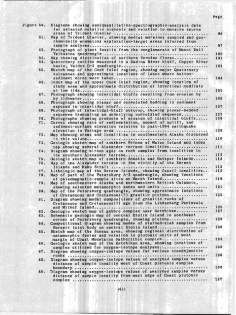
Diagram: 3 show ring si emiquantitatfve-spectrographic-analysis data<br />
for sel lected<br />
m - meta llic elements and relation to rnoraine source<br />
0 . . .<br />
areas or 'l'rlaent Glacier .............. ....... ..................<br />
Map <strong>of</strong> Trident Glacier, showing medial m ~ r ines a ; sampled and geochemically<br />
anomalous exploration-target BPCfiS inferred from<br />
sample analyses. ...................... ....... ..................<br />
Photograph <strong>of</strong> plant fossils from the conglomerate <strong>of</strong> Mount Dall<br />
Talkoetno quadrangle ...........................................<br />
Map showing distribution <strong>of</strong> northern Permian floras..... .........<br />
Quaternary section measured in a Dadina River bluff, Copper River<br />
basin, Valdez D-3 quadrangle ....................................<br />
Sketch map <strong>of</strong> the Cook Inlet region, showing major Quaternary<br />
volcanoes and approximate locations <strong>of</strong> lakes where bottomsediment<br />
cores were taken..... ..................................<br />
Index map <strong>of</strong> the upper Cook Inlet region, showing location <strong>of</strong><br />
study area and approximate distribution <strong>of</strong> intertidal mudflats<br />
at low tide, .................................................... 10 5<br />
Photograph showing intertidal bluffs resulting from erosion by<br />
by tidewater...... .............................................. 16 6<br />
Photograph showing planar and convoluted bedding in sediment<br />
exposed in intertidal bluff ..................................... 10 7<br />
Photograph <strong>of</strong> intertidal-bluff outcrop, showing planer-bedded<br />
sequence truncating an underlying convoluted sequence..... ...... rnw<br />
Photographs showing products <strong>of</strong> erosion <strong>of</strong> intertidal bluffs .....<br />
Curves showing rate <strong>of</strong> sedimentation, mount <strong>of</strong> uplift, and<br />
sediment-surface elevation relative to post-1964 earthquake<br />
elevation in Portage area ......................................<br />
Map showing areas and localities in southeastern <strong>Alas</strong>ka discussed<br />
in this volume. .................................................<br />
Geologic sketch map <strong>of</strong> southern Prince <strong>of</strong> Wales Island and index<br />
map showing several Alexander terrane localities......... .......<br />
Diagram showing zircon ages on rock samples from localities in<br />
the southern Alexander terrane. .................................<br />
Geologic sketch map <strong>of</strong> southern Annette and Hotspur Islands.. ....<br />
Map <strong>of</strong> the Alexander terrane in the vicinity <strong>of</strong> the Screen<br />
Islands and Keku Strait ........................................<br />
Lithologic map <strong>of</strong> the Screen Islands, showing fossil localities..<br />
Map <strong>of</strong> part <strong>of</strong> the Petersburg A-3 quadrangle, showing locations<br />
<strong>of</strong> paleomegnetic-sample sites on Marsh Island.. .................<br />
Map <strong>of</strong> southeastern <strong>Alas</strong>ka and northwestern British Columbia,<br />
showing selected metamorphic zones and units ...................<br />
Map <strong>of</strong> the Petersburg quadrangle, showing approximate locations<br />
<strong>of</strong> Cretaceous and Cretaceous(?) granitic plutons ................<br />
Diagram showing modal compositions <strong>of</strong> granitic rocks <strong>of</strong><br />
Cretaceous and Cretaceous(?) age from the Lindenberg Peninsula<br />
and Mitk<strong>of</strong> Isiand........... ....................................<br />
Geologic sketch map <strong>of</strong> gabbro complex near Ketchikan.............<br />
Schematic geologic map <strong>of</strong> central Etolin Island in southeast<br />
corner <strong>of</strong> Petersburg quadrangle, showing plutons.. ..............<br />
Compositional diagram showing modes <strong>of</strong> stained-slab samples from<br />
Burnett Inlet body on central Etolin Island............ .........<br />
Sketch map <strong>of</strong> the Juneau area, showing regional distribution <strong>of</strong><br />
metamorphic facies and relation to plutonic units <strong>of</strong> West<br />
margin <strong>of</strong> Coast Mountains batholithic complex.., ................<br />
Geologic sketch map <strong>of</strong> the Ketchikan area, showing locations <strong>of</strong><br />
samples utilized for oxygen-isotope analyses ....................<br />
Diagram showing oxygen-isotope values for various trondhjernitic<br />
rocks ...........................................................<br />
Diagram showing oxygen-isotope values <strong>of</strong> analyzed samples versus<br />
distance <strong>of</strong> sample locality west <strong>of</strong> Coast plutonic complex<br />
boundary .......................................................<br />
Diagram showing oxygen-isotope values <strong>of</strong> analyzed samples versus<br />
distance <strong>of</strong> sample locality fr~m west edge <strong>of</strong> Coast plutonic<br />
comp 1 I...............<br />
................................


