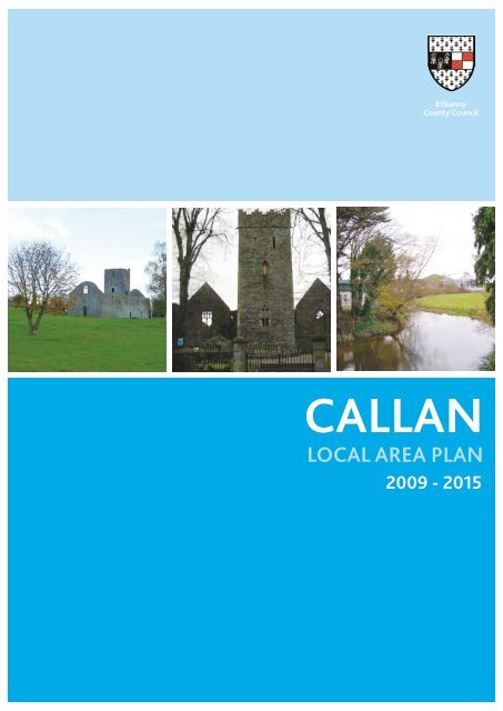
Callan Local Area Plan - Kilkenny County Council
Callan Local Area Plan - Kilkenny County Council
Callan Local Area Plan - Kilkenny County Council

Create successful ePaper yourself
Turn your PDF publications into a flip-book with our unique Google optimized e-Paper software.
<strong>Kilkenny</strong><br />
<strong>County</strong> <strong>Council</strong><br />
CALLAN<br />
LOCAL AREA PLAN<br />
2009 - 2015
contents<br />
01 Introduction 5<br />
1.2 What is a <strong>Local</strong> <strong>Area</strong> <strong>Plan</strong>? 6<br />
1.3 Legal Status 6<br />
1.4 <strong>Plan</strong> Implementation 6<br />
1.5 Monitoring & Review 6<br />
02 Strategic Context 9<br />
2.1 Introduction 9<br />
2.2 National Spatial Strategy 9<br />
2.3 Guidelines on Sustainable Residential Development in Urban <strong>Area</strong>s (Dec, 2008) 10<br />
2.4 Retail <strong>Plan</strong>ning Guidelines 11<br />
2.5 Draft <strong>Plan</strong>ning Guidelines ‘The <strong>Plan</strong>ning System and Flood Risk Management’ 12<br />
2.6 Regional <strong>Plan</strong>ning Guidelines for the South East Regional Authority 13<br />
2.7 <strong>Kilkenny</strong> <strong>County</strong> Development <strong>Plan</strong> 2008 – 2014 14<br />
03 General Context 17<br />
3.1 Location 17<br />
3.2 Urban Structure and Connectivity 18<br />
3.3 Population Profile 18<br />
3.4 Employment 19<br />
3.5 Socio Economic Profile 19<br />
3.6 Transport and Access 20<br />
3.7 Topography and Geomorphology 21<br />
3.8 Water Supply and Wastewater treatment 21<br />
3.9 Flooding 22<br />
3.10 Retail 24<br />
3.11 Open Space and Amenity 25<br />
3.12 Community facilities 30<br />
3.13 Historic Environment 31<br />
3.14 The Record of Protected Structures 35<br />
3.15 The National Inventory of Architectural Heritage 35<br />
3.16 Architectural Conservation <strong>Area</strong>s 35<br />
3.17 Medieval Core 35<br />
3.18 19th Century Extension 36<br />
04 Development Strategy 39<br />
4.1 General 39<br />
4.2 Population Trends and Projections 39<br />
4.3 Key Issues, Spatial Vision and <strong>Plan</strong> Objectives 40<br />
4.4 Summary of SWOT analysis 8 40<br />
4.5 Strategic Vision 42<br />
4.6 Development Strategy 42<br />
4.7 Existing and Proposed Residential Zoning Capacity 44<br />
05 <strong>Plan</strong> Policies and Controls 47<br />
5.1 Town Centre and Retail 47<br />
5.2 The Location of New Retail Development 47<br />
5.3 Retail Opportunity Sites (See Figure 5.1) 49<br />
5.4 Major New Retail Development 51<br />
5.5 Quantity of New Retail Floorspace 51<br />
5.6 Retail Warehousing 52<br />
5.7 Town Centre 52<br />
5.8 Phasing 52<br />
5.9 Residential Development 52<br />
5.10 Transport and Connectivity 53<br />
5.11 Walking and Cycling 54<br />
5.12 Employment and Industry 54<br />
5.13 Flood Risk 55<br />
5.14 Infrastructure 55<br />
5.15 Open Space Requirements 55<br />
5.16 Natural Heritage 59<br />
5.17 Built Heritage 60<br />
5.18 Protected Structures 62<br />
5.19 Archaeological Heritage 64
contents<br />
5.20 Play Space 64<br />
5.21 Community Facilities 66<br />
5.22 Educational Requirements 66<br />
5.23 Childcare facilities 67<br />
06 Urban Design Framework and Masterplan Description 73<br />
6.1 Masterplan Description 73<br />
07 Site Development Briefs 77<br />
7.1 <strong>Area</strong> 1: Retail Opportunity Sites 77<br />
7.2 <strong>Area</strong> 2: Bolton 80<br />
7.3 <strong>Area</strong> 3: Prologue 82<br />
7.4 <strong>Area</strong> 4: Clashacollare Residential <strong>Area</strong> 84<br />
7.5 <strong>Area</strong> 5: Cannafahy 86<br />
7.6 <strong>Area</strong> 6: Haggardsgreen 88<br />
7.7 <strong>Area</strong> 7: Castletobin 90<br />
08 Implementation 93<br />
Tables<br />
Table 3.1: Summary of SAHRU statistics 19<br />
Table 3.2: Net retail floorspace in <strong>Callan</strong> 24<br />
Table 3.3: Main food shopping destinations 24<br />
Table 3.4: Open Space Requirements 26<br />
Table 3.5: Existing Education Facilities and Capacity 30<br />
Table 3.6. Existing Childcare Facilities and Capacity 30<br />
Table 4.1: Population Trends<br />
of current population 2,303)<br />
39<br />
40<br />
Table 4.2: Population Growth Scenarios (based on the 2008 estimate<br />
Table 4.3: Capacity for Population Growth 40<br />
Table 4.4: Current and Proposed Zonings (hectares) 42<br />
Table 5.1: SO1: Community Housing 53<br />
Table 5.2: SO2: Improving Pedestrian Connectivity 54<br />
Table 5.3: Open Space Requirements for Class II – <strong>Local</strong> Parks 56<br />
Table 5.4: SO3: Provision of a Public Space at St. Mary’s Church and Graveyard 57<br />
Table 5.5: Play Space Standards CDP 2008 – 2014 64<br />
Table 5.6: Land Use Zoning Objectives 68<br />
Table 8.1.1: Infrastructure and Services Required 94<br />
Figures<br />
Figure 1.1. <strong>Callan</strong> Location Map 5<br />
Figure 2.1. National Spatial Strategy 9<br />
Figure 2.2. Cdp Settlement Hierarchy 15<br />
Figure 3.1. Cdp Development Strategy 17<br />
Figure 3.2: Deprivation Index 2006 19<br />
Figure 3.3. Recorded Flood Events In <strong>Callan</strong> And Benefitting Lands (Source Opw) 23<br />
Figure 3.4. The Location Of Class Ii Open Space And Accessibility 27<br />
Figure 3.6. Existing Provision Of Children’s Playspace 29<br />
Figure 3.6. <strong>Callan</strong> Osi Map 1842 (Source: Trinity Historic Maps Archive) 32<br />
Figure 3.7. <strong>Callan</strong> Osi Map 1903 (Source: Trinity Historic Maps Archive) 33<br />
Figure 3.8. <strong>Callan</strong> Osi Map 1948 (Source: Trinity Historic Maps Archive) 34<br />
Figure 4.1. Residential Zoned Land Without <strong>Plan</strong>ning Permission As Of October 08 43<br />
Figure 4.2. <strong>Callan</strong> Zoning Map 45<br />
Figure 5.1. Retail Opportunity Sites 48<br />
Figure 5.2. Accessible Open Space 58<br />
Figure 5.3. <strong>Callan</strong> Aca Boundary 61<br />
Figure 5.4. Existing Provision Of Children’s Playspace And <strong>Area</strong>s Of Within 400m Of Facilities 65<br />
Figure 5.5. <strong>Callan</strong> Environmental Constraints Map 71<br />
Figure 6.1. <strong>Callan</strong> Masterplan 75<br />
Figure 7.1 <strong>Callan</strong> Key Development <strong>Area</strong>s 76<br />
Figure 8.1 Development Objectives Map 95<br />
Figure A.1.1 Record Of Monuments And Places Overview 100<br />
Figure A1.2. Record Of Monuments And Places Section A 101<br />
Figure A1.3. Record Of Monuments And Places Section B 102<br />
Figure A1.4 National Inventory Of Architectural Heritage Structures Overview 109<br />
Figure A1.5 National Inventory Of Architectural Heritage Structures Section A 110<br />
Figure A1.6 National Inventory Of Architectural Heritage Structures Section B 111<br />
Figure A1.7 National Inventory Of Architectural Heritage Structures Section C 112<br />
Figure A1.8 National Inventory Of Architectural Heritage Structures Section D 113
01<br />
Introduction<br />
1.1.1 <strong>Callan</strong> is located to the south-west of <strong>Kilkenny</strong><br />
City, within close proximity to Carrick on Suir, Clonmel<br />
and Waterford City. It enjoys good road connections<br />
to employment bases such as <strong>Kilkenny</strong>, Clonmel, Cork<br />
figure 1.1.<br />
CALLAN LOCATION MAP<br />
5<br />
and Dublin via the N76 and connectivity is likely to<br />
be further improved on completion of the nearby<br />
Knocktopher to Waterford section of the N9 by 2009.<br />
<strong>Callan</strong> had a population of 1,771 in the 2006 Census.<br />
01
1.2 What is a <strong>Local</strong> <strong>Area</strong> <strong>Plan</strong>?<br />
1.2.1 The <strong>Callan</strong> <strong>Local</strong> <strong>Area</strong> <strong>Plan</strong> 2009-2015 provides<br />
the written statement and accompanying maps that will<br />
manage the development and growth of <strong>Callan</strong> over a<br />
six year plan period.<br />
1.2.2 The <strong>Callan</strong> <strong>Local</strong> <strong>Area</strong> <strong>Plan</strong> 2009-2015 (the<br />
<strong>Plan</strong>) has been prepared in accordance with the<br />
requirements of the <strong>Plan</strong>ning and Development Act<br />
2000 (as amended 2002 and 2006) and sets out an<br />
overall strategy for the proper planning and sustainable<br />
development of the town.<br />
1.2.3 The <strong>Plan</strong> comprises the statutory land use<br />
plan for the town in the promotion and regulation of<br />
development and therefore provides a clear vision<br />
for <strong>Callan</strong>, providing for the needs of the existing and<br />
future population. It provides for the development of<br />
<strong>Callan</strong> by setting out zoning and other objectives for the<br />
proper planning and sustainable development of the<br />
town, considering the needs of the town, and informing<br />
and coordinating decisions on planning applications.<br />
The <strong>Plan</strong> plays a key role in translating overarching<br />
<strong>County</strong> Development <strong>Plan</strong> policies and objectives at the<br />
local level.<br />
1.2.4 An Environmental Report in compliance with<br />
the European Union SEA Directive (2001/42/EC) and<br />
related government guidelines 1 was prepared and<br />
placed on public display with the draft <strong>Plan</strong>. The central<br />
purpose of this report is to provide information on<br />
any existing environmental problems in the town, to<br />
set out the likely significant effects of the plan on the<br />
environment and possible mitigation measures with a<br />
view to improving the environmental performance of<br />
the <strong>Plan</strong>.<br />
6<br />
1.3 Legal Status<br />
1.3.1 The <strong>Local</strong> <strong>Area</strong> <strong>Plan</strong> is a statutory planning<br />
document that replaces the Development <strong>Plan</strong> for<br />
<strong>Callan</strong> 2002-2008. The <strong>Callan</strong> <strong>Local</strong> <strong>Area</strong> <strong>Plan</strong> 2008<br />
- 2014 is consistent with the <strong>County</strong> Development <strong>Plan</strong><br />
and sets out detailed policies and objectives which<br />
control the development of the area within the town’s<br />
boundary as defined by this <strong>Plan</strong>. This <strong>Plan</strong> should be<br />
read in conjunction with policies and objectives of the<br />
<strong>Kilkenny</strong> <strong>County</strong> Development <strong>Plan</strong> 2008-2014.<br />
1.4 <strong>Plan</strong> Implementation<br />
1.4.1 The <strong>Council</strong> will seek to implement the aims,<br />
policies and objectives of the plan in a proactive<br />
manner. The <strong>Council</strong> will engage with all relevant<br />
stakeholders, both statutory and non-statutory agencies<br />
and organisations through the development control<br />
process. The <strong>Plan</strong> is the main instrument for regulation<br />
and control of development. The <strong>Council</strong> is required to<br />
assess development proposals in accordance with the<br />
policies and objectives set out in the <strong>Plan</strong>.<br />
1.5 Monitoring & Review<br />
1.5.1 The <strong>Plan</strong> cannot foresee all events that may<br />
arise over the lifetime of the <strong>Plan</strong>, thus it is imperative<br />
that the <strong>Council</strong> regularly monitor the <strong>Plan</strong> and vary or<br />
amend the <strong>Plan</strong> if deemed appropriate.<br />
1 Implementation of the SEA Directive (2001/42/EC): Assessment of the effects of certain plans and programmes on the environment’ Guidelines for<br />
Regional Authorities and <strong>Plan</strong>ning Authorities (DoEHLG, 2004)
7<br />
01
02<br />
Strategic Context<br />
2.1 Introduction<br />
2.1.1 A number of policies at national, regional<br />
and county level set the context for the production of<br />
the <strong>Callan</strong> <strong>Local</strong> <strong>Area</strong> <strong>Plan</strong>. These documents, which<br />
are summarised in the following section, describe the<br />
role that <strong>Callan</strong> should play in achieving objectives<br />
and supporting strategies set at a national, regional<br />
and county level. The subsequent section sets out the<br />
general context and in doing so outlines the issues that<br />
this <strong>Plan</strong> will seek to address. These issues will directly<br />
feed into the objectives and policies.<br />
Gateway<br />
Hub<br />
<strong>County</strong> Town<br />
2.2.2 The NSS acknowledges that towns of 1,500 to<br />
5,000 population range can contribute both economically<br />
and socially towards sustainable development.<br />
Specifically in terms of their potential to attract residential<br />
development together with small scale enterprises<br />
thereby bringing jobs closer to where people live.<br />
2.2.3 The NSS also recognises changes in their<br />
economic function from centres that traditionally served<br />
a prosperous agricultural hinterland and highlights their<br />
unique qualities as opportunities for change. These<br />
include strengths such as townscape quality, compact<br />
form, rich built heritage, and quality of life attractions<br />
which attract residential, small and medium enterprise<br />
development. Centres such as <strong>Callan</strong>, located in a rural<br />
area, have a strong potential for diversification based<br />
around tourism, forestry and enterprise sectors. Backland<br />
areas generated through historic development<br />
and stemming from the town’s original urban form<br />
can provide significant development opportunities to<br />
reinforce these strengths.<br />
2.3 Guidelines on Sustainable Residential<br />
Development in Urban <strong>Area</strong>s (Dec, 2008)<br />
2.3.1 The purpose of the Guidelines is to set out<br />
the key planning principles which should be reflected<br />
in development plans and local area plans which will<br />
ultimately guide the form of residential development<br />
in urban areas. <strong>Plan</strong>ning authorities should have regard<br />
to the recommended standards for new residential<br />
development when preparing local area plans.<br />
10<br />
2.3.2 The Guidelines outline the overall aim of<br />
successful and sustainable residential development in<br />
urban areas and define the specific qualities that high<br />
quality places should incorporate. The development and<br />
zoning objectives in this <strong>Plan</strong> should therefore seek to<br />
•<br />
•<br />
•<br />
•<br />
•<br />
•<br />
•<br />
Prioritise walking, cycling and public transport, and<br />
minimise the need to use cars;<br />
Deliver a quality of life which residents and visitors<br />
are entitled to expect, in terms of amenity, safety<br />
and experience;<br />
Provide a good range of community and support<br />
facilities, where and when they are needed;<br />
Present an attractive and well maintained<br />
appearance, with a distinct sense of place and a<br />
quality public realm;<br />
Provide for areas that are easy to access and to find<br />
one’s way around;<br />
Promote a mix of land uses to minimise transport<br />
demand;<br />
Promote social integration and provide<br />
accommodation for a diverse range of household<br />
types and age groups; and<br />
•<br />
Enhance and protect the built and natural heritage.
2.3.3 The Guidelines clarify the role of local area<br />
plans with respect to addressing the following issues at<br />
the beginning of the plan making process:<br />
•<br />
•<br />
•<br />
•<br />
•<br />
•<br />
•<br />
The amount and type of new housing required to<br />
meet the needs of the area;<br />
The need to adopt a sequential approach to the<br />
zoning of residential lands extending outwards from<br />
the centre of an urban area;<br />
The relationship and linkages between the areas<br />
to be redeveloped and the new areas including<br />
the availability of community facilities and social<br />
infrastructure;<br />
The need to create an overall urban design<br />
framework for redevelopment areas;<br />
The setting of appropriate density levels;<br />
Adapting to the impacts of climate change; and<br />
The avoidance of flood risk.<br />
2.3.4 The Guidelines advise that development in<br />
small towns with a population ranging from 400 – 5,000<br />
should be plan led and should contribute to the creation<br />
of a compact town or village with a view to increasing<br />
the levels of accessibility and making efficient use of<br />
investment over many years in services such as water,<br />
schools, shops, libraries, health centres, childcare<br />
facilities and other physical and social infrastructure.<br />
It is appropriate that the investment in such services<br />
is utilised properly through the prioritisation of<br />
development that either reuses brownfield development<br />
land such as central area sites and backlands or through<br />
the development of acceptable “greenfield” sites at<br />
suitable locations within the immediate environs of the<br />
small town or village concerned.<br />
2.3.5 The Guidelines also consider that the scale of<br />
new development should be in proportion to existing<br />
development with preference for a number of smaller<br />
sites integrated within and throughout the urban centre<br />
rather than focusing on one very large site. For towns of<br />
this size, it is generally preferable that the local area plan<br />
should only encourage individual residential proposals that<br />
would increase the housing stock of such urban areas by a<br />
maximum of 10% - 15% within the lifetime of the plan.<br />
11<br />
2.4 Retail <strong>Plan</strong>ning Guidelines<br />
02<br />
2.4.1 The Retail <strong>Plan</strong>ning Guidelines defines the<br />
fourth tier of the retail hierarchy as comprising of small<br />
towns in the 1,500 to 5,000 population category, most<br />
of which provide basic convenience shopping, either<br />
in small supermarkets or convenience shops and in<br />
some cases, lower order comparison shopping such as<br />
hardware, pharmaceutical products and clothes. The<br />
Guidelines recognise current trends for larger store<br />
sizes which are difficult to accommodate in traditional<br />
town centres, which comprise relatively small scale<br />
historic buildings in an attractive setting. However,<br />
central to the policy on retail, is the need to establish<br />
the optimum location for new retail development which<br />
is accessible to all sections of society and is of a scale<br />
which allows the continued prosperity of traditional<br />
town centres and existing retail centres.<br />
2.4.2 The local area plan should be in conformity<br />
with the five key objectives identified in the Guidelines:<br />
•<br />
•<br />
•<br />
All development plans incorporate clear policies and<br />
proposals for retail development;<br />
To facilitate a competitive and healthy environment<br />
for the retail industry of the future;<br />
To promote forms of development which are easily<br />
accessible - particularly by public transport - in locations<br />
which encourages multi-purpose shopping, business<br />
and leisure trips on the same journey; and
•<br />
To support the continuing role of town and district centres.<br />
2.4.3 A key retail planning principle referred to<br />
extensively within the guidelines is the sequential<br />
approach. This approach establishes the town centre<br />
as the preferred location for developments that attract<br />
many trips with subsequent consideration for edge of<br />
the centre locations in cases where there are no sites<br />
available within a town centre.<br />
2.5 Draft <strong>Plan</strong>ning Guidelines ‘The <strong>Plan</strong>ning System and<br />
Flood Risk Management’<br />
2.5.1 The Flood Risk Management Draft Guidelines<br />
were published jointly by the Department of the<br />
Environment and Office of Public Works (OPW) and<br />
aim to provide for comprehensive consideration of<br />
flood risk, both in preparing plans and in determining<br />
applications for planning permission. The core<br />
objectives of the Guidelines are to:<br />
•<br />
•<br />
•<br />
•<br />
•<br />
•<br />
Avoid inappropriate development in areas at risk of<br />
flooding;<br />
Avoid new developments increasing flood risk<br />
elsewhere, including that which may arise from<br />
surface run-off;<br />
Ensure effective management of residual risks for<br />
development permitted in floodplains;<br />
Avoid unnecessary restriction of national, regional or<br />
local economic and social growth;<br />
Improve the understanding of flood risk among<br />
relevant stakeholders; and<br />
Ensure that the requirements of EU and national law<br />
in relation to the natural environment and nature<br />
conservation are complied with at all stages of flood<br />
risk management.<br />
2.5.2 The Guidelines recommend the application of<br />
the sequential approach for taking account of flood risk.<br />
The sequential approach works by guiding development<br />
away from areas that have been identified through a<br />
flood risk assessment as being at risk from flooding.<br />
The Guidelines also outline details of a justification<br />
test which assesses whether a development proposal<br />
12<br />
within an area at risk of flooding meets specific criteria<br />
for proper planning and sustainable development and<br />
demonstrates that it will not be subject to unacceptable<br />
risk nor increase flood risk elsewhere.<br />
2.5.3 With regard to project-level developments, the<br />
Guidelines require developers and their agents to:<br />
• Carefully examine their development proposals to<br />
ensure consistency with the requirements of the<br />
guidelines including carefully researching whether<br />
there have been instances of flooding on specific<br />
sites or potential for flooding and declaring any<br />
known flood history in the planning application form<br />
as required under the <strong>Plan</strong>ning and Development<br />
Regulations 2006.<br />
•<br />
•<br />
Engage with the planning authorities at an early<br />
stage, utilising the arrangements for pre-planning<br />
application consultation with regard to any flood risk<br />
assessment issues that may arise.<br />
Carry out a site-specific flood risk assessment,<br />
as appropriate, and comply with the terms and<br />
conditions of any grant of planning permission with<br />
regard to the minimisation of flood risk.<br />
2.5.4 Flood Risk Assessments (FRAs) aim to identify,<br />
quantify and communicate to decision-makers and other<br />
stakeholders the risk of flooding to land, property and<br />
people. The purpose is to provide is to provide sufficient<br />
information to determine whether particular actions (e.g.<br />
approving applications for proposed development) are<br />
appropriate.<br />
2.5.5 The purpose of a site-specific flood risk<br />
assessment is to assess all types of flood risk for a new<br />
development. FRAs identify the sources of flood risk,<br />
the effects of climate change on this, the impact of the<br />
development, the effectiveness of flood mitigation and<br />
the residual risks that remain after those measures are<br />
put in place. The responsibility to screen for and carry<br />
out a FRA lies with those proposing the development<br />
in consultation with the local authority and emergency<br />
planners.<br />
2.5.6 In addition to flooding from coasts and rivers,<br />
the Guidelines include advice on assessing flood risk<br />
from other sources, for example overland flow and<br />
areas prone to surface water flooding.
2.6 Regional <strong>Plan</strong>ning Guidelines for the South East<br />
Regional Authority<br />
2.6.1 <strong>Callan</strong> is identified as a District Town in the<br />
Regional <strong>Plan</strong>ning Guidelines. The Regional <strong>Plan</strong>ning<br />
Guidelines for the South-East identify district towns as<br />
towns with a population of between 1,500 and 5,000<br />
that should perform an important role in driving the<br />
development of a particular spatial component of the<br />
overall region.<br />
2.6.2 The Guidelines highlight agriculture,<br />
manufacturing, services sectors as key to economy in<br />
the South-East with the agriculture and food sector<br />
accounting for a significant proportion of output and<br />
employment. This is apparent in <strong>Callan</strong> where these<br />
industries have a strong presence.<br />
2.6.3 Future development considerations supply<br />
should take account of the shift towards service led<br />
rather than agricultural employment. The changes<br />
in the international economy will have further<br />
consequences for manufacturing and internationally<br />
traded services as Ireland is no longer characterised as<br />
low cost.<br />
2.6.4 Attracting foreign direct investment is therefore<br />
increasingly focused on higher value employment. This<br />
is likely to be concentrated in existing locations where<br />
foreign-owned enterprises are located such as Waterford<br />
13<br />
City and the county towns, reflecting the requirement<br />
of many IDA client companies to be based in areas<br />
of critical mass in terms of population, skills, and<br />
infrastructure.<br />
02<br />
2.6.5 Although it is preferable that employment land<br />
caters for exogenous as well as endogenous growth,<br />
indigenous industry and SMEs are generally spread<br />
throughout the region’s small to medium sized towns as<br />
well as the larger urban centres. Economic development<br />
of this kind is particularly relevant to the future growth<br />
of towns such as <strong>Callan</strong> as they hold the potential to<br />
provide support services to overseas industry which is<br />
concentrated mainly in electronics, precision engineering,<br />
pharmaceuticals, healthcare and in internationally traded<br />
services particularly in sectors such as ICT, shared services<br />
and financially traded services.<br />
2.6.6 Tourism, services and agricultural development<br />
also provide further opportunities for SMEs growth<br />
with potential for the <strong>Plan</strong> to support:<br />
•<br />
•<br />
•<br />
•<br />
Tourism through development of appropriately<br />
located facilities that strengthen the existing national<br />
profile linked to the high quality amenities of the<br />
region, such as its heritage, river valleys, angling and<br />
golf courses;<br />
Services such as banking, administration and<br />
consultancy and improvement in access and<br />
communications would support the continuation of<br />
that trend;<br />
Agriculture and food sector which is currently<br />
demonstrating a resurgence in profitability; and<br />
Where applicable, highlight the potential demand<br />
for forests in the region to provide fuel for wood<br />
biomass energy production.<br />
2.6.7 The capacity to support the growth of<br />
indigenous companies in the town will reflect the<br />
provision of a number of factors including the quality<br />
of infrastructure, including road and rail links, water,<br />
access and telecommunications improvements in<br />
addition to the availability of first class business/<br />
technology parks and industrial units.
2.6.8 The attractiveness of smaller towns and<br />
villages also lies in their capacity to accommodate<br />
employment, residential and other functions on the<br />
basis of their comparative advantage in terms of lower<br />
costs and a quality of life that is attractive to many<br />
people.<br />
2.7 <strong>Kilkenny</strong> <strong>County</strong> Development <strong>Plan</strong> 2008 – 2014<br />
2.7.1 Within the <strong>Kilkenny</strong> <strong>County</strong> Development <strong>Plan</strong><br />
(CDP) Settlement Strategy, <strong>Callan</strong> is defined as a district<br />
town. The CDP states that generally these towns have<br />
well developed services and community facilities and<br />
have the capacity to accommodate additional growth<br />
subject to certain physical infrastructural investments.<br />
2.7.2 It also highlights the role of local area plans<br />
in setting out in detail the <strong>Kilkenny</strong> <strong>County</strong> <strong>Council</strong>’s<br />
requirements for all new development, including<br />
such considerations as density, layout and design<br />
requirements, public transport and road infrastructure,<br />
community facilities, open space and recreational<br />
facilities etc.<br />
2.7.3 Policy within the CDP reflects the <strong>County</strong> Retail<br />
Strategy 2007 which sets out:<br />
• The retail hierarchy, the role of centres;<br />
•<br />
A broad assessment of the requirement for<br />
additional retail floorspace;<br />
14<br />
•<br />
•<br />
•<br />
Strategic guidance on the location and scale of retail<br />
development,<br />
Preparation of policies and action initiatives to<br />
encourage the improvement of town centres; and<br />
Identification of criteria for the assessment of retail<br />
developments.<br />
2.7.4 The location of new retail development is<br />
required to be consistent with the retail strategy and<br />
policies within the CDP, particularly in that they must be<br />
in accordance with the sequential approach, established<br />
at the national level. This approach requires, where<br />
practicable, new retail development to be located<br />
within the town centre. Where this is not possible<br />
consideration may be given to a site on the edge of the<br />
town centre (an edge of centre site is taken to be one<br />
that is unlikely to be more than 300 - 400 metres from<br />
the edge of the prime shopping area).<br />
2.7.5 For retail purposes, <strong>Callan</strong> is designated as a<br />
Tier 1 Level 2 Sub <strong>County</strong> Town centre where middle<br />
order convenience and tourism related comparison,<br />
retail floorspace is considered appropriate.
KiLKeNNY<br />
DrAfT COuNTY<br />
DeVeLOPMeNT<br />
PLAN 2008- 2014<br />
LEGEND<br />
Proposed Route M9<br />
Proposed Waterford<br />
City By-Pass<br />
National Primary<br />
Roads<br />
National Secondary<br />
Roads<br />
Regional Roads<br />
Railway<br />
Main Rivers<br />
Hub<br />
Waterford Environs<br />
New Ross Environs<br />
District Town<br />
Small Town/ Village<br />
Node<br />
<strong>Callan</strong><br />
Based on Ordnance Survey of Ireland Map,<br />
Licence No. “<strong>Kilkenny</strong>/CCMA/03/07”<br />
figure 2.2.<br />
CDP SETTLEMENT HIERARCHy<br />
CALLAN<br />
KiLKeNNY<br />
15
03<br />
General Context<br />
3.1 Location<br />
3.1.1 <strong>Callan</strong> is located 10 miles south-west of<br />
<strong>Kilkenny</strong> City, 15 miles from Carrick on Suir, 17 miles<br />
from Clonmel and 35 miles from Waterford City.<br />
The town has a rich historical environment, acts<br />
as an attractive market and service centre for the<br />
surrounding area and is traversed by the King’s River.<br />
To To Cashel<br />
Cashel<br />
and and Cork<br />
Cork<br />
KEY:<br />
•<br />
Proposed Route M9<br />
Proposed Waterford City<br />
By-Pass<br />
National Primary Roads<br />
National Secondary<br />
Roads<br />
Regional Roads<br />
Railway<br />
Main Rivers<br />
Hub<br />
Waterford Environs<br />
New Ross Environs<br />
District Town<br />
Small Town/Village<br />
Node<br />
Based on Ordnance Survey of Ireland Map,<br />
Licence No. “<strong>Kilkenny</strong>/CCMA/03/07”<br />
<strong>Kilkenny</strong> <strong>County</strong> Development <strong>Plan</strong> 2008 - 2014<br />
figure 3.1.<br />
CDP DEVELOPMENT STRATEGy<br />
R692<br />
Tullaroan<br />
#<br />
Kilmanagh Ballycallan<br />
#<br />
R691<br />
Poulacapple East<br />
Windgap<br />
#<br />
Ninemile House<br />
To<br />
Clonmel<br />
R695<br />
CALLAN<br />
R698<br />
R699<br />
N76<br />
Cuffesgrange<br />
#<br />
Newtown<br />
#<br />
Dunamaggin<br />
#<br />
Coolaghmore<br />
Kilmoganny<br />
Owning Templeorum<br />
#<br />
#<br />
17<br />
03<br />
Traffic congestion levels in the town centre have been<br />
significantly reduced since the opening of the by-pass<br />
and connectivity is likely to be further improved on the<br />
completion of the nearby Knocktopher to Waterford<br />
section of the N9 by 2009.<br />
<strong>Kilkenny</strong><br />
Danesfort<br />
#<br />
Newmarket<br />
#<br />
Hugginstown<br />
#<br />
Ennisnag<br />
#<br />
Ballyhale<br />
#<br />
Clara<br />
#<br />
Bennetsbridge<br />
Kells Stoneyford<br />
THOMASTOWN<br />
Knocktopher<br />
Coolroebeg<br />
#<br />
Mullinavat<br />
Gowran<br />
Dungarvan<br />
#<br />
Inistioge<br />
Tullogher<br />
#<br />
Listerlin<br />
#<br />
Paulstown<br />
Goresbridge<br />
Skeoghvasteen<br />
#<br />
GRAIGUENAMANAGH<br />
The Rower<br />
#<br />
•<br />
New New Ross<br />
Ross<br />
Environs<br />
Environs
3.2 Urban Structure and Connectivity<br />
3.2.1 The town’s main commercial area is centred<br />
on the principal street, Bridge Street / Green Street,<br />
which runs north to south with West Street / Mill Street<br />
as a secondary axis, with the two streets intersecting at<br />
a cross roads to the south of the bridge.<br />
3.2.2 Bridge Street and the area north of the Kings<br />
River comprise the main section of the remaining<br />
medieval town and contains some of the town’s<br />
earliest surviving developments, including the Anglo-<br />
Norman Motte and the Augustine Abbey. The street is<br />
characterised by a narrow streetscape and compact and<br />
dense development originally organised as a retail area<br />
with over the shop living accommodation. Green Street<br />
which has a concentration of public buildings, originally<br />
laid out as a market square, is much wider than Bridge<br />
Street and is consequently better able to cater for a<br />
range of traffic.<br />
3.2.3 Although zoned for residential and industrial<br />
development within the previous development plan<br />
(2002-2008), much agricultural and undeveloped lands<br />
remain within the development boundary. Industrial<br />
development has mainly taken place at the periphery<br />
of the town. Improved landscaping, building and site<br />
maintenance would make a considerable improvement<br />
in these areas.<br />
18<br />
3.3 Population Profile<br />
3.3.1 In 2002, approximately 88% of the<br />
population in <strong>County</strong> <strong>Kilkenny</strong> lived in rural areas,<br />
with more significant increases in the population<br />
occurring in rural rather than urban centres. The<br />
share of population accounted for by urban centres<br />
remained stable, while that of the environs of the<br />
towns of <strong>Kilkenny</strong>, Thomastown and <strong>Callan</strong> continued<br />
to rise. This dispersed population pattern indicates<br />
that there is weak settlement structure within the<br />
<strong>County</strong>.<br />
3.3.2 The national demographic results provided<br />
by the Census 2006, point towards a number of<br />
demographic trends for consideration. These include:<br />
•<br />
•<br />
An older population: the number of persons aged<br />
65 and over has increased at every census since<br />
1961 and now represents 11 per cent of the total<br />
population.<br />
Within a generation, therefore, the average number<br />
of children per woman has declined by 1.3 (from 3.5<br />
to 2.2) giving rise to smaller family sizes. Although,<br />
current household size is estimated as 2.88, in<br />
Ireland more generally these are set to fall to 2.6<br />
persons by 2011.
3.4 Employment<br />
3.4.1 Employment levels in the South-East are<br />
well below the national average with the second<br />
highest rate of unemployment in the country and<br />
income per capita well below the national average.<br />
The disparity between population and employment<br />
growth is reflected in the upward trends in commuting<br />
to employment centres outside of the region. Current<br />
employment opportunities are provided by a range<br />
of industries on which to base this expansion mainly<br />
located in the Westcourt Business Park, town centre<br />
and <strong>Callan</strong> Industrial Estate. Economic activity in the<br />
town is derived from general business, manufacturing,<br />
building supplies, agricultural and auto trade services.<br />
3.4.2 An Industrial land survey, carried out as part of<br />
the evidence gathering stage, found that the majority<br />
of business users in the town had no additional land<br />
requirements and felt that there was sufficient land<br />
zoned to the south east of the town. However survey<br />
results highlighted a number of issues with respect to<br />
the existing supply. Specifically, the poor quality and<br />
maintenance of the Westcourt Business Park and the<br />
lack of road and service infrastructure to support the<br />
development of industrial zoned lands to the south east<br />
of the town.<br />
3.4.3 The changes in the international economy<br />
mean that as a small open economy, Ireland is no<br />
longer characterised as low cost. Future employment<br />
land provision will need to take account of these trends<br />
particularly with regard to a shift towards service led<br />
rather than agricultural employment. Potential for<br />
new employment opportunities in <strong>Callan</strong> also exist<br />
in manufacturing, education, food processing, craft<br />
production and in services, particularly those serving<br />
both local needs and tourism. Indigenous industry and<br />
SMEs development also benefit from the strengths of<br />
smaller towns and villages, in terms of lower costs and<br />
a quality of life that is attractive to many people.<br />
3.5 Socio Economic Profile<br />
3.5.1 The Deprivation Index (SAHRU Technical<br />
Report, 2007) is a measure of relative material<br />
deprivation and can be defined as a state of observable<br />
and demonstrable disadvantage relative to the local<br />
community to which an individual belongs’. The<br />
19<br />
03<br />
concept is applied to conditions rather than resources<br />
or income and can therefore be distinguished from<br />
the concept of poverty. [Indicators used include<br />
unemployment, social class, type of housing tenure and<br />
car ownership.] Figure 3.2 shows relatively high levels<br />
of deprivation in <strong>Callan</strong> when compared to other areas<br />
of the country.<br />
Ed_<br />
Id<br />
Ed<br />
Name<br />
Score<br />
’06<br />
Decile<br />
’06<br />
Pop<br />
‘06<br />
Score<br />
’02<br />
Decile<br />
‘02<br />
Pop<br />
‘02<br />
7004 <strong>Callan</strong><br />
Rural<br />
-0.83 4 1321 -0.93 3 1038<br />
7005 <strong>Callan</strong><br />
Urban<br />
2.53 10 1489 2.44 10 1325<br />
Table 3.1: Summary of SAHRU statistics<br />
3.5.2 It is generally acknowledged that less well<br />
off groups of the population are more likely to suffer<br />
poorer health 2 . A population’s socio economic profile<br />
(described here in terms of the Deprivation Index) is a<br />
key determinant of health and wellbeing.<br />
DePriVATiON LeVeL (2005)<br />
1 - Least Deprived<br />
2<br />
3<br />
4<br />
5<br />
6<br />
7<br />
8<br />
9<br />
10 - Most Deprived<br />
CALLAN<br />
FIGURE 3.2: DEPRIVATION INDEx 2006<br />
KiLKeNNY<br />
2 For more information on the links between <strong>Plan</strong>ning and Public Health please refer to ‘Health Impacts of the built environment, a review’ (The Institute of<br />
Public Health in Ireland, 2006)<br />
Ki
3.6 Transport and Access<br />
3.6.1 <strong>Callan</strong> is located 10 miles south-west of<br />
<strong>Kilkenny</strong> City, 15 miles from Carrick on Suir, 17 miles<br />
from Clonmel and 35 miles from Waterford City. The<br />
town acts as a market and service centre for the<br />
surrounding area and enjoys good road connections<br />
to employment bases such as <strong>Kilkenny</strong>, Clonmel and<br />
Waterford. Traffic congestion levels in the town centre<br />
have been significantly reduced since the completion<br />
of the N76 which is the national road that bypasses<br />
the town and connects to <strong>Kilkenny</strong> in the north-east<br />
and to Clonmel to the south-west. Road connectivity is<br />
likely to be further improved on the completion of the<br />
nearby Knocktopher to Waterford section of the N9 by<br />
2009.<br />
Transport Services<br />
3.6.2 <strong>Callan</strong> is served by the bus services that<br />
operate from Clonmel and Cork to Dublin, all of which<br />
stop in <strong>Kilkenny</strong> and Dublin city centre. The Department<br />
of Education and Science also runs a school bus<br />
service for secondary school children and for rural<br />
transport services, <strong>Callan</strong> is among the areas served<br />
by the Ring a Link scheme that is funded by the Rural<br />
Transport Initiative under Transport 21. <strong>Callan</strong> is also<br />
approximately 45 minutes by bus from Clonmel and<br />
20 minutes from <strong>Kilkenny</strong>, both of which are served by<br />
train from Dublin.<br />
20<br />
3.6.3 With the exception of these services, <strong>Callan</strong>’s<br />
public transport is limited particularly with respect<br />
to those living in rural locations who are largely<br />
dependent on road transport and the use of the car.<br />
There are currently two taxi companies located in<br />
<strong>Callan</strong>.<br />
3.6.4 Recent Census (2006) figures confirm that<br />
cars are the dominant means of transport in the<br />
town with over 55% using the car to travel to work,<br />
school or college. As the predominant mode of<br />
transport, car use has resulted in traffic congestion in<br />
the town centre. For those that do not benefit from<br />
car ownership this can create barriers to the access<br />
of services and employment opportunities. Ensuring<br />
services are within accessible walking distances and<br />
providing safe and direct routes may help to increase<br />
the proportion of those currently travelling by foot or<br />
bicycle 3 .<br />
3.6.5 With the exception of the by pass, Bridge<br />
Street provides the only cross river link within the town.<br />
This medieval street has a long narrow structure which<br />
constrains parking and traffic movement. This narrow<br />
link and the physical barrier provided by the King’s<br />
River contributes to poor connectivity between north<br />
and south <strong>Callan</strong>. Elsewhere, particularly on Green<br />
Street, traffic congestion and parking detracts from the<br />
visual appeal of the street.<br />
3 2006 Census figures approximate that in <strong>Callan</strong> 24% and 1.25% travel to work, school or college by foot and bicycle respectively.
3.7 Topography and Geomorphology<br />
3.7.1 Geomorphology is the study of land forms<br />
and the processes that shape them, and includes fields<br />
of study such as geology, geodesy, geography and<br />
archaeology. The primary influence on the study area<br />
has been Caledonian folding that has shaped the study<br />
area and the wider region, resulting in isolated hills<br />
circa sixty metres OD. Subsequently successive ice ages<br />
severely altered the study area with contrasting upland<br />
and lowlands where upland areas have poor soil and<br />
lowlands have been deposited with soil forming tills as<br />
a result of glacial drift.<br />
3.7.2 A landscape character appraisal was<br />
undertaken by CAAS Associates on behalf of <strong>Kilkenny</strong><br />
<strong>County</strong> <strong>Council</strong> in 2003. The Landscape Assessment<br />
has identified a number of Landscape Character Units<br />
within <strong>County</strong> <strong>Kilkenny</strong>.<br />
3.7.3 <strong>Callan</strong> is located with the lowland character<br />
unit which contains predominantly fertile lands with<br />
intensive land management. The slope and topography<br />
of such unit is in a shallow/gradual transition. As a<br />
result there is a high range of use-potential in these<br />
areas. Concentrations of tillage lands in this lowland<br />
area tend to be characterised by extensive views across<br />
large fields with low and highly maintained hedges.<br />
21<br />
03<br />
3.7.4 The lowland character unit within which<br />
<strong>Callan</strong> is situated is an area characterised by tillage<br />
and pastureland uses. Key features such as the gentle<br />
topography and low hedging allows for clear open and<br />
extensive landscape views. Land parcels within this area<br />
are also regular in form and pattern. These landscape<br />
factors allow vistas over long distances with the<br />
possibility for development to have a disproportionate<br />
visual impact. Where shelter vegetation is present, it<br />
can have a natural visual barrier and reduce the visual<br />
impact of new development.<br />
3.8 Water Supply and Wastewater treatment<br />
3.8.1 Waste water treatment in <strong>Callan</strong> is provided<br />
for by secondary treatment which currently has<br />
capacity for 2,600 population equivalent (p.e.) and<br />
discharge is made to a freshwater (river) which is<br />
defined as a sensitive area 4 . The waste water treatment<br />
works are located towards the southeast of the<br />
town in close proximity to the Kings River. There are<br />
opportunities to increase the capacity to 4,000 p.e.<br />
and 6,000 p.e., however any subsequent increases will<br />
require additional lands.<br />
3.8.2 River water quality in the King’s River is of<br />
poor status and this diminishes the capacity to further<br />
assimilate pollutants. To remedy the situation there<br />
is no alternative other than to ensure that sufficient<br />
capacity exists, or is installed, at the <strong>Callan</strong> municipal<br />
4 “sensitive areas” are those areas specified in the third schedule of the Urban Waste Water Treatment Regulations, 2001 (S.I. 254 of 2001), Urban Waste<br />
Water Treatment (Amendment) Regulations, 2004 (S.I. 440 of 2004) and such other areas as may be identified pursuant to article 5 of the Urban Waste Water<br />
Treatment Directive.
wastewater treatment plant. This design must ensure<br />
that water will be treated to the highest relevant<br />
standards (Salmonid water quality) and has sufficient<br />
capacity to deal with projected increases in population.<br />
3.8.3 Water supplies are limited with no additional<br />
capacity available, however new sources are currently<br />
being investigated and will be progressed through the<br />
main services development capital programme.<br />
3.8.4 In January 2008, the EPA reported on the<br />
‘Provision and Quality of Drinking Water in Ireland:<br />
A Report for the years 2006 – 2007’. This was the<br />
first report in response to the EC Drinking Water<br />
Regulations, which provides for a greater level of<br />
consumer protection by requiring public water<br />
suppliers to notify the EPA and the Health Service<br />
Executive where drinking water fails to meet the<br />
standards.<br />
3.8.5 There are currently no issues with drinking<br />
water quality in <strong>Callan</strong>.<br />
3.9 Flooding<br />
3.9.1 <strong>Local</strong> area plans can contribute substantially<br />
to the management of flooding related issues by<br />
showing consistency with guidelines provided by the<br />
OPW, ‘Flood Risk & Development’ which state that<br />
development that is sensitive to the effects of flooding<br />
will generally not be permitted in flood prone or<br />
marginal areas.<br />
3.9.2 Flooding is a natural phenomenon and<br />
where there is no risk to human life and property, it is<br />
beneficial as it provides fertile sediments for farmland,<br />
maintains valuable wildlife habitats and reduces flood<br />
risk elsewhere in the catchment. The floodplain, the<br />
flat or nearly flat land adjacent to a stream or river that<br />
experiences occasional or periodic flooding, plays a key<br />
role in this process and acts as a temporary store for<br />
flood waters and facilitates their conveyance and flood<br />
levels downstream. A number of human activities tend<br />
to restrict the capacity of rivers to accommodate large<br />
storm flows. These include:<br />
•<br />
Greenfield Development: Paving over previously<br />
permeable areas for roads, housing, car parks, etc.<br />
can significantly restrict the potential infiltration rate<br />
22<br />
•<br />
of the area covered. This activity might have a minor<br />
or negligible impact in large river basins (due to flood<br />
peak timing and proportion of area developed), but<br />
could substantially increase runoff in small river<br />
basins (i.e. by more than 100%).<br />
Changes in Land Use or Land Use Practices: Changes<br />
in the vegetation cover, the way in which land is<br />
used, or measures which impact negatively on<br />
natural flood retention areas (wetlands), can have<br />
impacts on both interception and infiltration.<br />
3.9.3 Figure 3.3 shows the surface water bodies in<br />
<strong>Callan</strong>, including the main river traversing the town, the<br />
Kings River in addition to the location of historic flood<br />
events and the extent of benefitting lands. Benefitting<br />
land maps were prepared as part of the design of the<br />
OPW Arterial Drainage Schemes and indicate lands that<br />
were poorly drained and would benefit from drainage.<br />
While not developed as floodplain or flood extent<br />
maps, a good correlation has been observed between<br />
the ‘Benefitting Lands’ and those areas that may be<br />
prone to flooding.<br />
3.9.4 OPW information records four areas where<br />
flood events have occurred. These include:<br />
•<br />
•<br />
•<br />
•<br />
Kings River near <strong>Callan</strong> Bypass Oct 2004<br />
King’s River <strong>Callan</strong> Oct 2004<br />
King’s River <strong>Callan</strong> Town (recurring incident)<br />
Kings River <strong>Callan</strong> March 1947
Pumping Station<br />
(<strong>Kilkenny</strong> Co <strong>Council</strong>)<br />
Mill Race<br />
Edmund Rice House<br />
and Memorial Chapel<br />
CW<br />
Clonkil<br />
Canon Kennedy<br />
Court<br />
Mill Race<br />
Owbey River<br />
figure 3.3.<br />
RECORDED FLOOD EVENTS IN CALLAN AND BENEFITTING LANDS (SOURCE OPW)<br />
UND<br />
CALLAN<br />
23<br />
LEGEND<br />
Legend<br />
WB<br />
Flooding Events<br />
Benefitting Lands<br />
Tributaries<br />
River<br />
Golf Golf Golf Course Course Course<br />
Development <strong>Plan</strong> Boundary<br />
Weir Weir Weir<br />
Dam Dam Dam<br />
Clubhouse Clubhouse Clubhouse<br />
Geral Geral Geral<br />
House House House
3.10 Retail<br />
3.10.1 <strong>Callan</strong> is the third largest retail centre in the<br />
county, after <strong>Kilkenny</strong> City and Thomastown. Retail is<br />
currently concentrated in the centre of the town, which<br />
benefits from an attractive townscape with a number<br />
of high quality buildings in its environs. The main retail<br />
activity and associated pedestrian flows in the town are<br />
located on Green Street, with some activity on West<br />
Street, Bridge Street and Mill Street.<br />
3.10.2 Since 2000, when <strong>Callan</strong> was the second<br />
smallest of the main centres in the county, the town<br />
has undergone significant growth, with a 100% /<br />
2,196 m² increase in its total floorspace. Increases<br />
in both convenience and comparison floorspace<br />
have contributed to this growth, however these<br />
improvements have failed to address the very limited<br />
provision of services such as restaurants and hotels in<br />
the town. The current make up of retail floorspace is set<br />
out in Table 3.2.<br />
3.10.3 There has also been an increase in vacant<br />
floorspace from 6.8% to 12.9% which is relatively<br />
high for a town of this size and an issue for future<br />
consideration. These vacancies are primarily located<br />
on Bridge Street, which faces significant constraints<br />
with respect to limited parking, with few low level<br />
vacancies on Green Street. Opportunities therefore<br />
exist for the re-use and regeneration of sites for retail<br />
24<br />
and other town centre uses along Bridge Street, Mill<br />
Street and in particular for the vacant Co-op building<br />
on Green Street. Importantly, the reuse of the Co-op<br />
could support improvements to the retail provision and<br />
pedestrian connectivity within this area of town.<br />
Composition of Net Retail Floorspace in <strong>Callan</strong>, Trading<br />
as at March 2007 (m²) ( <strong>County</strong> <strong>Kilkenny</strong> Retail Strategy<br />
Review 2007)<br />
Vacant Convenience Comparison Total<br />
569 1,880 1,938 4,387<br />
Table 3.2: Net retail floorspace in <strong>Callan</strong><br />
3.10.4 <strong>Callan</strong>, <strong>Kilkenny</strong> City and Carlow are the three<br />
main shopping destinations for food shopping. These<br />
are shown in more detail in Table 3.3. Figures here<br />
demonstrate some scope for new retail development<br />
to reduce expenditure leakage. The location of these<br />
new facilities will be an important factor in providing<br />
opportunities for linked shopping trips in the town and<br />
vacancy rates are minimised.<br />
Main food shopping destinations % of visits<br />
<strong>Callan</strong> SuperValu 25<br />
<strong>Kilkenny</strong> City Dunnes Stores 22.4<br />
<strong>Kilkenny</strong> City Superquinn 10<br />
Table 3.3: Main food shopping destinations
3.11 Open Space and Amenity<br />
3.11.1 Green space and trees and indeed all the<br />
environmental resources in the town comprising its<br />
green infrastructure, play a number of important<br />
functions including:<br />
•<br />
•<br />
•<br />
•<br />
Sustainable resource management in relation to land<br />
and water resources, and pollution control;<br />
Supporting biodiversity, particularly relating to the<br />
importance of connectivity of habitats;<br />
Recreation e.g. greenways and the use of non-car routes<br />
to address public health and quality of life issues; and<br />
Landscape, green spaces and corridors from<br />
aesthetic and visual richness.<br />
3.11.2 <strong>Callan</strong> currently has approximately 14.68 ha of<br />
land zoned as open space. This open space comprises the<br />
Motte, Friary Meadow, the Fairgreen and John Lockes GAA<br />
Club which are at central and accessible locations within the<br />
town. Both the Motte and the Friary Meadow are located<br />
on the banks of the Kings River and are of considerable<br />
importance to the natural and historical environment. John<br />
Lockes GAA is private and is surrounded by high walls on all<br />
sides. It is generally inaccessible to the public except in the<br />
context of GAA activity.<br />
3.11.3 Quantity, quality, variety and accessibility of<br />
open space are all factors that influence the use of<br />
public space. Guidelines on ‘Sustainable Residential<br />
Development in Urban <strong>Area</strong>s’ emphasise the<br />
importance of qualitative standards regarding open<br />
space and set out the standards that open spaces<br />
should expect to achieve.<br />
3.11.4 To deliver quantity, quality, variety and<br />
accessibility, open space and recreational facilities<br />
must be located and designed on a hierarchical basis<br />
according to the needs of a defined population. The<br />
hierarchy of open space is as follows:<br />
•<br />
•<br />
•<br />
•<br />
•<br />
Class I – Strategic Open Space<br />
Class II – <strong>Local</strong> Parks<br />
Class III – Civic Spaces<br />
Class IV – Informal/Casual Open Space<br />
Class V – Buffer Landscape<br />
25<br />
Class i – Strategic Open Space<br />
03<br />
3.11.5 Strategic open space could be described as<br />
green space that performs a variety of functions over<br />
and above its traditional role as amenity space. Both<br />
the Motte and the Friary Meadow constitute strategic<br />
open space in the town due to their structural role and<br />
to the variety of important functions they play. Indeed<br />
both sites have been identified as:<br />
•<br />
•<br />
•<br />
Part of the River Barrow and River Nore Special <strong>Area</strong><br />
of Conservation<br />
National Monuments<br />
Containing areas of flood plain and contributing<br />
towards flood management<br />
•<br />
<strong>Local</strong> amenity space<br />
3.11.6 These sites vary in terms of levels of<br />
accessibility, with surrounding land use and active<br />
ground floor use contributing toward the greater use of<br />
the Friary Meadow complex.
Class ii – <strong>Local</strong> Parks<br />
3.11.7 Strategic open space which is also functional<br />
as local amenity space can be considered along with<br />
other open space in the town as part of the Class II<br />
<strong>Local</strong> park provision. Class II local park provision is<br />
illustrated in Figure 3.4 and comprises approximately<br />
14.68 hectares. In addition to the Motte and the Abbey<br />
Meadow, it includes the Fairgreen, and John Lockes<br />
GAA pitch which is in close proximity.<br />
3.11.8 Both facilities have developed in tandem<br />
with the historic growth of the town and are in close<br />
proximity to the town centre. Despite this, adjacent<br />
lands uses, particularly housing, turn their back on<br />
these spaces and fail to provide adequate natural<br />
surveillance. Improvements to their relationship with<br />
the surrounding land use, in addition to better lighting<br />
and landscaping would encourage more active use of<br />
existing spaces.<br />
3.11.9 Figure 3.4 applies the accessibility standard of<br />
400 metres walking distance to the existing provision<br />
of green space in the town. With the exception of the<br />
northern end of the town, it shows that open space, is<br />
generally accessible to residential areas.<br />
Provision of New Public Open Space<br />
3.11.10 <strong>Council</strong> policy as set out in the <strong>County</strong><br />
Development <strong>Plan</strong> seeks to make provision for a<br />
hierarchy of parks, open spaces and outdoor recreation<br />
areas within the county so that the population can<br />
participate in a wide range of active and passive<br />
recreational pursuits within easy reach of their<br />
homes and places of work. All residents should have<br />
reasonable access to a range of different types of open<br />
space, whereby day to day recreational provision to<br />
local communities will be provided by a series of district<br />
or neighbourhood parks.<br />
3.11.11 This approach to the development of open<br />
space and recreation provision includes a minimum<br />
standard of open space provision of 2.4 hectares per<br />
1,000 population or greater within new residential<br />
development taking into account existing levels of<br />
provision 5 .<br />
26<br />
Site Capacity No.<br />
of Dwellings<br />
Minimum quantity and type of<br />
leisure facilities<br />
< 25 Development contributions or<br />
2.4 hectares per 1,000 people (a<br />
minimum of 0.25 hectares must be<br />
provided)<br />
25 or over Open space 2.4 hectares per 1,000<br />
people<br />
100 - 199 Public open space to include<br />
neighbourhood play area<br />
Table 3.4: Open Space Requirements<br />
5 Recreational facilities; Developers will be required to make provision for sports and recreational infrastructure commensurate with the needs generated by<br />
that development and the capacity of existing facilities in the area to cater for existing and future needs. Residential planning applications in excess of 200<br />
units will require a recreational needs assessment.
LEGEND<br />
Open Space<br />
Open Space Buffer (400m)<br />
Development <strong>Plan</strong> Boundary<br />
figure 3.4.<br />
THE LOCATION OF CLASS II OPEN SPACE AND ACCESSIBILITy<br />
27
28<br />
Class iii – Civic Spaces<br />
3.11.12 St. Mary’s Church and graveyard, located on<br />
Green Street has significant potential as a pocket park<br />
that would provide a tranquil area and improve the<br />
environmental quality of the town centre.<br />
Children’s Play Facilities<br />
3.11.13 Children’s play is important and provides<br />
key benefits to health such as promoting children’s<br />
development, learning, creativity and independence<br />
and keeping children healthy and active.<br />
3.11.14 The <strong>County</strong> Development <strong>Plan</strong> requires that a<br />
minimum standard of 10m 2 of dedicated playable space<br />
per residential unit should be provided as an integral<br />
part of each new development. This playable space<br />
can form part of the overall open space provision of a<br />
development but must be dedicated to play and should<br />
be distributed throughout the development taking into<br />
account existing off-site provision.<br />
3.11.15 The total requirement should be broken<br />
down into the relevant typologies taking account of<br />
the maximum walking distances from residential units<br />
given below. All children and young people should<br />
have access to play space which should be within a<br />
reasonable and safe walking distance from home. To<br />
ensure that children and young people are guaranteed<br />
this access to play space the following standards should<br />
be observed when new residential developments are<br />
being laid out:<br />
•<br />
•<br />
•<br />
Doorstep Playable Space 100m (Maximum walking<br />
distance from residential unit)<br />
<strong>Local</strong> Playable Space 400m<br />
Neighbourhood Playable Space 800m<br />
•<br />
youth Space 800m<br />
3.11.17 There is currently one play facility in <strong>Callan</strong>.<br />
Figure 3.5 illustrates the location of this facility and<br />
shows that some areas, particularly to the north of the<br />
town, could be described as deficient.
Pumping Station<br />
(<strong>Kilkenny</strong> Co <strong>Council</strong>)<br />
Mill Race<br />
Edmund Rice House<br />
and Memorial Chapel<br />
CW<br />
figure 3.6.<br />
ExISTING PROVISION OF CHILDREN’S PLAySPACE<br />
Clonkil<br />
Canon Kennedy<br />
Court<br />
Mill Race<br />
Owbey River<br />
UND<br />
CALLAN<br />
29<br />
Legend LEGEND<br />
WB<br />
Playspace<br />
Play Spaces<br />
Playspace Playspaces Buffer buffer (400m) (400m)<br />
Weir Weir Weir<br />
Golf Golf Golf Course Course Course<br />
Development <strong>Plan</strong><br />
<strong>Plan</strong><br />
Boundary<br />
Boundary<br />
Dam Dam Dam<br />
Clubhouse Clubhouse Clubhouse<br />
Geral Geral Geral<br />
House House House
3.12 Community facilities<br />
3.12.1 There was 12.94 hectares of land zoned in<br />
the 2002 plan for community infrastructure which<br />
accommodates schools, churches, a library, and nursing<br />
home.<br />
Schools<br />
3.12.2 Table 3.5 outlines the existing educational<br />
facilities and capacity and shows that are currently<br />
no capacity issues in terms of the availability of both<br />
primary schools and secondary schools. Scoil Mhuire<br />
and Scoil Iognaid Rís are soon to amalgamated to form<br />
Bunscoil McAuley Ris and this will be accommodated<br />
on the existing Scoil Mhuire site on the <strong>Kilkenny</strong> Road.<br />
School Current<br />
No. of<br />
Pupils<br />
Bunscoil<br />
McAuley Ris<br />
Poulacapple<br />
National School<br />
(4 miles from<br />
<strong>Callan</strong>)<br />
Primary School<br />
Total<br />
St. Brigid’s<br />
College<br />
Colaiste<br />
Eamonn Ris<br />
Secondary<br />
School Total<br />
School<br />
Capacity<br />
281 400 (as of<br />
September<br />
2010)<br />
50 (3<br />
teachers)<br />
79 (4<br />
teachers)<br />
No. of<br />
available<br />
School<br />
Places<br />
119<br />
29<br />
331 479 148<br />
446 500 54<br />
202 250 48<br />
648 750 102<br />
Table 3.5: Existing Education Facilities and Capacity<br />
Childcare Facilities<br />
3.12.3 Table 3.6 outlines the existing childcare<br />
facilities and capacity. Acknowledging that these figures<br />
have been obtained during the summer months, it<br />
shows that there is capacity available at two childcare<br />
facilities in the town.<br />
30<br />
Childcare<br />
Facility<br />
Droichead<br />
Childcare<br />
Centre<br />
Little<br />
Sunflowers<br />
Creche<br />
Small<br />
Wonders<br />
Montessori<br />
School<br />
Current<br />
No. of<br />
Children<br />
Friary<br />
on Mill<br />
Street<br />
Clonmel<br />
Road<br />
Friary<br />
Walk<br />
Green<br />
Street<br />
Capacity No. of<br />
available<br />
School Places<br />
24 in pre<br />
school /<br />
15 in after<br />
school<br />
40 40<br />
17 (low 72<br />
due to<br />
Summer)<br />
21 22<br />
Table 3.6. Existing Childcare Facilities and Capacity<br />
Health Facilities<br />
51 pre school /<br />
71 after school<br />
for primary<br />
school children<br />
3.12.4 Health facilities are currently provided by the<br />
<strong>Callan</strong> Health Centre located on New Market Lane.<br />
<strong>Plan</strong>s for a new health centre, to include four GP<br />
consulting rooms, two nurse treatment rooms, are now<br />
in progress at the former <strong>Callan</strong> Workhouse.
3.13 Historic Environment<br />
3.13.1 <strong>Callan</strong> is a medieval town and its earliest surviving<br />
developments include an Anglo-Norman motte and the<br />
Augustine Abbey which are located to the north of the<br />
King’s River. The majority of the town’s physical fabric is<br />
evidence of its early development and this is recognised by<br />
its designation as a zone of potential archaeological interest.<br />
Historic map sequences for the years 1848, 1903 and<br />
1948 (see Figures 3.6 – 3.8) show how <strong>Callan</strong> has changed<br />
over a period of 100 years. Of particular significance is the<br />
continuity of the built fabric over this period.<br />
National Monuments and Record of Monuments and Places<br />
3.13.2 The continuity in the built fabric has meant that<br />
some elements of the town’s early history have survived.<br />
Monuments, specifically structures pre-dating 1700 AD,<br />
are protected under the National Monuments Acts 1930<br />
– 2004 and are protected in a number of ways:<br />
•<br />
•<br />
•<br />
•<br />
national monuments in the ownership or<br />
guardianship of the Minister or a local authority;<br />
national monuments which are subject to a<br />
preservation order;<br />
historic monuments or archaeological areas recorded<br />
in the Register of Historic Monuments;<br />
monuments recorded in the Record of Monuments<br />
and Places.<br />
31<br />
03<br />
3.13.3 The town has three National Monuments in<br />
the ownership or guardianship of the Minister or a local<br />
authority:<br />
•<br />
•<br />
•<br />
St. Mary’s Church<br />
Augustinian Friary<br />
Motte<br />
3.13.4 The Archaeological Survey of Ireland holds<br />
the inventory of archaeological monuments which<br />
contains records of all known or possible monuments<br />
pre-dating 1700 AD that have been brought to its<br />
attention and also includes a selection of monuments<br />
from the post-1700 AD period. These are referred to as<br />
Sites and Monuments Records (SMRs) which formed<br />
the basis for the establishment of the statutory Record<br />
of Monuments and Places pursuant to Section 12 of<br />
the National Monuments (Amendment) Act 1994. The<br />
Record of Monuments and Places consists of lists of<br />
monuments and places for each county in the State.<br />
3.13.5 The survey also produced reports on all<br />
historic towns dating to before 1700 AD with a view<br />
to delineating zones of archaeological potential<br />
within which archaeological deposits may exist. <strong>Callan</strong><br />
was subject to this survey and is considered a zone<br />
of archaeological potential. The extent of the zone<br />
of potential in addition to the register of historic<br />
monuments is illustrated in Appendix 1.
figure 3.6.<br />
CALLAN OSI MAP 1842 (SOURCE: TRINITy HISTORIC MAPS ARCHIVE)<br />
32
figure 3.7.<br />
CALLAN OSI MAP 1903 (SOURCE: TRINITy HISTORIC MAPS ARCHIVE)<br />
33
figure 3.8.<br />
CALLAN OSI MAP 1948 (SOURCE: TRINITy HISTORIC MAPS ARCHIVE)<br />
34
3.14 The Record of Protected Structures<br />
3.14.1 The Record of Protected Structures are the<br />
structures that are given statutory protection through<br />
the <strong>County</strong> Development <strong>Plan</strong>. These are mapped in<br />
Appendix 1.<br />
3.15 The National Inventory of Architectural<br />
Heritage<br />
3.15.1 The National Inventory of Architectural Heritage<br />
has also recorded a number of structures within <strong>Callan</strong>.<br />
The purpose of the inventory is to identify, record,<br />
and evaluate the post-1700 architectural heritage of<br />
Ireland, uniformly and consistently as an aid in the<br />
protection and conservation of the built heritage. NIAH<br />
surveys provide the basis for the recommendations of<br />
the Minister for the Environment, Heritage and <strong>Local</strong><br />
Government to the planning authorities for the inclusion<br />
of particular structures in their Record of Protected<br />
Structures. The NIAH is mapped in Appendix 1.<br />
3.16 Architectural Conservation <strong>Area</strong>s<br />
3.16.1 The Department of Environment, Heritage<br />
and <strong>Local</strong> Government guidance relating to the<br />
designation of Architectural Conservation <strong>Area</strong>s<br />
(ACA) describes an ACA as “a place, area, group of<br />
structures or townscape, taking account of building<br />
lines and heights, that is of special architectural,<br />
historical, archaeological, artistic, cultural, scientific,<br />
social or technical interest or that contributes to the<br />
appreciation of a protected structure, and whose<br />
character it is an objective of a development plan<br />
to preserved”. An ACA should recognise the value of<br />
groups of buildings and settings and allow them to be<br />
treated as a whole.<br />
3.16.2 The purpose of the designation will be to<br />
manage change, affording greater control over the<br />
form of development and reducing instances of<br />
inappropriate development and demolition. This<br />
character is often derived from the collective value of<br />
an area’s buildings, their setting, landscape and other<br />
locally important features developed gradually over<br />
time. It is usually an expression of our culture and<br />
identity and contributes significantly to the quality of<br />
our lives.<br />
35<br />
03<br />
3.16.3 Numerous established conservation<br />
designations are located within the plan area. These<br />
reflect the important architectural, cultural and historic<br />
attributes associated with the town. The proposed<br />
boundary of the ACA includes 21 structures on the<br />
Record of Protected Structures, a significant percentage<br />
of the total entries within the town boundary. In<br />
addition, the NIAH identifies 62 structures of interest<br />
within the ACA, which acts as further evidence of the<br />
architectural merit within the town. Finally the National<br />
Monuments Service has designated a large portion of<br />
the town of <strong>Callan</strong> as a zone of archaeological potential<br />
totaling 54.34 hectares.<br />
3.17 Medieval Core<br />
3.17.1 The town was established in this area circa 800<br />
years ago with the first town charter being signed in<br />
1207. The medieval core of the town developed during<br />
this time encompasses Mill Street, Upper and Lower<br />
Bridge Streets, Coyne Street, Mill and Clodine Lane. The<br />
streets are narrow and winding and centre primarily on<br />
Upper and Lower Bridge Street. The town at this time<br />
was also concentrated around three focal points, the<br />
Augustinian Friary north of the King’s River, the Motte<br />
and St. Mary’s Church, see below, on the south bank,<br />
which reinforced the strong north south emphasis of<br />
the early town layout.<br />
St. Mary’s Church
3.17.2 There are no predetermined grids or angles,<br />
but rather an organic layout with layout and building<br />
lines responding to natural and historic features and<br />
contours. Informal crossing points or fords at the<br />
King’s River, connecting the north and south of the<br />
town are visible at the junction of Clodine Lane and<br />
the King’s River. The interaction between the built<br />
environment and river is limited with structures, as is<br />
usual in most towns from this era, turning their back<br />
on the river, which was used primarily as a means of<br />
waste disposal.<br />
3.17.3 <strong>Callan</strong>’s medieval morphology is expressed<br />
by the dense arrangement of long narrow plots<br />
along its meandering linear street line and narrow<br />
laneways. Due to the diminutive street dimensions<br />
building heights have been restricted to two to three<br />
storeys and limited private space has been provided<br />
to the rear of the buildings that front onto the main<br />
thoroughfares.<br />
3.17.4 Although the dereliction of historic properties<br />
has become a problem in recent decades the<br />
character of buildings have significant architectural<br />
merit. The majority of the buildings within this area<br />
were built in the 19th century, with the associated<br />
characteristics of narrow building plots (5 – 7.5<br />
metres), vertical emphasis fenestration, smooth<br />
render building finishes and traditional shop fronts<br />
evident, see below.<br />
Narrow Building Plots<br />
36<br />
3.17.5 There is a distinct cross pattern to the street<br />
layout in the centre of <strong>Callan</strong>, with the four most<br />
significant streets converging on one central point<br />
offering a focal point for the urban form. Several<br />
ancillary streets / laneways adjoin the four primary<br />
thoroughfares offering access to private space; such<br />
laneways significantly contribute to the character<br />
of the space. A contrast between the narrow built<br />
environment of the medieval core is offered by the<br />
bridging point over King’s River affording patrons views<br />
of King’s River and associated flood plain. The elegantly<br />
designed bridge represents an attractive feature of civil<br />
engineering heritage, and has historical significance as<br />
the central arch was destroyed during the troubles in<br />
the early 20th Century, see below.<br />
Bridge over King’s River<br />
3.18 19th Century Extension<br />
3.18.1 A significant extension to the town was<br />
constructed in the 19th Century primarily consisting of<br />
Green Street south of the medieval core. The resulting<br />
extension offers a contrast to the narrow streets of the<br />
central area, with the street dimensions in some places<br />
exceeding twenty metres. The resulting streetscape and<br />
its generous dimensions have a formal thoroughfare<br />
character that has been augmented by the buildings<br />
that front onto it.<br />
3.18.2 A neat group of landmark public administration<br />
buildings offers the street a formal setting, with larger<br />
plots and classical style facades, see opposite. The<br />
resulting assemblage represents the civic quarter of
<strong>Callan</strong> which contributes pleasantly to the streetscape<br />
value of Green Street. The area has been the socio<br />
economic centre for the town and it’s environs since<br />
its establishment. Significantly present economic uses<br />
have concentrated on the 19th century extension to the<br />
town due to the areas ability to accommodate larger<br />
floor plates.<br />
The Court House, Green Street<br />
37<br />
03
04<br />
Development Strategy<br />
4.1 General<br />
4.1.1 The previous chapter examined the general<br />
context of the study area highlighting issues that<br />
should be central to the strategy set out within this<br />
<strong>Plan</strong>. This section sets out the preferred development<br />
plan strategy for the plan period based on the policy<br />
context, issues and needs facing the town in addition to<br />
projected growth. Population projections are therefore<br />
central to the strategy and together with other<br />
relevant considerations form the basis of future zoning<br />
objectives in <strong>Callan</strong>.<br />
4.2 Population Trends and Projections<br />
4.2.1 The <strong>Kilkenny</strong> <strong>County</strong> Development <strong>Plan</strong><br />
identifies <strong>Callan</strong> as a district town within the settlement<br />
hierarchy. The Regional <strong>Plan</strong>ning Guidelines for the<br />
South East identify district towns as ‘towns with a<br />
population of between 1,500 and 5,000 that may<br />
perform an important role in driving the development<br />
of a particular spatial component of the overall region’.<br />
4.2.2 In the most recent Census in 2006, <strong>Callan</strong>’s<br />
population was recorded as 1,771 which represents a<br />
growth in population of 33.8% in the town since 2002.<br />
Since then (April, 2006) 185 housing units have been<br />
completed. Using the average household size this<br />
suggests an additional 532.8 persons currently reside in<br />
the town. The <strong>Plan</strong> bases its strategy on the assumption<br />
that there is an existing population of 2,303.<br />
6 Average household size for <strong>County</strong> <strong>Kilkenny</strong>.<br />
39<br />
Population Trends<br />
4.2.3 This figure provides a basis for the<br />
methodology for estimating population growth. This<br />
methodology accounts for past trends in addition to<br />
future housing supply, which has been established<br />
through the review of planning permissions granted<br />
and the <strong>Kilkenny</strong> Population Study and Draft Housing<br />
Strategy (June 2007).<br />
04<br />
year 1996 2002 2006 2008 estimate as per<br />
housing completions<br />
completionsestimate<br />
as per housing<br />
completions<br />
Population 1,224 1,325 1,771 2,303<br />
% increase - 8.2% 33.8% 5.42%<br />
Table 4.1: Population Trends<br />
4.2.4 A review of planning permissions granted since<br />
the most recent census period indicates that there is<br />
approximately 207 units of pipeline supply i.e. residential<br />
planning permissions granted but not completed.<br />
Assuming that these are deliverable and applying average<br />
household size in <strong>Kilkenny</strong> as 2.88 6 heads per household,<br />
this number of units is likely to facilitate an increase in<br />
population of 596 persons in <strong>Callan</strong>. This would project<br />
the population to 2,899 over the next plan period and<br />
represent population growth of 25% (this figure does not<br />
include remaining capacity of residential land zoned which<br />
has not been subject to planning permissions).
4.2.5 The Housing Strategy (June 2007) generated<br />
a number of growth scenarios for the <strong>County</strong> as a<br />
whole. Growth scenarios, based on <strong>Callan</strong>s share of<br />
the county population, range from 8.1% min to 22.5%<br />
max growth. Taking into account pipeline supply, the<br />
high growth level of 22.5% has been chosen as the<br />
preferred growth scenario of the town. This projects<br />
growth of 22.5% over the period till 2020, with the<br />
subsequent figure of 2,562, derived for the period up<br />
to 2014. The figure of 2,562 forms the basis of the<br />
<strong>Plan</strong> strategy.<br />
Growth scenario 2014<br />
Population growth<br />
2008 -2014<br />
Low Scenario 2,396 93<br />
Central (preferred)<br />
Scenario<br />
2,471 168<br />
High Scenario 2,562 7 259<br />
Table 4.2: Population Growth Scenarios (based on the 2008 estimate<br />
of current population 2,303)<br />
Growth projections 2020<br />
4.2.6 Residential zoning capacity set out in the<br />
<strong>Plan</strong> will also influence the growth of <strong>Callan</strong>. As within<br />
the subsequent analysis of the existing and proposed<br />
residential zoning capacity, 40.9 hectares of residential<br />
land will be available for future development. Using<br />
residential density figures of 24.71 homes per<br />
hectare (Model Housing Strategy Guide, 2000), and<br />
average household size in <strong>Kilkenny</strong> as 2.88 heads<br />
per household this capacity would be sufficient to<br />
accommodate an additional 1,010 households and<br />
2,903 persons. This remaining zoning capacity when<br />
added to the current estimate of population figure<br />
could over the longer term realise a total population<br />
of 5,470 persons.<br />
Residential<br />
Land<br />
Available<br />
for Future<br />
Development<br />
No. of Dwellings<br />
(Residential<br />
Density of 24.71<br />
Homes per ha)<br />
Population (based<br />
on average<br />
household size of<br />
2.88)<br />
40.9 1,010 2,908<br />
Table 4.3: Capacity for Population Growth<br />
40<br />
4.2.7 It is anticipated that this capacity will provide<br />
scope for development until 2020 which is consistent<br />
with the timescale of the South East Regional <strong>Plan</strong>ning<br />
Guidelines and supports the town’s role as a District<br />
Centre.<br />
4.3 Key Issues, Spatial Vision and <strong>Plan</strong> Objectives<br />
4.3.1 The stategic vision and plan objectives were<br />
generated to reflect the town’s strengths, weaknesses,<br />
opportunities and threats in addition to the policy<br />
requirements set out at the national, regional and<br />
county level.<br />
4.4 Summary of SWOT analysis 8<br />
Strengths<br />
Strong economic base and population growth<br />
Historic environment includes important features<br />
that together give the town its unique townscape<br />
character<br />
•<br />
Riverside setting<br />
7 This figure is based on a growth scenario of 22.5% over a period till 2020 derived from the <strong>Kilkenny</strong> <strong>County</strong> Housing Strategy<br />
8 Strengths, Weaknesses, Opportunities and Threat Analysis.<br />
•<br />
•
Weaknesses<br />
•<br />
•<br />
•<br />
•<br />
•<br />
Derelict properties, traffic congestion and lack of<br />
pedestrian activity on Bridge Street<br />
Poor connectivity between the southern and<br />
northern end of the town<br />
Poor physical integration of new housing<br />
development<br />
<strong>Area</strong>s of deficiency in amenity provision<br />
Need for town centre parking and management.<br />
Opportunities<br />
•<br />
•<br />
•<br />
•<br />
•<br />
Underused amenity areas such as the Fairgreen,<br />
Motte and Augustinian Abbey<br />
Historic landscape and attractive townscape,<br />
opportunities to redevelop historic building<br />
Backland areas /opportunity sites in the town<br />
centre<br />
Riverside setting<br />
Tourism<br />
Threats<br />
•<br />
•<br />
•<br />
Water supply may be constraining development in<br />
the town<br />
The lack of water infrastructure in some areas<br />
outside the town boundary is contributing to poor<br />
water quality<br />
<strong>Area</strong>s of flood risk<br />
•<br />
Uncoordinated development<br />
41<br />
4.4.2 In addition to reflecting the issues for the<br />
town the <strong>Plan</strong> is also required to be consistent with<br />
the Vision and Strategic Goals of <strong>Kilkenny</strong> <strong>County</strong><br />
Development <strong>Plan</strong> 2008-2014.<br />
<strong>Local</strong> <strong>Area</strong> <strong>Plan</strong> Objectives<br />
04<br />
4.4.3 The following <strong>Plan</strong> objectives have been generated<br />
through reflection and an analysis of the general and strategic<br />
context of the study area. These plan objectives provide the<br />
framework for the future development of <strong>Callan</strong>.<br />
1. To support town centre vitality and viability by<br />
highlighting a number of opportunity sites for retail<br />
development in the town centre;<br />
2. To provide high quality new residential areas with<br />
good quality connections to open spaces and<br />
community and retail facilities;<br />
3. To address deficits with respect to retail facilities;<br />
4. To protect and enhance the character and integrity of<br />
existing natural and historic built environments;<br />
5. To facilitate sustainable economic development;<br />
6. To improve linkages within the town; and<br />
7. Support the re use of land and buildings, particularly<br />
though backland development.
4.5 Strategic Vision<br />
By 2020, <strong>Callan</strong> will be a vibrant town of between<br />
4,000 and 5,000 persons supported by a growth<br />
in retail services, jobs, tourism and community<br />
facilities. Connections within the town will be<br />
improved though the additional road infrastructure<br />
to the south east and improvements to pedestrian<br />
and cycle links. Additional retail development<br />
and associated town centre improvements have<br />
improved vitality of the town and helped to<br />
regenerate a number of properties on Bridge<br />
Street. A phased and masterplanned approach to<br />
newly developed areas at Cannafahy and Bolton<br />
has helped to match demand for new housing and<br />
employment development with supply and create<br />
sustainable areas of high quality urban design<br />
which reflects and respects the existing character<br />
of the built and natural environment.<br />
4.6 Development Strategy<br />
4.6.1 To provide a planning framework which promotes<br />
the conservation of <strong>Callan</strong>’s unique historic landscape<br />
natural heritage, phase the provision of new development<br />
areas in order to consolidate the town and make more<br />
efficient use of land and existing infrastructure.<br />
•<br />
•<br />
Population and Settlement Policy<br />
To promote sustainable and linked development with<br />
adequate provision of recreation, social and physical<br />
infrastructure.<br />
To provide for the phased development of <strong>Callan</strong>, having<br />
regard to the town’s designation as a district town under<br />
the South East Regional <strong>Plan</strong>ning Guidelines.<br />
Reassessment of Existing Zoning<br />
4.6.2 The reassessment of existing zoning was<br />
completed following a survey of existing land uses and<br />
development capacity and consideration of the following<br />
factors outlined in the Development <strong>Plan</strong> Guidelines:<br />
•<br />
Need (derived from projected growth of the town)<br />
•<br />
Policy Context<br />
42<br />
•<br />
•<br />
•<br />
•<br />
•<br />
Capacity of Water, Drainage and Roads Infrastructure<br />
Supporting Infrastructure and Facilities<br />
Physical Suitability<br />
Sequential Approach<br />
Environmental and Heritage policy, including<br />
conservation of habitats and other sensitive areas.<br />
Existing Zoning<br />
4.6.3 Existing zoning for the town was set out under the<br />
previous <strong>Kilkenny</strong> Development <strong>Plan</strong> 2002 -2008. The town<br />
boundary as defined in this plan includes 176 hectares land<br />
zoned for a range of uses specified in Table 4.4.<br />
Summary of Zoning Amendments<br />
4.6.4 This <strong>Plan</strong> include a number of zoning<br />
amendments, which are summarised in this section and<br />
shown in relation to existing figures in Table 4.4. Remaining<br />
capacity as highlighted in the final column of this table<br />
refers to zoned land without planning permission. Figure 4.1<br />
illustrates this in terms of residential zoning. These changes<br />
are also indicated graphically on the zoning map that<br />
accompanies this <strong>Plan</strong>. The zoning map should be referred<br />
to in conjunction with the Masterplan, Development<br />
Objectives and Environmental Constraints Map.’<br />
Population<br />
Trends<br />
2002<br />
Zoning<br />
<strong>Area</strong>s<br />
(ha)<br />
Proposed<br />
Zoning<br />
<strong>Area</strong>s<br />
(ha)<br />
Remaining<br />
Capacity<br />
(Proposed<br />
Zonings)<br />
Residential 103.19 98.4 40.9<br />
(ex. capacity in<br />
mixed use areas<br />
as of Oct 08)<br />
Industrial 30.22 24.3 12.55<br />
Open Space 14.68 12.6 -<br />
General<br />
Business<br />
11.23 14.1 3.79<br />
Community 12.94 14.9 -<br />
Agricultural 1.38 16.8<br />
Mixed Use 0 9.8 9.8<br />
Total 176.33 190.90<br />
Table 4.4: Current and Proposed Zonings (hectares)
cil)<br />
Mill Race<br />
Edmund Rice House<br />
and Memorial Chapel<br />
CW<br />
Clonkil<br />
Canon Kennedy<br />
Court<br />
Mill Race<br />
Owbey River<br />
UND<br />
Legend LEGEND<br />
CALLAN<br />
Development Boundary<br />
<strong>Plan</strong> Boundary<br />
figure 4.1.<br />
RESIDENTIAL ZONED LAND WITHOUT PLANNING PERMISSION AS OF OCTOBER 08<br />
Residential Zoned Land Land without without <strong>Plan</strong>ning <strong>Plan</strong>ning Permission Permission<br />
43<br />
WB<br />
Weir Weir Weir<br />
Golf Golf Golf Course Course Course<br />
Dam Dam Dam<br />
Clubhouse Clubhouse Clubhouse<br />
Geraldine Geraldine Geraldine<br />
House House House
4.7 Existing and Proposed Residential Zoning Capacity<br />
Mixed use<br />
4.7.2 9.8 hectares of land has been zoned for mixed<br />
use development to ensure that necessary facilities e.g.<br />
tourism facilities are located within the town. Depending<br />
on the uses deemed appropriate within the mixed use<br />
profiles, it will allow for a diversity of compatible uses<br />
that promote walkable and sustainable neighbourhoods.<br />
employment uses<br />
4.7.3 Historically, employment uses have generally<br />
been located to the east of the town close to the Kings<br />
River and at the Westcourt Business Park. Since the<br />
preparation of the previous Development <strong>Plan</strong>, a large<br />
area of industrial land in the Bolton area has not come<br />
forward for development. This is partly due to lack of<br />
road infrastructure which will be required to release<br />
potential of this land.<br />
4.7.4 To facilitate the delivery of a link road<br />
between the R698 and R699, this <strong>Plan</strong> proposes<br />
that approximately 6.02 hectares of this land will be<br />
redesignated for residential development. A capacity of<br />
12.55 hectares remains and is deemed sufficient for the<br />
economic needs of the plan over the duration of this<br />
<strong>Plan</strong>.<br />
Community Facilities<br />
4.7.5 An additional 1.37 hectares of land has been<br />
zoned for community facilities to allow for the provision<br />
of a health care centre and community building at the<br />
<strong>Callan</strong> Workhouse and further grounds for the Waste<br />
Water Treatment Works should this be required.<br />
Residential<br />
4.7.6 The <strong>Plan</strong> proposes residential zoning of 98.4<br />
hectares which represents a decrease of 4.79 hectares.<br />
Additional lands have been zoned at Bolton, Cannafahy<br />
and north of the town off the Maxtown Road in<br />
Castletobin West. Lands along the Minnaun Road,<br />
formally zoned residential have been rezoned from<br />
residential for agricultural purposes.<br />
44<br />
4.7.7 An analysis of capacity shows that 40.9<br />
hectares of zoned residential lands, which has not<br />
been subject to planning application, remains. At a<br />
residential density figures of 24.71 homes per hectare,<br />
this land has the capacity to provide an additional<br />
1,010 housing units which would allow the town to<br />
reach a total population of 5,470. This is consistent with<br />
the target population range set out in the South East<br />
Regional <strong>Plan</strong>ning Guidelines and sufficient to meet<br />
the nine year housing land requirement set out in the<br />
Development <strong>Plan</strong> Guidelines.<br />
Open Space<br />
4.7.8 Overall open space zoning designations<br />
have decreased by 2.08 hectares. This is due to the<br />
new mixed use zoning objective for the John Lockes<br />
GAA pitch and some additional zoning to achieve the<br />
objective of a linear greenway along the King’s River.
Mill Race<br />
Edmund Rice House<br />
and Memorial Chapel<br />
CW<br />
Clonkil<br />
Canon Kennedy<br />
Court<br />
figure 4.2.<br />
callan zoning map<br />
Mill Race<br />
Owbey River<br />
Mill Race<br />
Edmund Rice House<br />
and Memorial Chapel<br />
UND<br />
CW<br />
Clonkil<br />
Canon Kennedy<br />
Court<br />
Mill Race<br />
Owbey River<br />
UND<br />
CALLAN<br />
CALLAN<br />
45<br />
WB<br />
WB<br />
lEgEnD<br />
Legend<br />
Legend<br />
Residential<br />
Industrial Residential<br />
Residential<br />
Industrial<br />
Open<br />
Industrial<br />
Space<br />
General Business<br />
Community Open Facilities Space<br />
Open Space<br />
General Business<br />
Community Facilities<br />
Golf Golf Golf Course Course Course<br />
mixed Use<br />
General Business<br />
Development Boundary<br />
Community Facilities<br />
Mixed Use<br />
Development <strong>Plan</strong> Boundary<br />
Weir Weir Weir<br />
Mixed Use<br />
Dam Dam Dam<br />
Clubhouse Clubhouse Clubhouse<br />
Golf Golf Golf Course Course Course<br />
Development <strong>Plan</strong> Boundary<br />
Geraldine Geraldine Geraldine<br />
House House House<br />
Weir Weir Weir<br />
Dam Dam Dam<br />
Clubhouse Clubhouse Clubhouse<br />
Geraldine Geraldine Geraldine<br />
House House House
05<br />
<strong>Plan</strong> Policies and Controls<br />
5.1 Town Centre and Retail<br />
5.1.1 It is the objective of the <strong>Plan</strong> to enhance<br />
the vitality and viability of <strong>Callan</strong> town centre<br />
and provide clear policies and proposals for retail<br />
development by seeking to address issues outlined<br />
in the general context. In accordance with the Retail<br />
<strong>Plan</strong>ning Guidelines (2005) and national and county<br />
policy, the sequential approach is central to the retail<br />
development strategy for the town.<br />
47<br />
5.2 The Location of New Retail Development<br />
5.2.1 The 2007 <strong>County</strong> Retail Strategy amended<br />
the retail hierarchy and re-designated <strong>Callan</strong> as a Tier<br />
1 Level 2 Sub <strong>County</strong> Town centre in light of recent<br />
growth in the town’s retail provision. <strong>Callan</strong> is now the<br />
third largest centre in the county, after <strong>Kilkenny</strong> City<br />
and Thomastown.<br />
R1: It is the specific objective of the <strong>County</strong> Retail<br />
Strategy and the <strong>Local</strong> <strong>Area</strong> <strong>Plan</strong> to ensure that the<br />
vitality and viability of district towns is maintained<br />
and enhanced. To achieve this, the <strong>Plan</strong> will support:<br />
•<br />
•<br />
•<br />
•<br />
•<br />
<strong>Callan</strong> town as the focus of all major new retail<br />
development;<br />
development that encourages the appropriate<br />
re-use, regeneration of derelict, vacant and<br />
underutilised sites and in particular vacancies and<br />
underused sites on Green Street, Bridge Street<br />
and Mill Street;<br />
a new convenience store in or around Bridge<br />
Street to address the need generated by the<br />
development of new communities north of the<br />
King’s River;<br />
the development of a number of opportunity sites<br />
in the town; and<br />
the sequential approach and the assessment<br />
criteria outlined in the <strong>County</strong> Development<br />
<strong>Plan</strong> will be applied to any proposals for retail<br />
development within <strong>Callan</strong>.<br />
05
Pumping Station<br />
(<strong>Kilkenny</strong> Co <strong>Council</strong>)<br />
10Kv<br />
Edmund Rice House<br />
and Memorial Chapel<br />
figure 5.1.<br />
RETAIL OPPORTUNITy SITES<br />
Mill Race<br />
10Kv<br />
Tk<br />
10Kv<br />
<strong>Area</strong> under construction<br />
CW<br />
10Kv<br />
7<br />
3<br />
Clonkil<br />
Canon Kennedy<br />
Court<br />
T<br />
Mill Race<br />
4<br />
Tk<br />
10Kv<br />
Owbey River<br />
UND<br />
8<br />
2<br />
5<br />
1<br />
6<br />
48<br />
CALLAN<br />
UND<br />
10Kv<br />
UND<br />
10Kv<br />
38Kv<br />
10Kv<br />
Tks<br />
Sewage Works<br />
<strong>Area</strong> under construction<br />
WB<br />
Pond<br />
<strong>Local</strong> <strong>Area</strong> <strong>Plan</strong> Boundary<br />
Spring<br />
Weir Weir Weir<br />
Golf Golf Golf Course Course Course<br />
LEGEND Legend<br />
Retail Retail Opportunity Opportunity Sites Sites<br />
Development Boundary<br />
Dam Dam Dam<br />
Clubhouse Clubhouse Clubhouse<br />
Ponds Ponds Ponds<br />
Pond Pond Pond<br />
Geraldine Geraldine Geraldine<br />
House House House
5.3 Retail Opportunity Sites (See Figure 5.1)<br />
Haggardsgreen (Map reference 1)<br />
5.3.2 This site is located north of Kings River on the<br />
connecting road between the national secondary road<br />
(N76) and the <strong>Kilkenny</strong> Road. It is circa 0.71 hectares<br />
in size, which by comparison with national precedence<br />
is capable of accommodating a significant quantum<br />
of retail development. The greenfield nature of the<br />
site significantly increases the capability of the site to<br />
accommodate varying types of retail development.<br />
Good vehicle accessibility will support retail activity<br />
here due to its close proximity to both the N76 and<br />
the <strong>Kilkenny</strong> Road. The site is also in close proximity to<br />
emerging residential communities to the north of the<br />
town and approximately 500 metres from the town<br />
centre.<br />
5.3.3 The primary constraint to development<br />
would be the distance from the site to the town centre<br />
Additionally north east of the site there is a significant<br />
stand of trees which has been indicated on the<br />
environmental constraints map. Old stone walls on the<br />
site’s perimeter should be retained.<br />
5.3.4 The site is a considerably important site in<br />
the context of improving retail provision in the town<br />
given that it is the only retail opportunity site identified<br />
in the north of town and capable of serving the new<br />
communities arising in this location. Given its location<br />
with respect to Bridge Street, retail development<br />
should seek to support regeneration opportunities for<br />
Bridge Street.<br />
West Street (Map reference 2)<br />
5.3.5 This site is located in the centre of the<br />
town on West Street, comprises approximately 0.47<br />
hectares of land and has the potential to accommodate<br />
a significant quantum of retail development.<br />
Development of this site would help to consolidation<br />
activity in the town and make efficient use of<br />
underutilised land and buildings.<br />
5.3.6 There is potential to gain vehicular access<br />
from West Street, however consideration would be<br />
needed with respect to additional traffic movements at<br />
49<br />
05<br />
this location. Where appropriate, development should<br />
provide for high quality pedestrian linkages and explore<br />
potential for retail synergies with the existing facilities<br />
within the town.<br />
5.3.7 The historic centre of the town of <strong>Callan</strong><br />
designated as a zone of archaeological potential. The<br />
site is located within this boundary and also includes<br />
a monument comprising of a Castle – Tower House,<br />
which appears to be the partial remains of Skerry’s<br />
Castle which defended the town during Cromwellian<br />
invasion in 1650.<br />
5.3.8 The site is also located within the proposed<br />
Architectural Conservation <strong>Area</strong>, within the zone of<br />
Archaeological Potential and and close to the Special<br />
<strong>Area</strong> of Conservation. The potential for flooding must<br />
also be considered due to its proximity in relation to<br />
the King’s River. Evidence of this threat is illustrated<br />
through the presence of localised flooding in close<br />
proximity to the site and the existence of benefitting<br />
lands designated by the OPW.
Chapel Street / West Street 1 (Map reference 3)<br />
5.3.9 This site bounded by the streets Chapel Lane<br />
and West Street is circa 1.026 hectares and located close<br />
to the western boundary of the plan in close proximity<br />
to the national secondary road the N76. The potential of<br />
this site to accommodate retail development is related<br />
to its proximity to the town centre, the ease of vehicular<br />
access due to the proximity of both local and regionally<br />
important roads. It is a greenfield site with associated<br />
benefits for development.<br />
5.3.10 This site is also located within the zone<br />
of Archaeological Potential and is adjacent to the<br />
proposed Architectural Conservation <strong>Area</strong>.<br />
Chapel Street / West Street 2 (Map reference 4)<br />
5.3.11 This site is located east of the previous site<br />
(Map Reference 3) and is similar to this site in terms<br />
of characteristics and constraints. It is a greenfield<br />
site of circa 1.017 hectares. It also benefits from close<br />
proximity to the town centre and ease of vehicular<br />
access from West Street, Chapel Lane and the N76.<br />
5.3.12 Due to the site’s location in the centre of the<br />
town, several constraints regarding the historic landscape<br />
of the town must be considered. The site is in close<br />
proximity to and includes a structure included on the<br />
National Inventory of Architectural Heritage, the site is<br />
also within the zone of Archaeological Potential and is<br />
adjacent to the proposed Architectural Conservation <strong>Area</strong>.<br />
green Street (Map reference 5)<br />
5.3.13 The Green Street site is located south of the<br />
town, within the retail hub of the town and includes an<br />
area of 0.6722 hectares. The site identified represents<br />
a clear opportunity to provide infill or backland<br />
development in the town and would provide for linked<br />
trips to other locations within the town. As a result it<br />
would provide for the efficient use of land and would<br />
support vitality and viability of the town. Significantly,<br />
in conjunction with the relocation of the medical<br />
centre, there is a genuine opportunity to create a<br />
new pedestrian link to New Market Lane. This would<br />
support the re use of the <strong>Callan</strong> Co-operative shop/<br />
warehouse which forms part of the town’s commercial<br />
and industrial heritage.<br />
50<br />
5.3.14 The backland context would provide some<br />
constraints to any potential development on the site<br />
and as with other sites in town is located within the<br />
zone of archaeological potential and adjacent to the<br />
proposed architectural conservation area.<br />
John Lockes gAA site (Map reference 6)<br />
5.3.15 This site is circa 3.743 hectares and located<br />
south of Lower Green Lane and east of the Fair Green.<br />
A large portion of the site comprises the current playing<br />
fields of John Lockes GAA.<br />
5.3.16 The large quantum of land has significant<br />
potential for retail development with national<br />
precedence illustrating the potential to accommodate<br />
in excess of 3,000 square metres of development. The<br />
positive characteristics of the site include its proximity<br />
to the town centre, approximately 400 metres, and the<br />
greenfield nature of the site at present. However, new<br />
road networks proposed in the <strong>Plan</strong> would be required<br />
in order to provide the development with adequate<br />
vehicular access. This is the primary constraint relating to<br />
the development. From a heritage perspective, the site is<br />
also located within the zone of archaeological potential.<br />
Prologue (Map reference 7)<br />
5.3.17 This site is located in the south west portion<br />
of the <strong>Plan</strong> area, bounded by the N76, the Clonmel<br />
Road and the Coolagh Road. It is circa 2.34 hectares<br />
in size and benefits from proximity to the local road<br />
network. The greenfield nature provides for minimal<br />
physical constraints however its location at one of the<br />
major gateways to the town would mean that detailed<br />
consideration should be given to massing, design and<br />
associated visual impact. A stone wall located to the<br />
perimeter of the site would also need to be retained.<br />
5.3.18 Several constraints are evident in relation to<br />
this site, the distance to the town of approximately<br />
650 metres has the potential to adversely impact on<br />
the vitality and viability of the town centre. More<br />
significantly however, recent retail development<br />
proposals for this site were refused on appeal by An<br />
Bord Pleanala citing the reasons above in addition to<br />
concerns over the destruction of a stone wall on the<br />
site.
Cannafahy (Map reference 8)<br />
5.3.19 This site is located at the southern end of the<br />
plan area, located on Coolagh Road approximately 300<br />
metres east of the N76. The site of circa 2.69 hectares,<br />
which is currently greenfield in nature has significant<br />
potential to accommodate retail development. The<br />
positive characteristics of this site include, ease of<br />
vehicular access via the Coolagh Road and the potential to<br />
improve pedestrian linkages with the existing built fabric.<br />
5.3.20 Connections from the site to the town centre<br />
need to be enhanced as part of any development.<br />
Trees in close proximity to the site should be taken into<br />
account in any deelopment proposal as identified on the<br />
Environmental Constraints map.<br />
51<br />
5.4 Major New Retail Development<br />
R2: Subject to other policies set out in the <strong>Plan</strong> and<br />
<strong>County</strong> Development <strong>Plan</strong>, proposals for new retail<br />
development will normally be permitted where the<br />
development:<br />
•<br />
•<br />
•<br />
•<br />
•<br />
Contributes to the improvement of pedestrian links<br />
and movement in the town and is accessible to all;<br />
Is well integrated with the existing centre by<br />
respecting the building line of the existing urban<br />
environment and, where appropriate, building<br />
up to the edge of the curtilage, providing for<br />
linked trips to the remainder of the centre<br />
and contributing towards improving the<br />
environmental quality of the centre;<br />
Positively reflects the town’s historic fabric and<br />
significant townscape value;<br />
Provides suitable car parking catering for the<br />
immediate and anticipated future demands of the<br />
development; and<br />
Given the significant deficiencies in town centre<br />
car parking facilities, developer contributions will<br />
only be accepted in lieu of car parking provisions<br />
in exceptional circumstances.<br />
5.5 Quantity of New Retail Floorspace<br />
R3: The <strong>County</strong> Retail Strategy sets out the role and<br />
function of <strong>Callan</strong> within the retail hierarchy providing<br />
guidance on the distribution of new floorspace. The<br />
Retail Strategy defines the <strong>Callan</strong> as a Tier 1 Level 2<br />
Sub <strong>County</strong> Town. The distribution of new floorspace<br />
should be linked to <strong>Callan</strong>’s role in the retail hierarchy<br />
for the county and should be appropriate in scale and<br />
character to the hierarchical role of the centre.<br />
The type of shopping that is appropriate to this level<br />
of the hierarchy includes middle convenience and<br />
tourism related comparison.<br />
For retail proposals above 500m² gross floorspace<br />
threshold a retail impact assessment will be required<br />
in accordance with <strong>County</strong> Retail Strategy.<br />
05
5.6 Retail Warehousing<br />
R4: In smaller centres such as <strong>Callan</strong>, development<br />
should be of a scale appropriate to the size of the centre<br />
in order to minimise the potential for adverse impact on<br />
the town centre. Specific criteria have been developed<br />
in the <strong>County</strong> Development <strong>Plan</strong> and <strong>County</strong> Retail<br />
Strategy against which the merits of out of centre retail<br />
applications can be judged. In accordance with the Retail<br />
<strong>Plan</strong>ning Guidelines, applications on out of centre sites<br />
are normally considered inappropriate where there is no<br />
need for the scale of development proposed. The <strong>County</strong><br />
Retail Strategy sets out that the provision for bulky good<br />
floorspace to be provided in designated District Centres.<br />
Regarding proposals of this type, therefore the onus will<br />
be on applicant to clearly demonstrate consistency with<br />
the criteria set out in the adopted <strong>County</strong> Development<br />
<strong>Plan</strong> and <strong>County</strong> Retail Strategy.<br />
5.7 Town Centre<br />
TC1: In accordance with the <strong>Callan</strong> Traffic Management<br />
Scheme, 2004, which seeks the provision of parking bays<br />
on West Street and Green Street, improvements to off<br />
street car parking and on street car parking provision<br />
and configuration will be sought particularly where there<br />
is an identified benefit for road safety and reduction in<br />
visual impact on surrounding townscape. Traffic calming<br />
measures should be introduced as appropriate.<br />
5.8 Phasing<br />
There is sufficient land zoned in this <strong>Plan</strong> to cater for<br />
needs beyond the lifetime of this <strong>Plan</strong>. The <strong>Council</strong><br />
recognises the direct implications of this zoning in relation<br />
to the scheduling and cost of delivering infrastructure. In<br />
this regard, the <strong>Council</strong> will adopt a sequential approach<br />
to the development of the town and will discourage<br />
the leapfrogging of development over greenfield sites<br />
which would result in the development of the town in a<br />
piecemeal and incoherent manner out of sequence with<br />
the scheduling and delivery of the necessary infrastructure<br />
to serve the proposed development.<br />
Policy: To adopt a sequential approach to the<br />
development of the town and to discourage the<br />
leapfrogging of development over greenfield sites<br />
which would lead to development not serviced by<br />
physical and social infrastructure and amenities.<br />
52<br />
5.9 Residential Development<br />
As set out in the <strong>County</strong> Development <strong>Plan</strong> 2008 - 2014,<br />
for all significant residential schemes a Framework <strong>Plan</strong><br />
will be required. See section 10.4.1 of the CDP.<br />
RES1: In line with the Development Strategy, it is a<br />
specific objective of the <strong>Local</strong> <strong>Area</strong> <strong>Plan</strong> to consolidate<br />
settlement within the town boundary, linking<br />
delivery of new development to the provision of<br />
required services and where appropriate applying the<br />
sequential approach to the development of housing<br />
land.<br />
RES2: Proposals for residential development should<br />
have regard to the Guidelines on Sustainable<br />
Residential Development in Urban <strong>Area</strong>s, and<br />
in particular, the objective of limiting the size of<br />
individual proposals to 10% - 15% of the existing<br />
housing stock. In <strong>Callan</strong>, the existing housing stock is<br />
approximately 894 units, which provides a basis for<br />
an indicative maximum range of 89 – 134 units, for<br />
development proposals.<br />
RES3: In terms of design and layout, new residential<br />
developments that are considered significant should<br />
submit design statements in conjunction with<br />
applications for permission, explaining the principles<br />
and concept behind the design, demonstrating how<br />
the proposal relates to its wider context, meets the<br />
following urban design objectives and principles:<br />
•<br />
•<br />
•<br />
•<br />
•<br />
Consider and reflect the physical, social and<br />
environmental context of the town;<br />
Protect the town’s historic fabric and positively<br />
contribute towards its identity and character;<br />
Creating places of distinctive character and legibility;<br />
Improve the public realm and provide for public<br />
and private spaces that are clearly distinct and<br />
contribute to continuity and enclosure;<br />
Contribute to improvements in safety by<br />
enhancing natural surveillance, providing active<br />
street frontages, and ensuring appropriate<br />
enclosure and overlooking of public spaces; and
•<br />
•<br />
•<br />
•<br />
Supporting increased permeability, strengthening the<br />
linkages between places and contributing to a well<br />
defined movement network particularly in relation to<br />
walking, cycling and access by public transport;<br />
Ensuring that buildings and spaces can adapt to<br />
changing environmental, social and economic<br />
circumstances, particularly climate change;<br />
Creating variety and choice to support mixed<br />
communities, develop the identity of a place and<br />
ensure that all new developments are accessible<br />
to all; and<br />
Supporting improvements to air and water quality<br />
through good quality landscaping which can<br />
support biodiversity.<br />
Specific Objective Action By Timescale<br />
To provide for community<br />
based housing on the<br />
basis that there is no<br />
adverse effects on the<br />
National Monument<br />
or Special <strong>Area</strong> of<br />
Conservation (See<br />
Figure 8.1 Development<br />
Objectives map)<br />
Table 5.1: SO1: Community Housing<br />
Camphill<br />
Community<br />
<strong>Local</strong><br />
Authority<br />
through the<br />
development<br />
control<br />
process.<br />
Ongoing<br />
from the<br />
adoption<br />
of the <strong>Plan</strong><br />
53<br />
5.10 Transport and Connectivity<br />
T1: Based on a general assessment of connectivity<br />
and permeability with respect to new and existing<br />
zoning designations, it is the objective of the <strong>Local</strong><br />
<strong>Area</strong> <strong>Plan</strong> to support and facilitate sustainable<br />
transport within the town through measures to<br />
improve connectivity, reduce traffic congestion,<br />
reconfigure car parking and providing for sustainable<br />
forms of transport such as walking and cycling.<br />
Action:<br />
5.9.2 To support the provision of pedestrian / cycle<br />
access, through provision of bridge infrastructure in<br />
order to enhance connectivity between the town and<br />
the Motte.<br />
5.9.3 The <strong>Council</strong> will progress the preparation of<br />
a Traffic Management <strong>Plan</strong> for the town subject to the<br />
availability of funding resources.<br />
T2: The <strong>Council</strong> will seek an upgrade of the existing<br />
N76 <strong>Callan</strong> bypass after the completion of the M9/<br />
M10 motorway project with a view to facilitating<br />
traffic movements traversing the N76 in an east to<br />
west and west to east direction.<br />
05
5.11 Walking and Cycling 5.12 Employment and Industry<br />
T3: All development and in particular education<br />
facilities, retail and residential development, will be<br />
required to facilitate walking and cycling in <strong>Callan</strong> by:<br />
•<br />
•<br />
•<br />
Providing safe and direct new routes where this<br />
would improve permeability;<br />
Improving the quality of existing routes in terms of<br />
overlooking, improved pavements and crossings,<br />
lighting, signage, appropriate traffic calming and<br />
speed reduction measures; and<br />
Where appropriate, providing covered cycle<br />
parking stands.<br />
Specific Objective Action By Timescale<br />
To provide a walking<br />
and cycling route from<br />
Clodeen Lane to the<br />
car park at the friary<br />
meadow. (See Figure 8.1<br />
Development Objectives<br />
map)<br />
<strong>Kilkenny</strong><br />
<strong>County</strong><br />
<strong>Council</strong><br />
Table 5.2: SO2: Improving Pedestrian Connectivity<br />
Ongoing<br />
from the<br />
adoption<br />
of the<br />
<strong>Plan</strong>.<br />
54<br />
E1: Employment and industrial land is important<br />
to securing <strong>Callan</strong>’s economic future and requires<br />
the timely and adequate provision of land for<br />
employment needs, including sites at suitable<br />
locations for employment related uses. Based<br />
on existing opportunities in the town, it is the<br />
objective of the <strong>Local</strong> <strong>Area</strong> <strong>Plan</strong> to promote a<br />
diverse and sustainable local economy through<br />
the designation of sufficient lands for the<br />
promotion of employment related uses including<br />
facilities to support SME growth, tourism related<br />
facilities such as hotels and associated leisure<br />
facilities.<br />
Action:<br />
5.11.2 Employment opportunities and sustainable<br />
economic growth in the town will be supported and<br />
delivered by the provision of a new link road between<br />
R699 and R698, within the existing employment areas<br />
to the south west of the town.<br />
E2: New development within the designated<br />
employment areas will be supported where the<br />
proposal meets general masterplan objectives<br />
in terms of urban design and road linkages in<br />
addition to:<br />
•<br />
•<br />
•<br />
Providing high value employment and SME<br />
business development in key sectors such as<br />
agricultural related employment (e.g. timber,<br />
creameries, food processing and distribution,<br />
fishing) services and manufacturing<br />
Supporting the relocation and expansion<br />
of existing industries that support the local<br />
employment base; and<br />
Reflect urban design objective and principles,<br />
where appropriate, particularly with respect to<br />
landscaping and the visual impacts.
5.13 Flood Risk 5.14 Infrastructure<br />
F1: In areas at risk from flooding, (particularly at<br />
riverside locations) a precautionary approach will<br />
apply and the methodology set out in the <strong>Plan</strong>ning<br />
Guidelines ‘The <strong>Plan</strong>ning System and Flood Risk<br />
Management’ will be applied to development<br />
proposals.<br />
F2: The <strong>Council</strong> will support the introduction of<br />
attenuation measures that would reduce levels of<br />
surface water discharge into the main water course,<br />
thereby reducing the risk of flooding and supporting<br />
improvements to the quality of water. To do this, the<br />
<strong>Council</strong> will encourage surface water management<br />
for all green-field developments, whereby surface<br />
water run-off will be limited to pre-development<br />
levels.<br />
In the case of brown-field development, while<br />
existing surface water drainage measures will be<br />
taken into account, some attenuation measures for<br />
surface water may be required at the discretion of<br />
the planning authority in the interests of balanced<br />
and sustainable development.<br />
In line with the above the <strong>Council</strong> will consider<br />
all drainage proposals consistent with SUDS<br />
(Sustainable Urban Drainage Systems). In the design<br />
of surface water systems, regard shall be had to<br />
the Greater Dublin Regional Code of Practice for<br />
Drainage Works and associated GDSDS technical<br />
documents.<br />
55<br />
Water Supply<br />
IN1: The <strong>Council</strong> will endeavour to maintain<br />
an adequate water supply sufficient for the<br />
development needs of the <strong>Plan</strong>.<br />
Waste Water Treatment Works<br />
IN2: To upgrade the existing Waste Water Treatment<br />
Facility for <strong>Callan</strong> to accommodate development<br />
as proposed in this <strong>Local</strong> <strong>Area</strong> <strong>Plan</strong> and that<br />
improvements are sufficient to meet standards<br />
required to avoid significant adverse effects on the<br />
River Nore and River Barrow SAC.<br />
5.15 Open Space Requirements<br />
5.14.1 The quantity, quality, variety and<br />
accessibility of open space are all factors that<br />
influence the use of public space. Guidelines on<br />
Sustainable Residential Development in Urban<br />
<strong>Area</strong>s emphasise the importance of qualitative<br />
standards regarding open space and sets out the<br />
key qualitative standards that open spaces should<br />
expect to achieve.<br />
Class i – Strategic Open Space<br />
5.14.2 Both the Motte and the Friary Meadow<br />
constitute Strategic Open space in the town due to<br />
their structural role and to the variety of important<br />
functions they play. These sites vary in terms of<br />
levels of accessibility and activity, with surrounding<br />
land use and active ground floor use contributing<br />
toward the greater use of the Friary Meadow<br />
complex.<br />
OS1: Providing that the resulting uses have no<br />
adverse impact on the River Barrow and River Nore<br />
SAC, it is a key objective for the <strong>Local</strong> <strong>Area</strong> <strong>Plan</strong> to<br />
improve the quality of these strategic open spaces<br />
through improved linkages and support for active<br />
uses surrounding these sites.<br />
05
Class ii – <strong>Local</strong> Parks.<br />
Class II open space comprises strategic open space,<br />
GAA recreational grounds in addition to open space at<br />
the Fairgreen.<br />
Redesignation of John Lockes GAA Pitch<br />
OS2: This <strong>Plan</strong> is proposing the redesignation of John<br />
Lockes GAA pitch of approximately 2.41 hectares<br />
to facilitate the expansion of the club and its<br />
relocation at a larger site outside the town. Further<br />
specification on the redevelopment of this site is<br />
outlined in Section 7.2.<br />
Access to Open Space and Quantitative Open Space Standards<br />
5.14.3 Accessibility of open space is an important<br />
aspect of open space provision and influences the<br />
extent to which spaces are used. Table 5.3 provides an<br />
indication of current levels of accessibility with areas<br />
outside the 400m catchment described as deficient.<br />
In taking into account the redesignation of the John<br />
Lockes GAA site, it shows that levels of accessibility to<br />
open space are not generally affected, primarily due<br />
to the close proximity of the Fairgreen. Despite this,<br />
Figure 5.2 highlights other areas in the town where<br />
open space could be described as deficient and further<br />
provision is required.<br />
56<br />
5.14.4 The <strong>County</strong> Development <strong>Plan</strong> requires that<br />
outdoor recreation playing space should be provided at<br />
a ratio of 2.4 hectares per thousand persons. Table 5.3<br />
applies these quantitative standards to the projected<br />
population growth for the town between 2008 to 2014<br />
and the longer term growth envisaged over a 12 year<br />
horizon.<br />
Open Space<br />
Requirements<br />
Population (Future<br />
Prediction)<br />
Development <strong>Plan</strong><br />
Standard (hectare<br />
per thousand<br />
people)<br />
Current 2008-<br />
2014<br />
2008-<br />
2020<br />
2,303 2,562 5,470<br />
2.4 2.4 2.4<br />
1. Mill Race 0.039 0.039 0.039<br />
2. Motte 4.27 4.27 4.27<br />
3. Friary Meadow 2.95 2.95 2.95<br />
4. Fairgreen 4.5 4.5 4.5<br />
5. John Lockes GAA 2.41<br />
Total Open Space<br />
Recorded<br />
14.169 11.759 11.759<br />
Open Space<br />
Required for the<br />
town of <strong>Callan</strong><br />
5.52 6.14 13.12<br />
Surplus/Deficit of 8.64 5.619 1.369<br />
open space Future surplus surplus surplus<br />
Table 5.3: Open Space Requirements for Class II – <strong>Local</strong> Parks
enhancing Open Space Provision<br />
OS3: New development should enhance the quality<br />
of and access to existing open space and where<br />
necessary create areas of new open space. This<br />
approach is based on quantitative standards as<br />
set out in Table 5.3 and the provision of access to<br />
local parks within 400m or 5 /10 minute walk of<br />
residential areas. This will be achieved by;<br />
•<br />
•<br />
•<br />
•<br />
•<br />
•<br />
Protecting and enhancing the strategic role of areas<br />
likely to flood, through the identification of a flood<br />
risk buffer and linear park, where appropriate,<br />
alongside the River Barrow and River Nore SAC;<br />
Extending the hierarchy of public open spaces within<br />
the plan and at a minimum require the provision<br />
of Class II / neighbourhood park to the north of the<br />
town and other areas of open space deficiency;<br />
Where for smaller developments, financial<br />
contributions are deemed appropriate, these<br />
will be sought for improvements to the quality of<br />
existing Class II spaces;<br />
Providing landscaped Class III Informal/ Casual<br />
open space within the majority of areas;<br />
Improving access to and management of public<br />
spaces in the town;<br />
Protecting and enhancing a site’s natural features<br />
and biodiversity;<br />
57<br />
•<br />
•<br />
Address the quantitative deficiency in open space<br />
that is likely to result in the long term; and<br />
Meeting design principles set out in the <strong>County</strong><br />
Development <strong>Plan</strong> and specifically designing for<br />
active frontages and natural surveillance.<br />
Action:<br />
•<br />
05<br />
To develop a neighbourhood park to the north of the<br />
town with a children’s play area.<br />
Specific Objective<br />
To allow for a potential public<br />
space /pocket park at St. Mary’s<br />
Church and graveyard through<br />
development of a management<br />
plan by key stakeholders that<br />
takes into account built heritage<br />
constraints. (See Figure 8.1<br />
Development Objectives map)<br />
improvements to the fairgreen<br />
Action<br />
By<br />
<strong>Kilkenny</strong><br />
<strong>County</strong><br />
<strong>Council</strong><br />
/ Office<br />
of Public<br />
Works<br />
Timescale<br />
Ongoing<br />
from the<br />
adoption<br />
of the<br />
plan<br />
Table 5.4: SO3: Provision of a Public Space at St. Mary’s Church<br />
and Graveyard<br />
OS4: As a consequence of amending the zoning<br />
objective with respect to the John Lockes GAA pitch<br />
and in line with the Guidelines ‘Sustainable Residential<br />
Development in Urban <strong>Area</strong>s’ it is the policy of<br />
the <strong>Plan</strong> to seek qualitative enhancements to open<br />
space at the Fairgreen. These qualitative enhancements<br />
may include:<br />
•<br />
•<br />
•<br />
•<br />
Improvements to and provision of lighting and seating;<br />
Protection and enhancement of the natural<br />
features and biodiversity of the site;<br />
Improvements to the relationship between<br />
development and open spaces particularly<br />
where this provides for active ground floor uses,<br />
overlooking and natural surveillance; and<br />
Improved landscaping that creates spaces for<br />
formal and informal recreational activities.
LEGEND<br />
Open Space<br />
figure 5.2.<br />
ACCESSIBLE OPEN SPACE<br />
Open Space Buffer (400m)<br />
Development Boundary<br />
58
5.16 Natural Heritage<br />
Chapter 8 of the <strong>County</strong> Development <strong>Plan</strong> sets out the<br />
policies and actions relating to natural heritage in the<br />
county.<br />
Natural Heritage / Biodiversity<br />
NH1: In seeking to protect and enhance the natural<br />
environment, the <strong>Council</strong> will seek to;<br />
•<br />
•<br />
•<br />
•<br />
Protect natural heritage sites designated in<br />
National and European legislation, specifically the<br />
River Barrow and Rivers Nore SAC (See NH2);<br />
Designate an appropriate riverside buffer that<br />
protects the integrity of the SAC and assists in the<br />
management of flood risk;<br />
Protect and conserve non-designated habitats and<br />
species; and<br />
Protect and incorporate existing biodiversity<br />
features such as trees, hedgerows and surface<br />
water features into the design and construction of<br />
new development and public realm and enhancing<br />
the biodiversity value of existing open spaces.<br />
Where development proposals are made along the<br />
riparian corridor, ensure that a condition of consent is to<br />
establish a vegetated strip along the river in consultation<br />
with the National Parks and Wildlife Service.<br />
59<br />
The river Barrow and river Nore SAC<br />
NH2: The King’s River which forms part of the<br />
River Barrow and River Nore SAC has considerable<br />
potential for both waterside and landside to be used<br />
as a recreational asset for the town and the <strong>Local</strong><br />
<strong>Area</strong> <strong>Plan</strong> will seek to promote the natural amenity<br />
potential of this site subject to:<br />
•<br />
•<br />
•<br />
Protection of this site in accordance with National<br />
and European legislation ensuring that any<br />
development in or near the SAC will avoid any<br />
significant adverse impact on the features for<br />
which the site has been designated;<br />
Consultation with the prescribed bodies and<br />
relevant government agencies when assessing<br />
developments which are likely to impact on<br />
designated natural heritage sites or those sites<br />
proposed to be designated; and<br />
The requirement for an appropriate assessment<br />
in respect of any proposed development likely to<br />
have an impact on a designated natural heritage<br />
site, or those sites proposed to be designated.<br />
05
Efficient Use of Environmental Resources<br />
ER1: New development should ensure, including<br />
where necessary through appropriate developer<br />
contributions, the efficient and effective use of<br />
environmental resources by:<br />
•<br />
•<br />
•<br />
Providing high levels of energy and water<br />
efficiency and a sustainable approach to the use<br />
of materials;<br />
Having regard to sustainable energy<br />
considerations set out in Department<br />
Guidelines on Quality Housing for Sustainable<br />
Communities (2007) and Chapter 10 of the <strong>County</strong><br />
Development <strong>Plan</strong>; and<br />
Providing and supporting through continuing<br />
management sustainable drainage methods.<br />
5.17 Built Heritage<br />
Architectural Conservation <strong>Area</strong>s<br />
5.17.1 The <strong>Plan</strong>ning & Development Act 2000<br />
requires a <strong>Plan</strong>ning Authority to include in its<br />
Development <strong>Plan</strong> the objective of preserving the<br />
character of areas of special architectural, historical,<br />
archaeological, artistic, cultural, scientific, social<br />
or technical interest. Such areas are designated as<br />
Architectural Conservation <strong>Area</strong>s (ACAs). The <strong>County</strong><br />
Development <strong>Plan</strong> requires the re-assessment of<br />
existing or the designation of new ACAs to form part of<br />
the <strong>Local</strong> <strong>Area</strong> <strong>Plan</strong>.<br />
5.17.2 The preservation of the character of the<br />
<strong>Callan</strong> Town ACA is essential to safeguarding the<br />
identity of the town and maintaining continuity<br />
with its development history. The collection of<br />
buildings and spaces within the ACA represent<br />
a unique aspect of <strong>Callan</strong>’s built heritage and<br />
contribute to its attractiveness. The designated area<br />
of approximately 10.12 hectares is located in the<br />
historic medieval core of <strong>Callan</strong>, illustrated in Figure<br />
5.3, and includes portions of Mill Street, Green<br />
Street, Market Lane, West Street and Upper Bridge<br />
Street.<br />
60<br />
5.17.3 Two subsections within the ACA have been<br />
identified due to their contrasting characteristics. The<br />
characteristics of the medieval core accurately reflect<br />
the genesis of the town 800 hundred years ago with<br />
the dominant characteristics being the narrow street<br />
dimensions and narrow building plots. The second<br />
subsection consisting of the 19th century extensions to<br />
the town contrasts to the medieval core, with generous<br />
street dimensions and classically styled civic buildings.<br />
5.17.4 The designation of the ACA for <strong>Callan</strong> has<br />
taken into account the aforementioned characteristics<br />
in defining a spatial boundary within which distinct<br />
planning and preservation controls will apply.
figure 5.3.<br />
CALLAN ACA BOUNDARy<br />
61<br />
LEGEND<br />
Medieval Core<br />
19th Century Extensions<br />
Architectural Conservation <strong>Area</strong><br />
Development Boundary
62<br />
AC1: <strong>Kilkenny</strong> <strong>County</strong> <strong>Council</strong> considers that the<br />
historic core of <strong>Callan</strong> town comprises an area<br />
of special architectural, archaeological, historic<br />
interest, presents an attractive townscape and is<br />
worthy of protection. It is therefore proposed to<br />
designate the area indicated in Figure 5.3, as an<br />
Architectural Conservation <strong>Area</strong>.<br />
AC2: The purpose of designating the Architectural<br />
Conservation <strong>Area</strong> is to encourage the retention<br />
and restoration of the existing buildings and<br />
streetscape in a manner which respects its special<br />
character and improves that character with<br />
appropriate new developments when opportunities<br />
arise. In order to preserve the special interest the<br />
<strong>Council</strong> will require<br />
•<br />
•<br />
•<br />
•<br />
•<br />
the retention, repair and maintenance of the<br />
buildings which make a positive contribution to<br />
the character, appearance, quality and visual<br />
coherence of the streetscape of the Conservation<br />
<strong>Area</strong>;<br />
appropriate form of new development to reflect<br />
the existing building line and height;<br />
materials and finishes, massing, height, alignment,<br />
orientation and window proportions that reflect<br />
the existing character of the area;<br />
the protection of the existing landscaping and<br />
features within the public realm that contribute to<br />
the character of the town, and<br />
the control of shopfronts and advertising.<br />
5.18 Protected Structures<br />
5.18.1 The effect of Protected Structure status is to<br />
ensure that any changes or alterations to the character<br />
of a structure are carried out in such a way that the<br />
existing character is retained and enhanced. Works<br />
which would, in the opinion of the <strong>Plan</strong>ning Authority,<br />
have material effect on the character of the structure<br />
will require planning permission. It is important to<br />
note that not all works to a Protected Structure will<br />
constitute material alterations but that some works
which would be exempt to an ordinary structure may<br />
require planning permission when carried out to a<br />
Protected Structure.<br />
5.18.2 Under Section 57 of the <strong>Plan</strong>ning and<br />
Development Act 2000, owners and occupiers of<br />
protected structures may request a declaration from<br />
the <strong>Plan</strong>ning Authorities as to the type of works that<br />
it considers would or would not materially affect the<br />
character of the structure and consequently, which<br />
works would or would not require planning permission.<br />
rPS1: Protected Structures<br />
In order to protect and preserve buildings, features<br />
and sites of special architectural, historical,<br />
archaeological, artistic, cultural, scientific, social<br />
or technical interest as highlighted in Appendix<br />
1 of this plan, the <strong>Council</strong> will require an<br />
architectural heritage assessment/architectural<br />
impact assessment report to be submitted with all<br />
applications related to Protected Structures. This<br />
should be prepared in accordance with Appendix B<br />
of the “Architectural Heritage Protection, Guidelines<br />
for <strong>Plan</strong>ning Authorities”.<br />
rPS2: Protected Structures<br />
To encourage and apply flexibility in order to secure<br />
the appropriate reuse, renovation and rehabilitation<br />
of a Protected Structure.<br />
63<br />
National Inventory of Architectural Heritage<br />
05<br />
5.18.3 The NIAH forms the basis of the proposed<br />
additions to the Record of Protected Structures. The<br />
NIAH study of <strong>Callan</strong> identified ninety eight structures<br />
within the confines of the <strong>Plan</strong> area, with each<br />
designation given a national, regional or local importance<br />
classification. One designation was classified as national<br />
importance, ninety four of regional importance with the<br />
remaining three classified as locally important.<br />
HL1: Historic Landscape<br />
It is the policy of the <strong>Council</strong> to protect and enhance<br />
the historic landscape and character of <strong>Callan</strong>. In<br />
view of this policy, the <strong>Council</strong> will encourage the<br />
protection of those structures included on the<br />
National Inventory of Architectural Heritage and<br />
will include all structures classified as regional<br />
importance or above within the Record of Protected<br />
Structures.<br />
Action:<br />
5.18.4 To make additions to the Record of Protected<br />
Structures on a phased basis using the provisions of Part<br />
IV of the <strong>Plan</strong>ning and Development Act 2000 – 2006 in<br />
accordance with the recommendations by the Minister as<br />
set out in the National Inventory of Architectural Heritage.<br />
5.18.5 The <strong>Council</strong> will seek to include all structures<br />
with regional or national importance on the Record of<br />
Protected Structures.
5.19 Archaeological Heritage<br />
ARC1: It is the policy of the <strong>Council</strong> to support<br />
the protection of archaeological heritage through<br />
preservation in situ of, or preservation by record of<br />
recorded monuments and any other archaeological<br />
features in <strong>Callan</strong>.<br />
Developers will be required to submit an<br />
archaeological assessment of the proposed<br />
development where the site includes a monument<br />
or site included in the Record of Monuments<br />
and Places. The purpose of the archaeological<br />
assessment will be to establish the extent of<br />
archaeological material associated with the<br />
monument or site and define a buffer area which<br />
will result in the preservation of the setting and<br />
visual amenity of the site.<br />
64<br />
5.20 Play Space<br />
PS1: New residential development is required to<br />
be consistent with standards set out in the <strong>County</strong><br />
Development <strong>Plan</strong> where a minimum of 10m 2 of<br />
dedicated playable space per residential unit is<br />
to be provided as an integral part of each new<br />
development. This playable space can form part of<br />
the overall open space provision of a development<br />
but must be dedicated to play.<br />
PS2: A significant proportion of the town as<br />
indicated in Figure 5.4, could be described as<br />
deficient in play space. As these primarily correlate<br />
to areas for future development, it is a specific<br />
objective of the <strong>Local</strong> <strong>Area</strong> <strong>Plan</strong> to ensure that new<br />
play facilities are provided at these locations.<br />
Play Space Type Maximum walking distance from<br />
residential unit<br />
Doorstep Playable Space 100m<br />
<strong>Local</strong> Playable Space 400m<br />
Neighbourhood Playable Space 800m<br />
youth Space 800m<br />
Table 5.5: Play Space Standards CDP 2008 – 2014
Pumping Station<br />
(<strong>Kilkenny</strong> Co <strong>Council</strong>)<br />
Mill Race<br />
Edmund Rice House<br />
and Memorial Chapel<br />
CW<br />
Clonkil<br />
Canon Kennedy<br />
Court<br />
Mill Race<br />
Owbey River<br />
UND<br />
CALLAN<br />
65<br />
Legend LEGEND<br />
figure 5.4.<br />
ExISTING PROVISION OF CHILDREN’S PLAySPACE AND AREAS OF WITHIN 400M OF FACILITIES<br />
WB<br />
Playspace<br />
Playspace Buffer buffer (400m) (400m)<br />
Golf Golf Golf Course Course Course<br />
Development <strong>Plan</strong> <strong>Plan</strong> Boundary<br />
Boundary<br />
Weir Weir Weir<br />
Dam Dam Dam<br />
Clubhouse Clubhouse Clubhouse<br />
Geral Geral Geral<br />
House House House
5.21 Community Facilities<br />
CF1: Community facilities comprise health clinics,<br />
hospitals, schools, churches, libraries, community<br />
halls, burial grounds. The <strong>Local</strong> <strong>Area</strong> <strong>Plan</strong> will ensure<br />
that sites are reserved for community facilities as<br />
appropriate and to seek to remedy the deficiency<br />
in existing developed areas. The provision of<br />
community facilities will be linked to the increases<br />
in the residential population through phasing<br />
arrangements in the <strong>Plan</strong> to ensure timely provision.<br />
CF2: It is a specific objective of the <strong>Plan</strong> to allow<br />
for the development of a new Primary Health Care<br />
facility at <strong>Callan</strong> workhouse.<br />
5.22 Educational Requirements<br />
5.22.1 The Guidelines on Sustainable Residential<br />
<strong>Area</strong>s refer to the provision of community facilities and<br />
in terms of locating new school sites within residential<br />
neighbourhoods, planning authorities should have<br />
regard to:<br />
•<br />
•<br />
the need to reserve sites in local area plans;<br />
the need to maximise opportunities to walk or cycle<br />
to school, and to also ensure that post-primary<br />
schools (which may serve a larger catchment) are<br />
within walking distance of a bus route or rail station;<br />
and<br />
66<br />
•<br />
the potential to share public and school use of major<br />
public open spaces<br />
5.22.2 The Department of Education methodology for<br />
calculating demand for school places assumes that on<br />
average, 12% of the population are of primary school<br />
going age and 8.5% are of secondary school going age.<br />
It can therefore be estimated that approximately 276<br />
children would be of primary school going age and 196<br />
children would be of secondary school going age.<br />
5.22.3 Assuming that an additional 259 persons will<br />
reside in the town over the <strong>Plan</strong> period (2008 – 2014), it<br />
can also be assumed that there may be an additional 53<br />
persons of school-going age, 31 of whom would be at<br />
primary level and 22 at secondary level.<br />
5.22.4 An increase in the population of 2,439 (2014<br />
– 2020) would result in 500 persons of school going age,<br />
293 of whom would be at primary level and 40% 207 at<br />
secondary level.<br />
ED1: Given the current school capacity and number<br />
of available places outlined in Table 3.5, there<br />
is unlikely to be any requirement for primary or<br />
secondary schools during the <strong>Plan</strong> period. However,<br />
this will be continue to be monitored during the<br />
lifetime of the <strong>Plan</strong>.
ED2: Scoil Mhuire and Scoil Iognaid Rís are likely to<br />
be amalgamated to form Bunscoil McAuley Ris which<br />
will be accommodated on the existing Scoil Mhuire<br />
<strong>Kilkenny</strong> Road site. The <strong>Local</strong> <strong>Area</strong> <strong>Plan</strong> will seek to<br />
support the delivery of enhanced education facilities<br />
and require consideration of design objectives set<br />
out in the <strong>County</strong> Development <strong>Plan</strong> in addition to<br />
the following design criteria:<br />
•<br />
•<br />
•<br />
•<br />
•<br />
•<br />
A sustainable approach to design, construction<br />
and environmental servicing;<br />
Good use of the site, balancing the needs of<br />
pedestrians, cyclists and cars;<br />
Good organisation of spaces ensuring that they<br />
are easily legible and fully accessible;<br />
Flexible design to allow for short-term changes of<br />
layout and use, and for long-term expansion or<br />
contraction;<br />
Good environmental conditions throughout<br />
including optimum levels of natural light and<br />
ventilation for different activities and<br />
Well-designed external spaces offering a variety of<br />
different settings for leisure, learning and sport 9 .<br />
67<br />
5.23 Childcare facilities<br />
CHF1: Having regard to the existing distribution<br />
of childcare facilities in the area, new residential<br />
development will be required to contribute to the<br />
provision of childcare facilities in accordance with<br />
the standards set out in the 2001 ‘Guidelines for<br />
planning authorities relating to childcare facilities’,<br />
where an average of one childcare facility (minimum<br />
20 childcare places) for each 75 dwellings will be<br />
appropriate. Consultation should be carried out with<br />
the <strong>County</strong> Childcare Committee in this regard.<br />
9 For further information on school design and exemplar development please refer to ‘Creating Excellent secondary schools’ CABE 2007 http://<br />
www.cabe.org.uk/AssetLibrary/9920.pdf<br />
05
Table 5.6: Land Use Zoning Objectives<br />
Land Use Objective Permitted Uses Open for Consideration Not permissible<br />
Residential To create a<br />
sustainable<br />
community<br />
and protect<br />
and enhance<br />
amenities<br />
in existing<br />
residential areas<br />
General<br />
Business<br />
Community<br />
facilities<br />
To allow a<br />
flexible approach<br />
to development<br />
that supports<br />
the vitality and<br />
viability of the<br />
town centre<br />
To protect,<br />
provide and<br />
enhance<br />
community<br />
facilities<br />
Industrial To provide for<br />
employment and<br />
related uses<br />
Dwellings, open spaces,<br />
places of worship, community<br />
facilities, halting sites, public<br />
service installations, childcare<br />
facilities, nursing homes, bed<br />
and breakfast establishments<br />
and guesthouses, home-based<br />
economic activity, playing fields,<br />
local convenience shop, nursing<br />
homes and medical centre.<br />
Dwellings, retailing, retail<br />
warehousing, wholesale outlets,<br />
offices, public buildings or<br />
places of assembly, cultural<br />
or educational buildings,<br />
recreational buildings, halting<br />
sites, hotels, motels, guest<br />
houses, clubs, private garages,<br />
open spaces, public service<br />
installations, medical and<br />
related consultants, restaurants,<br />
public houses, car parks, halls<br />
or discotheques, and other<br />
uses as permitted and open<br />
for consideration in residential<br />
zoning.<br />
Educational, religious and<br />
cultural facilities, public<br />
buildings, créches, schools,<br />
churches, hospitals, convents,<br />
community centres and halls,<br />
school playing fields, colleges,<br />
orphanages, hostels, halting<br />
sites, cemeteries, libraries,<br />
medical centres and nursing<br />
homes.<br />
Industrial premises and<br />
ancillary offices, open spaces,<br />
warehouses, car and heavy<br />
vehicle parks, retail warehousing<br />
68<br />
Lock up garages, Public<br />
house, hotel, restaurant.<br />
Use by owner or occupier<br />
of part of a private<br />
residence as a studio, for<br />
a light industrial activity,<br />
a clinic or surgery,<br />
professional office, or as<br />
a playgroup or creche.<br />
Open space, workshop<br />
or light industry, small<br />
incubator uses provided<br />
that there is no adverse<br />
impact to the amenity<br />
of adjacent residential<br />
areas.<br />
Public service<br />
installations<br />
Open space<br />
Petrol filling stations,<br />
service stations,<br />
car showrooms,<br />
advertisement<br />
structures, wholesale<br />
premises, public service<br />
installations, play school/<br />
crèche and open space<br />
Bad neighbour uses that<br />
may impact on levels of<br />
amenity in the area. These<br />
may include uses that have<br />
a high proportion of outside<br />
activities such as vehicle<br />
breaking, repair, spraying and<br />
storage; and processing and<br />
storing minerals, waste and<br />
building materials.<br />
Retailing other than retail<br />
warehousing
Land Use Objective Permitted Uses Open for Consideration Not permissible<br />
Amenity /<br />
Open Space<br />
/ Green Links<br />
/ Biodiversity<br />
Conservation<br />
To allow for<br />
amenity /<br />
open space /<br />
green links /<br />
biodiversity<br />
conservation<br />
purposes<br />
Mixed Use To provide a<br />
range of uses,<br />
particularly<br />
those that have<br />
been identified<br />
as deficient<br />
and that will<br />
serve as a basis<br />
for sustainable<br />
neighbourhood<br />
centres<br />
incorporating<br />
appropriate<br />
amounts and<br />
combinations<br />
of residential/<br />
retailing /<br />
employment /<br />
office / service /<br />
tourism.<br />
Mixed use sites – specific objectives<br />
John Lockes<br />
GAA<br />
To improve the<br />
neighbourhood<br />
retail provision<br />
in areas subject<br />
to new housing<br />
development<br />
Prologue Site To enhance<br />
tourism facilities<br />
and retail<br />
facilities<br />
Open space, playgrounds and<br />
facilities associated with active<br />
recreational uses<br />
Hotels and ancillary uses, offices,<br />
research and development, light<br />
industry that is inappropriate<br />
and may not be accommodated<br />
within the existing town centre /<br />
residential area. Ancillary uses<br />
such as car parking, childcare<br />
facilities, community facility,<br />
enterprise centre, funeral<br />
home, light industry, medical<br />
and related consultants, offices,<br />
public service installations,<br />
restaurant, live work units.<br />
See Mixed use profiles<br />
Dwellings, retailing, offices,<br />
public buildings or places of<br />
assembly, cultural or educational<br />
buildings, recreational buildings,<br />
hotels, clubs, open spaces,<br />
medical and related consultants,<br />
restaurants, public houses, car<br />
parks, halls and live work units<br />
Hotels and ancillary uses such<br />
as leisure facilities, recreational<br />
buildings, clubs, open spaces,<br />
medical and related consultants,<br />
restaurants, public houses,<br />
car parks, halls, convenience<br />
retailing<br />
69<br />
Café, club house and<br />
associated facilities /<br />
recreational building,<br />
golf course, water based<br />
recreational activities,<br />
agricultural buildings.<br />
Other uses as<br />
permitted and open<br />
for consideration<br />
within residential<br />
zoning including local<br />
convenience shop<br />
Other uses as<br />
permitted and open for<br />
consideration within<br />
residential zoning<br />
Dwellings, offices,<br />
public buildings or<br />
places of assembly,<br />
cultural or educational<br />
buildings, other uses<br />
as permitted and open<br />
for consideration within<br />
residential zoning<br />
Uses that may affect the<br />
integrity of the River<br />
Barrow and River Nore SAC<br />
designation which extends to<br />
include the King’s River.<br />
Bad neighbour uses that<br />
may impact on levels of<br />
amenity in the area. These<br />
may include uses that have<br />
a high proportion of outside<br />
activities such as vehicle<br />
breaking, repair, spraying and<br />
storage; and processing and<br />
storing minerals, waste and<br />
building materials.
Land Use Objective Permitted Uses Open for Consideration Not permissible<br />
Cannafahy To provide for<br />
commercial<br />
office uses,<br />
discount and<br />
neighbourhood<br />
retailing<br />
Haggardsgreen To provide for<br />
neighbourhood<br />
or convenience<br />
retailing<br />
Commercial uses such as<br />
financial services,<br />
live work units,<br />
neighbourhood and discount<br />
retail<br />
Dwellings, retailing, offices,<br />
public buildings or places of<br />
assembly, cultural or educational<br />
buildings, recreational buildings,<br />
hotels, clubs, open spaces,<br />
medical and related consultants,<br />
restaurants, public houses, car<br />
parks, halls and live work units<br />
70<br />
Other uses as<br />
permitted and open for<br />
consideration within<br />
residential zoning<br />
Other uses as<br />
permitted and open for<br />
consideration within<br />
residential zoning
lEgEnD<br />
<strong>Local</strong> <strong>Area</strong> <strong>Plan</strong> Boundary<br />
National Inventory of Architectural Heritage<br />
Record of Protected Structures<br />
Zone of Archaeological Potential<br />
Protected Monument<br />
Special <strong>Area</strong> of Conservation<br />
Benefiting Lands<br />
Open Space<br />
Old Stone Walls<br />
Trees<br />
figure 5.5.<br />
callan EnViRonmEnTal conSTRainTS map<br />
71
06<br />
Urban Design Framework and<br />
Masterplan Description<br />
6.1 Masterplan Description<br />
6.1.1 The Masterplan sets out proposals for<br />
buildings, spaces, movement and land use in three<br />
dimensions and is an important element of the <strong>Local</strong><br />
<strong>Area</strong> <strong>Plan</strong> as it brings a number of key benefits to the<br />
future development of the town. These include:<br />
•<br />
•<br />
•<br />
•<br />
•<br />
Helping to shape the physical form of development<br />
that responds to local economic and social dynamics;<br />
Helping to identify the potential of an area or site for<br />
development;<br />
Unlocking previously under developed land;<br />
Helping to build consensus about the future of an<br />
area; and<br />
Defining proposals that will deliver high quality<br />
building, sustainable buildings and public spaces.<br />
73<br />
6.1.2 Masterplans are most useful where the scale<br />
of change is significant and the area subject to change<br />
consists of more than merely a few buildings. The<br />
<strong>Callan</strong> Masterplan, as set out in Figure 6.1, focuses<br />
on areas where significant new development is to<br />
be accommodated and in relation to these areas<br />
illustrates:<br />
•<br />
•<br />
•<br />
How the streets, squares and open spaces of the<br />
development area could be connected;<br />
Sets out suggested relationships between buildings<br />
and public spaces; and<br />
06<br />
Provides an understanding of how well new<br />
neighbourhoods are integrated with the surrounding<br />
urban context and natural environment.<br />
6.1.3 Chapter 7 provides site development briefs or<br />
development blocks that reflect the proposals set out in<br />
this masterplan. These development blocks reflect areas<br />
referenced in Table 8.1 and Figure 8.1 in Chapter 8.<br />
6.1.4 Whilst the proposed linkages are likely to<br />
represent the most deliverable option, this Masterplan<br />
is indicative in terms of layout. The exact elements e.g.<br />
access points of future proposals will be established at<br />
the more detailed design level. Mandatory objectives<br />
are set out for each site development brief.
urban Design and Development Principles<br />
A set of principles has been developed to inform<br />
the design of new development in the town and<br />
specifically in areas where significant development is<br />
taking place. It is the objective of the <strong>Council</strong> that all<br />
new development should contribute to high quality,<br />
functional and well designed environments. To<br />
achieve this, all new development will be required<br />
to:<br />
•<br />
•<br />
•<br />
•<br />
•<br />
•<br />
•<br />
•<br />
Consider and reflect the physical, social and<br />
environmental context of the town;<br />
Protect the town’s historic fabric and positively<br />
contribute towards its identity and character;<br />
Improve the public realm and provide for public<br />
and private spaces that are clearly distinct and<br />
contribute to continuity and enclosure;<br />
Contribute to improvements in safety by<br />
enhancing natural surveillance, providing active<br />
street frontages, and ensuring appropriate<br />
enclosure and overlooking of public spaces;<br />
Supporting increased permeability, strengthening<br />
the linkages between places and contributing to<br />
a well defined movement network particularly in<br />
relation to walking, cycling and access by public<br />
transport;<br />
Ensuring that buildings and spaces can adapt to<br />
changing environmental, social and economic<br />
circumstances, particularly climate change;<br />
Creating variety and choice to support mixed<br />
communities, develop the identity of a place and<br />
ensure that all new developments are accessible<br />
to all; and<br />
Supporting improvements to air and water quality<br />
through good quality landscaping which can<br />
support biodiversity.<br />
74<br />
urban Design Principles for Backland <strong>Area</strong>s<br />
Consolidation of the town is central to the <strong>Plan</strong><br />
development strategy. Backland areas in the town<br />
present opportunities to support this strategy and<br />
enhance the role, function and activity in the town.<br />
By virtue of its location and the proximity of other<br />
uses, development proposals of this type require<br />
careful consideration of:<br />
•<br />
•<br />
•<br />
•<br />
•<br />
•<br />
•<br />
Density, height and form of surrounding buildings;<br />
The need to maintain a consistent street<br />
frontage and common building line which will<br />
help to create continuity of frontage, reinforce<br />
streetscape and provide definition and enclosure<br />
to the public realm;<br />
Access arrangements that include measures to<br />
ensure traffic and pedestrian safety;<br />
The compatibility of uses with the established<br />
character of uses in the area;<br />
Site context including as appropriate, areas of<br />
archaeological potential, biodiversity value and<br />
natural features;<br />
Character, appearance and areas of significant<br />
townscape value and conservation areas where<br />
these are designated; and<br />
Integration and linkages with the existing urban<br />
fabric.
lEgEnD<br />
Proposed residential<br />
development<br />
(indicative layout)<br />
proposed mixed use:<br />
residential/retail<br />
development<br />
(indicative layout)<br />
Proposed industrial/<br />
commercial development<br />
Potential road links<br />
Potential pedestrian links<br />
Development boundary<br />
Builtform<br />
figure 6.1.<br />
callan maSTERplan<br />
75
KEy:<br />
1<br />
2<br />
3<br />
4<br />
5<br />
6<br />
7<br />
<strong>Local</strong> <strong>Area</strong> <strong>Plan</strong> Boundary<br />
Key Development <strong>Area</strong>s<br />
KEy DEVELOPMENT AREAS:<br />
Retail Opportunity Sites<br />
Bolton<br />
Prologue<br />
Clashacollaire Residential <strong>Area</strong><br />
Cannafahy<br />
Haggardsgreen<br />
Castletobin<br />
1G<br />
figure 7.1<br />
CALLAN KEy DEVELOPMENT AREAS<br />
1<br />
1C<br />
3<br />
5<br />
1D<br />
1H<br />
1B<br />
1A<br />
1E<br />
76<br />
6<br />
1F<br />
2<br />
4<br />
7
Pumping Station<br />
(<strong>Kilkenny</strong> Co <strong>Council</strong>)<br />
07<br />
Pond<br />
Site Development Briefs<br />
WB<br />
10Kv<br />
Edmund Rice House<br />
and Memorial Chapel<br />
7.1 AREA 1: RETAIL OPPORTUNITy SITES1<br />
Mill Race<br />
10Kv<br />
Tk<br />
10Kv<br />
<strong>Area</strong> under construction<br />
CW<br />
10Kv<br />
1c 3<br />
Clonkil<br />
Canon Kennedy<br />
Court<br />
1g7<br />
T<br />
Mill Race<br />
Tk<br />
10Kv<br />
1d 4<br />
Owbey River<br />
UND<br />
1h8<br />
1b 2<br />
51e<br />
<strong>Area</strong> 1: Retail Opportunity Sites<br />
1a 1<br />
7.1.1 Introduction and Context<br />
CALLAN<br />
UND<br />
10Kv<br />
UND<br />
10Kv<br />
38Kv<br />
10Kv<br />
Tks<br />
Sewage Works<br />
<strong>Area</strong> under construction<br />
Legend<br />
Town centre vitality and viability is one of the central<br />
objectives of the plan and this section highlights<br />
in more detail a number of sites suitable for retail<br />
development.<br />
The sites vary in size and are as follows:<br />
1a) Haggardsgreen, approximately 0.71 hectares<br />
north of the King’s River.<br />
1b) West Street, approximately 0.47hectares.<br />
1f 6<br />
Retail Opportunity Sites<br />
<strong>Local</strong> <strong>Area</strong> <strong>Plan</strong> Boundary<br />
Spring<br />
77<br />
1c) Chapel Street / West Street 1, approximately<br />
1.026hectares site to the south of Mill Street on<br />
the western edge of town boundary.<br />
1d) Chapel Street / West Street 2, Approximately<br />
1.017 hectares site immediately east of previous<br />
site.<br />
1e) Green Street, approximately 0.67hectares site<br />
north of bank on Green Street.<br />
1f) John Locke’s GAA site, approximately<br />
3.743hectares located south of Lower Green<br />
Lane and east of the Fair Green.<br />
1g) Prologue, approx 2.34 hectares bounded by the<br />
N76, the Clonmel Road and the Coolagh Road.<br />
Weir Weir Weir<br />
1h) Cannafahy, approx 2.69 hectares located off the<br />
Coolagh Road.<br />
Golf Golf Golf Course Course Course<br />
Dam Dam Dam<br />
Clubhouse Clubhouse Clubhouse<br />
Ponds Ponds Ponds<br />
Pond Pond Pond<br />
All sites have been identified as opportunity sites<br />
with potential for a range of general business uses,<br />
specifically retail.<br />
Geraldine Geraldine Geraldine<br />
House House House<br />
7.1.2 Development Influences<br />
Section 5.3 outlines potential constraints with respect<br />
to the retail opportunity sites identified as part of this<br />
plan and should be read in conjunction with this site<br />
development brief. Key constraints that should be<br />
addressed in any development proposals include:<br />
07
•<br />
•<br />
•<br />
•<br />
•<br />
1A<br />
Linkages with town centre<br />
Trees, natural features of the site<br />
Stone walls<br />
The need to minimise visual impact<br />
Traffic impact / car parking requirements<br />
Mandatory Objectives<br />
The development of <strong>Area</strong> 1 must include for:<br />
•<br />
•<br />
•<br />
•<br />
•<br />
•<br />
•<br />
improvements in the retail offer<br />
increasingly sustainable shopping patterns<br />
1B<br />
Car Parking<br />
Traffic impact<br />
The need to minimise visual impact<br />
Consider impact on Special <strong>Area</strong> of Conservation<br />
Zone of archaeological potential<br />
Mandatory Objectives<br />
The development of <strong>Area</strong> 1 must include for:<br />
•<br />
•<br />
•<br />
•<br />
•<br />
improvements in the retail offer<br />
increasingly sustainable shopping patterns<br />
1C & 1D<br />
Traffic impact / car parking requirements<br />
Protected Structures and structures recorded on<br />
the National Inventory of Architectural Heritage;<br />
Zone of archaeological potential<br />
Mandatory Objectives<br />
The development of <strong>Area</strong> 1 must include for:<br />
•<br />
•<br />
•<br />
•<br />
1E<br />
improvements in the retail offer<br />
increasingly sustainable shopping patterns<br />
Traffic impact / car parking requirements<br />
Zone of archaeological potential<br />
78<br />
Mandatory Objectives<br />
The development of <strong>Area</strong> 1 must include for:<br />
•<br />
•<br />
•<br />
•<br />
1F<br />
improvements in the retail offer<br />
increasingly sustainable shopping patterns<br />
Vehicular access<br />
Adjacent residential communities<br />
Mandatory Objectives<br />
The development of <strong>Area</strong> 1 must include for:<br />
•<br />
•<br />
•<br />
•<br />
•<br />
improvements in the retail offer<br />
increasingly sustainable shopping patterns<br />
1G<br />
Visual impact<br />
Physical linkages with other areas of commercial<br />
activity within the town<br />
Traffic impact<br />
Mandatory Objectives<br />
The development of <strong>Area</strong> 1 must include for:<br />
•<br />
•<br />
•<br />
•<br />
•<br />
•<br />
improvements in the retail offer<br />
increasingly sustainable shopping patterns<br />
1H<br />
Distance from town centre<br />
Poor pedestrian linkages<br />
Signficant trees and hedgerows<br />
Traffic impact and road safety<br />
Mandatory Objectives<br />
The development of <strong>Area</strong> 1 must include for:<br />
•<br />
•<br />
improvements in the retail offer<br />
increasingly sustainable shopping patterns
The key opportunities that exist for Retail<br />
Opportunity Sites <strong>Area</strong> include:<br />
•<br />
Retail Uses – Potential to provide high quality retail<br />
uses in the town to complement existing provision<br />
and support vitality and viability<br />
7.1.3 Mandatory Objectives<br />
The development of <strong>Area</strong> 1 must include for:<br />
•<br />
•<br />
improvements in the retail offer<br />
increasingly sustainable shopping patterns<br />
7.1.4 Development Principles<br />
Land Use<br />
1a This site has been designated as mixed use.<br />
1b This site has been designated as general business.<br />
1c This site has been designated as general business.<br />
1d This site has been designated as general business.<br />
1e This site has been designated as general business.<br />
1f This site has been designated as mixed use.<br />
1g This site has been designated as mixed use.<br />
1h This site has been designated as mixed use.<br />
Transport & Access<br />
These sites are highly accessible by a range of<br />
transport modes however further consideration will<br />
be required in relation to traffic management, car<br />
parking and pedestrian access.<br />
Natural Environment<br />
Developments will be required to protect and<br />
enhance biodiversity and existing natural features of<br />
the sites<br />
79<br />
Urban Design<br />
The urban design strategy for the site is based<br />
upon the objective of maximising the potential<br />
of these sites with respect to the retail offer,<br />
supporting sustainable retail patterns and increasing<br />
opportunities for walking and cycling.<br />
Proposals should support the following urban design<br />
objectives:<br />
•<br />
•<br />
•<br />
•<br />
•<br />
•<br />
•<br />
New developments should be well integrated<br />
with the existing centre by respecting the building<br />
line of the existing urban environment and,<br />
where appropriate, building up to the edge of the<br />
curtilage,<br />
Building form should be linked with the<br />
surrounding urban fabric and should provide<br />
for linked trips to the remainder of the centre<br />
contributing towards improving the environmental<br />
quality of the centre, through appropriate public<br />
realm improvements;<br />
Active frontages particularly at ground floor levels;<br />
Building height and massing sufficiently articulated<br />
to demonstrate a fine to medium grain of<br />
development that addresses the scale of existing<br />
development;<br />
For site B (West Street), built form should<br />
maximise the potential of the riverfront location<br />
and views of the Motte national monument should<br />
be incorporated into the design concept;<br />
Where relevant, development should support<br />
linkages to nearby walking /cycling routes; and<br />
The full development potential of site E (Green<br />
Street), requires support of adjacent landowners<br />
and re use of existing buildings such as the Co-op.<br />
07
7.2 AREA 2: BOLTON<br />
7.2.1 Introduction and Context<br />
The Bolton Development <strong>Area</strong> is a significant area of<br />
undeveloped land in the town. It is situated to the<br />
south east of the town and incorporates the John<br />
Lockes GAA site and a significant area of greenfield<br />
land.<br />
With the exception of the John Lockes GAA site<br />
which is reasonably accessible to the town centre,<br />
development of the remaining area constitutes<br />
a significant extension to the built fabric of the<br />
town and is located at some distance from existing<br />
amenities.<br />
Adjacent uses to the John Lockes GAA site include<br />
housing and open space. The remaining area is<br />
primarily industrial in nature.<br />
The site is bounded to the north-west by housing,<br />
open space and to the south by the R698 and to<br />
the east by the R699. It is situated in an area of<br />
reasonably low lying land and in an area of poorly<br />
drained surface water gley soils.<br />
The site is approximately 22 hectares and has been<br />
zoned for residential and industrial uses.<br />
80<br />
7.2.2 Development Influences<br />
Key constraints to be addressed in any development<br />
proposals include:<br />
•<br />
•<br />
•<br />
•<br />
•<br />
•<br />
The poor soil drainage;<br />
Lack of road infrastructure and access, particularly<br />
between the R699 and the R698;<br />
The improvement of pedestrian routes including<br />
those that provide for direct access to the centre<br />
of the town and to the Fairgreen and John Lockes<br />
GAA;<br />
Accommodate and facilitate the compatibility of<br />
a range of land use types in this area including<br />
residential, employment and retail;<br />
Incorporate existing areas of biodiversity value<br />
and natural landscape features such as trees and<br />
hedgerows; and<br />
Incorporate high quality landscaping<br />
The key opportunities that exist for the Bolton<br />
Development <strong>Area</strong> include:
•<br />
•<br />
•<br />
Mix of use – Potential to accommodate a variety<br />
of uses in order to support economic development<br />
and providing facilities for existing and new<br />
residential areas;<br />
Open space and Amenity – Provide quality open space<br />
and improve access to nearby play facilities; and<br />
Possibility to improve use, activity and surveillance<br />
of the Fairgreen.<br />
7.2.3 Mandatory Site objectives<br />
The development of area 2 must include for:<br />
•<br />
•<br />
A new link road road between the R699 and the<br />
R698 with cycleways and footpaths; and<br />
Access for pedestrians and cyclists between the<br />
GAA lands and the Fair Green.<br />
7.2.4 Development Principles<br />
Land Use<br />
The Bolton Development <strong>Area</strong> includes a number of<br />
distinct land use zoning objective including areas that<br />
have been identified for residential, employment and<br />
mixed use development.<br />
Transport & Access<br />
Access to the site is limited. New road infrastructure<br />
will be required with the provision of a link road<br />
between the R699 and the R698.<br />
Existing pedestrian and cycle access through the<br />
Fairgreen will also require improvement. This will<br />
allow for direct pedestrian / cycle access from the site<br />
to the town centre by sustainable means.<br />
Urban Design<br />
The Bolton Development <strong>Area</strong> is currently a<br />
greenfield site located away from the existing urban<br />
fabric. The urban design strategy for the site is<br />
based upon the objective of maximising the potential<br />
for the site to provide for high quality, sustainable<br />
development that is integrated and linked with <strong>Callan</strong><br />
town centre. This will be achieved by requiring<br />
further more detailed masterplanning exercises for<br />
the John Lockes GAA site, Bolton residential area and<br />
Bolton employment area. These masterplans and<br />
subsequent built development should provide for:<br />
•<br />
•<br />
•<br />
•<br />
Building height and massing sufficiently articulated<br />
to demonstrate a fine to medium grain of<br />
development;<br />
Incorporate existing landscape features into future<br />
landscape design;<br />
Building form that provides for new linkages<br />
encouraged by permeability through the site; and<br />
Natural surveillance on any proposed routes<br />
through the site.<br />
81<br />
07
7.3 AREA 3: PROLOGUE<br />
7.3.1 Introduction and Context<br />
The site is situated in the south western quadrant<br />
of the town and is bounded by the N76 to the<br />
west, the R698 to the south, and to the east by the<br />
Clonmel Road. The <strong>Callan</strong> Workhouse designated<br />
for community facilities and an area of residential<br />
housing are located to the north of the site.<br />
It is currently a greenfield site with direct road access<br />
available from the Clonmel Road.<br />
7.3.2 Development Influences<br />
Key constraints to be addressed in any development<br />
proposals include:<br />
•<br />
•<br />
•<br />
•<br />
Visual Impact, taking into account visibility from<br />
the N76 by pass;<br />
Integration of a mix of uses;<br />
The provision of access points and routes that<br />
allow access through the site and provide the most<br />
direct pedestrian to the main shopping area and<br />
sites of historic interest;<br />
Incorporate natural features of the site.<br />
82<br />
The key opportunities that exist for the site include:<br />
•<br />
•<br />
•<br />
•<br />
Mix of uses with significant potential to<br />
accommodate residential uses, a hotel and<br />
ancillary uses on this site<br />
Linkages – Potential to improve signage, wayfinding<br />
and visual permeability in the town<br />
Public realm and Amenity – Provide quality open<br />
space and public realm enhancements.<br />
Constraints on water supply and waste water<br />
treatment capacity.<br />
7.3.3 Mandatory Objectives<br />
The development of this area must include:<br />
•<br />
•<br />
Mix of uses with specific focus on tourist related<br />
facilities<br />
Access through the sites and increase in the<br />
permeability of this area of the town.
7.3.4 Development Principles<br />
Land Use<br />
The development opportunity site is subject to two<br />
distinct zoning objectives; residential and mixed<br />
use development. For the area where mixed use<br />
has been deemed suitable the following uses are<br />
considered appropriate:<br />
•<br />
•<br />
•<br />
•<br />
•<br />
Hotel / tourism related uses<br />
Retailing<br />
Ancillary leisure uses such as restaurants/ bar /<br />
fitness centre/ gym<br />
Residential uses<br />
Appropriate provision of car parking<br />
Transport & Access<br />
Access to the site is from the Clonmel Road.<br />
Natural Environment<br />
Developments will be required to protect and<br />
enhance biodiversity and existing natural features of<br />
the sites<br />
83<br />
Urban Design<br />
The development opportunity site is currently a<br />
greenfield site. The urban design strategy for the<br />
site is based upon the objective of maximising the<br />
potential for the site to provide for a high quality<br />
hotel development and adjacent residential uses. This<br />
can be achieved through:<br />
•<br />
•<br />
•<br />
•<br />
•<br />
Building form and height that create minimal visual<br />
impact particular from N76;<br />
Building massing that is sufficiently articulated<br />
to demonstrate a fine to medium grain of<br />
development;<br />
Active ground floor uses should be promoted along<br />
all key routes and new public/ open space;<br />
Improvement to visual permeability / way finding<br />
in the town; and<br />
Existing features natural or otherwise including<br />
stone walls the perimeter of the site should be<br />
incorporated into the development of the site.<br />
07
7.4 AREA 4: CLASHACOLLARE RESIDENTIAL AREA<br />
7.4.1 Introduction and Context<br />
The Clashacollare area is situated to the north-east of<br />
the town and located approximately 1.4km from the<br />
Bridge Street / Green Street intersection<br />
Development in this area represents the second<br />
phase of an existing residential development which<br />
has recently been completed. The site is bounded to<br />
the north, east and south by agricultural land.<br />
The remaining area for development is greenfield<br />
agricultural land comprising a number of fields with<br />
associated boundaries and hedgerows.<br />
The current access is through the existing residential<br />
development at Friary Walk.<br />
7.4.2 Development Influences<br />
Key constraints to be addressed in further<br />
development proposals include:<br />
•<br />
The lack of connectivity with the town centre and<br />
associated lack of service facilities<br />
84<br />
•<br />
Lack of waste water treatment facilities and the<br />
requirement for attenuation ponds<br />
The key opportunities that exist for this area include:<br />
•<br />
•<br />
Linkages – Potential to improve permeability in the<br />
town<br />
Residential development - Potential to deliver a<br />
sustainable residential quarter without prejudicing<br />
the long term objective of providing additional<br />
road infrastructure linking Clashacollare with the<br />
town centre<br />
7.4.3 Mandatory objectives<br />
The development of <strong>Area</strong> 4 must include for::<br />
•<br />
•<br />
•<br />
•<br />
New public open space and play facility<br />
High quality, energy efficient and accessible<br />
residential environments;<br />
Create mixed communities; and<br />
To support compact development with a fine<br />
urban grain and associated amenity space and<br />
community facilitie.
7.4.4 Development Principles<br />
Land Use<br />
Clashacollare has been identified as an area for<br />
residential development and ancillary uses.<br />
Transport & Access<br />
Access is currently provided via Friary Walk.<br />
Connectivity could be improved by providing<br />
additional road infrastructure linking Clashacollare<br />
with the town centre.<br />
Natural Environment<br />
Developments will be required to protect and enhance<br />
biodiversity and existing natural features of the sites.<br />
Urban Design<br />
The urban design strategy for this area is based upon<br />
the objective of maximising the potential for the site<br />
to provide for high quality development that supports<br />
sustainable communities. Development at this<br />
location should therefore seek to:<br />
•<br />
•<br />
•<br />
•<br />
•<br />
Provide new linkages that would encourage<br />
movement through the site;<br />
Provide roads, parking and pedestrian routes that<br />
are integrated, safe and reflect the needs of the<br />
community and the environment;<br />
Create a place of distinctive character and<br />
legibility;<br />
Incorporate sustainable urban drainage and<br />
existing natural features such as streams and<br />
hedgerows into the design of new development on<br />
the site; and<br />
Provide active ground floor uses which<br />
complement public space and provides natural<br />
surveillance.<br />
85<br />
07
7.5 AREA 5: CANNAFAHy<br />
7.5.1 Introduction and Context<br />
The Cannafahy development area is located to the<br />
most southern end of the town. The area comprises<br />
approximately 16.07 hectares.<br />
The site is bounded to the north and east by the<br />
R698, to the west by the Coolalong Road and to the<br />
south by agricultural land.<br />
The site is currently agricultural in nature and<br />
characterised by a number of field and hedgerow<br />
boundaries. A small number of individual housing<br />
developments, particularly on Coolalong road are<br />
also located within this masterplan area.<br />
7.5.2 Development Influences<br />
Key constraints to be addressed in any development<br />
proposals include:<br />
•<br />
•<br />
•<br />
The potential for visual impact;<br />
Existing natural features on the site; and<br />
Poor linkages with the town centre and existing<br />
built fabric.<br />
86<br />
The key opportunities that exist for the area include:<br />
•<br />
•<br />
Potential to become a distinct and high quality<br />
residential quarter in the town with commercial<br />
and ancillary retail uses.<br />
Linkages – Potential to provide linkage with the<br />
area and improve connectivity with adjacent areas.<br />
7.5.3 Mandatory Objectives<br />
The development of <strong>Area</strong> 5 must include for:<br />
•<br />
•<br />
•<br />
Good quality and direct pedestrian linkages with<br />
the town<br />
Road safety and traffic calming through provision<br />
of signalised pedestrian crossing at the appropriate<br />
location<br />
Maintain natural features of the site
7.5.4 Development Principles<br />
Land Use<br />
Among mixed use zoning objectives, the Cannafahy<br />
area permits residential and retailing uses<br />
Transport & Access<br />
As the area is undeveloped there is currently no<br />
access with the exception of the frontage onto the<br />
R698 road. Further road infrastructure and linkages<br />
are required for comprehensive development of this<br />
area.<br />
Natural Environment<br />
Developments will be required to protect and<br />
enhance biodiversity and existing natural features of<br />
the sites<br />
Urban Design<br />
The urban design strategy for the Cannafahy area is<br />
based upon the objective of maximising the potential<br />
for the site to provide for high quality residential and<br />
appropriate commercial and retail uses. High quality<br />
development at this location should seek to:<br />
•<br />
•<br />
•<br />
•<br />
•<br />
Provide new linkages that would encourage<br />
movement through the site;<br />
Provide roads, parking and pedestrian routes that<br />
are integrated, safe and reflect the needs of the<br />
community and the environment;<br />
Create a place of distinctive character and legibility;<br />
Incorporate sustainable urban drainage and<br />
existing natural features such as streams and<br />
hedgerows into the design of new development on<br />
the site; and<br />
Provide active ground floor uses that complement<br />
public space and provide natural surveillance.<br />
87<br />
07
7.6 AREA 6: HAGGARDSGREEN<br />
7.6.1 Introduction and Context<br />
Haggardsgreen is located to the north of the town<br />
centre and comprises approximately 1 hectare in size.<br />
The site is bounded to the north by greenfield land<br />
which has been zoned for residential development.<br />
Schools, St. Brigid’s College and Colaiste Eamonn<br />
Ris, are located to the east and south of the site<br />
whilst the N76 bypass is located close to the<br />
western boundary.<br />
The site is currently agricultural in nature and has<br />
been zoned for mixed use development.<br />
7.6.2 Development Influences<br />
Key constraints to be addressed in any<br />
development proposals include:<br />
•<br />
•<br />
•<br />
•<br />
Traffic management<br />
Permeability, in particular walking routes between<br />
the site and town centre;<br />
Potential visual impact; and<br />
Presence of hedgerows running through the site or<br />
existing natural features on the site.<br />
88<br />
The key opportunities that exist for the area<br />
include:<br />
•<br />
•<br />
•<br />
Good access / proximity of the N76<br />
Provision of retail facilities close to residential<br />
developments to the north of the town<br />
Potential for improved pedestrian and cycle<br />
linkages from neighbouring residential areas and<br />
the town centre.<br />
7.6.3 Mandatory Objectives<br />
The development of <strong>Area</strong> 6 must include for:<br />
•<br />
•<br />
•<br />
Minimise impact on vitality and viability of town<br />
centre;<br />
Minimise visual impact of retail development<br />
Provide good pedestrian access to the centre<br />
through improved linkages with Bridge Street
7.6.4 Development Principles<br />
Land Use<br />
Haggardsgreen has been zoned for mixed use<br />
development. Uses deemed suitable on this site<br />
include:<br />
•<br />
•<br />
Convenience and neighbourhood retail<br />
development<br />
Ancillary uses<br />
Transport & Access<br />
The R695 bounds the southern edge of the site.<br />
Access to the site is from the N76 bypass to the west of<br />
the site and the <strong>Kilkenny</strong> Road to the east of the site.<br />
Natural Environment<br />
Developments will be required to protect and<br />
enhance biodiversity and existing natural features<br />
of the sites.<br />
Urban Design<br />
Haggardsgreen is currently a greenfield site. The urban<br />
design strategy for the site is based upon the objective<br />
of maximising the potential for the site to provide high<br />
quality convenience retail to the neighbouring area<br />
whilst achieving linkages between the site and the<br />
town centre, in particular Bridge Street. High quality<br />
development at this location should seek to:<br />
•<br />
•<br />
•<br />
•<br />
•<br />
Provide new linkages that would encourage<br />
movement between the site and the town centre;<br />
Minimise visual impact by applying an appropriate<br />
building height and massing;<br />
Development should support linkages to nearby<br />
walking and cycling routes;<br />
Maximise the amount of active street frontage; and<br />
Ensure that the bulk of car parking is provided to<br />
the rear of the unit.<br />
89<br />
07
7.7 AREA 7: CASTLETOBIN<br />
7.7.1 Introduction and Context<br />
The Castletobin Site is located to the north of<br />
the town, approximately 1.5 km from the Bridge<br />
Street and Green Street intersection. The site is<br />
approximately 1.6 hectares.<br />
The site is part bounded to the south by the Avonree<br />
Court / Clashacollare residential area, to the north<br />
west by the N76 bypass. To the north and east of the<br />
site is undeveloped agricultural land.<br />
Current access to the site is from the N76 <strong>Callan</strong> Road<br />
and the <strong>Kilkenny</strong> / Maxtown Road.<br />
7.7.2 Development Influences<br />
Key constraints to be addresses in further<br />
development proposals include:<br />
•<br />
The lack of connectivity with the town centre;<br />
The key opportunities that exist for this area include:<br />
•<br />
Improvements to road, pedestrian and cycling<br />
infrastructure at Castletobin West<br />
90<br />
7.7.3 Mandatory Objectives<br />
The development of <strong>Area</strong> 7 must include for:<br />
•<br />
•<br />
•<br />
Good quality and usable public open space;<br />
High quality, energy efficient and accessible<br />
residential environments; and<br />
Create mixed communities;<br />
7.7.4 Development Principles<br />
Land Use<br />
Castletobin has been identified as an area for<br />
residential development.<br />
Transport & Access<br />
Access to the site is currently provided via the<br />
Maxtown Road / Castletobin West<br />
Access via N76 should be avoided
Natural Environment<br />
New residential development will be required to<br />
protect and enhance biodiversity and existing natural<br />
features of the site including trees, hedgerows.<br />
Urban Design<br />
The urban design strategy for this area is based upon<br />
the objective of maximising the potential for the site<br />
to provide for high quality development that supports<br />
sustainable communities. Development at this<br />
location should therefore seek to:<br />
•<br />
•<br />
•<br />
•<br />
Provide new linkages that would encourage<br />
movement between the site, town centre and<br />
neighbouring residential areas;<br />
Provide roads, parking, pedestrian and cycling<br />
routes that are integrated, safe and reflect the<br />
needs of the community and the environment;<br />
Create a place of distinctive character and<br />
legibility; and<br />
Incorporate sustainable urban drainage and<br />
existing natural features such as streams and<br />
hedgerows into the design of new development on<br />
the site.<br />
91<br />
07
08<br />
Implementation<br />
8.1.1 Zoned lands and areas, particularly those with<br />
the highest capacity for development, have been highlighted<br />
for specific guidance within Chapter 7. More<br />
specific information on the infrastructure and services<br />
to be provided within each block is set out in Table 8.1.<br />
Figure 8.1 illustrates the location of each block in the<br />
context of the overall plan.<br />
8.1.2 A Development Objectives Map (Figure 8.1)<br />
has been produced to incorporate the movement<br />
strategy set out in the Draft <strong>Plan</strong>. The purpose of<br />
93<br />
08<br />
the development objectives map is to identify the<br />
network of movement patterns for people moving by<br />
foot, cycle or car and show potential linkages between<br />
existing areas and nodes of activity such as schools in<br />
addition to the new movement patterns to be created<br />
by the key development areas.<br />
8.1.3 It also includes specific objectives and<br />
infrastructure requirements arising from the key<br />
development areas.
AREA 1: AREA 2: AREA 3: AREA 4:<br />
Development Blocks Retail Opportunity Sites Bolton Prologue Clashacollare<br />
Infrastructural<br />
Requirements<br />
Traffic calming<br />
Public car parking<br />
provision<br />
New and improved<br />
pedestrian and cycle<br />
links<br />
Key Delivery Partners KCC, retailers and land<br />
owners<br />
Table 8.1.1: Infrastructure and Services Required<br />
New link road<br />
between R699 and<br />
R698<br />
Access to mixed use<br />
development at the<br />
John Lockes GAA pitch<br />
New and improved<br />
pedestrian and cycle<br />
links<br />
Provide adequate<br />
screening in the<br />
form of planting,<br />
landscaping and<br />
mounding between<br />
commercial /<br />
employment areas<br />
and residential or<br />
recreational areas.<br />
KCC, KCC Roads<br />
and Parks Dept,<br />
landowners and<br />
developers<br />
94<br />
New and improved<br />
road links<br />
Provide adequate<br />
screening in the<br />
form of planting,<br />
landscaping and<br />
mounding between<br />
employment areas<br />
and residential areas<br />
and the N76.<br />
KCC, KCC Roads<br />
and Parks Dept,<br />
landowners and<br />
developers<br />
AREA 5: AREA 6: AREA 7:<br />
Development Blocks Cannafahy Haggardsgreen Castletobin<br />
Infrastructural<br />
Requirements<br />
New Road<br />
infrastructure<br />
Ancillary<br />
neighbourhood<br />
services and amenity<br />
space<br />
Key Delivery Partners KCC, KCC Roads Dept,<br />
landowners and<br />
developers<br />
Table 8.1.2: Infrastructure and Services Required<br />
Provide good<br />
pedestrian access to<br />
the centre through<br />
improved linkages<br />
with Bridge Street<br />
KCC, retailers and land<br />
owners<br />
Improvements to<br />
road, pedestrian and<br />
cycling infrastructure<br />
at Castletobin West<br />
KCC, land owners and<br />
developers<br />
Attenuation ponds as<br />
required<br />
Allow for and<br />
contribute to future<br />
road links to the R699<br />
Ancillary<br />
neighbourhood<br />
services and amenity<br />
space<br />
KCC, KCC Roads Dept,<br />
landowners and<br />
developers
KEY:<br />
TC1 Enhanced Pedestrian Environment &<br />
Traffic Calming<br />
Key nodes<br />
To clonmEl<br />
Existing Road Infrastructure<br />
e1 Proposed Road Infrastructure<br />
T1/SO2 New or improved Cycle/Ped Links<br />
OS3 Enhancing open space provision<br />
TO THURLES<br />
pRologUE<br />
figure 8.1<br />
DEVELOPMENT OBJECTIVES MAP<br />
7<br />
3<br />
4<br />
8<br />
PS1 Play Space<br />
r1 Retail Opportunity Sites<br />
SO1 Community Based Housing<br />
ArC1 Zone of archaeological potential<br />
iN2 Upgrade Waste Water Treatment<br />
SO3 Public Space at St. Mary’s Church &<br />
Graveyard<br />
2<br />
CANNAFAHy<br />
HAGGARDSGREEN<br />
1<br />
5<br />
6<br />
95<br />
BOLTON<br />
CLASHACOLLARE<br />
To KilKEnnY<br />
CASTLETOBIN
Appendix 01<br />
Built Heritage<br />
97
A1.1: CALLAN SITES AND MONUMENTS RECORD<br />
Map Ref SMR No Classification Townland<br />
A KK026-010 Town Bolton, <strong>Callan</strong> North, <strong>Callan</strong> South, Clashacollare, Dirtystep,<br />
Drimeen, Minnauns, Tinnamoona, Westcourt Demesne<br />
B KK026-010007- Town Defences<br />
possible<br />
C KK026-010016- Religious House -<br />
Augustinian Friars<br />
Bolton, <strong>Callan</strong> South, Dirtystep, Minnauns, Prologue,<br />
Tinnamoona<br />
<strong>Callan</strong> North<br />
D KK026-010017- Graveslab <strong>Callan</strong> North<br />
E KK026-010018- Ritual Site - Holy Well <strong>Callan</strong> North<br />
F KK026-010019- Architectural Fragment <strong>Callan</strong> North<br />
G KK026-010021- Water Mill -<br />
Unclassified possible<br />
<strong>Callan</strong> North<br />
H KK026-010001- Mound possible <strong>Callan</strong> South<br />
I KK026-010002- House - Fortified<br />
House<br />
<strong>Callan</strong> South<br />
J KK026-010003- House - Fortified<br />
House<br />
<strong>Callan</strong> South<br />
K KK026-010004- House - Fortified<br />
House<br />
<strong>Callan</strong> South<br />
L KK026-010005- House - Fortified<br />
House<br />
<strong>Callan</strong> South<br />
M KK026-010006- Market Cross <strong>Callan</strong> South<br />
N KK026-010008- Castle - Tower House <strong>Callan</strong> South<br />
O KK026-010010- Castle - Unclassified <strong>Callan</strong> South<br />
P KK026-010011- Mound possible <strong>Callan</strong> South<br />
Q KK026-010012- Church <strong>Callan</strong> South<br />
R KK026-010013- Font <strong>Callan</strong> South<br />
S KK026-010014- Graveslab(s) <strong>Callan</strong> South<br />
T KK026-010015- Architectural<br />
Fragment(s)<br />
<strong>Callan</strong> South<br />
U KK026-010020- Graveslab <strong>Callan</strong> South<br />
V KK026-010027- House - Fortified<br />
House<br />
<strong>Callan</strong> South<br />
W KK026-010029- Town Defences - Town<br />
Gate<br />
<strong>Callan</strong> South<br />
x KK026-010030- Town Defences - Town<br />
Gate<br />
<strong>Callan</strong> South<br />
y KK026-010031- Graveyard <strong>Callan</strong> South<br />
Z KK026-010022- Water Mill -<br />
Unclassified possible<br />
Minnauns<br />
AA KK026-010009- Castle - Motte And<br />
Bailey<br />
Westcourt Demesne<br />
99<br />
A1
figure A.1.1<br />
RECORD OF MONUMENTS AND PLACES OVERVIEW<br />
100<br />
LEGEND<br />
RMP Structures<br />
Zone of Archaeological Potential<br />
Development <strong>Plan</strong> Boundary
LEGEND<br />
RMP Structures<br />
Zone of Archaeological Potential<br />
Development <strong>Plan</strong> Boundary<br />
figure A1.2.<br />
RECORD OF MONUMENTS AND PLACES SECTION A<br />
101
figure A1.3.<br />
RECORD OF MONUMENTS AND PLACES SECTION B<br />
102<br />
LEGEND<br />
RMP Structures<br />
Zone of Archaeological Potential<br />
Development <strong>Plan</strong> Boundary
A1.2: CALLAN RECORD OF PROTECTED STRUCTURES<br />
103<br />
A1<br />
Description Detailed Description Location NIAH Ref RPS Ref<br />
House Three bay, two-storey house with pedimented fluted<br />
ionic doorcase.<br />
Mill Street (N) N/A C35<br />
Workhouse Union Workhouse complex, built 1840-1841. Clonmel Road 12314008 C43<br />
‘Adelphi<br />
House’, Shop<br />
‘P Fennelly’,<br />
House<br />
Adelphi House. Terraced, three-bay, three-storey hotel,<br />
c. 1900, incorporating fabric of earlier house, c. 1800.<br />
Terraced, four-bay, two-storey house, c. 1825 with<br />
square-headed carriageway to right ground floor.<br />
Renovated c. 1900.<br />
Bridge Street<br />
Upper (W)<br />
Bridge Street<br />
Upper (W)<br />
12314038 C28<br />
12314037 C29<br />
Mill Mill on culverted mill race from the King’s River. Minnauns Road N/A C41<br />
House Stone House. <strong>Kilkenny</strong> Road 12314045 C40<br />
‘Regan’s’<br />
Shopfront<br />
Detached, three-bay, three-storey house, c.1800, on<br />
corner site, shop inserted to ground floor, c. 1900.<br />
Regans’ Shopfront.<br />
Church St. Mary’s former Church of Ireland Church. Detached,<br />
seven bay, double-height rubble stone medieval parish<br />
church, built 1460-1530, possibly incorporating fabric<br />
of earlier church, c. 1250. Closed pre 1973. Now<br />
disused.<br />
Catholic Church Catholic Church of the Assumption. Detached six-bay<br />
double-height neo-Classical single-cell Catholic Church<br />
built 1836-43 with full-height diastyle in antis Ionic<br />
portic to east.<br />
Town Hall<br />
(Market House)<br />
Attached, three-bay, two-storey market house, c. 1825.<br />
Originally detached on a corner site with series of three<br />
eliptical-headed openings to ground floor forming<br />
arcade. Now in use as a town hall.<br />
‘Power’, House ‘’The Irish House’. Terraced, four-bay, two-storey house,<br />
c. 1825 with dormer attic, c. 1800. renovated c. 1875<br />
with shopfront inserted to ground floor.<br />
‘MJ Bradley’,<br />
House<br />
‘MJ Bradley’ house including shopfront. Terraced, twobay,<br />
two-storey house with dormer attic, c. 1900 with<br />
shopfront to ground floor.<br />
Shopfront End-of-terrace five-bay two-storey building, c.1900,<br />
on a corner site possibly incorporating fabric of earlier<br />
house, c.1800 with wrap-around shopfront – Keoghs<br />
Model Bakery Shopfront.<br />
Two houses J O Mahoney. Two terraced houses; two-bay, twostorey<br />
house with shopfront to ground floor and a two<br />
bay, three-storey house adjoining.<br />
Bridge Three-arch, rubble stone road bridge over King’s River,<br />
built 1818. Reconstructed c. 1925 following damage.<br />
Bridge Street<br />
Lower (E)<br />
12314048 C39<br />
Green Street (E) 12314059 C27<br />
Ignatious Rice<br />
Street (W)<br />
Green Street (E)<br />
/ Market Lane<br />
Bridge Street<br />
Upper (E)<br />
Bridge Street<br />
Upper (E)<br />
Bridge Street<br />
Lower (E)<br />
Bridge Street<br />
Upper (E)<br />
12314010 C22<br />
12314001 C26<br />
12314049 C30<br />
12314050 C31<br />
12314047 C38<br />
N/A C32<br />
12314039 C37
Description Detailed Description Location NIAH Ref RPS Ref<br />
School (Charter<br />
School)<br />
‘The Old Charter House’. Attached, four-bay, threestorey<br />
charter school with dormer attic, built 1749 on a<br />
corner site.<br />
Bank Bank of Ireland. Detached, three-bay, two-storey over<br />
basement limestone ashlar Classical-style bank with<br />
attic, c. 1850 with single-storey recessed entrance bay<br />
to right.<br />
House ‘Denis Carey’, Terraced, three-bay, three-storey house<br />
with segmental-headed carriage arch to south and<br />
converted shopfront to ground floor. Surviving early<br />
(possibly c. 1900) ‘Victuallers’ shop sign in plaster<br />
cartouche frame.<br />
Church Augustinian Friary. Attached, eight-bay, double-height<br />
over raised basement Augustinian Friary built 1810-19.<br />
Renovated pre 1973.<br />
<strong>Callan</strong><br />
Courthouse<br />
Detached, five-bay, two-storey, Classical-style<br />
courthouse, pre-1840 attributable to William Francis<br />
Caldbeck (c. 1824-1872) as evidenced by stylistic<br />
similarities with further courthouses associated with<br />
the architect across the county.<br />
104<br />
Green Street (E) 12314058 C23<br />
Green Street (E) 12314004 C24<br />
Bridge Street<br />
Upper (E)<br />
N/A C33<br />
Mill Street (S) 12314071 C34<br />
Green Street (E) 12314005 C25
A1.3: CALLAN NATIONAL INVENTORy OF ARCHITECTURAL HERITAGE<br />
Map<br />
Ref<br />
Building Name And Location Description Date NIAH Ref<br />
AA <strong>Callan</strong> Town Hall (<strong>Callan</strong> Market House), Attached three-bay two-storey 1815 - 1835 12314001<br />
Green Street (Edmund Ignatius Rice Street),<br />
Market Lane (New Market Street),<br />
market house<br />
B <strong>Callan</strong> Co-Operative Agricultural and Dairy Attached four-bay four-storey 1840 - 1860 12314002<br />
Society, Green Street (Edmund Ignatius Rice<br />
Street), <strong>Callan</strong><br />
warehouse<br />
C Allied Irish Bank, Green Street (Edmund Terraced four-bay three-storey 1890 - 1910 12314003<br />
Ignatius Rice Street), <strong>Callan</strong><br />
Classical-style bank<br />
D Bank of Ireland, Green Street (Edmund Detached three-bay two-storey 1840 - 1860 12314004<br />
Ignatius Rice Street), <strong>Callan</strong><br />
over basement limestone ashlar<br />
Classical-style bank with attic<br />
E <strong>Callan</strong> Courthouse, Green Street (Edmund Detached five-bay two-storey 1835 - 1845 12314005<br />
Ignatius Rice Street), <strong>Callan</strong><br />
Classical-style courthouse<br />
F <strong>Callan</strong> Garda Síochána Station, Green Street Detached three-bay two-storey 1925 - 1930 12314006<br />
(off) (Edmund Ignatius Rice Street), <strong>Callan</strong> Garda Síochána station, built 1926,<br />
on an L-shaped plan incorporating<br />
fabric of earlier Royal Irish<br />
Constabulary barracks<br />
G <strong>Callan</strong> Motor Garage, Lower Green Lane (Fair Attached two-bay double-height 1940 - 1960 12314007<br />
Green Lane), <strong>Callan</strong><br />
gable-fronted motor garage<br />
H <strong>Callan</strong> Union Workhouse, Clonmel Road,<br />
<strong>Callan</strong><br />
Union Workhouse complex 1835 - 1845 12314008<br />
I <strong>Callan</strong> Parochial House, Clonmel Road, <strong>Callan</strong> Detached three-bay two-storey<br />
parochial house<br />
1895 - 1905 12314009<br />
J Catholic Church of the Assumption, Green Detached six-bay double-height 1835 - 1845 12314010<br />
Street (Edmund Ignatius Rice Street), Chapel neo-Classical single-cell Catholic<br />
Lane, <strong>Callan</strong><br />
church<br />
K Green Street (Edmund Ignatius Rice Street), Flight of eight cut-limestone steps, 1865 - 1885 12314011<br />
<strong>Callan</strong><br />
c.1875, with iron railings having<br />
cast-iron tapered polygonal piers<br />
with finials.<br />
L McDowell’s, Green Street (Edmund Ignatius Terraced four-bay three-storey 1790 - 1810 12314012<br />
Rice Street), <strong>Callan</strong><br />
house<br />
M King TV, Green Street (Edmund Ignatius Rice Terraced two-bay three-storey 1815 - 1835 12314013<br />
Street), <strong>Callan</strong><br />
house<br />
N Green Street (Edmund Ignatius Rice Street), Terraced two-bay three-storey 1865 - 1885 12314014<br />
<strong>Callan</strong><br />
double-pile house<br />
O Video Store (The), Green Street (Edmund Terraced two-bay three-storey 1815 - 1835 12314015<br />
Ignatius Rice Street), <strong>Callan</strong><br />
house<br />
P Green Street (Edmund Ignatius Rice Street), Terraced single-bay three-storey 1815 - 1835 12314016<br />
<strong>Callan</strong><br />
house with dormer attic<br />
Q O’Brien’s, Green Street (Edmund Ignatius Terraced eight-bay three-storey 1815 - 1835 12314017<br />
Rice Street), <strong>Callan</strong><br />
house<br />
R Crystals, Green Street (Edmund Ignatius Rice Terraced two-bay three-storey 1830 - 1850 12314018<br />
Street), <strong>Callan</strong><br />
house<br />
S Chips and Company, Green Street (Edmund Terraced two-bay three-storey over 1815 - 1835 12314019<br />
Ignatius Rice Street), West Street, <strong>Callan</strong> basement house<br />
T West Street, <strong>Callan</strong> Terraced three-bay three-storey<br />
house<br />
1815 - 1835 12314020<br />
U West Street, <strong>Callan</strong> Attached five-bay three-storey<br />
house<br />
1815 - 1835 12314021<br />
105<br />
A1
Map<br />
Ref<br />
Building Name And Location Description Date NIAH Ref<br />
V West Street, <strong>Callan</strong> Attached three-bay three-storey<br />
warehouse<br />
1815 - 1835 12314022<br />
W Nolan, West Street, <strong>Callan</strong> Detached six-bay two-storey house 1865 - 1885 12314023<br />
x L’arche (House), 42 West Street, <strong>Callan</strong> Semi-detached three-bay twostorey<br />
house<br />
1865 - 1885 12314024<br />
y West Street, <strong>Callan</strong> Semi-detached three-bay twostorey<br />
house<br />
1865 - 1885 12314025<br />
Z West Street, <strong>Callan</strong> Detached six-bay single-storey<br />
house<br />
1865 - 1885 12314026<br />
AA West Street, <strong>Callan</strong> Freestanding cast-iron vent pipe 1890 - 1910 12314027<br />
AB <strong>Callan</strong> Creamery, West Street, <strong>Callan</strong> <strong>Callan</strong> Creamery complex 1895 - 1900 12314028<br />
AC Lyons, West Street, <strong>Callan</strong> Terraced two-bay three-storey<br />
house<br />
1890 - 1910 12314029<br />
AD Simply Curtains, Upper Bridge Street, <strong>Callan</strong> End-of-terrace four-bay threestorey<br />
house<br />
1815 - 1835 12314030<br />
AE P. O’Halloran, Upper Bridge Street, <strong>Callan</strong> Terraced single-bay three-storey<br />
house<br />
1815 - 1835 12314031<br />
AF Dunne’s, Upper Bridge Street, <strong>Callan</strong> Terraced single-bay three-storey<br />
house<br />
1815 - 1835 12314032<br />
AG J. and H. Hair, Upper Bridge Street, <strong>Callan</strong> Terraced single-bay three-storey<br />
house<br />
1815 - 1835 12314033<br />
AH Upper Bridge Street, <strong>Callan</strong> Terraced single-bay three-storey<br />
house<br />
1815 - 1835 12314034<br />
AI O’Sullivan, Upper Bridge Street, <strong>Callan</strong> Terraced single-bay three-storey<br />
house<br />
1815 - 1835 12314035<br />
AJ Upper Bridge Street, <strong>Callan</strong> Terraced single-bay three-storey<br />
house<br />
1815 - 1835 12314036<br />
AK P. Fennelly / T. Braden, Upper Bridge Street,<br />
<strong>Callan</strong><br />
Terraced four-bay two-storey house 1815 - 1835 12314037<br />
AL Adelphi House / Grogan’s, Upper Bridge Terraced three-bay three-storey 1890 - 1910 12314038<br />
Street, <strong>Callan</strong><br />
hotel<br />
AM <strong>Callan</strong> Bridge, Upper Bridge Street, Lower Three-arch rubble stone road bridge 1815 - 1820 12314039<br />
Bridge Street, <strong>Callan</strong><br />
over river<br />
AN Lower Bridge Street, <strong>Callan</strong> Terraced two-bay two-storey house,<br />
c.1800, with elliptical-headed<br />
carriageway to right ground floor<br />
1830 - 1850 12314040<br />
AO Clarke’s, Lower Bridge Street, <strong>Kilkenny</strong> Road, Attached three-bay three-storey 1815 - 1835 12314041<br />
<strong>Callan</strong><br />
house<br />
AP Saint Mary’s Convent of Mercy, Lower Bridge Detached ten-bay three-storey 1880 - 1885 12314042<br />
Street, Flaggy Lane/<strong>Kilkenny</strong> Road, <strong>Callan</strong> convent<br />
AQ Saint Mary’s Convent of Mercy, Lower Bridge Attached seven-bay double-height 1905 - 1910 12314043<br />
Street, Flaggy Lane/<strong>Kilkenny</strong> Road, <strong>Callan</strong> Gothic Revival Catholic chapel<br />
AR <strong>Kilkenny</strong> Road, <strong>Callan</strong> Detached three-bay two-storey<br />
house<br />
1890 - 1910 12314044<br />
AS <strong>Kilkenny</strong> Road, <strong>Callan</strong> Detached three-bay single-storey<br />
Tudor Revival house with halfdormer<br />
attic<br />
1865 - 1885 12314045<br />
AT Scoil Mhuire National School (Old), <strong>Kilkenny</strong> Detached seven-bay double-height 1885 - 1895 12314046<br />
Road, <strong>Callan</strong><br />
national school<br />
106
Map<br />
Ref<br />
Building Name And Location Description Date NIAH Ref<br />
AU Keogh’s Model Bakery, Lower Bridge Street, End-of-terrace five-bay two-storey building<br />
12314047<br />
Mill Lane, <strong>Callan</strong><br />
1890 - 1910<br />
AV Lower Bridge Street, Mill Lane, <strong>Callan</strong> Detached three-bay three-storey house<br />
1790 - 1810<br />
12314048<br />
AW Power / Irish House (The), Upper Bridge Terraced four-bay two-storey house with dormer 12314049<br />
Street, <strong>Callan</strong><br />
attic<br />
1790 - 1810<br />
Ax Euro Bargains, Upper Bridge Street, <strong>Callan</strong> Terraced two-bay two-storey house with dormer attic<br />
1890 - 1910<br />
12314050<br />
Ay Uí Loingsigh, Upper Bridge Street, <strong>Callan</strong>, Terraced two-bay three-storey house<br />
1840 - 1860<br />
12314051<br />
AZ Vaughan’s, Upper Bridge Street, Mill Street, Terraced two-bay three-storey house<br />
12314052<br />
<strong>Callan</strong><br />
1865 - 1885<br />
BA Nook (The), Mill Street, <strong>Callan</strong> Terraced two-bay two-storey house<br />
1865 - 1885<br />
12314053<br />
BB Mill Street, <strong>Callan</strong> Terraced three-bay two-storey house<br />
1865 - 1885<br />
12314054<br />
BC <strong>Callan</strong> Augustinian Abbey, Mill Street, <strong>Callan</strong> Gateway<br />
1865 - 1885<br />
12314055<br />
BD Mill Street, <strong>Callan</strong> Gateway<br />
1840 - 1860<br />
12314056<br />
BE Saint Mary’s Church, Mill Street, <strong>Callan</strong> Detached three-bay single-storey house<br />
1815 - 1835<br />
12314057<br />
BF Old Charter House (The), Green Street Attached four-bay three-storey charter school with 12314058<br />
(Edmund Ignatius Rice Street), Mill Street, dormer attic<br />
<strong>Callan</strong><br />
1745 - 1750<br />
BG Saint Mary’s Church, Green Street (Edmund Detached seven-bay double-height rubble stone 12314059<br />
Ignatius Rice Street), <strong>Callan</strong><br />
medieval parish church, built 1460<br />
1455 - 1465<br />
BH Finnegan’s, Market Lane (New Market Attached two-bay two-storey building<br />
12314060<br />
Street), <strong>Callan</strong><br />
1890 - 1910<br />
BI Edmund Ignatius Rice Monument, Green Freestanding <strong>Kilkenny</strong> limestone ashlar monument 12314061<br />
Street (Edmund Ignatius Rice Street), <strong>Callan</strong>, Undated<br />
BJ <strong>Callan</strong> Motor Garage, Lower Green Lane (Fair Detached three-bay double-height gable-fronted 12314062<br />
Green Lane), <strong>Callan</strong><br />
single-cell cinema<br />
1935 - 1945<br />
BK Clonmel Road, <strong>Callan</strong> Freestanding cast-iron pillar post box<br />
1901 - 1910<br />
12314063<br />
BL Catholic Church of the Assumption, Green Gateway<br />
12314064<br />
Street (Edmund Ignatius Rice Street), Chapel<br />
Lane, <strong>Callan</strong><br />
1850 - 1855<br />
BM Crystals, Green Street (Edmund Ignatius Rice Terraced two-bay three-storey house<br />
12314065<br />
Street), <strong>Callan</strong><br />
1815 - 1835<br />
BN West Street, <strong>Callan</strong> End-of-terrace two-bay two-storey house<br />
1915 - 1935<br />
12314066<br />
BO West Street, <strong>Callan</strong> Freestanding cast-iron waterpump<br />
1915 - 1935<br />
12314067<br />
107<br />
A1
Map<br />
Ref<br />
Building Name And Location Description Date NIAH Ref<br />
BP West Court (House), West Street, <strong>Callan</strong> Remains of detached five-bay single-storey rubble<br />
stone outbuilding with half-attic<br />
1550 - 1650<br />
12314068<br />
BQ <strong>Callan</strong> Three-span footbridge over river<br />
1915 - 1935<br />
12314069<br />
BR <strong>Kilkenny</strong> Road, <strong>Callan</strong> Section of cut-limestone kerbing<br />
1890 - 1910<br />
12314070<br />
BS <strong>Callan</strong> Augustinian Abbey, Mill Street, <strong>Callan</strong> Attached eight-bay double-height over raised<br />
basement Augustinian friary<br />
1805 - 1820<br />
12314071<br />
BT <strong>Callan</strong> Augustinian Abbey, Mill Street, <strong>Callan</strong> Attached three-bay three-storey friary<br />
1835 - 1855<br />
12314072<br />
BU Mill Street, <strong>Callan</strong> Detached six-bay single-storey house<br />
1840 - 1860<br />
12314073<br />
BV Mill Street, <strong>Callan</strong>, End-of-terrace three-bay single-storey house<br />
1890 - 1910<br />
12314074<br />
BW Saint Mary’s Church, Mill Street, Green Boundary wall<br />
12314075<br />
Street (Edmund Ignatius Rice Street), <strong>Callan</strong> 1790 - 1810<br />
Bx Mill Street, <strong>Callan</strong> Freestanding cast-iron pillar post box<br />
1915 - 1935<br />
12314076<br />
By Green Street (Edmund Ignatius Rice Street), Wall-mounted cast-iron post box<br />
12314077<br />
<strong>Callan</strong><br />
1881 - 1922<br />
BZ West Street, <strong>Callan</strong> Farmyard complex<br />
1815 - 1835<br />
12402601<br />
108
Mill Race<br />
Tk<br />
COOLAGH<br />
CLONMEL<br />
ROAD<br />
ROAD<br />
Sports Ground<br />
10Kv<br />
Mill Race<br />
B<br />
Edmund Rice House<br />
and Memorial Chapel<br />
10Kv<br />
Mill Race<br />
B<br />
Edmund Rice House<br />
and Memorial Chapel<br />
10Kv<br />
GREEN<br />
Tk<br />
10Kv<br />
STREET<br />
10Kv<br />
<strong>Area</strong> under construction<br />
CW<br />
Tk<br />
D<br />
10Kv<br />
10Kv<br />
<strong>Area</strong> under construction<br />
CW<br />
D<br />
10Kv<br />
Clonkil<br />
Canon Kennedy<br />
Court<br />
T<br />
KINGS RIVER<br />
MARKET LANE<br />
Clonkil<br />
Canon Kennedy<br />
Court<br />
T<br />
C<br />
Mill Race<br />
MILL STREET<br />
Tk<br />
10Kv<br />
Mill Race<br />
A<br />
Tk<br />
10Kv<br />
COOLAGH<br />
A<br />
CLONMEL<br />
COLLINS<br />
LOWER<br />
ROAD<br />
COOLAGH<br />
Pitch & Putt<br />
Course<br />
CLONMEL<br />
ROAD<br />
GREEN<br />
ROAD<br />
ROAD<br />
Sports Ground<br />
UND<br />
LANE<br />
Westcourt<br />
Demesne<br />
GREEN<br />
STREET<br />
KINGS RIVER<br />
MARKET LANE<br />
C<br />
MILL STREET<br />
figure A1.4<br />
NATIONAL INVENTORy OF ARCHITECTURAL HERITAGE STRUCTURES OVERVIEW<br />
PARK<br />
Sports Ground<br />
Sports Ground<br />
UND<br />
CALLAN<br />
Westcourt<br />
Demesne<br />
CALLAN<br />
GREEN<br />
STREET<br />
Edmund Rice Park<br />
KINGS RIVER<br />
MARKET LANE<br />
Laurel Court<br />
C<br />
COLLINS<br />
LOWER<br />
Pitch & Putt<br />
Course<br />
MILL STREET<br />
COLLINS<br />
LOWER<br />
Pitch & Putt<br />
Course<br />
GREEN<br />
10Kv<br />
GREEN<br />
LANE<br />
Mellowes Park<br />
PARK<br />
LANE<br />
PARK<br />
Sports Ground<br />
MILL<br />
Sports Ground<br />
CALLAN<br />
CALLAN<br />
CALLAN<br />
CALLAN<br />
Edmund Rice Park<br />
UND<br />
Edmund Rice Park<br />
UND<br />
10Kv<br />
Laurel Court<br />
STREET<br />
Laurel Court<br />
109<br />
KINGS RIVER<br />
10Kv<br />
10Kv<br />
UND<br />
UND<br />
Mellowes Park<br />
MILL<br />
Mellowes Park<br />
MILL<br />
38Kv<br />
Factory<br />
10Kv<br />
10Kv<br />
STREET<br />
STREET<br />
10Kv<br />
KINGS RIVER<br />
KINGS RIVER<br />
38Kv<br />
38Kv<br />
Factory<br />
Tks<br />
Sewage Works<br />
Factory<br />
10Kv<br />
10Kv<br />
Tks<br />
Sewage Works<br />
Tks<br />
Sewage Works<br />
<strong>Area</strong> under construction<br />
<strong>Area</strong> under construction<br />
Legend<br />
WB<br />
WB<br />
LEGEND<br />
Legend RPS Structures Structures<br />
Legend<br />
RPS NIAH Structures<br />
RPS NIAH<br />
NIAH<br />
Structures<br />
Structures<br />
Structures<br />
NIAH<br />
RPS &Structures & NIAH Structures<br />
RPS & NIAH Structures<br />
Development <strong>Plan</strong> Boundary<br />
Development <strong>Plan</strong> <strong>Plan</strong>Boundary Boundary<br />
Spring<br />
Spring<br />
RPS & NIAH Structures<br />
Development <strong>Plan</strong> Bounda<br />
Weir Weir Weir<br />
Golf Golf Golf Course Course Course<br />
Weir Weir Weir<br />
Golf Golf Golf Course Course Course<br />
Dam Dam Dam<br />
Dam Dam Dam
RIVER<br />
STREET<br />
UND<br />
UND<br />
MARKET LANE<br />
UND<br />
STREET<br />
<strong>Area</strong> under construction<br />
MILL<br />
Spring<br />
GREEN<br />
Tk<br />
COLLINS<br />
<strong>Area</strong> under construction<br />
PARK<br />
Westcourt<br />
Demesne<br />
STREET<br />
Mellowes Park<br />
A<br />
10Kv<br />
Clonkil<br />
LANE<br />
GREEN<br />
LOWER<br />
Tks<br />
Mill Race<br />
CALLAN<br />
CALLAN<br />
Mill Race<br />
Sewage Works<br />
Laurel Court<br />
ROAD<br />
Canon Kennedy<br />
Court<br />
Edmund Rice Park<br />
CLONMEL<br />
Pitch & Putt<br />
Course<br />
Tk<br />
B<br />
CW<br />
C<br />
KINGS RIVER<br />
10Kv<br />
Sports Ground<br />
Sports Ground<br />
D<br />
figure A1.5<br />
NATIONAL INVENTORy OF ARCHITECTURAL HERITAGE STRUCTURES SECTION A<br />
KINGS RIVER<br />
MILL STREET<br />
Factory<br />
COOLAGH<br />
MARKET LANE<br />
STREET<br />
<strong>Area</strong> under construction<br />
ROAD<br />
MILL<br />
GREEN<br />
COLLINS<br />
PARK<br />
STREET<br />
Mellowes Park<br />
10Kv<br />
Clonkil<br />
T<br />
LANE<br />
GREEN<br />
LOWER<br />
Tks<br />
10Kv<br />
CALLAN<br />
Sewage Works<br />
Laurel Court<br />
ROAD<br />
Canon Kennedy<br />
Court<br />
110<br />
Edmund Rice Park<br />
CLONMEL<br />
38Kv<br />
Tk<br />
CW<br />
10Kv<br />
10Kv<br />
Sports Ground<br />
Sports Ground<br />
D<br />
10Kv<br />
Factory<br />
COOLAGH<br />
ROAD<br />
10Kv<br />
T<br />
10Kv<br />
10Kv<br />
38Kv<br />
10Kv<br />
10Kv<br />
10Kv<br />
Dam Dam Dam<br />
LEGEND<br />
RPS Structures Structures<br />
Legend<br />
NIAH Structures<br />
RPS NIAH Structures<br />
Structures<br />
NIAH RPS &Structures NIAH Structures<br />
RPS & NIAH Structures<br />
Development <strong>Plan</strong> <strong>Plan</strong>Boundary Boundary<br />
Weir Weir Weir<br />
Legend<br />
10Kv<br />
10Kv<br />
RPS & NIAH Structures<br />
C29 / AK<br />
Development <strong>Plan</strong> Bounda<br />
Golf Golf Golf Course Course Course
KINGS RIVER<br />
STREET<br />
UND<br />
UND<br />
MARKET LANE<br />
UND<br />
STREET<br />
<strong>Area</strong> under construction<br />
MILL<br />
Spring<br />
GREEN<br />
Tk<br />
COLLINS<br />
<strong>Area</strong> under construction<br />
PARK<br />
Westcourt<br />
Demesne<br />
STREET<br />
Mellowes Park<br />
A<br />
10Kv<br />
Clonkil<br />
LANE<br />
GREEN<br />
LOWER<br />
Tks<br />
Mill Race<br />
CALLAN<br />
CALLAN<br />
Mill Race<br />
Sewage Works<br />
Laurel Court<br />
ROAD<br />
Canon Kennedy<br />
Court<br />
Edmund Rice Park<br />
CLONMEL<br />
Pitch & Putt<br />
Course<br />
Tk<br />
B<br />
CW<br />
C<br />
KINGS RIVER<br />
10Kv<br />
Sports Ground<br />
Sports Ground<br />
D<br />
figure A1.6<br />
NATIONAL INVENTORy OF ARCHITECTURAL HERITAGE STRUCTURES SECTION B<br />
KINGS RIVER<br />
MILL STREET<br />
Factory<br />
COOLAGH<br />
MARKET LANE<br />
STREET<br />
<strong>Area</strong> under construction<br />
ROAD<br />
MILL<br />
GREEN<br />
COLLINS<br />
PARK<br />
STREET<br />
Mellowes Park<br />
10Kv<br />
Clonkil<br />
T<br />
LANE<br />
GREEN<br />
LOWER<br />
Tks<br />
10Kv<br />
CALLAN<br />
Sewage Works<br />
Laurel Court<br />
ROAD<br />
Canon Kennedy<br />
Court<br />
Edmund Rice Park<br />
CLONMEL<br />
38Kv<br />
111<br />
Tk<br />
CW<br />
10Kv<br />
10Kv<br />
Sports Ground<br />
Sports Ground<br />
D<br />
10Kv<br />
Factory<br />
COOLAGH<br />
ROAD<br />
10Kv<br />
T<br />
10Kv<br />
10Kv<br />
38Kv<br />
10Kv<br />
10Kv<br />
10Kv<br />
Dam Dam Dam<br />
LEGEND<br />
RPS Structures Structures<br />
Legend<br />
NIAH Structures<br />
RPS NIAH Structures<br />
Structures<br />
NIAH RPS &Structures NIAH Structures<br />
RPS & NIAH Structures<br />
Development <strong>Plan</strong> <strong>Plan</strong>Boundary Boundary<br />
Weir Weir Weir<br />
Legend<br />
10Kv<br />
10Kv<br />
RPS & NIAH Structures<br />
Development <strong>Plan</strong> Bounda<br />
Golf Golf Golf Course Course Course
KINGS RIVER<br />
L STREET<br />
UND<br />
UND<br />
MARKET LANE<br />
UND<br />
STREET<br />
<strong>Area</strong> under construction<br />
MILL<br />
Spring<br />
GREEN<br />
Tk<br />
COLLINS<br />
<strong>Area</strong> under construction<br />
PARK<br />
Westcourt<br />
Demesne<br />
STREET<br />
Mellowes Park<br />
A<br />
10Kv<br />
Clonkil<br />
LANE<br />
GREEN<br />
LOWER<br />
Tks<br />
Mill Race<br />
CALLAN<br />
CALLAN<br />
Mill Race<br />
Sewage Works<br />
Laurel Court<br />
ROAD<br />
Canon Kennedy<br />
Court<br />
Edmund Rice Park<br />
CLONMEL<br />
Pitch & Putt<br />
Course<br />
Tk<br />
B<br />
CW<br />
C<br />
KINGS RIVER<br />
10Kv<br />
Sports Ground<br />
D<br />
figure A1.7<br />
NATIONAL INVENTORy OF ARCHITECTURAL HERITAGE STRUCTURES SECTION C<br />
Sports Ground<br />
KINGS RIVER<br />
MILL STREET<br />
Factory<br />
COOLAGH<br />
MARKET LANE<br />
STREET<br />
<strong>Area</strong> under construction<br />
ROAD<br />
MILL<br />
GREEN<br />
COLLINS<br />
PARK<br />
STREET<br />
Mellowes Park<br />
10Kv<br />
Clonkil<br />
T<br />
LANE<br />
GREEN<br />
LOWER<br />
Tks<br />
10Kv<br />
CALLAN<br />
Sewage Works<br />
Laurel Court<br />
ROAD<br />
Canon Kennedy<br />
Court<br />
112<br />
Edmund Rice Park<br />
CLONMEL<br />
38Kv<br />
Tk<br />
CW<br />
10Kv<br />
10Kv<br />
Sports Ground<br />
Sports Ground<br />
D<br />
10Kv<br />
Factory<br />
COOLAGH<br />
ROAD<br />
10Kv<br />
T<br />
10Kv<br />
10Kv<br />
38Kv<br />
10Kv<br />
10Kv<br />
10Kv<br />
Dam Dam Dam<br />
LEGEND<br />
RPS Structures Structures<br />
Legend<br />
NIAH Structures<br />
RPS NIAH Structures<br />
Structures<br />
NIAH RPS &Structures NIAH Structures<br />
RPS & NIAH Structures<br />
Development <strong>Plan</strong> <strong>Plan</strong>Boundary Boundary<br />
Weir Weir Weir<br />
Legend<br />
10Kv<br />
10Kv<br />
RPS & NIAH Structures<br />
Development <strong>Plan</strong> Bounda<br />
Golf Golf Golf Course Course Course
KINGS RIVER<br />
MILL STREET<br />
UND<br />
UND<br />
MARKET LANE<br />
UND<br />
STREET<br />
<strong>Area</strong> under construction<br />
MILL<br />
Spring<br />
GREEN<br />
Tk<br />
COLLINS<br />
<strong>Area</strong> under construction<br />
PARK<br />
Westcourt<br />
Demesne<br />
STREET<br />
Mellowes Park<br />
A<br />
10Kv<br />
Clonkil<br />
LANE<br />
GREEN<br />
LOWER<br />
Tks<br />
Mill Race<br />
CALLAN<br />
CALLAN<br />
Mill Race<br />
Sewage Works<br />
Laurel Court<br />
ROAD<br />
Canon Kennedy<br />
Court<br />
Edmund Rice Park<br />
CLONMEL<br />
Pitch & Putt<br />
Course<br />
Tk<br />
B<br />
CW<br />
C<br />
KINGS RIVER<br />
C25 / E<br />
10Kv<br />
Sports Ground<br />
D<br />
figure A1.8<br />
NATIONAL INVENTORy OF ARCHITECTURAL HERITAGE STRUCTURES SECTION D<br />
Sports Ground<br />
KINGS RIVER<br />
MILL STREET<br />
Factory<br />
COOLAGH<br />
MARKET LANE<br />
STREET<br />
<strong>Area</strong> under construction<br />
ROAD<br />
MILL<br />
GREEN<br />
COLLINS<br />
PARK<br />
STREET<br />
Mellowes Park<br />
10Kv<br />
Clonkil<br />
T<br />
LANE<br />
GREEN<br />
LOWER<br />
Tks<br />
10Kv<br />
CALLAN<br />
Sewage Works<br />
Laurel Court<br />
ROAD<br />
Canon Kennedy<br />
Court<br />
Edmund Rice Park<br />
CLONMEL<br />
38Kv<br />
113<br />
Tk<br />
CW<br />
10Kv<br />
10Kv<br />
Sports Ground<br />
Sports Ground<br />
D<br />
10Kv<br />
Factory<br />
COOLAGH<br />
ROAD<br />
10Kv<br />
T<br />
10Kv<br />
10Kv<br />
38Kv<br />
10Kv<br />
10Kv<br />
10Kv<br />
Dam Dam Dam<br />
LEGEND<br />
RPS Structures Structures<br />
Legend<br />
NIAH Structures<br />
RPS NIAH Structures<br />
Structures<br />
NIAH RPS &Structures NIAH Structures<br />
RPS & NIAH Structures<br />
Development <strong>Plan</strong> <strong>Plan</strong>Boundary Boundary<br />
Weir Weir Weir<br />
Legend<br />
10Kv<br />
10Kv<br />
RPS & NIAH Structures<br />
Development <strong>Plan</strong> Bounda<br />
Golf Golf Golf Course Course Course
114
Appendix 02<br />
Native Trees and Shrubs
A2.1: NATIVE TREES AND SHRUBS<br />
Common Name Latin Name Height<br />
(Max)<br />
Suitable For<br />
Public Open<br />
Spaces<br />
117<br />
Suitable For<br />
Streets And<br />
Confined<br />
Spaces<br />
Suitable<br />
For Tubs,<br />
Containers And<br />
Raised Beds Etc.<br />
Alder Alnus glutinosa 22m yes No yes ADPS<br />
Alder buckthorn Frangula alnus 6m yes No yes D<br />
Arbutus<br />
(strawberry tree)<br />
Ash<br />
Guide To<br />
<strong>Plan</strong>ting: See<br />
Key Below<br />
Arbutus unedo 8m yes No yes Not frost hardy<br />
Fraxinus<br />
excelsior<br />
28m yes No No ADIPS<br />
Aspen Populus tremula 24m yes No No DPSV Not<br />
close to<br />
buildings or<br />
any services<br />
Bird cherry Prunus padus 14m yes yes yes P<br />
Bramble Rubus<br />
fructicosus<br />
Broom Cytisus<br />
scoparius<br />
Burnet rose Rosa<br />
pimpinellifolia<br />
Common (or<br />
European) gorse<br />
2m No No No<br />
2m yes No yes *<br />
2m yes No yes, but<br />
vigorous<br />
Ulex europeaus 2.5m yes No In a rural<br />
setting<br />
Crab apple Malus sylvestris 6m yes No No AHIP<br />
Dog rose Rosa canina 2m yes No yes Vigorous C/H<br />
Downy birch Betual<br />
pubescens<br />
C/H note:tends<br />
to be invasive<br />
C/H<br />
18m yes yes yes ADIP<br />
Elder Sambucus nigra 6m yes No No V<br />
Guelder rose Viburnum<br />
opulus<br />
4.5m yes No No DH<br />
HV<br />
A2
Common Name Latin Name Height<br />
(Max)<br />
Hawthorn Crataegus<br />
monogyna<br />
Suitable For<br />
Public Open<br />
Spaces<br />
118<br />
Suitable For<br />
Streets And<br />
Confined<br />
Spaces<br />
Suitable<br />
For Tubs,<br />
Containers And<br />
Raised Beds Etc.<br />
9m yes yes yes AHIPS<br />
Hazel Corylus avellana 6m yes No No AHS<br />
Holly Ilex aquifolium 15m yes yes yes AHPS<br />
Honeysuckle Lonicera<br />
periclymenum<br />
climber yes On walls No C<br />
Ivy Hedera helix climber* yes yes yes C<br />
Juniper Juniperus<br />
communis<br />
Pedunculate<br />
oak<br />
Privet Ligustrum<br />
vulgare<br />
Purging<br />
buckthorn<br />
Rowan or<br />
mountain ash<br />
6m yes No No S<br />
Guide To<br />
<strong>Plan</strong>ting: See<br />
Key Below<br />
Quercus robur 30m yes No No AI only<br />
suitable for<br />
large<br />
spaces<br />
Rhamnus<br />
cathartica<br />
Sorbus<br />
aucuparia<br />
3m yes yes yes No<br />
4.5m No No No AHPV<br />
9m yes yes yes ADHIP<br />
Scots pine Pinus sylvestris 24m yes No No AI<br />
Sessile oak Quercus petraea 30m yes No No AI only suitable<br />
for large spaces<br />
Silver birch Betula pendula 18m yes yes yes ADIP<br />
Sloe,<br />
blackthorn<br />
Spindle Euonymous<br />
europaeus<br />
Western (or<br />
mountain) gorse<br />
Prunus spinosa 3m yes No No AHPV<br />
7.5m yes No No H<br />
Ulex gallii 1.5m yes No yes *
Common Name Latin Name Height<br />
(Max)<br />
Whitebeam<br />
spp.<br />
Sorbus aria/<br />
S. anglica/S.<br />
devoniensis<br />
/S.hibernica/S.<br />
latifolia/S.<br />
rupicola<br />
Suitable For<br />
Public Open<br />
Spaces<br />
119<br />
Suitable For<br />
Streets And<br />
Confined<br />
Spaces<br />
Suitable<br />
For Tubs,<br />
Containers And<br />
Raised Beds Etc.<br />
12m yes yes yes IPS<br />
Wild cherry Prunus avium 15m yes yes yes AHI<br />
Guide To<br />
<strong>Plan</strong>ting: See<br />
Key Below<br />
Willow spp. Salix spp. 6m Some No No V Not<br />
suitable near<br />
buildings or<br />
services<br />
Wych elm Ulmus glabr 30m yes No PS<br />
yew Taxus baccata 14m yes No yes AIPS<br />
Guide to <strong>Plan</strong>ting Key:<br />
A Grows in a wide variety of soils D – Tolerates or prefers damp conditions<br />
C Climber H – Suitable for hedging<br />
I Suitable as an individual tree P – Tolerates smoke or pollution<br />
S Tolerates shade V – Invasive<br />
* Tolerates dry conditions<br />
A2