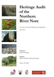
Heritage Audit of the Northern River Nore - Kilkenny County Council
Heritage Audit of the Northern River Nore - Kilkenny County Council
Heritage Audit of the Northern River Nore - Kilkenny County Council

Create successful ePaper yourself
Turn your PDF publications into a flip-book with our unique Google optimized e-Paper software.
<strong>Heritage</strong> <strong>Audit</strong><br />
<strong>of</strong> <strong>the</strong><br />
Nor<strong>the</strong>rn<br />
<strong>River</strong> <strong>Nore</strong><br />
An action <strong>of</strong> <strong>the</strong> draft <strong>Kilkenny</strong> <strong>Heritage</strong> Plan<br />
2007-2011<br />
Volume 2<br />
Built <strong>Heritage</strong> Inventory<br />
Authors<br />
Emma Devine, Richard Jennings, Jimmy Lenehan,<br />
Cóilín Ó Drisceoil<br />
October 30 th 2009
TABLE OF CONTENTS<br />
INTRODUCTION TO THE BUILT HERITAGE INVENTORY 1<br />
INVENTORY METHODOLOGY 1<br />
Previous studies 1<br />
Project Methodology 3<br />
THE BUILT HERTIAGE INVENTORY 7<br />
Structure <strong>of</strong> Built <strong>Heritage</strong> Inventory 7<br />
Abbreviations and contractions used in <strong>the</strong> inventory 8<br />
BUILT HERITAGE INVENTORY 11<br />
BIBLIOGRAPHY 119<br />
Unpublished Sources 119<br />
Newspapers 120<br />
Websites 120<br />
Secondary Sources 121<br />
MAPPING 124<br />
i
LIST OF FIGURES<br />
Figure 1: Map <strong>of</strong> <strong>the</strong> Nor<strong>the</strong>rn <strong>River</strong> <strong>Nore</strong> and its tributaries with <strong>the</strong> study‐area along<br />
<strong>the</strong> <strong>River</strong> <strong>Nore</strong> marked (sources: EPA subsoils and rivers dataset, ASTER DEM)<br />
Figure 2: Screen‐shot <strong>of</strong> <strong>the</strong> <strong>River</strong> <strong>Nore</strong> <strong>Heritage</strong> <strong>Audit</strong> GIS 3<br />
Figure 3: Screen‐shot <strong>of</strong> <strong>the</strong> <strong>River</strong> <strong>Nore</strong> <strong>Heritage</strong> <strong>Audit</strong> built heritage database 5<br />
Figure 4: Jimmy Lenehan, Richard Jennings and Dan Lenehan alighting at Ballyragget<br />
weir during canoe survey<br />
Figure 5: Dick Keoghan (left) and Jack Phelan (right) discussing river names 6<br />
Figure 6: Public information meeting Ballyragget 15th October 2009 7<br />
Figure 7: Sequence <strong>of</strong> works that led to <strong>the</strong> production <strong>of</strong> <strong>the</strong> built heritage inventory<br />
(see below for explanation <strong>of</strong> abbreviations)<br />
Figure 8: Inventory entry explanation 10<br />
Figure 9: KN‐001 Ballyoskil urns (Brindley 2007, 87) 13<br />
Figure 10: KN‐002 Ballynaslee weir (photo: <strong>Kilkenny</strong> Archaeology) 13<br />
Figure 11: KN‐003 Ballynaslee church and graveyard (photo: Laura Walsh) 15<br />
Figure 12: KN‐005 Ballynaslee limekiln (photo: <strong>Kilkenny</strong> Archaeology) 15<br />
Figure 13: KN‐006 surviving gable <strong>of</strong> ‘Ass Mill’ wheel‐house, Ballynaslee mill complex<br />
(photo: <strong>Kilkenny</strong> Archaeology)<br />
Figure 14: KN‐006 Ballynaslee mill complex weir (photo: <strong>Kilkenny</strong> Archaeology) 17<br />
Figure 15: KN‐009 Anker’s island church and graveyard (photo: <strong>Kilkenny</strong> Archaeology) 19<br />
Figure 16: KN‐009 remains <strong>of</strong> wall‐line Anker’s Island church (photo: <strong>Kilkenny</strong><br />
Archaeology)<br />
Figure 17: KN‐015 Moatpark motte (photo: <strong>Kilkenny</strong> Archaeology) 20<br />
Figure 18: KN‐019 weir for Ballyconra mills (photo: <strong>Kilkenny</strong> Archaeology) 20<br />
Figure 19: KN‐019 Ballyconra mills (courtesy <strong>of</strong> Moyra McCarthy) 22<br />
Figure 20: KN‐020 Ballyconra demesne shown on first edition Ordnance Survey map 22<br />
ii<br />
2<br />
6<br />
8<br />
17<br />
19
Figure 21: KN‐020 Ballyconra demesne shown on 2005 aerial photograph 24<br />
Figure 22: KN‐020 Ballyconra house, <strong>the</strong> lintel over <strong>the</strong> front doorway commemorates<br />
<strong>the</strong> removal <strong>of</strong> <strong>the</strong> 1647 ‘frontispiece’ <strong>of</strong> Ballien castle to Ballyconra in 1724<br />
(photo: Laura Walsh)<br />
Figure 23: KN‐025 Ballyragget weir (photo: <strong>Kilkenny</strong> Archaeology) 26<br />
Figure 24: KK‐025 Ballyragget (Parks Grove) corn mill 1938 (courtesy <strong>of</strong> Moyra<br />
McCarthy)<br />
Figure 25: KN‐026 Ballyragget bridge (photo: <strong>Kilkenny</strong> Archaeology) 28<br />
Figure 26: KN‐029 Ballyragget castle top floor (photo: Laura Walsh) 28<br />
Figure 27: KN‐029 Ballyragget castle (photo: Laura Walsh) 29<br />
Figure 28: KN‐030 Ballyraggett Lodge demesne shown on first edition Ordnance Survey<br />
map<br />
Figure 29: KN‐032 revetting wall Ballyragget (photo: <strong>Kilkenny</strong> Archaeology) 33<br />
Figure 30: KN‐033 remains <strong>of</strong> Parks grove weir (photo: <strong>Kilkenny</strong> Archaeology) 33<br />
Figure 31: KN‐044 Grange church and graveyard (photo: Laura Walsh) 37<br />
Figure 32: KN‐044 wrought iron grave surrounds Grange graveyard (Photo: Laura<br />
Walsh)<br />
Figure 33: KN‐046 Grange demesne shown on first edition Ordnance Survey map 38<br />
Figure 34: KN‐046 Grange demesne shown on 2005 aerial photograph 38<br />
Figure 35: KN‐049 Rathbeagh church (photo: Laura Walsh) 40<br />
Figure 36: KN‐049 Murder Hole in residential tower Rathbeagh church (photo: Laura<br />
Walsh)<br />
Figure 37: KN‐050 Rathbeagh ringfort/ringwork castle (photo: Laura Walsh) 42<br />
Figure 38: KN‐050 inlet adjoining Rathbeagh fort (photo: <strong>Kilkenny</strong> Archaeology) 42<br />
Figure 39: KN‐050, sherd <strong>of</strong> <strong>Kilkenny</strong>‐type glazed coarseware (late 12th‐early 13th<br />
century AD) in‐situ at Rathbeagh. The pottery sherd had eroded from an<br />
occupation layer on <strong>the</strong> north side <strong>of</strong> <strong>the</strong> inner platform (Photo: <strong>Kilkenny</strong><br />
Archaeology).<br />
Figure 40: KN‐055 Lismaine bridge from north (photo: <strong>Kilkenny</strong> Archaeology) 43<br />
iii<br />
24<br />
26<br />
31<br />
37<br />
40<br />
43
Figure 41: KN‐056 Lismaine tower house (photo: Laura Walsh) 45<br />
Figure 42: KN‐056 Earthworks around Lismaine tower house (Google Earth) 45<br />
Figure 43: KN‐058 Lismaine demesne shown on first edition Ordnance Survey map 47<br />
Figure 44: KN‐058 Lismaine demesne shown on 2005 aerial photograph 47<br />
Figure 45: KN‐061 Weir wall at Islands (photo: <strong>Kilkenny</strong> Archaeology) 49<br />
Figure 46: KN‐062 Inchmore castle bawn wall from east (photo: <strong>Kilkenny</strong> Archaeology) 49<br />
Figure 47: KN‐062 Musket‐loop in <strong>the</strong> bawn wall <strong>of</strong> Inchmore castle (photo: <strong>Kilkenny</strong><br />
Archaeology)<br />
Figure 48: KN‐062 Window mullions recovered by Mr. Dan Lenehan from <strong>the</strong> now lost<br />
Inchmore Jacobean house (photo: <strong>Kilkenny</strong> Archaeology)<br />
Figure 49: KN‐062 Inchmore castle bawn and Inchmore bridge KN‐063 from south<br />
(photo: Laura Walsh)<br />
Figure 50: KN‐063 Inchmore bridge from north (photo: <strong>Kilkenny</strong> Archaeology) 51<br />
Figure 51: KN‐063 underside <strong>of</strong> Inchmore bridge arch (photo: <strong>Kilkenny</strong> Archaeology) 52<br />
Figure 52: KN‐064 numbered stone posts at Inchmore bridge, from east (photo:<br />
<strong>Kilkenny</strong> Archaeology)<br />
Figure 53: KN‐064 numbered stone post Inchmore bridge (photo: <strong>Kilkenny</strong><br />
Archaeology). Their meaning is unclear<br />
Figure 54: KN‐070 Wall <strong>of</strong> mill in bank <strong>of</strong> Brackin stream, from west (photo: <strong>Kilkenny</strong><br />
Archaeology)<br />
Figure 55: KN‐070 stone debris in <strong>the</strong> water around <strong>the</strong> site <strong>of</strong> Brackin mill (photo:<br />
<strong>Kilkenny</strong> Archaeology)<br />
Figure 56: KN‐071 fording point, from east (photo: <strong>Kilkenny</strong> Archaeology) 56<br />
Figure 57: KN‐072 Ballycarran limekiln (photo: Mieke Mullyaert) 57<br />
Figure 58: KN‐073 Cut‐water for bridge over Brackin stream, from north (photo:<br />
<strong>Kilkenny</strong> Archaeology)<br />
Figure 59: KN‐077 Ballycarran Little demesne shown on first edition Ordnance Survey<br />
map<br />
Figure 60: KN‐081 Threecastles bridge from north (photo: <strong>Kilkenny</strong> Archaeology) 59<br />
iv<br />
50<br />
50<br />
51<br />
52<br />
54<br />
54<br />
56<br />
57<br />
59
Figure 61: KN‐081 <strong>the</strong> abutment for Threecastles bridge is very similar to that which<br />
was excavated at John’s Bridge, <strong>Kilkenny</strong> (photo: <strong>Kilkenny</strong> Archaeology)<br />
Figure 62: KN‐083 Threecastles Glebe House (photo: <strong>Kilkenny</strong> Archaeology) 61<br />
Figure 63: KN‐084 Threecastles church and residential tower from east (photo: Laura<br />
Walsh)<br />
Figure 64: KN‐084 13‐14th century graveslab reused as lintel in nave <strong>of</strong> Threecastles<br />
church (photo: Laura Walsh)<br />
Figure 65: KN‐084 13th‐14th century Anglo‐Norman graveslab reused as gravemarker in<br />
Threecastles churchyard (photo: Laura Walsh)<br />
Figure 66: KN‐084 Residential tower at Threecastles church (photo: <strong>Kilkenny</strong><br />
Archaeology)<br />
Figure 67: KN‐084 Fireplace at Threecastles residential tower (photo: <strong>Kilkenny</strong><br />
Archaeology)<br />
Figure 68: KN‐085 Threecastle motte (photo: <strong>Kilkenny</strong> Archaeology) 67<br />
Figure 69: KN‐085 Folly on <strong>the</strong> top <strong>of</strong> Threecastles motte (photo: <strong>Kilkenny</strong> Archaeology) 67<br />
Figure 70: KN‐086 Threecastles towerhouse from south (photo: <strong>Kilkenny</strong> Archaeology) 68<br />
Figure 71: KN‐086 Threecastles towerhouse from west (photo: <strong>Kilkenny</strong> Archaeology) 68<br />
Figure 72: KN‐087 Cropmarks at site <strong>of</strong> Threecastles Demesne enclosure. View from<br />
north east (photo: <strong>Kilkenny</strong> Archaeology)<br />
Figure 73: KN‐087 Cropmarks show multivallate enclosure in Threecastles Demesne.<br />
Aerial photograph (2005)<br />
Figure 74: KN‐089 Threecastles demesne shown on first edition Ordnance Survey map 71<br />
Figure 75: KN‐089 Threecastles demesne shown on 2005 aerial photograph 71<br />
Figure 76: KN‐089 Threecastles House. Photo reproduced from Cantwell (2000, 500) 73<br />
Figure 77: KN‐094 Naglesland ringfort. View from north west (photo: <strong>Kilkenny</strong><br />
Archaeology)<br />
Figure 78: KN‐095 Remains <strong>of</strong> Mount Eagle distillery (photo: <strong>Kilkenny</strong> Archaeology) 76<br />
Figure 79: KN‐098 Dunmore Park demesne shown on first edition Ordnance Survey map 76<br />
Figure 80: KN‐098 Dunmore Park demesne shown on 2005 aerial photograph 78<br />
v<br />
61<br />
63<br />
63<br />
64<br />
65<br />
65<br />
70<br />
70<br />
73
Figure 81: KN‐100 Dunmore West stone revetting along <strong>the</strong> east bank <strong>of</strong> <strong>Nore</strong> (photo:<br />
<strong>Kilkenny</strong> Archaeology)<br />
Figure 82: KN‐112 Greenvale Woollen Mills (Costello et al 2009, 52) 83<br />
Figure 83: KN‐112 Weir which served Greenvale Woollen Mills (photo: <strong>Kilkenny</strong><br />
Archaeology)<br />
Figure 84: KN‐114 Lady Desart's suspension bridge c.1920 from Talbot’s Inch to<br />
Woollen Mills (Costello et al 2009, 52)<br />
Figure 85: KN‐114 View over Lady Desart's suspension bridge (L‐ROY‐10059, 1880‐1914<br />
NLI)<br />
Figure 86: KN‐114 Suspension bridge following “Great Flood' <strong>of</strong> 1947, (photograph from<br />
Mr. John Dalton)<br />
Figure 87: KN‐114 Remains <strong>of</strong> suspension bridge on west bank <strong>of</strong> <strong>the</strong> <strong>River</strong> <strong>Nore</strong> (photo:<br />
<strong>Kilkenny</strong> Archaeology)<br />
Figure 88: KN‐115 Bleach Road Cottage in 1998 (photo: Jimmy Lenehan) 87<br />
Figure 89: KN‐115 Bleach Road Cottage in 2009 (photo: Jimmy Lenehan) 87<br />
Figure 90: KN‐116 Richview House demesne shown on first edition Ordnance Survey<br />
map<br />
Figure 91: KN‐116 Richview House demesne shown on 2005 aerial photograph 88<br />
Figure 92: KN‐117 Thatched cottage at Talbot's Inch c.1920 (Costello et.al. 2009, 51) 90<br />
Figure 93: KN‐117 Talbot’s Inch village (photo: <strong>Kilkenny</strong> Archaeology) 90<br />
Figure 94: KN‐123 Newpark Lodge demesne shown on first edition Ordnance Survey<br />
map<br />
Figure 95: KN‐123 Newpark Lodge demesne shown on 2005 aerial photograph 92<br />
Figure 96: KN‐133 Greensbridge mill on a view <strong>of</strong> <strong>Kilkenny</strong> City 1819 by Joanna Bann<br />
(<strong>Kilkenny</strong> Archaeological Society Collection)<br />
Figure 97: KN‐130 Green’s bridge on view <strong>of</strong> <strong>Kilkenny</strong> City by O Keefe? c.1770 (<strong>Kilkenny</strong><br />
Archaeological Society Collection)<br />
Figure 98: KN‐131 Greensbridge weir c.1950 with Chancellor’s mills on right and<br />
Greensbridge mills on left (courtesy Mr. John Dalton)<br />
vi<br />
78<br />
83<br />
84<br />
84<br />
85<br />
85<br />
88<br />
92<br />
95<br />
95<br />
97
Figure 99: KN‐133 Greensbridge mill left and Chancellor’s mill on right (Costello et al<br />
2009, 25)<br />
Figure 100: KN‐134 Chancellor's mills complex (Costello et.al. 2009, 48) 98<br />
Figure 101: KN‐134 Chancellor's mills complex, 2009, from north east (photo: <strong>Kilkenny</strong><br />
Archaeology).<br />
Figure 102: KN‐035 Sword fragment found during archaeological monitoring <strong>of</strong> river‐<br />
gravel extraction for <strong>the</strong> <strong>Nore</strong> drainage scheme 2003(M. Gowen & Co. Ltd.)<br />
Figure 103: Smithwicks and Torpedo bottles recovered from <strong>Nore</strong> during drainage<br />
scheme 2003 (M. Gowen & Co. Ltd.)<br />
Figure 104: KN‐138 St. Francis’ Abbey in <strong>the</strong> grounds <strong>of</strong> Smithwick’s Brewery (photo:<br />
<strong>Kilkenny</strong> Archaeology)<br />
Figure 105: KN‐139 Bateman Quay pleasure house from east (photo: <strong>Kilkenny</strong><br />
Archaeology)<br />
Figure 106: KN‐139 Drawing <strong>of</strong> Stucco ceiling (from Stevens and Slater 2002, figure 11) 103<br />
Figure 107: KN‐140 Bateman Quay toll house (photo: <strong>Kilkenny</strong> Archaeology) 103<br />
Figure 108: KN‐144 A small selection <strong>of</strong> <strong>the</strong> 6500 finds recovered from <strong>the</strong> <strong>River</strong> <strong>Nore</strong><br />
during <strong>the</strong> <strong>Kilkenny</strong> Flood Relief Scheme (M. Gowen and Co. Ltd.)<br />
Figure 109: KN‐147 John’s Bridge from south‐west (photo: <strong>Kilkenny</strong> Archaeology) 107<br />
Figure 110: KN‐148 John's bridge being demolished 1910 (Costello et al 2009) 107<br />
Figure 111: KN‐148 Sightseers follow King Edward over John's bridge in 1904 (Costello et<br />
al 2009, 92)<br />
Figure 112: KN‐149 College Park riverside toll‐tower (Doyle 2005) 109<br />
Figure 113: KN‐152 Scot's Canal lock (photo: <strong>Kilkenny</strong> Archaeology) 111<br />
Figure 114: KN‐152 Plan <strong>of</strong> <strong>the</strong> <strong>Nore</strong> navigation submitted to parliamentary commission 111<br />
Figure 115: KN‐153 Lacken Corn Mill from west bank <strong>of</strong> <strong>Nore</strong> (photo: <strong>Kilkenny</strong><br />
Archaeology)<br />
Figure 116: KN‐154 Engine house and resevoir in <strong>the</strong> north east <strong>of</strong> castle park ground.<br />
(photo: <strong>Kilkenny</strong> Archaeology)<br />
Figure 117: KN‐155 Dukesmeadows fulachta fiadh under excavation, from sou<strong>the</strong>ast<br />
(Stevens 2002)<br />
vii<br />
97<br />
98<br />
100<br />
100<br />
102<br />
102<br />
105<br />
109<br />
112<br />
112<br />
115
Figure 118: KN‐155 Flint knife found during excavation <strong>of</strong> Dukesmeadows fulachta fiadh<br />
(Stevens 2002)<br />
Figure 119: KN‐160 canal bridge at Archersgrove (photo: <strong>Kilkenny</strong> Archaeology) 117<br />
Figure 120: KN‐160 Infilled canal cut at Dukesmeadows (photo: <strong>Kilkenny</strong> Archaeology) 117<br />
Figure 121: KN‐161 Ossory Bridge (photo: <strong>Kilkenny</strong> Archaeology) 118<br />
Figure 122: KN‐161 The sculpture on Ossory bridge by Joan Smith (1984) 118<br />
viii<br />
115
Introduction to <strong>the</strong> Built <strong>Heritage</strong> Inventory<br />
This volume contains <strong>the</strong> inventory <strong>of</strong> <strong>the</strong> built heritage <strong>of</strong> <strong>the</strong> nor<strong>the</strong>rn <strong>River</strong> <strong>Nore</strong>, accompanied by<br />
images and mapping. Preceding <strong>the</strong> inventory proper is an account <strong>of</strong> <strong>the</strong> methodology followed in its<br />
compilation and an explanation <strong>of</strong> its structure.<br />
Inventory Methodology<br />
Previous studies<br />
This project represents <strong>the</strong> first systematic, integrated and comprehensive survey <strong>of</strong> <strong>the</strong> nor<strong>the</strong>rn <strong>River</strong><br />
<strong>Nore</strong>’s heritage in <strong>Kilkenny</strong>. A small number <strong>of</strong> studies <strong>of</strong> particular places in <strong>the</strong> study‐area had been<br />
published prior to this project, such as Threecastles (Cantwell 2000), Dunmore House (Fenlon 1997) and<br />
Ballyragget (Lyng 1946‐7). Canon William Carrigan’s various parish histories remain an invaluable source<br />
(Carrigan 1905), as does Owen O Kelly’s Placenames <strong>of</strong> <strong>Kilkenny</strong> (1985). Milling on <strong>the</strong> <strong>River</strong> <strong>Nore</strong> was<br />
<strong>the</strong> subject <strong>of</strong> John Doyle’s paper in 1985 (Doyle 1985) and <strong>the</strong> history <strong>of</strong> <strong>the</strong> <strong>Nore</strong> Navigation has been<br />
<strong>the</strong> subject <strong>of</strong> papers by Watters (1872b), Delany (1986) and Hand (forthcoming). Fisheries on <strong>the</strong> <strong>Nore</strong><br />
were studied by Went (1955).<br />
There is also quite an amount <strong>of</strong> unpublished material that is available to <strong>the</strong> researcher, all <strong>of</strong> which is<br />
detailed in <strong>the</strong> bibliography. Some <strong>of</strong> <strong>the</strong> key sources used included <strong>the</strong> files <strong>of</strong> <strong>the</strong> Archaeological<br />
Survey <strong>of</strong> Ireland who had collated information on <strong>the</strong> archaeological sites and urban archaeology in <strong>the</strong><br />
study area (Farrelly et.al. 1993). The former <strong>Kilkenny</strong> Field Monument Advisor Ms. Laura Walsh visited,<br />
photographed and transcribed <strong>the</strong> Record <strong>of</strong> Monuments and Places files for 41 <strong>of</strong> <strong>the</strong> archaeological<br />
sites in <strong>the</strong> study area. Likewise <strong>the</strong> topographical files and finds lists <strong>of</strong> <strong>the</strong> National Museum <strong>of</strong> Ireland<br />
provided lists <strong>of</strong> archaeological finds that had been made in <strong>the</strong> study area. Twenty significant<br />
architectural heritage sites along <strong>the</strong> river that were included in this study have been described and<br />
photographed in <strong>the</strong> National Inventory <strong>of</strong> Architectural <strong>Heritage</strong> for <strong>Kilkenny</strong> 1 , and <strong>the</strong> Industrial<br />
Archaeological Survey <strong>of</strong> <strong>Kilkenny</strong> (Hammond 1990) provided information on 14 industrial structures.<br />
The systematic analysis <strong>of</strong> aerial photography collections such as <strong>the</strong> Cambridge University Collection <strong>of</strong><br />
Aerial Photography 2 , <strong>Kilkenny</strong> <strong>County</strong> <strong>Council</strong>’s 2005 aerial orthophotography and Google Earth’s<br />
satellite coverage all proved to be extremely useful.<br />
1 www.buildings<strong>of</strong>ireland.ie (accessed 23.11.2009).<br />
2 These are available for viewing at <strong>the</strong> National Museum <strong>of</strong> Ireland, Kildare Street, Dublin.<br />
1
Start <strong>of</strong> Project<br />
Figure 1: Map <strong>of</strong> <strong>the</strong> Nor<strong>the</strong>rn <strong>River</strong> <strong>Nore</strong> and its tributaries with <strong>the</strong> study‐area along <strong>the</strong> <strong>River</strong> <strong>Nore</strong><br />
marked (sources: EPA subsoils and rivers dataset, ASTER DEM) .<br />
2<br />
End <strong>of</strong> Project
Project Methodology<br />
1. Data‐ga<strong>the</strong>ring<br />
The ga<strong>the</strong>ring <strong>of</strong> a wide range <strong>of</strong> datasets from disparate sources was <strong>the</strong> first task <strong>of</strong> <strong>the</strong> project. The<br />
suite <strong>of</strong> documentary sources (both published and unpublished) that were utilised is included in <strong>the</strong><br />
bibliography. In addition GIS mapping databases were obtained for a range <strong>of</strong> datasets. These are<br />
itemised as layers on <strong>the</strong> accompanying cd‐rom.<br />
Figure 2: Screen‐shot <strong>of</strong> <strong>the</strong> <strong>River</strong> <strong>Nore</strong> <strong>Heritage</strong> <strong>Audit</strong> GIS<br />
The following mapping sources were used with permission in <strong>the</strong> study:<br />
1: 100,000 Geology Map <strong>of</strong> Ireland (Geological Survey <strong>of</strong> Ireland)<br />
1: 100,000 Soils Map <strong>of</strong> Ireland (Geological Survey <strong>of</strong> Ireland)<br />
ASTER Digital Terrain model tile (NASA)<br />
Discovery Series Maps <strong>of</strong> Co. <strong>Kilkenny</strong> (<strong>Kilkenny</strong> <strong>County</strong> <strong>Council</strong> )<br />
Orthophotographs <strong>of</strong> Co. <strong>Kilkenny</strong> (<strong>Kilkenny</strong> <strong>County</strong> <strong>Council</strong>)<br />
Ordnance Survey First and Second Edition Maps <strong>of</strong> Co. <strong>Kilkenny</strong> (<strong>Kilkenny</strong> <strong>County</strong> <strong>Council</strong>)<br />
3
<strong>River</strong> catchments <strong>of</strong> Ireland (Environmental Protection Agency)<br />
Ten metre interval contour map <strong>of</strong> Co. <strong>Kilkenny</strong> (<strong>Kilkenny</strong> <strong>County</strong> <strong>Council</strong>)<br />
Townlands <strong>of</strong> Co. <strong>Kilkenny</strong> (<strong>Kilkenny</strong> <strong>County</strong> <strong>Council</strong>)<br />
Vector Base Map <strong>of</strong> Co. <strong>Kilkenny</strong> (<strong>Kilkenny</strong> <strong>County</strong> <strong>Council</strong>)<br />
A complete list <strong>of</strong> <strong>the</strong> databases used in <strong>the</strong> study is shown on Figure 7.<br />
2. Geographical Information System<br />
All aspects <strong>of</strong> <strong>the</strong> <strong>Nore</strong> <strong>Heritage</strong> <strong>Audit</strong> Project were managed by <strong>the</strong> study‐group within a Geographic<br />
Information System (GIS), using ArcGIS 9.3.1. The benefits <strong>of</strong> using GIS for <strong>the</strong> project were fourfold:<br />
exceptional organisation, management and storage <strong>of</strong> data<br />
analysis and interpretation <strong>of</strong> multiple data sources<br />
creation <strong>of</strong> output maps for reports, recommendations, and information panels<br />
easy <strong>of</strong> delivery <strong>of</strong> dataset to client<br />
The GIS methodology was broken down into three key areas: database design and data collation, data<br />
interpretation, and thirdly, output.<br />
The first stage <strong>of</strong> <strong>the</strong> project was to design <strong>the</strong> GIS database and input data from <strong>the</strong> desk‐based survey.<br />
Spatial data such as Ordnance Survey maps, digital terrain models, ortho‐photographs, archaeological<br />
site distribution maps, and habitat maps were grouped according to whe<strong>the</strong>r <strong>the</strong>y have <strong>the</strong> same spatial<br />
projection and georeferencing information. The data was typically represented as layers <strong>of</strong> raster grid<br />
cells, or points, lines and polygons. If <strong>the</strong>y ‘overlaid’ (i.e. can be visually displayed in <strong>the</strong> same<br />
geographic space) <strong>the</strong>se layers were considered to belong to <strong>the</strong> same data <strong>the</strong>me.<br />
Some basic attribute data was stored in tabular form within <strong>the</strong> relational database component <strong>of</strong> <strong>the</strong><br />
GIS but most was recorded in an independent MS Access database which was linked to <strong>the</strong> GIS via a<br />
system <strong>of</strong> unique identification numbers – KN‐#. For instance, a demesne was drawn as a polygon on a<br />
layer within <strong>the</strong> GIS data <strong>the</strong>me. The polygon was assigned a unique identification code which would<br />
allow it to be linked to <strong>the</strong> entry in <strong>the</strong> Access database where attribute data relating to this particular<br />
demesne was stored.<br />
The GIS was ultimately used to produce a broad range <strong>of</strong> <strong>the</strong>matic and distributional maps, which are<br />
reproduced throughout this volume.<br />
4
Figure 3: Screen‐shot <strong>of</strong> <strong>the</strong> <strong>River</strong> <strong>Nore</strong> <strong>Heritage</strong> <strong>Audit</strong> built heritage database<br />
3. Data‐entry<br />
Individual sites were entered into <strong>the</strong> specifically designed MS Access database using a unique identifier<br />
(KKNOR‐#) which linked with <strong>the</strong> mapping. The database contains basic locational, source and<br />
descriptive information on each individual entity.<br />
Once a final sequence <strong>of</strong> KKNOR sites was arrived at a process <strong>of</strong> amalgamation and streamlining took<br />
place in order to produce a final sequence <strong>of</strong> sites. These were given <strong>the</strong> acronym KN‐#. The merging <strong>of</strong><br />
KKNOR entities was carried out in order to simplify and rationalise <strong>the</strong> dataset and also to group<br />
toge<strong>the</strong>r sites which were clearly related. Thus, for example, <strong>the</strong> weir, mill‐race and flour‐mill at<br />
Ballyconra were assigned separate KKNOR numbers during <strong>the</strong> data‐ga<strong>the</strong>ring process but were<br />
subsequently subsumed into one KN number (KN‐019). Likewise <strong>the</strong> church and graveyard at Ballynaslee<br />
(KN‐003) were initially assigned two KKNOR numbers to reflect <strong>the</strong>ir separate RMP designations. This<br />
process led to <strong>the</strong> production <strong>of</strong> 161 KN entities from an original 280 KKNOR sites.<br />
4. Field‐Survey<br />
Field survey was undertaken in October 2009 and focused primarily on <strong>the</strong> identification <strong>of</strong> previously<br />
unrecorded sites <strong>of</strong> interest as well as <strong>the</strong> ‘ground‐truthing’ <strong>of</strong> documented sites that occurred along <strong>the</strong><br />
river. The survey was initially undertaken by canoe and <strong>the</strong>n by foot and led to <strong>the</strong> identification <strong>of</strong> a<br />
suite <strong>of</strong> new sites. It proved unnecessary to visit many <strong>of</strong> <strong>the</strong> Recorded Monuments and Places<br />
archaeological sites as this had already been undertaken by <strong>the</strong> Field Monuments Advisor.<br />
5
Figure 4: Jimmy Lenehan, Richard Jennings and Dan Lenehan alighting at Ballyragget weir during canoe survey<br />
Figure 5: Dick Keoghan (left) and Jack Phelan (right) discussing river names<br />
6
5. Public Consultation<br />
From <strong>the</strong> beginning <strong>of</strong> <strong>the</strong> project <strong>the</strong> input was sought <strong>of</strong> <strong>the</strong> local communities, those who used <strong>the</strong><br />
river for recreation and any o<strong>the</strong>r members <strong>of</strong> <strong>the</strong> public who shared an interest in <strong>the</strong> <strong>Nore</strong>’s heritage.<br />
Two public information nights were held, <strong>the</strong> first in Threecastles hall 14 th October 2009 and <strong>the</strong> second<br />
<strong>the</strong> following evening in Canon Malone Hall, Ballyragget. Much <strong>of</strong> <strong>the</strong> information which was ga<strong>the</strong>red<br />
at <strong>the</strong>se meetings related to <strong>the</strong> river names and fishing‐stands that occur along its course. Local radio<br />
and newspapers were also utilised to good effect to promote <strong>the</strong> project.<br />
Figure 6: Public information meeting Ballyragget 15 th October 2009<br />
The Built <strong>Heritage</strong> Inventory<br />
Structure <strong>of</strong> Built <strong>Heritage</strong> Inventory<br />
This inventory contains a sequential list <strong>of</strong> <strong>the</strong> 161 built heritage sites that are included in this study. The<br />
inventory was generated from <strong>the</strong> project database and is designed to present <strong>the</strong> essential data on<br />
each entry. Each entry has a unique identifier number (KN‐#) followed by <strong>the</strong> townland and site name,<br />
which is replicated in <strong>the</strong> accompanying mapping. Entries are generally arranged numerically and as per<br />
<strong>the</strong>ir location from north to south along <strong>the</strong> study‐area. The national grid‐reference for <strong>the</strong> site is <strong>the</strong>n<br />
provided. In all cases <strong>the</strong> grid‐reference equates with its marked location on <strong>the</strong> mapping. Underneath<br />
<strong>the</strong> grid‐reference <strong>the</strong> identifier number which was previously assigned to <strong>the</strong> site (where applicable) is<br />
recorded – this includes identifiers from <strong>the</strong> Record <strong>of</strong> Monuments and Places, <strong>the</strong> National Inventory<br />
<strong>of</strong> Architectural <strong>Heritage</strong>, <strong>the</strong> Urban Archaeological Survey and <strong>the</strong> Record <strong>of</strong> Protected Structures. The<br />
next line indicates <strong>the</strong> site type or types. The site description is a concise edited version <strong>of</strong> <strong>the</strong><br />
information ga<strong>the</strong>red from <strong>the</strong> range <strong>of</strong> sources that are listed below each entry. The list <strong>of</strong> published<br />
and unpublished sources is presented in <strong>the</strong> bibliography and <strong>the</strong> abbreviations used in <strong>the</strong> inventory<br />
are detailed below.<br />
7
Figure 7: Sequence <strong>of</strong> works that led to <strong>the</strong> production <strong>of</strong> <strong>the</strong> built heritage inventory (see below for explanation<br />
<strong>of</strong> abbreviations)<br />
Abbreviations and contractions used in <strong>the</strong> inventory<br />
ASI Archaeological Survey <strong>of</strong> Ireland<br />
c. circa<br />
CUCAP Cambridge University Collection <strong>of</strong> Aerial Photographs<br />
D depth<br />
diam. diameter<br />
dims. dimensions<br />
8
ext. external<br />
FLJ Finns Leinster Journal (newspaper)<br />
FMA Field Monuments Advisor<br />
H. height<br />
IAS Industrial Archaeological Survey <strong>of</strong> <strong>Kilkenny</strong> (Hamond 1990)<br />
int. internal<br />
KJ <strong>Kilkenny</strong> Journal (newspaper)<br />
KKAP <strong>Kilkenny</strong> Archaeological Project<br />
km kilometres<br />
L. length<br />
m metre<br />
max. maximum<br />
NIAH National Inventory <strong>of</strong> Architectural <strong>Heritage</strong><br />
NIAHGS National Inventory <strong>of</strong> Architectural <strong>Heritage</strong> Garden Survey<br />
NMI National Museum <strong>of</strong> Ireland<br />
OPW Office <strong>of</strong> Public Works<br />
Ordnance Survey Ordnance Survey<br />
RMP Record <strong>of</strong> Monuments and Places<br />
RPS Record <strong>of</strong> Protected Structures<br />
T Thickness<br />
UAS Urban Archaeological Survey<br />
9
UNIQUE I.D. NUMBER; K[ILKENNY] N[ORE]‐001<br />
Figure 8: Inventory entry explanation<br />
10<br />
SITE TOWNLAND LOCATION AND NAME<br />
NATIONAL GRID CO‐ORDINATES<br />
PREVIOUSLY ASSIGNED SITE IDENTIFIER, Eg. RMP, NIAH<br />
MAP AND FIGURE NUMBER<br />
SITE DESCRIPTION<br />
SOURCES OF INFORMATION, PUBLISHED,<br />
UNPUBLISHED, FIELD SURVEY ETC.
BUILT HERITAGE INVENTORY<br />
11
KN‐001 Ballyoskill cemetery mound<br />
247416 176472<br />
RMP KK005‐003<br />
Description (Maps 1, 27; Figure 9)<br />
The site lay at <strong>the</strong> edge <strong>of</strong> a modern quarry,<br />
which had encroached upon it. A cairn, which<br />
had been drastically denuded stood no higher<br />
than 0.45m. Three rectangular cists were<br />
discovered during <strong>the</strong> course <strong>of</strong> bulldozing<br />
operations, two <strong>of</strong> which were empty. The third<br />
contained two bipartite vases and one<br />
miniature vase as well as some fragments <strong>of</strong><br />
burnt bone. Rescue excavation revealed <strong>the</strong><br />
presence <strong>of</strong> two fur<strong>the</strong>r cists, both empty.<br />
Cremated bone carbonate was radiocarbon<br />
dated to 3710 +/‐ 50 BP.<br />
Sources<br />
Prendergast and Ryan 1972; Waddell 1990, 99;<br />
Brindley 2007, 87; Excavations 1971, 22.<br />
KN‐002 Ballynaslee weir<br />
243108 175430<br />
Description (Maps 2, 28; Figure 10)<br />
Weir marked on first and second edition<br />
Ordnance Survey maps. The maps indicate it<br />
was enlarged between c.1840‐1900. Visible on<br />
2005 aerial orthophotography and a site visit in<br />
October 2009 confirmed it was still extant. The<br />
remains comprise a low, badly denuded stone<br />
weir that crosses <strong>the</strong> river NW‐SE and may have<br />
served Russellstown Tuck mill. The mill was<br />
operated by Mrs. Mullally and had a 12 foot<br />
diameter mill wheel.<br />
Sources<br />
Hogg 1997, 69; Ordnance Survey First and<br />
Second Editions<br />
12<br />
KN‐003 Ballynaslee church and<br />
graveyard<br />
243024 174719<br />
RMP KK004‐002<br />
Description (Map 3, 29; Figure 11)<br />
Rectangular building (int. dims. 15.3m by 8.5m)<br />
aligned east‐west. north, east and west walls<br />
featureless, south wall has niche, window and<br />
doorway with pointed arch and punch‐dressed<br />
jambs suggesting a 17th century date.<br />
Graveyard around <strong>the</strong> church has a diam. <strong>of</strong><br />
17m and consists <strong>of</strong> a slightly raised platform.<br />
Sources<br />
ASI file; Ordnance Survey first and second<br />
edition.<br />
KN‐004 Ballynaslee possible moated<br />
site<br />
242880 174700<br />
RMP KK004‐001<br />
Description (Maps 3, 29)<br />
Cropmark <strong>of</strong> rectilinear enclosure showing on<br />
CUCAP aerial photograph (CUCAP, AJQ 52).<br />
Good views north and south, and east across<br />
valley and west as far as hills <strong>of</strong> west valley side.<br />
No visible surface trace.<br />
Source<br />
ASI
Figure 9: KN‐001 Ballyoskil urns (Brindley 2007, 87)<br />
Figure 10: KN‐002 Ballynaslee weir (photo: <strong>Kilkenny</strong> Archaeology)<br />
13
Figure 11: KN‐003 Ballynaslee church and graveyard (photo: Laura Walsh)<br />
Figure 12: KN‐005 Ballynaslee limekiln (photo: <strong>Kilkenny</strong> Archaeology)<br />
15
KN‐005 Ballynaslee quarry<br />
242608 174512<br />
Description (Maps 3, 29; Figure 12)<br />
Disused quarry marked on second edition<br />
Ordnance Survey map, possibly connected with<br />
limekiln to south, which is still extant. No trace<br />
<strong>of</strong> quarry on aerial photographs.<br />
Sources<br />
Second edition Ordnance Survey map<br />
KN‐006 Ballynaslee mill complex<br />
243085 174438<br />
Description (Maps 4, 29; Figures 13, 14)<br />
Stone weir and wheel house gable (NGC 243794<br />
173746) found during field survey October<br />
2009. Known locally as 'Ass Mill'. Not previously<br />
recorded.<br />
Sources<br />
Field survey<br />
KN‐007 Coole quarry<br />
244363 173944<br />
Description (Maps 4, 30)<br />
Quarry visible on 2005 aerial photography.<br />
Sources<br />
2005 aerial photography and google earth<br />
KN‐008 Ballynaslee gravel pit<br />
243026 173703<br />
Description (Maps 4, 30)<br />
16<br />
Gravel pit marked on second edition Ordnance<br />
Survey map.<br />
Sources<br />
Second edition Ordnance Survey map<br />
KN‐009 Anker's Island church<br />
243430 173670<br />
RMP KK004‐008001‐<br />
Description (Maps 4, 30; Figures 15, 16)<br />
A tradition <strong>of</strong> an anchorites cell, located on a<br />
natural island in <strong>the</strong> <strong>River</strong> <strong>Nore</strong> was recorded by<br />
Carrigan (1905 ii, 315‐7). According to Carrigan<br />
<strong>the</strong> stone for Ballyconra mill was reputably<br />
sourced from <strong>the</strong> church. Field survey in<br />
October 2009 succeeded in locating <strong>the</strong> site,<br />
which comprises a low mound <strong>of</strong> limestone<br />
rubble in which a c.7m long east‐west running<br />
wall could be seen. The graveyard for <strong>the</strong><br />
church can be identified as a slightly raised area<br />
around <strong>the</strong> church.<br />
Sources<br />
Carrigan 1905 ii, 315‐17<br />
ASI<br />
KN‐010 Coole earthworks (possible)<br />
244319 173630<br />
RMP KK‐005‐013<br />
Description (Maps 4, 30)<br />
Listed as 'potential site ‐ aerial photo' in SMR<br />
(1987). Not listed in RMP (1996). Not marked on<br />
first or second edtion Ordnance Survey map.<br />
Source: ASI
Figure 13: KN‐006 surviving gable <strong>of</strong> ‘Ass Mill’ wheel‐house, Ballynaslee mill complex (photo: <strong>Kilkenny</strong><br />
Archaeology)<br />
Figure 14: KN‐006 Ballynaslee mill complex weir (photo: <strong>Kilkenny</strong> Archaeology)<br />
17
KN‐011 Ballyconra ring‐ditch<br />
cemetery<br />
244020 173370<br />
RMP KK004‐013001<br />
Description (Maps 4, 30)<br />
Series <strong>of</strong> cropmarks comprising three ring<br />
ditches, possibly associated with a co‐axial field<br />
system, a circular enclosure set within a larger<br />
square enclosure and a linear earthwork. To <strong>the</strong><br />
north <strong>of</strong> <strong>the</strong> square enclosure is a field<br />
boundary, connected at right angles to <strong>the</strong> field<br />
system. The sites show as cropmarks on aerial<br />
photographs (CUCAP, AJQ 46‐8, BDI 26‐8). No<br />
visible surface indications.<br />
Sources<br />
ASI<br />
KN‐012 Ballyconra enclosure<br />
244200 172970<br />
RMP KK004‐014<br />
Description (Maps 5, 31)<br />
Irregular sub‐rectilinear enclosure with<br />
entrance at east, showing on aerial photograph<br />
(CUCAP, AJQ 47). No visible surface indication.<br />
Sources<br />
ASI<br />
KN‐013 Coole gravel pit<br />
244550 172905<br />
Description (Maps 5, 31)<br />
Gravel pit marked on second edition Ordnance<br />
Survey map.<br />
18<br />
Sources<br />
Second edition Ordnance Survey map.<br />
KN‐014 Coole smithy<br />
244625 172801<br />
Description (Maps 5, 31)<br />
Smithy depicted on Ordnance Survey second<br />
edition map. The building itself was shown on<br />
<strong>the</strong> first edition map but not labelled. A small<br />
lane runs from <strong>the</strong> back <strong>of</strong> <strong>the</strong> Smithy to meet<br />
<strong>the</strong> railway line. It <strong>the</strong>refore seems probable<br />
that <strong>the</strong> two were in some way linked.<br />
Sources<br />
Second edition Ordnance Survey map<br />
KN‐015 Moatpark motte<br />
244465 172696<br />
RMP KK005‐023001<br />
Description (Maps 5, 31; Figure 17)<br />
Anglo‐Norman motte with adjacent castle and<br />
church overlooking <strong>River</strong> <strong>Nore</strong>. Field survey<br />
October 2009 found a well preserved mound<br />
surrounded by a deep fosse, much overgrown.<br />
A flat gravel ridge which extends to <strong>the</strong> south <strong>of</strong><br />
<strong>the</strong> motte may have been modified to form a<br />
bailey. O'Kelly records that <strong>the</strong> motte was <strong>the</strong><br />
'mound <strong>of</strong> <strong>the</strong> O Bairrche tribe' (O'Kelly 1985,<br />
38). A Preservation Order was placed on this<br />
monument on 5th <strong>of</strong> May 1983. Marked on first<br />
and second edition Ordnance Survey maps.<br />
Sources<br />
O'Kelly 1985, 38<br />
ASI; First and second edition Ordnance Survey<br />
maps
Figure 15: KN‐009 Anker’s island church and graveyard (photo: <strong>Kilkenny</strong> Archaeology)<br />
Figure 16: KN‐009 remains <strong>of</strong> wall‐line Anker’s Island church (photo: <strong>Kilkenny</strong> Archaeology)<br />
19
Figure 17: KN‐015 Moatpark motte (photo: <strong>Kilkenny</strong> Archaeology)<br />
Figure 18: KN‐019 weir for Ballyconra mills (photo: <strong>Kilkenny</strong> Archaeology)<br />
20
KN‐016 Moatpark castle<br />
244464 172697<br />
RMP KK005‐023002<br />
Description (Maps 5, 31)<br />
No fur<strong>the</strong>r information available in ASI files and<br />
could not be located in field survey October<br />
2009.<br />
Sources<br />
ASI<br />
KN‐017 Moatpark church<br />
244434 172687<br />
RMP KK005‐023003<br />
Description (Maps 5, 31)<br />
No fur<strong>the</strong>r information available in ASI files and<br />
could not be located in field survey 2009.<br />
Sources<br />
ASI<br />
KN‐018 Ballyconra weir<br />
244290 172649<br />
Description (Maps 5, 31)<br />
Stone weir found during field survey October<br />
2009. Comprises a low denuded stone weir<br />
which crosses <strong>the</strong> river.<br />
Sources<br />
Field survey<br />
21<br />
KN‐019 Ballyconra flour mill<br />
complex<br />
243964 172410<br />
Description (Maps 5, 31; Figure 19)<br />
Mill complex marked on <strong>the</strong> first edition<br />
Ordnance Survey map. The map shows <strong>the</strong> mill<br />
buildings to which a 1.5km long mill‐race<br />
extends from Anker's Island to <strong>the</strong> north.<br />
According to Carrigan <strong>the</strong> stone for <strong>the</strong> mill was<br />
reputably sourced from <strong>the</strong> church on Anker's<br />
Island to <strong>the</strong> north. Carrigan also notes that <strong>the</strong><br />
mill was built on <strong>the</strong> site <strong>of</strong> Piers Rua Butler's<br />
castle and a 'tower' is marked on <strong>the</strong> first<br />
edition Ordnance Survey map, probably<br />
erroneously, on <strong>the</strong> opposite bank <strong>of</strong> <strong>the</strong> <strong>Nore</strong>.<br />
This error was verified during field survey.<br />
A John Mosse <strong>of</strong> Ballyconra mills was a<br />
subscriber to Lewis' Topographical Dictionary<br />
which records that 'at Ballyconra is an extensive<br />
flour‐mill, capable <strong>of</strong> manufacturing 16,000<br />
barrels <strong>of</strong> flour annually; and <strong>the</strong>re is ano<strong>the</strong>r at<br />
<strong>the</strong> bridge <strong>of</strong> Ballyragget, both carried on by<br />
John Mosse esq., <strong>of</strong> Ballyconra' (Lewis 1837).<br />
The valuation Office Mill Books record that <strong>the</strong><br />
miller was John Mosse, that it was a flour mill,<br />
its wheel had a diameter <strong>of</strong> 18 feet, it had 6<br />
pairs <strong>of</strong> millstones and it worked 12 months a<br />
year, 22 hours a day (Hogg 1997, 67). Local<br />
information (Michael Holohan) noted that <strong>the</strong><br />
mill was powered by an undershot waterwheel<br />
and a turbine. The mill burned down in 1885<br />
and <strong>the</strong> second edition Ordnance Survey map<br />
shows <strong>the</strong> weirs and leats but marks <strong>the</strong><br />
buildings as 'Ballyconra hall'. The weir which fed<br />
<strong>the</strong> mill‐race is marked on first and second<br />
edition Ordnance Survey maps as a c.1.5km<br />
leat. Field survey in October 2009 failed to find<br />
any trace <strong>of</strong> <strong>the</strong> mill buildings though <strong>the</strong> weir<br />
and silted mill‐race are still extant.
Figure 19: KN‐019 Ballyconra mills (courtesy <strong>of</strong> Moyra McCarthy)<br />
Figure 20: KN‐020 Ballyconra demesne shown on first edition Ordnance Survey map<br />
22
Sources<br />
Lewis 1837; Carrigan 1095 ii, 317; Hogg 1997,<br />
67; Moyra McCarthy (pers. comm.);<br />
http://www.lisdowneyparish.ie/folklore.htm;<br />
First and second edition Ordnance Survey maps.<br />
KN‐020 Ballyconra demesne<br />
243295 172003<br />
RMP KK04‐024, NIAH 12400402 and 12400404<br />
Description (Maps 6, 32; Figures 20, 21)<br />
Ballyconra demesne formed a division <strong>of</strong> <strong>the</strong><br />
property granted to Sir Richard Butler, later<br />
Lord Viscount Mountgarret, by his fa<strong>the</strong>r Pierce<br />
Rua Butler, Earl <strong>of</strong> Ormond. In <strong>the</strong> sixteenth‐<br />
seventeenth century <strong>the</strong> centre <strong>of</strong> <strong>the</strong> demesne<br />
was Ballyconra castle, <strong>the</strong> site <strong>of</strong> which was<br />
built on by Ballyconra mill. The present<br />
Ballyconra house replaced an earlier house<br />
which was occupied in 1721 by John Clarke, a<br />
Catholic Gentleman. Following his death in <strong>the</strong><br />
same year <strong>the</strong> existing mansion was raised by<br />
Edmund, 6th Lord Viscount Mountgarret. It<br />
remained a Butler possession until c.1850 at<br />
which time it passed to <strong>the</strong> Cahills. In 1966 <strong>the</strong><br />
estate was disposed <strong>of</strong> to <strong>the</strong> Avonmore Co‐<br />
operative society Ltd.<br />
Ballyconra House is situated in <strong>the</strong> east <strong>of</strong> <strong>the</strong><br />
demesne and was built in 1724. It is a detached<br />
seven‐bay two‐storey over basement house<br />
with dormer attic on an L‐shaped plan. The<br />
lintel over <strong>the</strong> front doorway commemorates<br />
<strong>the</strong> removal <strong>of</strong> <strong>the</strong> 1647 'frontispiece' <strong>of</strong> Ballien<br />
castle to Ballyconra in 1724. On <strong>the</strong> same door<br />
is a slab that shows <strong>the</strong> Mountgarret coat <strong>of</strong><br />
arms and <strong>the</strong> back entrance door has an<br />
escutcheon dated 1588 to Edmund<br />
Mountgarret and his wife Grania Fitzpatrick.<br />
23<br />
Ballyconra Hall, to <strong>the</strong> east <strong>of</strong> <strong>the</strong> entrance was<br />
also built in 1724 by <strong>the</strong> Mountgarret family<br />
(O’Kelly 1985, 54) and is marked on <strong>the</strong> first and<br />
second edition Ordnance Survey maps. No<br />
longer extant. Ballyconra lodge is marked on<br />
second edition Ordnance Survey map, within<br />
Ballyconra demesne, but is no longer extant.<br />
The fine stone entrance gateway, c.1725,<br />
comprises a pair <strong>of</strong> limestone ashlar piers ei<strong>the</strong>r<br />
side <strong>of</strong> iron double gates, iron flanking<br />
pedestrian gates, and limestone ashlar outer<br />
piers.<br />
The demesne measures 1.2km east‐west x<br />
1.3km north‐south and <strong>the</strong> first edition<br />
Ordnance Survey map shows its designed<br />
landscape. An entrance avenue leads to <strong>the</strong><br />
house, which is surrounded by a wilderness.<br />
Park trees grown as standards are situated to<br />
<strong>the</strong> south <strong>of</strong> <strong>the</strong> house and a large deerpark<br />
with an ornamental lake lies to <strong>the</strong> north<br />
surrounded by a wilderness. The second edition<br />
map shows <strong>the</strong> demesne largely intact.<br />
Today <strong>the</strong> house and gate survive but most <strong>of</strong><br />
<strong>the</strong> designed landscape has been removed. The<br />
north <strong>of</strong> <strong>the</strong> demesne is occupied by <strong>the</strong> large<br />
Glanbia factory.<br />
Sources<br />
Downey 1999; http://homepage.eircom.net/<br />
~lawekk/HSESB.HTM<br />
NIAHGS, First and second edition Ordnance<br />
Survey map.
Figure 21: KN‐020 Ballyconra demesne shown on 2005 aerial photograph<br />
Figure 22: KN‐020 Ballyconra house, <strong>the</strong> lintel over <strong>the</strong> front doorway commemorates <strong>the</strong> removal <strong>of</strong> <strong>the</strong> 1647<br />
'frontispiece' <strong>of</strong> Ballien castle to Ballyconra in 1724 (photo: Laura Walsh)<br />
24
KN‐021 Moatpark ford<br />
244032 172050<br />
Description (Maps 6, 32)<br />
Ford marked on first edition Ordnance Survey<br />
map.<br />
Sources<br />
First edition Ordnance Survey map<br />
KN‐022 Parks Grove gravel pit<br />
244039 171344<br />
Description (Maps 6, 32)<br />
Gravel pit marked on second edition Ordnance<br />
Survey map and 2005 aerial photograph.<br />
Sources<br />
Second edition Ordnance Survey map<br />
KN‐023 Parks Grove ring fort<br />
244081 171240<br />
RMP KK009‐014<br />
Description (Maps 6, 32)<br />
Roughly oval area (int. dims. 48m east‐west,<br />
39m north‐south) enclosed by slight traces <strong>of</strong><br />
hip‐bank at NW‐north‐north‐east, wide external<br />
fosse and low, wide external bank. Entrance at<br />
east, probably widened. Marked on first and<br />
second edition Ordnance Survey maps. No<br />
visible internal features. Visible on 2005 aerial<br />
photograph.<br />
Sources<br />
ASI; First and second edition Ordnance Survey<br />
maps<br />
25<br />
KN‐024 Parks Grove ring ditch<br />
244120 171070<br />
RMP KK009‐015<br />
Description (Maps 7, 33)<br />
Small circular enclosure, showing as cropmark<br />
on aerial photograph (CUCAP, BGG 83). No<br />
visible surface trace.<br />
Sources<br />
ASI<br />
KN‐025 Ballyragget corn mill<br />
244394 170856<br />
RMP KK010‐122, NIAH 12303001<br />
Description (Maps 7, 33; Figures 23, 24)<br />
Two‐storey corn mill, c.1800, much modified<br />
and now in use as outbuilding. On <strong>the</strong> site <strong>of</strong> an<br />
earlier mill that is marked on <strong>the</strong> Down Survey<br />
composite map and is listed as a possession <strong>of</strong><br />
Edward Butler in 1692 (Carrigan 1905 ii, 86). A<br />
'flourmill/cornmill' and its weir are marked on<br />
<strong>the</strong> Ordnance Survey maps.<br />
The Valuation Office Mill Books record that <strong>the</strong><br />
owner <strong>of</strong> <strong>the</strong> mill was John Mosse, it was a flour<br />
mill with an 18 foot water wheel, two pairs <strong>of</strong><br />
millstones that worked twelve months a year<br />
and twelve hours a day (Hogg 1997, 67).<br />
A photograph from 1938 shows <strong>the</strong> ro<strong>of</strong>less mill<br />
building standing to it full height. However field<br />
survey in October 2009 failed to identify any<br />
remaining mill buildings apart from outbuildings<br />
on <strong>the</strong> opposite side <strong>of</strong> <strong>the</strong> road to <strong>the</strong> mill site<br />
and <strong>the</strong> millrace which is still intact.
Figure 23: KN‐025 Ballyragget weir (photo: <strong>Kilkenny</strong> Archaeology)<br />
Figure 24: KK‐025 Ballyragget (Parks Grove) corn mill 1938 (courtesy <strong>of</strong> Moyra McCarthy)<br />
26
Sources<br />
Carrigan 1905 ii, 86; Farrelly et.al. 1993, 111;<br />
NIAH<br />
KN‐026 Ballyragget bridge<br />
244521 170826<br />
RMP KK010‐139002, NIAH 12303003<br />
Description (Maps 7, 33; Figure 25)<br />
Six‐arch rubble stone road bridge over river,<br />
built 1813, with single‐span modern section by‐<br />
pass built 1979 to west. The old bridge is <strong>of</strong><br />
random rubble stone walls with dressed<br />
limestone squat triangular cut‐waters to piers<br />
having chamfered coping, and squared rubble<br />
stone coping to parapets. Series <strong>of</strong> five<br />
segmental arches. Ballyragget Bridge is marked<br />
on Down Survey, first and second edition<br />
Ordnance Survey maps. On <strong>the</strong> former it is<br />
depicted as a 100m long ten‐arch bridge.<br />
Sources<br />
Farrelly et.al. 1993, 110; Tierney 1996, 16<br />
NIAH; ASI; RPS; Down Survey map; Taylor and<br />
Skinner; First and second edition Ordnance<br />
Survey maps<br />
KN‐027 Ballyragget ford<br />
244529 170830<br />
RMP KK010‐139001<br />
Description (Maps 7, 33)<br />
Ballyragget translates in Irish as Béal Atha<br />
Ragat, <strong>the</strong> pass <strong>of</strong> Ragged's ford. A bridge,<br />
depicted on <strong>the</strong> Down Survey Parish Map,<br />
appears to be also at this site. No extant<br />
remains <strong>of</strong> ford visible.<br />
27<br />
Sources<br />
Lyng 1946‐7; Farrelly et.al. 1993, 110; ASI file;<br />
Down Survey parish map (1655‐58)<br />
KN‐028 Ballyragget borough<br />
244971 171010<br />
RMP KK010‐001<br />
Description (Maps 7, 33)<br />
The exact location <strong>of</strong> <strong>the</strong> medieval borough <strong>of</strong><br />
Ballyragget is not certain and may have been<br />
around Moatpark motte, Kilcormick parish<br />
church or Donaghmore parish church (Farrelly<br />
et.al. 1993, 108). The most probable location is<br />
around <strong>the</strong> fifteenth century towerhouse within<br />
<strong>the</strong> town. The borough was founded in <strong>the</strong> early<br />
13th century probably by Richard le Ragged<br />
(Carrigan 1905 ii, 90). The Raggets had a castle<br />
which was probably in <strong>the</strong> environs <strong>of</strong> <strong>the</strong><br />
towerhouse and <strong>the</strong> town may have grown up<br />
along a wide street which runs east‐west in<br />
front <strong>of</strong> <strong>the</strong> castle. Lewis records that it was<br />
constituted a manor in 1619 (Lewis 1837).<br />
Sources<br />
Carrigan 1905 ii, 90‐92; Lyng 1946‐7; O'Kelly<br />
1985, 38; Farrelly 1993, 108<br />
KN‐029 Ballyragget tower house<br />
244894 170814<br />
RMP KK010‐001001, RPS C5<br />
Description (Maps 7, 33; Figures 26, 27)<br />
Tower house and bawn reputably built in 1495<br />
by Maighread Ni Ghearoid, wife <strong>of</strong> Piers Butler,<br />
earl <strong>of</strong> Ossory and later Earl <strong>of</strong> Ormonde<br />
(Carrigan 1905 ii, 92). A stone wishing chair in<br />
<strong>the</strong> tower is known as 'Maighread Ni Ghearoid's<br />
chair'. Lewis records that
Figure 25: KN‐026 Ballyragget bridge (photo: <strong>Kilkenny</strong> Archaeology)<br />
Figure 26: KN‐029 Ballyragget castle top floor (photo: Laura Walsh)<br />
28
Figure 27: KN‐029 Ballyragget castle (photo: Laura Walsh)<br />
29
celebrated Lady Margaret Fitzgerald, Countess<br />
<strong>of</strong> Ormonde, who is said to have frequently<br />
issued from <strong>the</strong> castle at <strong>the</strong> head <strong>of</strong> her armed<br />
retainers, to ravage <strong>the</strong> property <strong>of</strong> such <strong>of</strong> <strong>the</strong><br />
neighbouring families as she deemed to be her<br />
enemies' (Lewis 1837). Following her death it<br />
became <strong>the</strong> chief residence for <strong>the</strong> Mountgarret<br />
family and in 1600 it was warded to Queen<br />
Elizabeth. It reverted to <strong>the</strong> Mountgarrets who<br />
lived <strong>the</strong>re until 1788.<br />
The battlemented castle is <strong>of</strong> five stories set<br />
within a large, well‐preserved bawn. The<br />
external dimensions are 13.2m x 9.4m and is<br />
vaulted below <strong>the</strong> fourth storey where <strong>the</strong>re is<br />
a chimney‐piece.<br />
Carrigan notes that a large mansion, now<br />
demolished, stood against <strong>the</strong> east wall. The<br />
chamber on <strong>the</strong> fourth storey was remodelled<br />
in <strong>the</strong> 16th century and fitted with a massive<br />
cut‐stone chimney‐piece inscribed with initials<br />
<strong>of</strong> Edmund, second viscount Mountgarret,<br />
dated 1591. Stables were built in <strong>the</strong> 18th<br />
century adjoining <strong>the</strong> castle.<br />
The bawn wall is 1m thick and has turreted<br />
corners and is surrounded by a fosse. Gun‐loops<br />
survive to a height <strong>of</strong> 3m and <strong>the</strong> west gate has<br />
fine machicolation above it. In 1798 it served as<br />
a British military post and in 1963 it was<br />
modified for use as a sawmill and timber store.<br />
Archaeological testing was undertaken in 2004<br />
within <strong>the</strong> bawn prior to <strong>the</strong> development <strong>of</strong><br />
seven dwellings for <strong>the</strong> elderly. A detailed<br />
survey <strong>of</strong> <strong>the</strong> bawn walls was undertaken as<br />
part <strong>of</strong> <strong>the</strong> assessment. Nothing was found in<br />
<strong>the</strong> test‐trenches.<br />
30<br />
Sources<br />
Carrigan 1905 ii, 90‐7; Lyng 1946‐7; Excavations<br />
2004:0867; Farrelly et.al. 1993, 109; ASI; First<br />
and second edition Ordnance Survey maps<br />
KN‐030 Ballyraggett Lodge demesne<br />
244824 170633<br />
NIAHGS KK‐60‐S‐448707<br />
Description (Maps 7, 33; Figure 28)<br />
Ballyragget lodge demesne is situated to <strong>the</strong><br />
south <strong>of</strong> Ballyragget town and flanks <strong>the</strong> <strong>Nore</strong><br />
for a distance <strong>of</strong> 1.2km. In <strong>the</strong> mid‐18th century<br />
it was <strong>the</strong> seat <strong>of</strong> James Butler and from c.1801‐<br />
11 it was held by <strong>the</strong> Kavanaghs. It reverted to<br />
Ormonde ownership <strong>the</strong>reafter until Capt. Ball<br />
was in residence in 1833. The lodge and lands<br />
were put up for sale in 1946 and it was acquired<br />
by an order <strong>of</strong> nuns to build a school.<br />
The lodge was built in 1788 by Robert Butler<br />
and is situated in <strong>the</strong> north <strong>of</strong> <strong>the</strong> demesne and<br />
is marked on <strong>the</strong> first edition Ordnance Survey<br />
map which also shows gardens and a shelter<br />
belt surrounding <strong>the</strong> dwelling. Park‐trees as<br />
standards line a large deerpark in <strong>the</strong> north. In<br />
<strong>the</strong> centre <strong>of</strong> <strong>the</strong> deerpark is a circular hide and<br />
a long avenue <strong>of</strong> trees is situated to its east. A<br />
wilderness is located along <strong>the</strong> riverbank. In <strong>the</strong><br />
south <strong>of</strong> <strong>the</strong> demesne a cluster <strong>of</strong> ring‐ditches<br />
(KN‐034) are located. A sub‐rectilinear<br />
enclosure showing as cropmark on aerial<br />
photograph (CUCAP, BGG 85) encloses a pond<br />
and old quarry hole and may be post‐medieval<br />
in date.<br />
Today <strong>the</strong> house forms part <strong>of</strong> <strong>the</strong> Aisling<br />
treatment centre and most <strong>of</strong> <strong>the</strong> designed<br />
landscape has been removed apart from tree‐<br />
lines in <strong>the</strong> south, part <strong>of</strong> <strong>the</strong> circular hide and
Figure 28: KN‐030 Ballyraggett Lodge demesne shown on first edition Ordnance Survey map<br />
31
some <strong>of</strong> <strong>the</strong> wilderness along <strong>the</strong> river appears<br />
to be extant. Sections <strong>of</strong> <strong>the</strong> enclosing stone<br />
walls <strong>of</strong> <strong>the</strong> demesne are also intact.<br />
Sources<br />
Paschal 1986;<br />
http://homepage.eircom.net/~lawekk/HSESB.H<br />
TM<br />
Demesnes on Ordnance Survey first Ed;<br />
NIAHGS.<br />
KN‐031 Ballyragget enclosure<br />
244980 170800<br />
RMP KK010‐001003<br />
Description (Maps 7, 33; Figure 28)<br />
According to Carrigan, <strong>the</strong>re was a large circular<br />
ear<strong>the</strong>n enclosure adjoining <strong>the</strong> eastern wall <strong>of</strong><br />
<strong>the</strong> bawn and 'which was known as a rath'. It<br />
was levelled about 1850. No visible surface<br />
trace noted during field survey October 2009.<br />
Sources<br />
Carrigan 1905 ii, 89<br />
ASI<br />
KN‐032 Ballyragget revetting wall<br />
244697 170696<br />
Description (Maps 7, 33; Figure 29)<br />
Well built stone revetting wall along <strong>the</strong> east<br />
bank, presumably built to stop erosion and<br />
subsquent silting <strong>of</strong> <strong>the</strong> Parksgrove mill‐race<br />
immediately to <strong>the</strong> south. Noted during field<br />
survey October 2009.<br />
32<br />
Sources<br />
Field survey<br />
KN‐033 Parksgrove weir<br />
244727 170507<br />
Description (Maps 7, 33; Figure 30)<br />
Weir marked on first and second edition<br />
Ordnance Survey maps. The weir acted to<br />
channel water into an extensive leat which<br />
terminates 3km away in Donaghmore townland.<br />
The weir was noted during field survey October<br />
2009 and much <strong>of</strong> it had been destroyed. What<br />
remains is well‐built.<br />
Sources<br />
First and second edition Ordnance Survey maps<br />
KN‐034 Ballyragget ring ditch<br />
cemetery<br />
244540 169788<br />
RMP KK010‐0020<br />
Description (Maps 7, 33)<br />
Complex <strong>of</strong> at least five ring‐ditches shown on<br />
aerial photo CUCAP BGG 85. No visible surface<br />
features. The largest is a circular ring‐ditch<br />
(KK010‐002002) (max. diam. 20m) with internal<br />
features showing on <strong>the</strong> cropmark. A nearby<br />
linear ditch system respects <strong>the</strong> ring‐ditches<br />
and also show as cropmarks on <strong>the</strong> same aerial<br />
photograph. May have been incorporated into<br />
<strong>the</strong> designed landscape <strong>of</strong> Ballyragget demesne.<br />
Sources<br />
ASI
Figure 29: KN‐032 revetting wall Ballyragget (photo: <strong>Kilkenny</strong> Archaeology)<br />
Figure 30: KN‐033 remains <strong>of</strong> Parks grove weir (photo: <strong>Kilkenny</strong> Archaeology)<br />
33
KN‐035 Parks Grove fulacht fiadh 1,<br />
iron smelting site<br />
243525 170490<br />
RMP KK009‐096<br />
Description<br />
Iron Age metalworking site and burnt mound<br />
excavated during construction <strong>of</strong> <strong>the</strong> 1999 gas<br />
pipeline in county <strong>Kilkenny</strong>. The site was<br />
situated in flat fertile arable land within <strong>the</strong><br />
flood‐plain <strong>of</strong> <strong>the</strong> <strong>Nore</strong>. An undated burnt<br />
mound was only partially investigated and <strong>the</strong><br />
main focus for <strong>the</strong> investigation was a 1.2m<br />
diameter x 0.3m deep circular hearth or furnace<br />
pit which was used for iron‐smithying. The pit<br />
was covered by a spread <strong>of</strong> fire‐cracked<br />
limestone and ash which contained iron nail<br />
fragments. A gulley which brought water to <strong>the</strong><br />
site was positioned nearby. Artefacts recovered<br />
included <strong>the</strong> nail fragments and ten pieces <strong>of</strong><br />
hammer scale and 10kg <strong>of</strong> iron slag. Charcoal<br />
(unidentified) from <strong>the</strong> furnace pit produced a<br />
radiocarbon date <strong>of</strong> 2350 +/‐ 45 BP GrN‐25788.<br />
The calibrated ranges fall between 550‐350 cal.<br />
BC, placing Parksgrove 1 amongst <strong>the</strong> earliest<br />
iron working sites in Ireland.<br />
Sources<br />
Excavations 1999:458; Stevens 2005<br />
KN‐036 Parks Grove fulacht fiadh 2<br />
243450 170289<br />
RMP KK009‐097<br />
Description<br />
The site was excavated in advance <strong>of</strong> <strong>the</strong><br />
construction <strong>of</strong> <strong>the</strong> 1999 gas pipeline through<br />
county <strong>Kilkenny</strong>. It was located in undulating<br />
34<br />
rough pastureland with patches <strong>of</strong> boggy<br />
ground within <strong>the</strong> flood‐plain <strong>of</strong> <strong>the</strong> <strong>Nore</strong>. A<br />
roughly circular, 11m diameter and 0.25m deep,<br />
burnt mound covered three troughs and a<br />
hearth. The only artefact recovered was a small<br />
siltstone whetstone which was recovered from<br />
Trough C. Charcoal from <strong>the</strong> trough's fill was<br />
radiocarbon dated to 2810 +/‐ 40 BP GrN‐<br />
25789, ie. <strong>the</strong> Late Bronze Age. Outside <strong>of</strong> <strong>the</strong><br />
excavation area several raised mounds were<br />
noted perhaps indicating fur<strong>the</strong>r fulachta fiadh.<br />
Sources<br />
Excavations 1999:459; Stevens 2005<br />
KN‐037 Parks Grove fulacht fiadh 3<br />
243525 170045<br />
RMP KK009‐098<br />
Description<br />
The site was excavated in advance <strong>of</strong> <strong>the</strong><br />
construction <strong>of</strong> <strong>the</strong> 1999 gas pipeline through<br />
<strong>Kilkenny</strong>. Positioned in <strong>the</strong> same field as<br />
Parksgrove 2 and within <strong>the</strong> flood plain <strong>of</strong> <strong>the</strong><br />
<strong>Nore</strong>. The excavation centred on <strong>the</strong> partial<br />
remains <strong>of</strong> a fulacht fiadh, a 8.5m x 6m and<br />
0.2m deep, semi‐circular burnt mound. The<br />
mound overlay two hearths and a platform are<br />
for heating stones. No artefacts were retrieved.<br />
Charcoal from <strong>the</strong> burnt nound was radiocarbon<br />
dated to 2520 +/‐ 30 BP GrN‐25790, ie. <strong>the</strong> Late<br />
Bronze Age.<br />
Sources<br />
Excavations 1999:460; Stevens 2005
KN‐038 Parks Grove fulacht fiadh 4<br />
244082 169930<br />
RMP KK009‐089<br />
Description (Maps 8, 34)<br />
Low, roughly oval mound (max. dims. 7m north‐<br />
south, 4m east‐west) <strong>of</strong> burnt stone and<br />
charcoal, situated to NW <strong>of</strong> spring well.<br />
Sources<br />
ASI<br />
KN‐039 Parks Grove enclosure<br />
243840 169849<br />
RMP KK009‐025<br />
Description<br />
Enclosure shown on first edition Ordnance<br />
Survey map. A plantation shown was grown<br />
over <strong>the</strong> site, this has since been cleared and<br />
reclaimed. No visible trace <strong>of</strong> any antiquity.<br />
Sources<br />
ASI<br />
KN‐040 Grange ring barrow<br />
243735 169588<br />
RMP KK009‐026<br />
Description<br />
Multivallate ring‐ditch (max. diam. c. 20m)<br />
showing as cropmark on aerial photograph<br />
(CUCAP, BGG 80). No visible surface trace.<br />
Sources<br />
ASI<br />
35<br />
KN‐041 Grange ringfort<br />
243907 169271<br />
RMP KK009‐027<br />
Description (Maps 9, 35)<br />
Multivallate ringfort, originally circular (int.<br />
diam. c. 24m) and consisting <strong>of</strong> at least two<br />
banks and external fosses, showing as cropmark<br />
on aerial photographs (CUCAP's, BGG 78, BOD<br />
15). Marked on first and second edition<br />
Ordnance Survey maps as c.70m diameter fort.<br />
Levelled in 1950's, no visible surface trace.<br />
Slight trace visible on 2005 aerial photo.<br />
Sources<br />
ASI; First and second edition Ordnance Survey<br />
maps<br />
KN‐042 Grange weir<br />
244052 168926<br />
Description (Maps 9, 35)<br />
Small weir marked on first edition Ordnance<br />
Survey map but not on subsequent editions. No<br />
visible trace during field visit October 2009.<br />
Sources<br />
First edition Ordnance Survey maps<br />
KN‐043 Grange weir<br />
244075 168816<br />
Description (Maps 9, 35)<br />
Scant remains <strong>of</strong> low stone weir discovered<br />
during field survey October 2009. Not marked<br />
on Ordnance Survey maps.<br />
Sources:<br />
Field survey
KN‐044 Grange Mochu church and<br />
graveyard<br />
243949 168821<br />
RMP KK009‐028001<br />
Description (Maps 9, 35; Figures 31, 32)<br />
Ordnance Survey Letters record foundations <strong>of</strong><br />
church (L 40 ft (c. 13m), west 18 ft (c. 6m)), with<br />
standing remains <strong>of</strong> a featureless west gable.<br />
Present condition is similar. Graveyard irregular<br />
in plan, bounded by modern wall and containing<br />
19th century graves. Became incorporated into<br />
<strong>the</strong> Grange demesne in 18th century. Marked<br />
on first and second edition Ordnance Survey<br />
map.<br />
Sources<br />
Carrigan 1905 ii, 321‐2; CoI Church Temp‐<br />
oralities List; O Donovan 1839, 40; O Kelly 1985,<br />
43<br />
ASI; First and second edition Ordnance Survey<br />
KN‐045 Grange Demesne enclosure<br />
cropmark<br />
244174 168471<br />
Description (Maps 9, 35)<br />
65m ovoid ditched enclosure with what appears<br />
to be a roundhouse (15m diameter) in its north.<br />
Site recorded on 2005 aerial orthophotgraph.<br />
Sources<br />
2005 aerial photographs<br />
36<br />
KN‐046 Grange demesne<br />
243907 168713<br />
RMP KK09‐090, NIAH 12400916‐8, 12400901,<br />
12400916‐8, RPS C347<br />
Description (Maps 9, 10, 35, 37; Figures 33, 34)<br />
Grange demesne is situated on <strong>the</strong> west bank <strong>of</strong><br />
<strong>the</strong> <strong>Nore</strong> and occupies an area 1.1km x 1km,<br />
flanking <strong>the</strong> <strong>Nore</strong> and divided by one <strong>of</strong> its<br />
smaller tributaries. In 1751 it was <strong>the</strong> property<br />
<strong>of</strong> <strong>the</strong> Warren family until it was sold in 1809 to<br />
<strong>the</strong> Stannards who held it until <strong>the</strong> twentieth<br />
century.<br />
The demesne comprises Grange House, which is<br />
described by Bence‐Jones as ''an old farmhouse<br />
to which Georgian reception rooms were<br />
added, producing a house <strong>of</strong> 2 storeys and 9<br />
bays, with a 3 bay breakfront centre higher than<br />
<strong>the</strong> bays on ei<strong>the</strong>r side. Fan‐lighted doorway;<br />
high‐work ro<strong>of</strong>. Room with Adamesque<br />
plasterwork incorporating oval painted<br />
medallions" (Bence Jones 1988, 145).<br />
The house was set at <strong>the</strong> north <strong>of</strong> <strong>the</strong> demesne,<br />
and was surrounded by park trees and a shelter<br />
belt. A 'Statue' is marked on <strong>the</strong> first edition<br />
Ordnance Survey map to <strong>the</strong> south <strong>of</strong> <strong>the</strong><br />
house.<br />
The designed landscape to <strong>the</strong> south <strong>of</strong> <strong>the</strong><br />
stream that traverses <strong>the</strong> demesne is clearly<br />
shown on <strong>the</strong> first edition Ordnance Survey<br />
map and was laid out with tree‐avenues in <strong>the</strong><br />
form <strong>of</strong> a cross and a wilderness in <strong>the</strong> south‐<br />
west corner. Most <strong>of</strong> this is now lost though<br />
cropmarks <strong>of</strong> <strong>the</strong> cross are visible in <strong>the</strong> 2005<br />
aerial photography. Likewise <strong>the</strong> cropmarks <strong>of</strong><br />
<strong>the</strong> strip field into which <strong>the</strong> demesne was
Figure 31: KN‐044 Grange church and graveyard (photo: Laura Walsh)<br />
Figure 32: KN‐044 wrought iron grave surrounds Grange graveyard (Photo: Laura Walsh)<br />
37
Figure 33: KN‐046 Grange demesne shown on first edition Ordnance Survey map<br />
Figure 34: KN‐046 Grange demesne shown on 2005 aerial photograph<br />
38
parcelled by <strong>the</strong> land commission can be seen in<br />
<strong>the</strong> aerial photos.<br />
An ornamental pond is marked 'Decoy' on <strong>the</strong><br />
first and second edition Ordnance Survey maps.<br />
Decoys were generally pools which were<br />
specifically built to attract ducks and o<strong>the</strong>r<br />
game and <strong>the</strong> example at Grange is a<br />
rectangular lake c.110m x 90m with a central<br />
island which appears to have been accessed by<br />
a causeway to <strong>the</strong> south. According to Page and<br />
Round only nineteen <strong>of</strong> <strong>the</strong>se decoys were<br />
constructed in Ireland and nearly all date from<br />
<strong>the</strong> seventeenth and eighteenth centuries<br />
(Simpson 1995, 49‐54). The 2005 aerial<br />
photography shows it to be a marshy wooded<br />
area.<br />
A single‐arch rubble limestone road bridge,<br />
c.1800, crosses <strong>the</strong> stream, <strong>the</strong> demesne also<br />
contains a disused dovecote, c.1800, on an<br />
octagonal plan.<br />
Sources<br />
Bence‐Jones 1988, Simpson 1995, 49‐54;<br />
145;http://homepage.eircom.net/~lawekk/HSE<br />
SG.HTM<br />
First and second edition Ordnance Survey maps<br />
KN‐047 Rathbeagh sand pit<br />
244130 168000<br />
Description<br />
Small sand pit marked on second edition<br />
Ordnance Survey map.<br />
Sources<br />
Second edition Ordnance Survey<br />
39<br />
KN‐048 Knockroe rectangular<br />
enclosure<br />
244852 168139<br />
RMP KK010‐028<br />
Description<br />
Subrectangular enclosure showing as cropmark<br />
on aerial photograph (CUCAP, BGG 63). No<br />
visible trace. Good views from <strong>the</strong> site across<br />
<strong>the</strong> <strong>Nore</strong> valley.<br />
Sources<br />
ASI<br />
KN‐049 Rathbeagh church and<br />
graveyard<br />
244141 167227<br />
RMP KK009‐048001‐3 and RMP KK009‐049, RPS<br />
C306<br />
Description (Maps 11, 37; Figures 35, 36)<br />
Medieval parish church thrown down c.1700 to<br />
make way for protestant church. Residential<br />
tower at west <strong>of</strong> church was according to<br />
O'Kelly (1985, 62) a Purcell castle.<br />
Graveyard is an irregular D‐shaped enclosure<br />
enclosed by a stone wall. Its gravestones largely<br />
date from early 18th‐20th century and are<br />
concentrated in <strong>the</strong> south and west areas <strong>of</strong> <strong>the</strong><br />
graveyard. Altar‐tomb panels have also been<br />
reused as grave markers (ASI file). In addition, a<br />
cross‐slab has also been recorded and <strong>the</strong><br />
earliest inscribed stone from 1613 (Ro<strong>the</strong> House<br />
Graveyard Inscriptions TG 19).
Figure 35: KN‐049 Rathbeagh church (photo: Laura Walsh)<br />
Figure 36: KN‐049 Murder Hole in residential tower Rathbeagh church (photo: Laura Walsh)<br />
40
O'Kelly (1985, 62) records <strong>the</strong> local tradition<br />
that Cromwell threw <strong>the</strong> mass book from <strong>the</strong><br />
church into a nearby quarry, called Poll leabhair.<br />
A holy well dedicated to St. Ca<strong>the</strong>rine is<br />
recorded as having been next to <strong>the</strong> <strong>River</strong> <strong>Nore</strong><br />
in a hedge to south <strong>of</strong> <strong>the</strong> graveyard (Carrigan<br />
1905 ii, 325). Oral history records that <strong>the</strong> well's<br />
water was very popular as a cure for eye<br />
disease.<br />
Sources<br />
Carrigan 1905 ii, 323‐5; O Donovan 1839, 86‐8;<br />
O'Kelly 1985, 62; Ro<strong>the</strong> House Graveyard<br />
Inscriptions TG19<br />
RPS; ASI<br />
KN‐050 Rathbeagh ringfort, possible<br />
ringwork castle<br />
244295 166993<br />
RMP KK009‐050<br />
Description (Maps 11, 37; Figures 37, 38, 39)<br />
Situated immediately adjacent to west bank <strong>of</strong><br />
<strong>the</strong> <strong>Nore</strong>. Raised, oval area (int. dims. c. 45m<br />
north‐south, c. 30m east‐west) enclosed by a<br />
slight lip bank around <strong>the</strong> upper edge. External<br />
fosse with outer bank at foot <strong>of</strong> slope from<br />
north‐west‐south‐SE. Steep drop to river from<br />
east‐north‐east. Level interior, original entrance<br />
gaps and ramp at WSW. Reputedly burial place<br />
<strong>of</strong> King Heremon (Gibbs 1946‐7). Wrongly<br />
described as a henge (Killanin and Duignan<br />
1962, 93). Marked on first and second edition<br />
Ordnance Survey maps.<br />
During field survey in October 2009 areas <strong>of</strong><br />
erosion around <strong>the</strong> edges <strong>of</strong> <strong>the</strong> central<br />
platform were noted. On <strong>the</strong> north a layer <strong>of</strong><br />
dark soil with animal bone was noted eroding<br />
41<br />
from <strong>the</strong> top edge <strong>of</strong> <strong>the</strong> platform and a sherd<br />
<strong>of</strong> local green‐glazed hand‐built medieval<br />
pottery was found within it. This suggests <strong>the</strong><br />
site may have had a late‐twelfth to early‐13th<br />
century phase <strong>of</strong> occupation and <strong>the</strong>re are<br />
striking similarities in its form to Anglo‐Norman<br />
ringwork castles.<br />
Sources<br />
Gibb 1946‐7; Killanin and Duignan 1962, 93<br />
ASI; First and second edition Ordnance Survey<br />
maps<br />
KN‐051 Knockroe limekiln<br />
244551 167110<br />
Description (Maps 11, 37)<br />
Limekiln marked on first edition Ordnance<br />
Survey map.<br />
Sources<br />
First edition Ordnance Survey map<br />
KN‐052 Inch cropmark enclosure<br />
243702 166344<br />
Description (Maps 12, 38)<br />
Cropmark visible on 2005 aerial photograph as<br />
60m x 50m C‐shaped enclosure with a<br />
conjoined curving field system extending to <strong>the</strong><br />
north for c.100m. Not marked on Ordnance<br />
Survey maps. Not previously recorded.<br />
Sources<br />
2005 aerial photograph
Figure 37: KN‐050 Rathbeagh ringfort/ringwork castle (photo: Laura Walsh)<br />
Figure 38: KN‐050 inlet adjoining Rathbeagh fort (photo: <strong>Kilkenny</strong> Archaeology)<br />
42
Figure 39: KN‐050, sherd <strong>of</strong> <strong>Kilkenny</strong>‐type glazed coarseware (late 12th‐early 13 th century AD) in‐situ at<br />
Rathbeagh. The pottery sherd had eroded from an occupation layer on <strong>the</strong> north side <strong>of</strong> <strong>the</strong> inner platform<br />
(Photo: <strong>Kilkenny</strong> Archaeology).<br />
Figure 40: KN‐055 Lismaine bridge from north (photo: <strong>Kilkenny</strong> Archaeology)<br />
43
KN‐053 Inchbeg limekiln 1<br />
243834 166252<br />
Description (Maps 12, 38)<br />
Limekiln depicted on first edition Ordnance<br />
Survey map<br />
Sources<br />
First edition Ordnance Survey map<br />
KN‐054 Inchbeg limekiln 2<br />
243758 166093<br />
Description (Maps 12, 38)<br />
Limekiln depicted on first edition Ordnance<br />
Survey map<br />
Sources<br />
First edition Ordnance Survey map<br />
KN‐055 Lismaine bridge<br />
244124 165998<br />
NIAH 12400914, RPS D31<br />
Description (Maps 12, 38; Figure 40)<br />
Five‐arch rubble limestone road bridge over<br />
river, built c.1775. Random rubble limestone<br />
walls with cut‐limestone triangular cut‐waters<br />
to piers having cut‐limestone coping, cast‐iron<br />
tie plates, pedestrian refuge on a shallow<br />
triangular plan, and squared rubble limestone<br />
coping to parapets. Series <strong>of</strong> five segmental<br />
arches with cut‐limestone voussoirs, and rubble<br />
stone s<strong>of</strong>fits having remains <strong>of</strong> render over.<br />
Sited spanning <strong>River</strong> <strong>Nore</strong> with grass banks to<br />
river.<br />
44<br />
Sources<br />
Tierney 1996, 18<br />
NIAH; First and second edition Ordnance Survey<br />
map<br />
KN‐056 Lismaine tower house<br />
244200 165940<br />
RMP KK009‐065001<br />
Description (Maps 12, 38; Figures 41, 42)<br />
A late medieval Purcell castle, part <strong>of</strong> its north<br />
wall and foundations <strong>of</strong> o<strong>the</strong>r walls suggest a<br />
rectangular structure (max. dims. C. 13m east‐<br />
west, c. 7m north‐south). Traces <strong>of</strong> three floor<br />
levels. Robbed door at ground level in mid north<br />
wall and two musket loops. Traces <strong>of</strong><br />
earthworks to south, east and west <strong>of</strong> castle,<br />
possibly a hollow way running north‐south and<br />
enclosing banks visible on google earth. 'Castle<br />
(in ruins)' marked on second edition Ordnance<br />
Survey maps.<br />
Sources<br />
Carrigan 1905 ii, 198‐9; O'Kelly 1985, 37, ASI;<br />
Second edition Ordnance Survey map.<br />
KN‐057 Lismaine ring‐ditches,<br />
earthworks<br />
244200 165860<br />
RMP KK009‐065 and RMP KK009‐066<br />
Description (Maps 12, 38)<br />
Traces <strong>of</strong> low irregular earthworks showing on<br />
aerial photograph (CUCAP, BGA 45). Includes a<br />
pair <strong>of</strong> ring‐ditches located on slight rise just<br />
above west flood‐plain <strong>of</strong> R. <strong>Nore</strong>. north ring‐<br />
ditch (max. diam. c. 10m) south ring‐ditch (max.<br />
diam. c. 20m). Possibly associated with<br />
enclosure and complex to SE, where features<br />
are visible on aerial photograph CUCAP, ASW 3.
Figure 41: KN‐056 Lismaine tower house (photo: Laura Walsh)<br />
Figure 42: KN‐056 Earthworks around Lismaine tower house (Google Earth)<br />
45
Located on slight rise above west flood‐plain <strong>of</strong><br />
<strong>River</strong> <strong>Nore</strong>, traces <strong>of</strong> double‐ditched enclosure<br />
with ditches discernible from north‐west to<br />
south. Parallel linear features extend from<br />
south‐west into interior <strong>of</strong> site. Small ring‐ditch<br />
to south <strong>of</strong> linear feature. Features visible on<br />
CUCAP, ASW 3. No visible surface trace.<br />
Appears to have been destroyed by quarry.<br />
Some <strong>of</strong> <strong>the</strong> earthworks may relate to <strong>the</strong><br />
thatched house and gardens shown on <strong>the</strong><br />
Down Survey map, 1655, which <strong>the</strong><br />
archaeological survey record as having been<br />
visible at ground level as a series <strong>of</strong> low<br />
platforms and quarry holes which do not follow<br />
a discernible pattern.<br />
Sources<br />
ASI; CUCAP BGA 45<br />
KN‐058 Lismaine demesne<br />
244200 165940<br />
NIAH 12400915<br />
Description (Maps 11, 12, 37, 38; Figures 43, 44)<br />
Lismaine demesne was owned by a branch <strong>of</strong><br />
<strong>the</strong> Purcell family. Its boundaries on <strong>the</strong> First<br />
Edition Ordnance Survey Map are irregular and<br />
measure approximately 1km x 0.5km. The<br />
demesne contains earthworks and a castle<br />
which probably represent an earlier phase <strong>of</strong><br />
occupation at <strong>the</strong> site. Lismaine house is shown<br />
on <strong>the</strong> First Edition Ordnance Survey Map<br />
nestled within a 200m x 100m area <strong>of</strong><br />
woodland. A tree‐lined avenue runs through <strong>the</strong><br />
middle <strong>of</strong> <strong>the</strong> demesne down to Lismore Bridge.<br />
A curving avenue <strong>of</strong> lime trees runs <strong>of</strong>f this road<br />
south to Lismaine House. North <strong>of</strong> this road and<br />
within <strong>the</strong> demesne are two fields, which <strong>the</strong><br />
present landowner Mr. White stated flood<br />
46<br />
frequently. The fields to <strong>the</strong> south <strong>of</strong> <strong>the</strong> road,<br />
where Lismaine castle and earthworks exist are<br />
on well drained soils and generally not prone to<br />
flooding. Mr. White also noted that <strong>the</strong> present<br />
day Lismaine House is a replacement <strong>of</strong> <strong>the</strong><br />
original house. He states that <strong>the</strong> ‘cottage’<br />
shown on <strong>the</strong> first edition Ordnance Survey<br />
map was burned down by fire and that his<br />
present house was built around 1878 (he<br />
remembers seeing a piece <strong>of</strong> plaster with <strong>the</strong><br />
date 1878 inscribed on it in his sitting room).<br />
The second edition Ordnance Survey Map<br />
shows a significant reduction in tree cover<br />
drawn with presumably <strong>the</strong> new Lismaine<br />
House marked on <strong>the</strong> map. Carrigan recorded<br />
that Lismaine castle was stripped <strong>of</strong> stone<br />
around 1820. This could relate to <strong>the</strong><br />
construction <strong>of</strong> an additional dwelling in <strong>the</strong><br />
demense in which Mr White’s daughter resides.<br />
Sources<br />
First and second edition Ordnance Survey maps;<br />
NIAH<br />
KN‐059 Inchmore enclosure<br />
243937 165595<br />
RMP KK009‐066004<br />
Description (Maps 12, 38)<br />
Ring‐ditch (max. diam. c. 15m) showing as<br />
cropmark on aerial photograph (CUCAP, ASW<br />
3). Associated with ring ditches and enclosure<br />
site to north and north‐east. No visible surface<br />
trace as <strong>the</strong> site has been removed by<br />
quarrying.<br />
Sources<br />
ASI
Figure 43: KN‐058 Lismaine demesne shown on first edition Ordnance Survey map<br />
Figure 44: KN‐058 Lismaine demesne shown on 2005 aerial photograph<br />
47
KN‐060 Inchmore quarry<br />
244017 165588<br />
Description (Maps 12, 38)<br />
Inchmore quarry, visible on 2005 aerial<br />
photograph.<br />
Sources<br />
2005 aerial photograph<br />
KN‐061 Islands weir<br />
244333 165434<br />
Description (Maps 12, 13, 38, 39; Figure 45)<br />
Section <strong>of</strong> substantial wall on east bank <strong>of</strong> river,<br />
possibly section <strong>of</strong> a damaged weir. Weir at this<br />
point would have channelled water to <strong>the</strong> mills<br />
on <strong>the</strong> Bracken.<br />
Sources<br />
Field survey<br />
KN‐062 Inchmore castle<br />
244230 165180<br />
RMP KK009‐002001<br />
Description (Maps 13, 39; Figures 46, 47, 48, 49)<br />
Site <strong>of</strong> a Grace castle. Only its bawn walls<br />
survive (int. dims. c 170 m north‐south, 55m<br />
east‐west and up to 2m H) has traces <strong>of</strong> building<br />
at SE corner (max. dims. 22m north‐south, 11m<br />
east‐west) with musket loops in walls. Gate in<br />
east wall connected by walls to bridge over R.<br />
<strong>Nore</strong> at east. Recorded pictorially (Lightbown<br />
1985, 168) and by Carrigan as having had a<br />
tower house at north end <strong>of</strong> bawn with large<br />
Jacobean mansion <strong>of</strong> Oliver or Robert Grace<br />
attached at south. Carrigan records that '<strong>the</strong><br />
48<br />
Castle <strong>of</strong> Inchmore consisted <strong>of</strong> an ancient keep<br />
with a very large Elizabethan house attached.<br />
Not a stone <strong>of</strong> it now remains over ano<strong>the</strong>r,<br />
even its foundations having been all uprooted in<br />
1849 or 1850. The enclosing walls have, so far,<br />
escaped demolition' (Carrigan 1905 ii, 326). No<br />
visible trace <strong>of</strong> house or castle though<br />
numerous architectural fragments including<br />
mulllions and transoms, from <strong>the</strong> site, are in <strong>the</strong><br />
possession <strong>of</strong> Mr. Dan Lenehan who resides<br />
nearby. Local information (Mr. Tom Hoyne)<br />
noted that stone from <strong>the</strong> castle had been used<br />
in <strong>the</strong> construction <strong>of</strong> St. Kieran's college in <strong>the</strong><br />
city.<br />
Sources<br />
O'Kelly 1985, 12; Carrigan 1905 ii, 326;<br />
Lightbown 1985,168<br />
ASI<br />
KN‐063 Inchmore bridge<br />
244305 165150<br />
RMP KK009‐002005<br />
Description (Maps 13, 39; Figures 50, 51)<br />
Bridge across <strong>River</strong> <strong>Nore</strong> to east <strong>of</strong> Castle (site)<br />
and bawn. Consists <strong>of</strong> 14m L, 2m west<br />
stonework, with two arches, flattened and<br />
slightly pointed. The central pier is buttressed<br />
on both sides. No trace <strong>of</strong> road to east, but river<br />
bank stone revetted for 7m in both directions.<br />
Stonework suggests contemporaneity with<br />
bawn and <strong>the</strong> gate in <strong>the</strong> east wall <strong>of</strong> bawn is<br />
connected by walls to <strong>the</strong> bridge. The bridge<br />
has recently been capped by a concrete ramp to<br />
facilitate crossing by tractor. Locally <strong>the</strong> bridge<br />
is referred to as <strong>the</strong> 'Drover's Bridge'.<br />
Sources: ASI; First and second edition Ordnance<br />
Survey maps
Figure 45: KN‐061 Weir wall at Islands (photo: <strong>Kilkenny</strong> Archaeology)<br />
Figure 46: KN‐062 Inchmore castle bawn wall from east (photo: <strong>Kilkenny</strong> Archaeology)<br />
49
Figure 47: KN‐062 Musket‐loop in <strong>the</strong> bawn wall <strong>of</strong> Inchmore castle (photo: <strong>Kilkenny</strong> Archaeology)<br />
Figure 48: KN‐062 Window mullions recovered by Mr. Dan Lenehan from <strong>the</strong> now lost Inchmore Jacobean house<br />
(photo: <strong>Kilkenny</strong> Archaeology)<br />
50
Figure 49: KN‐062 Inchmore castle bawn and Inchmore bridge KN‐063 from south (photo: Laura Walsh)<br />
Figure 50: KN‐063 Inchmore bridge from north (photo: <strong>Kilkenny</strong> Archaeology)<br />
51
Figure 51: KN‐063 underside <strong>of</strong> Inchmore bridge arch (photo: <strong>Kilkenny</strong> Archaeology)<br />
Figure 52: KN‐064 numbered stone posts at Inchmore bridge, from east (photo: <strong>Kilkenny</strong> Archaeology)<br />
52
KN‐064 Islands numbered stones<br />
244305 165160<br />
Description (Maps 13, 39; Figures 52, 53)<br />
The field to <strong>the</strong> east <strong>of</strong> Inchmore bridge<br />
contains a setting <strong>of</strong> four curious numbered<br />
stones, which may be connected with <strong>the</strong><br />
proposed mid‐18th century <strong>Nore</strong> Navigation to<br />
Durrow. Additional stones are to be found in<br />
Dan Lenehan's nearby house.<br />
Sources<br />
Field survey<br />
KN‐065 Inchmore cropmarks<br />
244237 165006<br />
Description (Maps 13, 39)<br />
Series <strong>of</strong> barrow‐like cropmarks to <strong>the</strong> south <strong>of</strong><br />
Inchmore castle visible on google earth aerial<br />
photography. Not marked on Ordnance Survey<br />
maps or visible on o<strong>the</strong>r aerial photos.<br />
Sources<br />
Google earth aerial photography<br />
KN‐066 Clintstown castle<br />
244820 165180<br />
RMP KK010‐109<br />
Description (Maps 13, 39)<br />
Carrigan records <strong>the</strong> site <strong>of</strong> a castle standing<br />
until c.1860. The site is in a field known locally<br />
as 'Castle Field' in which cannon balls were<br />
uncovered in <strong>the</strong> 1950's. These were donated to<br />
Clintstown schoool. No visible surface trace. The<br />
farmer reports that <strong>the</strong> 'Castle Field' is<br />
immediately north <strong>of</strong> <strong>the</strong> present house and<br />
53<br />
yard. Not marked on first or second edition<br />
Ordnance Survey maps.<br />
Sources<br />
Carrigan 1905 ii, 199<br />
ASI<br />
KN‐067 Clintstown limekiln<br />
244888 164753<br />
Description (Maps 13, 39)<br />
Limekiln identified on first edition map<br />
Sources<br />
First edition Ordnance Survey map<br />
KN‐068 Clintstown church (site) and<br />
graveyard<br />
244851 164370<br />
RMP KK014‐001001<br />
Description (Maps 14, 40)<br />
Carrigan (1905 ii, 179) records <strong>the</strong> tradition <strong>of</strong><br />
an early church and graveyard at <strong>the</strong> confluence<br />
<strong>of</strong> <strong>the</strong> <strong>Nore</strong> and Braccan rivers. No visible<br />
surface trace in October 2009 field survey. Not<br />
marked on first or second edition Ordnance<br />
Survey maps.<br />
Sources<br />
Carrigan 1905 ii, 179; O'Kelly 1985, 37<br />
ASI
Figure 53: KN‐064 numbered stone post Inchmore bridge (photo: <strong>Kilkenny</strong> Archaeology). Their meaning is<br />
unclear<br />
Figure 54: KN‐070 Wall <strong>of</strong> mill in bank <strong>of</strong> Brackin stream, from west (photo: <strong>Kilkenny</strong> Archaeology)<br />
54
KN‐069 Brackin limekiln<br />
244886 164216<br />
Description (Maps 14, 40)<br />
Limekiln marked on first edition Ordnance<br />
Survey map. Not on second edition and no<br />
extant remains.<br />
Sources<br />
First edition Ordnance Survey map<br />
KN‐070 Brackin mill<br />
244950 164180<br />
RMP KK014‐002<br />
Description (Maps 14, 40; Figure 55)<br />
Shown as a mill in ruins on <strong>the</strong> Grand Jury Map<br />
<strong>of</strong> <strong>the</strong> 18th century. No surface trace apart from<br />
stone debris and a section <strong>of</strong> wall in <strong>the</strong> stream‐<br />
bank, which were noted in field survey October<br />
2009. In addition several sections <strong>of</strong> possible<br />
mill‐race and a sluice gate are in <strong>the</strong> vicinity.<br />
Sources<br />
ASI; Grand Jury map<br />
KN‐071 Islands ford<br />
245003 164016<br />
Description (Maps 14, 40; Figure 56)<br />
Ford marked on second edition Ordnance<br />
Survey map and visible in October 2009 field<br />
survey as shallow stone paving across stream.<br />
Sources<br />
Second edition Ordnance Survey map<br />
55<br />
KN‐072 Ballycarran quarry<br />
245139 163967<br />
Description (Maps 14, 40; Figure 57)<br />
Disused limestone quarry in grove <strong>of</strong> trees,<br />
probably associated with lime‐kiln to south.<br />
Sources<br />
2005 aerial photography<br />
KN‐073 Islands bridge<br />
245145 163925<br />
Description (Maps 14, 40; Figure 58)<br />
Previously unrecorded bridge found during<br />
October 2009 field‐survey. Central stone cut‐<br />
water supports reused railway girders and<br />
planks.<br />
Sources<br />
Field survey<br />
KN‐074 Ballycarran limekiln<br />
245280 163880<br />
Description (Maps 14, 40)<br />
Limekiln marked on first edition Ordnance<br />
Survey map, beside what appear to be minor<br />
quarry pits. Also marked on second edition<br />
Ordnance Survey, which shows more extensive<br />
quarrying, which is also visible on <strong>the</strong> 2005<br />
aerial photography.<br />
Sources<br />
First and second edition Ordnance Survey maps
Figure 55: KN‐070 stone debris in <strong>the</strong> water around <strong>the</strong> site <strong>of</strong> Brackin mill (photo: <strong>Kilkenny</strong> Archaeology)<br />
Figure 56: KN‐071 fording point, from east (photo: <strong>Kilkenny</strong> Archaeology)<br />
56
Figure 57: KN‐072 Ballycarran limekiln (photo: Mieke Mullyaert)<br />
Figure 58: KN‐073 Cut‐water for bridge over Brackin stream, from north (photo: <strong>Kilkenny</strong> Archaeology)<br />
57
KN‐075 Borris Big ring ditch<br />
245733 163393<br />
RMP KK014‐003002<br />
Description (Maps 15, 41)<br />
Circular area defined by ditch showing as<br />
cropmark on aerial photograph (CUCAP, BGG<br />
43). No visible surface trace.<br />
Sources<br />
ASI<br />
KN‐076 Borris Little enclosure<br />
245842 163358<br />
RMP KK014‐003001<br />
Description (Maps 15, 41)<br />
Circular area defined by wide fosse with gap at<br />
east showing as cropmark on aerial<br />
photographs (CUCAP, BGG 43, BDI 17). No<br />
visible surface trace.<br />
Sources<br />
ASI<br />
KN‐077 Ballycarran Little demesne<br />
245690 163162<br />
Description (Maps 15, 41; Figure 59)<br />
Ballycarran Demesne was in 1779 <strong>the</strong> property<br />
<strong>of</strong> Pierce Purcell and in 1796 it was owned by<br />
John Butler Esq. Rev. Thomas Harman is listed<br />
as landlord in Ballycarran and Ballycarran Little<br />
townlands in Griffith's Valuation.<br />
The demesne is marked on <strong>the</strong> first edition<br />
Ordnance Survey map as having been 700m x<br />
450m, its western extent flanking <strong>the</strong> <strong>Nore</strong>.<br />
58<br />
Ballycarran House is positioned in <strong>the</strong> north <strong>of</strong><br />
<strong>the</strong> estate and a large ornamental lake occupies<br />
<strong>the</strong> south. A tree‐lined avenue leads from <strong>the</strong><br />
road to <strong>the</strong> house. The present Ballycarran<br />
house is on a site slightly to <strong>the</strong> south <strong>of</strong> its<br />
position on <strong>the</strong> first edition map and it is<br />
marked on <strong>the</strong> 25 inch 1887‐1913 map.<br />
Sources<br />
http://homepage.eircom.net/~lawekk/HSESB.H<br />
TM<br />
First edition Ordnance Survey map<br />
KN‐078 Ballycarran Little enclosure<br />
245883 162948<br />
RMP KK014‐024<br />
Description (Maps 15, 41)<br />
Rectilinear enclosure, roughly square in shape<br />
(max. dims. c.30m square) with no visible<br />
original entrance, showing as cropmark on<br />
aerial photograph (CUCAP BOD 98). No visible<br />
surface trace.<br />
Sources<br />
ASI<br />
KN‐079 Cooleeshalmore cemetery<br />
excavation<br />
245285 162840<br />
Description (Maps 15, 41)<br />
A group <strong>of</strong> human inhumation burials, part <strong>of</strong> a<br />
larger cemetery, was discovered during<br />
archaeological monitoring <strong>of</strong> <strong>the</strong> R693 road<br />
realignment at Threecastles. Four skeletons<br />
were excavated, three <strong>of</strong> which were female
Figure 59: KN‐077 Ballycarran Little demesne shown on first edition Ordnance Survey map<br />
Figure 60: KN‐081 Threecastles bridge from north (photo: <strong>Kilkenny</strong> Archaeology)<br />
59
adults, <strong>the</strong> remainder was unidentifiable to sex.<br />
The individuals were buried in <strong>the</strong> christian<br />
manner, aligned east‐west with <strong>the</strong> head to <strong>the</strong><br />
west. A radiocarbon date was obtained from<br />
one <strong>of</strong> <strong>the</strong> skeletons: 1455 +/‐ 35 BP GU‐10474,<br />
ie. This calibrates to 540‐660 cal. AD and is a<br />
rare example <strong>of</strong> some <strong>of</strong> <strong>the</strong> earliest christian<br />
cemeteries in Ireland. A post‐medieval limekiln<br />
was partially excavated near to <strong>the</strong> cemetery.<br />
Sources<br />
Excavations 1999, 685; Neary 2003<br />
KN‐080 Threecastles ford<br />
245824 162679<br />
RMP KK014‐025001<br />
Description (Maps 15, 16, 41, 42)<br />
Fording point at Threecastles bridge. No visible<br />
trace <strong>of</strong> any physical remains <strong>of</strong> <strong>the</strong> ford.<br />
Sources<br />
ASI<br />
KN‐081 Threecastles bridge<br />
245824 162679<br />
NIAH 12401417, RPS D15<br />
Description (Maps 15, 16, 41, 42; Figures 60, 61)<br />
Five‐arch rubble limestone road bridge over<br />
river, dated 1790, known as 'Ardaloo Bridge'.<br />
The central plaque to <strong>the</strong> road records:<br />
‘This Bridge built by presentment and<br />
subscription AD1790, John Butler, James Bryan<br />
and Richard Ball Esquires principal subscribers<br />
and overseers’<br />
60<br />
The bridge was designed by George Smith to a<br />
Palladian template and is described thus by <strong>the</strong><br />
NIAH: 'Random rubble limestone walls with<br />
rubble limestone triangular cut‐waters to piers,<br />
cut‐limestone diamond recesses flanking central<br />
arch having cut‐limestone surrounds, inscribed<br />
cut‐limestone date stone/plaque, and squared<br />
rubble limestone coping to parapets. Series <strong>of</strong><br />
five segmental arches with cut‐limestone<br />
voussoirs having keystones, and squared rubble<br />
limestone s<strong>of</strong>fits having remains <strong>of</strong> render over.<br />
Sited spanning <strong>River</strong> <strong>Nore</strong> with grass banks to<br />
river'.<br />
In <strong>the</strong> 1980s <strong>the</strong> roadway over <strong>the</strong> bridge was<br />
raised to allow access over it in times <strong>of</strong> flood.<br />
Sources<br />
Tierney 1996, 20<br />
NIAH/IAS/RPS<br />
KN‐082 Threecastles castle<br />
245724 162589<br />
RMP KK014‐025002<br />
Description (Maps 15, 16, 41, 42)<br />
Destroyed castle which formerly stood on <strong>the</strong><br />
site <strong>of</strong> <strong>the</strong> present rectory, built 1800. Little else<br />
is known about <strong>the</strong> site.<br />
Sources<br />
Carrigan 1905 ii, 267‐8; O'Kelly 1985, 20; ASI
Figure 61: KN‐081 <strong>the</strong> abutment for Threecastles bridge is very similar to that which was excavated at John’s<br />
Bridge, <strong>Kilkenny</strong> (photo: <strong>Kilkenny</strong> Archaeology)<br />
Figure 62: KN‐083 Threecastles Glebe House (photo: <strong>Kilkenny</strong> Archaeology)<br />
61
KN‐083 Threecastles glebe house<br />
245724 162588<br />
RMP KK014‐025002, NIAH 12401416, RPS C386<br />
Description (Maps 16, 42; Figure 62)<br />
Detached two‐bay two‐storey over raised<br />
basement gable‐fronted Board <strong>of</strong> First Fruits<br />
glebe house with dormer attic, built 1800. Now<br />
in private residential use. Set back from road in<br />
own grounds with concealed piers having iron<br />
gates. Retaining <strong>the</strong> original composition<br />
attributes recalling <strong>the</strong> concept <strong>of</strong> Lucan House<br />
(c.1775), <strong>County</strong> Dublin.<br />
In 1830 <strong>the</strong> contents <strong>of</strong> <strong>the</strong> house were<br />
advertised for sale at auction. These included<br />
'parlour, drawing room and bedroom chairs,<br />
tables, carpets and window curtains all nearly<br />
new. Fea<strong>the</strong>r beds, bedsteads and hangings<br />
etc.. An eight‐day clock and shower bath' (KJ<br />
15.12.1830).<br />
Sources<br />
KJ 15.12.1830<br />
NIAH<br />
KN‐084 Threecastles church and<br />
graveyard<br />
245774 162550<br />
RMP KK014‐025003<br />
Description (Maps 16, 42; Figures 63, 64, 65, 66,<br />
67)<br />
Parish church <strong>of</strong> St. Nicholas Threecastles and<br />
manorial church <strong>of</strong> Odagh. Rectangular nave‐<br />
and chancel church with a residential tower<br />
added to its west end. Carrigan records it thus:<br />
'It is about 40 ft. long and 22 ft. wide, <strong>the</strong> walls<br />
being 5 ft. thick, and very strongly built. There<br />
62<br />
are two flat‐headed, cut‐stone loops in <strong>the</strong><br />
south side wall, each 2 ft. 6 in. high and 10 in.<br />
wide on <strong>the</strong> outside; <strong>the</strong>re are two similar loops<br />
in <strong>the</strong> opposite wall. The entrance door, which<br />
is in <strong>the</strong> middle <strong>of</strong> <strong>the</strong> north wall, is <strong>of</strong> cut‐<br />
stone, round‐headed, and 6 ft. high by 3 ft. wide<br />
on <strong>the</strong> outside; it is some feet over <strong>the</strong> ground,<br />
and hence, must have been formerly<br />
approached by means <strong>of</strong> a stairs or steps <strong>of</strong><br />
wood or stone. The east gable, which fell or was<br />
thrown down long ago, has been rebuilt to <strong>the</strong><br />
height <strong>of</strong> 10 or 12 ft. The presbytery, a strong<br />
castle 35ft long with wall 8 or 9 ft. thick, is<br />
attached to <strong>the</strong> west end <strong>of</strong> <strong>the</strong> chapel, it is at<br />
present about 24 ft. high' (Carrigan 1905 ii, 267‐<br />
8).<br />
'The graveyard is thickly studded with<br />
monuments, none <strong>of</strong> which are ancient, except<br />
two uninscribed ones, with crosses <strong>of</strong> ancient<br />
pattern, and a fragment <strong>of</strong> a third, <strong>of</strong> about <strong>the</strong><br />
year 1600' (Carrigan 1905 ii, 268). A cadaver<br />
stone descibed as ' a small oblong stone 2' 1" x<br />
1" with a perfectly inscribed outline <strong>of</strong> a<br />
skeleton on its face' (Buggy 1969, 15) was<br />
recorded here, though it's current whereabouts<br />
is unknown (Ben Murtagh pers.comm.).<br />
Graveslabs <strong>of</strong> thirteenth‐fourteenth century<br />
date have been reused as window lintels.<br />
O<strong>the</strong>rwise <strong>the</strong> burial monuments are <strong>of</strong> 18th ‐<br />
20th century date. A 1732 report records that<br />
<strong>the</strong>re had been no service in <strong>the</strong> church 'since<br />
<strong>the</strong> bloody reign <strong>of</strong> Queen Mary' (Cantwell<br />
2000, 13).<br />
Sources<br />
Buggy 1969; Carrigan 1905 ii, 268; Cantwell<br />
2000, 13; CoI Church Temporalities List<br />
First and second edition Ordnance Survey maps
Figure 63: KN‐084 Threecastles church and residential tower from east (photo: Laura Walsh)<br />
Figure 64: KN‐084 13‐14 th century graveslab reused as lintel in nave <strong>of</strong> Threecastles church (photo: Laura Walsh)<br />
63
Figure 65: KN‐084 13th‐14 th century Anglo‐Norman graveslab reused as gravemarker in Threecastles churchyard<br />
(photo: Laura Walsh)<br />
64
Figure 66: KN‐084 Residential tower at Threecastles church (photo: <strong>Kilkenny</strong> Archaeology)<br />
Figure 67: KN‐084 Fireplace at Threecastles residential tower (photo: <strong>Kilkenny</strong> Archaeology)<br />
65
KN‐085 Threecastles motte<br />
245908 162475<br />
RMP KK014‐025005<br />
Description (Maps 16, 42; Figures 68, 69)<br />
Motte and caput <strong>of</strong> <strong>the</strong> manor <strong>of</strong> Odagh which<br />
was granted to Strongbow by Henry II (Carrigan<br />
1905 ii, 267). In 1171 Strongbow held court at<br />
Odagh and <strong>the</strong> motte was probably in place at<br />
this time. Following his death <strong>the</strong> manor passed<br />
to Strongbow's daughter Joan and by 1537 was<br />
in <strong>the</strong> hands <strong>of</strong> <strong>the</strong> Shortals who built <strong>the</strong><br />
adjoining tower house.<br />
Carrigan describes it thus: 'It is a huge dun or<br />
tumulus, 40 ft. high, and surrounded at <strong>the</strong> base<br />
by a deep fosse now partly filled up. The area<br />
occupied by moat and fosse is reckoned at<br />
about 2 acres. The top surface <strong>of</strong> <strong>the</strong> moat has<br />
been remodelled in recent times and all its<br />
ancient features have been obliterated'<br />
(Carrigan 1905 ii, 268). The motte was<br />
incorporated and modified as a landscape<br />
feature into <strong>the</strong> Threecastles demesne and is<br />
currently much overgrown with trees from this<br />
operation. A folly was also placed on top <strong>of</strong> <strong>the</strong><br />
mound at this time.<br />
Sources<br />
Carrigan 1905 ii, 267‐8; Buggy 1969; Cantwell<br />
2000, 9<br />
ASI; First and second edition Ordnance Survey<br />
maps<br />
66<br />
KN‐086 Threecastles towerhouse<br />
246053 162474<br />
RMP KK014‐025006<br />
Description (Maps 16, 42; Figures 70, 71)<br />
Stone towerhouse which survives incorporated<br />
into <strong>the</strong> ground storey <strong>of</strong> a farm building with a<br />
bell‐cote. The lower storey is heavily battered<br />
and has a south facing centrally placed blocked<br />
Late Medieval door at ground level. A similarly<br />
dated slit window is situated at first floor level<br />
and appears to have been reset in <strong>the</strong> wall.<br />
Internally <strong>the</strong> ground floor is barrell‐vaulted<br />
with wicker centering which has until recently<br />
been concealed by render.<br />
Carrigan refers to <strong>the</strong> structure as a 'chapel': 'In<br />
Mrs. Clarke's yard, about 350 yards south <strong>of</strong> <strong>the</strong><br />
parish church, <strong>the</strong>re is an ancient building which<br />
<strong>the</strong> people call '<strong>the</strong> chapel'. It is divided into<br />
two storeys by a stone arch. The under storey<br />
which, is said to be <strong>the</strong> chapel proper, is 25 ft.<br />
long internally and 12 ft. wide, <strong>the</strong> walls being 4<br />
ft. thick. The stone arch overhead is almost<br />
semi‐circular and retains <strong>the</strong> old plaster ceiling<br />
unbroken. As <strong>the</strong>re is no window in <strong>the</strong> gable<br />
facing <strong>the</strong> north‐east, <strong>the</strong> altar must have stood<br />
at <strong>the</strong> south‐west end. This apartment is now<br />
used as an out‐<strong>of</strong>fice. The upper storey, which is<br />
also used as an out‐<strong>of</strong>fice, and which probably<br />
served as a presbytery in former times, is 29 ft.<br />
long and 15 ft. wide, with a window in one or<br />
each <strong>of</strong> <strong>the</strong> gables' (Carrigan 1905 ii, 268).<br />
Sources<br />
Carrigan 1905 ii, 268; O'Kelly 1985, 20; Cantwell<br />
2000, 9; ASI
Figure 68: KN‐085 Threecastle motte (photo: <strong>Kilkenny</strong> Archaeology)<br />
Figure 69: KN‐085 Folly on <strong>the</strong> top <strong>of</strong> Threecastles motte (photo: <strong>Kilkenny</strong> Archaeology)<br />
67
Figure 70: KN‐086 Threecastles towerhouse from south (photo: <strong>Kilkenny</strong> Archaeology)<br />
Figure 71: KN‐086 Threecastles towerhouse from west (photo: <strong>Kilkenny</strong> Archaeology)<br />
68
KN‐087 Threecastles Demesne<br />
enclosure<br />
245939 162299<br />
RMP KK014‐026<br />
Description (Maps 16, 42; Figures 72, 73)<br />
105m diameter multivallate impressive<br />
cropmark enclosure consisting <strong>of</strong> circular<br />
central area (int. diam. c.32m) enclosed by wide<br />
fosse, wide external berm, intervening fosse<br />
outer berm and outer fosse. Outer fosse curves<br />
in to join intervening fosse at west. Entrance<br />
gaps in fosses at NW. Showing as cropmark on<br />
aerial photographs (CUCAP's, BDI 16, BGG 41,<br />
BOC 94). Central area and fosses barely<br />
traceable during field survey. Appears to be a<br />
depression in <strong>the</strong> centre <strong>of</strong> <strong>the</strong> enclosure as<br />
evidenced by cropmark. Not marked on first or<br />
second edition Ordnance Survey maps.<br />
It has been suggested that <strong>the</strong> O Brennan lords<br />
<strong>of</strong> '<strong>the</strong> fair wide plain <strong>of</strong> <strong>the</strong> <strong>Nore</strong>' had a<br />
residence at Threecastles and this fort, because<br />
<strong>of</strong> its size and siting, would be an obvious<br />
candidate for this site (Cantwell 2000, 7). The<br />
'Leabhar Branach', Book <strong>of</strong> <strong>the</strong> O'Byrne's 1570‐<br />
1615 records <strong>the</strong> destruction <strong>of</strong> <strong>the</strong> 'Great Rath'<br />
<strong>of</strong> Threecastles in <strong>the</strong> last quarter <strong>of</strong> <strong>the</strong><br />
sixteenth century.<br />
Sources<br />
ASI<br />
KN‐088 Threecastles Demesne<br />
enclosure<br />
246531 162367<br />
RMP KK014‐027<br />
Description (Maps 16, 42)<br />
69<br />
68m diameter circular enclosure shown by<br />
ringfort convention on first edition <strong>of</strong> <strong>of</strong><br />
Ordnance Survey. Ridge terminates at this point<br />
in a flat‐topped hillock (max. diam. c.40m). No<br />
visible surface trace <strong>of</strong> any antiquity. Not<br />
marked on second edition where a series <strong>of</strong><br />
park trees appear to have replaced <strong>the</strong><br />
monument.<br />
Sources<br />
ASI; First edition Ordnance Survey map<br />
KN‐089 Threecastles demesne<br />
246053 162474<br />
NIAH 12401415, RPS C3, C5, C385, C559<br />
Description (Maps 15‐17, 41‐43; Figures 74‐76)<br />
Threecastles demesne formed part <strong>of</strong> <strong>the</strong><br />
medieval manor <strong>of</strong> Odagh which was purchased<br />
in 1636 by Sir Charles Wandsforde. Following<br />
<strong>the</strong> 1662 act <strong>of</strong> settlement it was granted to<br />
Robert Reading and his wife Jane Countess <strong>of</strong><br />
Mountrath. In 1730, 275 acres at Threecastles<br />
was in <strong>the</strong> ownership <strong>of</strong> John Ball and<br />
ownership remained with <strong>the</strong> Ball family until<br />
1884. It subequently passed to <strong>the</strong> Clarke family<br />
and <strong>the</strong>n <strong>the</strong> Hennessys who are <strong>the</strong> currrent<br />
proprietors.<br />
The demesne is defined by a stone wall that<br />
envelopes an area 1.5km x 600m, with <strong>the</strong> <strong>Nore</strong><br />
flowing along its east flank. Threecastles House<br />
was built c.1775 and was in use as a residence<br />
until <strong>the</strong> 1940s. It was demolished c.1990. The<br />
first and second edition Ordnance Survey maps<br />
depicts <strong>the</strong> house and a photograph <strong>of</strong> it was<br />
reproduced in Cantwell (2000, 500).<br />
Today <strong>the</strong> farmyard complex is in <strong>the</strong> Hennessy<br />
family and contains a suite <strong>of</strong> buildings around a<br />
cobbled courtyard. These include a single‐storey
Figure 72: KN‐087 Cropmarks at site <strong>of</strong> Threecastles Demesne enclosure. View from north east (photo: <strong>Kilkenny</strong><br />
Archaeology)<br />
Figure 73: KN‐087 Cropmarks show multivallate enclosure in Threecastles Demesne. Aerial photograph (2005)<br />
70
Figure 74: KN‐089 Threecastles demesne shown on first edition Ordnance Survey map<br />
Figure 75: KN‐089 Threecastles demesne shown on 2005 aerial photograph<br />
71
coach house, a single‐storey over raised base<br />
outbuilding with attic, a detached three‐bay<br />
single‐storey farm manager's house (which<br />
incorporated remains <strong>of</strong> a towerhouse), and a<br />
pair <strong>of</strong> single‐storey farm labourers' houses with<br />
half‐dormer attics. Graffiti depicting <strong>the</strong> 1929<br />
<strong>Kilkenny</strong> hurling team is present in one <strong>of</strong> <strong>the</strong>se<br />
buildings. The entrance to <strong>the</strong> demesne has a<br />
gateway comprising a pair <strong>of</strong> painted squared<br />
rubble stone piers with cut‐stone capping, iron<br />
double gates.<br />
The demesne contains a typical designed<br />
landscape that incorprates ornamental gardens<br />
to <strong>the</strong> west <strong>of</strong> <strong>the</strong> house, a tree‐avenue to its<br />
east and a tree‐lines entrance avenue which still<br />
exists. A wilderness is situated on <strong>the</strong> floodplain<br />
<strong>of</strong> <strong>the</strong> <strong>Nore</strong> and a large deerpark occupies <strong>the</strong><br />
eastern end <strong>of</strong> <strong>the</strong> demesne. Park trees are<br />
present in numbers particularly to <strong>the</strong> south <strong>of</strong><br />
<strong>the</strong> house. Archaeological earthworks were<br />
incorporated into <strong>the</strong> designed landscape<br />
through planting and Tighe's survey records <strong>the</strong><br />
grant <strong>of</strong> funding to R. Ball from <strong>the</strong> Dublin<br />
society in 1790 to enclose 'Danish forts' on this<br />
demesne (Tighe 1800, 572).<br />
Sources<br />
Cantwell 2000, 237, 500;<br />
http://homepage.eircom.net/~lawekk/HSEST.H<br />
TM<br />
First edition Ordnance Survey map/NIAHGS/RPS<br />
KN‐090 Threecastles limekiln<br />
246737 162114<br />
Description (Maps 16, 17, 42, 43)<br />
Limekiln marked on <strong>the</strong> first edition Ordnance<br />
Survey map within Threecastles demesne. Not<br />
shown on second edition map.<br />
72<br />
Sources<br />
First edition Ordnance Survey map<br />
KN‐091 Ardaloo tower house<br />
247090 162257<br />
RMP KK014‐029<br />
Description (Maps 17, 43)<br />
Ardaloo castle is situated approximately 100m<br />
north <strong>of</strong> <strong>the</strong> Ardaloo church and was, according<br />
to local tradition, <strong>the</strong> homestead <strong>of</strong> <strong>the</strong><br />
Augustinian canons who served <strong>the</strong> church<br />
(Carrigan 1905 ii, 207‐8). Ardaloo was a grange<br />
<strong>of</strong> Kells Priory. The Down Survey records 'a<br />
stump <strong>of</strong> a castle and some cabbins' in Ardaloo<br />
and <strong>the</strong> castle is marked on <strong>the</strong> Down Survey<br />
map. The Ordnance Survey letters note that<br />
part <strong>of</strong> <strong>the</strong> north wall <strong>of</strong> <strong>the</strong> castle was standing<br />
in <strong>the</strong> 19th century and Carrigan records <strong>the</strong><br />
remains <strong>of</strong> a structure (ext. dims. c.10m by<br />
c.12m) with <strong>the</strong> north wall (Th. 1.8 m, H 5 m).<br />
Fur<strong>the</strong>r outbuildings were visible as foundations<br />
to south. in 1980s but <strong>the</strong> area has since been<br />
heavily ploughed and <strong>the</strong>re is now no visible<br />
surface trace <strong>of</strong> any antiquities in <strong>the</strong> area.<br />
Sources<br />
Carrigan 1905 ii, 208; O'Kelly 1985, 42; Clyne<br />
2007, 33‐34; Herity and O Cathain (eds) 2003 I,<br />
41<br />
ASI; First and second edition Ordnance Survey<br />
maps
Figure 76: KN‐089 Threecastles House. Photo reproduced from Cantwell (2000, 500)<br />
Figure 77: KN‐094 Naglesland ringfort. View from north west (photo: <strong>Kilkenny</strong> Archaeology)<br />
73
KN‐092 Ardaloo church and<br />
graveyard<br />
247180 162220<br />
RMP KK014‐030001<br />
Description (Maps 17, 43)<br />
Carrigan noted <strong>the</strong> site <strong>of</strong> a church called<br />
'Themple‐Glhozheen' to <strong>the</strong> north <strong>of</strong> Ardaloo<br />
grange church, which was according to locals<br />
'<strong>the</strong> second church named in Rome'. Carrigan<br />
suggests that this was a very early foundation<br />
and it was built on limestone and elevated over<br />
<strong>the</strong> river, which has since changed course<br />
somewhat, and 'its walls, where highest, are<br />
now not more than one foot over <strong>the</strong> surface,<br />
but a very little excavation would suffice to lay<br />
bare <strong>the</strong> whole foundation <strong>of</strong> <strong>the</strong> sacred<br />
structure'. However Monasticon Hibernicum<br />
lists it as a doubtful early medieval church site.<br />
All interments had ceased by 1770. No visible<br />
surface trace though <strong>the</strong> 2005 aerial<br />
photograph shows a rectangular enclosure at<br />
<strong>the</strong> site.<br />
Sources<br />
Carrigan 1905 ii, 208; Monasticon Hibernicum<br />
KN‐093 Ardaloo grange church and<br />
graveyard<br />
247104 162140<br />
RMP KK014‐031<br />
Description (Maps 17, 43)<br />
Church <strong>of</strong> <strong>the</strong> Augustinian grange <strong>of</strong> Ardaloo<br />
which was granted by William Marshal to Kells<br />
Priory. Carrigan notes that <strong>the</strong>re may have been<br />
an existing early medieval foundation on <strong>the</strong><br />
site. The church at Ardaloo was listed in <strong>the</strong><br />
taxation <strong>of</strong> Ossory dated 1300 and in 1411‐12 is<br />
74<br />
was listed amongst <strong>the</strong> property <strong>of</strong> Kells Priory.<br />
Following <strong>the</strong> dissolution <strong>the</strong> grange passed to<br />
<strong>the</strong> Ormonde estate. The south‐western corner<br />
<strong>of</strong> <strong>the</strong> building is extant and <strong>the</strong> Ordnance<br />
Survey letters recorded that sections <strong>of</strong> <strong>the</strong><br />
walls were standing. Carrigan states it was<br />
known as '<strong>the</strong> monastery church' and was an<br />
oblong structure 12.2m east‐west x 7.6m north‐<br />
south with a doorway in <strong>the</strong> south wall.<br />
Sources<br />
Carrigan 1905 ii, 207‐8, iv, 59; O'Kelly 1985, 42;<br />
Herity and O Cathain 2003 i, 41; Clyne 2007, 33‐<br />
4<br />
ASI; First and second edition Ordnance Survey<br />
maps<br />
KN‐094 Naglesland ringfort<br />
247139 161863<br />
RMP KK014‐032<br />
Description (Maps 17, 43; Figure 77)<br />
Roughly circular area (int. diam. 35m) enclosed<br />
by lip bank (W7m, int. H 1.2m, ext. H 6m) from<br />
east‐south‐west, external fosse (west 4.5m) and<br />
outer bank (west 5m, ext. H. 1.2m). Dramatic<br />
siting, on north side is a sheer drop <strong>of</strong> a rock<br />
cliff to river below. Original entrance (west 2m)<br />
at south‐west. No visible internal features.<br />
(Carrigan 1905 ii , 268). Marked on first and<br />
second edition Ordnance Survey maps.<br />
Sources<br />
Carrigan 1905 ii, 268<br />
ASI; First and second edition Ordnance Survey<br />
maps
KN‐095 Mount Eagle distillery<br />
247355 161732<br />
Description (Maps 17, 43; Figure 78)<br />
Mount Eagle distillery with weir, leat and<br />
extensive buildings marked on first edition<br />
Ordnance Survey maps. Lewis notes it was <strong>the</strong><br />
property <strong>of</strong> R. O'Donnell, Esq. Hogg records <strong>the</strong><br />
owner c.1850 as James Bambrick and that it<br />
'has been shut for <strong>the</strong> last 3 or 4 years and <strong>the</strong><br />
machinery (except 3 water wheels) removed'<br />
(Hogg 1997, 70). At this time its water supply<br />
was considered <strong>the</strong> 'best on <strong>the</strong> <strong>River</strong> <strong>Nore</strong>'.<br />
Doyle (1985) notes it probably went out <strong>of</strong><br />
business as a result <strong>of</strong> <strong>the</strong> Fa<strong>the</strong>r Mat<strong>the</strong>w<br />
Temperance movement and it had closed by<br />
1840. A flour mill referred to in Griffith's<br />
Valuation as <strong>the</strong> property <strong>of</strong> Thomas Little may<br />
have operated <strong>the</strong>re also. Little remains apart<br />
from <strong>the</strong> west wall <strong>of</strong> <strong>the</strong> distillery building, its<br />
damaged gate piers and two small sheds. The<br />
weir is 160m long and is not marked on <strong>the</strong><br />
second edition map which instead shows <strong>the</strong><br />
river as having been narrowed at that point.<br />
Sources<br />
Lewis 1837; Hogg 1997, 70<br />
First and second edition Ordnance Survey maps<br />
KN‐096 Dunmore West enclosure<br />
247841 161766<br />
RMP KK014‐033<br />
Description (Maps 17, 43)<br />
Circular enclosure delimited by wide fosse<br />
containing internal features with traces <strong>of</strong> wide<br />
concentric outer fosse at north and east. Traces<br />
<strong>of</strong> an oval enclosure to north‐east. All features<br />
75<br />
showing as cropmarks on aerial photographs<br />
(CICAP's ASW 40, AVO 94, BOD 26). No visible<br />
surface trace.<br />
Sources: ASI<br />
KN‐097 Dunmore West earthworks<br />
248601 161066<br />
RMP KK014‐053‐054<br />
Description (Maps 19, 45)<br />
Two adjacent earthwork enclosures. Roughly<br />
circular area defined by two widely spaced<br />
fosses, with large oval enclosure defined also by<br />
two widely spaced fosses at SSE, probably a<br />
large annexe. Both areas visible as cropmarks<br />
on aerial photographs (CUCAP's AV093, BGG 39,<br />
BOD 29, BOD 32). Site now largely destroyed by<br />
quarrying.<br />
Adjacent to a roughly oval area defined by wide<br />
fosse with probably oval annexe abutting to<br />
south showing as cropmarks on aerial<br />
photographs (CUCAP's, BOD 29, DOP 32). No<br />
visible surface trace.<br />
Sources<br />
ASI<br />
KN‐098 Dunmore Park demesne<br />
249439 160940<br />
Description (Maps 19, 20, 45, 46; Figures 79, 80)<br />
The history <strong>of</strong> Dunmore House and its demesne<br />
has been extensively described by Fenlon<br />
(1997). The house was residence to Elizabeth<br />
Preston <strong>the</strong> duchess <strong>of</strong> Ormonde during <strong>the</strong>
Figure 78: KN‐095 Remains <strong>of</strong> Mount Eagle distillery (photo: <strong>Kilkenny</strong> Archaeology)<br />
Figure 79: KN‐098 Dunmore Park demesne shown on first edition Ordnance Survey map<br />
76
17 th century and is thought to have been large,<br />
spacious and ornate. The land at Dunmore had<br />
been in <strong>the</strong> possession <strong>of</strong> <strong>the</strong> Ormonde family<br />
since <strong>the</strong> mid‐15 th century. The house itself fell<br />
into disrepair and depending on which sources<br />
are correct was pulled down in <strong>the</strong> early or late‐<br />
18th century. The present‐day house, which is<br />
depicted on <strong>the</strong> first edition Ordnance Survey<br />
map as Dunmore cottage, is thought to have<br />
been built during <strong>the</strong> 18th century on <strong>the</strong> site <strong>of</strong><br />
<strong>the</strong> earlier house.<br />
The demesne is located in an area which seems<br />
to have been once part <strong>of</strong> an Early Medieval<br />
landscape. The RMP map shows that three<br />
enclosures fall within <strong>the</strong> demesne and a<br />
fur<strong>the</strong>r eight within one kilometre <strong>of</strong> its<br />
boundary. The demesne measures<br />
approximately 2.5km long by 1.2km and runs<br />
c.200m west <strong>of</strong> <strong>the</strong> river uphill in a north‐<br />
westerly direction. Approximately one fifth <strong>of</strong><br />
<strong>the</strong> demesne, including Dunmore Cottage, was<br />
situated west <strong>of</strong> <strong>the</strong> main <strong>Kilkenny</strong> to<br />
Ballyragget Road on <strong>the</strong> side <strong>of</strong> <strong>the</strong> river. The<br />
rest <strong>of</strong> <strong>the</strong> land was on <strong>the</strong> east side <strong>of</strong> <strong>the</strong> road<br />
and comprised a semi‐wooded deer park.<br />
Dunmore Cottage was set within woodland and<br />
was accessed by a partially tree‐lined avenue<br />
leading from <strong>the</strong> <strong>Kilkenny</strong>‐Ballyragget road and<br />
also by a track leading up from <strong>the</strong> direction <strong>of</strong><br />
<strong>the</strong> river.<br />
The Great Leinster and Munster Railway<br />
Company rail line passed through <strong>the</strong> grounds<br />
<strong>of</strong> <strong>the</strong> demesne between Dunmore Cottage and<br />
<strong>the</strong> <strong>River</strong> <strong>Nore</strong> in <strong>the</strong> 19th century. A new road<br />
linked Dunmore Cottage to <strong>the</strong> river at this time<br />
probably for <strong>the</strong> purpose <strong>of</strong> providing improved<br />
access to <strong>the</strong> Dunmore Woollen manufactory.<br />
A level crossing is demarcated on <strong>the</strong> second<br />
edition Ordnance Survey Map where <strong>the</strong> old<br />
track leading to <strong>the</strong> river was crossed by <strong>the</strong><br />
77<br />
railway. The railway ran under over <strong>the</strong> old<br />
road.<br />
Elements <strong>of</strong> <strong>the</strong> demesne which survive today<br />
include a large proportion <strong>of</strong> its perimeter wall,<br />
Dunmore Cottage, <strong>the</strong> track to <strong>the</strong> river, and<br />
about half <strong>of</strong> <strong>the</strong> woodland around <strong>the</strong> deer<br />
park.<br />
Sources<br />
Fenlon 1997<br />
First and second edition Ordnance Survey maps<br />
KN‐099 Dunmore church and<br />
graveyard<br />
248959 160759<br />
NIAH RMP KK014‐058, RPS C271<br />
Description (Maps 19, 45)<br />
Site <strong>of</strong> medieval church, built upon by<br />
Protestant church which was cleared in 1875.<br />
Listed as an early medieval church sites in<br />
Monasticon Hibernicum. The graveyard is filled<br />
with post 1700 monuments (Carrigan 1905 iii,<br />
271; ASI file). Large moulded fragment with<br />
date 1604 carved into spandrel set into garden<br />
wall <strong>of</strong> rectory probably from earlier church (ASI<br />
file).<br />
Sources<br />
Carrigan 1905 iii, 271; Monasticon Hibernicum<br />
ASI
Figure 80: KN‐098 Dunmore Park demesne shown on 2005 aerial photograph<br />
Figure 81: KN‐100 Dunmore West stone revetting along <strong>the</strong> east bank <strong>of</strong> <strong>Nore</strong> (photo: <strong>Kilkenny</strong> Archaeology)<br />
78
KN‐100 Dunmore West stone<br />
revettment wall<br />
248880 160477<br />
Description (Maps 20, 46; Figure 81)<br />
Stone revetting along <strong>the</strong> east bank <strong>of</strong> <strong>the</strong> <strong>Nore</strong><br />
noted during field survey October 2009.<br />
Sources<br />
Field survey<br />
KN‐101 Troyswood ring barrow<br />
248387 160079<br />
RMP KK014‐057<br />
Description (Maps 20, 46)<br />
Roughly circular platform (max. diam. c.20m, H<br />
5m) enclosed by fosse (west 4m, ext. D.1.7m)<br />
and outer bank (west 5m, ext H. 1m). Outer<br />
bank degraded at south, levelled on south‐west.<br />
No visible original entrance. Interior <strong>of</strong> platform<br />
level.<br />
Sources<br />
ASI<br />
KN‐102 Troyswood quarry<br />
248892 160048<br />
Description (Maps 20, 46)<br />
Troyswood quarry visible on 2005 aerial<br />
photography.<br />
Sources<br />
2005 aerial photograph<br />
79<br />
KN‐103 Dunmore woollen<br />
manufactory<br />
249327 159895<br />
Description (Maps 20, 46)<br />
The Dunmore Woollen Mills were established in<br />
<strong>the</strong> early 19th century on <strong>the</strong> site <strong>of</strong> a medieval<br />
flour mill. The 'Dumore woollen manufactory' is<br />
marked on <strong>the</strong> first edition Ordnance Survey<br />
map but not on second edition. In <strong>the</strong> mid‐19th<br />
century <strong>the</strong> woollen manufactory was powered<br />
by a 16 foot water‐wheel and operated with<br />
one willy, two napping and three carding<br />
machines. It worked nine hours a day and<br />
twelve months a year and was owned by James<br />
Kelly. A 'west wheel' for a pair <strong>of</strong> Tuck Mills is<br />
also recorded.<br />
Served by leat, overflow and weir. The weir is<br />
marked on <strong>the</strong> first and second edition<br />
Ordnance Survey maps and is partially extant<br />
today, though broken. A corn mill was also<br />
operated by G.W. Kinchela on <strong>the</strong> site in <strong>the</strong><br />
mid‐19th century and a Richard Sullivan had a<br />
flour mill. No surface trace <strong>of</strong> any factory<br />
buildings noted in field survey October 2009.<br />
Sources<br />
Doyle 1985, 151; Hogg 1997, 69<br />
First edition Ordnance Survey map<br />
KN‐104 Dunmore quarry<br />
249602 160101<br />
Description (Maps 20, 46)<br />
Dunmore quarry visible on 2005 aerial<br />
photography.<br />
Sources<br />
2005 aerial photograph
KN‐105 Loughmerans crannog<br />
250230 159519<br />
RMP KK014‐063<br />
Description (Maps 21, 47)<br />
Possible crannog in <strong>the</strong> east <strong>of</strong> Loughmerans<br />
fen discovered through aerial photography and<br />
first noted by Gibbons. The site was<br />
subsequently explored in <strong>the</strong> dry summer <strong>of</strong><br />
1995 by Michael Tennyson when <strong>the</strong> fen dried<br />
out, leaving a 28m diameter x 1m high mound<br />
above <strong>the</strong> surface. Probing <strong>of</strong> <strong>the</strong> mound with a<br />
soil corer revealed 0.25m depth <strong>of</strong> peat above a<br />
gravel and wood layer that was 3m deep. This is<br />
assumed to be <strong>the</strong> only possible crannog site in<br />
<strong>Kilkenny</strong> but it should be noted that <strong>the</strong> first<br />
edition Ordnance Survey map does not show<br />
<strong>the</strong> area as a lake but ra<strong>the</strong>r a field, perhaps<br />
indicating <strong>the</strong> mound is <strong>of</strong> more recent origin.<br />
Sources<br />
Gibbons 1990, 24; Tennyson 1996<br />
ASI<br />
KN‐106 Richmond House demesne<br />
249206 159074<br />
Description (Maps 21, 47)<br />
Richmond house and its former demesne were<br />
located on <strong>the</strong> west side <strong>of</strong> <strong>the</strong> <strong>River</strong> <strong>Nore</strong><br />
about 1.6km north <strong>of</strong> <strong>Kilkenny</strong> City. The<br />
demesne measured approximately 700m north‐<br />
south by 400m west‐east. It was bordered by<br />
<strong>the</strong> river on its eastern side and <strong>the</strong> <strong>Kilkenny</strong>‐<br />
Threecastles road to <strong>the</strong> west, although it is<br />
possible that it extended across this road<br />
because a formal ornamental garden is<br />
noticeable within a field in this area on <strong>the</strong> first<br />
edition Ordnance Survey map.<br />
80<br />
The demesne is also shown on this map as<br />
being c.800m south <strong>of</strong> Dunmore Woollen<br />
Factory and 1.2km north <strong>of</strong> Bleach Mills, both <strong>of</strong><br />
which were on <strong>the</strong> opposite side <strong>of</strong> <strong>the</strong> river.<br />
Primary access to Richmond house was along a<br />
partially tree‐lined avenue leading from <strong>the</strong><br />
<strong>Kilkenny</strong>‐Threecastles road. There was a formal<br />
ornamental walled garden to <strong>the</strong> west <strong>of</strong> <strong>the</strong><br />
house and deer park to <strong>the</strong> north and east<br />
where pockets <strong>of</strong> wilderness exist.<br />
Richmond House and <strong>the</strong> wilderness are still<br />
apparent on <strong>the</strong> second edition map although<br />
Troyswood House now stands adjacent to <strong>the</strong><br />
formal garden in <strong>the</strong> field across <strong>the</strong> road. The<br />
two houses and most <strong>of</strong> <strong>the</strong> wilderness areas <strong>of</strong><br />
<strong>the</strong> demesne do not survive today, although <strong>the</strong><br />
outline <strong>of</strong> <strong>the</strong> formal garden at Troyswood and<br />
vestiges <strong>of</strong> <strong>the</strong> avenue leading to Richmond<br />
house are still apparent.<br />
The history <strong>of</strong> <strong>the</strong> Richmond House is not well<br />
known. Land <strong>of</strong> 21 acres at Richmond was put<br />
up for let in 1802 ‘with or without’ <strong>the</strong> letting <strong>of</strong><br />
lands <strong>of</strong> Troyswood. It was advertised for rent<br />
again in 1805 after some refurbishments had<br />
taken place including <strong>the</strong> construction <strong>of</strong> a<br />
coach house and stabling for ten horses. It was<br />
put out for rent a third time in 1811. James<br />
Edmond Scott, <strong>of</strong> Anngrove, Mountrath in 1815<br />
advertised <strong>the</strong> house for sale, ‘in perfect<br />
condition’ and ideal for a hunting lodge. The<br />
next newspaper reference to <strong>the</strong> house is in<br />
1831 when a Mrs Byrne is mentioned. She<br />
advertised <strong>the</strong> house to let in 1840 and possibly<br />
again in 1844, while <strong>the</strong> last reference<br />
concerned James Edmond, Esq. <strong>of</strong> Richmond in<br />
1856.<br />
Sources<br />
http://homepage.eircom.net/~lawekk/HSESR.H<br />
TM; First edition Ordnance Survey map
KN‐107 Loughmerans enclosure<br />
249990 159040<br />
RMP KK014‐064<br />
Description (Maps 21, 47)<br />
Shown by ringfort convention on first edition<br />
Ordnance Survey which depicts a 35m diameter<br />
fort. Land reclaimed and site levelled, no visible<br />
surface trace.<br />
Sources<br />
ASI<br />
KN‐108 Loughmerans enclosure<br />
250079 158844<br />
RMP KK014‐065<br />
Description (Maps 21, 47)<br />
Shown by ringfort convention as being a circular<br />
enclosure on first edition Ordnance Survey map<br />
which depicts a 32m diameter fort surrounded<br />
by trees. Land reclaimed, site levelled, no visible<br />
surface trace.<br />
Sources<br />
ASI<br />
KN‐109 Great Sou<strong>the</strong>rn and Western<br />
(KKJ) Railway<br />
250378 158811<br />
Description (Maps 21, 47)<br />
The Great Sou<strong>the</strong>rn and Western railway<br />
whose main line ran between Dublin and Cork,<br />
traverses <strong>the</strong> study area intermittenty linking<br />
<strong>Kilkenny</strong> and Maryborough. The line was<br />
completed in 1865 and ceased operation in<br />
81<br />
1963. Sections <strong>of</strong> its embankment, railway<br />
bridges and/or <strong>the</strong>ir abutments survive.<br />
Sources<br />
Murray and McNeill 1976, 67<br />
IAS<br />
KN‐110 Baun enclosure<br />
250574 158646<br />
RMP KK019‐010<br />
Description (Maps 22, 48)<br />
First edition Ordnance Survey map depicts a<br />
35m diameter ringfort which is not shown on<br />
<strong>the</strong> second edition.<br />
Sources<br />
ASI<br />
KN‐111 Aut Even House<br />
249893 158480<br />
NIAH 12308006<br />
Description (Maps 22, 48)<br />
Semi‐detached four‐bay two‐storey Arts‐and‐<br />
Crafts‐style foreman's house, built 1896‐9,<br />
originally thatched and built as one <strong>of</strong> a pair. It<br />
formed part <strong>of</strong> <strong>the</strong> planned village built for Ellen<br />
Odette Desart (née Bisch<strong>of</strong>fsheim), fourth<br />
Countess <strong>of</strong> Desart (1857‐1933) to a master<br />
plan devised by William Alphonsus Scott (1871‐<br />
1921).<br />
Sources<br />
NIAH
KN‐112 Greenvale woollen mills<br />
250167 158166<br />
NIAH 12308004, RPS D104<br />
Description (Maps 22, 48; Figures 82, 83)<br />
Water powered woollen mill established by<br />
Ellen Countess <strong>of</strong> Desart in 1906 on <strong>the</strong> site <strong>of</strong><br />
an earlier Bleach mill that is marked on <strong>the</strong> first<br />
edition Ordnance Survey map. In <strong>the</strong> mid‐19th<br />
century <strong>the</strong>re were three mills on <strong>the</strong> site: a<br />
corn mill (property <strong>of</strong> Richard Sullivan), a corn<br />
knapping engine (property <strong>of</strong> Richard Sullivan<br />
and Cornelius Luby) and a Bleach mill (property<br />
<strong>of</strong> Lewis Kinshela).<br />
The remains <strong>of</strong> <strong>the</strong> woollen mill comprises a<br />
two‐storey mill building, built c.1800; this is a<br />
remnant <strong>of</strong> <strong>the</strong> Bleach Mill and was renovated<br />
1905 to accommodate its use as woollen mill. A<br />
detached mill keeper's house, built 1905, is<br />
adjacent. The most prominent part <strong>of</strong> <strong>the</strong><br />
complex is <strong>the</strong> freestanding square‐plan red<br />
brick chimney, erected 1905.<br />
A large turbine drove a D.C. generator to<br />
provide electric power for <strong>the</strong> various parts <strong>of</strong><br />
he plant. O’Shaughnessy’s took it over in 1933<br />
and produced tweeds. Destroyed by a blaze in<br />
1962 and never resumed operations (Doyle<br />
1985). Recently built concrete shed built over<br />
former wheel pit, all river water now being<br />
funnelled through a Francis type turbine<br />
generating electricity for <strong>the</strong> ESB grid.<br />
A large weir served <strong>the</strong> factory and is still largely<br />
extant ‐ this is marked on <strong>the</strong> second edition<br />
Ordnance Survey map. An overflow for <strong>the</strong><br />
Bleach Mills marked on first edition Ordnance<br />
Survey map.<br />
Sources<br />
Hamond 1990; Hogg 1997, 73; Doyle 2005;<br />
82<br />
NIAH, IAS<br />
KN‐113 Bleach Green watch house<br />
250306 158104<br />
Description (Maps 22, 48)<br />
Watch House for <strong>the</strong> Bleach Green marked on<br />
first edition Ordnance Survey map. Not on<br />
second edition map. Now built over by '<strong>the</strong><br />
Weir' housing estate.<br />
Sources<br />
First edition Ordnance Survey map<br />
KN‐114 Lady Desart's supsension<br />
bridge<br />
250012 157988<br />
Description (Maps 22, 23, 48, 49; Figures 84, 85,<br />
86, 87)<br />
Suspension bridge built in <strong>the</strong> early 1900s by<br />
Lady Desart to provide access from Talbot's Inch<br />
village to <strong>the</strong> Woollen Mills. The bridge was<br />
destroyed by <strong>the</strong> 'Great Flood' <strong>of</strong> 1947 but<br />
stone remnants remain in <strong>the</strong> river. Photograph<br />
taken by Mr. John Dalton shows <strong>the</strong> bridge<br />
shortly after <strong>the</strong> storm.<br />
Sources: Second edition Ordnance Survey map<br />
KN‐115 Bleach Road Cottage<br />
250096 157867<br />
NIAH 12308025<br />
Description (Maps 22, 23, 48, 49; Figures 88, 89)<br />
The Thatch Cottage, Bleach Road, is marked on<br />
<strong>the</strong> first edition <strong>of</strong> <strong>the</strong> Ordnance Survey and <strong>the</strong>
Figure 82: KN‐112 Greenvale Woollen Mills (Costello et al 2009, 52)<br />
Figure 83: KN‐112 Weir which served Greenvale Woollen Mills (photo: <strong>Kilkenny</strong> Archaeology)<br />
83
Figure 84: KN‐114 Lady Desart's suspension bridge c.1920 from Talbot’s Inch to Woollen Mills (Costello et al<br />
2009, 52)<br />
Figure 85: KN‐114 View over Lady Desart's suspension bridge (L‐ROY‐10059, 1880‐1914 NLI)<br />
84
Figure 86: KN‐114 Suspension bridge following “Great Flood' <strong>of</strong> 1947, (photograph from Mr. John Dalton)<br />
Figure 87: KN‐114 Remains <strong>of</strong> suspension bridge on west bank <strong>of</strong> <strong>the</strong> <strong>River</strong> <strong>Nore</strong> (photo: <strong>Kilkenny</strong> Archaeology)<br />
85
oundaries <strong>of</strong> this plot <strong>of</strong> land remain <strong>the</strong> same<br />
but <strong>the</strong> size <strong>of</strong> <strong>the</strong> building has changed,<br />
extending in length away from <strong>the</strong> roadside.<br />
During renovation works carried out by Jimmy<br />
Lenehan 1998‐1999, a number <strong>of</strong> distinct<br />
phases were recorded. Phase 1: A three‐bay<br />
cottage with a window left and right <strong>of</strong> <strong>the</strong> door<br />
opening. This was a one roomed building with<br />
<strong>the</strong> only divisions in it being created from<br />
furniture (dresser) or curtains/drapes. The ro<strong>of</strong><br />
was typical <strong>of</strong> a local thatch building with <strong>the</strong><br />
main A‐frame rafters/trusses (known as<br />
couples) spanning <strong>the</strong> front and rear walls, with<br />
thin timbers in <strong>the</strong> round (called runners), laid<br />
horizontally across <strong>the</strong> couples. Removing <strong>the</strong><br />
old layers <strong>of</strong> cement and lime plasters on <strong>the</strong><br />
internal walls, <strong>the</strong> remains <strong>of</strong> a fireplace was<br />
located against a bare wall, with no form <strong>of</strong><br />
canopy or chimney present. This would point<br />
out to <strong>the</strong> fact that <strong>the</strong> cottage did not have a<br />
chimney and <strong>the</strong> smoke was vented via <strong>the</strong><br />
front door. Supporting evidence to this was <strong>the</strong><br />
fact that <strong>the</strong> ro<strong>of</strong> timbers and inner thatch<br />
layers were heavily smoke blackened.<br />
Phase II: A single bay extension that seems to<br />
have been completed by <strong>the</strong> first edition<br />
Ordnance Survey map. This saw <strong>the</strong> insertion <strong>of</strong><br />
<strong>the</strong> first chimney in <strong>the</strong> cottage, at <strong>the</strong> dividing<br />
wall between phase I and phase II.<br />
Phase III: A two‐bay room extension<br />
constructed in 1942. The walls are made <strong>of</strong><br />
poured concrete with bits <strong>of</strong> scrap iron added<br />
as reinforcement.<br />
Sources<br />
NIAH; Jimmy Lenehan pers. comm.<br />
KN‐116 Richview House<br />
250322 157836<br />
86<br />
NIAH 12308002<br />
Description (Maps 22, 23, 48, 49; Figures 90, 91)<br />
Richview House (also called Friars Inch) and its<br />
demesne were located on <strong>the</strong> east side <strong>of</strong> <strong>the</strong><br />
<strong>River</strong> <strong>Nore</strong> about 800m north <strong>of</strong> Green’s Bridge<br />
in <strong>Kilkenny</strong> City. It was nestled between <strong>the</strong><br />
river and <strong>the</strong> <strong>Kilkenny</strong> ‐ Castlecomer road and<br />
extended over an area <strong>of</strong> c. 700m north‐south<br />
by 600m west‐east. A partially tree‐lined road<br />
to Bleachmills from <strong>the</strong> city cut through <strong>the</strong><br />
middle <strong>of</strong> <strong>the</strong> demesne.<br />
Richview House was located 80m east <strong>of</strong> this<br />
road at <strong>the</strong> centre <strong>of</strong> <strong>the</strong> demesne. It was set<br />
250m back from <strong>the</strong> river and was accessed by<br />
three laneways ‐ one from <strong>the</strong> through road and<br />
two from <strong>the</strong> main road. The access lane<br />
leading from <strong>the</strong> through road was partially<br />
lined with trees and a clump <strong>of</strong> wilderness<br />
adjoined <strong>the</strong> sou<strong>the</strong>rly <strong>of</strong> <strong>the</strong> two accesses from<br />
<strong>the</strong> main road, positioned most probably to<br />
prevent <strong>the</strong> house from being seen from <strong>the</strong><br />
road. A shelter belt is also depicted to <strong>the</strong><br />
northwest <strong>of</strong> <strong>the</strong> house, on <strong>the</strong> o<strong>the</strong>r side <strong>of</strong><br />
which is an area <strong>of</strong> park trees grown as<br />
standard. An area <strong>of</strong> wilderness existed at <strong>the</strong><br />
north‐eastern perimeter <strong>of</strong> <strong>the</strong> demesne and<br />
deer parks were located to <strong>the</strong> west, east and<br />
south <strong>of</strong> <strong>the</strong> house. A formal ornamental walled<br />
garden is shown adjacent to <strong>the</strong> western side <strong>of</strong><br />
<strong>the</strong> house and extended as far as <strong>the</strong> through<br />
road.<br />
Little is currently known <strong>of</strong> <strong>the</strong> history <strong>of</strong> <strong>the</strong><br />
demesne. Newspaper articles from 1854‐1894<br />
mention Thomas Bradley Esq., Edmund<br />
Mullhallen, John Middleton and Thomas Hyde<br />
as associated with Richview House but give no<br />
clear indication with regard to whe<strong>the</strong>r <strong>the</strong>y<br />
were owners <strong>of</strong> tenants.
Figure 88: KN‐115 Bleach Road Cottage in 1998 (photo: Jimmy Lenehan)<br />
Figure 89: KN‐115 Bleach Road Cottage in 2009 (photo: Jimmy Lenehan)<br />
87
Figure 90: KN‐116 Richview House demesne shown on first edition Ordnance Survey map<br />
Figure 91: KN‐116 Richview House demesne shown on 2005 aerial photograph<br />
88
The second edition Ordnance Survey map<br />
shows that <strong>the</strong> Great Leinster and Munster<br />
Railway Company rail line passed through <strong>the</strong><br />
grounds <strong>of</strong> <strong>the</strong> demesne, suggesting that <strong>the</strong><br />
era <strong>of</strong> <strong>the</strong> demesne had come to a close by <strong>the</strong><br />
late 19th century at Richview. The house<br />
however was still depicted on <strong>the</strong> map and a<br />
new access road which crossed over <strong>the</strong> railway<br />
line linked it to <strong>the</strong> Castlecomer Road The map<br />
also showed that <strong>the</strong> fields in <strong>the</strong> demesne<br />
adjacent to <strong>the</strong> river were liable to flooding.<br />
Today a large portion <strong>of</strong> <strong>the</strong> former demesne is<br />
subsumed within modern housing<br />
developments. The fields next to <strong>the</strong> river lie<br />
within <strong>the</strong> floodplain.<br />
Sources<br />
http://homepage.eircom.net/~lawekk/HSESR.H<br />
TM<br />
NIAH; First edition Ordnance Survey map<br />
KN‐117 Talbot's Inch Village<br />
249654 158037<br />
NIAH 12308026, RPS C217<br />
Description (Maps 22, 23, 48, 49; Figures 92, 93)<br />
Complex <strong>of</strong> early 1900s houses, a planned<br />
village sponsored by Ellen Odette Desart (née<br />
Bisch<strong>of</strong>fsheim), fourth Countess <strong>of</strong> Desart<br />
(1857‐1933) as accommodation for workers<br />
associated with <strong>the</strong> <strong>Kilkenny</strong> Woodworkers<br />
Company toge<strong>the</strong>r with <strong>the</strong> nearby Greenvale<br />
Woollen Mills. Built to designs prepared by<br />
William Alphonsus Scott (1871‐1921).<br />
Sources<br />
NIAH<br />
89<br />
KN‐118 Talbotsinch enclosure<br />
249870 157655<br />
RMP KK019‐008<br />
Description (Maps 23, 49)<br />
Shown on first and second edition Ordnance<br />
Survey maps as a semi‐circular enclosure 82m x<br />
42m on cliff edge overlooking floodplain <strong>of</strong><br />
<strong>River</strong> <strong>Nore</strong> below. Possibly an inland<br />
promontory fort.<br />
Sources<br />
ASI; First and second edition Ordnance Survey<br />
maps<br />
KN‐119 Talbotsinch enclosure<br />
250254 157262<br />
RMP KK019‐009<br />
Description (Maps 23, 49)<br />
Enclosure marked on first edition Ordnance<br />
Survey map, now built over by housing estate.<br />
Sources<br />
ASI<br />
KN‐120 Weston House<br />
250524 157472<br />
NIAH 12308003<br />
Description (Maps 23, 49)<br />
Four‐bay two‐storey house, c.1925, on an L‐<br />
shaped plan, now in use as guesthouse.<br />
Sources<br />
NIAH
Figure 92: KN‐117 Thatched cottage at Talbot's Inch c.1920 (Costello et.al. 2009, 51)<br />
Figure 93: KN‐117 Talbot’s Inch village (photo: <strong>Kilkenny</strong> Archaeology)<br />
90
KN‐121 Mount Brilliant<br />
250530 157263<br />
Description (Maps 23, 49)<br />
Mount Brilliant was built for Rev. Oliver<br />
Wheeler 1769. In 1782 <strong>the</strong> property comprised<br />
<strong>the</strong> house with 18 acres, a well‐stocked fish<br />
pond and a warren. Marked on <strong>the</strong> first edition<br />
Ordnance Survey map.<br />
Sources<br />
FLJ 15.5.1782;<br />
http://homepage.eircom.net/~lawekk/HSESM.H<br />
TM<br />
First edition Ordnance Survey map<br />
KN‐122 Newpark Rope Walk<br />
250632 157171<br />
Description (Maps 23, 49)<br />
Rope Walk marked on first edition Ordnance<br />
Survey map. Not on subsequent editions.<br />
Sources<br />
First edition Ordnance Survey map<br />
KN‐123 Newpark Lodge demesne<br />
250755 157147<br />
Description (Maps 23, 24, 49, 50; Figures 94, 95)<br />
Newpark Lodge was located within Newpark<br />
Lower, one <strong>of</strong> two townlands in <strong>the</strong> small<br />
suburban parish <strong>of</strong> St Maul’s <strong>of</strong> <strong>Kilkenny</strong> City. It<br />
was situated on <strong>the</strong> east side <strong>of</strong> <strong>the</strong> <strong>Kilkenny</strong> ‐<br />
Castlecomer Road and was 400m north <strong>of</strong> <strong>the</strong><br />
Barracks and c.600m nor<strong>the</strong>ast <strong>of</strong> Green’s<br />
Bridge. It was across <strong>the</strong> road from a rope walk<br />
that led down to <strong>the</strong> road running from Green's<br />
91<br />
Bridge up to Castlecomer Road. This small<br />
estate measured 205m west‐east by 120m<br />
north‐south.<br />
The estate is divided into two elements on <strong>the</strong><br />
first edition Ordnance Survey map. The one<br />
closest to <strong>the</strong> road contains <strong>the</strong> lodge itself,<br />
which is set c.12m back from <strong>the</strong> road, a shelter<br />
belt, a garden area, and a field enclosed within<br />
a hedgerow. Out <strong>the</strong> back is a field which is<br />
accessed by a lane leading from <strong>the</strong> side <strong>of</strong> <strong>the</strong><br />
lodge. The second edition Ordnance Survey map<br />
also depicts <strong>the</strong> lodge with an outline <strong>of</strong> <strong>the</strong><br />
garden area and part <strong>of</strong> <strong>the</strong> hedgerow which<br />
had enclosed <strong>the</strong> field. The back field bordered<br />
onto fen wetland on <strong>the</strong> first edition map and<br />
onto a field <strong>of</strong> park trees on <strong>the</strong> second edition<br />
map. In terms <strong>of</strong> <strong>the</strong> history <strong>of</strong> <strong>the</strong> lodge, <strong>the</strong><br />
deaths <strong>of</strong> Launcelot O’Halloran at New Park<br />
Lodge and Hannah Cooney at New Park Lodge, a<br />
servant in M Molony’s family over 60 years, are<br />
documented. The estate house is today <strong>the</strong><br />
Newpark Hotel and <strong>the</strong> demense retains much<br />
<strong>of</strong> its original shape Elements <strong>of</strong> <strong>the</strong> woodland<br />
today may relate to <strong>the</strong> 19th century designed<br />
landscape.<br />
Sources<br />
http://homepage.eircom.net/~lawekk/HSESM.H<br />
TM; First edition Ordnance Survey map<br />
KN‐124 Greenshill Factory House<br />
250554 156964<br />
Description (Maps 24, 50)<br />
Factory House marked on <strong>the</strong> firsrt edition<br />
Ordnance Survey map. Not on second edition.<br />
Sources: First edition Ordnance Survey map
Figure 94: KN‐123 Newpark Lodge demesne shown on first edition Ordnance Survey map<br />
Figure 95: KN‐123 Newpark Lodge demesne shown on 2005 aerial photograph<br />
92
KN‐125 Bishopsmeadows mill‐race<br />
250390 156837<br />
Description (Maps 24, 50)<br />
Mill‐race depicted on <strong>the</strong> first and second<br />
edition Ordnance Survey maps. Now infilled.<br />
Posibly formed part <strong>of</strong> <strong>the</strong> Bishop's Meadows<br />
medieval mill complex.<br />
Sources<br />
First and second edition Ordnance Survey maps<br />
KN‐126 Saint Canice's Lodge<br />
demesne<br />
250000 156771<br />
Description (Maps 24, 50)<br />
St Canice’s lodge was located 500m northwest<br />
<strong>of</strong> St Canice’s Ca<strong>the</strong>dral and was between <strong>the</strong><br />
<strong>Kilkenny</strong> ‐ Threecastles road and a back road<br />
which also headed in <strong>the</strong> direction <strong>of</strong><br />
Threecastles. It extended over an area <strong>of</strong> 200m<br />
by 300m. Two entrances to <strong>the</strong> estate are<br />
shown on <strong>the</strong> first edition Ordnance Survey<br />
map, at a gate lodge on <strong>the</strong> Threecastles road<br />
and one opposite <strong>the</strong> Ayresfield Estate on <strong>the</strong><br />
back road. A lane led to <strong>the</strong> house from <strong>the</strong><br />
gate lodge, skirting <strong>the</strong> edge <strong>of</strong> a large park field<br />
that existed in front <strong>of</strong> <strong>the</strong> house. On <strong>the</strong><br />
opposite side <strong>of</strong> <strong>the</strong> house was a short tree‐<br />
lined avenue leading to <strong>the</strong> Ayresfield Estate<br />
entrance. A formal ornamental garden was<br />
present in this area and was flanked by two<br />
small fields.<br />
The perimeter contained wilderness around <strong>the</strong><br />
estate border. The estate is depicted as <strong>the</strong><br />
home <strong>of</strong> <strong>the</strong> Loretto Junior School on <strong>the</strong><br />
second edition Ordnance Survey map.<br />
Sources<br />
First edition Ordnance Survey map<br />
93<br />
KN‐127 Green's Bridge medieval mill<br />
stream<br />
250534 156611<br />
KKAP‐393, UAS‐43<br />
Description (Maps 24, 25, 50, 51)<br />
Mill stream associated with medieval watermill<br />
activity at Green's Bridge and <strong>the</strong> Maudlin mills.<br />
It is not visible today but is marked on Rocque's<br />
1758 map and <strong>the</strong> First Edition Ordnance Survey<br />
Map. It ran from an inlet on <strong>the</strong> east bank <strong>of</strong> <strong>the</strong><br />
<strong>River</strong> <strong>Nore</strong> at Friar's Inch, under <strong>Nore</strong>mount,<br />
and re‐entered below Green's Bridge. A lower<br />
section flowed from <strong>the</strong> same inlet as far as <strong>the</strong><br />
Maudlin mills to <strong>the</strong> <strong>the</strong> south. The total length<br />
<strong>of</strong> <strong>the</strong> mill stream is 1.1 miles and documentary<br />
evidence suggests it was constructed in <strong>the</strong><br />
12th Century and associated with <strong>the</strong><br />
Augustinian Priory <strong>of</strong> St Johns. Much <strong>of</strong> <strong>the</strong><br />
upper section can still be seen though most <strong>of</strong><br />
<strong>the</strong> town section has been filled in and built<br />
upon. In John Street much <strong>of</strong> <strong>the</strong> mill‐stream<br />
was walled and was crossed by <strong>the</strong> 'Little<br />
Bridge'. A small section <strong>of</strong> it was re‐opened at<br />
Greensbridge mill during <strong>the</strong> <strong>Kilkenny</strong> flood<br />
relief scheme.<br />
Sources<br />
Doyle 1985, 149; Farrelly et al, 1993, 37<br />
First Edition Ordnance Survey map<br />
KN‐128 Green's Bridge, late<br />
medieval bridge<br />
250551 156573<br />
KKAP‐126<br />
Description (Maps 24, 25, 50, 51)<br />
Site <strong>of</strong> <strong>the</strong> old Green's Bridge, which was lost to<br />
flooding in 1763. The bridge itself is known from
medieval times, when it was recorded as '<strong>the</strong><br />
Bridge <strong>of</strong> <strong>Kilkenny</strong>' in c.1178 and <strong>the</strong> big bridge<br />
<strong>of</strong> <strong>Kilkenny</strong>' in c.1223. The floods <strong>of</strong> 1763 was<br />
not <strong>the</strong> first time <strong>the</strong> bridge had been lost.<br />
Flooding probably destroyed <strong>the</strong> bridge in 1338<br />
and again in c.1443. It was rebuilt by Bishop<br />
Oliver Cantwell by 1526, and was in a 'decayed<br />
state in 1623. It was called Grines Bridge in<br />
1623, was unnamed in depictions <strong>of</strong> 1655 and<br />
1708, and was recorded as 'out <strong>of</strong> repair' in<br />
1710. It was shown on Rocques' 1758 map and<br />
after its destruction in 1763 was rebuilt 120m to<br />
<strong>the</strong> south. One arch <strong>of</strong> <strong>the</strong> former bridge spans<br />
<strong>the</strong> Greensbridge mill‐race on <strong>the</strong> east and four‐<br />
five <strong>of</strong> its central pier abutments are visible in<br />
low water.<br />
An archaeological excavation <strong>of</strong> part <strong>of</strong> <strong>the</strong><br />
structure was carried out as part <strong>of</strong> <strong>the</strong> <strong>Kilkenny</strong><br />
Flood Relief scheme. Excavation within, and<br />
slightly beyond <strong>the</strong> east river bank revealed five<br />
surviving sections <strong>of</strong> <strong>the</strong> collapsed 16th century<br />
bridge including two piers, two sections <strong>of</strong><br />
collapsed masonry and a bridge abutment. The<br />
walls <strong>of</strong> <strong>the</strong> western most extent <strong>of</strong> a post‐<br />
medieval mill building with associated river<br />
bank revetment walls were also revealed on <strong>the</strong><br />
sou<strong>the</strong>rn side <strong>of</strong> <strong>the</strong> bridge abutment remains.<br />
Sources<br />
Stevens 2002d; Farrelly et al, 1993, 35<br />
KKAP<br />
KN‐129 Green's Bridge watermill<br />
(possible)<br />
250575 156569<br />
KKAP‐337, UAS‐42<br />
Description (Maps 24, 25, 50, 51)<br />
94<br />
A watermill is depicted on Rocques 1758 map<br />
and is possibly <strong>the</strong> same one mentioned in <strong>the</strong><br />
Civil Survey as 'standing upon Grene's Bridge'. It<br />
was located on <strong>the</strong> east bank <strong>of</strong> <strong>the</strong> <strong>Nore</strong> about<br />
30m north <strong>of</strong> <strong>the</strong> present day bridge and slightly<br />
south <strong>of</strong> <strong>the</strong> old Green's bridge.<br />
Sources<br />
Farrelly et al, 1993, 36<br />
KKAP<br />
KN‐130 Green's Bridge<br />
250558 156536<br />
NIAH 12004007, RPS D4<br />
Description (Maps 24, 25, 50, 51; Figures 96, 97)<br />
Five‐arch rubble limestone Palladian‐style road<br />
bridge over river, completed 1766, with two‐<br />
arch culvert to east. Colles built <strong>the</strong> existing<br />
bridge in 1765, which was designed by George<br />
Smith. It has been described as one <strong>of</strong> <strong>the</strong> four<br />
or five finest bridges in Ireland (Craig 1982,<br />
279). Renovated, 1835, with parapets added.<br />
Remodelled, 1969, with one parapet removed.<br />
Sources<br />
Craig 1982, 279; Tierney 1996, 24‐27<br />
NIAH, RPS, IAS
Figure 96: KN‐133 Greensbridge mill on a view <strong>of</strong> <strong>Kilkenny</strong> City 1819 by Joanna Bann….?(<strong>Kilkenny</strong> Archaeological<br />
Society Collection)<br />
Figure 97: KN‐130 Green’s bridge on view <strong>of</strong> <strong>Kilkenny</strong> City by O Keefe? c.1770 (<strong>Kilkenny</strong> Archaeological Society<br />
Collection)<br />
95
KN‐131 Green's Bridge weir<br />
250576 156508<br />
KKAP‐336, UAS‐41<br />
Description (Maps 24, 25, 50, 5;, Figure 98)<br />
V‐shaped weir <strong>of</strong> early 17th century date for<br />
mills to <strong>the</strong> south <strong>of</strong> Green's Bridge. It is shown<br />
on Rocque's 1758 map and similarly on <strong>the</strong> First<br />
Edition Ordnance Survey map <strong>of</strong> 1841.<br />
Measuments <strong>of</strong> <strong>the</strong> weir on <strong>the</strong> First Edition<br />
map indicate that each length <strong>of</strong> <strong>the</strong> 'v' was<br />
c.130m with a slight bend in each line. It was<br />
c45m wide and its most sou<strong>the</strong>rly point. Much<br />
<strong>of</strong> <strong>the</strong> weir was excavated prior to its partial<br />
removal for <strong>the</strong> <strong>Nore</strong> floor relief scheme.<br />
Sources<br />
Doyle 1985, 156; Farrelly et al, 1993, 36<br />
First Edition Ordnance Survey Map<br />
KN‐132 St Maul's church (site) and<br />
graveyard<br />
250667 156508<br />
RMP KK019‐026, NIAH 12004010, NIAH<br />
12004010<br />
Description (Maps 24, 25, 50, 51)<br />
St. Maul's Church (site) and graveyard. No<br />
visible remains <strong>of</strong> church, which was extant<br />
c.1300‐1616. Graveyard may be <strong>of</strong> pre‐Norman<br />
origin though oldest graveslab from it dates to<br />
1785. The <strong>Kilkenny</strong> Journal records that in 1847<br />
'improper' burials were being interred in <strong>the</strong><br />
graveyard (<strong>Kilkenny</strong> Journal 27.3.1847).<br />
Sources<br />
Bradley 2000, 13; Farrelly et.al. 1993, 37<br />
96<br />
KN‐133 Greensbridge mill<br />
250592 156470<br />
KKAP‐125<br />
Description (Maps 24, 25, 50, 51; Figure 99)<br />
Mill on <strong>the</strong> east side <strong>of</strong> <strong>the</strong> <strong>Nore</strong>, opposite<br />
Chancellor's mill. Rocque's map marks a mill on<br />
this site and a 17th century rectangular mill‐<br />
building, a mill‐race and a waterwheel pit were<br />
all recorded during excavations associated with<br />
<strong>the</strong> <strong>Nore</strong> flood relief scheme. A late 17th<br />
century 'deflection dam' and wattle panelling<br />
was also noted. In 1850 it was owned by<br />
Thomas Purcell and he was succeeded by<br />
'Walsh <strong>the</strong> Miller' who generated electricity to<br />
light part <strong>of</strong> <strong>Kilkenny</strong>. The mill closed about<br />
1965 and was <strong>the</strong> final mill to close in <strong>the</strong> city.<br />
Sources<br />
Doyle 1985, 158‐9; Stevens and O'Meara 2003<br />
KKAP: IAS<br />
KN‐134 Chancellor's Mills complex<br />
250555 156423<br />
RMP KK019‐026124, KKAP‐416, UAS‐124, RPS<br />
D139 or D141<br />
Description (Maps 24, 25, 50, 51; Figures 100,<br />
101)<br />
Site <strong>of</strong> a water powered woollen mill. It is<br />
thought that milling activity took place at this<br />
site from <strong>the</strong> Late Medieval period, when it<br />
possibly associated with ecclesiastical activity at<br />
St Canice's Ca<strong>the</strong>dral, to c.1950 when<br />
operations ceased. The mill was recorded as<br />
Helias Corn Mill in <strong>the</strong> Civil Survey (1654) and in<br />
<strong>the</strong> 18th century it incorporated three mills,<br />
using two mill streams. An artifical island
Figure 98: KN‐131 Greensbridge weir c.1950 with Chancellor’s mills on right and Greensbridge mills on left<br />
(courtesy Mr. John Dalton)<br />
Figure 99: KN‐133 Greensbridge mill left and Chancellor’s mill on right (Costello et al 2009, 25)<br />
97
Figure 100: KN‐134 Chancellor's mills complex (Costello et.al. 2009, 48)<br />
Figure 101: KN‐134 Chancellor's mills complex, 2009, from north east (photo: <strong>Kilkenny</strong> Archaeology).<br />
98
was built in <strong>the</strong> middle <strong>of</strong> <strong>the</strong> two streams to<br />
carry <strong>the</strong> wheel house, part <strong>of</strong> which still stands.<br />
A grist, tuck and spinning mill is recorded here<br />
in 1830. The Ordnance Survey maps mark it as<br />
'Chancellor's woollen factory'. Acquired by<br />
Smithwick's brewery c.1975 and <strong>the</strong> business<br />
was transferred to Talbot's Inch.<br />
Sources<br />
Doyle 1985, 157; Farrelly et.al. 1993, 103;<br />
Bradley 2000, 17<br />
KKAP; First Edition Ordnance Survey Map,<br />
IAS/RPS<br />
KN‐135 Medieval sword find<br />
250500 156420<br />
KKAP‐130<br />
Description (Maps 24, 25, 50, 5; Figure 102)<br />
Archaeological monitoring <strong>of</strong> river‐gravel<br />
extraction revealed a sword fragment. A survey<br />
<strong>of</strong> <strong>the</strong> town wall and Evan's tower was also<br />
undertaken.<br />
Sources<br />
Doyle 2002<br />
KKAP<br />
KN‐136 <strong>Nore</strong> foot bridges<br />
250654 156389<br />
KKAP‐078<br />
Description (Maps 24, 25, 50, 51)<br />
As part <strong>of</strong> <strong>the</strong> <strong>River</strong> <strong>Nore</strong> Flood‐Relief scheme<br />
seven archaeological test trenches were opened<br />
in <strong>the</strong> river bank, four upstream and three<br />
downstream <strong>of</strong> John’s Bridge, <strong>Kilkenny</strong>. The<br />
99<br />
footings for two post‐medieval foot‐bridges<br />
were noted.<br />
Source: Stevens 2000<br />
KN‐137 Smithwick's Brewery<br />
250594 156304<br />
RPS B86<br />
Description (Maps 24, 25, 50, 51; Figure 103)<br />
Smithwick’s is reputed to be Ireland’s oldest<br />
operating brewery, founded by John Smithwick<br />
in 1710 on land owned by <strong>the</strong> Duke <strong>of</strong><br />
Ormonde. It was purchased from Irish Ale<br />
Breweries in 1965 by Guinness and is now,<br />
along with Guinness, part <strong>of</strong> Diageo.<br />
Smithwick’s for <strong>the</strong> domestic market is still<br />
brewed in <strong>Kilkenny</strong> and <strong>the</strong> higher strength<br />
export variety is brewed in Dundalk. The site<br />
was redeveloped as modern brewery by<br />
Smithwicks, one or two original buildings<br />
survive, one a cellar now a reception area also<br />
contained maltings.<br />
Sources<br />
Hamond 1990, 115<br />
KN‐138 St. Francis' friary<br />
250572 156292<br />
RMP KK019‐026101<br />
Description (Maps 24, 25, 50, 51; Figure 104)<br />
The Fransciscan friary occupied a one hectare<br />
precinct in <strong>the</strong> north‐east corner <strong>of</strong> <strong>the</strong><br />
Hightown <strong>of</strong> <strong>Kilkenny</strong>. The friary was built on<br />
reclaimed land and was bounded on <strong>the</strong> north<br />
by <strong>the</strong> <strong>River</strong> Breagagh and on <strong>the</strong> east by <strong>the</strong><br />
<strong>Nore</strong>. It was probably founded by Richard
Figure 102: KN‐035 Sword fragment found during archaeological monitoring <strong>of</strong> river‐gravel extraction for <strong>the</strong><br />
<strong>Nore</strong> drainage scheme 2003(M. Gowen & Co. Ltd.)<br />
Figure 103: Smithwicks and Torpedo bottles recovered from <strong>Nore</strong> during drainage scheme 2003 (M. Gowen &<br />
Co. Ltd.<br />
100
Marshal, lord <strong>of</strong> <strong>Kilkenny</strong> from 1231 to 1234.<br />
The surviving remains comprise <strong>the</strong> 13th<br />
century choir with an east end which was added<br />
in <strong>the</strong> 1320s, and a belfry which was started in<br />
<strong>the</strong> 1340s but left unfinished until <strong>the</strong> fifteenth<br />
century as a result <strong>of</strong> <strong>the</strong> Black Death. A<br />
recently discovered photograph in <strong>the</strong> RSAI<br />
archives dated 1862 shows its south range<br />
largely intact.The celebrated annalist John Clyn<br />
was a friar in St. Francis' until his death from <strong>the</strong><br />
Black Death in 1348.<br />
Sources<br />
Bradley 2000, 4<br />
KN‐139 Bateman Quay pleasure<br />
house (Maps 24, 25, 50, 51)<br />
250678 156181<br />
KKAP‐080<br />
Description (Maps 24, 25, 50, 51; Figures 105‐6)<br />
Late‐18th/early‐19th century 'Pleasure house' in<br />
derelict state, built to provide <strong>the</strong>ir wealthy<br />
owner with fine views along <strong>the</strong> river. The<br />
structure has two storeys. The ground floor has<br />
domestic fixtures and fittings in contrast to <strong>the</strong><br />
first storey which is painted and has a fine,<br />
Victorian Stucco‐type plastered ceiling (60%<br />
complete, and in danger <strong>of</strong> collapse), with floral<br />
roundel and elaborate coving, similar to that in<br />
Bridge House, John’s Street, <strong>Kilkenny</strong>. A viewing<br />
window provides views towards <strong>Kilkenny</strong> castle.<br />
It is probable <strong>the</strong> ground floor was domestic,<br />
servants quarters with <strong>the</strong> first floor being<br />
gentlemen's quarters.<br />
During <strong>the</strong> Flood Relief Scheme excavation a full<br />
building survey was undertaken <strong>of</strong> <strong>the</strong> Pleasure<br />
House and a semi‐circular riverside revetment<br />
wall. No earlier archaeological fabric was<br />
revealed in excavation. In fact, <strong>the</strong> line <strong>of</strong> <strong>the</strong><br />
101<br />
medieval riverbank appeared to be at least 7m<br />
fur<strong>the</strong>r back from <strong>the</strong> current river’s edge and<br />
outside <strong>the</strong> development area.<br />
The Pleasure House lies adjacent a second<br />
similar structure to <strong>the</strong> south and three o<strong>the</strong>rs<br />
were noted during excavations for <strong>the</strong> flood<br />
relief scheme to <strong>the</strong> south.<br />
Sources<br />
Stevens and Slater 2002<br />
KN‐140 Bateman Quay toll house<br />
250677 156167<br />
NIAH 12000204, RPS B119<br />
Description (Maps 24, 25, 50, 51; Figure 107)<br />
Terraced four‐bay two‐storey house with<br />
dormer attic, c.1725, with camber‐headed<br />
carriageway to right ground floor. The building<br />
was recorded during <strong>the</strong> <strong>Nore</strong> flood relief<br />
scheme and was interpreted as a toll house<br />
associated with <strong>the</strong> 'New Quay' marked on<br />
Rocque's 1758 map. Adjacent to a somewhat<br />
similar, though later, structure to <strong>the</strong> north.<br />
Extensively renovated, c.1900, with shopfront<br />
inserted to ground floor.<br />
Sources<br />
Stevens and Slater 2002<br />
KN‐141 Bateman Quay jetty and<br />
mooring excavation<br />
250717 156068<br />
KKAP‐177<br />
Description (Maps 24, 25, 50, 51)<br />
Excavations prior to <strong>the</strong> <strong>River</strong> <strong>Nore</strong> Flood‐Relief<br />
scheme uncovered <strong>the</strong> remains <strong>of</strong> an 18th
Figure 104: KN‐138 St. Francis’ Abbey in <strong>the</strong> grounds <strong>of</strong> Smithwick’s Brewery (photo: <strong>Kilkenny</strong> Archaeology)<br />
Figure 105: KN‐139 Bateman Quay pleasure house from east (photo: <strong>Kilkenny</strong> Archaeology)<br />
102
Figure 106: KN‐139 Drawing <strong>of</strong> Stucco ceiling (from Stevens and Slater 2002, figure 11)<br />
Figure 107: KN‐140 Bateman Quay toll house (photo: <strong>Kilkenny</strong> Archaeology)<br />
103
century stone jetty, a private mooring and part<br />
<strong>of</strong> <strong>the</strong> river wall.<br />
Sources<br />
Stevens 2002e<br />
KN‐142 Bateman Quay pleasure<br />
house<br />
250719 156069<br />
KKAP‐079<br />
Description (Maps 24, 25, 50, 51)<br />
As part <strong>of</strong> <strong>the</strong> <strong>River</strong> <strong>Nore</strong> Flood‐Relief scheme<br />
excavation was undertaken <strong>of</strong> a series <strong>of</strong> post‐<br />
medieval parallel riverside walls and <strong>the</strong><br />
truncated remains <strong>of</strong> a 'pleasure house' marked<br />
on frist edition 1‐1056 map. An associated<br />
timber jetty was also recorded.<br />
Sources<br />
Stevens 2002c<br />
First edition Ordnance Survey map 1‐1056<br />
KN‐143 Bateman Quay stone jetty<br />
excavation<br />
250738 156024<br />
KKAP‐209<br />
Description (Maps 24, 25, 50, 51)<br />
Remains <strong>of</strong> an 18th/19th century stone jetty<br />
and Pleasure House excavated during <strong>the</strong> <strong>River</strong><br />
<strong>Nore</strong> Flood‐Relief scheme. Excavations recorded<br />
a series <strong>of</strong> stone steps leading down to <strong>the</strong><br />
water’s edge from a small paved area around a<br />
pleasure House which was marked on <strong>the</strong> first<br />
edition Ordnance Survey 1‐1056 map. Within<br />
<strong>the</strong> river, a mass <strong>of</strong> short timber posts were<br />
identified arranged around <strong>the</strong> foot <strong>of</strong> <strong>the</strong> stone<br />
104<br />
steps. The posts could have supported a timber<br />
platform. This jetty was similar to o<strong>the</strong>r<br />
structures excavated along Bateman Quay, and<br />
would have occupied an end <strong>of</strong> garden location<br />
for a property fronting onto Kieran Street.<br />
Sources<br />
Brady 2003<br />
KN‐144 Dredging finds<br />
250775 155940<br />
Description (Maps 25, 51; Figure 108)<br />
Two separate archaeological monitoring <strong>of</strong><br />
dredging operations were undertaken between<br />
2001‐2004 for <strong>the</strong> <strong>Kilkenny</strong> Flood Relief<br />
Scheme. These operations led to <strong>the</strong> discovery<br />
<strong>of</strong> some 6,500 artefacts.<br />
2001‐2002 operation: Over 2000 artefacts were<br />
recovered including a small quantity <strong>of</strong><br />
Mesolithic flint, a small amount <strong>of</strong> medieval<br />
pottery and metalwork, and large quantities <strong>of</strong><br />
late medieval stone architectural fragments. A<br />
large assemblage <strong>of</strong> post‐medieval pottery and<br />
glass was recovered.<br />
2002‐4 operation: 4553 artefacts were<br />
recovered during monitoring <strong>of</strong> dredging for <strong>the</strong><br />
<strong>River</strong> <strong>Nore</strong> Flood Relief Scheme 2002‐4: 59%<br />
pottery, 28% glass, 7% metal, 5% clay pipe and<br />
1% stone. 75% <strong>of</strong> <strong>the</strong> assemblage was <strong>of</strong> 18th‐<br />
20th century date, with 20% undateable.<br />
Medieval artefacts accounted for 2%, those <strong>of</strong><br />
<strong>the</strong> 17th‐18th century 3%. Two prehistoric<br />
artefacts were also recovered.4553 artefacts<br />
were recovered, 59% pottery, 28% glass, 7%<br />
metal, 5% clay pipe and 1% stone. 75% <strong>of</strong> <strong>the</strong><br />
assemblage was <strong>of</strong> 18th‐20th century date, with<br />
20% undateable. Medieval artefacts accounted
Figure 108: KN‐144 A small selection <strong>of</strong> <strong>the</strong> 6500 finds recovered from <strong>the</strong> <strong>River</strong> <strong>Nore</strong> during <strong>the</strong> <strong>Kilkenny</strong> Flood<br />
Relief Scheme (M. Gowen and Co. Ltd.)<br />
105
for 2%, those <strong>of</strong> <strong>the</strong> 17th‐18th century 3%. Two<br />
prehistoric artefacts were also recovered. The<br />
assemblage was broad and included items such<br />
as hand‐guns, a rifle, keys, a bayonette, a<br />
spindle whorl, and Jacobean gun‐money.<br />
Sources<br />
Doyle 2003a; Lohan 2005<br />
KN‐145 John's Quay wall<br />
250798 155915<br />
NIAH 12000262<br />
Description (Maps 25, 51)<br />
Section <strong>of</strong> random squared rubble limestone<br />
retaining wall, c.1900.<br />
Sources<br />
Field survey<br />
KN‐146 5 Bateman Quay (rear <strong>of</strong>)<br />
250736 155869<br />
KKAP‐052<br />
Description (Maps 25, 51)<br />
Test‐excavations revealed a possible 'former<br />
inlet on <strong>the</strong> bank <strong>of</strong> <strong>the</strong> river' which was infilled<br />
with organic river silts. The silts contained<br />
dumped medieval material.<br />
Sources<br />
Hayden 2001<br />
KN‐147 John's Bridge<br />
250788 155859<br />
NIAH 12000229, RPS D3<br />
106<br />
Description (Maps 25, 26; Figure 109)<br />
Single‐arch reinforced concrete road bridge<br />
over river, dated 1910, on site <strong>of</strong> earlier bridge,<br />
1765‐72. Repaired, 1969‐70. Bridge built by J.<br />
and R. Thompson <strong>of</strong> Belfast and Dublin to<br />
designs prepared by <strong>the</strong> L.G. Mouchel and<br />
Partners practice <strong>of</strong> London in association with<br />
Alexander Mitchell Burden (1864‐1923) upon<br />
completion <strong>the</strong> bridge constructed using <strong>the</strong><br />
<strong>the</strong>n‐innovative Hennibique technique<br />
represented <strong>the</strong> longest single‐arch reinforced<br />
concrete (<strong>the</strong>n known as ferro‐concrete) bridge<br />
in Britain and Ireland.<br />
Sources<br />
Tierney 1996, 27‐32<br />
KN‐148 John's Bridge pre 1910<br />
bridges<br />
250793 155858<br />
KKAP‐137, 143<br />
Description (Maps 25, 51; Figures 110, 111)<br />
Archaeological excavations beneath <strong>the</strong> present<br />
John's Bridge in advance <strong>of</strong> <strong>the</strong> <strong>Kilkenny</strong> Flood<br />
Relief scheme revealed a Late Bronze Age fish‐<br />
trap and 18th century bridge structures which<br />
were constructed after <strong>the</strong> flood <strong>of</strong> 1763. These<br />
consisted <strong>of</strong> a three‐arch masonry structure<br />
that was removed c.1910 and replaced with <strong>the</strong><br />
present bridge. An underwater excavation at<br />
<strong>the</strong> same point revealed much <strong>of</strong> <strong>the</strong><br />
construction history <strong>of</strong> <strong>the</strong> 16th century John's<br />
bridge and a corpus <strong>of</strong> medieval graveslabs<br />
which had been built into its abutments was<br />
also recovered, which was also referred to in a<br />
19th century newspaper account (KM<br />
26.8.1871). Coins and various metal finds were<br />
recovered from a test‐pit that was investigated
Figure 109: KN‐147 John’s Bridge from south‐west (photo: <strong>Kilkenny</strong> Archaeology)<br />
Figure 110: KN‐148 John's bridge being demolished 1910 (Costello et al 2009)<br />
107
y James Graves below <strong>the</strong> bridge in 1871<br />
(Graves 1871).<br />
Sources<br />
Doyle 2003; Doyle and O'Meara 2004; Graves<br />
1871; KM 26.8.1871; Tierney 1996, 27‐32<br />
KN‐149 College Park riverside tower<br />
250917 155770<br />
KKAP‐077<br />
Description (Maps 25, 26, 51, 52: Figure 112)<br />
Excavations for <strong>the</strong> <strong>Nore</strong> Flood Alleviation<br />
scheme uncovered a medieval circular masonry<br />
tower and a series <strong>of</strong> late 13th century riverside<br />
post‐and‐wattle fences. The tower consisted <strong>of</strong><br />
<strong>the</strong> foundation remains <strong>of</strong> a circular masonry<br />
structure, 8.5‐9m in diameter, which had been<br />
partially robbed out on <strong>the</strong> sou<strong>the</strong>rn (river)<br />
side. Investigation revealed that <strong>the</strong> stepped<br />
wall <strong>of</strong> <strong>the</strong> masonry tower measured some 1m<br />
wide at foundation level, and survived to c. 1m<br />
high. The entire structure was built on a raft <strong>of</strong><br />
oak piles, driven into <strong>the</strong> underlying river silts,<br />
and stabilising <strong>the</strong> structure. A single fragment<br />
<strong>of</strong> 13th/14th century pottery was recovered<br />
from <strong>the</strong> underlying river silt, and radiocarbon<br />
dating <strong>of</strong> a sample <strong>of</strong> <strong>the</strong> oak piles dated <strong>the</strong><br />
structure to <strong>the</strong> medieval period (AD 1163‐<br />
1278). A possible trampled mortar floor surface<br />
identified within <strong>the</strong> structure was dated to <strong>the</strong><br />
15th/16th century by a fragment <strong>of</strong> early<br />
German stoneware. The remains were sealed<br />
with a layer <strong>of</strong> mixed mortar, rubble and<br />
alluvium. It appeared likely that <strong>the</strong> structure<br />
was destroyed by <strong>the</strong> 17th century. This would<br />
explain its absence from <strong>the</strong> documentary<br />
record, and later its apparent absence from<br />
Rocque’s map <strong>of</strong> <strong>Kilkenny</strong> 1758.<br />
108<br />
Sources<br />
Doyle 2005<br />
KN‐150 Magdalen mill (site)<br />
251253 155863<br />
KKAP‐369, UAS‐76, UAS‐77<br />
Description (Maps 25, 51)<br />
The Magdalen Mill was served by an 850m long<br />
mill‐stream that extended from near Green’s<br />
bridge as far as <strong>the</strong> south side <strong>of</strong> Maudlin street<br />
where <strong>the</strong> mill was located. This mill stream in<br />
itself was connected to <strong>the</strong> 'Long Mill Stream'<br />
that originated at Friar's Inch. The mill‐race that<br />
fed it is first mentioned in c.1223 and <strong>the</strong> mill<br />
was granted to St. John’s Priory in 1434. This<br />
was <strong>the</strong> ‘water‐mill’ taken from <strong>the</strong> priory at <strong>the</strong><br />
Dissolution. It became <strong>the</strong> property <strong>of</strong> <strong>Kilkenny</strong><br />
Corporation after <strong>the</strong> Reformation and was<br />
described in <strong>the</strong> Civil Survey as a corn mill made<br />
<strong>of</strong> stone and slate. The mill and its head‐race<br />
are depicted on Rocque's map and on <strong>the</strong> first<br />
edition Ordnance Survey Map as 'flour mill'. In<br />
1850 a flour mill and a kiln was operated on <strong>the</strong><br />
site by Louis Kinchella and in 1920‐30 he used<br />
<strong>the</strong> mill wheel to operate la<strong>the</strong>s and saws for a<br />
wheelwright and mill‐wheel building business.<br />
Sources<br />
Farrelly et al, 1993, 63; Bradley 2000, 16<br />
Rocque's 1758 map <strong>of</strong> <strong>Kilkenny</strong>; First and<br />
second edition Ordnance Survey maps.
Figure 111: KN‐148 Sightseers follow King Edward over John's bridge in 1904 (Costello et al 2009, 92)<br />
Figure 112: KN‐149 College Park riverside toll‐tower (Doyle 2005)<br />
109
KN‐151 Ormonde Woollen Mills<br />
251270 155784<br />
RMP KK019‐027, KKAP‐174, 179<br />
Description (Maps 25, 26, 51, 52)<br />
The Ormonde Woollen Mills are on <strong>the</strong> site <strong>of</strong><br />
<strong>the</strong> medieval Castle Mills which had <strong>the</strong>ir own<br />
weir complex. In <strong>the</strong> Civil Survey <strong>the</strong> Castle Mills<br />
comprised two corn mills and a tuck mill. The<br />
present complex has three water powered mills<br />
built 1798 and described as <strong>the</strong> Castle mills.<br />
Rocque's 1758 map also shows three mills on<br />
<strong>the</strong> site. Kenny Scott occupied <strong>the</strong>m in 1850 and<br />
<strong>the</strong>y were known as <strong>the</strong> Ormonde Woollen<br />
Mills and also as Reid’s Mill. McLoughlins <strong>of</strong><br />
Donegal acquired <strong>the</strong> mills in 1925 and<br />
produced high quality blankets. This mill was<br />
powered by four millwheels driven by three<br />
streams. Five waterwheels survive within <strong>the</strong><br />
complex. Ormonde Mills were closed c.1868,<br />
reopened in 1880 and were destroyed by fire in<br />
1969. During excavations associated with <strong>the</strong><br />
<strong>River</strong> <strong>Nore</strong> Flood Alleviation scheme mill<br />
structures, brick furnace bases and machine‐<br />
block settings were recorded.<br />
Sources<br />
Doyle 1985; Bradley 2000, 16; Hamond 1990,<br />
no.104; Stevens 2002a; Doyle 2003<br />
KKAP; Down Survey map, First and second<br />
edition Ordnance Survey maps<br />
KN‐152 Scot's Canal lock<br />
251318 155765<br />
RPS D40<br />
Description (Maps 25, 26, 51, 52; Figures 113,<br />
114)<br />
110<br />
Lock gate <strong>of</strong> dressed limestone wall on south<br />
side <strong>of</strong> canal, constructed 1759‐1761. A caption<br />
for <strong>the</strong> lock in a map prepared for <strong>the</strong> Irish<br />
Parliament states: 'The lock in flood time pens<br />
fifteen feet <strong>of</strong> Water, is built <strong>of</strong> <strong>Kilkenny</strong><br />
Marble. The foundation <strong>of</strong> it is cut into <strong>the</strong> Solid<br />
Rock, <strong>the</strong> gates are made <strong>of</strong> Ten Inch Oak<br />
Scantling and Plank'd with two Inch Plank <strong>the</strong><br />
whole framed toge<strong>the</strong>r in a strong and<br />
particular manner'<br />
Sources<br />
Delaney 1986; Hammond 1990; Hand<br />
forthcoming<br />
IAS/RPS<br />
KN‐153 Lacken Corn Mill<br />
251556 155794<br />
RMP KK019‐028<br />
Description (Maps 25, 26, 51, 52; Figure 115)<br />
Lacken Corn Mill originates as a medieval mill<br />
and is referred to in 1307. It is described in <strong>the</strong><br />
Civil Survey as containing two corn mills and a<br />
tuck mill. In 1856 <strong>the</strong> mill was gutted by fire and<br />
<strong>the</strong> site was restored in 1876 by <strong>the</strong> Sullivan<br />
family <strong>of</strong> brewers who incorporated <strong>the</strong> early<br />
modern mill into <strong>the</strong> fine brick structure that<br />
stands today. Fabric from this early mill is<br />
visible, inlcuding an arch and an Archer coat <strong>of</strong><br />
arms was found built into one <strong>of</strong> its walls.<br />
Sources<br />
Doyle 1990, 55; Bradley 2000, 17<br />
First and second edition Ordnance Survey maps
Figure 113: KN‐152 Scot's Canal lock (photo: <strong>Kilkenny</strong> Archaeology)<br />
Figure 114: KN‐152 Plan <strong>of</strong> <strong>the</strong> <strong>Nore</strong> navigation submitted to parliamentary commission<br />
111
Figure 115: KN‐153 Lacken Corn Mill from west bank <strong>of</strong> <strong>Nore</strong> (photo: <strong>Kilkenny</strong> Archaeology)<br />
Figure 116: KN‐154 Engine house and resevoir in <strong>the</strong> north east <strong>of</strong> castle park ground. (photo: <strong>Kilkenny</strong><br />
Archaeology)<br />
112
KN‐154 <strong>Kilkenny</strong> Castle demesne<br />
250880 155685<br />
RMP KK19‐026<br />
Description (Maps 25, 26, 51, 52; Figure 116)<br />
<strong>Kilkenny</strong> castle commands a crossing <strong>of</strong> <strong>the</strong><br />
<strong>River</strong> <strong>Nore</strong> and dominates <strong>the</strong> 'High Town' <strong>of</strong><br />
<strong>Kilkenny</strong>. Excavations have demonstrated that<br />
what appears to have been <strong>the</strong> bank <strong>of</strong> a<br />
ringwork castle was constructed over an earlier,<br />
possibly pre‐Anglo‐Norman horizon (Murtagh<br />
1993). The earthwork castle was itself replaced<br />
by a stone castle, built by William Marshal <strong>the</strong><br />
elder (c.1146‐1219), in <strong>the</strong> early years <strong>of</strong> <strong>the</strong><br />
13th century. Much <strong>of</strong> this castle still survives<br />
inact albeit modified by Tudor, Georgian and<br />
Victorian alterations. The castle became <strong>the</strong><br />
principal residence for <strong>the</strong> Butlers <strong>of</strong> Ormonde<br />
when James (c.1360‐1405) purchased it in 1391<br />
and this connection lasted until 1967 when <strong>the</strong><br />
6th Marquess <strong>of</strong> Ormonde presented it to <strong>the</strong><br />
people <strong>of</strong> <strong>Kilkenny</strong> in return for a token<br />
payment <strong>of</strong> £50.<br />
Daniel Tietzsch‐Tyler has drawn attention to <strong>the</strong><br />
fact that today's castle represents 'only a small<br />
proportion <strong>of</strong> ... its fullest development'<br />
(Tietzsch‐Tyler forthcoming). What survives is<br />
<strong>the</strong> inner ward <strong>of</strong> <strong>the</strong> late medieval castle<br />
comprising half <strong>of</strong> <strong>the</strong> original enclosing curtain<br />
walls and three <strong>of</strong> its four corner towers. This<br />
inner ward was at <strong>the</strong> centre <strong>of</strong> 'a vast<br />
concentric stone fortress <strong>of</strong> quite formidable<br />
design ... <strong>the</strong> most formidable castle in Ireland<br />
by <strong>the</strong> middle <strong>of</strong> <strong>the</strong> fourteenth century'. A<br />
detailed description <strong>of</strong> <strong>the</strong> castle's architecture<br />
and history may be found in Fenlon (2007).<br />
The castle has been set in a demesne since its<br />
foundation and today this parkland comprises<br />
c.10 hectares and stretches for 1km to <strong>the</strong> east<br />
113<br />
<strong>of</strong> <strong>the</strong> castle. Little is known about <strong>the</strong> demesne<br />
in <strong>the</strong> middle ages though it was undoubtedly<br />
larger. There are references to a 'great park',<br />
meadow, gardens and orchard, fishery and weir<br />
in <strong>the</strong> fourteenth century (See Bradley 2000,<br />
14). The 'Great Orchard' and park <strong>of</strong> <strong>the</strong> 10th<br />
Earl ('Black Tom') was enclosed with 'quick‐set'<br />
hedges and a large ditch in 1565 (Watters<br />
1872a, 207). The first Duke <strong>of</strong> Ormonde<br />
transformed <strong>the</strong> park into a spectacular Le<br />
Notre inspired designed landscape with a vast<br />
formal orchard and garden, bowling green,<br />
walks, a waterhouse, fountain and summer<br />
banqueting hall. As is made clear in Francis<br />
Place's view <strong>of</strong> <strong>the</strong> castle park c.1698 <strong>the</strong><br />
parkland on <strong>the</strong> east side <strong>of</strong> <strong>the</strong> river, now<br />
College Park, also formed part <strong>of</strong> <strong>the</strong> designed<br />
landscape with <strong>the</strong> <strong>Nore</strong> being a focal point in<br />
<strong>the</strong> ensemble. This also shows <strong>the</strong> long avenues<br />
<strong>of</strong> trees that created a vista centred on <strong>the</strong><br />
distant Mount Leinster. A formal garden with<br />
axial paths radiating from a central fountain and<br />
dotted with lead stauary extended to <strong>the</strong> west<br />
<strong>of</strong> <strong>the</strong> castle. This was set below a 'leaden'<br />
terrace in <strong>the</strong> area <strong>of</strong> <strong>the</strong> present Rose Garden.<br />
Following <strong>the</strong> exile <strong>of</strong> <strong>the</strong> second Duke <strong>of</strong><br />
Ormonde (1665‐1745) <strong>the</strong> grounds and castle<br />
fell into a 'ruinous state' and it was not until<br />
1825‐1843 that <strong>the</strong> next major rebuilding<br />
occurred under <strong>the</strong> direction <strong>of</strong> William<br />
Robertson; this is most relevant to <strong>the</strong> castle<br />
that presents today.<br />
The prominent firm <strong>of</strong> architects Deane and<br />
Woodward undertook a new campaign in <strong>the</strong><br />
1860s which included <strong>the</strong> remodelling <strong>of</strong> <strong>the</strong><br />
Rose garden and an ornamental lake was built<br />
as a resevoir with a boat house and engine<br />
house in <strong>the</strong> north east <strong>of</strong> <strong>the</strong> park in 1861 ‐ this<br />
was fed by <strong>the</strong> 'Seven Springs' on <strong>the</strong> Canal<br />
Walk.
Sources<br />
Murtagh 1993; Bradley 2006; Fenlon 2007;<br />
Tietzsch‐Tyler forthcoming; Watters 1872a, 207)<br />
KN‐155 Dukesmeadows fulachta<br />
fiadh<br />
251750 155040<br />
RMP KK019‐109, KKAP‐102<br />
Description (Maps 26, 52; Figures 117, 118)<br />
Archaeological excavations during <strong>the</strong> <strong>River</strong><br />
<strong>Nore</strong> Drainage Scheme revealed two conjoined<br />
Bronze Age fulachta fiadh, under a single,<br />
irregular mound <strong>of</strong> burnt stone.<br />
Four sub‐circular troughs and a number <strong>of</strong> o<strong>the</strong>r<br />
smaller pits were recorded. Three lithic<br />
artefacts were also recovered, including a<br />
broken plano‐convex knife <strong>of</strong> Antrim flint, and<br />
two chert cores from <strong>the</strong> sou<strong>the</strong>rn periphery <strong>of</strong><br />
<strong>the</strong> bumt mound. The site was situated at <strong>the</strong><br />
edge <strong>of</strong> <strong>the</strong> southwestern flood plain <strong>of</strong> <strong>the</strong><br />
<strong>River</strong> <strong>Nore</strong>, on a small ridge <strong>of</strong> natural boulder<br />
clay, enhanced to produce a flat platform. Two<br />
samples were submitted for radiocarbon dating.<br />
Charcoal from Trough A produced a date <strong>of</strong><br />
1390‐1010 cal. BC, and charcoal from Trough B1<br />
produced a date <strong>of</strong> 1920‐1630 cal. BC. This<br />
suggested that <strong>the</strong> site was in fact two sites,<br />
one with an in‐cutting trough complex, left<br />
open for some time.<br />
Then, several hundred years later, a second site<br />
immediately to <strong>the</strong> south, was built with two or<br />
three troughs.<br />
Sources<br />
Stevens 2002<br />
114<br />
KN‐156 Gallowshill enclosure<br />
251649 154883<br />
RMP KK019‐105<br />
Description (Maps 26, 52)<br />
35m diameter enclosure marked on first edition<br />
Ordnance Survey map, Not depicted on second<br />
edition and currently an open park.<br />
Sources<br />
ASI file<br />
KN‐157 Gallowshill cemetery<br />
251729 154914<br />
RMP KK019‐034<br />
Description (Maps 26, 52)<br />
The National Museum <strong>of</strong> Ireland investigated a<br />
small barrow‐like mound on <strong>the</strong> top <strong>of</strong> Gallows<br />
Hill, Co. <strong>Kilkenny</strong>. It proved to be a fairly<br />
modern (landscaping) feature. The small mound<br />
had been raised on <strong>the</strong> site <strong>of</strong> a cemetery <strong>of</strong><br />
extended, unaccompanied single burials <strong>of</strong><br />
unknown date. Disarticulated bones derived<br />
from <strong>the</strong> surrounding graves were incorporated<br />
in <strong>the</strong> material <strong>of</strong> <strong>the</strong> mound.<br />
Sources<br />
Prendergast 1970<br />
ASI file
Figure 117: KN‐155 Dukesmeadows fulachta fiadh under excavation, from sou<strong>the</strong>ast (Stevens 2002)<br />
Figure 118: KN‐155 Flint knife found during excavation <strong>of</strong> Dukesmeadows fulachta fiadh (Stevens 2002)<br />
115
KN‐158 Canal aqueduct<br />
251948 154964<br />
Description (Maps 26, 52)<br />
The aqueduct directed a stream under <strong>the</strong> canal<br />
at Duke’s Meadow.<br />
Sources<br />
IAS<br />
KN‐159 Black Quarry<br />
251873 154825<br />
Description (Maps 26, 52)<br />
Quarry exploited throughout much <strong>of</strong> medieval<br />
and early modern periods for its fossiliferous<br />
limestone which turned black when polished.<br />
The quarry produced stone for <strong>Kilkenny</strong>'s<br />
Renaissance funerary monuments in <strong>the</strong> earlier<br />
17th century. Backfilled c.1985.<br />
Sources<br />
KJ 14.10.1874; Bradley 2000, 16<br />
First and second edition Ordnance Survey maps.<br />
KN‐160 <strong>Nore</strong> navigation<br />
252306 154907<br />
RPS D39<br />
Description (Maps 26, 52; Figures 119, 120)<br />
Between 1757‐1761 8km <strong>of</strong> canal, a new quay<br />
from John's bridge to Scot's lock, seven locks<br />
and an aqueduct were constructed in an<br />
attempt to establish a navigation from <strong>Kilkenny</strong><br />
to <strong>the</strong> sea. This arose from a petition to<br />
parliament <strong>of</strong> several <strong>Kilkenny</strong> gentlemen,<br />
including William Colles, which resulted in a<br />
116<br />
grant <strong>of</strong> £10,000. Technical, managerial,<br />
financial and logistical difficulties meant it was<br />
never completed and <strong>the</strong> final cost incurred on<br />
<strong>the</strong> section constructed was estimated at<br />
£25,250. Today <strong>the</strong> line <strong>of</strong> <strong>the</strong> canal may be<br />
traced to Dunbell though much <strong>of</strong> it is infilled<br />
and silted.<br />
Sources<br />
Watters 1872b; Delaney 1986; Hand<br />
forthcoming<br />
IAS<br />
KN‐161 Ossory Bridge<br />
252127 154932<br />
Description (Maps 26, 52; Figure 121)<br />
Ossory Bridge, viaduct over <strong>River</strong> <strong>Nore</strong>,<br />
completed 1984 and designed by DeLeue,<br />
Chadwick and O'hEocha. The bridge is a three‐<br />
span reinforced concrete structure and is<br />
enchanced by relief stone sculptures that depict<br />
<strong>Kilkenny</strong>'s heritage by Joan Smith.<br />
Sources<br />
Hammond 1990; Tierney 1996, 33‐34
Figure 119: KN‐160 canal bridge at Archersgrove (photo: <strong>Kilkenny</strong> Archaeology)<br />
Figure 120: KN‐160 Infilled canal cut at Dukesmeadows (photo: <strong>Kilkenny</strong> Archaeology)<br />
117
Figure 121: KN‐161 Ossory Bridge (photo: <strong>Kilkenny</strong> Archaeology)<br />
Figure 122: KN‐161 The sculpture on Ossory bridge by Joan Smith (1984)<br />
118
Bibliography<br />
Unpublished Sources<br />
BRADY, north., 2003, Archaeological Excavation <strong>of</strong> Four Test Trenches Within <strong>the</strong> <strong>River</strong> <strong>Nore</strong> Through<br />
<strong>Kilkenny</strong> City, And <strong>of</strong> A Stone Jetty Feature on Bateman’s Quay, <strong>the</strong> Archaeological Diving Company<br />
(unpublished report).<br />
DOYLE, I.W., 2002, Archaeological Monitoring <strong>of</strong> Excavations from <strong>the</strong> <strong>River</strong> Breagagh Guinness Ireland<br />
Group Complex, <strong>Kilkenny</strong>, Licence 01E0632, Margaret Gowen and Co. Ltd. (unpublished report for<br />
<strong>Kilkenny</strong> <strong>County</strong> <strong>Council</strong>).<br />
DOYLE, I.W., 2003, <strong>River</strong> <strong>Nore</strong> (<strong>Kilkenny</strong> City) Drainage Scheme: Final Report on Archaeological<br />
Excavations at Ormonde Mills, Margaret Gowen and Co. Ltd. (unpublished report for <strong>Kilkenny</strong> <strong>County</strong><br />
<strong>Council</strong>).<br />
DOYLE, I.W., 2003a, <strong>River</strong> <strong>Nore</strong> (<strong>Kilkenny</strong> City) Drainage Scheme: Archaeological Monitoring <strong>of</strong> Dredging<br />
2001-2, Margaret Gowen and Co. Ltd. (unpublished report for <strong>Kilkenny</strong> <strong>County</strong> <strong>Council</strong>).<br />
DOWNEY, M., 1999, Ballyconra House, The Butler Connection, NUI Maynooth project, unpublished.<br />
FARRELLY, J, O’REILLY, B. and LOUGHRAN, B., 1993 The Urban Archaeological Survey <strong>County</strong><br />
<strong>Kilkenny</strong>, <strong>the</strong> Office <strong>of</strong> Public Works, Dublin<br />
HAMOND, F., 1990, The Industrial Archaeological Survey <strong>of</strong> <strong>County</strong> <strong>Kilkenny</strong>, for <strong>Kilkenny</strong> <strong>County</strong><br />
<strong>Council</strong> Planning and Environment Section.<br />
HAND, T., forthcoming, ‘William Colles and <strong>the</strong> <strong>Nore</strong> Navigation’, Old <strong>Kilkenny</strong> Review 2010.<br />
HAYDEN, A., 2001, Archaeological assessment at Bateman Quay (01E0052), Archaeological Projects<br />
(unpublished).<br />
LOHAN, K., 2005, <strong>River</strong> <strong>Nore</strong> (<strong>Kilkenny</strong> City) Flood Relief Scheme, Archaeological Monitoring <strong>of</strong> <strong>River</strong><br />
Dredging 2002-4, Licence 01E0821, Margaret Gowen and Co. Ltd. (unpublished report for <strong>Kilkenny</strong><br />
<strong>County</strong> <strong>Council</strong>).<br />
STEVENS, P., 2000, <strong>Kilkenny</strong> Flood Relief Scheme Report 1, Archaeological Assessment Banks <strong>of</strong> <strong>the</strong> <strong>River</strong><br />
<strong>Nore</strong>, Margaret Gowen and Co. Ltd. (unpublished report for <strong>Kilkenny</strong> <strong>County</strong> <strong>Council</strong>).<br />
STEVENS, P., 2002, Archaeological Excavation, <strong>Kilkenny</strong> Flood Relief Scheme Dukesmeadows (NOR-22),<br />
<strong>Kilkenny</strong> City, Margaret Gowen and Co. Ltd. (unpublished report for <strong>Kilkenny</strong> <strong>County</strong> <strong>Council</strong>).<br />
STEVENS, P., 2002a, Archaeological Assessment Ormonde Weir, <strong>Kilkenny</strong> Flood Relief Scheme, Dukesmeadow,<br />
<strong>Kilkenny</strong> City, Margaret Gowen and Co. Ltd. (unpublished report for <strong>Kilkenny</strong> <strong>County</strong> <strong>Council</strong>).<br />
119
STEVENS, P., 2002c, <strong>Kilkenny</strong> Flood Relief Scheme, Archaeological Assessment Bateman Quay, Margaret<br />
Gowen and Co. Ltd. (unpublished report for <strong>Kilkenny</strong> <strong>County</strong> <strong>Council</strong>).<br />
STEVENS, P., 2002d, <strong>Kilkenny</strong> Flood Relief Scheme Excavation Report Greens Bridge, <strong>Kilkenny</strong>, Margaret<br />
Gowen and Co. Ltd. (unpublished report for <strong>Kilkenny</strong> <strong>County</strong> <strong>Council</strong>).<br />
STEVENS, P., 2002e, Excavation Report <strong>Kilkenny</strong> Flood Relief Scheme Bateman Quay, Excavation Licence<br />
01E554, Margaret Gowen and Co. Ltd. (unpublished report for <strong>Kilkenny</strong> <strong>County</strong> <strong>Council</strong>).<br />
STEVENS, P. AND O’MEARA, B., 2003, <strong>River</strong> <strong>Nore</strong> (<strong>Kilkenny</strong> City) Drainage Scheme Excavation Report<br />
Mill Island and Green’s Bridge Weir, <strong>Kilkenny</strong> City, Margaret Gowen and Co. Ltd. (unpublished report<br />
for <strong>Kilkenny</strong> <strong>County</strong> <strong>Council</strong>).<br />
STEVENS, P. AND SLATER, A., 2002, <strong>Kilkenny</strong> Flood Relief Scheme, Excavation Report Bateman Quay<br />
(Site NOR-6), <strong>Kilkenny</strong> City, Margaret Gowen and Co. Ltd. (unpublished report for <strong>Kilkenny</strong> <strong>County</strong><br />
<strong>Council</strong>).<br />
TIERNEY, A., 1996, A Survey <strong>of</strong> <strong>the</strong> Bridges <strong>of</strong> <strong>the</strong> <strong>River</strong> <strong>Nore</strong> in <strong>County</strong> <strong>Kilkenny</strong>, NUI Cork <strong>the</strong>sis,<br />
(unpublished).<br />
TIGHE, W., Statistical Observations Relative to <strong>the</strong> <strong>County</strong> <strong>of</strong> <strong>Kilkenny</strong> made in <strong>the</strong> years 1800 and 1801,<br />
Dublin.<br />
WALSH, L., 2009, Field Monument Advisor notes and photographs <strong>of</strong> <strong>River</strong> <strong>Nore</strong> archaeological sites, <strong>Kilkenny</strong><br />
<strong>County</strong> <strong>Council</strong>.<br />
Newspapers<br />
Finn’s Leinster Journal (FLJ) (Ro<strong>the</strong> House library)<br />
<strong>Kilkenny</strong> Journal (KJ) (Ro<strong>the</strong> House library)<br />
<strong>Kilkenny</strong> Moderator (KM) (Ro<strong>the</strong> House library)<br />
Websites<br />
Lisdowney folklore: http://www.lisdowneyparish.ie/folklore.htm;<br />
Edward Law Historic Houses <strong>Kilkenny</strong>: http://homepage.eircom.net/~lawekk/HSESA.HTM<br />
Life and Lore <strong>Kilkenny</strong>:<br />
http://kilkennylibrary.kilkenny.ie/eng/Local_Studies/Life_and_Lore/Life_and_Lore_-<br />
_<strong>Kilkenny</strong>_Catalogue/<br />
120
Secondary Sources<br />
BENCE-JONES, M., 1988, A Guide to Irish Country Houses, Constable and Robinson.<br />
BRADLEY, J, 2000, Irish Historic Towns Atlas No.10: <strong>Kilkenny</strong>, Royal Irish Academy, Dublin.<br />
BRADLEY, J., 2006, ‘The Creation <strong>of</strong> <strong>the</strong> Parade: Ormond’s Deal with <strong>Kilkenny</strong> Corporation,<br />
1677’, Old <strong>Kilkenny</strong> Review 58, 77-119.<br />
BRINDLEY, A.L., 2007, The Dating <strong>of</strong> Food Vessels and Urns in Ireland, Bronze Age Studies 7, NUI<br />
Galway.<br />
BUGGY, M., 1969, ‘A note on Three Castles cemetery’ OKR 21, 15-16.<br />
CANTWELL, E., 2000, Threecastles, <strong>Kilkenny</strong>.<br />
CARRIGAN, REV. W., 1905, The History and Antiquities <strong>of</strong> <strong>the</strong> Diocese <strong>of</strong> Ossory, 4 vols, Dublin.<br />
CLYNE, M., 2007, Kells Priory, <strong>County</strong> <strong>Kilkenny</strong>: archaeological excavations by Thomas Fanning and Miriam<br />
Clyne, Stationary Office, Dublin.<br />
COSTELLO, S., O’DWYER, M., AND WHITE, K., 2009, <strong>Kilkenny</strong> City and <strong>County</strong> – a photographic<br />
record, College Books, <strong>Kilkenny</strong> (reprint).<br />
CRAIG, M., 1982, The Architecture <strong>of</strong> Ireland, Dublin.<br />
DELANY, R., 1986, Ireland’s Inland Waterways, Appletree Press, Belfast.<br />
DOYLE, J., 1985, ‘The Water mills <strong>of</strong> <strong>Kilkenny</strong>’, Old <strong>Kilkenny</strong> Review 37, 158-9.<br />
DOYLE, I.W., 2003,‘’The lost bridge <strong>of</strong> <strong>Kilkenny</strong> – John’s Bridge 1765-1910’, Archaeology Ireland,<br />
Spring, 8-12.<br />
DOYLE, I.W., 2005, ‘Excavation <strong>of</strong> a <strong>River</strong>side Circular Tower in College Park, <strong>Kilkenny</strong> City’, Old<br />
<strong>Kilkenny</strong> Review 57, 32-42.<br />
DOYLE, I.W. and O’MEARA, B., 2004, ‘Medieval graveslabs recovered from <strong>the</strong> <strong>River</strong> <strong>Nore</strong>,<br />
John’s bridge, <strong>Kilkenny</strong> city’, Old <strong>Kilkenny</strong> Review 56, 6-20.<br />
DOYLE, J., 1985, ‘The Water mills <strong>of</strong> <strong>Kilkenny</strong>’, Old <strong>Kilkenny</strong> Review 3(2), 158-9.<br />
DOYLE, J., 1990, An historical survey <strong>of</strong> St. John’s, <strong>Kilkenny</strong>: history, people and antiquities, <strong>Kilkenny</strong>.<br />
FENLON, J., 1997, ‘The Duchess <strong>of</strong> Ormondes House at Dunmore <strong>County</strong> <strong>Kilkenny</strong>’, in J. Karan<br />
(ed.) <strong>Kilkenny</strong>: Studies in Honour <strong>of</strong> Margaret Phelan, <strong>Kilkenny</strong> Archaeological Society, <strong>Kilkenny</strong>.<br />
FENLON, J., 2007, <strong>Kilkenny</strong> Castle, Office <strong>of</strong> Public Works, Dublin.<br />
GIBB, J.S., 1946-7, ‘Foulksrath castle and <strong>the</strong> families connected with it’, Old <strong>Kilkenny</strong> Review 1, 47-<br />
54.<br />
GIBBONS, M., 1990, ‘The archaeology <strong>of</strong> early settlement in county <strong>Kilkenny</strong>’, in west. Nolan and K.<br />
Whelan (eds.) <strong>Kilkenny</strong>: History and Society, 1-32.<br />
121
GRAVES, J., 1871, ‘Donation <strong>of</strong> finds from test pit at St. John's Bridge, <strong>Kilkenny</strong>, and drawing <strong>of</strong> last<br />
remaining arch <strong>of</strong> <strong>the</strong> pre-1763 bridge’, JRSAI, xi (part 2), 506.<br />
HERITY, M and Ó CATHÁIN, D. (eds.), 2003, Ordnance Survey Letters <strong>Kilkenny</strong>, Four Masters Press,<br />
Dublin.<br />
HOGG, W.E., 1997, The Millers and <strong>the</strong> Mills <strong>of</strong> Ireland <strong>of</strong> about 1850, Betaprint, Dublin.<br />
KILLANIN, LORD AND DUIGNAN, M.V., 1962, The Shell Guide to Ireland, Dublin.<br />
LEWIS, S., 1837, A topographical dictionary <strong>of</strong> Ireland, 2 vols. London: south. Lewis & Co.<br />
LIGHTBOWN, R., 1985, ‘Some eighteenth and early 19th century visitors to <strong>Kilkenny</strong>-part two’,<br />
Old <strong>Kilkenny</strong> Review 3(2), 161-173.<br />
LYNG, T.P., 1946-7, ‘Ballyragget and district’, Old <strong>Kilkenny</strong> Review 1, 11-24.<br />
MURRAY, K.A. AND MCNEILL, D.B., 1976, The Great Sou<strong>the</strong>rn and Western Railway, Irish Railway<br />
Record Society.<br />
MURTAGH, B., 1993, ‘The <strong>Kilkenny</strong> Castle Archaeological Project 1990-1993: Interim Report’,<br />
Old <strong>Kilkenny</strong> Review iv (5), 1101-1117.<br />
NEARY, P., 2003, ‘Archaeological excavation <strong>of</strong> Early Medieval burials at Cooleeshalmore,<br />
Threecastles, Co. <strong>Kilkenny</strong>’, Old <strong>Kilkenny</strong> Review 55, 97-104.<br />
O'DONOVAN, J., 1839, The antiquities <strong>of</strong> <strong>County</strong> <strong>Kilkenny</strong>: letters containing information relative to <strong>the</strong><br />
antiquities <strong>of</strong> <strong>the</strong> <strong>County</strong> <strong>of</strong> <strong>Kilkenny</strong> collected during <strong>the</strong> progress <strong>of</strong> <strong>the</strong> Ordnance Survey in 1839.<br />
O’KELLY, O, 1985, The Placenames <strong>of</strong> <strong>Kilkenny</strong>, KAS, <strong>Kilkenny</strong> (reprint).<br />
PASCHAL, M., 1986, ‘Ballyragget Lodge’, Old <strong>Kilkenny</strong> Review 38, 306.<br />
PRENDERGAST, E., 1970, 'Burials at Gallowshill', Old <strong>Kilkenny</strong> Review 22, 64.<br />
PRENDERGAST, E. and RYAN, M., 1972, ‘Excavations in Ballyoskill townland’, Old <strong>Kilkenny</strong><br />
Review 24, 58-9.<br />
SIMPSON, B, 1995, Leading Cases in Common Law, Oxford.<br />
STEVENS, P, 2005, ‘New Evidence for <strong>the</strong> Bronze and Iron Ages in <strong>County</strong> <strong>Kilkenny</strong>: <strong>the</strong> 1999 gas<br />
Pipeline Excavations’, Old <strong>Kilkenny</strong> Review 57, 7-31.<br />
TENNYSON, M., 1996, ‘A likely Crannog site explored at Loughmerans, <strong>Kilkenny</strong>’, Old <strong>Kilkenny</strong><br />
Review 48, 112-116.<br />
TIETZSCH-TYLER, D., forthcoming 2010, ‘William Marshal’s Castle at <strong>Kilkenny</strong> in about 1395: A<br />
New Reconstruction’ in C. O Drisceoil and J. Bradley (eds.) William Marshal and <strong>the</strong> Medieval Lordship<br />
<strong>of</strong> Leinster, Four Courts Press.<br />
WADDELL, J, 1990, The Bronze Age Burials <strong>of</strong> Ireland, Galway University Press.<br />
122
WATTERS, P., 1872a, ‘An account <strong>of</strong> <strong>the</strong> fortifications and defences <strong>of</strong> <strong>Kilkenny</strong> from 1527 to<br />
1691’, JRSAI xii (1872-3), 205-22.<br />
WATTERS, P., 1872b, ‘The history <strong>of</strong> <strong>the</strong> <strong>Kilkenny</strong> Canal’, JRSAI xii (1872-3), 82-98.<br />
WENT, A.E.J., 1955, ‘A Short History <strong>of</strong> <strong>the</strong> Fisheries <strong>of</strong> <strong>the</strong> <strong>River</strong> <strong>Nore</strong>’, JRSAI 85, 22-33.<br />
123
MAPPING<br />
124
MAP 1 Built <strong>Heritage</strong><br />
125
MAP 2 Built <strong>Heritage</strong><br />
126
MAP 3 Built <strong>Heritage</strong><br />
127
MAP 4 Built <strong>Heritage</strong><br />
128
MAP 5 Built <strong>Heritage</strong><br />
129
MAP 6 Built <strong>Heritage</strong><br />
130
MAP 7 Built <strong>Heritage</strong><br />
131
MAP 8 Built <strong>Heritage</strong><br />
132
MAP 9 Built <strong>Heritage</strong><br />
133
MAP 10 Built <strong>Heritage</strong><br />
134
MAP 11 Built <strong>Heritage</strong><br />
135
MAP 12 Built <strong>Heritage</strong><br />
136
MAP 13 Built <strong>Heritage</strong><br />
137
MAP 14 Built <strong>Heritage</strong><br />
138
MAP 15 Built <strong>Heritage</strong><br />
139
MAP 16 Built <strong>Heritage</strong><br />
140
MAP 17 Built <strong>Heritage</strong><br />
141
MAP 18 Built <strong>Heritage</strong><br />
142
MAP 19 Built <strong>Heritage</strong><br />
143
MAP 20 Built <strong>Heritage</strong><br />
144
MAP 21 Built <strong>Heritage</strong><br />
145
MAP 22 Built <strong>Heritage</strong><br />
146
MAP 23 Built <strong>Heritage</strong><br />
147
MAP 24 Built <strong>Heritage</strong><br />
148
MAP 25 Built <strong>Heritage</strong><br />
149
MAP 26 Built <strong>Heritage</strong><br />
150
MAP 27 Built <strong>Heritage</strong><br />
151
MAP 28 Built <strong>Heritage</strong><br />
152
MAP 29 Built <strong>Heritage</strong><br />
153
MAP 30 Built <strong>Heritage</strong><br />
154
MAP 31 Built <strong>Heritage</strong><br />
155
MAP 32 Built <strong>Heritage</strong><br />
156
MAP 33 Built <strong>Heritage</strong><br />
157
MAP 34 Built <strong>Heritage</strong><br />
158
MAP 35 Built <strong>Heritage</strong><br />
159
MAP 36 Built <strong>Heritage</strong><br />
160
MAP 37 Built <strong>Heritage</strong><br />
161
MAP 38 Built <strong>Heritage</strong><br />
162
MAP 39 Built <strong>Heritage</strong><br />
163
MAP 40 Built <strong>Heritage</strong><br />
164
MAP 41 Built <strong>Heritage</strong><br />
165
MAP 42 Built <strong>Heritage</strong><br />
166
MAP 43 Built <strong>Heritage</strong><br />
167
MAP 44 Built <strong>Heritage</strong><br />
168
MAP 45 Built <strong>Heritage</strong><br />
169
MAP 46 Built <strong>Heritage</strong><br />
170
MAP 47 Built <strong>Heritage</strong><br />
171
MAP 48 Built <strong>Heritage</strong><br />
172
MAP 49 Built <strong>Heritage</strong><br />
173
MAP 50 Built <strong>Heritage</strong><br />
174
MAP 51 Built <strong>Heritage</strong><br />
175
MAP 52 Built <strong>Heritage</strong><br />
176