Kilkenny County Council July 2010
Kilkenny County Council July 2010
Kilkenny County Council July 2010

You also want an ePaper? Increase the reach of your titles
YUMPU automatically turns print PDFs into web optimized ePapers that Google loves.
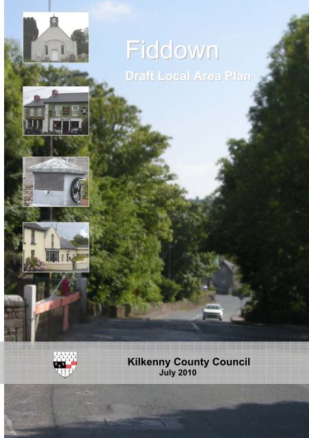
Fiddown<br />
Draft Local Area Plan<br />
<strong>Kilkenny</strong> <strong>County</strong> <strong>Council</strong><br />
<strong>July</strong> <strong>2010</strong>
Part 1 Introduction<br />
1.1 Legal Basis 3<br />
1.2 Location Context 3<br />
1.3 Historical Development & Urban Structure 3<br />
1.4 National, Regional and <strong>County</strong> Strategies 5<br />
1.5 Public Consultation 7<br />
Part 2 Policies and Objectives<br />
2.1 Housing and Population<br />
2.1.1 Population Growth 8<br />
2.1.2 Development Strategy 8<br />
2.1.3 Housing Units 9<br />
2.1.4 Character of Fiddown & Integration of Development 10<br />
2.2 Infrastructure<br />
2.2.1 Water Supply 11<br />
2.2.2 Waste Water Treatment 11<br />
2.2.3 Surface Water Drainage & Flood Risk Management 12<br />
2.2.4 Waste Management 12<br />
2.2.5 Telecommunications 13<br />
2.3 Transport<br />
2.3.1 Roads 14<br />
2.3.2 Traffic Management & Calming 15<br />
2.3.3 Footpaths and Lighting 15<br />
2.3.4 Parking 16<br />
2.3.5 Public Transport 16<br />
2.4 Employment and Economy<br />
2.4.1 Industry & Enterprise 17<br />
2.4.2 Retail 18<br />
2.4.3 Tourism 18<br />
2.5 Natural and Built Heritage<br />
2.5.1 Natural Heritage 19<br />
2.5.1.1 Designated Natural Heritage Sites of Interest 19<br />
and National Importance<br />
2.5.1.2 Natural Conservation Outside of Designated Sites 20<br />
2.5.1.3 Habitats of Ecological Significance 20<br />
2.5.2 Archaeology 22<br />
2.5.3 Built Heritage 22<br />
2.6 Amenities and Services<br />
2.6.1 Open Space, Walkways & Tourism Potential 26<br />
2.6.2 Amenity Enhancement – General Appearance 27<br />
2.6.2.1 Planting 27<br />
2.6.2.2 Litter 27<br />
2.6.2.3 Dereliction 28<br />
2.6.3 Community Facilities & Services 28<br />
2.6.3.1 Services & Recreation 28<br />
2.6.3.2 The Youth & the Elderly 28<br />
2.6.3.3 Healthcare 28<br />
2.6.3.4 Childcare 29<br />
2.6.3.5 Education and Training 29<br />
2.7 Development Objectives<br />
2.7.1 Introduction 30<br />
2.7.2 Land Use Zoning 30<br />
2.7.3 Implementation of Objectives 31<br />
Fiddown Draft Local Area Plan<br />
1
Part 3 Development Management<br />
3.1 Introduction 34<br />
3.2 Design Guidance Principles 34<br />
3.3 Design Elements of Fiddown 34<br />
3.3.1 Design Principles Based on Local Character 34<br />
3.3.2 Layout and Design 34<br />
3.3.3 Building Line and Boundary Treatment 35<br />
3.3.4 Building Height & Roofs 35<br />
3.3.5 Proportion & Materials 35<br />
3.3.6 Natural Heritage & Biodiversity 35<br />
3.3.7 Car Parking 35<br />
3.3.8 Density 36<br />
3.3.9 Design 36<br />
3.3.10 The Amenity Area at the River Suir 36<br />
Appendices<br />
Appendix 1 – Habitat Assessment<br />
Appendix 2 – List of Native Trees & Shrubs<br />
Maps<br />
Map 1 Zoning Map<br />
Map 2 Natural Heritage<br />
Map 3 Built Heritage & Archaeology<br />
List of Figures and Tables<br />
Fiddown Draft Local Area Plan<br />
Tables<br />
Table 1 Recorded Monuments in Fiddown<br />
Table 2 Existing and Proposed Additions to the Record of Protected Structures<br />
Table 2<br />
Figures<br />
Objectives for the Plan Area<br />
Figure 1 First Edition Ordnance Survey Map of Fiddown<br />
Figure 2 Location of Fiddown & context in the <strong>County</strong> Settlement Hierarchy<br />
Figure 3 Public Consultation Feedback Document Cover Page<br />
2
1 INTRODUCTION<br />
1.1 Legal Basis<br />
Fiddown Draft Local Area Plan<br />
As part of <strong>Kilkenny</strong> <strong>County</strong> <strong>Council</strong>’s settlement strategy adopted in the <strong>Kilkenny</strong> <strong>County</strong><br />
Development Plan 2008-2014 it is the policy of the <strong>Council</strong> to carry out an extensive<br />
programme of Local Area Plans for settlements throughout <strong>County</strong> <strong>Kilkenny</strong>. This Draft Local<br />
Area Plan for Fiddown is part of that policy initiative.<br />
The legal basis for this plan is provided under the Planning and Development Act 2000<br />
(sections 18 and 19). The Act provides for the preparation of Local Area Plans for any part of<br />
the functional area of a Planning Authority. A local area plan must be consistent with the<br />
objectives of the <strong>County</strong> Development Plan.<br />
It must contain a written statement and maps indicating the objectives of the Planning<br />
Authority for the proper planning and sustainable development of the area to which it applies.<br />
It may also contain details on community facilities and amenities and on standards of design<br />
of developments and structures.<br />
In the text of this proposed plan the plan itself maybe referred to as “the Plan” or “this Plan”.<br />
In this Plan “the <strong>Council</strong>” or “the Planning Authority” shall mean <strong>Kilkenny</strong> <strong>County</strong> <strong>Council</strong>.<br />
The Local Area Plan will remain in statute for a period of six years from the date of adoption,<br />
notwithstanding any review of the <strong>County</strong> Development Plan. The Planning Authority may<br />
amend or revoke a local area plan at any time. The Local Area Plan will cease to have effect<br />
in respect of the part where it is inconsistent with the provisions of the <strong>County</strong> Development<br />
Plan as reviewed. A local area plan must be reviewed at least six years from the making of<br />
the previous local area plan. On its adoption, this plan will supersede the Fiddown Local Area<br />
Plan 2003.<br />
1.2 Location Context<br />
Fiddown is located in the southwest of <strong>County</strong> <strong>Kilkenny</strong>, in the valley of the River Suir.<br />
Fiddown is ringed by uplands, with Slievenamon to the northwest, an outlier of Slievenamon<br />
to the north and the Comeragh Mountains to the southwest. The village is located to the<br />
north of a bridge across the Suir, which is an important crossing route to <strong>County</strong> Waterford.<br />
The Limerick/Waterford railway line runs through Fiddown, but does not stop at this location.<br />
Fiddown is situated just off the N24, the National Primary Route linking Waterford City to<br />
Limerick via Carrick-on-Suir. The Fiddown by-pass has been completed, and runs to the<br />
north of the village. Fiddown is approximately 12 miles from Waterford City and 31 miles from<br />
<strong>Kilkenny</strong> City.<br />
1.3 Historical Development & Urban Structure<br />
The name Fiddown derives from an Anglicisation of the Irish name, Fiodh Dúin, meaning<br />
‘Wood of the Fort’, which related to the old Moat beside the Suir. Fiddown has a long history<br />
which dates back to 540AD when the monk Maidoc or Momodoc founded a monastery at<br />
what was then a river crossing. The development of Fiddown occurred mainly due to its<br />
location at a strategic point on the River Suir, defended by Fiddown Castle. The construction<br />
of a bridge across the Suir, combined with the presence of a railway station, ensured<br />
Fiddown’s development throughout the 19 th and 20 th centuries.<br />
Historically the core of Fiddown lay to the south of the village along the river, comprising<br />
Fiddown House, the Church and graveyard, the toll house and bridge and the site of the<br />
3
Fiddown Draft Local Area Plan<br />
Castle, now an amenity area. There is now an oil storage facility located on the banks of the<br />
River Suir, run by Morris Oil company.<br />
The core then moved further inland and became centred around the junction of the Rathmore<br />
Road and the former N24. This core was formed by a grouping of some dwellings around an<br />
impressive, two storey building, facing the junction - Meade’s Toll Bridge Tavern, which is<br />
Fiddown’s only licensed premises, Royal Irish Constabulary Barracks, and the Railway<br />
station. Opposite Meades, the former RIC barracks (now used as two dwelling houses) is an<br />
interesting structure and a landmark at the centre of the village, in particular upon arrival from<br />
the west.<br />
In the last ten years, the core of the village has expanded to the north-west to include several<br />
residential developments and the Day-break shop and Chinese take-away, and also to the<br />
east with more residential development.<br />
There is an pedestrian access linking the main street to the river, accessed from a lane<br />
opposite Meade’s Tavern, leading south past a derelict cottage, across the railway line and<br />
down to the Strand road. Historical maps show this as a direct route from Fiddown Castle to<br />
the junction where Meade’s Toll Bridge Tavern now stands.<br />
Figure 1: First edition Ordnance Survey Map of Fiddown c.1840<br />
4
1.4 National, Regional and <strong>County</strong> Strategies<br />
Fiddown Draft Local Area Plan<br />
The National Spatial Strategy sets out a framework for the future development of the country.<br />
Having regard to the national guidelines, the South-East Regional Authority prepared<br />
guidelines for the period 2004-<strong>2010</strong>; a review of the guidelines has been carried out and the<br />
Draft Regional Planning Guidelines for the South-East Region <strong>2010</strong>-2022 have been<br />
prepared. These guidelines set out a strategy for the location of development in the region,<br />
which identifies <strong>Kilkenny</strong> City as a hub, and Waterford City as a gateway. The most recent<br />
review of the guidelines proposes a slower rate of growth, than previously envisaged by the<br />
guidelines for the period 2004-<strong>2010</strong>, and reduced population targets for each of the counties<br />
in the region. This will impact on the settlement strategy for the county and on the review of<br />
this local area plan.<br />
The Regional Planning guidelines recognise the extensive network of smaller towns and<br />
villages across the regions that play particularly important roles as service/ retail/ residential<br />
centres. These towns and villages need to be developed in a way that respects their existing<br />
character while at the same time strengthening their role as local services centres. Achieving<br />
the right balance between encouraging development in towns and village and the scale and<br />
nature of such development is critical.<br />
At the county level the <strong>Kilkenny</strong> <strong>County</strong> Development Plan 2008-2014 sets out the<br />
development framework for the county. The <strong>Council</strong>’s strategy seeks to develop a strong<br />
vibrant and sustainable rural community living in the towns and villages and smaller<br />
settlements and in the open countryside. Designated towns and villages were identified in the<br />
<strong>County</strong> Development Plan having regard to their ability to sustain growth, the <strong>Council</strong>’s<br />
investment programme and the need for an equitable geographical distribution. Within the<br />
<strong>County</strong> Development Plan, Fiddown is designated as a ‘Small Town/ Village’ in the <strong>Council</strong>’s<br />
settlement hierarchy in line with the overall strategy as set out in the South East Regional<br />
Planning Guidelines (refer to Figure 2 for the location of Fiddown in the <strong>County</strong> <strong>Kilkenny</strong><br />
settlement hierarchy).<br />
The hierarchy extends in descending order of size and growth areas as follows:<br />
� Gateway – Waterford City Environs<br />
� Hub - <strong>Kilkenny</strong><br />
� Large Town – New Ross Environs<br />
� District Towns – Callan, Castlecomer, Graiguenamangh and Thomastown<br />
� Smaller Towns and Villages – includes Fiddown<br />
� Smaller Settlements<br />
Policies stated in the <strong>County</strong> Development Plan for Smaller Towns and Villages are as<br />
follows:<br />
PS10 To strengthen the service centre role of smaller towns and villages.<br />
PS11 To ensure that new residential development in smaller towns and villages is of a<br />
design, layout, character and scale which fit well with the town or village involved and<br />
presents a high quality living environment.<br />
PS12 To revitalize existing villages through the promotion of development within them<br />
(particularly on infill sites, vacant sites and on backlands), in preference to continued<br />
ribbon development on the approach roads. This will promote the efficient use of<br />
available public infrastructure and services.<br />
5
Figure 2: Location of Fiddown & context in the <strong>County</strong> Settlement Hierarchy<br />
Fiddown Draft Local Area Plan<br />
6
1.5 Public Consultation<br />
Fiddown Draft Local Area Plan<br />
The Planning and Development Act 2000 introduced statutory Local Area Plans and a<br />
requirement that Planning Authorities take whatever steps they considered necessary to<br />
consult the public in preparing a Local Area Plan.<br />
Notice was given of the review of the Fiddown Local Area Plan 2003 in flyers distributed<br />
locally, in the newspaper and on local radio. A public consultation meeting was held on the<br />
10 th November 2009 in the Piltown Parish Community Centre, which was well attended, in<br />
addition meetings were held with representatives of community groups in the area. Piltown<br />
was chosen for the meeting location, as it is noted that some of the social needs of Fiddown<br />
are provided for within Piltown. This meeting was held in order to obtain local knowledge to<br />
assist in compiling a profile of the area, and to learn the views of the participants, which fed<br />
into the preparation of the Local Area Plans.<br />
The meeting group was divided into smaller groups, to discuss a number of topics with the aid<br />
of a facilitator. Each group dealt with three areas: (i) what’s good about Fiddown and Piltown<br />
(ii) what are the current issues, and (iii) what are the possible solutions.<br />
The information gathered was collated into a document (cover page displayed below) which<br />
was circulated and which informed this review of the local area plan. In addition public<br />
submissions have been received and taken into account in the preparation of the draft plan.<br />
Figure 3 – Public Consultation Feedback Document Cover Page<br />
7
2 POLICIES AND OBJECTIVES<br />
2.1 Housing and Population<br />
2.1.1 Population Growth<br />
Fiddown Draft Local Area Plan<br />
Prior to 2006 Fiddown had not been enumerated separately as a ‘census town’, but included<br />
in the wider District Electoral Division of Fiddown. Between census periods the DED<br />
increased, from 592 in 1971, to 687 in 2002. Prior to 2000 it is estimated that there were<br />
approximately 39 dwelling houses within the village with a population of 117.<br />
The most recent census of population was carried out on 23 rd April 2006, and enumerated<br />
Fiddown ‘town’ for the first time, recording a population of 194.<br />
Since 2000 six multi-unit residential developments have been constructed in Fiddown with a<br />
combined total of 105 houses; 24 houses are assumed to be included in the 2006 census,<br />
with 81 not included in the census figure. (Fairgreen, Railway View and part of Kylemore<br />
included in 2006 census; Coirceog, Bridge Court, Inis Alainn and remainder of Kylemore<br />
appear to be post census – source: <strong>Council</strong>’s report sent to DoEHLG for housing completions<br />
2005-2009).<br />
It is estimated that the current <strong>2010</strong> population of Fiddown is 427, an increase of 233<br />
persons/ 120%, since 2006 – this assumes an average household size in <strong>Kilkenny</strong> of 2.88 (as<br />
per the 2006 Census data vol.3 Household Composition, Family units and Fertility).<br />
2.1.2 Development Strategy<br />
Overall the population of <strong>County</strong> <strong>Kilkenny</strong> increased by approx. 8.8% between 2002 and<br />
2006, and nationally by 8.1% as per the Census results. The Draft Regional Planning<br />
Guidelines for the South-East Region <strong>2010</strong>-2022 have set revised and reduced population<br />
targets for the region and its constituent counties, with a lower rate of growth than envisaged<br />
by the guidelines published in 2004. The settlement strategy for the settlements in the county<br />
must take account of these figures.<br />
Having regard to a number of factors, including (a) the 265% increase in population in<br />
Fiddown since 2000, (b) the revised population projections for <strong>Kilkenny</strong> as per the Draft<br />
Regional Planning Guidelines for the South-East Region <strong>2010</strong>-2022, (c) the designation of<br />
Fiddown as a ‘Small Town/ Village’ within the <strong>Council</strong>’s settlement hierarchy, (d) the character<br />
of the village, (e) its proximity and use of services in Piltown, and (f) deficiency water supply<br />
and wastewater treatment, it is considered reasonable in the current context, to cater for a low<br />
level of growth over the period of this plan.<br />
However in order not to stifle the growth of the village, provision is made for a natural<br />
increase in population during the life of this plan. The rate of natural increase (number of<br />
births minus the number of deaths, not taking account of migration) of the population in<br />
Ireland was 9.8 per 1000 in 2007 (Measuring Ireland's Progress 2008, CSO), or 0.98%;<br />
rounding this up to 1% per year, and extending for a six year period, would result in a 6%<br />
population growth.<br />
A natural increase of 6% of the current 427 population, assuming an average household size<br />
of 2.88, equates to 9 addition dwellings over the life of the plan.<br />
Lands are zoned for residential development to accommodate this growth; in addition to lands<br />
zoned for existing and general development uses also permit for additional residential growth.<br />
8
Fiddown Draft Local Area Plan<br />
Applying a density of 20 units per hectare, having regard to the Guidelines for Planning<br />
Authorities – Sustainable Residential Development in Urban Areas (Cities, Towns and<br />
Villages - published May 2009, an area of 0.45 hectares is required for development over the<br />
life of this plan. An assessment of the lands zoned in the Fiddown Local Area Plan 2003<br />
shows that 0.83 hectares of residential lands (accessed from Strand Road) have not been<br />
developed, and that undeveloped village centre lands of 1.53 hectares exist (now proposed<br />
for a zoning objective of ‘Existing and General Development’). The current proposals<br />
therefore more than adequately cater for the projected natural growth for the village.<br />
Having regard to the foregoing, the unfinished/ unoccupied units as at March <strong>2010</strong>, and that<br />
the use of backlands and underutilised plots should be encouraged, it is not considered that<br />
additional lands should be zoned.<br />
2.1.3 Housing Units<br />
The housing stock in the village of Fiddown has substantially increased since 2000. It is the<br />
policy of the <strong>Council</strong> to strengthen and consolidate the towns and villages in the county. It is<br />
important that there is a balance between the provision of higher and lower density<br />
developments. Having regard to the recent levels of residential development, there is a need<br />
to provide an option for people to upsize and be able to build a house to their own design and<br />
layout on a larger site, yet within walking distance of amenities. The <strong>Council</strong> will support<br />
lower density development on back-land sites and undeveloped areas of land within the<br />
village to broaden the choice of dwelling types available, and also the development of<br />
serviced sites in the village.<br />
Lands have been zoned on Strand Road to facilitate residential development during the life of<br />
this plan. Given the site characteristics it is considered that development here would not be<br />
of high density. In addition to these lands, the ‘Existing and General Development’ zoning<br />
provides opportunities for a wide number of uses, but can also facilitate residential<br />
development on infill or backland sites. Such opportunities exist on the lands to the rear of<br />
and adjoining Merry’s Garage, and also the backland sites to the rear of the street opposite<br />
Railway View, and adjoining the pedestrian right-of-way leading to the railway tracks from the<br />
village.<br />
Policy:<br />
� HP1 - To ensure the controlled development of Fiddown which reflects the character of<br />
the existing and historic village in terms of structure, pattern, scale, design and materials<br />
with adequate provision of open space, and which protects the amenities of existing<br />
dwellings.<br />
� HP2 - To zone an adequate amount of land for housing to provide a locational choice and<br />
allow for the probability that not all zoned land will be made available to development.<br />
9
2.1.4 Character of Fiddown & Integration of Development<br />
Fiddown Draft Local Area Plan<br />
The views across and through the village, both along the railway line and up and down the<br />
river contribute to the character of Fiddown. In addition, the footpath connection from the<br />
main street across the railway line to the river is also a convenient connection worthy of<br />
enhancement.<br />
While there are some fine historic structures forming an attractive ensemble at the<br />
crossroads, there are others which stand detached, for instance the Church and Fiddown<br />
House which can be viewed over long distances and from the Motte at the site of Fiddown<br />
Castle at the riverside. Taken together, these factors give Fiddown a certain character and<br />
depth which is unusual in a village. The views up and down the river from the quay and the<br />
views back to the village and across to the Fiddown House are important amenities which<br />
should be recognised and protected. The setting of Fiddown in the wider landscape is<br />
attractive and has potential for sensitive enhancement and development.<br />
There are some fine stone walls at various locations throughout the village that contribute<br />
significantly to its character and are worthy of protection and restoration. In particular the wall<br />
extending from the railway line to Fiddown House is worthy of preservation.<br />
The road connecting Piltown and Fiddown, which is a crucial link between the two interrelated<br />
settlements, currently remains predominately free of roadside development, and this<br />
maintains the identity and distinctiveness of both settlements. While both settlements have an<br />
interdependent relationship, they both retain their own distinctive identities which are<br />
strengthened by the rural character of the road linking them. It is important to retain the rural<br />
character of this road to avoid a blurring of the character and identities of Fiddown and<br />
Piltown.<br />
Any new developments in the village should take account of the existing scale and pattern of<br />
development in the area, and should demonstrate a high standard in design, layout, provision<br />
of open space and landscaping. Developments should provide for pedestrian links within the<br />
village centre where possible.<br />
It is not intended to prescribe maximum residential density standards and developments<br />
should accord with the standards set out in the <strong>County</strong> Development Plan; new developments<br />
should have regard to the characteristics of the site, the pattern of development in the area<br />
and to the scale and amenities of existing adjacent development and servicing requirements.<br />
Policy:<br />
� HP3 - To ensure a high standard in design, layout, provision of open space, landscaping<br />
and provision for pedestrian linkages to the village centre in new residential<br />
developments. New developments shall have regard to the characteristics of the site and<br />
its setting, the pattern of development in the area and to the scale and amenities of<br />
existing adjacent development.<br />
� HP4 - Any new development should respect and reflect the existing scale and character<br />
of Fiddown.<br />
In assessing any new development in Fiddown, the <strong>Council</strong> may have regard to the<br />
development potential of adjoining land and will assess any application, with a view to<br />
providing for the development of these lands in an integrated manner. This applies to any<br />
land parcel, and relates to all aspects of development including open space provision, access<br />
arrangements and pedestrian and cycle links.<br />
10
2.2 Infrastructure<br />
2.2.1 Water supply<br />
Fiddown Draft Local Area Plan<br />
Fiddown is served by the combined Mooncoin and Piltown-Fiddown water supply scheme. At<br />
present, water supply volumes serving Piltown-Fiddown are inadequate to cater for further<br />
development. <strong>Kilkenny</strong> <strong>County</strong> <strong>Council</strong> is currently in the process of upgrading and<br />
augmenting the existing Mooncoin Regional Water Supply Scheme which will have a positive<br />
impact on the Piltown/Fiddown water supply scheme. The upgrade of the Mooncoin Regional<br />
Water Supply scheme is set to take place over 3 phases of works. Currently works are being<br />
undertaken for phase 1. The works as part of phase 1 will relieve pressure on parts of the<br />
existing water supply scheme serving Fiddown-Piltown and allow for small amounts of further<br />
development, and is due to be complete in the third quarter of <strong>2010</strong>. Further upgrading of the<br />
water supply will be dependent on phases 2-3 of the Mooncoin Regional Water Supply<br />
scheme, a date has not been finalised as yet for these works to commence.<br />
The Piltown- Fiddown water supply scheme has been included for allocation of funding in the<br />
Water Services Investment Program for phases 1 & 2 of the upgrading works; these works<br />
are necessary to accommodate the natural increase and growth of the village as proposed in<br />
this plan.<br />
Water Quality Analyses over the years show that water quality in the area is good. Water<br />
quality is monitored on a daily basis by the <strong>Council</strong>’s staff, in accordance with the HSE<br />
requirements to ensure that water quality remains high. The lime content of the water is<br />
suitable for consumption, and whilst it solidifies when heated, cannot be readily removed from<br />
the water supply.<br />
A Water Conservation Project is underway across the county at present. The first stage of<br />
this project divided the water supply schemes into different zones and installed meters. The<br />
second stage is active leakage control, which includes detecting and repairing leaks.<br />
Policy:<br />
� IN1 - To conserve valuable water supplies by eliminating leakages and through raising<br />
public awareness of the need for water conservation.<br />
� IN2 - To preserve free from development the way leaves of all public water mains.<br />
Objective:<br />
IN3 - To provide water in sufficient quantity and quality to serve the needs of the existing and<br />
future population and commercial development, for all lands zoned for development in this<br />
plan, as resources and finances permit.<br />
2.2.2 Waste Water Treatment<br />
Fiddown is served by a sewerage scheme with primary treatment, which was constructed in<br />
1986. The plant is currently operating at twice its population equivalent capacity and<br />
therefore does not have capacity or the necessary treatment to cater for future demand.<br />
The Water Services Investment programme includes for funding for interim measures for<br />
upgrading of the wastewater treatment system for quality purposes to secondary treatment<br />
level, but this will not increase population capacity.<br />
11
Fiddown Draft Local Area Plan<br />
Policy:<br />
� IN4 - Significant additional development shall not be permitted to the wastewater<br />
treatment until such time as the scheme is upgraded to adequate capacity and treatment<br />
levels.<br />
� IN5 - To preserve free from development the way leaves of all public sewers.<br />
Objective:<br />
IN6 - To maintain and improve wastewater treatment services and to upgrade the treatment<br />
system to full secondary treatment as resources and finance permit.<br />
2.2.3 Surface Water Drainage & Flood Risk Management<br />
In line with The Planning System and Flood Risk Management Guidelines for Planning<br />
Authorities (2009) a Strategic Environmental Assessment Screening has been carried out for<br />
this plan. The Office of Public Works (OPW) has identified the levels of existing flood risk in<br />
and around the River Suir and its tributaries. In co-operation with various Local Authorities<br />
within its catchment area, the OPW are conducting a 'Catchment Flood Risk Assessment and<br />
Management (CFRAM) Study' of the entire catchment area, including lands at Fiddown.<br />
According to the existing OPW National Flood Hazard Mapping, there are no recorded flood<br />
events within the development boundary of Fiddown. The plan therefore accords with the<br />
guidelines’ sequential approach in avoiding developing lands that may be vulnerable to<br />
flooding.<br />
There is no existing system specifically designed for stormwater disposal in Fiddown.<br />
Individual developments facilitated under the guidance of this plan shall be obliged, in all<br />
cases where surface water drainage measures are required, to provide a surface water<br />
drainage system separated from the foul drainage system. In this regard <strong>Kilkenny</strong> <strong>County</strong><br />
<strong>Council</strong> will consider all stormwater drainage proposals consistent with SuDS (Sustainable<br />
Drainage Systems).<br />
In the design of surface water systems, regard shall be had to the <strong>Kilkenny</strong> <strong>County</strong><br />
Development Plan 2008 – 2014 and the Greater Dublin Regional Code of Practice for<br />
Drainage Works and associated GDSDS technical documents.<br />
New development should adopt water saving measures throughout; such measures could<br />
include – water butts to collect rainwater, low flush and dual flush toilets, low water use<br />
appliances, rainwater harvesting and grey-water recycling.<br />
Policy:<br />
IN7 - To seek separate stormwater systems for all developments, and to consider all<br />
proposals consistent with SuDS (Sustainable Drainage Systems).<br />
2.2.4 Waste Management<br />
The Joint Waste Management Plan for the South East sets out the policy for <strong>Kilkenny</strong> and the<br />
south east region for the plan period 2006-2011.<br />
Waste collection was privatised by the <strong>Council</strong> in the 1990’s and both recyclables and<br />
residual waste is now collected in Fiddown by private contractors once weekly. There is a<br />
bottle bank in Piltown at present, where glass bottles and drinks cans can be recycled, which<br />
also serves Fiddown. One day per week a service is provided in Newrath for the recycling of<br />
cardboard, plastic and papers for householders in areas without a waste collection service.<br />
The South East Regional Waste Management Plan has an objective to provide a recycling<br />
centre for the south of the county. A site has been identified in Granny, however this is<br />
12
Fiddown Draft Local Area Plan<br />
dependent on adequate available funding. This will be a one-stop-shop centre for all<br />
recyclables including paper, cardboard, plastic, steel food cans etc.<br />
The <strong>Council</strong>’s Environmental Awareness Officer provides regular dissemination of information<br />
through group meetings, leaflets and other promotional materials, and any community can<br />
access these services. These services will continue to improve the level of environmental<br />
awareness throughout the county and encourage recycling and promotion of more<br />
sustainable practices.<br />
Policy:<br />
IN8 - To continue to work with, and encourage the prevention, minimisation, re-use, recycling<br />
and safe disposal of waste in line with the South East Regional Waste Management Plan.<br />
2.2.5 Telecommunications<br />
Telecommunications have become centrally important to the prospects of any local economy.<br />
Broadband is available in the Piltown area through mobile, satellite and Digital Subscriber<br />
Line (DSL) providers.<br />
Policy:<br />
IN9 – To support and encourage the provision of the necessary telecommunications for the<br />
existing and future development of Fiddown.<br />
IN10 - To ensure development proposals include the provision of ducting for fibre based data<br />
services and in particular broadband services, as appropriate.<br />
13
2.3 Transport<br />
2.3.1 Roads<br />
Fiddown Draft Local Area Plan<br />
Fiddown is centred around three roads (i) the old N24 which leads to the north to Piltown and<br />
the N24 Limerick - Waterford national route, and to the south across the River Suir into<br />
<strong>County</strong> Waterford, (ii) the Rathmore Road which now passes underneath the by-pass, and (iii)<br />
Strand Road leading to the amenity area by the river. Bordering the village to its north and<br />
east is the N24 national road from Waterford to Limerick which now by-passes the village.<br />
By-pass<br />
The Final Stage 3 Audit was undertaken by TMS Consultants in relation to the by-pass and<br />
the recommendations of this audit were implemented. A Road Safety Audit involves the<br />
evaluation of road schemes during design and construction to identify potential hazards that<br />
may affect any type of road user, and the appropriate measures to eliminate or mitigate any<br />
such hazards.<br />
The ‘2+1 System’ was introduced in 2006 and a Stage 3 Road Safety Audit was undertaken<br />
following the completion of the scheme, the recommendations of the audit were implemented.<br />
Since the introduction of the 2+1 System the feedback from An Garda Siochana has been<br />
extremely positive. A proposal has been approved by the NRA for works to be carried out, on<br />
a trial basis over a number of weeks, at the Piltown Tower Road exit to gradually reduce the<br />
width of the hard shoulder on approach from Carrick-on-Suir, having regard to the number of<br />
incidents occurring, and to improve traffic safety at this location.<br />
Policy:<br />
T2 - To work with the NRA in the provision of a safe transport route along the N24 national<br />
route.<br />
Issues of concern raised in relation to the by-pass related to inadequate lighting, the height of<br />
the Rathmore Road under-pass, the length of the slip-way, crash barriers and signage at the<br />
beehive. An appraisal of the by-pass by the Roads Section shows that the length is of the<br />
slip-way is in accordance with the NRA Road Geometry Handbook; the under-pass was<br />
designed to facilitate car use only for local access to the village and its hinterland -<br />
emergency vehicles are required to use the grade separated junction a short distance to the<br />
west of the Rathmore Road.<br />
Regarding suggestions to provide additional lighting, it has been found that there are negative<br />
safety implications with lighting isolated junctions along national routes for road users<br />
travelling along the mainline.<br />
An inspection of the signage near the beehive indicates that sightlines are sufficient, but that<br />
repairs will be required in relation to the crash barrier.<br />
Objective:<br />
T1 - To carry out works to repair the crash barrier at the by-pass near the beehive.<br />
14
2.3.2 Traffic Management & Calming<br />
Fiddown Draft Local Area Plan<br />
Traffic volumes through Fiddown village have reduced since the opening of the N24 Piltown-<br />
Fiddown by-pass and the reclassification of the main road (old N24) to non-national road<br />
status. Traffic figures nationally have also reduced due to the economic down-turn and this is<br />
particularly the case of construction related bulk cargo vehicles.<br />
However there are still a large number of vehicles travelling through the village, which<br />
appears, from local knowledge, to have increased with the opening of the new bridge in<br />
Waterford as vehicles may be using the village as an alternative route to avoid toll fees on the<br />
bridge.<br />
A 24 hour survey was carried out to determine levels of speeding through the village, and<br />
found that average speeds were slightly above the speed limit, but that there was a high level<br />
of traffic travelling through the village. An assessment is required to ascertain the most<br />
appropriate traffic management system to secure the safe movement of pedestrians, cyclists<br />
and drivers through the village, and the feasibility of installing traffic calming measures.<br />
Objective:<br />
T3 - To carry out an assessment and implement a traffic management system to secure the<br />
safe movement of pedestrians, cyclists and drivers through the village, having regard to the<br />
need criteria and financing.<br />
A build-out has been constructed at the Toll Bridge House to prevent damage to the house.<br />
Concern has been raised about the ability of heavy goods vehicles to manoeuvre around the<br />
build-out and that it brings vehicles closer to the wall at the chapel which is under stress. The<br />
<strong>Council</strong> will endeavour to carry out a swept path analysis at the junction of the bridge with the<br />
former N24 road, when resources allow.<br />
The wall at the chapel, which is a protected structure and recorded monument, is suffering<br />
damage due to a number of factors; an examination of the options to carry out works to<br />
prevent further works should be undertaken.<br />
Objectives:<br />
� T4 - To work with the property of owners of the chapel to identify works to be carried out<br />
to prevent deterioration of the wall to the front of the chapel, in consultation with the<br />
relevant stakeholders.<br />
� T5 - To carry out a heavy goods vehicles swept path analysis at the junction of the bridge<br />
with the former N24 road, when resources allow.<br />
2.3.3 Footpaths and Lighting<br />
Footpaths<br />
Footpaths have been constructed and improved in some areas of the village; mainly in the<br />
vicinity of recent residential developments. However there are several areas in which<br />
footpath provision remains deficient, including in the vicinity of the Toll Bridge Tavern, Strand<br />
Road and towards the bridge and the cemetery, which makes pedestrian movement around<br />
these parts of the village difficult. Speed bumps have been installed along the Strand Road.<br />
Policy:<br />
T6 - To provide and improve footpath connections within the village of Fiddown.<br />
Considering the inter-dependency between Fiddown and Piltown, it is appropriate that a<br />
pedestrian and cycle linkage should be provided to link the two settlements; although this may<br />
not be realised in the short term, this remains an objective for the area. This link would be<br />
15
Fiddown Draft Local Area Plan<br />
very beneficial to the residents of both settlements from an amenity and health perspective,<br />
In addition it could reduce the number of car journeys between the settlements, particularly in<br />
relation to activities for younger members of the community. In addition, better pedestrian<br />
and cycle access to Fiddown, could increase accessibility to the River Suir and may in turn<br />
encourage the secondary benefits and improvement of the site of the Fiddown Castle.<br />
Objective – T7:<br />
To investigate the feasibility of providing a safe pedestrian and cycleway linkage between<br />
Fiddown and Piltown, subject to financial and human resources.<br />
Lighting<br />
The main road through Fiddown is well served by public lighting, and lighting was required as<br />
part of any new residential development. Lighting has also been erected along the Strand<br />
Road and Rathmore Road.<br />
2.3.4 Parking<br />
Parking<br />
There are no double yellow lines in the village at present and parking is mainly provided onstreet.<br />
The shop and Chinese take-away share parking areas, and it appears that sufficient<br />
parking is provided to the front and side of these premises. Having regard to the low level of<br />
commercial activity in Fiddown, there does not appear to be a significant need for additional<br />
car parking provision.<br />
At Meade’s Tavern, the junction is poorly defined, and is leading to disorganised parking.<br />
This situation can be improved with a more clearly defined junction arrangement and the<br />
relocation of parking from the junction, possibly to the rear of Meade’s Tavern.<br />
The car-parking standards as set out in the <strong>Kilkenny</strong> <strong>County</strong> Development Plan shall apply to<br />
new development in the village.<br />
Objective – T8:<br />
To investigate the feasibility of delineating parking at the junction of Meade’s Tavern with<br />
improved junction markings.<br />
2.3.5 Public transport<br />
Fiddown is well served by bus services linking the town with Waterford, Limerick, Clonmel<br />
and Carrick-on-Suir. The Ring-a-link service is active in the area provides a service in the<br />
south-west of <strong>Kilkenny</strong>.<br />
There are no bus shelters within the village at present, and an objective of the plan will be to<br />
investigate the possibility of a bus shelter being erected in the village.<br />
In addition it will be investigated if a more suitable location for the existing bus stop can be<br />
provided within the village.<br />
Objective – T9:<br />
To investigate the possibility of a bus shelter being erected in the village and to determine the<br />
most suitable location for the bus stop.<br />
The railway line passes through Fiddown, and the old railway station still remains. It was<br />
suggested during public consultation that it would be beneficial to the village to re-open the<br />
station. The <strong>Council</strong> have contacted Iarnrod Eireann who have stated that the siding (part of<br />
the railway line adjacent to the platform and necessary for passenger safety) was removed in<br />
the past, and that it is unlikely to be re-instated.<br />
16
2.4 Employment and Economy<br />
2.4.1 Industry & Enterprise<br />
Fiddown Draft Local Area Plan<br />
Fiddown is advantageously located for employment sources with access to good<br />
infrastructure and proximity to Waterford Port, and the main Waterford-Limerick road.<br />
The Community Enterprise Centre, which was built through the combined efforts of local<br />
community groups, semi-state and state agencies provides a valuable facility to the village<br />
and is currently occupied by T. Bulter Engineering, Oldcourt Saddlery, GNC Ger Norris<br />
Construction and Plumbing Solutions.<br />
Also operating in Fiddown are Merry’s Garage, and Morris Oil; the latter has an office in the<br />
village centre and occupies prominent frontage along the bridge and river banks.<br />
Located approximately 1km north-west of the village is the premises of O’ Shea Bros. Ltd. at<br />
Ardclone; this business is involved in the storage and distribution of vegetables. Permission<br />
has recently been granted for the expansion of the business with the construction of a<br />
distribution warehouse and loading docks.<br />
In <strong>County</strong> Waterford Clonmore Concrete Ltd. is located approximately 1.4km south-west of<br />
the village along the regional road to Waterford.<br />
The Fiddown Local Area Plan 2003 included provision for industrial zoning to the northwestern<br />
edge of the village. Piltown Engineering constructed and operated premises on<br />
these lands and permissions were granted for a V.T.N. test centre and also, through a<br />
material contravention of the plan, for a factory unit for manufacturing and storage purposes.<br />
However the latter developments have not been constructed and opportunities exist for<br />
industrial developments on these lands.<br />
Any sustainable land-use policy must provide for a balance between the provision of housing<br />
and the provision of employment opportunities. If the provision of residentially zoned land<br />
exceeds the potential for employment opportunities, or vice versa, this will result in a high<br />
level of commuting, which is unsustainable. The creation of employment opportunities should<br />
be matched to the growth of the village and its position in the settlement hierarchy. As the<br />
growth of the village is to be controlled, similarly, the amount of land to be zoned for<br />
employment purposes shall will be aligned with the amount of housing land. In addition to the<br />
lands zoned and available for industrial development in this plan, green-field lands zoned for<br />
industrial development exists in Piltown with direct access available onto the regional road.<br />
The ‘Existing and General Development’ zoning in the village facilitates a mix of employment<br />
uses. The <strong>Council</strong> will also encourage the creation of community led employment<br />
opportunities, similar to the Enterprise Centre. The lands zoned for industrial purposes would<br />
be intended to facilitate the setting up or expansion of local enterprise initiatives and should<br />
not be used for warehousing/ distribution facilities which would have very low levels of<br />
employment relative to floor area and would also have relatively low levels of skills based<br />
employment.<br />
The present FAS Community Employment scheme operates in the Piltown and Fiddown<br />
areas, and has undertaken work with Piltown GAA, Fiddown Development Association and<br />
Iverk Show.<br />
Policy:<br />
� EE1 - To promote enterprise creation opportunities and initiatives, in line with the growth<br />
of Fiddown and to encourage job/employment creation initiatives on appropriately zoned<br />
and serviced land.<br />
� EE2 - To support the continuation of the Fás Community Employment Scheme or other<br />
equivalent/replacement scheme.<br />
17
2.4.2 Retail<br />
Fiddown Draft Local Area Plan<br />
Whilst Fiddown Stores has closed, the village is now served by a shop which incorporates a<br />
mini-market, deli-counter and off-licence sales. Above the shop a Chinese Take-Away is<br />
now operational.<br />
The Toll Tavern (Meade’s) is the only public house establishment in the village and occupies<br />
a prominent position at the junction of the main street and the Rathmore Road.<br />
2.4.3 Tourism<br />
Fiddown has much potential for the development of tourism, as an historic settlement,<br />
situated on the River Suir; however this potential is currently not well developed and<br />
opportunities exist for the development of tourist initiatives. In particular the location of the<br />
village on the River Suir gives rise to opportunities for water-based recreational activities and<br />
the existing amenity area at the site of the Castle could be improved in line with this type of<br />
development. In addition the potential exists for the development of a river walk along both<br />
the River Suir and the Pil River. Should Morris Oil site be re-developed in the future, this area<br />
would be suitable for tourist facilities and water based recreational facilities. The<br />
development of a river walk is discussed further under section 2.6 - Amenities and Services.<br />
Agencies that may be of assistance in relation to enterprise and tourism include Barrow-Nore-<br />
Suir Rural Development and <strong>Kilkenny</strong> <strong>County</strong> Enterprise Board.<br />
Barrow-Nore-Suir Rural Development group encompass the LEADER + and National Rural<br />
Development Programme (NRDP); under these programmes grant-aid is available to small<br />
enterprises, individuals with a business project and to community groups with either a<br />
business or a community beneficial project, if they meet the programmes rural development<br />
criteria. Both programmes provide part-funding so applicants are expected to fund a<br />
percentage of any project themselves.<br />
<strong>Kilkenny</strong> <strong>County</strong> Enterprise Board provide information and advice in relation to starting your<br />
own business and advice on how to manage and grow your own business.<br />
Policy:<br />
EE3 - It is the policy of the <strong>Council</strong> to facilitate and support the development of Fiddown to<br />
encourage uses that are beneficial to the local community and development of tourism in the<br />
area.<br />
18
2.5 Natural and Built Heritage<br />
2.5.1 Natural Heritage<br />
Fiddown Draft Local Area Plan<br />
As part of the preparation for this plan, a habitat assessment was carried out by a team of<br />
ecological consultants (see Appendix 1). The study mapped all of the habitats within the plan<br />
area, rated habitats based on their ecological merit and connectivity to habitats of high<br />
ecological value, identified green infrastructure and surveyed and evaluated hedgerows.<br />
Based on the findings of the habitat assessment, and in line with the <strong>County</strong> Development<br />
Plan, policies and objectives have been formulated for the protection and enhancement of<br />
habitats in the plan area, with particular emphasis placed on those habitats and ecological<br />
corridors of highest ecological value. It is the policy of this plan that development proposals<br />
will demonstrated how all habitats will be conserved. Habitats of highest value are illustrated<br />
on Map 2; specific objectives have been formulated in relation to the protection of these most<br />
significant habitats.<br />
The habitat assessment was carried out as part of the survey work for this plan using a<br />
‘Green Infrastructure’ approach to describe biodiversity, based on the identification of habitats<br />
and their interconnected relationship within ecological networks. The more natural and<br />
connected a habitat, the more important it is as Green Infrastructure. A detailed hedgerow<br />
survey was also carried out.<br />
The principle natural heritage resource within the LAP area is the Lower River Suir, a<br />
designated candidate Special Area of Conservation under EU legislation and Fiddown Island<br />
Nature Reserve, a proposed Natural Heritage Area, protected under the Wildlife<br />
(Amendment) Act 2000 and also by Ministerial Order. Substantial areas of high biodiversity<br />
value are found outside the existing network of designated sites, and whilst not protected<br />
under legislation, they contribute to the biodiversity of the area.<br />
2.5.1.1 Designated Natural Heritage Sites of International and National Importance<br />
The principle and most important ecological network in Fiddown is associated with the River<br />
Suir and Fiddown Island.<br />
The Lower River Suir, which forms the southern boundary of the village is a designated<br />
candidate Special Area of Conservation (cSAC) under the EU Habitats Directive (site code<br />
002137), with the objective to conserve habitats and species of European importance. The<br />
site was selected for the presence of the priority habitats on Annex I and Annex II of the E.U.<br />
Habitats Directive. Policies for the protection of heritage sites of national and European<br />
importance are set out in the <strong>County</strong> Development Plan. An appropriate environmental<br />
assessment is required in relation to any proposals where there may be significant impacts on<br />
the cSAC; this extends to works outside of the defined designated site boundaries but which<br />
may be linked to the cSAC through ecological pathways or corridors.<br />
Fiddown Island Nature Reserve, which is also a proposed Natural Heritage Area (site code<br />
000402), is situated to the south of the village, and is the property of the National Parks and<br />
Wildlife Service. The site consists of an island on the tidal reaches of the River Suir, a band<br />
of land on both sides of the river and a small stretch of tidal river and mudflats. This site is of<br />
national importance for its botanical assemblages and habitat rarity.<br />
It is an objective of this plan that an appropriate environmental assessment will be required in<br />
respect of any proposed development likely to have an impact on a designated natural<br />
heritage site, or those sites proposed to be designated.<br />
19
Fiddown Draft Local Area Plan<br />
The River Suir supports migrating Atlantic salmon and Twaite shad, which may very well be<br />
resident in the area and migrate upstream to spawn in the Carrick-on-Suir area. These latter<br />
two species are internationally protected. It is also likely to be significant for resident smelt<br />
and ‘slob’ or estuarine trout. Riparian habitats appear to be well established on the southern<br />
bank and on Fiddown Island.<br />
Riparian (riverside) woodland forms a narrow band along the banks of the River Suir where<br />
water levels fluctuate with tidal movements and within the floodplain. As well as the tidal<br />
river, the riparian woodland is of particular significance for biodiversity. This type of wet<br />
woodland along rivers is rare in Ireland and the example found at Fiddown is one of the best<br />
in the country; this type of woodland is declining across Europe as a result of drainage and<br />
reclamation.<br />
Map 2 outlines areas for protection of habitats – area FD1 based around the River Suir and its<br />
associated wetlands extends to included adjacent dry meadow grassland, amenity area,<br />
hedgerow and built lands – some of which are within the cSAC and others are considered as<br />
nature rehabilitation areas, because they have the potential to be managed more favourably<br />
for nature and amenity. Protection of the river corridor is a priority of this plan and all<br />
development must ensure that water quality is protected.<br />
Objective:<br />
H1 - To protect and, where possible, enhance the River Suir, cSAC and Fiddown Island<br />
pNHA, and its associated ecological corridors and habitats, as identified on Map 2.<br />
An appropriate environmental assessment is required in relation to any proposals that may<br />
impact upon the cSAC and pNHA, either through direct or indirect means; this extends to<br />
works outside of the defined boundaries of FD1; this should include a survey or protected<br />
species where appropriate.<br />
Any development which could affect water quality, riparian habitats or species found in the<br />
Lower River Suir should be screened for Appropriate Assessment for its potential impact on<br />
the candidate Special Area of Conservation (cSAC) in accordance with Article 6(3) of the<br />
Habitats Directive, and having regard to the Appropriate Assessment of Plans and Project in<br />
Ireland – Guidance for Planning Authorities (DoEHLG, 2009).<br />
2.5.1.2 Nature Conservation Outside of Designated Sites<br />
In addition to the designated sites, there are habitats within the LAP boundary, whilst not<br />
protected under legislation, contribute to the biodiversity of the area and are of local nature<br />
conservation interest.<br />
Habitats and landscape features have an important role to play as ecological “corridors” as<br />
they allow for the movement of species, and help to sustain the habitats, ecological processes<br />
and functions necessary to enhance and maintain biodiversity. It is important that these areas<br />
are conserved and well managed.<br />
Policy:<br />
H2 - Proposals for development shall demonstrate how habitats (such as trees, hedgerows,<br />
ditches, stonewalls, stone-buildings and watercourses) will be integrated and protected during<br />
and post-construction; links to wildlife areas beyond the site should be formed where<br />
possible.<br />
2.5.1.3 Habitats of Ecological Significance<br />
Habitats within the LAP area enhance the ecological value of the area and should be<br />
protected and enhanced where possible. However there are a number of habitats of<br />
significant ecological value, due to the species contained therein and/ or due to their function<br />
as an ecological network, which have specific policies for their conservation. These habitats<br />
have been shown on Map 2. This LAP seeks to retain, protect and enhance these habitats<br />
20
Fiddown Draft Local Area Plan<br />
due to their significant ecological contribution to the area. Proposals for development of these<br />
sites should demonstrate that they will not adversely affect the ecological integrity of these<br />
sites.<br />
Policies<br />
(Chapter 8 of the <strong>County</strong> Development Plan 2008-2014 also applies):<br />
� H3 - To ensure that any development in or near sites of local conservation interest, as<br />
identified in Table 3 of Appendix 1, will minimise any significant adverse impact on the<br />
features for which the site has been designated.<br />
� H4 - Applicants shall demonstrate that there will be no adverse impacts on the ecological<br />
integrity of sites of high ecological value identified in this plan from developments on<br />
adjacent sites.<br />
FD2 - Graveyard and Associated Areas<br />
The graveyard associated with the chapel to the south of the village and adjacent scrub<br />
habitat form a small core feature of dry meadow and grassy verge habitat, which links into the<br />
village and the wider countryside to the east along the stone wall/ scrub corridor bordering the<br />
road and leading to the railway, while the tree-line to the south provides the closest link to the<br />
River Suir corridor. The old stone wall that forms a continuous boundary from the railway<br />
junction in the village as far as Fiddown house, encompassing the old church and graveyard<br />
supports plants, including ivy and navelwort.<br />
Objective:<br />
H5 - To protect and, where possible, enhance the habitat in the graveyard and its associated<br />
habitats extending to the railway and towards Fiddown House, as identified on Map 2. An<br />
ecological assessment will be required in order to assess the impact of any development<br />
within or adjacent to this area.<br />
Hedgerows<br />
A number of hedgerows were identified as being of high local value having regard to a<br />
number of factors including biodiversity, cultural value and connectivity value. These<br />
hedgerows are identified on Map 2 for retention and enhancement as they contribute<br />
significantly to biodiversity in the area.<br />
Objective:<br />
H6 - To require details for the sustainable integration and conservation of hedgerows of high<br />
value as identified on Map 2 in all development proposals to ensure that the ecological<br />
integrity and connectivity of the hedgerow is maintained during and after construction.<br />
21
2.5.2 Archaeology<br />
Fiddown Draft Local Area Plan<br />
The Record of Monuments and Places (RPM) of <strong>County</strong> <strong>Kilkenny</strong> identifies archaeological<br />
sites throughout the county. These recorded monuments are protected under the National<br />
Monuments (Amendment) Act 1994.<br />
There are a number of archaeological sites in the vicinity of Fiddown, as identified in the<br />
Record of Monuments and Places for <strong>County</strong> <strong>Kilkenny</strong>. These monuments are concentrated<br />
within an area extending from the church and graveyard westwards along Strand Road, west<br />
of the site of Fiddown Castle and south towards the River Suir.<br />
It is the policy of the <strong>Council</strong> to require an appropriate archaeological assessment to be<br />
carried out in respect of any proposed development likely to have an impact on a Recorded<br />
Monument, a Zone or Archaeological Potential or their setting. Policies for the protection of<br />
archaeological heritage are set out in Chapter 8: Heritage of the <strong>County</strong> Development Plan<br />
2008.<br />
Table 1 lists the Recorded Monuments in Fiddown, together with their reference number. A<br />
number of these monuments are clustered together at the chapel and graveyard. The<br />
location of Recorded Monuments are shown on Map 3.<br />
Table 1: Recorded Monuments in Fiddown<br />
RMP Number & Classification<br />
RMP Number & Classification<br />
KK042-001001 – Castle-Motte KK042-001005 – Grave-slab<br />
KK042-001002 – Castle – Tower House KK042-001006 – Architectural Fragment<br />
KK042-001 --- – Settlement Deserted KK042-001008 – Font (original location)<br />
KK042-001003 – Church KK042-001009 – Graveyard<br />
KK042-001004 – Tomb-Altar KK042-001010 – Tomb-Altar<br />
Source: National Monuments Service – www.archaeology.ie<br />
2.5.3 Built Heritage<br />
Fiddown has a unique historical character, with many features worthy of preservation and<br />
protection, particularly in the south and east areas of the village that experienced early<br />
historic development. An assessment has been carried out during the preparation of this<br />
plan, with a view to revising the Record of Protected Structures (RPS). It is the policy of the<br />
<strong>Council</strong> to consider the Ministerial recommendation to include in the Record of Protected<br />
Structures, structures which have been identified as being of Regional, National or<br />
International significance in the National Inventory of Architectural Heritage survey (NIAH)<br />
2006; this may lead to the inclusion of additional structures in the RPS. The proposed<br />
additions to the list of Protected Structures are listed in Table 2 together with existing<br />
protected structures, and are indicated on Map 3. These buildings, their setting and form add<br />
to the historical and visual context of the village, and are a valuable cultural contribution to the<br />
village.<br />
Alterations which would affected the character of a protected structure will require planning<br />
permission and should be the subject of early consultation with <strong>Kilkenny</strong> <strong>County</strong> <strong>Council</strong>’s<br />
Conservation Officer and/or the Architectural Heritage Advisory Unit of the Department of the<br />
Environment, Heritage and Local Government. Generally, all repair and maintenance works<br />
should be carried out on a ‘like for like’ basis and in accordance with the Architectural<br />
22
Fiddown Draft Local Area Plan<br />
Heritage Protection Guidelines 2004, published by the Department of the Environment,<br />
Heritage and Local Government.<br />
In general, new development should relate closely to the established character of the village,<br />
respecting the disciplines of established building form, massing, height, alignment, orientation<br />
and window proportions.<br />
The stone walls throughout the village contribute significantly to the historic character and<br />
setting of the village, and should be protected, repaired and incorporated into future<br />
developments wherever possible. Of particular merit is the stone wall leading from the<br />
railway to Fiddown House. The wall at the roadside boundary of the chapel is under<br />
considerable stress from erosion and impacts of traffic, and as previously mentioned in the<br />
plan, action needs to be taken to prevent further deterioration in its condition and structural<br />
integrity (see objective T3).<br />
Policy:<br />
� H7 - To protect and enhance the historic character of Fiddown, and to preserve the<br />
character of the village, with control of shopfronts and advertising.<br />
� H8 - To encourage the conservation of stone walls throughout the village and in particular<br />
the stone wall leading from the railway station to Fiddown House.<br />
Objectives<br />
H9 - To seek the conservation of the buildings included in the Record of Protected Structures<br />
& listed in the NIAH, and to consider NIAH structures rated regional or above for inclusion in<br />
the Record of Protected Structures.<br />
23
Fiddown Draft Local Area Plan<br />
Table 2 – Existing and Proposed Additions to the Record of Protected Structures<br />
Photo Structure Description Location RPS<br />
No.<br />
Road Bridge<br />
Fourteen-arch reinforced concrete road bridge over river, rebuilt 1983, South of village across River<br />
incorporating fabric of earlier bridge, post-1840, on site comprising seven-span Suir and Fiddown Island.<br />
section to the north-east terminating in single-arch underpass, and seven-span<br />
section to the south-west<br />
___<br />
Toll gate and Toll<br />
House<br />
Monument<br />
Chapel<br />
Fiddown House<br />
Railway Station<br />
(former)<br />
Railway Goods<br />
shed<br />
Railway<br />
passenger<br />
shelter<br />
NIAH No. Map<br />
Ref.<br />
12327009<br />
Former toll bridge house. Detached three-bay single-storey Tudor Revival toll North-east end of bridge<br />
house with dormer attic, c.1850, possibly over basement with single-bay single<br />
storey gabled advanced porch to centre.<br />
C83 12327008 2<br />
Freestanding limestone ashlar burial monument, c.1800, comprising plinth on<br />
a square plan with panels, rising to a panelled pedestal having obelisk over,<br />
surrounded by wrought iron railings.<br />
Single-bay single-storey single-cell Church of Ireland church, built 1747,<br />
originally forming part of larger composition (truncated, pre-1903). Repaired,<br />
pre-1965. Now disused.<br />
Five bay, three storey gable ended house, c.1750, with four-bay two-storey<br />
return to east. Extensively renovated,c. 1925, with single-bay single-storey<br />
porch added to centre ground floor.<br />
Detached four-bay two-storey railway station, opened 1853, on an L-shaped<br />
plan. Closed, 1963. Now in residential use.<br />
Detached three-bay double-height railway goods shed, built 1853, with<br />
square-headed carriageway to centre, and single-bay single-storey end bay to<br />
right. Now disused.<br />
Detached three-bay single-storey passenger shelter c.1900. Now disused.<br />
Located in the graveyard C480 12327012 3<br />
Located in the graveyard,<br />
near the bridge.<br />
24<br />
1<br />
C79 12327007 4<br />
East of the bridge and chapel C82 12327006 5<br />
Adjacent to the railway line<br />
Adjacent to the railway line,<br />
close to the station house.<br />
To the south of railway track<br />
and railway shelter<br />
D123<br />
12327004<br />
D123-a 12327005<br />
6<br />
7<br />
___ 12327011 8
Fiddown Draft Local Area Plan<br />
Table 2 (continued) – Existing and Proposed Additions to the Record of Protected Structures<br />
Photo Structure Description Location RPS<br />
No.<br />
House Four-bay two-storey Gothic style Royal Irish Constabulary barracks, c.1850,<br />
on a corner site with two diagonally placed towers. Now in use as two<br />
attached houses.<br />
Shop (Former) ‘Grocery and Provisions’, three-bay, single-storey cottage with co-joined twostorey<br />
gable fronted structure with shop-front<br />
House Three-bay two-storey house, c.1825, with single-bay single-storey gable<br />
projecting porch.<br />
Meade Bridge<br />
Tavern<br />
Rathmore House<br />
Meade Bridge Tavern – five-bay two-storey structure on the junction of the<br />
Rathmore Road<br />
Substantial rendered five-bay, two-storey structure with hipped roof and<br />
decorative limestone door surround<br />
South of Meade Bridge<br />
Tavern on junction of<br />
Rathmore Road<br />
Main Street, near junction<br />
with Rathmore Road<br />
West of Meade Bridge<br />
Tavern on the main street,<br />
beside Morris Oil<br />
On junction of the main<br />
street with the Rathmore<br />
Road<br />
North of the by-pass on the<br />
Rathmore Road<br />
NIAH No. Map<br />
Ref.<br />
C81 12327001 9<br />
C519 12327 003 10<br />
___<br />
C80<br />
12327 002<br />
Note: Items with an RPS number are existing Protected Structures, those without are proposed additions; and those with an NIAH reference have been noted<br />
as being of merit in the National Inventory of Architectural Heritage (www.buildingsofireland.ie).<br />
C520<br />
___<br />
___<br />
25<br />
11<br />
12<br />
13
2.6 Amenities and Services<br />
2.6.1 Open Space, Walkways & Tourism Potential<br />
Draft Fiddown Local Area Plan <strong>2010</strong><br />
The area along the bank of the River Suir is the main area of open space in Fiddown; this is<br />
linked to the village via Strand Road and a pedestrian right-of-way extending from the village,<br />
across the railway line, onto Strand Road. There are areas of open space within residential<br />
developments in the village, and also an area designated in this plan for open space along the<br />
Strand Road.<br />
The amenity area situated on the bank of the River Suir, off the Strand Road, adjacent to the site<br />
of Fiddown Castle, is poorly maintained and is not an attractive amenity area at present.<br />
However the area has significant amenity and tourist potential, for water-based recreation, such<br />
as canoeing, boating and fishing. The area would also benefit from the provision of seating, bins<br />
and planting. An interpretative sign relating to the ecology natural heritage and archaeology of<br />
the area could be included, including details of the history of osier cultivation on Fiddown Island<br />
and associated tradition of basket making.<br />
Proposals should seek to improve the quality of ‘buffer’ areas by restoring riparian woodland or<br />
wetland habitats close to the river.<br />
The tourist potential of the area could be examined in conjunction with other relevant bodies such<br />
as <strong>Kilkenny</strong> City and <strong>County</strong> Tourism, Bord Fáilte, <strong>Kilkenny</strong> Leader Partnership, local community<br />
groups and business interests.<br />
The existing oil depots along the bank of the river, have been included within an integrated<br />
tourism zoning objective, to facilitate a use that would be complimentary to the ecological and<br />
amenity setting of the river, should the existing use cease on site.<br />
The <strong>Council</strong>’s Parks Department award small amounts of monies each year which are matched<br />
by funds raised locally for small scale local amenity improvement incentives under the Amenity<br />
Grants Scheme.<br />
The amenity area could serve as a starting point for a River Suir Walk, which could connect<br />
Fiddown to Piltown and the Pil River, and further onto Carrick-on-Suir; it could also connect to the<br />
South Leinster Way, which passes through Piltown and on to Carrick-on-Suir through<br />
Tibbreaghny.<br />
Trail <strong>Kilkenny</strong> Ltd. facilitates the development, management and promotion of a range of high<br />
quality leisure trails for the benefit of visitors and residents. It is made up of representatives from<br />
<strong>Kilkenny</strong> Leader Partnership, <strong>Kilkenny</strong> <strong>County</strong> <strong>Council</strong>, <strong>Kilkenny</strong> Sports Partnership, local Elected<br />
Members and local land owners.<br />
The grassed area along Strand Road which is bounded by a stone wall, facilitates views towards<br />
the River Suir from the adjacent roads; this area contributes significantly to the character and<br />
setting of the village, and is worthy of protection and sensitive treatment in any future proposals.<br />
Objective:<br />
AS1 – To retain and protect the views to the River Suir from the R698 and Strand Road, and to<br />
retain the character of this area.<br />
A long-term objective for the area is to facilitate the provision of a pathway and cycleway linkage<br />
between Fiddown and Piltown.<br />
Works within the aforementioned areas should only be carried out in consultation with the<br />
Department of the Environment, Heritage and Local Government and <strong>Kilkenny</strong> <strong>County</strong> <strong>Council</strong><br />
having regard designations in these areas as pNHA, cSAC and area of archaeological potential.<br />
Any proposals for development which could impact on the Lower River Suir cSAC directly or<br />
indirectly will require to at least be screened for Appropriate Assessment. Development shall not<br />
26
Draft Fiddown Local Area Plan <strong>2010</strong><br />
impinge on the quality of the river, either via pollution or restriction of access. Any development<br />
of open space requires a maintenance plan to ensure its upkeep.<br />
Objectives:<br />
� AS2 - To improve the appearance, amenity uses and ecological value of the existing amenity<br />
area at the Strand Road, and to provide quality open space to meet the needs of the existing<br />
and future population.<br />
� AS3 - To protect the banks of the River Suir and to examine the possibility of developing a<br />
river walk along the bank, linking with the River Pil, in conjunction with the relevant statutory<br />
bodies and voluntary groups.<br />
2.6.2 Amenity Enhancement - General Appearance<br />
In general Fiddown retains a pleasant village setting, with a number of significant trees along the<br />
road south of the railway line and stone walls and historic buildings of note.<br />
A long term objective for Fiddown would include utilising the strategic location of Meade’s Tavern<br />
and creating a focal point in the village, subject to funding and removal of parking from the front of<br />
the building.<br />
Residents have indicated that there some areas which appear untidy and unmanaged in the<br />
village – such as near the beehive and at the Rathmore tunnel, some areas are in need of<br />
kerbing and new signage to define the entrances into the village would improve its visual<br />
appearance.<br />
Efforts are being made to ensure the satisfactory completion of residential developments in the<br />
area in line with planning permissions granted. It is an objective of this plan to support and<br />
encourage works to enhance the appearance and visual amenities of Fiddown where resources<br />
permit.<br />
Objective – AS4:<br />
To support and encourage the enhancement of the visual appearance of Fiddown, subject to the<br />
availability of human and financial resources.<br />
New developments shall be responsible for the under-grounding of utility cables associated with<br />
their development in the village.<br />
2.6.2.1 Planting<br />
There are some trees of amenity significance throughout the village and the retention of existing<br />
trees, hedgerows and stone walls and their incorporation into future developments will be<br />
considered to contribute to the overall ecological and amenity value of the village. Appropriate<br />
planting can be used to enhance the environment and additional planting would add to the<br />
amenity of the village; planting of native tree and hedgerows species will be required in new<br />
developments.<br />
2.6.2.2 Litter<br />
The <strong>Council</strong> joins with the business community, the Gardai, and local people in a partnership<br />
approach to dealing with the litter problem; this approach recognises that litter is everyone’s<br />
problem. A dedicated Local Authority staff member dedicates one day per week to litter<br />
management in Fiddown. The emphasis will continue to be on making all areas as litter-free as<br />
possible through the policy tools of partnership, education, awareness, enforcement and the<br />
provision of integrated street cleaning measures. The Environment Section liaises with many<br />
27
Draft Fiddown Local Area Plan <strong>2010</strong><br />
community and residents groups organising clean-ups during National Spring Clean every April,<br />
and offer assistance to Tidy Towns groups all year round by providing litter pickers, bags and<br />
gloves.<br />
2.6.2.3 Dereliction<br />
In general the built environment of Fiddown is in good condition and there are few poorly<br />
maintained buildings; there are currently no sites listed on the derelict sites register.<br />
2.6.3 Community Facilities & Services<br />
2.6.3.1 Services & Recreation<br />
Fiddown is served by the commercial premises of Meade’s Toll Bridge Tavern public house,<br />
grocery store and Merry’s Garage.<br />
The community of Fiddown use the facilities available in Piltown for many of their recreational<br />
needs, such as the hurling and soccer fields, and the Community centre, which caters for a<br />
number of uses. Piltown is well served by recreational facilities generally. In addition the<br />
Catholic and Church of Ireland churches are located on the Fiddown Road in Piltown. A<br />
children’s playground has recently been provided as part of the residential development of<br />
Kylemore.<br />
The Fiddown area is served by the Piltown Garda station; the area will benefit from the increased<br />
number of Gardai to be stationed in Mooncoin, with 24 cover provided.<br />
2.6.3.2 The Youth and Elderly<br />
The youth are well catered for in terms of sports facilities provided at Piltown, but at present there<br />
is no ‘youth club’ not related to sport in either Fiddown or Piltown. It was noted from information<br />
gathered from public consultation that the numbers of new members getting involved in activities<br />
is low and the involvement of new residents is encourage in all community groups.<br />
There is an Over Sixties Senior Citizens Club in Piltown catering for the more senior members of<br />
the community that meet regularly in the Piltown parish community centre.<br />
Policy:<br />
AS5 - Work in partnership with youth services providers and the local community in the<br />
development of youth services.<br />
2.6.3.3 Healthcare<br />
It is the policy of the <strong>Council</strong> to facilitate the development by the Health Board Executive of a<br />
comprehensive range of health and social care services for the area.<br />
Fiddown is served by the existing health centre in Piltown, which operates on a morning basis,<br />
with evening surgery in Carrick-on-Suir. The nearest hospitals and dentist services are provided<br />
in Carrick-on-Suir and Waterford. There are nursing homes located in Mooncoin, Portlaw and<br />
Carrick-on-Suir serving this area, and there is sheltered housing in Owning – Sue Ryder Homes –<br />
which offers suitable accommodation for the elderly.<br />
Policy:<br />
AS6 - To facilitate and support the Health Services Executive in the provision of any health care<br />
services for the village.<br />
28
Draft Fiddown Local Area Plan <strong>2010</strong><br />
2.6.3.4 Childcare<br />
According to the Guidelines for Planning Authorities on Childcare Facilities – DoEHLG, 2001,<br />
“Government policy on childcare is to increase the number of childcare places and facilities<br />
available and to improve the quality of childcare services for the community”. Section 4.5.1 of<br />
the <strong>County</strong> Development Plan sets out the policies of <strong>Kilkenny</strong> <strong>County</strong> <strong>Council</strong> in relation to<br />
childcare provision. The <strong>Kilkenny</strong> Childcare Committee published their second strategy since<br />
their inception in 2002, which sets out the direction for the work of the committee. There is an<br />
existing childcare facility in Piltown, constructed as part of the Banagher Court residential<br />
development. The provision of quality childcare services will be facilitated and encouraged by<br />
the <strong>Council</strong> in suitable locations.<br />
2.6.3.5 Education and Training<br />
Fiddown is served by Piltown National School, which has an enrolment number of between 260 -<br />
270 pupils for the year <strong>2010</strong>-2011. The school has 10 classrooms, with adequate grounds for<br />
expansion if the need arises. The car-park has been extended within the school grounds and<br />
traffic calming measures installed on approaches to the school, although there remains concerns<br />
relation to traffic safety at pick-up and drop-off periods.<br />
The nearest secondary schools are located in Mooncoin and Carrick-on-Suir. There is a third<br />
level facility in Piltown, the Kildalton Agricultural College, which provides post Leaving Certificate<br />
qualifications in agriculture and agriculture-related areas.<br />
Policy:<br />
AS7 -To co-operate with the Department of Education in the provision of an adequate number of<br />
school places to serve the needs of the village’s population and adequate facilities to serve<br />
Piltown National School and Mooncoin VEC.<br />
Adult education classes are available in Carrick-on-Suir, Clonmel, Waterford and Mooncoin.<br />
29
2.7 Development Objectives<br />
2.7.1 Introduction<br />
Draft Fiddown Local Area Plan <strong>2010</strong><br />
This section of the Draft Plan sets out specific objectives for the development of Fiddown. Some<br />
of the objectives can be carried out directly by the <strong>County</strong> <strong>Council</strong>, but for other objectives, for<br />
which the <strong>Council</strong> is not directly responsible, it will have a facilitative role.<br />
Achievement of the objectives for which the <strong>Council</strong> is directly responsible, will, in many cases be<br />
dependent upon adequate finance being made available to the <strong>Council</strong> from the Department of<br />
the Environment and Local Government and other sources. For many of the other objectives, a<br />
co-ordinated approach is needed by both the <strong>Council</strong> and local community. The <strong>Council</strong>, through<br />
its Planning Department and Community and Enterprise Department, intend to facilitate and build<br />
the capacity in the community to follow these objectives through.<br />
2.7.2 Land Use Zoning<br />
The purpose of zoning is to indicate to property owners and the public the types of development<br />
which the <strong>Council</strong> considers most appropriate in each land use category. The land use zoning<br />
objectives are detailed below and are shown on the Land Use zoning and specific objectives<br />
map. It is the intention of the Planning Authority that the zoning of particular areas for a particular<br />
use shall not in itself exclude other uses in that area provided they are compatible with the<br />
dominant use. Zoning is designed to reduce conflicting uses within areas, to protect resources<br />
and to ensure that land suitable for development is used to the best advantage of the community<br />
as a whole.<br />
In the following paragraphs:<br />
� Permissible uses mean uses which are acceptable in principle in the relevant zone.<br />
However, it is still subject to the normal planning process.<br />
� Open for consideration means a use which may be permitted where the <strong>Council</strong> is satisfied<br />
that the individual proposal or development will be compatible with the policies and objectives<br />
for the zone, and will not conflict with the permitted uses and also conforms with the proper<br />
planning and development of the area.<br />
Existing and General Development<br />
Objective: To provide for a mix of uses and to support, strengthen and expand the service base,<br />
allowing for development appropriate to the scale and character of Fiddown, whilst protecting its<br />
natural and built heritage.<br />
� Any development proposal in this area will be assessed against this objective.<br />
Residential<br />
Objective: To protect, provide and improve residential amenities appropriate to the scale and<br />
character of Fiddown, and facilitate single or multiple housing units, or appropriately designed<br />
serviced sites.<br />
� Permissible Uses: Dwellings, open spaces, nursing home.<br />
� Open for Consideration: Bed and breakfast establishments and guesthouses.<br />
30
Draft Fiddown Local Area Plan <strong>2010</strong><br />
Open Space, Amenity & Recreation<br />
Objective: To preserve, provide and improve recreational open space, and enhance and protect<br />
the ecological integrity of the area.<br />
� Permissible uses: Open space, sports clubs.<br />
� Open for Consideration: Sports clubs, recreational buildings, stands, pavilions, agricultural<br />
uses, public service installations.<br />
Integrated Tourism and Leisure<br />
Objective: To facilitate the development of an integrated tourism and leisure development, while<br />
securing - the ecological integrity of the River Suir cSAC. Development proposals should<br />
enhance this focal entrance point to the village, and the character and setting of existing<br />
dwellings and protected structures in the area.<br />
� Permissible uses: Tourist accommodation and associated facilities, water-based recreational<br />
uses.<br />
� Open for Consideration: Limited residential accommodation linked to the integrated tourism<br />
and leisure facilities.<br />
Industrial<br />
Objective: To provide for industrial and related uses to provide for the employment needs of the<br />
local community.<br />
� Permissible uses: Industrial premises and ancillary offices, open spaces.<br />
� Open for Consideration: Petrol filling stations, service stations, public service installations, play<br />
school/crèche.<br />
� Not permissible: Warehousing/ distribution facilities.<br />
Transitional Areas<br />
While the zoning objectives indicate the different uses permitted in each zone, it is important to<br />
avoid abrupt transitions in scale and use at the boundary of adjoining land uses zones. In these<br />
areas, it is necessary to avoid developments, which would be detrimental to the amenities of the<br />
more environmentally sensitive zone. For instance, in zones abutting residential areas particular<br />
attention must be paid to the uses, scale and density and appearance of development proposals<br />
and to landscaping and screening proposals in order to protect the amenities of these residential<br />
areas.<br />
Non-conforming uses<br />
Within the plan area there may be uses which do not conform to the zoning objectives for the<br />
area. Extensions to and improvement of existing premises accommodating these uses may be<br />
permitted where the proposed development would not seriously injure the amenities of the area<br />
or prejudice the proper planning and development of the area.<br />
2.7.3 Implementation of Objectives<br />
The realisation of objectives listed within the plan, will be of significant benefit to the village,<br />
ensuring its orderly development and improvement. The achievement of the objectives will be<br />
dependent on the availability of finance and the inclusion of the objectives in the work<br />
programmes of the <strong>County</strong> <strong>Council</strong> and the responsible agencies.<br />
There are a number of objectives in the plan which members of the community will have an<br />
interest in or may contribute to through the development management process, and which will be<br />
the responsibility of the local authority, developers, landowners and other agencies to implement.<br />
However there are objectives which the local community, through local organisations, can play a<br />
huge role in contributing to the achievement of the objectives. <strong>Kilkenny</strong> <strong>County</strong> <strong>Council</strong>’s policy<br />
will be to facilitate and aid local organisations in this capacity. Listed in Table 2 are the objectives<br />
31
Draft Fiddown Local Area Plan <strong>2010</strong><br />
resulting from the discussion under each of the headings of in section 2 of the plan, together with<br />
the lead partners to achieve their implementation.<br />
This is intended to be an integrated plan, and the progression of formulating objectives from<br />
issues identified in the public consultation is the first step in enabling an integrated approach to<br />
implementation. <strong>Kilkenny</strong> <strong>County</strong> <strong>Council</strong> intends to fully co-operate with other development and<br />
community agencies, such as the <strong>County</strong> Development Board and <strong>Kilkenny</strong> Leader Partnership<br />
to secure the implementation of this plan.<br />
<strong>Kilkenny</strong> Leader Partnership (KLP) operates the EU LEADER+ programme and the National<br />
Rural Development Programme (NRDP). Under these programmes grant-aid is available to small<br />
enterprises, individuals with a business project and to community groups with either a business or<br />
a community beneficial project, if they meet the programmes’ rural development criteria. Both<br />
programmes provide part-funding so applicants are expected to fund a percentage of any project<br />
themselves.<br />
32
Table 3 – Objectives for the Plan Area<br />
Draft Fiddown Local Area Plan <strong>2010</strong><br />
Ref. Objective Lead Partners<br />
IN3 To provide water in sufficient quantity and quality to serve the needs of the existing<br />
and future population, and commercial development for all lands zoned for<br />
development in this plan, as resources and finances permit.<br />
IN6 To maintain and improve wastewater treatment services and to upgrade the<br />
treatment system to full secondary treatment as resources and finance permit.<br />
IN10 To ensure development proposals include the provision of ducting for fibre based<br />
data services and in particular broadband services, as appropriate.<br />
T1 To carry out works to repair the crash barrier at the by-pass near the beehive.<br />
T3 To carry out an assessment and implement a traffic management system to secure<br />
the safe movement of pedestrians, cyclists and drivers through the village, having<br />
regard to the need criteria and financing.<br />
T4 To work with the property of owners of the chapel to identify works to be carried out<br />
to prevent deterioration of the wall to the front of the chapel, in consultation with the<br />
relevant stakeholders.<br />
T5 To carry out a heavy goods vehicles swept path analysis at the junction of the bridge<br />
with the former N24 road, when resources allow.<br />
T7 To investigate the feasibility of providing a safe pedestrian and cycleway linkage<br />
between Fiddown and Piltown, subject to financial and human resources.<br />
T8 To investigate the feasibility of delineating parking at the junction of Meade’s Tavern<br />
with improved junction markings.<br />
T9 To investigate the possibility of a bus shelter being erected in the village.<br />
H1 To protect and, where possible, enhance the River Suir, cSAC and Fiddown Island<br />
pNHA, and its associated ecological corridors and habitats, as identified on Map 2.<br />
An appropriate environmental assessment is required in relation to any proposals<br />
that may impact upon the cSAC and pNHA, either through direct or indirect means;<br />
this extends to works outside of the defined boundaries of FD1; this should include a<br />
survey or protected species where appropriate.<br />
H5 To protect and, where possible, enhance the habitat in the graveyard and its<br />
associated habitats extending to the railway and towards Fiddown House, as<br />
identified on Map 2. An ecological assessment will be required in order to assess the<br />
impact of any development within or adjacent to this area.<br />
H6 To require details for the sustainable integration and conservation of hedgerows of<br />
high value as identified on Map 2 in all development proposals to ensure that the<br />
ecological integrity and connectivity of the hedgerow is maintained during and after<br />
construction.<br />
H9 To seek the conservation of the buildings included in the Record of Protected<br />
Structures & listed in the NIAH, and to consider NIAH structures rated regional or<br />
above for inclusion in the Record of Protected Structures.<br />
AS1 To support and encourage the enhancement of the visual appearance of<br />
Fiddown, subject to the availability of human and financial resources.<br />
AS2<br />
To improve the appearance, amenity uses and ecological value of the existing<br />
amenity area at the Strand Road, and to provide quality open space to meet the<br />
needs of the existing and future population.<br />
AS3 To protect the banks of the River Suir and to examine the possibility of developing a<br />
river walk along the bank, linking with the River Pil, in conjunction with the relevant<br />
statutory bodies and voluntary groups.<br />
AS4<br />
To support and encourage the enhancement of the visual appearance of Fiddown,<br />
subject to the availability of human and financial resources.<br />
Water Services<br />
Section<br />
Water Services<br />
Section<br />
Planning, Developers<br />
Area Engineer<br />
Roads Section<br />
Church of Ireland<br />
Conservation Officer,<br />
Planning, Area<br />
Engineer.<br />
Roads Section<br />
Area Engineer<br />
Area Engineer<br />
Planning & Bus<br />
Eireann<br />
NPWS, Planning,<br />
Community Groups,<br />
Heritage Officer.<br />
Planning, Church of<br />
Ireland, Landowners.<br />
Planning, Developers<br />
Conservation Officer<br />
NPWS, KLP, Heritage<br />
Officer, Parks,<br />
Community Groups.<br />
Trail <strong>Kilkenny</strong>,<br />
Planning, Parks,<br />
Community Groups,<br />
NPWS.<br />
Community Groups<br />
Area Engineer.<br />
33
3 DEVELOPMENT MANAGEMENT<br />
Draft Fiddown Local Area Plan <strong>2010</strong><br />
3.1 Introduction<br />
The purpose of this section of the plan is to ensure a high standard of design, layout and function<br />
for all new developments, to conserve what is good in the existing built and natural environment,<br />
and to protect the amenities of the village.<br />
In general, the development standards as outlined in Chapter 10 of the <strong>County</strong> Development Plan<br />
will be adhered to in Fiddown with the following stipulations attached.<br />
3.2 Design Guidance Principles in Fiddown<br />
While it is recognised there is a need to embrace modern design there is also a need for new<br />
development to reflect and respect the existing character and features within the village. New<br />
development should harmonise with existing features and characteristics of the area, and should<br />
not erode the uniqueness of the area.<br />
New developments should have an individuality and a sense of place, which is generated by the<br />
interaction between the physical characteristics and features of the site and its surroundings, and<br />
the layout, landscaping and design of the new development.<br />
3.3 Design Elements of Fiddown<br />
Streetscape refers to the look of a particular road, regarding the arrangement and design of plots,<br />
buildings and materials, roads and footpaths, street furniture, open spaces and planting.<br />
Attractive and coherent streetscapes happen when all of these features reinforce and work with<br />
one another. There are some general elements that contribute to the overall character of the<br />
town.<br />
3.3.1 Design Principles Based on Local Character<br />
� Maintain views from the former N24 and Strand Road towards the River Suir in a westerly<br />
direction and also towards Fiddown House to the east.<br />
� Consider the retention and incorporation of stone walls and buildings, in preference to<br />
demolition and rebuild.<br />
� Encourage the comprehensive development of backland sites.<br />
3.3.2 Layout & Design<br />
Estate roads should incorporate gentle curves and traffic calming measures should be achieved<br />
through the layout design.<br />
All new residential development should take full account of the characteristics of the natural and<br />
built environment of the site, the views and vistas to and from the site, and its surrounding areas.<br />
Provision should be made for the unobtrusive siting of transformer stations, pumping stations and<br />
other necessary service buildings. The council will assess nay application for re-development or<br />
infill in the context of its contribution to the streetscape.<br />
New development shall seek to:<br />
� Reflect local development patterns<br />
� Respect the local characteristics and context of the site<br />
� Refer to local buildings and variety of proportions and design.<br />
� Refer to local distinctive details and materials<br />
� Provide adequate provision for car parking, open space, landscaping and planting<br />
� Integrate with existing development and the preservation of features on site<br />
� All new buildings should be in harmony with existing old buildings in terms of architectural<br />
style.<br />
34
Draft Fiddown Local Area Plan <strong>2010</strong><br />
� Careful consideration shall be given to the design of components (such as doors, windows<br />
and the height, pitch and ridges of roofs) which should have regard to those already present<br />
in the vicinity of the site. This is particularly important with regard to the redevelopment and<br />
alterations to existing buildings which should strictly reflect the original buildings<br />
characteristics in proportions of windows to walls and in the design of the roof.<br />
3.3.3 Building Line and Boundary Treatment<br />
Although there is no uniform building line in Fiddown, buildings had traditionally very short set<br />
backs, and front boundaries are used to give a unity to the streetscape. Front boundaries are<br />
typically walls with gates. One of the most effective is a simple low plastered wall. The removal<br />
of these boundaries to allow for the front to be used for parking detracts from the streetscape.<br />
3.3.4 Building Height & Roofs<br />
The variety of rooflines convey a feeling of diversity, but unity is provided by their common<br />
domestic scale and common characteristics. New development should keep a level within the<br />
existing range of eaves. Any new roof should be gabled and pitched and should match existing<br />
roofs in pitch, span and covering material. Gabled roofs are to be encouraged, instead of hipped<br />
roofs.<br />
3.3.5 Proportion & Materials<br />
Large developments should be subdivided into a series of bays, especially at ground floor level,<br />
to be more in keeping with the pattern of the existing street frontage. Long horizontal lines look<br />
out of place and should be avoided.<br />
When designing, the type of materials to be used in new developments or improvements to<br />
existing properties should fit in with the prevailing character of Fiddown, and be designed to<br />
reflect and respect nearby colours, textures, materials, shapes, styles and proportions<br />
3.3.6 Natural Heritage & Bio-diversity<br />
Designs and landscaping plans should seek to conserve and enhance biodiversity where<br />
possible.<br />
� Where tree and shrub planting is undertaken, only native trees and shrubs, which grow<br />
naturally in the locality, should be used. These should be of local provenance where<br />
possible. A list of native trees and shrubs is contained in Appendix 2.<br />
� The avoidance or limitation of the use of herbicides and pesticides is encouraged where<br />
possible.<br />
� The culverting of watercourses is discouraged, in favour of the retention of all open and<br />
natural channels.<br />
� Development should avoid building on floodplains or the significant alternation to the physical<br />
environment within the immediate vicinity of a watercourse. Where a safety barrier around a<br />
drainage ditch is required, spiny shrubs could be planted.<br />
� Development should not be carried out within the immediate vicinity of hedgerows to be<br />
retained or within the root protection area of tress; and a grass margin should be maintained<br />
adjacent o hedgerows.<br />
� If it is necessary to replace an original sem-natural feature (hedgerow, stone wall etc.0 it<br />
should be replaced with a similar semi-natural feature.<br />
� A combination of tree sizes shrub sizes of native species will be required for the<br />
reinstatement of connecting features to ensure their function is restored quickly. For species<br />
that do not need continuous cover ‘stepping stone’/ patches of similar habitat may be<br />
appropriate.<br />
3.3.8 Car Parking<br />
Car parking shall be carefully designed to integrate successfully into its location in terms of<br />
layout, surface treatment and screen planting. New development will normally be required by to<br />
provide adequate off-street car parking and loading facilities, and shall be in line with the<br />
standards of the <strong>County</strong> Development Plan. For security reasons, car parking should always be<br />
35
Draft Fiddown Local Area Plan <strong>2010</strong><br />
overlooked by housing. Where parking space is proposed in front of existing premises, existing<br />
railings or boundary walls shall be retained.<br />
3.3.9 Density<br />
There is no set maximum or minimum density recommended. A high standard of architectural<br />
design and layout will be required in residential developments. In determining suitable density,<br />
the character and amenities of the site and of the surrounding area will be considered along with<br />
the need for a variety of site sizes and house designs to encourage social mix and choice.<br />
3.3.10 Design<br />
A variety of house types in developments of multiple housing will be encouraged with variations in<br />
house size, colour, materials, and designs.<br />
In support of the <strong>Council</strong>’s policy of reducing social exclusion, the <strong>Council</strong> will encourage<br />
developers to have regard to the requirements of people who are mobility impaired, the elderly,<br />
and children in the supply design and layout of residential development.<br />
The design of dwellings should bear a relationship to the existing fabric of the settlement of<br />
Fiddown. Natural features or landmarks such as mature trees or vistas should help to determine<br />
the layout and orientation of the housing. The creation of ‘land marks’ within the estate, whether<br />
through retention of existing features or by the introduction of new features will be encouraged.<br />
New development must recognise and be sympathetic to the existing village and help to renew<br />
the specific architectural traditions of the area and boundary treatment to individual plots.<br />
3.3.11 The Amenity Area at the River Suir<br />
The retention and improvement of the existing amenity area along the banks of the River Suir, on<br />
the site of Fiddown Castle, is an objective of this plan. The development management process<br />
will be utilised to secure the implementation of this objective. An area of land adjoining this site<br />
has been zoned as residential in this Plan, to provide for the passive supervision of this open<br />
space. Any residential development bordering this area shall orient the maximum number of<br />
dwellings towards it, to allow for passive supervision. This residential development should be<br />
designed to interact with the open space, and the use of low walls and hedging should be<br />
stipulated, as high boundary walls can create a discouraging environment and pose a security<br />
risk.<br />
36
Central Statistics Office, 2006 Census 2006<br />
BIBLIOGRAPHY<br />
Draft Fiddown Local Area Plan <strong>2010</strong><br />
Department of Education & Science, 2007 Identification and Suitability Assessment of Sites for<br />
Primary Schools (TGD-025)<br />
Department of Education & Science and the Department of the Environment, Heritage and Local<br />
Government, <strong>July</strong> 2008 The Provision of Schools and the Planning System: Code of Practice for<br />
Planning Authorities, the Department of Education and Science, and the Department of the<br />
Environment, Heritage and Local Government<br />
Department of the Environment and Local Government, 2002 The National Spatial Strategy 2002<br />
– 2020, Stationery Office<br />
Department of the Environment and Local Government, 2001, Childcare Facilities – Guidelines<br />
for Planning Authorities, Stationery Office<br />
Department of the Environment and Local Government, 2005 Retail Planning Guidelines for<br />
Planning Authorities, Stationery Office<br />
Department of the Environment, Heritage and Local Government, 2009 Guidelines for Planning<br />
Authorities on Sustainable Residential Development in Urban Areas<br />
Department of Environment & Local Government, 2004 Architectural Heritage Protection,<br />
Guidelines for Planning Authorities<br />
Department of Environment, Heritage and Local Government, 2007 Development Plans:<br />
Guidelines for Planning Authorities<br />
Department of the Environment, Heritage and Local Government, 2009 The Planning System and<br />
Flood Risk Management, Guidelines for Planning Authorities<br />
Department of Justice, Equality and Law Reform, 2002 We like this place – Guidelines for Best<br />
Practice in the Design of Childcare Facilities<br />
<strong>Kilkenny</strong> <strong>County</strong> Childcare Committee, 2007 <strong>County</strong> Childcare Strategy 2007-<strong>2010</strong><br />
<strong>Kilkenny</strong> <strong>County</strong> <strong>Council</strong>, 2008 <strong>County</strong> Development Plan 2008-2014<br />
National Inventory of Architectural Heritage, 2006 Introduction to the Architectural Heritage of<br />
<strong>County</strong> <strong>Kilkenny</strong>