Ariminum - pdf - Emilia Romagna Tourism
Ariminum - pdf - Emilia Romagna Tourism
Ariminum - pdf - Emilia Romagna Tourism

Create successful ePaper yourself
Turn your PDF publications into a flip-book with our unique Google optimized e-Paper software.
veries and journeys through the area of Rimini
Places to visit and itineraries<br />
Sant’Agata Feltria<br />
Casteldelci<br />
AR<br />
fiume Marecchia<br />
Talamello<br />
Novafeltria<br />
Casteldelci<br />
- Casa Museo S. Colarieti<br />
Pennabilli<br />
Poggio Berni<br />
Torriana<br />
Montebello<br />
San Leo<br />
Maiolo<br />
Cattolica<br />
- Museo della Regina<br />
- Archaeological site former fruit<br />
and vegetable market (mercato ortofrutticolo)<br />
Novafeltria<br />
- Historical Mining Museum<br />
(Museo Storico Minerario Sulphur) (Perticara)<br />
Riccione<br />
- Regional Museum (Museo del Territorio)<br />
- Bridge over the river Melo<br />
- Archaeological site on the grounds<br />
of the city pharmacy (farmacie comunali)<br />
Rimini<br />
- City Museum (Museo della Città)<br />
- Archaeological complex of the surgeon’s house<br />
(Domus del Chirurgo)<br />
- Augustus Arch<br />
- Piazza Tre Martiri<br />
- Tiberius Bridge<br />
- Amphitheatre<br />
- Porta Montanara<br />
- Archaeological site former agricultural consortium<br />
(consorzio agrario)<br />
- Archaeological site of Palazzo Massani<br />
- Archaeological site at the Chamber of Commerce<br />
(Camera di Commercio)<br />
Santarcangelo<br />
di <strong>Romagna</strong><br />
Verucchio<br />
Repubblica<br />
di San Marino<br />
Montescudo<br />
Gemmano<br />
fiume Conca<br />
Bellaria<br />
Igea Marina<br />
Montefiore Conca<br />
San Leo<br />
- Church<br />
- Cathedral<br />
Morciano<br />
di <strong>Romagna</strong><br />
Mondaino<br />
Rimini<br />
Coriano<br />
Riccione<br />
Montecolombo<br />
San Clemente<br />
Saludecio<br />
Misano Adriatico<br />
San Giovanni<br />
in Marignano<br />
Montegridolfo<br />
Cattolica<br />
Santarcangelo di <strong>Romagna</strong><br />
- MUSAS Historical and Archaeological Museum<br />
(Museo Storico Archeologico)<br />
- Bridge of San Vito<br />
Verucchio<br />
- Public Archaeological Museum<br />
(Museo Civico Archeologico)
Riviera di Rimini<br />
Travel Notes<br />
Province of Rimini<br />
<strong>Tourism</strong> Department<br />
Cultural Department<br />
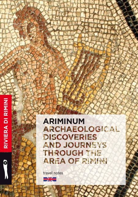
<strong>Ariminum</strong><br />
Archaeological discoveries and<br />
journeys through the area of Rimini
Riviera di Rimini Travel Notes<br />
Series on tourism published by the<br />
Province of Rimini<br />
<strong>Tourism</strong> Department<br />
Manager Symon Buda<br />
in cooperation with<br />
the Cultural Department<br />
of the Province of Rimini<br />
Texts<br />
Angela Fontemaggi<br />
Orietta Piolanti<br />
Editors<br />
Grazia Barberini<br />
Annarita Biondi<br />
Marino Campana<br />
Press and<br />
Communications Office<br />
Cora Balestrieri<br />
Photos taken from the<br />
Photographic Archives<br />
of the Province of Rimini<br />
With special thanks to the<br />
following photographers<br />
L. Bottaro, P. Cuccurese,<br />
P. Delucca, S. Di Bartolo,<br />
L. Fabbrini, R. Gallini,<br />
L. Liuzzi, G. Mazzanti,<br />
T. Mosconi, Paritani,<br />
V. Raggi, E. Salvatori,<br />
R. Sanchini, F. Taccola,<br />
R. Urbinati<br />
Graphic Design<br />
Relè - Tassinari/Vetta<br />
(Leonardo Sonnoli,<br />
Igor Bevilacqua)<br />
Coordination<br />
Michela Fabbri<br />
Cover Photos<br />
Detail from the “Orpheus” mosaic<br />
Archaeological site<br />
Domus del Chirurgo, Rimini<br />
Photos by Emilio Salvatori<br />
Acknowledgements<br />
The Ministry of Cultural<br />
Heritage and Activities<br />
The Superintendent for<br />
Archaeological Heritage<br />
in the <strong>Emilia</strong>-<strong>Romagna</strong><br />
Layout<br />
Litoincisa87, Rimini<br />
(Licia Romani)<br />
Translation<br />
Inlingua, Professional Language<br />
Services Rimini<br />
Printing<br />
La Pieve Poligrafica Editore<br />
Villa Verucchio (RN)<br />
First edition 2011<br />
<strong>Ariminum</strong> is a publication for<br />
tourist and cultural purposes and<br />
available free of charge
5<br />
6<br />
7<br />
10<br />
14<br />
17<br />
19<br />
23<br />
27<br />
30<br />
32<br />
37<br />
41<br />
46<br />
53<br />
57<br />
63<br />
69<br />
75<br />
79<br />
<strong>Ariminum</strong><br />
Archaeological discoveries and journeys through the area of Rimini<br />
Introduction<br />
Angela Fontemaggi, Orietta Piolanti<br />
Signs of History<br />
Angela Fontemaggi<br />
On the trail of Primitive Man<br />
Etruscan princes from the Marecchia Valley<br />
<strong>Ariminum</strong> origins<br />
Caput viarum where all journeys start<br />
The territory<br />
The city of <strong>Ariminum</strong><br />
The domus of <strong>Ariminum</strong><br />
The Itineraries<br />
Orietta Piolanti<br />
1. On the trail of Primitive Man<br />
2. Signs of power: Etruscan princes<br />
from the Marecchia Valley<br />
3. Signs of power: Leaders of mercenaries<br />
and Roman emperors in the history of <strong>Ariminum</strong><br />
4. Caput viarum<br />
5. The archaeological site of Piazza Ferrari:<br />
A little Pompei in the heart of Rimini<br />
6. From domus to domus<br />
7. The Marecchia Valley and the places of the Sacred<br />
8. Natural environment and work of man:<br />
Tradition and innovation in the economy between land and sea<br />
9. Natural environment and the work of man:<br />
tradition and present economy of the high Valmarecchia<br />
Museums and archaeological sites in the Province of Rimini<br />
visited during the trips<br />
Visit us before you leave home:<br />
www.riviera.rimini.it
ARiminUm<br />
ArchAeo<br />
logicAl<br />
discoveries<br />
And<br />
journeys<br />
through<br />
the AreA<br />
oF riMini
Introduction<br />
Angela Fontemaggi, Orietta Piolanti<br />
The itineraries in this booklet take you on a journey through<br />
the history and territory of the province of Rimini, which today also includes<br />
the municipalities of Montefeltro in the upper Marecchia valley: Talamello,<br />
San Leo, Maiolo, Novafeltria, Sant’Agata Feltria, Pennabilli and<br />
Casteldelci. In this part of the hinterland we can make discoveries of a unique,<br />
rich history lived among powerful fortresses, fortified villages and ancient<br />
churches: memories of a region that today is mostly known for its medieval<br />
struggle between the Montefeltro and Malatesta families. However, there are<br />
also memories of a yet more ancient history to find, from prehistoric and the<br />
late Antique times.<br />
The archaeological tours cover natural sights and wine tasting<br />
points, touching upon the making of products that are deeply rooted in our<br />
history, and show you the places that are famous tourist destinations. Following<br />
the footprints of mankind during the millennia people lived in this area, you will<br />
be able to get to know the soul of this region that has always been noted for<br />
its hospitality. It is a place where cultures meet, the gate to the plain of the Po<br />
River, trading place, a hub linking the north and the south, Rome and Europe!<br />
Many surprises await the traveller, from monuments that have<br />
long found their place in works of reference for archaeology to streets that were<br />
built by consuls and emperors, from the small and large treasures that bear<br />
witness to different historical times in the various museums of the province,<br />
to the discoveries to be made in the domus! From the hinterland to the sea,<br />
all the itineraries are designed to enthral visitors by the display of human and<br />
natural resources through the ages until our time. There is room for different<br />
approaches during events organised by the museums, among them occasions<br />
for family outings and workshops for young and old, for bike tourists and many<br />
more. And let’s not forget that wherever possible, there are special museum<br />
tours and displays for the blind or for people with impaired vision.<br />
The tour suggestions by no means constitute a complete<br />
overview of all the potential archaeological sights of the province (that would<br />
be impossible), but instead have been chosen to serve as a “magnifying lens”,<br />
as it were, to focus on a particularly lively and original reality, to offer a way into<br />
the heart and the history of this corner of the <strong>Romagna</strong>.<br />
This new edition was revised to include the treasures found in<br />
the new wing of the archaeological part of the city museum of Rimini that was<br />
opened in June 2010 and, last but not least, to honour the new municipalities of<br />
Montefeltro that have been added.<br />
5
SiGnS<br />
of<br />
HiSToRY<br />
AngelA FonteMAggi
Tracing primitive man<br />
The history of Rimini begins right on the beach! Let us try to<br />
imagine going back in the stream of time, just closing our eyes and reopening<br />
them… a million years ago. We would find ourselves on a sandy beach flanked<br />
by dunes and interrupted by the pebbly estuaries of rivers and torrents.<br />
Behind us stretch patches of conifers alternating with thick grassy vegetation,<br />
then oak trees, poplars, birches and open glades, all typical of a temperate<br />
humid climate - surroundings in which large mammals (elephants, rhinoceros<br />
and bison) roam about, with groups of male “hunters” in their wake.<br />
Our quest in discovery of the most ancient inhabitants of the<br />
area takes us to the hills of what is now Covignano, but a million years ago<br />
was a coastal zone washed by waves sweeping across the plain where Rimini<br />
would eventually be built. As the tides advanced and retreated, the waters<br />
created the morphological and geological features of the site, depositing<br />
strata of sand and gravel.<br />
In this scenario there are also traces of men who lived in the<br />
lower Palaeolithic era: a number of such traces, since the object of study by<br />
eminent experts, were found in 1968 by Stefano Sabattini. They are coherent<br />
with characteristics present in those unearthed in other sites in the region,<br />
particularly those from Monte Poggiolo near Forlì.<br />
The pebbles flaked on one or both sides (choppers and choppertools)<br />
are the fruit of a veritable “industry” carried on by homo erectus, who<br />
was skilful at fashioning the pebbles to be found in the rivers and torrents he<br />
encountered in his wanderings: this is shown by numerous pieces of stone,<br />
fashioned by expert hands to transform them into efficient hunting knives and<br />
rudimentary tools.<br />
Evidence of human presence in the Rimini area can be found<br />
consistently throughout the Stone Age, an immense time-span marked by<br />
environmental and climatic changes. The artefacts found between Riccione<br />
and the Valconca dating from the later phase of the lower Palaeolithic Era (200<br />
to 150 thousand years ago), reveal more advanced flaking techniques which<br />
resulted in the production of more specialized instruments for use in daily<br />
activities, ranging from hunting, butchering the prey, breaking bones, curing<br />
skins, picking fruit, collecting roots and preparing rudimentary shelters…<br />
The new Stone Age (Neolithic) which began to influence<br />
<strong>Romagna</strong> approximately halfway through the 5 th millennium BC advanced<br />
up the shores of the Adriatic, together with a cultural revolution brought<br />
about by new ways of obtaining food and better techniques in working stone,<br />
now polished and sharpened, as well as the introduction of pottery. Age-old<br />
7
Chipped flint stones.<br />
Riccione, Regional<br />
Museum.<br />
experience as a hunter and predator, in close contact with nature, eventually<br />
taught man to take advantage of sheep rearing and agriculture. Periods of<br />
nomadic existence alternating with phases of stability dictated by the rhythms<br />
of their activities raising animals or crops led individuals to start forming<br />
small communities, groups of huts and outhouses suitable for their domestic<br />
animals. Other activities developed within the small villages which sprang<br />
up along water courses. These included cheese-making, cultivating fields,<br />
perfecting the art of working stone and the production of ceramic articles<br />
indispensable for the storing and transporting of milk, cheese and seeds…<br />
Fragmentary yet significant evidence telling us about life in these<br />
Neolithic groups can be gleaned from pottery with scratched incisions, baked<br />
clay (used to plaster the wooden framework of the huts on the inside), flintstone<br />
utensils and parts of shells threaded to make necklaces or pendants…<br />
With the presence of man along the coast (in particular above the original<br />
coastline or the rocky cliffs), archaeological evidence of the Neolithic Period<br />
confirms the function of the territory south of Rimini as forming a cohesive<br />
link between the culture of the northern plain and that of the peninsula. It was<br />
truly a vital reality where peoples with differing traditions met and mingled.<br />
Approximately half-way through the 4 th millennium, in the<br />
Copper Age with the introduction of the first techniques in metal-working, the<br />
territory continued to entertain contact with the Adriatic peninsular culture,<br />
as testified by findings of pottery decorated with scales.<br />
The inter-cultural character of the area was consolidated in the<br />
Bronze Age (4 th to 3 rd century BC) as a result of metal-working technology<br />
and an economy which benefited from trading in copper and tin, as well as<br />
from agriculture and sheep and cattle raising. The population prospered<br />
along the coastal plain and in the rich pastures on the hillsides.<br />
Along ancient beaten tracks, relations with the mid-Adriatic<br />
areas intensified, as did those with the Apennine and sub-Apennine cultures.<br />
Often, our knowledge of this ample cultural horizon is limited to artefacts<br />
found near the surface of the ground, fragments of pottery, objects in stone,<br />
bone or metal, sometimes the remains of settlements: traces of huts and the<br />
holes left by poles supporting rectangular habitations have been recorded at<br />
Covignano, Misano and Riccione along the Flaminian Way.<br />
The degree of importance reached by metallurgy at the end<br />
9
Top<br />
Ceramic bowl from the<br />
Bronze Age. Riccione,<br />
Regional Museum.<br />
of the Bronze Age is evident from the two deposits found in Camerano of<br />
Poggio Berni and Casalecchio of Verucchio, which had been deliberately<br />
hidden away to be melted down. These articles prove that in the 10 th century<br />
BC the hilly area around Rimini was directly on commercial routes leading to<br />
the north, the Aegean or the Tyrrhenian Seas.<br />
The Etruscan Princes of the Marecchia Valley<br />
In basso<br />
Fibula and a pair of<br />
earrings made of gold<br />
and amber. Verucchio,<br />
Archaeological<br />
Museum.<br />
The most advanced techniques in metallurgy, precociously derived<br />
from the Etruscan presence in the area, were in general use in the prelude to<br />
the formation of the Villanovan civilization at Verucchio. This rocky crag was<br />
in a strategic position along the route through the Viamaggio Pass connecting<br />
<strong>Romagna</strong> to Etruria - the pole of a new Iron Age culture between the 9 th and 6 th<br />
centuries BC. Situated inland at the entrance to the Marecchia Valley, but also<br />
projected towards the sea along the estuary of the river, Verucchio was able to<br />
maintain a wide radius of influence. The Villanovan culture centred in Verucchio<br />
penetrated parallel valleys, reaching as far as the Rubicon in the north and the<br />
Marano in the south, where it tends to change character as it meets up with the<br />
Villanovan “island” of Fermo and the culture around the area of the Piceno<br />
Protagonists of a new civilization, the Villanovans of Verucchio<br />
were quick to learn from the agricultural experience of others. First, they<br />
adopted the system of denshiring, a method of fertilizing the land by burning<br />
off stubble and any other vegetation which happens to be on it, and then<br />
fallowing and crop rotation. Thanks to progress in metallurgy and the<br />
diffusion of iron implements, agricultural work could be carried out using<br />
new instruments such as the scythe and it seems that more use of animals<br />
was being made for work and transport.<br />
Most of the information we have about these people and their<br />
Etruscan language comes from exploration of the burial grounds on the steep<br />
flanks of the rocky bastion. Here, in a place least suitable for living quarters or<br />
cultivation, is where the cities of the dead were located. They represent a veritable<br />
mine of information about the life of the times. Archaeological excavations,<br />
research on the material brought to light and commitment to the idea of exhibiting<br />
the artefacts has led to the creation of a local museum, one of the most important<br />
and original in Europe. It gives a stupendous cross-section of Villanovan society,<br />
10
Top<br />
Wooden throne<br />
from the Lippi<br />
necropolis. Verucchio,<br />
Archaeological<br />
Museum.<br />
Bottom, left<br />
Wooden fan-shaped<br />
openwork handle<br />
from the Lippi<br />
necropolis. Verucchio,<br />
Archaeological<br />
Museum.<br />
illustrating the emergence of groups of nobility whose rank on the social scale<br />
was based upon activities such as that of a warrior, involvement in government<br />
and control of the territory or trading the most profitable products like amber.<br />
The rich assortment of articles accompanying the ashes of<br />
the dead - contained in typical biconical funeral urns or recuperated from<br />
the large “dolii” in which the dead were interred - offer useful information<br />
and trace a sort of identity card of the individual: weapons denote a warrior,<br />
whereas jewels, accessories, objects for body-care and instruments of work<br />
can be indicative of a woman’s burial place (necklaces, earrings, bracelets,<br />
ankle chains, buckles, spindles and whorls…) or a man’s (broaches, razors,<br />
weapons and elements from the harness and trappings of a horse or carriage);<br />
precious bronze-ware and objects in finely inlaid and decorated wood declare<br />
their provenance from well-to-do houses.<br />
The wealth and position of the tombs indicate the role and<br />
function of the more prominent persons on the social scale, some of whom<br />
could even be defined as “princes”. Men who had distinguished themselves<br />
in civic, religious or military walks of life had the most precious and refined<br />
personal goods buried with them: fine jewellery, expertly fashioned in<br />
precious materials (from bronze, silver and gold to mythical amber), little<br />
works of art carried out by local craftsmen to satisfy the tastes and ambitions<br />
of the local aristocracy; crested helmets, ceremonial weapons, war chariots<br />
and articles symbolizing the most elevated activities, charismatic insignia of<br />
power. Bronze tableware and elegant furnishings denote a love of banqueting<br />
and convivial occasions to celebrate the excellencies of the individual within<br />
the community. It also seems that, in life and after death, important roles were<br />
also assigned to women, not only within the domestic domain.<br />
Archaeological data gives us a picture of a society which<br />
flourished and grew rich as a result of its control over the territory, external<br />
trading and internal distribution of products, foremost of which was precious<br />
amber imported from the Baltic and some areas of the Mediterranean.<br />
During the course of the 6 th century BC Villanovan Verucchio<br />
gradually ceded its power-hold to the port on the Ariminus (now known as the<br />
Marecchia), which had been revitalized by new Etruscan policies in the Adriatic<br />
area. As they extended their influence towards the valley and the coastline,<br />
the Etruscans met up with a population of an ethnic background which some<br />
13<br />
Bottom, right<br />
Biconical urn<br />
with openwork<br />
handle. Verucchio,<br />
Archaeological<br />
Museum.
On the map:<br />
A. Augustus Arch<br />
B. Porta Montanara<br />
C. Forum<br />
D. Theatre<br />
E. Tiberius Bridge<br />
F. Port<br />
G. Amphitheatre<br />
experts consider was under Umbrian and Piceno influence, whilst others think<br />
it came from a much wider Hellenic horizon. Between the 6 th and 4 th centuries<br />
BC, this “Rimini before Rimini”, in common with the rest of the coastline from<br />
the Marches to the Po, was the scene of animated trading with Greek cities, first<br />
and foremost Athens, origin of the famous Greek ceramic production. The chest<br />
found in Villa Ruffi is emblematic of the multi-ethnic panorama of between the<br />
5 th century and the spread of Roman influence. This deposit of votive articles,<br />
re-discovered in the nineteenth century in the hills of Covignano, reveals the<br />
existence of a sort of pantheon dedicated to the cult of the gods of war and the<br />
waters, a fusion of Etruscan elements with Umbro-Italic and Hellenic features.<br />
These articles were sold off by antique merchants and dispersed into various<br />
museums in Europe and America. Furthermore, during the 4 th century BC,<br />
<strong>Ariminum</strong> (covering more or less the territory of the modern-day province) was<br />
also affected by the descent of the Gauls into the northern plain (Padana) in<br />
opposition to former Etruscan domination. These are the enemies the Romans<br />
would later encounter during their conquest of the lands north of the Apennines.<br />
<strong>Ariminum</strong>: foundation<br />
The buildings visited<br />
during the walks:<br />
1. Palazzo Massani,<br />
prefecture<br />
2. Palazzo Arpesella<br />
3. Chamber of<br />
Commerce<br />
4. The Surgeon’s House<br />
5. Palazzo Diotallevi<br />
6. House on the hillside<br />
of the arch<br />
7. Domus on the side of<br />
the sea (viewed from the<br />
arch)<br />
Bottom<br />
Remains of the walls<br />
from the Republican<br />
era on one side of the<br />
Augustus arch.<br />
In 268 BC, a contingent of 6,000 peasants-cum-soldiers along<br />
with their families crossed the Apennines to find themselves on the plain at the<br />
estuary of the Ariminus. Driven by their need for more land, they had abandoned<br />
Lazio and Campania to reach the northern strip of the Ager Picenus et Gallicus,<br />
the territory between <strong>Romagna</strong> and the Marches which came under Roman rule<br />
after the battle of Sentino (295 BC) and the defeat of the Senonne Gauls.<br />
The new arrivals had to fulfil the mission entrusted to them by the<br />
Roman Senate, that is to found a Latin colony to be called <strong>Ariminum</strong> from the<br />
name of the river on which it was to rise, an independent state allied to the<br />
homeland, bounded by the Conca and Rubicon rivers. In less than a century,<br />
these pioneers and their descendants transformed the “natural” countryside into<br />
an inhabited area similar to the one of today - an orderly geometry of cultivated<br />
fields and scattered villages with a network of roads around the city centre,<br />
bordered by the blue of the sea, the rivers and the grey demarcation of the walls.<br />
The strategy chosen by the new arrivals to occupy the territory<br />
was the same as that practised by the peoples who had gone before them.<br />
14
E<br />
15<br />
3<br />
B<br />
2<br />
4<br />
D<br />
5<br />
C<br />
1<br />
6<br />
7<br />
A<br />
F<br />
G
Augustus Arch<br />
and Tiberius Bridge.<br />
Rimini.<br />
So, the city was founded on the natural estuary of the Marecchia which had<br />
already been the site of Etruscan, Umbrian and Greek settlements.<br />
Caput Viarum, where all journeys start<br />
The port area was also a confluence of roads leading in<br />
different directions: the road along the Valmarecchia (via Arretina), the trail<br />
through the mountains towards the north and the roads along the coast. This<br />
was indeed a privileged location and under the Romans <strong>Ariminum</strong> grew in<br />
prestige to become an important military and commercial port, a strategic<br />
hub in communications between the north, centre and the peninsula, as<br />
well as the starting point for journeys to Central and Eastern Europe. The<br />
ancient roadways, with the exception of the via Arretina were upgraded to<br />
rank as consular roads, which were the motorways of the past, along which<br />
conquering forces or economic interests of the Roman State could move with<br />
ease: the Flaminian Way (220-219 BC) runs from the Milvian Bridge in Rome<br />
to the Roman gateway at the southern entrance to <strong>Ariminum</strong>, later (25 BC)<br />
to be enhanced by the Arch of Augustus; the Aemilian Way (187 BC) which<br />
leaves the city from the opposite side passing over the Ariminus to cross the<br />
Lombardy Plain north-east to Milan; the via Popilia (132 BC), which branches<br />
off the Flaminia along the coast as far as Aquileia.<br />
The plan of this integrated network of communication was<br />
conceived by the Roman Consul Caius Flaminius, the first leader of the<br />
populares, opposers of the leadership of Senators Marius and Caesar who<br />
made <strong>Ariminum</strong> the protagonist of well-known chapters in the history of<br />
republican Rome. The Flaminian Way and the colony served as a barred<br />
gateway against incursions by the Gauls and also as a launching pad for the<br />
conquest of territories on this side of the Alps.<br />
The consular roads still pass through the Rimini area along more<br />
or less the same routes as before. They have an artificial basal-stratum in gravel<br />
and solid structures, bridges etc. along the way. Even in the past, however, the<br />
journey was rendered safer and more comfortable by infrastructures similar to<br />
those we have today: milestones in the form of stone columns at the side of the<br />
road indicated the distance travelled, the mutationes former “petrol stations”<br />
where you could get a change of horses and the mansiones, which were stopping<br />
17
Top left<br />
Amphora with round<br />
base. Rimini, City<br />
Museum.<br />
places where the traveller could also find accommodation for the night.<br />
This communication system, complemented by a network of<br />
local roads, soon became a pole of attraction for minor settlements engaged in<br />
productive or trading activities. In Roman times, even the burial grounds were<br />
located alongside the principal roads immediately outside any settlement. In<br />
this way the funereal monuments would be seen by travellers and the memory<br />
of the dead would be perpetuated.<br />
The territory<br />
Top right<br />
Reconstruction<br />
of a furnace.<br />
Santarcangelo di<br />
<strong>Romagna</strong>, MUSAS.<br />
The consular roads represented a framework on which to<br />
organize the territory using the two hundred-juger system. Agricultural land was<br />
drained and divided into regular shaped lots of about 710 m. square which was<br />
further divided geometrically by straight lines. The lines were traced by ditches,<br />
canals, hedges, low walls and country roads to form a system for the intensive<br />
cultivation of fertile land. Even areas which did not come under this system were<br />
productive: the mountain sides supplied stone, wood and produce obtained<br />
from sheep-rearing, whilst in the valleys the oak woods helped to feed the swine<br />
tended by the population who then cured the meat in various ways.<br />
The rich hinterland and the abundance of fish in the sea (let us<br />
not forget the fish from the Adriatic!) ensured the well-being of the city and<br />
since the production more than satisfied the home market, some of it could be<br />
traded. In the plain, cereals, vegetables and fruit trees were cultivated, whilst<br />
olives groves and vineyards grew on the hills. The vines were lightly pruned<br />
and supported by live trees, a method which was probably learned from the<br />
Gauls but which actually originated with the Etruscans.<br />
Ancient records sing the praises of the excellent wines<br />
produced in the lands south of <strong>Ariminum</strong>: 10 cullei per juger, equal to about<br />
210 hectolitres per hectare! Although of not very high quality a similar yield<br />
meant that wine could be exported through a commercial network of ample<br />
range, aimed particularly at the popular market of the capital. The intense<br />
agricultural activity, at its peak between the 2 nd and 3 rd centuries AD, under a<br />
share-cropping system in the imperial age, also gave rise to the production of<br />
special containers, small flat-bottomed amphora, ideal for transportation by<br />
cart, since distribution was mainly carried out by road.<br />
19<br />
Bottom<br />
Cameo with a profile<br />
view of Dionysius,<br />
the god of wine, and<br />
a carnelian with a<br />
depiction of Ceres,<br />
goddess of grain crops.<br />
Rimini, City Museum.
The high cliff of San<br />
Leo with the fortress.<br />
Kilns producing these amphoras have come to light at Riccione,<br />
near Rimini, but above all at Santarcangelo which was, in the imperial era, an<br />
“industrial centre” specialized in the production of ceramics (pottery, lanterns<br />
and bricks besides amphora).<br />
The division of agricultural land into small and medium-sized<br />
farms, making it impossible to accumulate large estates and encouraging<br />
an even distribution of the population over the territory, was destined to last<br />
for a long time. Maximum prosperity was reached between the end of the 1 st<br />
century BC and the 2 nd century AD The typical house was a farm: built mainly<br />
in brick and poorer materials and including barns, animal sheds and structures<br />
for making agricultural products or workshops. Mainly south of Rimini there<br />
are some remains of rustic villas, country residences where land-owners lived.<br />
They were similar to houses in the city designed for comfort and built with<br />
equally refined materials, also having servants’ quarters and workshops. A part<br />
of the population also lived in villages (pagi and vici) which were alimented<br />
by agricultural resources and a network of interconnections. San Leo in the<br />
Valmarecchia was possibly the ancient Forum Druentinorum mentioned by Pliny<br />
the Elder. In the 1 st century it obtained administrative autonomy as a municipium<br />
(municipality), whilst the area of Secchiano was classified as a vicus (village),<br />
as is testified by rich archaeological documentation and inscriptions, as well as<br />
the frequency of the appellative Vico before many place-names.<br />
Archaeological excavations have unearthed evidence of a village<br />
or a large rustic villa on a level area at San Pietro in Cotto, in the Conca Valley<br />
between Gemmano and Montefiore. It was in a favourable position overlooking<br />
the surrounding countryside and having access to the network of roads<br />
between <strong>Romagna</strong> and the Marches: the artefacts suggest that it was destined<br />
for agricultural activities (of extensive imperial possessions?) but there are<br />
high-class residential structures and probably also a place of worship.<br />
There are numerous places near Rimini which evoke a sense of<br />
the divine, either for their appearance or natural setting: the group of hills at<br />
Covignano behind the city, Mount Titano and the rocky outspur of San Leo<br />
are emblematic of a divine vocation, evidences of which are still visible in our<br />
day. Worship linked to the cult of the waters was practised in the Covignano<br />
hills and on the cliffs of San Marino since time immemorial. Procopius, the 4 th<br />
century historian, mentioned San Leo under the name of Montiferetron which<br />
20
Top<br />
The ancient forum,<br />
formerly Julius Caesar<br />
Square, today the<br />
piazza Tre Martiri<br />
(square of the three<br />
martyrs). Rimini.<br />
is popularly thought to indicate that it was consecrated to Zeus the Thunderer<br />
- inscriptions speak of a temple dedicated to the goddess Fonta, a theatre, a<br />
spa and veneration of the Italic Dei pubblici, chosen in the 2 nd century AD as<br />
a banner raised against the threat posed by new arrivals in the area, followers<br />
of oriental cults. By means of a process of assimilation, Christian doctrine<br />
was grafted on to this pagan worship; the legends about Marino and Leo, two<br />
stone-cutters who arrived in Rimini from Dalmatia and who are reputed to have<br />
evangelized the territory, suggest that the new faith spread from the east coast<br />
of the Adriatic to the Valmarecchia. At the same time, this tradition explains the<br />
fortunes of San Leo and San Marino in the late ancient period, since they were<br />
natural strongholds guarding lines of communication between Ravenna, Rimini<br />
and the Valtiberina, places which became emerging centres of importance for<br />
the militarization of the territory during the wars of the Byzantine Goths.<br />
The city of <strong>Ariminum</strong><br />
Bottom<br />
A stele from the 15 th<br />
century in memory of<br />
Julius Caesar’s speech<br />
on the forum of Rimini,<br />
and a bronze statue of<br />
the commander (copy<br />
Founded at the convergence of different routes of communication<br />
and focal point of the lively economy in the area, the historic centre of the city of<br />
<strong>Ariminum</strong> still bears recognizable signs of its original physiognomy. It has a network<br />
of criss-crossing streets (cardines and decumani) which create rectangular blocks<br />
(insulae) destined to accommodate buildings. The main axes of the street plan<br />
are the cardo maximus (via Garibaldi and IV Novembre), which links the via<br />
Arretina to the port on the estuary (near Piazzale Clementini), and the decumanus<br />
maximus (Corso d’Augusto), which connects the Flaminian Way to the Aemilia. At<br />
their point of intersection, in correspondence with the present Piazza Tre Martiri,<br />
was the Forum, the heart of public life and business transactions. Archaeological<br />
findings provide interesting data which help us to imagine the square as it was<br />
originally. It extended further in the direction of the sea to what is now Via San<br />
Michelino in Foro with important buildings all around: the basilica, which was<br />
where legal and business activities were administrated in Roman times, and a<br />
theatre, built in the time of Augustus in the first block towards the north. The<br />
scenario included honorary monuments, statues and inscriptions in memory of<br />
emperors and benefactors of the community. Tradition has it that right here in the<br />
<strong>Ariminum</strong> theatre Julius Caesar made his famous speech to his soldiers after they<br />
had crossed the state boundary and were preparing to march on the capital.<br />
23<br />
from the 20 th century).<br />
Rimini, piazza Tre<br />
Martiri.
Porta Montanara.<br />
Rimini.<br />
Enclosed on three sides by the Marecchia, the Ausa (the river<br />
once flowed through what is now Parco Cervi but its course has since been<br />
diverted) and the sea (which in those days came up to modern-day railway<br />
line), the colony soon grew to reach the limits which would mark its boundaries,<br />
without significant change, until the beginning of the 20 th century. After a short<br />
time, its role as a military outpost led to the provision of adequate defences,<br />
at least on the south side, the most exposed to attack: solid walls with long<br />
straight sides and square towers were built with blocks of the local sandstone.<br />
Further work on the walls guaranteed their efficiency in the 1 st century AD<br />
during the civil wars in which Rimini sided with Marius 1 st and after suffered<br />
reprisals from Silla. When peace was restored in the time of Augustus the<br />
function of the ancient walls ceased to exist and it was not until the 3 rd century<br />
AD under pressure from the first waves of barbaric invasion that a new wall<br />
enclosing the city on all sides was built in brick.<br />
The gates of the city were located in correspondence with the<br />
principal streets inside the walls: Porta Montanara at the extremity of the<br />
cardo maximus where it joined the Via Arretina and Porta Romana at the<br />
confluence of the Flaminian Way and the decumanus maximus. This latter<br />
gateway would be later demolished in 27 AD when the Arch of Augustus was<br />
erected by the Roman Senate in honour of Octavius and to celebrate the<br />
restoration of the main roads across the empire.<br />
Although <strong>Ariminum</strong> had already been a Roman municipium since<br />
the beginning of the 1 st century AD, it was under Augustus that it took on full<br />
dignity as a splendid imperial city: besides the creation of its monumental<br />
entrances through the Arch of Augustus and over the Marecchia bridge, later<br />
completed by Tiberius, Octavius promoted the paving of the city streets, the<br />
extension of the aqueduct and sewage system, drainage of an entire quarter to<br />
the south of the city, and repairs to the Aemilian Way as well as encouraging<br />
private building projects… Also the founding of the Augustan Colony, when<br />
veterans faithful to the Princeps arrived to aliment the ranks of a new leadership<br />
and revitalized the city and the surrounding territory, transforming it into a vast<br />
building site. However, it is in the area around the Forum where the urban plan<br />
promoted by Augustus was centred to express, by means of its monumental<br />
constructions, the culture, power and order of the empire: on arrival from<br />
Rome, access to the centre would be made through a large archway which<br />
24
Top<br />
The Roman<br />
amphitheatre.<br />
Rimini.<br />
Bottom<br />
The harbour entrance<br />
with ships arriving<br />
(detail from a mosaic<br />
found in the palazzo<br />
Diotallevi). Rimini,<br />
City Museum.<br />
marked the entrance into a “pedestrian island” where heavy carts could not<br />
circulate, whilst the theatre was located on the other side of the square.<br />
In the 2 nd century, a difference in attitude and intentions was<br />
expressed by another emperor, very probably Hadrian, who was responsible<br />
for the building of the amphitheatre. This last great imperial construction was<br />
erected on the eastern perimeter of <strong>Ariminum</strong> to stage gladiatorial spectacles<br />
which would attract a numerous and enthusiastic crowd. These buildings<br />
were instrumental in integrating the population of the city and its territory<br />
with the different peoples coming in from other regions of the empire. About a<br />
hundred years later, the State crisis and the terror aroused by the barbarians<br />
would put an end to spectacles in the amphitheatre. The construction was<br />
built into the walls and transformed into a military fortress.<br />
The domus of <strong>Ariminum</strong><br />
If the public character of the city is reflected by its monuments,<br />
the houses describe the private life of a society which had undergone profound<br />
changes in eight centuries under Roman rule. In the Republican Era, simple<br />
functional buildings expressed a rather austere way of life, whilst in the 1 st century<br />
of the empire the domus (single family residences with one or two floors) became<br />
common with an atrium - peristylium (respectively an entrance with an open roof<br />
to collect rain-water and a porticoed garden) which evidenced contact with<br />
Greek culture and the spread of the pleasures of the otium. Towards the middle<br />
of the imperial age the domus were transformed. They now had ample space for<br />
the triclinia (banqueting hall) and gardens complete with ornamental pools and<br />
garden furniture which were a status symbol denoting the wealth of the owner.<br />
Meanwhile, the city with its multi-ethnic and multi-cultural background continued<br />
to flourish. Finally, between the 5 th and 6 th centuries, luxurious residences<br />
belonging to officials of the Court at Ravenna were established. These last domus<br />
were scattered throughout the city in a more loosely-knit residential context. They<br />
were built on the model of an imperial palace: characterized by various wings<br />
constructed around ample courtyards adorned with fountains. The reception<br />
rooms were arranged according to a complex plan so that access could be<br />
effected according to a complicated visiting ceremonial.<br />
Let us just imagine for a moment that we could enter one of these<br />
27
Frame detail of the<br />
“Anubis” mosaic<br />
and a mosaic with a<br />
procession scene from<br />
the palazzo Gioia.<br />
Rimini, City Museum.<br />
residences in the Rimini of imperial times: the colours of the frescos on the<br />
walls and ceilings would stand out against ample areas of monochrome walls,<br />
often divided into panels where elements of various kinds were illustrated, or<br />
patterned similar to wallpaper. Our attention would further be attracted by<br />
the floors which were chosen to suit the function of the room and the layout<br />
of the internal space: in open areas or those destined for services, they were<br />
functional and resistant, in terra-cotta tiles or beaten earth mixed with rubble<br />
and cement, sometimes decorated with mosaic tesserae; on the other hand,<br />
the rooms used by the dominus and his family would either be floored in blackand-white<br />
precious marble or coloured mosaic. There is an extremely rich<br />
repertoire of ornamental geometric or figurative patterns to be found in the<br />
over one hundred examples of mosaics conserved in the City Museum. The<br />
standard of life, the tastes and even the culture and religious tendencies of the<br />
inhabitants was evident from the furnishings, the many statues, utensils and<br />
objects for the care and the adornment of the person.<br />
A unique example has come to light as a result of excavations in<br />
Piazza Ferrari. It gives us a picture of what life was like in this location to the<br />
north of the Roman city in the 1 st century AD up to the Middle Ages. The most<br />
striking find was that of a domus of imperial times which, as revealed by the<br />
over 150 surgical instruments brought to light, also included a taberna medica<br />
(doctor’s surgery). The “surgeon’s” domus suffered unexpected destruction<br />
by fire, perhaps during one of the barbarian invasions which put to fire and<br />
sword entire urban areas in <strong>Romagna</strong>. <strong>Ariminum</strong> did not escape this climate<br />
of instability and unrest: the abandoning of the domus buried under a layer of<br />
rubble and the building of the city walls testifies as much.<br />
Between the 5 th and 6 th centuries the city regained its composure<br />
due to the protective vicinity of Ravenna, which had become the capital of the<br />
Western Roman Empire in 402. Proof of this tranquillity is provided by a sumptuous<br />
palace with spacious heated rooms and mosaic flooring, parts of which have been<br />
found on the front of the same block as the “surgeon’s” domus, which was covered<br />
in earth and left more or less intact at the time of the building of the later palace.<br />
However, this building, as others in the area, did not last over the<br />
middle of the 6 th century: they suffered rapid decline and finally abandon at the<br />
time of the terrible war between the Goths and the Byzantines which marked<br />
the end of the Roman Era and opened that of the Middle Ages.<br />
28
THe<br />
iTineRARieS<br />
oriettA PiolAnti
The tours have been created for adults (itinerary ✽) and,<br />
where specified, can also be adapted for children,<br />
with suitable methodologies and workshop experiences<br />
(itinerary ✪) and, in one of its forms, to accommodate blind visitors<br />
(itinerary ●) in a kind of Museum of Touch.<br />
There are three itineraries for cycling tourers based around<br />
the network of cycle paths in the province of Rimini.<br />
Info: www.piste-ciclabili.com/provincia-rimini<br />
(Itinerary ✺).<br />
✽ tour for adults<br />
✪ tour for children<br />
● tour for blind visitors<br />
✺ tour for cycling tourers<br />
31
1. On the trail 1 or 2 days<br />
of Primitive Man<br />
Sant’Agata Feltria<br />
Casteldelci<br />
AR<br />
Talamello<br />
Novafeltria<br />
Pennabilli<br />
itinerario 1<br />
Poggio Berni<br />
Torriana<br />
Montebello<br />
San Leo<br />
Maiolo<br />
The itinerary:<br />
Rimini<br />
City Museum - Archaeological Section<br />
Riccione<br />
Local Museum - Prehistoric Section<br />
✽ ✪<br />
Santarcangelo<br />
di <strong>Romagna</strong><br />
Verucchio<br />
Montefiore Conca<br />
Rimini<br />
Riccione<br />
Repubblica<br />
di San Marino<br />
Coriano<br />
Misano Adriatico<br />
Montescudo<br />
Montecolombo<br />
Cattolica<br />
San Clemente<br />
fiume Conca<br />
Gemmano<br />
Morciano<br />
di <strong>Romagna</strong><br />
San Giovanni<br />
in Marignano<br />
Saludecio<br />
At the end of the tours children may participate in the following<br />
workshops:<br />
itinerario 6<br />
City Museum: Stone chipping / clay modelling workshop,<br />
as if in a Stone Age settlement<br />
Local Museum: Bones, teeth and shells: Palazzo charms Arengoand<br />
jewels<br />
Museo della Città<br />
from prehistoric times<br />
Castel Sismondo Palazzo del Podestà<br />
The itinerary leads off from the City Museum, which houses Rimini’s<br />
historical, artistic and archaeological heritage, and is located Domus del in chirurgo an<br />
eighteenth- century Jesuit college and in the Archaeological Section<br />
Camera di Commercio<br />
(around 40 rooms, 30 of which were opened in June 2010), we come face<br />
via Sigismondo<br />
Biblioteca Gambalunga<br />
Vecchia Pescheria<br />
32<br />
Piazza Tre Martiri<br />
Covignano<br />
Palazzo Massani<br />
Corso Giovanni XXIII
to face with the most ancient of our ancestors. The splintered flint stone<br />
pebbles on display are evidence of the presence of the homo erectus who<br />
walked the beach of Covignano a million years ago. This same beach is<br />
now the hill behind Rimini, but was once the coastline bordering the sea<br />
which submerged the plane where the city was to be built. And it is this<br />
very flint which provides the answers to many of the questions we may have<br />
regarding the life led by our forefathers. Near the land’s waterways and on<br />
its pebbly shores, primitive man mimicked nature’s rhythms and laws and<br />
so learned to transform flint stones (the most commonly used material<br />
in the Palaeolithic Age, as well as other perishable resources such as<br />
wood, leather, and bone…) into ever sharper and more cutting instruments,<br />
using the splintering technique, then retouching and smoothing them.<br />
He fashioned increasingly complicated arms and tools, attached to shafts<br />
made of wood or bone, suitable for hunting, slaughtering, crushing bones to<br />
extract the marrow, chopping down trees, digging up roots, and eventually<br />
softening and hoeing the ground when the new Stone Age saw the advent of<br />
agricultural practices.<br />
Continuing our journey through time, we note how the cultural and<br />
environmental changes which took place were accompanied by important<br />
technological transformations. In this way, one of the factors underlying the<br />
innovative process known as the “Neolithic revolution” is the introduction<br />
of pottery for the production of containers.<br />
Pottery was a new element in a society which was changing thanks to<br />
the cultivation of the surrounding vegetation, farming, increasingly longer<br />
periods of sedentary life, and the creation of a community. In this context<br />
working with clay becomes extremely important, as it is a functional element<br />
required by the new economy based on primitive forms of agriculture and<br />
on the production of dairy products. Modelled by hand (the potter’s<br />
wheel would only begin to be widely used in Italy in the Iron Age), pottery<br />
made use of local resources: clay, water and wood for the rudimentary<br />
furnaces in which the pieces were baked. Using cakes of clay ready purified<br />
in water to eliminate any impurities, pottery vase forms were produced both<br />
by free hand, and also using the “colombino” or “lucignolo” techniques,<br />
which involved modelling the vases by winding a long roll of clay in a spiral,<br />
then attaching this to a flat base, Such production techniques allowed the<br />
potter to realise simple forms (cups and containers), which could be<br />
used for specific activities such as cheese-making. Once modelled, the vase<br />
could be decorated by pressing one’s fingers or nails on the surface which<br />
was still pliable or by using pointed tools, according to Adriatic-peninsular<br />
influences and, even if not so strongly, the western “square mouthed vases”.<br />
33
Top<br />
Bronze pruning knives<br />
from the “storeroom”<br />
in Poggio Berni.<br />
Rimini, City Museum.<br />
Bottom<br />
Attic vase with red<br />
painting and a spout.<br />
Riccione, Regional<br />
Museum.<br />
The passage to the Bronze Age is marked by pottery with a scaly<br />
decoration, this too influenced by Adriatic peninsular cultures, and by<br />
instruments in smoothed stone such as hatchets, axe hammers and<br />
arrowheads.<br />
The exhibits take us on through the Bronze Age, a long period starting<br />
from around 2300, which heralds the development of technology, as well as<br />
considerable social and economic changes: we can see many examples of<br />
pottery vases, recovered from the remains of huts discovered at Covignano,<br />
proof of a settlement consisting of houses supported by a system of wooden<br />
stakes and clay walls.<br />
But the most striking elements are undoubtedly the two “cupboards”,<br />
one from Camerano di Poggio Berni, in the valley of the Uso, and the other<br />
from Casalecchio di Verucchio, in the valley of the Marecchia: these are<br />
warehouses of bronze hidden in isolated places, a phenomenon well-known<br />
in Europe, especially between the late Bronze Age and the early Iron Age.<br />
Apart from the beautiful axe matrix, there is a great quantity and variety of<br />
objects in the “cupboards”, including arms, jewels, instruments for personal<br />
care, work tools, lumps of bronze, ingots and production waste: mixed<br />
contents, which probably belonged to the artisans taking part in commercial<br />
exchange programs between Etruria and the Northern Adriatic area. These<br />
were able to recast the metal, during long journeys in which technological<br />
conquests, as well as economic and cultural contacts were spreading across<br />
a land which may then have been sparsely inhabited, but which not long<br />
afterwards would give birth to the Villanovan centre of Verucchio.<br />
There are several rooms in the Riccione Museum, set up in 1990 inside<br />
the Centro Culturale della Pesa, which are dedicated to the evolution of the<br />
territory’s geology and the most ancient of the populations in the land lying<br />
south of Rimini: a tale which tells of millions of years ending in the Roman<br />
experience.<br />
The tour illustrates the transformation of the coastal area and of the Valle<br />
del Conca; it reconstructs Palaeolithic settings and documents the presence<br />
of Man in prehistory. Stones which have been splintered using an evolved<br />
technique lead us back to the final phase of the Palaeolithic age in<br />
which scrapers were particularly frequent. The remains of hut settlements<br />
(like that discovered during construction of the Santa Monica racetrack<br />
35
at Misano Adriatico along the Agina rivulet) offer interesting glimpses of<br />
the Neolithic age, of the first stable dwellings and the new agro-pastoral<br />
economy: more crafted flint stones tell us about daily life, as do terracotta<br />
vases and objects made from bone, while archaic forms of spirituality and<br />
a sense of aestheticism can be seen in the jewellery created from pierced<br />
shells, clay, bones and wood… these were said to boast magic powers<br />
which stood up to evil spirits in a “religious sentiment” linking man to nature.<br />
As we continue, alongside the scarce evidence of the Eneolithic age - a<br />
period in which metallurgy made its entrance, commercial exchanges<br />
grew and work took an ever more articulate form - we unravel proof of<br />
the Bronze and Iron Ages, in the form of pottery production and metal<br />
craft. These materials illustrate a cultural horizon permeated by the<br />
Apennine Culture (and therefore by an economy linked to sheep-farming<br />
and the rhythms of transhumance) but at the same time influenced by the<br />
terramaricola Culture (that of the villages in the vast flatlands of the north,<br />
where agriculture was highly developed).The relationship with the two<br />
cultures can be seen in the pottery and in the tools for working the<br />
fields, small hoes and scythes, made from bone and metal. And if during<br />
the first part of the Iron Age the land of Riccione appears insignificant<br />
compared to the importance of Valmarecchia, provided by Verucchio<br />
becoming the epicentre of Villanova, the 5 th century BC holds significant<br />
clues which imply a Greek presence in the area, engaged in lively<br />
maritime business, while elements of Celtic culture are to be found in the<br />
contents of a Gallic tomb of the 3 rd century BC, discovered in Misano.<br />
36
fiume Marecchia<br />
2. The signs of power: 1 day<br />
Etruscan princes from<br />
the Marecchia Valley<br />
Sant’Agata Feltria<br />
Casteldelci<br />
AR<br />
Talamello<br />
Novafeltria<br />
Pennabilli<br />
The itinerary:<br />
Verucchio<br />
City Archaeological Museum<br />
✽ ✪<br />
The guided tour of the exhibition includes the showing of an animated<br />
video illustrating the funeral rite ceremony of the “lord” of the Lippi 89<br />
tomb, the contents of which are exhibited in the throne room.<br />
We would recommend that children take the tour:<br />
itinerario 7<br />
Communicating with images: the throne of Verucchio<br />
Going back up the Marecchia, around 18 Km from Rimini, we come across<br />
Verucchio, built on a rock which Santarcangelo juts out, dominating the valley. Situated<br />
di <strong>Romagna</strong><br />
on the boundary with Montefeltro and the Republic of San Marino, in a<br />
Rimini<br />
strategic position from a defence Poggio Berni point of view and Covignano in relation to the roads<br />
linking it to the valle del Tevere and the Tyrrhenian mountain side, Verucchio<br />
Torriana<br />
still shows the scars of its Montebello history, a history Verucchio which proved most intense in<br />
the early Iron Age, with the blossoming of the Villanovan Culture, Riccione and in<br />
Sant’Agata Feltria<br />
Talamello<br />
Novafeltria<br />
37<br />
Poggio Berni<br />
Torriana<br />
Montebello<br />
San Leo<br />
Maiolo<br />
San Leo<br />
Maiolo<br />
itinerario 2<br />
Santarcangelo<br />
di <strong>Romagna</strong><br />
Verucchio<br />
Montefiore Conca<br />
Mondaino<br />
Rimini<br />
Montegridolfo<br />
Riccione<br />
Repubblica<br />
Coriano<br />
di San Marino<br />
Misano Adriatico<br />
Montescudo<br />
Montecolombo<br />
San Clemente<br />
Cattolica<br />
fiume Conca<br />
Gemmano<br />
Morciano<br />
di <strong>Romagna</strong><br />
San Giovanni<br />
in Marignano<br />
Saludecio<br />
Repubblica Coriano<br />
di San Marino<br />
Montescudo<br />
Misano Adriatico<br />
Montecolombo<br />
fiume Conca<br />
San Clemente<br />
Cattolica<br />
Gemmano Morciano<br />
San Giovanni<br />
in Marignano
Top<br />
The settlement of<br />
Verucchio in the<br />
Marecchia valley.<br />
Bottom<br />
Crested terracotta<br />
helmet and a bronze<br />
and amber fibula, from<br />
the country estate of<br />
Lavatoio.<br />
Verucchio,<br />
Archaeological<br />
Museum.<br />
the Middle Ages, a period in which it became the residence of the Malatesta<br />
lordship. If the impressive Rocca is the place which best evokes the power<br />
of the Malatesta family, the long experience of the Villanovans is instead<br />
collected and recognized in the local City Archaeological Museum,<br />
inside the former Sant’Agostino Monastery, build in the 12 th century and<br />
extended in the 17 th century with the construction of the Church and the<br />
spinning mills. Inside the building there is splendid evidence of the rich<br />
tombs which testify to the supremacy of an elite consisting of warrior<br />
princes. Each hall describes this civilization through the exhibits kept<br />
in the necropoles which grew up along the hillside, and there are many<br />
display cases which allow the visitor the chance to stop and “meet” the<br />
Etruscan princes which lived here between the 8 th and 7 th centuries BC.<br />
Effective educational support material helps us to define a character of<br />
high lineage whose duties also included a military commitment, as denoted<br />
by the presence of ceremonial arms alongside offensive or defensive<br />
arms. In particular, tombs 85 and 89 of the Lippi necropolis (the most<br />
consistently used amongst those from Verucchio) are paradigmatic of the<br />
personal objects which accompanied individuals of a princely status,<br />
both men and women. The funereal rite, a mine of information on the<br />
“identity” of the deceased, offers in these cases an unrivalled ostentation of<br />
wealth through objects of grand prestige and value. Think of the wooden<br />
thrones (preserved in exceptionally good condition thanks to the chemical<br />
composition of the soil), and in particular the example of tomb 89 with its<br />
narration of scenes linked to the wool production cycle, its spinning and<br />
weaving, finely carved into the high back. Further proof of the status of the<br />
lords of Verucchio can be found in the clothing and personal effects,<br />
as well as the elements relative to carriages and horse trappings and<br />
to the precious sets of bronze vases. These are objects which express<br />
familiarity with the Etruscan world and which, together with the way the<br />
tomb and the entire funereal ritual was organized, allow us to understand<br />
the owner’s important role in society, and his high economic and cultural<br />
position. The case of the double “function” of the cinerary and of the<br />
dolium of tomb 26 of the Moroni-Semprini necropolis, is emblematic- an<br />
obvious message, together with other significant elements in the objects<br />
which accompany the corpse, of the social level held by the individual.<br />
38
Further signs of the power and wealth of the “princes” of Verucchio, are<br />
the products from the goldsmith, actual jewels of a craftsmanship which<br />
reached its peak between the 8 th and 7 th centuries: gold, worked according<br />
to the most advanced techniques of the time, gleams at the visitor from the<br />
various belt buckles and surprising earrings! And besides the glass cameos<br />
of necklaces and pendants which spreads warm colour, we stumble upon<br />
the mythical amber, a gift from the gods as consolation for the death of<br />
Fetonte, son of the Sun. Verucchio owes part of its development to this<br />
very substance: the town became a distribution and production point for<br />
this fossil resin which, thanks to its translucency, intense colour range and<br />
therapeutic qualities, was destined to become one of the favourites of the<br />
lords of the local community.<br />
40
3. Signs of power: 1 day<br />
Leaders of mercenaries and Roman<br />
emperors in the history of <strong>Ariminum</strong><br />
itinerario 3<br />
ex Consorzio<br />
Agrario<br />
Castel Sismondo<br />
Camera di Commercio<br />
Porta Montanara<br />
Palazzo del Podestà<br />
via Sigismondo<br />
The itinerary:<br />
Rimini<br />
City Museum - Archaeological Section - Roman lapidary<br />
(a tour also suitable for blind visitors)/<br />
Augustus Arch/piazza Tre Martiri/Tiberius Bridge/Amphitheatre<br />
✽ ●<br />
Hot on the tracks of the main players in Roman history who linked their<br />
name to <strong>Ariminum</strong>, this tour takes off from the Archaeological Section<br />
of the City Museum. It is here that one can still hear the echo of the epic<br />
battles fought between the 3rd and 1st itinerario 8<br />
century BC when, thanks to its border<br />
Santarcangelo<br />
location, the city took on an important role in the politics of Rome. But this<br />
di <strong>Romagna</strong><br />
role was one overshadowed by historical sources in a series Riminiof<br />
tales which<br />
Poggio Berni<br />
allude to famous episodes: the conquests of the consul Flaminius and<br />
his anti-senatorial actions, the Torriana victory of Marius against the invasion of the<br />
Montebello<br />
Verucchio<br />
Germanic tribe of Cimbri, the crossing of the Rubicone by the army headed<br />
Riccione<br />
by Julius Caesar…<br />
Behind these Talamello events, the archaeological evidence present Corianoallows<br />
us to<br />
Sant’Agata Feltria<br />
Casteldelci<br />
AR<br />
Novafeltria<br />
41<br />
Domus del chirurgo<br />
Biblioteca Gambalunga<br />
Vecchia Pescheria<br />
Arco d’Augusto<br />
Ponte di Tiberio<br />
Palazzo Arengo<br />
Piazza Tre Martiri<br />
Pennabilli<br />
Tempio Malatestiano<br />
San Leo<br />
Maiolo<br />
Museo della Città<br />
Lapidario Romano<br />
Palazzo Massani<br />
Prefettura<br />
Corso Giovanni XXIII<br />
Anfiteatro Romano<br />
Montefiore Conca<br />
Grand Hotel<br />
Repubblica<br />
di San Marino<br />
Misano Adriatico<br />
Montescudo<br />
Montecolombo<br />
Cattolica<br />
San Clemente<br />
fiume Conca<br />
San Giovanni<br />
Gemmano Morciano<br />
di <strong>Romagna</strong><br />
in Marignano<br />
Saludecio
Top<br />
Bust of Augustus<br />
and epigraph on the<br />
pavement of a street.<br />
Rimini, City Museum.<br />
Bottom<br />
Mosaic “degli scudi”<br />
from the domus to the<br />
hillside of the arch.<br />
Rimini, City Museum.<br />
reconstruct Ariminus in the centuries as a republic: back then the city saw<br />
its institutional profile change from Latin colony to municipium, changed its<br />
social structure for the influx of new gentes, opened itself up to maritime<br />
businesses stretching as far as the Aegean sea, and renewed the image of<br />
the city with the creation of monumental buildings.<br />
The same Octavian Augustus, immortalised in a marble bust,<br />
introduced the first imperial age. An outline of the political figure of<br />
Augustus and his commitment for an organisational program of urban<br />
interventions and road networks can be reconstructed using references<br />
gleaned from the museum tour and from the city itself. In terms of the<br />
coherence of his plans, the model of the Archway represents the original<br />
design of the first great work delivered to <strong>Ariminum</strong>, while the casts of the<br />
clipei with the divinities present an amazing attention to detail considering<br />
their huge dimensions. The remains of an imposing column in stone-cold<br />
marble and a large terracotta container belong to the theatre, today almost<br />
completely cancelled from the urban fabric.<br />
“Notices” sporting propaganda for the requalification of the road<br />
system appear as the milestone located at the 7th mile from the city to<br />
commemorate the paving of Via <strong>Emilia</strong> carried out in 2 BC by Augustus, and<br />
the milestone which celebrates the paving of the city streets promoted by<br />
his nephew Caio Caesar in 1 AD is now on display in the Roman Lapidary.<br />
The renewal initiated by Ottaviano also involved non-public projects: the<br />
buildings in the area around the Arco d’Augusto are of symbolic, refined<br />
construction with heating systems, ornamental fountains, apsidal settings<br />
and mosaics rendered precious by the use of marble slabs. The most<br />
ancient phase of the domus discovered at monte dell’Arco dates back<br />
to the Augustan era. In the mosaic floors, which mostly have a black<br />
background, the complex geometric decorations are reserved for the<br />
thresholds; one of the main settings presents the design of crossed<br />
hexagonal shields, perhaps in reference to the military commitment of the<br />
dominus.<br />
The elegant mosaic with marine monsters inside the central medallion<br />
comes from the maritime Archway. Stone-clad tanks and fountain wall<br />
mosaics identify the system as a heating system.<br />
The tour continues through the city with the visit to the Archway at the end<br />
42
of via Flaminia and to the Ponte sul Marecchia, the symbolic monuments of<br />
Rimini commissioned by Ottaviano Augustus.<br />
The Augustus Arch, erected in 27 BC as the city gateway, honours the<br />
figure and the politics of Ottaviano, starting from the inscription which<br />
praises him for the restoration of via Flaminia. The whole structure, covered<br />
in Istrian stone, presents strong religious and propagandist characteristics:<br />
the architecture reflects that of the temple, while the opening of the door,<br />
so huge it could not be closed by panels, proclaims the peace obtained in 31<br />
BC with the defeat of Antonio in the battle of Azio.<br />
The decorative apparatus, including the panel of the gable, is full of<br />
symbols; the divinities in the clipei (Jupiter and Apollo on the outside,<br />
Neptune and Rome towards the city) exalt the power of Rome and the<br />
grandeur of Augustus. Originally set into the stone city wall, whose<br />
remains are visible, the Archway was topped by an attico with the statue of<br />
the emperor on horseback or on a chariot; in the Middle Ages the summit of<br />
the Arch was adorned with the merlons which survive today.<br />
In the forum, nowadays known as piazza Tre Martiri, the archaeological<br />
findings visible in the spaces saved from the paving remind us that in the<br />
age of Augustus the paving in chalky stone covered the whole square,<br />
closed in on the north by the theatre in brickwork and on the southern side<br />
by the archway which signalled its entry; the basilica rose on the side<br />
adjacent to the sea, across from what is now via San Michelino in foro.<br />
But the square is also dominated by the memory of Julius Caesar, evoked<br />
by two modern signs, the statue in bronze and the stone milestone at<br />
the head of via IV Novembre. According to tradition (but never confirmed in<br />
any report written by the general himself), he would harangue his army in<br />
the very forum of <strong>Ariminum</strong> following the passage of the Rubicon. And it is<br />
from this version of events that we learn about a huge stone which Caesar<br />
stood upon to address the troops, a stone which, up until the last war, was<br />
located on the milestone erected in 1555 in memory of the event.<br />
Our journey on Octavian’s trail continues at the bridge initiated by<br />
Augustus in 14 AD and terminated in 21 AD by his successor Tiberius, as we<br />
are reminded by the inscription on the inside parapets. The bridge was<br />
constructed using Istrian stone, and is more than 70 m long and stretches<br />
over 5 archways resting on sturdy piers with breakwater spurs, all<br />
oblique compared to the street direction in to combat the strength of the<br />
current, following its flow. The bridge is a starting point for via Aemilia<br />
and via Popillia. It is an imposing structure, thanks to its engineering and<br />
architectural design which unites its practical, functional role with the<br />
harmony of the forms used to exalt the emperors.<br />
44
Such exaltation can be seen in the inscription and in the sober decorative<br />
elements which emphasise the emperor’s civil power (the laurel wreath and<br />
the shield) and religious power (the lituus, or priest’s wand, the jug and the<br />
patera for carrying out sacrifices).<br />
If Augustus’ interventions can be considered examples of political<br />
and cultural planning true to Roman tradition, the construction of the<br />
Amphitheatre by the emperor Hadrian in the 2 nd century AD is an<br />
example of the panem et circenses strategy, or the quest for the widest of<br />
public approval and the lightening of social tension by affording the people<br />
moments of collective distraction. The remains of this grand building, which<br />
played host to the ludi gladiatori, are the most important remains in the<br />
whole Region. The monument rose in a peripheral area, near the port and<br />
its location made it easily accessible by road, facilitating the flow of those<br />
visitors reaching it by land. An oval, concrete structure clad with bricks<br />
and reaching more than 15 m. in height, the building was composed of<br />
two orders, one on top of the other, composed of 60 archways. It had the<br />
capacity to host more than 10,000 spectators, and boasted a clay arena a<br />
little smaller than that of the Coliseum. After not much more than a century<br />
of use, the structure, whose north-eastern section still remains standing,<br />
ceased to function and was incorporated into the walls erected when the<br />
city attempted to ward off the threat of the barbarians.<br />
45
4. Caput viarum 1 or 2 days<br />
[the starting point for all roads]<br />
Sant’Agata Feltria<br />
The Itinerary:<br />
Cattolica<br />
Archaeological Park, Former Produce Market/Museum of the Queen<br />
Riccione<br />
Bridge of the Rio Melo River/Archaeological Park of the Council<br />
Pharmacy/Museum of the Territory<br />
Rimini<br />
Augustus Arch/Montanara Gate/City Museum<br />
Tiberius Bridge<br />
San Vito<br />
✽ ✪ ✺<br />
itinerario 9<br />
Rimini<br />
For children with their families, we recommend the workshop:<br />
Torriana<br />
Museum of the Queen of Cattolica, Montebello The Trip Verucchio<br />
The first habitation Perticarawithin<br />
the territory of Rimini encountered by travellers<br />
Talamello<br />
Repubblica<br />
Coriano<br />
coming from the Novafeltria south along the via Flaminia di San was Marino on the site of present-<br />
Sant’Agata Feltria<br />
San Leo<br />
Montescudo<br />
day Cattolica. It was here that at the end of the first century BCE, during<br />
Casteldelci<br />
AR<br />
Talamello<br />
Novafeltria<br />
Pennabilli<br />
Pennabilli<br />
Torriana<br />
Montebello<br />
San Leo<br />
Maiolo<br />
Maiolo<br />
itinerario 4<br />
Poggio Berni<br />
Poggio Berni<br />
Santarcangelo<br />
di <strong>Romagna</strong><br />
Verucchio<br />
Montefiore Conca<br />
Bellaria<br />
Igea Marina<br />
San Vito<br />
Mondaino<br />
Rimini<br />
46<br />
Riccione<br />
Saludecio<br />
Riccione<br />
Repubblica<br />
Coriano<br />
di San Marino<br />
Misano Adriatico<br />
Montescudo<br />
Montecolombo<br />
Cattolica<br />
San Clemente<br />
fiume Conca<br />
San Giovanni<br />
Gemmano Morciano<br />
di <strong>Romagna</strong> in Marignano<br />
Misano Adriatico<br />
Montecolombo<br />
Cattolica<br />
San Clemente<br />
fiume Conca<br />
Gemmano<br />
Morciano<br />
di <strong>Romagna</strong><br />
San Giovanni<br />
in Marignano<br />
Montegridolfo
the years in which Augustus was carrying out the maintenance work<br />
commemorated in the inscription on the Arch at the end of the road, a<br />
mansio was established, a “service station” for travellers with their horses.<br />
In the park of the former square of the Produce Market one may<br />
see the remains unearthed by the archaeological excavations of the 1960s:<br />
basins paved with terracotta tiles, water-drainage channels and<br />
a well were in use up until the middle of the third century CE, when a fire,<br />
linked to the first barbarian invasions, signalled the decline of the habitation.<br />
The finds from this and other excavations are on view in the Museum of<br />
the Queen, divided into two sections: archaeological and maritime. A visit<br />
to the archaeological rooms introduces the life of the habitation: beverage<br />
containers evoke the taberna [Latin for “inn”] within the mansio, a rustic<br />
mosaic recalls the artisan vocation of the site and the remains of the well<br />
evoke the act of drawing water, while painted plaster, worked marble,<br />
furnishings and personal objects sketch an image of the village that rose<br />
up around the rest area.<br />
On the road towards Rimini, once past Misano and the Fontanelle site -<br />
from which originate, respectively, the mile post at mile 211 from Rome and<br />
the inscription celebrating the works promoted by Domitian in 93 CE. - the<br />
archaeological testimonies that signal the progression of the road, which in<br />
great part coincides with today’s state road, are ever more numerous.<br />
Immediately after the Riccione cemetery, beneath the current viaduct over<br />
the Rio Melo river, one can view the arcade of the masonry bridge that<br />
passed over the flow of water in ancient Roman times.<br />
The itinerary continues up until San Lorenzo in Strada, where the road, with<br />
a sharp curve, turns again towards the sea. Archaeological finds confirm<br />
the existence of a village in the area around this very curve - which tradition<br />
identifies as Vicus Popilius - specialized in the production of architectural<br />
terracotta for the decoration of religious and civic buildings.<br />
It is worth a stop to visit the excavation area of the Council<br />
Pharmacy: reconstruction drawings bring the diverse phases of the site to<br />
life, from the first signs of activity in the Iron Age to its use as a lime-kiln in<br />
Late Antiquity.<br />
The remains from the habitation of San Lorenzo in Strada and from<br />
the necropolis along the via Flaminia are held in the Museum of the<br />
Territory of Riccione. Among the most original finds are a large<br />
masonry chest which held the funerary fire and then the ashes with the<br />
grave goods, and the burnt remains of a funerary bed of decorated<br />
bone depicting winged cupids, draped figures and a horse.<br />
The route picks up again articulated by the local place-names (al Terzo,<br />
47
Top<br />
Mosaic in irregular cut<br />
stones, and plaster<br />
fragment showing feet.<br />
Cattolica, Museo della<br />
Regina (the Queen’s<br />
Museum).<br />
Centre left<br />
Terracotta with Satyr<br />
and Menade from<br />
San Lorenzo in Strada.<br />
Rimini, City Museum.<br />
Colonnella) and by the columnar mile markers at the first and third mile<br />
from Rimini: deprived of their text, one is located at Miramare, and the other<br />
near the church of the Colonnella.<br />
No evidence remains of the necropolis, the most ancient and monumental<br />
of <strong>Ariminum</strong>, that flanked the consular road for more than a mile beyond the<br />
city walls.<br />
A spectacular conclusion of the via Flaminia is provided by the Arch<br />
erected by Augustus more than two thousand years ago (see Itinerary no.<br />
3). Having accepted the invitation offered by the vast arch to enter the<br />
city, one reaches, at the far end of the cardo maximus (via Garibaldi), the<br />
Montanara Gate. The remains, gathered a few dozen metres up from<br />
the original site, which is evidenced in the paving of the street, belong to<br />
the sandstone gate built in the first century BCE at the entrance to the via<br />
Arretina. Originally featuring a double arch with an internal guard court<br />
separating the two gates, the construction was reduced to a single arch by<br />
the second century CE.<br />
The itinerary picks up again at the Roman Epigraphic Museum within<br />
the City Museum, in front of the most ancient funerary monuments<br />
from the necropolis of the via Flaminia, in the typical “cube tomb” style: the<br />
sepulchres of the Ovii and of the Maecii offer a veritable mine of information<br />
about <strong>Ariminum</strong> in the early first century BCE, a flourishing and multi-ethnic<br />
city. During the empire, less stately sepulchral typologies were in use, such<br />
as stele, funerary stones, urns and sarcophagi, a sign of the evolution of a<br />
more intimate and private funerary rite, in part related to the diffusion of<br />
eastern religions.<br />
On view at the Epigraphic Museum are the already mentioned marble<br />
tablet from Fontanelle di Riccione, from which the name of the emperor<br />
Domitian was effaced following the damnatio memoriae (posthumous<br />
condemnation), and a collection of inscribed mile markers, manifestations<br />
of imperial propaganda.<br />
Entering the archaeological section, take the opportunity to linger over<br />
the architectural terracottas, elements belonging to the decorative<br />
covering of wooden roof structures, prevalently found in cult edifices.<br />
Among the numerous examples of the industrial activity around Rimini,<br />
one can admire the discoveries of 1866 in San Lorenzo in Strada, valuable<br />
49<br />
Centre right<br />
Urns from tombs in<br />
the necropolis in via<br />
Flaminia. Riccione,<br />
Regional Museum.<br />
Bottom<br />
The Roman bridge<br />
of the Melo river.<br />
Riccione.
Top<br />
Cubic funeral<br />
monument and<br />
funerary goods from<br />
the necropolis in<br />
via Flaminia. Rimini,<br />
City Museum.<br />
Bottom<br />
Remains of the bridge<br />
over the Uso river in<br />
San Vito.<br />
evidence of the local workshops active between the second and first<br />
centuries BCE. If the signs and funerary inscriptions in the Epigraphic<br />
Museum speak of the life of the defunct and the grieving of loved ones,<br />
continuing the museum tour the display of grave goods reveals the position<br />
of the individual in reference to death. The information offered by a group<br />
of eleven sepulchres, dated between the third and first centuries BCE,<br />
is valuable for its antiquity. The tombs were unearthed in the park of the<br />
former Agrarian Consortium, a few dozen metres from the section of<br />
the Roman wall between the Montanara Gate and the Arch of Augustus. The<br />
solemn statue of a togate figure, which belongs to the aedicule class of<br />
monuments that is well-documented in Sarsina, quotes the tomb as statussymbol<br />
emphasized in architectural forms by the personalities emergent in<br />
<strong>Ariminum</strong> during the first century BCE.<br />
More than three hundred tombs were brought to light during the excavations<br />
of the necropolises of the via Flaminia in the 1990s. The archaeological<br />
documentation offers a revealing exemplification of the funerary rituals and<br />
ceremonies in practice between the first and third centuries CE: amphora<br />
necks and terracotta and lead tubes inserted into the ground to permit<br />
offerings to reach the level of the grave express the touching tie that united<br />
the living with the dead. The grave goods, present in less than half of the<br />
sepulchres, are for the most part comprised of few objects: coins, the socalled<br />
“offering of Caronte”, balsam containers for perfumed essences and<br />
lanterns for the illumination of the voyage beyond the tomb.<br />
The itinerary retakes the road on the traces of the via Aemilia that exited<br />
the city, together with the via Popillia, crossing the Marecchia River via the<br />
ponte di Tiberio (Tiberius Bridge) (see Itinerary no. 3).<br />
After its departure from the coastal Popillia, probably at Le Celle, the<br />
Aemilia entered, as it does today, the northern plain, keeping to the foothills<br />
and passing through territory shaped by the Roman subdivision of public<br />
agrarian land that was centred on the road itself.<br />
At S. Giustina take the via <strong>Emilia</strong> Vecchia, a short deviation tracing back<br />
to the work carried out by Augustus in the year 2 BCE, as recalled by the<br />
mile marker discovered at San Vito at the seventh mile from <strong>Ariminum</strong>, on<br />
view in the City Museum. The emperor’s motivation for modifying this road<br />
with respect to the more ancient one, coinciding with the progression of<br />
50
today’s state road, remains unclear. What is certain is that in this way the<br />
consular road avoided the artisan centre of Santarcangelo, where there was<br />
a concentrated production of bricks, amphorae and ceramics.<br />
The columnar mile marker was found near the ancient bridge of the Uso<br />
torrent of which some remains still exist, not far from the parish church.<br />
Archaeological research verified that the brickwork arches of the Malatesta<br />
era stress the remains of a Roman bridge made of stone blocks. The bridge,<br />
probably from the Augustan age, seems to have been monumental in form,<br />
with dimensions greater than those of the Tiberius bridge in Rimini (around<br />
eight or nine arches!). A symbolic value of great relevance must have<br />
therefore been attributed to the structure. This would sustain the hypothesis<br />
that identifies the Uso torrent as the ancient Rubicon. This river, celebrated<br />
by Caesar, demarcated the confine of the Roman state during the Republic,<br />
shifted to the Alps by Augustus after the union of ancient Italy with Cisalpine<br />
Gaul. This was a political union that the emperor may have wanted to<br />
celebrate with the construction of the monumental bridge connecting the<br />
two regions.<br />
52
5. The archaeological 1 day<br />
site of Piazza Ferrari<br />
A little Pompei<br />
in the heart of Rimini itinerario 5<br />
Castel Sismondo<br />
Camera di Commercio<br />
Porta Montanara<br />
The Itinerary:<br />
Rimini<br />
Archaeological complex of the domus of the surgeon<br />
of piazza Ferrari/City Museum - Archaeological Section<br />
✽ ✪<br />
Complete the visit with the workshops<br />
and animated narrations for children:<br />
Animals Talking about the Museum/The Archaeologist’s Shovel.<br />
The archaeological park, comprising more than 700 square metres<br />
dedicated to telling 2000 years of the city’s history, was opened to the<br />
public in 2007. The architectonic structure enhances the site in regard to<br />
the integrity of the remains and a uniform reading of their contexts. The<br />
excavation, initiated in 1989 by the Superintendence for the Archaeological<br />
Assets of <strong>Emilia</strong> <strong>Romagna</strong>, brought to light an ancient Roman domus, a<br />
palatial, late-antique residence, early-medieval sepulchres and traces of<br />
habitations, and late-medieval and modern brickwork.<br />
53<br />
Palazzo del Podestà<br />
via Sigismondo<br />
Ponte di Tiberio<br />
Palazzo Arengo<br />
Domus del chirurgo<br />
Biblioteca Gambalunga<br />
Vecchia Pescheria<br />
Piazza Tre Martiri<br />
Museo della Città<br />
Palazzo Massani<br />
Prefettura<br />
Corso Giovanni XXIII
The archaeological<br />
site of the Domus del<br />
chirurgo, the surgeon’s<br />
house. Rimini.<br />
Top<br />
una panoramica.<br />
Centre left<br />
mosaic of Orpheus in<br />
the taberna medica.<br />
Rimini, archaeological<br />
site of the Domus del<br />
chirurgo.<br />
Centre right<br />
Glass panel from<br />
the surgeon’s house.<br />
Rimini, City Museum.<br />
Bottom<br />
Chirurgical<br />
instruments and<br />
remains of containers<br />
and vials for<br />
medicines. Bronze<br />
votive from the<br />
surgeon’s house.<br />
Rimini, City Museum.<br />
The visit is like a trip to the past that begins in the Roman city, listening to<br />
the voices, hearing the sound of the sea lapping against the nearby coast,<br />
soaking up aspects of daily life.<br />
Here, not far from the ancient port, a habitation arose from the second<br />
century CE that is today called the domus “of the surgeon” owing to the<br />
profession of its last owner, a doctor of Greek-Eastern cultural origin.<br />
Destroyed by a fire in the middle of the third century that developed on<br />
the heels of the first barbarian invasions, the domus revealed, among the<br />
wreckage of the collapse, structures, mosaics, plasterwork and furnishings<br />
that offer a “photograph” of life in ancient Rimini.<br />
Mosaics and masonry, in part still covered with colourful frescoes, are<br />
expressive of a residence for private and professional use, with a clinic,<br />
the taberna medica, paved with elegant, polychrome mosaics and featuring<br />
a representation of Orpheus in the centre. The collapse that sealed the<br />
environment preserved an exceptional surgical-pharmaceutical trove, the<br />
richest from antiquity.<br />
That the history of the site did not end with the devastating fire is<br />
demonstrated by the remains of an late-antique palatial residence built in<br />
the fifth century on top of the front section of the domus: the polychrome<br />
mosaics featuring elaborate designs and the heating system of some of<br />
the spaces testify to the wealth of the residence, the life of which was<br />
extinguished in the sixth century CE.<br />
Later the site was destined as a burial area, as documented by a nucleus of<br />
tombs; probably in the seventh century, the western zone was involved in a<br />
new construction using poor (wood and mud) and re-used materials. The<br />
destruction of this final edifice, in the early Middle Ages, probably gave way<br />
to an open area.<br />
The Archaeological Section of the nearby City Museum dedicates a special<br />
space to the domus “of the surgeon”: here you can enter the taberna medica,<br />
reconstructed on a scale close to that of the original, and admire the most<br />
important remains discovered among the wreckage from the collapse. The<br />
glass panel that decorated the triclinium is astonishing, a rare and precious<br />
wall hanging (in Greek called a pinax) from the Hellenistic tradition and very<br />
similar to an exemplar made in Corinth in the middle of the third century:<br />
in the central disk, on the blue of the sea, there are mosaic representations<br />
54
of a bream, a mackerel and a dolphin inserted in a carved glass plate. Now<br />
on display right before our eyes is the exceptional surgical-pharmaceutical<br />
trove: among the more than one hundred and fifty bronze tools are groups<br />
soldered together by the heat of the blaze. Alongside scalpels, probes,<br />
tweezers and orthodontic tongs, there are also a tong for bone surgery, an<br />
iron for the removal of bladder stones, a drill with moveable arms, and an<br />
orthopaedic lever.<br />
Next are large stone mortar and pestles, useful for the grinding of herbs<br />
and minerals when preparing pharmaceuticals. Especially curious is a<br />
foot-shaped hollow vessel, a variation on a hot water bottle or ice pack,<br />
and no less interesting are the little containers that bear pharmaceutical<br />
instructions, written in Greek and Latin!<br />
Also from the taberna is the bronze votive hand that is linked to the eastern<br />
cult of Jupiter Dolichenus, practised in Rimini between the second and third<br />
centuries.<br />
And it is intriguing to note the graffiti on one of the walls in the patient<br />
recovery room: perhaps in gratitude a sick person wrote the doctor’s name<br />
(interpreted as Eutyches), defining him as a homo bonus.<br />
The facing display case contains a sum of more than eighty coins (the cash<br />
change used in everyday life) that spilled to the ground, during the collapse,<br />
from the upper floor of the domus and also weapons (a spearhead and a<br />
javelin) found on the floor of the surgeon’s office, remembrances of the<br />
violent events that brought about the destruction of the habitation.<br />
56
6. From domus to domus 1 or 2 days<br />
Castel Sismondo<br />
Camera di Commercio<br />
Porta Montanara<br />
The Itinerary:<br />
Rimini<br />
Palazzo Massani, Prefecture/City Museum - Archaeological Section<br />
✽ ✪<br />
To complement the experience we recommend<br />
the workshop for children and adults:<br />
The fresco workshop<br />
Underground Rimini reveals the ancient city on top of which the centre<br />
developed into its current shape. A wealth of information expanded<br />
thanks to the excavations conducted after the war, which sketched in an<br />
increasingly defined way the urban fabric of <strong>Ariminum</strong>.<br />
Three of the numerous archaeological sites have restored significant<br />
testimonies of the domus that were transformed into museums on-site: the<br />
zone of the palazzo Massani (today the seat of the Prefecture), the zone of the<br />
House of Commerce and the complex of Piazza Ferrari (see Itinerary no. 5).<br />
Oriented towards the cardo maximus, the habitation brought to light in the<br />
57<br />
itinerario 6<br />
Palazzo del Podestà<br />
via Sigismondo<br />
Palazzo Arengo<br />
Domus del chirurgo<br />
Biblioteca Gambalunga<br />
Vecchia Pescheria<br />
Piazza Tre Martiri<br />
Museo della Città<br />
Palazzo Massani<br />
Prefettura<br />
Corso Giovanni XXIII
Top<br />
Hercules (detail from<br />
the “boat” mosaic) and<br />
statuette of a dancing<br />
lar (minor goddess)<br />
from the palazzo<br />
Diotallevi. Rimini,<br />
City Museum.<br />
Bottom left<br />
Mosaic of Anubis.<br />
Rimini, City Museum.<br />
Bottom, right<br />
Dionysius head<br />
fragment. Rimini,<br />
City Museum.<br />
area around the Palazzo Massani is an exemplar of the development<br />
of the domus of <strong>Ariminum</strong>: the excavation has documented at least six<br />
interventions, from the modest structures of the middle of the fourth century<br />
BCE (and therefore prior to the foundation of the colony!) to its abandonment<br />
in the fifth century CE. The remains left to view are from the first century CE<br />
when the edifice opened onto a spectacular vista that, from the entrance,<br />
embraced the atrium, the tablinum (the receiving room with marble slab<br />
flooring) and the peristylium (the porticoed garden ornamented with a<br />
grand basin the bottom of which is covered in black mosaic).<br />
The City Museum, repository of a patrimony that is among the richest of the<br />
region, dedicates considerable space to the domus and daily life. The undisputed<br />
stars of this exploration of ancient Roman lifestyles are the mosaics: these<br />
restore the horizontal dimension of the decorative furnishings which, along with<br />
the wall and ceiling frescoes, welcomed all who entered the room.<br />
And if the resistant terracotta-cube flooring was fitting for the simple<br />
structures of the first Republican age, the woven-motif mosaics from<br />
via Castelfidardo - to date the most ancient of <strong>Ariminum</strong> - utilizing prized<br />
marble express the representational values adopted for the domus of the<br />
late second century BCE.<br />
The taste for decoration and polychromy also marked the exterior of<br />
prominent houses which were completed, for the protection of wooden roofelements,<br />
with architectural terracotta, for the most part produced in<br />
local workshops between the second and first centuries CE.<br />
Also expressive of the thriving and precocious Rimini artisan was the<br />
production of oil lamps and ceramic crockery, for the fire, the kitchen<br />
and the table.<br />
The use of costly materials and the spaciousness of the living environments<br />
connote the affluence of the domus in the early empire. Introduced by<br />
ornamental thresholds, the rooms display black and white mosaic<br />
flooring with single-colour backgrounds - at times embellished with marble<br />
fragments - or repetitive floral and geometrical designs.<br />
From the happy Augustan era one finds the marble-slab pavement<br />
discovered in the via Dante in an area historically near the port: precious<br />
marbles arranged in a black, white and green cube-pattern. The green<br />
tonality recalls the sea that was once overlooked by the edifice.<br />
58
Top<br />
Detail from the mosaic<br />
“delle Vittorie” from<br />
the building complex of<br />
palazzo Gioia. Rimini,<br />
City Museum.<br />
Bottom<br />
Marble table base<br />
with relief decorations<br />
from the domus at<br />
the Mercato Coperto<br />
(roofed marketplace).<br />
Rimini, City Museum.<br />
Testimonies to residential building in the first decade of the empire are found<br />
in the land and sea excavations of the Arch of Augustus (see Itinerary<br />
no. 3), of the Palazzo Massani (see above) and of the former Bishop’s<br />
Palace. The pavement of the tricliniun of representation from the<br />
former Bishop’s Palace, two steps from the theatre and forum, has provided new<br />
revelations about living standards in the domus of the first century: the dismantling<br />
of the marbles in the central part of the pavement - created in the second century<br />
BCE in a mixed technique using mosaic and marble - revealed the re-use of<br />
lantern supports of ancient yellow marble, a luxury good for the elite of the capital.<br />
The well-being of the imperial city is also manifested in the stores of<br />
tableware and the statuary that reveal the artistic culture of the patron<br />
and his adherence to court ideology. The domus were filled with copies<br />
of classical sculptures, with idealized portraits of members of the<br />
imperial family or symbolic images drawn from the propaganda of power<br />
such as the eagle with spread wings and the cornucopia sculpted into<br />
an elegant table support or mythological representations.<br />
Mosaic also accompanies the visitor in the passage of the city to the second<br />
and third centuries, introduced by one of the most spectacular exemplars,<br />
the pavement with hunting scenes discovered in the excavations of the<br />
Industrial School.<br />
The decorative plasterwork with repetitive motifs (similar to wallpaper)<br />
from the excavations of the Palazzo Arpesella evokes the domestic intimacy of<br />
the past, as do the objects for daily use in the rooms where the domina [lady<br />
of the house] passed her time, articulated by the rhythms of spinning and<br />
weaving or entrusting herself to the hands of her slaves for the arrangement of<br />
her hair and application of cosmetics and perfumes…. The sense of mystery<br />
that wafted through the house is reawakened in the furnishings, fittings and<br />
appliqués, and in the amulets once believed to keep evil at bay.<br />
Passing through the rooms dedicated to the taberna medica and to the<br />
excavation of the Piazza Ferrari (see Itinerary no. 5), the visitor “enters”<br />
the domus of Palazzo Diotallevi, looking out over the cardo decumanus<br />
formerly fronted by the theatre. This luxurious residence, restructured<br />
between the second and third centuries, reserved considerable space for<br />
receiving areas, while in a lateral zone it hosted what might have been a<br />
private school for stone pedestals with a master and an apprentice.<br />
61
The interior of the residence opened onto elegant rooms paved with geometric<br />
mosaics and a grand garden courtyard ornamented with a basin furnished with<br />
niches. One of these might have held a statue of an athlete, probably a copy of<br />
the discus thrower by Polyclitus, passed down to us in fragments.<br />
But it was to the grand black and white mosaic with a scene of ships<br />
entering the port that the dominus, presumably a ship-owner, entrusted<br />
his own image. The complex and original composition with a representation<br />
of Hercules raising the cup in the centre suspended guests between<br />
admiration and wonder: emotions that we still experience today while<br />
looking at the first “photograph” of the port of Rimini.<br />
An affluent lifestyle is also suggested by the bronze table service which<br />
includes a dancing household god, divine protector of the home.<br />
Gods and mythical characters entered daily life as expressions of artistic<br />
taste and fashion more than of true devotion, as is the case with the central<br />
scene of the mosaic of the “Jackal-Headed God”, a manifestation of<br />
a widespread passion for the exotic.<br />
The sculptures of Eros, Dionysus, Priapus and Silenus lent<br />
themselves well to the domestic ambit, expressing convivial pleasures and<br />
the propitiatory powers of natures. And if the statue of Orpheus playing<br />
the cithara could ornament a niche, the group of bronze statuettes of<br />
divinities, probable discards from a foundry, must have been destined for<br />
cult use in a space within the residence dedicated to the household gods.<br />
A different lifestyle is on view in the rooms dedicated to Rimini between the fourth<br />
and sixth centuries CE: once again it is mosaic that restores the atmosphere of<br />
the revival of the domus after two centuries of structural inertia. With examples<br />
such as valuable and delicately coloured stone floor decorations, the<br />
mosaics exalt their environments with complex geometric designs or noble<br />
representations of the dominus and his family. Exemplary are the so-called<br />
“Venus at her mirror” and the scene of the procession with gifts, both<br />
from the excavation of the Palazzo Gioia, overlooking the current Piazza Cavour.<br />
The prestige of these residences was increased by the age of the buildings:<br />
one can imagine the admiration elicited by the “Victory mosaic”, an<br />
expression of the best of second-century mosaic art, which hundreds of<br />
years after its making was put on view for guests in the receiving room of<br />
the domus of the Palazzo Gioia.<br />
Together with furnishings, mosaics evoke the affluence of the late-antique<br />
residence, but they also show signs of rapid abandonment at the time of<br />
the war between the Goths and Byzantines that signalled the passage from<br />
the Roman period to the Middle Ages. This is a passage expressed by a<br />
cappuccina tomb that mars the harmonious geometry of a late-antique mosaic.<br />
62
7. The Marecchia Valley 1 or 2 days<br />
and the Places of the Sacred<br />
Sant’Agata Feltria<br />
Casteldelci<br />
AR<br />
Talamello<br />
Novafeltria<br />
Pennabilli<br />
The Itinerary:<br />
Rimini<br />
City Museum, Archaeological Section, Roman Epigraphic Museum<br />
Verucchio<br />
Civic Archaeological Museum<br />
San Leo<br />
Parish Church, Cathedral<br />
✽ ✺<br />
From prehistoric times, the people populating the territory of Rimini have<br />
left traces of their devotion in the places in which the sense of the divine is<br />
most intensely felt. Environments where a powerful and flourishing nature<br />
manifests itself became legs of an endless journey of faith spanning from<br />
the first spontaneous manifestations to the present day: the hilly complex<br />
of Covignano, the unmistakable profile of San Marino, the stronghold of<br />
Verucchio and the sharp crag of San Leo comprise, in the mid and low<br />
valley of Marecchia, the stops sought by the faithful bringing their offerings.<br />
63<br />
Poggio Berni<br />
Torriana<br />
Montebello<br />
San Leo<br />
Maiolo<br />
itinerario 7<br />
Santarcangelo<br />
di <strong>Romagna</strong><br />
Verucchio<br />
Montefiore Conca<br />
Rimini<br />
Covignano<br />
Riccione<br />
Repubblica Coriano<br />
di San Marino<br />
Montescudo<br />
Misano Adriatico<br />
Montecolombo<br />
fiume Conca<br />
San Clemente<br />
Cattolica<br />
Gemmano Morciano<br />
di <strong>Romagna</strong><br />
San Giovanni<br />
in Marignano<br />
Saludecio
Top left<br />
Etruscan terracotta<br />
figurine form San<br />
Lorenzo in Monte (?).<br />
Rimini, City Museum.<br />
Top right<br />
Marble head of a<br />
female deity from<br />
Covignano. Rimini,<br />
City Museum.<br />
Covignano, the acropolis of <strong>Ariminum</strong>, is the central thread of the visit to the<br />
City Museum, among numerous testimonies of ancient religiosity. On the<br />
hill, from the fifth century BCE, a nucleus of votive materials was gathered<br />
such as the stipe of the Villa Ruffi. Discovered in 1890, then dispersed<br />
throughout the antiquities market and today documented in the Museum<br />
via copies, the “stipe” [a group of votive objects found together at a sacred<br />
site] attests to a cult dedicated to a warrior god and to a goddess (the<br />
Mother Goddess, the Good Goddess or the Goddess of Fortune?), as well<br />
as the custom of purification rituals tied to water. The heterogeneity of the<br />
materials sketches a place of encounter between a predominant Umbrian<br />
presence and an eloquent Etruscan influence open to contact with Magna<br />
Graecia and Greece itself.<br />
If the votive deposit delineates the natural framework typical of places<br />
of cult-worship outside of cities in <strong>Romagna</strong> between the sixth and<br />
seventh centuries, then the terracotta antefix with a female bust,<br />
which decorated the eaves of a roof, would document (if one accepts its<br />
provenance from San Lorenzo in Monte) architectural structures built in the<br />
fifth century in the wake of the Etruscan encounter.<br />
The cult vocation of Covignano, plentiful with woods and springs, finds<br />
confirmation from the first decades of the life of the colony of <strong>Ariminum</strong> in<br />
the form of the marble statues of Athena-Minerva and of Fortune (?) from<br />
the Villa Ruffi, which some scholars date to the third century. But it was at<br />
the beginning of the first century BCE that the religiosity of the hill took on<br />
monumental form, as evoked by the temple of the eight capitals, which<br />
tradition assigns to San Lorenzo in Monte, and the Greek marble head of a<br />
female divinity (possibly Juno or Demeter, or Feronia or the Egyptian Isis),<br />
which was part of an “acrolito” (a large statue made with diverse materials).<br />
During the imperial period, the hill became the custodian of the cults of<br />
Hercules and Sylvanus. The devotee turned to the former, expressive of<br />
the labours of humankind, in part for the therapeutic quality tied to water.<br />
This mythical hero accompanied the history of the city from the fifth century<br />
BCE, the epoch which gave form to a now-lost bronze statuette, to the<br />
imperial age, for which he was the protagonist of the votive dedication of<br />
Quintus Pullienus Marcus, testimony to the selection of the hill as a place<br />
sacred to him.<br />
65<br />
Bottom<br />
Stone capitals from<br />
San Lorenzo in Monte<br />
(?). Rimini, City<br />
Museum.
Top<br />
Interior of the parish<br />
church with used<br />
capitals from older<br />
locations. San Leo.<br />
Bottom<br />
Bas-relief from the<br />
Roman period with a<br />
banquet scene inserted<br />
into the medieval walls.<br />
San Leo.<br />
There are as many as four inscriptions dedicated to Sylvanus, god of the forest<br />
and pristine nature; two of which, on view in the Roman Epigraphic Museum,<br />
can be traced back to Covignano, perhaps a privileged seat of the cult.<br />
Leaving behind the plain, the itinerary returns to the Valmarecchia. The<br />
first stop is Verucchio, where, at the Pian del Monte [The Flatland of<br />
the Mount] and not far from a spring, a natural cave of more than fourteen<br />
metres was found, at first used as dumping ground and then, between<br />
the sixth and fourth centuries BCE, as a votive deposit. The Civic<br />
Archaeological Museum (see Itinerary no. 2) has reserved an entire room<br />
for the materials found in the 1960s and 70s, dominated by the large<br />
bronze shields discovered a few metres from the opening of the well. It<br />
seems that their ritual deposit can be placed in relation to the consecration<br />
of a cult area, around the seventh century. The recovered objects, which<br />
include small bronze and laminate votive sculptures intentionally<br />
broken for the offering, do not resolve the mystery of the identity of<br />
the titular deity, but the heterogeneity of the provenances confirms the<br />
aggregate value of the sacred places and the openness of Verucchio to<br />
contact with the Etruscan and Greek worlds, with the area of the Piceni, and<br />
with the contemporary culture of northern Italy.<br />
As with Verucchio, other strongholds were testimony to ancient religiosity:<br />
Torriana, from which we have an ex-voto dedication, and Monte Titano<br />
where from the fifth century BCE to the Roman age a therapeutic cult<br />
developed, as documented by small bronzes of devotees and by anatomical<br />
ex-votos. Pagan devotion was then reinterpreted in the legend of San<br />
Marino who, through the miraculous healing of a young paralytic, was<br />
ensured perpetual possession of the mountain.<br />
Arriving at Secchiano, which restored, among others, an inscription<br />
addressed to Jupiter Optimus Maximus, the itinerary heads towards San Leo<br />
approaching the plateau of Sant’Igne, where the beauty of the landscape<br />
and the profile of the crag, in a rarefied atmosphere, inspire reflection. Here,<br />
where there are now a thirteenth-century church and convent dedicated<br />
to Saint Francis, the Roman bronze statue of a devotee with a plate for<br />
offerings was found, which is now in the San Marino Museum.<br />
San Leo rises up, unreachable due to a vertiginous overhang dominated<br />
by the Fortress, the fame of which is tied to celebrated sieges and<br />
66
the Cagliostro prison. Tradition and legend, until now unsupported by<br />
historical and archaeological data, intertwine in a story that traces the<br />
roots of the fortunes of the site in the Roman and late-antique periods.<br />
This is a message expressed in architectural language by the Parish<br />
Church of Santa Maria Assunta and by the Cathedral of San Leo,<br />
masterpieces of the Romanesque style, which local memories locate on<br />
the ruins of temples to the goddess Fonta, cited in a Roman inscription,<br />
and Jupiter Feretrius. This intriguing theory is suggested by the re-use of<br />
Roman materials in the medieval structures. Alternating with the pilasters<br />
one recognizes columns in granite and onion marble topped, and in some<br />
cases also sustained, by Corinthian capitals from the Imperial age. On<br />
the exterior, a sculpture relief featuring a banqueting scene, which must<br />
have been part of a funerary monument, testifies to the inheritance from<br />
antiquity. Testimonies from the first centuries of Christianity are more rare:<br />
in the parish church there is a sixth-century dosseret with a sculpted cross,<br />
inserted above a Corinthian column; in the cathedral crypt one finds the<br />
cover of a sarcophagus in which San Leo is said to have been buried.<br />
The cover, in the shape of a roof, is dated to the fourth century, while the<br />
inscription attributed by tradition to the saint himself dates to at least the<br />
fifth century. In the severe Romanesque expressive style, elements from<br />
diverse epochs form a harmony born of difference, in a relationship of<br />
reciprocal valorisation: the inheritance from antiquity ennobles and offers<br />
a solid foundation to the medieval edifices which, in turn, breath new life<br />
into the dismembered ruins through the dignity of their structures, thereby<br />
expressing the continuity between the classical period and the Middle Ages.<br />
68
8. Natural environment 2 days<br />
and work of man:<br />
Tradition and innovation in the<br />
Sant’Agata Feltria<br />
Casteldelci<br />
economy between land and sea<br />
itinerario 8<br />
AR<br />
Talamello<br />
Novafeltria<br />
Pennabilli<br />
The itinerary:<br />
Rimini<br />
Archaeological site of the former Agricultural Consortium/<br />
City Museum - Archaeological section<br />
Santarcangelo di <strong>Romagna</strong><br />
MUSAS<br />
✽ ✪ ✺<br />
The itinerary can connect with the current realities (wine routes,<br />
farm holidays structures, oil mills, fishmonger’s…) and connect to the<br />
agricultural landscape and woodland (like that of Valconca with the<br />
plains of San Pietro in Cotto).<br />
Those who desire to immerse themselves in nature could visit the<br />
Museo Naturalistico Multimediale (Naturalistic Multimedia<br />
Museum) and the Grotte di Onferno (Onferno Grottos) (for info call:<br />
0541 854060) that shows the geology of the site from the chalky and<br />
ravine formations to the characteristics grottos.<br />
The journey into the history of the formation of the territory could<br />
69<br />
Poggio Berni<br />
Torriana<br />
Montebello<br />
San Leo<br />
Maiolo<br />
Santarcangelo<br />
di <strong>Romagna</strong><br />
Verucchio<br />
Montefiore Conca<br />
Mondaino<br />
Rimini<br />
Riccione<br />
Repubblica<br />
Coriano<br />
di San Marino<br />
Misano Adriatico<br />
Montescudo<br />
Montecolombo<br />
Cattolica<br />
San Clemente<br />
fiume Conca<br />
San Giovanni<br />
Gemmano Morciano<br />
di <strong>Romagna</strong><br />
in Marignano<br />
Saludecio<br />
Montegridolfo
Top<br />
Landscape in<br />
the Conca valley.<br />
Bottom left<br />
Wine amphorae<br />
with flat base.<br />
Santarcangelo di<br />
<strong>Romagna</strong>, MUSAS.<br />
Bottom right<br />
Fish, molluscs and<br />
crustaceans from the<br />
Adriatic sea (detail<br />
from a mosaic in via<br />
Cairoli). Rimini, City<br />
Museum.<br />
continue in the Museum of Mondaino (for info call: 347 6897752),<br />
where the documentation on the local palaeontological heritage is<br />
collected.<br />
At the MUSAS in Santarcangelo di <strong>Romagna</strong>:<br />
The giant Fuocargilla<br />
Not only the monuments bring <strong>Ariminum</strong> back to life, but also the consular<br />
roads and the wonderful domus: the archaeological excavations have also<br />
brought to light systems that offer an image of work organization, remains of<br />
rustic villae and processing facilities for local products.<br />
In Rimini, on the southern ring road, a stone’s throw away from Porta<br />
Montanara, where, in the place of the former Farmers’ consortium, stands<br />
a residential complex, it is possible to observe part of a production area<br />
unearthed between 2002 and 2003. Here a great bath opens up with a<br />
baked clay tile floor laid in a herringbone pattern (the classic opus spicatum)<br />
and walls made waterproof by a layer of cocciopesto (lime mortar with<br />
crushed pottery): to enter the pool there is a slide that is functional for the<br />
use of the structure inserted in a manufacturing context with various rooms<br />
(maybe connected to the processing of clay or textile fibres) functioning<br />
since the imperial age. An archaeological situation that can be considered as<br />
the “gateway” to the handicraft vocation of the territory.<br />
Now, we move along the various itineraries between land and sea, going up<br />
and down valleys and hills, where it is not difficult to find our history in the<br />
work of the fields, in the handicraft, in the tastes of tradition. In the many<br />
venues in the cities on the coast, among the streets of the ancient boroughs<br />
and joyful towns, in a succession of varied landscapes, everywhere, when<br />
we need to bring warmth to our souls, we find a good glass of Sangiovese<br />
wine produced following modern methods respecting the millenary<br />
culture evoked by the sources. We know that in Roman times, the local<br />
wine, perhaps not of a very high quality, was sold cheap and this favoured<br />
its export even to Rome, where it reached the tables of the common<br />
people. It is along the wine routes that we discover that Forlimpopoli and<br />
Santarcangelo were the main production centres during the middle Imperial<br />
Age, and where the selling of the local Romagnolo product was linked<br />
to the production of smaller sized and flat bottomed amphorae, suitable<br />
70
Top<br />
View of Pennabilli.<br />
Bottom<br />
The headland of<br />
Gabicce.<br />
for transportation on land. The Historical Archaeological Museum<br />
of Santarcangelo (MUSAS), located in Palazzo Cenci shows the<br />
farming inclination of an area, where the ceramic and brick industry have<br />
transformed the medieval artistic tradition and modern industry.<br />
And, while the kilns within the Museum display the procedures of clay<br />
manufacturing, the documentation about the rustic villae instead opens a<br />
window on the local economy based on the cultivation of grapevines, grains,<br />
vegetables and olive trees.<br />
The olive oil from our hills, even today brings out the flavour of food, which<br />
is the result of skilful work enhancing the excellence of the products. You<br />
can smell everywhere the aroma of the piada, a simple focaccia in which the<br />
addition of lard or olive oil gives it a soft texture. It is baked on the typical<br />
fireclay terracotta griddle, a reminiscence of the testum already used by the<br />
Romans, and the piada combines well with herbs or accompanies quality<br />
salami and cheeses from <strong>Romagna</strong>.<br />
Among these, the soft cheeses such as squacquerone and raviggiolo, but<br />
also the fine fossa cheese produced in Talamello and Sogliano al Rubicone<br />
and in Sant’Agata Feltria and Mondaino. These products are typical of<br />
the valleys between <strong>Romagna</strong>, Tuscany and the Marches and represent a<br />
homage to the agricultural and pastoral economy and cheese making, a<br />
deeply rooted tradition even during the prehistoric era. Sheep breeding<br />
has in fact always represented one of the main resources of the territory,<br />
renowned even during the classical period. How can we not remember the<br />
D.O.C. cheese from Sarsina, of Plinian memory from which the caciotta of<br />
<strong>Romagna</strong> originates?<br />
The woody environment and abundant cereal cultivations, present since<br />
the Roman republican period following the Gallic tradition, encouraged pig<br />
farming that has become today a real “industry” with the prosciutto or<br />
cured ham from Montefeltro and represents a quality product par excellence.<br />
Wild herbs and tender vegetables that come from the fields and<br />
vegetable gardens such as asparagus, were also well appreciated by the<br />
Romans. Town festivals are increasing to celebrate the local products such<br />
as honey (celebrated at Montebello di Torriana) or chestnuts that were the<br />
poor man’s food in the past but now dominate the warm autumn festive<br />
atmosphere.<br />
73
The territory of Rimini, is linked to the inland while facing the sea at the<br />
same time: it is renowned for its abundance of fish since antiquity; the<br />
Adriatic offers tasty fish varieties which make up convivial grills, fresh<br />
seafood salads, savoury fish soups etc...<br />
In modern Rimini, in a society where industry, together with the service<br />
sector, redefines the relation between man and environment, it is surprising<br />
to find that in a common context of the market continues to coexist with<br />
agricultural, pastoral and maritime economies.<br />
Pursuing images of land and sea are partly represented in the iconography<br />
of the <strong>Ariminum</strong>: wild animals, grape clusters, olive branches together<br />
with darting fish can be glimpsed on the small tiles of the tympanum<br />
in the Augustan arch as well as the large Fortuna and other findings.<br />
In the archaeological section of the Museum of the City of Rimini,<br />
the room dedicated to the sea preserves splendid mosaics in which<br />
craftsmen depicted scenes of fish, molluscs and shellfish of the Adriatic.<br />
The sea as a small blue line on the horizon, accompanies our journey now<br />
among the archaeological exemplars and later in a landscape which has<br />
as its protagonist the long golden beach that finally reaches the rugged<br />
promontory of Gabicce.<br />
74
9. The natural environment 1 day<br />
and the work of man:<br />
tradition and present economy<br />
Sant’Agata Feltria<br />
Casteldelci<br />
of the high Valmarecchia<br />
itinerario 9<br />
AR<br />
fiume Marecchia<br />
Perticara<br />
Novafeltria<br />
The itinerary:<br />
Perticara<br />
Sulphur<br />
Casteldelci<br />
House-Museum<br />
✽<br />
Going up the river Marecchia along the towns of the Montefeltro, which<br />
have recently become part of the Province of Rimini, offers the impression<br />
of travelling in time. In a landscape stirred by hills, on which rocky spurs<br />
rise like that of San Leo, dominating the valley in a view that comprises<br />
green pastures and thick forests, in sceneries and paths that our ancestors<br />
have tramped on during the seasonal movements which were linked to<br />
sheep farming and exploitation of forest resources. Activities which still<br />
characterize today the internal areas of the Valmarecchia, where the wild<br />
surroundings preserve the conditions for sheep breeding, hunting (mainly<br />
wild boar), and the gathering of forest products.<br />
If the route, interspersed with towers and castles to protect a land<br />
75<br />
Torriana<br />
Montebello<br />
Talamello<br />
Pennabilli<br />
Poggio Berni<br />
San Leo<br />
Maiolo<br />
Verucchio<br />
Montefiore Conca<br />
Mondaino<br />
Rimini<br />
Riccione<br />
Repubblica<br />
Coriano<br />
di San Marino<br />
Montescudo<br />
Misano Adriatico<br />
Montecolombo<br />
Cattolica<br />
San Clemente<br />
fiume Conca<br />
Gemmano<br />
Morciano<br />
di <strong>Romagna</strong><br />
San Giovanni<br />
in Marignano<br />
Saludecio<br />
Montegridolfo
Top<br />
Inside the Historical<br />
Mining Museum.<br />
Perticara.<br />
Bottom<br />
Archaeological finds in<br />
the private museum<br />
S. Colarieti di<br />
Casteldelci.<br />
contended since late antiquity, reminds us of the medieval period and the<br />
historical struggle between the Montefeltro and Malatesta, signs rooted in<br />
Prehistory and the Roman age also emerge. And the relationship between<br />
man and nature is sanctioned also by the wood divinities (from Silvano to<br />
Diana, particularly worshipped in <strong>Romagna</strong>), and asserts an economy<br />
based on forestry and sheep farming, also joined by the stone and maybe<br />
sulphur quarries to answer the coastal needs.<br />
It is an economy rooted in time, which is capable of continuing the traditions<br />
and flavours, preserving also pristine panoramas.<br />
The territorial resources are today represented by gastronomic excellencies<br />
such as the truffles from Sant’Agata Feltria, tasty pecorino cheeses, bread<br />
baked in the ovens of Maiolo, first choice meat, forest fruits, and excellent<br />
honey. These products are appreciated in the food festivals that enliven the<br />
valley villages, keepers of knowledge and work of the men who populated<br />
these “border” lands. A cultural and environmental heritage that finds its<br />
reference point in the Mountain Community of the High Valmarecchia and<br />
reflects different identities, besides the landscape of the architectural<br />
statements in the network of museums merged in the System of the<br />
Province of Rimini. A mosaic of realties that depict the most authentic<br />
features of this territory.<br />
Thus, in the municipality of Montefeltria we encounter the mineral centre of<br />
Perticara, known since Roman antiquity to support the agricultural economy<br />
with that of sulphur extraction. The local Historical Mineral Museum,<br />
the Sulphur with the aim to testify the extraction activities which ended<br />
in 1964, has assigned an interesting museum route that describes a story<br />
interwoven by sacrifice, fatigue and danger. An important example of<br />
industrial archaeology, the Museum becomes a reference point for those<br />
who desire to “explore” the mining experience, a cross-section of geological,<br />
industrial, economic facts that are the background of many human events.<br />
Who goes up the valley, and wants to push as far as Casteldelci,<br />
among the territories of Tuscany and <strong>Romagna</strong>, will remain astounded by<br />
the beauty of the suspended landscape of the hamlet that gave birth to<br />
Uguccione della Faggiola, a mercenary leader mentioned by Dante. The<br />
silence, interrupted by the flowing of the torrent Senatello, an tributary<br />
stream of the river Marecchia and some rare sounds, represent the setting<br />
77
of the architectural stone featured village, a testimony of its past medieval<br />
glory. Keeper of the place’s memory is the House-Museum S. Colarieti:<br />
here is the<br />
archaeological evidence that tells the story of this land not far from the<br />
sources of the Marecchia and Tiber rivers, a mountain ridge that in Roman<br />
times has seen the flourishing of municipia such as Sassina (in the Savio<br />
valley) and Sestinum (in the Foglia valley).<br />
The findings confirm the inhabitation of a mountainous territory already<br />
in the Prehistoric period: since the Palaeolithic man has left traces of his<br />
presence in the chipped stones and arrow points, that are signs of hunting<br />
activity. To prove the existence of rural settlements dating back to the<br />
Imperial age are the tombs found in the locations of Pescaia and Calanco in<br />
which pottery and oil lamps with the producer’s brand have been unearthed.<br />
Together with the funerary materials, also findings of the Republican<br />
period and the first years of the Empire have been discovered: table and<br />
kitchen ceramics, terracotta floor tiles, bronze objects, oil lamps, loom<br />
weights and coins. Very interesting is the print of a studded sandal on a tile<br />
before baking; significant is also the evidence of the glirarium, a terracotta<br />
container in which the dormouses were fattened, a delicacy from the times<br />
of Apicio. A discovery that also finds confirmation in other locations in<br />
the territory and nearby Sestino, to testify the widespread use of raising<br />
domestic animals during Roman times.<br />
These are fragments of everyday life, in the daily experiences of the small<br />
inhabited areas of the high valley (besides Casteldelci, Ponte Messa,<br />
Pennabilli, Maciano) and were most prosperous and active during the first<br />
Imperial period.<br />
Archaeology and nature outline the most ancient features of Montefeltro,<br />
a heritage that combines tradition, art and creativity giving life to magical<br />
places that are full of charm: like in Talamello, where the Museum-Picture<br />
Gallery meets the artistic works of Fernando Gualtieri; and in Sant’Agata<br />
Feltria where the rural culture is renewed in the local handicraft and is a<br />
place that is a symbol of medieval history open to contemporary expressive<br />
forms; at Pennabilli, where history meets the poetry and genius of Tonino<br />
Guerra.<br />
78
Museums and archaeological sites in the Province of Rimini<br />
visited during the itineraries described in this booklet.<br />
Casteldelci, Casa Museo Sandro Colarieti<br />
e Museo archeologico Uguccione della Faggiola<br />
(House Museum and archaeological museum)<br />
Via Roma, 16/A - 47861 Casteldelci<br />
Info: 0541 915423<br />
e-mail: info@prolococasteldelci.it<br />
www.museialtavalmarecchia.it<br />
Cattolica, Museo della Regina (The Queen’s Museum)<br />
Via Pascoli, 23 - 47841 Cattolica<br />
Info: 0541 966577<br />
e-mail: museo@cattolica.net<br />
www.cattolica.net/retecivica/italiano/cultura<br />
Cattolica, Area archeologica<br />
dell’ex-piazza del Mercato Ortofrutticolo<br />
(Archaeological site, former vegetable and fruit market)<br />
Piazzetta mercato - 47841 Cattolica<br />
Info: 0541 966577 Museo della Regina<br />
The site is open and visible from outside.<br />
Advanced booking required for visits<br />
Perticara, Sulphur Museo Storico Minerario<br />
(Historical Mining Museum)<br />
Via Montecchio, 20 - Cantiere Certino - 47863 Perticara<br />
Info: 0541 927576 - 339 6315683<br />
e-mail: info@sulphur.it<br />
www.museialtavalmarecchia.it<br />
Riccione, Museo del Territorio (Regional Museum)<br />
Centro Culturale della Pesa<br />
Via Lazio 10 - 47838 Riccione<br />
Info: 0541 600113<br />
e-mail: museo@comune.riccione.rn.it<br />
79
Riccione, Sito archeologico di San Lorenzo in Strada<br />
(Archaeological site of San Lorenzo in Strada)<br />
Via Flaminia, 25 - 47838 Riccione<br />
Info: 0541 600113 Museo del Territorio<br />
The site is located inside the building of the communal pharmacy<br />
no. 2 and always open.<br />
Advance booking required for guided tours.<br />
Rimini, Museo della Città<br />
e sito archeologico di piazza Ferrari (domus del chirurgo)<br />
(City Museum and archaeological site on Ferrari square and<br />
the surgeon’s house)<br />
Via L.Tonini, 1 e piazza Ferrari - 47921 Rimini<br />
Info: 0541 21482-704421-704426<br />
e-mail: musei@comune.rimini.it<br />
www.museicomunalirimini.it<br />
Rimini, sito archeologico di Palazzo Massani (domus praefecti)<br />
(Archaeological site of Palazzo Massani, the prefects’ houses)<br />
Via IV Novembre, 40 - 47921 Rimini<br />
Info: 0541 704421-704426 Musei Comunali<br />
www.prefettura.rimini.it<br />
Advance booking required for visits.<br />
Rimini, area archeologica dell’ex Consorzio Agrario<br />
(Archaeological site on former agricultural cooperative society)<br />
Via Circonvallazione Meridionale - 47923 Rimini<br />
The site is always open.<br />
Santarcangelo, MUSAS-Museo Storico Archeologico<br />
(Archaeological and Historical Museum)<br />
Via della Costa, 26 - 47822 Santarcangelo di <strong>Romagna</strong><br />
Info: 0541 624703<br />
e-mail: met@metweb.org<br />
www.metweb.org/musas<br />
Verucchio, Museo Civico Archeologico<br />
(City Archaeological Museum)<br />
Via S. Agostino - 47826 Verucchio<br />
Info: 0541 670222<br />
e-mail: iat.verucchio@iper.net<br />
www.comunediverucchio.it<br />
80
Where to find us<br />
Oslo Helsinki<br />
Dublino<br />
Stoccolma Mosca<br />
Londra Amsterdam Varsavia<br />
Bruxelles<br />
Kijev<br />
Parigi<br />
Monaco<br />
Berlino Praga<br />
Vienna<br />
Budapest<br />
Milano<br />
Rimini<br />
Bucarest<br />
Madrid<br />
Roma<br />
Ankara<br />
Algeri<br />
Atene<br />
Tunisi<br />
Distances<br />
Piacenza<br />
Amsterdam 1.405 km<br />
Berlin 1.535 km<br />
Brussels 1.262 km<br />
Budapest 1.065 km<br />
Frankfurt, 1.043 km<br />
Copenhagen 1.770 km<br />
London 1.684 km<br />
Parma<br />
Reggio <strong>Emilia</strong><br />
Modena<br />
Munich 680 km<br />
Paris 1.226 km<br />
Prague 1.089 km<br />
Stockholm 2.303 km<br />
Warsaw 1.533 km<br />
Vienna 887 km<br />
Zürich 645 km<br />
Torino<br />
Milano<br />
Trento<br />
Venezia<br />
Genova<br />
Bologna<br />
Ravenna<br />
Rimini<br />
Firenze<br />
Perugia<br />
Ancona<br />
Bologna<br />
Cagliari<br />
Ferrara<br />
Roma<br />
Napoli<br />
Palermo<br />
Forlì<br />
Ravenna<br />
San Marino<br />
Bologna 121 km<br />
Florence 165 km<br />
Milan 330 km<br />
Naples 586 km<br />
Rome 325 km<br />
Turin 447 km<br />
Venice 270 km<br />
Bari<br />
Cesena<br />
Catanzaro<br />
Rimini