
Create successful ePaper yourself
Turn your PDF publications into a flip-book with our unique Google optimized e-Paper software.
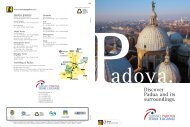
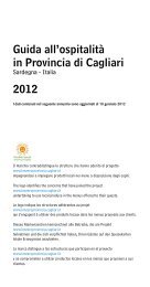
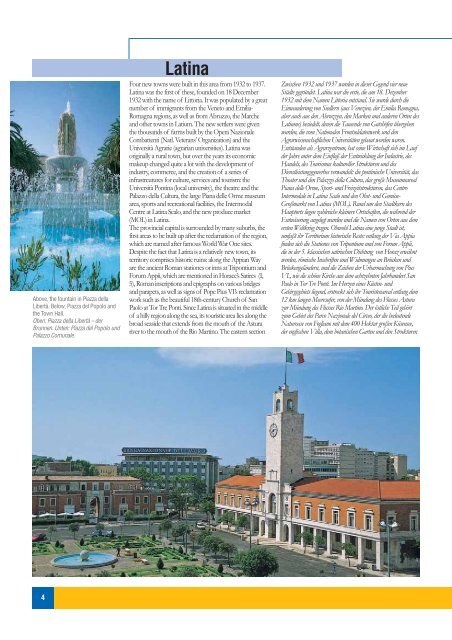
Above, the fountain in Piazza della<br />
Libertà. Below, Piazza del Popolo and<br />
the Town Hall.<br />
Oben: Piazza della Libertà – der<br />
Brunnen. Unten: Piazza del Popolo und<br />
Palazzo Comunale.<br />
4<br />
<strong>Latina</strong><br />
Four new towns were built in this area from 1932 to 1937.<br />
<strong>Latina</strong> was the first of these, founded on 18 December<br />
1932 with the name of Littoria. It was populated by a great<br />
number of immigrants from the Veneto and Emilia-<br />
Romagna regions, as well as from Abruzzo, the Marche<br />
and other towns in Latium. The new settlers were given<br />
the thousands of farms built by the Opera Nazionale<br />
Combattenti (Natl. Veterans’ Organization) and the<br />
Università Agrarie (agrarian universities). <strong>Latina</strong> was<br />
originally a rural town, but over the years its economic<br />
makeup changed quite a lot with the development of<br />
industry, commerce, and the creation of a series of<br />
infrastrcutures for culture, services and tourism: the<br />
Università Pontina (local university), the theatre and the<br />
Palazzo della Cultura, the large Piana delle Orme museum<br />
area, sports and recreational facilities, the Intermodal<br />
Centre at <strong>Latina</strong> Scalo, and the new produce market<br />
(MOL) in <strong>Latina</strong>.<br />
The provincial capital is surrounded by many suburbs, the<br />
first areas to be built up after the reclamation of the region,<br />
which are named after famous World War One sites.<br />
Despite the fact that <strong>Latina</strong> is a relatively new town, its<br />
territory comprises historic ruins: along the Appian Way<br />
are the ancient Roman stationes or inns at Tripontium and<br />
Forum Appii, which are mentioned in Horace’s Satires (I,<br />
5), Roman inscriptions and epigraphs on various bridges<br />
and parapets, as well as signs of Pope Pius VI’s reclamation<br />
work such as the beautiful 18th-century Church of San<br />
Paolo at Tor Tre Ponti. Since <strong>Latina</strong> is situated in the middle<br />
of a hilly region along the sea, its touristic area lies along the<br />
broad seaside that extends from the mouth of the Astura<br />
river to the mouth of the Rio Martino. The eastern section<br />
Zwischen 1932 und 1937 wurden in dieser Gegend vier neue<br />
Städte gegründet. <strong>Latina</strong> war die erste, die am 18. Dezember<br />
1932 mit dem Namen Littoria entstand. Sie wurde durch die<br />
Einwanderung von Siedlern (aus Venezien, der Emilia Romagna,<br />
aber auch aus den Abruzzen, den Marken und anderen Orten des<br />
Latiums) besiedelt, denen die Tausende von Gutshöfen übergeben<br />
wurden, die vom Nationalen Frontsoldatenwerk und den<br />
Agrarwissenschaftlichen Universitäten gebaut worden waren.<br />
Entstanden als Agrarzentrum, hat seine Wirtschaft sich im Lauf<br />
der Jahre unter dem Einfluß der Entwicklung der Industrie, des<br />
Handels, des Tourismus kultureller Strukturen und des<br />
Dienstleistungsgewerbes verwandelt: die pontinische Universität, <strong>das</strong><br />
Theater und den Palazzo della Cultura, <strong>das</strong> große Museumsareal<br />
Piana delle Orme, Sport- und Freizeitstrukturen, <strong>das</strong> Centro<br />
Intermodale in <strong>Latina</strong> Scalo und den Obst- und Gemüse-<br />
Großmarkt von <strong>Latina</strong> (MOL). Rund um den Stadtkern des<br />
Hauptorts liegen zahlreiche kleinere Ortschaften, die während der<br />
Entwäserung angelegt wurden und die Namen von Orten aus dem<br />
ersten Weltkrieg tragen. Obwohl <strong>Latina</strong> eine junge Stadt ist,<br />
umfaßt ihr Territorium historische Reste: entlang der Via Appia<br />
finden sich die Stationes von Tripontium und von Forum Appii,<br />
die in der 5. klassischen satirischen Dichtung von Horaz erwähnt<br />
werden, römische Inschriften und Widmungen an Brücken und<br />
Brückengeländern, und die Zeichen der Urbarmachung von Pius<br />
VI., wie die schöne Kirche aus dem achtzehnten Jahrhundert San<br />
Paolo in Tor Tre Ponti. Im Herzen eines Küsten- und<br />
Gebirgsgebiets liegend, erstreckt sich ihr Touristenareal entlang dem<br />
12 km langen <strong>Meer</strong>esufer, von der Mündung des Flusses Astura<br />
zur Mündung des Flusses Rio Martino. Der östliche Teil gehört<br />
zum Gebiet des Parco Nazionale del Circeo, der die bedeutende<br />
Naturoase von Fogliano mit dem 400 Hektar großen Küsensee,<br />
der englischen Villa, dem botanischen Garten und den Strukturen