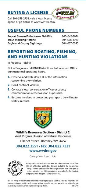
District 2 Fishing Guide - West Virginia Department of Commerce
District 2 Fishing Guide - West Virginia Department of Commerce
District 2 Fishing Guide - West Virginia Department of Commerce

Create successful ePaper yourself
Turn your PDF publications into a flip-book with our unique Google optimized e-Paper software.
TRouT sToCking – Rivers and streams<br />
Code no. stockings ............ Period Code no. stockings ............ Period Code no. stockings ............ Period<br />
Q One.................................... 1st.week.<strong>of</strong>.March<br />
One......................................................... February CR Varies.............................................................Varies<br />
One............................................................January<br />
BW<br />
One.every.two.weeks............March-May<br />
M One.each.month.................February-May<br />
W Two......................................................... February MJ One.each.month...................January-April<br />
One.each.week..........................March-May<br />
BA<br />
One............................................................January<br />
Y One...................................................................April<br />
X After.April.1.or.area.is.open.to.public One............................................................... March F Once/week......Columbus.Day.week.&.next.week<br />
River or stream: County<br />
Trout stocking<br />
Code: Area<br />
Big Bullskin Run:.Jefferson W:.from.near.Wheatland.5.miles.downstream.to.Kabletown<br />
Dillons Run:.Hampshire BW:.from.state.secondary.Route.50/25.bridge.upstream.4.miles<br />
Edwards Run:.Hampshire BW:.from.mouth.upstream.3.miles<br />
Evitts Run:.Jeferson W-F:.from.the.Charles.Town.Park.upstream.to.a.point.0.5.miles.west.<strong>of</strong>.town,.along.state.Route.51<br />
Long Marsh Run:.Jefferson M:.from.mouth.upstream.2.miles.to.state.secondary.Route.25<br />
Lost River:.Hardy<br />
W-F:.Lost.City.and.Lost.River.bridges.and.downstream.along.state.Route.259.to.one.mile.above.<br />
the.U.S..Route.55.bridge<br />
Lower Cove Run:.Hardy M:.from.National.Forest.boundary.upstream.one.mile<br />
Middle Creek:.Berkeley<br />
W:.from.state.secondary.Route.30.bridge.upstream.5.miles.to.the.vicinity.<strong>of</strong>.state.Route.45.and.a.<br />
one-half.mile.section.downstream.from.U.S..Route.11<br />
Mill Creek:.Berkeley W:.from.Gerrardstown.downstream.6.miles.to.1.5.miles.below.U.S..Route.11<br />
Mill Creek:.Hampshire BW:.from.mouth.upstream.3.miles.along.U.S..Route.50<br />
Mill Run:.Berkeley M:.from.mouth.upstream.3.5.miles.to.Jones.Spring<br />
Moores Run:.Hardy M:.from.mouth.upstream.2.miles.along.state.secondary.Route.23/13<br />
New Creek:.Mineral W:.from.Grant.County.line.downstream.13.miles.to.Keyser<br />
North Branch <strong>of</strong> the Potomac River:.Mineral M:.from.Barnum.downstream.one.mile<br />
North Fork <strong>of</strong> Lunice Creek:.Grant BW:.from.Maysville.upstream.4.5.miles.to.the.Stony.River.Dam.road<br />
North Fork <strong>of</strong> Patterson Creek:.Grant W:.from.mouth.upstream.7.5.miles.to.Scherr<br />
North Fork <strong>of</strong> the South Branch <strong>of</strong> the<br />
Potomac River:.Grant.and.Pendleton<br />
North Fork <strong>of</strong> South Branch <strong>of</strong> the<br />
Potomac River:.Pendleton<br />
(Catch-and-Release Only Section)<br />
W-F:.from.Judy.Gap.downstream.to.one-half.mile.above.the.junction.<strong>of</strong>.South.Branch,.near.<br />
Cabins<br />
CR:.a.three-quarter.mile.section.at.the.mouth.<strong>of</strong>.Seneca.Creek,.near.Seneca.Rocks<br />
North River:.Hardy BW:.from.Rock.Oak.downstream.4.miles.to.Rio<br />
Opequon Creek:.Berkeley.and.Jefferson W-F:.from.<strong>Virginia</strong>.line.downstream.to.state.secondary.Route.12.near.Bedington<br />
River or stream: County<br />
Trout stocking<br />
Code: Area<br />
Rocky Marsh Run:.Jefferson W:.from.mouth.upstream.3.5.miles.to.state.Route.45,.west.<strong>of</strong>.Shepherdstown<br />
South Branch <strong>of</strong> the Potomac River:.<br />
Pendleton.(Catch-and-Release Only Section)<br />
South Branch <strong>of</strong> the Potomac River:.<br />
Pendleton (Franklin Section)<br />
South Branch <strong>of</strong> the Potomac River:.<br />
Pendleton (Smoke Hole Section)<br />
CR:.from.Eagle.Rock.one.mile.downstream<br />
W-F:.from.0.5.miles.north.<strong>of</strong>.the.<strong>Virginia</strong>.line.downstream.(about.20.miles)..to.approximately.2.<br />
miles.south.<strong>of</strong>.Upper.Tract,.near.the.old.Poor.Farm<br />
W-F:.from.U.S..Route.220.bridge.downstream.to.Big.Bend.Recreation.Area<br />
Tilhance Creek:.Berkeley BW:.from.one.mile.below.Johnstown.upstream.3.miles.to.state.secondary.Route.9/7.bridge<br />
Trout Run:.Hardy W:.from.mouth.at.Wardensville.upstream.7.miles<br />
Tuscarora Creek:.Berkeley BW:.from.Martinsburg.upstream.5.miles<br />
Waites Run:.Hardy W:.from.state.Route.55.bridge.at.Wardensville.upstream.6.5.miles<br />
North Branch <strong>of</strong> the Potomac River