District 2 Fishing Guide - West Virginia Department of Commerce
District 2 Fishing Guide - West Virginia Department of Commerce
District 2 Fishing Guide - West Virginia Department of Commerce

You also want an ePaper? Increase the reach of your titles
YUMPU automatically turns print PDFs into web optimized ePapers that Google loves.
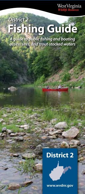
<strong>District</strong> 2<br />
<strong>Fishing</strong> guide<br />
A guide to public fishing and boating<br />
access sites, and trout-stocked waters<br />
<strong>District</strong> 2<br />
www.wvdnr.gov
<strong>Fishing</strong> – Boating and Water safety<br />
BOATING EDUCATION<br />
REQUIREMENT<br />
Anyone born after December 31, 1986, must successfully<br />
complete an approved boating education course before<br />
operating a motorboat. The course is available on the DNR Web<br />
site. Click on boating under the Law Enforcement heading.<br />
WEAR YOUR LIfE JACkET<br />
Personal flotation devices are not just for wearing in boats<br />
and not just for those who can’t swim. Make sure the PFD<br />
is in good condition and fits properly. Youth under 12 years<br />
old must wear a PFD if they are on deck while a motorboat is<br />
underway.<br />
WADING<br />
There are several rules you should follow for safe wading.<br />
• Wade with a fishing buddy.<br />
• Wear your PFD.<br />
• Find out whether the bottom is rocky or muddy.<br />
• Shuffle your feet or probe with a stick along the bottom to<br />
avoid holes.<br />
• Study how swiftly the water is moving.<br />
• Wear appropriate foot wear (considering water<br />
temperature and bottom substrate).<br />
PERsON IN WATER<br />
Reach-Throw-Row-Go is a method <strong>of</strong> rescuing a person who is<br />
in trouble in water.<br />
If the person is close to you, REACH out with a long object such<br />
as an oar or tree limb to pull the person into shore or the boat.<br />
If you can’t reach the person, then THROW them a life-saving<br />
device. If possible, it should be tied to the end <strong>of</strong> a line so you<br />
can pull the person to you. An inflatable ball or foam cooler can<br />
be used if the proper device is not available.<br />
If there is nothing to throw, ROW a boat to the person in<br />
trouble. The person should be pulled in over the stern, or<br />
back, <strong>of</strong> the boat if possible to prevent the boat from tipping<br />
over. If the boat has a motor, it must be shut <strong>of</strong>f before you<br />
get to the person in the water.<br />
GO (swim) to the person ONLY as a last resort and only if you<br />
have had life-saving training. People who are drowning <strong>of</strong>ten<br />
panic and injure or drown someone trying to rescue them.<br />
fIshING IN COLD WEAThER<br />
Hypothermia is a life-threatening condition in which your<br />
body loses heat faster than it can produce it. A common<br />
misconception is that the air or water temperature must<br />
be below freezing before you can become hypothermic.<br />
Any water colder than 70 degrees can cause hypothermia.<br />
Symptoms include uncontrollable shivering, fumbling<br />
hands, slow speech, confusion and exhaustion. Emergency<br />
treatment: get the victim out <strong>of</strong> the cold, give warm drinks,<br />
keep the person awake, remove all wet clothing and get the<br />
victim into dry clothes.<br />
To stay warm, wear several layers <strong>of</strong> clothing. Air trapped<br />
between the layers serves as insulation. A wool hat prevents<br />
heat loss from your head. <strong>Fishing</strong> is difficult with most gloves,<br />
but lightweight rubber gloves, gloves without fingertips, and<br />
gloves that have a flap to expose your fingers allow greater<br />
manual dexterity.
ANGLERs ALERT<br />
<strong>Fishing</strong> – Float Trips spread <strong>of</strong> unwanted organisms TRouT sToCking – Lakes and Ponds<br />
CACAPON RIVER<br />
From To Miles<br />
Capon Lake ...................................... Yellow Springs ................................ 2.5<br />
Yellow Springs ................................ Yellow Springs North .......................5<br />
Yellow Springs North ................... Rt. 127 Bridge ....................................19<br />
Rt. 127 Bridge .................................. Cacapon Crossings............................9<br />
Cacapon Crossings ....................... Rt. 9 Bridge .........................................18<br />
Rt. 9 Bridge* .................................... Cacapon Power Plant ................... 8.5<br />
Cacapon Power Plant ................... Great Cacapon .................................2.8<br />
*Contains dam to be portaged.<br />
sOUTh BRANCh RIVER<br />
From To Miles<br />
Petersburg Bridge ......................... Welton Park ......................................3.0<br />
Welton Park ..................................... Fisher Bridge South .......................5.5<br />
Fisher Bridge South ..................... Fisher Bridge ................................... 2.5<br />
Fisher Bridge ................................... Old Fields Bridge ............................4.5<br />
Old Fields Bridge ........................... South Branch WMA (McNeill) .....5.0<br />
South Branch WMA (McNeill) ... Harmisons .........................................7.0<br />
Harmisons ........................................ Stony Run ..........................................1.5<br />
Stony Run ......................................... Romney Bridge ............................. 8.75<br />
Romney Bridge .............................. Hanging Rock ..................................5.0<br />
Hanging Rock ................................. Blue Beach Bridge ..........................4.5<br />
Blue Beach Bridge ......................... Maple Landing ................................7.5<br />
Maple Landing ............................... Millesons Mill Bridge .....................2.0<br />
Millesons Mill Bridge .................... Blue Ford South/North .............. 4.75<br />
Blue Ford South/North................ Indian Rock .......................................4.0<br />
Indian Rock ...................................... Mouth <strong>of</strong> South Branch ................4.5<br />
Moving live fish or other aquatic animals and plants<br />
from one body <strong>of</strong> water to another can cause long term<br />
damage to the ecological stability <strong>of</strong> lakes and streams<br />
and can threaten recreational fishing. Please take these<br />
precautions to prevent problems.<br />
• do not move fish from one body <strong>of</strong> water to another<br />
• drain live wells thoroughly before leaving an<br />
access area<br />
• do not release live baitfish or aquarium fish into<br />
<strong>West</strong> <strong>Virginia</strong>’s waters<br />
• remove all visible plants and animals from your boat,<br />
motor, trailer, nets and all fishing gear before leaving<br />
an access area<br />
<strong>Fishing</strong> and Boating Access sites<br />
Public boating and fishing access facilities shall be<br />
used solely for the purpose <strong>of</strong> launching and retrieving<br />
watercraft or fishing from the shore. No other use <strong>of</strong> the<br />
access sites is allowed.<br />
After launching, vehicles shall be parked in available<br />
parking spaces.<br />
Any law enforcement <strong>of</strong>ficer acting under proper<br />
authority may prohibit an individual from launching a<br />
watercraft from any public boating and fishing<br />
access site.<br />
The following are prohibited at fishing<br />
and boating access sites:<br />
• consumption <strong>of</strong> alcoholic beverages or possession <strong>of</strong><br />
an open container <strong>of</strong> alcoholic beverages<br />
• swimming or bathing<br />
• camping<br />
• open fires<br />
• trash disposal except where trash receptacles<br />
are provided<br />
• discharge <strong>of</strong> firearms, fireworks or explosives<br />
• leaving unattended watercraft<br />
• commercial use except as authorized by the director<br />
• parking <strong>of</strong> any vehicle or the mooring <strong>of</strong> any watercraft<br />
in such a manner as to obstruct any avenue <strong>of</strong> ingress<br />
or egress, except for the purpose <strong>of</strong> launching<br />
Code no. stockings ............ Period Code no. stockings ............ Period Code no. stockings ............ Period<br />
Q One.................................... 1st.week.<strong>of</strong>.March<br />
One......................................................... February CR Varies.............................................................Varies<br />
One............................................................January<br />
BW<br />
One.every.two.weeks............March-May<br />
M One.each.month.................February-May<br />
W Two......................................................... February MJ One.each.month...................January-April<br />
One.each.week..........................March-May<br />
BA<br />
One............................................................January<br />
Y One...................................................................April<br />
X After.April.1.or.area.is.open.to.public One............................................................... March F Once/week......Columbus.Day.week.&.next.week<br />
i.D. Lake or Pond: County Acres<br />
Trout stocking<br />
L1 Brandywine:.Pendleton 6 Pier/Trail Lot<br />
Code: Area<br />
BW-F:.3.miles.east.<strong>of</strong>.Brandywine.<strong>of</strong>f.US.Route.33<br />
L2 Brushy Fork:.Pendleton 18 Lot BW:.12.miles.south.<strong>of</strong>.Brandywine.<strong>of</strong>f.CR.21<br />
L3 Cacapon:.Morgan 6 Pier Lot BW:.Cacapon.State.Park<br />
L5 Fort Ashby:.Mineral 12 Pier Pull Off BW:.1.25.miles.south.<strong>of</strong>.Ft..Ashby.on.CR.28-5<br />
L7 Kimsey Run:.Hardy 60 Trail Lot BW:.1.mile.west.<strong>of</strong>.Lost.River.on.CR.14<br />
L8 Larenim:.Mineral 10 – two lakes Pier.–.1 lake Lot BA:.8.miles.south.<strong>of</strong>.Ft..Ashby.via.CR.11.&.PR.46-5<br />
L10 New Creek:.Grant 40 Pull Off BW-F:.6.miles.north.<strong>of</strong>.Scherr.via.SR.93.&.CR.42-2<br />
L12 Poor House Pond:.Berkeley 5 Trail Lot M:.4.miles.west.<strong>of</strong>.Martinsburg.via.CR.15.&.CR.45-8<br />
L13 Rock Cliff:.Hardy 17 Pier/Trail Lot BW-F-X:.6.miles.east.<strong>of</strong>.Lost.River.<strong>of</strong>f.CR.16<br />
L16 South Mill Creek:.Grant 50 Pier Lot BW:.13.miles.south.<strong>of</strong>.Petersburg.on.CR.9<br />
L18 Warden:.Hardy 44 Trail Lot BW:.4.miles.north.<strong>of</strong>.Wardensville.via.SR.259.&.CR.23-13<br />
Warden Lake
TRouT sToCking – Rivers and streams<br />
Code no. stockings ............ Period Code no. stockings ............ Period Code no. stockings ............ Period<br />
Q One.................................... 1st.week.<strong>of</strong>.March<br />
One......................................................... February CR Varies.............................................................Varies<br />
One............................................................January<br />
BW<br />
One.every.two.weeks............March-May<br />
M One.each.month.................February-May<br />
W Two......................................................... February MJ One.each.month...................January-April<br />
One.each.week..........................March-May<br />
BA<br />
One............................................................January<br />
Y One...................................................................April<br />
X After.April.1.or.area.is.open.to.public One............................................................... March F Once/week......Columbus.Day.week.&.next.week<br />
River or stream: County<br />
Trout stocking<br />
Code: Area<br />
Big Bullskin Run:.Jefferson W:.from.near.Wheatland.5.miles.downstream.to.Kabletown<br />
Dillons Run:.Hampshire BW:.from.state.secondary.Route.50/25.bridge.upstream.4.miles<br />
Edwards Run:.Hampshire BW:.from.mouth.upstream.3.miles<br />
Evitts Run:.Jeferson W-F:.from.the.Charles.Town.Park.upstream.to.a.point.0.5.miles.west.<strong>of</strong>.town,.along.state.Route.51<br />
Long Marsh Run:.Jefferson M:.from.mouth.upstream.2.miles.to.state.secondary.Route.25<br />
Lost River:.Hardy<br />
W-F:.Lost.City.and.Lost.River.bridges.and.downstream.along.state.Route.259.to.one.mile.above.<br />
the.U.S..Route.55.bridge<br />
Lower Cove Run:.Hardy M:.from.National.Forest.boundary.upstream.one.mile<br />
Middle Creek:.Berkeley<br />
W:.from.state.secondary.Route.30.bridge.upstream.5.miles.to.the.vicinity.<strong>of</strong>.state.Route.45.and.a.<br />
one-half.mile.section.downstream.from.U.S..Route.11<br />
Mill Creek:.Berkeley W:.from.Gerrardstown.downstream.6.miles.to.1.5.miles.below.U.S..Route.11<br />
Mill Creek:.Hampshire BW:.from.mouth.upstream.3.miles.along.U.S..Route.50<br />
Mill Run:.Berkeley M:.from.mouth.upstream.3.5.miles.to.Jones.Spring<br />
Moores Run:.Hardy M:.from.mouth.upstream.2.miles.along.state.secondary.Route.23/13<br />
New Creek:.Mineral W:.from.Grant.County.line.downstream.13.miles.to.Keyser<br />
North Branch <strong>of</strong> the Potomac River:.Mineral M:.from.Barnum.downstream.one.mile<br />
North Fork <strong>of</strong> Lunice Creek:.Grant BW:.from.Maysville.upstream.4.5.miles.to.the.Stony.River.Dam.road<br />
North Fork <strong>of</strong> Patterson Creek:.Grant W:.from.mouth.upstream.7.5.miles.to.Scherr<br />
North Fork <strong>of</strong> the South Branch <strong>of</strong> the<br />
Potomac River:.Grant.and.Pendleton<br />
North Fork <strong>of</strong> South Branch <strong>of</strong> the<br />
Potomac River:.Pendleton<br />
(Catch-and-Release Only Section)<br />
W-F:.from.Judy.Gap.downstream.to.one-half.mile.above.the.junction.<strong>of</strong>.South.Branch,.near.<br />
Cabins<br />
CR:.a.three-quarter.mile.section.at.the.mouth.<strong>of</strong>.Seneca.Creek,.near.Seneca.Rocks<br />
North River:.Hardy BW:.from.Rock.Oak.downstream.4.miles.to.Rio<br />
Opequon Creek:.Berkeley.and.Jefferson W-F:.from.<strong>Virginia</strong>.line.downstream.to.state.secondary.Route.12.near.Bedington<br />
River or stream: County<br />
Trout stocking<br />
Code: Area<br />
Rocky Marsh Run:.Jefferson W:.from.mouth.upstream.3.5.miles.to.state.Route.45,.west.<strong>of</strong>.Shepherdstown<br />
South Branch <strong>of</strong> the Potomac River:.<br />
Pendleton.(Catch-and-Release Only Section)<br />
South Branch <strong>of</strong> the Potomac River:.<br />
Pendleton (Franklin Section)<br />
South Branch <strong>of</strong> the Potomac River:.<br />
Pendleton (Smoke Hole Section)<br />
CR:.from.Eagle.Rock.one.mile.downstream<br />
W-F:.from.0.5.miles.north.<strong>of</strong>.the.<strong>Virginia</strong>.line.downstream.(about.20.miles)..to.approximately.2.<br />
miles.south.<strong>of</strong>.Upper.Tract,.near.the.old.Poor.Farm<br />
W-F:.from.U.S..Route.220.bridge.downstream.to.Big.Bend.Recreation.Area<br />
Tilhance Creek:.Berkeley BW:.from.one.mile.below.Johnstown.upstream.3.miles.to.state.secondary.Route.9/7.bridge<br />
Trout Run:.Hardy W:.from.mouth.at.Wardensville.upstream.7.miles<br />
Tuscarora Creek:.Berkeley BW:.from.Martinsburg.upstream.5.miles<br />
Waites Run:.Hardy W:.from.state.Route.55.bridge.at.Wardensville.upstream.6.5.miles<br />
North Branch <strong>of</strong> the Potomac River
hOW TO READ ThIs MAP<br />
Access sites<br />
Boat access with ramp<br />
Carry down boat access<br />
<strong>Fishing</strong> access only – NO BOATS<br />
Colors <strong>of</strong> the symbols will vary according to<br />
corresponding ID colors in the charts below.<br />
Interstate<br />
U.S. Route<br />
State Route<br />
Trout stocked streams<br />
Special Regulation Area<br />
Public land<br />
County boundary<br />
0 2.5 5 7.5 10<br />
Miles<br />
1:350,000<br />
1 inch = 5.5 miles<br />
Public Lake and Pond Access sites<br />
iD Lake or Pond: County Acres<br />
Boat Access<br />
gPs<br />
L1<br />
L2<br />
L3<br />
L4<br />
Brandywine:.Pendleton<br />
Brushy Fork:.Pendleton<br />
Cacapon:.Morgan<br />
Camp Run:.Pendleton<br />
Pier/Trail<br />
Pier<br />
6<br />
18<br />
6<br />
8<br />
Lot<br />
Lot<br />
Lot<br />
Lot<br />
•<br />
•<br />
•<br />
•<br />
Lat.<br />
38.5995<br />
38.4638<br />
39.5019<br />
38.7521<br />
Long.<br />
-79.2019<br />
-79.3173<br />
-78.2977<br />
-79.1186<br />
L5<br />
L6<br />
L7<br />
L8<br />
L9<br />
Ft. Ashby:.Mineral<br />
Jennings Randolph:.Mineral<br />
Kimsey Run:.Hardy<br />
Larenim lakes:.Mineral<br />
Mount Storm:.Grant<br />
Pier<br />
Trail<br />
Pier/1 Lake<br />
12<br />
952<br />
60<br />
10<br />
1200<br />
Pull Off<br />
Lot<br />
Lot<br />
Lot<br />
Lot<br />
NO BOATS<br />
•<br />
•<br />
•<br />
•<br />
39.4812<br />
39.4096<br />
38.9581<br />
39.3675<br />
39.2076<br />
-78.7585<br />
-79.1201<br />
-78.8183<br />
-78.8951<br />
-79.2586<br />
L10<br />
L11<br />
New Creek Dam 14:.Grant<br />
Parker Hollow:.Hardy<br />
40<br />
34<br />
Pull Off<br />
Lot<br />
NO BOATS<br />
•<br />
39.2650<br />
39.0372<br />
-79.1340<br />
-78.7991<br />
L12<br />
L13<br />
L14<br />
L15<br />
L16<br />
L17<br />
L18<br />
Poorhouse Pond:.Berkeley<br />
Rock Cliff:.Hardy<br />
Sleepy Creek (Sawmill Cove):.Berkeley<br />
Sleepy Creek Dam:.Berkeley<br />
South Mill Creek:.Grant<br />
Upper Cove Run:.Hardy<br />
Warden:.Hardy<br />
Trail<br />
Pier/Trail<br />
Pier<br />
Pier<br />
Trail<br />
5<br />
17<br />
205<br />
48<br />
6.5<br />
44<br />
Lot<br />
Lot<br />
Lot<br />
Lot<br />
Lot<br />
Lot<br />
Lot<br />
NO BOATS<br />
•<br />
•<br />
•<br />
•<br />
•<br />
•<br />
39.4613<br />
38.9577<br />
39.5247<br />
39.5111<br />
38.8483<br />
38.8463<br />
39.1321<br />
-78.0390<br />
-78.7377<br />
-78.1478<br />
-78.1569<br />
-79.1666<br />
-78.8288<br />
-78.5990<br />
DnR DisTRiCT 2 LAkes AnD sTReAMs<br />
River and stream Access sites<br />
iD site name: County River or stream<br />
Boat Access<br />
gPs<br />
1<br />
2<br />
Harpers Ferry Park:.Jefferson<br />
Millville (below dam):.Jefferson<br />
Shenandoah<br />
Shenandoah<br />
Lot<br />
Lot<br />
•<br />
•<br />
Lat.<br />
39.3206<br />
39.2750<br />
Long.<br />
-77.7424<br />
-77.7867<br />
3<br />
4<br />
5<br />
6<br />
7<br />
8<br />
9<br />
10<br />
11<br />
12<br />
13<br />
14<br />
15<br />
16<br />
17<br />
18<br />
19<br />
20<br />
21<br />
22<br />
23<br />
24<br />
25<br />
26<br />
Millville (dam):.Jefferson<br />
Millville:.Jefferson<br />
Big Eddy:.Jefferson<br />
Moulton Park:.Jefferson<br />
Bloomery:.Jefferson<br />
Shannondale Springs WMA:.Jefferson<br />
Dam #3:.Jefferson<br />
Sheperdstown:.Jefferson<br />
Dam #4:.Jefferson<br />
Cherry Run:.Morgan<br />
Paw Paw:.Morgan<br />
State Route 45 Bridge:.Berkeley<br />
Stone Bridge:.Berkeley<br />
Priest Springs:.Berkeley<br />
State Route 9 Bridge:.Berkeley<br />
Snyders Ford Jones Springs:.Berkeley<br />
Great Cacapon:.Morgan<br />
Cacapon Power Plant:.Morgan<br />
State Route 9 Bridge:.Morgan<br />
Cacapon Crossing:.Hampshire<br />
Rt. 127 Bridge:.Hampshire<br />
Yellow Springs North:.Hampshire<br />
Yellow Springs:.Hampshire<br />
Capon Lake:.Hampshire<br />
Shenandoah<br />
Shenandoah<br />
Shenandoah<br />
Shenandoah<br />
Shenandoah<br />
Shenandoah<br />
Potomac<br />
Potomac<br />
Potomac<br />
Potomac<br />
Potomac<br />
Opequon Creek<br />
Opequon Creek<br />
Opequon Creek<br />
Back Creek<br />
Back Creek<br />
Cacapon<br />
Cacapon<br />
Cacapon<br />
Cacapon<br />
Cacapon<br />
Cacapon<br />
Cacapon<br />
Cacapon<br />
Pier/Trail<br />
Lot<br />
Lot<br />
Lot<br />
Lot<br />
Lot<br />
Lot<br />
Lot<br />
Lot<br />
Lot<br />
Lot<br />
Lot<br />
Lot<br />
Lot<br />
Lot<br />
Lot<br />
Pull Off<br />
Lot<br />
Lot<br />
Pull Off<br />
Lot<br />
Lot<br />
Lot<br />
Pull Off<br />
Lot<br />
NO BOATS<br />
•<br />
•<br />
•<br />
•<br />
•<br />
•<br />
•<br />
•<br />
•<br />
•<br />
•<br />
•<br />
•<br />
•<br />
•<br />
•<br />
•<br />
•<br />
•<br />
•<br />
•<br />
•<br />
•<br />
39.2685<br />
39.2580<br />
39.2635<br />
39.2584<br />
39.2536<br />
39.2247<br />
39.3327<br />
39.4343<br />
39.4929<br />
39.6288<br />
39.5380<br />
39.4602<br />
39.4228<br />
39.2988<br />
39.5557<br />
39.4863<br />
39.6186<br />
39.6069<br />
39.5282<br />
39.4520<br />
39.4032<br />
39.2339<br />
39.1828<br />
39.1582<br />
-77.7837<br />
-77.7827<br />
-77.7911<br />
-77.8074<br />
-77.8153<br />
-77.8202<br />
-77.7504<br />
-77.8018<br />
-77.8249<br />
-78.0314<br />
-78.4549<br />
-77.9196<br />
-77.9388<br />
-78.0094<br />
-78.0178<br />
-78.0596<br />
-78.2823<br />
-78.2910<br />
-78.3486<br />
-78.4248<br />
-78.4174<br />
-78.4651<br />
-78.5060<br />
-78.5347<br />
River and stream Access sites<br />
LANDOWNER –<br />
ANGLER<br />
RELATIONs<br />
<strong>West</strong> <strong>Virginia</strong> anglers are<br />
indebted to local landowners<br />
throughout the state. Without<br />
their consent and generosity,<br />
fishing would be restricted to<br />
state and federal lands. The<br />
opportunity for continued use<br />
<strong>of</strong> private property is largely<br />
dependent upon anglers’<br />
attitudes and conduct. Most<br />
stream closures are the result <strong>of</strong><br />
disrespect for private property.<br />
sTREAM<br />
LITTER LAW<br />
It is illegal to throw litter,<br />
an animal carcass, or other<br />
unsightly matter into a water<br />
body or on land within 100<br />
yards <strong>of</strong> water, or in a location<br />
where high water would wash<br />
the matter into a water body.<br />
fOR MORE<br />
INfORMATION<br />
see the <strong>West</strong> <strong>Virginia</strong><br />
<strong>Fishing</strong> Regulations<br />
booklet for:<br />
• Reciprocal fishing agreement<br />
on Potomac River<br />
• Fish consumption advisories<br />
• Sport fish identification<br />
online<br />
For more detailed information<br />
on individual access sites, go<br />
online to www.wvdnr.gov/<br />
fishing/public_access.asp.<br />
iD site name: County River or stream<br />
Boat Access<br />
gPs<br />
27<br />
28<br />
29<br />
30<br />
31<br />
32<br />
33<br />
34<br />
35<br />
36<br />
37<br />
38<br />
39<br />
40<br />
41<br />
42<br />
43<br />
44<br />
45<br />
46<br />
Mouth <strong>of</strong> South Branch:.Hampshire<br />
Indian Rocks:.Hampshire<br />
Blue Ford South:.Hampshire<br />
Blue Ford North:.Hampshire<br />
Millesons Mill Bridge:.Hampshire<br />
Maple Landing:.Hampshire<br />
Blue Beach Bridge:.Hampshire<br />
Hanging Rock:.Hampshire<br />
Romney Bridge:.Hampshire<br />
Fort Mill Ridge:.Hampshire<br />
Stoney Run:.Hampshire<br />
Harmisons:.Hampshire<br />
South Branch WMA:.Hardy<br />
Old Fields Bridge:.Hardy<br />
Fisher Bridge:.Hardy<br />
Fisher Bridge South:.Hardy<br />
Welton Park:.Pendleton<br />
Petersburg:.Grant<br />
Wiley Ford:.Mineral<br />
Barnum:.Mineral<br />
South Branch <strong>of</strong> Potomac<br />
South Branch <strong>of</strong> Potomac<br />
South Branch <strong>of</strong> Potomac<br />
South Branch <strong>of</strong> Potomac<br />
South Branch <strong>of</strong> Potomac<br />
South Branch <strong>of</strong> Potomac<br />
South Branch <strong>of</strong> Potomac<br />
South Branch <strong>of</strong> Potomac<br />
South Branch <strong>of</strong> Potomac<br />
South Branch <strong>of</strong> Potomac<br />
South Branch <strong>of</strong> Potomac<br />
South Branch <strong>of</strong> Potomac<br />
South Branch <strong>of</strong> Potomac<br />
South Branch <strong>of</strong> Potomac<br />
South Branch <strong>of</strong> Potomac<br />
South Branch <strong>of</strong> Potomac<br />
South Branch <strong>of</strong> Potomac<br />
South Branch <strong>of</strong> Potomac<br />
North Branch <strong>of</strong> Potomac<br />
North Branch <strong>of</strong> Potomac Pier/Trail<br />
Pull Off<br />
Lot<br />
Lot<br />
Lot<br />
Lot<br />
Pull Off<br />
Pull Off<br />
Pull Off<br />
Lot<br />
Pull Off<br />
Lot<br />
Lot<br />
Lot<br />
Lot<br />
Lot<br />
Lot<br />
Lot<br />
Lot<br />
Lot<br />
Lot<br />
•<br />
•<br />
•<br />
•<br />
•<br />
•<br />
•<br />
•<br />
•<br />
•<br />
•<br />
•<br />
•<br />
•<br />
•<br />
•<br />
•<br />
•<br />
•<br />
•<br />
Lat.<br />
39.5249<br />
39.5103<br />
39.4915<br />
39.493<br />
39.4480<br />
39.4429<br />
39.4279<br />
39.3997<br />
39.3394<br />
39.3306<br />
39.2465<br />
39.2278<br />
39.1459<br />
39.1036<br />
39.0533<br />
39.0195<br />
39.0000<br />
38.9884<br />
39.6105<br />
39.4552<br />
Long.<br />
-78.5908<br />
-78.6001<br />
-78.6082<br />
-78.610<br />
-78.6534<br />
-78.6681<br />
-78.7146<br />
-78.7429<br />
-78.7765<br />
-78.7850<br />
-78.8426<br />
-78.8524<br />
-78.9248<br />
-78.9588<br />
-78.9911<br />
-79.0055<br />
-79.0864<br />
-79.1212<br />
-78.7569<br />
-79.1022
BUYING A LICENsE<br />
Call 304-558-2758, visit a local license<br />
agent, or go online at www.wvfish.com.<br />
UsEfUL PhONE NUMBERs<br />
Report Stream Pollution or Fish Kills 800-642-3074<br />
Trout Stocking Hotline 304-558-3399<br />
Eagle and Osprey Sightings 304-637-0245<br />
REPORTING BOATING, fIshING,<br />
AND hUNTING VIOLATIONs<br />
In Progress – dial 911<br />
Not in Progress – call DNR <strong>District</strong> Law Enforcement Office<br />
during normal operating hours.<br />
1. Observe and write down all <strong>of</strong> the information<br />
concerning the violation.<br />
2. Don’t confront violator.<br />
3. Contact a local conservation <strong>of</strong>ficer or county<br />
communication center as soon as possible.<br />
4. Become involved in protecting your sport; be willing to<br />
testify in court.<br />
Wildlife Resources section – <strong>District</strong> 2<br />
<strong>West</strong> <strong>Virginia</strong> Division <strong>of</strong> Natural Resources<br />
1 Depot Street • Romney, WV 26757<br />
304.822.3551 • fax: 304.822.7331<br />
www.wvdnr.gov<br />
Cover photo: Jason Hicks<br />
Money used to buy and develop stream and lake access sites comes from<br />
the sale <strong>of</strong> hunting and fishing licenses, including the conservation<br />
stamp. Federal funds used for these projects come from taxes paid by<br />
anglers when they buy fishing equipment or gasoline for their boats in<br />
compliance with the Sport Fish Restoration Act.<br />
It is the policy <strong>of</strong> the Division <strong>of</strong> Natural Resources to provide its facilities, services, programs, and<br />
employment opportunities to all persons without regard to sex, race, age, religion, national origin<br />
or ancestry, disability, or other protected group status. 5M 7/10