

northspur
northspur
northspur

Create successful ePaper yourself
Turn your PDF publications into a flip-book with our unique Google optimized e-Paper software.
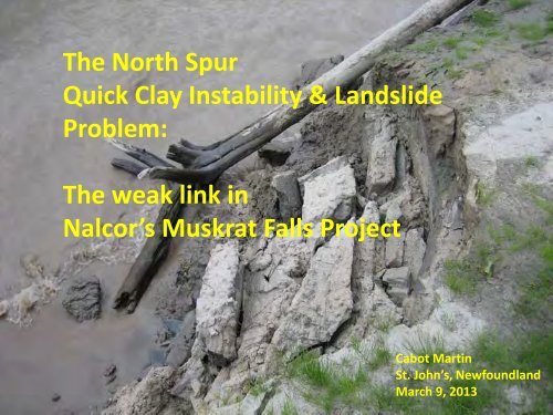
The North Spur<br />
Quick Clay Instability & Landslide<br />
Problem:<br />
The weak link in<br />
Nalcor’s Muskrat Falls Project<br />
Cabot Martin<br />
St. John’s, Newfoundland<br />
March 9, 2013
Table of Contents<br />
Note on Sources 3<br />
Executive Summary 4<br />
The North Spur & its role in Muskrat Falls Project 7<br />
The North Spur Landslide of 1978 15<br />
Glacio-marine clay and its dangers 29<br />
JRP & NrCan in the debate on the North Spur 45<br />
The Edwards Island Landslide of 2010 54<br />
NRCan presentation to JRP Public Hearing 62<br />
Nalcor North Spur Technical Note 73<br />
SNC 2013 North Spur Stabilization Project 82<br />
Current Situation 87<br />
2
NOTE ON SOURCES<br />
The following presentation is based on public sources all of which are available<br />
on line.<br />
Where possible an active link is provided to the document referenced.<br />
The vast majority of these documents were generated by hearings and reviews<br />
before the Federal Provincial Joint Review Panel (JRP) and the NL PUB, both of<br />
whom reviewed the Muskrat Falls Project and found the information provided<br />
by Nalcor to be incomplete and so did not approve it.<br />
Free access to these documents proves the value of these beleaguered<br />
democratic processes.<br />
An active link to an important Norwegian video of the Rissa landslide of 1978<br />
is on slide 41.<br />
A chronology of key events and Further References will be added.<br />
3
EXECUTIVE SUMMARY<br />
The proposed 825 MW Muskrat Falls hydro project is located in the Lower Churchill River<br />
Valley in central Labrador.<br />
The project consists of an existing natural feature (the North Spur) and two new<br />
concrete dams . The North Spur would provide a major part of the river impoundment<br />
system (next slide). The current project ,and all alternatives, must use the North Spur.<br />
The ground conditions at the North Spur are very unstable as they include significant<br />
amounts of glacio-marine clay (Quick Clay) that is highly prone to liquefaction and<br />
failure.<br />
A significant landslide took place at the North Spur in 1978 with lesser slides in 1980 and<br />
1981. A series of other major slides have taken place both upriver and downriver from<br />
Muskrat Falls, the latest in 2010.<br />
As of March 1, 2013, Nalcor had not conducted the geotechnical field work and collected<br />
the data necessary to fully assess the North Spur instability problem and design a<br />
suitable, cost effective solution.<br />
1 of 2<br />
4
Overhead view of North Spur showing its key role in<br />
the Muskrat Falls reservoir containment system<br />
Manitutshu Spirit Mountain<br />
North Spur<br />
Proposed<br />
Powerhouse (red)<br />
& Spillway (white)<br />
Section of North Spur<br />
acting as a “natural dam”<br />
1978<br />
Land slide<br />
scar<br />
Trans Labrador<br />
Highway (TLH)<br />
5
Thus Nalcor is not yet in a position to know what the cost of an acceptable<br />
solution to the North Spur instability problem will be.<br />
Yet the Muskrat Falls project was sanctioned in December 2012 without an<br />
answer to the North Spur issue.<br />
Nalcor’s EPCM contractor SNC Lavalin must first carry out field work and<br />
design activities in 2013 to address the North Spur issue.<br />
This also leaves Nalcor in a position where it does not know whether a<br />
technically feasible solution can be devised for the North Spur instability<br />
problem.<br />
Without an acceptable, safe solution to the North Spur instability problem,<br />
the whole Muskrat Falls project will have to be cancelled.<br />
2 of 2<br />
6
What is the North Spur ?<br />
The North Spur is a relatively young, post glacial/marine deposit of clay and<br />
sand sticking out into the Churchill River from its north bank to a massive<br />
rock mountain in mid valley at Muskrat Falls.<br />
The North Spur is 1000m long, 500m wide and 45 to 60m high .<br />
The North Spur contains a significant amount of glacio-marine clay or<br />
“Quick Clay” mixed at the top with some sandy layers. This quick clay overlies<br />
a thick sandy aquifer.<br />
It forms an essential part of the reservoir containment system at Muskrat<br />
Falls.<br />
A significant landslide took place on the North Spur in 1978.<br />
7
Google Earth Image of Muskrat Falls Site looking North<br />
Lower Churchill River<br />
Upper Muskrat Falls<br />
Trans Labrador Highway<br />
NORTH SPUR<br />
Manitutshu<br />
Spirit Mountain<br />
Lower Muskrat Falls<br />
Site of Proposed<br />
Power House & Dams
• The previous slide shows on the left, the upstream section of the fresh<br />
water Lower Churchill River at an elevation of 18m above sea level.<br />
• After dam completion, the Muskrat Reservoir will rise to 35m above sea<br />
level.<br />
• On the right, below the Upper and Lower Muskrat Falls, is the<br />
downstream section of the Lower Churchill River at an elevation<br />
approaching 0 m above sea level.<br />
• The impact of tidal/sea water influences immediately downstream from<br />
the North Spur seem to deserve more attention.<br />
• Consideration of hydraulic forces on the downstream side of the North<br />
Spur are greatly complicated by ice damming .<br />
• For a view of ice damming downstream from the North Spur see the first<br />
photo icon downstream from Muskrat Falls on Google Earth at 53<br />
degrees 14 min 19.48 sec North; 60 degrees 46 min 38.56 sec West. 9
The next slide shows the Muskrat Falls project layout<br />
superimposed on an existing view of Muskrat Falls on Google<br />
Earth.<br />
As you can see, the North Spur is just as important<br />
to damming off the Lower Churchill River as are Nalcor’s two<br />
proposed concrete dams .<br />
Note that Manitutshu – the 120m high solid rock Innu sacred<br />
Spirit Mountain – is located between the North Spur and the<br />
area of Nalcor’s two proposed concrete dams at Muskrat Falls.<br />
10
Overhead view of North Spur showing key role in<br />
Muskrat Falls reservoir containment system<br />
Manitutshu Spirit Mountain<br />
North Spur<br />
Proposed<br />
Powerhouse (red)<br />
& Spillway (white)<br />
Section of North Spur<br />
acting as a “natural dam”<br />
Trans Labrador<br />
Highway (TLH)<br />
11
Muskrat Falls layout from Nalcor EIS<br />
12
Nalcor Depiction of the Muskrat Falls Project from<br />
downstream (from a January 23, 2013 presentation)<br />
North Dam (concrete) terminating<br />
on south side of Manitutshu Spirit Mountain<br />
13
The North Spur : a long known problem<br />
The key role of the North Spur and its precarious nature has been<br />
well known in Muskrat Falls development process for over 30 years<br />
as described by Hatch Ltd. in July, 2008 :<br />
“Early studies in the late 1970s concluded that the land spur which reaches from<br />
the north bank of the Churchill river at Muskrat Falls to the large rock knoll closer<br />
to the south bank could be incorporated with a natural embankment dam at this<br />
location. In this context the natural spur constituted a considerable capital asset,<br />
if it could be maintained. Natural mass wasting processes, however, were quickly<br />
eroding the spur but it was determined that these could be arrested with the<br />
installation of a pump well system. Such a system was installed in 1981.”<br />
Click http://www.pub.nf.ca/applications/muskratfalls2011/files/exhibits/Exhibit39.pdf<br />
to see Exhibit 39.<br />
The carved out contour features on the next slide attest to the “mass wasting<br />
processes” or landslides on the North Spur caused by a major landslide in 1978 .<br />
14
In February 1978, a large landslide took place<br />
on the North Spur.<br />
15
THE MAJOR NORTH SPUR LANDSLIDE of 1978<br />
Note the steep scalloped contour lines;<br />
Major slide of 1978 in red – lesser ones date from 1980 and 1981<br />
Edge of slides<br />
as mapped<br />
by Hydro<br />
16
General Overview of Muskrat Falls in 1951 showing unstable ground at Muskrat Falls<br />
Lack of<br />
regrowth<br />
indicates major<br />
slide not long<br />
before 1951 ?<br />
17
1975 – 3 years before the North Spur landslide of 1978<br />
Start of<br />
weakness<br />
that led to<br />
1978 North<br />
Spur slide ?<br />
18
1988 – 10 years after the 1978 North Spur landslide<br />
North Spur<br />
Slide area<br />
without regrowth.<br />
Trees at foot of slide<br />
indicate mass flow?<br />
19
View in 1998 showing 20 years of growth on 1978 slide<br />
1978 North Spur<br />
slide area<br />
partially overgrown<br />
20
View in 2007 showing line of pumping wells<br />
Line of 17<br />
pumping wells<br />
installed by<br />
NL Hydro<br />
in 1981 after<br />
1978 North Spur<br />
Landslide<br />
21
View in 2007 showing line of slides downriver from North Spur<br />
TLH<br />
Series of slides downstream<br />
from Muskrat Falls
The SNC – AGRA Final Muskrat Falls Feasibility Study of 1999 also<br />
emphasised how important the North Spur was and the need<br />
for stabilization.<br />
“ 7.0 RECOMMENDED SCHEME OF DEVELOPMENT<br />
7.1 GENERAL<br />
Development of the Muskrat Falls site will include stabilization of the<br />
natural dam, called the north spur, which connects the rock knoll to the<br />
north bank of the original river valley, and power development<br />
facilities in the river channel, including diversion, reservoir control and<br />
power facilities. The stabilization of the spur is a common element to<br />
any alternative power development schemes, of which several were<br />
considered.”<br />
Click<br />
http://www.pub.nf.ca/applications/muskratfalls2011/files/exhibits/Ex<br />
hibit19-MuskratFallsFeasibilityStudy1999.pdf to see Exhibit 19.<br />
23
Volume 1 of the SNC-AGRA 1999 Final Feasibility Study<br />
discussed the North Spur problem at length and proposed a set<br />
of remedial actions to prevent North Spur collapse.<br />
Click<br />
http://www.pub.nf.ca/applications/muskratfalls2011/files/exh<br />
ibits/Exhibit19-MuskratFallsFeasibilityStudy1999.pdf to see<br />
Section 10.0 of Volume 1 at pages 178 to 192<br />
24
Unfortunately the critical Jacques Whitford Geotechnical study of<br />
1998 conducted for NL Hydro, though often referred to in various<br />
Nalcor documents, does not seem to be publically available.<br />
It is presumably contained as an appendix labeled “Volume 2: 1998<br />
Geotechnical Investigations”.<br />
The Foreword of Volume 1 states that:<br />
“Volume 2 contains the results of the geotechnical investigations<br />
carried out in the summer of 1998 together with the relevant plates<br />
and appendices incorporated after the text of the report. This<br />
volume is presented in limited copies to be distributed per request<br />
only.”<br />
This is most unfortunate as it presumably contains the most<br />
detailed field and analytical analysis of the North Spur issue to date.<br />
25
North Spur looking South:<br />
the filled Muskrat Falls Reservoir will flood part of the North Spur<br />
1978 slide<br />
Approx level of<br />
reservoir<br />
after flooding<br />
26
1979 Hydro Contour map of the North Spur<br />
27
The wasting topography of the<br />
North Spur and surrounding area<br />
is well demonstrated by this low<br />
resolution topographical Map.<br />
Source :<br />
Topographic Maps Canada<br />
28
GLACIO-MARINE CLAY: Source of the North Spur Problem<br />
Glacio-marine clay (otherwise known as “Quick Clay” is a well-known,<br />
high latitude, circumpolar geological hazard in places such as Labrador,<br />
Quebec, Alaska, Russia and Norway.<br />
In Ontario and Quebec equivalent quick clays are known as “Leda Clay” .<br />
Click http://www.nrcan.gc.ca/earth-sciences/products-services/mappingproduct/geoscape/ottawa/6098<br />
to see this page.<br />
29
After the last ice age, the whole Lower Churchill Valley was<br />
inundated by the sea up as far as Gull Island and a bit beyond.<br />
Consequently, marine clays were laid down in these areas, after<br />
which these clays were covered by more sediments as the land<br />
uplifted. The general limit of glacio-marine clays in the North Spur/<br />
Muskrat Falls area is at 130m above sea-level (Liverman (1997)).<br />
Click<br />
http://www.nr.gov.nl.ca/nr/mines/geoscience/publications/currentr<br />
esearch/1997/liverman.pdf to see this document.<br />
These “glacio-marine” clays have very peculiar properties that make<br />
them infamous as a cause of massive rapid landslides (see red<br />
triangles on next slide).<br />
As the next slide shows, landslides (“failed slope”) are common along<br />
the Lower Churchill Valley.<br />
30
North Spur Soil Conditions<br />
As can be seen on the next slide, the North Spur consists largely of unstable<br />
glacio-marine clay.<br />
True bedrock is at about 230m below the current water level in the Churchill<br />
River on the upstream side of the North Spur.<br />
The sediments in the North Spur consist of four units. Measuring from the top<br />
of the Spur at elevation 50m there is:<br />
1) An Upper Sand approximately 10 to 15m thick;<br />
2) Followed by a Stratified Drift approx 60m thick consisting of an Upper<br />
Glacio-Marine clay deposit generally underlain with a varying thickness of<br />
sand.<br />
3) Followed by a Lower Glacio-Marine Clay approx 50m thick .<br />
4) Followed by a Lower Sandy “Aquifer” approx 150m thick occupying the<br />
lower part of a buried valley.<br />
32
60 m of Glacio-marine clay<br />
and sand<br />
50m of Glacio-marine clay<br />
Ground elevation at Top of Spur<br />
50 m above sea level<br />
Reservoir level after river dammed<br />
10-15m of sand<br />
~17m below top of Spur<br />
150m of Sand & Gravel<br />
Aquifer<br />
BEDROCK<br />
Present upstream river level<br />
Elev 1 m above sea level<br />
Present downstream river Level<br />
~ 1m above sea level<br />
Dangerous<br />
Glacio-marine clays<br />
At 270m below top of Spur<br />
( - 220m below sea level)<br />
33
Borehole Results on the North Spur :<br />
Section C-C’ runs NS ; Section D-D’ runs E-W ( See slide 27)<br />
34
In a Muskrat Falls Final Feasibility Study dated 1999,<br />
SNC AGRA sets out a construction plan aimed at the<br />
North Spur Stabilization problem (layout on next slide).<br />
These civil construction works are quite invasive for a sensitive area.<br />
Ironically, the same SNC AGRA report also states that :<br />
“It is recommended that the construction of any services,<br />
roads or structures in the vicinity of the reservoir shorelines<br />
be restricted only to areas where large-scale sliding is unlikely<br />
in the event of drawdown [i.e. areas with flat banks, low<br />
groundwater tables, and where sensitive marine clays do not<br />
occur in the slope in the range of possible emergency drawdown<br />
(i.e. El. 39-25 m)].”<br />
Click http://www.pub.nf.ca/applications/muskratfalls2011/files/<br />
exhibits/Exhibit19-MuskratFallsFeasibilityStudy1999.pdf<br />
to see Exhibit 19.<br />
35
SNC- AGRA’s 1999 North Spur Plan: heavy civil works in a sensitive area<br />
36
The North Spur Stabilization Plan in 1999 SNC Final Feasibility Study<br />
was quite detailed<br />
“b) Geotechnical<br />
• The north spur, which is an important feature of the site, provides a natural dam for<br />
development of a reservoir on the River.<br />
• Stabilization of the north spur will be required to prevent further slope failures along its<br />
upstream and downstream sides and prevent the potential loss of this important<br />
structure.<br />
The information gained from installation and operation of the interim pumpwell system<br />
since 1982 shows that control of the groundwater in the spur is the most cost-effective<br />
and reliable approach to spur stabilization. However, a combination of stabilization<br />
measures is necessary for the most effective and economical approach.<br />
Stabilization measures will require:<br />
- lowering the groundwater table in the downstream part of the spur;<br />
- provision of downstream erosion protection and downstream stabilizing fill in selected<br />
areas to improve local toe stability, and eliminate the potential for retrogressive failures<br />
due to presence of sensitive marine clays in the Upper Clay unit;<br />
- local top cutting of the spur and unloading of portions of the high steep side slopes to<br />
improve local stability;<br />
- provision of erosion protection and of a stabilizing upstream berm to prevent raveling of<br />
the upstream slopes from reservoir wave action and eliminate the potential for sliding in<br />
the unlikely (but possible) event of rapid drawdown during future project operation.”<br />
37
The North Spur Stabilization Plan in 1999 SNC Final Feasibility Study : 2<br />
e) North Spur Stabilization<br />
It is recommended that the north spur be stabilized by:<br />
- lowering the groundwater table in the downstream part of the spur by the installation of<br />
additional pumpwells in the line of pumpwells installed in 1982, with the final pumpwell<br />
spacing selected based on the existing subsurface conditions and the performance of<br />
the existing pumpwell system;<br />
- provision of toe relief drains and a major drainage trench for further lowering of the<br />
water table;<br />
- provision of downstream erosion protection and downstream stabilizing fill in selected<br />
areas to improve local toe stability and eliminate potential for retrogressive failures due<br />
to presence of sensitive marine clays in the Upper Clay unit;<br />
- local top cutting of the spur and unloading of portions of the high, steep downstream side<br />
slopes to improve local stability; and<br />
- provision of erosion protection and a stabilizing upstream berm to prevent raveling of the<br />
upstream slopes from reservoir wave action and eliminate the potential for sliding in the<br />
unlikely (but possible) event of rapid drawdown during future project operation. 38
WHY ARE GLACIO–MARINE CLAYS SO DANGEROUS ?<br />
Glacio-marine clays (also called “Quick Clays”) have very peculiar<br />
properties.<br />
Most importantly, it only takes a small disturbance to turn them<br />
suddenly from a solid to a liquid.<br />
39
Clay on the downstream side of the North Spur<br />
40
The Rissa Video<br />
Co-incidental to the 1978 slide at the North Spur, in 1978, a quick<br />
clay landslide took place at Rissa, Norway and led to an immediate<br />
investigation and action.<br />
In 1981, an instructional video was issued by the prestigious<br />
Norwegian Geotechnical Institute which very graphically illustrates<br />
the problem – to better understand the “quick clay” problem you<br />
should view it.<br />
Click http://www.youtube.com/watch?v=3q-qfNlEP4A to see this<br />
video.<br />
41
“Quick Clay” conditions caused the 1978 Rissa slide in Norway and in the opinion<br />
of the Geological Survey of Canada (GSC) , “quick clay“ landslide conditions are<br />
present throughout the Lower Churchill Valley.<br />
Nalcor consultant Jacques Whitford stated that:<br />
“Although preliminary investigations suggests that the fine-grained sediments<br />
[at Muskrat Falls] are somewhat more stable than brackish-water clays in eastern<br />
Canada and elsewhere, particularly as regards their susceptibility to liquefaction,<br />
further research is required to more definitely establish the susceptibility of these<br />
materials to failure, the frequency of failure events, and the effects of water<br />
saturation and changes in fluvial activity or base resulting from reservoir<br />
formation.”<br />
Jacques Whitford Environment Limited “Sea Level History and Geomorphology of<br />
the Churchill River and Strait of Strait of Belle Isle “ (LHP98-23) December 1, 2000 “<br />
The North Spur data base was (and remains) very poor and the problem<br />
consequently poorly defined even after all this time.<br />
And even if there are differences between the Rissa and North Spur clays, there<br />
are many key similarities.<br />
42
Ontario and Quebec have considerable<br />
experience with “quick clay” landslides as<br />
seen in a 2008 article in the Ottawa Citizen at<br />
the link below.<br />
Click<br />
http://www.canada.com/ottawacitizen/news<br />
/story.html?id=311775e1-da21-4291-a4a2bc0fe7ef963a<br />
to see this article.<br />
43
Nalcor’s Bank Stability Study of June 2008<br />
conducted by Amec discusses the issues<br />
of slope stability at the North Spur<br />
Click<br />
http://www.ceaa.gc.ca/050/documents_s<br />
taticpost/26178/31993/ae2-hy-01.pdf<br />
to see this document.<br />
44
On May 22, 2009, NRCan set out its concerns in writing regarding<br />
the deficiencies in Nalcor’s analysis of the faulting and seismic<br />
risk at Muskrat Falls.<br />
NRCan requested that Nalcor install a seismic monitoring system<br />
at Muskrat Falls.<br />
NRCan took the position that the Lower Churchill Valley has a<br />
seismic character linked in some way to the relatively seismically<br />
unstable St Lawrence Lowlands area by the regional fault system.<br />
Click http://www.ceaaacee.gc.ca/050/documents/35087/35087E.pdf<br />
to see this<br />
document.<br />
45
NRCan ‘s concerns came under four main<br />
headings:<br />
Natural seismic risk<br />
Reservoir Induced Seismicity (RIS)<br />
Reactivation of Regional Faults<br />
Landslide soil conditions at the North Spur<br />
46
The Federal Provincial Joint Review Panel (JRP) in 2009 had a<br />
number of questions concerning the North Spur.<br />
For instance, it observed that :<br />
“Without an accurate understanding of the groundwater system and<br />
groundwater‐surface water interactions, the proposed dams at Gull Island and<br />
Muskrat Falls could be at risk of failure. Modelling of seepage from the reservoir<br />
to groundwater and through the dam is required together with a determination of<br />
the critical amount of seepage that would cause dam collapse. It is unclear<br />
whether groundwater will discharge into the reservoir or whether the reservoir<br />
will feed the groundwater system. It is important to document how this<br />
relationship may change.”<br />
Click http://www.ceaa-acee.gc.ca/050/documents_staticpost/26178/39444/v2-<br />
03.pdf to see page 3 of this document.<br />
47
The Joint Review Panel (JRP) also asked NRCan to provide<br />
answers to certain question regarding faulting and seismicity at<br />
Muskrat Falls as NRCan had indicated that Nalcor had not<br />
adequately considered the potential reactivation of normal<br />
faults of the Melville Rift System which is a major fault system<br />
in the area linking back to the seismically sensitive St Lawrence<br />
Lowlands<br />
Nalcor had stated that “There is currently no evidence of<br />
seismic activity having occurred at the Lower Churchill sites in<br />
recent (geological) times.”<br />
NRCan had indicated that this comment is not warranted by the<br />
evidence presented in the EIS.<br />
48
On October 5, 2009, Nalcor issued a study entitled:<br />
“Report on Earthquake Hazard Analysis: Gull Island and Muskrat<br />
Falls Dam sites” IR#JRP.59 October 5, 2009<br />
This report is restricted to the application of a set of “Hard Rock”<br />
standards.<br />
Click<br />
http://www.ceaa.gc.ca/050/documents_staticpost/26178/39<br />
444/v2-02.pdf to see this document.<br />
49
The 2008 SNC report filed by Nalcor on October 5, 2009 sets out the<br />
restrictions on their work clearly when it said:<br />
“The seismic hazard results have been obtained for NEHRPA (Hard Rock)<br />
site conditions, as given in Table 3-1. These results apply to the Muskrat<br />
Dam site as it is founded on hard rock”<br />
However, this is true only as to the concrete, man-made part of the reservoir<br />
containment system at Muskrat Falls as they are on rock.<br />
They do not seem appropriate for North Spur soil conditions .<br />
A separate study does not seem to have been done for the North Spur<br />
using less robust numbers than for the “Hard Rock” standards.<br />
Click http://www.ceaa.gc.ca/050/documents_staticpost/26178/39444/v2-02.pdf<br />
to see this document.<br />
50
The SNC Report further states that :<br />
“As has been noted earlier, the results of this analysis refer to<br />
natural seismicity, and do not address the probability of<br />
reservoir-induced seismicity (RIS).<br />
Thus the scenarios outlined do not include an RIS scenario<br />
or its associated ground motions.”<br />
Click<br />
http://www.ceaa.gc.ca/050/documents_staticpost/26178/39444<br />
/v2-02.pdf to see page 31 of this document.<br />
51
The filling of the Muskrat Reservoir may cause seismic tremors .<br />
These seismic tremors are called “reservoir induced seismicity” or<br />
“RIS” and would be in addition to normal seismic risk.<br />
RIS refers to tremors caused by the extra weight of the water in the<br />
reservoir after it is filled, for instance acting on a fault system predisposed<br />
to fail .<br />
In the case of quick clay, the impact of adding either groundwater<br />
pressure or RIS could disturb the delicate internal balance between the<br />
quick clay particles causing the quick clay to rapidly change from a solid<br />
to a liquid and consequently to suddenly fail.<br />
52
On December 18th, 2009, NRCan again wrote the Lower<br />
Churchill Joint Review Panel (JRP) concerning large scale<br />
mass earth movements in relation to the Muskrat Falls<br />
Project .<br />
Click<br />
http://www.ceaa.gc.ca/050/documents/45351/45351F.pdf<br />
to see this document.<br />
53
In February 2010, a major landslide took place<br />
at Edwards Island, 40km upstream from Muskrat Falls<br />
54
THE MAJOR QUICK CLAY SLIDE OF 2010<br />
In February 2010, a major landslide took place at Edwards<br />
Island 4Okm miles upstream from Muskrat Falls.<br />
The extent of the landslide is evident in the next slide taken<br />
from a study conducted for Nalcor by AMEC in the fall of 2010.<br />
The size of the Edwards Island slide was estimated by the<br />
Geological Survey of Canada as 3.5 million cubic meters .<br />
Note that the slide has floated whole slabs of ground,<br />
with trees still upright, out into the river – a mass earth flow<br />
reminiscent of Norway’s 1978 Rissa slide.<br />
55
View of February 2010 landslide area on south side of Churchill River upstream from<br />
Muskrat Falls caused by “Quick Clay”<br />
56
In October and November of 2010, Amec, acting for Nalcor,<br />
conducted a drilling program on two landslide areas upriver<br />
from the North Spur – including the Edwards Island slide of<br />
February 2010.<br />
The results of this 2010 drilling program fully supported<br />
NRCan’s concerns as to the presence and character of glaciomarine<br />
clays in the Lower Churchill Valley and their direct<br />
connection to the Valley’s many landslide scars.<br />
This directed field work included the physical measurement of<br />
the glacio-marine clay characteristics that make them<br />
susceptible to liquefaction and landslide activity.<br />
Click<br />
http://www.ceaa.gc.ca/050/documents_staticpost/26178/4768<br />
5/G.pdf to see this document.<br />
57
In August, 2010, Nalcor Energy, responding to a Request for<br />
Information from the Joint Review Panel, indicated that a number<br />
of sites which show evidence of large earth flow activity would<br />
be investigated during the 2010 field season.<br />
Unfortunately, the North Spur was apparently not included in the<br />
2010 geotechnical Program.<br />
.<br />
58
SNC’s 2010 Geotechnical Program was confined to the<br />
south side of the river and did not include Muskrat Falls.<br />
Click<br />
http://www.pub.nf.ca/applications/muskratfalls2011/files<br />
/exhibits/abridged/CE-19-Public.pdf to see this document.<br />
The work by Hatch Ltd. on the North Spur in 2010 was<br />
confined to work on the pumpwell system and not to<br />
gather basic geological and engineering facts.<br />
Click<br />
http://www.pub.nf.ca/applications/MuskratFalls2011/files<br />
/exhibits/Exhibit40.pdf to see this document<br />
Click<br />
http://www.pub.nf.ca/applications/MuskratFalls2011/files<br />
/exhibits/Exhibit41.pdf to see this document.<br />
59
On August 30, 2010, the JRP asked NRCan if it was satisfied with<br />
Nalcor’s response to NRCan concerns on seismic and<br />
landslide issues.<br />
On September 23,2010, NRCan again indicated that certain of<br />
their questions remained unanswered and that Nalcor<br />
“had not, by and large, addressed” certain faulting, seismic<br />
and landslide issues.<br />
Click<br />
http://www.ceaa.gc.ca/050/documents/45351/45351F.pdf<br />
to see this document.<br />
60
NRCan’s Participation in the JRP Public Meeting<br />
On March 9, 2011, NRCan gave a detailed presentation to<br />
a public hearing conducted by the Joint Review Panel in<br />
Goose Bay.<br />
As noted on the next Slide, as of March 2011, NRCan felt<br />
that Nalcor had not adequately addressed landslide issues<br />
in it’s EIS and listed a number of outstanding issues.<br />
61
The Norwegian Geotechnical Institute stresses that<br />
glacio-marine “quick clays” are very sensitive – like a<br />
“house of cards”- and can rapidly change from a solid to a liquid.<br />
As seen in the next 4 slides, the Federal Department<br />
of Natural Resources (NRCan) emphasised these same points<br />
in their presentation to the Muskrat Falls Joint Review Panel.<br />
And NRCan also concluded that the Quick Clay problem<br />
existed at the North Spur but that Nalcor had not<br />
adequately addressed the problem in its EIS.<br />
Click http://www.ceaa.gc.ca/050/documents/48555/48555F.pdf<br />
to see the full NRCan presentation.<br />
62
The next two slides from NRCan show many Quick Clay related<br />
landslides scattered along the Lower Churchill Valley.<br />
67
On March 9, 2011, the Joint Panel specifically asked<br />
NRCan to review Nalcor’s documentation with respect to the<br />
North Spur issue.<br />
To which, NRCan replied on March 28, 2011, that :<br />
“NRCan does not have the engineering expertise to review and comment<br />
on the specific technical details of the proposed spur stabilization<br />
measures presented in SNC-AGRA (1999a). It is NRCan’s opinion,<br />
however, that the proponent has an adequate fundamental understanding<br />
of the geotechnical and groundwater conditions that contribute to the<br />
existing instabilities as well as those that will arise from the creation of the<br />
Muskrat Falls reservoir. The proposed stabilization approaches thus<br />
seem reasonable. NRCan notes that 6.0 Future work, Appendix C (p. 6-1)<br />
identifies that additional field investigations are required for the final<br />
design of seepage control measures on the spur.”<br />
Click http://www.acee-ceaa.gc.ca/050/documents/49157/49157E.pdf<br />
to see this document.<br />
70
Note that NRCan was particularly interested in whether<br />
Nalcor had addressed the recommendations regarding<br />
the North Spur set out in the 1998 North Spur study<br />
conducted by Jacques Whitford Consultants for NL Hydro.<br />
See slide 5 in NRCan presentation at<br />
http://www.ceaa.gc.ca/050/documents/48555/48555F.pdf<br />
71
Nalcor North Spur Technical Note<br />
On July 20,2011 Nalcor filed a “North Spur Technical Note” in response to a JRP<br />
question stating that :<br />
“The long term stability of the North Spur will be further addressed during the<br />
current detailed design phase of the Lower Churchill Project.<br />
The conceptual design outlined in the 1999 Study will be analyzed and further<br />
developed based on current information and additional geotechnical<br />
information that will be obtained in a site investigation program planned for<br />
2012.”<br />
Click<br />
http://www.pub.nf.ca/applications/muskratfalls2011/files/exhibits/Exhibit38.p<br />
df to see this document.<br />
There does not seem to have been a North Spur Geotechnical Program at the<br />
North Spur in 2012 .<br />
72
The North Spur Technical Note states that:<br />
“A site investigation is also planned for 2012 to gather<br />
additional geotechnical information relating to the<br />
North Spur which will be required to complete the<br />
detailed design.<br />
The capital cost estimate for Muskrat Falls includes the<br />
work identified in the 1999 study relating to the North<br />
Spur stabilization .”<br />
73
The Nalcor North Spur Technical Note and<br />
3 related documents were filed with the NL PUB<br />
as Exhibit 38.<br />
Several other exhibits are also of interest :<br />
Exhibit 39 - a 122 page report dated July 2008 by Hatch Ltd.<br />
detailing groundwater monitoring activities.<br />
Exhibit 40 - a report on the pumpwell system by Hatch Ltd dated<br />
March 2010 (see in particular “2.2 Geology and Sediments”)<br />
Exhibit 41 – a report on the installation of new piezometer s in the<br />
pumpwell system by Hatch Ltd dated April 2010. Attachment B<br />
contains the geology encountered in 17 boreholes to a maximum<br />
depth of 45m. Attachment C contains a stratigraphic Xsection<br />
based on 5 boreholes to a depth of 45m over a distance of 250m<br />
showing variable geology (sand and “silty clay”).<br />
Click http://www.pub.nf.ca/applications/muskratfalls2011/files/exhibits/<br />
Exhibit38.pdf to see this document.<br />
74
The “Technical Note” stated that:<br />
“The long term stability of the North Spur will be further<br />
addressed during the current detailed design phase of the<br />
Lower Churchill Project. The conceptual design outlined in<br />
the 1999 Study will be analyzed and further developed based<br />
on current information and additional geotechnical<br />
information that will be obtained in a site investigation<br />
program planned for 2012.”<br />
75
Nalcor’s “Technical Note” states:<br />
“Conclusions and Recommendations<br />
The dewatering system has operated continuously since November 1981<br />
and there has been no further major landslide activity on the spur.<br />
The purpose of the installation has, therefore, been fulfilled.<br />
Rehabilitation work recommended in previous reports has been<br />
completed.”<br />
76
In a January 2012 report to the PUB, MHI stated that<br />
“ The Final Feasibility Study [by Nalcor] included an analysis [of the North<br />
Spur] to substantiate the design concept but the detailed design studies<br />
must demonstrate the long term viability of this concept. The long term<br />
viability of this scheme is subject to further analysis and detailed design of<br />
the necessary stabilization works.”<br />
MHI went on to state that :<br />
“The consultants involved have undertaken a comprehensive review of the<br />
stability of the north spur including the response of the structure to changes<br />
in water levels. There is no reason to believe that the north spur would not<br />
be stable during the life of the project.”<br />
Click http://www.pub.nf.ca/applications/muskratfalls2011/files/mhi/MHI-<br />
Report-VolumeII-Muskrat.pdf<br />
to see page 88 of this document.<br />
77
On December 17, 2012<br />
Nalcor sanctioned the Muskrat Falls Project.<br />
78
On January 23, 2013, Nalcor stated that a “North Spur Geotechnical<br />
Program” was part of Nalcor’s 2013 work program.<br />
35 years after the warning given by the major North Spur landslide of<br />
1978, critical geotechnical, and so safety and cost questions remain<br />
unanswered with respect to the absolutely most important part of the<br />
Muskrat Falls Project.<br />
79
SNC Lavalin seeks<br />
Package Leader - North Spur Stabilization Team<br />
On February 6, 2013, SNC Lavalin as EPCM contractor to Nalcor posted a<br />
public notice seeking a senior engineer with far reaching responsibilities<br />
to head up a “North Spur Stabilization Project” (see next slide).<br />
The initiation of a major 2013 “North Spur Stabilization Project “<br />
confirms that there is still a major unresolved North Spur “instability”<br />
problem .<br />
The SNC North Spur job description of February 6, 2013 clearly shows<br />
that there is still a tremendous amount of work to be done. SNC’s first<br />
task in 2013 is to collect critical North Spur field data needed to do<br />
North Spur Stabilization engineering design activities.<br />
The bottom line is that an engineering solution to the North Spur<br />
instability problem has not yet been found.<br />
80
SNC LAVALIN JOB OPENING - posted February 6,2013<br />
81
What is Nalcor/SNC Lavalin’s North Spur “Package Leader” going to do ?<br />
SNC Lavalin considers a knowledge of and experience with “deep cut<br />
off walls” to be an asset for any candidate wishing to become<br />
“Package Leader - North Spur Stabilization ”.<br />
In dam building parlance, a “deep cut off wall” is a barrier<br />
impervious to water keyed into bedrock in such a way that<br />
it prevents the passage of water and forms the essential core<br />
of a man made dam of earth or concrete.<br />
It is to be hoped that Nalcor will not consider attempting to design and<br />
build essentially a massive, and extremely expensive, additional dam<br />
at the North Spur leading to enormous cost overruns.<br />
If not, we would be in unchartered waters indeed, as it would seem to<br />
indicate that the stabilization plan set out in the SNC – AGRA Final<br />
Feasibility Study of 1999 is deficient in some way and that additional ,<br />
as yet unknown, tactics must be employed.<br />
82
The slide above shows cut off wall designed for Gull Island.<br />
The use of deep cut off walls at the North Spur would mark a radical<br />
departure from the 1999 North Spur Stabilization Plan as set out in<br />
the 1999 Muskrat Falls Final Feasibility Study as prepared by<br />
SNC-AGRA for NL Hydro.<br />
The bedrock at the North Spur is up to 270m or 885 feet down with hundreds<br />
of feet of quick clay in the middle.<br />
SNC has stated that all possible alternatives at MF involve a stabilized<br />
North Spur. 83
How the 2013 North Spur Geotechnical Program fits in<br />
Before the design of the new North Spur reservoir containment system can<br />
begin, Nalcor / SNC must conduct a Geotechnical Program in 2013 to acquire<br />
some very key geotechnical information.<br />
Such a program will presumably include a number of boreholes some drilled<br />
270m to bedrock ; many of the North Spur boreholes drilled to date go to 45 to<br />
50m which marks the top of a 50m thick “quick clay” deposit.<br />
Presumably the collection of such subsurface geological data will be followed by<br />
complex computer modelling to estimate the tendency of the North Spur to fail<br />
and the projected reasons for such failure.<br />
It is only following such modelling that the design of engineering “tactics” and<br />
physical structures to “stabilise” or effectively “replace” the North Spur can<br />
begin.<br />
It is not known if the “North Spur” geotechnical program will also include an<br />
investigation of the potentially unstable “quick clay” deposits upslope to the<br />
north towards the Trans Labrador Highway.<br />
84
Current Situation<br />
It is accepted by all parties (including Nalcor and NRCan)<br />
that there is a “quick clay” related instability problem at the<br />
North Spur.<br />
If the North Spur cannot be stabilized in a safe and cost<br />
effective manner, the whole Muskrat falls project will have<br />
to be cancelled.<br />
It certainly does not seem practical to excavate and remove<br />
all the glacio-marine clay at the North Spur because the<br />
clay/sand extends at least 200m below the surface of the<br />
Churchill River on the upstream side.<br />
And if it were technically possible, it would also be enormously<br />
expensive and require the construction of an additional<br />
massive 1000m long concrete or earth filled dam.<br />
85
And there may be an additional, and possibly much larger<br />
problem, in that much larger glacio-marine quick clay slides<br />
may develop from a point upslope to the north of the Spur<br />
itself.<br />
Based on the very large scale slides that have occurred up<br />
and down the Lower Churchill Valley, this latter problem is<br />
far from theoretical.<br />
86
General 1951<br />
overview<br />
of Muskrat Falls<br />
looking north<br />
showing<br />
unstable ??<br />
ground<br />
Additional Area of Unstable Ground ?<br />
87
Google Earth image of area upslope from the North Spur<br />
Manitutshu Spirit Mountain<br />
North Spur<br />
Proposed<br />
Powerhouse (red)<br />
& Spillway (white)<br />
Upslope<br />
Area of<br />
Potential<br />
Instability ?<br />
Trans Labrador<br />
Highway (TLH)<br />
88
A slide involving quick clay deposits upslope from the North Spur<br />
could have an area of up to several sq km -- compared to the 0.5 sq km area<br />
of the North Spur.<br />
Norway’s Rissa slide area was approximately 0.5 sq km.<br />
The L3 slide area identified by NRCan from slide scars (next slide) is located<br />
some 40 km upstream from Muskrat Falls and had an area of 5 sq km.<br />
Discussion of the L3 slide was part of the NRCan presentation<br />
to the Muskrat Falls Joint Review Panel in March 2011 (see next slide).<br />
89
NRCan slide on liquefaction<br />
90
The response of the Government of Newfoundland and<br />
Labrador to the JRP Report 2011 is silent on the North<br />
Spur issue.<br />
Click http://www.cbc.ca/news/pdf/NL-response-toenviro-panel.pdf<br />
to see this article.<br />
And the response of the Government of Canada to the<br />
JRP Report 2011 is also silent on the North Spur issue.<br />
Click http://www.ceaa-acee.gc.ca/052/detailseng.cfm?pid=26178<br />
to see this document.<br />
91