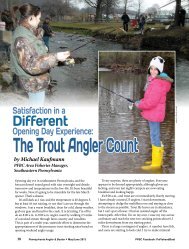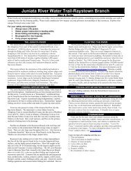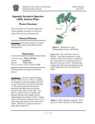
Complete report - Pennsylvania Fish and Boat Commission
Complete report - Pennsylvania Fish and Boat Commission
Complete report - Pennsylvania Fish and Boat Commission

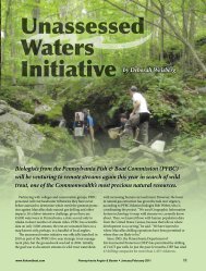
You also want an ePaper? Increase the reach of your titles
YUMPU automatically turns print PDFs into web optimized ePapers that Google loves.
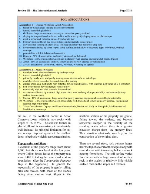
Section III – Site Information <strong>and</strong> Analysis Page III-8<br />
SOIL ASSOCIATIONS<br />
Association 1 -- Oquaga-Wellsboro-Arnot Association<br />
1. found on plateau areas that are dissected by streams<br />
2. formed in reddish glacial till<br />
3. shallow to deep, somewhat excessively to somewhat poorly drained<br />
4. sloping to steep soils on knobs <strong>and</strong> valley walls, some gently sloping areas on plateau tops<br />
5. most in woodl<strong>and</strong>, potential ranges from high to low<br />
6. tree harvesting difficult due to seep slopes <strong>and</strong> extremely stony surface<br />
7. only used for farming in a few areas, too steep <strong>and</strong> stony for pasture or crop l<strong>and</strong><br />
8. development limited by steep slopes, stony surface, <strong>and</strong> shallow to moderate depth to bedrock, bedrock<br />
outcrops<br />
9. potential for wildlife habitat <strong>and</strong> recreation<br />
10. Oquaga - 30% of association, moderately deep <strong>and</strong> well drained<br />
11. Wellsboro - 20% of association, deep <strong>and</strong> moderately well drained <strong>and</strong> somewhat poorly drained<br />
12. Arnot - 15% of association, shallow, somewhat excessively drained to well drained<br />
13. 35% of association - Lordstown, Morris, Norwich, Wyoming on upl<strong>and</strong>s<br />
Association 2 -- Morris-Wellsboro<br />
1. found on broad plateaus dissected by drainage ways<br />
2. formed in reddish glacial till<br />
3. primarily nearly level <strong>and</strong> gently sloping, some steeper soils on side slopes<br />
4. much have been cleared of trees <strong>and</strong> stones for farming<br />
5. cleared areas have medium to high potential for crops <strong>and</strong> pasture, with seasonal high water table a limitation<br />
6. non-cleared areas have extremely stony surface<br />
7. moderately high <strong>and</strong> high potential for woodl<strong>and</strong><br />
8. development limited by seasonal high water table, slow <strong>and</strong> very slow permeability, <strong>and</strong> extremely stony<br />
surface in some areas<br />
9. Morris - 40% of association, deep, somewhat poorly drained, fragipan <strong>and</strong> seasonal high water table<br />
10. Wellsboro - 32% of association, deep, moderately well drained <strong>and</strong> somewhat poorly drained, fragipan <strong>and</strong><br />
seasonal high water table<br />
11. 28% of association - Oquaga <strong>and</strong> Norwich on upl<strong>and</strong>s, Basher <strong>and</strong> Holly on floodplain, Medihemists <strong>and</strong><br />
Medifibrists in swamps<br />
the soil in the southeast corner is Arnot<br />
Channery Loam which is very rocky with<br />
slopes of 3% to 8%. The soil was formed in<br />
glacial till <strong>and</strong> is excessively to moderately<br />
well drained. Its principal limitation for onsite<br />
sewage disposal appears to be shallow<br />
depth to bedrock which is at seventeen inches.<br />
Topography <strong>and</strong> Slope<br />
Elevations of the property range from about<br />
1,300 feet above sea level at the low point<br />
where Collins Brook leaves the property to a<br />
some 1,400 feet along the eastern <strong>and</strong> western<br />
boundaries. (See the Topographic Features<br />
Map in the Appendix.) In general the<br />
topography of the property is gently rolling<br />
hills <strong>and</strong> swales, with most of the slopes<br />
facing either east or west. Slopes in the<br />
northern section of the property are gentle,<br />
falling toward the wetl<strong>and</strong>, <strong>and</strong> become<br />
somewhat steeper in the vicinity of the<br />
st<strong>and</strong>ing water where there is a greater<br />
elevation change from the property lines.<br />
This situation obviously was key to the<br />
construction of the original dam.<br />
There are several steep, rock outcrop ledges<br />
near the top of several of the ridges along with<br />
several areas with interesting bolder <strong>and</strong> rock<br />
outcrop formations. The soil surface varies<br />
from areas with a large amount of surface<br />
rock in the swales to relativity little visible<br />
surface rock on the slopes <strong>and</strong> terraces.<br />
Reining Pond Master Site Plan 04-05