GfK GeoMarketing Magazine 04|2011
GfK GeoMarketing Magazine 04|2011
GfK GeoMarketing Magazine 04|2011

You also want an ePaper? Increase the reach of your titles
YUMPU automatically turns print PDFs into web optimized ePapers that Google loves.
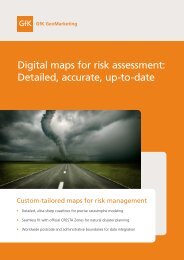
04 Digital maps<br />
Geomarketing: Postcodes comprise<br />
indispensable basis of planning<br />
Companies increasingly recognize the advantages of geographic analyses and their<br />
contributions to successful business planning. Postcode maps play a particularly<br />
important role in this regard. Good maps bring greater transparency and confidence<br />
to sales, marketing and controlling endeavors.<br />
Maps point the way to success<br />
"Geomarketing" has many names and<br />
faces including "business mapping"<br />
and "geographic market analysis" to<br />
name but a couple. Using a software<br />
application to carry out regional analyses<br />
that evaluate and visualize the<br />
place-based component of data on<br />
digital maps is now a common business<br />
practice around the world.<br />
Internationally active companies are<br />
particularly aware of the merits of a<br />
geographic analysis of their data and<br />
the resulting valuable insights. Applications<br />
of geomarketing range from<br />
the visualization of customer locations<br />
and definition of catchment areas to<br />
<strong>GfK</strong> <strong>GeoMarketing</strong> <strong>Magazine</strong> <strong>04|2011</strong><br />
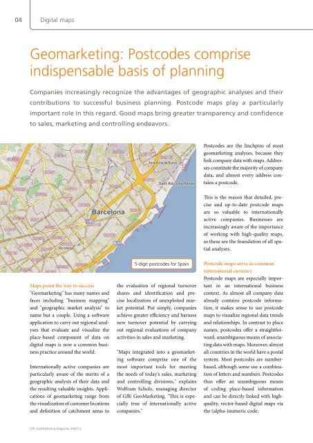
5-digit postcodes for Spain<br />
the evaluation of regional turnover<br />
shares and identification and precise<br />
localization of unexploited market<br />
potential. Put simply, companies<br />
achieve greater efficiency and harness<br />
new turnover potential by carrying<br />
out regional evaluations of company<br />
activities in sales and marketing.<br />
"Maps integrated into a geomarketing<br />
software comprise one of the<br />
most important tools for meeting<br />
the needs of today's sales, marketing<br />
and controlling divisions," explains<br />
Wolfram Scholz, managing director<br />
of <strong>GfK</strong> <strong>GeoMarketing</strong>. "This is especially<br />
true of internationally active<br />
companies."<br />
Postcodes are the linchpins of most<br />
geomarketing analyses, because they<br />
link company data with maps. Addresses<br />
constitute the majority of company<br />
data, and almost every address contains<br />
a postcode.<br />
This is the reason that detailed, precise<br />
and up-to-date postcode maps<br />
are so valuable to internationally<br />
active companies. Businesses are<br />
increasingly aware of the importance<br />
of working with high-quality maps,<br />
as these are the foundation of all spatial<br />
analyses.<br />
Postcode maps serve as common<br />
international currency<br />
Postcode maps are especially important<br />
in an international business<br />
context. As almost all company data<br />
already contains postcode information,<br />
it makes sense to use postcode<br />
maps to visualize regional data trends<br />
and relationships. In contrast to place<br />
names, postcodes offer a straightforward,<br />
unambiguous means of associating<br />
data with maps. Moreover, almost<br />
all countries in the world have a postal<br />
system. Most postcodes are numberbased,<br />
although some use a combination<br />
of letters and numbers. Postcodes<br />
thus offer an unambiguous means<br />
of coding place-based information<br />
and can be directly linked with high-<br />
quality, vector-based digital maps via<br />
the (alpha-)numeric code.<br />
What makes a good postcode map?<br />
The production of precise, up-to-date<br />
and gapless postcode maps requires<br />
significant expertise and effort. To<br />
create accurate postcode maps of a<br />
given country, map producers must<br />
consult with official bureaus of statistics,<br />
post offices, government agencies,<br />
other map providers and NGOs*. <strong>GfK</strong><br />
<strong>GeoMarketing</strong>'s in-house cartography<br />
division uses this information to<br />
create detailed postcode maps. These<br />
maps are then crosschecked against<br />
satellite/aerial images.<br />
One of the greatest challenges faced<br />
by map suppliers is comprehensively<br />
digitizing all postal boundaries in a<br />
given country. Every single postcode<br />
must be precisely rendered and the<br />
boundaries of all postcodes must fit<br />
together without gaps or overlaps.<br />
Visualizing postal boundaries is particularly<br />
demanding, because only a<br />
few countries in the world have official<br />
postcode maps. As a result, cartographers<br />
must painstakingly research<br />
* non-governmental organizations<br />
<strong>GfK</strong> <strong>GeoMarketing</strong><br />
and then manually digitize these<br />
boundaries. Cartographers therefore<br />
often play the role of detectives as they<br />
piece together and compare various<br />
sources in order to accurately digitize<br />
the postal boundaries. It's also essential<br />
that these boundaries form an<br />
enclosed geography without gaps or<br />
overlaps. This applies both to boundaries<br />
within a given country as well as<br />
those in neighboring countries.<br />
Only maps that meet these quality<br />
standards are suitable for geomarketing<br />
purposes such as sales territory<br />
planning and analyzing regional turnover.<br />
Maps quickly go out-of-date due to<br />
regional forms<br />
Even maps that fulfill these standards<br />
must be regularly updated in<br />
order to ensure the accuracy of any<br />
analyses carried out with them: "An<br />
out-of-date cartographic basis leads<br />
to many problems and even outright<br />
errors," warns Klaus Dittmann, head<br />
We are the location experts!<br />
Location and real estate reports: experienced, independent, international<br />
More information at www.gfk-geomarketing.com/real_estate<br />
New 2011 map updates<br />
Europe<br />
USA/Canada<br />
Africa<br />
Mexico<br />
Australia/New Zealand<br />
Russia<br />
World<br />
Free samples available at<br />
> gfk-geomarketing.com<br />
/map_samples<br />
of cartography at <strong>GfK</strong> <strong>GeoMarketing</strong>.<br />
"For example, an accurate analysis or<br />
optimization of a transport network<br />
requires up-to-date maps. Outdated<br />
map sources – such as those that<br />
don‘t reflect the many thousands<br />
of boundary changes implemented<br />
every year in Europe by the respective<br />
national postal services – can mean<br />
that data is incorrectly associated with<br />
the maps. In some cases, data can<br />
even be lost if the regions in question<br />
no longer exist." Given these require-