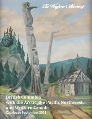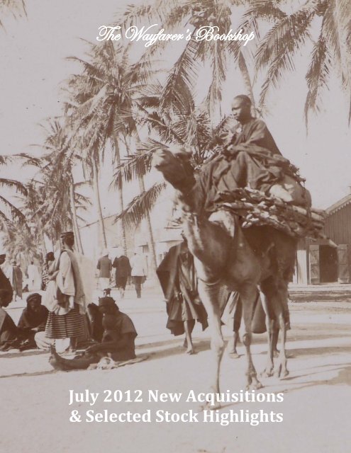
July 2012 New Acquisitions - The Wayfarer's Bookshop
July 2012 New Acquisitions - The Wayfarer's Bookshop
July 2012 New Acquisitions - The Wayfarer's Bookshop

Create successful ePaper yourself
Turn your PDF publications into a flip-book with our unique Google optimized e-Paper software.
<strong>The</strong> Wayfarer’s <strong>Bookshop</strong><br />
<strong>July</strong> <strong>2012</strong> <strong>New</strong> <strong>Acquisitions</strong><br />
& Selected Stock Highlights<br />
1
<strong>The</strong> Wayfarer’s <strong>Bookshop</strong><br />
<strong>July</strong> <strong>2012</strong> <strong>New</strong> <strong>Acquisitions</strong><br />
& Selected Stock Highlights<br />
www.wayfarersbookshop.com; e-mail: wayfarers@shaw.ca<br />
phone: +1 (604) 921 4196; fax: +1 (604) 921 4197<br />
Cover illustration – Avenue Dodds, St. Louis (Senegal) (item # 18)<br />
2
1. [AMERICAN WEST, PHOTOGRAPH ALBUM]<br />
[Album of over 320 Original Photographs of Travels by Automobile Through the American West,<br />
Including Scenes in California, the Grand Canyon, Yellowstone, Mt. Rainier National Park, Zion National<br />
Park and Bryce Canyon, Plus many Additional Commercial Photographs Obtained During the Trips].<br />
1923-1924. Oblong Folio (23,5x39 cm). In total over 480 images including over 320 original<br />
photographs ca. 7x11 cm (2 ¾ x 4 ½ in), over a hundred larger and sixty smaller commercial photographs<br />
(postcard size or smaller) mounted on 40 stiff cardboard leaves. Many photographs with captions: original<br />
images with manuscript or type written captions, commercial images captioned in negative; also many<br />
type written paper clippings with explanatory text under the images. With route maps, park permits and<br />
other travel ephemera tipped in. Period grey cloth album, spine is stitched through on top and bottom<br />
with a decorative string. A very good album with clear, bright photographs.<br />
An excellent photograph collection<br />
of three automobile tours in the American<br />
West in the early 1920’s. As seen from the<br />
travel ephemera included in the album<br />
(national parks permits and a certificate of<br />
accent of Pikes Peak Auto Highway in the<br />
Rocky Mountains), the travellers were Mr.<br />
L.L. Thomas and Mrs. Mary F. Thomas<br />
from Los Angeles driving their Studebaker<br />
(license plate # 418-248), with “number of<br />
firearms - 1.”<br />
1. <strong>The</strong> travellers next to their Studebaker<br />
<strong>The</strong>ir first journey (June - <strong>July</strong> 1923) started in Southern California and went through Arizona, <strong>New</strong><br />
Mexico, Colorado, Wyoming, Montana, Washington and back to Los Angeles through Oregon and<br />
California. <strong>The</strong> original photographs (over 160 images) show interesting views of the Amboy Crater in San<br />
Bernandino County, Colorado River, the Grand Canyon (including the Powell memorial), the Petrified<br />
Forest in Arizona, nice series of views of Pike’s Peak Auto Highway with stations on the way and on the<br />
summit (like “<strong>The</strong> Highest Building in America”), “Hell’s Half Acre” in Wyoming, many original images of<br />
Yellowstone (including erupting geysers and feeding bears by hand), Snoqualmie Falls and Wenatchee<br />
Forest, Mount Rainier National Park (including pictures of the park’s auto camp), several views of the<br />
Columbia River and the Oregon Coast (Port Orford, Crescent City, Crown Point on the Columbia River<br />
Gorge, Rogue River et al.). <strong>The</strong> original photographs are supplemented with over 70 large commercial<br />
photographs of the Grand Canyon, Yellowstone, the Arizona desert, and the Pikes Peak highway; and over<br />
60 smaller commercial photographs of Seattle, Columbia River and Mt. Rainier National park. <strong>The</strong><br />
collection is illustrated with a detailed map of the journey, two permits for admission to the Yellowstone<br />
and Mt. Rainier national parks, and a certificate of an accent of Pikes Peak Auto Highway in the Rocky<br />
Mountains.<br />
Especially interesting is the second journey of Mr. And Mrs. Thomas in the summer of 1924 to the<br />
San Joaquin Valley in Central California, and in particular to the area of the Big Creek Hydroelectric Project<br />
of the Southern California Edison Company. <strong>The</strong> photographs show such parts of the project as<br />
Huntington and Florence Lakes, the Big and Line Creeks and San Joaquin River, as well as company’s<br />
sawmill near Florence Lake. <strong>The</strong>re is also a series of group portraits of the top managers of the Company,<br />
most likely taken during their vacation tour, including those of Charles Heston Peirson, “Publicity Super<br />
3
Intendent” and later a vice-president of the Company, with his wife; and H.A. Barre, “Chief Executive<br />
Engineer whose brain conceived the greatest electric project in the world” with wife and daughter. Our<br />
traveller, Mary F. Thomas presents on one of the portraits.<br />
Another significant member of the vacation “party” was Charmian London (1871-1955), American<br />
writer and the widow of writer Jack London (1876-1916). She is present on at least four images, with “Mr.<br />
And Mrs. Growell” being on at least one<br />
(Willard L. Growell was Charmian’s cousin<br />
and one of the executors of the estate of<br />
Jack London according to latter’s will). <strong>The</strong><br />
reason why Charmian London was there is<br />
probably the fact that Charles Heston<br />
Peirson apart from his work at Southern<br />
California Edison, was one of “the oldest<br />
professional writers in America, having<br />
commenced when a boy of fourteen as a<br />
water front reporter in <strong>New</strong> York City”and<br />
had a long experience “in editorial and<br />
executive positions in the general offices of<br />
the Associated press in <strong>New</strong> York City” (<strong>The</strong><br />
Van Nuys <strong>New</strong>s. Vol. XV. # 67. April 9, 1926.<br />
P. 9). He must have known Mrs. London and<br />
invited her on that trip.<br />
1. A trip to Mount Rainier<br />
1. Big Creek Hydroelectric Project<br />
of the Southern California Edison Company;<br />
group photos with the top managers and Charmian London<br />
<strong>The</strong> pictures include interesting portraits of the party dressed in waterproof coats and hats, “on<br />
board cars, slickered and ready for the tunnel ride” - obviously, before visiting one of the tunnels built by<br />
the Southern California Edison Company within the hydroelectric system. A couple of postcard<br />
photographs of the Alaskan sled dog team illustrate the fact that in winter many Project’s facilities around<br />
Florence Lake were impregnable, and only by sledges mail, light supplies, and access to medical attention<br />
beyond the doctor in residence could be available for the Company employees there.<br />
4<br />
<strong>The</strong>re are also original images of<br />
the neighbouring Red Mountain and<br />
China Peak, the general store at the<br />
lakeshore resort, a portrait of “Neighbor<br />
Degan and Family” with their full address<br />
(E.J. Degan, 3216 Fairview Ave, Alameda -<br />
Calif.); images of the campsites on<br />
Huntington lake and of swimming class of<br />
the girls’ camp there et al. A “winter”<br />
series of images taken in the same area<br />
in October 1924 shows Huntington Lake,<br />
cottages and traveller’s “Stude” (with<br />
different license plate # 574-723) under<br />
the first snow.<br />
<strong>The</strong> third journey likely dated 1924 went across Arizona, Utah, and Nevada, and includes views of<br />
Zion, Grand Canyon and Bryce Canyon National Parks (33 original photos, 20 commercial photos and<br />
postcards and a map of the trip).<br />
Overall a very interesting collection of images of the American West.
Big Creek Hydroelectric Project was one of the largest and most extensive hydroelectric projects in<br />
the world. Southern California Edison owns and operates this engineering feat, commonly referred to as<br />
the Big Creek Project and dubbed “<strong>The</strong> Hardest Working Water in the World.” <strong>The</strong>re are nine power<br />
plants in the system, Portal, Eastwood, Mammoth Pool and Big Creek 1, 2, 2A, 3, 4 and 8. <strong>The</strong> lakes in the<br />
project include Huntington Lake, Shaver Lake, Redinger Lake, Florence Lake, Lake Edison, Mammoth Pool<br />
Reservoir (Sierra Nevada Geotourism Map Guide on National Geographic on-line; Wikipedia).<br />
$1500USD<br />
2. [CAPE TOWN, WATERCOLOUR VIEWS]<br />
[Three Original Watercolour Views of Cape Town].<br />
Ca. 1824. Watercolours on paper, two ca. 16,5 x 24 cm (6 ½ x 9 ¼ in) and a double-page leaf ca. 16,5<br />
x 47 cm (6 ½ x 18 ½ in). All unsigned, two with pencil captions on verso “Table Bay, Cape of Good Hope.”<br />
Recently matted, outside dimension ca. 54x68,5 cm (21 ¼ x 27 in). Very good watercolours.<br />
<strong>The</strong> first watercolour is a<br />
view of Cape Town from the<br />
harbour, with Table Mountain,<br />
Lion’s Head, Signal Hill and<br />
numerous boats and schooners in<br />
the harbour. A light gaze of<br />
clouds, or so called “Table cloth”<br />
is seen over the Table Mountain,<br />
pencil captions are added above<br />
the landmarks (Signal Hill is<br />
captioned “Lion’s Rump”). <strong>The</strong><br />
second watercolour shows Table<br />
bay from above, with numerous<br />
ships in the harbour. <strong>The</strong> third<br />
watercolour is a beautiful closeup<br />
of Cape Town with nice<br />
examples of Dutch Cape style<br />
buildings and a carriage with<br />
horses in the foreground. <strong>The</strong> watercolours were produced by a skilful amateur artist aboard the sloop<br />
Elphinstone (launched in 1824). She was in the service of the Honourable East India Company and<br />
travelled to the Mediterranean, around the southern tip of Africa and to the East Indies and Australia.<br />
$7500USD<br />
3. [COOK, James, Captain] (1728-1779)<br />
[All Three of Cook’s Voyages in Swedish] De Freville (A.F.J. De)Berattteles. Om de nya Uptackter,<br />
som bliswit gjorde i Soderhafwet Aren 1767-1770, &c., [With] Sammandrag af Capitain Jacob Cooks<br />
Åren 1772, 73, 74 och 1775, Omkring Södra Polen [With] Sammandrag of Captain Jacob Cooks Tredje<br />
Resa, i Soderhafwet och emot Norra Polen.<br />
Upsala: Johan Edman, 1776-1787. First Swedish Editions. Octavo, 3 vols. [xxviii], 308, [2], [ii], 326,<br />
[6]; [xx], 366, [10]; [xii], 618, [12], [2] pp. With two copper engraved folding maps Handsome period style<br />
matching brown gilt tooled half sheep with speckled papered boards and brown gilt labels housed in a<br />
matching slipcase. A fine set.<br />
Very Rare Complete set of all three of Cook’s Voyages in Swedish. <strong>The</strong> First Voyage is a translation<br />
from Freville’s compilation. <strong>The</strong> Second and Third Voyages were translated from the official accounts but<br />
5<br />
2
with editorial notes by an anonymous Finnish editor (Second Voyage) and Oedmann (Third Voyage). <strong>The</strong><br />
second voyage caused animosity between the editor and Sparrman who condemned the work and is<br />
ironically also listed as an author in the book. Du Rietz 1, 9, 12; Forbes 126 (Third Voyage).<br />
$5750USD<br />
3<br />
4. [FRANKLIN SEARCH]<br />
Arctic Miscellanies. A Souvenir of the Late Polar Search. By the Officers and Seamen of the<br />
Expedition.<br />
London: Colburn & Co., 1852. Second Edition. Octavo.<br />
xviv, 347, [1], 16, [2] pp. With a tinted lithograph<br />
frontispiece, and 17 woodcut engravings in text. Original<br />
publisher’s light blue decorative pictorial gilt and blind<br />
stamped cloth. A very good copy.<br />
“This work draws from a newspaper, the Aurora<br />
Borealis, published on the fifteenth of each month on board<br />
the ship Assistance, one of the squadron of vessels<br />
searching for Sir John Franklin in 1850-51. <strong>The</strong> circulation of<br />
the newspaper carried beyond the Assistance to her sister<br />
ships the Resolute, the Pioneer, and the Intrepid, all under<br />
the command of Horatio T. Austin.., This compilation prints<br />
a selection of articles. Captain Austin conducted extensive<br />
sledge journeys from Griffith Island in Barrow Strait.<br />
Although no traces of the Franklin expedition were found,<br />
many new coastlines were charted on this voyage” (Hill 33);<br />
“<strong>The</strong> collection includes a variety of .., informative articles<br />
by members of the expedition, on animals and birds, sledge<br />
journeys, entertainment, history, and the Eskimos, etc.”<br />
(Arctic Bibliography 651); Sabin 1924; TPL 3128.<br />
4<br />
$1750USD<br />
6
5. [HILDEBRANDT, Eduard, Attributed to] (1818-1868)<br />
[Original Watercolour View of Praya Grande, Macao].<br />
Ca. 1863. Watercolour on paper, ca. 25x37 cm (9 ¾ x 14 ½ in). Unsigned. Recently matted, outside<br />
dimensions ca. 41,5x54 cm (16 ½ x 21 ¼ in). A very good watercolour.<br />
This well executed watercolour of Macao harbour and Avenida de Praia Grande was most likely<br />
created by the German artist Eduard Hildebrandt during his travel around the world in 1862-64.<br />
Hildebrandt usually made several sketches and studies of his views which he later reworked into a final<br />
version in oil. He created an almost identical oil painting: “View of Praya Grande, Macau 1863” (now in<br />
the Hong Kong Museum of Art), and almost identical chromolithograph was included into the series of his<br />
works: “Aquarelle. Auf seiner Reise um die Erde” (Berlin, 1871-4).<br />
Eduard Hildebrandt was a German painter. He studied in Berlin and Paris and was a friend of<br />
scientist and explorer Alexander von Humboldt. Under the latter’s influence he took a voyage around the<br />
world in 1862-64, making watercolour views of many places he visited.<br />
“Fantasies in red, yellow<br />
and opal, sunset, sunrise and<br />
moonshine, distances of hundreds<br />
of miles like those of the Andes<br />
and the Himalaya, narrow streets<br />
in the bazaars of Cairo or Suez,<br />
panoramas as seen from mastheads,<br />
wide cities like Bombay or<br />
Pekin, narrow strips of desert with<br />
measure-less expanses of sky all<br />
alike display his quality of<br />
bravura” (Wikipedia).<br />
$3750USD<br />
5<br />
6. [ICE TRADE VOYAGE FROM BOSTON TO BUENOS AIRES]<br />
[Donati’s Comet] [Manuscript Journal of the Bark Augusta Mayhew’s (Captain Thorpe) Voyage<br />
from Boston to Buenos Aires in 1858].<br />
[Primarily at sea]: September - December, 1858. Large Quarto. Ink on laid paper, legible writing. 32<br />
pp. and over 100 blank leaves, ruled. Contemporary black half sheep with marbled boards and gilt tooled<br />
spine. Rubbed at extremities, minor scattered foxing, otherwise a very good journal.<br />
Important account of one of the first ice trade voyages from <strong>New</strong> England to Argentina; <strong>The</strong> journal<br />
describes a voyage of the Bark Augusta Mayhew from Boston to Buenos Aires (September 5th - December<br />
1st, 1858). As we get to know from the text, the ship was deeply loaded “with ice and tan” (see p. 18 of<br />
the journal), and had some passengers including children on board (p. 9 et al).<br />
At the beginning of the trip the winds were very weak so the ship moved very slowly crossing the<br />
equator only two months after departure; which caused numerous remarks in the journal about the<br />
dreary weather and their slow progress (e.g. “Ye gods! Are we destined to spend our days and finally lay<br />
our bones, within these latitudes... Oh dear! It is indeed tiresome, tedious to be compeled [sic] to remain<br />
in the same place, day after day night after night, with no prospect of ever getting out of it”).<br />
<strong>The</strong>n the author mentions Cape São Roque on the northeastern tip of Brazil, which latitude the bark<br />
passed on the 10th of November. On Nov 29th they started going to Rio de la Plata, passed Cape St. Mary,<br />
English Point, at night noticed the lighthouse on the Isla de Flores and in the morning a pilot from<br />
7
Montevideo guided them to the port. <strong>The</strong> entry for the 30th of November gives a vivid description of the<br />
Buenos Aires: “As we passed by the city, some 7 miles distant, we could not have so good a view as we<br />
wished. However, at this distance it has the appearance of a very clean and healthy place, large number<br />
of church spires. <strong>The</strong> land in general is low, well wooded and the homes are nearly all painted white,<br />
which peep out beneath the foliage look quite well. <strong>The</strong> shipping is small, there are at present some 6 or 7<br />
men o’war at anchor.”<br />
6<br />
<strong>The</strong> journal contains a description and several notes of Donati’s Comet which was first observed by<br />
Giovanni Battista Donati on June 2, 1858, and “was the most brilliant comet that appeared in the 19th<br />
century” (Wikipedia). First notes about the comet are dated September 17 and 23 and mention “a comet<br />
with a long tale”; the entry from Oct 3rd says: “<strong>The</strong> Comet has been is sight all the last week, and each<br />
night it appears larger, with its fiery tail increasing, both in length and width, last night it was 20 to 24<br />
degrees long, and about 4 wide at its extreme length.” <strong>The</strong> sailors ascribed to it their misfortune with<br />
weak winds and calm weather, noting “I wonder if it has anything to do with our having so much light air<br />
and calm sea for the last 10 days; at the rate we are going, or have been going, it will take a year or more<br />
to get at our port of destination.” <strong>The</strong> Comet became “quite faint” on the 10th of October. It is<br />
interesting, that “Abraham Lincoln, then a candidate for a seat in the U.S. Senate, sat up on the porch of<br />
his hotel in Jonesboro, Illinois to see “Donti’s Comet” on September 14, 1858, the night before the third of<br />
his historic debates with Stephen Douglas” (Wikipedia).<br />
<strong>The</strong> journal also registers several ships encountered on the way: Bark Nimrod from Boston bound<br />
to Rio, with quite a number of passengers (Oct 14); Schooner Flirt also bound for Buenos Aires (Oct 25);<br />
Bark Atlantic Coleman, from Nantucket on a whaling voyage to Rio de la Plata and then around the Cape<br />
(Nov 15); ship Humboldt bound from <strong>New</strong> York to Singapore (Nov 19). He does record latitude and<br />
longitude and the winds, though, at least what winds there are; the numerous sea birds and animals<br />
encountered (including a sketch of a sea perch which the author caught, p. 12).<br />
<strong>The</strong> keeper of the journal most likely was a crew member of the bark. He says at one point, “I<br />
manage to pass the time away quite agreeable. What, with reading, keeping Capt. Thorp’s Abstract Log,<br />
according to the directions of Lieut. Maury, and lending a hand on deck at times, I get through the hours<br />
of the day very well. So, when the night comes, and eight bells are rung, some the watch of night<br />
attentive keep, while I, profoundly in my hammock sleep.” He also mentions that his first voyage he made<br />
on Mary Mitchel bound to California about 10 years ago (1848).<br />
8
Apart from registering nautical details<br />
the account is very poetic. First it includes<br />
numerous quoting of William Falconer’s poem<br />
<strong>The</strong> Shipwreck (1762); and the author’s own<br />
rhapsodizing: “Lo - Once more I am afloat on<br />
the fearce [sic] rolling tide the ocean is my<br />
home, and the Bark is my bride, and as the<br />
high land fades fast from our view I cannot<br />
feel but sad, sad to think that year’s must pass<br />
ere I again behold these well known scenes, or<br />
revisit the haunts of my childhood, yet such is<br />
my fate, ever to be roaming in some foreign<br />
clime.”<br />
9<br />
6. An entry about Donati's Comet<br />
<strong>The</strong>re is a very nice description of a storm in mid-Atlantic: “Nothing could look more dreary than<br />
the weather this morning. Pile on pile of dark and ominous clouds are heaped together in wild confusion<br />
off the N.E. <strong>The</strong> sea is running mountain high, and as we settle down between them, to look up, and gaze<br />
at those huge billows, towering high-high above us, with its foam covered head, and expecting every<br />
moment to be engulfed within its dark embrace is indeed terrible” (September 20). <strong>The</strong>re is also a chance<br />
for the readers to acquaint themselves with a sailor’s folklore: “A rainbow in the morning sailor take<br />
warning, a rainbow at night is the sailor’s delight” (p. 5). <strong>The</strong> journal ends abruptly, mid-sentence.<br />
As to Augusta Mayhew, it belonged to the <strong>New</strong> York firm Simpson and Mayhew and was lost on<br />
January 27th, 1860: “This bark, which left <strong>New</strong> York some time since, in ballast, bound to Sagua la Grande,<br />
ran on the Cauy del Padre reef, at 2 a.m. Of this day. <strong>The</strong> Augusta Mayhew was built at Millbridge, in<br />
1857, 433 tons register, rated A2, and was owned by Z. Mayhew, of <strong>New</strong> York, and insured in Wall street<br />
for about $18,000. She will prove a total loss” (Vincent’s Semi-Annual United States Register. January 1st -<br />
<strong>July</strong> 1st, 1860. Philadelphia, 1860, p. 67).<br />
$1750USD<br />
7. [JAPAN AND RUSSIA, PHOTOGRAPH ALBUM]<br />
[Album of 95 Original Photographs Showing Japan and Russia].<br />
Ca. 1920. Quarto (27x20 cm). 95 photographs ca. 8x13,5 cm (3 ¼ x 5 ½ in) mounted on 24 stiff<br />
cardboard leaves. <strong>The</strong> vast majority<br />
of the photographs with period<br />
captions in French. Period green<br />
cloth album. Corners bumped, weak<br />
on hinges, spine with small minor<br />
tears on top and bottom, but overall<br />
a very good album.<br />
Interesting photograph<br />
collection compiled by a French<br />
officer, Captain Trabuc, during his<br />
travels through several Japanese<br />
cities (Kyoto, Nara, Osaka), before<br />
journeying through Russia on the<br />
Trans-Siberian Railway.<br />
7. Captain Trabuc in palanquin, Japan
<strong>The</strong> first part of the album includes about 77<br />
photographs of Japan showing landscape views, monuments,<br />
people in native dress, celebrations or street views: <strong>The</strong> Road<br />
to Hakone (2 photographs); Umijera (2); Around Myanoshita<br />
(6 photographs of which 2 about lake Ashinoko); Kyoto (20<br />
images including Kyoto museum; Taigokuden, Chioin and<br />
Goshyo temples; zoological garden, Myako hotel, Kijodi and<br />
Hashiasto (portraits), pleasure quarters, cherry blossom<br />
dance, a geisha playing Samisen and dancing Tokiwazu, Gion<br />
festival et al.); Rapids on the river Ozu (2); Nara (12 images<br />
including Kasuga park, Temmango, Takisaka, Dai-Butsu<br />
temples, a sacred doe et al.); Osaka (3); Miyazu (2); Amano<br />
hashidate scenic view (3); Tsuruga (7 images including mill,<br />
Shinto temple, a view of the harbour, women bringing up coal<br />
to boats et al).<br />
Captain Trabuc, who put together this album appears<br />
several times: in Kyoto, wearing a uniform, while visiting<br />
Taigokuden shrines and Chioin; in Amano hashidate, carried<br />
around by two men on a palaquin, in San-Kcy; at a hotel in<br />
Tsuruga, clad in a kimono and holding a child; in Miyazu, still<br />
kimono-clad having a meal. Another officer, commandant 7. A railway station near Krasnoyarsk<br />
Borel, in a rickshaw rides through the streets of Osaka.<br />
Photographs of Russia include scenes in Vladivostok and Irkutsk, five views of Lake Baikal, images of<br />
train station in Novo-Nikolaevsk, several markets along the Trans-Siberian Railroad, et al. Two images<br />
show the armoured train of ataman Grigory Semyonov (1890-1946), a Japanese-supported leader of the<br />
Russian White movement in Transbaikal and beyond from December 1917 to November 1920, Lieutenant<br />
General and Ataman of Baikal Cossacks (1919) (Wikipedia). <strong>The</strong> photographs were taken in Chita (Siberia)<br />
and show a prison car and a group of Russian soldiers by a canon of an armoured wagon. In November<br />
1920 Semyonov was expelled from the Lake Baikal area by the Red Army. After working with the Japanese<br />
secret services, he got arrested by the Soviets in September 1945 and was then executed.<br />
$2750USD<br />
8. [JAPAN, WATERCOLOUR VIEWS]<br />
COUCHOUD, Paul-Louis (1879-1959)<br />
& FAURE, André<br />
A Collection of Watercolours and Ink<br />
Drawings By a European Depicting Japanese<br />
Landscapes and Scenes and Influenced by the<br />
Style of Japanese Woodcuts.<br />
Ca. 1903-4. Nine watercolours and six ink<br />
drawings, on album leaves ca. 22,5x14,5 cm (8 ¾<br />
x 5 ¾ in). <strong>The</strong> leaves are originally from the same<br />
album, but seven on vellum paper and eight on<br />
laid paper; all mounted in recent mats and<br />
housed in a custom made dark brown half cloth<br />
clam-shell portfolio with marbled boards and gilt<br />
black morocco labels on front cover and spine.<br />
10<br />
8. Mount Fuji and the shores of Japan
Several leaves captioned in pencil in Japanese, one in French (also in pencil, on verso): “Portrait de Couchoud<br />
(au cours de son voyage).” Two leaves with minor stains not affecting images, otherwise a fine set.<br />
Beautiful watercolours and drawings from the first<br />
trip to Japan in 1903-4 by French poet and philosopher<br />
Paul-Louis Couchoud, an admirer of Japan and the first<br />
French author to compose Haiku poems. He travelled to<br />
Japan twice; the first time in September 1903 - May 1904<br />
with his friends, sculptor Albert Poncin and painter André<br />
Faure. While going on a boat cruise along Japanese canals,<br />
the party wrote Au fil de l’eau, a collection of 72 haiku<br />
poems privately published in only 30 copies (1905). After<br />
the next trip to Japan and China Couchoud published the<br />
anthology Les épigrammes lyriques du Japon (1906) and<br />
Sages et poètes d’Asie (1916, English translation - Japanese<br />
Impressions, 1920).<br />
Our collection was most likely produced during his<br />
first trip and is clearly influenced by the elegant Ukiyo-e,<br />
the technique of Japanese woodcuts. Poetical and<br />
attentive, the artist notes the smallest details and creates<br />
the atmosphere of harmonious serene life of traditional<br />
Japan. Most likely, it was Couchoud’s travel companion,<br />
painter André Faure, who made the drawings and<br />
watercolours. <strong>The</strong> watercolours include a view of Mount<br />
Fuji, two views of Japanese temples, scene with Japanese<br />
musicians and dancers, two marine landscapes, a portrait<br />
of a reading woman, a palanquin, and the “Portrait of<br />
Couchoud (during the trip)” as indicated in the caption.<br />
11<br />
8. Paul-Louis Couchoud during his trip to Japan<br />
<strong>The</strong> ink drawings include: Geisha playing shamisen, two students writing and counting, a family in<br />
front of a stall, sketches of women’s costumes, old laundresses and Buddha sculpture. One of the leaves<br />
has an ink sketch of traditional women’s knots on verso; the other - a watercolour with a temple and a<br />
Buddhist monk in front. Overall a beautiful collection.<br />
However it is only with the publication<br />
of Au fil de l’eau in 1905 that a first serious<br />
attempt was made to compose Haiku in<br />
French. During a canal-boat cruise in 1903,<br />
the authors, Paul-Louis Couchoud, Albert<br />
Poncin and André Faure composed 72 haikai<br />
that were compiled into a collection<br />
privately published. Couchoud who taught<br />
his friends the Japanese genre, was a<br />
professor of philosophy and doctor of<br />
medicine. He had traveled to Japan and had<br />
been seduced by Japanese poetry and the<br />
haiku. Without any doubt not only did he<br />
initiate French language Haiku but he also<br />
became the first true French expounder and initiator of the genre in a series of two articles entitled Les<br />
épigrammes lyriques du Japon in 1906 (Agostini, B. <strong>The</strong> Development of French Haiku in the First Half of<br />
the 20th Century: Historical Perspectives // Modern haiku. Vol. 32.2. Summer 2001).<br />
$7500USD
9. [MADAGASCAR, DRAWING]<br />
[Original Drawing of Nosy Ankarea Island, Madagascar].<br />
Ca. 1840. Pencil on paper, heightened in<br />
white and colours, ca. 30,5x47 cm (12 x 18 ½<br />
in). Mounted on larger sheet of card, ca.<br />
39x56 cm (15 ½ x 21 ¾ in). Captioned in pencil<br />
“anKarea” in the left lower corner. Minor<br />
staining on blank margins, otherwise a very<br />
good drawing.<br />
This detailed and nicely executed<br />
drawing represents a small pristine island in<br />
the Indian Ocean, known as a place of worship<br />
by the local people. <strong>The</strong> view was most likely<br />
taken from a ship and shows Nosy Ankarea’s<br />
steep rock (219 m), a small camp of tents, a<br />
group of local people and a canoe on the beach, and a boat with sailors going to shore.<br />
$2500USD<br />
10. [MAURITIUS, WATERCOLOURS]<br />
[Two Original Watercolour Panoramas of Port Louis in Mauritius].<br />
10<br />
Two early evocative views of Mauritius. <strong>The</strong><br />
first watercolour is an early depiction of Port Louis<br />
from the harbour, with surrounding mountains of<br />
the Moka Range (including Le Pouce) in the<br />
background, mostly wooden houses on the shore<br />
and several naval vessels in the harbour. <strong>The</strong><br />
second view shows Port Louis from above, likely<br />
from the top of Le Pouce, the third highest<br />
mountain in Mauritius, at 812 meters. <strong>The</strong><br />
watercolours were produced by a skilful amateur<br />
artist aboard the sloop Elphinstone (launched in<br />
1824). She was in the service of the Honourable<br />
East India Company and travelled to the<br />
Mediterranean, around the southern tip of Africa and to the East Indies and Australia.<br />
$5250USD<br />
12<br />
Ca. 1824. Watercolours on paper,<br />
first ca. 16,5x23,5 cm (6 ½ x 9 ¼ in) and<br />
second ca. 16,5x33 cm (6 ½ x 13 in). Both<br />
watercolours unsigned, but with period ink<br />
captions on verso. Recently matted, outside<br />
dimension ca. 58,5x49,5 cm (23 x 19 ½ in).<br />
Very good watercolours.<br />
9<br />
10
11. [MOMBASA, WATERCOLOUR]<br />
[Original Watercolour Panorama of Mombasa].<br />
Mombasa, ca. 1880. Watercolour and ink on paper, ca. 11,5x29,5 cm (5 ½ x11 ½ in). Mounted on<br />
period beige laid paper and recently matted, outside dimensions ca. 30,5x46,5 cm (12 x 18 ½ in).<br />
Captioned in ink “Mombasa through the Glass from the Anchorage” in the left lower corner; additional ink<br />
caption on the laid paper “Mombasa - a town on the coast north from Zanzibar.” Minor creases on the left<br />
corners, with a minor stain, otherwise a very good watercolour.<br />
A tranquil view of Mombasa, likely just before the time when it came under the administration of<br />
the British East Africa Association.<br />
$1450USD<br />
12. [NAPLES, WATERCOLOUR]<br />
[Original Watercolour View of Naples from Posilippo, Showing Mount Vesuvius and the Gulf of<br />
Naples with numerous Ships and Boats; Port of Naples with the Lighthouse on the far left].<br />
Ca. 1850. Watercolour and ink on watermarked Whatman paper, ca. 20x29,5 cm (7 ¾ x11 ½ in).<br />
With a fragment of a watercolour<br />
and ink architectural drawing on<br />
verso, and a pencil caption “Mai<br />
1850 [?]. Blick von Posilippo.”<br />
Recently matted, outside dimensions<br />
ca. 37x46 cm (14 ½ x 18 ¼ in). A near<br />
fine watercolour.<br />
<strong>The</strong> watercolour was most<br />
likely created on a patio of one of<br />
the villas of Posilippo, “a residential<br />
quarter of Naples, located along the<br />
northern coast of the Gulf of<br />
Naples” (Wikipedia); with two chairs<br />
or benches on the foreground. Some<br />
smoke coming from above the right<br />
peak of Vesuvius.<br />
$975USD<br />
12<br />
13<br />
11
13. [PERON, Francois] (1775-1810)<br />
& FREYCINET, Louis-Henri de Saulces, Baron de (1777-1840)<br />
[ATLAS VOLUME] Voyage de Decouvertes aux Terres Australes, execute par ordre de Sa Majeste<br />
l’Empereur et Roi, sur les corvettes le Geographe, le Naturaliste, et la goelette le Casuarin, pendant les<br />
annees 1800, 1801, 1802,1803 et 1804. Atlas Historique only, [by Leseur et Petit]. [Voyage of Discovery<br />
to Terra Australis, executed by order of His Majesty the Emperor and King, on the corvettes Geographe,<br />
the Naturalist, and the schooner the Casuarina during the years 1800, 1801, 1802.1803 and 1804].<br />
Paris: Chez Arthus Bertrand, 1824. Second Edition. Folio. [x] pp. With an engraved title with<br />
vignette, a double-page engraved map of Australia, eight other engraved maps and charts and fifty-nine<br />
engraved plates, including two double-page, and 27 hand-colored. Beautiful period style crimson very<br />
elaborately gilt tooled full straight grained morocco with marbled end papers. A near fine copy.<br />
“In 1800 an expedition organized by the Institute of France and placed under the command of Nicolas<br />
Baudin sailed for the South Seas. <strong>The</strong>ir particular instructions were to make a full and minute examination of<br />
the Australian coasts, and especially to explore the southern coast, “where there is supposed to be a strait<br />
communicating with the Gulf of Carpentaria, and which consequently would divide <strong>New</strong> Holland into two<br />
large and almost equal islands.” <strong>The</strong> maps and charts [were] prepared by Freycinet, who continued the<br />
publication after the death of Peron.., Peron the naturalist on this voyage, was able to prepare a huge<br />
zoological collection that was known for years for its excellence” (Hill 1329 (First Edition)).<br />
13<br />
This very scarce second edition was prepared by Freycinet after he returned from his own<br />
expedition to the Pacific between 1817 and 1820. It is not generally known that the 1824 second edition<br />
of the ‘Partie Historique’ contains some significant changes and additions to the first edition. <strong>The</strong> maps<br />
and charts of the first edition atlas, which bore the nationalistic and ambitious name of Terre Napoleon<br />
and included imperial French names for many parts of the coast, were omitted or greatly altered for the<br />
second edition atlas. This atlas also includes twenty-five new plates, many of which are coloured.<br />
Freycinet’s alterations to the second edition reflect the political reality of the times and finally recognize<br />
the just claims of the English navigators, in particular Matthew Flinders, to the discovery of the Australian<br />
coast. Copies of the second edition of the ‘Partie Historique’ appear to be rarer, copy for copy, than the<br />
first edition and are prized accordingly” (Wantrup p. 157-9); Ferguson 979; “In 1800 [Peron] was engaged<br />
by Nicolas Thomas Baudin as ‘trainee zoologist charged with comparative anatomy’ for Baudin’s<br />
exploratory voyage to the southern and western coasts of Australia” (Howgego 1800-1850, P21).<br />
$19,500USD<br />
14
14. [PORT SAID, ADEN, ZANZIBAR & UGANDA PHOTOGRAPHS]<br />
[Photograph Album of 48 Photographs & Photogravures of Port Said, Aden, Zanzibar and Uganda<br />
from the Trip of a German Traveller].<br />
Ca. 1900. Oblong small folio (35x25,5 cm or 13 ¾ x 10 ¼ in). Nineteen stiff card leaves with<br />
photographs and prints tipped in, several loosely inserted in the end. <strong>The</strong> size of the images varies from ca.<br />
22x17 cm (8x6 in) to ca. 16,5x9 cm (6 ½ x 3 ½ in). <strong>The</strong> majority are with pencil captions in German on<br />
verso. Period brown buckram with printed label “Etama” on the last pastedown endpaper. One image with<br />
a repaired tear, several images slightly faded, but overall a very good album.<br />
14. Zanzibar's House of Wonders<br />
<strong>The</strong> Zanzibar images include eleven<br />
photographs by Pereira de Lord Brothers, who<br />
were among the most prolific photographers at<br />
Zanzibar, with their wet stamps on versos. <strong>The</strong><br />
images show views of the Zanzibar Old city –<br />
Stone town, including the Sultan’s palace with<br />
the electric tower next to it (the building was<br />
named “House of Wonders” because it was the<br />
first building in Zanzibar to have electricity, and<br />
also the first building of East Africa to have an<br />
elevator), English church, city streets,<br />
traditional Zanzibari wooden carved door,<br />
forest landscape et al.<br />
15<br />
Interesting collection of photographs of<br />
Aden, Port Said, Zanzibar, and Uganda taken at<br />
the end of the 19 th century including both<br />
postcard type prints by major local photographers<br />
and unique photos made by the traveller. <strong>The</strong><br />
collection includes large photogravure views of<br />
Port Said by Cairo photographers Lichtenstern &<br />
Harari (five prints, with three numbered 162, 168,<br />
184 in the negative), and six smaller Port Said<br />
postcard type views; eight views of Aden<br />
captioned in English in the negative by J.M.C. (in<br />
British Library collection deciphered as J.M.<br />
Clayton), including two large two part panorama<br />
43x15,5 cm.<br />
14. A young Sultan in Uganda<br />
Among pictures from Uganda is an interesting group portrait of a young sultan with his suite and<br />
European colonial officials, a view of Entebbe (British colonial centre since 1893) and two scenes of<br />
military parade of the local troops commanded by British officers. A photograph stamped “Alfred Lobo.<br />
Entebbe. Uganda” shows an African tribesman with shield and spear and in war paint. <strong>The</strong>re are also<br />
several other unidentified interesting photographs showing African nobility, European colonial officials<br />
(also having a drink together), landscapes and African natives.<br />
$2750USD
15. [SAINT HELENA, DRAWING]<br />
[Original Pencil Sketch Showing a Panorama of St. Helena from the Sea].<br />
Ca. 1845. Pencil and watercolour on cardboard, ca. 14x22 cm (5 ½ x 8 ¾ in). Captioned in ink “S’<br />
Helena” in the right upper corner; ink caption “View of James’ Town, St. Helena” and signature on verso.<br />
Recently matted, outside dimensions ca. 30,5x40,5 cm (12x16 in). A couple of minor stains on the upper<br />
margin, otherwise a very good sketch.<br />
<strong>The</strong> drawing shows a panorama of Jamestown and James Bay with its steep cliffs; three navy<br />
vessels are seen in the foreground. <strong>The</strong> spire of Saint James’ Church is also seen.<br />
“Jamestown is the capital and<br />
historic chief settlement of the island of<br />
Saint Helena, in the South Atlantic Ocean.<br />
It was founded when English colonists<br />
settled on the island in 1659; St Helena is<br />
the second-oldest remaining British<br />
territory, after Bermuda. <strong>The</strong> town is built<br />
on igneous rock in a small enclave,<br />
sandwiched between steep cliffs (that<br />
form James Valley) that are unsuitable for<br />
building. <strong>The</strong> town is therefore rather long,<br />
thin and densely populated, with tightly<br />
knit, long and winding streets. Shrubs and<br />
trees decorate some of the street corners.<br />
<strong>The</strong> surrounding terrain is rough and<br />
steep, and rockfalls are an occurrence,<br />
sometimes damaging buildings” (Wikipedia).<br />
16<br />
15. Enlargement view of Jamestown<br />
Saint James’ Church in Jamestown is the oldest Anglican Church in the southern hemisphere (built in<br />
1774). <strong>The</strong> present sketch shows the church after alterations made in 1843, with a high spire. Nowadays the<br />
church doesn’t have it as “the spire was taken down in 1980 for safety reasons” (Wikipedia).<br />
$575USD<br />
16. [SECOND GERMAN ANTARCTIC EXPEDITION 1911-1912]<br />
[Eight Drawings Most Likely Produced After the Return of the Second German Antarctic<br />
Expedition 1911-1912 under <strong>The</strong> Command of Wilhelm Filchner (1877-1957), German Geophysicist and<br />
Explorer].<br />
Ca. 1920. Eight artistic pencil drawings, including two larger 25x32,5 cm (12 ¾ x 9 ¾ in) and six<br />
smaller, ca. 21x15 cm (8 ¼ x 5 ¾ in); all recently matted. Drawings on Whatman paper, unsigned; smaller<br />
ones with later pen captions on verso - “im Antarktika” and wet stamps “8208.” Housed in custom made<br />
blue half cloth portfolio with gilt lettered sheep labels on spine and front board titled “Deutsche<br />
Spitzbergen und Südpolarexpedition 1908-1912.” A fine group of drawings.<br />
<strong>The</strong> larger drawings show a group of explorers on a dog sledge moving through the glacier and the<br />
expedition ship Deutschland under German merchant flag in the icy waters passing icebergs. <strong>The</strong> smaller<br />
drawings show people sheltering from a blizzard under sledges (with reindeers outside), fighting with a<br />
blizzard, taking pictures of sea elephants and watching whales, and rescuing a member from a crevasse<br />
with a sledge. Overall a beautiful artistic collection, most likely executed after the trip for inclusion in a<br />
book.<br />
“Filchner’s original intention, similar to that envisaged in England at the same time by Shackleton,<br />
was for one party to approach the continent through the Weddell sea, while a second would establish a
ase on the shores of the Ross Sea. Land parties would them be sent out and attempt to meet up at the<br />
center of the continent, thereby ascertaining whether the Antarctic continent was a continuous landmass<br />
or simply a collection of large islands. Unfortunately, inadequate funding precluded such a grandiose<br />
undertaking, and by 1910, when the final proposals were announced publicly, Filchner had already<br />
trimmed the enterprise to just the Weddell Sea party and a single ship.<br />
Of the scientists selected by Filchner, none had previous experience of polar conditions, so in the<br />
summer of 1910 Filchner took an expedition to Spitsbergen (= Svalbard) to test out not only the scientists,<br />
but also their equipment. With him were Heinrich Seelheim (second-in-command), Erich Przbyllock<br />
(astronomer and magnetician), and Erich Barkow (meteorologist), all of whom would escort Filchner to<br />
Antarctica. <strong>The</strong> party was accompanied by the geologist Hans Philipp (professor at Cologne University)<br />
and the mountaineer Karl Potpeschnigg. With considerable difficulty the party crossed the Spitsbergen<br />
cap, and at one time was reported missing, presumed dead. However all returned safely to Germany and<br />
in 1911 Filchner published in Berlin a prospectus for the Antarctic expedition. <strong>The</strong> total complement was<br />
thirty-five crew and scientists. Twelve Manchurian ponies and two Greenland dog-teams were also<br />
embarked.<br />
By the middle of June 1912, measurements showed that the drift had taken Deutschland to a point<br />
about sixty kilometres to the east of the position where in 1923 the American sealer Benjamin Morrell<br />
had reported sighting land: Knowland, known as “<strong>New</strong> South Greenland” or “Morrell’s Land”; no other<br />
ship had since sailed close enough to confirm its existence. On 23.6.12 Filchner, Kling and König set out<br />
with two sledges, each drawn by eight dogs, in the direction of Morrell’s Land with provisions for three<br />
weeks. In exceptionally difficult conditions, with temperatures falling to -35 C and daylight lasting only<br />
two hours, the three men reached 70°32’S/43°42’W, from where Morrell’s Land should have been visible<br />
if it existed at all. A lead weight was lowered 1600 metres through a hole hacked through the ice, at which<br />
depth the line broke. Convinced that Morrell’s Land was nothing more than a mirage or an iceberg, the<br />
17<br />
16
team turned back for the journey home. However, by now<br />
large cracks had appeared in the ice, necessitating constant<br />
detours, while the Deutschland had in the meantime<br />
drifted sixty kilometres to the southwest of its previous<br />
position. However, by a remarkable feat of navigation, Kling<br />
successfully brought the team back to the ship on 30.6.12<br />
after eight days on the ice.<br />
During the voyage Filchner had started work on his<br />
narrative of the expedition, Zum sechsten Erdteil, which he<br />
completed at Bad Haudheim while convalescing from an<br />
injury sustained when he fell from a ship’s mast. <strong>The</strong> book<br />
was published at Berlin in 1922 with contributions from<br />
Seelheim, Przybyllok and Kling, together with an<br />
introduction by Nordenskjöld. Apart from a brief account<br />
by Johannes Müller, no further book-length reports were<br />
published until 1985 when a collection of articles was<br />
printed at Munich by the Bavarian Academy of Sciences. No<br />
translation of Filchner’s work was made until 1994 when<br />
William Barr published his definitive To the Sixth Continent<br />
with its English translation of most of the relevant<br />
documents” (Howgego. 1850-1940, Polar Regions, F7).<br />
$4750USD<br />
18<br />
16. Taking pictures of sea elephants<br />
17. [SEMIVSKII, Nikolai Vasil’evich]<br />
Noveishie, Liubopytnie I Dostovernie Povestvovaniia o Vostochnoi Sibiri, Iz Chego Mnogoe<br />
Donyne ne Bylo Vsem Izvestno [<strong>The</strong> <strong>New</strong>est, Curious and Reliable Description of Eastern Siberia Mostly<br />
Previously Unknown to the Public].<br />
Saint Petersburg: [Typography of the<br />
Imperial General Staff], 1817. First and Only<br />
Edition. Quarto. [18], 230, 185-186, 183 pp.<br />
Title page, engraved title, engraved<br />
dedication leaf. With ten copper engraved<br />
plates, and two large folding copper<br />
engraved maps of Baikal lake and Eastern<br />
Siberia (the latter hand coloured), and a<br />
large folding table at rear. Original<br />
publisher’s gray paper wrappers housed in<br />
a recent custom made dark gray clamshell<br />
box. Wrappers worn, with creases and a<br />
repaired tear, margins slightly rubbed and<br />
soiled, but overall a beautiful copy in its<br />
original state, uncut and with large 17. A view of the mountains of the right bank of Angara<br />
margins.<br />
(plate III)<br />
Very Rare with only four copies found in Worldcat.<br />
One of the earliest descriptions of Eastern Siberia, the book was written by Nikolai Vasil’evich<br />
Semivskii, a vice-governor of Irkutsk (1806-1809); and published on assignment of the Russian Emperor<br />
whose administration donated 5000 roubles for its publication.
<strong>The</strong> book contains an extensive and well<br />
written description of Irkutsk and its<br />
surroundings, the Irkutsk province including its<br />
Arctic and Pacific regions, Lake Baikal, the Lena<br />
and Angara Rivers and their tributaries; details of<br />
the region’s industry and trade et al. Separate<br />
chapters tell about Saint Innocent of Irkutsk, and<br />
a local Voznesensky monastery. <strong>The</strong>re is also a<br />
description of a route from Saint Petersburg to<br />
Irkutsk by land or river, with all stops along the<br />
way, and a table of distances between the cities<br />
of the Irkutsk province and the Russian capitals<br />
(Saint Petersburg and Moscow). <strong>The</strong> book has 50<br />
numbered “Comments or Curious Notes”<br />
supplementing the chapters on miscellaneous<br />
matters: notes about meaning of the word<br />
“Siberia,” the recent Russian embassy to China,<br />
trade in Kyakhta and the stations of the Chinese<br />
border, earthquakes in Irkutsk, navigation on<br />
Baikal and the River Amur, Russian monastery in<br />
Peking, a brief description of Chukotka, a list of<br />
some local words and expressions et al. An<br />
anonymous poem about Baikal - one of the first -<br />
entitled “A Letter from Neva to Angara” is<br />
included in the text.<br />
One of the letters published before the<br />
main text mentions the renowned Russian<br />
navigator and explorer Gavriil Sarychev (1763-<br />
1831) who reviewed the Povestvovaniia and<br />
testified that “the North-Eastern part of Siberia<br />
which he had a chance to travel through was<br />
described in its true state, regarding both its<br />
geography and inhabitants” (see p. [7]).<br />
<strong>The</strong> book is supplemented with two<br />
accurately executed maps of Eastern Siberia and<br />
Lake Baikal, and ten views of Irkutsk, Baikal,<br />
Angara and Lena. <strong>The</strong> map of Baikal, dated 1806<br />
and supplemented with a decorative cartouche<br />
“A view of Nikolskaya pier at the point where<br />
Angara flows out of Baikal,” is one of the first<br />
detailed maps of the lake. <strong>The</strong> map of Eastern<br />
Siberia dated 1816 shows the Siberian Arctic<br />
shore from the Kara Sea to Bering Strait, with<br />
parts of Alaska and Aleutian Aslands; borders<br />
between different provinces are outlined in<br />
colour.<br />
19<br />
17. A view of Lake Baikal<br />
17. A view of Irkutsk and a wharf on River Angara<br />
17. A view of the Goose Mountains on River Lena
<strong>The</strong> plates were engraved after the original sketches<br />
by Anton Ivanovich Losev (1765-1829), the first professional<br />
architect in Irkutsk, and also a Siberian artist, geographer,<br />
cartographer and historian. Some Russian bibliographers<br />
and historians (V. Mezhov, M. Azadovskii) stated that the<br />
real author of Povestvovaniia was actually him. In 1785-<br />
1786 Losev executed the land survey of Lake Baikal and the<br />
Lena River, and later compiled several maps of Baikal and<br />
Irkutsk Province. As Semivskii noted (see p. 145), in 1806 he<br />
went down the Angara River to the main Irkutsk salt factory<br />
together with Ivan Antonovich Losev [Semivskii called him<br />
“a of son of Anton Losev” but this might be a mistake as<br />
Semivskii titled him “the Irkutsk architect” and it is known<br />
that Anton Losev had this title] and that a sketch of the<br />
mountains on the Angara (see plate III) was made then.<br />
Semivskii also mentioned that Losev executed the plan of<br />
Irkutsk and several views of the city which were included in<br />
the book.<br />
Semivskii’s book about Eastern Siberia was included in<br />
several Russian catalogues of illustrated and rare books: 17. One of the first detailed maps of Lake Baikal<br />
compiled by N. Obolianinov (SPb, 1914, # 1814); P. Shibanov<br />
(Catalogue 149, M., 1909, # 585); Mezhdunarodnaya Kniga (Katalog 76, M., 1936, # 514) and others; A.E.<br />
Bourtsev in his catalogue of rare books noted that “Clean copies [of Povestvovaniia] in good condition are<br />
very rare” (SPb, 1914, vol. III, # 1071).<br />
$12,500USD<br />
18. [SENEGAL, IVORY COAST, FRENCH GUINEA PHOTOGRAPHS]<br />
[Album of 174 Original Photographs of Senegal, French Guinea and Ivory Coast].<br />
1898-1910. Oblong Folio (25x32 cm). With 174 photographs, each ca. 7x11 cm (2 ¾ x 4 ¼ in) or<br />
slightly smaller, mounted on 23 card leaves. Some photographs supplemented with period paper labels<br />
with hand written captions in French. Dedication inscription “A ma mère, souvenirs de mes colonies le<br />
21 janvier 1901” and hand written list of contents of the album on the first free endpaper. Period black<br />
pebbled cloth album, neatly rebacked, otherwise a very good album.<br />
<strong>The</strong> collection contains interesting images<br />
of French colonial Africa and gives us a vivid view<br />
of colonial Senegal, French Guinea and the Ivory<br />
coast at the time of the French administration:<br />
market places, festivals, water carriers, groups of<br />
young people, hunters, villages, tam-tams (hand<br />
drums), church processions, harbour views,<br />
monuments, fortifications, dancers, musicians,<br />
wrestlers, etc. portray in detail Africa at the turn<br />
of the a9th century. A few images taken in Rouen<br />
and the surrounding area conclude the album.<br />
<strong>The</strong> first part of the album focuses on<br />
Senegal from the capital city Dakar to the<br />
hinterland desert on the way to Soudan: It show<br />
18<br />
20
the locals’ daily life through activities at the<br />
market (market place in Saint-Louis; desert<br />
tribe people at the market), traditional villages,<br />
and a guillotine is shown at a public place. A<br />
series of harbour views, Muslim festivals<br />
(Tabaski festival at the mosque) show life in<br />
colonial cities. Also, images of villagers in<br />
traditional garments, young water carriers,<br />
round thatched-roof huts and baobab trees<br />
define the spirit of that part of western Africa.<br />
<strong>The</strong> second part of the album takes us<br />
on a journey to the tropical rainforest of<br />
equatorial Africa via the island of Tenerife. Far<br />
from the Muslim Senegal, lush and tropical<br />
Ivory Coast is shown: Rivers and thick rainforests,<br />
pirogues and ensemble pictures of villagers in distinct loincloths.<br />
$4500USD<br />
19. [SIEGE OF TSINGTAU, PHOTOGRAPH ALBUM]<br />
[Album of 60 Original Photographs of the Siege of Tsingtau in 1914 Showing the Military<br />
Operations and Destruction of the City].<br />
1914. Folio (30,5x25 cm). With 60 photographs, ca. 11x15 cm (4 ¼ x 5 ¾ in) or slightly smaller,<br />
mounted on 15 stiff card leaves. All images with contemporary captions in German. Period black stiff card<br />
wrappers with printed title on the front wrapper; spine is stitched through on top and bottom with a<br />
decorative string. Wrappers worn, with minor chipping of the edges, otherwise a very good album.<br />
A Significant collection of original images of<br />
the Siege of the German Colonial Port Tsingtau<br />
(Quingdao) carried out by Japanese and British<br />
troops in October 7th - November 7th, 1914. <strong>The</strong><br />
photographs contain several images of the<br />
destruction in Tsingtao city, including damaged or<br />
destroyed Government, Court and missionary<br />
buildings, and a Chinese residence in Tapatau.<br />
<strong>The</strong>re are also views of the Tsingtau harbour with<br />
sunken ships, several images of the burning<br />
shipyard, views of the destroyed guesthouse in<br />
Litsun, a village and a bridge destroyed by German<br />
grenades etc. Several images show the destruction<br />
of the Sufang railway station, including destroyed<br />
barracks and a damaged water tower, destroyed<br />
residences of the railway officials, five images of the<br />
blasted railway bridge etc.<br />
21<br />
19. Japanese hieroglyphs above the German Eagle<br />
chiselled to mark the surrender of German Tsingtau<br />
18
A series of 28 images shows empty German<br />
fortifications with wire fencing and disabled or destroyed<br />
guns and howitzers including those from the Bismarkberg,<br />
Iltis-berg and Hsiauniwa batteries, and famous “Batterie<br />
Elisabeth” which consisted of guns moved from the<br />
Austro-Hungarian cruiser SMS Kaiserin Elisabeth.<br />
Many images show the Japanese military presence<br />
and takeover of Tsingtao: Japanese soldiers are present<br />
on most images showing the fortifications; there are<br />
images of “First Japanese train arriving to Syfang,”<br />
Japanese soldiers in trench, Japanese snipers, Japanese<br />
funeral, monument to the fallen Japanese soldiers et al.<br />
One image show an English military camp in Schatzekou.<br />
Very interesting is a photo of “Japanese soldiers<br />
shooting in German aviator” (Flieger); most likely it was<br />
the only one German aircraft engaged during the siege,<br />
flown by Lieutenant Gunther Plüschow (1886-1931).<br />
Historically significant is a photograph of a stone<br />
monument with a commemorative text and German<br />
Imperial Eagle chiseled in; the monument commemorated<br />
the annexation of Tsingtao to the German Empire in 1897.<br />
<strong>The</strong> photograph dated 7 th of November 1914 - the date of<br />
surrender of Tsingtao - show Japanese hieroglyphs<br />
chiseled above the German Eagle, thus symbolizing the<br />
Japanese conquest of Tsingtao.<br />
Overall a very important photographic collection.<br />
$3750USD<br />
22<br />
19. Sunken ships in Tsingtau harbour<br />
20. [SOUTH-EAST ASIA, PHOTOGRAPH ALBUMS]<br />
[Three Albums of over 540 Original Photographs Showing a Voyage Through the Suez Canal and<br />
Indian Ocean to the Dutch East Indies, and the Pacific Including Images of Port-Said, Ceylon, Sumatra,<br />
Java, Singapore, Malaysia, Siam, French Indochina, China, Hong Kong and Hawaii; Also a Few Additional<br />
Commercial Photographs Obtained During the Trip].<br />
1934-1935. All albums Oblong Folio (27x36 cm), with 23, 22 and 30 stiff card leaves respectively.<br />
Over 500 mounted images, mostly ca. 6x6 cm (2 ¼ x 2 ¼) and slightly bigger 6x8,5 cm (2 ½ x 3 ¼ in); but<br />
also with a large panorama ca. 13x30,5 cm (5 ¼ x 12 in) and over 75 postcard-sized images ca. 9x14,5 cm<br />
(3 ½ x 5 ¾ in). All images with period captions related either to individual image or to series of them; all<br />
albums with manuscript labels pasted on verso of the front cover. With over 50 postcards showing sites<br />
visited on the trip. Period Chinese decorative cloth albums, spines are stitched through on top and bottom<br />
with decorative strings. Very good albums with strong clear photographs.<br />
Photographs taken by a French couple on their trip around the world in 1934 and 1935 on board of<br />
the diesel-powered Dutch ship Baloeran and later on Empress of Canada, an ocean liner owned by the<br />
Canadian Pacific Steamships Company.<br />
<strong>The</strong>y journeyed through Port Said, the Suez Canal, Ceylon (Colombo), Sabang in Indonesia, Sumatra<br />
(lake Toba, Padang), Java (Batavia, Java’s Kawah Ratoe volcano, Borobudur temple compounds),<br />
Singapore, Malaysia (Penang), Bangkok in Thaïland, Angkor (53 photographs and 34 postcards), Vietnam<br />
(Saigon, the road up to Dalat), Hong Kong, China (Pekin, the Summer Palace, the Temple of Heaven, the
Great Wall of China), Japan (Kyoto, Nikko), Honolulu, Pebble Beach in California, the Grand Canyon, and<br />
<strong>New</strong> York (6 postcards of <strong>New</strong> York buildings in the last pages of the album).<br />
20. Angkor Wat, Cambodia<br />
23<br />
20. Great Wall of China<br />
Several images show the couple with fellow travellers encountered along the way; scenes of local<br />
life, many monuments and strings of pictures about local economies: tea and rubber tree plantations in<br />
Indonesia and Vietnam; a gold mine in Vietnam and five images about venom collection at Institute<br />
Pasteur in Bangkok. Also, there are a series of nine postcards about the rubber crop and rubber<br />
manufacturing in Malaysia.<br />
$4500USD<br />
21. [SYDNEY, DRAWING]<br />
[Original Pencil Sketch of Sydney from the Royal Botanical Gardens Showing Cremorne, Sydney<br />
Harbour, Farm Cove and Bennelong Point].<br />
Ca. 1860. Pencil and watercolour on paper, ca. 24,5x15 cm (9 ¾ x 6 in). Captioned in pencil “From<br />
Botanic Gads. Sydney” in the left lower corner. Recently matted, outside dimensions ca. 30,5x40,5 cm<br />
(12x16 in) (outside dimensions). A very good drawing.<br />
An interesting sketch of downtown Sydney showing the Cremorne, Sydney harbour with several<br />
vessels (anchored or moving out), the Farm Cove and Bennelong Point, a place where Sydney Opera<br />
House will be built in 1973. <strong>The</strong> foreground shows the garden’s shore of Farm Cove with a woman sitting<br />
at the water and two playing children.<br />
“<strong>The</strong> Botanic Gardens were<br />
founded on this site by Governor<br />
Macquarie in 1816 as part of the<br />
Governor’s Domain. Australia’s<br />
long history of collection and<br />
study of plants began with the<br />
appointment of the first Colonial<br />
Botanist, Charles Fraser, in 1817.<br />
<strong>The</strong> Botanic Gardens is thus the<br />
oldest scientific institution in<br />
Australia and, from the earliest<br />
days, has played a major role in<br />
the acclimatization of plants from<br />
other regions” (Wikipedia).<br />
21<br />
$1250USD
22. [TIBET OFFICIAL PAPERS]<br />
East India (Tibet) British Parliamentary Papers 1904-1910.<br />
London: HMSO, 1904-1910. First Edition With Two Signed Letters by Younghusband & Macdonald.<br />
Folio. x, iv, xxvi, xvi, 314, 29, 3, 277, 229 pp. With a large folding map. Period style navy gilt tooled half<br />
straight-grained morocco with navy cloth boards. A near fine copy.<br />
Sir Francis Younghusband. Autograph Letter Signed “FE Younghusband” to Colonel Nisbet.<br />
[Headed notepaper] Bowood, Calne, Wilts, 15 Jan. 1905. Three pages, 8vo, good condition. Young<br />
husband was a soldier, diplomatist, explorer, geographer, and mystic (see DNB). He thanks Nisbet for a<br />
dinner and the trouble he had taken “to gather together so many representative Anglo-Indians. It went<br />
off wonderfully well and I am most grateful to you for having got together such a welcome for me.” He is<br />
having a “jolly time in one of the most delightful of the ‘stately homes of England [Bowood House]’“, and<br />
expects to return to London to see all his friends. Note: his mission to Tibet was in 1903-4, so he was in<br />
the recovery period, perhaps even just returned. His correspondent, Nisbet, preceded him as Resident in<br />
Kashmir. <strong>The</strong> dinner was presumably a celebration of his mission. He was staying in the country house,<br />
Bowood, of Lord Lansdowne, eminent statesman and sometime Viceroy of India which he mentions<br />
above as if contrasting it with Tibet.<br />
[With] Sir James Ronald Leslie Macdonald. Autograph<br />
Letter Signed “JRL Macdonald” to “Sir Reginald”. Burton’s<br />
Hotel, 29 Queen Anne’s St., S.W. 27 May 1905. Major-General,<br />
on Younghusband expedition to Tibet in 1903. Four pages, 8vo,<br />
some staining but mainly good condition, note in another hand<br />
(prob. Sir Reginald’s giving details of writer and underlining the<br />
passage about Lady Macdonald’s health. “... <strong>The</strong> 7th <strong>July</strong> will<br />
do excellently for the presentation of the Thibet plate. / I have<br />
directed [Con & Co?] to send round a circular to the officers<br />
concerned informing them of the date & asking all who can<br />
attend to send their names to the [?] President. ...[Lady<br />
Macdonald’s health and his inability to visit] Have you read Col.<br />
Waddell’s book ‘Lhasa & its Mysteries.’ It is the best book on<br />
the Thibet show. / I got into Percival Landon’s black books<br />
owing to enforcing the Press Censorship Rules & he appears to<br />
have run down the Military side of the Expedition in<br />
consequence. / However I think the proper authorities all know<br />
how much of the success was due to the military & how little<br />
to the Political...”<br />
Note (DNB account): “In that year (1903) the<br />
government of India decided to dispatch a political mission to<br />
Tibet under (Sir) Francis Younghusband, in order to counter<br />
Russian intrigues and to stabilize relations with Tibet by means of a treaty. Lord Kitchener, commander-inchief<br />
in India, selected Macdonald to command the military escort. <strong>The</strong> party crossed the Jelep pass and<br />
entered Tibet on 12 December 1903. <strong>The</strong> journey was broken by several engagements with the Tibetans,<br />
who resisted the advance of the mission during the next four months, especially in the neighbourhood of<br />
Gyantse. Gyantse fort itself was the scene of severe encounters and, although it surrendered without<br />
resistance on 12 April, the capture was not finally consolidated until 7 <strong>July</strong>, when the monastery and the<br />
rest of Gyantse were secured. <strong>The</strong> last stage of the march began on 13 <strong>July</strong> 1904, and on 3 August the<br />
mission arrived at Lhasa, where a treaty was duly concluded. For this arduous campaign, Macdonald was<br />
awarded the K.C.I.E. And received the medal and clasp of the expedition.”<br />
24<br />
22
<strong>The</strong> papers comprise: PAPERS RELATING TO TIBET, Cd 1920. 1904 - large folding map (Routes<br />
between Tibet and India). x, 314 pp; FURTHER PAPERS RELATING TO TIBET (In continuation of Cd 1920) Cd<br />
2054. 1904. iv, 29 pp; FURTHER PAPERS RELATING TO TIBET, No III. (In continuation of Cd 2054) Cd 2370.<br />
1905. xxvi, 277 pp; FURTHER PAPERS RELATING TO TIBET (In continuation of Cd 2370) Cd 5240. 1910. xvi,<br />
229 pp.<br />
Here is to be found the background to the 1904 Mission, reports from Nepal of Tibetan attacks on<br />
yaks, warnings to the Russian ambassador of the contemplation of the Mission, conversations with<br />
Russian ambassadors and Chinese Government, Younghusband’s<br />
reports of the Mission’s progress, etc.<br />
<strong>The</strong> second paper begins with a dramatic telegraphic<br />
reports from Younghusband, dated 31st Jan 1904: “All authority<br />
has been taken by the Dalai Lama into his own hands. He has<br />
ignored the Chinese, has thrown his Councillors into prison, and<br />
has defied us. Officials and people share his confidence in the<br />
strength of Tibet, and the impotence of the British Government.<br />
This intransigent attitude was to lead to the heavy Tibetan<br />
losses against superior modern forces, something which<br />
Younghusband had not expected. In a later despatch from the<br />
Escort Commander, Macdonald notes Younghusband’s order to<br />
avoid firing unless attacked and then recounts: “<strong>The</strong>y were<br />
informed that they would have to lay down their arms, and an<br />
attempt was accordingly made to disarm them. <strong>The</strong> Lhasa<br />
leaders then incited an attack upon us, the Lhasa Depon firing<br />
the first shot and the Tibetans firing point blank and charging<br />
with swords: they were, however, so hemmed in that they could<br />
not make use of their numbers, and after a few minutes were in<br />
full retreat under a heavy fire of guns, Maxims and rifles, which<br />
22<br />
caused them heavy loss.”<br />
Even in the midst of war trade continued whenever there was an interval. Younghusband reports<br />
from Gyantse on 22nd April: “Camp is besieged with Tibetans selling country products, carpets and<br />
trinkets. A daily bazaar is now established outside the camp. Today 177 Tibetans, mostly women, were<br />
selling their goods there. <strong>The</strong> scene presented was very remarkable and significant - British officers and<br />
soldiers, Sikhs, Ghurkhas, and Bhutias bargaining away peaceably with their foes of a fortnight ago, and<br />
giving the sharp Tibetan traders exorbitant prices for vegetables, eggs, condiments, watches, cigarettes,<br />
carpets, trinkets, cotton goods, cooking utensils - even penny whistles. <strong>The</strong> Tibetans are evidently born<br />
traders and they are already sending to Phari for more goods from India” (Howgego Continental<br />
Exploration 1850-1940, M2 &Y4).<br />
$3500USD<br />
23. [TRADE IN BRAZIL, INDIA AND EAST AFRICA]<br />
[Manuscript Collection Related to the Voyage of the Portuguese Ship Santo António de Polifemo<br />
to Bahia, Mozambique and Goa in 1794-96, Entitled:] Registro das Cartas de Ordens e Avizos da<br />
Secretaria [List of Letters of Orders and Notices of the Secretariat].<br />
Lisbon: 23 December 1793 - 23 March 1796. Folio (36x23,5 cm). Manuscript in Portuguese on laid<br />
paper watermarked “D. & C. Blauw” (Dick and Cornelius Blauw). 32 pp. (the last 2 pp. blank except for the<br />
ruling and page numbers). Two gatherings of eight leaves each, unbound and stitched, loosely inserted<br />
between contemporary card boards with manuscript title on upper board recto. <strong>The</strong> manuscript is written<br />
25
in ink in several neat, legible hands, signed in six places by Manoel do Nascimento Costa and Antonio<br />
Joaquim dos Reis Portugal, and once alone by Manoel do Nascimento Costa. Outer and inner margins<br />
ruled in red. A near fine manuscript.<br />
A fascinating compilation – from an<br />
economic, nautical, and commercial point of view –<br />
of 23 government orders and notices for the Santo<br />
António de Polifemo, which sailed from Lisbon in<br />
April 1794 to Bahia, Mozambique, and Goa. On the<br />
westernmost fringe of the Portuguese Empire,<br />
Bahia was the nexus of a far-reaching trade system<br />
over the 18th century. Through this document the<br />
Santo António de Polifemo revealed itself as a key<br />
element of intra-colonial trade in the Portuguese<br />
Empire. Also, the ship would connect the<br />
Portuguese Atlantic trade to the intricate inter-port<br />
trade of the eastern Indian coast and the Estado da<br />
India (Goa, Daman and Diu).<br />
In December 1795, en route from Bahia to<br />
India, it was attacked by the French frigate La<br />
Preneuse, commanded by Captain Antoine René<br />
Larcher (1740-1808). This compilation was perhaps<br />
23<br />
26<br />
submitted as part of the official report on the<br />
incident, to explain who and what the ship was<br />
carrying. Many of the documents have signatures (original, not copied), including those of the ship’s<br />
captain, Manoel Nascimento da Costa, and of second in command Antonio Joaquim dos Reis Portugal.<br />
Most of the documents range from December 1793 to June 1795, with a single document at the end<br />
dated March 1796.<br />
<strong>The</strong> most interesting of the documents is the itinerary for the voyage (pp. 5-11), dated April 26,<br />
1794, in which the captain repeats the orders he has been given, including the stops at Bahia (special<br />
attention to be given to the packing of tobacco) and Mozambique (departure to be arranged as quickly as<br />
possible, so as not to lose the monsoon). <strong>The</strong> goods to be acquired in Goa, the payment and leave for the<br />
crew, and the re-provisioning of the ship are all set out. <strong>The</strong> captain is to carry on trade with Diu, Damão,<br />
Surrate, and Bombaim - but he is under strict instructions to leave for Lisbon no later than March 1. As a<br />
matter of routine, he is also to report details about any European ships that he observes en route and<br />
relay the reports back to Lisbon.<br />
Among the other documents are orders from the<br />
king about passengers to be transported to Bahia and<br />
Goa, marines and infantry who are to serve aboard, and<br />
instructions for the collection and transfer of funds.<br />
During the four and a half hour battle with La<br />
Preneuse, eight men died aboard the Santo António<br />
de Polifemo, among them Lieutenant João Cordeiro do<br />
Vale and Frei Agostinho de <strong>New</strong>fonts. Among the<br />
wounded was the Secretário de Estado de Goa,<br />
Antonio José de Almeida. <strong>The</strong> French confiscated<br />
sugar, aguardente, tobacco, iron, and uniforms for<br />
Portuguese troops stationed in India. This manuscript<br />
does not include a description of the battle.<br />
23. Original signatures of the Captain and secondin-command<br />
of the Ship Santo António de Polifemo
After the battle Larcher, captain of La Preneuse and Head of Division in the French Navy, gave the<br />
Santo Antonio a safe conduct against attacks by other French vessels, so that it could return safely to<br />
Bahia. From November 1796 to January 1797 Larcher visited Bahia, where he seems to have helped<br />
foment the attempted uprising there in 1798, by promising military support from the French Directory in<br />
return for trading privileges with Bahia.<br />
On Larcher, French designs on Bahia, and his influence on the 1798 revolt there, see Isván Jancso<br />
and Marco Morel, “Novas perspectivas sobre a presença francesa na Bahia em torno de 1798”, in Topoi,<br />
vol. 3, n.º 14, (Janeiro-Junho 2007), pp. 206-32. See also F. Borges de Barros, Novos Documentos para a<br />
História Colonial, Salvador: Imprensa Oficial do Estado, 1931, pp. 43-9; and L.H. Dias Tavares, História da<br />
sedição intentada na Bahia em 1798, pp. 79-87.<br />
$4750USD<br />
24. [WALKER, Henry, Captain]<br />
[Manuscript Journal of the Ship Ida From Boston Voyage to Valparaiso, San Blas, Guayaquil and<br />
back to Boston in 1821-23, Entitled]: Journal kept on board the Ship Ida of Boston from Boston<br />
towards N.W. Coast of America.<br />
[Primarily at sea], 1821-1823. Folio (31x19 cm). [188] pp. With two manuscript deeds, and four<br />
other sheets of manuscript laid in. Period brown quarter sheep with marbled boards, housed in a new light<br />
brown cloth clamshell box with green gilt lettered sheep label. Rubbed at extremities, lightly soiled. Some<br />
minor scattered foxing, else text is clean and very legible. Deeds chipped and lightly foxed. Old fold lines;<br />
one reinforced along folds, the other with a hole one inch by two, affecting text. Overall a very good<br />
manuscript.<br />
<strong>The</strong> journal details Ida’s voyage in 1821-23 from Boston to San Blas in Mexico around Cape Horn,<br />
with stops in Valparaiso (Chile) and Guayaquil (Ecuador), and the return journey to the United States. <strong>The</strong><br />
voyage went in several stages: at first, from Boston to Valparaiso (December 7 th , 1821 - February 14 th ,<br />
1822); then after a two-month furlough from Valparaiso to San Blas (April 12 th - May 24 th , 1822); then<br />
back to South America, to Guayaquil (August 2 nd - September 4 th of the same year); from there back to<br />
Valparaiso (October 11 th - November 24 th , 1822), and a return journey to the US (June 1 st - <strong>July</strong> 6 th , 1823).<br />
27<br />
24
<strong>The</strong> journal methodically records the nautical details of Ida’s voyage: wind and weather conditions,<br />
daily mileage, speed of the ship each hour, latitude and longitude, and geographical objects encountered<br />
and passed on the way. Captain Walker notes that he departed on the Ida from Boston harbor “with a<br />
heavy heart and thoughts of home,” crossed the Equator on the 30th of December, and the next day<br />
passed the archipelago of Fernando Noronha (354 km offshore from the Brazilian coast). On the 25 th of<br />
January she passed the Falkland Islands, and went through the Drake Passage: along Terra del Fuego “for<br />
eight leagues making in sharp peaks like steeples,” Staten Land (Isla de los Estados) and Diego Ramirez<br />
Islands. On the 4 th of February Ida rounded Cape Horn, and on that day Walker “saw a Rain Bow at<br />
midnight caused by the moon”, two days later he observed a moon eclipse. Santiago’s port San Antonio<br />
was sighted on the 13th of February, and the next day Ida arrived in Valparaiso.<br />
During the sailing to San Blas Walker noted the ship passing the Galapagos Islands, Cabo Corrientes<br />
(Mexico) et al; on return journey to Guayaquil - Islas Marias (Mexico) and Isla de la Plata (Equador). Ida<br />
arrived to Puna island at the head of Gulf of Guayaquil on the 4 th of September. On the way back to<br />
Valparaiso she passed Juan Fernandez Island and stayed in port San Antonio, at the mouth of Maipo River<br />
for several days. During this part of the voyage Ida got caught in many storms, the note from 24th of<br />
October witnesses “Strong gales, squalls and rough sea; ship requires pumping every two hours.”<br />
24. An entry about the Valparaiso earthquake of 1822<br />
<strong>The</strong> journal contains an impressive entry describing the Valparaiso earthquake on the 20 th of<br />
November 1822: “At 11 P.M. We was sudenly [sic] alarmed by a violent shock that effected the ship as if<br />
she had struck the bottom, all hands sprung on deck and cried out the ship ashore...on reflection knew it<br />
was impossible for her to have struck any bottom in so heavy a sea as was on at the time without bilgeing<br />
the bottom in. I then thought of a wreck of a vessel but lastly I imputed it to an earth quake.” Aftershocks<br />
wrack the sea periodically for the next few days. On the 22 nd of November they got word about the<br />
effects of the quake: “<strong>The</strong>y informed us that there had been a heavy shock of an earth quake on<br />
shore and that Valparaiso had been nearly destroyed and had lost 23 lives in the fall of a Castle. St. Jago &<br />
several of the towns in the interior had suffered severely the inhabitants about the sea coast fled to the<br />
mountains for safety fearing that the sea would flow in upon them, animals of every kind on shore<br />
appeared to be affected by the shock.”<br />
<strong>The</strong>re is also an interesting note about the ship Emerald of London coming from <strong>New</strong> South Wales<br />
to Rio de Janeiro with a cargo of oil which Ida encountered in the South Atlantic on the 20 th of January,<br />
1822. She provided Emerald with provisions, including “6 barrels of flour, 6 of beef, one of pork and two<br />
of bread and two cases of gin,” but the next day the sailors “found a strange man on board that had<br />
28
secreted himself under one of the forecastle berths; he said he came from the Emerald in the second boat<br />
- he is supposed to be a convict from <strong>New</strong> Holland.” No hint is given as to the fate of the stowaway. <strong>The</strong><br />
journal also keeps track of wildlife seen at sea, including dolphins, sharks, turtles, flying fish, and<br />
albatrosses, boobies and various other birds.<br />
One of the later notes records the sale of Ida: “I was informed by Capt. Scott that the ship Ida was<br />
sold this day” (1st of March, 1823). <strong>The</strong>re is no record of the interim period, and Walker’s entries are both<br />
brief and incomplete about a return journey to Boston in summer 1823. <strong>The</strong>re are notes in a later hand<br />
throughout the volume which give pieces of information about Walker, and a paragraph on the last page<br />
gives an account of Walker’s return, indicating that Walker returned on a whaling vessel to Nantucket and<br />
thence to Boston.<br />
<strong>The</strong> two deeds pertain to land. <strong>The</strong>y are marked as “Deed, Walker to Woodbury,” and “Nancy<br />
Walker’s share in the estate of Luke Woodbury - Copy.” <strong>The</strong> other manuscript sheets are in the same later<br />
hand as in the journal and elaborate further on Walker’s life and career.<br />
Overall an interesting collection related to 19 th century US commercial maritime voyages.<br />
$4500USD<br />
25. [WEST AFRICA, MARTINIQUE, WATERCOLOUR ALBUM]<br />
[Album of 58 Watercolours and Drawings of the West Coast of Africa and Martinique].<br />
1886-1894. Oblong Quarto (22x31,5 cm). <strong>The</strong> works are done using a variety of methods including<br />
watercolour, pencil, charcoal, ink wash, occasional pen or pastel on paper. 51 leaves with tissue guards.<br />
With 49 watercolours and drawings; the majority are on the album leaves, but also with six works<br />
mounted on recto and verso of the leaves ca. 17,5x2 cm (6x9 in) and slightly smaller, and a small pencil<br />
sketch of a Datura flower ca. 13x10,5 cm (5 ½ x 4 ½ in). <strong>The</strong> vast majority of the watercolours have period<br />
pen or pencil captions and dates. With a large contemporary photo panorama of Fort de France in<br />
Martinique ca. 16,5x26,5 cm (6 ½ x 10 ½ in). Also with nine later watercolours possibly by a different artist,<br />
at rear (dated 1932-1935, signed “FR”). Period gray cloth with later manuscript titles on the paper labels.<br />
A couple of leaves with tears and chipping on the edges, three small tears of the lower margin of the<br />
photograph, otherwise a very good album.<br />
A beautiful collection of<br />
watercolours showing numerous<br />
25. A view of Dakar<br />
views of the coast of West Africa.<br />
<strong>The</strong> watercolours include four<br />
views of Dakar (two panoramas of<br />
the harbour, a view of the port<br />
administration, and a native village)<br />
with a beautiful panorama of the<br />
Goree Island, near the main harbour<br />
of Dakar. <strong>The</strong>re is also a series of<br />
views of Angola which includes<br />
seven evocative panoramas or street<br />
scenes of Luanda (including views of<br />
Fort São Miguel); and panoramas of<br />
the shores of Mossamedes city<br />
(modern Namibe) and Elephant Bay.<br />
29
Pictures of Gabon contain a<br />
wonderful view of the Glass district of<br />
Libreville (first European settlement in<br />
Gabon), et al. Sierra Leone is represented<br />
with two colourful views of Free Town;<br />
and a lovely watercolour of San Antonio<br />
Bay on Principe Island (the Democratic<br />
Republic of São Tomé and Príncipe, in the<br />
Gulf of Guinea) is included.<br />
African people are depicted in two<br />
coloured sketches of Nano and Caluri<br />
tribesmen (Angola), and a portrait of a<br />
Hottentote woman shown in the style of<br />
the “Hottentote Venus” (Cape Town).<br />
Several watercolours and drawings, with<br />
or without captions, show West African<br />
landscapes and forest scenes with native<br />
houses; there is also a group of nicely<br />
done sketches of baobabs in Angola and<br />
Gabon, a coconut alley (Gabon), two<br />
sketches of Datura flowers (Dakar) et al.<br />
Stopovers during the travel resulted<br />
in views of the Canary Islands, including a<br />
picture of La Orotava on Tenerife; and<br />
pictures of Martinique show Rue Saint-<br />
Antoine in Fort de France and a city scene<br />
after the fire of <strong>July</strong> 1890. <strong>The</strong> Martinique<br />
group is supplemented with a<br />
contemporary panoramic photo of Fort de<br />
France. <strong>The</strong>re are also several views and<br />
landscapes of the French Riviera, including<br />
Saint Mandrier (six views of 1886),<br />
Bormes-les-Mimosas, Le Lavandou and Le<br />
Brusc (all in 1893-94). <strong>The</strong> watercolours at<br />
rear, dated from 1932 to 1935, mostly<br />
represent seascapes and views of Brittany.<br />
Overall an important collection of<br />
beautiful images of many settlements of<br />
the West African coast.<br />
$15,000USD<br />
30<br />
25 Free Town, Sierra Leone<br />
25. Near Glass (Libreville, Gabon)<br />
25. A view of Fort São Miguel Luanda, Angola
26. ALEXANDER, Sir James Edward (1803-1885)<br />
Narrative of a Voyage of Observation Among the Colonies of Western Africa, in the flag-ship<br />
Thalia; and of a Campaign in Kaffir-Land, on the Staff of the Commander-In-Chief, in 1835.<br />
London: H. Colburn, 1837. First Edition. Octavo, 2 vols. xii,<br />
[i] 428; xi, [i], 352 pp. With twenty engraved maps and plates.<br />
Handsome period style brown gilt tooled quarter calf with<br />
marbled boards and orange and navy gilt labels, housed in a<br />
custom made cloth slip case. Several plates with some mild<br />
foxing, otherwise a very good set.<br />
“This work.., resulted from an invitation.., from the Royal<br />
Geographical Society to undertake an expedition under the<br />
patronage of government; for the purpose of exploring and<br />
reporting on certain regions of East Africa, from Delagoa Bay<br />
westwards, with a view to the extension of geographical<br />
knowledge and commerce”(Introduction p. vii). Alexander<br />
“served in the Cape Frontier War of 1835 as aide-de-camp to Sir<br />
Benjamin D’Urban. [Also] he led an exploring party into Nama<br />
Land and Damaraland, for which he was knighted in 1838”<br />
(Oxford DNB); Hess & Coger 5355; Howgego 1800-1850, A4.<br />
26<br />
$2500USD<br />
27. ATKINSON, James (1780-1852)<br />
Three Original Watercolours from the “Sketches in Afghaunistan” (1842).<br />
[1841-42]. Brown and black watercolours heightened in white. A very good set.<br />
<strong>The</strong>se three watercolours were mostly likely used as the original archetype for lithographed plates<br />
№ 2, 3 and 19 in Sketches in Afghaunistan, one of the earliest collections of views of Afghanistan.<br />
As a Superintending Surgeon to the Army of the Indus, Atkinson participated in the First Anglo-<br />
Afghan War (1839-42) and completed many sketches portraying the military skirmishes of the campaign<br />
as well as landscape views and the lives of local people (British Library). Atkinson’s “Expedition into<br />
Affghanistan provides an interesting personal narrative, supplemented by his Sketches in Afghanistan<br />
(1842) containing a series of lithographed drawings which complete the picture of what was then an<br />
unexplored country” (Oxford DNB).<br />
<strong>The</strong> colors of our set (mostly<br />
brown-black tones heightened in<br />
white) and the quality of the detailed<br />
work differs from same Atkinson<br />
watercolours made on the spot which<br />
are now in the collection of British<br />
Library. Our set is notable for sharp<br />
lines and thorough detail work while<br />
the watercolours made on the spot<br />
are more like sketches. Thus our<br />
group of watercolours are most likely<br />
later reworked versions especially for<br />
use as archetypes for the lithographs.<br />
27. <strong>The</strong> Town of Roree and the Fortress of Bhukker on the Indus<br />
31
<strong>The</strong> watercolours include:<br />
<strong>The</strong> Town of Roree and the Fortress of Bhukker on the Indus. 44x27 cm (17x10 ½ in).<br />
A fine view presents the town of Rohri (in Sukkur district, Sindh province of Pakistan) – the<br />
encampment ground of the British Army during the campaign, the Fortress of Bukkur and the shore of<br />
Sukkur on the Indus on the background.<br />
<strong>The</strong> fortress of Bukkur was on a strategically important island in the Indus river, between Rohri and<br />
Sukkur. <strong>The</strong> walls of the fortress enclosed the entire island, ending the water’s edge. In 1831, the fort was<br />
obtained by the British from the Emir of Khirpur, Mir Rostum, after lengthy negotiations conducted by Sir<br />
Alexander Burnes, the Political Agent of the East India Company. It was agreed that the fort should remain in<br />
British hands, as long as they feared attack from the west. During the 1st Afghan War (1839-1842) it was<br />
used as a depot for Sir John Keane’s Army of the Indus (British Library. Asia, Pacific and Africa Collections online).<br />
<strong>The</strong> watercolour also shows a group of travellers in Native dress in the foreground, together with<br />
the renowned local camels which were sold by Singh Maharaja at considerable profit to the British for<br />
their Afghan expedition.<br />
<strong>The</strong> Encampment at Dadur, with the entrance to the Bolan Pass. 43x29 cm (17x11 ½ in).<br />
Atkinson depicted the British troops’<br />
encampment at the entrance of the Bolan<br />
Pass, about a mile from the town of Dadhar.<br />
On their march to Afghanistan the Army of<br />
the Indus had opted for the longer southern<br />
route round through the Bolan Pass rather<br />
than the shorter route through the Khyber<br />
Pass. By the spring of 1839 they arrived at the<br />
60-mile long Bolan, which was in the heart of<br />
rough terrain controlled by Baluchi chieftains.<br />
Atkinson wrote: “On the foreground is<br />
Khalik Dad, Belooch, governor of Dadur and<br />
his attendant, and some of the wearied<br />
camp-followers preparing their scanty meal.<br />
As far as the eye can reach from the camp,<br />
27. <strong>The</strong> Main Street in the Bazaar at Caubul in the Fruit Season<br />
32<br />
27. <strong>The</strong> Encampment at Dadur,<br />
with the entrance to the Bolan Pass<br />
desolation has marked this arid spot, and the progress to it was a most arduous one; water rarely met<br />
with, but in small quantities, and forage equally scarce” (British Library).<br />
<strong>The</strong> Main Street in the Bazaar at Caubul in the Fruit Season. 41x26 cm (16x10 in).<br />
<strong>The</strong> watercolour depicts a<br />
market square in Kabul, with fruits in<br />
abundance, falling over small stores,<br />
with food sellers, traders and<br />
customers, dog and donkeys and a<br />
young man in the European clothes<br />
with a bunch of grapes and a fruit on<br />
the foreground.<br />
In 1839, the strongest fortress of<br />
Afghanistan, Ghazni, having fallen, the<br />
Army of the Indus advanced to Kabul,<br />
80 miles north. Dost Mohammad had<br />
retreated even further north,<br />
abandoning Kabul, so the British had a
elatively peaceful entry into the city and enthroned their new Emir, Shah Shuja. Atkinson wrote, ‘<strong>The</strong><br />
entrance into Caubul was by a narrow street, presenting to the view a scene of the most busy description.<br />
<strong>The</strong> numerous shops, little better than sheds, exhibited fruit, not only surprising for its beauty, but for its<br />
prodigious abundance... Other articles are also presented for sale. Cooks are preparing kabobs and<br />
confectioners sweetmeats; cutlers and farriers, guns, swords, and horseshoes; silk-mercers, dealers in<br />
carpets, furs, lace, chintz, saddlery, &c., are all attentive to their several occupations.’ Lithographs: Abbey<br />
Travel 508; Tooley 73; Colas 173; Lipperheide 1493.<br />
$22,500USD<br />
28. BAINES, [John] T[homas] (1820-1875)<br />
<strong>The</strong> Leaping Water or Westernmost Cataract. [Victoria Falls - Zambezi River].<br />
London: Day & Son (Limited), October 4th, 1865. Ca.<br />
44x28 cm (17x11 in). Colored lithograph drawn by T. Baines<br />
and Lithographed by T. Picken. This wide margined<br />
lithograph is a very good copy.<br />
Plate #3 from Baines’ <strong>The</strong> Victoria Falls Zambesi River<br />
sketched on the spot (during the journey of J.Chapman &<br />
T.Baines) (London: Day & Son, Limited, 1865). “<strong>The</strong>se<br />
images stand as monuments to both the golden age of the<br />
British lithograph and also of African exploration. Frank R.<br />
Bradlow, writing in Africana Notes and <strong>New</strong>s (June 1991,<br />
vol.29 no.6) notes that Baines’ ‘‘superb paintings ... Convey<br />
as much as is humanly possible. His evocative and accurate<br />
portrayals are even today regarded as the finest artistic<br />
portrayals of ... [the Falls]’’ (Bloomsbury Auctions).<br />
“In 1861 [Baines] joined James Chapman on an<br />
expedition from the south-west coast of Africa to the<br />
Victoria Falls; he made a complete route survey, having<br />
been taught how to use surveying and astronomical<br />
instruments by Sir Thomas Maclear, astronomer royal at<br />
the Cape. He also collected scientific information and<br />
botanical specimens, the latter now at the Royal Botanic<br />
Gardens, Kew and made many sketches and paintings,<br />
which were published as coloured lithographs in (1865)” (Oxford DNB).<br />
$975USD<br />
29. BELCHER, Sir Edward, Captain (1799-1877)<br />
Narrative of a Voyage Round the World Performed in her Majesty’s Ship Sulphur, during the<br />
years 1836-1842. Including Details of the Naval Operations in China, from Dec. 1840, to Nov. 1841.<br />
Published under the Authority of the Lords Commissioners of the Admiralty.<br />
London: Henry Colburn, 1843. First Edition. Octavo. 2 vols. xxii, 387, [8]; vi, 474 pp. With nineteen<br />
engraved plates, three folding maps, and numerous engraved vignettes. Original publisher’s blue blind<br />
stamped gilt cloth. Two additional gilt lines added to spines, plates mildly foxed, otherwise a very good set.<br />
“Captain Belcher’s observations include a comparison of present conditions in Honolulu with those<br />
observed during 1826 and 1827, when he had visited Hawaii as a member of Captain Beechey’s voyage on<br />
HMS Blossom” (Hawaiian National Bibliography 2, 1377). “<strong>The</strong> voyage was intended for the exploration<br />
and survey of the Pacific Coast of North and South America and the Pacific basin. <strong>The</strong> various harbors<br />
33<br />
28
along the coast of California and northwest to Alaska were surveyed, and a month’s journey in open boats<br />
was made up the Sacramento River from San Francisco Bay. <strong>The</strong> Hawaiian Islands, the Marquesas, the<br />
Society Islands, the Tonga Islands, the <strong>New</strong> Hebrides, the Solomon Islands, <strong>New</strong> Guinea, etc., were<br />
visited” (Hill 102). “<strong>The</strong> Treaty of Chuenpi, signed on 20.1.41, ceded the island of Hong Kong to the British,<br />
and three days later Belcher was ordered to the colony to carry out a survey” (Howgego 1800-1850, B25).<br />
“Belcher and /or Kellett visited several points in Alaska, including Kodiak Island, Port Etches, Port<br />
Mulgrave, Montague Island, Sitka, etc. At Montague Island they were visited by the Russians, who had a<br />
settlement there; during Captain’s Belcher’s two visits to Sitka he met the Russian Governor, Captain<br />
Koupreanoff, and his wife, who received him most courteously” (Lada-Mocarski 117).<br />
29<br />
“… in November 1836 [Belcher] was appointed to the Sulphur, a surveying ship, then on the west<br />
coast of South America, from which Captain Beechey had been obliged to invalid out. During the next<br />
three years the Sulphur was employed on the west coast of both North and South America, and at the<br />
end of 1839 received orders to return to England by the western route. After visiting several of the island<br />
groups in the south Pacific and making such observations as time permitted, Belcher arrived at Singapore<br />
in October 1840, where he was ordered back to China, because of the war there; during the following<br />
year he was actively engaged, especially in operations in the Canton River. <strong>The</strong> Sulphur finally arrived in<br />
England in <strong>July</strong> 1842, after a commission of nearly seven years. Belcher had already been advanced to<br />
post rank (6 May 1841) and was made a CB (14 October 1841); in January 1843 he was made a knight, and<br />
that year published his Narrative of a Voyage Round the World Performed in H.M.S. Sulphur during the<br />
Years 1836-42 (2 vols.)” (Oxford DNB); Sabin 4390.<br />
$2500USD<br />
34
30. BENZONI, Girolamo (b.1519-1570) & LE CHAILLEUX, Nicolas<br />
Novae Novi Orbis Historiae, id est, rerum ab Hispanis in India Occidentali hactenus gestarum, et<br />
acerbo illorum in eas gentes dominatu, Libri tres, Urbani Calvetonis opera industriaque ex Italicis<br />
Hieronymi Benzonis Mediolanensis, qui eas terras 14 annorum peregrinatione obiit, commentariis<br />
descripti, Latini facti, ac perpetuis Notis, argumentis, et locupleti memorabilium rerum accessione,<br />
illustrati. His ab eodem adjuncta est, De Gallorum in Floridam expeditione, et insigni Hispanorum in eos<br />
saevitiae exemplo, Brevis Historia. [<strong>New</strong> History of the <strong>New</strong> World, that is, things are still done by the<br />
Spaniards in the West Indies, and in other nations, their harsh rule..,]<br />
[Geneva:]: Eustace Vignon, 1581. First Latin Edition, Second Issue. Octavo. [xxx], 480, [12] pp. Period<br />
pigskin, elaborate pictorial blind stamped covers, each cover with central panel and surrounding border<br />
with blocks of the virtues, dated 1585 with initials “P S L.” Early inscriptions on pastedown and title;<br />
Rudolph Kerr (inscription dated 1856 on pastedown, Kerr family armorial bookplate). A very good copy.<br />
“After extensive travels throughout Europe, Benzoni decided to sail for the <strong>New</strong> World and seek his<br />
fortune as a soldier of the Spanish army. In 1541 he embarked at Sanlucar de Barrameda for Gran Canaria,<br />
from where he sailed for the West Indies, subsequently visiting the Antilles, Venezuela, the isthmus of<br />
Panama and the western coast of South America. He arrived in the north of Peru in 1547 and spent the<br />
next three years in the country. Benzoni then proceeded to Nicaragua, where he lived for a further four<br />
years, and spent two months in Guatemala. He eventually returned to Spain, and thence to Italy, arriving<br />
back in Milan in 1556. Although his primary concern was to assess the commercial possibilities of the<br />
Americas, a prospect which he found was severely hampered by the monopoly of Spanish merchants,<br />
much of his time was spent keenly observing the manners and customs of the native inhabitants.., [His<br />
work] is valuable as an early record of the establishment of Europeans in America written from a non-<br />
Spanish standpoint” (Howgego B71).<br />
“First Latin edition second issue of the title page with the date changed from 1578. This third<br />
edition of Benzoni (the first translation from Italian) is of particular importance since it is the first to print<br />
Le Challeux’s account of the Spanish destruction of the French Huguenot colony in Florida in the 1660’s. It<br />
was through this widely read edition that the news of France’s Florida venture reached the rest of Europe.<br />
Benzoni s work is one of the most interesting and important early descriptions of the <strong>New</strong> World, mainly<br />
because he actually travelled for 14 years in the Spanish colonies, between 1541 and 1556. His detailed<br />
descriptions of the Indians before they were much changed by Europeans gives added importance to the<br />
35<br />
30
work Thomas Field in his Indian Bibliography (nos. 117-119) is particularly appreciative of Benzoni’s<br />
accomplishment. He credits Benzoni with writing the “first book of Travels of which America has been so<br />
fruitful, as Benzoni seems to have been the first who travelled merely to gratify his curiosity and recorded<br />
his observations” (Nebenzahl).<br />
“<strong>The</strong> translator, Urbain Chauveton, was a Calvinist, who dedicated his work to <strong>The</strong>odore Beza. As the<br />
title-page wording makes clear, his notes add emphasis on the cruelty of the Spaniards to the native<br />
Americans. For the same purpose, Chauveton added a Latin translation of Nicolas Le Challeux’s Discours de<br />
l’histoire de la Floride (1566), an account of the Spaniards’ massacre of the French settlement at Fort<br />
Caroline in northern Florida” (Sothebys); European Americana 581/4; Field Indian Bibliography 119; “More<br />
scarce that the first edition. One of the rare “anchor” books, having that device on the title” (Sabin 4794).<br />
$6750USD<br />
31. BLAEU, Willem (1571-1638)<br />
[Spice Islands] Moluccae Insulae Celeberrimae.<br />
Amsterdam, after 1630. Large copper engraved map ca. 37x49 cm (14 ¾ x 19 ¼ in). Text on verso in<br />
German. A strong impression with full wide margins. Map in fine condition.<br />
“Superb map of the Spice Islands<br />
based on the islands described by Jan<br />
Huyghen van Linschoten. This map was<br />
the first large-scale map of the region and<br />
depicts the islands that provided, first the<br />
Portuguese and then the Dutch with a<br />
monopoly on the lucrative spice trade.<br />
Each of the islands is shown with groves of<br />
the prized clove and nutmeg trees and the<br />
location of their protective fortresses.<br />
Originated by Jodocus Hondius, the plate<br />
was purchased by Blaeu in 1629. One of<br />
the very decorative cartouches encloses<br />
an inset map of Bachian Island. Rhumb<br />
lines, calligraphy, two compass roses,<br />
various types of sailing ships, and sea<br />
monsters further enrich this engaging<br />
sheet” (Old World Auctions). Goss: Blaeu’s <strong>The</strong> Grand Atlas of the 17th Century, p. 196-197; Tooley A-D,<br />
p.143-5; “In 1633 [Blaeu] was appointed map-maker of the Dutch East India Company” (Wikipedia).<br />
$600USD<br />
32. BODE, C[lement] A[ugustus], Baron de<br />
Travels in Luristan and Arabistan.<br />
London: J. Madden and Co, 1845. First Edition. Octavo, 2 vols. xx, 404; xii, 398, [1] pp. With fifteen<br />
lithographed and wood engraved plates (two folding) and two folding engraved maps. Recent period style<br />
brown gilt tooled half calf with marbled boards and black gilt morocco labels. A very good set.<br />
An important account on Persia with detailed descriptions of the antiquities, archaeological sites<br />
and the ancient history of the country. De Bode travelled from Tehran to Isfahan, Persepolis, Shiraz,<br />
Kazeroun, Shushtar, Susa, Khorramabad and back to Tehran. “Luristan” (now Loristan), or the land of the<br />
Luri people, is a western province of Persia and the main city is Khorramabad. “Arabistan” (now<br />
Khuzestan) is located in the Eastern Persia and the main city is Ahwaz.<br />
36<br />
31
De Bode gives a detailed account of the ancient cities of<br />
Persepolis, the ceremonial capital of the Ahaemenid Empire, and<br />
Susa which used to be the capital of the legendary civilisation Elam,<br />
mentioned in the Bible. In his narrative he describes numerous<br />
archaeological sites, lists the names of settlements, describes the<br />
history of the local tribes and their manners and customs. As a<br />
supplement he published his observations on the routes of Timur<br />
and Alexander the Great who crossed south-western Persia during<br />
their conquering marches. “It is with the view of rescuing from a<br />
second oblivion this once classical ground that the Author has<br />
endeavoured to draw aside a corner of the veil which still covers this<br />
mysterious region”(Preface).<br />
One of Bode’s advisors whom he acknowledges in the Preface,<br />
was the renowned Assyriologist Sir Henry Rawlinson (1810-1895), an<br />
expert in Persian and Indian vernacular languages who explored<br />
Susiana and Persian Kurdistan and was called by Budge, in <strong>The</strong> Rise<br />
and Progress of Assyriology (1925), “the father of Assyriology”<br />
(Oxford DNB).<br />
“Clement Augustus de Bode, a member of the Russian legation<br />
in Tehran, filled some empty spaces in existing maps” (Howgego<br />
32<br />
1800-1850, G2); “<strong>The</strong> author travelled in 1841 from Tehran to Esfahan, Persepolis, Shiraz, Kazeroun,<br />
Shushtar, Dezful, Susa, Khorramabad, Boroujerd and back to Tehran. It is mostly a travel book, however,<br />
the author gives a good picture of tribal life and especially the political situation in Fars; principally the<br />
hostility between the Qashqai tribe which controlled Shiraz. <strong>The</strong>re is also descriptions of historical sites<br />
and monuments along the way” (Ghani p. 93).<br />
$2750USD<br />
33. BOUGAINVILLE, Louis Antoine de (1729-1811)<br />
Voyage autour du monde, par la frégate du Roi, La<br />
Boudeuse, et la flûte L’Etoile; en 1766, 1767, 1768 &<br />
1769.[With: Magra, James, attributed author.] Supplément au<br />
voyage de M. De Bougainville; ou journal d’un voyage autour<br />
du monde, fait par MM. Banks & Solander, Anglois, en 1768,<br />
1769, 1770, 1771. Traduit de l’Anglois, par M. De Fréville. [A<br />
Voyage Round the World. Performed by Order of His Most<br />
Christian Majesty, in the Years 1766, 1767, 1768 and 1769].<br />
Paris: Chez Saillant & Nyon, 1772-1793. Second and Best<br />
French Edition. Octavo, 3 vols. xliii, 336; [ii], 453, [3]; xvi, 360 pp.<br />
With three folding copper engraved plates and 21 folding copper<br />
engraved maps. Handsome period brown elaborately gilt tooled<br />
mottled full calf. <strong>The</strong> separately published third volume expertly<br />
rebound to match the first two, otherwise a very good set.<br />
“<strong>The</strong> voyage of the Badeuse and the Etoile under Bougainville became the first official French<br />
circumnavigation.., During this voyage, Bougainville visited Rio de Janeiro, Montevideo, and Patagonia in<br />
South America; he was also in Buenos Aires when the order for the expulsion of the Jesuits of Paraguay<br />
arrived, which he describes in detail. He then proceeded through the Strait of Magellan and across the<br />
Pacific, visiting the Tuamotu Archipelago, Tahiti, the Samoan Islands, the <strong>New</strong> Hebrides, and the Solomon,<br />
37<br />
33
Louisiade, and <strong>New</strong> Britain Archipelagoes. At the end of the volume, there is a long description of Tahiti,<br />
containing observations concerning the natives as well as a vocabulary of 300 words used on the island.<br />
Also included is an account of Aotourou (Mayoa), a Tahitian who returned to France with Bougainville.<br />
Bougainville also touched at the Moluccas, Batavia, and Mauritius before he arrived once again in France<br />
in 1769. Although Bougainville made only a few important discoveries, he created a great deal of interest<br />
among the French in the Pacific” (Hill 163-4).<br />
<strong>The</strong> “supplement” here is a translation of a highly important anonymous account of Cook’s first<br />
voyage (by James Magra), published without authorization only two months after the return of the<br />
Endeavour, and a full two years before the official account by Hawkesworth; this is thus the first account<br />
of Captain Cook in French. Beddie 697; Cox I, p. 55; Howgego B142; Sabin 6867.<br />
$4750USD<br />
34. BRAUN, Georg (1541-1622) & HOGENBERG, Frans (1535-1590)<br />
Cairus, quae olim Babylon; Aegypt Maxima Urbs [Cairo, the biggest city in Babylon & Egypt].<br />
Cologne, 1572. Large birds-eye plan with original full hand colouring ca. 33,5x49 cm (13 x 19 ¼ in). A<br />
good impression, the plan is in very good condition.<br />
“Georg Braun was a topo-geographer. From 1572 to 1617 he edited the Civitates orbis terrarum,<br />
which contains 546 prospects, bird’s-eye views and maps of cities from all around the world” (Wikipedia)<br />
“This striking bird’s-eye<br />
view of Cairo and the<br />
surrounding countryside<br />
[from Civitates orbis<br />
terrarum] includes depictions<br />
of the pyramids and the<br />
Sphinx. Several people are<br />
illustrated in the foreground<br />
including a cavalry engaged in<br />
exercises, travelers on the<br />
roads, veiled women and a<br />
man picking dates. Boats and<br />
crocodiles fill the Nile River. A<br />
legend describing the view is<br />
enclosed in a strapwork<br />
cartouche at bottom right.<br />
34<br />
<strong>The</strong> text above the view of the pyramids reflects the disdain with which the non-Christian nations<br />
were viewed at the time. “<strong>The</strong>se pyramids were nothing but an idle display of royal wealth. In this way<br />
the kings, or rather the crowned beasts, namely hoped to make their names immortal on earth and to<br />
keep their memory alive for a long time. Nothing in the world is of less fame, however, since neither the<br />
architect nor the insane king who built a pyramid is recorded.” This is one of the few views of cities<br />
outside of Europe that were included in the Civitates. Latin text on verso” (Old World Auctions). Civitates<br />
orbis terrarum is “the first atlas of town plans and views embracing the known world” (Tooley A-D, p.185).<br />
$1250USD<br />
38
35. BRIGGS, Ernest Edward (1866-1913)<br />
[Original Watercolour View of Corfu]<br />
Ca. 1909. Watercolour on thick<br />
paper, ca. 17,5x25 cm (7 x19 ¾<br />
in).Captioned and signed in ink “E.E. Briggs.<br />
Corfu” in the left lower corner. Recently<br />
matted, outside dimensions ca. 34,5x42 cm<br />
(13 ½ x 16 ½ in). A very good watercolour.<br />
<strong>The</strong> watercolour shows the beautiful<br />
Corfu seashore with a small town, distant<br />
hills and boats in the harbor in the<br />
foreground.<br />
35, enlargement view<br />
Ernest Edward Briggs (1866-1913) was a British landscape<br />
painter, mainly in watercolour, with great skill in showing running<br />
water. In 1909 he visited Corfu, later that year became a member<br />
of Lake Artists Society (England); in 1910 he had several pictures<br />
exhibited at the Royal Academy.<br />
$1500USD<br />
36. CAPELLO, H[ermenegildo] (1841-1917) & IVENS, R[oberto] (1850-1898)<br />
De Benguella ás terras de Jácca descripção de<br />
una viagem na Africa central e occidental<br />
Comprehendendo narracões, aventuras e estudos<br />
importantes sobre as cabeceiras dos rios Cu-nene, Cubango,<br />
Lu-ando, Cu-anza e Cu-ango, e de grande<br />
parte do curso dos dois ultimos; alem da descoberta<br />
dos rios Hamba, Canali, Sussa e Cu-gho, e larga<br />
noticia sobre as terras de Quiteca N’bungo, Sosso,<br />
Futa e Iácca por H. Capello e R. Ivens : Expedição<br />
organisada nos annos de 1877 - 1880. [From<br />
Benguella to the Territory of Yacca. Description of a<br />
journey into central and west Africa. Comprising<br />
narratives, adventures, and important surveys of the<br />
sources of the River Cunene, Cubango, Luando,<br />
Cuanza and Cunago, and of great part of the course of<br />
the two latter; together with the discovery of the<br />
River Hamba, Cauali, Sussa, and Cugho, and a<br />
detailed account of the territories of Quiteca<br />
N’bungo, sosso, Futa, and Yacca ... Expedition<br />
organized in the years 1877-1880].<br />
39<br />
35<br />
36
Lisboa: Imprenta Nacional, 1881. First Edition. Large Octavo, 2 vols. xviii, 379; xii, 391, [24] pp. With<br />
many illustrations and maps on plates and in text. Original publishers period brown pictorial gilt cloth.<br />
Recased, otherwise a very good set.<br />
<strong>The</strong> expedition was part of the attempt by Portugal to establish sovereignty over a corridor linking<br />
the territories of Angola and Mozambique. It forms a companion to the account of Serpa Pinto, who set<br />
out on his own expedition after parting in disagreement with Capello and Ivens. This present account<br />
being an important survey of the sources of the Rivers Cunene, Cubango, Luando, Cuanza, and Cuango,<br />
and also discussing the discovery of the River Hamba, Cauali, Sussa, and Cugho, as well as giving a detailed<br />
account of the Territories of Quiteca N’bungo, Sosso, Futa, and Yacca. Capello “was selected to direct a<br />
scientific expedition to carry out a survey of the relationship betwenn the watersheds of the Congo and<br />
Zambezi rivers and to determine the course of the major tributaries” (Howgego, Continental Exploration<br />
1850-1940, C8).<br />
$975USD<br />
37. CHARDIN, Sir John (1643-1713)<br />
[Voyages of Chevalier Chardin in Persia, and other places of the East..,] Voyages du Chevalier<br />
Chardin, en Perse, et autres lieux de l’Orient, enrichis d’un grand nombre de belles figures en tailledouce,<br />
représentant les Antiquités et les choses remarquables du pays. Nouvelle édition,<br />
soigneusement conférée sur les trois éditions originales, augmentée d’une Notice de la Perse, depuis<br />
les temps les plus reculés jusqu’à ce jour, de Notes, etc. Par L. Langlès.<br />
Paris: Le Normant, Imprimeur-Libraire, 1811. <strong>New</strong> and Best Edition. Octavo, 10 vols. & Folio Atlas.<br />
xlviii, 452; [iv], 463; [iv],464; [iv],464; [iv],500; [iv], 496; [iv], 492; [iv], 519; [iv], 573; [iv], 430 pp. Text with<br />
several in text copper engraved vignettes; Atlas with 85 engravings on 64 sheets (9 folding), including 1<br />
map, portrait of Chardin, 18 sheets with double-illustrations and 1 sheet with 4. Text in 19<br />
37<br />
th century dark<br />
brown gilt tooled quarter morocco with marbled boards. Atlas in more recent lighter brown gilt tooled<br />
quarter calf with marbled boards. Text with stamps on half titles and titles, otherwise a very good set.<br />
Best and most desirable edition enhanced with new and larger plates and by the notes of the<br />
orientalist Louis-Mathieu Langlès (1763-1824) and “conservator of the oriental manuscripts at the<br />
Bibliothèque Nationale in Napoleonic France”(Wikipedia).<br />
“Chardin’s classic account of life<br />
and society in Persia, complete with new<br />
plates, co-incided with renewed French<br />
imperial ambitions, aimed at rivalling the<br />
British possessions in India” (Christies);<br />
“Chardin was a Huguenot who was forced<br />
to emigrate to England. He was knighted<br />
by Charles II and on his death was buried<br />
in Westminster Abbey. His first visit to the<br />
East was made in 1665, at the age of<br />
twenty-two, when he both gratified a love<br />
of travelling and carried on his trade as a<br />
dealer in jewels. His more important<br />
voyage was made in 1671. His route<br />
differed from that usually taken by<br />
travellers to the East Indies in that he<br />
proceeded by way of the Black Sea and<br />
the countries bordering thereon. His account<br />
40
of the Persian court and of his business transactions with the shah are of great interest. Sir William Jones<br />
regarded his narrative as the best yet published on the Mohammedan nations” (Cox I p 249-250).<br />
“Chardin set out for Persia for a second time in August 1671, but on this occasion diverted through<br />
Smyrna and Constantinople, and took the Black Sea Route to Caucasia, Mingrelia and Georgia, finally<br />
arriving at Esfahan in June 1673. In Georgia he heard of a race of warlike women, the Amazons, who had<br />
at some time in the recent past invaded a kingdom to the northwest. He remained in Persia for four years,<br />
as he says ‘chiefly following the court in its removals, but also making some particular journeys.., as well<br />
as studying the language.’ He apparently knew Esfahan better than Paris, and visited nearly every part of<br />
the country. His account of the Persian court and his business transactions with the shah are of<br />
considerable interest. In 1677 he proceeded to India, afterwards returning to France by way of the Cape<br />
of Good Hope” (Howgego C102); His second and more notable voyage to Persia, is important because it is<br />
in the account of this voyage that he describes life in late Safavid Persia” (Ghani p. 71).<br />
$8750USD<br />
38. CHARLEVOIX, Pierre Francois Xavier de (1682-1761)<br />
Histoire et Description Générale du Japon; où l’on<br />
Trouvera tout ce qu’on a pu Apprendre de la Nature & des<br />
Productions du Pays, du Caractere & des Coûtumes des<br />
Habitans, du Gouvernement & du Commerce, des<br />
Révolutions arrivées dans l’Empire & dans la Religion; et<br />
l’examen de tous les auteurs, qui ont écrit sur la même<br />
sujet. Avec les fastes chronologiques de la découverte du<br />
nouveau monde. [History and General Description of<br />
Japan, Where you will find Everything you Could Learn<br />
from Nature & Productions of the Country, the Character &<br />
Customs of the Inhabitants, Government & Trade..,].<br />
Paris: Gandouin et al., 1736. First Edition. Quarto, 2<br />
vols. lviii, 667, [1]; xii, 746, [2] pp. With twenty-five copper<br />
engraved plates (thirteen folding) and eight folding,<br />
engraved maps and plans. Period dark brown full sheep,<br />
rebacked in period style with elaborate gilt tooling. Some<br />
38<br />
scattered small minor and marginal water stains, otherwise a very good set.<br />
“Charlevoix was a French Jesuit traveller and<br />
historian, often distinguished as the first historian of<br />
<strong>New</strong> France, which then occupied much of North<br />
America known to Europeans” (Wikipedia).”His<br />
work is particularly useful in shedding light on the<br />
state of the Jesuit missions of the period. In addition<br />
to works based directly on his travels, he also wrote<br />
on Hispaniola, Japan and Paraguay” (Howgego<br />
C104). Charlevoix, never travelled to Japan and his<br />
work is largely based on Engelbrecht Kaempfer’s<br />
“<strong>The</strong> History of Japan,” nevertheless the present set<br />
is an important work of the period on Japan and is<br />
considered one of the best sources of information<br />
on Japan in the 18th century. Cordier Japonica 422.<br />
38<br />
$7500USD<br />
41
39. CORBETT, Sir John, Lieut. RN (1822-1893)<br />
[Original Watercolour View of Malaga].<br />
Ca. 1840. Watercolour and pencil on thick paper, ca. 24x34 cm (9 ¼ x13 ¼ in). Later pencil caption<br />
“Malaga. 1846” on verso. Recently matted, outside dimensions ca. 40,5x50,5 cm (13 ½ x 20 in). A couple<br />
weak minor stains on the upper margin, otherwise a very good watercolour.<br />
A view of Malaga with Montes de Málaga in the background, Mount Gibralfaro with its famous<br />
Moorish castle on the right, Málaga Cathedral and lighthouse on the left, and a local sailing boat in the<br />
foreground.<br />
John Corbett was a Royal Navy officer who went on to be Commander-in-Chief of the East Indies<br />
Station. He joined the Royal Navy in 1835 and sailed in the Mediterranean, Africa & the Far East.<br />
Promoted to Commander in 1852, he served in the Second Opium War. Following his promotion to<br />
Captain in 1857, he commanded HMS Scout, HMS Hastings, HMS Black Prince and then the training ship<br />
HMS Britannia. In 1867 he commanded HMS Warrior. He was made Commander-in-Chief, East Indies<br />
Station in 1877 and Commander-in-Chief, <strong>The</strong> Nore in 1884. He retired in 1887.<br />
Corbett was an amateur artist who painted watercolours during his travels in the 1850s and 1860s.<br />
(Wikipedia).<br />
$1850USD<br />
40. CORONELLI, [Vincenzo] (1650-1718)<br />
Archipelague du Mexique, ou Sont les Isles de Cuba, Espagnole, I’Amerique, etc. Avec les Isles<br />
Lucayes, et les Isles Caribes, Connues sous le Nom d’Antilles. [Mexico, the islands of Cuba, Spanish<br />
Ameriqa, etc.. With the Bahamas and the Caribbean Islands Known as the West Indies].<br />
Paris: J.B. Nolin, 1688. A large outline hand coloured copper engraved map ca. 45 x 60 cm. (17 ½ x<br />
23 ½ in) A good impression with full wide margins. Verso with old paper repair, blank upper margin with a<br />
minor stain, otherwise the map is in very good condition.<br />
Rare first issue. “This splendid and uncommon map covers all the West Indies, including the<br />
Bahamas and the southern tip of Florida. <strong>The</strong> partnership of Coronelli and Nolin produced some of the<br />
best regional maps of the Americas of the period. <strong>The</strong> map provides an excellent view of the islands,<br />
42<br />
39
anks and shoals. <strong>The</strong> large decorative title cartouche incorporates an extensive key. It is surrounded with<br />
fruits, natives, and animals of the islands, including a sea turtle and a flying fish. An elegantly wrought<br />
passionflower vine surrounds the explanation at top, while ginger and indigo adorn the scale of miles at<br />
bottom” (Old World Auctions). “Vincenzo Coronelli was a Franciscan monk, cosmographer, cartographer,<br />
publisher, and encyclopedist known in particular for his atlases and globes. He spent most of his life in<br />
Venice” (Wikipedia); Tooley A-D, p301-3.<br />
$2750USD<br />
41. DILLON, P[eter], Captain (1788-1847)<br />
Voyage aux Iles de la Mer du Sud, en 1827 et 1828, et Relation de la Decouverte du Sort de la<br />
Perouse Dedie au Roi. [Narrative and Successful Result of a Voyage in the South Seas, performed by<br />
Order of the Government of British India to ascertain the actual fate of La Pérouse’s Expedition,<br />
interspersed with Accounts of the Religion, Manners, Customs, and Cannibal Practices of the South Sea<br />
Islanders].<br />
Paris: Chez Pillet Aine, 1830. First French Edition. Octavo, 2 vols. lx, [295]; [363] pp. With two folding<br />
lithographed frontispieces, one other plate and a folding lithographed map. Handsome period green gilt<br />
tooled quarter sheep with marbled boards housed in a matching slip case. Rebacked in period style using<br />
original boards, otherwise a near fine set.<br />
“It was during this voyage that the mystery of the loss of Laperouse and his expedition was finally<br />
solved. From many years Dillon had navigated the South Seas in connection with the sandalwood trade,<br />
and he often visited Fiji and <strong>New</strong> Zealand. In 1813, when on shore in the Fiji Islands, his crew was attacked<br />
and fourteen were massacred. A Prussian refugee, Martin Bushart, his Fijian wife, and a Lascar seaman<br />
were rescued and were landed on the small island of Tikopia when Dillon returned to China and India. In<br />
1826, Dillon visited this island again, where he found his friends still living and from which he obtained<br />
some articles which he rightly recognized as having belonged to Laperouse. <strong>The</strong>se had been recovered<br />
from an island in the Mannicolo Group not far distant. This news he gave to the Bengal government and<br />
was given the survey vessel Research to go and investigate. After various adventures in Australia, <strong>New</strong><br />
Zealand, and Tonga, Dillon found the wrecks of the lost ships on the reefs surrounding Vanikoro in the<br />
Santa Cruz Islands. He brought the news back to Captain Dumont d’Urville, then at Hobart, who<br />
43<br />
40
proceeded back to the location and recovered further relics. Dillon took his finds to France and presented<br />
them to King Charles X, who conferred on him the order of the Legion D’honneur, and an annuity of 4,000<br />
Francs” (Hill 480-1); Howgego 1800-1850, D21; Sabin 20176.<br />
$2250USD<br />
42. DUDLEY, Sir Robert (1574-1649)<br />
Carta particolare della Meta Inconita con la Gronlandia Occidentale e dell’ Estotiland Scop. Dall’<br />
Inglesi [Special Map of the Western Part of Greenland and the Eastern Part of Baffin Island..,]<br />
Florence, 1647. This large copper engraved map, printed on two sheets, is ca. 45x75 cm (18 ¼ x 29 ½<br />
in). A good impression with full wide margins. Map is in near fine condition.<br />
42<br />
“This scarce map is the first sea chart of the North Atlantic to depict the waters approaching<br />
Hudson Strait. It is an important chart from the first sea atlas to print all maps on Mercator’s Projection,<br />
the first to show winds, currents and magnetic deviation on its maps, and the first atlas of sea charts by<br />
an Englishman. <strong>The</strong> cartography is based on Gerritz’ map of 1612. Estotiland represents Baffin Island, and<br />
the mythical island of Frisland is noted, complete with settlements and towns. Dudley, a skilled<br />
mathematician and navigator, was exiled from England and settled in Florence where his atlas was<br />
published. <strong>The</strong> chart is beautifully engraved by Antonio Lucini and embellished with a title cartouche,<br />
large compass rose and a sailing ship. Printed on two joined sheets, as issued” (Old World Auctions).<br />
From: Dell’Arcano del Mare. “In the early 1640s [Dudley] retired to the Villa di Castello and devoted<br />
himself to writing on naval matters, drawing on his experience to compose the encyclopaedic Dell’arcano<br />
del mare (1646-7), dedicated to Grand Duke Ferdinand II. <strong>The</strong> first of its six books dealt with methods of<br />
calculating longitude, including those of his own invention; the second contained charts and sailing<br />
directions. <strong>The</strong> third contained much of the material in the earlier ‘Direttorio marittimo’, plus proposals<br />
for the creation of a navy; the fourth book, concerned with shipbuilding and fortifications, recalled his<br />
practical experience at Leghorn. Book five built on the work of the Portuguese navigator Pedro Nunez.<br />
<strong>The</strong> final book was an atlas of 127 maps, the first to employ Mercator’s projections” (Oxford DNB);<br />
“Greenland contains two large inlets arising from the voyage of Martin Frobisher in 1576-78” (Burden<br />
274); Tooley A-D, p.395.<br />
$2750USD<br />
44
43. DUMONT D’URVILLE, Jules Sebastien Cesar (1790-1842)<br />
Voyage de Decouvertes Autour du Monde et a la Recherche de La Perouse, par M. J. Dumont<br />
d’Urville, Capitaine de Vaisseau, execute sous son commandement et par ordre du gouvernement, sur<br />
la Corvette l’Astrolabe, pendant les annees 1826, 1827, 1828, et 1829. Histoire du Voyage. [A Voyage of<br />
Discovery Around the World and the Search for La Perouse].<br />
Paris: A la Librairie Encyclopedique de Roret, 1832-1833. Rare General Reader’s Edition With a<br />
Signed Letter from Dumont d’Urville. Octavo, 5 vols & Folio Atlas. cxii, 528; [iv],632; [iv], 796; [iv], 760; [iv],<br />
678, [1] pp. Folio Atlas with lithographed portrait frontispiece, lithographed title, eight charts (six doublepage),<br />
and twelve plates (six hand colored). Period brown gilt tooled quarter sheep with red gilt morocco<br />
labels and marbled boards. Handsomely rebacked in style using original boards, otherwise a near fine<br />
copy.<br />
With a four page Autographed Letter<br />
Signed from Dumont d’Urville to Monsieur de<br />
Montrol dated 1840. “This was the first<br />
expedition commanded by Dumont d’Urville. Its<br />
purpose was to gain additional information about<br />
the principal groups of islands in the Pacific and<br />
to augment the mass of scientific data acquired<br />
by Louis Duperrey. <strong>The</strong> Astrolabe sailed south,<br />
around the Cape of Good Hope, and arrived at<br />
Port Jackson. Proceeding to <strong>New</strong> Zealand, a<br />
careful survey was done of its coast, especially<br />
the southern part of Cook Strait. Tonga and parts<br />
of the Fiji Archipelago were explored, then <strong>New</strong><br />
43<br />
45<br />
Britain, <strong>New</strong> Guinea, Amboina, Tasmania,<br />
Vanikoro, Guam, and Java. <strong>The</strong> return home was<br />
by the way of Mauritius and the Cape of Good Hope. Massive amounts of scientific materials were<br />
collected and published.<br />
Dumont d’Urville is also known<br />
for an incident from an earlier<br />
voyage: in 1819, while on a surveying<br />
vessel near the island of Milos, locals<br />
told him about an ancient statue they<br />
had recently unearthed. After viewing<br />
the statue, he promptly arranged for<br />
it to be bought by the French<br />
government and shipped to Paris,<br />
where it remains in the collection of<br />
the Louvre. <strong>The</strong> statue is known as<br />
the Venus de Milo” (Hill 504);<br />
Howgego 1800-1850, D34.<br />
“<strong>The</strong> rare “household” or<br />
general reader’s edition of Dumont-d’Urville’s<br />
grand series of narrative and scientific volumes describing the Astrolabe expedition. <strong>The</strong> very rare atlas<br />
volume was issued but is rarely found as in this case with the text volumes” (Australian Book Auctions).<br />
$15,000USD<br />
43
44. EDEN, [Sir] Ashley (1831-1887)<br />
Political Missions to Bootan, comprising the reports of the Hon’ble Ashley Eden, - 1864; Capt. R.B.<br />
Pemberton, 1837, 1838, with Dr. W. Griffiths’s Journal; and the Account by Baboo Kishen Kant Rose.<br />
Calcutta: Bengal Secretariat Office, 1865. First Edition. Octavo. [ii], xi, 206 pp. With a large folding<br />
outline hand colored engraved map and a folding topographical engraved profile of the route. Period style<br />
light brown gilt tooled half sheep with light brown cloth boards and a light brown gilt morocco label. Map<br />
backed on Japanese paper and browned and title page with remnants of old library stamp, otherwise a<br />
very good copy.<br />
A collection of early interesting accounts on relations between<br />
the British India and the Kingdom of Bhutan in 1860’s, which was a<br />
time of growing tension between the two countries which resulted in<br />
the Duar War (1864-1865). <strong>The</strong> book includes the account by Sir<br />
Ashley Eden, later Governor General of British India. “In 1861 Eden<br />
was appointed special envoy to Sikkim and, backed by an army, wrung<br />
from the maharaja a treaty guaranteeing free trade and the cessation<br />
of raids into British territory. In 1863 he was sent on a similar mission<br />
to Bhutan but without the same military support and he found himself<br />
taken virtual prisoner by the Bhutanese and forced to sign a treaty<br />
humiliating to the British. <strong>The</strong> insult was amply repaid when Britain<br />
went to war against Bhutan in November 1864” (Oxford DNB).<br />
<strong>The</strong> second account is by Captain Robert Boileau Pemberton<br />
(1798-1840) who led a diplomatic mission to Bhutan in 1837-8,<br />
together with the account by the member of the same embassy,<br />
Doctor William Griffith (1810-1845). <strong>The</strong> last account is an English<br />
translation of the relation by Baboo Kishen Kant Bose. <strong>The</strong> book is<br />
supplemented with a subject index.<br />
<strong>The</strong> Duar War (1864-65) lasted only five months and, despite<br />
44<br />
some battlefield victories by Bhutanese forces, resulted in Bhutan’s defeat, loss of part of its sovereign<br />
territory, and forced cession of formerly occupied territories. Under the terms of the Treaty of Sinchula,<br />
signed on November 11, 1865, Bhutan ceded territories in the Assam Duars and Bengal Duars, as well as<br />
the eighty-three-square-kilometer territory of Dewangiri in southeastern Bhutan, in return for an annual<br />
subsidy of 50,000 rupees (Wikipedia). In 1863 Henry Haversham Godwin-Austen joined the “Political<br />
mission to Bhutan under Ashley Eden. In 1864 he carried out topographical surveys between Sikkim and<br />
Punakha, and produced a detailed map of Bhutan that would remain in use for thirty years” (Howgego<br />
1850-1940 Continental G27).<br />
$2750USD<br />
45. ERMAN, [Georg] A[dolph] (1806-1877)<br />
Karte von Kamtschatka: Nach Eigenen Astronomischen Ortsbestimmungen, Höhenmessungen<br />
und Aufnahmen, nach Krascheninikows Bestimmungen und nach den Aufnahmen der Ostküste Durch<br />
Lütke und Beechey. [Map of Kamchatka: According to Astronomical Observations by Krascheninikow<br />
and a Survey of the East Coast by Lutke and Beechey].<br />
Berlin: S. Schropp, 1838. Large lithographed map ca. 91x56 cm (35 ½ x 22 in). With seven<br />
lithographed views by K. Von Reinhard on top and bottom margins of map. Map with some very light<br />
water staining, otherwise a very good map.<br />
Issued as part of Erman’s Reise um die Erde durch Nordasien und die beiden Ozeane (1833-1848),<br />
this impressive and highly decorative map was probably the most detailed and accurate map of<br />
46
Kamchatka at that time. “In 1828 Erman embarked on<br />
a journey round the world, at first travelling in the<br />
company of the expedition of Christopher Hansteen<br />
which was to carry out magnetic measurements in<br />
Siberia. <strong>The</strong> expedition turned back at Kyakhta on the<br />
border of Mongolia, but Erman proceeded alone and at<br />
his own expense to Yakutsk and Okhotsk. Crossing the<br />
Sea of Okhotsk to Kamtchatka, he wandered across the<br />
peninsula to Petropavlosk. <strong>The</strong>re he joined the<br />
expedition of Fedor Petrovich Luetke which took him to<br />
Tahiti, from where he returned to Europe by way of<br />
South America” (Howgego 1800-1850 E17). Considered<br />
one of the best 18 th and 19 th century accounts of North-<br />
Eastern Asia. Henze II p.176-177.<br />
$1750USD<br />
46. FEDIX, P.A.<br />
L’Oregon et les Cotes de l’Ocean Pacifique du Nord. aperçu<br />
géographique, statistique et politique, avec une carte du pays d’après<br />
les documens les plus récens. [Oregon and the North Pacific Coast, a<br />
geographical, statistical and political overview, with a map of the<br />
country according to the most recent documents].<br />
Paris: Librairie de Amyot, 1846. First Edition. Octavo. ix, 258 pp.<br />
With a large folding outline handcoloured map. Period style brown gilt<br />
tooled quarter calf with marbled boards, with original printed paper<br />
wrappers bound in. A fine copy.<br />
“Relates almost entirely to the political aspects of Oregon at that<br />
time” (Cowan 1952, p.84); “Copies in wrappers are rare. Overland<br />
expeditions; sea voyages; fur trade; English establishments; American<br />
settlements; Oregon boundary dispute between Spain and Russia; Spain<br />
and England; England and the United States; the rights of Great Britain;<br />
U. S. Rights, etc.<br />
46<br />
47<br />
45, enlargement view<br />
Monsieur Fedix, after an exhaustive and extensive<br />
research, concludes that the country belongs to<br />
neither the United States nor Great Britain, but to<br />
Oregon and the Oregonians, and urges the settlers<br />
to kick out the whole caboodle and establish an<br />
independent Republic of their own” (Eberstadt<br />
134:563); “Proposes that world powers maintain<br />
Oregon as an independency to serve as an<br />
international trade center for the Pacific” (Howes<br />
F70); Sabin 24000.<br />
$7500USD<br />
46
47. FLEURIEU, Charles Pierre (1738-1810) & MARCHAND, Etienne (1755-1793)<br />
Voyage Autour du Monde, Pendant les Annees 1790, 1791, et 1792, par Etienne<br />
Marchand..,précédé d’une introduction historique : auquel on a joint des recherches sur les terres<br />
australes de Drake, et un examen critique du voyage de Roggeween; avec cartes et figures. [A Voyage<br />
Round the World, Performed During the Years 1790, 1791, and 1792, by Etienne Marchand..,].<br />
Paris: De L’Imprimerie de la Republique, 1798-1800. First Edition. Octavo 5 vols. & Small Folio Atlas.<br />
cci, 294, [1]; vii, 529, [1]; viii, 474, [1]; viii, 494, [2]; xii, 559, [4]; viii, 158 pp. With a copper engraved plate<br />
and fifteen folding maps and eleven folding tables. Handsome 19 th century maroon elaborately gilt tooled<br />
quarter morocco with marbled boards. A near fine set.<br />
“A most important work for the history of geographical discovery in the Northwest. Marchand’s<br />
expedition sailed around Cape Horn and, after touching at the Marquesas and Hawaii, visited Norfolk<br />
Sound, Queen Charlotte Island, Nootka Sound, and parts of the northwest coast of America, of which<br />
lengthy descriptions are given, in addition to descriptions of the Indian inhabitants. <strong>The</strong> introduction is a<br />
valuable feature of this work, as it contains Fleurieu’s learned researches on the early navigators to the<br />
North Pacific, from 1537 to 1791. Among others, the voyages of Drake, Juan de Fuca, Admiral de Fuentes<br />
(de Fonte), Bering, Chirikov, Cook, La Perouse, Meares, Portlock and Dixon, Colnett, Don Haro, and<br />
Malaspina are discussed and a recapitulation given” (Hill 612); Howes F195.<br />
“Although the main objective of the voyage was to trade skins from North America with Cantonese<br />
merchants and then return laden with Chinese wares for the home market, Marchand was also anxious to<br />
stake out colonial claims for France” (Howgego M43); “This is a very important and authoritative work for<br />
the history of the northwest coast” (Lada-Mocarski 54); “<strong>The</strong> first French commercial voyage to the<br />
Northwest Coast and only the second French circumnavigation.., Marchand sighted the Kohala coast of<br />
Hawaii October 4, 1791, and passed Kauai on October 10, 1791..,This octavo edition was issued<br />
simultaneously with the quarto edition”(Forbes 292-3); O’Reilly & Reitman 618; “Valuable for the<br />
scientific observations, and the learned researches of the author on the early navigations” (Sabin:<br />
247520-2).<br />
$17,500USD<br />
48<br />
47
48. FORSTER, George (c. 1752-1791)<br />
[EAST INDIA COMPANY IN THE 18th CENTURY]: [Autograph Letter Signed to British Politician<br />
Henry Dundas Regarding Relations Between the British East India Company, the Maratha Empire and<br />
the Kingdom of Mysore, and the Company’s Commercial Activities on the Coromandel Coast, Dutch<br />
Settlements <strong>The</strong>re etc.].<br />
Fort St. George (Madras), April 22d, 1786. Folio (37x23 cm). [13] pp. On four numbered doublesheets<br />
(from “1st” to “4th”). Whatman watermarked laid paper. <strong>The</strong> letter is written in a legible hand; the<br />
text is on the column on the left side of the page, with sporadic comments on the right side. On verso of<br />
the 4 th sheet the contents of the letter, written in a different hand. Fold marks, paper slightly browned on<br />
verso of the 4th sheet, otherwise a very good letter.<br />
A significant letter witnessing the early political and commercial establishment of the British East<br />
India Company in southern and western India. <strong>The</strong> letter was written by the renowned Company<br />
representative, George Forster to the British politician Henry Dundas (1742-1811), who was involved with<br />
the British administration in India and the East India Company. <strong>The</strong> letter contains valuable political and<br />
commercial intelligence which “may effect us on the Choromandel Coast.”<br />
48<br />
At first Forster proceeds with the report on the political situation in the region, still tense after the<br />
Second Anglo-Mysore War (1779-1784). He reports of the rumours of approaching hostilities and first<br />
engagements between the Maratha Empire, who were the British allies, and the Sippoo (Tipu) Sultan of<br />
the Kingdom of Mysore, an implacable enemy of the British. Forster goes into details reporting on the<br />
intrigues between the rivals and their neighbours, i.e. Meer Kummir ud Dein, a ruler of the Cuddapah<br />
(Kadapa) city, situated between the possessions of Marathas and Mysore. Meer Kummir ud Dein was<br />
taken prisoner in Seringapatam (a capital of Mysore), which caused “intrigue and speculation through all<br />
the lower parts of India, particularly in Bengal.” and eventually the British embassy under Mr. Paul<br />
Benfield (d. 1810) was sent to Mysore on that occasion.<br />
A large part of the letter is dedicated to the commercial affairs in the southern India, based on<br />
information taken from the Madras merchant Mr. John D’Fries. Regarding the situation with the port<br />
Negapatam on the Coromandel Coast which had been seized by the British East India Company from the<br />
49
Dutch in 1781, D’Fries emphasizes its political<br />
importance, as Negapatam “is one of the great<br />
gates into the Tanjore country, through which the<br />
French, their new the fast bound allies, may<br />
commodiously enter and injure us in a vulnerable<br />
part.” But from a commercial point of view the<br />
reinstatement of the Dutch in Negapatam will<br />
enrich the southern territories of the Carnatic<br />
Coast of India and therefore could be restored to<br />
them: “<strong>The</strong>y import 80,000 pounds in gold from<br />
their Malay factories, and to the same amount in<br />
Japan, Copper, camphine, tin, spices, sugar and Arrach;<br />
48. Forster’s signature<br />
50<br />
48. First page of the letter<br />
the whole produce of which was invested in plain and painted calicoes, manufactured in different parts of<br />
the coast, chiefly for the use of the inhabitants of their own settlements in India.”<br />
Forster also talks about the Dutch factories on the Coromandel Coast, such as Porto Novo, Sadras,<br />
Pulicat, Jaggernautporam (Jaggernaikpoeram) and Bimlipatam (Bheemunipatnam); describing their<br />
location and production (blue and white cloth, handkerchiefs et al). One of the notes gives an interesting<br />
detail on the development of Ceylon as a Dutch colony: “<strong>The</strong> Dutch also annually take off a large quantity<br />
of Grain from the Tanjore country for supplying the Ceylonese, who do not cultivate any in their own<br />
island and by their being hemmed in by their conquerors have no foreign connections.”<br />
D’Fries reports on the consequences of the Second Anglo-Mysore War for the subjects of the British<br />
East India Company, noting that the middle districts of the Carnatic region (lying between rivers Pennar<br />
and Coleroon) suffered the most, “one half at least of the peasants and artisans having been destroyed by<br />
the sword and famine or forcibly carried out of the country.” <strong>The</strong> destruction caused a large need in<br />
agricultural and manufactured products (piece goods), and the Company developed “a brisk lucrative<br />
trade” with the Philippine islands in Spanish dollars.<br />
According to D’Fries, British possessions of gold and silver in India were not less than 900,000<br />
pounds. He also gives an extensive description of the Company’s current production of piece goods (up to<br />
3000 bales during the last three years) and of the development of the foreign trade, noting:<br />
“<strong>The</strong> English, being at this day the masters of<br />
the country, should not pursue that line of policy<br />
which governed their conduct while officiating,<br />
merely in character of merchants. Jealous of and<br />
watchful over the commercial progress of the<br />
other European nations settled in India, they want<br />
do wisely, in liberally encouraging foreign trade,<br />
particularly that species of it which introduces<br />
Specie into their dominions, being the most<br />
efficacious means of promoting its advancement<br />
and welfare. <strong>The</strong> white and painted callicoes may be computed to amount to 6 or 700,000 pounds for the<br />
last year and the demand is daily increasing.”<br />
In the end of the letter Forster mentions his hope to be appointed the successor to “Mr. Anderson”<br />
(David Anderson, 1751-1825) at the court of Mahadji Sindhia, one of the principal Maratha leaders, and<br />
notes that he is about to leave to Bengal to “solicit that appointment.”<br />
George Forster, “traveller and writer, was a civil servant of the East India Company appointed to<br />
the Madras establishment From 1782 to 1784 he made a remarkable overland journey from Calcutta<br />
to Europe, travelling through Jammu to Kashmir, Kabul, Herat, Persia, across the Caspian Sea, and thence<br />
to Russia. This journey traced back, to a large extent, the route of Alexander in his pursuit of Bessus. It
also took Forster through districts of considerable commercial and political interest to the British.<br />
Adopting various disguises on his route, including those of a Georgian and a Mughal, he travelled in the<br />
company of local merchants. This clandestine mode of travel, through regions completely unfamiliar to<br />
contemporary Europeans, made it impossible for him to use any instruments to survey his route, although<br />
he was later described as an acute observer with a good knowledge of the languages of central Asia.<br />
Notwithstanding the absence of accurate measurements in his account of this journey, Forster’s<br />
contribution to the revision of existing European maps of the region (notably that of the French<br />
cartographer J. B. B. D’Anville) was acknowledged by James Rennell, who illustrated his route from the<br />
banks of the Ganges to the Caspian Sea in the Memoir of a Map of Hindoostan (1788).<br />
On his return to England in 1784 Forster became acquainted with Henry Dundas, who, impressed<br />
by his knowledge, encouraged him to write about the general political state of India. In 1785 he published<br />
Sketches of the Mythology and Customs of the Hindoos, a work which attracted considerable attention.<br />
Having returned to India, Forster was employed in 1787 by the governor-general and commander-in-chief<br />
Lord Cornwallis to conclude a defensive alliance with Mudhoji Bhonsla and the Nizam Shah against Tipu<br />
Sultan, ruler of Mysore. He was accompanied on the journey from Kalpi by the surveyor J. N. Rind,<br />
eventually reaching Nagpur on 15 <strong>July</strong> 1788. This combination of diplomacy and the business of surveying<br />
was not unusual: in fact, much of the British cartographic knowledge of the interior of India during this<br />
period was gained by officers attached to various political missions. Forster remained in Nagpur until he<br />
was recalled to Madras in February 1789. In June 1790 he returned to Nagpur as resident to the court of<br />
Raja Raghoji Bhonsla, and on this occasion his route from Cuttack to Nagpur was surveyed by James<br />
Davidson, the commander of his escort. He died at Nagpur on 5 January 1791” (Oxford DNB).<br />
$4750USD<br />
49. GOLOWNIN, [Vasily Mikhailovich], Captain (1776-1831)<br />
RECOLLECTIONS OF JAPAN, Comprising a Particular Account of<br />
the Religion, Language, Government, Laws and Manners of the<br />
People with Observations on the Geography, Climate, Population &<br />
Productions of the Country (...) To which are prefixed Chronological<br />
Details of the Rise, Decline, and Renewel of British Commercial<br />
Intercourse with that Country.<br />
London: Henry Colburn, 1819. First English Edition. Octavo. viii,<br />
lxxxix, 302, [2] pp. Period style brown gilt tooled half calf with marbled<br />
boards and black gilt label. Some scattered very mild foxing, otherwise<br />
a very good copy.<br />
In 1808-1811 the Russian sloop Diana under the command of<br />
Vasily Golovnin and Peter Rikord, as the second-in-command, was sent<br />
as a second official Russian circumnavigation with the purpose of<br />
exploration and surveying of the Russian Far East, Kamchatka and<br />
Alaska. Upon return from Russian America in 1810, Golovnin started to<br />
chart the Kuril Islands. During his short stop at the island of Kunashir,<br />
Golovnin, his two officers and four sailors were taken prisoners,<br />
transported to the island of Hokkaido and there were kept in prison<br />
near the town of Matsumae for over two years.<br />
49<br />
<strong>The</strong> peaceful solution of the conflict became possible only as a result of the friendly relationship<br />
between Peter Rikord, who organized and led three expeditions to rescue his commander Golovnin, and<br />
the prominent Japanese businessman and public figure Takadaya Kahei (1769-1827), who was captured<br />
by Rikord with his ship Kanze-maru, and stayed in Russia for several months. Takadaya Kahei learned<br />
51
Russian, and upon returning home he convinced the Japanese government that the Russians could be<br />
trusted. <strong>The</strong> Russian sailors were then released from Japanese captivity (no one in history has ever<br />
returned from the Japanese captivity before). After Golovnin’s release in 1813, his account of his captivity<br />
was published in English with the title Narrative of my Captivity in Japan During the Years 1811, 1812,<br />
1813 and this work was later augmented with the current volume which gives a more detailed description<br />
of Japan and the Japanese people. Cordier Japonica 465; Howgego 1800-1850, G15.<br />
$1650USD<br />
50. HANWAY, Jonas (1712-1786)<br />
An Historical Account of the British Trade over the Caspian Sea. With a Journal of Travels from<br />
London through Russia into Persia; and back Through Russia, Germany and Holland. To which are<br />
added, <strong>The</strong> revolutions of Persia during the present century, with the particular history of the great<br />
usurper Nadir Kouli.<br />
London: Dodsley et al, 1753. First Edition. Quarto, 4 vols. bound in 3. xx, 399; xv, [i], 374, [15]; xv,<br />
255; xv, [i], 301, [20] pp. With four copper engraved frontispieces, fifteen other copper engraved plates<br />
and nine folding engraved maps. Later period style brown gilt tooled quarter calf with grey papered<br />
boards and red and green gilt morocco labels. A very good set.<br />
<strong>The</strong> author “travelled to Russia in 1743<br />
where he entered into a partnership with a<br />
certain Mr. Dingley, a merchant at St.<br />
Petersburg. In that year Hanway set out<br />
southward from Moscow with a caravan of<br />
woollen goods, followed the Volga and the<br />
western shores of the Caspian Sea, and<br />
arrived in Persia where he traded in the<br />
north of the country and along the Caspian<br />
coast. While there, according to his narrative<br />
published in 1753, he suffered many<br />
hardships and adventures. At Astrabad, his<br />
furthest east, he was robbed by Qajar rebels<br />
but, after visiting the shah at Hamadan, won<br />
compensation for his stolen goods. He<br />
returned in 1745 by way of the Caspian and<br />
Volga, and in 1750 returned to London,<br />
50<br />
where, having amassed a considerable fortune, he retired from trade and 1753 published an account of<br />
his travels”(Howgego H21); “Hanway was a well known traveller and philanthropist, popularly<br />
remembered as the pioneer user of the umbrella” (Cox I, p. 255); “One of the earliest accounts of the<br />
Caspian region by a European”(Ghani p. 167).<br />
“On 18 February 1743 he joined the Russia Company as junior partner with Charles Dingley and<br />
Henry Klencke, and took ship for Riga in April, and thence travelled overland to St Petersburg, where he<br />
was soon engaged in fitting out an expedition to Persia by way of the Caspian Sea. Hanway’s mission was<br />
to sell English broadcloth for Persian silk and to evaluate the potential of trade with Persia, then ruled by<br />
the last great steppe conqueror, Shah Nadir Kuli Khan (1688-1747). A trans-Caspian trade had been<br />
pioneered by the Muscovy Company in 1566, but it was a tenuous link, dependent on political stability in<br />
central Asia and the co-operation of rulers in both Persia and Russia both of which were distant hopes in<br />
Hanway’s time.<br />
52
With only an English clerk, a<br />
Russian menial servant, a Tartar<br />
boy, and a Russian soldier, Hanway<br />
travelled to Moscow and thence to<br />
Astrakhan, where he boarded a<br />
British ship, the Empress of Russia,<br />
which conveyed him across the<br />
Caspian to Langarud. His destination<br />
was Mashhad, but his caravan was<br />
captured on the way by rebellious<br />
Khyars, allied to Turkomans from<br />
the steppes to the north. Robbed of<br />
his goods, and forced to flee in<br />
disguise along the bleak southern<br />
shores of the Caspian, he was<br />
rescued by merchant colleagues.<br />
50<br />
He was later partially compensated by Nadir Shah, who desired cordial relations with the British in<br />
order to enlist British artisans to construct a Persian navy for the Caspian. However, Hanway, and those<br />
who sent him, had underestimated the insecurity of the route while exaggerating the potential of the<br />
trade. In retrospect he concluded that the trade held no great promise, for Persia was too poor and Russia<br />
was wholly disinclined to see the expansion of Persian power on its southern frontier. From these<br />
adventures he derived his motto in later life, ‘Never Despair’. Hanway spent the next five years in St<br />
Petersburg, trying to revive his trade and reputation, before he returned to Britain via Germany and the<br />
Netherlands, in October 1750” (Oxford DNB).<br />
$1750USD<br />
51. HARVEY, Robert (1848-1920)<br />
[Original Watercolour View of the Government House in<br />
Georgetown, Guyana].<br />
Ca. 1905. Watercolour on paper, heightened in white. Ca.<br />
17,5x11 cm (7 x 4 ½ in). Captioned in pencil “Government House,<br />
Demerara” in the right lower corner; and with additional pencil<br />
sketches of human figures on verso (a rider, a noble woman in<br />
dress and hat, a woman with a basket on head et al.) and caption<br />
“Georgetown, Demerara.” Mounted on period grey cardboard ca.<br />
27,5x38,5 cm (10 ¾ x 15 in), with additional caption on the lower<br />
margin of the mount. A near fine watercolour.<br />
<strong>The</strong> watercolour view shows the State House in<br />
Georgetown, Guyana (built in 1858) with a group of soldiers in red<br />
uniform at the entrance.<br />
Georgetown is the capital and largest city of Guyana,<br />
located in the Demerara-Mahaica region. It is situated on the<br />
Atlantic Ocean coast at the mouth of the Demerara River and it<br />
was nicknamed “Garden City of the Caribbean” (Wikipedia). At the<br />
time when the watercolour was created Georgetown was the<br />
capital of British Guiana.<br />
$1250USD<br />
53<br />
51
52. HARVEY, Robert (1848-1920)<br />
[Original Watercolour View of the Morro Castle in Havana].<br />
1905. Watercolour on paper,<br />
heightened in white. Ca. 17,5x25,5 cm<br />
(7x10 in). Mounted on period grey<br />
cardboard ca. 27,5x38,5 cm (10 ¾ x 15<br />
in). Captioned in pencil on verso “Moro<br />
Castle. Havana, Cuba, April 1905” and<br />
with additional caption on the lower<br />
margin of the mount “Entrance to<br />
Havana, Cuba”. A near fine watercolour.<br />
Morro Castle (Castillo de los Tres<br />
Reyes Magos del Morro) is a picturesque<br />
fortress guarding the entrance to<br />
Havana bay in Havana, Cuba (Wikipedia).<br />
$1250USD<br />
53. HARVEY, Robert (1848-1920)<br />
[Original Watercolour View of Macaripe Bay in Trinidad].<br />
1905. Watercolour on paper,<br />
heightened in white. Ca. 17,5x25,5 cm<br />
(7x10 in). Mounted on period grey<br />
cardboard ca. 27,5x38,5 cm (10 ¾ x 15<br />
in). Captioned in pencil on verso<br />
“Macriepie Bay, Trinidad, West Indies,<br />
Febr. 1905” and with additional caption<br />
on the lower margin of the mount. A<br />
near fine watercolour.<br />
Nice watercolour view of<br />
Macqueripe Bay on the northern<br />
coastline of Chaguaramas peninsula in<br />
Trinidad. “<strong>The</strong> city of Chaguaramas lies<br />
in the North West Peninsula of Trinidad<br />
west of Port of Spain; the name is often<br />
applied to the entire peninsula, but is<br />
sometimes used to refer to the most developed area” (Wikipedia).<br />
$1250USD<br />
54. HARVEY, Robert (1848-1920)<br />
[Three Original Watercolour Views of the Vicinity of Ponce, Puerto Rico].<br />
April 1905. Watercolours on paper, heightened in white, each ca. 17,5x25,5 cm (7x10 in). Mounted<br />
on period grey cardboard ca. 27,5x38,5 cm (10 ¾ x 15 in); captioned in pencil on verso, and with additional<br />
captions on the lower margins of the mounts. A near fine set of watercolours.<br />
<strong>The</strong> watercolours show several views of the vicinity of Ponce city, including two sketches of the<br />
“Old Laba Tree near Ponce, Porto Rico, April 1905” with a small settlement and a river flowing by; and a<br />
54<br />
52<br />
53
iverside view in Ponce vicinity with women washing clothes in the left foreground. Most likely, “laba<br />
tree” is a breadfruit tree (“laba” in Creole).<br />
Ponce, Puerto Rico’s most populous city outside the San Juan metropolitan area, is named for Juan<br />
Ponce de León y Loayza, the great-grandson of Spanish conquistador Juan Ponce de León. Ponce is often<br />
referred to as La Perla del Sur (<strong>The</strong> Pearl of the South), La Ciudad Señorial (<strong>The</strong> Noble, or Lordly, City), and<br />
La Ciudad de las Quenepas (Genip City). <strong>The</strong> city serves as the governmental seat of the autonomous<br />
municipality as well as the regional hub for various Government of Puerto Rico entities, such as the<br />
Judiciary of Puerto Rico. It is also the regional center for various other commonwealth and federal<br />
government agencies (Wikipedia).<br />
$2750USD<br />
55. HEDIN, Sven (1865-1952)<br />
[SVEN HEDIN’S SECOND SCIENTIFIC<br />
EXPEDITION, 1899-1902] [Two Autograph Letters<br />
Written in Swedish and English to ‘Ers Excellens’<br />
[Alfred Lagerheim] and Signed ‘Sven Hedin’].<br />
First letter: Tjarkhlik May 1st, 1901. Octavo<br />
(21x13,5 cm). 4 pp., in Swedish. Second letter: “Leh,<br />
Ladak,” December 30, 1901. Quarto (25x20 cm). 8 pp.,<br />
in Swedish, with quotations in English. Both letters are<br />
in very good condition, and written in a legible hand.<br />
Two important letters by the renowned explorer<br />
of Central Asia Sven Hedin written from the field camp<br />
in Eastern Turkestan and from the capital of Ladakh<br />
55. <strong>The</strong> heading of Hedin’s letter from Charkliq<br />
during his second expedition to Central Asia in 1899-1902. Both letters are addressed to Alfred Lagerheim<br />
(1843-1924), the Swedish Minister of Foreign Affairs in 1899-1904.<br />
55<br />
54
<strong>The</strong> first letter was written by Hedin shortly after he had returned from his legendary expedition to<br />
Lake Lop Nor in March 1901, which resulted in the discovery of the remnants of the ancient Chinese city<br />
of Loulan and several hundred manuscripts written on wood, paper and silk. Hedin writes to Lagerheim<br />
from his base camp in Charkliq, modern Ruoqiang Town in Western China, 150-200 km south-west from<br />
Lake Lop Nor, which was used “by numerous notable explorers as a launching point to the Lop Nor<br />
archaeological sites” (Wikipedia).<br />
Hedin makes a note that the expedition<br />
“had collected material of epoch-making<br />
importance.” He also outlines the route of his<br />
travel noting that he had been travelling through<br />
uninhabited land in northern Tibet, Gobi Desert<br />
and Lake Lop Nor region, and that now he is<br />
continuing his journey by crossing Tibet to the<br />
sources of Indus and to the border lands of India.<br />
<strong>The</strong> letter contains an interesting note of<br />
the Boxer Rebellion, “a proto-nationalist<br />
movement by the Righteous Harmony Society in<br />
China between 1898 and 1901, opposing foreign<br />
imperialism and Christianity” (Wikipedia).<br />
55<br />
Hedin expresses his gratitude for being warned through a letter from Count August Gyldenstolpe<br />
(Swedish politician and foreign minister in 1904-1905) about the potential dangers in China. Since he had<br />
not received any post or had any other contact with the outside world for almost a year, he therefore was<br />
unaware of the difficult situation in China. Hedin notes that so far the Chinese have been very friendly in<br />
Tjarkhlik as well as in other parts of East Turkestan, and the riots had yet not reached this region.<br />
In the second letter Hedin writes about the invitation from Lord Curzon (1859-1925), Vice-Roy of<br />
India, to stay at his premises in Calcutta in the<br />
beginning of 1902, which he had accepted. He quotes<br />
from a letter from Curzon: “I am now delighted to<br />
learn that they are likely to bring you for a short<br />
interval of rest to India. I have great pleasure in<br />
acceding to all your requests. <strong>The</strong> Cossacks may remain<br />
at Leh during the 2-3 months that you are likely to<br />
remain in this country. You may bring one of their<br />
number with you as your body-servant. I have given<br />
instruction through the Resident in Kashmir that the<br />
durbar Treasury at Leh shall advance you any sum that<br />
56<br />
55. Hedin’s signature<br />
you may desire up to Rs 3000 which you can repay whenever you like in India. I have only one suggestion<br />
to make; i.e. That you should make your way down to Calcutta where I shall be from January to the end of<br />
March, and give me the pleasure of entertaining you at the Government House and hearing from your<br />
own lips of all that you have seen and done”.<br />
Hedin writes that his friends at the Russian Geographic Society might not be too happy that he will<br />
give Lord Curzon a firsthand account of the results of his researches but he continues “who cares what<br />
they think!” He doesn’t want to write about the details of the expedition’s results but he points out that<br />
no other expedition after Richthofen has made such great and epoch-making geographical discoveries. In<br />
addition he says that he will be able to issue maps with new essential information based on important<br />
scientific results found during the expedition in the Lop Nor desert, Tarim River basin, and the mountain<br />
chains of Arka Tag, Kwen-lun (Kunlun), etc.<br />
$5750USD
56<br />
56. HILL, Samuel S.<br />
Travels in the Sandwich and Society Islands.<br />
London: Chapman and Hall, 1856. First Edition. Octavo. xii, 428<br />
pp. With a folding frontispiece map of the Sandwich Islands. Original<br />
publishers brown blind stamped gilt cloth. A very good copy.<br />
“An interesting travel narrative by an English gentlemantraveler,<br />
who devotes more than 300 pages of the text to his visit to<br />
Hawaii.., [Hill] describes Honolulu, gives a general history of the<br />
Island since Captain Cook’s time, and visits local sites of picturesque<br />
of historical interest. His travels around the island of Hawaii,<br />
however, are the most interesting portions of the text.., He viewed<br />
the site of Cook’s death, observed native life, visited Hoonaunau,<br />
then set off on foot for Kailua, Kona. En route he watched surfers..,”<br />
(Hawaiian National Bibliography III, 2175).<br />
$1500USD<br />
57. HUTTON, William<br />
A Voyage to Africa: Including a<br />
Narrative of an Embassy to one of the<br />
Interior Kingdoms, in the year 1820; with<br />
Remarks on the Course and Termination of<br />
the Niger, and Other Principal Rivers in that<br />
Country.<br />
London: Longman, Hurst, Rees, Orme,<br />
and Brown, 1821. First Edition. Octavo. x, 488<br />
pp. With two folding maps and four handcolored<br />
aquatints on plates. Handsome period<br />
brown gilt tooled treed full calf with a red gilt<br />
morocco label. Hinges cracked but holding,<br />
extremities mildly rubbed, Title page with<br />
expertly removed library marking, otherwise a<br />
very good copy.<br />
57<br />
<strong>The</strong> author’s journey closely followed the route of Thomas Edward Bowdich’s “Mission from Cape<br />
Coast Castle to Ashantee.” “<strong>The</strong> author was acting consul for Ashantee, and an officer of the African<br />
Company” (Bonhams). <strong>The</strong> book contains an account of the author’s journey to Kumasi and includes a<br />
vocabulary and short grammar of the Ashanti and Fanti languages. Also included is a account of the<br />
murder of Mr. Meredith, the governor of Winnebah Fort in 1812. Abbey Travel, 280; Gay 2871; Hess &<br />
Coger 6404; Cardinall 563.<br />
$1250USD<br />
58. JACKSON, Welby Brown (1802-1890)<br />
[Original Watercolour View of Benares (Varanasi)].<br />
Ca. 1856. Watercolour and pencil on cardboard, heightened in white, ca. 42x58 cm (16 ¾ x22 ¾ in).<br />
Later pencil caption “Welby Jackson. 1856. Benares” on verso. Recently matted, outside dimension ca.<br />
53x69,5 cm (20 ¾ x 27 ¼ in). Near fine, bright watercolour.<br />
57
This beautiful view of Benares shows the River Ganges with white temples and ghats in the<br />
background, and clothes washers on the riverbank in the foreground. <strong>The</strong> right part of the picture details<br />
a wooden bridge spanned across the Ganges, with bull carts crossing.<br />
Welby Jackson was an official in British India in the first half of the 19 th century. He was noted to be<br />
in Calcutta in 1823 and held the office of Judge of Sudder Court there; in 1826 he was appointed Register<br />
to the Nizamut Adawlut for the Western Provinces at Allahabad (<strong>The</strong> Asiatic Journal and Monthly Regicter<br />
for British India and its dependencies. Vol. XXII. London, 1826. P. 469). <strong>The</strong> beginning of 1860’s sees him<br />
back in Buckinghamshire, England (see <strong>The</strong> Peerage, A genealogical survey of the peerage of Britain as<br />
well as the royal families of Europe, on-line).<br />
Two of Jackson’s sepia sketches of the city of Gaya (Bihar, India) executed in 1830 are now in the<br />
Asia, Pacific and Africa collections of the British Library.<br />
$7500USD<br />
59. JANSSONIUS, Johannes (1588-1664)<br />
Nova et accurata Poli Arctici et Terrarum<br />
Circum Iacentium Descriptio. [A <strong>New</strong> and<br />
Accurate Description of the Lands Around the<br />
Arctic Pole].<br />
Amsterdam: H. Hondius, ca. 1684. Fourth<br />
State. Original outline handcoloured copper<br />
engraved map ca. 41x53 cm (16 x 20 ½ in). A good<br />
impression, the map is in very good condition.<br />
“This beautiful map, originally published in<br />
1637, eventually replaced Hondius’ map of the<br />
North Pole and became the prototype for many<br />
58<br />
55. Hedin’s signature<br />
59. Title cartouche<br />
58
later maps including those of Blaeu. This<br />
map incorporates the discoveries made<br />
by Captain Thomas James along the<br />
southern and western shores of Hudson<br />
Bay in 1631-2. <strong>The</strong> delineation on Russia’s<br />
Arctic coast is derived from the<br />
information from Willem Barents’<br />
exploration of 1596-7. A small island off<br />
the coast of Lapland is named for the<br />
English explorer Hugh Willoughby (Sir<br />
Hugo Willoughby’s Landt), who led a<br />
failed expedition to find a Northeast<br />
Passage in 1553. Rhumb lines radiate<br />
from the North Pole and several compass<br />
roses embellish the chart. A large title<br />
cartouche, with two figures and<br />
numerous wind heads, conveniently hide<br />
59<br />
the northwest coast of America. <strong>The</strong> map is further decorated with ships and a cartouche with Jansson’s<br />
imprint, which depicts men in parkas, a polar bear and foxes. This is the fourth state of the plate with a<br />
legend beneath the cartouche and a completed coastline of Spitzbergen” (Old World Auctions); Burden<br />
250; Tooley E-J, p. 429.<br />
$1250USD<br />
60. KER, John Edgar (b.1817)<br />
Planta da Muite leal e Heroica Cidade de Sao Sebastiao do Rio de Janeiro [Plan of the Fair and<br />
Heroic City of Saint Sebastian of Rio de Janeiro].<br />
Rio de Janeiro & Paris: B. L. Garnier, 1852. Large lithographed map, partially hand coloured ca. 52 x<br />
69 cm (20 x 27 ½ in). Map mounted on linen with very large original margins. With a few water stains,<br />
otherwise the map is in very good condition.<br />
A highly detailed early plan of Rio<br />
de Janeiro with a table listing the<br />
parishes and churches of the city.<br />
“By 1815, when Brazil became a<br />
kingdom, Rio de Janeiro was large<br />
enough to accommodate a foreign<br />
population. At about that time the city’s<br />
original appearance was being<br />
transformed; from 1808 to 1818 some<br />
600 houses and 100 country houses<br />
were built, and many older buildings<br />
were restored. Many streets were<br />
lighted and paved, more land was<br />
reclaimed, new roads were opened, and<br />
new public fountains were installed.<br />
Among new institutions established<br />
were the Royal Press, the Royal Library,<br />
60<br />
the <strong>The</strong>atre of Saint John, the Academy of Fine Arts, the Botanical Garden, and the Bank of Brazil.<br />
59
When King John VI returned to Portugal in 1821, Rio had almost 113,000 inhabitants and 13,500<br />
buildings, and the town had extended both northward and southward. A year later Brazil was<br />
independent.<br />
Expansion of coffee plantations in the State of Rio de Janeiro gave a new impulse to the city’s<br />
development. Nobles and bourgeois moved their residences north to the São Cristóvão district.<br />
Merchants and English bankers chose to live around the Outeiro da Glória and Praia do Flamengo areas in<br />
the south, or they established their residences in the nearby Botafogo and Laranjeiras districts. <strong>The</strong><br />
French, on the other hand, lived in country houses scattered in the Tijuca area farther westward.<br />
In that era, as Brazil expanded its world export trade in such products as coffee, cotton, sugar, and<br />
rubber, the city changed its appearance, and the traces of its colonial past were effaced. In 1829 oxcart<br />
traffic was banned from the Rua do Ouvidor, then the city’s most elegant street. In 1838 the first public<br />
transportation horse-drawn buses began to run to the districts of São Cristóvão, Engenho Velho, and<br />
Botafogo. In 1868 the first tramcars, also drawn by animals, were introduced. A steamboat service to<br />
Niterói began to operate in 1835. <strong>The</strong> first railroad was built in 1852 to Petrópolis, and a line reached<br />
Queimados in the Nova Iguaçú area in 1858” (Wikipedia).<br />
$1500USD<br />
61. KLUTSCHAK, Heinrich W[enzel] (1847-90)<br />
Als Eskimo Unter Den Eskimos: Eine Schilderung Der Erlebnisse Der Schwatka’schen Franklin-<br />
Aufsuchungs-Expedition in den Jahren 1878-80. [As an Eskimo Under the Eskimos: A description of the<br />
Experiences of the Schwatka Franklin Search Expedition in the years 1878-80].<br />
Vienna: A. Hartleben’s Verlag, 1881. First Edition. Octavo. [vi], 247, [1] pp. With three lithographed<br />
maps (two folding) and twelve wood engraved plates and numerous wood engravings in text Original<br />
publisher’s red gilt patterned blind stamped cloth. Spine very mildly faded, otherwise a very good copy.<br />
An account of the Schwatka<br />
Franklin search expedition in 1878-<br />
80 by the artist and surveyor on the<br />
expedition. “Sponsored by the<br />
American Geographical Society to<br />
follow up on recent Eskimo reports<br />
that records and journals of the<br />
Franklin expedition might still be<br />
preserved on King William Island.<br />
<strong>The</strong> five member expedition left for<br />
Hudson Bay on the whaler Eothen,<br />
whose captain, Thomas Barry, had<br />
brought the Eskimo rumor to the<br />
United States.., Records of<br />
Schwatka’s expedition include<br />
observations on topography,<br />
travelling conditions, Eskimoes and<br />
their distribution and travelling<br />
techniques, flora and fauna. <strong>The</strong><br />
sledge journey to King William Island,<br />
60<br />
61. A scene of Franklin’s catastrophe<br />
covering 5, 287 KM in 50 weeks, was a record distance for any sledging expedition by whites at that time<br />
and has rarely been surpassed” (Holland p.310-11). Henze 3, p.44; Not in the Arctic Bibliography.<br />
$500USD
62. KOTZEBUE, Otto von (1787-1846)<br />
Entdeckungs-Reise in die Süd-See und nach der Berings-Strasse zur Erforschung einer<br />
nordöstlichen Durchfahrt : unternommen in den Jahren 1815, 1816, 1817 und 1818 auf Kosten Sr.<br />
Erlaucht des Herrn Reichs-Kanzlers Grafen Rumanzoff auf dem Schiffe Rurick unter dem Befehle des<br />
Lieutenants der Russisch-Kaiserlichen Marine, Otto von Kotzebue [A Voyage of Discovery, into the<br />
South Sea, and Beerings Straits, for the Purpose of Exploring a North-East Passage, undertaken in the<br />
Years 1815--1818, at the Expense of his Highness the Chancellor of the Empire, Count Romanzoff, in the<br />
Ship Rurick, under the Command of the Lieutenant in the Russian Imperial Navy, Otto Von Kotzebue].<br />
Weimar: Gebruedern Hoffmann, 1821. First Edition. Quarto 3 vols. in one. xviii, [iii], 168; 176; [i],<br />
240 pp. 6 engraved maps, 5 folding, 19 hand-coloured aquatint plates from drawings by Choris, 4 doublepage,<br />
1 black and white plate, Handsome brown period style elaborately gilt tooled half sheep with<br />
marbled boards. With an expertly removed library marking on title page, otherwise a near fine copy.<br />
“First Edition on laid paper<br />
with all the aquatint plates finely<br />
coloured by hand, of the second<br />
Russian circumnavigation and the<br />
first for scientific purposes,<br />
sponsored by Count Romanzoff,<br />
one of Russia’s greatest patrons<br />
of the sciences. It proved to be<br />
one of the most important and<br />
fruitful of all Russian<br />
circumnavigations, contributing<br />
greatly to knowledge of the South<br />
Seas, Pacific Northwest and<br />
Alaska, although without finding<br />
the North-West Passage (here<br />
termed the North-East by Kotzebue).<br />
61<br />
62. Iceberg in the Kotzebue Sound<br />
[Kotzebue] commanded the Rurick and knew the North Pacific well from his earlier voyage with<br />
Krusenstern. With him were Louis Choris, expedition artist, and Adelbert von Chamisso, naturalist. <strong>The</strong>ir<br />
valuable study of Pacific islands included Easter Island, the Tuamotus, Marshalls and the newly-discovered<br />
Romanzoff Islands, and Kotzebue’s reports on coral atolls were later used by Charles Darwin. Reaching<br />
Kamchatka they passed through Bering Strait, explored Kotzebue Sound, and investigated the Pribilof<br />
Islands and Aleutians, recording excellent descriptions of the Chukchis, Aleuts and Eskimos. Before<br />
crossing the Pacific they made stops on the California coast, at San Francisco, followed by a long stay in<br />
Hawaii at the court of King Kamehameha I, handsomely portrayed by Choris. Choris’ own illustrated<br />
account of the voyage was published in 1822” (Christies).<br />
“<strong>The</strong> second Russian expedition into the Pacific for scientific exploration, sponsored by Count<br />
Romanzoff, was commanded by Lieutenant Kotzebue, and also included the famous artist Ludovik Choris.<br />
Kotzebue had also sailed with Captain Kruzenshtern in 1803-06. Leaving Kronstadt in 1815, the Rurik<br />
rounded Cape Horn and visited Chile, Easter Island, and the Marshall Islands. Kotzebue explored the<br />
North American coast and Hawaii and searched unsuccessfully for a passage to the Arctic Ocean. <strong>The</strong><br />
description of the northwest coast of America is a most important contribution” (Hill 943); Arctic<br />
Bibliography 9195. “A Celebrated narrative important for its descriptions of Alaska, California, Hawaii and<br />
Micronesia”(Forbes 525); Howgego 1800-1850, K20; “<strong>The</strong> three volumes are rich in early original source<br />
material on Alaska” (Lada-Mocarski 80); Sabin 38284.<br />
$14,500USD
63. KRASHENINNIKOV, Stepan Petrovich (1711-1755)<br />
Histoire de Kamtschatka, Des Isles Kurilski, et Des Contrées Voisines, Publiée à Petersbourg, en<br />
Langue Russienne, par ordre de Sa Majesté Impériale. On y a joint deux Cartes, l’une de Kamtschatka, &<br />
l’autre des Isles Kurilski. Traduite par M. E***. [<strong>The</strong> History of Kamtschatka, and the Kurilski Islands,<br />
with the Countries Adjacent].<br />
Lyon: Chez Benoit Duplain, 1767. First French Edition. Small Octavo. [viii], xv, [i], 327; [viii], 359 pp.<br />
With two large copper engraved folding maps. Handsome period brown gilt tooled mottled full calf with<br />
red and black gilt labels. A near fine set.<br />
63<br />
“<strong>The</strong> Russian Krasheninnikov started out across Siberia with Gerhard Friedrich Mueller and Johann<br />
Georg Gmelin, and then made his own way to Kamchatka. When Georg Wilhelm Steller arrived in<br />
Kamchatka to supervise his work, Krasheninnikov left in order to avoid becoming Steller’s assistant, and<br />
returned to St. Petersburg. Krasheninnikov nonetheless was able to make use of Steller’s notes in the<br />
preparation of his own narrative, and the inclusion of Steller’s observations on America, made during his<br />
travels with Bering’s second voyage, are an important part of this work, and constitute one of the earliest<br />
accounts of Alaska and the Aleutian Islands. Steller’s account was not published until 1793. This work<br />
details the customs, morals, and religion of the Kamchatka peninsula, and discusses the power exercised<br />
by the magicians. Also described are the differences between the dialects of the Kamchatkans and those<br />
of the Korsairs and of the Kurile islanders. This is the first scientific account of those regions” (Hill 948-9).<br />
“<strong>The</strong> first French edition, translated by Marc Antoine Eidous from the English of James Grieve, of<br />
the Russian Krasheneninnikov’s important account of Kamchatka, Alaska and the Aleutian Islands, which<br />
was based upon his own travels and those of George Wilhelm Stellar” (Bonhams); “Krasheninnikov<br />
journeyed through Siberia (1733-36) and the Kamchatka Peninsula (1737-41) before giving the first full<br />
description of the latter. Krasheninnikov volcano (6089 feet) is named after him” (Sothebys); Cox I, p.351;<br />
Howgego K37; Lada-Mocarski 12; Sabin38303.<br />
$2250USD<br />
62
64. LABAT, Père Jean-Baptiste (1663-1738)<br />
Voyage du Chevalier Des Marchais en<br />
Guinée, Isles Voisines, Et a Cayénne, Fait En<br />
1725, 1726 & 1727. Contenant une<br />
description très exacte & très étendue de<br />
ces paîs, & du commerce qui s’y fait :<br />
Enrichi d’un grand nombre de cartes & de<br />
figures en tailles douces par Labat.<br />
[Chevalier Des Marchais’s Voyage to<br />
Guinea, the Adjacent Islands, and Cayenne,<br />
Made In 1725, 1726 & 1727. Containing a<br />
very accurate & very expansive description<br />
of these countries & trade done there..,].<br />
Amsterdam: Aux dépens de la<br />
Compagnie., 1731. First Amsterdam Edition.<br />
Small Octavo. [iv], xxii, 335; [viii], 292; [iv],<br />
330, [24; [iv], 392 pp. Engraved additional<br />
64<br />
title, 31 maps and plates (many folding). Very handsome period brown elaborately gilt tooled<br />
mottled full calf. Extremities with mild wear, hinges with crack but holding, otherwise a very good set.<br />
“<strong>The</strong> author made several voyages to Africa and America. He gave an exact account of everything<br />
he saw, for which he was well qualified, “being a person of great understanding and curiosity, an able<br />
draughtsman, a good geometer, and an excellent navigator” (Cox I, p.381); “Jean-Baptiste Labat, also<br />
known as Pere Labat, was a French clergyman and explorer who was additionally an accomplished<br />
engineer and mathematician. He modernized the sugar industry and developed new production<br />
techniques while living in Martinique” (Heritage Auctions); “Labat had a wide reputation as a<br />
mathematician and won recognition both as a naturalist and as a scientist” (Howgego L43); “Vols. III and<br />
IV relate almost entirely to the French possessions in South America, and are illustrated with D’Anville’s<br />
maps” (Sabin 38414); “<strong>The</strong> genus of the tropical fruit tree family Sapotaceae Labatia, first described in<br />
1788, was named after Labat” (Wikipedia); Gay 2819.<br />
$3250USD<br />
65<br />
65. LAING, Alexander Gordon, Major (1794-1826)<br />
Travels in the Timannee, Kooranko, and Soolina Countries, in<br />
Western Africa.<br />
London: John Murray, 1825. First Edition. Octavo. x, [ii], 465 pp.<br />
With seven aquatint plates and one folding engraved map. Period brown<br />
gilt tooled half calf with marbled boards. Recased using the original spine,<br />
otherwise a very good copy.<br />
In this book Laing describes his expedition in 1822, during which he<br />
explored regions which had only been known by name up to then. He<br />
went to Falaba, the capital of the Sulima, where he was prevented from<br />
going on by the war of the Ashanti. During his next expedition he was the<br />
first European to reach Timbuktu but was killed on his further journey. “In<br />
1821 the government decided that there were commercial and political<br />
advantages to be gained by establishing contact with some of the peoples<br />
of the interior, and at the end of the year the governor of Sierra Leone, Sir<br />
Charles McCarthy, proposed a mission to Kambia and the Mandingo<br />
63
Country. Laing was chosen to lead the expedition and set out in January 1822, proceeding first to<br />
Malacouri, a Mandingo town on the river Malageea. <strong>The</strong>re he learned that Sannassee, the chief of the<br />
district of Malageea and a friend of the British government, had been captured by Amara, the king of the<br />
Soolimas, and was about to be put to death. Laing therefore resolved to go to the Soolima camp and<br />
intercede for the life of Sannassee. He crossed the Malageea near its source, reached the camp,<br />
negotiated the release of Sannassee, then returned to the coast” (Howgego 1800-1850, L5).<br />
“His Travels, published in 1825, give a lively account of his adventures, including not only<br />
observations on the customs of the peoples he encountered, illustrated with his own rather amateurish<br />
drawings and a good map, but also an oral history of Solima Yalunka back to the seventeenth century,<br />
useful to later historians. Laing was transferred to the Gold Coast in 1823 and edited the first newspaper<br />
to be published there. <strong>The</strong>n, stationed on the frontier, he participated in some skirmishes with the Asante<br />
army before the disastrous battle of Nsamanko, in which MacCarthy and almost all his men were killed”<br />
(Oxford DNB).<br />
$1250USD<br />
66. LANDT, Rev. G. (c. 1751-1804)<br />
A Description of the Feroe Islands, Containing an Account of<br />
their Situation, Climate, and Productions; together with the Manners<br />
and Customs, of the Inhabitants, <strong>The</strong>ir Trade, etc.<br />
London: Longman, Hurst, Rees, and Orme, 1810. First Edition.<br />
Octavo. 426 pp. With a folding engraved map and two engraved<br />
plates, one folding. Period brown gilt tooled full calf. Extremities mildly<br />
rubbed, otherwise a very good copy.<br />
An interesting and detailed account with geographic, physical,<br />
economical and political descriptions of the Feroe Islands. “Norwegian<br />
control of the islands continued until 1380, when Norway entered the<br />
Kalmar Union with Denmark, which gradually evolved into Danish<br />
control of the islands. <strong>The</strong> Reformation reached the Faeroes in 1538.<br />
When the union between Denmark and Norway was dissolved as a<br />
result of the Treaty of Kiel in 1814, Denmark retained possession of<br />
the Faroe Islands; Jørgen Landt was a Danish priest, botanist and<br />
author, who published descriptions of the people and geography of<br />
the Faroe Islands” (Wikipedia).<br />
$975USD<br />
67. LANGSDORFF, Georg Heinrich von (1744-1852)<br />
Voyages and Travels in Various Parts of the World, During the Years 1803, 1804, 1805, 1806, and<br />
1807.<br />
London: Henry Colburn, 1813. First Edition. Quarto. xxi, [i], 362, [6] pp. With a portrait frontispiece<br />
and fifteen other copper engraved plates. Handsome period brown gilt tooled speckled full calf with an<br />
orange gilt label. Head of spine with minor chip, otherwise a very good copy.<br />
This is the first and in itself complete part and is commonly found by itself as separately published<br />
and as the second part was issued in 1814. “An important account of the Russian Embassy to Japan, the<br />
Alaska fur trade and the Russian settlement in California, by one of the scientists on Krusenstern’s world<br />
voyage for the Czar of Russia. Expedition ships Nadeshda and Neva investigated the Marquesas, described<br />
and illustrated in detail here and with Langsdorff’s appended vocabulary of the islands. With Count<br />
Rezanov, a founder of the Russian American Company and Russian Ambassador to Japan, he sailed to<br />
64<br />
66
Japan to open trade talks (which failed), but their stay is finely detailed and illustrated to include a voyage<br />
to Hokkaido and an appended vocabulary of the Ainu language. Langsdorff left the expedition in<br />
Kamchatka with Rezanov in 1805 and sailed for Alaska and Sitka, the site of the first Russian fort, and<br />
continued to California, the first Russian settlements at Fort Ross and San Francisco. <strong>The</strong> second volume<br />
further describes the Pribilof Islands, Unalaska, Sitka, Kodiak, the native inhabitants and the Russian<br />
American Company: “Voyage to the Aleutian Islands, and the North-West Coast of America, and return by<br />
land over the North-East Parts of Asia, through Siberia, to Petersburgh,” which Sabin credits as having the<br />
fullest account of Sitka and San Francisco to date. Returning to Kamchatka, Langsdorff made his way back<br />
to St Petersburg via Yakutsk from Okhotsk, also described in detail” (Christies).<br />
“Langsdorff was a German physician with a passion for natural history. Together with Nikolai<br />
Petrovich Rezanov.., Langsdorff accompanied the round-the world expedition led by Kruzenshtern until it<br />
reached Kamchatka in 1805..., <strong>The</strong> first volume containing the account of the Kruzenshtern expedition with<br />
the Nadeshda and Neva until Langsdorff’s and Rezanov’s separation from it in Kamchatka in 1805, has as<br />
half-title “Voyage from Copenhagen to Brazil, the South Seas, Kamchatka, and Japan” (Hill 968-9); “During<br />
the voyage, in October 1804, Langsdorff accompanied .., Rezanov to Japan. Although the party was politely<br />
but firmly refused trading rights, its stay at Nagasaki was for Langsdorff the most interesting part of the<br />
expedition. In their spare time the Russians constructed a Montgolfier-type balloon and made the first aerial<br />
ascent in Japan” (Howgego 1800-1850 L11); Arctic Bibliography 9665; Howes L81; Sabin 38897.<br />
$4750USD<br />
68. LEAKE, W[illiam] M[artin], Lieutenant Colonel, Royal Engineers (1777-1860)<br />
Map of Egypt [With Inset] Supplement to the Map of Egypt or Course of the Nile from Essouan to<br />
the Confines of Dongola.<br />
London: J. Arrowsmith, 1840. A very large outline hand coloured copper engraved map ca. 130x76<br />
cm (51x30 in). <strong>The</strong> map is dissected into 40 sections and backed on linen. <strong>The</strong> map is in very good<br />
condition.<br />
“This extremely detailed map of the course of the Nile was produced by William Martin Leake, a<br />
leading British authority on the topography of the region. In March 1802, Leake was employed to make a<br />
general survey of Egypt together with W.R. Hamilton and Charles Hayes. On his return to England, his ship<br />
sank and all Leake’s valuable notes on the Egyptian survey perished. His chart was subsequently published<br />
in 1818 after his retirement, incorporating additional material from Sir Alexander Bryce, M. Nouet, and<br />
65<br />
67
others. <strong>The</strong> map provides extensive information on the Nile, ancient ruins, the Suez Canal, roads and<br />
railways, and is filled with voluminous notations. It extends south to Aswan, and beyond in an inset, as far<br />
as Dongola” (Old World Auctions).<br />
“A journey through Asia<br />
Minor in 1800 to join the British<br />
fleet at Cyprus inspired [Leake]<br />
with an interest in antiquarian<br />
topography. In 1801, after<br />
travelling across the desert with<br />
the Turkish army to Egypt, he was,<br />
on the expulsion of the French,<br />
employed in surveying the valley<br />
of the Nile as far as the cataracts;<br />
but having sailed with the ship<br />
engaged to convey the Elgin<br />
marbles from Athens to England,<br />
he lost all his maps and<br />
observations when the vessel<br />
foundered off Cerigo in Greece.<br />
66<br />
68, the upper half of the map<br />
Shortly after his arrival in England he was sent out to survey the coast of Albania and the Morea,<br />
with the view of assisting the Turks against attacks of the French from Italy, and of this he took advantage<br />
to form a valuable collection of coins and inscriptions and to explore ancient sites. In 1807, war having<br />
broken out between Turkey and England, he was made prisoner at Salonica; but, obtaining his release the<br />
same year, he was sent on a diplomatic mission to Ali Pasha of Ioannina, whose confidence he completely<br />
won, and with whom he remained for more than a year as British representative.<br />
In 1810 he was granted a yearly sum of £600 for his services in Turkey. In 1815 he retired from the<br />
army, in which he held the rank of colonel, devoting the remainder of his life to topographical and<br />
antiquarian studies. He was admitted a Fellow of the Royal Society on 13 April 1815.<br />
He died at Brighton on the 6 January 1860. <strong>The</strong> marbles collected by him in Greece were presented<br />
to the British Museum; his bronzes, vases, gems and coins were purchased by the University of Cambridge<br />
after his death, and are now in the Fitzwilliam Museum. He was also elected a Fellow of the Royal<br />
Geographical Society, received the honorary DCL at Oxford (1816), and was a member of the Berlin<br />
Academy of Sciences and correspondent of the Institute of France” (Wikipedia); Tooley K-P, p.104.<br />
$1250USD<br />
69. LICHTENSTEIN, Martin Heinrich Karl (1780-1857)<br />
Travels in Southern Africa in the years 1803, 1804, 1805 and 1806, .., Translated from the Original<br />
German by Anne Plumptre.<br />
London: Henry Colburn, 1812-5. First Edition. Quarto, 2 vols. xii, 383, [26], [6]; xiv, 368, xv, (2) pp.<br />
With a stipple engraved portrait frontispiece, eight engraved plates (one folding), and a folding engraved<br />
map. Handsome period-style brown elaborately gilt tooled half calf with marbled boards and red and<br />
green gilt labels. A few leaves with moderate foxing, otherwise a very good clean set.<br />
“Lichtenstein was a German doctor who travelled widely through the Cape, commenting on the<br />
landscape, economy and people whom he encountered. His first journey, in the western and northern<br />
parts of the colony, took him to Saldanha Bay, the Bokkeveld and into the Great Karroo. From there he
visited Swellendam and travelled along the southern coast to Algoa Bay. <strong>The</strong> first volume concludes with<br />
his encounter with African people as far east as the Fish River. An appendix discusses the Xhosa language.<br />
In the second volume Lichtenstein returned to Cape Town via Graaff Reinet and the Karroo. Subsequently<br />
he went back to the Swellendam district. His last journey took him north to Kuruman where he<br />
encountered the Koranna and the Bechuana. An appendix discusses the language of the ‘wild Hottentot<br />
tribes’“ (<strong>The</strong> Van Riebeeck Society on-line).<br />
“In the early part of the year 1802, General Janssens was appointed Governor of the Cape Colony,<br />
which had been taken over from the British by the Batavian Government, and Dr. Lichtenstein, who had a<br />
great longing to travel, offered his services as tutor to the Governor’s son... <strong>The</strong>re is an account of<br />
Janssens’ travels to Kaffraria, and of subsequent journeys through the western and northern parts of the<br />
colony, including visits to Groenekloof, Saldanha Bay, the Rogge Veld, the Karroo, Roodezand,<br />
Zwellendam, Mossel Bay, Bethelsdorp, Graaff-Reinet, &c.” (Mendelssohn I, p.899). Lichtenstein also<br />
makes extensive observations about the political state of the country, with the recent capitulation to the<br />
British in 1795. “In 1844 he planned and founded the Zoologischen Garten in Berlin after Friedrich<br />
Wilhelm IV had been persuaded to donate the grounds of his peasantry” (Howgego 1800-1850, L33).<br />
$3500USD<br />
70. LYON, G[eorge] F[rancis], Captain (1795-1832)<br />
A Narrative of Travels in Northern Africa,<br />
in the years 1818, 19, and 20; accompanied by<br />
geographical notices of Soudan, and of the<br />
course of the Niger. With a chart of the routes,<br />
and a variety of coloured plates, illustrative of<br />
the costumes of the several natives of Northern<br />
Africa.<br />
London: John Murray, 1821. First Edition.<br />
Quarto. xii, 383 pp. With seventeen hand colored<br />
aquatint plates and a large hand colored folding<br />
map. Handsome period style black gilt tooled<br />
half morocco with black cloth boards and red<br />
and green gilt labels. A very good copy.<br />
67<br />
70. ‘A Sand Wind on the Desert’<br />
69
“Lyon was commissioned to<br />
accompany Joseph Ritchie on an<br />
expedition to reach the Niger by way<br />
of North Africa.., [they] were<br />
received by the Bashaw of Tripoli,<br />
Yusuf Karamanli, who informed them<br />
that they would be able to join the<br />
caravan of the Bey of Fezzan,<br />
Mohammed el Mukni, who was<br />
leaving on a slave trading expedition<br />
to the south. Thirty-nine days out of<br />
Tripoli the Caravan halted at Murzuk,<br />
but within two weeks of their arrival<br />
Lyon had gone down with<br />
dysentery.., and Ritchie was feverish<br />
70<br />
and delirious.., [and later died at Murzuk]” (Howgego 1800-1850 L52 & R17).<br />
“Lyon was at Malta in September 1818 when Joseph Ritchie, secretary to the consul in Paris, arrived<br />
there on his way to Tripoli to begin his attempt to reach central Africa from the north. Captain Frederick<br />
Marryat, who was to accompany Ritchie, proved unable to do so, and Lyon volunteered to take his place,<br />
by his own admission purely from a wish to rise in his profession. In November Lyon joined Ritchie at<br />
Tripoli. He already had some knowledge of Arabic, and for the next four months studied the language and<br />
religious and social customs of the Arabs, adopting the alias Said-ben-Abdallah. After long delays at Tripoli<br />
and a short expedition to the Gharian Mountains, they and a servant, transparently disguised as Muslims,<br />
left Tripoli for Murzuq, the capital of Fezzan, the bey of which supported the expedition. Lyon suffered<br />
from dysentery and the extreme heat, and on 20 November 1819 Ritchie died. Lyon, in poor health and<br />
the victim of Ritchie’s mismanagement of the whole expedition, pushed on to Tajarhi, and thence<br />
managed to reach Tripoli in March 1820, and London in <strong>July</strong> 1820. <strong>The</strong> account of his and Ritchie’s journey<br />
was published as A Narrative of Travels in North Africa (1821), illustrated from Lyon’s own drawings”<br />
(Oxford DNB); Abbey Travel 304; Gay 2780.<br />
$2250USD<br />
71. M’DOUGALL, George F. (c.1825-1871)<br />
<strong>The</strong> Eventful Voyage of the H.M. Discovery Ship “Resolute”<br />
to the Arctic Regions in Search of Sir John Franklin and the Missing<br />
Crews of H.M. Discovery Ships “Erebus” and “Terror,” 1852, 1853,<br />
1854. To Which is Added an Account of her Being Fallen in with by<br />
an American Whaler After her Abandonment in Barrow Straits, and<br />
of her Presentation to Queen Victoria by the Government of the<br />
United States.<br />
London: Longman, Brown, Green, Longmans, & Roberts, 1857.<br />
First Edition. Octavo. xl, 530, [1]; 24 pp. With 8 chromo-lithographs,<br />
24 woodcuts, and a hand colored folding map. Original brown blind<br />
stamped patterned gilt cloth. Some moderate foxing, otherwise a<br />
very good copy.<br />
“<strong>The</strong> Resolute, commanded by Captain Henry Kellett, formed<br />
part of the five-ship search force sent out under the overall<br />
command of Rear Admiral Sir Edward Belcher. Leaving one ship, <strong>The</strong><br />
68<br />
71
North Star, at Beechey Island as a base, the other four ships made important explorations as they<br />
searched unsuccessfully for Franklin. In May of 1854, convinced that the four ships could not be freed<br />
from the ice, Belcher ordered the squadron abandoned. Kellet objected strongly, believing the<br />
abandonment premature. Later naval historians have tended to agree with Kellett. <strong>The</strong> crews traveled<br />
over the ice for two weeks, until they reached the North Star and returned in her to England. <strong>The</strong><br />
Resolute freed herself from the ice and drifted unharmed for a thousand miles before being recovered<br />
and ultimately presented to Queen Victoria” (Hill 1124); “Kellett and McClintock turned their attention to<br />
the search for Franklin’s expedition and the exploration of new lands in the vicinity of Melville Island”<br />
(Howgego 1850-1940 Polar Regions, B15); Arctic Bibliography 10603; Sabin 43183.<br />
$1950USD<br />
72. MEREDITH, Henry<br />
An Account of the Gold Coast of Africa: With a Brief History of the African Company.<br />
London: Longman, Hurst, Rees, Orme, and Brown, 1812. First Edition. Octavo. viii, 264, 16 pp. With<br />
a copper engraved folding frontispiece map. Handsome light brown period style elaborately gilt tooled full<br />
calf with a maroon gilt label. A fine copy.<br />
72<br />
Meredith was a member of the council of the African Company of Merchants and was Governor of<br />
Winnebah Fort.<br />
“<strong>The</strong> African Company of Merchants was a Chartered Company in the Gold Coast area of modern<br />
Ghana, in the coastal area where the Fante people lived. It was founded in 1752 and replaced the Royal<br />
African Company which was dissolved in that year. In 1817 the Company had signed a treaty of friendship<br />
that recognized Asante claims to sovereignty over large areas of the coast, including areas claimed by the<br />
Fante. <strong>The</strong> Company was abolished in 1821, as the slave trade had not been suppressed in these privately<br />
held areas. Authority over the area was given to Governor Charles MacCarthy, the governor of Sierra<br />
Leone, who was subsequently killed in the First Anglo-Asante War” (Wikipedia).<br />
“Winneba, traditionally known as Simpa, also (informally) known as the Land of the Gharteys<br />
because its royals and many of its inhabitants bear this name, is an historic fishing town in Ghana, lying on<br />
the south coast, 35 miles (56 km) west of Accra and 90 miles (140 km) east of Cape Coast.” (Wikipedia).<br />
Mr. Meredith, the governor of Winnebah Fort was murdered by the locals in 1812, an account of<br />
which is given in William Hutton’s “A Voyage to Africa” London 1821. Hess & Coger 6425.<br />
$2500USD<br />
69
73. MILBERT, Jacques Gerard (1766-1840)<br />
Voyage Pittoresque a l’Ile de France, au Cap de Bonne Esperance et a l’Ile de Teneriffe.<br />
[Picturesque Voyage to Mauritius, the Cape of Good Hope and the Island of Tenerife].<br />
Paris: Le Normant pour A. Nepveu, 1812. First Edition with Author’s Presentation. Octavo Text 2<br />
vols. &. xiv, 392, [1], [1]; [iii], 390, [1]; [iii] pp. With 45 copper engraved views, plans and maps, many<br />
folding. Handsome period style red gilt tooled quarter straight grained morocco with patterned papered<br />
boards and vellum tips. A very good set.<br />
With the presentation: “Donne par L’Auteur” inscribed on the title page of the atlas volume.<br />
“Jacques-Gérard Milbert was a French naturalist and artist. In 1800, Milbert embarked on Nicolas<br />
Baudin’s voyage to Australia. During the voyage, Milbert and several other artists became ill, and the<br />
artists and the captain came into conflict. This caused several artists, including Milbert, to leave the<br />
voyage at Mauritius, leaving Charles-Alexandre Lesueur to produce the voyage’s scientific drawings.<br />
Milbert returned to France, where in 1812 he published a series of views of Mauritius, the Cape Colony<br />
and Tenerife, titled Voyage pittoresque à l’Ile de France, au Cap de Bonne Espérence et à l’Ile de Ténériffe”<br />
(Wikipedia). Milbert was invited on the expedition by M. Bory de Vincent. Gay 266; Mendelssohn II, p.13.<br />
$9750USD<br />
74. MONTANUS, Arnoldus (1625-1683)<br />
Ambassades Mémorables de la Compagnie des Indes Orientales des Provinces Unies vers les<br />
Empereurs du Japon. [Memorable Embassies of East India Company of the United Provinces to the<br />
Emperor of Japan].<br />
Amsterdam: Jacob de Meurs, 1680. First French Edition. Folio. [vi], 227, [8], 146, [6] pp. Title in red<br />
and black with integral engraved vignette. Engraved additional title, 26 engraved maps and plates (1<br />
folding map, 4 folding plates, 21 double-page plates), 70 engraved illustrations, occasional engraved<br />
initials and head-pieces. Period full vellum, hand written title on spine in ink. Plates with some minor<br />
repaired tears, otherwise a very good copy.<br />
This work “is a rich compilation of descriptions of emissaries of the Dutch East India Company and<br />
their encounters with natives and Portuguese, devoted strictly to Japan, its land and its people”<br />
(Christies). “It remains one of the most important works on Japan published in the seventeenth century,<br />
70<br />
73
and includes fine town views of Edo (Tokyo), Osaka and the Dutch trading settlement Deshima”<br />
(Sothebys). This detailed, highly illustrated monumental work on Japan was compiled by the Dutch<br />
minister Arnold Montanus. He based his work on journals from the Dutch East India Company Embassy of<br />
1649 which had pretended to be “an official embassy from the Dutch government rather than from the<br />
VOC” (Lach: Asia in the Making of Europe p.1876) and “the description of Henry Indyk’s Embassy to Edo in<br />
March 1661, [which] is unusually rich in details” (Lach p.1881).<br />
74<br />
“During this period of isolation (Sakoku) that began in 1635.., the shogunate placed foreigners<br />
under progressively tighter restrictions. It monopolized foreign policy and expelled traders, missionaries,<br />
and foreigners with the exception of the Dutch and Chinese merchants who were restricted to the manmade<br />
island of Dejima in Nagasaki Bay and several small trading outposts outside the country”<br />
(Wikipedia); “<strong>The</strong> plates to this work represent a high-water mark in book illustrations of the 17th<br />
century” (Cox I p.325); Cordier Japonica 385; Howgego E4; Landwehr VOC 525.<br />
$8750USD<br />
75. NARES, Sir George S., Captain (b. 1831 – d. 1915)<br />
Journals and Proceedings of the Arctic Expedition, 1875-6. [With] a Carte de Viste Photograph of<br />
Nares produced by J. Griffin & Co. London ca. 1878.<br />
London: Her Majesty’s Stationary Office, 1877. First Edition With a Carte de Viste Photograph of<br />
Nares. Folio. vii, 484 pp. With text illustrations plus nine uncolored maps (seven folding), seven colored<br />
maps (six folding), and sixteen plates (twelve folding). Period navy patterned gilt lettered full cloth. A near<br />
fine copy.<br />
This work is the official British government report of the Arctic Expedition of 1876- 7 commanded<br />
by Captain George S. Nares. <strong>The</strong> expedition’s primary objective was to attain the highest northern latitude<br />
and, if possible, to reach the North Pole, and from winter quarters to explore the adjacent coasts within<br />
the reach of traveling parties. <strong>The</strong> expedition was the first to sail ships through the channel between<br />
Greenland and Ellesmere Island and as far north as the Lincoln Sea. A sledging party under Captain Albert<br />
Hastings Markham also set a new record on land, reaching as far north as 83° 20’.<br />
71
75<br />
<strong>The</strong> “British Arctic expedition of 1875-6, in the vessels Alert and<br />
Discovery, [had] the chief aim of which was to reach the North Pole.<br />
Reports of the American expeditions of Isaac Israel Hayes, 1860-61, and<br />
C. F. Hall, 1870-73, had revived the belief in an open polar sea and<br />
suggested that land extended far to the north, west of Robeson<br />
Channel. Both these theories proved to be wrong, but at the time they<br />
indicated the Smith Sound route as the best line of advance to the pole.<br />
<strong>The</strong> vessels sailed on 29 May 1875 and reached winter quarters<br />
on the coast of Grinnell Land (Ellesmere Island), the Discovery in latitude<br />
81°44’ N., and the Alert, with Nares, in latitude 82°27’ N ‘the most<br />
northerly point hitherto reached in the Canadian Arctic’ (Levere, 281).<br />
<strong>The</strong> following spring sledge parties were sent out. That led by Lieutenant<br />
Pelham Aldrich of the Alert explored the north coast of Ellesmere Island<br />
westwards. <strong>The</strong>y reached its most northerly point (Cape Columbia) and<br />
continued to Cape Alfred Ernest (Alert Point) before turning back, having<br />
charted some 400 km of new coastline (Hattersley-Smith, 121).<br />
Lieutenant Lewis A.<br />
Beaumont of the Discovery<br />
followed the coast of Greenland<br />
northwards to Sherard Osborn<br />
Fjord. Meanwhile, a party led by<br />
Commander A. H. Markham of the<br />
Alert struck out over the ice in an<br />
attempt to get to the pole. <strong>The</strong>y<br />
reached 83°20’ N, a heroic<br />
achievement considering that the<br />
pack ice was extremely rough, and<br />
also drifting south almost as fast as<br />
they were travelling northwards.<br />
<strong>The</strong>ir experience and an outbreak<br />
75<br />
of scurvy affecting both ships led<br />
Nares to call off the entire expedition and return home early, in the late summer of 1876” (Oxford DNB).<br />
This official work includes reports of the expedition’s two ships, the Alert and the Discovery, and<br />
various autumn 1875 and spring 1876 traveling parties (including journals of the various sledge parties).<br />
<strong>The</strong> volume provides incredible detail concerning the daily activities and experience of the expedition,<br />
including descriptions of the ice, weather, wildlife, vegetation, and the health and activities of the<br />
members of the expedition. <strong>The</strong> appendix: Nares’ report on the quality and quantity of the provisions, is<br />
also of great interest, noting which supplies were particularly worthwhile and which items were useless.<br />
Howgego 1850-1940, Polar Regions N6.<br />
$3850USD<br />
76. NIEUHOFF, Jean (1618-72)<br />
L’Ambassade de la Compagnie Orientale des Provinces Unies vers L’Empereur de la Chine, Ou<br />
Grand Cam de Tartarie, Faite par les Srs. Pierre de Goyer, & Jacob de Keyser; illustrée d’une tres-exacte<br />
description des villes, bourgs, villages, ports de mers, & autres lieux plus considerables de la Chine:<br />
72
enrichie d’un grand nombre de tailles douces. Le tout recuieilli par le Mr. Jean Nieuhoff, Mre. D’hostel<br />
de l’ambassade, à present gouverneur en Coylan: mis en François, orné, & afforti de mille belles<br />
particularitez tant morales que politiques, par Jean le Carpentier, historiographe.., [An Embassy from<br />
the East-India Company of the United Provinces, to the Grand Tartar Cham Emperor of China, Deliver’d<br />
by <strong>The</strong>ir Excellencies Peter de Goyer and Jacob de Keyzer, at his Imperial City of Peking. Wherein the<br />
Cities, Towns, Villages, Ports, Rivers, & C. In their Passages from Canton to Peking, are Ingeniously<br />
Described by Mr. John Nieuhoff].<br />
Leiden: Jacob de Meurs, 1665. First French Edition. Folio. [xiv], 290, 134, [1] pp. With an extra<br />
copper engraved title, title page printed in red and black with engraved vignette, copper engraved<br />
portrait, thirty four copper engraved plates, and a large folding copper engraved map, 110 text<br />
engravings, woodcut head- and tail-pieces. Period-style dark brown elaborately gilt tooled quarter sheep<br />
with marbled boards and vellum tips. <strong>The</strong> margins of the first couple of leaves strengthened with old<br />
paper, otherwise a very good copy.<br />
<strong>The</strong> “first French edition, issued the same year as the original Dutch edition, by the same printer.<br />
<strong>The</strong> work gives an account of the embassy of Pierre de Goyer and Jacob de Keyser, who left Batavia on 14<br />
<strong>July</strong> 1655 and returned on 31 March 1657. <strong>The</strong> book is extraordinarily rich in its depictions of Chinese<br />
landscapes, seaports, towns and cities, as well as plants and animals and costumes” (Sothebys);<br />
“Originally published in Dutch earlier in the same year, this is the first French edition, enlarged by the<br />
editor/translator with a second part “Description general de l’empire de la Chine”“ (China Illustrata Nova<br />
127); Cordier Sinica 2345-6.<br />
“<strong>The</strong> Dutch being at the height of their power, having supplanted the Portuguese, desired to gain<br />
access to China and a portion of the Chinese trade. After much opposition the Government succeeded in<br />
sending certain merchants to try the pulse of the Chinese at Canton. Upon their report it was determined<br />
to dispatch ambassadors from Batavia to the Court of Peking to solicit liberty to trade. This is the embassy<br />
written up by Nieuhoff, who was steward to the ambassadors. Its failure led the Dutch to send other<br />
embassies. <strong>The</strong>se are ones written by Montanus” (Cox 1 p. 325).<br />
Nieuhoff “Accompanied Pieter de Goyer as a member of the Dutch embassy to Peking.., In 1665<br />
Nieuhof published what is regarded as the definitive account of the Dutch Embassy to Peking, and it is for<br />
this that he is best known” (Howgego N25); Lust 534.<br />
$7000USD<br />
73<br />
76
77. OWEN, W[illiam] F[itzwilliam] W[entworth], Captain (1774-1857)<br />
Narrative of Voyages to Explore the Shores of Africa, Arabia, and Madagascar; Performed in H. M.<br />
Ships Leven and Barracouta, Under the Direction of Captain W. F. W. Owen, R.N. By Command of the<br />
Lords Commissioners of the Admiralty.<br />
London: Richard Bentley, 1833. First Edition. Octavo, 2 vols. xxiii, 434; viii, 420 pp. With five<br />
lithographed plates, four large folding engraved charts and five wood-engraved illustrations in text. Period<br />
brown gilt tooled half calf with brown patterned cloth boards and brown gilt morocco labels. Plates mildly<br />
foxed, otherwise a very good set.<br />
“In 1822 [Owen] was appointed by the<br />
Admiralty to command an expedition to<br />
survey the coast of East Africa. Remarkably,<br />
because no particular European nation had<br />
until that time felt a necessity for accurate<br />
charts, none existed. <strong>The</strong> survey team, with<br />
their flagship HMS Leven and support vessel<br />
Barracouta, started out in January 1822 and<br />
worked their way eastwards from Cape<br />
Town, then along the coast of Mozambique<br />
and the western coast of Madagascar..,<br />
Owen’s charts remained in use for nearly a<br />
century and his remarks were still being<br />
reproduced in the Africa Pilot as late as<br />
1893” (Howgego 1800-1850, O11). This<br />
voyage “is chiefly known for [its] highly<br />
77<br />
accurate surveys, many of which formed the<br />
basis of the charts that were used well into the twentieth century”(Christies).<br />
“Owen was appointed in 1821 to the sloop Leven, in which, with the brig Barracouta also under his<br />
command, he was instructed to survey the east coast of Africa from the boundary of Cape Colony to Cape<br />
Gardafui. <strong>The</strong> squadron arrived at Simonstown in <strong>July</strong> 1822, and returned there from their last surveying<br />
season in September 1825, having surveyed some 20,000 miles of coast, depicted in almost 300 charts”<br />
(Oxford DNB); “<strong>The</strong> journals of Captain Owen and his officers.., contain a large amount of varied<br />
information respecting many portions of Africa in the first quarter of the nineteenth century”<br />
(Mendelssohn II, p. 133); NMMC 221.<br />
$2250USD<br />
78. PARK, Mungo (1771-1806)<br />
Travels in the Interior Districts of Africa: performed in the Years 1795, 1796, and 1797. With an<br />
Account of a Subsequent Mission to that Country in 1805. To which is added an Account of the Life of<br />
Mr. Park. A <strong>New</strong> Edition. With an Appendix Containing Illustrations of Africa by Major Rennell.<br />
London: John Murray, 1816-1815. <strong>New</strong> Edition, Most Complete. Quarto, 2vols. xviii, [ii], 458; xvii, [i],<br />
373 pp. With a portrait frontispiece, five other copper engraved plates and four folding engraved maps<br />
(two outline hand colored). Later period style brown gilt tooled quarter calf with brown cloth boards and<br />
brown gilt morocco labels. A near fine set.<br />
Park “was the first of modern Europeans to reach the well-nigh fabulous waters of the Niger” (Cox I,<br />
p.395-6). “In 1794 Park offered his services to the African Association, the intention being to follow the<br />
route pioneered by Daniel Houghton across West Africa in an attempt to reach the River Niger.., His offer<br />
was accepted and it was decided to recruit fifty more men to act as his escort. Impatient to depart,<br />
74
however, Park sailed alone, telling his brother that there was no doubt that he would “acquire a greater<br />
name than any ever did.” He took with him a letter of credit for 200 pounds and an introduction to a<br />
fellow Scot, Dr. John Laidley, who ran a slave-trading post on the Gambia River and had seen Houghton<br />
off on his fatal journey..,<br />
After following Houghton’s route<br />
to Medina he diverted slightly<br />
northward to Kayes and reached<br />
Simbing where he was shown the site of<br />
Houghton’s death. At Jarra, Park<br />
entered the Moorish kingdom of<br />
Ludamar, where he was subjected to<br />
every kind of abuse.., Robbed of his last<br />
possessions, he eventually succeeded in<br />
entering Bambara country to the<br />
southeast, where the natives were<br />
fortunately friendly. Having joined a<br />
group of refugees travelling east, he<br />
reached Segou on the River Niger,<br />
where he was at last able to confirm<br />
that the river flowed towards the east.<br />
Induced to leave Segou, he continued<br />
78<br />
northeast along the Niger, travelling through Sansanding and reaching the village of Silla. At Silla he<br />
decided to make his way back.., Warmly received in London, Park, spent the next year writing his<br />
immensely popular “Travels into the Interior of Africa”.., In September 1804 he was summoned to London<br />
to organize a new expedition.., <strong>The</strong> expedition traced the earlier return route as far as Bamako, then<br />
descended the Niger as far as Bussa (in Nigeria). <strong>The</strong>re, with Lieutenant Martyn and two soldiers, he died<br />
(April 1806?) by drowning during a native attack” (Howgego P21).<br />
“Together with Bryan Edwards, the secretary of the African Association, Park drew up a draft<br />
account of his travels for the members of the association. James Rennell added a map which showed the<br />
Niger flowing eastward (as Park had seen it) and petering out into a vast swamp. Park then returned to<br />
Selkirk and wrote up the draft for publication. His Travels, published in 1799, was a best-seller. Three<br />
editions were printed during the first year, and it was immediately translated into French and German,<br />
and eventually other languages. Written in a straightforward, unpretentious, narrative style, it gave<br />
readers their first realistic description of everyday life in west Africa, depicted without the censorious,<br />
patronizing contempt which so often has disfigured European accounts of Africa. For though Park disliked<br />
what he perceived as the superstitions of paganism and the bigotry of Islam, and regretted that 200 years<br />
of acquaintance with Europeans had left them totally ignorant of Christianity, he presented the people he<br />
met as people basically like himself. Having shared their activities, he recorded their joys and sorrows<br />
sympathetically, admiring what he thought admirable, and deploring what he thought deplorable. In it he<br />
comes over personally as an attractively modest figure, anxious to impart information but without making<br />
it boring or pedantic, and making light of his recollected adventures.<br />
<strong>The</strong> volume included as appendices a Mandinka vocabulary, Rennell’s comments on the apparent<br />
implications of his geographical discoveries, and a women’s song he had recorded, turned into verse by<br />
the duchess of Devonshire, and printed with accompanying music by G. G. Ferrari.., Park’s death put a<br />
stop to the quest for the Niger until after the Napoleonic wars, and it was 1830 before the Landers finally<br />
reached its mouth. But his story caught popular imagination, particularly in Scotland. Tall and handsome,<br />
practical, adventurous and aspiring, but at the same time unassuming and rather reserved in manner, he<br />
seemed an exemplar of Scottish virtues”(Oxford DNB).<br />
$1750USD<br />
75
79. PERCIVAL, Robert (1765-1826)<br />
An Account of the Island of Ceylon, Containing its History, Geography, Natural History, with the<br />
Manners and Customs of its Various Inhabitants; to which is added, the Journal of an Embassy to the<br />
Court of Candy ... With an Appendix Containing some Particulars of the Recent Hostilities with the King<br />
of Candy.<br />
London: C. & R. Baldwin, 1805. Second Edition. Quarto. xii,<br />
446 pp. With an engraved frontispiece, a large folding outline<br />
hand-colored map, three folding charts, and four engraved<br />
plates. Period black gilt tooled half morocco with marbled<br />
boards. Some mild scattered foxing, otherwise a very good copy.<br />
“A short history of the island prior to British rule, including<br />
conquests of the Portuguese, Dutch and English; general<br />
description of Ceylon ..., present state of the island and revenue.<br />
<strong>The</strong> appendix gives an account of the war in Ceylon in 1803”<br />
(Kaul Travels in South Asia 285). “In 1797 Percival travelled to<br />
Ceylon, where he seems to have remained for three years;<br />
afterwards he published An account of Ceylon [with] the journal<br />
of an embassy to the court of Candy (1803). In this he described<br />
the effects of Portuguese and Dutch rule, citing instances of<br />
Dutch cruelty and treachery, and discussing the population,<br />
economy and main towns of Ceylon. Sydney Smith declared the<br />
79<br />
work to ‘abound with curious and important information’” (Oxford DNB); Goonetileke 35a.<br />
$750USD<br />
80. PERRY, Charles (1698-1780)<br />
A View of the Levant: particularly of Constantinople, Syria, Egypt, and Greece. In which their<br />
Antiquities, Politics, Maxims, Manners, and Customs, (with many other Circumstances and<br />
Contingencies) are attempted to be described and treated on.<br />
London: T. Woodward, 1743. First<br />
Edition. Folio. xviii, [viii], 524, [4] pp. With<br />
33 numbered copper engraved plates on<br />
twenty sheets, seven double-page.<br />
Period brown elaborately gilt tooled full<br />
sheep. Handsomely rebacked in period<br />
style and with some very mild sporadic<br />
foxing, otherwise a very good copy.<br />
“Perry, Charles, traveller and<br />
medical writer, studied medicine at<br />
Leiden and graduated from Utrecht on 5<br />
February 1723. Between 1739 and 1742<br />
he travelled in France and Italy, and in<br />
the Middle East he visited<br />
Constantinople, Egypt, Palestine, and<br />
Greece. On his return he published A<br />
View of the Levant, particularly of<br />
80<br />
Constantinople, Syria, Egypt and Greece<br />
in which their antiquities, government, politics, maxims, manners and customs are described (1743).<br />
76
This was an important early work on Egypt; it contained much interesting information particularly<br />
on Upper Egypt, which until then was relatively little known. <strong>The</strong> handsome volume was illustrated with<br />
thirty-three fine plates engraved by George Bickham the younger, a noted contemporary engraver. In the<br />
preface Perry admitted to having bought some representations of the carvings, though he did verify their<br />
accuracy in person. <strong>The</strong> scale plans of various temples were, however, his own work” (Oxford DNB).<br />
“Charles Perry, a physician by profession, travelled extensively between 1739 and 1742 in France,<br />
Italy, and the East, visiting Constantinople, Egypt, Palestine, and Greece. Most of the Plates in the present<br />
work illustrate Egyptian antiquities. He travelled up the Nile to Aswan providing the earliest description of<br />
the Temple of Isis at Behbit el-Hagar and the frescoes of the tombs of the Beni Hasan necropolis”<br />
(Blackmer Sale 251); Atabey 940: Gay 2185; Hilmy II, p.108; Howgego P117; Weber II, 543.<br />
$8250USD<br />
81. PINTO, Fernão Mendes (ca. 1509-1583)<br />
Peregrinaçaõ de Fernaõ Mendes Pinto e por elle escritta<br />
que consta de muytas, e muyto estranhas cousas, que vio, &<br />
ouvio no reyno da China, no da Tartaria, no de Pegú, no de<br />
Martavaõ, & em outros muytos reynos, & senhorios das partes<br />
orientaes ... E agora novamente correcta, e acrecentada com o<br />
Itenerario de Antonio Tenreyro, que da India veyo por terra a<br />
este reyno de Portugal, em que se contém a viagem, & jornada<br />
que fez no dito caminho, & outras muytas terras, & cidades,<br />
onde esteve antes de fazer esta jornada, & os trabalhos que em<br />
esta peregrinaçaõ passou no anno de mil & quinhentos & [<strong>The</strong><br />
Voyages and Adventures, of Fernand Mendez Pinto, a Portugal:<br />
During his Travels for the space of one and twenty years in the<br />
Kingdoms of Ethiopia, China, Tartaria, Cauchin-china,<br />
Calaminham, Siam, Pegu, Japan, and a great part of the East-<br />
Indiaes. With a Relation and Description of most of the Places<br />
thereof].<br />
Lisboa: na officina Ferreyrinana, 1725. Expanded &<br />
Corrected Portuguese Fourth Edition. Small Folio. [iv], 468 pp.<br />
Very handsome period style brown elaborately gilt tooled full calf. A near fine copy.<br />
81<br />
Very Rare as only one copy found in Worldcat. This edition with “Breve discurso, em que se conta a<br />
conquista do reino de Pegu..,”: p. 435-458. This is a translation from the Spanish of Manuel d’Abreu<br />
Mousinho on the conquest of Pegu (Burma) in 1600 which is not present in the first and second editions.<br />
Pinto a Portuguese explorer whose “exploits are known through the posthumous publication of his<br />
memoir Pilgrimage (Portuguese: Peregrinação) in 1614. In the course of his travels in the Middle and Far<br />
East, Pinto visited Ethiopia, the Arabian Sea, China (where he claimed to have been a forced laborer on<br />
the Great Wall), India and Japan. He claimed to have been among the first group of Europeans to visit<br />
Japan and initiate the Nanban trade period. He also claimed to have introduced the gun there in 1543. It<br />
is known that he funded the first Christian church in Japan, after befriending a Catholic missionary and<br />
founding member of the Society of Jesus later known as St Francis Xavier” (Wikipedia).<br />
Upon returning to Portugal, Pinto wrote “his famous Peregrinacao, now regarded as one of the<br />
finest travel books of all time” (Howgego P99). “It is, moreover, a classic record of the experiences and<br />
observations of one of the earliest Europeans to penetrate into the interior of oriental countries, which, in<br />
that era, were practically unknown. He was the first European to enter Japan (in 1542), seven years<br />
before Saint Francis Xavier, the Apostle of the Indies” (Cox I, p. 324).<br />
$2750USD<br />
77
82. PORTLOCK, Nathaniel, Captain (ca. 1747-1817)<br />
A Voyage Round the World; but more Particularly to the North-West Coast of America:<br />
Performed in 1785, 1786, 1787 and 1788, in the ‘King George’ and ‘Queen Charlotte’, Captains Portlock<br />
and Dixon.<br />
London: John Stockdale & George Goulding, 1789. First Edition. Quarto. xii, 384, xl (appendix) pp.<br />
Portrait frontispiece and thirteen other copper engraved plates and six copper engraved folding maps.<br />
Very handsome period style brown elaborately gilt tooled treed full calf with marbled end papers. A near<br />
fine copy.<br />
82<br />
“<strong>The</strong> principal account of the first commercial voyage to the Northwest coast and the first English<br />
voyage to visit Hawaii after that of Captain James Cook” (Forbes 177). “After the reports of the lucrative<br />
fur trade on the northwest American coast had reached England, two ships under the commands of<br />
Portlock and George Dixon were sent out by the King George’s Sound Company, incorporated in May of<br />
1785 for the purpose of pursuing the trade. Expedition leader Portlock’s ship, the King George, was the<br />
larger of the two ships purchased by the Company, while Dixon was in command of the companion ship,<br />
the Queen Charlotte. After visiting the Falkland Islands, the two ships made a long stay at the Hawaiian<br />
Islands, then proceeded to America and surveyed the coast, which produced the most important results<br />
of the voyage. Both Portlock and Dixon were veterans of Captain Cook’s third voyage to the Pacific, and<br />
the present account is also important for the supplementary details added to the geographical<br />
explorations of Captain Cook. Portlock’s vivid descriptions of encounters with the American Indians and<br />
the Russians serve to broaden the perspective provided by the William Beresford/George Dixon narrative.<br />
<strong>The</strong> Queen Charlotte Islands were named after Dixon’s ship. Portlock discovered Portlock’s harbour,<br />
visited Hawaii three times, gave a good account of the Bengal vessel of Captain John Meares, and sailed<br />
home by way of Macao and St, Helena.., Several Indian vocabularies are given” (Hill 1376); Howgego<br />
P141; Lada-Mocarski 42;<br />
“In May 1785 Portlock was appointed by the King George’s Sound Company (headed by Richard<br />
Cadman Etches) to command the King George, a vessel of 320 tons, and an expedition to the north-west<br />
coast of North America. She sailed from Gravesend on 29 August 1785, in company with the smaller ship<br />
Queen Charlotte, commanded by George Dixon. On 19 <strong>July</strong> 1786 they arrived at Cook Inlet and, after<br />
some stay there, ranged along the coast, sighted Mount St Elias, and on 29 September sailed for the<br />
Sandwich (Hawaiian) Islands. <strong>The</strong>re they wintered, and returned to the north-west coast of North America<br />
78
in March 1787. When winter approached they again sought the Sandwich Islands, and, after having<br />
refitted there and refreshed the men, both ships sailed separately for Macau where they arrived in<br />
November 1787. In February of the following year they made for England, the King George reaching Dover<br />
on 24 August 1788. With Dixon, Portlock published A Voyage Round the World, but More Particularly to<br />
the North-West Coast of America in 1789. Though rich in geographical results, the voyage was primarily<br />
intended to advance the fur trade, in which object it was fully successful” (Oxford DNB); Sabin 64389;<br />
Streeter VI 3485; TPL 599.<br />
$5750USD<br />
83. RAFFENEL, Anne (1809-58)<br />
[Travels to West Africa Including Exploration of Senegal.., Atlas Volume Only] Voyage dans<br />
L’Afrique Occidentale Comprenant L’Exploration du Senegal, Depuis Saint-Louis Jusqu’a la Faleme, audela<br />
de Bakel; de la Faleme, Depuis son Embouchure Jusqu’a Sansandig; des Mines D’Or de Kenieba,<br />
dans le Bambouk; des Pays de Galam, Bondou et Woolli; et de la Gambie, Depuis Baracounda Jusqu’a<br />
L’Ocean; Execute, en 1843 et 1844.<br />
Paris: Arthus Bertrand, 1846. First Edition. Folio. 2 leaves. With<br />
two large folding lithographed maps and eleven hand colored tinted<br />
lithographs. Period style dark green gilt tooled quarter morocco with<br />
paste papered boards. Map with repaired tear, otherwise a very<br />
good copy.<br />
“In 1843-44 the marine officer Anne Raffenel explored<br />
Bambouk, and in 1846-48 made his way into Kaarta. Raffanel, born<br />
at Versailles, had joined the navy in 1826 and for the next sixteen<br />
years voyaged to different parts of the world. He was appointed<br />
governor of Madagascar in 1855 and died there in June 1858”<br />
(Howgego, 1800-1850, W23). “Explorations made in 1843 on the<br />
upper [Faleme] river by Raffenel carried him to Bambouk and the<br />
gold-bearing regions of the Faleme; he then traveled into Kaarta, the<br />
country of the Bambara, where he was held prisoner for eight<br />
months, but the ministry quietly avoided acting on the proposal to<br />
stop native razzias on the posts by direct annexation” (Priestley,<br />
France Overseas, 52); Gay 2915.<br />
83<br />
$3250USD<br />
84. RENOUARD DE SAINTE-CROIX, Felix<br />
[Commercial and Political Voyage to the East Indies, Philippine Islands, China, and Cochin China<br />
and Tonquin, during the years 1803, 1804, 1805, 1806 and 1807..,] Voyage commercial et politique aux<br />
Indes Orientales, aux iles Philippines, a la Chine, avec des notions sur la Cochinchine et le Tonquin,<br />
pendant les années 1803, 1804, 1805, 1806 et 1807, contenant des observations et des renseignements,<br />
tant sur les productions territoriales et industrielles que sur le commerce de ces pays; des tableaux<br />
d’importations et d’exportations du commerce d’Europe en Chine, depuis 1804 jusqu’en 1807; des<br />
remarques sur les moeurs, les coutumes, le gouvernement, les lois, les idiômes, les religions, etc.; un<br />
apperçu des moyens à employer pour affranchir ces contrée.<br />
Paris: Crapelet for Clament frères, 1810. First Edition. Octavo, 3 vols. x, 301; [iv], 390; [iv], 291, [1]<br />
pp. With two engraved hand colored folding maps and four folding tables. Period brown gilt tooled<br />
quarter sheep with orange gilt labels and marbled boards housed in a matching slip case. A very good set.<br />
79
Sainte-Croix was a French officer, responsible for the defence of the Philippines. Renouard de<br />
Sainte-Croix arrived in Pondicherry, India, in 1802 and was almost immediately imprisoned by the English.<br />
After he was liberated, he stayed for two more years in India and went amongst others to the coasts of<br />
Coromandel and Malabar. He then travelled to the Philippines where he visited Manila, and the gold<br />
mines of Mabulao. Cordier Indosinica, 2425; Howgego 1800-1850, D12; Lust 384.<br />
$3250USD<br />
84<br />
85<br />
85. REUILLY, Jean, Baron de (1780-1810)<br />
Voyage en Crimee et sur les Bords de la Mer Noire, Pendant l’Annee 1803 [Travels in the Crimea,<br />
and Along the Shores of the Black Sea, Performed During the Year 1803]; [With]: Idem. Description du<br />
Tibet, d’après la Relation des Lamas Tangoutes, établis Parmi les Mongoles. Traduit de l’Allemand<br />
[Description of Tibet, According to the Accounts of the Tangut Lamas, Established Among the Mongols.<br />
Translated from German].<br />
Paris: Chez Bossange, Masson et Besson, 1806-1808. First Editions. Octavo. [8], xix, 302, [1]; xii, 89<br />
pp. First work with a large folding engraved map of Crimea, folding plan of Sevastopol, 3 folding plates of<br />
coins, 3 folding letterpress tables, 6 engraved vignettes in the text, and errata leaf at end. Second work<br />
with an engraved vignette on the title page. Handsome period brown mottled full calf with gilt tooled<br />
spine. Presentation school prize label from a French school of 1830 on the front pastedown. Binding<br />
slightly rubbed at extremities, otherwise a very good copy.<br />
<strong>The</strong> second work is the only separate printing of Peter Simon Pallas’s description of Tibet. <strong>The</strong><br />
original work was first published in German as a part of Pallas’s Sammlungen historischer Nachrichten<br />
über die Mongolischen Völkerschaften (1776); and wasn’t included into later French editions. In this<br />
description of Tibet by Peter Simon Pallas (1741-1811), translated by Baron Jean de Reuilly, pages. 1-54<br />
are devoted to the description of Tibet according to accounts of Tibetan Lamas established among the<br />
Mongols; the second part of the work is dedicated to a report of the celebrations and ceremonies during<br />
the period from 22 June until 12 <strong>July</strong> 1729, in the small village Ourga, to celebrate the rebirth of<br />
Koutoukhta, one of the most distinguished priests of Mongolia.<br />
<strong>The</strong> only separate printing of Pallas’ journey to Tibet on his first voyage through the Russian Empire<br />
and Northern Asia 1768-1769, translated from Vol. I and III of the first edition, in German, published in 3<br />
vols. In St. Petersburg 1771-76 [“Reisen durch verschiedene Provinzen des russischen Reichs”]. <strong>The</strong> text<br />
80
was not included in the first or second French editions of that work. Reuilly’s introduction notes Pallas<br />
travelled “some years in Tibet and Kashmir, and English possessions in India” and confirms that this<br />
portion of Pallas’s travels through the Russian Empire was not included in the French edition of Pallas’s<br />
work. This separate printing is extensively annotated with Reuilly’s comments on Tibet, including the<br />
missions of Bogle and Stewart, Georgi, and Andrade’s account of 1795 on Bogle, Turner and Pourunguir,<br />
and on Tibet-Britain-China relations, and his own observations along with those of other writers on Tibet.<br />
He further discusses the route of the Anadyr River and Mongolia-Tibet relations. Cordier, Sinica, 2879;<br />
Lust 207; Yakushi R93.<br />
$3500USD<br />
86. RUSSELL, Alexander (1714-1768)<br />
<strong>The</strong> Natural History of Aleppo, and Parts Adjacent. Containing a Description of the City, and the<br />
principal natural productions in its neighbourhood; together with an account of the climate,<br />
inhabitants, and diseases; particularly of the plague.<br />
London: G.G. & J. Robinson, 1794. Second Expanded Edition. Quarto, 2 vols. xxiv, 446, xxiii, [i]; vii,<br />
430xxxiv, [xxvi] pp. With twenty engraved plates (many folding), including eight of botanical subjects after<br />
G. D. Ehret. Handsome period style brown elaborately gilt tooled half calf with marbled boards and red<br />
and green gilt morocco labels. A very good set.<br />
86<br />
“In 1734 Russell was one of the first members of the Medical Society of Edinburgh University. In<br />
1740 he came to London, and in the same year went to Aleppo as physician to the English factory. He<br />
learnt to speak Arabic fluently, and acquired great influence with the pasha and people of all creeds. In<br />
1750 he was joined by his younger brother, Patrick, and in 1753 he resigned, returning to England by way<br />
of Naples and Leghorn, in order to supplement his study of the plague at Aleppo by visiting the lazarettos<br />
at those places. This work, which has been described as ‘one of the most complete pictures of Eastern<br />
manners extant” (Pinkerton), Blackmer Sale 969; Cox I, p.227.<br />
In 1740 Russell “went to Aleppo in Syria as physician to the English factory. <strong>The</strong>re, as he wrote in his<br />
Natural History of Aleppo (1756), he established an ‘extensive practice among all ranks and degrees of<br />
people’. He learned to speak Arabic fluently, and acquired great influence with the pasha. In 1750 he was<br />
joined by his younger half-brother Patrick, and in 1753 he resigned, returning to England by way of Naples<br />
and Leghorn, in order to supplement his study of the plague at Aleppo by visiting the lazarettos at those<br />
places. Russell had sent home to his fellow student and correspondent John Fothergill seeds of the true<br />
scammony, which were raised successfully by Peter Collinson and James Gordon of Mile End. Russell<br />
81
published a description of the plant, and the native method of collecting it, in the first volume of Medical<br />
Observations, issued in 1755 by the Medical Society of London, which he had helped to found in 1752. He<br />
also introduced Arbutus Andrachne.<br />
Russell reached London in February 1755; following encouragement from Fothergill, he published<br />
his Natural History of Aleppo the next year. This work, which was described by John Pinkerton as ‘one of<br />
the most complete pictures of Eastern manners extant’, was reviewed by Samuel Johnson in the Literary<br />
Magazine, and was translated into German. A second edition was published by Patrick Russell in 1794”<br />
(Oxford DNB).<br />
$2500USD<br />
87. SCHERER, Alexander Nicolaus (1772-1824)<br />
Versuch Einer Systematischen Uebersicht der Heilquellen des Russischen Reichs [Attempt of a<br />
Systematic Review of the Mineral Springs of the Russian Empire]<br />
St. Petersburg: Kayserlichen Akademie der Wissenschaften, 1820. First Edition. Octavo. xviii, 338, [2]<br />
pp. With eleven folding hand colored maps including one large map of the Russian Empire. Period brown<br />
gilt tooled half calf with marbled boards. Rebacked in period style using original boards. A near fine copy.<br />
A rare work with only 15 copies found in Worldcat. First edition of this “for Russia meaningful<br />
work” (ADB), of the first systematic survey of spas in tsarist Russia. <strong>The</strong> eleven maps, which were most<br />
probably engraved after Julius Klaproth (1783-1835) by Carl Mar show all spas of the Russian Empire, with<br />
special maps of lake Baikal, Caucasus, Urals, Siberia, Caspian region and others.<br />
87<br />
82<br />
Alexander Nicolaus von<br />
Scherer (in Russian Alexander<br />
Ivanovich) was a Russian chemist of<br />
German origin, a member of Russian<br />
Academy of Sciences since 1815; the<br />
author of the first Russian original<br />
chemistry textbook (‘Rukovodstvo k<br />
prepodavaniiu khimii’, 1808); and the<br />
founder and first director of Saint<br />
Petersburg Pharmaceutical Society<br />
(1818). He actively promoted the<br />
progressive ‘oxygen’ theory of<br />
Antoine Lavoisier and significantly<br />
contributed in the development of<br />
Russian chemistry nomenclature.<br />
Scherer graduated from Jena University in 1794 and worked in Germany for several years. In 1803<br />
he came to Russia and worked as a professor in Dorpat University, later, as a professor of chemistry in<br />
Medical Surgery Academy, Mining Cadet Corps and other educational institutions in Saint Petersburg. He<br />
was a member of Copenhagen and Erfurt Science Academies, scientific societies of Berlin, Gottingen,<br />
Erfurt, Brussels, Paris, Leipzig et al. In 1819-22 he published in Saint Petersburg chemist magazine<br />
“Allgemeine nordische Annalen der Chemie.” Russian Brokhaus Encyclopaedia; Russian Biographic<br />
Dictionary/ed. Polovtsov; Catalogue of Russian National library.<br />
$1750USD
88. SCOTT, Robert Falcon, Captain (1868-1912)<br />
Scott’s Last Expedition in Two Volumes; Vol.1 Being the Journals of Captain R.F. Scott, R.N.,<br />
C.V.O.; Vol.2 Being the Reports of the Journeys and the Scientific Work Undertaken by Dr. E.A. Wilson<br />
and the Surviving Members of the Expedition; Arranged by Leonard Huxley, with a Preface by Sir<br />
Clements R. Markham, K.C.B, F.R.S.<br />
[With] A photo postcard ca. 1909 of Captain Scott, Dinham, Torquay, Rotary Photo.<br />
[With] Two Calling Cards, Presented by Captain R. F. Scott and his Wife on <strong>July</strong> 13th 1909 to a<br />
Member of the Harmsworth family.<br />
London: Smith, Elder & Co., 1913. Second Edition. 2 vols. Octavo. xxvi, 633; xiv, [ii], 534, [2] pp. With<br />
two photogravure frontispieces, six other in photogravures, eighteen colored plates, 260 full page and<br />
smaller illustrations from photographs, panoramas, and eight maps. Original publisher’s blue gilt cloth,<br />
top edges gilt. A near fine set.<br />
“Scott’s journals were among the<br />
material retrieved when the tent was<br />
discovered in November 1912. Atkinson<br />
spent several hours looking through the<br />
journals trying to discover what<br />
happened and read portions to the<br />
party. Volume I contains the Fall 1911<br />
Depot Journey, the winter including<br />
Scott’s brief summary of the Winter<br />
Journey, and the Pole Trip. Scott mixes<br />
observation, meditation, philosophy<br />
and diary in his inimitable manner. He<br />
rationalizes his decisions, but they are<br />
not necessarily logical to the<br />
contemporary reader. Scott’s feeling<br />
that a pure process was as important as<br />
the final accomplishment led to both<br />
his final demise and his continued<br />
stature.<br />
Volume II contains Cherry-Garrard’s account, Campbell’s account, Taylor’s account, Teddy Evans’<br />
account, Atkinson’s account, and scientific notes” (Conrad, p.188); Howgego 1850-1940 Polar Regions,<br />
S13; Headland 1770.<br />
“On 3 January Scott made the fateful decision that five rather than four men should go forward to<br />
the pole, namely Scott himself, Captain L. E. G. Oates, Lieutenant H. R. Bowers, Wilson, and Petty Officer<br />
Edgar Evans. On 4 January the last supporting party was dismissed, and five days later Shackleton’s<br />
farthest point south was passed, at lat. 88°25’ S. On 16 January Bowers observed one of Amundsen’s<br />
black marker flags, silent witness to the victory of the Norwegians. Finally, on 17 or 18 January, the<br />
vicinity of the pole itself was observed. ‘This is an awful place’, wrote Scott in his journal, ‘and terrible<br />
enough for us to have laboured to it without the reward of priority’ (ibid., 1.544). Following the discovery<br />
of Amundsen’s tent, with its note for Scott stating that he had achieved his objective on 14 December<br />
1911, the dejected Britons began their return journey ‘800 miles of solid dragging and good-bye to most<br />
of the day-dreams’..,<br />
It is a measure of Scott’s vitality and strength of will that even in extremis he could maintain his<br />
journal, write twelve perfectly composed letters to family, friends, and next of kin, and leave a ‘Message<br />
to the public’ outlining the causes of the disaster. Here he blames inability to achieve the safety of One<br />
Ton Depot on the appalling weather without reference to his inability to locate it at lat. 80°S as previously<br />
83<br />
88
planned. Nor is there mention of his last minute addition of a fifth man to the pole party. Both these<br />
factors must have contributed to the absence of any margin of safety in matters of food and fuel. It is of<br />
course easy to be judgemental; what captured and still captures the imagination of the public are the oft<br />
quoted words of the ‘Last Message’: Had we lived, I should have had a tale to tell of the hardihood,<br />
endurance and courage of my companions which would have stirred the heart of every Englishman. <strong>The</strong>se<br />
rough notes and our dead bodies must tell the tale” (Oxford DNB); Rosove 290.A2; Spence 1058; “This is<br />
undoubtedly the most widely known of all Antarctic expeditions and publications” (Taurus 77).<br />
$1250USD<br />
89. SEUTTER, [Georg] Matthaeus (1647-1756)<br />
ATLAS MINOR Praecipua Orbis Terrarum Imperia, Regna et Provincias, Germaniæ Potissimum…<br />
Augsburg, ca. 1750. Small Quarto. 68 pp. With a double page handcoloured copper engraved title<br />
page and 64 double page handcoloured copper engraved maps. Original publishers’ brown flexible full<br />
sheep covers, title with decorative border blind stamped on front cover. Extremities with mild wear,<br />
leather flap with some cracks, some scattered mild staining on a couple of leaves, otherwise a very good<br />
copy in very original condition.<br />
An attractive atlas with very decorative maps. “Most of the maps are reductions from Seutter’s<br />
Atlas Novus and retain his signature. Some have been redrawn by Seutter’s son Albrecht Carl and, in<br />
many cases, they have been engraved by his son-in-law Tobias Conrad Lotter. Lotter bought part of<br />
Seutter’s publishing house in 1762 after the death of Albrecht Carl and, like Probst, continued to publish<br />
Seutter’s maps” (Christies). <strong>The</strong> maps include: A world map, Europe, Asia, Africa, North America, South<br />
America, and all European Country and many detailed maps of Germany.<br />
“Georg Matthäus Seutter was one of the most important and prolific German map publishers of the<br />
18th century. Seutter started his career as an apprentice brewer. Apparently uninspired by the beer<br />
business, Seutter left his apprenticeship and moved to Nuremberg where he apprenticed as an engraver<br />
under the tutelage of the prominent J. B. Homann. Sometime in the early 18th century Seutter left<br />
Homann to establish his own independent cartographic publishing firm in Augsburg. Though he struggled<br />
84<br />
89
in the early years of his independence, Seutter’s engraving skill and commitment to diversified map<br />
production eventually gained him a substantial following. Most of Seutter’s maps were heavily based<br />
upon, if not copies of, earlier work done by the Homann and Delisle firms. By 1732 Seutter was one of the<br />
most prolific publishers of his time and was honored by the German Emperor Charles VI with the title of<br />
“Imperial Geographer.” Seutter continued to publish until his death, at the height of his career, in 1757.<br />
89<br />
<strong>The</strong> Seutter firm continued under Seutter’s wastrel son Albrecht Carl until his death in 1762.<br />
Following Albrecht’s death, the firm was divided between the established Probst firm and the emerging<br />
firm of Tobias Conrad Lotter. Lotter, Matthäus Seutter’s son in law, was a master engraver and worked on<br />
behalf of the Seutter firm. Lotter would eventually become one of the most prominent cartographers of<br />
his day” (Wikipedia). Tooley Q-Z, p.150.<br />
$12,500USD<br />
90<br />
90. SONNINI, C[harles] [Nicolas] S[igisbert]<br />
(1751-1812)<br />
Travels in Upper and Lower Egypt: Undertaken by<br />
Order of the Old Government of France.<br />
London: J. Debrett, 1800. First Quarto Edition. Quarto.<br />
xl, 730, [12], [2] pp. With frontispiece portrait, and large<br />
folding map and 27 other copper engraved plates of views,<br />
antiquities, zoology, botany and portraits. Original<br />
publishers’ gray papered boards, rebacked in style with<br />
printed paper label. A very good uncut copy.<br />
This expedition was made with the intention of<br />
collecting rare Egyptian birds, however Sonnini includes<br />
some unusual and fascinating details of native life and<br />
customs such as female and male circumcision and<br />
homosexuality, leprosy and other diseases, serpent eating<br />
etc. Cox I p.395.<br />
85
“Sonnini set out with Baron de Tott’s expedition in 1777. On arrival at Alexandria he found orders<br />
to explore Egypt from Louis XVI awaiting him. This he proceeded to do, going on to Turkey, Greece, Crete<br />
and the Archipelago during which time he took part in naval combat near Milo between the Mignonne<br />
and two English cutters” (Blackmer Collection Sale 1006-7); Atabey 1155; Hilmy II, p.245; Howgego S135.<br />
$875USD<br />
91. SPEED, John (1552-1629)<br />
A <strong>New</strong>e Map of Tartary.<br />
91<br />
<strong>The</strong> map was published as part of the 1627<br />
A Prospect of the Most Famous Parts of the<br />
World which was the first world atlas produced<br />
by an Englishman.., Much of the engraving was<br />
done in Amsterdam at the workshop of [Speed’s]<br />
friend Jodocus Hondius” (Wikipedia).<br />
<strong>The</strong> four views show Astrakhan,<br />
Samarkand, Beijing and a house on Nova Zemlya.<br />
<strong>The</strong> figures depict Tartars and Samoyeds. Tooley<br />
Q-Z, p.193.<br />
$2250USD<br />
86<br />
London: George Humble, 1626.<br />
An outline hand coloured copper<br />
engraved map ca. 40x51 cm (15 ½ x 20<br />
in). With four views on upper margin<br />
and eight costumed figures on side<br />
margins. A good impression. Verso with<br />
old paper repair, otherwise the map is in<br />
very good condition.<br />
Rare first issue of one of the most<br />
decorative maps of Tartary with<br />
Kamchatka omitted and Korea shown as<br />
an island.<br />
91, enlargement view<br />
92. TAVERNIER, John Baptista (1605-1689)<br />
A Collection of Several Relations & Treatises Singular and Curious, of John Baptista Tevernier,<br />
Baron of Aubonne: not printed among his first six voyages, divided into five parts. I. A new and singular<br />
Relation of the Kingdom of Tunquin, with several Figures, and a Map of the Countrey. II. How<br />
Hollanders manage their Affairs in Asia. III. A Relation of Japan, and the Cause of the Persecution of the<br />
Christians in those Islands; with a Map of the Countrey. IV. A Relation of what passed in the Negotiation<br />
of the Deputies which were at Persia and the Indies, as well on the French King’s as the Company’s
ehalf, for the Establishment of Trade. V. Observations upon the East India Trade, and the Frauds there<br />
subject to be committed.<br />
London: A.Godbid and J.Playford, for Moses Pitt, 1680. First English Edition. Small Folio. [i], [xx], 87,<br />
66, [2] pp. With a folding copper engraved map and eight folding copper engraved plates and extraillustrated<br />
with a portrait, folding map and 5 folding plates from the French edition of 1679 (larger and<br />
superior plates), and also with a double-page map of China and Japan by Moll. Period style black full calf<br />
with gilt black labels. A very good copy.<br />
92<br />
“<strong>The</strong> interest in Tavernier’s travels lies in the personal experiences and adventures he relates.<br />
Though he was unfairly treated by his fellow travellers, such as Bernier and <strong>The</strong>venot, both of whom he<br />
met in India, he does not return ill for ill. He successfully combined his business as jeweler with his travels.<br />
Towards the end of 1663, on his sixth and last voyage, he took with him £30,000 worth of stuff, the most<br />
of which he sold at Ispahan to the Shah of Persia. He also disposed of some of the Jewels to the Great<br />
Mogul Aurangzib. His financial transactions on the whole must have been very profitable, for when he<br />
returned to Paris in 1668 he was a man of wealth, and like a wise fellow proceeded to stay home and<br />
enjoy it.., Modern Scholars agree that in the main he was accurate in his statements of facts. His work is<br />
especially valuable at the time for its information on trade and trade routes, diamonds and mines” (Cox I.<br />
P. 275).<br />
“Tavernier spent 30 years traveling in the East as a merchant. Between 1638 and 1668 he made six<br />
voyages from Turkey to Persia, India, the East Indies and Japan, and by indicating the safe routes he did<br />
much to open up trade between East and West” (Bonhams); Tavernier was a “merchant-adventurer and<br />
pioneer of trade, primarily with precious stones, with India.., In <strong>July</strong> 1687, at the age of eighty-two,<br />
Tavernier left Paris for the last time [seeking] Protestant sponsors for a further mission to the East, he<br />
reached Moscow, where he hoped to enlist the support of the tsar. <strong>The</strong>re he died in February 1689 and<br />
was buried in the Protestant cemetery. His latter journeys are poorly documented and his tomb in<br />
Moscow was not discovered until 1855” (Howgego T14).<br />
$6750USD<br />
87
93. UBALDINI, Petruccio (ca.1524-ca.1600)<br />
A Genuine and most Impartial Narration of the Glorious Victory obtained, by Her Majesty’s navy:<br />
Under the Conduct of Charles Lord Howard of Effingham, Lord High-Admiral of England, over the<br />
falsely-stiled Invincible Armada of Spain, A.D. 1588. Translated from the Italian, written by Petruccio<br />
Ubaldino, Citizen of Florence, and Inscribed to the High-Admiral, by A. Ryther. Illustrated with a useful<br />
Postscript. To which are annexed, by Way of Appendix, I. Original Letters, with other Curious Papers,<br />
relating to this ever-memorable Event. II. A choice Narrative of the notable Exploit of Part of the English<br />
Fleet against a Squadron of Spanish Galeons, in 1656. III. Descriptions of Puerto Bello and the Island<br />
Cuba. IV. Authentic Accounts of Puerto Bello’s being taken by Capt. H. Morgan, in 1669; and by V.A.<br />
Vernon, in 1739: With a Plan of that City, its Harbour, late Fortifications, &c. As also of Cartagena and<br />
Havana.<br />
London: Printed for R. Montagu, 1740. <strong>New</strong> Edition with Additions. Octavo. [ii], iv, 117 pp. With an<br />
engraved folding plates with three plans. Handsome period style brown panelled full calf with a maroon<br />
gilt label. Several leaves with some edge wear, otherwise a very good copy.<br />
A rare work being a new “edition,<br />
with the addition of American sections,<br />
of Ubaldini’s Discourse concerning the<br />
Spanishe fleete, 1590” (Sabin 97661).<br />
This work also includes information on<br />
Cartegena, Cuba and Porto Bella not<br />
found in Ubaldini’s original work. Also<br />
included is an account of how the<br />
English fleet destroyed and captured a<br />
Spanish treasure fleet off Cádiz in 1656.<br />
Additionally, an account of how Porto<br />
Bello in Panama was taken by Captain<br />
H. Morgan in 1669 and by Vice Admiral<br />
Edward Vernon in 1739. “In the<br />
summer of 1668 Margan left Jamaica<br />
again, this time with 460 buccaneers and a squadron of nine ships, to attack the settlements of Darien.<br />
Porto Bello was ransomed, and the fleet sailed on to the desolate south coast of Cuba where the loot was<br />
divided- 400 pieces of eight for every man” (Howgego M170).<br />
$1750USD<br />
94. VANCOUVER, George, Captain (1757-1798)<br />
A Voyage of Discovery to the North Pacific Ocean, and Round the World; in Which the Coast of<br />
North-West America has been Carefully Examined and Accurately Surveyed Undertaken by his<br />
Majesty’s Command, Principally with a View to Ascertain the Existence of any Navigable<br />
Communication Between the North Pacific and North Atlantic Oceans; and Performed in the Years<br />
1790, 1791, 1792, 1793, 1794 and 1795 in the Discovery Sloop of War, and Armed Tender Chatham.<br />
London: G.G. and J. Robinson, 1798. First Edition from the Library of Sir Edward Charles Stirling<br />
(1848-1919). Quarto, 3 vols. and Folio Atlas. xxix, [ii], [iv], [ii], 432; [ix], 504; [x], 505, [3] pp. Text volumes<br />
with seven engraved plates including one chart and Atlas volume with ten engraved folding charts and six<br />
engraved double page coastal profile views. Text handsome period brown gilt tooled mottled full calf.<br />
Plates mildly foxed, hinges cracked, spines worn, and one cover detached. Atlas early 19th century brown<br />
gilt tooled half calf with marbled boards. Plates and charts mildly foxed, both covers detached. Overall this<br />
set is in very good condition, however, as nothing has been done to it since Sir Edward Stirling bought it in<br />
88<br />
93
the second half of the nineteenth century. This would be an ideal set for rebinding which we could<br />
organize to be done in a very expert period style for any buyer on request.<br />
94<br />
“George Vancouver, who had served on Captain Cook’s second and third voyages, was made<br />
commander of a grand-scale expedition to reclaim Britain’s rights, resulting from the Nootka Convention,<br />
at Nootka Sound, to examine thoroughly the coast south of 60’ in order to find a possible passage to the<br />
Atlantic, and to learn what establishments had been founded by other powers. This voyage became one<br />
of the most important made in the interests of geographical knowledge. Vancouver sailed by way of the<br />
Cape of Good Hope to Australia, where he discovered King George’s Sound and Cape Hood, then to <strong>New</strong><br />
Zealand, Hawaii, and the northwest coast of America. In three season’s work Vancouver surveyed the<br />
coast of California, visited San Francisco, San Diego (one of the folded charts, dated 1798, depicts the port<br />
of San Diego), and other Spanish settlements in Alta California; settled the necessary formalities with the<br />
Spanish at Nootka; investigated the Strait of Juan de Fuca; discovered the Strait of Georgia;<br />
Circumnavigated Vancouver Island; and disproved the existence of any passage between the Pacific and<br />
Hudson’s Bay. Vancouver died before the narrative was finished; his brother John, assisted by Captain<br />
Peter Puget, edited and published the complete record” (Hill 1753), Cox II p.30-31; Hawaiian National<br />
Bibliography 335.<br />
“<strong>The</strong> voyage was remarkable for the accuracy of its surveys, the charts of the coasts surveyed<br />
needing little improvement to the present day. When Charles Wilkes resurveyed Puget Sound for the U.S.<br />
Navy in 1841, he was amazed at the accuracy Vancouver had achieved under such adverse conditions and<br />
despite his failing health. Well into the 1880’s Vancouver’s charts of the Alaskan coastline remained the<br />
accepted standard”(Howgego V13); Lada-Mocarski 55; Sabin 98443.<br />
From the Library of Sir Edward Charles Stirling (1848-1919):<br />
“Sir Edward Charles Stirling (1848-1919), surgeon, scientist and politician, and Sir John Lancelot<br />
Stirling (1849-1932), politician, were the sons of Edward Stirling (1804-1873) and his wife Harriett, née<br />
Taylor. <strong>The</strong>ir father arrived in South Australia in 1839; he eventually bought the pastoral stations of<br />
Highland Valley in the Mount Lofty Ranges and Nalpa on Lake Alexandrina. In 1855-61 he was in<br />
partnership with (Sir) Thomas Elder, Robert Barr Smith and John Taylor, as Elder, Stirling & Co., which<br />
financed the Wallaroo and Moonta copper mines. Appointed to the Legislative Council in 1855 he helped<br />
89
frame the Constitution and was a member of the new council in 1856-65. He died on 2 February 1873 in<br />
London. Two South Australian towns bear his name.<br />
Edward Charles was born on 8 September<br />
1848 at Strathalbyn, South Australia. Educated at<br />
the Collegiate School of St Peter and at Trinity<br />
College, Cambridge (B.A., 1870; M.A., 1873; M.B.,<br />
1874; M.D., 1880; Sc.D., 1910), he became a fellow<br />
of the Royal College of Surgeons in 1874 and was<br />
lecturer in physiology and assistant surgeon at St<br />
George’s Hospital, London, and later surgeon at<br />
Belgrave Hospital for Children. Returning to South<br />
Australia in 1875 he married Jane, daughter of<br />
Joseph Gilbert, on 27 June 1877, and took her to<br />
England for specialized medical treatment. In 1881<br />
he settled permanently in South Australia where<br />
he became consulting surgeon to Adelaide<br />
Hospital, lecturer and later first professor of<br />
physiology at the University of Adelaide and a<br />
member of the University Council.<br />
94. A book plate of Sir Edward Charles Stirling<br />
In 1884-87 Stirling was member for North Adelaide in the House of Assembly and in 1886 he<br />
introduced a bill to enfranchise women; but the South Australian Museum became his major life’s work.<br />
He was its director in 1884-1912 and was largely responsible for its excellent collection of Aboriginal<br />
cultural specimens. In 1888 he received from central Australia a specimen of the previously unknown<br />
marsupial mole which he named, described and illustrated in the 1890-91 Transactions and Proceedings<br />
of the Royal Society of South Australia.<br />
Stirling crossed the continent from<br />
Darwin to Adelaide with the Earl of Kintore in<br />
1891, collecting ethnological and zoological<br />
specimens. In 1893 he travelled to Lake<br />
Callabonna where a field party, organized by<br />
him, was excavating numerous remains of the<br />
giant marsupial Diprotodon. In the same year<br />
he was made a fellow of the Royal Society,<br />
London, and created C.M.G. He was medical<br />
officer and anthropologist with the William<br />
Horn expedition which, in 1894, made a<br />
comprehensive survey of the country between<br />
Oodnadatta and the MacDonnell Ranges. He<br />
wrote the extensive anthropological section<br />
published as part of the four volumes that<br />
recorded the expedition’s discoveries.<br />
90<br />
94. Friendly Cove, Nootka Sound<br />
His work on the Diprotodon culminated in a full description of its skeletal anatomy in the Memoirs<br />
of the local Royal Society in 1899, and the complete reconstruction of its skeleton in 1906. Casts of the<br />
latter are still the only articulated examples to be found in museums in Australia and abroad.<br />
Actively associated with the Public Library, the Art Gallery, the Zoological Society, the Adelaide<br />
Hospital and the State Children’s Council, Stirling was dean of the Faculty of Medicine in 1908-19 and
president of the Society for the Prevention of Cruelty to Animals in South Australia. He participated in the<br />
long struggle to secure Flinders Chase on Kangaroo Island as a sanctuary. In 1917 Stirling was knighted. He<br />
died on 20 March 1919 at his home St Vigeans, Mount Lofty, where he had established a famous garden,<br />
survived by his wife and five daughters; two sons predeceased him. His estate was sworn for probate at<br />
£65,700.<br />
John Lancelot was born on 5 November 1849 at Strathalbyn and followed his brother to St Peter’s.<br />
After two years on the Continent he went up to Trinity College, Cambridge (B.A., LL.B., 1871), where he<br />
won a blue for athletics. In 1870 and 1872 he won the amateur hurdles championship of England. At 23<br />
he was called to the Bar at the Inner Temple. He returned to South Australia in 1876, and with his brother<br />
bred merino sheep; he also bred Ayrshire cattle and horses on the family properties. On 12 December<br />
1882 he married Florence Marion, daughter of Sir William Milne. He was a member of the House of<br />
Assembly for Mount Barker in 1881-87 and Gumeracha in 1888-90, and in 1891-1932 was a member for<br />
the Southern Districts in the Legislative Council and was president in 1901-32. Though an unexceptional<br />
speaker he was respected for his ability. He was appointed K.C.M.G. In 1909.<br />
Stirling was director of the Beltana and Mutooroo Pastoral companies, the Australian Mutual<br />
Provident Society, the Wallaroo and Moonta Mining and Smelting Co. And the Alliance Insurance Co. He<br />
introduced polo to South Australia and captained a team that twice defeated Victoria. He was the steward<br />
of several racing clubs, and was once master of the Adelaide hounds. A member of the University of<br />
Adelaide Council, he was also president of the Royal Agricultural and Horticultural Society of South<br />
Australia, the Society for the Prevention of Cruelty to Animals, the Pastoralists’ Association of South<br />
Australia, and the Zoological and Acclimatization Society. He died on 24 May 1932 at Strathalbyn, survived<br />
by his wife, three sons and two daughters” (Australian Dictionary of Biography).<br />
$58,500USD<br />
95. VANDERMAELEN, Philippe (1791-1869)<br />
Atlas Universel de Geographie Physique, Politique, Statistique et Mineralogique, sur l’echelle de<br />
1/1641836 ou d’une ligne par 1900 toises, dresse par Ph. Vandermaelen, Membre de la Societe de<br />
Geographie de Paris, d’apres les meilleures cartes, observations astronomiques et voyages dans les<br />
divers Pays de la Terre; Lithographie par H. Ode, Membre de la Societe de Geographie de Paris - Sixieme<br />
Partie - Oceanique. [Atlas of Universal Geography... Sixth Part - Oceania].<br />
Brussels: Lithographed by H.<br />
Ode, 1827. First Edition. Elephant<br />
Folio. With Printed title page and 61<br />
large outline handcoloured<br />
lithographed maps. <strong>The</strong> unfolded<br />
maps are loosely housed in a<br />
handsome period brown gilt tooled<br />
diced half morocco portfolio with<br />
marbled boards. A near fine set of<br />
maps.<br />
<strong>The</strong> “Atlas Universel” by<br />
Vandermaelen, the founder of the<br />
Etablissement Geographique de<br />
Bruxellesis, is “thought to be the<br />
first world atlas on a uniform scale<br />
and the first to be produced by<br />
lithography” (Tooley Q-Z, p.311).<strong>The</strong><br />
95<br />
91
index map of this sixth part, “Carte<br />
D’Assemblage de L’Oceanique” shows the<br />
region covered by each of the following<br />
maps. <strong>The</strong> detailed maps numbered 1<br />
though 60, show the Pacific Ocean<br />
including Australia, <strong>New</strong> Zealand, the East<br />
Indies, the Philippines, Malaysia and the<br />
Pacific Islands including Hawaii.<br />
“<strong>The</strong> maps in the [“Atlas Universel”]<br />
make up the first map of the world on a<br />
uniform scale, constructed as a modified<br />
conical projection and, if assembled,<br />
forming a globe with a diameter of 7.75<br />
metres, although only one such was known<br />
95<br />
to have been made, by the author himself,<br />
and requiring a specially designed room. It offered the largest picture of the earth’s surface available in<br />
the nineteenth century, thereby giving the lesser known areas such as Australia, South Africa and the<br />
West coast of America, all developing countries, a much greater coverage than before” (Sothebys);<br />
Koeman III, Vdm.I; NMM 3:179; Phillips, Atlases 749; Sabin 43762.<br />
$9750USD<br />
96. WEIGEL, Christoph (the Elder) (1654-1725)<br />
[TWO MAPS OF THE FRENCH ANTILLES] Insulae Antillae Franciae Inferiores commentariis<br />
manuscriptis et variis navigantium observationibus descriptae a Petito Geometra Regio. Editore<br />
Christophoro Weigelio Noribergae.<br />
[With] Insulae Antillae Franciae Superiores cum Vicinis Insulis ex Commentariis Manuscriptis et<br />
Varus Navigantium Observationibus descriptae a Petito Geometra Regio. Editore Christophoro Weigelio<br />
Norib.<br />
Nuremberg: Christoph Weigel, 1718. Copper engraved maps, period outline hand colored. Printed<br />
image size each 32x36 cm (12 ½ x 14 in). “Superiores” map with mild foxing, otherwise very good wide<br />
margined maps.<br />
<strong>The</strong> maps are most likely from<br />
“Schul- und Reisen Atlas” (Nuremberg,<br />
together with Johann David Koehler,<br />
1718; 140 maps). Each map is<br />
complete with its own borders, but the<br />
compass rose is split between the two<br />
maps. <strong>The</strong>se map include the Islands of<br />
Guadeloupe, Dominica and Martinique,<br />
St. Lucia, Barbados, St. Vincent and<br />
Grenada.<br />
Christoph (the Elder) Weigel was<br />
a goldsmith, engraver, illustrator and<br />
publisher with Johann David Koehler,<br />
who had settled in Nuremburg in 1698.<br />
Tooley Mapmakers vol. Q-Z, p.367.<br />
$975USD<br />
96<br />
92
97. WILES, Bernard Harper (1883-1966)<br />
[Watercolour Portrait of a Sitting North-African Woman in<br />
Native Dress].<br />
1911. Watercolour and ink on paper. Ca. 35x26 cm (13 ½ x<br />
10 in). Signed and dated in the right lower corner. Recently<br />
matted, outside dimensions ca. 43x35,5 cm (17x14 in). A near fine<br />
watercolour.<br />
Bernard Harper Wiles was the youngest son of sculptor<br />
Henry Wiles and perhaps most gifted.<br />
97<br />
His artist<br />
brothers included<br />
W.G. Wiles and<br />
Frank Wiles.<br />
During the First<br />
World War,<br />
Bernard was an<br />
official war artist and seven of his works are held by the<br />
Imperial War Museum in London. After the war Bernard<br />
travelled throughout the Middle and Far East, painting as<br />
he went. <strong>The</strong> 1914 Bernard Wiles painting “<strong>The</strong> Water<br />
Carrier at a Town Gate” is typical of his works during this period (see the website about his brother W.G.<br />
Wiles, a South African artist).<br />
$1250USD<br />
98. WINTERBOTHAM, W[illiam] (1763-1829)<br />
An Historical, Geographical and Philosophical View of the Chinese Empire; Comprehending a<br />
Description of the Fifteen Provinces of China, Chinese Tartary, Tributary States; Natural History of<br />
China; Government, Religion, Laws, Manners and Customs, Literature, Arts, Sciences, Manufactures, &c.<br />
To Which is Added a Copious Account of Lord Macartney’s Embassy Compiled from Original<br />
Communications.<br />
London: J. Ridgway, 1795. First Edition.<br />
Octavo. [x], 435; 114 pp. With a copper<br />
engraved folding map and seven other copper<br />
engravings on plates, one folding. Period<br />
brown gilt tooled polished full calf, rebacked in<br />
style with a black gilt label. A near fine copy.<br />
An important account of China in that it<br />
gives an account of the Macartney Embassy<br />
three years before the official account by<br />
Staunton. “<strong>The</strong> account of the Macartney<br />
mission “Narrative of the Embassy to China,”<br />
found in the second section, pp. 1-114, is<br />
apparently based on information from Aeneas<br />
Anderson” (China Illustrata II 688); Cordier<br />
Sinica 2392; Cox I p.344; Lust 79.<br />
98<br />
$1750USD<br />
93<br />
97
99. WYLD, James [the Younger] (1812-1887)<br />
Map of China, Compiled from Original Survey Sketches.<br />
London: James Wyld, 1840. Large outline hand-coloured engraved map ca. 62x80 cm (24 ½ x 31 ½<br />
in). <strong>The</strong> map is dissected into 20 sections and mounted on linen and housed in the original publishers’ blue<br />
patterned cloth with the original printed paper label mounted on the front. Map in near fine condition.<br />
A very detailed and accurate map of China during the First Opium War (1839-42), which ended with<br />
the cession of Hong Kong Island to the British with the Treaty of Nanking in 1842. <strong>The</strong> table provides<br />
details for the area and population of each province. This is one of the first maps to show Hong Kong. <strong>The</strong><br />
First Opium War “was fought between the United Kingdom and the Qing Dynasty of China over their<br />
conflicting viewpoints on diplomatic relations, trade, and the administration of justice.<br />
Chinese officials wished to control the spread of opium, and confiscated supplies of opium from<br />
British traders. <strong>The</strong> British government, although not officially denying China’s right to control imports,<br />
objected to this seizure and used its military power to violently enforce redress.<br />
In 1842, the Treaty of Nanking the first of what the Chinese later called the unequal treaties<br />
granted an indemnity to Britain, the opening of five treaty ports, and the cession of Hong Kong Island,<br />
thereby ending the trade monopoly of the Canton System”(Wikipedia). “In 1836, Wyld became the sole<br />
owner of the thriving family mapmaking business based in Charing Cross. His maps, which covered regions<br />
as diverse as London and the gold fields of California, were regarded highly, and Wyld himself had an<br />
excellent reputation as a mapmaker; he was elected as a fellow of the Royal Geographical Society in 1839,<br />
and he was appointed Geographer to Queen Victoria and Prince Albert (as had been his father before<br />
him)” (Wikipedia); Tooley Q-Z, p. 417.<br />
$1250USD<br />
94<br />
99
100. ZIMMERMANN, Henri[ch] (1741-1805)<br />
Dernier Voyage du Capitaine Cook Autour du Monde, ou se Trouvent les Circonstances de sa<br />
Mort. [Last Voyage of Captain Cook Round the World, and the Circumstances of his Death].<br />
Berne: Chez la Nouvelle Societe Typographique, 1783. Second French Edition. Octavo. xvi, 200 pp.<br />
Very handsome period red gilt tooled quarter straight-grained morocco with vellum tips and yellow paste<br />
paper boards. Original boards, rebacked in style, otherwise a fine uncut copy.<br />
“With possible exception of John Rickman’s Journal, earliest account of Cook’s last voyage” (Howes<br />
Z14). And thus one of the first works to mention Hawaii. Also, one of the most interesting narratives of<br />
this voyage.<br />
“In 1776, after several unsuccessful attempts at various<br />
professions, Zimmermann, a native of Speyer, signed on as a<br />
common sailor on the Discovery. Sir Maurice Holmes, in his Cook<br />
Biography, writes of Zimmermann, “from the start of the voyage he<br />
determined to keep a shorthand journal and to retain it, despite the<br />
instructions .. Demanding the surrender of all logs and journals.’ the<br />
original account, printed in 1781, was suppressed in Germany at the<br />
request of the British Admiralty in accordance with the instructions<br />
given to the personnel of the ship that all journals were to be turned<br />
over to them for use in the official account of the expedition” (Hill p.<br />
333). “<strong>The</strong> second French-language edition, which closely follows<br />
that of the first edition (Berne, 1782) with the title and text reset.<br />
Zimmermann’s narrative ends on page 117, followed on page 118 by<br />
a life of Cook, “Abregee de la vie du capitaine Cook,” as in the first<br />
French (Berne ) edition, and an important series of “Notes” (Forbes<br />
59). Zimmermann’s work is one of the rarest of all accounts of<br />
Cook’s third voyage and, with Rickman’s narrative, the earliest<br />
published account of the third voyage, the death of Cook, and the<br />
discovery of Hawaii. <strong>The</strong> first edition came out in German at<br />
Mannheim in 1781. Beddie 1630; Lada-Mocarski 33; Sabin 106436.<br />
$8750USD<br />
100<br />
95