Exploration, Travel and Voyages: BOOKS - The Wayfarer's Bookshop
Exploration, Travel and Voyages: BOOKS - The Wayfarer's Bookshop
Exploration, Travel and Voyages: BOOKS - The Wayfarer's Bookshop

You also want an ePaper? Increase the reach of your titles
YUMPU automatically turns print PDFs into web optimized ePapers that Google loves.
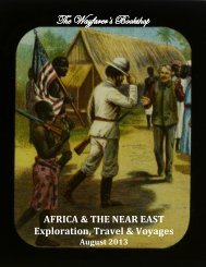
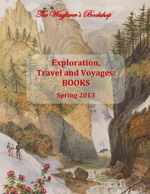
<strong>The</strong> Wayfarer’s <strong>Bookshop</strong><br />
<strong>Exploration</strong>,<br />
<strong>Travel</strong> <strong>and</strong> <strong>Voyages</strong>:<br />
<strong>BOOKS</strong><br />
Spring 2013<br />
1
<strong>The</strong> Wayfarer’s <strong>Bookshop</strong><br />
<strong>Exploration</strong>, <strong>Travel</strong> <strong>and</strong> <strong>Voyages</strong>:<br />
<strong>BOOKS</strong><br />
Spring 2013<br />
www.wayfarersbookshop.com; e-mail: wayfarers@shaw.ca<br />
phone: +1 (604) 921 4196; fax: +1 (604) 921 4197<br />
Cover illustration – frontispiece to the second volume of James Hooker’s<br />
‘Himalayan Journals’ (item # 51)<br />
2
1. [AFRICA]<br />
VANDERMAELEN, Philippe (1791-1869)<br />
Atlas Universel de Geographie Physique, Politique, Statistique et Mineralogique, sur l'echelle de<br />
1/1641836 ou d'une ligne par 1900 toises, dresse par Ph. V<strong>and</strong>ermaelen, Membre de la Societe de<br />
Geographie de Paris, d'apres les meilleures cartes, observations astronomiques et voyages dans les<br />
divers Pays de la Terre; Lithographie par H. Ode, Membre de la Societe de Geographie de Paris -<br />
Troisieme Partie – Afrique. [Atlas of Universal Geography... Third Part - Africa].<br />
Brussels: Lithographed by H. Ode, 1827. First Edition. Elephant Folio. With a printed title page <strong>and</strong><br />
sixty large outline h<strong>and</strong> coloured lithographed maps. <strong>The</strong> unfolded maps are loosely housed in a<br />
h<strong>and</strong>some period brown gilt tooled diced half morocco portfolio with marbled boards. Portfolio incorrectly<br />
labelled Europe, otherwise a near fine set of maps.<br />
<strong>The</strong> "Atlas Universel" by V<strong>and</strong>ermaelen, the founder of the Etablissement Geographique de<br />
Bruxellesis, is "thought to be the first world atlas on a uniform scale <strong>and</strong> the first to be produced by<br />
lithography" (Tooley Q-Z, p.311). <strong>The</strong> index map of this third part, "Carte D'Assemblage de L'Afrique"<br />
shows how the map of Africa is divided into 57 maps <strong>and</strong> two supplemental maps. <strong>The</strong> Azores, Canary<br />
Isl<strong>and</strong>s, Cape Verde Isl<strong>and</strong>s, Madagascar <strong>and</strong> the coastal areas of Africa are covered as well as most of<br />
North Africa. However, the interior of large parts of sub-Saharan Africa are not mapped <strong>and</strong> are labelled<br />
"Pays inconnu aux Europeens [country unknown to Europeans]."<br />
<strong>The</strong> maps in the ["Atlas Universel"] make up the first map of the world on a uniform scale,<br />
constructed as a modified conical projection <strong>and</strong>, if assembled, forming a globe with a diameter of 7.75<br />
metres, although only one such was known to have been made, by the author himself, <strong>and</strong> requiring a<br />
specially designed room. It offered the largest picture of the earth's surface available in the nineteenth<br />
century, thereby giving the lesser known areas such as Australia, South Africa <strong>and</strong> the West coast of<br />
America, all developing countries, a much greater coverage than before" (Sotheby's); Koeman III, Vdm.I;<br />
NMM 3:179; Phillips, Atlases 749; Sabin 43762.<br />
$4750USD<br />
3<br />
1
2. [BENOIT, Pierre Jacques] (1782-1854)<br />
Surinam- Scenes de la Vie Americaine, Description de la Guyanne Holl<strong>and</strong>aise... Cent dessins pris<br />
sur nature par l'auteur, lithographies par Madou et Lauters. [Surinam - Scenes of American life, a<br />
Description of Dutch Guiana... A Hundred drawings Taken from Nature by the Author, <strong>and</strong> Lithographs<br />
by Madou Lauters].<br />
Bruxelles: Bruylant-Christophe et compagnie, [1858].<br />
Second Edition. Small Folio. 96 pp. With a hundred views on the<br />
lithographed title <strong>and</strong> forty nine other lithographed plates.<br />
Original gray publishers' printed pictorial papered boards with a<br />
cloth spine. Plates mildly foxed <strong>and</strong> extremities mildly rubbed,<br />
otherwise a very good copy in very original condition.<br />
This work is beautifully illustrated with panoramic views,<br />
street scenes, festivals <strong>and</strong> dances, <strong>and</strong> native costume <strong>and</strong><br />
customs of Surinam. "An important early nineteenth-century<br />
description of Dutch Guiana, illustrated with Benoit’s scenes of<br />
native life lithographed by Jean-Baptiste Madou <strong>and</strong> Paul<br />
Lauters. <strong>The</strong> majority of the views depict the rural habitat of<br />
the Negroes <strong>and</strong> Indians of the interior, although there are<br />
scenes of Paramaribo <strong>and</strong> its various public buildings, streets,<br />
<strong>and</strong> business establishments" (Howell). Benoit, a painter <strong>and</strong><br />
illustrator, was born in Antwerp in 1782 <strong>and</strong> died in Brussels in<br />
1854. He visited the Dutch possessions in India <strong>and</strong> Surinam<br />
<strong>and</strong> brought back a rich <strong>and</strong> remarkable collection of drawings<br />
2<br />
<strong>and</strong> views of these distant l<strong>and</strong>s. Biographie nationale de Belgique; Sabin 4737.<br />
$2750USD<br />
3. [CAPTAIN COOK'S DEATH]<br />
FORSTER, Johann Georg Adam (1754-1794) & SPARRMAN, Anders (1748-1820)<br />
Professor Georg Forsters Strodde Underrattelser om<br />
Capitaine Cooks Sista Resa och Olyckeliga dod i Soderhafwet.<br />
Ofwersattning utur Gothingisches Magazin af Andreas Sparrman,<br />
Hwilken bifogat en Kungorelse om dess egen nu for Trycket fardige<br />
Rese-Beskrifning jamte et kort innehall deraf. [Professor Georg<br />
Forster's Account of Captain Cook's Last Voyage…].<br />
Stockholm: P.A. Brodin, 1781. First Edition. Small Octavo. 47 pp.<br />
With a folding map of the Pacific Ocean. Period style (Swedish) light<br />
brown gilt tooled half calf with a red gilt morocco label <strong>and</strong> speckled<br />
papered boards. Map <strong>and</strong> a couple of page edges with very minor<br />
expert repair, otherwise a very good copy.<br />
This very rare important work, with only five copies found in<br />
Worldcat, is one of the first descriptions of the Hawaiian Isl<strong>and</strong>s <strong>and</strong><br />
the Death of Captain Cook <strong>and</strong> includes Sparrman's important map of<br />
the Pacific Ocean which was one of the very first to show the<br />
Hawaiian Isl<strong>and</strong>s. "Forster’s account of Cook’s third voyage, including<br />
his death at the h<strong>and</strong>s of the S<strong>and</strong>wich Isl<strong>and</strong>s natives, first appeared<br />
in German in the Göttingisches Magazin der Wissenschaften und<br />
Literatur in 1780, Volume II, pages 387--429. It was translated into<br />
4<br />
3
Swedish by Andreas Sparrman, a former pupil of Linnaeus <strong>and</strong> scientist of note, <strong>and</strong> close friend of Forster<br />
from their association as members of Cook’s second expedition. It is the only separate printing in any<br />
language of the Forster article, which was derived from information obtained from Heinrich Zimmerman<br />
<strong>and</strong> Barthold Lohmann, both of whom were members of the crew (Zimmerman published his own<br />
account of the voyage also in 1781). <strong>The</strong> folding map, prepared by Sparrman, shows the coasts <strong>and</strong><br />
isl<strong>and</strong>s discovered <strong>and</strong> explored by Cook <strong>and</strong> his successors on the third voyage.<br />
In addition to the Forster article, Sparrman included several pages of his own reflections on Cook’s<br />
death, a brief account of the second voyage, <strong>and</strong> a resume of his own travels in South Africa, as well as<br />
bibliographical information concerning the forthcoming publication of his own narrative of the second<br />
voyage" (Howell). Copies of this work are "excessivement rare" (Kropelien 44). Sparrman "added (pp. 37-<br />
47) a personal commentary on Cook's death <strong>and</strong> some other notes on his own travels.., the map at the<br />
end depicting the North Pacific Ocean was drawn <strong>and</strong> engraved by Sparrman himself" (Hawaiian National<br />
Bibliography 30); Beddie 1639; Du Rietz (Captain James Cook) 8.<br />
$22,500USD<br />
4. [COUNEAU, E.]<br />
A Madame Ernest Callot. Biskra. Quatorze Eaux-Fortes Gravées sur des Dessins Originaux.<br />
Souvenir d'une Excursion en Algérie. [Mrs. Ernest Callot. Biskra. Fourteen Etchings Drawings Originals<br />
Engraved on a trip to Algeria].<br />
1881. First Edition Author's Signed Presentation Copy. Folio. [iv] pp. With fourteen full page<br />
engravings. Original publisher's light brown printed paper wrappers. Spine renewed in style, otherwise a<br />
very good copy.<br />
Very rare work as only<br />
one copy found in Worldcat.<br />
Inscribed by the author<br />
"Souvenir Amical a L'Auteur a<br />
M Teiloz, La Rochelle le 30<br />
Mars 1911 E. Couneau." <strong>The</strong><br />
well executed engravings<br />
illustrate scenes around<br />
Biskra, "the capital city of<br />
Biskra province, Algeria..,<br />
During Roman times the town<br />
was called Vescera, though<br />
this may have been simply a<br />
Latin transliteration of the<br />
native name. Around 200 AD<br />
under Septimius Severus'<br />
reign, it was seized by the Romans<br />
<strong>and</strong> became part of the province<br />
of Numidia. As a major settlement in the border region, it was significant even then. Its name was<br />
apparently bowdlerized by the Romans to Ad Piscīnam ("at the piscīna"), implying the presence of<br />
important waterworks" (Wikipedia).<br />
$1250USD<br />
5<br />
4
5. [ESCOBEDO Y ALARCON, Jorge]<br />
[Taxation of Indians in the Viceroyalty of Peru]. Instruccion, O Advertencias, que Consiguiente a<br />
lo Prevenido en el Articulo 118 de la de Intendentes se dan a sus Subdelegados, y Demas Encargados de<br />
la Cobranza de Tributos para Deslindar las Funciones de la Contaduria del ramo, y Conciliarlas con las<br />
Facultades de los Intendentes.<br />
[Lima], 1 July 1784. First Edition. Folio.<br />
16 pp. Disbound Pamphlet, with a large<br />
woodcut initial. Housed in a marbled papered<br />
portfolio with a red gilt label on the front<br />
cover. A very good copy.<br />
Very rare work as only one copy found<br />
in Worldcat. Several sections of this decree on<br />
collection of taxes deal with taxes gathered<br />
from the Indians. In one the collectors are<br />
ordered to halt the criminal fraud of Indians<br />
who escaped paying taxes merely because<br />
they had avoided being registered. Another<br />
notes that many Indians are now able to pay in<br />
coin rather than in goods, <strong>and</strong> requires them<br />
to do so. Not in Sabin.<br />
$1250USD<br />
5<br />
6. [NOBEL PETROLEUM COMPANY]<br />
Prazdnovanie dvadstatipiatiletia Tovarishchestva neftianogo proizvodstva Bratiev Nobel, 1879-<br />
1904. [Celebration of the 25th Anniversary of the Petroleum Production Company of the Nobel<br />
Brothers].<br />
Saint Petersburg: T-vo R. Golike <strong>and</strong> A. Wilborg, 1905.<br />
First Edition. Small Folio (ca. 32x23 cm). [2], 142 pp. With a<br />
chromolithographed title page <strong>and</strong> thirty other lithographed<br />
<strong>and</strong> photogravure plates (including four<br />
chromolithographs). <strong>The</strong> censorial permission on verso of<br />
the title page is printed upside down. Original publisher’s<br />
blue full cloth with gilt lettered title within a decorative<br />
colour ornament on the front board, <strong>and</strong> decorative<br />
endpapers. One plate is loosely inserted, otherwise a near<br />
fine copy.<br />
Attractive richly illustrated <strong>and</strong> decorated jubilee<br />
edition of the Nobel Brothers Oil Company; very rare<br />
Russian imprint with only three copies found in Worldcat.<br />
Allthough there is another ‘Nobel’ edition, similarly<br />
titled ‘Twenty-fifth anniversary of the Oil Industry of Nobel<br />
Brothers’ (SPb., 1904), it should be pointed out that our<br />
book is dedicated to the ceremony commemorating the<br />
jubilee which took place in Saint Petersburg on the 18th of<br />
May, 1904. This present work consists of four main parts: 1)<br />
the description of the jubilee celebration;<br />
6<br />
6
2) list of all participants of the<br />
ceremony including Russian Prime-<br />
Minister Sergey Vitte, several<br />
ministers <strong>and</strong> directors of Imperial<br />
state institutions, representatives of<br />
banks, industrial <strong>and</strong> trade companies,<br />
members of the Russian Academy of<br />
Sciences et al.; 3) historic overview of<br />
the Nobel Company for 25 years; 4)<br />
text of congratulating telegrams <strong>and</strong><br />
letters received by the company from<br />
the Russian <strong>and</strong> foreign state<br />
institutions, stock exchange<br />
committees, banks, railroad societies,<br />
steamship companies, oil industries,<br />
trade houses, charities, private people<br />
<strong>and</strong> associates of the Nobel company.<br />
<strong>The</strong> volume is illustrated with a beautiful<br />
chromolithographed title page (after a watercolour by<br />
A. Chikin) <strong>and</strong> two colourful views of the old Baku by<br />
Andrey Schilder (1861-1919); photogravure portraits of<br />
the Nobel family, members of the Company’s Board of<br />
Directors <strong>and</strong> renowned guests at the celebration; <strong>and</strong><br />
several high quality facsimiles of the congratulating<br />
letters <strong>and</strong> telegrams. <strong>The</strong> book is decorated with<br />
numerous illustrations in text, head- <strong>and</strong> tail pieces, <strong>and</strong><br />
four pictorial half-titles by Alex<strong>and</strong>er Leo (1868-1943)<br />
<strong>and</strong> Andrey Schilder. Overall a beautiful book.<br />
“<strong>The</strong> Petroleum Production Company Nobel<br />
Brothers, Limited, or Branobel (short for cable<br />
communications meaning Nobel Brothers in Russian),<br />
was an oil company set up by Ludvig Nobel <strong>and</strong> Baron<br />
Peter von Bilderling, in Baku, Azerbaijan. …during the<br />
late 19th century it became one of the largest oil<br />
companies in the world” (Wikipedia). Branobel is<br />
famous for establishing first Russian oil pipe lines, oil<br />
tankers <strong>and</strong> tank cars; <strong>and</strong> for construction of first in<br />
the world industrial oil depots <strong>and</strong> electric power<br />
stations intended for industrial use. A copy of this work<br />
made GBP 5250.00 at Christies in 2011.<br />
$7500USD<br />
7<br />
6. View of the old Baku<br />
6. Ludvig Nobel, the main founder<br />
of the Nobel Oil Company
7. [PERON, Francois] (1775-1810)<br />
& FREYCINET, Louis-Henri de Saulces, Baron de (1777-1840)<br />
[ATLAS VOLUME] Voyage<br />
de Decouvertes aux Terres<br />
Australes, execute par ordre de<br />
Sa Majeste l'Empereur et Roi,<br />
sur les corvettes le Geographe,<br />
le Naturaliste, et la goelette le<br />
Casuarin, pendant les annees<br />
1800, 1801, 1802, 1803 et 1804.<br />
Atlas Historique only, [by Leseur<br />
et Petit]. [Voyage of Discovery to<br />
Terra Australis, executed by<br />
order of His Majesty the<br />
Emperor <strong>and</strong> King, on the<br />
corvettes Geographe, the<br />
Naturalist, <strong>and</strong> the schooner the<br />
Casuarina during the years 1800,<br />
1801, 1802, 1803 <strong>and</strong> 1804].<br />
7. Schouten Isl<strong>and</strong> near Van Diemen's L<strong>and</strong><br />
(Tasmania)<br />
7. Map of New Holl<strong>and</strong>, by Captain Freycinet<br />
Paris: Chez Arthus Bertr<strong>and</strong>, 1824. Second Edition. Folio. [x] pp. With an engraved title with<br />
vignette, a double-page engraved map of Australia, eight other engraved maps <strong>and</strong> charts <strong>and</strong> fifty-nine<br />
engraved plates, including two double-page, <strong>and</strong> twenty-seven h<strong>and</strong>-colored. Beautiful period style<br />
crimson very elaborately gilt tooled full straight grained morocco with marbled end papers. A near fine<br />
copy.<br />
"In 1800 an expedition organized by the Institute of France <strong>and</strong> placed under the comm<strong>and</strong> of<br />
Nicolas Baudin sailed for the South Seas. <strong>The</strong>ir particular instructions were to make a full <strong>and</strong> minute<br />
examination of the Australian coasts, <strong>and</strong> especially to explore the southern coast, "where there is<br />
supposed to be a strait communicating with the Gulf of Carpentaria, <strong>and</strong> which consequently would<br />
divide New Holl<strong>and</strong> into two large <strong>and</strong> almost equal isl<strong>and</strong>s." <strong>The</strong> maps <strong>and</strong> charts [were] prepared by<br />
Freycinet, who continued the publication after<br />
the death of Peron.., Peron the naturalist on<br />
this voyage, was able to prepare a huge<br />
zoological collection that was known for years<br />
for its excellence" (Hill 1329 (First Edition)).<br />
This very scarce second edition was<br />
prepared by Freycinet after he returned from<br />
his own expedition to the Pacific between<br />
1817 <strong>and</strong> 1820. It is not generally known that<br />
the 1824 second edition of the 'Partie<br />
Historique' contains some significant changes<br />
<strong>and</strong> additions to the first edition. <strong>The</strong> maps<br />
<strong>and</strong> charts of the first edition atlas, which bore<br />
the nationalistic <strong>and</strong> ambitious name of Terre<br />
Napoleon <strong>and</strong> included imperial French names<br />
for many parts of the coast, were omitted or<br />
8<br />
greatly altered for the second edition atlas.
This atlas also includes twenty-five new plates, many of which are coloured. Freycinet's alterations to the<br />
second edition reflect the political reality of the times <strong>and</strong> finally recognize the just claims of the English<br />
navigators, in particular Matthew Flinders, to the discovery of the Australian coast. Copies of the second<br />
edition of the 'Partie Historique' appear to be rarer, copy for copy, than the first edition <strong>and</strong> are prized<br />
accordingly" (Wantrup p. 157-9); Ferguson 979. "In 1800 [Peron] was engaged by Nicolas Thomas Baudin<br />
as 'trainee zoologist charged with comparative anatomy' for Baudin's exploratory voyage to the southern<br />
<strong>and</strong> western coasts of Australia" (Howgego 1800-1850, P21).<br />
$16,500USD<br />
8. [PORTUGUESE NAVIGATION AND COLONIES]<br />
Annaes Maritimos e Coloniaes. Publicação Mensal Redigida sob a Direcção da Associação<br />
Maritima e Colonial. [Maritime <strong>and</strong> Colonial Annals: Monthly Publication Issued under the Direction of<br />
the Maritime <strong>and</strong> Colonial Association].<br />
Lisboa: Imprensa Nacional, 1840-1846. First Edition. Octavo, 6 vols. 533, [3], 12; 583, [5]; 346, [2],<br />
641, [2]; [1 – t.p.], 409, [2], [1 – t.p.], 455, [2]; 235, [1], 512, [2]; 56, 135 pp. With a total of thirteen<br />
lithograph maps, plans <strong>and</strong> charts (twelve folding, three in color), nine lithograph plates (seven folding;<br />
one large), <strong>and</strong> one large folding table, plus many tables in the text. H<strong>and</strong>some period maroon <strong>and</strong> brown<br />
gilt tooled quarter sheep with marbled <strong>and</strong> papered boards. Bound in a similar but not quite uniform style.<br />
Vol. 2 bound without a title page. A couple of plates with repairs <strong>and</strong> markings of removed old adhesive<br />
tape, a couple of places of mild foxing, two volumes with slight cracking of hinges but holding. Overall a<br />
clean very good set.<br />
A complete set (103 issues) of<br />
the first <strong>and</strong> only edition of this<br />
important Portuguese periodical<br />
dedicated to navigation, geographical<br />
exploration <strong>and</strong> colonial issues, <strong>and</strong><br />
published by the Associação Maritima<br />
e Colonial in Lisbon. <strong>The</strong> materials<br />
include important original articles on<br />
the Portuguese colonies in Africa<br />
(Angola <strong>and</strong> Mozambique), India<br />
(Goa), China (Macau), Indonesia<br />
(Timor <strong>and</strong> other isl<strong>and</strong>s, e.g. Solor);<br />
official documents by the Portuguese<br />
government regarding maritime <strong>and</strong><br />
colonial issues, as well as current<br />
statistical information from the<br />
colonies; first publications of the accounts<br />
of Portuguese voyages of exploration (e.g. in the Central Africa); interesting archival documents regarding<br />
Portuguese voyages <strong>and</strong> discoveries from the XVth century onwards <strong>and</strong> many others.<br />
<strong>The</strong> collection includes three lengthy articles serialized through many issues: one is on the<br />
Portuguese colonies in Asia, including Macau <strong>and</strong> Timor, one on Portuguese explorations in the interior of<br />
Africa (diary of Dr. Francisco Jose de Lacerda e Almeida), <strong>and</strong> one on Portuguese colonies on the west<br />
coast of Africa (Angola). Other articles are dedicated to the Solor Isl<strong>and</strong> (Indonesia), Mozambique, the<br />
trade with the Malay Archipelago, the priority of Portuguese explorations in the Northern <strong>and</strong> Central<br />
Africa; problems of Christianisation <strong>and</strong> public education of the population of the Portuguese colonies et<br />
al. <strong>The</strong>re are also accounts of the most important international expeditions of the time, e.g. Dumont-<br />
9<br />
8
Dourville’s travel to the Antarctic (1837-40), Dupetit-Thouars’ circumnavigation of the frigate Venus<br />
(1836-39), Canadian Arctic exploration by the Hudson’s Bay Company vessels, the US Exploring Expedition<br />
in the South Pacific in 1838-40 et al. <strong>The</strong> publications also include texts of international anti-slavery<br />
treaties, documents on exports <strong>and</strong> imports, articles on the latest navigation techniques <strong>and</strong> machines,<br />
e.g. steam ships, et al.<br />
<strong>The</strong> charts are aimed at helping<br />
sailors to navigate in difficult ports, <strong>and</strong><br />
show the harbors of Lisbon, Goa,<br />
Quellimane (Mozambique, h<strong>and</strong><br />
coloured), Dilly (Timor), Mossamedes<br />
(modern Namibia, Angola) <strong>and</strong> Lobito<br />
(Benguela province of Angola); there<br />
are also folding plans of the city of Goa,<br />
a Portuguese fort in Pungo an Dongo<br />
(Angola); a topographical chart of the<br />
National Forest of Leiria (Portugal) <strong>and</strong><br />
others. Plates include two views of the<br />
rapids de São Salvador da Pesqueira on<br />
the river Douro (Portugal) – before <strong>and</strong><br />
after the works which removed the<br />
rapids <strong>and</strong> made the river navigable at<br />
this point; a nicely executed large<br />
folding view of the façade of the famous<br />
ruin of St. Paul’s Cathedral in Macau, a reprint of a document in Chinese, a draft of a vapour vessel, a<br />
statistical table of the population of the Portuguese Goa <strong>and</strong> others.<br />
Volume I contains 11 issues <strong>and</strong> a supplement (pp. 529-33), followed by an index (3 pp.), as<br />
described in Fonseca, <strong>and</strong> "Estatutos da Associação Maritima" (12 pp., paginated separately), which is not<br />
mentioned in Fonseca. In volume II, there are 12 issues. Volumes III, IV <strong>and</strong> V each contain 24 issues: 12 in<br />
the "Parte Official," 12 more in the "Parte Não Official." In volume VI, only 4 issues each of the "Parte<br />
Official" <strong>and</strong> "Parte Não Official" were published. Fonseca calls for only 1 folding plate <strong>and</strong> 3 maps in the<br />
"Parte Não Official" of volume III, where this copy has 3 plates <strong>and</strong> 4 maps. Fonseca also fails to mention<br />
the single leaf preceding the text in both "Partes" of volume IV.<br />
Innocêncio I, 72; Sabin 1577a.<br />
$5500USD<br />
9. [RUSSIAN RELIGIOUS SECTS IN AMERICA]<br />
Collection of Five Volumes from the Library of A.K. Dubovoy, a Member of the Religious Sect of<br />
Shtundists who Immigrated to the United States, including:<br />
Missionerskoe Obozrenie [Missionary Review]: By-weekly Polemical <strong>and</strong> Apologetico Magazine<br />
(1903), Spiritual Polemical <strong>and</strong> Apologetico Magazine (1904).<br />
1903-1904. 4 vols. Octavo. Period brown quarter calf with marbled <strong>and</strong> cloth boards; one original<br />
publisher’s wrapper <strong>and</strong> two title pages bound in. Several ink stamps of a Russian Orthodox priest<br />
Mitrofan Alex<strong>and</strong>rovich Schenonovich in text, bookplates of A.K. Dubovoy on front pastedowns. Overall a<br />
very good set.<br />
1903. # 7 (April) - 16 (October). 895-1528 (= 632), xv [contents], 158, [2]; 161-664 (= 504), iv, 665-<br />
824 (= 160), xi-xiv pp. With three special supplements bound in the text: 8 (Common Missionary Library, #<br />
5), 165-180 (= 16), viii pp.<br />
10<br />
8
1904. # 7 (April) – 16 (October). 769-1342 (= 604), xv [contents]; 1199-1342 (2nd copy of issue # 10),<br />
936 pp. With 5 special supplements ‘Missionary Sermons’ (to issues 7 <strong>and</strong> 10), total number of pages: 49-<br />
144 (= 96), <strong>and</strong> four special supplements regarding Russian-Japanese War (to issues # 7, 8, 9 <strong>and</strong> 10), total<br />
number of pages: 51-128 (=78).<br />
With a custom made sammelb<strong>and</strong>:<br />
ROZHDESTVENSKIY, A. Yuzhnorusskiy Shtundizm [Southern Russian Shtundism]. Saint Petersburg:<br />
Typ. Departmenta Udelov, 1889. [2], iv, [2], 295 pp.<br />
MOLOSTVOVA, E.V. Iegovisty. Zhizn I sochineniya kap. N.S. Ilyina. Vozniknovenie sekty i ee<br />
razvitie [Yehowists-Ilyinites. Life <strong>and</strong> works of Captain Nikolai Ilyin]. Saint Petersburg: Typ. M.M.<br />
Stasiulevich, 1914. xii, 298, [1] p.<br />
BUTKEVICH, T.I. Obzor Russkikh sekt i ikh tolkov [An Overview of Russian Religious Sects <strong>and</strong><br />
their Persuasions]. Saint Petersburg: Tuzov, 1915. 2nd ed. 566, x pp.<br />
Three works bound together. Octavo. Original publisher’s wrappers of all three books bound in<br />
(second book with only front wrapper). 20th century custom made cloth binding. Bookplate of A.K.<br />
Dubovoy on front pastedown. Overall a very good copy.<br />
9<br />
An important collection of works regarding Russian religious sects from the library of Andrey<br />
Karpovich Dubovoy (1883-1968), a member of the Church of Evangelical Christians-Baptists, a Shtundist.<br />
He immigrated to Minot, North Dakota at the end of the 19th century <strong>and</strong> in the 1950-es he wrote a<br />
series of articles about the history of the settlement of Ukrainian Shtundists in the US. A bright<br />
description of him can be found in Stephen Graham’s book “With poor immigrants to America” (New<br />
York, 1914) where he is described as a ‘wonderfully keen <strong>and</strong> happy Russian, full of ideas about the future<br />
<strong>and</strong> stories of the settlement where he lived’ (p. 396). All the volumes from the collection are with<br />
Dubovoy’s bookplate mounted on the front pastedowns; his pencil notes <strong>and</strong> commentaries can be found<br />
on the endpapers of most volumes. Another important documentary evidence regarding the history of<br />
Shtundists is a small pen note inserted in Rozhdestvensky’s book between pages 106 <strong>and</strong> 107. Written in<br />
Russian, with several mistakes, it says: “I am Eudokia Dubovoy. Here [in the marked text of the book] is<br />
written about my father, Korniliy Kabanuk, Chaplinki village”.<br />
11
<strong>The</strong> books from Dubovoy’s collection include special research works of such major Russian religious<br />
sects as Shtundists (by Rozhdestvensky) <strong>and</strong> Yehowists-Ilyinites (by Molostvova); <strong>and</strong> a fundamental<br />
historical overview of all Russian sects (by T. Butkevich), including chapters about Khlysts, Skoptsy,<br />
Doukhobors, Molokans, members of Tolstoyan movement etc.<br />
<strong>The</strong> issues of the ‘Missionary Review’ – a special magazine of the Russian Orthodox Church (Kiev-<br />
SPb., 1896-1916) – contain a wide range or polemical articles regarding Russian religious sects <strong>and</strong><br />
philosophical movements, with an interesting series of analytical materials about the Doukhobors (1904,<br />
#12-14); comments of Saint John of Kronstadt on the ideas of Leo Tolstoy (1904, # 7,8, 10); articles about<br />
Russian poets-Symbolists (1903, #7-8), reports on the missionary activity of the Russian Church amidst the<br />
sectarians, bibliographical reviews of new books, latest news et al. Interesting are brief notes about the<br />
life of Doukhobor immigrants in Canada (1903, # 7), North-American Mormons, religion of Tibet (with<br />
pictures) or Japan (1903, # 7, 10) et al. <strong>The</strong> issues are bound together with ten supplements, including<br />
four rare imprints about the Russian-Japanese War (1904-1905).<br />
Overall an important collection of history of Russian Religious immigrants to America.<br />
$1250USD<br />
10. [UKRANIAN SOUTHWESTERN RAILWAYS]<br />
Karta Jugo-Zapadnykh Zheleznykh Dorog 1909 goda. [A Map of the Southwestern Railways in the<br />
Year 1909].<br />
1909. Small Folio (30x18 cm). H<strong>and</strong> coloured lithographed map. Scale 1:4 200 000. Mounted in the<br />
original beige snake skin patterned cloth folder with gilt lettered title <strong>and</strong> Russian Imperial Eagle on the<br />
front board. A fine copy.<br />
Very rare special edition of the map celebrating the<br />
200th anniversary of the Battle of Poltava. No copies are<br />
found in Worldcat, nor in the largest Russian depositories –<br />
Russian State <strong>and</strong> Russian National Libraries. <strong>The</strong> map shows<br />
the complete network of the Southwestern Railways, covering<br />
the territory of modern Western Ukraine <strong>and</strong> Moldova. <strong>The</strong><br />
map shows state borders, main cities <strong>and</strong> waterways <strong>and</strong> is<br />
supplemented with a list of districts <strong>and</strong> governments which<br />
are crossed by the railways. <strong>The</strong> opposite page is occupied<br />
with a time table of the special Southwestern Railways express<br />
which connected Sarny <strong>and</strong> Kiev. <strong>The</strong> time table is mounted<br />
within a beautiful lithographed ornamented frame decorated<br />
with a portrait <strong>and</strong> a monogram of Peter the Great, a<br />
monogram of the last Russian Emperor Nicolas II, a view of the<br />
Poltava Battle field, <strong>and</strong> suits of armour <strong>and</strong> weapons of the<br />
early 18th century.<br />
“Southwestern Railways, headquartered in Kiev, the<br />
capital of Ukraine, includes all the railroads in the Kiev,<br />
Zhytomyr, Chernihiv, Vinnytsia, Khmelnytskyi <strong>and</strong> Sumy<br />
oblasts (provinces of Ukraine). It’s history began in 1870 when<br />
the railroads between Kiev, Balta <strong>and</strong> Kursk in Southern Russia<br />
was launched By the beginning of World War I the total<br />
length of the SWR system was 3,096 km (1,924 mi)” (Wikipedia).<br />
10<br />
$875USD<br />
12
11. [URALS]<br />
BERDMORE, Septimus, C.E. (1829-1906)<br />
Report on the Inzer Estate, Situate in the Government of<br />
Orenburg, in the Empire of Russia, the Property of His Excellency<br />
General Ouchakoff, etc, etc. Accompanied by Plans.<br />
London: Edward Stanford, 1865. Presentation First Edition. Folio.<br />
iv, [2 – errata slip], 35 pp. With two folding lithographed plans, a large<br />
folding lithographed map <strong>and</strong> a folding lithographed panorama. Period<br />
style maroon straight grained half morocco with marbled boards; front<br />
publisher’s wrapper bound in. With the author’s presentation inscription<br />
on the upper margin of the wrapper “Dr Percy F.R.S. With the author’s<br />
comps”. Occasional period pen corrections in the text. <strong>The</strong> wrapper <strong>and</strong><br />
several leaves with minor tears <strong>and</strong> chips on extremities, not affecting the<br />
text <strong>and</strong> neatly restored. Overall a very good copy.<br />
Very rare edition, apparently privately printed, with no copies<br />
found in Worldcat.<br />
Interesting early account of prospecting on the Inzer River in the Southern<br />
11<br />
Urals (modern Bashkiria). <strong>The</strong> owner of the Inzer estate ‘His Excellency General Ouchakoff’ employed<br />
Septimus Berdmore to ascertain "whether the iron ore, stated to exist on his property, was of such extent<br />
<strong>and</strong> such quality as to offer an inducement to an English Company to invest capital in the erection of iron<br />
works there" (p. 5). Berdmore travelled to the Inzer estate in August-October 1864 (from Saint Petersburg<br />
via Nizhny Novgorod <strong>and</strong> Perm) <strong>and</strong> remained 16 days on the property. His conclusion was very positive,<br />
with enthusiastic notes about ‘magnificent forests of finest timber’, ‘vast iron fields’, ‘abundance of lime,<br />
brick earth, refractory stone <strong>and</strong> s<strong>and</strong>’, ‘magnificent quantities of marble of the finest quality’ etc.<br />
Berdmore gave a comprehensive report of the estate (geographical position, geological formations,<br />
forests, main rivers <strong>and</strong> streams available for floating timber), description of its deposits of gold, iron,<br />
stone, coal <strong>and</strong> ‘other sources of revenue’. <strong>The</strong> report is concluded with a detailed account of a probable<br />
cost of industrial operations of the estate. Nine appendices represent costs for the main expenses, like<br />
construction of venues <strong>and</strong> bridges, smelting, rates for wages, horses etc. <strong>The</strong> report is illustrated with a<br />
beautiful lithographed panorama of the Inzer estate taken on the spot by Berdmore, two plans showing<br />
the location of the estate in Russia in general <strong>and</strong> Government of Orenburg in particular, <strong>and</strong> a large<br />
detailed map of the estate which marks the main iron, gold <strong>and</strong> mineral deposits, as well as sites suitable<br />
for iron works.<br />
<strong>The</strong> book contains the author’s<br />
presentation inscription to a celebrated<br />
British metallurgist John Percy (1817-1889),<br />
who compiled a report about the quality of<br />
the Inzer’s iron ores (see Appendix A) based<br />
on numerous samples given to him by<br />
Berdmore.<br />
Not much known about the fate of the<br />
enterprise, but most likely it didn’t succeed;<br />
the first iron smelting factory on the Inzer<br />
River was founded only in 1890. Berdmore’s<br />
report became a bibliographical rarity not<br />
found in the collection of the British Library.<br />
$2250USD<br />
11. Lithographed panoramic view of the Inzer Estate<br />
13
12. [VICTORIAN VOLUNTEER FORCES]<br />
Instructions for Wearing Uniform, ETC., <strong>and</strong> Dress Regulations for the Victorian Forces. Head<br />
Quarters, Victoria Barracks, November 1875.<br />
Melbourne: George Skinner, Acting Government Printer, 1876.<br />
First Edition. Octavo. viii, [i], 125 pp. Original publisher's brown<br />
patterned pictorial blind stamped cloth. With the library stamp of<br />
the Comm<strong>and</strong>ant's Office of the Military Forces Victoria, spine mildly<br />
faded, otherwise a very good copy.<br />
Extremely rare second (first in 1863) Victorian Forces dress<br />
regulations with only two copies found in Worldcat. This interesting<br />
volume covers the regulations of both officers <strong>and</strong> enlisted men<br />
including head-quarters staff, Victorian artillery, volunteer staff,<br />
cavalry, artillery, engineers, torpedo corps, infantry, Ballarat<br />
volunteer battalion, Mount Alex<strong>and</strong>er volunteer battalion, etc.<br />
"In 1842 a series of attacks by bushrangers on homesteads in<br />
the Plenty River area led to the first calls for a volunteer force. It<br />
was suggested that the force could be called the 'Port Phillip<br />
Volunteers'. Twelve military districts were envisaged, each to be<br />
comm<strong>and</strong>ed by a former army captain. <strong>The</strong> volunteers would<br />
dressed in a green uniform <strong>and</strong> heavily armed with a rifle, two<br />
pistols <strong>and</strong> a sword. However, it was illegal to raise an armed force<br />
anywhere in the British Empire, except with the express approval of<br />
the Crown, <strong>and</strong> a special parliamentary act was required. Twelve years<br />
later, in 1854, Governor Sir Charles Hotham approved an Act to establish a Volunteer Corps not exceeding<br />
2000 men, with officers appointed by the Governor. <strong>The</strong> force was independent from the regular British<br />
units, which maintained a presence until 1870.<br />
<strong>The</strong> first unit formed was the Melbourne Volunteer Rifle Regiment, following shortly afterwards by<br />
the Richmond Rifles, the Emerald Hill Rifles, the East Collingwood Rifles <strong>and</strong> the Fitzroy Rifles. Cavalry,<br />
Artillery, Engineer, Torpedo <strong>and</strong> Signal units quickly followed, named after the localities in which they<br />
were raised. All units were voluntary, with service part-time <strong>and</strong> unpaid. By 1860, the Act had been<br />
amended to allow a Volunteer force of 10,000.<br />
<strong>The</strong> Victorian Volunteer Forces became the primary defence force of the Colony of Victoria after<br />
the withdrawal of the Imperial troops in 1870. A Permanent Artillery Corps (or the Victorian Artillery) was<br />
also formed in that year. <strong>The</strong> volunteer forces were disb<strong>and</strong>ed in 1884, replaced by the Victorian Militia<br />
Force. <strong>The</strong> Militia were paid, <strong>and</strong> enrolled for a fixed term".<br />
See: http://museumvictoria.com.au/collections/themes/4677/victorian-volunteer-forces-1854-1884.<br />
$975USD<br />
13. ANDERSON, Alex<strong>and</strong>er Caulfield (1814-1884)<br />
A Brief Account Of <strong>The</strong> Province Of British Columbia, Its Climate And Resources. An Appendix To<br />
<strong>The</strong> British Columbia Directory, 1882-83.<br />
Victoria, B.C: R.T.Williams, 1883. First Edition. Octavo. 33 pp. Folding colour lithographed<br />
frontispiece map. Period style black gilt tooled half morocco with pebbled black cloth boards. Original<br />
printed front wrapper bound in, map reinforced at folds, wrapper slightly chipped at extremities,<br />
otherwise a very good copy.<br />
14<br />
12
Anderson was a Hudson's Bay Company fur-trader, explorer of British Columbia <strong>and</strong> civil servant.<br />
This account of British Columbia gives a history, a description of climate <strong>and</strong> resources <strong>and</strong> includes an<br />
official directory of the province.<br />
"Anderson is now best<br />
remembered as leader of<br />
three exploring expeditions<br />
carried out in 1846–47. It<br />
had been apparent for some<br />
time before the Oregon<br />
boundary settlement of<br />
1846 that the boundary was<br />
likely to be the 49th parallel,<br />
in which case the HBC line of<br />
communication between the<br />
interior posts <strong>and</strong> Fort<br />
Vancouver by way of the<br />
Columbia River would be<br />
partly in the United States. A<br />
route to the ocean that<br />
would be entirely in British<br />
territory was essential, <strong>and</strong><br />
Fort Langley on the Fraser River<br />
15<br />
13. New Map of British Columbia<br />
was the obvious alternative outlet. A year before the treaty was signed Anderson wrote to Sir George<br />
Simpson, governor of the HBC, requesting permission to try to find a practicable travel route from the<br />
post at Kamloops (on the west bank of the Thompson River) to Fort Langley. Simpson asked Ogden to<br />
make the necessary arrangements. Ogden supported the proposal in a letter to Anderson’s local superiors<br />
stating that because of Anderson’s ‘active habits <strong>and</strong> experience in Caledonia I consider him fully<br />
competent to carry it into effect’" (Dictionary of Canadian Biography Online); Lowther 625; Wikipedia.<br />
$875USD<br />
14. ANDERSON, John (1795-1845)<br />
Mission to the East Coast of Sumatra, in M.DCCC.XXIII, under<br />
the direction of the Government of Prince of Wales Isl<strong>and</strong>. Including<br />
historical <strong>and</strong> descriptive sketches of the country, an account of the<br />
commerce, population <strong>and</strong> the manners <strong>and</strong> customs of the<br />
inhabitants, <strong>and</strong> a visit to the Batta cannibal state in the interior.<br />
Edinburgh & London: William Blackwood <strong>and</strong> T. Cadell, 1826.<br />
First Edition. Octavo. xxiii, 424 pp. With four folding engraved maps,<br />
eight engraved plates <strong>and</strong> a folding table. H<strong>and</strong>some period style light<br />
brown elaborately gilt tooled full calf with a maroon gilt label. A fine<br />
copy.<br />
"In February <strong>and</strong> March 1823 [Anderson] acted as agent for the<br />
governor of Penang in 'procuring engagements' from the sultans of<br />
Delly <strong>and</strong> Siack, <strong>and</strong> the rajah of Langkat, in Sumatra. He was also<br />
despatched to Perak <strong>and</strong> Selangor, fixing the state's boundary with that<br />
of Perak (Howgego 1800-1850, A10). "In 1819 Anderson was appointed<br />
deputy warehouse-keeper <strong>and</strong> Malay translator to the government,<br />
14
which latter post he retained until his retirement. In January 1823 he was dispatched on a three-month<br />
mission to the east coast of Sumatra with instructions to promise protection to the Sumatran chiefs <strong>and</strong> to<br />
discourage them from entering trading agreements with the Dutch. Distributing gifts of European chintzes<br />
<strong>and</strong> Indian muslins, Anderson was well received along the coast, <strong>and</strong>, ignoring his orders to abstain from<br />
formal political negotiations, agreed new or reinvigorated treaties with the sultans of Deli <strong>and</strong> Siak <strong>and</strong> the<br />
rajas of Serdang <strong>and</strong> Langkat, which the court of directors subsequently ruled invalid. In 1826 he published<br />
an account of his journey, Mission to the East Coast of Sumatra, in 1823, designed to alert British<br />
manufacturers to the potential market for their goods in Sumatra" (Oxford DNB).<br />
$1500USD<br />
15. ANDREWS, Lieutenant-Colonel Mottram<br />
A Series of Views in Turkey <strong>and</strong> the Crimea, from the Embarcation at Gallipoli to the fall of<br />
Sebastopol.<br />
London: Thomas McLean, 1856. First Edition. Folio. With a<br />
lithographed pictorial title page, dedication leaf, subscribers'<br />
leaf, nine descriptive leaves <strong>and</strong> seventeen tinted views, two<br />
folding. H<strong>and</strong>some period style maroon elaborately gilt tooled<br />
half straight grained morocco with cloth boards <strong>and</strong> original<br />
cloth cover title mounted on front cover. Several plates with<br />
repaired margins, not affecting printed surface, title <strong>and</strong> a few<br />
plate margins with some mild finger soiling, otherwise a very<br />
good copy.<br />
Mottram Andrews served during the Crimean War (1853-<br />
56) as a Captain of the 28th Foot (North Gloucester) Regiment<br />
of the British Army; he retired <strong>and</strong> was promoted to an<br />
honorary rank of Lieutenant Colonel on September 9th, 1855<br />
(Colburn’s United Service Magazine. 1855, Part 1, p. 315). <strong>The</strong><br />
28th (North Gloucestershire) Regiment of Foot participated in<br />
the Battles of Alma (20th September) <strong>and</strong> Inkerman (November<br />
5, 1854) of the Crimean War, as well as in the Siege of<br />
Sevastopol (October 1854 – September 1855).<br />
<strong>The</strong> plates, executed, as noted on the title page, ‘with the<br />
latest improvements in tinted lithography’ show the views of<br />
war affected areas in Turkey – environments of Gallipoli <strong>and</strong><br />
Varna, with a nice folding panorama of the lake of Devna; <strong>and</strong><br />
the main battle grounds in Crimea – Balaklava, Inkerman <strong>and</strong> Sevastopol with the surroundings, including<br />
a large folding panorama of Sevastopol with its harbour. <strong>The</strong> interesting views show British encampments<br />
<strong>and</strong> weapon magazines, military barracks in the Korabelnaya harbour of Sevastopol. Abbey <strong>Travel</strong> 238.<br />
$3750USD<br />
16. ANSON, George (1697-1762)<br />
A Voyage Round the World, in the Years MDCCXL, I, II, III, IV. By George Anson, Esq.; Comm<strong>and</strong>er<br />
in Chief of a Squadron of His Majesty's Ships, sent upon an Expedition to the South-Seas. Compiled<br />
from Papers <strong>and</strong> Other Materials of the Right Honourable George Lord Anson, <strong>and</strong> Published Under his<br />
Direction. By Richard Walter, M.A. Chaplain of His Majesty's Ship the Centurion, in that Expedition.<br />
Illustrated with 42 Copper-Plates.<br />
16<br />
15
London: John <strong>and</strong> Paul Knapton, 1748. First Edition With a Warrant (commission), Signed by 'Anson'.<br />
Quarto. [xxxiii], 417 pp. With 42 engraved folding plates <strong>and</strong> maps. Period brown gilt tooled mottled full<br />
calf. Some rubbing to extremities, hinges slightly cracked, otherwise a very good copy.<br />
"This is the official account of Anson's Voyage. Engl<strong>and</strong>, at war with Spain in 1739, equipped eight<br />
ships under the comm<strong>and</strong> of George Anson to harass the Spaniards on the western coast of South<br />
America, for the purpose of cutting off Spanish supplies of wealth from the Pacific area. <strong>The</strong> Spanish fleet<br />
sent out to oppose the British ran into storms; provisions ran out <strong>and</strong> many ships were wrecked. Anson<br />
continued taking prizes during 1741-42, off the Pacific coast, <strong>and</strong> in June, 1743, captured the Manila<br />
galleon <strong>and</strong> its treasure of 400,000 sterling.., [this work] has long occupied a distinguished position as a<br />
masterpiece of descriptive travel. Anson's voyage appears to been the most popular book of maritime<br />
adventure of the eighteenth century" (Hill 1817). "Consisting at the start of eight ships.., Seven ships were<br />
lost around Cape Horn <strong>and</strong> on the coast of Chile <strong>and</strong> out of 900 men who left Engl<strong>and</strong> on board more than<br />
600 Perished. As Usual Scurvy took an appalling toll.., As with many a ship before <strong>and</strong> after, the isl<strong>and</strong> of<br />
Juan Fern<strong>and</strong>ez proved a blessing in restoring scurvy-stricken men to health" (Cox I, p49). Anson "did<br />
return [home] with a vast bounty" (Howgego A100).<br />
With a Signed Warrant (commission), signed by 'Anson', 'Thos. Orby Hunter', 'J: Forbes' as Lords of<br />
the Admiralty, 'H. Stanley', <strong>and</strong> 'J Clevel<strong>and</strong>' as Secretary, appointing Tonyn 'Comm<strong>and</strong>er of His Majesty's<br />
Sloop the Savage'. 'Given under our h<strong>and</strong>s <strong>and</strong> the Seal of the Office of Admiralty this Second day of<br />
December 1757 [2 December 1757]'. On one side of a piece of vellum, dimensions 28 x 32.5 cm. Neatly<br />
folded to make eight rectangles. Red wax seal beneath square of paper in top left-h<strong>and</strong> corner, embossed<br />
with the Admiralty anchor. Two blue 2s 6d stamps in left-h<strong>and</strong> margin. Small paper stamp on the reverse,<br />
which is docketed 'Savage'. Text entirely legible on lightly discolored <strong>and</strong> spotted vellum. <strong>The</strong> body of the<br />
document is printed over fifteen lines, with the specific information added in manuscript. Headed 'By the<br />
Commissioners for Executing the Office of Lord High Admiral of Great Britain <strong>and</strong> Irel<strong>and</strong> &c. And of all His<br />
Majesty's Plantations, &c. -' From the Paterson <strong>and</strong> Tonyn family papers.<br />
$3750USD<br />
17<br />
16
17. ARAGO, J[acques Etienne Victor] (1790-1855)<br />
Promenade Autour du Monde, Pendant les Annees 1817, 1818, 1819 et 1820, sur les Corvettes du<br />
Roi l'Uranie et la Physicienne Comm<strong>and</strong>ees par M. Freycinet. [Narrative of a Voyage Round the World<br />
in the Uranie <strong>and</strong> Physicienne Corvettes Comm<strong>and</strong>ed By Captain Freycinet, During the Years 1817,<br />
1818, 1819, 1nd 1820; on a Scientific Expedition Undertaken By Order of the French Government, in a<br />
Series of Letters].<br />
Paris: Leblanc, 1822. Author's<br />
Presentation First Edition. Octavo 2<br />
vols & Folio Atlas. xxx, 452; [iv], 506<br />
pp. Atlas with a world map <strong>and</strong> 25<br />
other lithograph plates. H<strong>and</strong>some<br />
period brown gilt tooled quarter sheep<br />
with marbled boards. Atlas exactly<br />
bound to match but marbled papers of<br />
text <strong>and</strong> atlas similar but not exactly<br />
the same, otherwise a near fine set.<br />
Author's pencil presentation<br />
reads: "'À M.' h' Requin[?] par<br />
L'auteur tous deux ans fait partie de<br />
cette compagne." <strong>The</strong> recipient could<br />
be M. Requin from Toulon who was a<br />
purser (commissaire aux revues)<br />
during the expedition <strong>and</strong><br />
consequently one of Arago’s shipmates.<br />
"<strong>The</strong> Uranie, with a crew of 125 men under the comm<strong>and</strong> of Captain Louis de Freycinet, entered<br />
the Pacific from the West to make scientific observations on geography, magnetism, <strong>and</strong> meteorology.<br />
Arago was the artist of the expedition, which visited Western Australia, Timor, Hawaii, <strong>and</strong> New South<br />
Wales. <strong>The</strong> original ship was wrecked off the Falkl<strong>and</strong> Isl<strong>and</strong>s. Two months later the expedition continued<br />
aboard the Physicienne, which stopped for a time at Rio de Janeiro. Captain Freycinet's wife, Rose Pinon,<br />
was smuggled on board at the advent of the voyage <strong>and</strong> made the complete journey, causing some<br />
discord among the crew. Freycinet named an isl<strong>and</strong> he discovered after her - Rose Isl<strong>and</strong> among the<br />
Samoa isl<strong>and</strong>s. <strong>The</strong>se entertaining letters, written in a lively <strong>and</strong> witty literary style, provide vivid<br />
descriptions of the topography <strong>and</strong> the<br />
inhabitants of the Pacific Isl<strong>and</strong>s. <strong>The</strong> book<br />
achieved great success" (Hill 28-9). "<strong>The</strong><br />
Hawaiian portion of the text, contained on<br />
more than 150 pages, records impressions of<br />
the artist's stops on Hawaii, Maui, <strong>and</strong> Oahu.<br />
Extensive portions of the text also record the<br />
Arago impressions of Australia, Guam, <strong>and</strong><br />
the Marianas Isl<strong>and</strong>s. <strong>The</strong> artist's main<br />
interest (as reflected by the plate subjects)<br />
are of peoples encountered. Several of the<br />
plates record somewhat gruesome aspects of<br />
Hawaiian culture" (Forbes 537); Ferguson<br />
850; Sabin 1867.<br />
$6950USD<br />
18<br />
17. <strong>The</strong> author's presentation inscription<br />
17
18. BARNIM, Adalbert von (1841-1860) & HARTMANN, Robert (1831-1893)<br />
[Text Volume] Reise des Freiherrn Adalbert von Barnim durch Nord-Ost-Afrika in den Jahren 1859<br />
und 1860. [<strong>Travel</strong>s Through North-East Africa].<br />
Berlin: Georg Reimer, 1863.<br />
First Edition. Folio. xvi, 651, xi, 108,<br />
[3] pp. Text volume with one<br />
lithographed portrait frontispiece,<br />
two other lithographed plates,<br />
three (two folding) lithographed<br />
maps, two wood engraved plates<br />
<strong>and</strong> 26 wood engravings in text.<br />
Original publisher's dark green gilt<br />
blind stamped cloth. Some<br />
scattered mild foxing, rear hinge<br />
with small crack, otherwise a very<br />
good copy.<br />
"<strong>The</strong> Party ascended the<br />
Nile into Sudan, explored from Old<br />
Dongola to Khartoum, then<br />
18<br />
19<br />
proceeded up the Blue Nile as far<br />
as Fazogli on the border of<br />
Ethiopia. Von Barnim died during the expedition at Roseres but Hartmann returned to Germany <strong>and</strong> in<br />
1863 published [this] account of the expedition. Hartmann was appointed professor of zoology at the<br />
University of Berlin in 1867" (Howgego, Continental <strong>Exploration</strong> 1850-1940, B17). "In 1859-60 he<br />
accompanied Adalbert von Barnim , the son of Adalbert of Prussia (1811-1873) on a mission to<br />
northeastern Africa (Egypt, Sudan <strong>and</strong> Nubia). Here Hartmann performed ethnographical, zoological <strong>and</strong><br />
geographical studies in the region. On the journey, Adalbert von Barnim became ill <strong>and</strong> died on June 12,<br />
1860 at Roseires in the Sudan. Hartmann wrote about the expedition in a 1863 treatise called Reisen des<br />
Freihern von Barnim durch Nordostafrika" (Wikipedia).<br />
$1750USD<br />
19. BEKE, Charles T[ilstone] (1800-1874)<br />
A Lecture on the Sources of the Nile <strong>and</strong> on the Means Requisite for their Final Determination.<br />
Delivered in the <strong>The</strong>atre of the London<br />
Institution, on Wednesday, January 20th,<br />
1864;<br />
[With]: A Mounted Photograph (8.5 x<br />
6 cm) of Mr. & Mrs. Beke ca. 1870 London:<br />
Ernest Edwards. With Six Pages of Loose<br />
Descriptive Text.<br />
London: Board of Management of the<br />
London Institution, 1864. First Edition.<br />
Octavo. 35 pp. With three maps, one outline<br />
h<strong>and</strong> colored. Recent gray wrappers. A fine<br />
copy.<br />
Very Rare publication as only three<br />
copies found in Worldcat. Published after<br />
19
Speke's 'Discovery of the Sources of the Nile.' In this lecture to the London Institution, Beke took issue with<br />
Speke's claim that he had discovered the source of the Nile. Beke's counter claims were based on Beke's<br />
knowledge gained during his previous journeys to the region. "Beke spent the years 1840 to 1843 travelling<br />
in Abyssinia, spending most of his time in the provinces of Shoa <strong>and</strong> Gojam. His governing concerns were to<br />
advance commerce; aid the suppression of the slave trade; <strong>and</strong> make further geographical discovery, with<br />
the elucidation of the sources of the Nile River as his goal.., In the 1860s Beke's lifelong passions again<br />
brought him into the public eye. He continued, by lecture <strong>and</strong> articles, <strong>and</strong> his Sources of the Nile (1860), to<br />
debate the geography of the Nile basin" (Oxford DNB).<br />
$975USD<br />
20. BESSE, Jean-Charles de<br />
[FIRST ASCENT OF MOUNT ELBRUS] Voyage en Crimée, au<br />
Caucase, en Géorgie, en Arménie, en Asie-Mineure et à<br />
Contantinople, en 1829 et 1830; Pour servir à l’histoire de Hongrie.<br />
[<strong>Travel</strong>s to Crimea, the Caucasus, Georgia, Armenia, Asia Minor <strong>and</strong><br />
Constantinople in 1829 <strong>and</strong> 1830..,].<br />
Paris: A , Delaunay, 1838. Signed First Edition by both the<br />
Author <strong>and</strong> the Editor. Octavo. 464 pp. With five lithographed plates<br />
including a map, three folding. Period style brown gilt tooled half<br />
straight grained morocco with marbled boards. Uncut <strong>and</strong> with<br />
original yellow printed papered wrappers bound in, A near fine copy.<br />
Rare work as only six copies found in Worldcat. A narrative of<br />
the first ascent of the lower of the two summits of Elbrus "ascended<br />
on 10 July 1829 (Julian calendar) by Khillar Khachirov, a Karachay<br />
guide for an Imperial Russian army scientific expedition [which<br />
included the author] led by General Emmanuel"(Wikipedia); "First <strong>and</strong><br />
apparently only edition. <strong>The</strong> author travelled through the Caucasus in<br />
1829-30 in an attempt to trace the origins of the Magyar people"<br />
(Atabey I, 105); Miansarov3043; Salmaslian p.129.<br />
20<br />
Besse gives an account of the first Russian scientific expedition to Elbrus, in which he also<br />
participated in. Organised by the Russian Academy of Sciences, the expedition was led by General Grigory<br />
Emmanuel (1775-1837) <strong>and</strong> included several notable Russian scientists: Adolph-<strong>The</strong>odor Kupffer (1799-<br />
1865) - geologist <strong>and</strong> founder of the General Geophysical Observatory in Saint Petersburg; famous<br />
physicist Heinrich Friedrich Emil Lenz (1804-1865); first professional entomologist in Russia Édouard<br />
Ménétries (1802-1861); <strong>and</strong> botanist Karl von Meier (1795-1855), later director of the Botanical Garden of<br />
the Russian Academy of Sciences.<br />
<strong>The</strong> summit team included Kupffer, Lenz, Meier, Ménétries, expedition artist Bernardazzi, together<br />
with twenty Cossacks <strong>and</strong> guides, but a lack of experience forced most of the group to turn back. <strong>The</strong> final<br />
ascent was undertaken by Heinrich Lenz, Cossack Lysenkov <strong>and</strong> two local guides. At the altitude of 5300<br />
m. Lenz <strong>and</strong> his two companions had to descend due to a lack of strength, <strong>and</strong> it was Khillar Khachirov, a<br />
Karachay guide who became the first man to summit the eastern peak of Elbrus at 11 am, 10th of July<br />
1829. To celebrate this event, General Emmanuel ordered a commemorating inscription to be made on a<br />
stone in the base camp, listing the names of the expedition members, the date of the ascent <strong>and</strong> finishing<br />
with the words "Let this modest stone tell the progeny the names of those who led the way to conquer<br />
Elbrus, hitherto considered impregnable!" <strong>The</strong> picture of the stone was reproduced in Besse’s book. It’s<br />
interesting, that the inscription was soon concealed under a layer of lichen <strong>and</strong> was only re-discovered<br />
103 years later by Soviet mountaineers.<br />
$2500USD<br />
20
21. BESSELS, Dr. Emil (1846-1888)<br />
Die amerikanische Nordpol-Expedition. Mit<br />
zahlreichen Expeditionen in Holzschnitt, Diagrammen und<br />
einer Karte in Farbendruck. [<strong>The</strong> American North Pole<br />
Expedition..,].<br />
Leipzig: Wilhelm Engelmann, 1879. First Edition.<br />
Small Quarto. xx, 647 pp. With seven wood engraved plates<br />
(one folding) <strong>and</strong> one color lithographed map <strong>and</strong> many<br />
wood engraved text illustrations. Original publisher's green<br />
decorative pictorial silver gilt cloth. Map with some expert<br />
repair, otherwise a very good copy.<br />
In 1879 Bessels "produced one of the few personal<br />
book length accounts of the Hall expedition <strong>and</strong> published<br />
valuable ornithological records <strong>and</strong> the first scientific<br />
account of Inuhuit ethnology. He disputed the existence of<br />
an 'Open Polar Sea,' deciding that the interplay of currents,<br />
tides <strong>and</strong> winds produced local polynyas - patches of open<br />
water of no great extent or permanence" (Howgego, 1850-<br />
1940, Polar Regions, H5). "Contains description of the<br />
Polaris, the scientific equipment, the course of the expedition,<br />
with notes on previous exploration in the Smith Sound region etc" (Arctic Bibliography 1503).<br />
21<br />
"In 1871, Bessels joined the crew of American Arctic explorer C. F. Hall on the Polaris expedition as<br />
ship's physician <strong>and</strong> head of the scientific team. He <strong>and</strong><br />
Hall soon came into conflict over control of the scientific<br />
research on the expedition. When Hall became ill in<br />
October 1871, Bessels remained by his bedside for several<br />
days, ostensibly in order to administer medical treatment.<br />
However, Hall suspected that Bessels was poisoning him,<br />
<strong>and</strong> consequently refused any further contact.<br />
After Hall's death several weeks later, Bessels was<br />
among those who remained with the ship, the Polaris,<br />
when most of the crew became separated while trying to<br />
salvage supplies. Bessels <strong>and</strong> his party were eventually<br />
forced to ab<strong>and</strong>on the ship, but were rescued <strong>and</strong> arrived<br />
back in the United States in 1873. Bessels <strong>and</strong> the other<br />
surviving members of the expedition crew were<br />
questioned by a naval board of inquiry about the events<br />
leading to Hall's death. <strong>The</strong> official conclusion was that Hall<br />
had died of natural causes <strong>and</strong> that Bessels had done his<br />
best in treating him. Nevertheless, following a forensic<br />
investigation in 1969 during which traces of arsenic were<br />
discovered on Hall's recovered body, today many scholars<br />
suspect that Bessels had in fact murdered Hall"<br />
21<br />
(Wikipedia).<br />
$1500USD<br />
21
22. BION, Nicolas (1652-1733)<br />
L'Usage des Globes Celeste et Terrestre, et des Spheres Suivant les Differens Systemes du Monde.<br />
Précédé d'un Traité de Cosmographie. [<strong>The</strong> use of Celestial <strong>and</strong> Terrestrial globes, Spheres <strong>and</strong><br />
Following the Different Systems of the World. Preceded by a Treatise on Cosmography].<br />
Paris: Jean Boudot, 1717. Fourth<br />
Edition. Octavo. [viii], 400, [8] pp. With a<br />
woodcut device on title-page, engraved<br />
headpiece for dedication, woodcut<br />
initials <strong>and</strong> headpieces <strong>and</strong> 51 engraved<br />
plates, many folding. Period dark brown<br />
gilt tooled full calf. Extremities rubbed,<br />
otherwise a very good copy.<br />
<strong>The</strong> important <strong>and</strong> well illustrated<br />
"L'usage des globes celestes et terrestres,<br />
et des spheres..," was first published in<br />
Paris in 1699 <strong>and</strong> was subsequently<br />
translated into other European languages.<br />
"Nicholas Bion was a French instrument<br />
maker <strong>and</strong> author with workshops in<br />
Paris. He was king’s engineer for mathematical<br />
instruments" (Wikipedia). "Bion published three important treatises on globes <strong>and</strong> cosmography, on<br />
astrolabes, <strong>and</strong> on precision instruments in general. <strong>The</strong>se writings had great success <strong>and</strong> went into many<br />
editions" (DSB).<br />
$975USD<br />
23. BOUGAINVILLE, Louis Antoine de (1729-1811)<br />
Voyage autour du monde, par la frégate du Roi, La Boudeuse, et la flûte L'Etoile; en 1766, 1767,<br />
1768 & 1769; [With: Magra, James, attributed author]. Supplément au voyage de M. De Bougainville;<br />
ou journal d'un voyage autour du monde, fait par MM. Banks & Sol<strong>and</strong>er, Anglois, en 1768, 1769, 1770,<br />
1771. Traduit de l'Anglois, par M. De Fréville. [A Voyage Round the World. Performed by Order of His<br />
Most Christian Majesty, in the Years 1766, 1767, 1768 <strong>and</strong> 1769].<br />
Paris: Chez Saillant & Nyon, 1772-1793. Second <strong>and</strong><br />
Best French Edition. Octavo, 3 vols. xliii, 336; [ii], 453+[3]; xvi,<br />
360 pp. With three folding copper engraved plates <strong>and</strong> 21<br />
folding copper engraved maps. H<strong>and</strong>some period brown<br />
elaborately gilt tooled mottled full calf. <strong>The</strong> separately<br />
published third volume expertly rebound to match the first<br />
two, otherwise a very good set.<br />
"<strong>The</strong> voyage of the Badeuse <strong>and</strong> the Etoile under<br />
Bougainville became the first official French<br />
circumnavigation.., During this voyage, Bougainville visited<br />
Rio de Janeiro, Montevideo, <strong>and</strong> Patagonia in South America;<br />
he was also in Buenos Aires when the order for the expulsion<br />
of the Jesuits of Paraguay arrived, which he describes in<br />
detail. He then proceeded through the Strait of Magellan <strong>and</strong><br />
across the Pacific, visiting the Tuamotu Archipelago, Tahiti,<br />
the Samoan Isl<strong>and</strong>s, the New Hebrides, <strong>and</strong> the Solomon,<br />
23<br />
22<br />
22
Louisiade, <strong>and</strong> New Britain Archipelagoes. At the end of the volume, there is a long description of Tahiti,<br />
containing observations concerning the natives as well as a vocabulary of 300 words used on the isl<strong>and</strong>.<br />
Also included is an account of Aotourou (Mayoa), a Tahitian who returned to France with Bougainville.<br />
Bougainville also touched at the Moluccas, Batavia, <strong>and</strong> Mauritius before he arrived once again in France<br />
in 1769. Although Bougainville made only a few important discoveries, he created a great deal of interest<br />
among the French in the Pacific" (Hill 163-4). <strong>The</strong> "supplement" here is a translation of a highly important<br />
anonymous account of Cook's first voyage (by James Magra), published without authorization only two<br />
months after the return of the Endeavour, <strong>and</strong> a full two years before the official account by<br />
Hawkesworth; this is thus the first account of Captain Cook in French. Beddie 697; Cox I, p. 55; Howgego<br />
B142; Sabin 6867.<br />
$3500USD<br />
24. BOWDICH, T[homas] Edward (1791?-1824)<br />
Mission from Cape Coast Castle to Ashantee with<br />
a Statistical Account of that Kingdom, <strong>and</strong> Geographical<br />
Notices of Other Parts of the Interior of Africa.<br />
London: John Murray, 1819. First Edition. Quarto.<br />
512 pp. With two engraved maps (including folding<br />
frontispiece map), a folding engraved facsimile, seven<br />
h<strong>and</strong>-coloured aquatint plates (including two folding)<br />
containing ten views, <strong>and</strong> three leaves of music, two<br />
double sided. H<strong>and</strong>some period style brown elaborately<br />
gilt tooled half calf with marbled boards <strong>and</strong> a red gilt<br />
labels. A few leaves with mild browning <strong>and</strong> minor<br />
marginal staining, otherwise a very good copy.<br />
"In 1816 the African Company planned a mission<br />
to the Asante, <strong>and</strong> initially contemplated appointing<br />
Bowdich to lead it. On reaching Cape Coast Castle the<br />
second time, he was judged too young <strong>and</strong> Frederick<br />
James (governor of Fort Accra) was appointed to lead<br />
the expedition. In the course of the journey, however,<br />
Bowdich superseded his chief (a bold step afterwards<br />
sanctioned by the authorities), <strong>and</strong>, through<br />
negotiations which subsequently proved controversial,<br />
formed a treaty with the king of the Asante, which<br />
promised peace to the British settlements on the Gold<br />
Coast in return for commercial <strong>and</strong> political cooperation.<br />
In 1818 he returned to Engl<strong>and</strong> in poor<br />
24. An African in war dress<br />
health, <strong>and</strong> in the following year published a detailed<br />
account of his expedition, A Mission from Cape Coast Castle to Ashantee. This work, with its glowing<br />
account of Asante society <strong>and</strong> culture, attracted considerable interest. Bowdich presented a small<br />
collection of African objects <strong>and</strong> specimens to the British Museum" (Oxford DNB). "Bowdich was<br />
appointed by the African Company to lead a mission to Ashanti in 1815. He subsequently spent much time<br />
in Africa before his death at the mouth of the Gambia" (Howgego 1800-1850, C19); Abbey <strong>Travel</strong> 279;<br />
Cardinall 492; Hess & Coger 6355; Tooley 95.<br />
$4250USD<br />
23
25. CAILLIAUD, Frédéric (1787-1879)<br />
Voyage a Méroé, au Fleuve blanc, au-delà de Fâzoql dans le midi du Royaume de Sennâr, a<br />
Syouah et dans cinq Autres Oasis; fait dans les Années 1819, 1820, 1821 et 1822. [<strong>Travel</strong>s to Meroe, the<br />
White River, beyond Fâzoql in the South of the Kingdom of Sennar, Syouah <strong>and</strong> five Other Oasis; made<br />
in the Years 1819, 1820, 1821 <strong>and</strong> 1822].<br />
Paris: Debure, Tillard & Treuttel et Wurtz, 1823-7. First Edition. Octavo, 4 vols, & 2 in 1 Folio Atlas.<br />
xv, 429; [iv], 442; [iv], 431; [iv], 416; [xxxii], [xx] pp. With fifteen engraved plates in text volumes <strong>and</strong> 150<br />
lithographed plates in the two parts in one atlas volume. Period style brown gilt tooled half calf with<br />
marbled boards <strong>and</strong> a maroon gilt morocco label. Some mild foxing of plates, otherwise a very good set.<br />
On his last<br />
expedition Cailliaud<br />
examined the ruins of<br />
Meroe, met Hanbury <strong>and</strong><br />
Waddington, reached<br />
Halfaya at the junction of<br />
the White <strong>and</strong> Blue Nile,<br />
went to Sennar <strong>and</strong><br />
travelled down the Blue<br />
Nile until he was within<br />
sight of the mountains of<br />
Ethiopia. "This work gives<br />
an account of Cailliaud's<br />
second Journey in Egypt<br />
between 1819 <strong>and</strong> 1822<br />
published in collaboration<br />
with Jomard. He visited<br />
the oasis of Siwah <strong>and</strong><br />
Jupiter Ammon <strong>and</strong><br />
accompanied the military<br />
25. Pyramids near Mount Jebel Barkal, Nubia<br />
expedition of Ismail Pasha (son of Mehmet Ali) to Nubia, where he explored the ruins of the ancient city<br />
of Meroe, remarkable for its two hundred pyramids. <strong>The</strong> work is of particular importance for its<br />
abundance of detail of contemporary Egypt, its people <strong>and</strong> antiquities" (Blackmer Sale Catalogue 449);<br />
Gay 2572; Ibrahim-Hilmy I, 113.<br />
"Cailliaud joined "the expedition, offering to prospect for gold mines in the Sudan. With it he<br />
advanced well to the South, <strong>and</strong> at Wadi Halfa encountered the English travellers George Waddington<br />
<strong>and</strong> Barnard Hanbury. By March 1821 the expedition had reached Berber, where Cailliaud went ahead to<br />
examine the ruins of Ancient Meroe. Using James Bruce's map he located on 25.4.21, at Assour to the<br />
north of Shendi, the stepped pyramids of Bagrawia" (Howgego 1800-1850 C1).<br />
$9750USD<br />
26. CAILLIE, Rene (1799-1838)<br />
<strong>Travel</strong>s Through Central Africa to Timbuctoo; <strong>and</strong> Across the Great Desert, to Morocco,<br />
Performed in the Years 1824-1828.<br />
London: Henry Colburn <strong>and</strong> Richard Bentley, 1830. First English Edition. Octavo, 2 vols. viii, 475; xiv,<br />
501 pp. With an aquatint portrait frontispiece, a double page view of Timbuctoo, 4 other plates, <strong>and</strong> 2<br />
large folding maps. Period style brown gilt tooled polished full calf. Plates <strong>and</strong> maps with mild foxing,<br />
otherwise a very good set.<br />
24
"Caillie began his quest for<br />
Timbuctoo in March 1827 at the<br />
mouth of the Rio Nunez, in what is<br />
now Guinea, <strong>and</strong> reached the Niger<br />
at Kouroussa in June. To disarm<br />
suspicion along the way, he claimed<br />
to be an Egyptian of Arab parentage<br />
who had been taken to France as a<br />
youngster <strong>and</strong> was now returning to<br />
the l<strong>and</strong> of his birth. From August 3,<br />
1827, until January 9, 1828, he was<br />
forced to remain at Tieme, being<br />
felled first by foot trouble <strong>and</strong> then<br />
by a bout with scurvy. He reached<br />
Timbuctoo on April 20, 1828, <strong>and</strong><br />
stayed there until May 4, thereby<br />
26<br />
becoming the second European to visit<br />
the city of his own volition <strong>and</strong> the first to survive the journey" (Delpar p.95); Hess & Coger 5426.<br />
"Caillie reached Kabara, the port of Timbuktu, on 19.4.28, <strong>and</strong> accompanied Sidi-Abdallahi, the<br />
agent of the sheikh of Djenne, into Timbuktu later that day. Caillie was sorely disappointed with what he<br />
saw: a dreary, sleepy little town on the edge of the desert, having none of the excitement or commerce<br />
that its fame had suggested. <strong>The</strong> more important buildings had fallen into disrepair <strong>and</strong> the population<br />
lived perpetually in fear of Tuareg attack. Caillie remained only two weeks in Timbuktu, <strong>and</strong> on 4.5.28,<br />
anxious to depart, joined a caravan of 1400 camels heading for Morocco" (Howgego 1800-1850 C2).<br />
$850USD<br />
27. CASTRÉN, Matthias Alex<strong>and</strong>er (1813-1853)<br />
An Important Collection Containing Three Major Works: Nordiska Resor och Forskningar (6 vols.);<br />
With: Dissertatio Academica de Affinitate Declinationum in Lingua Fennica, Esthonica et Lapponica;<br />
With: Rese-Anteckningar i Sibirien [Nordic <strong>Travel</strong>s <strong>and</strong> Researches; Academic Dissertation about<br />
Affinities of Declination in Finnish,<br />
Estonian <strong>and</strong> Lapl<strong>and</strong> Languages;<br />
<strong>Travel</strong> Notes in Siberia].<br />
Helsingfors: Finska<br />
Litteratursällskapets Tryckeri, 1852-<br />
1870. First Edition. Large Octavo, 8<br />
vols. With a lithographed portrait<br />
frontispiece, two other lithographed<br />
plates <strong>and</strong> two lithographed maps.<br />
Period papered boards, publishers<br />
printed papered boards, period<br />
paper wrappers, all housed in a<br />
custom made grey papered clamshell<br />
box with a printed paper label.<br />
A very good set.<br />
Printed in Swedish <strong>and</strong> Latin<br />
(the dissertation).<br />
27<br />
25
First set includes: Reseminnen från åren 1838-1844; Reseberättelser och bref åren 1845-1849;<br />
Föreläsningar i Finsk Mytologi; Ethnologiska Föreläsningar öfver Altaiska Folken: samt Samojediska och<br />
Tatariska Sagor; Smärre Afh<strong>and</strong>lingar och Akademiska Dissertationer; Tillfålliga Uppsatser. [<strong>Travel</strong><br />
Memoirs from the Years 1838-1844; <strong>Travel</strong> Journals <strong>and</strong> Letters 1845-1849; Lectures in Finnish<br />
Mythology; Ethnological Lectures About the Altaic Peoples: <strong>and</strong> Samoyedic <strong>and</strong> Tatar Fairy Tales; Small<br />
Essays <strong>and</strong> Academic Dissertations; Miscellaneous Essays].<br />
Helsingfors: Finska Litteratursällskapets Tryckeri (vols. Iv-vi – in Kejserliga Alex<strong>and</strong>ers-Universitetet i<br />
Finl<strong>and</strong>), 1852-1870. First Edition. In Swedish. Large Octavo, 6 vols. [8], 320, [5]; xii, 463, [2 - errata]; [12],<br />
332; xviii, [1 - half title], 284, [1 - errata]; viii, 293, [1 - errata]; lxxviii, [1 - blank], 160, [3] pp. Vols. 1-5 in<br />
period blue papered boards with lithographed heraldic bookplates on first pastedown endpapers; also<br />
owner’s ink inscriptions on first free endpapers (in Swedish). Vol. 6 in publishers' printed papered boards.<br />
With: Dissertatio Academica de Affinitate Declinationum in Lingua Fennica, Esthonica et<br />
Lapponica. Helsingforiaes: Typis Frenckellianis, 1839. In Latin. Duodecimo. [2], 67, [1 - errata] pp. Period<br />
pink paper wrappers. Castrén’s first separately published work.<br />
With: Rese-Anteckningar i Sibirien. Rare offprint of the article in: "Suomi" magazine. In Swedish.<br />
1846. Octavo. 62 pp. Period brownish paper wrappers.<br />
Our collection contains Castrén’s first separately published work - his dissertation on Finnish<br />
linguistics which was prepared after his first travel to Lapl<strong>and</strong> (in 1838) <strong>and</strong> defended in the Imperial<br />
Alex<strong>and</strong>er University of Finl<strong>and</strong> in 1839. <strong>The</strong>re is also a rare offprint about his travels across Siberia in<br />
1845-1849 undertaken with the aim to research Siberian languages.<br />
$1950USD<br />
28. CHARDIN, John (1643-1713)<br />
<strong>The</strong> <strong>Travel</strong>s of Sir John Chardin into Persia <strong>and</strong> the East Indies, Through the Black Sea <strong>and</strong> the<br />
Country of Colchis.<br />
London: Moses Pitt, 1689. First Edition, Second Impression. Folio. [xiii], 417; [8]; 154; [5] pp.<br />
Frontispiece portrait, engraved title, printed title, plus a folding map of the Black Sea, <strong>and</strong> 16 engraved<br />
plates (most of them folding views). Engraved title page vignette. Period style dark brown gilt tooled half<br />
with marbled boards. A near fine copy.<br />
28. A view of the Etchmiadzin Cathedral, Armenia<br />
26
"Chardin was a Huguenot who was forced to emigrate to Engl<strong>and</strong>. He was knighted by Charles II <strong>and</strong><br />
on his death was buried in Westminster Abbey. His first visit to the East was made in 1665, at the age of<br />
twenty-two, when he both gratified a love of travelling <strong>and</strong> carried on his trade as a dealer in jewels. His<br />
more important voyage was made in 1671. His route differed from that usually taken by travellers to the<br />
East Indies in that he proceeded by way of the Black Sea <strong>and</strong> the countries bordering thereon. His account of<br />
the Persian court <strong>and</strong> of his business transactions with the shah are of great interest. Sir William Jones<br />
regarded his narrative as the best yet published on the Mohammedan nations" (Cox I p 249-250).<br />
"Chardin set out for Persia for a second time in August 1671, but on this occasion diverted through<br />
Smyrna <strong>and</strong> Constantinople, <strong>and</strong> took the Black Sea Route to Caucasia, Mingrelia <strong>and</strong> Georgia, finally<br />
arriving at Esfahan in June 1673. In Georgia he heard of a race of warlike women, the Amazons, who had<br />
at some time in the recent past invaded a kingdom to the northwest. He remained in Persia for four years,<br />
as he says 'chiefly following the court in its removals, but also making some particular journeys.., as well<br />
as studying the language.' He apparently knew Esfahan better than Paris, <strong>and</strong> visited nearly every part of<br />
the country. His account of the Persian court <strong>and</strong> his business transactions with the shah are of<br />
considerable interest. In 1677 he proceeded to India, afterwards returning to France by way of the Cape<br />
of Good Hope" (Howgego C102); His second <strong>and</strong> more notable voyage to Persia, is important because it is<br />
in the account of this voyage that he describes life in late Safavid Persia" (Ghani p. 71).<br />
$2250USD<br />
29. CHARLEVOIX, Pierre Francois Xavier de (1682-1761)<br />
Histoire et Description Générale du Japon; où l'on Trouvera tout ce qu'on a pu Apprendre de la<br />
Nature & des Productions du Pays, du Caractere & des Coûtumes des Habitans, du Gouvernement & du<br />
Commerce, des Révolutions arrivées dans l'Empire & dans la Religion; et l'examen de tous les auteurs,<br />
qui ont écrit sur la même sujet. Avec les fastes chronologiques de la découverte du nouveau monde.<br />
[History <strong>and</strong> General Description of Japan, Where you will find Everything you Could Learn from Nature<br />
& Productions of the Country, the Character & Customs of the Inhabitants, Government & Trade..,].<br />
Paris: G<strong>and</strong>ouin et al., 1736. First Edition. Quarto, 2 vols. lviii, 667, [1]; xii, 746, [2] pp. With twentyfive<br />
copper engraved plates (thirteen folding) <strong>and</strong> eight folding, engraved maps <strong>and</strong> plans. Period dark<br />
brown full sheep, re-backed in period style with elaborate gilt tooling. Some scattered small minor <strong>and</strong><br />
marginal water stains, otherwise a very good set.<br />
"Charlevoix was a French Jesuit traveller <strong>and</strong> historian, often distinguished as the first historian of<br />
New France, which then occupied much of<br />
North America known to Europeans"<br />
(Wikipedia). "His work is particularly useful<br />
in shedding light on the state of the Jesuit<br />
missions of the period. In addition to works<br />
based directly on his travels, he also wrote<br />
on Hispaniola, Japan <strong>and</strong> Paraguay"<br />
(Howgego C104). Charlevoix, never<br />
travelled to Japan <strong>and</strong> his work is largely<br />
based on Engelbrecht Kaempfer's "<strong>The</strong><br />
History of Japan," nevertheless the present<br />
set is an important work of the period on<br />
Japan <strong>and</strong> is considered one of the best<br />
sources of information on Japan in the 18th<br />
century. Cordier Japonica 422.<br />
$6500USD<br />
29<br />
27
30. COOK, Captain James (1728-1779) & KING, Captain James (bap. 1750-1784)<br />
A Voyage to the Pacific Ocean, undertaken by the Comm<strong>and</strong> of His Majesty, for Making<br />
Discoveries in the Northern Hemisphere. To determine the Position <strong>and</strong> Extent of the West Side of<br />
North America; its Distance from Asia; <strong>and</strong> the Practicality of a Northern Passage to Europe. Performed<br />
under the direction of Captains Cook, Clerke, <strong>and</strong> Gore, In His Majesty's Ships the Resolution <strong>and</strong><br />
Discovery, In the years 1776, 1777, 1778, 1779, <strong>and</strong> 1780.<br />
London: H. Hughs for G. Nicol <strong>and</strong> T. Cadell, 1785. Second Edition, Extra Illustrated. Quarto, 3 vols. &<br />
Folio Atlas. [x], xcvi, 421; [xii], 549; [xi], 548, [1] pp. Atlas with 87 maps <strong>and</strong> plates, including two large <strong>and</strong><br />
folding maps. Plus two extra illustrations: portraits of Cook <strong>and</strong> King by Webber engraved by Bartolozzi.<br />
Very h<strong>and</strong>some period brown elaborately gilt tooled treed full calf with red <strong>and</strong> green gilt labels. Spines<br />
with some cracks, otherwise a very good set in very original condition.<br />
"Cook's third voyage<br />
was organized to seek the<br />
Northwest Passage <strong>and</strong> to<br />
return Omai to Tahiti.<br />
Officers of the crew<br />
included William Bligh,<br />
James Burney, James<br />
Colnett, <strong>and</strong> George<br />
Vancouver. John Webber<br />
was appointed artist to the<br />
expedition. After calling at<br />
Kerguelen Isl<strong>and</strong>, Tasmania,<br />
New Zeal<strong>and</strong>, <strong>and</strong> the<br />
Cook, Tonga, <strong>and</strong> Society<br />
Isl<strong>and</strong>s, the expedition<br />
sailed north <strong>and</strong> discovered<br />
Christmas Isl<strong>and</strong> <strong>and</strong> the<br />
Hawaiian Isl<strong>and</strong>s, which<br />
Cook named the S<strong>and</strong>wich<br />
Isl<strong>and</strong>s. Cook charted the<br />
American west coast from<br />
Northern California through the Bering Strait as far north as latitude 70'' 44' before he was stopped by<br />
pack ice. He returned to Hawaii for the winter <strong>and</strong> was killed in an unhappy skirmish with the natives over<br />
a boat. Charles Clerke took comm<strong>and</strong>, <strong>and</strong> after he died sic months later, the ships returned to Engl<strong>and</strong><br />
under John Gore. Despite contemporary English hostilities with the United States <strong>and</strong> France, the<br />
scientific nature of this expedition caused the various governments to exempt these vessels from capture.<br />
<strong>The</strong> voyage resulted in what Cook judged his most valuable discover -the Hawaiian Isl<strong>and</strong>s" (Hill 361 (First<br />
Edition)).<br />
"<strong>The</strong> second quarto edition, printed by H. Hughs rather than by W. And A. Strahan, with the<br />
wording of the title page altered <strong>and</strong> the three-column text completely reset. A distinguishing feature of<br />
the second quarto edition is the addition of engraved vignettes of the Royal Society Medal to the title<br />
pages.., <strong>The</strong> second edition of Cook's Third Voyage is considered typographically superior to the first<br />
edition" (Forbes, Hawaiian National Bibliography 85). "This long-delayed official account of the third<br />
voyage was so eagerly awaited by the public that it was sold out on the third day after publication"<br />
(Holmes 47); Lada-Mocarski 37 (First Edition).<br />
$18,500USD<br />
28<br />
30
31. COOK, Captain James (1728-1779) & KING, Captain James (bap. 1750-1784)<br />
A Voyage to the Pacific Ocean; Undertaken by Comm<strong>and</strong> of His Majesty, for Ma king Discoveries<br />
in the Northern Hemisphere: Performed Under the direction of Captains Cook, Clerke, <strong>and</strong> Gore in the<br />
Years 1776, 1777, 1778, 1779, 1780. Being a Copious, Comprehensive, <strong>and</strong> Satisfactory Abridgement of<br />
the Voyage.<br />
London: Stockdale, Scatcherd, Whitaker, Fielding <strong>and</strong> Hardy, 1784. First Octavo Edition. Octavo, 4<br />
vols. xii, 370; xii, 359; xii400; xii, 310 +[35] index [24] subscribers pp. With a total of fifty-one copper<br />
engraved maps <strong>and</strong> plates, some large <strong>and</strong> folding. Period brown gilt tooled half calf with marbled boards.<br />
Bindings worn <strong>and</strong> volume one with cracked hinges, but overall still a very good set in very original<br />
condition.<br />
31<br />
"Cook's third voyage was organized to seek the Northwest Passage <strong>and</strong> to return Omai to Tahiti.<br />
Officers of the crew included William Bligh, James Burney, James Colnett, <strong>and</strong> George Vancouver. John<br />
Webber was appointed artist to the expedition. After calling at Kerguelen Isl<strong>and</strong>, Tasmania, New Zeal<strong>and</strong>,<br />
<strong>and</strong> the Cook, Tonga, <strong>and</strong> Society Isl<strong>and</strong>s, the expedition sailed north <strong>and</strong> discovered Christmas Isl<strong>and</strong> <strong>and</strong><br />
the Hawaiian Isl<strong>and</strong>s, which Cook named the S<strong>and</strong>wich Isl<strong>and</strong>s. Cook charted the American west coast<br />
from Northern California through the Bering Strait as far north as latitude 70'' 44' before he was stopped<br />
by pack ice. He returned to Hawaii for the winter <strong>and</strong> was killed in an unhappy skirmish with the natives<br />
over a boat. Charles Clerke took comm<strong>and</strong>, <strong>and</strong> after he died sic months later, the ships returned to<br />
Engl<strong>and</strong> under John Gore. Despite contemporary English hostilities with the United States <strong>and</strong> France, the<br />
scientific nature of this expedition caused the various governments to exempt these vessels from capture.<br />
<strong>The</strong> voyage resulted in what Cook judged his most valuable discover -the Hawaiian Isl<strong>and</strong>s"(Hill 361 (First<br />
Edition)).<br />
"This abridged account is preferred by some readers because, the nautical <strong>and</strong> technical parts<br />
having been deleted, the work reads more like an adventure" (Hill 362). "This Edition had a very wide<br />
circulation <strong>and</strong> is notable for its extensive index" Forbes, Hawaiian National Bibliography 69). "This longdelayed<br />
official account of the third voyage was so eagerly awaited by the public that it was sold out on<br />
the third day after publication" (Holmes 47); Lada-Mocarski 37 (First Edition).<br />
$1950USD<br />
29
32. CORDEYRO, Antonio S.J. (1641-1722)<br />
[History of Portugal's Atlantic Isl<strong>and</strong>s...] Historia Insulana das<br />
Ilhas a Portugal Sugeytas no Oceano Occidental.., Para a confirmaçam<br />
dos bons costumes, assim moraes, como sobrenaturaes, dos nobres<br />
antepassados Insulanos, nos presentes, e futuros Descendentes seus,<br />
& só para a salvação de suas almas, & mayor gloria de Deos.<br />
Lisboa: Antonio Pedrozo Galram, 1717. First Edition. Folio. [xvi],<br />
528 pp. With woodcut vignette on title-page, woodcut headpieces,<br />
tailpieces <strong>and</strong> initials. H<strong>and</strong>some period brown elaborately gilt tooled<br />
full sheep. Title page with repaired upper right corner, not affecting<br />
text, rear cover with some repaired cut marks, otherwise a very good<br />
copy in very original condition.<br />
Important history of Portugal's Atlantic isl<strong>and</strong>s, covering the<br />
prehistory <strong>and</strong> ancient history (including rumors that they were<br />
Atlantis) of the Canary Isl<strong>and</strong>s, Cabo Verde, Madeira (including Porto<br />
Santo), the Azores (sections on Santa Maria, São Miguel, Ilha Terceira,<br />
São Jorge, Graciosa, Fayal, Pico, Flores, <strong>and</strong> Corvo). <strong>The</strong> author, a<br />
Jesuit, was a native of Angra on the isl<strong>and</strong> of Terceira in the Azores. He<br />
32<br />
died at the Collegio de Sancto Antão in Lisbon."This work is an important<br />
source for the history <strong>and</strong> description of the Azores, Terceira in particular. Much of the material is derived<br />
from the Saudades da terra of Caspar Frutuoso. <strong>The</strong>re are also chapters describing the Canaries, Cape<br />
Verde isl<strong>and</strong>s <strong>and</strong> Madeira, as well as some references to Brazil <strong>and</strong> the Americas. <strong>The</strong> section on Madeira<br />
includes an account of the introduction of sugarcane from Sicily, <strong>and</strong> the development of the industry.<br />
This declined with the gradual depletion of wood-fuel stocks <strong>and</strong> then moved first to Sao Tom, <strong>and</strong> then<br />
to Brazil (Sotheby's). "A history of Portuguese exploration, colonization, <strong>and</strong> colonial administration in the<br />
isl<strong>and</strong>s of the Canary, Madeira, Azores, <strong>and</strong> Cape Verde groups" (Bell C619); Innocêncio I, 114; Sabin<br />
16759.<br />
$3250USD<br />
33. COXE, William (1748-1828)<br />
Account of the Russian Discoveries Between Asia <strong>and</strong> America, to Which Are Added <strong>The</strong> Conquest<br />
of Siberia, <strong>and</strong> the History of the Transactions <strong>and</strong> Commerce Between Russia <strong>and</strong> China.<br />
London: J. Nichols for T, Cadell, 1780. First Edition. Quarto. xxii, 344, [13], [2] pp. Folding map<br />
frontispiece, with 3 other folding maps <strong>and</strong> charts, <strong>and</strong> one folding<br />
wood engraved panorama. H<strong>and</strong>some period brown elaborately gilt<br />
tooled treed full calf, re-backed in style. A very good copy.<br />
"During a stay in St. Petersburg, Coxe researched recent<br />
Russian discoveries between Asia <strong>and</strong> America, which resulted in the<br />
present work, he endeavored to collect the journals of the several<br />
voyages subsequent Bering's expedition in 1741, with which Gerhard<br />
Mueller concluded his account of the first Russian navigations. Coxe<br />
recounts the principal Russian discoveries <strong>and</strong> explorations made in<br />
Northwestern America in their attempts to open communications<br />
with Alaska <strong>and</strong> the Aleutian Isl<strong>and</strong>s. <strong>The</strong> voyages <strong>and</strong> discoveries of<br />
Nevodsikoff, Serebranikoff, Trapesnikoff, Pushkareff, Drusinin,<br />
Kulkoff, Korovin, Glottoff, Solovioff, Otcheredin, Krenitzin, Levasheff,<br />
Synd, Bering, Chirikov, <strong>and</strong> several others are included. Accounts of<br />
33<br />
30
some of these journeys had already been published, mostly in German, but Coxe took the trouble to<br />
verify the correctness with such eminent authorities as Gerhard Friedrich Mueller <strong>and</strong> Peter Simon Pallas.<br />
Coxe made suggestions which led the Russians to promote expeditions of discovery to the northern parts<br />
of Siberia. Notable in the present work are a useful bibliography <strong>and</strong> pertinent observations on the fur<br />
trade between Russians <strong>and</strong> the Chinese" (Hill 391); Howes C834; Cordier Sinica 2447; Sabin 17309.<br />
33. Map of Krenitsyn <strong>and</strong> Levashev's voyage to the Fox Isl<strong>and</strong>s (Aleutian chain)<br />
"Coxe's important compilation of contemporary accounts which was supplemented by details of<br />
Krenitzin <strong>and</strong> Levashev's "secret" expedition. Part I of the work is a translation of Johann Ludwig Schultz's<br />
Neue Nachrichten (Hamburg <strong>and</strong> Leipzig: 1776) <strong>and</strong> the other parts are similarly based on previouslypublished<br />
narratives <strong>and</strong> accounts, principally German. However, Coxe took advantage of a sojourn in<br />
Russia to verify these accounts with Gerhard Friedrich Muller <strong>and</strong> Peter Simon Pallas <strong>and</strong> other eminent<br />
Russian experts on the subject. [Coxe] also succeeded in securing additional material (for instance the<br />
narrative <strong>and</strong> maps of Krenitzin <strong>and</strong> Levashev's 'secret' expedition, the first official Russian government<br />
expedition since Bering's second expedition of 1741. He was able to secure this particular information,<br />
not widely known at the time even in Russia, from Dr. William Robertson, who in turn obtained it through<br />
his friend Dr. Rogerson, first physician to Empress Catherine II" (Lada-Mocarski 29)" (Christies).<br />
$3250USD<br />
34. D'ANVILLE, Jean Baptiste Bourguignon (1697-1782)<br />
Eclaircissemens Geographiques sur la Carte de l'Inde.<br />
[Geographical Elucidations on the Map of India].<br />
Paris: Imprimerie Royale, 1753. First Edition. Quarto. vi, [i], 161,<br />
[11] pp. Period style brown gilt tooled half calf with marbled boards <strong>and</strong><br />
a red gilt label. With a couple of unobtrusive library blind stamps,<br />
otherwise a very good copy.<br />
This is the description of the D'Anville map of India published in<br />
1752. D'Anville "was both a geographer <strong>and</strong> cartographer who greatly<br />
improved the st<strong>and</strong>ards of map-making. His maps of ancient geography,<br />
characterized by careful, accurate work <strong>and</strong> based largely on original<br />
research, are especially valuable. He left unknown areas of continents<br />
blank <strong>and</strong> noted doubtful information as such; compared to the lavish<br />
maps of his predecessors, his maps looked empty" (Wikipedia).<br />
$1250USD<br />
31<br />
34
35. DAPPER, Olfert (1636-89)<br />
[AFRICA: MOST COMPLETE 17TH CENTURY DESCRIPTION] Umbständliche und eigentliche<br />
Beschreibung von Africa und denen darzu gehörigen Königreichen und L<strong>and</strong>schaften als Egypten,<br />
Barbarien, Libyen, Biledulgerid, dem L<strong>and</strong>e der Negros, Guinea, Ethiopien, Abyssina und den<br />
Africanischen Insulen zusamt deren verscheidenen Nahmen, Grentzen, Städten, Flüssen...: aus<br />
unterschiedlichen neuen L<strong>and</strong>- und Reise-Beschreibungen mit Fleiss zusammengebracht.<br />
[Africa: Being an Accurate Description of the Regions of Aegypt, Barbary, Lybia, <strong>and</strong> Billedulgerid,<br />
the L<strong>and</strong> of Negroes, Guinee, Aethiopia, <strong>and</strong> the Abyssines, with all the Adjacent isl<strong>and</strong>s, either in the<br />
Mediterranean, Atlantick, Southern, or Oriental Sea, belonging thereunto ; with the several<br />
Denominations of their Coasts, Harbors, Creeks, Rivers, Lakes, Cities, Towns, Castles, <strong>and</strong> Villages ; <strong>The</strong>ir<br />
Customs, Modes, <strong>and</strong> Manners, Languages, Religions, <strong>and</strong> Inexhaustible Treasure].<br />
Amsterdam: Jacob van Meurs, 1670-1671. First German Edition. Folio, 2 parts in one. [viii], 695, [13]<br />
[i], 101, [3] pp. Title to part one printed in red <strong>and</strong> black, engraved additional title, engraved portrait,<br />
forty-three engraved folding maps <strong>and</strong> plates <strong>and</strong> fifty-six engraved illustrations in text. Beautiful period<br />
style crimson very elaborately gilt tooled full morocco with a black gilt label. A near fine copy.<br />
Beautifully <strong>and</strong> vividly illustrated,<br />
this "work is one of the most authoritative<br />
17th-century accounts on Africa published<br />
in German. Dapper never travelled to<br />
Africa but used reports by Jesuit<br />
missionaries <strong>and</strong> other explorers. <strong>The</strong> fine<br />
plates include views of Algiers, Benin,<br />
Cairo, Cap Town, La Valetta, Marrakech, St.<br />
Helena, Tangier, Tripoli, Tunis, as well as,<br />
animals <strong>and</strong> plants" (Christies). Translated<br />
into German by F. von Zesen. This copy has<br />
the engraved title, dedication <strong>and</strong> portrait<br />
leaves lacking in most copies. "An<br />
important early work on Africa in general,<br />
which was translated into several European<br />
languages.., "it was carefully compiled from<br />
the best sources of information""<br />
35<br />
(Mendelssohn I, p. 414).<br />
Dapper "wrote a book on the history of Amsterdam. Later he also wrote about Africa, China, India,<br />
Persia, Georgia, <strong>and</strong> Arabia, although he had not visited these exotic destinations himself. In fact, he<br />
never travelled outside Holl<strong>and</strong>. His books became well-known in his own time.., To this day, Dapper's<br />
book Description of Africa Naukeurige Beschrijvinge van Africa gewesten (1668) is a key text for<br />
Africanists" (Wikipedia); Cox I, p. 361; Gay 219.<br />
$8750USD<br />
36. DE FILIPPI, Filippo [H.R.H. Prince Luigi Amedeo of Savoy, Duke of the Abruzzi]<br />
(1873-1933)<br />
Il Ruwenzori. Viaggio Di Esplorazione e Prime Ascensioni Delle Piu Alte Vette Nella Catena Nevosa<br />
Situata Fra I Gr<strong>and</strong>i Laghi Equatoriali Dell' Africa Central; [With]: Il Ruwenzori Parte Scientifica:<br />
Geologia, Petrografia, E Mineralogia; [With]: Camerano, Lorenzo; Estratto Dal Volume 1 Dell'Opera Il<br />
Ruwenzore Relazione Scientifische (five parts in one), Presentation Copy from the Author to the last<br />
King of Italy, Victtorio Emanuele III, with the King's book plate.<br />
32
[Ruwenzori: An Account of the Expedition of H.R.H. Prince Luigi Amedeo of Savoy, Duke of the<br />
Abruzzi].<br />
Milano: Ulrico Hoepli, 1908-9. First Editions. Quarto, 3 vols. xii, 360; xix, [iv], 286; 66, 22, 10, 6, 35<br />
pp. With a color frontispiece, 25 photogravures <strong>and</strong> five panoramas (four folding) by Vittorio Sella,<br />
numerous black & white illustrations from photographs, two folding diagrams, six folding maps including<br />
five in color, <strong>and</strong> 54 (plates 11 <strong>and</strong> 12 of the third part not bound in) illustrations on plates. Original blue<br />
cloth. Third volume period light brown gilt tooled quarter calf with marbled boards. <strong>The</strong> first two volumes<br />
housed in a matching slipcase. A very good set.<br />
36. Panorama of the Ruwenzori Mountains<br />
"An account of the expedition of H.R.H. Prince Luigi Amadeo of Savoy, Duke of the Abruzzi. Classic<br />
reference work on this tropical range; the expedition succeeded in climbing all the principal peaks" (Neate<br />
F27). <strong>The</strong> second of the Duke's major expeditions. <strong>The</strong> Ruwenzori, Ptolemy's 'Mountain of the Moon', had<br />
never been seriously attempted before this remarkable expedition made the first ascents of this<br />
mountain group in central Africa between Lake Albert <strong>and</strong> Lake Edward on the boundary between Ug<strong>and</strong>a<br />
<strong>and</strong> Zaire. With the rare second <strong>and</strong> third volumes of scientific data. Howgego, Continental <strong>Exploration</strong><br />
1850-1940, F11.<br />
$1500USD<br />
37. DILLON, Capt. P[eter] (1788-1847)<br />
Voyage aux Iles de la Mer du Sud, en 1827 et 1828, et Relation de la Decouverte du Sort de la<br />
Perouse Dedie au Roi. [Narrative <strong>and</strong> Successful Result of a Voyage in the South Seas, performed by<br />
Order of the Government of British India to<br />
ascertain the actual fate of La Pérouse's<br />
Expedition, interspersed with Accounts of the<br />
Religion, Manners, Customs, <strong>and</strong> Cannibal<br />
Practices of the South Sea Isl<strong>and</strong>ers].<br />
Paris: Chez Pillet Aine, 1830. First French<br />
Edition. Octavo, 2 vols. lx, [295]; [363] pp.<br />
With two folding lithographed frontispieces,<br />
one other plate <strong>and</strong> a folding lithographed<br />
map. H<strong>and</strong>some period green gilt tooled<br />
quarter sheep with marbled boards housed in<br />
a matching slip case. Rebacked in period style<br />
using original boards, otherwise a near fine<br />
set.<br />
37<br />
33
"It was during this voyage that the mystery of the loss of Laperouse <strong>and</strong> his expedition was finally<br />
solved. From many years Dillon had navigated the South Seas in connection with the s<strong>and</strong>alwood trade,<br />
<strong>and</strong> he often visited Fiji <strong>and</strong> New Zeal<strong>and</strong>. In 1813, when on shore in the Fiji Isl<strong>and</strong>s, his crew was attacked<br />
<strong>and</strong> fourteen were massacred. A Prussian refugee, Martin Bushart, his Fijian wife, <strong>and</strong> a Lascar seaman<br />
were rescued <strong>and</strong> were l<strong>and</strong>ed on the small isl<strong>and</strong> of Tikopia when Dillon returned to China <strong>and</strong> India. In<br />
1826, Dillon visited this isl<strong>and</strong> again, where he found his friends still living <strong>and</strong> from which he obtained<br />
some articles which he rightly recognized as having belonged to Laperouse. <strong>The</strong>se had been recovered<br />
from an isl<strong>and</strong> in the Mannicolo Group not far distant. This news he gave to the Bengal government <strong>and</strong><br />
was given the survey vessel Research to go <strong>and</strong> investigate. After various adventures in Australia, New<br />
Zeal<strong>and</strong> , <strong>and</strong> Tonga, Dillon found the wrecks of the lost ships on the reefs surrounding Vanikoro in the<br />
Santa Cruz Isl<strong>and</strong>s. He brought the news back to Captain Dumont d'Urville, then at Hobart, who<br />
proceeded back to the location <strong>and</strong> recovered further relics. Dillon took his finds to France <strong>and</strong> presented<br />
them to King Charles X, who conferred on him the order of the Legion D'honneur, <strong>and</strong> an annuity of 4,000<br />
Francs" (Hill 480-1); Howgego 1800-1850, D21; Sabin 20176.<br />
$2250USD<br />
38. DUMONT D'URVILLE, Jules Sebastien Cesar (1790-1842)<br />
Voyage de Decouvertes Autour du Monde et a la Recherche de La Perouse, par M. J. Dumont<br />
d'Urville, Capitaine de Vaisseau, execute sous son comm<strong>and</strong>ement et par ordre du gouvernement, sur<br />
la Corvette l'Astrolabe, pendant les annees 1826, 1827, 1828, et 1829. Histoire du Voyage. [A Voyage of<br />
Discovery Around the World <strong>and</strong> the Search for La Perouse].<br />
Paris: A la Librairie Encyclopedique de Roret, 1832-1833. Rare General Reader's Edition. Octavo, 5<br />
vols & Folio Atlas. cxii, 528; [iv],632; [iv], 796; [iv], 760; [iv], 678, [1] pp. Folio Atlas with lithographed<br />
portrait frontispiece, lithographed title, eight charts (six double-page), <strong>and</strong> twelve plates (six h<strong>and</strong><br />
colored). Period brown gilt tooled quarter sheep with red gilt morocco labels <strong>and</strong> marbled boards.<br />
H<strong>and</strong>somely re-backed in style using original boards, otherwise a near fine copy.<br />
"This was the first expedition<br />
comm<strong>and</strong>ed by Dumont d'Urville. Its<br />
purpose was to gain additional<br />
information about the principal<br />
groups of isl<strong>and</strong>s in the Pacific <strong>and</strong> to<br />
augment the mass of scientific data<br />
acquired by Louis Duperrey. <strong>The</strong><br />
Astrolabe sailed south, around the<br />
Cape of Good Hope, <strong>and</strong> arrived at<br />
Port Jackson. Proceeding to New<br />
Zeal<strong>and</strong>, a careful survey was done of<br />
its coast, especially the southern part<br />
of Cook Strait. Tonga <strong>and</strong> parts of the<br />
Fiji Archipelago were explored, then<br />
New Britain, New Guinea, Amboina,<br />
Tasmania, Vanikoro, Guam, <strong>and</strong> Java.<br />
<strong>The</strong> return home was by the way of<br />
Mauritius <strong>and</strong> the Cape of Good Hope.<br />
Massive amounts of scientific materials were collected <strong>and</strong> published. Dumont d'Urville is also known for<br />
an incident from an earlier voyage: in 1819, while on a surveying vessel near the isl<strong>and</strong> of Milos, locals<br />
told him about an ancient statue they had recently unearthed. After viewing the statue, he promptly<br />
34<br />
38
arranged for it to be bought by the French government <strong>and</strong> shipped to Paris, where it remains in the<br />
collection of the Louvre. <strong>The</strong> statue is known as the Venus de Milo" (Hill 504); Howgego 1800-1850, D34.<br />
<strong>The</strong> rare "household" or general reader's edition of Dumont-d'Urville's gr<strong>and</strong> series of narrative <strong>and</strong><br />
scientific volumes describing the Astrolabe expedition. <strong>The</strong> very rare atlas volume was issued but is rarely<br />
found as in this case with the text volumes. Australian Book Auctions.<br />
$12,500USD<br />
39. DURAND, Jean-Baptiste-Léonard (1742-1812)<br />
[Voyage to Senegal]. Voyage au Sénégal, ou mémoires historiques, philosophiques et politiques<br />
sur les découvertes, les établissemens et le commerce des Européens dans les mers de l'Océan<br />
atlantique, depuis le Cap-Blanc jusqu'à la rivière de Serre-Lionne inclusivement ; suivis de la relation<br />
d'un voyage par terre de l'île Saint-Louis à Galam, et du texte arabe de trois traités de commerce faits<br />
par l'auteur avec les princes de pays.<br />
Paris: Chez H. Agasse, An X, [1802]. Second Edition. Text Octavo, 2 vols & Quarto Atlas. lvi, 359, [1];<br />
383, [1];67 pp. Atlas with a copper engraved portrait frontispiece, forty-three numbered engraved plates,<br />
including sixteen folding maps. H<strong>and</strong>some period brown gilt tooled mottled full (text) & half (atlas) calf.<br />
Atlas with marbled boards. One text volume rebacked, otherwise a very good set.<br />
In 1785 Dur<strong>and</strong> was appointed head of the<br />
Third Company of Senegal on the Isle of St. Louis<br />
where he was a director between 1785-86. He<br />
then made a trip to Galam <strong>and</strong> concluded several<br />
treaties with the Moors, to promote the gum<br />
trade. A Voyage to Senegal was inspired by the<br />
works of Father Labat <strong>and</strong> other writers, <strong>and</strong><br />
includes a description of the journey of Mr.<br />
Rubault, who went to Galam <strong>and</strong> much<br />
information on the history, trade <strong>and</strong> commerce<br />
of the western African coast from Cape Blanc to<br />
the Sierra Leone River, which was the heart of the<br />
African slave trade in the 18th century. <strong>The</strong> work<br />
contains a very detailed map of the region <strong>and</strong><br />
also engravings of local life, fauna <strong>and</strong> flora.<br />
39<br />
"During the eighteenth century the factories <strong>and</strong> settlements on the coast of Senegal had changed<br />
h<strong>and</strong>s several times between the British <strong>and</strong> the French. <strong>The</strong> isl<strong>and</strong> of Goree had been returned to the<br />
French in 1763 at the conclusion of the Seven Years War, <strong>and</strong> 1779 Louis Philippe Rigaud, marquis de<br />
Vaudreuil, had recovered Saint Louis" (Howgego 1800-1850, W23); Wikipedia.<br />
$2500USD<br />
40. EDEN, [Sir] Ashley (1831-1887)<br />
Political Missions to Bootan, comprising the reports of the Hon’ble Ashley Eden, - 1864; Capt. R.B.<br />
Pemberton, 1837, 1838, with Dr. W. Griffiths’s Journal; <strong>and</strong> the Account by Baboo Kishen Kant Rose.<br />
Calcutta: Bengal Secretariat Office, 1865. First Edition. Octavo. [ii], xi, 206 pp. With a large folding<br />
outline h<strong>and</strong> colored engraved map <strong>and</strong> a folding topographical engraved profile of the route. Period style<br />
light brown gilt tooled half sheep with light brown cloth boards <strong>and</strong> a light brown gilt morocco label. Map<br />
backed on Japanese paper <strong>and</strong> browned <strong>and</strong> title page with remnants of old library stamp, otherwise a<br />
very good copy.<br />
35
A collection of early interesting<br />
accounts on relations between the British<br />
India <strong>and</strong> the Kingdom of Bhutan in 1860's,<br />
which was a time of growing tension<br />
between the two countries which resulted<br />
in the Duar War (1864-1865). <strong>The</strong> book<br />
includes the account by Sir Ashley Eden,<br />
later Governor General of British India. "In<br />
1861 Eden was appointed special envoy to<br />
Sikkim <strong>and</strong>, backed by an army, wrung from<br />
the maharaja a treaty guaranteeing free<br />
trade <strong>and</strong> the cessation of raids into British<br />
territory. In 1863 he was sent on a similar<br />
mission to Bhutan but without the same<br />
40. Map of Bhutan, enlargement view<br />
military support <strong>and</strong> he found himself taken<br />
virtual prisoner by the Bhutanese <strong>and</strong> forced to sign a treaty humiliating to the British. <strong>The</strong> insult was amply<br />
repaid when Britain went to war against Bhutan in November 1864" (Oxford DNB).<br />
<strong>The</strong> second account is by Captain Robert Boileau Pemberton (1798-1840) who led a diplomatic<br />
mission to Bhutan in 1837-8, together with the account by the member of the same embassy, Doctor<br />
William Griffith (1810-1845). <strong>The</strong> last account is an English translation of the relation by Baboo Kishen<br />
Kant Bose. <strong>The</strong> book is supplemented with a subject index.<br />
<strong>The</strong> Duar War (1864-65) lasted only five months <strong>and</strong>, despite some battlefield victories by<br />
Bhutanese forces, resulted in Bhutan's defeat, loss of part of its sovereign territory, <strong>and</strong> forced cession of<br />
formerly occupied territories. Under the terms of the Treaty of Sinchula, signed on November 11, 1865,<br />
Bhutan ceded territories in the Assam Duars <strong>and</strong> Bengal Duars, as well as the eighty-three-squarekilometer<br />
territory of Dewangiri in southeastern Bhutan, in return for an annual subsidy of 50,000 rupees<br />
(Wikipedia). In 1863 Henry Haversham Godwin-Austen joined the "Political mission to Bhutan under<br />
Ashley Eden. In 1864 he carried out topographical surveys between Sikkim <strong>and</strong> Punakha, <strong>and</strong> produced a<br />
detailed map of Bhutan that would remain in use for thirty years" (Howgego 1850-1940 Continental G27).<br />
$2500USD<br />
41. EGEDE, Hans Poulsen (1686-1758) & Poul Hanson (1708-1789)<br />
Omstændelig og Udførlig Relation, Angaaende den<br />
Grønl<strong>and</strong>ske Missions Begyndelse of Forsættelse, samt hvad Ellers<br />
mere der ved L<strong>and</strong>ets Recognoscering, dets Beskaffenhed, og<br />
Indbyggernes Væsen of Leve-Maade Vedkommende, er Befunden.<br />
[A Comprehensive Relation About the Greenl<strong>and</strong> Mission, its<br />
Reconnaissance, its Character, <strong>and</strong> the Inhabitants];<br />
[With]: Continuation af Relationerne Betreffende den<br />
Grønl<strong>and</strong>ske Missions Tilst<strong>and</strong> og Beskaffenhed, Forfattet i Form af<br />
en Journal fra Anno 1734 till 1740. Af Colonien, Christians-haab udi<br />
Discobugt. [Continuation the Relation of the Greenl<strong>and</strong> Mission<br />
Written in the form of a Journal from Anno 1734 till 1740..,].<br />
Copenhagen: J.C. Groth, 1738-41. First Editions. Small Quarto,<br />
2 vols in one. [20], 408; [8], 184 pp. With two folding wood cut maps.<br />
Period dark brown elaborately gilt tooled full sheep with a light<br />
brown gilt label. Label faded, text mildly browned <strong>and</strong> with some<br />
36<br />
41
very mild staining of a few leaves, maps with minor repairs<br />
<strong>and</strong> with a small library marking on the title page, otherwise<br />
a very good copy.<br />
After much hardship Hans Poulsen Egede l<strong>and</strong>ed on<br />
the west coast of Greenl<strong>and</strong> with three ships <strong>and</strong> 40 people<br />
(including family) on 3 July 1721. Egede was the first<br />
missionary to the Inuit of Greenl<strong>and</strong>, where he served for<br />
15 years <strong>and</strong> founded the colony of Godthaab. His work was<br />
of fundamental importance for the colonization of<br />
Greenl<strong>and</strong>. As a missionary he was groundbreaking <strong>and</strong> was<br />
nicknamed the Apostle of Greenl<strong>and</strong>. He also gave an<br />
important contribution to the underst<strong>and</strong>ing of Greenl<strong>and</strong>'s<br />
geography <strong>and</strong> Inuit culture <strong>and</strong> language (Oslo University<br />
Library). Hans Poulsen Egede "established a successful<br />
mission among the Inuit <strong>and</strong> is credited with revitalizing<br />
Dano-Norwegian interest in the isl<strong>and</strong> after contact had<br />
been broken for hundreds of years. He founded Greenl<strong>and</strong>'s<br />
capital Godthåb, now known as Nuuk" (Wikipedia).<br />
"Egede first visited Nuk, the site of Godthab, the first<br />
year of his Greenl<strong>and</strong> colony, 1721, when seeking a better<br />
41. Map of Disco Bay (Greenl<strong>and</strong>)<br />
site for permanent settlement than his temporary residence<br />
at Haabets Oe at the mouth of Godthab's Fjord. He found Nuk a fine site with a good harbour. He saw the<br />
site again several times in ensuing years, but it was not until 1727 that he again took up the plan to move<br />
there" (Holl<strong>and</strong> p95). "Egede converted many of the Inuit to Christianity <strong>and</strong> eventually established a<br />
considerable commerce with Denmark" (Howgego E17).<br />
First Part: "detailed <strong>and</strong> full relation regarding the beginning <strong>and</strong> continuation of the Greenl<strong>and</strong><br />
mission: in addition to other things observations concerning the reconnaissance of the country, its nature<br />
<strong>and</strong> the manners <strong>and</strong> way of life of its inhabitants" (Arctic Bibliography 4366); Sabin 22021; Second Part:<br />
"<strong>The</strong> diaries of Poul Egede.., containing observations, mainly pertaining to the church <strong>and</strong> the mission,<br />
together with incidents from the everyday life in West Greenl<strong>and</strong>" (Arctic Bibliography 4370); Sabin 22035.<br />
$3250USD<br />
42. Map of Oregon with the 49th parallel<br />
cutting off the southern part of Vancouver<br />
Isl<strong>and</strong> for the United States<br />
37<br />
42. FEDIX, P.A.<br />
L'Oregon et les Cotes de l'Ocean Pacifique du<br />
Nord. aperçu géographique, statistique et<br />
politique, avec une carte du pays d'après les<br />
documens les plus récens. [Oregon <strong>and</strong> the North<br />
Pacific Coast, a geographical, statistical <strong>and</strong><br />
political overview, with a map of the country<br />
according to the most recent documents].<br />
Paris: Librairie de Amyot, 1846. First Edition.<br />
Octavo. ix, 258 pp. With a large folding outline h<strong>and</strong><br />
coloured map. Period style brown gilt tooled quarter<br />
calf with marbled boards, with original printed<br />
paper wrappers bound in. A fine copy.<br />
"Relates almost entirely to the political<br />
aspects of Oregon at that time" (Cowan 1952, p.84).
"Copies in wrappers are rare. Overl<strong>and</strong> expeditions; sea voyages; fur trade; English establishments;<br />
American settlements; Oregon boundary dispute between Spain <strong>and</strong> Russia; Spain <strong>and</strong> Engl<strong>and</strong>; Engl<strong>and</strong><br />
<strong>and</strong> the United States; the rights of Great Britain; U. S. Rights, etc. Monsieur Fedix, after an exhaustive<br />
<strong>and</strong> extensive research, concludes that the country belongs to neither the United States nor Great Britain,<br />
but to Oregon <strong>and</strong> the Oregonians, <strong>and</strong> urges the settlers to kick out the whole caboodle <strong>and</strong> establish an<br />
independent Republic of their own" (Eberstadt 134:563). "Proposes that world powers maintain Oregon<br />
as an independency to serve as an international trade center for the Pacific" (Howes F70); Sabin 24000.<br />
$5750USD<br />
43. FERNANDEZ, Juan Patricio (1661-1733)<br />
Historica Relatio, de Apostolicis Missionibus Patrum<br />
Societatis Jesu apud Chiquitos, Paraquariae Populos, Primo<br />
Hispano Idiomate Conscripta. [Historical Relation of the Jesuits<br />
<strong>and</strong> the Chiquitos Missions, <strong>and</strong> about the Paraquayan People].<br />
Augsburg: Mathias Wolff, 1733. First Edition. Small Quarto.<br />
[xl], 276, [16], [2] pp. Title printed in red <strong>and</strong> black, <strong>and</strong> with<br />
woodcut initials <strong>and</strong> vignettes. H<strong>and</strong>some period brown full<br />
sheep, spine with raised b<strong>and</strong>s <strong>and</strong> blind-stamped floral<br />
ornaments, edges tinted blue-green. Occasional light foxing, one<br />
leaf with a repaired tear, otherwise a very good copy.<br />
"First Latin edition of this Jesuit history of Paraguay, "of<br />
great importance for the history of Sao Paulo, as it deals with the<br />
incursion of the 'B<strong>and</strong>eirantes' into the missions of Paraguay.<br />
[Southey used it for his History of Brazil]" (Borba de Moraes 305-<br />
6). <strong>The</strong> present work chronicles this history from the beginning<br />
until within a few years of publication, with much on customs,<br />
43<br />
language, <strong>and</strong> native religion. <strong>The</strong> work includes a number of pastoral texts in Chiquito <strong>and</strong> related<br />
languages. <strong>The</strong> work was first published in Spanish in 1726, <strong>and</strong> proved popular, with additional<br />
translations into German <strong>and</strong> Italian" (Sotheby's). "Between the years 1690 <strong>and</strong> 1720, the Jesuits from<br />
Asuncion undertook numerous attempts to locate a direct <strong>and</strong> reliable route from Asuncion to the<br />
missions of Chiquitos in eastern Bolivia.., In October 1704, Father Juan Patricio Fern<strong>and</strong>ez left San Rafael<br />
to follow the route cut by Hervas <strong>and</strong> Yegros" (Howgego A114); Bosch 174 (Spanish edition); Sabin 24137.<br />
$1750USD<br />
44. FORREST, Thomas (ca.1729-ca.1802)<br />
A Voyage to New Guinea <strong>and</strong> the Moluccas,<br />
From Balambangan: Including an Account of<br />
Magindano, Sooloo, <strong>and</strong> other Isl<strong>and</strong>s; <strong>and</strong><br />
Illustrated with Thirty Copperplates. Performed in<br />
the Tartar Galley, belonging to the Honourable East<br />
India Company During the Years 1774, 1775, <strong>and</strong><br />
1776, to which is added, a Vocabulary of the<br />
Magindano Tongue.<br />
London: G. Scott, 1779. First Edition. Quarto.<br />
xxiii, [i], 388, 13, [1] pp. With a portrait frontispiece<br />
<strong>and</strong> thirty other copper engraved plates, maps <strong>and</strong><br />
plans, many folding. H<strong>and</strong>some period style brown<br />
38<br />
44. 'People of New Guinea <strong>and</strong> their boats'
elaborately gilt tooled half calf with marbled boards <strong>and</strong> a brown gilt label. A few plates tightly cropped at<br />
the plate mark, but overall a very nice copy.<br />
"This work supplies what is wanting in Sonnerat, as it is full on the physical <strong>and</strong> moral character of<br />
the inhabitants, <strong>and</strong> on their language, mode of life, <strong>and</strong> trade" (Cox II, p301). "Captain Forrest served for<br />
some years in the navy <strong>and</strong> made several voyages to the East. In 1770, he was engaged in forming the<br />
new settlement at Balambangan, which had been recommended by Alex<strong>and</strong>er Dalrymple. In 1774, when<br />
the council, in accordance with their instructions <strong>and</strong> with a view to developing new sources of trade,<br />
desired to send an exploring party in the direction of New Guinea, Forrest offered his services. He sailed<br />
in the "Tartar", a native boat of about ten tons burden, with two English officers <strong>and</strong> a crew of eighteen<br />
Malays. He pushed the exploration as far as Geelvink Bay in New Guinea. <strong>The</strong> voyage was one of<br />
examination <strong>and</strong> enquiry rather than of exploration, <strong>and</strong> the additions made to geographical knowledge<br />
were corrections of detail rather than startling discoveries, but the tact with which he conducted his<br />
intercourse with the natives, <strong>and</strong> the amount of work done in a small boat, deservedly won him credit as<br />
a navigator" (Hill 623).<br />
At Geelvinks Bay, Forrest "found one of the few nutmeg forests not under control of the Dutch.<br />
After exploring the Gilol Passage, between New Guinea <strong>and</strong> the Moluccas, he sailed to Mindanao, where<br />
the sultan gave him free choice of locations for future British bases. En route he also examined the Sulu<br />
Archipelago, M<strong>and</strong>iolo, Batchian <strong>and</strong> Waygiou.., In 1776, the 4000-mile odyssey of the Tartar ended"<br />
(Howgego F60).<br />
$3250USD<br />
45. GRANDPRE, L[ouis Marie Joseph Ohier Comte de] (1761-1846)<br />
Voyage dans l'Inde et au Bengale, fait dans les années 1789 et 1790: Contenant la description des<br />
îles Séchelles et de Trinquemalay, des détails sur le caractère et les arts industrieux des peuples de<br />
l'Inde, la description de quelques pratiques religieuses des habitans du Bengale: suivi d'un voyage fait<br />
dans la mer rouge, contenant la description de Moka, et du commerce des Arabes de l'Yémen; des<br />
détails sur leur caractère et leurs moeurs, etc. etc.<br />
[A Voyage in the Indian Ocean <strong>and</strong> to Bengal, undertaken in the years 1789 <strong>and</strong> 1790: containing<br />
An Account of the Sechelles Isl<strong>and</strong>s <strong>and</strong> Trincomale; <strong>The</strong> Character <strong>and</strong> Arts of the People of India;... To<br />
which is added, A Voyage in the Red Sea; including A Description of Mocha, <strong>and</strong> of the Trade of the<br />
Arabs of Yemen].<br />
45. Volumes in original publisher’s wrappers<br />
39<br />
45. A view of the Black Hole memorial<br />
in Kolkata
Paris: Dentu, An IX - 1801. First Edition. Octavo, 2 vols. [iv], 288; [iv], 318, [1] pp. With seven copper<br />
engraved folding plates. Original publisher's pink papered wrappers with printed paper labels. A near fine<br />
uncut set in very original condition.<br />
"Louis de Gr<strong>and</strong>pré was a French army officer who made an extensive tour of the Indian Ocean<br />
region in 1789-90, which was published in Paris in 1801 under the title Voyage dans l’Inde et au Bengale<br />
fait dans les années 1789 et 1790, contenant la description des îles Séchelles et de Trinquemaly. Gr<strong>and</strong>pré<br />
began his voyage in the French-controlled Île de France (Isle of France), as Mauritius was called, passed by<br />
the Maldives, <strong>and</strong> visited the Seychelles, India, Cochin China (Vietnam), Yemen, <strong>and</strong> Ceylon (Sri Lanka),<br />
where he toured the fortress of Trincomale on the eastern coast of the isl<strong>and</strong>. Gr<strong>and</strong>pré was very much<br />
concerned with the relative influence of the different European powers in the places he visited, especially<br />
India. His work includes a detailed analysis of the position of the French at Pondicherry, the main center<br />
of French influence in India" (World Digital Library); Howgego P84.<br />
$1250USD<br />
46. HACKE, William, editor (fl. 1671-1702)<br />
A Collection of Original <strong>Voyages</strong>: I. Capt. Cowley's Voyage<br />
round the Globe. II. Captain Sharp's Journey over the Isthmus of<br />
Darien, <strong>and</strong> expedition into the South Seas, written by himself.<br />
III. Capt. Wood's Voyage thro' the Streights of Magellan. IV. Mr.<br />
Roberts's Adventures among corsairs of the Levant; his account<br />
of their way of living; description of the Archipelago Isl<strong>and</strong>s,<br />
taking of Scio, &c... Published by Capt William Hacke.<br />
London: James Knapton, 1699. First Edition. Octavo. [xvi],<br />
100, 53, [3] pp. With six engraved plates <strong>and</strong> maps (five folding)<br />
two small text woodcuts, 3-page publisher's advertisements at end.<br />
Early 20th century brown gilt tooled three-quarter morocco with<br />
marbled boards. World map bound in upside down, otherwise a<br />
near fine copy.<br />
"This work is original source material for the history of the<br />
buccaneers. Hacke, who edited these voyages, had himself been a<br />
buccaneer before settling down to the somewhat more<br />
respectable work of publishing the journals of his former<br />
comrades. Ambrose Cowley was well known for his harassing<br />
ventures against the Spaniards in the West Indies. In his voyaging<br />
into the Pacific, he sailed further south than any of his<br />
predecessors, <strong>and</strong> he named some of the Galapagos Isl<strong>and</strong>s.<br />
Bartholomew Sharp, the elected leader of the buccaneers, plundered<br />
46<br />
<strong>and</strong> looted all along the west coast of South America <strong>and</strong> weakened Spanish domination in those seas by<br />
capturing some important maps in 1680, from which Hacke later made several highly important<br />
manuscript atlases. John Wood served on John Narbrough's expedition to the west coast of South<br />
America <strong>and</strong> gave an account of the Patagonians. Roberts adventured with Greek pirates, escaped from<br />
them, <strong>and</strong> was then involved with the Venetian fleet at the battle of Scio" (Hill 741); Cox I, p.9.<br />
"In 1682, under conditions of the utmost secrecy, Hack was commissioned by government ministers<br />
to copy the book of charts seized by Captain Bartholomew Sharpe off Cape Pasado (modern Ecuador) in<br />
June 1681. Hack capitalized on this opportunity by producing an unnecessarily lavish presentation copy<br />
for Charles II in what appears to have been a deft suit for royal patronage (BL, Maps K. Mar. VIII.15). Hack<br />
also obtained the journals of Sharpe <strong>and</strong> Basil Ringrose, which were copied <strong>and</strong> edited under his direction<br />
40
over the course of the next twenty years (copies of these two works are at BL, Sloane MS 46B <strong>and</strong> 48<br />
respectively). <strong>The</strong> finished products were among items he presented to his royal patrons, Charles II <strong>and</strong><br />
James II, <strong>and</strong> to a select coterie of other sponsors, notably Christopher Monk, second duke of Albemarle,<br />
<strong>and</strong> John, Lord Somers, chancellor of Engl<strong>and</strong>. Hack is not known to have kept an apprentice, but he was<br />
assisted in producing copies of Sharpe's journal by the Jewish linguist Phillip Dassigny.<br />
Hack's prolific output of manuscript charts outstripped<br />
that of any other member of the Thames school. A conservative<br />
estimate of the total number of charts he personally produced<br />
between 1682 <strong>and</strong> 1702 exceeds 300, although this probably<br />
represents a fraction of the true figure. Many of these were<br />
multiple copies of the charts deriving from Sharpe's voyage, but<br />
he also produced atlases of coastlines in Africa <strong>and</strong> the Orient.<br />
His business premises were ‘At the Signe of Great Britain <strong>and</strong><br />
Irel<strong>and</strong>’ by Wapping New Stairs, London, although from the<br />
evidence of several charts dated 1686 he seems to have had a<br />
temporary address at Gun Wharf. Towards the end of his career<br />
Hack prospered <strong>and</strong> his interests diversified. In December 1695<br />
he was apparently resident in Mile End Green, having adopted<br />
the rank of captain in correspondence with Sir William Trumbull<br />
over a scheme to press foreigners into the naval service. In<br />
1699, as ‘Capt. William Hacke’, he edited <strong>and</strong> published A<br />
Collection of Original <strong>Voyages</strong> printed by James Knapton,<br />
printer to the Royal Society. <strong>The</strong> collection contained an<br />
abridged account of Sharpe's voyage <strong>and</strong> illustrations by<br />
Herman Moll" (Oxford DNB); Sabin 29473.<br />
$8750USD<br />
41<br />
46. '<strong>The</strong> Gallapagos Isl<strong>and</strong>s<br />
discovered by Captain John Eaton'<br />
47. HAMILTON, Charles, Esq (1752/3-1792)<br />
An Historical Relation of the Origin, Progress, <strong>and</strong> Final<br />
Dissolution of the Government of the Rohilla Afghans in the<br />
Northern Provinces of Hindostan. Compiled from a Persian<br />
Manuscript <strong>and</strong> other Original Papers.<br />
London: Printed for G. Kearsley, 1787. First Edition. Octavo. xvii,<br />
298 pp. Original grey papered boards rebacked in style with beige<br />
paper <strong>and</strong> printed paper label. A very good copy.<br />
Charles Hamilton, Esq. An Officer in the Service of the<br />
Honourable East-India Company on the Bengal Establishment. <strong>The</strong><br />
Rohillas, described by Macaulay as ‘the finest population in India’<br />
were military adventurers from Afghanistan who had entered India<br />
some 35 years earlier <strong>and</strong> settled in Rohilkind, a stretch of country<br />
between the Ganges <strong>and</strong> Himalayas on the north-western borders of<br />
Oudh. In 1774 Shuja-ud-daula, with the assistance of a brigade of the<br />
East India Company's troops provided by Warren Hastings, invaded<br />
Rohilkind, killing their principal chief, Hafiz Rahmat, <strong>and</strong> annexing the<br />
country. This action figured later in the charges against Hasting during<br />
his impeachment.<br />
Hamilton, a lieutenant in the Indian army, served in the<br />
47
campaign against the Rohillas where he collected materials for this, his first book. He was a noted<br />
orientalist, <strong>and</strong> one of the first members of the Asiatic Society of Calcutta. In 1791, whilst in Engl<strong>and</strong>, he<br />
was appointed resident at the court if the gr<strong>and</strong> vizier at Oudh, but died, aged 39, before he could take up<br />
the appointment. A second edition was published in 1788. Cox I, p 256; Bibliography of Afghanistan 2480.<br />
"A student of oriental languages, Hamilton was one of the first members of the Asiatic Society of<br />
Bengal. During an expedition against the Rohillas of Afghanistan he obtained a collection of Persian<br />
manuscripts from which he wrote his Historical relation of the origin, progress, <strong>and</strong> final dissolution of the<br />
government of the Rohilla Afghans in the northern provinces of Hindostan (1787). In the year before its<br />
publication Hamilton gained permission to return home for five years in order to translate from the<br />
Persian the Hedaya (published in 1791 as Hedaya, or, Guide), a commentary on Muslim laws, for which<br />
task he had been selected by the governor-general <strong>and</strong> council of Bengal" (Oxford DNB).<br />
$975USD<br />
48. HANWAY, Jonas (1712-1786)<br />
An Historical Account of the British Trade over the Caspian Sea. With a Journal of <strong>Travel</strong>s from<br />
London through Russia into Persia; <strong>and</strong> back Through Russia, Germany <strong>and</strong> Holl<strong>and</strong>. To which are<br />
added, <strong>The</strong> revolutions of Persia during the present century, with the particular history of the great<br />
usurper Nadir Kouli.<br />
London: Dodsley et al, 1753. First Edition. Quarto, 4 vols. bound in 3. xx, 399; xv, [i], 374, [15]; xv,<br />
255; xv, [i], 301, [20] pp. With four copper engraved frontispieces, fifteen other copper engraved plates<br />
<strong>and</strong> nine folding engraved maps. Later period style brown gilt tooled quarter calf with grey papered<br />
boards <strong>and</strong> red <strong>and</strong> green gilt morocco labels. A very good set.<br />
<strong>The</strong> author "travelled to Russia in 1743 where he entered into a<br />
partnership with a certain Mr. Dingley, a merchant at St. Petersburg. In<br />
that year Hanway set out southward from Moscow with a caravan of<br />
woollen goods, followed the Volga <strong>and</strong> the western shores of the Caspian<br />
Sea, <strong>and</strong> arrived in Persia where he traded in the north of the country <strong>and</strong><br />
along the Caspian coast. While there, according to his narrative published<br />
in 1753, he suffered many hardships <strong>and</strong> adventures. At Astrabad, his<br />
furthest east, he was robbed by Qajar rebels but, after visiting the shah at<br />
Hamadan, won compensation for his stolen goods. He returned in 1745 by<br />
way of the Caspian <strong>and</strong> Volga, <strong>and</strong> in 1750 returned to London, where,<br />
having amassed a considerable fortune, he retired from trade <strong>and</strong> 1753<br />
published an account of his travels" (Howgego H21). "Hanway was a well<br />
known traveller <strong>and</strong> philanthropist, popularly remembered as the pioneer<br />
user of the umbrella" (Cox I, p. 255); "One of the earliest accounts of the<br />
Caspian region by a European" (Ghani p. 167).<br />
"On 18 February 1743 he joined the Russia Company as junior<br />
partner with Charles Dingley <strong>and</strong> Henry Klencke, <strong>and</strong> took ship for Riga in<br />
48<br />
April, <strong>and</strong> thence travelled overl<strong>and</strong> to St Petersburg, where he was soon<br />
engaged in fitting out an expedition to Persia by way of the Caspian Sea.<br />
Hanway's mission was to sell English broadcloth for Persian silk <strong>and</strong> to evaluate the potential of trade with<br />
Persia, then ruled by the last great steppe conqueror, Shah Nadir Kuli Khan (1688-1747). A trans-Caspian<br />
trade had been pioneered by the Muscovy Company in 1566, but it was a tenuous link, dependent on<br />
political stability in central Asia <strong>and</strong> the co-operation of rulers in both Persia <strong>and</strong> Russia both of which<br />
were distant hopes in Hanway's time.<br />
42
With only an English clerk, a Russian<br />
menial servant, a Tartar boy, <strong>and</strong> a Russian<br />
soldier, Hanway travelled to Moscow <strong>and</strong><br />
thence to Astrakhan, where he boarded a<br />
British ship, the Empress of Russia, which<br />
conveyed him across the Caspian to Langarud.<br />
His destination was Mashhad, but his caravan<br />
was captured on the way by rebellious Khyars,<br />
allied to Turkomans from the steppes to the<br />
north. Robbed of his goods, <strong>and</strong> forced to flee<br />
in disguise along the bleak southern shores of<br />
the Caspian, he was rescued by merchant<br />
colleagues. He was later partially compensated<br />
by Nadir Shah, who desired cordial relations<br />
with the British in order to enlist British<br />
artisans to construct a Persian navy for the<br />
Caspian. However, Hanway, <strong>and</strong> those who<br />
sent him, had underestimated the insecurity of<br />
48. Map of Persia with the Eastern Frontier<br />
the route while exaggerating the potential of<br />
the trade. In retrospect he concluded that the trade held no great promise, for Persia was too poor <strong>and</strong><br />
Russia was wholly disinclined to see the expansion of Persian power on its southern frontier. From these<br />
adventures he derived his motto in later life, ‘Never Despair’. Hanway spent the next five years in St<br />
Petersburg, trying to revive his trade <strong>and</strong> reputation, before he returned to Britain via Germany <strong>and</strong> the<br />
Netherl<strong>and</strong>s, in October 1750" (Oxford DNB).<br />
$1500USD<br />
49. HARTUNG, George (1822-1891)<br />
Die Azoren in Ihrer Ausseren Erscheinung und nach Ihrer Geognostischen Natur Geschildert. [A<br />
Description of the Azores, Especially <strong>The</strong>ir Geological Features].<br />
Leipzig: Wilhelm Engelmann, 1860. First Edition. Large Octavo Text & Small Folio Atlas. viii, 350+[1]<br />
pp. Atlas with one map <strong>and</strong> nineteen<br />
other lithographed plates, many<br />
colored <strong>and</strong> folding. H<strong>and</strong>some period<br />
style red gilt tooled half morocco with<br />
marbled boards. A very good set.<br />
Georg Hartung was a pioneer<br />
German geologist. His work "on the<br />
Azores contains illustrations of great<br />
scientific interest. Georg Hartung also<br />
met <strong>and</strong> corresponded with Charles<br />
Darwin <strong>and</strong> with Sir Charles Lyell, the<br />
pioneer of modern geology, from<br />
whom he received scientific samples.<br />
He visited the Canary Isl<strong>and</strong>s in the<br />
winter of 1853 <strong>and</strong> the spring of 1854"<br />
(Wikipedia).<br />
49<br />
$2950USD<br />
43
50. HILL, S[amuel] S.<br />
<strong>Travel</strong>s in Siberia.<br />
London: London: Longman, Brown, Green, <strong>and</strong> Longmans, 1854.<br />
First Edition. Octavo, 2 vols. xv, [1], 458; xvi, 432 pp. Period dark brown<br />
gilt tooled half morocco with green pebbled cloth boards. A very good set.<br />
<strong>The</strong> author travels from Moscow via towns <strong>and</strong> places including<br />
Nizhny Novgorod, Kazan, Yekaterinburg, Tomsk, Krasnoyarsk, Irkutsk,<br />
Kyakhta, Miatchin, Lena River, Yakutsk, Ochotsk, to Kamchatka. It seems<br />
that after Kamchatka Hill travelled to Hawaii <strong>and</strong> these travels are<br />
recorded in his "<strong>Travel</strong>s in the S<strong>and</strong>wich <strong>and</strong> Society Isl<strong>and</strong>s." "Samuel<br />
Hill was a prolific writer of <strong>Travel</strong> books, the National Union Catalogue<br />
records seven titles by him published between the years 1837 <strong>and</strong> 1866"<br />
(Hawaiian National Bibliography III, 2175).<br />
$975USD<br />
51. HOOKER, Joseph Dalton (1817-1911)<br />
Himalayan Journals. Notes of a Naturalist in Bengal, the Sikkim <strong>and</strong> Nepal Himalayas, the Khasia<br />
Mountains.<br />
London: John Murray, 1854. First Edition. Octavo, 2 vols. [xxviii], 408, 32; xii, 487 pp. Two<br />
frontispieces <strong>and</strong> ten other chromolithographic plates, 80 wood engravings on plates <strong>and</strong> in text, <strong>and</strong> two<br />
folding maps. Original publisher's brown blind stamped pictorial gilt cloth. Re-cased with original spines<br />
laid down, corners strengthened <strong>and</strong> with some minor foxing of plates, otherwise a very good set.<br />
51. Original publisher’s cloth<br />
51. 'Map of part of Bengal, the Himalaya <strong>and</strong> Tibet'<br />
"Hooker had collected about 7000 species in India <strong>and</strong> Nepal.., Hooker's journey also produced his<br />
Himalayan Journals (1854), which was dedicated to Darwin <strong>and</strong> was the first to open European eyes to<br />
the delights of Sikkim" (Howgego 1800-1850, H33). "Hooker was the first to make an almost complete<br />
circuit of Kanchenjunga in the years 1848-50: a classic of early Himalayan travel" (Neate H108).<br />
"When Hooker first sought permission to enter Sikkim the Diwan made considerable efforts to<br />
prevent him, <strong>and</strong> even after pressure from the British administration forced the Diwan to submit he<br />
obstructed their progress in various ways. He particularly urged them not to cross the northern border<br />
44<br />
50
with Tibet during their explorations, but Hooker <strong>and</strong> Campbell knowingly ignored his order <strong>and</strong> the border<br />
violation was used by the Diwan as a pretext to arrest <strong>and</strong> imprison them in November 1849. <strong>The</strong> British<br />
government secured their release within weeks by threatening to invade Sikkim" (Oxford DNB).<br />
"<strong>The</strong> author, a botanist, explored the Sikkim <strong>and</strong> East Nepal Himalaya in the years of 1848-50. This<br />
is an account of his journey <strong>and</strong> his botanical observations, <strong>and</strong> is classical Himalayan literature in early<br />
Himalaya explorations" (Yakushi H236a).<br />
$1250USD<br />
52. HOSKINS, G[eorge] A[lex<strong>and</strong>er], Esq. (1802-1863)<br />
<strong>Travel</strong>s in Ethiopia, Above the Second Cataract of the<br />
Nile; Exhibiting the State of that Country, <strong>and</strong> its Various<br />
Inhabitants, Under the Dominion of Mohamed Ali, <strong>and</strong><br />
Illustrating the Antiquities, Arts, <strong>and</strong> History of the Ancient<br />
Kingdom of Meroe.<br />
London: Longman, Rees, Orme, Brown, Green, &<br />
Longman, 1835. First Edition. Quarto. xix, 367 pp. With 54 (six<br />
colour) lithographed plates (on 53, as Nos.53 <strong>and</strong> 54 are<br />
printed on one sheet, as issued), 35 woodcuts in text <strong>and</strong> one<br />
folding map. Original publisher's blue-gray decorative<br />
pictorial gilt cloth. Spine very light faded <strong>and</strong> map with very<br />
mild foxing, otherwise a very good copy.<br />
"Hoskins explored, in 1833, a relatively little-known<br />
area: Ethiopia above the second cataract, especially Meroe.<br />
He was the first European to describe the antiquities of<br />
52<br />
Meroe <strong>and</strong> he spent a year in Upper Egypt studying the<br />
monuments, sculpture <strong>and</strong> hieroglyphics" (Blackmer Sale<br />
Catalogue 695). He "first visited Egypt <strong>and</strong> Nubia in 1832-33. He returned later in life for reasons of<br />
health, but died in Rome in 1863. His two books, the first published after his first journey, <strong>and</strong> the second<br />
in the year of his death, are important for comparing how many of the ancient monuments had been<br />
carried off or destroyed during the intervening period" (Howgego 1800-1850 E4); Fumagalli 162; Gay<br />
2574; Hess & Coger 1376; Ibrahim-Hilmy I, 310.<br />
$3650USD<br />
53. KIRKPATRICK, William (1754-1812)<br />
An Account of the Kingdom of Nepaul,<br />
Being the Substance of Observations Made<br />
During a Mission to that Country, in the Year<br />
1793.<br />
London: William Miller, 1811. First<br />
Edition. Quarto. xix, [ii], 386, [2], [4] pp. With a<br />
copper engraved vignette, a large folding<br />
copper engraved map, thirteen copper engraved<br />
plates, <strong>and</strong> one h<strong>and</strong> colored aquatint. Period<br />
brown gilt tooled diced full calf, re-backed in<br />
style with a maroon gilt label. A very good copy.<br />
"In 1792 [Kirkpatrick] headed a<br />
diplomatic mission to Nepal, leading the first<br />
45<br />
53. Kathm<strong>and</strong>u panorama
Britons into that kingdom. Kirkpatrick told Cornwallis's secretary, Colonel Ross, on 27 October 1792, that<br />
the mission went to settle a dispute between Nepal <strong>and</strong> Tibet <strong>and</strong> ‘to advance useful knowledge’ (BL<br />
OIOC, Kirkpatrick MSS, MS Eur. F/228/1, fol. 41). Arriving after the dispute ended, he spent three weeks in<br />
Nepal, <strong>and</strong> though he returned to India without concrete benefit, the mission was regarded as a<br />
successful foray into an unknown l<strong>and</strong>" (Oxford DNB).<br />
"Account of the first Englishman's visit to the Kathm<strong>and</strong>u Valley. <strong>The</strong> author was sent in with a<br />
small party by Lord Cornwallis as "mediator" between China <strong>and</strong> Nepal in 1793. He also gives a historical<br />
sketch of Nepal" (Yakushi 214). "Kirkpatrick arrived in Nawakot early in 1792, but was too late to influence<br />
the peace terms already agreed, or to establish closer ties between the British <strong>and</strong> Nepalese. He returned<br />
to India later that year.., His account of Nepal, which did not appear until 1811, was the first primary<br />
account of Nepal to be written in English, <strong>and</strong> was the only reference work on the country for many<br />
years" (Howgego K27).<br />
$2500USD<br />
54. KOTZEBUE, Otto von (1787-1846)<br />
Entdeckungs-Reise in die Süd-See und nach der Berings-Strasse zur Erforschung einer<br />
nordöstlichen Durchfahrt: unternommen in den Jahren 1815, 1816, 1817 und 1818 auf Kosten Sr.<br />
Erlaucht des Herrn Reichs-Kanzlers Grafen Rumanzoff auf dem Schiffe Rurick unter dem Befehle des<br />
Lieutenants der Russisch-Kaiserlichen Marine, Otto von Kotzebue.<br />
[A Voyage of Discovery, into the South Sea, <strong>and</strong> Beerings Straits, for the Purpose of Exploring a<br />
North-East Passage, undertaken in the Years 1815--1818, at the Expense of his Highness the Chancellor<br />
of the Empire, Count Romanzoff, in the Ship Rurick, under the Comm<strong>and</strong> of the Lieutenant in the<br />
Russian Imperial Navy, Otto Von Kotzebue].<br />
Weimar: Gebruedern Hoffmann, 1821. First Edition. Quarto 3 vols. in one. xviii, [iii], 168; 176; [i],<br />
240 pp. 6 engraved maps, 5 folding, 19 h<strong>and</strong>-coloured aquatint plates from drawings by Choris, 4 doublepage,<br />
1 black <strong>and</strong> white plate, H<strong>and</strong>some brown period style elaborately gilt tooled half sheep with<br />
marbled boards. With an expertly removed library marking on title page, otherwise a near fine copy.<br />
"First Edition on laid<br />
paper with all the aquatint<br />
plates finely coloured by<br />
h<strong>and</strong>, of the second Russian<br />
circumnavigation <strong>and</strong> the<br />
first for scientific purposes,<br />
sponsored by Count<br />
Romanzoff, one of Russia's<br />
greatest patrons of the<br />
sciences. It proved to be one<br />
of the most important <strong>and</strong><br />
fruitful of all Russian<br />
circumnavigations,<br />
contributing greatly to<br />
knowledge of the South<br />
Seas, Pacific Northwest <strong>and</strong><br />
Alaska, although without<br />
54<br />
finding the North-West Passage (here termed the North-East by Kotzebue).<br />
46
[Kotzebue] comm<strong>and</strong>ed<br />
the Rurick <strong>and</strong> knew the North<br />
Pacific well from his earlier<br />
voyage with Krusenstern. With<br />
him were Louis Choris,<br />
expedition artist, <strong>and</strong> Adelbert<br />
von Chamisso, naturalist. <strong>The</strong>ir<br />
valuable study of Pacific isl<strong>and</strong>s<br />
included Easter Isl<strong>and</strong>, the<br />
Tuamotus, Marshalls <strong>and</strong> the<br />
newly-discovered Romanzoff<br />
Isl<strong>and</strong>s, <strong>and</strong> Kotzebue's reports<br />
on coral atolls were later used by<br />
Charles Darwin. Reaching<br />
Kamchatka they passed through<br />
Bering Strait, explored Kotzebue<br />
54. Iceberg in Kotzebue Sound, Alaska<br />
Sound, <strong>and</strong> investigated the Pribilof<br />
Isl<strong>and</strong>s <strong>and</strong> Aleutians, recording excellent descriptions of the Chukchis, Aleuts <strong>and</strong> Eskimos. Before<br />
crossing the Pacific they made stops on the California coast, at San Francisco, followed by a long stay in<br />
Hawaii at the court of King Kamehameha I, h<strong>and</strong>somely portrayed by Choris. Choris' own illustrated<br />
account of the voyage was published in 1822" (Christies).<br />
"<strong>The</strong> second Russian expedition into the Pacific for scientific exploration, sponsored by Count<br />
Romanzoff, was comm<strong>and</strong>ed by Lieutenant Kotzebue, <strong>and</strong> also included the famous artist Ludovik Choris.<br />
Kotzebue had also sailed with Captain Kruzenshtern in 1803-06. Leaving Kronstadt in 1815, the Rurik<br />
rounded Cape Horn <strong>and</strong> visited Chile, Easter Isl<strong>and</strong>, <strong>and</strong> the Marshall Isl<strong>and</strong>s. Kotzebue explored the<br />
North American coast <strong>and</strong> Hawaii <strong>and</strong> searched unsuccessfully for a passage to the Arctic Ocean. <strong>The</strong><br />
description of the northwest coast of America is a most important contribution" (Hill 943); Arctic<br />
Bibliography 9195; "A Celebrated narrative important for its descriptions of Alaska, California, Hawaii <strong>and</strong><br />
Micronesia" (Forbes 525); Howgego 1800-1850, K20. "<strong>The</strong> three volumes are rich in early original source<br />
material on Alaska" (Lada-Mocarski 80); Sabin 38284.<br />
$12,500USD<br />
55. KRASHENINNIKOV, Stepan Petrovich<br />
(1711-1755)<br />
Histoire de Kamtschatka, Des Isles Kurilski,<br />
et Des Contrées Voisines, Publiée à Petersbourg,<br />
en Langue Russienne, par ordre de Sa Majesté<br />
Impériale. On y a joint deux Cartes, l'une de<br />
Kamtschatka, & l'autre des Isles Kurilski. Traduite<br />
par M. E***. [<strong>The</strong> History of Kamtschatka, <strong>and</strong><br />
the Kurilski Isl<strong>and</strong>s, with the Countries Adjacent].<br />
Lyon: Chez Benoit Duplain, 1767. First<br />
French Edition. Small Octavo. [viii], xv, [i], 327;<br />
[viii], 359 pp. With two large copper engraved<br />
folding maps. H<strong>and</strong>some period brown gilt tooled<br />
mottled full calf with red <strong>and</strong> black gilt labels. A<br />
near fine set.<br />
47<br />
55
"<strong>The</strong> Russian Krasheninnikov started out<br />
across Siberia with Gerhard Friedrich Mueller<br />
<strong>and</strong> Johann Georg Gmelin, <strong>and</strong> then made his<br />
own way to Kamchatka. When Georg Wilhelm<br />
Steller arrived in Kamchatka to supervise his<br />
work, Krasheninnikov left in order to avoid<br />
becoming Steller's assistant, <strong>and</strong> returned to St.<br />
Petersburg. Krasheninnikov nonetheless was<br />
able to make use of Steller's notes in the<br />
preparation of his own narrative, <strong>and</strong> the<br />
inclusion of Steller's observations on America,<br />
made during his travels with Bering's second<br />
voyage, are an important part of this work, <strong>and</strong><br />
constitute one of the earliest accounts of<br />
Alaska <strong>and</strong> the Aleutian Isl<strong>and</strong>s. Steller's<br />
account was not published until 1793. This<br />
work details the customs, morals, <strong>and</strong> religion<br />
55<br />
of the Kamchatka peninsula, <strong>and</strong> discusses the<br />
power exercised by the magicians. Also described are the differences between the dialects of the<br />
Kamchatkans <strong>and</strong> those of the Korsairs <strong>and</strong> of the Kurile isl<strong>and</strong>ers. This is the first scientific account of<br />
those regions" (Hill 948-9).<br />
"<strong>The</strong> first French edition, translated by Marc Antoine Eidous from the English of James Grieve, of<br />
the Russian Krasheneninnikov's important account of Kamchatka, Alaska <strong>and</strong> the Aleutian Isl<strong>and</strong>s, which<br />
was based upon his own travels <strong>and</strong> those of George Wilhelm Stellar" (Bonhams). "Krasheninnikov<br />
journeyed through Siberia (1733-36) <strong>and</strong> the Kamchatka Peninsula (1737-41) before giving the first full<br />
description of the latter. Krasheninnikov volcano (6089 feet) is named after him"(Sotheby's); Cox I, p.351;<br />
Howgego K37; Lada-Mocarski 12; Sabin38303.<br />
$1850USD<br />
56. LABAT, Père Jean-Baptiste (1663-1738)<br />
Voyage du Chevalier Des Marchais en Guinée, Isles Voisines, Et a Cayénne, Fait En 1725, 1726 &<br />
1727. Contenant une description très exacte & très étendue de ces paîs, & du commerce qui s'y fait:<br />
Enrichi d'un gr<strong>and</strong> nombre de cartes & de<br />
figures en tailles douces par Labat. [Chevalier<br />
Des Marchais's Voyage to Guinea, the Adjacent<br />
Isl<strong>and</strong>s, <strong>and</strong> Cayenne, Made In 1725, 1726 &<br />
1727. Containing a very accurate & very<br />
expansive description of these countries &<br />
trade done there..,].<br />
Amsterdam: Aux dépens de la<br />
Compagnie., 1731. First Amsterdam Edition.<br />
Small Octavo. [iv], xxii, 335; [viii], 292; [iv], 330,<br />
[24; [iv], 392 pp. Engraved additional title, 31<br />
maps <strong>and</strong> plates (many folding). Very h<strong>and</strong>some<br />
period brown elaborately gilt tooled mottled full<br />
calf. Extremities with mild wear, hinges with<br />
crack but holding, otherwise a very good set.<br />
56<br />
48
"<strong>The</strong> author made several voyages to Africa <strong>and</strong> America. He gave an exact account of everything<br />
he saw, for which he was well qualified, "being a person of great underst<strong>and</strong>ing <strong>and</strong> curiosity, an able<br />
draughtsman, a good geometer, <strong>and</strong> an excellent navigator" (Cox I, p.381). "Jean-Baptiste Labat, also<br />
known as Pere Labat, was a French clergyman <strong>and</strong> explorer who was additionally an accomplished<br />
engineer <strong>and</strong> mathematician. He modernized the sugar industry <strong>and</strong> developed new production<br />
techniques while living in Martinique" (Heritage Auctions). "Labat had a wide reputation as a<br />
mathematician <strong>and</strong> won recognition both as a naturalist <strong>and</strong> as a scientist" (Howgego L43). "Vols. III <strong>and</strong><br />
IV relate almost entirely to the French possessions in South America, <strong>and</strong> are illustrated with D'Anville's<br />
maps" (Sabin 38414). "<strong>The</strong> genus of the tropical fruit tree family Sapotaceae Labatia, first described in<br />
1788, was named after Labat" (Wikipedia); Gay 2819.<br />
$2500USD<br />
57. LABILLARDIERE, Jacques Julien Houten de (1755-1834)<br />
Relation du Voyage a la Recherche de La Perouse, Fait par Ordre de l'Assemblee Constituante,<br />
Pendant les annees 1791, 1792, et pendant le 1ere. et la 2de. annee de la Republique Francoise.<br />
[Voyage in Search of La Pérouse, Performed by Order of the Constituent Assembly, During the Years<br />
1791, 1792, 1793, <strong>and</strong> 1794, <strong>and</strong> Drawn by M. Labillardiere].<br />
Paris: H.J. Jansen, An VIII [i.e. 1800]. First (Octavo Text) Edition. Octavo, 2 vols. & Folio Atlas. xvi,<br />
440; 332, 109, [2] pp. Atlas with an engraved title page <strong>and</strong> 44 copper engraved plates, including a large<br />
folding map. Period dark green gilt tooled quarter morocco with marbled boards. Text rebound in style,<br />
otherwise a very good set.<br />
"After three years had passed by without any news of the ill-fated expedition under La Pérouse, the<br />
French Government sent out to the South Seas two vessels under the comm<strong>and</strong> of D'Entrecasteaux <strong>and</strong><br />
Kermadee to search for him. Among the scientists on board was the naturalist Labillardière. Although<br />
entirely unsuccessful in its search, the voyage was of considerable importance. Labillardière gives the first<br />
scientific description of the New Zeal<strong>and</strong> flax, <strong>and</strong> brought back several New Zeal<strong>and</strong> plants. He describes<br />
the visits paid by the expedition to Tasmania, New Caledonia, the Solomon Isl<strong>and</strong>s, New Guinea, etc."<br />
(Cox I, p. 67-68).<br />
"Although unsuccessful in the<br />
search for La Perouse, the voyage was<br />
of considerable importance because<br />
of the scientific observations that<br />
were made <strong>and</strong> the surveys of the<br />
coasts of Tasmania, New Caledonia,<br />
the north coast of New Guinea, <strong>and</strong><br />
the southwest coast of Australia.<br />
Labillardiere's account of the Tongans<br />
is an excellent contribution to the<br />
ethnology of that people. This is the<br />
first octavo edition.., A quarto edition,<br />
also published in Paris in 1799-1800 is<br />
frequently referred to as the first<br />
edition. However, it appears that this<br />
octavo edition <strong>and</strong> the quarto edition<br />
were published simultaneously" (Hill<br />
57<br />
954); Howgego E26; Ferguson I, 307.<br />
$6750USD<br />
49
58. LAING, Major Alex<strong>and</strong>er Gordon (1794-1826)<br />
<strong>Travel</strong>s in the Timannee, Kooranko, <strong>and</strong> Soolina Countries, in Western Africa.<br />
London: John Murray, 1825. First Edition. Octavo. x, [ii], 465 pp. With seven aquatint plates <strong>and</strong> one<br />
folding engraved map. Period brown gilt tooled half calf with marbled boards. Re-cased using the original<br />
spine, otherwise a very good copy.<br />
In this book Laing describes his<br />
expedition in 1822, during which he explored<br />
regions which had only been known by name<br />
up to then. He went to Falaba, the capital of<br />
the Sulima, where he was prevented from<br />
going on by the war of the Ashanti. During his<br />
next expedition he was the first European to<br />
reach Timbuktu but was killed on his further<br />
journey. "In 1821 the government decided<br />
that there were commercial <strong>and</strong> political<br />
advantages to be gained by establishing<br />
contact with some of the peoples of the<br />
interior, <strong>and</strong> at the end of the year the<br />
governor of Sierra Leone, Sir Charles<br />
58<br />
50<br />
McCarthy, proposed a mission to Kambia <strong>and</strong><br />
the M<strong>and</strong>ingo Country. Laing was chosen to<br />
lead the expedition <strong>and</strong> set out in January 1822, proceeding first to Malacouri, a M<strong>and</strong>ingo town on the<br />
river Malageea. <strong>The</strong>re he learned that Sannassee, the chief of the district of Malageea <strong>and</strong> a friend of the<br />
British government, had been captured by Amara, the king of the Soolimas, <strong>and</strong> was about to be put to<br />
death. Laing therefore resolved to go to the Soolima camp <strong>and</strong> intercede for the life of Sannassee. He<br />
crossed the Malageea near its source, reached the camp, negotiated the release of Sannassee, then<br />
returned to the coast" (Howgego 1800-1850, L5).<br />
"His <strong>Travel</strong>s, published in 1825,<br />
give a lively account of his<br />
adventures, including not only<br />
observations on the customs of the<br />
peoples he encountered, illustrated<br />
with his own rather amateurish<br />
drawings <strong>and</strong> a good map, but also<br />
an oral history of Solima Yalunka<br />
back to the seventeenth century,<br />
useful to later historians. Laing was<br />
transferred to the Gold Coast in 1823<br />
<strong>and</strong> edited the first newspaper to be<br />
published there. <strong>The</strong>n, stationed on<br />
the frontier, he participated in some<br />
skirmishes with the Asante army<br />
before the disastrous battle of<br />
Nsamanko, in which MacCarthy <strong>and</strong><br />
almost all his men were killed" (Oxford DNB).<br />
$1250USD<br />
58. 'Soolima females dancing'
59. LESSON, [René] P[rimevere] (1794-1849)<br />
Voyage Autour du Monde Entrepris par Ordre du Gouvernement sur la Corvette la Coquille.<br />
[Voyage Around the World in the Corvette La Coquille Undertaken by Order of the Government].<br />
Paris: P. Pourrat Frères, 1838-1839. First Edition.<br />
Octavo 2 vols. [iv], 510, [2]; [iv], 547, [2] pp. With two<br />
engraved title vignettes, one engraved portrait frontispiece,<br />
twenty-three other engraved plates (some folding) <strong>and</strong><br />
nineteen h<strong>and</strong> colored plates. H<strong>and</strong>some period brown gilt<br />
tooled full mottled sheep with red <strong>and</strong> olive gilt morocco<br />
labels. Some mild foxing of some plates, otherwise a very<br />
good set.<br />
"Comm<strong>and</strong>ed by Louis Isidore Duperrey, This voyage<br />
of 1822-25 was largely scientific in purpose, calling at Brazil<br />
<strong>and</strong> the Falkl<strong>and</strong> Isl<strong>and</strong>s, <strong>and</strong> then rounding Cape Horn <strong>and</strong><br />
sailing up the coast visiting Concepcion, Callao, <strong>and</strong> Payta.<br />
Heading towards the Tuamotu Archipelago, Duperrey<br />
discovered Clermont Tonnerre (Reao) <strong>and</strong> then proceeded<br />
to Tahiti. In June 1823, the 'Coquille' sailed for Port Jackson<br />
via Tonga, the Santa Cruz Isl<strong>and</strong>, New Britain, New Irel<strong>and</strong>,<br />
<strong>and</strong> the Moluccas. 1824 Duperrey had arrived in the Bay of<br />
Isl<strong>and</strong>s at New Zeal<strong>and</strong>. He sailed to Rotuma, the Gilberts,<br />
the Carolines, New Guinea <strong>and</strong> Java before making his way<br />
home.<strong>The</strong> expedition achieved notable scientific results <strong>and</strong><br />
corrections in maps, accumulated much meteorological<br />
data, <strong>and</strong> brought back many rock samples <strong>and</strong> botanical<br />
specimens. Lesson was the naturalist of this expedition, <strong>and</strong><br />
his account of the voyage supplies details which Duperrey<br />
failed to include in his own account" (Hill 1012); Howgego<br />
1800-1850, D37; O'Reilly-Reitman 828; Sabin 40214.<br />
$1950USD<br />
51<br />
59. Common ringtal possum<br />
(Phalangista Cookii)<br />
60. LEVESQUE, Pierre-Charles (1736-1812)<br />
Histoire de Russie [History of Russia]: Atlas Volume.<br />
Paris, Hamburg & Brunswick: l’Imprimerie de<br />
Guilleminet,Pierre-Francois Fauche, An VIII [1800]. Nouvelle Edition.<br />
Quarto. 16 pp. With a folding engraved outline h<strong>and</strong> colored map <strong>and</strong><br />
sixteen engraved plates (many folding). H<strong>and</strong>some period brown gilt<br />
tooled quarter calf with red gilt lettered morocco labels <strong>and</strong> marbled<br />
boards. Occasional very mild foxing, otherwise a very good copy.<br />
Atlas to the third edition of Histoire de Russie (earlier editions<br />
were published without separate atlas). <strong>The</strong> folding map drawn by A.<br />
Brue shows European Russia <strong>and</strong> the Caucasus. <strong>The</strong> plates depict<br />
views, temples <strong>and</strong> buildings mostly of the region of Volga, Ural<br />
Mountains <strong>and</strong> Kirghiz steppes. Among them are the ruins of the<br />
ancient city of Bolghar <strong>and</strong> of the mysterious Buddhist monastery<br />
Ablaikit in vicinity of Ust-Kamenogorsk in modern Kazakhstan.<br />
Ablaikit was built by a Kalmyk khan in 1654-1656 <strong>and</strong> was destroyed<br />
60
in 1670. At the beginning of the 18th century there were still sculptures <strong>and</strong> pictures in the monastery’s<br />
temple. Manuscripts found there in 1720 were sent to Saint Petersburg. <strong>The</strong> plates include a general<br />
view, topographical plan <strong>and</strong> interior view of the temple of Ablaikit. Costumes of Kasimov Tatars,<br />
Samoyeds, Ostiaks, Mordvinians, Kalmyks, Tshouvach, Mongols <strong>and</strong> Kirghiz are also included.<br />
Pierre Charles Levesque was a French historian, philosopher <strong>and</strong> moralist, initially engraver. He<br />
lived in Russia for seven years working as a teacher in the Cadet Corps <strong>and</strong> the Imperial Academy of Arts<br />
in Saint Petersburg. His "Histoire de Russie" was recognized as the most significant research on Russian<br />
history written by a foreign scientist in the 18th century. It was widely popular in Russia before Nikolai<br />
Karamzin published his famous work, <strong>and</strong> kept its scientific significance until the end of the 19th century.<br />
Levesque was the first author who based his work mostly on Russian sources <strong>and</strong> historical works. For his<br />
achievements Levesque was accepted as a member of Académie des Inscriptions et Belles-letters (1789)<br />
<strong>and</strong> taught history in Collège de France (Nouvelle Biographie Générale, vol. 31, 38-39).<br />
$975USD<br />
61. LILLINGSTON, Luke (1653-1713)<br />
Reflections on Mr. Burchet's Memoirs: Or Remarks on His Account of Captain Wilmot's<br />
Expedition to the West-Indies.<br />
London, 1704. First Edition. Octavo. [xviii], 171 pp. Period dark brown blind stamped panelled full<br />
calf, rebacked in style with red gilt label. Cover corners worn, otherwise a very good copy.<br />
"Lillingstone's battalion took part in Robert Wilmot's<br />
expedition to Jamaica in 1695, sent in response to alarmist reports<br />
that the isl<strong>and</strong> had fallen to France. In reality, French forces under Du<br />
Casse, based in Hispaniola, had simply raided Jamaica, although much<br />
property had been destroyed. Wilmot <strong>and</strong> Lillingstone attacked the<br />
French-held section of Hispaniola in ill-conceived <strong>and</strong> poorly coordinated<br />
operations, failing to dislodge Du Casse from the south of<br />
the isl<strong>and</strong>. Wilmot died late in 1695 but, when Lillingstone returned<br />
to Engl<strong>and</strong> in 1696, he submitted to the council of trade <strong>and</strong><br />
plantations a scathing indictment of Wilmot's conduct. At the root of<br />
the problem was a clash of personalities resulting in a failure of armynavy<br />
co-operation. Lillingstone's weakened battalion was disb<strong>and</strong>ed<br />
in 1697 <strong>and</strong> he was reduced to half-pay until 1705, although he was<br />
compensated by the retrospective grant of a pension of £200 by<br />
Queen Anne on 9 March 1702. In 1702 Lillingstone published an<br />
account of the Hispaniola operations <strong>and</strong> his reputation was further<br />
damaged by the rejoinder of Josiah Burchett, secretary of the<br />
Admiralty" (Oxford DNB).<br />
"Burchett evidently made some unfavorable remarks<br />
concerning Col. Lillingston's conduct in the West Indian Naval operations<br />
during 1694-97, <strong>and</strong> in this work the Colonel gives further particulars concerning the expeditions against<br />
Martinique <strong>and</strong> St. Domingo in which he was in comm<strong>and</strong> of the l<strong>and</strong>ing parties" (Cox II, p438).<br />
"Colonel Lillingston was Lieutenant-Colonel of Colonel Ffoulkes’s regiment of foot in the Martinique<br />
expedition in February to October, 1693. His brother, Jarvis Lillingston, an officer of Gustavus Hamilton’s<br />
(20th) foot, was made Major in Ffoulkes’s, <strong>and</strong> died on the expedition. Colonel Ffoulkes also died on the<br />
expedition, <strong>and</strong> Luke Lillington obtained the colonelcy. <strong>The</strong> expedition miscarried, <strong>and</strong> Lillingston’s<br />
regiment was put on board the homeward-bound men-of-war at Newfoundl<strong>and</strong> <strong>and</strong> Boston to supply the<br />
place of seamen. <strong>The</strong> regiment, 670 strong, was broken at Plymouth by order of Lord Cutts, <strong>and</strong> reformed<br />
52<br />
61
with six hundred men of the regiment <strong>and</strong> six hundred of Colt, Norcott, <strong>and</strong> Farrington (29th foot), in<br />
December, 1694, <strong>and</strong> embarked as a reinforcement for Jamaica in January, 1695. That isl<strong>and</strong>, still<br />
suffering from the effects of the Port Royal earthquake of 1602, had been harried by buccaneering attacks<br />
from the French settlement in Hispaniola (St. Domingo). A naval squadron, under Captain Robert Wilmot,<br />
with Lillingston’s troops on board, acting in concert with the Spaniards, took <strong>and</strong> destroyed the French<br />
port of Porto Paix, Hispaniola. <strong>The</strong>reupon the English troops withdrew to Jamaica, <strong>and</strong> Governor William<br />
Beeston reported that Lillingston’s regiment was so weak <strong>and</strong> sickly that he had to send them into the<br />
country for change of air. Lillingston went home to recruit, <strong>and</strong> made various claims on the Government.<br />
His regiment disappeared from the rolls on the peace of Ryswick, <strong>and</strong> he published this reply to Burchett’s<br />
account of the Porto Paix affair, to which Burchett issued a rejoinder" (Maggs Catalogue (1928); Sabin<br />
41072.<br />
$1500USD<br />
62. LISIANSKY, Urey (1773-1837)<br />
Voyage Round the World in the Years 1803, 1804, 1805 <strong>and</strong> 1806 Performed by Order of His<br />
Imperial Majesty Alex<strong>and</strong>er the First, Emperor of Russia in the ship Neva.<br />
London: John Booth &<br />
Longman, Hurst, Rees,<br />
Orme, & Brown, 1814. First<br />
Edition. Quarto. [xxiv], 388<br />
pp. With a copper engraved<br />
portrait frontispiece, three<br />
other engraved plates, eight<br />
copper engraved h<strong>and</strong><br />
colored maps (some folding),<br />
<strong>and</strong> two h<strong>and</strong> colored<br />
aquatints. Original<br />
publisher's brown papered<br />
boards. Expertly re-backed in<br />
style, several plates with<br />
very mild offsetting, an<br />
uncut near fine copy in very<br />
original condition.<br />
62<br />
"Originally published in Russian at St. Petersburg, 1812, this English translation of 1814 is by the<br />
author. Lisianskii, deputy comm<strong>and</strong>er of Kruzenshtern's expedition around the world, received word of<br />
the massacre at Sitka upon reaching Kodiak in 1804. <strong>The</strong> Kolosh Indians had attacked the settlement of<br />
the Russian-American Company <strong>and</strong> slaughtered almost the entire garrison. Lisianskii laid siege to the<br />
Kolosh stronghold <strong>and</strong> ultimately drove the Indians into the back country. Lisianskii, comm<strong>and</strong>ing the<br />
Neva, followed a different route from Kruzenshtern, in the Nadezhda, the two ships separating at the<br />
Hawaiian Isl<strong>and</strong>s. He called at Easter Isl<strong>and</strong> <strong>and</strong> the Marquesas, <strong>and</strong> discovered Lisianski Isl<strong>and</strong> in the<br />
Hawaiian Chain. Appended are vocabularies of the language of Nuku Hiva, the Hawaiian Isl<strong>and</strong>s, the<br />
Isl<strong>and</strong>s of Kodiak <strong>and</strong> Unalaska, the Bay of Kenai, <strong>and</strong> Sitka Sound" (Hill 1026). Forbes 443. Sabin 41416.<br />
"Highly important work on Sitka, Kodiak <strong>and</strong> other parts of the northwest coast" (Howes L372).<br />
"Ranks in value with Cook <strong>and</strong> Vancouver as a contribution to geographical knowledge on the N. W.<br />
Coast, S<strong>and</strong>wich Isl<strong>and</strong>s, etc. <strong>The</strong> colored plates are of unsurpassed beauty" (Wright Howes 56-259).<br />
Smith 2255.<br />
53
"Most important work dealing<br />
with discoveries on the N.W. coast of<br />
America. <strong>The</strong> author was a captain in<br />
the Russian navy <strong>and</strong> comm<strong>and</strong>er of<br />
the “Neva.” He visited Kodiak <strong>and</strong><br />
Sitka, wintering at the former isl<strong>and</strong>,<br />
<strong>and</strong> his long stay there gave him ample<br />
time <strong>and</strong> scope for a study of the<br />
native inhabitants <strong>and</strong> their habits <strong>and</strong><br />
customs. <strong>The</strong> long chart shows the<br />
track of the voyage, <strong>and</strong> there are<br />
charts of the Washington Isl<strong>and</strong>s,<br />
Cadiack, <strong>and</strong> the Harbor of St. Paul,<br />
the coast from Bering’s Bay to Sea<br />
Otter Bay, Sitka or Norfolk Sound, etc.;<br />
with colored views of the Harbor of St.<br />
Paul in the Isl<strong>and</strong> of Cadiack. <strong>and</strong> New<br />
Archangel in Norfolk Sound. <strong>The</strong>re are<br />
62. A view of the harbour of Sitka (New Archangel)<br />
also plates of Indian implements, etc.<br />
<strong>The</strong> work is important also as the principal source for the Sitka Massacre" (Soliday 873).<br />
"<strong>The</strong> naturalist, Langsdorff’s account is of particular importance for its scientific observations, <strong>and</strong>,<br />
like Krusenstern’s, for the history <strong>and</strong> geographical discoveries in the Aleutian Isl<strong>and</strong>s, the Northwest<br />
Coast, <strong>and</strong> California. Further, it contains information respecting the Russian voyages <strong>and</strong> discoveries in<br />
the Northern Ocean, the Russian fur trade <strong>and</strong> the Russian-American Company. According to Sabin, it<br />
affords "a fuller account of Sitka <strong>and</strong> of the settlement of San Francisco than any other"" (Eberstadt 119-<br />
025).<br />
$24,500USD<br />
63. LIVINGSTONE, David (1813-1873)<br />
[PRESENTATION COPY] Missionary <strong>Travel</strong>s <strong>and</strong> Researches in South Africa; Including a Sketch of<br />
Sixteen Years' Residence in the Interior of Africa, <strong>and</strong> a Journey From the Cape of Good Hope to Lo<strong>and</strong>a<br />
on the West Coast: <strong>The</strong>nce Across the Continent, Down the River Zambesi, to the Eastern Ocean;<br />
[With]: A Carte de Visite Portrait Photograph of David Livingstone with his Printed Signature from<br />
the London Stereoscopic & Photographic Company ca. 1860.<br />
London: John Murray, 1857. First Edition<br />
Presentation Copy to W .H. Wylde from the Author.<br />
Octavo. ix, [i], 687, [8] pp. Folding frontispiece, <strong>and</strong><br />
23 other wood engravings on plates, a portrait steel<br />
engraving, two folding maps (one large in rear<br />
pocket) <strong>and</strong> many wood engravings in text. Original<br />
brown blind stamped gilt cloth. Spine very mildly<br />
faded, otherwise a very good copy.<br />
"Presented to W. H. Wylde by the Author"<br />
written in ink on the top of the dedication page.<br />
"Livingstone was immediately hailed as the<br />
greatest British explorer since the time of Elizabeth<br />
I. He had achieved the first transcontinental African<br />
63. Livingstone's presentation inscription<br />
54
journey by a pure-blood European <strong>and</strong> his observations <strong>and</strong> cartography were far superior to anything<br />
achieved by the Portuguese, necessitating a complete redrawing of the map of Central Africa"(Howgego<br />
1850-1940 Continental <strong>Exploration</strong>, L33); Hess & Coger 3068; Mendelssohn I, p. 908-910.<br />
"Missionary <strong>Travel</strong>s <strong>and</strong> Researches in South Africa, evokes earlier accounts of southern Africa,<br />
notably by Philip <strong>and</strong> Moffat, but Livingstone's book st<strong>and</strong>s out from these by reason of its intellectual<br />
breadth. Throughout his sixteen years in Africa, Livingstone had kept himself supplied with reading matter<br />
on religion, medicine, natural history, <strong>and</strong> physical anthropology. He had, moreover, maintained an<br />
extensive correspondence with friends made in Glasgow, Ongar, <strong>and</strong> London. And from 1851, aware of his<br />
growing reputation as an explorer, he kept a journal. Here he recorded a miscellany of ruminations <strong>and</strong><br />
minute observation which attest to a wide-ranging curiosity about the human race <strong>and</strong> the natural world,<br />
<strong>and</strong> owe much to his medical training. When he came to write his book, he enriched a stirring narrative,<br />
told in conversational style, with insights acquired by informed eyes <strong>and</strong> ears, as well as with shafts of<br />
caustic humour" (Oxford DNB).<br />
<strong>The</strong> W. H. Wylde this book is presented to is possibly the same that explored the Ruwenzori<br />
Mountains <strong>and</strong> "with a companion named Ward climbed to the crest in the Mobuku valley" (Howgego<br />
1850-1940, Continental <strong>Exploration</strong>, U1).<br />
$2750USD<br />
64. LOUBERE, Simon de la (1642-1729)<br />
A New Historical Relation of the Kingdom of Siam by Monsieur De La Loubere, Envoy<br />
Extraordinary from the French King, to the King of Siam, in the years 1687 <strong>and</strong> 1688. Wherein a Full <strong>and</strong><br />
Curious Account is Given of the Chinese Way of Arithmetick, <strong>and</strong> Mathematick Learning.<br />
London: Thomas Horne, Francis Saunders & Thomas Bennet, 1693. First English Edition. Quarto. [iv],<br />
260 pp. With two copper engraved maps <strong>and</strong> nine copper engraved plates. H<strong>and</strong>some period brown<br />
elaborately gilt tooled paneled full calf with brown gilt morocco label. Hinges with small cracks, title page<br />
with mild browning, otherwise a very good copy.<br />
55<br />
63
"In addition to the interesting account of Siam <strong>and</strong> the<br />
Siamese, this work contains many curios matters of<br />
information: <strong>The</strong> Life of <strong>The</strong>vetat, Siamese Alphabet,<br />
Smoking Instrument, Chess-Play of the Chinese, Relation of<br />
the Cape of Good Hope, with four cuts, Siamese Astronomy,<br />
Problem of Magical Squares, according to the Indians,<br />
Manners of the Chinese. This embassy was one of the several<br />
sent from Louis Xiv to Siam, all of which were accompanied<br />
by priests of the Jesuit orders. Tachard made his second<br />
voyage with La Loubere. French interest in Siam seems to<br />
have declined after this embassy. La Loubere must have been<br />
busy with his eyes to note so much in a three months' stay"<br />
(Cox I p.329); Cordier Indosinica 723.<br />
"La Loubere was French ambassador to Siam from<br />
1687 to 1688" (Sothebys). "<strong>The</strong> embassy, composed of five<br />
warships, arrived in Bangkok in October 1687 <strong>and</strong> was<br />
received by Ok-khun Chamnan. De la Loubère returned to<br />
France onboard the Gaillard on 3 January 1688, accompanied<br />
by the Jesuit Guy Tachard, <strong>and</strong> a Siamese embassy led by Okkhun<br />
Chamnan.., Simon de la Loubère is also famous for<br />
making one of the earliest account of a parachute following<br />
his embassy to Siam. He reported in his 1691 book that a<br />
man would jump from a high place with two large umbrellas<br />
to entertain the King of Siam, l<strong>and</strong>ing into trees, rooftops,<br />
<strong>and</strong> sometimes rivers" (Wikipedia).<br />
$5750USD<br />
65. LYDEKKER, Richard<br />
<strong>The</strong> Great <strong>and</strong> Small Game of India, Burma <strong>and</strong> Tibet.<br />
London: Rowl<strong>and</strong> Ward,<br />
1900. Numbered Limited First<br />
Edition #93 of 250 Signed by<br />
the Publisher. Quarto. xviii, 416<br />
pp. With nine h<strong>and</strong>-coloured<br />
lithographed plates <strong>and</strong> sixtytwo<br />
text illustrations. Recent<br />
maroon patterned cloth bound<br />
by Fancy Book Binder, Chotta<br />
Babu Bazar, Rawalpindi. Three<br />
plates without their descriptive<br />
leaves <strong>and</strong> one plate with the<br />
descriptive leaf text cut out <strong>and</strong><br />
mounted on the following text<br />
page, plates quite browned,<br />
one plate trimmed, otherwise a<br />
good copy.<br />
56<br />
64. Costumes of Siam<br />
65
"A sumptuous rendering of south<br />
Asia's wild game species in art <strong>and</strong> text.<br />
Lydekker describes more than seventy<br />
varieties of game with attendant notes on<br />
sport from experiences of Demidoff,<br />
Darrah, Valentine <strong>and</strong> others. <strong>The</strong><br />
h<strong>and</strong>colored plates are espoecially striking.<br />
Quite scarce as only 250 copies printed <strong>and</strong><br />
signed by Rowl<strong>and</strong> Ward" (Czech Asian Big<br />
Game p.129); Wood p.444; Yakushi L318.<br />
$975USD<br />
66<br />
57<br />
65. Label of the 'Fancy Book Binder'<br />
from Rawalpindi (Pakistan)<br />
66. MACKENZIE, Alex<strong>and</strong>er (1763/4-1820)<br />
<strong>Voyages</strong> from Montreal, on the River St. Laurence, Through the Continent of North America, to<br />
the Frozen <strong>and</strong> Pacific Oceans; In the Years 1789 <strong>and</strong> 1793; With a Preliminary Account of the Rise,<br />
Progress, <strong>and</strong> Present State of the Fur Trade of that Country.<br />
London: T. Cadell et al., 1801.<br />
First Edition. Quarto. cxxxii, 413 pp.<br />
With a copper engraved portrait<br />
frontispiece with three large folding<br />
maps. H<strong>and</strong>some period style brown<br />
elaborately gilt tooled speckled full<br />
calf. Maps backed on Japanese paper<br />
with old tears repaired, some mild<br />
minor staining of text, three matching<br />
leaves supplied from another copy,<br />
otherwise a very good copy.<br />
"First <strong>and</strong> finest edition of the<br />
earliest expedition made by a white<br />
man in this direction. His<br />
investigations, although pursued at so<br />
early a period of Arctic exploration,<br />
were remarkable for their accuracy;<br />
Sir John Franklin more than once expressed his surprise at being able to corroborate their correctness in<br />
his own exploration. Some Indian vocabularies are included" (Sabin 43414).<br />
"This is a fascinating account of the descent of the river named after this intrepid explorer, who was<br />
the first white man to navigate its length from its source in the Great Slave Lake to its mouth... On the<br />
way back he heard reports of the western sea <strong>and</strong> of another great river, likely the Yukon, <strong>and</strong> of white<br />
traders, who may have been those exploring the coast. His trip from Fort Chipewyan to the Arctic <strong>and</strong><br />
return lasted about three months <strong>and</strong> a half. Having resolved to continue exploration to the west, he<br />
returned to Engl<strong>and</strong> to purchase instruments in preparation for the difficult task ahead of him. He left<br />
Fort Chipewyan on October 12, 1792. Working his way up the Peace River he finally established winter<br />
quarters. In the spring he continued up across the Rocky Mountain Divide, <strong>and</strong> after many hazardous<br />
experiences reached the Pacific Ocean by way of the Bella Coola river. <strong>The</strong> vast region of the Rocky<br />
Mountains <strong>and</strong> the coastal zone was thus opened up at last <strong>and</strong> Mackenzie won to the top rank of<br />
explorers on the American continent" (Cox <strong>Travel</strong> II, p.178).
"Not long after his successful<br />
expedition to the Pacific, Mackenzie<br />
returned to eastern Canada... His<br />
accomplishments won him a<br />
knighthood... Sir Alex<strong>and</strong>er<br />
Mackenzie's 1789 expedition to the<br />
Arctic coast of Canada showed that<br />
the Rocky Mountains extended farther<br />
north than was thought, <strong>and</strong> cast<br />
severe doubts on the idea of a<br />
Northwest Passage west of Hudson<br />
Bay. Mackenzie also brought back the<br />
first reports of the coal deposits north<br />
of Great Slave Lake. Mackenzie's<br />
expedition of 1792-3... constituted the<br />
first overl<strong>and</strong> journey across North<br />
America north of the Rio Gr<strong>and</strong>e. His<br />
accomplishment was the first recorded<br />
66. A map of America... exhibiting Mackenzie's track<br />
transcontinental journey since Alvar Nunez Cabeza de Vaca in 1536. Mackenzie's writings on the voyages<br />
came to the attention of Thomas Jefferson <strong>and</strong> gave impetus to the subsequent overl<strong>and</strong> expedition of<br />
Merriwether Lewis <strong>and</strong> William Clark" (Waldman, p.416); Hill 1063; Holl<strong>and</strong>, p.157; TPL 658.<br />
$5250USD<br />
67. MANDELSLO, Jean-Albert de (1616-1644)<br />
<strong>Voyages</strong> Celebres & Remarquables, Faits de Perse aux Indes Orientales, par le Sr. Jean-Albert de<br />
M<strong>and</strong>elslo, Gentilhomme des Ambassadeurs du Duc de Holstein en Moscovie & Perse. Contenant une<br />
description nouvelle et très curieuse de l'Indostan, de l'Empire<br />
Mogol, des îles et presqu'îles de l'Orient, des royaumes de Siam, du<br />
Japon, de la Chine, du Congo, etc. Où on trouve la situation exacte<br />
de tous ces pays et états; & ou l'on rapporte asses au long le<br />
Naturel, les Moeurs, & les Coutumes de leurs Habitans; leur<br />
Gouvernement Politique & Ecclesiastique; les Raretez qui se<br />
rencontrent dans ces P...<br />
[<strong>The</strong> <strong>Voyages</strong> <strong>and</strong> <strong>Travel</strong>s of J. Albert M<strong>and</strong>elslo into the<br />
East-Indies.., Containing a Particular Description of <strong>The</strong> Great<br />
Mogul's Empire, the Kingdoms of Decan, Calicuth, Cochim, Zeilon,<br />
Corom<strong>and</strong>el, Pegu, Siam, Cambodia, Malacca, Sumatra, Java,<br />
Amboina, B<strong>and</strong>a, the Moluccas, Philippine <strong>and</strong> Other Isl<strong>and</strong>s,<br />
Japan, the Great Kingdom of China, the Cape of Good Hope,<br />
Madagascar, &c.].<br />
Amsterdam: Michel Charles Le Cene, 1727. Exp<strong>and</strong>ed <strong>and</strong> Best<br />
Edition. Small Folio. [xxviii], (1-439, 440-808 columns), [72] pp. With<br />
additional copper engraved title (dated 1719), title-page to part 2,<br />
arms on dedication, portrait, <strong>and</strong> 44 engraved maps, plans <strong>and</strong> views<br />
(of which 29 are double-page), including large folding view of Jedo<br />
(Tokyo). Period style brown gilt tooled treed full sheep with a red gilt<br />
67<br />
label. A very good copy.<br />
58
"M<strong>and</strong>elslo was a friend of Olearius <strong>and</strong> a former page to the Duke of Holstein, who sent in 1633 an<br />
Embassy to the Persians to negotiate trade. <strong>The</strong> ambassadors remained in Persia but M<strong>and</strong>elslo having<br />
obtained permission to proceed to India, sailed from Ormuz in 1638 <strong>and</strong> l<strong>and</strong>ed at Surat, whence he<br />
journeyed on to Agra, Goa, <strong>and</strong> Ceylon, coming back home by way of the sea route. His letters were<br />
edited by Olearius <strong>and</strong> published in 1647 as a supplement to the latter's own description of the East. His<br />
account gives a vivid picture of the luxury, vice, cruelty, <strong>and</strong> utter disregard of life obtaining under the<br />
despotic tyrannies of the Mogul empire" (Cox I p.271-2).<br />
"In 1638 M<strong>and</strong>elslo, feeling<br />
the need for wider travel,<br />
obtained permission to travel on<br />
to India. Sailing from Hormuz, he<br />
l<strong>and</strong>ed at Surat in April 1638 then<br />
travelled through Gujarat to Agra,<br />
Lahore, Goa, Bijapur <strong>and</strong> Malabar.<br />
He sailed for Engl<strong>and</strong> from Surat<br />
in January 1639, calling at Ceylon<br />
<strong>and</strong> Madagascar, but was to die<br />
of smallpox five years later.<br />
Before his death. M<strong>and</strong>elslo had<br />
entrusted his rough notes to<br />
Olearius, who subsequently<br />
published them bound with his<br />
numerous official accounts of the<br />
embassy" (Howgego M38). "<strong>The</strong><br />
author visited the Cape on his<br />
return voyage in 1639. He gives<br />
some information respecting the<br />
Hottentots" (Mendelssohn I, p. 973).<br />
67. Plan of Goa, 'Indiae Orientalis Metropolis'<br />
"Johann Albrecht von M<strong>and</strong>elslo was page to the Duke of Holstein-Gotthorp <strong>and</strong> travelled with<br />
Adam Oelschlager, or Olearius, as part of the Duke's embassy to the Tsar of Russia <strong>and</strong> the Shah of Persia,<br />
with the purpose of initiating trade relations with Russia, Tartary <strong>and</strong> Persia. M<strong>and</strong>elslo left the embassy<br />
in Persia <strong>and</strong> continued on to Surat, Goa, <strong>and</strong> Agra in India. He also visited Mauritius <strong>and</strong> Ceylon <strong>and</strong>, on<br />
his way home in 1639, spent time at the Cape of Good Hope. His narrative contains substantial<br />
information on the Far East which, in fact, he did not himself visit. His letters, which were published after<br />
his death, were edited by Olearius <strong>and</strong>, especially in earlier editions, are often found bound with Olearius'<br />
own <strong>Voyages</strong> <strong>and</strong> <strong>Travel</strong>s. Following the first edition of 1647, Olearius added more information to<br />
subsequent editions, <strong>and</strong> still more was added to Wiqueforts translations from the German, giving us<br />
vivid descriptions of China, Formosa <strong>and</strong> Japan. <strong>The</strong> plates include views <strong>and</strong> plans of London,<br />
Amsterdam, Brussels, Antwerp, Cape Town, Goa, Surat, Jedo (Tokyo), St. Helena, Mauritius, Madagascar,<br />
the Canary Isl<strong>and</strong>s, Java, Congo <strong>and</strong> elsewhere" (Sotheby's).<br />
$6750USD<br />
59
68. MANUZIO, Antonio, editor (1511-1559)<br />
[BARBARO, Giosafat (1413-1494); CONTARINI, Ambrogio (? -<br />
1499); RONCINOTTO, Luigi; RAMBERTI, Beneditto]<br />
Viaggi Fatti Da Vinetia, Alla Tana, In Persia, In India, Et In<br />
Constantinopoli: con la Descrittione Particolare di Citta, Luoghi, siti,<br />
Costumi, & della PORTA del gran TURCO : & modo di gouerno suo, &<br />
della ultima Impresa contra Porgoghesi. [Facts about <strong>Travel</strong>s from<br />
Venice to Tanais, Persia, India <strong>and</strong> Constantinople: with a Description of<br />
Particular Cities, Places, Sites, Costumes <strong>and</strong> of Great Porta of Turks;<br />
<strong>and</strong> of the Last Company against Portuguese].<br />
Venice: Aldus, 1545. Second Edition. Small Octavo. 163 numbered<br />
leaves. Engraved emblem of the Aldine’s press on title page. Text printed in<br />
italic types; empty spaces with guide letters left for manuscript initials, as<br />
usual for these small Aldines. Elaborate 16th century style brown full calf<br />
with gilt decorated borders; gilt lettered <strong>and</strong> decorated spine with raised<br />
b<strong>and</strong>s. Bound without the last colophon leaf found in some copies,<br />
otherwise a very good copy with interesting old brown ink marginalia in text.<br />
Venetian Renaissance <strong>Travel</strong>lers to Persia, Muscovy, Africa <strong>and</strong> India.<br />
Important collection of seven travels, executed by Venetian emissaries <strong>and</strong> merchants to Persia,<br />
Muscovy, Africa <strong>and</strong> India in 15th <strong>and</strong> 16th centuries. It is one of very few travel books to be published by<br />
the Aldine Press. This second edition was published two years after the first, <strong>and</strong> is "hardly more common<br />
than the previous, although a much better printed" (Renouard 134, 18).<br />
<strong>The</strong> book contains highly significant first publications of accounts of Giosafat Barbaro’s two voyages<br />
to Genoese colony Tana on the Sea of Azov in 1436 <strong>and</strong> to Persia in<br />
1471. Barbaro was a Venetian diplomat, merchant, explorer <strong>and</strong><br />
travel writer. His accounts contain precious information about Persia,<br />
Georgia, Crimea, Russia <strong>and</strong> Pol<strong>and</strong>, much of which is not found in<br />
any other sources.<br />
Also important is the description of Ambrogio Contarini’s<br />
voyage to Persia in 1473-77. He was a Venetian diplomat <strong>and</strong> traveler<br />
who was sent to Uzun Hasan, the ruler of Western Iran (Persia), with<br />
a proposal to start a war against Turkey in alliance with Venice.<br />
Contarini visited Austria, Pol<strong>and</strong>, Ukraine <strong>and</strong> the Crimea, <strong>and</strong> finally<br />
came to Isfahan in 1475, where he met Giosafat Barbaro, who had<br />
been sent there a year before. On his return trip Contarini visited<br />
Moscow (September 1475 to January 1476), where he was received<br />
by Tsar Ivan III Vasil’evich. Contarini’s account contains valuable<br />
information on Persia, Russia, the Ukraine, Pol<strong>and</strong>, Georgia,<br />
68<br />
Azerbaijan, the Crimea, <strong>and</strong> the Astrakhan Khanate. Both Barbaro’s<br />
<strong>and</strong> Contarini’s works were also included in Giovanne Baptista<br />
Ramusio's "Navigationi e viaggi" (vol. 2, Venice, 1559).<br />
<strong>The</strong>re are also two accounts of Luigi Roncinotto’s (named Aloigi de Giovanni) travels to Calcutta<br />
through Egypt, Ethiopia, Arabian Desert <strong>and</strong> Persia 1529-1532. Roncinotto went as far as Sumatra <strong>and</strong><br />
mentioned, that in 1532 he left Lisbon on carvel of messer Andrea Colombo, "a gr<strong>and</strong>son of courageous<br />
<strong>and</strong> honorable Captain Christopher Columbus, the first inventor of navigation to West Indies".<br />
<strong>The</strong> book also includes the relation of Benedetto Ramberti’s travel to Constantinople in 1533-34 (it<br />
already had been published by Aldine Press in 1539) which describes the Ottoman Empire under the rule<br />
60<br />
68
of Suleyman the Magnificent (1520-1566),<br />
Constantinople <strong>and</strong> its district Pera (modern<br />
Galata) which was a colony of the Republic of<br />
Genoa between 1273 <strong>and</strong> 1453.<br />
<strong>The</strong>re’s also an Anonymous account<br />
describing the Siege of the Portuguese fort Diu (on<br />
the north-western coast of India) held in 1538 by<br />
the Ottoman governor of Egypt Suleyman Pasha.<br />
Ottoman troops were joined by several Venetian<br />
galleys under comm<strong>and</strong> of noble Antonio<br />
Barbarigo. <strong>The</strong> Venetians were their unwillingly as<br />
their galleys had been captured by the Turks in<br />
Alex<strong>and</strong>ria in 1537 after the war between Venice<br />
68<br />
<strong>and</strong> the Porta had started the same year. Antonio<br />
Barbarigo stayed in captivity until 1541, <strong>and</strong> maybe, his courage <strong>and</strong> the obstacles he had to overcome<br />
were the reason why "Viaggi Fatti" was dedicated to him (see below). <strong>The</strong> anonymous Venetian author<br />
who took part in the campaign (as some note, a boatswain), describes the events in a form of diary, day<br />
by day, <strong>and</strong> adds interesting observations on Indian customs, manners <strong>and</strong> costumes (Filippo, P. Biografia<br />
del viaggiatori Italiani, Roma, 1882; Kerr, R. A General History <strong>and</strong> Collection of <strong>Voyages</strong> <strong>and</strong> <strong>Travel</strong>s in 18<br />
vols. Vol. 4. 1824; ).<br />
"Viaggi Fatti" was compiled by Antonio Manutius, a son of Aldus Manutius. <strong>The</strong> book is<br />
supplemented with his Preface, dedicated to "magnifico messer Antonio Barbarigo". One of the purposes<br />
of the collection was to glorify Venetian enterprise; another was "to give Venetians trustworthy (i.e.<br />
Written by compatriots) news of Portuguese activities in the East" (Lach 1, pp. 180-181, quoted after<br />
Sotheby’s).<br />
Our copy contains interesting period marginalia generally concerning the Persian parts of the text.<br />
It underlines the high interest of a reader in Persia, perhaps proving that "these early communications<br />
between Venetians <strong>and</strong> Persia, although made for political purposes, is an event in travel history <strong>and</strong> that<br />
of civilization" (Hoefer XI, 646); Atabey 761 (first edition); Blackmer Sale 209.<br />
$2750USD<br />
69. MARTYR, Peter (1457-1526)<br />
[Account of the Discovery <strong>and</strong> Conquest of the New World]. De<br />
Rebus Oceanicis et Novo Orbe: Decades tres, Petri Martyris ab Angleria<br />
Mediolanensis. Item eiusdem, de Babylonica sua legatione, Libri III. Et<br />
item de Rebus Aethiopicis, Indicis, Lusitanicis & Hispanicis, opuscula<br />
queda Historica doctissima, quae hodie non facile alibi reperiuntur,<br />
Damiani. A Goes Equitis Lusitani. Quae omnia sequens pagina latius<br />
demonstrat. Cum duplici locupletissimo Indice.<br />
Cologne: Gervinus Calenius & Heirs of Quentel, 1574. Early Edition.<br />
Small Octavo. [xlviii], 655, [28] pp. 18th century brown gilt tooled marbled<br />
papered boards. Covers with wear <strong>and</strong> text with some scattered mild water<br />
staining of the bottom margin, otherwise a very good copy.<br />
"An early edition of Peter Martyr's important account of the<br />
discovery <strong>and</strong> conquest of the New World, assembled in part through<br />
personal correspondence with Columbus, Cabot, Vespucci, Magellan,<br />
Vasco de Gama, <strong>and</strong> Cortes. He wrote eight "decades," of which the<br />
61<br />
69
present work contains the first three, covering the years 1492 to 1516. It also contains the section De<br />
insulis nuper inventis relating Cortes' expedition to Mexico, <strong>and</strong> De babylonica legatione covering the<br />
author's own diplomatic mission to Egypt in 1501-2. In 1520 Martyr was given the new post of chronicler<br />
to the Council of the Indies by Emperor Charles V, charged with describing the explorations to the New<br />
World. By 1530 the first edition of the full eight decades was published in Alcala" (Bonhams); Borba de<br />
Moraes II, 532; Howgego M65; Sabin 1558.<br />
"An early authoritative history of the discovery <strong>and</strong> conquest of the New World, containing the first<br />
account of Balboa's sighting of the Pacific Ocean, as well as the earliest account of Cabot's discoveries<br />
along the northeast coast of America (Decade III, Book 6). Anghiera was the first writer to emphasize the<br />
importance of his countryman Columbus <strong>and</strong> his discovery. As an Italian scholar, living in Spain from 1487,<br />
he was a friend <strong>and</strong> contemporary of Columbus, Cabot, Vespucci, Magellan, Vasco de Gama, <strong>and</strong> Cortes.<br />
Through personal correspondence with the navigators, <strong>and</strong> from the examination of documents to which<br />
he had access as an official of the Council for the Indies, he was able to record the events surrounding the<br />
discovery of the New World. <strong>The</strong> first edition of the first "decade" was published in 1511. Two more<br />
decades were added in 1516 <strong>and</strong> the first complete edition of eight decades appeared in 1530. <strong>The</strong> work<br />
was translated into English in 1555, <strong>and</strong> used by Hakluyt, who himself produced in Paris (1587) an edition<br />
of the complete work. <strong>The</strong> present edition contains the first three decades, covering the years 1492 to<br />
1516, together with the De insulis nuper inventis relating Cortes' expedition to Mexico, <strong>and</strong> the three<br />
books of the De Babylonica Legatione, describing Anghiera's diplomatic mission to Egypt in 1501-1502.<br />
Also included are miscellaneous writings by Damiaeo de Goes, Portuguese historian <strong>and</strong> statesman,<br />
among them a description of Lapl<strong>and</strong> <strong>and</strong> an account of the religion <strong>and</strong> customs of the Ethiopians"<br />
(Sotheby's).<br />
$7500USD<br />
70. MEROLLA DA SORRENTO, P. Girolamo<br />
Breve Relazione del Viaggio nel Regno di Congo Nell' Africa Meridionale. [Brief Relation of <strong>Travel</strong>s<br />
in the Kingdom of Congo in Southern Africa].<br />
Napoli: Per Francesco Mollo, 1692. First Edition. Small Octavo. [xxiv], 466, [39] pp. With an<br />
engraved frontispiece <strong>and</strong> twenty other engraved plates. Beautiful period Italian style crimson very<br />
elaborately gilt tooled full morocco with a black gilt label. Several expertly removed library stamps,<br />
otherwise a very good copy.<br />
Extremely Rare Work as no copies of this first edition<br />
found in Worldcat. Girolamo Merolla was "a Capuchin from<br />
Sorrento who went to Africa in 1682. Between 1684 <strong>and</strong> 1688<br />
Merolla worked largely in the region of Songo, about 150 miles<br />
northeast of Lu<strong>and</strong>a. His Viaggio del Regno di Congo provides an<br />
interesting picture of life in seventeenth-century Angola <strong>and</strong> is<br />
often cited for its anecdotal observations. He was possibly to<br />
note the use of drums for military signalling. During a<br />
confrontation with an English slaver who was attempting to<br />
trade under the pretext that the Duke of York, the president of<br />
the Royal African Company, was a Catholic, Merolla infuriated<br />
the captain by suggesting that he would send a complaint about<br />
the behaviour of the English to his countrywoman Mary of<br />
Modena, Duchess of York. Apparently the King of the Congo did<br />
trade privately with the English, behind the back of the<br />
Capuchins"(Howgego M151). <strong>The</strong> author, who "comments upon<br />
70<br />
62
the influence of the Portuguese in the Congo, describes in detail<br />
the life of the people <strong>and</strong> the natural resources of the region.., his<br />
narrative contains some interesting pictures of the life there <strong>and</strong><br />
presents a good account of the superstitions of the natives" (Cox<br />
I, p373).<br />
"<strong>The</strong> Capuchins generally had three or four missionaries in<br />
the whole of Kongo, occasionally they had as many as ten, never<br />
enough to truly take over the instruction of the people or educate<br />
more than an elite of political actors <strong>and</strong> their own staff. <strong>The</strong><br />
Capuchins generally constructed hospices near political centers,<br />
such as São Salvador, Mbamba, <strong>and</strong> Soyo or in territory relatively<br />
far from the political centers such as the hospice at Nsuku in the<br />
north of the country. <strong>The</strong>re they <strong>and</strong> their staff of freed slaves<br />
(nleke) who carried them on their annual rounds of the<br />
countryside. While travelling they stopped at centrally located<br />
villages for a few days while people from neighboring settlements<br />
came in, <strong>and</strong> then they performed the sacraments, especially<br />
baptism, to thous<strong>and</strong>s. It was not uncommon for a long serving<br />
missionary to record tens of thous<strong>and</strong>s of baptisms in their<br />
reports, <strong>and</strong> many fewer marriages <strong>and</strong> communions" (Wikipedia).<br />
$6750USD<br />
63<br />
70. Mermaids,<br />
'Pesce Donna di fiume'<br />
71. MINAEV, Ivan Pavlovich (1840-1890)<br />
Ocherki Tseilona i Indii: Iz Putevikh Zametok Russkogo. [Essays on Ceylon <strong>and</strong> India: From the<br />
<strong>Travel</strong> Notes of a Russian].<br />
Saint Petersburg: L.F. Panteleev, 1878. First <strong>and</strong> Only Edition. Small Octavo, 2vols. [4], v, 285; [4], ii,<br />
239, [2 - catalogue] pp. Period style green quarter morocco with green cloth boards, with gilt lettered<br />
spines, custom made green slip case. Later owner’s inscriptions on the title pages, half titles <strong>and</strong> in the end<br />
of the text, otherwise a very good copy.<br />
Very rare interesting account on Northern India, Nepal <strong>and</strong> Ceylon. A very rare work as no copy<br />
found in Worldcat.<br />
Ivan Pavlovich Minaev was a<br />
prominent Russian specialist in Indian<br />
culture <strong>and</strong> moreover the founder of<br />
Russian scientific school of Indian studies.<br />
He worked as a professor in the Sanskrit<br />
department of the Eastern Faculty of Saint<br />
Petersburg University (from 1873), <strong>and</strong><br />
was a member of Russian Geographical<br />
Society (from 1871). Minaev went on<br />
three travels to India, Ceylon, Burma <strong>and</strong><br />
Nepal: in 1874-75, 1880 <strong>and</strong> 1885-86,<br />
during which he collected a great deal of<br />
Sanskrit <strong>and</strong> Pali manuscripts. His main<br />
interest was Buddhism, <strong>and</strong> its philosophy;<br />
he translated <strong>and</strong> published several<br />
important pieces of Buddhist literature. He<br />
71
also was highly interested in the current state of India at the time.<br />
<strong>The</strong> present work is the first <strong>and</strong> only edition of his account of his first travel to India. Minaev spent<br />
two years there(1874-75) <strong>and</strong> went to most parts of Ceylon, Nepal, <strong>and</strong> northern India from Calcutta to<br />
Lahore, including the provinces of Bihar, Punjab <strong>and</strong> Rajputana (modern Rajastan). <strong>The</strong> trip was supported<br />
by the Russian Geographical society which provided Minaev with the necessary letters of introduction to<br />
the Indian officials <strong>and</strong> public figures. His main goal was to study Buddhism <strong>and</strong> Indo-Muslim relations<br />
which determined the route of the trip <strong>and</strong> content of his notes. It is no coincidence that Minaev chose to<br />
follow Carlyle’s words as an epigraph to his account: "It is well said, in every sense, that a man’s religion is<br />
the chief fact with regard to him."<br />
"Ocherki" contains an interesting description of Ceylon, as the author went to some of its<br />
furthermost parts, <strong>and</strong> the current decline of the isl<strong>and</strong> is described, in comparison to the "glorious past<br />
of Ceylon." He also describes Nepal, including Kathm<strong>and</strong>u, as well as India’s population, their occupation,<br />
especially agriculture, forms of l<strong>and</strong> possessions, manners <strong>and</strong> customs, entertainments, folklore.<br />
Noteworthy are his remarks of the relations between the Indian colonial administration <strong>and</strong> the<br />
locals: "<strong>The</strong> one who has seen the English rule in India itself <strong>and</strong>, not being carried away with wrongly<br />
understood patriotism, didn’t close his eyes for all the good which Englishmen done there, that person will<br />
of course be far away from the thought of a new foreign hegemony over Indians. It’s not the dreamlike<br />
plans of gr<strong>and</strong>iose conquest that should be the stimuli for studies of India in Russia. We need to know the<br />
richest English possessions because Engl<strong>and</strong> in Asia is our neighbour <strong>and</strong> our rival. <strong>The</strong> result of our rivalry<br />
strongly depends on our knowledge of British rule at home <strong>and</strong> over its oversee colonies; the better, more<br />
comprehensively <strong>and</strong> objectively we’ll estimate everything that has been done by Engl<strong>and</strong>, the closer will<br />
be our success" (p. iv). In the Preface Minaev underlined, that the "comprehensive studying of ancient <strong>and</strong><br />
modern India is one of the urgent necessities for Russia" (p. Ii).<br />
Russian Historic Encyclopaedia, Russian Brokhaus dictionary on-line, Great Soviet Encyclopaedia.<br />
$1500USD<br />
72. MONTANUS, Arnoldus (1625-1683)<br />
Ambassades Mémorables de la Compagnie des Indes<br />
Orientales des Provinces Unies vers les Empereurs du Japon.<br />
[Memorable Embassies of East India Company of the United<br />
Provinces to the Emperor of Japan].<br />
Amsterdam: Jacob de Meurs, 1680. First French Edition.<br />
Folio. [vi], 227, [8], 146, [6] pp. Title in red <strong>and</strong> black with<br />
integral engraved vignette. Engraved additional title, 26<br />
engraved maps <strong>and</strong> plates (1 folding map, 4 folding plates, 21<br />
double-page plates), 70 engraved illustrations, occasional<br />
engraved initials <strong>and</strong> head-pieces. Period full vellum h<strong>and</strong><br />
written title on spine in ink. Plates with some minor repaired<br />
tears, otherwise a very good copy.<br />
This work "is a rich compilation of descriptions of<br />
emissaries of the Dutch East India Company <strong>and</strong> their<br />
encounters with natives <strong>and</strong> Portuguese, devoted strictly to<br />
Japan, its l<strong>and</strong> <strong>and</strong> its people" (Christies). "It remains one of the<br />
most important works on Japan published in the seventeenth<br />
century, <strong>and</strong> includes fine town views of Edo (Tokyo), Osaka <strong>and</strong><br />
the Dutch trading settlement Deshima" (Sothebys).<br />
This detailed, highly illustrated monumental work on<br />
64<br />
72
Japan was compiled by the Dutch minister Arnold Montanus. He based his work on journals from the<br />
Dutch East India Company Embassy of 1649 which had pretended to be "an official embassy from the<br />
Dutch government rather than from the VOC" (Lach: Asia in the Making of Europe p.1876) <strong>and</strong> "the<br />
description of Henry Indyk's Embassy to Edo in<br />
March 1661, [which] is unusually rich in details"<br />
(Lach p.1881).<br />
"During this period of isolation (Sakoku)<br />
that began in 1635.., the shogunate placed<br />
foreigners under progressively tighter<br />
restrictions. It monopolized foreign policy <strong>and</strong><br />
expelled traders, missionaries, <strong>and</strong> foreigners<br />
with the exception of the Dutch <strong>and</strong> Chinese<br />
merchants who were restricted to the manmade<br />
isl<strong>and</strong> of Dejima in Nagasaki Bay <strong>and</strong><br />
several small trading outposts outside the<br />
country" (Wikipedia). "<strong>The</strong> plates to this work<br />
represent a high-water mark in book illustrations<br />
of the 17th century" (Cox I p.325); Cordier<br />
Japonica 385; Howgego E4; L<strong>and</strong>wehr VOC 525.<br />
$6750USD<br />
72. View of the port of Sakai near Osaka<br />
73. MONTULE, Edouard de (1792-?)<br />
[Atlas Volume] Voyage en Angleterre et en Russie, pendant les annees 1821, 1822 et 1823.<br />
[Voyage to Engl<strong>and</strong> <strong>and</strong> Russia in the Years 1821, 1822 <strong>and</strong> 1823].<br />
Paris: Arthus Bertr<strong>and</strong>, 1825. First Edition. Folio. [iv] pp. With a lithographed title page <strong>and</strong> twentyeight<br />
other lithographed plates. Period red gilt tooled quarter sheep with patterned papered boards. Ink<br />
inscription on the rear free fly leaf made by the owner ‘Marestan, lieutenant d’artillerie’. A very good copy.<br />
Atlas only of the first edition of Montulé’s travels across Western <strong>and</strong> Central Europe (was issued<br />
with two text volumes).<br />
<strong>The</strong> plates include street views of London,<br />
Westminster, Greenwich, Windsor, Edinburgh,<br />
Amsterdam, Krakow <strong>and</strong> Vienna. Natural<br />
wonders are represented with the impressive<br />
scenery of the Hebrides Archipelago, Giants’<br />
Causeway in Irel<strong>and</strong>, druid’s monuments in<br />
Engl<strong>and</strong>, <strong>and</strong> two plates of the interior of the<br />
Wieliczka Salt Mine (southern Pol<strong>and</strong>) including a<br />
view of the chapel entirely curved out of the rock<br />
salt. <strong>The</strong> ten plates dedicated to Russia show the<br />
Red Square in Moscow with the St. Basil’s<br />
Cathedral, several views of the Kremlin, Petrovsky<br />
Palace in Moscow, a convent <strong>and</strong> a village; a nice<br />
panorama of Moscow taken from the road to<br />
Kaluga, a building of the Old Stock Exchange in Saint Petersburg, <strong>and</strong> a view of Smolensk.<br />
Édouard de Montulé was a Knight of the Legion of Honour, also known for his<br />
73<br />
earlier travel to America, Italy <strong>and</strong> Egypt in 1816-1819 which is resulted in his book "Voyage en Amérique,<br />
en Italie, en Siciel et en Égypte, pendant les années 1816, 1817, 1818 et 1819" (Paris, 1821).<br />
$1500USD<br />
65
74. MUELLER, G[erhard] P. [Friedrich] (1705-1783)<br />
[<strong>Voyages</strong> <strong>and</strong> Discoveries made by the Russians] <strong>Voyages</strong> et Découvertes faites par les Russes le<br />
long des côtes de la Mer Glaciale et sur l'Océan Oriental, tant vers le Japon que vers l'Amerique. On y a<br />
joint L’Histoire du fleuve Amur et des pays adjacens, depuis la conquête des Russes. [<strong>Voyages</strong> <strong>and</strong><br />
Discoveries made by the Russians along the coast of the Arctic Ocean <strong>and</strong> the Eastern Ocean, both in<br />
Japan <strong>and</strong> America. With the History of the River Amur <strong>and</strong> adjacent countries, since the conquest by<br />
Russia] / Translated from the German into French by C.G.F. Dumas.<br />
Amsterdam: Marc-Michel Rey, 1766. First French edition. Small Octavo, 2 vols. in one. x, [2] 388; iv,<br />
207 [25 Table des Matieres, Advertisements] pp. With a large folding engraved map. H<strong>and</strong>some period full<br />
polished mottled calf, spine gilt lettered with red morocco label, edges coloured. A near fine copy.<br />
74. A New Map of the Discoveries by Russian ships on the Coast of North America<br />
<strong>The</strong> first French translation of Müller’s very important description of the Great Northern Expedition<br />
to Kamchatka <strong>and</strong> the Northwest coast of America (1733-43) under the comm<strong>and</strong> of Vitus Bering <strong>and</strong> with<br />
a history of Russian discoveries in the Arctic <strong>and</strong> Pacific oceans made up to 1749. <strong>The</strong> book was published<br />
for the first time in Saint Petersburg in 1758; both a Russian (in ‘Ezhemesiachnie Sochineniia’ magazine,<br />
Jan-May, Jul-Nov 1758) <strong>and</strong> a German (Sammlung Russischer Geschichte, B. III) versions were issued the<br />
same year.<br />
<strong>The</strong> significance of Müller’s work is found in the many first h<strong>and</strong> reports <strong>and</strong> manuscript accounts<br />
discovered by him in Yakutsk <strong>and</strong> Irkutsk archives while working there as a member of Bering’s<br />
expedition. His publications were the main source of original material for both European <strong>and</strong> Russian<br />
scientific communities. As Sabin notes, it is "indispensable for the history of discovery <strong>and</strong> exploration in<br />
the Northern Pacific." Professor Golder considered Miller’s work "the most important book" about<br />
Bering’s expedition <strong>and</strong> added that "although a lot of ink <strong>and</strong> paper has been spent to describe Bering’s<br />
voyage since then [1758], little has been added to what had been already known to us from Müller’s<br />
work" (Golder, Bering’s <strong>Voyages</strong>, vol. 1. New York, 1922, p. 352-353).<br />
66
Müller compiled his work as a refutation to a somewhat<br />
controversial publication by Nicolas Delisle who had left Russian<br />
Academy of Sciences with a sc<strong>and</strong>al in 1747. Delisle account based on<br />
intelligence gathered by his brother, Delisle de la Croyère, who was an<br />
astronomer of Bering’s expedition 1733-43. Nicolas Delisle’s map "Carte<br />
des nouvelles découvertes au nord de la mer du Sud, tant à l’est de la<br />
Sibérie et du Kamtschatka," <strong>and</strong> the text explanation "Explication de la<br />
carte des nouvelles découvertes" (both published in Paris, 1752)<br />
contained several significant errors <strong>and</strong> inaccuracies. On special<br />
assignment of the President of Russian Academy, Müller made a map<br />
entitled "Nouvelle Carte decouvertes faites par des vaisseaux Russiens<br />
aux cotes inconnues de l'Amerique Septentrionale avec les Pais<br />
Adiacents" which was first published in 1754 (only a few copies printed,<br />
Lada-Mocarski) <strong>and</strong> then in 1758, with significant additions <strong>and</strong><br />
improvements it was re-issued. <strong>The</strong> map showed the territory from the<br />
Ob river to the Pacific, <strong>and</strong> "confirmed the existence of a body of water<br />
between Asia <strong>and</strong> America, the subject of much dispute prior to that<br />
time; it was the first to give an approximate picture of what is now the<br />
Alaskan peninsula" (Lathrop Harper Auctions). This 1758 map was<br />
74<br />
included in the first French edition.<br />
One of the most notable paragraphs of Müller’s work contains the first description of Semen<br />
Dezhnev’s expedition through the strait between Asia <strong>and</strong> America in 1648, which will be later called<br />
Bering Strait, thus determining that Dezhnev was the discoverer of the strait. "This fact was forgotten in<br />
the following 88 years <strong>and</strong> would be completely lost if it were not for Müller’s search in the archives of<br />
Yakutsk" (Lada-Mocarski, p. 78).<br />
Müller also tried to give a historical proof for Russia’s rights for Bering Strait <strong>and</strong> the adjacent<br />
American territories. <strong>The</strong> same goal lies behind the second article, which describes the Amur River <strong>and</strong> all<br />
its tributaries. It was compiled in 1740 on the urgent assignment from Russian Empress Anna Ioannovna,<br />
who wanted to use it as a basis for establishing the new border with China. Müller notes about Amur’s<br />
importance in possible future navigations to Japan, Kamchatka, trade with India <strong>and</strong> China <strong>and</strong> very<br />
carefully hints at the possibilities of Russian colonial annexations in the Pacific: "our intentions about<br />
Japan <strong>and</strong> the American discoveries will be easier to realise." <strong>The</strong> article was first published in Russian in<br />
1757 (‘Ezhemesiachnie Sochineniia, Jul-Oct); <strong>and</strong> in German in Büsching’s Magazin (Bd II).<br />
<strong>The</strong> book is supplemented with an index of subjects <strong>and</strong> personal <strong>and</strong> geographical names, <strong>and</strong><br />
Rey’s catalogue of books to sale. "This French translation by Charles Guillaume Frédéric Dumas (ca. 1725-<br />
1780) is said to be fuller <strong>and</strong> far superior to the English translation published by Jefferys in 1761"(Hill<br />
1201); Howes M-875; Sabin 51286; Wickersham 6333; Wagner, Cartography, 615; Lada-Mocarski (German<br />
& English editions. Only) 15 & 17: Miller, History of Siberia (3 vols., Moscow, 2000-2005).<br />
$4750USD<br />
75. NOORT, Olivier van (1558/1559-1627)<br />
[Description of the Arduous Voyage Around the Globe]. Description du Penible Voyage de fait<br />
Entour de l'Univers ou Globe Terrestre par Sr Olivier du Nort d'Utrecht, généralde quatre navires :<br />
assavoir de celle dite Mauritius, avec laquelle il est retourné comme Admiral, l'autre de Henry fils de<br />
Frédéric Vice-Admiral, la troisiesme dite la Concorde, avec la quatriesme nommé l'Espérance, bien<br />
montées d'équipage de guerre & vivres, ayant 248 hommes en icelles, pour traversant le destroict de<br />
Magellanes, descouvrir les costes de Cica, Chili & Peru & y trafiquer & puis passant les Molucques &<br />
67
75<br />
circomnavigant le globe du monde retourner à la patrie : elles<br />
singlèrent de Rotterdam le 2 juillet 1598 et l'an 1601 d'aoust y<br />
tourna tant seulement la susdite navire Mauritius : où sont<br />
déduites ses estranges adventures & pourtrait au vif en diverses<br />
figures, plusieurs cas estranges à luy advenuz qu'il y rencontrez &<br />
veuz.<br />
Amsterdam: Widow of Cornille Nicolas, 1610. Second French<br />
Edition. Small Folio. [2],61,[1] pp. Engraved title page vignette.<br />
Twenty-five in-text engravings (including three maps). H<strong>and</strong>some<br />
period style brown gilt tooled full calf with a red gilt morocco label.<br />
Some leaves with very mild staining, otherwise a very good copy.<br />
This second French edition (first French edition published in<br />
1602) describes the fourth circumnavigation of the globe after<br />
Magellan, Drake, <strong>and</strong> Cavendish.<br />
"Van Noort was the first Dutch navigator to sail round the<br />
world, <strong>and</strong> the fourth in all. He started from Goree (Rotterdam)<br />
Sept. 13, 1598, <strong>and</strong> returned home Aug. 26, 1601. His voyage..,<br />
opened up the way to the establishment of the Dutch in the East<br />
Indies"(Cox I, p.53). "Originally a tavern-keeper of Rotterdam, Van Noort's voyage was fitted out by a<br />
consortium of Dutch merchants with the tacit approval of the government. Leaving Goeree (Rotterdam)<br />
on 13.8.98 with four ships, the Maurits, Concord, Hoop <strong>and</strong> Hendrick Fredericke.., <strong>The</strong> fleet followed the<br />
African coast to Guinea before crossing the Atlantic to the coast of South America.., l<strong>and</strong>fall was made on<br />
the southern coast of Brazil.., Following the coast of South America, <strong>and</strong> after noting the presence of the<br />
Patagonian 'giants' at Port Desire, Van Noort.., entered the Strait of Magellan.., [Van Noort then<br />
proceeded up the western coast of South America as far as California <strong>and</strong> then crossed the Pacific via the<br />
Marianas, Philippines <strong>and</strong> Borneo].., After trading at Brunei <strong>and</strong> Ternate, where he acquired a cargo of<br />
Cloves, Van Noort continued through the Sunda Strait between Java <strong>and</strong> Sumatra. Sailing directly across<br />
the Indian Ocean <strong>and</strong> rounding the Cape of Good Hope, he returned to Holl<strong>and</strong> on 26.08.01, penniless<br />
<strong>and</strong> with only one battered ship <strong>and</strong> eight crew left (although some accounts suggest that forty-five crew<br />
survived). His voyage.., had some<br />
effect in opening the way to the<br />
establishment of the Dutch in the<br />
East Indies.., Van Noort's<br />
achievement, however, captured the<br />
imagination of his countrymen, <strong>and</strong><br />
the published accounts sold well, the<br />
first appearing only eighteen days<br />
after his return. A more complete<br />
edition appeared later that year,<br />
followed by two amended editions in<br />
1602" (Howgego N37).<br />
Noort "attempted to enter<br />
Guanabara Bay in Rio but was<br />
repulsed by the Portuguese. He<br />
managed however, to obtain<br />
provisions for his ship" (Borba de<br />
Moraes II, p.617); European Americana 610/79; Sabin 55438.<br />
$22,500USD<br />
68<br />
75
76. OLEARIUS, Adam (1603-1671)<br />
<strong>Voyages</strong> Très-Curieux & Très-Renommez Faits en Moscovie, Tartarie et Perse ... Dans lesquels ont<br />
trouve une description durieuse & la situation exacte des pays & etats, par où il a passé, tels que sont la<br />
Livonie, la Moscovie, la Tartarie, la Medie, & la Perse; et où il est parlé du naturel, des manieres de<br />
vivre, des maeurs, & des coutumes de leurs habitans; du gouvernement politique & ecclesiastique, des<br />
raretz qui se trouvent dans ce pays; & des ceremonies qui s'y observent.<br />
[<strong>The</strong> <strong>Voyages</strong> & <strong>Travel</strong>s of the Ambassadors from the Duke of Holstein, to the Great Duke of<br />
Muscovy, <strong>and</strong> the King of Persia... Containing a Compleat History of Muscovy, Tartary, Persia, <strong>and</strong> Other<br />
Adjacent Countries...].<br />
Amsterdam: Michel Charles Le Cene, 1727. Best Exp<strong>and</strong>ed French Edition. Small Folio. [xxxvi], (1-<br />
560, 561-1108 columns), [20], [2], [1] pp. With 32 engraved plates <strong>and</strong> 10 maps, most double-page or<br />
folding <strong>and</strong> 59 vignettes. H<strong>and</strong>some period dark brown elaborately gilt tooled half sheep with speckled<br />
paper boards. A very good copy.<br />
Important account of the first<br />
German trading mission to Persia - an<br />
embassy to Moscow sent out by Duke<br />
Frederick III of Schleswig-Holstein in<br />
1633-39, <strong>and</strong> its consequent travel to<br />
Persia in 1635-39. <strong>The</strong> aim of the<br />
embassy was to find the northern silk<br />
route via Moscow to Western Europe<br />
<strong>and</strong> to set up trade with Persia.<br />
<strong>The</strong> author, renowned German<br />
mathematician <strong>and</strong> orientalist Adam<br />
Olearius (Ölschläger), gives a<br />
comprehensive account of Russia <strong>and</strong><br />
Persia. Being the secretary of the<br />
embassy, he described the geography<br />
<strong>and</strong> history of the countries, cities <strong>and</strong><br />
their inhabitants, manners <strong>and</strong> customs.<br />
Olearius spoke Russian <strong>and</strong> Persian,<br />
what helped him to accurately describe<br />
XVIIth century Russian life.<br />
He had an acute <strong>and</strong> observant<br />
mind <strong>and</strong> described Russians objectively,<br />
69<br />
76. Moscow Kremlin during celebration<br />
of the Palm Sunday<br />
not trying to blacken them as did previous European travellers. <strong>The</strong> account was richly illustrated with<br />
engravings, made after Olearius original sketches. "Olearius reported on the myriad of flora, fauna, <strong>and</strong><br />
people groups <strong>and</strong> mapped the entire Volga River" (Carhart <strong>The</strong> Science of Culture in Enlightenment<br />
Germany, p. 29). "<strong>The</strong> work is of importance cartographically (especially for its map of the river Volga),<br />
<strong>and</strong> contains moreover many valuable magnetic <strong>and</strong> orographical observations" (Cox I, p. 248-9).<br />
Impressed by Olearius’s scholarship, the Russian tsar several times offered him to serve at the<br />
Russian court. But Olearius refused as he heard that it had been rumoured in Moscow markets that he<br />
was a practitioner of black magic.<br />
Russian Brokhaus Encyclopaedia; Russian Biographic Dictionary/ed. Polovtsov; Great Russian<br />
Encyclopaedia; Catalogue of Russian National Library; Howgego M38.<br />
$7500USD
77. OWEN, Captain W[illiam] F[itzwilliam] W[entworth] (1774-1857)<br />
Narrative of <strong>Voyages</strong> to Explore the Shores of Africa, Arabia, <strong>and</strong> Madagascar; Performed in H. M.<br />
Ships Leven <strong>and</strong> Barracouta, Under the Direction of Captain W. F. W. Owen, R.N. By Comm<strong>and</strong> of the<br />
Lords Commissioners of the Admiralty.<br />
London: Richard Bentley, 1833. First Edition. Octavo, 2 vols. xxiii, 434; viii, 420 pp. With five<br />
lithographed plates, four large folding engraved charts <strong>and</strong> five wood-engraved illustrations in text. Period<br />
brown gilt tooled half calf with brown patterned cloth boards <strong>and</strong> brown gilt morocco labels. Plates mildly<br />
foxed, otherwise a very good set.<br />
"In 1822 [Owen] was appointed by the<br />
Admiralty to comm<strong>and</strong> an expedition to survey the<br />
coast of East Africa. Remarkably, because no particular<br />
European nation had until that time felt a necessity for<br />
accurate charts, none existed. <strong>The</strong> survey team, with<br />
their flagship HMS Leven <strong>and</strong> support vessel<br />
Barracouta, started out in January 1822 <strong>and</strong> worked<br />
their way eastwards from Cape Town, then along the<br />
coast of Mozambique <strong>and</strong> the western coast of<br />
Madagascar.., Owen's charts remained in use for<br />
nearly a century <strong>and</strong> his remarks were still being<br />
reproduced in the Africa Pilot as late as 1893"<br />
(Howgego 1800-1850, O11). This voyage "is chiefly<br />
known for [its] highly accurate surveys, many of which<br />
formed the basis of the charts that were used well into the twentieth century" (Christies).<br />
"Owen was appointed in 1821 to the sloop Leven, in which, with the brig Barracouta also under his<br />
comm<strong>and</strong>, he was instructed to survey the east coast of Africa from the boundary of Cape Colony to Cape<br />
Gardafui. <strong>The</strong> squadron arrived at Simonstown in July 1822, <strong>and</strong> returned there from their last surveying<br />
season in September 1825, having surveyed some 20,000 miles of coast, depicted in almost 300 charts"<br />
(Oxford DNB). "<strong>The</strong> journals of Captain Owen <strong>and</strong> his officers.., contain a large amount of varied<br />
information respecting many portions of Africa in the first quarter of the nineteenth century"<br />
(Mendelssohn II, p. 133); NMMC 221.<br />
$1375USD<br />
78. PALLAS, Peter Simon (1741-1810)<br />
78<br />
70<br />
<strong>Voyages</strong> de M.P.S. Pallas en Differentes<br />
Provinces de L'Empire de Russie, Et Dans L'Asie<br />
Septentrionale; Traduits de L'Allem<strong>and</strong>, Par M.<br />
Gauthier de la Peyronie, Commis des Affaires<br />
Etrangeres. [<strong>Travel</strong>s of P.S. Pallas in different<br />
Provinces of the Russian Empire, <strong>and</strong> in Northern<br />
Asia, Translated from the German, By Mr.<br />
Gauthier de la Peyronie, Commisioner of Foreign<br />
Affairs].<br />
Paris: Maradan, 1789-93. First French<br />
Edition. Quarto 5 vols. & Small Folio Atlas. xxxii,<br />
773, [3]; [iv], 550, [1]; [iv], 491, [1]; [iv], 722, [2];<br />
[iv], 559, [1]; [iv] pp. With a large folding h<strong>and</strong>colored<br />
copper-engraved map on 2 sheets; 122<br />
77
copper engravings on 107 sheets, 29 of them<br />
folding or double-page. Original pink papered<br />
boards, re-backed in style with new printed<br />
paper labels. A few leaves with very mild water<br />
staining, otherwise a very h<strong>and</strong>some large<br />
uncut set in very original condition.<br />
"In 1767 Pallas received an invitation<br />
from Catherine II of Russia to take a position at<br />
the Academy of Sciences in St. Petersburg.<br />
From that position he was authorized to lead<br />
an expedition into Siberia to observe the<br />
transit of Venus. He took seven astronomers<br />
<strong>and</strong> five naturalists with him, <strong>and</strong> the<br />
expedition became primarily oriented toward<br />
natural history. <strong>The</strong> exploration continued<br />
from 1768 to 1774, during which time some<br />
of the information was prepared for publication.<br />
71<br />
78. General map of the Russian Empire,<br />
enlargement view<br />
<strong>The</strong> first volume appeared in 1771, a German edition printed in St. Petersburg, with subsequent volumes<br />
issued to 1776. <strong>The</strong> text is a broad survey of all aspects of natural history, as well as a study of the various<br />
peoples of Siberia. <strong>The</strong> atlas includes a number of maps, plus natural history, costume, <strong>and</strong> scenery, etc"<br />
(PBA Galleries).<br />
"<strong>The</strong> expedition set out from Moscow on 30.4.68.., <strong>The</strong> first summer was spent traversing the plains<br />
of European Russia, <strong>and</strong> the winter passed at Simbirsk on the Volga. <strong>The</strong> next year was spent on the borders<br />
of Kalmuk Tartary, when Pallas carefully examined the shores of the Caspian Sea. <strong>The</strong> transit of Venus on<br />
3.6.69 was observed at Tobolsk. <strong>The</strong> party then proceeded through Orenburg <strong>and</strong> passed the next winter<br />
(1769-70) at Ufa. In 1770 Pallas crossed the Ural Mountains to Katarinenburg, examining the mines in the<br />
neighbourhood. In 1771 the members of the expedition reached the Altai Mountains, from where they<br />
travelled to winter at Krasnoyarsk, observing that the mercury froze in their thermometers. <strong>The</strong>y also found<br />
a wide distribution of mammoth <strong>and</strong> rhinoceros fossils in the Siberian Ice. In the following spring (1772)<br />
Pallas penetrated as far as Lake Baikal, <strong>and</strong> followed the caravan route as far as Kiakhta on the Mongolian<br />
border. For the next two years the members of the expedition slowly proceeded homewards, on the way<br />
visiting Astrakhan <strong>and</strong> the Caucasus Mountains. Pallas arrived back in St. Petersburg in July 1774 with a vast<br />
amount of data <strong>and</strong> many fossil specimens, but broken in health. His hair was apparently whitened with<br />
fatigue, <strong>and</strong> nearly all of his companions had died" (Howgego P10); Atabey 918.<br />
$4500USD<br />
79. PATERSON, Lieutenant William (1755-1810)<br />
A Narrative of Four Journeys into the Country of the Hottentots, <strong>and</strong> Caffraria, in the Years 1777,<br />
1778, 1779.<br />
London: J. Johnson, 1790. Second Corrected <strong>and</strong> Enlarged Edition. Quarto. xii, 175 pp. With a folding<br />
map <strong>and</strong> nineteen copper engraved plates. H<strong>and</strong>some period style brown gilt tooled speckled half calf<br />
with marbled boards. Some plates very slightly foxed, otherwise a very good copy.<br />
"Mr. Patterson accompanied Colonel Gordon (Comm<strong>and</strong>er of the Troops of the Dutch East India<br />
Company in South Africa) <strong>and</strong> Jacob van Reenen in several trips to the interior. He remarked that he does<br />
not give a description of the Cape as he would be only repeating what Sparrman <strong>and</strong> Mason (Masson) had<br />
already communicated in their publications. In the course of his travels the author penetrated as far as<br />
Namaqual<strong>and</strong> on the west, <strong>and</strong> the Great Fish River on the south-east. Although the principal feature of
the work is a description of the botanical<br />
specimens collected <strong>and</strong> noted by Mr. Paterson,<br />
there are many interesting notes respecting the<br />
natives, with a few remarks on the Dutch<br />
Colonists" (Mendelssohn II p.143).<br />
"Paterson is credited with having brought to<br />
Engl<strong>and</strong> the first giraffe skin ever seen there. He<br />
made four expeditions into the interior from the<br />
Cape to the Orange River <strong>and</strong> Kaffir l<strong>and</strong>, mainly in<br />
the interest of natural history. He collected many<br />
birds <strong>and</strong> numerous specimens of plants. In 1789<br />
he was one of the lieutenants who were chosen to<br />
recruit <strong>and</strong> comm<strong>and</strong> a corps for the purpose of<br />
protecting the new convict colony at Botany Bay.<br />
Later he was appointed Governor of New South<br />
Wales" (Cox I p.390); "Paterson's journal, one of the<br />
first in English to describe the interior of South Africa,<br />
was published in 1789" (Howgego P28).<br />
$2250USD<br />
72<br />
79. ‘Boschmens habitations’<br />
80. PEREYRA, Antonio Pinto (d. 1587)<br />
Historia da India no Tempo em que a Gouernovo Viso Rey<br />
Dom Luis de Ataide. [History of India During the Government of<br />
Viceroy Don Luis de Ataide].<br />
Coimbra: Nicolau Carvalho, 1616. First Edition. Small Folio.<br />
[24], 151, [8] pp.; [6], [2 - blank] pp., 162 leaves, [12] pp. Title<br />
within ornamental border <strong>and</strong> with a large woodcut armorial<br />
(printer's?) device; tail-pieces <strong>and</strong> decorative initials. Very<br />
h<strong>and</strong>some period brown elaborately gilt tooled full sheep with<br />
minor repairs on the spine. A very good copy.<br />
Very Rare first edition of this early history of the Portuguese<br />
in India, with only three copies found in Worldcat (Yale University,<br />
the University of Leiden <strong>and</strong> the British Library). "Mui raro" (Salva<br />
y Mallen, P. Catalogo de la Biblioteca de Salva. Valencia, 1872. Vol.<br />
II, p. 621).<br />
<strong>The</strong> book consists of two parts, each with an extensive index<br />
of names. <strong>The</strong> work describes the history of the Portuguese<br />
viceroyalty in India during the time of the rule of Don Luís de<br />
Ataíde, Count of Atouguia (1517-1581), the 10th Vice-Roy of India<br />
in 1568-1571, <strong>and</strong> 1578-1580. It was the time of the height of<br />
80<br />
Portuguese naval power <strong>and</strong> of the prosperity of its East-Indian<br />
Viceroyalty, especially of Goa which became the capital of the Viceroyalty in 1610. "In 1542, St. Francis<br />
Xavier mentions the architectural splendour of the city; but it reached the climax of its prosperity<br />
between 1575 <strong>and</strong> 1625. <strong>Travel</strong>lers marvelled at Goa Dourada, or Golden Goa, <strong>and</strong> there was a<br />
Portuguese proverb, "He who has seen Goa need not see Lisbon." Until the 18th Century, the<br />
Portuguese governor in Goa had authority over all Portuguese possessions in the Indian Ocean, from<br />
southern Africa to southeast Asia" (Wikipedia).
"Antonio Pinto Pereira, a native of the village of Mogadour, well-versed in the science of Political<br />
History, left a work published some years after his death which occurred in 1587" (Pope, E. M. India in<br />
Portuguese Literature. 1937. p. 147)<br />
$11,000USD<br />
81. PINTO, Fernão Mendes (ca.1509-1583)<br />
Peregrinaçaõ de Fernaõ Mendes Pinto e por elle escritta que<br />
consta de muytas, e muyto estranhas cousas, que vio, & ouvio no reyno<br />
da China, no da Tartaria, no de Pegú, no de Martavaõ, & em outros<br />
muytos reynos, & senhorios das partes orientaes ... E agora novamente<br />
correcta, e acrecentada com o Itenerario de Antonio Tenreyro, que da<br />
India veyo por terra a este reyno de Portugal, em que se contém a<br />
viagem, & jornada que fez no dito caminho, & outras muytas terras, &<br />
cidades, onde esteve antes de fazer esta jornada, & os trabalhos que em<br />
esta peregrinaçaõ passou no anno de mil & quinhentos…<br />
[<strong>The</strong> <strong>Voyages</strong> <strong>and</strong> Adventures, of Fern<strong>and</strong> Mendez Pinto, a<br />
Portugal: During his <strong>Travel</strong>s for the space of one <strong>and</strong> twenty years in the<br />
Kingdoms of Ethiopia, China, Tartaria, Cauchin-china, Calaminham,<br />
Siam, Pegu, Japan, <strong>and</strong> a great part of the East-Indiaes. With a Relation<br />
<strong>and</strong> Description of most of the Places thereof].<br />
Lisboa: na officina Ferreyrinana, 1725. Exp<strong>and</strong>ed & Corrected Portuguese Fourth Edition. Small<br />
Folio. [iv], 468 pp. Very h<strong>and</strong>some period style brown elaborately gilt tooled full calf. A near fine copy.<br />
Very Rare as only one copy found in Worldcat. This edition with "Breve discurso, em que se conta a<br />
conquista do reino de Pegu..,": p. 435-458. This is a translation from the Spanish of Manuel d'Abreu<br />
Mousinho on the conquest of Pegu (Burma) in 1600 which is not present in the first <strong>and</strong> second editions.<br />
Pinto a Portuguese explorer whose "exploits are known through the posthumous publication of his<br />
memoir Pilgrimage (Portuguese: Peregrinação) in 1614. In the course of his travels in the Middle <strong>and</strong> Far<br />
East, Pinto visited Ethiopia, the Arabian Sea, China (where he claimed to have been a forced laborer on<br />
the Great Wall), India <strong>and</strong> Japan. He claimed to have been among the first group of Europeans to visit<br />
Japan <strong>and</strong> initiate the Nanban trade period. He also claimed to have introduced the gun there in 1543. It<br />
is known that he funded the first Christian church in Japan, after befriending a Catholic missionary <strong>and</strong><br />
founding member of the Society of Jesus later known as St Francis Xavier" (Wikipedia). Upon returning to<br />
Portugal, Pinto wrote "his famous Peregrinacao, now regarded as one of the finest travel books of all<br />
time" (Howgego P99). "It is, moreover, a classic record of the experiences <strong>and</strong> observations of one of the<br />
earliest Europeans to penetrate into the interior of oriental countries, which, in that era, were practically<br />
unknown. He was the first European to enter Japan (in 1542), seven years before Saint Francis Xavier, the<br />
Apostle of the Indies" (Cox I, p. 324).<br />
$2250USD<br />
82. RASSAM, Hormuzd (1826-1910)<br />
Narrative of the British Mission to <strong>The</strong>odore, King of Abyssinia, with Notices of the Countries<br />
Traversed from Massowah, through the Soodan, the Amhara, <strong>and</strong> Back to Annesley Bay, from Magdala.<br />
London: John Murray, 1869. Author's Presentation First Edition. Octavo, 2 vols. xvi, 320, 32; ix, [i],<br />
360, 18 pp. With two wood engraved frontispieces, three other wood engraved plates, two folding, two<br />
folding maps <strong>and</strong> four text wood engravings. Recent maroon gilt tooled half morocco with cloth boards<br />
<strong>and</strong> blue gilt labels. New endpapers, overall a very good set.<br />
73<br />
81
With the inscription on the volume II title page:"Presented to Chett: Coll: Library by the Author,<br />
Sept. 1872, Rassam?." No library markings.<br />
"Rassam's responsibilities in<br />
both southern Arabia <strong>and</strong> the<br />
African coast opposite led to his<br />
selection in 1864 for the delicate<br />
<strong>and</strong> dangerous mission, carried out<br />
under the aegis of the Foreign<br />
Office, of delivering a letter from<br />
Queen Victoria to Emperor<br />
<strong>The</strong>odore of Ethiopia. This was an<br />
attempt to secure the release of<br />
the British consul, Charles Duncan<br />
Cameron, <strong>and</strong> a number of<br />
Europeans, among them Henry<br />
Aaron Stern <strong>and</strong> other missionaries,<br />
some with families, who had been<br />
working for the London Mission to<br />
the Jews. All were held prisoner in<br />
the Ethiopian highl<strong>and</strong>s.<br />
Rassam l<strong>and</strong>ed at Massawa in the Sudan, which was then under Egyptian rule, on 23 July 1864 <strong>and</strong>,<br />
apart from a short visit to Cairo, remained there for over a year before receiving <strong>The</strong>odore's permission to<br />
enter Ethiopia. Accompanied by Lieutenant W. F. Prideaux of the Bombay staff corps <strong>and</strong> Dr Henry Blanc<br />
of the Indian Medical Service, Rassam eventually left Massawa in October 1865 on the long <strong>and</strong> difficult<br />
trek to <strong>The</strong>odore's camp at Damot, where on 28 January 1866 he delivered the queen's letter to the<br />
emperor. At first all seemed to go well; the prisoners were released <strong>and</strong> allowed to join Rassam, <strong>and</strong> were<br />
ready to leave for the coast with him in April when the unpredictable <strong>The</strong>odore had the whole party,<br />
including Rassam, arrested. <strong>The</strong>y were taken to the mountain fortress of Magdala where they were put in<br />
chains, <strong>and</strong> where they remained until April 1868 when they were saved by the arrival of Sir Robert<br />
Napier <strong>and</strong> his troops from India. Remarkably, despite incarceration, Rassam remained on relatively good<br />
terms with the emperor <strong>and</strong> was able to communicate via Massawa with Aden.<br />
Rassam reached London on 22 June 1868. His detailed report on his mission to Ethiopia was<br />
published in December as a parliamentary paper, together with a letter to him from the foreign secretary,<br />
Lord Stanley, expressing the British government's:<br />
high sense of your conduct … you appear throughout to have acted for the best, <strong>and</strong> your<br />
prudence, discretion, <strong>and</strong> good management seem to have tended greatly to preserve the lives <strong>and</strong> thus<br />
to secure the ultimate release of the captives. (‘Report’)<br />
He was also awarded £5000 as compensation for his four-year ordeal.<br />
Before retiring on an India Office pension at the end of 1869 Rassam took leave, <strong>and</strong> on 8 June<br />
1869 married Anne Eliza, daughter of Captain S. C. Price, formerly of the 72nd highl<strong>and</strong>ers. He also had his<br />
two-volume Narrative of the British Mission to <strong>The</strong>odore, King of Abyssinia published" (Oxford DNB); Hess<br />
& Coger 853; Howgego, Continental <strong>Exploration</strong> 1850-1940, R5.<br />
$975USD<br />
74<br />
82
83. RENNELL, James (1742-1830)<br />
Map of Bengal <strong>and</strong> Bahar in VIII Parts [A Bengal Atlas: containing maps of the theatre of war <strong>and</strong><br />
commerce on that side of Hindostan : compiled from the original surveys, <strong>and</strong> published by order of the<br />
Honourable the Court of Directors for the affairs of the East India Company].<br />
[London]: J. Rennell, [1781]. First<br />
Edition. Folio. Copper engraved title<br />
page (dated 1779), contents leaf <strong>and</strong><br />
twenty-one copper engraved folding<br />
views <strong>and</strong> maps. Period style brown gilt<br />
tooled half calf with marbled boards <strong>and</strong><br />
maroon gilt label. Contents leaf <strong>and</strong><br />
several maps mounted, some maps with<br />
repaired chipped edges (some with<br />
minor loss of printed surface, several<br />
maps with repaired tears, overall a quite<br />
heavily restored but good copy.<br />
Rennell's "maps were of the<br />
greatest importance.., He was a close<br />
friend of Sir Joseph Banks, the eminent<br />
naturalist. Admiral Markham remarks of<br />
him that he was the greatest geographer<br />
83. Views of Chunargur <strong>and</strong> Oudanulla forts (Northern Bengal)<br />
75<br />
83. Map of the Ganges delta<br />
that Great Britain has yet produced" (Cox I, p302). "In 1764 Rennell was appointed Surveyor-general for<br />
Bengal, <strong>and</strong> supervised much of the early mapping of eastern India, work which culminated in the<br />
publication in 1780 of his famous Bengal Atlas. He left India in 1777 <strong>and</strong> after returning to London<br />
devoted himself to the study of geography" (Howgego R29).<br />
"In Engl<strong>and</strong> in 1778<br />
Rennell proposed a new set<br />
of maps of Bengal to replace<br />
the inadequate small-scale<br />
maps published by the East<br />
India Company from his<br />
earlier surveys, <strong>and</strong>, with<br />
the guarantee of a bulk<br />
order from the company,<br />
had plates engraved to<br />
publish A Bengal Atlas first<br />
in 1780. <strong>The</strong> bulk<br />
consignment, en route for<br />
India for the use of<br />
company officials, was<br />
captured at sea by French<br />
<strong>and</strong> Spanish ships, <strong>and</strong><br />
Rennell produced a new<br />
enlarged Atlas, with river maps <strong>and</strong> tables of distances, in 1781. A Bengal Atlas remained the st<strong>and</strong>ard<br />
administrative map of Bengal for almost fifty years, the river maps being pirated in Calcutta in 1825, <strong>and</strong><br />
the last recorded London reprint appearing in 1829 or 1830" (Oxford DNB).<br />
$1750USD
84. RENOUARD DE SAINTE-CROIX, Felix<br />
Voyage commercial et politique aux<br />
Indes Orientales, aux iles Philippines, a la<br />
Chine, avec des notions sur la Cochinchine et<br />
le Tonquin, pendant les années 1803, 1804,<br />
1805, 1806 et 1807, contenant des<br />
observations et des renseignements, tant sur<br />
les productions territoriales et industrielles<br />
que sur le commerce de ces pays; des<br />
tableaux d'importations et d'exportations du<br />
commerce d'Europe en Chine, depuis 1804<br />
jusqu'en 1807; des remarques sur les<br />
moeurs, les coutumes, le gouvernement, les<br />
lois, les idiômes, les religions, etc.; un<br />
apperçu des moyens à employer pour<br />
affranchir ces contrée. [Commercial <strong>and</strong><br />
84<br />
Political Voyage to the East Indies, Philippine<br />
Isl<strong>and</strong>s, China, <strong>and</strong> Cochin China <strong>and</strong> Tonquin, during the years 1803, 1804, 1805, 1806 <strong>and</strong> 1807..,].<br />
Paris: Crapelet for Clament frères, 1810. First Edition. Octavo, 3 vols. x, 301; [iv], 390; [iv], 291, [1]<br />
pp. With two engraved h<strong>and</strong> colored folding maps <strong>and</strong> four folding tables. Period brown gilt tooled<br />
quarter sheep with orange gilt labels <strong>and</strong> marbled boards housed in a matching slip case. A very good set.<br />
Sainte-Croix was a French officer, responsible for the defence of the Philippines. Renouard de<br />
Sainte-Croix arrived in Pondicherry, India, in 1802 <strong>and</strong> was almost immediately imprisoned by the English.<br />
After he was liberated, he stayed for two more years in India <strong>and</strong> went amongst others to the coasts of<br />
Corom<strong>and</strong>el <strong>and</strong> Malabar. He then travelled to the Philippines where he visited Manila, <strong>and</strong> the gold<br />
mines of Mabulao. Cordier Indosinica, 2425; Howgego 1800-1850, D12; Lust 384.<br />
$3250USD<br />
85. REUILLY, Jean, Baron de (1780-1810)<br />
Voyage en Crimee et sur les Bords de la Mer Noire, Pendant<br />
l'Annee 1803. [<strong>Travel</strong>s in the Crimea, <strong>and</strong> Along the Shores of the Black<br />
Sea, Performed During the Year 1803];<br />
[With]: Idem. Description du Tibet, d’après la Relation des Lamas<br />
Tangoutes, établis Parmi les Mongoles. Traduit de l’Allem<strong>and</strong>.<br />
[Description of Tibet, According to the Accounts of the Tangut Lamas,<br />
Established Among the Mongols. Translated from German].<br />
Paris: Chez Bossange, Masson et Besson, 1806-1808. First Editions.<br />
Octavo. [8], xix, 302, [1]; xii, 89 pp. First work with a large folding<br />
engraved map of Crimea, folding plan of Sevastopol, 3 folding plates of<br />
coins, 3 folding letterpress tables, 6 engraved vignettes in the text, <strong>and</strong><br />
errata leaf at end. Second work with an engraved vignette on the title<br />
page. H<strong>and</strong>some period brown mottled full calf with gilt tooled spine.<br />
Presentation school prize label from a French school of 1830 on the front<br />
pastedown. Binding slightly rubbed at extremities, otherwise a very good<br />
copy.<br />
85<br />
<strong>The</strong> second work is the only separate printing of Peter Simon Pallas’s description of Tibet. <strong>The</strong><br />
original work was first published in German as a part of Pallas’s Sammlungen historischer Nachrichten<br />
76
über die Mongolischen Völkerschaften (1776); <strong>and</strong> wasn’t included into later French editions. In this<br />
description of Tibet by Peter Simon Pallas (1741-1811), translated by Baron Jean de Reuilly (1780-1810),<br />
Pp. 1-54 are devoted to the description of Tibet according to accounts of Tibetan Lamas established<br />
among the Mongols; the second part of the work is dedicated to a report of the celebrations <strong>and</strong><br />
ceremonies during the period from 22 June until 12 July 1729, in the small village Ourga, to celebrate the<br />
rebirth of Koutoukhta, one of the most distinguished priests of Mongolia.<br />
<strong>The</strong> only separate printing of Pallas' journey to Tibet on his first voyage through the Russian Empire<br />
<strong>and</strong> Northern Asia 1768-1769, translated from Vol. I <strong>and</strong> III of the first edition, in German, published in 3<br />
vols. In St. Petersburg 1771-76 ["Reisen durch verschiedene Provinzen des russischen Reichs"]. <strong>The</strong> text<br />
was not included in the first or second French editions of that work. Reuilly's introduction notes Pallas<br />
travelled "some years in Tibet <strong>and</strong> Kashmir, <strong>and</strong> English possessions in India" <strong>and</strong> confirms that this<br />
portion of Pallas's travels through the Russian Empire was not included in the French edition of Pallas's<br />
work. This separate printing is extensively annotated with Reuilly's comments on Tibet, including the<br />
missions of Bogle <strong>and</strong> Stewart, Georgi, <strong>and</strong> Andrade's account of 1795 on Bogle, Turner <strong>and</strong> Pourunguir,<br />
<strong>and</strong> on Tibet-Britain-China relations, <strong>and</strong> his own observations along with those of other writers on Tibet.<br />
He further discusses the route of the Anadyr River <strong>and</strong> Mongolia-Tibet relations. Cordier, Sinica, 2879;<br />
Lust 207; Yakushi R93.<br />
<strong>The</strong> first work is Reuilly’s account on his travels in southern Russia <strong>and</strong> Crimea as an attaché to the<br />
Duc de Richelieu, Governor of Odessa. He was assisted during his travels by the German traveller Pallas,<br />
whose notes greatly enhance this book's worth <strong>and</strong> importance. "Dedicated to Napoleon.., In this<br />
important work Reuilly describes the Crimea prior to the Russian conquest. Pallas, resident in the Crimea<br />
until 1810, also contributed to the work" (Atabey 1034); Weber I, 10; "In 1774, the Crimean Khans fell<br />
under Russian influence with the Treaty of Küçük Kaynarca. In 1783, the entire Crimea was annexed by<br />
the Russian Empire" (Wikipedia).<br />
$2750USD<br />
86. ROBOROVSKY, Vsevolod Ivanovich (1856-1910)<br />
& KOZLOV, Petr Kuzmich (1863-1935)<br />
[TIAN SHAN AND NAN-SHAN<br />
MOUNTAINS] Trudy Ekspeditsii<br />
Imperatorskogo Russkogo<br />
georgaficheskogo obschestva po<br />
Tsentralnoi Azii, sovershennoi v 1893-<br />
1895 gg. Pod nachalstvom V.I.<br />
Roborovskogo [Proceedings of the<br />
Expedition of the Russian Geographical<br />
Society to Central Asia, Executed in 1893-<br />
95 under comm<strong>and</strong> of V. Roborovsky].<br />
Part 1. Otchet nachalnika<br />
Ekspeditsii V.I. Roborovskogo… [<strong>The</strong><br />
report of the expedition head V.I.<br />
Roborovsky]. 1900-1901. In three parts.<br />
[8], xvi, 220, [4], 221-388, [6], 389-610, [4]<br />
pp.<br />
Part 2. Otchet pomoschnika nachalnika<br />
86<br />
ekspeditsii P.K. Kozlova… [<strong>The</strong> report of the assistant of the expedition head P.K. Kozlov]. 1899. [2], viii,<br />
296 pp.<br />
77
Saint Petersburg: Imperial Russian Geographical Society, 1899-1900. First Edition. Folio, 2 vols. With<br />
thirty-six photogravure plates, two folding maps in text <strong>and</strong> seven large folding maps in the pocket at end<br />
of vol. 2. Period style brown quarter morocco with gilt lettered spines <strong>and</strong> a custom made cloth pocket for<br />
the folding maps at end of the second volume. Original publisher’s wrapper for the set of maps mounted<br />
on the cloth pocket. A very good set.<br />
<strong>The</strong> first <strong>and</strong> only official account of the expedition to Central Asia by the eminent Russian explorer<br />
<strong>and</strong> scientist Vsevolod Roborovsky. He accompanied the famous Russian explorer of Central Asia Nikolai<br />
Przhevalsky (1839-1888) during two of his expeditions in 1879-81 <strong>and</strong> 1883-85 as a zoologist <strong>and</strong> botanist,<br />
which resulted in the unique ‘Central Asian’ herbarium. In 1888 Roborovsky joined Przhevalsky in his last<br />
expedition to Tibet; <strong>and</strong> after Przhevalsky's death, Roborovsky executed five independent treks across the<br />
Tibetan plateau on assignment of the new head of the expedition Mikhail Pevtsov (1843-1902). For this<br />
extensive topographical survey he was awarded with the large silver medal of the Russian Geographical<br />
Society named after Nikolai Przhevalsky.<br />
Roborovsky became the<br />
leader of the new expedition to<br />
Central Asia in 1893-95. It was<br />
organized by the Russian<br />
Geographical Society with the goal<br />
of surveying the Eastern Tian Shan<br />
<strong>and</strong> Nanshan (Quilian) Mountains,<br />
Northern Tibet <strong>and</strong> the Desert of<br />
Hami. <strong>The</strong> expedition established a<br />
meteorological station in the<br />
Lukchun hollow, made a laborious<br />
journey to Nanshan through the<br />
Hami desert, explored Northern<br />
Tibet <strong>and</strong> the Amne Machin range<br />
(Kunlun Mountains), <strong>and</strong> returned to<br />
Russia through Turpan, Dzungaria<br />
<strong>and</strong> Zaisan. <strong>The</strong> expedition had to be<br />
86. Expedition member near a Buddhist temple in Dunhuang<br />
(Northwestern China)<br />
78<br />
terminated prematurely as<br />
Roborovsky became paralyzed, but<br />
nevertheless it resulted in the<br />
survey of over 16,000 verst of<br />
territory, over 400 altitude measurements, meteorological <strong>and</strong> geological observations, <strong>and</strong> rich<br />
collections of the local flora <strong>and</strong> fauna. For the achievements of the expedition Roborovsky received the<br />
highest award of the Russian Geographical society - the large Constantine medal.<br />
Our copy contains the complete narrative part of the travel account, the first volume being<br />
Roborovsky’s report of the geographical exploration of the Tian Shan, Nanshan, Northern Tibet, Amne<br />
Machin range <strong>and</strong> the travel back through Zaisan. <strong>The</strong> second volume contains the account of Petr<br />
Kozlov’s side journeys <strong>and</strong> tracks during the expedition including Central Tian Shan, Lake Lop Nur (with<br />
some interesting notes on Sven Hedin’s exploration there), Nanshan, eastern Tibetan plateau et al. <strong>The</strong><br />
text also describes the local flora <strong>and</strong> fauna in great depth <strong>and</strong> is supplemented with several plates <strong>and</strong><br />
two statistical tables showing the distribution of mammals <strong>and</strong> birds in the surveyed area. <strong>The</strong> third<br />
volume which is not present here, has the results of the meteorological researches conducted by<br />
Roborovsky. <strong>The</strong> edition is supplemented with two Indexes of geographical names <strong>and</strong> nine large well<br />
executed maps of the surveyed areas.<br />
$5950USD
87. ROSS, Sir James Clark (1800-1862)<br />
A Voyage of Discovery <strong>and</strong> Research in <strong>The</strong><br />
Southern <strong>and</strong> Antarctic Regions, During the Years<br />
1839-43.<br />
London: John Murray, 1847. First Edition.<br />
Octavo, 2 vols. [liii], 366; [xi], 447 pp. With eight<br />
maps (three folding) <strong>and</strong> eight tinted lithographed<br />
plates (including a folding panorama). Period style<br />
blue gilt tooled half straight grained morocco with<br />
marbled boards, housed in a matching cloth slip<br />
case. Panorama <strong>and</strong> folding maps with repair, some<br />
mild staining of plates, overall a good working copy.<br />
"One of the most important works in the<br />
history of Antarctic exploration.., Ross led this<br />
87<br />
expedition for the purpose of Antarctic Discovery <strong>and</strong><br />
Magnetic surveys, during which he circumnavigated the Antarctic continent, discovered the Ross Sea,<br />
Ross Isl<strong>and</strong>, the Ross Shelf Ice, Victoria L<strong>and</strong>, Erebus <strong>and</strong> Terror Gulf (named after the ships of the<br />
expedition), Mount Erebus, <strong>and</strong> attempted to penetrate the Weddell Sea. <strong>The</strong> expedition also visited the<br />
Crozet Isl<strong>and</strong>s, Kerguelen Isl<strong>and</strong>, Tasmania, Australia, New Zeal<strong>and</strong>, Campbell Isl<strong>and</strong>, <strong>and</strong> the Falkl<strong>and</strong><br />
Isl<strong>and</strong>s" (Hill 1487).<br />
"From 1839 to 1843 Ross was in the Antarctic, making geographical <strong>and</strong> magnetic observations. He<br />
discovered Victoria L<strong>and</strong>, McMurdo Sound, Mount Erebus, the Ross ice barrier, <strong>and</strong> numerous other<br />
features. <strong>The</strong> Ross Sea was later named after him. Although he did not reach the south magnetic pole,<br />
much important magnetic observation was carried out <strong>and</strong> gradually published by Sabine over the next<br />
twenty-five years. However, inadequate instruments made his oceanographic findings misleading, <strong>and</strong> he<br />
failed to publish the natural history findings of the voyage. On Ross's death, Joseph Hooker, who was<br />
officially assistant surgeon but in practice naturalist to the voyage, found the ruined remains of his<br />
(Hooker's) collection from the voyage in Ross's back garden. None the less, Ross was in 1842 awarded the<br />
gold medal of the geographical societies of London <strong>and</strong> Paris, <strong>and</strong> in 1844 was knighted; <strong>and</strong> in 1845 he<br />
was made an honorary DCL of the University of Oxford" (Oxford DNB); Conrad p.57-8; Headl<strong>and</strong> 806;<br />
Howgego 1800-1850, R27; Rosove 276; Spence 993.<br />
$1650USD<br />
88. RUSSEGGER, Joseph von (1802-1863)<br />
[Atlas Volume] Reisen in Europa, Asien und Afrika,<br />
mit besonderer Rucksicht auf die naturwissenschaftlichen<br />
Verhaltnisse der betreffenden L<strong>and</strong>er, unternommen in<br />
den Jahren 1835 bis 1841. [<strong>Travel</strong>s in Europe, Asia <strong>and</strong><br />
Africa..,].<br />
Stuttgart: E. Schweizerbart'sche Verlagsh<strong>and</strong>lung,<br />
1842-9. First Edition. Large Folio. Atlas with 56 plates <strong>and</strong><br />
maps including nineteen double- page maps <strong>and</strong> profiles<br />
(thirteen h<strong>and</strong>-coloured), twenty-eight lithographed views<br />
on fourteen sheets, forty-five plates of natural history<br />
subjects on twenty-three sheets. H<strong>and</strong>some period brown<br />
gilt tooled half calf with marbled boards. Original front<br />
publisher's parts wrappers bound in. H<strong>and</strong>somely re-<br />
79<br />
88. View of Elephantine Isl<strong>and</strong> on the Nile
acked in Period style <strong>and</strong> the first wrapper with some minor<br />
expert repair, otherwise a near fine atlas.<br />
In Egypt, Russegger "was appointed by the viceroy to<br />
carry out a geological examination of the upper reaches of the<br />
Nile; a journey which took him in 1837 to Khartoum <strong>and</strong><br />
Kordofan. In the following year he ascended the Blue Nile to<br />
Fazogl (at the border with Ethiopia) then, returning north, he<br />
visited Sinai, Palestine, the Aegean <strong>and</strong> Greece. His<br />
Observations were published in several volumes between<br />
1841 <strong>and</strong> 1848, <strong>and</strong> for many years Russegger was regarded<br />
as the leading authority on the geography of the Nile"<br />
(Howgego 1800-1850, K16).<br />
"Russegger was an Austrian geologist <strong>and</strong> traveller who<br />
became a director of coal mines in Hungary <strong>and</strong> a leading<br />
authority on mining geology. In 1838 he was commissioned by<br />
Muhammed Ali Pasha to explore the mineral resources of the<br />
Sudan <strong>and</strong> visited the Jabal Taqali in the Nuba hills <strong>and</strong> the<br />
mountains of Fazughlo in the Blue Nile valley in a prospection<br />
for gold. This work is significant for Russegger's contributions<br />
covering the Blue Nile valley, Eastern Sudan <strong>and</strong> Nubia" (Sothebys).<br />
$8750USD<br />
80<br />
88. Geognostic map of Nubia<br />
89. RUSSELL, Alex<strong>and</strong>er (1714-1768)<br />
<strong>The</strong> Natural History of Aleppo, <strong>and</strong> Parts Adjacent. Containing a Description of the City, <strong>and</strong> the<br />
principal natural productions in its neighbourhood; together with an account of the climate,<br />
inhabitants, <strong>and</strong> diseases; particularly of the plague.<br />
London: G.G. & J. Robinson, 1794. Second Exp<strong>and</strong>ed Edition. Quarto, 2 vols. xxiv, 446, xxiii, [i]; vii,<br />
430xxxiv, [xxvi] pp. With twenty engraved plates (many folding), including eight of botanical subjects after<br />
G. D. Ehret. H<strong>and</strong>some period style brown elaborately gilt tooled half calf with marbled boards <strong>and</strong> red<br />
<strong>and</strong> green gilt morocco labels. A very good set.<br />
89
"In 1734 Russell was one of the first members of the Medical Society of Edinburgh University. In<br />
1740 he came to London, <strong>and</strong> in the same year went to Aleppo as physician to the English factory. He<br />
learnt to speak Arabic fluently, <strong>and</strong> acquired great influence with the pasha <strong>and</strong> people of all creeds. In<br />
1750 he was joined by his younger brother, Patrick, <strong>and</strong> in 1753 he resigned, returning to Engl<strong>and</strong> by way<br />
of Naples <strong>and</strong> Leghorn, in order to supplement his study of the plague at Aleppo by visiting the lazarettos<br />
at those places. This work, which has been described as 'one of the most complete pictures of Eastern<br />
manners extant" (Pinkerton), Blackmer Sale 969; Cox I, p.227.<br />
In 1740 Russell "went to Aleppo in Syria as physician to the English factory. <strong>The</strong>re, as he wrote in his<br />
Natural History of Aleppo (1756), he established an ‘extensive practice among all ranks <strong>and</strong> degrees of<br />
people’. He learned to speak Arabic fluently, <strong>and</strong> acquired great influence with the pasha. In 1750 he was<br />
joined by his younger half-brother Patrick, <strong>and</strong> in 1753 he resigned, returning to Engl<strong>and</strong> by way of Naples<br />
<strong>and</strong> Leghorn, in order to supplement his study of the plague at Aleppo by visiting the lazarettos at those<br />
places. Russell had sent home to his fellow student <strong>and</strong> correspondent John Fothergill seeds of the true<br />
scammony, which were raised successfully by Peter Collinson <strong>and</strong> James Gordon of Mile End. Russell<br />
published a description of the plant, <strong>and</strong> the native method of collecting it, in the first volume of Medical<br />
Observations, issued in 1755 by the Medical Society of London, which he had helped to found in 1752. He<br />
also introduced Arbutus Andrachne.<br />
Russell reached London in February 1755; following encouragement from Fothergill, he published<br />
his Natural History of Aleppo the next year. This work, which was described by John Pinkerton as ‘one of<br />
the most complete pictures of Eastern manners extant’, was reviewed by Samuel Johnson in the Literary<br />
Magazine, <strong>and</strong> was translated into German. A second edition was published by Patrick Russell in 1794"<br />
(Oxford DNB).<br />
$1750USD<br />
90. SALT, Henry (1780-1827)<br />
A Voyage to Abyssinia, <strong>and</strong><br />
<strong>Travel</strong>s into the Interior of that Country,<br />
Executed under the Order of the British<br />
Government, in the Years 1809 <strong>and</strong><br />
1810; in Which are Included, an<br />
Account of the Portuguese Settlements<br />
on the East Coast of Africa, Visited in<br />
the Course of the Voyage; a Concise<br />
Narrative of Late Events in Arabia Felix;<br />
<strong>and</strong> some Particulars Respecting the<br />
Aboriginal African Tribes, Extending<br />
from Mosambique to the Borders of<br />
Egypt; Together with Vocabularies of<br />
<strong>The</strong>ir Respective Languages.<br />
London: F.C. & J. Rivington, 1814.<br />
First Edition, Large Paper Copy. Folio.<br />
[xv], 506, lxxv pp. Twenty-eight engraved<br />
plates on twenty-seven leaves, seven<br />
engraved maps <strong>and</strong> charts on six sheets,<br />
90. Map of Abyssinia<br />
four folding, one h<strong>and</strong>-coloured, <strong>and</strong> two engraved vignettes. H<strong>and</strong>some period style brown gilt tooled<br />
half calf with a red gilt morocco labels <strong>and</strong> marbled boards. A couple of plates with very minor repair of<br />
blank margins, otherwise a very good copy.<br />
81
Salt, a friend of Burckhardt, who had been trained as a<br />
painter, first visited Egypt when he toured India <strong>and</strong> North Africa<br />
with the Viscount Valentia, George Annesley. He returned to<br />
Africa in 1809 on a government mission to establish contact with<br />
the King of Abyssinia, which occupied him for 2 years. In 1815<br />
Salt was appointed Consul-General in Egypt, <strong>and</strong> he reached<br />
Alex<strong>and</strong>ria in March 1816. He financed the excavations of<br />
Belzoni, Caviglia <strong>and</strong> d’Athanasi. "In 1809-10 Salt returned to<br />
Ethiopia as a quasi-official envoy under Canning's Sponsorship,<br />
marching from the Red Sea coast with an escort of 160 bearers<br />
to explore trade <strong>and</strong> diplomatic links with the Ethiopian emperor<br />
Wolde Selassie. Britain, fearing a French alliance with Egypt,<br />
wished to secure a port on the Red Sea. Salt carried out a little<br />
archaeology, discovering at Aksum three large limestone tablets<br />
engraved with ancient Ethiopian inscriptions. Little came of the<br />
mission for the government but Salt earned over 1000 Pounds<br />
for the first edition of this book" (Howgego 1800-1850 S6).<br />
"On 2 March 1809 Salt sailed on a mission from the British<br />
government to Abyssinia, to carry presents to the king <strong>and</strong><br />
90. Plan of the harbour of Mozambique<br />
report on the state of the country. Owing to factious unrest, he<br />
was prevented from going to the king at Gondar <strong>and</strong> was obliged to deliver the presents instead to the ras<br />
of Tigré. While in Abyssinia he made many observations on the geography, the customs of the people,<br />
<strong>and</strong> the flora <strong>and</strong> fauna. He brought back many specimens, including a previously unknown dik-dik.<br />
Another member of Salt's party, William Coffin, chose to remain in Abyssinia when Salt returned to<br />
Engl<strong>and</strong> in 1811. In 1812 Salt became a fellow of the Royal Society <strong>and</strong> of the Linnean Society, <strong>and</strong> a<br />
correspondent of the Institut de France. In 1812 he was elected one of the very few honorary members of<br />
the African Association in acknowledgement of information he had procured in its interest. In 1814 he<br />
published A Voyage to Abyssinia, which was received with some acclaim" (Oxford DNB); His account<br />
includes a lengthy glossary of local languages. Blackmer 1479; Gay 2683; Hess & Coger 892.<br />
$2450USD<br />
91. Map of the mineral springs of Lake Baikal<br />
82<br />
91. SCHERER, Alex<strong>and</strong>er Nicolaus<br />
(1772-1824)<br />
Versuch Einer Systematischen<br />
Uebersicht der Heilquellen des<br />
Russischen Reichs. [Attempt of a<br />
Systematic Review of the Mineral Springs<br />
of the Russian Empire].<br />
Saint Petersburg: Kayserlichen<br />
Akademie der Wissenschaften, 1820. First<br />
Edition. Octavo. xviii, 338, [2] pp. With<br />
eleven folding h<strong>and</strong> colored maps<br />
including one large map of the Russian<br />
Empire. Period brown gilt tooled half calf<br />
with marbled boards. Rebacked in period<br />
style using original boards. A near fine<br />
copy.
A rare work with only 15 copies found in Worldcat. First edition of this "for Russia meaningful work"<br />
(ADB), of the first systematic survey of spas in tsarist Russia. <strong>The</strong> eleven maps, which were most probably<br />
engraved after Julius Klaproth (1783-1835) by Carl Mar show all spas of the Russian Empire, with special<br />
maps of lake Baikal, Caucasus, Urals, Siberia, Caspian region <strong>and</strong> others.<br />
Alex<strong>and</strong>er Nicolaus von Scherer was a Russian chemist of German origin, member of Russian<br />
Science Academy since 1815. <strong>The</strong> author of the first original chemistry textbook, published in Russian<br />
('Rukovodstvo k prepodavaniiu khimii', 1808). Founder <strong>and</strong> first director of Saint Petersburg<br />
Pharmaceutical Society (1818). Actively promoted the progressive 'oxygen' theory of Antoine Lavoisier<br />
<strong>and</strong> significantly contributed in the development of Russian chemistry nomenclature.<br />
He graduated from Jena University in 1794 <strong>and</strong> worked in Germany for several years. In 1803<br />
returned to Russia <strong>and</strong> worked as a professor in Dorpat University, later, as a professor of chemistry in<br />
Medical Surgery Academy, Mining Cadet Corps <strong>and</strong> other educational institutions in Saint Petersburg. Also<br />
he a member of Copenhagen <strong>and</strong> Erfurt Science Academies, scientific societies of Berlin, Gottingen,<br />
Erfurt, Brussels, Paris, Leipzig <strong>and</strong> others. Created numerous scientific works regarding chemistry,<br />
pharmacology <strong>and</strong> mineralogy. In 1819-22 published in Saint Petersburg chemist magazine "Allgemeine<br />
nordische Annalen der Chemie." Russian Brokhaus Encyclopaedia; Russian Biographic Dictionary/ed.<br />
Polovtsov; Catalogue of Russian National library.<br />
$1250USD<br />
92. SEMEDO, Alvaro (1586-1658)<br />
Imperio de la China y cultura evangelica en él, por los<br />
Religiosos de la Compañia de Jesus, sacado de las noticias del P.<br />
Alvaro Semmedo… [Empire of China <strong>and</strong> the Christian culture of the<br />
Society of Jesus, taken from the accounts of P. Alvaro Semmedo].<br />
Lisbon: Officina Herreriana, 1731. Second Spanish Edition.<br />
Small Folio. [xix], 252 pp. Period style dark brown gilt tooled full calf<br />
with a red gilt morocco label. A few leaves with minor repair to blank<br />
margins, otherwise a very good copy.<br />
Rare work. Semedo was the Portuguese Procurado General for<br />
China. This is a general description of Chinese society which<br />
describes the foreign missions <strong>and</strong> the Manchu campaigns. <strong>The</strong><br />
manuscript was written by Semedo in Goa in 1638 <strong>and</strong> contains the<br />
first description of tea in a European work on China. "Semedo first<br />
arrived in China in 1613, <strong>and</strong> worked there for the next twenty-four<br />
years. During this time he was associated with Johann Adam Schall<br />
von Bell, whom he joined at Xian in 1628, <strong>and</strong> was responsible for<br />
the first European translation of the engraved pillar commemorating<br />
the arrival of the Nestorian Alopen. Sent back to Europe as<br />
92<br />
procurator in Rome for the China mission, he called at Goa, where<br />
in 1638 he completed his Relacao da propagacao de fe no regno da China e outras adjacentes, a valuable<br />
account of the conditions in China at the end of the Ming dynasty. <strong>The</strong> Portuguese original of the work<br />
eventually reached the h<strong>and</strong>s of the Portuguese historian, Manuel Faria y Sousa, who edited it into an<br />
historical form <strong>and</strong> had it translated into Spanish" (Howgego S81).<br />
"This work gives a long account of China, its various provinces, inhabitants <strong>and</strong> their manners <strong>and</strong><br />
customs, Government <strong>and</strong> Military Art, propagation of the Gospel, <strong>and</strong> more particularly an account of<br />
the labours of the Jesuits there" (Cox. I, p. 323); Cordier Sinica 23-24.<br />
83
"On 29 March 1608, [Semedo] left for Goa <strong>and</strong> the Far East aboard Na. Sra. Do Vencimento. He<br />
arrived to Macau in 1610, <strong>and</strong> to Nanjing in 1613. Along with another Jesuit, Alfonso Vagnoni, he was<br />
imprisoned during an anti-Christian campaign in Nanjing in 1616, <strong>and</strong> then sent back to Macau, where he<br />
stayed till 1621. As the persecution campaign in the mainl<strong>and</strong> China abated, Fr. Semedo changed his<br />
Chinese name from Xie Wulu to Zeng Dezhao <strong>and</strong> re-entered China, now working in Jiangsu <strong>and</strong> Jiangnan<br />
provinces. He spent most of his term in China in the central <strong>and</strong> southern provinces; perhaps his only trip<br />
north was the one he made to Xi'an in 1625, during which he was the first European to see the recently<br />
unearthed Nestorian Stele" (Wikipedia).<br />
$1750USD<br />
93. SEUTTER, [Georg] Matthaeus (1647-1756)<br />
ATLAS MINOR Praecipua Orbis Terrarum Imperia, Regna et Provincias, Germaniæ Potissimum..,<br />
Augsburg, [ca. 1750]. Small Quarto. 68 pp. With a double page h<strong>and</strong> coloured copper engraved title<br />
page <strong>and</strong> 64 double page h<strong>and</strong> coloured copper engraved maps. Original publishers' brown flexible full<br />
sheep covers, title with decorative border blind stamped on front cover. Extremities with mild wear,<br />
leather flap with some cracks, some scattered mild staining on a couple of leaves, otherwise a very good<br />
copy in very original condition.<br />
An attractive atlas with very<br />
decorative maps. "Most of the maps are<br />
reductions from Seutter's Atlas Novus <strong>and</strong><br />
retain his signature. Some have been<br />
redrawn by Seutter's son Albrecht Carl<br />
<strong>and</strong>, in many cases, they have been<br />
engraved by his son-in-law Tobias Conrad<br />
Lotter. Lotter bought part of Seutter's<br />
publishing house in 1762 after the death<br />
of Albrecht Carl <strong>and</strong>, like Probst,<br />
continued to publish Seutter's maps"<br />
(Christies). <strong>The</strong> maps include: A world<br />
map, Europe, Asia, Africa, North America,<br />
South America, <strong>and</strong> all European Country<br />
93<br />
<strong>and</strong> many detailed maps of Germany.<br />
"Georg Matthäus Seutter was one of the most important <strong>and</strong> prolific German map publishers of the<br />
18th century. Seutter started his career as an apprentice brewer. Apparently uninspired by the beer<br />
business, Seutter left his apprenticeship <strong>and</strong> moved to Nuremberg where he apprenticed as an engraver<br />
under the tutelage of the prominent J. B. Homann. Sometime in the early 18th century Seutter left<br />
Homann to establish his own independent cartographic publishing firm in Augsburg. Though he struggled<br />
in the early years of his independence, Seutter’s engraving skill <strong>and</strong> commitment to diversified map<br />
production eventually gained him a substantial following. Most of Seutter’s maps were heavily based<br />
upon, if not copies of, earlier work done by the Homann <strong>and</strong> Delisle firms. By 1732 Seutter was one of the<br />
most prolific publishers of his time <strong>and</strong> was honored by the German Emperor Charles VI with the title of<br />
"Imperial Geographer." Seutter continued to publish until his death, at the height of his career, in 1757.<br />
<strong>The</strong> Seutter firm continued under Seutter’s wastrel son Albrecht Carl until his death in 1762.<br />
Following Albrecht’s death, the firm was divided between the established Probst firm <strong>and</strong> the emerging<br />
firm of Tobias Conrad Lotter. Lotter, Matthäus Seutter’s son in law, was a master engraver <strong>and</strong> worked on<br />
behalf of the Seutter firm. Lotter would eventually become one of the most prominent cartographers of<br />
his day" (Wikipedia). Tooley Q-Z, p.150.<br />
$8750USD<br />
84
94. SNELGRAVE, Captain William<br />
A New Account of Some Parts of Guinea<br />
<strong>and</strong> the Slave Trade, Containing: I. <strong>The</strong> history of<br />
the late conquest of the kingdom of Whidaw by<br />
the king of Dahome ... II. <strong>The</strong> manner how the<br />
negroes become slaves ... III. A relation of the<br />
author's being taken by pirates, <strong>and</strong> the many<br />
dangers he underwent.<br />
London: James, John, & Paul Knapton, 1734.<br />
First Edition. Octavo. [xxiv], 288 pp. With a copper<br />
engraved folding map of the west coast of Africa<br />
(perhaps map variant?). H<strong>and</strong>some period style<br />
dark brown gilt tooled half morocco with marbled<br />
boards <strong>and</strong> red gilt morocco label. Some pages<br />
mildly browned <strong>and</strong> foxed, otherwise a very good<br />
94<br />
copy.<br />
"A slave trader's general yet vivid account of his experiences as captain of a number of ships sailing<br />
the Engl<strong>and</strong>-Guinea-West Indies route" (Bell S359); "This is an interesting work by one of the old slave<br />
trader. <strong>The</strong> author gives a vivid picture of the capture of his vessel" (Cox I p.375); "William Snelgrave,<br />
Captain of the slaver Bird Gallery whose vessel was seized by the pirates, Captain Cocklyn <strong>and</strong> Captain<br />
Davis, off Sierra Leone on 1.4. 1719" (Howgego F58); "Snelgrave was a slave-trader who in 1719<br />
succeeded in transporting 600 slaves from the Gulf of Guinea to the West Indies" (Christies); Kress 4197;<br />
Sabin 85380. This account largely based on voyages the author made in 1727 <strong>and</strong> 1730 to Whydah <strong>and</strong><br />
Jakin, offers an important account of the kingdom of Dahomey (now Benin).<br />
$975USD<br />
95. SNOW, William Parker (1817-1895)<br />
Voyage of the Prince Albert in Search of Sir John Franklin: A Narrative of Every day life in the<br />
Arctic Seas.<br />
London: Longman, Brown, Green, <strong>and</strong> Longmans, 1851. First Edition. Octavo. xvi, 416 pp. With four<br />
chromo-lithograph plates <strong>and</strong> a folding map.<br />
Original publisher's navy pictorial gilt <strong>and</strong> blind<br />
stamped cloth. Plates with some very minor<br />
foxing, top of back hinge of spine with small<br />
crack, otherwise a very good copy.<br />
In 1850 Snow volunteered "for one of the<br />
expeditions in search of Sir John Franklin,<br />
prompted by a dream, which he believed had<br />
shown him the true route. <strong>The</strong> idea came to<br />
dominate his whole life. He served in 1850 as<br />
purser, doctor, <strong>and</strong> chief officer of the Prince<br />
Albert, a small vessel fitted out at the expense of<br />
Lady Franklin, under Comm<strong>and</strong>er C. C. Forsyth<br />
RN. On his return Snow published Voyage of the<br />
Prince Albert in Search of Sir John Franklin (1851)<br />
<strong>and</strong> was awarded the polar medal. He was<br />
95<br />
convinced that success had been hindered by Forsyth's<br />
85
efusal to go on, <strong>and</strong> during the following years he vainly importuned the Admiralty to send him out again<br />
in comm<strong>and</strong> of any vessel, however small, <strong>and</strong> tried to organize unofficial searches" (Oxford DNB).<br />
"William Parker Snow here describes an 1850 Franklin search expedition in the Prince Albert, a<br />
small vessel fitted out at the expense of Lady Franklin <strong>and</strong> captained by Comm<strong>and</strong>er Forsyth of the British<br />
Navy. Snow accompanied the voyage as purser, doctor, <strong>and</strong> chief officer.., the Prince Albert crew<br />
discovered traces of the Franklin expedition's first winter. Encampment on Beechey Isl<strong>and</strong>, upon their<br />
empty-h<strong>and</strong>ed return, Snow was convinced that Forsyth had sabotaged the success of the search by his<br />
refusal to go on or to pursue Snow's foretold route" (Hill 1598); Arctic Bibliography 16362; Howgego<br />
1850-1940 Polar Regions S38.<br />
$1500USD<br />
96. SONNINI, (de Manoncourt), C[harles] N[icolas] (1751-1812)<br />
Voyage Dans la Haute et Basse Egypte. [<strong>Travel</strong>s in Upper <strong>and</strong> Lower Egypt].<br />
Paris: F. Buisson, An VII [1799].<br />
First Edition. Text Octavo 3 vols. & Folio<br />
Atlas. [iv], vii, [i], 425, [3]; [ii], 417; [ii],<br />
424; [2] pp. Atlas with a copper<br />
engraved portrait frontispiece, 38 other<br />
copper engravings (two folding) <strong>and</strong> a<br />
large folding engraved map by Tardieu<br />
after D'Anville. Period brown gilt titled<br />
papered boards. Extremities rubbed <strong>and</strong><br />
spines mildly sunned, remains of a small<br />
private library label on volume one,<br />
otherwise a very good set.<br />
This expedition was made with<br />
the intention of collecting rare Egyptian<br />
birds, however Sonnini includes some<br />
unusual <strong>and</strong> fascinating details of native<br />
life <strong>and</strong> customs such as female <strong>and</strong><br />
96<br />
male circumcision <strong>and</strong> homosexuality,<br />
leprosy <strong>and</strong> other diseases, serpent eating etc. "Sonnini set out with baron de Tott's expedition in 1777.<br />
On arrival at Alex<strong>and</strong>ria he found orders to explore Egypt from Louis XVI awaiting him" (Blackmer<br />
Collection 1006); Atabey 1155.<br />
This work relates to various subjects "with the utmost c<strong>and</strong>or: such as Egyptian female<br />
circumcision, serpent eating, Egyptian lesbianism, women's cosmetics…" (Cox I, p.395); Gay 2250;<br />
Howgego S135; Ibrahim-Hilmy 245. "A naturalist, Sonnini de Manoncourt traveled extensively through<br />
Egypt (from Alex<strong>and</strong>ria to Aswan), making notes on the flora <strong>and</strong> fauna, the customs of the people, <strong>and</strong><br />
only incidentally, the antiquities.., Illustrated with excellent engravings, mostly of fish <strong>and</strong> birds"<br />
(Kalfatovic 0158).<br />
$1950USD<br />
97. SPARRMAN, Anders (1748-1820)<br />
Resa till Goda Hopps-Udden, Södra Pol-kretsen och Omkring Jordklotet, samt till Hottentott- och<br />
Caffer-l<strong>and</strong>en, åren 1772-76. [A Voyage to the Cape of Good Hope, towards the Antarctic Polar Circle<br />
<strong>and</strong> Round the World: But Chiefly into the Country of the Hottentots <strong>and</strong> Caffres, from the year 1772,<br />
to 1776].<br />
86
Stockholm: Anders J. Nordstrom, 1783. First Edition. Octavo. xv, 766 pp. With nine folding copper<br />
engraved plates <strong>and</strong> one copper engraved folding map. Period brown gilt tooled half sheep with marbled<br />
boards. Covers <strong>and</strong> spine mildly worn, otherwise a very good copy.<br />
This is the first volume of Sparrman's account of his<br />
travels in South Africa <strong>and</strong> of his voyage with Cook in the<br />
Resolution 1772-5. "It is the most interesting <strong>and</strong> most<br />
trustworthy account of the Cape Colony <strong>and</strong> the various<br />
races then residing in it, that was published before the<br />
beginning of the 19th century" (G. M. <strong>The</strong>al). This volume<br />
deals mainly with South Africa, but a resume of the voyage<br />
with Cook is inserted on pp. 86-108.., <strong>The</strong> second volume<br />
(in two parts) was not published until 1802 <strong>and</strong> 1818" (Du<br />
Rietz Cook 10).<br />
Sparrman "sailed for the Cape of Good Hope in<br />
January 1772 to take up a post as a tutor. When James Cook<br />
arrived there later in the year at the start of his second<br />
voyage, Sparrman was taken on as assistant naturalist to<br />
Johann <strong>and</strong> Georg Forster. After the voyage he returned to<br />
Cape Town in July 1775 <strong>and</strong> practiced medicine, earning<br />
enough to finance a journey into the interior" (Wikipedia).<br />
Sparrman "frequently draws attention to the inaccuracies to<br />
97<br />
be met with in Kolbe's account of the Cape, <strong>and</strong> throws considerable<br />
doubt on the veracity of many of his statements" (Mendelssohn II, p.414-5); Hill 1615; Howgego S154.<br />
$2250USD<br />
98. SPINOLA, Antonio Ardizzone<br />
Saudades da India: Manifesta das as Magestades de<br />
Portvgal na Solemnidade do Glorioso Apostolo S. Thome,<br />
aos 21, de Dezembro de 1648. [Longing for India,<br />
Manifested in Portugal's Possessions there <strong>and</strong> the<br />
Solemnity of the Glorious Apostle Sao Thome].<br />
Lisboa: Na officina Crassbesekiana, 1652. First Edition.<br />
Small Quarto. 40 pp. Period Portuguese style speckled dark<br />
brown full gilt tooled full sheep. A very good copy.<br />
Very Rare work as only six copies found in Worldcat.<br />
This work gives valuable information on the Portuguese<br />
possessions in India, especially the missions there.<br />
"Thomas the Apostle, also called Doubting Thomas or<br />
Didymus (meaning "Twin"), was one of the Twelve Apostles<br />
of Jesus. He is best known for disbelieving Jesus' resurrection<br />
when first told of it, then proclaiming "My Lord <strong>and</strong> my God"<br />
on seeing Jesus in John 20:28. He was perhaps the only<br />
Apostle who went outside the Roman Empire to preach the<br />
Gospel. He also believed to have crossed the largest area,<br />
which includes the Persian Empire <strong>and</strong> India" (Wikipedia).<br />
$975USD<br />
87<br />
98
99. STANLEY, Henry Morton (1841-1904)<br />
Press Reviews of "Through the Dark Continent", 1878;<br />
[With]: Reviews of the 'Congo' <strong>and</strong> the Founding of its Free<br />
State, Published May 1885.<br />
London(?): Privately Printed(?), ca. 1885. First Edition. Quarto.<br />
133; 117 pp. Period black half sheep with black cloth boards <strong>and</strong> a<br />
manuscript paper label. A very good copy.<br />
Very Rare works as no copies of each found in Worldcat. <strong>The</strong><br />
manuscript title of the paper spine label "My Printed Speeches &<br />
Letters" alludes to the probability that this is from H.M. Stanley's own<br />
personal library. <strong>The</strong>se two works consist of an assortment of reviews<br />
<strong>and</strong> press releases by <strong>The</strong> St<strong>and</strong>ard, Daily Telegraph, Hampshire<br />
Advertiser, Sheffield & Rotherham Independent, <strong>The</strong> Athenaeum, <strong>The</strong><br />
Graphic, <strong>The</strong> Scotsman, Liverpool Mercury <strong>and</strong> <strong>The</strong> Pall Mall Gazette<br />
etc.<br />
"<strong>The</strong> violence which accompanied Stanley's expedition gave rise<br />
to controversy in the British press. His attempts at self-justification for<br />
the punishment of the Bumbiri were challenged: ‘He has no concern<br />
with justice, no right to administer it; he comes with no sanction, no<br />
authority, no jurisdiction nothing but explosive bullets <strong>and</strong> a copy of<br />
99<br />
the Daily Telegraph’ (Saturday Review, 16 Feb 1878). His expedition<br />
was said by some to amount to exploration by warfare: ‘<strong>Exploration</strong> under these conditions is, in fact,<br />
exploration plus buccaneering, <strong>and</strong> though the map may be improved <strong>and</strong> enlarged by the process, the<br />
cause of civilisation is not a gainer thereby, but a loser’ (Pall Mall Gazette, 11 Feb 1878). John Kirk, the<br />
Zanzibar consul, launched a discreet enquiry in 1878, <strong>and</strong> concluded in a confidential report that ‘if the<br />
story of this expedition were known it would st<strong>and</strong> in the annals of African discovery unequalled for the<br />
reckless use of power that modern weapons placed in his h<strong>and</strong>s over natives who never before heard a<br />
gun fired’ (1 May 1878, Foreign Office papers, TNA: PRO).<br />
But these misgivings were to be swamped by numerous tributes to Stanley's success in solving the<br />
remaining mysteries of African geography. On his return to Paris <strong>and</strong> London at the end of 1877, leading<br />
figures in geographical societies across Europe were lavish in their praise. In February 1878 he addressed<br />
the Royal Geographical Society twice, stubbornly defending his record against ‘soft, sentimental, sugar<strong>and</strong>-honey,<br />
milk-<strong>and</strong>-water kind of talk’ (PRGS, 22, 1878, 145). His two-volume work Through the Dark<br />
Continent, published in June 1878, became another best-seller. Nevertheless, the controversy added to<br />
Stanley's disillusionment with the British government, which was lukewarm about his schemes to further<br />
the commercial penetration of the Congo region.., Although it did not involve any significant geographical<br />
discoveries, Stanley considered his work on the Congo to be among the most important of his life. His<br />
book <strong>The</strong> Congo <strong>and</strong> the Founding of its Free State (2 vols., 1885) promoted what he called the ‘gospel of<br />
enterprise’ (2.377), emphasizing both the commercial potential of the region <strong>and</strong> the hard labour<br />
necessary to exploit it. He revelled in the name Bula Matari, portraying his aim in the Congo as nothing<br />
less than the conquest of nature.<br />
On his return, however, Stanley found himself a small player in a much larger game of international<br />
diplomacy, culminating in the Berlin Congress of 1884-5, at which he acted as an adviser to the American<br />
delegation. <strong>The</strong> establishment of the Congo Free State, a territory of nearly 1 million square miles which<br />
Stanley had done much to secure, was one of the most significant events in the history of the so-called<br />
‘scramble for Africa’. Subsequent events were to show that Leopold's ambitions were not quite so<br />
philanthropic as Stanley represented them. But he denied to the last any responsibility for the atrocities<br />
that were to follow" (Oxford DNB).<br />
$1500USD<br />
88
100. SYMES, Michael (1761-1809)<br />
An Account of an Embassy to the Kingdom of Ava sent by the Governor-General of India, in the<br />
year 1795.<br />
London: W. Bulmer & Co., 1800. First Edition. Quarto. xxiii, [i], 503, [1] pp. With two large folding<br />
copper engraved maps, twenty-six copper engraved plates (eight botanical plates), six folding. Original<br />
publisher's beige <strong>and</strong> blue papered boards, with the original printed paper label. Paper spine with crack,<br />
three plates with mild marginal water stain, otherwise a very good uncut completely original copy, very<br />
rare in this condition.<br />
"In 1795 Symes was sent by<br />
the governor-general, John Shore,<br />
to the court of King Bodawpaya of<br />
Burma, to try to improve political<br />
<strong>and</strong> commercial relations, <strong>and</strong> also<br />
to confirm whether the French were<br />
actively courting the Burmese as<br />
they were rumoured to be doing<br />
elsewhere in Asia. Border tensions<br />
had recently escalated when<br />
Burmese troops had pursued<br />
Arakanese rebels into British<br />
territories <strong>and</strong> then refused to leave<br />
until the rebels were h<strong>and</strong>ed over.<br />
<strong>The</strong> embassy was counted a<br />
success, for Symes returned with<br />
signed documents which the British<br />
believed would open Burmese<br />
markets to British <strong>and</strong> Indian<br />
100. 'Method of Catching Wild Elephants in Ava'<br />
89<br />
traders, <strong>and</strong> the French threat was<br />
shown to be largely illusory. <strong>The</strong>se<br />
agreements, which fell short of<br />
what might properly be called a treaty, allowed British traders to purchase Burmese wood, instituted a<br />
procedure for addressing merchant grievances, <strong>and</strong>, provided import duties were paid, exempted British<br />
goods from inl<strong>and</strong> customs <strong>and</strong> duties.<br />
Symes wrote of his seven months in Burma - which took him from Rangoon to the capital at<br />
Amarapura - in An Account of an Embassy to the Kingdom of Ava Sent by the Governor-General of India in<br />
1795 (1800), one of the first detailed accounts of the country written in English. In just over 500 pages, it<br />
addressed the history, geography, culture, <strong>and</strong> economics of Burma, <strong>and</strong> the text was accompanied by<br />
illustrations <strong>and</strong> maps. It painted a generally favourable impression of Burma, emphasizing its civility,<br />
culture, <strong>and</strong> stability, while also hinting at the Burmese court's suspicions of the British" (Oxford DNB).<br />
"According to Pinkerton this is the only satisfactory account on Burma till then published. Symes's<br />
embassy resulted in leave being given by the "Emperor of Ava" for a British Resident to reside at Rangoon<br />
to protect British subjects" (Cox I p. 309). <strong>The</strong> "embassy to Ava [was] to attempt to induce the king to<br />
close his borders to French shipping.., [the mission resulted in] the first reliable survey of the lower River<br />
Irrawaddy. Permission having been granted for a British resident to be present at Rangoon" (Howgego<br />
S200); Cordier Indosinica 445; Kaul Early Writings 2887.<br />
$2950USD
101. TAVERNIER, John Baptista (1605-1689)<br />
A Collection of Several Relations & Treatises Singular <strong>and</strong> Curious, of John Baptista Tevernier,<br />
Baron of Aubonne: not printed among his first six voyages, divided into five parts. I. A new <strong>and</strong> singular<br />
Relation of the Kingdom of Tunquin, with several Figures, <strong>and</strong> a Map of the Countrey. II. How<br />
Holl<strong>and</strong>ers manage their Affairs in Asia. III. A Relation of Japan, <strong>and</strong> the Cause of the Persecution of the<br />
Christians in those Isl<strong>and</strong>s; with a Map of the Countrey. IV. A Relation of what passed in the Negotiation<br />
of the Deputies which were at Persia <strong>and</strong> the Indies, as well on the French King's as the Company's<br />
behalf, for the Establishment of Trade. V. Observations upon the East India Trade, <strong>and</strong> the Frauds there<br />
subject to be committed.<br />
London: A.Godbid <strong>and</strong> J.Playford, for Moses Pitt, 1680. First English Edition. Small Folio. [i], [xx], 87,<br />
66, [2] pp. With a folding copper engraved map <strong>and</strong> eight folding copper engraved plates <strong>and</strong> extraillustrated<br />
with a portrait, folding map <strong>and</strong> 5 folding plates from the French edition of 1679 (larger <strong>and</strong><br />
superior plates), <strong>and</strong> also with a double-page map of China <strong>and</strong> Japan by Moll. Period style black full calf<br />
with gilt black labels. A very good copy.<br />
"<strong>The</strong> interest in<br />
Tavernier's travels lies in the<br />
personal experiences <strong>and</strong><br />
adventures he relates. Though<br />
he was unfairly treated by his<br />
fellow travellers, such as Bernier<br />
<strong>and</strong> <strong>The</strong>venot, both of whom he<br />
met in India, he does not return<br />
ill for ill. He successfully<br />
combined his business as jeweler<br />
with his travels. Towards the end<br />
of 1663, on his sixth <strong>and</strong> last<br />
voyage, he took with him<br />
£30,000 worth of stuff, the most<br />
of which he sold at Ispahan to<br />
the Shah of Persia. He also<br />
disposed of some of the Jewels<br />
to the Great Mogul Aurangzib.<br />
His financial transactions on the<br />
whole must have been very<br />
profitable, for when he returned to Paris in 1668 he was a man of wealth, <strong>and</strong> like a wise fellow<br />
proceeded to stay home <strong>and</strong> enjoy it.., Modern Scholars agree that in the main he was accurate in his<br />
statements of facts. His work is especially valuable at the time for its information on trade <strong>and</strong> trade<br />
routes, diamonds <strong>and</strong> mines" (Cox I. P. 275).<br />
"Tavernier spent 30 years traveling in the East as a merchant. Between 1638 <strong>and</strong> 1668 he made six<br />
voyages from Turkey to Persia, India, the East Indies <strong>and</strong> Japan, <strong>and</strong> by indicating the safe routes he did<br />
much to open up trade between East <strong>and</strong> West" (Bonhams). Tavernier was a "merchant-adventurer <strong>and</strong><br />
pioneer of trade, primarily with precious stones, with India.., In July 1687, at the age of eighty-two,<br />
Tavernier left Paris for the last time [seeking] Protestant sponsors for a further mission to the East, he<br />
reached Moscow, where he hoped to enlist the support of the tsar. <strong>The</strong>re he died in February 1689 <strong>and</strong><br />
was buried in the Protestant cemetery. His latter journeys are poorly documented <strong>and</strong> his tomb in<br />
Moscow was not discovered until 1855" (Howgego T14).<br />
$5750USD<br />
90<br />
101
102. TENISON, Lady Louisa Mary Anne (1819-1882)<br />
Castile <strong>and</strong> Andalucia.<br />
London: Richard Bentley, 1853. First Edition. Quarto. xi, 488 pp. With<br />
23 tinted lithographed plates, a folding panoramic tinted lithographed<br />
frontispiece <strong>and</strong> wood engravings in text Period style brown gilt tooled half<br />
calf with marbled boards <strong>and</strong> brown gilt label. A very good copy.<br />
"Well-illustrated description of Spain, with a folding frontispiece<br />
showing the Alhambra. <strong>The</strong> plates are from drawings by the author <strong>and</strong><br />
Egron Lundgren" (PBA Galleries). <strong>The</strong> places visited include Gibraltar, Malaga,<br />
Granada, Cádiz, Madrid, Valladolid, Toledo, Córdoba <strong>and</strong> Seville. Foulche-<br />
Delbosc 456.<br />
$1250USD<br />
102<br />
103. TOURNEFORT, Joseph Pitton de (1656-1708)<br />
Relation d’un voyage du Levant, fair par ordre du Roy. Contenant l’histoire ancienne et moderne<br />
de plusieurs isles de l’archipel, de Constantinople, des côtes de la Mer Noire, de l’Armenie, de la<br />
Georgie, des frontières de Perse, & de l’Asie Mineure. [A Voyage into the Levant: <strong>The</strong> State of the<br />
Isl<strong>and</strong>s, Constantinople, Armenia, Georgia, the Frontiers of Persia..,].<br />
Lyons: Anisson et Posuel, 1717. First Octavo Edition. Thick Octavo, 3 vols in one. (22), 379, 448, 404,<br />
(60) pp. With 153 engraved plates, plans <strong>and</strong> maps (6 folding). Period full vellum. A very good copy.<br />
"Volume I is devoted<br />
mainly to the Greek<br />
archipelago <strong>and</strong> the eastern<br />
Mediterranean; Volume II to<br />
Asia Minor, the Black Sea, the<br />
Caucasus <strong>and</strong> Persia. Joseph<br />
Pitton de Tournefort (1656-<br />
1708) was one of the greatest<br />
botanists of his time,<br />
discovering many new plant<br />
species during his travels in<br />
the Levant"(Blackmer<br />
Sotheby's Catalogue 329); Cox<br />
I p.221.<br />
103. A panorama of Sinop (Turkey)<br />
"In 1700, under a commission from the Comte de Pontchartrain, Tournefort left Paris for the East to<br />
collect plants <strong>and</strong> undertake other types of observations. He was accompanied by the German botanist<br />
Gundelsheimer <strong>and</strong> the artist Aubrier. He spent two years travelling through the isl<strong>and</strong>s of Greece <strong>and</strong><br />
visited Constantinople, the borders of the Black Sea, Armenia <strong>and</strong> Georgia. He was preparing to go to<br />
Egypt, but news of the plague that was ravaging the country forced his early return to Paris. On his travels<br />
he is said to have collected 1356 specimens" (Howgego T58).<br />
$3250USD<br />
91
104. TSYLOV, Nikolai Ivanovich (1799-1879)<br />
[First Saint Petersburg Street Atlas] Atlas Trinadstati Chastei S. Peterburga s Podrobnim<br />
Izobrazheniem Naberezhnikh, Ulits, Pereulkov, Kazennikh I Obivatelskikh Domov. [Atlas of the Thirteen<br />
Districts of Saint Petersburg With Details of the Embankments, Streets, Side Streets, State <strong>and</strong> Private<br />
Hoses] / Published by Permission of the Government.<br />
Saint Petersburg, 1849. First<br />
Edition. Quarto. [8] pp. Almost<br />
completely lithographed edition,<br />
except eight preliminary pages <strong>and</strong><br />
errata pages. Lithographed half<br />
title <strong>and</strong> title page, General plan of<br />
St. Petersburg, 392 numbered<br />
plans, [27] unnumbered leaves<br />
between the plans, [2 - errata]. All<br />
plans <strong>and</strong> leaves are lithographed.<br />
Very h<strong>and</strong>some Russian period<br />
style red elaborately gilt tooled full<br />
morocco. A near fine copy.<br />
Very rare work as only 3<br />
copies found in Worldcat.<br />
104<br />
First detailed topographical atlas of Saint Petersburg with exhaustive information on the streets,<br />
lanes, buildings, <strong>and</strong> significantly, the names of all private house owners. It was compiled by the noted<br />
cartographer <strong>and</strong> statesman, Major-General Nikolai Ivanovich Tsylov who became famous for his address<br />
books <strong>and</strong> the topographical atlases of Saint Petersburg <strong>and</strong> Tsarskoe Selo. Our "Atlas Trinadtsati Chastei"<br />
was composed on a special assignment of the Head of Saint Petersburg Police Alex<strong>and</strong>er Galakhov (Tsylov<br />
dedicated the book to him, see dedication leaf). Not long after the atlas had been published, the Tsylov<br />
became a member of the Russian Geographical Society.<br />
<strong>The</strong> book contains a general plan of Saint Petersburg<br />
showing all its 13 districts, as well as plans of each district of<br />
the city delineating the quarters <strong>and</strong> is detailed to the<br />
smallest side streets. <strong>The</strong> district plans are supplemented<br />
with an alphabet Indexes of the streets which help in search<br />
of a particular street. <strong>The</strong> most voluminous part of the book,<br />
occupying 392 leaves, consists of detailed plans of all the<br />
Saint Petersburg streets, squares, embankments <strong>and</strong> isl<strong>and</strong>s,<br />
with all government buildings <strong>and</strong> private houses <strong>and</strong> dachas<br />
shown. Owner’s names are specified everywhere.<br />
<strong>The</strong> author’s aim was to create the easiest reference<br />
for the townsmen in search of every street <strong>and</strong> lane, as well<br />
as the name <strong>and</strong> rank of the particular building’s owner. He<br />
also gave information about specific features of each<br />
building (material: wood or stone, length <strong>and</strong> number of<br />
floors). "It’s obvious, that no plan can substitute this atlas.<br />
<strong>The</strong> plan detailed enough to compare with the atlas would<br />
be too large. Every plan shows us the topography of a city,<br />
but doesn’t help in a quick search of a street, not to speak<br />
104. Plan of the center of Saint Petersburg<br />
about a house" (p. [5]).<br />
92
<strong>The</strong> atlas is considered an important source of the historical topography of Saint Petersburg <strong>and</strong> is a<br />
table book for all historians of the city. It was published in a small print run <strong>and</strong> like all other Russian<br />
lithographed editions is very scarce.<br />
A separately issued "Alphabet Index" containing names of streets <strong>and</strong> house owners (SPb., 1849),<br />
was published but as almost always in not present with this copy.<br />
$22,500USD<br />
105. UBALDINI, Petruccio (ca.1524-ca.1600)<br />
A Genuine <strong>and</strong> most Impartial Narration of the Glorious Victory obtained, by Her Majesty's navy :<br />
Under the Conduct of Charles Lord Howard of Effingham, Lord High-Admiral of Engl<strong>and</strong>, over the<br />
falsely-stiled Invincible Armada of Spain, A.D. 1588. Translated from the Italian, written by Petruccio<br />
Ubaldino, Citizen of Florence, <strong>and</strong> Inscribed to the High-Admiral, by A. Ryther. Illustrated with a useful<br />
Postscript. To which are annexed, by Way of Appendix, I. Original Letters, with other Curious Papers,<br />
relating to this ever-memorable Event. II. A choice Narrative of the notable Exploit of Part of the English<br />
Fleet against a Squadron of Spanish Galeons, in 1656. III. Descriptions of Puerto Bello <strong>and</strong> the Isl<strong>and</strong><br />
Cuba. IV. Authentic Accounts of Puerto Bello's being taken by Capt. H. Morgan, in 1669; <strong>and</strong> by V.A.<br />
Vernon, in 1739: With a Plan of that City, its Harbour, late Fortifications, &c. As also of Cartagena <strong>and</strong><br />
Havana.<br />
London: Printed<br />
for R. Montagu, 1740.<br />
New Edition with<br />
Additions. Octavo. [ii],<br />
iv, 117 pp. With an<br />
engraved folding plates<br />
with three plans.<br />
H<strong>and</strong>some period style<br />
brown panelled full calf<br />
with a maroon gilt label.<br />
Several leaves with some<br />
edge wear, otherwise a<br />
very good copy.<br />
A rare work being<br />
a new "edition, with the<br />
addition of American<br />
sections, of Ubaldini’s<br />
Discourse concerning<br />
the Spanishe fleete, 1590"<br />
(Sabin 97661). This work also includes information on Cartegena, Cuba <strong>and</strong> Porto Bella not found in<br />
Ubaldini's original work. Also included is an account of how the English fleet destroyed <strong>and</strong> captured a<br />
Spanish treasure fleet off Cádiz in 1656. Additionally, an account of how Porto Bello in Panama was taken<br />
by Captain H. Morgan in 1669 <strong>and</strong> by Vice Admiral Edward Vernon in 1739. "In the summer of 1668<br />
Margan left Jamaica again, this time with 460 buccaneers <strong>and</strong> a squadron of nine ships, to attack the<br />
settlements of Darien. Porto Bello was ransomed, <strong>and</strong> the fleet sailed on to the desolate south coast of<br />
Cuba where the loot was divided- 400 pieces of eight for every man" (Howgego M170).<br />
$975USD<br />
93<br />
105
106. VANCOUVER, Captain George (1757-1798)<br />
Voyage de découvertes a l'Ocean Pacifique du Nord,<br />
et autour du monde : dans lequel la côte nord-ouest de<br />
l'Amérique a été soigneusement reconnue et exactement<br />
revelée: ordonné par le Roi d'Angleterre, principalement<br />
dans la vue de constater s'il existe, à travers le continent<br />
de l'Amérique, un passage pour les vaisseaux, de l'Océan<br />
Pacifique du Nord à l'Océan Atlantique septentrional ; et<br />
exécuté en 1790, 1791, 1792, 1793, 1794 et 1795, par le<br />
Capitaine George Vancouver.<br />
[A Voyage of Discovery to the North Pacific Ocean,<br />
<strong>and</strong> Round the World; in Which the Coast of North-West<br />
America has been Carefully Examined <strong>and</strong> Accurately<br />
Surveyed Undertaken by his Majesty's Comm<strong>and</strong>,<br />
Principally with a View to Ascertain the Existence of any<br />
Navigable Communication Between the North Pacific <strong>and</strong><br />
North Atlantic Oceans; <strong>and</strong> Performed in the Years 1790,<br />
1791, 1792, 1793, 1794 <strong>and</strong> 1795 in the Discovery Sloop of<br />
War, <strong>and</strong> Armed Tender Chatham.<br />
Paris: De l'Imprimerie de la Republique, [1800]. First<br />
French Edition. Quarto text, 3 vols. & Folio Atlas. xi,[i],491;<br />
106<br />
[iv],516; [iv],562; 4 pp. Text with eighteen folding engraved plates <strong>and</strong> maps <strong>and</strong> folio atlas with sixteen<br />
charts <strong>and</strong> coastal views, many double page. Period half vellum with marbled boards <strong>and</strong> red gilt tooled<br />
labels. Atlas expertly rebound to match, otherwise a near fine set.<br />
"George Vancouver, who had served on Captain Cook's second <strong>and</strong> third voyages, was made<br />
comm<strong>and</strong>er of a gr<strong>and</strong>-scale expedition to reclaim Britain's rights, resulting from the Nootka Convention,<br />
at Nootka Sound, to examine thoroughly the coast south of 60' in order to find a possible passage to the<br />
Atlantic, <strong>and</strong> to learn what establishments had been founded by other powers. This voyage became one<br />
of the most important made in the interests of geographical knowledge. Vancouver sailed by way of the<br />
Cape of Good Hope to Australia, where he discovered King George's Sound <strong>and</strong> Cape Hood, then to New<br />
Zeal<strong>and</strong>, Hawaii, <strong>and</strong> the northwest coast of America. In three season's work Vancouver surveyed the<br />
coast of California, visited San Francisco, San Diego (one of the folded charts, dated 1798, depicts the port<br />
of San Diego), <strong>and</strong> other Spanish settlements in Alta California; settled the necessary formalities with the<br />
Spanish at Nootka; investigated the Strait of Juan de Fuca; discovered the Strait of Georgia;<br />
Circumnavigated Vancouver Isl<strong>and</strong>; <strong>and</strong> disproved the existence of any passage between the Pacific <strong>and</strong><br />
Hudson's Bay. Vancouver died before the narrative was finished; his brother John, assisted by Captain<br />
Peter Puget, edited <strong>and</strong> published the complete record" (Hill 1753), Cox II p.30-31.<br />
"<strong>The</strong> first French Edition of the Vancouver voyage. In the first text volume, the "Notice des<br />
planches"(repeated in folio atlas) describes the maps, charts, <strong>and</strong> l<strong>and</strong> views to be found in the atlas. This<br />
information does not appear in the first (London) edition.., Copies of the French edition are printed both<br />
in a more attractive manner <strong>and</strong> on better paper than the English edition"(Hawaiian National Bibliography<br />
324).<br />
"<strong>The</strong> voyage was remarkable for the accuracy of its surveys, the charts of the coasts surveyed<br />
needing little improvement to the present day. When Charles Wilkes resurveyed Puget Sound for the U.S.<br />
Navy in 1841, he was amazed at the accuracy Vancouver had achieved under such adverse conditions <strong>and</strong><br />
despite his failing health. Well into the 1880's Vancouver's charts of the Alaskan coastline remained the<br />
accepted st<strong>and</strong>ard" (Howgego V13); Lada-Mocarski 55; Sabin 98441.<br />
$9750USD<br />
94
107. VANCOUVER, Captain George (1757-1798)<br />
A Voyage of Discovery to the North Pacific Ocean, <strong>and</strong> Round the World; in Which the Coast of<br />
North-West America has been Carefully Examined <strong>and</strong> Accurately Surveyed Undertaken by his<br />
Majesty's Comm<strong>and</strong>, Principally with a View to Ascertain the Existence of any Navigable<br />
Communication Between the North Pacific <strong>and</strong> North Atlantic Oceans; <strong>and</strong> Performed in the Years<br />
1790, 1791, 1792, 1793, 1794 <strong>and</strong> 1795 in the Discovery Sloop of War, <strong>and</strong> Armed Tender Chatham.<br />
London: John Stockdale, 1801. First Octavo Edition, a New Edition with Corrections. Octavo, 6vols<br />
bound in 3. 410; 418; 435; 417; 454; 412, (2) pp. Seventeen folding copper engraved views <strong>and</strong> (one of<br />
two) large folding maps. Missing map replaced with a facsimile on blue paper. Period brown gilt tooled<br />
half calf with marbled boards. Volumes re-cased <strong>and</strong> extremities mildly worn, otherwise a very good set.<br />
107<br />
"George Vancouver, who had served on Captain Cook's second <strong>and</strong> third voyages, was made<br />
comm<strong>and</strong>er of a gr<strong>and</strong>-scale expedition to reclaim Britain's rights, resulting from the Nootka Convention,<br />
at Nootka Sound, to examine thoroughly the coast south of 60' in order to find a possible passage to the<br />
Atlantic, <strong>and</strong> to learn what establishments had been founded by other powers. This voyage became one<br />
of the most important made in the interests of geographical knowledge. Vancouver sailed by way of the<br />
Cape of Good Hope to Australia, where he discovered King George's Sound <strong>and</strong> Cape Hood, then to New<br />
Zeal<strong>and</strong>, Hawaii, <strong>and</strong> the northwest coast of America. In three season's work Vancouver surveyed the<br />
coast of California, visited San Francisco, San Diego (one of the folded charts, dated 1798, depicts the port<br />
of San Diego), <strong>and</strong> other Spanish settlements in Alta California; settled the necessary formalities with the<br />
Spanish at Nootka; investigated the Strait of Juan de Fuca; discovered the Strait of Georgia;<br />
Circumnavigated Vancouver Isl<strong>and</strong>; <strong>and</strong> disproved the existence of any passage between the Pacific <strong>and</strong><br />
Hudson's Bay. Vancouver died before the narrative was finished; his brother John, assisted by Captain<br />
Peter Puget, edited <strong>and</strong> published the complete record"(Hill 1753-4).<br />
"<strong>The</strong> voyage was remarkable for the accuracy of its surveys, the charts of the coasts surveyed<br />
needing little improvement to the present day. When Charles Wilkes resurveyed Puget Sound for the U.S.<br />
Navy in 1841, he was amazed at the accuracy Vancouver had achieved under such adverse conditions <strong>and</strong><br />
despite his failing health. Well into the 1880's Vancouver's charts of the Alaskan coastline remained the<br />
accepted st<strong>and</strong>ard" (Howgego V13); Cox II p.30-31; Lada-Mocarski 55; Sabin 98444; Strathern 582 (i).<br />
$2750USD<br />
95
108. WINTERBOTHAM, W[illiam] (1763-1829)<br />
An Historical, Geographical <strong>and</strong><br />
Philosophical View of the Chinese Empire;<br />
Comprehending a Description of the<br />
Fifteen Provinces of China, Chinese<br />
Tartary, Tributary States; Natural History<br />
of China; Government, Religion, Laws,<br />
Manners <strong>and</strong> Customs, Literature, Arts,<br />
Sciences, Manufactures, &c. To Which is<br />
Added a Copious Account of Lord<br />
Macartney's Embassy Compiled from<br />
Original Communications.<br />
London: J. Ridgway, 1795. First<br />
Edition. Octavo. [x], 435; 114 pp. With a<br />
copper engraved folding map <strong>and</strong> seven<br />
other copper engravings on plates, one<br />
folding. Period brown gilt tooled polished<br />
full calf, re-backed in style with a black gilt<br />
label. A near fine copy.<br />
96<br />
108. <strong>The</strong> observatory in Peking<br />
An important account of China in that it gives an account of the Macartney Embassy three years<br />
before the official account by Staunton. "<strong>The</strong> account of the Macartney mission "Narrative of the Embassy<br />
to China," found in the second section, pp. 1-114, is apparently based on information from Aeneas<br />
Anderson" (China Illustrata II 688); Cordier Sinica 2392; Cox I p.344; Lust 79.<br />
$1250USD<br />
109. ZIMMERMANN, Henri[ch] (1741-1805)<br />
Dernier Voyage du Capitaine Cook Autour du Monde, ou se<br />
Trouvent les Circonstances de sa Mort. [Last Voyage of Captain Cook<br />
Round the World, <strong>and</strong> the Circumstances of his Death].<br />
Berne: Chez la Nouvelle Societe Typographique, 1783. Second<br />
French Edition. Octavo. xvi, 200 pp. Very h<strong>and</strong>some period red gilt<br />
tooled quarter straight-grained morocco with vellum tips <strong>and</strong> yellow<br />
paste paper boards. Original boards, rebacked in style, otherwise a<br />
fine uncut copy.<br />
"With possible exception of John Rickman's Journal, earliest<br />
account of Cook's last voyage" (Howes Z14). And thus one of the first<br />
works to mention Hawaii. Also, one of the most interesting narratives<br />
of this voyage.<br />
"In 1776, after several unsuccessful attempts at various<br />
professions, Zimmermann, a native of Speyer, signed on as a common<br />
sailor on the Discovery. Sir Maurice Holmes, in his Cook Biography,<br />
writes of Zimmermann, "from the start of the voyage he determined<br />
to keep a shorth<strong>and</strong> journal <strong>and</strong> to retain it, despite the instructions ..<br />
Dem<strong>and</strong>ing the surrender of all logs <strong>and</strong> journals.' the original<br />
account, printed in 1781, was suppressed in Germany at the request<br />
109
of the British Admiralty in accordance with the instructions given to the personnel of the ship that all<br />
journals were to be turned over to them for use in the official account of the expedition" (Hill p. 333).<br />
"<strong>The</strong> second French-language edition, which closely follows that of the first edition (Berne, 1782)<br />
with the title <strong>and</strong> text reset. Zimmermann's narrative ends on page 117, followed on page 118 by a life of<br />
Cook, "Abregee de la vie du capitaine Cook," as in the first French (Berne ) edition, <strong>and</strong> an important<br />
series of "Notes" (Forbes 59). Zimmermann's work is one of the rarest of all accounts of Cook's third<br />
voyage <strong>and</strong>, with Rickman's narrative, the earliest published account of the third voyage, the death of<br />
Cook, <strong>and</strong> the discovery of Hawaii. <strong>The</strong> first edition came out in German at Mannheim in 1781. Beddie<br />
1630; Lada-Mocarski 33; Sabin 106436.<br />
$7250USD<br />
97