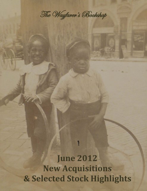
June 2012 New Acquisitions - The Wayfarer's Bookshop
June 2012 New Acquisitions - The Wayfarer's Bookshop
June 2012 New Acquisitions - The Wayfarer's Bookshop

Create successful ePaper yourself
Turn your PDF publications into a flip-book with our unique Google optimized e-Paper software.
<strong>The</strong> Wayfarer’s <strong>Bookshop</strong><br />
<strong>June</strong> <strong>2012</strong><br />
<strong>New</strong> <strong>Acquisitions</strong><br />
& Selected Stock Highlights<br />
1
<strong>The</strong> Wayfarer’s <strong>Bookshop</strong><br />
<strong>June</strong> <strong>2012</strong> <strong>New</strong> <strong>Acquisitions</strong><br />
& Selected Stock Highlights<br />
www.wayfarersbookshop.com; e-mail: wayfarers@shaw.ca<br />
phone: +1 (604) 921 4196; fax: +1 (604) 921 4197<br />
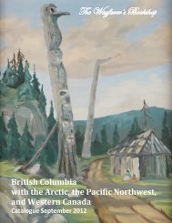
Cover illustration –item # 18<br />
2
1. [CAUCASUS PHOTO ALBUM]<br />
Al’bom Vidov Voenno-Gruzinskoi Dorogi, Fotographiia Bratiev Rudnevikh v gorode Vladikavkaze<br />
[Album of the Views of the Georgian Military Road, by the Rudnevy Brothers’ Photography in<br />
Vladikavkaz].<br />
Vladikavkaz: Skoropechatnia Z. Shuvalova, [ca.<br />
1870]. First Edition. Oblong Quarto (24 x 32.5 cm). 10<br />
leaves. Twenty mounted photographs (the last<br />
photograph mounted on verso of the last endpaper).<br />
Title page and text to the photographs<br />
chromolithographed in gold. Original publisher's brown<br />
gilt cloth. Covers and gilt faded. Some of the<br />
photographs mildly faded but generally strong images. A<br />
very good album.<br />
Very rare album as no copies found in Worldcat<br />
nor in Russian National and Russian State Libraries. <strong>The</strong><br />
album was issued by Rudnev Brothers, prominent<br />
Vladikavkaz photographers (located on the<br />
Alexandrovsky prospect) who participated in the 1872<br />
Russian Polytechnic Fair. It was a major (about 750 000<br />
visitors) exhibition of industrial, agricultural, military,<br />
scientific, technological and cultural achievements of<br />
1. St. Nina’s Gorge<br />
1. Vladikavkaz and Stolovaya Mountain<br />
the Russian Empire, held in Moscow and dedicated to the bicentennial anniversary of the birth of Peter I).<br />
<strong>The</strong> album contains early important images of the Russian advanced post in the Northern Caucasus;<br />
Vladikavkaz, and the Georgian Military road - a major route through the Caucasus Mountains from Russia<br />
to Georgia. <strong>The</strong> strong images include views of Vladikavkaz streets and buildings, bridges over the Terek,<br />
Stolovaya Mountain, the Darial Gorge, Kazbek Mountain with its glaciers, gorges, bridges and the<br />
monastery; local Ossetians dancing, riding horses etc.<br />
Known since antiquity (it was mentioned by Strabo in his Geographica and by Pliny), the Georgian<br />
Military Road was expanded by the Russian military starting in 1799. After the Kingdom of Georgia was<br />
annexed by the Russian Empire in 1801, Tsar Alexander I ordered General Aleksey Petrovich Yermolov,<br />
commander-in-chief of Russian forces in the Caucasus to improve the surfacing of the road to facilitate<br />
troop movement and communications. When Yermolov<br />
announced the completion of the work in 1817, the<br />
highway was heralded as the “Russian Simplon”.<br />
However, work continued until 1863. By this stage it<br />
had cost £4,000,000 (a staggering sum in the 1860s) but<br />
according to Bryce, in 1876, was of a high quality with<br />
two or three lanes and “iron bridges over the torrents”,<br />
something he considered astonishing given that within<br />
Russia proper at this time decent roads were virtually<br />
non-existent.<br />
<strong>The</strong> importance of the Georgian Military Highway<br />
as a through route has diminished in recent years,<br />
mainly because of delays at the border crossing<br />
between Russia and Georgia, and even, on occasions,<br />
the complete closure of that border post (Wikipedia).<br />
$3750USD<br />
3
2. [BAEGERT], [Johann Jakob] (1717-1772)<br />
Nachrichten von der Amerikanischen Halbinsel Californien: mit einem zweyfachen Anhang<br />
falscher Nachrichten. Geschrieben von einem Priester der Gesellschaft Jesu, welcher lang darinn diese<br />
letztere Jahr gelebet hat. [<strong>New</strong>s from the American Peninsula California…].<br />
Mannheim: Churfürstl. Hof- und Academie-Buchdruckerey,<br />
1773. Second Edition (With Corrections). Small Octavo. [xvi], 358<br />
pp. With one copper engraved folding map and two copper<br />
engraved plates. Recent period style brown gilt tooled half calf<br />
with speckled papered boards and a red gilt morocco label. Title<br />
with faint traces of library markings, otherwise a very good copy.<br />
“Baegert, a German Jesuit missionary and resident of Baja<br />
California for eighteen years, wrote an interesting but by no means<br />
glowing account of the natives and of the country. He served at<br />
the mission of San Luis Gonzaga. <strong>The</strong> map is most helpful in giving<br />
the location of the many Jesuit missions in Lower California. It also<br />
shows the route along the west coast of Mexico followed by<br />
Baegert in going to California in 1751, and his route out in 1768,<br />
after the expulsion of the Jesuits. <strong>The</strong> two plates, which are not<br />
found with all copies, depict California natives”(Hill 46); Barrett<br />
129.<br />
2<br />
“According to his accounts the country was absolutely<br />
unfitted for habitation; it was inhabited by wild and ferocious<br />
beasts; peopled by inhospitable and cruel savages; water was unfit for use; wood was scarce; and the soil<br />
would not sustain life” (Cowan p.27); Graff 137; Howgego B1; Howes B29; Sabin 4363 “Some corrections<br />
made [in the second edition)” (Streeter IV 2442); Wagner 157.<br />
$7500USD<br />
3. [CHINESE COSTUMES & CLARKIA PULCHELLA]<br />
[Sketchbook and Watercolour Album with Eighteen Pencil<br />
and Watercolour Views and Scenes Including Two High Quality<br />
Watercolours of Chinese Costumes and One of the Plant Clarkia<br />
Pulchella. <strong>The</strong> Rest of the Album Contains Views of England and<br />
Wales].<br />
Ca. 1830. Octavo. 61 leaves of various paper (white, grey,<br />
pink), some with J. Whatman watermark “1829.” Eighteen high<br />
quality illustrations including thirteen black and white pencils<br />
sketches (three unfinished) and five watercolours. Illustrations<br />
unsigned, seven neatly captioned in pencil (one in watercolour) in<br />
the lower margin. Handsome period red full calf, elaborately blind<br />
and gilt tooled; all edges gilt. A near fine album.<br />
This sketchbook by an accomplished amateur artist contains<br />
two colourful drawings of Chinese costumes - “A Chinese<br />
Mandarin,” and a portrait of a Chinese mother with a child playing<br />
with a toy.<br />
Additionally and of equal if not greater interest is the sketch<br />
(in colours) of Clarkia pulchella or pinkfairies, a wildflower “found<br />
in the Pacific Northwest . It was first discovered by<br />
3<br />
4
Meriweather Lewis close to Kamiah, Idaho during the Lewis and Clark<br />
expedition and it was subsequently brought back as a botanical<br />
specimen. It was not until 1814 however that the plant was classified<br />
and named Clarckia pulchella by Frederick Traugott Pursh in honor of<br />
Clark even though in his journal entry he acknowledged Lewis as the<br />
discoverer. At the time of its publication by Pursh it was the first<br />
species assigned to the newly created genus Clarckia. <strong>The</strong> genus was<br />
later renamed as Clarkia. <strong>The</strong>n in 1826 David Douglas brought back<br />
samples of the plant to England after an expedition to the northwest<br />
United States from 1824 to 1828” (Wikipedia).<br />
Thus this sketch is probably one of the earliest original art<br />
images of Clarkia pulchella.<br />
<strong>The</strong> remainder of the album contains eleven scenic rural views<br />
of England and Wales, three of which are very similar to works found<br />
in John Britton’s “<strong>The</strong> Beauties of England and Wales” (London, 1801-<br />
15): 1) “Plas <strong>New</strong>ydd near Llangollen. Seat of Lady Eleanor Butler, Miss<br />
Ponsonby” (published in 1813); 2) Aberdare Church, Glamorganshire<br />
(1813); and 3) Priory at Ware, Herts (1811). Other sketches are<br />
3<br />
executed in the same style and include rural landscapes and mansions, a view entitled “Home, sweet<br />
Home,' and a sketch of sculptor Joseph Nollekens’ bust (1737-1823).<br />
$1500USD<br />
4. [COOK], [Captain James] (1728-1779)<br />
[A Bronze Memorial Medal, by Lewis Pingo].<br />
[London], [1783 or 1784]. Diameter approx. 43 mm. Recto with profile bust of Cook facing left<br />
within the words “Iac. Cook Oceani Investigator Acerrimus” (James Cook, the Most Ardent Explorer of the<br />
Seas), beneath the bust, “Reg. Soc. Lond. Socio Suo” (<strong>The</strong> Royal Society of London to their Fellow) and<br />
initial “L. P. F.” [i.e. L. PingoFecit]. Reverse with figure of Fortune leaning against a naval column with<br />
rudder on globe within the letters “Nil Intentatum Nostri Liqvere” (Our Men Have Left Nothing<br />
Unattended) and, beneath the figure “Auspiciis Georgii III.” Medal in fine condition.<br />
<strong>The</strong> medal was struck in commemoration of Captain Cook<br />
by fellow members of the Royal Society of London. It “features on<br />
its obverse a profile portrait bust of Cook in uniform, and on the<br />
reverse, Fortune (sometimes identified as Britannia), leaning upon<br />
a column with a spear in the crook of her arm and holding a<br />
rudder on a globe. <strong>The</strong> decision to create the medal was made by<br />
the governing Council of the Royal Society shortly after news of<br />
Cook's death in Hawai'i reached London on 10 January 1780.<br />
This was the first, and so far the only, time that the Royal<br />
Society has decided to commemorate the death of one of its<br />
Fellows in this way. At its meeting on 17 February 1780, the<br />
Council decided that the medal would be struck in different<br />
metals, with subscription rates set at 20 guineas for a gold medal<br />
4<br />
and 1 guinea for a silver medal or two bronzed ones, and that each member would receive a free bronzed<br />
medal, in addition to any others he had subscribed for. Banks headed the list of subscribers, putting in an<br />
order for one gold, 23 silver and 13 bronzed medals. In all, it seems that 22 gold, 322 silver and 577<br />
bronzed medals were created” (National Museum of Australia on-line).<br />
5
Lewis Pingo (1743-1830) belonged to the British dynasty of clockmakers, engravers, and medallists,<br />
which had been established in London in the 1670s. His “greatest legacy is his medals, which are variously<br />
signed ‘L. PINGO’, ‘L. P.’, or ‘L. P. F.’ (F=fecit). <strong>The</strong>y number more than fifteen, and include portrait medals<br />
of David Garrick (1772) and Captain James Cook (1783), as well as prize medals for the Royal Humane<br />
Society (1776) and the Board of Admiralty (1796). Examples of his work are represented in the British<br />
Museum” (Oxford DNB); Beddie 2788.<br />
$3750USD<br />
5. [DE BRY], [Johann <strong>The</strong>odor de] (1561-1623)<br />
[Pigafetta Map of the Congo] Tabula Geogra: Regni Congo.<br />
Frankfurt: <strong>The</strong>odore De Bry,<br />
[1597]. 31x38 cm (12x15 in). A nice<br />
strong impression. A couple of<br />
minor marginal tears, otherwise a<br />
very good copy.<br />
“Boldly engraved map of the<br />
Congo region of the West African<br />
coast from just south of the<br />
equator to present-day Angola with<br />
a highly conjectural Congo river<br />
system. Dramatic topography and<br />
imaginary cities are depicted and<br />
the map is adorned by an elaborate<br />
title cartouche and a compass rose.<br />
<strong>The</strong> map accompanied a<br />
description by Pigafetta of Eduardo<br />
Lopez's visit to the region in 1578.<br />
From: Petit Voyages, Part I” (Old<br />
World Auctions).<br />
5<br />
“Duarte Lopez was a Portuguese trader to Congo and Angola who wrote one of the earliest<br />
descriptions of Central Africa. Lopez first left Portugal for the Congo in April 1578, sailing on his uncle's<br />
trading vessel.., Lopez was able to relate everything he knew about the Congo to Filippo Pigafetta, who<br />
had been charged with collecting information about the region. <strong>The</strong> result was published by Pigafetta in<br />
1591, although much of what it contained bordered on the fabulous. Lopez returned to the Congo in<br />
1589, after which nothing more is heard of him” (Howgego L146).<br />
$1250USD<br />
6. [DONDUKOV-KORSAKOV], [Alexander Mikhailovich](1820-1893),<br />
[Governor-General of the Caucasus]<br />
[Collection of Photographs of Tiflis]: Views of Interiors of the Governor-General’s Palace; with a<br />
Printed Portrait of Prince Dondukov-Korsakov while Governor-General.<br />
Ca. 1883. Seven large photographs mounted on cardboard leaves from both sides. Cardboard<br />
leaves are 43x35 cm (17x13 ¾ inches); views of Tiflis - 40x28 cm (15 ½x11 inches), palace photos - 28x22<br />
cm (11x9 inches). Photographs are signed in pencil in French and English and dated from 1883 to 1885.<br />
<strong>The</strong> leaves used to be mounted in an album; the fourth leaf includes four small photographic views (18x14<br />
cm, or 7x5 ½ inches) of the interiors of a historical museum in Salzburg. Portrait printed on a thick<br />
Watman paper appx. 60x48 cm (23 ¾x18 ¾ inches), the image is 46,5x35,5 cm (18 ¼x14 inches).<br />
6
<strong>The</strong> collection includes<br />
photographs of the interiors of the<br />
Governor-General’s palace in Tiflis,<br />
namely two views of the Salon<br />
Oriental where Governor’s private<br />
collections were housed; and views of<br />
his Private Office and Boudoir. <strong>The</strong>y<br />
are supplemented with a portrait of<br />
the palace’s owner himself, Prince<br />
Alexander Mikhailovich Dondukov-<br />
Korsakov, Russian influential military<br />
man and statesman, the commander<br />
of the Russian occupation corps in<br />
Bulgaria in 1879-80, a member of the<br />
State Council of Imperial Russia and a<br />
Governor-General of Caucasus in<br />
1882-1890. Dondukov-Korsakov<br />
6<br />
distinguished himself during the Caucasus Campaign, Crimean War 1853-56 and Russo-Turkish War 1877-<br />
78; he held several high Imperial orders, including Order of St. Anne I class, Order of St. Alexander Nevsky,<br />
and the highest order of chivalry of Russian Empire - Order of St. Andrew.<br />
On the portrait the Prince is depicted sitting in the armchair, wearing the uniform with the Orger of<br />
Saint George IV Class which he was awarded with on the 28th of December 1854 for a prowess in combat<br />
(Orger of Saint George is the highest military decoration of the Russian Empire and nowadays Russia). <strong>The</strong><br />
portrait originally produced in pastel is signed “Mary 1883.”<br />
<strong>The</strong> views of Tiflis include ruins of the Narikala fortress, overlooking the city (the photograph signed<br />
“Ruins of the ancient Georgian fortress”); “General view of the city from the north” with Kura stream on<br />
the foreground; and “<strong>The</strong> Salalaki Ward of the City.” <strong>The</strong> latter, called Sololaki, in the 19th century<br />
became one of the best, most expensive, “European” style districts of Tiflis.<br />
$1250USD<br />
7. [EDMONTON & BANFF]<br />
[Album of 50 Original Photographs of Edmonton<br />
and Banff].<br />
Ca. 1912. Oblong Octavo (13x21 cm). 50<br />
photographs, each ca. 8,5x12,5 cm (3 ½ x 5 in) mounted on<br />
50 black stiff card leaves. All photographs with<br />
contemporary hand written captions in white. Period black<br />
gilt cloth. A near fine album.<br />
Early photographs of Edmonton and Banff showing<br />
the construction of several important landmarks.<br />
<strong>The</strong> Edmonton images include eight interesting<br />
general panoramas taken from the top of a building in the<br />
city centre (looking northeast, northwest, south,<br />
southeast, and southwest); two photographs of the<br />
Alberta Legislature building in the final stage of<br />
construction (completed in 1913); views of the Edmonton<br />
7. Edmonton looking northeast<br />
7
Technical School, Race track, Fourth<br />
Street, newly built High Level Bridge<br />
(opened in 1913); and two views of<br />
Wabamun Lake, a popular resort 65 km<br />
west of Edmonton.<br />
Photographs of Banff and<br />
surroundings include over twenty views of<br />
the Rockies - “<strong>The</strong> Rockies from<br />
Kananaskis,” “Three sisters at Canmore,”<br />
views of Cascade Mountain, Sulphur<br />
Mountain, Mt. Rundle, Mt. Edith, Bow<br />
river and Bow falls, Observatory on the<br />
summit of Sulphur Mountain, summer<br />
camp at Cooking lake et al. Among the<br />
pictures of Banff there is an important<br />
7. Banff Springs Hotel<br />
view of the main street with Cascade Mountain on the background, Chateau Rundle, woody “Avenue”<br />
and Lovers’ Lane and a curious picture showing the Banff Springs Hotel with the central tower under<br />
construction (“C.P.R. Hotel at Banff”). “<strong>The</strong> so-called “Painter Tower” was completed in 1914 at a<br />
cost of $2 million with 300 guest rooms, and was for a time the tallest building in Canada” (Wikipedia).<br />
$1250USD<br />
8. [ESCOBEDO Y ALARCON, Jorge]<br />
[Taxation of Indians in Peru (Viceroyalty)]. Instruccion, O Advertencias, que Consiguiente a lo<br />
Prevenido en el Articulo 118 de la de Intendentes se dan a sus Subdelegados, y Demas Encargados de la<br />
Cobranza de Tributos para Deslindar las Funciones de la Contaduria del ramo, y Conciliarlas con las<br />
Facultades de los Intendentes.<br />
[Lima], 1 July 1784. First Edition.<br />
Folio. 16 pp. Disbound Pamphlet, with a<br />
large woodcut initial. Housed in a marbled<br />
papered portfolio with a red gilt label on<br />
the front cover. A very good copy.<br />
Very rare work as only one copy<br />
found in Worldcat. Several sections of this<br />
decree on collection of taxes deal with<br />
taxes gathered from the Indians. In one<br />
the collectors are ordered to halt the<br />
criminal fraud of Indians who escaped<br />
paying taxes merely because they had<br />
avoided being registered. Another notes<br />
that many Indians are now able to pay in<br />
coin rather than in goods, and requires<br />
them to do so. Not in Sabin.<br />
$1750USD<br />
8<br />
8
9. [HAWAII, JAPAN, CHINA, SOUTH-EAST ASIA, INDIA]<br />
[Photograph Album of 208 Original Photographs of the Pacific and South-East Asia, including<br />
Hawaii, Japan, China, the Philippines, Ceylon, India and Himalayas].<br />
Ca. 1905. Oblong Folio (28,5x38 cm). 50 grey card leaves. Oblong Folio (29x37 cm or 11 ¼ x 14 ½ in).<br />
Over 160 mounted photographs of different size, from ca. 8x13 cm (3x5 in) to ca. 5x8 cm (2x3 in), all<br />
captioned in white. Period brown sheep blind stamped on the front board. Extremities mildly rubbed, one<br />
leaf with a tear, but otherwise a very good album.<br />
Interesting photograph album, presumably compiled by an American traveller on a tour, with a<br />
small group, from Hawaii across the Pacific Ocean to South-East Asia and India. <strong>The</strong> nationality of the<br />
traveller, as well as the approximate date of their trip (ca. 1905) can be supported by the fact, that he<br />
crossed the Pacific from Hawaii on SS Mongolia, which was launched in 1903 and used on the trans-Pacific<br />
service (San Francisco, Hawaii, Hong Kong) from 1904 to 1915. <strong>The</strong> date is also confirmed by a picture of<br />
steamship Minnesota, included in the album (it was built in 1904 and made forty round trip voyages<br />
between the U.S. West Coast and the Far East between January 1905 and October 1915), (<strong>The</strong> Atlantic<br />
Transport Line, 1881 -1931, on-line).<br />
<strong>The</strong> album starts with the<br />
Hawaiian views showing “Queen<br />
Lil’s home,” Palm Avenue, and<br />
“Residence” in Honolulu. <strong>The</strong>n a<br />
large group of photographs (51)<br />
shows Japan - Yokohama,<br />
Kamakura, Kyoto, Osaka, Nagasaki,<br />
Mt. Fuji, Lake Hakone (Ashi) and<br />
historic Fujiya Hotel in Miyanoshita<br />
(Hakone); with views of Japanese<br />
gardens and temples, beggars,<br />
children and a portrait the traveller<br />
with geishas. China is represented<br />
with 27 photographs of Canton<br />
with its canals, streets, colonial<br />
buildings on the Shameen (modern<br />
Shamian) Island; Wuchou (port,<br />
missionaries' houses and others),<br />
9. ‘A thorn between two roses (Darjeeling)’<br />
several views of the West River with boats and junks; Macao (facade of the ruined Catholic church) et al.<br />
Thirteen photographs show Manila (numerous views of churches), Singapore and Malaysia (Penang).<br />
Ceylon photographs (19) include interesting views of Colombo’s colonial architecture and harbour, ruins<br />
of Kandy and Anuradhapura, and a portrait of the traveler holding a cobra in an open basket (the photo<br />
captioned “Snake charmer”).<br />
<strong>The</strong> largest group of photographs, over 70, relate to India and Burma and show: temples of<br />
Trichinopoly; pagodas of Rangoon and Mandalay, trip on the Irrawaddy River (Burma); botanical garden<br />
and street views of Calcutta, Ganges ghats and temples of Benares, palaces and ruins of Lucknow; Taj<br />
Mahal, Fort and numerous mosques of Agra and Delhi; views of Kanpur, Jaipur, Amber, Ahmedabad. Very<br />
interesting are the Himalayan views taken in Darjeeling, including the one with travelers in a sedan chair<br />
waiting to be taken “to Tiger Hill to see Mt. Everest.” And, of course, a portrait of the traveler with two<br />
local women in national dress, captioned “A thorn between two roses (Darjeeling).” Overall a very<br />
interesting album with excellent images.<br />
$2950USD<br />
9
10. [IVITTUUT, GREENLAND]<br />
[Original Pen and Wash Drawing of the Town of Ivittuut in South Greenland].<br />
Ca. 1865. Drawing matted to approximately 15x20 cm (6 x 7 ½ in). Period gilt trimmed frame.<br />
Drawing and frame in very good condition.<br />
Original pen and wash drawing of the mining town of Ivittuut (formerly Ivigtut), in South Greenland.<br />
Contemporary inscriptions on the back of the frame appear to indicate that the drawing is either the basis<br />
for, or has been done after, an 1865 photogravure by Thomas Schniat.<br />
“<strong>The</strong> name of the settlement means the grassy place in Greenlandic. <strong>The</strong> town has a 5 kilometer road<br />
that connects it to Kangilinnguit. Ivittuut is<br />
also the only town in Greenland to have<br />
roads leading to another town.., Ivittuut<br />
stands at the site of the Norse Middle<br />
Settlement, which is sometimes considered<br />
part of the Western Settlement. This was the<br />
smallest of the three settlements, including<br />
about 20 farms, and less is known about it<br />
than about either of the others, as no<br />
written records survive.., In 1806, cryolite<br />
was found in the area, with mining<br />
operations starting in 1865. <strong>The</strong> mineral<br />
deposits were exhausted by 1987, and the<br />
town lost its economic base. It was<br />
abandoned soon after” (Wikipedia).<br />
$1750USD<br />
10<br />
11. [KRUSENSTERN], [Adam Johann von (1770-1846)];<br />
UKHTOMSKY, Andrei Grigorievich (1771-1852)<br />
“Grobnitsa Kapitana Klerka v Petropavlovske. Captain Clerkes Grabmal im Hafen St. Peter und<br />
Paul” [Captain Clerkes’ Tomb in Petropavlovsk]. Copper engraving from “Atlas k Puteshestviiu Vokrug<br />
Sveta Kapitana Krusensterna” [Atlas to the Travels of Captain Krusenstern Around the World]. Plate №<br />
XVIII.<br />
Saint Petersburg: Morskaya<br />
Typ., 1813. 52x34 cm (20 ½ x 13 ½<br />
in.). Title in Russian and German.<br />
Upper margin strengthened, mild<br />
water stains on upper and lower<br />
margins, otherwise a very good<br />
wide margined copy.<br />
A plate from the Russian<br />
edition of the Atlas of<br />
Krusenstern’s circumnavigation in<br />
1803-1806. <strong>The</strong> complete Atlas is<br />
a great rarity with only one copy<br />
found in Worldcat, but separate<br />
engravings are also very rare even<br />
in Russia. <strong>The</strong> Atlas contained 109<br />
engraved plates and was one of<br />
10<br />
11
the most luxurious Russian editions of the beginning of the 19th century, being issued on funds of the<br />
Cabinet of the Russian Emperor and costing 15 thousand roubles - a huge sum of money at the time.<br />
<strong>The</strong> engraving depicts the tomb of Charles Clerke (1741-1779), a participant in all three James<br />
Cook’s circumnavigations who after Cook’s death in 1779 took the command of the third expedition and<br />
continued searching for the Northwest Passage. Clerke is notable for being the author of the first account<br />
of Captain Cook’s death, as his letter to the Admiralty mentioning Cook’s murder on Hawaii and written in<br />
Kamchatka on <strong>June</strong> 8, 1779, was first published as a pamphlet in Reval in 1780 (Hawaiian National<br />
Bibliography 18).<br />
Clerke died from tuberculosis not far from Kamchatka and was buried in Petropavlovsk, next to the<br />
grave of another explorer, Louis Delisle de la Croyère (about 1685-1741). <strong>The</strong> latter participated in Vitus<br />
Bering’s expedition to the North Pacific in 1741 and as many other expedition members, including Bering<br />
himself, died on the hard way back to Kamchatka. <strong>The</strong> sailors from Krusenstern’s expedition while staying<br />
in Petropavlovsk in September 1805, renewed the tombs constructing a wooden pyramid with<br />
commemorative boards above both graves. Krusenstern described this event in the account. This plate<br />
shows how connected the first explorers of the North Pacific were.<br />
<strong>The</strong> engraving was made from the drawing from life by Wilhelm Gottlieb Tilesius von Tilenau (1769-<br />
1857), German naturalist and artist who participated in Krusenstern’s expedition. <strong>The</strong> engraver, Andrey<br />
Ukhtomsky was a prominent Russian artist, a member of the Russian Academy of Arts (1808), the head of<br />
the printing house of the Academy, and the curator of the Academy’s library.<br />
$2750USD<br />
12. [NEW GUINEA]<br />
MACKELLAR, Campbell D.<br />
[Eight Original Watercolour Views of <strong>New</strong> Guinea and Its Natives, Some of Which are Reproduced<br />
in Mackellar’s Book “Scented Isles and Coral Gardens”].<br />
Ca. 1895. Eight<br />
watercolours, including three<br />
large, ca. 35x25 cm (13 ¾ x 9 ¾<br />
in); four slightly smaller, ca.<br />
25x17 cm (9 ¾ x 6 ¾ in); and one<br />
small, ca. 15,5x12 cm (6 x 4 ¾ in);<br />
all recently matted. On album<br />
paper, with four watercolours<br />
mounted on period larger<br />
cardboard. Five watercolours<br />
signed “C. Mackellar” in the right<br />
lower corner (one signature not<br />
finished, reads “C. Mack”); others<br />
unsigned. Four watercolours<br />
captioned in ink on verso by<br />
Mackellar; others with later<br />
pencil captions. <strong>The</strong> group of<br />
watercolours is in near fine<br />
condition.<br />
12<br />
[With] MACKELLAR, C.D. Scented Isles and Coral Gardens: Torres Straits, German <strong>New</strong> Guinea<br />
and the Dutch East Indies. Presentation copy, Signed “To: <strong>The</strong>ron G. Damon with the compliments of<br />
the author. Campbell D. Mackellar. 1912” on the first free endpaper.<br />
11
London: John Murray, 1912. First edition. Octavo. Xiii, 351 pp. With eight color and 28 black and<br />
white plates. Publisher’s green pale cloth gilt lettered and tooled on the upper board and spine. Front joint<br />
weak and with a small tear, spine faded, otherwise a very good copy.<br />
Beautiful and evocative original watercolours showing very interesting views of <strong>New</strong> Guinea’s<br />
natives including: A meeting of two natives on a road, native ritual house with masks, a woman with a<br />
child, man in ritual mask and with a shield, beautiful bird of paradise, and a ceremonial corroboree<br />
meeting of Aboriginals.<br />
<strong>The</strong> watercolours were made<br />
by the “Scottish pleasure-pilgrim”<br />
C.D. Mackellar who made several<br />
trips to <strong>New</strong> Guinea by steamer in<br />
1885-1900. <strong>The</strong>y were published in<br />
his book “Scented Isles and Coral<br />
Gardens.” This collection includes<br />
four of the ones included in the book<br />
and four additional ones. <strong>The</strong><br />
watercolours are very amusing and<br />
skilful. As he noticed in the preface,<br />
“the author, as is evident, is no artist,<br />
and they are only published here to<br />
try and give even a small and<br />
imperfect idea of the colour which<br />
the pen can only tell of but never<br />
paint” (Preface). <strong>The</strong> book itself is<br />
12. ‘Mask House and Masked Natives, <strong>New</strong> Guinea’<br />
a series of letters describing a trip by steamer around former German <strong>New</strong> Guinea. Mackellar also<br />
published “A pleasure pilgrim in South America” (London: John Murray, 1908).<br />
<strong>The</strong> watercolours reproduced as plates are:<br />
Mask House and Masked Natives, <strong>New</strong> Guinea (p. 110); image size ca. 35x25 cm (13 ¾ x 9 ¾ in).<br />
Mounted on larger cardboard. Signed “C. Mackellar” in the right lower corner, captioned in ink on verso<br />
by Mackellar.<br />
<strong>The</strong> Old, old story, <strong>New</strong><br />
Guinea (p. 154); image size ca. 35x25<br />
cm (13 ¾ x 9 ¾ in). Album paper.<br />
Signed “C. Mackellar” in the right<br />
lower corner, later pencil caption.<br />
Bird of Paradise (Pteridophora<br />
Alberti) (p. 158); image size ca. 35x25<br />
cm (13 ¾ x 9 ¾ in). Album paper.<br />
Signed “C. Mackellar” in the right<br />
lower corner, later pencil caption.<br />
“Very singular is the<br />
Pteridophora alberti, a bird of<br />
paradise that has two long, wiry<br />
strings from its head ornamented<br />
with pale blue horny discs like shells”<br />
(p. 159).<br />
12. ‘<strong>The</strong> Old, old story, <strong>New</strong> Guinea’<br />
12
Native with Mask and Shield, <strong>New</strong> Guinea (p. 194); image size ca. 25x17 cm (9 ¾ x 6 ¾ in).<br />
Mounted on larger cardboard. Unsigned, captioned in ink on verso by Mackellar.<br />
Other watercolours:<br />
Native with Mask, <strong>New</strong><br />
Guinea. Image size ca. 25x17 cm (9 ¾<br />
x 6 ¾ in). Mounted on larger<br />
cardboard. Signed “C. Mackellar” in<br />
the right lower corner, captioned in<br />
ink on verso by Mackellar.<br />
Mother and Child, <strong>New</strong><br />
Guinea, German <strong>New</strong> Guinea. Image<br />
size ca. 25x17 cm (9 ¾ x 6 ¾ in).<br />
Mounted on larger cardboard.<br />
Unsigned, captioned in ink on verso<br />
by Mackellar.<br />
Australian [Corrobborea].<br />
Torres Strait. Image size ca. 25x17 cm<br />
(9 ¾ x 6 ¾ in). Album paper. Signed<br />
“C. Mack”in the right lower corner,<br />
later pencil caption.<br />
13. Yomeimon Gate, Nikko<br />
12. ‘Native with Mask and Shield, <strong>New</strong> Guinea’<br />
[Native Woman at Sea Shore], German <strong>New</strong> Guinea. Image size ca. 15,5x12 cm (6 x 4 ¾ in). Album<br />
paper. Unsigned, later pencil caption.<br />
Annotated bibliography of the Southwest Pacific and Adjacent Areas. Vol. 2, p.20.<br />
$8750USD<br />
13. [NIKKO, JAPAN]<br />
[Album of 26 Original Photographs of Nikko, Japan].<br />
Ca. 1890-es. Oblong Folio (28x38 cm). 26 large photographs ca. 20,5x26 cm (8 x 10 ¼ in) mounted on<br />
26 stiff cardboard leaves. All photographs numbered and captioned in negative, 15 photographs with custom<br />
made labels with type written text. Period brown gilt lettered half morocco with cloth boards neatly<br />
rebacked and re-cornered in style with new endpapers. Overall a very good album.<br />
<strong>The</strong> album includes early large<br />
photographs of the main sites of Nikko, a<br />
mountainous resort approximately 140 km<br />
north of Tokyo, which became especially<br />
popular among foreign visitors in the end<br />
of the 19th century. “In 1890 first railway<br />
connection to Nikko was provided by the<br />
Japanese National Railways, which was<br />
followed by the Tobu Railway in 1929 with<br />
its Nikko Line” (Wikipedia). Nowadays<br />
Nikko is also a popular destination for<br />
Japanese and international tourists,<br />
famous for its ancient temples, tombs of<br />
great Japanese shoguns Tokugawa Ieyasu<br />
and Tokugawa Iemitsu, the Futarasan<br />
Shinto Shrine and numerous hot springs.<br />
13
<strong>The</strong> shrine of Nikko Tosho-gu, Futarasan Shrine, and a Buddhist temple complex Rinno-ji now form the<br />
UNESCO World Heritage Site Shrines and Temples of Nikko (Wikipedia).<br />
<strong>The</strong> photographs show Hatsuishi Street (numbered 1197), the Sacred Bridge (748) leading to the<br />
Futarasan Shrine, Manganji Garden (1129 and 1132), and a large group of views of the Tosho-gu Shrine.<br />
<strong>The</strong> latter includes pictures of several gate: Ishidorii (740), Yomeimon (715 and 729), Karamon (733),<br />
Niomon (716), Torii (709), Eaimitsu (427); views of Five-storied pagoda (757), Eaimitsu temple (702), tomb<br />
of Iyeyasu shogun (710, 711, 714); a sculpture of Three Wise Monkeys (1052), stone lions of Tobikoye<br />
Shishi (1145), Korean bronze lantern (358), lavish wall carvings (761), buildings of Koro (739), Futatsudo<br />
(1147), Kaguraden (1210), Mizuya (713), an alley with stone idols (807) et al.<br />
$2250USD<br />
14. [ROYAL ASIATIC SOCIETY OF GREAT BRITAIN & IRELAND]<br />
Founding Documents of the Royal Asiatic Society, Including: In Manuscript: <strong>The</strong> Asiatic Society<br />
Prospectus; [With]: Printed List of Members of the Asiatic Society of London; with Inscriptions by Henry<br />
Thomas Colebrooke (1765-1837), the Marquis of Lansdowne and poet Rev. George Crabbe (1754-1832).<br />
London, Jan./Feb. 1823. List of Members: ca. 18x23 cm (7x9 in). Two pages. Folded, weak on folds,<br />
red seal with chip to blank of left margin. Prospectus: ca. 19x23 cm (7 ½ 9 in). Four pages. Watermarked<br />
laid paper; small tear and chipping at centrefold, text complete and clear. Overall both in very good<br />
condition.<br />
Important pair of documents<br />
relating to the founding of the Royal<br />
Asiatic Society of Great Britain and<br />
Ireland. Printed list “Original<br />
Members of the Asiatic Society of<br />
London” contains 27 names<br />
including Sinologist Sir George<br />
Thomas Staunton (1781-1859),<br />
colonial official in Ceylon Sir<br />
Alexander Johnston (1775-1849),<br />
Orientalist and Society’s<br />
mastermind Henry Thomas<br />
Colebrooke, administrator in India<br />
Sir John Malcolm (1769-1833), et al.<br />
<strong>The</strong> list has a manuscript note by<br />
Colebrooke “with Major<br />
Colebrooke's sincere regards 24<br />
Jany 1823” likely from one of the<br />
14<br />
first Society’s preliminary meetings. <strong>The</strong>re’s also a superscription to the Rev. G. Crabbe by the Earl of<br />
Lansdowne dated 1823, and manuscript poetical jottings by Crabbe, a total of 37 lines. A later note on<br />
reverse describes the item: “On the outside is written in the handwriting of the Marquis of Lansdowne the<br />
address of the Revd George Crabbe, the poet, who filled up the vacant space with a short unpublished<br />
piece of poetry (in his own handwriting)”.<br />
<strong>The</strong> prospectus informs about the date, place and agenda of the Society’s first General Meeting (15<br />
March 1823); describes the procedure of Election of a Council and Officers, Council’s composition; the<br />
ballot; resolutions (name, designation of members, evolution of statutes and next general meeting).<br />
Noteworthy is the description of the functions of the Director’ Office, which is “proposed to be instituted<br />
expressly for the purpose of effectually sustaining and promoting Oriental Literature one of the<br />
14
leading objects, which the Society has in view.” It was Henry Thomas Colebrooke who became the first<br />
Director of the Society.<br />
“Colebrooke was the individual who played the greatest part in founding and establishing the (later<br />
Royal) Asiatic Society of Great Britain and Ireland. He took the chair at all the preliminary meetings; the<br />
first, on 9 January 1823, was held at his house. It was evidently felt that the president should be someone<br />
of higher rank and greater influence; but it was unanimously decided to appoint, immediately below the<br />
president, a director, ‘under whose particular care and protection Asiatic literature should be placed’. In<br />
this capacity Colebrooke was ‘called to the chair’ at the society's first general meeting on 15 March 1823.<br />
In his address he said that England had a special mission to repay a debt of gratitude to India. For the next<br />
three years he presided at most meetings both of the society and of its governing council; evidently it was<br />
he who really ran the society” (Oxford DNB).<br />
$2500USD<br />
15. [RUSSIAN EMBASSY TO VENICE, 1656-1657]<br />
[REMARKABLE PRIMARY SOURCE ON 17TH CENTURY RUSSIAN-WESTERN EUROPEAN RELATIONS].<br />
Relatione d’Alcuni Costumi de’Sig.i Ambasc. Moscoviti, che ora si trovano in Livorno per passare<br />
all’Ambasciata di Venezia [Autograph Letter by an Anonymous Author from Livorno Witnessing the<br />
Muscovite Embassy to Venice (1656-1657) and Containing Vivid Observations and Remarks About<br />
Russians].<br />
Livorno, ca. 1656. Quarto, ca. 27x19,5 cm (10 ½ x 7 ¾<br />
in). Four pages; brown ink on cream laid paper with fleur-delis<br />
watermark, written in a legible hand. Paper aged and<br />
slightly faded, with fold marks, but the text is still bright and<br />
easy distinguishable. Beautiful period style crimson<br />
elaborately gilt tooled custom made full morocco clamshell<br />
box with cloth chemise. <strong>The</strong> letter in very good condition.<br />
Remarkable and Very Important Primary Source for<br />
Russian-Western European relations in the 17th century, an<br />
anonymous letter: “Curiosissimi Costumi de’Sig.i<br />
Ambasciatori Moscoviti, che ora si trovano in Livorno per<br />
passare all’Ambasciata di Venezia.” According to the<br />
historians who worked with two other known copies of the<br />
letter (see below: Attribution of “Relatione d’Alcuni<br />
Costumi”) it was written by a first-hand witness of the<br />
embassy, somehow involved with it, most likely between the<br />
19th and 23rd of December, 1656. <strong>The</strong> written dialect of the<br />
letter’s language indicates that the author was a common<br />
person from Livorno, possibly of Sicilian origin.<br />
15<br />
<strong>The</strong> letter vividly describes the Muscovite diplomatic delegation, staying in Livorno on its way to<br />
Venice in the winter of 1656. It was an official embassy to the Doge of Venice from the Russian Tsar<br />
Alexey Mikhailovich (1629-1676) sent in 1656-57 and headed by the Pereyaslavl governor Ivan Ivanovich<br />
Chemodanov (before 1618 - after 1657) and Deacon A. Postnikov. <strong>The</strong> goal of the embassy was to<br />
strengthen political and commercial relations with Venice, to negotiate the joint struggle against the<br />
Turks, to give Venetians the permission to trade in Archangelsk, and to borrow money from the Doge. A<br />
small “side task” was to: “to sell a hundred poods (1600kgs) of rhubarb and some sable furs for a<br />
thousand roubles.” Overall the embassy didn’t achieve its goals as it didn’t manage to get the money from<br />
15
the Doge and to successfully sell the state rhubarb and the sable furs (some of which were damaged<br />
during the voyage to Italy and some were sold to feed the embassy itself). <strong>The</strong> embassy left Venice in<br />
March 1657 and went back to Russia through Switzerland, Germany and Holland.<br />
In spite of a lack of diplomatic skills, Chemodanov’s embassy left its trace in history. Its members<br />
became the first Russians to travel to Italy by sea, around northern Europe. <strong>The</strong>y left Archangelsk on the<br />
12 th of September, 1656; passed the “Northern Nose” (North Cape), the “land of the Danish king,”<br />
“Icelant, or Icy island (Iceland),” “the lands of Hamburg and Bremen,” Scotland, Holland, “possessions of<br />
the English King,” French and Spanish lands - “all those countries we passed from the left,” and arrived in<br />
Livorno on the 24 th of November the same year. During the voyage they suffered from storms in the<br />
Atlantic, when most of the state goods were damaged.<br />
<strong>The</strong> embassy’s appearance in Italy was met with great interest and curiosity; the official relations<br />
from both the Russian and Italian sides noted crowds of people accompanying the Muscovites wherever<br />
they went. Our letter “Relatione d’Alcuni Costumi” reveals what impression the Russian diplomats made<br />
on the Italians, e.g. “they are dressed in cloth of cotton wool as they are afraid of cold, which is very<br />
common in their country”; “they beat their servants with their own hands, and so brutally that four of five<br />
of them was on the verge of death, and one ran away and is still not found”; “they have sable skins for<br />
100 thousand skudi and also a big amount of rhubarb, caviar and salted fish, and it stinks so much, that<br />
people get sick, and where they were for one hour it stinks afterwards for twelve hours.”<br />
15<br />
<strong>The</strong> Muscovites often seemed barbaric to the inhabitants of Livorno, as they all slept together, “and<br />
the Ambassador with them too, as he was afraid to fall off the bed”; they liked wine, but “put it all in one<br />
barrel, not distinguishing whether it is white or red or any sort of wine”; when the Governor took them<br />
around the city in a carriage, local people were astonished to see that the Muscovites didn’t open the<br />
doors, but climbed over them. <strong>The</strong>re are also descriptions of their table manners which indicate that the<br />
Muscovites didn’t know how to use forks, also descriptions of how balls and festivities amused them, how<br />
“all small houses seemed to them as Gran Palazzos.” Amusing also is the note that the Muscovites liked<br />
“Belle Donne” a lot, and spent many sable furs on them. A separate story describes how the chief<br />
Ambassador got attracted to the wife of a local doctor and tried to get her attention.<br />
16
<strong>The</strong> letter concludes with a note of the embassy’s coming departure to Florence, where they will be<br />
met as Royal ambassadors, and “comedia redecolosa” and that a big feast will be given in their honour, as<br />
“they like it more than anything else.”<br />
Attribution of “Relatione d’Alcuni Costumi”:<br />
<strong>The</strong>re are two other known copies of “Curiosissimi Costumi,” the older one is found in the Vatican<br />
Library (Biblioteca Apostolica Vaticana) as a part of “Codex Vaticanus Latinus” № 8891. It was first<br />
published in printed form in 1890 as a part of “Spicilegio Vaticano di Documenti Inediti e Rari, Estratti<br />
Dagli Archivi e Dalla Biblioteca della Sede Apostolica” (Roma 1890, p. 381-383). <strong>The</strong> editor of the book,<br />
Monsignor I. Carini attributed that the Vatican letter was written in the middle of the 17 th century by a<br />
first-hand witness of the Muscovite Embassy. Based on the written dialect of the letter’s language, Carini<br />
attributed the author as one of Livorno’s common people, a Sicilian by origin.<br />
15<br />
<strong>The</strong> second of the two other known copies of “Curiosissimi Costumi” is deposited in Russia, in the<br />
archive of the Saint Petersburg Institute of History of the Russian Academy of Sciences. <strong>The</strong> text of the<br />
letter is included in the Italian manuscript collection titled “Storie Diverse.” Soviet historians also<br />
published a printed version of their copy of the letter and thoroughly analysed it (see special articles by S.<br />
Anninskii, 1934, and I. Sharkova, 1972); <strong>The</strong> Saint Petersburg copy was attributed to be written slightly<br />
later than the Vatican copy, at the end of the 17th or in the very beginning of the 18th century.<br />
A thorough analysis of the texts of our letter and the Vatican and Saint Petersburg copies reveal<br />
several minor differences between all three, but also show a strong resemblance between our “Relatione<br />
d’Alcuni Costumi” and the Vatican copy. <strong>The</strong>y are very similar in regards to the completeness and spelling<br />
of the text, whereas the Saint Petersburg copy often has some words replaced or removed, and also has<br />
spelling patterns different from the Vatican and our copies. This allows us the to state, that our copy was<br />
written at the same time with the Vatican copy or close to it. It’s remarkable, on the other hand, that the<br />
text of our copy is more extensive, than the Vatican one: there are additional lines in several places<br />
supplementing the contents of the Vatican copy. It could mean either that our copy is earlier - making it<br />
the earliest known copy of “Curiosissimi Costumi,” or that the author of our copy knew more about the<br />
events described in the letter, and decided to enrich it with more details.<br />
17
Bibliography:<br />
[Ambasceria Russa in Italia] / [Ed. By I. Carini] // Spicilegio Vaticano di Documenti Inediti e Rari,<br />
Estratti Dagli Archivi e Dalla Biblioteca della Sede Apostolica. – Roma 1890. – P. 376-383.<br />
[Anninskii] Аннинский, С.А. Пребывание в Ливорно Царского посольства в 1656 г. (Впечатления<br />
иностранца) // ИРЛИ. Сборник статей, посвященных академику А.С. Орлову. – 1934. – С. 201-207.<br />
[Kazakova] Казакова, Н.А. Статейные списки русских послов в Италию как памятники<br />
литературы путешествий (середина XVII века) // Труды Отдела древнерусской литературы. — Л.:<br />
Наука. Ленингр. Отд-ние, 1988. – T. XLI. – С. 268-288.<br />
[Liubopytneishie nravy…] Любопытнейшие нравы господ послов московских, которые<br />
находятся теперь в Ливорно, проездом в Венецию / Публ. И перевод К. Шварсалон // Русская<br />
старина, 1894. – Т. 81. - № 1. – С. 197-203.<br />
[Sharkova] Шаркова, И.С. Посольство И.И. Чемоданова и отклики на него в Италии //<br />
Проблемы истории международных отношений. – Л., 1972. – С. 207-223.<br />
$37,500USD<br />
16. [SALONA DURING THE GREEK WAR OF INDEPENDENCE]<br />
[Original Very Large Drawing of Salona [Amfissa], Greece].<br />
Ca. 1821. Pencil on Whatman paper watermarked “1821,” ca. 58x86 cm (22 ¾ x 34 in). Unsigned,<br />
captioned in pencil “Salona” in the upper margin. With a small marginal tear, otherwise a very good<br />
drawing.<br />
This detailed pencil drawing<br />
shows the panoramic view of<br />
Amfissa (known as “Salona” from the<br />
13 th century until 1833) surrounded<br />
by the adjacent foothills and city’s<br />
landmark, the Castle of Salona (or<br />
the Castle of Oria) in the centre. <strong>The</strong><br />
drawing was most likely made during<br />
the Greek War of Independence<br />
(1821-32) and is especially significant<br />
as Salona was the first town of<br />
Central Greece to revolt against<br />
Turks (Wikipedia). <strong>The</strong> drawing<br />
clearly represents the English school<br />
and is a good example of<br />
“Philellenism,” a “tremendous sympathy” (Wikipedia)<br />
16, enlargement<br />
and wide support for the Greek Revolution throughout the Western Europe.<br />
“On March 27, 1821, Dimitrios Panourgias [Greek military commander] invaded the town and on<br />
April 10 the Greeks captured the Castle of Salona, the first fortress which fell in Greek hands, and<br />
extinguished the six hundred people of the Ottoman garrison in it. On 15-20 November 1821, a council<br />
was held in Salona, where the main local notables and military chiefs participated. Under the direction of<br />
<strong>The</strong>odoros Negris, they set down a proto-constitution for the region, the “Legal Order of Eastern<br />
Continental Greece”, and established a governing council, the Areopagus of Eastern Continental Greece,<br />
composed of 71 notables from Eastern Greece, <strong>The</strong>ssaly and Macedonia. Salona became the capital of<br />
Eastern Continental Greece and the regime existed until the Ottoman recapture of Greece, in 1825”<br />
(Wikipedia).<br />
$5500USD<br />
18
17. [SANTA CATARINA, BRAZIL]<br />
Descripção Topographica do Mappa da Provincia de Santa Catharina, Organisada na Commissao<br />
do Registro Geral e Estatistica das Terras Publicas e Possuidas Bernardo Augusto Nascentes de<br />
Azambujasob a Presidencia do Conselheiro. [Topographical Description of the Map of the Province of<br />
Santa Catharina..,].<br />
Rio de Janeiro: Imprimerie Impériale de S.A. Sisson, 1874. Second Edition. 25 pp. With a large fourcolor<br />
lithograph folding map (90x60 cm). Original publisher's beige printed papered boards, black cloth<br />
spine. A very good copy.<br />
This rare decorative and detailed four-color map shows the Santa Catarina state on the southeast<br />
coast of Brazil which was a favored destination for immigrants from Europe and Asia. Not in Borba de<br />
Moraes.<br />
“Santa Catarina is a state in southern Brazil with one of the highest standards of living in Latin<br />
America. Its capital is Florianópolis, which mostly lies on the Santa Catarina Island.., Large numbers of<br />
European immigrants, especially from Germany, began arriving early in the nineteenth century.<br />
Immigrants from Italy, Poland, Russia, Ukraine, Japan and other parts of Europe followed. <strong>The</strong>se<br />
immigrants created an abundance of small, family-held farms, many of which continue to exist in the<br />
interior of the state” (Wikipedia).<br />
$1750USD<br />
18. [ST. AUGUSTINE, FLORIDA]<br />
[Album of 36 Original Photographs of St. Augustine and Jacksonville, Florida].<br />
Ca. 1890. Oblong Octavo (13,5x19,5 cm). 36 photographs ca. 9x12 cm (3 ½ x 4 ¾ in) mounted on 18<br />
stiff cardboard leaves. All photographs with manuscript captions. Period light brown silver gilt cloth<br />
album, spine is stitched through on top and bottom with a decorative string. Bottom string has broken,<br />
some photographs very mildly faded otherwise a very good album.<br />
17<br />
19
Nice collection of early photographs of St.<br />
Augustine, the oldest continuously occupied Europeanestablished<br />
city and port in the continental United States<br />
(founded in 1565 by Spanish explorer and admiral Pedro<br />
Menéndez de Avilés). <strong>The</strong> photographs include interesting<br />
panoramas of the city (“St. Augustine from the bridge,”<br />
“Birds-eye Views of north city”), views of “the old city<br />
gates,” old slave market, the seawall, St. Augustine’s<br />
hospital, a couple of rare views of St. George street;<br />
pictures of city’s main churches - Cathedral Basilica of St.<br />
Augustine, Presbyterian memorial church, Trinity Episcopal<br />
church and Methodist church.<br />
Views of the main sites include several pictures of<br />
the “Old Fort Marion” (Castillo de San Marcos, the oldest<br />
masonry fort in the US) with its general view, a picture of<br />
the look-out tower, the draw-bridge and moat; three<br />
views of Anastasia island and its famous Light-house (built<br />
in 1874); a photograph of “<strong>The</strong> Oldest House” (a historic<br />
building designated a U.S. National Historic Landmark in<br />
18. “Street Urchins, Jacksonville”<br />
1970) et al.<br />
Several photographs show St. Augustine hotels and mansions - Ponce de León Hotel (this lavish<br />
building was completed in 1888), <strong>The</strong> Cordova Hotel, Alcazar hotel, and Villa Zorayda (with interiors). <strong>The</strong><br />
album concludes with the photograph of the ostrich farm in Jacksonville, Fl. and several portraits of local<br />
children (“Street urchins, Jacksonville” et al).<br />
$975USD<br />
19. [UGANDA RAILWAY]<br />
[Photograph Album of 48 Original Photographs of the Uganda Railway from Mombassa to Port<br />
Florence on the Kavirondo (Winam) Gulf with Photographs by William D. Young, Photographer,<br />
Mombasa and mostly from the property (suggested by accompanying manuscript material) of Harry<br />
Augustus Frederick Currie (1866-1912), who was appointed the Uganda Railway Manager in 1903.<br />
[With] four pages of copied text and photos with manuscript notes].<br />
1893-1905. Oblong Quarto(22x29 cm).<br />
24 leaves. 48 original photographs, ca.<br />
16x21cm (6 ½ x 8 in). Period brown gilt tooled<br />
half morocco with brown cloth boards with the<br />
title “Photographs” gilt tooled on the front<br />
cover. Extremities mildly worn, otherwise a very<br />
good album.<br />
<strong>The</strong> strong images of the album include:<br />
Ruins of Vasco da Gama Fort - Entrance to<br />
Mombasa Harbour, Panorama of Mombasa<br />
from English Point, Mombasa from the Fort,<br />
H.M. Customs and Landing Stages, Mombasa,<br />
Vasco da Gama Street Mombasa, Mombasa<br />
Hospital from the Fort, Kilindini Harbour,<br />
Kikuyu Escarpment, construction of railway,<br />
19. Mombasa from the Fort<br />
20
Kedong River, Lake Elmenteita, Mau<br />
Escarpment, Londiani River, Londiani,<br />
Kedowa, Kibigori, Muhoroni, Stanley River,<br />
Kavirondo Gulf, and various native group<br />
photos.”<strong>The</strong> Uganda Railway was built by<br />
the British Empire under the Foreign Office<br />
at the start of the period when Britain<br />
maintained colonial control of the region as<br />
British East Africa. Construction of the line<br />
started at the port city of Mombasa in the<br />
Kenya Colony in 1896 and reached Kisumu,<br />
on the eastern shore of Lake Victoria, in<br />
1901. By 1931 it was extended to Kampala<br />
in the Uganda Protectorate. Although<br />
almost all of the rail line was actually in the<br />
colony that would come to be known as<br />
19. A Narrow Squeak<br />
Kenya, the original purpose of the project was to provide a modern transport link to carry raw materials<br />
out of, and manufactured British goods into, the Uganda Protectorate” (Wikipedia).<br />
“William D. Young, who also worked as official photographer for the Ugandan railways,<br />
documenting the construction of the Mombasa-Kampala line, founded the famous Dempster Studio in<br />
Mombasa (with a branch in Nairobi in 1905)” (arts.jrank.org).<br />
$5750USD<br />
20. [VICTORIA, QUEEN OF SWEDEN],<br />
[PHOTOGRAPHS FROM HER TRAVEL TO EGYPT, 1890-1891]<br />
[A Unique and Important Collection of 374 Large Photographs of Egypt and Italy From and Made<br />
During the Travels of Victoria,<br />
Queen of Sweden (1862-1930),<br />
Including 25 Photographs of<br />
Egypt Made by the Queen<br />
Personally in 1890-1891].<br />
[Included are: 25 large<br />
photographs made by the<br />
Queen ca. 25x30 cm (9 ¾ x 12<br />
in) and a large portrait photo<br />
signed on verso “Zeki Bey/<br />
Uppvaktaude has de kunliga”<br />
(image size 36,5x22 cm, or 14 ½<br />
x 8 ½ in), taken by the studio of<br />
O. Schoefft (Photographer de la<br />
Cour, V. Giuntini & G. Khoskantz<br />
Successeurs, Caire) and 348<br />
large photographs ca. 20x26 cm<br />
(10x8 in) or slightly smaller.<br />
Of the 348 photographs, 246 are Egyptian views, landscapes and scenes, namely Cairo, Karnak,<br />
Medinet Habu, Luxor, Ibsamboul, Medamut, Aswan, Giza, Abu Simbel, Alexandria, Heliopolis, Suez Canal<br />
et al. <strong>The</strong>y represent panoramic views of the temples and pyramids, Nile with its boats, streets and<br />
20<br />
21
squares of major cities, Muslim mosques and tombs, Arab houses, picturesque Oriental street markets,<br />
vendors, barbers, soldiers, camel riders, women and children; scenes of Arab meals and pastimes - in<br />
short, a vivid and romantic view of Egypt.<br />
Over a hundred photographs were made by the studio of Antonio Beato; over 140 images are from<br />
the studio of Pascal Sébah, with photographers’ names written in negative. <strong>The</strong> photographs are housed<br />
in six boxes titled “Egypten. Cairo.”<br />
“Egypten. Moskéer och Koptiska<br />
Kyrkor,” “Egypten. Pyramider, Tempe<br />
loch Obelisker” (2 boxes) and “Egypten.<br />
Landskap och Folkstyper” (2 boxes).<br />
<strong>The</strong> other 102 Italian views are<br />
housed in two boxes titled “Italien” and<br />
show landscapes, art works and buildings<br />
of Naples, Pompeii, Milan, Lake Como,<br />
Genova, Bellagio, Giornico, Lugano, Capri<br />
etc. <strong>The</strong> photographs belong to Italian<br />
studios of Sommer, L. Guida, Achille<br />
Mauri and F. Pesce (Napoli), Nessi (Lake<br />
Como), Bosetti, Brogi (Milano) et al].<br />
1890-1. Over a third of the<br />
photographs with ink captions in<br />
Swedish, many with photographers’<br />
signatures in negative. All photographs<br />
mounted on stiff cardboard leaves and<br />
loosely inserted in nine impressive<br />
period custom made red half cloth clam<br />
shell boxes with gilt lettered spines,<br />
moiré interiors and marbled edges.<br />
Eight boxes ca. 34x28 cm (13 ½ x 11 in),<br />
and one, containing the pictures made<br />
by the Queen, ca. 46x37 cm (18x14 ¼<br />
in). Boxes slightly rubbed, with signs of<br />
wear; three boxes with minor tears on<br />
front hinges, two boxes with tears on<br />
front hinges neatly repaired, a couple of<br />
photographs with minor losses of<br />
cardboard on corners, but overall the<br />
collection is in very good condition.<br />
20. Photograph Taken by the Queen<br />
20. Photograph Taken by the Queen, with Her Inscription<br />
A unique and exhaustive collection of photographic views of Egypt, its great monuments, portraits<br />
of people and their everyday life, from the collection of Queen Victoria of Sweden who traveled through<br />
Egypt for health reasons in the winter of 1890-91. Victoria was “described as strong-willed and artistically<br />
talented. She was an accomplished amateur photographer and painter and she also sculpted. On her<br />
travels in Egypt and Italy she both photographed and painted extensively, and experimented with various<br />
photo-developing techniques, producing high quality photographic work <strong>The</strong> trip triggered her<br />
interest in archaeology and collecting antiques. Her impressive collection of Egyptian antiques was later<br />
donated to the University of Uppsala in Sweden, where the collection is still housed today” (Wikipedia).<br />
22
20. Signature on verso of a Photograph<br />
Taken by the Queen<br />
Our collection was obviously assembled by a<br />
person close to the Queen during her travels, most<br />
likely by her attending personal physician and contains<br />
25 large photographs taken by Victoria personally.<br />
One photograph has the Queen’s signed<br />
dedication under the image “Till minne af Nyårsdagen<br />
1891 på Mena House/ från/ Victoria” [In memory of<br />
the <strong>New</strong> Year’s day 1891 at Mena House/ from<br />
Victoria]; this picture was reproduced in the second<br />
edition of the Queen’s biography titled “Drottning<br />
Victoria” (1931), see below. Fifteen photographs<br />
captioned in Swedish on verso, with four specifically<br />
noted as “Foto taget 1891 af Kronprinzessin” (with slight variations in word’s order).<br />
Six photographs were reproduced in the Queen’s book “Vom de Nil” (1892), and one was published<br />
in “Drottning Victoria” (1931), see about both editions below. <strong>The</strong> reproduced photographs are 1) in<br />
“Drottning Victoria,” “Mena-Haus, Gize” (p. 78); and 2) in “Vom de Nil”: “Bedouin girls” (p. 21), “Cameel<br />
mit Zuckerrohr” (p. 24), “Chephren-Pyramide” (p. 52), “Cataracten-Landschaft” (p. 102), “Bellal” (p. 103),<br />
“Ammontempel von Karnak” (p. 141).<br />
Other pictures made by the Queen show<br />
accomplished views of the Nile banks, Philae,<br />
Karnak, the Pyramid of Cheops and Great Sphinx of<br />
Giza. <strong>The</strong> “Royal” photographs are housed in the<br />
clam shell box with gilt lettered title “Egypten” and<br />
supplemented with <strong>The</strong>re is also a leaf with<br />
beautiful gilt printed and hand written calligraphic<br />
Arab text (ca. 57x37 cm or 17 ½ x 14 ½ in),<br />
together with an envelope (ca. 17x24 cm),<br />
inscribed in Arab and decorated with floral<br />
ornaments. <strong>The</strong> envelope is signed in Swedish<br />
“Ordensbref - Osmanieorden” and hassome tears.<br />
Likely, the leaf is related to the Order of Osmanieh,<br />
the second highest order in the Ottoman Empire.<br />
<strong>The</strong> photograph collection is supplemented<br />
with the very rare privately printed edition of the<br />
Queen’s account of her Egypt travels (only four<br />
copies found in Worldcat) and also the very rare<br />
first and second editions of her biography (four<br />
and one copy found in Worldcat respectively). All<br />
the books are richly illustrated with photographs<br />
of Egypt, including the ones made by the Queen.<br />
VICTORIA, Kronprinzessin von Schweden<br />
und Norwegen. Vom Nil. Tagebuchblätter<br />
während des Aufenthalts in Egypten im Winter<br />
1890/91 [From the Nile. Diaries During the Stay<br />
in Egypt in Winter 1890-91]. Mit<br />
Lichtdruckbildern nach eigenen<br />
photographischen Aufnahmen und eine Karte.<br />
Als Manuscript gedruckt.<br />
20. 'Egyptian' Views from the Collection<br />
20. 'Egyptian' Views from the Collection<br />
23
Karlsruhe: G. Braun’schen Hofbuchdruckerei,<br />
1892. First edition. Folio. [4], 163, [1 errata] pp.<br />
Front., 34 photogravure plates, numerous photo<br />
illustrations in text. Bound without the map. Original<br />
publisher’s pictorial cloth, gilt stamped decorative<br />
endpapers. Overall a near fine copy.<br />
DROTTNING Victoria. En Översikt av<br />
Drottningens Levnad och Verksamhet. Utgiven till<br />
minne av 60-årsdagen [<strong>The</strong> Queen Victoria. An<br />
Overview of Queen’s Life and Activity. Published to<br />
Commemorate Her 60th Birthday] / Under<br />
redaction av Gustav Åsbrink. Med TVÅ Plancher och<br />
omslag I koppar-Djuptruck Samt 96 Bilder I Texten.<br />
First edition. Stockholm: Aktiebolaget C.E.<br />
Fritzes Kungl. Hovbokhandel, 1923. Folio. 112 pp.<br />
With photogravure portrait frontispiece and a plate,<br />
numerous illustrations in text. Original publisher’s<br />
printed wrappers. A near fine copy.<br />
20<br />
DROTTNING Victoria. En Översikt av Drottningens Levnad och Verksamhet [<strong>The</strong> Queen Victoria.<br />
An Overview of Queen’s Life and Activity] / Utgiven av Gustav Åsbrink. Med TVÅ fotogravurer och<br />
talrika Texbilder.<br />
Second [expanded] edition. Stockholm: Aktiebolaget Hasse W. Tullberg, 1931. Elephant Folio<br />
(35,5x27 cm). 292, [7] pp. With a photogravure portrait frontispiece, a photographic plate, and a facsimile<br />
plate; numerous illustrations in text. Original publisher’s full navy morocco, richly gilt tooled, with the<br />
queen’s monogram on the front board; decorative endpapers, all edges gilt. Corners slightly rubbed, front<br />
endpaper with a minor crack at hinge, but overall a very good copy.<br />
$65,000USD<br />
21. [VOYAGE FROM INDIA TO SCOTLAND]<br />
[An Album of Watercolours and<br />
Gouaches by an Englishman Showing Southern<br />
India, Mt. Sinai, Cape Guardafui in Somalia,<br />
the Isle of Man, Views of Scotland, and a<br />
Series of Views of the Swiss Alps and the<br />
French Riviera].<br />
1869-1881. Small Folio (32x26 cm). 36<br />
leaves. With 36 watercolours, including larger<br />
ones ca. 16x25 cm (6 ½ x 10 in), and smaller<br />
ones ca. 9x15 cm (3 ½ x 6 in). <strong>The</strong> watercolours<br />
are mounted on slightly larger leaves<br />
supplemented with manuscript captions (in<br />
English) and then mounted on the album<br />
leaves. All but two watercolours have captions.<br />
Period full cloth album, elaborately blind, gilt<br />
and colour tooled. A very good album.<br />
21. Cape Comorine (Kanyakumari)<br />
24
An album of accomplished watercolour<br />
views of two travels. Firstly a voyage from India<br />
to Scotland which took place in 1869-1870 and<br />
started in southern India. <strong>The</strong> earliest<br />
watercolours, dated the 27 th October 1869,<br />
show views of Tellicherry (Thalassery) and<br />
Cannonore (Kannur) on the Malabar coast of<br />
south-west India. <strong>The</strong>n there are four views of<br />
Cape Comorin (Kanyakumari), the southernmost<br />
tip of India, all dated the 1st of November, and a<br />
view of Vizagapatam (Visakhapatnam) on the<br />
Indian east coast (12 th of November).<br />
In May 1870 the artist was on his/her<br />
way back to Europe via the Red Sea, which is<br />
illustrated with a view of a sunrise over Mt.<br />
Horeb (Sinai) and two views of Cape Guardafui<br />
in Somalia. One of the captions noted that this<br />
25<br />
21. Cannonore (Kannur)<br />
voyage was made aboard the S.S. Hooghly, a vessel of the renowned French maritime company<br />
Messagerie Impériale, which was founded in 1851 and specialized in voyages from France to India, Ceylon<br />
and South-East Asia through the Suez Canal. This voyage was a very early one through the Suez Canal as<br />
the canal had only been completed in November 1869.<br />
<strong>The</strong> album then contains views from the summer of 1870 including a nice panorama of Tivoli,<br />
across the Italian Campagna (<strong>June</strong>) and a whole series of views of northwestern England and Scotland,<br />
executed in August: sea landscapes of the Isle of Man and the Island of Eigg from Roshven, Kirkcudbright<br />
from the Senwick Shore, a view of the Loch Katrine on the Ellen’s Isle, a picture of hotel at Patterdale with<br />
mount Helvellyn in the background and extensive manuscript description of the artist's activities there.<br />
<strong>The</strong> second trip dates 1875-1876<br />
and contains two “Italian” sketches - a<br />
chapel of San Giovanni Battista in vicinity<br />
of San Remo and the Gulf of La Spezia<br />
(both 1875), and a series of twelve nice<br />
large drawings of the Swiss Alps (all 1876)<br />
including views of Les Diablerets, Mount<br />
Pilatus from Lucerne (July), Niesen<br />
Mountain “from our window at<br />
Oberhofen” (<strong>June</strong>), “<strong>The</strong> Eiger, Mönch and<br />
the Jüngfrau from Oberhofen on lake of<br />
Thun” (<strong>June</strong>); “<strong>The</strong> Stockhorn from our<br />
window at Oberhofen” (<strong>June</strong>), several<br />
watercolours of Lake Geneva and the<br />
Château de Chillon (August), panoramas of<br />
Mont Blanc “from Morges” and “Dent de<br />
Jaman, Rochers de Naye and Doldenhorn”<br />
(September).<br />
21. Mount Pilatus over Lucerne<br />
Later drawings represent French and Spanish Riviera - views of Menton (April 1878), Pyrenees and<br />
coast of Spain, Biarritz (May 1878), Hyeres (1880), and Cannes (two views, both 1881).<br />
Overall a very interesting collection of views by an accomplished amateur artist.<br />
$3500USD
22. [VOYAGES OF HMS MODESTE]<br />
[Two Manuscript Lectures With Great Content About the First Opium War, James Ross' Antarctic<br />
Voyage, Capturing Slavers in the Mozambique Channel and David Livingstone's Last Expedition,<br />
Entitled:] “Reminiscences of a Voyage from England to the Cape of Good Hope via the West Indies”; and<br />
“Reminiscences of a Voyage from the Cape of Good Hope to China in H.M.S. Modeste.”<br />
1866-1867. Both Folio. 25 and 34 loose leaves written on one side; several leaves watermarked<br />
“Stowford Mills. 1866.” With a 21 leaf typescript text of the second lecture. Some leaves of the manuscript<br />
with some edge wear. Housed in a custom made blue cloth clamshell box with gilt lettered label. Overall in<br />
very good condition.<br />
22<br />
Two anonymous manuscript lectures, by a British Navy sailor, discussing his travels in 1838-1840 to<br />
the West Indies, South Africa, Mozambique, India, and China, as a crew member of HMS Modeste, an 18-<br />
gun sloop of war (launched 1837, Commander Harry Eyres, RN). <strong>The</strong> lectures were given at the Keyham<br />
Literary and Musical Society (the author was a member) a year apart, sometime after the Civil War, which<br />
is mentioned in passing. In the second lecture the author noted that he had also participated in “Kaffir<br />
War 1846” (7 th Cape Frontier War, 1846-47 between British colonial forces in South Africa and local Hhosa<br />
tribes).<br />
In October 1838 the Modeste was sent to the West Indies to fortify the West Indian Squadron during<br />
the French war against Mexico, then in May 1839 the ship sailed to Cape Town with the task to combat<br />
slavery in the Mozambique Channel; a year after, she proceeded to China as a part of the British fleet<br />
engaged in the First Opium War 1839-1842. “H.M.S. Modeste was the most actively employed Royal Navy<br />
Ship during the First China War, taking part in all but one of the thirteen actions and operations which singly<br />
offered eligibility to the award of the campaign medal. Captain Eyres was mentioned in despatches on no<br />
fewer than nine occasions for his conduct of affairs during this campaign, which led to his promotion to<br />
Captain on 6 May 1841, and nomination for a C.B. On 14 October 1841” (Dix Noonan Webb Auctions).<br />
In the lectures, the author discusses a crossing-the-line ceremony, gives a description of Jamaica,<br />
and extensive description of <strong>New</strong> York which he visited in March-April 1839, describes life in Cape Town<br />
(where he witnessed the Erebus and Terror leaving for the Antarctic), describes suppressing the slave<br />
26
traffic in Mozambique Channel and capture of several Portuguese slavers (“Escorpao,” “Anna Feliz,” “Rio<br />
Montego” et al). He also makes a very interesting contemporary remark about the last African travels of<br />
David Livingstone.<br />
On the way to China HMS Modeste visited Mauritius, the Seychelles and Singapore. <strong>The</strong> author<br />
mentions the first ascent of Mauritius’ peak “Peter Bottle” (Pieter Both, 820 m), by Lieutenants of HMS<br />
Undaunted, including “the present Admiral Sir Henry Keppel, Commander-in-Chief of the East Indies”; and<br />
describes Macao. He called Singapore “a fine place for pineapples, we were able to purchase them at less<br />
than a penny each,” and gave an interesting description of opium vessels and the British opium trade,<br />
“one of the great branches of our trade from India to China, but the drug being prohibited by the Chinese<br />
Government, it had to be smuggled into the Country.” <strong>The</strong> narration was finished on the 26 th of July 1840<br />
when Modeste arrived to the Chusan Islands in the East China Sea, ready to participate in the war<br />
operations.<br />
Note about Terror and Erebus: “On the 6th of April [1840], we were in sight of the Table Mountain,<br />
and making our course for Symons’ Bay, we encountered the “Terror” and “Eritas”[sic], Discovery ships,<br />
and a Naval Transport, standing out of the Bay, under the command of Capt. Sir James Ross, and Capt. E.<br />
Bird, bound for the South Pole. <strong>The</strong>se discovery ships were the same that sealed the fate of Sir John<br />
Franklin and his brave companions, a few years afterwards, in the arctic Seas: where four of my shipmates<br />
lay, in that Desert of deserts, never to return on this side of the grave.”<br />
Interesting contemporary note about David Livingstone (1813-1873) and his last expedition to find<br />
the source of the Nile (1866-1873): “ we shaped our course for Quilimane, a Portuguese settlement.<br />
This place, I think, is familiar to many of my hearers, as being the place where the celebrated African<br />
Traveler, Dr. Livingstone, started from, in his explorations into the interior of Africa. We have heard that<br />
he was cruelly murdered, but I am of the same opinion as the President of the Geographical Society, Sir<br />
Roderick Murchim [sic], that the Doctor is still alive and will yet be spared to receive the congratulations<br />
of his countrymen. I form my opinion from knowing the lying propensities of the Johanna-men, and also<br />
from recent intelligence, that he was seen far beyond the place indicated, and at a recent date.”<br />
<strong>The</strong> author writes in an accessible and casual style, as evidenced by this exciting description of<br />
capturing a slaver: “As soon as the ship was reported, our Captain gave orders to the Watch, to shorten<br />
sail, after which we lost sight of the Stranger...About five o'clock in the morning, we fired a blank gun, and<br />
as soon as the smoke had cleared, the stranger was perceived, under every stitch of canvas that could be<br />
set, bounding away from us. We immediately turned the hands up, and made all sail, and I can assure you,<br />
there was no trouble in clearing our lower or mess deck; for every officer, man and boy, were doing their<br />
best to endeavor to catch the Slaver...We were soon bounding like an albatross on the crest of the waves<br />
after our Prize...It was by this time 9 o'clock, and the Slaver still out of the range of our guns...After a little<br />
delay [the wind] freshened again from the eastward, and the Slaver being to the westward, we were first<br />
to get advantage of it - we silently glided within range of our prize, and recommenced a sharp firing...<strong>The</strong><br />
Slave-captain now seeing no chance of escape, and the risk of many being killed, let go all his halyards,<br />
and surrendered to us, after a long and hard chase, of six hours and a half.”<br />
$3750USD<br />
23. [YOSEMITE NATIONAL PARK & MONTEREY]<br />
[Album of 82 Original Photographs of the Yosemite National Park and Monterey].<br />
1910. Oblong Quarto (18x27 cm). 33 leaves. 82 photographs, the vast majority ca. 12,5x7,5 cm (5x3<br />
in), but also four panoramas ca. 6x20,2 cm (2 ½ x 8 in), and five smaller images ca. 8,5x6 cm (3 ½ x 2 ½ in).<br />
Most photographs with handwritten period captions in white, including the title on verso of the front<br />
board “Vacation of 1910.” Period black cloth. Tail of spine with some minor wear, otherwise a near fine<br />
album with strong images.<br />
27
Interesting collection of early images of<br />
the Yosemite National Park - the first US<br />
national park (1864) and World Heritage Site<br />
since 1984. <strong>The</strong> album includes well executed<br />
views of most famous Yosemite sites, and the<br />
Yosemite valley - Merced River, peaks of El<br />
Capitan, Half Dome, North Dome and the<br />
Royal Arches, Eagle Peaks, Cathedral Spires,<br />
Liberty Gap, Agassiz Column, etc.; panoramas<br />
of Sierra Nevada mountains; pictures of Mirror<br />
Lake and Happy Isles, numerous falls (Bridal<br />
Veil Falls, Nevada Falls, Vernal Falls, Yosemite<br />
Falls). <strong>The</strong> views are supplemented with<br />
photographs of the tourists in their camp and<br />
on a trail, while taking pictures or cooking (e.g.<br />
“Last Camp fire,” “On trail above Mirror Lake” et al.),<br />
28<br />
23. Yosemite Valley and Mirror Lake<br />
Indian huts, a forest cabin, a picture of a black bear and an early view of the Yosemite Valley Railroad<br />
“Train crossing Pleasant Valley Bridge.” “<strong>The</strong> Yosemite Valley Railroad (YVRR) was a short-line railroad<br />
operating from 1907 to 1945 in the state of California, mostly following the Merced River from Merced to<br />
Yosemite National Park, carrying a mixture of passenger and freight traffic” (Wikipedia).<br />
<strong>The</strong> album also contains approximately a dozen photographs of the Monterey area: views of the<br />
sea shore including Midway Point, cypress forest, dunes and the famous 17-Mile Drive laid out in 1892 by<br />
the Pacific Improvement Company (PIC). “<strong>The</strong> drive was offered as a pleasure excursion to guests of the<br />
PIC-owned Hotel Del Monte, and it was intended to attract wealthy buyers of large and scenic residential<br />
plots on PIC land” (Wikipedia).<br />
Very interesting is a picture of the<br />
original Pebble Beach Lodge, “a rustic logcabin-style<br />
one-story inn completed by<br />
1909” (Wikipedia); the Lodge burned<br />
down in 1917, being replaced by the Del<br />
Monte Lodge. “<strong>The</strong> rambling lodge,<br />
featuring private patio nooks and a wide<br />
pergola made of local logs, was<br />
positioned halfway along 17-Mile Drive,<br />
overlooking Pebble Beach. <strong>The</strong> great hall<br />
or assembly room was 35 by 70 feet (11<br />
by 21 m) wide and was flanked by<br />
massive fireplaces at each end. A tavern<br />
and kitchen supplied food and drink, and<br />
later, cottages could be rented for<br />
overnight guests. Operated under the<br />
same management as the Hotel Del<br />
23. Pebble Beach Lodge, Monterey<br />
Monte, food service was available at all hours, including fresh local abalone chowder. <strong>The</strong> lodge was built<br />
as the community center for the wealthy residents of the Del Monte Forest, and was popular as a rest<br />
stop for 17-Mile Drive motorists” (Wikipedia).<br />
<strong>The</strong> final photograph shows a scene of “Canoeing on Russian River” in California, named after Fort<br />
Ross of the Russian-American Company founded on the river in the early 19th century.<br />
$1250USD
24. ACKRILL, Robert<br />
A Scamper from Yorkshire to the United States, with a Glance at Canada.<br />
Harrogate: R. Ackrill, 1878. First Edition. Octavo. v, 179, [1] pp. Extra illustrated with a photograph<br />
of the author inset into a card frontispiece, eleven line drawings, fourteen original topographical<br />
photographs of which four are mounted on card leaves and ten are linen backed and folding, seven<br />
chromolithographs mounted on card leaves, and four watercolours. Handsome original period brown very<br />
elaborately gilt tooled full morocco. A very good copy.<br />
24<br />
Very rare work as only eight copies found in Worldcat. As the work was published without<br />
illustrations, the lavish extra-illustration of this copy allows us to presume that this is the author's own<br />
copy. <strong>The</strong> author, who was editor of the “Harrogate Herald,” “desired to convey, in a familiar strain, his<br />
impressions of a voyage across the Atlantic, as well as a description of the places, scenes and people that<br />
most interested him in the <strong>New</strong> World”(Preface).<br />
<strong>The</strong> early photographs, many folding panoramas, include interesting views of Washington D.C.,<br />
<strong>New</strong> York, Philadelphia, Boston and the Niagara Falls. <strong>The</strong> well executed watercolours include views of the<br />
Hudson River, Egg Rock Lynn, Lynn Harbour and Nune Island, St. Lawrence River. <strong>The</strong> author also<br />
wrote:”<strong>The</strong> York and Ainsty Tragedy; Or, the Last of the Slingsbys; A Narrative of the Terrible Hunting<br />
Accident, in which the Master, the Huntsman, Two Members of the Hunt, and Two Ferrymen were<br />
Drowned in the River Ure, February, 1869.”<br />
$3750USD<br />
25. ADALBERT, Prince of Prussia (1811-1873)<br />
Travels in the South of Europe and Brazil: with a Voyage up the Amazon, and its tributary the<br />
Xingu', now first explored. Translated by Sir R. H. Schomburgk and J. E. Taylor. With an introduction by<br />
Baron von Humboldt.<br />
London: David Bogue, 1849. First English Edition with a signed letter by Schomburgk. Octavo, 2vols.<br />
xvi, 338, [1]; v, 377 pp. With an aquatint frontispiece and four outline hand colored folding maps. Original<br />
publishers brown patterned gilt cloth, set housed in a custom made matching slip case. Spine mildly<br />
sunned, otherwise a very good set.<br />
With an Autographed Letter Signed by this works editor Sir Robert H. Schomburgk addressed to a<br />
Mr. Higgins and dated the 29th of May 1845.<br />
29
“FIRST EDITION IN ENGLISH, and the<br />
first edition to be published for the public.<br />
<strong>The</strong> first edition in German had been<br />
privately printed in 1847 in an edition of<br />
only 100 copies for distribution among the<br />
Prince's friends and family”(Christies).<br />
“Prince Adalbert and his suite arrived in Rio<br />
in 1842 and made several journeys in the<br />
vicinity (Nova Friburgo, Macae, Campos).<br />
From Rio they sailed to Para, and from there<br />
up the Amazon to the Xingu, venturing up<br />
this river to a point never reached by white<br />
men before. On returning to Para they<br />
made journeys into Maranghao, Recife, and<br />
Bahia, and from there went back to Europe”<br />
(Borba de Moraes I, p.14). “Of all the<br />
25<br />
tributaries of the Amazon, the Xingu was<br />
the least known. A Dutch fort had been placed near its mouth in the early seventeenth century, and a few<br />
Jesuit missions had sprung up along the lower reaches. Adalbert's survey was the first of its kind, but saw<br />
only the lowest 300 kilometers of the river. In fact the upper Xingu remained unexplored until Karl von<br />
den Steinen arrived at the headwaters from Cuiba in August 1884” (Howgego 1800-1850, A3); Sabin 162.<br />
$1975USD<br />
26. ALEXANDER, Sir James Edward (1803-1855)<br />
[Original Watercolour View of the Coast of Jamaica with the Blue Mountains in the Background<br />
and Two Fishing Boats in the Foreground].<br />
1831. Watercolour and ink on paper, ca. 29x38 cm (11 ½ x 15 in). Signed in pencil “Blue Mt.<br />
Jamaica” in the right lower corner. Mounted on period grey cardboard ca. 44x55,5 cm (17 ½ x 22 in),<br />
within additional dark grey border. Manuscript caption in red ink on the lower margin “Blue Mountain.<br />
Jamaica. 1831 - J.E.A.” Card mount with small marginal chips and tears, but overall watercolour in very<br />
good condition.<br />
An evocative watercolour view of<br />
the Jamaican shore with the Blue<br />
Mountains, the longest mountain range<br />
of the island, declared a National Park in<br />
1992 in the background. “As one of the<br />
longest continuous mountain ranges in<br />
the Caribbean, the Blue Mountains<br />
dominate the eastern third of Jamaica<br />
. <strong>The</strong>y rise to the elevation of over<br />
2200 m (7400 ft) from the coastal plain<br />
in the space of about sixteen kilometers,<br />
thus producing one of the steepest<br />
general gradients in the world”<br />
(Wikipedia).<br />
Sir James Alexander, the artist,<br />
also noted the steepness and grandeur<br />
30<br />
26
of the Blue Mountains in his travel account: “After a week’s run we sighted afar off the dim outline of part<br />
of St. Domingo, and then the lofty mountains near Point Morant, the eastern cape of Jamaica. It was a<br />
magnificent scene, this part of the island; the Blue Mountains, eight thousand feet high, towered above a<br />
stratum of clouds, and the rugged hills below them were furrowed by ravines; we could see no level land,<br />
but the steep cliffs descended abruptly into the sea, on which were one or two small coasting vessels. As<br />
we approached nearer, we observed that the hills were not altogether barren, black forests were upon<br />
their sides, and patches of bright emerald green, and white houses, were seen as we ran along the south<br />
coast towards Port Royal” (Transatlantic Sketches, Comprising Visits to the Most Interesting Scenes in<br />
North and South America, and the West Indies, with notes on Negro Slavery and Canadian Emigration’, by<br />
Captain J. E. Alexander, 42nd Royal Highlanders, F.R.G.S. M.R.A.S. London, 1833. 2 vols. Vol. 1. P. 285).<br />
Sir James Edward Alexander was a British army officer and a fellow of the Royal Geographical<br />
Society. He served in India, Persia, South Africa, Canada, <strong>New</strong> Zealand, participated in the First Anglo-<br />
Burmese War, Crimean War et al. “He saved Cleopatra's Needle from destruction, and had much to do<br />
with its transfer to England in 1877. At its base he buried, among other artefacts, photographs of the<br />
twelve best-looking English women of the day. His extensive travels provided material for his varied<br />
publications, which included Travels from India to England (1827) and Cleopatra's Needle (1879)” (Oxford<br />
DNB).<br />
In 1831, in the rank of Captain of 42 nd Royal Highlanders, Alexander travelled to British Guiana,<br />
West Indies, United States and Canada. In South America he went up the Essequibo River, in the West<br />
Indies extensively travelled around Barbados, Tobago, Trinidad, Grenada, St. Vincent, Jamaica “with its<br />
blue mountains, fertile savannahs, and deadly lagoons” and Cuba. <strong>The</strong>n he sailed to <strong>New</strong> Orleans and<br />
went up the Mississippi to Memphis, through Tennessee and Kentucky to Louisville and the Falls of Ohio.<br />
After that he went to Virginia, visited Lake Erie, Niagara Falls, crossed Lake Ontario to York (Upper<br />
Canada), saw Kingston, Ottawa and along St. Lawrence River went to Quebec. <strong>The</strong>n he moved to <strong>New</strong><br />
York, Washington (where met the US President), Boston and from there returned to Liverpool. Alexander<br />
“volunteered to execute commissions” for Royal Geographical Society and “other literary and scientific<br />
individuals” regarding places he visited and was very interested in the problems of “slavery, military<br />
matters, state of society and manners” (from the Preface).<br />
Our watercolour was probably intended to be an illustration for Alexander’s “Transatlantic<br />
Sketches”, but was not included in the book; the West Indies were represented there with views of St.<br />
Vincent and Havana.<br />
$2500USD<br />
27. ANSON, George (1697-1762)<br />
A Voyage Round the World, in the<br />
Years MDCCXL,I,II,III,IV. By George Anson,<br />
Esq.; Commander in Chief of a Squadron of<br />
His Majesty's Ships, sent upon an<br />
Expedition to the South-Seas. Compiled<br />
from Papers and Other Materials of the<br />
Right Honourable George Lord Anson, and<br />
Published Under his Direction. By Richard<br />
Walter, M.A. Chaplain of His Majesty's Ship<br />
the Centurion, in that Expedition.<br />
Illustrated with 42 Copper-Plates.<br />
London: John and Paul Knapton, 1748.<br />
First Edition With a Warrant (commission),<br />
27<br />
31
Signed by 'Anson'. Quarto. [xxxiii], 417 pp. With 42 engraved folding plates and maps. Period brown gilt<br />
tooled mottled full calf. Some rubbing to extremities, hinges slightly cracked, otherwise a very good copy.<br />
“This is the official account of Anson's Voyage. England, at war with Spain in 1739, equipped eight<br />
ships under the command of George Anson to harass the Spaniards on the western coast of South<br />
America, for the purpose of cutting off Spanish supplies of wealth from the Pacific area. <strong>The</strong> Spanish fleet<br />
sent out to oppose the British ran into storms; provisions ran out and many ships were wrecked. Anson<br />
continued taking prizes during 1741-42, off the Pacific coast, and in <strong>June</strong>, 1743, captured the Manila<br />
galleon and its treasure of 400,000 sterling.., [this work] has long occupied a distinguished position as a<br />
masterpiece of descriptive travel. Anson's voyage appears to been the most popular book of maritime<br />
adventure of the eighteenth century” (Hill 1817). “Consisting at the start of eight ships.., Seven ships were<br />
lost around Cape Horn and on the coast of Chile and out of 900 men who left England on board more than<br />
600 Perished. As Usual Scurvy took an appalling toll.., As with many a ship before and after, the island of<br />
Juan Fernandez proved a blessing in restoring scurvy-stricken men to health”(Cox I, p49); Anson “did<br />
return [home] with a vast bounty” (Howgego A100).<br />
27<br />
With a Signed Warrant (commission), signed by 'Anson', 'Thos. Orby Hunter', 'J: Forbes' as Lords<br />
of the Admiralty, 'H. Stanley', and 'J Cleveland' as Secretary, appointing Tonyn 'Commander of His<br />
Majesty's Sloop the Savage'. 'Given under our hands and the Seal of the Office of Admiralty this Second<br />
day of December 1757 [2 December 1757]'.<br />
On one side of a piece of vellum, dimensions 28 x 32,5 cm. Neatly folded to make eight rectangles.<br />
Red wax seal beneath square of paper in top left-hand corner, embossed with the Admiralty anchor. Two<br />
blue 2s 6d stamps in left-hand margin. Small paper stamp on the reverse, which is docketed 'Savage'. Text<br />
entirely legible on lightly discolored and spotted vellum. <strong>The</strong> body of the document is printed over fifteen<br />
lines, with the specific information added in manuscript. Headed 'By the Commissioners for Executing the<br />
Office of Lord High Admiral of Great Britain and Ireland &c. And of all His Majesty's Plantations, &c. -'<br />
From the Paterson and Tonyn family papers.<br />
$5750USD<br />
32
28. BELCHER, Captain Sir Edward (1799-1877)<br />
<strong>The</strong> Last of the Arctic Voyages; Being a Narrative of the Expedition in H. M. S. Assistance, in<br />
Search of Sir John Franklin, During the Years 1852-53-54 with Notes on the Natural History by Sir John<br />
Richardson..,<br />
London: Lovell Reeve, 1855. First Edition. Octavo, 2 vols. xx, 383; vii, 419 pp. With 36 plates (twelve<br />
color lithographed plates) and four maps and charts (three folding). Original publisher's navy patterned<br />
blind stamped gilt cloth and housed in a custom made matching navy cloth slip case. Recased and with<br />
Historical Society blind stamps on titles, plates and maps, otherwise a very good copy.<br />
“This expedition penetrated up Wellington Channel to the extreme limits of navigation. No claim is<br />
made by Captain Belcher in his narrative to a solution of the fate of Sir John Franklin or of the Northwest<br />
Passage to the Pacific, but regarding the latter he says: “the continuous frozen sea, traced by the officers<br />
under my command, in 1853, proves a water communication through Wellington Channel, round Parry<br />
islands, to the position attained by Captain M'Clure, and.., in 1854 our sledge parties had penetrated to<br />
the southern extreme of Prince of Wales Strait, perfecting the labours of Dease and Simpson.<br />
“This was Belcher's last active service. He became Admiral in 1872” (Hill 106); “in 1852 was<br />
appointed to command an Arctic expedition in search of Sir John Franklin. <strong>The</strong> appointment was<br />
unfortunate; for Belcher, though an able and experienced surveyor, had already demonstrated that he<br />
had neither the temper nor the tact necessary for a commanding officer under circumstances of peculiar<br />
difficulty. Despite his abilities, Belcher evidently inspired strong personal dislike among his superiors and<br />
his subordinates, and the customary exercise of his authority did not make Arctic service less trying. His<br />
expedition is distinguished from all other Arctic expeditions as the one in which the commanding officer<br />
showed an undue haste to abandon his ships when in difficulties, and in which one of the ships so<br />
abandoned rescued herself from the ice, and was picked up floating freely in the open Atlantic. Belcher's<br />
account, published in 1855 under the extravagant title of <strong>The</strong> Last of the Arctic Voyages (2 vols.), may be<br />
compared with the description of the abandonment of the Resolute by Admiral Sherard Osborn in his<br />
Discovery of a North-West Passage (4th edn, 1865, 262-6). Belcher was never employed again” (Oxford<br />
DNB); Abbey Travel 645; Arctic Bibliography 1241; Howgego 1800-1850, B25; Sabin 4389.<br />
$3500USD<br />
33<br />
28
29. BESSE, Jean-Charles de<br />
[FIRST ASCENT OF MOUNT ELBRUS] Voyage en Crimée, au Caucase, en Géorgie, en Arménie, en<br />
Asie-Mineure et à Contantinople, en 1829 et 1830 ; Pour servir à l’histoire de Hongrie. [Travels to<br />
Crimea, the Caucasus, Georgia, Armenia, Asia Minor and Constantinople in 1829 and 1830..,].<br />
Paris: A. Delaunay, 1838. Signed First Edition by both the Author and the Editor. Octavo. 464 pp. With<br />
five lithographed plates and a map, 3 folding. Period style brown gilt tooled half straight grained morocco<br />
with marbled boards. Uncut and with original yellow printed papered wrappers bound in. A near fine copy.<br />
Rare work as only six copies found in Worldcat. A narrative of the first ascent of the lower of the two<br />
summits of Elbrus “ascended on 10 July 1829 (Julian calendar) by<br />
Khillar Khachirov, a Karachay guide for an Imperial Russian army<br />
scientific expedition [which included the author] led by General<br />
Emmanuel” (Wikipedia); “First and apparently only edition. <strong>The</strong><br />
author travelled through the Caucasus in 1829-30 in an attempt to<br />
trace the origins of the Magyar people” (Atabey I, 105);<br />
Miansarov3043; Salmaslian p.129.<br />
Besse gives an account of the first Russian scientific<br />
expedition to Elbrus, in which he also participated in. Organised by<br />
the Russian Academy of Sciences, the expedition was led by<br />
General Grigory Emmanuel (1775-1837) and included several<br />
notable Russian scientists: Adolph-<strong>The</strong>odor Kupffer (1799-1865) -<br />
geologist and founder of the General Geophysical Observatory in<br />
Saint Petersburg; famous physicist Heinrich Friedrich Emil Lenz<br />
(1804-1865); first professional entomologist in Russia Édouard<br />
Ménétries (1802-1861); and botanist Karl von Meier (1795-1855),<br />
later director of the Botanical Garden of the Russian Academy of Sciences.<br />
<strong>The</strong> summit team included Kupffer, Lenz, Meier, Ménétries, expedition artist Bernardazzi, together<br />
with twenty Cossacks and guides, but a lack of experience forced most of the group to turn back. <strong>The</strong> final<br />
ascent was undertaken by Heinrich Lenz, Cossack Lysenkov and two local guides. At the altitude of 5300<br />
m. Lenz and his two companions had to descend due to a lack of strength, and it was Khillar Khachirov, a<br />
Karachay guide who became the first man to summit the eastern peak of Elbrus at 11 am, 10th of July<br />
1829. To celebrate this event, General Emmanuel ordered a commemorating inscription to be made on a<br />
stone in the base camp, listing the names of the expedition members, the date of the ascent and finishing<br />
with the words “Let this modest stone tell the progeny the names of those who led the way to conquer<br />
Elbrus, hitherto considered impregnable!” <strong>The</strong> picture of the stone was reproduced in Besse’s book. It’s<br />
interesting, that the inscription was soon concealed under a layer of lichen and was only re-discovered<br />
103 years later by Soviet mountaineers.<br />
$3250USD<br />
30. BOSMAN, William (born 1672)<br />
A <strong>New</strong> and Accurate Description of the Coast of Guinea, Divided into the Gold, the Slave and the<br />
Ivory Coasts. Containing a Geographical, Political and Natural History of the Kingdoms and Countries:<br />
With a Particular Account of the Rise, Progress and Present Condition of all the European Settlements<br />
upon that Coast; and the Just Measures for Improving the Several Branches of the Guinea Trade.<br />
London: J. Knapton et al., 1705. First Edition. Octavo. [viii], 493, [16], [3] pp. With a copper engraved<br />
folding map and seven copper engraved plates. Handsome period brown gilt tooled panelled full calf with<br />
a maroon gilt label. Several sections with some mild browning of text, hinges cracked but holding,<br />
otherwise a very good copy.<br />
29<br />
34
“Bosman was the chief factor for the Dutch at the Castle of St. George d'Elmina. He gives an<br />
omnibus type of description” (Cox I p.368). Bosman was “an employee of the Dutch East India Company<br />
and chief Dutch factor at the castle of Elmina. He stayed on the coast for fourteen years, his Voyage de<br />
Guinee, published in 1704, being regarded as the first authoritative and detailed account of the West<br />
Coast of Africa. It is a major source for the Dutch slave trade during the second half of the Seventeenth<br />
century, and provides an interesting picture of international rivalry, current trade, and the wretched<br />
depraved existence of the European factors stationed permanently on the coast” (Howgego, F58). “An<br />
account of Dutch commercial activities in West Africa in the form of letters from Bosman to D. Havart in<br />
Rotterdam. Bosman was an employee of the Dutch West India Company” (Bell, B396).<br />
$1500USD<br />
31. BOURNE, Samuel (1834-1912)<br />
[Album of 41 Photographs of Views and Scenes in India, Including Calcutta, Benares, Delhi, Agra<br />
and the Elephanta Caves].<br />
Ca. 1880. Oblong Folio (37,5x28,5<br />
cm). With 41 large photographs, ca. 28,5x22<br />
cm (11 1/8 x 8 5/8 in) mounted on 40 stiff<br />
cardboard leaves. Photographs unsigned; 12<br />
captioned and numbered in negative, 13<br />
with printed captions on paper labels<br />
mounted under the images; some numbered<br />
or captioned in pencil on the inner margin.<br />
Period brown gilt titled half morocco with<br />
cloth boards neatly rebacked and recornered<br />
with new endpapers. A few leaves with very<br />
minor chipping on the edges and a couple<br />
loose but photographs are generally good<br />
strong images. Overall a very good album.<br />
<strong>The</strong> album includes scenic views of<br />
Calcutta, including a “Bathing Scene at Kali<br />
Ghat,” a portrait of a group of manure<br />
31. Ganges River in Benares<br />
30<br />
35
dryers, and a funeral scene at Burning Ghat; then a Ganges panorama and the Golden Temple in Benares;<br />
several views of the Tomb of Akbar the Great in Secundra (Sikandra); Itmad-ud-Daula's Tomb in Agra<br />
(“Jewel Box” or “Baby Taj”); interesting double-page city panorama with a railway station on the<br />
foreground.<br />
Agra is shown in photographs of the<br />
exterior and interior of the Agra Fort, the<br />
Motee Musjid or Pearl Mosque; several views<br />
of Taj Mahal, with its Entrance Gate, gardens<br />
and interior with famous inlays. <strong>The</strong>re are also<br />
images of Delhi - “Ruins of the Rajah Jey Singh<br />
Observatory,” the famous landmark of Qutub<br />
Minar (the tallest minaret in India), the Iron<br />
Pillar (the Ashokan pillar), “the “lat” or stone<br />
pillar raised by Feroze Shah;” views of the Fort<br />
and Jeesh Mahalor or Glass Palace in Amer<br />
(Umber). Also interesting are several images of<br />
the ancient carved Hindu and Buddhist<br />
Elephanta Caves (near Mumbai) including one<br />
with three Europeans posing.<br />
36<br />
31. Manure Dryers, Calcutta<br />
Bourne took up photography as an amateur in about 1853; by the end of the decade he had<br />
acquired a reputation for the outstanding quality of his landscape work. In 1862 he abandoned his<br />
banking career and in October set sail for India, for what was initially planned as a two-year residence to<br />
exploit the growing photographic market in the subcontinent. He arrived at the hill station of Simla in the<br />
Punjab in March 1863 and formed a partnership with William Howard; by the end of the year they had<br />
been joined by another photographer, Charles Shepherd. With the departure of Howard in 1865, the<br />
business assumed its final form as Bourne and Shepherd. Within a few years it had become the most<br />
successful photograph studio in the subcontinent.<br />
By a natural division of labour, Shepherd undertook the bulk of the firm's studio work while Bourne<br />
took responsibility for topographical and architectural views. From July to October of 1863 Bourne<br />
travelled from Simla along the Sutlej valley<br />
to Chini and Spiti on the first of three major<br />
photographic expeditions. His second<br />
journey (March-December 1864) took him<br />
to Kashmir, where verdant landscapes<br />
inspired some of his finest photographs,<br />
while the successfully achieved goal of the<br />
third expedition (July-December 1866) was<br />
to photograph the source of the Ganges at<br />
the base of the Gangotri glacier. <strong>The</strong><br />
resulting photographs of picturesque and<br />
dramatic landscapes “of scenery which has<br />
never been photographed before, and<br />
amongst the boldest and most striking on<br />
the face of the globe” (British Journal of<br />
Photography, 11, 1864, 70)”formed the<br />
basis of the firm's prosperity. Bourne's own<br />
31. Elephanta Caves near Mumbai
accounts of his adventures, published in a series of articles in the British Journal of Photography,<br />
established his own reputation both as a sensitive interpreter of the Indian landscape and as a<br />
determined traveller willing to undergo hardships and danger to obtain the perfect negative. By the end<br />
of the 1860s the Bourne and Shepherd catalogue contained upwards of 2000 views, the overwhelming<br />
majority photographed by Bourne. <strong>The</strong> firm's commercial pre-eminence in India was consolidated by the<br />
opening of additional branches in Calcutta (1867) and Bombay (1870), while Bourne's photographic tour<br />
of southern India in 1869 further broadened the scope of the studio's coverage.<br />
31. Panorama of a Railway station, India<br />
Bourne left India for good in November 1870, but his photographs continued to be marketed for<br />
many decades, and Bourne and Shepherd maintained its reputation as the most prestigious photographic<br />
studio in the subcontinent up to the Second World War (and, in much attenuated form, still trades in<br />
Calcutta under Indian management). This success was not only the product of the technical skills and<br />
commercial acumen of its principal photographer but also owed much to Bourne's ability to present a<br />
vision of India which coincided with, and reinforced European notions of, a picturesque and exotic East.<br />
An impregnable faith in the civilizing power of British rule, allied to strong religious convictions of a<br />
Unitarian character, further imbued his work with the pervasive sense of a moral purpose in photography,<br />
which ‘teaches the mind to see the beauty and power of such scenes as these, and renders it more<br />
susceptible of their sweet and elevating impressions” (British Journal of Photography, 11, 1864, 69). <strong>The</strong><br />
qualities of these Indian images place him among the finest nineteenth-century landscape photographers<br />
(Oxford DNB).<br />
$3250USD<br />
32. BRUCE, James (1730-1794)<br />
Travels to Discover the Source of the Nile, in the Years 1768, 1769, 1770, 1771, 1772, and 1773.<br />
Edinburgh: J. Ruthven, 1790. First Edition. Quarto, 5 vols. lxxxiii, 535; viii, 718; viii, 759; viii, 695; xiv,<br />
230, [10] pp. With three large folding engraved maps, 58 engraved plates of animals, birds, plants, battle<br />
plans, and four leaves of Ethiopic script. Engraved title vignettes & headpieces. Period brown gilt tooled<br />
diced full calf, rebacked with maroon and dark green gilt labels. <strong>The</strong> fifth volume has irregular pagination<br />
but is complete with continuous text. Corners and several covers with some wear, sporadic mild foxing of<br />
some plates, maps backed with linen, otherwise a very good set.<br />
“In 1768, accompanied by Balugani, [Bruce] began a journey up the Nile to investigate its source,<br />
which he believed lay in Ethiopia. <strong>The</strong> hazards of travel in Sudan led him to proceed eastward from Aswan<br />
across the desert to Quseir and thence to Jidda in Arabia; recrossing the Red Sea, he landed at Massawa,<br />
Eritrea, on September 19, 1769. He reached Gondar, then the capital of Ethiopia, on February 14, 1770”<br />
37
(Delpar p. 84). “This Work is particularly important for its portrayal of Abyssinia, little known to his<br />
contemporaries, for its literary merits and for the final volume on natural history” (Blackmer Sale 434);<br />
Cox I p. 388-389; Gay 44; Hilmy I, 91.<br />
“Sailing up the Nile to Aswan, [Bruce] visited the ruins of <strong>The</strong>bes.., Visiting Karnak and Luxor, Bruce<br />
began making detailed terrestrial observations and charting the course of the Nile.<br />
Having chosen to approach Abyssinia from the Red Sea town of Massawa, Bruce retraced his steps<br />
back from the first Nile cataract in order to make the desert crossing to Quseir on the Red Sea. Arriving at<br />
Jiddah in early May 1769 after an eventful sea-crossing, he stayed for three months in the company of the<br />
British East India Company captains who frequented the port, employing the time to survey and chart the<br />
Red Sea..., [after] Bruce stayed two months in Massawa.., [his] caravan began the laborious ascent into<br />
the mountains of central Abyssinia, bound for the then capital, Gondar. Enduring physical hardships and<br />
surmounting technical difficulties in carrying delicate surveying instruments over the rough mountain<br />
terrain, Bruce first witnessed the Abyssinian custom of eating raw beef cut from living beasts, his account<br />
of which met with great scepticism upon his return to England. After stopping to visit the ruins of Aksum,<br />
capital of Abyssinia from the fifth century AD, he arrived at Gondar on 14 February 1770..,<br />
Bruce was only the second European to visit the isolated mountain kingdom of Abyssinia since the<br />
1630s. Bruce's knowledge of the Tigrinya and Amaharic languages, the favour his medical knowledge won<br />
him with the royal ladies, and his insistence, having dropped his Syrian disguise, that he was no hated<br />
Roman Catholic but a protestant Christian, were instrumental to his success at court in Gondar, and the<br />
emperor made him governor of the province of Ras-el-Fil, on the Sudanese border. In the spring of 1770<br />
he accompanied Michael's army on an expedition against Fasil which enabled him to explore Lake Tana<br />
and visit the falls of Tissisat: but Michael's army was forced to retreat and Bruce had to abandon his first<br />
quest to reach the springs of the Nile at Gish.<br />
On 28 October 1770 Bruce and his party once again left Gondar bound for Gish, which the emperor<br />
had granted him as a fiefdom.., On 4 November 1770 the party crossed the Little Abbai, by this point a<br />
tiny stream, arriving at the swampy ‘Nile source’ at Gish. Bruce triumphantly toasted George III, Catherine<br />
the Great, and the mysterious ‘Maria’ (possibly Bruce's fiancée), and gave vent to the ‘sublime of<br />
38<br />
32
discovery’: “it is easier to guess than describe the situation of my mind at that moment—standing in that<br />
spot which had baffled the genius, industry, and inquiry, of both ancients and moderns, for the course of<br />
nearly three thousand years” (Bruce, 3.597)<br />
Bruce's 1200 mile return journey to Egypt via the Sudanese desert was the most dangerous stage of<br />
his whole expedition.., Striking out across the great Nubian Desert, rather than following the much longer<br />
Nile loop, Bruce's caravan soon ran out of food and water. At Saffeiliyyah the small party slaughtered and<br />
ate their last camel, struggling on to Aswan on foot, having abandoned all specimens and journals. <strong>The</strong>y<br />
arrived at the Egyptian frontier city on 29 November 1772, after a twenty-day desert ordeal; as soon as he<br />
had recovered his strength Bruce plunged back into the desert to retrieve his jettisoned baggage.<br />
Suffering from severely swollen feet, guinea worm in his leg, and malaria, he hastened to Cairo” (Oxford<br />
DNB).<br />
$4750USD<br />
33. CAILLIAUD, Frédéric (1787-1879)<br />
Voyage a Méroé, au Fleuve blanc, au-delà de Fâzoql dans le midi du Royaume de Sennâr, a<br />
Syouah et dans cinq Autres Oasis; fait dans les Années 1819, 1820, 1821 et 1822. [Travels to Meroe, the<br />
White River, beyond Fâzoql in the South of the Kingdom of Sennar, Syouah and five Other Oasis; made<br />
in the Years 1819, 1820, 1821 and 1822].<br />
33<br />
Paris: Debure, Tillard & Treuttel et Wurtz, 1823-7. First Edition. Octavo, 4 vols,& 2 in 1 FolioAtlas. xv,<br />
429; [iv], 442; [iv], 431; [iv], 416; [xxxii], [xx] pp. With fifteen engraved plates in text volumes and 150<br />
lithographed plates in the two parts in one atlas volume. Period style brown gilt tooled half calf with<br />
marbled boards and a maroon gilt morocco label. Some mild foxing of plates, otherwise a very good set.<br />
On his last expedition Cailliaud examined the ruins of Meroe, met Hanbury and Waddington,<br />
reached Halfaya at the junction of the White and Blue Nile, went to Sennar and travelled down the Blue<br />
Nile until he was within sight of the mountains of Ethiopia.<br />
“This work gives an account of Cailliaud's second Journey in Egypt between 1819 and 1822<br />
published in collaboration with Jomard. He visited the oasis of Siwah and Jupiter Ammon and<br />
accompanied the military expedition of Ismail Pasha (son of Mehmet Ali) to Nubia, where he explored the<br />
ruins of the ancient city of Meroe, remarkable for its two hundred pyramids. <strong>The</strong> work is of particular<br />
39
importance for its abundance of detail of contemporary Egypt, its people and antiquities” (Blackmer Sale<br />
Catalogue 449); Gay 2572; Ibrahim-Hilmy I, 113.<br />
“Cailliaud joined “the expedition, offering to prospect for gold mines in the Sudan. With it he<br />
advanced well to the South, and at Wadi Halfa encountered the English travellers George Waddington<br />
and Barnard Hanbury. By March 1821 the expedition had reached Berber, where Cailliaud went ahead to<br />
examine the ruins of Ancient Meroe. Using James Bruce's map he located on 25.4.21, at Assour to the<br />
north of Shendi, the stepped pyramids of Bagrawia” (Howgego 1800-1850 C1).<br />
$15,000USD<br />
34. CAILLIE, Rene (1799-1838)<br />
Travels Through Central Africa to Timbuctoo; and Across the Great Desert, to Morocco,<br />
Performed in the Years 1824-1828.<br />
London: Henry Colburn and<br />
Richard Bentley, 1830. First English<br />
Edition. Octavo, 2 vols. viii, 475; xiv, 501<br />
pp. With an aquatint portrait<br />
frontispiece, a double page view of<br />
Timbuctoo, 4 other plates, and 2 large<br />
folding maps. Period style brown gilt<br />
tooled polished full calf. Plates and maps<br />
with mild foxing, otherwise a very good<br />
set.<br />
“Caillie began his quest for<br />
Timbuctoo in March 1827 at the mouth<br />
of the Rio Nunez, in what is now Guinea,<br />
and reached the Niger at Kouroussa in<br />
<strong>June</strong>. To disarm suspicion along the way,<br />
he claimed to be an Egyptian of Arab<br />
parentage who had been taken to<br />
34<br />
France as a youngster and was now returning to the land of his birth. From August 3, 1827, until January<br />
9, 1828, he was forced to remain at Tieme, being felled first by foot trouble and then by a bout with<br />
scurvy. He reached Timbuctoo on April 20, 1828, and stayed there until May 4, thereby becoming the<br />
second European to visit the city of his own volition and the first to survive the journey” (Delpar p.95);<br />
Hess & Coger 5426.<br />
“Caillie reached Kabara, the port of Timbuktu, on 19.4.28, and accompanied Sidi-Abdallahi, the<br />
agent of the sheikh of Djenne, into Timbuktu later that day. Caillie was sorely disappointed with what he<br />
saw: a dreary, sleepy little town on the edge of the desert, having none of the excitement or commerce<br />
that its fame had suggested. <strong>The</strong> more important buildings had fallen into disrepair and the population<br />
lived perpetually in fear of Tuareg attack. Caillie remained only two weeks in Timbuktu, and on 4.5.28,<br />
anxious to depart, joined a caravan of 1400 camels heading for Morocco” (Howgego 1800-1850 C2).<br />
$1450USD<br />
35. CARTHEW-YORSTOUN, Morden, Lt. Colonel (1832 - after 1905)<br />
[Mawlamyine, Burma: Original Double-Page Watercolour Showing a Panoramic View of<br />
Moulmein].<br />
Ca. 1853. Watercolour and pencil on two conjoined leaves, total size ca. 25,5x70 cm (10 x 27 ½ in).<br />
Weak pencil caption “M. Carthew. Moulmein” on verso. Recent matting. A very good watercolour.<br />
40
An impressive panoramic view of Mawlamyine or Mawlamyaing (formerly Moulmein), the thirdlargest<br />
city in modern Burma and an important port and trade centre in British Burma and its first capital<br />
in 1826-1852. <strong>The</strong> wide panorama shows the city from the Taungnyo hills on the right to the Thanlwin<br />
(Salween) River on the left, with the British ships in the harbor, and rice fields, houses and small pagoda<br />
also shown. Most likely the watercolour was made from the famous viewpoint on Kyaikthanlan Pagoda<br />
located on the hills overlooking Moulmein.<br />
<strong>The</strong> artist, Lt. Colonel Morden Carthew, was a prominent British colonial officer who served in India<br />
and Burma for 12 years and had several important posts in the administration of Moulmein.<br />
<strong>The</strong> view from the pagoda, created by a British soldier could have been the basis for Rudyard<br />
Kipling’s poem “Mandalay”:<br />
By the old Moulmein Pagoda, lookin' lazy at the sea,<br />
<strong>The</strong>re's a Burma girl a-settin', and I know she thinks o' me;<br />
For the wind is in the palm-trees, and the temple-bells they say:<br />
“Come you back, you British soldier; come you back to Mandalay!”<br />
General Morden Carthew, C.B., started in 1848 as a cadet in the Madras Presidency of the East<br />
India Company. In around 1850 with his own regiment, the 26 th Madras Native Infantry, he was sent to<br />
Moulmein, Burma. “When the second Burmese war broke out in 1852, young Carthew, then a Lieutenant,<br />
was in England on sick leave; but he hastened out and rejoined his regiment just after a capture of<br />
Martaban, a fortified town belonging to the Burmese on the opposite side of the river on which Moulmein<br />
stands. Some tedious months of garrison work in Martaban followed, which Carthew utilized by setting to<br />
work to study the Burmese language.” Thanks to his skills he obtained a place in the Civil Department of<br />
the British province of Moulmein as an officer assisting “in the pacification and civil administration of the<br />
newly annexed territory.” “During the course of the war in 1852-53 Carthew saw a good deal of what was<br />
going on, and was present at several of the small actions that took place, for there were no pitched<br />
battles, the Burmese troops being very inferior in armament and courage.” Carthew made the first survey<br />
of the town of Sittang and after “obtained a regular certificate for surveying.” He was awarded with the<br />
Burmese war medal.<br />
“On getting to Moulmein early in 1853, Morden Carthew, at twenty years of age, was appointed<br />
Assistant Magistrate of Moulmein, a large town and seaport of over 40,000 inhabitants of every race”; at<br />
twenty one he became a Civil Judge in the Civil Court of the Moulmein town and province. In 1855 he was<br />
appointed the Senior Magistrate of Moulmein “with all its police duties, with a convict jail chiefly<br />
composed of prisoners transported from India to the number of about 1500 men, charge of all the roads<br />
and bridges in the town district, and with a multitude of the other duties that only one accustomed to the<br />
life and work of an Indian soldier civilian can understand or even count.” In 1858 he took the post of the<br />
41<br />
35
Deputy Commissioner of the Province of Mergui, “the most southern point of British possessions on the<br />
Malay Peninsula, under the Indian Government.” Altogether he spent 12 years in India and Burma and<br />
returned to England in 1860. He afterwards lived in Dumfriesshire (Scotland) and took an active part in<br />
the county affairs. He was known of his wood carving skills and exhibited his work in London and<br />
Edinburgh.<br />
[Abstracts of the] Carthew Yorstoun family [genealogy] // <strong>The</strong> Gallovidian: An Illustrated Southern<br />
Counties Quarterly Magazine. Spring 1905. # 25. Vol. Viii. P. 1-9 (Open Library on-line).<br />
$3750USD<br />
36. CHAILLE-LONG, Charles (1842-1917)<br />
Autograph Letter Signed to Sir Samuel Baker Regarding Chaille-Long’s Recent Book” L’Egypt et ses<br />
Provinces Perdu” (1892) with Sharp Commentaries About Henry Stanley.<br />
Challes-les Eaux, 23 <strong>June</strong> 1892. Four pages ca. 22,5x17,5 cm (9x7 in). Laid paper with centrefold, the<br />
text is written in ink in a legible hand. Fine condition.<br />
Interesting letter from American soldier and a member of Charles Gordon's staff in Egyptian<br />
Equatoria province Charles Chaille-Long to a British explorer of Africa and abolitionist Samuel White Baker<br />
(1821-1893), who was<br />
Gordon’s predecessor as a<br />
Governor-General of Equatoria<br />
and had personally known<br />
Chaille-Long since 1870-es.<br />
<strong>The</strong> letter touches<br />
several important points of<br />
British policy in Africa and<br />
slavery suppression. At first<br />
Chaille-Long talks about<br />
prospective German and<br />
English editions of his “L’Egypt<br />
et ses Provinces Perdu” (1892),<br />
36<br />
mentioning Macmillan<br />
publishing house and a<br />
potential German translator,<br />
Mr. Leopold Lindau in Berlin.<br />
He also encourages Baker to<br />
communicate any criticisms<br />
regarding his book.<br />
Large passage is dedicated to Chaille-Long’s ongoing critique of General Gordon’s activity in<br />
Equatoria. It’s known, that the relations between two of them were tense, and Chaille-Long’s book <strong>The</strong><br />
Three Prophets (1884) took a very negative line on Gordon, noting his heavy drinking and apathy. In the<br />
letter Chaille-Long remarks: “In the role of iconoclast I am quite convinced of the fact that my argument is far<br />
from popular in England where as in America - a certain religiously and puritanic prevail among the masses<br />
and consequently in Government itself I am not entirely without hope that some editor may be found<br />
brave enough to present the counter-argument to some fictions which have been promulgated officially.” He<br />
concludes the letter with a bitter attack on Henry M. Stanley: “I re-echo heartily what you say about this<br />
missionary business in Uganda. As you will see in 1887 I made the attempt in the № 11e Revue to expose the<br />
shameless imposition imagined by the fellow Stanley to give himself the reputation for sanctity which was<br />
widely accepted as bona fide until its bogus rescue of Emin and the heartless murders of blacks incident thus<br />
42
to have done something to unmask the real character of this pseudo man of God.” <strong>The</strong> article mentioned by<br />
Chaille-Long was published in # 11 of “Nouvelle Revue” (Paris, 1887, p. 297).<br />
Chaillé-Long, Charles, American soldier, African explorer, and writer. After serving in the Civil War,<br />
he was commissioned (1869) in the Egyptian army under Gen. C. G. Gordon. Chaillé-Long explored the<br />
Victoria Nile and was awarded a medal by the American Geographical Society. In 1875 he crossed the<br />
Congo-Nile divide to the Bahr al Ghazal region. He returned to the United States, graduated from<br />
Columbia Law School, and became (1887-89) consul general and secretary to the legation in Korea (<strong>The</strong><br />
Columbia Electronic Encyclopaedia).<br />
$2250USD<br />
37. CHARDIN, John (1643-1713)<br />
<strong>The</strong> Travels of Sir John Chardin into Persia and the East Indies,<br />
Through the Black Sea and the Country of Colchis.<br />
London: Moses Pitt, 1689. First Edition, Second Impression.<br />
Folio. [xiii], 417; [8]; 154; [5] pp. Frontispiece portrait, engraved title,<br />
printed title, plus a folding map of the Black Sea, and 16 engraved<br />
plates (most of them folding views). Engraved title page vignette.<br />
Period style dark brown gilt tooled half with marbled boards. A near<br />
fine copy.<br />
“Chardin was a Huguenot who was forced to emigrate to<br />
England. He was knighted by Charles II and on his death was buried in<br />
Westminster Abbey. His first visit to the East was made in 1665, at the<br />
age of twenty-two, when he both gratified a love of travelling and<br />
carried on his trade as a dealer in jewels. His more important voyage<br />
was made in 1671. His route differed from that usually taken by<br />
travellers to the East Indies in that he proceeded by way of the Black<br />
Sea and the countries bordering thereon. His account of the Persian<br />
court and of his business transactions with the shah are of great<br />
interest. Sir William Jones regarded his narrative as the best yet<br />
published on the Mohammedan nations” (Cox I p 249-250).<br />
37<br />
“Chardin set out for Persia for a second time in August 1671, but on this occasion diverted through<br />
Smyrna and Constantinople, and took the Black Sea Route to Caucasia, Mingrelia and Georgia, finally<br />
arriving at Esfahan in <strong>June</strong> 1673. In Georgia he heard of a race of warlike women, the Amazons, who had<br />
at some time in the recent past invaded a kingdom to the northwest. He remained in Persia for four years,<br />
as he says 'chiefly following the court in its removals, but also making some particular journeys.., as well<br />
as studying the language.' He apparently knew Esfahan better than Paris, and visited nearly every part of<br />
the country. His account of the Persian court and his business transactions with the shah are of<br />
considerable interest. In 1677 he proceeded to India, afterwards returning to France by way of the Cape<br />
of Good Hope” (Howgego C102). “His second and more notable voyage to Persia, is important because it<br />
is in the account of this voyage that he describes life in late Safavid Persia” (Ghani p. 71).<br />
$2750USD<br />
38. CLEVELEY, John the Younger (1747-1786)<br />
[Original Watercolour Showing Several British Warships (with possibly HMS Devonshire in the<br />
foreground), in the English Channel off the Needles, West of the Isle of Wight].<br />
Ca. 1770. Watercolour and ink on paper, ca. 13x18,5 cm (5 1/8 x 7 3/8 in). Signed in pencil “J.<br />
Cleveley” in the left lower corner. Blind stamp “VWN” in the right lower corner [ex collection of V.<br />
43
Winthrop <strong>New</strong>man]. In a 19 th century black lacquered frame under glass, with a cracked and chipped label<br />
on verso with “Cleveley, John, 1747-1786” written in ink. A very good watercolour.<br />
John Cleveley was a prominent British marine painter who participated in Sir Joseph Banks’<br />
expedition to Iceland (1772), Captain Phipp’s Arctic expedition (1773), and produced watercolour scenes<br />
of Captain Cook’s last Pacific Voyage (1776-80) based on sketches brought back by his brother James<br />
(1752 - after 1780) who was a ship carpenter on the Resolution.<br />
This watercolour shows a group of British warships of the Needles, “a row of three distinctive stacks<br />
of chalk that rises out of the sea off the western extremity of the Isle of Wight, England, close to Alum<br />
Bay. <strong>The</strong> Isle of Wight is the largest island in England, located in the English Channel, on average about 2-5<br />
miles (3-7 km) off the south coast of the county of Hampshire, separated from the mainland by Solent<br />
strait. <strong>The</strong> Island has many resorts which have been holiday destinations since Victorian times”<br />
(Wikipedia).<br />
38<br />
John Cleveley the Younger “was known primarily as a watercolour painter and draughtsman,<br />
winning a premium for this from the Society of Arts. Many of his drawings were also engraved. He first<br />
exhibited two drawings at the Free Society in 1767 In 1770-71 he was appointed draughtsman to (Sir)<br />
Joseph Banks' expedition to Iceland in 1772, and he exhibited two drawings of Iceland at the Royal<br />
Academy in 1773. He is widely reported to have been on Captain Phipps's Arctic expedition, which sailed<br />
in the Racehorse and Carcass on 3 <strong>June</strong> 1773, an error springing from his various drawings of it, including<br />
those engraved in Phipps's published account and elsewhere Cleveley's views of this subject are<br />
mainly in the British Museum, the Victoria and Albert Museum, and the National Maritime Museum, but<br />
which were the pair exhibited at the Royal Academy in 1774 is uncertain.<br />
On 23 <strong>June</strong> 1773 Cleveley himself was present at George III's review of the fleet at Spithead; he<br />
exhibited two drawings of it at the Academy in each of the years 1774 and 1775, of which three are now<br />
in the National Maritime Museum. He also painted this in oils. from 27 August 1775 to January 1776<br />
he made a voyage to Lisbon. This also produced exhibited views, and a bound-up volume of thirty-seven<br />
watercolour and wash drawings from it was sold at Sotheby’s in 1983 and subsequently dispersed. A<br />
44
number of later watercolours, one shown at the academy in 1781 (and a painting of 1784), were of<br />
episodes on Captain Cook's last Pacific voyage (1776-80) and four engraved in aquatint by Francis Jukes<br />
were advertised as being based on sketches brought back by his brother James, in the Resolution.<br />
John Cleveley the Younger's exhibited oil works show a broad range of marine subjects, mostly of<br />
British and north European situation, but there are few in public collections: the National Maritime<br />
Museum has only one confirmed example, with drawings, which are more widely encountered” (Oxford<br />
DNB).<br />
This watercolour had a prominent previous owner, namely V. Winthrop <strong>New</strong>man, who collected<br />
French paintings, drawings from the Dutch, English, French, and Spanish Schools in addition to Americana.<br />
<strong>New</strong>man's collection was sold in auctions held from 1920-1934 in <strong>New</strong> York City at the American Art<br />
Galleries (Archives Directory for the History of Collecting in America on-line).<br />
A watercolour similar to this one - with the same composition but slightly different colours and<br />
titled “Ships of the fleet and other smaller vessels becalmed off the Needles” - was sold at Christies on<br />
November 4th, 2010 for GBP 2375.<br />
$3750USD<br />
39. CLIFFORD, Samuel (1827-1890)<br />
Tasmanian Scenes [Album of 54 Original Photographs of Tasmania].<br />
Hobart, 1873. Large Quarto (29,5x25 cm). 14 leaves. With 54 photographs ca. 10,5x18 cm (4 ½ x 7 ½<br />
in) mounted on 14 stiff cardboard leaves. All photographs with manuscript captions. Also with a<br />
presentation inscription on the first free endpaper “To Mrs. John Wilson from James Cochran. Melbourne.<br />
March 28th/ 73.” Period red cloth album with gilt tooled title and photographer’s name on the front<br />
board. Extremities rubbed, spine with a couple of cracks on front hinges, otherwise a very good album with<br />
strong images.<br />
Extremely rare photograph<br />
album of Tasmanian views, of which<br />
only one other copy with only 24<br />
images is recorded in Worldcat.<br />
<strong>The</strong> album contains strong well<br />
executed panoramic views of Hobart<br />
Town, the Tasmanian capital - from<br />
Lime Kiln Hill and the Queen’s Domain,<br />
from the Esplanade (with a man<br />
sleeping on a bench and ships on the<br />
foreground) and the top of Mount<br />
Wellington, a nice view of Hobart Town<br />
& Mount Wellington from Kangaroo<br />
Point. Hobart’s landmarks are<br />
represented with images of<br />
Government House (a closer view near<br />
39. Hobart Town from Lime Kiln Hill<br />
Hobart River and more distant, with the <strong>New</strong> Baths), Hobart’s Wharfs taken from Military Barracks, and<br />
several pictures of Macquarie Street, including a view of the Town hall. A couple of images show <strong>New</strong><br />
Town, a suburb of Hobart.<br />
Several nice panoramas are dedicated to the Derwent River, including views from the Government<br />
House, the Royal Society Garden, river view at Glenorchy (modern suburb of Hobart) et al. Several images<br />
show Mount Wellington, including panoramic views (from White Rocks, from the Cascade Brewery<br />
Reservoir or Upper Macquaire Street) and photographs made on the mountain (view of the beacon on<br />
45
top, Huts at the Springs, landscape left of the Upper Ice<br />
House, a view from the beacon et al). A series of six images<br />
are dedicated to the Fern Tree Bower, on lower slopes of<br />
Mount Wellington (images of woody promenade, waterfalls<br />
and ferns).<br />
Additionally the album contains other Tasmanian<br />
cities with photographs of <strong>New</strong> Norfolk: the salmon ponds<br />
(2), the Derwent River (2), [Top] Grounds, Road to the<br />
Salmon Ponds, bridge over the Derwent, panorama from<br />
Peppermint Hill; Fort Arthur: view from Government<br />
cottage, prison establishment from Dead Island; and<br />
Launceston: bridge over the South Esk, Cora Linn Bridge<br />
(North Esk), the Cataract at Launceston, Princes Square and<br />
fountain.<br />
<strong>The</strong> album ends with six photographs showing the<br />
interiors of the Government House in Hobart (dining room,<br />
ball room, drawing room, His Excellency’s bedroom et all).<br />
39. Macquarie Street, Hobart Town Captions to these pictures mention Sir Charles Du Cane,<br />
KCMG (1825-1889), the Governor of Tasmania in 1868-1874.<br />
<strong>The</strong> images were produced by Hobart photographer Samuel Clifford (studio at 138 Liverpool St.),<br />
who “arrived in Hobart from London in December 1848, with the principal occupation of grocer, and in<br />
1851, he was appointed store keeper at the Hobart Town Prisoners’ Barracks where he remained<br />
until 1856. He then delved and dabbled in real estate while maintaining his day job as a grocer, but by<br />
1861 he was advertising in the Hobart Town Advertiser that his stereoscopic views and photographic<br />
equipment were on sale at his grocery shop in Australia House, 69 Liverpool Street.<br />
After a short trip to Melbourne, he returned to Hobart<br />
and developed a highly successful full-time business as a<br />
photographer of landscapes, buildings, Royal visitors and the<br />
ruling class, everyday townspeople, the military, and<br />
cityscapes. But the bulk of his business was stereographic<br />
scenery, offering young photographers like Thomas Nevin<br />
guidance and expertise. Most of his work was done by 1873,<br />
although he remained in business until bought out by the<br />
Anson Brothers in 1878” (Tasmania in photographs on-line,<br />
pinnacletimes.wordpress.com). This album was presented to<br />
the wife of John Wilson by James Cochrane both some of the<br />
first settlers of the State of Victoria. Portraits of John Wilson<br />
and James Cochrane were reproduced in T. F. Chuck’s<br />
historical photographic montage “<strong>The</strong> Explorers and Early<br />
Colonists of Victoria” (Melbourne, 1872). This collection of<br />
713 photographs of the early settlers of Victoria was<br />
39. Bridges in Launceston, Tasmania<br />
published together with an<br />
accompanying index of the names and dates of arrival of<br />
those in the montage. According to the Index, James Cochrane arrived in 1841 (photograph № 261), and<br />
John Wilson arrived in 1840 (№ 490).<br />
$5750USD<br />
46
40. COOK, Captain James (1728-1779)<br />
Chart of the NW Coast of America and the NE Coast of Asia Explored in the Years 1778 & 1779.<br />
<strong>The</strong> Unshaded Parts of the Coast of Asia are Taken from a M.S. Chart Received from the Russians.<br />
London: T. Harmar, 1784. Ca. 66,8x38,7 cm (26 ¼ x 15 ¼ in). Copper engraved double-page map by<br />
T. Harmar on laid paper with original centrefold. A fine wide-margined map.<br />
Plate 36 from the atlas of Cook's third voyage “A Voyage to the Pacific Ocean, Undertaken... For the<br />
Discoveries in the Northern Hemisphere in 1776, 77, 78, 79 and 1780” (London, 1784; 3 vols. And atlas)<br />
shows Cook's discoveries in the North Pacific. It was Cook who for the first time “accurately depicted the<br />
Northwest coast of America” (Oxford DNB).<br />
“<strong>The</strong> north-west coast of North America was sighted on 7 March and for the next six and a half<br />
months Cook carried out a running survey of some 4000 miles of its coast from Cape Blanco on the coast<br />
of Oregon to Icy Cape on the north coast of Alaska, where he was forced to turn back by an impenetrable<br />
wall of ice. A search for a route back to Europe north of Siberia also proved fruitless. During this cruise<br />
Cook became the first European to enter Nootka Sound on the north-west coast of Vancouver Island,<br />
where he remained for a month taking astronomical observations and cutting spars for use as spare masts<br />
and yardarms. Trade was carried out with the native Mowachaht for furs, mostly of the sea otter, which<br />
when sold later in China drew attention to the commercial potential of this trade” (Oxford DNB); Wagner<br />
696; Lada-Mocarski 37; Sabin 16250.<br />
$1500USD<br />
41. COXE, William (1748-1828)<br />
Account of the Russian Discoveries Between Asia and America, to Which Are Added <strong>The</strong> Conquest<br />
of Siberia, and the History of the Transactions and Commerce Between Russia and China.<br />
London: J. Nichols for T, Cadell, 1780. First Edition. Quarto. xxii, 344, [13], [2] pp. Folding map<br />
frontispiece, with 3 other folding maps and charts, and one folding wood engraved panorama. Handsome<br />
period brown elaborately gilt tooled treed full calf, rebacked in style. A very good copy.<br />
40<br />
47
“During a stay in St. Petersburg, Coxe researched recent Russian discoveries between Asia and<br />
America, which resulted in the present work, he endeavored to collect the journals of the several voyages<br />
subsequent Bering's expedition in 1741, with which Gerhard Mueller concluded his account of the first<br />
Russian navigations. Coxe recounts the principal Russian discoveries and explorations made in<br />
Northwestern America in their attempts to open communications with Alaska and the Aleutian Islands.<br />
<strong>The</strong> voyages and discoveries of Nevodsikoff, Serebranikoff, Trapesnikoff, Pushkareff, Drusinin, Kulkoff,<br />
Korovin, Glottoff, Solovioff, Otcheredin, Krenitzin, Levasheff, Synd, Bering, Chirikov, and several others are<br />
included. Accounts of some of these journeys had already been published, mostly in German, but Coxe<br />
took the trouble to verify the correctness with such eminent authorities as Gerhard Friedrich Mueller and<br />
Peter Simon Pallas. Coxe made suggestions which led the Russians to promote expeditions of discovery to<br />
the northern parts of Siberia. Notable in the present work are a useful bibliography and pertinent<br />
observations on the fur trade between Russians and the Chinese”“ (Hill 391); Howes C834; Cordier Sinica<br />
2447; Sabin 17309.<br />
41<br />
“Coxe's important compilation of contemporary accounts which was supplemented by details of<br />
Krenitzin and Levashev's “secret” expedition. Part I of the work is a translation of Johann Ludwig Schultz's<br />
Neue Nachrichten (Hamburg and Leipzig: 1776) and the other parts are similarly based on previouslypublished<br />
narratives and accounts, principally German. However, Coxe took advantage of a sojourn in<br />
Russia to verify these accounts with Gerhard Friedrich Muller and Peter Simon Pallas and other eminent<br />
Russian experts on the subject. “[Coxe] also succeeded in securing additional material (for instance the<br />
narrative and maps of Krenitzin and Levashev's 'secret' expedition, the first official Russian government<br />
expedition since Bering's second expedition of 1741). He was able to secure this particular information,<br />
not widely known at the time even in Russia, from Dr. William Robertson, who in turn obtained it through<br />
his friend Dr. Rogerson, first physician to Empress Catherine II” (Lada-Mocarski 29)” (Christies).<br />
$3750USD<br />
42. DAPPER, Olfert (1636-89)<br />
[AFRICA: MOST COMPLETE 17TH CENTURY DESCRIPTION] Umbständliche und eigentliche<br />
Beschreibung von Africa und denen darzu gehörigen Königreichen und Landschaften als Egypten,<br />
Barbarien, Libyen, Biledulgerid, dem Lande der Negros, Guinea, Ethiopien, Abyssina und den<br />
Africanischen Insulen zusamt deren verscheidenen Nahmen, Grentzen, Städten, Flüssen ... : aus<br />
unterschiedlichen neuen Land- und Reise-Beschreibungen mit Fleiss zusammengebracht [Africa: Being<br />
48
an Accurate Description of the Regions of Aegypt, Barbary, Lybia, and Billedulgerid, the Land of<br />
Negroes, Guinee, Aethiopia, and the Abyssines, with all the Adjacent islands, either in the<br />
Mediterranean, Atlantic, Southern, or Oriental Sea, belonging thereunto ; with the several<br />
Denominations of their Coasts, Harbors, Creeks, Rivers, Lakes, Cities, Towns, Castles, and Villages ; <strong>The</strong>ir<br />
Customs, Modes, and Manners, Languages, Religions, and Inexhaustible Treasure].<br />
Amsterdam: Jacob van Meurs, 1670-1671. First German<br />
Edition. Folio, 2 parts in one. [viii], 695, [13] [i], 101, [3] pp. Title<br />
to part one printed in red and black, engraved additional title,<br />
engraved portrait, forty-three engraved folding maps and plates<br />
and fifty-six engraved illustrations in text. Beautiful period style<br />
crimson very elaborately gilt tooled full morocco with a black gilt<br />
label. A near fine copy.<br />
Beautifully and vividly illustrated, this “work is one of the<br />
most authoritative 17 th century accounts on Africa published in<br />
German. Dapper never travelled to Africa but used reports by<br />
Jesuit missionaries and other explorers. <strong>The</strong> fine plates include<br />
views of Algiers, Benin, Cairo, Cape Town, La Valetta,<br />
Marrakech, St. Helena, Tangier, Tripoli, Tunis, as well as, animals<br />
and plants” (Christies). Translated into German by F. von Zesen.<br />
42<br />
This copy has the engraved<br />
title, dedication and portrait leaves<br />
lacking in most copies. “An important<br />
early work on Africa in general, which<br />
was translated into several European<br />
languages.., “it was carefully compiled<br />
from the best sources of information”<br />
(Mendelssohn I, p. 414). Dapper<br />
“wrote a book on the history of<br />
Amsterdam. Later he also wrote<br />
about Africa, China, India, Persia,<br />
Georgia, and Arabia, although he had<br />
not visited these exotic destinations<br />
himself. In fact, he never travelled<br />
outside Holland. His books became<br />
well-known in his own time.., To this<br />
day, Dapper's book Description of<br />
Africa Naukeurige Beschrijvinge van<br />
Africa gewesten (1668) is a key text<br />
for Africanists” (Wikipedia); Cox I, p. 361; Gay 219.<br />
$11,500USD<br />
42<br />
49
43. DENHAM, Major Dixon (1786-1828) & CLAPPERTON, Hugh (1788-1827)<br />
Narrative of Travels and Discoveries in Northern and Central Africa in the Years 1822, 1823 and<br />
1824, by Major Denham, Captain Clapperton, and the late Doctor Oudney, Extending Across the Great<br />
Desert to the Tenth Degree of Northern Latitude, and from Kouka in Bornu, to Sackatoo, the Capital of<br />
the Fellatah Empire; With an Appendix by Major Dixon Denham and Captain Hugh Clapperton, the<br />
Survivors of the Expedition.<br />
London: John Murray, 1826. First Edition. Quarto, 2 vols in one. xlviii, 335; [iv], 272 pp. With a<br />
copper engraved frontispiece and 36 plates in lithograph and copper engraving (one hand coloured) and<br />
one large folding engraved map. 19th century green gilt tooled half morocco with marbled boards. Extra<br />
illustrated with a hand colored aquatint of Sidy Hassan, late Bey of Tripoli mouted on the front free<br />
endpaper. Map mounted on thin period paper, with a minor chip, some very mild foxing of plates,<br />
otherwise a very good copy.<br />
“<strong>The</strong> course of the Niger was still untraced. Attempts<br />
to trace it from west Africa, begun originally by Mungo<br />
Park, had ended in disaster, and it was proposed instead to<br />
approach it from Tripoli, where the British consul-general,<br />
Hanmer Warrington, had established friendly relations with<br />
the ruling Turkish pasha, Yusuf Karamanlı.., In April 1822<br />
they left Tripoli for Murzuq, the capital of the Fezzan. <strong>The</strong><br />
success of their journey depended on the pasha's support.<br />
<strong>The</strong>y travelled across the desert along the long-established<br />
Sahara trade route to the kingdom of Bornu (later Nigeria),<br />
a route littered with the skeletons of thousands of slaves<br />
abandoned there over the centuries. At the pasha's<br />
suggestion they wore European clothes (consular<br />
uniforms), since they were in no danger under his<br />
protection. In February, having sighted Lake Chad, they<br />
reached Kuka (later Kukawa), the capital of Bornu, where<br />
to their amazement they were welcomed by a spectacular<br />
array of some five thousand horsemen, many of them<br />
43<br />
wearing chain-mail armour, sent by Sheikh Muhammad el Kanemi, the Muslim prophet who ruled Bornu<br />
in the king's name. Though delighted to meet them, he refused to let them leave Bornu, lest they meet<br />
some misadventure for which he would be blamed. Unwillingly he let Denham accompany a campaign<br />
against some neighbouring Fulani. <strong>The</strong> Bornu forces were routed, Denham was wounded and nearly<br />
captured. During the rains Denham and his companions stayed in Kuka.., <strong>The</strong>y then separated. Oudney<br />
and Clapperton made for Kano, but Oudney died on the way. Denham investigated Lake Chad, but was<br />
prevented by warfare from reaching its eastern shore. Once Clapperton was back from Kano they<br />
returned to Tripoli, suffering a terrible desert crossing. <strong>The</strong>y reached England in <strong>June</strong> 1825, having failed<br />
to find the Niger, but having opened much of north central Africa to European knowledge.<br />
Unlike his companions, Denham retained his health throughout the expedition. Clapperton, despite<br />
his broken condition, immediately embarked again on the Niger quest, where he died. Denham, fêted in<br />
London as the hero of the expedition, and elected a fellow of the Royal Society, published his Narrative of<br />
Travels and Discoveries in Northern and Central Africa (1826), in which he suppressed as much as possible<br />
all mention of his companions, and took the credit for some of their discoveries. Written in a lively style,<br />
and embellished with engravings of his own sketches, it became one of the classics of its genre” (Oxford<br />
DNB). “<strong>The</strong> book brought Denham considerable admiration” (Howgego 1800-1850).<br />
“Clapperton “was asked to join Dr. Walter Oudney who had been named by the British government<br />
to undertake a journey to the Bornu kingdom for the purpose of exploring the interior of Africa and<br />
50
tracing the course of the Niger<br />
River... And were soon joined by<br />
Dixon Denham, and army officer<br />
who claimed that he, not Oudney,<br />
was to be leader of the expedition...<br />
According to E.W. Bovill, Clapperton<br />
ranks among the most important<br />
African explorers but failed to get<br />
the recognition he deserved for<br />
three reasons: his own modesty and<br />
reserve; the enmity of Dixon<br />
Denham, who claimed for himself<br />
the principal achievements of the<br />
Bornu Mission in his 'Narrative of<br />
Travels and Discoveries'; and the<br />
fact that Clapperton's accurate<br />
43<br />
belief that the Niger flowed into the Gulf of Guinea contradicted the cherished convictions of the<br />
influential John Barrow, Second Secretary of the Admiralty” (Delpar, pp.127-8).<br />
<strong>The</strong> most important accomplishment of the expedition was to prove that the Niger river had no<br />
connection to Lake Chad, and thus, probably the Nile river as well. <strong>The</strong> extremely fine plates show the<br />
people and the places of this interesting expedition. A penciled note on the title page contends that, while<br />
Denham claimed to author the illustrations and that they were perfected by an artist, the author could<br />
not in fact draw. Gay 337; Hess & Coger 5470; Work, p.21.<br />
$1250USD<br />
44. DURAND, Paul (1806-1882)<br />
Souvenir de l'Isle de Philae [Watercolour of Island of Philae with Manuscript Notes on the<br />
Ancient Egyptian Temple Complex].<br />
Island of Philae, Egypt, January 1843. Ca. 61x32 cm (24x12 ½ im). Watercolour in very good<br />
condition.<br />
44<br />
51
Large folio watercolour plan of the island of Philae assembled from three sheets signed ‘Paul<br />
Durand’; Archaeological remains are described with handwritten comments. Paul Durand was a physician<br />
and archaeologist, author of works on early Christian iconography, he made several trips to Egypt,<br />
including one with Ampère, the son of scientist Andre Ampere, whose wanted to verify the information<br />
collected by Champollion.<br />
“Philae is an island in the Nile River and the previous site of an Ancient Egyptian temple complex in<br />
southern Egypt. <strong>The</strong> complex was dismantled and relocated to a nearby island during a UNESCO project<br />
started because of the construction of the Aswan Dam, after the site was partly flooded by the earlier<br />
Aswan Low Dam for half a century” (Wikipedia).<br />
$2250USD<br />
45. DUVERNAY, N.C.<br />
[Large Manuscript Map of Belize] Plan of the British Settlement in Honduras. From the Actual<br />
Surveys of N.C. Duvernay, Surveyor, Made in and Between the Years 1808 and 1816.<br />
1889. Ink on linen backed cloth, waterways<br />
colored in blue; ca. 59x87 cm (23 ½ x 34 ¼<br />
in). Inscription in black ink on the right<br />
lower margin “Certified Copy - by W.<br />
Blackley. Gordon Allan [?] S.L.[?] Jan. 89”;<br />
inscription in red ink on the right upper<br />
margin “Presented to the Royal Colonial<br />
Institute by F.H. Parker, F.R.C.I. Aug. 1890.”<br />
Several stamps of the Library of the Royal<br />
Colonial Institute on verso. A very good<br />
linen backed map.<br />
This detailed manuscript map of<br />
Belize (British Honduras) outlines the Belize<br />
45, enlargement<br />
River and the city of Belize, the adjacent<br />
Ambergris Caye Island and Rocky Point on the mainland; includes main rivers (<strong>New</strong> River, Northern, Sibun<br />
or Sherboon, Mannatee), numerous creeks (Barton, Roaring, Kettle, Muscle, Spanish, Irish) and lagoons<br />
(<strong>New</strong> River, Crab Catchers, Western, Northern, Southern, Peru and Mexico). <strong>The</strong> map outlines the roads,<br />
caves in the southwestern part of the region, indicates sea depths in feet, and gives a thorough plan of<br />
over 50 numbered pieces of land throughout the whole territory of Belize.<br />
This important map from the period of the early British settlements and administration in Belize is a<br />
certified copy from the original survey made in the beginning of the 19 th century. <strong>The</strong> copy was executed<br />
under auspices of Frederick Hardyman Parker, a British colonial administrator who served in the late 19 th<br />
century as Registrar of the Supreme Court, Provost Marshal and Keeper of Records in British Honduras<br />
(See: British Honduras Legal Manuscripts/ Royal Commonwealth Society Collection/ Cambridge University<br />
Library). “In 1889 Parker was appointed to act as Attorney-General of British Honduras He “was the<br />
only son of Mr. William Alexander Parker, Chief Justice of British Honduras. He was educated at the<br />
University of Edinburgh” (<strong>The</strong> Solicitors’ Journal and Reporter. Vol. Xxxiii, № 26. April 27, 1889. P. 416).<br />
Parker was a fellow of the Royal Geographical Society and a member of the Royal Colonial Institute (since<br />
1882). In 1906 he was mentioned as a District Judge in Nicosia, Cyprus (Proceedings of the Royal Colonial<br />
Institute. Vol. Xxxvii. London, 1906. P. 454).<br />
Most likely the map was copied to be presented to the Library of the Royal Colonial Institute (now the<br />
Royal Commonwealth Society), and according to the presentation inscription, the was done in August 1890.<br />
$3250USD<br />
52
46. EGEDE, Hans Poulsen (1686-1758) & Poul Hanson (1708-1789)<br />
Omstændelig og Udførlig Relation, Angaaende den Grønlandske Missions Begyndelse of<br />
Forsættelse, samt hvad Ellers mere der ved Landets Recognoscering, dets Beskaffenhed, og<br />
Indbyggernes Væsen of Leve-Maade Vedkommende, er Befunden. [A Comprehensive Relation About<br />
the Greenland Mission, its Reconnaissance, its Character, and the Inhabitants].<br />
[With] Continuation af Relationerne Betreffende den Grønlandske Missions Tilstand og<br />
Beskaffenhed, Forfattet i Form af en Journal fra Anno 1734 till 1740. Af Colonien, Christians-haab udi<br />
Discobugt. [Continuation the Relation of the Greenland Mission Written in the form of a Journal from<br />
Anno 1734 till 1740..,].<br />
Copenhagen: J.C. Groth, 1738-41. First Editions. Small Quarto, 2 vols in one. [20], 408; [8],184 pp.<br />
With two folding wood cut maps. Period dark brown elaborately gilt tooled full sheep with a light brown<br />
gilt label. Label faded, text mildly browned and with some very mild staining of a few leaves, maps with<br />
minor repairs and with a small library marking on the title page, otherwise a very good copy.<br />
After much hardship Hans<br />
Poulsen Egede landed on<br />
the west coast of<br />
Greenland with three ships<br />
and 40 people (including<br />
family) on 3 July 1721.<br />
Egede was the first<br />
missionary to the Inuit of<br />
Greenland, where he<br />
served for 15 years and<br />
founded the colony of<br />
Godthaab. His work was of<br />
fundamental importance<br />
for the colonization of<br />
Greenland. As a missionary<br />
he was groundbreaking<br />
and was nicknamed the<br />
46<br />
Apostle of Greenland. He also gave an important contribution to the understanding of Greenland's<br />
geography and Inuit culture and language. (Universitetsbiblioteket i Oslo).<br />
Hans Poulsen Egede “established a successful mission among the Inuit and is credited with<br />
revitalizing Dano-Norwegian interest in the island after contact had been broken for hundreds of years.<br />
He founded Greenland's capital Godthåb, now known as Nuuk” (Wikipedia).<br />
“Egede first visited Nuk, the site of Godthab, the first year of his Greenland colony, 1721, when<br />
seeking a better site for permanent settlement than his temporary residence at Haabets Oe at the mouth<br />
of Godthab's Fjord. He found Nuk a fine site with a good harbour. He saw the site again several times in<br />
ensuing years, but it was not until 1727 that he again took up the plan to move there” (Holland p95).<br />
“Egede converted many of the Inuit to Christianity and eventually established a considerable commerce<br />
with Denmark” (Howgego E17). First Part: “detailed and full relation regarding the beginning and<br />
continuation of the Greenland mission: in addition to other things observations concerning the<br />
reconnaissance of the country, its nature and the manners and way of life of its inhabitants” (Arctic<br />
Bibliography 4366); Sabin 22021; Second Part: “<strong>The</strong> diaries of Poul Egede.., containing observations,<br />
mainly pertaining to the church and the mission, together with incidents from the everyday life in West<br />
Greenland” (Arctic Bibliography 4370); Sabin 22035.<br />
$4250USD<br />
46<br />
53
47. FERNANDEZ, Juan Patricio (1661-1733)<br />
Historica Relatio, de Apostolicis Missionibus Patrum Societatis Jesu apud Chiquitos, Paraquariae<br />
Populos, Primo Hispano Idiomate Conscripta. [Historical Relation of the Jesuits and the Chiquitos<br />
Missions, and about the Paraquayan People].<br />
Augsburg: Mathias Wolff, 1733. First Edition. Small Quarto. [xl], 276, [16], [2] pp. Title printed in red<br />
and black, and with woodcut initials and vignettes. Handsome period brown full sheep, spine with raised<br />
bands and blind-stamped floral ornaments, edges tinted blue-green. Occasional light foxing, one leaf with<br />
a repaired tear, otherwise a very good copy.<br />
“First Latin edition of this Jesuit history of Paraguay, “of<br />
great importance for the history of Sao Paulo, as it deals with the<br />
incursion of the 'Bandeirantes' into the missions of Paraguay.<br />
[Southey used it for his History of Brazil]” (Borba de Moraes 305-<br />
6). <strong>The</strong> present work chronicles this history from the beginning<br />
until within a few years of publication, with much on customs,<br />
language, and native religion. <strong>The</strong> work includes a number of<br />
pastoral texts in Chiquito and related languages. <strong>The</strong> work was first<br />
published in Spanish in 1726, and proved popular, with additional<br />
translations into German and Italian” (Sothebys).<br />
“Between the years 1690 and 1720, the Jesuits from<br />
Asuncion undertook numerous attempts to locate a direct and<br />
reliable route from Asuncion to the missions of Chiquitos in<br />
eastern Bolivia.., In October 1704, Father Juan Patricio Fernandez<br />
left San Rafael to follow the route cut by Hervas and Yegros”<br />
(Howgego A114); Bosch 174 (Spanish edition); Sabin 24137.<br />
47<br />
$1950USD<br />
48. FRANCKLIN, William (1763-1839)<br />
Observations Made on a Tour from Bengal to Persia in the Years 1786-7. With a Short Account of<br />
the Remains of the Celebrated Palace of Persepolis; and Other Interesting Events.<br />
London: T. Cadell, 1790. Second Edition With an<br />
Autographed Letter Signed. Octavo. viii, 351, [1 -<br />
advertisement] pp. Handsome period style brown gilt tooled<br />
half calf with marbled boards and red gilt morocco label. A<br />
very good copy. Period ink inscription on the first page of the<br />
Preface: “G. Matcham.” A very good, handsome copy.<br />
With Autograph Signed Letter from Colonel Francklin<br />
to Major Moor, dated 1835.<br />
<strong>The</strong> letter is attached to the front endpaper. 23x18,5 cm.<br />
Two pages. Brown ink on laid paper. <strong>The</strong> writing is not<br />
particularly clear, but the letter is in very good condition.<br />
Most likely, from the library of English explorer and<br />
Officer of East India Company George Matcham (1753-1833).<br />
Being William Francklin’s older contemporary, Matcham<br />
served in the Company in 1771-85 and extensively travelled<br />
across the Near East and the Red Sea on the way from India to<br />
England and back (Oxford DNB).<br />
William Francklin was an Officer of the East India<br />
54<br />
48
Company and a prominent Orientalist; member, and in later years, librarian and member of the council, of<br />
the Royal Asiatic Society. He was also a member of the Asiatic Society of Bengal.<br />
“A distinguished officer, Francklin also enjoyed considerable reputation as an oriental scholar. In<br />
1786 he made a tour of Persia, in the course of which he lived at Shiraz for eight months as the close<br />
friend of a Persian family, and was thus able to write a fuller account of Persian customs than had before<br />
appeared. This was published as Observations Made on a Tour from Bengal to Persia (Calcutta, 1788) and<br />
was translated into French in 1797” (Oxford DNB). Francklin’s account was also published in German the<br />
same year as our English edition. <strong>The</strong> first edition was published in Calcutta in 1788.<br />
“An important book in the growing interest of “Orientalism.” <strong>The</strong>re are numerous references to<br />
Hafez. (Francklin’s book was read by Byron, among others). <strong>The</strong> book is also important because of the<br />
retelling of comments the author had heard about Karim Khan Zand. <strong>The</strong> author states eye-witnesses had<br />
told him Karim Rhan always rode at the head of his troops; his soldiers liked him; there was nothing great<br />
in him but he was considered a just man even though during the last year of his reign he committed some<br />
cruel acts. We are also informed that Karim Khan was a “debaucher.” <strong>The</strong> author saw a full cycle of Ta’zie<br />
during his stay in Shiraz” (Ghani 138).”Describes Cochin, Tellicherry, Anjengo, Goa, Bombay etc.”(Kaul<br />
Travels 858); Cox I p.257.<br />
$1500USD<br />
49. GREENE, Duane M., Captain<br />
[Important Archive of Materials from Captain Duane M. Greene of the 6th California Infantry,<br />
Detailing Operations Against Indians in Northern California during the Civil War].<br />
Humboldt County, 1863-4. A total of more than 80 pages of manuscript material, mostly on quarto<br />
sized sheets. Plus an additional thirty-six printed and manuscript items relating to the later military career<br />
of Second Lieutenant Duane M. Greene. Most documents with old folds; a few with edge wear and tears,<br />
occasionally affecting some text. Overall the collection is in very good condition.<br />
55<br />
49
A very important and interesting manuscript archive,<br />
giving an account of actions against Indians in northern<br />
California during the Civil War. This archive contains the<br />
military papers of Captain Duane M. Greene of Company E,<br />
6th California Volunteers, stationed at Fort Gaston in<br />
present-day Humboldt County. During the period covered<br />
by this archive, Fort Gaston was headquarters of the<br />
California Volunteers, whose main mission was battling<br />
hostile Indian tribes, including what is referred to in these<br />
papers as the “Weitchpec” tribe.<br />
Duane M. Greene volunteered for service at San<br />
Francisco in February 1863 and served for two years. Aside<br />
from his service against Indian tribes in Humboldt County,<br />
he was also an Assistant Commissary of Musters. Four of<br />
Greene's reports have been printed in the massive<br />
collection, “<strong>The</strong> War Of <strong>The</strong> Rebellion: A Compilation Of <strong>The</strong><br />
Official Records Of <strong>The</strong> Union And Confederate Armies”<br />
(1880). <strong>The</strong> present archive, however, goes far beyond the<br />
printed record of Greene's experiences and gives a full view<br />
of the eight months he spent engaging Indians in northern<br />
49. Green's original notes (Feb. 17 th , 1864)<br />
California. <strong>The</strong> archive contains several of Greene's manuscript drafts and notes used to produce his<br />
formal reports, and a few of the reports are present also in final manuscript versions, in a secretarial<br />
hand. It also contains several manuscript copies of orders sent to Greene regarding his mission, the<br />
conduct of his company, records of promotions and discharges, notes regarding the discipline of<br />
disobedient or deserting soldiers, orders regarding requisitions, and much more.<br />
A part of this archive that has certainly not been<br />
printed, for example, is a fourteen-page series of notes, in<br />
Greene's hand, beginning February 17, 1864, describing the<br />
movement of his company from Benicia to northern<br />
California - first to Arcata and then to Fort Gaston. This<br />
manuscript appears to have some gaps, but it gives<br />
interesting insight into Greene's early attitudes toward his<br />
service, and the challenges faced by his company as they<br />
travelled to the Humboldt region.<br />
A letter to Greene of March 10, 1864 was written by<br />
Major Thomas Wright at “Camp at Gaston,” and gives<br />
Greene instructions on interacting with local Indians:<br />
“I send you by Lt. Taylor rations for 10 days. You will<br />
remain until further orders near the junction of the Trinity<br />
and Klamath [rivers]. You will select such a position as you<br />
may deem best - with an eye to defense and comfort,<br />
putting your men in huts as soon as possible. You will send<br />
out one detachment at a time of 15 men in such directions<br />
as you may think best. I hardly think one Indian is worth<br />
going for to the mouth of the Klamath. Believe little that you<br />
hear from the Indians but do not let them discover your<br />
unbelief. Find out all you can, give as little information in<br />
return as possible and never trust one of them when out of sight.”<br />
49. Manuscript order to Green from the<br />
headquarters at Humboldt's Camp<br />
(March 14 th , 1864)<br />
56
Among the manuscript orders and directives is a copy<br />
of “Orders No. 2” issued from headquarters of Humboldt<br />
Camp and dated March 14, 1864, which instructs that<br />
“hereafter all Indians - 'Bucks' - captured in open hostility<br />
will be hung and none will be shot after capture. <strong>The</strong> women<br />
and children will always be spared and sent as prisoners of<br />
war to the cmdg. Officer of Fort Humboldt.”<br />
Several of the documents contain Greene's original<br />
manuscript notes of missions and reconnaissance in very<br />
brief and rough form. <strong>The</strong>y are not final, polished, reports,<br />
but rather his original notes giving details of missions, from<br />
which his longer reports were written. <strong>The</strong>y therefore<br />
constitute the “first draft” reports of his troops' activities<br />
and encounters with Indians. For example, there are four<br />
pages containing notes on missions sent out by Captain<br />
Greene in March 1864, one of which resulted in the capture<br />
of two Indians:<br />
“Saturday [March] 12. <strong>The</strong> Capt. With 20 men started<br />
on an expedition down the river taking 4 days rations leaving<br />
20 men in camp. Monday 14 - at 7:30p.m. <strong>The</strong> Captain and a<br />
party returned to Camp having in custody 2 Indian prisoners,<br />
49. Green's 'first draft' report<br />
(March, 1864)<br />
'Jack' and 'Stone.' Confined them in the log cabin under a guard of 6 men. 15 Tuesday - <strong>The</strong> 2 Indians still<br />
in confinement having no means convenient to hang them.”<br />
Greene notes that the next day the Indians were transported to Fort Gaston, where they were hung<br />
on Thursday the 17th. Reports for later in the month describe the search for two missing privates:<br />
“March 19. Lt. Taylor with 28 men and 10 days<br />
rations for the command arrived from Fort Gaston -<br />
reported 2 men...of my company missing. A scouting party<br />
of ten men out from 9am until 5pm marched n. Easterly<br />
making a sweep of about 5 miles inclining towards the river<br />
which they touched at about 3 miles below the ferry. Seen<br />
nothing of any Indians. [March] 20 Lt. Taylor with an escort<br />
of 10 men started for Fort Gaston having the pack mules in<br />
charge. Sent out Sgt. Hines and 15 men across the river on a<br />
scout towards 'French Camp' to examine the trails and<br />
more particularly search for the two men who was missing<br />
from Lieut. Taylor's command on the previous day.”<br />
An eight-page manuscript report in a secretarial hand<br />
is accompanied by an eight-page rough draft manuscript (in<br />
pencil) in Greene's hand and an incomplete four-page<br />
version of the same report, also in Greene's hand. <strong>The</strong>se<br />
are expanded and more polished versions of the reports<br />
noted above, and contain detailed information on “scouts<br />
and movements made from the 8th to the 15 day of March,<br />
1864 inclusive by a detachment of Company 'E' 6th Infantry.”<br />
<strong>The</strong> scouting expeditions mostly involved searches for<br />
belligerent Indians and encounters with “friendly” Indians.<br />
For example, part of the report for March 8 reads:<br />
49. Green's expanded report<br />
in secretarial hand<br />
(March 15 th , 1864)<br />
57
“I proceeded about five miles and met an Indian whose right hand was bleeding profusely, and on<br />
examination I found it was a rifle shot round. I asked him how he got hurt, and he said it was by the<br />
accidental discharge of his piece. He said he belonged to Lieut. Middleton's party which he said was within<br />
half a mile of me, returning to Fort Gaston. Suspecting that he belonged to the band reported opposing<br />
Middleton, and endeavoring to escape, I made prisoner of him and proceeded about half a mile and met<br />
Middleton who said the Indian's story was correct, whereupon I released him. Middleton told me the<br />
rumor of his being attacked, or that the Indians were collecting for that purpose was not correct. He saw<br />
some Indians, but they scattered and fled to the mountains.”<br />
Another pair of manuscript reports (one of them seven pages in a secretarial hand and the other<br />
four pages in Greene's hand) provide reports from the month of April, that also give details of scouts in<br />
search of any actions against unfriendly Indians. <strong>The</strong> report is datelined at Camp Iaqua and describes in<br />
great detail an action of April 8, 1864 in which Greene's troops, in conjunction with friendly Indians,<br />
attacked a tribe led by “Ceonalton John,” which led to a meeting between Greene and “John” to discuss<br />
terms of the Indians' surrender.<br />
Another original manuscript report in Greene's hand (written in pencil) is dated May 2nd and gives<br />
details of a successful attack on an Indian camp:<br />
“Up before daylight and started for<br />
the Indian camp which we surrounded in<br />
a short time. Lieut. Taylor occupying the<br />
south and a part of the east and west<br />
side, while I occupied the north and part<br />
of the east and west sides, I having a part<br />
of Lieut. Taylor's detachment. Lieut.<br />
Taylor opened fire on the Indians when<br />
they run towards me I then fired on them<br />
and the fire became general from all<br />
sides. After the fight was over we found<br />
that we had killed three bucks and three<br />
squaws and broke one bucks arm, took<br />
two squaws and two children prisoner.<br />
<strong>The</strong> attack took the Indians so much by<br />
surprise that they had not time to carry<br />
off any of their property or plunder.”<br />
58<br />
49. Green's signature<br />
An original two-page manuscript report, dated March 15, 1864 at “Camp Greene,” and written by<br />
Second Lieutenant John B. Taylor, gives a detailed reconnaissance of the area around the Klamath River,<br />
the quality of trails, good places to cross, etc. An order, dated April 23, 1863 at Benicia Barracks, orders<br />
that “no more 'small boys' of the same age or height as Patrick Ford are to be enlisted. Bugles and not<br />
drums will be the field music of the Regiment.”<br />
Also included in this collection are another three dozen items relating to the later military career of<br />
Second Lieutenant Duane M. Greene. This was apparently Captain Greene's son, who served as an<br />
adjutant in Kansas and Arizona Territory. This grouping contains a collection of printed and manuscript<br />
orders, 1872-77, written from Fort Hays, Fort Riley, Kansas, and Camp Bowie, Camp Lowell, and Yuma<br />
Station, Arizona Territory. Also included are other documents relating to Greene's later life, including his<br />
career as a grocer in Pasadena.<br />
“Fort Gaston was founded on December 4, 1859, in the redwood forests of the Hoopa Valley, in<br />
Northern California, on the west bank of the Trinity River, 14 miles from where the Trinity flows into the<br />
Klamath River. It was located in what is now the Hoopa Valley Indian Reservation. Fort Gaston as part of<br />
the Humboldt Military District was intended to control the Hupa Indians and to protect them from hostile
white settlers. <strong>The</strong> post was named for 2nd Lieutenant William Gaston, of the First Dragoons, who had<br />
been killed May 17, 1858, during the Spokane-Coeur d'Alene-Paloos War.., On December 25, 1863, a<br />
battle with the Indians took place near Fort Gaston. <strong>The</strong> Indians holed up in several log buildings, firing at<br />
Companies B and C of the Mountaineers from rifle ports. Attempting to drive them out the Army attacked<br />
them with howitzers. At nightfall, with the buildings in ruins, the Indians were able to escape in the<br />
darkness.<br />
<strong>The</strong> Mountaineers continued operating against Indians in 1864, Company B in a skirmish near<br />
Boynton's Prairie May 6, 1864. Company C, at the Thomas House, on the Trinity River, May 27, 1864 and<br />
in operations in the Trinity Valley September 1-December 3, 1864. <strong>The</strong> Mountaineer companies held the<br />
fort until <strong>June</strong> 1865” (Wikipedia).<br />
$12,500USD<br />
50. HAWKESWORTH, John (1715?-1773) & COOK, Captain James (1728-79)<br />
An Account of the Voyages for making Discoveries in the Southern Hemisphere, and successively<br />
performed by Commodore Byron, Captain Wallis, Captain Carteret and Captain Cook, in the Dolphin,<br />
the Swallow and the Endeavour.<br />
London: W. Strahan and T. Cadell, 1773. Second and Best Edition. Quarto, 3 vols. xxxiv, [iii], [i], [viii],<br />
456; xiv, 410; [vi], 395 pp. Fifty-two engraved plates, maps and charts, mostly double-page or folding,<br />
including Straits of Magellan chart and the 'Directions for Placing the Cuts' leaves. 20 th century brown gilt<br />
tooled half morocco with brown cloth boards. A very clean set.<br />
50<br />
This “second edition is considered the best one. It is easily distinguished from the first in having a<br />
preface containing a reply by Hawkesworth to a letter from Alexander Dalrymple” (Hill 783). “This<br />
important collection chronicling English maritime expeditions, edited by John Hawkesworth. John Byron,<br />
in the Dolphin, visited the Tuamoto Islands and Nikunau in what would later be called the Gilbert Islands;<br />
an unofficial account, often attributed to Charles Clerke, had been published earlier. Captain Wallis, also<br />
in the Dolphin, discovered the volcanic island of Tahiti, which he named King George Island, and Morea.<br />
He also discovered and named Wallis Island and visited Tinian and Batavia. Captain Carteret, in Command<br />
59
of the Swallow, became separated from Captain Wallis in a storm and was feared lost. He discovered<br />
Pitcairn Island and some remote atolls in the South Seas.<br />
<strong>The</strong> first voyage under the not-yet-famous Captain Cook's command, on the Endeavour, was of a<br />
primarily scientific nature. <strong>The</strong> expedition was to sail to Tahiti in order to observe the transit of Venus<br />
across the disk of the sun, to determine the earth's distance from the sun, and also to carry on the<br />
geographical discovery that John Byron had started. Entering the Pacific around Cape Horn, Cook reached<br />
Tahiti in 1769 and carried out the necessary astronomical observations. Excellent relations with the<br />
Tahitians were maintained, and Sir Joseph Banks and Daniel C. Solander carried out extensive ethnological<br />
and botanical research, leaving Tahiti in July, Cook discovered, named, and charted the Society Islands,<br />
and then heading southwest, explored <strong>New</strong> Zealand, which resulted in a circumnavigation of that land in<br />
a figure eight, and a detailed survey of the country. Cook then headed towards Australia and discovered<br />
and charted the eastern coast for 2,000 miles, naming the area <strong>New</strong> South Wales. He nearly lost his ship<br />
on the Great Barrier Reef.<br />
Both Australia and <strong>New</strong> Zealand were annexed by Britain as a result of this voyage, which began in<br />
1768 and ended in 1771. Cook had charted upwards of 5,000 miles of coastline under great difficulties.<br />
Cook's discoveries won him prominence, promotion, and the opportunity to sail again. <strong>The</strong>y also ensured<br />
John Hawkesworth's position in maritime literary history, as the chronicler of Cook's first voyage.<br />
Hawkesworth, an eminent London author, was chosen by Lord Sandwich and commissioned by the<br />
Admiralty to prepare these narratives for publication.., Hawkesworth was expected to add polish to the<br />
rough narratives of sea men, and to present the accounts in a style befitting the status of the voyages as<br />
official government expeditions, intended to embellish England's prestige as a maritime power. He was<br />
pad 6,000 pounds for his editorial labors. This is an early issue of the first edition, which does not contain<br />
the chart of the Strait of Magellan, but does include the directions for placing the cuts and charts, and lists<br />
the various errata” (Hill 782); Bagnall 2514; Beddie 650; Cox I p.19-20. “<strong>The</strong> first volume contains accounts<br />
of the voyages of Byron, Wallis and Carteret. <strong>The</strong> remaining two volumes relate wholly to Cook's first<br />
voyage” (Holmes 5); Sabin 30934.<br />
$8750USD<br />
51. HILL, S[amuel]<br />
Travels in Siberia.<br />
London: London: Longman, Brown, Green, and Longmans, 1854.<br />
First Edition. Octavo, 2 vols. Xv, [1], 458; xvi, 432 pp. Period dark<br />
brown gilt tooled half morocco with green pebbled cloth boards. A<br />
very good set.<br />
<strong>The</strong> author travels from Moscow via towns and places including<br />
Nizhny Novgorod, Kazan, Yekaterinburg, Tomsk, Krasnoyarsk, Irkutsk,<br />
Kyakhta, Miatchin, Lena River, Yakutsk, Ochotsk, to Kamchatka. It<br />
seems that after Kamchatka Hill travelled to Hawaii and these travels<br />
are recorded in his “Travels in the Sandwich and Society Islands.”<br />
“Samuel Hill was a prolific writer of Travel books, the National<br />
Union Catalogue records seven titles by him published between the<br />
years 1837 and 1866” (Hawaiian National Bibliography III, 2175).<br />
$1500USD<br />
52. HORSBURGH, James (1762-1836)<br />
[Edmund Fanning's (1769-1841) Copy]. Memoirs: Comprising the Navigation to and from China,<br />
by the China Sea, and Through the Various Straits and Channels in the Indian Archipelago; also, the<br />
51<br />
60
Navigation of Bombay Harbour. Four Parts in one Volume Including: Memoir of a Chart, Explanatory of<br />
the Navigation of the China Sea; Memoir of a Chart, Elucidating the Navigation of the Straits of Malacca<br />
and Sincapour; Memoir of the Navigation to and from China, by the Straits and Channels to the<br />
Eastward; Memoir of a Plan, Developing the Navigation of Bombay Harbour.<br />
London, 1805. First Edition. Quarto, 4 vols. in one. vi, [i], 44; 30, [1]; 77, [1]; 19 pp. With one copper<br />
engraved plate. Original blue papered boards rebacked in style with beige paper spine. Overall a very good<br />
uncut copy.<br />
A rare work with only fourteen copies found in Worldcat<br />
with the contemporary ownership inscription of Edmund Fanning<br />
at the top of page one. “A successful trader, Fanning made a<br />
fortune in the China trade, killing seals in the South Pacific and<br />
exchanging their skins in China for silks, spices, and tea; which he<br />
in turn sold in <strong>New</strong> York City. As master of the Betsey in 1797-<br />
1798, he discovered three South Pacific Islands - Fanning,<br />
Washington, and Palmyra - which are collectively known as the<br />
Fanning Islands” (Wikipedia).<br />
“After his shipwreck on Diego Garcia, and particularly during<br />
his time as commander of the Anna, Horsburgh developed his<br />
interest in scientific observation and charting. As an interested<br />
commander of a country ship regularly crossing between India and<br />
China, Horsburgh was best placed to collect information and<br />
observations bearing on the navigation of the eastern seas, and to<br />
compile charts of and sailing directions for those waters.<br />
52<br />
Alexander Dalrymple, hydrographer to the East India Company,<br />
published three of his first charts, of the Straits of Macassar, of the<br />
western Philippines, and of the tract from Dampier's Strait to Batavia, after they had been officially<br />
transmitted from Canton to the East India Company. When introduced in London in 1796 to Dalrymple by<br />
a letter from James Drummond in Canton, Horsburgh provided Dalrymple with a ‘Book of remarks’ which<br />
Dalrymple later published for the East India Company as Observations on the Eastern Seas (1799). On his<br />
1799 and 1801 visits Horsburgh was introduced to the circle which included Sir Joseph Banks, Nevil<br />
Maskelyne, and Henry Cavendish. For Cavendish he maintained, from April 1802 to February 1804, a<br />
continuous register of the barometer, taken every four hours, by day or night, at sea or in harbour, which<br />
established the diurnal variation of the barometer in open sea between 26° N and 26° S. Horsburgh's<br />
departure on retirement was delayed by his unsuccessful attempts to obtain official consent to initiate a<br />
boat survey of shoals in the China Sea, for the<br />
refinement of the charts he was constructing in<br />
Canton. On his return to London he was elected a<br />
fellow of the Royal Society in March 1806.<br />
Without extensive wealth to remit to Europe<br />
on retirement, Horsburgh planned to capitalize on his<br />
experience by publishing privately in London a series<br />
of charts of the China Sea, Malacca Strait, and<br />
Bombay Harbour. This he did, with Heywood's help<br />
and Dalrymple's encouragement, in 1805, with the<br />
explanatory text Memoirs Comprising the Navigation<br />
to and from China” (Oxford DNB); Cordier Sinica 136;<br />
Howgego 1800-1850 K6; Lust 166.<br />
$5750USD<br />
61<br />
52
53. HOSKINS, G[eorge] A[lexander] ESQ. (1802-63)<br />
Travels in Ethiopia, Above the Second Cataract of the Nile; Exhibiting the State of that Country,<br />
and its Various Inhabitants, Under the Dominion of Mohamed Ali, and Illustrating the Antiquities, Arts,<br />
and History of the Ancient Kingdom of Meroe.<br />
London: Longman, Rees, Orme, Brown, Green, & Longman, 1835. First Edition. Quarto. xix, 367 pp.<br />
With 54 (six colour) lithographed plates (on 53, as № 53 and 54 are printed on one sheet, as issued), 35<br />
woodcuts in text and one folding map. Original publisher's blue-gray decorative pictorial gilt cloth. Spine<br />
very light faded and map with very mild foxing, otherwise a very good copy.<br />
53<br />
“Hoskins explored, in 1833, a relatively little-known area: Ethiopia above the second cataract,<br />
especially Meroe. He was the first European to describe the antiquities of Meroe and he spent a year in<br />
Upper Egypt studying the monuments, sculpture and hieroglyphics” (Blackmer Sale Catalogue 695). He<br />
“first visited Egypt and Nubia in 1832-33. He returned later in life for reasons of health, but died in Rome<br />
in 1863. His two books, the first published after his first journey, and the second in the year of his death,<br />
are important for comparing how many of the ancient monuments had been carried off or destroyed<br />
during the intervening period” (Howgego 1800-1850 E4); Fumagalli 162; Gay 2574; Hess & Coger 1376;<br />
Ibrahim-Hilmy I, 310.<br />
$4500USD<br />
54. KIRKPATRICK, William (1754-1812)<br />
An Account of the Kingdom of Nepaul, Being the<br />
Substance of Observations Made During a Mission to that<br />
Country, in the Year 1793.<br />
London: William Miller, 1811. First Edition. Quarto. xix, [ii],<br />
386, [2], [4] pp. With a copper engraved vignette, a large folding<br />
copper engraved map, thirteen copper engraved plates, and one<br />
hand colored aquatint. Period brown gilt tooled diced full calf,<br />
rebacked in style with a maroon gilt label. A very good copy.<br />
“In 1792 [Kirkpatrick] headed a diplomatic mission to Nepal,<br />
leading the first Britons into that kingdom. Kirkpatrick told<br />
Cornwallis's secretary, Colonel Ross, on 27 October 1792, that the<br />
mission went to settle a dispute between Nepal and Tibet and ‘to<br />
advance useful knowledge’ (BL OIOC, Kirkpatrick MSS, MS Eur.<br />
62<br />
54
F/228/1, fol. 41). Arriving after the dispute ended, he spent three weeks in Nepal, and though he returned<br />
to India without concrete benefit, the mission was regarded as a successful foray into an unknown land”<br />
(Oxford DNB).<br />
“Account of the first Englishman's visit to the Kathmandu Valley. <strong>The</strong> author was sent in with a<br />
small party by Lord Cornwallis as “mediator” between China and Nepal in 1793. He also gives a historical<br />
sketch of Nepal” (Yakushi 214). “Kirkpatrick arrived in Nawakot early in 1792, but was too late to influence<br />
the peace terms already agreed, or to establish closer ties between the British and Nepalese. He returned<br />
to India later that year.., His account of Nepal, which did not appear until 1811, was the first primary<br />
account of Nepal to be written in English, and was the only reference work on the country for many<br />
years” (Howgego K27).<br />
$3250USD<br />
55. LABILLARDIERE, Jacques Julien Houten de (1755-1834)<br />
Relation du Voyage a la Recherche de La Perouse, Fait par Ordre de l'Assemblee Constituante,<br />
Pendant les annees 1791, 1792, et pendant le 1ere. et la 2de. annee de la Republique Francoise.<br />
[Voyage in Search of La Pérouse, Performed by Order of the Constituent Assembly, During the Years<br />
1791, 1792, 1793, and 1794, and Drawn by M. Labillardiere].<br />
Paris: H.J. Jansen, An VIII [i.e. 1800]. First Octavo Edition. Octavo, 2 vols. & Folio Atlas. xvi, 440; 332,<br />
109, [2] pp. Atlas with an engraved title page and 44 copper engraved plates, including a large folding<br />
map. Period dark green gilt tooled quarter morocco with marbled boards. Text rebound in style, otherwise<br />
a very good set.<br />
55<br />
“After three years had passed by without any news of the ill-fated expedition under La Pérouse, the<br />
French Government sent out to the South Seas two vessels under the command of D'Entrecasteaux and<br />
Kermadee to search for him. Among the scientists on board was the naturalist Labillardière. Although<br />
entirely unsuccessful in its search, the voyage was of considerable importance. Labillardière gives the first<br />
scientific description of the <strong>New</strong> Zealand flax, and brought back several <strong>New</strong> Zealand plants. He describes<br />
the visits paid by the expedition to Tasmania, <strong>New</strong> Caledonia, the Solomon Islands, <strong>New</strong> Guinea, etc.”<br />
(Cox I, p. 67-68). “Although unsuccessful in the search for La Perouse, the voyage was of considerable<br />
63
importance because of the scientific observations that were made and the surveys of the coasts of<br />
Tasmania, <strong>New</strong> Caledonia, the north coast of <strong>New</strong> Guinea, and the southwest coast of Australia.<br />
Labillardiere's account of the Tongans is an excellent contribution to the ethnology of that people. This is<br />
the first octavo edition.., A quarto edition, also published in Paris in 1799-1800 is frequently referred to as<br />
the first edition. However, it appears that this octavo edition and the quarto edition were published<br />
simultaneously” (Hill 954); Howgego E26; Ferguson I, 307.<br />
$8750USD<br />
56. LAW, Arthur<br />
Fraser River Cañon, near Yale, B.C., 1911. [Watercolour View of the Fraser River in British<br />
Columbia].<br />
Watercolour on paper, ca. 31,5x48 cm (12 ¼ x 19 in). Signed “Arthur Law” in the left lower corner.<br />
Later matting with hand drawn borders and manuscript caption. <strong>The</strong> watercolour is in near fine condition.<br />
A very beautifully and skilfully executed watercolour of Fraser Canyon near Yale during most likely<br />
an Indian summer evening in 1911.<br />
“Yale is on the Fraser River and is generally considered to be on the dividing line between the Coast<br />
and the Interior. Immediately north of the village the Fraser Canyon begins, and the river is generally<br />
considered un-navigable past this point, although rough water is common on the Fraser anywhere<br />
upstream from Chilliwack, and even more so above Hope, about 20 miles south of Yale. But steamers<br />
could make it to Yale, good pilots and water conditions permitting, and the town had a busy dockside life<br />
as well as a variety of bars, restaurants, hotels, saloons and various services. Its maximum population<br />
during the gold rush was in the 15,000 range, although typically it housed 5-8,000. <strong>The</strong> higher figure<br />
relates to the evacuation of the Canyon during the Fraser Canyon War of 1858” (Wikipedia).<br />
$3250USD<br />
56<br />
64
57. LESSEPS, Ferdinand de (1805-1894)<br />
[Two Items Relating to Ferdinand de Lesseps and the Suez Canal] An Autograph Two Page Letter<br />
Signed ‘Ferd. De Lesseps, 'Dated Paris, 14 December 1882 and Addressed to 'Commandant' [In French]<br />
thanking him for his communication from Port Said, discussing the case of La Frégate Carmen in the<br />
Suez Canal, expressing his sympathy with all the officers on board, and thanking his correspondent for<br />
the proposal for agents for the Canal.<br />
[With] Suez Maritime Canal Universal Company.<br />
Working Department. Regulations for the Navigation of the<br />
Suez Maritime Canal. Printed in double columns; in French<br />
and English. 16 pages including 3 pages of signals. Folio.<br />
Occasional marginal tears. Unbound. Printed at Port Said.<br />
Regulations in force on and after 1 July 1878.<br />
Paris & Port Said, 1878-1882. Letter approx. 21 x 14 cm<br />
(8.5 x 5.5 inches). <strong>The</strong> letter is written in a legible hand and in<br />
fine condition.<br />
“Ferdinand Marie, Vicomte de Lesseps, was the French<br />
developer of the Suez Canal, which joined the Mediterranean<br />
and Red Seas in 1869, and substantially reduced sailing<br />
distances and times between the West and the East.., <strong>The</strong><br />
Suez Canal, also known by the nickname “<strong>The</strong> Highway to<br />
India,” is an artificial sea-level waterway in Egypt, connecting<br />
the Mediterranean Sea and the Red Sea. Opened in<br />
November 1869 after 10 years of construction work, it allows<br />
water transportation between Europe and Asia without<br />
navigation around Africa. <strong>The</strong> northern terminus is Port Said<br />
and the southern terminus is Port Tawfik at the city of Suez.”<br />
57<br />
(Wikipedia).<br />
$1250USD<br />
58. LESSON, [René] P[rimevere] (1794-1849)<br />
58<br />
Voyage Autour du Monde<br />
Entrepris par Ordre du Gouvernement<br />
sur la Corvette la Coquille. [Voyage<br />
Around the World in the Corvette La<br />
Coquille Undertaken by Order of the<br />
Government].<br />
Paris: P. Pourrat Frères, 1838-9.<br />
First Edition. Octavo 2 vols. [iv], 510, [2];<br />
[iv], 547, [2] pp. With two engraved title<br />
vignettes, one engraved portrait<br />
frontispiece, twenty-three other<br />
engraved plates (some folding) and<br />
nineteen hand colored plates.<br />
Handsome period brown gilt tooled full<br />
mottled sheep with red and olive gilt<br />
morocco labels. Some mild foxing of<br />
some plates, otherwise a very good set.<br />
65
“Commanded by Louis Isidore Duperrey, this voyage of 1822-25 was largely scientific in purpose,<br />
calling at Brazil and the Falkland Islands, and then rounding Cape Horn and sailing up the coast visiting<br />
Concepcion, Callao, and Payta. Heading towards the Tuamotu Archipelago, Duperrey discovered Clermont<br />
Tonnerre (Reao) and then proceeded to Tahiti. In <strong>June</strong> 1823, the 'Coquille' sailed for Port Jackson via<br />
Tonga, the Santa Cruz Island, <strong>New</strong> Britain, <strong>New</strong> Ireland, and the Moluccas. In 1824 Duperrey had arrived<br />
in the Bay of Islands at <strong>New</strong> Zealand. He sailed to Rotuma, the Gilberts, the Carolines, <strong>New</strong> Guinea and<br />
Java before making his way home.<strong>The</strong> expedition achieved notable scientific results and corrections in<br />
maps, accumulated much meteorological data, and brought back many rock samples and botanical<br />
specimens. Lesson was the naturalist of this expedition, and his account of the voyage supplies details<br />
which Duperrey failed to include in his own account” (Hill 1012); Howgego 1800-1850, D37; O'Reilly-<br />
Reitman 828; Sabin 40214.<br />
$2250USD<br />
59. LILLINGSTON, Luke (1653-1713)<br />
Reflections on Mr. Burchet's Memoirs: Or Remarks on His<br />
Account of Captain Wilmont's Expedition to the West-Indies.<br />
London, 1704. First Edition. Octavo. [xviii], 171 pp. Period<br />
dark brown blind stamped panelled full calf, rebacked in style with<br />
red gilt label. Cover corners worn, otherwise a very good copy.<br />
“Lillingstone's battalion took part in Robert Wilmot's<br />
expedition to Jamaica in 1695, sent in response to alarmist reports<br />
that the island had fallen to France. In reality, French forces under<br />
Du Casse, based in Hispaniola, had simply raided Jamaica, although<br />
much property had been destroyed. Wilmot and Lillingstone<br />
attacked the French-held section of Hispaniola in ill-conceived and<br />
poorly co-ordinated operations, failing to dislodge Du Casse from<br />
the south of the island. Wilmot died late in 1695 but, when<br />
Lillingstone returned to England in 1696, he submitted to the<br />
council of trade and plantations a scathing indictment of Wilmot's<br />
conduct. At the root of the problem was a clash of personalities<br />
resulting in a failure of army-navy co-operation. Lillingstone's<br />
weakened battalion was disbanded in 1697 and he was reduced to<br />
half-pay until 1705, although he was compensated by the<br />
59<br />
retrospective grant of a pension of £200 by Queen Anne on 9 March 1702. In 1702 Lillingstone published<br />
an account of the Hispaniola operations and his reputation was further damaged by the rejoinder of<br />
Josiah Burchett, secretary of the Admiralty” (Oxford DNB).<br />
“Burchett evidently made some unfavorable remarks concerning Col. Lillingston's conduct in the<br />
West Indian Naval operations during 1694-97, and in this work the Colonel gives further particulars<br />
concerning the expeditions against Martinique and St. Domingo in which he was in command of the<br />
landing parties” (Cox II, p438).<br />
“Colonel Lillingston was Lieutenant-Colonel of Colonel Ffoulkes’s regiment of foot in the Martinique<br />
expedition in February to October, 1693. His brother, Jarvis Lillingston, an officer of Gustavus Hamilton’s<br />
(20th) foot, was made Major in Ffoulkes’s, and died on the expedition. Colonel Ffoulkes also died on the<br />
expedition, and Luke Lillington obtained the colonelcy. <strong>The</strong> expedition miscarried, and Lillingston’s<br />
regiment was put on board the homeward-bound men-of-war at <strong>New</strong>foundland and Boston to supply the<br />
place of seamen. <strong>The</strong> regiment, 670 strong, was broken at Plymouth by order of Lord Cutts, and reformed<br />
with six hundred men of the regiment and six hundred of Colt, Norcott, and Farrington (29th foot), in<br />
66
December, 1694, and embarked as a reinforcement for Jamaica in January, 1695. That island, still<br />
suffering from the effects of the Port Royal earthquake of 1602, had been harried by buccaneering attacks<br />
from the French settlement in Hispaniola (St. Domingo). A naval squadron, under Captain Robert Wilmot,<br />
with Lillingston’s troops on board, acting in concert with the Spaniards, took and destroyed the French<br />
port of Porto Paix, Hispaniola. <strong>The</strong>reupon the English troops withdrew to Jamaica, and Governor William<br />
Beeston reported that Lillingston’s regiment was so weak and sickly that he had to send them into the<br />
country for change of air. Lillingston went home to recruit, and made various claims on the Government.<br />
His regiment disappeared from the rolls on the peace of Ryswick, and he published this reply to Burchett’s<br />
account of the Porto Paix affair, to which Burchett issued a rejoinder.” (Maggs Catalogue (Publ. 1928);<br />
Sabin 41072.<br />
$2500USD<br />
60. LIVINGSTONE, David (1813-1873)<br />
[PRESENTATION COPY] Missionary Travels and Researches in South Africa; Including a Sketch of<br />
Sixteen Years' Residence in the Interior of Africa, and a Journey From the Cape of Good Hope to Loanda<br />
on the West Coast: <strong>The</strong>nce Across the Continent, Down the River Zambesi, to the Eastern Ocean.<br />
[With] A Carte de Visite Portrait Photograph of David Livingstone with his Printed Signature from<br />
the London Stereoscopic & Photographic Company ca. 1860.<br />
London: John Murray, 1857. First Edition Presentation Copy to W .H. Wylde from the Author.<br />
Octavo. ix, [i], 687, [8] pp. Folding frontispiece, and 23 other wood engravings on plates, a portrait steel<br />
engraving, two folding maps (one large in rear pocket) and many wood engravings in text. Original brown<br />
blind stamped gilt cloth. Spine very mildly faded, otherwise a very good copy.<br />
60<br />
“Presented to W. H. Wylde by the Author” written in ink on the top of the dedication page.<br />
“Livingstone was immediately hailed as the greatest British explorer since the time of Elizabeth I.<br />
He had achieved the first transcontinental African journey by a pure-blood European and his observations<br />
and cartography were far superior to anything achieved by the Portuguese, necessitating a complete<br />
redrawing of the map of Central Africa” (Howgego 1850-1940 Continental Exploration, L33); Hess & Coger<br />
3068; Mendelssohn I, p. 908-910.<br />
“Missionary Travels and Researches in South Africa, evokes earlier accounts of southern Africa,<br />
notably by Philip and Moffat, but Livingstone's book stands out from these by reason of its intellectual<br />
breadth. Throughout his sixteen years in Africa, Livingstone had kept himself supplied with reading matter<br />
on religion, medicine, natural history, and physical anthropology. He had, moreover, maintained an<br />
67
extensive correspondence with friends made in<br />
Glasgow, Ongar, and London. And from 1851, aware of<br />
his growing reputation as an explorer, he kept a<br />
journal. Here he recorded a miscellany of ruminations<br />
and minute observation which attest to a wide-ranging<br />
curiosity about the human race and the natural world,<br />
and owe much to his medical training. When he came<br />
to write his book, he enriched a stirring narrative, told<br />
in conversational style, with insights acquired by<br />
informed eyes and ears, as well as with shafts of caustic<br />
humour” (Oxford DNB).<br />
<strong>The</strong> W. H. Wylde this book is presented to is<br />
60<br />
possibly the same that explored the Ruwenzori Mountains<br />
and “with a companion named Ward climbed to the crest in the Mobuku valley” (Howgego !850-1940,<br />
Continental Exploration, U1).<br />
$4250USD<br />
61. LOUBERE, Simon de la (1642-1729)<br />
A <strong>New</strong> Historical Relation of the Kingdom of Siam by Monsieur De La Loubere, Envoy<br />
Extraordinary from the French King, to the King of Siam, in the years 1687 and 1688. Wherein a Full and<br />
Curious Account is Given of the Chinese Way of Arithmetick, and Mathematick Learning.<br />
London: Thomas Horne, Francis Saunders & Thomas Bennet, 1693. First English Edition. Quarto. [iv],<br />
260 pp. With two copper engraved maps and nine copper engraved plates. Handsome period brown<br />
elaborately gilt tooled paneled full calf with brown gilt morocco label. Hinges with small cracks, title page<br />
with mild browning, otherwise a very good copy.<br />
“In addition to the interesting<br />
account of Siam and the<br />
Siamese, this work contains<br />
many curios matters of<br />
information: <strong>The</strong> Life of<br />
<strong>The</strong>vetat, Siamese Alphabet,<br />
Smoking Instrument, Chess-<br />
Play of the Chinese, Relation of<br />
the Cape of Good Hope, with<br />
four cuts, Siamese Astronomy,<br />
Problem of Magical Squares,<br />
according to the Indians,<br />
Manners of the Chinese. This<br />
embassy was one of the several<br />
sent from Louis XIV to Siam, all<br />
of which were accompanied by<br />
priests of the Jesuit orders.<br />
Tachard made his second<br />
voyage with La Loubere. French<br />
interest in Siam seems to have<br />
61<br />
61<br />
declined after this embassy. La Loubere must have been busy with his eyes to note so much in a three<br />
months' stay” (Cox I p.329); Cordier Indosinica 723.<br />
68
“La Loubere was French ambassador to Siam from 1687 to 1688” (Sothebys). “<strong>The</strong> embassy,<br />
composed of five warships, arrived in Bangkok in October 1687 and was received by Ok-khun Chamnan.<br />
De la Loubère returned to France onboard the Gaillard on 3 January 1688, accompanied by the Jesuit Guy<br />
Tachard, and a Siamese embassy led by Ok-khun Chamnan.., Simon de la Loubère is also famous for<br />
making one of the earliest account of a parachute following his embassy to Siam. He reported in his 1691<br />
book that a man would jump from a high place with two large umbrellas to entertain the King of Siam,<br />
landing into trees, rooftops, and sometimes rivers” (Wikipedia).<br />
$6750USD<br />
62. LOUREIRO, Adolpho Ferreira de<br />
O Porto de Macau: Anteprojecto para o seu Melhoramento.<br />
[<strong>The</strong> Port of Macau: Draft of an Improvement Plan].<br />
Coimbra: Imprensa da Universidade, 1884. First Edition.<br />
Large Octavo. 286, [1] pp. With eight very large folding color<br />
lithographed plates, including a very large folding plan of Macau<br />
and a map of the south coast of China. Period style red gilt half<br />
morocco with marbled boards. A very good copy.<br />
Rare work as only nine copies found in Worldcat. “Macau<br />
and East Timor were again combined as an overseas province of<br />
Portugal under control of Goa in 1883.., and the Beijing Treaty<br />
(signed in Beijing on 1 December 1887) confirmed “perpetual<br />
occupation and government” of Macau by Portugal” (Wikipedia).<br />
Thus as Portugal had affirmed control over Macau the current<br />
work describes and illustrates the plans of the Portuguese<br />
government in Macau to develop and expand the port for<br />
commercial purposes.<br />
$1250USD<br />
62<br />
63. MACFARLANE, W.<br />
Sketches in the Foreign Settlements and Native City of Shanghai. Reprinted from the “Shanghai<br />
Mercury.”<br />
Shanghai, 1881. First Edition. Quarto. [iv], 113 pp. Period<br />
navy gilt tooled half morocco with orange pebbled cloth with gilt<br />
stamped title. A very good copy.<br />
A rare work as only eight copies found in Worldcat.<br />
With a presentation inscription from A.W. Danforth of<br />
Shanghai to Mrs S.H. Danforth. Danforth, an American, was<br />
originally brought to Shanghai in 1882 by Li Hongzhang as an<br />
advisor for the Shanghai Cotton Cloth Mill, China's first factory<br />
producing cloth with modern machinery. Danforth went on to<br />
become the founder of the Xinwenbao newspaper in Shanghai in<br />
1893. This interesting publication contains much information on<br />
1880 Shanghai including articles on foreign-Chinese relations,<br />
Chinese manners and customs, Shanghai by night, Chinese<br />
theatre and a trip on the Yang-Tsze-Kiang from Shanghai to<br />
Hankow. Cordier Sinica 2218.<br />
$1750USD<br />
63<br />
69
64. MACKENZIE, Alexander (1763/4-1820)<br />
Voyages from Montreal, on the River St. Laurence, Through the Continent of North America, to<br />
the Frozen and Pacific Oceans; In the Years 1789 and 1793; With a Preliminary Account of the Rise,<br />
Progress, and Present State of the Fur Trade of that Country.<br />
London: T. Cadell et al, 1801. First Edition. Quarto. cxxxii, 413 pp. With a copper engraved portrait<br />
frontispiece with three large folding maps. Handsome period style brown elaborately gilt tooled speckled<br />
full calf. Maps backed on Japanese paper with old tears repaired, otherwise a very good copy.<br />
“First and finest edition of the earliest expedition<br />
made by a white man in this direction. His investigations,<br />
although pursued at so early a period of Arctic exploration,<br />
were remarkable for their accuracy; Sir John Franklin more<br />
than once expressed his surprise at being able to corroborate<br />
their correctness in his own exploration. Some Indian<br />
vocabularies are included” (Sabin 43414).<br />
“This is a fascinating account of the descent of the<br />
river named after this intrepid explorer, who was the first<br />
white man to navigate its length from its source in the Great<br />
Slave Lake to its mouth... On the way back he heard reports<br />
of the western sea and of another great river, likely the<br />
Yukon, and of white traders, who may have been those<br />
exploring the coast. His trip from Fort Chipewyan to the<br />
Arctic and return lasted about three months and a half.<br />
64<br />
Having resolved to continue exploration to the west, he<br />
returned to England to purchase instruments in preparation<br />
for the difficult task ahead of him. He left Fort Chipewyan on October 12, 1792. Working his way up the<br />
Peace River he finally established winter quarters. In the spring he continued up across the Rocky<br />
Mountain Divide, and after many hazardous experiences reached the Pacific Ocean by way of the Bella<br />
Coola river. <strong>The</strong> vast region of the Rocky Mountains and the coastal zone was thus opened up at last and<br />
Mackenzie won to the top rank of explorers on the American continent” (Cox Travel II, p.178).<br />
“Not long after his successful expedition to the Pacific,<br />
Mackenzie returned to eastern Canada... His accomplishments<br />
won him a knighthood... Sir Alexander Mackenzie's 1789<br />
expedition to the Arctic coast of Canada showed that the Rocky<br />
Mountains extended farther north than was thought, and cast<br />
severe doubts on the idea of a Northwest Passage west of Hudson<br />
Bay. Mackenzie also brought back the first reports of the coal<br />
deposits north of Great Slave Lake. Mackenzie's expedition of<br />
1792-3... Constituted the first overland journey across North<br />
America north of the Rio Grande. His accomplishment was the<br />
first recorded transcontinental journey since Alvar Nunez Cabeza<br />
de Vaca in 1536. Mackenzie's writings on the voyages came to the<br />
attention of Thomas Jefferson and gave impetus to the<br />
subsequent overland expedition of Merriwether Lewis and<br />
William Clark” (Waldman, p.416); Hill 1063; Holland, p.157; TPL<br />
658.<br />
$5250USD<br />
64<br />
70
65. MAKSIMOV, Sergey Vasil’evich (1831-1901)<br />
[Russian Arctic] God na Severe [A Year in the North].<br />
Saint Petersburg: Typ. of “Obschestvennaya Pol’za” Partnership, 1864. Second Enlarged Edition.<br />
Octavo, 2 vols. bound in one. V, 333; [2], ii, 337-608 pp. Period marbled boards, rebacked in period style<br />
with maroon quarter morocco with gilt lettering. Owner’s stamp of Fedor Nikolaevich Malinin on the title<br />
page. A very good copy.<br />
Very Rare as only one copy found in Worldcat.<br />
<strong>The</strong> first book by Sergei Maksimov, famous Russian<br />
ethnographer and traveller, honorary member of Russian<br />
Academy of Sciences. This is the account of his expedition to the<br />
Russian Arctic, organised in 1855 by the Russian Naval Ministry.<br />
<strong>The</strong> head of the Ministry, Great Duke Konstantin Nikolaevich,<br />
decided to send several ethnographic expeditions to different<br />
parts of Russia. Maksimov went to the White Sea, proceeding to<br />
the Arctic Ocean and then went to the rivers Pechora, Mezen,<br />
Pinega and Dvina. This book describes the famous Pustozersk<br />
where the Russian nobility was exiled in 17-18th centuries,<br />
Novaya Zemlya, Kolguev Island, Solovetskiy archipelago with its<br />
famous monastery, walrus and beluga hunting, Archangelsk,<br />
Kholmogory, Onega etc. Interesting are Maksimov’s ethnographic<br />
descriptions of locals and old believers, and their memoirs about<br />
recent events of the Crimean War when English ships attacked<br />
the Solovetsky monastery, Kola and Kem.<br />
Maksimov’s captivating accounts of his Arctic travel had<br />
been published in several Russian magazines ("Morskoi Sbornik,"<br />
"Syn Otechestva," "Bibliteka dlia Chteniia") before they were<br />
issued as a separate edition in 1859 which was highly successful<br />
and was reissued three more times (1864, 1871, 1890).<br />
In 1860-61 Maksimov participated in the next expedition organised by the Naval Ministry to study<br />
the inhabitants of the just annexed Amur territories, and he also published an account of this travel<br />
(1864). His most famous works were related to his travel to Siberian katorga. His book "Exiles and Prisons"<br />
was published in 1862 for state officials only, stamped "Confidentially" and with a print run of only 500<br />
copies. Only several years later a public edition appeared, becoming extremely popular. Maksimov’s<br />
books strikingly describe the manners and customs of Russians, including beggars, old believers, kossaks,<br />
inhabitants of the Caspian shore, Urals, and Amur are still highly popular and being reissued by modern<br />
publishers.<br />
$2250USD<br />
66. MARTYR, Peter (1457-1526)<br />
[Account of the Discovery and Conquest of the <strong>New</strong> World] De Rebus Oceanicis et Novo Orbe:<br />
Decades tres, Petri Martyris ab Angleria Mediolanensis. Item eiusdem, de Babylonica sua legatione,<br />
Libri III. Et item de Rebus Aethiopicis, Indicis, Lusitanicis & Hispanicis, opuscula queda Historica<br />
doctissima, quae hodie non facile alibi reperiuntur, Damiani. A Goes Equitis Lusitani. Quae omnia<br />
sequens pagina latius demonstrat. Cum duplici locupletissimo Indice.<br />
Cologne: Gervinus Calenius & Heirs of Quentel, 1574. Early Edition. Small Octavo. [xlviii], 655, [28]<br />
pp. 18th century brown gilt tooled marbled papered boards. Covers with wear and text with some<br />
scattered mild water staining of the bottom margin, otherwise a very good copy.<br />
65<br />
71
“An early edition of Peter Martyr's important account of the<br />
discovery and conquest of the <strong>New</strong> World, assembled in part<br />
through personal correspondence with Columbus, Cabot, Vespucci,<br />
Magellan, Vasco de Gama, and Cortes. He wrote eight “decades,” of<br />
which the present work contains the first three, covering the years<br />
1492 to 1516. It also contains the section De insulis nuper inventis<br />
relating Cortes' expedition to Mexico, and De babylonica legatione<br />
covering the author's own diplomatic mission to Egypt in 1501-2. In<br />
1520 Martyr was given the new post of chronicler to the Council of<br />
the Indies by Emperor Charles V, charged with describing the<br />
explorations to the <strong>New</strong> World. By 1530 the first edition of the full<br />
eight decades was published in Alcala” (Bonhams); Borba de Moraes<br />
II, 532; Howgego M65; Sabin 1558.<br />
66<br />
“An early authoritative history of the discovery and conquest<br />
of the <strong>New</strong> World, containing the first account of Balboa's sighting of<br />
the Pacific Ocean, as well as the earliest account of Cabot's<br />
discoveries along the northeast coast of America (Decade III, Book<br />
6). Anghiera was the first writer to emphasize the importance of his<br />
countryman Columbus and his discovery. As an Italian scholar, living<br />
in Spain from 1487, he was a friend and contemporary of Columbus,<br />
Cabot, Vespucci, Magellan, Vasco de Gama, and Cortes. Through<br />
personal correspondence with the navigators, and from the<br />
examination of documents to which he had access as an official of<br />
the Council for the Indies, he was able to record the events<br />
surrounding the discovery of the <strong>New</strong> World. <strong>The</strong> first edition of the<br />
first “decade” was published in 1511. Two more decades were<br />
added in 1516 and the first complete edition of eight decades<br />
appeared in 1530. <strong>The</strong> work was translated into English in 1555, and<br />
used by Hakluyt, who himself produced in Paris (1587) an edition of<br />
the complete work. <strong>The</strong> present edition contains the first three<br />
decades, covering the years 1492 to 1516, together with the De<br />
insulis nuper inventis relating Cortes' expedition to Mexico, and the<br />
three books of the De Babylonica Legatione, describing Anghiera's<br />
66<br />
diplomatic mission to Egypt in 1501-1502. Also included are miscellaneous writings by Damiaeo de Goes,<br />
Portuguese historian and statesman, among them a description of Lapland and an account of the religion<br />
and customs of the Ethiopians” (Sotheby's).<br />
$12,500USD<br />
67. MEROLLA DA SORRENTO, P. Girolamo<br />
Breve Relazione del Viaggio nel Regno di Congo Nell' Africa Meridionale. [Brief Relation of Travels<br />
in the Kingdom of Congo in Southern Africa].<br />
Napoli: Per Francesco Mollo, 1692. First Edition. Small Octavo. [xxiv], 466, [39] pp. With an<br />
engraved frontispiece and twenty other engraved plates. Beautiful period Italian style crimson very<br />
elaborately gilt tooled full morocco with a black gilt label. Several expertly removed library stamps,<br />
otherwise a very good copy.<br />
72
Extremely Rare Work as no copies of this first edition found in Worldcat.<br />
Girolamo Merolla was “a Capuchin from Sorrento who<br />
went to Africa in 1682. Between 1684 and 1688 Merolla<br />
worked largely in the region of Songo, about 150 miles<br />
northeast of Luanda. His Viaggio del Regno di Congo provides<br />
an interesting picture of life in seventeenth-century Angola and<br />
is often cited for its anecdotal observations. He was possibly to<br />
note the use of drums for military signalling. During a<br />
confrontation with an English slaver who was attempting to<br />
trade under the pretext that the Duke of York, the president of<br />
the Royal African Company, was a Catholic, Merolla infuriated<br />
the captain by suggesting that he would send a complaint about<br />
the behaviour of the English to his countrywoman Mary of<br />
Modena, Duchess of York. Apparently the King of the Congo did<br />
trade privately with the English, behind the back of the<br />
Capuchins” (Howgego M151). <strong>The</strong> author, who “comments<br />
upon the influence of the Portuguese in the Congo, describes in<br />
detail the life of the people and the natural resources of the region..,<br />
his narrative contains some interesting pictures of the life there and presents a good account of the<br />
superstitions of the natives” (Cox I, p373).<br />
“<strong>The</strong> Capuchins generally<br />
had three or four<br />
missionaries in the whole<br />
of Kongo, occasionally they<br />
had as many as ten, never<br />
enough to truly take over<br />
the instruction of the<br />
people or educate more<br />
than an elite of political<br />
actors and their own staff.<br />
<strong>The</strong> Capuchins generally<br />
constructed hospices near<br />
political centers, such as<br />
São Salvador, Mbamba, and<br />
Soyo or in territory<br />
relatively far from the<br />
political centers such as the<br />
hospice at Nsuku in the<br />
north of the country. <strong>The</strong>re<br />
67<br />
67<br />
they and their staff of freed slaves (nleke) who carried them on their annual rounds of the countryside.<br />
While travelling they stopped at centrally located villages for a few days while people from neighboring<br />
settlements came in, and then they performed the sacraments, especially baptism, to thousands. It was<br />
not uncommon for a long serving missionary to record tens of thousands of baptisms in their reports, and<br />
many fewer marriages and communions” (Wikipedia).<br />
$7500USD<br />
67<br />
73
68. MEYNELL, Francis, RN, Lieutenant (1821-1870)<br />
Calcutta from Garden Reach. HMS Calliope Saluting. [Original Watercolour].<br />
1841. Watercolour on paper, ca. 31x54 cm (12 x 21 ¼ in). Signed in ink “G. Meynell” in the left lower<br />
corner. Captioned and dated in pencil on verso by the artist. Recently mounted and matted. A very good<br />
watercolour.<br />
<strong>The</strong> watercolour shows the moment of the British warship HMS Calliope going through the Garden<br />
Reach - the entrance to the port of Kolkata on the Hooghly River. “<strong>The</strong> port of Kolkata is the oldest<br />
operational port in India, having originally been constructed by the British East India Company, and it was<br />
the premier port in British India in the 19th century” (Wikipedia). <strong>The</strong> port’s buildings and a grand<br />
residence on the bank to the left, as well as a boat carrying two Europeans being rowed by Indians, are<br />
shown in the watercolour.<br />
<strong>The</strong> time of the event shown by the artist is known to be August-September 1841 when HMS<br />
Calliope arrived to Kolkata from Canton with $6 million of ransom money taken during the marine<br />
operations of the First Opium War (1839-1842). HMS Calliope (28 guns, built in 1837) participated in the<br />
blockade of the mouth of the Pearl River and operations at Canton in 1841. Circa Aug 1841 it departed for<br />
Calcutta with the bulk of the Canton ransom money (See: Clowes, W.L. <strong>The</strong> Royal Navy: A History from the<br />
Earliest Times to the Present. In 7 vols. Vol. 6. London, 1901. P. 294).<br />
<strong>The</strong> artist, Francis Meynell, was a midshipman on Calliope (See: Allen, J. <strong>The</strong> <strong>New</strong> Navy List and<br />
General Record of the Service of Officers of the Royal Navy and Royal Marines. London, 1853. P. 146).<br />
“Meynell entered the navy as midshipman during the campaign in China, on board the Calliope. He<br />
was mentioned for the assistance rendered at the capture on 13 March 1841 of the last fort protecting<br />
the approaches of the city of Canton” (National Maritime Museum (Greenwich) on-line). [Later he served<br />
as] mate in the Penelope during anti-slavery operations off the west coast of Africa, [and was promoted<br />
Lieutenant in 1846]. During the Crimean War 1853-55 he served on HMS Royal George. His illustrated<br />
journal mostly dedicated to the Baltic campaign of the Crimean War (1853-55) is now in the collection of<br />
the National Maritime Museum (Greenwich).<br />
$4750USD<br />
68<br />
74
69. MURRAY, James (1865-1914) & Marston, George (1882-1940)<br />
Antarctic Days, Sketches of the Homely side of Polar life by two of Shackleton's men. Illustrated<br />
by the Authors, James Murray and George Marston, and introduced by Sir Ernest Shackleton.<br />
London: Andrew Melrose, 1913. First Trade Edition.<br />
Octavo. xxi, 199, [1] pp. With 29 black and white photographic<br />
plates and many text illustrations, some full page. Original<br />
publishers blue gilt cloth. Spine very slightly darkened,<br />
otherwise a very good copy.<br />
Very rare trade edition of this book. “Antarctic Days is a<br />
fine compliment to the two giants of the Antarctic<br />
bibliography also emanating from Shackleton's 1907-09<br />
expedition, Aurora Australis and <strong>The</strong> Heart of the Antarctic,<br />
and is one of the most sought-after Antarctic titles.., [and is]<br />
very scarce” (Rosove 236.A2). “Topical accounts of expedition<br />
life that help give the flavour of life with the Boss” (Conrad p.<br />
145); Spence 831. “Written with a good deal of jocularity, it<br />
gives us a feeling for the personal side of Shackleton's Nimrod<br />
expedition” (Taurus 61).<br />
“<strong>The</strong> shore party [of the Nimrod Expedition] consisted<br />
of fifteen men, including Shackleton. Professor T. W.<br />
69<br />
Edgeworth David and Douglas Mawson had embarked at Sydney. <strong>The</strong>ir sledge journey to the south<br />
magnetic pole was one of the three foremost achievements of this expedition. <strong>The</strong> other two<br />
achievements were, first, the ascent and survey of Mount Erebus (12,448 feet), the active volcano on Ross<br />
Island and, second, the southern sledge journey, which reached within 100 miles of the south pole”<br />
(Oxford DNB).<br />
$2250USD<br />
70. NIEBUHR, Carsten (1733-1815) & MICHAELIS, J. D. (1717-1791)<br />
Voyage en Arabie & en d’Autres Pays Circonvoisins: 2 vols.<br />
[With] Description de L’Arabie, faite Sur des observations<br />
propres et des avis recueillis dans les lieux mêmes.<br />
[With] Michaelis, (J. D.). Recueil de Questions, proposée à<br />
une Société de savants, qui par Ordre de sa Majesté Danoise font le<br />
Voyage de L `Arabie. Par Monsieur Michaélis.<br />
[Travels to Arabia [With] Description of Arabia [With]<br />
Collection of Questions].<br />
Amsterdam & Utrecht: S. J. Baalde & J. Van Schoonhoven et al.,<br />
1774-1780. First Amsterdam French Editions. Quarto four volume set.<br />
[i], viii, [vi], 409, [1]; [i], iv, [x], 389, [1]; [i], xlii, 372; [i], xliv, [ii], 256,<br />
[16], 38, [12], [1] pp. Complete with 150 engraved maps and plates,<br />
many folding and some hand colored. Very handsome period brown<br />
gilt tooled mottled full calf with red, green, and yellow gilt labels.<br />
With a couple of private library markings, otherwise a near fine set.<br />
Rare complete set of Niebuhr's and Michaelis' works.<br />
“Niebuhr joined the expedition for the exploration of Egypt,<br />
Arabia and Syria organized in 1760 by Frederick V of Denmark.., [<strong>The</strong><br />
expedition] left Denmark in January 1761 for Egypt, where they made<br />
70<br />
75
the ascent of the Nile, journeyed to Suez and Mount Sinai, went to Jiddah and from there travelled<br />
overland to Mocha which they reached in 1763. Conditions were so severe that all the members of the<br />
expedition except for Niebuhr had died by the end of the stay in Mocha. Niebuhr himself reached India<br />
and returned overland via Persia, Syria, Cyprus and Constantinople” (Atabey 873).<br />
“Niebuhr was warmly welcomed back to Denmark, and the government provided the financial<br />
assistance for the engraving of all the plates of his travels, which were presented to him as a free gift. He<br />
immediately set about writing an official report on the expedition, and his maps remained in use for over<br />
100 years” (Howgego N24). “This is a justly famous and popular work. Niebuhr, though German born, took<br />
part as astronomer and naturalist in the Royal Danish expedition to Arabia, 1763-67. His accounts are<br />
probably the best and most authentic of their day. Though Arabia was his chief concern, his travels<br />
extended into Egypt, Persia, and Hindustan” (Cox I p.237).<br />
“Niebuhr was the only survivor<br />
of an expedition sent by the King of<br />
Denmark to Arabia. Amongst the<br />
other members were the philologist<br />
van Haven, the naturalist Forskal, a<br />
surgeon and an artist: none of whom<br />
survived. <strong>The</strong> present detailed works<br />
cover most aspects of the trip, but<br />
concentrate largely on the journey<br />
itself: the expedition travelled via<br />
Constantinople, to Cairo, then Arabia:<br />
the Yemen, Persia, Syria and<br />
Palestine. <strong>The</strong> expedition acted as a<br />
spur to the study of cuneiform: as<br />
Niebuhr returned with a large<br />
number of examples, particularly<br />
from Persepolis” (Christies).<br />
$9500USD<br />
71. NIEUHOFF, Jan (1618-72)<br />
Voyages and Travels into Brasil, and the East-Indies: Containing, an Exact Description of the Dutch<br />
Brasil, and Divers Parts of the East-Indies: <strong>The</strong>ir Provinces, Cities, Living Creatures, and Products: <strong>The</strong><br />
Manners, Customs, Habits, and Religion of the Inhabitants: With a most Particular Account of all the<br />
Remarkable Passages that Happened During the Author's stay of Nine Years in Brasil: Especially, in<br />
Relation to the Revolt of the Portuguese, and the Intertine War Carried on <strong>The</strong>re from 1640 to 1649. As<br />
also, a most Ample Description of the most Famous City of Batavia, in the East-Indies.<br />
London: Henry Lintot and John Osborn, 1732. Second English Edition. Quarto. 369 pp. With a copper<br />
engraved portrait frontispiece, an engraved title-page, and 49 other engravings on plates (including many<br />
double-page), and many other half-page engravings in text. Handsome period style brown gilt tooled half<br />
calf with marbled boards, raised bands and a red gilt morocco label. A very good copy.<br />
This in itself complete profusely illustrated account was issued as Vol. II of Churchill's “A Collection<br />
of voyages and travels.” “Nieuhoff, who was in the service of the Dutch East India Company, gives<br />
detailed and explicit news of the unsettled condition of the districts on the Malabar coast. He<br />
characterises the inhabitants of that region as “either Merchants or Pirates.” <strong>The</strong> lower castes inhabiting<br />
the Malabar towns he shows to have been living under horrible conditions” (Cox I p.288).<br />
70<br />
76
“Nieuhoff's stay in Brazil<br />
extended from 1640 to 1649. He was a<br />
Dutch official there during the time the<br />
Dutch were making establishments in<br />
that country. His work was long<br />
considered a standard authority on<br />
Brazil” (Cox II p.268). “Between 1640<br />
and 1644 Nieuhof was serving as an<br />
official of the Dutch West India<br />
Company in Brazil, but by 1655 he was<br />
at Batavia, in Java, as a servant of the<br />
Dutch East India Company (VOC)..,<br />
[Nieuhof] visited Amboina, Sumatra, the<br />
Coromandel coast of India.., In 1662 he<br />
participated in the campaigns of Rijcklof<br />
Van Goens along the Malabar coast..,<br />
[His] travels in Brazil and the East Indies<br />
71<br />
appeared posthumously in 1682, edited from his notes and papers by his brother Hendrik. Both volumes<br />
were lavishly produced and bore engravings taken from Nieuhof's sketches” (Howgego N25).<br />
$4500USD<br />
72. NOORT, Olivier van (1558/1559-1627)<br />
[Description of the Arduous Voyage Around the<br />
Globe] Description du Penible Voyage de Faict Entour<br />
de l'Univers ou Globe Terrestre par Sr Olivier du Nort<br />
d'Utrecht, généralde quatre navires : assavoir de celle<br />
dite Mauritius, avec laquelle il est retourné comme<br />
Admiral, l'autre de Henry fils de Frédéric Vice-Admiral,<br />
la troisiesme dite la Concorde, avec la quatriesme<br />
nommé l'Espérance, bien montées d'équipage de guerre<br />
& vivres, ayant 248 hommes en icelles, pour traversant<br />
le destroict de Magellanes, descouvrir les costes de<br />
Cica, Chili & Peru & y trafiquer & puis passant les<br />
Molucques & circomnavigant le globe du monde<br />
retourner à la patrie : elles singlèrent de Rotterdam le 2<br />
juillet 1598 et l'an 1601 d'aoust y tourna tant seulement<br />
la susdite navire Mauritius : où sont déduites ses<br />
estranges adventures & pourtrait au vif en diverses<br />
figures, plusieurs cas estranges à luy advenuz qu'il y<br />
rencontrez & veuz.<br />
Amsterdam: Widow of Cornille Nicolas, 1610.<br />
Second French Edition. Small Folio. [2],61,[1] pp.<br />
Engraved title page vignette. Twenty-five in-text<br />
engravings (including three maps). Handsome period<br />
style brown gilt tooled full calf with a red gilt morocco<br />
label. Some leaves with very mild staining, otherwise a very good copy.<br />
72<br />
77
This second French edition (first French edition published in 1602) describes the fourth<br />
circumnavigation of the globe after Magellan, Drake, and Cavendish.”Van Noort was the first Dutch<br />
navigator to sail round the world, and the fourth in all. He started from Goree (Rotterdam) Sept. 13, 1598,<br />
and returned home Aug. 26, 1601. His voyage.., opened up the way to the establishment of the Dutch in<br />
the East Indies” (Cox I, p.53).<br />
“Originally a tavern-keeper of Rotterdam, Van Noort's voyage was fitted out by a consortium of<br />
Dutch merchants with the tacit approval of the government. Leaving Goeree (Rotterdam) on 13.8.98 with<br />
four ships, the Maurits, Concord, Hoop and Hendrick Fredericke the fleet followed the African coast<br />
to Guinea before crossing the Atlantic to the coast of South America.., landfall was made on the southern<br />
coast of Brazil… Following the coast of South America, and after noting the presence of the Patagonian<br />
'giants' at Port Desire, Van Noort entered the Strait of Magellan… [Van Noort then proceeded up the<br />
western coast of South America as far as California and then crossed the Pacific via the Marianas,<br />
Phillipines and Borneo]… After trading at Brunei and Ternate, where he acquired a cargo of Cloves, Van<br />
Noort continued through the Sunda Strait between Java and Sumatra. Sailing directly across the Indian<br />
Ocean and rounding the Cape of Good Hope, he returned to Holland on 26.08.01, penniless and with only<br />
one battered ship and eight crew left (although some accounts suggest that forty-five crew survived).<br />
His voyage had some effect in opening the way to the establishment of the Dutch in the East<br />
Indies… Van Noort's achievement captured the imagination of his countrymen, and the published<br />
accounts sold well, the first appearing only eighteen days after his return. A more complete edition<br />
appeared later that year, followed by two amended editions in 1602” (Howgego N37). Noort “attempted<br />
to enter Guanabara Bay in Rio but was repulsed by the Portuguese. He managed however, to obtain<br />
provisions for his ship” (Borba de Moraes II, p.617); European Americana 610/79; Sabin 55438.<br />
$25,000USD<br />
72<br />
78
73. NORRIE, Orlando (1832-1901)<br />
[INDIAN REBELLION OF 1857, SIEGE OF DELHI] Original Watercolour Battle Scene Entitled “Fight in<br />
the Street Taking of Delhi (Verso).”<br />
Ca. 1857. Watercolour and pencil on paper, image size ca. 21x32 cm (8 ¼ x 12 ¾ in). Signed in<br />
watercolour “Orlando Norie” on the right upper margin; weak pencil caption “Fight in the Street Taking of<br />
Delhi” on card verso. Recently matted. With a couple of minor surface scratches, otherwise a very good<br />
watercolour.<br />
A compelling watercolour battle scene showing one of the heavy street fights during the Siege of<br />
Delhi by combined British, Bengal and Punjab troops in September 1857. <strong>The</strong> scene shows a group of<br />
fighters including two British soldiers in uniform and three men in native Indian dress hiding behind the<br />
ruins and shooting in the direction of the enemy.<br />
<strong>The</strong> Siege of Delhi (8 <strong>June</strong> - 21 September 1857) was one of the decisive conflicts of the Indian<br />
rebellion of 1857. With over 1200 killed and almost 5000 wounded, British and loyal Indian troops<br />
crushed a large part of the rebel Sepoy forces, and by capturing the aged Mughal Emperor Bahadur Shah<br />
II deprived the rebellion of much of its national character. “Although the rebels still held large areas, there<br />
was little coordination between them and the British were inevitably able to overcome them<br />
separately”(Wikipedia). <strong>The</strong> last six days of the street fights in Delhi were especially brutal with high<br />
casualties among the conflicting sides and civilians, extensive looting and bombarding throughout the<br />
city.<br />
Orlando Norie was “an<br />
artist of military<br />
subjects, perhaps the<br />
most prolific painter of<br />
the British army in the<br />
19th century along<br />
with Richard Simkin.<br />
He spent most of<br />
his working life in<br />
Dunkirk where he<br />
painted many scenes,<br />
primarily in watercolour<br />
for the the firm<br />
of Rudolf Ackermann.<br />
73<br />
His work was first recognized in the autumn of 1854 when his print of the Battle of the Alma was<br />
advertised. This was followed by prints of the Battle of Inkerman and the Battle of Balaclava, all for<br />
Ackermann's. This company's Eclipse Sporting and Military Gallery served as an outlet for many of the<br />
artist's watercolours. Norie was viewed as the natural successor to Henry Martens, and Ackermann's were<br />
so pleased with his work that they occasionally profiled him in exhibitions, one of which was staged in<br />
1873 to showcase his pictures of the recent Autumn Manoeuvres held in September and October 1871<br />
around Aldershot and the Surrey heaths” (Wikipedia). He exhibited at the Royal Academy between 1876<br />
and 1889 and had a studio at Aldershot to study his military subjects first hand.<br />
$2250USD<br />
79
74. PAGET, Walter Stanley (1863-1935) & James, Lionel (1871-1955)<br />
[FIRST MOHMAND CAMPAIGN, Original Watercolour Entitled:] “Men of the Royal West Kent<br />
Regiment Recovering the Body of a Wounded Officer During General Jeffrey’s Action With General<br />
Bindon Blood’s Division.”<br />
Ca. 1897. Watercolour on cardboard, heightened in white, image size ca. 17,5x26,5 cm (7 x 10 ½ in).<br />
Signed in pencil “W Paget” on the left lower margin. Period printed label on verso with the watercolour<br />
with the name of the artist and a brief historical note about the event shown. Recently matted. A very<br />
good watercolour.<br />
A moving battle scene illustrating the events of the First Mohmand Campaign (1897-98) by the<br />
British army in the North-West Frontier region of the British Raj. <strong>The</strong> watercolour shows the battle in the<br />
Mamund valley on the 30th of September 1897, when Brigadier general Jeffreys’ resumed punitive<br />
operations, where he “encountered strong opposition at Agrah, and [the British] had 61 casualties”<br />
(Wikipedia). <strong>The</strong> watercolour shows British soldiers carrying a wounded officer and shooting at a group of<br />
Mahsuds in native dress, armed with sables and guns. A more detailed description of the work is provided<br />
by the printed label mounted on the back of the frame:<br />
“During General Jeffrey’s action,<br />
on September 30, the Mahsuds<br />
at one time attacked the centre<br />
so vigorously that the men of<br />
the Royal West Kent came to<br />
close quarters, and had<br />
difficulty for a few minutes in<br />
recovering the body of a<br />
wounded officer. By a staunch<br />
stand it was eventually<br />
recovered”.<br />
74<br />
<strong>The</strong> original sketch was made by a first-hand witness of the events, British war journalist Lionel<br />
James who acted as Reuter’s Special Correspondent during the campaign and later published a book<br />
based on his experiences “<strong>The</strong> Frontier Indian War, Being an Account of the Mohmund and Tirah<br />
Expedition 1897” (London, 1898) illustrated with 31 photographs and drawings based on his own<br />
sketches.<br />
This sketch wasn’t included in the book and was very likely intended to be published in a magazine,<br />
as its “final” artist was Walter Stanley Paget, one of three brothers - renowned British illustrators of books<br />
and magazines of the 19-20th centuries. Paget illustrated the Arabian Nights, Robinson Crusoe et al, while<br />
his brother Sidney became world-famous for his illustrations of several editions of Conan Doyle’s stories<br />
of Sherlock Holmes. Paget received a gold medal from the Royal Academy of Art and worked in <strong>The</strong><br />
Sphere, Illustrated London <strong>New</strong>s and <strong>The</strong> Strand Magazine. It is known that one of his “duties” while<br />
working in <strong>The</strong> Sphere was “turning the rough sketches sent by the paper's “specials” in South Africa into<br />
complete illustrations for publication” (See: Allingham, P.V. A Biographical Sketch of Illustrator Walter<br />
Paget (1863-1935) // <strong>The</strong> Victorian Web on-line). Most likely the same process happened with the James’<br />
sketch of a Mohmand Campaign’s engagement.<br />
80
Lionel James, F.R.G.S. Worked as Reuter’s Special Correspondent in the Chitral campaign (1894-5),<br />
Mohmand, Malakand and Tirah campaigns (1897-8), in Soudan (1898); also acted as Times Special<br />
Correspondent in South Africa (1899-1901) and during Russian-Japanese War (1904-1905). He was the<br />
author of over ten books including With the Chitral Relief Force (1895); Frontier Indian War (1898), On the<br />
Heels of De Wet (1902), A Study of the Russo-Japanese War (1905) et al.<br />
$2250USD<br />
75. PALLAS, Peter Simon (1741-1810)<br />
Voyages de M.P.S. Pallas en Differentes Provinces de L'Empire de Russie, Et Dans L'Asie<br />
Septentrionale; Traduits de L'Allemand, Par M. Gauthier de la Peyronie, Commis des Affaires<br />
Etrangeres. [Travels of P.S. Pallas in different Provinces of the Russian Empire, and in Northern Asia,<br />
Translated from the German, By Mr. Gauthier de la Peyronie, Commisioner of Foreign Affairs].<br />
Paris: Maradan, 1789-93. First French Edition. Quarto 5 vols.&SmallFolio Atlas. xxxii, 773, [3]; [iv],<br />
550, [1]; [iv], 491, [1]; [iv], 722, [2]; [iv], 559, [1]; [iv] pp. With a large folding hand-colored copperengraved<br />
map on 2 sheets; 122 copper engravings on 107 sheets, 29 of them folding or double-page.<br />
Original pink papered boards, rebacked in style with new printed paper labels. A few leaves with very mild<br />
water staining, otherwise a very handsome large uncut set.<br />
“In 1767 Pallas received an invitation from Catherine II of Russia to take a position at the Academy<br />
of Sciences in St. Petersburg. From that position he was authorized to lead an expedition into Siberia to<br />
observe the transit of Venus. He took seven astronomers and five naturalists with him, and the expedition<br />
became primarily oriented toward natural history. <strong>The</strong> exploration continued from 1768 to 1774, during<br />
which time some of the information was prepared for publication. <strong>The</strong> first volume appeared in 1771, a<br />
German edition printed in St. Petersburg, with subsequent volumes issued to 1776. <strong>The</strong> text is a broad<br />
survey of all aspects of natural history, as well as a study of the various peoples of Siberia. <strong>The</strong> atlas<br />
includes a number of maps, plus natural history, costume, and scenery, etc” (PBA Galleries).<br />
75<br />
81
“<strong>The</strong> expedition set out from Moscow on 30.4.68.., <strong>The</strong> first summer was spent traversing the<br />
plains of European Russia, and the winter passed at Simbirsk on the Volga. <strong>The</strong> next year was spent on the<br />
borders of Kalmuk Tartary, when Pallas carefully examined the shores of the Caspian Sea. <strong>The</strong> transit of<br />
Venus on 3.6.69 was observed at Tobolsk. <strong>The</strong> party then proceeded through Orenburg and passed the<br />
next winter (1769-70) at Ufa. In 1770 Pallas crossed the Ural Mountains to Katarinenburg, examining the<br />
mines in the neighbourhood. In 1771 the members of the expedition reached the Altai Mountains, from<br />
where they travelled to winter at Krasnoyarsk, observing that the mercury froze in their thermometers.<br />
<strong>The</strong>y also found a wide distribution of mammoth and rhinoceros fossils in the Siberian Ice. In the<br />
following spring (1772) Pallas penetrated as far as Lake Baikal, and followed the caravan route as far as<br />
Kiakhta on the Mongolian border. For the next two years the members of the expedition slowly<br />
proceeded homewards, on the way visiting Astrakhan and the Caucasus Mountains. Pallas arrived back in<br />
St. Petersburg in July 1774 with a vast amount of data and many fossil specimens, but broken in health.<br />
His hair was apparently whitened with fatigue, and nearly all of his companions had died” (Howgego P10);<br />
Atabey 918.<br />
$5750USD<br />
76. PALMERSTON, Temple Henry John (1784-1865)<br />
[CAPTAIN EDWARD BELCHER’S CIRCUMNAVIGATION 1836-1842] Manuscript Dispatch from the<br />
Foreign Office (London) to H.M. Consul in Guayaquil, Walter Cope, notifying Commander Belcher’s<br />
Departure to the Pacific Ocean, to Survey the West Coast of America, Requesting the Consul to Explain<br />
to the Government of <strong>New</strong> Granada Belcher’s Mission and Asking Assistance from the Ecuadorian<br />
Authorities.<strong>The</strong> dispatch is written by a secretary, marked “№ 4” and signed “Palmerston”.<br />
London, 15 November 1836. Three pages. Ca. 31x20 cm (12 ¼x 8 in) Watermarked laid paper with<br />
centrefold. Fine condition.<br />
<strong>The</strong> dispatch signed by Henry<br />
Palmerston while the head of the<br />
British Foreign Office (1830-1841)<br />
concerns Edward Belcher’s<br />
circumnavigation on HMS Sulphur in<br />
1836-42. It informs the British Consul<br />
in Guayaquil that “Commander<br />
Belcher” is being sent by the Admiralty<br />
to complete “the survey of the Western<br />
Coast of America,” and instructs him to<br />
request the Government of <strong>New</strong><br />
Granada to support the expedition: “to<br />
afford to Captain Belcher and to the<br />
Officers under his Command, such<br />
friendly assistance and good offices as<br />
may facilitate the satisfactory<br />
execution of the Duties with which they<br />
are charged.”<br />
76<br />
<strong>The</strong> Consul is also obliged to inform the Ecuadorian authorities that “when the proposed Survey<br />
shall be completed, HMS Government will be happy to present the Granadian Government with a copy of<br />
it.” <strong>The</strong> dispatch finishes with the description of Belcher’s route to South America: “Commander Belcher<br />
will proceed in the first instance to Panama crossing the Isthmus from Chagres, and on his arrival at the<br />
former Port, he will take the command of the vessels which have been placed under his orders.”<br />
82
“In November 1836 [Belcher] was appointed to the Sulphur, a surveying ship, then on the west<br />
coast of South America, from which Captain Beechey had been obliged to invalid out. During the next<br />
three years the Sulphur was employed on the west coast of both North and South America, and at the end<br />
of 1839 received orders to return to England by the western route. After visiting several of the island<br />
groups in the south Pacific and making such observations as time permitted, Belcher arrived at Singapore<br />
in October 1840, where he was ordered back to China, because of the war there; during the following<br />
year he was actively engaged, especially in operations in the Canton River. <strong>The</strong> Sulphur finally arrived in<br />
England in July 1842, after a commission of nearly seven years. Belcher had already been advanced to<br />
post rank (6 May 1841) and was made a CB (14 October 1841); in January 1843 he was made a knight, and<br />
that year published his Narrative of a Voyage Round the World Performed in H.M.S. Sulphur during the<br />
Years 1836-42 (2 vols.)” (Oxford DNB).<br />
$1750USD<br />
77. PATERSON, Lieutenant William (1755-1810)<br />
A Narrative of Four Journeys into the Country of the Hottentots, and Caffraria, in the Years 1777,<br />
1778, 1779.<br />
London: J. Johnson, 1790. Second Corrected and Enlarged<br />
Edition. Quarto. xii, 175 pp. With a folding map and nineteen<br />
copper engraved plates. Handsome period style brown gilt tooled<br />
speckled half calf with marbled boards. Some plates very slightly<br />
foxed, otherwise a very good copy.<br />
“Mr. Patterson accompanied Colonel Gordon (Commander<br />
of the Troops of the Dutch East India Company in South Africa)<br />
and Jacob van Reenen in several trips to the interior. He<br />
remarked that he does not give a description of the Cape as he<br />
would be only repeating what Sparrman and Mason (Masson)<br />
had already communicated in their publications. In the course of<br />
his travels the author penetrated as far as Namaqualand on the<br />
west, and the Great Fish River on the south-east. Although the<br />
principal feature of the work is a description of the botanical<br />
specimens collected and noted by Mr. Paterson, there are many<br />
interesting notes respecting the natives, with a few remarks on<br />
the Dutch Colonists” (Mendelssohn II p.143)”.<br />
Paterson is credited with having brought to England the<br />
77<br />
first giraffe skin ever seen there. He made four expeditions into the interior from the Cape to the Orange<br />
River and Kaffir land, mainly in the interest of natural history. He collected many birds and numerous<br />
specimens of plants. In 1789 he was one of the lieutenants who were chosen to recruit and command a<br />
corps for the purpose of protecting the new convict colony at Botany Bay. Later he was appointed<br />
Governor of <strong>New</strong> South Wales” (Cox I p.390); “Paterson's journal, one of the first in English to describe<br />
the interior of South Africa, was published in 1789” (Howgego P28).<br />
$2750USD<br />
78. PEARSON, William B.<br />
[British Maritime Officer's Journal of Three Voyages on Three Separate Vessels, Sailing Round Trip<br />
between England and South America in 1850-51 With Interesting Sketches of Cape Horn and Robinson<br />
Crusoe Island].<br />
83
1850-1851. Small Quarto. 92 leaves. Three journals in one volume with coastal profiles on first and<br />
last leaves and a drawing of a sea leopard on the first page. Period brown quarter sheep with marbled<br />
boards. Extremities mildly rubbed, a few leaves with some mild spotting otherwise the journal is in very<br />
good condition.<br />
78<br />
<strong>The</strong>se are the journals of British maritime officer William B. Pearson from three consecutive<br />
voyages on which he sailed from England to South America, around the Cape Horn, and back to England in<br />
1850 and 1851. <strong>The</strong> journals record each of the separate voyages in much detail and include notes about<br />
his time in Valparaiso and Rio de Janeiro between voyages. Pearson served as either first or second officer<br />
on the following voyages and vessels:<br />
1) May 20 - Sept. 2, 1850: First officer on the Bark Juverna (William Birch, Master) from Liverpool to<br />
Valparaiso, with a harbor journal at Valparaiso, Sept. 3-25, 1850.<br />
2) Sept. 26 - Nov. 20, 1850: First officer on the Bark Nueve Pacifico (Thomas Rowett, Master) from<br />
Valparaiso to Rio de Janeiro, with a harbor journal at Rio de Janeiro, Nov. 21 - Dec. 14, 1850.<br />
3) Dec. 15, 1850 - Feb. 16, 1851: Probably second officer on the Bark Advice (Mr. Grey, Master)<br />
from Rio de Janeiro to Falmouth, England, with a record of his trip home to Dewesbury, Yorkshire,<br />
England on Feb. 17-19, 1851.<br />
<strong>The</strong> journals provide a daily record of the location and course of the vessels as well as notes on the<br />
weather, winds, sailing conditions, and specific sails utilized at particular times. While the entries<br />
recorded during the voyages focus on the daily operation of the ships and the conditions of the voyages,<br />
Pearson also writes of his fellow sailors and incidents on board, and is particularly expansive and<br />
expressive in his entries as the ship approaches land and is anchored near the different ports. He provides<br />
much information about activities while ships are anchored in harbor, waiting to unload cargo, and<br />
records his observations of people and places while on shore. He also encountered several ships and<br />
crews who were headed for California, while in the Pacific ports of South America.<br />
Two pen sketches - profiles of the islands (signed “WBP”): “<strong>The</strong> appearance of Horn Island From<br />
Cape Horn to the Deceit Islands, 5 miles distance (<strong>The</strong> land all covered with snow)”; and “<strong>The</strong> Appearance<br />
of Juan Fernandes - Robinson Crusoe Island, 30 miles distance. 1850.” A pen sketch of “<strong>The</strong> Patagonian<br />
Bolas” with annotation: “two lead balls fast to a length of plaited hide about a foot long - used for<br />
entangling the legs of Guanacos, ostriches and any other wild animals (a Guanaco is a species of Llama).<br />
A fine, detailed set of journals recording a British maritime officer's mid-19th-century voyages to<br />
the South America.<br />
$2500USD<br />
84
79. RAEBURN, Henry Macbeth (1860-1947)<br />
[GEORGE VI, Original Pencil Drawing Portrait in Scottish Regimental Uniform].<br />
1937. Pencil on thick album paper, image size ca. 65x39,5 cm (25 ½ x 15 ½ in). Signed in pencil<br />
“H.M.R. 1937” in the right lower corner; title space is blank. Corners and centers of the margins<br />
strengthened, otherwise a very good drawing.<br />
A handsome portrait of King George VI<br />
(1895-1952) made during the first year of his<br />
reign (ascended the throne in 1936). <strong>The</strong> King is<br />
shown in Scottish Regimental Uniform, full<br />
length, with the Scottish Highlands in the<br />
background.<br />
This drawing by Henry Macbeth-Raeburn,<br />
a prominent Scottish portrait painter and<br />
mezzotint and aquatint engraver, was<br />
preparatory drawing to a mezzotint plate that<br />
was engraved, but never published. Raeburn<br />
exhibited at the Royal Academy from 1881 to<br />
1904. He changed his name because of his<br />
devotion to the paintings of Henry Raeburn<br />
after whom he often etched.<br />
King George VI (1895-1952), reigned<br />
1936-52. <strong>The</strong> second son of George V and<br />
Queen Mary, he served in the navy (1909-17),<br />
and qualified as a pilot in the Royal Flying Corps<br />
in 1919. He was President of the Industrial<br />
Welfare Society, an area of special concern. He<br />
married Lady Elizabeth Bowes-Lyon in 1923. He<br />
became King on the abdication of his brother<br />
Edward VIII in 1936. He and Queen Elizabeth<br />
‘<strong>The</strong> Queen Mother’ were held in great<br />
affection by the population for the courage and<br />
sense of duty they showed during the World<br />
War II. His popularity was recently much<br />
revived due to the 2010 film “<strong>The</strong> King's<br />
Speech” starring Colin Firth as George VI.<br />
Benezit, Dictionnaire de Peintres,<br />
79<br />
Sculpteurs, Dessinateurs et Graveurs, vol. 7, p. 37 (reprint 1976).<br />
$4750USD<br />
80. ROSS, [Sir] John (1777-1856)<br />
A Voyage of Discovery, made Under the Orders of the Admiralty for the Purpose of Exploring<br />
Baffin's Bay, and Inquiring into the Probability of a North-West Passage.<br />
London: John Murray, 1819. First Edition. Quarto. [iv], xxxix, [i], 252, cxliv pp. With fifteen hand<br />
colored aquatint plates (four folding) and ten other aquatint plates (two folding) and four engraved tables<br />
(three folding) and three folding charts (including frontispiece). Handsome period brown gilt tooled<br />
polished full calf. Rebacked in style and with a couple of very minor paper repairs, otherwise a very good<br />
copy.<br />
85
“In January 1818 Ross was appointed to the Isabella,<br />
a hired whaler, as commander of an expedition, which with<br />
the Alexander, commanded by Lieutenant William Edward<br />
Parry, sailed in April to endeavour to make the North-West<br />
passage through Davis Strait. Ross's nephew James Clark<br />
Ross, in whose career he took a special interest, sailed with<br />
him. It was the renewal of the search which had been laid<br />
on one side during the war, and resulted in the rediscovery<br />
of Baffin Bay, the identification of several points named in<br />
Baffin's map, and proof that Buss and James islands did not<br />
exist. Ironically, however, when Ross attempted to proceed<br />
westward through Lancaster Sound, he was deceived by a<br />
mirage and described the passage as barred by a range of<br />
mountains, which he named the Croker mountains. He then<br />
returned to England, thereby losing his only possibility of<br />
penetrating the north-west passage. His report was, in the<br />
first instance, accepted as conclusive, and he was promoted<br />
to post rank on 7 December 1818. In the following year he<br />
published A voyage of discovery made … for the purpose of<br />
80<br />
exploring Baffin's Bay, and inquiring into the probability of a North-West passage (1819).<br />
Sir John Barrow was furious that the attempt to find the ‘open polar sea’ had failed and gave vent<br />
to his anger in person to Ross. <strong>The</strong> Admiralty had already learned that there were some doubts as to the<br />
reality of the Croker mountains, and had dispatched another expedition, under the command of Parry.<br />
Ross's book was attacked by Barrow in the Quarterly Review (January 1819). Edward Sabine, who had<br />
been one of the scientific staff<br />
of the expedition, in his<br />
Remarks on the Account of the<br />
Late Voyage alleged that Ross<br />
was the only person to have<br />
seen the Croker mountains and<br />
that Ross had appropriated to<br />
himself and misrepresented<br />
some scientific results of the<br />
voyage. Ross defended himself<br />
in Explanation of Captain<br />
Sabine's Remarks (1819).<br />
Parry's return in October 1820<br />
brought proof that Ross had<br />
judged too hastily, and led to<br />
an undue disparagement of his<br />
work and a rift with his<br />
nephew” (Oxford DNB); Abbey Travel 634; Arctic Bibliography 14873.<br />
“A famous, even notorious, voyage led by Captain John Ross.., Ross attempted to proceed<br />
westward through Lancaster Sound, but, presumably deceived by a mirage, he described the passage as<br />
barred by a range of mountains, which he named the Croker Mountains, despite the disbelief of his<br />
colleagues” (Hill 1488); Sabin 73376.<br />
$6500USD<br />
80<br />
86
81. ROSS, Sir John (1777-1856)<br />
[Autograph Letter Signed and Marked ‘Private’ to Viscount Palmerston, About Ross’ Observations<br />
in Berlin and Intelligence About a Secret Treaty between Russia, Prussia, Austria and Holland, and Plans<br />
about the Construction of a Prussian Fleet].<br />
Berlin, <strong>June</strong> 5th 1835. Quarto (25x20 cm). Four Pages written in a legible hand, with a period<br />
manuscript remark in another hand on the verso of the last leaf (the date and name of the sender).<br />
Whatman paper watermarked 1835. Mild fold marks, otherwise the letter is in very good condition.<br />
A very interesting informative letter by renowned British Arctic Explorer Sir John Ross. <strong>The</strong> letter<br />
was written during Ross’ travels to Europe after his second Arctic expedition 1829-1833, at the peak of his<br />
popularity, he “made a tour of the Continent and received a number of foreign awards and medals”<br />
(Dictionary of Canadian Biography online).<br />
<strong>The</strong> letter was addressed to British Foreign<br />
Secretary Lord Palmerston and concerned the latest<br />
political events in Europe, caused by the Belgium<br />
revolution of 1830.<br />
“<strong>The</strong> European powers were divided over the<br />
Belgian cry for independence. <strong>The</strong> Napoleonic Wars<br />
were still fresh in the memories of Europeans, so<br />
when the French, under the recently installed July<br />
Monarchy, supported Belgian independence, the<br />
other powers unsurprisingly supported the continued<br />
union of the Provinces of the Netherlands. Russia,<br />
Prussia, Austria, and Great Britain all supported the<br />
somewhat authoritarian Dutch king, many fearing the<br />
French would annex an independent Belgium.<br />
However, in the end, none of the European powers<br />
sent troops to aid the Dutch government, partly<br />
because of rebellions within some of their own<br />
borders Only in 1839 the Treaty of London<br />
signed by the European powers (including the<br />
Netherlands) recognized Belgium as an independent<br />
and neutral country” (Wikipedia).<br />
81<br />
Ross reported about possible “secret treaty to which Russia, Prussia, Austria, and Holland are<br />
parties, constructed by Prince Wittgenstein, Prince Menchikoff, Prince Mitternich and the Prince of<br />
Orange.” Russia, according to the treaty, was going “to have the same number of ships in commission this<br />
year as they had during the last, the first division has been at sea for some time, the second is to carry the<br />
Guards to Dantzig, which are to march to the frontiers of Silesia where a great view[?] of troops is to take<br />
place in September, there are to consist of 2 Corps d’armeé from Russia, Prussia and Austria, and of which<br />
all the courts are to take present.” <strong>The</strong> Russian Emperor was heard to say that he “should like to have a<br />
trial with the English [at sea], they might perhaps beat him, at first, but he had no doubt that at last he<br />
would beat the English.”<br />
Ross reported that Prussia’s main intention was “to construct a navy, their principle port is to be<br />
Svinemunde, at the mouth of the river of Stettin they are to begin with 2 or 3 sloops of war and a flotilla of<br />
steam gun vessels, Prince Adalbert, Nephew to the King, looks forward to the command of those.” For that<br />
reason Ross was going to have an observation trip to Swinemunde at the nearest future in order to<br />
“obtain a complete knowledge if not a survey of the harbour, which I understand is excellent for small<br />
vessels - a calculation has been made of a flottilla to cost 2 million dollars!” He also visited Potsdam “and<br />
87
examined the manufactory of arms there, in which there is nothing remarkable excepting that they have<br />
made an immense number, and all exactly of the same dimensions.”<br />
Ross also describes anti-French and anti-Belgian feelings at the Prussian court, saying that “they<br />
consider that Belgium will not be long in existence”; and noting several “great fetes which the King and<br />
Prince Royal of Prussia gave, that English, Belgian and French Corps Diplomatique were left out, while<br />
Russian, Dutch and Austrian down to the rank of Lieutenant were invited, the feeling against Belgium is<br />
extremely strong, and not much less against France.”<br />
In the letter he mentions several members of European Royal families, including the King of Prussia<br />
Friedrich Wilhelm III (reigned 1797 to 1840) who gave Ross an audience, awarded him with “the order of<br />
the Red Eagle” and “accepted” Ross’ book, just published “Narrative of a Second Voyage in Search of a<br />
North-West Passage” (London, 1835. 2 vols.). He also talks about Grand Duke Michael Pavlovich of Russia<br />
(1798-1849) who “was very desirous to know what brought me here, and immediately asked me this<br />
question, but my excuse was so good that no suspicion was excited, he told me that I was expected in<br />
Russia to build my ship, but I said owing to the change which had taken place it was abandoned for this<br />
season.” Among other notable persons mentioned in the letter are Crown Prince of Prussia, future King<br />
Frederick William IV (reigned 1840-1861); Prince William of Orange, future King of the Netherlands<br />
(reigned 1840-1849); and several high ranking diplomats, most likely Prince Alexander Menshikov (1787-<br />
1869), Prince Petr Wittgenstein (1769-1843) and Austrian Prince Klemens Wenzel von Metternich (1773-<br />
1869).<br />
Ross’ mentions in detail Prussian Count Karl<br />
von Groeben (1788-1876), who was the Prussian<br />
Crown Prince’s personal adjutant at the time. Ross<br />
“took up [his] lodging with the Count de Groeber,”<br />
he also went together with the Count to<br />
Swinemunde, but most striking was that it was the<br />
Count who gave Ross the information about the<br />
“secret treaty,” as Ross noted, “he [Groeben] insists,<br />
that there is a secret treaty.”<br />
In the end of the letter Ross mentions that he<br />
was going to stay in Berlin until 14 th of <strong>June</strong>, then<br />
move to Copenhagen and return to England from<br />
Hamburg on the 18th. His activities in the field of<br />
European diplomacy were most likely highly<br />
appreciated, as in March 1839 he was appointed British consul in Stockholm, where he remained until<br />
1846 (Dictionary of Canadian Biography online).<br />
$2750USD<br />
82. SALT, Henry (1780-1827)<br />
<strong>The</strong> Obelisk at Axum.<br />
London: William Miller, Jan. 1, 1809. Ca.45 x 60 cm (18 x 25 inches). Hand colored aquatint drawn<br />
by Henry Salt and engraved by D.Havell. <strong>The</strong> edges of the aquatint are slightly chipped but not affecting<br />
the printed area, otherwise a very good copy.<br />
Plate No. XX. from Henry Salt's 'Twenty-Four Views in St. Helena, <strong>The</strong> Cape, India, Ceylon, <strong>The</strong> Red<br />
Sea, Abyssinia and Egypt'. Henry Salt accompanied Lord Valentia on a diplomatic mission to counteract<br />
Napoleon's efforts in Egypt. <strong>The</strong> Obelisk of Axum was removed from Ethopia by Italian soldiers but<br />
returned to Ethiopia in 2005.<br />
81<br />
88
“<strong>The</strong> Obelisk of Axum (today,<br />
especially in Axum, also called the<br />
Rome Stele) is a 1,700-year-old, 24-<br />
metres (78-foot) tall granite<br />
stele/obelisk, weighing 160 tonnes, in<br />
the city of Axum in Ethiopia. It is<br />
decorated with two false doors at the<br />
base, and decorations resembling<br />
windows on all sides. <strong>The</strong> “obelisk”<br />
ends in a semicircular top part, which<br />
used to be enclosed by metal frames”<br />
(Wikipedia).<br />
“On 20 <strong>June</strong> 1802 Salt left<br />
England on an eastern tour, as<br />
secretary and draughtsman to<br />
Viscount Valentia (later the earl of<br />
82<br />
Mountnorris). He visited India, Ceylon,<br />
and the Red Sea, and in 1805 was sent by Valentia on a mission into Abyssinia, to the ras of Tigré, whose<br />
affection and respect he gained, and with whom he left one of his party, Nathaniel Pearce. <strong>The</strong> return to<br />
England in 1806 was made by way of Egypt, where he first met the pasha, Mehmet Ali. Lord Valentia's<br />
Travels in India (1809) was partly written and completely illustrated by Salt, who published his own 24<br />
Views in St Helena, India and Egypt in the same year” (Oxford DNB).<br />
$1500USD<br />
83. SANDOVAL Y GUZMAN, Doctor Don Sebastian de<br />
[IMPERIAL CITY OF POTOSI] Pretensiones de la Villa Imperial de Potosi, propuestos en el Real<br />
Consejo de las Indias. Dedicados al Excelentissimo Señor don Garcia de Haro y Avellaneda, Conde de<br />
Castrillo, etc. Por el Doctor Don Sebastian de Sandoual y<br />
Guzman, Procurador general de la dicha villa, Catedratico de<br />
Visperas de Leyes en la Real Vniversidad de Lima, en el Peru,<br />
y Regidor de la misma ciudad. [<strong>The</strong> Claim of the Imperial City<br />
of Potosi, Proposed in the Royal Council of the Indies..,].<br />
Madrid: Juan Goncalez, 1634. First Edition. Small Folio.<br />
[2], 66 leaves. Beautiful period Spanish style crimson very<br />
elaborately gilt tooled full morocco. Expert repair to upper<br />
blank margin of title page, otherwise a very good copy.<br />
Extremely rare work as only three copies found in<br />
Worldcat. <strong>The</strong>re seems to be varying collations for this work<br />
with different copies including different numbers of parts.<br />
This copy matches the Yale University copy and represents<br />
the complete first part.<br />
<strong>The</strong> work is full of invaluable information on early Alto<br />
Peru and is one of the first important sources for information<br />
on Potosi itself. <strong>The</strong> author Dr. Don Sebastian de Sandoval y<br />
Guzman was Attorney General of Potosi and professor of law<br />
at the Royal University of Lima, in Peru, and also an alderman<br />
in Lima.<br />
83<br />
89
“Founded in 1546 as a mining town, [Potosi] soon produced fabulous wealth, becoming one of the<br />
largest cities in the Americas and the world, with a population exceeding 200,000 people.., It is from<br />
Potosí that most of the silver shipped through the Spanish Main came. According to official records,<br />
45,000 short tons (41,000 metric tons) of pure silver were mined from Cerro Rico from 1556 to 1783...,A<br />
1603 report stated that of 58,800 Indians working at Potosi” (Wikipedia); European America 634/122;<br />
Palau 29715-78; Sabin 7643.<br />
$4750USD<br />
84. SANTA ANNA, Antonio Lopez de (1794-1876)<br />
[A Partially Printed and Completed in Manuscript Document Signed by Santa Anna, Hiring Edward<br />
Gottlieb as his Interpreter and Private Secretary].<br />
Staten Island, N.Y., April 5, 1867. Partially<br />
printed and completed in manuscript, ca. 47 x 29.5<br />
cm (19 x 11.5 inches). Document with old folds and<br />
backed with Japanese paper. Printed green seal in<br />
lower right corner. Housed in a green gilt tooled<br />
quarter morocco with cloth boards folding portfolio.<br />
In very good condition.<br />
An interesting document, signed by Santa<br />
Anna, (the famous victorious Mexican commander<br />
at the Battle of the Alamo) in which the former<br />
President and commanding general of Mexico, hires<br />
an interpreter and personal assistant. At the time,<br />
Santa Anna was living in exile on Staten Island, trying<br />
to raise funds for an army so that he could retake<br />
power in Mexico. In this elaborately printed<br />
document, in which Santa Anna pronounces himself<br />
“General in Chief of the Liberating Army of Mexico,”<br />
he hires one Edward Gottlieb to be his private<br />
secretary and interpreter, at a salary of two hundred<br />
“pesos” per month. <strong>The</strong> document is also signed by<br />
“R. Clay Crawford, Maj. Gen.” Crawford, a notorious<br />
soldier of fortune, styled himself at times as a<br />
Turkish general called “Osman Pasha,” and also<br />
involved himself in Mexican military conflicts in the<br />
1860s.<br />
“In 1869, 74-year-old Santa Anna was living in exile in Staten Island, <strong>New</strong> York. He was trying to<br />
raise money for an army to return and take over Mexico City. During his time in <strong>New</strong> York City, he is<br />
credited with bringing in the first shipments of chicle, the base of chewing gum. He failed to profit from<br />
this, since his plan was to use the chicle to replace rubber in carriage tires, which was tried without<br />
success. Thomas Adams, the American assigned to aid Santa Anna while he was in the United States,<br />
experimented with chicle in an attempt to use it as a substitute for rubber. He bought one ton of the<br />
substance from Santa Anna, but his experiments proved unsuccessful. Instead, Adams helped to found<br />
the chewing gum industry with a product that he called “Chiclets”“ (Wikipedia).<br />
$2750USD<br />
84<br />
90
85. SCHOUTEN, Wouter (1638-1704)<br />
[EAST INDIES] Voiage de Gautier Schouten aux Indes orientales, Commencé l’An 1658. & fini l’An<br />
1665. Traduit du Hollandois. Où l’on void plusieurs Descriptions de Païs, Roiaumes, Isles & Villes, Sièges,<br />
Combats sur terre & sur mer, Coutumes, Manières, Religions de divers Peuples, Animaux, Plantes,<br />
Fruits, & autres Curiositez naturelles. Nouvelle Edition Corrigée & Augmentée de Figures. Voyez la page<br />
suivante. [Gautier Schouten's voyage to the East Indies, from the Year 1658 to the Year 1665..,].<br />
Paris: Pierre Mortier, 1708. <strong>New</strong> Edition, corrected and with additional illustrations. Duodecimo,<br />
2vols. [iv], 508; [ii], 592 pp. Engraved title frontispiece in each volume, an engraved portrait of the author<br />
and nine folding engraved plates, bound without the large folding engraved plate of natural history<br />
subjects usually found in this edition. Handsome period brown elaborately gilt tooled mottled full calf with<br />
brown gilt labels. A very good set.<br />
85<br />
“Schouten first sailed from Amsterdam as ship's surgeon in April 1658 and spent the following<br />
seven years in the East, participating in many notable voyages. In 1660 he was present at the Dutch siege<br />
of Makassar (in Sulawesi), and in November 1661 visited Colombo, in Ceylon. During 1661-62 he<br />
participated in the campaigns of Rucklof van Goens along the Malabar coast, and in 1664 he was in Bengal<br />
and Arakan. In Batavia in 1667 he collected information about the loss of Zeelandia (on Formosa). He also<br />
visited Sumatra, the Moluccas, and Amboina, finally returning to Holland in October 1665. Schouten was<br />
an observant traveller who explored inland into the environs of nearly every port-of-call, sometimes by<br />
himself or with a small group of comrades” (Howgego S66).<br />
$1750USD<br />
86. SNOW, William Parker (1817-1895)<br />
Voyage of the Prince Albert in Search of Sir John Franklin: A Narrative of Every day life in the<br />
Arctic Seas.<br />
London: Longman, Brown, Green, and Longmans, 1851. First Edition. Octavo. xvi, 416 pp. With four<br />
chromolithograph plates and a folding map. Original publisher's navy pictorial gilt and blind stamped<br />
cloth. Plates with some very minor foxing, top of back hinge of spine with small crack, otherwise a very<br />
good copy.<br />
In 1850 Snow volunteered “for one of the expeditions in search of Sir John Franklin, prompted by a<br />
dream, which he believed had shown him the true route. <strong>The</strong> idea came to dominate his whole life. He<br />
served in 1850 as purser, doctor, and chief officer of the Prince Albert, a small vessel fitted out at the<br />
expense of Lady Franklin, under Commander C. C. Forsyth RN. On his return Snow published Voyage of<br />
the Prince Albert in Search of Sir John Franklin (1851) and was awarded the polar medal. He was<br />
91
convinced that success had been hindered by Forsyth's refusal to go<br />
on, and during the following years he vainly importuned the Admiralty<br />
to send him out again in command of any vessel, however small, and<br />
tried to organize unofficial searches” (Oxford DNB).<br />
“William Parker Snow here describes an 1850 Franklin search<br />
expedition in the Prince Albert, a small vessel fitted out at the expense<br />
of Lady Franklin and captained by Commander Forsyth of the British<br />
Navy. Snow accompanied the voyage as purser, doctor, and chief<br />
officer.., the Prince Albert crew discovered traces of the Franklin<br />
expedition's first winter. Encampment on Beechey Island, upon their<br />
empty-handed return, Snow was convinced that Forsyth had<br />
sabotaged the success of the search by his refusal to go on or to<br />
pursue Snow's foretold route” (Hill 1598); Arctic Bibliography 16362;<br />
Howgego 1850-1940 Polar Regions S38.<br />
$2250USD<br />
86<br />
87. SPINKS, Walter (1856-?)<br />
[Album of Watercolours & Pencil Drawings of a Surveying Voyage (North Coast of Australia<br />
Including Darwin and Bass Strait) Entitled:] “H.M.S. Myrmidon. Australia, 1886.”<br />
Ca. 1886-1888. Oblong Quarto (18,5x25,5<br />
cm). 32 leaves. 25 watercolours, including one<br />
double-page and 13 pencil drawings, with a loosely<br />
inserted pencil-drawn map (on a leaf from exercise<br />
book ca. 16x20 cm or 6 ½ x 8 in). Unsigned, the<br />
majority captioned in pencil on the lower margin.<br />
Period quarter sheep album with pebble-grain cloth<br />
boards. Covers rubbed & stained and the leaves<br />
untied and loose, otherwise a very good album.<br />
An album of evocative watercolours<br />
illustrating the surveying voyage of HMS Myrmidon<br />
from England to Australia via the Mediterranean,<br />
Egypt, the Sudan, the Red Sea, Sri Lanka, Singapore<br />
and Indonesia in 1886-1888.<br />
87. Townsville<br />
87. Flores Strait<br />
“H.M.S. Myrmidon was launched in 1867 at<br />
Chatham Dockyard as a wooden screw gun vessel<br />
of 697 tons. She was completed the same year as<br />
a survey ship. [She] left England for Suakin on the<br />
Red Sea in February 1884. <strong>The</strong>re she gave<br />
‘constant assistance to troops repelling night<br />
attacks on our lines’ (History of the Hydrographic<br />
Service 1795-1919 refers). During that year the<br />
ship was used on surveys in the Red Sea – off<br />
Suakin, Port Berenice, Hanish Island and Zeila. In<br />
1885 she continued with further survey work in<br />
the Red Sea and then sailed for similar work<br />
around Timor and Northern Australia. In 1886-87<br />
92
she was engaged in survey work around<br />
Australia, along the Bass Strait, Great Barrier<br />
Reef and Coral Sea. In 1888, after further work<br />
around Tasmania it was found that her engines<br />
were worn out and she was paid off for disposal”<br />
(Dix Noonan Webb Auctioneers).<br />
In Australia HMS Myrmidon was assigned<br />
to the Royal Navy’s Australian Squadron and<br />
undertook surveys along the north coast of<br />
Australia, Darwin and Bass Strait (e.g. charted<br />
waters around Pasco Islands). Hoskyn Islands in<br />
the southern Great Barrier Reef were named<br />
after ship’s Commander, Admiralty<br />
Hydrographer Richard Frazer Hoskyn R.N. (d.<br />
1892).<br />
87. Massowah (Massawa)<br />
<strong>The</strong> watercolours executed by crew<br />
member, Walter Spinks, include several<br />
dramatic scenes, including two watercolours<br />
illustrating night attacks in Suakin and<br />
another showing the arrival of sailors and a<br />
machine gun to protect the town (the Mahdi's<br />
revolt in 1885 resulted in the siege which led<br />
to the death of General Gordon). Another<br />
view shows the collision with HMS Tyne on<br />
the 25th of April 1887 off Wilson's Promontry<br />
peninsula, the southernmost part of<br />
Australian mainland. <strong>The</strong>re is also a stunning<br />
double-page view of the British assault on<br />
Alexandria in July 11th 1882.<br />
87. Wetta (Wetar Island, Indonesia)<br />
<strong>The</strong> remaining images are of ports<br />
visited, or of ships encountered on the voyage,<br />
including: Bay of Biscay, “Giberalter”, Malta,<br />
Alexandria, Port Said, Suez, “Massowah,” “Fight<br />
with a slaver,” Aden, Colombo, Singapore,<br />
Batavia, “Sourabaya,” Flores Passage, Wetta,<br />
Timor, Port Darwin, Townsville, H.M.S. Rapid,<br />
Farm Cove (Sydney), H.M.S. Iris, Oberon Bay,<br />
Port Melbourne, Franklin island, Farm Cove,<br />
and Port Melbourne.<br />
Contemporary travellers left an<br />
interesting note about Myrmidon’s stay in<br />
Townsville (north-eastern Australia): “Monday,<br />
August 8th 1887 We sailed swiftly up the<br />
coast as far as Townsville - a pretty-looking<br />
87. Singapore<br />
93
town of foreign appearance, with its wharves and business-houses close down on the beach, whilst the<br />
villas and private residences stand on the little nooks and corners of a hill at the back. <strong>The</strong> officers of<br />
H.M.S. 'Myrmidon,' which was lying in harbour, soon came on board to see us. <strong>The</strong>y had broken their<br />
rudder-head outside the Barrier Reef, where they too were hard at work surveying, and had come into<br />
Townsville for repairs” (Brassey, A. <strong>The</strong> Last Voyage to India and Australia in the “Sunbeam.” London,<br />
1889. P. 370).<br />
87. <strong>The</strong> Bombardment of Alexandria by the British fleet, July 11th 1882<br />
Strangely enough, the artist of the album, Walter Spinks was also announced as a deserter from<br />
Myrmidon in the <strong>New</strong> South Wales Police Gazette on the 24th March 1886 (p. 95): “SPINKS, Walter. HMS<br />
Myrmidon. Deserter, at Melbourne, on the 10th instant. Painter, 2nd class, two badges, 30yrs, 5’ 5½”, fair<br />
complexion, light brown hair, blue eyes.”<br />
$12,500USD<br />
88. STANFORD, Edward, Publisher (1827-1904)<br />
Stanford's Map of India Based on the<br />
Surveys Executed by order of the<br />
Honourable <strong>The</strong> East India Company,<br />
Special Maps of the Surveyor General and<br />
Other Authorities; Showing the Latest<br />
Territorial <strong>Acquisitions</strong> of the British Empire<br />
and the Independent and Protected States,<br />
Railways, Canals, &c. 1857.<br />
London: Edward Stanford, 1857. Handcoloured<br />
engraved map with inset map of the<br />
Malay Peninsula, chronological table of<br />
acquisitions made by the British Empire in<br />
India, and three charts describing the<br />
distances and bearings from Bombay,<br />
Madras and Calcutta respectively. Ca.<br />
165x128 cm (65 x 50 ½ in). <strong>The</strong> map is<br />
dissected and mounted on linen, in two<br />
88<br />
94
sections, housed in the original brown cloth slipcase, with a publisher's printed paper label mounted on the<br />
outside. Slipcase faded and with wear, but map in near fine condition.<br />
This large highly detailed and attractive map of India and Sri Lanka, published during the year of the<br />
Indian Mutiny, includes a chronological table of the various acquisitions made to the British Empire in<br />
India starting with Bombay in 1661 and finishing with Tanjore in 1856 (Tooley Q-Z p. 202).<br />
<strong>The</strong> British East India Company “eventually came to rule large areas of India with its own private<br />
army, exercising military power and assuming administrative functions. Company rule in India effectively<br />
began in 1757 after the Battle of Plassey and lasted until 1858 when, following the Indian Rebellion of<br />
1857, the Government of India Act 1858 led to the British Crown assuming direct control of India in the<br />
new British Raj” (Wikipedia). Thus this map shows India at the height of power of the British East India<br />
Company, shortly before its demise in 1858.<br />
$1500USD<br />
89. STANLEY, Henry Morton (1841-1904)<br />
Press Reviews of “Through the Dark Continent”, 1878<br />
[With] Reviews of the 'Congo' and the Founding of its Free State, Published May 1885.<br />
London [?]: Privately Printed [?], ca. 1885. First Edition. Quarto. 133; 117 pp. Period black half sheep<br />
with black cloth boards and a manuscript paper label. A very good copy.<br />
Very Rare works as no copies of each found in Worldcat. <strong>The</strong><br />
manuscript title of the paper spine label “My Printed Speeches &<br />
Letters” alludes to the probability that this is from H.M. Stanley's<br />
own personal library. <strong>The</strong>se two works consist of an assortment of<br />
reviews and press releases by <strong>The</strong> Standard, Daily Telegraph,<br />
Hampshire Advertiser, Sheffield & Rotherham Independent, <strong>The</strong><br />
Athenaeum, <strong>The</strong> Graphic, <strong>The</strong> Scotsman, Liverpool Mercury and<br />
<strong>The</strong> Pall Mall Gazette etc.<br />
<strong>The</strong> violence which accompanied Stanley's expedition gave<br />
rise to controversy in the British press. His attempts at selfjustification<br />
for the punishment of the Bumbiri were challenged:<br />
‘He has no concern with justice, no right to administer it; he comes<br />
with no sanction, no authority, no jurisdiction nothing but<br />
explosive bullets and a copy of the Daily Telegraph’ (Saturday<br />
Review, 16 Feb 1878). His expedition was said by some to amount<br />
to exploration by warfare: ‘Exploration under these conditions is,<br />
89<br />
in fact, exploration plus buccaneering, and though the map may be<br />
improved and enlarged by the process, the cause of civilisation is<br />
not a gainer thereby, but a loser’ (Pall Mall Gazette, 11 Feb 1878).<br />
John Kirk, the Zanzibar consul, launched a discreet enquiry in 1878, and concluded in a confidential<br />
report that ‘if the story of this expedition were known it would stand in the annals of African discovery<br />
unequalled for the reckless use of power that modern weapons placed in his hands over natives who<br />
never before heard a gun fired’ (1 May 1878, Foreign Office papers, TNA: PRO).<br />
But these misgivings were to be swamped by numerous tributes to Stanley's success in solving the<br />
remaining mysteries of African geography. On his return to Paris and London at the end of 1877, leading<br />
figures in geographical societies across Europe were lavish in their praise. In February 1878 he addressed<br />
the Royal Geographical Society twice, stubbornly defending his record against ‘soft, sentimental, sugarand-honey,<br />
milk-and-water kind of talk’ (PRGS, 22, 1878, 145). His two-volume work Through the Dark<br />
Continent, published in <strong>June</strong> 1878, became another best-seller. Nevertheless, the controversy added to<br />
95
Stanley's disillusionment with the British government, which was lukewarm about his schemes to further<br />
the commercial penetration of the Congo region..,<br />
Although it did not involve any significant geographical discoveries, Stanley considered his work on<br />
the Congo to be among the most important of his life. His book <strong>The</strong> Congo and the Founding of its Free<br />
State (2 vols., 1885) promoted what he called the ‘gospel of enterprise’ (2.377), emphasizing both the<br />
commercial potential of the region and the hard labour necessary to exploit it. He revelled in the name<br />
Bula Matari, portraying his aim in the Congo as nothing less than the conquest of nature. On his return,<br />
however, Stanley found himself a small player in a much larger game of international diplomacy,<br />
culminating in the Berlin Congress of 1884-5, at which he acted as an adviser to the American delegation.<br />
<strong>The</strong> establishment of the Congo Free State, a territory of nearly 1 million square miles which Stanley had<br />
done much to secure, was one of the most significant events in the history of the so-called ‘scramble for<br />
Africa’. Subsequent events were to show that Leopold's ambitions were not quite so philanthropic as<br />
Stanley represented them. But he denied to the last any responsibility for the atrocities that were to<br />
follow” (Oxford DNB).<br />
$1750USD<br />
90. SUKACHEV, Vladimir Platonovich (1849-1920)<br />
Irkutsk: Ego Mesto i Znachenie v Istorii i Kulturnom Razvitii<br />
Vostochnoi Sibiri [Irkutsk: Its Place and Significance in the<br />
Cultural Development of the Eastern Siberia].<br />
Moscow: Typ. Kushnerev and C°, 1881. First Edition. Octavo.<br />
[2], 268, [3] pp. 1200 copies, including 25 numbered copies on<br />
Watman paper and 25 numbered copies on laid paper. Handsome<br />
period style red half morocco with gilt lettered spine and marbled<br />
boards. Title very mildly soiled, owner’s marginalia on verso of the<br />
last page, otherwise a very good copy.<br />
Very Rare as only 5 copies found in Worldcat. First historical<br />
monograph of Irkutsk, as previous books on Irkutsk history were<br />
mostly collections of documents and materials. It was published on<br />
assignment and totally sponsored by the Irkusk Mayor (Gorodskoi<br />
Golova) Vladimir Sukachev; the author of the text was the history<br />
teacher N. Bakhmetiev, exiled to Irkutsk for anti-government<br />
activities. When the publishing of the book was almost finished,<br />
Sukachev put his name on the title page instead of Bakhmetiev’s,<br />
thus becoming the "author." Bakhmetiev initiated a trial which<br />
90<br />
eventually recognized his copyright.<br />
<strong>The</strong> book’s chapters divide Irkutsk’s history into the administrations of the various governors,<br />
notably M.M. Speransky and N.N. Muraviev-Amursky. <strong>The</strong> last chapters give a detailed analysis of<br />
Irkutsk’s history from 1870-1890, and the city’s role in Siberian studies and education - being dedicated in<br />
fact to the results of Sukachev’s work while Irkutsk City Mayor. It’s difficult to underestimate his<br />
contribution, as it was Sukachev who initiated the installation of the street lamps in Irkutsk, the<br />
construction of the first bridge over the Angara River, the building of the city theatre and the Irkutsk<br />
branch of the Russian Geographical Society. Sukachev founded the city’s first Art Gallery and influenced<br />
the decision of routing the Trans-Siberian railway through Irkutsk. He was also a member of the Russian<br />
Geographical Society and sponsored Grigory Potanin’s expedition to Mongolia and China.<br />
$1250USD<br />
96
91. SYMES, Michael (1761-1809)<br />
An Account of an Embassy to the Kingdom of Ava sent by the Governor-General of India, in the<br />
year 1795.<br />
London: W. Bulmer & Co., 1800. First Edition. Quarto. xxiii, [i], 503, [1] pp. With two large folding<br />
copper engraved maps, twenty-six copper engraved plates (eight botanical plates), six folding. Original<br />
beige and blue papered boards, with the original printed paper label. Paper spine with crack, three plates<br />
with mild marginal water stain, otherwise a very good uncut completely original copy, very rare in this<br />
condition.<br />
91<br />
“In 1795 Symes was sent by the governor-general, John Shore, to the court of King Bodawpaya of<br />
Burma, to try to improve political and commercial relations, and also to confirm whether the French were<br />
actively courting the Burmese as they were rumoured to be doing elsewhere in Asia. Border tensions had<br />
recently escalated when Burmese troops had pursued Arakanese rebels into British territories and then<br />
refused to leave until the rebels were handed over. <strong>The</strong> embassy was counted a success, for Symes<br />
returned with signed documents which the British believed would open Burmese markets to British and<br />
Indian traders, and the French threat was shown to be largely illusory. <strong>The</strong>se agreements, which fell short<br />
of what might properly be called a treaty, allowed British traders to purchase Burmese wood, instituted a<br />
procedure for addressing merchant grievances, and, provided import duties were paid, exempted British<br />
goods from inland customs and duties.<br />
Symes wrote of his seven months in Burma – which took him from Rangoon to the capital at<br />
Amarapura - in An Account of an Embassy to the Kingdom of Ava Sent by the Governor-General of India in<br />
1795 (1800), one of the first detailed accounts of the country written in English. In just over 500 pages, it<br />
addressed the history, geography, culture, and economics of Burma, and the text was accompanied by<br />
illustrations and maps. It painted a generally favourable impression of Burma, emphasizing its civility,<br />
culture, and stability, while also hinting at the Burmese court's suspicions of the British” (Oxford DNB).<br />
“According to Pinkerton this is the only satisfactory account on Burma till then published. Symes's<br />
embassy resulted in leave being given by the “Emperor of Ava” for a British Resident to reside at Rangoon<br />
to protect British subjects” (Cox I p. 309). <strong>The</strong> “embassy to Ava [was] to attempt to induce the king to<br />
close his borders to French shipping.., [the mission resulted in] the first reliable survey of the lower River<br />
Irrawaddy. Permission having been granted for a British resident to be present at Rangoon” (Howgego<br />
S200); Cordier Indosinica 445; Kaul Early Writings 2887.<br />
$3250USD<br />
97
92. TEMPLER, Charles Bertram, Major (1860-1931)<br />
[Album of 52 Watercolours of Ladakh, South Africa, Switzerland, France, Portugal, England and<br />
Italy].<br />
1886-1928. Oblong Folio (28x37 cm). 24<br />
leaves. With 49 watercolours mounted on recto<br />
and verso of the album leaves, including 40<br />
larger ones, ca. 18x25 cm (7x10 in), and nine<br />
smaller ones, ca. 12,5x18 cm (5x7 in). With<br />
three loosely inserted watercolours (two larger<br />
and one smaller, see sizes above). All<br />
watercolours captioned in ink on lower margins<br />
of the album leaves, all but one are signed<br />
“CBT” and dated from 1886 to 1925 in the<br />
lower left or right corner of the drawings.<br />
Manuscript title of the album on the first free<br />
endpaper “C.B. Templer. Octr. 1928. Exmouth.<br />
With sketches dating from 1886.”<br />
92. Leh, capital of Ladakh<br />
Supplemented with a group of newspaper<br />
clippings mounted in the rear, and several<br />
loosely inserted items: a large cabinet portrait<br />
photo ca. 20x15,5 cm (7 ¾ x 6 in), captioned<br />
“Charles Lohann” [?] in the right lower corner,<br />
newspaper clippings and manuscript notes.<br />
Period black gilt tooled half morocco with green<br />
pebble-grain cloth boards A very good album.<br />
This is an album with watercolours by<br />
Major C.B. Templer of the Indian Army, 19th<br />
Regiment of Bengal Lancers (Fane’s Horse). He<br />
served in India in 1880-1893 and took part in<br />
the second Mirazai Expedition of 1891, ten<br />
years after having been promoted to<br />
Lieutenant. According to the newspaper<br />
clipping “Some reminiscences of Indian<br />
Sport” in the rear of the album, while serving in<br />
the 19th Lancers he participated in the horse<br />
races and was the first winner of Indian Grand<br />
National Trophy, being nicknamed “Tosser<br />
Templer” on account of “the number of times<br />
he was put into his hat”. Templer objected to<br />
the article revealing the real story of him<br />
getting the nickname (see his manuscript notes<br />
on the clipping). After his service time, he lived<br />
in Execliff (Exmouth) and actively travelled<br />
around Europe and also visited South Africa.<br />
<strong>The</strong> last page of the album includes his<br />
photograph with his wife, taken in 1929, two<br />
years before his death.<br />
92. View of snows near Narkanda, near Simla<br />
92. Cannes<br />
98
<strong>The</strong> album starts with eleven<br />
accomplished watercolours of Ladakh<br />
produced in 1886, during Templer's time<br />
in the Indian Army - a view of “Leh, capital<br />
of Ladakh.” “Tartar Camp,” “Snows from<br />
Narkhanda, near Simla.” portraits of a<br />
Buddhist Lama with the prayer wheel, a<br />
Ladakh shepherd “Biparu” and a woman<br />
coolie, as well as sketches of local animals<br />
supplemented with curious<br />
commentaries: “Ladakh Transport!! Yak,<br />
goat & sheep,” “Spiti Pony. Very hard,<br />
never shod!! Feet as hard as iron!!,”<br />
“Fighting Cock!,” “Watch dog - Guards the<br />
92. South Africa, George Mountain<br />
sheep, goats &c., protected by iron collars<br />
against Leopards, wolves &c.” An undated<br />
drawing, but obviously directly related to the same period, shows the grave of Templer’s charger Loreley<br />
somewhere in the Ladakh hills, inscribed “She was with me for 18 years, was my Charger and won me<br />
eleven races!! She was perfection in every way!!.”<br />
Another interesting group of<br />
watercolours is dated 1923 when Templer<br />
visited South Africa. Nine drawings show<br />
Cape Town’s Sea Point area with views of<br />
Lion’s Head Mountain, Camps Bay and<br />
Twelve Apostles mountain range. <strong>The</strong>re is<br />
also a view of George city west to the Cape<br />
Town with the historic Montagu Pass and a<br />
view of a pine plantation in the George<br />
City's vicinity. A humorous sketch shows a<br />
rickshaw in Johannesburg with<br />
commentary “A Conveyance much used by<br />
the Dutch in Jo'burrg, something after the<br />
style of the Indian Jin-Rickoshaw! <strong>The</strong> men<br />
with them wear fantastic costumes!!!.”<br />
92. A conveyance in Johannesburg<br />
A large group of watercolours from 1912 is dedicated to the Swiss and French Alps (St. Croix,<br />
Chamonix) and includes nice views of Mont Blanc, Aig Verte, Aig Dru, Grand Charmoz, Aig du Blatcere, Aig<br />
du Plan, autumn colours of Argentière village near Chamonix and others. <strong>The</strong>re are also watercolours<br />
from the trip to French Riviera (Menton and Cannes, 1921), the Estoril resort in Portugal (1924); several<br />
views of Exmouth (1916, 1924), Lake Geneva (1914, 1925), and Lake Maggiore in Italy (1926) et al.<br />
$6750USD<br />
93. TENISON, Lady Louisa Mary Anne (1819-1882)<br />
Castile and Andalucia.<br />
London: Richard Bentley, 1853. First Edition. Quarto. xi, 488 pp. With 23 tinted lithographed plates,<br />
a folding panoramic tinted lithographed frontispiece and wood engravings in text Period style brown gilt<br />
tooled half calf with marbled boards and brown gilt label. A very good copy.<br />
99
“Well-illustrated description of Spain, with a folding frontispiece showing the Alhambra. <strong>The</strong> plates<br />
are from drawings by the author and Egron Lundgren” (PBA Galleries); <strong>The</strong> places visited include<br />
Gibraltar, Malaga, Granada, Cádiz, Madrid, Valladolid, Toledo, Córdoba and Seville. Foulche-Delbosc 456.<br />
$1750USD<br />
94. THOMPSON, George (1796-1889)<br />
Travels and Adventures in Southern Africa. Eight Years a Resident at the Cape. Comprising a View<br />
of the Present State of the Cape Colony. With Observations on the Progress and Prospects of British<br />
Emigrants.<br />
London: S. & R. Bentley for Henry Colburn, 1827. First<br />
Edition. Quarto. xviii, [ii], 493, [1] pp. With twenty aquatint plates<br />
(one folding), two folding lithographed plans, One folding<br />
lithographed map and seventeen wood-engraved text<br />
illustrations. Very handsome period brown elaborately gilt tooled<br />
polished full calf. Expertly rebacked in style, a near fine copy.<br />
“This valuable work was written by a Cape Town merchant<br />
who resided in South Africa for many years, and who travelled<br />
throughout the greater part of the Cape Colony and a<br />
considerable part of Bechuanaland” (Mendelssohn II p.493-<br />
4).Abbey Travel 330 (2nd edition); Gay 3058. “In 1823-24<br />
[Thompson] travelled to the Orange River and as far as the<br />
missionary station at Kuruman. He is most remembered for<br />
providing the first detailed description of the Aughrabies Falls”<br />
(Howgego 1800-1850, T5).<br />
$4250USD<br />
94<br />
93<br />
100<br />
94
95. VANCOUVER, George (1757-1798)<br />
Voyage de découvertes a l'Ocean Pacifique du Nord, et autour du monde : dans lequel la côte<br />
nord-ouest de l'Amérique a été soigneusement reconnue et exactement revelée: ordonné par le Roi<br />
d'Angleterre, principalement dans la vue de constater s'il existe, à travers le continent de l'Amérique,<br />
un passage pour les vaisseaux, de l'Océan Pacifique du Nord à l'Océan Atlantique septentrional ; et<br />
exécuté en 1790, 1791, 1792, 1793, 1794 et 1795, par le Capitaine George Vancouver. [A Voyage of<br />
Discovery to the North Pacific Ocean, and Round the World; in Which the Coast of North-West America<br />
has been Carefully Examined and Accurately Surveyed Undertaken by his Majesty's Command,<br />
Principally with a View to Ascertain the Existence of any Navigable Communication Between the North<br />
Pacific and North Atlantic Oceans; and Performed in the Years 1790, 1791, 1792, 1793, 1794 and 1795 in<br />
the Discovery Sloop of War, and Armed Tender Chatham.<br />
Paris: De l'Imprimerie de la Republique, [1800]. First French Edition. Quarto text, 3 vols.&FolioAtlas.<br />
xi,[i],491; [iv],516; [iv],562; 4 pp. Text with eighteen folding engraved plates and maps and folio atlas with<br />
sixteen charts and coastal views, many double page. Period half vellum with marbled boards and red gilt<br />
tooled labels. Atlas expertly rebound to match, otherwise a near fine set.<br />
“George Vancouver, who had served on Captain Cook's second and third voyages, was made<br />
commander of a grand-scale expedition to reclaim Britain's rights, resulting from the Nootka Convention,<br />
at Nootka Sound, to examine thoroughly the coast south of 60' in order to find a possible passage to the<br />
Atlantic, and to learn what establishments had been founded by other powers. This voyage became one<br />
of the most important made in the interests of geographical knowledge. Vancouver sailed by way of the<br />
Cape of Good Hope to Australia, where he discovered King George's Sound and Cape Hood, then to <strong>New</strong><br />
Zealand, Hawaii, and the northwest coast of America. In three season's work Vancouver surveyed the<br />
coast of California, visited San Francisco, San Diego (one of the folded charts, dated 1798, depicts the port<br />
of San Diego), and other Spanish settlements in Alta California; settled the necessary formalities with the<br />
95<br />
101
Spanish at Nootka; investigated the Strait of Juan de Fuca; discovered the Strait of Georgia;<br />
Circumnavigated Vancouver Island; and disproved the existence of any passage between the Pacific and<br />
Hudson's Bay. Vancouver died before the narrative was finished; his brother John, assisted by Captain<br />
Peter Puget, edited and published the complete record” (Hill 1753), Cox II p.30-31.<br />
“<strong>The</strong> first French Edition of the Vancouver voyage. In the first text volume, the “Notice des<br />
planches”(repeated in folio atlas) describes the maps, charts, and land views to be found in the atlas. This<br />
information does not appear in the first (London) edition.., Copies of the French edition are printed both<br />
in a more attractive manner and on better paper than the English edition” (Hawaiian National<br />
Bibliography 324).<br />
<strong>The</strong> voyage was remarkable for the accuracy of its surveys, the charts of the coasts surveyed<br />
needing little improvement to the present day. When Charles Wilkes resurveyed Puget Sound for the U.S.<br />
Navy in 1841, he was amazed at the accuracy Vancouver had achieved under such adverse conditions and<br />
despite his failing health. Well into the 1880's Vancouver's charts of the Alaskan coastline remained the<br />
accepted standard” (Howgego V13); Lada-Mocarski 55; Sabin 98441.<br />
$11,750USD<br />
96. VIDAL, Léopold<br />
[Hectographed Edition Entitled;] “Les Territoires Aurifères du Soudan Français. De France au<br />
Déébédougou, au Koukadougou et au Bouré” [Gold Field Territories in French Sudan].<br />
[Hyères], ca. 1897. Folio. 123 pp. With seventy original photographs mounted on separate leaves<br />
and in text with manuscript or hectographed captions, including 21 larger ones, ca. 10x16 cm, and 49<br />
smaller ones, ca. 6x8 cm. Owner’s stamps “Adolphe Roux, Expert Géomètre. Hyères (Var)” on the first and<br />
last pages. Recent blue marbled papered boards with maroon gilt label. Title page backed with old paper,<br />
several pages with strengthened margins, otherwise a very good copy.<br />
Important, interesting and extremely rare report on the gold deposits of the Bambouk region of<br />
French Sudan, modern eastern Senegal and Western Mali with no copy found in Worldcat. “<strong>The</strong> area was<br />
renowned as a major centre for gold mining from the 12th century until the 19th, and some gold mining<br />
still takes place on the Malian side of the border” (Wikipedia).<br />
Explorer and geologist, Leopold<br />
Vidal undertook two expeditions in the<br />
area: the first, in 1894-1895, for ten<br />
months, with four Europeans; and the<br />
second in 1896-1897, for 20 months,<br />
with 10 Europeans (see page 47).<br />
During this last expedition, he was<br />
assisted by more than 200 natives (p.<br />
74).<br />
<strong>The</strong> text, divided into 11<br />
chapters, first gives a detailed<br />
description of a journey from France to<br />
Senegal (shipping companies, rates,<br />
taxes and duties); then from Dakar to<br />
96. Trade house in Senegal<br />
Saint Louis by rail, then from St. Louis<br />
to Kayes along the Senegal River, and<br />
again by railway from Kayes to<br />
Dioubéba. <strong>The</strong>re is also a description of the different routes from Kayes to Diébédougou, Koukadougou<br />
and Bure.<br />
102
<strong>The</strong> author then presents an extensive description of the<br />
Bambouk region, south of Kayes (its political organization, business<br />
and indigenous industries, commerce and trade, agriculture, and<br />
mineral deposits), and gives special attention to the gold deposits,<br />
giving a detailed geological survey, including the average thickness<br />
of alluvium, composition and average gold grade, native farms, and<br />
the water issues. He concludes this part by describing a gold<br />
mining project that can process 100 tons per day. <strong>The</strong>re is also a<br />
special study on the fields of Bure, located near the Niger River (its<br />
location and analysis of exploitation of a prospect gold-bearing<br />
quartz deposits in Sétiguya-Koutinian).<br />
<strong>The</strong> last two chapters contain practical information for<br />
European travelers wishing to visit these areas: equipment, food,<br />
clothing, weapons, indigenous personnel, guards, interpreters,<br />
boys, penalties and rewards, specific diseases in Sudan, hygienic<br />
rules et al.<br />
96. Malinke Women<br />
96. Malinke Chief<br />
<strong>The</strong> photographs, taken by the author, include views of the<br />
main towns or villages of the region (St. Luis, Podor, Kayes,<br />
Médine, Mahina, Diouroudiourou, Falémé and Liguiri), landscapes<br />
(Senegal and Niger Rivers, Félou Falls, baobabs, Cliffs in<br />
Tambaoura, Koukadougou plain, alluvial lands in Falémé), scenes<br />
of everyday life, numerous portraits of local people in groups and<br />
alone (types of Moors, Malinke women drawing water, Malinke<br />
family, a chief of Malinke village, a wedding dance, a group of<br />
boys on the circumcision ceremony) et al. Also an image of Vidal`s<br />
house in Sanougou and, most likely, a self portrait with a huge<br />
rock on the background (p. 78) and in the environs of Boukaria<br />
(94); there is also an interesting image of the native ways of gold<br />
mining in Batteé.<br />
This report, printed in a few copies only, is not mentioned<br />
in the catalogs of Bibliothèque Nationale de France and Catalogue<br />
Collectif de France. No reference to Leopold Vidal is found in the<br />
inventories of the Geographical Society. However, the National<br />
Archives have, in Series F 17 (Education), 31 pieces on his<br />
exploration mission in Sudan in 1894 (Inventory of Scientific<br />
missions granted by the Ministry of Education in Sub-Saharan<br />
Africa, F/17/3013). In addition, the National Archives Overseas<br />
contains 5 pieces of correspondence dating from 1893 on an<br />
exploration of Faleme by Leopold Vidal, Hyères (Missions French<br />
Sudan, 1890-1893, document FR 1603 COL ANOM 7).<br />
$5250USD<br />
103
97. WARD, Colonel A.E.<br />
[Photograph Album of 58 Photographs from an Early Trek in Kashmir by Indian Naturalist, Colonel<br />
A. E. Ward and his Family].<br />
1896. Oblong Quarto (23x27 cm). 58 large photographs, ca. 15x20,5 cm (6x8 in) mounted on 29 stiff<br />
cardboard leaves. All images captioned and numbered in ink on the lower margins of the album leaves,<br />
with a manuscript title “Kashmir 1896” above the first image. Period red gilt tooled half morocco with red<br />
cloth boards and moiré endpapers. Expertly recased, first leaf with a minor tear of the upper blank margin,<br />
otherwise a very good album.<br />
97. Wular Lake<br />
104<br />
This unusual album shows a trek across<br />
Kashmir, first along the Jhelum River from<br />
Islamabad to Wular Lake and Srinagar, and<br />
then up the Lidder River to the hill stations<br />
of north-western Himalayas, Sansar and<br />
Kolhoi Glaciers. <strong>The</strong> “river” part of the trip<br />
resulted in interesting panoramas of the<br />
Jehlum River in Islamabad, Srinagar, Domel,<br />
Sopur; images of wooden Naikader bridge<br />
in Srinagar, Brijbehara temple, local<br />
boatmen; travelers’ dunga (houseboat)<br />
stationed on the Wular Lake et al.<br />
<strong>The</strong> “mountainous” part documents<br />
the approach up the River Lidder, showing<br />
the Pahalgam Hill Station (2200 m), distant<br />
views of the Kolhoi Peak (5425 m) and<br />
Glacier, Aru valley, alpine meadows of<br />
Lidderwat, mountainous stations Presland<br />
and Tannin on the upper Lidder, camping at<br />
Logipal, Mount Sansar with its glacier and<br />
lake Sansar Nag, lake Sheshnag (Shisha Nag),<br />
alpine station of Sonamarg, Tarsar Lake, and<br />
“Desolation from Tarsar,” Dharnar valley et<br />
al. <strong>The</strong> images are very well executed and<br />
show impressive mountainous panoramas,<br />
but at the same time reveal interesting<br />
details of the equipment of the British<br />
97. Sansar Nag after sunrise<br />
trekkers in Kashmir.<br />
Three photos show “Colonel Ward with family” in mountain camps.<br />
Colonel A.E. Ward, an amateur naturalist and member of the Bombay Natural History Society. Two<br />
species of mammals inhabiting mountainous regions of Ladakh were named after him: Ward’s Field<br />
Mouse (Apodemus wardi) and Ward’s Long-eared Bat (Plecotus wardi). “He was active as a naturalist in<br />
the Ladakh region of northern India, which is where the type specimens of both mammals originated. In<br />
1924, in the Journal of the Bombay Natural History Society, he published an article “<strong>The</strong> Mammals and<br />
Birds of Kashmir and the Adjacent Hill Provinces” (Beolens, B. <strong>The</strong> eponym dictionary of mammals. <strong>The</strong><br />
John Hopkins University Press, 2009. p. 438).
British tourist T.R. Swinburne met with<br />
Colonel Ward during his travel to Kashmir and<br />
left a description of Ward in his travel notes:<br />
“An enthusiast in natural history, Colonel<br />
Ward has given himself with heart-whole<br />
devotion for many years to the study of the<br />
beasts and birds of Kashmir, and he is<br />
practically the one and only authority on the<br />
subject” (Swinburne, T.R. A Holiday in the<br />
Happy Valley with pen and pencil. London,<br />
1907. p. 170).<br />
$5750USD<br />
97. Colonel Ward with family at Ganesbal hill station<br />
98. WEBBER, John (1751-1793)<br />
Balagans or Summer Habitations, with the Method of Drying Fish at St. Peter and Paul,<br />
Kamtschatka.<br />
London: Boydell and Co., April 1st 1809, [1819]. Hand coloured aquatint on Whatman paper<br />
watermarked “1819” on the upper right blank margin. Printed image size ca. 29x41,5 cm (11 3/8 x 16 3/8<br />
in). Recently matted. A very good aquatint.<br />
Plate 11 from the “Views in the South Seas from drawings by the late James Webber, draftsman on<br />
board the Resolution, Captain James Cooke, from the year 1776 to 1780” published by Boydell and Co in<br />
1808. “<strong>The</strong> title page [of “Views in the South Seas”] is dated 1808 in all copies, but the plate imprints are<br />
dated April, 1809, and the water mark dates vary widely copy to copy” (Hill 1837). This plate depicts<br />
native inhabitants of Kamchatka and their method of drying fish during summer season.<br />
“Webber was appointed at 100<br />
guineas a year on 24 <strong>June</strong> 1776 and on 12<br />
July he sailed from Plymouth in Cook's<br />
Resolution. His fame largely rests on his fine<br />
topographical and ethnographic work from<br />
the voyage, planned with Cook and with<br />
publication in view. Guided by the surgeon,<br />
William Anderson, he also drew natural<br />
history subjects (as did William Ellis,<br />
surgeon's mate and the other active<br />
draughtsman). He returned in October<br />
1780, after Cook's and Anderson's deaths,<br />
with over 200 drawings and some twenty<br />
portraits in oils, showed a large selection to<br />
George III, and was reappointed by the<br />
Admiralty at £250 a year to redraw and<br />
98<br />
direct the engraving of sixty-one plates, plus unsigned coastal views, in the official account. It appeared in<br />
<strong>June</strong> 1784 as A Voyage to the Pacific Ocean (3 vols, ed. J. Douglas). Webber also painted other views for<br />
the Admiralty, his last payment being in July 1785. He also published two sets of voyage prints; four<br />
aquatints made by Marie Catherina Prestel (1787-88: one repeating his own etching of 1786), and sixteen<br />
105
soft-ground etchings by himself (1788-92) of which more were probably intended. <strong>The</strong> latter were<br />
pioneering, both in the medium used and as an artist's rather than publisher's selection. Reissued in<br />
aquatint from about 1808 as Views in the South Seas, they continued to sell into the 1820s” (Oxford DNB).<br />
Webber was the son of a Swiss sculptor who had emigrated to England. He was appointed as<br />
draughtsman to Cook’s third voyage (Abbey 595). Tooley 501; Holmes (Captain James Cook: A<br />
bibliographical excursion) 79.<br />
$2500USD<br />
99. WHITE, Richard Dunning, RN (1819-1899)<br />
[Original Watercolour Showing a Panoramic View of Freetown Harbour, Sierra Leone].<br />
1851. Watercolour and pencil on paper, ca. 27x63 cm (10 ½ x 25 in). Unsigned, captioned in ink on<br />
verso “Sierra Leone, West C. Of Africa. 1851 by B.D. White Commander H.M.S. 'Cygnet'.” Recently<br />
mounted and matted. A very minor repair on the left side of the watercolour, otherwise a very good<br />
watercolour.<br />
A fine original watercolour by the Commander of the HMS Cygnet, Richard Dunning White showing<br />
a panoramic view of Freetown, the capital of British West Africa in 1808-1874, famous for its beautiful<br />
harbour which is recognized as one of the largest natural deep harbours in the world.<br />
99<br />
Freetown “also served as the base for the Royal Navy's West Africa Squadron which was charged<br />
with halting the slave trade” (Wikipedia). HMS Cygnet (8-gun brig-sloop, launched in 1840) was also<br />
involved in suppressing the slave trade, and in 1850-53 under command of R.D. White served on the coast<br />
of West Africa. In 1851 the ship was in Sierra Leone (Index of 19th Century Naval Vessels//<br />
www.pbenyon.plus.com) where its Commander obviously created this view of Freetown.<br />
Richard Dunning White, the youngest son of Admiral Thomas White, entered Navy in 1826 and for<br />
ten years served on the west coast of Africa (1843-53). At the time of the creation of the watercolour he<br />
was the Commander (since 1847). He retired in 1874 as Rear-Admiral and in 1881 became a Companion<br />
of the Bath. Another watercolour by R.D. White (“<strong>The</strong> Bombardment of St. Jean D'Acre,” 1840) is now in<br />
the collection of the Victoria and Albert Museum.<br />
$3750USD<br />
106
100. WITTMAN, William<br />
Travels in Turkey, Asia-Minor, Syria, and across the Desert into Egypt During the Years 1799,<br />
1800, and 1801, in Company with the Turkish Army, and the British Military Mission. To which are<br />
annexed, Observations on the Plague, and Meteorological Journal.<br />
London: Richard Phillips, 1803. First Edition. Quarto. xvi, 595, [1] pp. With sixteen hand colored<br />
costume aquatints, five uncolored copper engraved plates (one folding) and two maps, (one hand<br />
coloured). Original brown papered boards with the original printed paper label. A near fine uncut copy in a<br />
completely original state, very rare in this condition.<br />
“Wittman was a member of the Anglo-Turkish expeditionary force which travelled overland from<br />
Constantinople to Egypt in 1799 to take part in the campaign against the French” (Atabey 1344).<br />
“Wittman was surgeon to the British Military Mission acting with the army of the Grand Vizier between<br />
1799 and 1801, travelling through Turkey, Syria and Egypt and later Greece. This volume dedicated to<br />
Lord Elgin, includes observations of the plague” (Blackmer Sale Catalogue 1105); Cox I p.240; Lipperheide<br />
1426; Roehricht 1597.<br />
$4250USD<br />
100<br />
107