uct heritage park management framework - University of Cape Town
uct heritage park management framework - University of Cape Town
uct heritage park management framework - University of Cape Town

You also want an ePaper? Increase the reach of your titles
YUMPU automatically turns print PDFs into web optimized ePapers that Google loves.
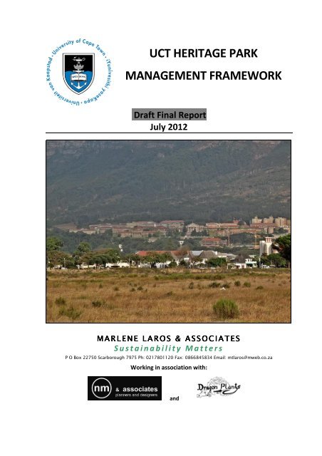
UCT HERITAGE PARK<br />
MANAGEMENT FRAMEWORK<br />
Draft Final Report<br />
July 2012<br />
MM M M A A R R L L E E NN N N E E L L A A R R O O S S & & A A S S S S O O C C I I A A T T E E S<br />
S<br />
S u s t a i n a b i l i t y M a t t e r s<br />
P O Box 22750 Scarborough 7975 Ph: 0217801120 Fax: 0866845834 Email: mtlaros@mweb.co.za<br />
Working in association with:<br />
and
Table <strong>of</strong> contents<br />
1 INTRODUCTION ............................................................................................................... 1<br />
1.1 Background to the study ............................................................................................ 1<br />
Figure 1: Aerial view <strong>of</strong> the context <strong>of</strong> the UCT Heritage Park consisting <strong>of</strong> the<br />
Forest and Dam Precincts ............................................................................... 2<br />
Figure 2: Aerial view <strong>of</strong> the <strong>University</strong> <strong>of</strong> <strong>Cape</strong> <strong>Town</strong> campus showing the Forest<br />
and Dam Precincts. ......................................................................................... 3<br />
1.2 Site description .......................................................................................................... 3<br />
1.3 Terms <strong>of</strong> reference .................................................................................................... 3<br />
1.4 Study process ............................................................................................................ 4<br />
1.5 Purpose <strong>of</strong> this document .......................................................................................... 5<br />
2 LEGAL, POLICY AND PLANNING CONTEXT.......................................................................... 5<br />
2.1 National legislation, policy and planning .................................................................... 5<br />
2.1.1 The Constitution (Act 108 <strong>of</strong> 1996) ........................................................................... 5<br />
2.1.2 The National Water Act (Act 36 <strong>of</strong> 1998) .................................................................. 5<br />
2.1.3 The National Environment Management Act (NEMA) (Act 107 <strong>of</strong> 1998) ................. 6<br />
2.1.4 The National Environmental Management Biodiversity Act (NEMBA) (Act 10<br />
<strong>of</strong> 2004) ..................................................................................................................... 6<br />
2.1.5 The Conservation <strong>of</strong> Agricultural Resources Act (CARA) (Act 43 <strong>of</strong> 1983) ................ 7<br />
2.1.6 The National Veld and Forest Fire Act (Act 101 <strong>of</strong> 1998) .......................................... 7<br />
2.1.7 The National Heritage Resources Act (NHRA) (Act 25 <strong>of</strong> 1999) ................................ 7<br />
2.1.8 The Rhodes' Will (Groote Schuur Devolution) Act (Act 9 <strong>of</strong> 1910) ........................... 7<br />
2.2 Provincial legislation, policy and planning .................................................................. 7<br />
2.2.1 Western <strong>Cape</strong> Land Use Planning Ordinance (LUPO) (Ordinance 15 <strong>of</strong> 1985) ......... 7<br />
2.2.2 The Western <strong>Cape</strong> Provincial Spatial Development Framework (PSDF) ................... 7<br />
2.3 Local legislation, policy and planning .......................................................................... 8<br />
2.3.1 <strong>Cape</strong> Metropolitan Area: Guide Plan (Urban Str<strong>uct</strong>ure Plan), 1988 ......................... 8<br />
2.3.2 Metropolitan Spatial Development Framework (MSDF), 1996 ................................ 8<br />
2.3.3 CMOSS: An Open Space Strategy for the City <strong>of</strong> <strong>Cape</strong> <strong>Town</strong> (CMOSS) (2005) ......... 8<br />
Figure 3: The site and broad locality as represented in the Draft CMOSS ..................... 9<br />
2.3.4 The Scenic Drive Network: Management Plan: February 2002 ................................ 9<br />
2.3.5 <strong>Cape</strong> <strong>Town</strong> Spatial Development Framework, 2012 and the Spatial<br />
Development Plan: District H – Final Draft, 2011 ..................................................... 9<br />
Figure 4: Extract from the Southern District SDP: Composite ...................................... 11<br />
Table 1: Environmental Impact Management Table: Cultural and Heritage areas<br />
– adapted from the City <strong>of</strong> <strong>Cape</strong> <strong>Town</strong> SDP –EMF Final Draft (2011). .......... 12<br />
2.3.6 Draft <strong>Cape</strong> <strong>Town</strong> Development Edge Policy, August 2009 ..................................... 13<br />
2.3.7 The City <strong>of</strong> <strong>Cape</strong> <strong>Town</strong>’s Integrated Metropolitan Environmental Policy<br />
(IMEP): Cultural Heritage Strategy (2005) ............................................................... 14<br />
2.3.8 Groote Schuur Estates Landscape Management Plan (LMP) 1992 ......................... 15<br />
Figure 5: Groote Schuur Estates Landscape Management Plan .................................. 16<br />
2.3.9 Conservation Development Framework (CDF): 2006-2011, Volume 1,<br />
Prepared by South African National Parks (SANParks): Table Mountain<br />
National Park (TMNP) .............................................................................................. 17<br />
2.3.10 Groote Schuur Estate: Conservation and Development Framework: Phase 1<br />
Analysis and Preliminary recommendations, June 2002 by CNdV. ......................... 18<br />
UCT Heritage Park Management Framework: Draft Final Report, July 2012
2.3.11 Groote Schuur Estate: Conservation and Development Framework: Phase 2B:<br />
Detailed Planning and Management Proposals, September 2002 by CNdV........... 19<br />
2.3.12 UCT, Rondebosch/Observatory Campus: Development Framework Plan<br />
(DFP), Physical Planning Unit, Revised March 2010 ................................................ 20<br />
2.3.13 Landscape Framework Plan (LFP) for UCT (2006) (Prepared by Bernard<br />
Oberholzer Landscape Architect) ............................................................................ 21<br />
Figure 6: Landscape Framework Plan, B Oberholzer Dec 2006.................................... 23<br />
2.3.14 A Long Term Spatial Development Framework and Urban Design Concept for<br />
the <strong>University</strong> <strong>of</strong> <strong>Cape</strong> <strong>Town</strong> (Dewar, Southworth and Louw, 2005) ..................... 23<br />
Figure 7: Urban Design Concept Plan, Dewar, Southworth and Louw, 2005 ............... 24<br />
2.3.15 UCT Green Campus Action Plan, Dec 2008 ............................................................. 24<br />
2.3.16 Stormwater Management on Slopes Adjacent to Natural Areas, 2003 .................. 25<br />
2.4. Implications <strong>of</strong> relevant planning and policy ............................................................. 26<br />
3. THE SITE ........................................................................................................................ 27<br />
3.1 Natural and cultural <strong>heritage</strong> value .......................................................................... 27<br />
3.1.1 Biodiversity .............................................................................................................. 28<br />
3.1.2 Surface water .......................................................................................................... 29<br />
3.1.3 Heritage landscape .................................................................................................. 30<br />
3.2 Social and economic value ....................................................................................... 30<br />
3.2.1 Access and Parking .................................................................................................. 30<br />
Figure 8: Land uses on the <strong>University</strong> <strong>of</strong> <strong>Cape</strong> <strong>Town</strong> campus and UCT Heritage<br />
Park site ......................................................................................................... 31<br />
3.2.2 Passive recreational use patterns ........................................................................... 32<br />
3.2.3 Potential economic value <strong>of</strong> the trees .................................................................... 32<br />
4. SPATIAL ANALYSIS ......................................................................................................... 32<br />
4.1 Movement routes and destinations .......................................................................... 32<br />
4.2 The Forest ............................................................................................................... 33<br />
Figure 9: Section through the UCT Heritage Park illustrating the screening effect<br />
<strong>of</strong> vegetation on site ..................................................................................... 33<br />
4.3 The canopy and views in / towards the site .............................................................. 34<br />
Figure 10: Forest canopy, and views into the UCT Heritage Park (not to scale) ............ 34<br />
4.4 Platforms and views out <strong>of</strong> the site .......................................................................... 34<br />
Figure 11: Platforms, and views out <strong>of</strong> the UCT Heritage Park (not to scale) ................ 35<br />
4.5 The Forest within the broader landscape .................................................................. 35<br />
Figure 12: The UCT Heritage Park within the broader landscape (not to scale) ............ 36<br />
5. MANAGEMENT FRAMEWORK AND SPATIAL CONCEPT .................................................... 37<br />
5.1 Performance criteria ................................................................................................ 37<br />
5.2 Management vision/goal ......................................................................................... 37<br />
5.3 Management mission/purpose (overall outcome) .................................................... 37<br />
5.4 Key result areas / outcomes for managing the Forest ................................................ 38<br />
5.5 Spatial concept ........................................................................................................ 39<br />
Figure 13: Detailed spatial concept for the UCT Heritage Park ..................................... 40<br />
5.5.1 Description <strong>of</strong> hard and str<strong>uct</strong>ural landscaping features ........................................ 41<br />
5.5.2 Description <strong>of</strong> s<strong>of</strong>t landscaping elements ............................................................... 42<br />
5.5.3 Phase One interventions and actions for the s<strong>of</strong>t landscaping elements .............. 44<br />
UCT Heritage Park Management Framework: Draft Final Report, July 2012
6. SUMMARY OF RECOMMENDATIONS .............................................................................. 44<br />
Table 2: Proposed outputs and phased activities for each outcome, towards<br />
<strong>management</strong> <strong>of</strong> the UCT Heritage Park ........................................................ 45<br />
7. STAKEHOLDER INVOLVEMENT ........................................................................................ 49<br />
8. KEY QUESTIONS FOR STAKEHOLDERS ............................................................................. 49<br />
9. REFERENCES .................................................................................................................. 50<br />
9.1. Scientific and other publications .............................................................................. 50<br />
9.2 Broader planning and policy documents ................................................................... 50<br />
9.3 Relevant SANParks documents ................................................................................. 51<br />
9.4 Other relevant UCT documents ................................................................................ 51<br />
9.5 Forest studies and surveys ....................................................................................... 51<br />
9.6 Other legal and policy texts ...................................................................................... 51<br />
APPENDIX 1: REPORT ON THE FOREST BY SOUTH WESTERN TIMBERS CC ................................. 53<br />
APPENDIX 2: PROPOSED PLANTED LANDSCAPE COMPONENTS ................................................ 55<br />
UCT Heritage Park Management Framework: Draft Final Report, July 2012
1 INTRODUCTION<br />
UCT Heritage Park Management Framework: Final Draft Report, July 2012<br />
1<br />
The Department <strong>of</strong> Properties and Services, <strong>University</strong> <strong>of</strong> <strong>Cape</strong> <strong>Town</strong> (UCT), appointed<br />
environmental consultants Marlene Laros and Associates to undertake a (non-statutory) basic<br />
assessment process towards finding consensus on an approach to the <strong>management</strong> <strong>of</strong> the UCT<br />
Forest area. The issues pertaining to <strong>management</strong> <strong>of</strong> the vegetated backdrop to Upper Campus<br />
on the lower slopes <strong>of</strong> Devil’s Peak have been under discussion at UCT for almost a decade and it<br />
appears that forward progress has to date been hampered by, amongst other, a lack <strong>of</strong> consensus<br />
and conflicting approaches to forest <strong>management</strong> within the UCT community.<br />
After numerous reports, investigations and discussions at UCT, the Physical Planning and<br />
Landscape Subcommittee (PPLSC) recommended in its 2007 annual report 1 that the Cluster Pines<br />
(an invasive alien species) should be removed, due to their condition and invasive nature, and<br />
replaced by an indigenous forest on the western flank <strong>of</strong> Upper Campus; while the Stone Pines on<br />
the northern flank should be supplemented with further planting <strong>of</strong> Stone Pines, in order to<br />
maintain the tree canopy backdrop to the campus buildings. At a subsequent meeting <strong>of</strong> the<br />
<strong>University</strong> Building and Development Committee (UB&DC), the PPLSC recommended that a<br />
strategy around public interest in the forest regeneration needed to be developed.<br />
1.1 Background to the study<br />
The UCT Forest area, to the west and north <strong>of</strong> the Upper Campus (Figures 1 and 2) is made up <strong>of</strong><br />
two precincts: the current forest and dam areas. These land portions forms part <strong>of</strong> a larger<br />
landscape that spreads into the adjacent Table Mountain National Park (TMNP), as does the<br />
Groote Schuur Estate bequeathed by Rhodes 2 . The forest has not been proactively managed and<br />
many trees are senescent, requiring urgent intervention to reduce risk in terms <strong>of</strong> general safety<br />
and fire <strong>management</strong>. UCT’s current forest <strong>management</strong> regime removes senescent Cluster Pines<br />
on an ad hoc basis, when funds become available.<br />
During the early stages <strong>of</strong> the study, the team and stakeholders conceptualised removing all<br />
senescent trees and invasive species (Cluster Pines, Wattles, Gums (Eucalyptus spp.) and other<br />
invasive alien species); followed by replanting with indigenous- and/or appropriate non-invasive<br />
exotic trees, such as Stone Pines, to enhance the vegetated backdrop to the campus. These<br />
actions would be implemented through cooperation with the TMNP to ensure that there is a<br />
coherent approach to the landscape <strong>management</strong> within the context <strong>of</strong> UCT and the Groote<br />
Schuur Estate.<br />
This study has, together with stakeholders, undertaken a situational analysis; developed an<br />
overarching <strong>management</strong> <strong>framework</strong>, incorporating a vision, mission and strategic outcomes;<br />
compiled a spatial concept for the UCT Forest area; and, also presents a set <strong>of</strong> recommendations<br />
for implementation <strong>of</strong> the Framework and the Spatial Concept. It is intended that a future phase<br />
<strong>of</strong> work will involve the development <strong>of</strong> a detailed landscape <strong>management</strong> plan. It is also<br />
proposed to brand, or rename, the forest and dam precincts under the title: UCT Heritage Park.<br />
1 The annual report was adopted by the <strong>University</strong> Building and Development Committee (UB&DC).<br />
2 The history <strong>of</strong> the estate and the forest is well documented in various sources including the Groote Schuur Estate: Conservation<br />
and Development Framework (CNdV 2002).
UCT Heritage Park Management Framework: Final Draft Report, July 2012<br />
2<br />
Figure 1: Aerial view <strong>of</strong> the context <strong>of</strong> the UCT Heritage Park consisting <strong>of</strong> the Forest and Dam<br />
Precincts<br />
Various concepts for generating funding were mooted at the outset <strong>of</strong> this project. These<br />
included creating an Endowment Fund for attracting funding for landscaping the area. The<br />
university could attract donations for example, for trees in a memorial forest; or, to celebrate<br />
other events. These donations would augment an Endowment Fund with interest income being<br />
allocated to landscaping maintenance and regeneration, with an emphasis on the <strong>heritage</strong><br />
landscape. Project proposals and alternatives thus incorporate this rationale or principle <strong>of</strong><br />
funding for landscaping where possible. The potential commercial value <strong>of</strong> mature trees, to fund<br />
UCT Forest regeneration, has also been investigated (refer to Appendix 1).
Figure 2: Aerial view <strong>of</strong> the <strong>University</strong> <strong>of</strong> <strong>Cape</strong> <strong>Town</strong> campus showing the Forest and Dam Precincts.<br />
1.2 Site description<br />
UCT Heritage Park Management Framework: Final Draft Report, July 2012<br />
3<br />
The site assessed is part <strong>of</strong> the <strong>University</strong> <strong>of</strong> <strong>Cape</strong> <strong>Town</strong>’s Upper Campus, built on the lowest<br />
portions <strong>of</strong> the eastern slopes <strong>of</strong> Devils Peak and adjacent to the TMNP, which is a World Heritage<br />
Site 3 . The site, covering approximately 15.6 ha, comprises the land above Ring Road referred to in<br />
this document as the Forest Precinct and the area to the north <strong>of</strong> the ring road referred to as the<br />
Dam Precinct. Portions <strong>of</strong> the site are presently zoned as Community Facility along with the<br />
remainder <strong>of</strong> the Campus. Portions around the Dam are zoned Public Open Space, as is the<br />
adjacent SANParks land. Ownership <strong>of</strong> the portion associated with the Forest site is unclear, the<br />
assumption being it is state owned along with the land immediately up the slope presently<br />
managed by SANParks on behalf <strong>of</strong> the Department <strong>of</strong> Public Works who administer the Rhodes<br />
Devolution Act 9/1910) which gives guidance in terms <strong>of</strong> the conditions set out in Rhodes’ Will.<br />
The portion around the dam is owned by the <strong>University</strong> <strong>of</strong> <strong>Cape</strong> <strong>Town</strong>.<br />
The western part <strong>of</strong> the forest comprises mainly invasive Cluster Pines (Pinus pinaster). Other<br />
large specimens found in the forest include Monterey Pine (Pinus radiata) and Blackwood (Acacia<br />
mearnsii) both declared invasive alien species.<br />
1.3 Terms <strong>of</strong> reference<br />
This assessment comprises an evaluation <strong>of</strong> issues and incremental alternatives, with limited<br />
specialist studies. This Final Report should enable an 'in principle' decision to be taken by the<br />
3 TMNP is one <strong>of</strong> eight components <strong>of</strong> the <strong>Cape</strong> Floral Region Protected Areas World Heritage Site.
UCT Heritage Park Management Framework: Final Draft Report, July 2012<br />
4<br />
<strong>University</strong> and provide the <strong>framework</strong> for the preparation <strong>of</strong> a ‘Forest Regeneration and<br />
Management Plan’. The scope <strong>of</strong> work was:<br />
• Review the legal, policy and planning context;<br />
• Identify relevant stakeholders, mostly within the UCT community, including any<br />
authorities to be consulted. These would include but not be limited to TMNP, Heritage<br />
Western <strong>Cape</strong>, the City <strong>of</strong> <strong>Cape</strong> <strong>Town</strong>;<br />
• Describe the proposed forest regeneration activity and potential impacts on the<br />
environment;<br />
• Describe/discuss the need and desirability <strong>of</strong> the proposed activity;<br />
• Develop a participation strategy for the identified stakeholders, aligned with any UCT<br />
participation policies;<br />
• Undertake these participation activities according to the agreed plan;<br />
• Identify important characteristics <strong>of</strong> the affected environment (baseline study);<br />
• Identify significant issues to be examined in the assessment procedure;<br />
• Where necessary identify any alternatives to the proposed activity that are feasible and<br />
reasonable, including the advantages and disadvantages that the proposed activity or<br />
alternatives will have on the environment and on the community that may be affected by<br />
the activity;<br />
• Obtain inputs and recommendations from specialists where appropriate/necessary;<br />
• Assess the significance <strong>of</strong> any environmental and social impacts, including cumulative<br />
impacts;<br />
• Propose any environmental <strong>management</strong> and mitigation measures in broad terms, to<br />
inform the subsequent Forest Regeneration and Management Plan;<br />
• Issue a Draft Report to stakeholders comment;<br />
• Respond to comments and report on the issues raised and the responses in the Final<br />
Report; and,<br />
• Submit a Final Report to the PPLSC and UB&DC for consideration and decision.<br />
1.4 Study process<br />
This study was intended as a voluntary rather than statutory process. In summary, the following<br />
process is being followed:<br />
Stage One: Situational Analysis & Strategic Management Framework:<br />
Synthesise relevant information; present a baseline assessment <strong>of</strong> the forest; and, undertake an<br />
analysis <strong>of</strong> existing views and opinions regarding the vision, purpose and <strong>management</strong> outcomes<br />
for the UCT forest. A Strategic Management Framework will articulate the principles and<br />
performance criteria for the <strong>management</strong> <strong>of</strong> the UCT forest.<br />
Stage Two: Spatial Concept and Alternatives:<br />
Compile a spatial <strong>framework</strong> and alternatives in consultation with relevant stakeholders.<br />
Stage Three: Assessment, Evaluation and Recommendations:<br />
Assess and evaluate the spatial concept and any alternatives against the Strategic Management<br />
Framework in consultation with relevant stakeholders and compile and finalise the report and<br />
recommendations.<br />
Following on from this study, the next phase <strong>of</strong> work will be to compile a Forest Landscape<br />
Regeneration and Management Plan, to be drafted by a landscape architect, with detailed<br />
specifications for implementation and <strong>management</strong>.
1.5 Purpose <strong>of</strong> this document<br />
UCT Heritage Park Management Framework: Final Draft Report, July 2012<br />
5<br />
This report presents the outcomes <strong>of</strong> the study: the findings situational analysis, the proposed<br />
Management Framework, the Spatial Concept and recommendations. It provides the basis on<br />
which an 'in principle' decision to be taken by the <strong>University</strong> on the <strong>management</strong> approach for the<br />
area provides the <strong>framework</strong> for the preparation <strong>of</strong> a ‘Forest Regeneration and Management<br />
Plan’ or Heritage Park Management Plan can be built.<br />
2 LEGAL, POLICY AND PLANNING CONTEXT<br />
An array <strong>of</strong> legislation, policy and planning guidelines provides the context within which any<br />
process may continue. The following section provides a review <strong>of</strong> the existing situation.<br />
2.1 National legislation, policy and planning<br />
Specific legal requirements relevant to this project should inform the choices made for any<br />
development proposals that affect the site. Those pertaining to ecologically sensitive<br />
environments (i.e. the Vulnerable 4 <strong>Cape</strong> Winelands Shale Fynbos vegetation type and the<br />
watercourses) are discussed briefly below. The discussion is not exhaustive but is intended merely<br />
to provide incentive to sustainable development decisions. All legislation referred to below is<br />
taken “as amended”. The following summarises the relevant National level legislation as it<br />
pertains to the UCT Heritage Park.<br />
2.1.1 The Constitution (Act 108 <strong>of</strong> 1996)<br />
Section 24 <strong>of</strong> the Constitution contains broad provisions concerning environmental rights and<br />
states obligations to enforce them. For example, watercourses and wetlands are essential to<br />
ecological or ecosystem health, which imposes an implied mandate on all organs <strong>of</strong> State to take<br />
reasonable steps to ensure watercourse and wetland health.<br />
2.1.2 The National Water Act (Act 36 <strong>of</strong> 1998)<br />
The primary purpose <strong>of</strong> this Act is to manage and control the Republic’s water resources. Relevant<br />
to watercourses are:<br />
• Facilitating social and economic development;<br />
• Protecting aquatic and associated ecosystems and their biological diversity;<br />
• Reducing and preventing pollution and degradation <strong>of</strong> water resources; and<br />
• Meeting international obligations.<br />
The use <strong>of</strong> land is also controlled by the Act, which regulates activities that degrade watercourses<br />
and wetlands. Landowners and users thus have an obligation not to degrade watercourses, and<br />
prescribe certain measures to prevent such degradation.<br />
4 The status <strong>of</strong> this vegetation type has been amended to “Vulnerable” rather than “Endangered” by the 2011 published list <strong>of</strong><br />
threatened ecosystems (Government Gazette 34809 <strong>of</strong> 9 December 2011, National List <strong>of</strong> Ecosystems that are threatened and in<br />
need <strong>of</strong> protection, Notice 1002)..The ecosystem status for this vegetation type has been allocated on the criterion <strong>of</strong> Irreversible<br />
loss <strong>of</strong> habitat (Criterion A1), within the threshold <strong>of</strong> ≤60% natural habitat remaining.
2.1.3 The National Environment Management Act (NEMA) (Act 107 <strong>of</strong> 1998)<br />
UCT Heritage Park Management Framework: Final Draft Report, July 2012<br />
6<br />
This Act regulates various aspects <strong>of</strong> natural resource use, integrating environmental<br />
<strong>management</strong> and pollution control. Its definition <strong>of</strong> the environment includes the land and water<br />
<strong>of</strong> the earth, micro-organisms, plant and animal life or a combination <strong>of</strong> those things, and the<br />
inter relationships among them.<br />
The Act has a number <strong>of</strong> national environmental <strong>management</strong> principles, which apply to the<br />
actions <strong>of</strong> all organs <strong>of</strong> State that may significantly affect the environment. For the purposes <strong>of</strong><br />
wetland conservation and rehabilitation, the following principles should apply:<br />
• Development must be socially, environmentally and economically sustainable.<br />
• Sustainable development requires the consideration <strong>of</strong> all relevant factors including the<br />
following:<br />
That the disturbance <strong>of</strong> ecosystems and loss <strong>of</strong> biological diversity be avoided, or where<br />
they cannot be altogether avoided, are minimized and remedied;<br />
pollution and degradation <strong>of</strong> the environment are avoided, or where they cannot be<br />
altogether avoided, are minimized and remedied;<br />
development, use and exploitation <strong>of</strong> renewable resources and the ecosystems <strong>of</strong> which they<br />
are part do not exceed the level beyond which their integrity is jeopardized;<br />
a risk-averse and cautious approach is applied, taking into account the limits <strong>of</strong> current<br />
knowledge about the consequences <strong>of</strong> decisions or actions;<br />
negative impacts on the environment and on people’s environmental rights be anticipated and<br />
prevented, and where they cannot be altogether prevented, are minimized and remedied;<br />
the cost <strong>of</strong> remedying pollution, environmental degradation and consequent adverse<br />
health effects and <strong>of</strong> preventing, controlling or minimizing further pollution,<br />
environmental damage or adverse health effects must be paid for by those responsible for<br />
harming the environment; and<br />
sensitive, vulnerable, highly dynamic or stressed ecosystems require specific attention in<br />
<strong>management</strong> and planning procedures, especially where they are the subject <strong>of</strong> significant<br />
human resource usage and development pressure.<br />
An important provision <strong>of</strong> the Act relating to watercourse and wetland conservation and/or<br />
rehabilitation relates to the duty <strong>of</strong> land owners to rehabilitate degraded environments. For<br />
example the provisions impose a primary obligation on land owners to rehabilitate degraded<br />
watercourses and wetlands on their property.<br />
2.1.4 The National Environmental Management Biodiversity Act (NEMBA) (Act 10 <strong>of</strong> 2004)<br />
NEMBA specifies that actions must be taken to identify ecosystems that are threatened. The<br />
National Spatial Biodiversity Assessment (Driver et al 2004) identified the status <strong>of</strong> national vegetation<br />
types and the EIA Regulations and processes provide a means <strong>of</strong> monitoring and controlling<br />
development in these ecosystems. Section 73 <strong>of</strong> NEMBA further specifies that steps must be undertaken<br />
by the landowner to control and eradicate listed invasive species and prevent them from spreading.<br />
In terms <strong>of</strong> the 2010 EIA Regulations, Listing Notice 3 (List <strong>of</strong> Activities and Competent Authorities<br />
Identified in terms <strong>of</strong> Sections 24(2) and 24D), it is unlikely that the envisaged Forest Regeneration<br />
plan will require an EIA. The area falls within a vulnerable ecosystem listed in terms <strong>of</strong> section 52<br />
<strong>of</strong> the NEMBA. The ‘activity’ description (12) only includes clearance <strong>of</strong> an area <strong>of</strong> 300 m 2 or more<br />
<strong>of</strong> vegetation where 75% or more <strong>of</strong> the vegetative cover constitutes indigenous vegetation (in an<br />
Endangered or Critically Endangered ecosystem). In the case <strong>of</strong> vegetation clearing for the
UCT Heritage Park Management Framework: Final Draft Report, July 2012<br />
7<br />
purpose <strong>of</strong> implementing the concept <strong>of</strong> the ‘UCT Heritage Park’, this threshold will not be met,<br />
and the ecosystem status <strong>of</strong> the vegetation type has been amended to “Vulnerable”.<br />
2.1.5 The Conservation <strong>of</strong> Agricultural Resources Act (CARA) (Act 43 <strong>of</strong> 1983)<br />
Sections 15A to C <strong>of</strong> the amended CARA Regulations deal with, amongst other, the control <strong>of</strong><br />
weeds and invader plants. The implications are that all declared invasive aliens and weeds will<br />
need to be removed and controlled.<br />
2.1.6 The National Veld and Forest Fire Act (Act 101 <strong>of</strong> 1998)<br />
This Act places obligations on Landowners to be proactive in preventing the spread <strong>of</strong> fire from<br />
their own land. Section 12(1) states “Every owner on whose land a veldfire may start or burn or<br />
from whose land it may spread must prepare and maintain a firebreak on his or her side <strong>of</strong> the<br />
boundary between his or her land and any adjoining land.”<br />
2.1.7 The National Heritage Resources Act (NHRA) (Act 25 <strong>of</strong> 1999)<br />
The NHRA and the Provincial Heritage Ordinance (promulgated in terms <strong>of</strong> the NHRA) empower<br />
local authorities, with conditions, to formulate by-laws for managing local <strong>heritage</strong> resources, or<br />
other higher order <strong>heritage</strong> resources where a responsibility may be delegated. The Act defines a<br />
<strong>heritage</strong> resource as “any place or object <strong>of</strong> cultural significance.”<br />
2.1.8 The Rhodes' Will (Groote Schuur Devolution) Act (Act 9 <strong>of</strong> 1910)<br />
This act provides for "… the surrender <strong>of</strong> the Groote Schuur Estates to the Government <strong>of</strong> the Union <strong>of</strong><br />
South Africa in accordance with the Will <strong>of</strong> the late Cecil John Rhodes and for the release <strong>of</strong> the Trustees<br />
thereunder from all responsibility in connection with the said Estates and for other purposes."<br />
The Act is currently used exclusively for the control and development <strong>of</strong> Groote Schuur Estate<br />
(and part <strong>of</strong> Tokai forest). The Act bestows upon the Prime Minister <strong>of</strong> South Africa the rights to<br />
reside in the manor house and open part <strong>of</strong> the grounds for a public <strong>park</strong>. It also provides for the<br />
protection and conservation <strong>of</strong> the whole property. The whole <strong>of</strong> the Groote Schuur Estate was<br />
handed into the custody <strong>of</strong> the State.<br />
2.2 Provincial legislation, policy and planning<br />
2.2.1 Western <strong>Cape</strong> Land Use Planning Ordinance (LUPO) (Ordinance 15 <strong>of</strong> 1985)<br />
The LUPO (soon to be replaced by the finalisation and implementation <strong>of</strong> the proposed Western<br />
<strong>Cape</strong> Land Use Planning Act 5 ) underpins much <strong>of</strong> the planning and development in the Province,<br />
and many <strong>of</strong> the guidelines, <strong>framework</strong>s and strategies for the City <strong>of</strong> <strong>Cape</strong> <strong>Town</strong> are developed in<br />
terms <strong>of</strong> the LUPO.<br />
2.2.2 The Western <strong>Cape</strong> Provincial Spatial Development Framework (PSDF)<br />
Amongst other, the PSDF Rural Guidelines (2009 Draft) provides the following regarding the<br />
preservation <strong>of</strong> attributes on urban edges:<br />
Sense <strong>of</strong> place:<br />
• Response to landscape context<br />
5 Presently a Bill (www.westerncape.gov.za/other/2012/2/western_cape_land_use_planning_bill_2012_(15_february_2012).pdf)<br />
published 15 February 2012.
• Sensitivity to spiritual qualities <strong>of</strong> rural areas<br />
Sense <strong>of</strong> history:<br />
• Sensitivity to cultural landscapes<br />
• Response to rural settlement patterns and built vernacular<br />
2.3 Local legislation, policy and planning<br />
UCT Heritage Park Management Framework: Final Draft Report, July 2012<br />
8<br />
Three different local scales apply. These are the City <strong>of</strong> <strong>Cape</strong> <strong>Town</strong>, the landscape <strong>of</strong> the TMNP<br />
and the UCT planning domain.<br />
2.3.1 <strong>Cape</strong> Metropolitan Area: Guide Plan (Urban Str<strong>uct</strong>ure Plan), 1988<br />
The Guide Plan indicates that the site is for Government Use although its status - post approval <strong>of</strong><br />
the CTSDF (2012) - is presently not certain, or at least may require clarification. The location is,<br />
however, noteworthy being on the interface <strong>of</strong> the formally protected Table Mountain National<br />
Park, a component <strong>of</strong> the <strong>Cape</strong> Floral Region Protected Areas World Heritage Site.<br />
2.3.2 Metropolitan Spatial Development Framework (MSDF), 1996<br />
The MSDF aims to direct and manage the form as well as the location <strong>of</strong> physical development in<br />
the <strong>Cape</strong> Metropolitan Area. The MSDF regards the mountain as having key scenic and landscape<br />
qualities. All developments on the mountain reserve interface need to adhere to the guidelines<br />
related to the interface condition along the urban edge (or fringe) and ensure that the scenic and<br />
landscape qualities are not compromised.<br />
Proposals for the site should therefore adhere to the Urban Edge guidelines put forward by the<br />
City <strong>of</strong> <strong>Cape</strong> <strong>Town</strong>. See below for more details. The <strong>Cape</strong> Metropolitan Open Space Strategy<br />
(CMOSS) <strong>of</strong> which the site is a part, is an important informant <strong>of</strong> the overall <strong>framework</strong>.<br />
2.3.3 CMOSS: An Open Space Strategy for the City <strong>of</strong> <strong>Cape</strong> <strong>Town</strong> (CMOSS) (2005)<br />
CMOSS, initiated at the time that the MSDF was conceptualized, ensures that the open spaces,<br />
within the metropolitan area and beyond, are able to be conceptualised as a single system. It was a<br />
key informant <strong>of</strong> the MSDF and is still used at a conceptual level to str<strong>uct</strong>ure large scale <strong>framework</strong>s<br />
for the Metropolitan area. Linkage between the spaces is therefore vitally important. The multifunctionality<br />
<strong>of</strong> spaces is also seen to be important as this facilitates resource sharing, integrated<br />
<strong>management</strong> strategies and by default, the integration <strong>of</strong> communities. It also has positive implications<br />
such as extended activity periods through which passive surveillance can be increased. The strategy<br />
focused on place-making to facilitate an increased focus on the qualitative versus quantitative<br />
performance <strong>of</strong> open space. More specifically, it focused on open space as a core component <strong>of</strong><br />
the urban environment. The bottom line expectation is that CMOSS configuration, design and<br />
<strong>management</strong> should be ecologically, economically and socially sustainable.<br />
The Open Space Strategy intended to take what work had been done on CMOSS further but has<br />
since been partially absorbed into the City’s Biodiversity Network (Laros and Benn 2007) to ensure<br />
the protection <strong>of</strong> key vegetation types and natural systems.<br />
In the draft CMOSS (Figure 3) the site is categorised as having medium significance. What is more<br />
important is that the site is part <strong>of</strong> a larger “green” connection between the lower slopes <strong>of</strong> the
UCT Heritage Park Management Framework: Final Draft Report, July 2012<br />
9<br />
mountain, Liesbeek River corridor and Rondebosch common. The site is also importantly not<br />
distinguishable from the rest <strong>of</strong> campus which is perceived to be green.<br />
TMNP<br />
<strong>University</strong> <strong>of</strong><br />
<strong>Cape</strong> <strong>Town</strong><br />
campus<br />
Figure 3: The site and broad locality as represented in the Draft CMOSS<br />
2.3.4 The Scenic Drive Network: Management Plan: February 2002<br />
Rhodes Drive is a component <strong>of</strong> the Scenic Drive network, which traverses an area regarded as<br />
having significant cultural and scenic value. The Management Plan provides guidelines related to<br />
the road envelope and the broader area. Specific reference is made to the tree canopy. It is<br />
recommended that mature and (non-invasive) exotic trees and new stone pines (and oaks where<br />
appropriate) be planted to replace senescent specimens to retain the unique quality <strong>of</strong> landscape.<br />
This document is used to guide the City <strong>of</strong> <strong>Cape</strong> <strong>Town</strong> when development applications associated<br />
to sites adjacent to the network are submitted for comment.<br />
2.3.5 <strong>Cape</strong> <strong>Town</strong> Spatial Development Framework, 2012 and the Spatial Development Plan:<br />
District H – Final Draft, 2011<br />
The City <strong>of</strong> <strong>Cape</strong> <strong>Town</strong> has compiled eight district spatial development <strong>framework</strong>s – one for each<br />
<strong>of</strong> the City’s Planning Districts and one <strong>of</strong> which is the Southern District Plan (District H): Spatial<br />
Development Plan and Environmental Management Framework. It is the intention that the plans<br />
will be used as str<strong>uct</strong>ure plans under the Land Use Planning Ordinance (LUPO) (section 2.2.1),<br />
providing spatial direction and guidance to the City <strong>of</strong> <strong>Cape</strong> <strong>Town</strong>’s Spatial Development<br />
Framework (CTSDF) which has been recently approved as a str<strong>uct</strong>ure Plan.<br />
Proposals in the relevant District Plan which should be taken note <strong>of</strong> include the following:
10<br />
• The CTSDF highlights the site for ‘Urban Development’ although any application for a<br />
change in land use rights would have to go through the necessary statutory processes<br />
given its natural role and historic role as part <strong>of</strong> the mountain backdrop to key build<br />
landscapes but in addition its location on the urban edge;<br />
• The Southern Peninsula District is one <strong>of</strong> the most important from a biodiversity<br />
perspective and the CTSDF <strong>framework</strong> sets out a number <strong>of</strong> land use <strong>management</strong><br />
guidelines, an important one being that the City <strong>of</strong> <strong>Cape</strong> <strong>Town</strong> needs to lead in protecting<br />
and enhancing biodiversity, seeking to meet the National Biodiversity Targets Map. While<br />
the site itself is not identified as part <strong>of</strong> the Core Conservation worthy sites, or the City <strong>of</strong><br />
<strong>Cape</strong> <strong>Town</strong>’s Biodiversity Network, it is adjacent to the TMNP and therefore has a<br />
responsibility to help monitor and maintain the condition <strong>of</strong> the TMNP;<br />
• The EMF suggests that any development on the site must conform to the City <strong>of</strong> <strong>Cape</strong><br />
<strong>Town</strong>’s <strong>management</strong> <strong>of</strong> Urban Stormwater Guidelines amongst others as the site<br />
contributes to the prod<strong>uct</strong>ivity <strong>of</strong> the Aquifer. Furthermore all activities contemplated<br />
within the Hydrological zone must be supplemented with activities as contained in the<br />
City’s Floodplain and River Corridor Management Policy (2009);<br />
• The site is surrounded by a number <strong>of</strong> important cultural destinations including Provincial<br />
Heritage Sites and NHRA protected sites. Rhodes Memorial is the most significant in terms<br />
<strong>of</strong> the numbers <strong>of</strong> visitors it attracts. The site must therefore acknowledge its role as a<br />
backdrop and support to these significant architectural monuments and landscapes. It<br />
should comply with the SANParks Table Mountain National Park Conservation<br />
Development Framework as well as the South African Heritage Resources and the City’s<br />
Heritage Resources Section Requirements due to its proximity to the Park and its role over<br />
time in relation to the Park; and,<br />
• The District SDF is shaped by a set <strong>of</strong> key strategies, one <strong>of</strong> which is based on the idea <strong>of</strong><br />
balance between the needs <strong>of</strong> the environment and needs <strong>of</strong> the communities who reside<br />
along the peninsula. The central spatial idea giving meaning to this is that the TMNP and<br />
environs must be protected as a major urban anchor, the mountain (TMNP) being the<br />
single biggest tourism asset in the region. The implications <strong>of</strong> this are that the mountain<br />
must be conserved, and that the publicly and privately owned areas adjacent to the<br />
TMNP must be managed to facilitate this where possible.<br />
The 2011 Draft <strong>of</strong> the Southern District SDP categorises UCT as “Str<strong>uct</strong>uring Open Space” providing the<br />
following District Development Guidelines for Sub-District 3 (which includes UCT):<br />
• In general, avoid development <strong>of</strong> these areas in a manner that would compromise open space linkage.<br />
• Encourage development to respond to and promote opportunities for linkage between identified str<strong>uct</strong>uring<br />
open space in developed areas. (e.g. between the Langvlei and Keysers River via the Retreat Station area).<br />
• In general, development adjacent to open spaces, or which rationalises these spaces, should be<br />
orientated towards the open space to encourage the use and passive surveillance <strong>of</strong> these areas. Design<br />
which compromises this condition (e.g. excessive blank walls and backing <strong>of</strong> development onto these<br />
spaces) should be discouraged.<br />
• Subject to contextual informants, medium density development (e.g. 2/3 storey development) along open<br />
space interfaces could be considered to improve passive surveillance.<br />
• Safety and security should be considered in the upgrading, landscaping or development <strong>of</strong> public open spaces.<br />
UCT Heritage Park Management Framework: Final Draft Report, July 2012
11<br />
• Where contextually appropriate, consider commercial activities such as small cafes, kiosks and<br />
restaurants that will enhance the open space.<br />
• Where feasible, opportunities for low impact sustainable use <strong>of</strong> open spaces, by local communities,<br />
should be considered (e.g. small scale urban agriculture) but this should take into account the wider<br />
access / linkage needs and public open space provision requirements.<br />
The Southern District Final Draft SDP-EMF (2011), provides informants for desirable and undesirable<br />
land-uses for various spatial planning categories. Table 1 is extracted from this document.<br />
Figure 4: Extract from the Southern District SDP: Composite<br />
UCT Heritage Park Management Framework: Final Draft Report, July 2012
Table 1: Environmental Impact Management Table: Cultural and Heritage areas – adapted from the City <strong>of</strong> <strong>Cape</strong> <strong>Town</strong> SDP –EMF Final Draft (2011).<br />
Environmental<br />
attributes<br />
Str<strong>uct</strong>uring Open<br />
Spaces<br />
This zone includes<br />
str<strong>uct</strong>uring public open<br />
spaces (which are<br />
significant at a district<br />
scale and play a role in<br />
str<strong>uct</strong>uring the area).<br />
Scenic Routes<br />
e.g. Chapman’s Peak<br />
Drive, Ou Kaapse Weg,<br />
Rhodes Drive, Rhodes<br />
Avenue, Van Der Stel<br />
Freeway; Edinburgh<br />
Drive, etc.<br />
Urban Conservation /<br />
Heritage areas<br />
This zone includes<br />
existing and proposed<br />
urban conservation /<br />
<strong>heritage</strong> areas.<br />
Kinds <strong>of</strong> developments, land uses or<br />
activities that would be undesirable<br />
• Waste disposal activities (including<br />
WWTW).<br />
• Mining activities.<br />
• Industrial activities.<br />
• Residential development.<br />
• Activities which compromise or restrict<br />
views.<br />
• Activities inconsistent with the<br />
landscape / townscape.<br />
• Outdoor advertising.<br />
• Inappropriate road works – including<br />
changes <strong>of</strong> surface, widening and edge<br />
treatments.<br />
• Inappropriate signage, street furniture<br />
• Removal <strong>of</strong> trees and mature<br />
landscaping<br />
• Any alterations, additions, new<br />
str<strong>uct</strong>ures or landscaping<br />
unsympathetic to protected buildings or<br />
the general character <strong>of</strong> area. Mining<br />
related activities and infrastr<strong>uct</strong>ure.<br />
• Transmission towers and base stations<br />
• Inappropriate roadworks – including<br />
changes <strong>of</strong> surface, widening and edge<br />
treatments.<br />
• In appropriate outdoor advertising<br />
• In appropriate street furniture and<br />
UCT Heritage Park Management Framework: Final Draft Report, July 2012<br />
12<br />
Kinds <strong>of</strong> developments, land<br />
uses or activities that may<br />
have a significant impact<br />
Kinds <strong>of</strong> developments, land uses or Relevant policy and guideline<br />
activities that may not have a significant documents for environmental<br />
impact<br />
<strong>management</strong><br />
• Limited commercial activities. • Conservation related facilities or<br />
• Institutional activities<br />
infrastr<strong>uct</strong>ure.<br />
(museums, churches etc.). • Public open space areas with appropriate<br />
• Tourism facilities.<br />
recreation activities.<br />
• Establishment <strong>of</strong> cemeteries. • Essential engineering services relating to<br />
• Sustainable harvesting <strong>of</strong> natural outfall sewers and storm water systems.<br />
resources.<br />
• Road, rail, pipeline and cable crossings and<br />
bridges.<br />
• Dependent on section <strong>of</strong> road.<br />
Suitable activities should be<br />
congruent and sympathetic to<br />
landscape / townscape.<br />
• Service stations<br />
• Dependent on specific area.<br />
Suitable activities should be<br />
congruent and sympathetic to<br />
landscape / townscape.<br />
Institutional facilities (education,<br />
museums).<br />
• Tourism and hospitality facilities.<br />
• Engineering and utility services.<br />
• Essential road, rail, pipelines and<br />
cables.<br />
• Improvement <strong>of</strong> landscaping and opening<br />
<strong>of</strong> views<br />
• Residential and commercial activities<br />
provided … in keeping with the character<br />
<strong>of</strong> the area.<br />
• Sub-division and densification that is not<br />
materially changing the character <strong>of</strong> the<br />
area.<br />
• Appropriately scaled, sited and designed<br />
engineering and utility services, road, rail<br />
and pipeline cables.<br />
• Restoration and conservation <strong>of</strong> historical<br />
buildings and infrastr<strong>uct</strong>ure.<br />
• Public open space.<br />
• City <strong>of</strong> <strong>Cape</strong> <strong>Town</strong>’s draft CMOSS<br />
Strategy<br />
• City <strong>of</strong> <strong>Cape</strong> <strong>Town</strong>’s Management <strong>of</strong><br />
Urban Stormwater Impacts Policy<br />
(2009)<br />
• City <strong>of</strong> <strong>Cape</strong> <strong>Town</strong>’s Floodplain and<br />
River<br />
• DEA&DP’s Guideline for Involving<br />
Heritage Specialists in EIA Processes<br />
(2005)<br />
• DEA&DP’s Guideline for Involving<br />
Visual Specialists in EIA Processes<br />
(2005)<br />
• DEA&DP’s EIA Guideline Series:<br />
Guideline for the Management <strong>of</strong><br />
Development on Mountains, Hills<br />
and Ridges <strong>of</strong> the Western <strong>Cape</strong><br />
(2002)<br />
• City Of <strong>Cape</strong> <strong>Town</strong> Scenic Routes<br />
Management Plan<br />
• City Of <strong>Cape</strong> <strong>Town</strong> Heritage<br />
Resources Strategy<br />
• City <strong>of</strong> <strong>Cape</strong> <strong>Town</strong> Heritage<br />
Resources Section series <strong>of</strong><br />
guidelines for development<br />
• SANPark’s Table Mountain National<br />
Park Conservation Development<br />
Framework 2006-2011 (2008)<br />
• Scenic Drive Network Plan
13<br />
2.3.6 Draft <strong>Cape</strong> <strong>Town</strong> Development Edge Policy, August 2009<br />
The draft <strong>Cape</strong> <strong>Town</strong> Development Edge Policy (August 2009) was developed in response to the<br />
existence <strong>of</strong> a plethora <strong>of</strong> documents and guidelines that had been adopted and used since 2001.<br />
The Urban Edge Policy for the City (adopted in 2001) comprised four geographically specific<br />
policies, the relevant one for this site being that for the “Peninsula”. This was supplemented by<br />
the Urban edge Guidelines Manual (approved in 2004). This incorporated Veldfire-Related<br />
Planning Guidelines that deal with the spread <strong>of</strong> fire on properties adjacent to the periphery <strong>of</strong><br />
the City, which is <strong>of</strong> particular relevance to the UCT Heritage Park.<br />
The Development Edge lines now reflected in the SDF and District SDPs & EMFs discussed below,<br />
will be approved as section 4(6) and 4(10) str<strong>uct</strong>ure plans respectively (in terms <strong>of</strong> the Land Use<br />
and Planning Ordinance, 1985) by the Provincial Government Western <strong>Cape</strong>. This implies that any<br />
amendment to the Urban Edge lines will have to follow the procedure for amending a 4(6)<br />
str<strong>uct</strong>ure plan.<br />
The Development Edge Policy states the following in relation to land use <strong>management</strong> <strong>of</strong> sites on<br />
the Urban Edge:<br />
“All development applications on the Urban Edge will need to be reviewed by the City in terms <strong>of</strong><br />
principles set out in the Urban Edge Guidelines Manual as well as the Veldfire Related Planning<br />
Guidelines Manual to be found as Annexure 6 in the Manual. The following are some <strong>of</strong> the<br />
relevant issues to bear in mind when first putting together proposals for sites on the urban edge:<br />
• Vacant and under-utilised land within existing urban areas should be serviced before that<br />
on the periphery;<br />
• Settlement forms on the periphery need to respect the landscape;<br />
• Low intensity land uses, that can facilitate the function <strong>of</strong> the area as a buffer in<br />
protecting agricultural and conservation land from the impacts <strong>of</strong> urban development<br />
needs, are more optimal than those that do not;<br />
• Continuation <strong>of</strong> open space systems related to riverine corridors, which can in turn<br />
facilitate connection between catchments and the coastlines, must be facilitated; and,<br />
• Establishment <strong>of</strong> public private partnerships for land use monitoring and services<br />
provision should be explored where possible.”<br />
The Guidelines Manual further sets out a number <strong>of</strong> specific considerations for planners to consider<br />
when assessing applications on sites adjacent to the Urban Edge Line. These serve as a useful guide<br />
for owners <strong>of</strong> land in the transition zone who wish to develop responsibly. They are as follows:<br />
• Are the proposals desirable from a public benefit and desirability perspective?<br />
• Do the proposals have cost implications for the City Council or society?<br />
• Is the site visually exposed?<br />
• Does the site contribute to the continuity and sustainability <strong>of</strong> aquatic or terrestrial<br />
ecological corridors?<br />
• Is the site adjacent to a protected or prod<strong>uct</strong>ive landscape?<br />
• Is the site in close proximity to a scenic route or in the vicinity <strong>of</strong> a landmark?<br />
• Is it close to a special place or significant urban/topographical element?<br />
• Is it in, or in close proximity to, the green str<strong>uct</strong>ure and are there potential fire hazards?<br />
UCT Heritage Park Management Framework: Final Draft Report, July 2012
14<br />
The implications for any development <strong>of</strong> the site according to this set <strong>of</strong> questions is considerable given<br />
its location in relation to Rhodes Drive (a scenic route); Rhodes Memorial; the rest <strong>of</strong> the UCT Campus<br />
(parts <strong>of</strong> which have <strong>heritage</strong> value); the broader Groote Schuur Estate (which also has <strong>heritage</strong> value)<br />
and the TMNP. The site is also generally visually prominent, in particular from Rondebosch.<br />
Fire is a great threat on the lower slopes <strong>of</strong> the mountain and the site’s buffer role between<br />
TMNP and UCT Campus will have to guide the nature <strong>of</strong> any proposals for the site, especially<br />
where these are associated with the existing forest.<br />
Guidelines from the Veldfire Related Planning Guidelines, which are <strong>of</strong> specific relevance to the<br />
site, include the following:<br />
• Avoid cul de sacs, but if this is impossible then provide turning circles that can<br />
accommodate emergency fire fighting vehicles. (The guidelines suggest that one could use<br />
the existing gravel road as a fire track but it would need to be formalised to provide an<br />
improved surface, <strong>park</strong>ing and turning circle/s);<br />
• Consider the impact <strong>of</strong> restricted access mechanisms such as booms on potential fire<br />
fighting emergencies;<br />
• When intentionally reducing fuel loads on site, follow recommendations in the document;<br />
and,<br />
• Consider the post-fire effect that stormwater will have on the site and, where<br />
appropriate, apply the <strong>management</strong> objectives and actions from the City <strong>of</strong> <strong>Cape</strong> <strong>Town</strong>’s,<br />
Stormwater Management Guidelines on Slopes adjacent to Natural Areas (section 2.3.16).<br />
The Veldfire guidelines include a contextualised interpretation that highlights key problems,<br />
issues, etc. which are associated with properties bordering the TMNP. The document<br />
recommends that UCT prepare a Fire Management Plan. In conclusion, proposals for the site<br />
should therefore ensure the following:<br />
• That any further built development be low intensity incorporating only low bulk<br />
str<strong>uct</strong>ures that do not intrude on the visual quality <strong>of</strong> the mountain backdrop; and,<br />
• That fire protection measures to reinforce the site as a buffer between urban<br />
environment and conservation area inform proposals. This will include amongst other<br />
things the clearing or thinning <strong>of</strong> invasive vegetation (that is not deemed to be <strong>of</strong><br />
<strong>heritage</strong>/cultural value).<br />
2.3.7 The City <strong>of</strong> <strong>Cape</strong> <strong>Town</strong>’s Integrated Metropolitan Environmental Policy (IMEP):<br />
Cultural Heritage Strategy (2005)<br />
The City <strong>of</strong> <strong>Cape</strong> <strong>Town</strong> formally adopted the first Integrated Metropolitan Environmental Policy<br />
(IMEP) in 2001, along with its implementation strategy, the Integrated Metropolitan<br />
Environmental Management Strategy (IMEMS), which requires that the City develop detailed<br />
sectoral strategies to meet commitments made in the sectoral approaches by giving effect to<br />
environmental principles in IMEP. Cultural Heritage is one <strong>of</strong> the sectoral approaches <strong>of</strong> IMEP and<br />
the City has committed itself to ‘ensuring that the diverse cultural <strong>heritage</strong> <strong>of</strong> the City <strong>of</strong> <strong>Cape</strong><br />
<strong>Town</strong> is protected and enhanced’, which includes:<br />
• Recognising the rich cultural history <strong>of</strong> the City <strong>of</strong> <strong>Cape</strong> <strong>Town</strong><br />
• Including cultural values, sites and landscapes <strong>of</strong> historic significance, areas <strong>of</strong> scenic<br />
beauty and places <strong>of</strong> spiritual importance in planning and decision-making.’<br />
UCT Heritage Park Management Framework: Final Draft Report, July 2012
2.3.8 Groote Schuur Estates Landscape Management Plan (LMP) 1992<br />
15<br />
The brief for this 1992 LMP required the team 6 to produce a <strong>management</strong> plan for the Upper<br />
Estates only i.e. those estates above Rhodes Drive but not including UCT. The Plan was to have<br />
regard for the following:<br />
• Rhodes’ intentions for the Estates;<br />
• The fusion <strong>of</strong> townscape and landscape; and,<br />
• The indigenous-exotic vegetation debate.<br />
The document highlights the significance <strong>of</strong> the Estates, reiterating its importance as a gateway to<br />
the city as well as being a visual backdrop to the city, the freeways and the university itself. The<br />
site not only has an important visual role but also has amenity value. Problems highlighted in the<br />
plan relate to aesthetic, ecological, str<strong>uct</strong>ural (impact <strong>of</strong> building works on access) and<br />
<strong>management</strong> issues. Opportunities included the aesthetic value <strong>of</strong> the landscape, the ecological<br />
assets, cultural value <strong>of</strong> the site and infrastr<strong>uct</strong>ure.<br />
A landscape <strong>management</strong> plan was informed by a set <strong>of</strong> policies and put forward specific<br />
proposals related to each, namely:<br />
• Policy 1: Protect and regenerate indigenous forest and fynbos communities;<br />
• Policy 2: Eradicate the invasive alien species;<br />
• Policy 3: Regenerate the historically and environmentally significant species Stone Pines<br />
and Oaks) Here they make a specific proposal to regenerate stone pines along the lower<br />
slopes above the <strong>University</strong> in tandem with the phased removal <strong>of</strong> the Cluster Pines;<br />
• Policy 4: Maintain the open grassy appearance <strong>of</strong> the paddocks, meadows and <strong>park</strong>land<br />
areas using the grazing animals as a means <strong>of</strong> control (City Gateway Parklands,<br />
Welgelegen Dell and the avenue woodlands); and,<br />
• Policy 5: Halt erosion and restore eroded slopes.<br />
The Plan itself (Figure 5) mooted the idea <strong>of</strong> a planting <strong>framework</strong> directed at achieving three<br />
broad vegetation zones, firstly, a band <strong>of</strong> restored indigenous forest and fynbos communities in<br />
the ravines and along the higher slopes; secondly, a broad band <strong>of</strong> forest extending continuously<br />
from the City gateway Parklands past the back <strong>of</strong> the <strong>University</strong> to the deciduous woodlands<br />
adjacent to the avenue; and thirdly, a pattern <strong>of</strong> paddocks between the pine masses <strong>of</strong> the City<br />
Gateway Parklands, and meadows beneath the oak forests, supporting grazing animals.<br />
The Management Plan was undertaken by a large team <strong>of</strong> pr<strong>of</strong>essionals including Landscape<br />
architects, architects, city planners and forest and soil scientists. Providing a thorough assessment<br />
<strong>of</strong> issues related to the broader landscape context, the plan is helpful in clarifying the role <strong>of</strong> the<br />
site as part <strong>of</strong> the broader Groote Schuur Estate.<br />
6 The team consisted <strong>of</strong> Barry Gasson, Pierre Combrinck, Bernard Oberholzer, Fabio Todeschini, Dirk Visser and Fred Ellis.<br />
UCT Heritage Park Management Framework: Final Draft Report, July 2012
16<br />
Figure 5: Groote Schuur Estates Landscape Management Plan<br />
While it is important to focus on the recommendations, it is also a good reference work, helping<br />
to contextualise the site historically in particular. The following is a chronological list <strong>of</strong> significant<br />
actions undertaken on the Estate:<br />
• Deforestation through intensified farming in the area post 1657 leading to elimination <strong>of</strong><br />
useful timber by 1707;<br />
• Introd<strong>uct</strong>ion <strong>of</strong> Stone Pines under the DEIC;<br />
• Severe erosion <strong>of</strong> the slopes then prompted a-forestation countermeasures and Devil’s<br />
Peak forest was planted in 1894 under John X. Merriman (commissioner <strong>of</strong> Crown Lands<br />
and Public Works);<br />
• Rhodes bought land to protect the mountain from suburban encroachment and set about<br />
to create Parkland (not a commercial forest). He planted more Stone Pines in the north on<br />
the ridges and cleared out the “jungle” to reveal the existing groups <strong>of</strong> Stone Pines and<br />
Oaks which gave shape to <strong>park</strong>land for the public. Rhodes died in 1902 but specified in his<br />
will that no part <strong>of</strong> the Estate was to be sold, let, or otherwise alienated;<br />
• No buildings for suburban purposes were to be erected, since Groote Schuur was to be<br />
the home <strong>of</strong> the Prime Minister and the Grave <strong>of</strong> the late JH H<strong>of</strong>meyer was to be<br />
protected. In 1910 the Rhodes Will Act (Act 9 <strong>of</strong> 1910) 7 (section 2.1.8) was passed and the<br />
land was transferred to the South African Government, subject to provisions specified in<br />
the Act. The government was given the discretionary right to develop a site on the Groote<br />
Schuur Estates for university buildings;<br />
• Rhodes Memorial and the access road were completed in 1912;<br />
7 The Rhodes' Will Act is also known as the “Groote Schuur Devolution”.<br />
UCT Heritage Park Management Framework: Final Draft Report, July 2012
17<br />
• UCT was <strong>of</strong>ficially established in 1916, while the central backbone to the Upper Campus<br />
was built in the 1930’s;<br />
• In 1936 the PWD recognised that the woods on the Estate were in need <strong>of</strong> attention and<br />
sought advice from the Department <strong>of</strong> Forestry. A working plan was prepared, which<br />
proposed that, amongst other: woods <strong>of</strong> exotic trees should be thinned to 123-247<br />
stems/ha to achieve a more Park like landscape; young regenerating Cluster Pines be<br />
removed; and inter-planting and other planting <strong>of</strong> indigenous trees (e.g. Silver Trees<br />
(Leucadendron argenteum)) should be undertaken. Cluster Pine and Stone Pine seedlings<br />
were removed and Silver Trees and Protea seeds were sown. Yellowwood under-planting<br />
also occurred. It was noted that existing Stone Pines, Cluster Pines and Poplars were<br />
about 60-70 years old and therefore predated Rhodes. It was also noted that Eucalyptus<br />
plantings were undertaken around 1903 for fire protection purposes. The landscape was<br />
at that stage dominated by Cluster Pines, which were invading, with the second most<br />
dominant tree being Stone Pines.<br />
• A 1955 report focused on the need to create “all age” (diverse ages) stands to promote<br />
canopy sustainability and investigated planting a more diverse range <strong>of</strong> trees including<br />
species exotic to the <strong>Cape</strong>.<br />
• A 1988 decision to chop down some <strong>of</strong> the Stone Pines, to improve grazing, was stopped<br />
after a public outcry.<br />
2.3.9 Conservation Development Framework (CDF): 2006-2011, Volume 1, Prepared by<br />
South African National Parks (SANParks): Table Mountain National Park (TMNP) 8<br />
Objectives <strong>of</strong> developing the TMNP CDF are firstly that it fulfils the requirements <strong>of</strong> the National<br />
Environmental Management: Protected Areas Act (Act 57 <strong>of</strong> 2003) (NEM: PAA) and SANPark’s CDF<br />
Planning Manual; that it be informed by relevant up to date specialist- or area focused studies;<br />
and, that it should align with the TMNP revised Park Management Plan.<br />
The CDF comprises three volumes, the first <strong>of</strong> which contains a map and accompanying tables and<br />
is reviewed here. The CDF as a set <strong>of</strong> documents should be understood as a ‘planning <strong>framework</strong>’<br />
and not an implementation plan. The CDF forms part <strong>of</strong> the TMNP Park Management Plan as<br />
approved by the Minister in terms <strong>of</strong> NEMA: PAA. Thus any proposed land use changes need to<br />
follow due statutory and legislated processes. Changes to the <strong>management</strong> recreational activities<br />
can only occur with stakeholder participation.<br />
The map grades the expected intensity <strong>of</strong> use and identifies visitor sites, TMNP movement<br />
networks and the boundaries. It also indicates visitor numbers to various locations within the<br />
TMNP per annum.<br />
The Map indicates that Rhodes Memorial, a mixed use Leisure site, is a highly visited site with over<br />
100,000 visitors per annum but its surrounds are zoned ‘Quiet’. Quiet zones provide experience <strong>of</strong><br />
a ‘relative sense <strong>of</strong> solitude and relaxation’ through the experience <strong>of</strong> the natural environment<br />
supported by basic facilities. These zones are relatively accessible and therefore attract more<br />
users to the area. Users in these zones are also typically exposed to the ‘sights and sounds <strong>of</strong>f the<br />
City’ and it is therefore important to note when considering any change to the landscape interface<br />
8 This CDF replaced the 2001 CDF for the (then) <strong>Cape</strong> Peninsula National Park which was the first spatial Plan prepared for a<br />
National Park in South Africa. A CDF is a spatial plan developed to address the requirement <strong>of</strong> NEMA: Protected areas Act<br />
(NEMA:PAA) (Act 57 <strong>of</strong> 2003), which requires National Parks to prepare “zoning Plans” indicating what type <strong>of</strong> activities<br />
should occur in what sections <strong>of</strong> the <strong>park</strong>. They are intended to be reviewed on a 5 yearly basis.<br />
UCT Heritage Park Management Framework: Final Draft Report, July 2012
18<br />
between here and the built edge. Activities permitted in and around Rhodes Memorial are hiking,<br />
walking, running and (subject to EMP’s) bouldering, dog walking, traditional- and free climbing,<br />
sports climbing, hang-gliding and paragliding, horse riding and mountain biking. Film-shoots,<br />
races, cultural events and specialised adventure activities are permitted, but are subject to<br />
permits with specific conditions.<br />
2.3.10 Groote Schuur Estate: Conservation and Development Framework: Phase 1 Analysis<br />
and Preliminary recommendations, June 2002 by CNdV.<br />
The Phase 1 Report consists <strong>of</strong> a comprehensive site analysis, an historical assessment and<br />
statement <strong>of</strong> significance in conservation terms, leading to preliminary recommendations<br />
regarding conservation <strong>management</strong> as well as possible development or 'concession'<br />
opportunities for the Rhodes Estate.<br />
The portion <strong>of</strong> the Estate considered in this Framework is an area <strong>of</strong> approximately 300 ha and<br />
includes the portion <strong>of</strong> the Estate located within the <strong>Cape</strong> Peninsula Protected National<br />
Environment (CPPNE) boundary.<br />
The Estate is again considered to have an important Metropolitan role as part <strong>of</strong> the landscape<br />
serving as a visual gateway to the City. The Groote Schuur Estate study area is described as a<br />
national asset and is described by Henry Aikman (local <strong>heritage</strong> practitioner) as “one <strong>of</strong> the most<br />
complex and extensive historically designed landscapes after the Company Gardens”. The brief for<br />
this <strong>framework</strong> was therefore to review the condition, role and nature <strong>of</strong> the Estate with its<br />
inclusion into the TMNP (then CPNP).<br />
The document analysed the estate as a number <strong>of</strong> precincts, the most relevant <strong>of</strong> which is the<br />
precinct referred to as the “university slopes”. Significance <strong>of</strong> this precinct is strongly related to<br />
the experience <strong>of</strong> the approach to Rhodes Memorial by car along the access road. A brief<br />
description was followed by a set <strong>of</strong> landscape restoration recommendations, which reinforced<br />
the status quo, i.e. grassed woodland slopes containing clumps <strong>of</strong> stone pines (some <strong>of</strong> which<br />
were estimated to be 120 to 150 years old) interspersed occasionally with low growing indigenous<br />
vegetation. The CNdV report recommended gradual clearing <strong>of</strong> senescent pines with a replanting<br />
and reseeding programme to ensure landscape succession. It was suggested that new stone pines<br />
be planted specifically along the ridgelines and not under the existing canopy to ensure<br />
maintenance <strong>of</strong> a consistent height in the Pine canopy and further proposed phased removal <strong>of</strong><br />
gum trees. Other recommendations included that any new plantings should be restricted to low,<br />
ground-hugging indigenous vegetation to facilitate better surveillance and to protect safety <strong>of</strong><br />
recreational users; that stumps <strong>of</strong> previously felled trees should be removed; and, that fallow<br />
deer should be excluded. Finally, a system <strong>of</strong> signage to inform the public about the historic<br />
landscape and activities on site was proposed.<br />
Recommendations and conclusions revolved around the urgent need for a Landscape<br />
Management Plan and further consideration <strong>of</strong> how to develop the three important nodes within<br />
the Estate, namely Rhodes Memorial and Environs, Mount Pleasant and Environs and the Zoo Site<br />
and Environs all <strong>of</strong> which are provided within the Phase 2B document reviewed below.<br />
UCT Heritage Park Management Framework: Final Draft Report, July 2012
19<br />
2.3.11 Groote Schuur Estate: Conservation and Development Framework: Phase 2B: Detailed<br />
Planning and Management Proposals, September 2002 by CNdV.<br />
Broad objectives <strong>of</strong> the Phase 2 <strong>framework</strong> were to make recommendations for the future role,<br />
land use and related <strong>management</strong> options for the Estate and secondly, to prepare "<strong>framework</strong>"<br />
proposals for the identified nodes and precincts that highlight possible concession opportunities<br />
where feasible. The analyses undertaken through both Phase 1 and the 1992 Groote Schuur<br />
Estates Landscape Management Plan, prepared for the Department <strong>of</strong> Public Works, served as<br />
key informants.<br />
The Landscape Management Plan was founded on four "convictions" which remain relevant<br />
today. These convictions are as follows:<br />
• That the Estate was bequeathed by Rhodes in his will as an area for the general public’s<br />
enjoyment and it is therefore important that the managing entity be respectful <strong>of</strong> Rhodes<br />
primary intentions<br />
• That the study area is not a pristine indigenous landscape but a culturally-made one <strong>of</strong><br />
established beauty and historic significance. It is therefore not practicable to return it to<br />
an imagined pre-cultural wilderness condition, although there are parts <strong>of</strong> it which should<br />
have a predominantly indigenous character.<br />
• That neighboring institutional growth, particularly <strong>of</strong> the <strong>University</strong>, and increasing visitor<br />
numbers, will be a continuing reality. Maintenance <strong>of</strong> the quality <strong>of</strong> the study area for<br />
broad community use will therefore require the regulation and moderation <strong>of</strong><br />
incompatible demands.<br />
• That it is improbable that the future <strong>of</strong> the study area can be derived from a simple<br />
revival <strong>of</strong> its past condition. It must continue to evolve as a place having current social<br />
relevance while retaining the important imprint and meanings <strong>of</strong> the past. The Plan<br />
should therefore have both a retrospective component, focusing on the restoration and<br />
conservation <strong>of</strong> the irreplaceable legacies, and a prospective component directed at<br />
settling necessary and compatible new development."<br />
The document suggests ways in which different landscape- types and elements may be used to<br />
shape a vision. It is proposed that the Jeep track above the Rhodes Memorial approach road be<br />
used to define the boundary <strong>of</strong> different <strong>management</strong> zones. Above the Jeep track, for example,<br />
the landscape can return to its indigenous form, but below it the managing agent/s must respect<br />
cultural layering.<br />
The university slopes are considered part <strong>of</strong> what they term the “Grand scale Landscape”, the<br />
grandeur <strong>of</strong> which must be protected and enhanced. The retention <strong>of</strong> the Stone pines is seen as a<br />
critical strategy in achieving this.<br />
The Landscape Framework Plan makes specific landscape restoration recommendations relating<br />
to the UCT forest, proposing gradual removal <strong>of</strong> Pinus pinaster and inter-planting with Pinus<br />
pinea. This was obviously in response to a finding in later work that the green backdrop to UCT is<br />
critical to preserve. It uses all recommendations put forward in the Phase 1 document as the basis<br />
for proposals related to the “<strong>University</strong> Slopes” area with one additional recommendation for<br />
replanting the Stone Pine Avenue along the road.<br />
The intention <strong>of</strong> SANParks was that key findings from this report would be incorporated into an<br />
integrated <strong>management</strong> plan for the Estate and a series <strong>of</strong> concession contracts and/or proposal<br />
UCT Heritage Park Management Framework: Final Draft Report, July 2012
20<br />
call documents would be advertised to the private sector for further development and operation<br />
<strong>of</strong> the three identified nodes being The Zoo site, Mount Pleasant and Rhodes Memorial.<br />
2.3.12 UCT, Rondebosch/Observatory Campus: Development Framework Plan (DFP), Physical<br />
Planning Unit, Revised March 2010<br />
The DFP is intended to guide the nature and form <strong>of</strong> all proposed physical development once<br />
approved by the <strong>University</strong> Council. It was the culmination <strong>of</strong> planning processes initiated with<br />
the appointment <strong>of</strong> consultants (Dewar, Louw and Southworth 2005 – refer to section 2.3.14) to<br />
prepare “A long term spatial development <strong>framework</strong> and Urban Design Concept for the<br />
<strong>University</strong> <strong>of</strong> <strong>Cape</strong> <strong>Town</strong>”, commonly known as the “Guide Plan.” The Guide Plan together with an<br />
Access Management Plan (2005), a number <strong>of</strong> Heritage Assessments and a Landscape Framework<br />
Plan (Oberholzer 2006) and substantial internal discussion informed the DFP.<br />
The DFP was also informed by metro-wide planning and policy, local area planning as well as<br />
planning work associated to adjacent land holdings such as the Groote Schuur Estate (GSE). The<br />
GSE-Conservation and Development Framework is particularly relevant. The Guide Plan and this<br />
Framework are consistent in their approach to the future <strong>of</strong> the forest and <strong>park</strong>ing. The Forest is<br />
seen as an important evergreen backdrop to the classical set piece (Jamieson Hall, stairs and<br />
residences). Neither plan sees the Park having a <strong>park</strong>ing role for students.<br />
The DFP responds to a number <strong>of</strong> institutional informants, the most important being the fact that 25%<br />
<strong>of</strong> students live in university residences and this is expected to increase. The university is planning<br />
to be able to accommodate an additional 25% who are presently drawn from outside <strong>Cape</strong> <strong>Town</strong>.<br />
However it should be noted that UCT does not propose any new development on upper campus.<br />
Future development will be on the middle or lower campus where densification is deemed more<br />
appropriate and feasible. The implications are however that the campus as a whole will need to<br />
perform optimally as a living environment, servicing those who do find themselves living ‘on site’.<br />
The DFP states clearly that there is no intention to expand the current estate beyond its defined<br />
boundaries with the exception <strong>of</strong> two locations - Rustenberg Junior School and a site near the<br />
Observatory Campus on Main Rd. There are no intentions <strong>of</strong> using the Zoo site although the DFP<br />
does propose that UCT initiate “collaborative development initiatives” with SANParks related to<br />
the Zoo Site. This is not seen as a priority and is only foreseen to be a reality if funding from other<br />
parties is forthcoming.<br />
Development opportunities mostly contribute to densification <strong>of</strong> the middle and lower campus to<br />
create a more urban environment, although green aspects are excluded. The green landscape<br />
<strong>framework</strong> is proposed to be reinforced through consolidation <strong>of</strong> green fingers running vertically<br />
down the hill from Rhodes Drive/M3, and the horticultural consolidation <strong>of</strong> specific <strong>heritage</strong><br />
precincts where appropriate.<br />
A set <strong>of</strong> performance criteria were defined, to guide and form the basis <strong>of</strong> evaluation <strong>of</strong> all future<br />
spatial proposals, these are as follows:<br />
• Equity: relates largely to the issue <strong>of</strong> access, particularly for those on foot and those with<br />
disabilities;<br />
UCT Heritage Park Management Framework: Final Draft Report, July 2012
21<br />
• Integration: with the surrounding community, local urban systems especially transport<br />
systems, between various parts <strong>of</strong> the campus and departments and between people<br />
historically separated by social and cultural barriers. The last aspect is proposed to be<br />
addressed through the creation <strong>of</strong> a system <strong>of</strong> informal, public gathering spaces;<br />
• Dignity: infers that by the making <strong>of</strong> an environmentally and socially supportive<br />
environment, there is support for the campus as a key social and educational institution<br />
<strong>of</strong> excellence;<br />
• Heritage conservation: refers to the need to respect architecturally-, horticulturally- and<br />
culturally significant buildings, landscapes and use patterns, etc. It was for this reason that<br />
the Plan responds in detail to <strong>heritage</strong> assets confirmed through the <strong>heritage</strong> studies<br />
undertaken between 2000 and 2006. The assets <strong>of</strong> most relevance to the site in question<br />
are the group <strong>of</strong> buildings associated with Jamieson Steps referred to as the “Classical set<br />
piece”; and,<br />
• Landscape, Placemaking and Legibility: refers to the need to focus on the nature and<br />
quality <strong>of</strong> open space linking the built precincts, buildings and surrounding landscapes,<br />
the object being to make the public realm more humanely scaled, safer, more<br />
comfortable and coherent. Hence the str<strong>uct</strong>uring <strong>of</strong> the Plan according to key spatial<br />
principles contained in the Landscape Framework and Urban Design Concept put forward<br />
by Dewar, Louw and Southworth (2005).<br />
While the DFP focused on the form <strong>of</strong> new development it also focused extensively on the<br />
location <strong>of</strong> new development in relation to vacant and underutilised land in a way that facilitates<br />
improved integration between the campuses. Transportation and pedestrian access networks are<br />
thus an important informant <strong>of</strong> the Plan. Safety through improved lighting, CCTV, emergency<br />
bollards, trimming <strong>of</strong> vegetation and more responsive building interfaces are suggested. The DFP<br />
states categorically that pedestrians are to be accommodated in all situations before vehicles.<br />
Parking is not seen to be a priority for investment and it is proposed that no new bays are<br />
provided, since the <strong>University</strong>’s preference is rather to focus on managing access to campus.<br />
2.3.13 Landscape Framework Plan (LFP) for UCT (2006) (Prepared by Bernard Oberholzer<br />
Landscape Architect)<br />
The LFP intended to inform the Long term Spatial Framework developed for the UCT Campus in<br />
2005. Covering the Lower-, Middle- and Upper Campuses, it was based largely on interviews,<br />
review <strong>of</strong> previous reports and investigations on foot. The LFP set out to formulate policy<br />
resulting in principles, policies and guidelines to achieve consensus and a basis for decisionmaking.<br />
The Landscape Plan included planting themes and a <strong>management</strong> strategy to guide<br />
further implementation. The spatial aspects <strong>of</strong> the plan were informed mostly by the Long Term<br />
Spatial Development Framework and Urban Design Concept for the <strong>University</strong> <strong>of</strong> <strong>Cape</strong> <strong>Town</strong><br />
(Dewar, Southworth and Louw 2005). Despite the fact that it appears that this document was not<br />
well received by the Physical Planning and Landscape Sub-Committee (PPLSC) it provided a good<br />
basis for future spatial planning in the form <strong>of</strong> str<strong>uct</strong>uring principles.<br />
The LFP undertook a survey <strong>of</strong> all relevant planning documents and compiled a list <strong>of</strong> issues.<br />
Issues pertinent to the site included:<br />
• Lack <strong>of</strong> progress in implementation <strong>of</strong> an invasive species clearing programme as well as a<br />
replanting strategy; and,<br />
UCT Heritage Park Management Framework: Final Draft Report, July 2012
22<br />
• Lack <strong>of</strong> progress associated with the proposal to plant the terraced <strong>park</strong>ing areas above<br />
the Sports Centre.<br />
General issues related to the UCT Heritage Park and its <strong>management</strong> included:<br />
• A need for more co-ordination with respect to design and <strong>management</strong> <strong>of</strong> landscaping<br />
across the campuses;<br />
• A need for more sensitive lighting along pedestrian routes and a language <strong>of</strong> street<br />
furniture;<br />
• A need for open spaces and landscaping to play a stronger educational role – this has<br />
particular relevance to the site which, due to its location away from the high activity<br />
zones, provides excellent opportunities to accommodate outdoor teaching spaces, etc.;<br />
and,<br />
• There is an ongoing challenge to seek funding to invest in planting, restoration and<br />
related landscape strategies.<br />
The LFP principles are informed by an approach founded on a belief in acknowledging the evolving<br />
nature <strong>of</strong> the cultural landscape and in the importance <strong>of</strong> understanding the continuum between<br />
the urban and natural contexts. The latter habitat approach ensures that landscaping, which has<br />
historically sought to complement the architectural pieces, now also ensures that ecosystems are<br />
given consideration; thus micro-climates and amenity value are important informants <strong>of</strong> design.<br />
The principles are then based on an understanding <strong>of</strong> the role <strong>of</strong> open space system as ecological,<br />
recreational (passive and active) and educational and include:<br />
• Ecological Sustainability<br />
• Legibility<br />
• Accessibility<br />
• Safety and Security<br />
• Comfort<br />
The following is a list <strong>of</strong> selected pertinent policies that were informed by the philosophy and<br />
principles:<br />
• Policy 1: Reinforce open space corridors (and their ecological, <strong>heritage</strong>, recreational and<br />
educational roles);<br />
• Policy 3: improve the Campus habitat by investing in planting precincts that have a<br />
greater diversity <strong>of</strong> species in particular endemic species. This planting must<br />
also be considered in relation to visibility and safety issues;<br />
• Policy 4: Landscape Parking, which requires that <strong>park</strong>ing areas are ameliorated and<br />
designed in a more environmentally responsible way;<br />
• Policy 6: Use a consistent language <strong>of</strong> detailing and specification in relation to bins,<br />
seating lighting, signage etc. to achieve co-ordinated street furniture.<br />
The Framework itself comprises a plan and a number <strong>of</strong> specific projects, some <strong>of</strong> which relate to<br />
the site. PR1 and PR2 apply specifically to the site. However these projects require:<br />
• clarity on a way forward with respect to the future <strong>of</strong> the stone pines;<br />
• liaison with SANParks re the future <strong>of</strong> Rhodes Estate; and,<br />
• decisions on a planting programme and arboretum concept for the forested section <strong>of</strong><br />
upper campus.<br />
UCT Heritage Park Management Framework: Final Draft Report, July 2012
23<br />
Close inspection <strong>of</strong> the Plan (Figure 6) illustrates the landscaping interpretation <strong>of</strong> the Forest Site<br />
as a solid canopy with clearings, but a forest <strong>of</strong> two distinct types: one, which belongs to the<br />
broader landscape and another, which serves a screening function from within Campus. This idea<br />
is not expanded on and the implications are not clear.<br />
Finally, it was suggested that a detailed landscape precinct plan for the “<strong>park</strong>land” above Ring<br />
Road on Upper Campus be prepared, the aim <strong>of</strong> which would be to address, amongst other,<br />
problems <strong>of</strong> senescent trees and stone pine regeneration in consultation with SANParks.<br />
Figure 6: Landscape Framework Plan, B Oberholzer Dec 2006<br />
2.3.14 A Long Term Spatial Development Framework and Urban Design Concept for the<br />
<strong>University</strong> <strong>of</strong> <strong>Cape</strong> <strong>Town</strong> (Dewar, Southworth and Louw, 2005)<br />
This document gave guidance at the level <strong>of</strong> the whole campus – the upper, middle and lower<br />
campus; focused on means <strong>of</strong> giving spatial clarity / legibility between the various precincts and<br />
campuses; and, considered how growth can be managed. It was informed by <strong>heritage</strong> studies<br />
done by Therold and Bauman who identified the site as part <strong>of</strong> a Grade 3A precinct. The land<br />
outside <strong>of</strong> UCT is co-incidentally graded Grade 1.<br />
The document cites sprawling edges, the threat <strong>of</strong> fire and a lack <strong>of</strong> surveillance - leading to crime<br />
- as some <strong>of</strong> the dominant spatial problems associated to the site in question.<br />
It suggests that the edges between the <strong>University</strong> - as a constr<strong>uct</strong>ed landscape <strong>heritage</strong> precinct -<br />
and the TMNP (<strong>of</strong> which the site is regarded as part) as a precinct with significant natural <strong>heritage</strong><br />
UCT Heritage Park Management Framework: Final Draft Report, July 2012
24<br />
values should be clearly and sharply defined and should be the subject <strong>of</strong> a landscape action<br />
project (refer to Figure 7).<br />
Figure 7: Urban Design Concept Plan, Dewar, Southworth and Louw, 2005<br />
2.3.15 UCT Green Campus Action Plan, Dec 2008<br />
The <strong>University</strong> <strong>of</strong> <strong>Cape</strong> <strong>Town</strong> started its commitment to sustainable development in 1990, by<br />
signing the Talloires declaration, pledging to make the campus more sustainable through the<br />
implementation <strong>of</strong> a ten-point action plan (Hall & Murray 2008). UCT has continued to pursue its<br />
sustainability goals, with the formation <strong>of</strong> the student-run Green Campus Initiative and the<br />
commissioning <strong>of</strong> a Green Campus Action Plan (GCAP) by the Department <strong>of</strong> Properties and Services<br />
to guide implementation. The GCAP provides guidance with regard to ecological sustainability<br />
and, according to Gallagher (2009), was intended to be complemented by a Campus Biodiversity<br />
Project. 9<br />
The Green Campus Action Plan 10 followed on from the Green Campus Policy Framework, May<br />
2008. It focused on the work undertaken principally by the UCT Department <strong>of</strong> Properties and<br />
Services which is associated with facilities development, <strong>management</strong> and operation. The<br />
following brief recommendations are relevant to future <strong>management</strong> <strong>of</strong> the UCT Heritage Park<br />
and are derived from strategies that were prioritised through a consultation process. They have<br />
been grouped under themes appropriate to the <strong>management</strong> <strong>of</strong> the UCT Heritage Park.<br />
9 The Campus Biodiversity Project aimed to increase the representation <strong>of</strong> <strong>Cape</strong> flora in the Gardens; showcasing locally<br />
indigenous and endemic flora, increasing water-use efficiency, providing habitats for rare species, as well as “boosting UCT’s<br />
eco-friendly image” (Green Campus Initiative 2009).<br />
10 The Green Campus Action Plan may be viewed at www.greening.<strong>uct</strong>.ac.za/action/gcap/.<br />
UCT Heritage Park Management Framework: Final Draft Report, July 2012
25<br />
Planting<br />
• Reduce use <strong>of</strong> pesticides and adopt Integrated Pest Management principles and strategies<br />
• Reduce the use <strong>of</strong> chemical fertiliser and use organic fertiliser as a preferred option<br />
• Conserve topsoil<br />
• Plant waterwise lawns<br />
• Develop and adopt a Forest Management Plan<br />
• Propagate indigenous and endemic plants<br />
Landscaping<br />
• Adopt sustainable urban drainage practises by installing permeable surfaces where<br />
appropriate and replacing impermeable- with permeable surfaces where practical<br />
• Upgrade irrigation to surface drip technology (for planting beds only) and ensure these<br />
are only operated during low evaporation times, and only when soil moisture is low<br />
Infrastr<strong>uct</strong>ure<br />
• Install lighting controls at selected locations to activate lighting<br />
• Reduce light pollution through lighting design and best available/affordable technology<br />
• Investigate establishment <strong>of</strong> second storage dam on Table Mountain property in adjacent<br />
tributary<br />
Natural systems<br />
• Enhance biodiversity and ecological value<br />
• Ensure appropriate dry-season water flows to maintain natural streams on Upper campus<br />
Management<br />
• Implement and monitor Environmental Management Plan’s<br />
• Continue with clearing <strong>of</strong> invasive aliens<br />
• Continue with composting <strong>of</strong> horticultural/landscaping waste<br />
Land Use activities<br />
• Minimise <strong>park</strong>ing footprint to conserve landscape<br />
Proposals for the future development and maintenance and <strong>management</strong> <strong>of</strong> the site need to keep<br />
these broader strategies in mind if UCT are to keep to their commitment to fulfil the ideals <strong>of</strong> the<br />
Talloires Declaration, signed in 1990. The 2008 revision <strong>of</strong> the UCT Green Campus Policy<br />
Framework (Hall & Murray 2008) states:<br />
“With regards to achieving improvements in environmental performance related to<br />
institutional practice, the <strong>University</strong> <strong>of</strong> <strong>Cape</strong> <strong>Town</strong> will: …<br />
• “Manage and protect the university’s natural environment in a sustainable manner and<br />
enhancing the environmental quality <strong>of</strong> the estate to reflect the unique character <strong>of</strong> the<br />
indigenous flora and fauna”; and,<br />
• “Establish an integrated transport policy, which will provide improved facilities for<br />
disabled people and reduce the environmental impact associated with transport to and<br />
from UCT by encouraging the use <strong>of</strong> public transport, cycling, and walking”.<br />
2.3.16 Stormwater Management on Slopes Adjacent to Natural Areas, 2003<br />
This set <strong>of</strong> guidelines, prepared by the City’s Catchment, Stormwater and River Management<br />
Branch, was compiled to address gaps in the City’s 2002 publication “Stormwater Management<br />
and Planning Design Guidelines for New Developments”. The 2003 guidelines sought to address<br />
specific stormwater <strong>management</strong> issues at the natural / urban interface on the slopes <strong>of</strong> the <strong>Cape</strong><br />
UCT Heritage Park Management Framework: Final Draft Report, July 2012
26<br />
Peninsula mountain chain for both new and existing developments. To achieve this, three specific<br />
<strong>management</strong> objectives, with proposed actions to achieve the objectives were set as follows:<br />
• Minimise threat <strong>of</strong> flooding: Take cognisance <strong>of</strong> higher run<strong>of</strong>f due to steep slopes and<br />
risk <strong>of</strong> fires; high velocities; risk <strong>of</strong> blockage <strong>of</strong> underground stormwater pipes;<br />
• Minimise potential result <strong>of</strong> erosion: Utilise available data to assess slope stability risks<br />
and apply countermeasures; and,<br />
• Strategically remove/manage alien vegetation: Clear alien vegetation from areas where<br />
they pose the greatest threat and continue to manage any re-growth. Use appropriate<br />
clearing methods and consider consequences on stormwater.<br />
2.4. Implications <strong>of</strong> relevant planning and policy<br />
The site is located in a strategic position on the interface between one <strong>of</strong> the oldest suburbs in the<br />
Metro area and the TMNP. In terms <strong>of</strong> the Guide Plan it is set aside for “Government Use” but it<br />
also has a role in its natural or undeveloped state. It plays an important role as a transition space<br />
between a densely built up Campus and the mountain, but in addition is an important component<br />
<strong>of</strong> a larger open space system that links the mountain domain with the river systems below.<br />
More recently compiled documents (including the CTSDF and the District Plan) view the TMNP as<br />
the “single biggest tourism asset in the region.” The implications <strong>of</strong> this are that the privately<br />
owned areas adjacent to the <strong>park</strong> must be managed carefully to allow the mountain to maintain<br />
its role as a key tourism destination/feature. The site’s role as a component <strong>of</strong> the broader<br />
historic and culturally significant Groote Schuur Estate, one <strong>of</strong> the key visitor destinations within<br />
the TMNP, should therefore be reinforced. The 2008 revision <strong>of</strong> the TMNP Park Management Plan<br />
notes the following regarding the proposed upgrade <strong>of</strong> the Groote Schuur Estate:<br />
“The Groote Schuur Estate project involves expanding the game camp for indigenous fauna, upgrading<br />
the Zoo Site into a multi-use visitor facility and the Rhodes Memorial site. To undertake this project,<br />
capital investment <strong>of</strong> approximately R8 million is needed for an expected annual return <strong>of</strong> R2 million.”<br />
Coordination with SANParks, who manage the Groote Schuur Estate on behalf <strong>of</strong> the Department<br />
<strong>of</strong> Public Works, will be critical and may require the formation <strong>of</strong> potential cooperative<br />
<strong>management</strong> agreements. Access and <strong>management</strong> are key issues which specifically require<br />
coordinated implementation approaches. Efforts to encourage the recovery <strong>of</strong> indigenous<br />
vegetation types as well as the forest canopy, and its role as a visual backdrop to the “classic set<br />
piece”, need to be critically debated when the future <strong>of</strong> the Pine trees is discussed.<br />
The role <strong>of</strong> the broader landscape is multiple and requires complex <strong>management</strong> to ensure that<br />
the cultural/historical aspects and biodiversity requirements are given their due consideration in<br />
relation to requirements set by the broader legislative <strong>framework</strong>. To this end it is important to<br />
ensure that there is synergy between SANParks and UCT’s visions for the area. Landscape<br />
restoration recommendations proposed in the Groote Schuur Estate: Conservation and<br />
Development Framework: Phase 1 document (section 2.3.10), provides a starting point for<br />
discussion. Given the location <strong>of</strong> the site, between the densely built up Campus and the TMNP, it<br />
is important that fire risk be assessed and managed according to, amongst other, the Veldfire<br />
Related Planning Guidelines (as well as relevant National Veldfire legislation and local veldfire<br />
regulations and/or bylaws, for example).<br />
UCT Heritage Park Management Framework: Final Draft Report, July 2012
27<br />
With regards to specific proposals <strong>of</strong> a spatial nature, few <strong>of</strong> the reports reviewed <strong>of</strong>fered clear guidance.<br />
The Urban Design Concept for UCT suggests that there be a defined line between the built and the<br />
natural landscape to prevent sprawl. The Landscape Plan for UCT suggests some new green and<br />
movement continuities in the future but, most importantly, there is continual reference to the need<br />
for a more detailed landscape <strong>management</strong> plan considering the future maintenance <strong>of</strong> the forest.<br />
UCT does not support any further <strong>park</strong>ing on site nor foresee any development pressure on upper<br />
Campus. The Green Campus Action Plan recommends the use <strong>of</strong> permeable surfacing;<br />
minimisation <strong>of</strong> <strong>park</strong>ing; and, planting water-wise indigenous and endemic species. These<br />
recommendations should inform more detailed proposals.<br />
3. THE SITE<br />
The UCT Tennis Club, comprising eight courts, two netball courts and a clubhouse, is sited<br />
centrally in the Forest Precinct. It is serviced by its own <strong>park</strong>ing area above P15, which is accessed<br />
from the service road (Figure 8). The Tennis courts have built-in seating and flood lighting.<br />
An organic waste dumpsite is located on the extreme southern boundary. A number <strong>of</strong> trees have<br />
been cleared to facilitate dumping and recycling <strong>of</strong> organic waste in this zone. The clearing<br />
contains a fire hydrant fed by two reservoirs in the corner <strong>of</strong> the site. The area is fenced along the<br />
road edge only, with a permanently open gate. This area requires directed <strong>management</strong><br />
The forest is home to the Beattie and Kaplan memorial 11 , located behind the tennis club courts.<br />
Various other buildings occupy the site’s southern portions. These include the Educare Centre and<br />
the nursery/maintenance depot. Further down the southern slope is Maintenance Place with the<br />
BISRU and the Sasol Advanced Fuel Laboratory. An additional <strong>park</strong>ing area and vacant site used<br />
temporarily by contractors for the Chemical engineering facility is also present in this location.<br />
The UCT dam, in the Dam Precinct to the west, is an important but neglected and underused<br />
infrastr<strong>uct</strong>ural component <strong>of</strong> the landscape. The dam is mainly used to irrigate upper campus but<br />
it is used for a variety <strong>of</strong> purposes including fishing 12 ; water for fire-fighting 13 ; and, as a source <strong>of</strong><br />
water for freshwater ecology studies.<br />
Other service-related infrastr<strong>uct</strong>ure includes roads, <strong>park</strong>ing, storm-water control str<strong>uct</strong>ures (cut-<strong>of</strong>f<br />
drains and culverts) and the necessary sewer, water and power connections to the buildings.<br />
A water main that pumps water to a reservoir on the higher slopes, from which Rhodes Memorial<br />
and Mount Pleasant are supplied, crosses the site diagonally.<br />
3.1 Natural and cultural <strong>heritage</strong> value<br />
This section summarises the biophysical and cultural <strong>heritage</strong> value <strong>of</strong> the site, and includes a<br />
synthesis <strong>of</strong> comprehensive reporting by Gallaher (2009) for a UCT Forest Management Plan.<br />
11 The memorial recognises contributions to UCT by Sir John Carruthers Beattie, the first principal and Vice Chancellor <strong>of</strong> UCT<br />
(1918 to 1937), and the Kaplan family who were central to the establishment <strong>of</strong> the Centre for Jewish Studies and Research.<br />
12 Anglers require a (single day or annual pass) license, which may be purchased from the Sports Center.<br />
13 Fire-fighting helicopters use the dam water for fighting fires in this locality.<br />
UCT Heritage Park Management Framework: Final Draft Report, July 2012
3.1.1 Biodiversity<br />
28<br />
Vegetation<br />
Because <strong>of</strong> the long history <strong>of</strong> human-induced vegetation changes in this region, it is difficult to<br />
determine the original vegetation with a strong degree <strong>of</strong> certainty. Using historical excerpts, it is<br />
likely that well-developed Southern Afromontane Forests would not have been present at these<br />
lower altitudes although some fynbos thicket elements are probable.<br />
The vegetation type present at the site is Peninsula Shale Fynbos, a sub-type <strong>of</strong> <strong>Cape</strong> Winelands<br />
Shale Fynbos (Laros & Benn 2007; Rebelo et al 2006). It can be further subdivided into those areas<br />
on Shale and those on recent non-aeolian colluvium, and is found in areas where the high rainfall<br />
has leached many nutrients out <strong>of</strong> the rich shale substrate, making soils suitable for fynbos elements<br />
(Rebelo et al 2006). Derived from Malmesbury shales, the soils form moist, acidic clay-loam soils, and<br />
occur from undulating plains to steep mountain slopes (CCT Biodiversity Management 2009). The<br />
vegetation type is dominated by tall and short shrub species, as well as graminoids (grass species).<br />
Vegetation mapping shows that the area should support fynbos, however, the climate and soils <strong>of</strong><br />
most <strong>of</strong> the fynbos biome can support Afrotemperate forests, but these are excluded in many<br />
places due to regular fires. Trees grow relatively slowly in lower nutrient soils, so they seldom<br />
reach reprod<strong>uct</strong>ive maturity before the next fire (Rebelo et al 2006). In areas with richer shale<br />
soils, however, forests are able to establish due to faster growth to a fire-resistant adult state.<br />
Species present in Southern Afrotemperate forests include Podocarpus latifolius, Rapanea<br />
melanophloeos, Cunonia capensis, Curtisia dentata and Kiggelaria africana (CCT Biodiversity<br />
Management 2009). This vegetation type is dominated by tall trees, as well as shrubs and<br />
geophytic herbs in the understory layer (Rebelo et al 2006), and the relatively fire-resistant nature<br />
<strong>of</strong> these species means that they have the potential to be useful along the urban edge <strong>of</strong> UCT.<br />
Presently, the eastern component <strong>of</strong> the UCT Forest Precinct consists <strong>of</strong> a stand <strong>of</strong> mature Pinus<br />
pinea (Stone Pine) and Pinus pinaster (Cluster Pine) with a few Acacia melanoxylon (Blackwood),<br />
and an avenue <strong>of</strong> Eucalyptus diversicolor (Karri) and Eucalyptus ficifolia (Flowering Gum). These<br />
trees form a dense canopy through much <strong>of</strong> the site but many are senescent, starting to die from<br />
old age and need to be removed (refer to Appendix 1). Seedlings and saplings <strong>of</strong> the invaders<br />
Pinus pinaster, Acacia melanoxylon and one or both <strong>of</strong> the Eucalyptus spp. are present.<br />
Indigenous forest and fynbos elements include scattered Wild Peach (Kiggelaria africana), Rhus,<br />
Yellowwood (Podocarpus latifolius and the non-local Podocarpus falcatus 14 ) and other bird<br />
distributed species.<br />
The under-storey consists predominantly <strong>of</strong> invasive alien plant species with only remnants <strong>of</strong><br />
indigenous flora, primarily fynbos thicket species which can tolerate lower light conditions. It<br />
appears that the under-storey has been managed to reduce fire risk by simply cutting everything<br />
down and allowing it to resprout. The ground is fairly extensively covered with Pennisetum<br />
clandestinum (kikuyu), Stenotaphrum secundatum (buffalo grass) and a mix <strong>of</strong> herbaceous<br />
species, mainly cosmopolitan weeds such as Taraxacum <strong>of</strong>ficinale (dandelion).<br />
14 This species is not locally indigenous, but has begun to spread on the slopes <strong>of</strong> Table Mountain.<br />
UCT Heritage Park Management Framework: Final Draft Report, July 2012
29<br />
Fauna<br />
Gallaher (2009) continues: that the forest fauna must be taken into account for any <strong>management</strong><br />
plan. Bird inhabitants <strong>of</strong> Afromontane forests, such as Black and Rufous-chested Sparrowhawks<br />
and Forest Buzzards, find alien forests to be suitable habitat and are present at UCT, feeding on<br />
pests such as pigeons and rats (le Cordier 2008). In order to allow them time to adjust, any<br />
<strong>management</strong> plan should be implemented gradually. However, since none <strong>of</strong> these species are<br />
threatened, are not numerous in the forest and are territorial (Hockey et al 2005) they may be a<br />
less significant consideration, although breeding times should be respected.<br />
UCT campus supports an IUCN Red Data List species, the “vulnerable” <strong>Cape</strong> Rain Frog (Breviceps<br />
gibbosa). Endemic to the Western <strong>Cape</strong>, it was the first Southern African frog to be scientifically<br />
classified (du Preez & Carruthers 2009) and is protected by the Nature Conservation Ordinance 19<br />
<strong>of</strong> 1974. All <strong>management</strong> plans should endeavour to protect this species (e.g. through relocation<br />
<strong>of</strong> individuals) since the species finds disturbed habitats like pine plantations favourable (Harrison<br />
& Minter 2004). The species begins calling with the first winter rains until about November, calling<br />
day and night in wet weather (Harrison & Minter 2004). Individuals should be caught and<br />
relocated before or during restoration activity, but this should ideally be done before they breed<br />
at the beginning <strong>of</strong> winter, to prevent <strong>of</strong>fspring mortality.<br />
Also present is one <strong>of</strong> the planet’s top 100 invasive faunal species, the Grey Squirrel (Sciurus<br />
carolinensis), also known as the American Grey Squirrel or Northeastern Grey Squirrel, which was<br />
introduced to Groote Schuur Estate by Cecil John Rhodes around the turn <strong>of</strong> the 19th century.<br />
Within southern Africa, their habitat requirements include the presence in sufficient numbers <strong>of</strong><br />
one or more <strong>of</strong> their staple food-trees, which include the oak (Quercus robur) and three species <strong>of</strong><br />
pine (Pinus pinea, P. pinaster and P. canariensis).<br />
3.1.2 Surface water<br />
It is probable that the natural state <strong>of</strong> the site would have included seasonal watercourses, and<br />
possibly wetlands (mountain seeps) prior to the planting <strong>of</strong> large trees and before constr<strong>uct</strong>ion <strong>of</strong><br />
stormwater drainage systems. Presently there are no natural streams or watercourses on the site,<br />
although seasonal streams lie to the north and south <strong>of</strong> the UCT Heritage Park and a large<br />
stormwater cut-<strong>of</strong>f drain on site may potentially indicate the presence <strong>of</strong> an historical watercourse.<br />
A network <strong>of</strong> minor stormwater culverts traverses the site, managing water from the Rhodes<br />
Memorial access road, from the mountain and the site. The culverts drain towards a gully down to<br />
the corner <strong>of</strong> the Ring Road where they are directed underground to eventually flow into the<br />
dam. Surface water run<strong>of</strong>f, from those areas which are not drained to the north, is channelled<br />
underground into the UCT piped stormwater network.<br />
The dam receives flows from the mountain gulleys and the Forest Precinct, as well as being groundwater<br />
fed. Interestingly, Brown and Magoba (2005) note that the UCT dam, one <strong>of</strong> many reservoirs in<br />
the Liesbeek River catchment, is groundwater fed, but make no mention <strong>of</strong> surface water inflow.<br />
Two reservoirs in the extreme south <strong>of</strong> the precinct are the source <strong>of</strong> water for a fire hydrant. A<br />
water main that pumps water to a reservoir on the higher slopes, from which Rhodes Memorial<br />
and Mount Pleasant are supplied, crosses the site diagonally.<br />
UCT Heritage Park Management Framework: Final Draft Report, July 2012
3.1.3 Heritage landscape<br />
30<br />
The history and <strong>heritage</strong> <strong>of</strong> the landscape has been thoroughly described by a number <strong>of</strong> authors<br />
(e.g. Burman 1991) and in a number <strong>of</strong> documents (e.g. Groote Schuur Estate Landscape LMP -<br />
section 2.3.8; and CDF - section 2.3.10). Much <strong>of</strong> the detail is included in the sections on local<br />
policy and planning, particularly those pertaining to the Groote Schuur Estate and to UCT.<br />
To summarise briefly, the UCT Forest site is part <strong>of</strong> the Groote Schuur historical precinct.<br />
Landscape interventions documented by Burman (1991) have included:<br />
• Extensive forest clearing after 1652;<br />
• By 1774 Thunberg noted: “There are no forests in the vicinity <strong>of</strong> the town except a few<br />
small ones that stand high up in the clefts <strong>of</strong> the mountain…” (Burman 1991).<br />
• By 1884, there had been large scale erosion and response plantings, which Rhodes<br />
continued to do between 1891 and 1899;<br />
• General Jan Smuts initiated large-scale clearing <strong>of</strong> the planted forests after 1939.<br />
There appears to be overwhelming consensus from all stakeholders that the desired <strong>heritage</strong><br />
landscape should remain a post-colonial sylvan one, with large trees forming a high tree canopy –<br />
possibly dominated by Stone Pines. This is supported by the larger body <strong>of</strong> documentation. Thus a<br />
visually oriented, cultural <strong>heritage</strong> landscape, rather than the indigenous, or natural <strong>heritage</strong><br />
landscape, is the preferred future for the UCT Heritage Park.<br />
3.2 Social and economic value<br />
3.2.1 Access and Parking<br />
Formal points <strong>of</strong> pedestrian entry to the Forest Precinct are via stairs from points where the North<br />
and South Lanes intersect with the Ring Road. These access points provide access through Parking<br />
Area 15 to the Tennis courts and clubhouse with the link from the North Lane being the more direct<br />
access to the clubhouse. The stairs have some lighting but are not legible as they are overgrown.<br />
An informal path, from the northern end <strong>of</strong> P15, meanders through the forest <strong>of</strong>fering an indistinct<br />
route to the top north-western corner <strong>of</strong> the site towards the Rhodes Memorial. A clear mountain<br />
path over SANParks land (<strong>of</strong>f the corner <strong>of</strong> Ring Road) follows the desire line <strong>of</strong> pedestrians moving on<br />
a daily basis between the <strong>park</strong>ing at Rhodes Memorial and Campus. This path is difficult to access<br />
unless one is moving up Ring Road on the northern side <strong>of</strong> Campus. Access to this path from the top<br />
portion <strong>of</strong> Ring Road is difficult as <strong>park</strong>ing along the road edge forces pedestrians into the traffic.<br />
The access track through the Forest does not formally facilitate pedestrian movement between<br />
Rhodes Memorial and Campus as there is no gate or opening in the fence on its alignment. An<br />
illegally-made hole in the fence presently allows the link to operate. It is our understanding that<br />
the track allows maintenance and fire vehicles to access the forest and service vehicles to access<br />
the tennis club. It also <strong>of</strong>fers access to the Parking areas on the site which are under increasing<br />
pressure to expand given the growing numbers <strong>of</strong> students with cars.<br />
The slopes above the dam are steep, forested and not easily traversable. Steep banks along the<br />
Ring Road overlooking the dam precinct prevent, or at least impede, pedestrian movement<br />
towards the dam for the majority <strong>of</strong> Upper Campus users.<br />
In conclusion, the site is poorly integrated with the broader pedestrian /open space network <strong>of</strong> Upper<br />
Campus as well as the broader Groote Schuur Estate and is under threat <strong>of</strong> being used to accommodate<br />
over-flow <strong>park</strong>ing.<br />
UCT Heritage Park Management Framework: Final Draft Report, July 2012
Figure 8: Land uses on the <strong>University</strong> <strong>of</strong> <strong>Cape</strong> <strong>Town</strong> campus and UCT Heritage Park site<br />
UCT Heritage Park Management Framework: Final Draft Report, July 2012<br />
31
3.2.2 Passive recreational use patterns<br />
32<br />
The forest generally <strong>of</strong>fers relief from the business <strong>of</strong> the campus below. It is quiet, affording<br />
opportunities to retreat, walk and enjoy a natural forest setting. One can, however, feel very<br />
isolated as there is little passing traffic. The tennis club is also generally unused during the week<br />
and illegal dumping is an indicator <strong>of</strong> the isolated nature <strong>of</strong> the precinct.<br />
The dam, and the open grassed area below it, are used for passive recreation purposes and are<br />
easily accessed <strong>of</strong>f the Ring Road approach.<br />
3.2.3 Potential economic value <strong>of</strong> the trees<br />
The trees on site have a number <strong>of</strong> potential economic values, both as commercially useable<br />
timber and also as on-site timber, woodchips, mulch and compost for upgrading <strong>of</strong> the<br />
composting facility to the south. The un-saleable timber and woodchips may also be used for<br />
landscaping, for example, rehabilitation and restoration <strong>of</strong> degraded areas; creating bridges for<br />
the stormwater culvert, benches, stairs and formalising pathways. A further commercial value is<br />
as firewood, particularly the Eucalyptus species, but pines also make reasonable firewood. Pine<br />
bark has a horticultural value since it is used as mulch and compost.<br />
The most valuable trees, from a commercial timber perspective, are the Blackwood (Acacia<br />
melanoxylon) specimens. Current prices for this hardwood timber are in the vicinity <strong>of</strong> R2,500/m 3 ,<br />
depending on the quality <strong>of</strong> the timber. Commercial value for timber <strong>of</strong> both Pinus pinaster and P.<br />
radiata varies considerably but is generally low, and is also highly dependent upon the timber<br />
quality <strong>of</strong> these s<strong>of</strong>twood species. It is important to remember that the UCT Forest Precinct has<br />
not been managed as a forestry area, thus all, or some, <strong>of</strong> the timber is likely to be <strong>of</strong> low quality.<br />
It is not clear whether the actual value <strong>of</strong> the timber and other prod<strong>uct</strong>s will realise a pr<strong>of</strong>it for<br />
the <strong>University</strong>, but it may at least <strong>of</strong>fset a portion <strong>of</strong> the tree removal and rehabilitation costs <strong>of</strong><br />
the UCT Forest. Refer to Appendix 1 for a report on the present day value <strong>of</strong> the timber on site.<br />
4. SPATIAL ANALYSIS<br />
This section describes the dominant spatial elements in the context <strong>of</strong> the landscape aesthetic<br />
and the “sense <strong>of</strong> place”. It also highlights key issues and/ or concerns from a spatial perspective.<br />
4.1 Movement routes and destinations<br />
The vehicular access network uses the platforms and contours to inhabit the site, while<br />
pedestrians move mostly perpendicular to the slope using a sequence <strong>of</strong> stairs up the banks<br />
between the platforms.<br />
An assumption at this stage is that people based on the southern portions <strong>of</strong> upper Campus use<br />
the access track along the contour to move between Rhodes Memorial and campus, since the<br />
north western corner <strong>of</strong> Ring Road is not a safe or comfortable environment for pedestrians.<br />
Those based within the northern portions <strong>of</strong> upper campus use the existing diagonal path via the<br />
stile as it <strong>of</strong>fers more direct access. In conclusion, the pedestrian access pattern has not been<br />
conceptualised as part <strong>of</strong> a broader system associated to the built campus or the TMNP.<br />
UCT Heritage Park Management Framework: Final Draft Report, July 2012
4.2 The Forest<br />
33<br />
The UCT Heritage Park is situated on the slopes <strong>of</strong> Devil’s Peak in an area which would originally<br />
have been Peninsula Shale Fynbos, a vulnerable vegetation type, remnant elements <strong>of</strong> which are<br />
still present in the broader area. The forest itself is dominated by alien trees including invasive<br />
Cluster Pines and non-invasive alien Stone Pines. The latter species has historic value within this<br />
landscape, since they are part <strong>of</strong> the culturally and historically significant set <strong>of</strong> precincts<br />
associated with UCT and the Groote Schuur Estate.<br />
The majority <strong>of</strong> the Forest Precinct is under shade <strong>of</strong> a well established tree canopy and at<br />
ground-level there is some vegetation restricting pedestrian cross movement. This undergrowth,<br />
a significant amount <strong>of</strong> which is alien, also restricts visibility. Where tree planting has been<br />
supplemented with planting <strong>of</strong> large shrubs, then the spatial experience can be very different as<br />
lower level planting prevents views through and creates a sense <strong>of</strong> enclosure or disorientation.<br />
For example there are no real visual connections back to campus from P15 due to the presence <strong>of</strong><br />
a thick Cotoneaster hedge beneath the Pines.<br />
There are a limited number <strong>of</strong> points where the canopy opens up naturally to allow sun through<br />
to ground level. The most dominant natural clearing is that associated with an area where large<br />
sandstone boulders protrude above the surface <strong>of</strong> the ground. The other clearings are humanmade<br />
and accommodate activities that need space and light, such as the tennis courts.<br />
The forest is typically comprised <strong>of</strong> Pines, although along the western fence edge <strong>of</strong> the Forest<br />
Precinct the Pines are mixed with other well-established alien trees such as Blackwood (Acacia<br />
melanoxylon) and Eucalyptus spp., while other areas comprise a mix <strong>of</strong> indigenous fynbos thicket<br />
and other fynbos species. Various parts <strong>of</strong> the site <strong>of</strong>fer different experiences depending on the<br />
type, density, height and nature <strong>of</strong> the canopy and depth <strong>of</strong> forest area.<br />
The Forest can be understood as a series <strong>of</strong> “eyebrows” which help to strategically screen various<br />
activities in the vicinity. Figure 9 demonstrates the role <strong>of</strong> these “eyebrows” as screening<br />
elements but also as the element which serves as the vegetated backdrop to Upper Campus.<br />
Figure 9: Section through the UCT Heritage Park illustrating the screening effect <strong>of</strong> vegetation on site<br />
UCT Heritage Park Management Framework: Final Draft Report, July 2012
34<br />
4.3 The canopy and views in / towards the site<br />
Holes in the forest canopy respond to the system <strong>of</strong> platforms. These holes are obviously<br />
increasing in extent and number and becoming more visible from outside the site over time. Small<br />
natural openings in the canopy are not visible from the outside and provide relief to the dark<br />
interior <strong>of</strong> the mostly forested site (Figure 10) while the larger clearings are becoming increasingly<br />
bigger, making the activities within them more noticeable from outside <strong>of</strong> the site.<br />
The forest occupying the Forest Precinct generally screens the main building mass <strong>of</strong> Campus and<br />
car <strong>park</strong>ing but does not screen the dumpsite and tennis courts, which are increasingly visible<br />
from the Rhodes Memorial approach road.<br />
Views from the Ring Road approach over the Dam Precinct up the slope are undisturbed and<br />
provide a view <strong>of</strong> terraced forest with a foreground <strong>of</strong> green.<br />
Figure 10: Forest canopy, and views into the UCT Heritage Park (not to scale)<br />
4.4 Platforms and views out <strong>of</strong> the site<br />
The site has been platformed to facilitate easy access and use. The canopy openings generally<br />
respond to the platforms (Figure 11).<br />
Views out <strong>of</strong> the Forest Precinct are limited except from points on the periphery. Views out <strong>of</strong> the<br />
site are mainly from the dumpsite (dramatic views <strong>of</strong> Constantiaberg, Steenbeg and Muizenberg<br />
Peaks) and from the platform in the bottom northeast corner <strong>of</strong> the Forest Precinct (from where<br />
there are spectacular views <strong>of</strong> distant mountain ranges). Views up the slope <strong>of</strong> Devil’s Peak are<br />
limited to the northern parts <strong>of</strong> the access track, which reveal glimpses <strong>of</strong> the slopes above. The<br />
immediate slopes above the site are generally only partially visible through the trees trunks from<br />
the access track.<br />
UCT Heritage Park Management Framework: Final Draft Report, July 2012
35<br />
The elevated edges along the Ring Road edge overlooking the dam <strong>of</strong>fer spectacular views<br />
towards the Tygerberg Hills. The lower portions <strong>of</strong> this site comprise grassy slopes, <strong>of</strong>fering views<br />
towards the distant mountains from what can be perceived to be an amphitheatre type setting.<br />
Figure 11: Platforms, and views out <strong>of</strong> the UCT Heritage Park (not to scale)<br />
4.5 The Forest within the broader landscape<br />
The landscape in which the site is located, perceived from afar, is still dominated by a dense<br />
coniferous forest although the “up close” experience <strong>of</strong> the landscape is somewhat different as it<br />
is typically comprised <strong>of</strong> “meadowlands” – open grassed slopes with scattered clumps <strong>of</strong> trees.<br />
The site, having a far denser canopy than the immediate surrounds, is presently perceived as the<br />
densest part <strong>of</strong> the ‘forested’ slope and forms a very solid backdrop to Upper Campus. The<br />
perceived density <strong>of</strong> the backdrop increases with distance resulting in the iconic image <strong>of</strong> UCT<br />
against the forested slopes <strong>of</strong> Devils Peak from Rondebosch Common.<br />
One’s experience <strong>of</strong> the Groote Schuur Estate landscape, driving along the Rhodes Memorial<br />
access road, is that it is increasingly defined by ownership patterns, i.e. the landscape is managed<br />
not as a whole but as a set <strong>of</strong> unrelated compartments defined by cadastral lines. The UCT Forest<br />
Precinct boundary is presently clearly defined by a fence and felling/clearing activity adjacent to it.<br />
It is clear from other reports that the southern boundary was ‘revealed’ after an old Eucalyptus<br />
firebreak was felled. The western upslope boundary is also more defined now that the older trees<br />
that comprised the avenue are gone. Fortunately there is still canopy that merges over the<br />
approach Avenue providing a sense <strong>of</strong> real enclosure before arriving at Rhodes Memorial. The<br />
UCT Forest Precinct is most successfully connected to the broader landscape in the North (Figure 12).<br />
UCT Heritage Park Management Framework: Final Draft Report, July 2012
Figure 12: The UCT Heritage Park within the broader landscape (not to scale)<br />
36<br />
UCT Heritage Park Management Framework: Final Draft Report, July 2012
37<br />
5. MANAGEMENT FRAMEWORK AND SPATIAL CONCEPT<br />
This section is presents the proposed Management Framework for the UCT Heritage Park. It sets<br />
out the draft guiding principles, <strong>management</strong> vision, mission and key outcomes for the<br />
<strong>management</strong> <strong>of</strong> the Forest and Dam Precincts. These have been developed in discussion with key<br />
stakeholders and the UCT Planning and Services Department.<br />
5.1 Performance criteria<br />
It is proposed that the performance criteria, set out in the UCT, Rondebosch/Observatory<br />
Campus: Development Framework Plan (DFP) and revised in 2010 15 , (defined to guide and form<br />
the basis <strong>of</strong> evaluation <strong>of</strong> all future spatial proposals), be used to inform the spatial concept and<br />
evaluate the <strong>management</strong> proposals for the UCT Heritage Park. These performance criteria are as<br />
follows:<br />
• Equity: relates largely to the issue <strong>of</strong> access, particularly for those on foot and those with<br />
disabilities;<br />
• Integration: with the surrounding community, local urban systems especially access and<br />
transport systems, between various parts <strong>of</strong> the campus and departments and between<br />
people historically separated by social and cultural barriers. The last aspect is proposed to<br />
be addressed through the creation <strong>of</strong> a system <strong>of</strong> informal, public gathering spaces;<br />
• Dignity: infers that by the making <strong>of</strong> an environmentally and socially supportive<br />
environment, there is support for the campus as a key social and educational institution<br />
<strong>of</strong> excellence;<br />
• Heritage conservation: refers to the need to respect architecturally-, horticulturally- and<br />
culturally significant buildings, landscapes and use patterns, etc.; and,<br />
• Landscape, Placemaking and Legibility: refers to the need to focus on the nature and<br />
quality <strong>of</strong> open space linking the built precincts, buildings and surrounding landscapes,<br />
the object being to make the public realm more humanely scaled, safer, more<br />
comfortable and coherent.<br />
5.2 Management vision/goal<br />
The proposed vision or goal <strong>of</strong> <strong>management</strong> <strong>of</strong> the UCT Heritage Park is as follows:<br />
The development and <strong>management</strong> <strong>of</strong> the UCT Heritage Park enhances the cultural and<br />
natural <strong>heritage</strong> landscape values associated with Groote Schuur Estate and the UCT<br />
Campus in general.<br />
5.3 Management mission/purpose (overall outcome)<br />
The proposed mission or purpose <strong>of</strong> <strong>management</strong> for the UCT Heritage Park is as follows:<br />
The UCT Heritage Park is a vegetated backdrop to UCT’s Upper Campus and is managed for<br />
the ecological, social and economic benefits to the university community and the general<br />
public in ways that are appropriate within the natural and cultural <strong>heritage</strong> landscape<br />
context.<br />
15 These were defined to guide and form the basis <strong>of</strong> evaluation <strong>of</strong> all future spatial proposals<br />
UCT Heritage Park Management Framework: Final Draft Report, July 2012
38<br />
5.4 Key result areas / outcomes for managing the Forest<br />
There are four proposed key result areas or outcomes:<br />
Outcome 1: Land use <strong>management</strong> enhances the overall social, ecological and economic<br />
benefits to the UCT community.<br />
Outputs:<br />
• Formalise a land use <strong>management</strong> <strong>framework</strong> for the UCT Heritage Park;<br />
• Limit expansion into forest areas by “creeping land uses” (e.g. expanded <strong>park</strong>ing areas,<br />
more tennis/netball courts/expanding compost area);<br />
• Delimit extent and improve <strong>management</strong> <strong>of</strong> composting area; and,<br />
• Prevent dumping at the site by controlling vehicular access.<br />
Outcome 2: Management and regeneration <strong>of</strong> vegetation maintains a vegetated backdrop<br />
to Upper Campus comprised <strong>of</strong> Stone Pines and a mosaic <strong>of</strong> Afromontane Forest<br />
and Peninsula Shale Fynbos elements, which is integrated with the surrounding<br />
cultural <strong>heritage</strong> landscape.<br />
Outputs:<br />
• A UCT Heritage Park Management Landscape Plan provides for effective integration with<br />
the landscape and vegetation <strong>management</strong> <strong>of</strong> Groote Schuur Estate by SANParks and<br />
limits impacts <strong>of</strong> the implementation programme;<br />
• Invasive alien plants are managed in partnership with SANParks in order to ensure the<br />
most effective outcome while limiting visual impact, soil erosion and fire risk;<br />
• An assessment <strong>of</strong> senescing trees is undertaken on an annual basis and identified trees<br />
are removed where they pose a danger to public safety;<br />
• Forest regeneration ensures that canopy height is maintained through the planting <strong>of</strong><br />
Stone Pines with the introd<strong>uct</strong>ion <strong>of</strong> indigenous elements <strong>of</strong> Peninsula Shale Fynbos and<br />
Afromontane Forest (in wetter areas that are protected from wind);<br />
• Find opportunities to showcase elements <strong>of</strong> the natural vegetation <strong>of</strong> the <strong>Cape</strong> Peninsula,<br />
including elements <strong>of</strong> Temperate Afromontane Forest as well as Shale Fynbos, etc.;<br />
• Ensure screening <strong>of</strong> <strong>park</strong>ing areas through the planting and maintenance <strong>of</strong> appropriate<br />
trees and shrubs.<br />
Outcome 3: Access, safety and security <strong>of</strong> users are improved.<br />
Outputs:<br />
• Improve pedestrian access and safety through formalising access and paths in a manner<br />
that is integrated with the adjacent areas (includes improved pedestrian walkway to stile<br />
along Ring Road);<br />
• Increase passive surveillance and upgrade boundary fence on northern boundary and<br />
create formalised pedestrian access from Rhodes Memorial Road;<br />
• Formalise access to emergency facilities, e.g. fire hydrants and turning circles for<br />
emergency vehicles;<br />
• Pursue opportunities to create a network <strong>of</strong> outdoor performance, classroom, reflection<br />
and viewing platform areas;<br />
UCT Heritage Park Management Framework: Final Draft Report, July 2012
39<br />
• Improve the use and <strong>management</strong> <strong>of</strong> facilities on site as a destination for UCT related<br />
events as well as for uses by external parties.<br />
Outcome 4: Regeneration and <strong>management</strong> are supported through sustained funding<br />
sources and provide work opportunities for local contractors.<br />
Outputs:<br />
• Establish a cost effective implementation plan for removal <strong>of</strong> timber that may have value,<br />
for example, the blackwood trees that could be removed individually and the Cluster<br />
Pines that could be cleared in blocks;<br />
• Establish a UCT Heritage Park Management Endowment Fund which can grow a capital<br />
base through donations by the Alumni through sponsorship <strong>of</strong> tree plantings or other<br />
components <strong>of</strong> implementing the spatial concept, e.g. pathways, meditation areas,<br />
viewing areas, benches/seating;<br />
• Opportunities for work creation in the implementation plan are pursued in partnership<br />
with surrounding landowners.<br />
5.5 Spatial concept<br />
The Spatial Concept has carried forward the performance criteria and translated the above<br />
outcomes into spatial proposals for the UCT Forest and Dam Precincts (Figure 13).<br />
Described in more detail below, the key elements <strong>of</strong> the preliminary spatial concept include:<br />
• Formalising pedestrian access on the northern boundary;<br />
• Creating improved pedestrian linkages across and into the site;<br />
• Formalising access and vehicle turning areas in proximity to fire hydrants and for facilities<br />
<strong>management</strong>;<br />
• Reinforcing features in the landscape through pathways, viewing and seating areas and<br />
through vegetation clearing and plantings;<br />
• Providing for canopy height through the <strong>management</strong> <strong>of</strong> a managed forest <strong>of</strong> exotic<br />
(alien) Stone Pines and indigenous elements;<br />
• Providing for areas <strong>of</strong> Afromontane Forest on the wetter and more protected part <strong>of</strong> the<br />
site associated with proposed viewing platform/meditation/small outdoor classroom<br />
areas;<br />
• Introducing elements <strong>of</strong> Peninsula Shale Fynbos in areas that provide for continuity <strong>of</strong><br />
<strong>management</strong> with SANParks and Groote Schuur Estate on the edges <strong>of</strong> the forest,<br />
screening <strong>of</strong> the composting areas as well as <strong>park</strong>ing areas during the implementation <strong>of</strong><br />
the plan, and the establishment <strong>of</strong> exotic (non-invasive alien) and indigenous forests.<br />
UCT Heritage Park Management Framework: Final Draft Report, July 2012
Figure 13: Detailed spatial concept for the UCT Heritage Park (sections 5.5.1 and 5.5.2)<br />
UCT Heritage Park Management Framework: Final Draft Report, July 2012<br />
40
41<br />
5.5.1 Description <strong>of</strong> hard and str<strong>uct</strong>ural landscaping features<br />
The following (illustrated in Figure 13) provides a more detailed description <strong>of</strong> the various<br />
components <strong>of</strong> the spatial concept visualised for the UCT Heritage Park:<br />
The amphitheatre:<br />
This feature is proposed to be a small amphitheatre (seating around 100-150 people), with<br />
formalised masonry and grass terraces for seating in the half round. Other infrastr<strong>uct</strong>ure might<br />
include a power source and low level lighting. A venue for informal gatherings and quiet<br />
lunchtime escapes through the week and a low key venue for small evening and weekend<br />
performances. A further benefit <strong>of</strong> the location is that the tennis club facilities could be used for<br />
catering, ablutions, etc.<br />
Outdoor teaching spaces:<br />
These are proposed as demarcated area/s <strong>of</strong> approximately 65 m 2 , accommodating approximately<br />
30 students. With no formal seating, the area/s could be defined by a low stone wall, or comprise<br />
a raised timber platform above the ground therefore keeping activities focused in one spot. The<br />
area/s will require no power or lighting but investment in landscaping elements to define the<br />
area. Two such spaces are proposed: the first within the boulder clearing; and the second at the<br />
northern end <strong>of</strong> P15 where the ground is relatively flat and shaded.<br />
Spaces <strong>of</strong> reflection:<br />
These features are proposed to be located below the northern most tennis courts, along the new<br />
path, with views out towards Bellville. Other localities for “introverted spaces” would be within<br />
the forest trees, potentially defined by a 400 mm-high stone wall, providing either seating for a<br />
small group or a sense <strong>of</strong> containment for an individual seeking peace and quiet. Each circle<br />
would be about 3.5 m in diameter.<br />
Walking / running path:<br />
A barked/mulched surface contained within logs, that runs from the northern end <strong>of</strong> P15, past the<br />
teaching space and the spaces <strong>of</strong> reflection, upwards over the culvert, zigzagging as appropriate<br />
to cross the track later and proceed on towards the top edge <strong>of</strong> the site where it will follow the<br />
contour to the southwest corner <strong>of</strong> the site above the compost site. From that point it returns to<br />
connect with the gravel service track to allow runners/walkers to complete another circuit. A full<br />
circuit will be about 1-1.5 km which may not be sufficiently lengthy for longer distance runners<br />
who will probably choose to then set out onto the slopes above the site or onto the Rhodes<br />
Memorial Road.<br />
Outdoor Gym:<br />
This opportunity could be a means to reinforce the central Tennis Court node. Outdoor gym<br />
equipment could encourage people to frequent this central location as an optional use for the<br />
site.<br />
Nursery:<br />
The nursery should be optimally located within the precinct presently utilised as a nursery. There<br />
will be some administrative requirements to ensure interdepartmental engagement in order to<br />
facilitate the sharing <strong>of</strong> these resources / facilities.<br />
An alternative location is at the gateway end <strong>of</strong> the compost site, however green house str<strong>uct</strong>ures<br />
can be extremely visually intrusive and it would be ideal to limit str<strong>uct</strong>ural and infrastr<strong>uct</strong>ural<br />
development to areas presently developed (i.e. the existing nursery). The need for screening <strong>of</strong><br />
UCT Heritage Park Management Framework: Final Draft Report, July 2012
42<br />
the compost site and greenhouses would increase, as would the challenge <strong>of</strong> security, since<br />
vegetation would have to be <strong>of</strong> a significant scale to screen nursery str<strong>uct</strong>ures in this location.<br />
Planted beds / garden:<br />
Terracing will need to be undertaken in some areas given the vulnerable nature <strong>of</strong> the slopes post<br />
clearing. However, the concept <strong>of</strong> a manicured garden is inappropriate in this context, where the<br />
landscape needs to align with the slopes above. Intervention planting will be necessary, in some<br />
places, to initiate growth <strong>of</strong> certain selected species. Formal garden beds are expensive to<br />
maintain, and the proposal for using appropriate locally indigenous species, to provide long term<br />
vegetation cover, is a low maintenance solution.<br />
Network <strong>of</strong> public open spaces:<br />
There is a strong need to connect the site more boldly to the rest <strong>of</strong> UCT Campus. The north and<br />
south stair entrances on to P15 need to be redesigned as more generous gateway sites. The south<br />
stair entrance is visually receptive but additional lighting, pruning and some paved thresholds will<br />
greatly improve the present situation. The north entrance needs appropriate realignment and the<br />
stairs should be rebuilt with additional lighting, pruning and paved areas to reinforce the notion<br />
that one is passing through a gateway, or to ‘announce’ the stairs both above and below.<br />
The Tennis clubhouse venue is presently a central focus <strong>of</strong> the precinct and the end destination <strong>of</strong><br />
all routes in Campus. Defining the edge to the lawn (using e.g. a low stone/masonry retaining<br />
wall) will provide a clear approach to the tennis clubhouse, which is presently lacking. A quick<br />
route down from the service track would reinforce the node and contribute to a safer precinct by<br />
increasing permeability and legibility. Furthermore, an outdoor gym within the node, as described<br />
above, will help to increase levels <strong>of</strong> activity and passive surveillance over the site.<br />
It is vitally important to build a formal pedestrian sidewalk from the northern lane towards the<br />
dam precinct as another important recreational landscape. A suitable sidewalk would <strong>of</strong>fer safe<br />
access to the Rhodes Memorial stile and the dam. An impact <strong>of</strong> this is that UCT will lose <strong>park</strong>ing<br />
bays (potentially over 30 in number) unless a path can be cut into the slope above the existing<br />
<strong>park</strong>ing, or a boardwalk constr<strong>uct</strong>ed on the slope. Further, caution will need to be exercised about<br />
planting trees above the dam along the Ring Road, since planting may obstr<strong>uct</strong> the ideal location<br />
for such a pedestrian footway.<br />
Finally, It is with concern that it is noted that UCT continues to build above Ring Road. Extending<br />
the crèche and <strong>park</strong>ing areas is inconsistent with UCT planning policy. In order to be serious about<br />
changing mind-sets regarding the use <strong>of</strong> cars, further restricting vehicles on campus will be<br />
necessary. The extension to the crèche and buildings will need to be visually screened by planting<br />
and this requires appropriate consideration by (at least) the UB&DC and PPLSC.<br />
5.5.2 Description <strong>of</strong> s<strong>of</strong>t landscaping elements<br />
A selection <strong>of</strong> appropriate, locally indigenous, plant species proposed for each <strong>of</strong> these categories<br />
(illustrated in Figure 13) is listed in Appendix 2.<br />
Screening Shrubbery<br />
This describes a dense planting <strong>of</strong> endemic large shrubs and small trees to create an impenetrable<br />
barrier. To prevent the shrubbery from becoming a security hazard a thorny element should be<br />
included – Gymnosporia buxifolia and Putterlickia pyracantha, two widely spread Peninsula<br />
species, are ideal spinescent candidates for this purpose. Some <strong>of</strong> the tree elements will, in the<br />
very long term, be over 4 m.<br />
UCT Heritage Park Management Framework: Final Draft Report, July 2012
43<br />
The role <strong>of</strong> screening shrubbery is to provide a dense screening shrubbery, 2 – 4 m in height, to<br />
break view lines into or from the site and hide unsightly elements in the landscape.<br />
Afromontane Forest<br />
Typical Afromontane forest describes an area with a closed canopy, created using species typical<br />
<strong>of</strong> the Peninsula forests, with low undergrowth. Smaller tree species create the forest margin and<br />
integrate with the adjoining planted landscape components.<br />
The role <strong>of</strong> this category is to create and maintain a pleasant shady environment, with open view<br />
lines through the trunks, for recreation, meditation or teaching nodes.<br />
The forest will form a strong green back drop to the campus and, with a canopy height <strong>of</strong> around<br />
10 m, serve a useful screening function <strong>of</strong> the campus from above.<br />
Shale Fynbos Parkland<br />
The <strong>park</strong>land comprises scattered small trees, creating an open <strong>park</strong>land feel, under-planted with<br />
grass or Low Shale Fynbos (see below) elements. Included are some areas or clumps <strong>of</strong> larger<br />
shrubs, planted to create barriers; break view lines and act as well-placed windbreaks.<br />
The <strong>park</strong>land role is to create a pleasant recreational area that is sufficiently open to provide a<br />
sense <strong>of</strong> security. The trees (height <strong>of</strong> 4 – 5 m – some up to 10 m eventually) will supply some<br />
screening and reinforce the green eyebrow <strong>of</strong> the forest.<br />
Short/low Shale Fynbos<br />
The low Fynbos element comprises small shrubs and geophytic herbs, forming a low planting<br />
suitable to be grown on the dam wall and the slopes below. The average height would be less<br />
than 1 m with some slightly taller species emerging from the low canopy.<br />
The vision here is to replace the existing Kikuyu green desert with locally endemic flora that will<br />
blend into the adjacent Shale Fynbos Parkland.<br />
Tall Shale Fynbos<br />
The taller Fynbos is proposed as a dense planting made up predominantly <strong>of</strong> small trees and large<br />
shrubs, endemic to the area.<br />
With a height <strong>of</strong> 4 – 5 m, the Fynbos will perform a strong screening role, while at the same time<br />
forming an attractive backdrop to the tennis court area. Some <strong>of</strong> the species will eventually reach<br />
closer to 10 m in height, connecting this with the Afromontane forest.<br />
Existing Pine “Eyebrows”<br />
This area presently consists <strong>of</strong> plantings <strong>of</strong> Stone Pines, other appropriate, non-invasive exotic<br />
species (e.g. Pin Oak) and some indigenous species that form the existing strong green “eyebrow”<br />
above the campus and below the tennis courts.<br />
The role <strong>of</strong> the planting would be to strengthen and maintain the iconic green backdrop to<br />
campus and perform a strong screening function: <strong>of</strong> the <strong>park</strong>ing and tennis courts from below and<br />
the campus from above.<br />
By maintaining the grass under-plantings a pleasant recreational space is created and this would<br />
be a perfect area to locate an amphitheatre under the existing pine canopy.<br />
Senescent trees need to be removed. All the gaps should be planted with Stone Pine to<br />
rejuvenate the pine wood.<br />
To help create a gate way from campus to the Heritage garden the line <strong>of</strong> the Pin Oak avenues<br />
planted on North and South lane should be continued up the sides <strong>of</strong> the stairs, using appropriate<br />
locally indigenous tree species such as Cunonia capensis and Nuxia floribunda.<br />
UCT Heritage Park Management Framework: Final Draft Report, July 2012
5.5.3 Phase One interventions and actions for the s<strong>of</strong>t landscaping elements<br />
44<br />
The following summarises the initial, First Phase activities required to accomplish the s<strong>of</strong>t<br />
landscaping <strong>of</strong> the UCT Heritage Park which apply, in general, to both precincts in terms <strong>of</strong><br />
vegetation <strong>management</strong>.<br />
• Develop screening shrubbery around compost area;<br />
• Clean up Pine Eyebrows and plant additional locally indigenous trees to replace senescent<br />
Stone Pine and Pin Oaks (refer to Appendix 2 for suggested species);<br />
• Clear area above the tennis courts and just above the service road and revegetate with<br />
plantings <strong>of</strong> Tall Shale Fynbos;<br />
• Clear pines, etc. from the area just to the north <strong>of</strong> the Tennis courts and replant with<br />
Afromontane forest;<br />
• Develop the running track and use wood chips from clearing for mulch;<br />
• Develop a teaching node and space (or spaces) <strong>of</strong> reflection– if Eucalyptus specimens<br />
have been felled, the logs from these can be used for seating and retaining; and,<br />
• Clear the alien species growing under the pines and promote the growth <strong>of</strong> any surviving<br />
indigenous species with careful pruning.<br />
6. SUMMARY OF RECOMMENDATIONS<br />
The pr<strong>of</strong>essional team recommends that the Physical Planning and Landscape Subcommittee<br />
(PPLSC) and the <strong>University</strong> Building and Development Committee (UB&DC) adopt the<br />
recommendations made in this report. Specifically that the vision for a UCT Heritage Park is<br />
adopted and carried forward as a funded project together with institutional partners and<br />
stakeholders. The following sets out the specific recommendations:<br />
1. Adopt the Vision and Management Framework for the UCT Heritage Park<br />
• Ensure all key stakeholders are party to the adoption <strong>of</strong> the vision and <strong>management</strong><br />
<strong>framework</strong>;<br />
• Adopt the Management Framework and set timeframes to proposed outcomes and<br />
outputs.<br />
2. Adopt the Spatial Concept as a development plan/<strong>framework</strong> for the future UCT<br />
Heritage Park<br />
• Establish the UCT Heritage Park Project and ensure that all challenges to implementation<br />
are dealt with according to appropriate UCT planning and environmental policies;<br />
• Ensure effective communication <strong>of</strong> the intentions and <strong>management</strong> proposals.<br />
3. Establish a UCT Heritage Park Project<br />
• Develop a funded UCT Heritage Park project which can attract internal, external and<br />
proposed endowment funding;<br />
• Use the Management Framework to schedule phased activities for each <strong>of</strong> the proposed<br />
outputs. The team has provided an initial activity schedule which needs to be refined on<br />
the basis <strong>of</strong> available budget for the implementation <strong>of</strong> the UCT Heritage Park project.<br />
UCT Heritage Park Management Framework: Final Draft Report, July 2012
45<br />
Table 2: Proposed outputs and phased activities for each outcome, towards <strong>management</strong> <strong>of</strong><br />
the UCT Heritage Park<br />
Outcome 1: Land use <strong>management</strong> enhances the overall social, ecological and economic<br />
benefits to the UCT community.<br />
Output 1.1) Formalise detailed land use <strong>management</strong> <strong>framework</strong> for the UCT Forest Precinct and<br />
Dam area<br />
Activities Phase one (1-5 years) Phases 2 and 3 (6-15 years)<br />
Adoption by UB&DC and UCT Council <strong>of</strong> the UCT<br />
Heritage Park Spatial Concept as the <strong>management</strong><br />
<strong>framework</strong> for the forest and dam precincts.<br />
Department <strong>of</strong> Properties and Services to<br />
commission the detailed Implementation Plan<br />
Ensure that the Spatial Concept is translated into<br />
an implementation plan.<br />
Implement the Management Framework with<br />
design proposals for costing<br />
UCT Heritage Park Management Framework: Final Draft Report, July 2012<br />
Identify and implement feedback<br />
mechanisms regarding safety, use<br />
and <strong>management</strong>.<br />
5-yearly review <strong>of</strong> <strong>management</strong><br />
and implementation<br />
5-yearly review <strong>of</strong> <strong>management</strong><br />
and implementation<br />
Output 1.2) Limit expansion into forest areas by “creeping land uses” (e.g. expanded <strong>park</strong>ing<br />
areas, more tennis/netball courts/expanding compost area)<br />
Activities Phase one (1-5 years) Phases 2 and 3 (6-15 years)<br />
Incorporate the Spatial Concept into the<br />
Development Framework Plan<br />
Define extent <strong>of</strong> existing building precincts and<br />
composting sites<br />
Monitor “creep” to ensure<br />
integrity <strong>of</strong> UCT Heritage Park<br />
Plant screening element for composting site Maintenance <strong>of</strong> vegetation<br />
Define extent <strong>of</strong> existing nursery, crèche etc with<br />
new planting / fence elements<br />
Maintenance <strong>of</strong> vegetation<br />
Output 1.3) Delimit extent and improve <strong>management</strong> <strong>of</strong> composting area<br />
Activities Phase one (1-5 years) Phases 2 and 3 (6-15 years)<br />
Formalise activities to be accommodated at<br />
compost site including nursery component if<br />
necessary<br />
Plant appropriate screening vegetation to define a<br />
boundary<br />
5-yearly review <strong>of</strong> <strong>management</strong><br />
and implementation<br />
Output 1.4) Prevent dumping at the site by controlling vehicular access<br />
Activities Phase one (1-5 years) Phases 2 and 3 (6-15 years)<br />
Define a strategy to limit car entry to beyond public Review strategy at 5-yearly<br />
<strong>park</strong>ing. This may be as simple as installing a gate intervals<br />
Outcome 2: Management and regeneration <strong>of</strong> vegetation maintains a vegetated backdrop<br />
to Upper Campus comprised <strong>of</strong> Stone Pines and a mosaic <strong>of</strong> Afromontane,<br />
Peninsula Shale Fynbos, which is integrated with the surrounding cultural<br />
<strong>heritage</strong> landscape.<br />
Output 2.1) A Forest Regeneration and Management Landscape Plan provides for effective<br />
integration with the landscape and vegetation <strong>management</strong> <strong>of</strong> Groote Schuur Estate<br />
by SANParks and limits impacts <strong>of</strong> the implementation programme<br />
Activities Phase one (1-5 years) Phases 2 and 3 (6-15 years)<br />
Coordinate with SANParks – establish a mutually Ongoing formalised liaison with<br />
acceptable process to ensure ongoing engagement<br />
Extend the line <strong>of</strong> the Pin Oak avenues on North<br />
and South Lane over Ring Road and along the<br />
SANParks<br />
Maintenance <strong>of</strong> senescing trees<br />
Planting with appropriate locally
46<br />
entrance stairs improving the link and reinforcing<br />
the connection<br />
UCT Heritage Park Management Framework: Final Draft Report, July 2012<br />
indigenous tree species where<br />
necessary<br />
Replacement <strong>of</strong> dead trees with<br />
appropriate, locally indigenous<br />
tree species<br />
Output 2.2) Invasive alien plants are managed in collaboration with SANParks in order to ensure<br />
the most effective outcome while limiting visual impact, soil erosion and fire risk<br />
Activities Phase one (1-5 years) Phases 2 and 3 (6-15 years)<br />
Identify invasive alien plants (IAPs), ensure<br />
personnel are trained to identify these species<br />
correctly and use appropriate methods <strong>of</strong> control<br />
Remove all IAPs seedlings and saplings annually -<br />
IAP control ongoing<br />
Remove Cotoneaster hedge below <strong>park</strong>ing area<br />
Ensure liaison with SANParks and potential use <strong>of</strong><br />
trained SANParks alien clearance teams<br />
Ongoing training<br />
Ongoing IAP control<br />
IAP control ongoing<br />
Output 2.3) An assessment <strong>of</strong> senescing trees is undertaken on an annual basis and identified<br />
trees are removed where they pose a danger to public safety<br />
Activities Phase one (1-5 years) Phases 2 and 3 (6-15 years)<br />
Identify all potentially dangerous specimens Annual assessment<br />
Remove problematic trees on an annual basis<br />
Annual removal – where<br />
necessary replanting with<br />
appropriate species<br />
Output 2.4) Regeneration <strong>of</strong> the UCT Forest Area actively seeks to showcase indigenous<br />
vegetation while ensuring that non-invasive alien tree elements associated with the<br />
surrounding cultural landscape are replanted and maintained<br />
Activities Phase one (1-5 years) Phases 2 and 3 (6-15 years)<br />
Establish “nurse” planting <strong>of</strong> Keurboom for all<br />
indigenous tree areas to provide fast height and<br />
provide a “forest” environment sheltering slower<br />
elements and encouraging slower trees to seek<br />
light and grow upwards.<br />
Plant selected indigenous trees species.<br />
Establish and maintain indigenous forest<br />
Plant screening shrubbery where required by<br />
detailed landscaping plans<br />
Initial planting with annual maintenance =<br />
irrigation initially; pruning where necessary,<br />
replacement <strong>of</strong> dead plants<br />
Clear and plant the Strip along (above & below)<br />
the road above the Tennis Courts to just past the<br />
new path.<br />
Clearing above and below road; plant with<br />
appropriate species; annual maintenance<br />
The “Eyebrows” to be tidied up and additional<br />
trees planted.<br />
“Overflow” Stone pines along the Rhodes<br />
Memorial road, could also be planted (this would<br />
Maintenance, remove senescent<br />
Keurboom specimens where<br />
necessary<br />
Planting where necessary<br />
Annual maintenance =<br />
• initial irrigation for plant<br />
establishment;<br />
• pruning where necessary; and,<br />
• replacement <strong>of</strong> dead plants when<br />
necessary<br />
Annual maintenance
47<br />
involve removing cluster pines in these areas<br />
Planning and layout <strong>of</strong> Reflection and Teaching<br />
Areas followed by initial clearing, constr<strong>uct</strong>ion and<br />
appropriate planting. Maintenance required.<br />
The running track to be laid out and mulched.<br />
Planning and layout <strong>of</strong> area. Maintenance (will<br />
require annual re-application <strong>of</strong> mulch)<br />
Replace kikuyu grass (Pennisetum clandestinum)<br />
on steep slope above Ring Road and the dam<br />
edges using the geophytic and graminoid elements<br />
<strong>of</strong> Shale Fynbos<br />
UCT Heritage Park Management Framework: Final Draft Report, July 2012<br />
Maintenance <strong>of</strong> vegetation<br />
Maintenance (annual reapplication<br />
<strong>of</strong> mulch), pruning <strong>of</strong><br />
vegetation along track<br />
Output 2.5) Ensure screening for <strong>park</strong>ing areas through the planting and maintenance <strong>of</strong><br />
appropriate trees and shrubs<br />
Activities Phase one (1-5 years) Phases 2 and 3 (6-15 years)<br />
Plan final landscape design for screening<br />
vegetation<br />
Planting appropriate indigenous screening shrubs /<br />
small trees<br />
Initial maintenance<br />
Outcome 3: Access, safety and security <strong>of</strong> users are improved.<br />
Ongoing maintenance (pruning,<br />
replacement <strong>of</strong> dead plants<br />
Output 3.1) Enable improved physical and perceptual linkages between Upper Campus and the<br />
UCT Forest Area<br />
Activities Phase one (1-5 years) Phases 2 and 3 (6-15 years)<br />
Undertake detailed design <strong>of</strong> upgraded gateways<br />
and routes connecting these to the rest <strong>of</strong> the<br />
network down-slope<br />
Upgrade existing gateway points and access routes<br />
to tennis Club according to approved design<br />
Maintain gateway upgrades and<br />
downslope interventions<br />
Maintenance<br />
Output 3.2) Improve pedestrian access and safety through formalising access and paths in a<br />
manner that is integrated with the adjacent areas (includes improved pedestrian<br />
walkway to stile along Ring Road)<br />
Activities Phase one (1-5 years) Phases 2 and 3 (6-15 years)<br />
Undertake detailed design for costing and clear Ensure successful implementation<br />
site <strong>of</strong> <strong>park</strong>ing<br />
Constr<strong>uct</strong> formalised NMT path between existing<br />
South Lane bus stop and stile<br />
and maintenance.<br />
Ensure security reports feed back<br />
into <strong>management</strong> <strong>of</strong> the paths<br />
Output 3.3) Increase passive surveillance and upgrade boundary fence on northern boundary and<br />
create formalised pedestrian access from Rhodes Memorial Road<br />
Activities Phase one (1-5 years) Phases 2 and 3 (6-15 years)<br />
Compile more detailed Landscape Framework Plan<br />
with repeat elements for fund raising<br />
Design and constr<strong>uct</strong> small gateway element<br />
Upgrade and maintain boundary fence Fence maintenance<br />
Install CCTV cameras Maintain vegetation to ensure<br />
surveillance is possible<br />
Output 3.4) Formalise access to emergency facilities, e.g. fire hydrants and turning circles for<br />
emergency vehicles<br />
Activities Phase one (1-5 years) Phases 2 and 3 (6-15 years)<br />
Compile Fire Management Plan (in consultation 5-Yearly review <strong>of</strong> Fire
48<br />
with SANParks and the City <strong>of</strong> <strong>Cape</strong> <strong>Town</strong>) Management Plan, with collected<br />
fire data from previous years.<br />
Design and constr<strong>uct</strong> necessary road space and Maintenance <strong>of</strong> road,<br />
infrastr<strong>uct</strong>ure for fire fighting<br />
infrastr<strong>uct</strong>ure, equipment.<br />
Output 3.5) Pursue opportunities to create a network <strong>of</strong> outdoor performance, classroom,<br />
reflection spaces and viewing platform areas<br />
Activities Phase one (1-5 years) Phases 2 and 3 (6-15 years)<br />
Compile more detailed Landscape Framework Plan Funding Drive/s and funding<br />
with ‘repeat elements’ for fund raising<br />
mechanisms to be ongoing<br />
Maintenance<br />
Design and Constr<strong>uct</strong> ‘demonstration’ projects (1 Constr<strong>uct</strong>ion <strong>of</strong> more teaching or<br />
x teaching space, 1 x reflection space)<br />
reflection spaces if demand is<br />
evident<br />
Output 3.6) Improve the use and <strong>management</strong> <strong>of</strong> facilities on site as a destination for UCT related<br />
events as well as for uses by external parties<br />
Activities Phase one (1-5 years)<br />
Compile more detailed Landscape Framework Plan<br />
including strategy on how to upgrade paths to<br />
Tennis Court club and create more qualitative<br />
outdoor space in front <strong>of</strong> clubhouse<br />
Phases 2 and 3 (6-15 years)<br />
Constr<strong>uct</strong> low wall, lighting and formalised access<br />
Maintenance <strong>of</strong> infrastr<strong>uct</strong>ure<br />
route from <strong>park</strong>ing area<br />
Department <strong>of</strong> Property and Services’ current<br />
policy may require review in order to<br />
accommodate the proposed, and/or identified,<br />
use and <strong>management</strong> <strong>of</strong> facilities<br />
Marketing and fund raising plan for suggested<br />
upgrades and amphitheatre<br />
Outcome 4: Regeneration and <strong>management</strong> are supported through sustained funding<br />
sources and provide work opportunities for local contractors.<br />
Output 4.1) Establish a cost effective implementation plan for removal <strong>of</strong> timber that may have<br />
value, for example, the blackwood trees that could be removed individually and the<br />
cluster pines that could be cleared in alternating blocks<br />
Activities Phase one (1-5 years) Phases 2 and 3 (6-15 years)<br />
Initiate a tender process for tree removal and<br />
appoint a suitable contractor to remove invasive<br />
and senescing trees<br />
UCT Heritage Park Management Framework: Final Draft Report, July 2012<br />
Continued removal if all mature<br />
invader species have not yet been<br />
removed<br />
Output 4.2) Establish a UCT Forest Management Endowment Fund which can grow a capital base<br />
through hosting outdoor events and donations by the Alumni through sponsorship <strong>of</strong><br />
tree plantings or other components <strong>of</strong> implementing the spatial concept, e.g.<br />
pathways, reflection spaces, viewing areas, benches/seating<br />
Activities Phase one (1-5 years) Phases 2 and 3 (6-15 years)<br />
Utilise the expertise available from the Graduate<br />
School <strong>of</strong> Business and UCT Finance Departments<br />
to identify appropriate options and opportunities<br />
Administrative control<br />
Funding drives<br />
Alumni notifications<br />
Alumni bequests
Output 4.3) Opportunities for work creation in the implementation plan are pursued in<br />
partnership with SANParks and other parties<br />
Activities Phase one (1-5 years) Phases 2 and 3 (6-15 years)<br />
Request a list <strong>of</strong> approved small contractors<br />
Pursue a Memorandum <strong>of</strong> Understanding<br />
7. STAKEHOLDER INVOLVEMENT<br />
49<br />
Two stakeholder meetings have been held in the previous phases <strong>of</strong> work in this study to discuss<br />
the Situational Analysis (14 June 2011) and the Draft Management Framework and Spatial<br />
Concept (29 September 2011). Further, a Reference Group was convened during November 2011<br />
and again during March 2012 to enable the refinement <strong>of</strong> the Management Framework and the<br />
Spatial Concept.<br />
A further and final stakeholder meeting will be held on 15 August 2012 to present and receive<br />
feedback on the draft final report recommendations prior to its finalisation. The report will be<br />
available for comment for a further two weeks after the final stakeholder meeting. The comment<br />
period will thus close on 31 August 2012.<br />
Please refer to the UCT Events website (www.<strong>uct</strong>.ac.za/calendar/events/seminars/) for details <strong>of</strong><br />
the final stakeholder meeting on 15 August.<br />
Stakeholders are encouraged to engage in refining the recommendations set out in this report.<br />
8. KEY QUESTIONS FOR STAKEHOLDERS<br />
In finalising the proposals and implementation recommendations for this study, the following<br />
feedback would be helpful to the team:<br />
• Are you in agreement with the proposed vision, mission and outcomes for <strong>management</strong><br />
<strong>of</strong> the UCT Forest?<br />
• What are your comments with respect to the Spatial Concept for UCT Heritage Park?<br />
• What scope exists for involvement <strong>of</strong> UCT stakeholders in realising the Heritage Park<br />
vision?<br />
Please send your comments to:<br />
Marlene Laros: UCT Forest Management Framework, mtlaros@mweb.co.za, Ph: 021 7801120,<br />
Fax: 0866845834, Mobile: 0833259964.<br />
UCT Heritage Park Management Framework: Final Draft Report, July 2012
9. REFERENCES<br />
9.1. Scientific and other publications<br />
50<br />
Brown C & Magoba R (eds). 2009. Rivers and Wetlands <strong>of</strong> <strong>Cape</strong> <strong>Town</strong>. Caring for a rich <strong>heritage</strong>.<br />
Report No TT376/08, Water Research Commission.<br />
Burman J. 1991. Chapter 5: Defenders <strong>of</strong> the <strong>Cape</strong>, in: The Table Mountain Book, Human &<br />
Rousseau, <strong>Cape</strong> <strong>Town</strong>, 58 – 149. Cited in Gallaher 2009.<br />
City <strong>of</strong> <strong>Cape</strong> <strong>Town</strong> Biodiversity Management Branch. 2009. Strategic Plan 2009 – 2019,<br />
Environmental Resource Department: Biodiversity Management Branch.<br />
Driver A, Maze K, Lombard AT, Nel J, Rouget M, Turpie JK, Cowling RM, Desmet P, Goodman P,<br />
Harris J, Jonas Z, Reyers B, Sink K & Strauss T. 2004. South African National Spatial<br />
Biodiversity Assessment 2004: Summary Report. Pretoria: South African National<br />
Biodiversity Institute.<br />
du Preez L & Carruthers V. 2009. <strong>Cape</strong> Rain Frog, in: A Complete Guide to the Frogs <strong>of</strong> Southern<br />
Africa, Struik Nature, <strong>Cape</strong> <strong>Town</strong>, 114 – 115. Cited in Gallaher 2009.<br />
Gallaher K. 2009. A Management Plan for the UCT forest. Unpublished report prepared for the<br />
Global Change Ecology course in the Department <strong>of</strong> Botany. <strong>University</strong> <strong>of</strong> <strong>Cape</strong> <strong>Town</strong>.<br />
Hall M & Murray N. 2008. Green Campus Policy Framework for the <strong>University</strong> <strong>of</strong> <strong>Cape</strong> <strong>Town</strong>. Cited<br />
in Gallaher (2009).<br />
Harrison JA & Minter LR. 2004. Breviceps gibbousus, in: Minter LR, Burger M, Harrison JA, Braack<br />
HH, Bishop PJ & Kloepfer D (Eds). Atlas and Red Data Book <strong>of</strong> the Frogs <strong>of</strong> South Africa,<br />
Lesotho & Swaziland, Smithsonian Institute, Washington DC, 177 – 180. Cited in Gallaher<br />
2009.<br />
Hockey PAR, Dean WRJ & Ryan PG. 2005. ACCIPITRIDAE: Typical Raptors, Old World Raptors,<br />
Osprey, in: Hockey PAR, Dean WRJ & Ryan PG (Eds). Roberts Birds <strong>of</strong> Southern Africa. The<br />
Trustees <strong>of</strong> the John Voelcker Bird Book Fund, <strong>Cape</strong> <strong>Town</strong>, 519 – 524. Cited in Gallaher<br />
2009.<br />
Laros MT and Benn GA. 2007. The identification and prioritisation <strong>of</strong> a Biodiversity Network for the<br />
City <strong>of</strong> <strong>Cape</strong> <strong>Town</strong>. Unpublished report for City <strong>of</strong> <strong>Cape</strong> <strong>Town</strong>. Cited in Gallaher (2009) as<br />
“CCT 2007”.<br />
le Cordier N. 2008. UCT’s Upper Campus Forest Tree Management Plan Proposal and Summary <strong>of</strong><br />
Discussions. Cited in Gallaher (2009).<br />
Oberholzer B. 2006. Landscape Framework Plan (LFP) for UCT. Unpublished report prepared for<br />
the <strong>University</strong> <strong>of</strong> <strong>Cape</strong> <strong>Town</strong>.<br />
Rebelo AG, Boucher C, Helme N, Mucina L & Rutherford MC. 2006. Fynbos Biome, in: Mucina L &<br />
Rutherford MC (Eds). The Vegetation <strong>of</strong> South Africa, Lesotho and Swaziland, Strelitzia 19,<br />
South African National Biodiversity Institute, Pretoria, 53 – 219.<br />
9.2 Broader planning and policy documents<br />
• City <strong>of</strong> <strong>Cape</strong> <strong>Town</strong> Spatial Development Framework, 2012<br />
• City <strong>of</strong> <strong>Cape</strong> <strong>Town</strong> Spatial Development Plan: District D – Draft, 2011.<br />
• Western <strong>Cape</strong> Provincial Spatial Development Framework (PSDF), 2011.<br />
• City <strong>of</strong> <strong>Cape</strong> <strong>Town</strong> Floodplain and River Corridor Management Policy, 2009.<br />
• Draft <strong>Cape</strong> <strong>Town</strong> Development Edge Policy, August 2009.<br />
• City <strong>of</strong> <strong>Cape</strong> <strong>Town</strong> Biodiversity Network, 2009.<br />
UCT Heritage Park Management Framework: Final Draft Report, July 2012
51<br />
• City <strong>of</strong> <strong>Cape</strong> <strong>Town</strong>’s Management <strong>of</strong> Urban Stormwater Impacts Policy, 2009<br />
• City <strong>of</strong> <strong>Cape</strong> <strong>Town</strong> Integrated Metropolitan Environmental Policy (IMEP): Cultural Heritage<br />
Strategy, 2005<br />
• Draft <strong>Cape</strong> Metropolitan Open Space System (CMOSS), 2005.<br />
• The Scenic Drive Network: Management Plan: February 2002.<br />
• Metropolitan Spatial Development Framework (MSDF), 1996.<br />
• Groote Schuur Estates Landscape Management Plan, 1992 (prepared for the Department<br />
<strong>of</strong> Public Works and Land Affairs).<br />
• <strong>Cape</strong> Metropolitan Area: Guide Plan (Urban str<strong>uct</strong>ure Plan), 1988.<br />
9.3 Relevant SANParks documents<br />
• Conservation Development Framework: 2006-2011, Volume 1, Prepared by South African<br />
National Parks: Table Mountain National Park.<br />
• Groote Schuur Estate: Conservation and Development Framework:<br />
Phase 1: Analysis and Preliminary Recommendations, June 2000, Final Draft, CNDV.<br />
Phase 2B: Detailed Planning and Management Proposals, September 2002, CNDV.<br />
9.4 Other relevant UCT documents<br />
• <strong>University</strong> <strong>of</strong> <strong>Cape</strong> <strong>Town</strong>: Rondebosch/Observatory Campus: Development Framework<br />
Plan, UCT: Physical Planning Unit, Revised March 2010.<br />
• Long Term Spatial Development Framework and Urban Design Concept for the <strong>University</strong><br />
<strong>of</strong> <strong>Cape</strong> <strong>Town</strong>, 2005, prepared by Dewar, Southworth and Louw.<br />
• Landscape Framework Plan for UCT (LFP), Dec 2006, Prepared by Bernard Oberholzer<br />
Landscape Architect for UCT: Physical Planning Unit.<br />
• UCT Green Campus Action Plan, Dec 2008.<br />
9.5 Forest studies and surveys<br />
• Survey <strong>of</strong> trees on the Groote Schuur estate <strong>of</strong> the <strong>University</strong> <strong>of</strong> <strong>Cape</strong> <strong>Town</strong>: Inventory<br />
and tree Management Plan, 2002, prepared by Noelene le Cordier<br />
• A <strong>management</strong> plan for the UCT Forest, 2009, prepared by Kirsten Gallaher.<br />
9.6 Other legal and policy texts<br />
• DEAT, Integrated Environmental Management (IEM) Guidelines Series (2002).<br />
• Western <strong>Cape</strong> DEA&DP NEMA Guideline and Information Document Series (2006).<br />
• DEA&DP’s Guideline for Involving Heritage Specialists in EIA Processes (2005)<br />
• DEA&DP’s Guideline for Involving Visual Specialists in EIA Processes (2005)<br />
• DEA&DP’s EIA Guideline Series: Guideline for the Management <strong>of</strong> Development on<br />
Mountains, Hills and Ridges <strong>of</strong> the Western <strong>Cape</strong> (2002)<br />
•<br />
Table A: Provincial and National level legislation referred to in this text:<br />
Name Synonym/acronym Act number and date<br />
Constitution <strong>of</strong> South Africa The Constitution Act 108 <strong>of</strong> 1996.<br />
National Water Act NWA Act 36 <strong>of</strong> 1998.<br />
National Environment Management<br />
Act<br />
NEMA Act 107 <strong>of</strong> 1998.<br />
National Environmental Management<br />
Biodiversity Act<br />
NEMBA Act 10 <strong>of</strong> 2004.<br />
Conservation <strong>of</strong> Agricultural<br />
Resources Act<br />
CARA Act 43 <strong>of</strong> 1983.<br />
National Veld and Forest Fire Act NVFFA Act 101 <strong>of</strong> 1998.<br />
UCT Heritage Park Management Framework: Final Draft Report, July 2012
National Heritage Resources Act NHRA Act 25 <strong>of</strong> 1999.<br />
Rhodes' Will<br />
Western <strong>Cape</strong> Land Use Planning<br />
Ordinance<br />
52<br />
Groote Schuur Devolution<br />
Act<br />
UCT Heritage Park Management Framework: Final Draft Report, July 2012<br />
Act 9 <strong>of</strong> 1910.<br />
LUPO Ordinance 15 <strong>of</strong> 1985.
APPENDIX 1: REPORT ON THE FOREST BY SOUTH WESTERN TIMBERS CC<br />
To: Sandra Rippon and Marlene Laros<br />
RE: Report on the Forest above the <strong>University</strong><br />
Species mix<br />
53<br />
UCT Heritage Park Management Framework: Final Draft Report, July 2012<br />
South Western Timbers cc 17 Falaise Street<br />
VAT: 4140232275 Paarl 7646<br />
Reg.Nr. 2006/028868/23 29 May 2012<br />
Most <strong>of</strong> the trees are Pinus pinaster, the most invasive <strong>of</strong> pine species in South Africa. The trees are<br />
generally healthy, but some are dead while others are dying.<br />
These trees are mature and will start dying <strong>of</strong>f as in nature to make room for young trees growing from<br />
seed. Once the canopy is removed, seed would immediately germinate to form a carpet <strong>of</strong> new trees.<br />
These seedlings can easily be eradicated with Glyphosate. There could be as much as 2000 cubic metres <strong>of</strong><br />
Pinus pinaster. It is valued at R200 per cubic metre standing and would be used in the making <strong>of</strong> pallets. In<br />
the map attached called UCT species, the area marked in black, shows where the majority <strong>of</strong> Pinus pinaster<br />
is situated.<br />
The Blackwoods (Acacia melanoxylon) trees are few and in general good health. There have to be no rush<br />
to fell these trees for health reasons. Once the canopy is disturbed though, thousand <strong>of</strong> seeds will<br />
germinate, which would require chemical treatment. Any Glyphosate prod<strong>uct</strong> could be applied at 6 litres<br />
per hectare and would effectively kill the seedlings at little cost. The most valuable tree in the forest, where<br />
logs can fetch up to R2800 per cubic metre, but buyers <strong>of</strong> these logs are mostly situated around Knysna and<br />
transport cost would bring the standing price to around R800 per cubic metre. There is less than 40 cubic<br />
metres <strong>of</strong> Blackwood in the forest.<br />
The remaining trees are Pinus pinea (Stone pine) and there are few <strong>of</strong> them. Their general health is poor<br />
with most <strong>of</strong> them situated above the dam with many dead and blown over. These trees are not aggressive<br />
invaders, but have reached senescence and should be harvested to recover some commercial value. The<br />
least valuable species on the site, it would fetch R80 to R100 per cubic metre standing on the open market.<br />
There is around 80 cubic metres <strong>of</strong> Stone pine in the forest. In the map attached called UCT species (Figure<br />
A below), the area marked in yellow, shows where the majority <strong>of</strong> Pinus pinea is situated.<br />
Figure A: Yellow hatching indicates main stand <strong>of</strong> Pinus pinea
General recommendation<br />
54<br />
It would be best to harvest these trees in the next couple <strong>of</strong> years. The backdrop to the <strong>University</strong> is<br />
important, but in the light that there are many trees remaining in San<strong>park</strong>s just above the <strong>University</strong>’s land,<br />
a process <strong>of</strong> felling these trees in two phases should be considered. The fact that, especially Pinus pinaster,<br />
is an aggressive invader as can be seen on most <strong>of</strong> the Table mountain slopes, is further cause to hasten the<br />
clearfelling. In the map attached named UCT Proposed clearfelling area Phase 1 (Figure B below), the first<br />
suggested felling area is marked in green. This would allow for the backdrop to be unchanged for a number<br />
<strong>of</strong> years, while indigenous trees are planted in this area and seedling regrowth <strong>of</strong> the current species are<br />
eradicated. The remaining trees can then be felled in a second phase, five to ten years after completion <strong>of</strong><br />
the first phase.<br />
Figure B: Green hatching indicates proposed initial first phase felling area<br />
Cobus Visagie<br />
(BSc Forestry – Forest Engineering US, MBL UNISA)<br />
0827757506<br />
UCT Heritage Park Management Framework: Final Draft Report, July 2012
55<br />
APPENDIX 2: PROPOSED PLANTED LANDSCAPE COMPONENTS<br />
Name: Screening Shrubbery<br />
Description:<br />
A dense planting <strong>of</strong> endemic large shrubs and small trees to create an impenetrable barrier. To<br />
prevent the shrubbery from becoming a security hazard a thorny element should be included –<br />
Gymnosporia buxifolia & Putterlickia pyracantha two widely spread Peninsula species would be<br />
ideal candidates for this. Some <strong>of</strong> the tree elements will in the very long term will be over 4m<br />
Role:<br />
A dense screening shrubbery to break view lines and hide unsightly elements in the landscape.<br />
Height: 2-4m<br />
Plant species:<br />
Canthium inerme<br />
Cassine peragua<br />
Diospyros glabra<br />
Diospyros whyteana<br />
Gymnosporia buxifolia<br />
Halleria lucida<br />
Kiggelaria africana<br />
Maytenus acuminata<br />
Olea europaea subsp. africana<br />
Protea coronata<br />
Protea lepidocarpodendron<br />
Putterlickia pyracantha<br />
Pterocelastrus tricuspidatus<br />
Rapanea melanophloeos<br />
Rhus angustifolia<br />
Rhus tomentosa<br />
Name: Afro-montane Forest<br />
Description:<br />
The afro-montane Forest would be an area with a closed canopy, created using species<br />
typical <strong>of</strong> the Peninsula forests, with a low under storey.<br />
The smaller tree species will create the forest margin and integrate with the adjoining<br />
planted landscape components.<br />
Role:<br />
Create a pleasant shady environment, with open view lines through the trunks, for<br />
recreation, meditation or teaching nodes.<br />
The forest will form a strong green back drop to the campus and serve a useful screening<br />
function <strong>of</strong> the campus from above.<br />
Height: 10m<br />
Plant species:<br />
Trees:<br />
Apodytes dimidiata<br />
Canthium inerme<br />
Cassine peragua<br />
Cunonia capensis<br />
UCT Heritage Park Management Framework: Final Draft Report, July 2012
Curtisia dentata<br />
Diospyros glabra<br />
Diospyros whyteana<br />
Halleria lucida<br />
Ilex mitis<br />
Kiggelaria africana<br />
Maytenus acuminata<br />
Myrsine africana<br />
Nuxia floribunda<br />
Ocotea bullata<br />
Olea capensis subsp. macrocarpa<br />
Olea europaea subsp. africana<br />
Olinia ventosa<br />
Podocarpus latifolius<br />
Pterocelastrus tricuspidatus<br />
Rapanea melanophloeos<br />
Virgilia oroboides<br />
Understorey:<br />
Blechnum tabulare<br />
Dietes iridioides<br />
Rumohra adiantiformis<br />
Todea barbara<br />
Oplismenus hirtellus<br />
Name: Shale Fynbos Parkland<br />
Description:<br />
Scattered small trees, creating an open <strong>park</strong>land feel, under planted with grass or Low Shale<br />
Fynbos elements. With some areas <strong>of</strong> larger shrubs, planted to create barriers to break view<br />
lines and wind.<br />
Role:<br />
Create a pleasant recreational area that is sufficiently open to provide a sense <strong>of</strong> security.<br />
The trees will supply some screening and reinforce the green eyebrow <strong>of</strong> the forest.<br />
56<br />
Height: 4-5 m – eventually up to 10 m for some <strong>of</strong> the trees.<br />
Plant Species:<br />
Small Trees:<br />
Kiggelaria africana<br />
Leucadendron argenteum<br />
Leucospermum conocarpodendron subsp. viridum<br />
Protea nitida<br />
Olea europaea subsp. africana<br />
Maytenus acuminata<br />
Cunonia capensis<br />
Maytenus oleoides<br />
Tall Shrubs:<br />
Protea coronata<br />
Protea repens<br />
Rhus angustifolia<br />
Diospyros glabra<br />
Protea lepidocarpodendron<br />
UCT Heritage Park Management Framework: Final Draft Report, July 2012
Rhus tomentosa<br />
Leucadendron daphnoides<br />
Leucospermum grandiflorum<br />
57<br />
Low Shrubs:<br />
Aspalathus cephalotes subsp. Violaceae<br />
Myrsine africana<br />
Brunia nodiflora<br />
Cliffortia polygonifolia<br />
Cliffortia. ruscifolia<br />
Cullumia ciliaris<br />
Cullumia. setosa<br />
Erica equisetifolia<br />
Erica hirta<br />
Erica hispidula<br />
Erica nudiflora<br />
Erica parviflora<br />
Leucadendron sessile<br />
Leucadendron spissifolium subsp. spissifolium<br />
Stoebe cinerea<br />
Anthospermum aethiopicum<br />
Anthospermum spathulatum subsp. spathulatum<br />
Aspalathus lebeckioides<br />
Elytropappus gnaphaloides<br />
Elytropappus rhinocerotis<br />
Erica paniculata<br />
Eriocephalus africanus var. africanus<br />
Helichrysum pandurifolium<br />
Helychrysum teretifolium<br />
Leucadendron salignum<br />
Protea acaulos<br />
Protea lorea<br />
Protea scabra<br />
Salvia africana-caerulea<br />
Senecio pubigerus<br />
Stoebe plumosa<br />
Geophytic Herbs:<br />
Bobartia indica<br />
Mohria caffrorum<br />
Watsonia borbonica subsp. borbonica<br />
Graminoids:<br />
Cannomois virgata<br />
Ehrharta ramosa subsp. ramosa<br />
Elegia juncea<br />
Ischyrolepis capensis<br />
Ischyrolepis gaudichaudiana<br />
Merxmuellera stricta<br />
Pentaschistis colorata<br />
Pentaschistis eriostoma<br />
Restio triticeus<br />
Staberoha cernua<br />
UCT Heritage Park Management Framework: Final Draft Report, July 2012
Tetraria cuspidata<br />
Ehrharta calycina<br />
Name: Low Shale Fynbos<br />
Description:<br />
Small shrubs and geophytic herbs forming a low planting suitable to be grown on the dam<br />
wall and the slopes below..<br />
Role:<br />
Replace the current Kikuyu green desert with locally endemic flora that would blend into the<br />
adjoining Shale Fynbos Parkland.<br />
58<br />
Height: less than 1m with odd slightly taller species.<br />
Plant Species:<br />
Small shrubs<br />
Aspalathus lebeckioides<br />
Elytropappus gnaphaloides<br />
Elytropappus rhinocerotis<br />
Erica equisetifolia<br />
Erica hirta<br />
Erica hispidula<br />
Erica nudiflora<br />
Erica parviflora<br />
Erica paniculata<br />
Eriocephalus africanus var. africanus<br />
Helichrysum pandurifolium<br />
Helychrysum teretifolium<br />
Protea acaulos<br />
Protea lorea<br />
Protea scabra<br />
Salvia africana-caerulea<br />
Senecio pubigerus<br />
Stoebe plumosa<br />
Geophytic Herbs:<br />
Bobartia indica<br />
Mohria caffrorum<br />
Watsonia borbonica subsp. borbonica<br />
Graminoids:<br />
Cannomois virgata<br />
Ehrharta ramosa subsp. ramosa<br />
Elegia juncea<br />
Ischyrolepis capensis<br />
Ischyrolepis gaudichaudiana<br />
Merxmuellera stricta<br />
Pentaschistis colorata<br />
Pentaschistis eriostoma<br />
Restio triticeus<br />
Staberoha cernua<br />
Tetraria cuspidata<br />
Ehrharta calycina<br />
UCT Heritage Park Management Framework: Final Draft Report, July 2012
Name: Tall Shale Fynbos<br />
Description:<br />
A dense planting made up predominantly <strong>of</strong> small trees and large shrubs endemic to the<br />
area.<br />
Role:<br />
A strong screening role while at the same time forming an attractive backdrop to the tennis<br />
court area.<br />
59<br />
Height: 4-5 m – eventually up to 10 m for some <strong>of</strong> the trees.<br />
Plant Species:<br />
Small Trees:<br />
Kiggelaria africana<br />
Leucadendron argenteum<br />
Leucospermum conocarpodendron subsp. viridum<br />
Protea nitida<br />
Olea europaea subsp. africana<br />
Maytenus acuminata<br />
Tall Shrubs:<br />
Protea coronata<br />
Protea repens<br />
Rhus angustifolia<br />
Diospyros glabra<br />
Protea lepidocarpodendron<br />
Rhus tomentosa<br />
Leucadendron daphnoides<br />
Leucospermum grandiflorum<br />
Low Shrubs:<br />
Aspalathus cephalotes subsp. Violaceae<br />
Myrsine africana<br />
Brunia nodiflora<br />
Erica equisetifolia<br />
Erica hirta<br />
Erica hispidula<br />
Erica nudiflora<br />
Erica parviflora<br />
Leucadendron sessile<br />
Leucadendron spissifolium subsp. spissifolium<br />
Eriocephalus africanus var. africanus<br />
Helichrysum pandurifolium<br />
Helychrysum teretifolium<br />
Leucadendron salignum<br />
Salvia africana-caerulea<br />
Senecio pubigerus<br />
Stoebe plumosa<br />
Name: Existing Pine Eyebrows<br />
Description:<br />
Plantings <strong>of</strong> Stone Pines, other exotic species and some indigenous species that form the<br />
existing strong green eyebrow above the campus and below the tennis courts.<br />
UCT Heritage Park Management Framework: Final Draft Report, July 2012
Role:<br />
The iconic green backdrop to campus and a strong screening function: <strong>of</strong> the <strong>park</strong>ing and<br />
tennis courts from below and the campus from above.<br />
By maintaining the grass under plantings a pleasant recreational space is created.<br />
This would be a perfect area to locate an amphitheatre under the existing pine canopy.<br />
Actions:<br />
Senescent trees need to be removed. All the gaps should be planted with Stone Pine to<br />
rejuvenate the pine wood.<br />
To help create a gate way from campus to the Heritage garden the line <strong>of</strong> the Pin Oak<br />
avenues planted on North and South lane should be continued up the sides <strong>of</strong> the stairs,<br />
through avenue plantings <strong>of</strong> selected locally indigenous medium to large tree species such as<br />
Nuxia floribunda and Cunonia capensis.<br />
Plant Species:<br />
60<br />
Pinus pinea (Stone Pine)<br />
Quercus palustris (Pin Oak)<br />
Nuxia floribunda<br />
Cunonia capensis<br />
Selected tall-growing, locally indigenous ((i.e. naturally present on the <strong>Cape</strong> Peninsula)<br />
tree species which do not have fleshy fruits and which are appropriate for avenue<br />
planting.<br />
UCT Heritage Park Management Framework: Final Draft Report, July 2012