Land Mobile Mapping & Survey - Trimble
Land Mobile Mapping & Survey - Trimble
Land Mobile Mapping & Survey - Trimble
You also want an ePaper? Increase the reach of your titles
YUMPU automatically turns print PDFs into web optimized ePapers that Google loves.
<strong>Land</strong> <strong>Mobile</strong> <strong>Mapping</strong> & <strong>Survey</strong>
2<br />
TriMbLe geoSpaTiaL SoLuTionS<br />
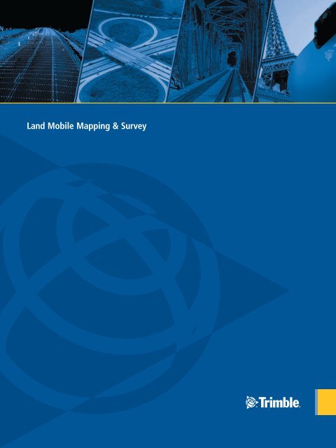
<strong>Trimble</strong>’s geospatial solution portfolio has been designed to put information to work. <strong>Mobile</strong> sensors on the land, in the air or indoors capture<br />
geo-referenced images and point clouds that are exploited using production-scale feature extraction. The result: high-fidelity models that increase<br />
business productivity and improve decision-making.<br />
Roadway<br />
Rail<br />
Utility & Energy Corridors<br />
<strong>Land</strong> MobiLe <strong>Mapping</strong> & <strong>Survey</strong><br />
<strong>Mobile</strong> mapping and survey is opening new possibilities by enabling<br />
enormous amounts of highly accurate, geo-referenced spatial data to<br />
be rapidly collected and transformed into information-rich 3D<br />
infrastructure models.<br />
<strong>Trimble</strong>’s mobile mapping and survey solutions integrate our industryleading<br />
geo-referencing technologies with very precise, high-speed<br />
laser scanning and high-resolution imaging sensors to deliver premium<br />
vehicle-mounted mobile spatial imaging systems. Terabytes of terrestrial<br />
imagery and point clouds for entire cities, highway networks, rail systems<br />
and utility corridors can be collected while operating at highway or<br />
railway speeds, often in a single pass.<br />
However, raw data collection alone is neither practical nor complete.<br />
<strong>Trimble</strong>’s mobile mapping and survey solutions are bundled with Trident<br />
Analyst software to control raw spatial data collection and automate key<br />
processes such as creating or extracting surface models, roadway signs,<br />
utility poles, roadside edges, pavement markings, horizontal and vertical<br />
clearances and road geometry.<br />
This combination of premium sensors and productivity software<br />
facilitates projects that would be too slow and cost-prohibitive to<br />
complete using traditional mapping and survey approaches. The resulting<br />
high-fidelity models help infrastructure managers plan, design, build<br />
and maintain modern infrastructure, while maximizing safety<br />
and effectiveness.
CoLLeCT<br />
Use <strong>Trimble</strong>’s <strong>Mobile</strong> Data Capture<br />
systems to quickly obtain geospatial<br />
data:<br />
• Dense point clouds<br />
• Highly accurate vehicle<br />
positioning and orientation<br />
• High-resolution digital imagery<br />
eXTraCT<br />
Rapidly convert raw data into<br />
geospatial intelligence with Trident<br />
Analyst software:<br />
• Automated 3D feature extraction<br />
• Manual 3D feature extraction<br />
• Field-to-finish attributing codes<br />
• Accuracy management<br />
deLiver<br />
Produce high-quality deliverables for<br />
your customers and stakeholders:<br />
• CAD<br />
• GIS<br />
• Photolog<br />
• Asset management systems<br />
3
4<br />
MobiLe daTa CapTure SySTeMS<br />
<strong>Trimble</strong> mX8<br />
The <strong>Trimble</strong> MX8 is a premium mobile spatial imaging system for capturing high-quality 3D spatial data quickly, accurately and effectively. The<br />
vehicle-mounted system is specifically designed for surveyors, engineers, and geospatial professionals conducting as-built modeling, inventory,<br />
inspection, encroachment analysis, and asset management for roadways, bridges, railway, utilities and other infrastructure management.<br />
The <strong>Trimble</strong> MX8 is equipped with a pair of high-performance, 360-degree mobile laser scanners which capture incredibly detailed 3D infrastructure<br />
geometry in one pass. It uses high-frequency digital cameras that are embedded in a rigid enclosure at set positions and orientations to enable highresolution<br />
image capture. The <strong>Trimble</strong> MX8 seamlessly integrates a POS LV positioning and orientation system, utilizing integrated inertial technology<br />
to generate stable, reliable and repeatable positioning and orientation solutions.<br />
• High-speed, long-range, high-precision dual laser scanning<br />
• Rigid sensor orientations for increased accuracy<br />
• High-resolution panorama and surface imagery, creating a robust spatial<br />
foundation for information extraction<br />
• Wide navigation and sensor base for easy installation on a variety of<br />
vehicle types<br />
• Steep sensor pitch for minimal point cloud shadowing on overhead<br />
structures<br />
• Fully compatible with Trident Analyst software
<strong>Trimble</strong> mX3<br />
The <strong>Trimble</strong> MX3 is a highly practical and economical option for capturing rich 3D spatial data to meet a broad range of mapping and GIS corridor<br />
information demands. Combining cost-effective laser scanning technology with user-selectable digital imaging options, the <strong>Trimble</strong> MX3 provides the<br />
ability to produce a robust spatial environment to satisfy typical mapping and GIS needs from a mobile platform.<br />
<strong>Trimble</strong> mX1<br />
• Precision entry-level mobile laser scanning<br />
• Multiple scanning configurations to optimize specific workflows<br />
• Integrated high-resolution panorama and surface imagery, creating a robust spatial foundation for information extraction<br />
• Fully compatible with Trident Analyst software for productive workflows in GIS and mapping applications<br />
Delivering exceptional value for land photogrammetric applications, the <strong>Trimble</strong> MX1<br />
provides a complimentary solution to traditional inventory feature collection methods.<br />
• Fully geo-referenced and highly accurate for mapping and GIS applications<br />
• High-resolution digital imaging for corridor feature extraction<br />
• Calibrated camera lenses to eliminate lens curvature imperfections<br />
• Image capture at user-definable time or distance intervals<br />
• Scalable and upgradable<br />
• Compatible with Trident Analyst software<br />
lASer SCANNiNG<br />
Automated Feature Extraction<br />
Accuracy<br />
Precision<br />
Frequency<br />
Range<br />
imAGiNG mODUleS<br />
15 MP Forward Panorama<br />
15 MP Rear Panorama<br />
5 MP Oblique Surface<br />
12 MP G360<br />
POSiTiONiNG AND<br />
OrieNTATiON<br />
<strong>Trimble</strong> mX1 <strong>Trimble</strong> mX3 <strong>Trimble</strong> mX8<br />
N/A<br />
Yes<br />
Optional<br />
N/A<br />
Optional<br />
AgGPS 262 receiver<br />
Upgrades Available<br />
Yes<br />
35 mm<br />
10 mm<br />
Fixed: 13.5 kHz (x4)<br />
30 m σ≥ 10%<br />
Yes<br />
Optional<br />
Optional<br />
Optional<br />
POS LV 220<br />
Upgrades Available<br />
Yes<br />
10 mm<br />
5 mm<br />
Variable: 50 kHz – 300 kHz (x2)<br />
@50 kHz: 180 m σ≥ 10%; 500 m σ≥ 80%<br />
@300 kHz: 75 m σ≥ 10%; 200 m σ≥ 80%<br />
Yes<br />
Optional<br />
Yes<br />
N/A<br />
POS LV 420<br />
Upgrades Available<br />
5
6<br />
TridenT anaLyST SofTware<br />
<strong>Mobile</strong> imaging and laser scanning systems create immense datasets that can quickly overwhelm manual<br />
workflows, therefore <strong>Trimble</strong> mobile data capture systems come with Trident Analyst software to manage<br />
field data capture, interpret images and point clouds and automatically extract features. These capabilities<br />
allow you to quickly transform your land mobile data into geospatial intelligence.<br />
The Trident Analyst interface is designed for robust object positioning, measurement, and data layer<br />
creation—ideal for the analysis of geo-referenced imagery and laser scanner data. Industry-leading functions<br />
accelerate projects and increase productivity, including key automated processes such as surface modeling,<br />
roadway sign and pole detection, lane marking detection, edge and breakline detection, road geometry,<br />
and clearance measurements.<br />
TriDeNT ANAlyST fOr GiS<br />
Rapidly populate and maintain GIS databases.<br />
• Manual information extraction from digital imagery and point clouds<br />
• User defined GIS data entry forms<br />
• Projection of existing GIS database content on images and point clouds for easy<br />
data management<br />
• Direct GIS database connection for multi-user data extraction and maintenance<br />
TriDeNT ANAlyST fOr rOADwAy SiGNS<br />
Create and maintain a network-level roadway sign inventory.<br />
• Includes functionality from Trident Analyst for GIS software<br />
• Automated extraction capabilities, including pole detection with change<br />
detection, sign detection with change detection, sign recognition, and pavement<br />
marking detection<br />
• Enhanced quality control tools and sign databases<br />
TriDeNT ANAlyST fOr SPATiAl imAGiNG<br />
Manage high-resolution digital imaging, dense point clouds and information extraction.<br />
• Includes functionality from Trident Analyst for Roadway Signs software<br />
• Enhanced automated extraction capabilities, including digital terrain models,<br />
roadway cross sections, roadway edges, roadway centerlines, vertical and horizontal<br />
clearances, and line-of-sight<br />
• LAS and <strong>Land</strong> XML exports<br />
• Supports advanced capabilities of the <strong>Trimble</strong> MX8 mobile spatial imaging system
TridenT anaLyST feaTure CoMpariSon<br />
DATA imPOrT AND eXPOrT<br />
ODBC Database Connectivity<br />
ESRI SHP<br />
Point Cloud – <strong>Trimble</strong> Custom ASCII Format<br />
Point Cloud – LAS 2.0<br />
Point Cloud – LAS 1.1 & 1.2 Export<br />
<strong>Land</strong> XML Export<br />
DiSPlAy AND PlAybACK<br />
3D Map<br />
Digital Imaging Playback<br />
Point Cloud Viewing<br />
Blended Digital Imaging and Point Cloud<br />
imAGe / ViDeO mANiPUlATiON<br />
AVI to JPG Conversion (with Titling)<br />
AVI to AVI Segmentation<br />
Image Mosaic Generation<br />
ACCUrACy mANAGemeNT<br />
Camera Boresight Calibration<br />
Laser Boresight Calibration<br />
Control / Target Detection<br />
Point Cloud to Control / Target Registration<br />
Point Cloud to Point Cloud Registration<br />
Trident Analyst<br />
Viewer<br />
P<br />
Input Only<br />
View Only<br />
View Only<br />
P<br />
P<br />
P<br />
P<br />
Trident Analyst<br />
for GiS<br />
P<br />
P<br />
View Only<br />
View Only<br />
P<br />
P<br />
P<br />
P<br />
P<br />
P<br />
P<br />
Trident Analyst<br />
for roadway Signs<br />
P<br />
P<br />
View Only<br />
View Only<br />
P<br />
P<br />
P<br />
P<br />
P<br />
P<br />
P<br />
P P<br />
P<br />
Trident Analyst<br />
for Spatial imaging<br />
liNeAr refereNCiNG<br />
Spatial to Linear Referencing Tool P P P<br />
mANUAl feATUre eXTrACTiON<br />
3D Measurements from Point Clouds<br />
3D Measurements from Images<br />
Photogrammetric Feature Add / Delete<br />
Point Cloud Feature Add / Delete<br />
AUTOmATeD eXTrACTiON<br />
Pole Detection (with Change Detection)<br />
Sign Detection (with Change Detection)<br />
Sign Recognition<br />
Sign Compiler<br />
Sign Library<br />
Pavement Marking Detection<br />
Edge Detection<br />
Centerline Detection<br />
Road Modeler (DTM, Cross Sections, Profiles)<br />
Horizontal / Vertical Line-of-Sight<br />
Horizontal / Vertical Clearances<br />
P P<br />
P<br />
P<br />
P<br />
P<br />
P<br />
P<br />
P<br />
P<br />
P<br />
P<br />
P<br />
P<br />
P<br />
P<br />
P<br />
P<br />
P<br />
P<br />
P<br />
P<br />
P<br />
P<br />
P<br />
P<br />
P<br />
P<br />
P<br />
P<br />
P<br />
P<br />
P<br />
P<br />
P<br />
P<br />
P<br />
P<br />
P<br />
P<br />
P<br />
P<br />
P<br />
P<br />
P<br />
P<br />
P<br />
P<br />
7
Your partner for the long road<br />
Talk to <strong>Trimble</strong> about complete mobile mapping<br />
and survey workflows to transform land mobile<br />
data into land mobile intelligence<br />
www.trimble.com/geospatial<br />
© 2011, <strong>Trimble</strong> Navigation Limited. All rights reserved. <strong>Trimble</strong>, the Globe & Triangle logo,and Recon are<br />
trademarks of <strong>Trimble</strong> Navigation Limited, registered in the United States and in other countries. Access,<br />
AccessSync, Digital Fieldbook, Integrated <strong>Survey</strong>ing, and VISION are trademarks of <strong>Trimble</strong> Navigation Limited.<br />
All other trademarks are the property of their respective owners. PN 022515-138 (08/11)<br />
NORTH & SOUTH AMERICA<br />
<strong>Trimble</strong> Navigation Limited<br />
10355 Westmoor Drive<br />
Suite #100<br />
Westminster, CO 80021<br />
USA<br />
+1-720-587-4905 Phone<br />
+1-720-587-4878 Fax<br />
EUROPE & AFRICA<br />
<strong>Trimble</strong> Germany GmbH<br />
Trappentreustr. 1<br />
80339 Munich<br />
Germany<br />
+49-89-231180-20 Phone<br />
+49-89-231180-90 Fax<br />
ASIA-PACIFIC & MIDDLE EAST<br />
<strong>Trimble</strong> Navigation<br />
Singapore PTE Limited<br />
80 Marine Parade Road<br />
#22-06 Parkway Parade<br />
Singapore, 449269<br />
Singapore<br />
+65-6348-2212 Phone<br />
+65-6348-2232 Fax<br />
CHINA<br />
<strong>Trimble</strong> Beijing<br />
20F, Central Tower,<br />
China Overseas Plaza,<br />
No.8 Yard, Guang Hua Dong Li,<br />
Chaoyang District, Beijing<br />
CHINA 100044<br />
+86-10-8857-7575 Phone<br />
+86-10-8857-7161 Fax<br />
www.trimble.com.cn


