Agenda Item 9 - 12-0288 - Land off Edmondstown Road ...
Agenda Item 9 - 12-0288 - Land off Edmondstown Road ...
Agenda Item 9 - 12-0288 - Land off Edmondstown Road ...

Create successful ePaper yourself
Turn your PDF publications into a flip-book with our unique Google optimized e-Paper software.
RHONDDA CYNON TAF COUNTY BOROUGH COUNCIL<br />
DEVELOPMENT CONTROL<br />
COMMITTEE<br />
1 NOVEMBER 20<strong>12</strong><br />
REPORT OF: SERVICE<br />
DIRECTOR PLANNING<br />
1. PURPOSE OF THE REPORT<br />
MUNICIPAL YEAR 20<strong>12</strong>-2013<br />
<strong>Agenda</strong> <strong>Item</strong> No. 9<br />
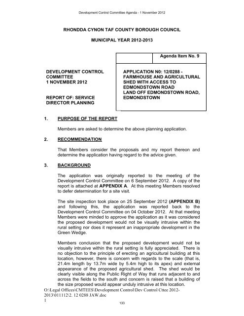
APPLICATION N0: <strong>12</strong>/<strong>0288</strong> -<br />
FARMHOUSE AND AGRICULTURAL<br />
SHED WITH ACCESS TO<br />
EDMONDSTOWN ROAD<br />
LAND OFF EDMONDSTOWN ROAD,<br />
EDMONDSTOWN<br />
Members are asked to determine the above planning application.<br />
2. RECOMMENDATION<br />
That Members consider the proposals and my report thereon and<br />
determine the application having regard to the advice given.<br />
3. BACKGROUND<br />
Development Control Committee <strong>Agenda</strong> - 1 November 20<strong>12</strong><br />
The application was originally reported to the meeting of the<br />
Development Control Committee on 6 September 20<strong>12</strong>. A copy of the<br />
report is attached at APPENDIX A. At this meeting Members resolved<br />
to defer determination for a site visit.<br />
The site inspection took place on 25 September 20<strong>12</strong> (APPENDIX B)<br />
and following this, the application was reported back to the<br />
Development Control Committee on 04 October 20<strong>12</strong>. At that meeting<br />
Members were minded to approve the application as it was considered<br />
the proposed development would not be visually intrusive within the<br />
rural setting nor does it represent an inappropriate development in the<br />
Green Wedge.<br />
Members conclusion that the proposed development would not be<br />
visually intrusive within the rural setting is fully appreciated. There is<br />
no objection to the principle of erecting an agricultural building at this<br />
location, however, there is concern with regards to the scale (that is,<br />
21.4m length by 13.7m wide by 5.4m high to its apex) and external<br />
appearance of the proposed agricultural shed. The shed would be<br />
clearly visible along the Public Right of Way that runs adjacent to and<br />
across the fields to the south and concern is raised that a building of<br />
the size proposed would appear unduly intrusive at this location.<br />
O:\Legal Offices\CMTEES\Development Control\Dev Control Cttee 20<strong>12</strong>-<br />
2013\0111<strong>12</strong>\2. <strong>12</strong> <strong>0288</strong> JAW.doc<br />
1<br />
133
Development Control Committee <strong>Agenda</strong> - 1 November 20<strong>12</strong><br />
There is also some concern that the need for such a large building,<br />
which would lie wholly within a green wedge, has not been justified.<br />
Especially having regard to the size and use of the agricultural land<br />
which the applicants farm and a large area of this land being a Site of<br />
Special Scientific Interest and under land management agreements.<br />
Notwithstanding the above if Members are still minded to approve the<br />
application; then it is suggested that the following conditions are<br />
attached to the planning permission:<br />
1. The development hereby permitted shall be begun before the<br />
expiration of five years from the date of this permission.<br />
Reason: To comply with Sections 91 and 93 of the Town and<br />
Country Planning Act 1990.<br />
2. Building operations shall not be commenced until samples of the<br />
external materials of the dwelling and agricultural shed have<br />
been submitted to and approved in writing by the Local Planning<br />
Authority and all materials used shall conform to the samples so<br />
approved.<br />
Reason: To ensure that the external appearance of the<br />
proposed development will be in keeping with the character of<br />
the area and adjoining buildings in the interests of visual<br />
amenity in accordance with Policies AW5 and AW6 of the<br />
Rhondda Cynon Taf Local Development Plan.<br />
3. No development shall take place until there has been submitted<br />
to and approved by the Local Planning Authority a<br />
comprehensive scheme of landscaping for the dwelling and<br />
agricultural shed, which shall include indications of all existing<br />
trees (including spread and species) and hedgerows on the land<br />
and details of any to be retained together with measures for their<br />
protection during the course of development.<br />
Reason: To ensure that the new development will be visually<br />
attractive in the interests of amenity in accordance with Policies<br />
AW5 and AW6 of the Rhondda Cynon Taf Local Development<br />
Plan.<br />
4. All planting, seeding or turfing in the approved details of<br />
landscaping shall be carried out in the first planting and seeding<br />
season following the occupation of the building(s) or completion<br />
of the development, whichever is the sooner, and any trees or<br />
plants which within a period of five years from the completion of<br />
the development die, are removed or become seriously<br />
damaged or diseased shall be replaced in the next planting<br />
O:\Legal Offices\CMTEES\Development Control\Dev Control Cttee 20<strong>12</strong>-<br />
2013\0111<strong>12</strong>\2. <strong>12</strong> <strong>0288</strong> JAW.doc<br />
2<br />
134
Development Control Committee <strong>Agenda</strong> - 1 November 20<strong>12</strong><br />
season with others of similar size and species, unless the Local<br />
Planning Authority gives written consent to any variation.<br />
Reason: To ensure that the new development will be visually<br />
attractive in the interests of amenity in accordance with Policies<br />
AW5 and AW6 of the Rhondda Cynon Taf Local Development<br />
Plan.<br />
5. No development shall take place until there has been submitted<br />
to approved in writing by the Local Planning Authority a plan<br />
indicating the positions, design, materials and type of boundary<br />
treatment to be erected. The boundary treatment shall be<br />
completed in accordance with the approved details before the<br />
development is brought into beneficial use and retained as such<br />
thereafter unless otherwise agreed in writing by the Local<br />
Planning Authority.<br />
Reason: To ensure that the new development will be in keeping<br />
with the surrounding area and to protect residential amenity in<br />
accordance with Policies AW5 and AW6 of the Rhondda Cynon<br />
Taf Local Development Plan.<br />
6. Construction works on the development shall not take place<br />
other than during the following times:<br />
• Monday to Friday 0800 to 1800 hours<br />
• Saturday 0800 to 1300 hours<br />
• Not at any time on Sundays, Bank or Public holidays,<br />
unless otherwise agreed in writing by the Local Planning<br />
Authority.<br />
Reason: To ensure that the noise emitted from this<br />
development is not a source of nuisance to occupants of nearby<br />
residential properties in accordance with Policy AW5 of the<br />
Rhondda Cynon Taf Local Development Plan.<br />
7. No development shall take place until drainage arrangements<br />
have been submitted to and approved in writing by the Local<br />
Planning Authority, which shall include a Hydrological Impact<br />
Assessment including proposed mitigation, design details and a<br />
development program with respect to:<br />
a) protection of open and culverted sections of the existing<br />
watercourse during and after construction<br />
b) protection of properties downstream of the development<br />
from increased flood risk during and after construction<br />
owing to the development; and<br />
c) protection of properties within the development from flood<br />
risk<br />
O:\Legal Offices\CMTEES\Development Control\Dev Control Cttee 20<strong>12</strong>-<br />
2013\0111<strong>12</strong>\2. <strong>12</strong> <strong>0288</strong> JAW.doc<br />
3<br />
135
Development Control Committee <strong>Agenda</strong> - 1 November 20<strong>12</strong><br />
Reason: To ensure adequate disposal of foul and surface water<br />
drainage in accordance with Policy AW10 of the Rhondda<br />
Cynon Taf Local Development Plan.<br />
8. The development shall not be occupied until the drainage works<br />
have been completed in accordance with the approved plans.<br />
Reason: To ensure adequate disposal of foul and surface water<br />
drainage in accordance with Policy AW10 of the Rhondda<br />
Cynon Taf Local Development Plan.<br />
9. The dwelling hereby permitted shall be constructed to achieve a<br />
minimum Code for Sustainable Homes Level 3 and achieve a<br />
minimum of 1 credit under category ‘Ene1- Dwelling Emission<br />
Rate’ in accordance with the requirements of Version 3 of the<br />
Code for Sustainable Homes. The development shall be carried<br />
out entirely in accordance with the approved assessment and<br />
certification.<br />
Reason: To ensure the development constructed is in<br />
accordance with policy guidance in relation to providing<br />
sustainable buildings, outlined in paragraph 4.11.4 of Planning<br />
Policy Wales.<br />
10. Unless otherwise agreed in writing by the Local Planning<br />
Authority, construction of the dwelling hereby permitted shall not<br />
begin until an ‘Interim Certificate’ has been submitted to and<br />
approved in writing by the Local Planning Authority, certifying<br />
that a minimum Code for Sustainable Homes Level 3 and a<br />
minimum of 1 credit under ‘Ene1 - Dwelling Emission Rate’, has<br />
been achieved for the dwelling or house type in accordance with<br />
the requirements of Version 3 of the Code for Sustainable<br />
Homes.<br />
Reason: To ensure the development constructed is in<br />
accordance with policy guidance in relation to providing<br />
sustainable buildings, outlined in paragraph 4.11.4 of Planning<br />
Policy Wales.<br />
11. Prior to the occupation of the dwelling hereby permitted, a Code<br />
for Sustainable Homes ‘Final Certificate’’ shall be submitted to<br />
and approved in writing by the Local Planning Authority,<br />
certifying that a minimum Code for Sustainable Homes Level 3<br />
and a minimum of 1 credit under ‘Ene1 - Dwelling Emission<br />
Rate’, has been achieved for the dwelling in accordance with the<br />
requirements of the Version 3 of the Code for Sustainable<br />
Homes.<br />
Reason: To ensure the development constructed is in<br />
accordance with policy guidance in relation to providing<br />
O:\Legal Offices\CMTEES\Development Control\Dev Control Cttee 20<strong>12</strong>-<br />
2013\0111<strong>12</strong>\2. <strong>12</strong> <strong>0288</strong> JAW.doc<br />
4<br />
136
Development Control Committee <strong>Agenda</strong> - 1 November 20<strong>12</strong><br />
sustainable buildings, outlined in paragraph 4.11.4 of Planning<br />
Policy Wales.<br />
<strong>12</strong>. Prior to the commencement of development, details of traffic<br />
management and wheel washing facilities shall be provided on<br />
site in accordance with details to be submitted to and approved<br />
in writing by the Local Planning Authority. The approved details<br />
shall be implemented and maintained throughout the<br />
construction period unless otherwise agreed in writing by the<br />
Local Planning Authority.<br />
Reason: To ensure that mud and debris are not deposited from<br />
the construction site onto the public highway, in the interests of<br />
highway safety in accordance with Policy AW5 of the Rhondda<br />
Cynon Taf Local Development Plan.<br />
13. Notwithstanding the submitted plans, development shall not<br />
commence until full engineering and design details of the<br />
improved access <strong>off</strong> <strong>Edmondstown</strong> <strong>Road</strong> including<br />
improvements to the agricultural shed access road (PROW)<br />
have been submitted to and approved in writing by the Local<br />
Planning Authority. The approved details shall be fully<br />
implemented prior to the development being brought into<br />
beneficial use.<br />
Reason: To ensure the adequacy of the proposed development<br />
in the interests of highway and pedestrian safety. In accordance<br />
with policy AW5 of the Rhondda Cynon Taf Local Development<br />
Plan.<br />
14. Prior to commencement of works on site a method statement to<br />
protect/keep available the Public Right of Way during<br />
construction work shall be submitted to and agreed in writing by<br />
the Local Planning Authority. The approved details shall be<br />
implemented and maintained throughout the construction period<br />
unless otherwise agreed in writing by the Local Planning<br />
Authority.<br />
Reason: To ensure that the PROW is protected and available<br />
during construction work, in the interests of pedestrian safety in<br />
accordance with Policy AW5 of the Rhondda Cynon Taf Local<br />
Development Plan.<br />
15. No outside storage shall take place within the curtilage of the<br />
agricultural shed, unless otherwise agreed in writing by the<br />
Local Planning Authority.<br />
Reason: To protect the visual amenity of the surrounding area<br />
and green wedge in accordance with policies SS22.1, AW5 and<br />
AW6 of the Rhondda Cynon Taf Local Development Plan.<br />
O:\Legal Offices\CMTEES\Development Control\Dev Control Cttee 20<strong>12</strong>-<br />
2013\0111<strong>12</strong>\2. <strong>12</strong> <strong>0288</strong> JAW.doc<br />
5<br />
137
NOTES<br />
Development Control Committee <strong>Agenda</strong> - 1 November 20<strong>12</strong><br />
1. The applicant/developer is advised that construction workers<br />
should be made aware of the line of the PROW as it forms part<br />
of the application site and therefore they will encounter<br />
pedestrian traffic. Construction workers must therefore be<br />
vigilant of the PROW and furthermore it should not be blocked<br />
by construction traffic at any time.<br />
2. The applicants’ attention is drawn to the attached letter from<br />
Countryside Council for Wales dated 20 Jun 20<strong>12</strong>.<br />
3. The applicants’ attention is drawn to the attached letter from Dwr<br />
Cymru/Welsh Ware dated 3 July 20<strong>12</strong>.<br />
O:\Legal Offices\CMTEES\Development Control\Dev Control Cttee 20<strong>12</strong>-<br />
2013\0111<strong>12</strong>\2. <strong>12</strong> <strong>0288</strong> JAW.doc<br />
6<br />
138
O:\Legal Offices\CMTEES\Development Control\Dev Control Cttee 20<strong>12</strong>-<br />
2013\0111<strong>12</strong>\2. <strong>12</strong> <strong>0288</strong> JAW.doc<br />
7<br />
APPENDIX A<br />
APPLICATION NO: <strong>12</strong>/<strong>0288</strong>/10 (JAW)<br />
APPLICANT: Mr & Mrs A West<br />
DEVELOPMENT: Farmhouse and agricultural shed with access to<br />
<strong>Edmondstown</strong> <strong>Road</strong><br />
LOCATION: LAND OFF EDMONDSTOWN ROAD,<br />
EDMONDSTOWN CF40 1NP<br />
DATE REGISTERED: 11/04/20<strong>12</strong><br />
ELECTORAL DIVISION: Tonyrefail West<br />
APPLICATION DETAILS<br />
Development Control Committee <strong>Agenda</strong> - 1 November 20<strong>12</strong><br />
Full planning permission is sought to erect a farmhouse (dwelling) and<br />
agricultural building with access on land <strong>off</strong> <strong>Edmondstown</strong> <strong>Road</strong>,<br />
<strong>Edmondstown</strong>. The dwelling would be set-back in the site curtilage and<br />
measure <strong>12</strong>.5m wide by 8.5m deep and would be 8.8m high to its ridge. It<br />
would have an attached garage (with storage space above) measuring 4.6m<br />
wide by 8m deep by 6m high to ridge level. The garage/store would be set<br />
back 2m from the front elevation of the dwelling. The dwelling would have a<br />
front porch and a 1.5m deep two-storey rear projection. The external walls of<br />
the dwelling would be reclaimed dress stone and the roof covering would be<br />
slate. The external walls of the garage/store would be roughcast render. The<br />
dwelling would accommodate an entrance hall, kitchen/dining room, utility<br />
room, living room, kids playroom and toilet on the ground floor and three<br />
bedrooms (one en-suite), a bathroom and <strong>off</strong>ice on the first floor.<br />
The agricultural building would be located to the east of the dwelling and<br />
would measure 21.4m in length by 13.7m wide. It would be 3.6m high to<br />
eaves level and 5.4m to its apex. The external materials would comprise<br />
concrete panels to the lower walls and green profile sheets to the upper walls<br />
and roof.<br />
The applicants’ have advised that the agricultural building would be required<br />
to store, approximately 132 round hay bales, a tractor and loader, a trailer<br />
(with hay bob and mower stored in the trailer), a further tractor, topper, baler,<br />
stock box, link box, fertilizer spreader, approximately <strong>12</strong> fertilizer bags, logs,<br />
and straw (with storage room below for fence post, wire and animal feed).<br />
Access to the site would be via the unnamed track, which is part of a Public<br />
Right of Way (ANT/59), that links <strong>Edmondstown</strong> <strong>Road</strong> with Rees Street.<br />
The applicants’ currently farm approximately 28 hectares of land at Dinas Isaf,<br />
of which 10.6 hectares is a SSSI (Site of Special Scientific Interest) and under<br />
land management agreements. The remainder are hay fields. Approximately<br />
20 cattle and 80 sheep are farmed. The applicant’s have also advised that<br />
they will shortly farm a further 11 hectares as part of Graig Ddu Farm. The<br />
farm machinery and hay is currently stored at Graig Ddu Farm approximately<br />
three miles away.<br />
139
SITE APPRAISAL<br />
The western part of the application site (where the dwelling is proposed) is<br />
enclosed by a stonewall, which is collapsed in places. This area is heavily<br />
overgrown and contains redundant single storey block and corrugated iron<br />
roofed sheds.<br />
The site is located on the eastern edge of <strong>Edmondstown</strong>, which is mainly<br />
characterised by terraced dwellings. The area surrounding the application<br />
site comprises open countryside to the south and east (part of which is the<br />
Rhos Tonyrefail SSSI). The Graig Ddu mountainside lies on the opposite side<br />
of <strong>Edmondstown</strong> <strong>Road</strong> (to the north). To the south-west is a playing field and<br />
to the west is an unmade access that provides secondary access to a number<br />
of side roads. To the north-west is a children’s playground, a community hall<br />
and the rear of a public house.<br />
A Public Right of Way (PROW), runs across the front of the site and through<br />
the south-east of the site (between where the proposed dwelling and<br />
agricultural building would be located). The PROW appears to be well used<br />
by the local community (including children using the playground) and provides<br />
a link to/through the open countryside.<br />
PLANNING HISTORY<br />
08/1448 Application to determine whether Permission Required<br />
planning permission is required 14/10/08<br />
for infilling part of a field with<br />
imported hardcore/building rubble<br />
PUBLICITY<br />
Development Control Committee <strong>Agenda</strong> - 1 November 20<strong>12</strong><br />
A press notice, site notices and direct neighbour notification letters have<br />
advertised the application. 24 letters and a petition have been received which<br />
are summarised as follows:<br />
Petition signed by 61 signatories objecting to the proposal, however, no<br />
reasons are provided.<br />
10 letters objecting to proposal (5 with no reason provided) concerns raised<br />
include:<br />
• Oppose application if it affects the PROW and/or road to houses.<br />
Everyday traffic has become dependant on this overflow route to<br />
houses, it also serves a community hall, the football clubhouse, a<br />
children’s playground and a Public House.<br />
• Noise and health and safety issues associated with a working farm so<br />
close to residential properties, a children’s playground and general<br />
playing field.<br />
O:\Legal Offices\CMTEES\Development Control\Dev Control Cttee 20<strong>12</strong>-<br />
2013\0111<strong>12</strong>\2. <strong>12</strong> <strong>0288</strong> JAW.doc<br />
8<br />
140
• Loss of view of surrounding mountains and valley from <strong>Edmondstown</strong><br />
<strong>Road</strong>.<br />
• Scale of proposal is out of keeping with local area.<br />
• The applicant states that proposal would ease congestion of having<br />
farm building closer to fields; however, we have never experienced<br />
traffic problems caused by the applicant’s agricultural vehicles.<br />
14 letters in support of the application, which are summarised as follows:<br />
• Will greatly improve appearance of village and materials would reflect<br />
local character.<br />
• Will reduce carbon footprint and improve safety and congestion on<br />
roads between site and Graig Ddu farm.<br />
• Only concern proposal may block the PROW and/or road, which we<br />
have been assured is not the case.<br />
• Regularly use PROW to walk dog and admire wildlife, the environment<br />
and animals. Proposal would benefit the area.<br />
• Williamstown Primary School comments that to have a resource within<br />
walking distance of the school becomes an extension of the classroom<br />
and provides outdoor learning for all the children.<br />
CONSULTATION<br />
Development Control Committee <strong>Agenda</strong> - 1 November 20<strong>12</strong><br />
Transportation Section – no objection subject to conditions.<br />
<strong>Land</strong> Reclamation and Engineering – advises that there is an existing<br />
culverted watercourse passing through/adjacent to the site. No objection<br />
subject to suitable drainage conditions including the submission of a<br />
Hydrological Impact Assessment.<br />
Public Health and Protection – no objection.<br />
Environmental Services (Leisure) – no adverse comments received.<br />
Countryside Council for Wales (CCW) – advises that the Rhos Tonyrefail<br />
SSSI is located within 50m of the site. The application has the potential to<br />
affect the SSSI with the identified risks being i)potential pollution incidents<br />
during construction and ii) the disposal of foul water from the house and<br />
surface water arising from the agricultural building and house. Appropriate<br />
controls and construction methods are required to be in place, to control these<br />
risks to the SSSI.<br />
The continued sustainability and viability of the applicant’s agricultural<br />
business and therefore management, in particular stock grazing, is vital to the<br />
long-term maintenance of the nationally important habitats on the land within<br />
the SSSI.<br />
Dwr Cymru/Welsh Water – no objection.<br />
O:\Legal Offices\CMTEES\Development Control\Dev Control Cttee 20<strong>12</strong>-<br />
2013\0111<strong>12</strong>\2. <strong>12</strong> <strong>0288</strong> JAW.doc<br />
9<br />
141
Countryside Section – advises that there is an objection to the proposed size<br />
and impact of the proposed agricultural building on the landscape. Also,<br />
advises that the Rhos Tonyrefail SSSI is located close to the site and a<br />
PROW runs to the front of the site and between the proposed location of the<br />
dwelling and agricultural building. The proposal would increase the risk of<br />
conflict between pedestrian users who have the right to walk the footpath and<br />
vehicles. There would appear to be adequate width to allow the footpath to<br />
be accommodated to the side of the access track, which would allow the<br />
traffic to be segregated, it would also be beneficial if this section of path could<br />
be brought up to the same standard as the remaining section of the footpath<br />
through the fields.<br />
Spatial Planning – no policy objection subject to the requirements of the<br />
relevant polices being met.<br />
SEWBREC – there are no records of any statutory protected species within<br />
the immediate vicinity of the site.<br />
Tonyrefail and District Community Council – although do not object to the<br />
proposal would comment that there is a footpath running through this area.<br />
What steps are being made to maintain access to these footpaths during<br />
construction works?<br />
POLICY CONTEXT<br />
Development Control Committee <strong>Agenda</strong> - 1 November 20<strong>12</strong><br />
Rhondda Cynon Taf Local Development Plan<br />
The proposed farmhouse lies within the defined settlement boundary. The<br />
agricultural building lies completely within a green wedge and partially within a<br />
minerals safeguarding zone within the Southern Strategy Area.<br />
Policy CS2 of the LDP – is concerned with creating sustainable growth within<br />
the Southern Strategy Area, particularly by protecting the culture and identity<br />
of communities by focusing development within defined settlement boundaries<br />
and by protecting the built and natural environment.<br />
Policy AW1 – identifies the housing land requirement figure and how this will<br />
be achieved. This includes the development of unallocated land within the<br />
settlement boundary.<br />
Policy AW2 – requires new development to be in a sustainable location<br />
Policy AW5 – specifies criteria for new development. It requires new<br />
development to have an acceptable impact on the character and appearance<br />
of the site and surrounding area and no significant impact on the amenities of<br />
neighbouring occupiers. It also requires development to be of sustainable<br />
design with good accessibility.<br />
Policy AW6 – outlines types of development criteria that will be supported,<br />
including the following:<br />
O:\Legal Offices\CMTEES\Development Control\Dev Control Cttee 20<strong>12</strong>-<br />
2013\0111<strong>12</strong>\2. <strong>12</strong> <strong>0288</strong> JAW.doc<br />
10<br />
142
• A high standard of design;<br />
• Design appropriate to the local context;<br />
• An integrated mixture of uses appropriate to the scale of the development;<br />
and<br />
• An efficient use of land.<br />
Policy AW14.2 – the resources of sandstone will be safeguarded from<br />
development.<br />
Policy SSA11 – Net density is sought at a minimum of 35 dwellings per<br />
hectare.<br />
Policy SSA13 – stipulates that development should occur within the defined<br />
settlement boundary.<br />
Policy SS22.1 – identifies a green wedge at land north of Tonyrefail (Trane<br />
Farm, Cae’r Farm) and Penrhiwfer (Mynydd y Gilfach) (part). Development<br />
that would prejudice the open nature of the land will not be permitted.<br />
•<br />
National Guidance<br />
Planning Policy Wales<br />
Paragraph 4.7.16 – the construction of new buildings in a green belt or a<br />
locally designated green wedge is inappropriate development unless it is for<br />
the purpose:<br />
• Justified agricultural and forestry needs.<br />
Paragraph 9.3.3 - states that new housing development should not damage<br />
an area’s character or amenity.<br />
Planning Policy Wales Technical Advice Note <strong>12</strong> (Design) advises that the<br />
Welsh Government is strongly committed to achieving the delivery of good<br />
design in the built and natural environment, which is fit for purpose and<br />
delivers environmental sustainability, economic development, and social<br />
inclusion at every scale throughout Wales.<br />
PLANNING CONSIDERATIONS<br />
Development Control Committee <strong>Agenda</strong> - 1 November 20<strong>12</strong><br />
As detailed previously, planning permission is sought for the erection of a<br />
farmhouse (dwelling) and an agricultural building. The two elements of the<br />
proposed development will be considered separately.<br />
1. The Proposed Farmhouse (dwelling)<br />
The description of the dwelling is a farmhouse, however, it would be located<br />
on an unallocated area of land within the settlement boundary of<br />
<strong>Edmondstown</strong>. The principle of erecting a dwelling at this location would<br />
therefore be acceptable. Therefore, the proposal is being considered as the<br />
O:\Legal Offices\CMTEES\Development Control\Dev Control Cttee 20<strong>12</strong>-<br />
2013\0111<strong>12</strong>\2. <strong>12</strong> <strong>0288</strong> JAW.doc<br />
11<br />
143
Development Control Committee <strong>Agenda</strong> - 1 November 20<strong>12</strong><br />
erection of a dwelling within settlement limits, and as such, if permitted there<br />
would be no need for a condition tying the dwelling to an agricultural/rural<br />
enterprise use. Indeed, Members should note that no justification has been<br />
put forward for an agricultural workers dwelling. Therefore, the main issues to<br />
be considered are:-<br />
• The impact on the character and appearance of the area<br />
• The impact on highway safety, parking and the PROW<br />
• The impact on nearby residential properties<br />
• The impact on the SSSI<br />
The impact on the character and appearance of the area<br />
The dwelling would be set down from <strong>Edmondstown</strong> <strong>Road</strong> and set apart from<br />
the existing residential properties in the area. The concern that the proposed<br />
dwelling would be out of keeping with the area is noted. It is considered that<br />
the siting, scale, design and external materials of the proposed detached<br />
dwelling would provide an appropriate development on the edge of the<br />
settlement, that is, it would be a visually appropriate building when viewed<br />
from both the built-up area and the surrounding countryside. The proposal<br />
would also include the retention and rebuilding of the existing stone boundary<br />
wall on the western side of the dwelling and a new stone boundary/retaining<br />
wall on the eastern side. The concern with regard to the loss of general views<br />
of the countryside from <strong>Edmondstown</strong> <strong>Road</strong> is noted. It is not considered that<br />
the siting, scale and design of the proposed dwelling would be harmful to the<br />
general views of the countryside from <strong>Edmondstown</strong> <strong>Road</strong>.<br />
The impact on highway safety, parking and the PROW<br />
The access to the proposed dwelling would be from <strong>Edmondstown</strong> <strong>Road</strong>,<br />
which provides a highway link with Rees Street. A PROW also runs along the<br />
access to the front of the site and continues to the east of the proposed<br />
dwelling. Concerns from local residents with regards to continued access to<br />
the existing PROW and access track are noted. The Council’s Transportation<br />
Section has acknowledged that the existing access/PROW is sub-standard in<br />
terms of structural integrity, gradient and radius kerbing. A condition is<br />
therefore recommended to improve the access track/PROW to the proposed<br />
dwelling (which is within the applicant’s ownership). The aboverecommended<br />
condition would improve the access track/junction from<br />
<strong>Edmondstown</strong> <strong>Road</strong> for all highway users. A condition is also recommended<br />
to ensure that the PROW is available throughout the construction phase of the<br />
development. A garage and driveway would provide adequate <strong>off</strong>-street<br />
parking to serve the proposed dwelling. A turning area would be provided to<br />
the front of the dwelling to enable cars to access/egress the site in a forward<br />
gear, which would assist in mitigating any conflict between pedestrian and<br />
vehicular traffic.<br />
In terms of neighbouring residential amenity<br />
The dwelling would be located to the east of existing dwellings and set down<br />
from <strong>Edmondstown</strong> <strong>Road</strong>, It is considered that the dwelling would have no<br />
O:\Legal Offices\CMTEES\Development Control\Dev Control Cttee 20<strong>12</strong>-<br />
2013\0111<strong>12</strong>\2. <strong>12</strong> <strong>0288</strong> JAW.doc<br />
<strong>12</strong><br />
144
Development Control Committee <strong>Agenda</strong> - 1 November 20<strong>12</strong><br />
adverse impact on the existing amenities of nearby residential properties in<br />
terms of loss of privacy, loss of light or overbearing impact.<br />
The impact on the SSSI<br />
CCW has advised that the drainage from the proposed dwelling has the<br />
potential to impact on the SSSI, which is located within 50m of the site. The<br />
proposal is to discharge surface water from the proposed dwelling to a<br />
rainwater harvesting tank. Foul water is proposed to be connected to the<br />
public sewerage system (using pumps if necessary), unless this proves<br />
unviable. It is noted that drawing no. BD1651/PL02 Rev. E incorrectly shows<br />
a water treatment plant within the curtilage of the proposed dwelling. A<br />
condition of permission would be recommended to require the submission of a<br />
comprehensive drainage scheme prior to commencement of work on site.<br />
Such a condition would enable full consideration of the proposed site drainage<br />
in relation to the SSSI.<br />
It is therefore considered that the proposed dwelling is acceptable and in<br />
keeping with the relevant policies of the Rhondda Cynon Taf Local<br />
Development Plan.<br />
2. Proposed agricultural building<br />
The main issues in the consideration of the proposed agricultural building are:<br />
• Planning policy context of the development and the impact on a Green<br />
Wedge.<br />
• The impact on the character and appearance of the area.<br />
• The impact on highway safety, parking and the PROW.<br />
• The impact on nearby residential properties.<br />
• The impact on the SSSI.<br />
Policy context and impact on the Green Wedge<br />
The agricultural building lies partially within a sandstone minerals<br />
safeguarding zone. Although the agricultural building falls within a minerals<br />
safeguarding zone, the minerals have already been sterilised due to the<br />
proximity of the residential areas and are thus unsuitable for extraction.<br />
The agricultural building lies wholly within a green wedge. (Policy SS 22.1 -<br />
Green Wedges of the Local Development Plans). The proposed agricultural<br />
building would measure 21.4m in length by 13.7m wide by 5.4m high to its<br />
apex and would accommodate, such items as, machinery (for the hay fields,<br />
for transporting hay as feed for the animals, transporting animals when they<br />
get sick) and approximately 132 hay bales. Concern is raised whether such a<br />
large building is required within the Green Wedge. The Design and Access<br />
Statement (DAS) submitted as part of the application states that the<br />
applicants currently farm approximately 28 hectares of land at Dinas Isaf, 10.6<br />
hectares of which is under land management agreements with Butterfly<br />
Conservation and the Countryside Council for Wales. The DAS also states<br />
that they will shortly farm a further 11 hectares at Graig Ddu Farm. The<br />
applicants have advised that they ‘cut hay once a year’. The need to bring the<br />
O:\Legal Offices\CMTEES\Development Control\Dev Control Cttee 20<strong>12</strong>-<br />
2013\0111<strong>12</strong>\2. <strong>12</strong> <strong>0288</strong> JAW.doc<br />
13<br />
145
Development Control Committee <strong>Agenda</strong> - 1 November 20<strong>12</strong><br />
machinery to site from Graig Ddu Farm, which is located approximately 3<br />
miles away is acknowledged. However, this is the current situation and as the<br />
hay is cut only once a year (and having regard to the size of the site excluding<br />
the SSSI), it is questioned why so much machinery is required to be stored in<br />
the proposed building. It is noted that a local resident has advised that they<br />
have never experienced traffic problems caused by the agricultural vehicles<br />
travelling between the two farms.<br />
The applicants have advised that there is need to store the hay bales inside,<br />
because if the wrapping is torn then the contents will rot. Criminal damage<br />
and birds pecking holes cause such problems. Concern is raised whether<br />
there is a need to store the bales/all the bales in the building. The proposed<br />
dwelling would be erected on the site and therefore the bales could be stored<br />
close to the dwelling for security reasons, with the potential of mesh or other<br />
suitable covering of the bales to prevent birds harming the covering.<br />
Having regard to the above although there is no objection to the principle of a<br />
agricultural building at this location, concern is raised with regards to the need<br />
for such a large building. Paragraph 4.7.16 of Planning Policy Wales advises<br />
that the construction of a new building in a green wedge is inappropriate<br />
development unless it is for justified agricultural need. In this case it is<br />
considered that the scale and size of the building has not been adequately<br />
justified for the agricultural use of the land (having regard to its size and use)<br />
and would therefore result in inappropriate development in the green wedge.<br />
The impact on the character and appearance of the area<br />
The site of the proposed agricultural building would be set down from<br />
<strong>Edmondstown</strong> <strong>Road</strong> and would be located close to the proposed dwelling. It<br />
is appreciated that the applicants wish to site the building close to the dwelling<br />
for security purposes. However, concern is raised that the scale and external<br />
appearance of the proposed building, the appearance of which is more akin to<br />
an industrial unit, would have a significant adverse impact when viewed from<br />
the PROW that runs adjacent to the site and crosses the fields to the south.<br />
Concern is also raised with regards to the scale and appearance of the<br />
building when viewed from <strong>Edmondstown</strong> <strong>Road</strong>. It is therefore considered<br />
that the agricultural building, due to its scale and external appearance would<br />
appear unduly intrusive within this rural location.<br />
The impact on highway safety and the PROW<br />
As discussed earlier in the report, the Transportation Section has requested a<br />
condition to improve the access track/PROW from <strong>Edmondstown</strong> <strong>Road</strong> and a<br />
condition is recommended to ensure that the PROW is available throughout<br />
the construction phase of the dwelling. The Transportation Section has also<br />
advised that the length of access track to the proposed barn, which is part of<br />
the PROW would require upgrading and widening to facilitate both vehicular<br />
and pedestrian traffic. The requirement to widen/upgrade the access<br />
track/PROW could be provided by condition if planning permission were to be<br />
granted for the agricultural building<br />
The impact on nearby residential properties<br />
O:\Legal Offices\CMTEES\Development Control\Dev Control Cttee 20<strong>12</strong>-<br />
2013\0111<strong>12</strong>\2. <strong>12</strong> <strong>0288</strong> JAW.doc<br />
14<br />
146
Development Control Committee <strong>Agenda</strong> - 1 November 20<strong>12</strong><br />
Noise and health and safety concerns associated with a working farm so<br />
close to residential properties and children’s play area are acknowledged<br />
The land is currently in agricultural use and the machinery used is currently<br />
brought to site, when required. It is not considered that the erection of a<br />
building to house hay bales, tractors etc. would cause an unacceptable<br />
degree of noise and disturbance to the nearest residential properties.<br />
The impact on the SSSI<br />
As discussed earlier in the report CCW has advised that surface water<br />
drainage from the proposed agricultural building has the potential to impact on<br />
the SSSI, which is located within 50m of the site. These details could be<br />
provided via a condition(s) if planning permission were to be granted for the<br />
agricultural building.<br />
Having regard to the above it is considered that the size and scale of the<br />
proposed agricultural building would result in inappropriate development in the<br />
green wedge and would appear unduly intrusive at this countryside location.<br />
The proposed agricultural building would be contrary to Policies AW5, AW6<br />
and SS22.1 of the Rhondda Cynon Taf Local Development Plan and<br />
Paragraph 4.7.16 of Planning Policy Wales.<br />
RECOMMENDATION: Refuse<br />
1. The proposal represents inappropriate development in the Green Wedge in<br />
that the building, due to it size, is not justified for agricultural needs. As<br />
such, the proposed agricultural building conflicts with paragraph 4.7.16 of<br />
Planning Policy Wales and Policy SS22.1 of the Rhondda Cynon Taf Local<br />
Development Plan.<br />
2. The proposed agricultural building, due to its size, siting and external<br />
appearance would be visually intrusive and detrimental to the rural<br />
character and appearance of the area. The proposed agricultural building<br />
would be contrary to Policies AW5 and AW6 of the Rhondda Cynon Taf<br />
Local Development Plan.<br />
======================================================================<br />
O:\Legal Offices\CMTEES\Development Control\Dev Control Cttee 20<strong>12</strong>-<br />
2013\0111<strong>12</strong>\2. <strong>12</strong> <strong>0288</strong> JAW.doc<br />
15<br />
147
Development Control Committee <strong>Agenda</strong> - 1 November 20<strong>12</strong><br />
This page intentionally blank<br />
148
Development Control Committee <strong>Agenda</strong> - 4 October 20<strong>12</strong><br />
'>) prENDlx G<br />
RHONDDA CYNON TAF COUNTY BOROUGH COUNCIL<br />
DEVELOPMENT CONTROL<br />
COMMITTEE<br />
4 ocToBER 20<strong>12</strong><br />
REPORT OF THE<br />
DIRECTOR LEGAL AND<br />
DEMOCRATIC SERVICES<br />
MU N ICI PAL YEAR 20<strong>12</strong>.2013<br />
Author: Mrs.Z.Maisey, Principal Officer, Committee Services<br />
1.<br />
3.<br />
3.2<br />
PURPOSE OF THE REPORT<br />
To consider the outcome of the site inspection in respect of the abovementioned<br />
proposal and to determine the application, as outlined in the<br />
report of the Service Director, Planning, attached at Appendix 1.<br />
RECOMMENDATION<br />
To refuse the application in accordance with the recommendation of the<br />
Service Director, Planning.<br />
BACKGROUND<br />
<strong>Agenda</strong> ltem No.4<br />
SITE MEETING<br />
APPLTCATION NO.l 21<strong>0288</strong> -<br />
FARMHOUSE AN D AGRICULTURAL<br />
SHED WITH ACCESS TO<br />
EDMONDSTOWN ROAD - LAND OFF<br />
EDMONDSTOWN ROAD,<br />
EDMONDSTOWN<br />
3.1 In accordance with Minute No.82 (Development Control Committee, 6<br />
September 20<strong>12</strong>), a site inspection was undertaken on 25 September<br />
20<strong>12</strong>, to consider the impact of the proposal on the surrounding area and<br />
highways issues.<br />
3.3<br />
Development Control Committee <strong>Agenda</strong> - 1 November 20<strong>12</strong><br />
The meeting was attended by the Chairman and Vice-Chairman of the<br />
Development Control Committee (County Borough Councillors<br />
R.B.McDonald and M.J.Watts) and County Borough Councillor E.Webster<br />
in consultation with Local Member for Tonyrefail West (County Borough<br />
Councillor (Mrs) E. Hanagan).<br />
The Planning Officer outlined the application which sought full planning<br />
permission to erect a farmhouse (dwelling) and agricultural building with<br />
access. The Planning Officer informed Members that the erection of a<br />
149
3.4<br />
3.5<br />
Development Control Committee <strong>Agenda</strong> - 1 November 20<strong>12</strong><br />
Development Control Committee <strong>Agenda</strong> - 4 October 20<strong>12</strong><br />
dwelling at this location was acceptable and in keeping with the relevant<br />
policies of the Rhondda Cynon Taf Local Development Plan. However,<br />
although there was no objection to the principle of an agricultural building<br />
at this location, there was concern with regards to the need for such a<br />
large building. lt was considered that the scale and size of the building<br />
had not been adequately justified for the agricultural use of the land and<br />
would, therefore, result in inappropriate development in the green wedge.<br />
The Planning Officer informed Members that the size and appearance of<br />
the agricultural building, particularly when viewed from the Public Right of<br />
Way would be visually intrusive within this rural location.<br />
Members viewed the location of the proposed agricultural building to be<br />
accessed via the unnamed track which formed part of a Public Right of<br />
Way. The building would be erected wholly within the green wedge and<br />
would measure 21.4m in length by 13.7m wide. lt would be 3.6m high to<br />
eaves level and 5.4m to its apex.<br />
The Transportation Officer confirmed no objection to the proposed<br />
development subject to conditions which would include the improvement<br />
of the access track/public right of way which was currently in a substandard<br />
condition.<br />
150
LOCAL GOVERNMENT ACT 1972<br />
as amended by<br />
LOCAL GOVERNMENT (ACCESS TO INFORMATION) ACT 1985<br />
RHONDDA CYNON TAF COUNTY BOROUGH COUNCIL<br />
LIST OF BACKGROUND PAPERS<br />
DEVELOPMENT CONTROL COMMITTEE<br />
1 NOVEMBER 20<strong>12</strong><br />
REPORT OF: SERVICE DIRECTOR PLANNING<br />
REPORT OFFICER TO CONTACT<br />
APPLICATION N0: <strong>12</strong>/<strong>0288</strong> -<br />
FARMHOUSE AND<br />
AGRICULTURAL SHED WITH<br />
ACCESS TO EDMONDSTOWN<br />
ROAD, LAND OFF<br />
EDMONDSTOWN ROAD,<br />
EDMONDSTOWN<br />
See Relevant Application File<br />
Development Control Committee <strong>Agenda</strong> - 1 November 20<strong>12</strong><br />
MRS J WAKEFORD<br />
(Tel. No. 01443 494761)<br />
O:\Legal Offices\CMTEES\Development Control\Dev Control Cttee 20<strong>12</strong>-<br />
2013\0111<strong>12</strong>\2. <strong>12</strong> <strong>0288</strong> JAW.doc<br />
16<br />
151
Development Control Committee <strong>Agenda</strong> - 1 November 20<strong>12</strong><br />
This page intentionally blank<br />
152