Wadi Howar National Park
Wadi Howar National Park
Wadi Howar National Park

You also want an ePaper? Increase the reach of your titles
YUMPU automatically turns print PDFs into web optimized ePapers that Google loves.
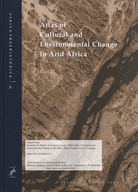
Reprint from<br />
Bubenzer, O., Bolten, A. & Darius, F. (eds.) (2007): Atlas of Cultural and<br />
Environmental Change in Arid Africa. Africa Praehistorica 21. Cologne.<br />
ISBN: 978-3-927688-32-2<br />
Cited literature see original publication<br />
Reference address: Heinrich-Barth-Institut e.V. / Jennerstr. 8 / D-50823 Köln<br />
http://www.uni-koeln.de/hbi/
±<br />
<br />
<br />
<br />
Stefan Kröpelin & Sven Oehm<br />
<strong>Wadi</strong> <strong>Howar</strong> <strong>National</strong> <strong>Park</strong><br />
Africa‘s largest country, the Republic of Sudan, has not one single operative protected area in its dry lands despite<br />
the fact that they form almost half of its territory and offer an outstanding potential for environmental and cultural<br />
conservation. For this reason, it has been suggested to create a national park centred at the <strong>Wadi</strong> <strong>Howar</strong>, the Nile’s once<br />
most important tributary from the Sahara, and to develop a strategy for sustainable tourism to preserve the natural and<br />
cultural heritage of the Sudanese desert (Kröpelin 1993b). As yet hardly affected by off-road tourism, the region offers<br />
some of the last occurrences of intact prehistoric surface sites in the Sahara. One main purpose of the proposal is the<br />
preservation and rehabilitation of the remaining fauna and vegetation. In the 1930s there was still abundant wild life<br />
including addax and oryx antelopes (Fig. 2). As a result of illicit hunting, apparently mostly by hunters from the Gulf<br />
states using modern vehicles and semiautomatic weapons, these species are now extinct (Fig. 3).<br />
As an outcome of ACACIA’s commitment to the protection<br />
of the natural and cultural heritage of northern Sudan,<br />
a joint Sudanese-German mission including Sudanese<br />
experts and scientists of the University of Cologne surveyed<br />
first time ever the entire course of <strong>Wadi</strong> <strong>Howar</strong> for<br />
the first in 1998 (Fig. 1). In several meetings, representatives<br />
of the population living south of <strong>Wadi</strong> <strong>Howar</strong> made<br />
constructive suggestions and expressed their support. The<br />
regional governments of the three northern states finally<br />
approved the proposal. As a result of these cooperative<br />
efforts, ‘<strong>Wadi</strong> <strong>Howar</strong> <strong>National</strong> <strong>Park</strong>’ (WHNP) was officially<br />
declared by the Sudanese government in 2000 (Fig. 4).<br />
According to the original proposal, the designated park<br />
area extends between latitudes 15°20‘ and 20°15‘ N, and<br />
longitudes 25°40‘ and 28°30‘ E. With a surface of more than<br />
100,000 km² it ranks among the largest protected areas on<br />
earth. Its south-north axis stretches some 550 km from the<br />
Sahelian zone to the hyperarid Saharan desert. The declaration<br />
was a crucial step forward in the attempt to prevent<br />
damage from northern Sudan’s rich archaeological sites<br />
by future off-road tourism and inappropriate industrial<br />
exploitation that have ravaged other Saharan regions. The<br />
development of the <strong>Wadi</strong> <strong>Howar</strong> area will enhance the<br />
country‘s tourist appeal and entail adequate infrastructure<br />
in the adjoining zones.<br />
The outstanding Jebel Rahib with its diverse landforms<br />
and rocks lies in the centre of the park near the<br />
former interior delta of Middle <strong>Wadi</strong> <strong>Howar</strong> (1). It should<br />
be emphasised as a ‘geopark’ to enhance the promotion<br />
of Sudan’s geological heritage, to educate the public at<br />
large in geological sciences and in environmental matters,<br />
and to ensure its sustainable development. Among other<br />
<br />
<br />
<br />
<br />
<br />
<br />
<br />
<br />
<br />
<br />
<br />
<br />
<br />
<br />
<br />
<br />
<br />
<br />
<br />
<br />
<br />
<br />
<br />
<br />
<br />
<br />
<br />
<br />
<br />
<br />
<br />
<br />
<br />
<br />
<br />
<br />
<br />
<br />
<br />
<br />
<br />
<br />
<br />
<br />
<br />
Fig. 1 Survey of the entire course of <strong>Wadi</strong> <strong>Howar</strong> by joint mission in 1998.<br />
122<br />
<br />
<br />
<br />
<br />
<br />
<br />
<br />
<br />
scenic highlights are the Meidob Hills with their volcanic<br />
landscape and Malha crater lake, the granite landscape<br />
north of Lower <strong>Wadi</strong> <strong>Howar</strong> (2), the sebkha of El Atrun<br />
with its traditional trona mining, and the oddly shaped<br />
mud deposits of Laqiya Arba’in. The groundwater-supported<br />
lake of Nukheila oasis represents the only natural<br />
lake of the Eastern Sahara south of the Qattara depression<br />
and the last remnant of the early Holocene lake period (3).<br />
Zolat el Hammad is a conspicuous group of sandstone<br />
hills and pillars west of Jebel Rahib and comprises the most<br />
important concentration of rock engravings in northwest<br />
Sudan apart from Jebel Ouenat (4). The petroglyphs include<br />
elephant, giraffe, antelopes, monkeys, lions, ostriches, barbary<br />
sheep as well as herds of presumably domestic long<br />
and short-horned cattle, dogs, and portrayals of humans.<br />
Most remarkable are the carefully worked engravings of<br />
rhinos closely associated with elongated human figures<br />
with round heads (5). These apparently most ancient depictions<br />
are unmatched in the Sudanese and Egyptian Sahara<br />
and are relevant in the context of Nilo-Saharan connections<br />
via the central <strong>Wadi</strong> <strong>Howar</strong> area, pointing to early cultural<br />
Fig. 2 Wild life in the 1930s.<br />
Fig. 3 Remains of illicit hunting.
1<br />
2<br />
3<br />
4<br />
5<br />
relations between the Lower <strong>Wadi</strong> <strong>Howar</strong>, the Chadian<br />
Ennedi and Erdi plateaus, and beyond (Kröpelin 2004).<br />
Highlights outside the park area such as the ‘desert<br />
forest’ in Upper <strong>Wadi</strong> <strong>Howar</strong> and the fortress in Lower<br />
<strong>Wadi</strong> <strong>Howar</strong> (cf. Kröpelin ‘The <strong>Wadi</strong> <strong>Howar</strong>’ this volume,<br />
photos (5) and (16) as well as the Sudanese part of Jebel<br />
Ouenat) also call for immediate protection as exclaves. If<br />
nothing is done in the very near future to protect the desert<br />
heritage of the <strong>Wadi</strong> <strong>Howar</strong> Region, then this generation<br />
will see the irreversible destruction of important natural<br />
and cultural resources to humanity.<br />
<br />
<br />
±<br />
<br />
<br />
!<br />
<br />
!<br />
<br />
<br />
<br />
<br />
!<br />
!<br />
<br />
<br />
!<br />
<br />
<br />
<br />
<br />
<br />
<br />
<br />
<br />
<br />
!<br />
<br />
<br />
<br />
<br />
<br />
<br />
!<br />
<br />
<br />
<br />
<br />
<br />
<br />
<br />
Fig. 4 ‘<strong>Wadi</strong> <strong>Howar</strong> <strong>National</strong> <strong>Park</strong>’ as officially declared by the Sudanese government in 2000.<br />
Landscape and land use<br />
123