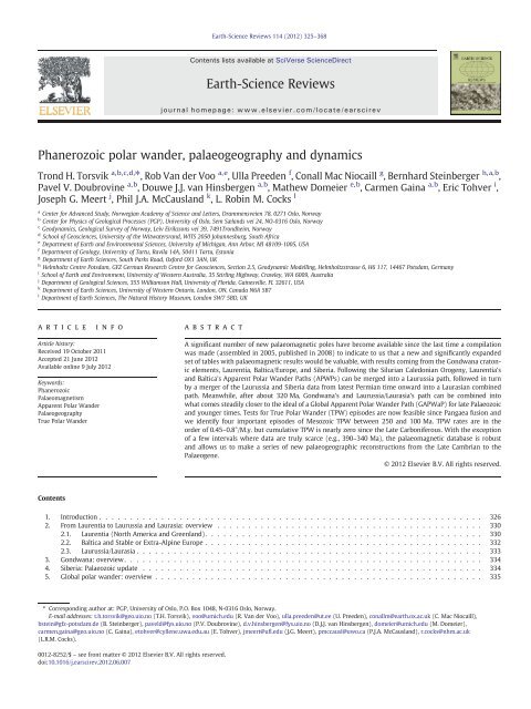
Phanerozoic polar wander, palaeogeography and dynamics
Phanerozoic polar wander, palaeogeography and dynamics
Phanerozoic polar wander, palaeogeography and dynamics

Create successful ePaper yourself
Turn your PDF publications into a flip-book with our unique Google optimized e-Paper software.
<strong>Phanerozoic</strong> <strong>polar</strong> <strong>w<strong>and</strong>er</strong>, <strong>palaeogeography</strong> <strong>and</strong> <strong>dynamics</strong><br />
Trond H. Torsvik a,b,c,d, ⁎, Rob Van der Voo a,e , Ulla Preeden f , Conall Mac Niocaill g , Bernhard Steinberger h,a,b ,<br />
Pavel V. Doubrovine a,b , Douwe J.J. van Hinsbergen a,b , Mathew Domeier e,b , Carmen Gaina a,b , Eric Tohver i ,<br />
Joseph G. Meert j , Phil J.A. McCausl<strong>and</strong> k , L. Robin M. Cocks l<br />
a<br />
Center for Advanced Study, Norwegian Academy of Science <strong>and</strong> Letters, Drammensveien 78, 0271 Oslo, Norway<br />
b<br />
Center for Physics of Geological Processes (PGP), University of Oslo, Sem Sæl<strong>and</strong>s vei 24, NO-0316 Oslo, Norway<br />
c<br />
Geo<strong>dynamics</strong>, Geological Survey of Norway, Leiv Eirikssons vei 39, 7491Trondheim, Norway<br />
d<br />
School of Geosciences, University of the Witwatersr<strong>and</strong>, WITS 2050 Johannesburg, South Africa<br />
e<br />
Department of Earth <strong>and</strong> Environmental Sciences, University of Michigan, Ann Arbor, MI 48109‐1005, USA<br />
f<br />
Department of Geology, University of Tartu, Ravila 14A, 50411 Tartu, Estonia<br />
g<br />
Department of Earth Sciences, South Parks Road, Oxford OX1 3AN, UK<br />
h<br />
Helmholtz Centre Potsdam, GFZ German Research Centre for Geosciences, Section 2.5, Geodynamic Modelling, Helmholtzstrasse 6, H6 117, 14467 Potsdam, Germany<br />
i School of Earth <strong>and</strong> Environment, University of Western Australia, 35 Stirling Highway, Crawley, WA 6009, Australia<br />
j Department of Geological Sciences, 355 Williamson Hall, University of Florida, Gainesville, FL 32611, USA<br />
k Department of Earth Sciences, University of Western Ontario, London, ON, Canada N6A 5B7<br />
l Department of Earth Sciences, The Natural History Museum, London SW7 5BD, UK<br />
article info<br />
Article history:<br />
Received 19 October 2011<br />
Accepted 21 June 2012<br />
Available online 9 July 2012<br />
Keywords:<br />
<strong>Phanerozoic</strong><br />
Palaeomagnetism<br />
Apparent Polar W<strong>and</strong>er<br />
Palaeogeography<br />
True Polar W<strong>and</strong>er<br />
Contents<br />
Earth-Science Reviews 114 (2012) 325–368<br />
abstract<br />
A significant number of new palaeomagnetic poles have become available since the last time a compilation<br />
was made (assembled in 2005, published in 2008) to indicate to us that a new <strong>and</strong> significantly exp<strong>and</strong>ed<br />
set of tables with palaeomagnetic results would be valuable, with results coming from the Gondwana cratonic<br />
elements, Laurentia, Baltica/Europe, <strong>and</strong> Siberia. Following the Silurian Caledonian Orogeny, Laurentia's<br />
<strong>and</strong> Baltica's Apparent Polar W<strong>and</strong>er Paths (APWPs) can be merged into a Laurussia path, followed in turn<br />
by a merger of the Laurussia <strong>and</strong> Siberia data from latest Permian time onward into a Laurasian combined<br />
path. Meanwhile, after about 320 Ma, Gondwana's <strong>and</strong> Laurussia/Laurasia's path can be combined into<br />
what comes steadily closer to the ideal of a Global Apparent Polar W<strong>and</strong>er Path (GAPWaP) for late Palaeozoic<br />
<strong>and</strong> younger times. Tests for True Polar W<strong>and</strong>er (TPW) episodes are now feasible since Pangaea fusion <strong>and</strong><br />
we identify four important episodes of Mesozoic TPW between 250 <strong>and</strong> 100 Ma. TPW rates are in the<br />
order of 0.45–0.8°/M.y. but cumulative TPW is nearly zero since the Late Carboniferous. With the exception<br />
of a few intervals where data are truly scarce (e.g., 390–340 Ma), the palaeomagnetic database is robust<br />
<strong>and</strong> allows us to make a series of new palaeogeographic reconstructions from the Late Cambrian to the<br />
Palaeogene.<br />
© 2012 Elsevier B.V. All rights reserved.<br />
1. Introduction . . . . . . . . . . . . . . . . . . . . . . . . . . . . . . . . . . . . . . . . . . . . . . . . . . . . . . . . . . . . . . 326<br />
2. From Laurentia to Laurussia <strong>and</strong> Laurasia: overview . . . . . . . . . . . . . . . . . . . . . . . . . . . . . . . . . . . . . . . . . . . 330<br />
2.1. Laurentia (North America <strong>and</strong> Greenl<strong>and</strong>). . . . . . . . . . . . . . . . . . . . . . . . . . . . . . . . . . . . . . . . . . . . . 330<br />
2.2. Baltica <strong>and</strong> Stable or Extra-Alpine Europe . . . . . . . . . . . . . . . . . . . . . . . . . . . . . . . . . . . . . . . . . . . . . 332<br />
2.3. Laurussia/Laurasia . . . . . . . . . . . . . . . . . . . . . . . . . . . . . . . . . . . . . . . . . . . . . . . . . . . . . . . . 333<br />
3. Gondwana: overview . . . . . . . . . . . . . . . . . . . . . . . . . . . . . . . . . . . . . . . . . . . . . . . . . . . . . . . . . . 334<br />
4. Siberia: Palaeozoic update . . . . . . . . . . . . . . . . . . . . . . . . . . . . . . . . . . . . . . . . . . . . . . . . . . . . . . . 334<br />
5. Global <strong>polar</strong> <strong>w<strong>and</strong>er</strong>: overview . . . . . . . . . . . . . . . . . . . . . . . . . . . . . . . . . . . . . . . . . . . . . . . . . . . . . 335<br />
⁎ Corresponding author at: PGP, University of Oslo, P.O. Box 1048, N-0316 Oslo, Norway.<br />
E-mail addresses: t.h.torsvik@geo.uio.no (T.H. Torsvik), voo@umich.edu (R. Van der Voo), ulla.preeden@ut.ee (U. Preeden), conallm@earth.ox.ac.uk (C. Mac Niocaill),<br />
bstein@gfz-potsdam.de (B. Steinberger), paveld@fys.uio.no (P.V. Doubrovine), d.v.hinsbergen@fys.uio.no (D.J.J. van Hinsbergen), domeier@umich.edu (M. Domeier),<br />
carmen.gaina@geo.uio.no (C. Gaina), etohver@cyllene.uwa.edu.au (E. Tohver), jmeert@ufl.edu (J.G. Meert), pmccausl@uwo.ca (P.J.A. McCausl<strong>and</strong>), r.cocks@nhm.ac.uk<br />
(L.R.M. Cocks).<br />
0012-8252/$ – see front matter © 2012 Elsevier B.V. All rights reserved.<br />
doi:10.1016/j.earscirev.2012.06.007<br />
Contents lists available at SciVerse ScienceDirect<br />
Earth-Science Reviews<br />
journal homepage: www.elsevier.com/locate/earscirev
326 T.H. Torsvik et al. / Earth-Science Reviews 114 (2012) 325–368<br />
6. Palaeogeography <strong>and</strong> plate speeds . . . . . . . . . . . . . . . . . . . . . . . . . . . . . . . . . . . . . . . . . . . . . . . . . . . . 336<br />
6.1. Early Palaeozoic (Cambrian to Silurian) . . . . . . . . . . . . . . . . . . . . . . . . . . . . . . . . . . . . . . . . . . . . . . 336<br />
6.2. Late Palaeozoic (Devonian to Permian) . . . . . . . . . . . . . . . . . . . . . . . . . . . . . . . . . . . . . . . . . . . . . . 338<br />
6.3. Mesozoic <strong>and</strong> Early Cenozoic (Triassic to Palaeogene) . . . . . . . . . . . . . . . . . . . . . . . . . . . . . . . . . . . . . . . 340<br />
7. True Polar W<strong>and</strong>er (TPW). . . . . . . . . . . . . . . . . . . . . . . . . . . . . . . . . . . . . . . . . . . . . . . . . . . . . . . . 343<br />
7.1. TPW since Pangaea assembly . . . . . . . . . . . . . . . . . . . . . . . . . . . . . . . . . . . . . . . . . . . . . . . . . . . 343<br />
7.2. TPW: influence on APW rates <strong>and</strong> net lithosphere rotation . . . . . . . . . . . . . . . . . . . . . . . . . . . . . . . . . . . . . 345<br />
8. Conclusions <strong>and</strong> future outlook . . . . . . . . . . . . . . . . . . . . . . . . . . . . . . . . . . . . . . . . . . . . . . . . . . . . . 358<br />
Acknowledgements . . . . . . . . . . . . . . . . . . . . . . . . . . . . . . . . . . . . . . . . . . . . . . . . . . . . . . . . . . . . . 363<br />
Appendix 1. Computing TPW in the absence of hotspot tracks . . . . . . . . . . . . . . . . . . . . . . . . . . . . . . . . . . . . . . . . 363<br />
References . . . . . . . . . . . . . . . . . . . . . . . . . . . . . . . . . . . . . . . . . . . . . . . . . . . . . . . . . . . . . . . . . 363<br />
1. Introduction<br />
Since the advent of the underst<strong>and</strong>ing of plate tectonics, Earth scientists<br />
have wanted to know where the continents lay in past ages,<br />
partly from curiosity, but partly so as to underst<strong>and</strong> biodiversity, climate<br />
change <strong>and</strong> where best to search for natural resources. The<br />
chief tool in deciphering <strong>palaeogeography</strong> has been <strong>and</strong> remains<br />
palaeomagnetism, the study of the Earth's magnetic field preserved<br />
in rocks. The Earth's ancient magnetic field has provided one of the<br />
most fundamental markers used to document the motion of the<br />
continents <strong>and</strong> evolution of the Earth. Changes in ancient magnetic<br />
<strong>polar</strong>ity at irregular intervals are recorded in the surface rock record,<br />
<strong>and</strong> over some fifty years, palaeomagnetic data have been used to<br />
create the geomagnetic time scale, to firmly document seafloor<br />
spreading, to validate plate tectonics, <strong>and</strong> to reconstruct vanished<br />
supercontinents.<br />
Palaeomagnetic results can conveniently be expressed in terms<br />
of palaeopoles that are calculated using the geocentric axial dipole<br />
field model. In turn, those palaeopoles can be used to construct<br />
Apparent Polar W<strong>and</strong>er Paths (APWPs). This way, instead of plotting<br />
the motion of a continent while holding the rotation axis<br />
fixed, the motion of the <strong>polar</strong> axis relative to the continent is<br />
visualised (Fig. 1). The motion of continents relative to the Earth's<br />
spin axis may be either due to the drift of individual continents or<br />
due to a rotation of the entire Earth relative to its spin axis — the<br />
latter is called True Polar W<strong>and</strong>er (TPW). Creer, Irving <strong>and</strong> Runcorn<br />
were the first to publish an APWP for ‘Europe’ as early as 1954<br />
(Creer et al., 1954), based on late Precambrian to Eocene<br />
palaeomagnetic poles from Britain. Those poles all differed markedly<br />
from the present-day pole <strong>and</strong> were interpreted at first as due to<br />
a slow change in the axis of rotation of the Earth with respect to its<br />
surface, i.e. TPW. Two years later, however, Runcorn (1956) published<br />
an APWP for North America <strong>and</strong> this allowed him to compare<br />
the European <strong>and</strong> North American paths. He noted that they were<br />
broadly similar in shape, but some 30° apart in longitude, which<br />
he interpreted as caused by the opening of the modern Atlantic.<br />
This was the first independent geophysical evidence for ‘continental<br />
drift’ (sensu Wegener, 1912).<br />
Fig. 1. In (a) the situation depicted is that of a moving continent <strong>and</strong> a fixed <strong>polar</strong> axis; this used to be called “continental drift” before the term “plate tectonics” took over. As the<br />
continent drifts steadily northward during the last 60 million years, the magnetic field direction at a site in the continent gets recorded by rocks, which then retain a memory of<br />
these changing directions (declination <strong>and</strong> inclination) as a function of time. In (b) the situation is that the continent stays fixed, but that the <strong>polar</strong> axis is left to <strong>w<strong>and</strong>er</strong> while following<br />
a path called Apparent Polar W<strong>and</strong>er Path. The word “apparent” denotes the caution that this <strong>w<strong>and</strong>er</strong>ing may or may not be real <strong>and</strong> that in reality the situation could be as<br />
in (a). The sequential locations of the poles are calculated from the declinations <strong>and</strong> inclinations in the Indian rocks. If all continents show the same Apparent Polar W<strong>and</strong>er Path,<br />
then they shared the same coherent motion with respect to the pole. In that case, it is warranted to call the path a True Polar W<strong>and</strong>er Path. Figure is based on Tauxe (2009) but here<br />
we show palaeomagnetic poles (60, 40 <strong>and</strong> 20 Ma) <strong>and</strong> reconstructions of India based on the global APWP developed in this paper. Stereographic (Wulff) projection.
If the relative positions of a number of continents are reasonably<br />
well known, all being defined in the same plate circuit, then<br />
palaeomagnetic data from these continents can be combined into a<br />
Global APWP (GAPWaP). Widely used GAPWaP's have been published<br />
by Besse <strong>and</strong> Courtillot (2002) covering the last 200 M.y. <strong>and</strong> by<br />
Torsvik et al. (2008a) starting at 320 Ma when the supercontinent Pangaea<br />
began to be assembled. Conventional palaeomagnetic reconstructions<br />
constrain ancient latitudes <strong>and</strong> orientations (rotations) of<br />
continents, but not their palaeolongitudes. This allows a degree of freedom<br />
in making palaeogeographic models unless additional information<br />
is available that constrains palaeolongitude. Such information can<br />
sometimes be provided by choosing a reference plate that has remained<br />
stationary (or quasi-stationary) with respect to longitude. In other<br />
words, if there is a reason to suppose that a specific continent has<br />
moved little in an east–west sense since the time represented by the reconstruction,<br />
that continent can be used as the reference plate. Other<br />
continents, partnering in the same plate circuit, will then be seen to occupy<br />
their own palaeo-longitudinal positions relative to the deep mantle.<br />
Because Africa meets the criteria required of a reference plate, at<br />
least since Pangaea breakup (Burke <strong>and</strong> Torsvik, 2004; Torsvik et al.,<br />
2008a,b), we can tie all other continental motions to a ‘fixed’ African<br />
plate. This is important for estimating TPW (Section 7) <strong>and</strong> to develop<br />
semi-absolute reference frames from palaeomagnetic data.<br />
Building on the GAPWaP of Torsvik et al. (2008a) we present two<br />
different GAPWaP's for the past 320 million years (M.y.): (1) One<br />
without TPW correction to be used in classical palaeo-geographic/<br />
-climatic reconstructions <strong>and</strong> as reference frame for new<br />
palaeomagnetic data, where the true relation to the spin-axis is imperative,<br />
<strong>and</strong> (2) one with TPW correction that leads to a smoother<br />
plate model that only describes ‘continental drift’, <strong>and</strong> that must be<br />
used, for example, to calculate net lithosphere rotation (Section 7)<br />
or to compare surface processes with heterogeneities in the deepest<br />
mantle (Torsvik et al., 2010a).<br />
In addition to the construction of a new <strong>and</strong> more robust GAPWaP,<br />
back to the time when Pangaea assembled, we also construct new<br />
Palaeozoic APWPs for Gondwana, Laurentia, Baltica <strong>and</strong> Siberia back<br />
to the dawn of the <strong>Phanerozoic</strong>. After the Silurian Caledonian<br />
T.H. Torsvik et al. / Earth-Science Reviews 114 (2012) 325–368<br />
Fig. 2. World map with palaeomagnetic sampling sites for palaeomagnetic poles used in the present data compilation (Table 1). Their symbols <strong>and</strong> colours are differentiated by<br />
geological eras. Thin black lines are old terrane boundaries. Palaeomagnetic data are excluded from white areas. The oceanic areas show present day plate boundaries draped on<br />
satellite bathymetry (Smith <strong>and</strong> S<strong>and</strong>well, 1997). MAD = Madagascar, DML = Dronning Maud L<strong>and</strong>, NZ = New Zeal<strong>and</strong>, TS = Tasmania, K = Kerguelen.<br />
Orogeny we can combine palaeomagnetic data from Laurentia <strong>and</strong><br />
Baltica to produce a joint APWP for Laurussia.<br />
Asian blocks such as North <strong>and</strong> South China, the Tibetan blocks,<br />
Tarim, Annamia (Indochina), Kolyma–Omolon, Kazakhstania elements,<br />
Sunda blocks, <strong>and</strong> Tethyan (Cimmerian) terranes are not represented<br />
<strong>and</strong> are left white in Fig. 2, because tectonic activity, such as<br />
local rotation <strong>and</strong> intense deformation, introduces too much noise in<br />
the construction of their APWPs.<br />
Palaeomagnetic data (Figs. 2–3; Table 1) were compiled <strong>and</strong> graded<br />
according to Van der Voo's classification system (Van der Voo,<br />
1990, 1993), <strong>and</strong> rotated with a given continent to its reconstructed<br />
position; rotation parameters (e.g., Table 2) for most of the relative<br />
fits follow Torsvik et al. (2008a) unless noted in the text. Only<br />
palaeomagnetic data with a quality factor Q≥3 (Van der Voo, 1990)<br />
Fig. 3. Age frequency histogram (10 Myr bins) of palaeomagnetic poles (Table 1) compiled<br />
in this study. Poles are subdivided into those obtained from detrital sedimentary<br />
rocks (labelled “clastics”) <strong>and</strong> those of volcanic rocks/limestone. Note the near-total<br />
absence of reliable palaeomagnetic poles for Early Carboniferous (350–360 Ma) <strong>and</strong><br />
Mid-Devonian (380–390 Ma) times.<br />
327
328 T.H. Torsvik et al. / Earth-Science Reviews 114 (2012) 325–368
are used, but palaeomagnetic poles that knowingly fail the assumption<br />
that the magnetisation age equals the actual rock age are not included<br />
in our analysis. Our procedures to generate APWPs (either<br />
running mean or spherical spline paths; Jupp <strong>and</strong> Kent, 1987) are detailed<br />
in Torsvik et al. (1992, 1996, 2008a). Running mean paths are<br />
non-weighted whereas input poles in all spherical spline paths were<br />
weighted by Van der Voo's (1990) quality factor Q (Table 1). Instead<br />
of weighting the data by 95% confidence ovals (α 95, “criterion 2” in<br />
Van der Voo's classification system) we weighted by 7/Q. This causes<br />
the smooth path to pass close to the data which score “7” (fullmarks).<br />
Van der Voo <strong>and</strong> Torsvik (2004) analysed the APWP of Baltica/<br />
Stable Europe for Permian times, paying particular attention to aspects<br />
that could introduce a systematic bias. They identified three<br />
problems: (1) palaeopoles from some (but not all) detrital sedimentary<br />
rocks exhibited a palaeolatitudinal offset when compared to<br />
latitudes calculated from coeval igneous rocks (e.g., Estérel results,<br />
Zijderveld, 1975), (2) palaeopoles based on outmoded demagnetisation<br />
methodologies revealed a minor bias with respect to results obtained by<br />
principal component analysis (e.g., Kirschvink, 1980; Kent et al.,<br />
1983), <strong>and</strong> (3) palaeopoles associated with dubious or no radiometric<br />
age dating revealed a bias of some 10° on average with respect to<br />
results based on 40 Ar/ 39 Ar or U/Pb methods. Importantly, observation<br />
(3) produced the most substantial bias. It is not (yet) feasible<br />
to remedy the bias of items (2) <strong>and</strong> (3) by omission of potentially<br />
flawed data, because too many gaps would occur in the temporal<br />
T.H. Torsvik et al. / Earth-Science Reviews 114 (2012) 325–368<br />
Fig. 5. The outline of Laurussia, plotted on a ca. 420 Ma reconstruction. Area of Caledonide orogenic deformation is tinted light brown, <strong>and</strong> the white lines from east Greenl<strong>and</strong> to Scotl<strong>and</strong> <strong>and</strong><br />
in Norway represent the Caledonide Nappe Front. FJL, Franz Josef L<strong>and</strong>; IS, Iapetus Suture; NZ, Novaya Zemlya; SVB, Svalbard; WI, Wrangel Isl<strong>and</strong>. Simplified from Cocks <strong>and</strong> Torsvik (2011).<br />
sequences of the APWPs. We can (<strong>and</strong> do here) remedy the situation<br />
of bias (1) by correcting for (inferred) inclination errors in all<br />
results obtained from detrital sedimentary rocks. Similar efforts<br />
have begun to be applied in other studies (e.g., Tauxe <strong>and</strong> Kent,<br />
2004; Kent <strong>and</strong> Tauxe, 2005; Yan et al., 2005; Kodama, 2009;<br />
Bilardello <strong>and</strong> Kodama, 2010a; Kent <strong>and</strong> Irving, 2010; Domeier et<br />
al., 2011a), <strong>and</strong> are likely to become st<strong>and</strong>ard in the very near<br />
future.<br />
Inclination (I) error in sediments is latitude dependent <strong>and</strong> antisymmetric.<br />
This bias closely mimics errors produced by octupole<br />
fields of the same sign as the dipole field (Rochette <strong>and</strong> V<strong>and</strong>amme,<br />
2001; Torsvik <strong>and</strong> Van der Voo, 2002; Tauxe, 2005; Domeier et al.,<br />
2012). The degree of inclination shallowing depends on rock type<br />
<strong>and</strong> remanence acquisition/shallowing mode. Inclination shallowing<br />
is commonly predicted from:<br />
tanðINCObservedÞ ¼ f tanðINCFieldÞ; where INC is the inclination <strong>and</strong> f is the degree of inclination error<br />
(King, 1955) — In this paper all detrital sedimentary poles have been<br />
corrected for inclination shallowing using a commonly observed f value<br />
of 0.6, unless inclination shallowing was corrected for by the original authors<br />
using the Tauxe <strong>and</strong> Kent (2004) E/I method or the magnetic fabric<br />
method of Kodama (2009) — this is a little more conservative than f<br />
values derived from laboratory experiments (0.4–0.55; King, 1955,<br />
Løvlie <strong>and</strong> Torsvik, 1984; Tauxe <strong>and</strong> Kent, 1984). Correcting detrital<br />
Fig. 4. (a) <strong>Phanerozoic</strong> time scale <strong>and</strong> icehouse (cold) vs. greenhouse (hot) conditions. (b) Schematic evolution for the formation <strong>and</strong> break-up of Pangaea (main continental<br />
players): The bulk of Pangaea formed by collision of Gondwana <strong>and</strong> Laurussia (Laurentia <strong>and</strong> Baltica/Avalonia that fused in the Mid Silurian) in the Late Carboniferous followed<br />
by Siberia in Late Permian–Triassic times. First major break-up was witnessed by the Early Jurassic opening of the Central Atlantic <strong>and</strong> separation of Gondwana <strong>and</strong> Laurasia.<br />
The Pangaea 250 Ma reconstruction is an ‘absolute’ reconstruction with l<strong>and</strong>, shelf <strong>and</strong> a modelled oceanic age grid (red is young, blue is old oceanic crust). Distribution of Siberian<br />
Trap rocks shown in yellow. The top reconstruction is for 150 Ma (relative to SAFR, southern Africa, held fixed) <strong>and</strong> is also shown with an oceanic age grid. SAFR serves as the reference<br />
continent relative to which the motion of all other plates is determined since Pangaea formation (ca. 320 Ma). Laurasia, West- <strong>and</strong> East-Gondwana continental elements<br />
shown with light brown, grey <strong>and</strong> dark grey shading. Abbreviations: EUR, stable Europe; GRE, Greenl<strong>and</strong>; NAM, North America; NWAFR, northwest Africa; NEAFR, northeast Africa;<br />
ARAB, Arabia; SOM, Somalia; AMA, Amazonia (South America); PAR, Parana; COL, Colorado; PAT, Patagonia; IND, India; MAD, Madagascar; EANT, East Antarctica; AUS, Australia;<br />
ATA, Armorican Terrane Assemblage. (c) Continental (latitude) mass centre calculated from our plate polygon model. Mass centre calculation also includes the areas of submerged<br />
continental crust between coastlines <strong>and</strong> the continent–ocean boundary [e.g., light grey areas in 150 Ma reconstruction in (b)].<br />
329
330 T.H. Torsvik et al. / Earth-Science Reviews 114 (2012) 325–368<br />
Fig. 6. (a) 95% confidence ovals for Laurentian input poles (white shading) <strong>and</strong> a fitted spherical spline path. The spline path is moderately smoothed (smoothing factor=300) <strong>and</strong><br />
input poles have been weighted by their Q-factor (see Torsvik et al., 1992, 1996 for procedure). Detrital sedimentary input poles <strong>and</strong> spline path are shown after correction for potential<br />
I-errors (flattening factor f of 0.6). (b) Running Mean path (20 M.y. window) shown with A95 ovals (grey shading) after I-error correction (black thick lines with ages in million<br />
years) <strong>and</strong> a running mean path without correction for inclination shallowing (black stippled line with no A95's). A95 or dp/dm ovals are white about a given palaeomagnetic<br />
pole if it is the only entry for its bin. Dark grey dots (black curve) are purely interpolated mean poles. The recommended APWP is the spline path in (a). Orthogonal projection.<br />
sediments with an f value of 0.6 amounts to a maximum latitude correction<br />
of 14.5° (1600 km) at around 50° N/S. This is comparable to<br />
the effects of octupole contributions as high as 22%. All detrital sedimentary<br />
sequences used in the spline fits in our paper are corrected<br />
for inclination shallowing.<br />
In total, our <strong>Phanerozoic</strong> palaeomagnetic data compilation includes<br />
626 poles (Table 1). For analysis <strong>and</strong> visualisation we primarily<br />
used the GMAP software (Torsvik <strong>and</strong> Smethurst, 1999) in addition to<br />
GMT (Wessel <strong>and</strong> Smith, 1991). A new <strong>and</strong> improved version of<br />
GMAP will be made available in 2012 (work in progress) along with<br />
all our palaeomagnetic data in digital GMAP <strong>and</strong> GPlates (www.<br />
gplates.org; Boyden et al., 2011) format.<br />
2. From Laurentia to Laurussia <strong>and</strong> Laurasia: overview<br />
The Palaeozoic continent Laurentia is represented largely by<br />
cratonic North America, but also includes Greenl<strong>and</strong>, Ellesmere<br />
<strong>and</strong> parts of present-day Europe (e.g., Scotl<strong>and</strong>, NW Irel<strong>and</strong> <strong>and</strong><br />
Svalbard). It was drifting independently until collision with Baltica<br />
<strong>and</strong> Avalonia produced the Caledonian Orogeny at 430–420 Ma<br />
(Figs. 3–4). Laurentia then became the western portion of Laurussia,<br />
which in turn became part of the Pangaea Supercontinent during the<br />
Late Carboniferous (Cocks <strong>and</strong> Torsvik, 2011). By Late Permian<br />
times, Siberia had essentially joined Baltica, <strong>and</strong> along with other<br />
European <strong>and</strong> Asian elements, the combined continent is referred<br />
to as Laurasia.<br />
2.1. Laurentia (North America <strong>and</strong> Greenl<strong>and</strong>)<br />
Due to a steadily growing palaeomagnetic database, many<br />
updated APWPs have been published in the past 50 years for North<br />
America (e.g., Irving, 1964, 1979; Runcorn, 1965; Hospers <strong>and</strong> Van<br />
Andel, 1968; McElhinny, 1973; Van der Voo <strong>and</strong> French, 1974; Van<br />
der Voo, 1981, 1990; Irving <strong>and</strong> Irving, 1982; Mac Niocaill <strong>and</strong><br />
Smethurst, 1994). Compared to earlier compilations for the<br />
Palaeozoic by Torsvik et al. (1996) <strong>and</strong> for late Palaeozoic<br />
(b320 M.y.) <strong>and</strong> younger times (Torsvik et al., 2008a), we have<br />
included 64 additional poles in the present compilation. Most are<br />
based on new studies but some are ‘old’ sedimentary poles corrected<br />
for I-error using the inclination–elongation method of Tauxe <strong>and</strong> Kent<br />
(2004) or the anisotropy of magnetic susceptibility information<br />
(Kodama, 2009).<br />
Our pole collection from the <strong>Phanerozoic</strong> of Laurentia (North<br />
America <strong>and</strong> Greenl<strong>and</strong>) includes 195 poles ranging in age from 0.5<br />
to 532 Ma (Table 1). Poles from Greenl<strong>and</strong> have been rotated to account<br />
for seafloor spreading in the Labrador Sea/Baffin Bay<br />
(67→33 Ma) as well as pre-drift extension back to Cretaceous<br />
(Barremian) times (Table 2). Most poles from North America are<br />
from the cratonic core (Figs. 2 <strong>and</strong> 5) except for a few poles derived<br />
from young rocks that accreted to North America during the Mesozoic/<br />
Cenozoic (Table 1).<br />
A moderately smoothed spherical spline path in 10 M.y. intervals,<br />
with results from detrital sedimentary rocks corrected for<br />
I-error along with their associated 95% confidence ovals (based on<br />
α95) or A95 (rare; see Table 1) for the input poles is shown in<br />
Fig. 6a (Table 3). We also show a running mean path (Fig. 6b)<br />
with or without correction for I-error (thick black line with 95<br />
ovals, or black stippled line in Fig. 6b, respectively). The different<br />
APW paths show gross similarities: keeping North America fixed,<br />
<strong>and</strong> using the present-day distribution of continents as a descriptive<br />
reference, the South Pole was located in NW Africa in the Cambrian,<br />
it had moved to South America (Brazil–Ecuador) by the Early Devonian,<br />
followed by southward movement <strong>and</strong> arrival to the east of<br />
Patagonia (southernmost South America) by Permian <strong>and</strong> early Mesozoic<br />
times. The South Pole has stayed close to Antarctica since the<br />
Late Triassic, but with a pronounced easterly trend during the Jurassic<br />
(~200–140 Ma), followed by the well-known Cretaceous<br />
still-st<strong>and</strong> (120–60 Ma, marked by white oval). The Jurassic trend<br />
is dominated by a TPW signal (Steinberger <strong>and</strong> Torsvik, 2008 <strong>and</strong><br />
Section 7).<br />
Data-coverage is notably poor for Laurentia between 340 <strong>and</strong><br />
400 Ma, implying that the running mean poles for 350–360 Ma<br />
<strong>and</strong> 380–390 Ma (dark grey dots in Fig. 6b) are all interpolated;<br />
this is the so-called Siluro-Devonian cusp that has previously been
interpreted as TPW (Van der Voo, 1994). The paucity of data in this<br />
section of the APWP results in markedly different ‘fits’ between the<br />
spline-fitted <strong>and</strong> running mean methods. The effect of correcting<br />
detrital sedimentary rock results for I-error can also be seen in<br />
Fig. 6b: On average the great-circle difference (GCD) between a<br />
T.H. Torsvik et al. / Earth-Science Reviews 114 (2012) 325–368<br />
Fig. 7. (a) 95% confidence ovals for Baltica/Stable Europe input poles (white shading) <strong>and</strong> a fitted spherical spline path. The spline path is moderately smoothed (smoothing factor=300)<br />
<strong>and</strong> input poles have been weighted by their Q-factor. Detrital sedimentary input poles <strong>and</strong> spline path shown after correction for potential inclination shallowing.<br />
Inset map shows Cambrian <strong>and</strong> Early Ordovician path segments based on spline fitting. (b) Running Mean path shown with A95 ovals (grey shading) after sedimentary inclination<br />
correction (black thick lines with ages in million years) <strong>and</strong> a running mean path without correction for inclination shallowing (black stippled line with no A95's). A95 or dp/dm<br />
ovals are white about a given palaeomagnetic pole if it is the only entry for its bin. Dark grey dots (black thick curve) are purely interpolated mean poles. The recommended APWP is<br />
the spline path in (a). Orthogonal projection.<br />
pair of coeval poles from each of the two paths is small (2.8 ±<br />
2.9°; mean <strong>and</strong> st<strong>and</strong>ard deviation), but the Late Jurassic–Early Cretaceous<br />
(140–160 Ma) <strong>and</strong> Late Devonian (360–370 Ma) APWP<br />
segments show larger <strong>and</strong> more systematic differences of as much<br />
as 8–11°. Although the GCD is always greater than or equal to<br />
Fig. 8. (a) Running Mean paths for Baltica/Stable Europe <strong>and</strong> Laurentia (rotated to European co-ordinates), shown with A95 ovals. Dark grey dots are purely interpolated mean<br />
poles. Both paths are corrected for inclination shallowing in detrital sedimentary rocks (b) Same as (a) but not corrected for inclination shallowing <strong>and</strong> shown without A95s.<br />
(c) Great-circle distance (GCD) between poles of the same age from Baltica/Stable Europe <strong>and</strong> Laurentia with (black line) <strong>and</strong> without (grey thick line) correction for potential inclination<br />
shallowing.<br />
331
332 T.H. Torsvik et al. / Earth-Science Reviews 114 (2012) 325–368<br />
Fig. 9. (a) Combined spline path (smoothing 300, Q-factor weighted) for Laurussia <strong>and</strong> Laurasia (after 250 Ma). (b) Running Mean paths for Laurussia/Laurasia shown with (black<br />
line with grey A95s) <strong>and</strong> without (black stippled line) correction for inclination shallowing. Dark grey dots are purely interpolated mean poles. White oval represent a single dp/dm<br />
oval (Catskill Formation South pole, Table 1). The recommended APWP is the spline path in (a).<br />
zero, <strong>and</strong> hence its distribution is not truly Gaussian, we nevertheless<br />
use the normal definition of st<strong>and</strong>ard deviation as a simple<br />
means of describing the variance.<br />
Statistically (in this case) there is no significant change in A95's<br />
but the inclination-corrected path is considerably smoother than the<br />
non-corrected one. More importantly, the systematically higher<br />
corrected-pole latitudes during the Jurassic become important when<br />
comparing the Laurentia APWP with Europe/Baltica <strong>and</strong> Gondwana<br />
(Sections 2.3, 3). The spline <strong>and</strong> running mean paths (both I-error<br />
corrected) differ on average by 1.9±1.4° with a peak difference of<br />
6.2° during the Middle Cambrian (Table 3).<br />
2.2. Baltica <strong>and</strong> Stable or Extra-Alpine Europe<br />
Numerous APW paths have been published for Baltica <strong>and</strong> its<br />
younger incarnations (e.g., Stable or Extra-Alpine Europe) over the<br />
past decades. Our present compilation includes 167 palaeomagnetic<br />
poles (0.5–535 Ma), 44 more than in our previous 2005 compilation<br />
(Torsvik et al., 2008a), but nine of these poles are from stable Siberia<br />
<strong>and</strong> one Early Cretaceous pole is from peri-Siberia (Mongolia). Siberia<br />
was quasi-stable in its position relative to Baltica/Laurussia between<br />
Late Triassic <strong>and</strong> Early Jurassic times, but the estimated correction is<br />
so small (a few degrees around an Euler pole of 77°N <strong>and</strong> 144.6°E;<br />
Buiter <strong>and</strong> Torsvik, 2007) that we include the few Siberian poles<br />
(mostly Siberian Traps, ~251 Ma poles) from the Permo–Triassic<br />
boundary <strong>and</strong> onwards in our compilation. Cambrian <strong>and</strong> Ordovician<br />
poles are exclusively from Baltica but for Silurian (~430 Ma) <strong>and</strong><br />
younger times we progressively include more <strong>and</strong> more poles from<br />
areas that can be characterised as having become part of Stable Europe.<br />
The oldest of these ‘Stable’ Europe poles are from Scotl<strong>and</strong> <strong>and</strong><br />
were derived from undeformed Silurian granites (‘Newer’ Granites)<br />
<strong>and</strong> Lower Devonian volcanics that postdate Iapetus closure across<br />
the British Caledonide sector. Poles from these rocks also compare<br />
well with similar-aged poles from the core of Baltica (Torsvik et al.,<br />
1996).<br />
The Baltica/Europe APWP (Fig. 7, 355° in GCD length) is considerably<br />
longer than the Laurentian APWP (269°), owing to widely separated<br />
Cambrian <strong>and</strong> Ordovician palaeopoles from Baltica/Europe (the<br />
cumulate APW is measured here from the respective spline paths).<br />
With respect to a fixed Baltica/Europe, the mean South Poles for the<br />
Cambrian (Fig. 7b) are located in Arctic Siberia, followed by a drift<br />
of the pole over Arabia <strong>and</strong> Central Africa in the Ordovician to the<br />
Fig. 10. Outline of Gondwana <strong>and</strong> peri-Gondwana, plotted on a 480 Ma reconstruction. Black<br />
lines are old terrane boundaries. Our palaeomagnetic compilation is only derived from areas<br />
shaded in dark green <strong>and</strong> does not include Ordovician data from peri-Gondwana terranes<br />
(e.g. Avalonia <strong>and</strong> ATA). ATA = Amorican Terrane Assemblage; MBL = Marie Bird L<strong>and</strong>;<br />
FI = Falkl<strong>and</strong> Isl<strong>and</strong>s; DML = Dronning Maud L<strong>and</strong>; MAD = Madagascar.<br />
After Torsvik <strong>and</strong> Cocks (2011).
Atlantic off the NE corner of Brazil in the Siluro-Devonian cusp. We<br />
recall that this cusp was also seen in Laurentia's APWP. Subsequent<br />
southward movement brought the South Pole near Patagonia in the<br />
Triassic, after which the pole remained close to Antarctica in the<br />
Jurassic.<br />
Spline <strong>and</strong> running mean APWPs are grossly similar (3.5±3.5°)<br />
but differences can be as much as ~19° in the Early Ordovician<br />
(Table 4), given the rapid <strong>and</strong> significant shift of the mean poles between<br />
510 <strong>and</strong> 430 Ma. Running mean paths, corrected as well as<br />
uncorrected for I-error differ on average by 1.4±2.8° but this reaches<br />
values between 7 <strong>and</strong> 14° in Cambrian–Early Ordovician times. As<br />
was the case for Laurentia, there are very few poles between 400<br />
<strong>and</strong> 310 Ma <strong>and</strong> the Mid-Devonian to Late Carboniferous APW segment<br />
is thus largely interpolated.<br />
2.3. Laurussia/Laurasia<br />
Laurentia (including Scotl<strong>and</strong> <strong>and</strong> Greenl<strong>and</strong>) collided with<br />
Baltica <strong>and</strong> Avalonia at ~430 Ma (Figs. 4–5) <strong>and</strong> from then on we<br />
can combine Laurentia <strong>and</strong> Baltica/Stable Europe poles into one<br />
APWP with the correction for younger pre-drift extension <strong>and</strong> the<br />
opening of the North Atlantic Ocean in early Palaeogene time.<br />
Avalonia's results from Lower <strong>and</strong> Middle Palaeozoic rocks, possibly<br />
having suffered local or regional rotations (Torsvik et al.,<br />
1993), are not included in our current analysis. From 251 Ma<br />
T.H. Torsvik et al. / Earth-Science Reviews 114 (2012) 325–368<br />
Fig. 11. (a) 95% confidence ovals for Gondwana input poles in Southern Africa co-ordinates (white shading) <strong>and</strong> a fitted spherical spline path. The spline path uses a smoothing<br />
factor of 500 <strong>and</strong> input poles are weighted by their Q-factor. Spline path shown after correction for potential inclination shallowing. (b) Running Mean path (20 Myr window)<br />
shown with A95 ovals (grey shading) after sedimentary inclination correction (black thick lines with ages in million years) <strong>and</strong> a running mean path without correction for inclination<br />
shallowing (black stippled line with no A95s). White A95 ovals are dp/dm ovals from a single palaeomagnetic pole. Dark grey dots (black curve) are purely interpolated<br />
mean poles. The recommended APWP is the spline path in (a). Orthogonal projection.<br />
onwards we also include poles from Siberia as part of the larger<br />
Laurasian continent.<br />
A fit publishedbyBullard et al. (1965) is typically preferred for<br />
rotation of North American poles into European coordinate (or<br />
vice versa); this fit (Euler pole latitude =88.5°N, longitude =<br />
27.7°E, angle=−38.0°) matches poles quite well, but leads to a<br />
rather loose fit between the opposing continental edges in the NE<br />
Atlantic. Torsvik et al. (2001, 2008a) have therefore proposed<br />
more geologically plausible (<strong>and</strong> tighter) fits that can account for<br />
the pre-drift extension history along the opposing Norwegian <strong>and</strong><br />
Greenl<strong>and</strong> margins. In this paper we use a tight mid–late<br />
Palaeozoic–early Mesozoic fit ofTorsvik et al. (2006), elaborated<br />
in Alvey (2009 <strong>and</strong> manuscript in preparation) <strong>and</strong> Domeier et al.<br />
(2012), <strong>and</strong> tested/confirmed by estimates of lithosphere stretching<br />
based on gravity inversion <strong>and</strong> seismic refraction data (Alvey,<br />
2009). This ‘tighter’ fit (seeninFig. 5) is broadly similar to that<br />
used by Torsvik et al. (2008a), which was based on a 2005<br />
plate-circuit compilation. Reconstruction parameters for Europe<br />
vs. North America <strong>and</strong> Greenl<strong>and</strong> are listed in 5 Myr intervals in<br />
Table 2. The Cenozoic spreading history for both the NE Atlantic<br />
<strong>and</strong> the Labrador Sea follows that of Gaina et al. (2002) <strong>and</strong> Gaina's<br />
unpublished data (listed in Torsvik et al., 2008a).<br />
After adjusting for seafloor spreading <strong>and</strong> pre-drift extension in<br />
the North Atlantic realm, the APWPs for Laurentia <strong>and</strong> Baltica/Europe<br />
resemble each other quite well, except for (1) the Late Carboniferous–Early<br />
Permian (note discordant 310–290 mean poles in Fig. 8a)<br />
333
334 T.H. Torsvik et al. / Earth-Science Reviews 114 (2012) 325–368<br />
Fig. 12. (a) Revised APWP for Siberia (after Cocks <strong>and</strong> Torsvik, 2007). Spline path with<br />
smoothing parameter of 300 <strong>and</strong> Q-factor weighted input poles. This path is based on<br />
one new Silurian pole (433 Ma; Shatsillo et al., 2007) <strong>and</strong> elimination of two<br />
similar-aged <strong>and</strong> less reliable poles from Siberia (see text). The Siberian spline path<br />
(black thick line) is compared with the spline path for Baltica (Fig. 7a).<br />
<strong>and</strong> (2) the Jurassic–Early Cretaceous. In the latter case, Laurentian<br />
poles systematically plot at lower latitudes, a problem noted in numerous<br />
papers (e.g., Van der Voo, 1992; Courtillot et al., 1994). We<br />
note that correcting clastics for I-error leads to smoother APWPs<br />
<strong>and</strong> better agreement between pairs of coeval poles from each of<br />
the two paths (GCD reduced from 8.2±5.0° to 7.0±3.8° after correction;<br />
Fig. 8c).<br />
336 poles are included in our Laurussia (from 430 Ma) <strong>and</strong> Laurasia<br />
(from 251 Ma) APWP (Table 5) <strong>and</strong> are represented both in a<br />
spherical spline path (Fig. 9a) <strong>and</strong> in running mean path segments<br />
(Fig. 9b). The running mean path is based on an average of 17 poles<br />
for each mean pole with A95 averaging to 4.7±2.8° (corrected for<br />
I-error) <strong>and</strong> 4.9±3.0° (uncorrected). The average difference between<br />
coeval points on the uncorrected <strong>and</strong> corrected running mean paths is<br />
2.1±2.4°. A95 errors are slightly reduced when correcting for I-error<br />
<strong>and</strong> the path becomes notably smoother.<br />
The difference between coeval poles from the spline <strong>and</strong> running<br />
mean paths is 2.0±1.7° with peak values of 6–7° in the Late Devonian<br />
(370 Ma) <strong>and</strong> Silurian (410, 430 Ma) segments. The 390 to 340 Ma<br />
segment; however, is based on a single pole from the Catskill Formation<br />
(370 Ma) <strong>and</strong> renders this segment less reliable <strong>and</strong> dominated<br />
by interpolation (see grey dots in Fig. 9b <strong>and</strong> Table 5). Middle Devonian<br />
to Early Carboniferous palaeomagnetic poles are urgently needed<br />
for Laurussia. The combined running mean <strong>and</strong> spline paths are<br />
broadly similar (Fig. 9).<br />
3. Gondwana: overview<br />
Published APWPs for the combined Gondwana continents (e.g.,<br />
Morel <strong>and</strong> Irving, 1978; Hurley <strong>and</strong> Van der Voo, 1987; Bachtadse<br />
<strong>and</strong> Briden, 1990; Schmidt <strong>and</strong> Embleton, 1990; Chen et al., 1994) differ<br />
widely <strong>and</strong> depend critically on data selection/rejection criteria<br />
employed by the authors resulting in a large variety of shapes/loops<br />
(e.g., portrayed in Van der Voo, 1993, Fig. 5.15; see also Kent <strong>and</strong><br />
Van der Voo, 1990). Our syn- to post-Pangaea data selection<br />
(b320 Ma) follows Torsvik et al. (2008a), whilst pre-Pangaea data<br />
are updated from the compilation of Torsvik <strong>and</strong> Van der Voo<br />
(2002). Gondwana (Fig. 10) was mostly assembled at around<br />
550 Ma (Meert <strong>and</strong> Van der Voo, 1997) although the fusion of some<br />
cratonic elements (Amazonia, West Africa) with the central<br />
Gondwanan elements may have occurred during Mid to Late Cambrian<br />
times (Tohver et al., 2006, 2010, 2012; Trindade et al., 2006). Relative<br />
fits for Gondwana are listed in Table 6 for the reconstructions<br />
with respect to Southern Africa of the following cratons: Western<br />
Australia, East Antarctica, the Indian subcontinent, Madagascar,<br />
South America (Amazonia, Parana, Colorado <strong>and</strong> Patagonia), NW<br />
<strong>and</strong> NE Africa, Somalia, <strong>and</strong> Arabia. Compared with the Torsvik et al.<br />
(2008a) plate circuit compilation, the relative fits within the Indian<br />
Ocean (e.g., for India; C<strong>and</strong>e et al., 2010) <strong>and</strong> internal fits for Africa<br />
(e.g., for Somalia; Horner-Johnson et al., 2007) <strong>and</strong> South America<br />
(e.g., Patagonia; Torsvik et al., 2009) have been updated. In our compilation<br />
we have not included results from transient peri-Gondwana<br />
elements (Fig. 4) such as Avalonia <strong>and</strong> the Armorican/Cadomian Terrane<br />
Assemblage (e.g., Spain, France), that rifted from Gondwana during<br />
the Early Ordovician (opening of the Rheic Ocean; Fig. 10) or the<br />
Early Devonian (opening of the Palaeotethys) respectively (Torsvik<br />
<strong>and</strong> Cocks, 2011).<br />
Our selection (Fig. 11) from the former Gondwana continents<br />
contains 229 poles (including 49 ‘new’ poles <strong>and</strong> 59 sedimentary<br />
poles corrected for potential I-errors). Two poles are included<br />
from volcanic provinces in Kerguelen (27 Ma) <strong>and</strong> West Antarctica<br />
(5 Ma) (Table 1) thatwerepartofEastAntarcticaattheirtimeof<br />
eruption. For cratonic Australia we exclude all poles within the<br />
Tasman Fold-belt or east of the Tasman Line, following Torsvik<br />
<strong>and</strong> Van der Voo (2002). Here we also exclude three Cambrian<br />
poles from Pakistan (listed in Torsvik <strong>and</strong> Van der Voo, 2002) due<br />
to possible structural corrections owing to oroclinal bending in<br />
the Himalayas (Klootwijk, 1996). However, exclusion/inclusion of<br />
these poles produces only minor changes (b5°) in the Gondwana<br />
540 <strong>and</strong> 530 Ma mean poles.<br />
The new APWP for Gondwana (Table 7) shows gross similarities to<br />
that of Torsvik <strong>and</strong> Van der Voo (2002): Keeping Southern Africa<br />
fixed, the APW of the South Pole tracks from near Brazil's coast in<br />
the latest Precambrian (550 Ma), thence to NW Africa during most<br />
of the Late Cambrian <strong>and</strong> Ordovician, followed by a rapid cusp during<br />
Silurian to Early Devonian times. During the Late Devonian, the South<br />
Pole was located in equatorial Africa <strong>and</strong> then migrated southeastward<br />
during the Carboniferous. Since the Triassic (~230 Ma),<br />
the south-pole has remained close to East Antarctica (Fig. 11b).<br />
Thus, this Palaeozoic APWP for Gondwana can be summarised by a<br />
simple SE-ward track from NW Africa to Antarctica (Path X of Morel<br />
<strong>and</strong> Irving, 1978), with superimposed a back-<strong>and</strong>-forth loop (path Y<br />
of Morel <strong>and</strong> Irving, 1978) between 430 <strong>and</strong> 380 Ma. The variety in<br />
Gondwana APWP shapes published by different authors, <strong>and</strong> referred<br />
to above, is related to acceptance or rejection of one or both of these<br />
superimposed loops.<br />
Thespline<strong>and</strong>therunningmeanpathresultingfromourselection<br />
of palaeopoles show gross similarities except for the Early<br />
Devonian where a single pole causes the deviation. The effect of<br />
correcting poles from detrital sediments for I-error is most notable<br />
in the Carboniferous–Triassic section of the path (Fig. 11b), with implications<br />
for Pangaea fits (e.g., Rochette <strong>and</strong> V<strong>and</strong>amme, 2001;<br />
Domeier et al., 2011b, 2012). The difference between the spline<br />
(Fig. 11a) <strong>and</strong> running mean path (Fig. 11b) is 3.4±3.0° with peak<br />
values of 11–14° in the Silurian <strong>and</strong> Early Devonian. The Silurian<br />
segments, however, are entirely interpolated due to the scarcity of<br />
palaeomagnetic data for that interval.<br />
4. Siberia: Palaeozoic update<br />
The Siberian palaeocontinent includes political Siberia <strong>and</strong> adjacent<br />
areas of Mongolia, eastern Kazakhstan, <strong>and</strong> NW China (Cocks<br />
<strong>and</strong> Torsvik, 2007). Siberia was essentially an independent continent
during late Precambrian <strong>and</strong> Palaeozoic times <strong>and</strong> became part of<br />
Pangaea during the early Mesozoic. Palaeozoic palaeomagnetic data<br />
were reviewed by Cocks <strong>and</strong> Torsvik in 2007 but due to a newly published<br />
Silurian pole from Siberia (Shatsillo et al., 2007) that supersedes<br />
two less reliable poles (435 <strong>and</strong> 439 Ma Lena River Sediments<br />
poles in Table 1aofCocks <strong>and</strong> Torsvik, 2007) we have here substantially<br />
modified the APWP for Siberia for Silurian <strong>and</strong> Early Devonian times<br />
(Fig. 12). In essence, our revised APWP <strong>and</strong> implied reconstructions<br />
place Siberia at lower <strong>and</strong> mostly tropical latitudes during Silurian<br />
<strong>and</strong> Early Devonian times. There is only one reliable palaeomagnetic<br />
pole between Silurian <strong>and</strong> Permo-Triassic times (360 Ma pole in<br />
Fig. 12) <strong>and</strong> thus the late Palaeozoic APWP is essentially interpolated,<br />
albeit showing convergence with the Baltica/Stable Europe APWP in<br />
Permian time (Bazhenov et al., 2008). Our revised Siberia APWP<br />
(Table 8) is a spline path <strong>and</strong> is shown in South Siberian co-ordinates<br />
where Cambrian to Silurian palaeomagnetic poles from the southern<br />
<strong>and</strong> northern parts of Siberia are fitted with an Euler pole of 60°N,<br />
120°E <strong>and</strong> a rotation angle of 13° (see Cocks <strong>and</strong> Torsvik, 2007).<br />
T.H. Torsvik et al. / Earth-Science Reviews 114 (2012) 325–368<br />
Fig. 13. (a) Bottom: Running Mean paths for Gondwana (thick black curve) <strong>and</strong> Laurussia/Laurasia (rotated to Southern Africa co-ordinates) shown with A95 ovals. Both paths are<br />
corrected for inclination shallowing. Top: Great-circle distance (GCD) between poles of the same age from Gondwana <strong>and</strong> Laurentia with (black thin line) <strong>and</strong> without (grey thick<br />
line) correction for inclination shallowing. (b) Global running mean APWP (GAPWaP), corrected (black line with A95s) <strong>and</strong> uncorrected (stippled line) for inclination shallowing.<br />
(c) Global spline path (smoothing parameter of 300 <strong>and</strong> Q-factor weighted input poles) compared with the running mean path in (b). Both are corrected for potential I-error. The<br />
recommended APWP is the running mean path in (c). (For interpretation of the references to colour in this figure legend, the reader is referred to the web version of this article.)<br />
5. Global <strong>polar</strong> <strong>w<strong>and</strong>er</strong>: overview<br />
Gondwana <strong>and</strong> the intervening terranes collided with Laurussia<br />
during the Late Carboniferous (~320 Ma), <strong>and</strong> from then on we<br />
combine all palaeomagnetic data into a Global Apparent Polar W<strong>and</strong>er<br />
Path (GAPWaP). A Pangaea-A type fit is our preferred configuration<br />
(Dominguez et al., 2011; Domeier et al., 2012) but other<br />
alternatives exist (e.g., Irving, 1977, 2004; Muttoni et al., 2003). Relative<br />
fits between Gondwana (NW Africa) <strong>and</strong> Laurussia/Laurasia<br />
(North America) are given in Table 9 <strong>and</strong> the closure fit follows<br />
that of Labails et al. (2010), which slightly modifies the fit of<br />
Torsvik et al. (2008a).<br />
Fig. 13 shows a comparison of Laurussia/Laurasia <strong>and</strong> Gondwana<br />
running mean APWPs in a Pangaea-A type fit. Poles from detrital<br />
sedimentary rocks are corrected for I-error <strong>and</strong> for the bulk of the<br />
<strong>Phanerozoic</strong>, the two paths overlap at the 95% confidence interval.<br />
In particular, we note the very good fit of Carboniferous to Triassic<br />
mean poles in the Pangaea-A type configuration. On average the<br />
335
336 T.H. Torsvik et al. / Earth-Science Reviews 114 (2012) 325–368<br />
Fig. 14. (a) Comparison of our new running mean GAPWaP (Fig. 13c) with that of Kent<br />
<strong>and</strong> Irving (2010) for the 50–230 Ma range. Mean South Poles are shown in Southern<br />
African co-ordinates as previous diagrams. (b) Same as (a) but shown as north poles in<br />
North American co-ordinates in the 320–140 Ma range (compare with Fig. 4 in Kent<br />
<strong>and</strong> Irving, 2010).<br />
GCD between a pair of coeval poles from each of the two paths is<br />
5.0±3.3° with the largest differences during Late Jurassic times<br />
(~16°). Correction for I-error leads to a markedly improved correlation<br />
of the two APWPs (Fig. 13a, inset diagram), most notably<br />
for the Permian section of the APWPs (see also Domeier et al.,<br />
2012).<br />
Our new GAPWaP, combining five hundred Laurussia/Laurasia <strong>and</strong><br />
Gondwana poles, is shown in Fig. 13b. This is a running mean path<br />
that is also compared with the same path using uncorrected poles<br />
from detrital sediments (stippled line). We also compare our new<br />
running mean GAPWaP with a moderately smoothed spline path<br />
(Fig. 13c). Owing to the now large number of input poles (<strong>and</strong> no<br />
large age gaps), the running mean <strong>and</strong> spline paths are almost identical<br />
(GCD=1.5±1.1°). We therefore use the running mean GAPWaP<br />
in our further analysis because it can be easily reproduced by other<br />
workers. Conversely, when data-coverage is poor we prefer to use<br />
spline-derived APWPs. Our new running mean GAPWaP is also listed<br />
in North America, Europe, India, Australia <strong>and</strong> East Antarctica coordinates<br />
in Table 11.<br />
In comparison to previously published GAPWaP's [Torsvik et al.<br />
(2008a) back to 320 Ma; Besse <strong>and</strong> Courtillot (2002) back to<br />
200 Ma] our new compilation differs on average from those compilations<br />
by 3.9° (Torsvik et al., 2008a) <strong>and</strong> 2.6° (Besse <strong>and</strong> Courtillot,<br />
2002). In Fig. 14 we compare our GAPWaP with a 230 to 50 Ma<br />
running mean path of Kent <strong>and</strong> Irving (2010). The Kent <strong>and</strong> Irving<br />
(2010) path (hereafter K&I) is constructed from volcanic rocks, <strong>and</strong><br />
detrital sedimentary rocks, but the latter only when individual poles<br />
were corrected for I-errors using the E/I method of Tauxe <strong>and</strong> Kent<br />
(2004). The Triassic section (230–200 Ma) of the K&I GAPWaP compares<br />
well with our GAPWaP but the Jurassic ‘spike’ (Fig. 14a; note<br />
190–140 Ma poles) seen in the K&I path differs strongly from our<br />
<strong>and</strong> all other published paths (e.g. Besse <strong>and</strong> Courtillot, 2002). The<br />
K&I GAPWaP differs on average 4.1±2.6° from ours with a peak deviation<br />
of 10.4° at 160 Ma. In Fig. 14b we also compare these two paths<br />
in North American co-ordinates <strong>and</strong> all mean poles between 230 <strong>and</strong><br />
140 Ma are also plotted as North poles (as in Fig. 6 in Kent <strong>and</strong> Irving,<br />
2010). In the K&I path there is 12° of APW between 200 <strong>and</strong> 190 Ma<br />
(1.2°/M.y.) <strong>and</strong> 30° of APW between 160 <strong>and</strong> 145 Ma that amounts to<br />
2°/M.y. The 190–160 Ma section of the K&I GAPWaP is also<br />
characterised by a near still-st<strong>and</strong> in APW (Fig. 14b). In contrast,<br />
our GAPWaP's show a smooth path from 200 to 140 Ma. These differences<br />
arise mainly from the low number of input poles used by K&I.<br />
As an example, their 160 Ma mean pole is based on only four poles,<br />
one from North America, one from Australia <strong>and</strong> two Patagonian<br />
poles. Conversely, our mean pole is derived from 19 poles (including<br />
the four input poles used by K&I) from six different continents<br />
(Table 1). We also use different reconstruction parameters (most notably<br />
for Patagonia).<br />
6. Palaeogeography <strong>and</strong> plate speeds<br />
In this section we calculate latitudinal drift-velocities <strong>and</strong> angular<br />
rotation rates (Figs. 15–16) <strong>and</strong> present ten new reconstructions in<br />
50 million year intervals from 500 to 50 Ma. We focus on the location<br />
<strong>and</strong> evolution of Gondwana, Laurentia <strong>and</strong> Baltica <strong>and</strong> their joint fusions<br />
into Laurussia, Laurasia <strong>and</strong> Pangaea. Palaeozoic reconstructions<br />
(Figs. 17–19) largely follow Torsvik et al. (1992, 1996), Torsvik<br />
(1998), McKerrow et al. (2000a,b), Cocks <strong>and</strong> Torsvik (2002, 2005,<br />
2007, 2011), <strong>and</strong> Torsvik <strong>and</strong> Cocks (2004, 2009, 2011b, in press),<br />
but are refined <strong>and</strong> modified in accordance with our new APWPs.<br />
Pre-Pangaean maps <strong>and</strong> plate velocities are based on I-error corrected<br />
spherical spline paths from the various continental blocks, whilst<br />
maps for 300 Ma <strong>and</strong> younger are based on the running mean<br />
GAPWaP.<br />
Our reconstructed maps are based on more than 300 timedependent<br />
plate polygons (terrane boundaries), e.g. Cocks <strong>and</strong><br />
Torsvik (2005, 2007, 2011) <strong>and</strong> seen in our Figs. 2, 4, 5 <strong>and</strong> 10, currently<br />
summarised in industry reports (e.g. Labails et al., 2009), but<br />
soon to be made public in digital form. The maps were generated<br />
with the open-source GPlates software (www.gplates.org; Boyden<br />
et al., 2011). They include some spreading centres <strong>and</strong> subduction<br />
zones, but for the Palaeozoic the geometry <strong>and</strong> even the <strong>polar</strong>ity of<br />
subduction can be disputed. These tentative features should therefore<br />
be treated with caution.<br />
6.1. Early Palaeozoic (Cambrian to Silurian)<br />
The Palaeozoic was extraordinary in Earth history for several<br />
reasons, not only for the blossoming of complex life forms (Cambrian),<br />
dispersion of major taxa (Ordovician) <strong>and</strong> the catastrophic<br />
extinction at the end of the Palaeozoic, but also in terms of unique<br />
palaeogeographic conditions. The continents covered the globe<br />
from the tropics to southern <strong>polar</strong> latitudes. Greenhouse climates<br />
prevailed but were punctuated by Icehouse periods in the Late Ordovician<br />
(short-lived) <strong>and</strong> in the Permo-Carboniferous (Figs. 4, 15, <strong>and</strong><br />
16). Latitudinal mean mass-centres (independent of absolute or<br />
relative palaeolongitude) were calculated from our global maps<br />
(reconstructed polygons) at 10 M.y. intervals. The latitudinal continental<br />
mean mass-centre was located in <strong>polar</strong> latitudes throughout<br />
the early Palaeozoic (Fig. 4). Reconstructed polygons comprise the
areal extent of continental lithosphere <strong>and</strong> their stretched continental<br />
margins through time. For the <strong>Phanerozoic</strong>, our global model of continents/extended<br />
margins amounts to 143–199×10 6 km 2 or ~28–<br />
39% of the Earth's total surface area.<br />
Gondwana was the largest amalgamation, almost 100 million<br />
km 2 in size during the early Palaeozoic covering ~20% of the Earth's<br />
surface (see also Torsvik <strong>and</strong> Cocks, 2009; 2012, in press). In the<br />
Late Cambrian <strong>and</strong> Early Ordovician (Fig. 17), Gondwana stretched<br />
from the South Pole (northern Africa) to the equator (Australia).<br />
The pole-facing margin was fringed with peri-Gondwanan elements<br />
such as Avalonia, the Armorican Terrane Assemblage (ATA, e.g. Iberia<br />
<strong>and</strong> France) <strong>and</strong> many others that rifted from Gondwana at various<br />
times, <strong>and</strong> in the process generated vast Palaeozoic Oceans<br />
such as the Rheic (Fig. 17) <strong>and</strong>thePalaeotethys(Fig. 18). Fig. 16<br />
shows the palaeo-latitude development, latitudinal drift-rates <strong>and</strong><br />
rotations for a location in Central Africa. During the Cambrian, Central<br />
Africa drifted rapidly southward at rates as high as 10 cm/yr or<br />
more, which was associated with counterclockwise rotations as<br />
high as 2°/M.y. These values are significantly higher than those<br />
seen in the same time period for Baltica <strong>and</strong> Laurentia (Fig. 15).<br />
Central Africa remained at latitudes at around 40°S during most of<br />
Ordovician <strong>and</strong> Silurian times.<br />
The Palaeozoic latitudinal drift <strong>and</strong> rotational history for Baltica<br />
(Stable Europe) <strong>and</strong> Laurentia (North America) for the given geographic<br />
location are shown in Fig. 15. Baltica was at intermediate<br />
T.H. Torsvik et al. / Earth-Science Reviews 114 (2012) 325–368<br />
Fig. 15. (a) Palaeozoic latitudinal drift for a location in Europe (black curve, 60°N, 10°E) <strong>and</strong> North America (black stippled, 60°N, 308°E) based on Baltica/Stable Europe <strong>and</strong><br />
Laurentia spline paths. (b) Latitudinal velocities for Europe (light grey shaded histograms) <strong>and</strong> North America (black stippled curve) separated into northward <strong>and</strong> southward<br />
(minimum velocities, because palaeo-longitude is ‘unknown’). After 430 Ma, Baltica/Laurentia have been combined into Laurussia <strong>and</strong> calculations were based on 60°N, 10°E (in<br />
European reference frame), <strong>and</strong> histograms are shaded dark grey for northward motion <strong>and</strong> white for southward motion. (c) Angle of rotation of Europe, North America <strong>and</strong><br />
Laurussia; colours in analogy to (b). Laurentia curves are rotated to European frame before calculations.<br />
to high southerly latitudes in the Late Cambrian, <strong>and</strong> almost geographically<br />
inverted. Between the Early Ordovician <strong>and</strong> Mid-<br />
Silurian, Baltica drifted towards the tropics, followed by southward<br />
drift after collision with Laurentia (Caledonian Orogeny <strong>and</strong> formation<br />
of Laurussia; Fig. 5). Latitudinal drift-rates are within plate tectonic<br />
‘speed limits’ <strong>and</strong> always lower than 10 cm/yr. Baltica rotated<br />
counterclockwise (1–2°/M.y.) from Cambrian to Early Devonian<br />
times (~160° in total from 500 to 400 Ma); the destruction of the<br />
Iapetus Ocean (Harl<strong>and</strong> <strong>and</strong> Gayer, 1972) wasdominatedbyN–S<br />
closure <strong>and</strong> the long-lasting rotation of Baltica was probably accommodated<br />
by low-latitude Euler pole geometries (Torsvik, 1998,<br />
Fig. 8) that brought Baltica from high Cambrian/Early Ordovician<br />
latitudes to near equatorial latitudes by the Late Silurian (compare<br />
Figs. 17 <strong>and</strong> 5). After the Caledonian Orogeny there is a distinct decrease<br />
in the rate of rotation <strong>and</strong> the Devonian to Permian interval<br />
is characterised by minor, but systematic clockwise rotations, in<br />
the order of 0.5°/M.y. (Fig. 15).<br />
Laurentia was located in equatorial to low southerly latitudes during<br />
most of the early Palaeozoic, <strong>and</strong> was separated from Baltica by<br />
the Iapetus Ocean. The Iapetus Ocean between Laurentia <strong>and</strong> Baltica<br />
(up to 3000 km wide) <strong>and</strong> the Avalonian sector of Gondwana (up to<br />
5000 km wide) was at its widest in the Early Ordovician. Avalonia rifted<br />
from Gondwana in the Early Ordovician (Tremadocian), opening the<br />
Rheic Ocean in its wake (Cocks <strong>and</strong> Fortey, 2009), which reached a maximum<br />
width of 5000–5500 km during Late Ordovician to Mid-Silurian<br />
337
338 T.H. Torsvik et al. / Earth-Science Reviews 114 (2012) 325–368<br />
Fig. 16. (a) Gondwana Palaeozoic latitudinal drift for a location in Africa (0°, 30°E) based on the Gondwana spherical spline path in Fig. 11a (b) Latitudinal velocities separated into<br />
northward <strong>and</strong> southward. (c) Angle of rotation separated into clockwise <strong>and</strong> counter-clockwise rotations.<br />
time. Avalonia <strong>and</strong> Baltica merged obliquely in a relatively soft docking<br />
near the Ordovician–Silurian boundary (~ 443 Ma), <strong>and</strong> thus Avalonia<br />
was only an independent terrane during Ordovician time (Torsvik <strong>and</strong><br />
Rehnström, 2003). The end of the Ordovician was also marked by the<br />
short, but nevertheless intense Hirnantian glaciation (Fig. 17).<br />
During the closure of the Iapetus Ocean, the rotating <strong>and</strong> northward<br />
moving Baltica (together with Avalonia) collided with a quasi-stationary<br />
Laurentia. Subsequently all these continents (Laurussia) drifted southward<br />
until ~400 Ma followed by systematic northward drift. Compared<br />
with our early to mid 1990s compilations (Torsvik et al., 1992, 1996;<br />
Gurnis <strong>and</strong> Torsvik, 1994), a previously noted velocity burst in the Late Silurian<br />
(as high as 20 cm/yr. for Laurentia), is no longer recognised in our<br />
improved data-sets (below 8 cm/yr in Fig. 15). Laurussia, including the<br />
loosely connected high Arctic, Ellesmere, Svalbard <strong>and</strong> Kara Terranes, covered<br />
a surface area of 37 million km 2 .<br />
6.2. Late Palaeozoic (Devonian to Permian)<br />
The Rheic Ocean started to close during the Middle Silurian <strong>and</strong> by<br />
the Early Devonian (Fig. 17) the Amazonia–Laurussia segment of the<br />
Rheic was reduced to 750–1500 km (McKerrow et al., 2000a).<br />
Laurussia drifted to more southerly latitudes (Fig. 15) with plate<br />
speeds <strong>and</strong> rotations peaking at 10 cm/yr <strong>and</strong> 2°/M.y. respectively.<br />
By the Early Devonian, Laurussia stretched from the equator to almost<br />
60°S whilst Gondwana was nearly centred on the South Pole. From<br />
Late Devonian times, Gondwana systematically drifted northward, accompanied<br />
by large clockwise rotations that peaked at ~360 Ma<br />
(>4°/M.y.).<br />
The exact timing of separation between the Armorican Terrane Assemblage<br />
(ATA) <strong>and</strong> Gondwana during the opening of the<br />
Palaeotethys Ocean is poorly constrained. In our reconstruction at<br />
400 Ma, we show a developing Palaeotethys Ocean <strong>and</strong> consider the<br />
initial onset of spreading to be of earliest Devonian age (Fig. 18). If<br />
the ATA is to reach a proximal Laurussian position by the Early Carboniferous,<br />
the opening of the Palaeotethys must have proceeded<br />
rapidly <strong>and</strong> was accompanied by sinistral displacement along the<br />
NW Gondwana margin. In this context, the Variscan Orogeny (particularly<br />
in the Sudetes area of Perunica) shows a tectono-metamorphic<br />
peak in the Early Carboniferous (~340 Ma; Lange et al., 2005). The<br />
Rheic Ocean was about 5000 km wide between ATA <strong>and</strong> Laurussia<br />
in the Early Devonian <strong>and</strong> reduced to near zero by the Early Carboniferous<br />
— this would require convergence rates in the order of<br />
10 cm/yr.<br />
By the Early Carboniferous, the entire segment of the Rheic<br />
Ocean was narrow. Laurussia rotated slowly clockwise <strong>and</strong> Siberia<br />
<strong>and</strong> Kazakh terranes were approaching each other (Fig. 18). The<br />
Variscan Orogeny waned in Late Carboniferous (end-Westphalian)<br />
times, when crustal shortening ceased after the amalgamation of<br />
Laurussia <strong>and</strong> Gondwana. By then, the bulk of Pangaea was already<br />
formed, centred on the equator <strong>and</strong> stretching from pole-to-pole by
the Late Permian (Fig. 19). Since the Late Devonian, Laurussia <strong>and</strong><br />
Gondwana (Figs. 15–16) <strong>and</strong> later their fusion into Pangaea (from<br />
320 Ma; Fig 20) have drifted almost systematically northward<br />
(Fig. 4). During the fairly long-lived <strong>and</strong> extensive Permo-<br />
Carboniferous glaciations in Gondwana (Fig. 19), the South Pole was<br />
located in southern Africa. We note that the Permo-Carboniferous glaciations<br />
are contemporaneous with Pangaea formation <strong>and</strong> the destruction<br />
of intervening gateways for oceanic circulation (such as the<br />
Rheic Ocean).<br />
It should be emphasised that the paucity of Devonian <strong>and</strong> Early<br />
Carboniferous palaeomagnetic data is a global phenomena (Fig. 3;<br />
Table 1) <strong>and</strong> thus the initial phases of Pangaea formation are uncertain.<br />
The available data suggest an Early Carboniferous Pangaea B–C<br />
type configuration (Gondwana located ‘east’ of Laurussia; see<br />
Fig. 18) evolving into a Pangaea-A configuration during the Late Carboniferous<br />
(Domeier et al., 2012).<br />
Siberia was already close to Laurussia by the Early Carboniferous<br />
(Fig. 18) along with many of the Kazakh terranes. The latter had<br />
T.H. Torsvik et al. / Earth-Science Reviews 114 (2012) 325–368<br />
Fig. 17. Late Cambrian <strong>and</strong> Late Ordovician reconstructions in orthogonal projection. The major continents are described in the main text but on our Palaeozoic maps we also tentatively<br />
show Arctic Alaska. Our present tectonic model takes into account results of new studies (e.g., Oakey <strong>and</strong> Damaske, 2006; Dawes, 2009) that postulate minor to moderate<br />
strike–slip motion along the Nares Strait (between Greenl<strong>and</strong> <strong>and</strong> the southernmost Ellesmere Isl<strong>and</strong>) during the opening of the Labrador Sea <strong>and</strong> Baffin Bay. SW Ellesmere, including<br />
Devon Isl<strong>and</strong>, is semi-locked to the Greenl<strong>and</strong> plate, <strong>and</strong> the other Ellesmerian Terranes (four in total in our model) are kept semi-locked to North America, until the Early Tertiary<br />
Eurekan Orogenesis (that continued until 33 Ma) caused compression within the combined ‘Greenl<strong>and</strong>–SW Ellesmere–Arctic Canada’ plate. Svalbard was composed of three<br />
or possibly four different terranes, here portrayed as two principal terranes, both of Laurentia affinity, which were later juxtaposed by sinistral strike–slip faulting <strong>and</strong> subsequently<br />
transferred to the European plate (Cocks <strong>and</strong> Torsvik, 2011).<br />
mostly fused with Baltica/Laurussia by the Late Carboniferous<br />
(Uralides) but Siberia (Buiter <strong>and</strong> Torsvik, 2007; Cocks <strong>and</strong> Torsvik,<br />
2007) <strong>and</strong> many smaller terranes such as Tarim were still evolving<br />
in terms of their relative position to Laurussia until the early Mesozoic<br />
(Van der Voo, 1993; Van der Voo et al., 2006; Abrajevitch et al., 2008).<br />
Pangaea (‘All L<strong>and</strong>’) did not truly include all continental crust. For<br />
example, the North <strong>and</strong> South China Blocks were not part of Pangaea<br />
at any given time. Also during the Early Permian phase of Pangaea assembly,<br />
the Neotethys opened (Fig. 19), <strong>and</strong> Cimmerian terranes<br />
(Şengör et al., 1984) such as Lut, Helm<strong>and</strong>, Qiangtang (N Tibet) <strong>and</strong><br />
Sibumasu drifted away from the northeast Gondwana margin. Pangaea<br />
achieved its maximum size during late Palaeozoic <strong>and</strong> early Mesozoic<br />
times, but the most important growth phase occurred during the Late<br />
Carboniferous when Gondwana, Laurussia <strong>and</strong> intervening terranes<br />
collided, <strong>and</strong> in the process produced the Hercynian Orogenic Belt in<br />
Western Europe (Matte, 2001; Torsvik <strong>and</strong> Cocks, 2004). We calculate<br />
a Pangaea size of 160 million km 2 at 250 Ma, i.e. 93% of all continental<br />
material (Siberia included) <strong>and</strong> ~30% of the Earth's surface.<br />
339
340 T.H. Torsvik et al. / Earth-Science Reviews 114 (2012) 325–368<br />
Fig. 18. Early Devonian <strong>and</strong> Early Carboniferous (poor data coverage, see Fig. 3) reconstructions. Orthogonal Projection.<br />
6.3. Mesozoic <strong>and</strong> Early Cenozoic (Triassic to Palaeogene)<br />
The Mesozoic is a remarkable story about Pangaea dispersal,<br />
<strong>and</strong> in fact Pangaea is the only supercontinent in Earth's history<br />
that can be modelled with some, if any, confidence. In this section<br />
all of our analysis is based on the GAPWaP, southern Africa is the<br />
reference plate <strong>and</strong> all other continents are modelled according to<br />
their position in the plate circuit hierarchy. Pangaea <strong>and</strong> post-<br />
Pangaea (i.e. Africa) evolution (modelled for a Central African location<br />
in Fig. 20) is mostly characterised by northward drift (typically<br />
around 2–4 cm/yr) <strong>and</strong> slow angular rotations (typically less than<br />
1°/M.y.). Pangaea's (= ~Africa's) northward drift, however, appears<br />
to be almost 8 cm/yr between 210 <strong>and</strong> 220 Ma, some of which<br />
(~2 cm/yr) can be related to TPW (Section 7). Throughout the<br />
Mesozoic, the latitudinal continental mean mass-centre was located<br />
in tropical latitudes (Fig. 4). In Palaeogene times, however, at around<br />
50 Ma, there is a marked transition with the mean mass-centre<br />
migrating towards northern latitudes; this pronounced global shift<br />
is associated with a global transition to Icehouse climate conditions<br />
(Fig. 4).<br />
Perhaps the most dynamic phase of Pangaea break-up occurred<br />
during (<strong>and</strong> shortly after) the emplacement of the Central Atlantic<br />
Magmatic Province (CAMP) (200 Ma, e.g. Deenen et al., 2010) <strong>and</strong><br />
the subsequent opening of the Central Atlantic Ocean at ~195 Ma<br />
(Labails et al., 2010). The emplacement of CAMP probably resulted<br />
in the break-up of Pangaea, manifested as the separation of Laurasia<br />
<strong>and</strong> Gondwana <strong>and</strong> accompanied by the initial fragmentation of<br />
long-lived Gondwana (Figs. 4 <strong>and</strong> 21).<br />
The most important step after initial Pangaea rifting is the Jurassic<br />
separation of West (e.g. Africa <strong>and</strong> South America) <strong>and</strong> East Gondwana<br />
(e.g. Madagascar, India, East Antarctica <strong>and</strong> Australia). The exact timing<br />
of seafloor spreading initiation is uncertain, prolonged extension took<br />
place in late Palaeozoic <strong>and</strong> early Mesozoic times, break-up may have<br />
occurred as early as 180–177 Ma, with the first identifiable magnetic<br />
anomaly M25 (~155 Ma) in the oceanic crust of the Somali (Eagles<br />
<strong>and</strong> König, 2008) <strong>and</strong> Mozambique Basins (König <strong>and</strong> Jokat, 2010)<br />
(Fig. 21). The Mesozoic evolution of the Neo- <strong>and</strong> Palaeotethys is not detailed<br />
here, but the China blocks probably fused with Asia (Laurasia) in<br />
Late Jurassic to Early Cretaceous time <strong>and</strong> thus after the initial rifting of<br />
Pangaea.
In West Gondwana, the South Atlantic opened at around 130 Ma,<br />
starting in the south <strong>and</strong> at 100 Ma (Fig. 22) there was a full oceanic<br />
connection with the Central Atlantic (Torsvik et al., 2009). During the<br />
earliest opening of the South Atlantic, seafloor spreading between<br />
Madagascar <strong>and</strong> Africa (Somalia) ceased (Eagles <strong>and</strong> König, 2008).<br />
At ~130 Ma, seafloor spreading was initiated between East Antarctica<br />
<strong>and</strong> India (Gaina et al., 2007), <strong>and</strong> at the same time, India broke off<br />
from Australia (Mihut <strong>and</strong> Müller, 1998; Heine et al., 2004; Torsvik<br />
et al., 2008c). At around 85 Ma, India <strong>and</strong> the Seychelles drifted off<br />
T.H. Torsvik et al. / Earth-Science Reviews 114 (2012) 325–368<br />
Fig. 19. Late Carboniferous/Early Permian <strong>and</strong> Late Permian/Early Triassic reconstructions. Orthogonal Projection. Permo-Carboniferous ice-sheet after Torsvik <strong>and</strong> Cocks (2004).<br />
Madagascar following thermal upwelling associated with the Marion<br />
hotspot (e.g. Storey et al., 1995; Torsvik et al., 2000; Meert <strong>and</strong><br />
Tamrat, 2006).<br />
Fifty million years ago (Fig. 22), the promontory of India (extended<br />
continental crust separated from the Indian subcontinent by oceanic<br />
basins; van Hinsbergen et al., 2012) collided with Eurasia. India<br />
had separated from the Seychelles at ~62 Ma (Ganerød et al., 2011)<br />
shortly after the Deccan magmatic event (65 Ma). During break-up<br />
India attained velocities of up to 18 cm/yr. This is the highest velocity<br />
Fig. 20. (a) Latitudinal drift for a location in Africa (0°, 30°E) based on the GAPWaP (running mean path with I-error correction, Fig. 14a. (b) Latitudinal velocities separated into<br />
northward <strong>and</strong> southward drift. (c) Angle of rotation separated into clockwise (CW) <strong>and</strong> counterclockwise (CCW) rotations. Stippled lines in (b, c) between 250 <strong>and</strong> 100 Ma after<br />
correction for TPW with two black arrows demonstrating the large reduction in angular rotation after TPW correction.<br />
341
342 T.H. Torsvik et al. / Earth-Science Reviews 114 (2012) 325–368<br />
Fig. 21. Late Triassic/Early Jurassic <strong>and</strong> Late Jurassic reconstructions in orthogonal projection.<br />
recorded for any continental plate in Mesozoic <strong>and</strong> Cenozoic times,<br />
<strong>and</strong> was propelled by thermal buoyancy of the Reunion hot spot<br />
(C<strong>and</strong>e <strong>and</strong> Stegman, 2011; van Hinsbergen et al., 2011).<br />
In the North Atlantic, seafloor spreading was underway in the Labrador<br />
Sea (starting at ~67 Ma <strong>and</strong> stopping at ~33 Ma), the Norwegian–Greenl<strong>and</strong><br />
Sea (started at ~54 Ma;) <strong>and</strong> the Eurasian Basin in<br />
the Arctic (started at ~55 Ma) (Chalmers <strong>and</strong> Laursen, 1995; Gaina et<br />
Fig. 22. Cretaceous <strong>and</strong> Palaeogene reconstructions in orthogonal projection.<br />
al., 2002, 2009; Mosar et al., 2002). Seafloor spreading between Greenl<strong>and</strong><br />
<strong>and</strong> Europe was associated with vast Large Igneous Province (LIP)<br />
activity, the North Atlantic Igneous Province (e.g., Ganerød et al., 2010).<br />
Gateways from pole-to-pole across the central part of the former<br />
Pangaean continent from ~50 Ma may have paved the way for the<br />
cold global climate (Fig. 4) since then, <strong>and</strong> the first known bi<strong>polar</strong> glaciations<br />
in Earth history (e.g., Tripati et al., 2005).
7. True Polar W<strong>and</strong>er (TPW)<br />
APWPs record a combined signal from the two sources of absolute<br />
motion: motion of lithospheric plates relative to the Earth's mantle<br />
(“continental drift”) <strong>and</strong> the rotation of the entire solid Earth with respect<br />
to the spin axis. The latter component, commonly referred to as<br />
TPW, arises from the gradual redistribution of density heterogeneities<br />
within the mantle <strong>and</strong> corresponding changes in the planetary moment<br />
of inertia (Goldreich <strong>and</strong> Toomre, 1969; Steinberger <strong>and</strong><br />
Torsvik, 2010). To establish the magnitude of TPW with confidence,<br />
the absolute velocity field <strong>and</strong> the plate geometry for both continental<br />
<strong>and</strong> oceanic lithosphere are required as well as a robust set of<br />
palaeomagnetic data. This is difficult for pre-Cretaceous time because<br />
no useful connection exists for reconstructing the motion of oceanic<br />
plates in the Pacific domain prior to ~84 Ma (e.g., Doubrovine<br />
<strong>and</strong> Tarduno, 2008a,b). Furthermore, APWPs for the Pacific plate<br />
are not considered reliable given the limited quality of Pacific<br />
palaeomagnetic poles (see Torsvik et al., 2002; Cottrell <strong>and</strong> Tarduno,<br />
2003; Tarduno, 2007 for discussion). Estimates of the relative magnitude<br />
of TPW should therefore rely on continental palaeomagnetic<br />
data.<br />
In spite of these difficulties, we attempt to determine the magnitude<br />
of TPW by extracting the coherent (mean) rotation of all<br />
the continents around their common centre of mass in the<br />
palaeomagnetic reference frame, an approach taken <strong>and</strong> tested by<br />
Marcano et al. (1999) for Pangaea in Permian <strong>and</strong> Triassic time.<br />
The rationale for this approach is that a common rotation of all<br />
continents is more easily explained, if it occurs jointly with the underlying<br />
mantle (TPW) rather than relative to it. A rotation of all<br />
continents corresponds to a large toroidal component of plate motion,<br />
<strong>and</strong> it has been suggested that convection with surface plates<br />
tends towards a state that minimises the toroidal (strike–slip <strong>and</strong><br />
plate spin)-poloidal (convergence <strong>and</strong> divergence) ratio<br />
(O'Connell et al., 1991). Hence episodes of large toroidal power<br />
are not expected to be associated with ‘continental drift’, <strong>and</strong>we<br />
therefore argue that coherent rotations of very large plates are<br />
more likely due to TPW.<br />
The motion of the centre of mass of all continents could be either<br />
due to TPW or plate motion relative to the mantle. Northward <strong>and</strong><br />
T.H. Torsvik et al. / Earth-Science Reviews 114 (2012) 325–368<br />
Fig. 23. Cumulative rotation <strong>and</strong> north–south motion averaged for ‘all’ continents based on the GAPWaP. Solid black line shows rotation around an equatorial axis at the same longitude<br />
as the centre of mass of ‘all’ continents (green dots in Fig. 24), <strong>and</strong> positive values for a given time correspond to clockwise (CW) rotation since that time. Solid brown line<br />
shows rotation around an equatorial axis orthogonal to the first axis; negative values for a given time correspond to northward motion of continents since that time. Stippled lines<br />
are in a new reference frame, similar to the palaeomagnetic one, except that rotations (listed in the inset box) around an equatorial axis (0°, 11°E) at constant rate have been<br />
subtracted from the African plate motion.<br />
southward motion can be determined in the palaeomagnetic frame. In<br />
order to assign the eastward or westward component of motion an<br />
additional assumption is made that the axis of finite rotation for the<br />
African plate in the palaeomagnetic reference frame always remains<br />
on the equator. We can refer to this as the quasi-stationary African assumption<br />
whereby Africa does not substantially move eastward or<br />
westward. While this choice of the African plate as a “reference plate”<br />
is somewhat arbitrary, we argue that this assumption is reasonable<br />
(Torsvik et al., 2008b). Based on the quasi-stationary African assumption,<br />
it is found that the longitude of the centre of mass of all continents,<br />
as well as its antipode, remained close to the longitudes of the centre of<br />
masses of the African <strong>and</strong> Pacific Large Low Shear-wave Velocity Provinces<br />
(LLSVPs), respectively. These LLSVPs are associated with<br />
large-scale geoid highs, dominated by degree two terms of the spherical<br />
harmonic expansion of the Earth's gravity potential (Hager, 1984; Burke<br />
et al., 2008). Both the LLSVP's <strong>and</strong> their inherently associated geoid<br />
highs are expected to have remained stable for at least 300 M.y.<br />
(Burke <strong>and</strong> Torsvik, 2004; Torsvik et al., 2006, 2010a). This is based on<br />
the observation that most reconstructed LIPs <strong>and</strong> kimberlites since Pangaea<br />
assembly are sourced by plumes from the edges of the LLSVPs, <strong>and</strong><br />
thus these must have remained stationary since then. TPW is by definition<br />
a rotation about an equatorial axis. Additionally, because the maximum<br />
of the degree two geoid corresponds to the axis of minimum<br />
moment of inertia it should remain at the equator during TPW. Given<br />
that the centre of mass of continents <strong>and</strong> the African LLSVP (<strong>and</strong><br />
corresponding geoid highs) are at similar longitudes, we regard it as unlikely<br />
that northward or southward motions of the centre of mass of all<br />
continents are due to TPW <strong>and</strong> therefore interpret all such motion as<br />
continental drift relative to the mantle. In contrast, a rotation of all continents<br />
around their common centre of mass (located on the equator)<br />
corresponds to a large toroidal component of plate motion <strong>and</strong> most<br />
likely represents TPW.<br />
7.1. TPW since Pangaea assembly<br />
To define the magnitude of TPW, we follow the method developed<br />
by Steinberger <strong>and</strong> Torsvik (2008) (see Appendix 1 for details).<br />
Based on the motion of continents in the palaeomagnetic frame,<br />
evaluated on a 1° grid, both the coherent rotation of all continents<br />
343
344 T.H. Torsvik et al. / Earth-Science Reviews 114 (2012) 325–368<br />
around an equatorial axis at the same longitude as their centre of<br />
mass (interpreted as largely due to TPW) <strong>and</strong> around an equatorial<br />
axis at 90° from the first one (interpreted as mostly continental<br />
drift) are determined. Episodes of CW <strong>and</strong> CCW TPW thus<br />
Fig. 24. Motions of continents reconstructed in the palaeomagnetic reference frame<br />
during four time intervals. Total motions are shown as black lines, connected to blue<br />
dots (locations at the beginning of the time intervals). Large green dots with thick<br />
black lines indicate location <strong>and</strong> motion of the centre of mass of ‘all’ continents. Eurasia<br />
is here shown for reasons of simplicity as a coherent plate, but at the time of the lowermost<br />
diagram, for example, north <strong>and</strong> south China were in reality not part of Eurasia/<br />
Pangaea. Yellow dots marked A <strong>and</strong> P are the centres of mass for the African <strong>and</strong> the<br />
near antipodal Pacific LLSVPs (outlines above core–mantle boundary shown in red,<br />
based on the SMEAN tomography model of Becker <strong>and</strong> Boschi (2002)) (see text).<br />
Open white circle is the preferred centre for TPW. Blue <strong>and</strong> pink shading represent reconstruction<br />
at the start <strong>and</strong> at the end of the TPW episode.<br />
determined (from the brown continuous line in Fig. 23) aresimilar<br />
to those presented by Steinberger <strong>and</strong> Torsvik (2008). Differences<br />
are due to updates in (1) the African absolute plate motion in the<br />
palaeomagnetic reference frame, i.e. the African APWP, (2) relative<br />
plate motions <strong>and</strong> (3) plate geometry.<br />
Interpretation of the cumulative rotation of all continents about<br />
their centre of mass (Fig. 23) suggests four episodes of TPW: (1) a<br />
CCW rotation in the time interval 250–200 Ma followed by (2) the<br />
same amount of CW rotation between 200 <strong>and</strong> 150 Ma, (3) a CW<br />
rotation during the 150–140 Ma interval, <strong>and</strong> (4) a rotation with a<br />
similar magnitude but in opposite sense (CCW) between 110 <strong>and</strong><br />
100 Ma. The latter rotation is consistent with the Early Cretaceous<br />
episode of TPW suggested by a comparison of the motion of Africa<br />
in palaeomagnetic <strong>and</strong> hotspot reference frames (e.g., Besse <strong>and</strong><br />
Fig. 25. (a) Southern Africa GAPWaP (Fig. 14a) corrected for TPW 250–100 Ma (black<br />
line). (b) APW (10 Myr bins) before (black double line) <strong>and</strong> after TPW correction<br />
(black thick line). The most dramatic change occurs between 110 <strong>and</strong> 100 Ma although<br />
this segment is not seen as a cusp/bend in the APWP in (a). (c) Net lithosphere rotation<br />
(NR) for continents before (dark grey bars) <strong>and</strong> after TPW correction (thick black line).<br />
A more appropriate treatment of NR, calculated from both continental <strong>and</strong> oceanic lithosphere<br />
for the past 150 Myr (Torsvik et al., 2010a), is shown as thick brown line. Episodes<br />
of clockwise (CW) <strong>and</strong> counter-clockwise (CCW) TPW are shaded.
Courtillot, 2002; Torsvik et al., 2008a; Steinberger <strong>and</strong> Torsvik,<br />
2010).<br />
Fig. 24 shows that the continental motion in these time intervals<br />
is indeed largely a coherent rotation around an equatorial axis: (1)<br />
250–200 Ma at longitude 32.3°W, (2) 200–150 Ma at longitude<br />
5.1°E, (3) 150–140 Ma at longitude 11.3°E, <strong>and</strong> (4) 110–100 Ma at<br />
longitude 17.1°E. In the last three time intervals (after 200 Ma), the<br />
axis of this coherent rotation is at a longitude similar to the centre<br />
of mass of all continents, which is also at a similar longitude as the<br />
centre of mass of the African LLSVP <strong>and</strong> the antipode of the Pacific<br />
LLSVP. Longitudes of the centre of mass of continents <strong>and</strong> the axis<br />
of coherent rotation depend on the reference frame used. In a<br />
hotspot reference frame (Steinberger et al., 2004; O'Neill et al.,<br />
2005) theywouldbe5to9°furtherwest,inaslab-fitting reference<br />
frame (van der Meer et al., 2010) they would be placed 8 to 18° further<br />
west. Nonetheless, they would remain close to the LLSVP (antipodal)<br />
centres of mass. The one exception is for the time interval from<br />
250 to 200 Ma where the axis of rotation is displaced substantially<br />
further west. This may indicate a distinct TPW axis, but it may also<br />
represent a superposition of (1) a rotation around a similar axis as<br />
for the later episodes, that we consider to be due to TPW, <strong>and</strong> (2) a<br />
northward motion of the continents, at that time still assembled in<br />
Pangaea, relative to the mantle. This northward motion would be at<br />
similar speeds as during the time interval 320–250 Ma, for which<br />
no TPW was inferred. Here we prefer the second interpretation,<br />
<strong>and</strong> leave the axis of TPW rotation at a constant equatorial location<br />
of 11°E (Table 12), close to the centre of mass of the African LLSVP<br />
(15.6°S, 13°E) as well as its antipode at the Pacific LLSVP (11°S,<br />
197.1°E) (Burke et al., 2008). This corresponds to the minimum moment<br />
of inertia axis for both LLSVPs at 2.7°S, 11.9°E (Steinberger <strong>and</strong><br />
Torsvik, 2010) <strong>and</strong> the long-term geoid high <strong>and</strong> the geotectonic bi<strong>polar</strong>ity<br />
axis at 0°N, 10°E (Pavoni, 1985). This conceptually simple<br />
model should be regarded as an approximation. The orientation of<br />
the minimum moment of inertia axis of the Earth (<strong>and</strong> hence TPW)<br />
is mainly controlled by LLSVPs, but its position may change through<br />
time due to mass variations from subducted slabs <strong>and</strong> rising plume<br />
heads. As an example, the present-day minimum moment of inertia<br />
for the geoid is located at 15°W (Steinberger <strong>and</strong> Torsvik, 2010).<br />
As a consequence of the above, we modify our plate motion<br />
model by subtracting the inferred TPW from the African plate<br />
T.H. Torsvik et al. / Earth-Science Reviews 114 (2012) 325–368<br />
motion relative to the spin axis (i.e. the motion in the palaeomagnetic<br />
reference frame). In our simple model, we apply four<br />
subsequent stage rotations about the equatorial axis at 11°E, with<br />
the magnitudes (rotation angles) listed in Table 12. If the assumption<br />
of the zero longitude motion for Africa is valid, the resulting<br />
TPW-corrected rotations describe the motion of Africa in an absolute<br />
reference frame fixed with respect to the entire solid Earth<br />
(i.e., relative to the Earth's mantle). We then re-calculate the stage<br />
<strong>and</strong> finite rotations of all plates with the same relative plate motions<br />
<strong>and</strong> recompute the mean continental coherent rotations in<br />
the TPW-corrected reference frame. The results are shown by the<br />
dotted lines in Fig. 23. As expected, coherent rotations around the<br />
centre of mass of the continents were substantially reduced. What<br />
remains is a strong northward motion of all the continents prior<br />
to about 190 Ma. If we had adopted an axis of TPW rotation further<br />
west in the initial time interval, the resulting northward motion<br />
would be much less <strong>and</strong> the coherent rotation would remain<br />
small. It will require further study <strong>and</strong> geodynamic modelling to<br />
determine whether such a rapid northward motion of Pangaea<br />
(~6 cm/yr) is geodynamically reasonable, or whether there are reasons<br />
to assume that the degree-two geoid high <strong>and</strong> TPW axis of rotation<br />
were located further west.<br />
7.2. TPW: influence on APW rates <strong>and</strong> net lithosphere rotation<br />
TPW rates are on the order of 0.45–0.8°/M.y. but cumulative TPW<br />
since the Late Carboniferous is close to zero. Fig. 25a(Table 13) shows<br />
the TPW-corrected GAPWaP by simply adding the Euler rotations<br />
listed in Table 12 (but with opposite sign of rotation). Cumulative<br />
APW before correction amounts to 139° for the past 320 M.y. with a<br />
mean APW rate of 0.44±0.23°/M.y. (Fig. 25b). This is reduced to<br />
110° <strong>and</strong> 0.34±0.18°/M.y. after TPW correction (Fig. 25b), i.e. ~20%<br />
reduction for the past 320 million years but 37% over the time<br />
range (250–100 Ma) actually adjusted for TPW. TPW correction reduces<br />
APW rates, <strong>and</strong> most notably between 110 <strong>and</strong> 100 Ma where<br />
the APW rate is reduced from 1.2 to 0.39°/M.y. This is also readily observed<br />
in angular rotations for a Central African location (Fig. 20c),<br />
which for the past 310 M.y. never exceeded 0.5°/M.y. after TPW correction<br />
(see reduction in peaks between 100–110 Ma <strong>and</strong> 140–<br />
Fig. 26. APW rates for Gondwana <strong>and</strong> Laurussia from 320 Ma <strong>and</strong> older. Laurussia from 320 to 430 Ma <strong>and</strong> before that is only based on Laurentia. Typical rates since Pangaea assembly<br />
are shown as grey shading (mean <strong>and</strong> st<strong>and</strong>ard deviation) <strong>and</strong> a black stippled double line (maximum). St.Dev., st<strong>and</strong>ard deviation.<br />
345
Table 1<br />
Global palaeomagnetic compilation. Q = Quality Factor (Van der Voo, 1990, 1993); α 95=95% confidence oval (or A95 if bold <strong>and</strong> underlined); Com = Comments: I = Inclination corrected using the inclination–elongation (I/E) method of<br />
Tauxe <strong>and</strong> Kent (2004) or the anisotropy of magnetic susceptibility information (Kodama, 2009) [I**, I/E corrected]; # = corrected for counterclockwise Colorado Plateau rotation of 5.4° (Bryan <strong>and</strong> Gordon, 1990). Lat/Lon = Pole Latitude/<br />
Longitude; CLat/CLon = Pole Latitude/Longitude corrected for inclination shallowing with f=0.6 (only for clastic sediments); Rlat/Rlon = Pole rotated to Southern Africa frame; EULER = Rotation latitude, longitude <strong>and</strong> angle; Age in Ma;<br />
GPDB RefNo/Reference=T=Listed in Torsvik et al. (2008a); TV = Listed in Torsvik <strong>and</strong> Van der Voo (2002); T96 = Listed in Torsvik et al. (1996). Note that numerically assigned pole ages can differ substantially from original sources or the<br />
GPDB due to different time-scales (if stratigraphically dated; in this paper we use Gradstein et al., 2004) or new isotopic ages.<br />
Q α95 Com Formation Lat Lon CLat CLon RLat RLon EULER Age GPDB RefNo/Reference<br />
Laurussia<br />
North America (101)<br />
5 4.8 USGS SW North America composite −86.3 5.7 0.5 Mankinen (2008)<br />
5 9.1 Michoacan Guanajuato volcanic field −86.4 8.4 −86.4 9.2 (79.2/23/.2) 0.8 Maciel Peña et al. (2009)<br />
5 7.1 Tequila volcanic fields −85.3 265.9 −85.3 −94.1 (79.9/22.7/.3) 1 Ceja et al. (2006)<br />
5 8.7 Meseta Lago Buenos Aires −88.4 225.5 −88.4 −135.7 (79.9/22.7/.3) 1 Brown et al. (2004)<br />
5 4.3 Trans Mexican Volcanic Belt −88.9 285 −88.9 −75.1 (79.9/22.7/.3) 1 Ruiz-Martínez et al., 2010<br />
3 4.9 Katherine Creek sediments −77.9 303.7 −80 3.5 −80 4.2 (80.8/22.8/.4) 1.5 3060, T<br />
3 7 Banks Isl<strong>and</strong> deposits −85.7 122.7 −81.2 73.9 −81.1 74.5 (80.8/22.8/.4) 1.5 3206, T<br />
5 5.7 USGS SW North America composite −84.5 241 −84.5 −119.1 (80.8/22.8/.4) 1.5 Mankinen (2008)<br />
5 6.2 Trans-Mexican Volcanic Belt −89.5 214.8 −89.5 −157.9 (80.8/22.9/.8) 3 Mejia et al. (2005)<br />
5 4.1 Trans Mexican Volcanic Belt −84.6 332.3 −84.8 −25.6 (80.9/22.8/1) 4 Ruiz-Martínez et al. (2010)<br />
5 6.7 Eastern Alkaline Province −87.9 275.9 −88 −84.4 (80.9/22.8/1) 4 Goguitchaichvili et al. (2007)<br />
5 5 Snake River Plain −85.5 197.4 −85.5 −163.9 (80.9/22.8/1.3) 5 Tauxe et al. (2004)<br />
5 5 USGS SW North America composite −85.3 262.1 −85.5 −97.9 (80.9/22.8/1.8) 7 Mankinen (2008)<br />
5 6.9 Trans Mexican Volcanic Belt −85.9 357.7 −86 3.9 (80.9/22.8/2) 8 Ruiz-Martínez et al. (2010)<br />
5 7.8 USGS SW North America composite −82.9 309.1 −83.3 −47.3 (80.9/22.9/2.6) 10 Mankinen (2008)<br />
3 12.9 Hepburn's Mesa Formation −81.1 225.3 −83.1 93.2 −82.4 98.8 (80.9/23.2/4.2) 15.5 2288, T<br />
5 3.7 Stoddard Mountain laccolith −82.9 346.2 −83.5 −1.3 (80.3/25.4/5.8) 21 Petronis et al. (2004)<br />
5 9.8 Dinan Bay lavas −82.7 301.7 −83.7 −51 (80.2/26/6) 21.7 Irving et al. (2000)<br />
4 6.7 Younger plutons −87.1 189.5 −86.7 177.4 (80/26.6/6.2) 22.5 1402, T<br />
3 8.4 Lake City Caldera −76.4 30.3 −76.2 41 (79.9/26.9/6.3) 23 1300, T<br />
4 5.2 Latir volcanics −80.9 331.2 −81.8 −17.8 (79.8/27.3/6.4) 23.5 1299, T<br />
4 6.8 Conejos <strong>and</strong> Hinsdale Formation −79.7 342.8 −80.5 −4.3 (79.3/27.5/7.1) 26 3130, T<br />
4 5.4 Latir extrusives, sediments −80.2 315.4 −81.4 −32.9 (78.8/22.7/7.5) 27 1299, T<br />
3 5 Mongollon–Datil volcanics −82.8 316.2 −84.2 −24 (77.4/12.5/8.6) 30 2631, T<br />
4 4.4 Mongollon–Datil volcanics −81.9 323.6 −83.1 −16.9 (77.4/12.5/8.6) 30 1315, T<br />
6 6.2 Tuzantlán–Copalillo basin −80.6 22.1 −79.5 43.5 (76/6.1/9.7) 33 Molina-Garza <strong>and</strong> Ortega-Rivera (2006)<br />
4 4.3 Mariscal Mountain Gabbro −79.8 5.9 −78.9 31.9 (74.9/1.4/11.4) 37 2943, T<br />
5 7 Ramsay Isl<strong>and</strong> lavas −78.2 297.5 −80.7 −40.3 (74.5/.1/12) 38.5 Irving et al. (2000)<br />
3 2.4 Mistastin Lake Impact −85.2 296.6 −87.2 −9.1 (74.5/−1.1/12.6) 40 562, T<br />
6 3 Beaver River alkalic complex −79.2 326.4 −80.1 −1.7 (74.4/−2.5/13.4) 42 Symons et al. (2003)<br />
5 7.7 East Fork Washakia Basin −83.7 323.7 −76.7 50.4 −73.2 70.3 (74.3/−3.7/14.2) 44 1632, T<br />
5 8 Absaroka flows −82.7 333.6 −82.6 19.8 (74.2/−4.9/15) 46 1117, T<br />
4 9.6 Rattlesnake Hills volcanics −79.3 324.3 −80.2 0.8 (74.2/−4.9/15) 46 1712, T<br />
4 10.1 Monterey intrusives −85.2 62 −81.2 84 (74.5/−4.8/15.3) 47 1865, T<br />
6 5.6 Bitterroot Dome dike swarm −72 343.4 −71.9 10.7 (74.5/−4.8/15.3) 47 2560, T<br />
5 4 Robinson Anticline intrusives −77.1 325.8 −78.1 −0.9 (75.9/−3.5/16.2) 50 1348, T<br />
6 6.2 Absorako volcanics −83.1 326.3 −83.5 15.9 (75.9/−3.5/16.2) 50 Harlan <strong>and</strong> Morgan (2010)<br />
6 4.9 Wasatch <strong>and</strong> Green River Formation −77.6 309.1 −78.3 22.7 −75.8 51.7 (76.5/−2.8/16.5) 51 3150, T<br />
6 2.6 Combined Eocene intrusives −82.7 347.2 −81.8 31.2 (76.5/−2.8/16.5) 51 1270, T<br />
6 4.4 Bighorn Basin −81.4 347.7 −73.9 48.8 −71.3 71.7 (79.8/4.1/17.6) 55 Clyde et al. (2007)<br />
5 14 Rhyolite intrusion <strong>and</strong> contact −68.1 9.4 −67.3 34.2 (80.9/6.2/18.2) 57 504, T<br />
6 3 Nacimiento formation −75.9 326.4 −74.9 24.7 −73.4 52 (81.8/4.8/19.4) 61 1033, T<br />
4 1.1 Gringo Gulch volcanics −77.1 21.3 −75.6 50.6 (82.2/4/20) 63 1710, T<br />
4 6.6 Edmonton Group, Alberta −72 5.3 −68 38.1 −66.1 62.3 (82.2/4/20) 63 1914, T<br />
6 3.7 Combined Palaeocene intrusions −81.9 350.6 −81.7 29.2 (82.2/4/20) 63 1270, T<br />
5 3.9 Alkalic intrusives −80.5 359.4 −79.9 34.6 (82.4/3.6/20.4) 64 1711, T<br />
5 5.8 # Tombstone volcanics <strong>and</strong> intrusions −71.8 28.3 −69.2 56.8 (81.4/−8.2/22.7) 71 2806, T<br />
5 6.2 # Roskruge volcanics −69.8 354.9 −68.6 26.4 (81.3/−9.2/23.1) 72 1240, T<br />
6 4.6 Adel Mountain volcanics −83.7 15.4 −80.7 58.1 (80.7/−12.3/24.3) 74.5 2370, T<br />
6 9 Doherty Mountain sills −80.8 358.1 −78 43.4 (79.5/−15.9/25.7) 77 Harlan et al. (2008)<br />
5 9.6 Niobrara Formation −59.8 17.7 −57.8 41.8 −52.8 70.3 (78.7/−18.1/26.9) 79 Shive <strong>and</strong> Frerichs (1974)<br />
6 6.2 Maudlow Formation welded tuffs −70.5 27.6 −65.5 60.8 (78.2/−18.8/27.5) 80 2397, T<br />
7 6.6 Elkhorn Mountains −81.8 7.8 −77.2 55.4 (77.8/−19.4/28.1) 81 2382, T<br />
346 T.H. Torsvik et al. / Earth-Science Reviews 114 (2012) 325–368
5 4.4 Magnet Cove <strong>and</strong> other intrusions −73.6 11.1 −61.2 65.2 (69.4/−23.5/40.5) 100 1322, T<br />
5 8.3 Cuttingsville −72.4 20.7 −59.3 70 (69.4/−23.5/40.5) 100 3087, T<br />
5 4 R<strong>and</strong>all Mountain −76.4 319.4 −69.4 45.2 (68.8/−23.1/42.6) 103 3087, T<br />
5 4.4 Little Rattlesnake Complex −71.5 2.4 −56 67.6 (67.3/−22/48.2) 111 3087, T<br />
5 6.5 Pleasant Mountain −77.4 5.9 −60.7 74.5 (67.2/−21.8/48.9) 112 3087, T<br />
5 5.6 Burnt Meadow Mountains −75.7 29.1 −57.1 84.1 (67/−21.7/49.6) 113 3087, T<br />
5 3.6 Alfred Complex −74.2 30.3 −53.1 88.2 (66/−20.6/54.2) 120 3036, T<br />
5 5.3 Cape Neddick −74.8 354.8 −56.5 73.9 (65.8/−20.2/54.8) 121 3036, T<br />
5 4.6 Tatnic Complex −65.9 27.8 −44.4 86.2 (65.7/−19.8/55.3) 122 3036, T<br />
6 2.4 Monteregian Hills intrusives −72 11.2 −51.7 79.7 (65.7/−19.8/55.3) 122 1853, T<br />
5 3.3 White Mountains igneous complex −71.3 7.5 −51.5 77.6 (65.7/−19.8/55.3) 122 2644, T<br />
5 7.5 Lebanon diorite −71 16.9 −49.4 83.7 (65.4/−18.9/56.8) 125 3036, T<br />
5 3.6 Notre Dame Bay dikes −67.2 30.8 −43.6 91.6 (64.9/−17.7/58.7) 129 1854, T<br />
7 2.6 Kimberlite dikes −58 23.1 −33.4 89.2 (64.9/−16.7/63.2) 144 2717, T<br />
6 4.1 # Morrison Formation, Brushy Basin Member −64.2 338.8 −65.5 12.5 −41.3 86.4 (64.8/−16.8/64.4) 148 2870, T<br />
5 3.6 # Upper Morrison Formation −63.4 344.8 −64 17.5 −39.3 89.3 (65.1/−16.1/64.9) 150 787, T<br />
6 7 # Canelo Hills volcanics −58.7 315.1 −49.8 50.8 (65.3/−15.7/65.2) 151 1256, T<br />
5 5.3 # Lower Morrison Formation −57.4 327.5 −62.5 351 −42.6 76.4 (65.8/−14.2/66.8) 156 787, T<br />
6 6 # Summerville Formation, Trujillo −56.8 328.1 −58.1 350.6 −37.8 76.3 (65.8/−13.5/69.6) 163 Steiner (2003)<br />
6 7.4 # Summerville Formation −52.6 318.2 −58.6 334.6 −42 69.4 (65.9/−13/71.5) 168 2419, T<br />
5 4.3 # Summerville s<strong>and</strong>stone −64 299 −71.4 321.9 −54.9 77 (65.9/−13/71.5) 168 1121, T<br />
4 7.4 Moat volcanics −78.7 270.3 −68.5 87.8 (65.9/−12.9/71.9) 169 Van Fossen <strong>and</strong> Kent (1990)<br />
5 7.8 # Corral Canyon rocks −58 303.8 −51.9 53 (65.6/−12.9/72.9) 172 1294, T<br />
4 1.4 Newark volcanics II −63.2 283.2 −61.7 54.7 (64.8/−13.4/75) 180 1702, T<br />
3 1 Anticosti dikes −75.7 264.7 −67.6 85 (64.4/−13.6/75.7) 183 Larochelle (1971)<br />
6 3.3 # Kayenta Formation −58.8 256.4 −62 257.2 −72 47.8 (64.1/−13.8/76.5) 186 2380, T<br />
5 7 # Kayenta Formation −61.3 264.8 −67.8 268.3 −67.4 64.9 (64.1/−13.8/76.5) 186 Steiner <strong>and</strong> Helsley (1974)<br />
4 9.8 # Kayenta Formation −58.7 277.8 −64.4 283 −61 59.4 (64.1/−13.8/76.5) 186 Johnson <strong>and</strong> Nairn (1972)<br />
3 7.2 # Sil Nakya Formation −73.1 275.4 −64.1 78.6 (63.8/−14/77.3) 189 T, Kluger-Cohen et al. (1986)<br />
5 3.1 Combined dikes −72.8 268.1 −66.1 79.2 (63.7/−14/77.6) 190 1932, T<br />
5 8.9 Piedmont dikes −66 266 −66.7 63.8 (63.3/−14.2/78.6) 194 1796, T<br />
4 2.3 Newark volcanics I −63 263.1 −67.6 56.7 (63.2/−14.2/79) 197 1702, T<br />
4 11.1 Connecticut Valley volcanics −65.5 267.5 −65.9 63.2 (63.2/−14.2/79) 197 477, T<br />
6 2.8 #,I Moenave Formation −62.5 251 −73.2 55.4 (63.2/−14.2/79) 197 Donohoo-Hurley et al. (2010)<br />
5 4 Hartford Newark basalts <strong>and</strong> volcanics −68 268.5 −65.4 69.2 (63.2/−14.2/79) 197 2278, T<br />
5 6.2 Watchung basalts −63.6 268.7 −65.2 58.6 (63.2/−14.2/79) 197 1339, T<br />
5 6 Hettangian Newark red beds −55.6 274.6 −59.8 273.3 −62.2 51.5 (63.2/−14.2/79.1) 198 2312, T<br />
5 7.9 Piedmont dikes −61.5 234 −81 61.6 (63.2/−14.2/79.2) 199 1809, T<br />
6 10.7 North Mountain basalt −66.4 252 −71.9 68.2 (63.2/−14.1/79.2) 200 1932, T<br />
7 3.2 I Hartford basin −66.6 268.2 −65.5 66.3 (63.2/−14.1/79.3) 201 Kent <strong>and</strong> Olsen (2008)<br />
6 5 I Newark Martinsville core −67.8 275.8 −62.5 69.5 (63.2/−14/79.5) 204 Kent <strong>and</strong> Tauxe (2005)<br />
5 8 Chinle Group, Redonda Formation −58.5 256.9 −61.2 257.1 −70.3 51.8 (63.2/−14/79.5) 204 2979, T<br />
6 10.7 # Chinle Formation −58.7 250.9 −62.8 251.2 −73 57.3 (63.2/−14/79.5) 204 2800, T<br />
6 4.2 Chinle Formation, Redonda Member −57.8 259.3 −59.6 259.5 −68.9 47.8 (63.2/−14/79.5) 204 152, T<br />
6 6.5 I Newark Martinsville core −64.9 276.6 −61.9 63.3 (63.2/−14/79.5) 204 Tan et al. (2007)<br />
6 2.5 I Newark Weston core −58.1 271.8 −62.3 48.4 (63.2/−13.9/79.7) 207 Tan et al. (2007)<br />
6 5 I Newark Westonville −66.9 267.2 −65.8 67.6 (63.2/−13.9/79.7) 207 Kent <strong>and</strong> Tauxe (2005)<br />
6 4.7 Passaic Formation, baked sediments −65.5 255.1 −70.7 65.7 (63.2/−13.9/79.9) 211 2791, T<br />
7 5.6 Passaic Formation, C component −55.6 274.6 −59.9 273.3 −62.1 52.8 (63.2/−13.9/79.9) 211 2312, T<br />
6 3.4 # Chinle Formation −56.6 255.9 −58.6 256.2 −70.3 45 (63.2/−13.9/79.9) 211 2380, T<br />
6 4 I Newark Somerset core −61.7 274.7 −61.9 57 (63.2/−13.9/79.9) 211 Kent <strong>and</strong> Tauxe (2005)<br />
5 3 Newark Basin both <strong>polar</strong>ities −57.6 269.6 −63.3 266.9 −65.7 59 (63.2/−13.9/79.9) 211 1339, T<br />
4 5.2 Taylor Mountain batholith −61.4 282.2 −58.4 58.5 (63.2/−13.9/79.9) 212 Symons et al. (2009)<br />
6 3.1 I Newark Rutgers core −60.1 277.1 −60.3 54.5 (63.2/−13.9/79.9) 214 Kent <strong>and</strong> Tauxe (2005)<br />
4 7 Manicouagan Stucture, Quebec −60.1 271.8 −62.9 52.7 (63.2/−13.9/79.9) 215 434, T<br />
3 10 Manicouagan Stucture, Quebec −59 267.6 −64.6 49 (63.2/−13.9/79.9) 215 443, T<br />
3 14 Popo Agie Formation, Chugwater −56.1 276 −62.4 280.5 −59.5 59.9 (63.2/−13.9/79.9) 215 1134, T<br />
7 7.8 Ankareh Formation −50.5 267.6 −53.4 268.7 −62.1 37.9 (63.2/−13.9/79.9) 215 Weil et al. (2010)<br />
6 5.6 Chinle Formation, Bull Canyon Member −57.4 267.7 −59.3 268.4 −64.3 50 (63.2/−13.9/79.9) 216 2380, T<br />
6 3.2 I Newark Titusville core −59.9 279.4 −59.2 54.9 (63.2/−13.9/79.9) 217 Kent <strong>and</strong> Tauxe (2005)<br />
6 5.1 # Chinle, Sangre de Cristo −52.9 282 −53.5 282.5 −54.9 45.6 (63.2/−13.9/79.9) 218 2979, T<br />
6 7.7 Dockum Group, Trujillo <strong>and</strong> Tecovas Formations −56.4 276.8 −58 277.6 −59.4 50.7 (63.2/−13.9/79.9) 218 2944, T<br />
7 5 # Shinarump Member, Chinle Formation −59.6 277.5 −63.5 280.6 −59.7 61.9 (63.2/−13.9/79.9) 220 2489, T<br />
(continued on next page)<br />
T.H. Torsvik et al. / Earth-Science Reviews 114 (2012) 325–368<br />
347
Table 1 (continued)<br />
Q α95 Com Formation Lat Lon CLat CLon RLat RLon EULER Age GPDB RefNo/Reference<br />
6 5 Newark Basin, Lower redbeds −53.4 281.7 −55.9 281.5 −56.6 48.9 (63.2/−13.9/79.9) 220 2331, T<br />
6 2 I Dan River–Danville Basin −58.5 279.5 −58.6 52.4 (63.2/−13.9/79.9) 221 Kent <strong>and</strong> Tauxe (2005)<br />
5 5 I Newark Nursery core −60.5 281.6 −58.4 56.7 (63.2/−13.9/79.9) 221 Kent <strong>and</strong> Tauxe (2005)<br />
4 3.9 Abbott Pluton −48.3 272.3 −57.6 31.5 (63.2/−13.9/79.9) 221 1831, T<br />
6 5 Upper Red Peak Formation −49.1 285.1 −52.7 287.8 −51.7 47.3 (63.2/−13.9/79.9) 225 1134, T<br />
6 4 I Newark Princeton core −54.1 285.2 −53.8 47.9 (63.2/−13.9/79.9) 227 Kent <strong>and</strong> Tauxe (2005)<br />
6 3.2 Agamenticus Pluton −48.4 278.5 −54.2 35.8 (63.2/−13.9/79.9) 228 1831, T<br />
5 2.5 # Upper Moenkopi drillcore −54.1 288.3 −58.6 293.1 −52.3 58 (63.2/−13.9/79.9) 230 160, T<br />
6 4 Chugwater Formation −45.2 295.4 −49.1 299 −44 49.4 (63.2/−13.9/79.9) 230 1266, T<br />
5 3.1 # Upper Moenkopi Formation −52.5 290.7 −56.6 295 −50.4 56.1 (63.2/−13.9/79.9) 230 159, T<br />
6 4.5 # Moenkopi Formation (upper) −56.5 283.2 −59.8 286.6 −55.8 57.3 (63.2/−13.9/79.9) 230 2808, T<br />
6 3.3 Chugwater Formation −46.1 293.6 −49.8 296.9 −45.5 48.9 (63.2/−13.9/79.9) 230 1271, T<br />
7 3.4 # Moenkopi Formation −55.5 287.9 −58.2 290.7 −53.2 56.5 (63.2/−13.9/79.9) 234 2489, T<br />
7 5 # Moenkopi Formation (Gray Mountain) −54.6 284.5 −57.8 287.8 −54.4 54.5 (63.2/−13.9/79.9) 234 1221, T<br />
6 4.9 # Moenkopi Formation, Anton Chico Member −44.7 301.4 −44.9 301.7 −39.8 46.9 (63.2/−13.9/79.9) 234 2979, T<br />
5 4.9 # Moenkopi Formation −55.6 285.8 −60.5 290.9 −54.2 59.9 (63.2/−13.9/79.9) 234 2489, T<br />
4 5.3 # Moenkopi Formation −41.1 305.6 −40.8 305.2 −35 45.7 (63.2/−13.9/79.9) 234 2632, T<br />
5 7 Lower Red Peak Formation −46.1 301 −50.6 306.1 −41.5 55.1 (63.2/−13.9/79.9) 235 1134, T<br />
6 7.2 Lower Fundy Group −44.3 271.6 −45.5 271.1 −56.6 26.5 (63.2/−13.9/79.9) 246 Symons et al. (1989)<br />
6 5 Dewey Lake Formation −51 306.5 −53.8 310.3 −41.8 60.5 (63.2/−13.9/79.9) 250 2303, T<br />
4 8 # Bernal Formation −49.9 298.1 −51.6 300 −45.1 52.6 (63.2/−13.9/79.9) 255 2489, T<br />
4 15 Ochoan red beds −54.8 299.3 −57.3 302.2 −47.6 60.4 (63.2/−13.9/79.9) 258 688, T<br />
5 5 Guadalupian red beds −51.5 306.7 −54.8 311.6 −41.9 62.2 (63.2/−13.9/79.9) 263 688, T<br />
5 3.8 Intrusions Southern Illinois −56.3 302.9 −46.6 59.5 (63.2/−13.9/79.9) 270 Domeier et al., 2011a<br />
4 3.8 Downey Bluff sill −53 308.7 −42 58.9 (63.2/−13.9/79.9) 272 Reynolds et al. (1997)<br />
4 8.6 Hicks Dome breccia −54.8 292.1 −50.8 52.3 (63.2/−13.9/79.9) 272 Reynolds et al. (1997)<br />
3 10 # Toroweap Formation −51.9 303 −56.5 311 −43.2 63.6 (63.2/−13.9/79.9) 277 688, T<br />
3 5 Leonardian subset −51.7 302.1 −53.7 304 −44.5 57.1 (63.2/−13.9/79.9) 277 688, T<br />
7 3.6 Artinskian Pictou red beds −42.1 306.5 −41.4 306.4 −34.9 46.9 (63.2/−13.9/79.9) 280 2281, T<br />
5 16.3 Churchl<strong>and</strong> pluton −33.5 306.3 −29 40.8 (63.2/−13.9/79.9) 282 1264, T<br />
4 13.1 # Fountain <strong>and</strong> Lykins Formations −44.6 305.3 −47.8 308.8 −38.3 54 (63.2/−13.9/79.9) 283 504<br />
5 2.1 # Abo Formation −46.8 304 −48.3 305.9 −40.1 52.7 (63.2/−13.9/79.9) 285 1311, T<br />
3 10.2 Piedmont Mafic intrusions −38.9 300.8 −35.9 41 (63.2/−13.9/79.9) 289 1527<br />
5 1.5 Upper Casper Formation −50.5 303 −56.2 310.3 −43.4 63 (63.2/−13.9/79.9) 291 1455, T<br />
4 5 # Elephant Canyon Formation −37.5 296.6 −35.8 295.2 −36.7 34.4 (63.2/−13.9/79.9) 292 671, T<br />
5 7.1 # Cutler Formation, Lisbon Valley −40.1 307.7 −42.1 310.1 −33.5 50 (63.2/−13.9/79.9) 292 1341, T<br />
5 2 # Ingelside Formation −43.1 307.9 −46.5 311.7 −36 54.6 (63.2/−13.9/79.9) 292 1142, T<br />
4 2 # Cutler Formation −41.6 300.4 −42.6 301.5 −38.3 44.7 (63.2/−13.9/79.9) 292 671, T<br />
4 2.8 # Minturn <strong>and</strong> Maroon Formations −40.1 300.5 −40.3 300.8 −37 42.2 (63.2/−13.9/79.9) 298 1685, T<br />
4 12.8 # Upper Maroon Formation −55.3 279.8 −60.6 285.1 −56.8 58 (63.2/−13.9/79.9) 299 504, T<br />
5 3.9 Dunkard Formation −44.1 301.5 −41.5 300.4 −38 43 (63.2/−13.9/79.9) 300 302, T<br />
5 2.1 Laborcita Formation −42.1 312.1 −43 313.4 −32.7 52.9 (63.2/−13.9/79.9) 301 1311, T<br />
5 3.4 # Wescogame Formation −44.1 303.9 −46.3 306.8 −38.2 51.4 (63.2/−13.9/79.9) 301 1311, T<br />
6 3.1 I Glenshaw Formation −28.6 299.9 −28.6 32.4 (63.2/−13.9/79.9) 303 Kodama (2009)<br />
5 1.8 Lower Casper Formation −45.7 308.6 −50.5 314.6 −37.6 59.8 (63.2/−13.9/79.9) 303 1455, T<br />
5 6 Riversdale Group −36 302 −30.2 301.5 −29 34.8 (63.2/−13.9/79.9) 310 1110, T<br />
7 7.7 I Shepody Formation, Nova Scotia −27.2 298.3 −28.4 30.2 (63.2/−13.9/79.9) 317 Bilardello <strong>and</strong> Kodama (2010a)<br />
6 8.3 I Mauch Chunk −22.6 294.4 −26.9 23.8 (63.2/−13.9/79.9) 320 Bilardello <strong>and</strong> Kodama (2010a)<br />
7 15.3 I Maringouin Formation, Nova Scotia −27.9 297.2 −29.5 29.8 (63.2/−13.9/79.9) 322 Bilardello <strong>and</strong> Kodama (2010a)<br />
4 6.5 New Brunswick volcanics I <strong>and</strong> redbeds −19.5 315.8 −12.6 39.2 (63.2/−13.9/79.9) 330 Seguin et al. (1985)<br />
6 8 Jeffreys Village Member −27 311 −17.8 309.8 333 1534, T<br />
7 9 I ⁎⁎ Deer Lake Formation −18.6 304.2 335 Bilardello <strong>and</strong> Kodama (2010b)<br />
3 16 Catskill Formation South −27.4 303 −16.6 299.6 370 1693<br />
4 9 Andreas red beds −13 285 1.5 284.8 415 1388, T96<br />
7 5.3 Wabash Reef −17 305 420 1277, T96<br />
6 5.8 Rose Hill Formation −19.1 308.3 425 1218<br />
4 7.3 Ringgold Gap sediments −24 326.6 −16.9 321.7 438 1689<br />
4 3.9 Tablehead Group limestone Mean −13.4 329.3 470 2257, 1931, T96 (recalculated)<br />
4 4.3 St. George Group limestone −17.5 332.4 480 1928, T96<br />
6 11.9 Oneota Dolomite −10.3 346.5 490 1283, T96<br />
5 8.5 Moore Hollow sediments 0.6 343 3.1 338.9 495 2383, T96<br />
348 T.H. Torsvik et al. / Earth-Science Reviews 114 (2012) 325–368
5 9.7 Morgan Creek −10.6 338 −8.4 334.6 495 2376, T96<br />
5 9 Point Peak −5.2 345.8 −4.7 345 495 801, T96<br />
5 7.1 Taum Sauk limestone 3.4 355.1 500 1284, T96<br />
6 4.3 Royer Dolomite −12.6 337.3 500 2289, T96<br />
6 10 Florida Mountains 5.4 348.7 503 2375, T96<br />
5 3.3 Tapeats S<strong>and</strong>stone −0.6 341.1 −1.7 342.6 508 1044, T96<br />
5 6.2 Mont Rigaud <strong>and</strong> Chatham–Grenville 11.9 4.5 532 McCausl<strong>and</strong> et al., 2007<br />
Greenl<strong>and</strong> (102)<br />
6 7.4 Talerua Member lavas −76.3 21.5 −75 44.1 (72.8/9.1/11.2) 39 Schmidt et al. (2005)<br />
5 6.3 Nuussuaq lavas, Kanisut Member −74.6 339.4 −77.6 11.6 (71.1/30.9/16) 54 Riisager et al. (2003b)<br />
4 6 Kangerdlugsuaq dykes, Irminger −63 0 −64.6 25.6 (71.4/30.2/16.4) 54.5 1604<br />
4 15 Scoresby Sund lavas −63 354 −65 19.8 (71.7/29.6/16.8) 55 450<br />
3 4.2 Skaergaard Intrusion −61 345 −63.8 9.9 (72/29/17.2) 55.5 1432<br />
4 8.9 Kangerdlugssuaq Lavas −63.4 5.1 −64.4 32 (72/29/17.2) 55.5 1844<br />
6 3 Jacobsen Fjord dykes −68 358 −69.6 28 (72/30.1/17.5) 59 1604<br />
5 9 Jacobsen Fjord basalts −56 3 −57.4 27.7 (71.9/30.3/17.5) 59.5 1604<br />
6 3.2 Disko Isl<strong>and</strong> lavas combined −67.5 15 −67.6 44.9 (71.8/30.8/17.5) 60.5 103<br />
5 6 Svartenhuk lavas, Vaigat Formation −76.2 37.9 −73.9 73.2 (71.8/30.8/17.5) 60.5 Riisager et al. (2003b)<br />
5 6.9 Nuusuaq <strong>and</strong> Disko lavas, Vaigat Formation −64.8 321.5 −69.4 −14.9 (71.8/30.8/17.5) 60.5 Riisager et al. (2003a)<br />
6 5 I Gipsdalen <strong>and</strong> Fleming Fjord Formations −52.7 278.7 −67.9 36.6 (60.5/1.4/69.3) 209 Kent <strong>and</strong> Tauxe (2005)<br />
3 11 Kap Stanton Formation 1 302 400 2301<br />
Stable “Europe” (301, 302, 401 from 250 Myr)<br />
4 3.6 West Eifel volcanics −80.6 267.5 −80.6 −92.3 (18.3/−47/.1) 0.5 1513, T<br />
4 4.4 East Eifel volcanics −86.4 296.1 −86.4 −63.1 (18.3/−47/.1) 0.5 1505, T<br />
3 12.9 Volcanics NW Germany −84.3 357.7 −83.9 5.8 (18/−26.7/1) 8 56, T<br />
5 1.8 Prado section, Teruel, Spain −78.9 328.3 −78.9 −25.8 (17.9/−26.4/1.1) 9.5 Abels et al. (2009)<br />
5 3.5 Cascante, Spain −77.4 314.2 −77.7 −40.4 (18.5/−26.3/1.2) 10 Abdul Aziz et al. (2004)<br />
5 6.9 Velay Oriental volcanics −84.1 351.2 −83.6 3 (19.7/−25.7/1.4) 11.5 3324, T<br />
5 1.5 Orera, Spain −72.4 352 −71.9 −3.5 (19.6/−25.5/1.5) 12 Abdul Aziz et al. (2000)<br />
4 4.4 Volcanics Germany −77.8 310.8 −78.9 −36.2 (20/−19.7/2.9) 24 3282, T<br />
3 3.4 Hocheifel volcanics −80.8 2 −78 26.5 (26.8/−19.5/5.5) 34 1506, T<br />
5 6.8 Lower Palaeogene mudstone −63.7 358.6 −76.7 357.2 −72.2 30.6 (30.5/−15.7/10.3) 52 3534<br />
5 1.5 Lundy isl<strong>and</strong> dikes, Wales −83 335 −78.2 41.3 (34.5/−15.7/12.4) 59 755<br />
5 3.5 Vaternish dyke swarm, Scotl<strong>and</strong> −76 340 −72.9 22.7 (34.5/−15.7/12.4) 59 85, T<br />
5 1.2 Arran dikes, Scotl<strong>and</strong> −81.7 359.8 −74.9 46.3 (34.6/−15.7/12.5) 59.4 1041, T<br />
5 2.8 Arran intrusives <strong>and</strong> extrusives −80.2 339.6 −76 33.2 (34.6/−15.7/12.5) 59.5 6090<br />
4 1.5 Sleat dikes, Scotl<strong>and</strong> −82.5 338 −77.6 40.6 (34.7/−15.7/12.5) 59.8 1174, T<br />
5 5.7 Sky lavas, Scotl<strong>and</strong> −77.7 325.4 −76.2 18 (34.7/−15.7/12.5) 59.8 S. Rousse (Pers. Comm. 2011)<br />
4 2.7 Ardnamurchan complex, Scotl<strong>and</strong> −77 355 −71.5 34.4 (34.8/−15.7/12.6) 60 1377, T<br />
6 4.5 Faeroe flood volcanics −71.4 334.7 −69.8 11.3 (34.8/−15.7/12.6) 60.1 3494, T<br />
6 2.4 Rhum <strong>and</strong> Canna igneous, Scotl<strong>and</strong> −81 359 −74.3 44.8 (34.9/−15.7/12.7) 60.7 1169, T<br />
6 4.7 Mull lavas, Scotl<strong>and</strong> −73.3 346.2 −69.5 23.1 (35/−15.7/12.8) 60.9 Ganerød et al. (2008)<br />
5 4.7 Antrim Lava, Irel<strong>and</strong> −78.9 347 −74 34.1 (35/−15.7/12.8) 61 Ganerød et al. (2010)<br />
5 2.7 Muck <strong>and</strong> Eigg igneous −74 351 −69.4 27.5 (35.1/−15.7/12.8) 61.2 1204, T<br />
6 3.4 Aix-en-Provence, France −79.1 344.5 −84.9 222.9 −82.4 95.9 (35.8/−16/14.6) 68 Cojan <strong>and</strong> Moreau (2006)<br />
7 8 Aix-en-Provence sediments, France −73 336 −69.8 21.1 (35.4/−15.7/15.2) 74 2394, T<br />
5 3 Dagestan limstones, Caucasus −74 341 −67.7 35.4 (37.5/−14/19.5) 86 3037, T<br />
5 3 Dagestan limstones, Caucasus −74 328 −70.4 28.7 (37.5/−14/19.5) 86 3037, T<br />
4 5 Munsterl<strong>and</strong> Turonian, Germany −68 329 −65.1 22.3 (39.2/−13.6/21.8) 89.5 1507, T<br />
5 4 Munster Basin limestone −76 1 −62.9 54.7 (39.4/−13.7/24.2) 93 1495, T<br />
6 2.5 Mongolia/Siberia Cretaceous Volcanics −80.8 338.4 −63.2 70.6 (41.6/−10.1/34.1) 108 van Hinsbergen et al. (2008)<br />
6 2.9 Berriasian limestones −74 3 −48 82.4 (45.9/−3.4/48.4) 140 1397, T<br />
5 6 Jura Blue limestone, Switzerl<strong>and</strong> −78 328 −56 87.9 (48.4/−1.1/52.8) 156.5 1337, T<br />
3 3.9 Oxfordian sediments −70 327 −54.5 74.3 (48.5/−1/53) 157 616, T<br />
5 7 Terres Noires, France −78 310 −59.5 88.7 (48.6/−.9/53.4) 158 3156, T<br />
4 4 Subtatric Nappe sediments, Pol<strong>and</strong> −72 312 −59.3 77.2 (48.7/−.8/53.8) 159 1948, T<br />
6 7.3 Limestones, Krakow–Czestochowa Upl<strong>and</strong> −72 330 −53.9 78.9 (48.7/−.8/53.8) 160 1948, T<br />
7 6.3 Jurassic sediments −63 300 −62.2 62.5 (49.8/.3/57) 168 1514, T<br />
6 6.8 Scania basalts (179±6 Ma) −69 283 −65.8 82.6 (49.4/.2/60.3) 179 2729, T<br />
6 12 Thouars <strong>and</strong> Airvault Sections, France −71 276 −65.6 90.9 (49.2/0/61.8) 184 1427, T<br />
5 5.1 Paris Basin drillcore −66 295.2 −60.6 75.2 (49.1/−.1/62.3) 186 3554<br />
(continued on next page)<br />
T.H. Torsvik et al. / Earth-Science Reviews 114 (2012) 325–368<br />
349
Table 1 (continued)<br />
Q α95 Com Formation Lat Lon CLat CLon RLat RLon EULER Age GPDB RefNo/Reference<br />
4 3 Liassic sediments −77 315 −52.1 94.8 (48.7/0/63.6) 192 1467, T<br />
5 7.5 Kerforne dykes, France −61 259 −76 88.7 (48.1/.7/63.1) 198 2743, T<br />
6 9 Hettangian–Sinemurian limestone −55 280 −69.1 54 (47.8/1.1/62.5) 201 3141, T<br />
7 3 Paris Basin sediments −51 285 −65.8 44.1 (47.8/1.1/62.5) 201 3029, T<br />
6 4.5 Andesites, Ukraine −50 286.4 −65.3 41.7 (47.6/1.6/61.9) 204.2 Yuan et al. (2011)<br />
6 8 Rhaetian sediments, Germany, France −50 292 −58 272.9 −73.6 65.6 (47.3/2.2/61.1) 208 3141, T<br />
5 5.1 Merci mudstone, Somerset −50 308 −58.2 298.2 −61.7 60.7 (46.6/3.2/59.5) 215 3311, T<br />
5 4.6 Sunnhordl<strong>and</strong> dike −50 305 −56.9 45.8 (46/3.9/58.2) 221 T, Walderhaug (1993)<br />
6 6 Gipskeuper sediments −49 311 −52.9 46.9 (46/3.9/58.2) 226 3141, T<br />
5 2.9 Taimyr Sills, Siberia −47.1 301.6 −57.8 39.2 (46/3.9/58.2) 228 Walderhaug et al. (2005)<br />
6 3 Heming limestone, France −54 321 −49.4 58.3 (46/3.9/58.2) 234 2411, T<br />
6 12 Musschelkalk carbonates, Pol<strong>and</strong> −53 303 −59.1 50.4 (46/3.9/58.2) 234 3253, T<br />
5 15 Bunter <strong>and</strong> Musschelkalk, Germany −49 326 −56.5 318.6 −51.6 61.2 (46/3.9/58.2) 239 158, T<br />
6 5 Upper Bunts<strong>and</strong>stein, France −43 326 −47.8 322.2 −45.8 50.6 (46/3.9/58.2) 243 1028, T<br />
6 3.8 Volpriehausen Formation, Germany −49 348.2 −57 344.7 −39.2 71.2 (46/3.9/58.2) 246 Szurlies (2004)<br />
6 7.8 Taimyr basalts, Siberia −59.3 325.8 −49 67.4 (46/3.9/58.2) 248 Walderhaug et al. (2005)<br />
7 3.3 German Trias, Lower Buntstein −50.6 345.6 −58.8 341 −41.8 71.7 (46/3.9/58.2) 249 T, Szurlies et al. (2003)<br />
3 10 Taimyr Siberian Traps, Siberia −59 330 −46.9 68.2 (46/3.9/58.2) 250 2832<br />
6 3.3 Siberian Traps, Siberia −56.2 326 −47.7 63.2 (46/3.9/58.2) 251 Gurevitch et al. (2004)<br />
3 13.9 Kotuy River Siberian Traps, Siberia −52.7 328.4 −44.8 59.6 (46/3.9/58.2) 251 Pavlov et al. (2007)<br />
5 2.1 Siberian Traps NSP1 pole −56.4 321.7 −49.9 62 (46/3.9/58.2) 251 Pavlov et al. (2007)<br />
6 5 Sudetes sediments, Pol<strong>and</strong> −50 343 −59.3 336.5 −44.1 70.7 (46/3.9/58.2) 251 3161, T<br />
3 5.3 Stolbovaya River Siberian Traps, Siberia −53.3 330.2 −44.2 61.1 (46/3.9/58.2) 251 Pavlov et al. (2007)<br />
3 5 Big Nirundaiver intrusion <strong>and</strong> sediments, Siberia −54.3 323 −48.4 59.5 (46/3.9/58.2) 251 Pavlov et al. (2007)<br />
3 2.7 Moyero River Siberian Traps, Siberia −58.5 314.5 −54.3 63.2 (46/3.9/58.2) 251 Gallet <strong>and</strong> Pavlov (1996); Pavlov et al. (2007)<br />
6 9.7 Siberian Traps Mean recalculated, Siberia −52.8 334.4 −41.8 62.3 (46/3.9/58.2) 251 Kravchinsky et al. (2002), recalculated<br />
5 2.7 Dome de Barrot red beds, France −46 327 −50 324.7 −45.5 54.7 (46/3.9/58.2) 255 652, T<br />
6 4 Massif des Maures, France −51 341 −55.4 338.1 −41.4 66.8 (46/3.9/58.2) 255 1408, T<br />
5 3.5 Late Permian sediments, Urals −45.6 350.2 −54.9 338.2 −41 66.2 (46/3.9/58.2) 260 Bazhenov et al. (2008)<br />
5 5 Esterel sediments, France −47 331 −50.6 327.7 −44.2 56.7 (46/3.9/58.2) 261 165, T<br />
6 4 Brive Basin sediments, France −49 343 −52.6 341.7 −38 65.3 (46/3.9/58.2) 261 3144, T<br />
4 0 Permian red beds, Lodeve, France −53 331 −58.6 326.4 −48.5 66.5 (46/3.9/58.2) 264 1207, T<br />
5 1.5 Lodeve Basin, France −49 334 −52.5 331.5 −43.1 60.7 (46/3.9/58.2) 264 1813, T<br />
3 4.6 Upper Lodeve s<strong>and</strong>stone, France −47 336 −49.3 334.7 −39.6 58.5 (46/3.9/58.2) 264 168, T<br />
5 4 Saxonian red s<strong>and</strong>stone, France −51 324 −56.4 318.8 −51.4 61 (46/3.9/58.2) 264 2361, T<br />
5 6.1 Esterel extrusives, France −51.5 322 −47.7 55.3 (46/3.9/58.2) 264 165, T<br />
4 4.1 Cracow volcanics B −50 344 −35.3 63.8 (46/3.9/58.2) 269 Nawrocki et al. (2008)<br />
5 2.5 Lunner dikes, Norway −51 343 −36.4 64.3 (46/3.9/58.2) 271 Dominguez et al. (2011)<br />
5 5.9 Lunner dikes, Norway −53 344 −37.1 66.7 (46/3.9/58.2) 271 3188, T (redated)<br />
4 8.6 Bohuslan dikes combined, Sweden −51 345 −35.4 65.3 (46/3.9/58.2) 275 1155, T<br />
4 11 Scania melaphyre dikes, Sweden −54 352 −34.1 71.4 (46/3.9/58.2) 279 2222, T<br />
4 7 Bohemian quartz porphyry, Germany −37 341 −28.3 50.6 (46/3.9/58.2) 280 3145, T<br />
3 14 Mauchline lavas, Scotl<strong>and</strong> −47 337 −37.1 57.3 (46/3.9/58.2) 280 3093, T<br />
5 10 Bohemian Massif igneous, Germany −42 346 −29 57.8 (46/3.9/58.2) 280 2356, T<br />
5 1 Oslo volcanics, Norway −47 337 −37.1 57.3 (46/3.9/58.2) 281 915, T<br />
4 13.4 Ringerike lavas, Norway −44.6 337.4 −35.4 55.2 (46/3.9/58.2) 281 1830<br />
4 6.9 Sarna alkaline intrusion, Sweden −38 346 −26.2 54.6 (46/3.9/58.2) 281 1735, T<br />
5 6.5 Trachytes, Ukraine −49.4 359.7 −27.4 71.4 (46/3.9/58.2) 282.6 Yuan et al. (2011)<br />
4 6.7 Moissey volcanics, France −41 352 −25.1 60.6 (46/3.9/58.2) 285 1205, T<br />
5 3.2 Intrasudetic Basin volcanics, Pol<strong>and</strong> −43 352 −26.5 62.1 (46/3.9/58.2) 285 3161, T<br />
5 5.1 North Sudetic Basin sediments, Pol<strong>and</strong> −44 4 −48.6 4.1 −24.9 73.2 (46/3.9/58.2) 285 3161, T<br />
5 2 Krkonose Basin oil shales, Czech Republic −40 346 −42.4 345.2 −29.6 57.7 (46/3.9/58.2) 285 2444, T<br />
3 7.7 Lower Lodeve s<strong>and</strong>stone −44 350 −39.8 −9.4 −25 58.8 (46/3.9/58.2) 285 168, T<br />
5 6.3 Mount Hunneberg Sill, Sweden −38 346 −26.2 54.6 (46/3.9/58.2) 285 2211, T<br />
4 8.1 North Sudetic Basin volcanics, Pol<strong>and</strong> −42 354 −24.8 62.5 (46/3.9/58.2) 285 3161, T<br />
5 2 Lodeve Basin, France −42 349 −40.5 −9.8 −25.7 59 (46/3.9/58.2) 285 1813, T<br />
4 17 Lodeve B Component, France −49 342 −52.5 340.1 −38.7 64.5 (46/3.9/58.2) 285 2454, T<br />
4 6.8 Intrasudetic basin sediments, Pol<strong>and</strong> −37 340 −38.5 339.4 −30.2 50.9 (46/3.9/58.2) 285 3161, T<br />
4 7.9 Krakow volcanics, Pol<strong>and</strong> −43 345 −30.2 58.1 (46/3.9/58.2) 285 275, T<br />
5 4 Bohemian red beds, Czech Republic −41 345 −44 343.5 −31.6 58.1 (46/3.9/58.2) 285 167, T<br />
3 13.2 Lower Silesia volcanics, Pol<strong>and</strong> −40 352 −24.3 59.8 (46/3.9/58.2) 285 465, T (recalculated)<br />
350 T.H. Torsvik et al. / Earth-Science Reviews 114 (2012) 325–368
5 4 Exeter Lavas, UK −50 330 −42.6 57.1 (46/3.9/58.2) 286 165, T<br />
4 5.9 Black Forest volcanics, Germany −49 356 −28.8 69.1 (46/3.9/58.2) 286 170, T (recalculated)<br />
4 10 Exeter Lavas, UK −48 343 −34.5 61.4 (46/3.9/58.2) 286 411, T (recalculated)<br />
3 1 Black Forest rhyolites, Germany −42 353 −25.3 61.9 (46/3.9/58.2) 286 2941, T<br />
4 5.8 Thuringer Forest sediments, Germany −41.5 340 −45.3 338.1 −35.5 56.3 (46/3.9/58.2) 287 1792, T<br />
4 2.4 Stabben Sill, Norway −32 354 −17.3 55.4 (46/3.9/58.2) 291 1540, T<br />
3 15.9 Saar–Nahe volcanics, Germany −41 349 −26.7 58.8 (46/3.9/58.2) 291 712, T<br />
3 13 Nahe volcanics, Germany −46 347 −31.2 61.8 (46/3.9/58.2) 291 940, T<br />
6 13 Sudetic Mountain granitoids, Pol<strong>and</strong> −42 346 −29 57.8 (46/3.9/58.2) 293 2446, T<br />
4 4.8 Great Whin Sill, UK −44 339 −34.1 55.5 (46/3.9/58.2) 294 585, T<br />
5 3.5 Hadrian's Wall–Pennines Sill <strong>and</strong> Hett Dike (Whin Sill), UK −32.9 347.1 −21.9 51.4 (46/3.9/58.2) 294 T, Liss et al. (2004)<br />
5 6.3 Holy Isl<strong>and</strong> Sill <strong>and</strong> Dyke (Whin Sill), UK −35.4 346.8 −23.9 53.1 (46/3.9/58.2) 294 T, Liss et al. (2004)<br />
4 4 Nideck–Donon volcanics, France −47 348 −31.3 63.2 (46/3.9/58.2) 294 1010, T<br />
3 19 Lower Nideck volcanics, France −42 348 −27.9 59 (46/3.9/58.2) 294 174, T<br />
4 4.8 Cracow volcanics A, Pol<strong>and</strong> −44 355 −25.7 64.6 (46/3.9/58.2) 294 Nawrocki et al. (2008)<br />
5 8.1 Alnwick Sill, High Green <strong>and</strong> St. Oswalds Chapel Dyke (Whin Sill), UK −47.1 337.1 −37.1 57.5 (46/3.9/58.2) 294 T, Liss et al. (2004)<br />
5 6.5 Scania dolerites, Sweden −38 348 −25.1 55.8 (46/3.9/58.2) 294 2222, T<br />
5 11 Scania dolerite dikes, Sweden −37 354 −21.1 58.9 (46/3.9/58.2) 294 2211, T<br />
4 7.1 Thuringer Forest volcanics, Germany −37.1 350 −23.3 56.4 (46/3.9/58.2) 295 1792, T<br />
4 13.6 Silesia volcanics, Pol<strong>and</strong> −43 354 −25.5 63.3 (46/3.9/58.2) 296 465, T<br />
3 7.1 Arendal diabase dykes, Norway −42.5 339.6 −32.8 54.5 (46/3.9/58.2) 297 175, T<br />
4 2.9 Ny–Hellesund sills, Norway −39 341 −29.7 52.3 (46/3.9/58.2) 297 626, T<br />
5 1.3 Peterhead dyke, Scotl<strong>and</strong> −41 342 −30.5 54.6 (46/3.9/58.2) 297 1535, T<br />
6 3 Donets basin, Ukraine −43 345 −49.9 337.3 −38.6 60.4 (46/3.9/58.2) 297 Iosifidi et al. (2010)<br />
5 2.4 Svedlodarsk, Karamysh Formation, Donbas −48.4 349.8 −56.1 341.2 −40.3 68.8 (46/3.9/58.2) 299 Meijers et al. (2010)<br />
5 4 Mount Billinger sill, Sweden −31 354 −16.6 54.7 (46/3.9/58.2) 299 2211, T<br />
5 2.2 Svetlodarsk, Kartamysh Formation, Donbas −48.2 348.3 −55.9 339.4 −41 67.9 (46/3.9/58.2) 299 Meijers et al. (2010)<br />
6 4 Donets basin, Ukraine −42 359 −45.7 356.5 −26.3 66.8 (46/3.9/58.2) 301 Iosifidi et al. (2010)<br />
5 2 Debaltsevo Donbas, Ukraine −48.2 342.3 −35 61.3 (46/3.9/58.2) 303 Meijers et al. (2010)<br />
3 3 Wackerfield dyke, Engl<strong>and</strong> −49 349 −32.2 65.4 (46/3.9/58.2) 303 180, T<br />
5 5.2 Queensferry sill, Scotl<strong>and</strong> −38.3 354 −22 59.8 (46/3.9/58.2) 305 2447, T<br />
5 9 Westphalian–Stephanian red beds, Czech Republic −38 343 −40.3 341.5 −30.3 53.7 (46/3.9/58.2) 305 167, T<br />
5 2.9 Tashkovska Donbas, Ukraine −38.4 339.5 −30.1 50.9 (46/3.9/58.2) 312 Meijers et al. (2010)<br />
6 7 Burntisl<strong>and</strong>–Kinghorn lavas, Scotl<strong>and</strong> −14 332 332 2447, T96 (redated)<br />
6 8.2 Derbyshire Lavas, Engl<strong>and</strong> −14.3 335.9 335 2440, T<br />
6 11 Cheviot Hills igneous, Engl<strong>and</strong> 4 323 396 190, T96<br />
6 7 Old Red S<strong>and</strong>stone lavas <strong>and</strong> sediments, Scotl<strong>and</strong> −5 320 410 194, T96<br />
7 3 Strathmore lavas, Scotl<strong>and</strong> 2 318 410 1536, T96<br />
6 7.3 Devonian sediments, Podolia, Ukraine 3.7 325.5 411 2664<br />
5 6 Lorne Plateau lavas, Scotl<strong>and</strong> 2 321 412 193, T96<br />
4 2.5 Glenbervie ignimbrite, Scotl<strong>and</strong> −8 335 415 2565, T96<br />
4 4.3 Lintrathen ignimbrite, Scotl<strong>and</strong> −1 325 415 2565, T96<br />
4 4.9 Middle Silurian limestone, Dniester basin, Ukraine −17 350 419 Jelenska et al. (2005)<br />
7 9.1 Ringerike s<strong>and</strong>stone, Oslo, Norway −19 344 −13.6 −16 421 1830, T96<br />
3 5.7 Foyers granite, Scotl<strong>and</strong> −27 346 421 1530, T96<br />
3 8 Gotl<strong>and</strong> Medby limestone −23 351 422 1734, T96<br />
4 4.6 Yaruga limestone <strong>and</strong> dolomite, Dniester basin, Ukraine −15 350 424 Jelenska et al. (2005)<br />
5 7.9 Ratagen Complex, Scotl<strong>and</strong> −15 347 425 1200, T96<br />
3 6 Gotl<strong>and</strong> Follingbo limestone, Sweden −21 344 425 1734, T96<br />
4 2 Gotl<strong>and</strong> Dacker limestone, Sweden −19 349 426 1734, T96<br />
5 5.1 Gotl<strong>and</strong> Visby limestone, Sweden −19 352 427 2363, T96<br />
3 5 Strontian granite, Scotl<strong>and</strong> −21 344 430 1530, T96<br />
4 5.2 Peterhead granite, Scotl<strong>and</strong> −21 358 432 1535, T96<br />
5 13.4 Swedish Limestone I(N) 3 35 458 2362, T96<br />
6 4.8 Vestergotl<strong>and</strong> (N3), Sweden 5 34 459 2362, T96<br />
5 4.9 Ll<strong>and</strong>eilian limestone, St. Petersburg, Russia 12 41.9 463 Pavlov et al., 2008 EPSL<br />
6 4.4 Vestergotl<strong>and</strong> (N1–N2 <strong>and</strong> R13), Sweden 14 49 466 2362, T96<br />
4 6.7 Dapingian–Darriwilian limestone, Estonia 11.3 39.1 467 Plado et al., 2010 GJI 180<br />
6 9.2 Komstad Limestone, Sweden 19 51 471 Torsvik <strong>and</strong> Rehnström (2003)<br />
6 6.8 Gullhøgen (R1+R2), Sweden 18.7 54 472 2959, T96<br />
4 7.1 Florian limestone, Estonia 25 50.9 472 Plado et al., 2010 GJI 180<br />
5 9 Swedish Limestones 30 55 475 2541, T96<br />
6 5.1 Swedish Limestones I(R) 18 46 475 2438, T96<br />
(continued on next page)<br />
T.H. Torsvik et al. / Earth-Science Reviews 114 (2012) 325–368<br />
351
Table 1 (continued)<br />
Q α95 Com Formation Lat Lon CLat CLon RLat RLon EULER Age GPDB RefNo/Reference<br />
6 4 Narva Ordovician limestone, Russia 18 55 477 Khramov <strong>and</strong> Iosifidi (2009)<br />
5 3.6 St Petersburg Limestone, Russia 34.7 59.1 478 3179<br />
5 5 Narva Cambrian s<strong>and</strong>stone, Russia 22 87 34.2 79.8 500 Khramov <strong>and</strong> Iosifidi (2009)<br />
3 6.8 Andrarum limestone, Sweden 52 111 500.1 3425<br />
4 6.9 Tornetrask Formation/Dividal Group, Sweden 58.4 122.5 68.7 102.2 535 Rehnström <strong>and</strong> Torsvik (2003)<br />
West Gondwana<br />
Amazonia (S America, 201)<br />
3 10 El Loa Formation <strong>and</strong> associated ignimbrites, Chile −85.4 303.8 −85.5 −37.4 (62.1/−40.5/2.8) 8.5 3323, T<br />
3 10 Lipiyoc Formation, Puna, Argentina −85.7 80.5 −84.6 75.6 (62.1/−40.5/2.8) 8.5 3027, T<br />
5 11.4 Remedios, Sao Jose formations, Fern<strong>and</strong>o de Noronha, Brazil −84.5 316 −84.4 −26.3 (62/−40.6/3.1) 9.5 1404, T<br />
5 5.9 Itatiaia <strong>and</strong> Passa Quatro Complexes, Brazil −79.5 0 −69.6 46.8 (63.5/−33.4/26.2) 70.5 3261, T<br />
6 2.6 Pocos de Caldas Alkaline Complex, Brazil −83.2 320.1 −71.8 48.8 (61.6/−34.3/33.8) 84 3261, T<br />
5 4.2 Sao Sabastiao Isl<strong>and</strong> Intrusions, Brazil −79.4 331.9 −67.5 44.3 (61.2/−34.3/34.4) 85 3261, T<br />
3 4.8 Intrusives, Cabo de Santo Agostinho, Brazil −87.6 315.1 −69.5 65.2 (58.2/−34.6/38.7) 92 1448, T<br />
4 3 Cabo Magmatic Province, Brazil −87.9 335.9 −63.5 69.8 (54.9/−34.8/44.9) 102 Font et al. (2009)<br />
4 2.8 East Maranhao intrusives, Brazil −83.6 81 −53.7 84.1 (51.8/−35/52.4) 118 1431, T<br />
6 2.6 Florianopolis dyke swarm, Santa Catarina Isl<strong>and</strong>, Brazil −89.1 3.3 −56.3 76.3 (51/−34.3/53.6) 123.5 3190, T<br />
6 2 Ponta Grossa dykes, Brazil −82.4 30.3 −48.1 77.9 (50.1/−32.8/54.8) 130 2958, T<br />
6 2.4 Northeast Parana Magmatic Province Combined, Brazil −83 71.4 −49.6 85.6 (50/−32.5/55.1) 132 3422<br />
4 14.1 Dykes, Rio Gr<strong>and</strong>e do Norte, Brazil −80.6 275 −59.3 63.3 (50/−32.5/55.1) 146 1509, T<br />
3 9.3 West Maranhao Basalts, Brazil −85.3 262.5 −58.5 72.7 (50/−32.5/55.1) 175 1431, T<br />
5 3.8 Anari <strong>and</strong> Tapirapua Formations, Brazil −65.5 250.3 −70.6 34.3 (50/−32.5/55.1) 196.6 3316, T<br />
5 4 French Guyana dikes, Brazil −81.2 235.1 −63.6 72.7 (50/−32.5/55.1) 198 3378<br />
4 4.9 Bolivar dykes, Venezuela −66.9 245.6 −71.9 40.3 (50/−32.5/55.1) 202.5 150, T<br />
4 10 Dolerite dykes, Suriname −82 320 −52.7 66.4 (50/−32.5/55.1) 232 701, T<br />
6 6 Mitu Group red beds, Peru −71.4 303.6 −60 294.1 −50.4 29.1 (50/−32.5/55.1) 248.5 3524, T<br />
6 6.6 Independencia Group −80.7 7 −70.7 325.5 −45.5 52.9 (50/−32.5/55.1) 260 Rapalini et al. (2006)<br />
4 4.5 Copacabana Group sediments, Peru −68.2 321.3 −56.1 305.2 −43.4 29.2 (50/−32.5/55.1) 280 Rakotosolofo et al. (2006)<br />
4 4.1 Santa Fe Group, Brazil −65.7 330.9 −53.2 324 −33.7 36 (50/−32.5/55.1) 300 Br<strong>and</strong>t et al. (2009)<br />
3 11.2 Itarare Subgroup, Tubarao Group, Brazil −57 357 −48.3 338.2 −24.3 41.3 (50/−32.5/55.1) 310 798, T<br />
Parana (S America, 202)<br />
3 6 Rio de Los Molinos dykes 1, Cordoba, Argentina −77 18 −66.8 52.3 (63.9/−33.6/24.7) 65.5 102, T<br />
4 3.7 Serra Geral basalts, Brazil −84.6 115.4 −57 86.1 (51.7/−35/52.6) 119 765, T<br />
3 10.4 Vulcanitas Cerro Colorado Formation, Cordoba, Argentina −81 14 −49.2 71.8 (51.5/−34.9/53) 121 123, T<br />
5 5.9 El Salto–Almafuerte lavas, Cordoba, Argentina −72 25 −39.1 73.6 (50.9/−34.2/53.7) 124 1087, T<br />
3 11 Rio de Los Molinos dykes 2, Cordoba, Argentina −79 8 −43 71.3 (47.5/−33.3/56.1) 139.5 102, T<br />
3 18.1 Sierra de las Animas volcanic Complex, Uruguay 5.9 338.1 24.1 12.1 (47.6/−33.3/56.2) 510 3513<br />
Colorado (S America, 290)<br />
4 8 Pirgua basalts <strong>and</strong> red beds, Argentina −85 222 −73 71.4 (56.9/−34.7/40.9) 95.5 1131, T<br />
5 8.7 Marifil Formation, North Patagonia, Argentina −83 138 −53.3 90.1 (47.5/−33.3/57.3) 183 3535, T<br />
6 4.5 Mendoza–Neuquen sediments <strong>and</strong> volcanics −74 67 −38.1 89.4 (47.5/−33.3/57.3) 183 Iglesia-Llanos et al. (2006)<br />
5 6.8 Lepa-Osta Arena Formation −75.5 129.4 −51 102 (47.5/−33.3/57.3) 187 3314<br />
6 4.5 Mendoza sediments <strong>and</strong> volcanics −51 223 −84.7 −21.3 (47.5/−33.3/57.3) 195 Iglesia-Llanos et al. (2006)<br />
4 7.6 Los Colorados Mendoza −81.8 298.3 −52.4 65.2 (47.5/−33.3/57.3) 216 Vizán et al. (2004)<br />
4 7 Amana Formation, Paganzo Group, Argentina −83 317 −69.1 298.5 −49.7 45.5 (47.5/−33.3/57.3) 240 1132, T<br />
6 6.4 Puesto Viejo Formation Volcanics, Mendoza −76 313.4 −48.1 57.7 (47.5/−33.3/57.3) 240 Domeier et al. (2011c)<br />
6 4.9 Puesto Viejo Formation Sediments, Mendoza −89.2 346.1 −75.1 293.5 −52.6 54.2 (47.5/−33.3/57.3) 240 Domeier et al. (2011c)<br />
6 3.3 Sierra Chica, La Pampa −80.1 348.6 −44.9 68.6 (47.5/−33.3/57.3) 263 Domeier et al. (2011b)<br />
6 4.1 Upper Choiyoi Group, Mendoza −75.7 326 −45.3 59.5 (47.5/−33.3/57.3) 264 Domeier et al. (2011c)<br />
4 5.2 Tambillos, Uspallate Basin, Argentina −80.6 308.3 −50.7 63.7 (47.5/−33.3/57.3) 267 2475<br />
4 2.8 La Colina Formation, Paganzo −80.6 268.8 −66.7 285.5 −53.7 39.6 (47.5/−33.3/57.3) 283 Geuna <strong>and</strong> Escosteguy (2004)<br />
3 2.5 Middle Paganzo II, Los Colorados Lower Beds, Argentina −59.5 357.5 −55.2 332.3 −29.2 43.2 (47.5/−33.3/57.3) 283 620, T<br />
3 3.1 La Colina Formation, Los Colorados 1, Argentina −74 313 −60.9 301.3 −45.1 35.2 (47.5/−33.3/57.3) 283 166, T<br />
4 4.9 Rio del Penon Formation sediments, Argentina −76.8 293.7 −62.4 292.2 −49.6 34.4 (47.5/−33.3/57.3) 290 Geuna <strong>and</strong> Escosteguy (2004)<br />
4 7 Punta del Agua Formation volcanics, Argentina −73.1 272.4 −58.4 50.8 (47.5/−33.3/57.3) 290 Geuna <strong>and</strong> Escosteguy (2004)<br />
3 5 La Colina basalt, Argentina −66 348 −33.4 57.8 (47.5/−33.3/57.3) 300 178, T<br />
4 5.7 La Tabla Formation, Chile −51 347 −20.8 48.8 (47.5/−33.3/57.3) 310 1420, T<br />
6 5 La Colina Formation, Argentina −49 343 −45.4 323.6 −25.1 31.5 (47.5/−33.3/57.3) 310 1144, T<br />
352 T.H. Torsvik et al. / Earth-Science Reviews 114 (2012) 325–368
6 9.6 Pular <strong>and</strong> Cas formations, Chile −57 350 −25.2 53.6 (47.5/−33.3/57.3) 310 1420, T<br />
Patagonia (S America, 291)<br />
5 5.7 Eocene volcanics Patagonia −81 337.4 −74.4 33.2 (57.2/−31.2/19.4) 47 Somoza (2007)<br />
6 4.3 Patagonian Plateau basalts, Chile, Argentina −78.7 358.4 −68.8 45.5 (63.4/−33.4/26.5) 71.5 2374, T<br />
5 2 San Bernardo, Patagonia −86.8 35.2 −66.7 71.5 (58.2/−34.6/38.7) 92 Somoza <strong>and</strong> Zaffarana (2008)<br />
4 3.8 Cerro Barcino sediments, Argentina −87 159 −77.5 283.2 −60.9 51.4 (52/−35/52.1) 116 Geuna et al. (2000)<br />
5 5.5 Posades <strong>and</strong> Sierra Colorado ignimbrites, Argentina −81 172 −57.9 90.4 (47.5/−33.3/58) 156.5 3535<br />
4 4.9 Chon Aike Formation, combined result, Argentina −85 197 −55.8 82 (47.5/−33.3/59.2) 167 133, T<br />
Southern Africa (701)<br />
5 5.2 Cretaceous Kimberlites 1, South Africa, Lesotho −64.1 46.1 90.5 2293, T<br />
6 9.7 Cretaceous Kimberlites 2, South Africa −47.6 89.9 129 2293, T<br />
5 3.1 Kaoko lavas, Namibia −48.3 86.6 132 126, T<br />
4 13.3 Batoka basalts, northern Zimbabwe −64 80.6 180 T, Jones et al. (2001)<br />
3 15.8 Hoachanas lavas, Namibia −61.9 71.9 183 126, T<br />
5 3.2 Stormberg lavas (Lesotho basalts), South Africa −71.6 93.5 183 3090, T<br />
4 11 Stormberg lavas, Sani Pass <strong>and</strong> Maseru, Lesotho −70.5 88.7 183 984, T<br />
3 7 Karroo lavas, Central Africa, Zimbabwe, Mozambique −57 84 183 635, T<br />
5 9.5 Karroo dolerites combined, South Africa, Zimbabwe −65.4 75.1 183 317, T<br />
5 8.7 Marangudzi Ring Complex, Zimbabwe −70.7 106.7 186 470, T<br />
3 4.6 Red s<strong>and</strong>stone Formation, Zambia −68 50.5 −54.7 39.5 221.5 323, T<br />
3 6 Cassanje Series, Angola −54 80 −49 62.6 248.5 1960, T<br />
5 7.6 Karroo Basin −50.9 86.3 −48 63.8 251 De Kock <strong>and</strong> Kirschvink (2004)<br />
6 5.6 K1 Dwyka Varves, Zimbabwe, Zambia, Tanzania −26.5 26.5 −21.6 27.7 281.5 435, T<br />
6 12 Dwyka Group combined −25 67 −25.2 53.6 315 3489, T<br />
4 7 Bokkeveld Group, Cape Province, South Africa 10 15 −3.3 16 398.5 1416, TV<br />
5 18 Pakhuis, Cedarberg Formations, Cape Province, South Africa 25 343 17 −11 446.5 1416, TV<br />
6 9 Graafwater Formation, Cape Province, South Africa 28 14 13.9 13.8 482.5 1416, TV<br />
Meseta (707)<br />
4 14 Intrusives, Beni Mellal, Morocco −46 78 120 1859, T<br />
6 9 Beni Mellal volcanics, Morocco −44 71 −42.6 73.6 (33.6/26/2.3) 173.5 148, TV<br />
4 11 Beni Mellal basalts, Morocco −45 68 −43.7 70.7 (33.6/26/2.3) 173.5 1859, T<br />
5 6 Argana Flows. Morocco −69.2 55.5 −68.2 61 (33.6/26/2.3) 201 Ruiz-Martinez et al. (2012)<br />
3 7 Morrocan Intrusives, Morocco −71 36 −70.5 42.7 (33.6/26/2.3) 201 148, T<br />
5 19 Central Atlantic Magmatic Province, Morocco −73 61.3 −71.8 67.4 (33.6/26/2.3) 201 T, Knight et al. (2004)<br />
3 4.6 Taztot Trachy<strong>and</strong>esite, Morocco −38.7 56.8 −37.7 59.4 (33.6/26/2.3) 273 723, T<br />
5 4.7 Chougrane red beds, Morocco −32.2 64.1 −33.4 66 −32.1 68.3 (33.6/26/2.3) 273 723, T<br />
3 7.8 Djebel Tarhat red beds, Morocco −24 63.8 −23.3 62.3 −22.1 64.3 (33.6/26/2.3) 273 1080, T<br />
3 20.9 Volcanics, Mechra ben Abou <strong>and</strong> Chougrane, Morocco −36 58 −34.9 60.5 (33.6/26/2.3) 280.5 1859, T<br />
Somalia (709)<br />
3 4.1 Afar Stratoid Series, Ethiopia −87.5 359.3 −87.5 −2.3 (52.4/6.3/−.1) 1 3336, T<br />
3 5.7 Stratoid Basalts, Ethiopian Afar, Ethiopia −87.2 37.1 −87.3 34.3 (50.2/6.5/−.2) 2 3559, T<br />
3 4.1 Gamarri section lavas, Afar Depression, Ethiopia −79.7 350.2 −79.6 −11 (50.3/6.4/−.3) 2.5 3234, T<br />
5 3.8 Ngorora Formation, Kenya −85.7 75.8 −84.4 65.5 −85.1 59.6 (50.4/6.4/−1.3) 11.5 3111, T<br />
4 8.8 East African volcanics, Kenya <strong>and</strong> Tanzania −86.5 6.6 −86.4 −7.5 (50.4/6.4/−1.3) 12 774, T<br />
3 10 Volcanics, Kenya −80.1 214.2 −79.7 −142.7 (50.3/6.4/−1.3) 13.5 1517, T<br />
5 3.1 Turkana Lavas, Kenya −84.6 343.3 −84.2 −25.5 (50.4/6.4/−1.3) 17 774, T<br />
4 8.4 Southern Plateau volcanics, Ethiopia −75.1 350.3 −74.8 −14.2 (50.3/6.4/−1.5) 34 2764, T<br />
4 3 Lupata series volcanics, Mozambique −61.8 79.5 −62.7 77.8 (50.3/6.4/−1.5) 111 992, T<br />
3 9.3 Mlanje Massif syenite, Malawi −60 82 −60.9 80.4 (50.3/6.4/−1.5) 124.5 401, T<br />
3 5 K3 beds, Galula coalfield, Tanzania −46 40 −33.3 36.9 −33.7 35.2 (50.3/6.4/−1.5) 257 324, T<br />
5 1.9 Ntonya Ring Structure, Malawi 27.5 344.8 27.8 −15.9 (50.3/6.4/−1.5) 522 404, TV<br />
4 5 Sinyai dolerite, Kenya −28.4 319.1 −27.7 −42.4 (50.3/6.4/−1.5) 547 3106, TV<br />
Northwest Africa (714)<br />
4 6.7 Famara Volcanics, Canary Isl<strong>and</strong>s −87.5 358.2 7.5 2938, T<br />
3 5.2 Basalt Series II, Canary Isl<strong>and</strong>s −77.8 326.2 8 1493, T<br />
4 4.1 Miocene volcanics, Canary Isl<strong>and</strong>s −81.9 294.4 13 25, T<br />
3 2.3 Massif de Cavallo, Algeria −86.8 202.9 13 555, T<br />
5 8 Basalt Series I, Canary Isl<strong>and</strong>s −72 71.2 81 1493, T<br />
(continued on next page)<br />
T.H. Torsvik et al. / Earth-Science Reviews 114 (2012) 325–368<br />
353
Table 1 (continued)<br />
Q α95 Com Formation Lat Lon CLat CLon RLat RLon EULER Age GPDB RefNo/Reference<br />
6 6.3 Upper Jurassic sediments, Tunisia −65.2 20.3 −65.3 25.8 (33.6/26/2.3) 152.5 1167, T<br />
3 19.2 Intrusive rocks, Nigeria −62.5 61.6 −61.3 65.8 (33.6/26/2.3) 160 1081, T<br />
5 7.4 Diabase dykes <strong>and</strong> sills, Liberia −68.5 62.4 −67.3 67.4 (33.6/26/2.3) 185.5 140, T<br />
4 4.1 Hank volcanics, North Mauritania −69.4 52 −68.5 57.7 (33.6/26/2.3) 187 3259, T<br />
4 6.1 Hodh volcanics, South Mauritania −71.4 60.2 −70.2 66 (33.6/26/2.3) 187 3260, T<br />
4 6.2 Freetown Complex, Sierra Leone −82.9 32.7 −82.4 48.7 (33.6/26/2.3) 193 3287, T<br />
5 4.1 Ighrem <strong>and</strong> Foum Zguid dykes, Morocco −73 64.7 −71.7 70.6 (33.6/26/2.3) 200 Palencia-Ortas et al. (2011)<br />
6 2.6 Zarzaitine Formation, Algeria −70.9 55.1 −76.2 78.9 −74.6 84.4 (33.6/26/2.3) 206.5 2932, T<br />
5 6 Serie d'Abadla, Upper Unit, Morocco −29 60 −26.8 56.5 −25.7 58.6 (33.6/26/2.3) 273 1459, T<br />
5 3.6 Abadla Formation, Lower Unit, Algeria −29.1 57.8 −26.3 54.2 −25.4 56.3 (33.6/26/2.3) 275 3275, T<br />
5 2.8 Upper El Adeb Larache Formation, Algeria −38.5 57.5 −33.7 52.4 −32.8 54.8 (33.6/26/2.3) 286.5 2540, T<br />
4 4.1 Lower Tiguentourine Formation, Algeria −33.8 61.4 −29 55.5 −28 57.7 (33.6/26/2.3) 290 2728, T<br />
5 3.5 Lower El Adeb Larache Formation, Algeria −28.7 55.8 −20.9 48.3 −20.1 50.3 (33.6/26/2.3) 307 2540, T<br />
6 4.6 Illizi Basin sediments, Algeria −28.3 58.9 −21.1 51.5 −20.2 53.4 (33.6/26/2.3) 309 3484, T<br />
5 2.6 Reggane Basin, Harsi Bachir Formation, Algeria −32.8 55.7 −27.8 49.9 −27 52.1 (33.6/26/2.3) 310 Derder et al. (2009)<br />
4 4.5 Oubarakat <strong>and</strong> El-Adeb Larache Formations, Algeria −28.2 55.5 −20.3 47.8 −19.6 49.8 (33.6/26/2.3) 317 3481, T<br />
7 5.3 Reggane Basin, Algeria −26.6 44.7 −17.5 36.2 −17.1 38.1 (33.6/26/2.3) 320 3402, T<br />
5 5.9 Tin Serrinine Basin intrusions −18.8 31.2 −18.6 33.2 (33.6/26/2.3) 348 Derder et al. (2006).<br />
5 3.7 Griotte limestones, Algeria −21 19.9 −21.2 21.9 (33.6/26/2.3) 365 2725, TV<br />
6 3.7 Ben-Zireg limestones, Algeria −19.2 19.8 −19.4 21.8 (33.6/26/2.3) 365 2521, TV<br />
5 6.6 Air intrusives, Niger −43.4 8.6 −43.9 11.7 (33.6/26/2.3) 409 1364, TV<br />
Northeast Africa (715)<br />
5 2.5 Main Ethiopian Rift basalts −87.6 346.9 1.5 Kidane et al. (2006)<br />
5 3.1 Hadar Basin, Ethiopia −84.9 127.9 3 Dupont-Nivet et al. (2008a)<br />
5 7.4 South Holhol–Djibouti −86.1 336.5 4 Audin et al. (2004)<br />
5 11.2 Volcanics, Jebel Soda, Libya −69 4 11.5 60, T<br />
5 8.3 Volcanics, Jebel Soda, Libya −78.4 16.1 11.5 50, T<br />
5 2.6 Blue Clay Formation, Malta −73 0.5 −83.2 341.7 13.5 Abels et al. (2005)<br />
4 12.7 Ethiopian Flood basalts, Abbay <strong>and</strong> Kessen gorges, Ethiopia −83 13.3 26.5 3496, T<br />
6 6 Qatrani Formation, Egypt −79.6 332.2 −79.5 258.6 29 3280, T<br />
5 5.4 Ethiopian Traps, Ethiopia −77.9 32.8 30 3209, T<br />
5 6.4 Iron ores combined, Baharia Oasis, Egypt −83.5 318.6 37 1500, T<br />
6 4 Fayum Province, Egypt −71 340 −76.5 308.4 37.5 Lotfy <strong>and</strong> van der Voo (2007)<br />
6 4.2 Mokattam limestone, Egypt −78.1 342.8 42.5 3280, T<br />
6 6 Fayum Province, Egypt −68 338 −73 314.8 44.5 Lotfy <strong>and</strong> van der Voo (2007)<br />
3 5.8 Basalts, Wadi Abu Tereifiya, Egypt −69.4 9.4 44.5 1141, T<br />
5 8.5 Wadi Natash volcanics, Egypt −69.3 78.1 −69.4 78.3 (39.9/−61.4/−.2) 93 1500, T<br />
3 18.1 Wadi Natash volcanics, Egypt −75.7 48.3 −75.9 48.4 (40.1/−61.4/−.2) 94.5 3260, T<br />
3 11.5 Upper Triassic Sediments, Southern Tunisia −54.9 43.3 −59.7 27 −60.2 26.5 (40.5/−61.4/−.7) 221.5 3020, T<br />
4 5.5 Al Azizia Formation, Kaf Bates, Libya −54.5 45.8 −55 45.6 (40.5/−61.4/−.7) 231 3408, T<br />
5 3.8 Al Azizia Formation, Al Azizia, Libya −59.3 34.1 −59.8 33.7 (40.5/−61.4/−.7) 231 3408, T<br />
4 6 Jebel Nehoud Ring Complex, Kordofan, Sudan −40.8 71.3 −41.2 71.2 (40.4/−61.4/−.7) 280 3504, T<br />
3 10.8 Gilif Hills volcanics, Bayuda Desert, Sudan 25.9 11.6 25.4 11.2 (40.4/−61.4/−.7) 377 2189, TV<br />
6 9.2 Salala Ring Complex, Sudan 39.6 329.5 39.3 −30.6 (40.4/−61.4/−.7) 463 2715, TV<br />
East Gondwana<br />
India–Pakistan (501)<br />
4 5.4 Mount Pavagarh Traps, Gujrat, India −39.2 105.6 −73.4 66.6 (18.8/22.6/−39.2) 64 94, T<br />
6 5.7 Mahabeleshwar Plateau lavas −39 100.8 −72 54.5 (19/21.9/−40.2) 65 Jay et al. (2009)<br />
4 6.7 Deccan Traps, Mahabaleshwar, India −40 96 −70.6 42.6 (19.2/21.5/−40.7) 65.5 107, T<br />
6 5.9 Deccan Traps, Nagpur to Bombay traverse, India −38.4 102.4 −72.7 57.9 (19.2/21.5/−40.7) 65.5 393, T<br />
3 3.8 Deccan Traps, Western Ghats, India −34.5 103.6 −69.8 66.8 (19.2/21.5/−40.7) 65.5 705, T<br />
5 9.4 Deccan dyke swarms, western India −37.2 100.5 −70.8 56.2 (19.2/21.5/−40.7) 65.5 3094, T<br />
3 3.8 Deccan Traps, Jalna, India −39 99 −71.5 49.9 (19.2/21.5/−40.7) 65.5 686, T<br />
4 10.1 Central Kerala dykes, India −34.6 94 −67.6 42.9 (20.2/19.3/−43.8) 69 2754, T<br />
4 12 Central Kerala gabbro dyke, India −21.6 119.4 −74.9 73.7 (19.8/27.2/−59.2) 88 2754, T<br />
5 7.5 St. Mary Isl<strong>and</strong>s, western India −14.2 117.8 −66.7 79.4 (20.2/27.6/−58.5) 91.2 T, Torsvik et al. (2000)<br />
3 4 Rajmahal Traps, West Bengal <strong>and</strong> Bihar, India −3 118 −49.8 86.8 (23.4/31.3/−53.8) 116 633, T<br />
6 3.5 Rajmahal Traps, Bihar, India −7 117 −53.3 83.2 (23.4/31.3/−53.8) 116 678, T<br />
6 8.3 Rajmahal Traps, West Bengal, India −9.3 124.8 −57.6 95.2 (23.4/31.3/−53.8) 116 2977, T<br />
354 T.H. Torsvik et al. / Earth-Science Reviews 114 (2012) 325–368
4 5.5 Rajamahal Traps, North Rajmahal Hills, India −6.5 120.2 −53.8 88.5 (23.4/31.3/−53.8) 116 T, Tarduno et al. (2001)<br />
3 7 Sylhet Traps, Khasi Hills, India −16 121 −63 84.4 (23.5/31.4/−53.7) 116.5 985, T<br />
5 2.4 Rajmahal Traps, Bihar, India −9.4 116.6 −55.1 81.1 (23.5/31.5/−53.6) 117 3095, T<br />
5 4.6 Pachmarhi beds, Central India −10.1 130.1 −2.4 118.5 −45.1 71.3 (29.8/42.1/−60.5) 206.5 593, T<br />
4 4.6 Mangli Beds, Central India 7.3 124.3 12.2 110.9 −28.7 73.5 (29.8/42.1/−60.5) 243 593, T<br />
5 6 Panchet clays, Karanpura Coalfields, India 7.5 120.5 13.4 109.1 −26.7 72.5 (29.8/42.1/−60.5) 248.5 162, T<br />
6 4.3 Wargal <strong>and</strong> Chidru Formations, Salt Range, Pakistan 2.2 125.8 −44.6 83.5 (29.8/42.1/−60.5) 250.5 2467, T<br />
3 1.8 Kamthi beds, Tadoba, India 4.1 102.8 10.2 94.5 −20.3 58.1 (29.8/42.1/−60.5) 250.5 593, T<br />
6 6.5 Kamthi red beds, Wardha Valley, Central India 4 129 9.5 115.1 −33.2 75.8 (29.8/42.1/−60.5) 250.5 163, T<br />
3 12.1 Alozai Formation, Baluchistan, Pakistan 18.1 111 −23.8 77 (29.8/42.1/−60.5) 289.5 1236, T<br />
Arabia (503)<br />
5 4.1 Volcanics, Syria −82.4 62.2 −82.9 57.8 (36.5/18/−.8) 2.5 Abou Deeb et al. (1999); Abou Deeb <strong>and</strong> Tarling (2005)<br />
5 3.4 Volcanics, Syria −76 13.5 −75.2 −3.1 (36.5/18/−4.5) 19 Abou Deeb et al. (1999); Abou Deeb <strong>and</strong> Tarling (2005)<br />
5 3.6 Afro-Arabian flood volcanic province, Yemen −74.2 69.1 −77.7 46.7 (35.7/20.4/−7.1) 29 Riisager et al. (2005)<br />
3 7.2 Abu Durba sediments, SW Sinai, Egypt −25.6 64 −13.4 58.4 −17.7 51.5 (37.1/17.1/−8.9) 306.5 2784, T<br />
Madagascar (702)<br />
5 4.4 Antanimena <strong>and</strong> Mailaka volcanics −74 43.7 86.5 3481, T<br />
4 7.6 Volcanics, Massif d'Androy Andria −64 63 87 547, T<br />
4 4.9 Volcanics, Antanimena Andria −66.1 49.7 87 708, T<br />
4 4.4 Volcanics, Southeast Coast Andria −65.8 35.6 87 708, T<br />
4 8.9 Volcanics, Mangoky–Anilahy Andria −73.7 73.1 87 708, T<br />
5 4.3 Dolerites, east Madagascar −65.5 38 87 3211, T<br />
4 6.9 Volcanics, Mailaka Andria −70.3 63.1 87 708, T<br />
5 2.4 Volcanics, Southwest Madagascar −76.8 68.2 87 3210, T<br />
5 10.7 d'Analava complex −66.7 43.5 91 T, Meert <strong>and</strong> Tamrat (2006)<br />
3 5.9 Isalo Group −74 97.1 −65.2 70.8 −50.9 59.5 (14.8/137.5/−15.4) 206.5 147, T<br />
3 7.6 Combined Sakamena Rakotosolofo et al. 1999 −76.7 110.8 −68.4 73.5 −54.3 60.4 (14.8/137.5/−15.4) 250.5 T, 3329<br />
3 9.5 Combined Sakoa Rakotosolofo et al. 1999 −51.3 72.6 −42.5 60.2 −27.8 54.4 (14.8/137.5/−15.4) 305 3329, T<br />
5 11 Carion Granite −6.8 1 3.1 −2.6 (14.8/137.5/−15.4) 509 3405, TV<br />
4 14 Stratoid Granites −6.8 352.7 1.6 −10.7 (14.8/137.5/−15.4) 521 Meert et al. (2003)<br />
Australia (801)<br />
5 1.8 Tarakohe Quarry, New Zeal<strong>and</strong> (Australian Plate) −78.4 103.1 −70.3 148.6 −80.2 155.3 (12/48.8/−10.4) 17.5 Turner et al. (2007)<br />
5 3.6 Barrington Volcano,New South Wales −70.5 125.6 −80.2 19 (14.1/57/−24.4) 53 592<br />
5 1.8 Otway Group sediments −48.9 148.7 −45.1 146.8 −56.4 93.9 (17.2/103.2/−36) 112 1201<br />
5 3.7 Prospect dolerite, Sydney Basin −53 179.6 −59.2 64.5 (19.5/117.8/−56.2) 168 1177<br />
4 6 Garrawilla volcanics <strong>and</strong> Nombi extrusives, New South Wales −46.1 175.2 −57.3 78.3 (19.5/117.8/−56.2) 180 780<br />
5 2.9 Tasmanian dolerite −50.7 174.5 −56.6 69.9 (19.5/117.8/−56.2) 183 1113<br />
6 5.1 Newcastle range volcanics −63.8 124.5 −31.5 48.8 (19.5/117.8/−56.2) 321 3561<br />
6 6 Brewer Conglomerate, Northern Territory −47.1 41 −49.3 54.7 2.2 28.5 (19.5/117.8/−56.2) 367 2726, TV<br />
6 7.8 Reef Complex, Canning Basin −49.1 38 3.6 17.7 (19.5/117.8/−56.2) 370 1345, TV<br />
6 15.2 Canning Basin Reef Complexes, Western Australia −62 23.2 −10 10.7 (19.5/117.8/−56.2) 370 2942, TV<br />
5 5 Canning basin, Upper Frasnian −63 38.6 −10.3 18 (19.5/117.8/−56.2) 376 E. Tohver, pers.comm. (2012)<br />
5 3 Tumblagooda S<strong>and</strong>stone, Carnarvon Basin −26.7 33.7 −30.4 46 21.9 25.2 (19.5/117.8/−56.2) 465 206, TV<br />
4 13 Jinduckin Formation, Northern Territory −13 25 38.3 1.5 (19.5/117.8/−56.2) 493 202, TV<br />
6 7.4 Chatswood limestone <strong>and</strong> Ninmaroo Formation, Western Queensl<strong>and</strong> 3.1 54.1 52.7 45 (19.5/117.8/−56.2) 495 3082, TV<br />
3 3.8 Black Hill Norite, South Australia −37.5 34.4 15.2 14.8 (19.5/117.8/−56.2) 500 2971, TV<br />
6 10 Hugh River shale, Jay Creek limestone −19.3 39.1 33.4 19 (19.5/117.8/−56.2) 510 Mitchell et al. (2010)<br />
3 10.1 Lake Frome Group Combined, Flinders Ranges, South Australia −31.4 26.9 −31.3 26.7 20.6 7.4 (19.5/117.8/−56.2) 510 1769, TV<br />
3 10.4 Giles Creek dolomite, Ross River, Amadeus Basin −38.3 24.5 13.4 6.9 (19.5/117.8/−56.2) 510 1769, TV<br />
3 12.3 Cambrian sediments, Kangaroo Isl<strong>and</strong>, South Australia −33.8 15.1 −32.8 13.9 16.4 −3.2 (19.5/117.8/−56.2) 515 1769, TV<br />
7 6.7 Todd River dolomite, Northern Territory −43.2 339.9 −6.2 −20.8 (19.5/117.8/−56.2) 522 1070, TV<br />
6 14.4 Billy Creek Formation, Aroona Creek <strong>and</strong> Wirrealpa limestone, Flinders Ranges −37.4 20.1 13.5 3.2 (19.5/117.8/−56.2) 523 1769, TV<br />
6 7.3 Pertaoorta Group, Areyonga Gorge, Amadeus Basin −32.7 11.5 −28.7 5.7 17.4 −11.7 (19.5/117.8/−56.2) 525 1769, TV<br />
6 4.1 Upper Arumbera s<strong>and</strong>stone, Northern Territory −46.6 337.3 −37.4 331.7 −6.5 −29.4 (19.5/117.8/−56.2) 534 1070, TV<br />
5 11.4 Hawker Group, Flinders Ranges, South Australia −21.3 14.9 27.5 −6.6 (19.5/117.8/−56.2) 535 1769, TV<br />
6 16 Brachina Formation, Adelaide Geosyncline, South Australia −33 328 −20.2 326.5 1.6 −45.3 (19.5/117.8/−56.2) 550 1648, TV<br />
East Antarctica (802)<br />
5 4 McMurdo Sound volcanics −85.5 143.6 −85.5 141.7 (8.3/−49.4/.2) 1 Tauxe et al. (2004)<br />
5 6.3 McMurdo volcanics combined −87.3 137.3 −87.3 130.8 (8.2/−49.4/.3) 2 1319, T<br />
(continued on next page)<br />
T.H. Torsvik et al. / Earth-Science Reviews 114 (2012) 325–368<br />
355
Table 1 (continued)<br />
Q α95 Com Formation Lat Lon CLat CLon RLat RLon EULER Age GPDB RefNo/Reference<br />
5 7 James Ross Isl<strong>and</strong> volcanics −86.4 28.5 −85.7 30.7 (8.2/−49.4/.8) 5 Kristjánsson et al. (2005)<br />
5 2.3 Kerguelen isl<strong>and</strong>s (Antarctic Plate) −85.5 9.3 −81.7 25.3 (11.6/−48.2/4.2) 27 Camps et al. (2007)<br />
5 4.4 Lavas <strong>and</strong> dykes, Vestfjella −51.4 203.4 −55 98.6 (10.5/148.8/−58.2) 164 1548, T<br />
4 3.4 Ferrar dolerites, Northern Prince Albert Mountains −47.8 225.5 −69.3 91.3 (10.5/148.8/−58.2) 183 2721, T<br />
3 3.3 Ferrar dolerite sill, Mount Cerberus −57.8 224.3 −61.5 75.7 (10.5/148.8/−58.2) 183 1838, T<br />
5 2.4 Ferrar dolerites, Wright Valley −45.3 208 −59.4 108.3 (10.5/148.8/−58.2) 183 1599, T<br />
5 10.2 Ferrar dolerite, McMurdo Sound −50.5 211.4 −60 97.1 (10.5/148.8/−58.2) 183 1657, T<br />
4 6.9 Storm Peak Lavas, Queen Alex<strong>and</strong>ra Range −44.1 231.5 −74.9 91.3 (10.5/148.8/−58.2) 193 808, T<br />
5 3.8 Vestfjella lavas <strong>and</strong> dykes −41.8 226.5 −73.2 105.8 (10.5/148.8/−58.2) 195 1154, T<br />
5 5.2 V<strong>and</strong>a lamprophyre <strong>and</strong> porphyry, Wright Valley −2.5 23.8 37.8 −2.5 (10.5/148.8/−58.2) 471.5 1599, TV<br />
5 7.6 South Victoria L<strong>and</strong> intrusives −3.5 22.7 36.3 −2.7 (10.5/148.8/−58.2) 475 2966, TV<br />
5 7.2 Teall Nunatak, Victoria L<strong>and</strong> −11 21 29.6 2 (10.5/148.8/−58.2) 479 3187, TV<br />
4 10.9 Lamprophyre dykes, Taylor Valley −9.3 26.7 34.5 5.7 (10.5/148.8/−58.2) 484 1079, TV<br />
4 12 Killer Ridge/Mount Lok −7 21.4 32.8 −0.9 (10.5/148.8/−58.2) 499 3298, TV<br />
4 8.1 Granitic rocks, Wright Valley −5.4 18.5 32 −4.6 (10.5/148.8/−58.2) 500 1599, TV<br />
3 4.5 Sør Rondane intrusives, Queen Maud L<strong>and</strong> −28.5 9.5 9.5 6.1 (10.5/148.8/−58.2) 515 546, TV<br />
356 T.H. Torsvik et al. / Earth-Science Reviews 114 (2012) 325–368
Table 2<br />
Relative fits of Greenl<strong>and</strong>/Europe vs. North America <strong>and</strong> Europe vs. Greenl<strong>and</strong>.<br />
Greenl<strong>and</strong> vs. North<br />
America<br />
Europe vs. Greenl<strong>and</strong> Europe vs. North<br />
America<br />
Age Lat Long Angle Lat Long Angle Lat Long Angle<br />
220 65.1 126.1 −18.9 78.6 161.9 −31.0<br />
215 62.2 126.8 −17.8 77.4 160.3 −29.7<br />
210 58.9 127.3 −16.8 76.0 159.0 −28.5<br />
205 55.1 127.9 −15.8 74.5 157.7 −27.2<br />
200 50.9 128.4 −14.9 72.8 156.6 −26.0<br />
195 46.2 128.8 −14.1 71.0 155.6 −24.8<br />
190 40.9 129.2 −13.3 69.0 154.8 −23.6<br />
185 40.9 129.2 −13.3 69.0 154.8 −23.6<br />
180 40.9 129.2 −13.3 69.0 154.8 −23.6<br />
175 40.9 129.2 −13.3 69.0 154.8 −23.6<br />
170 40.7 129.1 −13.3 69.0 154.8 −23.5<br />
165 40.5 129.0 −13.2 69.0 154.8 −23.4<br />
160 40.3 128.9 −13.1 69.0 154.8 −23.3<br />
155 40.1 128.8 −13.0 69.0 154.8 −23.2<br />
150 39.9 128.6 −12.9 69.0 154.8 −23.1<br />
145 39.7 128.5 −12.8 69.0 154.8 −23.1<br />
140 39.7 128.5 −12.8 69.0 154.8 −23.1<br />
135 39.7 128.5 −12.8 69.0 154.8 −23.0<br />
130 39.7 128.5 −12.8 69.0 154.8 −23.0<br />
125 67.5 −118.5 −14.0 39.7 128.5 −12.8 69.0 154.8 −23.0<br />
120 67.5 −118.5 −13.8 40.3 128.8 −12.9 69.0 154.7 −23.1<br />
115 67.4 −118.6 −13.6 39.6 128.7 −12.8 68.5 154.2 −22.7<br />
110 67.2 −118.8 −13.3 38.2 128.4 −12.6 67.7 153.3 −22.1<br />
105 67.1 −119.0 −13.0 36.6 128.1 −12.5 66.8 152.3 −21.5<br />
100 66.9 −119.2 −12.7 36.6 127.3 −12.3 66.8 151.6 −21.1<br />
95 66.7 −119.4 −12.4 36.6 126.4 −12.1 66.7 150.8 −20.6<br />
90 66.3 −120.2 −11.9 37.4 125.5 −12.0 66.6 149.9 −20.2<br />
85 65.6 −121.9 −11.2 39.4 124.5 −12.1 66.6 149.2 −19.8<br />
80 63.5 −125.3 −9.8 39.7 124.3 −12.1 64.1 148.0 −18.7<br />
75 60.1 −129.8 −8.2 39.4 125.0 −12.1 60.2 147.5 −17.4<br />
70 54.7 −135.0 −6.7 39.2 125.8 −12.1 55.7 147.1 −16.2<br />
65 47.7 −136.8 −5.2 43.1 125.4 −12.1 54.9 146.6 −15.1<br />
60 36.4 −137.5 −3.9 48.3 124.5 −12.2 55.6 145.8 −14.1<br />
55 28.7 −130.8 −3.1 52.4 123.5 −12.0 58.6 144.8 −13.1<br />
50 53.3 −109.3 −3.0 53.2 126.1 −10.0 64.4 141.0 −11.7<br />
45 62.8 −99.1 −2.3 56.3 128.9 −8.9 65.8 137.5 −10.3<br />
40 62.8 −99.1 −1.3 60.9 129.5 −8.3 66.7 135.6 −9.2<br />
35 63.1 −99.1 −0.4 66.1 130.8 −7.8 67.7 132.9 −8.1<br />
30 68.3 131.7 −7.0 68.3 131.7 −7.0<br />
25 68.6 132.0 −6.1 68.6 132.0 −6.1<br />
20 68.9 132.5 −5.1 68.9 132.5 −5.1<br />
15 67.9 132.7 −3.7 67.9 132.7 −3.7<br />
10 66.4 133.0 −2.3 66.4 133.0 −2.3<br />
5 66.4 133.0 −1.2 66.4 133.0 −1.2<br />
150 Ma). Similarly, latitudinal velocities for Africa are reduced to<br />
~6 cm/yr or less since the Late Carboniferous (Fig. 20b).<br />
The magnitude of TPW not only affects APWPs, but also the<br />
magnitude of net lithospheric rotation (NR) derived from a palaeomagnetic<br />
reference frame. If mantle convection is the principal<br />
driving-force for plate motions, NR should approximate zero, <strong>and</strong><br />
small deviations, typically less than 0.2°/M.y. for the past 50 Ma<br />
(thick light brown line in Fig. 25c), are commonly explained by<br />
lateral viscosity variations (O'Connell et al., 1991; Ricard et al.,<br />
1991). In an ideal world, NR calculations require absolute plate motion<br />
models (mantle models) <strong>and</strong> plate polygons for both continental<br />
<strong>and</strong> oceanic lithosphere (Torsvik et al., 2010b). Unfortunately, global<br />
absolute plate models are increasingly unreliable prior to the Late<br />
Cretaceous (~83 Ma) due to (1) models of hotspot motion becoming<br />
poorer, (2) lack of hotspot tracks, <strong>and</strong> (3) lack of relative plate circuits<br />
between the Pacific <strong>and</strong> Indo-Atlantic realm (Doubrovine <strong>and</strong> Tarduno,<br />
2008a,b).<br />
We have previously estimated NR back to the Late Jurassic<br />
(Fig. 25c) based on mantle models (0–100 Ma) <strong>and</strong> a TPWcorrected<br />
global palaeomagnetic model back to 150 Ma (Torsvik et<br />
T.H. Torsvik et al. / Earth-Science Reviews 114 (2012) 325–368<br />
Table 3<br />
APWP for Laurentia (North America <strong>and</strong> Greenl<strong>and</strong> corrected for pre-drift position <strong>and</strong><br />
seafloor spreading). APWP's are listed without correction for inclination shallowing in<br />
clastic sedimentary rocks (RM), or corrected for inclination shallowing using a flattening<br />
factor of 0.6 (RM f=0.6). The latter APWP is also calculated using the spherical<br />
spline method using a moderate smoothing factor (300) <strong>and</strong> input poles were weigthed<br />
by their Q-factor (Spline 300 Q f=0.6). N=number of input poles (Note: If N=1 then<br />
we report α 95 for that single study; If N=0 then we have linearly interpolated the<br />
pole); A 95=95% confidence circle; Plat/Plon = Pole latitude/longitude; GCD = Great<br />
Circle Distance between the RM f=0.6 model <strong>and</strong> the spherical spline path. RM = Running<br />
Mean path with 20 Myr sliding window. Age is in million years. The recommended<br />
APWP is shown with bold numbers.<br />
RM RM f=0.6 Spline 300 Q f=0.6<br />
Age N A 95 Plat Plon A 95 Plat Plon Plat Plon GCD<br />
0 15 2.2 −87.5 295.4 2.3 −88.0 322.8 −88.5 305.0 0.8<br />
10 16 2.2 −87.4 283.7 2.4 −88.4 334.3 −86.7 314.2 1.9<br />
20 11 3.7 −84.0 325.4 3.6 −84.1 338.1 −84.7 332.6 0.8<br />
30 14 3.1 −82.8 341.9 3.1 −82.8 341.9 −82.4 346.5 0.8<br />
40 15 2.8 −81.7 338.1 3.2 −81.8 344.8 −81.3 350.3 0.9<br />
50 20 4.0 −76.0 349.6 4.2 −75.7 358.4 −77.4 2.7 2.0<br />
60 21 3.8 −74.2 355.6 3.9 −73.8 5.0 −73.2 9.1 1.3<br />
70 14 4.6 −75.3 7.5 4.9 −75.0 18.0 −75.7 15.0 1.1<br />
80 7 7.0 −74.4 14.6 7.9 −74.5 21.3 −75.9 22.8 1.4<br />
90 4 6.3 −74.7 18.6 6.3 −74.7 18.6 −75.7 17.2 1.0<br />
100 3 13.1 −75.6 0.7 13.1 −75.6 0.7 −75.0 5.2 1.3<br />
110 7 4.7 −75.4 10.0 4.7 −75.4 10.0 −74.2 5.4 1.8<br />
120 10 3.2 −72.5 16.6 3.2 −72.5 16.6 −72.7 15.1 0.5<br />
130 7 4.0 −71.3 18.2 4.0 −71.3 18.2 −71.3 19.2 0.3<br />
140 3 18.3 −63.3 357.1 7.1 −62.6 18.2 −67.8 15.8 5.3<br />
150 5 12.5 −62.4 341.4 12.9 −64.1 359.8 −66.2 357.6 2.2<br />
160 7 9.2 −62.7 319.3 10.6 −66.8 337.9 −62.7 342.6 4.6<br />
170 6 10.6 −63.3 305.4 12.4 −67.0 316.1 −65.9 317.0 1.1<br />
180 8 6.8 −65.9 275.3 6.0 −67.8 277.2 −67.0 283.4 2.5<br />
190 16 3.5 −65.2 264.6 3.2 −66.5 264.9 −66.6 264.5 0.2<br />
200 19 2.8 −63.5 262.8 2.6 −64.2 262.8 −64.7 260.9 1.0<br />
210 27 2.3 −59.8 269.7 2.1 −61.3 270.0 −61.1 267.0 1.4<br />
220 28 2.5 −56.0 278.2 2.5 −58.0 279.2 −57.3 279.6 0.8<br />
230 19 3.3 −52.1 288.0 3.5 −54.5 290.1 −53.9 291.6 1.1<br />
240 13 4.4 −50.2 292.4 4.7 −53.2 295.3 −52.3 292.8 1.8<br />
250 4 12.5 −50.8 293.2 13.6 −53.1 294.8 −53.0 295.8 0.6<br />
260 5 3.5 −52.8 302.7 3.5 −54.9 305.4 −55.1 303.9 0.9<br />
270 7 4.2 −51.7 303.3 4.9 −53.1 305.3 −53.0 305.1 0.1<br />
280 10 4.8 −47.4 303.4 5.2 −48.5 304.8 −45.9 306.1 2.8<br />
290 13 3.9 −43.1 302.0 4.6 −44.4 303.6 −45.1 305.9 1.8<br />
300 13 4.4 −42.4 302.2 5.5 −43.6 304.0 −42.9 304.1 0.7<br />
310 8 7.0 −36.4 302.1 8.0 −36.4 302.9 −33.4 300.3 3.7<br />
320 5 9.4 −26.9 301.6 8.2 −25.7 301.5 −25.8 298.7 2.6<br />
330 5 8.8 −23.3 304.6 8.7 −21.5 304.4 −20.1 305.1 1.4<br />
340 3 11.0 −21.8 310.3 8.5 −18.7 309.9 −17.7 305.7 4.2<br />
350 −23.2 308.5 −18.1 306.5 −16.3 303.3 3.5<br />
360 −24.6 306.8 −17.4 303.0 −14.9 301.0 3.1<br />
370 1 16.0 −27.4 303.0 16.0 −16.6 299.6 −13.1 298.6 3.6<br />
380 −19.5 297.9 −12.2 296.0 −9.7 293.7 3.3<br />
390 −11.4 293.3 −7.8 292.4 −5.8 289.5 3.5<br />
400 1 11.0 −3.3 289.0 11.0 −3.3 289.0 −4.2 288.3 1.1<br />
410 3 19.2 −11.2 292.9 21.9 −6.3 292.7 −9.2 295.0 3.7<br />
420 3 19.3 −16.6 299.4 26.2 −11.7 299.2 −14.2 301.9 3.6<br />
430 3 17.5 −20.3 313.1 13.0 −17.8 311.7 −18.8 313.2 1.8<br />
440 1 7.3 −24.0 326.6 7.3 −16.9 321.7 −18.8 321.2 1.9<br />
450 −21.1 328.1 −16.5 324.8 −17.8 325.2 1.4<br />
460 −18.3 329.5 −16.0 327.8 −16.8 328.3 0.9<br />
470 2 11.1 −15.4 330.8 11.1 −15.4 330.8 −15.7 330.7 0.3<br />
480 3 14.7 −13.8 336.1 14.7 −13.8 336.1 −13.9 335.8 0.3<br />
490 7 7.9 −7.5 342.7 8.3 −6.8 341.5 −8.5 340.9 1.8<br />
500 8 6.2 −3.8 344.5 6.6 −3.3 343.6 −2.4 344.2 1.1<br />
510 4 12.9 −1.1 345.6 12.7 −1.4 346.0 3.8 349.4 6.2<br />
520 5.5 354.9 5.3 355.1 9.1 356.7 4.1<br />
530 1 6.2 11.9 4.5 6.2 11.9 4.5 9.4 0.3 4.9<br />
al., 2010b). We observed that NR fluctuated <strong>and</strong> gradually increased<br />
back in time, but by removing a linear time-trend we estimated an<br />
average of 0.12°/Myr for the past 150 Myr. A pronounced peak between<br />
60 <strong>and</strong> 50 Ma (0.33°/M.y.) was attributed to the unprecedented<br />
acceleration <strong>and</strong> deceleration of the Indian plate. As a<br />
comparison <strong>and</strong> as a TPW sensitivity test we here calculate NR<br />
357
358 T.H. Torsvik et al. / Earth-Science Reviews 114 (2012) 325–368<br />
Table 4<br />
APWP for Stable Europe/Baltica (Siberia after 251 Ma). The recommended APWP is<br />
shown with bold numbers. See Table 3 for more information.<br />
RM RM f=0.6 Spline 300 Q f=0.6<br />
Age N A95 Plat Plon A95 Plat Plon Plat Plon GCD<br />
0 5 5.5 −82.5 312.2 5.5 −82.5 312.2 −83.7 290.3 2.9<br />
10 7 5.2 −81.8 327.2 5.2 −81.8 327.2 −80.2 331.1 1.7<br />
20 4 7.6 −78.6 331.6 7.6 −78.6 331.6 −78.0 336.9 1.2<br />
30 2 21.1 −80.3 332.6 21.1 −80.3 332.6 −78.9 340.6 2.0<br />
40 1 3.4 −80.8 2.0 3.4 −80.8 2.0 −79.2 346.6 3.1<br />
50 8 4.7 −78.0 346.2 2.5 −79.6 344.2 −78.9 349.8 1.2<br />
60 13 3.0 −77.2 346.1 2.2 −78.1 345.0 −77.7 344.1 0.5<br />
70 7 3.1 −75.7 345.5 3.1 −75.7 345.5 −74.7 338.3 2.1<br />
80 4 3.9 −72.3 333.2 3.9 −72.3 333.2 −73.5 336.7 1.6<br />
90 4 6.2 −73.4 338.1 6.2 −73.4 338.1 −74.2 339.0 0.9<br />
100 2 14.3 −78.6 352.0 14.3 −78.6 352.0 −77.6 343.2 2.1<br />
110 1 2.5 −80.8 338.4 2.5 −80.8 338.4 −79.7 348.2 2.0<br />
120 −78.8 349.8 0.0 −78.8 349.8 −78.7 359.0 1.8<br />
130 −76.5 357.5 0.0 −76.5 357.5 −77.1 2.4 1.3<br />
140 1 2.9 −74.0 3.0 2.9 −74.0 3.0 −75.3 1.7 1.3<br />
150 6 5.0 −74.7 328.5 5.0 −74.7 328.5 −75.7 342.3 3.7<br />
160 6 5.7 −72.5 316.5 5.7 −72.5 316.5 −72.9 318.0 0.6<br />
170 3 14.4 −69.0 302.7 14.4 −69.0 302.7 −67.7 297.8 2.2<br />
180 3 6.6 −68.9 285.5 6.6 −68.9 285.5 −68.5 287.2 0.7<br />
190 4 12.2 −69.9 281.7 12.2 −69.9 281.7 −66.6 281.8 3.3<br />
200 6 10.9 −58.0 284.0 10.4 −59.3 280.3 −57.7 279.7 1.7<br />
210 5 6.7 −51.6 290.5 6.1 −54.7 284.5 −53.9 287.4 1.9<br />
220 4 3.4 −49.1 306.4 6.8 −51.2 304.2 −51.8 300.2 2.6<br />
230 6 5.8 −50.7 311.2 5.1 −51.8 309.7 −51.3 309.7 0.5<br />
240 8 7.1 −52.9 328.5 5.8 −56.3 325.2 −54.5 321.8 2.6<br />
250 16 3.7 −52.8 332.8 2.6 −55.6 329.8 −56.3 331.4 1.1<br />
260 20 2.8 −52.0 332.2 2.2 −54.5 329.8 −54.1 332.2 1.4<br />
270 16 3.3 −48.9 339.1 3.6 −51.1 337.4 −51.5 338.5 0.8<br />
280 29 2.4 −44.7 346.5 2.4 −45.1 346.3 −46.0 345.4 1.1<br />
290 47 1.7 −42.3 347.0 1.9 −43.1 346.5 −42.3 347.3 1.0<br />
300 27 2.3 −41.5 347.9 2.7 −42.6 347.0 −44.2 346.6 1.6<br />
310 6 6.3 −42.5 347.8 5.9 −43.5 347.0 −39.7 343.1 4.8<br />
320 −28.5 339.9 0.0 −29.0 339.6 −29.6 337.9 1.6<br />
330 2 8.3 −14.2 334.0 8.3 −14.2 334.0 −18.2 334.6 4.1<br />
340 2 8.3 −14.2 334.0 8.3 −14.2 334.0 −9.3 333.1 4.9<br />
350 −10.6 331.7 0.0 −10.6 331.7 −2.5 331.5 8.1<br />
360 −6.9 329.5 0.0 −6.9 329.5 2.0 329.7 8.9<br />
370 −3.3 327.3 0.0 −3.3 327.3 4.6 327.3 7.9<br />
380 0.4 325.2 0.0 0.4 325.2 5.9 324.6 5.5<br />
390 1 11.0 4.0 323.0 11.0 4.0 323.0 5.9 321.7 2.3<br />
400 3 8.2 0.3 320.3 8.2 0.3 320.3 4.7 319.2 4.5<br />
410 7 10.0 −3.4 327.6 10.0 −3.4 327.6 −0.2 322.5 6.0<br />
420 16 7.3 −13.0 338.6 7.3 −12.6 338.6 −12.9 340.1 1.5<br />
430 10 3.3 −20.1 348.5 3.5 −19.5 348.5 −19.8 355.5 6.6<br />
440 −8.7 12.2 0.0 −8.4 12.2 −17.0 9.7 8.9<br />
450 2 4.9 4.0 34.5 4.9 4.0 34.5 −6.5 24.5 14.5<br />
460 5 7.2 9.1 39.7 7.2 9.1 39.7 7.0 38.1 2.7<br />
470 10 5.8 20.2 49.9 5.8 20.2 49.9 17.8 48.7 2.6<br />
480 7 5.8 23.4 52.9 5.8 23.4 52.9 27.3 58.8 6.6<br />
490 2 86.3 37.6 96.5 66.7 44.2 93.1 34.7 72.0 18.7<br />
500 2 86.3 37.6 96.5 66.7 44.2 93.1 40.3 85.1 7.0<br />
510 2 86.3 37.6 96.5 66.7 44.2 93.1 46.7 93.3 2.6<br />
520 48.7 106.8 0.0 56.5 96.1 54.5 98.6 2.4<br />
530 1 6.9 58.4 122.5 6.9 68.7 102.2 63.5 102.0 5.1<br />
purely based on reconstructions of the continental lithosphere (28–<br />
39% of the Earth's surface) through time, but extended back to the<br />
Late Carboniferous. Mean NR is higher, as expected, averaging to<br />
0.45 ± 0.25°/M.y. for the past 300 Myr with conspicuous peaks at<br />
110–105 Ma <strong>and</strong> 150–145 Ma, which reaches almost 1°/M.y. Because<br />
TPW is associated with toroidal components of plate motion,<br />
these <strong>and</strong> many other highs are reduced after TPW correction<br />
resulting in the lowering of the NR mean to 0.35±0.21° for the<br />
past 300 Ma <strong>and</strong> 0.28±0.14° for the past 150 M.y. NR calculated<br />
from only continental lithosphere should generally be considered<br />
as maximum values, but except for a notable spike between 40<br />
<strong>and</strong> 50 Ma, such simplified NR estimates for the past 150 M.y.<br />
Table 5<br />
APWP for Laurussia/Laurasia (b251 Ma). The recommended APWP is shown with bold<br />
numbers. See Table 3 for more information.<br />
RM RM f=0.6 Spline 300 Q f=0.6<br />
Age N A95 Plat Plon A95 Plat Plon Plat Plon GCD<br />
0 20 2.1 −86.3 300.7 2.3 −86.6 313.4 −87.9 289.1 1.7<br />
10 23 2.4 −85.9 305.8 2.4 −86.4 325.5 −83.8 326.2 2.6<br />
20 15 3.3 −82.8 319.7 3.3 −83.1 327.3 −83.0 327.2 0.2<br />
30 16 2.9 −83.4 328.5 2.9 −83.4 328.5 −83.0 333.1 0.7<br />
40 16 2.8 −82.5 322.8 3.1 −83.0 329.0 −82.9 339.0 1.2<br />
50 28 2.9 −78.1 339.9 2.9 −79.0 346.8 −80.7 343.1 1.9<br />
60 34 2.5 −77.1 343.0 2.4 −78.0 349.7 −77.9 350.3 0.1<br />
70 21 3.2 −78.5 346.9 3.5 −79.3 355.1 −79.9 347.0 1.6<br />
80 11 5.1 −77.6 347.0 5.9 −78.5 350.6 −80.3 355.0 2.0<br />
90 8 5.0 −77.4 349.6 5.0 −77.4 349.6 −76.7 345.9 1.1<br />
100 5 6.2 −78.7 348.2 6.2 −78.7 348.2 −78.0 345.6 0.9<br />
110 8 4.1 −80.0 355.0 4.1 −80.0 355.0 −78.5 359.0 1.8<br />
120 10 3.2 −78.0 14.0 3.2 −78.0 14.0 −78.3 12.7 0.4<br />
130 8 3.6 −76.8 16.3 3.6 −76.8 16.3 −74.3 26.5 3.5<br />
140 4 11.8 −68.7 2.6 6.8 −70.3 22.7 −70.7 22.7 0.4<br />
150 11 6.5 −70.0 339.1 6.7 −72.5 348.1 −70.2 359.3 4.3<br />
160 13 6.0 −66.4 322.6 6.2 −70.2 330.4 −69.7 335.7 1.9<br />
170 9 7.8 −62.9 310.5 8.5 −66.3 315.0 −65.2 313.1 1.3<br />
180 11 5.5 −61.8 287.2 4.8 −63.3 287.7 −64.6 290.6 1.8<br />
190 20 3.7 −60.4 281.1 3.4 −61.4 281.0 −62.6 280.6 1.2<br />
200 25 3.0 −57.0 282.6 2.8 −57.8 281.6 −56.5 279.3 1.8<br />
210 32 2.2 −53.7 291.9 2.1 −55.5 290.9 −55.2 288.8 1.2<br />
220 32 2.3 −50.9 302.9 2.4 −53.0 303.0 −52.4 303.8 0.8<br />
230 25 2.8 −48.7 312.5 2.8 −51.0 313.3 −50.2 314.6 1.1<br />
240 21 4.0 −49.1 321.3 3.7 −52.3 321.5 −52.4 321.1 0.2<br />
250 20 3.9 −51.9 329.5 3.2 −54.5 327.5 −55.1 328.7 0.9<br />
260 25 2.3 −51.6 331.0 1.9 −54.0 329.5 −54.0 331.6 1.2<br />
270 23 2.8 −49.1 335.5 2.9 −51.0 334.8 −51.6 334.0 0.8<br />
280 39 2.6 −45.0 341.8 2.6 −45.6 342.0 −45.0 340.9 1.0<br />
290 60 2.1 −42.2 342.7 2.2 −43.1 342.6 −42.7 343.5 0.7<br />
300 40 2.9 −41.3 341.3 3.0 −42.4 341.2 −43.2 340.2 1.1<br />
310 14 6.2 −37.9 336.4 6.4 −38.3 336.5 −33.7 332.8 5.5<br />
320 6 9.3 −26.6 331.0 8.9 −25.6 331.0 −23.5 327.4 3.9<br />
330 7 6.3 −19.0 333.1 6.0 −17.7 333.1 −16.7 333.0 0.9<br />
340 5 6.2 −17.6 336.7 4.8 −15.8 336.7 −14.4 335.1 2.0<br />
350 −20.6 334.8 −15.6 333.9 −13.0 335.4 2.5<br />
360 −22.5 332.8 −14.5 331.2 −11.4 332.9 3.5<br />
370 1 16.0 −24.8 330.8 16.0 −13.8 328.6 −8.4 329.9 5.6<br />
380 −11.4 325.8 −5.8 324.9 −3.8 326.1 2.3<br />
390 2 10.9 2.2 321.3 10.9 2.2 321.3 1.4 322.5 1.4<br />
400 4 5.0 0.4 320.1 5.0 0.4 320.1 3.9 319.2 3.7<br />
410 10 7.7 −4.7 326.2 7.8 −3.2 326.3 0.3 321.8 5.8<br />
420 19 6.5 −13.1 337.1 6.7 −12.0 337.1 −12.4 337.6 0.6<br />
430 13 4.9 −19.6 348.3 4.6 −18.7 348.0 −22.2 354.7 7.2<br />
(corrected for TPW) show gross similarities with ‘properly’ determined<br />
NR. Interestingly, NR estimates purely based on continental<br />
lithosphere are considerable lower than the HS3 model of Gripp<br />
<strong>and</strong> Gordon (2002). The latter model (NR =0.43°/M.y.) is widely<br />
used in the geodynamic community but not recommended<br />
(Torsvik et al., 2010b).<br />
8. Conclusions <strong>and</strong> future outlook<br />
In this extensive review of <strong>Phanerozoic</strong> palaeomagnetic poles,<br />
mostly derived from the cratonic elements of Gondwana, Laurentia,<br />
Baltica/Europe <strong>and</strong> Siberia, we have constructed new APWPs for<br />
Laurentia <strong>and</strong> Baltica, their Caledonian (Silurian) merger into<br />
Laurussia, <strong>and</strong> subsequent Late Permian merger of Laurussia <strong>and</strong> Siberia<br />
into Laurasia. After the main Pangaea assembly phase<br />
(~320 Ma), palaeomagnetic poles from Gondwana <strong>and</strong> Laurussia/<br />
Laurasia were combined to a Global APWP (GAPWaP). We have<br />
generated APWPs without/with correction for potential inclination<br />
error <strong>and</strong> conclude that all detrital sedimentary poles should be<br />
corrected for inclination shallowing, unless previously corrected<br />
using either the inclination–elongation method or anisotropy of<br />
magnetic susceptibility information (Tauxe <strong>and</strong> Kent, 2004;
Table 6<br />
a. Relative fits for Gondwana (South Africa is fixed). Fits at 160 Ma are used back to 550 Ma.<br />
NW Africa NE Africa Somalia Madagascar India Arabia<br />
AGE Lat Long Angle Lat Long Angle Lat Long Angle Lat Long Angle Lat Long Angle Lat Long Angle<br />
160 33.6 26.0 2.3 40.5 −61.4 −0.7 9.9 143.0 −0.2 14.7 137.6 −15.6 29.9 42.3 −60.5 37.1 17.2 −8.9<br />
155 33.6 26.0 2.3 40.5 −61.4 −0.7 9.9 143.0 −0.2 10.7 130.3 −13.2 27.1 41.4 −61.6 37.1 17.2 −8.9<br />
150 33.6 26.0 2.3 40.5 −61.4 −0.7 9.9 143.0 −0.2 4.6 120.2 −11.1 24.3 40.6 −62.8 37.1 17.2 −8.9<br />
145 33.6 26.0 2.3 40.5 −61.4 −0.7 9.9 143.0 −0.2 0.8 118.8 −9.1 22.8 39.2 −62.5 37.1 17.2 −8.9<br />
140 33.6 26.0 2.3 40.5 −61.4 −0.7 9.9 143.0 −0.2 0.6 −55.4 7.4 22.1 37.7 −61.4 37.1 17.2 −8.9<br />
135 33.6 26.0 2.3 40.5 −61.4 −0.7 9.9 143.0 −0.2 1.1 −56.9 5.9 21.3 36.4 −61.5 37.1 17.2 −8.9<br />
130 33.7 26.0 2.0 40.5 −61.4 −0.7 9.9 143.0 −0.2 2.6 −63.3 3.9 21.4 36.4 −60.0 37.1 17.2 −8.9<br />
125 33.6 26.0 1.0 40.5 −61.4 −0.7 9.9 143.0 −0.2 2.6 −63.3 1.8 23.5 35.0 −55.2 37.1 17.2 −8.9<br />
120 0.0 0.0 0.0 40.5 −61.4 −0.7 9.9 143.0 −0.2 0.0 0.0 0.0 24.0 32.0 −53.1 37.1 17.2 −8.9<br />
115 40.5 −61.4 −0.6 9.9 143.0 −0.2 23.3 31.1 −54.0 36.9 17.8 −8.8<br />
110 40.5 −61.4 −0.5 9.9 143.0 −0.2 22.6 30.3 −54.9 36.6 18.4 −8.8<br />
105 40.5 −61.4 −0.4 9.9 143.0 −0.2 21.9 29.6 −55.9 36.4 19.0 −8.7<br />
100 40.5 −61.4 −0.3 9.9 143.0 −0.2 21.3 28.8 −56.8 36.1 19.6 −8.7<br />
95 40.6 −61.4 −0.2 9.9 143.0 −0.2 20.7 28.1 −57.8 35.9 20.2 −8.6<br />
90 39.5 −61.4 −0.1 9.9 143.0 −0.2 20.0 27.5 −58.8 35.6 20.8 −8.6<br />
85 27.7 −61.4 0.0 9.9 143.0 −0.2 22.2 22.5 −53.9 35.4 21.3 −8.5<br />
80 0.0 0.0 0.0 9.9 143.0 −0.2 21.1 21.2 −51.2 35.3 21.6 −8.5<br />
75 9.9 143.0 −0.2 19.9 22.0 −48.8 35.3 21.6 −8.5<br />
70 9.9 143.0 −0.2 19.1 23.0 −45.6 35.3 21.6 −8.5<br />
65 9.9 143.0 −0.2 16.2 27.3 −42.7 35.3 21.6 −8.5<br />
60 9.9 143.0 −0.2 16.1 31.5 −37.2 35.3 21.6 −8.5<br />
55 9.9 143.0 −0.2 18.5 33.8 −30.8 35.3 21.6 −8.5<br />
50 9.9 143.0 −0.2 20.3 39.9 −24.8 35.3 21.6 −8.5<br />
45 9.9 143.0 −0.2 21.1 43.9 −21.5 35.3 21.6 −8.5<br />
40 9.9 143.0 −0.2 20.7 45.1 −19.5 35.3 21.6 −8.5<br />
35 9.9 143.0 −0.2 20.7 43.9 −17.0 35.3 21.6 −8.5<br />
30 9.9 143.0 −0.2 21.7 41.8 −14.2 35.6 20.8 −7.4<br />
25 9.9 143.0 −0.2 23.6 38.2 −11.2 36.3 18.6 −5.6<br />
20 9.9 143.0 −0.2 26.5 32.2 −8.3 36.5 18.0 −4.7<br />
15 9.9 143.0 −0.2 25.4 31.3 −5.9 36.5 18.0 −4.0<br />
10 14.9 150.2 −0.2 25.0 33.0 −3.9 36.5 18.0 −3.3<br />
5 34.9 −165.7 −0.3 28.1 32.9 −2.0 36.5 18.0 −1.7<br />
(continued on next page)<br />
T.H. Torsvik et al. / Earth-Science Reviews 114 (2012) 325–368<br />
359
Table 6 (continued)<br />
b. Relative fits for Gondwana (South Africa is fixed) continued (fits at 190 Ma is used back to 550 Ma).<br />
Australia East Antarctica Amazonia (SAM) Parana (SAM) Colorado (SAM) Patagonia (SAM)<br />
AGE Lat Long Angle Lat Long Angle Lat Long Angle Lat Long Angle Lat Long Angle Lat Long Angle<br />
190 19.6 117.9 −56.4 10.4 148.7 −58.4 50.0 −32.5 55.1 47.5 −33.3 56.2 47.5 −33.3 57.3 47.5 −33.3 63.0<br />
185 19.6 117.9 −56.4 10.4 148.7 −58.4 50.0 −32.5 55.1 47.5 −33.3 56.2 47.5 −33.3 57.3 47.5 −33.3 62.2<br />
180 19.6 117.9 −56.4 10.4 148.7 −58.4 50.0 −32.5 55.1 47.5 −33.3 56.2 47.5 −33.3 57.3 47.5 −33.3 61.3<br />
175 19.6 117.9 −56.4 10.4 148.7 −58.4 50.0 −32.5 55.1 47.5 −33.3 56.2 47.5 −33.3 57.3 47.5 −33.3 60.5<br />
170 19.6 117.9 −56.4 10.4 148.7 −58.4 50.0 −32.5 55.1 47.5 −33.3 56.2 47.5 −33.3 57.3 47.5 −33.3 59.7<br />
165 19.6 117.9 −56.4 10.4 148.7 −58.4 50.0 −32.5 55.1 47.5 −33.3 56.2 47.5 −33.3 57.3 47.5 −33.3 58.8<br />
160 19.6 117.9 −56.4 10.4 148.7 −58.4 50.0 −32.5 55.1 47.5 −33.3 56.2 47.5 −33.3 57.3 47.5 −33.3 58.0<br />
155 17.6 115.8 −54.5 9.0 148.0 −55.6 50.0 −32.5 55.1 47.5 −33.3 56.2 47.5 −33.3 57.3 47.5 −33.3 58.0<br />
150 15.5 113.6 −52.7 7.4 147.1 −52.8 50.0 −32.5 55.1 47.5 −33.3 56.2 47.5 −33.3 57.3 47.5 −33.3 58.0<br />
145 15.1 113.2 −50.7 7.3 148.0 −50.9 50.0 −32.5 55.1 47.5 −33.3 56.1 47.5 −33.3 57.2 47.5 −33.3 57.7<br />
140 15.7 113.8 −48.5 8.0 150.1 −49.5 50.0 −32.5 55.1 47.5 −33.3 56.1 47.5 −33.3 57.1 47.5 −33.3 57.5<br />
135 16.0 113.2 −46.7 8.6 150.9 −47.8 50.0 −32.5 55.1 47.5 −33.3 56.0 47.5 −33.3 57.1 47.5 −33.3 57.2<br />
130 15.9 111.7 −44.6 9.0 151.5 −45.5 50.1 −32.8 54.8 48.5 −33.4 55.4 48.5 −33.4 56.1 48.5 −33.4 56.1<br />
125 15.8 110.4 −42.4 9.4 152.4 −43.2 50.8 −33.9 54.0 50.8 −33.9 54.0 50.8 −33.9 54.0 50.8 −33.9 54.0<br />
120 16.4 109.5 −40.5 10.2 153.5 −41.5 51.7 −35.0 52.8 51.7 −35.0 52.8 51.7 −35.0 52.8 51.7 −35.0 52.8<br />
115 16.9 105.8 −37.6 9.0 152.2 −37.8 52.1 −35.0 51.9 52.1 −35.0 51.9 52.1 −35.0 51.9 52.1 −35.0 51.9<br />
110 17.4 101.3 −35.0 7.4 150.7 −34.1 52.9 −35.0 50.0 52.9 −35.0 50.0 52.9 −35.0 50.0 52.9 −35.0 50.0<br />
105 17.9 95.9 −32.7 5.5 148.8 −30.5 54.1 −34.9 46.8 54.1 −34.9 46.8 54.1 −34.9 46.8 54.1 −34.9 46.8<br />
100 18.5 89.7 −30.9 3.1 146.5 −27.0 55.5 −34.8 43.7 55.5 −34.8 43.7 55.5 −34.8 43.7 55.5 −34.8 43.7<br />
95 16.0 86.5 −31.2 2.7 −38.3 26.0 57.1 −34.7 40.6 57.1 −34.7 40.6 57.1 −34.7 40.6 57.1 −34.7 40.6<br />
90 17.8 81.3 −29.0 1.3 −37.1 22.5 59.0 −34.5 37.5 59.0 −34.5 37.5 59.0 −34.5 37.5 59.0 −34.5 37.5<br />
85 19.9 75.1 −27.0 0.7 144.6 −19.0 61.2 −34.3 34.4 61.2 −34.3 34.4 61.2 −34.3 34.4 61.2 −34.3 34.4<br />
80 20.6 69.0 −26.6 2.8 142.7 −16.3 62.7 −34.3 31.5 62.7 −34.3 31.5 62.7 −34.3 31.5 62.7 −34.3 31.5<br />
75 20.0 63.8 −26.7 3.8 139.0 −14.1 63.2 −33.9 28.6 63.2 −33.9 28.6 63.2 −33.9 28.6 63.2 −33.9 28.6<br />
70 17.8 60.9 −26.3 0.4 137.2 −12.5 63.5 −33.4 26.1 63.5 −33.4 26.1 63.5 −33.4 26.1 63.5 −33.4 26.1<br />
65 15.6 60.2 −26.1 4.3 −45.3 11.9 63.7 −33.5 24.6 63.7 −33.5 24.6 63.7 −33.5 24.6 63.7 −33.5 24.6<br />
60 14.2 58.9 −25.7 7.7 −46.1 11.2 62.5 −32.8 23.3 62.5 −32.8 23.3 62.5 −32.8 23.3 62.5 −32.8 23.3<br />
55 13.8 57.7 −24.9 9.5 −44.5 10.5 60.7 −31.9 22.0 60.7 −31.9 22.0 60.7 −31.9 22.0 60.7 −31.9 22.0<br />
50 14.8 56.1 −23.6 8.8 −40.7 9.5 58.2 −31.2 20.5 58.2 −31.2 20.5 58.2 −31.2 20.5 58.2 −31.2 20.5<br />
45 14.3 54.3 −23.0 11.0 −41.8 8.4 57.0 −31.4 18.6 57.0 −31.4 18.6 57.0 −31.4 18.6 57.0 −31.4 18.6<br />
40 14.1 52.1 −22.4 13.1 −43.6 7.2 57.1 −32.6 16.6 57.1 −32.6 16.6 57.1 −32.6 16.6 57.1 −32.6 16.6<br />
35 13.7 51.4 −20.7 12.2 −44.2 6.2 56.5 −33.4 14.3 56.5 −33.4 14.3 56.5 −33.4 14.3 56.5 −33.4 14.3<br />
30 13.0 50.9 −17.8 11.4 −44.8 5.1 56.7 −34.5 11.9 56.7 −34.5 11.9 56.7 −34.5 11.9 56.7 −34.5 11.9<br />
25 13.2 49.4 −14.9 10.6 −45.7 4.0 57.7 −36.4 9.6 57.7 −36.4 9.6 57.7 −36.4 9.6 57.7 −36.4 9.6<br />
20 12.7 49.0 −11.8 9.2 −47.1 3.0 58.5 −37.1 7.5 58.5 −37.1 7.5 58.5 −37.1 7.5 58.5 −37.1 7.5<br />
15 11.8 51.2 −9.0 8.0 −47.4 2.4 59.6 −38.1 5.4 59.6 −38.1 5.4 59.6 −38.1 5.4 59.6 −38.1 5.4<br />
10 11.0 54.6 −6.2 5.5 −47.1 1.7 61.8 −40.3 3.3 61.8 −40.3 3.3 61.8 −40.3 3.3 61.8 −40.3 3.3<br />
5 12.8 56.7 −3.2 2.2 142.7 −0.9 62.1 −40.2 1.6 62.1 −40.2 1.6 62.1 −40.2 1.6 62.1 −40.2 1.6<br />
360 T.H. Torsvik et al. / Earth-Science Reviews 114 (2012) 325–368
Table 7<br />
Gondwana APWP in South African co-ordinates. The recommended APWP are shown<br />
with bold numbers. See Table 3 for more information.<br />
RM RM f=0.6 Spline 500 Q<br />
f=0.6<br />
Age N A95 Plat Plon A95 Plat Plon Plat Plon GCD<br />
0 15 2.5 −87.1 11.9 2.5 −87.1 11.9 −87.9 65.6 2.4<br />
10 26 2.6 −85.6 3.6 2.6 −86.5 3.4 −85.1 5.1 1.5<br />
20 16 3.9 −82.8 7.2 4.3 −85.0 5.1 −84.6 1.9 0.5<br />
30 8 4.9 −80.0 2.2 6.0 −82.6 353.6 −83.1 346.5 1.1<br />
40 8 5.6 −75.8 356.8 6.0 −77.9 351.4 −79.1 338.3 2.8<br />
50 5 7.9 −75.0 2.5 8.4 −76.7 359.5 −77.6 6.4 1.8<br />
60 10 3.0 −71.0 44.9 3.0 −71.0 44.9 −73.9 35.2 4.2<br />
70 11 1.7 −69.7 46.3 1.7 −69.7 46.3 −69.7 47.0 0.2<br />
80 14 2.9 −70.5 53.2 2.9 −70.5 53.2 −70.1 50.6 1.0<br />
90 20 2.6 −70.3 58.0 2.6 −70.3 58.0 −69.7 58.7 0.6<br />
100 9 4.2 −68.9 63.9 4.2 −68.9 63.9 −66.1 73.0 4.5<br />
110 13 3.2 −56.6 83.7 4.0 −56.7 82.2 −59.9 81.7 3.2<br />
120 18 3.1 −54.1 82.4 3.6 −54.1 81.3 −52.8 82.3 1.4<br />
130 10 4.4 −48.9 79.1 4.4 −48.9 79.1 −49.5 81.1 1.5<br />
140 5 8.1 −49.9 77.4 8.1 −49.9 77.4 −54.5 72.8 5.4<br />
150 4 14.5 −62.8 63.6 14.5 −62.8 63.6 −61.0 64.0 1.8<br />
160 6 10.7 −61.1 74.5 10.7 −61.1 74.5 −60.5 73.0 0.9<br />
170 9 6.0 −55.8 76.7 6.0 −55.7 76.7 −52.8 79.3 3.3<br />
180 22 4.5 −60.6 82.5 4.5 −60.6 82.5 −56.8 83.6 3.9<br />
190 26 4.4 −66.3 82.2 4.4 −66.3 82.2 −70.3 82.9 4.1<br />
200 14 5.0 −72.1 65.0 6.4 −70.8 64.1 −71.4 65.6 0.7<br />
210 9 5.7 −66.6 64.0 8.0 −64.6 63.0 −62.9 60.1 2.1<br />
220 3 15.9 −59.0 53.6 18.0 −56.8 44.9 −58.1 50.8 3.6<br />
230 7 7.2 −55.9 56.4 5.9 −54.7 47.1 −55.0 48.9 2.5<br />
240 9 7.7 −51.1 65.8 9.1 −48.3 56.0 −47.8 57.7 1.2<br />
250 13 6.5 −48.1 71.7 7.8 −42.6 59.7 −43.2 63.5 2.8<br />
260 10 8.0 −47.8 69.4 8.4 −42.6 62.0 −42.3 62.5 0.5<br />
270 11 6.0 −38.5 63.5 7.4 −38.1 59.6 −37.5 59.0 1.6<br />
280 17 6.5 −37.5 59.6 7.4 −36.4 53.1 −35.6 48.8 3.6<br />
290 14 7.3 −40.4 57.4 8.3 −38.7 48.8 −36.9 48.1 1.9<br />
300 14 5.9 −33.3 55.7 6.8 −29.5 48.4 −30.8 48.7 1.7<br />
310 14 3.9 −28.7 55.7 4.4 −24.3 48.0 −24.3 47.9 3.1<br />
320 9 4.9 −26.4 53.5 5.4 −24.4 46.2 −23.3 44.2 2.2<br />
330 2 16.4 −29.7 47.2 41.1 −25.3 42.5 −23.0 40.3 3.0<br />
340 −18.6 33.2 −22.0 37.7 −21.7 36.3 1.6<br />
350 1 5.9 −18.6 33.2 5.9 −18.6 33.2 −19.4 31.4 1.5<br />
360 5 11.9 −10.2 16.5 11.8 −10.8 18.3 −15.2 24.4 7.3<br />
370 7 13.0 −5.7 15.6 13.1 −6.2 16.9 −7.8 16.6 1.3<br />
380 4 21.4 −0.3 12.3 21.4 −0.3 12.3 −4.3 13.2 4.3<br />
390 10.0 15.0 0.0 −12.0 13.2 −9.1 13.3 3.2<br />
400 2 180.0 −17.0 13.6 105.8 −23.6 14.2 −19.8 13.4 4.4<br />
410 1 6.6 −43.9 11.7 6.6 −43.9 11.7 −31.0 9.8 13.0<br />
420 −21.3 0.0 −23.9 2.3 −28.9 2.7 5.3<br />
430 1.9 351.6 −3.5 355.5 −14.7 355.3 11.5<br />
440 1 18.0 25.0 343.0 18.0 17.0 349.0 3.1 350.4 14.0<br />
450 1 18.0 25.0 343.0 18.0 17.0 349.0 20.5 347.8 4.1<br />
460 2 95.6 32.7 351.5 151.4 31.8 358.2 30.5 349.5 8.6<br />
470 5 14.3 34.0 356.0 17.0 33.6 358.6 33.2 358.6 0.6<br />
480 5 7.2 33.5 3.4 11.0 30.7 3.6 31.1 6.8 3.3<br />
490 7 4.2 32.8 7.8 13.4 30.8 7.9 34.3 12.9 5.5<br />
500 10 10.7 25.2 6.5 10.7 25.2 6.5 30.7 10.7 6.7<br />
510 9 7.8 16.9 4.4 7.9 17.0 4.2 19.9 4.0 2.9<br />
520 11 9.2 13.6 357.8 9.4 13.8 357.1 9.3 351.0 7.5<br />
530 7 13.5 7.7 347.0 13.8 8.5 344.7 4.2 339.8 6.5<br />
540 4 30.9 −6.9 332.1 32.4 −3.9 326.8 −1.3 328.6 3.2<br />
550 2 44.7 −18.6 320.7 66.3 −14.7 315.2 −7.5 313.4 7.4<br />
Kodama, 2009). We use a benchmark flattening (f) valueof0.6,<br />
which leads to much smoother APWPs <strong>and</strong> elimination of Pangaea<br />
reconstruction artefacts (see also Domeier et al., 2011a, 2012).<br />
Our new I-error corrected GAPWaP is based on five hundred<br />
Laurussia/Laurasia <strong>and</strong> Gondwana poles, <strong>and</strong> owing to the large<br />
number of poles <strong>and</strong> absence (mostly) of large age gaps, running<br />
mean <strong>and</strong> spline paths are almost identical. We employ the running<br />
mean GAPWaP for palaeogeographic reconstructions <strong>and</strong> dynamic<br />
calculations because it is more easily reproduced. On the other<br />
h<strong>and</strong>, when data-coverage is poorer (i.e. before 320 Ma) we use<br />
T.H. Torsvik et al. / Earth-Science Reviews 114 (2012) 325–368<br />
Table 8<br />
Updated Siberian APWP (see Cocks <strong>and</strong> Torsvik, 2007 for pole entries <strong>and</strong> text for<br />
changes). Spline path (Q-weighted; smoothing, 300). Clastics corrected for potential<br />
I-error (f =0.6). See Table 3 for more information.<br />
Age Plat Plon<br />
250 −56.1 326.2<br />
260 −54.2 336.2<br />
270 −51.1 343.7<br />
280 −47.1 348.6<br />
290 −42.8 351.2<br />
300 −38.2 352.1<br />
310 −34.0 351.4<br />
320 −29.4 349.2<br />
330 −24.7 346.0<br />
340 −20.1 341.6<br />
350 −15.6 336.1<br />
360 −11.1 329.4<br />
370 −6.8 321.5<br />
380 −2.6 313.2<br />
390 1.3 305.3<br />
400 4.7 298.4<br />
410 7.4 294.1<br />
420 10.0 292.3<br />
430 12.1 294.3<br />
440 13.9 300.9<br />
450 16.5 312.9<br />
460 21.8 328.0<br />
470 31.1 332.1<br />
480 38.0 323.3<br />
490 38.9 317.3<br />
500 39.0 314.4<br />
510 42.3 318.4<br />
520 43.6 322.8<br />
530 45.8 327.8<br />
537 49.1 340.7<br />
spline-derived APWPs for all our reconstructions. With the exception<br />
of a few intervals where data are truly scarce (e.g., Mid-<br />
Devonian to Early Carboniferous) or where palaeomagnetic misfits<br />
still exist (e.g., between Jurassic Europe <strong>and</strong> North America), the<br />
palaeomagnetic data are robust. As examples, we have constructed<br />
ten palaeogeographic reconstructions from the Late Cambrian to<br />
the Palaeogene in 50 M.y. intervals. The Palaeozoic maps mainly address<br />
the location of Gondwana <strong>and</strong> peri-Gondwana terranes (e.g.<br />
Avalonia), Baltica <strong>and</strong> Laurentia, <strong>and</strong> they portray the complex evolution<br />
of large oceans such as Iapetus, Rheic Ocean, <strong>and</strong> the<br />
Palaeotethys. Maps for the times after Pangaea assembly are more<br />
global in nature <strong>and</strong> demonstrate that Pangaea was drifting systematically<br />
northward until break-up occurred in the Central Atlantic<br />
(shortly after 200 Ma <strong>and</strong> eruption of the CAMP), causing Laurasia<br />
to separate from Gondwana.<br />
We devise two new GAPWaP's, (1) one without correction of<br />
TPW to be used in classic palaeogeographic reconstructions<br />
(Figs. 17–19 <strong>and</strong> 21–22) where the relations to the spin axis or climate<br />
zones are of importance, <strong>and</strong> (2) one with TPW correction in<br />
order to link plate reconstructions to mantle geodynamic models.<br />
The latter should always be employed when attempting to correlate<br />
surface volcanism (e.g., LIPs) with heterogeneities in the deepest<br />
mantle (e.g. LLSVPs) because the latter are kept fixed in these exercises.<br />
Net-rotation calculations must also be carried out in a TPWcorrected<br />
reference frame to avoid toroidal spikes in the analysis.<br />
We have identified four important episodes of TPW since Pangaea<br />
assembly. These episodes are recognised between 250 <strong>and</strong> 100 Ma<br />
<strong>and</strong> comprise 37% of the GAPWaP in this time interval. TPW rates<br />
vary between 0.45 <strong>and</strong> 0.8°/M.y. but cumulative TPW is nearly<br />
zero since the Late Carboniferous due to both clockwise <strong>and</strong> counterclockwise<br />
episodes of TPW centred on 0°N <strong>and</strong> 11°E. The latter<br />
observations are ‘good’ news because errors in linking plate reconstructions<br />
with (for instance) the eruption location of LIPs <strong>and</strong> with<br />
361
362 T.H. Torsvik et al. / Earth-Science Reviews 114 (2012) 325–368<br />
Table 9<br />
Relative fits for North America vs. NW Africa (fixed). Fits at 210 Ma are used back to<br />
320 Ma.<br />
AGE Lat Long Angle<br />
210 64.3 −14.7 78.0<br />
205 64.3 −14.9 77.7<br />
200 64.3 −15.0 77.4<br />
195 64.3 −15.2 77.1<br />
190 64.8 −15.0 75.8<br />
185 65.4 −14.7 74.5<br />
180 65.9 −14.5 73.1<br />
175 66.5 −14.2 71.8<br />
170 67.1 −13.9 70.6<br />
165 67.1 −14.4 68.6<br />
160 67.1 −15.1 66.6<br />
155 67.1 −15.7 64.6<br />
150 66.4 −17.8 63.2<br />
145 66.1 −18.6 61.8<br />
140 66.4 −18.2 60.1<br />
135 66.4 −18.5 58.7<br />
130 66.0 −19.2 57.7<br />
125 65.9 −19.8 56.0<br />
120 66.0 −20.6 54.2<br />
115 66.7 −21.4 51.0<br />
110 67.5 −22.1 47.5<br />
105 68.4 −22.9 44.0<br />
100 69.4 −23.5 40.5<br />
95 71.6 −24.2 37.1<br />
90 74.3 −22.7 33.9<br />
85 76.2 −21.2 30.5<br />
80 78.2 −18.8 27.5<br />
75 80.4 −13.1 24.6<br />
70 81.6 −6.5 22.4<br />
65 82.6 3.2 20.7<br />
60 81.6 5.1 19.1<br />
55 79.8 4.1 17.6<br />
50 75.9 −3.5 16.2<br />
45 74.3 −4.3 14.6<br />
40 74.5 −1.1 12.6<br />
35 75.4 3.5 10.5<br />
30 77.4 12.5 8.6<br />
25 79.5 28.1 6.8<br />
20 80.6 24.4 5.5<br />
15 80.9 23.2 4.1<br />
10 80.9 22.9 2.6<br />
5 80.9 22.8 1.3<br />
LLSVPs in the deep mantle are ‘minimised’ with low cumulative<br />
TPW. This is why palaeomagnetic reference frames corrected or<br />
not corrected for TPW both show a striking correlation between<br />
surface LIPs <strong>and</strong> the LLSVPs (e.g., compare Torsvik et al., 2006,<br />
2010a).<br />
Quantifying TPW back to the dawn of the <strong>Phanerozoic</strong> is much more<br />
difficult because relative (<strong>and</strong> absolute!) longitudes are unknown, except<br />
between the major Gondwana continents. After Pangaea times,<br />
we used Africa as a plate that was quasi-stable in longitude, in order<br />
to derive semi-absolute longitudes but this approach cannot be used<br />
for the Palaeozoic. We are therefore limited to identify periods of<br />
rapid APW rates <strong>and</strong>/or major cusps in the APWPs for the major continental<br />
players. APW rates for the past 320 M.y. (Fig. 25b) average to<br />
~0.4°/M.y. with a maximum value of 1.12°/M.y. for the GAPWaP.<br />
These values are considerable lower than Palaeozoic rates for only<br />
Gondwana, Laurussia or Laurentia, which can be as high as 2°/M.y.<br />
(Fig. 26). Thus at face value there could be considerable TPW in the<br />
available data-sets. Of course, it can also be a factor that the quality of<br />
the APWPs may be degraded with increasing age.<br />
A Siluro-Devonian cusp in the APWPs is an obvious c<strong>and</strong>idate for<br />
TPW (Van der Voo, 1993; see also Evans, 2003), <strong>and</strong> is prominent in<br />
the Laurussian path (Fig. 9), <strong>and</strong> to a lesser extent in the Gondwanan<br />
path (Fig. 11); however, note the unfortunate over-reliance on only a<br />
single 410 Ma pole in the Gondwana path, whereas in the Siberian<br />
APWP (Fig. 12) the Devonian segment is heavily interpolated. We<br />
Table 10<br />
Global APWP in South African co-ordinates. The recommended APWP is shown with<br />
bold numbers. See Table 3 for more information.<br />
RM no correction RM f=0.6 Spline 300 Q f=0.6<br />
Age N A95 Plat Plon A95 Plat Plon Plat Plon GCD<br />
0–5 24 1.9 −88.6 325.9 1.9 −88.5 353.9 −89.4 299.4 1.3<br />
10 49 1.8 −86.3 342.1 1.8 −86.6 350.0 −84.2 349.9 2.4<br />
20 31 2.5 −83.2 354.5 2.6 −84.2 355.6 −84.3 354.7 0.1<br />
30 24 2.5 −82.0 3.2 2.6 −82.9 0.3 −83.3 0.1 0.4<br />
40 24 2.7 −79.8 6.9 2.9 −80.5 9.0 −80.9 359.9 1.5<br />
50 33 2.8 −75.3 20.2 2.8 −75.5 25.6−77.5 23.9 2.0<br />
60 44 2.1 −73.1 30.9 2.1 −72.9 35.3−72.7 34.5 0.3<br />
70 32 2.4 −72.0 39.7 2.5 −71.7 43.3−71.5 44.0 0.3<br />
80 25 2.7 −70.6 47.7 2.9 −70.6 49.2−71.3 51.5 1.1<br />
90 28 2.5 −69.4 55.6 2.5 −69.4 55.6−68.9 55.3 0.5<br />
100 14 3.3 −67.0 63.2 3.3 −67.0 63.2−65.0 65.6 2.2<br />
110 21 3.0 −58.2 79.7 3.3 −58.2 78.7−59.7 77.8 1.5<br />
120 28 2.4 −53.6 82.0 2.6 −53.6 81.3−52.9 81.7 0.7<br />
130 18 2.8 −49.3 80.9 2.8 −49.3 80.9−47.3 84.1 3.0<br />
140 9 5.9 −47.1 77.8 6.0 −45.8 82.1−44.2 83.1 1.8<br />
150 15 6.1 −54.0 72.7 6.4 −53.1 77.2−50.2 75.3 3.2<br />
160 19 5.0 −56.5 70.4 5.1 −55.4 75.9−54.2 76.7 1.3<br />
170 18 4.6 −56.6 70.6 4.6 −55.9 73.9−53.8 72.4 2.3<br />
180 33 3.6 −62.3 77.6 3.4 −62.1 78.5−59.6 79.8 2.6<br />
190 46 3.0 −67.0 75.5 2.9 −66.8 76.6−69.6 77.7 2.8<br />
200 39 2.6 −69.2 60.8 2.8 −69.0 62.2−70.0 60.1 1.2<br />
210 41 2.1 −64.5 53.2 2.2 −64.6 56.3−65.1 55.7 0.6<br />
220 35 2.2 −58.0 47.6 2.3 −58.4 50.4−58.1 49.4 0.6<br />
230 33 2.7 −52.9 49.3 2.5 −53.0 50.0−52.1 49.8 0.9<br />
240 31 3.8 −48.5 56.1 3.6 −48.3 56.1−48.4 55.4 0.5<br />
250 34 3.7 −45.7 64.0 3.6 −44.7 60.7−44.6 63.5 2.0<br />
260 35 2.9 −44.4 62.0 2.6 −44.3 61.8−44.2 60.8 0.7<br />
270 34 2.7 −39.0 60.2 2.9 −39.8 60.1−39.6 61.0 0.7<br />
280 56 2.6 −34.5 58.5 2.8 −34.4 57.1−33.4 54.7 2.2<br />
290 74 2.2 −32.6 56.3 2.4 −32.9 55.4−32.6 56.2 0.8<br />
300 54 2.6 −31.6 54.8 2.8 −31.3 53.5−32.4 55.0 1.7<br />
310 28 3.7 −30.2 52.2 3.9 −28.0 48.5−26.4 47.1 2.0<br />
320 15 5.7 −26.8 46.4 4.9 −25.1 41.8−24.7 36.3 4.9<br />
note, however, that the Rheic Ocean, once separating Laurussia <strong>and</strong><br />
Gondwana, was narrowing dramatically during Silurian <strong>and</strong> Early Devonian<br />
times (see Figs. 17 <strong>and</strong> 18) <strong>and</strong> thus there must also have been<br />
a significant component of ‘continental drift’ in the APWPs between<br />
430 <strong>and</strong> 400 Ma. Van der Voo (1993) estimated a cumulative TPW<br />
of 75° from the Late Ordovician to Late Devonian times (~75 M.y.)<br />
which on average amounts to 1°/M.y. For Laurussia we now consider<br />
that TPW may have occurred between 430 <strong>and</strong> 410 Ma. Total APW is<br />
~40° (Figs. 9a <strong>and</strong> 26; 2°/M.y.) but a substantial part must include<br />
‘continental drift’ as ~2500 km of the Rheic Ocean was subducted at<br />
an average rate of 12 cm/yr in this important Mid Silurian–Early Devonian<br />
interval. After 410 Ma there is no need to appeal for TPW as<br />
APW rates are as low as 0.5°/M.y. on average (Fig. 26). Conversely,<br />
Piper (2006) argues for 90° Inertial Interchange TPW between 410<br />
<strong>and</strong> 390 Ma (4.5°/M.y.); this captivating claim is not justified by<br />
palaeomagnetic data.<br />
To explore TPW in detail for times before Pangaea, we need to<br />
establish a semi-absolute longitude model. The plume generation<br />
zone (PGZ) method (Torsvik et al., 2008b, 2010b) mayprovide<br />
the much needed longitude information. However, this approach<br />
assumes that the Earth has remained in degree-two mode for the<br />
entire <strong>Phanerozoic</strong>, <strong>and</strong> that the African <strong>and</strong> Pacific LLSVPshave<br />
remained the same throughout the <strong>Phanerozoic</strong> (see Zhong et<br />
al., 2007; Torsvik et al., 2008b). The stability of the LLSVPs before<br />
Pangaea (Torsvik et al., 2010a) is currently being tested <strong>and</strong> refined<br />
by restoring continents longitudinally based on their contained LIPs<br />
<strong>and</strong> kimberlites. Satisfying the PGZ method, LIP <strong>and</strong> kimberlite<br />
occurrences should coincide with the edges of the African <strong>and</strong>/or<br />
Pacific LLSVPs. If the resulting reconstructed continents <strong>and</strong> plate
Table 11<br />
GAPWaP (as running mean path in Table 10) but here listed in six other co-ordinate frames.<br />
motion histories are consistent with geological records, the stability<br />
of LLSVPs for the entire <strong>Phanerozoic</strong> <strong>and</strong> perhaps longer may<br />
become a viable model — this will have profound implications for<br />
determining ancient longitude <strong>and</strong> to better quantify Palaeozoic<br />
TPW.<br />
Acknowledgements<br />
North America Europe India Amazonia Australia East Antarctica<br />
Age N A95 Plat Plon Plat Plon Plat Plon Plat Plon Plat Plon Plat Plon<br />
0 24 1.9 −88.5 353.9 −88.5 353.9 −88.5 353.9 −88.5 353.9 −88.5 353.9 −88.5 353.9<br />
10 49 1.8 −86.4 342.2 −86.7 330.0 −87.2 60.4 −87.0 319.8 −86.6 119.3 −87.3 319.7<br />
20 31 2.6 −83.7 343.2 −84.4 332.1 −83.7 74.7 −84.8 308.3 −82.2 113.0 −85.6 325.9<br />
30 24 2.6 −82.1 338.7 −83.1 326.5 −79.7 101.7 −83.2 294.7 −77.1 121.4 −84.9 314.9<br />
40 24 2.9 −80.1 337.2 −81.1 324.3 −74.7 106.8 −81.4 296.2 −72.9 119.5 −84.1 320.0<br />
50 33 2.8 −76.4 354.5 −78.9 344.7 −65.1 98.4 −80.3 320.9 −69.6 109.6 −82.9 351.7<br />
60 44 2.1 −73.6 7.5 −78.2 352.6 −48.5 100.8 −80.2 340.0 −65.5 110.3 −83.6 17.8<br />
70 32 2.5 −73.5 12.6 −79.2 355.7 −36.4 100.7 −80.8 348.7 −63.1 112.6 −84.1 35.4<br />
80 25 2.9 −74.7 10.5 −79.7 357.9 −29.0 103.5 −82.2 342.2 −63.1 118.5 −86.7 34.6<br />
90 28 2.5 −76.8 4.8 −80.4 347.2 −20.9 111.4 −84.4 317.2 −62.7 130.2 −87.9 209.0<br />
100 14 3.3 −78.7 358.4 −80.8 332.3 −19.7 113.0 −85.7 284.7 −60.8 136.4 −84.9 202.0<br />
110 21 3.3 −75.2 21.7 −81.2 13.1 −11.1 115.9 −87.3 73.0 −52.7 140.5 −78.9 172.1<br />
120 28 2.6 −73.7 15.5 −79.0 10.1 −8.6 116.4 −84.8 68.7 −50.2 146.4 −75.9 183.6<br />
130 18 2.8 −70.9 5.4 −75.0 3.4 1.0 117.1 −83.6 47.4 −47.7 146.4 −73.7 178.7<br />
140 9 6.0 −67.9 5.7 −72.4 7.9 5.3 117.9 −80.3 47.4 −44.8 147.6 −70.8 176.8<br />
150 15 6.4 −72.6 339.4 −72.9 334.2 −2.9 122.3 −87.4 6.6 −47.0 160.8 −67.5 201.7<br />
160 19 5.1 −72.0 325.9 −70.5 323.4 −9.7 126.6 −88.0 305.7 −47.4 172.7 −62.3 216.3<br />
170 18 4.6 −70.1 314.8 −67.3 316.4 −10.7 125.8 −86.8 297.0 −48.6 173.3 −62.8 218.9<br />
180 33 3.4 −74.1 290.0 −68.3 293.9 −14.8 131.3 −83.4 219.4 −45.7 182.3 −56.4 223.2<br />
190 46 2.9 −71.6 266.4 −64.1 278.8 −19.3 133.1 −78.5 221.4 −45.9 189.2 −53.1 229.4<br />
200 39 2.8 −64.9 259.9 −57.9 279.3 −24.4 130.0 −74.4 238.7 −50.1 195.1 −53.3 239.0<br />
210 41 2.2 −62.0 269.0 −56.1 290.8 −23.0 124.8 −75.4 257.5 −54.3 190.8 −58.0 241.9<br />
220 35 2.3 −57.4 279.2 −52.8 304.1 −21.0 117.7 −74.1 283.2 −60.0 183.6 −64.2 247.7<br />
230 33 2.5 −54.8 287.6 −50.7 312.1 −17.6 113.2 −72.8 301.7 −62.6 173.8 −69.6 249.6<br />
240 31 3.6 −55.5 298.1 −52.2 321.5 −11.6 112.5 −74.2 322.6 −60.0 162.4 −74.1 236.8<br />
250 34 3.6 −55.8 306.6 −53.4 329.2 −6.8 112.5 −74.1 340.2 −57.0 155.2 −76.5 220.3<br />
260 35 2.6 −56.1 308.0 −53.8 330.5 −6.0 112.7 −74.2 343.3 −56.3 154.4 −76.5 216.5<br />
270 34 2.9 −52.2 312.4 −50.4 335.6 −3.4 108.9 −69.9 348.6 −57.0 146.1 −80.8 207.7<br />
280 56 2.8 −46.6 315.5 −45.1 339.8 −0.9 103.5 −64.0 350.4 −58.2 135.2 −86.2 182.5<br />
290 74 2.4 −44.6 315.4 −43.1 340.2 −0.8 101.4 −62.0 349.4 −59.1 131.6 −88.0 161.4<br />
300 54 2.8 −42.3 315.2 −40.8 340.4 −0.7 99.2 −59.8 348.1 −60.0 127.6 −88.5 83.6<br />
310 28 3.9 −37.0 313.4 −35.4 339.6 −1.5 93.8 −54.8 344.1 −62.7 117.6 −84.0 23.4<br />
320 15 5.0 −31.0 309.9 −29.1 337.0 −4.1 87.6 −49.2 338.2 −66.3 104.6 −77.7 9.2<br />
This paper stems from a palaeomagnetic workshop in Luleå<br />
(2009), locally organised by Sten-Åke Elming, <strong>and</strong> building upon numerous<br />
Sc<strong>and</strong>inavian workshops that first started in Helsinki (1986)<br />
under the excellent leadership of Lauri Pesonen. Compilations <strong>and</strong><br />
analysis were further developed at the Center for Advanced Study of<br />
the Norwegian Academy of Science <strong>and</strong> Letters (2010–2011). RVdV<br />
<strong>and</strong> MD were supported by a grant from the U.S. National Science<br />
Foundation, Division of Earth Sciences (Tectonics Program), <strong>and</strong><br />
NSF's Office of International Science <strong>and</strong> Engineering (Americas Program),<br />
grant EAR-0634807. We also acknowledge funding from<br />
Table 12<br />
True Polar W<strong>and</strong>er correction for the past 250 Myr in Southern Africa co-ordinates (finite<br />
reconstruction rotation for the entire Earth relative to spin axis).<br />
Euler pole<br />
Age Lat Long Angle<br />
0 0 0 0<br />
100 0 0 0<br />
110 0 11 −8<br />
140 0 11 −8<br />
150 0 11 0<br />
200 0 11 22.5<br />
250 0 11 0<br />
T.H. Torsvik et al. / Earth-Science Reviews 114 (2012) 325–368<br />
Statoil (Akademiavtalen), the Norwegian Research Council (Mantle<br />
Forcing: grant number 195911), Estonian Science Foundation (grant<br />
number 8701), <strong>and</strong> the European Research Council under the European<br />
Union's Seventh Framework Programme (FP7/2007–2013)/<br />
ERC advanced grant agreement number 267631 (Beyond Plate<br />
Tectonics).<br />
Appendix 1. Computing TPW in the absence of hotspot tracks<br />
Finite <strong>and</strong> stage rotations for all plates, which are required to determine<br />
the motion of continents, are computed in 1 M.y. intervals.<br />
These plates are South Africa, Northwest Africa, North America,<br />
Eurasia, Greenl<strong>and</strong>, South America, Antarctica, Australia, Central<br />
Indian Basin, Madagascar, India, Somalia, Northeast Africa, <strong>and</strong><br />
Arabia. We determine for each point on a 1° latitude–longitude<br />
grid that is located on a continent (here using the −200 m contour<br />
lineasaproxyforthecontinent–ocean boundary) whether it is<br />
located on one of these plates (except for the “Central Indian<br />
Basin”). Points that are inside polygons for Northwest Africa,<br />
Greenl<strong>and</strong>, Madagascar, Somalia <strong>and</strong> Northeast Africa are assigned<br />
to these plates. Any remaining points that are inside the presentday<br />
plate boundaries for South Africa, North America, Eurasia,<br />
South America, Antarctica, Australia, India <strong>and</strong> Arabia are assigned<br />
to those plates.<br />
All continental points are then reconstructed back in time in<br />
1-M.y. intervals. To each point, an area 1 deg 2 cos (latitude) is<br />
assigned as its “mass”. From these, the centre of mass <strong>and</strong> the moment<br />
of inertia tensor I are determined in 1-M.y. intervals. For each<br />
1-M.y. step, we also calculate the angular momentum L, using differences<br />
between consecutive locations of reconstructed points. A mean<br />
rotation ω of all continents can thus be found by solving the equation<br />
363
364 T.H. Torsvik et al. / Earth-Science Reviews 114 (2012) 325–368<br />
Table 13<br />
GAPWaP corrected for TPW in South African co-ordinates. As running mean path in<br />
Table 10 but with added rotations from Table 12 with opposite sense of rotation.<br />
Age N A95 Plat Plon<br />
0–5 24 1.9 −88.5 353.9<br />
10 49 1.8 −86.6 350.0<br />
20 31 2.6 −84.2 355.6<br />
30 24 2.6 −82.9 0.3<br />
40 24 2.9 −80.5 9.0<br />
50 33 2.8 −75.5 25.6<br />
60 44 2.1 −72.9 35.3<br />
70 32 2.5 −71.7 43.3<br />
80 25 2.9 −70.6 49.2<br />
90 28 2.5 −69.4 55.6<br />
100 14 3.3 −67.0 63.2<br />
110 21 3.3 −65.5 72.2<br />
120 28 2.6 −61.0 76.6<br />
130 18 2.8 −56.8 76.9<br />
140 9 6.0 −53.3 78.8<br />
150 15 6.4 −53.1 77.2<br />
160 19 5.1 −51.3 78.4<br />
170 18 4.6 −47.7 78.7<br />
180 33 3.4 −49.3 85.1<br />
190 46 2.9 −49.8 86.4<br />
200 39 2.8 −49.1 81.0<br />
210 41 2.2 −49.9 73.0<br />
220 35 2.3 −48.6 63.2<br />
230 33 2.5 −46.8 57.9<br />
240 31 3.6 −45.1 59.4<br />
250 34 3.6 −44.7 60.7<br />
260 35 2.6 −44.3 61.8<br />
270 34 2.9 −39.8 60.1<br />
280 56 2.8 −34.4 57.1<br />
290 74 2.4 −32.9 55.4<br />
300 54 2.8 −31.3 53.5<br />
310 28 3.9 −28.0 48.5<br />
320 15 4.9 −25.1 41.8<br />
L=Iω. This mean rotation is decomposed into three components in a<br />
coordinate system with one axis along the Earth's spin axis, one in the<br />
equatorial plane <strong>and</strong> passing through the longitude of the centre of<br />
mass of all continents, <strong>and</strong> one in the equatorial plane 90° away.<br />
These components are “integrated” (i.e. added up) back in time,<br />
which gives the brown <strong>and</strong> black contiguous lines in the top panel<br />
of Fig. 23. Although these “cumulative” rotations are not finite rotations<br />
in the true sense, even in a rotating coordinate system in<br />
which the zero meridian is fixed to the longitude of the centre of<br />
mass, they nevertheless provide a simple qualitative way for examining<br />
the changes in the mean continental motion through time <strong>and</strong> defining<br />
episodes of TPW.<br />
References<br />
Abdul Aziz, H., Hilgen, F.J., Krijgsman, W., Sanz, E., Calvo, M., 2000. Astronomical forcing<br />
of sedimentary cycles in the middle to late Miocene continental Calatayud Basin<br />
(NE Spain). Earth <strong>and</strong> Planetary Science Letters 177, 9–22.<br />
Abdul Aziz, H., van Dam, J., Hilgen, F.J., Krijgsman, W., 2004. Astronomical forcing in<br />
Upper Miocene continental sequences: implications for the Geomagnetic Polarity<br />
Time Scale. Earth <strong>and</strong> Planetary Science Letters 222, 243–258.<br />
Abels, H.A., Hilgen, F.J., Krijgsman, W., Kruk, R., Raffi, I., Turco, E., Zachariasse, W.J.,<br />
2005. Long-period orbital control on middle Miocene global cooling: integrated<br />
stratigraphy <strong>and</strong> astronomical tuning of the Blue Clay Formation on Malta.<br />
Paleoceanography 20. http://dx.doi.org/10.1029/2004PA001129.<br />
Abels, H.A., Abdul Aziz, H., Ventra, D., Hilgen, F.J., 2009. Orbital climate forcing in mudflat<br />
to marginal lacustrine deposits in the Miocene Teruel Basin (northeast Spain).<br />
Journal of Sedimentary Research 79, 831–847.<br />
Abou Deeb, J.M., Tarling, D.H., 2005. A palaeomagnetic study of the volcanic rocks of El-<br />
Mane mountain, south of Damascus, Syria. Geofisica Internacional 44, 187–195.<br />
Abou Deeb, J.M., Otaki, M.M., Tarling, D.H., Abdeldayem, A.L., 1999. A palaeomagnetic<br />
study of Syrian volcanic rocks of Miocene to Holocene age. Geofisica Internacional<br />
38, 17–26.<br />
Abrajevitch, A., Van der Voo, R., Bazhenov, M.L., Levashova, N.M., McCausl<strong>and</strong>, P.J.A.,<br />
2008. The role of the Kazakhstan orocline in the late Paleozoic amalgamation of<br />
Eurasia. Tectonophysics 455, 61–76.<br />
Alvey, A. 2009. Using crustal thickness <strong>and</strong> continental lithosphere thinning factors<br />
from gravity inversion to refine plate reconstruction models for the Arctic &<br />
North Atlantic. Ph.D thesis, University of Liverpool, 189 pp.<br />
Audin, L., Quidelleur, X., Coulié, E., Courtillot, V., Gilder, S., Manighetti, I., Gillot, P.Y.,<br />
Tapponnier, P., Kidane, T., 2004. Palaeomagnetism <strong>and</strong> K–Ar <strong>and</strong> 40 Ar/ 39 Ar ages<br />
in the Ali Sabieh area (Republic of Djibouti <strong>and</strong> Ethiopia): constraints on the mechanism<br />
of Aden ridge propagation into southeastern Afar during the last 10 Myr.<br />
Geophysical Journal International 158, 327–345.<br />
Bachtadse, V., Briden, J.C., 1990. Palaeomagnetic constraints on the position of Gondwana<br />
during Ordovician to Devonian Times. In: McKerrow, W.S., Scotese, C.R.<br />
(Eds.), Palaeozoic Palaeogeography <strong>and</strong> Biogeography. Geological Society, London,<br />
pp. 43–48.<br />
Bazhenov, M.L., Grishanov, A.N., Van der Voo, R., Levashova, N.M., 2008. Late Permian<br />
paleomagnetic data east <strong>and</strong> west of the Urals. Geophysical <strong>and</strong> geological implications,<br />
Geophysical Journal International 173, 395–408.<br />
Becker, T.W., Boschi, L., 2002. A comparison of tomographic <strong>and</strong> geodynamic mantle<br />
models. Geochemistry, Geophysics, Geosystems 3, 1003. http://dx.doi.org/10.1029/<br />
2001GC000168.<br />
Besse, J., Courtillot, V., 2002. Apparent <strong>and</strong> True Polar W<strong>and</strong>er <strong>and</strong> the geometry of the<br />
geomagnetic field over the last 200 Myr. Journal of Geophysical Research 107.<br />
http://dx.doi.org/10.1029/2000JB000050.<br />
Bilardello, D., Kodama, K.P., 2010a. Paleomagnetism <strong>and</strong> magnetic anisotropy of Carboniferous<br />
red beds from the Maritime Provinces of Canada: evidence for shallow<br />
paleomagnetic inclinations <strong>and</strong> implications for North American Apparent Polar<br />
W<strong>and</strong>er. Geophysical Journal International 180, 1013–1029.<br />
Bilardello, D., Kodama, K.P., 2010b. Rock magnetic evidence for inclination shallowing<br />
in the early Carboniferous Deer Lake Group red beds of western Newfoundl<strong>and</strong>.<br />
Geophysical Journal International 181, 275–289.<br />
Boyden, J.A., Müller, R.D., Gurnis, M., Torsvik, T.H., Clark, J.A., Turner, M., Ivey-Law, H.,<br />
Watson, R.J., Cannon, J.S., 2011. Next-generation plate-tectonic reconstructions<br />
using GPlates. In: Keller, G.R., Baru, C. (Eds.), Geoinformatics: Cyberinfrastructure<br />
for the Solid Earth Sciences. Cambridge University Press, pp. 95–113.<br />
Br<strong>and</strong>t, D., Ernesto, M., Rocha-Campos, A.C., Dos Santos, R., 2009. Paleomagnetism of<br />
the Santa Fé Group, central Brazil: implications for the late Paleozoic Apparent<br />
Polar W<strong>and</strong>er path for South America. Journal of Geophysical Research 114<br />
(B02101) http://dx.doi.org/10.1029/2008JB005735.<br />
Brown, L.L., Singer, B.S., Gorring, M.L., 2004. Paleomagnetism <strong>and</strong> 40 Ar/ 39 Ar chronology<br />
of lavas from Meseta del Lago Buenos Aires, Patagonia. Geochemistry, Geophysics,<br />
Geosystems 5, Q01H04. http://dx.doi.org/10.1029/2003GC000526.<br />
Bryan, P., Gordon, R.G., 1990. Rotation of the Colorado Plateau: an updated analysis of<br />
paleomagnetic data. Geophysical Research Letters 17, 1501–1504. http://dx.doi.org/<br />
10.1029/GL017i010p01501.<br />
Buiter, S.J.H., Torsvik, T.H., 2007. Horizontal movements in the eastern Barents Sea<br />
constrained by numerical models <strong>and</strong> plate reconstructions. Geophysical Journal<br />
International 171, 1376–1389.<br />
Bullard, E., Everett, J.E., Smith, A.G., 1965. The fit of continents around the Atlantic. Philosophical<br />
Transactions of the Royal Society of London, Series A: Mathematical <strong>and</strong><br />
Physical Sciences 258 (1088), 41–51.<br />
Burke, K., Torsvik, T.H., 2004. Derivation of large igneous provinces of the past 200 million<br />
years from long-term heterogeneities in the deep mantle. Earth <strong>and</strong> Planetary<br />
Science Letters 227, 531–538.<br />
Burke, K., Steinberger, B., Torsvik, T.H., Smethurst, M.A., 2008. Plume generation zones<br />
at the margins of large low shear velocity provinces on the core–mantle boundary.<br />
Earth <strong>and</strong> Planetary Sciences 265, 49–60.<br />
Camps, P., Henry, B., Nicolaysen, K., Plenier, G., 2007. Statistical properties of paleomagnetic<br />
directions in Kerguelen lava flows: implications for the late Oligocene paleomagnetic<br />
field. Journal of Geophysical Research — Solid Earth 112, B06102. http://<br />
dx.doi.org/10.1029/2006JB004648.<br />
C<strong>and</strong>e, S.C., Stegman, D.R., 2011. Indian <strong>and</strong> African Plate motions driven by the push<br />
force of the Reunion plume head. Nature 475, 47–52.<br />
C<strong>and</strong>e, S.C., Patriat, P., Dyment, J., 2010. Motion between the Indian, Antarctica <strong>and</strong><br />
African plates in the early Cenozoic. Geophysical Journal International 183,<br />
127–149.<br />
Ceja, M.R., Goguitchaichvili, A., Calvo-Rathert, M., Morales-Contreras, J., Alva-Valdivia,<br />
L., Elguera, J.R., Urrutia-Fucugauchi, J., Granados, H.D., 2006. Paleomagnetism of<br />
the Pleistocene Tequila volcanic field (Western Mexico). Earth, Planets <strong>and</strong> Space<br />
58, 1349–1358.<br />
Chalmers, J.A., Laursen, K.H., 1995. Labrador Sea: the extent of continental <strong>and</strong> oceanic<br />
crust <strong>and</strong> the timing of the onset of seafloor spreading. Marine <strong>and</strong> Petroleum Geology<br />
12, 205–217. http://dx.doi.org/10.1016/0264-8172(95)92840-S.<br />
Chen, Z., Li, Z.-X., Powell, C.M., Balme, B.E., 1994. An early Carboniferous pole for Gondwanal<strong>and</strong>:<br />
new results from the Mount Eclipse S<strong>and</strong>stone in the Ngalia Basin, central<br />
Australia. Journal of Geophysical Research 99, 2909–2924.<br />
Clyde, W.C., Hamzi, W., Finarelli, J.A., Wing, S.L., Schankler, D., Chew, A., 2007. Basinwide<br />
magnetostratigraphic framework for the Bighorn Basin, Wyoming. Geological<br />
Society of America Bulletin 119, 848–859.<br />
Cocks, L.R.M., Torsvik, T.H., 2002. Earth geography from 500 to 400 million years ago: a<br />
faunal <strong>and</strong> palaeomagnetic review. Journal of the Geological Society of London 159,<br />
631–644.<br />
Cocks, L.R.M., Torsvik, T.H., 2005. Baltica from the late Precambrian to mid<br />
Palaeozoic: the gain <strong>and</strong> loss of a terranes's identity. Earth-Science Reviews 72,<br />
39–66.<br />
Cocks, L.R.M., Torsvik, T.H., 2007. Siberia, the <strong>w<strong>and</strong>er</strong>ing northern terrane <strong>and</strong> its<br />
changing geography through the Palaeozoic. Earth-Science Reviews 82, 29–74.<br />
Cocks, L.R.M., Fortey, R.A., 2009. Avalonia: a long-lived terrane in the Lower<br />
Palaeozoic? Geological Society, London. Special Publications 325, 141–155.
Cocks, L.R.M., Torsvik, T.H., 2011. The Palaeozoic geography of Laurentia <strong>and</strong> western<br />
Laurussia: a stable craton with mobile margins. Earth-Science Reviews 106, 1–51.<br />
http://dx.doi.org/10.1016/j.earscirev.2011.01.007.<br />
Cojan, I., Moreau, M.G., 2006. Correlation of terrestrial climatic fluctuations with global<br />
signals during the Upper Cretaceous–Danian in a compressive setting (Provence,<br />
France). Journal of Sedimentary Research 76, 589–604.<br />
Cottrell, R.D., Tarduno, J.A., 2003. A late Cretaceous pole for the Pacific plate: implications<br />
for Apparent <strong>and</strong> True Polar W<strong>and</strong>er <strong>and</strong> the drift of hotspots. Tectonophysics<br />
362, 321–333.<br />
Courtillot, C., Besse, J., Théveniaut, H., 1994. North American Jurassic Apparent Polar<br />
W<strong>and</strong>er: the answer from other continents? Physics of the Earth <strong>and</strong> Planetary Interiors<br />
82, 87–104.<br />
Creer, K.M., Irving, E., Runcorn, S.K., 1954. The direction of the geomagnetic field in remote<br />
epochs in Great Britain. Journal of Geomagnetism <strong>and</strong> Geoelectricity 250, 164–168.<br />
Dawes, P.R., 2009. Precambrian–Palaeozoic geology of Smith Sound, Canada <strong>and</strong><br />
Greenl<strong>and</strong>: key constraint to palaeogeographical reconstructions of northern<br />
Laurentia <strong>and</strong> the North Atlantic region. Terra Nova 21, 1–13.<br />
De Kock, M.O., Kirschvink, J.L., 2004. Paleomagnetic constraints on the Permian–Triassic<br />
Boundary in terrestrial strata of the Karoo Supergroup, South Africa: implications<br />
for causes of the end-Permian extinction event. Gondwana Research 7,<br />
175–183.<br />
Deenen, M.H.L., Ruhl, M., Bonis, N.R., Krijgsman, W., Kuerschner, W., Reitsma, M., van<br />
Bergen, M.J., 2010. A new chronology for the end-Triassic mass extinction. Earth<br />
<strong>and</strong> Planetary Science Letters 291, 113–125.<br />
Derder, M.E.M., Henry, B., Bayou, B., Ouabadi, A., Bellon, H., Djellit, H., Khaldi, A.,<br />
Amenna, M., Baziz, K., Hemmi, A., Guemache, M.A., 2006. New African Lower Carboniferous<br />
paleomagnetic pole from intrusive rocks of the Tin Serririne basin<br />
(southern border of the Hoggar, Algeria). Tectonophysics 418, 189–203.<br />
Derder, M.E.M., Henry, B., Amenna, M., Bayou, B., Djellit, H., Guemache, M.A., Hemmi,<br />
A., 2009. New structural implications for the central Sahara (Algeria), from the<br />
revisited Upper Carboniferous “Hassi Bachir” formation: paleomagnetic constraints.<br />
Tectonophysics 463, 69–76.<br />
Domeier, M., Van der Voo, R., Denny, F.B., 2011a. Widespread inclination shallowing in<br />
Permian <strong>and</strong> Triassic paleomagnetic data from Laurentia: support from new paleomagnetic<br />
data from Middle Permian shallow intrusions in southern Illinois (USA)<br />
<strong>and</strong> virtual geomagnetic pole distributions. Tectonophysics 511, 38–52.<br />
Domeier, M., Van der Voo, R., Tohver, E., Tomezzoli, R.N., Vizan, H., Torsvik, T.H.,<br />
Kirshner, J., 2011b. New Late Permian paleomagnetic data from Argentina: refinement<br />
of the Apparent Polar W<strong>and</strong>er path of Gondwana. Geochemistry, Geophysics,<br />
Geosystems 12, Q07002. http://dx.doi.org/10.1029/2011GC003616.<br />
Domeier, M., Van der Voo, R., Tomezzoli, R.N., Tohver, E., Hendriks, B.W.H., Torsvik,<br />
T.H., Vizan, H., Dominguez, A.R., 2011c. Support for an “A-type” Pangea reconstruction<br />
from high-fidelity Late Permian <strong>and</strong> Early–Middle Triassic paleomagnetic results<br />
from Argentina. Journal of Geophysical Research 116, B12114. http://<br />
dx.doi.org/10.1029/2011JB008495.<br />
Domeier, M., Van der Voo, R., Torsvik, T.H., 2012. Paleomagnetism <strong>and</strong> Pangea: the road<br />
to reconciliation. Tectonophysics 514–517, 14–43. http://dx.doi.org/10.1016/<br />
j.tecto.2011.10.021.<br />
Dominguez, A.R., Van der Voo, R., Torsvik, T.H., Hendriks, B.W.H., Abrajevitch, A.,<br />
Domeier, M., Larsen, B.T., Rousse, S., 2011. The 270 Ma paleolatitude of Baltica<br />
<strong>and</strong> its significance for Pangea models. Geophysical Journal International 186,<br />
529–550.<br />
Donohoo-Hurley, L.L., Geissman, J.W., Lucas, S.G., 2010. Magnetostratigraphy of the<br />
uppermost Triassic <strong>and</strong> lowermost Jurassic Moenave Formation, western United<br />
States: correlation with strata in the United Kingdom, Morocco, Turkey, Italy<br />
<strong>and</strong> the eastern United States. Geological Society of America Bulletin 122,<br />
1936–1950.<br />
Doubrovine, P.V., Tarduno, J.A., 2008a. A revised kinematic model for the relative motion<br />
between Pacific oceanic plates <strong>and</strong> North America since the Late Cretaceous.<br />
Journal of Geophysical Research 113, B121011. http://dx.doi.org/10.1029/<br />
2008JB005585.<br />
Doubrovine, P.V., Tarduno, J.A., 2008b. Linking the Late Cretaceous to Palaeogene Pacific<br />
plate <strong>and</strong> the Atlantic bordering continents using plate circuits <strong>and</strong> paleomagnetic<br />
data. Journal of Geophysical Research 113, B07104. http://dx.doi.org/<br />
10.1029/2008JB005584.<br />
Dupont-Nivet, G., Sier, M., Campisano, C.J., Arrowsmith, J.R., DiMaggio, E., Reed, K.,<br />
Lockwood,C.,Franke,C.,Hüsing,S.,2008.Magnetostratigraphyoftheeastern<br />
Hadar Basin (Ledi-Geraru research area, Ethiopia) <strong>and</strong> implications for hominin<br />
paleoenvironments. In: Quade, J., Wynn, J.G. (Eds.), The Geology of Early Humans<br />
in the Horn of Africa: Geological Society of America Special Paper, 446, pp.<br />
67–85.<br />
Eagles, G., König, M., 2008. A model of plate kinematics in Gondwana breakup. Geophysical<br />
Journal International 173, 703–717.<br />
Evans, D.A.D., 2003. True Polar W<strong>and</strong>er <strong>and</strong> supercontinents. Tectonophysics 362,<br />
303–320.<br />
Font, E., Ernesto, M., Silva, F., Correia, B., Nascimento, M.A.L., 2009. Paleomagnetism,<br />
rock magnetism <strong>and</strong> AMS of the Cabo Magmatic Province, NE Brazil, <strong>and</strong> the opening<br />
of the South Atlantic. Geophysical Journal International 179, 905–922.<br />
Gaina, C., Roest, W., Mueller, R.D., 2002. Late Cretaceous–Cenozoic deformation of<br />
Northeast Asia. Earth <strong>and</strong> Planetary Science Letters 197, 273–286.<br />
Gaina, C., Müller, R.D., Brown, B., Ishihara, T., Ivanov, K.S., 2007. Breakup <strong>and</strong> early seafloor<br />
spreading between India <strong>and</strong> Antarctica. Geophysical Journal International.<br />
http://dx.doi.org/10.1111/j.1365-246X.2007.03450.x.<br />
Gaina, C., Gernigon, L., Ball, P., 2009. Palaeocene–Recent plate boundaries in the NE Atlantic<br />
<strong>and</strong> the formation of the Jan Mayen microcontinent. Journal of the Geological<br />
Society 166, 601–616.<br />
T.H. Torsvik et al. / Earth-Science Reviews 114 (2012) 325–368<br />
Gallet, Y., Pavlov, V., 1996. Magnetostratigraphy of the Moyero River Section (North-<br />
Western Siberia): constraints on geomagnetic reversal frequency during the<br />
early Palaeozoic. Geophysical Journal International 125, 95–105.<br />
Ganerød, M., Smethurst, M.A., Rousse, S., Torsvik, T.H., Prestvik, T., 2008. Reassembling the<br />
Paleogene–Eocene North Atlantic igneous province: new paleomagnetic constraints<br />
from the Isle of Mull, Scotl<strong>and</strong>. Earth <strong>and</strong> Planetary Science Letters 272, 464–475.<br />
Ganerød, M., Smethurst, M.A., Torsvik, T.H., Prestvik, T., Rousse, S., McKenna, C., van<br />
Hinsbergen, D.J.J., Hendriks, B.W.H., 2010. The North Atlantic Igneous Province<br />
reconstructed <strong>and</strong> its relation to the Plume Generation Zone: the Antrim Lava<br />
Group revisited. Geophysical Journal International 182, 183–202.<br />
Ganerød, M., Torsvik, T.H., van Hinsbergen, D., Gaina, C., Corfu, F., Werner, S., Owen-<br />
Smith, T.M., Ashwal, L.D., Webb, S.J., Hendriks, B.W.H., 2011. Palaeoposition of<br />
the Seychelles microcontinent in relation to the Deccan Traps <strong>and</strong> the Plume Generation<br />
Zone in Late Cretaceous–Early Palaeogene time. In: Van Hinsbergen, D.J.J.,<br />
Buiter, S.J.H., Torsvik, T.H., Gaina, C., Webb, S.J. (Eds.), The Formation <strong>and</strong> Evolution<br />
of Africa: A Synopsis of 3.8 Ga of Earth History: Geological Society, London, Special<br />
Publications, 357, pp. 229–252. http://dx.doi.org/10.1144/SP357.12.<br />
Geuna, S.E., Escosteguy, L.D., 2004. Paleomagnetism of the Upper Carboniferous–Lower<br />
Permian transition from Paganzo basin, Argentina. Geophysical Journal International<br />
157, 1071–1089.<br />
Geuna, S.E., Somoza, R., Vizán, H., Figari, E.G., Rinaldi, C.A., 2000. Paleomagnetism of Jurassic<br />
<strong>and</strong> Cretaceous rocks in central Patagonia: a key to constrain the timing of<br />
rotations during the breakup of southwestern Gondwana? Earth <strong>and</strong> Planetary Science<br />
Letters 181, 145–160.<br />
Goguitchaichvili, A., Petronille, M., Henry, B., Valdivia, L.A., Morales, J., Urrutia-<br />
Fucugauchi, J., 2007. Paleomagnetism of the Eastern Alkaline Province (Mexico):<br />
contribution to the time-averaged field global database <strong>and</strong> geomagnetic instability<br />
time scale. Earth, Planets <strong>and</strong> Space 59, 775–783.<br />
Goldreich, P., Toomre, A., 1969. Some remarks on <strong>polar</strong> <strong>w<strong>and</strong>er</strong>ing. Journal of Geophysical<br />
Research 74, 2555–2569.<br />
Gradstein, F.M., Ogg, J.G., Smith, A.G. (Eds.), 2004. A Geologic Time Scale 2004. Cambridge<br />
University Press, Cambridge. 589 pp.<br />
Gripp, A., Gordon, R.G., 2002. Young tracks of hotspots <strong>and</strong> current plate velocities.<br />
Geophysical Journal International 150, 321–361.<br />
Gurevitch, E.L., Heunemann, C., Radko, V., Westphal, M., Bachtadse, V., Pozzi, J.P.,<br />
Feinberg, H., 2004. Palaeomagnetism <strong>and</strong> magnetostratigraphy of the Permian–Triassic<br />
northwest central Siberian Trap Basalts. Tectonophysics 379, 211–226.<br />
Gurnis, M., Torsvik, T.H., 1994. Rapid drift of large continents during the late Precambrian<br />
<strong>and</strong> Palaeozoic: palaeomagnetic constraints <strong>and</strong> dynamic models. Geology<br />
22, 1023–1026.<br />
Hager, B.H., 1984. Subducted slabs <strong>and</strong> the geoid: constraints on mantle rheology <strong>and</strong><br />
flow. Journal of Geophysical Research 89, 6003–6015.<br />
Harlan, S.S., Morgan, L.A., 2010. Paleomagnetic results from Tertiary volcanic strata <strong>and</strong><br />
intrusions, Absaroka Volcanic Supergroup, Yellowstone National Part <strong>and</strong> vicinity:<br />
contributions to the North American Apparent Polar W<strong>and</strong>er path. Tectonophysics<br />
485, 245–259.<br />
Harlan, S.S., Geissman, J.W., Whisner, S.C., Schmidt, C.J., 2008. Paleomagnetism <strong>and</strong><br />
geochronology of sills of the Doherty Mountain area, southwestern Montana; implications<br />
for the timing of fold-<strong>and</strong>-thrust belt deformation <strong>and</strong> vertical-axis rotations<br />
along the southern margin of the Helena Salient. Geological Society of<br />
America Bulletin 120, 1091–1104.<br />
Harl<strong>and</strong>, W.B., Gayer, R.A., 1972. The Arctic Caledonides <strong>and</strong> earlier oceans. Geological<br />
Magazine 109, 289–314.<br />
Heine, C., Müller, R.D., Gaina, C., 2004. Reconstructing the Lost Eastern Tethys Ocean<br />
Basin: convergence history of the SE Asian margin <strong>and</strong> marine gateways. In Continent–Ocean<br />
Interactions in Southeast Asia, eds. P. Clift, D. Hayes, W. Kuhnt, <strong>and</strong> P.<br />
Wang. American Geophysical Union Geophysical Monograph 149, 37–54.<br />
Horner-Johnson, B.C., Gordon, R.G., Argus, D.F., 2007. Plate kinematic evidence for the<br />
existence of a distinct plate between the Nubian <strong>and</strong> Somalian plates along the<br />
Southwest Indian Ridge. Journal of Geophysical Research 112, BO5418. http://<br />
dx.doi.org/10.1029/2006JB004519.<br />
Hospers, J., Van Andel, S.I., 1968. Palaeomagnetic data from Europe <strong>and</strong> North America<br />
<strong>and</strong> their bearing on the origin of the North Atlantic Ocean. Tectonophysics 6,<br />
475–490.<br />
Hurley, N., Van der Voo, R., 1987. Paleomagnetism of Upper Devonian reefal limestones,<br />
Canning basin, western Australia. Geological Society of America Bulletin<br />
98, 138146.<br />
Iglesia-Llanos, M.P., Riccardi, A.C., Singer, S.E., 2006. Paleomagnetic study of Lower Jurassic<br />
marine strata from the Neuquén Basin, Argentina: a new Jurassic Apparent<br />
Polar W<strong>and</strong>er path for South America. Earth <strong>and</strong> Planetary Science Letters 252,<br />
379–397.<br />
Iosifidi, A.G., Mac Niocaill, C., Khramov, A.N., Dekkers, M.J., Popov, V., 2010.<br />
Palaeogeographic implications of differential inclination shallowing in Permo-<br />
Carboniferous sediments from the Donets Basin, Ukraine. Tectonophysics 490,<br />
229–240.<br />
Irving, E., 1964. Paleomagnetism <strong>and</strong> Its Application to Geological <strong>and</strong> Geophysical<br />
Problems. Wiley <strong>and</strong> Sons, New York. 399 pp.<br />
Irving, E., 1977. Drift of the major continental blocks since the Devonian. Nature 270,<br />
304–674.<br />
Irving, E., 1979. Paleopoles <strong>and</strong> paleolatitudes of North America <strong>and</strong> speculations about<br />
displaced terrains. Canadian Journal of Earth Sciences 16, 669–694.<br />
Irving, E., 2004. The case for Pangea B, <strong>and</strong> the intra-Pangean megashear. In: Channell,<br />
J.E.T., Kent, D.V., Lowrie, W., Meert, J.G. (Eds.), Timescales of the paleomagnetic<br />
field: AGU Geophys. Monogr., 145, pp. 13–27.<br />
Irving, E., Irving, G.A., 1982. Apparent Polar W<strong>and</strong>er paths Carboniferous through Cenozoic<br />
<strong>and</strong> the assembly of Gondwana. Geophysical Surveys 5, 141–188.<br />
365
366 T.H. Torsvik et al. / Earth-Science Reviews 114 (2012) 325–368<br />
Irving, E., Baker, J., Wynne, P.J., Hamilton, T.S., Wingate, M.T.D., 2000. Evolution of the<br />
Queen Charlotte Basin; further paleomagnetic evidence of Tertiary extension <strong>and</strong><br />
tilting. Tectonophysics 326, 1–22.<br />
Jay, A.E., Mac Niocaill, C., Widdowson, M., Self, S., Turner, W., 2009. New<br />
palaeomagnetic data from the Mahabaleshwar Plateau, Deccan flood basalt province,<br />
India., implications for the volcanostratigraphic architecture of continental<br />
flood basalt provinces. Journal of the Geological Society of London 166.<br />
Jelenska, M., Bakhmutov, V., Konstantinienko, L., 2005. Paleomagnetic <strong>and</strong> rock magnetic<br />
data from the Silurian succession of the Dniester basin, Ukraine. Physics of<br />
Earth <strong>and</strong> Planetary Interiors 149, 307–320.<br />
Johnson, A.H., Nairn, A.E.M., 1972. Jurassic paleomagnetism. Nature 240, 551–552.<br />
Jones, D.L., Duncan, R.A., Briden, J.C., R<strong>and</strong>all, D.E., MacNiocaill, C., 2001. Age of the Batoka<br />
basalts, northern Zimbabwe, <strong>and</strong> the duration of Karoo large igneous province<br />
magmatism. Geochemistry, Geophysics, Geosystems 2 (paper no. 2000GC000110).<br />
Jupp, P.E., Kent, J.T., 1987. Fitting smooth paths to spherical data. Applied Statistics 36,<br />
34–36.<br />
Kent, D.V., Irving, E., 2010. Influence of inclination error in sedimentary rocks on the Triassic<br />
<strong>and</strong> Jurassic Apparent Pole W<strong>and</strong>er path for North America <strong>and</strong> implications for<br />
Cordilleran tectonics. Journal of Geophysical Research 115, B10103. http://dx.doi.org/<br />
10.1029/2009JB007205.<br />
Kent, D.V., Olsen, E., 2008. Early Jurassic magnetostratigraphy <strong>and</strong> paleolatitudes from<br />
the Hartford continental rift basin (eastern North America); testing for <strong>polar</strong>ity<br />
bias <strong>and</strong> abrupt <strong>polar</strong> <strong>w<strong>and</strong>er</strong> in association with the Central Atlantic magmatic<br />
province. Journal of Geophysical Research 113 (B6), B06105. http://dx.doi.org/<br />
10.1029/2007JB005407.<br />
Kent, D.V., Tauxe, L., 2005. Corrected Late Triassic latitudes for continents adjacent to<br />
the North Atlantic. Science 307, 240–244.<br />
Kent, D.V., Van der Voo, R., 1990. Paleozoic paleogeography from paleomagnetism of<br />
the Atlantic-bordering continents. In: McKerrow, S., Scotese, C.R. (Eds.), Paleozoic<br />
Biogeography: Geological Society of London Memoir, 12, p. 4956.<br />
Kent, J.T., Briden, J.C., Mardia, K.V., 1983. Linear <strong>and</strong> planar structure in ordered multivariate<br />
data as applied to progressive demagnetisation of palaeomagnetic remanence.<br />
Geophysical Journal of the Royal Astronomical Society 81, 75–87.<br />
Khramov, A.N., Iosifidi, A.G., 2009. Paleomagnetism of the Lower Ordovician <strong>and</strong> Cambrian<br />
sedimentary rocks in the section of the Narva River right bank, for the construction<br />
of the Baltica kinematic model in the early Paleozoic. Izvestiya Physics<br />
Solid Earth 45, 465–481.<br />
Kidane, T., Platzman, E., Ebinger, C.J., Abebe, B., Rochette, P., 2006. Palaeomagnetic constraints<br />
on continental break-up processes: observations from the Main Ethiopian<br />
Rift. In: Yirgu, G., Ebinger, C.J., Maguire, P.K.H. (Eds.), The Afar Volcanic Province<br />
within the East African Rift System: Geological Society London, Special Publication,<br />
259.<br />
King, R.F., 1955. The remanent magnetism of artificially deposited sediments. Monthly<br />
Notices Royal Astronomical Society Geophysics Supplement 7, 115–134.<br />
Kirschvink, J.L., 1980. The least-squares line <strong>and</strong> plane <strong>and</strong> the analysis of paleomagnetic<br />
data. Geophysical Journal of the Royal Astrological Society 62, 699–718.<br />
Klootwijk, C.T., 1996. <strong>Phanerozoic</strong> configurations of greater Australia: evolution of the<br />
north west shelf. Part two: palaeomagnetic <strong>and</strong> geological constraints on reconstructions.<br />
Australian Geol. Surv. Org. Rec., 52 (85 pp.).<br />
Kluger-Cohen, K., Anderson, T.H., Schmidt, A., 1986. A paleomagnetic test of the proposed<br />
Mojave–Sonora megashear in northwestern Mexico. Tectonophysics 131,<br />
23–51.<br />
Knight, K.B., Nomade, S., Renne, R., Marzoli, A., Bertr<strong>and</strong>, H., Youbi, N., 2004. The Central<br />
Atlantic magmatic province at the Triassic–Jurassic boundary; paleomagnetic <strong>and</strong><br />
(super 40) Ar/(super 39) Ar evidence from Morocco for brief, episodic volcanism.<br />
Earth <strong>and</strong> Planetary Science Letters 228, 143–160.<br />
Kodama, K.P., 2009. Simplification of the anisotropy-based inclination correction technique<br />
for magnetite- <strong>and</strong> hematite bearing rocks: a case study for the Carboniferous<br />
Glenshaw <strong>and</strong> Mauch Chunk formations, North America. Geophysical Journal<br />
International 176, 467–477.<br />
König, M., Jokat, W., 2010. Advanced insights into magmatism <strong>and</strong> volcanism of the<br />
Mozambique Ridge <strong>and</strong> Mozambique Basin in the view of new potential field<br />
data. Geophysical Journal International 180, 158–180.<br />
Kravchinsky, A., Konstantinov, K.M., Courtillot, V., Savrasov, J.I., Valet, J.P., Cherniy, S.D.,<br />
Mishenin, S.G., Parasotka, B.S., 2002. Palaeomagnetism of East Siberian traps <strong>and</strong><br />
kimberlites: two new poles <strong>and</strong> palaeogeographic reconstructions at about 360<br />
<strong>and</strong> 250 Ma. Geophysical Journal International 148, 1–33.<br />
Kristjánsson, L., Gudmundsson, M.T., Smellie, J.L., McIntosh, W.C., Esser, R., 2005.<br />
Palaeomagnetic, 40Ar/39Ar, <strong>and</strong> stratigraphical correlation of Miocene–Pliocene<br />
basalts in the Br<strong>and</strong>y Bay area, James Ross Isl<strong>and</strong>, Antarctica. Antarctic Science<br />
17, 409–417.<br />
Labails, C., Torsvik, T.H., Gaina, C., Cocks, L.R.M., 2009. Global Plate Polygons 2009.<br />
SPlates Model (version 2.0). NGU Report 2009.047. 270 pp. (confidential).<br />
Labails, C., Olivet, J.L., Aslanian, D., Roest, W.R., 2010. An alternative early opening<br />
scenario for the Central Atlantic Ocean. Earth <strong>and</strong> Planetary Science Letters 297,<br />
355–368.<br />
Lange, U., Bröcker, M., Armstrong, R., Żelaźniewicz, A., Trapp, E., Mezger, K., 2005.<br />
Orthogneisses of the Orlica–Śnieżnik complex (West Sudetes, Pol<strong>and</strong>): geochemical<br />
characteristics, the importance of pre-Variscan migmatization <strong>and</strong> constraints<br />
on the cooling history. Journal of the Geological Society of London 162, 973–984.<br />
Larochelle, A., 1971. Note on the paleomagnetism of two diabase dikes, Anticosti Isl<strong>and</strong>,<br />
Québec. Geological Association of Canada Proceedings 23, 73–76.<br />
Liss, D., Owens, W.H., Hutton, D.H.W., 2004. New palaeomagnetic results from the<br />
Whin Sill Complex: evidence for a multiple intrusion event <strong>and</strong> revised virtual geomagnetic<br />
poles for the Late Carboniferous for the British Isles. Journal of the Geological<br />
Society of London 161, 927–938.<br />
Lotfy, H., Van der Voo, R., 2007. Tropical northeast Africa in the middle–late Eocene: paleomagnetism<br />
of the marine-mammals sites <strong>and</strong> basalts in the Fayum province,<br />
Egypt. Journal of African Earth Science 47, 135–152.<br />
Løvlie, R., Torsvik, T.H., 1984. Magnetic remanence <strong>and</strong> fabric properties of laboratorydeposited<br />
hematite bearing red s<strong>and</strong>stone. Geophysical Research Letters 11,<br />
221–224.<br />
Mac Niocaill, C., Smethurst, M.A., 1994. Palaeozoic <strong>palaeogeography</strong> of Laurentia <strong>and</strong><br />
its margins: a reassessment of palaeomagnetic data. Geophysical Journal International<br />
116, 715–725.<br />
Maciel Peña, R., Goguitchaichvili, A., Garduño Monroy, V.H., Ruiz Martinez, V.C., Aguilar<br />
Reyes, B., Morales, J., Alva-Valdivia, L., Caballero Mir<strong>and</strong>a, C., Urrutia-Fucugauchi, J.,<br />
2009. Paleomagnetic <strong>and</strong> rock-magnetic survey of Brunhes lava flows from<br />
Tancitaro volcano, Mexico. Geofisica Internacional 48, 375–384.<br />
Mankinen, E.A., 2008. Paleomagnetic study of late Miocene through Pleistocene igneous<br />
rocks from the southwestern USA: results from the historic collections of the<br />
U.S. Geological Survey Menlo Park laboratory. Geochemistry, Geophysics,<br />
Geosystems 9 (5), Q05017. http://dx.doi.org/10.1029/2008GC001957.<br />
Marcano, M.C., Van der Voo, R., Mac Niocaill, C., 1999. True Polar W<strong>and</strong>er during the<br />
Permo-Triassic. Journal of Geo<strong>dynamics</strong> 28, 75–95.<br />
Matte, P., 2001. The Variscan collage <strong>and</strong> orogeny (480–290 Ma) <strong>and</strong> the tectonic definition<br />
of the Armorica Microplate; a review. Terra Nova 13, 122–128.<br />
McCausl<strong>and</strong>, J.A., Van der Voo, R., Hall, C.M., 2007. Circum-Iapetus paleogeography of<br />
the Precambrian–Cambrian transition with a new paleomagnetic constraint from<br />
Laurentia. Precambrian Research 156, 125–152.<br />
McElhinny, M.W., 1973. Paleomagnetism <strong>and</strong> Plate Tectonics. Cambridge University<br />
Press, Cambridge. 358 pp.<br />
McKerrow, W.S., Mac Niocaill, C., Alberg, P., Clayton, G., Cleal, C., Eagar, M., 2000a. The<br />
Late Palaeozoic relations between Gondwana <strong>and</strong> Laurussia. In: Franke, W., Haak,<br />
V., Oncken, O., Tanner, D. (Eds.), Orogenic Processes: Quantification <strong>and</strong> Modelling<br />
in the Variscan Belt of Central Europe: Geological Society of London Special Publication,<br />
179, pp. 9–20.<br />
McKerrow, W.S., Mac Niocaill, C., Dewey, J.F., 2000b. The Caledonian orogeny<br />
redefined. Journal of the Geological Society of London 157, 1149–1154.<br />
Meert, J.G., Tamrat, E., 2006. Paleomagnetic evidence for a stationary Marion hotspot: additional<br />
paleomagnetic data from Madagascar. Gondwana Research 10, 340–348.<br />
Meert, J.G., Van der Voo, R., 1997. The assembly of Gondwana 800–550 Ma. Journal of<br />
Geo<strong>dynamics</strong> 23, 223–235.<br />
Meert, J.G., Nédélec, A., Hall, C.M., 2003. The stratoid granites of central Madagascar:<br />
paleomagnetism <strong>and</strong> further age constraints on Neoproterozoic deformation. Precambrian<br />
Research 120, 101–129.<br />
Meijers, M.J.M., Hamers, M.F., van Hinsbergen, D.J.J., van der Meer, D.G., Kitchka, A.,<br />
Langereis, C.G., Stephenson, R.A., 2010. New late Paleozoic paleopoles from the<br />
Donbas Foldbelt (Ukraine): implications for the Pangea A vs. B Controversy.<br />
Earth <strong>and</strong> Planetary Science Letters 297, 18–33.<br />
Mejia,V.,Böhnel,H.,Opdyke,N.D.,Ortega-Rivera,M.A.,Lee,J.K.W.,Ar<strong>and</strong>a-Gomez,J.J.,2005.<br />
Paleosecular variation <strong>and</strong> time-averaged fieldrecordedinlatePliocene–Holocene lava<br />
flows from Mexico. Geochemistry, Geophysics, Geosystems 6, Q07H19. http://<br />
dx.doi.org/10.1029/2004GC000871.<br />
Mihut, D., Müller, R.D., 1998. Volcanic margin formation <strong>and</strong> Mesozoic rift propagators<br />
in the Cuvier abyssal plain off Western Australia. Journal of Geophysical Research<br />
103, 27135–27150.<br />
Mitchell, R.N., Evans, D.A.D., Kilian, T.M., 2010. Rapid Early Cambrian rotation of Gondwana.<br />
Geology 38, 755–758.<br />
Molina-Garza, R.S., Ortega-Rivera, A., 2006. Chronostratigraphy <strong>and</strong> paleomagnetism of<br />
the Balsas Group in the Tuzantlán–Copalillo basin, northern Guerrero state, Mexico.<br />
Revista Mexicana de Ciencias Geologicas 23 (2), 215–232.<br />
Morel, P., Irving, E., 1978. Tentative paleocontinental maps for the early <strong>Phanerozoic</strong><br />
<strong>and</strong> Proterozoic. Journal of Geology 86, 535–561.<br />
Mosar, J., Lewis, G., Torsvik, T.H., 2002. North Atlantic sea-floor spreading rates: implications<br />
for the Tertiary development of inversion structures of the Norwegian–<br />
Greenl<strong>and</strong> Sea. Journal of the Geological Society of London 159, 503–515.<br />
Muttoni, G., Kent, D.V., Garzanti, E., Bracke, P., Abrahamsen, N., Gaetani, M., 2003. Early<br />
Permian Pangea B′ to Late Permian Pangea A′. Earth <strong>and</strong> Planetary Science Letters<br />
215, 379–394.<br />
Nawrocki, J., Fanning, M., Lew<strong>and</strong>owska, A., Polechonska, O., Werner, T., 2008.<br />
Palaeomagnetism <strong>and</strong> the age of the Krakow volcanic rocks (S Pol<strong>and</strong>). Geophysical<br />
Journal International 174, 475–488.<br />
O'Connell, R.J., Gable, C.W., Hager, B.H., 1991. Toroidal–poloidal partitioning of lithospheric<br />
plate motions. In: Sabadini, R. (Ed.), Glacial Isostasy, Sea-Level <strong>and</strong> Mantle<br />
Rheology. Kluwer Acad, Dordrecht, Netherl<strong>and</strong>s, pp. 535–551.<br />
O'Neill, C., Müller, R.D., Steinberger, B., 2005. On the uncertainties in hot spot reconstructions<br />
<strong>and</strong> the significance of moving hot spot reference frames. Geochemistry,<br />
Geophysics, Geosystems 6, Q04003. http://dx.doi.org/10.1029/2004GC000784.<br />
Oakey, G.N., Damaske, D., 2006. Continuity of basement structures <strong>and</strong> dyke swarms in<br />
the Kane Basin region of central Nares Strait constrained by aeromagnetic data.<br />
Polarforschung 74, 51–62.<br />
Palencia-Ortas, A., Ruiz-Martínez, V.C., Villalaín, J.J., Osete, M.L., Vegas, R., Touil, A.,<br />
Hafid, A., McIntosh, G., van Hinsbergen, D.J.J., Torsvik, T.H., 2011. A new 200 Ma paleomagnetic<br />
pole for Africa, <strong>and</strong> paleo-secular variation scatter from Central Atlantic<br />
Magmatic Province (CAMP) intrusives in Morocco (Ighrem <strong>and</strong> Foum Zguid<br />
dykes). Geophysical Journal International 185, 1220–1234.<br />
Pavlov, E., Courtillot, V., Bazhenov, M.L., Veselovsky, R.V., 2007. Paleomagnetism of the<br />
Siberian Traps; new data <strong>and</strong> a new overall 250 Ma pole for Siberia.<br />
Tectonophysics 443, 72–92.<br />
Pavlov, V., Bachtadse, V., Mikhailov, V., 2008. New Middle Cambrian <strong>and</strong> Middle Ordovician<br />
palaeomagnetic data from Siberia; Ll<strong>and</strong>elian magnetostratigraphy <strong>and</strong>
elative rotation between the Aldan <strong>and</strong> Anabar-Angara blocks. Earth <strong>and</strong> Planetary<br />
Science Letters 276, 229–242.<br />
Pavoni, N., 1985. Pacific/anti‐Pacific bi<strong>polar</strong>ity in the structure of the Earth's mantle.<br />
Eos Transactions, American Geophysical Union 66, 497.<br />
Petronis, M.S., Hacker, D.B., Holm, D.K., Geissman, J.W., Harlan, S., 2004. Magmatic flow<br />
paths <strong>and</strong> palaeomagnetism of the Miocene Stoddard Mountain laccolith, Iron Axis<br />
region, Southwestern Utah, USA. In: Martin-Hern<strong>and</strong>ez, F., Luneberg, C.M.,<br />
Aubourg, C., Jackson, M. (Eds.), Magnetic Fabric: Methods <strong>and</strong> Applications: Geological<br />
Society London, Special Publications, 238, pp. 251–283.<br />
Piper, J.D.A., 2006. A 90° Late Silurian–Early Devonian Apparent Polar W<strong>and</strong>er loop: the<br />
latest inertial interchange of planet earth? Earth <strong>and</strong> Planetary Science Letters 250,<br />
345–357.<br />
Plado, J., Preeden, U., Pesonen, L.J., Mertanen, S., Puura, V., 2010. Magnetic history of<br />
Early <strong>and</strong> Middle Ordovician sedimentary sequence, northern Estonia. Geophysical<br />
Journal International 180, 147–157.<br />
Rakotosolofo, N.A., Tait, J.A., Carlotto, V., Cárdenas, J., 2006. Palaeomagnetic results<br />
from the Early Permian Copacabana Group, southern Peru: implication for Pangea<br />
<strong>palaeogeography</strong>. Tectonophysics 413, 287–299.<br />
Rapalini, A.E., Fazzito, S., Orue, D., 2006. A new Late Permian paleomagnetic pole for<br />
stable South America; the Independencia Group, eastern Paraguay. Earth, Planets<br />
<strong>and</strong> Space 58, 1247–1253.<br />
Rehnström, E.F., Torsvik, T.H., 2003. Cambrian sediments <strong>and</strong> Proterozoic granites in the<br />
Dividalen–Torneträsk area, northern Sc<strong>and</strong>inavia; palaeomagnetism <strong>and</strong> U–Pb geochronology.<br />
Geologiska Föreningens i Stockholm Förh<strong>and</strong>lingar 125, 131–138.<br />
Reynolds, R.L., Goldhaber, M.B., Snee, L.W., 1997. Paleomagnetic <strong>and</strong> 40 Ar/ 39 Ar results<br />
from the Grant intrusive breccia <strong>and</strong> comparison to the Permian Downeys Bluff<br />
sill — evidence for Permian igneous activity at Hicks Dome, southern Illinois<br />
Basin. U.S. Geological Survey Bulletin, 2094-G (16 pp.).<br />
Ricard, Y., Doglioni, C., Sabbadini, R., 1991. Differential rotation between lithosphere<br />
<strong>and</strong> mantle; a consequence of lateral mantle viscosity. Journal of Geophysical Research<br />
96 (B5), 8407–8415.<br />
Riisager, J., Riisager, P., Pedersen, A.K., 2003a. The C27n–C26r geomagnetic <strong>polar</strong>ity reversal<br />
recorded in the West Greenl<strong>and</strong> flood basalt province: how complex is the<br />
transitional field? Journal of Geophysical Research 108, 2155. http://dx.doi.org/<br />
10.1029/2002JB002124.<br />
Riisager, J., Riisager, P., Pedersen, A.K., 2003b. Paleomagnetism of large igneous provinces:<br />
case-study from West Greenl<strong>and</strong>, North Atlantic igneous province. Earth<br />
<strong>and</strong> Planetary Science Letters 214, 409–425.<br />
Riisager, P., Knight, K.B., Baker, J.A., Ukstins Peate, I., Al-Kadasi, M., Al-Subbary, A.,<br />
Renne, P.R., 2005. Paleomagnetism <strong>and</strong> 40 Ar/ 39 Ar Geochronology of Yemeni Oligocene<br />
volcanics: implications for timing <strong>and</strong> duration of Afro-Arabian traps <strong>and</strong> geometry<br />
of the Oligocene paleomagnetic field. Earth <strong>and</strong> Planetary Science Letters<br />
237, 647–672.<br />
Rochette, P., V<strong>and</strong>amme, D., 2001. Pangea B: an artifact of incorrect paleomagnetic assumptions?<br />
Annali Geofisicae 44, 649–658.<br />
Ruiz-Martínez, V.C., Urrutia-Fucugauchi, J., Osete, M.L., 2010. Palaeomagnetism of the<br />
western <strong>and</strong> central sectors of the Trans-Mexican volcanic belt; implications for<br />
tectonic rotations <strong>and</strong> palaeosecular variation in the past 11 Ma. Geophysical Journal<br />
International 180, 577–595.<br />
Ruiz-Martinez, V.C., Torsvik, T.H., van Hinsbergen, D.J.J., Gaina, C., 2012. Earth at 200<br />
Ma: global <strong>palaeogeography</strong> refined from CAMP palaeomagnetic data. Earth <strong>and</strong><br />
Planetary Science Letters 331–332, 67–79.<br />
Runcorn, S.K., 1956. Palaeomagnetic comparisons between Europe <strong>and</strong> North America.<br />
Proceedings of the Geological Association of Canada 8, 77–85.<br />
Runcorn, S.K., 1965. Palaeomagnetic comparisons between Europe <strong>and</strong> North America.<br />
Philosophical Transactions of the Royal Society of London, Series A, Mathematical<br />
<strong>and</strong> Physical Sciences 258 (1088), 1–11.<br />
Schmidt, P.W., Embleton, B.J.J., 1990. The palaeomagnetism of the Tumblagooda S<strong>and</strong>stone,<br />
Western Australia; Gondwana Palaeozoic apparent <strong>polar</strong> <strong>w<strong>and</strong>er</strong>ing. Physics<br />
of the Earth <strong>and</strong> Planetary Interiors 64, 303–313.<br />
Schmidt, A.G., Riisager, P., Abrahamsen, N., Riisager, J., Pedersen, A.K., Van der Voo, R.,<br />
2005. Palaeomagnetism of Eocene Talerua Member lavas on Hareøen, West Greenl<strong>and</strong>.<br />
Bulletin of the Geological Society of Denmark 52, 27–38.<br />
Seguin, M.-K., Singh, A., Fyffe, L., 1985. New paleomagnetic data from Carboniferous volcanics<br />
<strong>and</strong> red beds from central New Brunswick. Geophysical Research Letters 12, 81–84.<br />
Şengör, A.M.C., Yilmaz, Y., Sungurlu, O., 1984. Tectonics of the Mediterranean<br />
Cimmerides: nature <strong>and</strong> evolution of the western termination of Paleo-Tethys.<br />
Geological Society London Special Publication 17, 77–112.<br />
Shatsillo, A.V., Paverman, V.I., Pavlov, V.E., 2007. Middle Paleozoic segment of the Apparent<br />
Polar W<strong>and</strong>er path from the Siberian platform: new palaeomagnetic evidence<br />
for the Silurian of the Nyuya–Berezovskii facial province. Izvestiya Physics<br />
of the Solid Earth 43, 880–889.<br />
Shive, N., Frerichs, W.E., 1974. Paleomagnetism of the Niobrara Formation in Wyoming,<br />
Colorado, <strong>and</strong> Kansas. Journal of Geophysical Research 79, 3001–3007.<br />
Smith, W.H.F., S<strong>and</strong>well, D.T., 1997. Global Sea Floor Topography from Satellite Altimetry<br />
<strong>and</strong> Ship Depth Soundings. Science 277, 1956–1962.<br />
Somoza, R., 2007. Eocene paleomagnetic pole for South America: northward continental<br />
motion in the Cenozoic, opening of Drake Passage <strong>and</strong> Caribbean convergence.<br />
Journal of Geophysical Research B Solid Earth 112, B03104. http://dx.doi.org/<br />
10.1029/2006JB004610.<br />
Somoza, R., Zaffarana, C.B., 2008. Mid-Cretaceous <strong>polar</strong> st<strong>and</strong>still of South America, motion<br />
of the Atlantic hotspots <strong>and</strong> the birth of the Andean Cordillera. Earth <strong>and</strong> Planetary<br />
Science Letters 271, 267–277.<br />
Steinberger, B., Sutherl<strong>and</strong>, R., O'Connell, R.J., 2004. Prediction of Emperor-Hawaii seamount<br />
locations from a revised model of global plate motion <strong>and</strong> mantle flow. Nature<br />
430, 167–173.<br />
T.H. Torsvik et al. / Earth-Science Reviews 114 (2012) 325–368<br />
Steinberger, B., Torsvik, T.H., 2008. Absolute plate motions <strong>and</strong> True Polar W<strong>and</strong>er in<br />
the absence of hotspot tracks. Nature 452, 620–623.<br />
Steinberger, B., Torsvik, T.H., 2010. Toward an explanation for the present <strong>and</strong> past locations<br />
of the poles. Geochemistry, Geophysics, Geosystems 11. http://dx.doi.org/<br />
10.1029/2009GC002889.<br />
Steiner, M.B., 2003. A cratonic Middle Jurassic paleopole; Callovian–Oxfordian stillst<strong>and</strong><br />
(J-2 cusp), rotation of the Colorado Plateau, <strong>and</strong> Jurassic North American Apparent<br />
Polar W<strong>and</strong>er. Tectonics 22, 1020. http://dx.doi.org/10.1029/2001TC001284.<br />
Steiner, M.B., Helsley, C.E., 1974. Magnetic <strong>polar</strong>ity sequence of the Upper Triassic<br />
Kayenta Formation. Geology 2, 191–194.<br />
Storey, M., Mahoney, J.J., Saunders, A.D., Duncan, R.A., Kelley, S.P., Coffin, M.F., 1995.<br />
Timing of hot spot-related volcanism <strong>and</strong> the break-up of Madagascar <strong>and</strong> India.<br />
Science 267, 852–855.<br />
Symons, D.T.A., Bormann, R.E., Jans, R.P., 1989. Paleomagnetism of the Triassic red beds<br />
of the lower Fundy Group <strong>and</strong> Mesozoic tectonism of the Nova Scotia Platform,<br />
Canada. Tectonophysics 164, 13–24.<br />
Symons, D.T.A., Erdmer, P., McCausl<strong>and</strong>, P.J.A., 2003. A new cratonic North American<br />
paleomagnetic pole from the Yukon shows post-Eocene mobility of the Canadian<br />
Cordilleran terranes. Canadian Journal of Earth Science 40, 1321–1334.<br />
Symons, D.T.A., Kawasaki, K., McCausl<strong>and</strong>, J.A., 2009. The Yukon–Tanana terrane: part<br />
of North America at 215 Ma from paleomagnetism of the Taylor Mountain batholith,<br />
Alaska. Tectonophysics 465, 60–74.<br />
Szurlies, M., 2004. Magnetostratigraphy; the key to a global correlation of the classic<br />
Germanic Trias; case study Volpriehausen Formation (middle Bunts<strong>and</strong>stein), central<br />
Germany. Earth <strong>and</strong> Planetary Science Letters 227, 395–410.<br />
Szurlies, M., Bachmann, G.H., Menning, M., Nowaczyk, N.R., Kaeding, K.C., 2003.<br />
Magnetostratigraphy <strong>and</strong> high-resolution lithostratigraphy of the Permian–Triassic<br />
boundary interval in central Germany. Earth <strong>and</strong> Planetary Science Letters<br />
212, 263–278.<br />
Tan, X.D., Kodama, K.P., Gilder, S., Courtillot, V., 2007. Rock magnetic evidence for inclination<br />
shallowing in the Passaic Formation red beds from the Newark basin <strong>and</strong> a<br />
systematic bias of the Late Triassic Apparent Polar W<strong>and</strong>er path for North America.<br />
Earth <strong>and</strong> Planetary Science Letters 254, 345–357.<br />
Tarduno, J.A., 2007. On the motion of Hawaii <strong>and</strong> other mantle plumes. Chemical Geology<br />
241, 234–247.<br />
Tarduno, J.A., Cottrell, R.D., Smirnov, A.V., 2001. High geomagnetic intensity during the<br />
Mid-Cretaceous from Thellier analysis of single plagioclase crystals. Science 291,<br />
1779–1783.<br />
Tauxe, L., 2005. Inclination flattening <strong>and</strong> the geocentric axial dipole hypothesis. Earth<br />
<strong>and</strong> Planetary Science Letters 233, 247–261.<br />
Tauxe, L., 2009. Essentials of Paleomagnetism: Web Edition 1.0. , http://magician.ucsd.<br />
edu/Essentials/.<br />
Tauxe, L., Kent, D.V., 1984. Properties of a detrital remanence carried by haematite from<br />
study of modern river deposits <strong>and</strong> laboratory redepositiomn sediments. Geophysical<br />
Journal of the Royal Astronomical Society 76, 543–561.<br />
Tauxe, L., Kent, D.V., 2004. A simplified statistical model for the geomagnetic field <strong>and</strong><br />
the detection of shallow bias in paleomagnetic inclinations: was the ancient magnetic<br />
field di<strong>polar</strong>? In: Channell, J.E.T., Kent, D., Lowrie, W., Meert, J.G. (Eds.), Timescales<br />
of the paleomagnetic field. : Geophysical Monograph, 145. AGU,<br />
Washington, DC, pp. 101–117.<br />
Tauxe, L., Gans, P., Mankinen, E.A., 2004. Paleomagnetism <strong>and</strong> 40 Ar/ 39 Ar ages from volcanics<br />
extruded during the Matuyama <strong>and</strong> Brunhes Chrons near McMurdo Sound,<br />
Antarctica. Geochemistry, Geophysics, Geosystems 5, Q06H12. http://dx.doi.org/<br />
10.1029/2003GC000656.<br />
Tohver, E., D'Agrella Filho, M., Trindade, R.I.F., 2006. Paleomagnetic record of Africa <strong>and</strong><br />
South America for the 1200–500 Ma interval, <strong>and</strong> evaluation of Rodinia <strong>and</strong> Gondwana<br />
assemblies. Precambrian Research 147, 193–222.<br />
Tohver, E., Trindade, R.I.F., Solum, J.G., Hall, C.M., Riccomini, C., Nogueira, A.C., 2010.<br />
Closing the Clymene Ocean <strong>and</strong> Bending a Brasiliano belt, evidence for the Cambrian<br />
formation of Gondwana from SE Amazon craton. Geology 38, 267–270.<br />
Tohver, E., Cawood, P.A., Rossello, E.A., Jourdan, F., 2012. Closure of the Clymene Ocean<br />
<strong>and</strong> formation of West Gondwana in the Cambrian: evidence from the Sierras Australes<br />
of the southernmost Rio de la Plata craton, Argentina. Gondwana Research<br />
21, 394–405. http://dx.doi.org/10.1016/j.gr.2011.04.001.<br />
Torsvik, T.H., 1998. Palaeozoic <strong>palaeogeography</strong>: a North Atlantic viewpoint.<br />
Geologiska Föreningens Förh<strong>and</strong>lingar 120, 109–118.<br />
Torsvik, T.H., Cocks, L.R.M., 2004. Earth geography from 400 to 250 million years: a<br />
palaeomagnetic, faunal <strong>and</strong> facies review. Journal Geological Socity London 161,<br />
555–572.<br />
Torsvik, T.H., Cocks, L.R.M., 2009. The Lower Palaeozoic palaeogeographical evolution<br />
of the northeastern <strong>and</strong> eastern peri-Gondwanan margin from Turkey to New<br />
Zeal<strong>and</strong>. In: Bassett, M.G. (Ed.), Early Palaeozoic Peri-Gondwana Terranes: New Insights<br />
from Tectonics <strong>and</strong> Biogeography: Geological Society, London, Special Publications,<br />
325.<br />
Torsvik, T.H., Cocks, L.R.M., 2011. The Palaeozoic <strong>palaeogeography</strong> of central Gondwana.<br />
In: Van Hinsbergen, D.J.J., Buiter, S.J.H., Torsvik, T.H., Gaina, C., Webb, S.J. (Eds.),<br />
The Formation <strong>and</strong> Evolution of Africa: A Synopsis of 3.8 Ga of Earth History: Geological<br />
Society, London, Special Publications, 357, pp. 137–166. http://dx.doi.org/<br />
10.1144/SP357.8.<br />
Torsvik, T.H., Cocks, L.R.M., in press. New global palaeogeographical reconstructions for<br />
the Lower Palaeozoic <strong>and</strong> their generation. Memoirs of the Geological Society<br />
London.<br />
Torsvik, T.H., Rehnström, E.F., 2003. The Tornquist Sea <strong>and</strong> Baltica–Avalonia docking.<br />
Tectonophysics 362, 67–82.<br />
Torsvik, T.H., Smethurst, M.A., 1999. Plate tectonic modeling: virtual reality with<br />
GMAP. Computer & Geosciences 25, 395–402.<br />
367
368 T.H. Torsvik et al. / Earth-Science Reviews 114 (2012) 325–368<br />
Torsvik, T.H., Van der Voo, R., 2002. Refining the paleogeography of Gondwana <strong>and</strong><br />
Pangea: estimates of <strong>Phanerozoic</strong> non-dipole (octupole) fields. Geophysical Journal<br />
International 151, 771–794.<br />
Torsvik, T.H., Smethurst, M.A., Van der Voo, R., Trench, A., Abrahamsen, N., Halvorsen,<br />
E., 1992. Baltica — a synopsis of Vendian–Permian palaeomagnetic data <strong>and</strong> their<br />
palaeotectonic implications. Earth-Science Reviews 33, 133–152.<br />
Torsvik, T.H., Trench, A., Svensson, I., Walderhaug, H.J., 1993. Silurian palaeomagnetic<br />
results from Southern Britain: palaeogeographic significance <strong>and</strong> major revision<br />
of the Apparent Polar W<strong>and</strong>er Path for Eastern Avalonia. Geophysical Journal International<br />
113, 651–668.<br />
Torsvik, T.H., Smethurst, M.A., Meert, J.G., Van der Voo, R., McKerrow, W.S., Sturt, B.A.,<br />
Brasier, M.D., Walderhaug, H.J., 1996. Continental break-up <strong>and</strong> collision in the<br />
Neoproterozoic <strong>and</strong> Palaeozoic — a tale of Baltica <strong>and</strong> Laurentia. Earth-Science Reviews<br />
40, 229–258.<br />
Torsvik, T.H., Tucker, R.D., Ashwal, L.D., Carter, L.M., Jamtveit, B., Vidyadharan, K.T.,<br />
Venkataramana, P., 2000. Late Cretaceous India–Madagascar fit <strong>and</strong> timing of<br />
break-up related magmatism. Terra Nova 12, 220–224.<br />
Torsvik, T.H., Van der Voo, R., Meert, J.G., Mosar, J., Walderhaug, H.J., 2001. Reconstructions<br />
of the continents around the North Atlantic at about the 60th parallell. Earth<br />
<strong>and</strong> Planetary Science Letters 187, 55–69.<br />
Torsvik, T.H., Van der Voo, R., Redfield, T.F., 2002. Frontier — relative hotspot motions<br />
versus True Polar W<strong>and</strong>er. Earth <strong>and</strong> Planetary Science Letters 202, 185–200.<br />
Torsvik, T.H., Gaina, C., Steinberg, M., Van der Voo, R., 2006. North Atlantic fits with implications<br />
for the Barents Sea. Norwegian Geol. Survey Industry Report<br />
(confidential).<br />
Torsvik, T.H., Müller, R.D., Van der Voo, R., Steinberger, B., Gaina, C., 2008a. Global plate<br />
motion frames: toward a unified model. Reviews of Geophysics 46, RG3004. http://<br />
dx.doi.org/10.1029/2007RG000227.<br />
Torsvik, T.H., Steinberger, B., Cocks, L.R.M., Burke, K., 2008b. Longitude: linking Earth's<br />
ancient surface to its deep interior. Earth <strong>and</strong> Planetary Science Letters 276,<br />
273–283.<br />
Torsvik, T.H., Gaina, C., Redfield, T.F., 2008c. Antarctica <strong>and</strong> global paleogeography: from<br />
Rodinia, through Gondwanal<strong>and</strong> <strong>and</strong> Pangea, to the birth of the Southern Ocean<br />
<strong>and</strong> the opening of gateways. In: Cooper, A.K., Barrett, P.J., Stagg, H., Storey, B.,<br />
Stump, E., Wise, W., the 10th ISAES editorial team (Eds.), Antarctica: A Keystone in a<br />
Changing World. Proceedings of the 10th International Symposium on Antarctic<br />
Earth Sciences. The National Academies Press, Washington, D.C., pp. 125–140.<br />
Torsvik, T.H., Rousse, S., Labails, C., Smethurst, M.A., 2009. A new scheme for the opening<br />
of the South Atlantic Ocean <strong>and</strong> dissection of an Aptian Salt Basin. Geophysical<br />
Journal International 177, 1315–1333.<br />
Torsvik, T.H., Burke, K., Steinberger, B., Webb, S.C., Ashwal, L.D., 2010a. Diamonds<br />
sourced by plumes from the core mantle boundary. Nature 466. http://<br />
dx.doi.org/10.1038/nature09216.<br />
Torsvik, T.H., Steinberger, B., Gurnis, M., Gaina, C., 2010b. Plate tectonics <strong>and</strong> net lithosphere<br />
rotation over the past 150 My. Earth <strong>and</strong> Planetary Science Letters 291,<br />
106–112.<br />
Trindade, R.I.F., D'Agrella Filho, M.S., Epof, I., Neves, B.B.B., 2006. Paleomagnetism of<br />
Early Cambrian Itabaiana mafic dikes (NE Brazil) <strong>and</strong> the final assembly of Gondwana.<br />
Earth <strong>and</strong> Planetary Science Letters 244, 361–377.<br />
Tripati, A., Backman, J., Elderfield, H., Ferretti, P., 2005. Eocene bi<strong>polar</strong> glaciation associated<br />
with global carbon cycle changes. Nature 436, 341–346.<br />
Turner, G.M., Michalk, D.M., Morgans, H.E.G., Walbrecker, J.O., 2007. Early Miocene<br />
magnetostratigraphy <strong>and</strong> a new palaeomagnetic pole position from New Zeal<strong>and</strong>.<br />
Earth, Planets <strong>and</strong> Space 59, 841–851.<br />
van der Meer, D., Spakman, W., van Hinsbergen, D.J.J., Amaru, M.L., Torsvik, T.H., 2010.<br />
Absolute plate motions since the Permian interred from lower mantle slab remnants.<br />
Nature Geoscience. http://dx.doi.org/10.1038/NGEO708.<br />
Van der Voo, R., 1981. Paleomagnetism of North America: a brief review. In: McElhinny,<br />
M.W., Valencio, D.A. (Eds.), Paleoreconstruction of the Continents. : Geo<strong>dynamics</strong><br />
Series, vol. 2. AGU, Washington, D.C., pp. 159–176.<br />
Van der Voo, R., 1990. <strong>Phanerozoic</strong> paleomagnetic poles from Europe <strong>and</strong> North America<br />
<strong>and</strong> comparisons with continental reconstructions. Reviews of Geophysics 28,<br />
167–206.<br />
Van der Voo, R., 1992. Jurassic paleopole controversy: contributions from the Atlanticbordering<br />
continents. Geology 20, 975–978.<br />
Van der Voo, R., 1993. Paleomagnetism of the Atlantic, Tethys <strong>and</strong> Iapetus Oceans.<br />
Cambridge University Press. 411 pp.<br />
Van der Voo, R., 1994. True Polar W<strong>and</strong>er during the middle Paleozoic? Earth <strong>and</strong> Planetary<br />
Science Letters 122, 239–243.<br />
Van der Voo, R., French, R.B., 1974. Apparent Polar W<strong>and</strong>er for the Atlantic-bordering<br />
continents: Late Carboniferous to Eocene. Earth-Science Reviews 10, 99119.<br />
Van der Voo, R., Torsvik, T.H., 2004. The quality of the European Permo-Triassic<br />
paleopoles <strong>and</strong> its impact on Pangea reconstructions, AGU Monograph on Timescales<br />
of the paleomagnetic field. In: Channell, J.E.T., Kent, D., Lowrie, W., Meert,<br />
J.G. (Eds.), pp. 29–42.<br />
Van der Voo, R., Levashova, N.M., Skrinnik, L.I., Kara, T.V., Bazhenov, M.L., 2006. Late<br />
orogenic, large-scale rotations in the Tien Shan <strong>and</strong> adjacent mobile belts in Kyrgyzstan<br />
<strong>and</strong> Kazakhstan. Tectonophysics 426, 335–360.<br />
Van Fossen, M.C., Kent, D.V., 1990. High-latitude paleomagnetic poles from Middle Jurassic<br />
plutons <strong>and</strong> Moat Volcanics in New Engl<strong>and</strong> <strong>and</strong> the controversy regarding<br />
Jurassic Apparent Polar W<strong>and</strong>er for North America. Journal of Geophysical Research<br />
95, 17,503–17,516.<br />
van Hinsbergen, D.J.J., Straathof, G.B., Kuiper, K.F., Cunningham, W.D., Wijbrans, J.,<br />
2008. No vertical axis rotations during Neogene transpressional orogeny in the<br />
NE Gobi Altai: coinciding Mongolian <strong>and</strong> Eurasian early Cretaceous Apparent<br />
Polar W<strong>and</strong>er paths. Geophysical Journal International 173, 105–126.<br />
van Hinsbergen, D.J.J., Steinberger, B., Doubrovine, P.V., Gassmöller, R., 2011. Acceleration<br />
<strong>and</strong> deceleration of India–Asia convergence since the Cretaceous: roles of<br />
mantle plumes <strong>and</strong> continental collision. Journal of Geophysical Research 116,<br />
B06101. http://dx.doi.org/10.1029/2010JB008051.<br />
van Hinsbergen, D.J.J., Lippert, P.C., Dupont-Nivet, G., McQuarrie, N., Doubrovine, P.V.,<br />
Spakman, W., Torsvik, T.H., 2012. Greater Indian Basin hypothesis <strong>and</strong> a twostage<br />
Cenozoic collision between India <strong>and</strong> Asia. Proceedings of the National Academy<br />
of Sciences of the United States of America 109, 7659–7664.<br />
Vizán, H., Ixer, R., Turner, P., Cortes, J.M., Cladera, G., 2004. Paleomagnetism of Upper<br />
Triassic rocks in the Los Colorados Hill section, Mendoza Province, Argentina. Journal<br />
of South American Earth Science 18, 41–59.<br />
Walderhaug, H., 1993. Rock magnetic <strong>and</strong> magnetic fabric variations across three thin alkaline<br />
dykes from Sunnhordl<strong>and</strong>, western Norway; influence of initial mineralogy<br />
<strong>and</strong> secondary chemical alterations. Geophysical Journal International 115, 97–108.<br />
Walderhaug, H.J., Eide, E.A., Scott, R.A., Inger, S., Golionko, E.G., 2005. Paleomagnetism<br />
<strong>and</strong> 40 Ar/ 39 Ar geochronology from the South Taimyr igneous complex, Arctic Russia;<br />
a Middle–Late Triassic magmatic pulse after Siberian flood-basalt volcanism.<br />
Geophysical Journal International 163, 501–517.<br />
Wegener, A., 1912. Die Entstehung der Kontinente. Petermanns Geographische<br />
Mitteilungen 58 (I), 1–309.<br />
Weil, A.B., Yonkee, A., Sussman, A., 2010. Reconstructing the kinematic evolution of<br />
curved mountain belts: a paleomagnetic study of Triassic red beds from the Wyoming<br />
salient, Sevier thrust belt, USA. Geological Society of America Bulletin 122,<br />
3–23.<br />
Wessel, P., Smith, W.H.F., 1991. Free software helps map <strong>and</strong> display data. Eos 72, 441.<br />
Yan, M.D., Van der Voo, R., Tauxe, L., Fang, X.M., Parés, J.M., 2005. Shallow bias in Neogene<br />
paleomagnetic directions from the Guide Basin, NE Tibet, caused by inclination<br />
error. Geophysical Journal International 163, 944–948.<br />
Yuan, K., Van der Voo, R., Bazhenov, M.L., Bakhmutov, V., Alekhin, V., Hendriks, B.W.H.,<br />
2011. Permian <strong>and</strong> Triassic Paleolatitudes of the Ukrainian Shield with Implications<br />
for Pangea Reconstructions. Geophysical Journal International 184, 595–610.<br />
Zhong, S., Zhang, N., Li, Z.-X., Roberts, J.H., 2007. Supercontinent cycles, True Polar<br />
W<strong>and</strong>er, <strong>and</strong> very long-wavelength mantle convection. Earth <strong>and</strong> Planetary Science<br />
Letters 261, 551–564.<br />
Zijderveld, J.D.A., 1975. Paleomagnetism of the Estérel rocks. PhD Thesis, University of<br />
Utrecht, 199 pp.