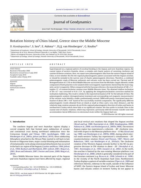
Rotation history of Chios Island, Greece since the Middle Miocene
Rotation history of Chios Island, Greece since the Middle Miocene
Rotation history of Chios Island, Greece since the Middle Miocene

Create successful ePaper yourself
Turn your PDF publications into a flip-book with our unique Google optimized e-Paper software.
328 D. Kondopoulou et al. / Journal <strong>of</strong> Geodynamics 51 (2011) 327–338have experienced significant vertical axis rotations (Kissel et al.,1989; Beck et al., 2001; van Hinsbergen et al., 2010a). NorthwesternTurkey is not a part <strong>of</strong> Aegean oroclinal bending and is separatedfrom <strong>the</strong> rotating domains by extensional ones in <strong>the</strong> Aegean backarc(van Hinsbergen et al., 2010a). Vertical axis rotations <strong>of</strong> <strong>the</strong>external domains <strong>of</strong> <strong>the</strong> Aegean and west Anatolian region werein part accommodated by Neogene extension and exhumation <strong>of</strong>metamorphic core complexes in <strong>the</strong> Aegean back-arc and in <strong>the</strong>west Anatolian Menderes Massif (Brun and Sokoutis, 2007; vanHinsbergen et al., 2010a).Apart from <strong>the</strong>se regionally coherent rotations, many regionsin <strong>the</strong> area are affected by large, local rotations usually interpretedto reflect block rotations within a strike-slip regime. Carefulregional analyses <strong>of</strong> <strong>the</strong>se zones <strong>of</strong> local strong rotations may helpto outline important transform boundaries. For instance, in <strong>the</strong>sou<strong>the</strong>rn Aegean region, consistently counterclockwise rotationswith strongly varying amounts are related to <strong>the</strong> South Aegeanstrike-slip system (Duermeijer et al., 1998; van Hinsbergen et al.,2007), which has been interpreted to reflect block rotations close toa slab transform edge propagator fault (Govers and Wortel, 2005).The North Anatolian Fault Zone and its equivalents in nor<strong>the</strong>rn<strong>Greece</strong> form ano<strong>the</strong>r clear example <strong>of</strong> chaotic, strike-slip relatedrotations (Westphal and Kondopoulou, 1993; Kaymakci et al., 2007;Kondopoulou et al., 2007; Piper et al., 2009).The eastern Aegean islands and <strong>the</strong> coastal zone <strong>of</strong> western Anatoliaseem to be characterized by strongly varying vertical axisrotations. Whereas <strong>the</strong> majority <strong>of</strong> Neogene sedimentary basinsin western Turkey seem not to display vertical axis rotations (vanHinsbergen et al., 2010a), <strong>the</strong> coastal volcanic regions <strong>of</strong> Dikili,Yuntdağ and Foca as well as <strong>the</strong> Karaburun peninsula <strong>of</strong> westernTurkey show a chaotic pattern <strong>of</strong> palaeomagnetic directions(Kondopoulou and Lauer, 1984; Kissel et al., 1986a,b, 1989; Sen andValet, 1986; Kissel and Laj, 1988; Orbay et al., 2000; van Hinsbergenet al., 2010a) (Fig. 1). It has been proposed that <strong>the</strong>se rotationsmay reflect motion along a transform fault accommodating a largeramount <strong>of</strong> back-arc extension on <strong>the</strong> western (Aegean) side thanon <strong>the</strong> eastern (Anatolian) side (Ring et al., 1999a; Özkaymakand Sözbilir, 2008; Uzel and Sözbilir, 2008; van Hinsbergen et al.,2010a).Fig. 1. Schematic map <strong>of</strong> eastern Aegean and western Turkey, showing <strong>the</strong> distribution<strong>of</strong> <strong>the</strong> main crystalline Cyclades and Menderes massifs, and <strong>the</strong> high-pressure,low temperature (HP–LT) Lycian Nappes (see Jolivet et al., 2010; van Hinsbergen etal., 2010b and references <strong>the</strong>rein for details on <strong>the</strong>se massifs).In this paper, we study <strong>the</strong> post-<strong>Middle</strong> <strong>Miocene</strong> vertical axisrotation <strong>history</strong> <strong>of</strong> <strong>the</strong> island <strong>of</strong> <strong>Chios</strong>, located in <strong>the</strong> hangingwall <strong>of</strong> <strong>the</strong> major extensional detachments <strong>of</strong> <strong>the</strong> Cyclades, whichexhumed metamorphosed rocks on <strong>the</strong> islands <strong>of</strong> Samos and Ikariato <strong>the</strong> south <strong>of</strong> <strong>Chios</strong> (Ring et al., 1999b; Kumerics et al., 2005).<strong>Chios</strong>, however, lies to <strong>the</strong> west <strong>of</strong> <strong>the</strong> Menderes metamorphiccore complex <strong>of</strong> western Turkey, where exhumed metamorphosedrocks continue much fur<strong>the</strong>r to <strong>the</strong> north than in <strong>Greece</strong> (Fig. 1)(Bozkurt and Oberhänsli, 2001; Işik and Tekeli, 2001; Ring et al.,2003; Işik et al., 2004). We will discuss <strong>the</strong> results within <strong>the</strong> light<strong>of</strong> <strong>the</strong> regional rotation picture <strong>of</strong> <strong>the</strong> Aegean and west Anatolianregion.2. Geology <strong>of</strong> <strong>Chios</strong> <strong>Island</strong><strong>Chios</strong> exposes a Palaeozoic clastic succession and Mesozoicrecrystallized limestones unconformably overlain by Cenozoic formations(Fig. 2; Kilias, 1982). In <strong>the</strong> sou<strong>the</strong>ast, terrestrial Neogenedeposits have been recognised as fossiliferous by vertebrate paleontologists<strong>since</strong> 1940 when Paraskevaidis (1940) described <strong>the</strong><strong>Middle</strong> <strong>Miocene</strong> mammal fauna from <strong>the</strong> Michalos clay pit.In <strong>the</strong> Michalos clay pit, as well as in <strong>the</strong> surrounding area,<strong>the</strong> Neogene deposits are well-exposed, and <strong>the</strong> changing sedimentaryenvironment can be studied in continuous outcrops overhundreds <strong>of</strong> meters. The Michalos section, with several mammalbearing horizons, is probably one <strong>of</strong> <strong>the</strong> most complete sectionsin Europe to display an Early-<strong>Middle</strong> <strong>Miocene</strong> marine to terrestrialtransition. In this section, three horizons were recorded with abundantremains <strong>of</strong> small and large mammals. Their faunas date <strong>the</strong>fossiliferous horizons to <strong>the</strong> earliest part <strong>of</strong> <strong>the</strong> <strong>Middle</strong> <strong>Miocene</strong>,known as <strong>the</strong> MN5 zone (Koufos et al., 1995). The presence <strong>of</strong>a rich mammalian fauna and a continuous stratigraphic successionhas stimulated investigation <strong>of</strong> magnetostratigraphy. A total<strong>of</strong> 99 levels from a 130-m thick section have been sampled forpalaeomagnetic study. Preliminary magnetostratigraphic resultswere published by Kondopoulou et al. (1993a) and Sen et al. (2006)while detailed magnetostratigraphic results and palaeontologicalcorrelations will be presented later (Sen et al., under prep.). Here wefocus on <strong>the</strong> tectonic implications <strong>of</strong> <strong>the</strong> palaeomagnetic findings,for which a dating <strong>of</strong> <strong>Middle</strong> <strong>Miocene</strong> MN5 will suffice.In addition to <strong>the</strong> Neogene sediments, <strong>the</strong> island <strong>of</strong> <strong>Chios</strong> containsa series <strong>of</strong> small volcanic centers in <strong>the</strong> northwest andsou<strong>the</strong>ast, which developed during <strong>the</strong> same time interval as <strong>the</strong>deposition <strong>of</strong> <strong>the</strong> Michalos section (Besenecker and Pichler, 1974).The source magmas have several features comparable to oceanisland basalts and resemble subduction – related rocks (Pe-Piperand Piper, 1989). K/Ar radiometric dating on whole rock samplesindicates volcanic activity between 17 and 14 Ma (Bellon et al.,1979).The broader <strong>Chios</strong> – Karaburun region displays complex tectonics.Seismic reflection data show onshore and <strong>of</strong>fshore deformationin Western Turkey dominated by crustal extension, and strike-slip(Ocakoğlu et al., 2005; Uzel et al., 2010). Approximately E–W trendinggrabens and basin-bounding active normal faults are <strong>the</strong> mostprominent young tectonic features <strong>of</strong> this part <strong>of</strong> Western Turkey.Active tectonism in <strong>the</strong> study area was first described byBesenecker (1973) and Bellon et al. (1979). A detailed study withmicrotectonic measurements and fault observations on SE <strong>Chios</strong>identify sinistral movement on a system <strong>of</strong> parallel faults directedgenerally NNW–SSE, within a small distance (few kilometers) from<strong>the</strong> region <strong>of</strong> <strong>the</strong> sampling area <strong>of</strong> this study (Kondopoulou etal., 1993b). This system <strong>of</strong> faults belongs to <strong>the</strong> basement and isrelated to dextral transtensional or extensional movements andhas been reactivated during <strong>the</strong> Quaternary with a sinistral normalmovement. Neogene deposits are also faulted, indicating an
D. Kondopoulou et al. / Journal <strong>of</strong> Geodynamics 51 (2011) 327–338 329Fig. 2. (a) Geological map <strong>of</strong> <strong>Chios</strong> <strong>Island</strong>. Asterisk shows <strong>the</strong> location <strong>of</strong> <strong>the</strong> sampled sedimentary section, and triangles represent <strong>the</strong> sampling sites <strong>of</strong> lavas. (b) Detailedmap <strong>of</strong> <strong>the</strong> sampling path for <strong>the</strong> magnetostratigraphic study. THA, THB and THC are <strong>the</strong> mammal bearing horizons.active tectonic regime in <strong>the</strong> area <strong>since</strong> <strong>the</strong>ir deposition. Additionally,recent study <strong>of</strong> <strong>the</strong> microseismicity <strong>of</strong> <strong>the</strong> area (Karakostaset al., 2010) shows fault plane solutions exhibiting a complex pattern<strong>of</strong> dextral and sinistral strike-slip motions, and transtensionalmotions as well as extension in two directions.3. Sampling and measurementsFor <strong>the</strong> magnetostratigraphic study, <strong>the</strong> continuous Michalossection with a thickness <strong>of</strong> 130 m was sampled. The section covers<strong>the</strong> upper part <strong>of</strong> <strong>the</strong> Zyfia formation (10 m) and almost <strong>the</strong> entire
330 D. Kondopoulou et al. / Journal <strong>of</strong> Geodynamics 51 (2011) 327–338Fig. 3. Typical Zijderveld diagrams, intensity decay curves and variation <strong>of</strong> <strong>the</strong> magnetic susceptibility during <strong>the</strong> demagnetization process for representative sedimentsamples. (a) Demagnetization behavior <strong>of</strong> selected sample from <strong>the</strong> lower half <strong>of</strong> <strong>the</strong> section. The intensity decay curve shows a sharp drop at about 200 ◦ C indicating <strong>the</strong>presence <strong>of</strong> a s<strong>of</strong>t component <strong>of</strong> magnetization.Keramaria Formation (120 m). The base <strong>of</strong> <strong>the</strong> section is limitedby <strong>the</strong> lack <strong>of</strong> outcrops while its top is limited by an E–W trendingnormal fault. The three mammalian localities identified as THA,THB and THC, Koufos et al., 1995, are situated within <strong>the</strong> samplingsection, at 72, 83 and 89 m, respectively above <strong>the</strong> base. Some <strong>of</strong> <strong>the</strong>fossiliferous localities mentioned by Rothausen (1977) and Tobien(1977) are also within this section, and are all stratigraphicallybracketed between THA and THC.Ninety-nine (99) levels with a minimum <strong>of</strong> three drilled coresper level were collected throughout this section. Samples weremainly taken from fine grained sediments such as clays, limestonesand siltstones. Sampling spanned all main lithologies, withan average interval <strong>of</strong> 1.25 m. The middle part <strong>of</strong> <strong>the</strong> sectionwas sampled more intensively than <strong>the</strong> o<strong>the</strong>r parts. The largestsampling intervals (maximum gap <strong>of</strong> 6.5 m near <strong>the</strong> top <strong>of</strong> <strong>the</strong>sampled section) are mainly due to <strong>the</strong> presence <strong>of</strong> levels withcoarse or unconsolidated sediments. We sampled all lithologiessuitable for magnetostratigraphy. Along <strong>the</strong> section, <strong>the</strong> bedsdip gently towards <strong>the</strong> west, with an average strike and dip <strong>of</strong>160 ◦ /6 ± 2 ◦ W.
D. Kondopoulou et al. / Journal <strong>of</strong> Geodynamics 51 (2011) 327–338 331The largest volcanic outcrops occur in <strong>the</strong> sou<strong>the</strong>astern part <strong>of</strong><strong>the</strong> <strong>Island</strong> where <strong>the</strong> main sampling took place. Thus in <strong>the</strong> area <strong>of</strong>Emporios (∼16 Ma: Bellon et al., 1979) <strong>the</strong> andesite columnar outcrops<strong>of</strong> Komi have been sampled as well as <strong>the</strong> rhyolites in MavraVotsala and Vroulidia. Additionally, samples have been taken from<strong>the</strong> rhyolite outcrop in <strong>the</strong> north part <strong>of</strong> <strong>the</strong> island between AgiiPantes and Kambi (Fig. 2). A total <strong>of</strong> 80 core samples were collectedfrom <strong>the</strong>se volcanic rocks and cut into standard (2.2 cm × 2.5 cm)cylindrical specimens.Measurements <strong>of</strong> <strong>the</strong> NRM have been performed in a nonmagneticroom using ei<strong>the</strong>r spinner or three-axis cryogenicmagnetometers, according to <strong>the</strong> nature <strong>of</strong> <strong>the</strong> samples. The majority<strong>of</strong> <strong>the</strong> palaeomagnetic measurements on <strong>the</strong> sediments wereperformed in <strong>the</strong> Laboratoire de Paléomagnétisme <strong>of</strong> <strong>the</strong> IPG inParis, while <strong>the</strong> palaeomagnetic study <strong>of</strong> lavas took place in <strong>the</strong>Palaeomagnetic Laboratories <strong>of</strong> <strong>the</strong> University <strong>of</strong> Thessaloniki andEcole Normale Supérieure in Paris.At least one specimen per core has been stepwise demagnetized,in most cases <strong>the</strong>rmally, from room temperature up to 600 ◦ Cor more in some cases. Alternating field demagnetization has alsobeen used, especially for <strong>the</strong> lavas. In order to identify <strong>the</strong> magneticcarriers, in sediments and lavas, IRM acquisition curves have beenobtained on samples from different levels and lithologies. Fur<strong>the</strong>rmore,<strong>the</strong>rmal demagnetization (up to 680 ◦ C) <strong>of</strong> <strong>the</strong> IRM has beenperformed in selected samples. Finally, <strong>the</strong> variation <strong>of</strong> magneticsusceptibility with temperature <strong>of</strong> pilot samples both from sedimentsand lavas has been examined using <strong>the</strong> MS2B SusceptibilityTemperature Bartington Bridge.4. ResultsA total <strong>of</strong> 230 specimens from <strong>the</strong> sediments and 65 from <strong>the</strong>lavas have been demagnetized and <strong>the</strong> results obtained can be summarizedas follows.4.1. SedimentsThe intensity <strong>of</strong> <strong>the</strong> natural remanent magnetization (NRM)is highly variable throughout <strong>the</strong> section, ranging from 0.5 to147 mA/m. Thermal demagnetization <strong>of</strong> pilot samples identifiedlarge secondary magnetizations which could only be removed attemperatures above 250 ◦ C. For this reason, more than 95% <strong>of</strong> <strong>the</strong>samples have been demagnetized by progressive <strong>the</strong>rmal cleaning;<strong>the</strong> alternating field has been applied on some test samples,without reliable results. In some cases, when <strong>the</strong> stepwise <strong>the</strong>rmaldemagnetization produced a sudden increase <strong>of</strong> <strong>the</strong> susceptibilitybetween <strong>the</strong> 400 ◦ and 500 ◦ steps (see below), both <strong>the</strong>rmaland alternating field demagnetization was applied but this dualapproach proved unable to completely isolate <strong>the</strong> primary component<strong>of</strong> magnetization.All samples have been demagnetized stepwise, from room temperatureup to 600 ◦ C or more in some cases (Fig. 3b and c). Thesteps were performed every 50 ◦ C in low temperatures, and every40 ◦ C or even 30 ◦ C in high temperatures. The demagnetization processshows that in 53 out <strong>of</strong> 99 sites, more than half <strong>of</strong> <strong>the</strong> NRMintensity is removed at 200 ◦ C. These sites are mainly located at <strong>the</strong>lower half <strong>of</strong> <strong>the</strong> section. After this step, <strong>the</strong> decrease <strong>of</strong> intensity<strong>of</strong> magnetization is much smoo<strong>the</strong>r up to 550–600 ◦ C(Fig. 3a).The mean direction <strong>of</strong> <strong>the</strong> characteristic remanent magnetization(ChRM) could easily be calculated in most samples usingKirschvink (1980) analysis. About 1/3 <strong>of</strong> <strong>the</strong> samples present randomdirections at temperatures over 400 ◦ C, mostly connected witha sudden susceptibility increase at 450–500 ◦ C. In <strong>the</strong>se samples,<strong>the</strong> demagnetized vector gradually changes between room temperatureand about 450 ◦ C towards a stable direction, which weinterpret as <strong>the</strong> direction <strong>of</strong> <strong>the</strong> ChRM.Fig. 4. Variation <strong>of</strong> magnetic susceptibility during <strong>the</strong>rmal demagnetization. (a) Themagnetic susceptibility remains stable during <strong>the</strong> experiment, only in a few cases.(b) The magnetic susceptibility decreases after 300–400 ◦ Cupto600 ◦ C and (c) insome cases displays a sudden increase from 450 to 500 ◦ C.The magnetic susceptibility was monitored with a Kappabridgeafter each step <strong>of</strong> heating. The susceptibility remained stable in onlya few cases (Fig. 4a). In most cases it decreased progressively from300–400 ◦ Cupto600 ◦ C or displayed a sudden increase from 450to 500 ◦ C(Fig. 4b and c, respectively). The decreasing susceptibil-
334 D. Kondopoulou et al. / Journal <strong>of</strong> Geodynamics 51 (2011) 327–338Fig. 7. Demagnetization diagrams (Zijderveld diagrams, intensity decay curves) for representative volcanic samples.Table 1Statistical results for <strong>the</strong> new data presented here from <strong>Chios</strong>.Locality Geographical coordinates n D I k ˛95 Site averages A95min A95maxDx Ix K A95Sediments (before TK03) 38.3 ◦ /26.1 ◦ 89 348.1 38.5 5.1 7 11.2 4.7 3.0 4.5Sediments (after TK03) 89 348.1 61.0 6.1 4 16.5 4.5 3.0 4.5Lavas 5 288.4 25.6 19.8 33 17.4 16.8 7.6 31.8Emp 1–2 38.15 ◦ /26 ◦ 6 278.3 36.0 59.5 8.8Emp 3 38.15 ◦ /26 ◦ 4 274.8 22.6 150.9 7.5Emp 4 * 38.19 ◦ /26.03 ◦ 3 323.3 52.5 24.8 25.3Emp 5 * 38.19 ◦ /26.02 ◦ 3 310.5 46.7 21.8 27.1Emp 6 38.19 ◦ /26.02 ◦ 3 308.5 18.8 60.8 16.0Emp 7 38.15 ◦ /26 ◦ 4 269.1 18.6 70.4 11.0Kom 38.2 ◦ /26.05 ◦ 8 311.2 26.4 68.7 6.7Arg * 38.58 ◦ /25.9 ◦ 8 309.0 40.0 10.1 25.3N(n) = amount <strong>of</strong> samples (specimens); D = declination, I = inclination, k(K)=(Fisher, 1953) precision parameter on directions (virtual geomagnetic poles); ˛95(A95) = 95%cone <strong>of</strong> confidence <strong>of</strong> directions (virtual geomagnetic poles); Dx = error bar on declination; Ix = error bar on inclination (following Butler, 1992); A95min and A95maxspan <strong>the</strong> n-dependent confidence envelope <strong>of</strong> (Deenen et al., submitted for publication).* Site rejected based on too large dispersion (k). See text.
D. Kondopoulou et al. / Journal <strong>of</strong> Geodynamics 51 (2011) 327–338 335Fig. 8. IRM and <strong>the</strong>rmomagnetic curves from selected volcanic samples showing <strong>the</strong> dominance <strong>of</strong> magnetite as <strong>the</strong> main magnetic carrier.5.2. Implications from <strong>the</strong> obtained palaeomagnetic declinationsCompared to <strong>the</strong> most recent APWP (Torsvik et al., 2008), <strong>the</strong>results <strong>of</strong> <strong>the</strong> Michalos section on <strong>Chios</strong> suggest a ∼15 ◦ counterclockwisevertical axis rotation. In adjacent western Turkey andon <strong>the</strong> island <strong>of</strong> Lesbos, no significant regional deviations <strong>of</strong> <strong>the</strong><strong>Middle</strong> <strong>Miocene</strong> palaeomagnetic declination from <strong>the</strong> APWP havebeen found north <strong>of</strong> <strong>the</strong> central Menderes Massif and south <strong>of</strong><strong>the</strong> North Anatolian Fault Zone (Kissel et al., 1989; Beck et al.,2001; van Hinsbergen et al., 2010a). On <strong>the</strong> contrary, regional counterclockwiserotations occur in south-western Turkey (Kissel andPoisson, 1987; Morris and Robertson, 1993; van Hinsbergen etFig. 9. Equal area projections <strong>of</strong> sediment ChRM directions. The star represents <strong>the</strong>mean direction from all data.al., 2010a,b). The rotation <strong>of</strong> <strong>Chios</strong> may thus record (part <strong>of</strong>) <strong>the</strong>southwest Anatolian rotations, or be affected by local rotations(Fig. 11).To distinguish between <strong>the</strong>se, we take <strong>the</strong> regional structuralframework into account. The southwest Anatolian rotating domainhas a rotation pole at <strong>the</strong> eastern limit <strong>of</strong> <strong>the</strong> Central MenderesMassif. From <strong>the</strong>re, <strong>the</strong> amount <strong>of</strong> N–S extension accommodating<strong>the</strong> rotation with respect to NW Turkey and Lesbos must increasewestward. Large scale extension (<strong>of</strong> many tens <strong>of</strong> kilometers) iswidespread in <strong>the</strong> Aegean region and is accommodated by exhumation<strong>of</strong> metamorphic rocks along extensional detachments (Gautieret al., 1993; Ring et al., 1999a, 2003; Jolivet and Faccenna, 2000;Bozkurt and Oberhänsli, 2001; Jolivet et al., 2003; Jolivet and Brun,2010). The central Menderes Massif is bounded in <strong>the</strong> north by<strong>the</strong> Alaşehir extensional detachment (Hetzel et al., 1995; Işik et al.,2003). This is accommodated, in part, <strong>the</strong> exhumation <strong>of</strong> <strong>the</strong> CentralMenderes Massif, and forms <strong>the</strong> nor<strong>the</strong>rn limit <strong>of</strong> <strong>the</strong> vertical axisrotations in south-western Turkey (van Hinsbergen et al., 2010a).Even though an E–W trending extensional structure may be presentbetween Lesbos and <strong>Chios</strong>, absence <strong>of</strong> Cenozoic metamorphic rockshere makes it unlikely that this structure has major displacements.Instead, major back-arc extension in <strong>the</strong> eastern Aegean region isaccommodated along a detachment system south <strong>of</strong> <strong>Chios</strong> and <strong>the</strong>Karaburun peninsula, exhuming metamorphic rocks on <strong>the</strong> islands<strong>of</strong> Samos and Ikaria (Ring et al., 1999b; Kumerics et al., 2005). <strong>Chios</strong><strong>the</strong>refore seems structurally not to belong to south-western Anatoliandomain which recorded a ∼25 ◦ rotation with respect to <strong>the</strong>northwestern part. Fur<strong>the</strong>rmore, <strong>the</strong> absence <strong>of</strong> significant verticalaxis rotations <strong>since</strong> ∼12 Ma on <strong>the</strong> island <strong>of</strong> Samos (Sen and Valet,1986; Kostopoulos et al., 2003) suggests that ei<strong>the</strong>r regional rotation<strong>of</strong> southwest Anatolia is accommodated fur<strong>the</strong>r south, or islimited to <strong>the</strong> region south <strong>of</strong> <strong>the</strong> central Menderes Massif.Even though <strong>the</strong> Michalos section provides no reason to assumewithin-section rotation differences, <strong>the</strong> few lavas presented in thispaper display a poorly defined, but much larger rotation than <strong>the</strong>Michalos section. This may lend credibility to <strong>the</strong> inference that<strong>the</strong> rotations on <strong>Chios</strong> have local origin. Local rotations along <strong>the</strong>Greek–Turkish boundary are not uncommon. For example, Lower<strong>Miocene</strong> (15–18.5 Ma) volcanics <strong>of</strong> <strong>the</strong> adjacent Karaburun peninsulayield significant clockwise rotations, as does <strong>the</strong> region around
336 D. Kondopoulou et al. / Journal <strong>of</strong> Geodynamics 51 (2011) 327–338Fig. 10. Plots <strong>of</strong> elongation and inclination versus flattening factor (f), as well as elongation versus inclination (red line) for <strong>the</strong> TK03.GAD model (Tauxe and Kent, 2004), for<strong>the</strong> data <strong>of</strong> <strong>the</strong> Michalos section, for different values <strong>of</strong> <strong>the</strong> flattening factor (f = 0.3 → 1.0). I org = original inclination; I E/I = bootstrapping results for <strong>the</strong> inclination; I = correctedinclination. The barbs on <strong>the</strong> red line (B) indicate <strong>the</strong> direction <strong>of</strong> elongation <strong>of</strong> <strong>the</strong> directional distributions, with horizontal being E–W and vertical being N–S. Also shown areresults from 20 bootstrapped data sets (yellow lines, B). The crossing points represent <strong>the</strong> inclination/elongation pair most consistent with <strong>the</strong> TK03.GAD model (green line).The histograms represent <strong>the</strong> crossing points from 5000 bootstrapped data sets and determine <strong>the</strong> most frequent inclination (vertical red line) with 95% bounds (dashed redlines, C), compared to <strong>the</strong> original inclination (blue line, C) and <strong>the</strong> crossing points <strong>of</strong> <strong>the</strong> original distribution (green line, C). The corrected inclination (D and E) is in goodagreement with <strong>the</strong> geocentric axial dipole (GAD) inclination (58 ◦ ) for <strong>the</strong> present latitude <strong>of</strong> <strong>Chios</strong>. (For interpretation <strong>of</strong> <strong>the</strong> references to color in this figure caption, <strong>the</strong>reader is referred to <strong>the</strong> web version <strong>of</strong> <strong>the</strong> article.)Foca (Kissel et al., 1987; Kissel and Laj, 1988), whereas <strong>the</strong> Dikiliand Yuntdağ mountains provide a scatter <strong>of</strong> directions fromlava sites that clearly indicate strong within-locality rotations (vanHinsbergen et al., 2010a). Thus, a zone roughly parallel to <strong>the</strong>coast may be identified as one <strong>of</strong> chaotic vertical axis rotations.Recently, this zone was postulated to accommodate left-lateraltransform motions <strong>of</strong> <strong>Greece</strong> with respect to western Turkey, coincidingwith <strong>the</strong> eastern limits <strong>of</strong> <strong>the</strong> Anatolide-Tauride basement<strong>of</strong> <strong>the</strong> Menderes Massif (Ring et al., 1999a; Özkaymak and Sözbilir,2008; Uzel and Sözbilir, 2008; Erkül, 2010; van Hinsbergen et al.,2010a). This transform zone could translate extensional exhumation<strong>of</strong> <strong>the</strong> Cycladic detachments to <strong>the</strong> Menderes detachments,which extend much fur<strong>the</strong>r to <strong>the</strong> north, and accommodate <strong>the</strong>difference between larger amounts <strong>of</strong> extension in <strong>Greece</strong> thanTurkey. The detailed relations between individual faults and <strong>the</strong>irinfluence on local block rotations is beyond <strong>the</strong> scope <strong>of</strong> this study,but <strong>the</strong> zone affected by local vertical axis rotations, previouslyidentified in western Turkey (van Hinsbergen et al., 2010a,b; Fig. 1)includes <strong>the</strong> island <strong>of</strong> <strong>Chios</strong>.6. ConclusionsFig. 11. Map <strong>of</strong> eastern Aegean and western Turkey, showing schematically <strong>the</strong>main declination distribution from Oligocene and Neogene sediments. Key to references:(1) Evvia: Kissel et al. (1986b), Morris (1995), see also Kissel and Laj (1988) andvan Hinsbergen et al. (2005a,b, 2008) for <strong>the</strong> wider west-Aegean region with largeclockwise Neogene rotations; (2) Skyros: Kissel et al. (1986b); (3) Lemnos: Westphaland Kondopoulou (1993); (4) Lesvos: Kissel et al. (1989) and Beck et al. (2001); (5)Nor<strong>the</strong>rn Menderes Massif <strong>Miocene</strong> volcano-sedimentary basins: van Hinsbergenet al. (2010a); (6) Tinos: Avigad et al. (1998); (7) Mykonos: Morris and Anderson(1996); (8) Naxos: Morris and Anderson (1996); (9) Neogene basins Lycian Nappes:van Hinsbergen et al. (2010a); (10) Sou<strong>the</strong>astern Aegean region (Crete, Karpathos,Rhodos): Duermeijer et al. (1998, 2000) and van Hinsbergen et al. (2007); (11) BeyDağları: Kissel and Poisson (1987), Morris and Robertson (1993) and van Hinsbergenet al. (2010b).We present new palaeomagnetic data from <strong>Middle</strong> <strong>Miocene</strong> sedimentsand lavas from <strong>the</strong> <strong>Island</strong> <strong>of</strong> <strong>Chios</strong> in <strong>the</strong> Eastern Aegeanregion. The quality <strong>of</strong> <strong>the</strong> magnetic signature was more satisfying insediments than in lavas, and provides evidence for a significant 15 ◦counterclockwise rotation. An inclination derived from <strong>the</strong>se sediments<strong>of</strong> 38 ◦ was corrected to 61 ◦ using <strong>the</strong> elongation/inclinationmethod, which is within error <strong>of</strong> <strong>the</strong> expected palaeomagneticinclination at <strong>the</strong> latitude <strong>of</strong> <strong>Chios</strong>.<strong>Rotation</strong> results for a small set <strong>of</strong> five lavas provide a poorlydefined, but significantly larger rotation <strong>of</strong> approximately 70 ◦counterclockwise. Albeit poorly defined, <strong>the</strong>se results indicate
338 D. Kondopoulou et al. / Journal <strong>of</strong> Geodynamics 51 (2011) 327–338Kissel, C., Laj, C., Poisson, A., Simeakis, K., 1989. A pattern <strong>of</strong> block rotations in centralAegean. In: Kissel, C., Laj, C. (Eds.), Palaeomagnetic <strong>Rotation</strong>s and ContinentalDeformation. Kluwer Academic Publishers, pp. 115–129.Kondopoulou, D.P., Lauer, J.P., 1984. Palaeomagnetic data from Tertiary units <strong>of</strong><strong>the</strong> North Aegean zone. In: Dixon, J.E., Robertson, A.H.F. (Eds.), The GeologicalEvolution <strong>of</strong> <strong>the</strong> Eastern Mediterranean. Geological Society <strong>of</strong> London SpecialPublications, pp. 681–686.Kondopoulou, D., De Bonis, L., Koufos, G., Sen, S., 1993a. Palaeomagnetic data andbiostratigraphy <strong>of</strong> <strong>the</strong> <strong>Middle</strong> <strong>Miocene</strong> vertebrate locality <strong>of</strong> Thymiana, <strong>Chios</strong>island, <strong>Greece</strong>. In: Proceedings <strong>of</strong> <strong>the</strong> 2nd Congress <strong>of</strong> <strong>the</strong> Hellenic GeophysicalUnion, Florina, pp. 676–687.Kondopoulou, D., Leci, V., Symeakis, C., 1993b. Palaeomagnetic study <strong>of</strong> <strong>the</strong> Tertiaryvolcanics in <strong>Chios</strong> <strong>Island</strong>, <strong>Greece</strong>. In: Proceedings <strong>of</strong> <strong>the</strong> 2nd Congress <strong>of</strong> <strong>the</strong>Hellenic Geophysical Union, Florina, pp. 676–687.Kondopoulou, D., 2000. Palaeomagnetism in <strong>Greece</strong>: Cenozoic and Mesozoiccomponents and <strong>the</strong>ir geodynamic implications. Tectonophysics 326, 131–151.Kondopoulou, D., Zananiri, I., Michard, A., Feinberg, H., Atzemoglou, A., Pozzi, J.-P., Voidomatis, Ph., 2007. Neogene tectonic rotations in <strong>the</strong> vicinity <strong>of</strong> <strong>the</strong>North Aegean trough: new palaeomagnetic evidence from Athos and Samothraki(<strong>Greece</strong>). Bulletin <strong>of</strong> <strong>the</strong> Geological Society <strong>of</strong> <strong>Greece</strong> XXXVII, 343–359.Kostopoulos, D.S., Sen, S., Koufos, G.D., 2003. Magnetostratigraphy and revisedchronology <strong>of</strong> <strong>the</strong> late <strong>Miocene</strong> mammal localities <strong>of</strong> Samos, <strong>Greece</strong>. InternationalJournal <strong>of</strong> Earth Sciences 92, 779–794.Koufos, G.D., de Bonis, L., Sen, S., 1995. Lophocyon paraskevaidisi, a new viverrid(Carnivora, Mammalia) from <strong>the</strong> <strong>Middle</strong> <strong>Miocene</strong> <strong>of</strong> <strong>Chios</strong> island, <strong>Greece</strong>.Geobios 28, 511–523.Krijgsman, W., Tauxe, L., 2004. Shallow bias in <strong>the</strong> Mediterranean palaeomagneticdirections caused by inclination error. Earth and Planetary Science Letters 222(2), 685–695.Kumerics, C., Ring, U., Bricheau, S., Glodny, J., Monié, P., 2005. The extensional Messariashear zone and associated brittle detachment faults, Aegean Sea, <strong>Greece</strong>.Journal <strong>of</strong> <strong>the</strong> Geological Society <strong>of</strong> London 162 (4), 701–721.Lawrence, K.P., Tauxe, L., Staudigel, H., Constable, C.G., Koppers, A.A.P., McIntosh,W., Johnson, C.L., 2009. Palaeomagnetic field properties at highsou<strong>the</strong>rn latitude. Geochemistry, Geophysics, Geosystems 10, Q01005,doi:10.1029/2008GC002072.McFadden, P.C., McElhinny, M.W., 1990. Classification <strong>of</strong> <strong>the</strong> reversal test in palaeomagnetism.Geophysical Journal International 103, 725–729.McFadden, P.L., Merril, R.T., McElhinny, M.W., Lee, S., 1991. Reversals <strong>of</strong> <strong>the</strong> Earth’smagnetic field and temporal variations <strong>of</strong> <strong>the</strong> dynamo families. Journal <strong>of</strong> GeophysicalResearch 96, 3923–3933.Morris, A., 1995. <strong>Rotation</strong>al deformation during Palaeogene thrusting and basinclosure in eastern central <strong>Greece</strong>: palaeomagnetic evidence from Mesozoic carbonates.Geophysical Journal International 121, 827–847.Morris, A., Anderson, M., 1996. First palaeomagnetic results from <strong>the</strong> Cycladic Massif,<strong>Greece</strong>, and <strong>the</strong>ir implications for <strong>Miocene</strong> extension directions and tectonicmodels in <strong>the</strong> Aegean. Earth and Planetary Science Letters 142, 397–408.Morris, A., Robertson, A.H.F., 1993. <strong>Miocene</strong> remagnetisation <strong>of</strong> carbonate platformand Antalya Complex units within <strong>the</strong> Isparta angle, SW Turkey. Tectonophysics220, 243–266.Ocakoğlu, N., Demirbağ, E., Kuşçu, I., 2005. Neotectonic structures in Izmir Gulfand surrounding regions (western Turkey): evidences <strong>of</strong> strike-slip faultingwith compression in <strong>the</strong> Aegean extensional regime. Marine Geology 219, 155–171.Orbay, N., Sanver, M., Hisarli, T., Isseven, T., Ozcep, F., 2000. Karaburun Yarimadasininpaleomagnetizmasi ve tektonik evrimi. Bati Anadolu’ nun Depremselliği Sempozyumukitabi, 59–67.Özkaymak, Ç., Sözbilir, H., 2008. Stratigraphic and structural evidence for fault reactivation:<strong>the</strong> active Manisa fault zone, Western Anatolia. Turkish Journal <strong>of</strong> EarthSciences 17, 615–635.Paraskevaidis, I., 1940. Eine obermiocane fauna von <strong>Chios</strong>. Neues Jahrbuch f¨vr MineralogieGeologie und Paläontologie 83, 363–442.Pe-Piper, G., Piper, D.J.W., 1989. Spatial and temporal variation in Late Cenozoicback-arc volcanic rocks, Aegean Sea region. Tectonophysics 169, 113–134.Piper, J.D.A., Gursoy, H., Tatar, O., Beck, M.E., Rao, A., Koçbulut, F., Mesci, B.L., 2009.Distributed neotectonic deformation in <strong>the</strong> Anatolides <strong>of</strong> Turkey: a palaeomagneticanalysis. Tectonophysics, doi:10.1016/j.tecto.2009.05.026.Ricou, L.-E., Burg, J.-P., Godfriaux, I., Ivanov, Z., 1998. Rhodope and Vardar: <strong>the</strong> metamorphicand <strong>the</strong> olistostromic paired belts related to <strong>the</strong> Cretaceous subductionunder Europe. Geodynamica Acta 11 (6), 285–309.Ring, U., Gessner, K., Güngör, T., Passchier, C.W., 1999a. The Menderes Massif <strong>of</strong>western Turkey and <strong>the</strong> Cycladic Massif in <strong>the</strong> Aegean—do <strong>the</strong>y really correlate?Journal <strong>of</strong> <strong>the</strong> Geological Society <strong>of</strong> London 156, 3–6.Ring, U., Laws, S., Bernet, M., 1999b. Structural analysis <strong>of</strong> a complex nappe sequenceand late-orogenic basins from <strong>the</strong> Aegean <strong>Island</strong> <strong>of</strong> Samos. Journal <strong>of</strong> StructuralGeology 21, 1575–1601.Ring, U., Layer, P.W., Reischmann, T., 2001. <strong>Miocene</strong> high-pressure metamorphismin <strong>the</strong> Cyclades and Crete, Aegean Sea, <strong>Greece</strong>: evidence for large-magnitudedisplacement on <strong>the</strong> Cretan detachment. Geology 29 (5), 395–398.Ring, U., Johnson, C., Hetzel, R., Gessner, K., 2003. Tectonic denudation <strong>of</strong> a LateCretaceous-Tertiary collisional belt: regionally symmetric cooling patterns and<strong>the</strong>ir relation to extensional faults in <strong>the</strong> Anatolide belt <strong>of</strong> western Turkey. GeologicalMagazine 140 (4), 421–441.Ring, U., Glodny, J., Will, T., Thomson, S.N., 2010. The Hellenic subduction system:high-pressure metamorphism, exhumation, normal faulting, and large-scaleextension. Annual Review <strong>of</strong> Earth and Planetary Sciences 38, 45–76.Rothausen, K., 1977. Die mittelmiozanen Wirbertierfund-stellen sudlich Thymiana(Insel <strong>Chios</strong>, Agais, Griechenland). Teil: Geologie: Die Fundstellen und ihreAbfolge. Annulaire Geologique de Pays Hellenique 28, 495–515.Schmid, S.M., Berza, T., Diaconescu, V., Froitzheim, N., Fügenschuh, B., 1998. Orogenparallelextension in <strong>the</strong> Sou<strong>the</strong>rn Carpathians. Tectonophysics 297, 209–228.Sen, S., Valet, J.-P., 1986. Magnetostratigraphy <strong>of</strong> late <strong>Miocene</strong> continental depositsin Samos, <strong>Greece</strong>. Earth and Planetary Science Letters 80, 167–174.Sen, S., Aidona, E., Kondopoulou, D.P., Koufos, G.D., 2006. Magnetostratigraphy andpalaeomagnetism <strong>of</strong> <strong>the</strong> <strong>Miocene</strong> formations <strong>of</strong> <strong>Chios</strong> <strong>Island</strong>, <strong>Greece</strong>. TravauxGeophysiques XXVII, 101 (Abstract book <strong>of</strong> <strong>the</strong> 10th Castle Meeting on Paleo,Rock and Environmental Magnetism, Castle <strong>of</strong> Valtice, Czech Republic).Şengör, A.M.C., Yilmaz, Y., 1981. Tethyan evolution <strong>of</strong> Turkey: a plate tectonicapproach. Tectonophysics 75, 181–241.Tauxe, L., Kent, D.V., 2004. A simplified statistical model for <strong>the</strong> geomagnetic fieldand <strong>the</strong> detection <strong>of</strong> shallow bias in palaeomagnetic inclinations: was <strong>the</strong>ancient magnetic field dipolar? In: Channell, J.E.T., Kent, D.V., Lowrie, W., Meert,J.G. (Eds.), Timescales <strong>of</strong> <strong>the</strong> Palaeomagnetic Field, Geophysical Monograph.American Geophysical Union, pp. 101–115.Tauxe, L., Kodama, K.P., Kent, D.V., 2008. Testing corrections for palaeomagneticinclination error in sedimentary rocks: a comparative approach. Physics <strong>of</strong> <strong>the</strong>Earth and Planetary Interiors 169, 152–165.Tobien, H., 1977. Die Mittelmiozanen Wirbeltierfundstellen sudlich Thymiana (Insel<strong>Chios</strong>, Agais, Griechenland). Annulaire Geologique de Pays Hellenique 28,489–494.Torsvik, T.H., Müller, R.D., Van der Voo, R., Steinberger, B., Gaina, C., 2008. Global platemotion frames: toward a unified model. Reviews <strong>of</strong> Geophysics 41, RG3004,doi:10.1029/2007RG000227.Uzel, B., Sözbilir, H., 2008. A first record <strong>of</strong> a strike-slip basin in western Anatolia andits tectonic implication: <strong>the</strong> Cumaovası Basin. Turkish Journal <strong>of</strong> Earth Sciences17, 559–591.Uzel, B., Sözbilir, H., Özkaymak, Ç., 2010, Neotectonic evolution <strong>of</strong> an actively growingsuperimposed basin in western Anatolia: <strong>the</strong> inner Bay <strong>of</strong> İzmir, Turkey.Turkish Journal <strong>of</strong> Earth Sciences, doi:10.3906/yer-0910-11.van Hinsbergen, D.J.J., Hafkenscheid, E., Spakman, W., Meulenkamp, J.E., Wortel,M.J.R., 2005a. Nappe stacking resulting from subduction <strong>of</strong> oceanic and continentallithosphere below <strong>Greece</strong>. Geology 33 (4), 325–328.van Hinsbergen, D.J.J., Langereis, C.G., Meulenkamp, J.E., 2005b. Revision <strong>of</strong> <strong>the</strong> timing,magnitude and distribution <strong>of</strong> Neogene rotations in <strong>the</strong> western Aegeanregion. Tectonophysics 396, 1–34.van Hinsbergen, D.J.J., Krijgsman, W., Langereis, C.G., Cornée, J.J., Duermeijer, C.E., vanVugt, N., 2007. Discrete Plio-Pleistocene phases <strong>of</strong> tilting and counterclockwiserotation in <strong>the</strong> sou<strong>the</strong>astern Aegean arc (Rhodos, <strong>Greece</strong>): early Pliocene formation<strong>of</strong> <strong>the</strong> south Aegean left-lateral strike-slip system. Journal <strong>of</strong> <strong>the</strong> GeologicalSociety <strong>of</strong> London 164, 1133–1144.van Hinsbergen, D.J.J., Dupont-Nivet, G., Nakov, R., Oud, K., Panaiotu, C., 2008. Nosignificant post-Eocene rotation <strong>of</strong> <strong>the</strong> Moesian Platform and Rhodope (Bulgaria):implications for <strong>the</strong> kinematic evolution <strong>of</strong> <strong>the</strong> Carpathian and Aegeanarcs. Earth and Planetary Science Letters 273, 345–358.van Hinsbergen, D.J.J., Dekkers, M.J., Bozkurt, E., Koopman, M., 2010a. Exhumationwith a twist: palaeomagnetic constraints on <strong>the</strong> evolution <strong>of</strong> <strong>the</strong>Menderes metamorphic core complex (western Turkey). Tectonics 29, TC2596,doi:10.1029/2009TC002596.van Hinsbergen, D.J.J., Dekkers, M.J., Koç, A., 2010b. Testing <strong>Miocene</strong> remagnetization<strong>of</strong> Bey Daglari: timing and amount <strong>of</strong> Neogene rotations in SW Turkey. TurkishJournal <strong>of</strong> Earth Sciences 19, doi:10.3906/yer-0904-1.Vandamme, D., 1994. A new method to determine palaeosecular variation. Physics<strong>of</strong> <strong>the</strong> Earth and Planetary Interiors 85, 131–142.Westphal, M., Kondopoulou, D., Edel, J.B., Pavlides, S., 1991. Palaeomagnetism <strong>of</strong>late Tertiary and Plio-Pleistocene formations form N, <strong>Greece</strong>. Bulletin <strong>of</strong> <strong>the</strong>Geological Society <strong>of</strong> <strong>Greece</strong> 25, 239–250.Westphal, M., Kondopoulou, D., 1993. Palaeomagnetism <strong>of</strong> <strong>Miocene</strong> volcanics fromLemnos island: implications for block rotations in <strong>the</strong> vicinity <strong>of</strong> <strong>the</strong> northAegean Trough. Annales Tectonicae 7 (2), 142–149.Zananiri, I., Dimitriadis, S., Kondopoulou, D., Atzemoglou, A., 2002. A preliminaryAMS study in some Tertiary granitoids from Nor<strong>the</strong>rn <strong>Greece</strong>: integration <strong>of</strong>tectonic and palaeomagnetic data. Physics and Chemistry <strong>of</strong> <strong>the</strong> Earth 27,1289–1297.