On the use of global potential field models for regional interpretation ...
On the use of global potential field models for regional interpretation ...
On the use of global potential field models for regional interpretation ...

Create successful ePaper yourself
Turn your PDF publications into a flip-book with our unique Google optimized e-Paper software.
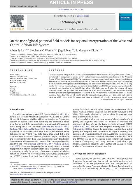
TECTO-124906; No <strong>of</strong> Pages 15<br />
Tectonophysics xxx (2010) xxx–xxx<br />
Contents lists available at ScienceDirect<br />
Tectonophysics<br />
journal homepage: www.elsevier.com/locate/tecto<br />
<strong>On</strong> <strong>the</strong> <strong>use</strong> <strong>of</strong> <strong>global</strong> <strong>potential</strong> <strong>field</strong> <strong>models</strong> <strong>for</strong> <strong>regional</strong> <strong>interpretation</strong> <strong>of</strong> <strong>the</strong> West and<br />
Central African Rift System<br />
Albert Eyike a,b, ⁎, Stephanie C. Werner b,c , Jörg Ebbing b,d , E. Manguelle Dicoum e<br />
a Department <strong>of</strong> Physics, Faculty <strong>of</strong> Science, University <strong>of</strong> Douala, PO box 24157, Douala, Cameroon<br />
b Geological Survey <strong>of</strong> Norway (NGU), 7491 Trondheim, Norway<br />
c Now at: Physics <strong>of</strong> Geological Process, University <strong>of</strong> Oslo PO Box 1048 Blindern 0316 Oslo, Norway<br />
d Department <strong>of</strong> Petroleum Engineering and Applied Geophysics, Norwegian University <strong>of</strong> Science and Technology (NTNU), Trondheim, Norway<br />
e Department <strong>of</strong> Physics, Faculty <strong>of</strong> Science, University <strong>of</strong> Yaounde I, PO Box 812. Cameroon<br />
article<br />
info<br />
abstract<br />
Article history:<br />
Received 5 August 2009<br />
Received in revised <strong>for</strong>m 19 April 2010<br />
Accepted 20 April 2010<br />
Available online xxxx<br />
Keywords:<br />
Gravity<br />
Magnetic<br />
Satellite data<br />
West and Central African Rift System<br />
The <strong>use</strong> in <strong>regional</strong> <strong>interpretation</strong>s <strong>of</strong> <strong>the</strong> Earth Gravity Model (EGM08) and Earth magnetic model (EMAG2)<br />
is evaluated by comparison to ground gravity and aeromagnetic data in <strong>the</strong> central sector <strong>of</strong> <strong>the</strong> West and<br />
Central African Rift System (WCARS). The comparison includes upward continuation, spectral analysis and<br />
pseudogravity calculation and statistical evaluation. A correlation between EMAG2 (which contains roughly<br />
25 km resolution aeromagnetic data in <strong>the</strong> region) and near-surface aeromagnetic data over WCARS is only<br />
true <strong>for</strong> <strong>the</strong> very low wavelength part but a strong similarity between EGM08 and ground gravity data can be<br />
confirmed. Interpretation <strong>of</strong> <strong>the</strong> EGM08 data allows identifying and confirming <strong>the</strong> position <strong>of</strong> major<br />
structural trends, and provides new in<strong>for</strong>mation on <strong>the</strong> crustal architecture. The lineaments limiting<br />
different grabens <strong>for</strong>ming <strong>the</strong> Logone Birni basin and in <strong>the</strong> sou<strong>the</strong>rn Chad basin are identified. The results<br />
presented here show <strong>the</strong> <strong>use</strong> <strong>of</strong> EGM08 data <strong>for</strong> <strong>regional</strong> <strong>interpretation</strong>s over Cameroon and adjacent<br />
countries, which can overcome <strong>the</strong> absence and sparseness <strong>of</strong> data in developing countries and remote areas.<br />
© 2010 Elsevier B.V. All rights reserved.<br />
1. Introduction<br />
The West and Central African Rift System (WCARS) (Fig. 1) is<br />
divided into <strong>the</strong> West African Rift Subsystem (WARS) and <strong>the</strong> Central<br />
African Rift Subsystem (CARS), and is an intracontinental Cretaceous–<br />
Tertiary rift system where both strike–slip and extensional basins<br />
were <strong>for</strong>med mainly by <strong>the</strong> mechanical separation <strong>of</strong> African crustal<br />
block during <strong>the</strong> Early Cretaceous (Browne and Fairhead, 1983;<br />
Fairhead, 1986; Binks and Fairhead, 1992; Guiraud and Maurin, 1992).<br />
Significant oil discoveries have been made in sedimentary basins<br />
belonging to <strong>the</strong> WCARS (e.g., Doba Basin, Chad which led to <strong>the</strong><br />
construction <strong>of</strong> <strong>the</strong> Chad–Cameroon pipeline). Despite <strong>the</strong> scientific<br />
and economic interest in <strong>the</strong>se areas, <strong>the</strong> existing gravity data base in<br />
Cameroon and adjacent countries consists <strong>of</strong> local surveys collected in<br />
<strong>the</strong> 1960s and 1980s (Fairhead and Okereke, 1987; Poudjom Djomani<br />
et al., 1995). High resolution gravity data are mostly located in areas <strong>of</strong><br />
high petroleum interest like <strong>the</strong> Gulf <strong>of</strong> Guinea or <strong>the</strong> main Chad basin<br />
zones and are usually <strong>the</strong> property <strong>of</strong> petroleum companies, and thus<br />
not always available <strong>for</strong> academic studies. Fur<strong>the</strong>r, most <strong>of</strong> <strong>the</strong> area <strong>of</strong><br />
<strong>the</strong> WCARS is covered by thick <strong>for</strong>est with few roads. Hence, <strong>the</strong><br />
⁎ Corresponding author. Department <strong>of</strong> Physics, Faculty <strong>of</strong> Science, University <strong>of</strong> Douala,<br />
PO box 24157, Douala, Cameroon. Tel.: +237 99572077; fax: +237 4791006761.<br />
E-mail address: aeyike@gmail.com (A. Eyike).<br />
gravity data distribution is highly uneven and concentrated along<br />
major roads and tracks. Magnetic data are mostly surveyed in <strong>the</strong><br />
1960s. Their patchy distribution does not allow derivation <strong>of</strong> large<br />
scale <strong>interpretation</strong>al <strong>models</strong>.<br />
The compilation <strong>of</strong> a new generation <strong>of</strong> <strong>global</strong> <strong>models</strong> <strong>of</strong> <strong>the</strong><br />
gravity and magnetic <strong>field</strong> keeps <strong>the</strong> promise to overcome <strong>the</strong><br />
sparseness <strong>of</strong> data. We <strong>use</strong> <strong>the</strong> Earth gravitational Model EGM08<br />
(Palvis et al., 2008) and <strong>the</strong> Earth Magnetic Anomaly Grid EMAG2<br />
(Maus et al., 2009) to discuss <strong>the</strong> possibilities in using those <strong>global</strong><br />
gravity and magnetic <strong>field</strong> compilation in <strong>regional</strong> mapping. The<br />
present work evaluates <strong>the</strong> EGM08 and EMAG2 in <strong>the</strong> central sector <strong>of</strong><br />
<strong>the</strong> WCARS and <strong>the</strong> main objective is to evaluate whe<strong>the</strong>r <strong>the</strong> EGM08<br />
and EMAG2 can aid in recognising major tectonic and structural<br />
elements. Consequently, this study provides a preliminary, yet<br />
reliable, assessment about <strong>the</strong> <strong>use</strong> <strong>of</strong> EGM08 and EMAG2 <strong>for</strong> future<br />
studies in Cameroon and adjacent countries.<br />
2. Geology and tectonic background<br />
In this section, we provide a brief review <strong>of</strong> <strong>the</strong> major tectonic<br />
features <strong>of</strong> <strong>the</strong> area <strong>of</strong> study that are relevant to <strong>the</strong> application and<br />
discussion <strong>of</strong> <strong>the</strong> new geo<strong>potential</strong> <strong>field</strong> map <strong>interpretation</strong>s, in<br />
particular, <strong>the</strong> upper Adamawa plateau, <strong>the</strong> Benue Trough, and <strong>the</strong><br />
sou<strong>the</strong>rn Chad sedimentary basins (Fig. 1). For comprehensive<br />
0040-1951/$ – see front matter © 2010 Elsevier B.V. All rights reserved.<br />
doi:10.1016/j.tecto.2010.04.026<br />
Please cite this article as: Eyike, A., et al., <strong>On</strong> <strong>the</strong> <strong>use</strong> <strong>of</strong> <strong>global</strong> <strong>potential</strong> <strong>field</strong> <strong>models</strong> <strong>for</strong> <strong>regional</strong> <strong>interpretation</strong> <strong>of</strong> <strong>the</strong> West and Central<br />
African Rift System, Tectonophysics (2010), doi:10.1016/j.tecto.2010.04.026
2 A. Eyike et al. / Tectonophysics xxx (2010) xxx–xxx<br />
Fig. 1. Location and simplified geological map <strong>of</strong> <strong>the</strong> study area in <strong>the</strong> West and Central African Rift System (WCARS). WARS=West Africa rift system; CARS=Central African rift<br />
system; EARS=East African rift system. (1) Precambrian; (2) Early Cretaceous; (3) Tertiary–Quaternary; and (4) Faults or major structural elements.<br />
reviews <strong>of</strong> WCARS geology and tectonics we refer <strong>the</strong> reader to<br />
Schlüter (2006); Milesi et al. (2006) and Genik (1992).<br />
Extensional, compressional tectonism and subsidence have been<br />
<strong>the</strong> most important tectonic events in shaping <strong>the</strong> geology <strong>of</strong> <strong>the</strong><br />
WCARS (Fairhead and Okereke, 1987). The general surface geology is<br />
mainly composed <strong>of</strong> <strong>the</strong> Precambrian basement folded by Early<br />
Cretacious to Recent sediments deposited in sedimentary basins. The<br />
Precambrian basement in <strong>the</strong> area <strong>of</strong> study is mainly outcropping in<br />
<strong>the</strong> upper Adamawa Plateau Mandara Mountains area in <strong>the</strong> Kapsiki<br />
Plateau. It is made up <strong>of</strong> migmatites and anatectites <strong>of</strong> <strong>the</strong> Mokolo unit<br />
(Ngounouno et al., 2000) and <strong>the</strong> <strong>for</strong>mations <strong>of</strong> <strong>the</strong> Pan African Mobile<br />
Belt. These rocks are intruded by some granite (Dumort and Péronne,<br />
1966) and are locally covered by continental sediments <strong>of</strong> Lower<br />
Cretaceous ages (sandstones, red mud, and conglomerates less than<br />
20 m thick). The oldest sediments are Early Cretaceous in age with an<br />
unknown total thickness. They are made up <strong>of</strong> sand stones,<br />
mudstones, shale, clastic and limestones which rest uncom<strong>for</strong>tably<br />
on <strong>the</strong> Precambrian basement rocks. These sediments manly crop out<br />
over <strong>the</strong> Benue Trough and its side basins namely <strong>the</strong> south–north<br />
trenching, Gongola and west–east trenching, Yola. These rocks are<br />
also present in <strong>the</strong> rest <strong>of</strong> sou<strong>the</strong>rn Chad basins (Bongor, Daba and<br />
Logone Birni) but are locally covered by Recent sediments, mostly<br />
Tertiary–Quaternary in age. Fur<strong>the</strong>r details in local geology and<br />
relationship with <strong>the</strong> new geo<strong>potential</strong> <strong>field</strong> <strong>models</strong> <strong>for</strong> <strong>the</strong> tectonic<br />
features stated above are provided and discussed in <strong>the</strong> next sections.<br />
3. Data and comparison<br />
3.1. Gravity data<br />
The ground gravity dataset is extracted from <strong>the</strong> Bouguer gravity<br />
anomaly map established by Poudjom Djomani et al. (1996) and made<br />
available by IRD (Institut de Recherche pour le Développement,<br />
France). This dataset covers <strong>the</strong> region between longitudes 13.3°E to<br />
15.7°E and latitudes 10°N to 14°N and consists <strong>of</strong> approximately 1350<br />
points. The measured points have a relatively even distribution<br />
throughout <strong>the</strong> study area (Fig. 2), although <strong>the</strong> data are concentrated<br />
along major roads and tracks with a station spacing <strong>of</strong> 2–5 km. All <strong>the</strong><br />
data were tied to <strong>the</strong> IGSN71 reference system, and a density <strong>of</strong><br />
2670 kg/m 3 was <strong>use</strong>d <strong>for</strong> <strong>the</strong> Bouguer correction.<br />
The dataset we <strong>use</strong>d was taken from <strong>the</strong> Earth Gravitational Model<br />
(EGM08) (Palvis et al., 2008). An early version, <strong>the</strong> EGM96 (Lemoine<br />
el al., 1998) is composed <strong>of</strong> surface (land, marine, and airborne)<br />
gravity data, and gravity anomalies estimated over <strong>the</strong> ocean areas<br />
from satellite altimetry. The new model EGM08 has been corrected <strong>for</strong><br />
<strong>the</strong> long wavelength (≥300 km) anomalies <strong>of</strong> satellite data (e.g.<br />
GRACE). The model provides earth's external gravitational <strong>potential</strong><br />
by a spherical harmonic model complete to degree and order 2159,<br />
with additional spherical harmonic coefficients extending up to<br />
degree 2190 and order to 2159, this new model provides gravity<br />
data with a 5′×5′ nominal resolution.<br />
Please cite this article as: Eyike, A., et al., <strong>On</strong> <strong>the</strong> <strong>use</strong> <strong>of</strong> <strong>global</strong> <strong>potential</strong> <strong>field</strong> <strong>models</strong> <strong>for</strong> <strong>regional</strong> <strong>interpretation</strong> <strong>of</strong> <strong>the</strong> West and Central<br />
African Rift System, Tectonophysics (2010), doi:10.1016/j.tecto.2010.04.026
A. Eyike et al. / Tectonophysics xxx (2010) xxx–xxx<br />
3<br />
Fig. 2. Bouguer gravity anomaly map <strong>of</strong> North Cameroon, superimposed on it are gravity data distribution points (white dots) and selected pr<strong>of</strong>iles (P1–P3) <strong>use</strong>d <strong>for</strong> <strong>the</strong> test.<br />
We have <strong>use</strong>d <strong>the</strong> spherical harmonic coefficients <strong>of</strong> <strong>the</strong> EGM08<br />
(Palvis et al., 2008) t<strong>of</strong>irst derive a geoid referenced to <strong>the</strong> WGS84<br />
spheroid and subsequently calculated <strong>the</strong> free air (Fig. 3) and <strong>the</strong><br />
Bouguer gravity anomaly (Fig. 4) over <strong>the</strong> central sector <strong>of</strong> <strong>the</strong><br />
WCARS, accordingly. The Bouguer correction was calculated using<br />
<strong>the</strong> ETOPO1 elevation data (Amante and Eakins, 2008) and applying<br />
<strong>the</strong> Bouguer correction with a density <strong>of</strong> 2670 kg/m 3 <strong>for</strong> <strong>the</strong> Bouguer<br />
slab using GEOSOFT s<strong>of</strong>tware (Xcellaration Gravity, 2002). Comparing<br />
<strong>the</strong> resulting Bouguer anomalies from <strong>the</strong> two data bases shows<br />
considerable consistency in <strong>the</strong> long and short wavelength anomalies<br />
(Figs. 2 and 4). For example, <strong>the</strong> amplitude and extent <strong>of</strong> negative<br />
anomaly representing <strong>the</strong> Kapsiki Plateau, or <strong>the</strong> Logone Birni basin<br />
are also clearly visible on <strong>the</strong> EGM08 data (Fig. 4). We compare <strong>the</strong><br />
EGM08-based and ground data along three selected pr<strong>of</strong>iles across<br />
nor<strong>the</strong>rn Cameroon (Fig. 4) using a series <strong>of</strong> statistical method applied<br />
to each pr<strong>of</strong>ile.<br />
The statistics <strong>of</strong> this comparison are given in Table 1 and are shown<br />
in Fig. 5a–c. The maximum absolute difference in amplitude between<br />
EGM08 and ground data is about 10 mGal <strong>for</strong> <strong>the</strong> first pr<strong>of</strong>ile with a<br />
correlation <strong>of</strong> about 0.94 while <strong>the</strong> maximum absolute difference in<br />
amplitude is about 22 mGal with a correlation <strong>of</strong> about 0.86 <strong>for</strong> <strong>the</strong><br />
second pr<strong>of</strong>ile and finally a maximum absolute difference in<br />
amplitude <strong>of</strong> 12 mGal with a correlation <strong>of</strong> about 0.78 <strong>for</strong> <strong>the</strong> third<br />
pr<strong>of</strong>ile. As <strong>the</strong> maximum difference is less meaningful beca<strong>use</strong> <strong>of</strong> <strong>the</strong><br />
difference in wavelength content, we have evaluated <strong>the</strong> mean<br />
amplitude difference between EGM08 and ground gravity data <strong>for</strong><br />
each <strong>of</strong> <strong>the</strong> pr<strong>of</strong>iles (Table 1). This shows that <strong>the</strong> discrepancy<br />
between EGM 08 and ground gravity data is not significantly large in<br />
this part <strong>of</strong> <strong>the</strong> continent. The scatter analysis (Fig. 5a–c) enhances<br />
consistencies and <strong>of</strong>fers a remarkable agreement between <strong>the</strong> EGM08<br />
and <strong>the</strong> ground data. Naturally, <strong>the</strong> pr<strong>of</strong>iles from ground data depict<br />
short wavelength anomalies while <strong>the</strong> EGM08 derived data appears<br />
slightly smoo<strong>the</strong>d. There are also some slight misfits in amplitude<br />
between <strong>the</strong> two data sets on each <strong>of</strong> <strong>the</strong> pr<strong>of</strong>iles (Fig. 5d–f). This is<br />
<strong>the</strong> result <strong>of</strong> <strong>the</strong> difference in wavelength contain. Both could be a<br />
result <strong>of</strong> various regrinding process as well. However <strong>the</strong> spatial<br />
position <strong>of</strong> <strong>the</strong> different anomalies remains <strong>the</strong> same on both maps.<br />
As a more qualitative comparison, we <strong>use</strong> spectral analysis to<br />
quantify differences in wavelength between ground data and EGM08,<br />
and test if <strong>the</strong> result from spectral analysis is similar to that <strong>of</strong> above<br />
observations. Beca<strong>use</strong> any anomaly grid may be <strong>the</strong> combined result<br />
<strong>of</strong> <strong>the</strong> effects <strong>of</strong> several sources <strong>of</strong> different wavelength and direction,<br />
<strong>the</strong> logarithm <strong>of</strong> <strong>the</strong> power <strong>of</strong> <strong>the</strong> signal at each wavelength can be<br />
plotted against wavelength, regardless <strong>of</strong> direction, to produce a<br />
power spectrum (Spector and Grant, 1970). This can be <strong>use</strong>d to<br />
quantitatively compare different data sets. Fig. 5g represents <strong>the</strong> plot<br />
<strong>of</strong> <strong>the</strong> radially averaged power spectrum <strong>of</strong> <strong>the</strong> ground and EGM08<br />
data signals at each wavelength. The two curves show very similar<br />
trend. This result is consistent with <strong>the</strong> above analysis showing only a<br />
small difference between ground and EGM08 data, with <strong>the</strong> exception<br />
that <strong>the</strong> ground data naturally contain higher frequency in<strong>for</strong>mation<br />
due to <strong>the</strong> high resolution. The EGM08 data have a spatial resolution<br />
Please cite this article as: Eyike, A., et al., <strong>On</strong> <strong>the</strong> <strong>use</strong> <strong>of</strong> <strong>global</strong> <strong>potential</strong> <strong>field</strong> <strong>models</strong> <strong>for</strong> <strong>regional</strong> <strong>interpretation</strong> <strong>of</strong> <strong>the</strong> West and Central<br />
African Rift System, Tectonophysics (2010), doi:10.1016/j.tecto.2010.04.026
4 A. Eyike et al. / Tectonophysics xxx (2010) xxx–xxx<br />
Fig. 3. Free air gravity anomaly (from EGM08) <strong>of</strong> <strong>the</strong> central sector <strong>of</strong> WCARS.<br />
<strong>of</strong> about 9.3 km, which provides a shortest wavelength <strong>of</strong> about<br />
19 km, whereas <strong>the</strong> resolution <strong>of</strong> ground data is about 2–5 km and<br />
provides <strong>the</strong> shortest wavelength <strong>of</strong> 4–10 km. This small difference in<br />
<strong>the</strong> wavelength content provides additional consistency in <strong>the</strong> degree<br />
<strong>of</strong> correlation between <strong>the</strong> two datasets.<br />
3.2. Magnetic data<br />
The aeromagnetic data <strong>use</strong>d <strong>for</strong> this test were provided by GETECH<br />
and are limited between latitudes 9° N to 13° N and longitudes 13° E<br />
to 16° E. They are part <strong>of</strong> African Magnetic Mapping Project (AMMP)<br />
dataset compiled in 1992. The data have had <strong>the</strong> International<br />
Geomagnetic Reference Field (IGRF) removed and have been upward<br />
continued to produce a 0.01×0.01 degree grid at 1000 m above <strong>the</strong><br />
terrain. The <strong>global</strong> Earth Magnetic Anomaly Grid (EMAG2) is a<br />
compilation from available satellite, airborne and marine magnetic<br />
measurements (Maus et al., 2009). This model updates <strong>the</strong> World<br />
Digital Magnetic Anomaly Map (WDMAM) (Korhonen et al., 2007).<br />
The nominal resolution has been improved from 3 arc min (∼5 km) to<br />
2 arc min (∼3 km), and <strong>the</strong> altitude observation level is decreased<br />
from 5 km to 4 km above <strong>the</strong> geoid (Maus et al., 2009). For <strong>the</strong><br />
purpose <strong>of</strong> this study, <strong>the</strong>se two data sets have been regridded to<br />
produce 5×5 km grid using <strong>the</strong> minimum curvature technique<br />
(Figs. 6 and 7). Never<strong>the</strong>less <strong>the</strong> input data <strong>for</strong> this region <strong>of</strong> Africa<br />
<strong>use</strong>d <strong>for</strong> EMAG2 has not changed compared to <strong>the</strong> earlier WDMAM<br />
data. They are data provided by GETECH with a nominal resolution <strong>of</strong><br />
15 min (equivalent to about 25 km data spacing) (S. Maus, personal<br />
communication, 2009).<br />
Visual comparison shows some similarities between <strong>the</strong> two data<br />
sets in some areas <strong>for</strong> example <strong>the</strong> Yola basin, <strong>the</strong> Kapsiki plateau and<br />
areas close to <strong>the</strong> Lake Chad can be recognised. At <strong>regional</strong> scale, some<br />
major features like <strong>the</strong> Upper Adamawa Plateau or <strong>the</strong> Upper Benue<br />
Trough can also be identified.<br />
A comparison <strong>of</strong> <strong>the</strong> GETECH local aeromagnetic data and <strong>the</strong><br />
EMAG2 shows that <strong>the</strong> EMAG2 is smoo<strong>the</strong>r in appearance and poorly<br />
resolves short wavelength anomalies due to its 25 km original data<br />
availability in this region. Overall effect <strong>of</strong> this smoothing is similar to<br />
<strong>the</strong> result <strong>of</strong> an upward continuation <strong>of</strong> low altitude data. Thus, to<br />
evaluate <strong>the</strong> effective altitude <strong>of</strong> <strong>the</strong> EMAG2 we apply <strong>the</strong> standard<br />
upward continuation to <strong>the</strong> aeromagnetic data over Cameroon. The<br />
comparison with <strong>the</strong> EMAG2 (Fig. 8a) shows that <strong>the</strong> EMAG2 <strong>field</strong><br />
shows good correlation with <strong>the</strong> aeromagnetic upward continued at<br />
<strong>the</strong> level <strong>of</strong> 25 km (Fig. 8a and b). This means that <strong>the</strong> wavelength<br />
content in <strong>the</strong> EMAG2 model does not correlate to a magnetic model<br />
measured at 4 km height over Cameroon (and likely in o<strong>the</strong>r places in<br />
<strong>the</strong> world where <strong>the</strong>re are similar decimated data).<br />
Similar to <strong>the</strong> gravity data, we plotted <strong>the</strong> radially averaged power<br />
spectrum from aeromagnetic and EMAG2 <strong>field</strong>s at each wavelength<br />
(Fig. 8c). Contrary to <strong>the</strong> gravity data, <strong>the</strong> trends <strong>of</strong> <strong>the</strong> two curves are<br />
distinctly different. The energy content in <strong>the</strong> EMAG 2 data is likely to<br />
enhance <strong>the</strong> effect deeper sources on <strong>the</strong> expense <strong>of</strong> short wavelength<br />
anomalies representing shallower sources. This result is in good<br />
agreement with that obtain from upward continuation.<br />
Please cite this article as: Eyike, A., et al., <strong>On</strong> <strong>the</strong> <strong>use</strong> <strong>of</strong> <strong>global</strong> <strong>potential</strong> <strong>field</strong> <strong>models</strong> <strong>for</strong> <strong>regional</strong> <strong>interpretation</strong> <strong>of</strong> <strong>the</strong> West and Central<br />
African Rift System, Tectonophysics (2010), doi:10.1016/j.tecto.2010.04.026
A. Eyike et al. / Tectonophysics xxx (2010) xxx–xxx<br />
5<br />
Fig. 4. Bouguer gravity anomaly map <strong>of</strong> <strong>the</strong> central sector <strong>of</strong> <strong>the</strong> WCARS derived from free air EGM08. Superimposed on it are ground gravity data distribution points (white dots) and<br />
selected pr<strong>of</strong>iles (P1–P3) <strong>use</strong>d <strong>for</strong> <strong>the</strong> test.<br />
4. Geological mapping<br />
Since <strong>the</strong> early Cretaceous, two major rifts systems have developed<br />
within <strong>the</strong> Nor<strong>the</strong>rn African continent, <strong>the</strong> Tertiary to recent rift<br />
system <strong>of</strong> East Africa and <strong>the</strong> Cretaceous to Early Tertiary rift system <strong>of</strong><br />
West and Central Africa (WCARS) (Fairhead, 1986). The <strong>regional</strong><br />
configuration <strong>of</strong> <strong>the</strong> West and Central African rift system consists <strong>of</strong> a<br />
series <strong>of</strong> major NNW to NW-trending extensional basins taking up <strong>the</strong><br />
strain ca<strong>use</strong>d by NE to ENE orientated strike–slip motions emanating<br />
from <strong>the</strong> Gulf <strong>of</strong> Guinea (Benkhelil, 1982; Fairhead, 1986, 1988;<br />
Fairhead and Okereke, 1987 and Okereke, 1984). However, <strong>the</strong> exact<br />
location and extent <strong>of</strong> some domain boundaries <strong>of</strong> <strong>the</strong> WCARS are still<br />
unclear and <strong>the</strong>y are sometimes masked by <strong>the</strong> presence <strong>of</strong> long<br />
wavelength anomalies related to mantle uplift (Fairhead, 1986;<br />
Fairhead and Okereke, 1987). Gibb and Thomas (1976) and Fountain<br />
and Salisbury (1981) showed that density contrasts ca<strong>use</strong>d by <strong>the</strong><br />
Table 1<br />
Statistics <strong>for</strong> <strong>the</strong> amplitude difference and correlation coefficient (σ) between ground<br />
gravity data and EGM 08 <strong>for</strong> each pr<strong>of</strong>ile. GD=ground gravity data.<br />
GD-EGM08<br />
Min<br />
(mGal)<br />
Max<br />
(mGal)<br />
Mean difference<br />
(mGal)<br />
Correlation<br />
Coefficient (σ)<br />
Pr<strong>of</strong>ile 1 −10 10 −0.31 0.94 5<br />
Pr<strong>of</strong>ile 2 −22 8 −4.40 0.86 7<br />
Pr<strong>of</strong>ile 3 −12 12 −2.80 0.78 5<br />
Std.Dev.<br />
(mGal)<br />
juxtaposition <strong>of</strong> domains with different petrophysical properties, at<br />
locations such as geological boundaries, as well as lineaments can<br />
ca<strong>use</strong> paired (positive and negative) gravity anomalies. Such paired<br />
gravity anomalies, encountered across dissimilar structural provinces<br />
worldwide (Gibb and Thomas, 1976; Subrahmanyam, 1978; Fountain<br />
and Salisbury, 1981; Mukhopadhyay and Gibb, 1981; Nyblade and<br />
Pollak, 1992).<br />
Magnetic anomalies can be <strong>use</strong>d to map <strong>the</strong> top <strong>of</strong> <strong>the</strong> basement<br />
interface. The pseudogravity trans<strong>for</strong>mation may be a tool <strong>for</strong><br />
assessing basement provenance (Lyngsie et al., 2006) and it in<br />
general suppresses <strong>the</strong> short to intermediate wavelength content. We<br />
applied <strong>the</strong> pseudogravity trans<strong>for</strong>mation to both <strong>the</strong> aeromagnetic<br />
and <strong>the</strong> EMAG2 data and compared <strong>the</strong> results with <strong>the</strong> known<br />
geology to evaluate how <strong>the</strong>se data can help assessing basement<br />
lineaments. The pseudogravity trans<strong>for</strong>mation can be defined as <strong>the</strong><br />
gravity anomaly that would be observed if <strong>the</strong> magnetization<br />
distribution were replaced by a uni<strong>for</strong>m density distribution. The<br />
resulting pseudogravity maps are shown in Fig. 9. The pseudogravity<br />
map from <strong>the</strong> aeromagnetic data (Fig. 9a) shows high amplitude<br />
anomalies in <strong>the</strong> Kapsiki plateau. This zone <strong>of</strong> strong anomalies is<br />
coinciding with <strong>the</strong> Precambrian aged crystalline basement in this<br />
area. However, <strong>the</strong> pseudogravity response from <strong>the</strong> EMAG2 model<br />
(Fig. 9b) shows that broad long wavelength anomalies are hard to<br />
correlate with any feature known to be present in this area. From <strong>the</strong><br />
results given above it is clear that using EMAG2 in <strong>the</strong> central sector <strong>of</strong><br />
<strong>the</strong> WCARS will not allow <strong>for</strong> detailed <strong>interpretation</strong> <strong>of</strong> <strong>the</strong> crustal<br />
Please cite this article as: Eyike, A., et al., <strong>On</strong> <strong>the</strong> <strong>use</strong> <strong>of</strong> <strong>global</strong> <strong>potential</strong> <strong>field</strong> <strong>models</strong> <strong>for</strong> <strong>regional</strong> <strong>interpretation</strong> <strong>of</strong> <strong>the</strong> West and Central<br />
African Rift System, Tectonophysics (2010), doi:10.1016/j.tecto.2010.04.026
6 A. Eyike et al. / Tectonophysics xxx (2010) xxx–xxx<br />
structure due to <strong>the</strong> low resolution <strong>of</strong> <strong>the</strong> data in this region, although<br />
<strong>the</strong> majority <strong>of</strong> magnetic signal is generated at crystalline (igneous or<br />
metamorphic) basement level. From seismic determination <strong>the</strong><br />
maximum depth <strong>of</strong> top <strong>of</strong> <strong>the</strong> basement interface in <strong>the</strong> central sector<br />
<strong>of</strong> <strong>the</strong> WCARS is about 7 km (Genik, 1992). Fur<strong>the</strong>r, <strong>the</strong> pseudogravity<br />
map obtained from aeromagnetic data (Fig. 9a) shows a consistency<br />
Fig. 5. Comparison <strong>of</strong> ground gravity data with EGM08 <strong>for</strong> each pr<strong>of</strong>ile. Location <strong>of</strong> pr<strong>of</strong>iles shown in Figs. 2 and 4.(a–c) Scatter analysis between ground gravity data and EGM08 <strong>for</strong><br />
each pr<strong>of</strong>ile. (d–f) Three gravity pr<strong>of</strong>iles on EGM08 and ground gravity data (GD) with <strong>the</strong> topography across <strong>the</strong> nor<strong>the</strong>rn Cameroun. Difference =GD-EGM08. g) Comparison <strong>of</strong> <strong>the</strong><br />
radially average power spectra calculated from ground gravity data with EGM08 <strong>field</strong>s by averaging <strong>the</strong> Fourier amplitudes.<br />
Please cite this article as: Eyike, A., et al., <strong>On</strong> <strong>the</strong> <strong>use</strong> <strong>of</strong> <strong>global</strong> <strong>potential</strong> <strong>field</strong> <strong>models</strong> <strong>for</strong> <strong>regional</strong> <strong>interpretation</strong> <strong>of</strong> <strong>the</strong> West and Central<br />
African Rift System, Tectonophysics (2010), doi:10.1016/j.tecto.2010.04.026
A. Eyike et al. / Tectonophysics xxx (2010) xxx–xxx<br />
7<br />
Fig. 5 (continued).<br />
with surface geology whereas <strong>the</strong> pseudogravity anomaly obtained<br />
from EMAG2 (Fig. 9b) does not allow <strong>for</strong> detailed structural<br />
<strong>interpretation</strong> due to <strong>the</strong> low resolution. There<strong>for</strong>e, EMAG2 is not<br />
suitable <strong>for</strong> any top basement mapping in <strong>the</strong> central sector <strong>of</strong> <strong>the</strong><br />
WCARS opposed to aeromagnetic data. However, <strong>the</strong> EMAG2 data<br />
roughly define <strong>the</strong> boundaries between <strong>the</strong> basement units like <strong>the</strong><br />
Kapsiki plateau and <strong>the</strong> sediment dominated units as <strong>the</strong> Logone Birni<br />
Basin can be distinguished.<br />
To enhance lateral boundaries <strong>of</strong> density contrast in <strong>potential</strong> <strong>field</strong><br />
data, we calculated <strong>the</strong> horizontal gradient <strong>of</strong> <strong>the</strong> Bouguer gravity<br />
anomaly which was derived from EGM08 in <strong>the</strong> central part <strong>of</strong> <strong>the</strong><br />
WCARS and <strong>the</strong>ir tectonic relationships, with a focus on <strong>the</strong> Logone<br />
Birni basin (LBB) where structural and lineament in<strong>for</strong>mation are not<br />
available. The amplitude <strong>of</strong> <strong>the</strong> horizontal s gradient (Cordell and<br />
<br />
ffiffiffiffiffiffiffiffiffiffiffiffiffiffiffiffiffiffiffiffiffiffiffiffiffiffiffiffiffiffiffiffiffiffiffiffi<br />
2 <br />
∂g<br />
Grauch, 1985) is expressed as: HG = + ∂g 2<br />
where ∂g<br />
∂x ∂y<br />
∂x<br />
and ∂g are <strong>the</strong> horizontal derivatives <strong>of</strong> <strong>the</strong> gravity <strong>field</strong> in <strong>the</strong> x and y<br />
∂y<br />
directions.<br />
Local peaks in <strong>the</strong> magnitude <strong>of</strong> <strong>the</strong> horizontal gradient give <strong>the</strong><br />
locations <strong>of</strong> <strong>the</strong> large density contacts. The steepest horizontal<br />
gradient <strong>of</strong> a gravity anomaly will be located directly over <strong>the</strong> edge<br />
<strong>of</strong> <strong>the</strong> body if <strong>the</strong> edge is vertical and far away from any o<strong>the</strong>r edge or<br />
source (Thomas et al., 1992).<br />
Fig. 11 presents <strong>the</strong> computed horizontal gradient <strong>of</strong> <strong>the</strong> gravity<br />
<strong>field</strong> <strong>of</strong> <strong>the</strong> central segment <strong>of</strong> <strong>the</strong> WCARS toge<strong>the</strong>r with <strong>the</strong><br />
established structural domain boundaries. A closer examination <strong>of</strong><br />
<strong>the</strong> gravity anomaly and <strong>the</strong> horizontal gradient maps shows that <strong>the</strong><br />
study area can be divided into five regions based on anomaly trend,<br />
wavelength and amplitude (Figs. 10 and 11).<br />
Region one (GD I), <strong>the</strong> upper Adamawa Plateau in central<br />
Cameroon is underlain by Precambrian basement and has been<br />
uplifted by up to 1 km relative to <strong>the</strong> surrounding area during <strong>the</strong><br />
Tertiary. The basement consists mainly <strong>of</strong> <strong>for</strong>mations <strong>of</strong> <strong>the</strong> Pan<br />
African Mobile Belt. It is characterised by a large negative Bouguer<br />
anomaly in <strong>the</strong> sou<strong>the</strong>rn part and positive anomaly to its nor<strong>the</strong>rn<br />
part, which is orientated roughly E–W, and is charactarized by a<br />
strong gravity gradient with a magnitude generally exceeding<br />
Please cite this article as: Eyike, A., et al., <strong>On</strong> <strong>the</strong> <strong>use</strong> <strong>of</strong> <strong>global</strong> <strong>potential</strong> <strong>field</strong> <strong>models</strong> <strong>for</strong> <strong>regional</strong> <strong>interpretation</strong> <strong>of</strong> <strong>the</strong> West and Central<br />
African Rift System, Tectonophysics (2010), doi:10.1016/j.tecto.2010.04.026
8 A. Eyike et al. / Tectonophysics xxx (2010) xxx–xxx<br />
Fig. 6. Aeromagnetic anomaly map <strong>of</strong> North Cameroon, superimposed on it is <strong>the</strong> selected pr<strong>of</strong>ile (P) <strong>use</strong>d <strong>for</strong> <strong>the</strong> test.<br />
2 mGal/km. This suggests <strong>the</strong> presence <strong>of</strong> dense material in <strong>the</strong><br />
subsurface, consistent with <strong>the</strong> presence mainly gneiss, granite and<br />
charnockite rock types <strong>for</strong>ming <strong>the</strong> Precambrian basement, but<br />
intrusion by mafic plutonic or volcanic rocks such as basalt in <strong>the</strong><br />
basement rocks is also possible. The plateau is constructed from a<br />
series <strong>of</strong> lava flows with most recent activity represented by<br />
strombolian cinder cones south <strong>of</strong> Ngaoundere (Tendjim, 1986;<br />
Nono et al., 1994). This region is part <strong>of</strong> <strong>the</strong> Cameroon volcanic line<br />
(CVL) and which has been active since <strong>the</strong> Cenozoic. In <strong>the</strong><br />
continental sector, its activity includes emplacement <strong>of</strong> plutonic<br />
complexes (more than 60) and volcanic eruptions (Ngako et al.,<br />
2006).<br />
Region two (GD II), coinciding with <strong>the</strong> Kapsiki Plateau can be<br />
seen as <strong>the</strong> nor<strong>the</strong>rn continuation <strong>of</strong> (GD I) as both <strong>the</strong>y show<br />
roughly similar geology and gravity properties and belong to <strong>the</strong><br />
CVL, although split by <strong>the</strong> failed arm <strong>of</strong> <strong>the</strong> Benue Trough. The<br />
geology <strong>of</strong> this region consists <strong>of</strong> <strong>the</strong> Precambrian basement made<br />
up <strong>of</strong> migmatites and anatectites <strong>of</strong> <strong>the</strong> Mokolo unit (Ngounouno<br />
et al., 2000). These rocks are intruded by some granite (Dumort and<br />
Péronne, 1966) and are locally covered by continental sediments <strong>of</strong><br />
lower Cretaceous ages (sandstones, red mud, and conglomerates<br />
less than 20 m thick). The most prominent anomaly within <strong>the</strong><br />
Kapsiki Plateau is <strong>the</strong> large negative gravity anomaly that occurs at<br />
<strong>the</strong> Mandara mountainous area and is locally bounded by relative<br />
gravity highs. This anomaly that occurs over <strong>the</strong> granitoid lithology<br />
may denote <strong>the</strong> presence <strong>of</strong> less dense granite, while <strong>the</strong> small scale<br />
scattered highs on <strong>the</strong> horizontal gradient map might be ca<strong>use</strong>d by<br />
more mafic necks known to be present in those areas. In <strong>the</strong> Kapsiki<br />
Plateau, numerous necks are located at <strong>the</strong> intersection <strong>of</strong><br />
submeridian fractures (N–S, N170° and N20°), known as Pan<br />
African directions, which are probably older but were reworked<br />
during <strong>the</strong> Phanerozoic and, especially in <strong>the</strong> Cretaceous (Moreau<br />
et al., 1987). The short wavelength character <strong>of</strong> <strong>the</strong> horizontal<br />
gradient is an indication that <strong>the</strong>se sources are relatively shallow<br />
and small in size.<br />
Region three (GD III) is mainly composed <strong>of</strong> <strong>the</strong> Middle and<br />
Upper Benue Trough with its side rifted basins (Yola and Gongola),<br />
and <strong>the</strong> Bui Plateau. The Benue Through is a sinistral wrench fault<br />
zone made <strong>of</strong> a series <strong>of</strong> en echelon basins filled with marine<br />
Cretaceous sediments <strong>of</strong> Albian and younger age (Benkhelil, 1982;<br />
Benkhelil et al., 1988; Maurin et al., 1986). It can be traced<br />
northwards from <strong>the</strong> Gongola Rift into Lake Chad region where it<br />
is covered and obscured by Tertiary to Recent lacustrine sediments<br />
(Fairhead and Green, 1989).Thegeology<strong>of</strong><strong>the</strong>BenueTrough,and<br />
particularly <strong>the</strong> Upper Benue Trough, is well summarized by Petters<br />
and Ekweozor, 1982; Benkhelil, 1982; Dike, 1993, 2002; Obaje,<br />
1994; Zaborski et al., 1997; Zaborski, 2000, 2003; and Abubakar<br />
et al., 2008. The oldest sediments consist <strong>of</strong> continental deposits <strong>of</strong><br />
<strong>the</strong> Late Jurassic to Albian Bima Formation which rest uncon<strong>for</strong>mably<br />
on Precambrian basement rocks. The most prominent feature<br />
(Figs. 10 and 11) is <strong>the</strong> broad positive NE–SW trending Bouguer<br />
anomaly that coincides with <strong>the</strong> axis <strong>of</strong> <strong>the</strong> trough. The maximum<br />
Please cite this article as: Eyike, A., et al., <strong>On</strong> <strong>the</strong> <strong>use</strong> <strong>of</strong> <strong>global</strong> <strong>potential</strong> <strong>field</strong> <strong>models</strong> <strong>for</strong> <strong>regional</strong> <strong>interpretation</strong> <strong>of</strong> <strong>the</strong> West and Central<br />
African Rift System, Tectonophysics (2010), doi:10.1016/j.tecto.2010.04.026
A. Eyike et al. / Tectonophysics xxx (2010) xxx–xxx<br />
9<br />
Fig. 7. Magnetic anomaly map <strong>of</strong> <strong>the</strong> central sector <strong>of</strong> <strong>the</strong> WCARS derived from EMAG2, superimposed on it is <strong>the</strong> selected pr<strong>of</strong>ile (P) <strong>use</strong>d <strong>for</strong> <strong>the</strong> test.<br />
amplitude <strong>of</strong> this anomaly is about 5 mGal, similar but smaller type<br />
<strong>of</strong> anomaly has been mapped near <strong>the</strong> Bui Plateau area. Fairhead<br />
and Okereke (1987) and Benkhelil et al. (1988) interpreted this<br />
anomaly as shallow basement. An alternative <strong>interpretation</strong> is that<br />
this anomaly may be <strong>the</strong> surface manifestation <strong>of</strong> upper-mantlederived<br />
material (intrusion) in <strong>the</strong> crust, probably due to Cenozoic<br />
magmatism <strong>of</strong> alkaline that widespread in West and Central Africa<br />
(Wilson and Guiraud, 1992). This <strong>interpretation</strong> is supported by<br />
magnetic studies (Shemang et al., 2001). The signature <strong>of</strong> this<br />
anomaly is also clearly observed on <strong>the</strong> horizontal gradient map but<br />
does not extend to <strong>the</strong> north to <strong>the</strong> Gongola Basin or nor<strong>the</strong>ast to<br />
<strong>the</strong> Yola rift where it is characterized by low gradient reflecting <strong>the</strong><br />
presence <strong>of</strong> low density sediment. The gravity <strong>field</strong> over <strong>the</strong><br />
Gongola Basin rift indicate that <strong>the</strong> rift negative anomaly is well<br />
defined and can be traced in areas where <strong>the</strong> Tertiary to recent<br />
sediments completely cover <strong>the</strong> Cretaceous rifts basins (Fairhead<br />
and Green, 1989). Seismic refraction studies across <strong>the</strong> Yola rift<br />
(Stuart et al., 1985) are consistent with <strong>the</strong> negative Bouguer<br />
anomaly been ca<strong>use</strong>d by up to 4000 m sedimentary thickness.<br />
Region four (GD IV) mainly contains Cretaceous non-marine<br />
and marine clastics (3000–6000 m) and minor Palaeozoic to<br />
Jurassic pre-rift non-marine sediments <strong>of</strong> <strong>the</strong> Chad basin (Genik,<br />
1992), which rest directly on top <strong>of</strong> <strong>the</strong> basement (Olugbemiro<br />
et al., 1997). This area is characterized by a relatively smooth<br />
gravity <strong>field</strong> which is also visible on <strong>the</strong> horizontal gradient map.<br />
The most significant anomaly in this part is a wide arcuate<br />
elongated minimum gradient that occurs north to south west <strong>of</strong><br />
Lake Chad. This anomaly follows <strong>the</strong> sou<strong>the</strong>rn trend <strong>of</strong> <strong>the</strong> Termit<br />
basin that coincides with <strong>the</strong> Bornu basin. This anomaly character<br />
probably suggests that <strong>the</strong> basement in <strong>the</strong> Bornu Basin is almost<br />
flat and its structural style might be less complex compared to<br />
its counterparts Doba or Termit where <strong>the</strong> basins are associated<br />
with extensional, rotated, large normal faults blocks and<br />
transpressional inverted anticlines (Genik, 1992). Far<strong>the</strong>r west,<br />
this minimum extends beyond <strong>the</strong> proposed basin extent, that<br />
implies it might extend a few kilometres westward and <strong>the</strong>re<br />
might exist some connection between <strong>the</strong> Bornu and <strong>the</strong> Gongola<br />
basin.<br />
Region five (GD V) is an area that contains short wavelength<br />
gravity anomalies alternating between highs and lows and consists<br />
mainly <strong>of</strong> <strong>the</strong> Logone Birni, <strong>the</strong> Bongor, <strong>the</strong> Doba basins and<br />
adjacent areas. The anomalies are variable in lateral extent and<br />
amplitude and probably reflect <strong>the</strong> spatial distribution <strong>of</strong> subbasins,<br />
half grabens and strike slip-faults structures. The sou<strong>the</strong>rn<br />
Chad basins correspond to a wide group <strong>of</strong> rifts associated with <strong>the</strong><br />
Central African Shear Zone, a continental-scale fault zone that<br />
extends from western Cameroon to eastern Sudan (Browne and<br />
Fairhead, 1983). The gravity lows in <strong>the</strong> Bongor and with <strong>the</strong> Doba<br />
basin are mainly NW–SEtrendingandoccuroverEarlyCretaceous,<br />
predominantly continental siltstones, mudstones, shales and<br />
Please cite this article as: Eyike, A., et al., <strong>On</strong> <strong>the</strong> <strong>use</strong> <strong>of</strong> <strong>global</strong> <strong>potential</strong> <strong>field</strong> <strong>models</strong> <strong>for</strong> <strong>regional</strong> <strong>interpretation</strong> <strong>of</strong> <strong>the</strong> West and Central<br />
African Rift System, Tectonophysics (2010), doi:10.1016/j.tecto.2010.04.026
10 A. Eyike et al. / Tectonophysics xxx (2010) xxx–xxx<br />
Fig. 8. a) Magnetic pr<strong>of</strong>ile on EMAG2, aeromagnetic anomaly and its upward continuation (UC) <strong>field</strong>s at 25 km. Difference =UC25 km-EMAG2. b) Scatter analysis between EMAG2<br />
with UC25 km <strong>for</strong> <strong>the</strong> magnetic pr<strong>of</strong>ile. Location <strong>of</strong> <strong>the</strong> pr<strong>of</strong>ile shown in Figs. 6 and 7, note <strong>the</strong> close similarities between EMAG2 and UC25 km. c) Comparison <strong>of</strong> <strong>the</strong> radially average<br />
power spectra calculated from EMAG2, <strong>the</strong> aeromagnetic <strong>field</strong> and <strong>the</strong> aeromagnetic upward continuation <strong>field</strong> at 25 km (UC25 km). Note <strong>the</strong> strong resemblance between EMAG2<br />
and (UC25 km). The aeromagnetic <strong>field</strong> exhibits a clear different trend from <strong>the</strong> two o<strong>the</strong>r curves.<br />
sandstones (Genik, 1992). These units are more than 7000 m thick<br />
and <strong>the</strong> anomaly extend suggests that <strong>the</strong> basement is deeper<br />
compare to adjacent areas. Similar but smaller types <strong>of</strong> anomalies<br />
can be observed in <strong>the</strong> Logone Birni basin northwest to <strong>the</strong> Bongor<br />
and <strong>the</strong> Doba basins. The stratigraphic succession <strong>of</strong> this area is<br />
poorly constrained. However, <strong>the</strong> evolution <strong>of</strong> <strong>the</strong> LBB follows <strong>the</strong><br />
tectonic process that took place in <strong>the</strong> WCARS, as described by<br />
Browne and Fairhead, 1983; Binks and Fairhead, 1992; Guiraud and<br />
Maurin, 1992 and Genik, 1992. From <strong>the</strong> gravity and aeromagnetic<br />
<strong>interpretation</strong>, <strong>the</strong> LBB can be subdivided into three sub-basins<br />
from north to south: <strong>the</strong> Makary Subbasin or Nor<strong>the</strong>rn Logone Birni<br />
Basin (NLBB), <strong>the</strong> Zina Subbasin or Central Logone Birni Basin<br />
(CLBB) and <strong>the</strong> Yagoua Subbasin or Sou<strong>the</strong>rn Logone Birni Basin<br />
(SLBB). The Makary and Zina subbasins are separated by <strong>the</strong><br />
Kousseri Plat<strong>for</strong>m (Manga et al., 2001), and <strong>the</strong>re are strong<br />
similarities between <strong>the</strong> LBB and adjacent basins namely <strong>the</strong><br />
Bongor and <strong>the</strong> Doba basin (National hydrocarbon Coorperation,<br />
2002). Consequently, <strong>the</strong> negative anomalies from <strong>the</strong> LBB can be<br />
attributed to <strong>the</strong> presence <strong>of</strong> half grabens containing Early<br />
Cretaceous to Recent continental siltstones, mudstones, shales<br />
and sandstones <strong>of</strong> unknown total thickness. This <strong>interpretation</strong><br />
based on <strong>the</strong> combined seismic pr<strong>of</strong>iles (Genik, 1992) aswellas<strong>the</strong><br />
exposure <strong>of</strong> thick sandstones rocks that crop out in those areas. The<br />
overall trend <strong>of</strong> <strong>the</strong> anomalies <strong>of</strong> this area is better seen on <strong>the</strong><br />
horizontal gradient map (Fig. 10). No crystalline basement outcrops<br />
are present in this part <strong>of</strong> <strong>the</strong> study area. As expected, <strong>the</strong> maxima<br />
occur over basin ridges that are known to be present and confirm<br />
<strong>the</strong> asymmetric character <strong>of</strong> <strong>the</strong> Bongor and <strong>the</strong> Doba basins. The<br />
Borogop fault zone is also visible. Structures in <strong>the</strong>se basins are<br />
preliminary extensional rotated faults blocks <strong>of</strong> Early Cretaceous<br />
rifting phase. Transpressional anticlines <strong>of</strong> Santonian age are also<br />
present and <strong>for</strong>m good hydrocarbon traps (Genik, 1992). In some<br />
cases, however, <strong>the</strong> maxima define o<strong>the</strong>r alignments <strong>of</strong> gradients<br />
that are harder to delineate on <strong>the</strong> Bouguer gravity anomaly map<br />
and even define on structural maps. In particular, <strong>the</strong> block <strong>of</strong> linear<br />
belts trending NE–SW towards <strong>the</strong> north eastern part. Structure<br />
within <strong>the</strong> basement is suspected to strongly influence <strong>the</strong> location<br />
<strong>of</strong> faulting within <strong>the</strong> sedimentary cover and several horsts and<br />
tilted blocks have been mapped in <strong>the</strong>se areas (Genik, 1992). The<br />
positive gradient is <strong>the</strong>re<strong>for</strong>e interpreted has shallow basement<br />
anticline and <strong>the</strong> NE–SW trend <strong>of</strong> <strong>the</strong>se maxima are parallel to <strong>the</strong><br />
Pan-African which has generated dextral wrenching on a <strong>regional</strong><br />
scale (Maurin et al., 1986). Similar observation is made <strong>for</strong> <strong>the</strong><br />
Benue Trough where reactivation in a senestral sense has occurred<br />
in Cretaceous times and has extended <strong>the</strong> fault zone into <strong>the</strong> lower<br />
to Middle Cretaceous sediment cover (Fairhead and Green, 1989).<br />
Such type <strong>of</strong> elongated linear belts <strong>of</strong> gradients maxima are also<br />
common on <strong>the</strong> LBB and probably indicate bounds between<br />
different grabens that <strong>for</strong>m this basin. As an additional source <strong>of</strong><br />
in<strong>for</strong>mation to this analysis, near surface, local anomalies were<br />
Please cite this article as: Eyike, A., et al., <strong>On</strong> <strong>the</strong> <strong>use</strong> <strong>of</strong> <strong>global</strong> <strong>potential</strong> <strong>field</strong> <strong>models</strong> <strong>for</strong> <strong>regional</strong> <strong>interpretation</strong> <strong>of</strong> <strong>the</strong> West and Central<br />
African Rift System, Tectonophysics (2010), doi:10.1016/j.tecto.2010.04.026
A. Eyike et al. / Tectonophysics xxx (2010) xxx–xxx<br />
Fig. 9. Pseudogravity anomaly <strong>field</strong> <strong>of</strong> <strong>the</strong> aeromagnetic data (a) and EMAG2 (b). There are clear differences between <strong>the</strong> two signals over <strong>the</strong> Kapsiki Plateau where <strong>the</strong> basement is suppose to be close to <strong>the</strong> surface. The strong anomaly from<br />
<strong>the</strong> aeromagnetic data is more consistent with <strong>the</strong> geology, whereas <strong>the</strong> anomaly from EMAG2 shows very weak character.<br />
11<br />
Please cite this article as: Eyike, A., et al., <strong>On</strong> <strong>the</strong> <strong>use</strong> <strong>of</strong> <strong>global</strong> <strong>potential</strong> <strong>field</strong> <strong>models</strong> <strong>for</strong> <strong>regional</strong> <strong>interpretation</strong> <strong>of</strong> <strong>the</strong> West and Central<br />
African Rift System, Tectonophysics (2010), doi:10.1016/j.tecto.2010.04.026
12 A. Eyike et al. / Tectonophysics xxx (2010) xxx–xxx<br />
Fig. 10. Bouguer gravity anomaly map <strong>of</strong> North Cameroon and surrounding areas and <strong>the</strong> known major structural lineaments. Numbers (G I–V) are different gravity domains.<br />
isolated by wavelength filtering. A high pass filter was constructed<br />
such that anomalies at wavelength larger than 150 km were<br />
strongly suppressed (Fig. 12). In <strong>the</strong>ory, such a wavelength filter<br />
implies that sources below <strong>the</strong> crust are not longer present in <strong>the</strong><br />
data. Hence <strong>the</strong> dominating effect <strong>of</strong> <strong>the</strong> density contrast at <strong>the</strong><br />
crust–mantle boundary is attenuated. As a result, <strong>the</strong> extent and<br />
delimitation <strong>of</strong> different rift basins like <strong>the</strong> Doba, Bongor, Yola and<br />
<strong>the</strong> LBB were clearly emphasized. However, although <strong>the</strong> high pass<br />
filter add fur<strong>the</strong>r contrast in <strong>the</strong> gravity signature <strong>of</strong> some <strong>of</strong> <strong>the</strong> rift<br />
basins, some o<strong>the</strong>r places away from <strong>the</strong>se basins cannot be well<br />
constrained from Fig. 12 and hence may misguide <strong>the</strong> <strong>interpretation</strong>.<br />
The map presented in Fig. 13 may be regarded as a structural<br />
map <strong>of</strong> <strong>the</strong> central sector <strong>of</strong> <strong>the</strong> WCARS, with each linear segment <strong>of</strong><br />
gravity gradient representing <strong>the</strong> boundary between rock packages<br />
with contrasting densities.<br />
5. Conclusions<br />
Evaluation tests based on a statistical analysis, upward<br />
continuation, spectral analysis and pseudogravity trans<strong>for</strong>mation<br />
<strong>of</strong> magnetic data have been carried out between newly available<br />
<strong>global</strong> <strong>potential</strong> <strong>field</strong> <strong>models</strong> and ground data. Our analysis shows<br />
that EMAG2 may be helpful <strong>for</strong> first order <strong>regional</strong> geological<br />
mapping, as major geologic feature can be identified. However,<br />
<strong>the</strong> absence <strong>of</strong> short to intermediate wavelengths content in <strong>the</strong><br />
EMAG2 data in <strong>the</strong> study area hinders <strong>the</strong> <strong>interpretation</strong> <strong>of</strong><br />
shallow source anomalies, which requires a high resolution or<br />
needs to be spatially well extended. We find that <strong>the</strong> EMAG2 in<br />
<strong>the</strong> regions where <strong>the</strong> original data were limited to 15 min<br />
(equivalent to about 25 km data spacing) is ra<strong>the</strong>r equivalent to a<br />
data set observed at an altitude <strong>of</strong> 25 km than 4 km (Fig. 8a and<br />
b), which is <strong>the</strong> nominal height above <strong>the</strong> reference as stated in<br />
<strong>the</strong> WDMAM map description (Maus et al., 2009). This means that<br />
<strong>the</strong> wavelength content in <strong>the</strong> EMAG2 model does not correlate to<br />
a magnetic model measured at 4 km height over Cameroon.<br />
A variety <strong>of</strong> tests have revealed a strong correlation between<br />
EGM08 and ground data <strong>for</strong> all wavelengths, which are found in<br />
both datasets. The EGM08 data were <strong>use</strong>d to determine Bouguer<br />
gravity anomalies and to map major structural trends <strong>of</strong> <strong>the</strong><br />
central sector <strong>of</strong> <strong>the</strong> WCARS. The results do not provide an<br />
unequivocal explanation <strong>of</strong> <strong>the</strong> origin <strong>of</strong> <strong>the</strong> WCARS but are in<br />
good agreement with a variety <strong>of</strong> precedent studies and assisted<br />
in <strong>the</strong> recognition <strong>of</strong> new major geophysical boundaries,<br />
which provides constraints on <strong>the</strong> crustal architecture, as is <strong>the</strong><br />
case <strong>of</strong> <strong>the</strong> Logone Birni basin (LBB) where different graben limits<br />
have been clearly identified. The results presented herein provide<br />
a promising testament <strong>for</strong> <strong>the</strong> future <strong>use</strong> <strong>of</strong> EGM08 <strong>for</strong> gravity<br />
applications over Cameroon and adjacent countries and can<br />
help to solve major data problems very common in developing<br />
countries.<br />
Please cite this article as: Eyike, A., et al., <strong>On</strong> <strong>the</strong> <strong>use</strong> <strong>of</strong> <strong>global</strong> <strong>potential</strong> <strong>field</strong> <strong>models</strong> <strong>for</strong> <strong>regional</strong> <strong>interpretation</strong> <strong>of</strong> <strong>the</strong> West and Central<br />
African Rift System, Tectonophysics (2010), doi:10.1016/j.tecto.2010.04.026
A. Eyike et al. / Tectonophysics xxx (2010) xxx–xxx<br />
13<br />
Fig. 11. Horizontal gravity gradient anomaly map <strong>of</strong> North Cameroon and surrounding areas.<br />
Fig. 12. Residual gravity anomaly obtained from application <strong>of</strong> a high-pass filter (cut-<strong>of</strong>f wavelength 200 km) to <strong>the</strong> Bouguer gravity anomaly <strong>field</strong>. The extent and delimitation <strong>of</strong><br />
different rift basins like <strong>the</strong> Doba, Bongor and <strong>the</strong> LBB are easily visualized.<br />
Please cite this article as: Eyike, A., et al., <strong>On</strong> <strong>the</strong> <strong>use</strong> <strong>of</strong> <strong>global</strong> <strong>potential</strong> <strong>field</strong> <strong>models</strong> <strong>for</strong> <strong>regional</strong> <strong>interpretation</strong> <strong>of</strong> <strong>the</strong> West and Central<br />
African Rift System, Tectonophysics (2010), doi:10.1016/j.tecto.2010.04.026
14 A. Eyike et al. / Tectonophysics xxx (2010) xxx–xxx<br />
Fig. 13. Graphic representation <strong>of</strong> <strong>the</strong> major gravity domains derived from horizontal gradient and <strong>the</strong> gravity <strong>field</strong>s.<br />
Acknowledgements<br />
We are grateful to Pr<strong>of</strong>. J.D. Fairhead (GETECH, UK) and IRD<br />
(France) <strong>for</strong> supplying <strong>the</strong> aeromagnetic and gravity data, respectively.<br />
Many thank to Pr<strong>of</strong>. D. Ravat and two anonymous reviewers <strong>for</strong><br />
critical comments and suggestions that have helped greatly to<br />
improve <strong>the</strong> quality <strong>of</strong> <strong>the</strong> manuscript. Albert Eyike's stay at <strong>the</strong><br />
Geological Survey <strong>of</strong> Norway (NGU) was funded by <strong>the</strong> African Plate<br />
Project (TAP) supported by Staoil.<br />
References<br />
Abubakar, M.B., Dike, E.F.C., Obaje, N.G., Wehner, H., Jauro, A., 2008. Petroleum<br />
prospectivity <strong>of</strong> cretaceous <strong>for</strong>mations in <strong>the</strong> Gongola basin, upper Benue trough,<br />
Nigeria: an organic geochemical perspective on a migrated oil controversy. Journal<br />
<strong>of</strong> Petroleum Geology 31 (4), 387–408.<br />
Amante, C., Eakins, B.W., 2008. ETOPO1 1 Arc-Minute Global Relief Model: Procedures,<br />
Data Sources and Analysis. National Geophysical Data Center, NESDIS, NOAA, U.S.<br />
Department <strong>of</strong> Commerce, Boulder, CO.<br />
Benkhelil, J., Dainelli, P., Ponsard, J.F., Pop<strong>of</strong>f, M., Saugy, L., 1988. The Benue Trough:<br />
Wrench fault related basins on <strong>the</strong> border <strong>of</strong> <strong>the</strong> Equatorial Atlantic. In: Manspelzer,<br />
W. (Ed.), Triassic–Jurassic rifting. : Dev. In Geotectonics, 22. Elsevier, pp. 787–819.<br />
Benkhelil, J., 1982. Benue Trough and Benue Chain. Geology Magazine 119 (2), 158–168.<br />
Binks, R.M., Fairhead, J.D., 1992. A plate tectonic setting <strong>for</strong> <strong>the</strong> Mesozoic rifts <strong>of</strong> Western<br />
and Central Africa. In: Ziegler, P.A. (Ed.), Geodynamics <strong>of</strong> Rifting, Volume II. Case<br />
History Studies on Rifts North and South America: Tectonophysics, 213, pp. 141–151.<br />
Browne, S.E., Fairhead, J.D., 1983. Gravity study <strong>of</strong> <strong>the</strong> Central Africa Rift System: a<br />
model <strong>of</strong> continental disruption. 1. The Ngaoundere and Abu Gabra Rifts.<br />
Tectonophysics 94, 187–203.<br />
Cordell, L., Grauch, V.J.S., 1985. Mapping basement magnetization zones from<br />
aeromagnetic data in <strong>the</strong> San Juan Basin New Mexico. In: Hinze, W.J. (Ed.), Utility<br />
<strong>of</strong> <strong>regional</strong> gravity and magnetic maps. SEG, pp. 181–197.<br />
Dike, E.F.C., 1993. Stratigraphy and structure <strong>of</strong> <strong>the</strong> Kerri-Kerri Basin, Nor<strong>the</strong>astern<br />
Nigeria. Journal <strong>of</strong> Mining and Geology 29 (2), 77–93.<br />
Dike, E.F.C., 2002. Sedimentation and tectonic evolution <strong>of</strong> <strong>the</strong> Upper Benue Trough and<br />
Bornu Basin, NE Nigeria(Abstract). 38th Nigerian Mining and Geosciences Society<br />
Annual Internat. Conference, Port Harcourt, Nigeria. March 4–8th 2002.<br />
Dumort, J.-C., Péronne, Y., 1966. Carte Géologique de Reconnaissance à l'échelle<br />
du 1/500000, République Féderale du Cameroun, feuille Maroua. BRGM et<br />
Direction des Mines et de la Géologie. Cameroun, avec notice explicative. 50 pp.<br />
Fairhead, J.D., Green, C.M., 1989. Controls on rifting in Africa and <strong>the</strong> <strong>regional</strong> tectonic<br />
model <strong>for</strong> <strong>the</strong> Nigeria and East Niger rift basins. In: Rosendahl, B.R., Rogers, J.J.W.,<br />
Rach, N.M. (Eds.), Rifting Volume: Journal <strong>of</strong> African Earth Science, Special<br />
Publication 8, 231–249.<br />
Fairhead, J.D., 1986. Geophysical controls on sedimentation within <strong>the</strong> African rift<br />
systems. In: Frostick, L.E., Renaut, R.W. (Eds.), Sedimentation in <strong>the</strong> African Rifts.<br />
Geological Society, London, Special Publications, 25, 19–27.<br />
Fairhead, J.D., 1988. Mesozoic plate tectonic reconstructions <strong>of</strong> <strong>the</strong> central South Atlantic<br />
Ocean: <strong>the</strong> role <strong>of</strong> <strong>the</strong> West and Central African Rift System. Tectonophysics 155,<br />
188–191.<br />
Fairhead, J.D., Okereke, C.S., 1987. A <strong>regional</strong> gravity study <strong>of</strong> <strong>the</strong> West African rift<br />
system in Nigeria and Cameroon and its tectonic <strong>interpretation</strong>. Tectonophysics<br />
143, 141–159.<br />
Fountain, D.M., Salisbury, M.H., 1981. Exposed cross-sections through <strong>the</strong> continental<br />
crust: implications <strong>for</strong> crustal structure, petrology, and evolution. Earth and<br />
Planetary Science Letters 56, 263–277.<br />
Genik, G.J., 1992. Regional Framework, structural and petroleumaspects <strong>of</strong> rift basins in<br />
Niger, Chad and Central African Republic (C.A.R.). Tectonophysics 213, 169–185.<br />
Gibb, R.A., Thomas, M.D., 1976. Gravity signature <strong>of</strong> fossil plate boundaries in <strong>the</strong><br />
Canadian shield. Nature 262, 199–200.<br />
Guiraud, R., Maurin, J.C., 1992. Early Cretaceous rifts <strong>of</strong> Western and Central Africa: an<br />
overview. In: Ziegler, P.A. (Ed.), Geodynamics <strong>of</strong> Rifting, Volume II. Case History Studies<br />
on Rifts: North and South America and Africa: Tectonophysics, 213, pp. 153–168.<br />
Please cite this article as: Eyike, A., et al., <strong>On</strong> <strong>the</strong> <strong>use</strong> <strong>of</strong> <strong>global</strong> <strong>potential</strong> <strong>field</strong> <strong>models</strong> <strong>for</strong> <strong>regional</strong> <strong>interpretation</strong> <strong>of</strong> <strong>the</strong> West and Central<br />
African Rift System, Tectonophysics (2010), doi:10.1016/j.tecto.2010.04.026
A. Eyike et al. / Tectonophysics xxx (2010) xxx–xxx<br />
15<br />
Korhonen, J., Fairhead, J.D., Hamoudi, M., Hemant, K., Lesur, V., Mandea, M., Maus, S.,<br />
Peruker, M., Ravat, D., Sazonova, T., Thebault, E., 2007. World Digital Magnetic<br />
Anomaly Map, CCGM-CGMW/UNESCO, 1:50 000 000, 1 sheet and 1 DVD (and <strong>the</strong><br />
rest alphabetically).<br />
Lemoine, F.G., Kenyon, S.C., Factor, J.K., Trimmer, R.G., Pavlis, N.K., Chinn, D.S., Cox, C.M.,<br />
Klosko, S.M., Luthcke, S.B., Torrence, M.H., Wang, Y.M., Williamson, R.G., Pavlis, E.C.,<br />
Rapp, R.H., Olson, T.R., 1998. The development <strong>of</strong> <strong>the</strong> NASA GSFC and National<br />
Imaginary and Mapping Agency geo<strong>potential</strong> model EGM96. Rep. NASA/TP-1998-<br />
206861, National Aeronautics and Space Administration, Maryland, 575 p.<br />
Lyngsie, S.B., Thybo, H., Rasmussen, T.M., 2006. Regional geological and tectonic<br />
structures <strong>of</strong> <strong>the</strong> North Sea area from <strong>potential</strong> <strong>field</strong> modelling. Tectonophysics 413,<br />
147–170.<br />
Manga, C.S., Loule, J.P., Koum, J.J., 2001. Tectonostratigraphic Evolution and prospectivity<br />
<strong>of</strong> <strong>the</strong> Logone Birni Basin, North Cameroon — Central Africa. Communication,<br />
AAPG ANNUAL MEETING. AAPG, Denver, Colorado.<br />
Maurin, J.C., Benkhelil, J., Robineau, B., 1986. Fault rocks <strong>of</strong> <strong>the</strong> Kaltungo lineament, NE<br />
Nigeria, and <strong>the</strong>ir relationship with Benue Trough tectonics. Journal <strong>of</strong> Geological<br />
Society <strong>of</strong> London 143, 587–599.<br />
Maus, S., Barckha<strong>use</strong>n, U., Berkenbosch, H., Bournas N., Brozena J., Childers, V., Dostaler,<br />
F., Fairhead, J. D., Finn, C., von Frese, R. R. B., Gaina, C., Golynsky, S., Kucks, R., Lühr, H.,<br />
Milligan, P., Mogren, S., Müller, D., Olesen O., Pilkington, M., Saltus, R., Schreckenberger,<br />
B., Thébault, E., and Caratori Tontini, F., 2009. EMAG2: A 2-arc-minute<br />
resolution Earth Magnetic Anomaly Grid compiled from satellite, airborne and<br />
marine magnetic measurements. Geochem. Geophys. Geosyst., 10, Q08005.<br />
doi:10.1029/2009GC002471.<br />
Milesi, J.P., Toteu, S.F., Deschamps, Y., Feybesse, J.L., Lerouge, C., Cocherie, A., Penaye, J.,<br />
Tchameni, R., Moloto-A-Kenguemba, G., Kampunzu, H.A.B., Nicol, N., Duguey, E.,<br />
Leistel, J.M., Saint-Martin, M., Ralay, F., Heinry, C., Bouchot, V., Doumnang<br />
Mbaigane, J.C., Kanda Kula, V., Chene, F., Mon<strong>the</strong>l, J., Boutin, P., Cailteux, J., 2006.<br />
An overview <strong>of</strong> <strong>the</strong> geology and major ore deposits <strong>of</strong> Central Africa: Explanatory<br />
note <strong>for</strong> <strong>the</strong> 1:4,000,000 map “Geology and major ore deposits <strong>of</strong> Central Africa”.<br />
Journal <strong>of</strong> African Earth Sciences 44, 571–595.<br />
Moreau, C., Regnoult, J.M., Déruelle, B., Robineau, B., 1987. A new tectonic model <strong>for</strong> <strong>the</strong><br />
Cameroon Line, Central Africa. Tectonophysics 139, 317–334.<br />
National hydrocarbon Coorperation, 2002. Results <strong>of</strong> <strong>the</strong> petroleum assessment <strong>of</strong> <strong>the</strong><br />
Zina-sub basin. LogoneBirni basin, North Cameroon.<br />
Mukhopadhyay, M., Gibb, R.A., 1981. Gravity anomalies and deep structure <strong>of</strong> eastern<br />
Hudson Bay. Tectonophysics 72, 43–60.<br />
Ngako, V., Njonfang, E., Tongwa, A.F., Affaton, P., Nnange, M.J., 2006. The North–South<br />
Paleozoic to Quaternary trend <strong>of</strong> alkaline magmatism from Niger–Nigeria to<br />
Cameroon: Complex interaction between hotspots and Precambrian faults. Journal<br />
<strong>of</strong> African Earth Sciences 45, 241–256.<br />
Ngounouno, I., De´ruelle, B., Demaiffe, D., 2000. Petrology <strong>of</strong> <strong>the</strong> bimodal Cainozoic<br />
volcanism <strong>of</strong> <strong>the</strong> Kapsiki plateau (nor<strong>the</strong>rnmost Cameroon, Central Africa). Journal<br />
<strong>of</strong> Volcanology and Geo<strong>the</strong>rmal Research 102, 21–44.<br />
Nono, A., Drruelle, B., Demaiffe, D., Kambou, R., 1994. Tchabal Nganha volcano in<br />
Adamawa (Cameroon): petrology <strong>of</strong> a continental alkaline lava series. Journal <strong>of</strong><br />
Volcanology and Geo<strong>the</strong>rmal Research 60, 147–178.<br />
Nyblade, A.A., Pollak, H.N., 1992. A gravity model <strong>for</strong> <strong>the</strong> lithosphere in western Kenya<br />
and nor<strong>the</strong>rn Tanzania. Tectonophysics 212, 257–267.<br />
Obaje, N.G., 1994. Coal petrography, micr<strong>of</strong>ossils and palaeoenvironments <strong>of</strong><br />
Cretaceous coal measures in <strong>the</strong>Middle Benue Trough <strong>of</strong> Nigeria. Tubinger<br />
Mikropalaontologische Mittelung 11, 1–150.<br />
Okereke, C., 1984. A gravity study <strong>of</strong> <strong>the</strong> lithospheric structure beneath West African rift<br />
system in Nigeria and Cameroon, Ph.D <strong>the</strong>sis, University <strong>of</strong> Leeds, UK, 272 p.<br />
Olugbemiro, R.O., Ligouis, B., Abaa, S.I., 1997. The Cretaceous series in <strong>the</strong> Chad basin, NE<br />
Nigeria: source rock <strong>potential</strong> and <strong>the</strong>rmal maturity. Journal <strong>of</strong> Petroleum Geology<br />
20, 51–68.<br />
Palvis, N.K., Holmes, S.A., Kenyon, S.C., Factor, J.K., 2008. An Eath Gravitational Model to<br />
degree 2160: EGM2008. Presented at <strong>the</strong> EGU General Assembly, Vienna, Austria,<br />
April 13–18.<br />
Petters, S.W., Ekweozor, C.M., 1982. Petroleum geology <strong>of</strong> <strong>the</strong> Benue trough and<br />
sou<strong>the</strong>astern Chad basin, Nigeria. AAPG Bull. 66, 11411149.<br />
Poudjom Djomani, Y.H., Nnange, J.M., Diament, M., Ebinger, C.J., Falrhead, J.D., 1995.<br />
Effective elastic thickness and crustal thickness variations in west-central Africa<br />
inferred from gravity data. J. Geophys. Res. 100 (B11), 22,047–22,070.<br />
Poudjom, D.Y.H., Legeley-Padovani, A., Boukeke, Nnange, J.M., Ateba-Bekoa, Albouy, Y.,<br />
Fairhead, J.D., 1996. Levés gravimétriques de reconnaissance-Cameroun. Orstom,<br />
France. 30 pp.<br />
Schlüter, T., 2006. Geological Atlas <strong>of</strong> Africa. Springer-Verlag, Berlin Heidelberg. 255 pp.<br />
Shemang, E.M., Ajayi, C.O., Jacoby, W.R., 2001. A magmatic failed rift beneath <strong>the</strong><br />
Gongola arm <strong>of</strong> <strong>the</strong> upper Benue trough, Nigeria? Journal <strong>of</strong> Geodynamics 32,<br />
355–371.<br />
Spector, A., Grant, F., 1970. Statistical <strong>models</strong> <strong>for</strong> interpreting aeromagnetic data.<br />
Geophysics 35, 293–3302.<br />
Stuart, G.W., Fairhead, J.D., Dorbath, L., Dorbath, C., 1985. A seismic refraction study <strong>of</strong><br />
<strong>the</strong> crustal structure associated with <strong>the</strong> Adamawa Plateau and Garoua Rift,<br />
Cameroon, West Africa. Geophysics Journal Royal Astronomical Society 81, 1–12.<br />
Subrahmanyam, C., 1978. <strong>On</strong> <strong>the</strong> relation <strong>of</strong> gravity anomalies to geotectonics <strong>of</strong> <strong>the</strong><br />
Precambrian terrains <strong>of</strong> <strong>the</strong> south Indian Shield. Journal <strong>of</strong> <strong>the</strong> Geological Society <strong>of</strong><br />
India 19, 251–263.<br />
Tendjim, R., 1986. Le volcanisme de la rrgion de Ngaoundere (Adamaoua–Cameroun).<br />
Etude volcanologique et pertrologique. These Doctorat, Univ, Clermont-Ferrand II.<br />
187 pp.<br />
Thomas, M.D., Grieve, R.A.F., Sharpton, V.L., 1992. Structural fabric <strong>of</strong> <strong>the</strong> North<br />
American continent, as defined by gravity trends. In: Mason, R. (Ed.), Basement<br />
Tectonics, vol. 7. Kluwer Academic Press, 257–276.<br />
Wilson, M., Guiraud, R., 1992. Mesozoic–Cenozoic magmatism associated with <strong>the</strong> West<br />
and Central African Rift System. In: Ziegler, P.A. (Ed.), Geodynamics <strong>of</strong> Rifting,<br />
Volume II. Case History studies on Rifts: North and South America, Africa–Arabia:<br />
Tectonophysics, 213, 203–225.<br />
Xcellaration Gravity, 2002. Gravity Data Processing System <strong>for</strong> Oasis MontajTM.<br />
Geos<strong>of</strong>t, Canada.<br />
Zaborski, P.M., 2000. The Cretaceous and Paleocene transgressions in Nigeria and Niger.<br />
Journal <strong>of</strong> Mining and Geology 36 (2), 153–173.<br />
Zaborski, P.M., 2003. Guide to <strong>the</strong> Cretaceous system in <strong>the</strong> upper part <strong>of</strong> <strong>the</strong> Upper<br />
Benue Trough, North eastern Nigeria. African Geosciences Review 10 (1&2), 13–32.<br />
Zaborski, P.M., Ugodulunwa, F., Idornigie, A., Nnabo, P., Ibe, K., 1997. Stratigraphy and<br />
structure <strong>of</strong> <strong>the</strong> Cretaceous Gongola Basin, Nor<strong>the</strong>astern Nigeria. Bulletin <strong>of</strong> Centre<br />
<strong>for</strong> Recherches Elf Exploration and Production 21 (1), 153–185.<br />
Please cite this article as: Eyike, A., et al., <strong>On</strong> <strong>the</strong> <strong>use</strong> <strong>of</strong> <strong>global</strong> <strong>potential</strong> <strong>field</strong> <strong>models</strong> <strong>for</strong> <strong>regional</strong> <strong>interpretation</strong> <strong>of</strong> <strong>the</strong> West and Central<br />
African Rift System, Tectonophysics (2010), doi:10.1016/j.tecto.2010.04.026