May 17, 2011 Mr. Joseph T. Martella II - Rhode Island Department of ...
May 17, 2011 Mr. Joseph T. Martella II - Rhode Island Department of ...
May 17, 2011 Mr. Joseph T. Martella II - Rhode Island Department of ...

Create successful ePaper yourself
Turn your PDF publications into a flip-book with our unique Google optimized e-Paper software.
Textron, Inc. Former Gorham Facility, Providence, RI – Park Parcel Phase I, Recommended RA <strong>May</strong> <strong>17</strong>, <strong>2011</strong><br />
MACTEC Engineering and Consulting, Inc. Project Number 3650-10-0157.01 Page 4<br />
base <strong>of</strong> the 24-inch tree (co-located with SS-106) to encompass the historical lead exceedance found in<br />
this area (Attachment A, Drawing C-106).<br />
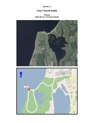
Wetland Buffer Cap: As the Park Parcel cap abuts the shore <strong>of</strong> Mashapaug Cove, special considerations<br />
for wetlands have been included as part <strong>of</strong> Phase I. The wetland buffer cap consists <strong>of</strong> the area within 50’<br />
<strong>of</strong> the Inner Cove shoreline. The wetland delineation was completed in <strong>May</strong> 2007 and the location <strong>of</strong> the<br />
wetland boundary and high water mark was surveyed. Refer to Attachment A, Drawings C-104 and C-<br />
105 for the location <strong>of</strong> these site features. The “delineated” wetlands are typically located 5’ to 10’<br />
upland from the shoreline. Thus, the limit <strong>of</strong> work (LOW) for Phase I will be along a 10’ setback from<br />
the shoreline <strong>of</strong> Mashapaug Cove such that all <strong>of</strong> the remediation work within the freshwater wetlands<br />
will be conducted in the future as part <strong>of</strong> the Mashapaug Cove sediment remediation (Phase <strong>II</strong> Park Parcel<br />
remediation). This will allow for improved access to the wetland area for the capping and construction <strong>of</strong><br />
a natural transition zone from the wetlands into the Cove (Attachment A, Drawing C-503). Note that the<br />
wetland cap has been extended to include SD-002 (lead contaminated soil), as shown in Attachment A,<br />
Drawing C-104. In accordance with state regulations, some remediation activities in the wetland buffer<br />
may be exempt from the State wetland permitting requirements as this work is part <strong>of</strong> a remedial action<br />
under the RIDEM Remediation Regulations. These activities will be coordinated with RIDEM to assure<br />
compliance with all applicable regulations. However, future construction work within the Park Parcel not<br />
conducted under the Remediation Regulations will need to comply with all state wetland permitting<br />
requirements and regulations.<br />
Clearing and grubbing <strong>of</strong> the wetland buffer zone scrub material will be conducted, as necessary, to<br />
support the installation <strong>of</strong> the soil cap. One foot <strong>of</strong> soil at the toe <strong>of</strong> the LOW will be removed to allow<br />
the soil cap to key into the existing grade above the wetland boundary. Twelve inches <strong>of</strong> clean soil will<br />
then be spread throughout the buffer zone to provide the soil cap. The finished surface for the wetland<br />
buffer cap will be stabilized with erosion control matting, and wetland vegetation will be planted. The<br />
July 2007 Draft RAWP includes the proposed wetland restoration and planting plan details.<br />
Former Slag Area Cap: Following the grading <strong>of</strong> the existing soil, the former slag area will be capped<br />
with 6” sand, 40-mil geomembrane, drainage composite layer, 12” clean cover soil, and 6” clean fill<br />
topsoil (Attachment A, Drawing C-503). The finished surface <strong>of</strong> the former slag area will be seeded or<br />
stabilized with erosion control matting. The haul road access to the former slag area will be improved<br />
during construction and removed after construction is complete.