Pembrokeshire and Ceredigion Rivers Catchment Flood ...
Pembrokeshire and Ceredigion Rivers Catchment Flood ...
Pembrokeshire and Ceredigion Rivers Catchment Flood ...

Create successful ePaper yourself
Turn your PDF publications into a flip-book with our unique Google optimized e-Paper software.
<strong>Flood</strong> risk generally increases<br />
significantly across the entire<br />
CFMP area, with only a few<br />
exceptions. The greatest flood<br />
risk is in Haverfordwest <strong>and</strong><br />
Aberystwyth with notable<br />
increases also seen in Cardigan,<br />
Ll<strong>and</strong>ysul, Aberaeron <strong>and</strong><br />
Llanybydder. A summary of key<br />
locations at risk is provided in<br />
Table 3.<br />
Table 4 shows the infrastructure<br />
at risk in the future. There is<br />
an increase in the number of<br />
electricity sub-stations (increased<br />
from 5 to 7) <strong>and</strong> there is also a<br />
railway station in Aberystwyth<br />
at future flood risk.<br />
There is an 11 per cent increase<br />
in agricultural l<strong>and</strong> at risk in a<br />
1% AEP flood event (increased<br />
from 85 km 2 to 94 km 2). While<br />
there is a broadly similar increase<br />
across the CFMP area, the Teifi<br />
catchment, being the largest,<br />
sees the greatest effect.<br />
A small increase is seen in<br />
the number of international<br />
<strong>and</strong> nationally designated<br />
environmental sites at risk in a<br />
future 1% AEP (increased from<br />
96 to 103), <strong>and</strong> in the number of<br />
historic monuments (increased<br />
from 16 to 33). However, the<br />
impact on these sites is difficult<br />
to quantify <strong>and</strong> will vary widely<br />
depending on their features<br />
of interest.<br />
We expect surface water, <strong>and</strong><br />
possibly groundwater, flooding<br />
will increase. Organisations<br />
will need to work together to<br />
investigate <strong>and</strong> manage this<br />
flood risk in the future.<br />
Table 3. Key locations at risk in a future (2100) 1% AEP flood event<br />
Number of properties at risk Locations<br />
> 1,000 None<br />
500 to 1,000 None<br />
100 to 500 Haverfordwest, Aberystwyth,<br />
Llanrhystud, Lampeter<br />
50 to 100 Clarach, Bow St <strong>and</strong> Penrhyn-coch,<br />
Llanybydder, Aberaeron, Ll<strong>and</strong>ysul<br />
25 to 50 Pembroke, Solva, Tregaron,<br />
Fishguard, Newcastle Emlyn,<br />
Pontrhydfendigaid, Cardigan<br />
Table 4. Infrastructure at risk in a future (2100) 1% AEP flood event<br />
1 emergency response centre<br />
7 electricity sub-stations<br />
3 sewage <strong>and</strong> water treatment plants<br />
1 railway station<br />
1 telephone exchange<br />
> 5 kilometres of roads<br />
> 2 kilometres of railway line<br />
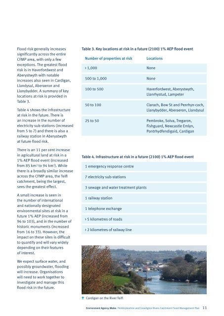
Cardigan on the River Teifi<br />
Environment Agency Wales <strong>Pembrokeshire</strong> <strong>and</strong> <strong>Ceredigion</strong> <strong>Rivers</strong> <strong>Catchment</strong> <strong>Flood</strong> Management Plan 11