Pembrokeshire and Ceredigion Rivers Catchment Flood ...
Pembrokeshire and Ceredigion Rivers Catchment Flood ...
Pembrokeshire and Ceredigion Rivers Catchment Flood ...

You also want an ePaper? Increase the reach of your titles
YUMPU automatically turns print PDFs into web optimized ePapers that Google loves.
<strong>Catchment</strong> overview<br />
The <strong>Pembrokeshire</strong> <strong>and</strong> <strong>Ceredigion</strong><br />
<strong>Rivers</strong> CFMP covers an area of<br />
approximately 3,300 km 2, <strong>and</strong><br />
around 90,000 properties, in the<br />
south west corner of Wales.<br />
The area is largely rural with around<br />
3.5 per cent being urbanised.<br />
Most urban areas are confined<br />
to the coast, including the main<br />
towns of Aberystwyth, Milford<br />
Haven, Cardigan <strong>and</strong> Fishguard.<br />
Haverfordwest is located some<br />
distance inl<strong>and</strong> but still within<br />
the tidal influence.<br />
There are 673 kilometres of rivers<br />
including the Teifi, Eastern <strong>and</strong><br />
Western Cleddau, Rheidol, Clarach,<br />
Ystywyth <strong>and</strong> Aeron <strong>Rivers</strong> draining<br />
west into the Irish Sea <strong>and</strong> south<br />
into the Bristol Channel. They<br />
vary in character between the<br />
short, fast flowing <strong>and</strong> rapidly<br />
responding catchments of the coast<br />
to the larger, slower responding<br />
watercourses which drain much<br />
larger catchment areas, principally<br />
the River Teifi, <strong>and</strong> Eastern <strong>and</strong><br />
Western Cleddau.<br />
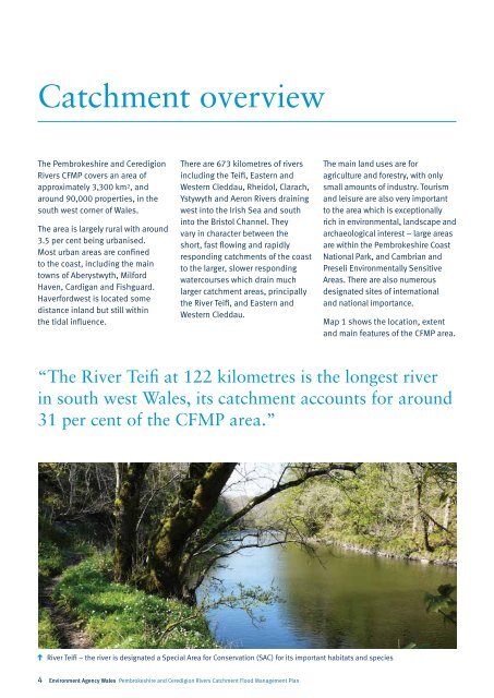
River Teifi – the river is designated a Special Area for Conservation (SAC) for its important habitats <strong>and</strong> species<br />
4 Environment Agency Wales <strong>Pembrokeshire</strong> <strong>and</strong> <strong>Ceredigion</strong> <strong>Rivers</strong> <strong>Catchment</strong> <strong>Flood</strong> Management Plan<br />
The main l<strong>and</strong> uses are for<br />
agriculture <strong>and</strong> forestry, with only<br />
small amounts of industry. Tourism<br />
<strong>and</strong> leisure are also very important<br />
to the area which is exceptionally<br />
rich in environmental, l<strong>and</strong>scape <strong>and</strong><br />
archaeological interest – large areas<br />
are within the <strong>Pembrokeshire</strong> Coast<br />
National Park, <strong>and</strong> Cambrian <strong>and</strong><br />
Preseli Environmentally Sensitive<br />
Areas. There are also numerous<br />
designated sites of international<br />
<strong>and</strong> national importance.<br />
Map 1 shows the location, extent<br />
<strong>and</strong> main features of the CFMP area.<br />
“The River Teifi at 122 kilometres is the longest river<br />
in south west Wales, its catchment accounts for around<br />
31 per cent of the CFMP area.”