European Organization for Experimental ... - Host Ireland
European Organization for Experimental ... - Host Ireland
European Organization for Experimental ... - Host Ireland

Create successful ePaper yourself
Turn your PDF publications into a flip-book with our unique Google optimized e-Paper software.
4 Cost benefits<br />
4.1 Objective<br />
To carry out a cost benefit analysis of using High-Resolution Sensor data over conventional<br />
methods (aerial photography).<br />
4.2 Cost analysis<br />
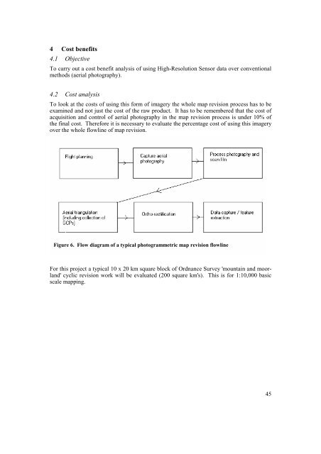
To look at the costs of using this <strong>for</strong>m of imagery the whole map revision process has to be<br />
examined and not just the cost of the raw product. It has to be remembered that the cost of<br />
acquisition and control of aerial photography in the map revision process is under 10% of<br />
the final cost. There<strong>for</strong>e it is necessary to evaluate the percentage cost of using this imagery<br />
over the whole flowline of map revision.<br />
Figure 6. Flow diagram of a typical photogrammetric map revision flowline<br />
For this project a typical 10 x 20 km square block of Ordnance Survey 'mountain and moorland'<br />
cyclic revision work will be evaluated (200 square km's). This is <strong>for</strong> 1:10,000 basic<br />
scale mapping.<br />
45